Richardson Grove - California State Parks
Richardson Grove - California State Parks
Richardson Grove - California State Parks

You also want an ePaper? Increase the reach of your titles
YUMPU automatically turns print PDFs into web optimized ePapers that Google loves.
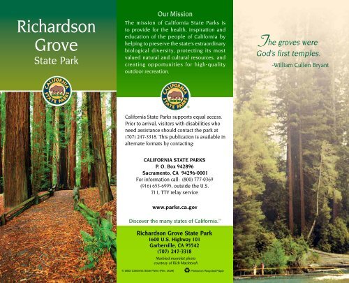
<strong>Richardson</strong><br />
<strong>Grove</strong><br />
<strong>State</strong> Park<br />
Our Mission<br />
The mission of <strong>California</strong> <strong>State</strong> <strong>Parks</strong> is<br />
to provide for the health, inspiration and<br />
education of the people of <strong>California</strong> by<br />
helping to preserve the state’s extraordinary<br />
biological diversity, protecting its most<br />
valued natural and cultural resources, and<br />
creating opportunities for high-quality<br />
outdoor recreation.<br />
T he groves were<br />
God’s first temples.<br />
-William Cullen Bryant<br />
<strong>California</strong> <strong>State</strong> <strong>Parks</strong> supports equal access.<br />
Prior to arrival, visitors with disabilities who<br />
need assistance should contact the park at<br />
(707) 247-3318. This publication is available in<br />
alternate formats by contacting:<br />
CALIFORNIA STATE PARKS<br />
P. O. Box 942896<br />
Sacramento, CA 94296-0001<br />
For information call: (800) 777-0369<br />
(916) 653-6995, outside the U.S.<br />
711, TTY relay service<br />
www.parks.ca.gov<br />
Discover the many states of <strong>California</strong>. TM<br />
<strong>Richardson</strong> <strong>Grove</strong> <strong>State</strong> Park<br />
1600 U.S. Highway 101<br />
Garberville, CA 95542<br />
(707) 247-3318<br />
Marbled murrelet photo<br />
courtesy of Rich MacIntosh<br />
© 2002 <strong>California</strong> <strong>State</strong> <strong>Parks</strong> (Rev. 2009) Printed on Recycled Paper
R hfjgjohsekgk;<br />
ichardson <strong>Grove</strong> <strong>State</strong><br />
Park—a traditional<br />
destination of countless<br />
vacationing families since the<br />
early 1920s—is one of<br />
<strong>California</strong>’s premier state<br />
parks. Deep in the majestic<br />
redwood forests of southern<br />
Humboldt County, “The<br />
<strong>Grove</strong>” started in 1922 with<br />
120 acres. It now encompasses<br />
more than 2,000 acres.<br />
Located about 200 miles north<br />
of San Francisco and seven<br />
miles south of Garberville,<br />
the park is bisected by<br />
Highway 101 and the Eel<br />
River's south fork.<br />
PARK History<br />
Native People<br />
The first known inhabitants of this region,<br />
the Wailaki people, used the area as a<br />
seasonal encampment for hunting, fishing<br />
and food gathering. These expert hunters<br />
trained dogs to drive game into the river<br />
so that it could be more easily caught.<br />
Both men and women made beautiful<br />
baskets.<br />
The <strong>Grove</strong> Preserved<br />
The first settler recorded in the area,<br />
Kentuckian Ruben Reed, arrived here in<br />
the late 1860s. By the early 1900s,<br />
Canadian immigrant Henry Devoy had<br />
purchased Reed's land. Devoy then leased<br />
the redwood grove to a man named Edwin<br />
Freeman, who built a store, a dining room<br />
and fifteen cabins at the site<br />
of today’s visitor center.<br />
In 1922 the Save-the-<br />
Redwoods League,<br />
concerned about potential<br />
destruction of the trees by<br />
highway construction and<br />
logging, persuaded the<br />
<strong>State</strong> to acquire 120 acres of<br />
the redwood grove. Between<br />
1922 and 1935, Freeman,<br />
who had been instrumental<br />
in naming the park after<br />
former <strong>California</strong> governor<br />
Friend W. <strong>Richardson</strong>,<br />
Eel River Canyon<br />
operated the new park as a<br />
concession. Today's visitor<br />
center was built in 1931 by<br />
the Civilian Conservation<br />
Corps, who later constructed<br />
the campgrounds, picnic<br />
facilities, trails, water<br />
systems and restrooms.<br />
Unfortunately, most of the<br />
CCC-built facilities were<br />
damaged or destroyed<br />
when the south fork of the<br />
Eel River overflowed in the<br />
floods of 1955 and 1964.<br />
Only the original visitor<br />
center remains.<br />
Natural history<br />
Plants<br />
The most notable natural<br />
feature of <strong>Richardson</strong> <strong>Grove</strong><br />
is the old-growth redwood<br />
forest, which thrives in<br />
the area’s mild climate.<br />
Many of the trees in<br />
the grove are more<br />
than 1,000 years old<br />
and over 300 feet tall.<br />
Strolling among these Coast redwood<br />
towering redwood giants is<br />
branch<br />
an unforgettable experience.<br />
Redwood sorrel, ferns and mosses take<br />
advantage of the deep shade in the heart<br />
of the forest. Younger redwoods,<br />
Douglas-fir, <strong>California</strong> laurel, various oaks<br />
and madrones compete for sunlight and<br />
moisture outside the established groves.<br />
Lower growth includes huckleberry,<br />
manzanita, coyote brush, Douglas iris,<br />
calypso orchids,<br />
redwood violets and<br />
poison oak.<br />
Wildlife<br />
The Eel River is named<br />
for the Pacific lamprey<br />
that once lived here.<br />
During fall and winter,<br />
salmon and steelhead<br />
inhabit the river. Blacktailed<br />
deer, raccoons,<br />
gray foxes, black bears,<br />
mountain lions and river<br />
otters thrive in the park.<br />
Eagles, owls and<br />
hawks soar the skies,<br />
hunting for small game.<br />
A wide variety of native<br />
birds includes great<br />
Giant redwood tree
Juvenile marbled murrelet<br />
blue herons, osprey, belted kingfishers,<br />
acorn woodpeckers and the endangered<br />
marbled murrelet.<br />
RECREATIONAL ACTIVITIES<br />
Camping<br />
<strong>Richardson</strong> <strong>Grove</strong>'s three campgrounds—<br />
Huckleberry, Madrone and Oak<br />
Flat—have a total of 170 family<br />
campsites. Each site has a fire<br />
ring, picnic table and food<br />
lockers, and restrooms with coinoperated<br />
hot showers are<br />
nearby. Sites can accommodate<br />
trailers up to 24 feet and motor<br />
homes up to 30 feet. One site is<br />
reserved for hikers and<br />
bicyclists. Oak Flat Campground,<br />
on the east side of the river, is<br />
open only during the summer,<br />
when a seasonal bridge allows<br />
access across the river. The yearround<br />
group camp, near the<br />
river among giant redwoods, can<br />
accommodate up to 40 people<br />
and 11 cars.<br />
Picnicking/Day Use<br />
The picnic area, along the Eel River under<br />
redwoods, maples and oaks, is popular<br />
with swimmers in summer, and for those<br />
fishing for salmon and steelhead during<br />
winter. The "Racetrack," a short, accessible<br />
trail with interpretive displays, is nearby,<br />
and several longer hiking trails range from<br />
gentle to strenuous.<br />
Visitor Center<br />
The visitor center has wildlife exhibits,<br />
displays on the park's natural history and<br />
a gift shop.<br />
Programs<br />
Check the park calendar for scheduled<br />
programs and activities. Summer evening<br />
campfires and guided nature walks are<br />
offered to all visitors. For youngsters, the<br />
park holds Junior<br />
Ranger, Litter Getter<br />
and Children in<br />
Nature programs.<br />
Racetrack trail<br />
Accessible<br />
Features<br />
The visitor center,<br />
three campsites in<br />
Madrone<br />
campground, the<br />
Group Camp, the<br />
Racetrack trail and<br />
the picnic area are all<br />
accessible. Call the<br />
park for specific<br />
details or visit http://<br />
access.parks.ca.gov.<br />
Please Remember<br />
• No diving or jumping into the river.<br />
• No lifeguards are on duty; children<br />
should be supervised at all times.<br />
• Fires are permitted only in fire rings<br />
provided.<br />
• All park features are protected by law<br />
and must not be disturbed.<br />
• Bicycles and motorized bikes are not<br />
allowed on the trails.<br />
• Do not feed wild animals.<br />
• Dogs must be kept on a leash no longer<br />
than six feet, and must be kept in your<br />
tent or motor vehicle at night. They are<br />
not allowed on hiking trails.<br />
Nearby <strong>State</strong> <strong>Parks</strong><br />
• Benbow Lake <strong>State</strong> Recreation Area,<br />
5 miles north on Benbow Drive<br />
(707) 923-3238<br />
• Sinkyone Wilderness <strong>State</strong> Park, 43 miles<br />
west on Briceland-Thorne Road<br />
(707) 986-7711<br />
• Standish-Hickey <strong>State</strong> Recreation Area,<br />
17 miles south on Highway 101<br />
(707) 925-6482<br />
This park receives support in part<br />
from a nonprofit organization.<br />
For more information contact:<br />
<strong>Richardson</strong> <strong>Grove</strong> Interpretive<br />
Association, 1600 US Hwy. 101,<br />
Garberville, CA 95542.<br />
(707) 247-3378
Trail<br />
1000<br />
0<br />
North<br />
Creek<br />
Durphy<br />
Tan Oak Springs Trail<br />
1000<br />
Laurel<br />
Huckleberry<br />
Campground<br />
Durphy Creek<br />
500<br />
N<br />
Woodland<br />
2.1 mi<br />
Trail<br />
(loop)<br />
1.6 mi<br />
Campsites<br />
1-21<br />
Trail<br />
Creek<br />
Creek<br />
101<br />
Park<br />
Entrance<br />
Campsites<br />
22-36<br />
Campsites<br />
37-75<br />
500<br />
Madrone<br />
Campground<br />
1.9 mi<br />
Woodland<br />
1000 Feet<br />
0 100 200 300 Meters<br />
to<br />
Benbow<br />
Trail<br />
Point<br />
Lookout<br />
Trail<br />
1.7 mi<br />
Seasonal<br />
Swimming<br />
Hole<br />
Seasonal<br />
Bridge<br />
Swim<br />
Beach<br />
Dawn P<br />
Redwoods<br />
Group Campground<br />
P<br />
(loop)<br />
Visitor Center<br />
Racetrack Trail<br />
500<br />
Lookout<br />
Point<br />
to Piercy<br />
101<br />
South<br />
101<br />
Fork Eel<br />
<strong>Richardson</strong> <strong>Grove</strong><br />
<strong>State</strong> Park<br />
Trail<br />
Day<br />
Use<br />
Area<br />
Toumey<br />
1.9 mi<br />
Campsites<br />
165-169<br />
Hartsook<br />
Kauffman<br />
Springs<br />
River<br />
Summer<br />
Bridge<br />
500<br />
Campsites<br />
141-164<br />
Creek<br />
1000<br />
Panorama<br />
Point<br />
Oak Flat<br />
Campground<br />
Campsites<br />
76-140<br />
Toumey<br />
Fire Road<br />
Settlers Trail<br />
to<br />
French’s Camp<br />
Big<br />
Spring<br />
(loop)<br />
Legend<br />
0.7 mi<br />
Settlers<br />
1000<br />
Creek<br />
R I C H A R D S O N<br />
G R O V E<br />
S TAT E P A R K<br />
Paved road<br />
1000<br />
Unpaved road<br />
Trail<br />
Durphy<br />
0<br />
0.5 1 Mi<br />
0 0.5 1.0 1.5 Km<br />
Accessible Feature<br />
Campfire Center<br />
Campground<br />
Firewood Sales<br />
Gate<br />
Humboldt<br />
Bay<br />
Pacific Ocean<br />
Rio<br />
Dell<br />
101<br />
101<br />
211<br />
Humboldt<br />
Redwoods<br />
SP<br />
Punta<br />
Gorda<br />
Benbow Lake SRA<br />
South<br />
Sinkyone<br />
Wilderness<br />
SP<br />
Eel<br />
Fork<br />
Eel<br />
1<br />
P<br />
to Crescent City<br />
Eureka<br />
Fortuna<br />
Piercy<br />
Park<br />
Entrance<br />
Creek<br />
Durphy Creek Trail 2.1 mi<br />
Tan Oak Springs Trail<br />
1.9 mi<br />
Hartsook<br />
Willow<br />
Creek<br />
River<br />
Creek<br />
Six<br />
Rivers<br />
NF<br />
River<br />
Group Campground<br />
Hike/Bike Campground<br />
Parking<br />
Picnic Area<br />
Ranger Station<br />
Restroom<br />
Shower<br />
Swimming<br />
Viewpoint<br />
36<br />
Myers Flat<br />
101<br />
Six<br />
Rivers<br />
NF<br />
© 2009 <strong>California</strong> <strong>State</strong> <strong>Parks</strong><br />
Map by Eureka Cartography, Berkeley, CA<br />
South<br />
Fork<br />
Shasta-Trinity<br />
NF<br />
299<br />
3<br />
Weaverville<br />
Hayfork<br />
101<br />
Eel<br />
area shown in<br />
enlargement<br />
3<br />
River<br />
to<br />
Redding<br />
36<br />
Shasta-Trinity<br />
NF<br />
Garberville<br />
Benbow<br />
<strong>Richardson</strong> <strong>Grove</strong> SP<br />
0 10 20 Mi<br />
0 10 20 30 Km<br />
Standish-Hickey SRA<br />
Leggett<br />
Mendocino<br />
NF<br />
101<br />
to San Francisco