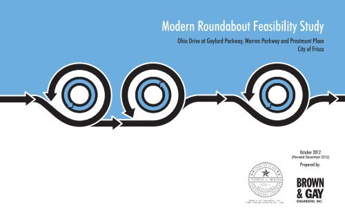
Modern Roundabout Feasibility Study - City of Frisco
Modern Roundabout Feasibility Study - City of Frisco
Modern Roundabout Feasibility Study - City of Frisco

You also want an ePaper? Increase the reach of your titles
YUMPU automatically turns print PDFs into web optimized ePapers that Google loves.
OHIO DRIVE ROUNDABOUT FEASIBILITY STUDY, CITY OF FRISCO<br />
Table <strong>of</strong> Contents<br />
1.0 Introduction ..........................................................................................................................1<br />
1.1 Background .................................................................................................................1<br />
1.2 Existing Conditions.....................................................................................................1<br />
2.0 Traffic Volumes ...................................................................................................................2<br />
2.1 24-Hour Counts...........................................................................................................2<br />
2.2 Peak Hour Turning Movement Counts .......................................................................3<br />
2.3 Historical Traffic Data ................................................................................................4<br />
2.4 Traffic Projections ......................................................................................................4<br />
7.0 Traffic Control Plan for Construction ................................................................................20<br />
7.1 Ohio Drive at Gaylord Parkway ...............................................................................20<br />
7.2 Ohio Drive at Warren Parkway ................................................................................20<br />
7.3 Ohio Drive at Prestmont Place..................................................................................20<br />
8.0 Construction Cost...............................................................................................................24<br />
9.0 Conclusions ........................................................................................................................26<br />
3.0 Capacity and Level <strong>of</strong> Service Analysis ..............................................................................6<br />
3.1 LOS Concepts .............................................................................................................6<br />
3.2 Highway Capacity Manual V/C Analysis for <strong>Roundabout</strong>s .......................................6<br />
4.0 Conceptual <strong>Roundabout</strong> Design ..........................................................................................8<br />
Appendix<br />
<strong>Roundabout</strong> Capacity Analysis Worksheets<br />
4.1 <strong>Roundabout</strong> Design Criteria .......................................................................................8<br />
4.2 Ohio Drive at Gaylord Parkway .................................................................................9<br />
4.3 Ohio Drive at Warren Parkway ..................................................................................9<br />
4.4 Ohio Drive at Prestmont Place....................................................................................9<br />
4.5 Design Vehicle Paths ................................................................................................13<br />
4.6 Ohio Drive at Gaylord Parkway Ultimate Geometry ...............................................14<br />
4.7 Ohio Drive at Warren Parkway Ultimate Geometry ................................................14<br />
4.8 Appearance ...............................................................................................................14<br />
5.0 Drainage and Utilities ........................................................................................................17<br />
5.1 Drainage ....................................................................................................................17<br />
5.2 Utilities......................................................................................................................17<br />
6.0 Right <strong>of</strong> Way ......................................................................................................................19<br />
BROWN & GAY ENGINEERS, INC.
OHIO DRIVE ROUNDABOUT FEASIBILITY STUDY, CITY OF FRISCO<br />
1.0 INTRODUCTION<br />
1.1 Background<br />
This report documents a preliminary capacity analysis and feasibility study for three proposed<br />
modern roundabouts on Ohio Drive in the <strong>City</strong> <strong>of</strong> <strong>Frisco</strong>. The modern roundabouts are proposed<br />
for the intersections <strong>of</strong> Ohio Drive at Gaylord Parkway, Ohio Drive at Warren Parkway, and<br />
Ohio Drive at Prestmont Place. The study area is generally located north <strong>of</strong> State Highway 121<br />
(SH 121) and east <strong>of</strong> State Highway 289 (Preston Road). See Figure 1 for a study area location<br />
map. The study includes the following elements:<br />
Figure 1 – Location Map<br />
<strong>Study</strong> Area<br />
© Google 2012<br />
Analysis <strong>of</strong> existing traffic volumes, development <strong>of</strong> traffic projections for the year 2030,<br />
and analysis <strong>of</strong> capacity and level <strong>of</strong> service for both existing and projected conditions<br />
Development <strong>of</strong> conceptual roundabout designs to determine constructability, drainage<br />
impacts, utility impacts, and right-<strong>of</strong>-way requirements<br />
Preparation <strong>of</strong> preliminary cost estimates<br />
A modern roundabout was considered based on its safety and delay reduction benefits.<br />
According to the Federal Highway Administration (FHWA) roundabout guide, experiences in<br />
the United States show a reduction in crashes after building a roundabout <strong>of</strong> 35% for all crashes<br />
and 76% for injury crashes and 90% to 100% <strong>of</strong> fatal crashes. These percent reductions were<br />
based on an evaluation <strong>of</strong> 9 signalized intersections and 46 un-signalized intersections converted<br />
to roundabouts. Collisions at roundabouts tend to be less severe than at conventional<br />
intersections due to the elimination <strong>of</strong> left-turn, head-on, and right-angle collisions. The number<br />
<strong>of</strong> vehicle-vehicle conflict points decreases from 32 for a typical four-legged intersection to 8 for<br />
a roundabout. A Dutch study <strong>of</strong> 181 intersections converted to roundabouts found reductions in<br />
all vehicle-pedestrian accidents <strong>of</strong> 73 percent. Pedestrians only have to look one way at a time,<br />
and vehicle speeds are low on the approach to a roundabout. In addition, vehicle delay is<br />
significantly reduced due to the roundabout’s yield operation.<br />
1.2 Existing Conditions<br />
Gaylord Parkway Warren Parkway Prestmont Place<br />
Figure 2 - Intersection Photographs<br />
The surrounding land use is comprised <strong>of</strong> commercial retail and single-family land uses. The<br />
area west <strong>of</strong> Ohio Drive is generally occupied with commercial uses while the area east <strong>of</strong> Ohio<br />
Drive consists <strong>of</strong> some undeveloped land and residential neighborhoods. There is a fire station<br />
located at the northwest corner <strong>of</strong> the intersection <strong>of</strong> Ohio Drive and Warren Parkway.<br />
Ohio Drive is currently a six-lane boulevard between SH 121 and Warren Parkway. Ohio Drive<br />
transitions to a 4-lane boulevard north <strong>of</strong> Warren Parkway. The posted speed limit on Ohio<br />
Drive is 45 miles per hour (mph) south <strong>of</strong> Warren Parkway and 40 mph to the north <strong>of</strong> Warren<br />
Parkway. Pedestrian sidewalks are discontinuous along Ohio Drive. Ohio Drive is currently<br />
designated as part <strong>of</strong> an on-street bike route. At this time, each <strong>of</strong> the study intersections is unsignalized<br />
and controlled with all-way STOP signs. Figure 2 provides photographs <strong>of</strong> each <strong>of</strong><br />
the intersections.<br />
BROWN & GAY ENGINEERS, INC.<br />
1
OHIO DRIVE ROUNDABOUT FEASIBILITY STUDY, CITY OF FRISCO<br />
2.0 TRAFFIC VOLUMES<br />
Existing traffic counts were conducted during the second week <strong>of</strong> February 2012. The data<br />
collection included typical weekday AM, Noon, and PM peak hour turning movement counts at<br />
each <strong>of</strong> the study intersections. Turning movement counts were also conducted on a Saturday<br />
afternoon peak period. In addition, 24-hour directional counts were collected on Ohio Drive<br />
between SH 121 and Lebanon Road.<br />
2.1 24-Hour Counts<br />
Currently, Ohio Drive carries approximately 12,600 vehicles per day (vpd) between SH 121 and<br />
Gaylord Parkway and approximately 11,200 vpd between Gaylord Parkway and Warren<br />
Parkway. Heavier peaking conditions are generally during the afternoon commuting peak hours,<br />
in which northbound and southbound traffic volumes are relative equal.<br />
Figure 3 provides a graphical summary <strong>of</strong> 24-hour volumes on Ohio Drive and Gaylord<br />
Parkway. Table 1 provides a summary <strong>of</strong> the recent traffic counts.<br />
Table 1 - Summary <strong>of</strong> Existing Daily Volumes<br />
Roadway<br />
Existing Daily Volume (vpd)<br />
Ohio Drive South <strong>of</strong> Gaylord Parkway 12,560<br />
Ohio Drive South <strong>of</strong> Warren Parkway 11,247<br />
Ohio Drive South <strong>of</strong> Prestmont Place 10,365<br />
Gaylord Parkway West <strong>of</strong> Ohio Drive 10,456<br />
Gaylord Parkway East <strong>of</strong> Ohio Drive 540 [1]<br />
Warren Parkway West <strong>of</strong> Ohio Drive 9,056<br />
Warren Parkway East <strong>of</strong> Ohio Drive 4,748<br />
Prestmont Place West <strong>of</strong> Ohio Drive 1,490 [1]<br />
Prestmont Place East <strong>of</strong> Ohio Drive 1,860 [1]<br />
Notes: [1] Volume was estimated from available peak hour counts and K-factors.<br />
Figure 3 - Summaries <strong>of</strong> 24-hour Bi-directional Traffic Counts<br />
BROWN & GAY ENGINEERS, INC.<br />
2
OHIO DRIVE ROUNDABOUT FEASIBILITY STUDY, CITY OF FRISCO<br />
2.2 Peak Hour Turning Movement Counts<br />
Based on the results <strong>of</strong> the peak hour turning movement counts, the overall weekday peak hour<br />
periods for the morning and afternoon are 7:30 to 8:30 AM and 5:00 to 6:00 PM, respectively.<br />
The weekend peak hour occurred on a Saturday, between 1:15 and 2:15 PM. Figures 4, 5 and 6<br />
show the existing peak hour turning movement volumes for a weekday and a Saturday.<br />
Figure 5 – Existing Weekday PM Peak Turning Movement Volumes<br />
Figure 4 – Existing Weekday AM Peak Turning Movement Volumes<br />
BROWN & GAY ENGINEERS, INC.<br />
3
OHIO DRIVE ROUNDABOUT FEASIBILITY STUDY, CITY OF FRISCO<br />
2.3 Historical Traffic Data<br />
Historical traffic data was provided by the <strong>City</strong> <strong>of</strong> <strong>Frisco</strong>’s traffic count database as well as the<br />
North Central Texas Council <strong>of</strong> Government’s (NCTCOG) traffic count information system.<br />
Historical daily traffic volumes on each <strong>of</strong> the roadways providing principle circulation within<br />
the study area were gathered as part <strong>of</strong> this study. Available daily traffic volumes on Ohio Drive<br />
are plotted in Figure 7. As shown in this figure, volumes were higher in early 2000’s and<br />
dropped between 2006 and 2008. The current trend between 2008 and 2012 is an upward growth<br />
<strong>of</strong> traffic volumes on Ohio Drive. The dotted line illustrates the general trend <strong>of</strong> the scatter plot.<br />
Figure 6 – Existing Saturday PM Peak Turning Movement Volumes<br />
Figure 7 – Plot <strong>of</strong> Historical Daily Volumes for Ohio Drive<br />
2.4 Traffic Projections<br />
Traffic volume projections for each <strong>of</strong> these study intersections were developed for years 2015<br />
and 2030. For the purposes <strong>of</strong> this study, existing traffic volumes were considered as year 2015<br />
base volumes. Traffic projections were determined based on an analysis <strong>of</strong> historical growth<br />
patterns and current trends. Also, the current TransCAD travel demand model assignments were<br />
reviewed. Other considerations included roadway capacity, network connectivity, and the<br />
availability <strong>of</strong> undeveloped land along the corridor. The roadway connectivity <strong>of</strong> Ohio Drive is<br />
limited since it veers to the east and terminates at Coit Road. Ohio Drive functions as a minor<br />
thoroughfare. The current traffic volumes on Ohio Drive (12,600 vpd) are relatively low when<br />
BROWN & GAY ENGINEERS, INC.<br />
4
OHIO DRIVE ROUNDABOUT FEASIBILITY STUDY, CITY OF FRISCO<br />
compared to nearby thoroughfares such as Preston Road that carry 56,000 vpd. This is an<br />
indication that Ohio drives functions more as a local roadway than a major thoroughfare.<br />
Figure 8 below illustrates a comparison <strong>of</strong> the projected growth trend based on the <strong>City</strong> <strong>of</strong><br />
<strong>Frisco</strong>’s TransCAD travel demand model (dashed line) and the projected growth trend based on<br />
projected growth rates (solid line). The TransCAD model traffic assignments indicate that Ohio<br />
Drive will experience volumes ranging between 29,000 vpd and 33,000 vpd by the year 2030.<br />
However, roadway facilities that experience over 30,000 vpd are typically longer and function as<br />
thoroughfares in the roadway network. These traffic assignments were considered too high for<br />
Ohio Drive.<br />
The solid line in the plot represents the projected growth trend based on assumed growth rates<br />
that vary depending on the growth potential on the various roadway segments. Since there is still<br />
some undeveloped land along the corridor, a 5% compounded annual rate was used for the first<br />
10 years, and a 2% annual growth rate after that until year 2030.<br />
Table 2 - Summary <strong>of</strong> Ohio Drive Traffic Projections<br />
Roadway<br />
Existing Daily<br />
Volume (vpd)<br />
Projected 2030<br />
Daily Volume (vpd)<br />
Based on Growth<br />
Rates<br />
Ohio Drive South <strong>of</strong> Gaylord Parkway 12,560 23,860<br />
Ohio Drive South <strong>of</strong> Warren Parkway 11,247 21,370<br />
Ohio Drive South <strong>of</strong> Prestmont Place 10,365 19,690<br />
Gaylord Parkway West <strong>of</strong> Ohio Drive 10,456 16,500<br />
Gaylord Parkway East <strong>of</strong> Ohio Drive 540 11,900<br />
Warren Parkway West <strong>of</strong> Ohio Drive 9,056 16,500<br />
Warren Parkway East <strong>of</strong> Ohio Drive 4,748 11,900<br />
Prestmont Place West <strong>of</strong> Ohio Drive 1,490 2,130<br />
Prestmont Place East <strong>of</strong> Ohio Drive 1,860 1,860<br />
The growth rates that were used would roughly double the traffic on Ohio Drive over the next 18<br />
years. This would result in Ohio Drive carrying approximately 24,000 vpd. Based on these<br />
traffic volumes projections, it was determined that double-lane roundabouts would be suitable<br />
for the Ohio Drive intersections at Gaylord Parkway and Warren Parkway. A partial double-lane<br />
roundabout was determined to be adequate for the intersection <strong>of</strong> Ohio Drive and Prestmont<br />
Place. The Prestmont Place approaches to Ohio Drive would consist <strong>of</strong> single-lane approaches<br />
to the partial double-lane roundabout. These determinations were based on a planning-level<br />
approach outlined in the National Cooperative Highway Research Program (NCHRP) Report<br />
672: <strong>Roundabout</strong>s, An Informational Guide, 2nd Edition. The planning-level capacity <strong>of</strong> a twolane<br />
roundabout is in the 40,000 to 45,000 vpd range. The intersection <strong>of</strong> Ohio Drive at Gaylord<br />
Parkway is projected to experience approximately 37,000 vpd. The intersection <strong>of</strong> Ohio Drive at<br />
Warren Parkway is projected to experience approximately 35,000 vpd.<br />
Figure 8 - Projected Growth Trend for Ohio Drive<br />
Where there is significant growth anticipated, a 5% compounded annual rate was used for the<br />
first 10 years, and a 2% annual growth rate after that until year 2030. Other roads where less<br />
growth is anticipated, a 2% annual growth rate was utilized. Table 2 provides a summary <strong>of</strong> the<br />
traffic projections for Ohio Drive, Gaylord Parkway, Warren Parkway and Prestmont Place.<br />
BROWN & GAY ENGINEERS, INC.<br />
5
OHIO DRIVE ROUNDABOUT FEASIBILITY STUDY, CITY OF FRISCO<br />
3.0 CAPACITY AND LEVEL OF SERVICE ANALYSIS<br />
3.1 LOS Concepts<br />
The operations <strong>of</strong> the study intersections can be measured in terms <strong>of</strong> their levels <strong>of</strong> service<br />
(LOS), a value that represents the operating conditions that may occur on a roadway or at an<br />
intersection when accommodating various levels <strong>of</strong> traffic volumes. It is a qualitative measure<br />
responsive to the effects <strong>of</strong> a number <strong>of</strong> operational factors such as intersection geometry, traffic<br />
signal control parameters, traffic volume fluctuations, pedestrian activity, and others. In<br />
applying these LOS measurements to an intersection, it is possible to compare the operational<br />
qualities <strong>of</strong> the intersection under different conditions and alternatives.<br />
LOS values range from A, which is characterized by traffic flows under unencumbered free-flow<br />
conditions with little or no delay, to F, which is characterized by traffic flows under stop-and-go<br />
conditions, like peak hour or extreme congestion. The intermediate levels <strong>of</strong> service reflect the<br />
spectrum <strong>of</strong> conditions that exist between levels A and F. LOS B represents a condition with<br />
short delays to traffic. LOS C (average traffic delay) is considered desirable for peak or design<br />
traffic flow. In urban areas LOS D (more significant delays than LOS C) is generally considered<br />
acceptable during peak hour conditions. LOS E indicates that capacity has been reached.<br />
The LOS values are a function <strong>of</strong> vehicle delay as defined in Transportation Research Board’s<br />
Highway Capacity Manual (HCM). The ranges <strong>of</strong> delay and corresponding LOS for both<br />
signalized and unsignalized conditions are outlined in Table 3. According to the HCM, the LOS<br />
criteria for signalized and unsignalized conditions are different primarily because user<br />
perceptions differ among each facility type. The expectation is that a signalized intersection is<br />
designed to carry higher traffic volumes and will present greater delay than an unsignalized<br />
intersection. In addition, unsignalized intersections are associated with more uncertainty and<br />
unpredictable delay for users, which can reduce the user’s tolerance.<br />
LOS<br />
Table 3 - LOS and Control Delay Criteria<br />
Two-way and All-way<br />
Stop Control<br />
(seconds per vehicle)<br />
Signalized Intersection<br />
(seconds per vehicle)<br />
Intersection capacity provides another measure <strong>of</strong> efficiency. Capacity is measured in terms <strong>of</strong><br />
the ratio <strong>of</strong> actual vehicular volume to its available capacity and is an indication <strong>of</strong> the level <strong>of</strong><br />
congestion experienced by each lane group. When the volume-to-capacity (V/C) ratio equals or<br />
exceeds 1.0 the lane group is operating at or above capacity. For the purpose <strong>of</strong> this study,<br />
maximum V/C ratios are reported for the most congested lane group on each approach.<br />
3.2 Highway Capacity Manual V/C Analysis for <strong>Roundabout</strong>s<br />
Chapter 21 <strong>of</strong> the 2010 Highway Capacity Manual provided the guidance in estimating the future<br />
V/C ratios for each <strong>of</strong> the roundabout geometric alternatives. The HCM methodology is based<br />
on regression models developed by studying roundabouts in the U.S. The field data collected<br />
during these studies was used to derive statistical relationships between basic geometric features,<br />
volumes, and capacity. However, from a network standpoint, this methodology does not<br />
consider the effects from adjacent signals or nearby disturbances in the traffic stream. In<br />
addition, the details regarding the size and geometry <strong>of</strong> the roundabout are not taken into<br />
account, nor factors such as gap acceptance to enter the roundabout.<br />
The V/C ratios and levels <strong>of</strong> service (LOS) were estimated for year 2015 (existing) traffic<br />
volumes and projected year 2030 traffic volumes. Chapter 21 <strong>of</strong> the 2010 HCM provided the<br />
detailed methodology for the analyses <strong>of</strong> the proposed roundabouts. The procedures outlined in<br />
the HCM uses a combination <strong>of</strong> regression and analytical models for both single and double-lane<br />
roundabout operations. The required input data includes the lane configuration <strong>of</strong> each approach<br />
to the roundabout, the demand volume for vehicles and pedestrians, and heavy vehicle<br />
percentages.<br />
3.2.1 Analysis Results<br />
Under each analysis year (2015 and 2030), the weekday PM peak hour was analyzed since this<br />
period was found to be the highest volume peak period for the study intersections. Based on the<br />
existing turning movement count data, the AM peak hour volumes ranged between 57% and<br />
68% <strong>of</strong> the PM peak hour volumes. In addition, the Saturday PM peak volumes ranged between<br />
71% and 89% <strong>of</strong> the PM peak hour volumes. Therefore, the Saturday peak hour was also<br />
analyzed as the second highest peak period. Table 4 provides a summary <strong>of</strong> the 2015 capacity<br />
analysis results.<br />
A ≤10 ≤10<br />
B >10 and ≤15 >10 and ≤20<br />
C >15 and ≤25 >20 and ≤35<br />
D >25 and ≤35 >35 and ≤55<br />
E >35 and ≤50 >55 and ≤80<br />
F >50 >80<br />
BROWN & GAY ENGINEERS, INC.<br />
6
OHIO DRIVE ROUNDABOUT FEASIBILITY STUDY, CITY OF FRISCO<br />
Table 4 - Summary <strong>of</strong> 2015 LOS Analysis<br />
Table 5 - Summary <strong>of</strong> 2030 LOS Analysis<br />
Year 2015 Weekday PM Peak<br />
Year 2015 Saturday Peak<br />
Year 2030 Weekday PM Peak<br />
Year 2030 Saturday Peak<br />
Intersection<br />
Approach<br />
LOS<br />
Delay<br />
(sec/veh)<br />
V/C<br />
LOS<br />
Delay<br />
(sec/veh)<br />
V/C<br />
Intersection<br />
Approach<br />
LOS<br />
Delay<br />
(sec/veh)<br />
V/C<br />
LOS<br />
Delay<br />
(sec/veh)<br />
V/C<br />
Ohio at Gaylord<br />
Double-lane <strong>Roundabout</strong><br />
Ohio at Warren<br />
Double-lane <strong>Roundabout</strong><br />
Ohio at Prestmont<br />
Partial Double-lane<br />
<strong>Roundabout</strong><br />
NB A 8.8 0.41 A 8.0 0.38<br />
SB A 7.0 0.30 A 7.9 0.33<br />
EB A 8.4 0.33 A 7.7 0.30<br />
WB A 6.9 0.04 A 5.8 0.02<br />
ALL A 8.1 0.35 A 7.9 0.34<br />
NB B 10.3 0.47 A 6.3 0.24<br />
SB A 7.0 0.27 A 7.6 0.31<br />
EB A 7.8 0.31 A 6.7 0.21<br />
WB A 8.1 0.18 A 6.2 0.16<br />
ALL A 8.6 0.35 A 6.8 0.24<br />
NB A 7.5 0.35 A 4.9 0.17<br />
SB A 5.6 0.22 A 5.4 0.22<br />
EB A 5.9 0.14 A 5.4 0.09<br />
WB A 6.4 0.11 A 4.6 0.05<br />
ALL A 6.7 0.28 A 5.2 0.18<br />
Ohio at Gaylord<br />
Double-lane <strong>Roundabout</strong><br />
Ohio at Warren<br />
Double-lane <strong>Roundabout</strong><br />
Ohio at Prestmont<br />
Partial Double-lane<br />
<strong>Roundabout</strong><br />
NB E 35.5 0.77 E 41.2 0.73<br />
SB B 13.2 0.49 C 21.7 0.62<br />
EB D 26.0 0.71 C 17.0 0.55<br />
WB C 24.7 0.61 C 15.3 0.43<br />
ALL D 26.2 0.66 D 26.7 0.61<br />
NB E 39.5 0.82 A 9.6 0.39<br />
SB B 10.7 0.40 B 11.8 0.45<br />
EB B 14.2 0.52 B 10.6 0.35<br />
WB D 31.4 0.69 B 14.1 0.46<br />
ALL D 26.0 0.63 B 11.4 0.41<br />
NB C 16.0 0.70 A 6.7 0.32<br />
SB A 7.9 0.40 A 8.1 0.43<br />
EB A 8.5 0.23 A 7.8 0.14<br />
WB B 10.8 0.16 A 6.0 0.08<br />
ALL B 12.6 0.55 A 7.5 0.36<br />
The year 2030 analysis, summarized in Table 5, includes right-turn bypass lanes for the<br />
proposed roundabouts at Gaylord Parkway and at Warren Parkway. The Gaylord Parkway<br />
roundabout will probably need the right turn by-pass lanes on all approaches, while the Warren<br />
Parkway roundabout may need them on the northbound, southbound and eastbound approaches.<br />
Under the 2015 weekday PM conditions, each <strong>of</strong> the proposed roundabouts on Ohio Drive are<br />
projected to operate at excellent LOS. Under the projected 2030 conditions, the capacity<br />
analysis indicates that the double-lane roundabouts at the intersections <strong>of</strong> Ohio Drive at Gaylord<br />
Parkway and Ohio Drive at Warren Parkway are projected to operate at acceptable LOS, with all<br />
V/C ratios under 1.0. Although the northbound Ohio Drive approaches at Gaylord Parkway and<br />
at Warren Parkway are projected to operate at LOS E during the 2030 peak hours, each<br />
intersection as a whole would operate at acceptable LOS D or better. The partial double-lane<br />
roundabout at Ohio Drive and Prestmont Place is anticipated to adequately handle the projected<br />
traffic volumes under year 2030 PM peak conditions, with a projected intersection LOS B. The<br />
complete analysis worksheets are provided in Appendix A.<br />
3.2.2 Analysis Conclusions<br />
Traffic volume projections for each <strong>of</strong> these study intersections were developed for years 2015<br />
and 2030. Traffic projections were determined based on an analysis <strong>of</strong> historical growth patterns<br />
and current trends as well as roadway capacity, network connectivity, and the availability <strong>of</strong><br />
undeveloped land. The partial double-lane roundabout at Ohio Drive and Prestmont Place is<br />
projected to operate at LOS B under year 2030 PM peak conditions. The results <strong>of</strong> the capacity<br />
analysis indicates that the double-lane roundabouts at the intersections <strong>of</strong> Ohio Drive at Gaylord<br />
Parkway and Ohio Drive at Warren Parkway are projected operate at LOS D or better under the<br />
projected 2030 conditions.<br />
BROWN & GAY ENGINEERS, INC.<br />
7
OHIO DRIVE ROUNDABOUT FEASIBILITY STUDY, CITY OF FRISCO<br />
4.0 CONCEPTUAL ROUNDABOUT DESIGN<br />
Figure 9 provides a review <strong>of</strong> the basic geometric features and key dimensions <strong>of</strong> a roundabout.<br />
4.1 <strong>Roundabout</strong> Design Criteria<br />
The conceptual roundabout layout designs were developed primarily by the following guidelines:<br />
<strong>Roundabout</strong>s: An Informational Guide 2 nd Edition (2010) – FHWA NCHRP #672<br />
Roadway Design Manual (May 2010) - TxDOT<br />
A Policy on Geometric Design <strong>of</strong> Highways and Streets (2004) – AASHTO<br />
Table 6 is a summary <strong>of</strong> the design criteria used for the proposed roundabout concepts. Under<br />
the two-lane roundabout concepts for Gaylord Parkway and Warren Parkway, each movement<br />
will include two lanes through the roundabout as well as on the entries and exits <strong>of</strong> the<br />
roundabout. However, the eastbound departures will only provide a single lane exit. Under the<br />
partial two-lane roundabout concept for Prestmont Place, the minor east-west movements will<br />
provide a single lane approach to the roundabout. The approaches to the roundabout were<br />
designed with a left-<strong>of</strong>fset, which improves the vehicle deflection at the roundabout entries.<br />
Table 6 - Summary <strong>of</strong> <strong>Roundabout</strong> Design Criteria<br />
Criteria<br />
Design Vehicle<br />
Inscribed Diameter<br />
Entry Design Speed<br />
Circulatory Roadway Width<br />
Truck Apron Width<br />
WB-50 Truck<br />
150 feet<br />
30 mph (35 mph max)<br />
28 feet (Two Lanes)<br />
10 feet<br />
Source: FHWA <strong>Roundabout</strong>s: An Informational Guide 2 nd Edition<br />
Figure 9 - Basic Geometric Elements <strong>of</strong> a <strong>Roundabout</strong><br />
While the design vehicle was a WB-50 truck, the roundabout design was also checked for the<br />
<strong>City</strong>’s largest fire engine, to ensure that the fire engine would be able to navigate around the<br />
roundabout even with a car blocking one <strong>of</strong> the lanes. In addition, to make the design fire engine<br />
friendly, the truck apron will likely be a textured concrete surface <strong>of</strong> a different color but flush<br />
with the circulatory roadway pavement, such that the fire engine will be able to navigate over the<br />
truck apron without a bump. Section 4.5 shows illustrations <strong>of</strong> the WB-50 truck and fire engine<br />
turning wheel paths for the critical turns around the roundabouts.<br />
The design <strong>of</strong> a roundabout allows pedestrians to cross one direction <strong>of</strong> traffic at a time on each<br />
leg <strong>of</strong> the roundabout. Pedestrians can expect an approaching vehicle from one direction, rather<br />
than multiple directions such as a left-turn, right-turn, or through movement. The crosswalks are<br />
set back approximately 20 feet from the yield line, which is enough space for one vehicle to store<br />
prior to entering the roundabout. This encourages the driver behind the entering vehicle to focus<br />
on crossing pedestrians. These safety benefits are also applicable to bicyclists. Depending on<br />
their skill level, cyclists may enter the roundabout with a decision process that mirrors the<br />
operation <strong>of</strong> motorized vehicles. The lower speed environment within the roundabout would<br />
provide more time for all users to detect and correct for their mistakes or the mistakes <strong>of</strong> others.<br />
BROWN & GAY ENGINEERS, INC.<br />
8
OHIO DRIVE ROUNDABOUT FEASIBILITY STUDY, CITY OF FRISCO<br />
4.2 Ohio Drive at Gaylord Parkway<br />
The existing skewed intersection angles and large intersection area lend itself to fit a two-lane<br />
roundabout within the existing intersection footprint, existing pavement, and within the existing<br />
right-<strong>of</strong>-way. Therefore, the roundabout can be built utilizing mostly existing pavement. The<br />
pavement drainage pattern is such that the existing drainage system can be utilized with<br />
relatively minor modifications: inlet relocations and pipe connections into existing sewer lines; a<br />
concept level drainage analysis is included in Section 5.1 <strong>of</strong> this report. The existing right-turn<br />
lanes on the northwest and southeast corners can be modified to become right turn bypass lanes<br />
for the roundabout, which will increase the capacity <strong>of</strong> the roundabout. The Ohio Drive<br />
approaches to the roundabout can be reduced from three lanes to two lanes. The third lane can<br />
be utilized and designated as a bicycle lane, since Ohio Drive is a designated bicycle route in the<br />
<strong>City</strong>. Small amounts <strong>of</strong> right-<strong>of</strong>-way corner clips will be needed on the southwest and northeast<br />
corners in order to provide an adequate border for pedestrian sidewalks and joint use bike ways.<br />
The large electrical vault located on the southwest corner <strong>of</strong> the intersection can be avoided.<br />
Impacts to utilities will be minimal, if any. The center island can be landscaped with low-height<br />
plantings that enhance the beauty <strong>of</strong> the area. The splitter islands will transition into the existing<br />
landscaped median islands and as such can be landscaped with similar greenery. Other areas<br />
behind the joint use walkways and bike paths can also be landscaped once the concrete<br />
pavements are removed. The overall green space will increase significantly. The truck apron<br />
and nose portion <strong>of</strong> the splitter islands can be finished with decorative brick patterns to enhance<br />
the aesthetics <strong>of</strong> the project. Figure 10 illustrates the proposed roundabout geometry for this<br />
intersection.<br />
require a minimum setback <strong>of</strong> seventy-five feet (75’) in advance <strong>of</strong> the right-<strong>of</strong>-way line <strong>of</strong> the<br />
intersecting street or two-hundred feet (200’) downstream from the right-<strong>of</strong>-way line <strong>of</strong> the<br />
intersecting street, per city’s requirements.<br />
4.4 Ohio Drive at Prestmont Place<br />
Unlike the previous two intersections, this intersection’s existing footprint is smaller and will not<br />
fit a two-lane roundabout within the existing pavement. In addition, the proposed roundabout<br />
would be shifted to the west in order to avoid the amenities built at the entrance to the<br />
subdivision. The intersection will have to be rebuilt. Still, the existing drainage system can be<br />
utilized with relatively minor modifications: inlet relocations and pipe connections into existing<br />
sewer lines. The Impacts to utilities will be minimal and will primarily consist <strong>of</strong><br />
relocations/adjustments <strong>of</strong> a fire hydrant, water valves and sewer manholes. The existing sign<br />
for the childcare business will not be affected. Figure 12 illustrates the proposed roundabout<br />
geometry for this intersection.<br />
The proposed roundabout geometry at Prestmont Place does not impact any existing access<br />
driveways or median openings. Future driveways along Ohio Drive will require a minimum<br />
spacing <strong>of</strong> seventy-five feet (75’) in advance <strong>of</strong> the right-<strong>of</strong>-way line <strong>of</strong> the intersecting street or<br />
two-hundred feet (200’) downstream from the right-<strong>of</strong>-way line <strong>of</strong> the intersecting street, per<br />
<strong>City</strong>’s requirements. Future driveways along the west leg <strong>of</strong> Prestmont Place will require a<br />
minimum spacing <strong>of</strong> one-hundred feet (100’) in advance <strong>of</strong> or downstream from the right-<strong>of</strong>-way<br />
line <strong>of</strong> the intersecting street.<br />
The proposed roundabout geometry at Gaylord Parkway does not impact any existing access<br />
driveways or median openings. According to the <strong>City</strong> <strong>of</strong> <strong>Frisco</strong>’s engineering standards, future<br />
driveways along Ohio Drive or Gaylord Parkway will require a minimum spacing <strong>of</strong> seventyfive<br />
feet (75’) in advance <strong>of</strong> the right-<strong>of</strong>-way line <strong>of</strong> the intersecting street or two-hundred feet<br />
(200’) downstream from the right-<strong>of</strong>-way line <strong>of</strong> the intersecting street. These requirements will<br />
not be impacted by the proposed roundabout.<br />
4.3 Ohio Drive at Warren Parkway<br />
The existing intersection size lends itself to fit a two-lane roundabout mostly within the existing<br />
intersection area, existing pavement, and within the existing right-<strong>of</strong>-way. Therefore, the<br />
roundabout can be built utilizing mostly existing pavement. The pavement drainage pattern is<br />
such that the existing drainage system can be utilized with relatively minor modifications: inlet<br />
relocations and pipe connections into existing sewer lines. A small amount <strong>of</strong> right-<strong>of</strong>-way<br />
corner clips will be needed on the northeast corner mostly to provide an adequate border for<br />
pedestrian sidewalks and joint use bike ways. Figure 11 illustrates the proposed roundabout<br />
geometry for this intersection. Features similar to the roundabout at Gaylord Parkway can be<br />
built into this roundabout<br />
The proposed roundabout geometry at Warren Parkway does not impact any existing access<br />
driveways or median openings. Future driveways along Ohio Drive or Warren Parkway will<br />
BROWN & GAY ENGINEERS, INC.<br />
9
OHIO DRIVE ROUNDABOUT FEASIBILITY STUDY, CITY OF FRISCO<br />
Figure 10 – Proposed <strong>Roundabout</strong>: Ohio Drive at Gaylord Parkway<br />
BROWN & GAY ENGINEERS, INC.<br />
10
OHIO DRIVE ROUNDABOUT FEASIBILITY STUDY, CITY OF FRISCO<br />
Figure 11 – Proposed <strong>Roundabout</strong>: Ohio Drive at Warren Parkway<br />
BROWN & GAY ENGINEERS, INC.<br />
11
OHIO DRIVE ROUNDABOUT FEASIBILITY STUDY, CITY OF FRISCO<br />
Figure 12 – Proposed <strong>Roundabout</strong>: Ohio Drive at Prestmont Place<br />
BROWN & GAY ENGINEERS, INC.<br />
12
OHIO DRIVE ROUNDABOUT FEASIBILITY STUDY, CITY OF FRISCO<br />
4.5 Design Vehicle Paths<br />
The proposed roundabout geometries were designed to accommodate a WB-50 truck. The<br />
striped 10-foot truck apron is designed to allow heavy vehicles to negotiate through the<br />
roundabout by providing additional traversable area around the central island. AutoTURN 8.0, a<br />
CAD-based vehicle turning path program, was used to determine the vehicle envelope and swept<br />
path. In addition, the truck turning dimensions for the <strong>City</strong> <strong>of</strong> <strong>Frisco</strong>’s largest fire engines were<br />
coded into a custom fire truck within AutoTURN to test the concept designs. An exhibit<br />
showing the critical design vehicle turning paths within the proposed roundabouts are provided<br />
on Figures 13, 14 and 15. Although not all turning movements are shown in these exhibits,<br />
each intersection movement was tested at each roundabout.<br />
Figure 14 – Vehicle Paths: Ohio Drive at Warren Parkway – <strong>City</strong> <strong>of</strong> <strong>Frisco</strong> Fire Engine<br />
Figure 13 – Vehicle Paths: Ohio Drive at Gaylord Parkway – WB-50<br />
BROWN & GAY ENGINEERS, INC.<br />
13
OHIO DRIVE ROUNDABOUT FEASIBILITY STUDY, CITY OF FRISCO<br />
4.6 Ohio Drive at Gaylord Parkway Ultimate Geometry<br />
Gaylord Parkway is planned to be extended from Ohio Drive to Hillcrest Road by the year 2030.<br />
At this time, this project is not programmed in the <strong>City</strong> <strong>of</strong> <strong>Frisco</strong>’s capital project list, but the<br />
roadway extension will be a four lane divided Boulevard section. When it occurs, the expanded<br />
pavement will easily tie into the proposed roundabout approach pavement. Figure 16 shows<br />
how this connection would occur. In essence, the proposed roundabout’s east approach<br />
geometry will be designed in such way that it will easily accommodate the connection to the<br />
four-lane Boulevard section with minimal reconstruction.<br />
Also, Figure 16 shows the proposed right turn by-pass lanes that may be needed in the future to<br />
increase the capacity <strong>of</strong> the proposed two-lane roundabout (labeled as Phase II). It is difficult to<br />
ascertain today if these by-pass lanes will be needed, but the <strong>City</strong> can proactively acquire<br />
additional right-<strong>of</strong>-way now before those parcels develop, or have the ROW dedicated as those<br />
parcels develop, in anticipation <strong>of</strong> the potential need in the future. The amount <strong>of</strong> Right-<strong>of</strong>-way<br />
needed is relatively small and is shown by the existing and proposed right-<strong>of</strong>-way lines on the<br />
figure.<br />
4.7 Ohio Drive at Warren Parkway Ultimate Geometry<br />
Similarly, the existing roadway section <strong>of</strong> Warren Parkway between Ohio Drive and Hillcrest<br />
Road will be reconstructed from a two-lane roadway to four-lane Boulevard by the year 2030.<br />
At this time, this project is not programmed in the <strong>City</strong> <strong>of</strong> <strong>Frisco</strong>’s capital project list. When it<br />
occurs, the expanded pavement will easily tie into the proposed roundabout approach pavement.<br />
The proposed roundabout geometry will be designed in such way that it will easily accommodate<br />
the future roadway expansion with minimal reconstruction. Figure 17 shows how the<br />
connection would occur.<br />
Figure 15 – Vehicle Paths: Ohio Drive at Prestmont Place – WB-50<br />
Also, Figure 17 shows the proposed right turn by-pass lanes that may be needed in the future to<br />
increase the capacity <strong>of</strong> the proposed two-lane roundabout (labeled as Phase II). Again, it is<br />
difficult to ascertain today if these by-pass lanes will be needed, but the <strong>City</strong> can proactively<br />
acquire additional right-<strong>of</strong>-way now before those parcels develop, or have the ROW dedicated<br />
when those parcels develop, in anticipation <strong>of</strong> the potential need in the future. The amount <strong>of</strong><br />
Right-<strong>of</strong>-way needed is relatively small and is shown by the existing and proposed right-<strong>of</strong>-way<br />
lines on the figure.<br />
4.8 Appearance<br />
Aesthetics were considered as a benefit in the roundabout concept. The center island provides a<br />
large grassy area that the <strong>City</strong> <strong>of</strong> <strong>Frisco</strong> can use for low-height landscaping, creating a landmark<br />
for the surrounding area.<br />
BROWN & GAY ENGINEERS, INC.<br />
14
OHIO DRIVE ROUNDABOUT FEASIBILITY STUDY, CITY OF FRISCO<br />
Figure 16 – Proposed Ultimate <strong>Roundabout</strong>: Ohio Drive at Gaylord Parkway<br />
BROWN & GAY ENGINEERS, INC.<br />
15
OHIO DRIVE ROUNDABOUT FEASIBILITY STUDY, CITY OF FRISCO<br />
Figure 17 – Proposed Ultimate <strong>Roundabout</strong>: Ohio Drive at Warren Parkway<br />
BROWN & GAY ENGINEERS, INC.<br />
16
OHIO DRIVE ROUNDABOUT FEASIBILITY STUDY, CITY OF FRISCO<br />
5.0 DRAINAGE AND UTILITIES<br />
5.1 Drainage<br />
The analysis Assumptions for the concept-level drainage evaluation for Ohio Drive at Gaylord<br />
Parkway and Ohio Drive at Warren Parkway are as follows:<br />
• The existing pavement will be preserved as much as possible for the proposed<br />
roundabouts<br />
• The drainage patterns will not be significantly altered by the roundabouts<br />
• The impervious cover will be reduced by reducing pavement areas and increasing<br />
landscaped island areas, resulting in reduced run <strong>of</strong>f into the existing drainage<br />
system<br />
• Existing drainage inlets will be relocated as necessary, and new inlets will be<br />
added where potentially needed and connected to the existing storm sewer system<br />
• The size <strong>of</strong> inlets and connecting pipes will be similar to the existing<br />
For the Gaylord Parkway roundabout, the proposed storm sewer system will consist <strong>of</strong><br />
roughly seven new inlets and 380 feet <strong>of</strong> pipe connections into two separate existing<br />
storm sewer systems that drain the intersection:<br />
• One storm sewer system runs east-west under the west leg <strong>of</strong> Gaylord Parkway<br />
and flows west to connect with another existing system at Preston, which<br />
ultimately flows south to an outfall that is unknown at this time.<br />
• The second storm sewer system flows north to Warren and eventually outfalls into<br />
an existing 8’x4’ MBC structure.<br />
For the Warren Parkway roundabout, the proposed storm sewer system will consist <strong>of</strong><br />
approximately four new inlets and 60 feet <strong>of</strong> pipe connections into the existing storm<br />
sewer system that flows west and outfalls to an existing 8’x4’ MBC structure.<br />
The analysis Assumptions for the concept-level drainage evaluation for Ohio Drive at Prestmont<br />
Place are as follows:<br />
• The roundabout will be built with new pavement and will be connected to the<br />
existing pavement on each approach to the intersection<br />
• Drainage patterns will not be significantly altered except within the roundabout<br />
• Impervious cover will remain practically unchanged<br />
• Existing drainage inlets will be relocated as necessary, new inlets will be added<br />
where potentially needed and connected to the existing storm sewer system<br />
• The size <strong>of</strong> inlets and connecting pipes will be similar to the existing<br />
For the Prestmont Place roundabout, the proposed storm sewer system will consist <strong>of</strong><br />
approximately four new inlets and 90 feet <strong>of</strong> pipe connections into the existing storm<br />
sewer system that flows south to Warren and then west, and outfalls to an existing 8’x4’<br />
MBC structure.<br />
A topographical survey will be performed during the preliminary design phase to develop an<br />
accurate drainage and grading plan for each <strong>of</strong> the roundabouts.<br />
5.2 Utilities<br />
This section provides a summary <strong>of</strong> potential utility conflicts at each <strong>of</strong> the study intersections.<br />
The existing (above ground) utilities were identified in the field. Research regarding the<br />
locations <strong>of</strong> underground public and private utilities was conducted. Based on the available data<br />
provided by each utility entity and field reconnaissance, the following information was found:<br />
5.2.1 Ohio Drive at Gaylord Parkway<br />
Electric:<br />
The depth <strong>of</strong> the underground Oncor Electric line that runs along the west side <strong>of</strong> Ohio<br />
Drive will need to be determined prior to the construction <strong>of</strong> several medians and<br />
sidewalks connected to the western leg <strong>of</strong> the intersection. There is a large above ground<br />
transformer box located at the southwest corner <strong>of</strong> the intersection. This box will not be<br />
affected under the proposed roundabout concept. However, the potential need for an<br />
eastbound right-turn by-pass lane in the future would require the relocation <strong>of</strong> this<br />
transformer.<br />
Communications:<br />
AT&T has underground telecommunication lines that run along the south side <strong>of</strong> Gaylord<br />
Parkway and along the west side <strong>of</strong> the northern leg <strong>of</strong> the intersection. Construction <strong>of</strong><br />
various medians, sidewalks, and full depth pavement near the southwest corner may<br />
affect these communication lines, depending on how deep they are.<br />
Gas:<br />
There are no gas conflicts identified at this intersection.<br />
Water:<br />
The depth <strong>of</strong> the water lines that run along the north side <strong>of</strong> Gaylord Parkway and the<br />
west side <strong>of</strong> Ohio Drive will need to be determined. The water line that turns near the<br />
northeast corner <strong>of</strong> the intersection may possibly be affected by the full depth pavement<br />
construction. There are no relocations <strong>of</strong> fire hydrants needed at this intersection.<br />
However, existing water valves may require adjustment.<br />
BROWN & GAY ENGINEERS, INC.<br />
17
OHIO DRIVE ROUNDABOUT FEASIBILITY STUDY, CITY OF FRISCO<br />
Sanitary Sewer:<br />
There is a sanitary sewer line that generally runs along the west side <strong>of</strong> the center median<br />
on Ohio Drive. This sanitary line runs through the proposed roundabout’s center island.<br />
Therefore, the depth <strong>of</strong> this line should be considered when removing full depth concrete<br />
pavement within the center island. Existing manhole covers may require adjustment.<br />
Signal:<br />
Currently, this intersection is equipped with traffic signal pull boxes and conduit that<br />
extend to each corner. Although this equipment will not be used under the proposed<br />
roundabout concepts, every effort shall be taken to preserve the conduit and pull boxes<br />
already in place.<br />
5.2.2 Ohio Drive at Warren Parkway<br />
Electric:<br />
The depth <strong>of</strong> the underground Oncor Electric line that runs along the west side <strong>of</strong> Ohio<br />
Drive will need to be determined prior to the construction <strong>of</strong> sidewalks at the northwest<br />
and southwest corners.<br />
The overhead power lines along the north side <strong>of</strong> Warren Parkway will not be affected by<br />
the proposed roundabout concept.<br />
Communications:<br />
AT&T has underground telecommunication lines that run along the south side <strong>of</strong> Warren<br />
Parkway and along the west side <strong>of</strong> the southern leg <strong>of</strong> the intersection. Construction <strong>of</strong><br />
various medians, sidewalks, and full depth pavement near the southeast corner may affect<br />
these communication lines. There is an existing telephone pedestal at the southeast<br />
corner that may require relocation.<br />
There is a Grande Communication’s line that runs along the north side <strong>of</strong> Warren<br />
Parkway and turns north, along the west side <strong>of</strong> Ohio Drive. There appears to be no<br />
conflict with this line.<br />
Gas:<br />
There is a Coserv gas line that runs south <strong>of</strong> the western intersection leg. However, there<br />
are no gas conflicts identified at this intersection.<br />
Water:<br />
The depth <strong>of</strong> the water lines that run along the north side <strong>of</strong> Warren Parkway and the<br />
west side <strong>of</strong> Ohio Drive will need to be determined. There are no relocations <strong>of</strong> fire<br />
hydrants needed at this intersection. However, existing water valves on the northwest<br />
corner will require adjustment to proposed sidewalk levels.<br />
Sanitary Sewer:<br />
There is a sanitary sewer line that runs along the west side <strong>of</strong> Ohio Drive and turns to the<br />
west, along the south side <strong>of</strong> Warren Parkway. The depth <strong>of</strong> this line will need to be<br />
determined to avoid conflicts with the construction <strong>of</strong> the southwest corner sidewalk. An<br />
existing manhole cover will require adjustment to proposed sidewalk levels.<br />
Signal:<br />
Currently, this intersection is equipped with traffic signal pull boxes and conduit that<br />
extend to southwest and southeast corners. Although this equipment will not be used<br />
under the proposed roundabout concepts, every effort shall be taken to preserve the<br />
conduit and pull boxes already in place.<br />
5.2.3 Ohio Drive at Prestmont Place<br />
Electric:<br />
There is an underground Oncor Electric line that runs along the north side <strong>of</strong> Prestmont<br />
Place that veers to the north. The areas <strong>of</strong> full depth pavement construction at the<br />
northwest corner and along the center <strong>of</strong> the northern intersection leg may affect this line.<br />
One street light in the median <strong>of</strong> the west side <strong>of</strong> Prestmont Place will have to be<br />
removed or relocated.<br />
Communications:<br />
AT&T has underground telecommunication lines that run along the north side <strong>of</strong><br />
Prestmont Place and along the west side <strong>of</strong> Ohio Drive. Construction <strong>of</strong> various medians,<br />
sidewalks, and full depth pavement near the northwest and southwest corners may affect<br />
these communication lines depending on how deep they are. A ground box on the<br />
southwest corner will need to be relocated.<br />
Gas:<br />
There is an Atmos gas line that runs along the south side <strong>of</strong> Prestmont Place and west <strong>of</strong><br />
the southern intersection leg. A large area <strong>of</strong> full depth pavement construction at the<br />
southwest corner may affect this line.<br />
Water:<br />
The depth <strong>of</strong> the water lines that run along the north side <strong>of</strong> Warren Parkway and the east<br />
side <strong>of</strong> Ohio Drive will need to be determined. A large area <strong>of</strong> full depth pavement<br />
construction at the northwest corner may affect this water line. The fire hydrant located<br />
at the northwest corner (nearest to the intersection) will need to be relocated. Existing<br />
water valves at this intersection will require adjustment.<br />
Sanitary Sewer:<br />
There appears to be no sanitary sewer lines that are in conflict with the proposed<br />
roundabout concepts at this intersection. However, existing manhole covers may require<br />
adjustment.<br />
Signal:<br />
This intersection does not have any traffic signal equipment at this time.<br />
In addition, one tree on the northwest corner and four trees in the median <strong>of</strong> the west<br />
approach will have to be removed and if possible, relocated per city guidelines.<br />
BROWN & GAY ENGINEERS, INC.<br />
18
OHIO DRIVE ROUNDABOUT FEASIBILITY STUDY, CITY OF FRISCO<br />
6.0 RIGHT OF WAY<br />
Right <strong>of</strong> Way (ROW) information was obtained from the following sources:<br />
NCTCOG geographic information system (GIS) shape files <strong>of</strong> various layers were used<br />
to develop the working base files for this project. The data included layers for pavement<br />
edges, parcel boundaries, city utility lines, and an aerial photograph background.<br />
The <strong>City</strong> <strong>of</strong> <strong>Frisco</strong> provided available as-built drawings <strong>of</strong> various roadway projects<br />
within the study area. The as-built plans included the project for the completion <strong>of</strong> Ohio<br />
Drive. Information regarding grading and right-<strong>of</strong>-way along Ohio Drive were found<br />
applicable for this study.<br />
The information above in many instances is in conflict with each other, and assumptions had to<br />
be made in order to locate the approximate ROW lines in relation to the roadways. Therefore,<br />
the ROW lines shown on the concept plans are approximate. A full survey and ROW line<br />
research will be necessary to accurately depict the existing conditions.<br />
The proposed roundabouts were designed to fit mostly within the existing ROW, except with<br />
some corners where ROW corner clips will be needed. There are no physical obstructions at<br />
those corners that interfere with the proposed roundabout geometry.<br />
Below is a summary <strong>of</strong> the existing ROW conditions for each <strong>of</strong> the study intersections.<br />
Generally, each intersection approach was widened to accommodate additional turn lanes.<br />
Ohio Drive at Gaylord Parkway: The ROW along Ohio drive is generally 120 feet and<br />
widens to approximately 140 feet at the intersection. The ROW along Gaylord Parkway<br />
is approximately 70 feet and 120 feet to the east and west <strong>of</strong> Ohio Drive, respectively.<br />
Similarly, the ROW along Gaylord Parkway widens to approximately 140 feet at the<br />
intersection.<br />
Ohio Drive at Warren Parkway: The ROW along Ohio drive is generally 100 feet to the<br />
north and 120 feet to south <strong>of</strong> Warren Parkway. The ROW widens to approximately 140<br />
feet on the northbound approach and approximately 110 feet on the southbound approach<br />
to the intersection. The ROW along the eastbound approach is approximately 120 feet<br />
and widens to about 140 at the intersection. The ROW along the westbound approach is<br />
approximately 30 feet and widens to about 115 feet at the intersection.<br />
Ohio Drive at Prestmont Place: The ROW along Ohio drive is generally 100 feet to the<br />
north and south <strong>of</strong> Prestmont Place. However, the ROW widens to approximately 120<br />
feet on the southbound approach to the intersection. The ROW along the eastbound<br />
approach is approximately 50 feet and widens to about 80 at the intersection. The ROW<br />
along the westbound approach is approximately 80 feet.<br />
BROWN & GAY ENGINEERS, INC.<br />
19
OHIO DRIVE ROUNDABOUT FEASIBILITY STUDY, CITY OF FRISCO<br />
7.0 TRAFFIC CONTROL PLAN FOR CONSTRUCTION<br />
It is anticipated that the proposed roundabouts at Gaylord Parkway and Warren Parkway can be<br />
built while maintaining one lane <strong>of</strong> traffic open in each direction. On the other hand, the<br />
proposed roundabout at Prestmont Place may require a temporary closure <strong>of</strong> the intersection. A<br />
conceptual plan for traffic control during construction is provided below for each intersection.<br />
7.1 Ohio Drive at Gaylord Parkway<br />
This proposed roundabout will utilize the existing concrete pavement and only minimal amounts<br />
<strong>of</strong> new pavement will be constructed. It will be possible to maintain the intersection open to<br />
traffic while the roundabout construction is ongoing. The basic construction sequence is as<br />
follows:<br />
Phase I<br />
1. Close the east leg <strong>of</strong> Gaylord Parkway temporarily. Currently, this leg only carries<br />
approximately 540 vehicles per day and is back access to the Chevrolet dealership. It<br />
is estimated that the east leg <strong>of</strong> Gaylord Parkway would be closed for two months.<br />
2. Maintain one lane <strong>of</strong> traffic open in each direction on the west side <strong>of</strong> Ohio Drive (on<br />
the existing southbound lanes pavement), and one lane <strong>of</strong> traffic open in each<br />
direction on the north side <strong>of</strong> Gaylord Parkway, as illustrated in Figure 18.<br />
3. Build the east half <strong>of</strong> the proposed roundabout, except for the center island and truck<br />
apron.<br />
Phase II<br />
1. Move traffic to the completed lanes on the east side <strong>of</strong> Ohio Drive and the north side<br />
<strong>of</strong> Gaylord Parkway, as illustrated in Figure 19.<br />
2. Build the remaining approaches and islands on the west side <strong>of</strong> Ohio Drive and the<br />
south side <strong>of</strong> Gaylord Parkway, except for the center island and truck apron.<br />
7.2 Ohio Drive at Warren Parkway<br />
This proposed roundabout will utilize the existing concrete pavement and only minimal amounts<br />
<strong>of</strong> new pavement will be constructed. It will be possible to maintain the intersection open to<br />
traffic while the roundabout construction is ongoing. The basic construction sequence is the<br />
same as the construction sequence for the roundabout at Gaylord Parkway as explained in<br />
Section 7.1. Therefore, the east leg <strong>of</strong> Warren Parkway will also be closed temporarily. Access<br />
to and from properties along Warren Parkway (east <strong>of</strong> Ohio Drive) will be maintained by detour<br />
routes via Hillcrest Road, Lebanon Road, or Prestmont Place.<br />
7.3 Ohio Drive at Prestmont Place<br />
Due to the proposed geometry <strong>of</strong> the roundabout which is shifted to the west, it will be desirable<br />
to construct new pavement for this roundabout. Maintaining two-way traffic during construction<br />
would be very difficult and expensive, since it would require the construction <strong>of</strong> temporary<br />
pavements. Therefore, two other alternatives were considered as follows:<br />
Alternative 1 - Close the intersection for construction during a summer month and accelerate<br />
construction to take the minimum possible time. It is estimated that the roundabout can be built<br />
in approximately one month in this situation. Detour signing would have to be provided for both<br />
pass-through traffic and local traffic. For pass-through traffic, detour signing would be placed on<br />
the adjacent major thoroughfares to re-route through-traffic around the intersection. For local<br />
traffic, local detour signing would re-route traffic to the adjacent streets.<br />
Alternative 2 - Reduce the number <strong>of</strong> lanes to a single lane in only one direction, to maintain<br />
one-way traffic. This would allow constructing the roundabout in two halves. Detour local<br />
traffic in the other direction, and detour pass-through traffic around the intersection. While this<br />
alternative would maintain some traffic through the intersection, it would take longer for the<br />
roundabout construction. It would also cost more and require extensive traffic control during<br />
construction.<br />
Alternative 1 would be the more desirable choice since there are other existing streets that can be<br />
used as alternate routes to access the properties in the vicinity <strong>of</strong> the intersection.<br />
Phase III<br />
1. Open the roundabout to traffic but as a single lane roundabout, with one lane open in<br />
each direction, as illustrated in Figure 20.<br />
2. Construct the center island and truck apron.<br />
3. If the asphalt overlay option is selected, place the final pavement overlay.<br />
4. Install final signing and pavement markings.<br />
BROWN & GAY ENGINEERS, INC.<br />
20
OHIO DRIVE ROUNDABOUT FEASIBILITY STUDY, CITY OF FRISCO<br />
Figure 18 – Traffic Control Plan Phase I: Ohio Drive at Gaylord Parkway<br />
BROWN & GAY ENGINEERS, INC.<br />
21
OHIO DRIVE ROUNDABOUT FEASIBILITY STUDY, CITY OF FRISCO<br />
Figure 19 – Traffic Control Plan Phase II: Ohio Drive at Gaylord Parkway<br />
BROWN & GAY ENGINEERS, INC.<br />
22
OHIO DRIVE ROUNDABOUT FEASIBILITY STUDY, CITY OF FRISCO<br />
Figure 20 – Traffic Control Plan Phase III: Ohio Drive at Gaylord Parkway<br />
BROWN & GAY ENGINEERS, INC.<br />
23
OHIO DRIVE ROUNDABOUT FEASIBILITY STUDY, CITY OF FRISCO<br />
8.0 CONSTRUCTION COST<br />
Table 7 - Opinion <strong>of</strong> Probable Construction Cost<br />
Ohio Drive at Gaylord Parkway<br />
Concept level quantity estimates were performed in order to prepare a concept level Engineer’s<br />
Opinion <strong>of</strong> Probable Construction Cost (OPCC). The items quantified included only major items<br />
<strong>of</strong> work, related to pavement demolition and reconstruction, traffic island construction, major<br />
drainage items, signing and illumination. Other items such as pavement markings were included<br />
as a percent <strong>of</strong> the OPCC <strong>of</strong> the major items. The OPCC includes the following major items and<br />
assumptions:<br />
Removal <strong>of</strong> portions <strong>of</strong> the existing concrete pavement and curb<br />
Construction <strong>of</strong> 8” concrete pavement as needed by the proposed roundabout geometry,<br />
with an alternative to 6” cement stabilized base<br />
Construction <strong>of</strong> a truck apron with special finished surface (textured and colored finish)<br />
Construction <strong>of</strong> splitter islands and other traffic islands with 6” concrete curb doweled<br />
into existing concrete pavements and brick paver surfaces or similar, and grass.<br />
Concrete splitter islands and concrete curb for the center island<br />
Major drainage items such as new drainage inlets and pipe connections into the existing<br />
storm drainage system<br />
Signing and pavement markings<br />
Intersection safety lighting<br />
Signs, barricades and temporary pavement markings for traffic control during<br />
construction<br />
ITEM<br />
NO<br />
DESCRIPTION<br />
UNIT<br />
QUANT<br />
UNIT COST<br />
TOTAL COST<br />
REMOVE CONC PVMT AND CURB SY 3,190 $ 5.00 $ 16,000.00<br />
CONC CURB (DOWEL) LF 3,785 $ 10.00 $ 37,900.00<br />
CONC SIDEWALKS (4") SF 8,230 $ 4.00 $ 32,900.00<br />
CONC DIRECTIONAL ISLAND SY 920 $ 30.00 $ 27,600.00<br />
WHEELCHAIR RAMPS EA 14 $ 1,000.00 $ 14,000.00<br />
DECORATIVE PAVERS SY 280 $ 20.00 $ 5,600.00<br />
CONC PVMT (8") SY 70 $ 50.00 $ 3,500.00<br />
STABILIZED BASE (6") SY 70 $ 10.00 $ 700.00<br />
TRUCK APRON SY 290 $ 50.00 $ 14,500.00<br />
SELECT FILL AND GRASS SEEDING SY 2,990 $ 2.00 $ 5,980.00<br />
DRAINAGE INLET EA 7 $ 2,500.00 $ 17,500.00<br />
CONVERT INLET TO MANHOLE EA 4 $ 2,000.00 $ 8,000.00<br />
RCP- 24" LF 380 $ 60.00 $ 22,800.00<br />
TRENCH EXCAVATION LF 380 $ 20.00 $ 7,600.00<br />
TRAFFIC SIGNS EA 32 $ 250.00 $ 8,000.00<br />
BARRICADES, SIGNS, TRAFFIC HANDLING MO 3 $ 5,000.00 $ 15,000.00<br />
PAVEMENT MARKING REMOVAL LS 1 $ 5,000.00 $ 5,000.00<br />
PAVEMENT MARKING INSTALLATION LS 1 $ 15,000.00 $ 15,000.00<br />
INTERSECTION SAFETY LIGHTING LS 1 $ 10,000.00 $ 10,000.00<br />
$ - $ -<br />
$ - $ -<br />
$ - $ -<br />
SUB-TOTAL $ 267,580.00<br />
The clean removal <strong>of</strong> existing pavement markings from the existing concrete pavement will be a<br />
challenge. A method that accomplishes the removal without leaving unsightly marks will need<br />
to be determined, so that the new roundabout pavement markings are clearly visible. The use <strong>of</strong><br />
contrast pavement markings for the proposed striping should be considered. In the small chance<br />
that the existing pavement markings could not be satisfactorily removed, then an option would<br />
be to apply a 1 ½” asphalt overlay <strong>of</strong> the drainable/Permeable type, similar to that used by<br />
TxDOT. The cost is not included in the estimate since this a last resort option.<br />
CONTINGENCIES (20%) $ 53,500.00<br />
TOTAL<br />
This preliminary cost estimate does not include the cost <strong>of</strong> potential utility relocations or<br />
additional right <strong>of</strong> way acquisition.<br />
$<br />
321,100.00<br />
Separate OPCCs were prepared for each <strong>of</strong> the three proposed roundabouts, and they are shown<br />
in Tables 7, 8 and 9.<br />
BROWN & GAY ENGINEERS, INC.<br />
24
OHIO DRIVE ROUNDABOUT FEASIBILITY STUDY, CITY OF FRISCO<br />
Table 8 - Opinion <strong>of</strong> Probable Construction Cost<br />
Ohio Drive at Warren Parkway<br />
Table 9 - Opinion <strong>of</strong> Probable Construction Cost<br />
Ohio Drive at Prestmont Place<br />
ITEM<br />
NO<br />
DESCRIPTION<br />
UNIT<br />
QUANT<br />
UNIT COST<br />
TOTAL COST<br />
ITEM<br />
NO<br />
DESCRIPTION<br />
UNIT<br />
QUANT<br />
UNIT COST<br />
TOTAL COST<br />
REMOVE CONC PVMT AND CURB SY 3,540 $ 5.00 $ 17,700.00<br />
CONC CURB (DOWEL) LF 3,530 $ 10.00 $ 35,300.00<br />
CONC SIDEWALKS (4") SF 2,160 $ 4.00 $ 8,600.00<br />
CONC DIRECTIONAL ISLAND SY 0 $ 30.00 $ -<br />
WHEELCHAIR RAMPS EA 12 $ 1,000.00 $ 12,000.00<br />
DECORATIVE PAVERS SY 180 $ 20.00 $ 3,600.00<br />
CONC PVMT (8") SY 1,390 $ 50.00 $ 69,500.00<br />
STABILIZED BASE (6") SY 1,390 $ 10.00 $ 13,900.00<br />
TRUCK APRON SY 290 $ 50.00 $ 14,500.00<br />
SELECT FILL AND GRASS SEEDING SY 1,490 $ 2.00 $ 2,980.00<br />
DRAINAGE INLET EA 4 $ 2,500.00 $ 10,000.00<br />
CONVERT INLET TO MANHOLE EA 2 $ 2,000.00 $ 4,000.00<br />
RCP- 24" LF 60 $ 60.00 $ 3,600.00<br />
TRENCH EXCAVATION LF 60 $ 20.00 $ 1,200.00<br />
TRAFFIC SIGNS EA 32 $ 250.00 $ 8,000.00<br />
BARRICADES, SIGNS, TRAFFIC HANDLING MO 3 $ 5,000.00 $ 15,000.00<br />
PAVEMENT MARKING REMOVAL LS 1 $ 5,000.00 $ 5,000.00<br />
PAVEMENT MARKING INSTALLATION LS 1 $ 15,000.00 $ 15,000.00<br />
INTERSECTION SAFETY LIGHTING LS 1 $ 10,000.00 $ 10,000.00<br />
$ - $ -<br />
$ - $ -<br />
$ - $ -<br />
SUB-TOTAL $ 249,880.00<br />
REMOVE CONC PVMT AND CURB SY 5,830 $ 5.00 $ 29,200.00<br />
CONC CURB (DOWEL) LF 2,670 $ 10.00 $ 26,700.00<br />
CONC SIDEWALKS (4") SF 1,390 $ 4.00 $ 5,600.00<br />
CONC DIRECTIONAL ISLAND SY 40 $ 30.00 $ 1,200.00<br />
WHEELCHAIR RAMPS EA 12 $ 1,000.00 $ 12,000.00<br />
DECORATIVE PAVERS SY 100 $ 20.00 $ 2,000.00<br />
CONC PVMT (8") SY 3,710 $ 50.00 $ 185,500.00<br />
STABILIZED BASE (6") SY 3,710 $ 10.00 $ 37,100.00<br />
TRUCK APRON SY 290 $ 50.00 $ 14,500.00<br />
SELECT FILL AND GRASS SEEDING SY 770 $ 2.00 $ 1,540.00<br />
DRAINAGE INLET EA 4 $ 2,500.00 $ 10,000.00<br />
CONVERT INLET TO MANHOLE EA 2 $ 2,000.00 $ 4,000.00<br />
RCP- 24" LF 90 $ 60.00 $ 5,400.00<br />
TRENCH EXCAVATION LF 90 $ 20.00 $ 1,800.00<br />
TRAFFIC SIGNS EA 32 $ 250.00 $ 8,000.00<br />
BARRICADES, SIGNS, TRAFFIC HANDLING MO 3 $ 5,000.00 $ 15,000.00<br />
PAVEMENT MARKING REMOVAL LS 1 $ 5,000.00 $ 5,000.00<br />
PAVEMENT MARKING INSTALLATION LS 1 $ 15,000.00 $ 15,000.00<br />
INTERSECTION SAFETY LIGHTING LS 1 $ 10,000.00 $ 10,000.00<br />
$ - $ -<br />
$ - $ -<br />
$ - $ -<br />
SUB-TOTAL $ 389,540.00<br />
CONTINGENCIES (20%) $ 50,000.00<br />
TOTAL<br />
This preliminary cost estimate does not include the cost <strong>of</strong> potential utility relocations or<br />
additional right <strong>of</strong> way acquisition.<br />
$<br />
299,900.00<br />
CONTINGENCIES (20%) $ 77,900.00<br />
TOTAL<br />
This preliminary cost estimate does not include the cost <strong>of</strong> potential utility relocations or<br />
additional right <strong>of</strong> way acquisition.<br />
$<br />
467,400.00<br />
BROWN & GAY ENGINEERS, INC.<br />
25
OHIO DRIVE ROUNDABOUT FEASIBILITY STUDY, CITY OF FRISCO<br />
9.0 CONCLUSIONS<br />
Based on the foregoing analysis, the following conclusions can be made:<br />
The proposed roundabouts will provide:<br />
Excellent level <strong>of</strong> service under existing traffic volume loadings<br />
Acceptable level <strong>of</strong> service through year 2030 during peak hours<br />
A minimal amount <strong>of</strong> vehicular delay during <strong>of</strong>f-peak hours<br />
A reduction in the severity <strong>of</strong> vehicular crashes due to slower speeds and minimal<br />
conflicts.<br />
High level <strong>of</strong> safety for pedestrians and bicyclists<br />
A safer and more efficient alternative to a standard signal<br />
Lower maintenance cost as the maintenance cost <strong>of</strong> a modern roundabout is<br />
significantly less than the maintenance cost <strong>of</strong> a signalized intersection<br />
The proposed roundabout at Gaylord Parkway can be built utilizing most <strong>of</strong> the existing<br />
pavement and drainage system. It can be built within the existing right-<strong>of</strong>-way, although<br />
small easements will be needed on the northeast and southwest corners to accommodate<br />
sidewalks.<br />
The proposed roundabout at Warren Parkway can be built utilizing most <strong>of</strong> the existing<br />
pavement and drainage system. It can be built within the existing right-<strong>of</strong>-way, although<br />
a small easement will be needed on the northeast corner to accommodate a sidewalk.<br />
The roundabouts at Gaylord and Warren may have to be expanded in the future to include<br />
right turn by-pass lanes to accommodate projected peak hour flows for the year 2030.<br />
This expansion will require additional ROW at some corners, totaling approximately<br />
11,200 square feet.<br />
These relatively small amounts <strong>of</strong> right-<strong>of</strong>-way can be obtained by the <strong>City</strong> through the<br />
dedication process, as those currently undeveloped corner properties go into development<br />
mode.<br />
The roundabout at Prestmont Place will require approximately 3,300 square feet <strong>of</strong> right<strong>of</strong>-way<br />
from the northwest and southwest corners to accommodate the proposed<br />
roundabout geometry. No right-<strong>of</strong>-way will be needed on the northeast and southeast<br />
corners. There will be a significant amount <strong>of</strong> additional pavement required at this<br />
intersection compared to the other roundabouts. Therefore, construction cost for the<br />
roundabout at Prestmont Place is higher than the other two roundabouts.<br />
BROWN & GAY ENGINEERS, INC.<br />
26
OHIO DRIVE ROUNDABOUT FEASIBILITY STUDY, CITY OF FRISCO<br />
A P P E N D I X<br />
A. HCM Capacity Worksheets