

Agriculture - English Heritage
Agriculture - English Heritage
Agriculture - English Heritage

Create successful ePaper yourself
Turn your PDF publications into a flip-book with our unique Google optimized e-Paper software.
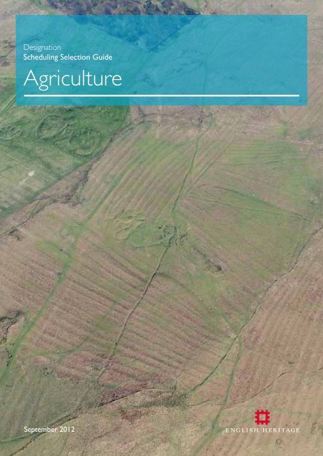
Designation<br />
Scheduling Selection Guide<br />
<strong>Agriculture</strong><br />
September 2012
SCHEDULING SELECTION GUIDE:<br />
AGRICULTURE<br />
Contents<br />
INTRODUCTION AND DEFINITIONS .................2<br />
HISTORICAL SUMMARY .............................................3<br />
Phase I: the Prehistoric era ................................................ 3<br />
Dartmoor and the south-west................................................4<br />
Wessex and the south.................................................................4<br />
The midlands.....................................................................................5<br />
East Anglia............................................................................................5<br />
Northern England...........................................................................6<br />
The Roman period ............................................................. 7<br />
The Anglo-Saxon period .................................................... 8<br />
Phase II: the Middle Ages ................................................... 9<br />
Phase III: post-medieval...................................................... 12<br />
1550-1750........................................................................................12<br />
1750-1875........................................................................................13<br />
1875 to present............................................................................14<br />
OVERARCHING DESIGNATION<br />
CONSIDERATIONS .....................................................15<br />
Scheduling and protection .............................................. 15<br />
Selection criteria................................................................. 16<br />
SPECIFIC CONSIDERATIONS WHEN<br />
ASSESSING AGRICULTURAL REMAINS<br />
FOR DESIGNATION ..................................................16<br />
PROTECTION THROUGH MANAGEMENT .........16<br />
SELECT BIBLIOGRAPHY ..........................................16<br />
Cover Image: Medieval ridge and furrow in the Cheviot Hills (Northumberland)<br />
surrounds probably prehistoric farmsteads.<br />
Fig 1. Survey confirms irregular fields on the coastal plateau at Bosigran, Zennor (Cornwall)<br />
have prehistoric origins, contemporary with round houses and courtyard houses (Iron Age<br />
and Romano-British; not scheduled) right of centre. Most fields are farmed; abandoned<br />
ones lie on the margins, especially on the higher cliff slopes. Cliffs and the downs above<br />
provided summer grazing. Part of the Cornwall and West Devon Mining Landscape WHS.<br />
INTRODUCTION AND DEFINITIONS<br />
This selection guide offers an overview of the sorts of<br />
archaeological monument or site associated with agriculture<br />
(including husbandry) which are likely to be deemed to have<br />
national importance, and for which of those scheduling may be<br />
appropriate. It aims to do two things: to set these within their<br />
historical context, and to give an introduction to the designation<br />
approaches employed.<br />
Until the eighteenth century most people lived on the land,<br />
with a greater or lesser involvement in farming. Agricultural<br />
landscapes often still reflect regional biases towards arable or<br />
pastoral farming, and to particular local specialisms such as the<br />
orchards of Worcestershire’s Teme Valley or sheep farming on<br />
the northern Fells. Some landscapes are of extremely long<br />
standing, such as the ‘ancient countrysides’ of the south-west<br />
where the small and irregular fields surrounded by hedges and<br />
earth and stone banks are in some cases (but not invariably)<br />
several thousand years old. Others are more recent, such<br />
as the hawthorn-hedged grid-fields of the <strong>English</strong> midlands,<br />
generally laid out from scratch in the eighteenth and nineteenth<br />
centuries. These replaced earlier agricultural landscapes, some<br />
of which have left highly visible reminders like the curving ridge<br />
and furrow of the medieval and later open fields which still<br />
underlies much permanent pasture.<br />
Agricultural landscapes are dynamic. While there are notable<br />
exceptions (as noted below), in most parts of England premedieval<br />
agricultural features, such as land boundaries, are<br />
generally reckoned to have been largely swept away at least<br />
insofar as the naked eye is concerned, although techniques<br />
like aerial photography, lidar (Light Detection And Ranging),<br />
geophysical survey and area excavations are increasingly<br />
revealing extensive buried landscapes. A further rider should<br />
2
Fig 2 A section of the scheduled reave system, Holne Moor, Dartmoor. Regular, apparently<br />
planned, land divisions called reaves were laid out over much of Dartmoor from around<br />
1700 BC. They were also laid out off the moor, but there survive far less well.<br />
The reason for this extensive land-gridding remains unclear: demarkating land ownership,<br />
and agricultural exploitation, are assumed to be involved.<br />
be offered, as current research is suggesting that rather more<br />
pre-medieval landscapes survive, fossilized in the present<br />
countryside, than was previously thought.<br />
This selection guide is intended to give a very broad overview<br />
of the main phases of development, and of the main types<br />
of agricultural sites and landscapes. In terms of survival, three<br />
broad phases can be defined. The first covers the prehistoric,<br />
Roman and Anglo-Saxon periods. While there are exceptions<br />
– notably in uplands such as Dartmoor and Exmoor - most of<br />
what remains from this phase is buried invisibly below ground<br />
as archaeological features and deposits. Over the last decade<br />
the potential for the archaeological survival of extensive<br />
‘invisible’ agricultural landscapes of early prehistoric and later<br />
date has been shown by large-scale excavations such as those<br />
in advance of Heathrow Terminal 5 and the Channel Tunnel<br />
Rail Link (in Kent), as well as by ever-more rapid geophysical<br />
survey methods as exemplified by work at West Heslerton<br />
(North Yorkshire). For this essentially pre-historic phase, before<br />
the advent of large-scale written record keeping, archaeological<br />
investigation is the principal avenue for understanding farming<br />
regimes, from how the land was laid out, to what stock was<br />
kept and how it was managed - in this case principally via the<br />
recovery of vertebrate remains from well-sealed contexts (such<br />
as middens, ditches and pits). The second phase of development<br />
is the Middle Ages, the five centuries following the Norman<br />
Conquest, when as well as below-ground archaeological<br />
remains there is a great richness of visible earthworks,<br />
complemented from the thirteenth century by abundant<br />
historical evidence such as manorial accounts. The third phase<br />
of development covers the post-medieval centuries. Here,<br />
because of the large number of surviving structures, there is a<br />
greater emphasis on listing; the relevant criteria are set out in a<br />
complementary Agricultural Buildings listing selection guide.<br />
HISTORICAL SUMMARY<br />
PHASE I: THE PREHISTORIC ERA<br />
Sometime around 4000 BC people switched from procuring<br />
food by a combination of hunting and gathering to growing<br />
cereals and raising domestic livestock - traits which define<br />
the Neolithic period. There remains much debate, however,<br />
about how many of the population were settled farmers;<br />
unequivocal evidence for permanent dwellings is rare and<br />
cereals (which imply a settled population) may not have been<br />
the major element in people’s diet. It is certainly possible that<br />
many Neolithic communities were semi-mobile pastoralists<br />
(with growing evidence for the movement of domestic animals<br />
over large distances), which also practised cereal cultivation<br />
on small plots of land and gathered wild plants. Visible traces<br />
of these early farmers are rare; although excavations have<br />
occasionally found the score-marks left by early ploughs hidden<br />
beneath prehistoric burial mounds they are not necessarily<br />
representative of routine land-use. Some clearance cairns and<br />
banks (see below) may be this early. The remains of domestic<br />
animals evidence their introduction, husbandry and transport.<br />
Around 1500 BC, in the Middle Bronze Age, the <strong>English</strong><br />
landscape began to change, as alongside settlements (see the<br />
Settlements scheduling selection guide) relatively large areas<br />
of countryside began to be divided up into blocks of fields<br />
(see http://www.english-heritage.org.uk/publications/iha-fieldsystems/).<br />
That perhaps indicates a larger population and a<br />
greater demand for food, as well as developments in agricultural<br />
technology allowing agricultural expansion. This period saw the<br />
continuation of broadly warm and dry conditions, and upland<br />
areas such as Dartmoor, the North York Moors, the Pennines<br />
and the Cheviots all saw fairly intensive farming up to altitudes<br />
of over 250 metres above sea level – much higher than was<br />
<strong>English</strong> <strong>Heritage</strong> Scheduling Selection Guide<br />
<strong>Agriculture</strong> 3
Fig 3. High Close, Grassington, North Yorkshire. Underlying the generally straight-edged<br />
field walls dating from enclosure in 1792 is an older co-axial fieldscape, largely scheduled<br />
(‘Grassington enclosures’). Its origins appear to be late prehistoric; use and modification<br />
may have continued for many centuries.<br />
ever the case again. Superficially the agricultural landscapes<br />
created at this time can look similar, with blocks of small<br />
square or rectangular fields defined by hedges and ditches or<br />
walls lying alongside tracks and droveways which connected<br />
settlements and gave access to outlying pastures. Then, around<br />
1250 BC, the climate deteriorated; exploitation of many upland<br />
areas decreased leaving the settlement remains fossilized, and<br />
sometimes heath and moorland developed and peat growth<br />
began. Somewhat later, changes in social organisation and<br />
agricultural practices in the Iron Age seem to have led to<br />
the abandonment or reduced maintenance of lowland field<br />
systems and their replacement by more extensive systems of<br />
linear ditches and pit alignments; examples of both have been<br />
scheduled. What follows is a broad indication of some of the<br />
main regional variety in prehistoric agricultural remains; it does<br />
not attempt a comprehensive summary.<br />
Dartmoor and the south-west: The use of stone for their<br />
construction, and the relative absence of later human activity,<br />
means that the prehistoric landscapes of Dartmoor are<br />
exceptionally legible. By or soon after 1300 BC Dartmoor had<br />
been divided up into separate land units, each with valley land,<br />
hill-slopes and high open moorland, the last probably used for<br />
common grazing. Defining these areas, and on the better land<br />
subdividing them into field systems, are multiple parallel stone<br />
banks, locally called ‘reaves’. Only in plan can the remarkable<br />
regularity of the field systems (called ‘co-axial’ by archaeologists)<br />
be fully appreciated, with the reaves dividing up extensive blocks<br />
of land, in one case (around Rippon Tor) covering some 3,300<br />
hectares (about 6 by 6 kilometres). The consensus is that this<br />
represents landscape replanning on a major scale, presumably<br />
ordered or initiated by the political elite, though others see the<br />
alignments of reaves as emergent within older traditions of tenure<br />
and land use, rather than consciously structured and planned.<br />
This makes the point that these types of remains can yield<br />
some of the clearest evidence for social change, and are not<br />
just about food production. Elsewhere in the south-west other<br />
types of field system have been found both on the mainland<br />
and on the Isles of Scilly where some have been submerged<br />
by the sea. For instance, the West Penwith coastal strip in<br />
Cornwall is typified by small, irregular, fields of prehistoric<br />
origin bounded by stone banks, demonstrably of more than<br />
one phase. On Stannon Down, on the edge of Bodmin Moor,<br />
excavations in 1968 found stone houses associated with strip<br />
fields, perhaps small plots used for cereal cultivation, and larger<br />
irregular enclosures probably representing stock corrals. Later<br />
in the Iron Age, what was perhaps increasing specialism in<br />
animal husbandry and herding gave rise to a distinctive type<br />
of enclosed settlement with a long narrow approach, ditched<br />
on either side, which flared outwards near the outer entrance<br />
to facilitate stock management (although other activities<br />
have been evidenced too). Found elsewhere in England, and<br />
especially Wessex (in all some 200 examples are known in<br />
England), these are called banjo enclosures (see http://www.<br />
english-heritage.org.uk/publications/iha-banjo-enclosures/) as<br />
in plan they resemble that musical instrument. Typically these<br />
are scheduled. As in parts of upland northern England, groups<br />
of small cairns of stones (and single larger cairns) evidence<br />
prehistoric land clearance. Examples are scheduled, for instance<br />
on Bodmin Moor.<br />
Wessex and the south: Settlement was relatively dense on<br />
the Wessex chalklands, on the surrounding heaths and vales,<br />
and on the Sussex Downs. Here are some of the best-known<br />
prehistoric agricultural landscapes, still known to many by their<br />
traditional name of ‘Celtic fields’. However, this ethnic label<br />
has been discarded by archaeologists who now divide early<br />
fields into a number of different classifications. Before farming<br />
<strong>English</strong> <strong>Heritage</strong> Scheduling Selection Guide<br />
<strong>Agriculture</strong> 4
Fig 5. Medieval and later ridge and furrow at Nobold (Northamptonshire). To the right,<br />
ridging stops at the edge of the settlement remains, suggesting cultivation while the village<br />
remained occupied. Left of the hollow way, however, remains are overlain by ridges, postdating<br />
settlement desertion (which occurred by the 1670s). Settlement and ridge and<br />
furrow are scheduled. Modern ploughing has eradicated surrounding ridge and furrow<br />
beyond the scheduled area.<br />
intensified in the mid twentieth century these field systems<br />
were widespread on the downlands and elsewhere, but now<br />
mainly survive on steep slopes which have escaped modern<br />
ploughing, as well as on the Salisbury Plain military estate where<br />
farming ceased over a century ago. These are generally fairly<br />
small square or rectangular fields defined by low banks, and<br />
are sometimes so regularly laid out and so extensive, covering<br />
5 square kilometres or more, that they can be thought of<br />
as co-axial systems; as with the Dartmoor reaves, large-scale<br />
landscape re-organisation is suggested. Similar field systems<br />
are also found in Sussex. However, despite the ambition of<br />
their conceivers and their scale, there is strong evidence that<br />
some systems in Wessex, at least, were abandoned in the<br />
centuries after 1000 BC. That evidence comes in the form of<br />
sinuous, long-distance bank-and-ditch boundaries which cut<br />
across them, boundaries (‘ranch boundaries’ is the usual term<br />
used) which look as if they demarcate some form of land<br />
ownership. The Salisbury plain settlements and field systems<br />
are heavily scheduled, particularly where they are associated<br />
with settlement.<br />
In some areas valley sides and hill slopes carry steeply-stepped<br />
cultivation terraces called lynchets. The dating of these is<br />
problematic, and certainly they were being used in the Middle<br />
Ages. However, some clearly are of prehistoric origin (as<br />
suggested by excavation of a series of lynchets at Horton, near<br />
Devizes, Wiltshire), and archaeology suggests a date between<br />
1500 and 1000 BC for their creation. Examples are scheduled,<br />
especially in conjunction with other features.<br />
Later on in the Iron Age the appearance of large numbers of banjo<br />
enclosures across Wessex might suggest a reorientation to a more<br />
pastoral economy, perhaps reflecting impoverishment of the<br />
downland soils. A half-dozen Wessex examples are scheduled.<br />
The midlands: Although almost wholly erased by later<br />
agriculture, air photography and developer-funded excavations<br />
indicate that here too there were co-axial field systems,<br />
abandoned at the end of the Bronze Age. North of a line<br />
between the Severn estuary and the Wash, however, such<br />
systems are much rarer. The Trent Valley, for instance, seems<br />
to lack any formal field boundaries, remaining unenclosed well<br />
into the 1st millennium BC. Then, in the later Iron Age, the<br />
Trent and other midland river valleys were divided up by field<br />
systems and long-distance boundaries. Such land boundaries<br />
were banks and ditches, but sometimes alignments of closelyspaced<br />
pits, a metre or so wide and deep. Often running off at<br />
right-angles from a river these boundaries suggest territories<br />
each with a range of resources from river-valley meadows and<br />
grassland, via an arable zone, to upland woodland and grazing.<br />
Air photography has shown how many river valleys, especially<br />
gravelly ones like those of the Thames and Trent, had complex<br />
prehistoric agricultural landscapes taking advantage of the fertile<br />
and free-draining soils. Some of these have seen excavation<br />
in advance of gravel extraction. In Derbyshire’s Peak District<br />
cairnfields from land clearance and Bronze Age field walls show<br />
that here too the uplands were farmed in prehistory.<br />
East Anglia: Here evidence of the organisation of the<br />
prehistoric countryside has come largely from air photography<br />
and excavation; there was little stone so fields were bounded<br />
not by walls but by ditches and hedges, and these rarely survive<br />
as earthworks. Once again, extensive co-axial field systems<br />
have been identified in a number of places, as in central-north<br />
Suffolk and Cambridgeshire, sometimes fossilized in the modern<br />
field pattern. One of the best known is the Scole-Dickleburgh<br />
System of south Norfolk; there remains much debate about its<br />
date, although it is generally accepted that a Roman road bisects<br />
(and thus post-dates) it. Not surprisingly, areas around the wet<br />
<strong>English</strong> <strong>Heritage</strong> Scheduling Selection Guide<br />
<strong>Agriculture</strong> 5
Fig 6. Fields have buried archaeologies. Here the dark, parallel, furrows of ploughed-out<br />
ridge and furrow are revealed by large-scale earth stripping across an Iron Age settlement<br />
at Coton Park, Rugby (Warwickshire). The furrows’ straightness and regularity suggests<br />
they were created by post-medieval horse ploughing.<br />
fen edge with its abundant lowland grassland and marshes<br />
seem to have largely relied on pastoralism, and at places like<br />
Fengate, near Peterborough, small rectangular fields (some<br />
with wells) and droveways bounded by ditches and hedges<br />
were presumably for stock. Indeed, some complex Bronze Age<br />
enclosure systems at Fengate and elsewhere can be interpreted<br />
as stockyards and ‘races’ for herding large flocks of sheep. Work<br />
in 2011 in advance of clay extraction at Must Farm, also east<br />
of Peterborough, emphasised the potential for the survival of<br />
extensive and high-quality buried landscapes, here waterlogged<br />
and with excellent preservation of organic remains. An area<br />
at Fengate, associated with the Flag Fen Visitor Centre and the<br />
excavations it interprets is scheduled, but otherwise schedulings<br />
in this area of monuments of this type and date are rare given<br />
that so many are integral parts of modern landscapes, often<br />
under arable cultivation, or are sufficiently deeply buried as to<br />
be hard to define spatially.<br />
Northern England: Unsurprisingly, patterns similar to those<br />
in upland south-west England recur. On the high uplands of<br />
the Yorkshire Dales – in Swaledale, Wensleydale, Ribblesdale,<br />
Littondale and Wharfedale – extensive co-axial field systems are<br />
found and also cairnfields suggesting land improvement, perhaps<br />
for arable cultivation. Lynchets occur on steeply sloping ground;<br />
mostly these seem medieval, but as elsewhere prehistoric<br />
origins cannot be ruled out. Elsewhere, more discrete farming<br />
landscapes are suggested; in the Cheviots, for instance, one<br />
group of five or six stone-built roundhouses stood within a<br />
field system of 2.75 hectares or so. L- and C-shaped enclosures<br />
and short dykes on the hills of Northumbria and elsewhere<br />
are assumed to represent shelters for grazing animals. The<br />
point that prehistoric agriculture, and thus landscapes, was in<br />
some cases highly regionally distinctive, is made emphatically<br />
on the chalk Wolds of east Yorkshire where aerial photography<br />
has revealed about 125 so-called ladder settlements of the<br />
later Iron Age. These comprise small, contiguous, agricultural<br />
enclosures (the ‘settlement’ element of the name is something<br />
of a misnomer) arranged alongside one or both sides of a<br />
trackway, extending from a few hundred metres to more<br />
than a mile. They seem well suited to stock rearing, but also<br />
provided segregated areas for growing crops and other tasks.<br />
Another example is provided by the distribution of cord rig,<br />
parallel cultivation ridges apparently normally of later prehistoric<br />
date, found principally on uplands in the border counties.<br />
Eleven examples are scheduled in Northumbria, all associated<br />
with settlement remains. That agricultural landscapes were<br />
far from static has been shown, for instance, by excavation<br />
and geophysical survey at Wharram Percy (North Yorkshire),<br />
where fields and roads were re-ordered several times from the<br />
prehistoric period onwards.<br />
There is an increasing body of evidence regarding the management<br />
of wild resources in the prehistoric period, for instance woodland<br />
management. Mostly this is in the form of biological remains and<br />
artefacts recovered from excavation. Structural evidence is much<br />
rarer, although weirs and traps (river and coastal) of Neolithic<br />
and later date attest to fishing and wildfowling (see http://www.<br />
english-heritage.org.uk/publications/iha-river-fisheries-coastalfish-weirs/).<br />
Sea fish is thought to have been an important part of<br />
the diet of coastal dwellers from early prehistory, as evidenced<br />
by large shell and fish bone middens (waste heaps); examples<br />
are scheduled on the Isles of Scilly and Northumberland, in the<br />
latter case as part of a larger site. Active methods of fishing,<br />
with nets or lines from boats, whether on the coast or on rivers,<br />
leave little or no archaeological trace. Passive fishing, however<br />
(using constructed weirs and traps within estuaries and<br />
inter-tidal areas), is evidenced from the early Neolithic onwards.<br />
Numbers of Bronze Age wickerwork fish traps have been<br />
<strong>English</strong> <strong>Heritage</strong> Scheduling Selection Guide<br />
<strong>Agriculture</strong> 6
Fig 7. Lynchets – cultivation terraces – in the Ingram Valley, Northumberland. Examples<br />
nearby have prehistoric origins but clear, pronounced, examples such as these were probably<br />
constructed in the twelfth and thirteenth centuries when population levels and land hunger<br />
were at their greatest. Medieval ridge and furrow to their right partly overlies the lynchets.<br />
About thirty examples of lynchet systems are scheduled in England, although not this.<br />
identified eroding from the Humber foreshore; although these<br />
may be reckoned of national importance, none have been<br />
recommended for scheduling (see special considerations below).<br />
Bronze Age wicker fish (or eel) traps were also among the finds<br />
at Must Farm (Peterborough) in 2011.<br />
THE ROMAN PERIOD<br />
Traditionally the Roman conquest of Britain in 43 AD was seen<br />
to herald dramatic change as European civilization arrived in the<br />
forms of towns linked by straight roads, and in the countryside<br />
opulent villas with lavish bath suites which were presumed to<br />
be estate centres (for villa complexes see the Settlement<br />
scheduling selection guide and http://www.english-heritage.<br />
org.uk/publications/iha-prehistoric-romano-british-settlementsstructures/).<br />
After the Second World War archaeology in<br />
particular markedly revised this rather simplistic picture,<br />
showing how much continuity there was from the Iron Age and<br />
increasingly how, just as later, there was considerable regional<br />
variation across England in the character of the countryside<br />
and the types of farming practised. Many field systems and<br />
agricultural landscapes (http://www.english-heritage.org.uk/<br />
publications/iha-field-systems/) established in the prehistoric era<br />
continued to be used and to evolve further; others were new.<br />
But whatever the form of the fields, the working rural lowland<br />
landscape can be characterised as one of dispersed farms and<br />
hamlets, each surrounded by its own fields; other resources (for<br />
instance, grassland and woodland) may have been shared. The<br />
construction of lime kilns may indicate attempts to improve<br />
poor soils as well as reflecting the growing need for building<br />
mortar (see http://www.english-heritage.org.uk/publications/<br />
iha-preindustrial-lime-kilns/). Overall, it seems that Imperial<br />
control and demands for tax and surplus produce like grain had<br />
a radical impact on the countryside in parts at least of England;<br />
this will undoubtedly be the focus of future research.<br />
In some areas, as in the East Anglian Fens and the Severn<br />
Estuary Levels, there were major land drainage and reclamation<br />
schemes using sea banks with ditch systems behind them (see<br />
http://www.english-heritage.org.uk/publications/iha-romanmedieval-sea-river-flood-defences/).<br />
Lush pastureland may have<br />
been the main new resource, and inland the improvement by<br />
ditching of riverside hay meadows may have been practised.<br />
On the Fens, which may then have been an imperial estate, the<br />
reclamation was on a huge scale suggesting state promotion,<br />
as indeed occurred in other parts of the Empire. Air photos<br />
and excavation have revealed extensive areas of small, squarish,<br />
fields laid out with considerable regularity. Some of the<br />
Fenland watercourses were large-scale, and the main function<br />
of the scheduled Car Dyke which runs for 85 miles through<br />
Lincolnshire and Cambridgeshire, long thought to be a canal for<br />
grain transport, may have been drainage. In some places at least<br />
corn was ground using a watermill (see http://www.englishheritage.org.uk/publications/iha-mills/);<br />
only about ten examples<br />
are known or suspected, but this probably hugely underrepresents<br />
what may have been a relatively commonplace<br />
type of structure. Both corn drying and bread ovens seem to<br />
have been fairly common, suggesting the importance of grainbased<br />
staples. Scheduled examples are invariably known from<br />
excavation and form part of wider designated sites.<br />
As in other periods, the production of particular high status<br />
foodstuffs may have left archaeological traces. Bone evidence<br />
shows fallow deer were kept, and presumably hunted, at firstcentury<br />
Fishbourne (West Sussex). Vineyards are suggested<br />
by historical sources, and parallel planting trenches found<br />
during excavations in the Nene Valley in Northamptonshire are<br />
indicative of viticulture. About twenty artificial fishponds, small,<br />
lined with stone or clay and often associated with villas, have<br />
been discovered through excavation; many more undoubtedly<br />
<strong>English</strong> <strong>Heritage</strong> Scheduling Selection Guide<br />
<strong>Agriculture</strong> 7
Fig 8. Sheepcote earthworks, Pinnock, Temple Guiting, Gloucestershire. Sheep farming,<br />
for wool, characterised the medieval Cotswolds. It has left an archaeology, notably in the<br />
earthworks of the long, narrow, sheepcote sheds (bercarie) where flocks were sheltered<br />
and lambed. Not scheduled.<br />
remain to be identified (see http://www.english-heritage.org.<br />
uk/publications/iha-animal-management/). Fresh-water and sea<br />
fishing is evidenced by bone evidence (although as yet there is<br />
no evidence of coastal fish traps), while the quantities of oyster<br />
shells typically found on Roman sites suggest industrial-scale<br />
production of shell fish.<br />
THE ANGLO-SAXON PERIOD<br />
Much remains to be discovered about agriculture in the half<br />
millennium and more after the end of formal Roman rule.<br />
Very few historic documents survive from the period, and<br />
those that do are more concerned with political change than<br />
with the practicalities of everyday life. Archaeology, therefore,<br />
has an important part to play in revealing the story. In some<br />
parts of the country (and pollen evidence from bogs is a<br />
key source for this) land was abandoned at the end of the<br />
Roman period and reverted to woodland; Wychwood, in<br />
Oxfordshire, is one area where this took place. However, this<br />
may have been less common than was thought 30 years ago.<br />
Elsewhere, and field walking in Northamptonshire has provided<br />
evidence of this in the form of concentrations of pottery<br />
sherds marking settlement sites, the land continued to be<br />
cultivated from hamlets or perhaps farm groupings representing<br />
extended families. Much more research is needed before we<br />
can speak with certainty about whether the fields and land<br />
units associated with these were inherited and longstanding,<br />
or whether there was reconfiguration. There is, for instance,<br />
growing evidence that in the mid Saxon period rounded fields<br />
(sometimes termed oval enclosures) of between 30 and 200<br />
acres surrounded by hedges were laid out around settlements<br />
in many parts of England, seemingly shared by the place’s<br />
farmers, although sometimes forming the demesne (that is the<br />
lord’s) land. By the tenth century furlongs, subdivided into<br />
strips, are documented, although this is not to suggest that the<br />
true, large-scale open fields of medieval England (or two or<br />
three-course rotations) had yet evolved (or been deliberately<br />
created by replanning). Some of this evidence comes from<br />
documents, but increasingly archaeology is supplying data, such<br />
as that from Frocester (Gloucestershire) where excavation<br />
revealed the gradual encroachment of arable cultivation,<br />
probably in an open field, first up to and then over the rubble<br />
of a Roman villa.<br />
It must also be acknowledged that the impact of the<br />
Scandinavian settlers (Vikings) on how the land of northern<br />
and eastern England was organised and farmed from the later<br />
ninth century remains unclear, and specifically Scandinavian<br />
farms or settlements from which land was farmed remain hard<br />
to identify. However, a case has recently been made for a Viking<br />
origin for co-axial field systems in north-east Suffolk.<br />
As always, there was geographical as well as chronological<br />
variation in farming landscapes and methodologies. For<br />
instance, it seems to be in the Anglo-Saxon period that<br />
large, open, greens or commons became a typical feature<br />
of the Cambridgeshire, Hertfordshire, Essex and East Anglia<br />
countrysides. Many appear to be cleared woodland, and to<br />
have been associated with stock management and droving.<br />
Archaeology is also our principal source for Anglo-Saxon<br />
technology, such as watermills, where crops were processed.<br />
As yet there is no evidence for Roman mills being kept in use;<br />
rather it looks as if watermills (predominantly simple horizontal<br />
ones) were reintroduced at some stage, were relatively<br />
common (as evidenced by charters and place-names) by<br />
the ninth century and proliferated in the tenth and eleventh<br />
centuries as agricultural production intensified. Domesday<br />
Book lists over 5,000. Where examples have been located<br />
and excavated, especially where waterlogged conditions have<br />
<strong>English</strong> <strong>Heritage</strong> Scheduling Selection Guide<br />
<strong>Agriculture</strong> 8
Fig 9. A scheduled shieling 3 km north of Carrawbrough on Hadrian’s Wall. The sheltercomplex<br />
lies next to a stream, with land that at some stage was under the plough on<br />
the far side. Most shielings are of twelfth to seventeenth century date; normally only<br />
excavation will date specific examples.<br />
preserved woodwork (as at Tamworth, in Staffordshire), the<br />
insights provided, not least into technology and woodworking,<br />
can be vivid and compelling (see http://www.english-heritage.<br />
org.uk/publications/iha-mills/). Exceptional both in scale (this<br />
may have been a royal enterprise) and preservation is the late<br />
seventh-century tidal mill (its pound-ponds filled by the tide)<br />
discovered at Northfleet (Kent) in 2002.<br />
Exploitation of wild resources continued during this period, and<br />
is sometimes alluded to in documentary sources. Domesday<br />
Book, for instance, indicates the presence of numerous largescale<br />
fisheries, both inland and coastal. Archaeological evidence<br />
of inland fisheries is generally lacking, although seventh-century<br />
and later fish weirs, some of them V-plan structures over 300<br />
metres from end to end, have been found at several coastal<br />
locations including the Severn Estuary, north Norfolk, Suffolk,<br />
and the Isle of Wight. Examples on the Essex coast have been<br />
scheduled (see http://www.english-heritage.org.uk/publications/<br />
iha-river-fisheries-coastal-fish-weirs/).<br />
PHASE II: THE MIDDLE AGES<br />
In the late Saxon period (around the tenth century AD) there<br />
was a huge reorganisation of the countryside over much<br />
of lowland England. Across much of midland and southern<br />
England compact nucleated villages replaced the scattered<br />
hamlets and single farms which had been the norm. Around<br />
these new villages the arable land was reorganised into large,<br />
prairie-like open fields which were predominantly devoted to<br />
cereal cultivation, and which have long been recognised as a<br />
classic form of historic agricultural landscape, which in some<br />
parts of especially midland England dominated the countryside<br />
for a thousand years (see http://www.english-heritage.org.<br />
uk/publications/iha-field-systems/). These open fields were<br />
subdivided into furlongs, themselves split into long, narrow<br />
allotments or strips. Each farmer (other than the poorest)<br />
would have twenty or so such strips, scattered throughout the<br />
open fields ensuring that everyone had a share of good land<br />
and bad. Importantly, probably after the Norman Conquest<br />
as land became scarcer, the communal regulation of fallow<br />
(unsown) arable land was introduced. This defines the arrival<br />
of a key feature of the management of true common, as<br />
opposed to open, fields: typically, that each year one of a<br />
settlement’s three common fields would be left uncultivated<br />
and grazed communally to allow some fertility to be regained.<br />
Especially where the land was heavy, particularly clay-based,<br />
farmers ploughed their strips so that they were ridged towards<br />
the middle, allowing rainwater to run off in the intermediate<br />
furrows. This ridge and furrow form of cultivation, used well<br />
beyond the Middle Ages in parts of the country, produced one<br />
of the most distinctive, and once one of the commonest, types<br />
of archaeological earthwork in lowland England. In the 1970s<br />
and 1980s, however, European subsidies and more powerful<br />
tractors and ploughs saw the ploughing flat of huge swathes of<br />
ridge and furrow and it is now far scarcer than previously. Some<br />
examples have been scheduled, generally in association with<br />
designated settlement remains, demonstrating the relationship<br />
between the two.<br />
Either side of central England large villages were rarer, and<br />
for the most part people lived in various types of what<br />
geographers call dispersed settlements: scattered hamlets and<br />
farms. The field patterns associated with these tend to be more<br />
varied, often reflecting a greater emphasis on animal husbandry.<br />
Again, some examples have already been scheduled, such as at<br />
Butleigh, Somerset.<br />
For several hundred years, up until the early fourteenth century,<br />
the population of England grew steadily, and more and more<br />
<strong>English</strong> <strong>Heritage</strong> Scheduling Selection Guide<br />
<strong>Agriculture</strong> 9
Fig 10. One of several pillow mounds (artificial mounds-with-burrows for rabbit breeding)<br />
which run down the Cotswold scarp at Wotton under Edge, Gloucestershire, marking<br />
an unscheduled rabbit warren. The earthworks of a probable warrener’s house overlook<br />
the site, which is likely to be eighteenth- or nineteenth-century. Warrens of this date are<br />
relatively common, and scheduling requires careful assessment.<br />
land was devoted to cereal cultivation. By the thirteenth<br />
land hunger led to a great deal of inherently poor land being<br />
ploughed up, and in hillier parts of England – Wessex, the<br />
Cotswolds, Herefordshire and parts of Yorkshire, for instance<br />
– cultivation terraces or lynchets were created (or prehistoric<br />
ones reoccupied) to allow the cultivation of steep hillsides.<br />
About thirty examples are scheduled in England.<br />
The villages, hamlets and farms from which fields were worked<br />
are the subject of a separate Settlement scheduling selection<br />
guide, but it may be noted that at some scheduled sites, normally<br />
where the site is deserted (for instance, Hound Tor, Devon)<br />
earthworks and collapsed stone walls reveal the remains of<br />
longhouses where people shared their dwellings with their<br />
stock, as well as barns, and other agricultural structures such as<br />
drying kilns. Standing medieval agricultural buildings (for which<br />
see the Agricultural Buildings listing selection guide) survive<br />
in some numbers, notably barns. Used both for threshing and<br />
storage, these structures, often built on a monumental scale and<br />
incorporating extremely sophisticated carpentry, bear witness<br />
to the scale and organisation of farming on major estates.<br />
Among the earliest identified are two at Cressing Temple, Essex,<br />
where the timbers for the Barley Barn were felled between<br />
1205 and 1235. Dovecotes are the second type of medieval<br />
agricultural building to survive in considerable numbers: 128<br />
are scheduled, and 2,283 listed. As providers of fresh meat and<br />
eggs to high-status households, and of fertiliser, these structures<br />
sometimes received careful architectural treatment, as with the<br />
fourteenth-century example at Kinwarton, Warwicks.hire<br />
Monastic investment, in particular, can be seen in upland and<br />
other ‘marginal’ areas where land was improved to make it<br />
more productive and profitable. Outlying monastic territories<br />
were often cultivated from new farm complexes, which the<br />
Cistercians called granges; where appropriate, their sites are<br />
scheduled. Many survive as modern farms, others are marked<br />
by earthworks. Some had a specialist function, like dairying. In<br />
upland areas sheep farming tended to predominate, whether<br />
this was run from granges or from valley-bottom farms and<br />
villages. Lambing and shearing was often done in the hills in<br />
long, narrow, shelters called sheepcotes; in the Cotswolds, at<br />
least, these have left distinctive earthworks as at Temple Guiting,<br />
on the Gloucestershire Cotswolds, where the sheepcote is<br />
one element of a scheduled medieval farmstead. In some<br />
of the most extreme upland areas, especially in the north,<br />
herdsmen used temporary huts or shielings for accommodation,<br />
perhaps when high pastures were grazed in the summer.<br />
Typically these are scheduled; one exceptional group of four<br />
scheduled shielings is at Kingwater, Cumbria. Often one or more<br />
enclosures for stock management were attached. In some areas<br />
such seasonal practices may have been common for hundreds<br />
or even thousands of years (see http://www.english-heritage.<br />
org.uk/publications/iha-shielings/).<br />
In the Middle Ages a great deal of effort went into water<br />
management. In low-lying fenland and coastal areas the<br />
medieval land hunger stimulated often highly ambitious<br />
and well-capitalised schemes to drain land to create more<br />
farmland, and dykes, banks and sea defence banks (often<br />
now well inland) can survive as evidence (see http://www.<br />
english-heritage.org.uk/publications/iha-roman-medieval-seariver-flood-defences/).<br />
Riverside hay meadows were generally<br />
highly valued, and channels and sluices may have been used,<br />
for instance on monastic estates, to improve their quality by<br />
controlled irrigation. Identification of these on the ground has<br />
hardly begun, but it seems likely that some will have already<br />
been included in the more extensive schedulings of monastic<br />
complexes. Religious observance meant a great deal of fresh<br />
<strong>English</strong> <strong>Heritage</strong> Scheduling Selection Guide<br />
<strong>Agriculture</strong> 10
Fig 11. A dewpond - that is an artificial stockpond, carefully lined with clay, chalk, straw<br />
and cobbles - next to a Birdsall Estate high barn on the arid Yorkshire Wolds. Out-farm,<br />
pond and the surrounding enclosed landscape of large, straight-edged fields are all<br />
broadly contemporary, and late eighteenth-century. Dewponds are sometimes scheduled<br />
as elements of wider landscapes of national importance.<br />
fish was eaten – bream, tench, pike, and, from the later Middle<br />
Ages, carp – and most monasteries and manor houses had<br />
their own fishponds. Where there was a convenient valleybottom<br />
stream, one or more ponds could be created using<br />
earth dams. Elsewhere large, shallow, rectangular ponds were<br />
often dug, sometimes in a linked sequence of three or four<br />
of different sizes to allow the management of fish of different<br />
types and ages. Where they survive in good condition, without<br />
later scouring which will have removed bottom deposits, and<br />
especially where they are parts of wider medieval complexes,<br />
fishponds will typically be recommended for scheduling.<br />
Riverine and coastal fisheries supplied commercial stocks<br />
(see http://www.english-heritage.org.uk/publications/iha-riverfisheries-coastal-fish-weirs/),<br />
although the large coastal fish traps<br />
which were operational from the seventh century seem to have<br />
fallen out of use by the thirteenth. One possible reason for<br />
that is that by then fishing boats were active in large numbers,<br />
landing commercial catches of cheap fish like herring, as well as<br />
larger species like cod.<br />
Dams, ponds and channels (or leats) were also engineered to<br />
power the many thousands of watermills. Most manors had<br />
one by the time of Domesday (1086); investment in mills with<br />
vertical wheels, which became the norm, and the installation of<br />
professional millers by lords of the manor, may well have been<br />
elements of post-Conquest manorialisation. Windmills, which<br />
were always rarer (not least because they cost even more to<br />
build than vertical watermills), arrived in England about 1200.<br />
Their sites, usually on hills or raised ground to catch the breeze,<br />
are often marked by low, round mounds which helped anchor<br />
the ‘cross-trees’, the huge cross-shaped timber base of the mill.<br />
These mill mounds can be easily mistaken for prehistoric burial<br />
mounds; a cross-shaped depression across the centre where<br />
the cross-tree has rotted is a sure indicator that a mound<br />
once supported a mill (see http://www.english-heritage.org.<br />
uk/publications/iha-mills/). Confirmed examples of medieval<br />
mill sites which survive in good condition will always be strong<br />
candidates for scheduling, especially when in association with<br />
settlement remains, fishponds, and so on.<br />
Larger landowners, whether lords of manors, aristocrats or<br />
monasteries, engaged in other specialist forms of resource<br />
management to provide further high-status foodstuffs, and<br />
some have left distinctive archaeological remains. Deer hunting<br />
was popular as the chase simulated aspects of warfare – thus<br />
providing training in horsemanship and weapon-handling<br />
– and because it supplied venison, always one of the most<br />
prestigious of meats. The king tended to hunt over open<br />
countryside, especially in his forests. Other lords created parks<br />
(for which see the designed landscapes selection guide on<br />
Rural Landscapes) where deer were managed before being<br />
hunted. Keeping high-leaping deer in captivity was always a<br />
problem, and parks were usually bounded by a pale comprising<br />
tall oak posts set on a bank; an inner ditch made any attempted<br />
escape both a long as well as a high jump. The earthworks<br />
of these park pales sometimes survive, whether as wood<br />
boundaries or beneath hedges in open countryside. Examples,<br />
as at Tutbury in Staffordshire, have been scheduled, especially<br />
where other components of the park survive. Where stone<br />
was readily to hand, especially in upland areas, the bank might<br />
be surmounted by a wall rather than a fence. Here listing rather<br />
than scheduling will be favoured for designation. Deer poaching<br />
was a problem, so the deer manager or parker usually lived<br />
within the park in an isolated lodge, ideally on high ground for<br />
good visibility, but elsewhere surrounded with a water-filled<br />
moat for security. Good examples are scheduled. Rabbits,<br />
introduced along with fallow deer by the Normans, and game<br />
birds like partridges, were kept in warrens; again, banks, ditches<br />
<strong>English</strong> <strong>Heritage</strong> Scheduling Selection Guide<br />
<strong>Agriculture</strong> 11
Fig 12. Dead straight late eighteenth- or early nineteenth-century enclosure-period field<br />
walls run uphill from an abandoned farm at Gossipgate, Cumbria. This stands at the<br />
traditional divide between farmland and uncultivated upland grazing.<br />
and walls kept them in, and predators and poachers out. These<br />
often contained specialist structures such as vermin traps, and<br />
especially the long earthwork ‘pillow’ mounds which provided<br />
rabbits with artificial burrows. Over fifty examples of pillow<br />
mounds are scheduled, typically where a whole warren survives<br />
or as elements of multi-period sites, as on Minchinhampton<br />
Common (Gloucestershire); early (that is medieval or<br />
early modern) examples will be favoured over eighteenth<br />
or nineteenth century ones which are far commoner. At<br />
Colmworth (Bedfordshire) a scheduled earthwork associated<br />
with a moated site is interpreted as having been for fowling.<br />
Until the later Middle Ages, when the climate became wetter<br />
and cooler with the Little Ice Age starting about 1550 (and<br />
continuing until about 1850), vineyards remained relatively<br />
common, although their <strong>English</strong> heyday seems to have been the<br />
eleventh and twelfth centuries. Sunny, south-facing hillsides were<br />
probably the favoured location, modified by terracing and the<br />
digging of planting trenches.<br />
Another aspect of agricultural activity of considerable<br />
importance was woodland management and forestry. This<br />
is now well understood from the documentary record,<br />
from the timbers in surviving medieval buildings and from<br />
palaeoenvironmental investigations. Archaeology also has a part<br />
to play: notably along riverfronts, as in London, excavations have<br />
revealed further massive timber structures, further enhancing<br />
our knowledge of woodland management and woodworking<br />
techniques. Survey of ancient woodlands often reveals the<br />
banks and ditches which defined and protected compartments<br />
where coppice wood was grown, although the dating of<br />
such features is difficult without corroborative documentary<br />
evidence, notably early maps. A few are scheduled.<br />
Charcoal burning was a related activity which is evidenced<br />
archaeologically by the platforms where stacks of wood were<br />
slowly burnt and transformed into charcoal. Only one platform,<br />
however, in Derbyshire, is scheduled.<br />
PHASE III: POST-MEDIEVAL<br />
1550-1750<br />
From this period onwards, designation of agricultural sites<br />
becomes increasingly a matter of listing of buildings, which has<br />
already gone some considerable way towards capturing the<br />
transformation of the countryside seen between the sixteenth<br />
and twentieth centuries. These were the period which saw<br />
the majority of medieval open fields enclosed to create the<br />
modern landscape of hedged and walled fields. Initially this<br />
tended to be a gradual process, with the new field boundaries<br />
fossilising the curving ones of strips and furlongs. At the same<br />
time many of the extensive areas of woods and forests which<br />
had survived clearance in the medieval centuries were felled<br />
and the land divided into fields. Commons and heaths were<br />
similarly portioned out and improved. Much of this land<br />
was of inherently poor quality, and lime kilns (used to burn<br />
limestone to make lime) and marl pits (where marl, a chalky<br />
subsoil spread to improve soil quality, was dug) show how<br />
attempts were made to overcome this. Over 150 lime kilns are<br />
designated via listing and scheduling; henceforward listing is likely<br />
to be the favoured approach for standing examples. Surviving<br />
wetlands, like the Somerset Levels and the East Anglian Fens<br />
(here, in the mid seventeenth century, with the assistance of<br />
the Dutchman, Sir Cornelius Vermuyden), saw another phase<br />
of drainage; windmill-driven pumps were among the new<br />
technology employed to achieve this. The countryside we see<br />
today frequently carries evidence of these transformations.<br />
Notably in the flat, chalkland, valley bottoms of Wessex –<br />
Hampshire, Dorset and Wiltshire – it was these centuries that<br />
saw the creation of floated water meadows, which remained<br />
<strong>English</strong> <strong>Heritage</strong> Scheduling Selection Guide<br />
<strong>Agriculture</strong> 12
Fig 13. Watermeadow management at Charlton-All-Saints (Wiltshire) in the 1920s.<br />
A drowner cleans a channel which carries water, brought off the River Avon, along the<br />
ridged pane. As it flows along, water trickles down the sides of the pane, irrigating the grass.<br />
Drains in the furrows carry the water away. Controlling the level of channels and drains<br />
was complex.<br />
characteristic of this part of England until they fell out of use<br />
in the earlier twentieth century. Networks of channels were<br />
cut to carry water from valley-bottom rivers and streams<br />
across the adjacent meadows and, at certain times of the year,<br />
to flood them when the channels were deliberately blocked.<br />
This promoted grass growth, giving sheep an early bite in the<br />
spring and heavy hay crops in high summer. Taken together<br />
these things enabled more stock to be kept, and made livestock<br />
farmers wealthier. Other parts of England were less well suited<br />
in terms of topography and climate for water meadows, but<br />
even so local adaptations promoted the same ends. In some<br />
hilly areas, for instance, ‘catchwork’ meadow systems channelled<br />
water along valley sides before it was run down the hillside to<br />
irrigate the grass. To date, ten examples of water meadows have<br />
been scheduled, mostly in southern England; that at Clattinger<br />
Farm, Oaksey (Wiltshire), is a typical Wessex example. Other<br />
meadowlands are included in the schedulings of monastic<br />
and other extensive sites; these include examples of medieval<br />
water and meadow management systems such as channels and<br />
ditches, the forerunners of the later, more formally engineered,<br />
water meadows. These have a particular interest, as how<br />
meadowland was managed in the Middle Ages (and before)<br />
remains poorly understood.<br />
Another seventeenth-century innovation was the decoy pond,<br />
used to capture ducks and other wildfowl in nets carried<br />
on frames over curving channels called pipes leading off a<br />
main pond. They were especially numerous in the extensive<br />
wetland areas of East Anglia and Somerset, where several are<br />
scheduled. Their hey-day was in the eighteenth and nineteenth<br />
centuries, and most had fallen out of use by the early twentieth<br />
century. Overall forty-seven have been scheduled to date, and<br />
a few remain working or have been revived: one at Boarstall<br />
(Buckinghamshire) is operated by the National Trust. Rabbit<br />
warrens remained a popular lordly use of land, especially<br />
marginal ground.<br />
Throughout history the control of grazing animals has been<br />
problematic. Pounds, small brick- or stone-walled enclosures<br />
typically on greens or open spaces in settlements, were used<br />
to confine strays. Most surviving examples are post-medieval,<br />
at least in terms of their fabric, although the use of the location<br />
for this purpose may have been longstanding. Pounds have<br />
sometimes been scheduled in the past; listing will now generally<br />
be the preferred option.<br />
1750-1875<br />
Even fewer historic agricultural assets are scheduled from this<br />
period, although very many historic farm buildings have been<br />
listed. In the later eighteenth century the pace of improvement<br />
in the countryside picked up as higher prices encouraged<br />
landlords to invest, ushering in the era known to historians as<br />
the Agricultural Revolution. While not to ignore the growing<br />
evidence of earlier innovations, key ‘improvers’ like Robert<br />
Bakewell and Thomas Coke introduced new ways of farming<br />
and rethought agricultural infrastructure. Alongside new farm<br />
complexes, with Georgian farmhouses standing alongside well<br />
laid-out courtyard farms housing improved breeds of stock,<br />
came a countryside where Acts of Parliament were used to<br />
enable the last phase of enclosure. Much of the midlands’ open<br />
field systems survived until this era, for instance, when they<br />
were enclosed and replaced with extremely regular grid-plan<br />
fields. During the Revolutionary and Napoleonic wars with<br />
France (1793-1815) corn prices rose to unprecedented levels,<br />
and attempts – often unsuccessful – were made to enclose<br />
and then bring into cultivation some of England’s highest land.<br />
This has left a distinct archaeology, of abandoned fields (some<br />
with narrow and straight ridge and furrow showing attempts<br />
<strong>English</strong> <strong>Heritage</strong> Scheduling Selection Guide<br />
<strong>Agriculture</strong> 13
Fig 14. Flooding reveals the pattern of extensive post-medieval water meadows in the<br />
Lugg Valley, Herefordshire. Relict farming landscapes such as this provide designation<br />
challenges given their extensiveness; because the land remains in active agricultural use;<br />
and because it often has environmental significance because of its flora and wildlife.<br />
at cereal cultivation) typically demarcated by small and crude<br />
drystone walls, often all but invisible under bracken. Sometimes<br />
the barns and outfarms (see the listing selection guide on<br />
Agricultural Buildings for Field Barns) built to cultivate this<br />
land still stand; elsewhere they have become archaeology as ruins<br />
or earthworks. Artificial saucer-shaped ‘dewponds’ (some are<br />
scheduled, normally as elements of wider landscapes) provided<br />
watering places for stock in what were otherwise waterless<br />
landscapes. The Knight family’s efforts to improve Exmoor provides<br />
a dramatic example of a large-scale attempt at upland improvement;<br />
roads, farms, fields, ponds, and lime kilns were built, trees planted,<br />
and quarries opened to provide sturdy gate posts.<br />
Rabbit warrens proliferated in the eighteenth and nineteenth<br />
centuries, especially on uplands and moorlands where<br />
previously they had been rare; several well-preserved examples,<br />
such as at Merrivale, are scheduled on Dartmoor, for instance.<br />
Rabbits became so cheap they became a foodstuff for the poor.<br />
It was also during this period, in part enabled by new<br />
technology like steam engines, that some of the last, and<br />
inherently most difficult, drainage schemes were undertaken: the<br />
final drainage of the Somerset Levels, for instance, was achieved<br />
by the construction in the years after 1791 of the twelve milelong<br />
King’s Sedgemoor Drain, to replace the River Cary. Many<br />
of the drainage cuts and banks created were massive and ran<br />
for miles; in some cases existing watercourses were adapted,<br />
and the direction of flow reversed. And it was only in the<br />
earlier nineteenth century that the Great Level of the Fens in<br />
eastern England was finally made dry and productive. The 1831<br />
Stretham pumping engine (Cambridgeshire), south of Ely, with<br />
a tall brick chimney visible from far afield and inside a massive<br />
beam engine, is a scheduled monument, although today listing<br />
would be the preferred option for this and similar structures.<br />
With industrialisation, mainly in the mid to late nineteenth<br />
century, the traditional exploitation of wild resources fell away,<br />
although far from ceased. Fish-weirs, for instance, survived on<br />
the River Severn into the twentieth century, and still remain<br />
in use in Minehead Bay (Somerset), little-different in form and<br />
function from their predecessors over thousands of years<br />
(see http://www.english-heritage.org.uk/publications/iha-riverfisheries-coastal-fish-weirs/).<br />
1875 to the present<br />
In the later 1870s <strong>English</strong> agriculture entered its Great<br />
Depression as cheap grain from across the Atlantic and frozen<br />
meat from New Zealand and Argentina combined with poor<br />
harvests to make life difficult for all involved in farming. By this<br />
time the greater part of the population had ceased to live on<br />
the land, and had become predominantly urban. Investment<br />
effectively ceased, land became neglected, and the great<br />
estates began to break up as farms were sold to tenants, a<br />
process which continued well into the 1920s. The two world<br />
wars increased short-term demands for home-grown food<br />
and introduced government support for agriculture (huge<br />
acreages of permanent pasture and upland were ploughed up<br />
to increase arable production), but it was only after the Second<br />
World War that farming became relatively prosperous again.<br />
Then, in 1973, Britain’s entry into the European Union (the<br />
Common Market) made subsidies available to farmers; grain<br />
production in particular expanded, and larger machinery meant<br />
that fields were enlarged and hedges – often of considerable<br />
historic and botanic interest in their own right and as boundary<br />
markers – were grubbed up to facilitate this. More recently, as<br />
a means of regulating the production of agricultural surpluses,<br />
land was been set aside from crop production, and there is<br />
an increasing acreage devoted to the cultivation of biomass in<br />
some areas. All changes have had, and will have, implications for<br />
<strong>English</strong> <strong>Heritage</strong> Scheduling Selection Guide<br />
<strong>Agriculture</strong> 14
Fig 15. Braunton Great Field, Devon. One of England’s few working survivals of open-field<br />
agriculture. Turf baulks separate individual strips.<br />
above- and below-ground archaeological remains of all types,<br />
not just those relating to past agricultural systems.<br />
OVERARCHING DESIGNATION<br />
CONSIDERATIONS<br />
SCHEDULING AND PROTECTION<br />
Archaeological sites and monuments vary greatly in<br />
character, and can be protected in many ways: through<br />
positive management by owners, through policy, and through<br />
designation. In terms of our designation system, this consists<br />
of several separate approaches which operate alongside each<br />
other, and our aim is to recommend the most appropriate<br />
sort of protection for each asset. Our selection guides aim<br />
to indicate our broad approaches, but are subordinate to<br />
Department for Culture, Media and Sport (DCMS) policy<br />
(see http://www.culture.gov.uk/what_we_do/historic_<br />
environment/4171.aspx)<br />
Scheduling, through triggering careful control and the<br />
involvement of <strong>English</strong> <strong>Heritage</strong>, ensures that the longterm<br />
interests of a site are placed first. It is warranted for<br />
sites with real claims to national importance which are the<br />
most significant remains which tell our national story, their<br />
overarching cultural value, and the need for close management<br />
of their archaeological potential. Scheduled monuments<br />
possess a high order of significance: they derive this from their<br />
archaeological and historic interest, which may include aspects<br />
of architectural, artistic and even traditional importance too.<br />
Our selection guides aim to indicate some of the grounds of<br />
importance which may be relevant. Scheduled sites are not<br />
generally suited to adaptive re-use.<br />
Scheduling is discretionary: the Secretary of State has a choice<br />
as to whether to add a site to the schedule or not. Scheduling<br />
is deliberately selective: given the ever-increasing numbers of<br />
archaeological remains which continue to be identified and<br />
interpreted, this is unavoidable. The schedule aims to capture a<br />
representative sample of nationally important sites, rather than<br />
be an inclusive compendium of such assets.<br />
Given that archaeological sensitivity is all around us, it is therefore<br />
important that all means of protecting archaeological remains<br />
are recognised. Other designations such as listing can play an<br />
important part here. Other sites may be identified as being of<br />
national importance, but not scheduled: Government policy<br />
affords them protection through the planning system (see<br />
http://www.communities.gov.uk/planningandbuilding/planningsystem/<br />
planningpolicy/planningpolicyframework/), and local authorities<br />
play a key part in managing them through their archaeological<br />
services and Historic Environment Records. Policies for protecting<br />
non-scheduled heritage assets of equivalent significance to<br />
scheduled monuments are explicitly encouraged via the National<br />
Planning Policy Framework (March 2012; http://www.communities.<br />
gov.uk/documents/planningandbuilding/pdf/2116950.pdf). One<br />
of its twelve core principles is that planning should conserve<br />
heritage assets in a manner appropriate to their significance<br />
(para 17). It further states that non-designated archaeological<br />
sites of demonstrable equivalence to scheduled monuments<br />
should be treated as designated heritage assets (para 139). This<br />
makes the identification of such sites all the more important.<br />
Archaeological remains are thus protected by various means<br />
alongside scheduling.<br />
The schedule has evolved over 120 years, and some entries fall<br />
short of modern standards. We are striving to upgrade these<br />
older records as part of our programme of upgrading the<br />
<strong>English</strong> <strong>Heritage</strong> Scheduling Selection Guide<br />
<strong>Agriculture</strong> 15
National <strong>Heritage</strong> List for England. Where appropriate, we may<br />
recommend revisions to the designations, and improve their<br />
mapping as well.<br />
SELECTION CRITERIA<br />
The particular considerations used by the Secretary of State<br />
when determining whether sites of all types are suitable<br />
for statutory designation through scheduling are set out in<br />
Scheduled Monuments: identifying, protecting, conserving and<br />
investigating nationally important archaeological sites under the<br />
Ancient Monuments and Archaeological Areas Act 1979 (DCMS,<br />
March 2010). These considerations are under the following<br />
headings: period; rarity and representativity; documentation;<br />
group value; survival/condition; and potential.<br />
SPECIFIC CONSIDERATIONS WHEN<br />
ASSESSING AGRICULTURAL REMAINS<br />
FOR DESIGNATION<br />
As much of the country has been farmed for thousands of<br />
years the potential number of agricultural sites and landscapes<br />
is very considerable indeed. Notably within upland areas<br />
which in modern times have been lightly (if at all) cultivated,<br />
relatively large numbers of sites associated with agriculture are<br />
scheduled. These include some very extensive field systems,<br />
sometimes together with associated settlement remains, and<br />
ceremonial or funerary monuments. Typically, schedulings<br />
include associated remains such as settlements, cairns and<br />
boundaries. However, such extensive schedulings remain the<br />
exception rather than the rule. Elsewhere scheduling has<br />
tended to be reserved for discrete sites or structures, and<br />
often very function-specific ones: shielings (the sites of upland<br />
herdsmens’ huts) and pillow mounds are good examples.<br />
In the past, scheduling was not generally seen as an appropriate<br />
mechanism for the protection of extensive archaeological<br />
landscape features surviving as earthworks in England’s lowlands<br />
because of the strict controls it introduces over large, actively<br />
farmed, areas. That was notably the case with extensive areas of<br />
ridge and furrow, and designated examples usually had a clear<br />
association with contemporary settlement remains. Given the<br />
enormous losses of ridge and furrow to agricultural intensification<br />
since the 1970s, protection of more examples may well be<br />
warranted; one of the Activities within the National <strong>Heritage</strong><br />
Protection Plan is a renewed assessment of survival rates.<br />
There has also been limited scheduling of agricultural sites<br />
surviving as crop-mark complexes in intensively-farmed arable<br />
landscapes, but generally these are focussed on ‘set pieces’ such<br />
as Roman villas with surrounding enclosures. This has been<br />
because the interpretation of crop-mark complexes can be<br />
difficult (making a robust case for designation difficult), and also<br />
because designation would not necessarily bring the remains<br />
into more favourable management (due to an agricultural class<br />
consent which underpins scheduling, and which allows specified<br />
agricultural activity to continue).<br />
Similarly, scheduling’s strict controls means it has not been<br />
applied to exceptional examples of working relict landscapes,<br />
such as the strip fields at Braunton (Devon) or actively managed<br />
water meadows, as this would interfere with beneficial<br />
management practices. Scheduling is also unlikely to be a<br />
useful or appropriate course of action – because they are<br />
so extensive – for previously unknown and apparently wellpreserved<br />
relict agricultural landscapes revealed by scientific<br />
survey techniques such as rapid geophysical survey and<br />
lidar. In some cases these stretch for many miles: the multiperiod<br />
prehistoric and later landscape at West Heslerton<br />
(North Yorkshire) is one spectacular discovery of this type.<br />
While there is little doubt about the importance of these wide<br />
landscapes of considerable time-depth, there is little purpose<br />
in scheduling such huge tracts of land, and other management<br />
measures beside scheduling are likely to be more effective in<br />
delivering appropriate protection.<br />
PROTECTION THROUGH<br />
MANAGEMENT<br />
As well as being of interest in their own right, agricultural<br />
landscapes have always provided the setting for our farms,<br />
villages and towns, combining with them to form the <strong>English</strong><br />
countryside we know and value. Today, this is increasingly<br />
appreciated and managed in its totality. Historic landscape<br />
characterisation is one current approach which seeks to<br />
systematically link the character of fieldscapes to that of<br />
agricultural buildings. Appreciation of character and protection<br />
through planning policy works alongside designation in<br />
upholding the significance of the countryside. The National<br />
Planning Policy Framework (2012) emphasises the<br />
importance of local distinctiveness (see www.communities.<br />
gov.uk/planningandbuilding/planningsystem/planningpolicy/<br />
planningpolicyframework/).<br />
The countryside is not, and never has been, static. Archaeological<br />
designation can and must co-exist alongside farming and other<br />
land. Considerable effort has been made in the past to work<br />
with farmers, to communicate the interest of the sites they<br />
own and care for, and to encourage positive management<br />
through guidance and grant aid most notably Environmental<br />
Stewardship. Various designation and management regimes<br />
dealing with the natural environment also impact on the historic<br />
environment. One example is the Hedgerow Regulations,<br />
which provide a measure of protection for historic semi-natural<br />
boundaries; other types of boundary (walls and banks, for<br />
instance) and the related patterns of boundary and field<br />
trees, however, lie beyond the Regulations’ scope. As with<br />
characterisation, heritage designations operate alongside other<br />
mechanisms to ensure appropriate protection of significance.<br />
SELECT BIBLIOGRAPHY<br />
GENERAL<br />
<strong>English</strong> <strong>Heritage</strong>, England’s Landscape (eight regional volumes,<br />
various authors, 2006)<br />
Pryor, F., The Making of the British Landscape (2011)<br />
<strong>English</strong> <strong>Heritage</strong> Scheduling Selection Guide<br />
<strong>Agriculture</strong> 16
Rackham, O., The History of the Countryside (1986)<br />
Taylor, C., Fields in the <strong>English</strong> Landscape (1975)<br />
Taylor, C., Village and Farmstead (1983)<br />
Thirsk, J. (general ed.), The Agrarian History of England and Wales<br />
(8 vols, 1967-2000)<br />
Thirsk, J. (ed.), Rural England: An Illustrated History of the<br />
Landscape (2000)<br />
Yalden, D., The History of British Mammals (1999)<br />
Yalden, D. and Albarella, U., The History of British Birds (2009)<br />
PREHISTORIC<br />
Barrett, J., Fragments from Antiquity (1994)<br />
Bradley, R., The Prehistory of Britain and Ireland (2007)<br />
Cunliffe, B., Iron Age Communities in Britain (4th edn, 2005)<br />
Darvill, T., Prehistoric Britain (1987)<br />
Fairbairn, A. (ed.), Plants in Neolithic Britain and Beyond (2000)<br />
Fleming, A., The Dartmoor Reaves (revised edn, 2007)<br />
Haselgrove, C. and Moore, T. (eds.), The Later Iron Age in Britain<br />
and Beyond (2007)<br />
Haselgrove, C. and Pope, R. (eds.), The Earlier Iron Age in Britain<br />
and the Near Continent (2007)<br />
Parker-Pearson, M., Bronze Age Britain (2005 edn)<br />
Pryor, F., Farmers in Prehistoric Britain (1998)<br />
Pryor, F., Britain BC (2003)<br />
Thomas, J., Understanding the Neolithic (1999)<br />
Yates, D., Land, Power and Prestige: Bronze Age Field Systems in<br />
Southern England (2007)<br />
ROMAN<br />
Dark, K. and P., The Landscape of Roman Britain (1997)<br />
Mattingley, D., An Imperial Possession: Britain in the Roman Empire<br />
(2006)<br />
ANGLO-SAXON<br />
Hamerow, H., Hinton, D.A. and Crawford, S. (eds), The Oxford<br />
Handbook of Anglo-Saxon Archaeology (2011), Part IV (pages<br />
315-401), Food Production<br />
Mingay, G. E. (ed.), The Victorian Countryside (2 vols, 1981)<br />
Overton, M., Agricultural Revolution in England: The Transformation<br />
of the Agrarian Economy, 1500-1850 (1996)<br />
Tarlow, S., The Archaeology of Improvement in Britain, 1750-1850<br />
(2007)<br />
Wade Martins, S., Farms and Fields (1995)<br />
Wade Martins, S., Farmers, Landlords and Landscapes: Rural<br />
Britain 1720-1870 (2004)<br />
Williamson, T., The Transformation of Rural England. Farming and<br />
the Landscape 1700-1870 (2002)<br />
PICTURE CREDITS<br />
Cover: © <strong>English</strong> <strong>Heritage</strong>. NMR<br />
Figure 1: © Historic Environment, Cornwall Council, 2008;<br />
F88-37<br />
Figure 2: © <strong>English</strong> <strong>Heritage</strong>. NMR<br />
Figure 3: © <strong>English</strong> <strong>Heritage</strong>. NMR<br />
Figure 4: ©<br />
Figure 5: © <strong>English</strong> <strong>Heritage</strong>. NMR<br />
Figure 6: © Andy Holland/Northamptonshire Archaeology<br />
Figure 7: © Al Oswald<br />
Figures 8, 10, 11, 12, 15: © Paul Stamper<br />
Figure 9: © <strong>English</strong> <strong>Heritage</strong>. NMR<br />
Figure 13: © Museum of <strong>English</strong> Rural Life<br />
Figure 14: © Clwyd-Powys Archaeological Trust<br />
If you would like this document in a different format, please<br />
contact our Customer Services Department:<br />
Telephone: 0870 3331181<br />
Fax: 01793 414926<br />
Textphone: 0800 015 0516<br />
Email: customers@english-heritage.org.uk<br />
MEDIEVAL<br />
Campbell, B.M.S.,The Geography of Seigneurial <strong>Agriculture</strong> in<br />
Medieval England (2000)<br />
Hall, D., Turning the Plough: Midland Open Field: Landscape<br />
Character and Proposals for Management (2001)<br />
Martin, E. and Satchell, M., Wheare Most Inclosures Be: East<br />
Anglian Fields: History, Morphology and Management (2008)<br />
Williamson, T., Shaping Medieval Landscapes: Settlement, Society,<br />
Economy (2003)<br />
Wrathmell, S. and Roberts, B., An Atlas of Rural Settlement in<br />
England (2000)<br />
POST-MEDIEVAL<br />
Beckett, J.V., The Agricultural Revolution (1990)<br />
Brown, J., <strong>Agriculture</strong> in England: A Survey of Farming, 1870-1947<br />
(1987)<br />
<strong>English</strong> <strong>Heritage</strong> Scheduling Selection Guide<br />
<strong>Agriculture</strong> 17


