PA Meteorology - Science Olympiad Student Center
PA Meteorology - Science Olympiad Student Center
PA Meteorology - Science Olympiad Student Center

You also want an ePaper? Increase the reach of your titles
YUMPU automatically turns print PDFs into web optimized ePapers that Google loves.
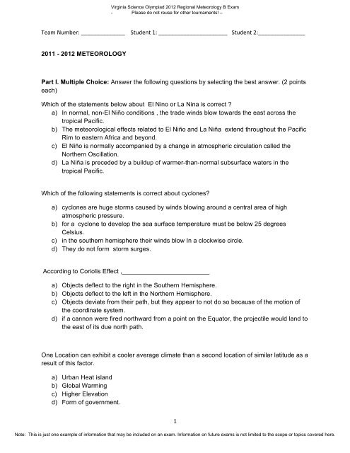
Virginia <strong>Science</strong> <strong>Olympiad</strong> 2012 Regional <strong>Meteorology</strong> B Exam<br />
- Please do not reuse for other tournaments! –<br />
Team Number: ______________ <strong>Student</strong> 1: ______________________ <strong>Student</strong> 2:_______________ <br />
2011 - 2012 METEOROLOGY<br />
Part I. Multiple Choice: Answer the following questions by selecting the best answer. (2 points<br />
each)<br />
Which of the statements below about El Nino or La Nina is correct ?<br />
a) In normal, non-El Niño conditions , the trade winds blow towards the east across the<br />
tropical Pacific.<br />
b) The meteorological effects related to El Niño and La Niña extend throughout the Pacific<br />
Rim to eastern Africa and beyond.<br />
c) El Niño is normally accompanied by a change in atmospheric circulation called the<br />
Northern Oscillation.<br />
d) La Niña is preceded by a buildup of warmer-than-normal subsurface waters in the<br />
tropical Pacific.<br />
Which of the following statements is correct about cyclones?<br />
a) cyclones are huge storms caused by winds blowing around a central area of high<br />
atmospheric pressure.<br />
b) for a cyclone to develop the sea surface temperature must be below 25 degrees<br />
Celsius.<br />
c) in the southern hemisphere their winds blow In a clockwise circle.<br />
d) They do not form storm surges.<br />
According to Coriolis Effect ,_________________________<br />
a) Objects deflect to the right in the Southern Hemisphere.<br />
b) Objects deflect to the left in the Northern Hemisphere.<br />
c) Objects deviate from their path, but they appear to not do so because of the motion of<br />
the coordinate system.<br />
d) if a cannon were fired northward from a point on the Equator, the projectile would land to<br />
the east of its due north path.<br />
One Location can exhibit a cooler average climate than a second location of similar latitude as a<br />
result of this factor.<br />
a) Urban Heat island<br />
b) Global Warming<br />
c) Higher Elevation<br />
d) Form of government.<br />
1 <br />
Note: This is just one example of information that may be included on an exam. Information on future exams is not limited to the scope or topics covered here.
Virginia <strong>Science</strong> <strong>Olympiad</strong> 2012 Regional <strong>Meteorology</strong> B Exam<br />
- Please do not reuse for other tournaments! –<br />
In degrees Fahrenheit, the world’s all-time warmest and coldest temperatures are about:<br />
a) 100F and -70F<br />
b) 120F and -80F<br />
c) 104F and -50F<br />
d) 135F and -120F<br />
Clouds begin to form when water vapor in the air reaches the correct ____.<br />
a) altitude<br />
b) temperature<br />
c) dew point<br />
d) all of the above<br />
Shortwave radiation comes primarily from our sun; this is because:<br />
a) The sun is much hotter than the earth and tends to radiate at shorter wavelengths.<br />
b) The sun only radiates light during the daytime period which is shorter.<br />
c) The sun is composed of helium that only produces shortwave radiation.<br />
d) The sun is a much larger celestial body than Earth, so it stands to reason that its total<br />
radiation would be greater.<br />
What keeps the atmosphere around Earth and prevents it from moving into space?<br />
a) Heavy air masses high in the atmosphere trap air near Earth’s surface.<br />
b) Pressure from space keeps the atmosphere close to Earth’s surface.<br />
c) Radiation from the Sun keeps it heated, which keeps it near Earth’s surface.<br />
d) The atmosphere is subject to gravity because it is composed of matter and has mass.<br />
An infrared weather satellite image depends on:<br />
a) Shortwave radiation reflected by clouds and the Earth’s surface.<br />
b) Ultraviolet radiation transmitted through the clouds to the satellite’s sensor.<br />
c) Longwave radiation emitted by clouds and the Earth’s surface.<br />
d) None of the above.<br />
2 <br />
Note: This is just one example of information that may be included on an exam. Information on future exams is not limited to the scope or topics covered here.
Virginia <strong>Science</strong> <strong>Olympiad</strong> 2012 Regional <strong>Meteorology</strong> B Exam<br />
- Please do not reuse for other tournaments! –<br />
Use the illustration to answer following two questions.<br />
Complete the sentence.<br />
If the axis of the Earth was not tilted, _____________________<br />
a) many places on Earth wouldn’t receive much light.<br />
b) there would be four seasons on the North Pole.<br />
c) people would suffer harsh winters in North Africa.<br />
d) there would be no equinoxes.<br />
Which of these statements is not true about seasons on Earth?<br />
a) During the summer solstice the South Pole is inclined towards the Sun.<br />
b) On March 21 , days and nights are equal in America.<br />
c) It is summer on January 1 st in Australia.<br />
d) June 21 is the day when Australia receives the most sunshine.<br />
On average, altitude is _________ related with mean yearly temperature.<br />
a) Directly<br />
b) Inversely<br />
c) Not<br />
d) Un<br />
3 <br />
Note: This is just one example of information that may be included on an exam. Information on future exams is not limited to the scope or topics covered here.
Virginia <strong>Science</strong> <strong>Olympiad</strong> 2012 Regional <strong>Meteorology</strong> B Exam<br />
- Please do not reuse for other tournaments! –<br />
Which layer of the atmosphere makes long-distance communication possible?<br />
a) exosphere<br />
b) ionosphere<br />
c) stratosphere<br />
d) troposphere<br />
Mitigation of inadvertent climate change means what:<br />
a) Migration of people towards cooler climates.<br />
b) Trying to reverse or undo factors that led to the inadvertent climate change.<br />
c) Setting up a system of carbon credits to trade on the open market.<br />
d) None of the above.<br />
The best conditions for snow and ice build-up over time (conditions leading to glaciations or iceages)<br />
are:<br />
(warm/cold/wet/dry means ‘more than normal for that season’)<br />
a) Warm summer and cold winters<br />
b) Cool/dry summer and Warm/wet winters<br />
c) Cold/wet winters and cool/wet summers<br />
d) Dry/warm summers and wet/cold winters<br />
All of the following are major classification types in the Koeppen Classification System EXCEPT<br />
a) Continental<br />
b) Moist Tropical<br />
c) Humid Mid-Latitude<br />
d) Temperate<br />
The Milankovich Theory deals with<br />
a) Global Warming due to non-understood mechanisms<br />
b) The changing of the axis of rotation of the Earth over time<br />
c) The cycle of El Nino/La Nina in the Pacific Ocean<br />
d) The seasonal variation in ozone concentration at the south pole<br />
4 <br />
Note: This is just one example of information that may be included on an exam. Information on future exams is not limited to the scope or topics covered here.
Virginia <strong>Science</strong> <strong>Olympiad</strong> 2012 Regional <strong>Meteorology</strong> B Exam<br />
- Please do not reuse for other tournaments! –<br />
A student is writing a report about molecules. She describes the way fast-moving molecules<br />
transfer energy to slower-moving molecules when they bump into each other. What is the<br />
subject of her report?<br />
a) Conduction<br />
b) Convection<br />
c) Humidity<br />
d) Precipitation<br />
Which is a type of stratus cloud that is in contact with the ground?<br />
a) cirrostratus<br />
b) fog<br />
c) humidity<br />
d) nimbostratus<br />
5 <br />
Note: This is just one example of information that may be included on an exam. Information on future exams is not limited to the scope or topics covered here.
Virginia <strong>Science</strong> <strong>Olympiad</strong> 2012 Regional <strong>Meteorology</strong> B Exam<br />
- Please do not reuse for other tournaments! –<br />
Part II. True or False (2 points each)<br />
⎯⎯ An El Nino winter in Southern California is typically dryer and warmer than normal.<br />
⎯⎯ West coast climates often have rainy seasons in the summer.<br />
⎯⎯ Southern Chile’s warmest month of the year would be in January or February.<br />
⎯⎯ A monsoon climate only occurs in places like India and Pan-Asia.<br />
⎯⎯ The world’s deserts tend to be clustered near 30N and 30S latitudes.<br />
⎯⎯ The main distinction between the Koppen climate classification and that of Thornthwaite is<br />
that Thornthwaite’s system is based on precipitation or humidity and Koppen is based on<br />
temperature.<br />
⎯⎯ The last important glaciation of the Northern Hemisphere is called the Wisconsin Ice Age.<br />
⎯⎯ NO 2 is the most abundant atmospheric constituent.<br />
⎯⎯ The mid-latitude westerlies are replaced with mid-latitude easterlies in the Southern<br />
Hemisphere<br />
⎯⎯ Circulation around a low pressure in the Southern Hemisphere is clockwise.<br />
⎯⎯ CO 2 concentration varies quite a bit seasonally (by approximately 2-3%).<br />
⎯⎯ Reducing total ice and snow cover on the Earth’s surface decreases the amount of<br />
reflected sunlight (i.e. it decreases ther Earth’s albedo).<br />
⎯⎯ The Earth is closest to the sun in early January and farthest away about 6 months later.<br />
⎯⎯ The tilt of the Earth’s axis is about 10 degrees.<br />
⎯⎯ Sunspots are patches of relatively cooler surface sun temperature compared to their<br />
surroundings.<br />
Part III. Climate Acronyms or abbreviations: (2 points each)<br />
L (as on a weather map)<br />
mT (air mass abbreviation)<br />
IPCC<br />
RH<br />
ENSO<br />
__________________________________________<br />
__________________________________________<br />
__________________________________________<br />
__________________________________________<br />
__________________________________________<br />
6 <br />
Note: This is just one example of information that may be included on an exam. Information on future exams is not limited to the scope or topics covered here.
Virginia <strong>Science</strong> <strong>Olympiad</strong> 2012 Regional <strong>Meteorology</strong> B Exam<br />
- Please do not reuse for other tournaments! –<br />
Part IV. Consider the following yearly Climograph:<br />
D <br />
C <br />
B <br />
A <br />
E <br />
(2 points each)<br />
What does the dark blue line (A) and numbers represent? _______ (qty) ___ (units)<br />
What does the light blue line (B) and numbers represent? _______ (qty) ___ (units)<br />
What does the orange line (C) and numbers represent? _______ (qty) ____ (units)<br />
What does the red line (D) and numbers represent? _______ (qty) ______ (units)<br />
What does the blue bars (E) and numbers represent? _______ (qty) ______ (units)<br />
7 <br />
Note: This is just one example of information that may be included on an exam. Information on future exams is not limited to the scope or topics covered here.
Virginia <strong>Science</strong> <strong>Olympiad</strong> 2012 Regional <strong>Meteorology</strong> B Exam<br />
- Please do not reuse for other tournaments! –<br />
Part V. Short Answer. Complete sentences are not necessary.<br />
- What is the difference between water vapor and visible clouds?<br />
Match the information below with the atmosphere layers in the box.<br />
STRATOSPHERE, MESOSPHERE, EXOSPHERE, TROPOSPHERE<br />
- ___________________: The lower portion has a nearly constant temperature with height<br />
but in the upper portion the temperature increases with altitude because of absorption of<br />
sunlight by ozone. (1 point)<br />
- ___________________: A cold layer where the temperature generally decreases with<br />
increasing altitude. (1 point)<br />
- ___________________: Closest to the Earth's surface. (1 point)<br />
- ___________________: The upper limit of our atmosphere. (1 point)<br />
- Which type of air mass originate over the warm waters of the tropics and Gulf of Mexico,<br />
where heat and moisture are transferred to the overlying air from the waters below? (2<br />
points)<br />
- What are the three principal types of heat transfer? (6 points)<br />
- Why does the stratosphere warm with height? (3 points)<br />
8 <br />
Note: This is just one example of information that may be included on an exam. Information on future exams is not limited to the scope or topics covered here.
Virginia <strong>Science</strong> <strong>Olympiad</strong> 2012 Regional <strong>Meteorology</strong> B Exam<br />
- Please do not reuse for other tournaments! –<br />
- Describe three primary effects in the continental U.S. during an El Nino period (6 points).<br />
- Describe the prevailing westerlies.(3 points)<br />
State if the pictures show a cold or warm front.<br />
- ___________________(2 points)<br />
- ___________________(2 points)<br />
Tie Breaker:<br />
- Dendochronology is the study of _________________. (0.1 points)<br />
- What is the dew point? (0.2 points)<br />
9 <br />
Note: This is just one example of information that may be included on an exam. Information on future exams is not limited to the scope or topics covered here.
Virginia <strong>Science</strong> <strong>Olympiad</strong> 2012 Regional <strong>Meteorology</strong> B Exam<br />
- Please do not reuse for other tournaments! –<br />
10 <br />
Note: This is just one example of information that may be included on an exam. Information on future exams is not limited to the scope or topics covered here.
Virginia <strong>Science</strong> <strong>Olympiad</strong> 2012 Regional <strong>Meteorology</strong> B Exam<br />
- Please do not reuse for other tournaments! –<br />
Team Number: ______________ <strong>Student</strong> 1: ______________________ <strong>Student</strong> 2:_______________ <br />
2011 - 2012 METEOROLOGY<br />
Part I. Multiple Choice: Answer the following questions by selecting the best answer. (2 points<br />
each)<br />
Which of the statements below about El Nino or La Nina is correct ?<br />
a) In normal, non-El Niño conditions , the trade winds blow towards the east across the<br />
tropical Pacific.<br />
b) The meteorological effects related to El Niño and La Niña extend throughout the Pacific<br />
Rim to eastern Africa and beyond.<br />
c) El Niño is normally accompanied by a change in atmospheric circulation called the<br />
Northern Oscillation.<br />
d) La Niña is preceded by a buildup of warmer-than-normal subsurface waters in the<br />
tropical Pacific.<br />
Which of the following statements is correct about cyclones?<br />
a) cyclones are huge storms caused by winds blowing around a central area of high<br />
atmospheric pressure.<br />
b) for a cyclone to develop the sea surface temperature must be below 25 degrees<br />
Celsius.<br />
c) in the southern hemisphere their winds blow In a clockwise circle.<br />
d) They do not form storm surges.<br />
According to Coriolis Effect ,_________________________<br />
a) Objects deflect to the right in the Southern Hemisphere.<br />
b) Objects deflect to the left in the Northern Hemisphere.<br />
c) Objects deviate from their path, but they appear to not do so because of the motion of<br />
the coordinate system.<br />
d) if a cannon were fired northward from a point on the Equator, the projectile would land to<br />
the east of its due north path.<br />
One Location can exhibit a cooler average climate than a second location of similar latitude as a<br />
result of this factor.<br />
a) Urban Heat island<br />
b) Global Warming<br />
c) Higher Elevation<br />
d) Form of government.<br />
1 <br />
Note: This is just one example of information that may be included on an exam. Information on future exams is not limited to the scope or topics covered here.
Virginia <strong>Science</strong> <strong>Olympiad</strong> 2012 Regional <strong>Meteorology</strong> B Exam<br />
- Please do not reuse for other tournaments! –<br />
In degrees Fahrenheit, the world’s all-time warmest and coldest temperatures are about:<br />
a) 100F and -70F<br />
b) 120F and -80F<br />
c) 104F and -50F<br />
d) 135F and -120F<br />
Clouds begin to form when water vapor in the air reaches the correct ____.<br />
a) altitude<br />
b) temperature<br />
c) dew point<br />
d) all of the above<br />
Shortwave radiation comes primarily from our sun; this is because:<br />
a) The sun is much hotter than the earth and tends to radiate at shorter wavelengths.<br />
b) The sun only radiates light during the daytime period which is shorter.<br />
c) The sun is composed of helium that only produces shortwave radiation.<br />
d) The sun is a much larger celestial body than Earth, so it stands to reason that its total<br />
radiation would be greater.<br />
What keeps the atmosphere around Earth and prevents it from moving into space?<br />
a) Heavy air masses high in the atmosphere trap air near Earth’s surface.<br />
b) Pressure from space keeps the atmosphere close to Earth’s surface.<br />
c) Radiation from the Sun keeps it heated, which keeps it near Earth’s surface.<br />
d) The atmosphere is subject to gravity because it is composed of matter and has mass.<br />
An infrared weather satellite image depends on:<br />
a) Shortwave radiation reflected by clouds and the Earth’s surface.<br />
b) Ultraviolet radiation transmitted through the clouds to the satellite’s sensor.<br />
c) Longwave radiation emitted by clouds and the Earth’s surface.<br />
d) None of the above.<br />
2 <br />
Note: This is just one example of information that may be included on an exam. Information on future exams is not limited to the scope or topics covered here.
Virginia <strong>Science</strong> <strong>Olympiad</strong> 2012 Regional <strong>Meteorology</strong> B Exam<br />
- Please do not reuse for other tournaments! –<br />
Use the illustration to answer following two questions.<br />
Complete the sentence.<br />
If the axis of the Earth was not tilted, _____________________<br />
a) many places on Earth wouldn’t receive much light.<br />
b) there would be four seasons on the North Pole.<br />
c) people would suffer harsh winters in North Africa.<br />
d) there would be no equinoxes.<br />
Which of these statements is not true about seasons on Earth?<br />
a) During the summer solstice the South Pole is inclined towards the Sun.<br />
b) On March 21 , days and nights are equal in America.<br />
c) It is summer on January 1 st in Australia.<br />
d) June 21 is the day when Australia receives the most sunshine.<br />
On average, altitude is _________ related with mean yearly temperature.<br />
a) Directly<br />
b) Inversely<br />
c) Not<br />
d) Un<br />
3 <br />
Note: This is just one example of information that may be included on an exam. Information on future exams is not limited to the scope or topics covered here.
Virginia <strong>Science</strong> <strong>Olympiad</strong> 2012 Regional <strong>Meteorology</strong> B Exam<br />
- Please do not reuse for other tournaments! –<br />
Which layer of the atmosphere makes long-distance communication possible?<br />
a) exosphere<br />
b) ionosphere<br />
c) stratosphere<br />
d) troposphere<br />
Mitigation of inadvertent climate change means what:<br />
a) Migration of people towards cooler climates.<br />
b) Trying to reverse or undo factors that led to the inadvertent climate change.<br />
c) Setting up a system of carbon credits to trade on the open market.<br />
d) None of the above.<br />
The best conditions for snow and ice build-up over time (conditions leading to glaciations or iceages)<br />
are:<br />
(warm/cold/wet/dry means ‘more than normal for that season’)<br />
a) Warm summer and cold winters<br />
b) Cool/dry summer and Warm/wet winters<br />
c) Cold/wet winters and cool/wet summers<br />
d) Dry/warm summers and wet/cold winters<br />
All of the following are major classification types in the Koeppen Classification System EXCEPT<br />
a) Continental<br />
b) Moist Tropical<br />
c) Humid Mid-Latitude<br />
d) Temperate<br />
The Milankovich Theory deals with<br />
a) Global Warming due to non-understood mechanisms<br />
b) The changing of the axis of rotation of the Earth over time<br />
c) The cycle of El Nino/La Nina in the Pacific Ocean<br />
d) The seasonal variation in ozone concentration at the south pole<br />
4 <br />
Note: This is just one example of information that may be included on an exam. Information on future exams is not limited to the scope or topics covered here.
Virginia <strong>Science</strong> <strong>Olympiad</strong> 2012 Regional <strong>Meteorology</strong> B Exam<br />
- Please do not reuse for other tournaments! –<br />
A student is writing a report about molecules. She describes the way fast-moving molecules<br />
transfer energy to slower-moving molecules when they bump into each other. What is the<br />
subject of her report?<br />
a) Conduction<br />
b) Convection<br />
c) Humidity<br />
d) Precipitation<br />
Which is a type of stratus cloud that is in contact with the ground?<br />
a) cirrostratus<br />
b) fog<br />
c) humidity<br />
d) nimbostratus<br />
5 <br />
Note: This is just one example of information that may be included on an exam. Information on future exams is not limited to the scope or topics covered here.
Virginia <strong>Science</strong> <strong>Olympiad</strong> 2012 Regional <strong>Meteorology</strong> B Exam<br />
- Please do not reuse for other tournaments! –<br />
Part II. True or False (2 points each)<br />
F An El Nino winter in Southern California is typically dryer and warmer than normal.<br />
F West coast climates often have rainy seasons in the summer.<br />
T Southern Chile’s warmest month of the year would be in January or February.<br />
F A monsoon climate only occurs in places like India and Pan-Asia.<br />
T The world’s deserts tend to be clustered near 30N and 30S latitudes.<br />
T The main distinction between the Koppen climate classification and that of Thornthwaite is<br />
that Thornthwaite’s system is based on precipitation or humidity and Koppen is based on<br />
temperature.<br />
T The last important glaciation of the Northern Hemisphere is called the Wisconsin Ice Age.<br />
F NO 2 is the most abundant atmospheric constituent.<br />
F The mid-latitude westerlies are replaced with mid-latitude easterlies in the Southern<br />
Hemisphere<br />
T Circulation around a low pressure in the Southern Hemisphere is clockwise.<br />
T CO 2 concentration varies quite a bit seasonally (by approximately 2-3%).<br />
T Reducing total ice and snow cover on the Earth’s surface decreases the amount of reflected<br />
sunlight (i.e. it decreases ther Earth’s albedo).<br />
T The Earth is closest to the sun in early January and farthest away about 6 months later.<br />
F The tilt of the Earth’s axis is about 10 degrees.<br />
T Sunspots are patches of relatively cooler surface sun temperature compared to their<br />
surroundings.<br />
Part III. Climate Acronyms or abbreviations: (2 points each)<br />
L (as on a weather map)<br />
mT (air mass abbreviation)<br />
IPCC<br />
RH<br />
ENSO<br />
Low Pressure<br />
Maritime Tropical<br />
Intergovernmental Panel on Climate Change<br />
Relative Humidity<br />
El Nino – Southern Oscillation<br />
6 <br />
Note: This is just one example of information that may be included on an exam. Information on future exams is not limited to the scope or topics covered here.
Virginia <strong>Science</strong> <strong>Olympiad</strong> 2012 Regional <strong>Meteorology</strong> B Exam<br />
- Please do not reuse for other tournaments! –<br />
Part IV. Consider the following yearly Climograph:<br />
D <br />
C <br />
B <br />
A <br />
E <br />
What does the dark blue line (A) and numbers represent? Monthly record Low in deg-F<br />
What does the light blue line (B) and numbers represent? Monthly Low in deg F<br />
What does the orange line (C) and numbers represent? Monthly High T in deg F<br />
What does the red line (D) and numbers represent? Monthly record High in deg F<br />
What does the blue bars (E) and numbers represent? Monthly precip in inches<br />
7 <br />
Note: This is just one example of information that may be included on an exam. Information on future exams is not limited to the scope or topics covered here.
Virginia <strong>Science</strong> <strong>Olympiad</strong> 2012 Regional <strong>Meteorology</strong> B Exam<br />
- Please do not reuse for other tournaments! –<br />
Part V. Short Answer. Complete sentences are not necessary.<br />
- What is the difference between water vapor and visible clouds?<br />
Water vapor is a gas and visible clouds are made up of liquid molecules condensed water<br />
vapor.<br />
Match the information below with the atmosphere layers in the box.<br />
STRATOSPHERE, MESOSPHERE, EXOSPHERE, TROPOSPHERE<br />
- STRATOSPHERE: The lower portion has a nearly constant temperature with height but in<br />
the upper portion the temperature increases with altitude because of absorption of sunlight<br />
by ozone.<br />
- MESOSPHERE: A cold layer where the temperature generally decreases with increasing<br />
altitude.<br />
- TROPOSPHERE: Closest to the Earth's surface.<br />
- EXOSPEHERE: The upper limit of our atmosphere.<br />
- Which type of air mass originate over the warm waters of the tropics and Gulf of Mexico,<br />
where heat and moisture are transferred to the overlying air from the waters below? (2<br />
points)<br />
Maritime Tropical Air Masses<br />
- What are the three principal types of heat transfer? (6 points)<br />
Conduction, Convection, Radiation<br />
- Why does the stratosphere warm with height? (3 points)<br />
Ozone Reaction absorbs heat<br />
8 <br />
Note: This is just one example of information that may be included on an exam. Information on future exams is not limited to the scope or topics covered here.
Virginia <strong>Science</strong> <strong>Olympiad</strong> 2012 Regional <strong>Meteorology</strong> B Exam<br />
- Please do not reuse for other tournaments! –<br />
- Describe three primary effects in the continental U.S. during an El Nino period (6 points).<br />
Fewer Atlantic Hurricanes<br />
Wetter Summer in West<br />
Warmer/Drier Winters in West<br />
Reduced Snowfall in winter<br />
- Describe the prevailing westerlies.(3 points)<br />
Prevailing westerlies are winds located between 30° and 60° latitude north and south of the<br />
equator. They blow from the west and act as boundaries between the cold polar and milder<br />
equatorial air.<br />
State if the pictures show a cold or warm front.<br />
- _cold front _(2 points)<br />
- _ warm front __(2 points)<br />
Tie Breaker:<br />
- Dendochronology is the study of tree rings related to climatology. (0.1 points)<br />
- What is the dew point? (0.2 points)<br />
The dew point is the temperature at which air is saturated and condensation can occur.<br />
9 <br />
Note: This is just one example of information that may be included on an exam. Information on future exams is not limited to the scope or topics covered here.