Urban Design Framework - Kempsey Shire Council
Urban Design Framework - Kempsey Shire Council
Urban Design Framework - Kempsey Shire Council

You also want an ePaper? Increase the reach of your titles
YUMPU automatically turns print PDFs into web optimized ePapers that Google loves.
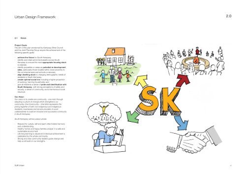
<strong>Urban</strong> <strong>Design</strong> <strong>Framework</strong> 2.0<br />
2.1 Vision<br />
Project Goals<br />
The aim of the plan envisioned by <strong>Kempsey</strong> <strong>Shire</strong> <strong>Council</strong><br />
and the Joint Planning Group require the achievement of the<br />
following specific goals:<br />
··<br />
achieve the Vision for South <strong>Kempsey</strong>;<br />
··<br />
identify and retain prime land assets across South<br />
<strong>Kempsey</strong> to ensure the most appropriate housing stock<br />
is retained;<br />
··<br />
identify properties or areas as potential re-development<br />
sites, particularly those located within close proximity to<br />
the commercial area and schools or services;<br />
··<br />
align dwelling stock to changing demographic needs of<br />
residents in South <strong>Kempsey</strong>;<br />
··<br />
create optimal social mix including a higher proportion<br />
of working / earning households; and<br />
··<br />
give all residents a sense of pride and identification with<br />
South <strong>Kempsey</strong>, with strong perceptions of safety and<br />
security, a sense of community, and a harmonious social<br />
structure.<br />
Our Vision<br />
Our vision is to create one community - one mob through<br />
adopting a culture of change which strengthens our<br />
community. One Community – One Mob represents the<br />
joining together of both non-indigenous and indigenous<br />
residents, businesses and service providers to work<br />
collaboratively to build an inclusive and successful community<br />
in South <strong>Kempsey</strong>.<br />
South <strong>Kempsey</strong> will be a place where:<br />
··<br />
Respect for culture, self and each other fosters harmony<br />
and understanding.<br />
··<br />
Healthy homes and happy families prosper in a safe and<br />
sustainable environment<br />
··<br />
Life-long learning is valued and individual achievement is<br />
celebrated by the whole community.<br />
··<br />
Strong and wise community leaders guide change and<br />
help us all build on our strengths.<br />
SJB <strong>Urban</strong><br />
21
<strong>Urban</strong> <strong>Design</strong> <strong>Framework</strong> 2.0<br />
2.2 <strong>Framework</strong> Principles_<strong>Urban</strong><br />
01 Housing 02 Open Space<br />
03 Movement 04 Sustainability<br />
• Provide a diverse range of housing typologies to<br />
meet the needs of current tenants and attract<br />
future new residents to the area<br />
• Demonstrate a positive relationship and mix<br />
between housing tenures by reducing the<br />
concentration of public housing<br />
• Increase the availability of land suitable for<br />
residential development, including the provision<br />
of services, zoning, planning guidance and<br />
infrastructure<br />
• Increase density around the Pacific Highway<br />
corridor, reflecting the Business Enterprise Zone<br />
and investigating new housing typologies, including<br />
row housing, fonzi flats and multi-unit residential<br />
• Ensure housing mix and quantity is in line with the<br />
needs of the community, including the provision<br />
of private open space, access to services and<br />
passive design to reduce energy bills<br />
• Ensure new housing strategies delivers positive<br />
change to the community by replacing areas in<br />
need with new forms and mixed tenures.<br />
• Provide a variety of new green open spaces across<br />
the suburb that may include meeting spaces,<br />
relaxation and leisure spaces, active and passive<br />
place space, and productive spaces<br />
• Configure parks to have street edges, not private<br />
back fences, to improve public access and visual<br />
surveillance (safety)<br />
• Engage with the community to ensure the open<br />
spaces meet their needs, reflect their culture, and<br />
perform across several generations<br />
• Investigate opportunities to bring community<br />
gardens throughout the suburb, building on the<br />
success of the Family & Community Centre<br />
• Improve the shading of public spaces, footpaths<br />
and gathering places through the using of tall<br />
tree cover, considered sitting and design, and<br />
introducing shade structures<br />
• Improve the biodiversity of South <strong>Kempsey</strong><br />
by linking spaces through green corridors and<br />
streetscape improvements, which must feature<br />
native species<br />
• Seek improved frequency of bus services to South<br />
<strong>Kempsey</strong> by increasing the local population and<br />
density of development<br />
• Pedestrian and cyclist movement will be<br />
encouraged and balanced against the need to<br />
rationalise industrial traffic and improve vehicle<br />
access into South <strong>Kempsey</strong><br />
• Establish a legible movement network through the<br />
use of streetscape design, street signage, changes<br />
in surface treatments and gateway statements<br />
• Include safe, accessible and attractive (shaded)<br />
routes that encourage pedestrian and cycle<br />
journeys to the CBD across the existing bridge or<br />
proposed Second Crossing<br />
• Improve the pedestrian environment, particularly for<br />
those (students) walking to and from school<br />
• Traffic calming measures used to ensure safe<br />
interaction between traffic, pedestrians & cyclists<br />
• Shared surfacing and pedestrian paths that link<br />
existing parks and public spaces, encouraging<br />
safer foot traffic and cycling through the area<br />
• The range and access to services should be<br />
improved within South <strong>Kempsey</strong>, minimising the<br />
need for travel, encouraging walking, cycling and<br />
easy access for public and community transport<br />
• Regeneration of Gill’s Bridge Creek and<br />
remediation of the Boral Brickworks to be<br />
undertaken by local labour, using native species<br />
and local Indigenous practices<br />
• All new development will be made highly<br />
sustainable through quality design, energy<br />
efficiency and adaptable for future solar and other<br />
technology integration - meeting best practice<br />
standards and <strong>Council</strong>’s standards<br />
• Extend the natural environment throughout<br />
the community via a network of green spaces,<br />
landscaped streets and communal gardens -<br />
encouraging biodiversity and native species<br />
• Flooding, site drainage, stormwater run-off & water<br />
courses to form the basis of a WSUD Strategy<br />
• All future proposals should reflect the objectives of<br />
the <strong>Council</strong>’s Environmental Sustainability Strategy<br />
22 SJB <strong>Urban</strong>
<strong>Urban</strong> <strong>Design</strong> <strong>Framework</strong> 2.0<br />
2.3 Principles_Social<br />
01 Bridging<br />
02 Respect<br />
03 Employment<br />
04 Support<br />
• A community that is inclusive and diverse by<br />
involving different community groups, community<br />
members, ages etc.<br />
• Creating understanding and connections across<br />
groups in the community<br />
• “Making friends with people who are not like you,<br />
like supporters of another football team”<br />
SK<br />
1 Community.<br />
1 Mob.<br />
• Fostering positive attitudes and behaviour towards<br />
everyone in the community<br />
• Appreciate the diverse make-up of the community<br />
• “Showing respect every day”<br />
SK<br />
1 Community.<br />
1 Mob.<br />
• Improve the availability and access to employment<br />
opportunities, particularly for local Aboriginal<br />
people<br />
• Strengthen existing services in the area and<br />
supporting local business through exposure and a<br />
greater support network (parking, walking paths,<br />
transport).<br />
• “Contributing skills and expertise within the<br />
community”<br />
• Assisting parents to raise healthy families<br />
• Provide support for young mothers continuing their<br />
education<br />
• Ensuring people released from correctional facilities<br />
have support in their community<br />
• School levers be provided with the assistance to<br />
move into the next phase of their adult life<br />
• “Support the community through all stages of their<br />
loves”<br />
05 Partnership<br />
06 Pride<br />
07 Education<br />
08 Culture<br />
nity.<br />
SK<br />
1 Community.<br />
1 Mob.<br />
SK<br />
1 Community.<br />
1 Mob.<br />
SK<br />
1 Community.<br />
1 Mob.<br />
nity.<br />
• Working together and in partnerships to deliver<br />
change for South <strong>Kempsey</strong><br />
• Collective action, joint projects, sharing information<br />
55mm and Button shared Badge: responsibility<br />
http://www.buttonempire.com.au/custom-badges/2-25-inch-55mmbadges.html<br />
SK<br />
• “Let’s shake hands with each other”.<br />
57mm Button Badge:<br />
http://www.rwpromotion.com.au/custom-button-badges.php<br />
1 Community.<br />
1 Mob.<br />
58mm Button Badge:<br />
http://namebadgeworld.com.au/Button-Badges.php<br />
• Pride in self, community, culture and South<br />
<strong>Kempsey</strong><br />
• Building a sense of belonging and feeling good<br />
• “Feeling Preferred proud of South <strong>Kempsey</strong>”<br />
design if limited<br />
to colour.<br />
• Engage with all educational institutions<br />
• Celebrate the academic achievements within<br />
the community, across all age-groups and all<br />
backgrounds<br />
• Its never too late to learn - offer education for all<br />
age groups and competencies<br />
• “Education can bring positive and lasting change to<br />
the community”<br />
• Recognise and respect the local Indigenous<br />
community, their history and their links to the land<br />
• Celebrate the work of individuals in the community<br />
and their contributions to South <strong>Kempsey</strong><br />
• Share stories, history and knowledge with the<br />
broader community<br />
• “A place for learning, sharing and celebrating the<br />
Indigenous community”<br />
SJB <strong>Urban</strong><br />
23<br />
ge:<br />
Preferred
<strong>Urban</strong> <strong>Design</strong> <strong>Framework</strong> 2.0<br />
2.4 Concept Plan<br />
Masterplan Concept<br />
1. Green connections through existing open spaces and<br />
native landscape, reinforced by new parks and recharacterised<br />
spaces<br />
2. Range of recreational facilities and spaces, including<br />
the kayak & boat ramp, South <strong>Kempsey</strong> Oval and<br />
Tennis Courts<br />
3. Existing schools and educational facilities, including the<br />
proposal for a hostel on Reginald Ward Street<br />
4. Middleton Street revitalisation, including streetscape<br />
improvements, cycle paths and multi-purpose<br />
development<br />
5. Regeneration of the Pacific Highway corridor<br />
6. Second Crossing over the River, extending Queen St<br />
7. New residential sub-division and redeveloped<br />
properties, focusing on the Housing NSW properties<br />
8. Maintain and reinforce the commercial and industrial<br />
uses along South Street<br />
9. Remediation of the former brickworks - native nursery<br />
10. Define the key gateways to South <strong>Kempsey</strong> with<br />
signage, development and streetscape design<br />
Thessa Street<br />
Nicholson Street<br />
3<br />
Queen Street<br />
6<br />
1<br />
2<br />
Bloomfield Street<br />
5<br />
10<br />
Key<br />
New Residential<br />
Existing Industrial & Commercial<br />
7<br />
Reginald Ward St<br />
3<br />
4<br />
Community & Education<br />
Retail & Business Enterprise<br />
Open Space (Natural & Recreational)<br />
Primary Access<br />
Pacific Highway Renewal<br />
West Street<br />
8<br />
1<br />
2<br />
Pacific Highway<br />
Link Road<br />
Industrial & Commercial<br />
Green Links<br />
South Street<br />
5<br />
New Community & Commercial Buildings<br />
New Recreational Buildings<br />
9<br />
Gateways<br />
01 Masterplan Concept Diagram - South <strong>Kempsey</strong><br />
24 SJB <strong>Urban</strong>
<strong>Urban</strong> <strong>Design</strong> <strong>Framework</strong> 2.0<br />
2.5 <strong>Urban</strong> <strong>Framework</strong> Plans<br />
Movement <strong>Framework</strong> - Vehicles & Public Transport<br />
Key attributes of the Movement <strong>Framework</strong> Plan for Vehicles<br />
and Public Transport include the following:<br />
··<br />
The Pacific Highway will occupy a different position in the<br />
movement hierarchy for South <strong>Kempsey</strong> following the<br />
opening of the bypass. Reinforced with new retail uses<br />
and recharacterised by streetscape upgrades this primary<br />
route will become a greater focus of local residents.<br />
··<br />
Middleton Street will continue to operate as the ‘spine’<br />
of South <strong>Kempsey</strong>, a position that can be strengthened<br />
by improvements to the streetscape, including curb and<br />
guttering, footpaths and cyclepaths<br />
··<br />
Queen Street extends north from South Street, through<br />
the centre of the community and over the river via the<br />
‘Second Crossing’, which may feature a secondary<br />
bus route - either an extension of the existing route or<br />
additional service<br />
··<br />
Tertiary and Local Access routes provide access to<br />
residential neighbourhoods, the majority of which fall<br />
within a 400m catchment (5 minute walk) from the key<br />
bus stops.<br />
··<br />
To accommodate future residential development to the<br />
south of Middleton Street an extension or realingment of<br />
the bus service may be needed along Reginald Ward St.<br />
Key<br />
Thessa Street<br />
Nicholson Street<br />
Middleton Street<br />
Melville<br />
High School<br />
Reginald Ward St<br />
Bloomfield Street<br />
FCC<br />
Queen Street<br />
South<br />
<strong>Kempsey</strong><br />
Primary<br />
School<br />
PCYC<br />
Destinations: Community & Education Uses<br />
Destinations: Retail & Commercial<br />
Destinations: Open Space & Recreation<br />
Primary Routes<br />
Secondary (Feeder) Routes<br />
Tertiary (Residential) Routes<br />
West Street<br />
Queen Street<br />
Pacific Highway<br />
Local Access Routes<br />
Existing Bus Route<br />
South Street<br />
Extension/Alternative Bus Route<br />
Direction of Bus Route<br />
Primary Bus Stops<br />
400m Catchment from Bus Stops<br />
01 Movement <strong>Framework</strong> Plan - Vehicles & Public Transport<br />
SJB <strong>Urban</strong><br />
25
<strong>Urban</strong> <strong>Design</strong> <strong>Framework</strong> 2.0<br />
2.5 <strong>Urban</strong> <strong>Framework</strong> Plans<br />
Movement <strong>Framework</strong> - Pedestrians & Cyclists<br />
Key attributes of the Movement <strong>Framework</strong> Plan for<br />
Pedestrians and Cyclists include the following:<br />
··<br />
Shared cycle and pedestrian routes are aligned along the<br />
primary movement corridors, including Middleton, Queen,<br />
South and Bloomfield Streets to provide connections<br />
between key community and educational uses - paths<br />
configured according to current best practice, 3m with<br />
separation from the abutting roads by landscaped verges.<br />
··<br />
Seamless transition between the cycle routes and<br />
recreational spaces, which feature ‘meandering’ paths<br />
through the native trees and along the creek lines<br />
··<br />
Pedestrian footpaths are provided along all street<br />
frontages and categorised according to their catchment<br />
(number of properties access the footpath). Primary<br />
footpaths provide access to new residential areas and<br />
secondary movement routes, i.e Bloomfield and Nicholson<br />
Streets<br />
··<br />
Second order pedestrian routes provide access along<br />
roads with less traffic, and those fronted by lower density<br />
uses, such as the industrial and commercial properties<br />
along South Street<br />
Thessa Street<br />
Nicholson Street<br />
Middleton Street<br />
Melville High School<br />
Bloomfield Street<br />
FCC<br />
PCYC<br />
Reginald Ward St<br />
South<br />
<strong>Kempsey</strong><br />
Primary<br />
School<br />
Key<br />
Cycling Zone<br />
Pacific Highway<br />
Recreation Zone<br />
Queen Street<br />
Pedestrian Zone (connector)<br />
Pedestrian Zone (local)<br />
West Street<br />
Shared Cycle & Pedestrian Path (structural route)<br />
South Street<br />
Recreational Path (cycling, pedestrian, dog-walking)<br />
Primary Pedestrian Footpath (connector)<br />
Secondary Pedestrian Footpath (local)<br />
01 Movement <strong>Framework</strong> Plan - Pedestrians & Cyclists<br />
26 SJB <strong>Urban</strong>
<strong>Urban</strong> <strong>Design</strong> <strong>Framework</strong> 2.0<br />
2.5 <strong>Urban</strong> <strong>Framework</strong> Plans<br />
Landscape & Public Realm<br />
Key attributes of the Public Realm and Open Space<br />
<strong>Framework</strong> include the following:<br />
··<br />
Rationalising the existing number and ‘program’ of the<br />
public spaces throughout South <strong>Kempsey</strong> can deliver a<br />
better coverage and diversity for the community<br />
··<br />
Redundant spaces in the east and west have been<br />
designated for future development, including the park at<br />
the spaces at Chifley Place (west), Hill Street (east) and<br />
the corner of Bloomfield and Macquarie Streets (east)<br />
··<br />
New spaces have been defined as part of the new<br />
residential neighbourhoods along West Street and<br />
Reginald Ward Street - serving local recreational needs<br />
··<br />
Active spaces are identified at Queen Street and feature<br />
play spaces, cycle and waling trails through the native<br />
bushland, and seating.<br />
··<br />
Gill’s Bridge Creek corridor features walking and cycling<br />
trails, which may be formal and/or naturalised<br />
··<br />
South <strong>Kempsey</strong> Oval continues to play an important role<br />
in the support of formal sports, including AFL, cricket and<br />
tennis - supplemented by a new pavillion and changing<br />
facilities<br />
··<br />
Access to the facilities at Melville High can supplement the<br />
PCYC and South <strong>Kempsey</strong> Oval<br />
··<br />
Scooters, cycling and skating will occur along the<br />
stretch of Middleton Street adjacent to the Community<br />
Hub (former General Store) - these activities should be<br />
accommodated in the design of the streetscape<br />
Thessa Street<br />
Nicholson Street<br />
Melville<br />
High School<br />
Reginald Ward St<br />
Bloomfield Street<br />
Queen Street<br />
FCC<br />
Middleton Street Middleton Street<br />
Pacific Highway<br />
Key<br />
Tennis<br />
Walking Trail<br />
Pacific Highway<br />
Running & Walking<br />
Basketball<br />
Cycling<br />
Passive Space<br />
West Street<br />
Queen Street<br />
Community Garden<br />
Scooters & Skating<br />
Swimming<br />
South Street<br />
Football(s)<br />
Bush Regeneration<br />
Play Equipment (Local)<br />
400m Catchment<br />
01 Movement <strong>Framework</strong> Plan - Public Realm & Open Space<br />
SJB <strong>Urban</strong><br />
27
<strong>Urban</strong> <strong>Design</strong> <strong>Framework</strong> 2.0<br />
2.5 <strong>Urban</strong> <strong>Framework</strong> Plans<br />
Key Development Sites deliver the following:<br />
··<br />
31ha Residential Subdivision to the west of Middleton<br />
Street, including the regeneration of the Housing<br />
NSW properties along West Street<br />
··<br />
8.6ha Recreational & Public Open Spaces, which<br />
includes 4 local parks and the regeneration of the<br />
Crown Land between Queen and Vernon Streets<br />
··<br />
13ha Gills Bridge Creek Corridor, stretching from West<br />
Street to the railway line and the Pacific Highway<br />
to the east, featuring walking and cycle trails<br />
··<br />
52ha Boral Brick Works, remediated and returned to its<br />
native state, featuring indigenous species<br />
··<br />
3km Street Revitalisation program, including the Pacific<br />
Highway, Middleton Street and Queen Street<br />
corridors (670m for Second Bridge Crossing)<br />
··<br />
5 New Community Buildings provided throughout<br />
South <strong>Kempsey</strong>, including the Keeping Place,<br />
Community Hub, Sports Pavilion and Hostel<br />
Thessa Street<br />
6.0ha<br />
Nicholson Street<br />
4.0ha<br />
Queen Street<br />
220m<br />
670m<br />
1.3ha<br />
Bloomfield Street<br />
3,500m 2<br />
550m<br />
Key<br />
1.2km<br />
2.5ha<br />
New Residential<br />
Recreational & Community Spaces<br />
Natural Landscape<br />
Remediated Native Landscape<br />
11.1ha<br />
14.2ha<br />
1.2km<br />
3,134m 2<br />
1,125m 2<br />
1.67ha<br />
4.7ha<br />
Reginald Ward St<br />
770m<br />
480m 230m<br />
Hostel & Training<br />
Business Enterprise Corridor<br />
Pacific Highway Renewal<br />
Middleton Street Revitalisation (west)<br />
West Street<br />
7.7ha<br />
7.4ha<br />
8,000m 2<br />
Pacific Highway<br />
Middleton Street Revitalisation (east)<br />
Second River Crossing<br />
South Street<br />
River Embankment & Launch<br />
51.7ha<br />
Gateways & Key Junctions<br />
01 South <strong>Kempsey</strong> Masterplan - Key Development Sites<br />
28 SJB <strong>Urban</strong>
<strong>Urban</strong> <strong>Design</strong> <strong>Framework</strong> 2.0<br />
2.5 <strong>Urban</strong> <strong>Framework</strong> Plans<br />
New Residential<br />
Recreational & Community Spaces<br />
Middleton Street (east)<br />
Middletons Street (west)<br />
The availability of land that’s serviced and zoned for<br />
residential is a major constraint for future growth in<br />
regional centres.<br />
Key Facts (Existing):<br />
··<br />
26 properties along Middleton Street retained, 9<br />
owned by Housing NSW<br />
··<br />
13 properties on West Street, north of Middleton<br />
Street retained, including 3 owned by Housing NSW<br />
··<br />
49 properties along West Street (south), Gowings<br />
Hill Road, Chifley Place and F Smith Place to be<br />
redeveloped<br />
Key Facts (Proposed):<br />
··<br />
31ha of land identified for new residential<br />
development - currently zoned<br />
··<br />
304 new housing plots, in addition to the 39 retained,<br />
with a minimum lot size of 600m 2<br />
··<br />
10-11dph (density reference, dwellings per hectare<br />
By rationalising the number and coverage of the public<br />
open spaces throughout South <strong>Kempsey</strong> the quality and<br />
maintenance of the retained spaces can be improved.<br />
Key Facts:<br />
··<br />
8.6ha, the area of recreational and public open<br />
spaces, the majority of which is located in the Queen/<br />
Albert Street area - Crown Land<br />
··<br />
2, the number of spaces that have been identified<br />
for redevelopment as residential, including the park<br />
on Hill Street and at the corner of Bloomfield and<br />
Macquarie Streets<br />
··<br />
5, the number of newly formed and re-characterised<br />
public open spaces, ranging from naturalised<br />
spaces at Albert Street to formalised parks at West,<br />
Macquarie, Queen and Druitt Streetst<br />
The junction of Middleton Street and the Pacific Highway<br />
is the major gateway to South <strong>Kempsey</strong>, and should<br />
reflect the quality and aspirations of the community and<br />
the <strong>Council</strong>.<br />
Key Facts:<br />
··<br />
480m, length of Middleton Street from the Pacific<br />
Highways to the crossing over the railway line<br />
(primary)<br />
··<br />
230m, length of Middleton Street from the Pacific<br />
Highway going east towards East Street (secondary)<br />
··<br />
7m, proposed width of the carriageway (curb to curb),<br />
reduced from the existing width of 10m<br />
··<br />
60, number of formal parallel parking spaces along<br />
the southern frontage serving South <strong>Kempsey</strong> Oval<br />
The junction of Middleton Street and the Pacific Highway<br />
is the major gateway to South <strong>Kempsey</strong>, and should<br />
reflect the quality and aspirations of the community and<br />
the <strong>Council</strong>.<br />
Key Facts:<br />
··<br />
1km, length of Middleton Street from Gowings Hill<br />
road in the west to the crossing over the railway line<br />
··<br />
500m, length of Middleton Street between Queen<br />
Street (east) and Vernon Street (west), where the<br />
majority of streetscape improvements should be<br />
focused - including footpaths, cyclepaths, tree<br />
planting and streetlights<br />
··<br />
220m, length of Gowings Hill Road from Middletonw<br />
Street to the edge of South <strong>Kempsey</strong> (site)<br />
··<br />
3.5 - 4m, width of the carriageway between the curb<br />
and landscaped islands<br />
Native Landscape<br />
Pacific Highway Renewal<br />
Second River Crossing<br />
Remediated Landscape<br />
The Gill’s Bridge Creek native landscape corridor plays an<br />
important role in the urban structure of South <strong>Kempsey</strong><br />
and proposed open space network that will link north to<br />
south, east to west. Considerable work has already been<br />
undertaken by the <strong>Council</strong> over the past 4 years, having<br />
secured funding from the Environmental Trust.<br />
Key Facts:<br />
··<br />
12.76ha, the area of the Landscape Corrdior,<br />
including the 4.7ha along West Street which is<br />
currently on the market<br />
··<br />
1.8km, length of cycle and walking paths to connect<br />
West Street to the Pacific Highway at Gill Park<br />
··<br />
675m, length of cycle and walking paths to connect<br />
South Street to Reginald Ward Street<br />
Following the opening of the <strong>Kempsey</strong> Bypass the Pacific<br />
Highway corridor will experience a major transition in the<br />
type, volume and velocity of traffic along its length. Plans<br />
are already being prepared for this important regeneration<br />
zone, supported by updates to the planning framework<br />
and planned upgrades to the streetscape.<br />
Key Facts:<br />
··<br />
850m, length of the Pacific Highway from Middleton<br />
Street (south) to the junction with Hill Street (north)<br />
··<br />
365m, length of the Pacific Highway from Yarravel<br />
Street to Bloomfield Street<br />
··<br />
187, the number of formal parallel parking spaces that<br />
could be located along the primary retail frontages<br />
To improve the connections between South <strong>Kempsey</strong><br />
and the services available in West <strong>Kempsey</strong> and the CBD<br />
a second river crossing proposed. The bridge will carry<br />
pedestrians and cyclists on a dedicated pathway, and<br />
two lanes of traffic (one in each direction).<br />
The bridge will aligned with Queen Street and connect<br />
to Kemp Street on the northern bank and on to the<br />
roundabout with Belgrave and Elbow Streets<br />
Key Facts:<br />
··<br />
670m from the corner of Druitt and Queen Street<br />
(south) to the sealed section of Kemp Street<br />
··<br />
220m width of the Macleay River at the bridge<br />
crossing<br />
··<br />
No funding is currently available for the delivery of this<br />
project<br />
Despite sitting outside the site boundary, the currently<br />
vacant and former Boral Brickworks presents a unique<br />
and valuable opportunity to South <strong>Kempsey</strong>. Its likely that<br />
the owners are required to remediate the site back to its<br />
former (native) statem as has been the case with many of<br />
their similar sites elsewhere. There are examples where<br />
local community and Indigenous groups have established<br />
not-for-profit organisations, who’s responsibility it is to<br />
regenerate the native species through training programs<br />
and nurseries.<br />
Key Facts:<br />
··<br />
51.7ha, approximate area of the Former Boral<br />
Brickworks<br />
··<br />
22ha, approximate area of cleared site<br />
SJB <strong>Urban</strong><br />
29