preliminary flo assessment r preliminary flood risk assessment report ...
preliminary flo assessment r preliminary flood risk assessment report ...
preliminary flo assessment r preliminary flood risk assessment report ...

You also want an ePaper? Increase the reach of your titles
YUMPU automatically turns print PDFs into web optimized ePapers that Google loves.
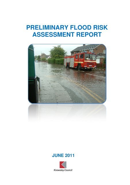
PRELIMINARY FLOOD RISK<br />
ASSESSMENT REPORT<br />
JUNE 2011
Preliminary Flood Risk Assessment<br />
Executive Summary<br />
The council, as the Lead Local Flood Authority under the provisions of the<br />
Flood and Water Management Act 2010 (FWMA), has prepared this<br />
Preliminary Flood Risk Assessment in order to meet the requirements of the<br />
Flood Risk Regulations (FRR) 2009.<br />
The FRR placed a duty on the council to consider local sources of potential<br />
<strong>flo</strong>od <strong>risk</strong> in relation to surface water, groundwater and ordinary watercourses<br />
and to produce a subsequent Preliminary Flood Risk Assessment <strong>report</strong>. The<br />
PFRA <strong>report</strong> should be submitted for review to the Environment Agency by<br />
the end of June 2011, with the final approved <strong>report</strong> published on the council’s<br />
website by December 2011.<br />
In order to develop an understanding of the overall <strong>flo</strong>od <strong>risk</strong>, Knowsley<br />
officers met with the Environment Agency and United Utilities to produce<br />
locally agreed surface water information which considered past, current and<br />
potential future <strong>flo</strong>oding incidents. Using the information collected and<br />
applying the Environment Agency criteria, it was established that none of the<br />
<strong>flo</strong>oding events would have been assessed as being significant or would have<br />
had any significant harmful consequences on the population. In terms of the<br />
<strong>risk</strong> of future <strong>flo</strong>oding, the national surface water modelling results provided by<br />
the Environment Agency estimated that in the Knowsley area, approximately<br />
3000 properties (2400 residential, 600 non-residential) are at <strong>risk</strong> from<br />
<strong>flo</strong>oding to a depth of 0.3m during a rainfall event with a 1 in 200 annual<br />
chance of occurring.<br />
In conclusion, this means that, according to Defra guidelines, (where<br />
“significant” = an area of <strong>flo</strong>od <strong>risk</strong> with a minimum of 30,000 people being<br />
affected) Knowsley does not have a nationally significant <strong>flo</strong>od <strong>risk</strong>.<br />
KMBC – Preliminary Assessment Report 2
Preliminary Flood Risk Assessment<br />
Table of Contents<br />
1 Introduction……………………………………………… 4<br />
1.1 Scope of Preliminary Flood Risk Assessment……………..…………… 4<br />
1.2 Aims and Objectives…………………………………………….……….…… 5<br />
1.3 The PFRA study area……………………………………………….………... 5<br />
2 Lead Local Flood Authority responsibilities……………………… 6<br />
2.1 Introduction………………………………………………………………..…… 6<br />
2.2 Coordination of Flood Risk Management………………………..………… 6<br />
3 Methodology and Data Review…………………………………… 7<br />
3.1 Introduction…………………………………………………………………… 7<br />
3.2 Data collection…………………………………………………………….. 8<br />
3.3 Data Limitations……………………………………………………………….. 9<br />
3.4 Data Storage and Security…………………………………………………. 10<br />
3.5 Review of Data………………………………………………………………… 10<br />
4 Flood Risk in the Past…………………………..…………………….. 11<br />
5 Future Flood Risk………………………………………………………. 13<br />
5.1 Locally agreed surface water information…………………………………… 13<br />
5.2 Local drainage capacity……………………………………………………….. 13<br />
5.3 Ordinary watercourses………………………………………………………… 14<br />
5.4 Groundwater <strong>flo</strong>oding………………………………………………………….. 14<br />
5.5 Climate change…………………………………………………………………. 16<br />
5.6 Adapting to change…………………………………………………………….. 17<br />
5.7 Long term developments………………………………………………………. 18<br />
6 Review of Indicative Flood Risk Areas………………………………18<br />
7 Identification of Flood Risk Areas…………………………………… 19<br />
8 Next steps…………………………………………………………………19<br />
9 References……………………………………………………………….. 20<br />
Tables<br />
4-1 Location of surface water <strong>flo</strong>oding incidents due to lack of capacity in the.. 12<br />
sewer<br />
5-1 Properties identified to be at <strong>risk</strong> of <strong>flo</strong>oding…………………………………. 13<br />
5.2 Area in Knowsley identified to be at <strong>risk</strong> of <strong>flo</strong>oding from ordinary ………… 14<br />
watercourses<br />
Figures<br />
1-1 Responsibilities for the Lead Local Flood Authorities and the……………… 4<br />
Environment Agency<br />
2-1 Knowsley’s internal structure for the management of <strong>flo</strong>od <strong>risk</strong>…………… 7<br />
4-1 Spatial distribution of surface water <strong>flo</strong>od events…………………………… 11<br />
5-1 Areas susceptible to ground water <strong>flo</strong>oding…………………………………. 15<br />
KMBC – Preliminary Assessment Report 3
Preliminary Flood Risk Assessment<br />
1. INTRODUCTION<br />
1.1 Scope of the Preliminary Flood Risk Assessment<br />
This Preliminary Flood Risk Assessment (PFRA) <strong>report</strong> has<br />
been prepared to allow Knowsley MBC to meet its duties to<br />
deliver the requirements of the Flood Risk Regulations 2009.<br />
Further legislation, the Flood and Water Management Act 2010<br />
(FWMA) designates Knowsley MBC as a Lead Local Flood<br />
Authority (LLFA) with responsibility to manage local <strong>flo</strong>od <strong>risk</strong>.<br />
The purpose of the Flood Risk Regulations is to transpose the<br />
EC Floods Directive on the <strong>assessment</strong> and management of<br />
<strong>flo</strong>od <strong>risk</strong> into domestic law and to implement its provisions. The<br />
overall aim being to provide a consistent approach to managing<br />
<strong>flo</strong>od <strong>risk</strong> across Europe within a six year <strong>flo</strong>od <strong>risk</strong> management<br />
cycle. It places a duty on both the Environment Agency and the<br />
LLFA to prepare a number of documents including:<br />
• Preliminary Flood Risk Assessments<br />
• Flood hazard and <strong>flo</strong>od <strong>risk</strong> maps<br />
• Flood Risk Management Plans<br />
The deadline for submission of this <strong>report</strong> to the Environment<br />
Agency is 22 nd June 2011. For areas of significant <strong>risk</strong>, <strong>flo</strong>od<br />
hazard and <strong>flo</strong>od <strong>risk</strong> maps have then to be submitted by 22 nd<br />
June 2013, followed by Flood Risk Management Plans by 22 nd<br />
June 2015. As Knowsley does not have a significant <strong>flo</strong>od <strong>risk</strong>,<br />
maps and plans will not be required.<br />
KMBC (as LEAD LOCAL<br />
FLOOD AUTHORITY)<br />
Surface water<br />
Groundwater<br />
Ordinary watercourses<br />
ENVIRONMENT AGENCY<br />
Sea<br />
Main Rivers<br />
Reservoirs<br />
Figure 1-1:<br />
Responsibilities for the<br />
Lead Local Flood<br />
Authorities and the<br />
Environment Agency<br />
The purpose of the PFRA is to record and review past <strong>flo</strong>oding<br />
and possible future <strong>flo</strong>oding from local <strong>flo</strong>od sources. To enable<br />
effective delivery of the <strong>report</strong>, individual areas of responsibility<br />
KMBC – Preliminary Assessment Report 4
Preliminary Flood Risk Assessment<br />
have been clarified through partnership working arrangements<br />
between the LLFA and the Environment Agency.<br />
1.2 Aims and Objectives<br />
The PFRA is a high level screening exercise to locate areas in<br />
which the <strong>risk</strong> of surface water and groundwater <strong>flo</strong>oding is<br />
significant 1 and requires further investigation through the<br />
production of maps and management plans. The main aim of<br />
the PFRA is to gather and review available information on past<br />
<strong>flo</strong>oding incidents and their consequences and also assess the<br />
potential consequences of future <strong>flo</strong>oding.<br />
The key objectives are as follows:<br />
• set up governance arrangements and develop<br />
partnerships<br />
• establish a methodology and develop partnerships for<br />
collation and sharing of data relating to past and future<br />
<strong>flo</strong>ods and their consequences<br />
• assess historical local <strong>flo</strong>od events and their impact and<br />
consequences<br />
• assess potential future <strong>flo</strong>od events and their impact and<br />
consequences<br />
• review the “indicative” Flood Risk areas provided by the<br />
Environment Agency<br />
• explain any amendments to the “indicative” Flood Risk<br />
areas and justify the creation of any new areas.<br />
1.3 The PFRA Study Area<br />
The study area for this <strong>report</strong> is defined by the administrative<br />
boundary of Knowsley MBC. Knowsley has a population of<br />
approximately 150,000, mainly residing in the towns of Kirkby,<br />
Huyton, Prescot, Whiston and Halewood. The Borough of<br />
Knowsley covers an area of around 86sq km. The area is about<br />
50% urban, with the remaining rural areas of various agricultural<br />
quality.<br />
The Borough contains the River Alt and Prescot, Netherley and<br />
Ditton Brooks. The Alt drains the north west of the Borough.<br />
Prescot Brook drains Prescot, Whiston and parts of the Huyton<br />
1 For Defra, significant means an area of <strong>flo</strong>od <strong>risk</strong> with a minimum of 30,000 people being affected.<br />
KMBC – Preliminary Assessment Report 5
Preliminary Flood Risk Assessment<br />
urban areas. Netherley, Dog Clog, Fox’s Bank and Ditton<br />
Brooks drain the rural southern parts of the Borough. In<br />
geological terms, the Knowsley area is underlain predominantly<br />
by Triassic sandstone and mudstone. There are, however, some<br />
areas of Upper Westphalian (coal measures) and Westphalian.<br />
Overlying drift geology consists mainly of sand and other course<br />
sediments, with some areas of composite solid rock. Across the<br />
UK and Wales, areas of Triassic sandstone create aquifers and<br />
these are used to supply approximately 25% of the country’s<br />
licensed groundwater abstractions (see section 5.4,<br />
Groundwater Flooding).<br />
2. LEAD LOCAL FLOOD AUTHORITY RESPONSIBILITIES<br />
2.1 Introduction<br />
LLFA’s are responsible for managing local <strong>flo</strong>od <strong>risk</strong> in particular<br />
from ordinary watercourses, surface run-off and groundwater<br />
and any interaction these have with drainage systems and other<br />
sources of <strong>flo</strong>oding including sewers. An example of this<br />
interaction might be where a surface water sewer cannot <strong>flo</strong>w<br />
and so “backs-up” due to high water levels in a watercourse.<br />
2.2 Coordination of Flood Risk Management<br />
Knowsley had already recognised the benefits of partnership<br />
working by setting up an internal <strong>flo</strong>oding sub-group under the<br />
Risk and Resilience Group. This was in response to the need to<br />
make local communities and individuals much more resilient<br />
following the water mains bursts in December 2007 and<br />
February 2008 and flash <strong>flo</strong>oding in 2008. In 2008, following<br />
publication of the findings of the Pitt Review, the Safer Stronger<br />
Communities Group took on the responsibility for improving the<br />
local community’s resilience to <strong>flo</strong>od <strong>risk</strong>. The 2009 Scrutiny<br />
Review <strong>report</strong> recommended “That a forum and meetings be<br />
arranged by the local authority (who will act as the lead body)<br />
with relevant partners to discuss joint working and the<br />
coordination of efforts to prevent incidents/minimise <strong>flo</strong>oding<br />
impacts”.<br />
To deliver this action, the Knowsley Joint Flood Risk group was<br />
established, with the following membership:<br />
• KMBC Directorate of Regeneration, Economy and Skills<br />
• KMBC Directorate of Corporate Resources<br />
• United Utilities<br />
KMBC – Preliminary Assessment Report 6
Preliminary Flood Risk Assessment<br />
• The Environment Agency<br />
The Flood and Water Management Act 2010 formalised<br />
Knowsley’s role as the LLFA, with responsibility for engaging<br />
partners and the public, coordinating and leading on local <strong>flo</strong>od<br />
management.<br />
Figure 2-1: Knowsley’s internal structure for the management of <strong>flo</strong>od <strong>risk</strong>.<br />
Executive Director<br />
Neighbourhood<br />
Services<br />
Climate Change &<br />
Sustainability<br />
Manager<br />
Chief Executive<br />
Cabinet<br />
Member<br />
Regeneration<br />
Portfolio<br />
Deputy Chief<br />
Executive<br />
Service Director -<br />
People &Business<br />
Management<br />
Service Director -<br />
Knowsley<br />
Solutions<br />
Service Director -<br />
Regeneration<br />
Head of Risk &<br />
Resilience<br />
Head of Planning<br />
& Transportation<br />
Corporate Risk &<br />
Insurance<br />
Manager<br />
Group Manager<br />
Highways &<br />
Drainage<br />
Group Manager<br />
Planning &<br />
Building Control<br />
Service Director -<br />
Policy & Strategy<br />
Head of Policy &<br />
Implementation<br />
Group Manager<br />
LDF<br />
Knowsley provides advice on <strong>flo</strong>oding and <strong>flo</strong>od <strong>risk</strong> to its<br />
residents and businesses through:<br />
• the Council webpage;<br />
• the Knowsley News (a free magazine delivered to all<br />
residents and available in the One Stop Shops),<br />
• Environment Agency <strong>flo</strong>od leaflets (available in One stop<br />
Shops and libraries)<br />
Further developments to the way communication with the public<br />
is undertaken are being developed in partnership with<br />
neighbouring authorities through the Merseyside Emergency<br />
Planning group.<br />
3. METHODOLOGY AND DATA REVIEW<br />
3.1 Introduction<br />
The PFRA is a high level screening exercise which involves<br />
collecting information on past (historic) and future (potential)<br />
<strong>flo</strong>ods, assembling it into a <strong>preliminary</strong> <strong>assessment</strong> <strong>report</strong>, and<br />
KMBC – Preliminary Assessment Report 7
Preliminary Flood Risk Assessment<br />
using it to identify areas where the <strong>risk</strong> of <strong>flo</strong>oding is an issue 2 .<br />
To assist LLFAs in identifying <strong>flo</strong>od <strong>risk</strong> areas, the Environment<br />
Agency has produced “indicative <strong>flo</strong>od <strong>risk</strong> areas” based on an<br />
<strong>assessment</strong> of national information.<br />
3.2 Data Collection<br />
The following were identified as points of contact for provision of<br />
data for the production of the PRFA:<br />
• LLFA – Knowsley MBC<br />
• The Environment Agency<br />
• United Utilities PLC<br />
• Merseyside Fire and Rescue Service<br />
• Residents of Knowsley<br />
• Neighbouring Authorities<br />
LLFA<br />
Historical <strong>flo</strong>oding records from surface water, ordinary<br />
watercourses and groundwater are kept within the council’s<br />
“Confirm (Pitney Bowes)” database. Members of staff were also<br />
able to provide anecdotal information regarding areas known to<br />
be susceptible to <strong>flo</strong>oding from excessive surface water,<br />
groundwater or <strong>flo</strong>oding from ordinary watercourses.<br />
The Environment Agency<br />
The following datasets, plans and documents were provided by<br />
the Environment Agency:<br />
• Areas Susceptible to Surface Water Flooding<br />
• Flood Map for Surface Water<br />
• Flood Map (Rivers and the Sea)<br />
• Areas Susceptible to Groundwater Flooding<br />
• National Receptors Dataset<br />
• Indicative Flood Risk Areas<br />
• Historic Flood Map<br />
• Alt Crossens CFMP<br />
• Mersey Estuary CFMP<br />
• Mersey and North Merseyside Water Resources Study<br />
2 The Environment Agency has produced indicative <strong>flo</strong>od <strong>risk</strong> areas based on 1km grid squares where at<br />
least 200 people or 20 businesses or 1 critical service might be <strong>flo</strong>oded to a depth of 0.3m by a 1 in 200<br />
year return period rainfall event.<br />
KMBC – Preliminary Assessment Report 8
Preliminary Flood Risk Assessment<br />
United Utilities<br />
The following datasets were provided by United Utilities:<br />
• Manhole location<br />
• Sewers<br />
• Rising Mains<br />
• Combined sewer over<strong>flo</strong>w (CSO) location<br />
• Pumping Station location<br />
• Detention Tank location<br />
• Waste Water Treatment Works (WWtW) location<br />
• Drainage Areas<br />
• Sewer modelling data<br />
• DG5 (internal and external) Register<br />
• Historical sewer incident record data (SIRS & WIRS)<br />
Merseyside Fire and Rescue Service<br />
The Fire and Rescue service was approached for locations<br />
where they were called out to attend <strong>flo</strong>oding incidents.<br />
However their local data is stored on a “call-out address” basis<br />
and not “type of incident” and they did not have an available<br />
resource to search through their records for attendance due to<br />
<strong>flo</strong>oding.<br />
Residents of Knowsley<br />
In areas of known <strong>flo</strong>oding, residents were contacted for<br />
anecdotal information on <strong>flo</strong>oding incidents.<br />
Neighbouring Authorities<br />
A meeting was held with representatives of Liverpool and Sefton<br />
councils to review the Indicative Flood Risk Area and to discuss<br />
potential cross-border <strong>flo</strong>oding issues.<br />
3.3 Data Limitations<br />
The council’s Confirm database was created on the basis of<br />
collation and response to “service requests” and not the<br />
collection of detailed <strong>flo</strong>oding information. Incidents of historic<br />
<strong>flo</strong>oding have been recorded however the records contain<br />
inconsistencies and depend on what level of information was<br />
provided by the initial caller, and any follow-up notes added by<br />
the responding officer.<br />
The amount of available anecdotal information on historical<br />
<strong>flo</strong>oding has also been reduced over the last few years due to<br />
KMBC – Preliminary Assessment Report 9
Preliminary Flood Risk Assessment<br />
loss of staff through departmental restructuring and officer<br />
retirement.<br />
3.4 Data Storage and Security<br />
The storage of new <strong>flo</strong>oding data will remain within the council’s<br />
Confirm database as the initial notification of an incident will<br />
normally be recorded as a “service request”. The resulting<br />
records will be stored securely on council servers which are<br />
password protected and regularly backed-up. The future<br />
content of the individual records is currently being considered to<br />
comply with the duty to investigate / data collection requirements<br />
within the Flood and Water Management Act 2010 and Flood<br />
Risk Regulations 2009. Associated GIS based workspaces and<br />
tables will also be stored securely within the council servers.<br />
The use of some of the data supplied to produce the PFRA<br />
<strong>report</strong> is restricted. In particular this refers to sections of data<br />
provided by the Environment Agency and United Utilities. Data<br />
supplied by United Utilities is subject to a licence agreement<br />
between them and Knowsley MBC dated 2 nd February 2011.<br />
Under the terms of the licence, all the United Utilities data is to<br />
be treated as confidential and not used for any purpose other<br />
than that stated in the agreement.<br />
3.5 Review of data<br />
To ensure that the PFRA <strong>report</strong> complied with the requirements<br />
of the regulations, it was reviewed as follows:<br />
Joint Flood Risk Group<br />
Joint Flood Risk Group<br />
28/07/10 Raise awareness of requirements of<br />
FRR 2009 for data collection<br />
18/10/10 to establish PFRA delivery plan and<br />
confirm partnership working for data collection<br />
Joint Flood Risk Group<br />
24/01/11 to agree past and future <strong>flo</strong>oding locations<br />
Scrutiny Committee<br />
31/03/11 Review of the progress of the <strong>report</strong> and<br />
overview of findings<br />
Joint Flood Risk Group<br />
18/05/11 Review of draft <strong>report</strong><br />
Cabinet Member<br />
Sign-off of final <strong>report</strong><br />
Submission to EA<br />
22/06/11 Submission of <strong>report</strong> to EA<br />
KMBC – Preliminary Assessment Report 10
Preliminary Flood Risk Assessment<br />
4. FLOOD RISK IN THE PAST<br />
The PFRA requires significant historic <strong>flo</strong>od events to be<br />
recorded and <strong>report</strong>ed to Europe through this <strong>report</strong>. There has<br />
been no formal guidance on what 'significant' means in terms of<br />
historic local <strong>flo</strong>oding; Defra has left it to LLFAs to determine<br />
their own definition. For the recording of past local <strong>flo</strong>od <strong>risk</strong>, the<br />
“indicative <strong>flo</strong>od <strong>risk</strong>” criteria of 200 people in a 1km grid square<br />
was reduced to 20 people (or approximately 8 houses) in a 1km<br />
grid. To ensure a consistent Merseyside approach, this method<br />
for establishing past local <strong>flo</strong>od <strong>risk</strong> was discussed at the<br />
Merseyside Drainage Group meeting on 17 th January 2011 and<br />
on 21 st February 2011 adopted across the region as the<br />
accepted way forward.<br />
Figure 4-1: Spatial Distribution of Past Surface Water Flood Locations.<br />
KMBC – Preliminary Assessment Report 11
Preliminary Flood Risk Assessment<br />
Date<br />
<strong>flo</strong>oding<br />
<strong>report</strong>ed<br />
The <strong>flo</strong>oding record data collected does not have enough detail<br />
included to allow full <strong>assessment</strong> of the impact and<br />
consequences on the residents of the properties <strong>flo</strong>oded. The<br />
limited available evidence suggests that none of the past<br />
<strong>flo</strong>oding events are considered to be significant, with associated<br />
harmful consequences. As such, none have been recorded in<br />
Annex 1 of the PFRA spreadsheet. An estimated 1% rainfall<br />
event (an event that has a 1 in 100 chance of happening in any<br />
one year) occurred on 20 July 2011 and the records from both<br />
United Utilities and Knowsley only show internal <strong>flo</strong>oding to 12<br />
residential properties and 3 non-residential properties (shops). It<br />
should be noted that these <strong>flo</strong>oded properties are dispersed<br />
throughout the borough and do not form any significant cluster.<br />
Data provided by United Utilities covering recorded surface<br />
water <strong>flo</strong>oding incidents from 2008 to date was reviewed and<br />
Table 4-1 shows the location of surface water and combined<br />
sewers that have been identified to be hydraulically inadequate.<br />
Table 4-1 – Location of surface water <strong>flo</strong>oding incidents<br />
due to lack of capacity in the sewer. Source: United<br />
Utilities, 2011<br />
Location<br />
Sewer Type<br />
Chance of<br />
rainfall<br />
happening in<br />
any year<br />
Consequence<br />
No of<br />
properties<br />
affected<br />
11/05/2008 Huyton Surface Water 1 in 20 External Flooding 3<br />
11/05/2008 Huyton Surface Water 1 in 20 Internal Flooding 3<br />
10/07/2008 Huyton Combined Sewer Not known Cellar Flooding 1<br />
29/07/2008 Huyton Combined Sewer Not known Cellar Flooding 1<br />
29/07/2008 Roby Combined Sewer Not known External Flooding 1<br />
05/09/2008 Huyton Surface Water Not known Highway Flooding 1<br />
06/09/2008 Huyton Combined Sewer Not known Highway Flooding 1<br />
20/07/2010 Roby Combined Sewer Not known External Flooding 5<br />
20/07/2010 Roby Surface Water 1 in 20 Internal Flooding 3<br />
20/07/2010 Roby Surface Water 1 in 20 External Flooding 2<br />
20/07/2010 Roby Surface Water 1 in 20 Highway Flooding 1<br />
03/10/2010 Whiston Surface Water Not known External Flooding 6<br />
The records of all existing past <strong>flo</strong>oding locations will be retained<br />
within the “Confirm” database and used to support the local <strong>flo</strong>od<br />
<strong>risk</strong> management strategy.<br />
KMBC – Preliminary Assessment Report 12
Preliminary Flood Risk Assessment<br />
5. FUTURE FLOOD RISK<br />
5.1 Locally Agreed Surface Water Information<br />
The Environment Agency has produced two national datasets<br />
showing predicted surface water <strong>flo</strong>oding:<br />
• Areas Susceptible to Surface Water Flooding (AStSWF)<br />
• Flood Map for Surface Water (FMfSW)<br />
The data shown on both the AStSWF and FMfSW maps for the<br />
Knowsley area was reviewed by representatives of the<br />
Environment Agency, United Utilities and Knowsley Council on<br />
24 th January 2011. It was compared to known, locally agreed<br />
surface water data including the effects of an estimated 1%<br />
rainfall event (an event that has a 1 in 100 chance of happening<br />
in any one year) that occurred on 20 July 2011 and it was<br />
agreed that the FMfSW was more representative of the <strong>flo</strong>od<br />
<strong>risk</strong>. As such, the FMfSW was adopted for use as the map<br />
identifying “locally agreed surface water information”.<br />
The Environment Agency has used the information within the<br />
National Receptor dataset to count the number of properties at<br />
<strong>risk</strong> of <strong>flo</strong>oding identified on the FMfSW. The data is based on<br />
the assumption that a rainfall event with a 1 in 200 chance of<br />
happening in any one year is equivalent to the chance of<br />
<strong>flo</strong>oding on the ground in the order of a 1 in 100 chance in any<br />
given year.<br />
Table 5-1 – Properties in Knowsley identified to be at <strong>risk</strong> of surface water<br />
<strong>flo</strong>oding. Source: Environment Agency, 2011<br />
1 in 200 Rainfall - Flooding Greater than 0.3m depth<br />
All properties Residential properties Non-residential properties<br />
3000 2400 600<br />
5.2 Local Drainage Capacity<br />
Data provided by United Utilities covering recorded incidents<br />
from 2008 to date was reviewed and Table 4-1 shows the<br />
location of surface water and combined sewers that have been<br />
identified to be hydraulically inadequate. These locations tie in<br />
to the areas of predicted surface <strong>flo</strong>od <strong>risk</strong> identified on the<br />
FMfSW.<br />
KMBC – Preliminary Assessment Report 13
Preliminary Flood Risk Assessment<br />
Table 5.2<br />
Date<br />
<strong>flo</strong>oding<br />
<strong>report</strong>ed<br />
Nov 2000<br />
Feb 2005<br />
Jan 2008<br />
Oct 2010<br />
Jan 2011<br />
Feb 2011<br />
5.3 Ordinary Watercourses<br />
The Environment Agency dataset “Detailed River Network” and<br />
United Utilities sewer records have been used to establish the<br />
location of ordinary, non-main river watercourses. Currently,<br />
there is only one known issue of <strong>flo</strong>od <strong>risk</strong> associated with these<br />
watercourses.<br />
Area in Knowsley Identified to be at Risk of Flooding from Ordinary<br />
Watercourses<br />
Location Sewer Type Outfall<br />
Kirkby<br />
Kirkby<br />
Kirkby<br />
Kirkby<br />
Kirkby<br />
Kirkby<br />
Culverted<br />
Watercourse<br />
Culverted<br />
Watercourse<br />
Culverted<br />
Watercourse<br />
Culverted<br />
Watercourse<br />
Culverted<br />
Watercourse<br />
Culverted<br />
Watercourse<br />
River Alt<br />
River Alt<br />
River Alt<br />
River Alt<br />
River Alt<br />
River Alt<br />
Chance of<br />
rainfall<br />
happening in<br />
any year<br />
Not Known<br />
Not Known<br />
Not Known<br />
Not Known<br />
Not Known<br />
Not Known<br />
Consequence<br />
Highway<br />
Flooding<br />
Highway<br />
Flooding<br />
Highway<br />
Flooding<br />
Highway<br />
Flooding<br />
Highway<br />
Flooding<br />
Internal<br />
<strong>flo</strong>oding to one<br />
property<br />
5.4 Groundwater Flooding<br />
Groundwater is water that has drained through surface layers of<br />
soil and rock until it reaches a layer of rock material that it<br />
cannot pass through, or can only pass through very slowly. This<br />
results in the storage of water in the rock layers above this<br />
impermeable layer. The water is stored in gaps in the rock, or<br />
between the particles of which the rock is composed.<br />
There are four national datasets providing information on<br />
groundwater <strong>flo</strong>oding. Due to the lack of local information in<br />
relation to groundwater <strong>flo</strong>oding, the Environment Agency’s<br />
“Areas Susceptible to Groundwater Flooding” dataset has been<br />
used for this <strong>report</strong>. This dataset only identifies wider areas that<br />
may be at <strong>risk</strong> from groundwater <strong>flo</strong>oding. It covers large areas<br />
and only isolated locations within the overall susceptible area<br />
are likely to suffer the consequences of groundwater <strong>flo</strong>oding.<br />
Information within the Mersey and North Merseyside Water<br />
Resources Study suggests that the computer models covering<br />
the Knowsley area only indicate minimal groundwater level rise<br />
over the next few years.<br />
KMBC – Preliminary Assessment Report 14
Preliminary Flood Risk Assessment<br />
Figure 5-1 – Areas Susceptible to Ground Water Flooding<br />
KMBC – Preliminary Assessment Report 15
Preliminary Flood Risk Assessment<br />
5.5 Climate Change<br />
Evidence<br />
There is clear scientific evidence that global climate change is<br />
happening now. It cannot be ignored.<br />
Over the past century around the UK we have seen sea level<br />
rise and more of our winter rain falling in intense wet spells.<br />
Seasonal rainfall is highly variable. It seems to have decreased<br />
in summer and increased in winter, although winter amounts<br />
changed little in the last 50 years. Some of the changes might<br />
reflect natural variation, however the broad trends are in line with<br />
projections from climate models.<br />
Greenhouse gas (GHG) levels in the atmosphere are likely to<br />
cause higher winter rainfall in future. Past GHG emissions mean<br />
some climate change is inevitable in the next 20-30 years. Lower<br />
emissions could reduce the amount of climate change further<br />
into the future, but changes are still projected at least as far<br />
ahead as the 2080s.<br />
We have enough confidence in large scale climate models to<br />
say that we must plan for change. There is more uncertainty at a<br />
local scale but model results can still help us plan to adapt. For<br />
example we understand rain storms may become more intense,<br />
even if we can’t be sure about exactly where or when. By the<br />
2080s, the latest UK climate projections (UKCP09) are that there<br />
could be around three times as many days in winter with heavy<br />
rainfall (defined as more than 25mm in a day). It is plausible that<br />
the amount of rain in extreme storms (with a 1 in 5 annual<br />
chance or rarer) could increase locally by 40%.<br />
Key Projections for North West River Basin District<br />
If emissions follow a medium future scenario, UKCP09 projected<br />
changes by the 2050s relative to the recent past are:<br />
• winter precipitation increases of around 14% (very likely to be<br />
between 4 and 28%);<br />
• precipitation on the wettest day in winter up by around 11% (very<br />
unlikely to be more than 25%);<br />
• relative sea level at Morecambe very likely to be up between 6<br />
and 36cm from 1990 levels (not including extra potential rises<br />
from polar ice sheet loss);<br />
KMBC – Preliminary Assessment Report 16
Preliminary Flood Risk Assessment<br />
• peak river <strong>flo</strong>ws in a typical catchment likely to increase between<br />
11 and 18%. Increases in rain are projected to be greater near<br />
the coast than inland.<br />
Implications for Flood Risk<br />
Climate changes can affect local <strong>flo</strong>od <strong>risk</strong> in several ways.<br />
Impacts will depend on local conditions and vulnerability.<br />
Wetter winters and more of this rain falling in wet spells may<br />
increase river <strong>flo</strong>oding especially in steep, rapidly responding<br />
catchments. More intense rainfall causes more surface runoff,<br />
increasing localised <strong>flo</strong>oding and erosion. In turn, this may<br />
increase pressure on drains, sewers and water quality. Storm<br />
intensity in summer could increase even in drier summers, so we<br />
need to be prepared for the unexpected.<br />
Drainage systems in the district have been modified to manage<br />
water levels and could help in adapting locally to some impacts<br />
of future climate on <strong>flo</strong>oding, but may also need to be managed<br />
differently. Rising sea or river levels may also increase local<br />
<strong>flo</strong>od <strong>risk</strong> inland or away from major rivers because of<br />
interactions with drains, sewers and smaller watercourses.<br />
Where appropriate, we need local studies to understand climate<br />
impacts in detail, including effects from other factors like land<br />
use. Sustainable development and drainage will help us adapt to<br />
climate change and manage the <strong>risk</strong> of damaging <strong>flo</strong>ods in<br />
future.<br />
5.6 Adapting to Change<br />
Past emission means some climate change is inevitable. It is<br />
essential we respond by planning ahead. We can prepare by<br />
understanding our current and future vulnerability to <strong>flo</strong>oding,<br />
developing plans for increased resilience and building the<br />
capacity to adapt. Regular review and adherence to these plans<br />
is key to achieving long-term, sustainable benefits.<br />
Although the broad climate change picture is clear, we have to<br />
make local decisions against deeper uncertainty. We will<br />
therefore consider a range of measures and retain flexibility to<br />
adapt. This approach, embodied within <strong>flo</strong>od <strong>risk</strong> appraisal<br />
guidance, will help to ensure that we do not increase our<br />
vulnerability to <strong>flo</strong>oding.<br />
KMBC – Preliminary Assessment Report 17
Preliminary Flood Risk Assessment<br />
5.7 Long Term Developments<br />
It is possible that long term developments will affect the<br />
occurrence and significance of <strong>flo</strong>oding. However current<br />
planning policy aims to prevent new development from<br />
increasing <strong>flo</strong>od <strong>risk</strong>.<br />
In England, Planning Policy Statement 25 (PPS25) on<br />
development and <strong>flo</strong>od <strong>risk</strong> aims to "ensure that <strong>flo</strong>od <strong>risk</strong> is<br />
taken into account at all stages in the planning process to avoid<br />
inappropriate development in areas at <strong>risk</strong> of <strong>flo</strong>oding, and to<br />
direct development away from areas at highest <strong>risk</strong>. Where new<br />
development is, exceptionally, necessary in such areas, policy<br />
aims to make it safe without increasing <strong>flo</strong>od <strong>risk</strong> elsewhere and<br />
where possible, reducing <strong>flo</strong>od <strong>risk</strong> overall."<br />
Adherence to Government policy ensures that new<br />
development does not increase local <strong>flo</strong>od <strong>risk</strong>. However, in<br />
exceptional circumstances the Local Planning Authority may<br />
accept that <strong>flo</strong>od <strong>risk</strong> can be increased contrary to Government<br />
policy, usually because of the wider benefits of a new or<br />
proposed major development. Any exceptions would not be<br />
expected to increase <strong>risk</strong> to levels which are "significant" (in<br />
terms of the Government's criteria).<br />
In terms of local development, the Knowsley Replacement<br />
Unitary Development Plan (UDP), adopted June 2006, provides<br />
guidance for the period up to 2016. There are three large sites<br />
available for development that may have an impact on <strong>flo</strong>od <strong>risk</strong>.<br />
• Bridgefield Forum, Cartbridge Lane, Halewood – originally<br />
occupied by a major indoor sports centre (UDP reference H1).<br />
This is a proposed residential development site of approx 8.3Ha<br />
for 250 dwellings;<br />
• land at Thingwall Lane, Huyton, a brownfield site of approx 18<br />
Ha with potential for 350 residential dwellings;<br />
• Pirelli Plant and adjacent industrial land, South Prescot – a<br />
brownfield site formally occupied by BICC Ltd in connection with<br />
the manufacture of copper cables and similar products. The site<br />
has been identified as possible mixed used development.<br />
6 Review of Indicative Flood Risk Areas<br />
The indicative Flood Risk Area has been reviewed. Crossborder<br />
<strong>flo</strong>oding issues between Knowsley and Liverpool are not<br />
significant. The Flood Risk Area has been split along the<br />
administrative boundary. Flood <strong>risk</strong> within the administrative<br />
boundary of Knowsley council does not meet the Government<br />
KMBC – Preliminary Assessment Report 18
Preliminary Flood Risk Assessment<br />
threshold of 30,000 and is therefore not a Flood Risk Area under<br />
the Flood Risk Regulations.<br />
7. Identification of Flood Risk Areas<br />
The Flood Map for Surface Water has been adopted as the<br />
indicator for local <strong>flo</strong>od <strong>risk</strong>. No amendments have been made to<br />
it.<br />
Knowsley does not form a nationally significant Flood Risk Area<br />
under the Defra criteria (where significant means an area of<br />
<strong>flo</strong>od <strong>risk</strong> with a minimum of 30,000 people being affected).<br />
8. Next Steps<br />
• Develop the local <strong>flo</strong>od <strong>risk</strong> strategy<br />
In the development of local strategy, Knowsley will consider the<br />
needs of communities, the economy and the environment. The<br />
strategy will form the framework to enable people, communities,<br />
businesses and the public sector to work together to establish a<br />
clear understanding of the <strong>risk</strong>s of <strong>flo</strong>oding, so that investment in<br />
<strong>risk</strong> management can be prioritised and communities can be<br />
helped to recover more quickly and effectively after incidents.<br />
• Develop arrangements for suitable data storage and protection<br />
(GIS and the Council’s Confirm incident database).<br />
• Publish the PFRA <strong>report</strong> on the Council’s website by 22/12/11.<br />
• Develop arrangements to undertake the responsibilities created<br />
by the Flood & Water Management Act 2010 e.g. Duty to<br />
investigate <strong>flo</strong>oding incidents, duty to maintain a register of<br />
structures or features which may have an effect on <strong>flo</strong>od <strong>risk</strong>,<br />
acting as consenting authority for works to ordinary<br />
watercourses and acting as the SUDS Approving Body.<br />
• Commence the PFRA review in 2015 in line with the FRR 2009,<br />
for the submission of any required Flood Risk Management<br />
Plans by 22/06/2015.<br />
KMBC – Preliminary Assessment Report 19
Preliminary Flood Risk Assessment<br />
References<br />
Knowsley and Sefton MBCs, Strategic Flood Risk Assessment (Final <strong>report</strong>) June<br />
2009<br />
http://www.knowsley.gov.uk/pdf/SFRA%20Main%20Report.pdf<br />
EA geostore – National datasets<br />
http://www.geostore.com/environment-agency/<br />
Knowsley Replacement Unitary Development Plan – June 2006<br />
http://www.knowsley.gov.uk/pdf/unitary_development_plan.pdf<br />
Mersey and North Merseyside Water Resources Study<br />
Knowsley Council webpage – Flood advice<br />
http://www.knowsley.gov.uk/residents/preparing-for-emergencies/<strong>flo</strong>odadvice.aspx<br />
Environment Agency Flood Advice – webpage<br />
http://www.environment-agency.gov.uk/homeandleisure/<strong>flo</strong>ods/default.aspx<br />
KMBC – Preliminary Assessment Report 20