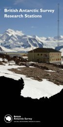
Public information leaflet_HISTORY.indd - British Antarctic Survey
Public information leaflet_HISTORY.indd - British Antarctic Survey
Public information leaflet_HISTORY.indd - British Antarctic Survey

You also want an ePaper? Increase the reach of your titles
YUMPU automatically turns print PDFs into web optimized ePapers that Google loves.
<strong>British</strong> <strong>Antarctic</strong> <strong>Survey</strong><br />
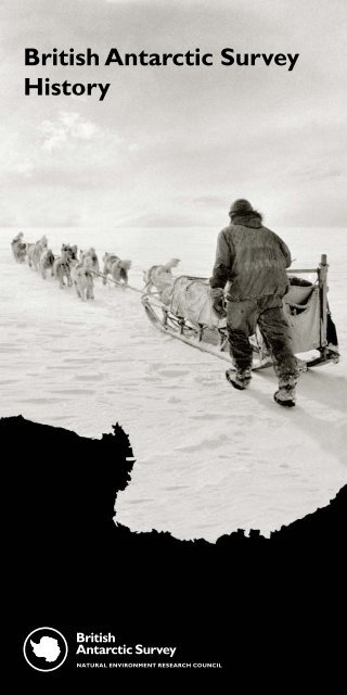
History
The United Kingdom has a long and<br />
distinguished record of scientific<br />
exploration in <strong>Antarctic</strong>a. Before the<br />
creation of the <strong>British</strong> <strong>Antarctic</strong> <strong>Survey</strong><br />
(BAS), there were many surveying<br />
and scientific expeditions that laid the<br />
foundations for modern polar science.<br />
These ranged from Captain Cook’s<br />
naval voyages of the 18th century, to<br />
the famous expeditions led by Scott<br />
and Shackleton, to a secret wartime<br />
operation to secure <strong>British</strong> interests in<br />
<strong>Antarctic</strong>a. Today, BAS is a world leader<br />
in polar science, maintaining the UK’s<br />
long history of <strong>Antarctic</strong> discovery and<br />
scientific endeavour.<br />
The early years<br />
Britain’s interests in <strong>Antarctic</strong>a started with the first circumnavigation of the<br />
<strong>Antarctic</strong> continent by Captain James Cook during his voyage of 1772-75.<br />
Cook sailed his two ships, HMS Resolution and HMS Adventure, into the pack<br />
ice reaching as far as 71°10' south and crossing the <strong>Antarctic</strong> Circle for the<br />
first time. He discovered South Georgia and the South Sandwich Islands<br />
although he did not set eyes on the <strong>Antarctic</strong> continent itself. His reports of<br />
fur seals led many sealers from Britain and the United States to head to the<br />
<strong>Antarctic</strong> to begin a long and unsustainable exploitation of the Southern Ocean.<br />
Image: Unloading cargo for the construction of ‘Base A’ on Goudier Island, <strong>Antarctic</strong> Peninsula (1944).
During the late 18th and early 19th centuries, interest in <strong>Antarctic</strong>a was largely<br />
focused on the exploitation of its surrounding waters by sealers and whalers.<br />
The discovery of the South Shetland Islands is attributed to Captain William<br />
Smith who was blown off course when sailing around Cape Horn in 1819.<br />
Large numbers of seals were spotted around the islands and the Royal Navy<br />
sent Smith back to investigate. Onboard ship was <strong>British</strong> naval officer, Edward<br />
Bransfield, who explored and charted the region for two months. In 1820,<br />
Smith and Bransfield are believed to have been the first people to sight the<br />
<strong>Antarctic</strong> mainland.<br />
Between 1839 and 1843, James Clark Ross led three Royal Navy voyages into<br />
the ice. An experienced polar explorer – having endured nine winters in the<br />
Arctic – he was exceptionally well qualified and his geographical discoveries<br />
were among the greatest achieved by any expedition of the period. Ross<br />
made extensive biological collections and scientific observations. He<br />
succeeded in penetrating the pack ice to discover the Ross Sea, the mountains<br />
of Victoria Land (Transantarctic Mountains) and an active volcano, which he<br />
named Mount Erebus after one of his ships. He also encountered what he<br />
called the ‘Great Ice Barrier’ (now known as the Ross Ice Shelf).<br />
i<br />
Beware volcanoes<br />
There are several active volcanoes in and around <strong>Antarctic</strong>a. The most famous<br />
is Mount Erebus which rises above McMurdo Sound on Ross Island. It was<br />
named by James Clark Ross after one of his ships. The main US and New<br />
Zealand research stations have been built close to its lower slopes. Deception<br />
Island, the site of the <strong>British</strong> ‘Base B’, is also volcanic – its horseshoe shape<br />
results from a central flooded caldera. When it was first occupied it was<br />
believed the volcano was no longer active. Unfortunately this turned out not to<br />
be the case and it had to be evacuated following an eruption in 1967. After a<br />
second eruption in 1969 the research facility was permanently abandoned.<br />
Image: BAS’s Royal Research Ship James Clark Ross is named after the 19th century <strong>British</strong> naval explorer.
The heroic age<br />
The most famous <strong>British</strong> expeditions<br />
to <strong>Antarctic</strong>a took place at the<br />
beginning of the 20th century –<br />
the so-called ‘heroic age’ of polar<br />
exploration.<br />
Captain Robert Falcon Scott’s <strong>British</strong> National <strong>Antarctic</strong> Expedition (1901-<br />
04) aboard the Discovery was fundamentally a scientific undertaking. He<br />
established a base on Ross Island, McMurdo Sound, where his hut still stands<br />
today. As well as achieving a new ‘furthest south’, he crossed the Ross Ice Shelf<br />
and recorded a mass of scientific observations.<br />
Ernest Shackleton’s <strong>British</strong> <strong>Antarctic</strong> Expedition of 1907-09 was the first to set<br />
foot on the Polar Plateau. Shackleton came within 97 miles of the South Pole<br />
before deciding that unless he turned for home he would not make it back<br />
alive. Members of his party also reached the South Magnetic Pole.<br />
Arguably the most famous <strong>British</strong> polar expedition was the <strong>British</strong> <strong>Antarctic</strong><br />
Expedition of 1910-13, when, in January 1912, Scott reached the Pole a month<br />
after Norwegian Roald Amundsen. The tale of the hardships faced by Scott<br />
and his men and their tragic demise on the return journey has been told<br />
countless times and remains a source of controversy. But while Amundsen<br />
was completely focused on being the first to reach the South Pole, Scott’s<br />
expedition made significant scientific discoveries in biology, meteorology and<br />
geology. Measurements, observations and samples obtained by Scott and his<br />
men are still used today as a benchmark in <strong>Antarctic</strong> science.<br />
Image: Scott’s hut, from his 1902-04 expedition, still stands today at McMurdo Sound.
One of the most dramatic polar adventures was that endured by Shackleton<br />
during the Imperial Trans-<strong>Antarctic</strong> Expedition of 1914-17. Shackleton planned<br />
to make the first crossing of the <strong>Antarctic</strong> continent, but before he reached his<br />
proposed landing point in the Weddell Sea, his ship Endurance was beset and<br />
crushed by sea ice. The crew finally escaped in small boats to Elephant Island<br />
where they survived a dreadful winter living under their upturned boats.<br />
Shackleton decided that the only way to ensure rescue was to attempt to<br />
reach South Georgia. He made the voyage with five companions across<br />
600 miles of some of the roughest seas in the world in a small, open<br />
lifeboat. Landing in South Georgia he and two others then had to cross the<br />
mountainous island before seeking help from a whaling station.<br />
The Chilean Government generously loaned Shackleton a small tug called the<br />
Yelcho, in which he was able to rescue all 22 comrades from Elephant Island,<br />
no easy undertaking in itself. That the entire party survived is a testament<br />
to his remarkable leadership. Shackleton attempted a further expedition to<br />
<strong>Antarctic</strong>a in 1921 but died suddenly at South Georgia.<br />
Between 1925 and 1949, the <strong>British</strong> Government supported a series of<br />
voyages known as the ‘Discovery Investigations’. The voyages were paid for by<br />
money from whale oil taxes and made important advances in understanding<br />
<strong>Antarctic</strong> marine biology. Among a host of scientific and oceanographic<br />
achievements, the 13 voyages of Discovery included the first circumnavigation<br />
of the continent in winter and significant charting of large areas of previously<br />
unexplored <strong>Antarctic</strong> waters.<br />
The last <strong>British</strong> expedition before the Second World War was led by John<br />
Rymill to Graham Land. From 1934-37, Rymill carried out a comprehensive<br />
and detailed scientific programme covering geology, meteorology, glaciology<br />
and biology. It established that the <strong>Antarctic</strong> Peninsula is part of the <strong>Antarctic</strong><br />
mainland and set a high scientific standard for later expeditions to follow.<br />
Image: The Discovery, anchored during one of its 13 scientific voyages in <strong>Antarctic</strong>a between 1925 and 1949.
A secret operation<br />
BAS itself originates in a secret World<br />
War II mission, Operation Tabarin. It<br />
was named after a Paris nightclub – Bal<br />
Tabarin – as the men would winter in<br />
the <strong>Antarctic</strong> darkness.<br />
Operation Tabarin was mounted by the <strong>British</strong> Government in 1943 to secure<br />
<strong>Antarctic</strong> waters against enemy raiders and to strengthen <strong>British</strong> claims to the<br />
sovereignty of the Falkland Islands Dependencies (now South Georgia, South<br />
Sandwich Islands and <strong>British</strong> <strong>Antarctic</strong> Territory).<br />
The original intention was to establish two bases – one to guard Deception<br />
Island anchorage and the other to occupy a position on the <strong>Antarctic</strong><br />
Peninsula. Even though the primary mission was a political one, it was also<br />
appreciated that the bases could provide a platform for scientific research.<br />
In fact, science became the primary focus of the operation, which lasted two<br />
years, and in which three bases were eventually set up.<br />
James Marr, who had served with Shackleton on his last expedition and as a<br />
zoologist on the Discovery Investigations, was appointed to lead the mission.<br />
Within just a few months Marr had gathered the men, supplies, huts and<br />
equipment required. In February 1944 the party, in their two ships Fitzroy<br />
and William Scoresby, reached Deception Island where ‘Base B’ was to be<br />
established in one of the buildings of an old Norweigan whaling station.<br />
i<br />
Base A<br />
The base at Port Lockroy was built on Goudier Island in February 1944. It<br />
housed a nine-man wintering team. The hut was erected from prefabricated<br />
sections and some timber used in the construction was salvaged from an<br />
abandoned whaling station on Deception Island. The building contained a mess<br />
room where the men ate, relaxed and slept, a work room, kitchen, store room<br />
and generator room. There was even a bathroom. However, because water was<br />
rationed, only the person whose turn it was to gather and melt the ice or snow<br />
was allowed to bathe. This meant up to nine days between baths!<br />
Image: The men of Operation Tabarin pose on the deck of SS Eagle off the <strong>Antarctic</strong> Peninsula coast (1945).
Poor ice conditions prevented Fitzroy from reaching the <strong>Antarctic</strong> mainland<br />
so instead Marr opted to set up ‘Base A’ on Goudier Island in the sheltered<br />
harbour of Port Lockroy. After reclaiming the territories for the UK, the huts<br />
were constructed and radio communication (using coded messages) was<br />
established with the Falkland Islands. Operation Tabarin remained secret until<br />
April 1944.<br />
Once settled in, the parties carried out daily weather and sea-ice observations.<br />
<strong>Survey</strong>s were carried out of the local geology and glaciology and improved<br />
maps were made of the area. As James Marr was also a biologist, he carried<br />
out studies and made collections of marine animals, while botanist Mackenzie<br />
Lamb collected lichens.<br />
Short man-hauling expeditions were made in the local area for surveys and<br />
to collect rock samples. As the bases became more established, and with the<br />
arrival of Husky dogs from Labrador, Canada, the following season, the science<br />
became more ambitious. Thanks to the dog teams at Hope Bay, fieldwork was<br />
undertaken over a much wider area, increasing the quantity and scope of the<br />
scientific data being recorded.<br />
Image: Dog teams were brought in by Operation Tabarin in 1945 to increase surveying capabilities at Hope Bay,Trinity Peninsula.
Civilian science<br />
On 8th May 1945 the end of the war was announced over the radio by the<br />
Governor of the Falkland Islands to much celebration in the <strong>British</strong> bases.<br />
In July 1945, <strong>Antarctic</strong> operations were taken over by the Colonial Office<br />
and renamed the Falkland Islands Dependencies <strong>Survey</strong> (FIDS), with its<br />
headquarters remaining in the Falkland Islands under the control of the<br />
Governor. After two years in the <strong>Antarctic</strong>, original members of Operation<br />
Tabarin returned to the UK. By now there were four bases (after 1967 the<br />
name ‘bases’ was replaced by ‘research stations’).<br />
By 1946 many areas of the continent were still unexplored. The immediate<br />
post-war years saw considerable reorganisation of the UK’s <strong>Antarctic</strong> interests<br />
with increasing emphasis on science and discovery. However, conflicting<br />
sovereignty claims and political disputes over territory were frequent<br />
occurrences.<br />
Despite this there were many examples of international co-operation. A<br />
Norwegian-Swedish-<strong>British</strong> expedition to Dronning Maud Land in 1949-52<br />
carried out important scientific studies in glaciology, meteorology and geology.<br />
The UK and USA also co-operated on a series of expeditions from bases at<br />
Stonington Island. Accounts from this time give an insight into the pioneering<br />
spirit required to work in <strong>Antarctic</strong>a. Communication was poor, supplies were<br />
limited and the hazards all too real. In 1946, for example, the main hut on<br />
Deception Island was burnt to the ground taking almost all the food with<br />
it.The men had to survive on meagre rations in a nearby derelict building<br />
before they were rescued.<br />
In 1948, a fire at Hope Bay had more tragic consequences. The base doctor,<br />
Bill Sladen, was observing penguins in a nearby colony when he saw a dense<br />
cloud of smoke coming from the north end of the hut. Knowing that his two<br />
companions were inside, he ran over and tried to push his way in. Despite a<br />
valiant effort he was unable to get through the heat, flames and suffocating<br />
fumes. The base was completely burned to the ground, claiming two lives.<br />
Image: The first major aerial survey of the <strong>Antarctic</strong> Peninsula took place between 1955 and 1957. Based at Deception Island, the<br />
Falkland Island Dependencies Aerial <strong>Survey</strong> Expedition (FIDASE) used two Canso flying-boats and several helicopters.<br />
Image: © English Heritage. NMR
International science<br />
By 1950, a FIDS Scientific Bureau had been set up, aimed at pulling together<br />
the vast amount of scientific data now being generated by the organisation. It<br />
arranged for results to be worked up at scientific units attached to a number<br />
of UK universities. Vivian Fuchs, an experienced Field Commander of six<br />
<strong>Antarctic</strong> bases, was appointed its first Principal Scientific Officer. He later<br />
became Director of the Bureau, Director of FIDS and finally Director of the<br />
<strong>British</strong> <strong>Antarctic</strong> <strong>Survey</strong>, a position he held until 1973.<br />
The 1950s was a key decade in the development of modern <strong>Antarctic</strong><br />
science. During the International Geophysical Year (IGY) of 1957-58, the 12<br />
nations with scientific bases in <strong>Antarctic</strong>a put aside their political differences<br />
to co-operate on an international scientific programme unprecedented in<br />
<strong>Antarctic</strong> history. Underlying this was improved radio communication and free<br />
exchange of <strong>information</strong> that resulted in a step-change increase in <strong>Antarctic</strong><br />
research and scientific understanding. Forty-four bases were occupied in and<br />
around <strong>Antarctic</strong>a during that time, including the American Amundsen-Scott<br />
base at the South Pole and a Soviet base at Vostok, high on the East <strong>Antarctic</strong><br />
plateau. The principal goals of IGY included the examination of the Earth, its<br />
atmosphere and the influences of the Sun. Studies were made of atmospheric<br />
physics, gravity and cosmic rays. For the first time, with so many research<br />
stations, a detailed picture could be built up of <strong>Antarctic</strong> weather and climate<br />
and the connections between <strong>Antarctic</strong> phenomena and the rest of the world.<br />
The global effort of the IGY showed the way forward for <strong>Antarctic</strong> science.<br />
i<br />
Dogs in <strong>Antarctic</strong>a<br />
Getting around in <strong>Antarctic</strong>a remains a challenge to this day. Scott used dog<br />
teams during his first expedition although much of his work was carried<br />
out on foot. Shackleton was the first to attempt motorised transport but his<br />
converted car proved useless on all but the flattest sea ice. Despite Scott’s<br />
limited success with motorised tractors and ponies, dogs remained the primary<br />
mode of transport until the 1960s, when modern skidoos took over. Huskies<br />
were well adapted to the extreme conditions, could cross difficult terrain and<br />
provided companionship to the men they accompanied. They were actively used<br />
in <strong>Antarctic</strong>a until 1994, but due to concerns that they might spread diseases<br />
to local wildlife (particularly seals) they were banned from the continent under<br />
the terms of the Environmental Protocol to the <strong>Antarctic</strong> Treaty. This marked the<br />
end of 50 years of <strong>British</strong> dog teams in <strong>Antarctic</strong>a.<br />
Image: Field communications during International Geophysical Year 1957-58. IGY laid the foundations for modern <strong>Antarctic</strong> science.
Crossing <strong>Antarctic</strong>a<br />
Vivian Fuchs was one of the leaders of the Commonwealth Trans-<strong>Antarctic</strong><br />
Expedition of 1957-58. A land crossing of <strong>Antarctic</strong>a remained one of the last<br />
great quests in polar exploration. Starting from a base on the Filchner Ice Shelf<br />
in November 1957, Fuchs’ team of 12 men set off on a hazardous journey<br />
across uncharted territory with tracked vehicles, sledges and dogs.<br />
Meanwhile, on the other side of the continent, the explorer Edmund Hillary<br />
(who with Tenzing Norgay had conquered Mount Everest in 1953) left<br />
from the New Zealand Scott Base to lay down depots towards the Pole.<br />
Hillary reached the South Pole on 4th January 1958 – the first to get there<br />
by land since Captain Scott. He was joined by Fuchs a few days later. Fuchs<br />
then continued the crossing of <strong>Antarctic</strong>a following the depots laid down by<br />
Hillary’s team.<br />
Not only did the crossing rank as an impressive achievement in itself, it also<br />
achieved some scientific firsts. The area between the Weddell Sea and the<br />
Pole was explored for the first time and seismic sounding across the continent<br />
revealed the landscape under the ice in previously unknown detail.<br />
i<br />
<strong>Antarctic</strong>a calling<br />
Communication with <strong>Antarctic</strong>a has always been difficult and even today can<br />
be affected by adverse weather or atmospheric conditions. Neither Scott nor<br />
Amundsen had radio communication with the world although Scott did install<br />
a telephone between two huts. Wireless telegraphy was in use from 1944<br />
(transmitting Morse Code) but it was often unreliable. The men could, however,<br />
listen to radio stations – notably the BBC World Service, which until the 1960s<br />
produced a special ‘Calling <strong>Antarctic</strong>a’ programme.<br />
Until 1965, most communication between research stations and the UK was<br />
via the Falkland Islands. Except in emergencies, almost all personal messages<br />
were sent by post – a service only available during the summer and dependent<br />
on ship and aircraft movements. By 1966, a radio teleprinter link had been<br />
established between London and BAS research stations via the Falklands.<br />
This was used to communicate reports and send bi-monthly newsletters to<br />
<strong>Antarctic</strong>a. Regular phone calls to and from the continent weren’t possible until<br />
the adoption of satellite communications technology in the early 1980s.Today,<br />
research stations have email, Internet and telephone communication with BAS<br />
Cambridge and the wider world.<br />
Image: Sir Vivian Fuchs played a huge role in the development of the <strong>British</strong> <strong>Antarctic</strong> <strong>Survey</strong> and was its first Director.
Base Z<br />
The International Geophysical Year<br />
saw the setting up of one of the<br />
world’s most unusual research stations.<br />
Originally constructed as a traditional<br />
wooden hut with pitched roof, the<br />
<strong>British</strong> base at Halley Bay (named<br />
after the famous astronomer Edmund<br />
Halley) was established by the Royal<br />
Society on the 150m thick, continually<br />
moving, Brunt Ice Shelf.<br />
The base filled an important gap in the IGY <strong>Antarctic</strong> network with studies<br />
in meteorology, glaciology, seismology, radio astronomy, ionospheric physics<br />
and geomagnetism. Many of these studies have continued uninterrupted ever<br />
since, providing invaluable long-term data sets.<br />
Studies at Halley have provided vital <strong>information</strong> for a global understanding of<br />
ozone depletion (data from Halley helped BAS scientists discover the ‘ozone<br />
hole’ in 1985), atmospheric and space interactions and climate change. The<br />
flatness of the floating ice shelf provides one of the best natural laboratories in<br />
the world to study atmospheric changes close to the ground.<br />
FIDS took over the operation of the base on 14th January 1959 as ‘Base Z’<br />
and a new main hut and dog kennels were built close to the original buildings.<br />
By 1961 the complex was completely buried with snow – turning it into an<br />
underground research station. It even had its own London Underground sign!<br />
Halley II was built in 1967 and designed with a pitched roof reinforced with<br />
steel supports. It lasted until 1973. Halley III was built of prefabricated huts<br />
housed inside corrugated steel conduits and survived until 1984 when it was<br />
replaced by Halley IV.<br />
Construction of Halley V began in January 1989 and the station was fully<br />
operational from February 1992.To avoid destruction by accumulating snow,<br />
the buildings of Halley V were positioned on platforms which were raised<br />
every year to keep them above the ice surface. However, with the relentless<br />
movement of the ice shelf towards the Weddell Sea, this was replaced in early<br />
2012 with the state-of-the-art Halley VI, whose modular design and ski-fitted,<br />
hydraulic legs mean it can be separated and towed to a new location.<br />
Image: BAS’s new state-of-the-art Halley VI Research Station opened in 2012.
The <strong>Antarctic</strong> Treaty<br />
A major international agreement was signed following the IGY. The <strong>Antarctic</strong><br />
Treaty had, and continues to have, far reaching implications for <strong>Antarctic</strong>a and<br />
for those nations with interests there. On 1st December 1959, the 12 leading<br />
nations that had been participating in the IGY signed up to the 14 articles of<br />
the <strong>Antarctic</strong> Treaty in Washington, USA. The Treaty came into force on 23rd<br />
June 1961.<br />
The <strong>Antarctic</strong> Treaty’s objectives ensure peaceful exploration, the banning<br />
of nuclear weapons testing, international scientific co-operation and the<br />
suspension of all territorial claims.<br />
The <strong>Antarctic</strong> Treaty remains in force indefinitely and is recognised as one<br />
of the world’s most successful international agreements. Since it was first<br />
proposed, the number of countries that have signed up to the Treaty has<br />
risen to 49. Representatives from all signatories meet annually at the <strong>Antarctic</strong><br />
Treaty Consultative Meeting. BAS science plays a major role in informing the<br />
UK Government position at Treaty meetings.<br />
The Treaty nations have also agreed to protect the plants and wildlife that<br />
live on and around <strong>Antarctic</strong>a through a series of separate international<br />
agreements, such as the Convention for the Conservation of <strong>Antarctic</strong> Marine<br />
Living Resources. Other provisions outlaw mining, require prior Environmental<br />
Impact Assessment for all activities and govern the management of pollution,<br />
waste and protected areas.<br />
<strong>British</strong> <strong>Antarctic</strong> <strong>Survey</strong><br />
The <strong>Antarctic</strong> Treaty covers the area south of 60ºS, and as a result, the<br />
<strong>British</strong> Government decided to divide up the Falkland Islands Dependencies,<br />
renaming the <strong>Antarctic</strong> Peninsula area ‘<strong>British</strong> <strong>Antarctic</strong> Territory’. To reflect this<br />
change, on 1st January 1962, FIDS was renamed the <strong>British</strong> <strong>Antarctic</strong> <strong>Survey</strong><br />
and its headquarters were formally transferred to London.<br />
In 1965, the Government established the Natural Environment Research<br />
Council (NERC).Two years later, responsibility for BAS was transferred from<br />
the Colonial Office to NERC, although the Government continued to appoint<br />
magistrates from BAS over-wintering personnel.<br />
Image: BAS science and operations are all planned and managed from the site in Cambridge, UK.
Sir Vivian Fuchs retired from BAS in 1973, having overseen its evolution from<br />
a few isolated <strong>Antarctic</strong> bases to a major scientific organisation. His retirement<br />
coincided with a decision to move BAS’s operational headquarters to new<br />
buildings in Cambridge, consolidating the organisation on a single site. These<br />
purpose-built facilities with offices, laboratories, vehicle garage, cold-water<br />
aquarium and expansive stores, were completed in 1976.<br />
In 1982, the Falklands War took place between Britain and Argentina and<br />
BAS personnel were deported from South Georgia by the Argentine military.<br />
During the invasion of the Falkland Islands, communications with <strong>Antarctic</strong>a<br />
were severely affected. From the mid-1980s, the Government increased the<br />
BAS budget, allowing BAS to expand its infrastructure, launch a new ship,<br />
rebuild Halley Research Station and significantly improve its communications.<br />
In turn, this meant that scientific programmes could become increasingly<br />
ambitious.<br />
The discovery of the ozone hole in 1985, from data gathered at Halley<br />
Research Station, led to the signing of the Montreal Protocol in 1987.<br />
Governments of many countries agreed to ban the use of CFCs and other<br />
ozone-damaging chemicals. This international agreement and resulting global<br />
awareness of the impact of human activity on the planet raised BAS’s profile,<br />
helping to maintain the increase in investment in BAS science and the <strong>Survey</strong>’s<br />
expansion and development.<br />
In 1989, BAS extended its offices in Cambridge to include specialist<br />
laboratories and a new aquarium. A cold-room for cutting and storing ice<br />
cores, and state-of-the-art laboratories for ice-core analysis were added to the<br />
site in 1992. In 2003, the ANGEL Laboratory was completed. This purposebuilt<br />
molecular biology facility allows BAS biologists to conduct cuttingedge<br />
genomics research, helping to understand better the evolution and<br />
biodiversity of the <strong>Antarctic</strong> environment.<br />
Image: The Bonner Laboratory at Rothera Research Station, Adelaide Island, <strong>Antarctic</strong> Peninsula.
Since 1989, there has been a major redevelopment and expansion of<br />
activities at Rothera Research Station on Adelaide Island, <strong>Antarctic</strong> Peninsula.<br />
A comprehensive Environmental Impact Assessment (EIA) was undertaken<br />
before commissioning, in 1991, a 900m gravel runway, aircraft parking area,<br />
hangar and fuel storage tanks. The EIA was approved by the UK Foreign<br />
and Commonwealth Office. The station, opened during the 1975-76 season,<br />
originally used a skiway 300m above the station on a glacier, on which skiequipped<br />
Twin Otter aircraft could take-off and land.<br />
The new runway allowed BAS’s larger aircraft, a de Havilland Canada Dash-7,<br />
to fly directly from the Falkland Islands to Rothera, transforming BAS’s logistical<br />
capabilities and cementing Rothera as BAS’s centre of <strong>Antarctic</strong> operations.<br />
This increased capability to transport both people and cargo resulted in a<br />
significant expansion and enhancement of the BAS science programme, at its<br />
research stations and in the field.<br />
Improved accommodation in 1996 and 2001, construction of the operations<br />
tower in 1999, sewage treatment plant in 2003 and a waste incinerator in<br />
2007 have seen activity at Rothera increase considerably. The opening of the<br />
Bonner Laboratory in 1996 saw BAS’s main biological research capability<br />
transfer to Rothera. The station is currently undergoing a further eight-stage<br />
redevelopment, scheduled for completion in 2015.This will provide enhanced<br />
living, working and storage areas. The redeveloped station will cater for up to<br />
124 personnel and will include a host of energy-efficient technologies.<br />
i<br />
Fossil Bluff and Sky-Blu<br />
BAS operates two field stations at Fossil Bluff and Sky-Blu on the <strong>Antarctic</strong><br />
Peninsula. These act as ‘logistics facilities’ for field parties, and are depots for<br />
food, fuel and other supplies. Fossil Bluff lies at the base of a scree-covered<br />
ridge overlooking George VI Sound and can house up to four people. Sky-Blu,<br />
established in 1993, is a flat area of blue ice and can be used by the larger<br />
Dash-7 aircraft, meaning fewer flights are required to deliver supplies.<br />
Image: One of BAS’s four Twin Otter aircraft lands at a remote field camp on Berkner Island, <strong>Antarctic</strong>a.
BAS also operates two further research stations at Bird Island, South Georgia,<br />
and Signy, in the South Orkney Islands. Although first established in 1958 and<br />
1947 respectively, both underwent major renovations; Bird Island in 1981 and<br />
2005-06 and Signy was rebuilt in 1995-96 as a summer-only station, when<br />
marine research transferred to Rothera.<br />
The applied fisheries research station at King Edward Point, South Georgia,<br />
opened in 2001. BAS manages the station as part of its commissioned<br />
research for the Government of South Georgia and the South Sandwich<br />
Islands, undertaking biological and ecological research to ensure the<br />
conservation of Southern Ocean fish stocks. This marked the return of<br />
biological research to King Edward Point after an absence of nearly 20 years.<br />
The longest continuous occupation of any <strong>British</strong> station came to an end<br />
in 1996 with the hand-over to the Ukraine of Faraday Research Station in<br />
the Argentine Islands, <strong>Antarctic</strong> Peninsula. It had been used since 1947 for<br />
geophysics, meteorology and atmospheric research. However, it remains in<br />
constant use by the Ukrainians and has been renamed Vernadsky.<br />
Image: Atmospheric studies at BAS’s Halley Research Station led to the discovery of the ozone hole in 1985.
Preserving the past<br />
In order to comply with the Protocol on Environmental Protection to the<br />
<strong>Antarctic</strong> Treaty (adopted in 1991), BAS undertook a survey of its closed<br />
stations. As a result, five were designated as Historic Sites and Monuments and<br />
the remainder of the sites have been cleaned up and removed or transferred<br />
to other countries. Much of this work has been in conjunction with the UK<br />
<strong>Antarctic</strong> Heritage Trust (AHT) and the Foreign and Commonwealth Office.<br />
The five preserved bases are: Deception Island, Port Lockroy, Stonington<br />
Island,Wordie House and Horseshoe Island.<br />
Port Lockroy – the original ‘Base A’ – underwent a major renovation in 1996.<br />
A BAS conservation team repaired and restored the station to its 1962<br />
condition. It is now a popular destination for <strong>Antarctic</strong> tourists. It is staffed<br />
throughout the summer by the UK <strong>Antarctic</strong> Heritage Trust and can see up<br />
to 17,000 visitors each year. Profits from a small gift shop and a proportion of<br />
postal revenues mean that the operation is self-financing. Inside, visitors can<br />
see the cramped living quarters, a variety of authentic artefacts, including an<br />
operational radio from 1944 (which can still receive the BBC World Service)<br />
and the kitchen is stocked with foodstuffs from the 1950s.<br />
One of the more unusual preservation projects has been the Reclus Hut.<br />
The hut was used as a small refuge during the first crossing of the <strong>Antarctic</strong><br />
Peninsula, from Hope Bay to Stonington Island, in 1957. Little bigger than a<br />
garden shed, it was home to a wintering party of three. The following season<br />
they back-packed and man-hauled a sledge over difficult terrain to lay depots<br />
for a surveying team travelling from the opposite side of the Peninsula. Of the<br />
50 days in the field the team was confined to its tent for 39 due to severe<br />
blizzards. The eventual crossing through extreme weather took 54 days. The<br />
Reclus hut was dismantled from Portal Point in 1997 and has now been<br />
rebuilt as an exhibit at the Stanley Museum in the Falkland Islands.<br />
Image: The fully restored ‘Base A’ building at Port Lockroy, Goudier Island, <strong>Antarctic</strong> Peninsula.
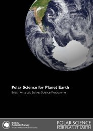
Modern BAS<br />
Today, the <strong>British</strong> <strong>Antarctic</strong> <strong>Survey</strong> is<br />
a world leader in polar science for<br />
planet Earth. In a changing world,<br />
studies carried out in <strong>Antarctic</strong>a are<br />
proving vital to our understanding of<br />
our planet and its future.<br />
BAS has over 450 staff and operates three research stations in the <strong>Antarctic</strong>:<br />
Rothera, Halley and Signy. It also carries out biological research at Bird Island,<br />
South Georgia, and commissioned fisheries science at King Edward Point on<br />
behalf of the Government of South Georgia and the South Sandwich Islands.<br />
BAS also manages and runs the NERC Arctic research station at Ny Ålesund,<br />
Svalbard.<br />
Operations and science programmes are executed and managed from<br />
Cambridge, and rely on a wide-ranging team of professional staff and expert<br />
logistics and operational planning. BAS has two ice-strengthened ships – Royal<br />
Research Ships James Clark Ross and Ernest Shackleton – and five aircraft.<br />
In the 21st century international co-operation is more important than ever.<br />
BAS undertakes research projects with more than 40 UK universities and has<br />
joint research programmes with most of the <strong>Antarctic</strong> Treaty nations.<br />
From its secret wartime beginnings, BAS has become a leader in the polar<br />
science arena, securing invaluable data for the UK Government to address<br />
issues such as climate change, ozone depletion and changing biodiversity. As<br />
the world focuses on predicting the impacts of climate change, BAS will play<br />
an ever more important role in helping to understand <strong>Antarctic</strong>a’s place in the<br />
global climate system and the effects of a changing climate on global sea level<br />
and <strong>Antarctic</strong>a’s ecosystems.<br />
i<br />
Further <strong>information</strong><br />
More <strong>information</strong> about BAS history and operations can be found on our<br />
website, www.antarctica.ac.uk, and in <strong>leaflet</strong>s ‘<strong>British</strong> <strong>Antarctic</strong> <strong>Survey</strong> Research<br />
Stations’, ‘<strong>British</strong> <strong>Antarctic</strong> <strong>Survey</strong> Ships’ and ‘<strong>British</strong> <strong>Antarctic</strong> <strong>Survey</strong> Aircraft’.<br />
Image: The international AGAP project surveyed the subglacial Gamburtsev Mountains in East <strong>Antarctic</strong>a.
Principal <strong>British</strong> voyages and expeditions to the <strong>Antarctic</strong><br />
Date Captain or Leader Vessel Purpose or Title<br />
1772-75 James Cook Resolution Exploration<br />
Adventure<br />
1819 William Smith Williams Mercantile<br />
1819-20 William Smith Williams Exploration<br />
Edward Bransfield<br />
1820-21 Robert Fildes Cora Sealing<br />
1821-22 George Powell Dove Sealing<br />
Eliza<br />
1822-24 James Weddell Jane Sealing<br />
Beaufoy<br />
1828-31 Henry Foster Chanticleer Magnetic<br />
observations<br />
1830-32 John Biscoe Tula Sealing and<br />
Lively<br />
exploration<br />
1833-34 Peter Kemp Magnet Sealing<br />
1838-39 John Balleny Eliza Scott Sealing<br />
Sabrina<br />
1839-43 James Clark Ross Erebus <strong>British</strong> <strong>Antarctic</strong><br />
Terror<br />
Expedition<br />
1844-45 Thomas Moore Pagoda Magnetic<br />
observations<br />
1872-76 C.Wyville Thomson Challenger Marine biology and<br />
oceanography<br />
1892-93 Thomas Robertson Active Dundee Whaling<br />
Alexander Fairweather Balaena Expedition<br />
Robert Davidson Diana<br />
James Davidson Polar Star<br />
1898-1900 Carsten Borchgrevink Southern Cross Exploration<br />
1901-04 Robert Falcon Scott Discovery <strong>British</strong> National<br />
<strong>Antarctic</strong> Expedition<br />
1902-04 William Bruce Scotia Scottish National<br />
<strong>Antarctic</strong> Expedition<br />
1907-09 Ernest Shackleton Nimrod <strong>British</strong> <strong>Antarctic</strong><br />
Expedition<br />
1910-13 Robert Falcon Scott Terra Nova <strong>British</strong> <strong>Antarctic</strong><br />
Expedition<br />
1914-16 Ernest Shackleton Endurance <strong>British</strong> Imperial<br />
Aurora<br />
Trans-<strong>Antarctic</strong><br />
Expedition
Principal <strong>British</strong> voyages and expeditions to the <strong>Antarctic</strong><br />
continued<br />
Date Captain or Leader Vessel Purpose or Title<br />
1920-22 Thomas Bagshawe unknown Scientific<br />
investigations<br />
1921-22 Ernest Shackleton Quest Shackleton-Rowett<br />
Frank Wild<br />
<strong>Antarctic</strong> Expedition<br />
1925-49 Neil Mackintosh Discovery Discovery<br />
William Scoresby Investigations<br />
Discovery II<br />
1929-31 Douglas Mawson Discovery <strong>British</strong>-Australian-<br />
New Zealand<br />
<strong>Antarctic</strong> Research<br />
Expedition<br />
1934-37 John Rymill Penola <strong>British</strong> Graham Land<br />
Expedition<br />
1943-45 James Marr Fitzroy Operation Tabarin<br />
Andrew Taylor William Scoresby<br />
Eagle<br />
1946-61 Edward Bingham Fitzroy Falkland Islands<br />
Vivian Fuchs William Scoresby Dependencies<br />
Trepassey <strong>Survey</strong><br />
John Biscoe<br />
Shackleton<br />
1949-52 John Giaever Norsel Norweigan-<strong>British</strong><br />
Swedish <strong>Antarctic</strong><br />
Expedition<br />
1951-57 Duncan Carse unknown South Georgia<br />
<strong>Survey</strong><br />
1955-57 Peter Mott Oluf Sven Falkland Island<br />
Dependencies Aerial<br />
<strong>Survey</strong> Expedition<br />
1955-58 Vivian Fuchs Theron Commonwealth<br />
Magga Dan Trans-<strong>Antarctic</strong><br />
Expedition<br />
1955- Royal Navy Protector Hydrography and<br />
present Endurance logistics support<br />
Protector<br />
1962- Vivian Fuchs Shackleton <strong>British</strong> <strong>Antarctic</strong><br />
present Dick Laws John Biscoe II <strong>Survey</strong><br />
David Drewry Bransfield<br />
Barry Haywood James Clark Ross<br />
Chris Rapley Ernest Shackleton<br />
Nick Owens
<strong>British</strong> <strong>Antarctic</strong> <strong>Survey</strong> (BAS), a component of the Natural Environment Research<br />
Council, delivers and enables world-leading interdisciplinary research in the Polar Regions.<br />
Its skilled science and support staff based in Cambridge, <strong>Antarctic</strong>a and the Arctic, work<br />
together to deliver research that uses the Polar Regions to advance our understanding<br />
of Earth as a sustainable planet. Through its extensive logistic capability and know-how<br />
BAS facilitates access for the <strong>British</strong> and international science community to the UK polar<br />
research operation. Numerous national and international collaborations, combined with an<br />
excellent infrastructure help sustain a world-leading position for the UK in <strong>Antarctic</strong> affairs.<br />
www.antarctica.ac.uk<br />
<strong>British</strong> <strong>Antarctic</strong> <strong>Survey</strong>, High Cross,<br />
Madingley Road, Cambridge, CB3 0ET, UK<br />
Email: info@bas.ac.uk<br />
© NERC 2012. All rights reserved.