Stability of GAMMA-NAUGHT and THE PALSAR based FOREST ...
Stability of GAMMA-NAUGHT and THE PALSAR based FOREST ...
Stability of GAMMA-NAUGHT and THE PALSAR based FOREST ...

You also want an ePaper? Increase the reach of your titles
YUMPU automatically turns print PDFs into web optimized ePapers that Google loves.
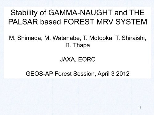
<strong>Stability</strong> <strong>of</strong> <strong>GAMMA</strong>-<strong>NAUGHT</strong> <strong>and</strong> <strong>THE</strong><br />
<strong>PALSAR</strong> <strong>based</strong> <strong>FOREST</strong> MRV SYSTEM<br />
M. Shimada, M. Watanabe, T. Motooka, T. Shiraishi,<br />
R. Thapa <br />
JAXA, EORC<br />
GEOS-AP Forest Session, April 3 2012<br />
1
1. Introduction<br />
Contents <br />
2. <strong>PALSAR</strong> Global Mosaic<br />
3. Gamma-naught stability<br />
4. MRV system development<br />
– gamma-naught change<br />
– LULUCF<br />
– FNF<br />
– Effectiveness <strong>of</strong> slope/<strong>of</strong>f-slope<br />
– Ground Truth Data Collection<br />
– Global Mangrove Map<br />
5. Conclusion <br />
2
<strong>PALSAR</strong> 10m Global Forest/Non-Forest<br />
Map 2009<br />
©JAXA,METI analyzed y JAXA
Deforestation monitoring at Rondonia, Brazil,<br />
using JERS-1 SAR <strong>and</strong> ALOS/<strong>PALSAR</strong><br />
JERS-1 SAR<br />
1996<br />
ALOS <strong>PALSAR</strong><br />
2007<br />
How can the PALSASAR be used for<br />
the forest monitoring? <br />
4
5. MRV-system development <br />
Time series SAR <br />
Basic Information<br />
Ortho, Slope<br />
Mosaic, Multi season<br />
Processing <br />
Gamma0,<br />
GT<br />
Lulucf<br />
C(biomass, lidar) <br />
FNF 1,2 <br />
LULUCF <br />
Ccalc <br />
FNFC 1,2 <br />
LULUCFC <br />
GC <br />
C <br />
CC <br />
Simulator, Verification box<br />
5
MRV Development<br />
• Generate the Horizon products defined in the GEO-FCT<br />
• Algorithm development as JAXA REDD+ project<br />
• Algorithm development for monitoring the forest<br />
(LULUCF, FNF, LULUCF-C, FNF-C)<br />
• Estimate the biomass with accuracy assessment<br />
• Development <strong>of</strong> the forest area decrease – area<br />
estimation<br />
• Validation in JFY2012 (April 2012-March 2013)<br />
6
4. <strong>Stability</strong> <strong>of</strong> <strong>PALSAR</strong><br />
Temporal variation <strong>of</strong> the SAR data was<br />
evaluated.16 <strong>of</strong> Amazon <strong>PALSAR</strong> 4 look<br />
data were used.<br />
Ortho, Slope corrected data were<br />
evaluated.<br />
Average:0.01dB, (0.185dB):High stability<br />
was confirmed. (similar to JERS-1 SAR)<br />
SAR reference image <br />
SAR differentiation Image <br />
7
5.1 Change detection using<br />
gamma-naught(GC) <br />
• Riau<br />
• 2007−2010 data<br />
• HH, HV<br />
• AVNIR-2 data were used<br />
• WWF data were used.<br />
8
Temporal change <strong>of</strong><br />
gammanaught(2007-2009)<br />
Three colors<br />
Green: No change<br />
Blue: decrease<br />
Red: Increase<br />
Natural forest<br />
Natural mangrov<br />
Natural re-growt<br />
Acacia<br />
Oil Palm<br />
Rubber<br />
Coconut<br />
Open area<br />
Other<br />
Water<br />
Larger blue color<br />
shows forest .<br />
9
Using gamma-‐naught changes <br />
for deforesta5on monitoring <br />
2009 mosaic -‐ 2008 mosaic <br />
Riau province, Indonesia <br />
Δγ 0 <br />
(dB) <br />
8 <br />
6 <br />
4 <br />
2 <br />
0 <br />
-‐2 <br />
-‐4 <br />
-‐6 <br />
-‐8 <br />
increase <br />
No<br />
change <br />
decreas<br />
e<br />
HH <br />
HV
Annual decrease <strong>of</strong> gamma naught HV … Δγ 0 < - 2 dB<br />
2007-2008 2008-2009 2009-2010
Example-‐1) <br />
Acacia <br />
concession <br />
<strong>PALSAR</strong> 2007-2010 <br />
AVNIR-2 2008/07/05 <br />
2007-‐2008 <br />
2008-‐2009 <br />
2009-‐2010 <br />
AVNIR-2 2009/10/08<br />
AVNIR-2 2010/10/11
Example-‐2) Tesso Niro natural forest, Riau, Indonesia <br />
ALOS/AVNIR-‐2 <br />
2009/08/06 <br />
Clear-‐cut during 2009-‐2010 <br />
ALOS/AVNIR-‐2 <br />
2010/08/26 <br />
Natural forest <br />
Planta5ons by <br />
WWF 2007 <br />
LULUCF map
Deforesta5on map <strong>of</strong> central Sumatra derived by <strong>PALSAR</strong> 25-‐m mosaics <br />
Gamma-naught change : allows the deforestation monitoring <strong>and</strong> forest changes at<br />
the known classes<br />
1
1.Gamma-naught variation <strong>and</strong> the forest decrease<br />
2009 年 モザイク 2010 年 モザイク <br />
差 分 画 像 (2010 年 -2009 年 )<br />
二 値 化 画 像 <br />
30km
2.Gamma-naught variation <strong>and</strong> the forest decrease <br />
2009 年 2010 年 <br />
2009 年 2010 年 <br />
二 値 化 画 像 <br />
5km<br />
二 値 化 画 像 <br />
5km<br />
2009 年 2010 年 <br />
2009 年 2010 年 <br />
二 値 化 画 像 <br />
5km<br />
二 値 化 画 像 <br />
5km
Comparison study for:LULUCF<br />
• AreaRiau <br />
• MethodSubspace (SS), Decision Tree (DT), Nearest Neighbor<br />
(NN), Support Vector Machine(SVM) <br />
• Output, LULUCF & FNF <br />
• Accuracy:SS>DT>NN>SVM at FNF,SS showed the best <strong>of</strong> 88%.<br />
• Accuracy Comparison:- Stratified r<strong>and</strong>om sampling approach<br />
L<strong>and</strong> cover class %L<strong>and</strong>scape CI ±3 <br />
Natural forest 30.19 322 <br />
Natural mangrove forest 1.79 19 <br />
Natural re-growth 12.17 130 <br />
Acacia 5.09 54 <br />
Oil Palm 13.53 144 <br />
Rubber 9.53 102 <br />
Coconut 3.95 42 <br />
Open area 6.94 74 <br />
Other 10.98 117 <br />
Water 5.83 62 <br />
Total 100.00 1067 <br />
17<br />
Ground truth WWF Map (20
LULUCF algorithm comparison(Number is accuracy in %,LULUCF in 9<br />
classes, FNF in 2 classes Blue points correct, red points in incorrectは)<br />
Sub Space Decision Tree Nearest Neighbor Support Vector<br />
Machine<br />
55.4<br />
56.0<br />
46.8<br />
43.4<br />
88.2<br />
80.5<br />
82.7<br />
76.7<br />
1
Slope correct effect <strong>and</strong> advantage <strong>of</strong><br />
Gamma-naught Visualization <br />
• LULUCF(FNF) <br />
Slope correction<br />
• FNF <br />
Without slope correction<br />
86% 60%<br />
勾 配 補 正 有 り<br />
勾 配 補 正 なし<br />
19
Comparison <strong>of</strong><br />
slopecorrection<br />
<strong>and</strong><br />
without slope<br />
correction:<br />
02:99 <br />
Riau<br />
R:2007, G:<br />
2009:B:2010 <br />
00:102 <br />
20
5.3 FNF <br />
• Target area:Riau<br />
• Method:Thresholding using eCOG<br />
(-11.5 dB for g 0 HV )<br />
• Output, FNF<br />
• Other: Global FNF<br />
• Comparison with DCP<br />
21
Accuracy evaluation <strong>of</strong> FNF2007-2009 using <br />
<strong>PALSAR</strong> FNF 2007<br />
84.54%, 925points<br />
<strong>PALSAR</strong> FNF 2008<br />
83.02%, 736points<br />
<strong>PALSAR</strong> FNF 2009<br />
82.68%, 635points<br />
●:Forest, ●:Non-Forest, ●:Water<br />
●:Correct, ●:Incorrect <br />
<strong>PALSAR</strong> FNF 2010<br />
83.93%, 280points
iomass estimation(accuracy)(Tier-2~3)<br />
Backscattering<br />
SAR data<br />
Slope corrected<br />
Ortho-rectified<br />
biomass<br />
Lidar data<br />
Height measure<br />
biomass<br />
LULUCF<br />
FNF<br />
Ground truth data<br />
Brest-height-diameter<br />
Tree height, Alometry<br />
Tree height<br />
biomass(accuracy)<br />
B =<br />
ΔB =<br />
∑b i<br />
A i<br />
i<br />
∑<br />
i<br />
( ) 2<br />
Δb i<br />
A i<br />
Estimate the forest<br />
biomass <strong>and</strong> its<br />
accuracy<br />
Histgram<br />
biomass
MRV Status<br />
<br />
Two methods are being developed for the<br />
operations, SS for LULUCF, <strong>and</strong> Gamma-naught<br />
change detection estimating the forest area<br />
change in Indonesia ad Brazil.<br />
<strong>PALSAR</strong> basic processing: done.<br />
Ground plotting 48 points in Riau<br />
Lidar data in Riau<br />
2
S02E133 New Guinea Is. <br />
Global Mangrove Map<br />
<strong>PALSAR</strong> 25 Mangrove<br />
<strong>PALSAR</strong> Mangrove Map (2010)<br />
USGS<br />
2<br />
USGS Mangrove Map (2000)
The overview <strong>of</strong> ALOS-2 <br />
ALOS-‐2 satellite parameters <br />
" Orbit type : Sun-‐synchronous <br />
" Launch : 2013 <br />
" Al5tude : 628km +/-‐ 500m(for reference orbit) <br />
" Revisit 5me : 14days <br />
" LSDN : 12:00 +/-‐ 15min <br />
SAR antenna <br />
Z <br />
Y <br />
X <br />
<strong>PALSAR</strong>-‐2 (Mission Sensor) <br />
" L-‐b<strong>and</strong> Synthe5c Aperture <br />
Radar <br />
" Ac5ve Phased Array Antenna <br />
type <br />
two dimensions scan (range <br />
<strong>and</strong> azimuth) <br />
" Antenna size : 3m(El) x <br />
10m(Az) <br />
" B<strong>and</strong>width : 14 to 84MHz <br />
" Peak transmit Power : 5100W <br />
" Observa5on swath : 25km to <br />
490km <br />
" Resolu5on : Range 3m to 100m <br />
Azimuth 1m to 100m 26
7. Summary<br />
• Slope corrected gamma-naught <strong>of</strong> <strong>PALSAR</strong> <strong>and</strong><br />
JERS-1 SAR are effective parameter to express the<br />
deforestation status. Time series <strong>of</strong> the gammanaught<br />
change will be the useful method for detecting<br />
the forest decrease.<br />
• Development <strong>of</strong> the LULUCF is underway <strong>and</strong><br />
aggregated FNF using the subspace method reaches<br />
to 88%.<br />
• We will continue to develop the biomass quantity (<strong>and</strong><br />
carbon) change combining the ground truth data <strong>and</strong><br />
lidar data.<br />
27
Acknowledgements <br />
• Great Thanks to RESTEC researchers<br />
• T. Yamanokuchi, T. Itoh, O. Isoguchi, <strong>and</strong><br />
H. Okumura<br />
28
5.2 LULUCF Classification<br />
• Area:Riau<br />
• Method:Several<br />
development <br />
• SVM, eCOG MDM, eCOG Bayesian,<br />
Sub-Space(SS)<br />
• Output, LULUCF & FNF<br />
• SS>SVM>eCOG at FNF,SS showed the<br />
best accuracy <strong>of</strong> 88%. <br />
29