A MUNKAERÅPIAC SZEREPLÅI
A MUNKAERÅPIAC SZEREPLÅI
A MUNKAERÅPIAC SZEREPLÅI

You also want an ePaper? Increase the reach of your titles
YUMPU automatically turns print PDFs into web optimized ePapers that Google loves.
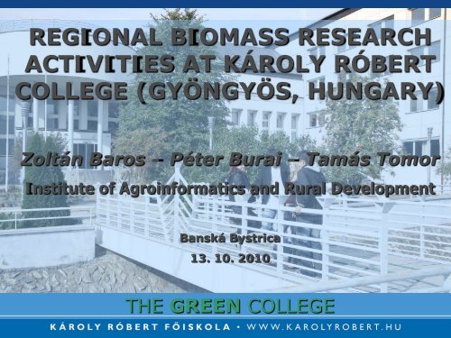
REGIONAL BIOMASS RESEARCH<br />
ACTIVITIES AT KÁROLY RÓBERT<br />
COLLEGE (GYÖNGYÖS, HUNGARY)<br />
Zoltán Baros – Péter Burai – Tamás Tomor<br />
Institute of Agroinformatics and Rural Development<br />
Banská Bystrica<br />
13. 10. 2010<br />
THE GREEN COLLEGE
Introduction<br />
• A college specialised partly in agricultural higher<br />
education<br />
• Crisis and transition<br />
• Re-defining itself as<br />
a.) a Green College … or … the Green College<br />
b.) a Knowledge Company<br />
• Various biomass and RES-related research activities<br />
• Also integrated into education
‘KRC’ = Károly Róbert College = Knowledge<br />
Company<br />
Gyöngyös
(R+D+I+B)<br />
Research<br />
Business<br />
KRC=<br />
knowledge<br />
services<br />
Development<br />
Innovation
Content<br />
1. BIOENKRC project – Organisation of<br />
a bioenergy cluster<br />
2. Agricultural suitability research<br />
3. Biomass applications of<br />
Hyperspectral- and LIDAR airborne<br />
systems
1. The BIOENKRC project –<br />
Organisation of a bioenergy cluster
• Financed from the Oszkár Asbóth Innovation Programme for<br />
Pull Factors<br />
• Duration: 2006-2009<br />
• R&D activities covered:<br />
3 ‘interrelated fields’<br />
25 successive program tasks<br />
110-144 researchers involved<br />
• Aims:<br />
The establishment and functioning of an bioenergy innovation<br />
centre and cluster<br />
Elaboration, application and adaptation of new technologies
Integrated (R+D+I+B) activities<br />
Applications<br />
Projects<br />
Government<br />
Sponsors<br />
Management and<br />
business<br />
Sustainable energy management<br />
Economy<br />
Economical sciences<br />
Sustainable development<br />
Agricultural<br />
sciences<br />
Bioenergy<br />
Multidisciplines of social<br />
sciences<br />
Society<br />
Rural development<br />
Tourism and<br />
catering<br />
Environmental sciences<br />
Nature<br />
Forest and game<br />
management<br />
Knowledge centre<br />
services<br />
Networks<br />
Business
Integrated R + D programs in Bioenergy<br />
Heat Biogas Bio fuel<br />
Producing, processing of biomass, technologies<br />
Economical evaluation<br />
Analysis of environmental and rural developmental issues<br />
Marketing and communication<br />
Elaboration of complex system models
Bioenergy Innovation Cluster and<br />
Knowledge Centre<br />
Governmental<br />
organizations<br />
Regional<br />
developing<br />
organizations<br />
R + D<br />
institutions<br />
Local<br />
governments<br />
Universities<br />
Egererdő<br />
Strategic partners<br />
Cooperating partners<br />
Bio-energy Innovation<br />
Cluster<br />
Középtiszai<br />
LTD.-Kunhegyes<br />
Corax-Bioner<br />
LTD.<br />
LTD.<br />
Mátrai<br />
Erőmű LTD.<br />
Bátortrade<br />
LTD.-<br />
Nyírbátor<br />
MGI<br />
Károly Róbert<br />
Gödöllő<br />
College KR Oktató-<br />
Kutató LTD.<br />
Knowledge<br />
Centre<br />
Companies<br />
Inter-Tram LTD.-<br />
Mátészalka<br />
Győri Szeszipari<br />
LTD.<br />
Multinational<br />
companies<br />
Innovation<br />
organizations<br />
Associations<br />
Banks
Social Acceptance of RES<br />
Knowledge on RES in the Micro-region of Gyöngyös<br />
Solar energy<br />
Wind energy<br />
Hydro power<br />
Biodiesel<br />
Biomass combustion<br />
Biogas<br />
Short-rotation forestry<br />
Biobriquette<br />
Geothermal energy<br />
Bioethanol<br />
Photovoltaic<br />
None<br />
0 10 20 30 40 50 60 70 80 90
2. Agricultural suitability research
Topic definition<br />
Present stage: due to the high number of those involved in agriculture, the<br />
pressure to increase efficiency of production and the lack of habitat-related<br />
information, the collection, supplement synthesized evaluation of the existing<br />
information and their provision to those involved is necessary.<br />
Strategic goal: provision of structured knowledge for farmers, consultants,<br />
regional development and planning experts to the elaboration of agrienvironmental<br />
management, rural development EU programmes to be<br />
introduced, tendered and applied as well as to the implementation of their<br />
goals.<br />
Operative goal: elaboration of a model required to a complex centre of<br />
consultancy organised on the basis of information technology in the of North<br />
Hungarian Region that is capable of fulfilling demands for habitat-related<br />
information by the agriculture.
The information system is capable of:<br />
Providing to the optimal and efficient functioning of a givee nspatial unit<br />
(plot, block, settlement, micro-region, region) :<br />
• basic information (on the geographical, economic and social environment)<br />
• land use and landscape management recommendations (sustainable land<br />
and soil use, soil protection, ecological and economic information)<br />
•Expertise supporting agricultural production (crop production, crop<br />
nutrition or crop protection information)<br />
Providing information background to the implementation of thematic tasks:<br />
• regional planning and development, land consolidation<br />
• spatial management of production (e.g. designation of plantations)<br />
• obtaining licences from authorities<br />
• access to funding
The information system contains:<br />
• GIS database<br />
• Expert data, descriptions and annotations<br />
• System software, algorithms<br />
• Easy-to-handle, ergonomic communication interface<br />
The potential range of users include:<br />
• Farmers, consultants<br />
• Municipalities and their associations<br />
• Regional and national planning institutes, ministries<br />
• Institutes of policy administration<br />
• Institutes with magisterial power<br />
• Special services
The geographical framework<br />
The representative sample<br />
area:<br />
• Area: 750 km 2<br />
• Number of settlements: 25)<br />
• Number of inhabitants: 77,773<br />
• Number of agricultural enterprises and cooperatives:<br />
4,367<br />
• Total area of croplands: 30,006 hectares<br />
(Source: KSH, 2005)
• Public administration layers (outer area, inner<br />
area, real estate cadaster)<br />
• Infrastructural layers (road network, railway<br />
network, air wires)<br />
• Relief layers (level curves, spot heights, digital<br />
elevation models – TIN, GRID, exposure, slope<br />
category)<br />
• Land-use layers (CORINE CLC-50, LANDSAT TM ,<br />
First and Second Military Surveys)<br />
• Statistical layers (economic, social, demographical<br />
data content)<br />
• Hydrological layers (surface water bodies,<br />
surface catchment areas, flood inundations,<br />
emergency flood reservoirs, water management<br />
construction works)<br />
Some of the GIS layers produced
• Meteorological layers (rainfall, relative<br />
humidity, number of sunshine hours,<br />
temperature, heat sum, date of first<br />
frost)<br />
• Habitat layers (vineyard cadaster,<br />
orchard cadaster)<br />
• Nature conservation layers (protected<br />
areas, NATURA 2000 areas)<br />
• Mining layers (search areas, mining<br />
grounds, grant areas)<br />
• Other layers (layers produced based on<br />
field surveying)
GIS analyses – Soil characteristics<br />
Evaluation of the conditions for<br />
farming based on the factors of<br />
environment:<br />
General agricultural suitability<br />
classification<br />
(agricultural potential).
GIS analyses – Soil characteristics<br />
Evaluation of the conditions for farming based on the<br />
factors of environment:<br />
Habitat classification:<br />
A species specific classification<br />
of agricultural lands with soil<br />
conditions and habitat<br />
requirements of plant species<br />
taken into considerations.
GIS analyses – Land-use stability<br />
Data sources used:<br />
• First Military Survey (1783)<br />
• Second Military Survey (1856-1866)<br />
• CORINE CLC-50 (1999)<br />
• Landsat TM 5 images (2003)<br />
Land-use category<br />
/Values of the stable land-use<br />
Area<br />
(ha)<br />
Share of the<br />
present total<br />
area (%)<br />
Index of<br />
highest land<br />
covered (%) *<br />
Built-up area (red) 831.3 14.27 14.27<br />
Forest (yellow) 17899.6 41.48 41.48<br />
Meadow (orange) 604.5 21.18 2.33<br />
Cropland (green) 11403.7 36.04 36.04<br />
Vineyard (pink) 798.4 9.47 9.47<br />
Continuous water surface 0 0 0<br />
Total (ha) 31,537 34.0<br />
* Ratio covere in the study period as measured to the largest area ever
GIS analyses – Relief and land-use<br />
The share of croplands in the micro-region per slope categories<br />
Slope category Area (ha) Area (%)<br />
0-5 25 168,6 83,88<br />
6-12 3 973,7 13,24<br />
13-17 643,8 2,15<br />
18-25 139,4 0,46<br />
26-35 14,6 0,05<br />
35< 65,8 0,22<br />
Total 30 005,9 100,00<br />
30 000,0<br />
25 000,0<br />
20 000,0<br />
15 000,0<br />
10 000,0<br />
5 000,0<br />
0,0<br />
0-5 6-12 13-17 18-25 26-35 35
3. Biomass applications of<br />
hyperspectral- and LIDAR airborne<br />
systems
Application of hyperspectral airborne images<br />
What is spectral imaging?<br />
(hyperspectral imaging, imaging spectroscopy)<br />
Spectral axis<br />
Spatial axis<br />
Time<br />
R<br />
Spectrum for one<br />
pixel<br />
400 Wavelength 700<br />
Each pixel is<br />
associated with<br />
simultaneous high<br />
resolution spectral<br />
information<br />
produced by a<br />
Spectral Camera<br />
(Hyper)spectral imaging is a next generation imaging technology, which<br />
produces the image of the target at tens or hundreds of wavelengths.
First compact visible and shortwave infrared<br />
hyperspectal system in Europe<br />
AISA DUAL Provide<br />
• smallest airborne hyperspectral systems in<br />
VNIR and SWIR<br />
• high spectral and spatial mapping<br />
• full hyperspectral data at high speed<br />
• fast turnaround from data collection to<br />
information<br />
Acquires hyperspectral images in the full<br />
400 – 2450 nm (VNIR + SWIR) spectral<br />
range at 400 wavelengths.
Biomass mapping<br />
Agricultural application<br />
Agricultural parcel with heterogenic covered and brushed vegetation
Biomass mapping<br />
Agricultural application<br />
Canopy % was derived from the NDVI.<br />
Canopy (%) = 157.92*NDVI – 2.37 (R 2 = 0.78, n=21)
Species mapping with hyperspectral image<br />
Classification Aquatic Vegetation Mapping<br />
True color RGB image<br />
Aquatic vegetation map<br />
Spectral Angle Mapping (SAM) was applied to classify images
Qualitative and quantitative studies<br />
Thematic map of farmland<br />
Chlorophyll analysis
LIDAR Laser and Scanning System<br />
The LIDAR instrument consists of a<br />
system controller and a transmitter and<br />
receiver. As the aircraft moves forward<br />
along the line-of-flight, a scanning mirror<br />
directs pulses of laser light across-track<br />
perpendicular to the line-of-flight.<br />
Jensen, 2008
Digital Surface Model (DSM)<br />
containing the elevation characteristics of all the trees,<br />
shrubs, and man-made structures
Classified Digital Surface Model (DSM)<br />
containing the elevation and also types of trees, shrubs.
Digital Elevation Model (DEM)<br />
Accuracy: 5-15cm (z), 5-20cm (x,y) Point density: 5-40 point/m 2
Integrating land use and biomass map<br />
Vegetation 3D Structure &<br />
Biomass:<br />
for Biodiversity and Habitat<br />
Vegetation<br />
Type<br />
Upland conifer<br />
Lowland conifer<br />
Northern hardwoods<br />
Aspen/lowland deciduous<br />
Grassland<br />
Agriculture<br />
Wetlands<br />
Open water<br />
Urban/barren<br />
High: 30 kg/m 2<br />
Biomass<br />
Low: 0 kg/m 2
THANK YOU FOR YOUR ATTENTION!
![Prezentácia_ENEF_2006 Tonhauser [iba na ÄÃtanie]](https://img.yumpu.com/48150957/1/190x135/prezentacia-enef-2006-tonhauser-iba-na-aa-tanie.jpg?quality=85)
![ENEF Frans Feil bio-fuels [iba na ÄÃtanie]](https://img.yumpu.com/45976753/1/190x135/enef-frans-feil-bio-fuels-iba-na-aa-tanie.jpg?quality=85)

![prezent-energo --- Suchomel [iba na ÄÃtanie]](https://img.yumpu.com/36192322/1/190x135/prezent-energo-suchomel-iba-na-aa-tanie.jpg?quality=85)
![turÅa -slama --- Roman [iba na ÄÃtanie]](https://img.yumpu.com/34089703/1/190x135/turaa-slama-roman-iba-na-aa-tanie.jpg?quality=85)
![06 --- Bedi 2 [iba na ÄÃtanie] - ENEF 2012](https://img.yumpu.com/31241052/1/190x135/06-bedi-2-iba-na-aa-tanie-enef-2012.jpg?quality=85)