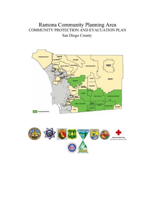
Ramona Community Protection and Evacuation Plan
Ramona Community Protection and Evacuation Plan
Ramona Community Protection and Evacuation Plan

Create successful ePaper yourself
Turn your PDF publications into a flip-book with our unique Google optimized e-Paper software.
San Diego County
SAN DIEGO COUNTY<br />
RAMONA COMMUNITY PROTECTION<br />
& EVACUATION PLAN<br />
RAMONA COMMUNITY PLANNING AREA<br />
October 2005<br />
Revised January 2011
RAMONA COMMUNITY PROTECTION & EVACUATION PLAN<br />
INTRODUCTION<br />
Introduction<br />
The <strong>Ramona</strong> <strong>Community</strong> <strong>Protection</strong> <strong>and</strong> <strong>Evacuation</strong> <strong>Plan</strong> is a collaboration between the<br />
following groups <strong>and</strong> agencies:<br />
o <strong>Ramona</strong> <strong>Community</strong> <strong>Plan</strong>ning Group<br />
o <strong>Ramona</strong> Outback Amateur Radio Service (ROARS)<br />
o <strong>Ramona</strong> Fire Department/CAL FIRE<br />
o <strong>Ramona</strong> CERT<br />
o Sheriff’s Department<br />
o Department of Animal Services<br />
o American Red Cross<br />
o County Office of Emergency Services.<br />
It is intended that the <strong>Ramona</strong> <strong>Community</strong> <strong>Protection</strong> <strong>and</strong> <strong>Evacuation</strong> <strong>Plan</strong> will be<br />
updated every two years. Questions, comments, <strong>and</strong> suggestions can be forwarded to<br />
Kristi Mansolf of the <strong>Ramona</strong> <strong>Community</strong> <strong>Plan</strong>ning Group at 15873 Hwy 67, <strong>Ramona</strong>,<br />
California, 92065, or at kmansolf@gmail.com .
RAMONA COMMUNITY PROTECTION & EVACUATION PLAN<br />
TABLE OF CONTENTS<br />
Contents<br />
Section A:<br />
Section B:<br />
Section C:<br />
Section D:<br />
Section E:<br />
Section F:<br />
Section G:<br />
Section H:<br />
Section I:<br />
Section J:<br />
Section K:<br />
Section K-1:<br />
<strong>Community</strong> Overview & Conditions<br />
<strong>Ramona</strong> Municipal Water <strong>and</strong> Fire <strong>Protection</strong><br />
Districts, <strong>Community</strong> <strong>Plan</strong>ning Area Boundary<br />
Map<br />
<strong>Ramona</strong> Municipal Water District Boundary Map<br />
<strong>Community</strong> History<br />
Fire History Map 1910-2003<br />
Fire History Map 1996-2007<br />
<strong>Community</strong> Stakeholders<br />
Mitigation Strategy<br />
<strong>Community</strong> <strong>Protection</strong> & <strong>Evacuation</strong> <strong>Plan</strong><br />
Sheriff’s Dept., <strong>Ramona</strong> Comm<strong>and</strong> <strong>Evacuation</strong> Route<br />
Map<br />
Sheriff’s Dept., <strong>Ramona</strong> Comm<strong>and</strong> Zone Map<br />
Fire Agency Response <strong>Plan</strong>s<br />
Law Enforcement Response <strong>Plan</strong>s<br />
Animal Services<br />
Mass Casualty <strong>Plan</strong><br />
Sheltering<br />
Important Phone Numbers & Contact Information<br />
Radio Communications<br />
<strong>Ramona</strong> <strong>Community</strong> Emergency Response<br />
Team (CERT) & <strong>Ramona</strong> Outback<br />
Amateur Radio Society (ROARS)<br />
<strong>Ramona</strong> Area Communications <strong>Plan</strong><br />
San Diego County, the Mountain Empire<br />
Scanner Frequencies
RAMONA COMMUNITY PROTECTION & EVACUATION PLAN<br />
TABLE OF CONTENTS<br />
Craig’s Citizen Radio <strong>and</strong> Scanner Page<br />
Emergency Alert System<br />
Section L:<br />
Section N:<br />
Section P:<br />
Section Q:<br />
Fire <strong>Protection</strong> by Geographic Subregion<br />
Road Access St<strong>and</strong>ards<br />
Logistics<br />
Vegetation Management Websites
RAMONA COMMUNITY PROTECTION & EVACUATION PLAN<br />
SECTION A – OVERVIEW & CONDITIONS<br />
<strong>Ramona</strong> Overview <strong>and</strong> Conditions<br />
<strong>Ramona</strong> is characterized by steep slopes, rocky terrain, rolling topography, deep canyons,<br />
high valleys, <strong>and</strong> expanses of grassl<strong>and</strong>. The native vegetation is highly combustible<br />
during the long, seasonal dry periods. Significant fire activity is not uncommon in the<br />
heavily vegetated foothills <strong>and</strong> canyons, with a relatively dry climate <strong>and</strong> low relative<br />
humidity during the late summer <strong>and</strong> fall periods. Winds commonly occur from the west.<br />
Although strong winds from the west <strong>and</strong> south can be a problem during a fire, the dry,<br />
strong north <strong>and</strong> east winds (Santa Anas) are more problematic.<br />
The most densely populated area of <strong>Ramona</strong> is the Town Center <strong>and</strong> vicinity.<br />
Development spreads out in concentric circles from the Town Center with large clusters<br />
of homes in the Mt. Woodson planned development at the far western side of <strong>Ramona</strong>;<br />
Fernbrook in the Mussey Grade area to the south; the Holly Oaks, San Diego Country<br />
Estates <strong>and</strong> Rancho San Vicente planned developments to the south; <strong>and</strong> the Oak Tree<br />
Ranch modular home park north east of the Town Center. There are many smaller<br />
planned developments dispersed throughout the <strong>Plan</strong>ning Area. The Barona Indian<br />
Reservation borders <strong>Ramona</strong> to the south. The Clevel<strong>and</strong> National Forest borders<br />
portions of the north side of <strong>Ramona</strong> as well as the San Diego Country Estates <strong>and</strong><br />
vicinity to the east. Large areas of open space are often directly adjacent <strong>and</strong> integrated<br />
into developed areas. <strong>Ramona</strong> has twenty biological Resource Conservation Areas.<br />
The portion of the <strong>Ramona</strong> <strong>Plan</strong>ning Area east of Magnolia is outside of the <strong>Ramona</strong><br />
Municipal Water District (RMWD) boundaries. Parcels are larger <strong>and</strong> the l<strong>and</strong> is more<br />
rolling. Vegetation is less dense on the east side of <strong>Ramona</strong> which extends to the Witch<br />
Creek area. Agricultural activity, such as grazing, is common throughout the grassl<strong>and</strong>s<br />
in the flatter areas. There are avocado groves on the west side of <strong>Ramona</strong> in the<br />
Highl<strong>and</strong> Valley area where an additional water system is available to agricultural<br />
growers. In many of the more rural, outlying areas of <strong>Ramona</strong>, residents are not served<br />
by the RMWD <strong>and</strong> depend on wells. Many wells have gone dry, reducing the availability<br />
of water to fight fires.<br />
<strong>Ramona</strong> is bisected by two State highways, Hwy 67 <strong>and</strong> Hwy 78. Both have been closed<br />
on occasion due to fire <strong>and</strong> traffic accidents. Traffic congestion during the morning <strong>and</strong><br />
evening commute can hamper the passage of emergency vehicles. <strong>Ramona</strong> has two<br />
alternate routes: Highl<strong>and</strong> Valley Rd. is an alternate route to Escondido <strong>and</strong> Poway, <strong>and</strong><br />
Wildcat Canyon Rd. through the Barona Indian Reservation is an alternate route to<br />
Lakeside. Extended portions of both Highl<strong>and</strong> Valley Rd. <strong>and</strong> Wildcat Canyon Rd. are<br />
steep, narrow <strong>and</strong> winding. Wildcat Canyon Rd. passes through long, steep narrow<br />
canyons. Vista <strong>Ramona</strong> Rd. connects to the Old Julian Hwy <strong>and</strong> then to 3 rd St., offering<br />
an alternate route from the San Diego Country Estates to <strong>Ramona</strong>, other than San Vicente<br />
Rd. All routes traverse mountainous terrain with native vegetation <strong>and</strong> would be<br />
dangerous to travel if a fire were burning in the area. Cars traveling on the roads have<br />
been a source of fire in the past.<br />
1
RAMONA COMMUNITY PROTECTION & EVACUATION PLAN<br />
SECTION A – OVERVIEW & CONDITIONS<br />
The entire area of <strong>Ramona</strong> outside of the Town Center is vulnerable to fire. As <strong>Ramona</strong><br />
borders undeveloped portions of other communities <strong>and</strong> the Clevel<strong>and</strong> National Forest,<br />
all of the areas bordering <strong>Ramona</strong> are also vulnerable to fire.<br />
Besides the water storage areas of Lake <strong>Ramona</strong>, Lake Sutherl<strong>and</strong>, <strong>and</strong> the San Vicente<br />
Reservoir, <strong>Ramona</strong> has many ponds that can be used for water drops during a fire. Elliot<br />
Pond in the Town Center, the ponds at Mt. Woodson <strong>and</strong> the Dos Picos Park Pond are<br />
just a few of the ponds in <strong>Ramona</strong> that generally have water in them all year. There are<br />
also many seasonal ponds throughout <strong>Ramona</strong>.<br />
<strong>Ramona</strong> has a general aviation airport, located north of the Town Center, that is part of<br />
the County regional air transportation network. The United States Forest Service (USFS)<br />
<strong>and</strong> CAL FIRE operate an air attack base at the site which is used to fight fires<br />
throughout the region.<br />
There is the new danger posed by possible terrorist events in San Diego. A significant<br />
event could cause power outage, disease <strong>and</strong> a mass influx of people to this area in need<br />
of shelter <strong>and</strong> support.<br />
Seismic Conditions<br />
Local<br />
Locally, the <strong>Ramona</strong> <strong>Community</strong> <strong>Plan</strong>ning Area contains several faults that are classified<br />
as inferred faults. A series of parallel northwest trending faults are located in the<br />
northwest end of the Santa Maria Valley. A series of east-west trending faults are found<br />
in the San Vicente Valley <strong>and</strong> vicinity. The south side of Mt. Woodson is bordered by<br />
the Warren Canyon fault, which continues eastward along the south side of the Santa<br />
Maria Valley, located southwest of the <strong>Ramona</strong> Town Center.<br />
Regional<br />
On a regional scale, the <strong>Ramona</strong> <strong>Community</strong> <strong>Plan</strong>ning Area lies within a zone of high<br />
earthquake activity. The Elsinore fault, located approximately 14 miles to the northeast<br />
of the Town Center, <strong>and</strong> the San Jacinto fault, located 40 miles to the northeast, are San<br />
Diego County’s largest known active faults <strong>and</strong> are estimated to have maximum credible<br />
earthquakes on the magnitude of 7.6, <strong>and</strong> 7.5 to 7.8 respectively, to occur every one<br />
hundred years. Because of the fairly close proximity of these faults, considerable seismic<br />
damage could occur in the area in the way of ground shaking, structural damage, <strong>and</strong><br />
possible loss of life.<br />
2
RAMONA COMMUNITY PROTECTION & EVACUATION PLAN<br />
SECTION A – OVERVIEW & CONDITIONS<br />
Maps<br />
The map on the following page, RMWD <strong>and</strong> Fire <strong>Protection</strong> Districts, shows the<br />
relationship between the <strong>Ramona</strong> <strong>Community</strong> <strong>Plan</strong>ning Area <strong>and</strong> the RMWD boundaries.<br />
Fire <strong>Protection</strong> Districts in neighboring communities are also shown (RMWD <strong>and</strong> Fire<br />
<strong>Protection</strong> District Map). For information on fire resources serving the <strong>Ramona</strong> area,<br />
please see Section L, Fire <strong>Protection</strong> by Geographic Subregion.<br />
The second map shows the RMWD boundaries (RMWD Map).<br />
3
RAMONA COMMUNITY PROTECTION & EVACUATION PLAN<br />
SECTION B – COMMUNITY HISTORY<br />
History of the <strong>Ramona</strong> Region<br />
<strong>Ramona</strong> is located in the Santa Maria Valley approximately 35 miles northeast of San<br />
Diego, <strong>and</strong> about 25 miles east of the coast. It is bordered by the City of Poway to the<br />
west, Lakeside <strong>and</strong> the Barona Indian Reservation to the south, Santa Ysabel to the east,<br />
<strong>and</strong> Escondido <strong>and</strong> the North Mountain Subregion to the north. The Santa Maria Valley<br />
is at approximately 1,400 feet elevation. Mountains at the <strong>Ramona</strong>/Poway border reach<br />
elevations of about 2,800 feet. <strong>Ramona</strong> covers approximately 130 square miles. The<br />
RMWD covers 75 square miles within this area. <strong>Ramona</strong> is in the unincorporated portion<br />
of San Diego County <strong>and</strong> conforms to the <strong>Ramona</strong> <strong>Community</strong> <strong>Plan</strong>ning Area.<br />
<strong>Ramona</strong> has a long history of nature-related emergencies. Fire is the most common<br />
problem with a long history of small <strong>and</strong> large brush fires. Size <strong>and</strong> extent of the fires is<br />
related to wind conditions, humidity, fuel load, <strong>and</strong> resources available.<br />
Rainfall typically doesn’t fall during the summer months, <strong>and</strong> it often stays dry until well<br />
into the fall or winter seasons, with extreme fire conditions being common. The Inaja<br />
fire burned into the south side of <strong>Ramona</strong> in November of 1956. Approximately 45,000<br />
acres burned. In October of 1967, fires driven by Santa Ana winds burned the north side<br />
of <strong>Ramona</strong> from Montecito Rd., topping Mt. Woodson before burning through Poway to<br />
State Route 395. Over 56,000 acres burned. In October of 2003 the Cedar fire burned<br />
through <strong>Ramona</strong> south of Hwy 67 from the Clevel<strong>and</strong> National Forest near the San Diego<br />
Country Estates to the City of San Diego, then turned when the winds changed. Over<br />
270,000 acres burned. In October of 2007 the Witch Creek fire burned through the east<br />
<strong>and</strong> north portions or <strong>Ramona</strong>, burning 198,000 acres. The extent of dirt roads, often<br />
narrow <strong>and</strong> twisting with residences not clearly marked, makes evacuation <strong>and</strong> assistance<br />
difficult.<br />
<strong>Ramona</strong> has been through two major fires in four years. The 2003 <strong>and</strong> 2007 fires made a<br />
huge impact on the community. In 2007, 501 homes were lost. The entire community<br />
was given evacuation orders. No emergency shelter was officially designated. The ways<br />
out of town were limited by fire activity, <strong>and</strong> Hwy 67 was congested for over six hours.<br />
The RMWD water system sustained damage which led to a delay for people getting back<br />
into <strong>Ramona</strong>. After both fires meetings were held to identify problem areas <strong>and</strong> consider<br />
solutions for the future.<br />
Rainfall is erratic. One year of flooding may be followed by several years of drought.<br />
Major flooding occurred in <strong>Ramona</strong> during the rainstorms in 1916 <strong>and</strong> again when<br />
earthen dams broke in 1980 following a prolonged period of rain. Hatfield Creek,<br />
Etcheverry Creek <strong>and</strong> the Santa Maria Creek all overflowed. Some of the areas where<br />
flooding occurred include the Highl<strong>and</strong> Valley area of the valley, in the Town Center<br />
1
RAMONA COMMUNITY PROTECTION & EVACUATION PLAN<br />
SECTION B – COMMUNITY HISTORY<br />
along “D” St., <strong>and</strong> along Magnolia St. <strong>and</strong> Pamo Rd. Floods of approximately 50-year to<br />
100-year frequency have been estimated in the Santa Maria Creek, which flows through<br />
<strong>Ramona</strong>. In January of 2005, water covered Rangel<strong>and</strong> Rd. <strong>and</strong> Highl<strong>and</strong> Valley Rd.<br />
following an extended period of rain.<br />
Mudslides <strong>and</strong> debris flows are common after prolonged periods of rain. At least twice<br />
(1995 <strong>and</strong> 2005) a giant boulder slid off of the mountains in the Mt. Woodson area, <strong>and</strong><br />
into Hwy 67, blocking the State Highway.<br />
Maps<br />
The Fire History Map, 1910-2003, is displayed on the following page.<br />
The Fire History Map, 1996-2007, follows.<br />
2
PINE<br />
MAGNOLIA<br />
North County Metro<br />
1919<br />
GUEJIUTO<br />
1993<br />
San Pasqual<br />
PARADISE<br />
2003<br />
North Mountain<br />
<strong>Ramona</strong> CPA<br />
Fire History<br />
1910 - 2003*<br />
SR-79<br />
JULIAN<br />
Santa Ysabel<br />
SR-78<br />
BANDY CANYON<br />
SR-78<br />
1929<br />
Julian<br />
MONTECITO<br />
<strong>Ramona</strong><br />
MAIN<br />
03RD<br />
OLD JULIAN<br />
Legend<br />
elev<br />
Value<br />
High : 6514<br />
Low : -8<br />
1967<br />
HIGHLAND VALLEY<br />
JULIAN<br />
KEYES<br />
HANSON<br />
Major Roads<br />
Freeways<br />
ESPOLA<br />
County Fires (CDF Fire Perimeters)<br />
SANGIS.FIRE_BURN_HISTORY<br />
YEAR<br />
DYE<br />
SAN VICENTE<br />
1910 - 1919<br />
1920 - 1929<br />
1930 - 1939<br />
1940 - 1949<br />
TWIN PEAKS<br />
1950 - 1959<br />
1960 - 1969<br />
1928<br />
OUTSIDE ORIGIN #42<br />
1956<br />
Abstract<br />
1970 - 1979<br />
1980 - 1989<br />
1990 - 1999<br />
2000 - 2003<br />
POWAY<br />
<strong>Community</strong> <strong>Plan</strong> Area<br />
The Fire Perimeters data consists of CDF fires 300<br />
acres <strong>and</strong> greater in size <strong>and</strong> USFS fires 10 acres <strong>and</strong><br />
greater throughout California from 1950 to 2003. Some<br />
fires before 1950, <strong>and</strong> some CDF fires smaller than 300<br />
acres are also included. BLM fires are complete since<br />
2002 for fires greater than 10 acres in size.<br />
Integration of historical BLM fires is incomplete <strong>and</strong><br />
work is ongoing .<br />
In 2002, criteria exp<strong>and</strong>ed for new CDF fires to include<br />
timber fires greater than 10 acres, brush fires greater<br />
than 50 acres, grass fires greater than 300 acres,<br />
wildl<strong>and</strong> fires destroying three or more structures,<br />
<strong>and</strong> wildl<strong>and</strong> fires causing $300,000 or more in damage.<br />
For details see FRAP website Fire Perimeters at<br />
http://frap.cdf.ca.gov/projects/fire_data/fire_perimeters/<br />
Time Period Start: 1/1/1950*<br />
Time Period End: 12/31/2003<br />
Update Frequency: Annually<br />
Source: California Department of Forestry <strong>and</strong> Fire<br />
<strong>Protection</strong> (http://frap.cdf.ca.gov/)<br />
** Fires 10,000 Acres <strong>and</strong> larger are labeled with their<br />
name <strong>and</strong> year of ignition where known.<br />
CEDAR<br />
2003<br />
SR-67<br />
Lakeside<br />
Fernbrook<br />
1913<br />
Barona<br />
Alpine<br />
Central Mountain<br />
:0 0.5 1 2<br />
Miles<br />
CONEJOS<br />
1950<br />
BOULDER<br />
1970<br />
THIS MAP IS PROVIDED WITHOUT WARRANTY OF ANY KIND, EITHER EXPRESSED<br />
OR IMPLIED, INCLUDING BUT NOT LIMITED TO, THE IMPLIED WARRANTIES OF<br />
MERCHANTABILIT Y AND FITNESS FOR A PART ICULAR PURPOSE.<br />
Copyright SanGIS. All Rights Reserved.<br />
This product may contain information from SANDAG Regional<br />
information System which cannot be reproduced without the<br />
written permission of SANDAG. This product may contain information<br />
which has been reproduced with permission<br />
granted by Thomas Brothers Maps.<br />
The State of California <strong>and</strong> the Department of Forestry<br />
<strong>and</strong> Fire <strong>Protection</strong> make no representations or warranties<br />
regarding the accuracy of data or maps. The user w ill<br />
not seek to hold the State or the Department liable under<br />
any circumstances for any damages with respect to any<br />
claim by the user or any third party on account of or<br />
arising from the use of data or maps.<br />
Date: 3/22/2005<br />
File: /projects/fast/arcmap/cosd_fireagency/firehistory.mxd
<strong>Ramona</strong><br />
PARADISE<br />
<strong>Community</strong><br />
OROSCO<br />
<strong>Plan</strong>ning Area<br />
WITCH<br />
RIDGE<br />
OPEN<br />
ROCKWOOD<br />
DEL DIOS<br />
BLACK<br />
EGG<br />
YSABEL<br />
BANDY<br />
WEST<br />
CAMINO<br />
WITCH ('96)<br />
<strong>Ramona</strong><br />
EAGLE<br />
CAMNO SAN BERNARDO<br />
FOUR "S"<br />
Fire History<br />
<strong>Ramona</strong> CPA Boundary<br />
CEDAR ('96)<br />
1996 - 2000<br />
SILL<br />
2001 - 2004<br />
2005 - 2007<br />
Rivers<br />
LAUREL<br />
PEAK<br />
Lakes<br />
THIS MAP IS PROVIDED WITHOUT WARRANTY OF<br />
ANY KIND, EITHER EXPRESSED OR IMPLIED, INCLUDING<br />
BUT NOT LIMITED TO, THE IMPLIED WARRANTIES OF<br />
MERCHANTABILITY AND FITNESS FOR A PARTICULAR PURPOSE.<br />
Copyright SanGIS. All Rights Reserved.<br />
This product may contain information from SANDAG Regional<br />
information System which cannot be reproduced without the<br />
written permission of SANDAG. This product may contain<br />
information which has been reproduced with permission<br />
granted by Thomas Brothers Maps.<br />
Date Created: 27 Feb 2008 by Orson Bevins<br />
K:\Fire_Services\tasks\<strong>Ramona</strong>_Request\<strong>Ramona</strong>CPA.mxd<br />
BEELER<br />
67<br />
FEATHERSTONE<br />
MCCOY<br />
SYCAMORE<br />
SLAUGHTERHOUSE<br />
CONEJOS<br />
CEDAR<br />
0 1.25 2.5 5<br />
Miles
Stakeholders<br />
RAMONA COMMUNITY PROTECTION & EVACUATION PLAN<br />
SECTION C – COMMUNITY STAKEHOLDERS<br />
The <strong>Community</strong> Stakeholders listed below include homeowners’ associations,<br />
neighborhood groups, <strong>and</strong> agencies with an interest in the well-being of the community.<br />
Blue Sky Ecological Reserve<br />
Public Information: (858)668-4781<br />
Physical Address: 16275 Espola Rd.<br />
Poway, CA 92064<br />
Mailing Address: P. O. Box 789<br />
Poway, CA 92074<br />
Barona Fire <strong>Protection</strong> District<br />
R<strong>and</strong>y S<strong>and</strong>oval, Fire Chief: (619)390-2794<br />
1112 Barona Rd.<br />
Lakeside, CA 92040<br />
CAL FIRE<br />
Battalion Chief Marc Hafner: (760)789-1150<br />
Mt. Woodson Station, 16310 Hwy 67, <strong>Ramona</strong>, CA 92065 (760)789-1150<br />
Witch Creek Station, 27330 Hwy 78, <strong>Ramona</strong>, CA 92065 (760)789-1448<br />
Warner Springs Station, 31049 Hwy 79, Warner Springs, CA 92086 (760)782-<br />
3560<br />
County of San Diego<br />
Department of Parks <strong>and</strong> Recreation<br />
Operations Division, Dist. 3 (<strong>Ramona</strong>, Mountains, Borrego)<br />
9150 Chesapeake Dr., Ste. 200<br />
San Diego, CA 92123<br />
Public Information: (858)966-1300<br />
Barnett Ranch (Thos. Bros. 1172-H5 – 1500 Deviney Ln./San Vicente Rd.)<br />
Holly Oaks, (Thos. Bros. 1172-E4 – Dye Rd./Southern Oak Rd.)<br />
Luelf Pond Preserve (Thos. Bros. 1172-E4 – 3000 Duck Pond Ln.)<br />
Mt. Gower Open Space Preserve (Thos. Bros. 1172-D6 – 17090 Gunn Stage Rd.)<br />
<strong>Ramona</strong> Grassl<strong>and</strong>s Preserve (Thos. Bros. 1151-H7 – Highl<strong>and</strong> Valley<br />
Rd./Rangel<strong>and</strong> Rd.)<br />
Simon Preserve (Thos. Bros. 1173-D2 – 23500 Bassett Ct.)<br />
County of San Diego<br />
Department of Parks <strong>and</strong> Recreation<br />
9150 Chesapeake Dr., Ste. 200<br />
San Diego, CA 92123<br />
Public Information: (858)966-1300<br />
Collier Park<br />
626 E St.<br />
<strong>Ramona</strong>, CA 92065<br />
1
RAMONA COMMUNITY PROTECTION & EVACUATION PLAN<br />
SECTION C – COMMUNITY STAKEHOLDERS<br />
County of San Diego<br />
Department of Parks <strong>and</strong> Recreation<br />
9150 Chesapeake Dr., Ste. 200<br />
San Diego, CA 92123<br />
Public Information: (858)966-1300<br />
Dos Picos Park<br />
17953 Dos Picos Park Rd.<br />
<strong>Ramona</strong>, CA 92065<br />
County of San Diego<br />
<strong>Ramona</strong> Airport<br />
Bo Donovan, Airport Manager: (760)788-3366 (Airport Tower)<br />
2926 Montecito Rd.<br />
<strong>Ramona</strong>, CA 92065<br />
County of San Diego<br />
Department of Public Works<br />
<strong>Ramona</strong> Road Station<br />
Larry Zickus: (760)787-3312<br />
116 5 th St.<br />
<strong>Ramona</strong>, CA 92065<br />
Intermountain Volunteer Fire <strong>and</strong> Rescue Department, Inc.<br />
Cary Coleman, Chief<br />
Fire Station – (760)789-3710<br />
Physical Address: 25858-A Hwy 78 (at Casner Rd.)<br />
<strong>Ramona</strong>, CA 92065<br />
Mailing Address: P. O. Box 1362<br />
<strong>Ramona</strong>, CA 92065<br />
Mt. Woodson Homeowners’ Association<br />
Preferred Property Managers: (858)569-8773<br />
8963 Complex Dr., Ste. B<br />
San Diego, CA 92123-1416<br />
<strong>Ramona</strong> Air Attack Base<br />
CAL FIRE<br />
Battalion Chief Ray Chaney: (760)789-1370<br />
United States Forest Service<br />
Deborah Lutz, Air Attack Base Manager: (760)789-1520<br />
2498 Montecito Rd.<br />
<strong>Ramona</strong>, CA 92065<br />
2
RAMONA COMMUNITY PROTECTION & EVACUATION PLAN<br />
SECTION C – COMMUNITY STAKEHOLDERS<br />
<strong>Ramona</strong> Fire Department/CAL FIRE<br />
Battalion Chief Greg Griswold: (760)788-2250<br />
Station 80, 829 San Vicente Rd., <strong>Ramona</strong>, CA 92065 (760)788-2222<br />
Station 81, 24462 San Vicente Rd., <strong>Ramona</strong>, CA 92065 (760)788-2229<br />
Station 82, 3410 Dye Rd., <strong>Ramona</strong>, CA 92065 (760)788-2269<br />
<strong>Ramona</strong> Municipal Water District<br />
Ralph McIntosh, General Manager: (760)789-1330<br />
105 Earlham<br />
<strong>Ramona</strong>, CA 92065<br />
<strong>Ramona</strong> Sheriff’s Substation<br />
Lt. Julie Sutton: (760)789-9157<br />
1424 Montecito Rd.<br />
<strong>Ramona</strong>, CA 92065<br />
<strong>Ramona</strong> Unified School District<br />
Robert W. Graeff, Superintendent of Schools: (760)787-2000<br />
720 9 th St.<br />
<strong>Ramona</strong>, CA 92065<br />
Salvation Army<br />
Don Read, Emergency Disaster Services: (619)446-0262<br />
Wildwood Ranch Camp <strong>and</strong> Conference Center<br />
14488 Mussey Grade Rd.<br />
<strong>Ramona</strong>, CA 92065<br />
San Diego Country Estates Association<br />
Mario Trejo, General Manager: (760)789-3788<br />
San Vicente Golf Course – golf shop: (760)789-3477<br />
San Vicente Golf Resort: (760)789-8290, ext. 4000<br />
24157 San Vicente Rd.<br />
<strong>Ramona</strong>, CA 92065<br />
San Diego Rural Fire <strong>Protection</strong> District<br />
Battalion Chief Dave Nissen: (619)669-1188<br />
14024 Peaceful Valley Ranch Rd.<br />
Jamul, CA 91935<br />
3
RAMONA COMMUNITY PROTECTION & EVACUATION PLAN<br />
SECTION C – COMMUNITY STAKEHOLDERS<br />
San Pasqual Fire Department, Inc.<br />
Luis Ortiz, Interim Chief<br />
Physical Address: 17701 San Pasqual Valley Rd.<br />
Escondido, CA 92025<br />
Mailing Address: P. O. Box 460520<br />
Escondido, CA 92046<br />
Station No.: (760)480-9924<br />
Fax No.: (760)796-7962<br />
United States Forest Service<br />
Goose Valley Fire Station<br />
Rick Marinelli, Division Chief: (760)789-0191<br />
1634 Black Canyon Rd.<br />
<strong>Ramona</strong>, CA 92065<br />
Younglife Oakbridge<br />
(760)789-6980<br />
P. O. Box 1739<br />
<strong>Ramona</strong>, CA 92065<br />
The following areas of <strong>Ramona</strong> have representatives <strong>and</strong> are stakeholders. Their<br />
personal, contact information is not included in this document. For contact<br />
information, or to add your neighborhood to this list, please contact the <strong>Ramona</strong><br />
<strong>Community</strong> <strong>Plan</strong>ning Group at 15873 Hwy 67, <strong>Ramona</strong>, California, 92065, or<br />
kmansolf@gmail.com<br />
o Ballena Valley<br />
o Barona Mesa<br />
o Highl<strong>and</strong> Hills Estates<br />
o Holly Oaks Ranch <strong>Community</strong> Improvement Organization (HORCI)<br />
o Mussey Grade Road Alliance<br />
o Oak Tree Ranch<br />
o <strong>Ramona</strong> Terrace Estates Mobile Home Park<br />
o Rancho San Vicente Homeowners’ Association<br />
o Rancho Santa Teresa<br />
4
RAMONA COMMUNITY PROTECTION & EVACUATION PLAN<br />
SECTION D – MITIGATION STRATEGY<br />
Mitigation Strategy & Action <strong>Plan</strong><br />
The County of San Diego has developed an Action <strong>Plan</strong> with ten specific goals <strong>and</strong> many<br />
supporting actions to help accomplish the goals. Two of the Goals associated with the<br />
coastal areas do not apply to <strong>Ramona</strong>. The most significant Goals that do apply to our<br />
area are as follows:<br />
Goal 1: Promote disaster resistant future development.<br />
Goal 3: Build <strong>and</strong> support local capacity <strong>and</strong> commitment to become less<br />
vulnerable to hazards.<br />
Goal 4: Enhance hazard mitigation coordination <strong>and</strong> communication with<br />
federal, state, local <strong>and</strong> tribal governments.<br />
Goal 5: Reduce the possibility of damage <strong>and</strong> losses … due to dam failure.<br />
Goal 6: Reduce the possibility of damage <strong>and</strong> losses … due to earthquake.<br />
Goal 8: Reduce the possibility of damage <strong>and</strong> losses … due to l<strong>and</strong>side.<br />
Goal 9: Reduce the possibility of damage <strong>and</strong> losses … due to flooding.<br />
Goal 10: Reduce the possibility of damage <strong>and</strong> losses … due to structural<br />
fire/wildfire.<br />
Of the above Goals, number ten (10) is the most critical item for our area. The others are<br />
important <strong>and</strong> could, under the right conditions, be very serious. Our area will be very<br />
interested in supporting the County of San Diego with the accomplishment of the<br />
established goals. This can be achieved through the various organizations in the area,<br />
with volunteers, the <strong>Ramona</strong> CERT, <strong>and</strong> through individual participation <strong>and</strong> training.<br />
1
RAMONA COMMUNITY PROTECTION & EVACUATION PLAN<br />
SECTION E – COMMUNITY PROTECTION & EVACUATION PLANS<br />
<strong>Ramona</strong> Area <strong>Evacuation</strong> Routes<br />
<strong>Evacuation</strong> routes will be selected based upon the emergency situation affecting the<br />
<strong>Ramona</strong> area. Permission to use these routes during an evacuation should be verified<br />
before directing people to them.<br />
NOTE: All intersections in <strong>and</strong> around <strong>Ramona</strong> are subject to traffic control in the<br />
event of an emergency. The intersections listed below are examples:<br />
DANGER FROM THE EAST: If the danger is to the east of <strong>Ramona</strong> <strong>and</strong> moving<br />
towards the area, a westerly evacuation route should be taken. The most direct route to<br />
the west is Hwy 67 <strong>and</strong> Hwy 78 toward San Diego <strong>and</strong> Escondido. CAUTION: Both of<br />
these evacuation routes are susceptible to being overcome by a fast moving firestorm.<br />
HIGHWAY 67 TOWARDS POWAY / LAKESIDE<br />
• In the event of a major evacuation to the west, all traffic control devices along<br />
Main Street will be set on flash. The intersections of Main Street at 7 th Street, 10 th<br />
Street <strong>and</strong> 14 th Street will be staffed with a traffic control officer.<br />
• The intersection of San Vicente Road <strong>and</strong> Warnock Road will be staffed with a<br />
traffic control officer <strong>and</strong> the traffic signals set to flash. This will allow continual<br />
movement of the evacuees towards Hwy 67.<br />
• The intersection of Hwy 67 <strong>and</strong> Dye Road / Highl<strong>and</strong> Valley Road will be staffed<br />
with a traffic control officer <strong>and</strong> the traffic signals set to flash. This will allow<br />
continual movement of the evacuees towards Poway <strong>and</strong> Lakeside.<br />
• The intersection of Hwy. 67 <strong>and</strong> Mussey Grade Road will be staffed with a traffic<br />
control officer. This will allow the continual movement of evacuees towards<br />
Hwy. 67.<br />
• NOTE: The intersections of Hwy 67 @ Poway Road <strong>and</strong> Hwy 67 @ Scripps<br />
Poway Parkway MUST be staffed by a traffic control officer, during a major<br />
evacuation, to avoid gridlock <strong>and</strong> extensive traffic delays.<br />
HIGHWAY 78 TOWARDS ESCONDIDO<br />
• The intersection of Main Street <strong>and</strong> Hwy 78 will be staffed with a traffic control<br />
officer <strong>and</strong> the traffic signals set to flash. This will allow continual movement of<br />
the evacuees westbound on Hwy 78 towards Escondido. NOTE: San Diego<br />
Police Department <strong>and</strong> Escondido Police Department must be notified to position<br />
traffic control officers, at key choke-points, along Hwy 78 (San Pasqual Road) to<br />
keep the continual flow of traffic moving.<br />
1
RAMONA COMMUNITY PROTECTION & EVACUATION PLAN<br />
SECTION E – COMMUNITY PROTECTION & EVACUATION PLANS<br />
WILDCAT CANYON ROAD TOWARDS LAKESIDE<br />
An alternate to this route might be Wildcat Canyon Rd. to Lakeside. CAUTION: This<br />
road is very susceptible to being overcome by a firestorm. Several fatalities occurred in<br />
this area during the Cedar Fire of 2003.<br />
• Traffic control signals in the San Diego Country Estates will be set to flash.<br />
• The intersection of San Vicente Road at Gunn Stage <strong>and</strong> Wildcat Canyon Road<br />
will be staffed with a traffic control officer <strong>and</strong> the traffic signals set to flash.<br />
This will allow the continual flow of traffic southbound on Wildcat Canyon Road,<br />
if utilized, towards Lakeside. NOTE: Traffic control officers will need to be set<br />
up, in Lakeside, at the intersection of Willow Road <strong>and</strong> Wildcat Canyon Road to<br />
avoid gridlock <strong>and</strong> extensive traffic delays.<br />
DANGER FROM THE WEST: If the danger is to the west of <strong>Ramona</strong> <strong>and</strong> moving<br />
towards the area, an eastward evacuation route should be taken. The safest eastward<br />
route will be on Hwy 67 east, which turns into Hwy 78, <strong>and</strong> continue on Hwy 78 towards<br />
Santa Ysabel, Julian <strong>and</strong> Borrego Springs.<br />
• In the event of a major evacuation to the east, all traffic control devices along<br />
Main Street will be set on flash. The intersections of Main Street at 7 th Street, 10 th<br />
Street <strong>and</strong> 14 th Street will be staffed with a traffic control officer.<br />
• The intersection of Main Street <strong>and</strong> 10 th Street will be staffed with a traffic<br />
control officer <strong>and</strong> the traffic signals set to flash. This will allow continual<br />
movement of the evacuees eastbound on Hwy 78 towards Santa Ysabel <strong>and</strong><br />
Julian.<br />
• The intersection of Hwy. 67 <strong>and</strong> Mussey Grade Road will be staffed with a traffic<br />
control officer. This will allow the continual movement of evacuees towards<br />
Hwy. 67.<br />
• The intersection of Hwy 67 <strong>and</strong> Dye Road / Highl<strong>and</strong> Valley Road will be staffed<br />
with a traffic control officer <strong>and</strong> the traffic signals set to flash. This will allow<br />
continual movement of the evacuees through <strong>Ramona</strong>.<br />
• The intersection of Hwy. 78 <strong>and</strong> Old Julian Hwy. will be staffed with a traffic<br />
control officer to allow SDCE evacuees to access Hwy. 78.<br />
NOTE: The intersection of Hwy 78 <strong>and</strong> Hwy 79 in Santa Ysabel will need to be<br />
staffed by a traffic control officer to avoid gridlock <strong>and</strong> extensive traffic delays.<br />
2
RAMONA COMMUNITY PROTECTION & EVACUATION PLAN<br />
SECTION E – COMMUNITY PROTECTION & EVACUATION PLANS<br />
DANGER FROM THE NORTH: If the danger is to the north of <strong>Ramona</strong> <strong>and</strong> moving<br />
towards the area, again, the evacuation should be either of the routes described above:<br />
Hwy 67 west or Wildcat Canyon Rd. south toward Lakeside. Hwy 78 east toward Julian<br />
might be an option if the fire is not near that part of town. Always use good judgment.<br />
• In the event of a major evacuation to the southwest, all traffic control devices<br />
along Main Street will be set on flash. The intersections of Main Street at 7 th<br />
Street, 10 th Street <strong>and</strong> 14 th Street will be staffed with a traffic control officer.<br />
• The intersection of San Vicente Road <strong>and</strong> Warnock Road will be staffed with a<br />
traffic control officer <strong>and</strong> the traffic signals set to flash. This will allow continual<br />
movement of the evacuees towards Hwy 67.<br />
• The intersection of Hwy 67 <strong>and</strong> Dye Road / Highl<strong>and</strong> Valley Road will be staffed<br />
with a traffic control officer <strong>and</strong> the traffic signals set to flash. This will allow<br />
continual movement of the evacuees towards Poway <strong>and</strong> Lakeside.<br />
• The intersection of Hwy. 67 <strong>and</strong> Mussey Grade Road will be staffed with a traffic<br />
control officer. This will allow the continual movement of evacuees towards<br />
Hwy. 67.<br />
NOTE: The intersections of Hwy 67 @ Poway Road <strong>and</strong> Hwy 67 @ Scripps Poway<br />
Parkway MUST be staffed by a traffic control officer, during a major evacuation, to<br />
avoid gridlock <strong>and</strong> extensive traffic delays.<br />
DANGER FROM THE SOUTH: If the danger is coming from the south <strong>and</strong> moving<br />
toward the area, two routes will move the evacuees to the north. First is Hwy 78 west<br />
towards Escondido, <strong>and</strong> second is Hwy 78 east, if the danger is not towards Poway or<br />
Lakeside areas. Again, always use good judgment <strong>and</strong> leave an area as soon as possible<br />
to avoid danger.<br />
• In the event of a major evacuation to the northeast, all traffic control devices<br />
along Main Street will be set on flash. The intersections of Main Street at 7 th<br />
Street, 10 th Street <strong>and</strong> 14 th Street will be staffed with a traffic control officer.<br />
• The intersection of Hwy. 67 <strong>and</strong> Mussey Grade Road will be staffed with a traffic<br />
control officer. This will allow the continual movement of evacuees towards<br />
Hwy. 67.<br />
• The intersection of Main Street <strong>and</strong> 10 th Street will be staffed with a traffic<br />
control officer <strong>and</strong> the traffic signals set to flash. This will allow continual<br />
movement of the evacuees eastbound on Hwy 78 towards Santa Ysabel <strong>and</strong><br />
Julian.<br />
• The intersection of Hwy. 78 <strong>and</strong> Old Julian Hwy. will be staffed with a traffic<br />
control officer to allow SDCE evacuees to access Hwy. 78.<br />
3
RAMONA COMMUNITY PROTECTION & EVACUATION PLAN<br />
SECTION E – COMMUNITY PROTECTION & EVACUATION PLANS<br />
NOTE: The intersection of Hwy 78 <strong>and</strong> Hwy 79 in Santa Ysabel will need to be<br />
staffed by a traffic control officer to avoid gridlock <strong>and</strong> extensive traffic delays.<br />
Possible Emergency Situations<br />
Several emergency situations can cause an evacuation in this area. Fire is the most<br />
prevalent danger, but flash flooding, earthquakes, or other events may trigger the need for<br />
these routes to be used. When contemplating a specific route, the nature of the danger<br />
has to be foremost in the mind of the evacuee <strong>and</strong> the safest routes should be taken.<br />
Typically, the Sheriff’s Deputies in the area will give directions for an evacuation <strong>and</strong><br />
instructions as to where to go <strong>and</strong> what route to follow. The individual should be aware<br />
of his or her surroundings/circumstances, keep up with the news, <strong>and</strong> take action<br />
personally if they or their family seem to be in danger.<br />
Safety Zones <strong>and</strong> Fire Breaks<br />
In the <strong>Ramona</strong> area, there are several places where people could assemble for a few hours<br />
<strong>and</strong> be relatively safe from most dangers that might force people to seek safety. It will<br />
depend on the danger. Places with open space <strong>and</strong> plenty of room to park, but not without<br />
water <strong>and</strong> restroom facilities are described below. The only large fire breaks in the area<br />
are the natural ones created where the grass is still green in the summer such as golf<br />
courses <strong>and</strong> baseball fields. Permission to use these places as safety zones should be<br />
verified before directing people to them.<br />
Possible areas.<br />
SDCE<br />
• <strong>Ramona</strong> High School (TB 1172 G-1), about 1 mile south of Main Street on 1401<br />
Hanson Lane.<br />
Large lot <strong>and</strong> open space.<br />
• <strong>Ramona</strong> Airport (TB 1152 B-6) at 2450 Montecito Road.<br />
Large lot <strong>and</strong> open space.<br />
• <strong>Ramona</strong> <strong>Community</strong> Park (TB 1152 H-4) at Aqua Ln. <strong>and</strong> 2 nd Street is also<br />
another great location.<br />
Large lot <strong>and</strong> open space.<br />
• James Dukes Elementary (TB 1173 G-3) at 24908 Abalar Way has a large area to<br />
assemble.<br />
Large lot <strong>and</strong> open space.<br />
• Barnett Elementary (TB 1173 E-2) at 23925 Couna Way.<br />
Shelters <strong>and</strong> Assembly Areas<br />
4
RAMONA COMMUNITY PROTECTION & EVACUATION PLAN<br />
SECTION E – COMMUNITY PROTECTION & EVACUATION PLANS<br />
Primary shelters. There are two primary Emergency <strong>Evacuation</strong> Shelters in the <strong>Ramona</strong><br />
Area. It is also very important to be aware of other potential shelters in the neighboring<br />
communities.<br />
Sheltering<br />
The first priority is the safety of the people in the community. Under the Unified San<br />
Diego County Emergency Services Organization Annex G, Care <strong>and</strong> Shelter Operations,<br />
the American Red Cross is responsible for providing food, clothing, shelter <strong>and</strong><br />
immediate psychological needs <strong>and</strong> first aid care of people affected by a disaster.*<br />
In disasters, most of the shelter facilities will be in schools (primarily middle <strong>and</strong> high<br />
schools), public buildings/parks <strong>and</strong> churches. It is not safe to pre-designate shelter sites.<br />
There are many kinds of disasters that may affect a community: a wind-driven fire, roads<br />
closed by flooding, a building damaged by an earthquake, or a weapons of mass<br />
destruction disaster.<br />
These events may render potential shelters in a community unsafe. Communities should<br />
be aware of the schools, public buildings <strong>and</strong> churches in their vicinity <strong>and</strong> in<br />
neighboring communities, with the underst<strong>and</strong>ing that their use as a shelter will be<br />
determined at the time of the disaster.<br />
Responsibility for notifying the Red Cross of an incident requiring shelter operations<br />
rests with the Incident Comm<strong>and</strong>er at the scene or by the Office of Emergency Services.<br />
Announcements of shelter openings are made through the Emergency Alert Systems,<br />
established public information channels (ex: KOGO), 800-RED-CROSS.<br />
Residents should not proceed to shelters without notification/approval by law<br />
enforcement, emergency personnel or through media sources, as this could jeopardize<br />
their safety <strong>and</strong>/or impede the emergency responders.<br />
Red Cross administrative responsibility for mass care <strong>and</strong> financial control are<br />
inseparable. NOTE: “In assuming responsibility for relief, therefore, the Red Cross<br />
requires that all funds used by it in extending relief shall be expended in accordance with<br />
its established policies, regulations <strong>and</strong> procedures. Jurisdictions opening shelters or<br />
otherwise extending relief to victims of disaster without Red Cross concurrence will<br />
assume all financial responsibility for such relief.”<br />
*The American Red Cross (ARC) as m<strong>and</strong>ated by Federal Law 36-USC-3 <strong>and</strong> reaffirmed<br />
in Public Law 93-288 (Federal Disaster Relief Act of 1974), provides disaster relief in<br />
peacetime.<br />
5
RAMONA COMMUNITY PROTECTION & EVACUATION PLAN<br />
SECTION E – COMMUNITY PROTECTION & EVACUATION PLANS<br />
<strong>Community</strong> Alert <strong>and</strong> Notification <strong>Plan</strong>s<br />
The San Diego Emergency Alert System (EAS) covers the entire County. Two radio<br />
stations, KOGO, AM 600, <strong>and</strong> KLSD, AM 1360, have been provided with back-up<br />
generators <strong>and</strong> are the primary Emergency Alert radio stations for our community. There<br />
is also a small community radio station located in Potrero, KJBQ FM 103.3 that will<br />
transmit approved community alert messages. The station cannot currently be received in<br />
most places in our area but the owner is attempting to locate an antenna <strong>and</strong> transmitter<br />
on Los Pinos Mountain. If that effort is successful, most of our community will be able to<br />
receive that station also.<br />
The Sheriff’s Communication Center has a reverse 911- callout system, known as the<br />
<strong>Community</strong> Emergency Notification System (CENS), to notify residents in the event of<br />
an emergency. This system will automatically call the published <strong>and</strong> unpublished l<strong>and</strong>line<br />
phone numbers of residents in an affected area with a recorded message. It is an<br />
additional tool that can be used in the event of an emergency, in addition to Sheriff’s<br />
Deputies <strong>and</strong> the EAS.<br />
The following is the general sequence of events during an emergency that may involve an<br />
evacuation.<br />
1. During a critical incident where residents will be evacuated, the first<br />
responders on scene will be Sheriff’s Deputies who are either working or<br />
called out.<br />
2. They will meet with Fire Department personnel who will advise them of the<br />
critical area that needs to be evacuated. Once these areas are identified, the<br />
Sheriff’s Deputies are responsible for the evacuation.<br />
3. The Sheriff’s Deputies will notify their sergeant, who will determine what<br />
resources will be needed. If additional deputies are needed, he will make a<br />
request for the manpower necessary to get the evacuation done.<br />
4. All deputies in the immediate area are called out <strong>and</strong> then go to the<br />
surrounding areas. This would include all major stations, if necessary. There<br />
would be no problem getting the necessary manpower.<br />
5. A comm<strong>and</strong> post will have been established which deputies report to. They<br />
will be given their assignments.<br />
6. Once the order to evacuate is given, the deputies will start the evacuation<br />
process. They will go to the designated area <strong>and</strong>, with the use of their car loud<br />
speaker, make the announcement to evacuate. At the same time deputies will<br />
be going house-to-house advising people to leave their residence <strong>and</strong> telling<br />
them of a safe route to take.<br />
7. If ASTREA (helicopter) is available, they will also make announcements over<br />
their loudspeaker to evacuate.<br />
6
RAMONA COMMUNITY PROTECTION & EVACUATION PLAN<br />
SECTION E – COMMUNITY PROTECTION & EVACUATION PLANS<br />
8. The Sheriff’s Department may get help from the California Highway Patrol<br />
<strong>and</strong>/or the US Border Patrol if needed.<br />
Note: Law Enforcement Officers can not force a person to evacuate, they can only advise<br />
the person to leave his residence, it’s up to the individual to make the choice. In an<br />
emergency where time is critical <strong>and</strong> a person refused to evacuate, he is on his own. We<br />
will not risk lives to help somebody who puts himself or herself in harms way when other<br />
people need the services. The only exception to the rule is if there are children involved.<br />
A parent cannot put his children at risk. If children are involved in a forced evacuation<br />
<strong>and</strong> the parent refuses to evacuate <strong>and</strong> keep the children with him, he can be arrested <strong>and</strong><br />
the children removed to a safe place.<br />
Maps<br />
The map on the next page shows the Sheriff’s Department, <strong>Ramona</strong> Comm<strong>and</strong><br />
<strong>Evacuation</strong> Route Map for <strong>Ramona</strong>.<br />
The following map shows the Sheriff’s Department, <strong>Ramona</strong> Comm<strong>and</strong> Zone Map.<br />
7
RAMONA COMMUNITY PROTECTION & EVACUATION PLAN<br />
SECTION F: FIRE DEPARTMENT RESPONSE PLAN
<strong>Ramona</strong> Fire Dept.<br />
Incident Alarm Sequence<br />
First Alarm Second Alarm Third Alarm<br />
Incident Type Eng Res Med Trk BC DC Eng Res Med Trk BC DC Eng Res Med Trk BC DC<br />
Medical Aid 1* 1 SC SC N D D D 1 N<br />
Medical Aid-CPR 1* 1 1 SC SC N D D D 1 N<br />
T/C 1* 1 1 SC SC SC N D D D 1 N<br />
T/C-Cut & Rescue 1 1 1 1 SC SC SC SC N D D D SC N<br />
Vehicle Fire 1 1 1 N SC SC SC 1 N<br />
Vehicle Fire-Large 2* 1 1 2* N SC SC SC SC N<br />
Structure Fire-SM 3* 1 1 1 3* SC SC SC 1 N 3* SC SC SC 1 1<br />
Structure Fire-LG 4* 1 1 1 3* SC SC SC 1 N 3* SC SC SC 1 1<br />
Vegetation Fire 2 1 (In addition to st<strong>and</strong>ard CDF Response)<br />
Aircraft Fire/Crash 2* 1 1 1 3* SC SC 1 N Special Call<br />
Haz Mat 1* 1 1 1 Special Call N Special Call 1<br />
Public Service 1 Special Call N<br />
Debris Fire 1 Special Call N<br />
Smoke Check 1 Special Call N<br />
SC = Special Call/Special Request<br />
D = Annex "D"<br />
N = Notification Only<br />
(*)= Utilize Schedule B Engines when available; Minimum of two (2) Type 1 Engines to be dispatched on all structure fire responses.<br />
(*)= For medical aids & TC's in Sta. 82's IA, start one unit from <strong>Ramona</strong> when available.<br />
revised 7-15-01<br />
st<strong>and</strong>ard response plan
RAMONA COMMUNITY PROTECTION & EVACUATION PLAN<br />
SECTION G – LAW ENFORCEMENT RESPONSE PLANS<br />
Law Enforcement Response <strong>Plan</strong>s<br />
The Sheriff’s Department will be represented by liaison with the Incident Comm<strong>and</strong>.<br />
When fire officials direct, or if Sheriff’s deputies see that it is necessary to conduct an<br />
evacuation advisory of the community, they will provide the evacuation advisory in the<br />
areas with most imminent threat first. The evacuation advisory will be based on the<br />
information known at the time.<br />
Depending on circumstances, there may be time to collect valuables, or the evacuation<br />
advisory may be urgent, where there is only time for evacuees to get into their vehicle<br />
<strong>and</strong> follow the route that the deputy provides. This underscores the importance of<br />
preparation on the part of residents.<br />
Citizens have the legal right to refuse to evacuate, however if this act endangers children,<br />
they are subject to arrest. If a citizen refuses an evacuation advisory he/she does so at<br />
his/her own peril, <strong>and</strong> assumes the inherent risks.<br />
In the event that the County activates a computerized mass phone calling disaster alert<br />
system, the call may provide directional information <strong>and</strong> other important instructions.<br />
Residents need to be aware that such a system only calls l<strong>and</strong> line telephones <strong>and</strong> will not<br />
call cell phones. If telephone poles <strong>and</strong> wires close to the disaster are damaged, the<br />
system may not activate in a particular area.<br />
After an area has received an evacuation advisory, the Sheriff’s Department will, if<br />
possible, conduct patrols to prevent theft <strong>and</strong> looting.<br />
REGARDING PETS AND LIVESTOCK (Please also reference Section H – Animal<br />
Services):<br />
Always keep identification on your pets <strong>and</strong> take photographs for identification purposes.<br />
Consider microchipping your animal to permanently identify them <strong>and</strong> make sure to keep<br />
your contact information current.<br />
In addition to your regular supply of pet food, have at least a week worth supply of food<br />
<strong>and</strong> water on h<strong>and</strong> to use during a disaster.<br />
Have a leash, harness or carrier for each animal ready, in an easily accessible place in the<br />
house, in case you have to leave in a hurry.<br />
Make sure your family knows the “evacuation plan” <strong>and</strong> has contact information for<br />
friends to assist you if necessary. Don’t wait until the last minute to leave your house;<br />
this can make the difference between taking your animals <strong>and</strong> leaving them behind.<br />
1
RAMONA COMMUNITY PROTECTION & EVACUATION PLAN<br />
SECTION G – LAW ENFORCEMENT RESPONSE PLANS<br />
Law Enforcement Resources<br />
LAW ENFORCEMENT RESOURCES<br />
The <strong>Ramona</strong> area is served primarily by the County of San Diego Sheriff’s Department.<br />
The Sheriff’s Department has offices nearby in Ranchita, Julian, <strong>and</strong> Poway. The<br />
California Highway Patrol provides support of the highway system. Both of these<br />
organizations work well together <strong>and</strong> give very good coverage no matter what the<br />
problem is. The following list gives quick contact information <strong>and</strong> a summary of their<br />
responsibilities.<br />
<strong>Ramona</strong> Sheriff’s Substation. 1424 Montecito Road, <strong>Ramona</strong>, Ca. 92065.<br />
(760)789-9157, Fax (760)788-9077, Dispatch (858)565-5200.<br />
1. Acts as incident comm<strong>and</strong>er during law enforcement emergencies.<br />
2. Two communication vehicles located in San Diego.<br />
3. Provides crowd <strong>and</strong> traffic control.<br />
4. Provides tactical communication.<br />
5. Establishes <strong>and</strong> maintains ingress <strong>and</strong> egress routes for emergency vehicles<br />
6. Provides perimeter control<br />
7. Provides security at the scene.<br />
8. Provide community evacuation warnings.<br />
California Highway Patrol. 1722 Main, El Cajon, Ca. (619) 401-2000; dispatch (858)<br />
637-3800; www.chp.ca.gov.<br />
2
Animal Services<br />
Response <strong>Plan</strong>:<br />
RAMONA COMMUNITY PROTECTION & EVACUATION PLAN<br />
SECTION H – ANIMAL SERVICES<br />
What we do for you.<br />
County of San Diego, Department of Animal Services (DAS) is the agency responsible<br />
for orchestrating, directing, <strong>and</strong> responding to disasters involving animals within San<br />
Diego County. The Department works closely with other animal rescue groups, such as<br />
the San Diego Humane Society (SDHS) <strong>and</strong> their Animal Rescue Reserve (ARR). The<br />
Department takes direction from the Sheriff’s Department, CAL FIRE, or the local Fire<br />
Department, whomever is Incident Comm<strong>and</strong>er of that disaster.<br />
Once a disaster is declared, DAS will have a supervisor or a manager in the Emergency<br />
Operations Center (EOC), in our dispatch center, at the scene/staging area, <strong>and</strong> will<br />
coordinate evacuations via this chain of communications. The Department supervisor<br />
will talk to the dispatch office who will normally have a supervisor at the evacuation site<br />
with DAS staff. A representative from the Department will attend all the briefings at the<br />
comm<strong>and</strong> post <strong>and</strong> pass updates along to staff.<br />
At the staging area, DAS vehicles <strong>and</strong> trailers will stage for a request to evacuate. SDHS,<br />
ARR <strong>and</strong> other approved groups will also stage at this same location. The supervisor at<br />
the scene will keep track of what address specific officers are sent to; <strong>and</strong> when they<br />
return with animals, will keep track of what animals came from what address. They will<br />
also coordinate processing of animals brought in by the general public <strong>and</strong>/or animal<br />
owners. There will either be a temporary shelter set up at the staging area or nearby, or<br />
the vehicles will take the animals directly to an approved evacuation site. Small animals<br />
may be transported to one of the three DAS animal shelters. This will be at the direction<br />
of the staging supervisor.<br />
The Department encourages people to put together a disaster packet for each animal on<br />
the property. The packet should include photographs of the animal, owner information<br />
<strong>and</strong> alternate contact information. The officers can take this packet at the same time they<br />
evacuate the animal. This will help expedite reuniting the animal with its owner. The<br />
officers may or may not have time to post a notice on the property advising of the<br />
impoundment. The Department encourages all animal owners to have their pets<br />
microchipped <strong>and</strong> to make sure their information is kept current with the microchip<br />
company.<br />
Owners need to contact DAS’s 24 hour emergency number (619-236-2341) if they need<br />
assistance with evacuating their animals. However, owners are encouraged to evacuate<br />
their own animals <strong>and</strong> to evacuate early. Network with your neighbors <strong>and</strong> friends for<br />
help if you do not have a trailer to evacuate your large animals <strong>and</strong>/or need assistance<br />
with your smaller animals. Train your livestock to load into a trailer. A disaster<br />
1
RAMONA COMMUNITY PROTECTION & EVACUATION PLAN<br />
SECTION H – ANIMAL SERVICES<br />
emergency is not the time to teach your animal to load. If the animals can’t be loaded<br />
readily, it may need to be left at the scene. Never turn your animals loose. They are safer<br />
in their pen.<br />
<strong>Plan</strong> ahead <strong>and</strong> have a place to go with your animals. If it is a m<strong>and</strong>atory evacuation, it is<br />
the Department’s responsibility to provide you with a location to evacuate to. If it is a<br />
voluntary evacuation, you will need to find a place to take your animals.<br />
The Department is there to assist the public with their animals during a disaster; however,<br />
planning ahead can make the difference on whether or not your animals survive.<br />
.<br />
2
RAMONA COMMUNITY PROTECTION & EVACUATION PLAN<br />
SECTION I – MASS CASUALTY PLAN<br />
The <strong>Ramona</strong> Fire Department follows the County of San Diego Annex D to manage all<br />
mass casualty incidents.<br />
Activation of Annex D<br />
1. A confirmed event has occurred that is a multi-casualty incident which<br />
exceeds the capabilities of the immediately available responding emergency<br />
contingent, or the patient care capabilities of proximate facilities.<br />
2. An event is imminent, or has occurred, of such magnitude in a populated area<br />
that extensive casualties are inevitable, i.e., structure collapse, major<br />
transportation emergency, hazardous materials release.<br />
Fire Department responsibilities<br />
1. Assumes the role of Incident Comm<strong>and</strong>er under SEMS criteria <strong>and</strong> manages<br />
medical operations within the statewide fire managements system known as<br />
the Incident Comm<strong>and</strong> System. As multi-casualty incidents overwhelm the<br />
initial responding resources, the Incident Comm<strong>and</strong>er (IC) delineates <strong>and</strong><br />
exp<strong>and</strong>s operational procedures.<br />
2. Provide scene management.<br />
3. Provide firefighting.<br />
4. Provide extrication.<br />
5. Provide rescue.<br />
6. Provide initial triage.<br />
7. Maintains communication with the EOC.<br />
8. Maintains communications with the Base Hospital.<br />
9. Coordinates air operations at the scene.<br />
10. Determines the need for all additional resources <strong>and</strong> orders them as necessary.<br />
11. Activate CERT, Red Cross or other assisting agencies as needed.<br />
1
Sheltering<br />
RAMONA COMMUNITY PROTECTION & EVACUATION PLAN<br />
SECTION J – SHELTERING<br />
The first priority is the safety of the people in the community. Under the<br />
Unified San Diego County Emergency Services Organization Annex G,<br />
Care <strong>and</strong> Shelter Operations, County of San Diego Health <strong>and</strong> Human<br />
Services Agency (HHSA) is responsible for providing food, clothing,<br />
shelter <strong>and</strong> immediate psychological needs <strong>and</strong> first aid care of people<br />
affected by a disaster.* Mass care <strong>and</strong> shelter is an organized way of<br />
providing safe havens for large numbers of people temporarily displaced<br />
from their dwellings by natural, technological or man-made emergencies<br />
or disasters. Annex G is specifically designed to address the need for<br />
temporary shelter during large-scale emergencies <strong>and</strong>/or major<br />
disasters. This plan does not apply to day-to-day emergencies.<br />
Typically, the American Red Cross Chapter is capable of responding to<br />
day-to-day emergencies that require sheltering, using their own<br />
resources.<br />
In disasters, most of the shelter facilities will be in schools (primarily<br />
middle <strong>and</strong> high schools), public buildings/parks <strong>and</strong> churches. It is not<br />
safe to pre-designate shelter sites. There are many kinds of disasters that<br />
may affect a community: a wind-driven fire, roads closed by flooding, a<br />
building damaged by an earthquake, or a weapons of mass destruction<br />
disaster.<br />
These events may render potential shelters in a community unsafe.<br />
Communities should be aware of the schools, public buildings <strong>and</strong><br />
churches in their vicinity <strong>and</strong> in neighboring communities, with the<br />
underst<strong>and</strong>ing that their use as a shelter will be determined at the time<br />
of the disaster.<br />
Responsibility for notifying the Red Cross of an incident requiring shelter<br />
operations rests with the Incident Comm<strong>and</strong>er at the scene or by the<br />
Office of Emergency Services. Announcements of shelter openings are<br />
made through the Emergency Alert Systems, established public<br />
information channels (ex: KOGO), 858-309-1200 <strong>and</strong> the 2-1-1<br />
information <strong>and</strong> referral toll-free number (effective July 2005).<br />
Residents should not proceed to shelters without notification/approval<br />
by law enforcement, emergency personnel or through media sources, as<br />
this could jeopardize their safety <strong>and</strong>/or impede the emergency<br />
responders.<br />
Red Cross administrative responsibility for mass care <strong>and</strong> financial<br />
control are inseparable. As noted in Annex G: “In assuming responsibility<br />
for relief, therefore, the Red Cross requires that all funds used by it in<br />
1
RAMONA COMMUNITY PROTECTION & EVACUATION PLAN<br />
SECTION J – SHELTERING<br />
extending relief shall be expended in accordance with its established<br />
policies, regulations <strong>and</strong> procedures. Jurisdictions opening shelters or<br />
otherwise extending relief to victims of disaster without Red Cross<br />
concurrence will assume all financial responsibility for such relief.”<br />
*The American Red Cross (ARC) as m<strong>and</strong>ated by Federal Law 36-USC-3<br />
<strong>and</strong> reaffirmed in Public Law 93-288 (Federal Disaster Relief Act of 1974),<br />
provides disaster relief in peacetime.<br />
2
RAMONA COMMUNITY PROTECTION & EVACUATION PLAN<br />
SECTION K – IMPORTANT PHONE NUMBERS & CONTACT INFORMATION<br />
Important Phone Numbers, Contact Information <strong>and</strong> Websites<br />
Included in this section are phone numbers for a variety of contacts that may be useful<br />
before, during, <strong>and</strong> after a disaster. Various disaster-related websites are also listed.<br />
Schools are listed for easy reference only.<br />
FIRE/DISASTER INFORMATION<br />
911: For any life threatening emergency – ambulance, fire, law enforcement services.<br />
211: Information resource during a disaster. www.211s<strong>and</strong>iego.org<br />
AlertSan Diego – To Register Cell Phones (9-1-1 Database): www.readys<strong>and</strong>iego.org<br />
American Red Cross: (858)309-1200 www.sdarc.org<br />
Animal Services<br />
County of San Diego, Department of Animal Services:<br />
(non-emergency number): (760)746-7307 www.sddac.com<br />
(24-hour emergency number): (619)236-2341<br />
San Diego Humane Society <strong>and</strong> SPCA:<br />
(non-emergency number): (619)299-7012 www.sdhumane.org<br />
Animal Rescue Reserves (24-hour emergency number): (619)299-0871<br />
Amateur Radio Emergency Service (A.R.E.S.): (760)788-6932; (760)315-2879<br />
www.roars.net, www.sdgares.net<br />
Barona Fire <strong>Protection</strong> District: (619)390-2794 www.baronafire.com<br />
CAL FIRE – San Diego Unit: (619)590-3100 www.fire.ca.gov<br />
Mt. Woodson Station: (760)789-1150<br />
Witch Creek Station: (760)789-1448<br />
Warner Springs Station: (760)782-3560<br />
CAL FIRE, Fire Information Line: (619)590-3160<br />
California Highway Patrol (El Cajon Office): (619)401-2000 www.chp.ca.gov<br />
Dispatch: (858)637-3800<br />
County Supervisor Dianne Jacob: (619)531-5522, (800)852-7322 www.diannejacob.com<br />
Forest Service (U.S.), Palomar Ranger District Headquarters: (760)788-0250<br />
www.fs.fed.us/r5/clevel<strong>and</strong>/<br />
USFS San Vicente Fire Station: (760)789-0739<br />
USFS Goose Valley Fire Station: (760) 789-0191<br />
USFS Pine Hills Fire Station: (760)765-0104<br />
Emergency Communications Center: (619)557-5262<br />
1
RAMONA COMMUNITY PROTECTION & EVACUATION PLAN<br />
SECTION K – IMPORTANT PHONE NUMBERS & CONTACT INFORMATION<br />
Intermountain Volunteer Fire <strong>and</strong> Rescue Department, Inc.: (760)789-3710<br />
www.intermountainfire.org<br />
Office of Emergency Services (County): (858)565-3490 www.sdcountyemergency.com<br />
<strong>Ramona</strong> Air Attack Base<br />
CAL FIRE: (760)789-1370<br />
United States Forest Service: (760)789-1520<br />
<strong>Ramona</strong> Airport: (760)788-3366 www.co.san-diego.ca.us/dpw/airports/ramona.html<br />
<strong>Ramona</strong> CERT: (760)788-2222 www.ramona-cert.org<br />
<strong>Ramona</strong> Fire Department: (760)788-2250 www.rmwd.org/fire/fire.htm<br />
Fire Marshall/Fire Prevention Office: (760)788-2243, (760)788-2244<br />
Station 80: (760)788-2222<br />
Station 81: (760)788-2229<br />
Station 82: (760)788-2269<br />
<strong>Ramona</strong> Municipal Water District: (760)789-1330 www.rmwd.org<br />
<strong>Ramona</strong> Outback Amateur Radio Society (R.O.A.R.S.): (760)788-6932; (760)315-<br />
2879 www.roars.net<br />
<strong>Ramona</strong> Road Station: (760)787-3312, After Hours <strong>and</strong> Weekend Emergency:<br />
(858)565-5262. Stormwater Hotline: (888)846-0800<br />
<strong>Ramona</strong> Sheriff’s Substation: (760)789-9157 www.sdsheriff.net/home<br />
Local Non-Emergency Dispatch: (760)789-1200<br />
Sheriff’s 24-Hour Dispatch: (858)565-5200<br />
San Diego Gas & Electric, Emergency Line: (800)611-7343 www.sdge.com/index<br />
San Diego Rural Fire <strong>Protection</strong> District: (619)669-1188 www.sdrfire.org<br />
San Pasqual Fire Department, Inc.: (760)480-9924<br />
www.firedepartments.net/California/Escondido/SanPasqualFireDept.html<br />
State of California, Department of Transportation (State Highway<br />
Conditions): (800)427-7623 www.dot.ca.gov/cgi-bin/roads.cgi<br />
Hospitals<br />
Alvarado Hospital, 6655 Alvarado Rd., San Diego, CA (619)287-3270<br />
Grossmont Hospital, 5555 Grossmont Center Dr., La Mesa, CA 91942 (619)465-0711<br />
2
RAMONA COMMUNITY PROTECTION & EVACUATION PLAN<br />
SECTION K – IMPORTANT PHONE NUMBERS & CONTACT INFORMATION<br />
Kaiser Permanente, 4637 Zion Ave., San Diego, CA 92120 (619)528-5000<br />
Palomar Medical Center, 555 E. Valley Parkway, Escondido, CA (760)739-3000<br />
Pomerado Hospital, 15615 Pomerado Rd., Poway, CA 92064 (858)613-4000<br />
Scripps Mercy (Trauma Center), 4077 5 th Ave., San Diego, CA 92103 (619)294-8111<br />
UCSD Medical Center (Trauma <strong>and</strong> Burn Center), 200 W. Arbor Dr., San Diego, CA 92103<br />
(619)543-6222<br />
Media<br />
KOGO AM 600 Radio Newsroom – (858)560-6671<br />
KLSD FM 1360 (Backup to KOGO) – (858)292-2000<br />
San Diego’s KGTV Channel 10 – (619)237-6380<br />
<strong>Ramona</strong> Sentinel – (760)789-1350 www.ramonasentinel.com<br />
Agencies<br />
Aging <strong>and</strong> Independence Services: (800)510-2020<br />
Bioterrorism (Report suspicious activity): (619)515-6620<br />
Bomb Team (Sheriff): (619)660-3300 (Mon. – Fri., 8-5), (858)565-5200<br />
California Department of Insurance (Insurance/fraud questions): (800)927-4357<br />
Chief Administrative Officer (County), Staff Officer, Public Safety: (619)531-4521<br />
Child Abuse Hotline: (800)344-6000<br />
Code Enforcement (County): (858)694-2705<br />
Department of <strong>Plan</strong>ning <strong>and</strong> L<strong>and</strong> Use: (800)411-0017<br />
Elder Help of San Diego – (619)284-9281<br />
Federal Bureau of Investigation: (858)565-1255<br />
Federal Emergency Management Agency Individual Assistance (FEMA): (800)621-<br />
3362<br />
Fire Safe Council of San Diego County: (619)562-0096<br />
Hazardous Materials: (619)338-2454<br />
3
RAMONA COMMUNITY PROTECTION & EVACUATION PLAN<br />
SECTION K – IMPORTANT PHONE NUMBERS & CONTACT INFORMATION<br />
Health <strong>and</strong> Human Services Agency: (760)738-2471<br />
Mental Health Department: (858)278-4110<br />
Poison Control: (800)222-1222<br />
San Diego County Access <strong>and</strong> Crisis Line: (800)479-3339<br />
UC Cooperative Extension (San Diego Office) (858) 694-2845<br />
Help Organizations<br />
Catholic Charities: (619)231-2828<br />
Episcopal <strong>Community</strong> Services: (619)228-2800<br />
The Extra Mile Ministries: (760)845-3986<br />
Interfaith (for Seniors <strong>and</strong> Non-Seniors): (760)489-6380<br />
St. Mary’s in the Valley Episcopal Church: (760)789-0890<br />
Salvation Army: (619)446-0262<br />
San Diego Habitat for Humanity, Inc.: (619)283-4663<br />
Spirit of Joy Lutheran Church: (760)788-7456<br />
United Methodist Church, <strong>Ramona</strong>: (760)789-7106<br />
Volunteer San Diego: (858)300-3280<br />
<strong>Ramona</strong> Commerce<br />
<strong>Ramona</strong> Chamber of Commerce: (760)789-1311 www.ramonachamber.com<br />
<strong>Ramona</strong> Senior Center<br />
<strong>Ramona</strong> Senior Center: (760)789-0440 www.ramonarec.com/senior_center.html<br />
4
RAMONA COMMUNITY PROTECTION & EVACUATION PLAN<br />
SECTION K – IMPORTANT PHONE NUMBERS & CONTACT INFORMATION<br />
Schools<br />
<strong>Ramona</strong> Unified School District Office, 720 9 th St., <strong>Ramona</strong>, CA 92065 (760)787-2000<br />
Barnett Elementary School, 23925 Couna Way, <strong>Ramona</strong>, CA 92065<br />
Principal: Kimberly Reed (760)787-3500<br />
Hanson Elementary School, 2520 Boundary Ave., <strong>Ramona</strong>, CA 92065<br />
Principal: Shelagh Appleman (760)787-2100<br />
James Dukes Elementary School, 24908 Abalar Way, <strong>Ramona</strong>, CA 92065<br />
Principal: Paige Schwartz (760)788-5060<br />
Montecito High School, 720 9 th St., <strong>Ramona</strong>, CA 92065<br />
Principal: Cynthia Nakhshab (760)787-4300<br />
Mt. Woodson Elementary School, 17427 Archie Moore Trail, <strong>Ramona</strong>, CA 92065<br />
Principal: Theresa Grace (760)788-5120<br />
Mt. Valley Academy, 1010 <strong>Ramona</strong> St., <strong>Ramona</strong>, CA 92065<br />
Principal: Carol Tennebaum (760)787-3600<br />
Olive Peirce Middle School, 1521 Hanson Ln., <strong>Ramona</strong>, CA 92065<br />
Principal: Linda Solis (760)787-2400<br />
<strong>Ramona</strong> <strong>Community</strong> School, 1710 Montecito Rd., <strong>Ramona</strong>, CA 92065<br />
Principal: Carol Tennebaum (760)787-3600<br />
<strong>Ramona</strong> Elementary School, 415 8 th St., <strong>Ramona</strong>, CA 92065<br />
Principal: Phyllis Munoz (760)787-4400<br />
<strong>Ramona</strong> High School, 1401 Hanson Ln., <strong>Ramona</strong>, CA 92065<br />
Principal: Tony Newman (760)787-4000<br />
County, State <strong>and</strong> Federal Representative Contact List<br />
California Governor: Jerry Brown, State Capital, Sacramento, CA 95814. (916)445-<br />
2841, FAX (916) 445-4633<br />
California State Assemby 75 th District: Nathan Fletcher, 4079 Governor Dr., #176<br />
San Diego, CA 92122. (858)457-4393<br />
California State Assembly 77 th District: Joel Anderson, El Cajon office, 500 Fesler<br />
St., Suite 210, El Cajon, CA 92020. (619)441-2322, FAX (619)442-2327<br />
California State Senate 36 th District: Dennis Hollingsworth, El Cajon office, 1870<br />
Cordell Court, Suite 107, El Cajon, CA 92020. (619)596-3136, FAX (619)596-3140<br />
San Diego County Board of Supervisors, 2 nd District: Dianne Jacob, 1600 Pacific<br />
Highway, Room 335, San Diego, CA 92101. (619)531-5522 or (800)852-7322<br />
U.S. House of Representatives 52 nd District: Duncan D. Hunter, El Cajon office,<br />
1870 Cordell Court, Suite 206, El Cajon, CA 92020-4136. (619)448-5201, FAX<br />
(619)449-2251<br />
5
RAMONA COMMUNITY PROTECTION & EVACUATION PLAN<br />
SECTION K – IMPORTANT PHONE NUMBERS & CONTACT INFORMATION<br />
U.S. Senate: Barbara Boxer, San Diego office, 600 B St., Suite 2240, San Diego, CA<br />
92101. (619)239-3884, FAX (202)228-3863<br />
U.S. Senate: Dianne Feinstein, San Diego office, 750 B St., Suite 1030, San Diego, CA<br />
92101. (619)231-9712, FAX (619)231-1108<br />
Disaster <strong>and</strong> Disaster Preparedness Websites<br />
http://www.72hours.org<br />
http://www.disasterhelp.gov<br />
http://www.earthquakecountry.info/roots<br />
http://www.etinational.com/docs/Red%20Book%20Revision%209-2004.pdf<br />
http://www.extension.org/surviving%20wildfire<br />
http://firecenter.berkeley.edu/toolkit/<br />
http://groups.ucanr.org/GSOB/<br />
http://www.readyforwildfire.org<br />
http://www.sdarc.org<br />
http://www.sdcounty.ca.gov/oes/index.html<br />
http://www.sdcountyemergency.com<br />
http://www.usgs.gov<br />
http://www.wildfirezone.org<br />
Fire/Disaster – Agency Related Websites<br />
CAL FIRE Home Page: http://www.fire.ca.gov<br />
Links: - Defensible Space<br />
- Fire Information<br />
- Wildl<strong>and</strong> Urban Interface<br />
Federal Emergency Management Agency (FEMA): http://www.usfa.fema.gov/<br />
<strong>Ramona</strong> Muncipal Water District (RMWD): http://www.rmwd.org/<br />
6
RAMONA COMMUNITY PROTECTION & EVACUATION PLAN<br />
SECTION K – IMPORTANT PHONE NUMBERS & CONTACT INFORMATION<br />
<strong>Ramona</strong> Fire Department Link: http://www.rmwd.org/fire/fire.htm<br />
San Diego County: http://www.sdcounty.ca.gov/dplu/index.html<br />
http://www.sdcounty.ca.gov/dpw/index.html<br />
http://www.sdsheriff.net/home/<br />
State of California, Office of Emergency Services:<br />
http://www.oes.ca.gov/Operational/OESHome.nsf/1?OpenForm<br />
United State Forest Service (USFS): http://www.fsfed.us<br />
<strong>Community</strong> Awareness – Groups<br />
Fire Safe Council: http://www.firesafesdcounty.org/<br />
<strong>Ramona</strong> CERT: http://www.<strong>Ramona</strong>-cert.org<br />
UC Cooperative Extension<br />
Natural Resource <strong>and</strong> Consumer Safety<br />
Programming: http://ces<strong>and</strong>iego.ucdavis.edu/<br />
Wildfire Preparedness, Safety <strong>and</strong> Recovery<br />
Programming: http://wildfirezone.org/<br />
Goldspotted Oak Borer: http://ucanr.org/sites/gsobinfo/<br />
eXtension Wildfire Information Network (eWIN):<br />
http://www.extension.org/surviving%20wildfire<br />
Additional Information<br />
For Kids:<br />
http://www.sparky.org<br />
http://www.fema.gov/kids<br />
Institute for Business & Safety: http://www.ibhs.org<br />
National Fire <strong>Protection</strong> Association: http://www.nfpa.org<br />
For the Disabled: http://www.nfpa.org & navigate to<br />
Safety Information/For Consumers/Populations<br />
Extended Abstracts from the Human Dimensions of Wildl<strong>and</strong> Fire<br />
Conference October 23 through October 27, 2007, Fort Collins, Colorado:<br />
http://www.iawfonline.org/pdf/HumanDimensionsExtendedAbstracts.pdf<br />
7
RAMONA COMMUNITY PROTECTION & EVACUATION PLAN<br />
SECTION K-1 – RADIO COMMUNICATIONS<br />
<strong>Ramona</strong> <strong>Community</strong> Emergency Response Team (CERT) <strong>and</strong> <strong>Ramona</strong> Outback<br />
Amateur Radio Society (ROARS)<br />
<strong>Ramona</strong> CERT <strong>and</strong> ROARS are two <strong>Ramona</strong> based groups that assist the public <strong>and</strong><br />
emergency responders during a disaster.<br />
<strong>Ramona</strong> CERT is sponsored by the <strong>Ramona</strong> Fire Department <strong>and</strong> the <strong>Ramona</strong> Municipal<br />
Water District. Formed after the 2003 Cedar fire, <strong>Ramona</strong> CERT activated during the<br />
Witch Creek fire <strong>and</strong> provided community assistance for nine days in the following areas:<br />
shelter operations, traffic control, health-<strong>and</strong>-welfare, emergency power, hazardous<br />
material reporting, <strong>and</strong> general assistance to the various relief organizations. The wide<br />
variety of services provided by the <strong>Ramona</strong> CERT group went beyond the original CERT<br />
scope. To address this broadening scope <strong>and</strong> better provide services in the future, the<br />
<strong>Ramona</strong> CERT group formed the <strong>Ramona</strong> Emergency Assistance League (REAL), a nonprofit<br />
corporation, in 2008.<br />
<strong>Ramona</strong> CERT members stay active between disasters with monthly continuing<br />
education classes/meetings that are open to the public, <strong>and</strong> by assisting with community<br />
events. For more information on <strong>Ramona</strong> CERT, please go to www.ramona-cert.org<br />
ROARS is open to anyone interested in amateur radio communications. ROARS assists<br />
the public <strong>and</strong> emergency responders with communications during disasters. Many<br />
people are active members of both CERT <strong>and</strong> ROARS. For information on ROARS,<br />
please go to www.roars.net<br />
The Action <strong>Plan</strong> for Activation of <strong>Ramona</strong> Area CERT AND ROARS Communicators<br />
follows.
RAMONA AREA COMMUNICATIONS PLAN
RAMONA AREA COMMUNICATIONS PLAN
RAMONA AREA COMMUNICATIONS PLAN
RAMONA AREA COMMUNICATIONS PLAN
RAMONA AREA COMMUNICATIONS PLAN
RAMONA AREA COMMUNICATIONS PLAN
RAMONA AREA COMMUNICATIONS PLAN
RAMONA AREA COMMUNICATIONS PLAN
RAMONA COMMUNITY PROTECTION & EVACUATION PLAN<br />
SECTION K-1 – RADIO COMMUNICATIONS<br />
WEB ADDRESSES FOR THE FOLLOWING SECTIONS:<br />
o SAN DIEGO COUNTY, THE MOUNTAIN EMPIRE SCANNER<br />
FREQUENCIES<br />
http://www.craigwilliams.com/radio/scanner/heartl<strong>and</strong>.htm<br />
o CRAIG’S CITIZEN RADIO AND SCANNER PAGE<br />
http://www.craigwilliams.com/radio/miss.htm<br />
o EMERGENCY ALERT SYSTEM<br />
http://emergencyalertsystem.org/
San Diego County, The Mountain Empire<br />
Scanner Frequencies<br />
Updated April 5 2009<br />
Scanner frequencies for the Mountain Empire Area of San Diego East County. Provided<br />
for residents who are interested in monitoring fire frequencies using Trunk Tracker<br />
scanners on the San Diego County 800 Mhz frequencies <strong>and</strong> State <strong>and</strong> Federal<br />
agencies on VHF. Also see our Emergency acronyms <strong>and</strong> definitions page.<br />
San Diego County, RCS, 800 Mhz Trunking System, Transmitter Site<br />
The tables below are the tower frequencies <strong>and</strong> talkgroups for the Analog Heartl<strong>and</strong><br />
Fire Frequencies. The same tower frequencies work on digital scanners using digital<br />
talk groups. See the instructions for your scanner on programming these frequencies.<br />
Basically you need to enter the site frequencies, use the sites in bold for the Mountain<br />
Empire area, <strong>and</strong> then enter the Talkgroup numbers. With most new APCO25 scanners<br />
you only need to enter the control channels.<br />
Click on this link to open an Adobe PDF file of the County RCS transmitter sites.<br />
Red* are Primary Control Channels, Blue* are alternate control channels<br />
Si<br />
te Name<br />
Freqs<br />
00<br />
1<br />
South Zone 866.03<br />
750<br />
866.13<br />
750<br />
866.41<br />
250<br />
866.43<br />
750<br />
866.63<br />
750<br />
866.88<br />
750<br />
866.91<br />
250<br />
867.06<br />
250<br />
867.13<br />
750<br />
867.38<br />
750<br />
867.41<br />
250<br />
867.61<br />
250<br />
867.63<br />
750<br />
867.91<br />
250a<br />
868.07<br />
500a<br />
868.13<br />
750a<br />
868.41<br />
250c<br />
868.43<br />
750<br />
868.60<br />
000<br />
00<br />
2<br />
North Zone 856.17<br />
500<br />
856.20<br />
000<br />
857.17<br />
500<br />
857.20<br />
000<br />
858.17<br />
500<br />
858.20<br />
000<br />
859.20<br />
000<br />
860.17<br />
500<br />
860.20<br />
000<br />
860.22<br />
500<br />
861.00<br />
000<br />
861.15<br />
000<br />
861.20<br />
000a<br />
861.50<br />
000<br />
862.15<br />
000a<br />
862.20<br />
000a<br />
863.15<br />
000c<br />
864.25<br />
000<br />
865.00<br />
000<br />
00<br />
3<br />
East Zone<br />
858.15<br />
000<br />
860.15<br />
000<br />
866.06<br />
250<br />
866.08<br />
750<br />
866.57<br />
500<br />
867.58<br />
750<br />
867.95<br />
000a<br />
868.37<br />
500a<br />
868.55<br />
000a<br />
868.92<br />
500c<br />
00<br />
4<br />
Northeast<br />
Zone<br />
866.66<br />
250<br />
866.68<br />
750<br />
866.83<br />
750<br />
867.16<br />
250<br />
867.33<br />
750<br />
867.66<br />
250<br />
867.83<br />
750a<br />
868.16<br />
250a<br />
868.18<br />
750c
868.33<br />
750a<br />
00<br />
5<br />
Boucher<br />
Hill (NE)<br />
866.30<br />
000<br />
867.05<br />
000<br />
867.58<br />
750<br />
868.45<br />
000c<br />
01<br />
0<br />
Harmony<br />
Hill (N)<br />
866.27<br />
500<br />
866.80<br />
000<br />
867.30<br />
000<br />
867.75<br />
000c<br />
01<br />
1<br />
Hendrix<br />
Peak (E)<br />
857.17<br />
500<br />
858.17<br />
500<br />
861.20<br />
000c<br />
863.05<br />
000<br />
867.05<br />
000<br />
01<br />
2<br />
Jojoba Hill<br />
(N)<br />
867.06<br />
250<br />
867.16<br />
250<br />
868.66<br />
250c<br />
01<br />
8<br />
Rams Hill<br />
(NE)<br />
866.86<br />
250<br />
867.36<br />
250<br />
868.86<br />
250c<br />
01<br />
9<br />
Sierra Rojo<br />
(NE)<br />
866.60<br />
000<br />
867.18<br />
750<br />
867.68<br />
750<br />
868.33<br />
750<br />
868.83<br />
750c<br />
02<br />
1<br />
Superstitio<br />
n Mtn (I)<br />
856.42<br />
500<br />
859.00<br />
000<br />
861.25<br />
000<br />
862.25<br />
000<br />
863.25<br />
000c<br />
02<br />
4<br />
San Onofre<br />
(N)<br />
867.07<br />
500<br />
867.56<br />
250<br />
867.95<br />
000<br />
868.07<br />
500<br />
868.47<br />
500c<br />
02<br />
5<br />
Black Mtn<br />
(I)<br />
856.20<br />
000<br />
858.20<br />
000c<br />
859.25<br />
000<br />
864.10<br />
000<br />
865.10<br />
000a<br />
02<br />
6<br />
Felicity (I)<br />
856.10<br />
000<br />
857.10<br />
000a<br />
861.10<br />
000<br />
862.05<br />
000c<br />
02<br />
7<br />
Hubbard<br />
Hill (N)<br />
862.25<br />
000<br />
863.25<br />
000<br />
864.25<br />
000<br />
865.25<br />
000c<br />
03<br />
0<br />
El Centro<br />
(I)<br />
857.02<br />
500<br />
857.20<br />
000<br />
858.02<br />
500<br />
858.07<br />
500<br />
859.02<br />
500<br />
860.02<br />
500<br />
864.05<br />
000a<br />
865.05<br />
000a<br />
865.25<br />
000c<br />
03<br />
1<br />
Salton City<br />
(I)<br />
856.22<br />
500<br />
857.22<br />
500c<br />
858.22<br />
500a<br />
866.13<br />
750<br />
03<br />
2<br />
Brawley (I) 856.07<br />
500<br />
857.07<br />
500<br />
858.05<br />
000<br />
859.05<br />
000<br />
859.07<br />
500<br />
860.20<br />
000c<br />
861.05<br />
000<br />
863.10<br />
000a<br />
864.25<br />
000a<br />
03<br />
4<br />
Banner<br />
Ranch (E)<br />
867.27<br />
500<br />
867.77<br />
500c<br />
From http://www.radioreference.com<br />
As of 4/5/2009
Talkgroups, Heartl<strong>and</strong> Inl<strong>and</strong> Fire, Monta Vista (Cal Fire) ( San Diego, Mountain<br />
Empire )<br />
April 2009 update. Most East County Fire units are now being dispatched on the MVU<br />
(CF)Talkgroups listed below. As of July 1 2008, Campo Fire, Boulevard Fire, Laguna<br />
Fire <strong>and</strong> Palomar Fire have also moved to MV Dispatch. Below is the latest information<br />
on the CF Zone Talk Groups<br />
California Department of Forestry Talkgroups April 2009<br />
DEC HEX Mode Alpha Tag Description<br />
10384 289 A 10A-MVU DISP Dispatch 10 A<br />
28048 6d9 A 10B-MVU ADM Administration 10B<br />
10320 285 A 10C-MVU CMD Comm<strong>and</strong> 10C<br />
10416 28b A 10D-MVU TAC Tac 1O D<br />
28112 6dd A 10E-MVU TAC Tac 10 E<br />
10352 287 A 10F-MVU CMD Comm<strong>and</strong> 10F<br />
28080 6db A 10G-MVU TAC Tac 10G<br />
28144 6df A 10H-MVU TAC Tac 10H<br />
28208 6.00E+03 A 10I-MVU CMD Comm<strong>and</strong> 10 I<br />
28176 6.00E+01 A 10J-MVU TAC Tac 10 J<br />
2288 08f A 10K-MVU TAC Tac 10 K<br />
2320 91 A 10L-MVU TRVL Travel 10 L<br />
7056 1b9 A 10L-MVU FAIR FireAir 10 L<br />
10448 28d A 10O-MVU Tac Tac 10 O<br />
Note: Colum labeled DEC is the Trunk Tracker code for trunking scanners<br />
State (CDF) <strong>and</strong> Federal (USFS) Fire, VHF Frequencies<br />
Frequency Agency<br />
151.190<br />
151.145<br />
151.160<br />
151.175<br />
151.190<br />
151.250<br />
151.355<br />
151.265<br />
151.340<br />
168.750<br />
168.050<br />
168.200<br />
168.600<br />
Monta Vista (CDF) LOCAL<br />
CDF TAC 1<br />
CDF TAC 2<br />
CDF TAC 3<br />
CDF TAC 4<br />
CDF TAC 5<br />
CDF Comm<strong>and</strong> 1<br />
CDF Comm<strong>and</strong> 2<br />
CDF comm<strong>and</strong> 3<br />
USFS Dispatch (Primarily Clevel<strong>and</strong> Forest)<br />
USFS Tac 1<br />
USFS Tac 2<br />
USFS Tac 3
San Diego County <strong>and</strong> California OES (Office of Emergency Services)<br />
153.995<br />
155.085<br />
153.890<br />
154.355<br />
153.815<br />
154.280<br />
154.265<br />
154.295<br />
155.085<br />
154.175<br />
156.075<br />
154.920<br />
154.935<br />
154.160<br />
154.220<br />
155.160<br />
Border Cmd T1 (RPTR)<br />
SD County Red<br />
SD County Yellow<br />
SD County Gray<br />
SD County Brown<br />
OES White 1<br />
OES White 2<br />
OES White 3<br />
Fire Red Comm<strong>and</strong><br />
SD County Red 2<br />
OES CALCORD<br />
Clemars 1<br />
Clemars 2<br />
OES TAC 1<br />
OES TAC 2<br />
National Search/Rescue<br />
Reference. The Scannerstuff, Southern California Frequency directory book is an<br />
excellent reference for scanners in general <strong>and</strong> a complete list of frequencies used in<br />
Southern California. Their website is at www.californiascanner.com. The book is<br />
available in San Diego at the Ham Radio Outlet. Manuals. If you are missing a manual<br />
for your scanner try this site.<br />
Note: In the Mountain Empire the CHP has switched to the RCS digital system with the<br />
SDSO. To monitor these frequencies you need a digital scanner! Follow this link to the<br />
strong signals website for an extensive list of analog <strong>and</strong> digital scanners.<br />
Information courtesy of various Internet websites below.<br />
www.sc<strong>and</strong>iego.com<br />
www.s<strong>and</strong>iegoscan.com<br />
The Radio Reference<br />
Radio Scanner Guide<br />
Return
Craig's Citizen Radio <strong>and</strong> Scanner Page<br />
Shortcuts to topics on this page<br />
FRS <strong>and</strong> GMRS Radio<br />
Multi-Use Radio Service (MURS)<br />
The VHF / UHF "Dot" Frequencies<br />
Radio <strong>and</strong> Scanner Links<br />
FRS <strong>and</strong> GMRS Radio<br />
FRS frequencies are interleaved with GMRS frequencies. GMRS radios are also<br />
authorized to transmit on FRS channels 1 to 7 with no more than 5 watts <strong>and</strong> using 5<br />
Khz deviation. All FRS channels are simplex, with 3 Khz deviation, 500 milliwatts output,<br />
<strong>and</strong> fixed antennas only. GMRS has exp<strong>and</strong>ed capability in power <strong>and</strong> external<br />
antennas allowed. GMRS uses 467 Mhz frequencies as repeater input channels.<br />
NOTE: There are a large number of very inexpensive radios available with both FRS<br />
<strong>and</strong> GMRS frequencies in them so, if you are using a licensed GMRS radio do not be<br />
surprised if you receive interference from someone who did not bother to get their<br />
GMRS license.<br />
FRS<br />
Family Radio Service<br />
Channel = Frequency<br />
KEY<br />
*<br />
GMRS<br />
General Mobile Radio Service<br />
Frequency - Description<br />
01 = 462.5625<br />
02 = 462.5875<br />
03 = 462.6125<br />
04 = 462.6375<br />
05 = 462.6625<br />
06 = 462.6875<br />
07 = 462.7125<br />
08 = 467.5625<br />
09 = 467.5875<br />
10 = 467.6125<br />
11 = 467.6375<br />
8<br />
12<br />
9<br />
13<br />
15<br />
10<br />
14<br />
s<br />
s<br />
s<br />
s<br />
462.5750<br />
462.6000 Repeater output ##<br />
462.6250<br />
462.6500<br />
462.7250<br />
462.6750 Local repeater<br />
462.7000 Local repeater<br />
462.5625 Simplex low power<br />
462.5875 Simplex low power<br />
462.6125 Simplex low power<br />
462.6375 Simplex low power
12 = 467.6625<br />
13 = 467.6875<br />
14 = 467.7125<br />
s<br />
s<br />
s<br />
11<br />
462.6625 Simplex low power<br />
462.6875 Simplex low power<br />
462.7125 Simplex low power<br />
462.5500 Repeater output ##<br />
467.5500 Repeater input<br />
467.5750 Repeater input<br />
467.6000 Repeater input<br />
467.6250 Repeater input<br />
467.6500 Repeater input<br />
467.6750 Repeater input<br />
467.7000 Repeater input<br />
467.7250 Repeater input<br />
KEY<br />
8 = Channel # on Audiovox GMRS 1525<br />
s = GMRS shared with FRS<br />
## = Very active repeaters in San Diego<br />
More information on GMRS at mygmrs.com<br />
FCC GMRS Page. Information <strong>and</strong> Licensing<br />
JUNE 2010<br />
About 11 years ago I wrote on this page that GRMS would be like CB radio after<br />
Audiovox released a FRS radio with GRMS frequencies on it. People sent me nasty<br />
emails complaining I was encouraging people to break the rules when all I was doing<br />
was predicting the future based on my past experience in the CB radio business, well, I<br />
TOLD YOU SO!......................<br />
The FCC is proposing a massive rewrite of its Part 95 rules. These are the regulations<br />
that govern such public available two-way radio as the General Mobile Radio Service,<br />
the Family Radio Service, <strong>and</strong> 11-meter CB, to mention only a few.<br />
WT Docket No. 10-119 was released on June 7th <strong>and</strong> is a catch all of proposed<br />
rules changes that would affect the General Mobile Radio Service the most. This,<br />
by ending its current licensing requirements <strong>and</strong> replacing these with what the<br />
FCC calls License by Rule. That’s an FCC term that<br />
kind of means doing to GMRS what it essentially did on 11 meter CB a few<br />
decades ago.<br />
Further
As to the Family Radio Service, the FCC proposes to prohibit the authorization of radios<br />
that combine FRS with other safety-related services. In other words, an FRS radio<br />
would have to be a Family Radio Service only transceiver <strong>and</strong> it would become illegal to<br />
manufacture an FRS radio that could work with or in any service other than channels<br />
where FRS<br />
is allocated to operate.<br />
This would mean an end to a whole slew of transceivers that have multiple service<br />
capability especially those that cover both FRS <strong>and</strong> GMRS or some with FRS, GMRS<br />
<strong>and</strong> Marine channel capability.<br />
http://hraunfoss.fcc.gov/edocs_public/attachmatch/FCC-10-106A1.doc<br />
Multi-Use Radio Service (MURS)<br />
Update 2009. Looks like my guess years ago was in error. Doesn't seem to be much<br />
happening on MURS. I suppose everyone is relying on their Cell phone.<br />
The hottest, most recent, controversial, addition to "Family / CB" Radio is MURS.<br />
Established at the end of 2000 MURS has taken channels from the 151 Mhz VHF<br />
business b<strong>and</strong> <strong>and</strong> given them to "Family Radio".<br />
MURS Channels<br />
151.820 Mhz<br />
151.880 Mhz<br />
151.940 Mhz<br />
154.570 Mhz<br />
154.600 Mhz<br />
Link to a good page listing Business Frequencies<br />
FCC MURS Page<br />
The "Dot" Frequencies
The frequencies below are commonly called "dot" frequencies as 5 watt or less<br />
portables are sold with these frequencies named for the color of the dot on the radio. I<br />
can get no clear reading of what the rules are on these frequencies. Some of them are<br />
really MURS frequencies <strong>and</strong> some are labeled " incinerate ". If you really want to know<br />
I suggest a Google search.<br />
These frequencies are found in radios sold to contractors, security companies, schools<br />
<strong>and</strong> anyone else looking for inexpensive portable radios. I haven't a clue on the license<br />
requirements as most people just buy them <strong>and</strong> start using them. Google "jobcom radio"<br />
<strong>and</strong> you will find lots of vendors.<br />
151.625 Red Dot<br />
154.570 Blue Dot<br />
154.600 Green Dot<br />
151.955 Purple Dot<br />
464.550 Yellow Dot<br />
464.500 Brown Dot<br />
467.7625 J Dot<br />
467.8125 KDot<br />
467.8500 Silver Star<br />
467.8750 Gold Star<br />
467.9000 Red Star<br />
467.9250 Blue Star<br />
Radio <strong>and</strong> Scanner Links<br />
Craig's East County Scanner Lists<br />
radioreference.com Trunked Radio Information Website<br />
freqofnature.com Western States Scanner / Trunking Frequencies<br />
Scan Diego, Detailed San Diego Lists<br />
Scanner Master (retailer)<br />
Radio Scanner Guide<br />
Freq of Nature. News <strong>and</strong> many frequencies<br />
Monitor Times
Strong Signals<br />
Vendors<br />
HAM Radio Outlet<br />
CheapHam.com<br />
Amateur, Scanner, Marine<br />
Emergency acronyms <strong>and</strong> definitions<br />
Return to Craig's W6CAW Page<br />
Updated August 2009<br />
http://www.mygmrs.com/
Site Navigation<br />
HOME<br />
EAS-CAP<br />
Requirements<br />
RMT Schedule<br />
(2011)<br />
EAS LOG INFO<br />
eas sample log<br />
(PDF)<br />
sample log<br />
explanation<br />
log sheet (PDF<br />
version)<br />
San Diego, California<br />
Emergency Alert System<br />
TV Stations, Radio Stations <strong>and</strong> Cable Systems in San Diego county<br />
Announcement!<br />
EAS CAP Implementation Deadline Extended to<br />
September 30, 2011.<br />
Press Release in PDF format.<br />
log sheet (Excel<br />
version)<br />
Thank you for participating in San Diego's Emergency Alert System.<br />
CARE & Amber<br />
Alerts<br />
CARE Alerts<br />
(Regional)<br />
Amber Alerts<br />
(State wide)<br />
EARTHQUAKE<br />
INFO<br />
recent<br />
earthquakes<br />
earthquake<br />
preparedness<br />
TSUNAMI<br />
This website serves as a resource for radio <strong>and</strong> television broadcasters, cable facilities, <strong>and</strong> government agencies in San<br />
Diego county, participating in the federally m<strong>and</strong>ated Emergency Alert System. San Diego's operational area is limited<br />
to a portion of San Diego county. A map detailing the perimeter of our operational area is in your local EAS plan. The<br />
current plan has the notation "Major Revision August 2006" on the cover page.<br />
Individuals with EAS oversight at their facility should subscribe to the SD_EAS list.<br />
Notices of Required Monthly Tests (RMT), activations, <strong>and</strong> other emergency communications <strong>and</strong> coordination notices<br />
are distributed via the SD_EAS list. Notices of scheduled EAS general meetings are also distributed via the SD_EAS list.<br />
CARE Alerts (Child Abduction Regional Emergency) <strong>and</strong> state wide Amber Alerts have been added to the list of potential<br />
EAS activations. For additional information about CARE Alerts, please visit the CARE Amber Alerts link.
INFO<br />
west coast<br />
warning center<br />
pacific tsunami<br />
center<br />
tsunami threat<br />
report<br />
tsunami ready<br />
initiative<br />
tsunami ready<br />
communities<br />
EAS Rules &<br />
Regulations<br />
EAS Q & A<br />
Self-<br />
Inspection<br />
Checklist<br />
California EAS<br />
FCC Website<br />
(EAS)<br />
Subscribe to<br />
EAS List<br />
Send Message<br />
to Chairman<br />
Page sponsored by: San Diego Artists
RAMONA COMMUNITY PROTECTION & EVACUATION PLAN<br />
SECTION L – FIRE PROTECTION BY GEOGRAPHIC SUBREGION<br />
Fire <strong>Protection</strong> by Geographic Subregion<br />
Fire protection <strong>and</strong> emergency medical services within much of the <strong>Ramona</strong> <strong>Plan</strong>ning<br />
Area is provided by the <strong>Ramona</strong> Municipal Water District (RMWD), which contracts<br />
with CAL FIRE for these services. The RMWD governs the <strong>Ramona</strong> Fire <strong>Protection</strong><br />
District. The Fire District boundaries correspond to the RMWD boundaries, including<br />
the Town Center, San Diego Country Estates, the Highl<strong>and</strong> Valley region <strong>and</strong> other<br />
outlying areas, <strong>and</strong> covers approximately 75 square miles.<br />
The RMWD operates three fire stations within the District. Other agencies <strong>and</strong> groups<br />
also provide fire protection to the <strong>Ramona</strong> <strong>Plan</strong>ning Area, outside of the RMWD<br />
boundaries. CAL FIRE operates two fire stations, one within the RMWD boundaries at<br />
the base of Mt. Woodson, <strong>and</strong> one in the Witch Creek area. Intermountain Fire <strong>and</strong><br />
Rescue Department, Inc. also operates a fire station in the Witch Creek area. The<br />
Highl<strong>and</strong> Hills area of <strong>Ramona</strong> lies within the area served by the San Pasqual Volunteer<br />
Fire Department, Inc.. Barona Mesa lies within the jurisdiction of the San Diego Rural<br />
Fire <strong>Protection</strong> District. In addition, the U. S. Forest Service operates two fire stations<br />
within the boundaries of the RMWD, one at Station 81, in San Diego Country Estates,<br />
<strong>and</strong> one on Black Canyon Road. There is a Mutual Aid agreement between CAL FIRE,<br />
Intermountain Fire <strong>and</strong> Rescue Department, Inc., the RMWD, <strong>and</strong> the San Diego Rural<br />
Fire <strong>Protection</strong> District, as well as the San Pasqual Volunteer Fire Department, Inc..<br />
Agreements with all fire service providers provide first responder services for any<br />
emergency incident, known as the closest resource concept. County Service Area 135,<br />
which includes areas outside of the RMWD, is currently being funded with enhancement<br />
funding by the County of San Diego. Future fire station locations proposed are in the<br />
Montecito Road/Airport area of the RMWD.<br />
A list of all fire protection agencies <strong>and</strong> groups that serve <strong>Ramona</strong>, <strong>and</strong> a brief description<br />
of the areas served, follows.<br />
CAL FIRE, San Diego Unit<br />
Division Chief Kevin O’Leary: (619)590-3100<br />
Serving:<br />
Puerta La Cruz Conservation Camp<br />
<strong>Ramona</strong> Municipal Water District/<strong>Ramona</strong> Fire Department<br />
San Diego County Fire Authority<br />
• CAL FIRE Stations: Julian, <strong>Ramona</strong>, Cuyamaca, Warner Springs, Witch Creek<br />
CAL FIRE<br />
Battalion Chief Marc Hafner: (760)789-1150<br />
Mt. Woodson Station, 16310 Hwy 67, <strong>Ramona</strong>, CA 92065 (760)789-1150<br />
Witch Creek Station, 27330 Hwy 78, <strong>Ramona</strong>, CA 92065 (760)789-1448<br />
Warner Springs Station, 31049 Hwy 79, Warner Springs, CA 92086 (760)782-<br />
3560<br />
• Provides fire protection for wildl<strong>and</strong> fires outside of the boundary of the<br />
Clevel<strong>and</strong> National Forest <strong>and</strong> the <strong>Ramona</strong> Municipal Water District boundaries.<br />
1
RAMONA COMMUNITY PROTECTION & EVACUATION PLAN<br />
SECTION L – FIRE PROTECTION BY GEOGRAPHIC SUBREGION<br />
Intermountain Volunteer Fire <strong>and</strong> Rescue Department, Inc.<br />
Cary Coleman, Chief: (760)789-3710<br />
Physical Address: 25858-A Hwy 78 (at Casner Rd.)<br />
<strong>Ramona</strong>, CA 92065<br />
Mailing Address: P. O. Box 1362<br />
<strong>Ramona</strong>, CA 92065<br />
• Provides fire protection in an area 125 square miles east of the <strong>Ramona</strong> Municipal<br />
Water District boundary.<br />
<strong>Ramona</strong> Air Attack Base<br />
CAL FIRE<br />
Battalion Chief Ray Chaney: (760)789-1370<br />
United States Forest Service<br />
Deborah Lutz, Air Attack Base Manager: (760)789-1520<br />
2498 Montecito Rd.<br />
<strong>Ramona</strong>, CA 92065<br />
• Provides aerial firefighting support to Southern California.<br />
<strong>Ramona</strong> Fire Department/CAL FIRE<br />
Battalion Chief Greg Griswold: (760)788-2250<br />
Station 80, 829 San Vicente Rd., <strong>Ramona</strong>, CA 92065 (760)788-2222<br />
Station 81, 24462 San Vicente Rd., <strong>Ramona</strong>, CA 92065 (760)788-2229<br />
Station 82, 3410 Dye Rd., <strong>Ramona</strong>, CA 92065 (760)788-2269<br />
• Provides fire protection to areas within the <strong>Ramona</strong> Municipal Water District<br />
boundaries.<br />
San Diego Rural Fire <strong>Protection</strong> District<br />
Battalion Chief Dave Nissen: (619)669-1188<br />
14024 Peaceful Valley Ranch Rd.<br />
Jamul, CA 91935<br />
• Provides fire protection to the Barona Mesa area of <strong>Ramona</strong>, south of the San<br />
Diego Country Estates.<br />
San Pasqual Fire Department, Inc.<br />
Luis Ortiz, Interim Chief<br />
Physical Address: 17701 San Pasqual Valley Rd.<br />
Escondido, CA 92025<br />
Mailing Address: P. O. Box 460520<br />
Escondido, CA 92046<br />
Station No.: (760)480-9924<br />
Fax No.: (760)796-7962<br />
• Provides fire protection to the Highl<strong>and</strong> Hills area of <strong>Ramona</strong>, north of the<br />
<strong>Ramona</strong> Grassl<strong>and</strong>s, <strong>and</strong> portions of the Highl<strong>and</strong> Valley area.<br />
2
RAMONA COMMUNITY PROTECTION & EVACUATION PLAN<br />
SECTION L – FIRE PROTECTION BY GEOGRAPHIC SUBREGION<br />
United States Forest Service<br />
Goose Valley Fire Station<br />
Rick Marinelli, Division Chief: (760)789-0191<br />
1634 Black Canyon Rd.<br />
<strong>Ramona</strong>, CA 92065<br />
• Provides fire protection to federal l<strong>and</strong>s.<br />
3
RAMONA COMMUNITY PROTECTION & EVACUATION PLAN<br />
SECTION N – ROAD ACCESS STANDARDS<br />
Road Access St<strong>and</strong>ards<br />
- If the roadway serves more than 2 single-family dwellings, the roadway shall<br />
be a minimum of 24 feet in width improved over 28 feet graded.<br />
- Where the roadway access serves no more than 2 single-family dwellings, which<br />
cannot be further subdivided, the minimum roadway width shall be 16 feet with a<br />
minimum graded width of 20 feet.<br />
- If the existing road easement is 20 feet or less in width, than the roadway<br />
width may be reduced to 20 feet minimum improved over 24 feet graded.<br />
Parking<br />
- Where the roadway is 24 to 28 feet in width, ‘No Parking’ signs shall be posted.<br />
In these areas, if there is a curb, it shall be painted red.<br />
Vegetation Along Roadways<br />
- Roadways <strong>and</strong> or driveways shall be cleared of combustible vegetation the width<br />
of the roadway plus 10 feet on either side of the roadway.<br />
- Vegetation above the roadway (vertical clearance) must be cleared a minimum of<br />
13.5 feet.<br />
1
RAMONA COMMUNITY PROTECTION & EVACUATION PLAN<br />
SECTION P – LOGISTICS<br />
<strong>Community</strong> Resource List<br />
Businesses <strong>and</strong> agencies listed below may be available to provide specific support<br />
functions during <strong>and</strong> following a disaster. School phone numbers <strong>and</strong> addresses are<br />
included only for easy reference. For sheltering information, please refer to Section J –<br />
Sheltering.<br />
American Red Cross. 3950 Calle Fortunada, San Diego, CA 92123 (858)309-1200<br />
American Red Cross evacuation selected sites will be:<br />
Stocked with supplies to open center for 100 people.<br />
Staffed with ARC personnel.<br />
Operated at the request of County OES, via Sheriff’s office or Fire Dept.<br />
Provides Health Services personnel to Red Cross Mass Care/Shelter Centers.<br />
ARC Functions to:<br />
Provide casework services to displaced individuals due to disaster.<br />
Disaster Action Teams (DAT) will open facilities for evacuations <strong>and</strong> staff<br />
until Mass Care/Shelter staffing is completed by ARC HQ.<br />
Current facilities agreements are with <strong>Ramona</strong> Unified School District.<br />
Upon request, blood <strong>and</strong> blood products are made available for disaster victims<br />
through the nearest Red Cross regional blood center, if blood is in supply.<br />
<strong>Community</strong> Education is available at ARC HQ, <strong>and</strong> made available to rural<br />
communities upon request.<br />
Amateur Radio Emergency Service (A.R.E.S.)<br />
Don Scott, Emergency Coordinator: (760)788-6932; (760)315-2879 (cell)<br />
County of San Diego<br />
Dept. of Animal Services: (619)236-2341<br />
Animal Rescue <strong>and</strong> Humane Society Hotline: (619)299-0871<br />
County of San Diego<br />
Department of Public Works<br />
<strong>Ramona</strong> Road Station<br />
116 5 th St.<br />
<strong>Ramona</strong>, CA 92065<br />
(760)787-3312<br />
County of San Diego<br />
Department of Parks <strong>and</strong> Recreation<br />
9150 Chesapeake Dr., Ste. 200<br />
San Diego, CA 92123<br />
Public Information: (858)966-1300<br />
Dos Picos Park<br />
17953 Dos Picos Park Rd.<br />
<strong>Ramona</strong>, CA 92065<br />
1
RAMONA COMMUNITY PROTECTION & EVACUATION PLAN<br />
SECTION P – LOGISTICS<br />
County of San Diego<br />
Department of Parks <strong>and</strong> Recreation<br />
9150 Chesapeake Dr., Ste. 200<br />
San Diego, CA 92123<br />
Public Information: (858)966-1300<br />
Collier Park<br />
626 E St.<br />
<strong>Ramona</strong>, CA 92065<br />
Boys <strong>and</strong> Girls Club Location<br />
County of San Diego<br />
Department of Parks <strong>and</strong> Recreation<br />
Operations Division, Dist. 3 (<strong>Ramona</strong>, Mountains, Borrego)<br />
9150 Chesapeake Dr., Ste. 200<br />
San Diego, CA 92123<br />
Public Information: (858)966-1300<br />
Barnett Ranch (Thos. Bros. 1172-H5 – 1500 Deviney Ln./San Vicente Rd.)<br />
Holly Oaks (Thos. Bros. 1172-E4 – Dye Rd./Southern Oak Rd.)<br />
Luelf Pond Preserve (Thos. Bros. 1172-E4 – 3000 Duck Pond Ln.)<br />
Mt. Gower Open Space Preserve (Thos. Bros. 1172-D6 – 17090 Gunn Stage Rd.)<br />
<strong>Ramona</strong> Grassl<strong>and</strong>s Preserve (Thos. Bros. 1151-H7 – Highl<strong>and</strong> Valley<br />
Rd./Rangel<strong>and</strong> Rd.)<br />
Simon Preserve (Thos. Bros. 1173-D2 – 23500 Bassett Ct.)<br />
County of San Diego<br />
<strong>Ramona</strong> Airport<br />
Bo Donovan, Airport Manager: (760)788-3366 (Airport Tower)<br />
2926 Montecito Rd.<br />
<strong>Ramona</strong>, CA 92065<br />
<strong>Ramona</strong> <strong>Community</strong> Center<br />
434 Aqua Lane<br />
Operated by <strong>Ramona</strong> Municipal Water District<br />
Ralph McIntosh, General Manager<br />
105 Earlham<br />
<strong>Ramona</strong>, CA 92065<br />
(760)789-1330<br />
<strong>Ramona</strong> Outback Amateur Radio (R.O.A.R.S.)<br />
Don Scott, R.O.A.R.S. Net Manager: (760)788-6932; (760)315-2879 (cell)<br />
2
RAMONA COMMUNITY PROTECTION & EVACUATION PLAN<br />
SECTION P – LOGISTICS<br />
Salvation Army<br />
Don Read, Emergency Disaster Services: (619)446-0262<br />
Wildwood Ranch Camp <strong>and</strong> Conference Center<br />
14488 Mussey Grade Rd.<br />
<strong>Ramona</strong>, CA 92065<br />
Resources:<br />
Food Services, Hydration Services, Emergency Shelters, Clean Up <strong>and</strong><br />
Restoration, Donation Management, Spiritual/Emotional Comfort,<br />
Social Services, Communications<br />
Younglife Oakbridge<br />
P. O. Box 1739<br />
<strong>Ramona</strong>, CA 92065<br />
(760)789-6980<br />
Schools<br />
<strong>Ramona</strong> Unified School District Office, 720 9 th St., <strong>Ramona</strong>, CA 92065 (760)787-2000<br />
Barnett Elementary School, 23925 Couna Way, <strong>Ramona</strong>, CA 92065<br />
Principal: Kimberly Reed (760)787-3500<br />
Hanson Elementary School, 2520 Boundary Ave., <strong>Ramona</strong>, CA 92065<br />
Principal: Shelagh Appleman (760)787-2100<br />
James Dukes Elementary School, 24908 Abalar Way, <strong>Ramona</strong>, CA 92065<br />
Principal: Paige Schwartz (760)788-5060<br />
Montecito High School, 720 9 th St., <strong>Ramona</strong>, CA 92065<br />
Principal: Cynthia Nakhshab (760)787-4300<br />
Mt. Woodson Elementary School, 17427 Archie Moore Trail, <strong>Ramona</strong>, CA 92065<br />
Principal: Theresa Grace (760)788-5120<br />
Mt. Valley Academy, 1010 <strong>Ramona</strong> St., <strong>Ramona</strong>, CA 92065<br />
Principal: Carol Tennebaum (760)787-3600<br />
Olive Peirce Middle School, 1521 Hanson Ln., <strong>Ramona</strong>, CA 92065<br />
Principal: Linda Solis (760)787-2400<br />
<strong>Ramona</strong> <strong>Community</strong> School, 1010 <strong>Ramona</strong> St., <strong>Ramona</strong>, CA 92065<br />
Principal: Carol Tennebaum (760)787-3600<br />
<strong>Ramona</strong> Elementary School, 415 8 th St., <strong>Ramona</strong>, CA 92065<br />
Principal: Phyllis Munoz (760)787-4400<br />
<strong>Ramona</strong> High School, 1401 Hanson Ln., <strong>Ramona</strong>, CA 92065<br />
Principal: Tony Newman (760)787-4000<br />
3
RAMONA COMMUNITY PROTECTION & EVACUATION PLAN<br />
SECTION P – LOGISTICS<br />
Equipment Rental, Fuel <strong>and</strong> Water<br />
BJ’s Rentals<br />
2055 Main St.<br />
<strong>Ramona</strong>, CA 92065<br />
(760)789-0931<br />
Resources:<br />
Generators (3000 Watt to 4500 Watt)<br />
Safety Kits<br />
Safety Goggles<br />
Hard Hats<br />
Dust Masks<br />
Compressors<br />
Light Towers<br />
Fuel<br />
One-Stop Equipment Rental & L<strong>and</strong>scape Supply<br />
<strong>Ramona</strong> Equipment Rental<br />
254 Pine St.<br />
<strong>Ramona</strong>, CA 92065<br />
(760)789-8010<br />
Resources:<br />
Generators (3.5 KW to 150 KVA)<br />
Hard Hats<br />
Safety Glasses/Goggles<br />
Compressors<br />
Light Towers<br />
Fuel<br />
PIVA Equipment Rental<br />
124 10 th St.<br />
<strong>Ramona</strong>, CA 92065<br />
(760)788-4445<br />
Resources:<br />
Generators (1000 Watt to 10 KW)<br />
Light Towers with Generator 6.0 KW<br />
5 HP Gas Compressors<br />
2 HP Electric Compressors<br />
<strong>Ramona</strong> Energy<br />
Bill Groves, Jr., Marketing Manager<br />
1000 Olive Street<br />
P.O. Box 1980<br />
<strong>Ramona</strong>, CA 92065-0088<br />
4
760-789-0410<br />
RAMONA COMMUNITY PROTECTION & EVACUATION PLAN<br />
SECTION P – LOGISTICS<br />
Patriot Propane<br />
Scott Brown, Manager<br />
1000 Olive Street<br />
P. O. Box 1980<br />
<strong>Ramona</strong>, CA 92065-0088<br />
760-789-7079, 24-Hour Emergency Service<br />
Famous <strong>Ramona</strong> Water, Inc<br />
250 Aqua Lane<br />
P.O. Box 1195<br />
<strong>Ramona</strong>, Ca. 92065-0860<br />
760-789-0174 Phone<br />
760-789-1066 Fax<br />
Area Arenas<br />
Casey Tibbs Western Center<br />
Location: San Diego Country Estates<br />
Address: 15910 Avenal Lane (Pappas Road at Avenal Lane)<br />
Contact: Teri Zaffarano<br />
(760)789-3407<br />
Copper Meadows Equestrian Center<br />
Location: Near <strong>Ramona</strong> Airport<br />
Address: 633 Montecito Road<br />
(760)788-7702<br />
Web site: www.copper-meadows.com<br />
Creek Hollow Ranch<br />
Location: Old Julian Highway Area<br />
Address: 26131 Old Julian Highway<br />
(760)788-3793<br />
Email: www.creekhollowranch.com/<br />
Fred Gr<strong>and</strong> Arena<br />
Location: In Town at East End<br />
Address: Aqua Lane<br />
(760)788-0811<br />
Hidden Horse Ranch<br />
Address: 23970 E. Old Julian Highway<br />
<strong>Ramona</strong>, CA 92065<br />
(760)789-9514<br />
5
RAMONA COMMUNITY PROTECTION & EVACUATION PLAN<br />
SECTION P – LOGISTICS<br />
www.HiddenHorseRanch.com<br />
Holly Oaks Arena<br />
Location: Dye Road at Holly Oaks Drive<br />
Contact: George Eastwood<br />
International Equestrian Center<br />
Location: San Diego Country Estates<br />
Address: 16911 Gunn Stage Road<br />
Contact: Teri Zaffarano<br />
(760)789-3407<br />
Mountain Valley Ranch<br />
Location: East End, corner of Magnolia<br />
Address: 842 Highway 78<br />
Contact: Clay <strong>and</strong> Joyce Hatch<br />
(760)788-8703<br />
Hospitals<br />
Alvarado Hospital, 6655 Alvarado Rd., San Diego, CA (691)287-3270<br />
Grossmont Hospital, 5555 Grossmont Center Dr., La Mesa, CA 91942 (619)465-0711<br />
Kaiser Permanente, 4637 Zion Ave., San Diego, CA 92120 (619)528-5000<br />
Palomar Medical Center (Trauma Center), 555 E. Valley Parkway, Escondido, CA<br />
(760)739-3000<br />
Pomerado Hospital, 15615 Pomerado Rd., Poway, CA 92064 (858)613-4000<br />
Scripps Mercy (Trauma Center), 4077 5 th Ave., San Diego, CA 92103 (619)294-8111<br />
UCSD Medical Center (Trauma <strong>and</strong> Burn Center), 200 W. Arbor Dr., San Diego, CA<br />
92103 (619)543-6222<br />
6
RAMONA COMMUNITY PROTECTION & EVACUATION PLAN<br />
SECTION Q – VEGETATION MANAGEMENT WEBSITES<br />
VEGETATION MANAGEMENT<br />
WEBSITES<br />
Topic Description Where to get information<br />
A.<br />
Associations, Fire<br />
National Fire <strong>Protection</strong><br />
Association<br />
National Weather Service<br />
US Fire Administrator<br />
US Geological Survey<br />
Fire Alliance, California<br />
California Fire Safe Council<br />
Fire Wise<br />
Local Agencies:<br />
The Burn Institute<br />
CAL FIRE<br />
Fire & Resource Assessment<br />
Program<br />
Fire Safe Council of San Diego<br />
County<br />
Forest Service (USFS)/ Dept of Ag<br />
UC Cooperative Extension –<br />
Wildfire Zone<br />
US Dept of Interior (BLM,BIA<br />
Fire Mgt.<br />
C.<br />
CAL FIRE<br />
<strong>Community</strong> legal<br />
structure/jurisdictional boundaries<br />
Calif. Envir Quality Act CEQA<br />
Calif. Watershed information<br />
Census data<br />
D.<br />
Defensible Space<br />
Veg. Mtg. Mapping<br />
Services to burn<br />
victims<br />
Modeling & Mapping<br />
Population <strong>and</strong><br />
demographics<br />
www.nfpa.org<br />
http://www.weather.gov/<br />
http://www.usfa.dhs.gov/<br />
www.usgs.gov<br />
www.cafirealliance.org<br />
www.firesafecouncil.org<br />
www.firewise.org<br />
www.burninstitute.org<br />
www.fire.ca.gov<br />
http://frap.cdf.ca.gov/<br />
http://www.firesafesdcounty.org/<br />
www.r5.fs.fed.us<br />
www.wildfirezone.org<br />
www.doi.gov<br />
www.fire.ca.gov<br />
http://ceres.ca.gov/planning/<br />
http://ceres.ca.gov/planning/<br />
http://ceres.ca.gov/watershed<br />
www.census.gov<br />
www.leginfo.ca.gov<br />
www.firesafecouncil.org<br />
www.rmwd.org/fire/fire.htm<br />
www.wildfirezone.org<br />
Debris Disposal<br />
E.<br />
Ecology, of fire<br />
www.fireecology.org<br />
Emergency Services<br />
American Red Cross<br />
www.redcross.org<br />
1
RAMONA COMMUNITY PROTECTION & EVACUATION PLAN<br />
SECTION Q – VEGETATION MANAGEMENT WEBSITES<br />
Emergency, San Diego Office of<br />
Emer. Svc.<br />
Emergency, San Diego County<br />
Sheriff Dept.<br />
Emergency. SDG&E<br />
FEMA<br />
State OES<br />
Erosion Control<br />
How to guides for Emergency,<br />
hazards, est. losses, creating<br />
mitigation plans.<br />
F.<br />
Fire Associations (see A)<br />
Fire <strong>Plan</strong>, Basic<br />
Fire <strong>Plan</strong>, Calif.<br />
Fuel Modification<br />
Funding sources:<br />
Fire Alliance, California<br />
Fire Safe Council, State of Calif.<br />
Esri GIS/Mapping<br />
Environmental<br />
Useful data, mapping<br />
etc.<br />
www.sdarc.org<br />
www.sdcounty.ca.gov<br />
www.sdsheriff.net<br />
www.sdge.com<br />
www.fema.gov<br />
www.oes.ca.gov<br />
www.ca.nrcs.usda.gov<br />
www.wildfirezone.org<br />
www.fema.gov<br />
www.leginfo.ca.gov<br />
http://www.fire.ca.gov/index.php<br />
www.wildfirezone.org<br />
www.cafirealliance.org<br />
www.firesafecouncil.org<br />
www.esri.com<br />
www.sdfoundation.org<br />
Dept of Agriculture Programs<br />
The below are funding programs after a disaster <strong>and</strong> are administered by the Natural Resources Conservation<br />
Service (NRCS ) at (760) 745-2061<br />
Emergency Watershed <strong>Protection</strong> Program (EWP) – program to protect the watershed from mud<br />
slides, debris, erosion.<br />
Emergency Conservation Program (ECP) – program provides funding for farmers/ranchers to<br />
rehabilitate l<strong>and</strong> damaged by wind, erosion, flooding, etc.<br />
Environmental Quality Incentives Program. (EQIP) –program is for farms, ranches, nurseries etc. for<br />
l<strong>and</strong> owners to do best management practices (BMP) for soil conservation.<br />
G.<br />
GIS<br />
H.<br />
Hazard Mitigation <strong>Plan</strong><br />
I.<br />
Insurance<br />
Invasive <strong>Plan</strong>ts<br />
J-K<br />
Mapping, disaster<br />
<strong>and</strong> emergency<br />
management<br />
For rating of your<br />
area<br />
For information see:<br />
www.esri.com<br />
www.opr.ca.gov<br />
www.insurance.ca.gov<br />
www.cdfa.ca.gov<br />
www.invasivespeciesinfo.gov<br />
http://groups.ucanr.org/socalinvasives/<br />
2
RAMONA COMMUNITY PROTECTION & EVACUATION PLAN<br />
SECTION Q – VEGETATION MANAGEMENT WEBSITES<br />
L.<br />
L<strong>and</strong>scaping<br />
UCCE Master Gardeners<br />
Drought-Tolerant<br />
plants<br />
http://camastergardeners.ucdavis.edu/<br />
/California_Counties_MG_Websites/<br />
M.<br />
Mapping See GIS www.geographynetwork.com/maps/index.<br />
html<br />
N.<br />
National Fire <strong>Plan</strong><br />
www.forests<strong>and</strong>rangel<strong>and</strong>s.gov<br />
O.<br />
P.<br />
<strong>Plan</strong>ning<br />
County of San Diego <strong>Plan</strong>ning &<br />
L<strong>and</strong> Use<br />
San Diego County Regional Comp.<br />
<strong>Plan</strong> (DRAFT)<br />
Note: also conducts free<br />
workshops on grant writing, has<br />
extensive census, mapping,<br />
planning <strong>and</strong> other data for the 18<br />
cities <strong>and</strong> county.<br />
<strong>Plan</strong>ning, Fire Hazard<br />
Permits, Burning<br />
Prescribed Burning<br />
By SANDAG<br />
Information for l<strong>and</strong><br />
use practitioners.<br />
See local fire agency &<br />
phone book.<br />
www.sdcounty.ca.gov/lueg<br />
www.s<strong>and</strong>ag.org<br />
(619) 699-1900<br />
www.opr.ca.gov<br />
www.arb.ca.gov/smp/smp.htm<br />
www.arb.ca.gov<br />
<strong>Plan</strong>, Vegetation Management:<br />
UC Cooperative Extension –<br />
Wildfirezone.org<br />
S.<br />
San Diego County<br />
San Diego Gas & Electric<br />
T.<br />
Threatened <strong>and</strong> endangered<br />
Habitat<br />
V.<br />
Vegetation Management Program<br />
For removal of dead<br />
or dying trees near/on<br />
their property<br />
A cost share program<br />
by CAL FIRE<br />
www.wildfirezone.org<br />
www.co.san-diego.ca.us/<br />
www.sdge.com<br />
www.dfg.ca.gov<br />
http://www.fire.ca.gov/index.php<br />
3
RAMONA COMMUNITY PROTECTION & EVACUATION PLAN<br />
SECTION Q – VEGETATION MANAGEMENT WEBSITES<br />
W.<br />
Weed control<br />
<strong>Ramona</strong> Fire Department<br />
UC Cooperative Extension<br />
See your local RCD or<br />
NRCS.<br />
http://www.fire.ca.gov/index.php<br />
www.rmwd.org/fire/fire.htm<br />
http://groups.ucanr.org/socalinvasives/<br />
4