2012 Black Hills Area Mapping Efforts
2012 Black Hills Area Mapping Efforts
2012 Black Hills Area Mapping Efforts
SHOW LESS

You also want an ePaper? Increase the reach of your titles
YUMPU automatically turns print PDFs into web optimized ePapers that Google loves.
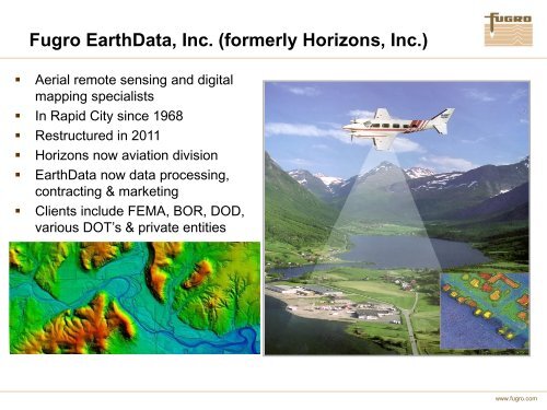
Fugro EarthData, Inc. (formerly Horizons, Inc.)<br />
• Aerial remote sensing and digital<br />
mapping specialists<br />
• In Rapid City since 1968<br />
• Restructured in 2011<br />
• Horizons now aviation division<br />
• EarthData now data processing,<br />
contracting & marketing<br />
• Clients include FEMA, BOR, DOD,<br />
various DOT’s & private entities<br />
www.fugro.com