Pittwater 21 DCP - Pittwater Council
Pittwater 21 DCP - Pittwater Council
Pittwater 21 DCP - Pittwater Council

You also want an ePaper? Increase the reach of your titles
YUMPU automatically turns print PDFs into web optimized ePapers that Google loves.
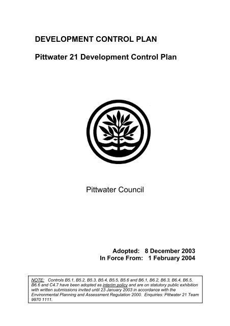
DEVELOPMENT CONTROL PLAN<br />
<strong>Pittwater</strong> <strong>21</strong> Development Control Plan<br />
<strong>Pittwater</strong> <strong>Council</strong><br />
Adopted: 8 December 2003<br />
In Force From: 1 February 2004<br />
NOTE: Controls B5.1, B5.2, B5.3, B5.4, B5.5, B5.6 and B6.1, B6.2, B6.3, B6.4, B6.5,<br />
B6.6 and C4.7 have been adopted as interim policy and are on statutory public exhibition<br />
with written submissions invited until 23 January 2003 in accordance with the<br />
Environmental Planning and Assessment Regulation 2000. Enquiries: <strong>Pittwater</strong> <strong>21</strong> Team<br />
9970 1111.
Overview: How to use this <strong>DCP</strong><br />
STEP 1 – YOUR PROPOSAL<br />
Is the proposal permissible on my land?<br />
Check the compatible development tables in <strong>Pittwater</strong> LEP 1993.<br />
Check <strong>DCP</strong> No.22 – Exempt & Complying Development<br />
<br />
STEP 2 – YOUR LOCALITY<br />
Which Locality is my land located in?<br />
In this <strong>DCP</strong>, check the maps in Section A, Part A4: Localities.<br />
Read and understand the Locality statement for your Locality.<br />
Your development must be consistent with the desired character statement<br />
for your Locality.<br />
<br />
STEP 3 – PLANNING AND DESIGN<br />
What controls apply to my proposal?<br />
In this <strong>DCP</strong>, check Table 1 and 2 in Section A1.11. These tables list the most<br />
common types of development in <strong>Pittwater</strong>, and indicate what parts of this<br />
plan apply. There will be specific controls that apply to your development in<br />
Section B (General), Section C (Development Specific) and Section D<br />
(Locality Specific).<br />
Do any other controls apply other than in this <strong>DCP</strong>?<br />
Yes. Your proposal must comply with <strong>Pittwater</strong> LEP 1993 and any other<br />
relevant planning instruments.<br />
Other <strong>Council</strong> policies may apply to your development if it is heritage<br />
listed (<strong>DCP</strong>15), or within the Warriewood Valley land release (<strong>DCP</strong>29)<br />
<br />
STEP 4 – LODGE YOUR D.A.<br />
If necessary, organise a pre-lodgement meeting with <strong>Council</strong>.<br />
Complete the Development Application form and submit plans and other<br />
details of your proposal to <strong>Council</strong>.<br />
<strong>Pittwater</strong> <strong>21</strong> <strong>DCP</strong>. Adopted: 8 December 2003. In Force: 1 February 2004.
DEVELOPMENT CONTROL PLAN<br />
<strong>Pittwater</strong> <strong>21</strong><br />
CONTENTS<br />
SECTION A<br />
SHAPING DEVELOPMENT IN PITTWATER<br />
A1 INTRODUCTION<br />
A1.1 Name of this plan<br />
A1.2 Land covered by this plan<br />
A1.3 Purpose of this plan<br />
A1.4 Relationship to plans, policies and other documents<br />
A1.5 Savings Provision<br />
A1.6 Applicant’s obligations<br />
A1.7 Considerations before consent is granted<br />
A1.8 Appendices, definitions, notes and maps<br />
A1.9 Definitions<br />
A1.10 Structure of development controls<br />
A1.11 Structure of this plan<br />
A2<br />
THE COMMUNITY AND ITS PLAN<br />
A3 WHAT SHAPES DEVELOPMENT IN PITTWATER<br />
A3.1 The characteristics of <strong>Pittwater</strong><br />
A3.2 Desired character of <strong>Pittwater</strong><br />
A3.3 <strong>Pittwater</strong> context<br />
A3.4 Key objectives of the <strong>Pittwater</strong> <strong>21</strong> Development Control Plan<br />
A4 LOCALITIES<br />
A4.1 Avalon Locality<br />
A4.2 Bayview Heights Locality<br />
A4.3 Bilgola Locality<br />
A4.4 Church Point and Bayview Locality<br />
A4.5 Elanora Heights Locality<br />
A4.6 Ingleside Locality<br />
A4.7 Ku-ring-gai Chase National Park Locality<br />
A4.8 Lower Western Foreshores and Scotland Island Locality<br />
A4.9 Mona Vale Locality<br />
A4.10 Newport Locality<br />
A4.11 North Narrabeen Locality<br />
A4.12 Palm Beach Locality<br />
A4.13 Upper Western Foreshores Locality<br />
A4.14 Warriewood Locality<br />
A4.15 Waterways Locality<br />
A5 DEVELOPMENT APPLICATIONS – PRE-LODGEMENT<br />
A5.1 Is a Development Application required?<br />
A5.2 Review all relevant plans and policies<br />
A5.3 Plan and design your proposal<br />
A5.4 Pre-lodgement discussion / meeting<br />
A5.5 Discuss your proposal with your neighbours<br />
A5.6 Prepare DA form, plans and other documentation<br />
A5.7 Lodgement of Development Application<br />
A6 DEVELOPMENT APPLICATIONS – PROCESS<br />
A6.1 Public exhibition for comment<br />
A6.2 Submissions<br />
A6.3 Assessment<br />
<strong>Pittwater</strong> <strong>21</strong> <strong>DCP</strong>. Adopted: 8 December 2003. In Force: 1 February 2004.
A6.4 Matters for consideration<br />
A6.5 Determination<br />
A6.6 On-line DA Tracking<br />
A6.7 Once a decision is made<br />
SECTION B<br />
GENERAL CONTROLS<br />
B1 ADMINISTRATIVE CONTROLS<br />
B1.1 Submission of a completed Development Application form and payment of<br />
appropriate fee<br />
B1.2 Submission of a Statement of Environmental Effects<br />
B1.3 Submission of supporting documentation – site plan/survey<br />
plan/development drawings<br />
B1.4 Notification<br />
B1.5 Building Code of Australia<br />
B1.6 Submission of additional documentation for SEPP 65<br />
B1.7 Designated Development<br />
B1.8 Integrated Development: National Parks and Wildlife Service (NPWS) –<br />
Species Impact Statement<br />
B1.9 Integrated Development: Rivers, Streams and Foreshores<br />
B1.10 Integrated Development: Water Supply<br />
B1.11 Integrated Development: Fisheries Management<br />
B1.12 Integrated Development: Heritage<br />
B1.13 Integrated Development: Bushfire<br />
B1.14 Integrated Development: Aboriginal Relics and Places<br />
B1.15 <strong>DCP</strong>15 Heritage Conservation<br />
B1.16 Warriewood Valley Land Release Area (<strong>DCP</strong>9 and <strong>DCP</strong>29)<br />
B2 DENSITY CONTROLS<br />
B2.1 Land subdivision – non urban zoned land<br />
B2.2 Land subdivision – residential zoned land<br />
B2.3 Subdivision – business zoned land<br />
B2.4 Subdivision – light industrial zoned land<br />
B2.5 Dwelling density and subdivision – multi-unit housing<br />
B2.6 Dwelling density and subdivision – shop-top housing<br />
B2.7 Dwelling density – dual occupancy<br />
B3 HAZARD CONTROLS<br />
B3.1 Flood hazard<br />
B3.2 Landslip hazard<br />
B3.3 Bushfire hazard<br />
B3.4 Coastline (beach) hazard<br />
B3.5 Coastline (bluff) hazard<br />
B3.6 Estuarine hazard<br />
B3.7 Acid sulfate soils<br />
B3.8 Contaminated land and potentially contaminated land<br />
B4 CONTROLS RELATING TO THE NATURAL ENVIRONMENT<br />
B4.1 Flora and fauna conservation category 1 land<br />
B4.2 Flora and fauna habitat enhancement category 2 land<br />
B4.3 Biodiversity protection category 3 land<br />
B4.4 Wildlife corridors<br />
B4.5 Protection of native wildlife<br />
B4.6 <strong>Pittwater</strong> spotted gum forest endangered ecological community<br />
B4.7 Sydney coastal estuarine swamp forest complex endangered ecological<br />
community<br />
B4.8 Duffys forest vegetation community endangered ecological community<br />
B4.9 Sydney freshwater wetlands endangered ecological community<br />
B4.10 Land adjoining bushland<br />
B4.11 Mangrove conservation<br />
<strong>Pittwater</strong> <strong>21</strong> <strong>DCP</strong>. Adopted: 8 December 2003. In Force: 1 February 2004.
B4.12 Wetlands<br />
B4.13 Saltmarsh and other foreshore vegetation<br />
B4.14 Seagrass conservation<br />
B4.15 Littoral rainforest conservation<br />
B4.16 Heathland vegetation conservation<br />
B4.17 Estuarine habitat<br />
B4.18 Protection of estuarine water quality<br />
B5 WATER MANAGEMENT<br />
B5.1 Wastewater management<br />
B5.2 Stormwater management – rainwater tanks<br />
B5.3 Stormwater management – on-site detention<br />
B5.4 Stormwater discharge into public domain<br />
B5.5 Stormwater discharge into waterways and coastal areas<br />
B5.6 Stormwater easements and watercourses<br />
B6 ACCESS AND PARKING<br />
B6.1 Access driveways – residential development up to 2 dwellings (single<br />
dwelling and dual occupancy)<br />
B6.2 Access driveways – all development other than up to 2 dwellings<br />
B6.3 Transport and Traffic Management – other than up to 2 dwellings<br />
B6.4 Off-street vehicle parking requirements – residential development up to 2<br />
dwellings (single dwelling and dual occupancy)<br />
B6.5 Off-street vehicle parking requirements – all development other than up to 2<br />
dwellings<br />
B6.6 On-street parking facilities – all development other than up to 2 dwellings<br />
B7 SECTION 94 CONTRIBUTIONS<br />
B7.1 Section 94 contributions – Bungan Lane Car Park<br />
B7.2 Section 94 contributions – Open space bushland and recreation<br />
B7.3 Section 94 contributions – Public library services<br />
B7.4 Section 94 contributions – Community service facilities<br />
B7.5 Section 94 contributions – Warriewood Valley community facilities and<br />
open space<br />
B8 SITE WORKS MANAGEMENT<br />
B8.1 Construction and demolition – excavation and landfill<br />
B8.2 Construction and demolition – erosion and sediment management<br />
B8.3 Construction and demolition – waste minimisation<br />
B8.4 Construction and demolition – site fencing and security<br />
B8.5 Construction and demolition – works in the public domain<br />
B8.6 Construction and demolition – traffic management plan<br />
SECTION C<br />
DEVELOPMENT TYPE CONTROLS<br />
C1 DESIGN CRITERIA FOR RESIDENTIAL DEVELOPMENT<br />
C1.1 Landscaping<br />
C1.2 Safety and security<br />
C1.3 View sharing<br />
C1.4 Solar access<br />
C1.5 Visual privacy<br />
C1.6 Acoustic privacy<br />
C1.7 Private open space<br />
C1.8 Dual occupancy specific controls<br />
C1.9 Accessibility<br />
C1.10 [Deleted]<br />
C1.11 Energy and water conservation<br />
C1.12 Waste and recycling facilities<br />
C1.13 [Deleted]<br />
C1.14 Separately accessible structures<br />
<strong>Pittwater</strong> <strong>21</strong> <strong>DCP</strong>. Adopted: 8 December 2003. In Force: 1 February 2004.
C1.15 Storage facilities<br />
C1.16 Ancillary to a dwelling – tennis courts<br />
C1.17 Swimming pool safety<br />
C1.18 Car/vehicle/boat wash bays<br />
C1.19 Incline passenger lifts and stairways<br />
C1.20 Undergrounding of utility services<br />
C1.<strong>21</strong> Building facades<br />
C1.22 Pollution control<br />
C2 DESIGN CRITERIA FOR BUSINESS DEVELOPMENT<br />
C2.1 Landscaping<br />
C2.2 Safety and security<br />
C2.3 Awnings<br />
C2.4 Use of public areas (for café seating, merchandise etc)<br />
C2.5 View sharing<br />
C2.6 Accessibility<br />
C2.7 [Deleted]<br />
C2.8 Energy and water conservation<br />
C2.9 Waste and recycling facilities<br />
C2.10 [Deleted]<br />
C2.11 Business identification signs<br />
C2.12 Protection of residential amenity<br />
C2.13 Bed and breakfast establishment<br />
C2.14 Commercial swimming pools<br />
C2.15 Car/vehicle/boat wash bays<br />
C2.16 Undergrounding of utility services<br />
C2.17 Building facades<br />
C2.18 Pollution Control<br />
C3 DESIGN CRITERIA FOR LIGHT INDUSTRIAL DEVELOPMENT<br />
C3.1 Landscaping<br />
C3.2 Safety and security<br />
C3.3 View sharing<br />
C3.4 Accessibility<br />
C3.5 Floor space ratio<br />
C3.6 External storage areas<br />
C3.7 Pollution control<br />
C3.8 [Deleted]<br />
C3.9 Energy and water conservation<br />
C3.10 Waste and recycling facilities<br />
C3.11 [Deleted]<br />
C3.12 Business identification signs<br />
C3.13 Protection of residential amenity<br />
C3.14 Car/vehicle/boat wash bays<br />
C3.15 Undergrounding of utility services<br />
C3.16 Building facades<br />
C3.17 Use of public areas (for café seating, merchandise etc)<br />
C4 DESIGN CRITERIA FOR LAND SUBDIVISION<br />
C4.1 Land subdivision – protection from hazards<br />
C4.2 Land subdivision – access driveways and off-street parking facilities<br />
C4.3 Land subdivision – transport and traffic management<br />
C4.4 Land subdivision – public roads, footpath and streetscape<br />
C4.5 Land subdivision – utility services<br />
C4.6 Service and delivery vehicle access in land subdivisions<br />
C4.7 Subdivision – amenity and design<br />
C5 DESIGN CRITERIA FOR OTHER DEVELOPMENT<br />
C5.1 Landscaping<br />
C5.2 Safety and security<br />
<strong>Pittwater</strong> <strong>21</strong> <strong>DCP</strong>. Adopted: 8 December 2003. In Force: 1 February 2004.
C5.3 Use of public areas (for café seating, merchandise etc)<br />
C5.4 View sharing<br />
C5.5 Accessibility<br />
C5.6 [Deleted]<br />
C5.7 Energy and water conservation<br />
C5.8 Waste and recycling facilities<br />
C5.9 [Deleted]<br />
C5.10 Protection of residential amenity<br />
C5.11 Advertisements<br />
C5.12 Child care centres<br />
C5.13 Telecommunications facilities<br />
C5.14 Car/vehicle/boat wash bays<br />
C5.15 Undergrounding of utility services<br />
C5.16 Building facades<br />
C5.17 Pollution control<br />
SECTION D<br />
LOCALITY SPECIFIC DEVELOPMENT CONTROLS<br />
D1 AVALON LOCALITY<br />
D1.1 Character as viewed from a public place<br />
D1.2 Character – Avalon Beach Village<br />
D1.3 Character – Avalon Parade<br />
D1.4 Scenic protection<br />
D1.5 Building colours, materials and construction<br />
D1.6 Height – General<br />
D1.7 Height – Avalon Beach Village<br />
D1.8 Front building line<br />
D1.9 Side and rear building line<br />
D1.10 Foreshore building line<br />
D1.11 Building envelope<br />
D1.12 Building envelope – Avalon Beach Village<br />
D1.13 Site coverage – General<br />
D1.14 Site coverage – Environmentally Sensitive Land<br />
D1.15 Fences – General<br />
D1.16 Fences – Flora and Fauna Conservation Areas<br />
D1.17 Retaining walls, terracing and undercroft areas<br />
D1.18 Development mix of shop-top housing – Avalon Beach Village<br />
D1.19 Character of the Public Domain – Avalon Commercial Centre<br />
D2 BAYVIEW HEIGHTS LOCALITY<br />
D2.1 Character as viewed from a public place<br />
D2.2 Scenic protection<br />
D2.3 Building colours, materials and construction<br />
D2.4 Height<br />
D2.5 Front building line<br />
D2.6 Side and rear building line<br />
D2.7 Building envelope<br />
D2.8 Site coverage – Environmentally Sensitive Land<br />
D2.9 Site coverage – Non Urban<br />
D2.10 Fences – General<br />
D2.11 Fences – Flora and Fauna Conservation Areas<br />
D2.12 Retaining walls, terracing and undercroft areas<br />
D3 BILGOLA LOCALITY<br />
D3.1 Character as viewed from a public place<br />
D3.2 Scenic protection<br />
D3.3 Building colours, materials and construction<br />
D3.4 Height – General<br />
D3.5 Height – Bilgola Beach Area<br />
D3.6 Front building line<br />
<strong>Pittwater</strong> <strong>21</strong> <strong>DCP</strong>. Adopted: 8 December 2003. In Force: 1 February 2004.
D3.7 Side and rear building line<br />
D3.8 Foreshore building line<br />
D3.9 Building envelope<br />
D3.10 Site coverage – General<br />
D3.11 Site coverage – Environmentally Sensitive Land<br />
D3.12 Fences – General<br />
D3.13 Fences – Flora and Fauna Conservation Areas<br />
D3.14 Retaining walls, terracing and undercroft areas<br />
D4 CHURCH POINT AND BAYVIEW LOCALITY<br />
D4.1 Character as viewed from a public place<br />
D4.2 Scenic protection<br />
D4.3 Building colours, materials and construction<br />
D4.4 Height<br />
D4.5 Front building line<br />
D4.6 Side and rear building line<br />
D4.7 Foreshore building line<br />
D4.8 Building envelope<br />
D4.9 Site coverage – General<br />
D4.10 Site coverage – Environmentally Sensitive Land<br />
D4.11 Fences – General<br />
D4.12 Fences – Flora and Fauna Conservation Areas<br />
D4.13 Retaining walls, terracing and undercroft areas<br />
D5 ELANORA HEIGHTS LOCALITY<br />
D5.1 Character as viewed from a public place<br />
D5.2 Scenic protection<br />
D5.3 Building colours, materials and construction<br />
D5.4 Height<br />
D5.5 Front building line<br />
D5.6 Side and rear building line<br />
D5.7 Building envelope<br />
D5.8 Site coverage – General<br />
D5.9 Site coverage – Environmentally Sensitive Land<br />
D5.10 Site coverage – Non Urban<br />
D5.11 Fences – General<br />
D5.12 Fences – Flora and Fauna Conservation Areas<br />
D5.13 Retaining walls, terracing and undercroft areas<br />
D6 INGLESIDE LOCALITY<br />
D6.1 Character as viewed from a public place<br />
D6.2 Scenic protection<br />
D6.3 Building colours, materials and construction<br />
D6.4 Height<br />
D6.5 Front building line<br />
D6.6 Side and rear building line<br />
D6.7 Building envelope<br />
D6.8 Site coverage – Non Urban General<br />
D6.9 Site coverage – Blue Hatched Area<br />
D6.10 Fences – General<br />
D6.11 Fences – Flora and Fauna Conservation Areas<br />
D6.12 Retaining walls, terracing and undercroft areas<br />
D7<br />
KU-RING-GAI CHASE NATIONAL PARK LOCALITY<br />
D8 LOWER WESTERN FORESHORES AND SCOTLAND ISLAND<br />
LOCALITY<br />
D8.1 Character as viewed from a public place<br />
D8.2 Scenic protection<br />
D8.3 Building colours, materials and construction<br />
<strong>Pittwater</strong> <strong>21</strong> <strong>DCP</strong>. Adopted: 8 December 2003. In Force: 1 February 2004.
D8.4 Height<br />
D8.5 Front building line<br />
D8.6 Side and rear building line<br />
D8.7 Foreshore building line<br />
D8.8 Building envelope<br />
D8.9 Site coverage<br />
D8.10 Fences<br />
D8.11 Retaining walls, terracing and undercroft areas<br />
D8.12 Companion animals<br />
D8.13 Stormwater overflow<br />
D8.14 Parking management<br />
D8.15 Site disturbance<br />
D9 MONA VALE LOCALITY<br />
D9.1 Character as viewed from a public place<br />
D9.2 Scenic protection<br />
D9.3 Building colours, materials and construction<br />
D9.4 Height – General<br />
D9.5 Height – Core Area Commercial Centre and Light Industrial<br />
D9.6 Front building line<br />
D9.7 Side and rear building line<br />
D9.8 Foreshore building line<br />
D9.9 Building envelope<br />
D9.10 Site coverage – General<br />
D9.11 Site coverage – Environmentally Sensitive Land<br />
D9.12 Fences – General<br />
D9.13 Fences – Flora and Fauna Conservation Areas<br />
D9.14 Retaining walls, terracing and undercroft areas<br />
D9.15 Seawalls at Basin Beach, Mona Vale<br />
D9.16 Character of the Public Domain – Mona Vale Commercial Centre<br />
D10 NEWPORT LOCALITY<br />
D10.1 Character as viewed from a public place<br />
D10.2 Character – Newport commercial centre<br />
D10.3 Scenic protection<br />
D10.4 Building colours, materials and construction<br />
D10.5 Height<br />
D10.6 Front building line<br />
D10.7 Side and rear building line<br />
D10.8 Foreshore building line<br />
D10.9 Building envelope<br />
D10.10 Site coverage – General<br />
D10.11 Site coverage – Environmentally Sensitive Land<br />
D10.12 Fences – General<br />
D10.13 Fences – Flora and Fauna Conservation Areas<br />
D10.14 Retaining walls, terracing and undercroft areas<br />
D10.15 Character of the Public Domain – Newport Commercial Centre<br />
D11 NORTH NARRABEEN LOCALITY<br />
D11.1 Character as viewed from a public place<br />
D11.2 Scenic protection<br />
D11.3 Building colours, materials and construction<br />
D11.4 Height<br />
D11.5 Front building line<br />
D11.6 Side and rear building line<br />
D11.7 Foreshore building line<br />
D11.8 Building envelope<br />
D11.9 Site coverage – General<br />
D11.10 Site coverage – Environmentally Sensitive Land<br />
D11.11 Fences – General<br />
<strong>Pittwater</strong> <strong>21</strong> <strong>DCP</strong>. Adopted: 8 December 2003. In Force: 1 February 2004.
D11.12 Fences – Flora and Fauna Conservation Areas<br />
D11.13 Retaining walls, terracing and undercroft areas<br />
D12 PALM BEACH LOCALITY<br />
D12.1 Character as viewed from a public place<br />
D12.2 Scenic protection<br />
D12.3 Building colours, materials and construction<br />
D12.4 Height<br />
D12.5 Front building line<br />
D12.6 Side and rear building line<br />
D12.7 Foreshore building line<br />
D12.8 Building envelope<br />
D12.9 Site coverage – General<br />
D12.10 Site coverage – Environmentally Sensitive Land<br />
D12.11 Fences – General<br />
D12.12 Fences – Flora and Fauna Conservation Areas<br />
D12.13 Retaining walls, terracing and undercroft areas<br />
D13 UPPER WESTERN FORESHORES LOCALITY<br />
D13.1 Character as viewed from a public place<br />
D13.2 Scenic protection<br />
D13.3 Building colours, materials and construction<br />
D13.4 Height<br />
D13.5 Front building line<br />
D13.6 Side and rear building line<br />
D13.7 Foreshore building line<br />
D13.8 Building envelope<br />
D13.9 Site coverage<br />
D13.10 Fences – General<br />
D13.11 Fences – Flora and Fauna Conservation Areas<br />
D13.12 Retaining walls, terracing and undercroft areas<br />
D13.13 Companion animals<br />
D13.14 Currawong<br />
D13.15 Coasters Retreat<br />
D13.16 Stormwater overflow<br />
D13.17 Parking management<br />
D13.18 Site disturbance<br />
D14 WARRIEWOOD LOCALITY<br />
D14.1 Character as viewed from a public place<br />
D14.2 Scenic protection<br />
D14.3 Building colours, materials and construction<br />
D14.4 Height – General<br />
D14.5 Height – Narrabeen Park Parade<br />
D14.6 Height – Light Industrial<br />
D14.7 Front building line<br />
D14.8 Side and rear building line<br />
D14.9 Narrabeen Creek building line<br />
D14.10 Foreshore building line<br />
D14.11 Building envelope<br />
D14.12 Site coverage – General<br />
D14.13 Site coverage – Environmentally Sensitive Land<br />
D14.14 Site coverage – Non Urban<br />
D14.15 Fences – General<br />
D14.16 Fences – Flora and Fauna Conservation Areas<br />
D14.17 Retaining walls, terracing and undercroft areas<br />
D15 WATERWAYS LOCALITY<br />
D15.1 Character as viewed from a public place<br />
D15.2 Scenic protection<br />
<strong>Pittwater</strong> <strong>21</strong> <strong>DCP</strong>. Adopted: 8 December 2003. In Force: 1 February 2004.
D15.3 Building colours, materials and construction<br />
D15.4 Height – General<br />
D15.5 Height – Seaward of mean high water mark<br />
D15.6 Front building line<br />
D15.7 Side and rear building line<br />
D15.8 Foreshore building line<br />
D15.9 Public foreshore access<br />
D15.10 Fences<br />
D15.11 Waterfront lighting<br />
D15.12 Development seaward of mean high water mark<br />
D15.13 Lateral limits to development seaward of mean high water mark<br />
D15.14 Minimum frontage for marine facilities<br />
D15.15 Marine facilities<br />
D15.16 Marine facilities – Crystal Bay foreshore area<br />
D15.17 Moorings<br />
D15.18 Seawalls<br />
D15.19 Dredging<br />
D15.20 Commercial waterfront development – pollution prevention<br />
D15.<strong>21</strong> Charter boat facilities<br />
<strong>Pittwater</strong> <strong>21</strong> <strong>DCP</strong>. Adopted: 8 December 2003. In Force: 1 February 2004.
SECTION A<br />
SHAPING DEVELOPMENT IN PITTWATER<br />
A1 INTRODUCTION<br />
A1.1 Name of this plan<br />
The name of this plan is <strong>Pittwater</strong> <strong>21</strong> Development Control Plan (<strong>Pittwater</strong> <strong>21</strong> <strong>DCP</strong>).<br />
A1.2 Land Covered by this plan<br />
This plan applies to the local government area of <strong>Pittwater</strong>.<br />
A1.3 Purpose of this plan<br />
The purpose of this plan is to provide best practice standards for development.<br />
A1.4 Relationship to plans, policies and other documents<br />
The provisions contained in this plan are in addition to the provisions of <strong>Pittwater</strong><br />
Local Environmental Plan (LEP) 1993. If there is any inconsistency between this<br />
plan and the <strong>Pittwater</strong> LEP 1993, the <strong>Pittwater</strong> LEP 1993 will prevail.<br />
All other <strong>DCP</strong>s that applied to the land to which this plan applies immediately before<br />
the commencement of this plan are repealed other than those listed below, but only<br />
to the extent that they so applied to that land.<br />
<strong>DCP</strong> No. 9 - Warriewood Valley Stage One Release<br />
<strong>DCP</strong> No.15 - Heritage Conservation<br />
<strong>DCP</strong> No.22 - Exempt and Complying Development<br />
<strong>DCP</strong> No.29 - Warriewood Valley Urban Land Release<br />
<strong>DCP</strong> No.30 - <strong>Pittwater</strong> Flood Risk Management<br />
If there is any inconsistency between this plan and any of the <strong>DCP</strong>s above, the later<br />
will prevail.<br />
A1.5 Savings Provision<br />
Any Development Applications submitted before, but not finally determined when this<br />
plan took effect for the land to which they relate, are to be determined as if the<br />
previous development control plans continue to have effect and as if this <strong>DCP</strong> had<br />
been exhibited but had not yet been made.<br />
A1.6 Applicant’s Obligations<br />
<strong>Pittwater</strong> <strong>21</strong> <strong>DCP</strong> is the community’s vision for planning and development in<br />
<strong>Pittwater</strong>. It is a guide to the applicant as to the community’s expectations for their<br />
Locality and for <strong>Pittwater</strong> as a whole.<br />
It is the applicant’s responsibility to realise their expectations in the context of the<br />
community’s expectations. The applicant has an obligation to demonstrate to the<br />
community that their development is well designed, comprehensive and consistent<br />
with the community’s vision.<br />
Section A, Page 1<br />
<strong>Pittwater</strong> <strong>21</strong> <strong>DCP</strong>. Adopted: 8 December 2003. In Force: 1 February 2004.
A1.7 Considerations Before Consent is Granted<br />
Before granting development consent, <strong>Council</strong> must be satisfied that the<br />
development is consistent with:<br />
(i) <strong>Pittwater</strong> LEP 1993; and<br />
(ii) the desired character of the Locality; and<br />
(iii) the development controls applicable to the development.<br />
<strong>Council</strong> will also have regard to section 79C of the Environmental Planning and<br />
Assessment Act 1979.<br />
Before granting consent for development within a Locality, <strong>Council</strong> may consider the<br />
provisions of a neighbouring Locality to the extent to which it affects the subject site.<br />
A1.8 Notes and Maps<br />
The overview, contents table, notes in the text, and notes on diagrams and maps do<br />
not form part of <strong>Pittwater</strong> <strong>21</strong>.<br />
A1.9 Definitions<br />
Note – the following abbreviations are used for source documents:<br />
DAF Development Assessment Forum: National Development Assessment<br />
Definitions<br />
MP<br />
Model Provisions<br />
PLEP 1993 <strong>Pittwater</strong> Local Environmental Plan 1993<br />
Aboriginal object has the same meaning as in the National Parks and Wildlife Act<br />
1974<br />
Aboriginal place has the same meaning as in the National Parks and Wildlife Act<br />
1974<br />
acid sulfate soils are actual or potential acid sulfate soils, as defined in the Acid<br />
Sulfate Soils Assessment and Management Guidelines.<br />
adequate buffer means a minimum of 10m from the wetland edge.<br />
adjacent land means land that abuts the site or is separated from it by a pathway,<br />
driveway, roadway or similar thoroughfare<br />
adverse impact means (in relation to the controls for <strong>Pittwater</strong> Spotted Gum Forest<br />
Endangered Ecological Community, Saltmarsh and other Foreshore Vegetation,<br />
Sydney Freshwater Wetland and the Sydney Coastal Estuarine Swamp Forest<br />
Complex - Endangered Ecological Community) development, works or activity that<br />
may lead to any negative influence on these communities or their habitats<br />
advertisement means a display by the use of symbols, messages or other devices<br />
for promotional purposes or for conveying information, instructions, directions or the<br />
like, whether or not the display includes the erection of a structure or the carrying<br />
out of a work; (PLEP 1993)<br />
agriculture has the meaning ascribed to it in Section 514A of the Local<br />
Government Act, 1919; (MP)<br />
Section A, Page 2<br />
<strong>Pittwater</strong> <strong>21</strong> <strong>DCP</strong>. Adopted: 8 December 2003. In Force: 1 February 2004.
aids to navigation means buoys, signs, lights or other structures, located on or in<br />
the waterway or on land within the area of <strong>Pittwater</strong>, which are designed to assist<br />
the safe and efficient movement of vessels on the waterway; (PLEP 1993)<br />
airline terminal means a building or place used for the assembly of passengers<br />
and goods prior to the transport of those passengers and goods either to or from an<br />
airport or an aerodrome; (MP)<br />
allotment (lot) means a piece of land or space described in a land title (DAF)<br />
archaeological site means a site identified in Schedule 9 of <strong>Pittwater</strong> Local<br />
Environmental Plan 1993 and shown by heavy black broken edging on the map<br />
marked "<strong>Pittwater</strong> Local Environmental Plan 1993 – Heritage Conservation"; (PLEP<br />
1993)<br />
arterial road means any existing road indicated on the map by a continuous red<br />
band on white between firm black lines; (MP)<br />
assistance animal means an animal referred to under the Disability Discrimination<br />
Act 1992<br />
attached dwelling means a dwelling resulting from dual occupancy development<br />
attached to another dwelling by a common wall or ceiling where:<br />
(a) not more than 2 dwellings are erected on the same allotment of land; and<br />
(b) the habitable floor area of each dwelling shares a common wall, ceiling or<br />
floor; and<br />
(c) the area of the common wall, ceiling or floor is not less than half the area of<br />
the wall, ceiling or floor on the respective elevations of each dwelling; and<br />
(d) the dwellings have the appearance of a single building; (PLEP 1993)<br />
balcony means any unenclosed balustraded platform 0.3 metres or more above<br />
adjacent finished ground level either cantilevered or supported over open space,<br />
which is attached to a dwelling and used for the exclusive enjoyment of the<br />
occupants.<br />
basement means a storey either below ground level or that projects no more than<br />
one metre above finished ground level (DAF)<br />
bed and breakfast establishment means a dwelling-house designed to fit into the<br />
residential character of the area:<br />
(a) which is used for the ancillary purpose of providing overnight accommodation<br />
for not more than six paying guests, boarders or lodgers at any one time; and<br />
(b) which is owned by a natural person who lives at the dwelling-house, and<br />
(c) at which that accommodation is provided on a short-term basis only, up to a<br />
maximum of one month for each guest; (PLEP 1993)<br />
boarding house includes a house let in lodging or a hostel but does not include a<br />
motel; (MP)<br />
buffer means a strip of land separating a disturbance from a place by reducing the<br />
shock or damage due to the disturbance. The land is to be vegetated and acts a<br />
cushion and a protective barrier against a place being impacted by development<br />
building means a fixed structure which has a roof and which may be wholly or<br />
partly enclosed by walls (DAF)<br />
Section A, Page 3<br />
<strong>Pittwater</strong> <strong>21</strong> <strong>DCP</strong>. Adopted: 8 December 2003. In Force: 1 February 2004.
Building Code of Australia (BCA) is a uniform set of technical provisions for the<br />
design and construction of buildings and other structures throughout Australia,<br />
produced and maintained by the Australian Building Codes Board (ABCB) on behalf<br />
of the Commonwealth Government and each State and Territory Government.<br />
building envelope means a diagram which defines the external limits of a building<br />
for the purposes of siting and establishing building and wall heights from the site<br />
boundaries<br />
building line or setback means the minimum distance from an allotment boundary<br />
to the nearest external face of the building (including the external face of any<br />
balcony)<br />
building(s) to which the general public have access means a building that is<br />
classified under the Building Code of Australia as class 3, 5, 6, 7, 8, 9, or 10.<br />
built upon area see ‘site coverage’<br />
bulk store means a building or place used for the bulk storage of goods, where the<br />
goods stored or to be stored are not required for use in a shop or commercial<br />
premises on the same parcel of land or on adjoining land in the same ownership;<br />
(MP)<br />
bus depot means a building or place used for the servicing, repair, and garaging of<br />
buses and other vehicles used for the purposes of a bus transport undertaking;<br />
(MP)<br />
bushland means land on which there is vegetation which is either a remainder of the<br />
natural vegetation of the land or, if altered, is still representative of the structure and<br />
floristics of the natural vegetation.<br />
business identification sign means an advertisement which, in respect of any<br />
place or premises to which it is fixed, contains all or any of the following:<br />
(a) the identity or a description of the place or premises;<br />
(b) the identity or a description of any person residing or carrying on an<br />
occupation at the place or premises;<br />
(c) particulars of any occupation carried on at the place or premises;<br />
(d) such directions or cautions as are usual or necessary relating to the place or<br />
premises of any occupation carried on there;<br />
(e) particulars or notifications required or permitted to be displayed by or under<br />
any State or Commonwealth Act;<br />
(f) particulars relating to the goods, commodities or services dealt with or<br />
provided at the place or premises;<br />
(g) particulars of any activities held or to be held at the place or premises;<br />
(h) a reference to an affiliation with a trade, professional or other association<br />
relevant to the business conducted on the place or premises; (PLEP 1993)<br />
bus station means a building or placed used as a terminal for the assembly and<br />
dispersal of passengers travelling by bus; (MP)<br />
canopy tree means a locally native tree which provides a vegetated covering<br />
providing shelter and food for fauna. The canopy tree provides leafy branches,<br />
forming a dense cover of vegetation covering the area beneath. Canopy trees also<br />
provide for scenic amenity and define much of the character of the <strong>Pittwater</strong> LGA.<br />
Section A, Page 4<br />
<strong>Pittwater</strong> <strong>21</strong> <strong>DCP</strong>. Adopted: 8 December 2003. In Force: 1 February 2004.
car repair station means a building or place used for the purpose of the repair of<br />
motor vehicles or the fitting of accessories thereto; (PLEP 1993)<br />
charter boats means those vessels used for organised group cruises including<br />
vessels used as restaurants or floating reception areas but do not include sail or<br />
motor boats hired and skippered by individuals for private recreational purposes<br />
child care centre means a building or place which is used (whether or not for profit)<br />
for the purpose of educating, minding or caring for children (whether or not any of<br />
the children are related to the owner or operator), but only if the following conditions<br />
are satisfied:<br />
(a) the children number 6 or more, are under 6 years of age, and do not attend a<br />
Government school, or a registered non-Government school, within the<br />
meaning of the Education Reform Act 1990; and<br />
(b) the building or place does not provide residential care for any of the children<br />
(other than those related to the owner or operator); (MP)<br />
church means any place of public worship, whether in the Christian tradition or<br />
otherwise. (MP)<br />
club means a building used by persons associated, or by a body incorporated, for<br />
social, literary, political, sporting, athletic or other lawful purposes whether of the<br />
same or a different kind and whether or not the whole or a part of such building is<br />
the premises of a club registered under the Registered Clubs Act, 1976; (MP)<br />
cluster housing means residential development which:<br />
(a) includes the subdivision of land into three or more residential allotments and<br />
the erection of a detached dwelling on each allotment; and<br />
(b) includes in the subdivision an allotment of land for private recreation or<br />
landscaping purposes for use by the occupants of all dwellings within such<br />
development. (PLEP 1993)<br />
commercial premises means a building or place used as an office or for other<br />
business or commercial purposes, but does not include a building or place<br />
elsewhere specifically defined in this clause or a building or place used for a<br />
purpose elsewhere specifically defined in this clause; (MP)<br />
commercial swimming pool means a pool, whether in a residential zone or not, that<br />
provides for public usage of the pool for educational or recreational purposes, and<br />
where a fee for usage, entrance or tuition is charged.<br />
companion (has the same meaning as in the Companion Animals Act 1998)<br />
conservation includes preservation, protection, maintenance, restoration and<br />
adaptation (Heritage Act 1977)<br />
contaminated land has the same meaning as it has in section 5 of the<br />
Contaminated Land Management Act 1997 (as at October 2003: means land in, on<br />
or under which any substance is present at a concentration above the concentration<br />
at which the substance is normally present in, on or under (respectively) land in the<br />
same locality, being a presence that presents a risk of harm to human health or any<br />
other aspect of the environment).<br />
Section A, Page 5<br />
<strong>Pittwater</strong> <strong>21</strong> <strong>DCP</strong>. Adopted: 8 December 2003. In Force: 1 February 2004.
contaminated land planning guidelines means guidelines under section 145C of<br />
the Act. (At the time of adoption of this <strong>DCP</strong>, the relevant guidelines were SEPP No.<br />
55 – Remediation of Land, and associated Managing Land Contamination Planning<br />
Guidelines SEPP 55 – Remediation of Land (DUAP & EPA, 1998))<br />
core bushland means a place where the ecosystem largely retains its natural<br />
biodiversity and other natural processes and characteristics<br />
county open space means land shown coloured dark green with red edging on the<br />
Zoning Map; (PLEP 1993)<br />
de facto building line means the line of the façade of structures created by the<br />
location of structures on nearby properties. There may be separate de facto building<br />
lines for dwellings and decks, verandahs, etc. See also established building line.<br />
demolish a heritage item or a building, work, relic, tree or place within a heritage<br />
conservation area means wholly or partly destroy or dismantle the heritage item or<br />
building, work, relic, tree or place; (PLEP 1993)<br />
detached dwelling means a dwelling resulting from dual occupancy development<br />
completely separate from any other dwelling and having no common wall or ceiling<br />
or floor with another dwelling; (PLEP 1993)<br />
Department means the Department of Environment and Planning constituted under<br />
the Environmental Planning and Assessment Act, 1979; (MP). Note – as at October<br />
2003: Department of Infrastructure, Planning and Natural Resources (DIPNR)<br />
development has the meaning ascribed to it in Section 4 of the Act; (MP)<br />
dredging means removal of material from the bed of a harbour, river, creek, bay or<br />
inlet within the area of <strong>Pittwater</strong> for the purpose of constructing a new or deeper<br />
navigational area or channel, but does not include maintenance dredging; See also<br />
maintenance dredging (PLEP 1993)<br />
dual occupancy development means development that results in 2 dwellings<br />
(whether attached or detached) on a single allotment of land (or which would have<br />
that result were it not for the fact that the allotment is to be subdivided as part of the<br />
development), and it makes no difference if dual occupancy development is<br />
described in another way in this or any other environmental planning instrument;<br />
(PLEP 1993)<br />
Duffys Forest Vegetation – Endangered Ecological Community means an<br />
endangered ecological community listed under the Threatened Species Conservation<br />
Act 1995. See ‘final determination’. All vegetation within the forest is included in the<br />
community, it is not restricted to just the trees.<br />
dwelling means a room or number of rooms occupied or used or so constructed or<br />
adopted as to be capable of being occupied or used as a separate domicile; (PLEP<br />
1993)<br />
dwelling-house means a building containing 1 but not more than 1 dwelling; (MP)<br />
ecological community has the same meaning as given in the Threatened Species<br />
Conservation Act 1995.<br />
Section A, Page 6<br />
<strong>Pittwater</strong> <strong>21</strong> <strong>DCP</strong>. Adopted: 8 December 2003. In Force: 1 February 2004.
educational establishment means a building or area of land used as a school,<br />
college, technical college, academy, lecture hall, gallery or museum, whether or not<br />
that building is also wholly or partly used for meeting rooms, public entertainment ,<br />
sport or recreation, child care centres or a cultural or similar use, whether or not for<br />
commercial gain, which is, in the opinion of the <strong>Council</strong>, a use for a community<br />
purpose, but does not include a building used wholly or principally as an institution;<br />
(PLEP 1993)<br />
endangered ecological community has the same meaning as given in the<br />
Threatened Species Conservation Act 1995.<br />
endangered population has the same meaning as given in the Threatened Species<br />
Conservation Act 1995.<br />
environmentally sensitive land means land contained in Area 1 of the Dual<br />
Occupancy Map<br />
established building line means a building line that is established by map (eg<br />
foreshore building line) or a de facto building line<br />
extractive material means sand, gravel, clay, turf, soil, rock, stone or similar<br />
substances; (MP)<br />
extractive industry means -<br />
(a) the winning of extractive material; or<br />
(b) an undertaking, not being a mine, which depends for its operations on the<br />
winning of extractive material from the land upon which it is carried on, and<br />
includes any washing, crushing, grinding, milling or separating into different<br />
sizes of that extractive material on that land; (MP)<br />
external surface, in relation to a building, includes any external wall, wall-cladding,<br />
door, door-frame, window-frame, column, roof or fence which is part of, attached to<br />
or used in connection with, the building and which is visible from the exterior of the<br />
building; (PLEP 1993)<br />
final determination has the same meaning as contained in the Threatened Species<br />
Conservation Act 1995<br />
Flat Map means the map marked “<strong>Pittwater</strong> Local Environmental Plan 1993 Flat<br />
Map”, as amended by the maps (or, if any sheets of maps are specified, by the<br />
specified sheets of the maps) marked as follows:<br />
<strong>Pittwater</strong> Local Environmental Plan 1993 (Amendment No. 9) - Sheet 2.<br />
<strong>Pittwater</strong> Local Environmental Plan 1993 (Amendment No. 17).<br />
<strong>Pittwater</strong> Local Environmental Plan 1993 (Amendment No. 48) (PLEP 1993)<br />
floor means that space within a building which is situated between one floor level<br />
and the floor level next above or if there is no floor above, the ceiling or roof above;<br />
(MP)<br />
floor space ratio (FSR) in relation to a site, means the ratio of the gross floor area<br />
of any building or buildings on the site to the site area; (PLEP 1993)<br />
foreshore scenic protection area means any land shown on the Zoning Map by<br />
blue hatching; (PLEP 1993)<br />
Section A, Page 7<br />
<strong>Pittwater</strong> <strong>21</strong> <strong>DCP</strong>. Adopted: 8 December 2003. In Force: 1 February 2004.
foreshore vegetation means a strip of vegetation margining a body of water, this<br />
includes all vegetation growing in that part of a shoreline between high-water and<br />
low-water marks<br />
forestry includes arboriculture, sylviculture, forest protection, the cutting, dressing<br />
and preparation, other than in a sawmill, of wood and other forest products and the<br />
establishment of roads required for the removal of wood and forest products and for<br />
forest protection; (MP)<br />
former Mona Vale TAFE site has the meaning given to it in clause 52 (PLEP 1993)<br />
fragmented or degraded means any significant decline in the quality of natural<br />
resources or the natural integrity of a place or the viability of an ecosystem, caused<br />
directly or indirectly by human activity.<br />
generating works means a building or placed used for the purpose of making or<br />
generating gas, electricity or other forms of energy; (MP)<br />
gross floor area (GFA) means the sum of the areas of each floor of a building<br />
where the area of each floor is taken to be the area within the outer face of the<br />
external enclosing walls as measured at a height of 1,400mm above each floor level<br />
excluding -<br />
(a) columns, fin walls, sun control devices and any elements, projections or<br />
works outside the general lines of the outer face of the external wall;<br />
(b) lift towers, cooling towers, machinery and plant rooms and ancillary storage<br />
space and vertical air-conditioning ducts;<br />
(c) carparking needed to meet any requirements of the <strong>Council</strong> and any internal<br />
access thereto;<br />
(d) space for the loading and unloading of goods. (MP)<br />
ground floor area means the total floor area of the floor that has direct access to<br />
natural ground level. This area is to be measured to the external structural walls<br />
(means supports permanent roof or floor above) and may include garages, but does<br />
not include lightweight structures such as pergolas. On sloping sites only one floor<br />
may be nominated as the ground floor.<br />
group building means a building consisting of 2 or more dwellings which are<br />
commonly known as group houses, villa homes, town houses, semi-detached or<br />
terrace buildings and the like, where each of those dwellings is designed,<br />
constructed or adapted for use as a separate dwelling; (PLEP 1993)<br />
habitable floor means any floor containing a room or rooms used or adapted for<br />
use for residential purposes such as a bedroom, living room, study, dining room,<br />
kitchen, bathroom, laundry or toilet, but excluding any floor used solely for the<br />
purpose of carparking or storage; (PLEP 1993)<br />
habitable room means any room of a dwelling other than a bathroom, laundry,<br />
toilet, pantry, walk-in wardrobe, corridor, stair, lobby, photographic darkroom,<br />
clothes drying room and other space of a specialized nature occupied neither<br />
frequently nor for extended periods (DAF)<br />
habitat has the same meaning as given in the Threatened Species Conservation Act<br />
1995.<br />
hard surface area, see definition of site coverage in this <strong>DCP</strong>.<br />
Section A, Page 8<br />
<strong>Pittwater</strong> <strong>21</strong> <strong>DCP</strong>. Adopted: 8 December 2003. In Force: 1 February 2004.
health care professional means a person who provides professional health<br />
services to members of the public, and includes:<br />
(a) a podiatrist registered under the Podiatrists Registration Act 1989; and<br />
(b) a chiropractor or osteopath or chiropractor and osteopath registered under<br />
the Chiropractors and Osteopaths Act 1991; and<br />
(c) a physiotherapist registered under the Physiotherapists Registration Act<br />
1945; and<br />
(d) an optometrist registered under the Optometrists Act 1930; (MP)<br />
height of a building means the distance measured vertically from any point of the<br />
building to the natural ground level directly below that point; (PLEP 1993). See also<br />
‘second dwelling height’ in relation to detached dual occupancy.<br />
helipad means an area or place not open to the public use which is authorised by<br />
the Department of Transport and which is set apart for the taking off and landing of<br />
helicopters. (MP)<br />
heliport means an area or place open to public use which is licensed by the<br />
Department of Transport for use by helicopters and includes terminal buildings and<br />
facilities for the parking, servicing and repair of helicopters. (MP)<br />
heritage conservation area means land shown shaded on the map marked<br />
"<strong>Pittwater</strong> Local Environmental Plan 1993 – Heritage Conservation" and includes<br />
buildings, works, relics, trees and places situated on or within that land; (PLEP<br />
1993)<br />
heritage item means a building, work, relic, tree or place (which may or may not be<br />
situated on or within land that is a heritage conservation area) described in<br />
Schedule 9 of <strong>Pittwater</strong> Local Environmental Plan 1993 and shown edged heavy<br />
black on the map marked "<strong>Pittwater</strong> Local Environmental Plan 1993 – Heritage<br />
Conservation"; (PLEP 1993)<br />
heritage significance means historic, scientific, cultural, social, archaeological,<br />
architectural, natural or aesthetic significance; (PLEP 1993)<br />
home industry means an industry carried on in a building (other than a dwellinghouse<br />
or a dwelling in a residential flat building) under the following circumstances:<br />
(a) the building does not occupy a floor space exceeding 50m 2 and is erected<br />
within the curtilage of the dwelling-house or residential flat building occupied<br />
by the person carrying on the industry or on adjoining land owned by that<br />
person; and<br />
(b) the industry does not -<br />
i) interfere with the amenity of the locality by reason of the emission of noise,<br />
vibration, smell, fumes, smoke, vapour, steam, soot, ash, dust, waste<br />
water, waste products or grit, oil or otherwise;<br />
ii) involve exposure to view from any adjacent premises or from any public<br />
place of any unsightly matter; or<br />
iii) require the provision of any essential service main of a greater capacity<br />
than that available in the locality; (MP)<br />
home occupation means an occupation carried on in a dwelling by the permanent<br />
residents of the dwelling and which does not involve:<br />
Section A, Page 9<br />
<strong>Pittwater</strong> <strong>21</strong> <strong>DCP</strong>. Adopted: 8 December 2003. In Force: 1 February 2004.
(a) the registration of the building under the Factories, Shops and Industries 1962<br />
or the licensing of the premises under the Dangerous Goods Act 1975;<br />
(b) the employment of persons other than those residents;<br />
(c) interference with the amenity of the neighbourhood by reason of the emission<br />
of noise, vibration, smell, fumes, smoke, vapour, steam, soot, ash, dust,<br />
waste water, waste products, grit or oil or otherwise;<br />
(d) the display of goods, whether in a window or otherwise; or<br />
(e) the exhibition of any notice, advertisement or sign (other than a notice,<br />
advertisement or sign exhibited on that dwelling to indicate the name and<br />
occupation of the resident), or<br />
(f) the use of the dwelling (or part of the dwelling) as a bed and breakfast<br />
establishment. (PLEP 1993)<br />
hospital means a building or place (other than an institution) used for the purpose<br />
of providing professional health care services (such as preventative or convalescent<br />
care, diagnosis, medical or surgical treatment, care for people with developmental<br />
disabilities, psychiatric care or counselling and services provided by health care<br />
professionals) to people admitted as in-patients (whether or not out-patients are<br />
also cared for or treated there), and includes:<br />
(a) ancillary facilities for the accommodation of nurses or other health care<br />
workers, ancillary shops or refreshment rooms and ancillary accommodation<br />
for persons receiving health care or for their visitors; and<br />
(b) facilities situated in the building or at the place and used for educational or<br />
research purposes, whether or not they are used only by hospital staff or<br />
health care workers, and whether or not any such use is a commercial use;<br />
(MP)<br />
hotel means the premises to which a hotelier's licence granted under the Liquor Act<br />
1982 relates; (MP)<br />
industry means:<br />
(a) any manufacturing process within the meaning of the Factories, Shops and<br />
Industries Act 1962; or<br />
(b) the breaking up or dismantling of any goods or any article for trade or sale or<br />
gain or as ancillary to any business;<br />
but does not include an extractive industry; (MP)<br />
institution means a penal or reformative establishment. (MP)<br />
integrated development is development that requires development consent, and<br />
which also requires at least one approval, permit, licence, authority or consent under<br />
the Rural Fire Act.<br />
integrated residential development means residential development which<br />
includes a mix of detached dwellings and group buildings designed in accordance<br />
with an overall concept plan for the development site. (PLEP 1993)<br />
junk yard means land used for the collection, storage, abandonment or sale of<br />
scrap metals, waste paper, rags, bottles or other scrap materials or goods used for<br />
the collecting, dismantling, storage, salvaging or abandonment of automobiles or<br />
other vehicles or machinery or for the sale of parts thereof; (MP)<br />
landfill means the increasing of the surface level of the ground utilising the<br />
importation of materials from outside the site or from elsewhere on the site which<br />
Section A, Page 10<br />
<strong>Pittwater</strong> <strong>21</strong> <strong>DCP</strong>. Adopted: 8 December 2003. In Force: 1 February 2004.
esults in a finished surface level on any part of that land being filled one (1) metre or<br />
greater in height above natural ground level.<br />
landscaped area means the area of a site which is, or is available to be<br />
predominantly vegetated. Areas less than 2m in dimension will not be included as<br />
landscaped area.<br />
lateral limit lines means the perpendicular extension, from the shoreline, of the<br />
common side property boundaries below mean high water mark.<br />
locally native flora and fauna means plants and animals that are native in <strong>Pittwater</strong><br />
at any stage of their life cycle.<br />
liquid fuel depot means a depot or place used for the bulk storage for wholesale<br />
distribution of petrol, oil, petroleum or other inflammable liquid; (MP)<br />
major means (in relation to extensions, alterations, additions, etc of dwellings) equal<br />
to or exceeds 50% of the original floor space of the existing dwelling<br />
main road means a main road within the meaning of the Main Roads Act, 1924;<br />
(MP)<br />
mangroves refer to the protected marine vegetation listed in the Fisheries<br />
Management Act 1994.<br />
map means the map which supports the local environmental plan; (MP)<br />
maintenance dredging means removal of material from the bed of a harbour, river,<br />
creek, bay or inlet within the area of <strong>Pittwater</strong> for the purpose of maintaining the<br />
previously established depth; See also dredging (PLEP 1993)<br />
mean high water mark means the position where the plane of the mean high water<br />
level of all ordinary local high tides intersects the foreshore, being 1.44m above the<br />
zero of Fort Denison Tide Gauge and 0.515m Australian Height Datum; (PLEP<br />
1993)<br />
mine means any place, open cut, shaft, tunnel, pit, drive, level or other excavation,<br />
drift, gutter, lead, vein, lode or reef whereon, wherein or whereby any operation is<br />
carried on for or in connection with the purpose of obtaining any metal or mineral by<br />
any mode or method and any place on which any product of the mine is stacked,<br />
stored, crushed or otherwise treated, but does not include a quarry; (MP)<br />
mooring means any apparatus located on or in the waterway capable of securing a<br />
vessel and which does not have support facilities on nearby land and includes the<br />
site of such an apparatus which is temporarily unoccupied; (PLEP 1993)<br />
motel means a building or buildings (other than a hotel, boarding-house or<br />
residential flat building) substantially used for the overnight accommodation of<br />
travellers and the vehicles used by them whether or not the building or buildings are<br />
also used in the provision of meals to those travellers or the general public; (MP)<br />
motor showroom means a building or place used for the display or sale of motor<br />
vehicles, caravans or boats, whether or not motor vehicle accessories, caravan<br />
accessories or boat accessories are sold or displayed therein or thereon; (MP)<br />
Section A, Page 11<br />
<strong>Pittwater</strong> <strong>21</strong> <strong>DCP</strong>. Adopted: 8 December 2003. In Force: 1 February 2004.
multi-unit housing means residential development (other than dual occupancy<br />
development) which comprises:<br />
(a) a group building; or<br />
(b) shop-top housing consisting of more than one dwelling; or<br />
(c) cluster housing; or<br />
(d) integrated residential development. (PLEP 1993)<br />
multi-unit housing map means the map marked "<strong>Pittwater</strong> Local Environmental<br />
Plan 1993 (Amendment No 24)" as amended by the maps (or, if any sheets of maps<br />
are specified, by the specified sheets of the maps) marked as follows:<br />
<strong>Pittwater</strong> Local Environmental Plan 1993 (Amendment No 28)<br />
<strong>Pittwater</strong> Local Environmental Plan 1993 (Amendment No. 35)<br />
<strong>Pittwater</strong> Local Environmental Plan 1993 (Amendment No. 49) – Sheet 2<br />
<strong>Pittwater</strong> Local Environmental Plan 1993 (Amendment No. 57)<br />
<strong>Pittwater</strong> Local Environmental Plan 1993 (Amendment No. 55) – Sheet 2<br />
<strong>Pittwater</strong> Local Environmental Plan 1993 (Amendment No. 63)<br />
<strong>Pittwater</strong> Local Environmental Plan 1993 (Amendment No. 66) (PLEP 1993)<br />
NatHERS means “Nation Wide House Energy Rating Software”. NatHERS is a<br />
computer software simulation tool for rating the thermal performance of houses<br />
across Australia. The Energy Management Task Force is responsible for delivering a<br />
NatHERS compliance protocol. Any software or paper checklist which passes under<br />
this protocol is deemed “NatHERS or equivalent”.<br />
natural ground level means the existing level of a site in its undisturbed state<br />
before any development is carried out on the site (PLEP 1993);<br />
net loss means the net amount (area) of canopy within the <strong>Pittwater</strong> Local<br />
Government Area shall remain the same after taking into account losses and gains<br />
non-frontage lot means a lot with a frontage of 6.5m or less to a road<br />
notification in relation to where an establishment handles food as part of its service,<br />
the business must be notified with NSW Health.<br />
offensive or hazardous industry means an industry which, by reason of the<br />
processes involved or the method of manufacture or the nature of the materials<br />
used or produced, requires isolation from other buildings; (MP)<br />
offensive noise has the same meaning as in the Protection of the Environment<br />
Operations Act 1997<br />
<strong>Pittwater</strong> Spotted Gum Forest means an endangered ecological community listed<br />
under the Threatened Species Act. All vegetation within the forest is included in the<br />
community, it is not restricted to just the trees.<br />
place of assembly means a public hall, theatre, cinema, music hall, concert hall,<br />
dance hall, open-air theatre, drive-in theatre, music bowl or any other building of a<br />
like character used as such and whether used for the purposes of gain or not, but<br />
does not include a place of public worship, an institution or an educational<br />
establishment; (MP)<br />
place of public worship means a building or place used for the purpose of<br />
religious worship by a congregation or religious group, whether or not the building or<br />
Section A, Page 12<br />
<strong>Pittwater</strong> <strong>21</strong> <strong>DCP</strong>. Adopted: 8 December 2003. In Force: 1 February 2004.
place is also used for counselling, social events, instruction or religious training;<br />
(MP)<br />
Planning for Bushfire Protection (2001) – guidelines produced by PlanningNSW<br />
(as at Oct 2003 the Dept of Infrastructure, Planning and Natural Resources) and the<br />
NSW Rural Fire Service that detail the requirements to be met by a development in<br />
relation to bushfire<br />
pollution has the same meaning as given in the Protection of the Environment<br />
Operations Act, 1997<br />
potential archaeological site means a site identified in Schedule 9 of <strong>Pittwater</strong><br />
Local Environmental Plan 1993 and shown by cross-hatching on the map marked<br />
"<strong>Pittwater</strong> Local Environmental Plan 1993 – Heritage Conservation" and includes a<br />
site known to the consent authority to have archaeological potential even if it is not<br />
so identified and shown; (PLEP 1993)<br />
prescribed material means any material which-<br />
(a) is of low reflective quality;<br />
(b) is dark in colour; and<br />
(c) blends with the landscape in which it is to be used,<br />
or which is intended to be treated so that it will comply with the requirements of<br />
paragraphs (a) - (c); (PLEP 1993)<br />
principal living area means the living room currently benefiting from the most solar<br />
access during mid winter.<br />
private open space means an outdoor area of land or dwelling for the exclusive<br />
use of the occupants (DAF)<br />
professional consulting rooms means a room or a number of rooms forming<br />
either the whole of or part of, attached to or within the curtilage of, a dwelling-house<br />
and used by not more than three legally qualified medical practitioners (who are not<br />
specialist medical practitioners recognised by the Specialist Recognition Advisory<br />
Committee for New South Wales established under the Health Insurance Act 1973<br />
of the Commonwealth), or by not more than three dentists within the meaning of the<br />
Dentists Act 1989, or by not more than three health care professionals, who practice<br />
therein the profession of medicine, dentistry or health care respectively and who<br />
employ not more than three employees in connection with that practice; (PLEP<br />
1993)<br />
public building means a building used as offices or for administrative or other like<br />
purposes by the Crown, a statutory body, a council or an organisation established<br />
for public purposes; (MP)<br />
public utility undertaking means any of the following undertakings carried on or<br />
permitted or suffered to be carried on by or by authority of any Government<br />
Department of under the authority of or in pursuance of any Commonwealth or State<br />
Act:<br />
(a) railway, road transport, water transport, air transport, wharf or river<br />
undertakings:<br />
(b) undertakings for the supply of water, hydraulic power, telecommunication<br />
services, electricity or gas or the provision of sewerage or drainage services,<br />
Section A, Page 13<br />
<strong>Pittwater</strong> <strong>21</strong> <strong>DCP</strong>. Adopted: 8 December 2003. In Force: 1 February 2004.
and a reference to a person carrying on a public utility undertaking shall be<br />
construed as including a reference to a council, county council, Government<br />
Department, corporation, firm or authority carrying on the undertaking; (PLEP 1993)<br />
real estate sign means an advertisement which, in respect of any place or<br />
premises to which it is affixed, contains only a notice that the place or premises is or<br />
are for sale or letting (together with particulars of the sale or letting) and:<br />
(a) The case of an advertisement in respect of residential or non-urban premises<br />
relating to a letting, sale by private treaty or sale by auction:<br />
(i) does not exceed 2 square metres in area; and<br />
(ii) has returns not exceeding 180 millimetres; and<br />
(b) in the case of an advertisement in respect of commercial or industrial<br />
premises, does not exceed 4.5 square metres in area; and<br />
(c) is not displayed for more than 7 days after the letting or completion of the sale<br />
of the premises or place to which the sign relates; and<br />
(d) is not an illuminated sign of any kind; (PLEP 1993)<br />
recovery means the enhancement of a place towards the natural integrity of<br />
organisms, genotypes, species or elements of habitat or biodiversity that would<br />
have existed in that place<br />
re-creation means to introduce to a place one or more species or elements of<br />
habitat or biodiversity that are known to have existed there naturally at a previous<br />
time, but can be no longer be found at that place<br />
recreation area means<br />
(a) a children's playground;<br />
(b) an area used for sporting activities or sporting facilities; or<br />
(c) an area used to provide facilities for recreational activities which promote the<br />
physical, cultural or intellectual welfare of persons within the community, being<br />
facilities provided by -<br />
(i) the council; or<br />
(ii) a body of persons associated for the purposes of the physical,<br />
cultural or intellectual welfare of persons within the community,<br />
but does not include a racecourse or a showground; (PLEP 1993)<br />
recreation establishment means health farms, religious retreat houses, rest<br />
homes, youth camps and the like but does not include a building or place elsewhere<br />
specifically defined in this clause or a building or place used or intended for use for<br />
a purpose elsewhere specifically defined in this clause; (MP)<br />
refreshment room means a restaurant, cafe, tearoom, eating house or the like;<br />
(MP)<br />
regeneration means assisting in the natural recovery of the natural integrity of<br />
a place following disturbance, degradation or fragmentation<br />
relevant plan of management, for a particular parcel of land within Zone No. 6(a),<br />
means a plan of management (being a plan prepared and adopted by the council<br />
under the Local Government Act 1993 or the Crown Lands Act 1989) for that parcel.<br />
(PLEP 1993)<br />
relic means:<br />
Section A, Page 14<br />
<strong>Pittwater</strong> <strong>21</strong> <strong>DCP</strong>. Adopted: 8 December 2003. In Force: 1 February 2004.
(a)<br />
(b)<br />
any deposit, object or material evidence (which may consist of human<br />
remains) relating to the use or settlement of the area of <strong>Pittwater</strong>, not being<br />
Aboriginal habitation, which is more than 50 years old; or<br />
any deposit, object or material evidence (which may consist of human<br />
remains) relating to Aboriginal habitation of the area of <strong>Pittwater</strong> whether<br />
before or after its occupation by persons of European extraction. (PLEP 1993)<br />
residential flat building means a building containing 2 or more dwellings; (MP)<br />
restoration means returning existing habitats (eg. bushland) to a known past state<br />
or to an approximate of the natural condition by repairing degradation or<br />
fragmentation, by removing introduced species or reinstatement<br />
restricted, in relation to domestic animals, means prevented from entering wildlife<br />
habitat, eg by use of a cat run, or keeping the cat in a house or similar structure<br />
retail plant nursery means a building or placed used for both the growing and retail<br />
selling of plants, whether or not ancillary products are sold therein; (MP)<br />
road transport terminal means a building or place used for the principal purpose of<br />
the bulk handling of goods for transport by road, including facilities for the loading<br />
and unloading of vehicles used to transport those goods and for the parking,<br />
servicing and repair of those vehicles; (MP)<br />
rural industry means handling, treating, processing or packing of primary products<br />
and includes the servicing in a workshop of plant or equipment used for rural<br />
purposes in the locality; (MP)<br />
saltmarsh means a community of plants and animals that grow along the upperintertidal<br />
zone (to the astrological high-tide) of coastal waterways. Salt marshes are<br />
habitats for communities of salt-tolerant vegetation (halophytes including: grasses,<br />
reeds, sedges and shrubs) and associated animals. Where salt marshes and<br />
mangroves coexist, salt marshes are typically found at slightly higher elevations<br />
than the mangroves<br />
sawmill means a mill handling, cutting and processing timber from logs or baulks;<br />
(MP)<br />
seagrass refers to the protected marine vegetation listed in the Fisheries<br />
Management Act 1994<br />
second dwelling height means in respect of a detached dual occupancy, the height<br />
of the other dwelling is measured from any point on the ceiling of the topmost floor to<br />
the ground level directly below that point.<br />
secondary street does not include Barrenjoey Road, Mona Vale Road, <strong>Pittwater</strong><br />
Road, McCarrs Creek Road or the Wakehurst Parkway<br />
SEDA means the Sustainable Energy Development Authority<br />
service station means a building or place used for the fuelling of motor vehicles<br />
involving the sale by retail of petrol, oil and other petroleum products whether or not<br />
the building or place is also used for any one or more of the following purposes:<br />
(a) the sale by retail of spare parts and accessories for motor vehicles;<br />
(b) washing and greasing of motor vehicles;<br />
Section A, Page 15<br />
<strong>Pittwater</strong> <strong>21</strong> <strong>DCP</strong>. Adopted: 8 December 2003. In Force: 1 February 2004.
(c)<br />
installation of accessories; (MP)<br />
setback or building line means the minimum distance from an allotment boundary<br />
to the nearest external face of the building (including the external face of any<br />
balcony)<br />
shadow means that caused by a proposed structure, together with any existing<br />
structures to be retained, and does not include that cast by trees and vegetation or<br />
boundary fences.<br />
shop means a building or place used for the purposes of selling, exposing or<br />
offering for sale by retail, goods, merchandise or materials, but does not include a<br />
building or place elsewhere specifically defined in this clause, or a building or place<br />
used for a purpose elsewhere specifically defined in this clause; (MP)<br />
shop-top housing means a dwelling, group building or residential flat building in a<br />
business zone attached to and integrated with premises used for a non-residential<br />
purpose that is permitted in the relevant business zone. (PLEP 1993)<br />
significant trees are trees that:<br />
(i) are listed as Heritage Items in <strong>Pittwater</strong> LEP 1993; and/or<br />
(ii) contribute substantially, either individually or as a component of a tree group,<br />
to the landscape character, amenity, cultural values or biodiversity of their<br />
locality. (Generally trees with a girth greater than 500mm and a canopy<br />
spread of 6m radius would be considered significant, however this should be<br />
confirmed by an independent arborist.)<br />
site means the land to which the application relates<br />
site area means the area of land (excluding any access handle) to which an<br />
application for consent to carry out development relates; (PLEP 1993)<br />
site coverage means the part of the site on which buildings are situated (for the<br />
purposes of this definition, buildings includes garages, tennis courts, carports,<br />
swimming pools, laundries, drying yards, hard surface recreation areas, garbage<br />
collection and handling spaces, other appurtenant buildings and paved areas, such<br />
as driveways); (PLEP 1993)<br />
stock and sale yard means a building or place used for the purpose of offering<br />
animals for sale and includes a public cattle market; (MP)<br />
storey means that part of a building between floor levels. If there is no floor above, it<br />
is the part between the floor level and the ceiling (DAF)<br />
submission means any letter, fax, e-mail, comments, or other written advice<br />
received by council in regard to an application<br />
surrounding land means any land, other than adjacent land, which may be affected<br />
by the proposed development or use of the site.<br />
swimming pool means any structure capable of being filled with water to a depth of<br />
more than 300mm and primarily used for swimming, wading or paddling (DAF)<br />
Sydney Coastal Swamp Complex refers to the plant community listed in the<br />
Threatened Species Conservation Act 1995.<br />
Section A, Page 16<br />
<strong>Pittwater</strong> <strong>21</strong> <strong>DCP</strong>. Adopted: 8 December 2003. In Force: 1 February 2004.
Sydney Freshwater Wetland – Endangered Ecological Community refers to the<br />
plant community listed in the Threatened Species Conservation Act 1995. See ‘final<br />
determination’.<br />
telecommunication facility means a building, structure, work or place used<br />
primarily for transmitting or receiving signals for the purpose of communication and<br />
includes radio masts, transmission towers, satellite dishes and the like; (PLEP<br />
1993)<br />
telecommunications facility has the same meaning as ‘facility’ in the<br />
Telecommunications Act 1997, that is: (a) any part of the infrastructure of a<br />
telecommunications network; or (b) any line, equipment, apparatus, tower, mast,<br />
antenna, tunnel, duct, hole, pit, pole or other structure or thing used, or for use, in or<br />
in connection with a telecommunications network.<br />
telecommunications network has the same meaning as in the Telecommunications<br />
Act 1997, that is: a system, or series of systems, that carries, or is capable of<br />
carrying, communications by means of guided and/or unguided electromagnetic<br />
energy.<br />
temporary sign means an advertisement of a temporary nature which:<br />
(a) announces any local event of a religious, educational, cultural, social or<br />
recreational character or relates to any temporary matter in connection with<br />
such an event; and<br />
(b) does not include advertising of a commercial nature (except for the name of<br />
an event’s sponsor); and<br />
(c) is not displayed earlier than 28 days before the day on which the event is to<br />
take place and is removed within 7 days after that event; (PLEP 1993)<br />
the Act means the Environmental Planning and Assessment Act 1979; (MP)<br />
the council means the <strong>Council</strong> of <strong>Pittwater</strong>; (PLEP 1993)<br />
the Dual Occupancy Map means the map marked “<strong>Pittwater</strong> Local Environmental<br />
Plan 1993 (Amendment No. 37) Dual Occupancy Map”, as amended by the maps<br />
(or, if any sheets of maps are specified, by the specified sheets of the maps)<br />
marked as follows:<br />
<strong>Pittwater</strong> Local Environmental Plan 1993 (Amendment No. 38) – Sheet 3.<br />
<strong>Pittwater</strong> Local Environmental Plan 1993 (Amendment No. 52) – Sheet 2.<br />
<strong>Pittwater</strong> Local Environmental Plan 1993 (Amendment No. 67) – Sheet 3. (PLEP<br />
1993)<br />
the Zoning Map means the map marked “<strong>Pittwater</strong> Local Environmental Plan 1993<br />
(Amendment No. 37) Zoning Map”, as amended by the maps (or, if any sheets of<br />
maps are specified, by the specified sheets of the maps) marked as follows:<br />
<strong>Pittwater</strong> Local Environmental Plan 1993 (Amendment No. 38) – Sheet 2.<br />
<strong>Pittwater</strong> Local Environmental Plan 1993 (Amendment No. 43)<br />
<strong>Pittwater</strong> Local Environmental Plan 1993 (Amendment No. 46) – Sheet 2.<br />
<strong>Pittwater</strong> Local Environmental Plan 1993 (Amendment No. 49) – Sheet 1<br />
<strong>Pittwater</strong> Local Environmental Plan 1993 (Amendment No. 52) – Sheet 1<br />
<strong>Pittwater</strong> Local Environmental Plan 1993 (Amendment No. 53) – Sheet 1<br />
<strong>Pittwater</strong> Local Environmental Plan 1993 (Amendment No. 54) – Sheet 2<br />
<strong>Pittwater</strong> Local Environmental Plan 1993 (Amendment No. 55) – Sheet 1<br />
<strong>Pittwater</strong> Local Environmental Plan 1993 (Amendment No. 59) – Sheet 2<br />
Section A, Page 17<br />
<strong>Pittwater</strong> <strong>21</strong> <strong>DCP</strong>. Adopted: 8 December 2003. In Force: 1 February 2004.
<strong>Pittwater</strong> Local Environmental Plan 1993 (Amendment No. 60) – Sheet 2<br />
<strong>Pittwater</strong> Local Environmental Plan 1993 (Amendment No. 62)<br />
<strong>Pittwater</strong> Local Environmental Plan 1993 (Amendment No. 65) – Sheet 2<br />
<strong>Pittwater</strong> Local Environmental Plan 1993 (Amendment No. 67) – Sheet 2 (PLEP<br />
1993)<br />
threatened species has the same meaning as given in the Threatened Species<br />
Conservation Act 1995.<br />
three storey residential flat building means a residential flat building having no<br />
more than three habitable floors which may be erected above a level of carparking;<br />
(PLEP 1993)<br />
transport terminal means a building or place used as an airline terminal, a road<br />
transport terminal, a bus station or a bus depot; (MP)<br />
tree means any tree or shrub, whether endemic, exotic or introduced species, not<br />
being a cycad or mangrove which has<br />
(a) a height exceeding three (3) metres<br />
(b) a trunk, bole or branch girth exceeding 0.5 metres or which has a combined<br />
girth or each of two or more trunks or boles exceeding 0.5 metres<br />
(c) a branch canopy width exceeding five (5) metres. (<strong>Pittwater</strong> <strong>Council</strong> Tree<br />
Preservation and Management Order)<br />
Note: the Tree Preservation and Management Order also applies to cycads and<br />
mangroves irrespective of dimensions, and any bushland.<br />
two storey residential flat building means a residential flat building having no<br />
more than two habitable floors which may be erected above a level of carparking;<br />
(PLEP 1993)<br />
utility installation means a building or work used by a public utility undertaking, but<br />
does not include a building designed wholly or principally as administrative or<br />
business premises or as a showroom; (MP)<br />
view means a mid to distant view containing an attractive feature/s including<br />
bushland (particularly escarpments and skylines), water bodies and geographical<br />
features including beaches, islands, headlands etc. It may include built form but is<br />
predominantly natural in character.<br />
vulnerable species has the same meaning as given in the Threatened Species<br />
Conservation Act, 1995<br />
wall height is the average vertical distance between the existing ground level (prior<br />
to any excavation or filling) and the underside of the roof lining (eg ceiling of the<br />
topmost floor or the underside of roof beams) at any point on the building.<br />
warehouse means a building or placed used for the storage of goods, merchandise<br />
or materials pending their sale and distribution to persons engaged in the retail<br />
trade; (MP)<br />
waterway means those parts of the <strong>Pittwater</strong> waterway below mean high water<br />
mark shown coloured blue and edged dark blue on the Zoning Map. (PLEP 1993)<br />
wetland refers to wetlands other than Sydney Freshwater Wetlands. Wetlands<br />
includes marshes, swamps, or other areas that form a shallow body of water when<br />
Section A, Page 18<br />
<strong>Pittwater</strong> <strong>21</strong> <strong>DCP</strong>. Adopted: 8 December 2003. In Force: 1 February 2004.
inundated intermittently or permanently with fresh, brackish or salt water, and where<br />
the inundation determines the type and productivity of the soils and the plant and<br />
animal communities.<br />
wetland edge means the water level in a 5 year flood event.<br />
works means<br />
(i) any disturbance of more than one (1) tonne of soil (such as occurs in carrying<br />
out agriculture, the construction or maintenance of drains, extractive industries,<br />
dredging, the construction of artificial waterbodies (including canals, dams and<br />
detention basins) or foundations, or flood mitigation works), or<br />
(ii) any other works that are likely to lower the watertable.<br />
Section A, Page 19<br />
<strong>Pittwater</strong> <strong>21</strong> <strong>DCP</strong>. Adopted: 8 December 2003. In Force: 1 February 2004.
A1.10 Structure of Development Controls<br />
All development controls are structured in the following manner to provide certainty.<br />
Outcomes<br />
Lists the outcomes that the development control is seeking to achieve.<br />
Land to which this control applies<br />
Identifies the land to which the development control applies. The<br />
development control may apply to all land in <strong>Pittwater</strong>, or a specific parcel(s)<br />
of land.<br />
Development to which this control applies<br />
Identifies development to which the development control applies. The<br />
development control may apply to a range of development, or to only one<br />
type of development.<br />
This section also makes it clear which development type that the control does<br />
NOT apply to. This is done by ‘striking through’ the text of these<br />
developments, e.g, Demolition.<br />
Controls<br />
Outlines the controls that a proposed development should satisfy to achieve<br />
the outcomes of the development control.<br />
Variations<br />
Outlines the circumstances in which <strong>Council</strong> may consider a variation to a<br />
control.<br />
A1.11 Structure of this plan<br />
This plan is divided into four sections:<br />
Section A: Introduction – gives background information to the plan, the<br />
procedural context, definitions, what shapes development in <strong>Pittwater</strong>, and<br />
locality statements. Tables 1 and 2 provide a summary of controls that apply to<br />
typical development.<br />
Section B: General Controls – contains administrative controls and sets<br />
development controls that generally relate to all land in <strong>Pittwater</strong>, such as<br />
density, hazards, natural environment, water management, access and parking,<br />
section 94 contributions, and site works management.<br />
Section C: Development Type Controls – sets design criteria for residential<br />
development, business development, light industrial development, subdivision,<br />
and other development.<br />
Section D: Locality Specific Development Controls – sets development controls<br />
that are specific to localities in <strong>Pittwater</strong>.<br />
Section A, Page 20<br />
<strong>Pittwater</strong> <strong>21</strong> <strong>DCP</strong>. Adopted: 8 December 2003. In Force: 1 February 2004.
TABLE 1 - RESIDENTIAL DEVELOPMENT<br />
What controls apply to my proposal?<br />
This table is a guide to what you need to consider for your proposal. The most common types of residential development are listed in<br />
the table to assist you in navigating this plan.<br />
First, select the type of development that you are proposing. For example, if you are proposing to build a swimming pool, select<br />
“alterations/additions and works ancillary to residential development”.<br />
Second, look across the table. The parts marked with YES must be considered by you. You do not need to consider any part that is<br />
marked with NO.<br />
B! ADMIN.<br />
CONTROLS<br />
B2 DENSITY<br />
B3 HAZARDS<br />
B4 NATURAL<br />
ENVIRONMENT<br />
B5 WATER<br />
MANAGEMENT<br />
B6 ACCESS AND<br />
PARKING<br />
B7 SECTION 94<br />
CONTRIBUTIONS<br />
B8 SITE WORKS<br />
MANAGEMENT<br />
C1 RESIDENTIAL<br />
DEVELOPMENT<br />
C2 BUSINESS<br />
DEVELOPMENT<br />
C3 LIGHT<br />
INDUSTRIAL<br />
DEVELOPMENT<br />
C4 LAND<br />
SUBDIVISION<br />
C5 OTHER<br />
DEVELOPMENT<br />
D LOCALITY<br />
CONTROLS<br />
Alterations/additions and works<br />
ancillary to residential<br />
development (eg. swimming<br />
YES NO YES* YES YES* YES* NO YES YES NO NO NO NO YES<br />
pool, pergola, etc)<br />
Attached dual occupancy YES YES YES* YES YES YES YES YES YES NO NO NO NO YES<br />
Boarding house YES NO YES* YES YES YES YES YES YES NO NO NO NO YES<br />
Detached dual occupancy YES YES YES* YES YES YES YES YES YES NO NO NO NO YES<br />
Dwelling-house YES NO YES* YES YES YES NO YES YES NO NO NO NO YES<br />
Multi-unit housing YES YES YES* YES YES YES YES YES YES NO NO NO NO YES<br />
Shop-top housing YES YES YES* YES YES YES YES YES YES YES NO NO NO YES<br />
* These parts may potentially apply. For example, if your property is affected by flood, part B3 Hazards will apply. Check the controls<br />
and maps for details.<br />
Section A, Page <strong>21</strong><br />
<strong>Pittwater</strong> <strong>21</strong> <strong>DCP</strong>. Adopted: 8 December 2003. In Force: 1 February 2004.
TABLE 2 - ALL OTHER DEVELOPMENT<br />
What controls apply to my proposal?<br />
This table is a guide to what you need to consider for your proposal. The most common types of non-residential development are listed<br />
in the table to assist you in navigating this plan.<br />
First, select the type of development that you are proposing. For example, if you are proposing to build a jetty, select “Waterway<br />
development”.<br />
Second, look across the table. The parts marked with YES must be considered by you. You do not need to consider any part that is<br />
marked with NO.<br />
B! ADMIN.<br />
CONTROLS<br />
B2 DENSITY<br />
B3 HAZARDS<br />
B4 NATURAL<br />
ENVIRONMENT<br />
B5 WATER<br />
MANAGEMENT<br />
B6 ACCESS AND<br />
PARKING<br />
B7 SECTION 94<br />
CONTRIBUTIONS<br />
B8 SITE WORKS<br />
MANAGEMENT<br />
C1 RESIDENTIAL<br />
DEVELOPMENT<br />
C2 BUSINESS<br />
DEVELOPMENT<br />
C3 LIGHT<br />
INDUSTRIAL<br />
DEVELOPMENT<br />
C4 LAND<br />
SUBDIVISION<br />
C5 OTHER<br />
DEVELOPMENT<br />
D LOCALITY<br />
CONTROLS<br />
Bed and breakfast establishment YES NO YES* YES YES YES NO YES NO YES NO NO NO YES<br />
Child care centre YES NO YES* YES YES YES NO YES NO NO NO NO YES YES<br />
Demolition YES NO YES* YES YES NO NO YES YES* YES* YES* NO YES* YES<br />
Light industrial development (including alteration/addition,<br />
works ancillary, change in use,<br />
YES NO YES* YES YES YES NO YES<br />
NO NO YES NO NO YES<br />
and new premises)<br />
Non-urban business (such as a YES NO YES* YES YES YES NO YES<br />
NO YES NO NO NO YES<br />
retail plant nursery)<br />
Retail or commercial development YES NO YES* YES YES YES YES* YES NO YES NO NO NO YES<br />
(alteration/addition, works<br />
ancillary, change in use, and new<br />
premises)<br />
Subdivision (land and other) YES YES NO NO NO NO NO NO NO NO NO YES NO YES<br />
Section A, Page 22<br />
<strong>Pittwater</strong> <strong>21</strong> <strong>DCP</strong>. Adopted: 8 December 2003. In Force: 1 February 2004.
B! ADMIN.<br />
CONTROLS<br />
B2 DENSITY<br />
B3 HAZARDS<br />
B4 NATURAL<br />
ENVIRONMENT<br />
B5 WATER<br />
MANAGEMENT<br />
B6 ACCESS AND<br />
PARKING<br />
B7 SECTION 94<br />
CONTRIBUTIONS<br />
B8 SITE WORKS<br />
MANAGEMENT<br />
C1 RESIDENTIAL<br />
DEVELOPMENT<br />
C2 BUSINESS<br />
DEVELOPMENT<br />
C3 LIGHT<br />
INDUSTRIAL<br />
DEVELOPMENT<br />
C4 LAND<br />
SUBDIVISION<br />
C5 OTHER<br />
DEVELOPMENT<br />
D LOCALITY<br />
CONTROLS<br />
Tourist accommodation<br />
(backpackers, motel and the like)<br />
Waterway development (including<br />
marina, jetty, mooring, etc)<br />
YES NO YES* YES YES YES NO YES NO YES NO NO NO YES<br />
YES NO YES* YES YES YES NO YES NO YES NO NO NO YES<br />
* These parts may potentially apply. For example, if your property is affected by flood, part B3 Hazards will apply. Check the controls<br />
and maps for details.<br />
Section A, Page 23<br />
<strong>Pittwater</strong> <strong>21</strong> <strong>DCP</strong>. Adopted: 8 December 2003. In Force: 1 February 2004.
A2 THE COMMUNITY AND ITS PLAN<br />
“To be leaders in the provision of Local Government services, to strive to<br />
conserve, protect and enhance the natural and built environment of <strong>Pittwater</strong><br />
and to improve the quality of life for our community and future generations”.<br />
(<strong>Pittwater</strong> <strong>Council</strong> Management Plan 2002 – 2007)<br />
<strong>Pittwater</strong> <strong>21</strong> <strong>DCP</strong> is a strategic whole-of-<strong>Council</strong> <strong>DCP</strong> to guide the sustainable<br />
management, development, and conservation of <strong>Pittwater</strong>. In essence, the <strong>Pittwater</strong><br />
<strong>21</strong> <strong>DCP</strong> will guide the future planning and development of <strong>Pittwater</strong>.<br />
The plan focuses on a holistic approach to managing the diverse, interrelated,<br />
multidisciplinary issues facing <strong>Pittwater</strong>, rather than any single land use issue.<br />
<strong>Pittwater</strong> <strong>21</strong> is based on Localities rather than land uses.<br />
The plan seeks a partnership with the community. It has been developed to reflect<br />
the community’s aspirations in regard to the environment, development,<br />
infrastructure, and public areas. It is about a vision that the community has as to how<br />
their area will develop, their expectations as to how their needs will be met, and how<br />
they, as a community, will collectively manage change. In short, the plan is a viable<br />
blueprint for <strong>Pittwater</strong> that can evolve and reflect the changes and refinements in the<br />
aspirations of the community.<br />
To fully understand how the <strong>Pittwater</strong> <strong>21</strong> <strong>DCP</strong> will work, there needs to be a<br />
fundamental acknowledgment of the interconnection between environmental, social,<br />
and economic issues, these three factors being the pillars of the plan. All<br />
development control links back to one, two, or all of these pillars. The three pillars<br />
represent the linchpin of the <strong>Pittwater</strong> <strong>21</strong> <strong>DCP</strong>.<br />
Section A, Page 24<br />
<strong>Pittwater</strong> <strong>21</strong> <strong>DCP</strong>. Adopted: 8 December 2003. In Force: 1 February 2004.
A3 WHAT SHAPES DEVELOPMENT IN PITTWATER<br />
A3.1 The Characteristics of <strong>Pittwater</strong><br />
<strong>Pittwater</strong> consists of a series of interconnected urban villages which, while having<br />
similar characteristics in terms of topography and proximity to the ocean, lake and<br />
bays, are distinct. These urban villages, together with non-urban land on the plateau,<br />
National Park, and Scotland Island and the Western Foreshores, form the unique<br />
area that is <strong>Pittwater</strong>.<br />
A3.2 Desired Character of <strong>Pittwater</strong><br />
A vital array of interrelated land uses which deliver ecologically sustainable<br />
development, conserve, protect and enhance the natural and built environment of<br />
<strong>Pittwater</strong>, and improve the quality of life for the community and future generations.<br />
A3.3 <strong>Pittwater</strong> Context<br />
<strong>Pittwater</strong> <strong>Council</strong> was proclaimed on 1 st May 1992 following its separation from<br />
neighbouring Warringah <strong>Council</strong>. It was the first New South Wales <strong>Council</strong> to be<br />
created by secession since Lane Cove <strong>Council</strong> was similarly established in 1895.<br />
<strong>Pittwater</strong> <strong>Council</strong> commenced its operations as Provisional <strong>Council</strong>, and the first<br />
elected <strong>Council</strong> came to office some six months later.<br />
<strong>Pittwater</strong> Local Government Area is situated on the northern fringe of the Sydney<br />
metropolitan area. <strong>Pittwater</strong>’s boundaries are Narrabeen Lakes and Deep Creek in<br />
the south, Palm Beach and Barrenjoey Headland in the north, Coal and Candle<br />
Creek in the west and Garigal National Park to the south west. <strong>Pittwater</strong> covers<br />
approximately 125 square km including a large part of Ku-ring-gai National Park, 18<br />
square kilometres of waterways, and 9 coastal beaches.<br />
<strong>Pittwater</strong> comprises 43% National Park, 41% residential/urban use, 9% commercial,<br />
6% recreational open space reserves and 1% light industrial. Bushland is a feature<br />
of both the residential and reserve areas, including a number of islands, bays and<br />
semi-rural settlements.<br />
The <strong>Pittwater</strong> landform is a spectacular peninsula with escarpments, floodplains and<br />
coastal cliffs. All areas are close to waterways. Along the ocean, nine beaches are<br />
linked by sandstone and shale headlands. The <strong>Pittwater</strong> estuary, a drowned river<br />
valley, links the Hawkesbury/Nepean River with the Pacific Ocean. Vegetation<br />
communities are diverse and include eucalypt forest and woodland, escarpment and<br />
coastal heath, seagrass and mangroves, fresh water wetlands and remnant littoral<br />
rainforest.<br />
<strong>Pittwater</strong> is valued by the community and visitors as a treed, leafy area comprising<br />
magnificent beaches, the <strong>Pittwater</strong> Waterway, and National Park. <strong>Pittwater</strong> is an<br />
important tourism area for Sydney.<br />
Urbanisation continues to impact on natural areas with endangered vegetation<br />
communities, endangered populations, a number of Threatened Species, and a wide<br />
range of biodiversity needing to be protected and maintained.<br />
<strong>Pittwater</strong> lies along a peninsula of hilly terrain making infrastructure provision difficult<br />
and costly and access and building difficult. The three main roads in and out of the<br />
area are Mona Vale Road, <strong>Pittwater</strong> Road, and the Wakehurst Parkway leading out<br />
of the peninsula to pinch-points at the Spit and Roseville bridges. Public transport is<br />
Section A, Page 25<br />
<strong>Pittwater</strong> <strong>21</strong> <strong>DCP</strong>. Adopted: 8 December 2003. In Force: 1 February 2004.
limited to buses primarily using <strong>Pittwater</strong> and Barrenjoey Roads. This lack of public<br />
transport has resulted in a high rate of car ownership and usage.<br />
In 2001 the estimated residential population of <strong>Pittwater</strong> was 56 642 persons up<br />
(2.6%) from the 1996 Census. Approximately one quarter of the population is aged<br />
55+ years, with (15.6%) of <strong>Pittwater</strong> residents aged 0-11 years. <strong>Pittwater</strong> residents<br />
generally live in separate houses (77.2%) and consist mostly of couples (36.6%) and<br />
two parent families (50.4%). (71.8%) of <strong>Pittwater</strong> residents are born in Australia, with<br />
the Sydney average being (62%). <strong>Pittwater</strong> residents have a higher than average<br />
individual income (<strong>Pittwater</strong> $28, 574; Sydney $23,374). The tenure of private<br />
dwellings in <strong>Pittwater</strong> owned/purchased compared with rented is (73.1%) and<br />
(17.9%) respectively compared with the Sydney average of (63%) and (29%).<br />
Source: ABS Census of Population & Housing 2001.<br />
For further more detailed information on the <strong>Pittwater</strong> Local Government Area please<br />
refer to <strong>Pittwater</strong> State of Environment Report, <strong>Pittwater</strong> Social Plan and State of<br />
<strong>Pittwater</strong> Economy Report.<br />
A3.4 Key Objectives of the <strong>Pittwater</strong> <strong>21</strong> Development Control Plan<br />
“To meet the land use, cultural and development needs of the people of<br />
<strong>Pittwater</strong> in a sustainable manner consistent with the needs to conserve<br />
natural, recreational, heritage and community values”.<br />
(<strong>Pittwater</strong> <strong>Council</strong> Management Plan 2002 – 2007)<br />
Ecological sustainable development (ESD) forms the basis of the <strong>Pittwater</strong> <strong>21</strong> <strong>DCP</strong>.<br />
The objectives of the plan consist of three broad categories or pillars –<br />
Environmental, Social, and Economic. Each decision made concerning a<br />
development in the <strong>Pittwater</strong> Local Government Area will be based on these<br />
objectives and accountability.<br />
Ecologically Sustainable Development<br />
In <strong>Pittwater</strong> <strong>21</strong>, ecologically sustainable development means development that<br />
maintains the ecological processes on which life depends while meeting the needs<br />
and improving the total quality of life of the present generation, without compromising<br />
the ability of future generations to do the same.<br />
Ecologically sustainable development is fundamental to the environmental, social<br />
and economic objectives of <strong>Pittwater</strong> <strong>21</strong>.<br />
Environmental Objectives<br />
The environmental objectives of <strong>Pittwater</strong> <strong>21</strong> are to:<br />
a) conserve and enhance the ecological integrity, biodiversity, wildlife corridors,<br />
aquatic habitats, water quality, environmental heritage and environmental<br />
significance of <strong>Pittwater</strong>;<br />
b) prescribe limits to urban development having regard to the potential impacts of<br />
development on the natural environment, natural hazards, and the provision,<br />
capacity and management of infrastructure;<br />
c) integrate development with transport systems and promote safe and sustainable<br />
access opportunities emphasising public transport initiatives, walking and cycling<br />
within, to and from the <strong>Pittwater</strong> local government area; and<br />
d) plan, design and site development to achieve the principles of ecologically<br />
sustainable development.<br />
Section A, Page 26<br />
<strong>Pittwater</strong> <strong>21</strong> <strong>DCP</strong>. Adopted: 8 December 2003. In Force: 1 February 2004.
Social Objectives<br />
The social objectives of <strong>Pittwater</strong> <strong>21</strong> are to:<br />
a) meet the social needs of our community and future generations through provision<br />
of an appropriate balance and mix of land uses and development, including<br />
community facilities, open space and services;<br />
b) promote the provision of accessible, diverse and affordable housing options to<br />
cater for the changing housing needs of the community;<br />
c) plan, design and site development to minimise conflict between land uses and<br />
ensure the safety and security of people and property; and<br />
d) identify and conserve the heritage of the built forms and landscapes of <strong>Pittwater</strong>.<br />
Economic Objectives<br />
The economic objectives of <strong>Pittwater</strong> <strong>21</strong> are to:<br />
a) meet the economic and employment needs of our community and future<br />
generations through provision of an appropriate balance and mix of land uses<br />
and built forms;<br />
b) promote a strengthening of the local economic base by providing a range of<br />
sustainable employment opportunities that respond to lifestyle choices and<br />
technological change, while protecting local amenity, character and<br />
environmental values;<br />
c) encourage attractive and viable commercial areas through quality urban design;<br />
and<br />
d) encourage appropriate tourism which respects the natural attributes and<br />
character of <strong>Pittwater</strong>.<br />
Section A, Page 27<br />
<strong>Pittwater</strong> <strong>21</strong> <strong>DCP</strong>. Adopted: 8 December 2003. In Force: 1 February 2004.
A4 LOCALITIES<br />
“Provide and apply a co-ordinated framework of statutory controls and)<br />
procedures for assessment of development and land use proposals in<br />
<strong>Pittwater</strong> which ensure community goals and environmental and economic<br />
sustainability are attained”<br />
(<strong>Pittwater</strong> <strong>Council</strong> Management Plan 2002- 2007)<br />
Land in <strong>Pittwater</strong> is divided into 15 Localities, as listed below and shown on the map<br />
<strong>Pittwater</strong> <strong>21</strong> Localities.<br />
Avalon Locality<br />
Bayview Heights Locality<br />
Bilgola Locality<br />
Church Point and Bayview Locality<br />
Elanora Heights Locality<br />
Ingleside Locality<br />
Ku-Ring-Gai Chase National Park Locality<br />
Lower Western Foreshores and Scotland Island Locality<br />
Mona Vale Locality<br />
Newport Locality<br />
North Narrabeen Locality<br />
Palm Beach Locality<br />
Upper Western Foreshores Locality<br />
Warriewood Locality<br />
Waterway Locality<br />
Each Locality contains an area recognisable as distinct in terms of its land uses,<br />
geography, and social character.<br />
Section A, Page 28<br />
<strong>Pittwater</strong> <strong>21</strong> <strong>DCP</strong>. Adopted: 8 December 2003. In Force: 1 February 2004.
<strong>Pittwater</strong> <strong>21</strong> Localities<br />
Upper<br />
Western<br />
Foreshores<br />
Palm<br />
Beach<br />
Ku Ring Gai Chase<br />
National Park<br />
Lower<br />
Western<br />
Foreshores &<br />
Scotland Is<br />
Waterways<br />
Avalon<br />
Bilgola<br />
Bayview &<br />
Church Pt<br />
Bayview<br />
Heights<br />
Newport<br />
Mona Vale<br />
Ingleside<br />
Warriewood<br />
Elanora<br />
Heights<br />
North<br />
Narrabeen<br />
Section A, Page 29<br />
<strong>Pittwater</strong> <strong>21</strong> <strong>DCP</strong>. Adopted: 8 December 2003. In Force: 1 February 2004.
A4.1 AVALON LOCALITY<br />
Land within the Locality<br />
Land within the Avalon Locality is identified on the Avalon Locality Map.<br />
Context<br />
The Avalon Locality is within the Guringai homeland. Guringai people have lived in<br />
the area for thousands of years. The diverse flora and fauna, rock overhangs,<br />
sandstone outcrops, large trees and other natural features provide for the spiritual<br />
and physical requirements of the people.<br />
Until the early 1900s, Avalon remained a tiny settlement of isolated farms and<br />
fishermen’s cottages. Developer Arthur J Small sought to create a retreat similar to<br />
that of King Arthur at Avalon, Glastonbury, England, and in the early 1920s, land on<br />
the northern peninsula of the locality was subdivided, the Avalon Golf Course and<br />
Palm Grove Park established, and Norfolk Island Pines planted along the beachfront.<br />
Avalon became a popular holiday destination. Residential development and<br />
permanent occupation of dwellings increased from the 1950s.<br />
Since this time, the locality has developed into a predominantly low-density<br />
residential area, with dwellings built along valley floor, slopes, and ridges. The<br />
locality is characterised mainly by one and two-storey detached dwellings on 600-<br />
1,000 square metre allotments, increasing to 950-1,600 square metres on the<br />
plateau and slopes, and up to 8,000 square metres in Ruskin Rowe. The residential<br />
areas are of a diverse style and architecture, a common thread being the<br />
landscaped, treed frontages and subdued external finishes. Medium-density housing<br />
centres around the Avalon Commercial Centre and neighbourhood retail centres.<br />
The locality is serviced by the Avalon Commercial Centre at the intersect of Old<br />
Barrenjoey Road and Avalon Parade, and neighbourhood retail centres at the<br />
intersect of Hudson Parade and Hilltop Road, Elvina Avenue, North Avalon Road,<br />
and Careel Head Road. The locality also contains Avalon Primary School, Maria<br />
Regina Primary School, Barrenjoey High School, Avalon Surf Life Saving Club,<br />
Careel Bay Wetlands, and recreational facilities including Avalon Golf Course, tennis<br />
courts, beaches, and several reserves.<br />
Houses, built structures, and vegetation in the vicinity of Cabarita Road, Chisholm<br />
Avenue, Hilltop Road, Palmgrove Road, Old Barrenjoey Road, Whale Beach Road,<br />
Avalon Golf Course, and Stapleton Park, indicative of early settlement in the locality,<br />
have been identified as heritage items. Land in Ruskin Rowe, primarily the<br />
subdivision pattern, domination of vegetation over built form, wildlife corridor and lack<br />
of fences, has been identified as a heritage conservation area.<br />
The locality is characterised by steep slopes to the south, northwest, and east of<br />
Careel Bay, leading down to the valley floor. Due to the topography, some significant<br />
views can be obtained to the north, east and west. Conversely, the slopes and ridge<br />
tops of the locality are visually prominent.<br />
Much of the indigenous vegetation has been retained, particularly where there are<br />
large areas of open space, and there are significant wildlife habitats and corridors<br />
within the locality.<br />
The natural features of the locality result in a high risk of bushfire, landslip, flood,<br />
coastal (bluff) hazard, and estuary wave action and tidal inundation.<br />
Section A, Page 30<br />
<strong>Pittwater</strong> <strong>21</strong> <strong>DCP</strong>. Adopted: 8 December 2003. In Force: 1 February 2004.
The major roads within the locality are Barrenjoey Road, Avalon Parade, and Hudson<br />
Parade. Barrenjoey Road is the primary access road to the northern suburbs of<br />
<strong>Pittwater</strong>. Several pedestrian links and pathways exist within the locality, including<br />
the Bicentennial Coastal Walkway on the headland.<br />
Desired Character<br />
The Avalon Locality will remain primarily a low-density residential area characterised<br />
by one and two storey residences in a natural landscaped setting, interspersed by<br />
compatible land uses where appropriate. Dual occupancy development will generally<br />
be located on the valley floor and lower slopes, subject to environmental and other<br />
constraints. Medium-density housing will concentrate within and adjoining the Avalon<br />
Commercial Centre, neighbourhood retail centres, and transport nodes where<br />
appropriate. The locality will continue to be serviced by flexible retail, commercial,<br />
community and recreational facilities.<br />
Future development in the locality will be consistent with public infrastructure<br />
capacity and environmental constraints.<br />
Future development will maintain a distinct height limit below the tree canopy, and<br />
reflect the predominant scale and setbacks of existing development. Buildings will be<br />
designed to address the street and/or waterway, integrate with the public domain,<br />
and be at a ‘human scale’. Contemporary buildings will utilise façade modulation<br />
and/or incorporate shade elements, such as pergolas, verandas and the like.<br />
Building colours and materials will harmonise with the natural and beach environment<br />
and not dominate it. Development on hillsides and in the vicinity of ridge tops will<br />
integrate with the natural landscape and topography.<br />
Future development within the Avalon Commercial Centre will reflect the seasidevillage<br />
character of the retail areas, while recognising its casual lifestyle.<br />
Heritage items and conservation areas indicative of early settlement in the locality will<br />
be conserved.<br />
The indigenous tree canopy vegetation will be retained and enhanced to assist<br />
development blending into the natural environment, to provide Koala feed trees and<br />
undergrowth for smaller animals, and to enhance wildlife corridors. The natural<br />
landscape, including wetlands, rock outcrops, remnant bushland and natural<br />
watercourses, will be preserved. The natural landscape of Careel Bay, including<br />
seagrasses and mangroves, will also be conserved.<br />
Existing and new development will be made safe from natural hazards.<br />
Vehicular, pedestrian and cycle access within and through the locality will be<br />
maintained and upgraded where appropriate. In addition, roads will manage local<br />
traffic needs and ensure the safety of people and fauna; and facilitate co-location of<br />
services and utilities, and accommodate stormwater drainage.<br />
Hazards, Natural Environment and Heritage<br />
Hazards<br />
The Avalon Locality is affected by various hazards. Land affected in the Avalon<br />
Locality is shown on the hazard maps held in the offices of <strong>Council</strong>.<br />
Section A, Page 31<br />
<strong>Pittwater</strong> <strong>21</strong> <strong>DCP</strong>. Adopted: 8 December 2003. In Force: 1 February 2004.
Natural Environment<br />
The Avalon Locality includes vegetation areas, threatened species, or areas of<br />
natural environmental significance. Land affected in the Avalon Locality is shown on<br />
the natural environment maps held in the offices of <strong>Council</strong>.<br />
Heritage<br />
The Avalon Locality may include Heritage items and/or conservation areas. Land<br />
affected in the Avalon Locality is shown on the Heritage Map held in the offices of<br />
<strong>Council</strong>.<br />
Section A, Page 32<br />
<strong>Pittwater</strong> <strong>21</strong> <strong>DCP</strong>. Adopted: 8 December 2003. In Force: 1 February 2004.
Avalon Locality<br />
AVALON<br />
Section A, Page 33<br />
<strong>Pittwater</strong> <strong>21</strong> <strong>DCP</strong>. Adopted: 8 December 2003. In Force: 1 February 2004.
A4.2 BAYVIEW HEIGHTS LOCALITY<br />
Land within the Locality<br />
Land within the Bayview Heights Locality is identified on the Bayview Heights Locality<br />
Map.<br />
Context<br />
The Bayview Heights Locality is within the Guringai homeland. Guringai people have<br />
lived in the area for thousands of years. The diverse flora and fauna, rock<br />
overhangs, sandstone outcrops, large trees and other natural features provide for the<br />
spiritual and physical requirements of the people.<br />
The locality remained an isolated small farming settlement until the 1850s. By 1886,<br />
land speculation had resulted in the subdivision of land into rural allotments ranging<br />
in size from 20 to 640 acres.<br />
The locality has developed into a predominantly low-density rural residential area,<br />
with dwellings built along the plateau and slopes. The locality is characterised mainly<br />
by one and two-storey detached dwellings on 4,000-6,000 square metre allotments.<br />
To the south adjoining Cabbage Tree Road, rural residential dwellings occupy 2<br />
hectare allotments. The residential area is of a diverse style and architecture, a<br />
common thread being the landscaped, treed frontages and subdued external<br />
finishes. The locality is not fully serviced by sewerage or water mains.<br />
The locality does not contain any retail centres. The locality contains several<br />
reserves.<br />
The locality is characterised by an elevated and undulating plateau and upper slopes.<br />
Due to the topography, extensive views can be obtained to the east, north and south.<br />
Conversely, the slopes and ridge tops of the locality are visually prominent.<br />
There are extensive stands of natural bushland containing flora and fauna habitats,<br />
particularly along the ridgelines, which have high conservation and visual value.<br />
The natural features of the locality result in a high risk of bushfire and landslip.<br />
The major roads within the locality are Cabbage Tree Road, Narla Road, and<br />
Minkara Road. Few, if any, pedestrian links and pathways exist within the locality.<br />
Desired Character<br />
The Bayview Heights Locality will remain a low-density rural residential area<br />
characterised by one and two storey residences on large allotments in a natural<br />
landscaped setting, interspersed by compatible land uses where appropriate.<br />
Attached dwellings will generally be located throughout the locality, subject to<br />
environmental and other constraints. The locality will continue to be serviced by<br />
existing recreational facilities.<br />
Future development in the locality will be consistent with public infrastructure<br />
capacity and environmental constraints.<br />
Future development will maintain a distinct height limit below the tree canopy, and<br />
reflect the predominant scale and setbacks of existing development, including<br />
generous spatial separation of the built form and low site coverage on large<br />
allotments. Contemporary buildings will utilise façade modulation and/or incorporate<br />
Section A, Page 34<br />
<strong>Pittwater</strong> <strong>21</strong> <strong>DCP</strong>. Adopted: 8 December 2003. In Force: 1 February 2004.
shade elements, such as pergolas, verandas and the like. Building colours and<br />
materials will harmonise with the natural environment and not dominate it.<br />
Development on hillsides and in the vicinity of ridge tops will integrate with the natural<br />
landscape and topography.<br />
The indigenous tree canopy and vegetation will be retained and enhanced to assist<br />
development blending into the natural environment, and to enhance wildlife corridors.<br />
The natural landscape, including rock outcrops, remnant bushland and natural<br />
watercourses, will be preserved.<br />
Existing and new development will be made safe from natural hazards.<br />
Vehicular, pedestrian and cycle access within and through the locality will be<br />
maintained and upgraded where appropriate. In addition, roads will manage local<br />
traffic needs and ensure the safety of people and fauna; and facilitate co-location of<br />
services and utilities, and accommodate stormwater drainage.<br />
Hazards, Natural Environment and Heritage<br />
Hazards<br />
The Bayview Heights Locality is affected by various hazards. Land affected in the<br />
Bayview Heights Locality is shown on the hazard maps held in the offices of <strong>Council</strong>.<br />
Natural Environment<br />
The Bayview Heights Locality includes vegetation areas, threatened species, or<br />
areas of natural environmental significance is shown. Land affected in the Bayview<br />
Heights Locality is shown on the natural environment maps held in the offices of<br />
<strong>Council</strong>.<br />
Heritage<br />
The Bayview Heights Locality may include Heritage items and/or conservation areas.<br />
Land affected in the Bayview Heights Locality is shown on the Heritage Map held in<br />
the offices of <strong>Council</strong>.<br />
Section A, Page 35<br />
<strong>Pittwater</strong> <strong>21</strong> <strong>DCP</strong>. Adopted: 8 December 2003. In Force: 1 February 2004.
Bayview Heights Locality<br />
BAYVIEW HEIGHTS<br />
Section A, Page 36<br />
<strong>Pittwater</strong> <strong>21</strong> <strong>DCP</strong>. Adopted: 8 December 2003. In Force: 1 February 2004.
A4.3 BILGOLA LOCALITY<br />
Land within the Locality<br />
Land within the Bilgola Locality is identified on the Bilgola Locality Map1.<br />
Context<br />
The Locality was occupied by small farming settlements from the early 1800s, and<br />
included the grazing of cattle. As the road improved and beach holidays became<br />
popular, Bilgola expanded. Until the 1950s, Bilgola remained largely a holiday<br />
location with few permanent residents. Residential development and permanent<br />
occupation of dwellings increased from the 1950s.<br />
Since this time, the locality has developed into a predominantly low-density<br />
residential area, with dwellings built along plateau and slopes. The locality is<br />
characterised mainly by one and two-storey detached dwellings on 550-950 square<br />
metre allotments. The residential areas are of a diverse style and architecture, a<br />
common thread being the landscaped, treed frontages and subdued external<br />
finishes.<br />
The Bilgola Locality is characterised by a small steeply rising ridgeline to the north,<br />
plateau to the south, and small self-contained valley to the east. Due to the<br />
topography, significant views can be obtained through all points of the compass.<br />
Conversely, the slopes and ridge tops and headlands of the locality are visually<br />
prominent.<br />
Extensive areas of natural vegetation are dominated by large specimens of the<br />
Smooth barked Apple (Angophora costata) on the escarpments upper slopes with the<br />
Rough Barked apple, Turpentine (Syncarpia glomulifera) and Bloodwood (Eucalyptus<br />
gummifera) present along the lower slopes and Cabbage Tree Palms (Livistona<br />
australis) in the Bilgola valley.<br />
Much of the indigenous vegetation has been retained, particularly where there are<br />
large areas of open space, and there are significant wildlife habitats and corridors<br />
within the locality, such as on the original “Wentworth Estate” in the <strong>Pittwater</strong><br />
Foreshore Area.<br />
A unique flora and fauna green belt exists in the Bilgola Beach Area by the<br />
interconnection of Hewitt Park with Attunga Reserve via the dedicated portion of<br />
public land, previously known as “Hamilton Estate”, at the western end of the Bilgola<br />
Valley.<br />
Many of the area’s unique features are contained in the Bilgola Beach Area, notably<br />
The remnant littoral rainforest, recognised as one of the largest and best<br />
urban examples remaining on the New South Wales coast, and<br />
characterised by the abundant subtropical vegetation which includes a mixed<br />
variety of shrubs, ferns and palms such as the Cabbage Tree Palms<br />
(Livistona australis) along Bilgola Creek and its drainage lines and in the<br />
valley,<br />
The headlands with the formalised public lookout at Bilgola Head, which<br />
provides expansive coastal views,<br />
Section A, Page 37<br />
<strong>Pittwater</strong> <strong>21</strong> <strong>DCP</strong>. Adopted: 8 December 2003. In Force: 1 February 2004.
The “Bilgola Bends” section of Barrenjoey Road that traverses the valley<br />
escarpment and is bordered by thick indigenous vegetation,<br />
<br />
The Bicentennial Coastal walkway that passes over the southern headland to<br />
the valley, along the beach and on to the Bilgola Head lookout.<br />
Houses, vegetation, stone walls and structures in the vicinity of Bilgola<br />
Avenue, The Serpentine and Barrenjoey Road Bilgola Beach are indicative of<br />
the early settlement in the Locality, and have been identified as heritage<br />
items.<br />
Additionally the Bilgola Beach, headlands and valley escarpment provide unique<br />
cultural and social significance. Surveys of beach usage have revealed that crowd<br />
attendance was the fifth to sixth largest of the twenty ocean beaches in Warringah<br />
and <strong>Pittwater</strong>. Reasons for this include: uncrowded, quiet, natural environment and<br />
absence of commercial facilities. Respondents indicated that preservation of the<br />
beach and the surrounding area’s unique character is desirable.<br />
All of these unique features are valued by the community and contribute to the<br />
essence of the Bilgola Beach Area. These are to be retained and protected<br />
Strong community objection to the widening of Barrenjoey Road and “straightening<br />
the bends”, and the sub-division of the Hamilton Estate, are indicative of the extent of<br />
community concern for the need to retain the unique character of the Bilgola Beach<br />
amphitheatre and limit further public infrastructure development.<br />
The Plateau Area is serviced by neighbourhood retail centres at Bilambee Avenue<br />
and at the intersection of Plateau Road and Grandview Drive. The locality also<br />
contains the Bilgola Plateau Primary School, Bilgola Surf Life Saving Club, and<br />
recreational facilities including rock baths, Bilgola Beach, and several reserves.<br />
The Locality’s particular topographic and natural features create a particular fragility<br />
in the area, which is characterised by its vulnerability to bushfire, landslip, flood,<br />
coastal (bluff) erosion and beach fluctuation, and estuary wave action and tidal<br />
inundation. Attempts to stabilise the bluff erosion on the southern headland in the mid<br />
1990’s with wire netting, resulted in a disastrous environmental and visual outcome.<br />
Desired Future Character<br />
The Bilgola Locality, as one, will remain primarily a low-density residential area<br />
characterised by one and two storey residences in a natural landscaped setting,<br />
interspersed by compatible land uses where appropriate.<br />
The three identified distinct areas (as identified in Map 2) will, by their unique<br />
differences, require differing and distinct degrees of control to ensure the individual<br />
characteristics and essence of each area are maintained and enhanced<br />
<br />
The Bilgola Beach Area: is a visual catchment that is environmentally<br />
significant and extremely susceptible to degradation. Its unique local and<br />
regional significance requires protection, preservation and listing as an<br />
Environmental and/or Conservation Area. Strict development controls will<br />
apply to this area to ensure that its unique qualities are preserved through<br />
sensitive development. A Visual Protection Area, identified on Bilgola Locality<br />
Section A, Page 38<br />
<strong>Pittwater</strong> <strong>21</strong> <strong>DCP</strong>. Adopted: 8 December 2003. In Force: 1 February 2004.
Map 3, contains particular controls to minimise the impact of development<br />
that is visible from public places. The beach, valley and headlands represent<br />
a quiet uncrowded environment with no formal commercial activity. It’s unique<br />
natural, unspoilt, non-commercial character makes it attractive to local<br />
residents and visitors alike and reflects the relaxed beach lifestyle. The local<br />
topography and natural features, notably the beachfront, headlands and<br />
stands of cabbage tree palms in the valley demand different sets of<br />
constraints on building design. All development controls should be interpreted<br />
in the context of the Desired Future Character for the Bilgola beach Area.<br />
<br />
<br />
The Plateau Area: will provide for some dual occupancy development<br />
subject to environmental and other constraints. Medium-density housing will<br />
concentrate within and adjoining neighbourhood retail centres and transport<br />
nodes where appropriate. The plateau area will continue to be serviced by<br />
existing retail, community and recreational facilities.<br />
The <strong>Pittwater</strong> Foreshore Area: contains areas of visual significance when<br />
viewed from the public open space of <strong>Pittwater</strong> and therefore specific controls<br />
will apply to protect the visual amenity and natural flora and fauna of the area.<br />
Development within the original Wentworth Estate boundaries will require<br />
particular controls to preserve the significant heritage and social values of the<br />
<strong>Pittwater</strong> foreshore.<br />
Future development will maintain distinct height limits, and reflect the predominant<br />
scale and setbacks of existing development. Buildings will be designed to address<br />
the street, waterway, beach, headland and valley aspects, integrate with the public<br />
domain, and be at a ‘human scale’.<br />
Building colours and materials will harmonise with the natural environment and reflect<br />
the character of the individual areas. Development on hillsides, headlands and in the<br />
vicinity of ridge tops and public open spaces will be the subject of strict controls to<br />
ensure integration with the natural landscape and topography.<br />
The indigenous tree canopy and vegetation will be retained and enhanced to assist<br />
development blending into the natural environment, and to provide feed trees and<br />
undergrowth for koalas and other animals. The natural landscape, including rock<br />
outcrops, remnant bushland and natural watercourses, will be preserved.<br />
Heritage items indicative of the early settlement in the Locality will be conserved.<br />
Future development in the locality will be consistent with public infrastructure<br />
capacity and environmental constraints.<br />
Vehicular, pedestrian and cycle access within and through the locality will be<br />
maintained and upgraded and expanded where appropriate and consistent with the<br />
individual areas.<br />
Existing and new development will be made safe from natural hazards without<br />
compromising the Desired Future Character.<br />
Section A, Page 39<br />
<strong>Pittwater</strong> <strong>21</strong> <strong>DCP</strong>. Adopted: 8 December 2003. In Force: 1 February 2004.
Hazards, Natural Environment and Heritage<br />
Hazards<br />
The Bilgola Locality is affected by various hazards. Land affected in the Bilgola<br />
Locality is shown on the Hazard Map held in the offices of <strong>Council</strong>.<br />
Natural Environment<br />
The Bilgola Locality includes vegetation areas, threatened species, or areas of<br />
natural environmental significance. Land affected in the Bilgola Locality is shown on<br />
the Natural Environment Map held in the offices of <strong>Council</strong>.<br />
Endangered and vulnerable species of fauna exist within the Bilgola Beach<br />
Amphitheatre, such as the Squirrel Glider, Glossy Black Cockatoo, Powerful Owl,<br />
Koala, Long-nosed Bandicoot, Pigmy Possum and Common Bent-wing Bat.<br />
Heritage<br />
The Bilgola Locality includes Heritage items and/or conservation areas. Land<br />
affected in the Bilgola Locality is shown on the Heritage Map held in the offices of<br />
<strong>Council</strong>.<br />
Section A, Page 40<br />
<strong>Pittwater</strong> <strong>21</strong> <strong>DCP</strong>. Adopted: 8 December 2003. In Force: 1 February 2004.
Avalon<br />
Bilgola Locality Map 1<br />
BILGOLA<br />
Section A, Page 41<br />
<strong>Pittwater</strong> <strong>21</strong> <strong>DCP</strong>. Adopted: 8 December 2003. In Force: 1 February 2004.
Bilgola Locality Map 2<br />
BILGOLA<br />
Bilgola Beach Area<br />
Plateau Area<br />
<strong>Pittwater</strong> Foreshore Area<br />
Bilgola Locality Map 3<br />
BILGOLA<br />
Visual Protection Area<br />
Bilgola Beach Area<br />
Plateau Area<br />
<strong>Pittwater</strong> Foreshore Area<br />
Section A, Page 42<br />
<strong>Pittwater</strong> <strong>21</strong> <strong>DCP</strong>. Adopted: 8 December 2003. In Force: 1 February 2004.
A4.4 CHURCH POINT AND BAYVIEW LOCALITY<br />
Land within the Locality<br />
Land within the Church Point and Bayview Locality is identified on the Church Point<br />
and Bayview Locality Map.<br />
Context<br />
The Church Point and Bayview Locality is within the Guringai homeland. Guringai<br />
people have lived in the area for thousands of years. The diverse flora and fauna,<br />
rock overhangs, sandstone outcrops, large trees and other natural features provide<br />
for the spiritual and physical requirements of the people.<br />
The locality was named for its outlook onto <strong>Pittwater</strong>, and was officially recognised<br />
when Bayview Post Office was opened in 1882. During the nineteenth century,<br />
several small farms producing fruit, vegetables, and poultry were established along<br />
the sheltered north-facing shore. Church Point, containing a wharf, chapel, school,<br />
post office, and cemetery, developed as an important link to the island and western<br />
foreshores. With the extension of the coach service from Manly in the 1880s, the<br />
locality became a holiday destination. Visitors also reached the locality by boat.<br />
Residential development intensified in the locality in the 1960-70s.<br />
The locality has developed into a predominantly low-density residential area, with<br />
dwellings built along the steep slopes and lowlands around the base of the plateau.<br />
The locality is characterised mainly by one and two-storey detached dwellings on<br />
600-1,000 square metre allotments, increasing to 1 hectare on the steeper slopes.<br />
The residential areas are of a diverse style and architecture, a common thread being<br />
the landscaped, treed frontages and subdued external finishes.<br />
The locality is serviced by neighbourhood retail facilities at Church Point, which<br />
remains an important link to the offshore communities. The locality also contains a<br />
school, the Pasadena restaurant and function centre, the Bayview Garden<br />
Retirement Village, and several reserves.<br />
Houses, vegetation, cemetery, post office and store, and other structures, indicative<br />
of early settlement in the locality, have been identified as heritage items.<br />
The locality is characterised by steep slopes and lowlands around the base of the<br />
plateau to the waters edge and by the bushland approach to Kuringai Chase National<br />
Park which exists because of abandoned RTA road reserves which have preserved<br />
the diverse environment and form a scenic transition along McCarrs Creek Road<br />
between the National Park and Church Point. Due to the topography, significant<br />
views can be obtained to the north, east, and west. Conversely, the slopes and ridge<br />
tops of the locality are visually prominent.<br />
Much of the natural tree canopy has been retained, especially on the steeper slopes.<br />
The natural features of the locality result in a high risk of bushfire, landslip, flood, and<br />
estuary wave action and tidal inundation<br />
The major roads within the locality are Cabbage Tree Road, McCarrs Creek Road<br />
and <strong>Pittwater</strong> Road. McCarrs Creek Road provides access to Ku-ring-gai Chase<br />
National Park to the west, while <strong>Pittwater</strong> Road provides access to land to the east.<br />
Several pedestrian links and pathways existing within the locality, including adjacent<br />
to the <strong>Pittwater</strong> waterway.<br />
Section A, Page 43<br />
<strong>Pittwater</strong> <strong>21</strong> <strong>DCP</strong>. Adopted: 8 December 2003. In Force: 1 February 2004.
Desired Character<br />
The Church Point and Bayview Locality will remain a low-density residential area<br />
characterised by one and two storey residences in a natural landscaped setting,<br />
interspersed by compatible land uses where appropriate. Dual occupancy<br />
development will generally be located on lowlands to the south-east of the locality,<br />
subject to environmental and other constraints. The locality will continue to be<br />
serviced by existing retail, community and recreational facilities.<br />
Future development in the locality will be consistent with public infrastructure<br />
capacity and environmental constraints.<br />
Future development will maintain a distinct height limit below the tree canopy, and<br />
reflect the predominant scale and setbacks of existing development. Buildings will be<br />
designed to address the street, integrate with the public domain, and be at a ‘human<br />
scale’. Contemporary buildings will utilise façade modulation and/or incorporate<br />
shade elements, such as pergolas, verandas and the like. Building colours and<br />
materials will harmonise with the natural environment and not dominate it.<br />
Development on hillsides and in the vicinity of ridge tops will integrate with the natural<br />
landscape and topography.<br />
Heritage items indicative of early settlement in the locality will be conserved<br />
The indigenous tree canopy and vegetation will be retained and enhanced to assist<br />
development blending into the natural environment, and to enhance wildlife corridors.<br />
The natural landscape, including rock outcrops, remnant bushland and natural<br />
watercourses, will be preserved.<br />
Existing and new development will be made safe from natural hazards.<br />
Vehicular, pedestrian and cycle access within and through the locality will be<br />
maintained and upgraded where appropriate. In addition, roads will manage local<br />
traffic needs and ensure the safety of people and fauna; and facilitate co-location of<br />
services and utilities, and accommodate stormwater drainage.<br />
Church Point will remain an important link to the offshore communities.<br />
Hazards, Natural Environment and Heritage<br />
Hazards<br />
The Church Point and Bayview Locality is affected by various hazards. Land<br />
affected in the Church Point and Bayview Locality is shown on the hazard maps held<br />
in the offices of <strong>Council</strong>.<br />
Natural Environment<br />
The Church Point and Bayview Locality includes vegetation areas, threatened<br />
species, or areas of natural environmental significance. Land affected in the Church<br />
Point and Bayview Locality is shown on the natural environment maps held in the<br />
offices of <strong>Council</strong>.<br />
Heritage<br />
The Church Point and Bayview Locality may include Heritage items and/or<br />
conservation areas. Land affected in the Church Point and Bayview Locality is<br />
shown on the Heritage Map held in the offices of <strong>Council</strong>.<br />
Section A, Page 44<br />
<strong>Pittwater</strong> <strong>21</strong> <strong>DCP</strong>. Adopted: 8 December 2003. In Force: 1 February 2004.
BAYVIEW & CHURCH POINT<br />
Section A, Page 45<br />
<strong>Pittwater</strong> <strong>21</strong> <strong>DCP</strong>. Adopted: 8 December 2003. In Force: 1 February 2004.
A4.5 ELANORA HEIGHTS LOCALITY<br />
Land within the Locality<br />
Land within the Elanora Heights Locality is identified on the Elanora Heights Locality<br />
Map.<br />
Context<br />
The Elanora Heights Locality is within the Guringai homeland. Guringai people have<br />
lived in the area for thousands of years. The diverse flora and fauna, rock<br />
overhangs, sandstone outcrops, large trees and other natural features provide for the<br />
spiritual and physical requirements of the people.<br />
The subdivision of the Elanora Heights Estate in 1929, which included the Elanora<br />
Country Club, initiated development in the locality. Residential development<br />
increased from the 1950s with improved access to the area.<br />
Since this time, the locality has developed into a predominantly low-density<br />
residential area, with dwellings built along plateau and slopes. The locality is<br />
characterised mainly by one and two-storey detached dwellings on 700-950 square<br />
metre allotments. To the west, rural residential dwellings occupy 2 hectare<br />
allotments. The residential areas are of a diverse style and architecture, a common<br />
thread being the landscaped, treed frontages and subdued external finishes.<br />
The locality is serviced by neighbourhood retail centres at Kalang Road and the<br />
intersect of Elanora and Anana Roads. The locality also contains the Elanora<br />
Heights Primary School, community/youth centres, and recreational facilities<br />
including the Elanora Golf Course, squash courts, and several reserves.<br />
The locality is characterised by a plateau, spur to the east, and steep slopes. Due to<br />
the topography, significant views can be obtained to the east, west and south.<br />
Conversely, the slopes and ridge tops of the locality are visually prominent.<br />
Much of the natural vegetation has been removed and replaced with non-indigenous<br />
species, and significant amount of natural vegetation has been removed in areas<br />
adjoining open space to reduce the risks associated with bushfires. Much of the tree<br />
canopy around the escarpment has been retained.<br />
The natural features of the locality result in a high risk of bushfire and landslip.<br />
The major roads within the locality are Powderworks Road, Anana Road, Elanora<br />
Road and Kalang Road. Powderworks Road is a common through-route from the<br />
beaches to land further west. Several pedestrian links and pathways exist within the<br />
locality.<br />
Desired Character<br />
The Elanora Heights Locality will remain primarily a low-density residential area<br />
characterised by one and two storey residences in a natural landscaped setting,<br />
interspersed by compatible land uses where appropriate. Dual occupancy<br />
development will generally be located on the plateau, subject to environmental and<br />
other constraints. Medium-density housing will concentrate within and adjoining<br />
neighbourhood retail centres and transport nodes where appropriate. The locality will<br />
continue to be serviced by existing retail, community, and recreational facilities.<br />
Section A, Page 46<br />
<strong>Pittwater</strong> <strong>21</strong> <strong>DCP</strong>. Adopted: 8 December 2003. In Force: 1 February 2004.
Future development in the locality will be consistent with public infrastructure<br />
capacity and environmental constraints.<br />
Future development will maintain a distinct height limit below the tree canopy, and<br />
reflect the predominant scale and setbacks of existing development. Buildings will be<br />
designed to address the street, integrate with the public domain, and be at a ‘human<br />
scale’. Contemporary buildings will utilise façade modulation and/or incorporate<br />
shade elements, such as pergolas, verandas and the like. Building colours and<br />
materials will harmonise with the natural environment and not dominate it.<br />
Development on hillsides and in the vicinity of ridge tops will integrate with the natural<br />
landscape and topography.<br />
The indigenous tree canopy and vegetation will be retained and enhanced to assist<br />
development blending into the natural environment, and to enhance wildlife corridors.<br />
The natural landscape, including rock outcrops, remnant bushland and natural<br />
watercourses, will be preserved.<br />
Existing and new development will be made safe from natural hazards.<br />
Vehicular, pedestrian and cycle access within and through the locality will be<br />
maintained and upgraded where appropriate. In addition, roads will manage local<br />
traffic needs and ensure the safety of people and fauna; and facilitate co-location of<br />
services and utilities, and accommodate stormwater drainage.<br />
Hazards, Natural Environment and Heritage<br />
Hazards<br />
The Elanora Heights Locality is affected by various hazards. Land affected in the<br />
Elanora Heights Locality is shown on the hazard maps held in the offices of <strong>Council</strong>.<br />
Natural Environment<br />
The Elanora Heights Locality includes vegetation areas, threatened species, or areas<br />
of natural environmental significance. Land affected in the Elanora Heights Locality<br />
is shown on the natural environment maps held in the offices of <strong>Council</strong>.<br />
Heritage<br />
The Elanora Heights Locality may include Heritage items and/or conservation areas.<br />
Land affected in the Elanora Heights Locality is shown on the Heritage Map held in<br />
the offices of <strong>Council</strong>.<br />
Section A, Page 47<br />
<strong>Pittwater</strong> <strong>21</strong> <strong>DCP</strong>. Adopted: 8 December 2003. In Force: 1 February 2004.
Elanora Heights Locality<br />
ELANORA HEIGHTS<br />
Section A, Page 48<br />
<strong>Pittwater</strong> <strong>21</strong> <strong>DCP</strong>. Adopted: 8 December 2003. In Force: 1 February 2004.
A4.6 INGLESIDE LOCALITY<br />
Land within the Locality<br />
Land within the Ingleside Locality is identified on the Ingleside Locality Map.<br />
Context<br />
The Ingleside Locality is within the Guringai homeland. Guringai people have lived in<br />
the area for thousands of years. The diverse flora and fauna, rock overhangs,<br />
sandstone outcrops, large trees and other natural features provide for the spiritual<br />
and physical requirements of the people.<br />
Ingleside remained an isolated small farming settlement until the 1850s. By 1886,<br />
land speculation had resulted in the subdivision of land into rural allotments ranging<br />
in size from 20 to 640 acres (8 to 259 hectares). In 1923, land in Ingleside was<br />
further subdivided and designated for residential development under the Ingleside<br />
Heights Plan, with allotments ranging in size from 0.2 to 8 acres (0.08 to 3.2<br />
hectares). This area is now known as the “blue-hatched area”. In 1951, subdivision<br />
of land was restricted to a minimum allotment size of 2 hectares (4.9 acres). In 1991,<br />
land at Ingleside was included on the State Government Urban Development<br />
Program, although due to environmental and infrastructure difficulties, the land has<br />
not yet been rezoned for urban purposes.<br />
The rural residential and bushland character of the locality has remained to the<br />
present day. The locality is characterised mainly by dwellings, agricultural,<br />
horticultural and like land uses on 2 hectare allotments, although allotments up to 13<br />
hectares are evident. Smaller allotments characterise the “blue-hatched area”,<br />
generally north of Powderworks Road and south of Lane Cove Road. The locality is<br />
not fully serviced by sewerage or water mains, or sealed roads.<br />
The locality does not contain any retail centres. The locality contains several<br />
schools, a youth centre, Ingleside Scout Camp, Baha’i House of Worship, Minkara<br />
Retirement Village, and Rural Fire Service, and recreational facilities including the<br />
Monash Golf Course and several reserves.<br />
The ruins of the Powder Works, Ingleside House, and vegetation in the vicinity of<br />
Manor Road and Mona Vale Road, indicative of the early entrepreneurial and farming<br />
history of Ingleside, have been identified as heritage items. The Baha’i House of<br />
Worship on Mona Vale Road has also been identified.<br />
The locality is characterised by an elevated and undulating plateau. Due to the<br />
topography, significant and panoramic views can be obtained to the east.<br />
Conversely, the slopes and ridge tops of the locality are visually prominent.<br />
There are extensive stands of natural and secondary regrowth bushland containing<br />
flora and fauna habitats, particularly along the ridgelines and creeklines, which have<br />
high conservation and visual value. However large areas have been cleared for<br />
development.<br />
The natural features of the locality result in a high risk of bushfire and landslip.<br />
The major roads within the locality are Mona Vale Road, Powderworks Road, Lane<br />
Cove Road, and Walter Road. Mona Vale Road is a major link with land to the west.<br />
Few, if any, pedestrian links and pathways exist within the locality.<br />
Section A, Page 49<br />
<strong>Pittwater</strong> <strong>21</strong> <strong>DCP</strong>. Adopted: 8 December 2003. In Force: 1 February 2004.
Desired Character<br />
The Ingleside Locality will remain a low-density area characterised by rural<br />
residential and other compatible land uses on large allotments in a natural<br />
landscaped setting. Dwellings will generally be located throughout the locality,<br />
subject to environmental and other constraints. The locality will continue to be<br />
serviced by existing community and recreational facilities.<br />
Future development in the locality will be consistent with public infrastructure<br />
capacity and environmental constraints.<br />
Future development will maintain a distinct height limit below the tree canopy, and<br />
reflect the predominant scale and setbacks of existing development, including<br />
generous spatial separation of the built form and low site coverage. Single storey<br />
buildings will be preferred where the site has little opportunity for canopy trees or is<br />
visually prominent. Contemporary buildings will utilise façade modulation and/or<br />
incorporate shade elements, such as pergolas, verandahs and the like. Building<br />
colours and materials will harmonise with the natural environment and not dominate<br />
it. Development on hillsides and in the vicinity of ridgetops will integrate with the<br />
natural landscape and topography.<br />
Heritage items indicative of the early entrepreneurial and farming history of Ingleside,<br />
and the Baha’i House of Worship, will be conserved.<br />
The indigenous tree canopy and vegetation will be retained and enhanced to assist<br />
development blending into the natural environment, and to enhance wildlife corridors.<br />
The natural landscape, including rock outcrops, remnant bushland and natural<br />
watercourses, will be preserved.<br />
Existing and new development will be made safe from natural hazards.<br />
Vehicular, pedestrian and cycle access within and through the locality will be<br />
maintained and upgraded where appropriate. In addition, roads will manage local<br />
traffic needs and ensure the safety of people and fauna, facilitate co-location of<br />
services and utilities, achieve acceptable stormwater drainage and facilitate public<br />
transport.<br />
Hazards, Natural Environment and Heritage<br />
Hazards<br />
The Ingleside Locality is affected by various hazards. Land affected in the Ingleside<br />
Locality is shown on the hazard maps held in the offices of <strong>Council</strong>.<br />
Natural Environment<br />
The Ingleside Locality includes vegetation areas, threatened species, or areas of<br />
natural environmental significance. Land affected in the Ingleside Locality is shown<br />
on the natural environment maps held in the offices of <strong>Council</strong>.<br />
Heritage<br />
The Ingleside Locality may include Heritage items and/or conservation areas. Land<br />
affected in the Ingleside Locality is shown on the Heritage Map held in the offices of<br />
<strong>Council</strong>.<br />
Section A, Page 50<br />
<strong>Pittwater</strong> <strong>21</strong> <strong>DCP</strong>. Adopted: 8 December 2003. In Force: 1 February 2004.
Ingleside Locality<br />
INGLESIDE<br />
Section A, Page 51<br />
<strong>Pittwater</strong> <strong>21</strong> <strong>DCP</strong>. Adopted: 8 December 2003. In Force: 1 February 2004.
A4.7 KU-RING-GAI CHASE NATIONAL PARK LOCALITY<br />
Land within the Locality<br />
Land within the Ku-ring-gai Chase National Park Locality is identified on the Ku-ringgai<br />
Chase National Park Locality Map.<br />
Context<br />
Ku-ring-gai Chase National Park is within the Guringai homeland. Guringai people<br />
have lived in the area for thousands of years. The diverse flora and fauna, rock<br />
overhangs, sandstone outcrops, large trees and other natural features provide for the<br />
spiritual and physical requirements of the people.<br />
Ku-ring-gai Chase National Park was established in 1894 largely through the efforts<br />
of Eccleston Du Faur, a draftsman and keen geographer who was appalled at the<br />
destruction of local native plants with the expansion of Sydney. The national park<br />
covers 14, 712 hectares, extending to Berowra to the west, the Hawkesbury River to<br />
the north, <strong>Pittwater</strong> to the east, and Ingleside, Terrey Hills, Duffys Forest, St Ives and<br />
North Wahroonga to the south. Within <strong>Pittwater</strong>, Ku-ring-gai Chase National Park<br />
comprises approximately 4,500 hectares and around 50 percent of the land area of<br />
the local government area.<br />
The national park remains essentially undisturbed. Evidence of early Aboriginal<br />
occupation, including middens, axe-grinding grooves, cave art sites and rock<br />
engravings, is found throughout the park.<br />
The national park is characterised by steep slopes, ridgelines and valleys, natural<br />
creeklines, and extensive areas of native flora and fauna. Due to the topography and<br />
physical location, the national park is visually prominent from many areas within<br />
<strong>Pittwater</strong>.<br />
The natural features of the locality result in a high risk of bushfire.<br />
The major road within the locality is West Head Road which extends from McCarrs<br />
Creek Road in the south to West Head in the north, providing access to a viewing<br />
area. Walking tracks extend from the road to the western foreshores and other areas<br />
within the national park.<br />
Desired Character<br />
The Ku-ring-gai Chase National Park Locality will remain relatively undisturbed,<br />
ensuring the conservation of native flora, fauna, and aboriginal heritage. The<br />
national park will be managed by the NSW National Parks and Wildlife Service.<br />
Hazards, Natural Environment and Heritage<br />
Hazards<br />
The Ku-ring-gai Chase National Park Locality is affected by various hazards. Land<br />
affected in the Ku-ring-gai Chase National Park Locality is shown on the hazard<br />
maps held in the offices of <strong>Council</strong>.<br />
Natural Environment<br />
The Ku-ring-gai Chase National Park Locality includes vegetation areas, threatened<br />
species, or areas of natural environmental significance. Land affected in the Ku-ringgai<br />
Chase National Park Locality is shown on the natural environment maps held in<br />
the offices of <strong>Council</strong>.<br />
Section A, Page 52<br />
<strong>Pittwater</strong> <strong>21</strong> <strong>DCP</strong>. Adopted: 8 December 2003. In Force: 1 February 2004.
Heritage<br />
The Ku-ring-gai Chase National Park Locality may include Heritage items and/or<br />
conservation areas. Land affected in the Ku-ring-gai Chase National Park Locality is<br />
shown on the Heritage Map held in the offices of <strong>Council</strong>.<br />
Section A, Page 53<br />
<strong>Pittwater</strong> <strong>21</strong> <strong>DCP</strong>. Adopted: 8 December 2003. In Force: 1 February 2004.
Ku Ring Gai Chase National Park Locality<br />
KU-RING-GAI CHASE NATIONAL PAR<br />
Section A, Page 54<br />
<strong>Pittwater</strong> <strong>21</strong> <strong>DCP</strong>. Adopted: 8 December 2003. In Force: 1 February 2004.
A4.8 LOWER WESTERN FORESHORES AND SCOTLAND<br />
ISLAND LOCALITY<br />
Land within the Locality<br />
Land within the Lower Western Foreshores and Scotland Island Locality is identified<br />
on the Lower Western Foreshores and Scotland Island Locality Map.<br />
Context<br />
The Lower Western Foreshores and Scotland Island Locality is within the Guringai<br />
homeland. Guringai people have lived in the area for thousands of years. The<br />
diverse flora and fauna, rock overhangs, sandstone outcrops, large trees and other<br />
natural features provide for the spiritual and physical requirements of the people.<br />
The locality was sparsely inhabited by small settlements during the nineteenth<br />
century. With the extension of the coach service from Manly in the 1880s, the locality<br />
became a holiday destination. Development intensified in the locality from the 1950s.<br />
Since this time, the island and western foreshores have developed into a low-density<br />
residential area, with dwellings built throughout the lowlands, slopes and ridges.<br />
These offshore areas are characterised mainly by one and two-storey detached<br />
dwellings on 600-1,300 square metre allotments, although some allotments up to<br />
4,000 square metres are evident. The residential areas are of a diverse style and<br />
architecture, a common thread being the landscaped, treed environment and<br />
subdued external finishes. The offshore areas are not serviced by sewage or water<br />
mains for domestic use, or vehicular access. Access to the offshore areas is<br />
principally by ferry from Church Point, although walking tracks through adjacent Kuring-gai<br />
Chase National Park provide access from the Western Foreshores to West<br />
Head Road.<br />
The locality does not contain any retail centres. The locality also contains a<br />
community centre, youth hostel, Rural Fire Service posts, and several reserves.<br />
Minor waterfront industrial activities, including commercial boatsheds, are located<br />
within the offshore areas.<br />
A youth hostel, houses, and other structures within the lower Western Foreshores,<br />
indicative of early settlement in the locality, have been identified as heritage items.<br />
The locality is characterised by its remoteness in western <strong>Pittwater</strong>. Scotland Island<br />
is characterised by moderate to steep slopes surrounded by water, and the lower<br />
Western Foreshores by lowlands to the waters edge rising to the steeper slopes of<br />
the Ku-ring-gai Chase National Park to the west. Due to the topography and physical<br />
location, significant views can be obtained through all points of the compass.<br />
Conversely, the slopes and ridge tops of the locality, and land adjoining the <strong>Pittwater</strong><br />
waterway, are visually prominent.<br />
Much of the natural vegetation has been retained which gives the appearance of a<br />
natural environment.<br />
The natural features of the locality result in a high risk of bushfire, landslip, flood, and<br />
estuary wave action and tidal inundation.<br />
There are no major roads within the locality. Several pedestrian links and pathways<br />
exist within the locality providing access to/from wharves.<br />
Section A, Page 55<br />
<strong>Pittwater</strong> <strong>21</strong> <strong>DCP</strong>. Adopted: 8 December 2003. In Force: 1 February 2004.
Desired Character<br />
The Lower Western Foreshores and Scotland Island Locality will remain primarily a<br />
low-density residential area characterised by one and two storey residences in a<br />
natural landscaped setting, interspersed by compatible land uses where appropriate.<br />
The locality will continue to be serviced by existing community and recreational<br />
facilities. Church Point will remain an important link to the offshore communities.<br />
Future development in the locality will be consistent with public infrastructure<br />
capacity and environmental constraints.<br />
Future development will maintain a distinct height limit below the tree canopy, and<br />
reflect the predominant scale and setbacks of existing development. Buildings will be<br />
designed to address the street and/or waterway, integrate with the public domain,<br />
and be at a 'human scale’. Contemporary buildings will utilise façade modulation<br />
and/or incorporate shade elements, such as pergolas, verandas and the like.<br />
Building colours and materials will harmonise with the natural environment and not<br />
dominate it. Development on hillsides and in the vicinity of ridge tops will integrate<br />
with the natural landscape and topography.<br />
Heritage items indicative of early settlement in the locality will be conserved<br />
The indigenous tree canopy and vegetation will be retained and enhanced to assist<br />
development blending into the natural environment, and to enhance wildlife corridors.<br />
The natural landscape, including rock outcrops, remnant bushland and natural<br />
watercourses, will be preserved.<br />
Existing and new development will be made safe from natural hazards.<br />
Pedestrian access within the locality will be maintained and upgraded where<br />
appropriate. Roads will ensure the safety of people and fauna; and facilitate colocation<br />
of services and utilities, and accommodate stormwater drainage.<br />
Church Point will remain an important link to the offshore communities.<br />
Hazards, Natural Environment and Heritage<br />
Hazards<br />
The Lower Western Foreshores and Scotland Island Locality is affected by various<br />
hazards. Land affected in the Lower Western Foreshores and Scotland Island<br />
Locality is shown on the hazard maps held in the offices of <strong>Council</strong>.<br />
Natural Environment<br />
The Lower Western Foreshores and Scotland Island Locality includes vegetation<br />
areas, threatened species, or areas of natural environmental significance. Land<br />
affected in the Lower Western Foreshores and Scotland Island Locality is shown on<br />
the natural environment maps held in the offices of <strong>Council</strong>.<br />
Heritage<br />
The Lower Western Foreshores and Scotland Island Locality may include Heritage<br />
items and/or conservation areas. Land affected in the Lower Western Foreshores<br />
and Scotland Island Locality is shown on the Heritage Map held in the offices of<br />
<strong>Council</strong>.<br />
Section A, Page 56<br />
<strong>Pittwater</strong> <strong>21</strong> <strong>DCP</strong>. Adopted: 8 December 2003. In Force: 1 February 2004.
Lower Western Foreshores & Scotland Island Locality<br />
LOWER WESTERN FORESHORES AND S<br />
Section A, Page 57<br />
<strong>Pittwater</strong> <strong>21</strong> <strong>DCP</strong>. Adopted: 8 December 2003. In Force: 1 February 2004.
A4.9 MONA VALE LOCALITY<br />
Land within the Locality<br />
Land within the Mona Vale Locality is identified on the Mona Vale Locality Map.<br />
Context<br />
The Mona Vale Locality is within the Guringai homeland. Guringai people have lived<br />
in the area for thousands of years. The diverse flora and fauna, rock overhangs,<br />
sandstone outcrops, large trees and other natural features provide for the spiritual<br />
and physical requirements of the people.<br />
Strategically positioned at the convergence of routes north to Palm Beach, west to<br />
Church Point, and south to Warringah, Mona Vale became the centre of trade and<br />
travel in the <strong>Pittwater</strong> area during the nineteenth century. The Rock Lily Hotel<br />
operating from 1886 became a landmark coaching inn where horses were changed<br />
and travellers rested. Industries developed among farming settlements and market<br />
gardens, including a timber yard in Waratah Street, and blacksmith and boat-building<br />
at Winnererremy Bay. From 1947 to 1976, food for Taronga Zoo animals was grown<br />
on 40 acres of land in the vicinity of Darley Road, Bassett and Mona Streets.<br />
Residential development in the locality increased from the 1950s.<br />
Since this time, the locality has developed with a mix of residential, retail/commercial,<br />
industrial, recreational, community and educational land uses.<br />
Low-density residential development is built along the valley floor and slopes to the<br />
north, south and west of the locality. These areas are characterised by one and twostorey<br />
detached dwellings on 680-760 square metre allotments to the south, east and<br />
north, increasing to 930-1,200 square metres on the valley floor and headland. The<br />
residential areas are of a diverse style and architecture, a common thread being the<br />
landscaped, treed frontages and subdued external finishes. Medium-density housing<br />
adjoins the Mona Vale Commercial Centre on Mona Vale Road, and extends along<br />
Darley Street, Park Street, <strong>Pittwater</strong> Road, Terrol Crescent and Golf Avenue.<br />
The locality is serviced by the Mona Vale Commercial Centre, a major commercial,<br />
retail and community centre situated at the crossroads of Barrenjoey, <strong>Pittwater</strong>, and<br />
Mona Vale Roads. The Commercial Centre is focused around Mona Vale Village<br />
Park, Memorial Hall and Library. A hub of light industrial, automotive and like<br />
businesses adjoins the Commercial Centre to the north in the vicinity of Darley Road<br />
and Basset Streets. The locality also contains neighbourhood retail centres at the<br />
intersect of <strong>Pittwater</strong> Road and Vineyard Street, the eastern end of Darley Street,<br />
and Parkland Road. The locality also contains the Mona Vale Hospital, Mona Vale<br />
Primary School, Sacred Heart Catholic Primary School, <strong>Pittwater</strong> High School,<br />
<strong>Pittwater</strong> RSL, Mona Vale Hotel, Mona Vale SLSC, community centre, cemetery,<br />
police station, fire station, and bus depot, and recreational facilities including Mona<br />
Vale Golf Course, Bayview Golf Course, Mona Vale Bowling Club, skateboard ramp,<br />
beaches and several reserves.<br />
The façade of the Rock Lily Hotel, houses, and structures in the vicinity of Darley<br />
Street, Grandview Parade, Maxwell Street, Mona Street, Orana Road, Park Street,<br />
and <strong>Pittwater</strong> Road, indicative of early settlement in the locality and historical context<br />
as a focal point in <strong>Pittwater</strong>, have been identified as heritage items.<br />
The locality is characterised by a large valley floor to the coast in the east, and<br />
ridgelines to the north, southwest and northwest. Due to the topography, some<br />
Section A, Page 58<br />
<strong>Pittwater</strong> <strong>21</strong> <strong>DCP</strong>. Adopted: 8 December 2003. In Force: 1 February 2004.
significant views can be obtained to the north and east. Conversely, the slopes of<br />
the locality are visually prominent.<br />
Much of the natural vegetation has been removed and replaced with non-indigenous<br />
species, although some remnant species, in particular canopy trees, are evident.<br />
The natural features of the locality result in a high risk of bushfire, landslip, flood,<br />
coastline (beach) hazards, and estuary wave action and tidal inundation<br />
The major roads within the locality are Barrenjoey Road, <strong>Pittwater</strong> Road, Mona Vale<br />
Road, and Samuel Street. Barrenjoey Road, <strong>Pittwater</strong> Road, and Mona Vale Road<br />
are major links with land to the north, west and south. Several pedestrian links and<br />
pathways exist within the locality, including on the headland and Winnererremy Bay.<br />
Desired Character<br />
The Mona Vale Locality will remain characterised by a mix of residential,<br />
retail/commercial, industrial, recreational, community and educational land uses in a<br />
natural landscaped setting.<br />
Existing residential areas will remain primarily low-density characterised by one and<br />
two storey residences in a natural landscaped setting, interspersed by compatible<br />
land uses where appropriate. Dual occupancy development will generally be located<br />
on the valley floor and lower slopes, subject to environmental and other constraints.<br />
Medium-density housing will concentrate within and adjoining Mona Vale Commercial<br />
Centre, neighbourhood retail centres, and transport nodes where appropriate.<br />
Retail/commercial, service business and light industrial land uses will continue to be<br />
employment generating. The Mona Vale Commercial Centre status will be enhanced<br />
as providing a one-stop convenient centre for medical services, retail and commerce,<br />
exploiting the crossroads to its fullest advantage and ensuring its growth and<br />
prosperity as an economic hub of sub-regional status. Light industrial land uses in<br />
Darley and Park Streets will be enhanced as pleasant, orderly, and economically<br />
viable areas. The Mona Vale Hospital, as a regional facility servicing the Peninsula,<br />
is an essential part of the future local economy.<br />
Future development in the locality will be consistent with public infrastructure<br />
capacity and environmental constraints.<br />
Future development will maintain a distinct height limit below the tree canopy, and<br />
reflect the predominant scale and setbacks of existing development. Buildings will be<br />
designed to address the street, integrate with the public domain, and be at a ‘human<br />
scale’. Contemporary buildings will utilise façade modulation and/or incorporate<br />
shade elements, such as pergolas, verandas and the like. Building colours and<br />
materials will harmonise with the natural environment and not dominate it.<br />
Development on hillsides and in the vicinity of ridge tops will integrate with the natural<br />
landscape and topography.<br />
Heritage items indicative of early settlement and history in the locality will be<br />
conserved.<br />
The indigenous tree canopy vegetation will be retained and enhanced to assist<br />
development blending into the natural environment, and to enhance wildlife corridors.<br />
The natural landscape, including rock outcrops, remnant bushland and natural<br />
watercourses, will be preserved.<br />
Section A, Page 59<br />
<strong>Pittwater</strong> <strong>21</strong> <strong>DCP</strong>. Adopted: 8 December 2003. In Force: 1 February 2004.
Existing and new development will be made safe from natural hazards.<br />
Vehicular, pedestrian and cycle access within and through the locality will be<br />
maintained and upgraded where appropriate. Improved public transport, pedestrian<br />
accessibility and amenity, compatible carparking and an efficient surrounding local<br />
network will support the commercial centre, moving people in and out of the Locality<br />
in the most efficient manner. In addition, roads will manage local traffic needs and<br />
ensure the safety of people and fauna; and facilitate co-location of services and<br />
utilities, and accommodate stormwater drainage.<br />
Hazards, Natural Environment and Heritage<br />
Hazards<br />
The Mona Vale Locality is affected by various hazards. Land affected in the Mona<br />
Vale Locality is shown on the hazard maps held in the offices of <strong>Council</strong>.<br />
Natural Environment<br />
The Mona Vale Locality includes vegetation areas, threatened species, or areas of<br />
natural environmental significance. Land affected in the Mona Vale Locality is shown<br />
on the natural environment maps held in the offices of <strong>Council</strong>.<br />
Heritage<br />
The Mona Vale Locality may include Heritage items and/or conservation areas. Land<br />
affected in the Mona Vale Locality is shown on the Heritage Map held in the offices of<br />
<strong>Council</strong>.<br />
Section A, Page 60<br />
<strong>Pittwater</strong> <strong>21</strong> <strong>DCP</strong>. Adopted: 8 December 2003. In Force: 1 February 2004.
Mona Vale Locality<br />
MONA VALE<br />
Section A, Page 61<br />
<strong>Pittwater</strong> <strong>21</strong> <strong>DCP</strong>. Adopted: 8 December 2003. In Force: 1 February 2004.
A4.10 NEWPORT LOCALITY<br />
Land within the Locality<br />
Land within the Newport Locality is identified on the Newport Locality Map.<br />
Context<br />
The Newport Locality is within the Guringai homeland. Guringai people have lived in<br />
the area for thousands of years. The diverse flora and fauna, rock overhangs,<br />
sandstone outcrops, large trees and other natural features provide for the spiritual<br />
and physical requirements of the people.<br />
The locality was occupied by farming settlements from the early 1800s, and was a<br />
port for coastal steamers in the latter part of the nineteenth century. The Newport<br />
Hotel built in 1880 attracted visitors from Manly by coach and Sydney by steamer.<br />
As the road improved and beach holidays became popular, Newport expanded. Until<br />
the 1950s, Newport remained largely a holiday location with few permanent<br />
residents. Residential development and permanent occupation of dwellings<br />
increased from the 1950s.<br />
Since this time, the locality has developed into a predominantly low-density<br />
residential area, with dwellings built along valley floor, plateau and slopes. The<br />
locality is characterised mainly by one and two-storey detached dwellings on 500-<br />
1,300 square metre allotments, increasing to 950-1,600 square metres on the<br />
plateau and slopes. The residential areas are of a diverse style and architecture, a<br />
common thread being the landscaped, treed frontages and subdued external<br />
finishes. Medium-density housing adjoins the Newport Commercial Centre along<br />
Ocean and Foamcrest Avenues, and in pockets along Kalinya Road, Gladstone<br />
Street, Livingston Place, and Queens Parade.<br />
The locality is serviced by the Newport Commercial Centre on Barrenjoey Road,<br />
north of Bardo Road and South of Coles Parade, and neighbourhood retail centre at<br />
Kalinya Street. The locality also contains the Newport Primary School, Newport Surf<br />
Life Saving Club, Newport Surf Club, Newport Arms Hotel, Newport Anchorage, and<br />
recreational facilities including the Newport Bowling Club and several reserves.<br />
Houses and vegetation in the vicinity of Burke Street, Bungan Head Road, Prince<br />
Alfred Parade, Queens Parade and Myola Road, indicative of early settlement in the<br />
locality, have been identified as heritage items.<br />
The locality is characterised by the steep slopes to the north and south, and valley<br />
floor. Due to the topography, significant views can be obtained through all points of<br />
the compass. Conversely, the slopes and ridge tops of the locality are visually<br />
prominent.<br />
Substantial tree growth has been established, although the locality contains few<br />
natural reserves and bushland areas.<br />
The natural features of the locality result in a high risk of bushfire, landslip, flood,<br />
coastal (bluff) hazard, and estuary wave action and tidal inundation.<br />
The major roads within the locality are Barrenjoey Road, Prince Alfred Parade,<br />
Beaconsfield Street, Irrubel Road and Myola Road. Barrenjoey Road is the primary<br />
access road to the northern suburbs of <strong>Pittwater</strong>. Few pedestrian links and pathways<br />
exist within the locality.<br />
Section A, Page 62<br />
<strong>Pittwater</strong> <strong>21</strong> <strong>DCP</strong>. Adopted: 8 December 2003. In Force: 1 February 2004.
Desired Character<br />
The Newport Locality will remain primarily a low-density residential area<br />
characterised by one and two storey residences in a natural landscaped setting,<br />
interspersed by compatible land uses where appropriate. Dual occupancy<br />
development will generally be located on the valley floor and lower slopes, subject to<br />
environmental and other constraints. Medium-density housing will concentrate within<br />
and adjoining the Newport Commercial Centre, neighbourhood retail centre, and<br />
transport nodes where appropriate. The locality will continue to be serviced by<br />
existing retail, community and recreational facilities.<br />
Future development in the locality will be consistent with public infrastructure<br />
capacity and environmental constraints.<br />
Future development will maintain a distinct height limit below the tree canopy, and<br />
reflect the predominant scale and setbacks of existing development. Buildings will be<br />
designed to address the street and/or waterway, integrate with the public domain,<br />
and be at a ‘human scale’. Contemporary buildings will utilise façade modulation<br />
and/or incorporate shade elements, such as pergolas, verandas and the like.<br />
Building colours and materials will harmonise with the natural environment and not<br />
dominate it. Development on hillsides and in the vicinity of ridge tops will integrate<br />
with the natural landscape and topography.<br />
Future development within the Newport Commercial Centre will reflect the seasidevillage<br />
character of the retail strip.<br />
Heritage items indicative of early settlement in the locality will be conserved.<br />
The indigenous tree canopy and vegetation will be retained and enhanced to assist<br />
development blending into the natural environment, to provide Koala feed trees and<br />
undergrowth for smaller animals, and to enhance wildlife corridors. The natural<br />
landscape, including rock outcrops, remnant bushland and natural watercourses, will<br />
be preserved.<br />
Existing and new development will be made safe from natural hazards.<br />
Vehicular, pedestrian and cycle access within and through the locality will be<br />
maintained and upgraded where appropriate. In addition, roads will manage local<br />
traffic needs and ensure the safety of people and fauna; and facilitate co-location of<br />
services and utilities, and accommodate stormwater drainage.<br />
Hazards, Natural Environment and Heritage<br />
Hazards<br />
The Newport Locality is affected by various hazards. Land affected in the Newport<br />
Locality is shown on the hazard maps held in the offices of <strong>Council</strong>.<br />
Natural Environment<br />
The Newport Locality includes vegetation areas, threatened species, or areas of<br />
natural environmental significance. Land affected in the Newport Locality is shown<br />
on the natural environment maps held in the offices of <strong>Council</strong>.<br />
Section A, Page 63<br />
<strong>Pittwater</strong> <strong>21</strong> <strong>DCP</strong>. Adopted: 8 December 2003. In Force: 1 February 2004.
Heritage<br />
The Newport Locality may include Heritage items and/or conservation areas. Land<br />
affected in the Newport Locality is shown on the Heritage Map held in the offices of<br />
<strong>Council</strong>.<br />
Section A, Page 64<br />
<strong>Pittwater</strong> <strong>21</strong> <strong>DCP</strong>. Adopted: 8 December 2003. In Force: 1 February 2004.
Newport Locality<br />
NEWPORT<br />
Section A, Page 65<br />
<strong>Pittwater</strong> <strong>21</strong> <strong>DCP</strong>. Adopted: 8 December 2003. In Force: 1 February 2004.
A4.11 NORTH NARRABEEN LOCALITY<br />
Land within the Locality<br />
Land within the North Narrabeen Locality is identified on the North Narrabeen<br />
Locality Map.<br />
Context<br />
The North Narrabeen Locality is within the Guringai homeland. Guringai people have<br />
lived in the area for thousands of years. The diverse flora and fauna, rock<br />
overhangs, sandstone outcrops, large trees and other natural features provide for the<br />
spiritual and physical requirements of the people.<br />
The extension of the tram to Narrabeen in 1913 established the locality as a popular<br />
area for holidays and camping. Until this time, the locality remained relatively<br />
undeveloped, used mainly as a through-route to Mona Vale and land further north. A<br />
bridge constructed across Narrabeen Lagoon in 1880, and the opening of the<br />
Wakehurst Parkway in 1946, connected the locality and rest of <strong>Pittwater</strong> with land to<br />
the south. From the 1950s, residential development intensified in the locality.<br />
Since this time, the locality has developed into a predominantly low-density<br />
residential area, with dwellings built along the valley floor, slopes, and adjacent to<br />
Narrabeen Lagoon. The locality is characterised by one and two-storey detached<br />
dwellings on 450-650 square metre allotments. The residential areas are of a<br />
diverse style and architecture, a common thread being the landscaped, treed<br />
frontages and subdued external finishes.<br />
The locality is serviced by a neighbourhood retail centre at <strong>Pittwater</strong> Road, which<br />
also serves as a retail centre for passing motorists. The locality also contains a<br />
community centre and recreational facilities including a bowling club and several<br />
reserves.<br />
The locality is characterised by a valley and steeper slopes to the north, south, and<br />
west, and lowlands extending to Narrabeen Lagoon to the east and Mullet Creek.<br />
Due to the topography, some significant views can be obtained to the east and south.<br />
Conversely, the slopes and ridge tops of the locality are visually prominent.<br />
Much of the natural vegetation has been removed and replaced with non-indigenous<br />
species. Much of the tree canopy around the escarpment has been retained.<br />
The natural features of the locality result in a high risk of bushfire, landslip and flood.<br />
The major roads within the locality are <strong>Pittwater</strong> Road, Rickard Road, and the<br />
Wakehurst Parkway. Powderworks Road is a common through-route from the<br />
beaches to land further west, and similarly, the Wakehurst Parkway is a major link<br />
with land further south. Several pedestrian links and pathways exist within the<br />
locality, including a popular pedestrian/cycleway adjacent to Narrabeen Lagoon.<br />
Desired Character<br />
The North Narrabeen Locality will remain primarily a low-density residential area<br />
characterised by one and two storey residences in a natural landscaped setting,<br />
interspersed by compatible land uses where appropriate. Dual occupancy<br />
development will generally be located on the valley floor, subject to environmental<br />
and other constraints. Medium-density housing will concentrate within and adjoining<br />
neighbourhood retail centres and transport nodes where appropriate. The existing<br />
Section A, Page 66<br />
<strong>Pittwater</strong> <strong>21</strong> <strong>DCP</strong>. Adopted: 8 December 2003. In Force: 1 February 2004.
etail centre on <strong>Pittwater</strong> Road will be enhanced as the gateway to <strong>Pittwater</strong> and will<br />
continue to meet the local retail needs of the community.<br />
Future development in the locality will be consistent with public infrastructure<br />
capacity and environmental constraints.<br />
Future development will maintain a distinct height limit below the tree canopy, and<br />
reflect the predominant scale and setbacks of existing development. Buildings will be<br />
designed to address the street, integrate with the public domain, and be at a ‘human<br />
scale’. Contemporary buildings will utilise façade modulation and/or incorporate<br />
shade elements, such as pergolas, verandas and the like. Building colours and<br />
materials will harmonise with the natural environment and not dominate it.<br />
Development on hillsides and in the vicinity of ridge tops will integrate with the natural<br />
landscape and topography.<br />
The indigenous tree canopy and vegetation will be retained and enhanced to assist<br />
development blending into the natural environment, and to enhance wildlife corridors.<br />
The natural landscape, including rock outcrops, remnant bushland and natural<br />
watercourses, will be preserved.<br />
Existing and new development will be made safe from natural hazards.<br />
Vehicular, pedestrian and cycle access within and through the locality will be<br />
maintained and upgraded where appropriate. In addition, roads will manage local<br />
traffic needs and ensure the safety of people and fauna; and facilitate co-location of<br />
services and utilities, and accommodate stormwater drainage.<br />
Hazards, Natural Environment and Heritage<br />
Hazards<br />
The North Narrabeen Locality is affected by various hazards. Land affected in the<br />
North Narrabeen Locality is shown on the hazard maps held in the offices of <strong>Council</strong>.<br />
Natural Environment<br />
The North Narrabeen Locality includes vegetation areas, threatened species, or<br />
areas of natural environmental significance. Land affected in the North Narrabeen<br />
Locality is shown on the natural environment maps held in the offices of <strong>Council</strong>.<br />
Heritage<br />
The North Narrabeen Locality may include Heritage items and/or conservation areas.<br />
Land affected in the North Narrabeen Locality is shown on the Heritage Map held in<br />
the offices of <strong>Council</strong>.<br />
Section A, Page 67<br />
<strong>Pittwater</strong> <strong>21</strong> <strong>DCP</strong>. Adopted: 8 December 2003. In Force: 1 February 2004.
North Narrabeen Locality<br />
NORTH NARRABEEN<br />
Section A, Page 68<br />
<strong>Pittwater</strong> <strong>21</strong> <strong>DCP</strong>. Adopted: 8 December 2003. In Force: 1 February 2004.
A4.12 PALM BEACH LOCALITY<br />
Land within the Locality<br />
Land within the Palm Beach Locality is identified on the Palm Beach Locality Map.<br />
Context<br />
The Palm Beach Locality is within the Guringai homeland. Guringai people have<br />
lived in the area for thousands of years. The diverse flora and fauna, rock<br />
overhangs, sandstone outcrops, large trees and other natural features provide for the<br />
spiritual and physical requirements of the people.<br />
Until the early 1900s, the locality remained a tiny settlement of isolated farms and<br />
fishermen’s cottages. In 1912, land was subdivided and Palm Beach became a<br />
popular holiday destination, its popularity increasing with the development of the<br />
Palm Beach Golf Course in 1920. The Barrenjoey peninsula remained a popular<br />
camping area until it was closed in the 1960s. Residential development and<br />
permanent occupation of dwellings increased from the 1960s, although the area still<br />
remains a secluded peninsula at the northern point of <strong>Pittwater</strong>. Barrenjoey<br />
Headland at the northernmost point of <strong>Pittwater</strong> was host to a Customs House from<br />
1843, and Barrenjoey Lighthouse from 1881, which remains today.<br />
Since this time, the locality has developed into a predominantly low-density<br />
residential area, with dwellings built along the ridges, slopes and lowlands. The<br />
locality is characterised mainly by two-storey detached dwellings on 750-1,400<br />
square metre allotments, with allotments of 550-650 square metres adjoining the<br />
waterfront to the west. The residential areas are of a diverse style and architecture,<br />
a common thread being the landscaped, treed frontages and subdued external<br />
finishes. Medium-density housing concentrates around the Palm Beach<br />
neighbourhood retail centre on Barrenjoey Road.<br />
Residents and visitors are attracted to the Palm Beach Locality by its natural beauty,<br />
by the relatively unspoilt nature of the region and by the relaxed seaside atmosphere<br />
of the locality.<br />
The locality is serviced by neighbourhood retail centres at the intersect of Barrenjoey<br />
Road and Iluka Avenue, opposite the public wharf, Ocean Road, and the intersect of<br />
Whale Beach Road and Surf Road. The locality also contains Barrenjoey<br />
Lighthouse, Palm Beach RSL, Palm Beach SLSC, and recreational facilities including<br />
Palm Beach Golf Course, rock baths, beaches, Governor Phillip Park, McKay<br />
Reserve and other reserves.<br />
Barrenjoey Lighthouse, remnants of Customs House, houses, vegetation, and other<br />
structures in the vicinity of Barrenjoey Headland, Barrenjoey Road, Bynya Road,<br />
Florida Road, Ocean Road, Northview Road, Palm Beach Road, Pacific Road,<br />
Sunrise Road, and beach and waterfront reserves, indicative of early settlement in<br />
the locality, have been identified as heritage items. Land in Florida Road, Ocean<br />
Road, and Sunrise Road, indicative of early subdivision patterns and built form, have<br />
been identified as heritage conservation areas.<br />
The locality is characterised by a steep ridge extending north-south, spur to the east,<br />
lowlands to the west, and small pockets of lowlands to the east. Further north,<br />
Barrenjoey Headland is separated from Sunrise Hill by an isthmus. Due to the<br />
topography, significant views can be obtained through all points of the compass.<br />
Conversely, the slopes and ridge tops of the locality are visually prominent.<br />
Section A, Page 69<br />
<strong>Pittwater</strong> <strong>21</strong> <strong>DCP</strong>. Adopted: 8 December 2003. In Force: 1 February 2004.
The Palm Beach locality gives the impression that much of the native vegetation has<br />
been retained. Bushland reserves predominate.<br />
The natural features of the locality result in a high risk of bushfire, landslip, flood,<br />
coastal (bluff) hazard, and estuary wave action and tidal inundation.<br />
The major roads within the locality are Barrenjoey Road, Florida Road, Ocean Road,<br />
and Whale Beach Road. Barrenjoey Road is the primary access road from the<br />
south. Several pedestrian links and pathways exist within the locality.<br />
Desired Character<br />
The Palm Beach Locality will remain primarily a low-density residential area<br />
characterised by two storey residences in a natural landscaped setting, interspersed<br />
by compatible land uses where appropriate. Some dual occupancy development will<br />
be located on the lowlands and lower slopes, subject to environmental constraints.<br />
Shop-top housing will concentrate within retail centres where appropriate. The<br />
locality will continue to be serviced by existing retail, community and recreational<br />
facilities.<br />
Future development in the locality will be consistent with public infrastructure<br />
capacity and environmental constraints.<br />
Future development will maintain a distinct height limit below the tree canopy, and<br />
reflect the predominant scale and setbacks of existing development. Buildings will be<br />
designed to address the street and/or waterway, integrate with the public domain,<br />
and be at a ‘human scale’. Contemporary buildings will utilise façade modulation<br />
and/or incorporate shade elements, such as pergolas, verandas and the like.<br />
Building colours and materials will harmonise with the natural environment and not<br />
dominate it. Development on hillsides and in the vicinity of ridge tops will integrate<br />
with the natural landscape and topography.<br />
Future development within the neighbourhood retail centres will reflect the seasidevillage<br />
character of the retail strip.<br />
Heritage items and conservation areas indicative of early settlement in the locality will<br />
be conserved.<br />
The indigenous tree canopy vegetation will be retained and enhanced to assist<br />
development blending into the natural environment, to provide Koala feed trees and<br />
undergrowth for smaller animals, and to enhance wildlife corridors. The natural<br />
landscape, including rock outcrops, remnant bushland and natural watercourses, will<br />
be preserved.<br />
Existing and new development will be made safe from natural hazards.<br />
Vehicular, pedestrian and cycle access within and through the locality will be<br />
maintained and upgraded where appropriate. In addition, roads will manage local<br />
traffic needs and ensure the safety of people and fauna; and facilitate co-location of<br />
services and utilities, and accommodate stormwater drainage.<br />
Palm Beach will remain an important link to the offshore communities.<br />
Section A, Page 70<br />
<strong>Pittwater</strong> <strong>21</strong> <strong>DCP</strong>. Adopted: 8 December 2003. In Force: 1 February 2004.
Hazards, Natural Environment and Heritage<br />
Hazards<br />
The Palm Beach Locality is affected by various hazards. Land affected in the Palm<br />
Beach Locality is shown on the hazard maps held in the offices of <strong>Council</strong>.<br />
Natural Environment<br />
The Palm Beach Locality includes vegetation areas, threatened species, or areas of<br />
natural environmental significance. Land affected in the Palm Beach Locality is<br />
shown on the natural environment maps held in the offices of <strong>Council</strong>.<br />
Heritage<br />
The Palm Beach Locality may include Heritage items and/or conservation areas.<br />
Land affected in the Palm Beach Locality is shown on the Heritage Map held in the<br />
offices of <strong>Council</strong>.<br />
Section A, Page 71<br />
<strong>Pittwater</strong> <strong>21</strong> <strong>DCP</strong>. Adopted: 8 December 2003. In Force: 1 February 2004.
Palm Beach Locality<br />
PALM BEACH<br />
Section A, Page 72<br />
<strong>Pittwater</strong> <strong>21</strong> <strong>DCP</strong>. Adopted: 8 December 2003. In Force: 1 February 2004.
A4.13 UPPER WESTERN FORESHORES LOCALITY<br />
Land within the Locality<br />
Land within the Upper Western Foreshores Locality is identified on the Upper<br />
Western Foreshores Locality Map.<br />
Context<br />
The Upper Western Foreshores Locality is within the Guringai homeland. Guringai<br />
people have lived in the area for thousands of years. The diverse flora and fauna,<br />
rock overhangs, sandstone outcrops, large trees and other natural features provide<br />
for the spiritual and physical requirements of the people.<br />
The locality was sparsely inhabited by small settlements during the nineteenth<br />
century. Land at Coasters Retreat and Great and Little Mackerel Beach was first<br />
subdivided in the early 1920s, and the construction of holiday houses and<br />
weekenders soon followed. In 1949, land at Little Mackerel Beach (now known as<br />
Currawong Beach) was purchased by the Labor <strong>Council</strong> of New South Wales as an<br />
affordable holiday retreat for union members and their families. The resort was<br />
called Currawong.<br />
Since this time, the locality has developed into a low-density residential area, with<br />
dwellings built along the lowlands and slopes. The residential areas of Coasters<br />
Retreat and Great Mackerel Beach are characterised mainly by one and two-storey<br />
detached dwellings on 550-900 square metre allotments, although some allotments<br />
up to 2,500 square metres are evident. The residential areas are of a diverse style<br />
and architecture, a common thread being the landscaped, treed environment and<br />
subdued external finishes. Currawong has remained as a Labor <strong>Council</strong> holiday<br />
retreat to the present day. The locality is not serviced by sewage or water mains for<br />
domestic use, or vehicular access. Access to the locality is principally by ferry from<br />
Palm Beach, although walking tracks through adjacent Ku-ring-gai Chase National<br />
Park provide access to West Head Road.<br />
The locality does not contain any retail centres. The locality contains Rural Fire<br />
Service posts and several reserves.<br />
Currawong, indicative of early settlement in the locality and socially significant in its<br />
association with the NSW Labour <strong>Council</strong>, has been identified as a heritage item.<br />
The locality is characterised by its remoteness on the western foreshores of<br />
<strong>Pittwater</strong>. Coasters Retreat is characterised by low to moderate slopes from the<br />
waters edge to Ku-ring-gai Chase National Park to the west, while Great Mackerel<br />
Beach and Currawong are characterised by a small flat valley floor located<br />
immediately behind the beach frontage, with the steeper slopes of the national park<br />
to the west. Due to the topography and physical location, significant views can be<br />
obtained to the north and east. Conversely, the slopes of the locality and land<br />
adjoining the <strong>Pittwater</strong> waterway are visually prominent.<br />
Much of the natural vegetation has been retained which gives the appearance of a<br />
natural environment.<br />
The natural features of the locality result in a high risk of bushfire, landslip, flood, and<br />
estuary wave action and tidal inundation.<br />
Section A, Page 73<br />
<strong>Pittwater</strong> <strong>21</strong> <strong>DCP</strong>. Adopted: 8 December 2003. In Force: 1 February 2004.
There are no major roads within the locality. Several pedestrian links and pathways<br />
exist within the locality providing access to/from wharves.<br />
Desired Character<br />
The Upper Western Foreshores Locality will remain primarily a low-density residential<br />
area characterised by one and two storey residences in a natural landscaped setting,<br />
interspersed by compatible land uses where appropriate. The locality will continue to<br />
be serviced by existing community and recreational facilities.<br />
Future development in the locality will be consistent with public infrastructure<br />
capacity and environmental constraints.<br />
Future development will maintain a distinct height limit below the tree canopy, and<br />
reflect the predominant scale and setbacks of existing development. Buildings will be<br />
designed to address the street and/or waterway, integrate with the public domain,<br />
and be at a ‘human scale’. Contemporary buildings will utilise façade modulation<br />
and/or incorporate shade elements, such as pergolas, verandas and the like.<br />
Building colours and materials will harmonise with the natural environment and not<br />
dominate it. Development on hillsides and in the vicinity of ridge tops will integrate<br />
with the natural landscape and topography.<br />
Currawong heritage item will be conserved. Domination of vegetation over built form<br />
with developed areas hardly distinguishable from Ku-ring-gai National park especially<br />
when viewed from mainland and waterway.<br />
The indigenous tree canopy vegetation will be retained and enhanced to assist<br />
development blending into the natural environment, and to enhance wildlife corridors.<br />
The natural landscape, including rock outcrops, remnant bushland and natural<br />
watercourses, will be preserved.<br />
Existing and new development will be made safe from natural hazards.<br />
Pedestrian access within the locality will be maintained and upgraded where<br />
appropriate. Roads will ensure the safety of people and fauna; and facilitate colocation<br />
of services and utilities, and accommodate stormwater drainage.<br />
Palm Beach will remain an important link to the offshore communities.<br />
Hazards, Natural Environment and Heritage<br />
Hazards<br />
The Upper Western Foreshores Locality is affected by various hazards. Land<br />
affected in the Upper Western Foreshores Locality is shown on the hazard maps held<br />
in the offices of <strong>Council</strong>.<br />
Natural Environment<br />
The Upper Western Foreshores Locality includes vegetation areas, threatened<br />
species, or areas of natural environmental significance. Land affected in the Upper<br />
Western Foreshores Locality is shown on the natural environment maps held in the<br />
offices of <strong>Council</strong>.<br />
Heritage<br />
The Upper Western Foreshores Locality may include Heritage items and/or<br />
conservation areas. Land affected in the Upper Western Foreshores Locality is<br />
shown on the Heritage Map held in the offices of <strong>Council</strong>.<br />
Section A, Page 74<br />
<strong>Pittwater</strong> <strong>21</strong> <strong>DCP</strong>. Adopted: 8 December 2003. In Force: 1 February 2004.
Upper Western Foreshores Locality<br />
UPPER WESTERN FORESHORES<br />
Section A, Page 75<br />
<strong>Pittwater</strong> <strong>21</strong> <strong>DCP</strong>. Adopted: 8 December 2003. In Force: 1 February 2004.
A4.14 WARRIEWOOD LOCALITY<br />
Land within the Locality<br />
Land within the Warriewood Locality is identified on the Warriewood Locality Map.<br />
Context<br />
The Warriewood Locality is within the Guringai homeland. Guringai people have<br />
lived in the area for thousands of years. The diverse flora and fauna, rock<br />
overhangs, sandstone outcrops, large trees and other natural features provide for the<br />
spiritual and physical requirements of the people.<br />
From the 1920s, the Warriewood valley area expanded as a farming district as new<br />
settlers, including many from former Yugoslavia, moved into the area. Market<br />
gardening, primarily in the cultivation of tomatoes, reached its peak in 1947 and<br />
1954, before declining in the 1960s. The rural character of the valley remained until<br />
the 1980s, when land was subdivided for industrial/commercial and townhouse<br />
development in the vicinity of Macpherson Street, Ponderosa Parade and Vuko<br />
Place. In 1997, the then Minister for Planning released an additional 110 hectares of<br />
land in Warriewood to facilitate approximately 1,500 new dwellings and 5 hectares of<br />
industrial/commercial development.<br />
The extension of the tram to Narrabeen in 1913 established land north of Narrabeen<br />
Lagoon as a popular area for holidays and camping. From the 1950s, residential<br />
development intensified in this area, and along the slopes to the north, south and<br />
east of the locality.<br />
The locality has developed with a mix of residential, retail/commercial, recreational,<br />
tourist, and educational land uses.<br />
Low-density residential development is built along the slopes to the north and east of<br />
the locality, and within the lowland areas adjoining <strong>Pittwater</strong> Road. These areas are<br />
characterised by one and two-storey detached dwellings on 550-750 square metre<br />
allotments, generally increasing to 950 square metres on steeper slopes and the<br />
headland. The residential areas are of a diverse style and architecture, a common<br />
thread being the landscaped, treed frontages and subdued external finishes.<br />
The locality is serviced by a Warriewood Shopping Centre, a major retail centre, and<br />
neighbourhood retail centres at Narrabeen Park Parade and the intersect of Garden<br />
Street and Powderworks Road. A hub of automotive and like businesses<br />
congregates in Garden Street and Warraba Road, and extends along <strong>Pittwater</strong> Road<br />
south of Jacksons Road. The locality also contains the Narrabeen Sports High<br />
School, Narrabeen North Primary School, Mater Maria Catholic School, two<br />
youth/community centres, the Coastal Environment Centre, Warriewood Sewage<br />
Treatment Plant, Warriewood RSL Club, and recreational facilities including the<br />
Lakeside Caravan Park, several reserves, beaches and rockbaths. The locality also<br />
enjoys many significant natural environmental features, including the Warriewood<br />
Escarpment, Warriewood Wetlands, Narrabeen Lagoon, and Katandra Bushland<br />
Sanctuary.<br />
Cottages and vegetation on Macpherson Street, indicative of the early farming history<br />
of the valley, have been identified as heritage items.<br />
The locality is characterised by a valley surrounded by the escarpment to the west,<br />
headland to the east, slopes to the north and Narrabeen Lagoon and Mullet Creek to<br />
Section A, Page 76<br />
<strong>Pittwater</strong> <strong>21</strong> <strong>DCP</strong>. Adopted: 8 December 2003. In Force: 1 February 2004.
the south. Due to the topography, significant views can be obtained through all<br />
points of the compass. Conversely, the slopes and ridge tops of the locality are<br />
visually prominent.<br />
Much of the natural vegetation has been removed and replaced with non-indigenous<br />
species. Much of the tree canopy around the escarpment, which is protected as an<br />
area of environmental significance, has been retained.<br />
The natural features of the locality result in a high risk of bushfire, landslip, flood, and<br />
coastline (beach) hazards.<br />
The major roads within the locality are <strong>Pittwater</strong> Road, Mona Vale Road,<br />
Powderworks Road, Garden Street, Jacksons Road, Macpherson Street, Narrabeen<br />
Park Parade, and Sydney Road. Mona Vale Road and <strong>Pittwater</strong> Road are major<br />
links with land to the west and south. Several pedestrian links and pathways exist<br />
within the locality, including on the headland, within the Warriewood Wetlands, and<br />
adjacent to Narrabeen Lagoon.<br />
Desired Character<br />
The Warriewood Locality will remain characterised by a mix of residential,<br />
retail/commercial, industrial, recreational, tourist, and educational land uses in a<br />
natural landscaped setting.<br />
Warriewood Valley will become an urban community developed on the principles of<br />
economically sustainable development. The creeklines, roads and open space areas<br />
will form the backbone of the new community, complemented with innovative water<br />
management systems, the natural environment, pedestrian/cycle path network,<br />
public transport, and recreation. A neighbourhood centre will be central to future<br />
residential and industrial/commercial development. Conscious development controls<br />
will ensure development integrates with the natural environment, establishing<br />
Warriewood Valley as an environmentally responsible and desirable new community.<br />
Existing residential areas will remain primarily low-density characterised by one and<br />
two storey residences in a natural landscaped setting, interspersed by compatible<br />
land uses where appropriate. Dual occupancy development will generally be located<br />
on the valley floor and lower slopes, subject to environmental and other constraints.<br />
Medium-density housing will concentrate within and adjoining central and<br />
neighbourhood retail centres and transport nodes where appropriate.<br />
Retail/commercial, service business and light industrial land uses will continue to be<br />
employment generating. Retail and service business land uses adjoining <strong>Pittwater</strong><br />
Road, and light industrial development adjoining Garden Street and Warraba Road,<br />
will be enhanced as pleasant, orderly, and economically viable areas. Warriewood<br />
Square will continue to meet the retail needs of the local and regional community.<br />
Future development in the locality will be consistent with public infrastructure<br />
capacity and environmental constraints.<br />
Future development will maintain a distinct height limit below the tree canopy, and<br />
reflect the predominant scale and setbacks of existing development. Buildings will be<br />
designed to address the street, integrate with the public domain, and be at a ‘human<br />
scale’. Contemporary buildings will utilise façade modulation and/or incorporate<br />
shade elements, such as pergolas, verandas and the like. Building colours and<br />
materials will harmonise with the natural environment and not dominate it.<br />
Section A, Page 77<br />
<strong>Pittwater</strong> <strong>21</strong> <strong>DCP</strong>. Adopted: 8 December 2003. In Force: 1 February 2004.
Development on hillsides and in the vicinity of ridge tops will integrate with the natural<br />
landscape and topography.<br />
Heritage items indicative of the early farming history of the valley will be conserved.<br />
The indigenous tree canopy vegetation will be retained and enhanced to assist<br />
development blending into the natural environment, and to enhance wildlife corridors.<br />
The natural landscape, including wetlands, escarpment, beaches, rock outcrops,<br />
remnant bushland and natural watercourses, will be preserved.<br />
Existing and new development will be made safe from natural hazards.<br />
Vehicular, pedestrian and cycle access within and through the locality will be<br />
maintained and upgraded where appropriate. In addition, roads will manage local<br />
traffic needs and ensure the safety of people and fauna; and facilitate co-location of<br />
services and utilities, and accommodate stormwater drainage.<br />
Hazards, Natural Environment and Heritage<br />
Hazards<br />
The Warriewood Locality is affected by various hazards. Land affected in the<br />
Warriewood Locality is shown on the hazard maps held in the offices of <strong>Council</strong>.<br />
Natural Environment<br />
The Warriewood Locality includes vegetation areas, threatened species, or areas of<br />
natural environmental significance. Land affected in the Warriewood Locality is<br />
shown on the natural environment maps held in the offices of <strong>Council</strong>.<br />
Heritage<br />
The Warriewood Locality may include Heritage items and/or conservation areas.<br />
Land affected in the Warriewood Locality is shown on the Heritage Map held in the<br />
offices of <strong>Council</strong>.<br />
Section A, Page 78<br />
<strong>Pittwater</strong> <strong>21</strong> <strong>DCP</strong>. Adopted: 8 December 2003. In Force: 1 February 2004.
Warriewood Locality<br />
WARRIEWOOD<br />
Section A, Page 79<br />
<strong>Pittwater</strong> <strong>21</strong> <strong>DCP</strong>. Adopted: 8 December 2003. In Force: 1 February 2004.
A4.15 WATERWAY LOCALITY<br />
Land within the Locality<br />
Land within the Waterway Locality is identified on the Waterway Locality Map.<br />
Context<br />
The Waterway Locality is within the Guringai homeland. Guringai people have lived<br />
in the area for thousands of years. The diverse flora and fauna, rock overhangs,<br />
sandstone outcrops, large trees that surround the waterway and other natural<br />
features provide for the spiritual and physical requirements of the people.<br />
On 2 March 1788, Captain Arthur Phillip sailed north to the inlet described by Captain<br />
James Cook as a "broken land". Phillip explored the southern arm of Broken Bay<br />
and declared it "the finest piece of water I ever saw". He honoured it with the name<br />
of “Pitt Water", after William Pitt, the Younger, who was Prime Minister of England at<br />
the time.<br />
Since this time, the waterway has become a popular recreational boating area. Land<br />
adjoining the waterway has largely developed with low-density residential housing,<br />
waterfront business and yacht clubs, and areas of public open space. Many<br />
residences with waterfront access enjoy private boating facilities including jetties,<br />
boatsheds and the like. Yacht clubs and marinas, including the Royal Prince Alfred<br />
Yacht Club, Royal Motor Yacht Club, and <strong>Pittwater</strong> Aquatic Club enjoy sheltered<br />
conditions at the southern end of the waterway at Horseshoe Cove, Crystal Bay, and<br />
McCarrs Creek.<br />
Marine structures adjacent to the Western Foreshores and Clareville, indicative of<br />
early settlement in <strong>Pittwater</strong>, have been identified as heritage items. Water transport<br />
access to Western Foreshores and across the Hawkesbury to Patonga and Ettalong.<br />
The <strong>Pittwater</strong> waterway contains important estuarine habitats. Mangrove<br />
communities (predominantly Avicennia marina – grey mangrove) exist around the<br />
foreshores, with large stands evident at Careel Bay and the heads of embayments<br />
along the western foreshores and McCarrs Creek. Seagrasses exist between<br />
Barrenjoey Headland and Observation Point at Palm Beach, Careel Bay, and<br />
between Church Point and Bayview. Important intertidal sand/mud flat areas exist as<br />
transition zones between the foreshore and seagrass beds at Heron Cove, Newport,<br />
Bayview, Church Point, Careel Bay, and along some of the embayments along the<br />
western foreshores. Other habitats such as rocky shorelines and beaches are of<br />
significance to a variety of marine organisms.<br />
The natural features of the locality result in a high risk of estuary wave action and<br />
tidal inundation.<br />
There are no major roads within the locality.<br />
Desired Character<br />
The Waterway Locality will remain primarily a recreational boating area. Waterfront<br />
businesses, yacht clubs and the like will continue to meet the waterway recreational<br />
and boating needs of the community.<br />
Future development in the locality will be consistent with public infrastructure<br />
capacity and environmental constraints. Future development will ensure protection<br />
of the water quality and estuarine habitats of the locality, including mangroves, sea<br />
Section A, Page 80<br />
<strong>Pittwater</strong> <strong>21</strong> <strong>DCP</strong>. Adopted: 8 December 2003. In Force: 1 February 2004.
grasses, intertidal sand/mud flats, rocky shorelines, and beaches. Future<br />
development will not restrict public access adjoining the foreshore.<br />
Future development will maintain a distinct height limit below the tree canopy, and<br />
reflect the predominant scale and setbacks of existing development. Buildings will be<br />
designed to address the street and waterway, integrate with the public domain, and<br />
be at a ‘human scale’. Contemporary buildings will utilise façade modulation.<br />
Building colours and materials will harmonise with the natural environment and not<br />
dominate it. Development will co-exist with adjoining residential areas.<br />
Heritage items indicative of early settlement in <strong>Pittwater</strong> will be conserved.<br />
Existing and new development will be made safe from natural hazards.<br />
Hazards, Natural Environment and Heritage<br />
Hazards<br />
The Waterway Locality is affected by various hazards. Land affected in the<br />
Waterway Locality is shown on the hazard maps held in the offices of <strong>Council</strong>.<br />
Natural Environment<br />
The Waterway Locality includes vegetation areas, threatened species, or areas of<br />
natural environmental significance. Land affected in the Waterways Locality is<br />
shown on the natural environment maps held in the offices of <strong>Council</strong>.<br />
Heritage<br />
The Waterway Locality may include Heritage items and/or conservation areas. Land<br />
affected in the Waterway Locality is shown on the Heritage Map held in the offices of<br />
<strong>Council</strong>.<br />
Section A, Page 81<br />
<strong>Pittwater</strong> <strong>21</strong> <strong>DCP</strong>. Adopted: 8 December 2003. In Force: 1 February 2004.
Waterway Locality<br />
WATERWAYS<br />
Avalon<br />
Section A, Page 82<br />
<strong>Pittwater</strong> <strong>21</strong> <strong>DCP</strong>. Adopted: 8 December 2003. In Force: 1 February 2004.
A5 DEVELOPMENT APPLICATIONS - PRE-LODGEMENT<br />
Prior to lodging a Development Application you should follow these steps.<br />
1. Determine whether the development is permissible and whether a Development<br />
Application is required<br />
2. Review all relevant planning instruments and policies to determine relevant<br />
development controls<br />
3. Plan and design your proposal<br />
4. Arrange a pre-lodgement meeting with <strong>Council</strong> staff (if considered necessary)<br />
5. Discuss your proposal with your neighbours<br />
6. Prepare plans, a Statement of Environmental Effects and any other necessary<br />
documentation.<br />
A5.1 Is a Development Application Required?<br />
Development includes the use of land or premises, the change of use of a building,<br />
advertising signage, subdivision of land, the erection of a building, the carrying out of<br />
a work (e.g. earthworks, landfill) and the demolition of a building.<br />
The first step in undertaking a development is to determine if it is a permissible use<br />
and if it requires a Development Application. The table below details the different<br />
categories of development and whether a Development Application is required.<br />
Type of<br />
Development<br />
Description<br />
Development<br />
Consent<br />
required<br />
Development that does not require development consent<br />
Exempt<br />
Development<br />
Exempt Development is development of minimal<br />
environmental impact. <strong>DCP</strong> No. 22 – Exempt and<br />
Complying Development, lists minor development that<br />
is exempt provided certain standards are met.<br />
No DA<br />
required<br />
‘Without<br />
consent’<br />
Development<br />
The Development Control Table in <strong>Pittwater</strong> LEP 1993<br />
lists development that may be carried out ‘without<br />
development consent’ in each zone.<br />
No DA<br />
required<br />
Development that requires consent<br />
Local<br />
Development<br />
The majority of Development in <strong>Pittwater</strong> falls under the<br />
category of Local Development. If a type of<br />
development is identified under the heading 'Only With<br />
Development Consent' for a particular zone within the<br />
Development Control Table of the <strong>Pittwater</strong> LEP 1993 a<br />
Development Application will need to be lodged and<br />
determined by <strong>Council</strong>.<br />
Yes<br />
Complying<br />
Development<br />
<strong>Pittwater</strong> <strong>DCP</strong> No 22 – Exempt and Complying<br />
Development identifies certain common and routine<br />
developments that do not require a merit assessment<br />
as long as it complies with specified, predetermined<br />
DA required for<br />
‘Complying<br />
Development<br />
Certificate’.<br />
Section A, Page 83<br />
<strong>Pittwater</strong> <strong>21</strong> <strong>DCP</strong>. Adopted: 8 December 2003. In Force: 1 February 2004.
State Significant<br />
Development<br />
development standards. Complying development may<br />
be certified by either <strong>Council</strong> or a private certifier. No<br />
notification or merit assessment is undertaken for<br />
complying development.<br />
The Minister has declared that certain developments<br />
are of state significance. Development falling under<br />
this category is rare in <strong>Pittwater</strong>.<br />
DA required<br />
(the Minister is<br />
the consent<br />
authority).<br />
Development that requires additional issues to be covered as part of the consent<br />
process<br />
Integrated<br />
Development<br />
Some proposals not only require development consent<br />
from <strong>Council</strong> but also a permit or licence from a state<br />
government agency. In such cases, <strong>Council</strong> will refer<br />
the application to the necessary agency so that there is<br />
an integrated assessment of the proposal. If the<br />
development is approved, the terms of any additional<br />
approvals or licences will be included in the<br />
development consent.<br />
To determine whether your development is Integrated<br />
refer to Section 91 of the Environmental Planning and<br />
Assessment Act 1979. Section B1.8 – B1.14 of this<br />
<strong>DCP</strong> details additional requirements for Integrated<br />
Development Applications.<br />
DA required<br />
Concurrence<br />
required for<br />
development<br />
Designated<br />
development<br />
Some development proposals might not require a<br />
license or permit but still require the agreement of a<br />
state agency before development can be carried out. If<br />
so, <strong>Council</strong> will refer your Development Application to<br />
the relevant agency.<br />
Some types of development require particular scrutiny<br />
because of their nature or potential environmental<br />
impact. These 'designated developments' are listed in<br />
Schedule 3 of the Environmental Planning and<br />
Assessment Regulation 2000. Designated development<br />
includes industries that have a high potential to pollute,<br />
large scale developments and developments that are<br />
located near sensitive environmental areas.<br />
DA required<br />
DA required<br />
Other types of development<br />
Prohibited<br />
Development<br />
<strong>Pittwater</strong> LEP 1993 lists the types of development that<br />
are prohibited in each zone.<br />
N/A<br />
Section A, Page 84<br />
<strong>Pittwater</strong> <strong>21</strong> <strong>DCP</strong>. Adopted: 8 December 2003. In Force: 1 February 2004.
A5.2 Review all relevant plans and policies<br />
Having determined that a Development Application is required, the next step is to<br />
review all relevant planning instruments and policies (state and local) that apply to<br />
your development.<br />
Before preparing your application you should be familiar with:<br />
Approval requirements under the Environmental Planning and Assessment<br />
Act;<br />
Any relevant State Environmental Planning Policies (SEPPs);<br />
<strong>Pittwater</strong> Local Environmental Plan 1993;<br />
any relevant draft LEPs;<br />
This <strong>DCP</strong> (and any others if relevant).<br />
A5.3 Plan and design your proposal<br />
For the majority of development in <strong>Pittwater</strong>, all of the relevant controls will be<br />
contained in this <strong>DCP</strong>. To determine which controls apply, follow these steps;<br />
Determine which locality your land is located – check maps in Section A,<br />
Part A4: Localities. Read and understand the Locality statement for your<br />
Locality. Your development must be consistent with the desired character<br />
statement of your Locality.<br />
What controls apply your development? In this <strong>DCP</strong>, check Table 1 and 2<br />
in Section A1.11. These tables list the most common types of development in<br />
<strong>Pittwater</strong> and indicate what parts of this plan apply. There will be controls in<br />
Section B (General Controls), Section C (Development Type Controls) and<br />
Section D (Locality Specific Controls) that apply to any particular<br />
development.<br />
Do any other controls apply other than in this <strong>DCP</strong>? Yes. Your proposal<br />
must comply with <strong>Pittwater</strong> LEP 1993 and any other requirements of any<br />
other relevant planning instrument.<br />
Once all development controls are known you can proceed with the design of your<br />
proposal.<br />
A5.4 Pre-lodgement discussion / meeting<br />
<strong>Council</strong> provides a comprehensive Pre-lodgement service for those persons<br />
intending to submit a Development Application. Problems with the processing of your<br />
Development Application sometimes occur due to inadequate or unclear information.<br />
We suggest that you attend a meeting with staff to discuss in detail, both in the office<br />
and on site, details of your proposal.<br />
This may be done informally, over the phone or alternatively, Duty Planners are<br />
available at <strong>Council</strong> Offices, Mon-Thur 8am-6pm, Fri 8am-5pm to answer any<br />
queries, without appointment and free of charge.<br />
Formal Pre-lodgement Meetings can be arranged for larger or more complicated<br />
applications. This meeting will assist in identifying any potential problems and will<br />
save time in processing as a result. A fee is applicable.<br />
Section A, Page 85<br />
<strong>Pittwater</strong> <strong>21</strong> <strong>DCP</strong>. Adopted: 8 December 2003. In Force: 1 February 2004.
A5.5 Discuss your proposal with your neighbours<br />
<strong>Council</strong> also encourages you to discuss your proposal with your neighbours before<br />
lodging your application. In <strong>Pittwater</strong> objections are received for 60% of all<br />
applications lodged. Most of these objections are from neighbours. Mediating<br />
objections usually produce delays which can result in significant frustration for the<br />
applicant.<br />
If your neighbours have no objections to your proposal after it is submitted and it<br />
complies with the <strong>DCP</strong> standards, your application may be placed in the "fast track"<br />
system of DA assessments. These applications take a much shorter time to<br />
determine.<br />
A5.6 Prepare DA Form Plans and other documentation<br />
The following items are required for all Development Applications:<br />
1. A completed Development Application form<br />
2. Fees<br />
3. Site plan<br />
4. Survey Plan<br />
5. Drawings detailing:<br />
floor plans,<br />
elevations,<br />
finished levels,<br />
parking arrangements,<br />
landscaping<br />
proposed methods of drainage<br />
6. A4 Size plans for notification purposes<br />
The exact requirements for lodging a Development Application are contained in<br />
Section B1- Administrative Controls, in this <strong>DCP</strong>.<br />
Depending on the type of the development other information may be required. This<br />
information is listed under the relevant development control.<br />
A5.7. Lodgement Of Development Application<br />
In order to avoid unnecessary delays, it is recommended that you make an<br />
appointment. A council officer will go through the application checklist to ensure that<br />
all the relevant documentation is included and that you have addressed all the<br />
issues. Only complete Development Applications will be accepted.<br />
DA’s can be delivered in person to either:<br />
Level 2<br />
5 Vuko Place,<br />
Warriewood (just off Warriewood<br />
Road)<br />
NSW AUSTRALIA<br />
Opening Hours: Mon - Thur 8am -<br />
6pm & Fridays 8am - 5pm<br />
59a Old Barrenjoey Road,<br />
Avalon<br />
NSW AUSTRALIA<br />
Opening Hours: Mon - Fridays 9am -<br />
5pm<br />
Section A, Page 86<br />
<strong>Pittwater</strong> <strong>21</strong> <strong>DCP</strong>. Adopted: 8 December 2003. In Force: 1 February 2004.
Alternatively, DAs and all accompanying information may be sent to:<br />
General Manager<br />
<strong>Pittwater</strong> <strong>Council</strong><br />
PO Box 882<br />
MONA VALE NSW 1660<br />
AUSTRALIA<br />
<strong>Council</strong> will also accept development applications electronically (must be PDF<br />
format). However, one hard copy is also required.<br />
Section A, Page 87<br />
<strong>Pittwater</strong> <strong>21</strong> <strong>DCP</strong>. Adopted: 8 December 2003. In Force: 1 February 2004.
A6 DEVELOPMENT APPLICATION PROCESS<br />
A number of steps are involved in the processing of a Development Application.<br />
These are outlined below.<br />
A6.1 Public Exhibition For Comment<br />
Your application will be allocated to a Development Officer and be referred, as<br />
necessary, to other State Government authorities and to internal specialist staff for<br />
their assessment and comments. Notification letters will also be sent to nearby<br />
neighbours and interested community groups.<br />
In <strong>Pittwater</strong> almost all applications are notified to the adjacent neighbours, and/or<br />
those landowners most likely to be affected by the proposal. In this notification<br />
process the community is invited to submit their views on the proposal. Details of<br />
<strong>Council</strong>s notification process are outlined in B1.4 of this <strong>DCP</strong>.<br />
A6.2 Submissions<br />
Once all information is received through the notification and referral process the<br />
Development Officer will compile all information. If additional information is required<br />
the "Stop the Clock" will commence to allow completion of information by the<br />
applicant.<br />
Relevant comments and submissions received from the community are one<br />
important component of the assessment process. Submissions must be based on<br />
matters which can be substantiated and relate to the proposed development. Despite<br />
the fact that there could be a substantial number of objections raised by the local<br />
community against the proposal, staff and <strong>Council</strong>lors must determine every<br />
application on its merits. In doing so we must have regard to legislative obligations<br />
and as to what is reasonable in the circumstances. All decisions of <strong>Council</strong> must be<br />
able to be justifiable in the Land and Environment Court.<br />
A6.3 Assessment<br />
Once all the relevant information is to hand, the Development Officer will carry out a<br />
site inspection, evaluate your proposals compliance with development controls,<br />
statutory requirements and any relevant objections, complete a report on the<br />
development and make a recommendation.<br />
<strong>Council</strong> staff prepare reports paying particular attention to <strong>Council</strong>s legal<br />
responsibilities, its policies, comments from other authorities, submissions from the<br />
community, and the suitability of the proposal in terms of the affect on the<br />
neighbourhood or the area.<br />
Section A, Page 88<br />
<strong>Pittwater</strong> <strong>21</strong> <strong>DCP</strong>. Adopted: 8 December 2003. In Force: 1 February 2004.
A6.4 Matters For Consideration<br />
Section 79C of the Environmental Planning and Assessment Act (EPAA) sets out the<br />
factors which <strong>Council</strong> must take into account when deciding on Development<br />
Applications. The five broad matters for consideration are listed below.<br />
1. Planning<br />
Instruments<br />
2. Environmental<br />
Impact of the<br />
development.<br />
3. The suitability of the<br />
site for the<br />
development.<br />
4. Any submissions<br />
made in accordance<br />
with the act or the<br />
regulations.<br />
The provisions of any environmental planning<br />
instrument (i.e. <strong>Pittwater</strong> LEP 1993, and any other<br />
relevant SEPPs), any draft environmental planning<br />
instrument that has been on public exhibition, any<br />
<strong>DCP</strong> (i.e. This <strong>DCP</strong>) and any other matters<br />
prescribed by the Regulations.<br />
The likely impacts of the development including<br />
environmental impacts on both the natural and built<br />
environments, and social and economic impacts in<br />
the locality, eg. <strong>Council</strong> will need to consider impacts<br />
on natural environment including water resource, soil<br />
conservation, air quality, maintenance of biodiversity,<br />
waste disposal, energy use, and its potential for<br />
generating noise. Built environment factors include<br />
implications on traffic movement, aesthetic impact on<br />
the landscape, relationship with adjoining<br />
development (views, privacy, access to sunlight).<br />
The size, bulk and appearance and size of buildings,<br />
effect on the health and safety of occupants are also<br />
matters for consideration under this category.<br />
The two main considerations here are whether the<br />
proposal fits in the locality and whether the site<br />
attributes are conducive to development. Is it<br />
susceptible to hazards such as flooding, subsidence,<br />
contamination or bushfire which would make<br />
development inappropriate or at least, require that<br />
suitable precautions be taken?<br />
Public submissions must be invited where the<br />
development is ‘advertised’ or ‘designated’<br />
development. <strong>Council</strong> will consider ways in which<br />
the issues raised in submissions from the public and<br />
other public authorities can be resolved.<br />
5. The public interest This head of consideration is used to pick up matters<br />
which might not have been covered by the specific<br />
provision of other headings and may include;<br />
restrictive covenants, general government policy<br />
which have no legal status, and council codes<br />
Section A, Page 89<br />
<strong>Pittwater</strong> <strong>21</strong> <strong>DCP</strong>. Adopted: 8 December 2003. In Force: 1 February 2004.
A6.5 Determination<br />
In <strong>Pittwater</strong>, the decision made in respect of a Development Application (i.e. approval<br />
or refusal) will be made by the appropriate level of delegation. These levels are<br />
listed and described below:<br />
Level of Delegation<br />
Officer<br />
Principal Development Team<br />
Development Unit Meeting<br />
<strong>Council</strong> Meeting<br />
Description<br />
Your application may be determined by the Development<br />
Officer under specific delegation criteria.<br />
The Principal Development Team meet daily and after<br />
scheduling a site inspection will determine applications<br />
within their delegation.<br />
The Development Unit, meeting weekly, considers<br />
applications in an open forum and invites applicants and<br />
objectors to discuss and resolve issues. The Development<br />
Unit has greater authority to determine matters where<br />
there are non-compliances.<br />
Applications are referred to <strong>Council</strong>'s Environment &<br />
Planning Committee via the Development Unit or where a<br />
matter has been called by a <strong>Council</strong>lor for determination or<br />
it is beyond the Development Unit's delegation.<br />
Applicants and objectors are able to address both the Development Unit and the<br />
<strong>Council</strong> meeting on their issues.<br />
A6.6 On-line DA Tracking<br />
Under <strong>Council</strong>’s initiative of providing eServices, interested people can now track the<br />
progress of Development Applications on-line from lodgement through to<br />
determination. This includes access to all maps, plans, accompanying<br />
documentation and conditions of approval. As well as access to submissions made<br />
by surrounding property owners and / or other government agencies.<br />
This service applies to all development applications submitted since 1st July 2003<br />
and is available on <strong>Council</strong>’s website at www.pittwater.nsw.gov.au.<br />
A.6.7 Once A Decision Is Made<br />
(i)<br />
Refusal<br />
If your application is refused and you are dissatisfied with the result you may wish to<br />
pursue the following alternatives:<br />
<br />
<br />
appeal to the Land and Environment Court within 12 months after the date on<br />
which you receive the notice, or alternatively<br />
request a review by <strong>Council</strong> as long as the application for review is lodged<br />
within 12 months of the date of determination. (section 82A review)<br />
If you are dissatisfied with any of the conditions of approval, you may lodge a Section<br />
96 Modification to either delete the condition or modify it.<br />
Section A, Page 90<br />
<strong>Pittwater</strong> <strong>21</strong> <strong>DCP</strong>. Adopted: 8 December 2003. In Force: 1 February 2004.
A review should be accompanied by a written statement of reasons and appropriate<br />
documentation supporting the reasons for the conditions to be deleted or modified.<br />
<strong>Council</strong> is always prepared to discuss its decision in the event of an application being<br />
refused. We recommend you speak with <strong>Council</strong> before embarking on potentially<br />
expensive legal action.<br />
(ii)<br />
Construction Certificates and Development Compliance<br />
Upon receiving the Development Consent, you will notice that there are conditions<br />
that must be complied with. The Development Consent is structured to assist the<br />
project management of the development.<br />
Step 1:<br />
Ensure that those matters in the Consent required to be done prior to the issuance of<br />
a Construction Certificate are completed.<br />
Step 2:<br />
Apply for the issue of a Construction Certificate either through <strong>Council</strong> or a private<br />
accredited certifier. A Construction Certificate (CC) must be obtained before any<br />
building work associated with a Development Consent can be carried out.<br />
A Construction Certificate ensures that the detailed construction plans and<br />
specifications for any development comply with the Building Code of Australia (BCA)<br />
and any associated standards or codes, and that construction plans are consistent<br />
with the Development Consent.<br />
Step 3:<br />
The Construction Certificate, when issued, will require certain matters to be carried<br />
out. Also check the Development Consent as to what matters are required to be<br />
carried out prior to commencement of any works.<br />
Step 4:<br />
Decide who is to be the Principal Certifying Authority (PCA), either <strong>Council</strong> or an<br />
accredited certifier and submit a Notification of Commencement Form to <strong>Council</strong> a<br />
minimum 2 days prior to the commencement of works.<br />
Step 5:<br />
Ensure all matters required to be carried out prior to commencement of works are<br />
done.<br />
Step 6:<br />
Check the Development Consent as to what is required to be carried out prior to<br />
occupation and ensure such are done.<br />
Step 7:<br />
It is common for Consents to require ongoing compliance. You should ensure that<br />
these conditions are conformed with.<br />
A6.7 Commencement Of Works<br />
You must build strictly in accordance with the approved plans and conditions of<br />
Development Consent. Retrospective approval can not be given for any building<br />
work started and/or completed without a Development Consent or Construction<br />
Certificate.<br />
Construction Certificates issued in contravention of consents may be declared<br />
invalid.<br />
Section A, Page 91<br />
<strong>Pittwater</strong> <strong>21</strong> <strong>DCP</strong>. Adopted: 8 December 2003. In Force: 1 February 2004.
Unauthorised building works may lead to penalty infringements, prosecution and<br />
orders to demolish the unauthorised works.<br />
Section A, Page 92<br />
<strong>Pittwater</strong> <strong>21</strong> <strong>DCP</strong>. Adopted: 8 December 2003. In Force: 1 February 2004.
SECTION B<br />
GENERAL CONTROLS<br />
B1<br />
ADMINISTRATIVE CONTROLS<br />
B1.1 Submission of a completed Development Application Form and<br />
payment of appropriate fee.<br />
Outcomes<br />
Compliance with the requirements of the Environmental Planning And Assessment<br />
Act.<br />
Land to which this control applies<br />
All land in the <strong>Pittwater</strong> LGA including the <strong>Pittwater</strong> waterway (M<strong>DCP</strong>001)<br />
Development to which this control applies<br />
Specified Residential Development<br />
Dwelling house (new)<br />
Detached dual occupancy<br />
Dwelling house (alterations & additions) Multi-unit housing<br />
Attached dual occupancy<br />
Shop-top housing (residential portion only)<br />
Unspecified Residential Development<br />
Includes all other residential development not individually specified above<br />
Business Development<br />
Light Industrial Development<br />
Land Subdivision<br />
Other Development<br />
Includes development not included in residential development, business development,<br />
light industrial development, or land subdivision.<br />
Controls<br />
A completed development application form including formal owners consent to lodge<br />
the application together with the appropriate fees must be submitted with all<br />
development applications.<br />
Variations<br />
Nil<br />
Section B, Page 1<br />
<strong>Pittwater</strong> <strong>21</strong> <strong>DCP</strong>. Adopted: 8 December 2003. In Force: 1 February 2004.
B1.2 Submission of a Statement of Environmental Effects<br />
Outcomes<br />
Compliance with the requirements of the Environmental Planning And Assessment<br />
Act<br />
Identification of the environmental impacts of a proposal<br />
Land to which this control applies<br />
All land in the <strong>Pittwater</strong> LGA including the <strong>Pittwater</strong> waterway (M<strong>DCP</strong>001)<br />
Development to which this control applies<br />
Specified Residential Development<br />
Dwelling house (new)<br />
Detached dual occupancy<br />
Dwelling house (alterations & additions) Multi-unit housing<br />
Attached dual occupancy<br />
Shop-top housing (residential portion only)<br />
Unspecified Residential Development<br />
Includes all other residential development not individually specified above<br />
Business Development<br />
Light Industrial Development<br />
Land Subdivision<br />
Other Development<br />
Includes development not included in residential development, business development,<br />
light industrial development, or land subdivision.<br />
Controls<br />
All Development Applications must be accompanied by a Statement of<br />
Environmental Effects (SEE) demonstrating that the environmental impact of the<br />
development has been considered and setting out the steps to be taken to protect or<br />
to mitigate harm to the environment.<br />
Variations<br />
Nil<br />
Section B, Page 2<br />
<strong>Pittwater</strong> <strong>21</strong> <strong>DCP</strong>. Adopted: 8 December 2003. In Force: 1 February 2004.
B1.3 Submission of supporting documentation –Survey Plan / Site Plan /<br />
Development Drawings<br />
Outcomes<br />
Compliance with the requirements of the Environmental Planning And Assessment<br />
Act<br />
Identification of the environmental impacts of a proposal<br />
Land to which this control applies<br />
All land in the <strong>Pittwater</strong> LGA including the <strong>Pittwater</strong> waterway (M<strong>DCP</strong>001)<br />
Development to which this control applies<br />
Specified Residential Development<br />
Dwelling house (new)<br />
Detached dual occupancy<br />
Dwelling house (alterations & additions) Multi-unit housing<br />
Attached dual occupancy<br />
Shop-top housing (residential portion only)<br />
Unspecified Residential Development<br />
Includes all other residential development not individually specified above<br />
Business Development<br />
Light Industrial Development<br />
Land Subdivision<br />
Other Development<br />
Includes development not included in residential development, business development,<br />
light industrial development, or land subdivision.<br />
Controls<br />
The following supporting documentation must be submitted with all development<br />
applications.<br />
1. Survey Plan prepared by a Registered Surveyor that identifies all existing site<br />
features and existing improvements and existing ground levels (minimum<br />
scale 1:100).<br />
2. Site Plan (minimum scale of 1:200).<br />
3. Development Drawings (six sets). They must be legible, professionally drafted<br />
and capable of being electronically scanned.<br />
Variations<br />
The survey may be dispensed with when the proposal does not involve any external<br />
works or those works are less than 25m² and are clearly identified in relation to the<br />
existing improvements on the site on the Site Plan.<br />
Section B, Page 3<br />
<strong>Pittwater</strong> <strong>21</strong> <strong>DCP</strong>. Adopted: 8 December 2003. In Force: 1 February 2004.
B1.4 Notification<br />
Outcomes<br />
Compliance with the requirements of the Environmental Planning And Assessment<br />
Act<br />
Public participation in the consideration of Development Applications<br />
Development that reflects the character of the area, satisfies the communities<br />
development expectations and provide <strong>Council</strong> with full information to assess the<br />
application.<br />
Clear and consistent procedures for the notification of development applications to<br />
surrounding property owners, residents and/or community groups.<br />
Land to which this control applies<br />
All land in the <strong>Pittwater</strong> LGA including the <strong>Pittwater</strong> waterway (M<strong>DCP</strong>001)<br />
Development to which this control applies<br />
Specified Residential Development<br />
Dwelling house (new)<br />
Detached dual occupancy<br />
Dwelling house (alterations & additions) Multi-unit housing<br />
Attached dual occupancy<br />
Shop-top housing (residential portion only)<br />
Unspecified Residential Development<br />
Includes all other residential development not individually specified above<br />
Business Development<br />
Light Industrial Development<br />
Land Subdivision<br />
Other Development<br />
Includes development not included in residential development, business development,<br />
light industrial development, or land subdivision.<br />
Controls<br />
All Development Applications must be publicly notified for a period of 14 days (n.b.<br />
28 days for multi-unit housing proposals) in accordance with the <strong>Council</strong>’s notification<br />
procedures.<br />
Variations<br />
A Development Application, where it can be demonstrated by way of signatures<br />
on the submitted plan, that adjacent or where relevant surrounding property<br />
owners, residents and any relevant community groups or associations have no<br />
objections to the proposal.<br />
Development Applications for alterations to previously approved building work,<br />
which does not in <strong>Council</strong>'s opinion have the potential to detrimentally impact on<br />
adjacent or surrounding land or significantly alter the height, external<br />
configuration or siting of the building.<br />
Section B, Page 4<br />
<strong>Pittwater</strong> <strong>21</strong> <strong>DCP</strong>. Adopted: 8 December 2003. In Force: 1 February 2004.
NOTIFICATION PROCEDURES<br />
<strong>Council</strong>’s responsibilities:<br />
(i) Notification by mail<br />
<strong>Council</strong> will notify by mail:<br />
<br />
<br />
adjacent or surrounding landowners who, in <strong>Council</strong>’s opinion, may be<br />
affected by the proposed development (<strong>Council</strong> will consider such<br />
matters as views, overshadowing, privacy, noise, visual quality of the<br />
building in relation to its context and streetscape, light spill, reflection<br />
etc). The diagram below is indicative of who will be notified. An<br />
application may be more widely notified at <strong>Council</strong>’s discretion.<br />
community groups or associations, State Government bodies,<br />
Warringah <strong>Council</strong>, and other persons, who in <strong>Council</strong>’s opinion, may<br />
have an interest in the proposed development<br />
Notification will contain the following information:<br />
the address of the development site<br />
a brief description of the proposed development<br />
Development Application no.<br />
a statement that the application and documents accompanying that<br />
application may be inspected at <strong>Council</strong>’s offices during business hours<br />
an invitation to make a written submission within a nominated time period<br />
a statement that any submissions made are available for inspection by<br />
interested persons<br />
A4 notification plan/s<br />
Indicative Diagram for Notification<br />
(ii) Advertisement in the local paper<br />
All Development Applications received by <strong>Council</strong> will be advertised in the local<br />
paper and on <strong>Council</strong>'s website, under the heading <strong>Pittwater</strong> <strong>Council</strong> “Development<br />
Applications Received”. Information regarding date received, address, <strong>Council</strong>'s<br />
Reference No. and a brief description of the type of development will be listed.<br />
Section B, Page 5<br />
<strong>Pittwater</strong> <strong>21</strong> <strong>DCP</strong>. Adopted: 8 December 2003. In Force: 1 February 2004.
The following development types will be notified, individually, with more detailed<br />
information:<br />
multi-unit housing,<br />
shop-top housing,<br />
SEPP 5<br />
Applicant’s responsibilities<br />
(iii) Placement of a notification sign on the development site<br />
A notification sign is to be placed in a prominent position on the site within 1 metre of<br />
the adjoining or nearest public place (ie. road, public reserve) at a height of 1.5<br />
metres.<br />
The notification sign is to be weatherproof and must clearly and legibly display the<br />
information listed above in (i).<br />
The notification sign is to be no less than the minimum dimensions indicated in the<br />
diagram below. Notification signs meeting these criteria can be obtained from <strong>Council</strong><br />
for the nominated fee.<br />
500mm – 600mm<br />
PITTWATER COUNCIL<br />
NOTICE<br />
DEVELOPMENT PROPOSAL<br />
300mm<br />
350-<br />
400<br />
mm<br />
A4 weather proof insert<br />
providing the following<br />
details:<br />
AN ACCURATE PLAN<br />
SHOWING THE LAND WHICH<br />
IS THE SUBJECT OF THE<br />
APPLICATION IN RELATION<br />
TO NEIGHBOURING<br />
PARCELS AND ROAD(S)<br />
APPLICANT'S NAME AND<br />
PHONE NO<br />
DETAILS OF<br />
THE<br />
APPLICATION<br />
CAN BE<br />
GAINED<br />
FROM THE<br />
APPLICANT<br />
OR BY<br />
VIEWING THE<br />
DETAILED<br />
APPLICATION<br />
Note: All text other than that within A4 insert area must have a minimum height of<br />
40mm<br />
Section B, Page 6<br />
<strong>Pittwater</strong> <strong>21</strong> <strong>DCP</strong>. Adopted: 8 December 2003. In Force: 1 February 2004.
Within 3 days of the completion of the notification period, the applicant is to provide<br />
written evidence as to the satisfactory placement and management of the notification<br />
sign, and certify that the sign has been on display for the nominated time period.<br />
One or more notification signs may be required depending on the size of the site.<br />
People making submissions:<br />
Submissions must be in writing and addressed to the General Manager. In<br />
accordance with <strong>Council</strong>’s open file policy, any comments made on the application<br />
may be made available for inspection by interested persons.<br />
Submissions must clearly indicate the name and address of the person making the<br />
submission.<br />
The submission should detail the concerns raised and if possible, provide details of<br />
amendments which could be made to the proposal that might overcome those<br />
concerns.<br />
The persons or organisations who have an interest in the proposed development are<br />
also encouraged to contact the applicant to discuss any concerns directly.<br />
In accordance with <strong>Council</strong>'s open file policy, applicants will be able to view any<br />
submission made in relation to the application and will be given the opportunity<br />
where possible to amend their proposal to address the community concerns. All<br />
submissions will also be available for public viewing on <strong>Council</strong>’s website as part of<br />
<strong>Council</strong>s On-line DA Tracking Service.<br />
Definitions (in this clause)<br />
Notes<br />
Adjacent land means land which abuts the site or is separated from it by a<br />
pathway, driveway, roadway or similar thoroughfare.<br />
Site means the land to which the application relates.<br />
Submission means any letter, fax, e-mail, comments, or other written advice<br />
received by <strong>Council</strong> in regard to an application<br />
Surrounding land means any land, other than adjacent land, which may be<br />
affected by the proposed development or use of the site.<br />
1) In the case of a development application for a telecommunications facility, all landowners<br />
within a 300m radius of the subject site will be notified.<br />
2) In the case of an Association under the Community Land Development Act 1989, or a<br />
Body Corporate under the Strata Scheme (Freehold Development) Act 1973, or Strata<br />
Schemes (Leasehold Development) Act 1986, <strong>Council</strong> will notify the Secretary, as<br />
provided for in the EP&A Act 1979.<br />
3) In the case where land is owned by more than one person, all landowners will be notified.<br />
4) Modification of a Development Consent under section 96 of the EP&A Act will also<br />
require notification, except:<br />
Section B, Page 7<br />
<strong>Pittwater</strong> <strong>21</strong> <strong>DCP</strong>. Adopted: 8 December 2003. In Force: 1 February 2004.
where, in <strong>Council</strong>’s opinion, the proposed modification does not have the potential to<br />
detrimentally impact on adjoining or surrounding land, or significantly alter the height,<br />
external configuration or siting of the building.<br />
where it can be demonstrated by way of signatures on the submitted plans that<br />
adjoining and surrounding landowners, community groups or associations and any<br />
other persons affected by the proposed development have no objections to the<br />
proposal.<br />
Section B, Page 8<br />
<strong>Pittwater</strong> <strong>21</strong> <strong>DCP</strong>. Adopted: 8 December 2003. In Force: 1 February 2004.
B1.5 Building Code of Australia<br />
Outcome<br />
To enable the achievement and maintenance of acceptable standards of structural<br />
sufficiency, safety (including safety from fire), health and amenity.<br />
Land to which this control applies<br />
All land in <strong>Pittwater</strong> LGA including the <strong>Pittwater</strong> waterway (M<strong>DCP</strong>001)<br />
Development to which this control applies<br />
Specified Residential Development<br />
Dwelling house (new)<br />
Detached dual occupancy<br />
Dwelling house (alterations & additions) Multi-unit housing<br />
Attached dual occupancy<br />
Shop-top housing (residential portion only)<br />
Unspecified Residential Development<br />
Includes all other residential development not individually specified above<br />
Business Development<br />
Light Industrial Development<br />
Land Subdivision<br />
Other Development<br />
Includes development not included in residential development, business development,<br />
light industrial development, or land subdivision.<br />
Controls<br />
Buildings must be designed, constructed and maintained so that they comply with the<br />
relevant provisions of the Building Code of Australia.<br />
Definitions<br />
Building Code of Australia – The Building Code of Australia (BCA) is produced and<br />
maintained by the Australian Building Codes Board (ABCB) on behalf of the<br />
Commonwealth Government and each State and Territory Government. The BCA is<br />
a uniform set of technical provisions for the design and construction of buildings and<br />
other structures throughout Australia.<br />
Section B, Page 9<br />
<strong>Pittwater</strong> <strong>21</strong> <strong>DCP</strong>. Adopted: 8 December 2003. In Force: 1 February 2004.
B1.6 Submission of additional documentation for SEPP 65<br />
Developments<br />
Outcomes<br />
Compliance with the requirements of the Environmental Planning And Assessment<br />
Act<br />
Identification of the environmental impacts of a proposal<br />
Land to which this control applies<br />
All land on which multi unit housing / shop top housing / residential flat buildings are<br />
permissible (M<strong>DCP</strong>002)<br />
Development to which this control applies<br />
Specified Residential Development<br />
Dwelling house (new)<br />
Detached dual occupancy<br />
Dwelling house (alterations & additions) Multi-unit housing<br />
Attached dual occupancy<br />
Shop-top housing (residential portion only)<br />
Unspecified Residential Development<br />
Includes all other residential development not individually specified above<br />
Business Development<br />
Light Industrial Development<br />
Land Subdivision<br />
Other Development<br />
Includes development not included in residential development, business development,<br />
light industrial development, or land subdivision.<br />
Controls<br />
The following documentation must be submitted with all development applications for<br />
residential flat development to which SEPP No 65 – Design quality of residential flat<br />
development applies.<br />
1. an explanation of the design in terms of the design quality principles set out in<br />
Part 2 of State Environmental Planning Policy No 65 Design Quality of<br />
Residential Flat Development,<br />
2. drawings of the proposed development in the context of surrounding<br />
development, including the streetscape,<br />
3. development compliance with building heights, building height planes,<br />
setbacks and building envelope controls (if applicable) marked on plans,<br />
sections and elevations,<br />
4. drawings of the proposed landscape area, including species selected and<br />
materials to be used, presented in the context of the proposed building or<br />
buildings, and the surrounding development and its context,<br />
5. if the proposed development is within an area in which the built form is<br />
changing, statements of the existing and likely future contexts,<br />
6. photomontages of the proposed development in the context of surrounding<br />
development,<br />
7. a sample board of the proposed materials and colours of the facade,<br />
8. detailed sections of proposed facades,<br />
9. if appropriate, a model that includes the context.<br />
Variations<br />
Nil<br />
Section B, Page 10<br />
<strong>Pittwater</strong> <strong>21</strong> <strong>DCP</strong>. Adopted: 8 December 2003. In Force: 1 February 2004.
B1.7 Designated Development<br />
Outcomes<br />
Compliance with the requirements of the Environmental Planning And Assessment<br />
Act<br />
Identification of the environmental impacts of a proposal<br />
Land to which this control applies<br />
All land in the <strong>Pittwater</strong> LGA including the <strong>Pittwater</strong> waterway (M<strong>DCP</strong>001)<br />
Development to which this control applies<br />
Specified Residential Development<br />
Dwelling house (new)<br />
Detached dual occupancy<br />
Dwelling house (alterations & additions) Multi-unit housing<br />
Attached dual occupancy<br />
Shop-top housing (residential portion only)<br />
Unspecified Residential Development<br />
Includes all other residential development not individually specified above<br />
Business Development<br />
Light Industrial Development<br />
Land Subdivision<br />
Other Development<br />
Includes development not included in residential development, business development,<br />
light industrial development, or land subdivision.<br />
Controls<br />
Where a development is made in respect of designated development it must be<br />
accompanied by<br />
an environmental impact statement (EIS).<br />
an additional fee is required for advertising the proposal for public comment.<br />
Variations<br />
Nil<br />
Definitions<br />
The land uses that constitute designated development are listed below. Most of<br />
them involve heavy industry with high pollution potential. (Refer to Schedule 3 of the<br />
Environmental Planning and Assessment Regulation 1994 for their descriptions.)<br />
Section B, Page 11<br />
<strong>Pittwater</strong> <strong>21</strong> <strong>DCP</strong>. Adopted: 8 December 2003. In Force: 1 February 2004.
Agricultural produce industries<br />
Aircraft facilities<br />
Aquaculture<br />
Artificial waterbodies<br />
Bitumen pre-mix and hot-mix<br />
industries<br />
Breweries and distilleries<br />
Cement works<br />
Ceramic and glass industries<br />
Chemical industries or works<br />
Chemical storage facilities<br />
Coal mines<br />
Coal works<br />
Composting facilities or works<br />
Concrete works<br />
Contaminated soil treatment<br />
works<br />
Crushing, grinding or separating<br />
works<br />
Drum or container<br />
reconditioning works<br />
<br />
<br />
<br />
<br />
<br />
<br />
<br />
<br />
<br />
<br />
<br />
<br />
<br />
<br />
Extractive industries<br />
Limestone mines or works<br />
Livestock processing industries<br />
Marinas or other related land<br />
and water shoreline facilities<br />
Mineral processing or<br />
metallurgical works<br />
Mines<br />
Paper pulp or pulp products<br />
industries<br />
Petroleum works<br />
Railway freight terminals<br />
Sewerage systems or works<br />
Shipping facilities<br />
Turf farms<br />
Waste management facilities or<br />
works<br />
Wood or timber milling or<br />
processing works<br />
Section B, Page 12<br />
<strong>Pittwater</strong> <strong>21</strong> <strong>DCP</strong>. Adopted: 8 December 2003. In Force: 1 February 2004.
B1.8 Integrated Development – National Parks & Wildlife Service<br />
(NPWS)- Species Impact Statement.<br />
Outcomes<br />
Compliance with the requirements of the Environmental Planning And Assessment<br />
Act<br />
Identification of the environmental impacts of a proposal<br />
Land to which this control applies<br />
All land in the <strong>Pittwater</strong> LGA including the <strong>Pittwater</strong> waterway (M<strong>DCP</strong>001)<br />
Development to which this control applies<br />
Specified Residential Development<br />
Dwelling house (new)<br />
Detached dual occupancy<br />
Dwelling house (alterations & additions) Multi-unit housing<br />
Attached dual occupancy<br />
Shop-top housing (residential portion only)<br />
Unspecified Residential Development<br />
Includes all other residential development not individually specified above<br />
Business Development<br />
Light Industrial Development<br />
Land Subdivision<br />
Other Development<br />
Includes development not included in residential development, business development,<br />
light industrial development, or land subdivision.<br />
Controls<br />
If the development will significantly impact on endangered species or threatened<br />
populations then it is Integrated Development and must be referred to the NPWS<br />
together with a Species Impact Statement.<br />
Note: Only a small number of developments such as subdivisions and those which<br />
will cause clearing of significant areas of vegetation fall into this category of<br />
development.<br />
Applicant’s responsibilities:<br />
Where a development is integrated development it must be accompanied by an<br />
additional fee of $250 payable to the NPWS.<br />
<strong>Council</strong>’s responsibilities:<br />
<strong>Council</strong> must forward a copy of the application to the authority required to give<br />
approval under the other legislation within two days after receiving the application.<br />
The approval body may request additional information through <strong>Council</strong>. The<br />
approval body must provide <strong>Council</strong> with the general terms of any approval, which<br />
that body proposed to grant, within 40 days of receiving the application.<br />
Variations<br />
Where a Species Impact Assessment is provided which demonstrates that there is<br />
no significant impact on species and therefore a Species Impact Statement is not<br />
required, this requirement may be dispensed with.<br />
Section B, Page 13<br />
<strong>Pittwater</strong> <strong>21</strong> <strong>DCP</strong>. Adopted: 8 December 2003. In Force: 1 February 2004.
B1.9 Integrated Development – Rivers, Streams & Foreshores<br />
Outcomes<br />
Compliance with the requirements of the Environmental Planning And Assessment<br />
Act<br />
Identification of the environmental impacts of a proposal<br />
Land to which this control applies<br />
All properties which include land within 40 metres of a river or stream or foreshore<br />
(M<strong>DCP</strong>003).<br />
Development to which this control applies<br />
Specified Residential Development<br />
Dwelling house (new)<br />
Detached dual occupancy<br />
Dwelling house (alterations & additions) Multi-unit housing<br />
Attached dual occupancy<br />
Shop-top housing (residential portion only)<br />
Unspecified Residential Development<br />
Includes all other residential development not individually specified above<br />
Business Development<br />
Light Industrial Development<br />
Land Subdivision<br />
Other Development<br />
Includes development not included in residential development, business development,<br />
light industrial development, or land subdivision.<br />
Controls<br />
Streams, Rivers and Lakes<br />
Where the development or work proposed is to take place on land which is within 40<br />
metres of a stream, river, lake or lagoon and if the development or work proposed<br />
requires excavation of the land, the removal of material from the land, or result in any<br />
obstruction of or detrimental impact upon the flow of water into a stream, river, lake<br />
or lagoon, the development proposal is Integrated Development and must be referred<br />
to the Department of Infrastructure Planning & Natural Resources (DIPNR).<br />
Applicant’s responsibilities:<br />
Where a development is integrated development it must be accompanied by an<br />
additional fee of $250 payable.<br />
<strong>Council</strong>’s responsibilities:<br />
<strong>Council</strong> must forward a copy of the application to DIPNR within two days after<br />
receiving the application. DIPNR may request additional information through<br />
<strong>Council</strong>. DIPNR must provide <strong>Council</strong> with the general terms of any approval, which<br />
DIPNR proposes to grant, within 40 days of receiving the application.<br />
Variations<br />
Where the applicant provides clear and unambiguous proof that the proposal does<br />
not involve any construction or disturbance within 40 metres of a waterway or<br />
foreshore this requirement may be dispensed with.<br />
Section B, Page 14<br />
<strong>Pittwater</strong> <strong>21</strong> <strong>DCP</strong>. Adopted: 8 December 2003. In Force: 1 February 2004.
B1.10 Integrated Development – Water Supply<br />
Outcomes<br />
Compliance with the requirements of the Environmental Planning And Assessment<br />
Act<br />
Adequate assessment of the environmental impacts of a proposal<br />
Land to which this control applies<br />
All land within the <strong>Pittwater</strong> LGA including the <strong>Pittwater</strong> waterway (M<strong>DCP</strong>001)<br />
Development to which this control applies<br />
Specified Residential Development<br />
Dwelling house (new)<br />
Detached dual occupancy<br />
Dwelling house (alterations & additions) Multi-unit housing<br />
Attached dual occupancy<br />
Shop-top housing (residential portion only)<br />
Unspecified Residential Development<br />
Includes all other residential development not individually specified above<br />
Business Development<br />
Light Industrial Development<br />
Land Subdivision<br />
Other Development<br />
Includes development not included in residential development, business development,<br />
light industrial development, or land subdivision.<br />
Controls<br />
Use of Water<br />
Where it is proposed to take water from a river or lake, to construct a water supply<br />
work, or to sink, or to enlarge or alter a bore the development is Integrated<br />
Development and must be referred to the Department of Infrastructure Planning &<br />
Natural Resources (DIPNR).<br />
Applicant’s responsibilities:<br />
Where a development is integrated development it must be accompanied by an<br />
additional fee of $250 payable to the referral agency.<br />
<strong>Council</strong>’s responsibilities:<br />
<strong>Council</strong> must forward a copy of the application to DIPNR within two days after<br />
receiving the application. DIPNR may request additional information through<br />
<strong>Council</strong>. DIPNR must provide <strong>Council</strong> with the general terms of any approval, which<br />
DIPNR proposed to grant, within 40 days of receiving the application.<br />
Variations<br />
Where the applicant provides clear and unambiguous proof that the proposal does<br />
not involve any construction or disturbance within 40 metres of a waterway or<br />
foreshore this requirement may be dispensed with.<br />
Section B, Page 15<br />
<strong>Pittwater</strong> <strong>21</strong> <strong>DCP</strong>. Adopted: 8 December 2003. In Force: 1 February 2004.
B1.11 Integrated Development – Fisheries Management<br />
Outcomes<br />
Compliance with the requirements of the Environmental Planning And Assessment<br />
Act<br />
Adequate assessment of the environmental impacts of a proposal<br />
Land to which this control applies<br />
Land in the <strong>Pittwater</strong> LGA below Mean High Water Mark or within or immediately<br />
adjacent to rivers or streams (M<strong>DCP</strong>004)<br />
Development to which this control applies<br />
Specified Residential Development<br />
Dwelling house (new)<br />
Detached dual occupancy<br />
Dwelling house (alterations & additions) Multi-unit housing<br />
Attached dual occupancy<br />
Shop-top housing (residential portion only)<br />
Unspecified Residential Development<br />
Includes all other residential development not individually specified above<br />
Business Development<br />
Light Industrial Development<br />
Land Subdivision<br />
Other Development<br />
Includes development not included in residential development, business development,<br />
light industrial development, or land subdivision.<br />
Controls<br />
Dredging Or Reclamation<br />
Would the development or works you propose require the dredging or reclamation of<br />
a waterway?<br />
Marine Vegetation<br />
Would the development or works you propose require the cutting or removal of any<br />
mangroves, seagrass or other marine vegetation in a public waterway or on the<br />
shore of a waterway?<br />
Dams, Floodgates, Weirs and Other Obstructions<br />
Would the development or works you propose require ANY of the following?:<br />
The construction or alteration of a dam, floodgate or weir;<br />
The creation of an obstruction across or within a bay, inlet, river, creek<br />
or mud flat;<br />
The setting of a net or netting in a waterway.<br />
Aquaculture<br />
Do you want to carry out aquaculture?<br />
If the answer to any of these questions is YES the development is Integrated and<br />
must be referred to NSW Fisheries.<br />
Applicant’s responsibilities:<br />
Where a development is integrated development it must be accompanied by an<br />
additional fee of $250 payable to the referral agency.<br />
Section B, Page 16<br />
<strong>Pittwater</strong> <strong>21</strong> <strong>DCP</strong>. Adopted: 8 December 2003. In Force: 1 February 2004.
<strong>Council</strong>’s responsibilities:<br />
<strong>Council</strong> must forward a copy of the application to the authority required to give<br />
approval under the other legislation within two days after receiving the application.<br />
The approval body may request additional information through <strong>Council</strong>. The<br />
approval body must provide <strong>Council</strong> with the general terms of any approval, which<br />
that body proposed to grant, within 40 days of receiving the application.<br />
Variations<br />
Where the applicant provides a clear and unambiguous proof that the application will<br />
not impact on seagrass beds, or the aquatic environment, this requirement may be<br />
dispersed with.<br />
Section B, Page 17<br />
<strong>Pittwater</strong> <strong>21</strong> <strong>DCP</strong>. Adopted: 8 December 2003. In Force: 1 February 2004.
B1.12 Integrated Development – Heritage<br />
Outcomes<br />
Compliance with the requirements of the Environmental Planning And Assessment<br />
Act<br />
Adequate assessment of the environmental impacts of a proposal<br />
Land to which this control applies<br />
Properties or land on which a building, structure or feature is located which is the<br />
subject of a Permanent Conservation Order, Interim Conservation Order, Interim<br />
Heritage Order or is listed on the State Heritage Register (M<strong>DCP</strong>005)<br />
Development to which this control applies<br />
Specified Residential Development<br />
Dwelling house (new)<br />
Detached dual occupancy<br />
Dwelling house (alterations & additions) Multi-unit housing<br />
Attached dual occupancy<br />
Shop-top housing (residential portion only)<br />
Unspecified Residential Development<br />
Includes all other residential development not individually specified above<br />
Business Development<br />
Light Industrial Development<br />
Land Subdivision<br />
Other Development<br />
Includes development not included in residential development, business development,<br />
light industrial development, or land subdivision.<br />
Controls<br />
Where an application relates to a building, a place or land that has a permanent<br />
conservation order, an interim conservation order or an interim heritage order<br />
protecting it, or which is listed on the State Heritage Register, it is Integrated<br />
Development and must be referred to the NSW Heritage Office.<br />
Applicant’s responsibilities:<br />
Where a development is integrated development it must be accompanied by an<br />
additional fee of $250 payable to the NSW Heritage Office.<br />
<strong>Council</strong>’s responsibilities:<br />
<strong>Council</strong> must forward a copy of the application to the authority required to give<br />
approval under the other legislation within two days after receiving the application.<br />
The approval body may request additional information through <strong>Council</strong>. The<br />
approval body must provide <strong>Council</strong> with the general terms of any approval, which<br />
that body proposed to grant, within 40 days of receiving the application.<br />
Variations<br />
Where the applicant provides clear and unambiguous proof that the proposal will not<br />
impact on the heritage values of the site, this requirement may be dispersed with.<br />
Section B, Page 18<br />
<strong>Pittwater</strong> <strong>21</strong> <strong>DCP</strong>. Adopted: 8 December 2003. In Force: 1 February 2004.
B1.13 Integrated Development – Bushfire<br />
Outcomes<br />
Compliance with the requirements of the Environmental Planning And Assessment<br />
Act<br />
Adequate assessment of the environmental impacts of a proposal<br />
Land to which this control applies<br />
The certified <strong>Pittwater</strong> LGA bushfire prone land map (M<strong>DCP</strong>006)<br />
Development to which this control applies<br />
Specified Residential Development<br />
Dwelling house (new)<br />
Detached dual occupancy<br />
Dwelling house (alterations & additions) Multi-unit housing<br />
Attached dual occupancy<br />
Shop-top housing (residential portion only)<br />
Unspecified Residential Development<br />
Includes all other residential development not individually specified above<br />
Business Development<br />
Light Industrial Development<br />
Land Subdivision<br />
Other Development<br />
Includes development not included in residential development, business development,<br />
light industrial development, or land subdivision.<br />
Controls<br />
Development proposals identified by this control may be Integrated Development and<br />
must be referred to the NSW Rural Fire Service.<br />
Applicant’s responsibilities:<br />
Where a development is integrated development it must be accompanied by an<br />
additional fee of $250 payable to the NSW Rural Fire Service.<br />
<strong>Council</strong>’s responsibilities:<br />
<strong>Council</strong> must forward a copy of the application to the authority required to give<br />
approval under the other legislation within two days after receiving the application.<br />
The approval body may request additional information through <strong>Council</strong>. The<br />
approval body must provide <strong>Council</strong> with the general terms of any approval, which<br />
that body proposed to grant, within 40 days of receiving the application.<br />
Variations<br />
Nil<br />
Definitions<br />
Integrated development is development that requires development consent, and<br />
which also requires at least one approval, permit, licence, authority or consent under<br />
the Rural Fire Act.<br />
Section B, Page 19<br />
<strong>Pittwater</strong> <strong>21</strong> <strong>DCP</strong>. Adopted: 8 December 2003. In Force: 1 February 2004.
B1.14 Integrated Development – Aboriginal Objects and Places<br />
Outcomes<br />
Compliance with the requirements of the Environmental Planning And Assessment<br />
Act and the National Parks and Wildlife Act<br />
Adequate assessment of the impacts of proposed development on Aboriginal<br />
heritage<br />
Land to which this control applies<br />
All land in the <strong>Pittwater</strong> LGA including the <strong>Pittwater</strong> waterway (M<strong>DCP</strong>001)<br />
Development to which this control applies<br />
Specified Residential Development<br />
Dwelling house (new)<br />
Detached dual occupancy<br />
Dwelling house (alterations & additions) Multi-unit housing<br />
Attached dual occupancy<br />
Shop-top housing (residential portion only)<br />
Unspecified Residential Development<br />
Includes all other residential development not individually specified above<br />
Business Development<br />
Light Industrial Development<br />
Land Subdivision<br />
Other Development<br />
Includes development not included in residential development, business development,<br />
light industrial development, or land subdivision.<br />
Controls<br />
Would the development or works you propose disturb, damage or destroy a known<br />
Aboriginal object?<br />
Would the development or works you propose involve land that has been declared to<br />
be an Aboriginal place?<br />
If the answer to these questions is YES then the development is Integrated<br />
Development and must be referred to the National Parks and Wildlife Service.<br />
Applicant’s responsibilities:<br />
Where a development is integrated development it must be accompanied by an<br />
additional fee of $250 payable to the referral agency.<br />
<strong>Council</strong>’s responsibilities:<br />
<strong>Council</strong> must forward a copy of the application to the authority required to give<br />
approval under the other legislation within two days after receiving the application.<br />
The approval body may request additional information through <strong>Council</strong>. The<br />
approval body must provide <strong>Council</strong> with the general terms of any approval, which<br />
that body proposed to grant, within 40 days of receiving the application.<br />
Variations<br />
Nil<br />
Note: For more information see the National Parks and Wildlife Act, and the draft Aboriginal<br />
Heritage Impact Assessment Guidelines prepared by the National Parks and Wildlife Service<br />
at www.npws.nsw.gov.au under ‘Aboriginal Heritage’.<br />
Section B, Page 20<br />
<strong>Pittwater</strong> <strong>21</strong> <strong>DCP</strong>. Adopted: 8 December 2003. In Force: 1 February 2004.
B1.15 <strong>DCP</strong>15 Heritage Conservation<br />
Outcomes<br />
Compliance with the requirements of <strong>DCP</strong>15 Heritage Conservation.<br />
Land to which this control applies<br />
Land identified as containing a Heritage Item or within a Heritage Conservation Area<br />
under <strong>Pittwater</strong> LEP 1993, and land in the vicinity (M<strong>DCP</strong>054)<br />
Properties or land on which a building, structure or feature is located which is the<br />
subject of a Permanent Conservation Order, Interim Conservation Order, Interim<br />
Heritage Order or is listed on the State Heritage Register (M<strong>DCP</strong>005)<br />
Development to which this control applies<br />
Specified Residential Development<br />
Dwelling house (new)<br />
Detached dual occupancy<br />
Dwelling house (alterations & additions) Multi-unit housing<br />
Attached dual occupancy<br />
Shop-top housing (residential portion only)<br />
Unspecified Residential Development<br />
Includes all other residential development not individually specified above<br />
Business Development<br />
Light Industrial Development<br />
Land Subdivision<br />
Other Development<br />
Includes development not included in residential development, business development,<br />
light industrial development, or land subdivision.<br />
Controls<br />
The application must comply with <strong>DCP</strong>15 Heritage Conservation.<br />
Variations<br />
Nil<br />
Section B, Page <strong>21</strong><br />
<strong>Pittwater</strong> <strong>21</strong> <strong>DCP</strong>. Adopted: 8 December 2003. In Force: 1 February 2004.
B1.16 Warriewood Valley Land Release Area (<strong>DCP</strong>9 and <strong>DCP</strong>29)<br />
Outcomes<br />
Compliance with the requirements of <strong>DCP</strong>29 Warriewood Valley Land Release Area.<br />
Compliance with the requirements of <strong>DCP</strong>9 Warriewood Valley Stage One Release.<br />
Land to which this control applies<br />
Land identified as being within the Warriewood Valley Land Release Area or the<br />
Warriewood Valley Stage One Release Area (M<strong>DCP</strong>055)<br />
Development to which this control applies<br />
Specified Residential Development<br />
Dwelling house (new)<br />
Detached dual occupancy<br />
Dwelling house (alterations & additions) Multi-unit housing<br />
Attached dual occupancy<br />
Shop-top housing (residential portion only)<br />
Unspecified Residential Development<br />
Includes all other residential development not individually specified above<br />
Business Development<br />
Light Industrial Development<br />
Land Subdivision<br />
Other Development<br />
Includes development not included in residential development, business development,<br />
light industrial development, or land subdivision.<br />
Controls<br />
This control applies to applications for the redevelopment of land as part of the<br />
Warriewood Valley Land Release.<br />
The application must comply with <strong>DCP</strong>29 Warriewood Valley Land Release Area or<br />
<strong>DCP</strong>9 Warriewood Valley Stage One Release as applicable.<br />
Variations<br />
Nil<br />
Section B, Page 22<br />
<strong>Pittwater</strong> <strong>21</strong> <strong>DCP</strong>. Adopted: 8 December 2003. In Force: 1 February 2004.
B2<br />
DENSITY CONTROLS<br />
B2.1 Land Subdivision – Non Urban Zoned Land<br />
Outcomes<br />
Achieve the desired future character of the Locality.<br />
Maintenance of the existing environment. (En)<br />
Equitable preservation of views and vistas to and/or from public/private places. (S)<br />
The built form does not dominate the natural setting. (En)<br />
Population density does not exceed the capacity of local and regional services. (En,<br />
S, Ec)<br />
Population density does not exceed the capacity of local and regional transport<br />
facilities. (En, S, Ec)<br />
Land to which this control applies<br />
Land zoned Non Urban 1(a), 1(a1), 1(b), and 1(c) (M<strong>DCP</strong>007)<br />
Development to which this control applies<br />
Specified Residential Development<br />
Dwelling house (new)<br />
Detached dual occupancy<br />
Dwelling house (alterations & additions) Multi-unit housing<br />
Attached dual occupancy<br />
Shop-top housing (residential portion only)<br />
Unspecified Residential Development<br />
Includes all other residential development not individually specified above<br />
Business Development<br />
Light Industrial Development<br />
Land Subdivision<br />
Other Development<br />
Includes development not included in residential development, business development,<br />
light industrial development, or land subdivision.<br />
Controls<br />
Any lot (or lots) to be created by a land subdivision of an existing lot (or lots) shall be<br />
in accordance with the following table.<br />
Any lot (or lots) are to be capable of providing for the construction of a building which<br />
is safe from hazards, does not unreasonably impact on the natural environment,<br />
does not adversely affect heritage, and can be provided with adequate and safe<br />
access and services.<br />
Land Minimum Lot Size Minimum Lot Width (m)<br />
Zone 1(a) 2 ha 80<br />
Zone 1(c) 4,000 m² 40<br />
Zone 1(a1) 20 ha -<br />
Zone 1(a) identified as Blue 2 ha 80<br />
Hatch land (public)<br />
Zone 1(a) identified as Blue 2 ha 80<br />
Hatch land (private)<br />
Zone 1(b) identified within<br />
the Warriewood Valley<br />
Urban Land Release<br />
1 ha 60<br />
Section B, Page 23<br />
<strong>Pittwater</strong> <strong>21</strong> <strong>DCP</strong>. Adopted: 8 December 2003. In Force: 1 February 2004.
The lot area is exclusive of any part of the lot which is used for access.<br />
The minimum depth to width ratio shall be 3:1.<br />
Despite any other provisions of this <strong>DCP</strong>, subdivision of land listed below shall be in<br />
accordance with the following table.<br />
Land<br />
Certain land off Barkala Road and<br />
Cabbage Tree Road, Bayview, being Lots<br />
1 and 11-20 DP 270239, Lots 1-3 DP<br />
876709, Lots 9-12 DP 871719, and Lot 3<br />
DP 19161<br />
Certain land off Minkara Road, Narla<br />
Road, and Cabbage Tree Road, Bayview,<br />
being Lots 53-55 DP 737486, Lot 180-<br />
182 DP 747305, Lot 61 DP 775498, Lots<br />
1-3 DP 777194, Lots 71-73 DP 806445,<br />
and Lots 81-82 DP 875079<br />
Certain land at Walter Road, Ingleside<br />
being Lot A DP 103294 and Lot A DP<br />
103295<br />
Subdivision<br />
Subdivision<br />
prohibited.<br />
Subdivision<br />
prohibited.<br />
Not more than 8<br />
allotments, each<br />
with an area not<br />
less than 1.8<br />
hectares.<br />
Not more than 10 lots can share a privately owned common access corridor.<br />
Variations<br />
Nil<br />
Section B, Page 24<br />
<strong>Pittwater</strong> <strong>21</strong> <strong>DCP</strong>. Adopted: 8 December 2003. In Force: 1 February 2004.
B2.2 Land Subdivision – Residential Zoned Land<br />
Outcomes<br />
Achieve the desired future character of the locality.<br />
Maintenance of the existing environment. (En)<br />
Equitable preservation of views and vistas to and/or from public/private places. (S)<br />
The built form does not dominate the natural setting. (En)<br />
Population density does not exceed the capacity of local and regional services. (En,<br />
S, Ec)<br />
Population density does not exceed the capacity of local and regional transport<br />
facilities. (En, S, Ec)<br />
Land to which this control applies<br />
Land zoned Residential 2(a), 2(b), 2(e) and 2(f) (M<strong>DCP</strong>008)<br />
Development to which this control applies<br />
Specified Residential Development<br />
Dwelling house (new)<br />
Detached dual occupancy<br />
Dwelling house (alterations & additions) Multi-unit housing<br />
Attached dual occupancy<br />
Shop-top housing (residential portion only)<br />
Unspecified Residential Development<br />
Includes all other residential development not individually specified above<br />
Business Development<br />
Light Industrial Development<br />
Land Subdivision<br />
Other Development<br />
Includes development not included in residential development, business development,<br />
light industrial development, or land subdivision.<br />
Controls<br />
Any lot (or lots) to be created by a land subdivision of an existing lot (or lots) shall be<br />
in accordance with the following table.<br />
Any lot (or lots) are to be capable of providing for the construction of a building which<br />
is safe from hazards, does not unreasonably impact on the natural environment,<br />
does not adversely affect heritage, and can be provided with adequate and safe<br />
access and services.<br />
Land Minimum lot size (m²) Minimum lot width (m)<br />
Zone 2(a), 2(b) identified 1200 * 16<br />
as Area 1 on the Dual<br />
Occupancy map<br />
Zone 2(a), 2(b) identified 800 * 15<br />
as Area 2 on the Dual<br />
Occupancy map<br />
Zone 2(a), 2(b) identified 700 north of Mona Vale 15<br />
as Area 3 on the Dual<br />
Occupancy map<br />
Road/550 (or 660 for non<br />
frontage lot) south of<br />
Mona Vale Road<br />
Zone 2(e) 700 15<br />
* It is noted that these areas are in excess of the minimum area prescribed in<br />
<strong>Pittwater</strong> Local Environmental Plan 1993. This recognises the environmental, visual<br />
and residential amenity attributes of areas 1 and 2 on the Dual Occupancy map.<br />
Section B, Page 25<br />
<strong>Pittwater</strong> <strong>21</strong> <strong>DCP</strong>. Adopted: 8 December 2003. In Force: 1 February 2004.
A person shall not subdivide land in zone 2(a) if the allotment(s) intended to be<br />
created have a slope in excess of 30%, measured between the highest and lowest<br />
points on any such allotment(s).<br />
The lot area is exclusive of any part of the lot which is used for access.<br />
Despite any other provisions of <strong>Pittwater</strong> LEP 1993 or this <strong>DCP</strong>, subdivision of land<br />
listed below shall be in accordance with the following table.<br />
Land<br />
Ruskin Rowe Heritage Conservation<br />
Area<br />
Ocean Road Heritage Conservation Area<br />
Certain land off Barkala Road and<br />
Cabbage Tree Road, Bayview, being<br />
Lots 1 and 11-20 DP 270239, Lots 1-3<br />
DP 876709, Lots 9-12 DP 871719, and<br />
Lot 3 DP 19161<br />
Former TAFE site, Mona Vale<br />
Land zoned 2(a) on Scotland Island and<br />
the Western Foreshores of <strong>Pittwater</strong><br />
Minimum lot size<br />
(m 2 )<br />
Subdivision<br />
prohibited.<br />
Subdivision<br />
prohibited.<br />
Subdivision<br />
prohibited.<br />
Subdivision<br />
prohibited.<br />
Subdivision<br />
prohibited. *<br />
Variations<br />
Nil<br />
Section B, Page 26<br />
<strong>Pittwater</strong> <strong>21</strong> <strong>DCP</strong>. Adopted: 8 December 2003. In Force: 1 February 2004.
B2.3 Subdivision – Business Zoned Land<br />
Outcomes<br />
Achieve the desired future character of the locality.<br />
Maintenance of the existing environment. (En)<br />
Equitable preservation of views and vistas to and/or from public/private places. (S)<br />
The built form does not dominate the natural setting. (En)<br />
Population density does not exceed the capacity of local and regional services. (En,<br />
S, Ec)<br />
Population density does not exceed the capacity of local and regional transport<br />
facilities. (En, S, Ec)<br />
Land to which this control applies<br />
Land zoned Business 3(a), 3(b2), 3(b3), 3(c), and 3(d) (M<strong>DCP</strong>009)<br />
Development to which this control applies<br />
Specified Residential Development<br />
Dwelling house (new)<br />
Detached dual occupancy<br />
Dwelling house (alterations & additions) Multi-unit housing<br />
Attached dual occupancy<br />
Shop-top housing (residential portion only)<br />
Unspecified Residential Development<br />
Includes all other residential development not individually specified above<br />
Business Development<br />
Light Industrial Development<br />
Land Subdivision<br />
Other Development<br />
Includes development not included in residential development, business development,<br />
light industrial development, or land subdivision.<br />
Controls<br />
Any lot (or lots) to be created by a land subdivision of an existing lot (or lots) shall be<br />
accessible from a public road or street.<br />
Any lot (or lots) are to be capable of providing for the construction of a building which<br />
is safe from hazards, does not unreasonably impact on the natural environment,<br />
does not adversely affect heritage, and can be provided with adequate and safe<br />
access and services.<br />
The re-subdivision of individual or groups of shops or office units subsequent to<br />
development consent may be carried out by any method of subdivision including<br />
Strata Subdivision, Community Title Subdivision, or Torrens Title Subdivision.<br />
Parking spaces, loading bays, and space for any other purpose forming a part of a<br />
sole occupancy unit are to be allocated to the unit. Landscaped areas, access areas<br />
and signage not forming part of an individual unit must be included as common<br />
property.<br />
Variations<br />
Nil<br />
Section B, Page 27<br />
<strong>Pittwater</strong> <strong>21</strong> <strong>DCP</strong>. Adopted: 8 December 2003. In Force: 1 February 2004.
B2.4 Subdivision – Light Industrial Zoned Land<br />
Outcomes<br />
Achieve the desired future character of the locality.<br />
Maintenance of the existing environment. (En)<br />
Equitable preservation of views and vistas to and/or from public/private places. (S)<br />
The built form does not dominate the natural setting. (En)<br />
Population density does not exceed the capacity of local and regional services. (En,<br />
S, Ec)<br />
Population density does not exceed the capacity of local and regional transport<br />
facilities. (En, S, Ec)<br />
Land to which this control applies<br />
Land zoned Office Business 3(e) and Light Industrial 4(b) and 4(b1) (M<strong>DCP</strong>010)<br />
Development to which this control applies<br />
Specified Residential Development<br />
Dwelling house (new)<br />
Detached dual occupancy<br />
Dwelling house (alterations & additions) Multi-unit housing<br />
Attached dual occupancy<br />
Shop-top housing (residential portion only)<br />
Unspecified Residential Development<br />
Includes all other residential development not individually specified above<br />
Business Development<br />
Light Industrial Development<br />
Land Subdivision<br />
Other Development<br />
Includes development not included in residential development, business development,<br />
light industrial development, or land subdivision.<br />
Controls<br />
Any lot (or lots) to be created by a land subdivision of an existing lot (or lots) shall be<br />
in accordance with the following table.<br />
Land<br />
Minimum lot<br />
size (m 2 )<br />
Minimum lot<br />
width (m)<br />
Zone 4(b1) (Mona Vale) 1000 20<br />
Zone 4(b) (Warriewood) – Warraba 1000 20<br />
Road<br />
Zone 3(e) (Warriewood) – Vuko 8000<br />
Place and generally north of<br />
Jubilee Avenue<br />
Zone 4(b) (Warriewood) –<br />
generally south of Jubilee Avenue<br />
2000<br />
The lot area is exclusive of any part of the lot which is used for access.<br />
Any lot (or lots) are to be capable of providing for the construction of a building which<br />
is safe from hazards, does not impact on the natural environment, does not adversely<br />
affect heritage, and can be provided with adequate and safe access and services.<br />
The maximum mean depth to width ratio shall be 3:1.<br />
Any frontage lot (or lots) to be created by a subdivision of an existing lot (or lots) shall<br />
have a minimum street frontage of 20 metres.<br />
Section B, Page 28<br />
<strong>Pittwater</strong> <strong>21</strong> <strong>DCP</strong>. Adopted: 8 December 2003. In Force: 1 February 2004.
Not more than 5 lots can share a common access corridor.<br />
Any additional non frontage lot (or lots) to be created by a subdivision of an existing<br />
lot (or lots) shall have an access corridor width in accordance with the following table:<br />
Number of lots sharing access Width of corridor (metres)<br />
corridor<br />
1-2 4<br />
3-4 6<br />
5 8<br />
The re-subdivision of individual or groups of factory or office units subsequent to<br />
development consent may be carried out by any method of subdivision including<br />
Strata Subdivision, Community Title Subdivision, or Torrens Title Subdivision.<br />
Parking spaces, loading bays, and space for any other purpose forming a part of a<br />
sole occupancy unit are to be allocated to the unit. Landscaped areas, access areas<br />
and signage not forming part of an individual unit must be included as common<br />
property.<br />
Variations<br />
<strong>Council</strong> may consider variation to the above controls in the following instances:-<br />
(a) the making of a minor adjustment to a boundary between lots which does not<br />
reduce the size of an existing lot by more than 10 percent of its land area, and<br />
that does not create an additional lot;<br />
(b) the rectifying of an encroachment on an allotment; and<br />
(c) the excising from an allotment of land that is or is intended to be used for<br />
public purposes.<br />
Section B, Page 29<br />
<strong>Pittwater</strong> <strong>21</strong> <strong>DCP</strong>. Adopted: 8 December 2003. In Force: 1 February 2004.
B2.5 Dwelling Density and Subdivision – Multi-Unit Housing<br />
Outcomes<br />
Achieve the desired future character of the Locality.<br />
The density and scale of development reflects the infrastructure capability of the<br />
area. (En, S)<br />
Design opportunities and site layout efficiencies are improved through amalgamation<br />
of allotments. (En, S)<br />
The development does not adversely impact upon adjoining residential development.<br />
(En, S)<br />
Land to which this control applies<br />
Land identified as “MUH” on the Multi-Unit Housing Map; and “GB”, “2” or “3” on the<br />
Flat Map. (M<strong>DCP</strong>011)<br />
Development to which this control applies<br />
Specified Residential Development<br />
Dwelling house (new)<br />
Detached dual occupancy<br />
Dwelling house (alterations & additions) Multi-unit housing<br />
Attached dual occupancy<br />
Shop-top housing (residential portion only)<br />
Unspecified Residential Development<br />
Includes all other residential development not individually specified above<br />
Business Development<br />
Light Industrial Development<br />
Land Subdivision<br />
Other Development<br />
Includes development not included in residential development, business development,<br />
light industrial development, or land subdivision.<br />
Controls<br />
The dwelling density of development shall be as follows:<br />
Primary street frontage (width) Dwelling density<br />
25m or greater<br />
1 dwelling per 200 sqm<br />
18-24m 1 dwelling per 250 sqm<br />
17m or less<br />
1 dwelling per 300 sqm<br />
The re-subdivision of individual or groups of dwellings subsequent to development<br />
consent may be carried out by any method of subdivision including Strata<br />
Subdivision, Community Title Subdivision, or Torrens Title Subdivision. Parking<br />
spaces, loading bays, and space for any other purpose forming a part of a sole<br />
occupancy unit are to be allocated to the dwelling. Landscaped areas, access areas<br />
and signage not forming part of an individual dwelling must be included as common<br />
property.<br />
Variations<br />
NIL<br />
Section B, Page 30<br />
<strong>Pittwater</strong> <strong>21</strong> <strong>DCP</strong>. Adopted: 8 December 2003. In Force: 1 February 2004.
B2.6 Dwelling Density and Subdivision – Shop-Top Housing<br />
Outcomes<br />
Achieve the desired future character of the Locality.<br />
The density and scale of development reflects the infrastructure capability of the<br />
area. (En, S)<br />
Design opportunities and site layout efficiencies are improved through amalgamation<br />
of allotments. (En, S)<br />
The development does not adversely impact upon adjoining residential development.<br />
(En, S)<br />
An appropriate mix of residential and commercial development is provided, ensuring<br />
the functionality of commercial centres. (S, Ec)<br />
Land to which this control applies<br />
Land identified as “STH” on the Multi-Unit Housing Map (M<strong>DCP</strong>012)<br />
Development to which this control applies<br />
Specified Residential Development<br />
Dwelling house (new)<br />
Detached dual occupancy<br />
Dwelling house (alterations & additions) Multi-unit housing<br />
Attached dual occupancy<br />
Shop-top housing (residential portion only)<br />
Unspecified Residential Development<br />
Includes all other residential development not individually specified above<br />
Business Development<br />
Light Industrial Development<br />
Land Subdivision<br />
Other Development<br />
Includes development not included in residential development, business development,<br />
light industrial development, or land subdivision.<br />
Controls<br />
A minimum of 25% of the floor space of any development, not including carparking,<br />
shall be set aside for commercial/retail purposes.<br />
Other than the Avalon Beach Village, Newport Commercial Centre, or Mona Vale<br />
Commercial Centre:- Shop-top housing shall not have a density greater than 1<br />
dwelling per 150 square metres of site area. This applies regardless of the number<br />
of bedrooms proposed in each dwelling.<br />
The re-subdivision of individual or groups of dwellings subsequent to development<br />
consent may be carried out by any method of subdivision including Strata<br />
Subdivision, Community Title Subdivision, or Torrens Title Subdivision. Parking<br />
spaces, loading bays, and space for any other purpose forming a part of a sole<br />
occupancy unit are to be allocated to the dwelling. Landscaped areas, access areas<br />
and signage not forming part of an individual dwelling must be included as common<br />
property.<br />
Variations<br />
Where variation is sought to the minimum requirement for commercial floor space,<br />
the applicant is required to justify that the commercial viability of the center will not<br />
be affected in the short or long term and that residents can continue to be provided<br />
with a full range of services and facilities.<br />
Section B, Page 31<br />
<strong>Pittwater</strong> <strong>21</strong> <strong>DCP</strong>. Adopted: 8 December 2003. In Force: 1 February 2004.
B2.7 Dwelling Density – Dual Occupancy<br />
Outcomes<br />
Achieve the desired future character of the Locality.<br />
The density and scale of development reflects the infrastructure capability of the<br />
area. (En, S)<br />
The development does not adversely impact upon adjoining residential development.<br />
(En, S)<br />
Land to which this control applies<br />
Land identified as Area 2 or Area 3 on the Dual Occupancy Map. (M<strong>DCP</strong>013)<br />
Development to which this control applies<br />
Specified Residential Development<br />
Dwelling house (new)<br />
Detached dual occupancy<br />
Dwelling house (alterations & additions) Multi-unit housing<br />
Attached dual occupancy<br />
Shop-top housing (residential portion only)<br />
Unspecified Residential Development<br />
Includes all other residential development not individually specified above<br />
Business Development<br />
Light Industrial Development<br />
Land Subdivision<br />
Other Development<br />
Includes development not included in residential development, business development,<br />
light industrial development, or land subdivision.<br />
Controls<br />
The minimum lot size for dual occupancy development shall be in accordance with<br />
the following table:-<br />
Area description<br />
Land identified as<br />
Area 2 on the<br />
Dual Occupancy<br />
map<br />
Land identified as<br />
Area 3 on the<br />
Dual Occupancy<br />
map<br />
Land identified as<br />
Area 3 (south of<br />
Mona Vale Road)<br />
on the Dual<br />
Occupancy map<br />
Type of<br />
development<br />
Minimum<br />
area per<br />
dwelling (m 2 )<br />
Attached dwellings 400 800<br />
Attached dwellings 300 600<br />
Detached dwellings 400 800<br />
Minimum<br />
area per lot<br />
(m 2 )<br />
Variations<br />
NIL<br />
Section B, Page 32<br />
<strong>Pittwater</strong> <strong>21</strong> <strong>DCP</strong>. Adopted: 8 December 2003. In Force: 1 February 2004.
B3 HAZARD CONTROLS<br />
B3.1 Flood Hazard<br />
Outcomes<br />
Protection of people. (S)<br />
Protection of the natural environment. (En)<br />
Protection of private and public infrastructure and assets. (S)<br />
Land to which this control applies<br />
Land identified on the Flood Hazard Map as affected by flood (M<strong>DCP</strong>014)<br />
Development to which this control applies<br />
Specified Residential Development<br />
Dwelling house (new)<br />
Detached dual occupancy<br />
Dwelling house (alterations & additions) Multi-unit housing<br />
Attached dual occupancy<br />
Shop-top housing (residential portion only)<br />
Unspecified Residential Development<br />
Includes all other residential development not individually specified above<br />
Business Development<br />
Light Industrial Development<br />
Land Subdivision<br />
Other Development<br />
Includes development not included in residential development, business development,<br />
light industrial development, or land subdivision.<br />
Controls<br />
All development must comply with the requirements of <strong>DCP</strong> 30 - <strong>Pittwater</strong> Flood Risk<br />
Management.<br />
Development must be designed and constructed to ensure that every reasonable and<br />
practical means available is used to remove risk to an ‘acceptable’ level as defined<br />
by <strong>DCP</strong> 30 <strong>Pittwater</strong> Flood Risk Management for the life of the development.<br />
The development must not adversely affect or be adversely affected by flood<br />
processes nor must it increase the level of risk for any people, assets and<br />
infrastructure in the vicinity due to flood processes.<br />
Variations<br />
Nil<br />
Section B, Page 33<br />
<strong>Pittwater</strong> <strong>21</strong> <strong>DCP</strong>. Adopted: 8 December 2003. In Force: 1 February 2004.
B3.2 Landslip Hazard<br />
Outcomes<br />
Protection of people. (S)<br />
Protection of the natural environment. (En)<br />
Protection of private and public infrastructure and assets. (S)<br />
Land to which this control applies<br />
Land identified on the Geotechnical Risk Management Map 03 H001 as affected by<br />
landslip. (M<strong>DCP</strong>015)<br />
Development to which this control applies<br />
Specified Residential Development<br />
Dwelling house (new)<br />
Detached dual occupancy<br />
Dwelling house (alterations & additions) Multi-unit housing<br />
Attached dual occupancy<br />
Shop-top housing (residential portion only)<br />
Unspecified Residential Development<br />
Includes all other residential development not individually specified above<br />
Business Development<br />
Light Industrial Development<br />
Land Subdivision<br />
Other Development<br />
Includes development not included in residential development, business development,<br />
light industrial development, or land subdivision.<br />
Controls<br />
All development on land to which this control applies must comply with the<br />
requirements of the Interim Geotechnical Risk Management Policy for <strong>Pittwater</strong>.<br />
Development must be designed and constructed to ensure that every reasonable and<br />
practical means available is used to remove risk to an “acceptable” level as defined<br />
by the Interim Geotechnical Risk Management Policy for <strong>Pittwater</strong> for the life of the<br />
development.<br />
The development must not adversely affect or be adversely affected by geotechnical<br />
processes nor must it increase the level of risk for any people, assets and<br />
infrastructure in the vicinity due to geotechnical processes.<br />
Variations<br />
Nil<br />
Section B, Page 34<br />
<strong>Pittwater</strong> <strong>21</strong> <strong>DCP</strong>. Adopted: 8 December 2003. In Force: 1 February 2004.
B3.3 Bushfire Hazard<br />
Outcomes<br />
Protection of people. (S)<br />
Protection of the natural environment. (En)<br />
Protection of private and public infrastructure and assets. (S)<br />
Land to which this control applies<br />
The certified <strong>Pittwater</strong> LGA Bushfire Prone Land Map. (M<strong>DCP</strong>006)<br />
Development to which this control applies<br />
Specified Residential Development<br />
Dwelling house (new)<br />
Detached dual occupancy<br />
Dwelling house (alterations & additions) Multi-unit housing<br />
Attached dual occupancy<br />
Shop-top housing (residential portion only)<br />
Unspecified Residential Development<br />
Includes all other residential development not individually specified above<br />
Business Development<br />
Light Industrial Development<br />
Land Subdivision<br />
Other Development<br />
Includes development not included in residential development, business development,<br />
light industrial development, or land subdivision.<br />
Controls<br />
All development is to be designed and constructed so as to manage risk due to the<br />
effects of bushfire throughout the life of the development.<br />
Development land to which this control applies must comply with the requirements of:<br />
“Planning for Bushfire Protection” (2001).<br />
Variations<br />
If the provisions of “Planning for Bushfire Protection” (2001) cannot be incorporated<br />
in the development, the proponent must demonstrate that the dwelling will withstand<br />
the passage of wildfire.<br />
Note:<br />
1. Development may be referred to the NSW Rural Fire Service for assessment.<br />
2. A list of consultants can be downloaded from the NSW Rural Fire Service Website<br />
www.rfs.nsw.gov.au. Copies of “Planning Bushfire Protection” (2001) are available<br />
on this site.<br />
Section B, Page 35<br />
<strong>Pittwater</strong> <strong>21</strong> <strong>DCP</strong>. Adopted: 8 December 2003. In Force: 1 February 2004.
B3.4 Coastline (Beach) Hazard<br />
Outcomes<br />
Protection of people. (S)<br />
Protection of the natural environment. (En)<br />
Protection of private and public infrastructure and assets. (S)<br />
Land to which this controls applies<br />
Land identified as Beach Management Area on the Coastal Hazards Map 97003<br />
(M<strong>DCP</strong>016)<br />
Development to which this control applies<br />
Specified Residential Development<br />
Dwelling house (new)<br />
Detached dual occupancy<br />
Dwelling house (alterations & additions) Multi-unit housing<br />
Attached dual occupancy<br />
Shop-top housing (residential portion only)<br />
Unspecified Residential Development<br />
Includes all other residential development not individually specified above<br />
Business Development<br />
Light Industrial Development<br />
Land Subdivision<br />
Other Development<br />
Includes development not included in residential development, business development,<br />
light industrial development, or land subdivision.<br />
Controls<br />
Development must be designed and constructed to ensure that every reasonable and<br />
practical means available is used to remove risk to an “acceptable” level for the life of<br />
the development.<br />
The development must not adversely affect or be adversely affected by coastal<br />
processes nor must it increase the level of risk for any people, assets and<br />
infrastructure in the vicinity due to coastal processes.<br />
Variations<br />
Nil<br />
Section B, Page 36<br />
<strong>Pittwater</strong> <strong>21</strong> <strong>DCP</strong>. Adopted: 8 December 2003. In Force: 1 February 2004.
B3.5 Coastline (Bluff) Hazard<br />
Outcomes<br />
Protection of people. (S)<br />
Protection of the natural environment. (En)<br />
Protection of private and public infrastructure and assets. (S)<br />
Land to which this control applies<br />
Land identified as Bluff Management Area on the Coastal Hazards Map 97.003<br />
(M<strong>DCP</strong>017)<br />
Development to which this control applies<br />
Specified Residential Development<br />
Dwelling house (new)<br />
Detached dual occupancy<br />
Dwelling house (alterations & additions) Multi-unit housing<br />
Attached dual occupancy<br />
Shop-top housing (residential portion only)<br />
Unspecified Residential Development<br />
Includes all other residential development not individually specified above<br />
Business Development<br />
Light Industrial Development<br />
Land Subdivision<br />
Other Development<br />
Includes development not included in residential development, business development,<br />
light industrial development, or land subdivision.<br />
Controls<br />
All development on land to which this control applies must comply with the<br />
requirements of the Interim Geotechnical Risk Management Policy for <strong>Pittwater</strong>.<br />
Development must be designed and constructed to ensure that every reasonable and<br />
practical means available is used to remove risk to an “acceptable” level as defined<br />
by the Interim Geotechnical Risk Management Policy for <strong>Pittwater</strong> for the life of the<br />
development.<br />
The development must not adversely affect or be adversely affected by geotechnical<br />
and coastal processes nor must it increase the level of risk for any people, assets<br />
and infrastructure in the vicinity due to geotechnical and coastal processes.<br />
Variations<br />
Nil<br />
Section B, Page 37<br />
<strong>Pittwater</strong> <strong>21</strong> <strong>DCP</strong>. Adopted: 8 December 2003. In Force: 1 February 2004.
B3.6 Estuarine Hazard<br />
Outcomes<br />
Protection of people. (S)<br />
Protection of the natural environment. (En)<br />
Protection of private and public infrastructure and assets. (S)<br />
Land to which this control applies<br />
Land identified on the Wave Action and Tidal Inundation Map 96-080 (M<strong>DCP</strong>018)<br />
Development to which this control applies<br />
Specified Residential Development<br />
Dwelling house (new)<br />
Detached dual occupancy<br />
Dwelling house (alterations & additions) Multi-unit housing<br />
Attached dual occupancy<br />
Shop-top housing (residential portion only)<br />
Unspecified Residential Development<br />
Includes all other residential development not individually specified above<br />
Business Development<br />
Light Industrial Development<br />
Land Subdivision<br />
Other Development<br />
Includes development not included in residential development, business development,<br />
light industrial development, or land subdivision.<br />
Controls<br />
All development on land to which this control applies must comply with the<br />
requirements of the <strong>Pittwater</strong> Estuary Wave Action and Tidal Inundation Policy and<br />
Guideline.<br />
Development must be designed and constructed to ensure that every reasonable and<br />
practical means available is used to remove risk to an “acceptable” level as defined<br />
in the <strong>Pittwater</strong> Estuary Wave Action and Tidal Inundation Policy and Guideline, for<br />
the life of the development.<br />
The development must not adversely affect or be adversely affected by estuarine<br />
processes nor must it increase the level of risk for any people, assets and<br />
infrastructure in the vicinity due to estuarine processes.<br />
Variations<br />
Nil<br />
Section B, Page 38<br />
<strong>Pittwater</strong> <strong>21</strong> <strong>DCP</strong>. Adopted: 8 December 2003. In Force: 1 February 2004.
B3.7 Acid sulfate soils<br />
Outcome<br />
Protection of people. (S)<br />
Protection of the natural environment. (En)<br />
Protection of private and public infrastructure and assets. (S)<br />
Land to which this control applies<br />
Land identified as Class 1-5 on the Acid Sulfate Soils Planning Map. (M<strong>DCP</strong>019)<br />
Development to which this control applies<br />
Specified Residential Development<br />
Dwelling house (new)<br />
Detached dual occupancy<br />
Dwelling house (alterations & additions) Multi-unit housing<br />
Attached dual occupancy<br />
Shop-top housing (residential portion only)<br />
Unspecified Residential Development<br />
Includes all other residential development not individually specified above<br />
Business Development<br />
Light Industrial Development<br />
Land Subdivision<br />
Other Development<br />
Includes development not included in residential development, business development,<br />
light industrial development, or land subdivision.<br />
Controls<br />
Works involving the disturbance of soil or the change of groundwater levels, as<br />
described in the following table, shall not be carried out on land of the class specified<br />
for those works, unless it has been determined whether acid sulfate soils are present<br />
and whether the proposed works are likely to disturb these soils.<br />
If it is determined that acid sulfate soils are present or are likely to be present on the<br />
land, consideration must be given to:<br />
(i) the likelihood of the proposed development resulting in the discharge of acid<br />
water; and<br />
(ii) any comments from the Department of Infrastructure Planning and Natural<br />
Resources.<br />
Class of land<br />
Works<br />
1 Any works (involving the disturbance of soil or the change of<br />
groundwater levels)<br />
2 Works below natural ground surface<br />
Works by which the watertable is likely to be lowered<br />
3 Works beyond 1 metre below natural ground surface<br />
Works by which the watertable is likely to be lowered beyond 1 metre<br />
below natural ground surface<br />
4 Works beyond 2 metres below natural ground surface<br />
Works by which the watertable is likely to be lowered beyond 2 metres<br />
below natural ground surface<br />
5 Works within 500 metres of adjacent Class 1, 2, 3 or 4 land which are<br />
likely to lower the watertable below 1 metre AHD on adjacent Class 1,<br />
2, 3 or 4 land<br />
The class of land is shown on the Acid Sulfate Soils Planning Map.<br />
Section B, Page 39<br />
<strong>Pittwater</strong> <strong>21</strong> <strong>DCP</strong>. Adopted: 8 December 2003. In Force: 1 February 2004.
Consent for development to be carried out by <strong>Council</strong>s or drainage unions is required<br />
despite:<br />
(i) clause 35, and items 2 and 11 of Schedule 1, to the Environmental Planning<br />
and Assessment Model Provisions 1980, as adopted by <strong>Pittwater</strong> LEP 1993;<br />
and<br />
(ii) clause 10 of SEPP No 4 – Development Without Consent.<br />
Variations<br />
NIL<br />
Note: Refer to the NSW Acid Sulfate Soil Management Advisory Committee “Acid Sulfate<br />
Soil Manual” (August 1998) for further information.<br />
Section B, Page 40<br />
<strong>Pittwater</strong> <strong>21</strong> <strong>DCP</strong>. Adopted: 8 December 2003. In Force: 1 February 2004.
B3.8 Contaminated land and potentially contaminated land<br />
Outcomes<br />
Protection of public health. (S)<br />
Protection of the natural environment. (En)<br />
Successful remediation of contaminated land. (En, S)<br />
Land to which this control applies<br />
All land in <strong>Pittwater</strong> LGA including the <strong>Pittwater</strong> waterway (M<strong>DCP</strong>001)<br />
Development to which this control applies<br />
Specified Residential Development<br />
Dwelling house (new)<br />
Detached dual occupancy<br />
Dwelling house (alterations & additions) Multi-unit housing<br />
Attached dual occupancy<br />
Shop-top housing (residential portion only)<br />
Unspecified Residential Development<br />
Includes all other residential development not individually specified above<br />
Business Development<br />
Light Industrial Development<br />
Land Subdivision<br />
Other Development<br />
Includes development not included in residential development, business development,<br />
light industrial development, or land subdivision.<br />
Controls<br />
<strong>Council</strong> shall not consent to the carrying out of any development on land unless it<br />
has considered SEPP No. 55 – Remediation of Land.<br />
In particular, <strong>Council</strong> shall consider:<br />
(i) whether the land is contaminated; and<br />
(ii) if the land is contaminated, whether the land is suitable in its contaminated<br />
state (or will be suitable after remediation) for the purpose for which the<br />
development is proposed to be carried out; and<br />
(iii) if the land requires remediation, whether the land will be remediated before<br />
the land is used for that purpose.<br />
Where a development would involve a change of use on land listed below, <strong>Council</strong><br />
must consider a preliminary investigation report prepared in accordance with the<br />
contaminated land planning guidelines.<br />
The land concerned is land:-<br />
(i) on which development for a purpose referred to in the table below is being, or<br />
is known to have been, carried out; or<br />
(ii) on which it is proposed to carry out development for residential, educational,<br />
recreational or child care purposes, or for the purposes of a hospital, and there<br />
is no or incomplete knowledge as to whether development for a purpose<br />
referred to in the table below has been carried out, and on which it would have<br />
been lawful to carry out; or<br />
(iii) that is within an investigation area (as declared under Division 2 Part 3 of the<br />
Contaminated Land Management Act 1997).<br />
Section B, Page 41<br />
<strong>Pittwater</strong> <strong>21</strong> <strong>DCP</strong>. Adopted: 8 December 2003. In Force: 1 February 2004.
Table – Some activities that may cause contamination:-<br />
<br />
<br />
<br />
<br />
<br />
<br />
<br />
<br />
<br />
<br />
<br />
<br />
<br />
<br />
acid/alkali plant and formulation<br />
agricultural/horticultural activities<br />
airport<br />
asbestos production and disposal<br />
chemicals manufacture and<br />
formulation<br />
defence works<br />
drum re-conditioning works<br />
dry cleaning establishments<br />
electrical manufacturing<br />
(transformers)<br />
engine works<br />
explosives industry<br />
gas works<br />
iron and steel works<br />
landfill sites<br />
<br />
<br />
<br />
<br />
<br />
<br />
<br />
<br />
<br />
<br />
<br />
<br />
<br />
<br />
metal treatment<br />
mining and extractive industries<br />
oil production and storage<br />
paint formulation and manufacture<br />
pesticide manufacture and<br />
formulation<br />
power stations<br />
railway yards<br />
scrap yards<br />
service stations<br />
sheep and cattle dips<br />
smelting and refining<br />
tanning and associated trades<br />
waste storage and treatment<br />
wood preservation<br />
Remediation of contaminated land shall be carried out in accordance with the<br />
contaminated land planning guidelines under section 145C of the Act.<br />
Variations<br />
NIL<br />
Note: A Development Application is required if the remediation work is Category 1 under the<br />
provisions of SEPP 55. If the work is Category 2, notification is required to <strong>Council</strong> 30 days<br />
before the commencement of work.<br />
Section B, Page 42<br />
<strong>Pittwater</strong> <strong>21</strong> <strong>DCP</strong>. Adopted: 8 December 2003. In Force: 1 February 2004.
B4 CONTROLS RELATING TO THE NATURAL<br />
ENVIRONMENT<br />
B4.1 Flora and Fauna Conservation Category 1 Land<br />
Outcome<br />
The long-term viability of locally native flora and fauna and their habitats in the<br />
<strong>Pittwater</strong> LGA. (En)<br />
Land to which this control applies<br />
Areas of core habitat mapped as Flora and Fauna Conservation Areas, Category 1<br />
(M<strong>DCP</strong>020)<br />
Development to which this control applies<br />
Specified Residential Development<br />
Dwelling house (new)<br />
Detached dual occupancy<br />
Dwelling house (alterations & additions) Multi-unit housing<br />
Attached dual occupancy<br />
Shop-top housing (residential portion only)<br />
Unspecified Residential Development<br />
Includes all other residential development not individually specified above<br />
Business Development<br />
Light Industrial Development<br />
Land Subdivision<br />
Other Development<br />
Includes development not included in residential development, business development,<br />
light industrial development, or land subdivision.<br />
Controls<br />
Development shall not directly impact on vulnerable species, endangered<br />
populations or endangered ecological communities.<br />
Development shall not significantly reduce or degrade habitat for locally native<br />
species, vulnerable species, endangered populations or endangered ecological<br />
communities.<br />
Development shall not result in a significant loss of canopy cover or a net loss in<br />
native canopy trees.<br />
Development shall ensure any landscaping works are made up of 80% locally native<br />
plant species (ie species included in the endangered ecological community).<br />
Variations<br />
<strong>Council</strong> may consider variation to this control:<br />
for those activities listed in adopted Plans of Management.<br />
where development is proposed on parts of the site identified as not containing<br />
core bushland providing the development does not impact on core bushland on<br />
the site or adjoining properties.<br />
where a development is proposed in the area of least impact on core bushland<br />
and where there will be no net loss of core bushland.<br />
Section B, Page 43<br />
<strong>Pittwater</strong> <strong>21</strong> <strong>DCP</strong>. Adopted: 8 December 2003. In Force: 1 February 2004.
B4.2 Flora and Fauna Habitat Enhancement Category 2 Land<br />
Outcomes<br />
Conservation, enhancement and/or creation of habitats for locally native flora and<br />
fauna to ensure the long-term viability of locally native flora and fauna and their<br />
habitats. (En)<br />
Land to which this control applies<br />
Areas of habitat mapped as Flora and Fauna Conservation Areas–Category 2<br />
(M<strong>DCP</strong>0<strong>21</strong>)<br />
Development to which this control applies<br />
Specified Residential Development<br />
Dwelling house (new)<br />
Detached dual occupancy<br />
Dwelling house (alterations & additions) Multi-unit housing<br />
Attached dual occupancy<br />
Shop-top housing (residential portion only)<br />
Unspecified Residential Development<br />
Includes all other residential development not individually specified above<br />
Business Development<br />
Light Industrial Development<br />
Land Subdivision<br />
Other Development<br />
Includes development not included in residential development, business development,<br />
light industrial development, or land subdivision.<br />
Controls<br />
Development shall not directly impact on vulnerable species, endangered<br />
populations or endangered ecological communities.<br />
Development shall not significantly reduce or degrade habitat for vulnerable species,<br />
endangered populations or endangered ecological communities.<br />
Development shall not significantly reduce or degrade habitat for locally native<br />
species.<br />
Development shall provide flora and fauna habitat by active restoration, regeneration,<br />
and / or creation.<br />
Development shall not result in a significant loss of canopy cover or a net loss in<br />
native canopy trees.<br />
Development shall ensure any landscaping works are made up of 80% locally native<br />
plant species (ie species included in the endangered ecological community).<br />
Variations<br />
<strong>Council</strong> may consider variation to this control:<br />
for those activities listed in adopted Plans of Management.<br />
where development is proposed on parts of the site identified as not containing<br />
native vegetation providing the development does not impact on bushland on<br />
the site or adjoining properties.<br />
where a development is proposed in the area of least impact on native<br />
vegetation and where there will be no net loss of native vegetation.<br />
Section B, Page 44<br />
<strong>Pittwater</strong> <strong>21</strong> <strong>DCP</strong>. Adopted: 8 December 2003. In Force: 1 February 2004.
B4.3 Biodiversity Protection Category 3 Land<br />
Outcomes<br />
The long-term viability of locally native flora and fauna and their habitats. (En)<br />
Land to which this control applies<br />
All land in the <strong>Pittwater</strong> LGA not mapped as flora and fauna conservation areas<br />
Category 1 or 2 (M<strong>DCP</strong>022)<br />
Development to which this control applies<br />
Specified Residential Development<br />
Dwelling house (new)<br />
Detached dual occupancy<br />
Dwelling house (alterations & additions) Multi-unit housing<br />
Attached dual occupancy<br />
Shop-top housing (residential portion only)<br />
Unspecified Residential Development<br />
Includes all other residential development not individually specified above<br />
Business Development<br />
Light Industrial Development<br />
Land Subdivision<br />
Other Development<br />
Includes development not included in residential development, business development,<br />
light industrial development, or land subdivision.<br />
Controls<br />
Development shall not significantly reduce or degrade habitat for locally native<br />
species, vulnerable species, endangered populations or endangered ecological<br />
communities.<br />
Development shall provide flora and fauna habitat by active restoration, regeneration,<br />
and / or creation.<br />
Development shall not result in a significant loss of canopy cover or a net loss in<br />
native canopy trees.<br />
Variations<br />
<strong>Council</strong> may consider variation to this control:<br />
for those activities listed in adopted Plans of Management.<br />
where a development is proposed in the area of least impact on native<br />
vegetation and where there will be no significant net loss of native vegetation.<br />
Section B, Page 45<br />
<strong>Pittwater</strong> <strong>21</strong> <strong>DCP</strong>. Adopted: 8 December 2003. In Force: 1 February 2004.
B4.4 Wildlife Corridors<br />
Outcomes<br />
Retention and enhancement of wildlife corridors ensuring/providing the connection of<br />
flora and fauna habitats. (En)<br />
Land to which this control applies<br />
Land mapped as “Wildlife Corridor” (M<strong>DCP</strong>023)<br />
Development to which this control applies:<br />
Specified Residential Development<br />
Dwelling house (new)<br />
Detached dual occupancy<br />
Dwelling house (alterations & additions) Multi-unit housing<br />
Attached dual occupancy<br />
Shop-top housing (residential portion only)<br />
Unspecified Residential Development<br />
Includes all other residential development not individually specified above<br />
Business Development<br />
Light Industrial Development<br />
Land Subdivision<br />
Other Development<br />
Includes development not included in residential development, business development,<br />
light industrial development, or land subdivision.<br />
Controls:<br />
Development shall not directly impact on / or significantly reduce / degrade habitat for<br />
locally native species, vulnerable species, endangered populations or endangered<br />
ecological communities.<br />
Development shall retain wildlife corridors.<br />
Development shall provide wildlife corridors via creation, restoration, and / or<br />
regeneration of habitat.<br />
Development shall not result in a significant loss of canopy cover or a net loss in<br />
native canopy trees.<br />
Development shall provide an adequate buffer to wildlife corridors.<br />
Development shall ensure any landscaping works are made up of 80% locally native<br />
plant species (ie species included in the endangered ecological community).<br />
Variations<br />
<strong>Council</strong> may consider variation to this control:<br />
for those activities listed in adopted Plans of Management.<br />
where development is proposed on parts of the site identified as not containing<br />
a wildlife corridor providing the development does not impact on bushland on<br />
the site or adjoining properties.<br />
where a development is proposed in the area of least impact on a wildlife<br />
corridor and where there will be no significant net loss of native vegetation.<br />
Section B, Page 46<br />
<strong>Pittwater</strong> <strong>21</strong> <strong>DCP</strong>. Adopted: 8 December 2003. In Force: 1 February 2004.
B4.5 Protection of Native Wildlife<br />
Outcomes<br />
To protect native wildlife from impacts of domestic animals. (En)<br />
Land to which this control applies<br />
All land mapped as flora and fauna conservation areas Category 1 or 2; land mapped<br />
as “Wildlife Corridor”; and land adjacent to bushland reserves (M<strong>DCP</strong>024)<br />
Development to which this control applies<br />
Specified Residential Development<br />
Dwelling house (new)<br />
Detached dual occupancy<br />
Dwelling house (alterations & additions) Multi-unit housing<br />
Attached dual occupancy<br />
Shop-top housing (residential portion only)<br />
Unspecified Residential Development<br />
Includes all other residential development not individually specified above<br />
Business Development<br />
Light Industrial Development<br />
Land Subdivision<br />
Other Development<br />
Includes development not included in residential development, business development,<br />
light industrial development, or land subdivision.<br />
Controls<br />
Caretakers of domestic animals shall prevent them from entering bushland at all<br />
times.<br />
Cats are to be restricted from entering wildlife habitat areas at all times. Cats are not<br />
permitted to leave the property between dusk and day unless restricted.<br />
Variations<br />
those activities listed in adopted Plans of Management, such as Dogs permitted<br />
in some areas (on a lead).<br />
Section B, Page 47<br />
<strong>Pittwater</strong> <strong>21</strong> <strong>DCP</strong>. Adopted: 8 December 2003. In Force: 1 February 2004.
B4.6 <strong>Pittwater</strong> Spotted Gum Forest–Endangered Ecological Community<br />
Outcomes<br />
Conservation of intact <strong>Pittwater</strong> Spotted Gum Forest. (En)<br />
Regeneration and/or restoration of fragmented and / or degraded <strong>Pittwater</strong> Spotted<br />
Gum Forest. (En)<br />
Reinstatement of <strong>Pittwater</strong> Spotted Gum Forest to link remnants. (En)<br />
Land to which this control applies<br />
Land containing or adjoining <strong>Pittwater</strong> Spotted Gum Forest (M<strong>DCP</strong>025)<br />
Development to which this control applies<br />
Specified Residential Development<br />
Dwelling house (new)<br />
Detached dual occupancy<br />
Dwelling house (alterations & additions) Multi-unit housing<br />
Attached dual occupancy<br />
Shop-top housing (residential portion only)<br />
Unspecified Residential Development<br />
Includes all other residential development not individually specified above<br />
Business Development<br />
Light Industrial Development<br />
Land Subdivision<br />
Other Development<br />
Includes development not included in residential development, business development,<br />
light industrial development, or land subdivision.<br />
Controls<br />
Development shall not have an adverse impact on <strong>Pittwater</strong> Spotted Gum Forest.<br />
Development shall restore and/or regenerate <strong>Pittwater</strong> Spotted Gum Forest and<br />
provide links between remnants.<br />
Development shall be in accordance with any <strong>Pittwater</strong> Spotted Gum Forest<br />
Recovery Plan<br />
Development shall not result in a significant loss of canopy cover or a net loss in<br />
native canopy trees.<br />
Development shall ensure any landscaping works are made up of 80% locally native<br />
plant species (ie species included in the endangered ecological community).<br />
Variations<br />
<strong>Council</strong> may consider variation to this control:<br />
for those activities listed in adopted Plans of Management.<br />
where development is proposed on parts of the site identified as not containing<br />
a PSGF providing the development does not impact on PSGF on the site or<br />
adjoining properties.<br />
where a development is proposed in the area of least impact on PSGF and<br />
where there will be no significant net loss of native vegetation.<br />
Section B, Page 48<br />
<strong>Pittwater</strong> <strong>21</strong> <strong>DCP</strong>. Adopted: 8 December 2003. In Force: 1 February 2004.
B4.7 Sydney Coastal Estuarine Swamp Forest Complex–Endangered<br />
Ecological Community<br />
Outcomes<br />
Conservation of intact Sydney Coastal Estuarine Swamp Forest Complex. (En)<br />
Regeneration and/or restoration of fragmented and / or degraded Sydney Coastal<br />
Swamp Complex. (En)<br />
Reinstatement of Sydney Coastal Estuarine Swamp Forest Complex to link<br />
remnants. (En)<br />
Land to which this control applies<br />
Land containing or adjoining, Sydney Coastal Estuarine Swamp Forest Complex<br />
(M<strong>DCP</strong>026)<br />
Development to which this control applies<br />
Specified Residential Development<br />
Dwelling house (new)<br />
Detached dual occupancy<br />
Dwelling house (alterations & additions) Multi-unit housing<br />
Attached dual occupancy<br />
Shop-top housing (residential portion only)<br />
Unspecified Residential Development<br />
Includes all other residential development not individually specified above<br />
Business Development<br />
Light Industrial Development<br />
Land Subdivision<br />
Other Development<br />
Includes development not included in residential development, business development,<br />
light industrial development, or land subdivision.<br />
Controls<br />
Development shall not have an adverse impact on Sydney Coastal Estuarine Swamp<br />
Forest Complex.<br />
Development shall restore and/or regeneration Sydney Coastal Estuarine Swamp<br />
Forest Complex and provide links between remnants.<br />
Development shall be in accordance with Sydney Coastal Estuarine Swamp Forest<br />
Complex Recovery Plan.<br />
Development shall not significantly affect the hydrology, hydraulic or water quality<br />
entering Sydney Coastal Estuarine Swamp Forest Complex.<br />
Development shall not result in a significant loss of canopy cover or a net loss in<br />
native canopy trees.<br />
Development shall ensure any landscaping works are made up of 80% locally native<br />
plant species (ie species included in the endangered ecological community).<br />
Variations<br />
<strong>Council</strong> may consider variation to this control:<br />
for those activities listed in adopted Plans of Management.<br />
where development is proposed on parts of the site identified as not containing<br />
SCESFC providing the development does not impact on SCESFC on the site or<br />
adjoining properties.<br />
Section B, Page 49<br />
<strong>Pittwater</strong> <strong>21</strong> <strong>DCP</strong>. Adopted: 8 December 2003. In Force: 1 February 2004.
where a development is proposed in the area of least impact on SCESFC and<br />
where there will be no net loss of SCESFC.<br />
Section B, Page 50<br />
<strong>Pittwater</strong> <strong>21</strong> <strong>DCP</strong>. Adopted: 8 December 2003. In Force: 1 February 2004.
B4.8 Duffys Forest Vegetation Community Endangered Ecological<br />
Community<br />
Outcomes<br />
Conservation of intact Duffys Forest Vegetation. (En)<br />
Regeneration and/or restoration of fragmented and / or degraded Duffys Forest<br />
Vegetation. (En)<br />
Reinstatement of Duffys Forest Vegetation to link remnants. (En)<br />
Land to which this control applies<br />
Land containing or adjoining Duffys Forest Vegetation (M<strong>DCP</strong>027)<br />
Development to which this control applies<br />
Specified Residential Development<br />
Dwelling house (new)<br />
Detached dual occupancy<br />
Dwelling house (alterations & additions) Multi-unit housing<br />
Attached dual occupancy<br />
Shop-top housing (residential portion only)<br />
Unspecified Residential Development<br />
Includes all other residential development not individually specified above<br />
Business Development<br />
Light Industrial Development<br />
Land Subdivision<br />
Other Development<br />
Includes development not included in residential development, business development,<br />
light industrial development, or land subdivision.<br />
Controls<br />
Development shall not have an adverse impact on Duffys Forest Vegetation Forest.<br />
Development shall restore and/or regeneration Duffys Forest Vegetation Forest and<br />
provide links between remnants.<br />
Development shall be in accordance with Duffys Forest Vegetation Forest Recovery<br />
Plan.<br />
Development shall not result in a significant loss of canopy cover or a net loss in<br />
native canopy trees.<br />
Development shall ensure any landscaping works are made up of 80% locally native<br />
plant species (ie species included in the endangered ecological community).<br />
Variations<br />
<strong>Council</strong> may consider variation to this control:<br />
for those activities listed in adopted Plans of Management.<br />
where development is proposed on parts of the site identified as not containing<br />
a Duffys Forest providing the development does not impact on Duffys Forest on<br />
the site or adjoining properties.<br />
where a development is proposed in the area of least impact on Duffys Forest<br />
and where there will be no net loss of native vegetation.<br />
Section B, Page 51<br />
<strong>Pittwater</strong> <strong>21</strong> <strong>DCP</strong>. Adopted: 8 December 2003. In Force: 1 February 2004.
B4.9 Sydney Freshwater Wetlands Endangered Ecological Community<br />
Outcomes<br />
Conservation of intact Sydney Freshwater Wetlands. (En)<br />
Regeneration and/or restoration of fragmented and / or degraded Sydney Freshwater<br />
Wetlands. (En)<br />
Reinstatement of Sydney Freshwater Wetlands to link remnants. (En)<br />
Land to which this control applies<br />
Lands containing or adjoining Sydney Freshwater Wetlands (M<strong>DCP</strong>028)<br />
Development to which this control applies<br />
Specified Residential Development<br />
Dwelling house (new)<br />
Detached dual occupancy<br />
Dwelling house (alterations & additions) Multi-unit housing<br />
Attached dual occupancy<br />
Shop-top housing (residential portion only)<br />
Unspecified Residential Development<br />
Includes all other residential development not individually specified above<br />
Business Development<br />
Light Industrial Development<br />
Land Subdivision<br />
Other Development<br />
Includes development not included in residential development, business development,<br />
light industrial development, or land subdivision.<br />
Controls<br />
Development shall not adversely impact areas of Sydney Freshwater Wetlands.<br />
Development shall not significantly affect the hydrology, hydraulic or water quality<br />
entering the wetland.<br />
Development shall restore and link areas of freshwater wetland.<br />
Development shall provide an adequate buffer to Sydney Freshwater Wetlands.<br />
Development shall ensure any landscaping works are made up of 80% locally native<br />
plant species (ie species included in the endangered ecological community).<br />
Development shall dispose of stormwater, wastewater and other drainage in a<br />
manner that will not adversely impact wetlands.<br />
Variations<br />
<strong>Council</strong> may consider variation to this control for<br />
environmental restoration projects whose sole objective is the restoration and<br />
regeneration of Sydney Freshwater Wetlands.<br />
those activities listed in adopted Plans of Management.<br />
A minimum buffer width of 5 m may be considered where there will be no<br />
adverse impact on the wetland and there is an adequate zone for wildlife.<br />
Section B, Page 52<br />
<strong>Pittwater</strong> <strong>21</strong> <strong>DCP</strong>. Adopted: 8 December 2003. In Force: 1 February 2004.
B4.10 Land Adjoining Bushland<br />
Outcomes<br />
To protect bushland from impacts associated with development on adjoining land.<br />
(En)<br />
Land to which this control applies<br />
Land adjoining bushland reserves (M<strong>DCP</strong>029)<br />
Development to which this control applies<br />
Specified Residential Development<br />
Dwelling house (new)<br />
Detached dual occupancy<br />
Dwelling house (alterations & additions) Multi-unit housing<br />
Attached dual occupancy<br />
Shop-top housing (residential portion only)<br />
Unspecified Residential Development<br />
Includes all other residential development not individually specified above<br />
Business Development<br />
Light Industrial Development<br />
Land Subdivision<br />
Other Development<br />
Includes development not included in residential development, business development,<br />
light industrial development, or land subdivision.<br />
Controls<br />
Development shall not adversely impact on the adjoining reserve.<br />
Development shall ensure any landscaping works are made up of 80% locally native<br />
plant species (ie species included in the endangered ecological community).<br />
Development shall dispose of stormwater, wastewater and other drainage in a<br />
manner that will not adversely impact on the adjoining bushland.<br />
Domestic Animals will be restricted from entering bushland.<br />
Development shall not result in a significant loss of canopy cover or a net loss in<br />
native canopy trees.<br />
Variations<br />
<strong>Council</strong> may consider variation to this control for:<br />
environmental restoration projects whose sole objective is the restoration and<br />
regeneration of bushland.<br />
those activities listed in adopted Plans of Management.<br />
Section B, Page 53<br />
<strong>Pittwater</strong> <strong>21</strong> <strong>DCP</strong>. Adopted: 8 December 2003. In Force: 1 February 2004.
B4.11 Mangrove Conservation<br />
Outcomes<br />
To conserve and enhance mangroves in <strong>Pittwater</strong> LGA. (En)<br />
Land to which this control applies<br />
Land containing mangroves and their habitat (M<strong>DCP</strong>030)<br />
Development to which this control applies<br />
Specified Residential Development<br />
Dwelling house (new)<br />
Detached dual occupancy<br />
Dwelling house (alterations & additions) Multi-unit housing<br />
Attached dual occupancy<br />
Shop-top housing (residential portion only)<br />
Unspecified Residential Development<br />
Includes all other residential development not individually specified above<br />
Business Development<br />
Light Industrial Development<br />
Land Subdivision<br />
Other Development<br />
Includes development not included in residential development, business development,<br />
light industrial development, or land subdivision.<br />
Controls<br />
Development shall not adversely impact on existing mangroves or their habitat.<br />
Development shall provide an adequate buffer to mangroves.<br />
Variations<br />
Provided the outcomes of this control are achieved, <strong>Council</strong> may consider variation to<br />
this control for environmental restoration projects whose sole objective is the<br />
restoration and regeneration of mangroves.<br />
Where mangroves have been shown as invading saltmarsh, mudflats and / or<br />
foreshore vegetation, mangroves <strong>Council</strong> may consider removal for the purposes of<br />
restoring or regenerating these habitats.<br />
Note: All development likely to impact on Mangroves will be referred to NSW Fisheries as<br />
required under the Fisheries Management Act 1994. All development applications within 40m<br />
of a waterbody will be referred to the Department of Infrastructure Planning and Natural<br />
Resources as integrated development.<br />
Section B, Page 54<br />
<strong>Pittwater</strong> <strong>21</strong> <strong>DCP</strong>. Adopted: 8 December 2003. In Force: 1 February 2004.
B4.12 Wetlands<br />
Outcomes<br />
To conserve and enhance all wetlands in <strong>Pittwater</strong>. (En)<br />
Land to which this control applies:<br />
Land containing areas of wetland, other than Sydney Freshwater Wetland<br />
(M<strong>DCP</strong>031)<br />
Development to which this control applies<br />
Specified Residential Development<br />
Dwelling house (new)<br />
Detached dual occupancy<br />
Dwelling house (alterations & additions) Multi-unit housing<br />
Attached dual occupancy<br />
Shop-top housing (residential portion only)<br />
Unspecified Residential Development<br />
Includes all other residential development not individually specified above<br />
Business Development<br />
Light Industrial Development<br />
Land Subdivision<br />
Other Development<br />
Includes development not included in residential development, business development,<br />
light industrial development, or land subdivision.<br />
Controls<br />
Development shall not adversely impact on wetlands.<br />
Development shall aim to restore and or regenerate wetlands.<br />
Development shall dispose of stormwater, wastewater and other drainage in a<br />
manner that will not adversely impact wetlands.<br />
Development shall provide an adequate buffer to wetlands.<br />
Development shall ensure any landscaping works are made up of 80% locally native<br />
plant species (ie species included in the endangered ecological community).<br />
Variations<br />
Provided the outcomes of this control are achieved, <strong>Council</strong> may consider variation to<br />
this control for<br />
environmental restoration projects whose sole objective is the restoration and<br />
regeneration of wetlands.<br />
A minimum buffer width of 5 m may be considered where there will be no<br />
adverse impact on the wetland and there is an adequate zone for wildlife.<br />
Note: All development applications within 40m Wetlands will be referred to the Department of<br />
Infrastructure Planning and Natural Resources as integrated development.<br />
Section B, Page 55<br />
<strong>Pittwater</strong> <strong>21</strong> <strong>DCP</strong>. Adopted: 8 December 2003. In Force: 1 February 2004.
B4.13 Saltmarsh and other Foreshore Vegetation<br />
Outcomes<br />
To conserve and enhance saltmarsh and foreshore vegetation. (En)<br />
Land to which this control applies<br />
Land containing areas of saltmarsh and/or foreshore vegetation other than<br />
mangroves (M<strong>DCP</strong>032)<br />
Development to which this control applies<br />
Specified Residential Development<br />
Dwelling house (new)<br />
Detached dual occupancy<br />
Dwelling house (alterations & additions) Multi-unit housing<br />
Attached dual occupancy<br />
Shop-top housing (residential portion only)<br />
Unspecified Residential Development<br />
Includes all other residential development not individually specified above<br />
Business Development<br />
Light Industrial Development<br />
Land Subdivision<br />
Other Development<br />
Includes development not included in residential development, business development,<br />
light industrial development, or land subdivision.<br />
Controls<br />
Development shall not remove/degrade saltmarsh and foreshore vegetation.<br />
Development shall restore and/or regenerate saltmarsh and foreshore vegetation.<br />
Development shall dispose of stormwater, wastewater and other drainage in a<br />
manner that will not adversely impact on the saltmarsh.<br />
Development shall have an adequate buffer to saltmarsh and foreshore vegetation.<br />
Variations<br />
Provided the outcomes of this control are achieved, <strong>Council</strong> may consider variation to<br />
this control for environmental restoration projects whose sole objective is the<br />
restoration and regeneration of bushland.<br />
Section B, Page 56<br />
<strong>Pittwater</strong> <strong>21</strong> <strong>DCP</strong>. Adopted: 8 December 2003. In Force: 1 February 2004.
B4.14 Seagrass Conservation<br />
Outcomes<br />
The conservation of seagrass beds in <strong>Pittwater</strong>. (En)<br />
The replacement of lost seagrass beds. (En)<br />
Land to which this control applies<br />
All areas of the <strong>Pittwater</strong> waterway containing seagrass (M<strong>DCP</strong>033)<br />
Development to which this control applies<br />
Specified Residential Development<br />
Dwelling house (new)<br />
Detached dual occupancy<br />
Dwelling house (alterations & additions) Multi-unit housing<br />
Attached dual occupancy<br />
Shop-top housing (residential portion only)<br />
Unspecified Residential Development<br />
Includes all other residential development not individually specified above<br />
Business Development<br />
Light Industrial Development<br />
Land Subdivision<br />
<br />
Other Development<br />
Includes development not included in residential development, business development,<br />
light industrial development, or land subdivision.<br />
Controls<br />
Development shall not significantly affect seagrass beds.<br />
Development shall replace seagrass in areas where it has been lost.<br />
No filling, dredging or other disturbance shall be undertaken within 50m of seagrass<br />
beds.<br />
Jetties, wharves and pontoons shall be designed and constructed to maximise light<br />
filtration to seafloor.<br />
Variations<br />
<strong>Council</strong> may consider variation to this control for<br />
environmental restoration projects whose sole objective is the restoration and<br />
regeneration of seagrass.<br />
Section B, Page 57<br />
<strong>Pittwater</strong> <strong>21</strong> <strong>DCP</strong>. Adopted: 8 December 2003. In Force: 1 February 2004.
B4.15 Littoral Rainforest Conservation<br />
Outcomes<br />
The conservation of littoral rainforest vegetation in <strong>Pittwater</strong>. (En)<br />
The regeneration and /or restoration of Littoral Rainforest. (En)<br />
The preservation of Littoral Rainforest as habitat for fauna. (En)<br />
Land to which this control applies<br />
Lands containing Littoral Rainforest (M<strong>DCP</strong>034)<br />
Development to which this control applies<br />
Specified Residential Development<br />
Dwelling house (new)<br />
Detached dual occupancy<br />
Dwelling house (alterations & additions) Multi-unit housing<br />
Attached dual occupancy<br />
Shop-top housing (residential portion only)<br />
Unspecified Residential Development<br />
Includes all other residential development not individually specified above<br />
Business Development<br />
Light Industrial Development<br />
Land Subdivision<br />
Other Development<br />
Includes development not included in residential development, business development,<br />
light industrial development, or land subdivision.<br />
Controls<br />
Development shall not remove or significantly impact on areas of littoral rainforest.<br />
Development shall restore and regenerate areas of littoral rainforest.<br />
Development shall not result in a significant loss of canopy cover or a net loss in<br />
native canopy trees.<br />
Variations<br />
<strong>Council</strong> may consider variation to this control:<br />
for those activities listed in adopted Plans of Management.<br />
where development is proposed on parts of the site identified as not containing<br />
a littoral rainforest providing the development does not impact on littoral<br />
rainforest on the site or adjoining properties.<br />
where a development is proposed in the area of least impact on littoral<br />
rainforest and where there will be no net loss of native vegetation.<br />
Section B, Page 58<br />
<strong>Pittwater</strong> <strong>21</strong> <strong>DCP</strong>. Adopted: 8 December 2003. In Force: 1 February 2004.
B4.16 Heathland Vegetation Conservation<br />
Aims<br />
The conservation of Heathland in <strong>Pittwater</strong> LGA. (En)<br />
The preservation of Heathland as habitat for fauna and flora. (En)<br />
Land to which this control applies<br />
Land containing of heathland vegetation (M<strong>DCP</strong>035)<br />
Development to which this control applies<br />
Specified Residential Development<br />
Dwelling house (new)<br />
Detached dual occupancy<br />
Dwelling house (alterations & additions) Multi-unit housing<br />
Attached dual occupancy<br />
Shop-top housing (residential portion only)<br />
Unspecified Residential Development<br />
Includes all other residential development not individually specified above<br />
Business Development<br />
Light Industrial Development<br />
Land Subdivision<br />
Other Development<br />
Includes development not included in residential development, business development,<br />
light industrial development, or land subdivision.<br />
Controls<br />
Development shall not significantly impact on heathland.<br />
Development shall not directly impact on vulnerable species, endangered<br />
populations or endangered ecological communities.<br />
Development shall not significantly reduce or degrade habitat for locally native<br />
species, vulnerable species, endangered populations or endangered ecological<br />
communities.<br />
Variations<br />
<strong>Council</strong> may consider variation to this control:<br />
for those activities listed in adopted Plans of Management.<br />
where development is proposed on parts of the site identified as not containing<br />
a heathland providing the development does not impact on heathland on the<br />
site or adjoining properties.<br />
where a development is proposed in the area of least impact on heathland and<br />
where there will be significant loss of native vegetation.<br />
Section B, Page 59<br />
<strong>Pittwater</strong> <strong>21</strong> <strong>DCP</strong>. Adopted: 8 December 2003. In Force: 1 February 2004.
B4.17 Estuarine Habitat<br />
Outcomes<br />
To protect the mangroves, sea grasses, intertidal sand/mud flats and other habitats<br />
that comprise the estuarine habitat of <strong>Pittwater</strong>. (En)<br />
Land to which this control applies<br />
The <strong>Pittwater</strong> waterway below mean high water mark (M<strong>DCP</strong>036)<br />
Development to which this control applies<br />
Specified Residential Development<br />
Dwelling house (new)<br />
Detached dual occupancy<br />
Dwelling house (alterations & additions) Multi-unit housing<br />
Attached dual occupancy<br />
Shop-top housing (residential portion only)<br />
Unspecified Residential Development<br />
Includes all other residential development not individually specified above<br />
Business Development<br />
Light Industrial Development<br />
Land Subdivision<br />
<br />
Other Development<br />
Includes development not included in residential development, business development,<br />
light industrial development, or land subdivision.<br />
Controls<br />
Development shall not be permitted which could result in the destruction of<br />
mangroves or sea grass beds.<br />
Development proposed adjacent to seagrass beds shall incorporate a buffer zone of at<br />
least 50 metres between the development and the seagrass beds.<br />
Development within the <strong>Pittwater</strong> Waterway shall have regard to any adjoining<br />
important estuarine habitats at all time, particularly during the construction phase.<br />
Any impact upon estuarine habitats within the <strong>Pittwater</strong> Waterway, particularly<br />
mangroves, salt marsh and sea grass beds, must be minimised.<br />
Adequate restoration works shall be undertaken where damage to estuarine habitats<br />
occurs.<br />
Variations<br />
(i) Development shall not be permitted within a buffer zone unless it can be<br />
demonstrated that the outcomes of this control can be met.<br />
(ii) Provided the outcomes of this control are achieved, <strong>Council</strong> may consider<br />
variation to this control for environmental restoration projects whose<br />
objective is the improvement of estuarine water quality.<br />
(iii) Activities within an approved <strong>Pittwater</strong> <strong>Council</strong> Plan of Management<br />
Section B, Page 60<br />
<strong>Pittwater</strong> <strong>21</strong> <strong>DCP</strong>. Adopted: 8 December 2003. In Force: 1 February 2004.
B4.18 Protection of Estuarine Water Quality<br />
Outcome<br />
To ensure that water quality is not adversely affected by pollutants including,<br />
increased nutrient levels, pathogens, siltation. (En)<br />
Land to which this control applies<br />
The <strong>Pittwater</strong> waterway below mean high water mark (M<strong>DCP</strong>036)<br />
Development to which this control applies<br />
Specified Residential Development<br />
Dwelling house (new)<br />
Detached dual occupancy<br />
Dwelling house (alterations & additions) Multi-unit housing<br />
Attached dual occupancy<br />
Shop-top housing (residential portion only)<br />
Unspecified Residential Development<br />
Includes all other residential development not individually specified above<br />
Business Development<br />
Light Industrial Development<br />
Land Subdivision<br />
<br />
Other Development<br />
Includes development not included in residential development, business development,<br />
light industrial development, or land subdivision.<br />
Controls<br />
Development shall not have an adverse impact on water quality through pollution<br />
including turbidity or siltation.<br />
Development shall not impact on the existing water circulation within the <strong>Pittwater</strong><br />
Waterway, its individual embayments or tidal tributaries in a manner that is likely to<br />
adversely affect water quality or the physical well being of natural estuarine habitats.<br />
Variations<br />
<strong>Council</strong> may consider variation to this control for:<br />
environmental restoration projects whose objective is the improvement of<br />
estuarine water quality.<br />
activities within an approved <strong>Pittwater</strong> <strong>Council</strong> Plan of Management<br />
Section B, Page 61<br />
<strong>Pittwater</strong> <strong>21</strong> <strong>DCP</strong>. Adopted: 8 December 2003. In Force: 1 February 2004.
B5<br />
WATER MANAGEMENT<br />
NOTE: Controls B5.1, B5.2, B5.3, B5.4, B5.5, B5.6 and B6.1, B6.2, B6.3, B6.4, B6.5,<br />
B6.6 and C4.7 have been adopted as interim policy and are on statutory public exhibition<br />
with written submissions invited until 23 January 2003 in accordance with the<br />
Environmental Planning and Assessment Regulation 2000. Enquiries: <strong>Pittwater</strong> <strong>21</strong> Team<br />
9970 1111.<br />
B5.1 Wastewater Management<br />
Outcomes<br />
Effective management of sewage and wastewater systems and disposal to central<br />
reticulation system. (En, S)<br />
Effective management of on-site sewage and effluent systems to ensure<br />
environmental standards. (En, S)<br />
Land to which this control applies<br />
All land in <strong>Pittwater</strong> LGA including the <strong>Pittwater</strong> waterway (M<strong>DCP</strong>001)<br />
Development to which this control applies<br />
Specified Residential Development<br />
Dwelling house (new)<br />
Detached dual occupancy<br />
Dwelling house (alterations & additions) Multi-unit housing<br />
Attached dual occupancy<br />
Shop-top housing (residential portion only)<br />
Unspecified Residential Development<br />
Includes all other residential development not individually specified above<br />
Business Development<br />
Light Industrial Development<br />
Land Subdivision<br />
Other Development<br />
Includes development not included in residential development, business development,<br />
light industrial development, or land subdivision.<br />
Controls<br />
All premises shall be connected to the centralised sewage waste disposal system<br />
operated by Sydney Water where available.<br />
Variations<br />
<strong>Council</strong> may consider approval of onsite treatment and/or disposal of wastewater<br />
from development on existing land parcels (and up to three new subdivision lots on<br />
Non urban land other that the Western Foreshores or Scotland Island) provided that<br />
wastewater generated by the development does not exceed 10 equivalent persons.<br />
On-site wastewater treatment systems shall have a current accreditation from the<br />
NSW Health Department.<br />
Section B, Page 62<br />
<strong>Pittwater</strong> <strong>21</strong> <strong>DCP</strong>. Adopted: 8 December 2003. In Force: 1 February 2004.
B5.2 Stormwater Management - Rainwater tanks<br />
Outcomes<br />
The conservation and recycling of water. (En)<br />
An alternative safe water supply is provided for properties not connected to a Sydney<br />
Water main. (S)<br />
Land to which this control applies<br />
All land in the <strong>Pittwater</strong> LGA not including the <strong>Pittwater</strong> waterway or Warriewood<br />
Valley land release area (M<strong>DCP</strong>037)<br />
Development to which this control applies<br />
Specified Residential Development<br />
Dwelling house (new)<br />
Detached dual occupancy<br />
Dwelling house (alterations & additions) Multi-unit housing<br />
Attached dual occupancy<br />
Shop-top housing (residential portion only)<br />
Unspecified Residential Development<br />
Includes all other residential development not individually specified above<br />
Business Development<br />
Light Industrial Development<br />
Land Subdivision<br />
Other Development<br />
Includes development not included in residential development, business development,<br />
light industrial development, or land subdivision.<br />
Controls<br />
All development creating a new hard surface area of greater that 25m² must provide<br />
a rainwater tank for non-potable use connected to at least one external tap for<br />
garden watering purposes etc and/or for internal uses such as toilet flushing.<br />
For new industrial or commercial development, or residential development creating<br />
more than 2 new dwellings, the rainwater tank must be connected to a functional<br />
water recycling system including toilet flushing water supply.<br />
Rainwater tank storage capacities should be in accordance with the following table: -<br />
New Hard Surface Area m²<br />
Tank Storage Capacity<br />
0 – 25 Nil<br />
26 – 50 600 litres or (total site hard surface area m² x 10 =<br />
storage capacity in litres) whichever is the lesser<br />
51 – 75 1000 litres or (total site hard surface area x10 =<br />
storage capacity in litres) whichever is the lesser<br />
76 - 100 2000 litres or (total site hard surface area x10 =<br />
storage capacity in litres) whichever is the lesser<br />
101 – 150 3000 litres or (total site hard surface area x10 =<br />
storage capacity in litres) whichever is the lesser<br />
151 - 200 4000 litres or (total site hard surface area x10 =<br />
storage capacity in litres) whichever is the lesser<br />
201 - 1000 4000 litres or (total site hard surface area x10 =<br />
storage capacity in litres) whichever is the greater<br />
Above 1000<br />
An integrated strategy is to be prepared for the<br />
development proposal by a Registered Professional<br />
Section B, Page 63<br />
<strong>Pittwater</strong> <strong>21</strong> <strong>DCP</strong>. Adopted: 8 December 2003. In Force: 1 February 2004.
New Hard Surface Area m²<br />
Tank Storage Capacity<br />
Engineer NPER with Water Engineering as a core<br />
competency, which provides for overall water<br />
management including Stormwater storage for reuse<br />
having a capacity of 10 litres per m 2 of new hard<br />
surface area.<br />
Where connection to a Sydney Water main is not able to be provided, rainwater<br />
tanks must be provided for potable (ie. drinking, bathing, cooking, washing etc) and<br />
non-potable (ie. toilet flushing, watering garden, irrigation, firefighting etc) uses.<br />
On such land, the minimum capacity requirements are:<br />
(a) for new dwellings and major additions to existing dwellings: minimum capacity<br />
45,000 litres of which up to 10,000 litres may be non-potable stored in a<br />
separate system; or<br />
(b) for all other development: in accordance with relevant Australian Standards.<br />
Variations<br />
<strong>Council</strong> may consider a variation where a rainwater tank of this size already exists or<br />
a tank of this size is not appropriate and it can be demonstrated that the outcomes of<br />
this control are achieved<br />
Section B, Page 64<br />
<strong>Pittwater</strong> <strong>21</strong> <strong>DCP</strong>. Adopted: 8 December 2003. In Force: 1 February 2004.
B5.3 Stormwater Management – On-Site Detention<br />
Outcomes<br />
Reduction in rate of stormwater discharge into the public drainage system. (En)<br />
Land to which this Control Applies<br />
All land in the <strong>Pittwater</strong> LGA which is not flood prone or not capable of appropriately<br />
discharging it’s stormwater directly into a receiving water not including the <strong>Pittwater</strong><br />
waterway or Warriewood Valley land release area (M<strong>DCP</strong>037)<br />
Development to which this Control Applies<br />
Specified Residential Development<br />
Dwelling house (new)<br />
Detached dual occupancy<br />
Dwelling house (alterations & additions) Multi-unit housing<br />
Attached dual occupancy<br />
Shop-top housing (residential portion only)<br />
Unspecified Residential Development<br />
Includes all other residential development not individually specified above<br />
Business Development<br />
Light Industrial Development<br />
Land Subdivision<br />
Other Development<br />
Includes development not included in residential development, business development,<br />
light industrial development, or land subdivision.<br />
Controls<br />
An On-Site Detention (OSD) facility is to be installed where the development results<br />
in new hard surface area of 25m 2 or greater.<br />
All new hard surface area (or an equivalent area) is to be drained to the rainwater<br />
tank and the OSD facility.<br />
<strong>Council</strong> will ensure that ongoing maintenance of the on-site detention facility is<br />
achieved through application of a Restriction on Use of Land / Positive Covenant to<br />
be applied to the Land Title prior to Occupation Certificate.<br />
On-site detention facilities must have a storage capacity in accordance with the<br />
following table: -<br />
(Note: In calculating this table a discount has already been applied for rainwater tank<br />
storage)<br />
New Hard<br />
Surface Area<br />
On-Site Detention Tank<br />
Capacity litres<br />
Discharge Rate litres /<br />
sec<br />
0 – 50 Nil<br />
51 – 75 1500 3<br />
76 – 100 2000 4<br />
101 – 150 3000 6<br />
151 - 200 4000 7<br />
201 – 250 5000 9<br />
251 – 300 6000 11<br />
301 – 400 8000 15<br />
401 – 500 10 000 18<br />
Section B, Page 65<br />
<strong>Pittwater</strong> <strong>21</strong> <strong>DCP</strong>. Adopted: 8 December 2003. In Force: 1 February 2004.
Discharge<br />
Rate<br />
Litres/sec<br />
New Hard<br />
Surface Area<br />
On-Site Detention Tank<br />
Capacity litres<br />
Discharge Rate litres /<br />
sec<br />
501 – 600 12 000 22<br />
601 – 700 14 000 26<br />
701 – 800 16 000 30<br />
801 – 900 18 000 33<br />
Greater than 1000 An integrated water management strategy is to be prepared<br />
for the development proposal by a Registered Professional<br />
Engineer NPER with Hydraulic Engineering as a core<br />
competency which provides for overall water management<br />
including on site detention with a storage capacity of 30 litres<br />
per m 2 of new hard surface area, and a discharge rate which<br />
replicates the discharge from the site were it to be<br />
undeveloped. The Strategy and accompanying design should<br />
include water quality treatment facilities which ensure that<br />
stormwater discharged from the site has a nutrient and gross<br />
pollutant load equivalent to what would occur if the site was to<br />
be in a natural state. The strategy should examine the<br />
capability of the downstream drainage system to<br />
accommodate and generated flows.<br />
Note: These detention volumes incorporate an allowance for Stormwater reuse<br />
storage.<br />
Discharge Rate<br />
The discharge rate of stormwater from the OSD structure needs to be limited to<br />
achieve a rate that is equivalent to what would have occurred if the development site<br />
remained in a natural state.<br />
In order to achieve this, an orifice size for the OSD tank outlet will need to be<br />
specified prior to release of any Construction Certificate. This information is NOT<br />
REQUIRED at Development Application stage however, it can be determined from<br />
the following table : -<br />
Depth of tank above Centreline of orifice<br />
01 0.2 0.3 0.4 0.5 0.6 0.7 0.8 0.8 1.0 1.1 1.2 1.3 1.4 1.5 1.6 1.7 1.8 1.9 2.0<br />
3 67 57 51 48 45 43 41 40 39 38 37 36 36 35 34 34 33 33 32 32<br />
4 78 65 59 55 52 50 48 46 45 44 43 42 41 40 40 39 38 38 37 37<br />
6 95 80 72 67 64 61 59 57 55 54 52 51 50 49 48 48 47 46 46 45<br />
7 103 87 78 73 69 66 63 61 59 58 57 55 54 53 52 51 51 50 49 49<br />
9 117 96 89 83 78 75 72 69 67 66 64 63 61 60 59 58 58 57 56 55<br />
11 129 109 98 91 86 82 79 77 75 73 71 69 68 67 66 65 64 63 62 61<br />
15 151 127 115 107 101 96 93 90 87 85 83 81 79 78 77 75 74 73 72 71<br />
18 165 139 125 117 110 106 102 98 95 93 91 89 87 85 84 83 81 80 79 78<br />
22 183 154 139 129 122 117 112 109 105 103 100 98 96 94 93 91 90 89 87 86<br />
26 198 167 151 140 133 127 122 118 115 112 109 107 105 103 101 99 98 96 95 94<br />
30 179 162 151 143 136 131 127 123 120 117 115 112 110 108 107 105 104 102 101<br />
33 188 170 158 150 143 137 133 129 126 123 120 118 116 114 112 110 109 107 106<br />
37 199 180 167 158 151 146 141 137 133 130 127 125 122 120 118 117 115 113 112<br />
Rainwater tanks and OSD facilities may be combined in an integrated system and<br />
may be either above or below ground and should an ‘oversize’ water tank be used,<br />
then 50% of the excess storage volume (above that specified in Control B5.2)<br />
Can be credited towards the OSD tank capacity.<br />
All Stormwater Management facilities must be located on the private lands.<br />
Section B, Page 66<br />
<strong>Pittwater</strong> <strong>21</strong> <strong>DCP</strong>. Adopted: 8 December 2003. In Force: 1 February 2004.
An overflow facility and surface flowpath from the OSD structure to the offsite<br />
disposal pit should be provided.<br />
Variations<br />
Nil<br />
Section B, Page 67<br />
<strong>Pittwater</strong> <strong>21</strong> <strong>DCP</strong>. Adopted: 8 December 2003. In Force: 1 February 2004.
B5.4 Stormwater Discharge into Public Domain<br />
Outcomes<br />
All new development to be adequately and legally drained. (En, S)<br />
Stormwater discharge not to have an adverse impact. (En, S)<br />
Land to which this Control Applies<br />
All land in the <strong>Pittwater</strong> LGA not including the <strong>Pittwater</strong> waterway or Warriewood<br />
Valley land release area (M<strong>DCP</strong>037)<br />
Development to which this Control Applies<br />
Specified Residential Development<br />
Dwelling house (new)<br />
Detached dual occupancy<br />
Dwelling house (alterations & additions) Multi-unit housing<br />
Attached dual occupancy<br />
Shop-top housing (residential portion only)<br />
Unspecified Residential Development<br />
Includes all other residential development not individually specified above<br />
Business Development<br />
Light Industrial Development<br />
Land Subdivision<br />
Other Development<br />
Includes development not included in residential development, business development,<br />
light industrial development, or land subdivision.<br />
Controls<br />
Collected stormwater from a development is to be directed to the public drainage<br />
system to which it would naturally flow.<br />
Where the development has legal access to the public drainage system, (a piped<br />
drainage system within easements benefiting the land), a natural watercourse, a<br />
constructed public road within a road reserve adjacent to the site, all concentrated<br />
stormwater must be discharged directly to that system.<br />
Where the development does not have existing legal access to the public drainage<br />
system, a private drainage system linking to the public drainage system (i.e. an interallotment<br />
drainage system easements through private lands) must be provided at the<br />
full cost to the applicant.<br />
All conveyance of stormwater required to traverse a public land other than a road<br />
easement, piped drainage systems, natural watercourses, estuary and lagoon may<br />
be permitted, but will require the prior approval in writing by the <strong>Council</strong> or the<br />
relevant Statutory State Authority and in some instances the creation of an<br />
easement.<br />
Adequate overflow facilities or surface flowpaths must be provided to cater for major<br />
storm events or blockage within the drainage system serving the development to the<br />
public drainage system.<br />
All water management facilities must be located on the development site.<br />
Variations<br />
Where the development does not have legal access to the public drainage system<br />
and is unable to gain alternative access through drainage easements as required,<br />
<strong>Council</strong> will consider approval of:<br />
Section B, Page 68<br />
<strong>Pittwater</strong> <strong>21</strong> <strong>DCP</strong>. Adopted: 8 December 2003. In Force: 1 February 2004.
(i) An On-site Infiltration system (with the exception of landslip affected land)<br />
(ii) Redirection of stormwater flow<br />
(iii) A split system<br />
(iv) An Alternative discharge approach<br />
If such a variation is sought it must be accompanied by a supporting report by a<br />
Registered Professional Engineer (NP&R with Hydraulic Engineering as a core<br />
competency), outlining the disposal method and demonstrating that it will provide an<br />
acceptable standard of safety, will not have any adverse impact on adjoining<br />
properties and will not adversely impact on the downstream drainage system.<br />
Information to be Submitted<br />
Details of the site water management system demonstrating that it complies with the<br />
Water Management Policy and Specification for <strong>Pittwater</strong> as adopted by <strong>Council</strong> are<br />
to be submitted with the application.<br />
Section B, Page 69<br />
<strong>Pittwater</strong> <strong>21</strong> <strong>DCP</strong>. Adopted: 8 December 2003. In Force: 1 February 2004.
B5.5 Stormwater Discharge into Waterways and Coastal areas<br />
Outcomes<br />
All new development to be adequately and legally drained. (En, S)<br />
Stormwater discharge not to have an adverse impact. (En, S)<br />
Land to which this control applies<br />
All land adjacent to a river system, foreshore or coastline (M<strong>DCP</strong>038)<br />
Development to which this control applies<br />
Specified Residential Development<br />
Dwelling house (new)<br />
Detached dual occupancy<br />
Dwelling house (alterations & additions) Multi-unit housing<br />
Attached dual occupancy<br />
Shop-top housing (residential portion only)<br />
Unspecified Residential Development<br />
Includes all other residential development not individually specified above<br />
Business Development<br />
Light Industrial Development<br />
Land Subdivision<br />
Other Development<br />
Includes development not included in residential development, business development,<br />
light industrial development, or land subdivision.<br />
Controls<br />
The discharge of stormwater into the waterways (including <strong>Pittwater</strong>, Narrabeen<br />
Lagoon and creek systems) or any of its tributary watercourses and coastal areas will<br />
only be permitted from land directly adjoining a waterway or coastal area provided<br />
that:<br />
(a)<br />
(b)<br />
(c)<br />
discharge to the public drainage system is not available<br />
discharge over any bluff or cliff area will not cause slope instability<br />
the discharge system does not result in cliff/bluff/dune or shoreline<br />
erosion, sedimentation, water quality impacts and must minimise the<br />
visual/environmental impact of any drainage discharge structure along the<br />
foreshore.<br />
Variations<br />
Nil<br />
Section B, Page 70<br />
<strong>Pittwater</strong> <strong>21</strong> <strong>DCP</strong>. Adopted: 8 December 2003. In Force: 1 February 2004.
B5.6 Stormwater Easements and Watercourses<br />
Outcomes<br />
The integrity of stormwater easements and natural watercourses are maintained.<br />
(En)<br />
Stormwater flows including overland flow are not disrupted. (En)<br />
Land to which this control applies<br />
All land in the <strong>Pittwater</strong> LGA not including the <strong>Pittwater</strong> waterway or Warriewood<br />
Valley land release area (M<strong>DCP</strong>037)<br />
Development to which this control applies<br />
Specified Residential Development<br />
Dwelling house (new)<br />
Detached dual occupancy<br />
Dwelling house (alterations & additions) Multi-unit housing<br />
Attached dual occupancy<br />
Shop-top housing (residential portion only)<br />
Unspecified Residential Development<br />
Includes all other residential development not individually specified above<br />
Business Development<br />
Light Industrial Development<br />
Land Subdivision<br />
Other Development<br />
Includes development not included in residential development, business development,<br />
light industrial development, or land subdivision.<br />
Controls<br />
Development is not to obstruct the flow of stormwater through lands containing<br />
easements, piped drainage, natural watercourses or natural drainage paths including<br />
overland flow due to a 1% AEP<br />
Stormwater Drainage Systems:<br />
(a) must remain as an open water course where practical<br />
(b) alternatively be piped with the stormwater piped system designed for the 5%<br />
AEP flow and the remaining flow to the 1% AEP carried overland<br />
The floor level of all development must be at the Flood Planning Level (being 500mm<br />
above the 1% AEP) or the PMF event, which ever is the greater.<br />
Development is not to obstruct the ability to undertake maintenance operations on<br />
drainage facilities within an easement or within the cross sectional area of natural<br />
watercourses.<br />
Structural support elements are not permitted within an easement or within the cross<br />
sectional area of a natural watercourse.<br />
Structural support elements adjacent to an easement, piped drainage or natural<br />
watercourse located on the development site or on adjacent lands must be founded<br />
on stable foundations to prevent undermining due to water erosion or maintenance<br />
operations.<br />
All development of lands affected by overland flooding must comply with: -<br />
<strong>DCP</strong>30 – <strong>Pittwater</strong> Flood Risk Management<br />
Section B, Page 71<br />
<strong>Pittwater</strong> <strong>21</strong> <strong>DCP</strong>. Adopted: 8 December 2003. In Force: 1 February 2004.
Variations<br />
Easements, piped drainage system and natural watercourses may be diverted<br />
around proposed development where it can be demonstrated that: (a) the diversion is<br />
wholly contained within the property, (b) that the flows are not diverted to alternative<br />
watercourses and (c) flow capacities are maintained. Any alteration to an easement,<br />
piped drainage system or natural watercourse including all legal and consultant costs<br />
shall be at the full cost to the applicant.<br />
Section B, Page 72<br />
<strong>Pittwater</strong> <strong>21</strong> <strong>DCP</strong>. Adopted: 8 December 2003. In Force: 1 February 2004.
B6<br />
ACCESS AND PARKING<br />
NOTE: Controls B5.1, B5.2, B5.3, B5.4, B5.5, B5.6 and B6.1, B6.2, B6.3, B6.4, B6.5,<br />
B6.6 and C4.7 have been adopted as interim policy and are on statutory public exhibition<br />
with written submissions invited until 23 January 2003 in accordance with the<br />
Environmental Planning and Assessment Regulation 2000. Enquiries: <strong>Pittwater</strong> <strong>21</strong> Team<br />
9970 1111.<br />
B6.1 Access Driveways - Residential Development up to 2 dwellings<br />
(single dwelling and dual occupancy)<br />
Outcomes<br />
To ensure safe and convenient access and parking is provided by all residential<br />
developments. (S)<br />
Reduction of adverse visual impact from driveways. (S)<br />
To provide for pedestrian safety (S)<br />
To facilitate an effective road drainage system (En, S)<br />
Land to which this control applies<br />
All land in the <strong>Pittwater</strong> LGA not including the <strong>Pittwater</strong> waterway, Scotland Island<br />
and the Western Foreshores (M<strong>DCP</strong>039)<br />
Development to which this control applies<br />
Specified Residential Development<br />
Dwelling house (new)<br />
Detached dual occupancy<br />
Dwelling house (alterations & additions) Multi-unit housing<br />
Attached dual occupancy<br />
Shop-top housing (residential portion only)<br />
Unspecified Residential Development<br />
Includes all other residential development not individually specified above<br />
Business Development<br />
Light Industrial Development<br />
Land Subdivision<br />
Other Development<br />
Includes development not included in residential development, business development,<br />
light industrial development, or land subdivision.<br />
Controls<br />
An access driveway must be provided for all dwellings or any development where<br />
vehicular parking is provided on the development site.<br />
The driveway shall have a stable surface of all weather construction. Pervious<br />
materials are preferred<br />
Areas of driveways that are visible from a public road or public place are to be<br />
constructed of materials that blend with the environment and are of dark earthy<br />
tones (not plain concrete).<br />
The area of the all weather surface of the access driveway is to be minimised<br />
within a clear access corridor of a maximum width of 3.5m.<br />
Turning and vehicle manoeuvring areas shall provide for a 7.5m vehicle turning<br />
radius.<br />
Access driveways shall have gradients less than 20% and the driveway grade<br />
should not change by more than 11% for every 1.4m of driveway increased in<br />
grades up to 25% for distances up to 25m may be considered on merit.<br />
Section B, Page 73<br />
<strong>Pittwater</strong> <strong>21</strong> <strong>DCP</strong>. Adopted: 8 December 2003. In Force: 1 February 2004.
Provision is to be made for vehicles to enter and leave the site in a forward<br />
direction.<br />
Only one driveway access to the public road is permitted.<br />
For the portion of the access driveway from the road pavement to the front<br />
boundary of the development property, one of the driveway profiles shown below<br />
are to be used.<br />
Where the street frontage does not have kerb/dish basin/kerb and gutter or if<br />
other than “Normal to High” or “Normal to Low” driveway profile is proposed to be<br />
used, the applicant must obtain street levels from <strong>Council</strong> prior to submitting the<br />
Development Application.<br />
Driveways shall be located and designed to provide adequate sight distances to<br />
maximise pedestrian and vehicular safety as follows:-<br />
min 50m along the road for traffic entering the traffic lane on a 50kph<br />
speed limit local road;<br />
min 2m along the road for traffic entering a pedestrian area/footpath.<br />
Maximum batter of any unretained embankment is to be 1:5.<br />
The adjustment of any utility services are the responsibility of the applicant.<br />
For suspended driveways or retaining walls on the public road, <strong>Council</strong> and RTA<br />
approval is to be obtained.<br />
Maximum width of driveways on the public road are 4m at the kerb and 3m at the<br />
property boundary.<br />
Driveway is to be designed for the expected traffic loads.<br />
<br />
<br />
On steeply sloping sites, carparking solutions may need to be negotiated for each<br />
individual site. The range of possible carparking solutions are outlined below:<br />
(a) The provision of rooftop carparking to provide direct access from the road,<br />
provided redevelopment is no greater than the previous structures on site.<br />
(b) Shared vehicular access with adjoining properties may be acceptable<br />
where there is a mutual agreement.<br />
<strong>Council</strong> may waive the provisions of carparking on the steepest sloping sites,<br />
subject to the merits of each case, but redevelopment must be restricted to be no<br />
greater than the previous structures on site.<br />
Variations<br />
The width of the access corridor may be reduced to 3m for distances up to 5m to<br />
avoid existing structures/trees subject to merit assessment by <strong>Council</strong>.<br />
For other than main roads, <strong>Council</strong> may permit vehicles to leave the site in a<br />
reverse direction on a merit assessment.<br />
<strong>Council</strong> may permit driveway grades up to 25% (for straight sections up to 25m<br />
long) for new driveways based on a merit assessment and up to 33% for existing,<br />
structurally sound driveways based on certification by a qualified traffic consultant<br />
that access is safe.<br />
<strong>Council</strong> may permit a second driveway access to a public road if the street<br />
frontage of the developments is 30m or more.<br />
For suspended slabs or retaining walls on public roads that are not main roads,<br />
RTA approval is not required.<br />
Rainwater runoff from that portion of the driveway on the public road may drain to<br />
the public road.<br />
<strong>Council</strong> may permit the use of other than “Normal to High” or “Normal to Low”<br />
driveway profile based on a merit assessment.<br />
<strong>Council</strong> may permit reduced traffic sight distances on local roads with speed<br />
limits less than 50kph<br />
Definitions<br />
Section B, Page 74<br />
<strong>Pittwater</strong> <strong>21</strong> <strong>DCP</strong>. Adopted: 8 December 2003. In Force: 1 February 2004.
Nil<br />
Section B, Page 75<br />
<strong>Pittwater</strong> <strong>21</strong> <strong>DCP</strong>. Adopted: 8 December 2003. In Force: 1 February 2004.
Section B, Page 76<br />
<strong>Pittwater</strong> <strong>21</strong> <strong>DCP</strong>. Adopted: 8 December 2003. In Force: 1 February 2004.
Section B, Page 77<br />
<strong>Pittwater</strong> <strong>21</strong> <strong>DCP</strong>. Adopted: 8 December 2003. In Force: 1 February 2004.
Section B, Page 78<br />
<strong>Pittwater</strong> <strong>21</strong> <strong>DCP</strong>. Adopted: 8 December 2003. In Force: 1 February 2004.
Section B, Page 79<br />
<strong>Pittwater</strong> <strong>21</strong> <strong>DCP</strong>. Adopted: 8 December 2003. In Force: 1 February 2004.
B6.2 Access Driveways – all development other than up to 2 dwellings<br />
Outcomes<br />
To ensure safe and convenient access and parking is provided by all residential<br />
developments. (S)<br />
Reduction of adverse visual impact from driveways. (S)<br />
To provide for pedestrian safety (S)<br />
To facilitate an effective road drainage system (En, S)<br />
Land to which this control applies<br />
All land in the <strong>Pittwater</strong> LGA not including the <strong>Pittwater</strong> waterway, Scotland Island<br />
and the Western Foreshores (M<strong>DCP</strong>039)<br />
Development to which this control applies<br />
Specified Residential Development<br />
Dwelling house (new)<br />
Detached dual occupancy<br />
Dwelling house (alterations & additions) Multi-unit housing<br />
Attached dual occupancy<br />
Shop-top housing (residential portion only)<br />
Unspecified Residential Development<br />
Includes all other residential development not individually specified above<br />
Business Development<br />
Light Industrial Development<br />
Land Subdivision<br />
Other Development<br />
Includes development not included in residential development, business development,<br />
light industrial development, or land subdivision.<br />
Controls<br />
An access driveway must be provided for all developments where vehicular<br />
parking is provided on the development site comply with Australian Standard Off-<br />
Street Car Parking AS2890.1 and Off-Street Commercial Vehicle Facilities<br />
AS2890.2.<br />
The driveway shall have a stable surface of all weather construction. Pervious<br />
materials are preferred.<br />
Areas of driveways that are visible from a public road or public place are to be<br />
constructed of materials that blend with the environment and are of dark earthy<br />
tones.<br />
The area of the all weather surface of the access driveway on the site is to be<br />
minimised within a clear access corridor of a maximum width of 5.5m.<br />
Provision is to be made for vehicles to enter and leave the site in a forward<br />
direction.<br />
Provision shall be made for two vehicles to pass each other if the access<br />
driveway is greater than 40m in lengths.<br />
Only one driveway access to the public road nominated by <strong>Council</strong> is permitted.<br />
For the portion of the access driveway from the road pavement to the front<br />
boundary of the property, the attached ‘Normal’ driveway profile is to be used.<br />
Where the street frontage does not have kerb/dish drain/kerb and gutter or if<br />
other than the “Normal” driveway profile from the list of driveway profiles shown<br />
below is proposed to be used, the applicant must obtain street levels from<br />
<strong>Council</strong> prior to submitting the Development Application.<br />
Access driveways within the development site shall have a maximum grade of<br />
1:5.<br />
Driveways shall be located and designed to provide adequate sight distances to<br />
maximise pedestrian and vehicular safety.<br />
Section B, Page 80<br />
<strong>Pittwater</strong> <strong>21</strong> <strong>DCP</strong>. Adopted: 8 December 2003. In Force: 1 February 2004.
Maximum batter of any unretained embankment is to be 1:5.<br />
The adjustment of any utility services are the responsibility of the applicant.<br />
Driveways are not permitted on main roads.<br />
For suspended driveways or retaining walls on the public road, <strong>Council</strong> and RTA<br />
approval is to be obtained.<br />
Maximum width of driveways on the public road are 4m at the kerb and 3m at the<br />
property boundary.<br />
Driveway is to be designed for the expected traffic loads and types of vehicles.<br />
In addition, for multi-unit housing and shop-top housing:-<br />
Provide pedestrian and bicycle links to public transport and community facilities<br />
where applicable;<br />
Provide undercover parking whenever possible for all residential vehicles,<br />
including bicycles;<br />
For shop-top housing, provide vehicular access from the rear of the site where<br />
possible to minimise conflict with pedestrian traffic in the business centre;<br />
Stacked parking will only be accepted if the spaces relates to the same dwelling;<br />
Locate parking spaces as close as possible to their dwelling for convenient<br />
access;<br />
Avoid rows of multiple garages and long driveways, particularly those that create<br />
a ‘gun-barrel’ effect;<br />
Visitor parking spaces are to be easily accessible and clearly marked for visitor<br />
use.<br />
Variations<br />
The width of the access corridor may be reduced to 3m for distances up to 5m to<br />
avoid existing structures/trees subject to merit assessment by <strong>Council</strong>s<br />
<strong>Council</strong> may allow applicant to not provide driveway access on Scotland Island or<br />
the Western Foreshore settlements.<br />
For suspended slabs or retaining walls on public roads that are not main roads,<br />
RTA approval is not required.<br />
<strong>Council</strong> may permit more than one driveway, increased driveway width or access<br />
to more than one street based on a merit assessment of traffic volumes and<br />
vehicle types.<br />
<strong>Council</strong> may permit driveways onto main roads if no alternate practical vehicular<br />
access to a local road is possible, subject to RTA consent.<br />
<strong>Council</strong> may permit the use of other than the “Normal” driveway profile based on<br />
a merit assessment.<br />
Definitions<br />
Nil<br />
Section B, Page 81<br />
<strong>Pittwater</strong> <strong>21</strong> <strong>DCP</strong>. Adopted: 8 December 2003. In Force: 1 February 2004.
Section B, Page 82<br />
<strong>Pittwater</strong> <strong>21</strong> <strong>DCP</strong>. Adopted: 8 December 2003. In Force: 1 February 2004.
Section B, Page 83<br />
<strong>Pittwater</strong> <strong>21</strong> <strong>DCP</strong>. Adopted: 8 December 2003. In Force: 1 February 2004.
Section B, Page 84<br />
<strong>Pittwater</strong> <strong>21</strong> <strong>DCP</strong>. Adopted: 8 December 2003. In Force: 1 February 2004.
Section B, Page 85<br />
<strong>Pittwater</strong> <strong>21</strong> <strong>DCP</strong>. Adopted: 8 December 2003. In Force: 1 February 2004.
B6.3 Transport and Traffic Management – all development other than up<br />
to 2 dwellings<br />
Outcomes<br />
To ensure safe and orderly traffic, pedestrian and cyclist access to and from all<br />
development via the surrounding road network and transport infrastructure. (En, S)<br />
To ensure that the developer meets the cost of upgrading the surrounding road,<br />
traffic and transport infrastructure to meet the needs generated by the development.<br />
(S, Ec)<br />
Land to which this control applies<br />
All land in the <strong>Pittwater</strong> LGA including the <strong>Pittwater</strong> waterway (M<strong>DCP</strong>001)<br />
Development to which this control applies<br />
Specified Residential Development<br />
Dwelling house (new)<br />
Detached dual occupancy<br />
Dwelling house (alterations & additions) Multi-unit housing<br />
Attached dual occupancy<br />
Shop-top housing (residential portion only)<br />
Unspecified Residential Development<br />
Includes all other residential development not individually specified above<br />
Business Development<br />
Light Industrial Development<br />
Land Subdivision<br />
Other Development<br />
Includes development not included in residential development, business development,<br />
light industrial development, or land subdivision.<br />
Controls<br />
All adverse impacts, resulting from pedestrian and vehicular traffic generated by the<br />
development, on the road network surrounding the development or on pedestrian<br />
amenity/safety, shall be minimised.<br />
Where development generates pedestrian, cyclist, traffic and transport requirements<br />
in excess of the capacity of the road and transport network, the capacity of the<br />
surrounding public infrastructure and transport network is required to be upgraded to<br />
at least match the additional demands generated by the development.<br />
Any improvement works external to the development site, that are required to ensure<br />
the development complies with this control, must be provided as part of the<br />
development at the full cost to the applicant.<br />
Variations<br />
Nil<br />
Section B, Page 86<br />
<strong>Pittwater</strong> <strong>21</strong> <strong>DCP</strong>. Adopted: 8 December 2003. In Force: 1 February 2004.
B6.4 Off-Street Vehicle parking Requirements – Residential<br />
Development up to 2 dwellings (single dwelling and dual occupancy)<br />
Outcomes<br />
To ensure safe, functional parking is provided by all residential developments that<br />
minimises rainwater runoff and adverse visual and environmental impacts. (En, S)<br />
Land to which this control applies<br />
All land in the <strong>Pittwater</strong> LGA not including the <strong>Pittwater</strong> waterway, Scotland Island<br />
and the Western Foreshores (M<strong>DCP</strong>039)<br />
Development to which this control applies<br />
Specified Residential Development<br />
Dwelling house (new)<br />
Detached dual occupancy<br />
Dwelling house (alterations & additions) Multi-unit housing<br />
Attached dual occupancy<br />
Shop-top housing (residential portion only)<br />
Unspecified Residential Development<br />
Includes all other residential development not individually specified above<br />
Business Development<br />
Light Industrial Development<br />
Land Subdivision<br />
Other Development<br />
Includes development not included in residential development, business development,<br />
light industrial development, or land subdivision.<br />
Controls<br />
Minimum 2 parking spaces are to be provided for each dwelling.<br />
For any unroofed parking space the minimum dimensions are to be 3m x 6m, and<br />
the maximum cross fall in any direction is to be 5%.<br />
Unroofed parking spaces shall have a stable surface of all weather construction<br />
and be of a dark or earth colour (not plain concrete). Pervious materials are<br />
preferred.<br />
Variations<br />
For single bedroom dual occupancy dwelling developments only 1 parking space<br />
is required<br />
<strong>Council</strong> may permit developments on Scotland Island or Western Foreshore<br />
settlements to not provide off street parking spaces.<br />
Definitions<br />
Nil<br />
Section B, Page 87<br />
<strong>Pittwater</strong> <strong>21</strong> <strong>DCP</strong>. Adopted: 8 December 2003. In Force: 1 February 2004.
B6.5 Off-Street Vehicle Parking Requirements – All Development other<br />
than up to 2 dwellings<br />
Outcome<br />
To ensure an adequate number of parking and service spaces are provided by all<br />
development to meet the demands generated by the development. (S)<br />
To ensure functional parking is provided to all developments that minimises rainwater<br />
runoff and adverse visual or environmental impacts while maximising pedestrian and<br />
vehicle safety both on the site and on the Public Road. (En, S)<br />
Land to which this control applies<br />
All land in the <strong>Pittwater</strong> LGA including the <strong>Pittwater</strong> waterway (M<strong>DCP</strong>001)<br />
Development to which this control applies<br />
Specified Residential Development<br />
Dwelling house (new)<br />
Detached dual occupancy<br />
Dwelling house (alterations & additions) Multi-unit housing<br />
Attached dual occupancy<br />
Shop-top housing (residential portion only)<br />
Unspecified Residential Development<br />
Includes all other residential development not individually specified above<br />
Business Development<br />
Light Industrial Development<br />
Land Subdivision<br />
Other Development<br />
Includes development not included in residential development, business development,<br />
light industrial development, or land subdivision.<br />
Controls<br />
(i) On-site Parking Requirements<br />
The minimum number of vehicle parking and service spaces to be provided within the<br />
development site for new development and extensions to existing development is:<br />
Development Type No. Car Spaces Servicing on-site<br />
Residential Development<br />
Multi Unit Housing (3<br />
or more dwellings)<br />
and Residential<br />
Component of Shop-<br />
Top Housing:<br />
<br />
<br />
1 Bedroom<br />
2 Bedroom or<br />
more<br />
<br />
<br />
1 per dwelling<br />
2 per dwelling<br />
Separate visitor parking – 1<br />
per 3 dwellings rounded up.<br />
Wash Bay – 1 per 25<br />
dwellings (rounded up).<br />
Provision for: Garbage<br />
Collection, Removalist Vans,<br />
and Emergency Vehicles.<br />
Section B, Page 88<br />
<strong>Pittwater</strong> <strong>21</strong> <strong>DCP</strong>. Adopted: 8 December 2003. In Force: 1 February 2004.
Business Development<br />
Commercial<br />
Premises<br />
1 per 40 m 2 (G.F.A) Service vehicle spaces: 1 per<br />
4000m 2 where the GFA<br />
exceeds 400 m 2.<br />
Bed and Breakfast<br />
Shops up to 1000m 2<br />
GFA<br />
Restaurants (within<br />
the Avalon, Newport<br />
and Mona Vale<br />
Commercial Centres)<br />
Restaurants (outside<br />
the Avalon, Newport<br />
and Mona Vale<br />
Commercial Centres)<br />
Light Industrial Development<br />
Light Industrial /<br />
Business Park<br />
(allowing office space<br />
component to 20%)<br />
1 plus 1 per guest<br />
room<br />
1 per 20 m 2 (G.F.A.)<br />
Time of operation<br />
and availability of<br />
adjacent car parking<br />
facilities to be taken<br />
into account in<br />
assessment of<br />
requirements.<br />
1 per 20 m 2 (G.F.A.)<br />
Ground level<br />
1 per 40 m 2 (G.F.A.)<br />
other levels<br />
Time of operation<br />
and availability of<br />
adjacent car parking<br />
facilities to be taken<br />
into account.<br />
The greater of: 15<br />
spaces per 100 m 2<br />
(G.F.A.) or 1 per 3<br />
seats.<br />
Time of operation<br />
and availability of<br />
adjacent car parking<br />
facilities to be taken<br />
into account.<br />
Courier spaces: 1 plus 1 per<br />
1000m 2 where the GFA<br />
exceeds 400m 2 .<br />
Visitor parking appropriately<br />
signposted must be at the rate of<br />
3% of required carparking spaces<br />
or part thereof, minimum 1 space.<br />
Adequate space for delivery<br />
vehicles<br />
Adequate space for delivery<br />
vehicles and garbage collection<br />
Visitor parking appropriately<br />
signposted must be at the rate of<br />
3% of required carparking spaces<br />
or part thereof, minimum 1 space.<br />
Adequate space for delivery<br />
vehicles and garbage collection.<br />
1 per 60 m 2 (G.F.A.) Adequate area for delivery<br />
dock, manoeuvring of large<br />
vehicles<br />
<br />
Visitor parking appropriately<br />
signposted must be at the rate<br />
of 3% of required carparking<br />
spaces or part thereof,<br />
minimum 1 space.<br />
(ii) Development not scheduled in above table<br />
For development not scheduled in above table, the minimum number of<br />
vehicle parking requirements must be determined using appropriate<br />
guidelines for parking generation and servicing facilities based on<br />
development type or comparison drawn with regard to similar developments.<br />
Section B, Page 89<br />
<strong>Pittwater</strong> <strong>21</strong> <strong>DCP</strong>. Adopted: 8 December 2003. In Force: 1 February 2004.
Provision must be made within the development for access and parking of all<br />
service vehicles servicing the development.<br />
(iii) Bicycle Storage<br />
Security enclosed bicycle storage facilities must be provided for all Business<br />
and Light Industrial Development at the rate of 1 bicycle rack per 1000m 2<br />
(GFA), minimum 4 number racks, where the area of the addition is 200m 2<br />
GFA or greater.<br />
Security enclosed bicycle storage facilities must be provided for Residential<br />
Development at the rate of 1 bicycle rack per 3 dwellings.<br />
(iv) Parking for People with Disabilities<br />
Provision of accessible parking spaces for people with disabilities<br />
appropriately signposted must be at the rate of 3% of required carparking<br />
spaces or part thereof minimum 1 space.<br />
For development where carpark spaces exceed 200 spaces, accessible<br />
parking space for people with disabilities may be varied to comply with the<br />
guidelines as set out in AS 2890-1 Part 1 Off-Street Parking.<br />
Parking spaces for people with disabilities must have the following minimum<br />
widths –<br />
- 1 st space – 4.2m wide to accommodate side loading vans<br />
- All other spaces – 3.5m wide<br />
(v) General<br />
Any unroofed parking area shall have a stable surface of all weather<br />
construction and be of a dark or earth colour (not plain concrete). Pervious<br />
materials are preferred.<br />
Landscaping must be a minimum of 20% of the carparking area and achieve<br />
the following using primarily native species of vegetation.<br />
- Shade, shelter and amenity<br />
- Protection and management of existing trees, bushland habitat and<br />
existing/potential wildlife corridor<br />
- Enhancement of the streetscape and internal areas by the provision of<br />
canopy trees<br />
- Minimum landscape width to be 2m<br />
- Provision of watering facilities<br />
- Safety and amenity of pedestrians and vehicles<br />
The carpark is to be designed for the safety and amenity of pedestrians,<br />
vehicles and other transport modes to be maximised, and that lighting, signs<br />
and traffic facilities are to be provided.<br />
Service vehicles accessing the Development shall enter and leave the site in<br />
a forward direction.<br />
Variations<br />
For change of use and developments within existing commercial centres<br />
(Avalon, Newport, Mona Vale) consideration may be given to a variation to<br />
the minimum parking and service facilities requirements subject to the<br />
outcomes of this control being achieved and adequate justification being<br />
provided.<br />
Parking requirements may be offset by contribution to a Section 94 Plan for<br />
car parking or the provision of additional on-street parking facilities within the<br />
public road reserve or proposed road reserve provided the additional onstreet<br />
parking facilities can be accommodated within the road reserve<br />
adjacent to the site and not the determinant of the streetscape environment.<br />
Section B, Page 90<br />
<strong>Pittwater</strong> <strong>21</strong> <strong>DCP</strong>. Adopted: 8 December 2003. In Force: 1 February 2004.
<strong>Council</strong> may permit developments on Scotland Island or Western Foreshore<br />
settlements to not provide off-street parking.<br />
Section B, Page 91<br />
<strong>Pittwater</strong> <strong>21</strong> <strong>DCP</strong>. Adopted: 8 December 2003. In Force: 1 February 2004.
B6.6 On-Street Parking Facilities – All Development other than up to 2<br />
dwellings<br />
Outcomes<br />
To ensure safe and convenient parking is provided by all developments to meet the<br />
demands of all modes of transport. (S)<br />
To ensure functional carpark is provided that minimises rainwater runoff and adverse<br />
visual or environmental impacts while maximising pedestrian and vehicle safety. (En,<br />
S)<br />
Land to which this control applies<br />
All land in the <strong>Pittwater</strong> LGA including the <strong>Pittwater</strong> waterway (M<strong>DCP</strong>001)<br />
Development to which this control applies<br />
Specified Residential Development<br />
Dwelling house (new)<br />
Detached dual occupancy<br />
Dwelling house (alterations & additions) Multi-unit housing<br />
Attached dual occupancy<br />
Shop-top housing (residential portion only)<br />
Unspecified Residential Development<br />
Includes all other residential development not individually specified above<br />
Business Development<br />
Light Industrial Development<br />
Land Subdivision<br />
Other Development<br />
Includes development not included in residential development, business development,<br />
light industrial development, or land subdivision.<br />
Controls<br />
Where <strong>Council</strong> approves parking or a portion of parking to be provided within the<br />
public road reserve or proposed public road reserve as part of the development to<br />
offset the on-site parking requirements, high standard on-street parking facilities<br />
and any necessary street drainage must be provided.<br />
A concrete path on public land is to be provided around the carpark for public<br />
access along the road.<br />
Parking areas are not permitted on Main Roads.<br />
Parking areas on Local roads can only be provided if location and design is<br />
approved by <strong>Council</strong>’s Traffic Committee.<br />
Landscaping of the carparking area must be provided.<br />
The carpark is to be designed for the safety and amenity of pedestrians, vehicles<br />
and other transport modes to be maximised, and that lighting, signs and traffic<br />
facilities are to be provided.<br />
Variations<br />
Nil<br />
Section B, Page 92<br />
<strong>Pittwater</strong> <strong>21</strong> <strong>DCP</strong>. Adopted: 8 December 2003. In Force: 1 February 2004.
B7<br />
SECTION 94 CONTRIBUTIONS<br />
B7.1 Section 94 Contributions – Bungan Lane Car Park<br />
Outcome<br />
Adequate public carparking in the Mona Vale Commercial Centre. (S, Ec)<br />
Land to which this control applies<br />
Land identified in the Section 94 Contributions Plan – Bungan Lane Car Park<br />
(M<strong>DCP</strong>040)<br />
Development to which this control applies<br />
Specified Residential Development<br />
Dwelling house (new)<br />
Detached dual occupancy<br />
Dwelling house (alterations & additions) Multi-unit housing<br />
Attached dual occupancy<br />
Shop-top housing (residential portion only)<br />
Unspecified Residential Development<br />
Includes all other residential development not individually specified above<br />
Business Development<br />
Light Industrial Development<br />
Land Subdivision<br />
Other Development<br />
Includes development not included in residential development, business development,<br />
light industrial development, or land subdivision.<br />
Control<br />
A contribution per car space is payable to <strong>Council</strong> for each car space that is required<br />
on-site under <strong>Pittwater</strong> <strong>21</strong> but which is unable to be provided on-site.<br />
Note: For rates and further information refer to Section 94 Contributions Plan No. 1: Bungan<br />
Land Car Park and Section 94 Contributions Plan No. 10: Material Public Benefits and<br />
Dedication of Land.<br />
Variations<br />
<strong>Council</strong> may accept a dedication of land and/or other material public benefit (other<br />
than the payment of money) in part or full satisfaction of any condition of<br />
development consent imposed under Section 94 of the Act. A material public benefit<br />
may consist of any physical components, including but not limited to works in kind,<br />
which are of benefit to the general community.<br />
Section B, Page 93<br />
<strong>Pittwater</strong> <strong>21</strong> <strong>DCP</strong>. Adopted: 8 December 2003. In Force: 1 February 2004.
B7.2 Section 94 Contributions – Open Space Bushland and Recreation<br />
Outcome<br />
Adequate open space, bushland and recreation opportunities in <strong>Pittwater</strong>. (S)<br />
Land to which this control applies<br />
Land identified in the Section 94 Contributions Plan – Open Space Bushland &<br />
Recreation (M<strong>DCP</strong>041)<br />
Development to which this control applies<br />
Specified Residential Development<br />
Dwelling house (new)<br />
Detached dual occupancy<br />
Dwelling house (alterations & additions) Multi-unit housing<br />
Attached dual occupancy<br />
Shop-top housing (residential portion only)<br />
Unspecified Residential Development<br />
Includes all other residential development not individually specified above<br />
Business Development<br />
Light Industrial Development<br />
<br />
<br />
Land Subdivision<br />
Other Development<br />
Includes development not included in residential development, business development,<br />
light industrial development, or land subdivision.<br />
Control<br />
A contribution per additional dwelling to be constructed on an allotment of land is<br />
payable to <strong>Council</strong>.<br />
Note: For rates and further information refer to Section 94 Contributions Plan No. 3: Open<br />
Space Bushland and Recreation and Section 94 Contributions Plan No. 10: Material Public<br />
Benefits and Dedication of Land.<br />
Variations<br />
<strong>Council</strong> may accept a dedication of land and/or other material public benefit (other<br />
than the payment of money) in part or full satisfaction of any condition of<br />
development consent imposed under Section 94 of the Act. A material public benefit<br />
may consist of any physical components, including but not limited to works in kind,<br />
which are of benefit to the general community.<br />
Section B, Page 94<br />
<strong>Pittwater</strong> <strong>21</strong> <strong>DCP</strong>. Adopted: 8 December 2003. In Force: 1 February 2004.
B7.3 Section 94 Contributions – Public Library Services<br />
Outcome<br />
To meet the informational and recreational needs of the incoming population in<br />
<strong>Pittwater</strong>. (S)<br />
Land to which this control applies<br />
Land identified in the Section 94 Contributions Plan – Public Library Services<br />
(M<strong>DCP</strong>042)<br />
Development to which this control applies<br />
Specified Residential Development<br />
Dwelling house (new)<br />
Detached dual occupancy<br />
Dwelling house (alterations & additions) Multi-unit housing<br />
Attached dual occupancy<br />
Shop-top housing (residential portion only)<br />
Unspecified Residential Development<br />
Includes all other residential development not individually specified above<br />
Business Development<br />
Light Industrial Development<br />
<br />
<br />
Land Subdivision<br />
Other Development<br />
Includes development not included in residential development, business development,<br />
light industrial development, or land subdivision.<br />
Control<br />
A contribution per additional dwelling to be constructed on an allotment of land is<br />
payable to <strong>Council</strong>.<br />
Note: For rates and further information refer to Section 94 Contributions Plan No. 3: Public<br />
Library Services and Section 94 Contributions Plan No. 10: Material Public Benefits and<br />
Dedication of Land.<br />
Variations<br />
<strong>Council</strong> may accept a dedication of land and/or other material public benefit (other<br />
than the payment of money) in part or full satisfaction of any condition of<br />
development consent imposed under Section 94 of the Act. A material public benefit<br />
may consist of any physical components, including but not limited to works in kind,<br />
which are of benefit to the general community.<br />
Section B, Page 95<br />
<strong>Pittwater</strong> <strong>21</strong> <strong>DCP</strong>. Adopted: 8 December 2003. In Force: 1 February 2004.
B7.4 Section 94 Contributions – Community Service Facilities<br />
Outcome<br />
Adequate community service facilities are provided throughout <strong>Pittwater</strong>. (S)<br />
Land to which this control applies<br />
Land identified in the Section 94 Contributions Plan – Community Service Facilities<br />
(M<strong>DCP</strong>043)<br />
Development to which this control applies<br />
Specified Residential Development<br />
Dwelling house (new)<br />
Detached dual occupancy<br />
Dwelling house (alterations & additions) Multi-unit housing<br />
Attached dual occupancy<br />
Shop-top housing (residential portion only)<br />
Unspecified Residential Development<br />
Includes all other residential development not individually specified above<br />
Business Development<br />
Light Industrial Development<br />
<br />
<br />
Land Subdivision<br />
Other Development<br />
Includes development not included in residential development, business development,<br />
light industrial development, or land subdivision.<br />
Control<br />
A contribution per additional dwelling to be constructed on an allotment of land is<br />
payable to <strong>Council</strong>.<br />
Note: For rates and further information refer to Section 94 Contributions Plan No. 18:<br />
Community Service Facilities and Section 94 Contributions Plan No. 10: Material Public<br />
Benefits and Dedication of Land.<br />
Variations<br />
<strong>Council</strong> may accept a dedication of land and/or other material public benefit (other<br />
than the payment of money) in part or full satisfaction of any condition of<br />
development consent imposed under Section 94 of the Act. A material public benefit<br />
may consist of any physical components, including but not limited to works in kind,<br />
which are of benefit to the general community.<br />
Section B, Page 96<br />
<strong>Pittwater</strong> <strong>21</strong> <strong>DCP</strong>. Adopted: 8 December 2003. In Force: 1 February 2004.
B7.5 Section 94 Contributions – Warriewood Valley community facilities<br />
and open space<br />
Outcome<br />
Adequate community service facilities are provided. (S)<br />
Land to which this control applies<br />
Land identified in the Section 94 Contributions Plan – Warriewood Valley community<br />
facilities and open space (M<strong>DCP</strong>044)<br />
Development to which this control applies<br />
Specified Residential Development<br />
Dwelling house (new)<br />
Detached dual occupancy<br />
Dwelling house (alterations & additions) Multi-unit housing<br />
Attached dual occupancy<br />
Shop-top housing (residential portion only)<br />
Unspecified Residential Development<br />
Includes all other residential development not individually specified above<br />
Business Development<br />
Light Industrial Development<br />
Land Subdivision<br />
Other Development<br />
Includes development not included in residential development, business development,<br />
light industrial development, or land subdivision.<br />
Control<br />
A contribution per additional dwelling to be constructed on an allotment of land is<br />
payable to <strong>Council</strong>.<br />
Note: For rates and further information refer to Section 94 Contributions Plan No. 9:<br />
Warriewood Valley Community Facilities and Open Space and Section 94 Contributions Plan<br />
No. 10: Material Public Benefits and Dedication of Land.<br />
Variations<br />
<strong>Council</strong> may accept a dedication of land and/or other material public benefit (other<br />
than the payment of money) in part or full satisfaction of any condition of<br />
development consent imposed under Section 94 of the Act. A material public benefit<br />
may consist of any physical components, including but not limited to works in kind,<br />
which are of benefit to the general community.<br />
Section B, Page 97<br />
<strong>Pittwater</strong> <strong>21</strong> <strong>DCP</strong>. Adopted: 8 December 2003. In Force: 1 February 2004.
B8 – SITE WORKS MANAGEMENT<br />
B8.1 Construction and Demolition - Excavation and Landfill<br />
Outcomes<br />
Site disturbance is minimised. (En)<br />
Excavation and construction not to have an adverse impact. (En)<br />
Excavation operations not to cause damage on the development or adjoining<br />
property. (S)<br />
Land to which this control applies<br />
All land in the <strong>Pittwater</strong> LGA including the <strong>Pittwater</strong> waterway (M<strong>DCP</strong>001)<br />
Development to which this control applies<br />
Specified Residential Development<br />
Dwelling house (new)<br />
Detached dual occupancy<br />
Dwelling house (alterations & additions) Multi-unit housing<br />
Attached dual occupancy<br />
Shop-top housing (residential portion only)<br />
Unspecified Residential Development<br />
Includes all other residential development not individually specified above<br />
Business Development<br />
Light Industrial Development<br />
Land Subdivision<br />
Other Development<br />
Includes development not included in residential development, business development,<br />
light industrial development, or land subdivision.<br />
Controls<br />
Excavated and landfill areas shall be constructed to have no adverse impact on<br />
structures to be retained on the site or significant trees on the site.<br />
Excavation and landfill must be constructed to have no adverse impact on any<br />
adjoining public or private lands due to settlement or structural instability.<br />
Excavation and landfill areas shall be constructed so as not to redirect or concentrate<br />
stormwater or surface water runoff onto adjoining properties so as to cause a<br />
nuisance.<br />
All landfill imported to the site must be clean fill and not contain any materials that are<br />
contaminated and must comply with the relevant legislation.<br />
All excess material excavated from land identified as subject to possible landslip<br />
hazard, coastline (bluff) hazard or other geotechnical constraints must be removed<br />
from the site.<br />
Excavation and landfill on any site that includes the following:<br />
Excavation greater than 1 metre deep, the edge of which is closer to a<br />
site boundary or structure to be retained on the site, than the overall<br />
depth of the excavation, and/or;<br />
Any excavation greater than 3 metres deep below the existing surface,<br />
and/or;<br />
Section B, Page 98<br />
<strong>Pittwater</strong> <strong>21</strong> <strong>DCP</strong>. Adopted: 8 December 2003. In Force: 1 February 2004.
Any excavation that has the potential to destabilize a tree capable of<br />
collapsing in a way that any part of the tree could fall onto adjoining<br />
structures (proposed or existing) or adjoining property, and/or;<br />
Any landfill greater than 1.0 metres in height, and/or;<br />
Any works that may be affected by geotechnical processes or which may<br />
impact on geotechnical processes including but not limited to<br />
constructions on sites with low bearing capacity soils,<br />
must comply with the requirements of the:<br />
Geotechnical Risk Management Policy for <strong>Pittwater</strong> as adopted by<br />
<strong>Council</strong>.<br />
Dwelling Houses, Attached Dwellings and Dual Occupancy<br />
Outside the walls of any built structure (including a swimming pool and car parking<br />
platforms) the following shall apply:-<br />
i) maximum depth of excavation 1.0 metre<br />
maximum depth of landfill 1.0 metre<br />
ii) area of disturbance 200 square metres<br />
Variations<br />
Nil<br />
Section B, Page 99<br />
<strong>Pittwater</strong> <strong>21</strong> <strong>DCP</strong>. Adopted: 8 December 2003. In Force: 1 February 2004.
B8.2 Construction and Demolition - Erosion and Sediment Management<br />
Outcomes<br />
Waterways, coastal areas, watercourses, drainage systems and the public domain<br />
are protected from the transportation of sedimentation from development sites. (En)<br />
Land to which this control applies<br />
All land in the <strong>Pittwater</strong> LGA including the <strong>Pittwater</strong> waterway (M<strong>DCP</strong>001)<br />
Development to which this control applies<br />
Specified Residential Development<br />
Dwelling house (new)<br />
Detached dual occupancy<br />
Dwelling house (alterations & additions) Multi-unit housing<br />
Attached dual occupancy<br />
Shop-top housing (residential portion only)<br />
Unspecified Residential Development<br />
Includes all other residential development not individually specified above<br />
Business Development<br />
Light Industrial Development<br />
Land Subdivision<br />
Other Development<br />
Includes development not included in residential development, business development,<br />
light industrial development, or land subdivision.<br />
Controls<br />
Erosion and sedimentation prevention measures must be installed on all sites to<br />
prevent the migration of sediment off the site into any waterway, drainage systems,<br />
public reserves, road reserve or adjoining private lands.<br />
Erosion and sedimentation prevention measures must be installed on the<br />
downstream side of any works undertaken on the boundary of the site or on public<br />
lands adjoining the site to prevent the migration of sediment off the site into any<br />
waterway, drainage systems, public reserves, road reserve or adjoining private lands.<br />
Appropriate devices are to be in place at all times to prevent the migration of<br />
sediment off the site.<br />
Variations<br />
Nil<br />
Note:<br />
For further information refer to “Managing Urban Stormwater: Soils and Construction”<br />
(Dept. Housing, 1998).<br />
Section B, Page 100<br />
<strong>Pittwater</strong> <strong>21</strong> <strong>DCP</strong>. Adopted: 8 December 2003. In Force: 1 February 2004.
B8.3 Construction and Demolition - Waste Minimisation<br />
Outcome<br />
Reduction of waste throughout all phases of development. (En)<br />
Land to which this control applies<br />
All land in the <strong>Pittwater</strong> LGA including the <strong>Pittwater</strong> waterway (M<strong>DCP</strong>001)<br />
Development to which this control applies<br />
Specified Residential Development<br />
Dwelling house (new)<br />
Detached dual occupancy<br />
Dwelling house (alterations & additions) Multi-unit housing<br />
Attached dual occupancy<br />
Shop-top housing (residential portion only)<br />
Unspecified Residential Development<br />
Includes all other residential development not individually specified above<br />
Business Development<br />
Light Industrial Development<br />
Land Subdivision<br />
Other Development<br />
Includes development not included in residential development, business development,<br />
light industrial development, or land subdivision.<br />
Controls<br />
Waste materials generated through demolition, excavation and construction works is<br />
to be minimised by reuse on-site, recycling, or disposal at an appropriate waste<br />
facility.<br />
Variations<br />
Nil<br />
Note: Further information on preparing a Waste Management Plan is available in “Waste<br />
Planning Guide for Development Applications – Planning for Less Waste” (Inner Sydney<br />
Waste Board, 1998) or from Resource NSW.<br />
Section B, Page 101<br />
<strong>Pittwater</strong> <strong>21</strong> <strong>DCP</strong>. Adopted: 8 December 2003. In Force: 1 February 2004.
B8.4 Construction and Demolition – Site Fencing and Security<br />
Outcome<br />
Ensuring public safety. (S)<br />
Protection of public domain. (S, Ec)<br />
Land to which this control applies<br />
All land in the <strong>Pittwater</strong> LGA including the <strong>Pittwater</strong> waterway (M<strong>DCP</strong>001)<br />
Development to which this control applies<br />
Specified Residential Development<br />
Dwelling house (new)<br />
Detached dual occupancy<br />
Dwelling house (alterations & additions) Multi-unit housing<br />
Attached dual occupancy<br />
Shop-top housing (residential portion only)<br />
Unspecified Residential Development<br />
Includes all other residential development not individually specified above<br />
Business Development<br />
Light Industrial Development<br />
Land Subdivision<br />
Other Development<br />
Includes development not included in residential development, business development,<br />
light industrial development, or land subdivision.<br />
Controls<br />
All sites are to be protected by site fencing for the duration of the works.<br />
Where building construction is undertaken adjacent to the public domain, pedestrian<br />
and vehicular facilities are to be protected by a Hoarding in accordance with Section<br />
126(1) of the Roads Act.<br />
Variations<br />
Nil<br />
Section B, Page 102<br />
<strong>Pittwater</strong> <strong>21</strong> <strong>DCP</strong>. Adopted: 8 December 2003. In Force: 1 February 2004.
B8.5 Construction and Demolition – Works in the Public Domain<br />
Outcome<br />
Protection of Infrastructure. (S, Ec)<br />
Ensuring Public Safety. (S)<br />
Land to which this control applies<br />
All land in the <strong>Pittwater</strong> LGA including the <strong>Pittwater</strong> waterway (M<strong>DCP</strong>001)<br />
Development to which this control applies<br />
Specified Residential Development<br />
Dwelling house (new)<br />
Detached dual occupancy<br />
Dwelling house (alterations & additions) Multi-unit housing<br />
Attached dual occupancy<br />
Shop-top housing (residential portion only)<br />
Unspecified Residential Development<br />
Includes all other residential development not individually specified above<br />
Business Development<br />
Light Industrial Development<br />
Land Subdivision<br />
Other Development<br />
Includes development not included in residential development, business development,<br />
light industrial development, or land subdivision.<br />
Controls<br />
All works undertaken in the public domain under the consent provisions requires the<br />
issue of a Road Opening Permit by the <strong>Council</strong> prior to the commencement of works.<br />
All works undertaken within the public domain must be protected by safety barriers to<br />
ensure pedestrian and vehicular safety.<br />
All works undertaken on a site or in the public domain must not disrupt pedestrian or<br />
traffic flow or cause nuisance.<br />
All works undertaken on a site or in the public domain must not cause damage or<br />
disruption to the public infrastructure.<br />
All works undertaken in the public domain under the consent provisions requires the<br />
written approval to the design plans by the <strong>Council</strong> Officer responsible for the<br />
infrastructure prior to the commencement of any works.<br />
Variations<br />
Nil<br />
Section B, Page 103<br />
<strong>Pittwater</strong> <strong>21</strong> <strong>DCP</strong>. Adopted: 8 December 2003. In Force: 1 February 2004.
B8.6 Construction and Demolition – Traffic Management Plan<br />
Outcome<br />
Minimal disturbance to the residential community. (S)<br />
Protection of Roads. (S, Ec)<br />
Land to which this control applies<br />
All land in the <strong>Pittwater</strong> LGA including the <strong>Pittwater</strong> waterway (M<strong>DCP</strong>001)<br />
Development to which this control applies<br />
Specified Residential Development<br />
Dwelling house (new)<br />
Detached dual occupancy<br />
Dwelling house (alterations & additions) Multi-unit housing<br />
Attached dual occupancy<br />
Shop-top housing (residential portion only)<br />
Unspecified Residential Development<br />
Includes all other residential development not individually specified above<br />
Business Development<br />
Light Industrial Development<br />
Land Subdivision<br />
Other Development<br />
Includes development not included in residential development, business development,<br />
light industrial development, or land subdivision.<br />
Controls<br />
All development where either excavated materials to be transported from the site or<br />
the importation of full material to the site is 100m 3 or greater, a Construction Traffic<br />
Management Plan indicating truck movements, and truck routes is to be provided.<br />
Variations<br />
Nil<br />
Section B, Page 104<br />
<strong>Pittwater</strong> <strong>21</strong> <strong>DCP</strong>. Adopted: 8 December 2003. In Force: 1 February 2004.
SECTION C<br />
DEVELOPMENT TYPE CONTROLS<br />
C1<br />
DESIGN CRITERIA FOR RESIDENTIAL DEVELOPMENT<br />
This part contains general design criteria relating to residential development.<br />
This part applies to all forms of residential development, including but not limited to:<br />
Attached dual occupancy<br />
Attached dwelling<br />
Boarding house<br />
Detached dual occupancy<br />
Dwelling-house<br />
Group Building<br />
Multi-unit housing<br />
Residential Flat Building<br />
Shop-top housing (residential portion only)<br />
(Note: Controls relating to the business/commercial portion of shop-top housing are<br />
contained in Part C2 Design Criteria for Business Development).<br />
Section C, Page 1<br />
<strong>Pittwater</strong> <strong>21</strong> <strong>DCP</strong>. Adopted: 8 December 2003. In Force: 1 February 2004.
C1.1 Landscaping<br />
Outcomes<br />
A built form dominated and complemented by landscaping. (En)<br />
Landscaping that reflects the scale and form of development. (En)<br />
Land to which this control applies<br />
All land in the <strong>Pittwater</strong> LGA other than the <strong>Pittwater</strong> waterway, the Warriewood<br />
Valley Land Release Area and land adjoining bushland reserves (M<strong>DCP</strong>053)<br />
Development to which this control applies<br />
Specified Residential Development<br />
Dwelling house (new)<br />
Detached dual occupancy<br />
Dwelling house (alterations & additions) Multi-unit housing<br />
Attached dual occupancy<br />
Shop-top housing (residential portion only)<br />
Unspecified Residential Development<br />
Includes all other residential development not individually specified above<br />
Business Development<br />
Light Industrial Development<br />
Land Subdivision<br />
Other Development<br />
Includes development not included in residential development, business development,<br />
light industrial development, or land subdivision.<br />
Controls<br />
All canopy trees, and a majority (more than 50%) of other vegetation, shall be locally<br />
native species.<br />
A range of low-lying shrubs, medium-high shrubs and canopy trees shall be provided<br />
to soften the built form.<br />
At least 2 canopy trees in the front yard and 1 canopy tree in the rear yard are to be<br />
provided on site, where no canopy trees are present on a site.<br />
Landscaping (of the area between the front boundary and any built structures) shall<br />
screen the buildings as follows:<br />
(i) 60% - for a dwelling-house or dual occupancy; or<br />
(ii) 50% - for all other forms of residential development; and<br />
For shop-top housing, a minimum landscaped area of 20% of the site area, or 35m 2<br />
per dwelling, whichever is the greater, shall be provided.<br />
In bushfire prone areas, species shall be appropriate to the bushfire hazard.<br />
Landscaping shall not unreasonably obstruct driver and pedestrian visibility.<br />
Development shall provide for the reasonable retention and protection of existing<br />
significant trees, especially near property boundaries, and natural features such as<br />
rock outcrops.<br />
Canopy trees are to be located a minimum of 5 metres from existing and proposed<br />
built structures, or minimum of 3 metres where pier and beam footings are used, to<br />
prevent interference with the built form.<br />
Section C, Page 2<br />
<strong>Pittwater</strong> <strong>21</strong> <strong>DCP</strong>. Adopted: 8 December 2003. In Force: 1 February 2004.
Noxious and undesirable plants must be removed from the site.<br />
<strong>Council</strong> may require appropriate street tree planting to complement and/or enhance<br />
the existing streetscape.<br />
Multi Unit Housing and Shop Top Development<br />
For development containing 3 or more dwellings, permanent seating and a<br />
communal area available for children’s play are to be provided.<br />
Above ground gardens are to be incorporated to each dwelling at all levels.<br />
Variations<br />
Where canopy trees exist on a site, planting of additional canopy trees shall be<br />
assessed on a merit basis. (This does not apply to shop-top housing).<br />
NOTE: For species lists please refer to <strong>Pittwater</strong> <strong>Council</strong>’s Native Plants for your Garden<br />
available on <strong>Council</strong>’s website.<br />
Section C, Page 3<br />
<strong>Pittwater</strong> <strong>21</strong> <strong>DCP</strong>. Adopted: 8 December 2003. In Force: 1 February 2004.
C1.2 Safety and Security<br />
Outcomes<br />
On-going safety and security of the <strong>Pittwater</strong> community. (S)<br />
Land to which this control applies<br />
All land in the <strong>Pittwater</strong> LGA other than the <strong>Pittwater</strong> waterway and the Warriewood<br />
Valley land release area (M<strong>DCP</strong>037)<br />
Development to which this control applies<br />
Specified Residential Development<br />
Dwelling house (new)<br />
Detached dual occupancy<br />
Dwelling house (alterations & additions) Multi-unit housing<br />
Attached dual occupancy<br />
Shop-top housing (residential portion only)<br />
Unspecified Residential Development<br />
Includes all other residential development not individually specified above<br />
Business Development<br />
Light Industrial Development<br />
Land Subdivision<br />
Other Development<br />
Includes development not included in residential development, business development,<br />
light industrial development, or land subdivision.<br />
Controls<br />
(i) Surveillance<br />
Building design should allow visitors who approach the front door to be seen without<br />
the need to open the door.<br />
Buildings and the public domain are to be designed to allow occupants to overlook<br />
public places (streets, parking, open space etc) and communal areas to maximise<br />
casual surveillance.<br />
Development design and design of the public domain is to minimise opportunities for<br />
concealment and avoid ‘blind’ corners.<br />
Adequate lighting must be provided according to the intended use of the<br />
development. Lighting must be designed and located so that it minimises the<br />
possibility of vandalism or damage. Security lighting must meet AS4282 The control<br />
of the obtrusive effects of outdoor lighting.<br />
Lighting is to be designed to minimise electricity consumption.<br />
Where provided, public facilities (toilets, telephone etc) are to be located so as to<br />
have direct access and to be clearly visible from well-trafficked public spaces.<br />
Design landscaping and materials around dwellings and buildings, so that when it is<br />
mature it does not unreasonably restrict views of pathways, parking and open space<br />
areas.<br />
(ii) Access<br />
Shared entries must be able to be locked and incorporate an intercom system or the<br />
like to allow visitors to gain entry.<br />
Section C, Page 4<br />
<strong>Pittwater</strong> <strong>21</strong> <strong>DCP</strong>. Adopted: 8 December 2003. In Force: 1 February 2004.
Building entrances are to be clearly visible from the street, easily identifiable and<br />
appropriately lit.<br />
Where provided, pedestrian access through a site and through the public domain is<br />
to be clearly defined, signposted, appropriately lit, visible and give direct access to<br />
building from parking and other areas likely to be used at night.<br />
The street number of the property is to be clearly identifiable.<br />
Pedestrian access along the street frontage shall not be impeded by landscaping,<br />
street furniture or other restrictions.<br />
(iii) Territorial reinforcement<br />
Walkways and landscaping should be used to delineate site boundaries and direct<br />
visitors to the correct entrance and away from private areas.<br />
Blank walls along all public places (streets, open space etc) shall be minimised.<br />
Variations<br />
Nil<br />
Section C, Page 5<br />
<strong>Pittwater</strong> <strong>21</strong> <strong>DCP</strong>. Adopted: 8 December 2003. In Force: 1 February 2004.
C1.3 View Sharing<br />
Outcomes<br />
Maintain reasonable sharing of views from public places and living areas. (S)<br />
No one development is sited to maximise the views of its occupants to the exclusion<br />
of adjoining residences. (S)<br />
Public views and vistas are protected, maintained and where possible, enhanced. (S)<br />
Canopy trees take priority over views. (En, S)<br />
Land to which this control applies<br />
All land in the <strong>Pittwater</strong> LGA other than the <strong>Pittwater</strong> waterway and the Warriewood<br />
Valley land release area (M<strong>DCP</strong>037)<br />
Development to which this control applies<br />
Specified Residential Development<br />
Dwelling house (new)<br />
Detached dual occupancy<br />
Dwelling house (alterations & additions) Multi-unit housing<br />
Attached dual occupancy<br />
Shop-top housing (residential portion only)<br />
Unspecified Residential Development<br />
Includes all other residential development not individually specified above<br />
Business Development<br />
Light Industrial Development<br />
Land Subdivision<br />
Other Development<br />
Includes development not included in residential development, business development,<br />
light industrial development, or land subdivision.<br />
Controls<br />
Building lines and height are to be sympathetic to the topography of the site and to<br />
maintain a reasonable sharing of views available from surrounding and nearby<br />
properties and those available to the public from nearby public domain areas. De<br />
facto building lines are to be maintained to preserve view sharing.<br />
Variations<br />
Nil<br />
Section C, Page 6<br />
<strong>Pittwater</strong> <strong>21</strong> <strong>DCP</strong>. Adopted: 8 December 2003. In Force: 1 February 2004.
C1.4 Solar Access<br />
Outcomes<br />
Residential development is sited and designed to maximise solar access during midwinter.<br />
(En)<br />
A reasonable level of solar access is maintained to existing residential properties,<br />
unhindered by adjoining development. (En)<br />
To minimise the need for artificial lighting (En)<br />
Land to which this control applies<br />
All land in the <strong>Pittwater</strong> LGA other than the <strong>Pittwater</strong> waterway and the Warriewood<br />
Valley land release area (M<strong>DCP</strong>037)<br />
Development to which this control applies<br />
Specified Residential Development<br />
Dwelling house (new)<br />
Detached dual occupancy<br />
Dwelling house (alterations & additions) Multi-unit housing<br />
Attached dual occupancy<br />
Shop-top housing (residential portion only)<br />
Unspecified Residential Development<br />
Includes all other residential development not individually specified above<br />
Business Development<br />
Light Industrial Development<br />
Land Subdivision<br />
Other Development<br />
Includes development not included in residential development, business development,<br />
light industrial development, or land subdivision.<br />
Controls<br />
The main private open space of each dwelling and the main private open space of<br />
any adjoining dwellings are to receive a minimum of 3 hours of sunlight between 9am<br />
and 3pm on June <strong>21</strong> st .<br />
Windows to the principal living area of the proposal, and windows to the principal<br />
living area of adjoining dwellings, are to receive a minimum of 3 hours of sunlight<br />
between 9am and 3pm on June <strong>21</strong>st (that is, to at least 50% of the glazed area of<br />
those windows).<br />
Solar collectors for hot water or electricity shall receive at least 6 hours of sunshine<br />
between 8.00am and 4.00pm during mid winter.<br />
Developments should maximise sunshine to clothes drying areas of the proposed<br />
development or adjoining dwellings.<br />
Variations<br />
General<br />
Where the following constraints apply to a site, reasonable solar access to the main<br />
private open space and to windows to the principal living area will be assessed on a<br />
merit basis:<br />
where the orientation or shape of a lot precludes northerly orientation (20 west to<br />
30 east of north),<br />
where there is adverse slope or topography,<br />
where there is existing vegetation, obstruction, development or fences that<br />
overshadow, or<br />
where other controls have priority, eg heritage and landscaping considerations.<br />
Section C, Page 7<br />
<strong>Pittwater</strong> <strong>21</strong> <strong>DCP</strong>. Adopted: 8 December 2003. In Force: 1 February 2004.
Shop-top housing<br />
<strong>Council</strong> may consider a variation for shop-top housing on sites constrained by<br />
orientation, existing or proposed development, etc provided that:<br />
the outcomes of this clause are achieved<br />
the principal living area and private open space for at least 70% of dwellings<br />
proposed receive a minimum 3 hours of sunlight between 9am and 3pm on <strong>21</strong> st<br />
June, and<br />
the number of single-aspect dwellings with a southerly (SW – SE) aspect are<br />
limited to 10% of the total number of dwellings proposed.<br />
Section C, Page 8<br />
<strong>Pittwater</strong> <strong>21</strong> <strong>DCP</strong>. Adopted: 8 December 2003. In Force: 1 February 2004.
C1.5 Visual privacy<br />
Outcomes<br />
Habitable rooms and outdoor living areas of dwellings shall achieve and maintain<br />
visual privacy through good design. (S)<br />
A sense of territory and safety is provided for residents. (S)<br />
Land to which this control applies<br />
All land in the <strong>Pittwater</strong> LGA other than the <strong>Pittwater</strong> waterway and the Warriewood<br />
Valley land release area (M<strong>DCP</strong>037)<br />
Development to which this control applies<br />
Specified Residential Development<br />
Dwelling house (new)<br />
Detached dual occupancy<br />
Dwelling house (alterations & additions) Multi-unit housing<br />
Attached dual occupancy<br />
Shop-top housing (residential portion only)<br />
Unspecified Residential Development<br />
Includes all other residential development not individually specified above<br />
Business Development<br />
Light Industrial Development<br />
Land Subdivision<br />
Other Development<br />
Includes development not included in residential development, business development,<br />
light industrial development, or land subdivision.<br />
Controls<br />
Private open space, recreation areas and living rooms of proposed and any existing<br />
adjoining dwellings are to be protected from direct overlooking within 9m by building<br />
layout, landscaping, screening devices or greater spatial separation as shown in the<br />
diagram below (measured from a height of 1.7m above floor level).<br />
Elevated decks, verandahs and balconies should incorporate privacy screens where<br />
necessary and should, where possible, be located at the front or rear of the building.<br />
Direct views from an upper level dwelling shall be designed to prevent overlooking of<br />
more than 50% of the private open space of a lower level dwelling directly below.<br />
Section C, Page 9<br />
<strong>Pittwater</strong> <strong>21</strong> <strong>DCP</strong>. Adopted: 8 December 2003. In Force: 1 February 2004.
(Source: AMCORD 1995)<br />
Direct views of private open space or any habitable room window within 9m can be<br />
restricted (see diagram below) by:<br />
(i) vegetation/landscaping<br />
(ii) a window sill height 1.7m above floor level, or<br />
(iii) offset windows<br />
(iv) fixed translucent glazing in any part below 1.7m above floor level, or<br />
(v) solid translucent screens or perforated panels or trellises which have a<br />
maximum of 25% openings, and which are:<br />
permanent and fixed;<br />
made of durable materials; and<br />
designed and painted or coloured to blend in with the house.<br />
Section C, Page 10<br />
<strong>Pittwater</strong> <strong>21</strong> <strong>DCP</strong>. Adopted: 8 December 2003. In Force: 1 February 2004.
Variations<br />
Nil<br />
Section C, Page 11<br />
<strong>Pittwater</strong> <strong>21</strong> <strong>DCP</strong>. Adopted: 8 December 2003. In Force: 1 February 2004.
C1.6 Acoustic privacy<br />
Outcomes<br />
Noise is substantially contained within each dwelling and noise from any communal<br />
or recreation areas are limited. (S)<br />
Land to which this control applies<br />
All land in the <strong>Pittwater</strong> LGA other than the <strong>Pittwater</strong> waterway and the Warriewood<br />
Valley land release area (M<strong>DCP</strong>037)<br />
Development to which this control applies<br />
Specified Residential Development<br />
Dwelling house (new)<br />
Detached dual occupancy<br />
Dwelling house (alterations & additions) Multi-unit housing<br />
Attached dual occupancy<br />
Shop-top housing (residential portion only)<br />
Unspecified Residential Development<br />
Includes all other residential development not individually specified above<br />
Business Development<br />
Light Industrial Development<br />
Land Subdivision<br />
Other Development<br />
Includes development not included in residential development, business development,<br />
light industrial development, or land subdivision.<br />
Controls<br />
Noise-sensitive rooms, such as bedrooms, should be located away from noise<br />
sources, including main roads, parking areas, living areas and recreation areas and<br />
the like.<br />
Walls and/or ceilings of attached dwellings shall have a noise transmission rating in<br />
accordance with Part F(5) of the Building Code of Australia. (Walls and ceilings of<br />
attached dwellings must also comply with the fire rating provisions of the Building<br />
Code of Australia).<br />
Noise generating plant including pool/spa motors, air conditioning units and the like<br />
shall not produce noise levels that exceed 5dBA above the background noise when<br />
measured from the nearest property boundary.<br />
Developments must comply in all respects with the Protection of the Environment<br />
Operations Act, 1997, and other relevant legislation.<br />
Variations<br />
NIL<br />
Section C, Page 12<br />
<strong>Pittwater</strong> <strong>21</strong> <strong>DCP</strong>. Adopted: 8 December 2003. In Force: 1 February 2004.
C1.7 Private Open Space<br />
Outcomes<br />
Dwellings are provided with a private, usable and well-located area of private open<br />
space for the use and enjoyment of the occupants. (S)<br />
Private open space is integrated with, and directly accessible from, the living areas of<br />
dwellings. (S)<br />
Private open space receives sufficient solar access and privacy. (En, S)<br />
Land to which this control applies<br />
All land in the <strong>Pittwater</strong> LGA other than the <strong>Pittwater</strong> waterway and the Warriewood<br />
Valley land release area (M<strong>DCP</strong>037)<br />
Development to which this control applies<br />
Specified Residential Development<br />
Dwelling house (new)<br />
Detached dual occupancy<br />
Dwelling house (alterations & additions) Multi-unit housing<br />
Attached dual occupancy<br />
Shop-top housing (residential portion only)<br />
Unspecified Residential Development<br />
Includes all other residential development not individually specified above<br />
Business Development<br />
Light Industrial Development<br />
Land Subdivision<br />
Other Development<br />
Includes development not included in residential development, business development,<br />
light industrial development, or land subdivision.<br />
Controls<br />
Private open space shall be provided as follows:-<br />
(a)<br />
Dwelling-houses, attached dwellings and dual occupancy:-<br />
Minimum 80m 2 per dwelling at ground level, with no dimension less than 3 metres.<br />
No more than 75% of this private open space is to be provided in the front yard.<br />
Within the private open space area, a minimum principal area of 16m 2 with a<br />
minimum dimension of 4m and grade no steeper than 1 in 20 (5%).<br />
Dwellings should be designed so that private open space is directly accessible from<br />
living areas enabling it to function as an extension of internal living areas.<br />
Private open space areas should have good solar orientation (i.e. orientated to the<br />
north-east or north-west where possible). Where site or slope constraints limit<br />
optimisation of orientation, the private open space area must have access to some<br />
direct sunlight throughout the year (see Solar Access and Natural Light).<br />
Private open space should be located to the rear of the dwelling to maximise privacy<br />
for occupants.<br />
Where this open space needs to be provided to the front of the dwelling, the area<br />
should be screened from the street to ensure that the area is private. No more than<br />
60m 2 of the private open space area is to be provided in front of the front building<br />
line. Any structures (such as barbecue areas, pergolas and the like) must be<br />
Section C, Page 13<br />
<strong>Pittwater</strong> <strong>21</strong> <strong>DCP</strong>. Adopted: 8 December 2003. In Force: 1 February 2004.
provided behind the front building line. NOTE: These structures may be provided to<br />
the front of a building, provided they are located behind the building line.<br />
A balcony located above ground level, but which has access off living areas of<br />
dwellings, can be included as private open space. The dimensions should be<br />
sufficient so that the area can be usable for recreational purposed (ie a minimum<br />
width of 2.4m). First floor balconies along the side boundary must be designed to<br />
limit overlooking and maintain privacy of adjoining residential properties.<br />
Private open space areas should include provision of clothes drying facilities,<br />
screened from the street or a public place. Shared clothes drying facilities and/or<br />
individual indoor clothes dryers are acceptable.<br />
An accessible and usable area for composting facilities within the ground level<br />
private open space should also be provided.<br />
(b)<br />
All other residential development:-<br />
Minimum area of 15% of the floor area of the dwelling (not including the floor area of<br />
garages or internal laundries), with no dimension less than 2.5 metres and a grade<br />
no steeper than 1 in 10 (10%).<br />
Dwellings should be designed so that private open space is directly accessible from<br />
living areas enabling it to function as an extension of internal living areas.<br />
Private open space areas should have good solar orientation (i.e. orientated to the<br />
north-east or north-west where possible). Where site or slope constraints limit<br />
optimisation of orientation, the private open space area must have access to some<br />
direct sunlight throughout the year (see Solar Access and Natural Light).<br />
Enclosure of private open space is not permitted.<br />
Private open space areas should include provision of clothes drying facilities,<br />
screened from the street or a public place. Shared clothes drying facilities and/or<br />
individual indoor clothes dryers are acceptable.<br />
Variations<br />
Where an attached dwelling or dual occupancy is located above ground, the controls<br />
in (b) above will apply.<br />
Section C, Page 14<br />
<strong>Pittwater</strong> <strong>21</strong> <strong>DCP</strong>. Adopted: 8 December 2003. In Force: 1 February 2004.
C1.8 Dual Occupancy Specific Controls<br />
Outcomes<br />
To limit the visual bulk and scale of development. (En, S)<br />
To provide design flexibility for second storey development. (S)<br />
To restrict the footprint of development on site. (En)<br />
To enable the retention of the natural vegetation and facilitate planting of additional<br />
landscaping. (En)<br />
Land to which this control applies<br />
Land identified as Area 2 or Area 3 on the Dual Occupancy Map (M<strong>DCP</strong>046)<br />
Land zoned Non Urban 1(a), 1(a1), 1(b), and 1(c) (M<strong>DCP</strong>007)<br />
Development to which this control applies<br />
Specified Residential Development<br />
Dwelling house (new)<br />
Detached dual occupancy<br />
Dwelling house (alterations & additions) Multi-unit housing<br />
Attached dual occupancy<br />
Shop-top housing (residential portion only)<br />
Unspecified Residential Development<br />
Includes all other residential development not individually specified above<br />
Business Development<br />
Light Industrial Development<br />
Land Subdivision<br />
Other Development<br />
Includes development not included in residential development, business development,<br />
light industrial development, or land subdivision.<br />
Controls<br />
A landscaping strip of 1.5m minimum width shall be provided along the side<br />
boundary where any driveway is located adjacent to an existing dwelling.<br />
Where detached dual occupancies are proposed south of Mona Vale Road, the<br />
maximum height of each dwelling shall be:<br />
8.5 metres for one dwelling, and<br />
3.6 metres (to the ceiling of the topmost floor) for the second dwelling.<br />
Second storeys shall cover a maximum of 50% of the ground floor area. Second<br />
storeys shall be located to:<br />
Maximise solar access<br />
Minimise overlooking of private yards<br />
Complement the existing streetscape.<br />
Minimise the appearance of visual bulk.<br />
Where a building site is less than 16.5 metres wide the rear dwelling of a dual<br />
occupancy development must be single storey unless there are adverse slope or<br />
topography issues.<br />
Dual occupancy development shall have a floor space ratio in accordance with the<br />
following:<br />
Area description and type of<br />
Maximum Floor Space Ratio<br />
development<br />
Area 2 – attached dwellings 0.3:1<br />
Area 3 – attached or detached dwellings 0.4:1<br />
Section C, Page 15<br />
<strong>Pittwater</strong> <strong>21</strong> <strong>DCP</strong>. Adopted: 8 December 2003. In Force: 1 February 2004.
Variations<br />
Nil<br />
Section C, Page 16<br />
<strong>Pittwater</strong> <strong>21</strong> <strong>DCP</strong>. Adopted: 8 December 2003. In Force: 1 February 2004.
C1.9 Accessibility<br />
Outcomes<br />
The community’s lifecycle housing needs are met within <strong>Pittwater</strong> through well<br />
designed adaptable housing. (S)<br />
All members of the community enjoy equitable access to buildings to which the<br />
general public have access. (S)<br />
Housing for older people and people with a disability are accessible, adaptable and<br />
safe. (S)<br />
Equitable access in the public domain. (S)<br />
Land to which this control applies<br />
All land in the <strong>Pittwater</strong> LGA not including the <strong>Pittwater</strong> waterway (M<strong>DCP</strong>047)<br />
Development to which this control applies<br />
Specified Residential Development<br />
Dwelling house (new)<br />
Detached dual occupancy<br />
Dwelling house (alterations & additions) Multi-unit housing<br />
Attached dual occupancy<br />
Shop-top housing (residential portion only)<br />
Unspecified Residential Development<br />
Includes all other residential development not individually specified above<br />
Business Development<br />
Light Industrial Development<br />
Land Subdivision<br />
Other Development<br />
Includes development not included in residential development, business development,<br />
light industrial development, or land subdivision.<br />
Controls<br />
The design of residential development shall meet the criteria of AS 4299-1995:<br />
Adaptable Housing as follows:<br />
Development<br />
Multi-unit housing, residential flat<br />
building, group building and boarding<br />
house<br />
Percentage (%) of<br />
adaptable units<br />
(rounded up)<br />
Minimum<br />
Class<br />
50 Class B<br />
Shop-top housing 25 Class B<br />
Within Sectors 5 and 8, Warriewood 20 Class B<br />
Valley Land Release<br />
Within Sector 3, Warriewood Valley 24 Class B<br />
Land Release<br />
Within Warriewood STP Buffer Area 50 Class B<br />
SEPP No. 5 – Housing for Older<br />
People and People with a Disability<br />
50<br />
50<br />
Class A<br />
Class B<br />
The design of all other residential development to meet the criteria of AS 4299-1995:<br />
Adaptable Housing is encouraged.<br />
Development shall include the design and construction of works in the public domain<br />
to ensure accessibility for the full frontage of the site to any public road and to ensure<br />
access to the site from the public domain<br />
Section C, Page 17<br />
<strong>Pittwater</strong> <strong>21</strong> <strong>DCP</strong>. Adopted: 8 December 2003. In Force: 1 February 2004.
Variations<br />
<strong>Council</strong> may consider a variation to the control relating to the public domain where<br />
the development is single dwelling or dual occupancy.<br />
Section C, Page 18<br />
<strong>Pittwater</strong> <strong>21</strong> <strong>DCP</strong>. Adopted: 8 December 2003. In Force: 1 February 2004.
C1.10<br />
Clause deleted.<br />
There is no control for this clause.<br />
Section C, Page 19<br />
<strong>Pittwater</strong> <strong>21</strong> <strong>DCP</strong>. Adopted: 8 December 2003. In Force: 1 February 2004.
C1.11 Energy and water conservation<br />
Outcomes<br />
More efficient use of resources in <strong>Pittwater</strong>. (En)<br />
The orientation, design and siting of buildings makes the best use of natural<br />
ventilation, daylight and solar energy. (En)<br />
Land to which this control applies<br />
All land in the <strong>Pittwater</strong> LGA other than the <strong>Pittwater</strong> waterway and the Warriewood<br />
Valley land release area (M<strong>DCP</strong>037)<br />
Development to which this control applies<br />
Specified Residential Development<br />
Dwelling house (new)<br />
Detached dual occupancy<br />
Dwelling house (alterations & additions) Multi-unit housing<br />
Attached dual occupancy<br />
Shop-top housing (residential portion only)<br />
Unspecified Residential Development<br />
Includes all other residential development not individually specified above<br />
Business Development<br />
Light Industrial Development<br />
Land Subdivision<br />
Other Development<br />
Includes development not included in residential development, business development,<br />
light industrial development, or land subdivision.<br />
Controls<br />
Buildings shall be designed to be energy and water efficient. To maximise winter<br />
solar access and minimise summer heat gains –<br />
face living areas to the north, sleeping areas to the east or south, and utility<br />
areas to the west or south; and<br />
face the long axis of your building up to 30’ east and 20’ west of true north.<br />
All new residential buildings, and major alterations and additions to existing<br />
residential buildings, must achieve a NatHERS rating of at least 3.5 stars. A higher<br />
rating is encouraged.<br />
All new hot water systems must be either solar, heat pump or gas and must have a<br />
minimum rating of 3.5 stars. New clothes dryers must be low greenhouse emission<br />
with a minimum Energy Rating of 2.0 stars (equivalent to 3.5 SEDA Greenhouse<br />
Score).<br />
Water efficient appliances shall be used in all development (including AAA rated<br />
water efficient shower heads, water tap outlets and dual flush toilets).<br />
Section C, Page 20<br />
<strong>Pittwater</strong> <strong>21</strong> <strong>DCP</strong>. Adopted: 8 December 2003. In Force: 1 February 2004.
Windows are to be to be sized, located and shaded (by structures or vegetation) to<br />
reduce summer heat and allow entry of winter sun. Deep eaves are required to<br />
achieve this where appropriate, in addition to other horizontal shading devices, such<br />
as verandahs, pergolas, awnings, and external horizontal blinds.<br />
Buildings are to be designed to maximise ventilation in summer. This can be<br />
achieved by positioning openings (windows and doors) to prevailing summer winds to<br />
encourage cross ventilation, and the installation of fans, roof vents and high level<br />
windows.<br />
Buildings are to be constructed of materials which best minimise winter heat loss and<br />
summer heat gain. Insulation is a vital component of energy-efficient design in all<br />
climates and is to be incorporated, conforming with relevant Australian Standards.<br />
The species type, location and design of landscape planting are to assist in the<br />
conservation of energy.<br />
Section C, Page <strong>21</strong><br />
<strong>Pittwater</strong> <strong>21</strong> <strong>DCP</strong>. Adopted: 8 December 2003. In Force: 1 February 2004.
Solid fuel or wood burning appliances must comply with Australian Standard AS<br />
4013-1992 or any subsequent amending standard.<br />
The installation of in-sink food waste disposers in any development is prohibited.<br />
Variations<br />
There are 7 special conditions under which an exemption can be claimed from the<br />
achievement of minimum energy performance (star rating) required under this<br />
clause. Where one or more of the special conditions apply, approval is subject to:<br />
single dwellings – provision of ceiling and wall insulation and underfloor insulation<br />
to elevated timber floors,<br />
dual occupancy, multi-unit housing and shop-top development – assessment on<br />
merit. An Energy Performance Statement will be required.<br />
The 7 special conditions are:<br />
(1) Block geometry – orientation or shape of block such as to preclude the northerly<br />
orientation defined as 20’ west of north to 30’ east of north<br />
(2) Block overshadowing – the adverse slope of a block, existing obstruction or<br />
planned or existing development resulting in overshadowing of northerly windows<br />
(3) Block topography or geology – slope drainage or geotechnical constraints that<br />
preclude slab-on-ground type construction<br />
(4) Novel construction – where the prescribed assessment techniques do not<br />
address or reliably assess the performance of the construction being adopted and<br />
there are prima facie grounds for believing the prescribed techniques significantly<br />
underestimate the constructions performance<br />
(5) Conflicting guidelines – existing lease and development conditions or any other<br />
control of <strong>Pittwater</strong> <strong>21</strong> that <strong>Council</strong> determines will have priority over this control<br />
(eg. heritage controls which preclude the attainment of the minimum rating<br />
requirement)<br />
(6) Uneconomic requirements – where it can be demonstrated that the attainment of<br />
the 3.5 star rating would require additional expenditure which is not cost effective<br />
within a 5 year period. The technique to establish the uneconomic nature of the<br />
requirement is to subject of a guide available from <strong>Council</strong>.<br />
(7) Water heater – as for (6) above in the installation of an energy efficient water<br />
heating system.<br />
Note: Further information on energy and water conservation can be obtained from SEDA<br />
and/or Sydney Water.<br />
Section C, Page 22<br />
<strong>Pittwater</strong> <strong>21</strong> <strong>DCP</strong>. Adopted: 8 December 2003. In Force: 1 February 2004.
C1.12 Waste and Recycling Facilities<br />
Outcome<br />
Waste facilities are accessible and convenient, and integrate with the development.<br />
(En)<br />
Waste facilities are located such that they do not adversely impact upon amenity of<br />
the adjoining development or natural environment. (En, S)<br />
Land to which this control applies<br />
All land in the <strong>Pittwater</strong> LGA other than the <strong>Pittwater</strong> waterway and the Warriewood<br />
Valley land release area (M<strong>DCP</strong>037)<br />
Development to which this control applies<br />
Specified Residential Development<br />
Dwelling house (new)<br />
Detached dual occupancy<br />
Dwelling house (alterations & additions) Multi-unit housing<br />
Attached dual occupancy<br />
Shop-top housing (residential portion only)<br />
Unspecified Residential Development<br />
Includes all other residential development not individually specified above<br />
Business Development<br />
Light Industrial Development<br />
Land Subdivision<br />
Other Development<br />
Includes development not included in residential development, business development,<br />
light industrial development, or land subdivision.<br />
Controls<br />
Waste and recycling receptacles are to be stored within the property boundaries.<br />
Where residential development consists of three or more dwellings a communal<br />
waste and recycling enclosure shall be provided. Waste and recycling enclosures<br />
are to be provided at or behind the front, side and rear setback requirements<br />
contained within the Controls of this document. The enclosure/s shall be of an<br />
adequate size, integrated with the building design and site landscaping, suitably<br />
screened and located for convenient access for collection.<br />
Additionally the waste and recycling enclosure shall be designed as follows:<br />
(i) constructed of solid material, cement rendered and steel trowelled to a<br />
smooth, even surface and made vermin proof. Framing in timber is not<br />
permitted.<br />
(ii) The floor shall be of impervious material coved at the intersection with the<br />
walls, graded and drained to an approved floor waste within the<br />
enclosure. Wastewaters shall be drained to the sewer.<br />
(iii) Stormwater shall not enter the floor of the enclosure such that the sewer<br />
system will be contaminated by rainwater.<br />
(iv) The enclosure is to be roofed. Roofwater shall be directed to an approved<br />
stormwater disposal system.<br />
(v) Enclosures shall be vented to the external air by natural or artificial<br />
(mechanical ventilation) means. The installation and operation of the<br />
mechanical ventilation system shall comply with AS 1668, Parts 1 & 2.<br />
(vi) Hot and cold water hose cocks shall be located within the enclosure.<br />
For larger scale development more than one waste and recycling enclosure may be<br />
appropriate.<br />
Section C, Page 23<br />
<strong>Pittwater</strong> <strong>21</strong> <strong>DCP</strong>. Adopted: 8 December 2003. In Force: 1 February 2004.
For shop-top housing developments the residential waste and recycling enclosure is<br />
to be physically separated from the commercial/trade waste and recycling enclosure.<br />
Variations<br />
NIL<br />
Section C, Page 24<br />
<strong>Pittwater</strong> <strong>21</strong> <strong>DCP</strong>. Adopted: 8 December 2003. In Force: 1 February 2004.
C1.13<br />
Clause deleted.<br />
There is no control for this clause.<br />
Section C, Page 25<br />
<strong>Pittwater</strong> <strong>21</strong> <strong>DCP</strong>. Adopted: 8 December 2003. In Force: 1 February 2004.
C1.14 Separately Accessible Structures<br />
Outcome<br />
Separately accessible structures that provide a recreational or office function for<br />
residents. (S)<br />
Land to which this control applies<br />
All land in the <strong>Pittwater</strong> LGA not including the <strong>Pittwater</strong> waterway (M<strong>DCP</strong>047)<br />
Development to which this control applies<br />
Specified Residential Development<br />
Dwelling house (new)<br />
Detached dual occupancy<br />
Dwelling house (alterations & additions) Multi-unit housing<br />
Attached dual occupancy<br />
Shop-top housing (residential portion only)<br />
Unspecified Residential Development<br />
Includes all other residential development not individually specified above<br />
Business Development<br />
Light Industrial Development<br />
Land Subdivision<br />
Other Development<br />
Includes development not included in residential development, business development,<br />
light industrial development, or land subdivision.<br />
Controls<br />
A separately accessible structure may be permitted for use as a studio, home office,<br />
workshop area, rumpus room and the like, provided that:<br />
(i) it is ancillary to a dwelling;<br />
(ii) it is not designed for separate habitation and does not contain any bathrooms,<br />
toilet or cooking facilities; and<br />
(iii) where the structure has a floor area greater than 30sqm, a covenant is created<br />
on the Title of the land, at the applicant’s expense, the terms of which clearly<br />
denotes that the structure is not to be used for separate residential habitation<br />
nor is to be modified so as to incorporate bathrooms, toilet or cooking facilities.<br />
Variations<br />
Where the purpose of the structure or its distance from the nearest bathroom facility<br />
dictates, bathroom/toilet facilities may be allowed.<br />
Section C, Page 26<br />
<strong>Pittwater</strong> <strong>21</strong> <strong>DCP</strong>. Adopted: 8 December 2003. In Force: 1 February 2004.
C1.15 Storage facilities<br />
Outcomes<br />
Provision of convenient storage with the development. (S)<br />
Land to which this control applies<br />
Land identified on the multi unit housing map or flat map (M<strong>DCP</strong>048)<br />
Development to which this control applies<br />
Specified Residential Development<br />
Dwelling house (new)<br />
Detached dual occupancy<br />
Dwelling house (alterations & additions) Multi-unit housing<br />
Attached dual occupancy<br />
Shop-top housing (residential portion only)<br />
Unspecified Residential Development<br />
Includes all other residential development not individually specified above<br />
Business Development<br />
Light Industrial Development<br />
Land Subdivision<br />
Other Development<br />
Includes development not included in residential development, business development,<br />
light industrial development, or land subdivision.<br />
Control<br />
A lockable storage area of minimum 8 cubic metres per dwelling shall be provided.<br />
This may form part of a carport or garage.<br />
Variations<br />
NIL<br />
Section C, Page 27<br />
<strong>Pittwater</strong> <strong>21</strong> <strong>DCP</strong>. Adopted: 8 December 2003. In Force: 1 February 2004.
C1.16 Ancillary to a Dwelling – Tennis Courts<br />
Outcomes<br />
Reduce nuisance and runoff of stormwater. (En)<br />
Minimal adverse impact on the existing landform, natural vegetation or visual quality<br />
of the site. (En)<br />
Land to which this control applies<br />
All land in the <strong>Pittwater</strong> LGA not including the <strong>Pittwater</strong> waterway (M<strong>DCP</strong>047)<br />
Development to which this control applies<br />
Specified Residential Development<br />
Dwelling house (new)<br />
Detached dual occupancy<br />
Dwelling house (alterations & additions) Multi-unit housing<br />
Attached dual occupancy<br />
Shop-top housing (residential portion only)<br />
Unspecified Residential Development<br />
Includes all other residential development not individually specified above<br />
Business Development<br />
Light Industrial Development<br />
Land Subdivision<br />
Other Development<br />
Includes development not included in residential development, business development,<br />
light industrial development, or land subdivision.<br />
Controls<br />
Night lighting of tennis courts ancillary to a dwelling is not permitted.<br />
Tennis courts must be provided with suitable onsite stormwater detention.<br />
Variation<br />
Night lighting of tennis courts may be permitted on allotments having a site area of 1<br />
hectare or more, provided time switches are installed and the amenity of adjoining<br />
land is not adversely affected. Nightlight of existing approved tennis courts on<br />
allotments having a site area of less than 1 hectare shall be considered on a merit<br />
basis.<br />
Section C, Page 28<br />
<strong>Pittwater</strong> <strong>21</strong> <strong>DCP</strong>. Adopted: 8 December 2003. In Force: 1 February 2004.
C1.17 Swimming Pool Safety<br />
Outcome<br />
The promotion of personal safety. (S)<br />
Land to which this control applies<br />
All land in the <strong>Pittwater</strong> LGA including the <strong>Pittwater</strong> waterway (M<strong>DCP</strong>001)<br />
Development to which this control applies<br />
Specified Residential Development<br />
Dwelling house (new)<br />
Detached dual occupancy<br />
Dwelling house (alterations & additions) Multi-unit housing<br />
Attached dual occupancy<br />
Shop-top housing (residential portion only)<br />
Unspecified Residential Development<br />
Includes all other residential development not individually specified above<br />
Business Development<br />
Light Industrial Development<br />
Land Subdivision<br />
Other Development<br />
Includes development not included in residential development, business development,<br />
light industrial development, or land subdivision.<br />
Control<br />
Swimming pool fencing and resuscitation charts shall be manufactured, designed,<br />
constructed, located and maintained in accordance with the Swimming Pools Act,<br />
1992 and regulations. The fencing and resuscitation charts shall be permanent<br />
structures.<br />
Variations<br />
Nil<br />
Section C, Page 29<br />
<strong>Pittwater</strong> <strong>21</strong> <strong>DCP</strong>. Adopted: 8 December 2003. In Force: 1 February 2004.
C1.18 Car/Vehicle/Boat Wash Bays<br />
Outcome<br />
To prevent pollution from entering the stormwater system. (En)<br />
Land to which this control applies<br />
All land in the <strong>Pittwater</strong> LGA not including the <strong>Pittwater</strong> waterway (M<strong>DCP</strong>047)<br />
Development to which this control applies<br />
Specified Residential Development<br />
Dwelling house (new)<br />
Detached dual occupancy<br />
Dwelling house (alterations & additions) Multi-unit housing<br />
Attached dual occupancy<br />
Shop-top housing (residential portion only)<br />
Unspecified Residential Development<br />
Includes all other residential development not individually specified above<br />
Business Development<br />
Light Industrial Development<br />
Land Subdivision<br />
Other Development<br />
Includes development not included in residential development, business development,<br />
light industrial development, or land subdivision.<br />
Control<br />
A designated wash bay is to be incorporated on the site.<br />
The wash bay must be designed and constructed so as to not allow polluted waters<br />
to enter the stormwater drain.<br />
Variations<br />
Where the use of vehicles or boats is not part of the activity associated with the<br />
proposed development this control does not apply.<br />
Section C, Page 30<br />
<strong>Pittwater</strong> <strong>21</strong> <strong>DCP</strong>. Adopted: 8 December 2003. In Force: 1 February 2004.
C1.19 Incline passenger lifts and stairways<br />
Outcome<br />
Incline passenger lifts and stairways shall cause minimal visual and acoustic<br />
disturbance to the environment and neighbours. (En, S)<br />
Land to which this control applies<br />
All land in the <strong>Pittwater</strong> LGA including the <strong>Pittwater</strong> waterway (M<strong>DCP</strong>001)<br />
Development to which this control applies<br />
Specified Residential Development<br />
Dwelling house (new)<br />
Detached dual occupancy<br />
Dwelling house (alterations & additions) Multi-unit housing<br />
Attached dual occupancy<br />
Shop-top housing (residential portion only)<br />
Unspecified Residential Development<br />
Includes all other residential development not individually specified above<br />
Business Development<br />
Light Industrial Development<br />
Land Subdivision<br />
Other Development<br />
Includes development not included in residential development, business development,<br />
light industrial development, or land subdivision.<br />
Control<br />
Incline passenger lifts and stairways shall:<br />
(i) be designed and located so they do not involve excessive excavation, or the<br />
removal of natural rock or trees, and<br />
(ii) be erected as near as possible to the natural ground level of the site, and<br />
shall not involve the erection of high piers or visible retaining structures, and<br />
(iii) be located to minimise the effects of noise from the motor and overlooking of<br />
adjoining dwellings, and<br />
(iv) be painted to blend in with surrounding vegetation and screened by<br />
landscaping and<br />
(v) be set back two (2) metres from the side boundary<br />
(vi) be located wholly on private land, and<br />
(vii) have a privacy screen where there is a direct view within 4.5m to a window<br />
of a habitable room of another dwelling.<br />
On steeply sloping existing lots, incline passenger lifts are preferred to driveways<br />
where the required driveway grade may be difficult to achieve and would have an<br />
adverse impact on the landform, appearance, vegetation and species habitat. In such<br />
cases, a proposal will be subject to assessment based on merits, and should be no<br />
more than 1 metre above the existing ground level.<br />
Incline passenger lifts will be not accepted in lieu of vehicular access for new<br />
subdivisions.<br />
The noise level shall not exceed 5dB(A) above the background noise when<br />
measured from the nearest property boundary.<br />
Variation<br />
Where an incline passenger lift is shared between lots, the 2m side boundary<br />
setback does not apply to those lots<br />
Section C, Page 31<br />
<strong>Pittwater</strong> <strong>21</strong> <strong>DCP</strong>. Adopted: 8 December 2003. In Force: 1 February 2004.
C1.20 Undergrounding of utility services<br />
Outcome<br />
Amenity is maintained and enhanced. (S)<br />
Security of utility services is improved. (S)<br />
Land to which this control applies<br />
All land in the <strong>Pittwater</strong> LGA including the <strong>Pittwater</strong> waterway (M<strong>DCP</strong>001)<br />
Development to which this control applies<br />
Specified Residential Development<br />
Dwelling house (new)<br />
Detached dual occupancy<br />
Dwelling house (alterations & additions) Multi-unit housing<br />
Attached dual occupancy<br />
Shop-top housing (residential portion only)<br />
Unspecified Residential Development<br />
Includes all other residential development not individually specified above<br />
Business Development<br />
Light Industrial Development<br />
Land Subdivision<br />
Other Development<br />
Includes development not included in residential development, business development,<br />
light industrial development, or land subdivision.<br />
Control<br />
All utility services are to be placed underground for the total frontage of the site to<br />
any public road. Design and construction of the undergrounding is to be at full cost to<br />
the developer.<br />
Variations<br />
Nil<br />
Section C, Page 32<br />
<strong>Pittwater</strong> <strong>21</strong> <strong>DCP</strong>. Adopted: 8 December 2003. In Force: 1 February 2004.
C1.<strong>21</strong> Building facades<br />
Outcome<br />
Improved visual aesthetics for building facades. (S)<br />
Land to which this control applies<br />
All land in the <strong>Pittwater</strong> LGA including the <strong>Pittwater</strong> waterway (M<strong>DCP</strong>001)<br />
Development to which this control applies<br />
Specified Residential Development<br />
Dwelling house (new)<br />
Detached dual occupancy<br />
Dwelling house (alterations & additions) Multi-unit housing<br />
Attached dual occupancy<br />
Shop-top housing (residential portion only)<br />
Unspecified Residential Development<br />
Includes all other residential development not individually specified above<br />
Business Development<br />
Light Industrial Development<br />
Land Subdivision<br />
Other Development<br />
Includes development not included in residential development, business development,<br />
light industrial development, or land subdivision.<br />
Control<br />
Building facades to any public place and including balconies and carpark entry points<br />
must not contain any stormwater, sewer, gas, electrical or communication service<br />
pipe or conduit that is visible from the public place.<br />
Variations<br />
<strong>Council</strong> will consider the incorporation of service pipes or conduits into facades<br />
where treated as a design element of the facade<br />
Section C, Page 33<br />
<strong>Pittwater</strong> <strong>21</strong> <strong>DCP</strong>. Adopted: 8 December 2003. In Force: 1 February 2004.
C1.22 Pollution Control<br />
Outcomes<br />
Development does not adversely impact on public health, the environment or other<br />
lands. (S, E)<br />
Land to which this control applies<br />
All land in the <strong>Pittwater</strong> LGA<br />
Development to which this control applies<br />
Specified Residential Development<br />
Dwelling house (new)<br />
Detached dual occupancy<br />
Dwelling house (alterations & additions) Multi-unit housing<br />
Attached dual occupancy<br />
Shop-top housing (residential portion only)<br />
Unspecified Residential Development<br />
Includes all other residential development not individually specified above<br />
Business Development<br />
Light Industrial Development<br />
Land Subdivision<br />
Other Development<br />
Includes development not included in residential development, business development,<br />
light industrial development, or land subdivision.<br />
Controls<br />
Residential premises must be designed, constructed, maintained and used in a<br />
proper and efficient manner to prevent air, water, noise or land pollution.<br />
Developments must comply in all respects with the Protection of the Environment<br />
Operations Act, 1997, and other relevant legislation.<br />
Variations<br />
Nil<br />
Section C, Page 34<br />
<strong>Pittwater</strong> <strong>21</strong> <strong>DCP</strong>. Adopted: 8 December 2003. In Force: 1 February 2004.
C2<br />
DESIGN CRITERIA FOR BUSINESS DEVELOPMENT<br />
This part contains general design criteria relating to business development.<br />
This part applies to all forms of business development, including but not limited to -<br />
Bed and breakfast establishments<br />
Car repair stations<br />
Commercial premises<br />
Home industry/occupation<br />
Motor showrooms<br />
Non-urban business (including retail plant nursery, rural industries etc)<br />
Professional consulting rooms<br />
Recreation establishments<br />
Refreshment rooms<br />
Restaurants<br />
Retail premises<br />
Service stations<br />
Shops<br />
Shop-top housing (business portion only)<br />
Waterfront business (including marina’s, boat repair etc)<br />
(Note: Controls relating to the residential portion of shop-top housing are contained<br />
in Part C1 Design Criteria for Residential Development. Controls relating to light<br />
industrial development are contained in Part C3 Design Criteria for Light Industrial<br />
Development.)<br />
Section C, Page 35<br />
<strong>Pittwater</strong> <strong>21</strong> <strong>DCP</strong>. Adopted: 8 December 2003. In Force: 1 February 2004.
C2.1 Landscaping<br />
Outcome<br />
A built form softened and complemented by landscaping. (En)<br />
Landscaping that reflects the scale and form of development. (En)<br />
Landscape elements provided in accordance with an approved masterplan.<br />
Land to which this control applies<br />
All land in the <strong>Pittwater</strong> LGA other than the <strong>Pittwater</strong> waterway, the Warriewood<br />
Valley Land Release Area and land adjoining bushland reserves (M<strong>DCP</strong>053)<br />
Development to which this control applies<br />
Specified Residential Development<br />
Dwelling house (new)<br />
Detached dual occupancy<br />
Dwelling house (alterations & additions) Multi-unit housing<br />
Attached dual occupancy<br />
Shop-top housing (residential portion only)<br />
Unspecified Residential Development<br />
Includes all other residential development not individually specified above<br />
Business Development<br />
Light Industrial Development<br />
Land Subdivision<br />
Other Development<br />
Includes development not included in residential development, business development,<br />
light industrial development, or land subdivision.<br />
Controls<br />
All works within the road reserve area are to be in accordance with masterplans as<br />
proposed for the individual commercial precincts. All applicants should make<br />
themselves aware of <strong>Council</strong>’s short and long-term works proposed for commercial<br />
centres through the Manager of <strong>Council</strong>’s Reserves/Recreation Building Services<br />
Section. Works vary from year to year dependent on community liaison and adoption<br />
by <strong>Council</strong>.<br />
Landscape elements both hard and soft should dominate the built form and be<br />
incorporated into the building fabric and design through the use of setback and<br />
modulation incorporating such landscape elements.<br />
Canopy trees are to be located a minimum of five metres from any footing walls for<br />
the actual built structure of the development. Closer proximity can be<br />
accommodated through the use of pier and beam footings and will be assessed on a<br />
“risk to structure” basis.<br />
A range of ground covers shrubs and trees shall be provided to soften the built form<br />
from the street.<br />
Planter areas are to be a minimum area of 4m² and where canopy trees are<br />
proposed a minimum soil volume of 8m² is required. Provision of available root<br />
volume may need to incorporate the use of structural soils.<br />
All plant material is to be of a super advanced nature given the difficulty of<br />
establishing plant material is heavily used urban areas. Minimum plant sizes are to<br />
be as follows:-<br />
Ground covers 5 litre (200) mm pot<br />
Shrubs 35 litre<br />
Section C, Page 36<br />
<strong>Pittwater</strong> <strong>21</strong> <strong>DCP</strong>. Adopted: 8 December 2003. In Force: 1 February 2004.
Trees 400 litre<br />
A minimum depth of 500mm of garden mix (ANL Botany Mix or equivalent) must be<br />
provided to all garden areas with 150mm hardwood chip mulch to cover all garden<br />
areas.<br />
Planting density is to, at completion of works present as a grown completed<br />
landscape. Plant material should be arranged through pre-order plant contracts to<br />
achieve required advanced sizes.<br />
Tree species to include indigenous smaller rainforest and creekline species such as:-<br />
Tristania Laurina - Watergum<br />
Hymenosporous flavum - Native Frangipani<br />
Cupaniopsis arachanoides – Tuckeroo<br />
Syzigium Jambos – Syzigium<br />
Banksia Intergrifolia/Serrata – Banksia<br />
Tree species selection needs to understand root growth and location and impact<br />
upon utility services such as wires/cables/pipes both overhead and underground and<br />
generally match the existing character of the street.<br />
All garden areas containing proposed trees are to have root barriers installed to all<br />
edges. Such barriers are preferred 100mm thick concrete to a 300 mm depth.<br />
All garden areas to include a drip irrigation system based on station timer and be<br />
maintained by the proposed strata body of the subject building.<br />
All new pavements to be unit pavers as per the following schedule:<br />
Avalon – CM Sierra (Avalon Sands) 300x300x50<br />
Newport PGH Grantham Mix<br />
Mona Vale PGH Grantham Mix<br />
Other PGH Grantham Mix<br />
Patterns shall be as scheduled below:<br />
300x300x50 with header dividers to shop front edges infilled with Sierra<br />
Gold in stretcher pattern.<br />
Avalon – header course of Harvest Gold (CM)<br />
Other – areas to be edged with header courses with 45º Herringbone<br />
pattern to infill between header courses.<br />
All unit pavers to be laid on 150mm lime stabilised DGB or road/base/blue metal.<br />
Sub-base to be independently certified by a registered Engineer for CBR compaction<br />
prior to installation of pavers.<br />
Pavers to be laid on 30mm sand cement mix.<br />
All free edges or edges adjacent edges to be fixed with a concrete haunch of at least<br />
150mm in thickness.<br />
The Manager Reserves/ Recreation is to be notified in writing a minimum of 4 weeks<br />
prior to commencement of works in the road reserve area.<br />
Section C, Page 37<br />
<strong>Pittwater</strong> <strong>21</strong> <strong>DCP</strong>. Adopted: 8 December 2003. In Force: 1 February 2004.
The owner/builder/strata manager will be responsible for failures within the<br />
pavement/landscape works for the period of the defects liability period being 12<br />
months from issue of occupation certificate.<br />
The Strata Management for the subject development will be responsible for<br />
maintenance and ongoing upkeep of garden/landscape areas located within the<br />
property frontage road reserve area.<br />
A minimum of 2 seats (street furniture Australia Plaza Seat with back and arm rests<br />
or equivalent) to be provided to property frontage.<br />
All road reserve areas within designated shop-top-housing precincts are subject to<br />
<strong>Council</strong>’s Outdoor Seating and Merchandising Policy (refer to C2.4 for details).<br />
All existing trees over 3 metres in height are to be retained within the road reserve<br />
areas. Such trees are to be protected through perimeter 1.8 metre high permanent<br />
fencing during the construction of works.<br />
All utility pits as located in the road reserve frontage are to be replaced if more than<br />
12 months old. Replacement of pits to be liaised and approved by relevant utility<br />
authorities with evidence of such submitted prior to release of occupation certificate.<br />
Stormwater drainage located within the road reserve from building to gutter to be<br />
certified by subject subcontractor (qualified plumber) as being installed in a<br />
professionally correct manner.<br />
For shop-top housing, a minimum landscaped area of 20% of the site area, or 35m 2<br />
per dwelling, whichever is the greater, shall be provided.<br />
In bushfire prone areas, species shall be appropriate to the bushfire hazard.<br />
Noxious and undesirable plants must be removed from the site.<br />
Landscaping shall not unreasonably obstruct driver and pedestrian visibility.<br />
Variations<br />
For isolated business premises not within a commercial centre or neighbourhood<br />
commercial centre, variation to paving or other requirements may be given.<br />
NOTE: For species lists please refer to <strong>Pittwater</strong> <strong>Council</strong>’s Native Plants for your Garden<br />
available on <strong>Council</strong>’s website.<br />
Section C, Page 38<br />
<strong>Pittwater</strong> <strong>21</strong> <strong>DCP</strong>. Adopted: 8 December 2003. In Force: 1 February 2004.
C2.2 Safety and Security<br />
Outcomes<br />
On-going safety and security of the <strong>Pittwater</strong> community. (S)<br />
Land to which this control applies<br />
All land in the <strong>Pittwater</strong> LGA including the <strong>Pittwater</strong> waterway (M<strong>DCP</strong>001)<br />
Development to which this control applies<br />
Specified Residential Development<br />
Dwelling house (new)<br />
Detached dual occupancy<br />
Dwelling house (alterations & additions) Multi-unit housing<br />
Attached dual occupancy<br />
Shop-top housing (residential portion only)<br />
Unspecified Residential Development<br />
Includes all other residential development not individually specified above<br />
Business Development<br />
Light Industrial Development<br />
Land Subdivision<br />
Other Development<br />
Includes development not included in residential development, business development,<br />
light industrial development, or land subdivision.<br />
Controls<br />
(i) Surveillance<br />
Building design should allow visitors who approach the front door to be seen without<br />
the need to open the door.<br />
Buildings and the public domain are to be designed to allow occupants to overlook<br />
public places (streets, parking, open space etc) and communal areas to maximise<br />
casual surveillance.<br />
Development design and design of the public domain is to minimise opportunities for<br />
concealment and avoid ‘blind’ corners.<br />
Adequate lighting must be provided according to the intended use of the<br />
development. Lighting must be designed and located so that it minimises the<br />
possibility of vandalism or damage. Security lighting must meet AS4282 The control<br />
of the obtrusive effects of outdoor lighting.<br />
Lighting is to be designed to minimise electricity consumption.<br />
Where provided, public facilities (toilets, telephone etc) are to be located so as to<br />
have direct access and to be clearly visible from well-trafficked public spaces.<br />
Design landscaping and materials around dwellings and buildings, so that when it is<br />
mature it does not unreasonably restrict views of pathways, parking and open space<br />
areas.<br />
(ii) Access<br />
Shared entries must be able to be locked and incorporate an intercom system or the<br />
like to allow visitors to gain entry.<br />
Section C, Page 39<br />
<strong>Pittwater</strong> <strong>21</strong> <strong>DCP</strong>. Adopted: 8 December 2003. In Force: 1 February 2004.
Building entrances are to be clearly visible from the street, easily identifiable and<br />
appropriately lit.<br />
Where provided, pedestrian access through a site and through the public domain is<br />
to be clearly defined, signposted, appropriately lit, visible and give direct access to<br />
building from parking and other areas likely to be used at night.<br />
The street number of the property is to be clearly identifiable.<br />
Pedestrian access along the street frontage shall not be impeded by landscaping,<br />
street furniture or other restrictions.<br />
(iii) Territorial reinforcement<br />
Walkways and landscaping should be used to delineate site boundaries and direct<br />
visitors to the correct entrance and away from private areas.<br />
Blank walls along all public places (streets, open space etc) shall be minimised.<br />
Variations<br />
NIL<br />
Section C, Page 40<br />
<strong>Pittwater</strong> <strong>21</strong> <strong>DCP</strong>. Adopted: 8 December 2003. In Force: 1 February 2004.
C2.3 Awnings<br />
Outcome<br />
Weather protection for pedestrians. (S)<br />
Land to which this control applies<br />
Land zoned General Business 3(a) Neighbourhood Business 3(c) (M<strong>DCP</strong>049)<br />
Development to which this control applies<br />
Specified Residential Development<br />
Dwelling house (new)<br />
Detached dual occupancy<br />
Dwelling house (alterations & additions) Multi-unit housing<br />
Attached dual occupancy<br />
Shop-top housing (residential portion only)<br />
Unspecified Residential Development<br />
Includes all other residential development not individually specified above<br />
Business Development<br />
Light Industrial Development<br />
Land Subdivision<br />
Other Development<br />
Includes development not included in residential development, business development,<br />
light industrial development, or land subdivision.<br />
Controls<br />
Co-ordinated footpath awnings should be provided to the street adjoining business<br />
development for weather protection for pedestrians, where appropriate.<br />
Awnings shall be constructed of any suitable and durable material, excluding glass,<br />
Perspex and the like due to heat transmission.<br />
Awnings should be compatible in scale and height to adjoining awnings.<br />
The span of awnings over public footpaths should allow for street trees by a setback<br />
of at least one (1) metre from the kerb.<br />
Variations<br />
Nil<br />
Section C, Page 41<br />
<strong>Pittwater</strong> <strong>21</strong> <strong>DCP</strong>. Adopted: 8 December 2003. In Force: 1 February 2004.
C2.4 Use of Public Areas (for café seating, merchandise etc)<br />
Outcome<br />
The vitality and atmosphere of commercial centres is enhanced. (S, Ec)<br />
The safety of pedestrians is maintained. (S)<br />
Adequate number of sanitary facilities are provided for patron use. (S, Ec)<br />
Land to which this control applies<br />
All land in the <strong>Pittwater</strong> LGA including the <strong>Pittwater</strong> waterway (M<strong>DCP</strong>001)<br />
Development to which this control applies<br />
Specified Residential Development<br />
Dwelling house (new)<br />
Detached dual occupancy<br />
Dwelling house (alterations & additions) Multi-unit housing<br />
Attached dual occupancy<br />
Shop-top housing (residential portion only)<br />
Unspecified Residential Development<br />
Includes all other residential development not individually specified above<br />
Business Development<br />
Light Industrial Development<br />
Land Subdivision<br />
Other Development<br />
Includes development not included in residential development, business development,<br />
light industrial development, or land subdivision.<br />
Controls<br />
Use of the footpath or road related area for café seating, display of merchandise and<br />
the like shall be in accordance with the relevant <strong>Council</strong> policies and procedures for<br />
use of land in public ownership.<br />
A permit must be obtained from <strong>Council</strong> where it is proposed to use the footpath or<br />
road related area for café seating, display of merchandise and the like.<br />
Where it is proposed that a food premises seat patrons on the footpath or road<br />
related area sanitary facilities must be provided as required for the building by the<br />
Building Code of Australia. Note: a reference to the number of patrons includes<br />
those seated internal and external to the building.<br />
The footpath and road related area must not be used for the storage of materials,<br />
garbage bins, waste and/or recycling associated with the business.<br />
Further detail can be obtained in <strong>Council</strong>’s Outdoor Seating and Merchandising<br />
Policy, available on council’s website.<br />
Variations<br />
Nil<br />
Section C, Page 42<br />
<strong>Pittwater</strong> <strong>21</strong> <strong>DCP</strong>. Adopted: 8 December 2003. In Force: 1 February 2004.
C2.5 View Sharing<br />
Outcomes<br />
Maintain reasonable sharing of views from public places and living areas. (S)<br />
No one development is sited to maximise the views of its occupants to the exclusion<br />
of adjoining residences. (S)<br />
Public views and vistas are protected, maintained and where possible, enhanced. (S)<br />
Canopy trees take priority over views. (En, S)<br />
Land to which this control applies<br />
All land in the <strong>Pittwater</strong> LGA including the <strong>Pittwater</strong> waterway (M<strong>DCP</strong>001)<br />
Development to which this control applies<br />
Specified Residential Development<br />
Dwelling house (new)<br />
Detached dual occupancy<br />
Dwelling house (alterations & additions) Multi-unit housing<br />
Attached dual occupancy<br />
Shop-top housing (residential portion only)<br />
Unspecified Residential Development<br />
Includes all other residential development not individually specified above<br />
Business Development<br />
Light Industrial Development<br />
Land Subdivision<br />
Other Development<br />
Includes development not included in residential development, business development,<br />
light industrial development, or land subdivision.<br />
Controls<br />
Building lines and height are to be sympathetic to the topography of the site and to<br />
maintain a reasonable sharing of views available from surrounding and nearby<br />
properties and those available to the public from nearby public domain areas. De<br />
facto building lines are to be maintained to preserve view sharing.<br />
Variations<br />
Nil<br />
Section C, Page 43<br />
<strong>Pittwater</strong> <strong>21</strong> <strong>DCP</strong>. Adopted: 8 December 2003. In Force: 1 February 2004.
C2.6 Accessibility<br />
Outcomes<br />
The community’s lifecycle housing needs are met within <strong>Pittwater</strong> through well<br />
designed adaptable housing. (S)<br />
All members of the community enjoy equitable access to buildings to which the<br />
general public have access. (S)<br />
Equitable access in the public domain. (S)<br />
Land to which this control applies<br />
All land in the <strong>Pittwater</strong> LGA including the <strong>Pittwater</strong> waterway (M<strong>DCP</strong>001)<br />
Development to which this control applies<br />
Specified Residential Development<br />
Dwelling house (new)<br />
Detached dual occupancy<br />
Dwelling house (alterations & additions) Multi-unit housing<br />
Attached dual occupancy<br />
Shop-top housing (residential portion only)<br />
Unspecified Residential Development<br />
Includes all other residential development not individually specified above<br />
Business Development<br />
Light Industrial Development<br />
Land Subdivision<br />
Other Development<br />
Includes development not included in residential development, business development,<br />
light industrial development, or land subdivision.<br />
Controls<br />
Convenient and safe access for all people, including people with a disability, older<br />
people, and people with prams, must be provided to and within all buildings to which<br />
the general public have access.<br />
The siting and design of a building to which the general public has access shall<br />
comply with AS1428 Design for Access and Mobility, and shall incorporate the<br />
following:<br />
(i) continuous accessible path of travel to all areas that the public or a section of<br />
the public is entitled or allowed to enter or use; and<br />
(ii) walkways, ramps and landings at a reasonable gradient and width, with<br />
handrails and kerbs provided on all ramps, and slip-resistant materials on all<br />
floor surfaces; and<br />
(iii) accessible toilet facilities, tactile ground surface indicators, effective signage<br />
and illumination, and adequate circulation space through passageways and<br />
doorways; and<br />
(iv) carparking for people with a disability.<br />
This clause applies to development that involves:<br />
(a) a new building to which the general public has access;<br />
(b) major alterations and additions to an existing building to which the general<br />
public has access; and<br />
(c) alterations to the shopfront/entrance of an existing building to which the general<br />
public has access.<br />
Development shall include the design and construction of works in the public domain<br />
to ensure accessibility for the full frontage of the site to any public road and to ensure<br />
access to the site from the public domain.<br />
Section C, Page 44<br />
<strong>Pittwater</strong> <strong>21</strong> <strong>DCP</strong>. Adopted: 8 December 2003. In Force: 1 February 2004.
Development shall include design and construction of the footpath, cycleway, kerb<br />
and guttering, drainage facilities, street furniture, street lighting and landscaping and<br />
make good the adjacent road and pavement for the full frontage of the site to any<br />
public road at full cost to the developer.<br />
The design and construction shall be in accordance with the Public Domain Policy<br />
and Design Manual for <strong>Pittwater</strong>.<br />
Variations<br />
<strong>Council</strong> may consider non-compliance with this clause where alterations to an<br />
existing public building to which the general public has access are proposed if it<br />
would impose unjustifiable hardship on the owner or occupant.<br />
<strong>Council</strong> may consider variation to controls relating to the public domain where there<br />
is 50 square metres or less increase in gross floor area<br />
Section C, Page 45<br />
<strong>Pittwater</strong> <strong>21</strong> <strong>DCP</strong>. Adopted: 8 December 2003. In Force: 1 February 2004.
C2.7<br />
Clause deleted.<br />
There is no control for this clause.<br />
Section C, Page 46<br />
<strong>Pittwater</strong> <strong>21</strong> <strong>DCP</strong>. Adopted: 8 December 2003. In Force: 1 February 2004.
C2.8 Energy and water conservation<br />
Outcomes<br />
More efficient use of resources in <strong>Pittwater</strong>. (En)<br />
The orientation, design and siting of buildings makes the best use of natural<br />
ventilation, daylight and solar energy. (En)<br />
Land to which this control applies<br />
All land in the <strong>Pittwater</strong> LGA including the <strong>Pittwater</strong> waterway (M<strong>DCP</strong>001)<br />
Development to which this control applies<br />
Specified Residential Development<br />
Dwelling house (new)<br />
Detached dual occupancy<br />
Dwelling house (alterations & additions) Multi-unit housing<br />
Attached dual occupancy<br />
Shop-top housing (residential portion only)<br />
Unspecified Residential Development<br />
Includes all other residential development not individually specified above<br />
Business Development<br />
Light Industrial Development<br />
Land Subdivision<br />
Other Development<br />
Includes development not included in residential development, business development,<br />
light industrial development, or land subdivision.<br />
Controls<br />
Buildings shall be designed to be energy and water efficient.<br />
All new hot water systems must be either solar, heat pump or gas and must have a<br />
minimum rating of 3.5 stars.<br />
Water efficient appliances shall be used in all development (including AAA rated<br />
water efficient shower heads, water tap outlets and dual flush toilets).<br />
Windows are to be to be sized, located and shaded (by structures or vegetation) to<br />
reduce summer heat and allow entry of winter sun. Deep eaves are required to<br />
achieve this where appropriate, in addition to other horizontal shading devices, such<br />
as verandahs, pergolas, awnings, and external horizontal blinds.<br />
Section C, Page 47<br />
<strong>Pittwater</strong> <strong>21</strong> <strong>DCP</strong>. Adopted: 8 December 2003. In Force: 1 February 2004.
Buildings are to be designed to maximise ventilation in summer. This can be<br />
achieved by positioning openings (windows and doors) to prevailing summer winds to<br />
encourage cross ventilation, and the installation of fans, roof vents and high level<br />
windows.<br />
Buildings are to be constructed of materials which best minimise winter heat loss and<br />
summer heat gain. Insulation is a vital component of energy-efficient design in all<br />
climates and is to be incorporated, conforming with relevant Australian Standards.<br />
The species type, location and design of landscape planting are to assist in the<br />
conservation of energy.<br />
Section C, Page 48<br />
<strong>Pittwater</strong> <strong>21</strong> <strong>DCP</strong>. Adopted: 8 December 2003. In Force: 1 February 2004.
Solid fuel or wood burning appliances must comply with Australian Standard AS<br />
4013-1992 or any subsequent amending standard.<br />
The installation of in-sink food waste disposers in any development is prohibited.<br />
Variations<br />
NIL<br />
Section C, Page 49<br />
<strong>Pittwater</strong> <strong>21</strong> <strong>DCP</strong>. Adopted: 8 December 2003. In Force: 1 February 2004.
C2.9 Waste and Recycling Facilities<br />
Outcome<br />
Waste and recycling facilities are to be adequately sized, accessible, convenient and<br />
integrate with the development. (En)<br />
Waste and recycling facilities are located such that they do not adversely impact<br />
upon amenity of the adjoining development or natural environment. (En, S)<br />
Land to which this control applies<br />
All land in the <strong>Pittwater</strong> LGA including the <strong>Pittwater</strong> waterway (M<strong>DCP</strong>001)<br />
Development to which this control applies<br />
Specified Residential Development<br />
Dwelling house (new)<br />
Detached dual occupancy<br />
Dwelling house (alterations & additions) Multi-unit housing<br />
Attached dual occupancy<br />
Shop-top housing (residential portion only)<br />
Unspecified Residential Development<br />
Includes all other residential development not individually specified above<br />
Business Development<br />
Light Industrial Development<br />
Land Subdivision<br />
Other Development<br />
Includes development not included in residential development, business development,<br />
light industrial development, or land subdivision.<br />
Controls<br />
All waste and recycling materials shall be contained within an approved enclosure.<br />
Waste and recycling enclosures are to be provided at or behind the front, side and<br />
rear setback requirements contained within the Controls of this document.<br />
The waste and recycling enclosure is to be of an adequate size, integrated with the<br />
building design and site landscaping, suitably screened, and located for convenient<br />
access for collection.<br />
For larger scale development more than one waste and recycling enclosure may be<br />
appropriate.<br />
The waste and recycling enclosure/s shall be designed as follows:<br />
(i) constructed of solid material, cement rendered and steel trowelled to a<br />
smooth, even surface and made vermin proof. Framing in timber is not<br />
permitted.<br />
(ii) The floor shall be of impervious material covered at the intersection with the<br />
walls, graded and drained to an approved floor waste within the enclosure.<br />
Wastewaters shall be drained to the sewer.<br />
(iii) Stormwater shall not enter the floor of the enclosure such that the sewer<br />
system will be contaminated by rainwater.<br />
(iv) The enclosure is to be roofed. Roofwater shall be directed to an approved<br />
stormwater disposal system.<br />
(v) Enclosures shall be vented to the external air by natural or artificial<br />
(mechanical ventilation) means. The installation and operation of the<br />
mechanical ventilation system shall comply with AS 1668, Parts 1 & 2.<br />
(vi) Hot and cold water hose cocks shall be located within the enclosure.<br />
Section C, Page 50<br />
<strong>Pittwater</strong> <strong>21</strong> <strong>DCP</strong>. Adopted: 8 December 2003. In Force: 1 February 2004.
The waste and recycling enclosure construction requirements do not apply to Bed<br />
and Breakfast establishments.<br />
For shop-top housing developments the residential waste and recycling enclosure is<br />
to be physically separated from the commercial/trade waste and recycling enclosure.<br />
Variations<br />
NIL<br />
Section C, Page 51<br />
<strong>Pittwater</strong> <strong>21</strong> <strong>DCP</strong>. Adopted: 8 December 2003. In Force: 1 February 2004.
C2.10<br />
Clause deleted.<br />
There is no control for this clause.<br />
Section C, Page 52<br />
<strong>Pittwater</strong> <strong>21</strong> <strong>DCP</strong>. Adopted: 8 December 2003. In Force: 1 February 2004.
C2.11 Business identification signs<br />
Outcomes<br />
Business identification signs are compatible with the desired amenity and visual<br />
character of the locality. (S)<br />
Business identification signs do not adversely impact upon any heritage item or<br />
conservation area. (S)<br />
Business identification signs do not result in visual clutter of the landscape. (S)<br />
Business identification signs are of high quality design and finish. (S)<br />
Land to which this control applies<br />
All land in the <strong>Pittwater</strong> LGA including the <strong>Pittwater</strong> waterway (M<strong>DCP</strong>001)<br />
Development to which this control applies<br />
Specified Residential Development<br />
Dwelling house (new)<br />
Detached dual occupancy<br />
Dwelling house (alterations & additions) Multi-unit housing<br />
Attached dual occupancy<br />
Shop-top housing (residential portion only)<br />
Unspecified Residential Development<br />
Includes all other residential development not individually specified above<br />
Business Development<br />
Light Industrial Development<br />
Land Subdivision<br />
Other Development<br />
Includes development not included in residential development, business development,<br />
light industrial development, or land subdivision.<br />
Controls<br />
A business identification sign shall meet the following criteria:<br />
Sign<br />
Awning fascia sign<br />
(attached to the<br />
fascia or return end<br />
of an awning)<br />
Freestanding sign<br />
(not being a sign<br />
elsewhere listed in<br />
this table, and<br />
includes a hoarding,<br />
bulletin board, list of<br />
businesses within a<br />
complex, and the<br />
like)<br />
Pole or pylon sign<br />
(erected on a pole or<br />
pylon independent of<br />
any building or other<br />
structure)<br />
Top hamper sign<br />
(attached to the<br />
transom of a<br />
doorway or display<br />
Criteria<br />
i) shall not project above, below or beyond the fascia or<br />
return end of the awning to which it is attached.<br />
i) shall not have an advertising area greater than 4.5sqm;<br />
ii) shall not project beyond the boundary of the premises;<br />
iii) shall not extend beyond the height of the built form<br />
within whose context it sits; and<br />
iv) shall not be illuminated<br />
i) shall not be less than 2.6m above ground;<br />
ii) shall not have an advertising area greater than 4.5sqm;<br />
iii) shall not project beyond the boundary of the premises;<br />
and<br />
iv) shall not extend beyond the height of the built form<br />
within whose context it sits.<br />
i) shall not extend beyond any building alignment or<br />
below the level of the head of the doorway or window<br />
within the building upon which it is attached;<br />
ii) shall not exceed 600mm in height; and<br />
Section C, Page 53<br />
<strong>Pittwater</strong> <strong>21</strong> <strong>DCP</strong>. Adopted: 8 December 2003. In Force: 1 February 2004.
Sign<br />
window of a<br />
building)<br />
Under awning sign<br />
(attached to<br />
underside of awning)<br />
Wall sign (painted<br />
onto a wall of a<br />
building or attached<br />
to the wall of a<br />
building, not being a<br />
sign elsewhere listed<br />
in this table)<br />
Window sign<br />
(painted or letters<br />
stuck onto the inside<br />
or outside of a<br />
display window)<br />
Bed and breakfast<br />
establishment (sign<br />
associated with)<br />
Home<br />
occupation/industry<br />
and professional<br />
consulting rooms<br />
(sign associated<br />
with)<br />
Criteria<br />
iii) shall not have an advertising area greater than 5sqm.<br />
i) shall not exceed 2.5m in length or 0.5m in height,<br />
ii) shall have an advertising area not exceeding 1.25sqm<br />
each side;<br />
iii) shall be erected horizontal to the ground no less than<br />
2.6m above the ground, and at right angles to the<br />
building to which the awning is attached;<br />
iv) shall not project beyond the awning;<br />
v) shall be securely fixed by metal supports; and<br />
vi) no more than one per business permitted.<br />
i) shall not extend laterally beyond the wall of the building<br />
upon which it is attached;<br />
ii) shall not cover any window or architectural projections;<br />
iii) shall not have an advertising area greater than 4.5sqm;<br />
iv) where illuminated, shall not be less than 2.6m above<br />
the ground; and<br />
v) shall not project more than 300mm from the wall.<br />
i) shall not cover the whole of the display window so as to<br />
obstruct natural light;<br />
ii) shall only be permitted on ground floor windows.<br />
i) no greater than 0.27sqm in area;<br />
ii) no more than 1 sign shall be erected;<br />
iii) the sign is to indicate that the dwelling-house is a bed<br />
and breakfast establishment and include the name and<br />
telephone number of the proprietor.<br />
i) no greater than 0.75sqm in area;<br />
ii) no more than 1 sign shall be erected;<br />
iii) not erected on a heritage item;<br />
iv) the sign is to indicate the name and occupation of the<br />
business.<br />
The diagram below illustrates different types of business identifications signs.<br />
Any business identification sign erected within a residential or non-urban zone shall<br />
not be visually obtrusive or have dimensions greater than 0.75sqm in area (other<br />
than for a bed and breakfast establishment).<br />
The following business identifications signs shall not be permitted in <strong>Pittwater</strong>:-<br />
a) where erected on or above the roof, canopy, or parapet of a building;<br />
b) where attached to the upperside of an awning;<br />
c) where attached to the wall of a building and projecting more than 300mm from<br />
that wall;<br />
d) where illuminated at frequent intervals (ie flashing);<br />
e) where capable of movement by source of power or wind;<br />
f) where illuminated (within a residential zone);<br />
g) where incorporates bill/fly posters, banners, bunting, flagging, ‘A’ frames and<br />
panels, and airborne signage, including hot air balloons, blimps, and the like;<br />
h) where located on motor vehicles and which renders the motor vehicle stationary.<br />
Section C, Page 54<br />
<strong>Pittwater</strong> <strong>21</strong> <strong>DCP</strong>. Adopted: 8 December 2003. In Force: 1 February 2004.
Diagram: Types of Business Identification Signs<br />
Variations<br />
Nil<br />
Note<br />
1. Certain business identification signs (and other forms of signage) are Exempt<br />
Development and are permitted without <strong>Council</strong> consent.<br />
2 SEPP No 64 – Advertising and Signage must be considered prior to granting consent for<br />
the display of any signage.<br />
Section C, Page 55<br />
<strong>Pittwater</strong> <strong>21</strong> <strong>DCP</strong>. Adopted: 8 December 2003. In Force: 1 February 2004.
C2.12 Protection of Residential Amenity<br />
Outcomes<br />
Business development does not have an adverse impact upon adjoining residential<br />
development. (S)<br />
A reasonable level of solar access and visual privacy is maintained to residential<br />
properties. (En, S)<br />
Land to which this control applies<br />
All land in the <strong>Pittwater</strong> LGA including the <strong>Pittwater</strong> waterway (M<strong>DCP</strong>001)<br />
Development to which this control applies<br />
Specified Residential Development<br />
Dwelling house (new)<br />
Detached dual occupancy<br />
Dwelling house (alterations & additions) Multi-unit housing<br />
Attached dual occupancy<br />
Shop-top housing (residential portion only)<br />
Unspecified Residential Development<br />
Includes all other residential development not individually specified above<br />
Business Development<br />
Light Industrial Development<br />
Land Subdivision<br />
Other Development<br />
Includes development not included in residential development, business development,<br />
light industrial development, or land subdivision.<br />
Controls<br />
Where business development adjoins land zoned or used for residential purposes,<br />
the following apply:<br />
Solar access<br />
The main private open space of each dwelling and the main private open space of<br />
any adjoining dwellings are to receive a minimum of 3 hours of sunlight between 9am<br />
and 3pm on June <strong>21</strong> st .<br />
Windows to the principal living area of the proposal, and windows to the principal<br />
living area of adjoining dwellings, are to receive a minimum of 3 hours of sunlight<br />
between 9am and 3pm on June <strong>21</strong>st (that is, to at least 50% of the glazed area of<br />
those windows).<br />
Solar collectors for hot water or electricity shall receive at least 6 hours of sunshine<br />
between 8.00am and 4.00pm during mid winter.<br />
Developments should maximise sunshine to clothes drying areas of the proposed<br />
development or adjoining dwellings.<br />
Privacy<br />
Private open space, recreation areas and living rooms of proposed and any existing<br />
adjoining dwellings may be protected from direct overlooking within 9m by building<br />
layout, landscaping, screening devices or greater spatial separation as shown in the<br />
diagram below (measured from a height of 1.7m above floor level).<br />
Elevated decks, verandahs and balconies may incorporate privacy screens where<br />
necessary and should, where possible, be located at the front or rear of the building.<br />
Section C, Page 56<br />
<strong>Pittwater</strong> <strong>21</strong> <strong>DCP</strong>. Adopted: 8 December 2003. In Force: 1 February 2004.
Direct views from an upper level dwelling shall be designed to prevent overlooking of<br />
more than 50% of the private open space of a lower level dwelling directly below.<br />
(Source: AMCORD 1995)<br />
Direct views of private open space or any habitable room window within 9m may be<br />
restricted (see diagram below) by:<br />
vegetation/landscaping<br />
a window sill height 1.7m above floor level, or<br />
offset windows<br />
fixed translucent glazing in any part below 1.7m above floor level, or<br />
solid translucent screens or perforated panels or trellises which have a maximum<br />
of 25% openings, and which are:<br />
permanent and fixed;<br />
made of durable materials; and<br />
designed and painted or coloured to blend in with the house.<br />
Section C, Page 57<br />
<strong>Pittwater</strong> <strong>21</strong> <strong>DCP</strong>. Adopted: 8 December 2003. In Force: 1 February 2004.
Variations<br />
Nil<br />
Section C, Page 58<br />
<strong>Pittwater</strong> <strong>21</strong> <strong>DCP</strong>. Adopted: 8 December 2003. In Force: 1 February 2004.
C2.13 Bed and Breakfast Establishment<br />
Outcomes<br />
Tourist facilities that promote and protect the <strong>Pittwater</strong> environment and lifestyle,<br />
consistent with the <strong>Pittwater</strong> Tourism Policy. (Ec)<br />
Bed and breakfast establishments that are compatible with the character of the<br />
existing built form and residential amenity of the locality. (S, Ec)<br />
To provide facilities and operations that are safe, clean and sanitary. (S, Ec)<br />
Land to which this control applies<br />
Land zoned Residential 2(a), 2(b), 2(e), 2(f), Non Urban 1(a), 1(1), 1(b), 1(c)<br />
(M<strong>DCP</strong>050)<br />
Development to which this control applies<br />
Specified Residential Development<br />
Dwelling house (new)<br />
Detached dual occupancy<br />
Dwelling house (alterations & additions) Multi-unit housing<br />
Attached dual occupancy<br />
Shop-top housing (residential portion only)<br />
Unspecified Residential Development<br />
Includes all other residential development not individually specified above<br />
Business Development<br />
Light Industrial Development<br />
Land Subdivision<br />
Other Development<br />
Includes development not included in residential development, business development,<br />
light industrial development, or land subdivision.<br />
Controls<br />
Accommodation<br />
(i) No more than 3 guest bedrooms shall be provided.<br />
(ii) No more than 6 paying guests, boarders or lodgers shall be accommodated at<br />
any one time.<br />
(iii) No more than 12 persons, including guests, owner/proprietor and family, shall<br />
be accommodated in the dwelling-house at any one time.<br />
(iv) Accommodation shall be provided on a short-term basis only, up to a maximum<br />
of one month for each paying guest, boarder or lodger.<br />
Health<br />
(i) No animals are permitted in guest rooms, dining rooms or kitchens, other than<br />
an assistance animal which may enter all public areas except the kitchen.<br />
(ii) Toilet and bathroom facilities are required for guests separate from those used<br />
by the permanent residents of the dwelling house. Access to these facilities is<br />
to be obtained without the need to enter the owner/occupiers dwelling.<br />
(iii) The establishment must comply with the Food Act, 1989 and Regulations and<br />
the Food Safety Standards (inclusive of the NSW Health Department<br />
Notification requirements.<br />
(iv) Adequate provision is to be made to the satisfaction of <strong>Council</strong> for the supply of<br />
water and the disposal of stormwater and sewage.<br />
Fire safety<br />
(i) A fire blanket and fire extinguisher, with appropriate instructions for use, are to<br />
be installed in the kitchen area.<br />
Section C, Page 59<br />
<strong>Pittwater</strong> <strong>21</strong> <strong>DCP</strong>. Adopted: 8 December 2003. In Force: 1 February 2004.
(ii) Deadlocks requiring an internal key release are not to be installed on doors to<br />
guest's rooms or external doors.<br />
(iii) Approved single-station smoke detector alarms (connected to a permanent 240<br />
volt supply with a battery operated back-up device) are to be installed in all<br />
habitable rooms (excluding kitchens) and all corridors, passageways or<br />
hallways.<br />
Sound proofing<br />
(i) Where the proposal involves a new building or extensions to an existing<br />
building, the walls separating guest bedrooms are to achieve a sound<br />
transmission rating in accordance with the Building ode of Australia. Walls<br />
separating a guest bedroom from an adjacent bathroom, kitchen, toilet, laundry<br />
or stairway are to achieve a sound transmission rating in accordance with the<br />
Building Code of Australia.<br />
Parking<br />
(i) Parking is required for guests of the bed and breakfast establishment, in<br />
addition to parking for the occupants of the dwelling-house. Note: there is no<br />
provision for the actual number of car parking spaces required. Uncovered<br />
guest parking may be provided in the front building setback, providing it is<br />
satisfactorily screen planted and does not detract from the character or amenity<br />
of the area.<br />
Sign<br />
(i)<br />
(ii)<br />
No more than 1 sign of maximum 0.27sqm is to be provided. The sign is to<br />
indicate that the dwelling-house is a bed and breakfast establishment and<br />
include the name and telephone number of the proprietor.<br />
<strong>Council</strong> does not favour illuminated signs in residential areas. Illuminated<br />
signage will require an automatic timing device to switch off lighting at a<br />
reasonable hour.<br />
Variations<br />
Nil<br />
Section C, Page 60<br />
<strong>Pittwater</strong> <strong>21</strong> <strong>DCP</strong>. Adopted: 8 December 2003. In Force: 1 February 2004.
C2.14 Commercial swimming pools<br />
Outcomes<br />
To improve the quality and operation of commercial recreational/educational<br />
swimming pool operations, both in commercial areas and residential areas, giving<br />
due regard to the sensitivity of <strong>Pittwater</strong>'s natural and built context. (Ec)<br />
Encourage a high standard of educational and recreational pool development of a<br />
design that fits into the context of, and is sensitive to the existing surrounding locality<br />
and protects <strong>Pittwater</strong>’s environmental integrity. (En, S, Ec)<br />
Encourages adequate provision for all matters associated with commercial swimming<br />
pools, providing for appropriate car parking, health regulations and acoustic controls<br />
and design. (S, Ec)<br />
Land to which this control applies<br />
All land in the <strong>Pittwater</strong> LGA including the <strong>Pittwater</strong> waterway (M<strong>DCP</strong>001)<br />
Development to which this control applies<br />
Specified Residential Development<br />
Dwelling house (new)<br />
Detached dual occupancy<br />
Dwelling house (alterations & additions) Multi-unit housing<br />
Attached dual occupancy<br />
Shop-top housing (residential portion only)<br />
Unspecified Residential Development<br />
Includes all other residential development not individually specified above<br />
Business Development<br />
Light Industrial Development<br />
Land Subdivision<br />
Other Development<br />
Includes development not included in residential development, business development,<br />
light industrial development, or land subdivision.<br />
Controls<br />
Commercial swimming pools and spas are permitted in zones where “educational<br />
establishments” (as defined) or “commercial premises” (as defined) are permissible.<br />
Design<br />
The pool coping should be located a minimum 4 metres from any residential<br />
boundary. Within this area a maximum width of 1 metre of pool concourse would be<br />
allowed. The area between the pool concourse and any dividing fence should be<br />
landscaped with adequate species of plants and trees that would have the effect of<br />
visually screening the pool area from the neighbours.<br />
Acoustic<br />
In a residential area or where the pool adjoins residential development, the<br />
development must meet Environmental Protection Authority’s Guidelines with regard<br />
to noise. Any acoustic controls that are needed to comply with the guidelines are to<br />
be of an acceptable aesthetic standard in terms of height, design, colour and<br />
location.<br />
Carparking<br />
Adequate car parking is to be provided in accordance with this <strong>DCP</strong> (this has been<br />
copied and pasted, The <strong>DCP</strong> is to be repealed). In the residential area one car<br />
space must be provided for each person attending a tuition period (note: where more<br />
Section C, Page 61<br />
<strong>Pittwater</strong> <strong>21</strong> <strong>DCP</strong>. Adopted: 8 December 2003. In Force: 1 February 2004.
than one pupil are members of the same family group, only one car parking space is<br />
required for the family group) plus two spaces for residents.<br />
In this regard, particularly in residential areas, due regard must be had to the<br />
provision of carparking on site for all patrons, taking into account the overlap of the<br />
sessions of use of the recreational/educational establishment, which must be a<br />
minimum of 15 minutes between classes.<br />
Class numbers must be limited to ensure adequate parking is available for the<br />
vehicles of all people in attendance.<br />
Health/Safety<br />
(a) The pool area and its surrounds should be kept in a clean and healthy state.<br />
(b) The pool area should be fenced in accordance with the Swimming Pools Act,<br />
1992, to provide for safety to children.<br />
(c) Compliance with the Public Health Act, 1991, and regulations and the Public<br />
Swimming Pool and Spa Pool Guidelines (NSW Health 1996).<br />
(d) A register of water quality testing is to be maintained for inspection. In this<br />
regard the register is to be provided to <strong>Council</strong> on an annual basis. Water<br />
quality testing is to be carried out by a registered or qualified practitioner.<br />
(e) No dogs or animals should be allowed to enter into the designated area of<br />
public recreation/education at any time.<br />
(f) Any proposed educational establishment must be conducted by a suitably<br />
qualified/accredited teacher of swimming and water safety. Proof of this<br />
qualification must be submitted with the application and displayed in a visually<br />
prominent position in the pool area.<br />
(g) Access to toilet facilities shall be made available for patrons of the pool.<br />
(h) A qualified person in swimming and water safety is to be on duty at all times<br />
the recreational/educational facility is operating. This person is also to be<br />
trained in resuscitation techniques by a recognized course.<br />
(i) Appropriate water safety, first aid and resuscitation equipment is to be<br />
provided at the pool side at all times of the pool operating. A current qualified<br />
person (also trained in resuscitation techniques) is to be at pool side at all<br />
times of the operation. The qualified persons accreditation documents in<br />
water safety, first aid and resuscitation are to be prominently displayed in the<br />
pool area.<br />
(j) The operation must be conducted in full awareness of the potential hazard of<br />
solar radiation and appropriate protection provided.<br />
(k) Appropriate public liability insurance is to be obtained and evidence of annual<br />
renewal of this cover be provided to <strong>Council</strong>.<br />
(l) The storage and handling of bulk chemicals must be in accordance with the<br />
requirements of Work Cover Authority.<br />
(m) Sanitary Facilities shall be provided in accordance with the Building Code of<br />
Australia.<br />
Variations<br />
Nil<br />
Note: Where it is proposed to convert an existing residential pool to a commercial<br />
educational use and where the operation cannot comply with the standards in this<br />
part, <strong>Council</strong> will not approve such conversion.<br />
Section C, Page 62<br />
<strong>Pittwater</strong> <strong>21</strong> <strong>DCP</strong>. Adopted: 8 December 2003. In Force: 1 February 2004.
C2.15 Car/Vehicle/Boat Wash Bays<br />
Outcome<br />
To prevent pollution from entering the stormwater system. (En)<br />
Land to which this control applies<br />
All land in the <strong>Pittwater</strong> LGA including the <strong>Pittwater</strong> waterway (M<strong>DCP</strong>001)<br />
Development to which this control applies<br />
Specified Residential Development<br />
Dwelling house (new)<br />
Detached dual occupancy<br />
Dwelling house (alterations & additions) Multi-unit housing<br />
Attached dual occupancy<br />
Shop-top housing (residential portion only)<br />
Unspecified Residential Development<br />
Includes all other residential development not individually specified above<br />
Business Development<br />
Light Industrial Development<br />
Land Subdivision<br />
Other Development<br />
Includes development not included in residential development, business development,<br />
light industrial development, or land subdivision.<br />
Control<br />
A designated wash bay is to be incorporated on the site.<br />
The wash bay must be designed and constructed so as to not allow polluted waters<br />
to enter the stormwater drain.<br />
Variations<br />
Where the use of vehicles or boats is not part of the activity associated with the<br />
proposed development this control does not apply.<br />
Information to be Submitted<br />
The Development Application plans shall incorporate detail regarding the proposed<br />
location and design of the wash bay.<br />
Section C, Page 63<br />
<strong>Pittwater</strong> <strong>21</strong> <strong>DCP</strong>. Adopted: 8 December 2003. In Force: 1 February 2004.
C2.16 Undergrounding of utility services<br />
Outcome<br />
Amenity is maintained and enhanced. (S)<br />
Security of utility services is improved. (S)<br />
Land to which this control applies<br />
All land in the <strong>Pittwater</strong> LGA including the <strong>Pittwater</strong> waterway (M<strong>DCP</strong>001)<br />
Development to which this control applies<br />
Specified Residential Development<br />
Dwelling house (new)<br />
Detached dual occupancy<br />
Dwelling house (alterations & additions) Multi-unit housing<br />
Attached dual occupancy<br />
Shop-top housing (residential portion only)<br />
Unspecified Residential Development<br />
Includes all other residential development not individually specified above<br />
Business Development<br />
Light Industrial Development<br />
Land Subdivision<br />
Other Development<br />
Includes development not included in residential development, business development,<br />
light industrial development, or land subdivision.<br />
Control<br />
All utility services are to be placed underground for the total frontage of the site to<br />
any public road. Design and construction of the undergrounding is to be at full cost to<br />
the developer.<br />
Variations<br />
Nil<br />
Section C, Page 64<br />
<strong>Pittwater</strong> <strong>21</strong> <strong>DCP</strong>. Adopted: 8 December 2003. In Force: 1 February 2004.
C2.17 Building facades<br />
Outcome<br />
Improved visual aesthetics for building facades. (S)<br />
Land to which this control applies<br />
All land in the <strong>Pittwater</strong> LGA including the <strong>Pittwater</strong> waterway (M<strong>DCP</strong>001)<br />
Development to which this control applies<br />
Specified Residential Development<br />
Dwelling house (new)<br />
Detached dual occupancy<br />
Dwelling house (alterations & additions) Multi-unit housing<br />
Attached dual occupancy<br />
Shop-top housing (residential portion only)<br />
Unspecified Residential Development<br />
Includes all other residential development not individually specified above<br />
Business Development<br />
Light Industrial Development<br />
Land Subdivision<br />
Other Development<br />
Includes development not included in residential development, business development,<br />
light industrial development, or land subdivision.<br />
Control<br />
Building facades to any public place and including balconies and carpark entry points<br />
must not contain any stormwater, sewer, gas, electrical or communication service<br />
pipe or conduit that is visible from the public place.<br />
Variations<br />
<strong>Council</strong> will consider the incorporation of service pipes or conduits into facades<br />
where treated as a design element of the facade<br />
Section C, Page 65<br />
<strong>Pittwater</strong> <strong>21</strong> <strong>DCP</strong>. Adopted: 8 December 2003. In Force: 1 February 2004.
C2.18 Pollution Control<br />
Outcomes<br />
Development does not adversely impact health, the environment or other lands. (S,<br />
E)<br />
Land to which this control applies<br />
All land in the <strong>Pittwater</strong> LGA<br />
Development to which this control applies<br />
Specified Residential Development<br />
Dwelling house (new)<br />
Detached dual occupancy<br />
Dwelling house (alterations & additions) Multi-unit housing<br />
Attached dual occupancy<br />
Shop-top housing (residential portion only)<br />
Unspecified Residential Development<br />
Includes all other residential development not individually specified above<br />
Business Development<br />
Light Industrial Development<br />
Land Subdivision<br />
Other Development<br />
Includes development not included in residential development, business development,<br />
light industrial development, or land subdivision.<br />
Controls<br />
Business developments must be designed, constructed, maintained, and operated in<br />
a proper and efficient manner to prevent air, water, noise or land pollution.<br />
Development and business operation must comply with the Protection of the<br />
Environment Operations Act, 1997, and any relevant legislation.<br />
Compliance with the NSW Environment Protection Authority Industrial Noise Policy,<br />
January 2000.<br />
Variations<br />
Nil<br />
Section C, Page 66<br />
<strong>Pittwater</strong> <strong>21</strong> <strong>DCP</strong>. Adopted: 8 December 2003. In Force: 1 February 2004.
C3<br />
DESIGN CRITERIA FOR LIGHT INDUSTRIAL<br />
DEVELOPMENT<br />
This part contains general design criteria relating to light industrial development.<br />
This part applies to all forms of light industrial development, including but not limited<br />
to–<br />
A building or place which is used for the purpose of - office, storage, hiring,<br />
manufacturing, repairing and fitting, assembling, altering, formulating,<br />
repairing, renovating, ornamenting, finishing, dismantling, recycling,<br />
transforming, processing or adapting of any goods or articles;<br />
Section C, Page 67<br />
<strong>Pittwater</strong> <strong>21</strong> <strong>DCP</strong>. Adopted: 8 December 2003. In Force: 1 February 2004.
C3.1 Landscaping<br />
Outcome<br />
A built form softened and complemented by landscaping. (En)<br />
Landscaping that reflects the scale and form of development. (En)<br />
Land to which this control applies<br />
Land zoned light industrial 4(b), 4(b)1 (M<strong>DCP</strong>051)<br />
Development to which this control applies<br />
Specified Residential Development<br />
Dwelling house (new)<br />
Detached dual occupancy<br />
Dwelling house (alterations & additions) Multi-unit housing<br />
Attached dual occupancy<br />
Shop-top housing (residential portion only)<br />
Unspecified Residential Development<br />
Includes all other residential development not individually specified above<br />
Business Development<br />
Light Industrial Development<br />
Land Subdivision<br />
Other Development<br />
Includes development not included in residential development, business development,<br />
light industrial development, or land subdivision.<br />
Controls<br />
A range of low-lying shrubs, medium-high shrubs and canopy trees shall be provided<br />
to soften the built form.<br />
Landscaping shall reflect the scale and form of development, and shall be<br />
incorporated into the building design through setback and modulation.<br />
Landscaping shall not unreasonably obstruct driver and pedestrian visibility.<br />
Canopy trees are to be located a minimum of 5 metres from existing and proposed<br />
built structures, or minimum of 3 metres where pier and beam footings are used, to<br />
prevent interference with the built form.<br />
All canopy trees, and a majority (>50%) of other vegetation, shall be locally native<br />
species.<br />
Development shall provide for the reasonable retention and protection of existing<br />
significant trees, especially near property boundaries.<br />
Noxious and undesirable plants must be removed from the site.<br />
<strong>Council</strong> requires street tree planting where there is opportunity to complement and/or<br />
enhance the existing streetscape.<br />
Variations<br />
Nil<br />
NOTE: For species lists please refer to <strong>Pittwater</strong> <strong>Council</strong>’s Native Plants for your Garden<br />
available on <strong>Council</strong>’s website.<br />
Section C, Page 68<br />
<strong>Pittwater</strong> <strong>21</strong> <strong>DCP</strong>. Adopted: 8 December 2003. In Force: 1 February 2004.
C3.2 Safety and Security<br />
Outcomes<br />
On-going safety and security of the <strong>Pittwater</strong> community. (S)<br />
Land to which this control applies<br />
Land zoned light industrial 4(b), 4(b)1 (M<strong>DCP</strong>051)<br />
Development to which this control applies<br />
Specified Residential Development<br />
Dwelling house (new)<br />
Detached dual occupancy<br />
Dwelling house (alterations & additions) Multi-unit housing<br />
Attached dual occupancy<br />
Shop-top housing (residential portion only)<br />
Unspecified Residential Development<br />
Includes all other residential development not individually specified above<br />
Business Development<br />
Light Industrial Development<br />
Land Subdivision<br />
Other Development<br />
Includes development not included in residential development, business development,<br />
light industrial development, or land subdivision.<br />
Controls<br />
(i) Surveillance<br />
Building design should allow visitors who approach the front door to be seen without<br />
the need to open the door.<br />
Buildings and the public domain are to be designed to allow occupants to overlook<br />
public places (streets, parking, open space etc) and communal areas to maximise<br />
casual surveillance.<br />
Development design and design of the public domain is to minimise opportunities for<br />
concealment and avoid ‘blind’ corners.<br />
Adequate lighting must be provided according to the intended use of the<br />
development. Lighting must be designed and located so that it minimises the<br />
possibility of vandalism or damage. Security lighting must meet AS4282 The control<br />
of the obtrusive effects of outdoor lighting.<br />
Lighting is to be designed to minimise electricity consumption.<br />
Where provided, public facilities (toilets, telephone etc) are to be located so as to<br />
have direct access and to be clearly visible from well-trafficked public spaces.<br />
Design landscaping and materials around dwellings and buildings, so that when it is<br />
mature it does not unreasonably restrict views of pathways, parking and open space<br />
areas.<br />
(ii) Access<br />
Shared entries must be able to be locked and incorporate an intercom system or the<br />
like to allow visitors to gain entry.<br />
Section C, Page 69<br />
<strong>Pittwater</strong> <strong>21</strong> <strong>DCP</strong>. Adopted: 8 December 2003. In Force: 1 February 2004.
Building entrances are to be clearly visible from the street, easily identifiable and<br />
appropriately lit.<br />
Where provided, pedestrian access through a site and through the public domain is<br />
to be clearly defined, signposted, appropriately lit, visible and give direct access to<br />
building from parking and other areas likely to be used at night.<br />
The street number of the property is to be clearly identifiable.<br />
Pedestrian access along the street frontage shall not be impeded by landscaping,<br />
street furniture or other restrictions.<br />
(iii) Territorial reinforcement<br />
Walkways and landscaping should be used to delineate site boundaries and direct<br />
visitors to the correct entrance and away from private areas.<br />
Blank walls along all public places (streets, open space etc) shall be minimised.<br />
Variations<br />
NIL<br />
Section C, Page 70<br />
<strong>Pittwater</strong> <strong>21</strong> <strong>DCP</strong>. Adopted: 8 December 2003. In Force: 1 February 2004.
C3.3 View Sharing<br />
Outcomes<br />
Maintain reasonable sharing of views from public places and living areas. (S)<br />
No one development is sited to maximise the views of its occupants to the exclusion<br />
of adjoining residences. (S)<br />
Public views and vistas are protected, maintained and where possible, enhanced. (S)<br />
Canopy trees take priority over views. (En, S)<br />
Land to which this control applies<br />
Land zoned light industrial 4(b), 4(b)1 (M<strong>DCP</strong>051)<br />
Development to which this control applies<br />
Specified Residential Development<br />
Dwelling house (new)<br />
Detached dual occupancy<br />
Dwelling house (alterations & additions) Multi-unit housing<br />
Attached dual occupancy<br />
Shop-top housing (residential portion only)<br />
Unspecified Residential Development<br />
Includes all other residential development not individually specified above<br />
Business Development<br />
Light Industrial Development<br />
Land Subdivision<br />
Other Development<br />
Includes development not included in residential development, business development,<br />
light industrial development, or land subdivision.<br />
Controls<br />
Building lines and height are to be sympathetic to the topography of the site and to<br />
maintain a reasonable sharing of views available from surrounding and nearby<br />
properties and those available to the public from nearby public domain areas. De<br />
facto building lines are to be maintained to preserve view sharing.<br />
Variations<br />
Nil<br />
Section C, Page 71<br />
<strong>Pittwater</strong> <strong>21</strong> <strong>DCP</strong>. Adopted: 8 December 2003. In Force: 1 February 2004.
C3.4 Accessibility<br />
Outcomes<br />
The community’s lifecycle housing needs are met within <strong>Pittwater</strong> through well<br />
designed adaptable housing. (S)<br />
All members of the community enjoy equitable access to buildings to which the<br />
general public have access. (S)<br />
Equitable access in the public domain. (S)<br />
Land to which this control applies<br />
Land zoned light industrial 4(b), 4(b)1 (M<strong>DCP</strong>051)<br />
Development to which this control applies<br />
Specified Residential Development<br />
Dwelling house (new)<br />
Detached dual occupancy<br />
Dwelling house (alterations & additions) Multi-unit housing<br />
Attached dual occupancy<br />
Shop-top housing (residential portion only)<br />
Unspecified Residential Development<br />
Includes all other residential development not individually specified above<br />
Business Development<br />
Light Industrial Development<br />
Land Subdivision<br />
Other Development<br />
Includes development not included in residential development, business development,<br />
light industrial development, or land subdivision.<br />
Controls<br />
Convenient and safe access for all people, including people with a disability, older<br />
people, and people with prams, must be provided to and within all buildings to which<br />
the general public have access.<br />
The siting and design of a building to which the general public has access shall<br />
comply with AS1428 Design for Access and Mobility, and shall incorporate the<br />
following:<br />
(i) continuous accessible path of travel to all areas that the public or a section of<br />
the public is entitled or allowed to enter or use; and<br />
(ii) walkways, ramps and landings at a reasonable gradient and width, with<br />
handrails and kerbs provided on all ramps, and slip-resistant materials on all<br />
floor surfaces; and<br />
(iii) accessible toilet facilities, tactile ground surface indicators, effective signage<br />
and illumination, and adequate circulation space through passageways and<br />
doorways; and<br />
(iv) carparking for people with a disability.<br />
This clause applies to development that involves:<br />
(a) a new building to which the general public has access;<br />
(b) major alterations and additions to an existing building to which the general<br />
public has access; and<br />
(c) alterations to the shopfront/entrance of an existing building to which the general<br />
public has access.<br />
Development shall include the design and construction of works in the public domain<br />
to ensure accessibility for the full frontage of the site to any public road and to ensure<br />
access to the site from the public domain.<br />
Section C, Page 72<br />
<strong>Pittwater</strong> <strong>21</strong> <strong>DCP</strong>. Adopted: 8 December 2003. In Force: 1 February 2004.
Development shall include design and construction of the footpath, cycleway, kerb<br />
and guttering, drainage facilities, street furniture, street lighting and landscaping and<br />
make good the adjacent road and pavement for the full frontage of the site to any<br />
public road at full cost to the developer.<br />
The design and construction shall be in accordance with the Public Domain Policy<br />
and Design Manual for <strong>Pittwater</strong>.<br />
Variations<br />
<strong>Council</strong> may consider non-compliance with this clause where alterations to an<br />
existing public building to which the general public has access are proposed if it<br />
would impose unjustifiable hardship on the owner or occupant.<br />
<strong>Council</strong> may consider variation to controls relating to the public domain where there<br />
is 50 square metres or less increase in gross floor area<br />
Section C, Page 73<br />
<strong>Pittwater</strong> <strong>21</strong> <strong>DCP</strong>. Adopted: 8 December 2003. In Force: 1 February 2004.
C3.5 Floor Space Ratio<br />
Outcome<br />
The bulk and scale of the built form is minimised. (En, S)<br />
Land to which this control applies<br />
Land zoned light industrial 4(b), 4(b)1 (M<strong>DCP</strong>051)<br />
Development to which this control applies<br />
Specified Residential Development<br />
Dwelling house (new)<br />
Detached dual occupancy<br />
Dwelling house (alterations & additions) Multi-unit housing<br />
Attached dual occupancy<br />
Shop-top housing (residential portion only)<br />
Unspecified Residential Development<br />
Includes all other residential development not individually specified above<br />
Business Development<br />
Light Industrial Development<br />
Land Subdivision<br />
Other Development<br />
Includes development not included in residential development, business development,<br />
light industrial development, or land subdivision.<br />
Controls<br />
A maximum floor space ratio of 1:1 shall apply.<br />
Variations<br />
NIL<br />
Section C, Page 74<br />
<strong>Pittwater</strong> <strong>21</strong> <strong>DCP</strong>. Adopted: 8 December 2003. In Force: 1 February 2004.
C3.6 External Storage Areas<br />
Outcome<br />
External storage areas integrate with the site and are effectively screened when<br />
viewed from a public place. (S)<br />
Land to which this control applies<br />
Land zoned light industrial 4(b), 4(b)1 (M<strong>DCP</strong>051)<br />
Development to which this control applies<br />
Specified Residential Development<br />
Dwelling house (new)<br />
Detached dual occupancy<br />
Dwelling house (alterations & additions) Multi-unit housing<br />
Attached dual occupancy<br />
Shop-top housing (residential portion only)<br />
Unspecified Residential Development<br />
Includes all other residential development not individually specified above<br />
Business Development<br />
Light Industrial Development<br />
Land Subdivision<br />
Other Development<br />
Includes development not included in residential development, business development,<br />
light industrial development, or land subdivision.<br />
Controls<br />
External storage areas are to be effectively screened from view.<br />
External storage areas should not encroach on parking areas, driveways or<br />
landscaped areas.<br />
External storage areas are not to interfere with the amenity of the locality due to<br />
smell, fumes, smoke, vapour, steam, soot, ash, grit, oil, dust, or otherwise.<br />
Variations<br />
Nil<br />
Section C, Page 75<br />
<strong>Pittwater</strong> <strong>21</strong> <strong>DCP</strong>. Adopted: 8 December 2003. In Force: 1 February 2004.
C3.7 Pollution Control<br />
Outcomes<br />
Development does not adversely impact on health, the environment or other lands.<br />
(En, S)<br />
Land to which this control applies<br />
Land zoned light industrial 4(b), 4(b)1 (M<strong>DCP</strong>051)<br />
Development to which this control applies<br />
Specified Residential Development<br />
Dwelling house (new)<br />
Detached dual occupancy<br />
Dwelling house (alterations & additions) Multi-unit housing<br />
Attached dual occupancy<br />
Shop-top housing (residential portion only)<br />
Unspecified Residential Development<br />
Includes all other residential development not individually specified above<br />
Business Development<br />
Light Industrial Development<br />
Land Subdivision<br />
Other Development<br />
Includes development not included in residential development, business development,<br />
light industrial development, or land subdivision.<br />
Controls<br />
Industrial premises must be designed, constructed, maintained and operated in a<br />
proper and efficient manner to prevent air, water, land or noise pollution.<br />
Development and business operation must comply with the Protection of the<br />
Environment Operations Act, 1997, and any relevant legislation.<br />
Compliance with the Environment Protection Authority NSW Industrial Noise Policy,<br />
January 2000.<br />
Variations<br />
Nil<br />
Section C, Page 76<br />
<strong>Pittwater</strong> <strong>21</strong> <strong>DCP</strong>. Adopted: 8 December 2003. In Force: 1 February 2004.
C3.8<br />
Clause deleted.<br />
There is no control for this clause.<br />
Section C, Page 77<br />
<strong>Pittwater</strong> <strong>21</strong> <strong>DCP</strong>. Adopted: 8 December 2003. In Force: 1 February 2004.
C3.9 Energy and water conservation<br />
Outcomes<br />
More efficient use of resources in <strong>Pittwater</strong>. (En)<br />
The orientation, design and siting of buildings makes the best use of natural<br />
ventilation, daylight and solar energy. (En)<br />
Land to which this control applies<br />
Land zoned light industrial 4(b), 4(b)1 (M<strong>DCP</strong>051)<br />
Development to which this control applies<br />
Specified Residential Development<br />
Dwelling house (new)<br />
Detached dual occupancy<br />
Dwelling house (alterations & additions) Multi-unit housing<br />
Attached dual occupancy<br />
Shop-top housing (residential portion only)<br />
Unspecified Residential Development<br />
Includes all other residential development not individually specified above<br />
Business Development<br />
Light Industrial Development<br />
Land Subdivision<br />
Other Development<br />
Includes development not included in residential development, business development,<br />
light industrial development, or land subdivision.<br />
Controls Buildings shall be designed to be energy and water efficient.<br />
All new hot water systems must be either solar, heat pump or gas and must have a<br />
minimum rating of 3.5 stars.<br />
Water efficient appliances shall be used in all development (including AAA rated<br />
water efficient shower heads, water tap outlets and dual flush toilets).<br />
Windows are to be to be sized, located and shaded (by structures or vegetation) to<br />
reduce summer heat and allow entry of winter sun. Deep eaves are required to<br />
achieve this where appropriate, in addition to other horizontal shading devices, such<br />
as verandahs, pergolas, awnings, and external horizontal blinds.<br />
Section C, Page 78<br />
<strong>Pittwater</strong> <strong>21</strong> <strong>DCP</strong>. Adopted: 8 December 2003. In Force: 1 February 2004.
Buildings are to be designed to maximise ventilation in summer. This can be<br />
achieved by positioning openings (windows and doors) to prevailing summer winds to<br />
encourage cross ventilation, and the installation of fans, roof vents and high level<br />
windows.<br />
Buildings are to be constructed of materials which best minimise winter heat loss and<br />
summer heat gain. Insulation is a vital component of energy-efficient design in all<br />
climates and is to be incorporated, conforming with relevant Australian Standards.<br />
The species type, location and design of landscape planting are to assist in the<br />
conservation of energy.<br />
Section C, Page 79<br />
<strong>Pittwater</strong> <strong>21</strong> <strong>DCP</strong>. Adopted: 8 December 2003. In Force: 1 February 2004.
Solid fuel or wood burning appliances must comply with Australian Standard AS<br />
4013-1992 or any subsequent amending standard.<br />
The installation of in-sink food waste disposers in any development is prohibited.<br />
Variations<br />
NIL<br />
Note: Further information on energy and water conservation can be obtained from SEDA<br />
(Sustainable Energy Development Authority) and/or Sydney Water.<br />
Section C, Page 80<br />
<strong>Pittwater</strong> <strong>21</strong> <strong>DCP</strong>. Adopted: 8 December 2003. In Force: 1 February 2004.
C3.10 Waste and Recycling Facilities<br />
Outcome<br />
Waste and recycling facilities are to be adequately sized, accessible, convenient and<br />
integrate with the development. (En)<br />
Waste and recycling facilities are located such that they do not adversely impact<br />
upon amenity of the adjoining development or natural environment. (En, S)<br />
Land to which this control applies<br />
Land zoned light industrial 4(b), 4(b)1 (M<strong>DCP</strong>051)<br />
Development to which this control applies<br />
Specified Residential Development<br />
Dwelling house (new)<br />
Detached dual occupancy<br />
Dwelling house (alterations & additions) Multi-unit housing<br />
Attached dual occupancy<br />
Shop-top housing (residential portion only)<br />
Unspecified Residential Development<br />
Includes all other residential development not individually specified above<br />
Business Development<br />
Light Industrial Development<br />
Land Subdivision<br />
Other Development<br />
Includes development not included in residential development, business development,<br />
light industrial development, or land subdivision.<br />
Controls<br />
All waste and recycling materials shall be contained within an approved enclosure.<br />
Waste and recycling enclosures are to be provided at or behind the front, side and<br />
rear setback requirements contained within the Controls of this document.<br />
The waste and recycling enclosure is to be of an adequate size, integrated with the<br />
building design and site landscaping, suitably screened, and located for convenient<br />
access for collection.<br />
For larger scale development more than one waste and recycling enclosure may be<br />
appropriate.<br />
The waste and recycling enclosure/s shall be designed as follows:<br />
(i) constructed of solid material, cement rendered and steel trowelled to a<br />
smooth, even surface and made vermin proof. Framing in timber is not<br />
permitted.<br />
(ii) The floor shall be of impervious material coved at the intersection with the<br />
walls, graded and drained to an approved floor waste within the<br />
enclosure. Wastewaters shall be drained to the sewer.<br />
(iii) Stormwater shall not enter the floor of the enclosure such that the sewer<br />
system will be contaminated by rainwater.<br />
(iv) The enclosure is to be roofed. Roofwater shall be directed to an approved<br />
stormwater disposal system.<br />
(v) Enclosures shall be vented to the external air by natural or artificial<br />
(mechanical ventilation) means. The installation and operation of the<br />
mechanical ventilation system shall comply with AS 1668, Parts 1 & 2.<br />
(vi) Hot and cold water hose cocks shall be located within the enclosure.<br />
Section C, Page 81<br />
<strong>Pittwater</strong> <strong>21</strong> <strong>DCP</strong>. Adopted: 8 December 2003. In Force: 1 February 2004.
Variations<br />
Nil<br />
Section C, Page 82<br />
<strong>Pittwater</strong> <strong>21</strong> <strong>DCP</strong>. Adopted: 8 December 2003. In Force: 1 February 2004.
C3.11<br />
Clause deleted.<br />
There is no control for this clause.<br />
Section C, Page 83<br />
<strong>Pittwater</strong> <strong>21</strong> <strong>DCP</strong>. Adopted: 8 December 2003. In Force: 1 February 2004.
C3.12 Business identification signs<br />
Outcomes<br />
Business identification signs are compatible with the desired amenity and visual<br />
character of the locality. (S)<br />
Business identification signs do not adversely impact upon any heritage item or<br />
conservation area. (S)<br />
Business identification signs do not result in visual clutter of the landscape. (S)<br />
Business identification signs are of high quality design and finish. (S)<br />
Land to which this control applies<br />
Land zoned light industrial 4(b), 4(b)1 (M<strong>DCP</strong>051)<br />
Development to which this control applies<br />
Specified Residential Development<br />
Dwelling house (new)<br />
Detached dual occupancy<br />
Dwelling house (alterations & additions) Multi-unit housing<br />
Attached dual occupancy<br />
Shop-top housing (residential portion only)<br />
Unspecified Residential Development<br />
Includes all other residential development not individually specified above<br />
Business Development<br />
Light Industrial Development<br />
Land Subdivision<br />
Other Development<br />
Includes development not included in residential development, business development,<br />
light industrial development, or land subdivision.<br />
Controls<br />
A business identification sign shall meet the following criteria:<br />
Sign<br />
Awning fascia sign<br />
(attached to the<br />
fascia or return end<br />
of an awning)<br />
Freestanding sign<br />
(not being a sign<br />
elsewhere listed in<br />
this table, and<br />
includes a hoarding,<br />
bulletin board, list of<br />
businesses within a<br />
complex, and the<br />
like)<br />
Pole or pylon sign<br />
(erected on a pole or<br />
pylon independent of<br />
any building or other<br />
structure)<br />
Top hamper sign<br />
(attached to the<br />
transom of a<br />
doorway or display<br />
Criteria<br />
i) shall not project above, below or beyond the fascia or<br />
return end of the awning to which it is attached.<br />
i) shall not have an advertising area greater than 4.5sqm;<br />
ii) shall not project beyond the boundary of the premises;<br />
iii) shall not extend beyond the height of the built form<br />
within whose context it sits; and<br />
iv) shall not be illuminated<br />
i) shall not be less than 2.6m above ground;<br />
ii) shall not have an advertising area greater than 4.5sqm;<br />
iii) shall not project beyond the boundary of the premises;<br />
and<br />
iv) shall not extend beyond the height of the built form<br />
within whose context it sits.<br />
i) shall not extend beyond any building alignment or<br />
below the level of the head of the doorway or window<br />
within the building upon which it is attached;<br />
ii) shall not exceed 600mm in height; and<br />
Section C, Page 84<br />
<strong>Pittwater</strong> <strong>21</strong> <strong>DCP</strong>. Adopted: 8 December 2003. In Force: 1 February 2004.
Sign<br />
window of a<br />
building)<br />
Under awning sign<br />
(attached to<br />
underside of awning)<br />
Wall sign (painted<br />
onto a wall of a<br />
building or attached<br />
to the wall of a<br />
building, not being a<br />
sign elsewhere listed<br />
in this table)<br />
Window sign<br />
(painted or letters<br />
stuck onto the inside<br />
or outside of a<br />
display window)<br />
Criteria<br />
iii) shall not have an advertising area greater than 5sqm.<br />
i) shall not exceed 2.5m in length or 0.5m in height,<br />
ii) shall have an advertising area not exceeding 1.25sqm<br />
each side;<br />
iii) shall be erected horizontal to the ground no less than<br />
2.6m above the ground, and at right angles to the<br />
building to which the awning is attached;<br />
iv) shall not project beyond the awning;<br />
v) shall be securely fixed by metal supports; and<br />
vi) no more than one per business permitted.<br />
i) shall not extend laterally beyond the wall of the building<br />
upon which it is attached;<br />
ii) shall not cover any window or architectural projections;<br />
iii) shall not have an advertising area greater than 4.5sqm;<br />
iv) where illuminated, shall not be less than 2.6m above<br />
the ground; and<br />
v) shall not project more than 300mm from the wall.<br />
i) shall not cover the whole of the display window so as to<br />
obstruct natural light;<br />
ii) shall only be permitted on ground floor windows.<br />
The diagram below illustrates different types of business identifications signs.<br />
No more than 1 business identification sign per allotment shall be permitted in the<br />
building setback to a road.<br />
No more than 1 business identification sign per allotment shall be erected on a<br />
building elevation visible from a road.<br />
Business identification signs for individual units within an industrial premises may be<br />
permitted provided signs are of a uniform design and harmonious with the<br />
architectural integrity of the building.<br />
Within Warriewood Valley, the following additional controls apply:-<br />
a. floodlighting and illumination of signage shall not be permitted;<br />
b. pole or pylon signs shall not be permitted; and<br />
c. signs fronting Warriewood Road shall not be permitted.<br />
The following business identifications signs shall not be permitted in <strong>Pittwater</strong>:-<br />
a) where erected on or above the roof, canopy, or parapet of a building;<br />
b) where attached to the upperside of an awning;<br />
c) where attached to the wall of a building and projecting more than 300mm from<br />
that wall;<br />
d) where illuminated at frequent intervals (ie flashing);<br />
e) where capable of movement by source of power or wind;<br />
f) where illuminated (within a residential zone);<br />
g) where incorporates bill/fly posters, banners, bunting, flagging, ‘A’ frames and<br />
panels, and airborne signage, including hot air balloons, blimps, and the like;<br />
h) where located on motor vehicles and which renders the motor vehicle stationary.<br />
Section C, Page 85<br />
<strong>Pittwater</strong> <strong>21</strong> <strong>DCP</strong>. Adopted: 8 December 2003. In Force: 1 February 2004.
Diagram: Types of Business Identification Signs<br />
Variations<br />
Nil<br />
Note:<br />
1. Certain business identification signs (and other forms of signage) are Exempt<br />
Development and are permitted without <strong>Council</strong> consent.<br />
2. SEPP no. 64 – Advertising and Signage must be considered prior to granting consent<br />
for the display of any signage.<br />
Section C, Page 86<br />
<strong>Pittwater</strong> <strong>21</strong> <strong>DCP</strong>. Adopted: 8 December 2003. In Force: 1 February 2004.
C3.13 Protection of Residential Amenity<br />
Outcomes<br />
Industrial development does not have an adverse impact upon adjoining residential<br />
development. (S)<br />
A reasonable level of solar access and visual privacy is maintained to residential<br />
properties. (En, S)<br />
Land to which this control applies<br />
Land zoned light industrial 4(b), 4(b)1 (M<strong>DCP</strong>051)<br />
Development to which this control applies<br />
Specified Residential Development<br />
Dwelling house (new)<br />
Detached dual occupancy<br />
Dwelling house (alterations & additions) Multi-unit housing<br />
Attached dual occupancy<br />
Shop-top housing (residential portion only)<br />
Unspecified Residential Development<br />
Includes all other residential development not individually specified above<br />
Business Development<br />
Light Industrial Development<br />
Land Subdivision<br />
Other Development<br />
Includes development not included in residential development, business development,<br />
light industrial development, or land subdivision.<br />
Controls<br />
Where industrial development adjoins land zoned or used for residential purposes,<br />
the following apply:<br />
Solar access<br />
The main private open space of each dwelling and the main private open space of<br />
any adjoining dwellings are to receive a minimum of 3 hours of sunlight between 9am<br />
and 3pm on June <strong>21</strong> st .<br />
Windows to the principal living area of the proposal, and windows to the principal<br />
living area of adjoining dwellings, are to receive a minimum of 3 hours of sunlight<br />
between 9am and 3pm on June <strong>21</strong>st (that is, to at least 50% of the glazed area of<br />
those windows).<br />
Solar collectors for hot water or electricity shall receive at least 6 hours of sunshine<br />
between 8.00am and 4.00pm during mid winter.<br />
Developments should maximise sunshine to clothes drying areas of the proposed<br />
development or adjoining dwellings.<br />
Privacy<br />
Private open space, recreation areas and living rooms of proposed and any existing<br />
adjoining dwellings may be protected from direct overlooking within 9m by building<br />
layout, landscaping, screening devices or greater spatial separation as shown in the<br />
diagram below (measured from a height of 1.7m above floor level).<br />
Elevated decks, verandahs and balconies may incorporate privacy screens where<br />
necessary and should, where possible, be located at the front or rear of the building.<br />
Section C, Page 87<br />
<strong>Pittwater</strong> <strong>21</strong> <strong>DCP</strong>. Adopted: 8 December 2003. In Force: 1 February 2004.
Direct views from an upper level dwelling shall be designed to prevent overlooking of<br />
more than 50% of the private open space of a lower level dwelling directly below.<br />
(Source: AMCORD 1995)<br />
Direct views of private open space or any habitable room window within 9m may be<br />
restricted (see diagram below) by:<br />
vegetation/landscaping<br />
a window sill height 1.7m above floor level, or<br />
offset windows<br />
fixed translucent glazing in any part below 1.7m above floor level, or<br />
solid translucent screens or perforated panels or trellises which have a maximum<br />
of 25% openings, and which are:<br />
permanent and fixed;<br />
made of durable materials; and<br />
designed and painted or coloured to blend in with the house.<br />
Section C, Page 88<br />
<strong>Pittwater</strong> <strong>21</strong> <strong>DCP</strong>. Adopted: 8 December 2003. In Force: 1 February 2004.
Variations<br />
Nil<br />
Section C, Page 89<br />
<strong>Pittwater</strong> <strong>21</strong> <strong>DCP</strong>. Adopted: 8 December 2003. In Force: 1 February 2004.
C3.14 Car/Vehicle/Boat Wash Bays<br />
Outcome<br />
To prevent pollution from entering the stormwater system. (En)<br />
Land to which this control applies<br />
Land zoned light industrial 4(b), 4(b)1 (M<strong>DCP</strong>051)<br />
Development to which this control applies<br />
Specified Residential Development<br />
Dwelling house (new)<br />
Detached dual occupancy<br />
Dwelling house (alterations & additions) Multi-unit housing<br />
Attached dual occupancy<br />
Shop-top housing (residential portion only)<br />
Unspecified Residential Development<br />
Includes all other residential development not individually specified above<br />
Business Development<br />
Light Industrial Development<br />
Land Subdivision<br />
Other Development<br />
Includes development not included in residential development, business development,<br />
light industrial development, or land subdivision.<br />
Control<br />
A designated wash bay is to be incorporated on the site.<br />
The wash bay must be designed and constructed so as to not allow polluted waters<br />
to enter the stormwater drain.<br />
Variations<br />
Where the use of vehicles or boats is not part of the activity associated with the<br />
proposed development this control does not apply.<br />
Section C, Page 90<br />
<strong>Pittwater</strong> <strong>21</strong> <strong>DCP</strong>. Adopted: 8 December 2003. In Force: 1 February 2004.
C3.15 Undergrounding of utility services<br />
Outcome<br />
Amenity is maintained and enhanced. (S)<br />
Security of utility services is improved. (S)<br />
Land to which this control applies<br />
Land zoned light industrial 4(b), 4(b)1 (M<strong>DCP</strong>051)<br />
Development to which this control applies<br />
Specified Residential Development<br />
Dwelling house (new)<br />
Detached dual occupancy<br />
Dwelling house (alterations & additions) Multi-unit housing<br />
Attached dual occupancy<br />
Shop-top housing (residential portion only)<br />
Unspecified Residential Development<br />
Includes all other residential development not individually specified above<br />
Business Development<br />
Light Industrial Development<br />
Land Subdivision<br />
Other Development<br />
Includes development not included in residential development, business development,<br />
light industrial development, or land subdivision.<br />
Control<br />
All utility services are to be placed underground for the total frontage of the site to<br />
any public road. Design and construction of the undergrounding is to be at full cost to<br />
the developer.<br />
Variations<br />
Nil<br />
Section C, Page 91<br />
<strong>Pittwater</strong> <strong>21</strong> <strong>DCP</strong>. Adopted: 8 December 2003. In Force: 1 February 2004.
C3.16 Building facades<br />
Outcome<br />
Improved visual aesthetics for building facades. (S)<br />
Land to which this control applies<br />
Land zoned light industrial 4(b), 4(b)1 (M<strong>DCP</strong>051)<br />
Development to which this control applies<br />
Specified Residential Development<br />
Dwelling house (new)<br />
Detached dual occupancy<br />
Dwelling house (alterations & additions) Multi-unit housing<br />
Attached dual occupancy<br />
Shop-top housing (residential portion only)<br />
Unspecified Residential Development<br />
Includes all other residential development not individually specified above<br />
Business Development<br />
Light Industrial Development<br />
Land Subdivision<br />
Other Development<br />
Includes development not included in residential development, business development,<br />
light industrial development, or land subdivision.<br />
Control<br />
Building facades to any public place and including carpark entry points must not<br />
contain any stormwater, sewer, gas, electrical or communication service pipe or<br />
conduit that is visible from the public place.<br />
Variations<br />
<strong>Council</strong> will consider the incorporation of service pipes or conduits into facades<br />
where treated as a design element of the façade.<br />
Section C, Page 92<br />
<strong>Pittwater</strong> <strong>21</strong> <strong>DCP</strong>. Adopted: 8 December 2003. In Force: 1 February 2004.
C3.17 Use Of Public Areas (For Café Seating, Merchandise etc)<br />
Outcomes<br />
The vitality and atmosphere of commercial centres is enhanced. (S, Ec)<br />
The safety of pedestrians is maintained. (S)<br />
Adequate number of sanitary facilities are provided for patron use. (S, Ec)<br />
Land to which this control applies<br />
Land zoned light industrial 4(b), 4(b)1 (M<strong>DCP</strong>051)<br />
Development to which this control applies<br />
Specified Residential Development<br />
Dwelling house (new)<br />
Detached dual occupancy<br />
Dwelling house (alterations & additions) Multi-unit housing<br />
Attached dual occupancy<br />
Shop-top housing (residential portion only)<br />
Unspecified Residential Development<br />
Includes all other residential development not individually specified above<br />
Business Development<br />
Light Industrial Development<br />
Land Subdivision<br />
Other Development<br />
Includes development not included in residential development, business development,<br />
light industrial development, or land subdivision.<br />
Controls<br />
Use of the footpath or road related area for café seating, display of merchandise and<br />
the like shall be in accordance with the relevant <strong>Council</strong> policies and procedures for<br />
use of land in public ownership.<br />
A permit must be obtained from <strong>Council</strong> where it is proposed to use the footpath or<br />
road related area for café seating, display of merchandise and the like.<br />
Where it is proposed that a food premises seat patrons on the footpath or road<br />
related area sanitary facilities must be provided as required for the building by the<br />
Building Code of Australia. Note: a reference to the number of patrons includes<br />
those seated internal and external to the building.<br />
The footpath and road related area must not be used for the storage of materials,<br />
garbage bins, waste and/or recycling associated with the business.<br />
Further detail can be obtained in <strong>Council</strong>’s Outdoor Seating and Merchandising<br />
Policy, available on council’s website.<br />
Variations<br />
Nil<br />
Section C, Page 93<br />
<strong>Pittwater</strong> <strong>21</strong> <strong>DCP</strong>. Adopted: 8 December 2003. In Force: 1 February 2004.
C4<br />
DESIGN CRITERIA FOR LAND SUBDIVISION<br />
C4.1 Land Subdivision – Protection from Hazards<br />
Outcomes<br />
Protection of people. (S)<br />
Protection of the natural environment. (En)<br />
Protection of private and public infrastructure and assets. (S)<br />
Land to which this control applies<br />
Land identified as affected by flood, landslip, bushfire, coastline(beach),<br />
coastline(bluff), or estuarine hazards (M<strong>DCP</strong>053)<br />
Development to which this control applies<br />
Specified Residential Development<br />
Dwelling house (new)<br />
Detached dual occupancy<br />
Dwelling house (alterations & additions) Multi-unit housing<br />
Attached dual occupancy<br />
Shop-top housing (residential portion only)<br />
Unspecified Residential Development<br />
Includes all other residential development not individually specified above<br />
Business Development<br />
Light Industrial Development<br />
Land Subdivision<br />
Other Development<br />
Includes development not included in residential development, business development,<br />
light industrial development, or land subdivision.<br />
Controls<br />
All subdivision is to be designed such that adequate building platforms/building areas<br />
are provided that have a low risk of instability due to hazards.<br />
The subdivision must not affect the stability of land or provide a threat to private and<br />
public infrastructure, assets and people in the vicinity.<br />
(i) Flood Hazard<br />
All development is to be designed and constructed so to manage risk due to the<br />
effects of flood throughout the life of the development.<br />
Development on land to which this control applies must comply with the requirements<br />
of the:<br />
<strong>DCP</strong> No. 30 <strong>Pittwater</strong> Flood Risk Management<br />
(ii) Landslip Hazard<br />
All development is to be designed and constructed so as to manage risk due to the<br />
effects of landslip throughout the life of the development.<br />
Development on land to which this control applies must comply with the requirements<br />
of the:<br />
<br />
Geotechnical Risk Management Policy for <strong>Pittwater</strong> as adopted by<br />
<strong>Council</strong><br />
Section C, Page 94<br />
<strong>Pittwater</strong> <strong>21</strong> <strong>DCP</strong>. Adopted: 8 December 2003. In Force: 1 February 2004.
(iii) Bushfire Hazard<br />
All development is to be designed and constructed so as to manage risk due to the<br />
effects of bushfire throughout the life of the development.<br />
Development land to which this control applies must comply with the requirements of:<br />
“Planning for Bushfire Protection” (2001).<br />
(iv) Coastline (Beach) Hazard<br />
All Development is to be designed and constructed so as to manage risk due to the<br />
effects of coastal processes throughout the life of the development.<br />
(v) Coastline (Bluff) Hazard<br />
All development is to be designed and constructed so as to manage risk due to the<br />
effects of coastal processes and bluff instability throughout the life of the<br />
development, and comply with the:<br />
<br />
Geotechnical Risk Management Policy for <strong>Pittwater</strong> as adopted by<br />
<strong>Council</strong><br />
(vi) Estuarine Hazard<br />
All development is to be designed and constructed so as to manage risk due to the<br />
effects of estuarine processes throughout the life of the development.<br />
Development on land to which this control applies must comply with the requirements<br />
of the:<br />
The <strong>Pittwater</strong> Estuary Wave Action and Tidal Inundation Policy and<br />
Guidelines.<br />
Variations<br />
If the provisions of “Planning for Bushfire Protection” (2001) cannot be incorporated<br />
in the development, the proponent must demonstrate that the dwelling will withstand<br />
the passage of wildfire.<br />
Note:<br />
1. Development may be referred to the NSW Rural Fire Service for assessment.<br />
2. A list of consultants can be downloaded from the NSW Rural Fire Service Website<br />
www.rfs.nsw.gov.au. Copies of “Planning Bushfire Protection” (2001) are available<br />
on this site.<br />
Section C, Page 95<br />
<strong>Pittwater</strong> <strong>21</strong> <strong>DCP</strong>. Adopted: 8 December 2003. In Force: 1 February 2004.
C4.2 Land Subdivision - Access Driveways and Off-Street Parking<br />
Facilities<br />
Outcomes<br />
To ensure safe and functional access for vehicles and pedestrians. (S)<br />
To ensure safe and convenient access and parking is provided by all developments<br />
to meet the demands of all modes of transport. (En, S)<br />
Land to which this control applies<br />
All land in the <strong>Pittwater</strong> LGA not including the <strong>Pittwater</strong> waterway (M<strong>DCP</strong>037)<br />
Development to which this control applies<br />
Specified Residential Development<br />
Dwelling house (new)<br />
Detached dual occupancy<br />
Dwelling house (alterations & additions) Multi-unit housing<br />
Attached dual occupancy<br />
Shop-top housing (residential portion only)<br />
Unspecified Residential Development<br />
Includes all other residential development not individually specified above<br />
Business Development<br />
Light Industrial Development<br />
Land Subdivision<br />
Other Development<br />
Includes development not included in residential development, business development,<br />
light industrial development, or land subdivision.<br />
Controls<br />
(i) Off-Street Parking Requirements<br />
Each individual lot created within the subdivision is to provide for off –street parking<br />
facilities compatible with the proposed development for that lot.<br />
(ii) Access Driveways<br />
A safe and functional access driveway must be provided to each individual lot<br />
created within the subdivision.<br />
(iii) Access to Main Roads<br />
Vehicular access to a main road (<strong>Pittwater</strong> Road, Mona Vale Road, Barrenjoey Road,<br />
McCarrs Creek Road and Wakehurst Parkway) is not permitted.<br />
Variations<br />
Access to Main Roads<br />
Where an alternative means of vehicular access to a main road does not exist,<br />
vehicular access may be permitted provided that, where practical, all vehicle<br />
manoeuvring is undertaken on-site so as to allow forward vehicular ingress and<br />
egress.<br />
Section C, Page 96<br />
<strong>Pittwater</strong> <strong>21</strong> <strong>DCP</strong>. Adopted: 8 December 2003. In Force: 1 February 2004.
C4.3 Land Subdivision - Transport and Traffic Management<br />
Outcomes<br />
To ensure safe and orderly traffic and pedestrian access to and from all development<br />
via the surrounding road network and transport infrastructure. (En, S)<br />
To ensure that the developer meets the cost of upgrading the surrounding road,<br />
traffic and transport infrastructure to meet the needs generated by the development.<br />
(S, Ec)<br />
Land to which this control applies<br />
All land in the <strong>Pittwater</strong> LGA not including the <strong>Pittwater</strong> waterway (M<strong>DCP</strong>037)<br />
Development to which this control applies<br />
Specified Residential Development<br />
Dwelling house (new)<br />
Detached dual occupancy<br />
Dwelling house (alterations & additions) Multi-unit housing<br />
Attached dual occupancy<br />
Shop-top housing (residential portion only)<br />
Unspecified Residential Development<br />
Includes all other residential development not individually specified above<br />
Business Development<br />
Light Industrial Development<br />
Land Subdivision<br />
Other Development<br />
Includes development not included in residential development, business development,<br />
light industrial development, or land subdivision.<br />
Controls<br />
Where development generates pedestrian, traffic and transport requirements in<br />
excess of the capacity of the road and transport network, the capacity of the<br />
surrounding public infrastructure and transport network is required to be upgraded to<br />
at least match the additional demands generated by the development.<br />
Any improvement works external to the development site, that are required to ensure<br />
the development complies with this control, must be provided as part of the<br />
development at the full cost to the applicant.<br />
Variations<br />
Where there is no increase in the number of lots this control may be dispersed with.<br />
Section C, Page 97<br />
<strong>Pittwater</strong> <strong>21</strong> <strong>DCP</strong>. Adopted: 8 December 2003. In Force: 1 February 2004.
C4.4 Land Subdivision – Public Roads, Footpath and Streetscape<br />
Outcomes<br />
Safe and orderly pedestrian and traffic access to and from all subdivision<br />
development. (S)<br />
Land to which this control applies<br />
All land in the <strong>Pittwater</strong> LGA not including the <strong>Pittwater</strong> waterway (M<strong>DCP</strong>037)<br />
Development to which this control applies<br />
Specified Residential Development<br />
Dwelling house (new)<br />
Detached dual occupancy<br />
Dwelling house (alterations & additions) Multi-unit housing<br />
Attached dual occupancy<br />
Shop-top housing (residential portion only)<br />
Unspecified Residential Development<br />
Includes all other residential development not individually specified above<br />
Business Development<br />
Light Industrial Development<br />
Land Subdivision<br />
Other Development<br />
Includes development not included in residential development, business development,<br />
light industrial development, or land subdivision.<br />
Controls<br />
Where the infrastructure is to be handed over to the <strong>Council</strong>, the design of the public<br />
roadways, footpaths, streetlighting and landscaping to service the lots to be created<br />
shall be for the full width construction within the subdivision land and created as a<br />
road reserve by land subdivision<br />
The subdivision shall include the design and construction of any perimeter road (half<br />
width construction),drainage facilities, footpath, kerb and gutter, streetlighting and<br />
landscaping for the full width of the development site frontage on all public road<br />
reserves and shall include any intersection to provide access the subdivision at the<br />
full cost to the developer.<br />
Variations<br />
Nil<br />
Section C, Page 98<br />
<strong>Pittwater</strong> <strong>21</strong> <strong>DCP</strong>. Adopted: 8 December 2003. In Force: 1 February 2004.
C4.5 Land Subdivision – Utility Services<br />
Outcomes<br />
Adequate utility services capacity to meet the demands of subdivision development.<br />
(En, S)<br />
Land to which this control applies<br />
All land in the <strong>Pittwater</strong> LGA not including the <strong>Pittwater</strong> waterway (M<strong>DCP</strong>037)<br />
Development to which this control applies<br />
Specified Residential Development<br />
Dwelling house (new)<br />
Detached dual occupancy<br />
Dwelling house (alterations & additions) Multi-unit housing<br />
Attached dual occupancy<br />
Shop-top housing (residential portion only)<br />
Unspecified Residential Development<br />
Includes all other residential development not individually specified above<br />
Business Development<br />
Light Industrial Development<br />
Land Subdivision<br />
Other Development<br />
Includes development not included in residential development, business development,<br />
light industrial development, or land subdivision.<br />
Controls<br />
All lots created within the subdivision are be fully serviced for:<br />
Electricity<br />
Water<br />
Gas<br />
Communications<br />
Sewer.<br />
All utility services are to be located underground within the proposed road reserve<br />
within the developed lands and within the lots created within the subdivision.<br />
All utility services existing or otherwise, located on the perimeter of the subdivision<br />
lands and within adjacent public reserves are to be relocated underground for the<br />
width of the development site frontage at the full cost to the developer.<br />
Variations<br />
Nil<br />
Section C, Page 99<br />
<strong>Pittwater</strong> <strong>21</strong> <strong>DCP</strong>. Adopted: 8 December 2003. In Force: 1 February 2004.
C4.6 Service and Delivery Vehicle Access in Land Subdivisions<br />
Outcomes<br />
To allow vehicles to safely and adequately service, deliver and remove materials<br />
from properties within the development. (En, S)<br />
Land to which this control applies<br />
All land in the <strong>Pittwater</strong> LGA not including the <strong>Pittwater</strong> waterway (M<strong>DCP</strong>037)<br />
Development to which this control applies<br />
Specified Residential Development<br />
Dwelling house (new)<br />
Detached dual occupancy<br />
Dwelling house (alterations & additions) Multi-unit housing<br />
Attached dual occupancy<br />
Shop-top housing (residential portion only)<br />
Unspecified Residential Development<br />
Includes all other residential development not individually specified above<br />
Business Development<br />
Light Industrial Development<br />
Land Subdivision<br />
Other Development<br />
Includes development not included in residential development, business development,<br />
light industrial development, or land subdivision.<br />
Controls<br />
Roads and accessways are designed to accommodate access for waste, recycling,<br />
service and delivery vehicles.<br />
Variations<br />
Nil<br />
Section C, Page 100<br />
<strong>Pittwater</strong> <strong>21</strong> <strong>DCP</strong>. Adopted: 8 December 2003. In Force: 1 February 2004.
NOTE: Controls B5.1, B5.2, B5.3, B5.4, B5.5, B5.6 and B6.1, B6.2, B6.3, B6.4, B6.5,<br />
B6.6 and C4.7 have been adopted as interim policy and are on statutory public exhibition<br />
with written submissions invited until 23 January 2003 in accordance with the<br />
Environmental Planning and Assessment Regulation 2000. Enquiries: <strong>Pittwater</strong> <strong>21</strong> Team<br />
9970 1111.<br />
C4.7 Subdivision – Amenity and Design<br />
Outcomes<br />
Achieve the desired character of the locality.<br />
Protection of the natural environment and to facilitate ecologically sustainable<br />
development. (En)<br />
Minimise design constraints. (S)<br />
Provision of adequate access and services. (En, S)<br />
Land to which this control applies<br />
All land in the <strong>Pittwater</strong> LGA not including the <strong>Pittwater</strong> waterway (M<strong>DCP</strong>037)<br />
Development to which this control applies<br />
Specified Residential Development<br />
Dwelling house (new)<br />
Detached dual occupancy<br />
Dwelling house (alterations & additions) Multi-unit housing<br />
Attached dual occupancy<br />
Shop-top housing (residential portion only)<br />
Unspecified Residential Development<br />
Includes all other residential development not individually specified above<br />
Business Development<br />
Light Industrial Development<br />
Land Subdivision<br />
Other Development<br />
Includes development not included in residential development, business development,<br />
light industrial development, or land subdivision.<br />
Controls<br />
Subdivision Design<br />
Subdivision should be designed to ensure that –<br />
(a) all properties, both existing and proposed, achieve/retain a level of amenity<br />
commensurate with the locality and the desired character of the area;<br />
(b) the impact on the environment of the completed development (including<br />
buildings to be constructed on the proposed lots) has an acceptable impact<br />
on the environment.<br />
A comprehensive site analysis taking into account the following characteristics is to<br />
be carried out as part of the subdivision design process. This analysis should take<br />
into account the final development which will occur on the site as a result of the<br />
subdivision. The analysis and resultant subdivision design should address the<br />
following issues:-<br />
the slope, topography and any natural features (eg. creeklines);<br />
trees and vegetation (particularly trees worthy of retention);<br />
viewlines from within the proposed lots and from adjoining properties;<br />
<br />
<br />
solar access to the subdivision site;<br />
the side, rear and front setbacks of future dwellings and structures in relation to<br />
the proposed new boundaries and development on adjoining properties;<br />
Section C, Page 101<br />
<strong>Pittwater</strong> <strong>21</strong> <strong>DCP</strong>. Adopted: 8 December 2003. In Force: 1 February 2004.
the visual impact of built development which will occur as a result of the<br />
subdivision process (height, bulk and scale, visual impact of buildings);<br />
the provision of vehicular access to the future buildings on the proposed lots;<br />
the provision of landscaping and/or recreation space for each proposed lot;<br />
the provision of onsite car parking on each proposed lot;<br />
the provision of services to each lot, including sewerage, water, electricity,<br />
telephone;<br />
the provision of emergency services to each (bushfire, fire brigade,<br />
ambulance).<br />
In order to address these issues, a building envelope area is to be nominated on<br />
each proposed lot within which any future building is to be contained. The<br />
application should clearly demonstrate that in terms of vehicular access, provision of<br />
services, provision of emergency services, and safety from hazard, a building which<br />
achieves the desired character of the area and is commensurate with the amenity<br />
standards of surrounding development, and does not overly impact on the<br />
environment, and can be erected within that envelope.<br />
In this regard, an assessment of the buildings which will be erected as a result of the<br />
proposed subdivision is to be carried out demonstrating that the requirements and<br />
outcomes of the controls in this <strong>DCP</strong> which will apply to those buildings will be able to<br />
be complied with.<br />
Usable Site Area<br />
Where access to an adjoining lot is proposed by right of way, in whole or in part, over<br />
a principal lot and that right of way is also used for exclusive access to the principal<br />
lot then 50% of the area of such right of way, that is within the principal lot, shall be<br />
considered in calculating the area of the principal lot.<br />
In respect of an allotment over which right-of-carriageway is to be provided to<br />
another allotment, the effective width (average width less width of ROW) shall not be<br />
less than 80% of the required average width for the area, unless other conditions<br />
special to that site exist which will otherwise improve the situation.<br />
Nothing shall preclude land being added to a lot which complies with the design<br />
criteria notwithstanding that the final lot does not comply in regard to average width<br />
or width at a specific location.<br />
Where an allotment has a boundary dimension of 6.5m or less to a road, then the site<br />
area of the allotment shall be increased by 20% over that required for the area.<br />
Residential zoned land:-<br />
Average width of allotment (excluding any excess site area, that is, site area not<br />
necessary to obtain adequate allotment size and shape): 15.0m<br />
Minimum width of allotment at the building line to the street: 13.0m<br />
Minimum depth: 27.0m<br />
Minimum building area: 175sqm<br />
Minimum width to waterfrontage: 9.0m<br />
Section C, Page 102<br />
<strong>Pittwater</strong> <strong>21</strong> <strong>DCP</strong>. Adopted: 8 December 2003. In Force: 1 February 2004.
Corner lots shall require widths 2.0m greater than the average widths specified<br />
above.<br />
Variations<br />
Nil<br />
Section C, Page 103<br />
<strong>Pittwater</strong> <strong>21</strong> <strong>DCP</strong>. Adopted: 8 December 2003. In Force: 1 February 2004.
C5<br />
DESIGN CRITERIA FOR OTHER DEVELOPMENT<br />
This part contains general design criteria relating to other development (ie not being<br />
residential, business or light industrial development).<br />
This part applies to all forms of other development, including but not limited to–<br />
Advertisement<br />
Childcare centre<br />
Community facility<br />
Development identified as requiring development consent in a Plan of<br />
Management<br />
Earthworks (ancillary)<br />
Environmental protection works<br />
Hazard reduction<br />
Helipad<br />
Hospital<br />
Place of worship<br />
Public building<br />
Road works<br />
School<br />
Utility and facility undertaking (including telecommunication facilities)<br />
Section C, Page 104<br />
<strong>Pittwater</strong> <strong>21</strong> <strong>DCP</strong>. Adopted: 8 December 2003. In Force: 1 February 2004.
C5.1 Landscaping<br />
Outcomes<br />
A built form dominated and complemented by landscaping. (En)<br />
Landscaping that reflects the scale and form of development. (En)<br />
Land to which this control applies<br />
All land in the <strong>Pittwater</strong> LGA other than the <strong>Pittwater</strong> waterway, the Warriewood<br />
Valley Land Release Area and land adjoining bushland reserves (M<strong>DCP</strong>053)<br />
Development to which this control applies<br />
Specified Residential Development<br />
Dwelling house (new)<br />
Detached dual occupancy<br />
Dwelling house (alterations & additions) Multi-unit housing<br />
Attached dual occupancy<br />
Shop-top housing (residential portion only)<br />
Unspecified Residential Development<br />
Includes all other residential development not individually specified above<br />
Business Development<br />
Light Industrial Development<br />
Land Subdivision<br />
Other Development<br />
Includes development not included in residential development, business development,<br />
light industrial development, or land subdivision.<br />
Controls<br />
A range of low-lying shrubs, medium-high shrubs and canopy trees shall be provided<br />
to soften the built form.<br />
Landscaping shall reflect the scale and form of development, and shall be<br />
incorporated into the building design through setback and modulation.<br />
All canopy trees, and a majority of other vegetation, shall be locally native species.<br />
Landscaping shall not unreasonably obstruct driver and pedestrian visibility.<br />
Canopy trees are to be located a minimum of 5 metres from existing and proposed<br />
built structures, or minimum of 3 metres where pier and beam footings are used, to<br />
prevent interference with the built form.<br />
In bushfire prone areas, species shall be appropriate to the bushfire hazard.<br />
Development shall provide for the reasonable retention and protection of existing<br />
significant trees, especially near property boundaries, and natural features such as<br />
rock outcrops.<br />
Noxious and undesirable plants must be removed from the site.<br />
<strong>Council</strong> requires street tree planting where there is opportunity to complement and/or<br />
enhance the existing streetscape.<br />
Variations<br />
For non residential uses in residential zones, at least 2 canopy trees in the front yard<br />
and 1 canopy tree in the rear yard are to be provided on site, where no canopy trees<br />
are present on a site.<br />
Section C, Page 105<br />
<strong>Pittwater</strong> <strong>21</strong> <strong>DCP</strong>. Adopted: 8 December 2003. In Force: 1 February 2004.
Where canopy trees exist on a site, planting of additional canopy trees shall be<br />
assessed on a merit basis.<br />
NOTE: For species lists please refer to <strong>Pittwater</strong> <strong>Council</strong>’s Native Plants for your Garden<br />
available on <strong>Council</strong>’s website.<br />
Section C, Page 106<br />
<strong>Pittwater</strong> <strong>21</strong> <strong>DCP</strong>. Adopted: 8 December 2003. In Force: 1 February 2004.
C5.2 Safety and Security<br />
Outcomes<br />
On-going safety and security of the <strong>Pittwater</strong> community. (S)<br />
Land to which this control applies<br />
All land in the <strong>Pittwater</strong> LGA including the <strong>Pittwater</strong> waterway (M<strong>DCP</strong>001)<br />
Development to which this control applies<br />
Specified Residential Development<br />
Dwelling house (new)<br />
Detached dual occupancy<br />
Dwelling house (alterations & additions) Multi-unit housing<br />
Attached dual occupancy<br />
Shop-top housing (residential portion only)<br />
Unspecified Residential Development<br />
Includes all other residential development not individually specified above<br />
Business Development<br />
Light Industrial Development<br />
Land Subdivision<br />
Other Development<br />
Includes development not included in residential development, business development,<br />
light industrial development, or land subdivision.<br />
Controls<br />
(i) Surveillance<br />
Building design should allow visitors who approach the front door to be seen without<br />
the need to open the door.<br />
Buildings and the public domain are to be designed to allow occupants to overlook<br />
public places (streets, parking, open space etc) and communal areas to maximise<br />
casual surveillance.<br />
Development design and design of the public domain is to minimise opportunities for<br />
concealment and avoid ‘blind’ corners.<br />
Adequate lighting must be provided according to the intended use of the<br />
development. Lighting must be designed and located so that it minimises the<br />
possibility of vandalism or damage. Security lighting must meet AS4282 The control<br />
of the obtrusive effects of outdoor lighting.<br />
Lighting is to be designed to minimise electricity consumption.<br />
Where provided, public facilities (toilets, telephone etc) are to be located so as to<br />
have direct access and to be clearly visible from well-trafficked public spaces.<br />
Design landscaping and materials around dwellings and buildings, so that when it is<br />
mature it does not unreasonably restrict views of pathways, parking and open space<br />
areas.<br />
(ii) Access<br />
Shared entries must be able to be locked and incorporate an intercom system or the<br />
like to allow visitors to gain entry.<br />
Section C, Page 107<br />
<strong>Pittwater</strong> <strong>21</strong> <strong>DCP</strong>. Adopted: 8 December 2003. In Force: 1 February 2004.
Building entrances are to be clearly visible from the street, easily identifiable and<br />
appropriately lit.<br />
Where provided, pedestrian access through a site and through the public domain is<br />
to be clearly defined, signposted, appropriately lit, visible and give direct access to<br />
building from parking and other areas likely to be used at night.<br />
The street number of the property is to be clearly identifiable.<br />
Pedestrian access along the street frontage shall not be impeded by landscaping,<br />
street furniture or other restrictions.<br />
(iii) Territorial reinforcement<br />
Walkways and landscaping should be used to delineate site boundaries and direct<br />
visitors to the correct entrance and away from private areas.<br />
Blank walls along all public places (streets, open space etc) shall be minimised.<br />
Variations<br />
NIL<br />
Section C, Page 108<br />
<strong>Pittwater</strong> <strong>21</strong> <strong>DCP</strong>. Adopted: 8 December 2003. In Force: 1 February 2004.
C5.3 Use of Public Areas (for café seating, merchandise etc)<br />
Outcomes<br />
The vitality and atmosphere of such areas are enhanced. (S, Ec)<br />
The safety of pedestrians is maintained. (S)<br />
That adequate number of sanitary facilities are provided for use by patrons. (S, Ec)<br />
Land to which this control applies<br />
All land in the <strong>Pittwater</strong> LGA including the <strong>Pittwater</strong> waterway (M<strong>DCP</strong>001)<br />
Development to which this control applies<br />
Specified Residential Development<br />
Dwelling house (new)<br />
Detached dual occupancy<br />
Dwelling house (alterations & additions) Multi-unit housing<br />
Attached dual occupancy<br />
Shop-top housing (residential portion only)<br />
Unspecified Residential Development<br />
Includes all other residential development not individually specified above<br />
Business Development<br />
Light Industrial Development<br />
Land Subdivision<br />
Other Development<br />
Includes development not included in residential development, business development,<br />
light industrial development, or land subdivision.<br />
Controls<br />
Use of the footpath or road related area for café seating, display of merchandise and<br />
the like shall be in accordance with the relevant <strong>Council</strong> policies and procedures for<br />
use of land in public ownership.<br />
A permit must be obtained from <strong>Council</strong> where it is proposed to use the footpath or<br />
road related area for café seating, display of merchandise and the like.<br />
Where it is proposed that a food premises seat patrons on the footpath or road<br />
related area sanitary facilities must be provided as required for the building by the<br />
Building Code of Australia. Note: a reference to the number of patrons includes those<br />
seated internal and external to the building.<br />
The footpath and road related area must not be used for the storage of materials,<br />
garbage bins, waste and/or recycling associated with the business.<br />
Further detail can be obtained in <strong>Council</strong>’s Outdoor Seating and Merchandising<br />
Policy, available on council’s website.<br />
Variations<br />
Nil<br />
Section C, Page 109<br />
<strong>Pittwater</strong> <strong>21</strong> <strong>DCP</strong>. Adopted: 8 December 2003. In Force: 1 February 2004.
C5.4 View Sharing<br />
Outcomes<br />
Maintain reasonable sharing of views from public places and living areas. (S)<br />
No one development is sited to maximise the views of its occupants to the exclusion<br />
of adjoining residences. (S)<br />
Public views and vistas are protected, maintained and where possible, enhanced. (S)<br />
Canopy trees take priority over views. (En, S)<br />
Land to which this control applies<br />
All land in the <strong>Pittwater</strong> LGA including the <strong>Pittwater</strong> waterway (M<strong>DCP</strong>001)<br />
Development to which this control applies<br />
Specified Residential Development<br />
Dwelling house (new)<br />
Detached dual occupancy<br />
Dwelling house (alterations & additions) Multi-unit housing<br />
Attached dual occupancy<br />
Shop-top housing (residential portion only)<br />
Unspecified Residential Development<br />
Includes all other residential development not individually specified above<br />
Business Development<br />
Light Industrial Development<br />
Land Subdivision<br />
Other Development<br />
Includes development not included in residential development, business development,<br />
light industrial development, or land subdivision.<br />
Controls<br />
Building lines and height are to be sympathetic to the topography of the site and to<br />
maintain a reasonable sharing of views available from surrounding and nearby<br />
properties and those available to the public from nearby public domain areas. De<br />
facto building lines are to be maintained to preserve view sharing.<br />
Variations<br />
Nil<br />
Section C, Page 110<br />
<strong>Pittwater</strong> <strong>21</strong> <strong>DCP</strong>. Adopted: 8 December 2003. In Force: 1 February 2004.
C5.5 Accessibility<br />
Outcomes<br />
The community’s lifecycle housing needs are met within <strong>Pittwater</strong> through well<br />
designed adaptable housing. (S)<br />
All members of the community enjoy equitable access to buildings to which the<br />
general public have access. (S)<br />
Equitable access in the public domain. (S)<br />
Land to which this control applies<br />
All land in the <strong>Pittwater</strong> LGA including the <strong>Pittwater</strong> waterway (M<strong>DCP</strong>001)<br />
Development to which this control applies<br />
Specified Residential Development<br />
Dwelling house (new)<br />
Detached dual occupancy<br />
Dwelling house (alterations & additions) Multi-unit housing<br />
Attached dual occupancy<br />
Shop-top housing (residential portion only)<br />
Unspecified Residential Development<br />
Includes all other residential development not individually specified above<br />
Business Development<br />
Light Industrial Development<br />
Land Subdivision<br />
Other Development<br />
Includes development not included in residential development, business development,<br />
light industrial development, or land subdivision.<br />
Controls<br />
Convenient and safe access for all people, including people with a disability, older<br />
people, and people with prams, must be provided to and within all buildings to which<br />
the general public have access.<br />
The siting and design of a building to which the general public has access shall<br />
comply with AS1428 Design for Access and Mobility, and shall incorporate the<br />
following:<br />
(i) continuous accessible path of travel to all areas that the public or a section of<br />
the public is entitled or allowed to enter or use; and<br />
(ii) walkways, ramps and landings at a reasonable gradient and width, with<br />
handrails and kerbs provided on all ramps, and slip-resistant materials on all<br />
floor surfaces; and<br />
(iii) accessible toilet facilities, tactile ground surface indicators, effective signage<br />
and illumination, and adequate circulation space through passageways and<br />
doorways; and<br />
(iv) carparking for people with a disability.<br />
This clause applies to development that involves:<br />
(a) a new building to which the general public has access;<br />
(b) major alterations and additions to an existing building to which the general<br />
public has access; and<br />
(c) alterations to the shopfront/entrance of an existing building to which the general<br />
public has access.<br />
Development shall include the design and construction of works in the public domain<br />
to ensure accessibility for the full frontage of the site to any public road and to ensure<br />
access to the site from the public domain.<br />
Section C, Page 111<br />
<strong>Pittwater</strong> <strong>21</strong> <strong>DCP</strong>. Adopted: 8 December 2003. In Force: 1 February 2004.
Development shall include design and construction of the footpath, cycleway, kerb<br />
and guttering, drainage facilities, street furniture, street lighting and landscaping and<br />
make good the adjacent road and pavement for the full frontage of the site to any<br />
public road at full cost to the developer.<br />
The design and construction shall be in accordance with the Public Domain Policy<br />
and Design Manual for <strong>Pittwater</strong>.<br />
Variations<br />
<strong>Council</strong> may consider non-compliance with this clause where alterations to an<br />
existing public building to which the general public has access are proposed if it<br />
would impose unjustifiable hardship on the owner or occupant.<br />
<strong>Council</strong> may consider variation to controls relating to the public domain where there<br />
is 50 square metres or less increase in gross floor area<br />
Section C, Page 112<br />
<strong>Pittwater</strong> <strong>21</strong> <strong>DCP</strong>. Adopted: 8 December 2003. In Force: 1 February 2004.
C5.6<br />
Clause deleted.<br />
There is no control for this clause.<br />
Section C, Page 113<br />
<strong>Pittwater</strong> <strong>21</strong> <strong>DCP</strong>. Adopted: 8 December 2003. In Force: 1 February 2004.
C5.7 Energy and water conservation<br />
Outcomes<br />
More efficient use of resources in <strong>Pittwater</strong>. (En)<br />
The orientation, design and siting of buildings makes the best use of natural<br />
ventilation, daylight and solar energy. (En)<br />
Land to which this control applies<br />
All land in the <strong>Pittwater</strong> LGA including the <strong>Pittwater</strong> waterway (M<strong>DCP</strong>001)<br />
Development to which this control applies<br />
Specified Residential Development<br />
Dwelling house (new)<br />
Detached dual occupancy<br />
Dwelling house (alterations & additions) Multi-unit housing<br />
Attached dual occupancy<br />
Shop-top housing (residential portion only)<br />
Unspecified Residential Development<br />
Includes all other residential development not individually specified above<br />
Business Development<br />
Light Industrial Development<br />
Land Subdivision<br />
Other Development<br />
Includes development not included in residential development, business development,<br />
light industrial development, or land subdivision.<br />
Controls<br />
Buildings shall be designed to be energy and water efficient.<br />
All new hot water systems must be either solar, heat pump or gas and must have a<br />
minimum rating of 3.5 stars.<br />
Water efficient appliances shall be used in all development (including AAA rated<br />
water efficient shower heads, water tap outlets and dual flush toilets).<br />
Windows are to be to be sized, located and shaded (by structures or vegetation) to<br />
reduce summer heat and allow entry of winter sun. Deep eaves are required to<br />
achieve this where appropriate, in addition to other horizontal shading devices, such<br />
as verandahs, pergolas, awnings, and external horizontal blinds.<br />
Section C, Page 114<br />
<strong>Pittwater</strong> <strong>21</strong> <strong>DCP</strong>. Adopted: 8 December 2003. In Force: 1 February 2004.
Buildings are to be designed to maximise ventilation in summer. This can be<br />
achieved by positioning openings (windows and doors) to prevailing summer winds to<br />
encourage cross ventilation, and the installation of fans, roof vents and high level<br />
windows.<br />
Buildings are to be constructed of materials which best minimise winter heat loss and<br />
summer heat gain. Insulation is a vital component of energy-efficient design in all<br />
climates and is to be incorporated, conforming with relevant Australian Standards.<br />
The species type, location and design of landscape planting are to assist in the<br />
conservation of energy.<br />
Section C, Page 115<br />
<strong>Pittwater</strong> <strong>21</strong> <strong>DCP</strong>. Adopted: 8 December 2003. In Force: 1 February 2004.
Solid fuel or wood burning appliances must comply with Australian Standard AS<br />
4013-1992 or any subsequent amending standard.<br />
The installation of in-sink food waste disposers in any development is prohibited.<br />
Variations<br />
NIL<br />
Section C, Page 116<br />
<strong>Pittwater</strong> <strong>21</strong> <strong>DCP</strong>. Adopted: 8 December 2003. In Force: 1 February 2004.
C5.8 Waste and Recycling Facilities<br />
Outcome<br />
Waste and recycling facilities are to be adequately sized, accessible, convenient and<br />
integrate with the development. (En)<br />
Waste and recycling facilities are located such that they do not adversely impact<br />
upon amenity of the adjoining development or natural environment. (En, S)<br />
Land to which this control applies<br />
All land in the <strong>Pittwater</strong> LGA including the <strong>Pittwater</strong> waterway (M<strong>DCP</strong>001)<br />
Development to which this control applies<br />
Specified Residential Development<br />
Dwelling house (new)<br />
Detached dual occupancy<br />
Dwelling house (alterations & additions) Multi-unit housing<br />
Attached dual occupancy<br />
Shop-top housing (residential portion only)<br />
Unspecified Residential Development<br />
Includes all other residential development not individually specified above<br />
Business Development<br />
Light Industrial Development<br />
Land Subdivision<br />
Other Development<br />
Includes development not included in residential development, business development,<br />
light industrial development, or land subdivision.<br />
Controls<br />
This control applies to development which creates a need for waste disposal and<br />
management.<br />
All waste and recycling materials shall be contained within an approved enclosure.<br />
Waste and recycling enclosures are to be provided at or behind the front, side and<br />
rear setback requirements contained within the Controls of this document.<br />
The waste and recycling enclosure is to be of an adequate size, integrated with the<br />
building design and site landscaping, suitably screened, and located for convenient<br />
access for collection.<br />
For larger scale development more than one waste and recycling enclosure may be<br />
appropriate.<br />
The waste and recycling enclosure/s shall be designed as follows:<br />
i) constructed of solid material, cement rendered and steel trowelled to a<br />
smooth, even surface and made vermin proof. Framing in timber is not<br />
permitted.<br />
ii)<br />
The floor shall be of impervious material coved at the intersection with the<br />
walls, graded and drained to an approved floor waste within the enclosure.<br />
Wastewaters shall be drained to the sewer.<br />
iii) Stormwater shall not enter the floor of the enclosure such that the sewer<br />
system will be contaminated by rainwater.<br />
iv) The enclosure is to be roofed. Roofwater shall be directed to an approved<br />
stormwater disposal system.<br />
Section C, Page 117<br />
<strong>Pittwater</strong> <strong>21</strong> <strong>DCP</strong>. Adopted: 8 December 2003. In Force: 1 February 2004.
v) Enclosures shall be vented to the external air by natural or artificial<br />
(mechanical ventilation) means. The installation and operation of the<br />
mechanical ventilation system shall comply with AS 1668, Parts 1 & 2.<br />
vi) Hot and cold water hose cocks shall be located within the enclosure.<br />
Variations<br />
Nil<br />
Section C, Page 118<br />
<strong>Pittwater</strong> <strong>21</strong> <strong>DCP</strong>. Adopted: 8 December 2003. In Force: 1 February 2004.
C5.9<br />
Clause deleted.<br />
There is no control for this clause.<br />
Section C, Page 119<br />
<strong>Pittwater</strong> <strong>21</strong> <strong>DCP</strong>. Adopted: 8 December 2003. In Force: 1 February 2004.
C5.10 Protection of Residential Amenity<br />
Outcomes<br />
Other development does not have an adverse impact upon adjoining residential<br />
development. (S)<br />
A reasonable level of solar access and visual privacy is maintained to residential<br />
properties. (En, S)<br />
Land to which this control applies<br />
All land in the <strong>Pittwater</strong> LGA including the <strong>Pittwater</strong> waterway (M<strong>DCP</strong>001)<br />
Development to which this control applies<br />
Specified Residential Development<br />
Dwelling house (new)<br />
Detached dual occupancy<br />
Dwelling house (alterations & additions) Multi-unit housing<br />
Attached dual occupancy<br />
Shop-top housing (residential portion only)<br />
Unspecified Residential Development<br />
Includes all other residential development not individually specified above<br />
Business Development<br />
Light Industrial Development<br />
Land Subdivision<br />
Other Development<br />
Includes development not included in residential development, business development,<br />
light industrial development, or land subdivision.<br />
Controls<br />
Where other development adjoins land zoned or used for residential purposes, the<br />
following apply:<br />
Solar access<br />
The main private open space of each dwelling and the main private open space of<br />
any adjoining dwellings are to receive a minimum of 3 hours of sunlight between 9am<br />
and 3pm on June <strong>21</strong> st .<br />
Windows to the principal living area of the proposal, and windows to the principal<br />
living area of adjoining dwellings, are to receive a minimum of 3 hours of sunlight<br />
between 9am and 3pm on June <strong>21</strong>st (that is, to at least 50% of the glazed area of<br />
those windows).<br />
Solar collectors for hot water or electricity shall receive at least 6 hours of sunshine<br />
between 8.00am and 4.00pm during mid winter.<br />
Developments should maximise sunshine to clothes drying areas of the proposed<br />
development or adjoining dwellings.<br />
Privacy<br />
Private open space, recreation areas and living rooms of proposed and any existing<br />
adjoining dwellings may be protected from direct overlooking within 9m by building<br />
layout, landscaping, screening devices or greater spatial separation as shown in the<br />
diagram below (measured from a height of 1.7m above floor level).<br />
Elevated decks, verandahs and balconies may incorporate privacy screens where<br />
necessary and should, where possible, be located at the front or rear of the building.<br />
Section C, Page 120<br />
<strong>Pittwater</strong> <strong>21</strong> <strong>DCP</strong>. Adopted: 8 December 2003. In Force: 1 February 2004.
Direct views from an upper level dwelling shall be designed to prevent overlooking of<br />
more than 50% of the private open space of a lower level dwelling directly below.<br />
(Source: AMCORD 1995)<br />
Direct views of private open space or any habitable room window within 9m may be<br />
restricted (see diagram below) by:<br />
vegetation/landscaping<br />
a window sill height 1.7m above floor level, or<br />
offset windows<br />
fixed translucent glazing in any part below 1.7m above floor level, or<br />
solid translucent screens or perforated panels or trellises which have a maximum<br />
of 25% openings, and which are:<br />
permanent and fixed;<br />
made of durable materials; and<br />
designed and painted or coloured to blend in with the house.<br />
Section C, Page 1<strong>21</strong><br />
<strong>Pittwater</strong> <strong>21</strong> <strong>DCP</strong>. Adopted: 8 December 2003. In Force: 1 February 2004.
Variations<br />
Nil<br />
Section C, Page 122<br />
<strong>Pittwater</strong> <strong>21</strong> <strong>DCP</strong>. Adopted: 8 December 2003. In Force: 1 February 2004.
C5.11 Advertisements<br />
Outcomes<br />
Advertisements are compatible with the desired amenity and visual character of the<br />
locality. (S)<br />
Advertisements do not adversely impact upon any heritage item or conservation<br />
area. (S)<br />
Advertisements do not result in visual clutter of the landscape. (S)<br />
Advertisements are of high quality design and finish. (S)<br />
To ensure the display of signage does not detract from the character of the <strong>Pittwater</strong><br />
Waterway and foreshores. (S)<br />
Land to which this control applies<br />
All land in the <strong>Pittwater</strong> LGA including the <strong>Pittwater</strong> waterway (M<strong>DCP</strong>001)<br />
Development to which this control applies<br />
Specified Residential Development<br />
Dwelling house (new)<br />
Detached dual occupancy<br />
Dwelling house (alterations & additions) Multi-unit housing<br />
Attached dual occupancy<br />
Shop-top housing (residential portion only)<br />
Unspecified Residential Development<br />
Includes all other residential development not individually specified above<br />
Business Development<br />
Light Industrial Development<br />
Land Subdivision<br />
Other Development<br />
Includes development not included in residential development, business development,<br />
light industrial development, or land subdivision.<br />
Control<br />
Advertisements are subject to the provisions of SEPP No. 64 – Advertising and<br />
Signage.<br />
Advertisements shall not be permitted within residential and non-urban zones.<br />
Variations<br />
Nil<br />
Section C, Page 123<br />
<strong>Pittwater</strong> <strong>21</strong> <strong>DCP</strong>. Adopted: 8 December 2003. In Force: 1 February 2004.
C5.12 Child Care Centres<br />
Outcomes<br />
Childcare centres are suitably located. (S)<br />
Safe, accessible, and educational childcare centres are facilitated. (S)<br />
Land to which this control applies<br />
All land in the <strong>Pittwater</strong> LGA including the <strong>Pittwater</strong> waterway (M<strong>DCP</strong>001)<br />
Development to which this control applies<br />
Specified Residential Development<br />
Dwelling house (new)<br />
Detached dual occupancy<br />
Dwelling house (alterations & additions) Multi-unit housing<br />
Attached dual occupancy<br />
Shop-top housing (residential portion only)<br />
Unspecified Residential Development<br />
Includes all other residential development not individually specified above<br />
Business Development<br />
Light Industrial Development<br />
Land Subdivision<br />
Other Development<br />
Includes development not included in residential development, business development,<br />
light industrial development, or land subdivision.<br />
Controls<br />
Childcare centres shall comply with the requirements of <strong>Council</strong>’s Guidelines for Care<br />
Centres.<br />
Childcare facilities that carry out food preparation and/or service must comply with<br />
the requirements of the Food Act, 1989, and Food Safety Standards which include<br />
the requirement for Notification.<br />
Sanitary Facilities shall be provided in accordance with the Building Code of<br />
Australia.<br />
Variations<br />
Nil<br />
Section C, Page 124<br />
<strong>Pittwater</strong> <strong>21</strong> <strong>DCP</strong>. Adopted: 8 December 2003. In Force: 1 February 2004.
C5.13 Telecommunications Facilities<br />
Outcomes<br />
To ensure the health and well-being of the <strong>Pittwater</strong> community. (S)<br />
To ensure the siting of telecommunications facilities is compatible with existing and<br />
likely future surrounding land uses. (S)<br />
To ensure telecommunications facilities have minimal impact on the environment and<br />
amenity of the area. (En, S)<br />
To ensure efficient use of existing infrastructure and services. (En, S)<br />
To ensure telecommunications facilities are provided in a manner that meets<br />
community expectations for modern telecommunications infrastructure. (S, Ec)<br />
Land to which this control applies<br />
All land in the <strong>Pittwater</strong> LGA including the <strong>Pittwater</strong> waterway (M<strong>DCP</strong>001)<br />
Development to which this control applies<br />
Specified Residential Development<br />
Dwelling house (new)<br />
Detached dual occupancy<br />
Dwelling house (alterations & additions) Multi-unit housing<br />
Attached dual occupancy<br />
Shop-top housing (residential portion only)<br />
Unspecified Residential Development<br />
Includes all other residential development not individually specified above<br />
Business Development<br />
Light Industrial Development<br />
Land Subdivision<br />
Other Development<br />
Includes development not included in residential development, business development,<br />
light industrial development, or land subdivision.<br />
Controls<br />
Siting<br />
Telecommunications facilities should be sited within industrial and business zones<br />
and not in close proximity to residential or environment protection zones. The siting<br />
of facilities in any zone other than industrial or business must be justified having<br />
regard to the outcomes of this clause.<br />
Telecommunications facilities should not be located within a floodway and not<br />
obstruct the flow of water through the site.<br />
Co-location<br />
Telecommunications facilities must be co-located with other facilities wherever<br />
possible. In particular:<br />
a) telecommunications lines should be located within any existing underground<br />
conduit or duct; and<br />
b) antennae and similar structures should be attached to existing utility poles,<br />
towers, structures, buildings or other telecommunications facilities so as to<br />
minimise clutter.<br />
The erection of any new tower must be justified where no available alternative for colocation<br />
is available. Any new tower must have the demonstrated potential for colocation<br />
of additional facilities.<br />
Visual Impact<br />
Section C, Page 125<br />
<strong>Pittwater</strong> <strong>21</strong> <strong>DCP</strong>. Adopted: 8 December 2003. In Force: 1 February 2004.
The visual impact of telecommunications facilities is to be reduced by:<br />
a) integrating the facility with the design and appearance of the building or structure<br />
on or within which it is located;<br />
b) screening through landscaping or other means;<br />
c) sympathetic or co-ordinated colouring and finish to blend with the streetscape<br />
and surrounding environment; and<br />
d) ensuring that the scale of the facility is in keeping with the area (bearing in mind<br />
that the scale may be affected by the intended coverage of the facility).<br />
Telecommunications facilities shall not:<br />
a) obstruct any views of significant vistas, significant landmarks or items of<br />
environmental heritage; or<br />
b) contain any advertising except for appropriate warning and safety information<br />
signage; or<br />
c) contain any night illumination except where required for aircraft safety pursuant<br />
to relevant legislation.<br />
Health standards<br />
Telecommunications facilities must be designed, installed and operated to comply<br />
with standards relating to human exposure to electromagnetic energy appearing in<br />
the applicable code or standard made under the applicable law of the<br />
Commonwealth.<br />
The cumulative impact of installing more than one telecommunications facility on the<br />
land must be considered.<br />
Low impact facilities on <strong>Council</strong> owned land<br />
Any ‘low-impact facility’ (as defined in the Telecommunications Act 1997) on <strong>Council</strong><br />
owned land must also comply with the requirements of this part.<br />
Variations<br />
Nil<br />
Section C, Page 126<br />
<strong>Pittwater</strong> <strong>21</strong> <strong>DCP</strong>. Adopted: 8 December 2003. In Force: 1 February 2004.
C5.14 Car/Vehicle/Boat Wash Bays<br />
Outcome<br />
To prevent pollution from entering the stormwater system. (En)<br />
Land to which this control applies<br />
All land in the <strong>Pittwater</strong> LGA including the <strong>Pittwater</strong> waterway (M<strong>DCP</strong>001)<br />
Development to which this control applies<br />
Specified Residential Development<br />
Dwelling house (new)<br />
Detached dual occupancy<br />
Dwelling house (alterations & additions) Multi-unit housing<br />
Attached dual occupancy<br />
Shop-top housing (residential portion only)<br />
Unspecified Residential Development<br />
Includes all other residential development not individually specified above<br />
Business Development<br />
Light Industrial Development<br />
Land Subdivision<br />
Other Development<br />
Includes development not included in residential development, business development,<br />
light industrial development, or land subdivision.<br />
Control<br />
A designated wash bay is to be incorporated on the site.<br />
The wash bay must be designed and constructed so as to not allow polluted waters<br />
to enter the stormwater drain.<br />
Variations<br />
Where the use of vehicles or boats is not part of the activity associated with the<br />
proposed development this control does not apply.<br />
Section C, Page 127<br />
<strong>Pittwater</strong> <strong>21</strong> <strong>DCP</strong>. Adopted: 8 December 2003. In Force: 1 February 2004.
C5.15 Undergrounding of utility services<br />
Outcome<br />
Amenity is maintained and enhanced. (S)<br />
Security of utility services is improved. (S)<br />
Land to which this control applies<br />
All land in the <strong>Pittwater</strong> LGA including the <strong>Pittwater</strong> waterway (M<strong>DCP</strong>001)<br />
Development to which this control applies<br />
Specified Residential Development<br />
Dwelling house (new)<br />
Detached dual occupancy<br />
Dwelling house (alterations & additions) Multi-unit housing<br />
Attached dual occupancy<br />
Shop-top housing (residential portion only)<br />
Unspecified Residential Development<br />
Includes all other residential development not individually specified above<br />
Business Development<br />
Light Industrial Development<br />
Land Subdivision<br />
Other Development<br />
Includes development not included in residential development, business development,<br />
light industrial development, or land subdivision.<br />
Control<br />
All utility services are to be placed underground for the total frontage of the site to<br />
any public road. Design and construction of the undergrounding is to be at full cost to<br />
the developer.<br />
Variations<br />
Nil<br />
Section C, Page 128<br />
<strong>Pittwater</strong> <strong>21</strong> <strong>DCP</strong>. Adopted: 8 December 2003. In Force: 1 February 2004.
C5.16 Building facades<br />
Outcome<br />
Improved visual aesthetics for building facades. (S)<br />
Land to which this control applies<br />
All land in the <strong>Pittwater</strong> LGA including the <strong>Pittwater</strong> waterway (M<strong>DCP</strong>001)<br />
Development to which this control applies<br />
Specified Residential Development<br />
Dwelling house (new)<br />
Detached dual occupancy<br />
Dwelling house (alterations & additions) Multi-unit housing<br />
Attached dual occupancy<br />
Shop-top housing (residential portion only)<br />
Unspecified Residential Development<br />
Includes all other residential development not individually specified above<br />
Business Development<br />
Light Industrial Development<br />
Land Subdivision<br />
Other Development<br />
Includes development not included in residential development, business development,<br />
light industrial development, or land subdivision.<br />
Control<br />
Building facades to any public place and including balconies and carpark entry points<br />
must not contain any stormwater, sewer, gas, electrical or communication service<br />
pipe or conduit that is visible from the public place.<br />
Variations<br />
<strong>Council</strong> will consider the incorporation of service pipes or conduits into facades<br />
where treated as a design element of the façade.<br />
Section C, Page 129<br />
<strong>Pittwater</strong> <strong>21</strong> <strong>DCP</strong>. Adopted: 8 December 2003. In Force: 1 February 2004.
C5.17 Pollution Control<br />
Outcomes<br />
Development does not adversely impact health, the environment or other lands. (S,<br />
E)<br />
Land to which this control applies<br />
All land in the <strong>Pittwater</strong> LGA including the <strong>Pittwater</strong> waterway (M<strong>DCP</strong>001)<br />
Development to which this control applies<br />
Specified Residential Development<br />
Dwelling house (new)<br />
Detached dual occupancy<br />
Dwelling house (alterations & additions) Multi-unit housing<br />
Attached dual occupancy<br />
Shop-top housing (residential portion only)<br />
Unspecified Residential Development<br />
Includes all other residential development not individually specified above<br />
Business Development<br />
Light Industrial Development<br />
Land Subdivision<br />
Other Development<br />
Includes development not included in residential development, business development,<br />
light industrial development, or land subdivision.<br />
Controls<br />
Developments must be designed, constructed, maintained, and operated in a proper<br />
and efficient manner to prevent air, water, noise or land pollution.<br />
Development and operations must comply with the Protection of the Environment<br />
Operations Act, 1997, and any relevant legislation.<br />
Compliance with the NSW Environment Protection Authority Industrial Noise Policy,<br />
January 2000.<br />
Variations<br />
Nil<br />
Section C, Page 130<br />
<strong>Pittwater</strong> <strong>21</strong> <strong>DCP</strong>. Adopted: 8 December 2003. In Force: 1 February 2004.
SECTION D<br />
LOCALITY SPECIFIC DEVELOPMENT CONTROLS<br />
D1<br />
AVALON LOCALITY<br />
D1.1 Character As Viewed From A Public Place<br />
Outcomes<br />
Achieve the desired future character of the Locality.<br />
The visual impact of the built form is secondary to landscaping and vegetation, or in<br />
commercial areas and the like, is softened by landscaping and vegetation. (En, S,<br />
Ec)<br />
High quality buildings designed and built for the natural context and any natural<br />
hazards. (En, S)<br />
Buildings do not dominate the streetscape and are at ‘human scale’. Within<br />
residential areas, buildings give the appearance of being two-storey maximum. (S)<br />
Parking structures are minimised and secondary to the built form, landscaping and<br />
vegetation. (S)<br />
Access to public places and spaces is clear and defined. (S)<br />
Land to which this control applies<br />
Avalon Locality (M<strong>DCP</strong> 100)<br />
Development to which this control applies<br />
Specified Residential Development<br />
Dwelling house (new)<br />
Detached dual occupancy<br />
Dwelling house (alterations & additions) Multi-unit housing<br />
Attached dual occupancy<br />
Shop-top housing (residential portion only)<br />
Unspecified Residential Development<br />
Includes all other residential development not individually specified above<br />
Business Development<br />
Light Industrial Development<br />
Land Subdivision<br />
Other Development<br />
Includes development not included in residential development, business development,<br />
light industrial development, or land subdivision.<br />
Controls<br />
Buildings which front the street must have a street presence and incorporate design<br />
elements (such as roof forms, textures, materials, the arrangement of windows,<br />
modulation, spatial separation, landscaping etc) that are compatible with any design<br />
themes for the locality. Blank street frontage facades without windows shall not be<br />
permitted.<br />
Walls without articulation shall not have a length greater than 8m to any street<br />
frontage.<br />
Any building façade to a public place must incorporate at least two of the following<br />
design features:<br />
(i) entry feature or portico;<br />
(ii) awnings or other features over windows;<br />
Section D, Page 1<br />
<strong>Pittwater</strong> <strong>21</strong> <strong>DCP</strong>. Adopted: 8 December 2003. In Force: 1 February 2004.
(iii)<br />
(iv)<br />
(v)<br />
(vi)<br />
verandahs, balconies or window box treatment to any first floor element;<br />
recessing or projecting architectural elements;<br />
open, deep verandahs; or<br />
verandahs, pergolas or similar features above garage doors.<br />
The bulkiness of buildings must be minimised.<br />
Garages, carports and other parking structures must not be the dominant site feature<br />
when viewed from a public place. Parking structures must be located behind the<br />
front building line, preferably set back further than the primary building, and be no<br />
greater in width than 50% of the lot frontage, or 7.5 metres, whichever is the lesser.<br />
Landscaping shall be integrated with the building design and screen structures<br />
wherever possible.<br />
Television antennas, satellite dishes and other telecommunications equipment must<br />
be minimised and screened as far as possible from public view. General service<br />
facilities must be located underground.<br />
Variations<br />
<strong>Council</strong> may permit parking spaces in front of building line where site constraints limit<br />
location.<br />
Section D, Page 2<br />
<strong>Pittwater</strong> <strong>21</strong> <strong>DCP</strong>. Adopted: 8 December 2003. In Force: 1 February 2004.
LN<br />
D1.2 Character – Avalon Beach Village<br />
Outcomes<br />
Achieve the desired future character of the Locality.<br />
To provide a sense of place by acknowledging the setting, history, landscaping and<br />
built character and to give residents a sense of belonging, community pride and<br />
security. (S)<br />
To encourage vitality within the village and to give people the opportunity to meet<br />
most of their needs locally. (S, Ec)<br />
To reduce pedestrian/vehicle conflict and to provide good accessibility to the main<br />
elements of the village. (S, Ec)<br />
To provide urban design elements at a human scale at which people do not feel<br />
overwhelmed by buildings. (S, Ec)<br />
Land to which this control applies<br />
Avalon Beach Village (M<strong>DCP</strong> 101)<br />
LN<br />
<br />
RD<br />
PATTERSON<br />
BARRENJOEY<br />
AVE<br />
AVALON<br />
OLD<br />
RD<br />
RD<br />
SANDERS<br />
BELLEVUE<br />
WICKHAM<br />
LN<br />
BARRENJOEY<br />
AVE<br />
RD<br />
CRESCENT<br />
BARRENJOEY<br />
THE<br />
Map M<strong>DCP</strong> 101<br />
Development to which this control applies<br />
Specified Residential Development<br />
Dwelling house (new)<br />
Detached dual occupancy<br />
Dwelling house (alterations & additions) Multi-unit housing<br />
Attached dual occupancy<br />
Shop-top housing (residential portion only)<br />
Unspecified Residential Development<br />
Includes all other residential development not individually specified above<br />
Business Development<br />
Light Industrial Development<br />
Land Subdivision<br />
Other Development<br />
Includes development not included in residential development, business development,<br />
light industrial development, or land subdivision.<br />
Section D, Page 3<br />
<strong>Pittwater</strong> <strong>21</strong> <strong>DCP</strong>. Adopted: 8 December 2003. In Force: 1 February 2004.
Controls<br />
The following controls apply in addition to any controls of this part.<br />
Thirty percent (30%) of all open space in private ownership shall be landscaped.<br />
This includes open space at ground level and all decks and balconies above ground<br />
level. All landscaping must incorporate flowers, scent, leafiness, shade, watering<br />
systems and regular maintenance.<br />
The design, scale and proportion of proposed development or redevelopment<br />
adjacent to buildings of historical interest and those listed as heritage items must<br />
retain the architectural significance, social value and "village" feel that the older<br />
buildings give to the Avalon Beach Village.<br />
The external treatment of buildings is to be modulated at street level every 6m<br />
(maximum) at any street frontage elevation (where design or material is the same).<br />
Any ramps required for access to buildings must not inhibit use of the setback area or<br />
impede pedestrian thoroughfare.<br />
The use of the road reserve for outdoor café seating and displays is encouraged.<br />
Where available, all motor vehicle access to new development will be by rear or side<br />
lane.<br />
Refer to additional controls for landscaping in commercial centres in Part C2.1<br />
Landscaping of this <strong>DCP</strong>.<br />
Variations<br />
Nil<br />
Section D, Page 4<br />
<strong>Pittwater</strong> <strong>21</strong> <strong>DCP</strong>. Adopted: 8 December 2003. In Force: 1 February 2004.
D1.3 Character – Avalon Parade<br />
Outcomes<br />
Achieve the desired future character of the Locality.<br />
To provide a sense of place by acknowledging the setting, history, landscaping and<br />
built character and to give residents a sense of belonging, community pride and<br />
security. (S)<br />
To retain the character of Avalon Parade. (S)<br />
Land to which this control applies<br />
Land on the northern side of Avalon Parade between no’s 50 and 116, and on the<br />
southern side of Avalon Parade between no’s 59 and 1<strong>21</strong> (M<strong>DCP</strong> 102)<br />
Development to which this control applies<br />
Specified Residential Development<br />
Dwelling house (new)<br />
Detached dual occupancy<br />
Dwelling house (alterations & additions) Multi-unit housing<br />
Attached dual occupancy<br />
Shop-top housing (residential portion only)<br />
Unspecified Residential Development<br />
Includes all other residential development not individually specified above<br />
Business Development<br />
Light Industrial Development<br />
Land Subdivision<br />
Other Development<br />
Includes development not included in residential development, business development,<br />
light industrial development, or land subdivision.<br />
Controls<br />
The following controls apply in addition to any controls of this part.<br />
The character of Avalon Parade shall not be adversely impacted.<br />
Variations<br />
Nil<br />
Note: Information on the contextural and aggregated impact of the proposed development on<br />
the character of Avalon Parade is to be submitted with a development application.<br />
Section D, Page 5<br />
<strong>Pittwater</strong> <strong>21</strong> <strong>DCP</strong>. Adopted: 8 December 2003. In Force: 1 February 2004.
D1.4 Scenic protection<br />
Outcome<br />
Achieve the desired future character of the Locality.<br />
Bushland landscape is the predominant feature of <strong>Pittwater</strong> with the built form being<br />
the secondary component of the visual catchment. (En, S)<br />
Land to which this control applies<br />
Avalon Locality (M<strong>DCP</strong> 100)<br />
Development to which this control applies<br />
Specified Residential Development<br />
Dwelling house (new)<br />
Detached dual occupancy<br />
Dwelling house (alterations & additions) Multi-unit housing<br />
Attached dual occupancy<br />
Shop-top housing (residential portion only)<br />
Unspecified Residential Development<br />
Includes all other residential development not individually specified above<br />
Business Development<br />
Light Industrial Development<br />
Land Subdivision<br />
Other Development<br />
Includes development not included in residential development, business development,<br />
light industrial development, or land subdivision.<br />
Control<br />
Development shall minimise any visual impact on the natural environment when<br />
viewed from any waterway, road or public reserve.<br />
Variations<br />
Nil<br />
Section D, Page 6<br />
<strong>Pittwater</strong> <strong>21</strong> <strong>DCP</strong>. Adopted: 8 December 2003. In Force: 1 February 2004.
D1.5 Building Colours, Materials and Construction<br />
Outcomes<br />
Achieve the desired future character of the Locality.<br />
The development enhances the visual quality and identity of the streetscape. (S)<br />
The colours and materials of the development harmonise with the natural<br />
environment. (En, S)<br />
The visual prominence of the development is minimised. (S)<br />
The development reflects the natural amphitheatre of the locality. (En, S)<br />
An informal beachside appearance of the Avalon Beach Village. (S, Ec)<br />
Damage to existing native vegetation and habitat is minimised. (En)<br />
Land to which this control applies<br />
Avalon Locality (M<strong>DCP</strong> 100)<br />
Development to which this control applies<br />
Specified Residential Development<br />
Dwelling house (new)<br />
Detached dual occupancy<br />
Dwelling house (alterations & additions) Multi-unit housing<br />
Attached dual occupancy<br />
Shop-top housing (residential portion only)<br />
Unspecified Residential Development<br />
Includes all other residential development not individually specified above<br />
Business Development<br />
Light Industrial Development<br />
Land Subdivision<br />
Other Development<br />
Includes development not included in residential development, business development,<br />
light industrial development, or land subdivision.<br />
Controls<br />
External colours and materials shall be dark and earthy tones as shown below:<br />
Black Dark gray Dark green<br />
Dark brown Mid gray Green<br />
Brown Dark blue<br />
White, light coloured, red or orange roofs and walls are not permitted:<br />
White Light Blue Red <br />
Orange Light gray Beige <br />
Finishes are to be of a low reflectivity.<br />
Section D, Page 7<br />
<strong>Pittwater</strong> <strong>21</strong> <strong>DCP</strong>. Adopted: 8 December 2003. In Force: 1 February 2004.
LN<br />
Lightweight construction and pier and beam footings should be used in<br />
environmentally sensitive areas.<br />
Variations<br />
<strong>Council</strong> may consider lighter coloured external walls (excluding white) only for<br />
residential development within Area 3 on the Dual Occupancy map, and for nonresidential<br />
development in areas that are not visually prominent.<br />
Land within Avalon Beach Village (M<strong>DCP</strong> 101)<br />
LN<br />
<br />
RD<br />
PATTERSON<br />
BARRENJOEY<br />
AVE<br />
AVALON<br />
OLD<br />
RD<br />
RD<br />
SANDERS<br />
BELLEVUE<br />
WICKHAM<br />
LN<br />
BARRENJOEY<br />
AVE<br />
RD<br />
CRESCENT<br />
BARRENJOEY<br />
THE<br />
Map M<strong>DCP</strong> 101<br />
External materials and finishes shall be or shall appear to be natural, with subdued<br />
natural and dark coastal colours. Brighter colour accents shall be permitted. The<br />
dominant use of metallics and plastics shall be avoided.<br />
Section D, Page 8<br />
<strong>Pittwater</strong> <strong>21</strong> <strong>DCP</strong>. Adopted: 8 December 2003. In Force: 1 February 2004.
D1.6 Height - General<br />
Outcomes<br />
Achieve the desired future character of the Locality.<br />
Buildings and structures below the tree canopy level. (S)<br />
Equitable preservation of views and vistas to and/or from public/private places. (S)<br />
The built form does not dominate the natural setting. (En, S)<br />
Land to which this control applies<br />
Land in the Avalon Locality NOT in Avalon Beach Village (M<strong>DCP</strong> 110)<br />
Development to which this control applies<br />
Specified Residential Development<br />
Dwelling house (new)<br />
Detached dual occupancy<br />
Dwelling house (alterations & additions) Multi-unit housing<br />
Attached dual occupancy<br />
Shop-top housing (residential portion only)<br />
Unspecified Residential Development<br />
Includes all other residential development not individually specified above<br />
Business Development<br />
Light Industrial Development<br />
Land Subdivision<br />
Other Development<br />
Includes development not included in residential development, business development,<br />
light industrial development, or land subdivision.<br />
Controls<br />
The maximum height of a building or structure shall be 8.5 metres*.<br />
* Additional controls apply to dual occupancy development. Refer to Part C of this<br />
<strong>DCP</strong>.<br />
Variations<br />
Provided the outcomes of this control are achieved, <strong>Council</strong> will only consider a<br />
minor variation in height to a maximum of 10 metres where:<br />
(i) the building footprint has a slope in excess of 30% and providing<br />
(ii) this variation does not lead to bulky design.<br />
Provided the outcomes of this control are achieved, <strong>Council</strong> will only consider a<br />
minor variation in height to a maximum of 8 metres above the flood planning level<br />
(FPL) where:<br />
(i) the floor level has to be raised to comply with hazard requirements and<br />
providing<br />
(ii) this variation does not lead to bulky design.<br />
Section D, Page 9<br />
<strong>Pittwater</strong> <strong>21</strong> <strong>DCP</strong>. Adopted: 8 December 2003. In Force: 1 February 2004.
LN<br />
D1.7 Height – Avalon Beach Village<br />
Outcomes<br />
Achieve the desired future character of the Locality.<br />
Buildings and structures below the tree canopy level. (S)<br />
Equitable preservation of views and vistas to and/or from public/private places. (S)<br />
The built form does not dominate the natural setting. (En, S)<br />
To encourage low scale development within the Avalon Beach Village. (S, Ec)<br />
Land to which this control applies<br />
Avalon Beach Village (M<strong>DCP</strong> 101)<br />
LN<br />
<br />
RD<br />
PATTERSON<br />
BARRENJOEY<br />
AVE<br />
AVALON<br />
OLD<br />
RD<br />
RD<br />
SANDERS<br />
BELLEVUE<br />
WICKHAM<br />
LN<br />
BARRENJOEY<br />
AVE<br />
RD<br />
CRESCENT<br />
BARRENJOEY<br />
THE<br />
Map M<strong>DCP</strong> 101<br />
Development to which this control applies<br />
Specified Residential Development<br />
Dwelling house (new)<br />
Detached dual occupancy<br />
Dwelling house (alterations & additions) Multi-unit housing<br />
Attached dual occupancy<br />
Shop-top housing (residential portion only)<br />
Unspecified Residential Development<br />
Includes all other residential development not individually specified above<br />
Business Development<br />
Light Industrial Development<br />
Land Subdivision<br />
Other Development<br />
Includes development not included in residential development, business development,<br />
light industrial development, or land subdivision.<br />
Controls<br />
The maximum height of a building or structure shall be in accordance with the<br />
following table:<br />
Location of Development<br />
On eastern side of Wickham Lane<br />
from 15-27 Old Barrenjoey Road<br />
Height (m)<br />
5.0 above the<br />
crown of<br />
Wickham Lane<br />
adjacent to the<br />
Section D, Page 10<br />
<strong>Pittwater</strong> <strong>21</strong> <strong>DCP</strong>. Adopted: 8 December 2003. In Force: 1 February 2004.
site (see diagram<br />
below)<br />
All other land 8.5 *<br />
Diagram courtesy of <strong>Pittwater</strong> Style.<br />
Additionally, there is to be a minimum clear unobstructed ceiling height of 3.6m at<br />
ground floor level.<br />
Diagram: Avalon Village is seen as being in a bowl, with ready views of trees on the skyline. Diagram<br />
courtesy of <strong>Pittwater</strong> Style.<br />
Variations<br />
Provided the outcomes of this control are achieved, <strong>Council</strong> will only consider a<br />
minor variation in height to a maximum of 10 metres where:<br />
(i) the building footprint has a slope in excess of 30% and providing<br />
(ii) this variation does not lead to bulky design.<br />
Provided the outcomes of this control are achieved, <strong>Council</strong> will only consider a<br />
minor variation in height to a maximum of 8 metres above the flood planning level<br />
(FPL) where:<br />
(i) the floor level has to be raised to comply with hazard requirements and<br />
providing<br />
(ii) this variation does not lead to bulky design.<br />
Section D, Page 11<br />
<strong>Pittwater</strong> <strong>21</strong> <strong>DCP</strong>. Adopted: 8 December 2003. In Force: 1 February 2004.
D1.8 Front Building Line<br />
Outcomes<br />
Achieve the desired future character of the Locality.<br />
The bulk and scale of the built form is minimised. (En, S)<br />
Equitable preservation of views and vistas to and/or from public/private places. (S)<br />
The amenity of residential development adjoining a main road is maintained. (S)<br />
Vegetation is retained and enhanced to visually reduce the built form. (En)<br />
Vehicle manoeuvring in a forward direction is facilitated. (S)<br />
Land to which this control applies<br />
Avalon Locality (M<strong>DCP</strong> 100)<br />
Development to which this control applies<br />
Specified Residential Development<br />
Dwelling house (new)<br />
Detached dual occupancy<br />
Dwelling house (alterations & additions) Multi-unit housing<br />
Attached dual occupancy<br />
Shop-top housing (residential portion only)<br />
Unspecified Residential Development<br />
Includes all other residential development not individually specified above<br />
Business Development<br />
Light Industrial Development<br />
Land Subdivision<br />
<br />
Other Development<br />
Includes development not included in residential development, business development,<br />
light industrial development, or land subdivision.<br />
Controls<br />
The minimum front building line shall be in accordance with the following table.<br />
Land<br />
Land adjoining Barrenjoey<br />
Road<br />
Land zoned residential on the<br />
southern side of Avalon<br />
Parade between Ruskin Rowe<br />
and Bellevue Ave (being no’s<br />
61 to 93 inclusive)<br />
Land zoned residential along 10 metres<br />
Avalon Parade, on the<br />
southern side between<br />
Gunjulla Place and Ruskin<br />
Rowe (being no’s 95 to 1<strong>21</strong><br />
inclusive), and on the northern<br />
side (being no’s 50 to 112<br />
inclusive)<br />
All other land zoned<br />
Residential<br />
Land zoned Business 3.5<br />
All other land<br />
Merit assessment<br />
Front Building Line (m)<br />
10m or established building<br />
line, whichever is the greater<br />
18 metres<br />
6.5, or established building<br />
line, whichever is the greater<br />
Built structures, other than driveways, fences and retaining walls are not permitted<br />
within the front building setback.<br />
Section D, Page 12<br />
<strong>Pittwater</strong> <strong>21</strong> <strong>DCP</strong>. Adopted: 8 December 2003. In Force: 1 February 2004.
Where new streets or accessways are proposed in multi-unit housing development,<br />
a minimum front setback of 3m must be provided between the carriageway and<br />
dwellings.<br />
Variations<br />
Other than Avalon Parade (no’s 61 to 1<strong>21</strong> and 50 to 112 inclusive)<br />
Where the outcomes of this control are achieved, <strong>Council</strong> may accept a minimum<br />
front building setback to a secondary street of half the front building line.<br />
Where the outcomes of this control are achieved, <strong>Council</strong> may accept variation to<br />
these building lines in the following circumstances:<br />
considering established building lines;<br />
degree of cut and fill;<br />
retention of trees and vegetation;<br />
where it is difficult to achieve acceptable levels for building;<br />
for narrow or irregular shaped blocks;<br />
where the topographic features of the site need to be preserved;<br />
where the depth of a property is less than 20 metres.<br />
Where carparking is to be provided on steeply sloping sites, reduced or nil setbacks<br />
for carparking structures and spaces may be considered, however all other<br />
structures on the site must satisfy or exceed the minimum building line applicable.<br />
On-site wastewater treatment systems and rainwater tanks are permitted within the<br />
Front Building Line provided that they do not exceed 1m in height above natural<br />
ground level.<br />
Avalon Parade (no’s 61 to 1<strong>21</strong> and 50 to 112 inclusive)<br />
Where the outcomes of this control are achieved, <strong>Council</strong> may accept variation to<br />
these building lines in the following circumstances:<br />
where the proposal is sympathetic to the established pattern in the street, and<br />
where the proposal has no adverse impact on the amenity and charm of the<br />
streetscape of Avalon Parade.<br />
where the proposal involves minor alterations to existing structures that are in<br />
front of the building line. Such alterations are not to extend any closer to the<br />
street and shall maintain or increase the existing number of canopy trees<br />
within the front yard.<br />
Development Applications for No 97 (Lot 2 DP 528<strong>21</strong>9) & 80 (Lot C, DP 409655)<br />
Avalon Parade, shall be assessed on their merits, provided the above objectives<br />
have been met.<br />
On-site wastewater treatment systems and rainwater tanks are permitted within the<br />
Front Building Line provided that they do not exceed 1m in height above natural<br />
ground level.<br />
Section D, Page 13<br />
<strong>Pittwater</strong> <strong>21</strong> <strong>DCP</strong>. Adopted: 8 December 2003. In Force: 1 February 2004.
D1.9 Side and Rear Building Line<br />
Outcomes<br />
Achieve the desired future character of the Locality.<br />
The bulk and scale of the built form is minimised. (En, S)<br />
Equitable preservation of views and vistas to and/or from public/private places. (S)<br />
A reasonable level of privacy, amenity and solar access is provided and maintained<br />
to residential properties. (En, S)<br />
Substantial landscaping, a mature tree canopy and an attractive streetscape. (En, S)<br />
Flexibility in the siting of buildings and access. (En, S)<br />
Vegetation is retained and enhanced to visually reduce the built form. (En)<br />
Land to which this control applies<br />
Avalon Locality (M<strong>DCP</strong> 100)<br />
Development to which this control applies<br />
Specified Residential Development<br />
Dwelling house (new)<br />
Detached dual occupancy<br />
Dwelling house (alterations & additions) Multi-unit housing<br />
Attached dual occupancy<br />
Shop-top housing (residential portion only)<br />
Unspecified Residential Development<br />
Includes all other residential development not individually specified above<br />
Business Development<br />
Light Industrial Development<br />
Land Subdivision<br />
<br />
Other Development<br />
Includes development not included in residential development, business development,<br />
light industrial development, or land subdivision.<br />
Controls<br />
The minimum side and rear building line shall be in accordance with the following<br />
table.<br />
Land<br />
Land zoned Residential adjoining land<br />
other than a road, or adjoining land<br />
other than the Pacific Ocean or the<br />
<strong>Pittwater</strong> Waterway (to which a<br />
Foreshore Building Line applies)<br />
Land zoned Business within the Avalon<br />
Beach Village (M<strong>DCP</strong> 101 below)<br />
Side and Rear Building Line (m)<br />
2.5 to at least one side; 1.0 for other<br />
side<br />
6.5 (rear)<br />
Dual occupancy:<br />
2.5 to at least one side; 1.0 for other<br />
side*<br />
6.5 (rear)<br />
Multi-unit housing:<br />
See below<br />
Side:<br />
1.5 (to open space, lane or road)<br />
See Diagram below<br />
Nil (all other)<br />
Rear:<br />
3.5 (to open space, lane or road)<br />
Nil (all other)<br />
All other land zoned Business 3.0<br />
Section D, Page 14<br />
<strong>Pittwater</strong> <strong>21</strong> <strong>DCP</strong>. Adopted: 8 December 2003. In Force: 1 February 2004.
LN<br />
adjoining land zoned Residential or<br />
Open Space<br />
All other land zoned Business<br />
adjoining land other than land zoned<br />
Residential or Open Space<br />
Nil<br />
* Walls longer than 10m shall be set back at least 3m from the side boundary.<br />
LN<br />
<br />
RD<br />
PATTERSON<br />
BARRENJOEY<br />
AVE<br />
AVALON<br />
OLD<br />
RD<br />
RD<br />
SANDERS<br />
BELLEVUE<br />
WICKHAM<br />
LN<br />
BARRENJOEY<br />
AVE<br />
RD<br />
CRESCENT<br />
BARRENJOEY<br />
THE<br />
Map M<strong>DCP</strong> 101 – Avalon Beach Village<br />
For multi-unit housing:<br />
Where the wall height is 3m or less, the minimum side and rear boundary setback<br />
shall be 3m.<br />
Where the wall height is more than 3m above ground level, the minimum distance<br />
from any point on the external wall of the building and a side or rear boundary shall<br />
not be less than the distance calculated in accordance with the following:<br />
S = 3 + H - 2<br />
4<br />
where<br />
S = the distance in metres<br />
H = the height of the wall at that point measured in metres above existing ground<br />
level<br />
Section D, Page 15<br />
<strong>Pittwater</strong> <strong>21</strong> <strong>DCP</strong>. Adopted: 8 December 2003. In Force: 1 February 2004.
Diagram: Side setback and height planes on lanes, roads and open space in Avalon Village. Diagram<br />
courtesy of <strong>Pittwater</strong> Style.<br />
Variations<br />
Where alterations and additions to existing buildings are proposed, maintenance of<br />
existing setbacks less than as specified may be considered where it is shown that the<br />
outcomes of this clause are achieved.<br />
Where the depth of a property is less than 20 metres, <strong>Council</strong> may accept a reduced<br />
building setback from the rear boundary.<br />
Side and rear setbacks may be varied for multi-unit housing under the following<br />
circumstances provided <strong>Council</strong> is satisfied that the adjoining properties will not be<br />
adversely affected and that the outcomes of this clause are achieved:<br />
Where it can be demonstrated that the objectives of the controls can be<br />
achieved without strict adherence to the standards.<br />
Where the site constraints make strict adherence to the setback impractical<br />
and the applicant can demonstrate that development complies with the<br />
objectives of this <strong>DCP</strong>.<br />
Where strict compliance with these requirements will adversely impact on the<br />
views of adjoining residential properties.<br />
Where an equivalent part of the building is set further back by an equal or<br />
greater amount.<br />
Unroofed balconies, verandahs, covered entranceways, porches and light or<br />
open structures (including carports).<br />
Minor encroachments into setback areas are permissible, including roof<br />
eaves, sunhoods, gutters, downpipes, chimneys, light fittings, electricity and<br />
gas meters, TV aerials and satellite dishes<br />
Section D, Page 16<br />
<strong>Pittwater</strong> <strong>21</strong> <strong>DCP</strong>. Adopted: 8 December 2003. In Force: 1 February 2004.
D1.10 Foreshore Building Line<br />
Outcomes<br />
Achieve the desired future character of the Locality.<br />
To achieve equitable view sharing. (S)<br />
To protect the amenity of foreshore areas. (S)<br />
To reduce the visual impact of development when viewed from the waterway. (S)<br />
An uncluttered setback which enhances the foreshore character of <strong>Pittwater</strong>. (S)<br />
To provide for spaciousness and the protection of vegetation, landforms and the<br />
natural landscape. (En, S)<br />
To facilitate pedestrian access along the foreshore, where applicable. (S)<br />
Land to which this control applies<br />
Land in the Avalon Locality with frontage to the <strong>Pittwater</strong> Waterway or the Pacific<br />
Ocean (M<strong>DCP</strong> 103)<br />
Development to which this control applies<br />
Specified Residential Development<br />
Dwelling house (new)<br />
Detached dual occupancy<br />
Dwelling house (alterations & additions) Multi-unit housing<br />
Attached dual occupancy<br />
Shop-top housing (residential portion only)<br />
Unspecified Residential Development<br />
Includes all other residential development not individually specified above<br />
Business Development<br />
Light Industrial Development<br />
Land Subdivision<br />
<br />
Other Development<br />
Includes development not included in residential development, business development,<br />
light industrial development, or land subdivision.<br />
Controls<br />
A foreshore building line shall apply to all land as indicated on the Foreshore Building<br />
Line Map.<br />
Development is prohibited between the foreshore building line and property boundary<br />
adjacent to the waterway, except development for the purpose of the following:<br />
(i) boating facilities;<br />
(ii) an inground swimming pool at natural ground level;<br />
(iii) fencing;<br />
(iv) works to enable pedestrian access; and<br />
(v) seawalls<br />
Where a structure/s permitted within the foreshore building line obstruct or are likely<br />
to obstruct pedestrian access along the foreshore, alternative access must be<br />
provided around such structures.<br />
Variations<br />
Nil<br />
Section D, Page 17<br />
<strong>Pittwater</strong> <strong>21</strong> <strong>DCP</strong>. Adopted: 8 December 2003. In Force: 1 February 2004.
D1.11 Building Envelope<br />
Outcomes<br />
Achieve the desired future character of the Locality.<br />
The bulk and scale of the built form is minimised. (En, S)<br />
Equitable preservation of views and vistas to and/or from public/private places. (S)<br />
A reasonable level of privacy, amenity and solar access is provided and maintained.<br />
(En, S)<br />
Vegetation is retained and enhanced to visually reduce the built form. (En)<br />
Land to which this control applies<br />
Land within the Avalon Locality zoned Residential (M<strong>DCP</strong> 108)<br />
Development to which this control applies<br />
Specified Residential Development<br />
Dwelling house (new)<br />
Detached dual occupancy<br />
Dwelling house (alterations & additions) Multi-unit housing<br />
Attached dual occupancy<br />
Shop-top housing (residential portion only)<br />
Unspecified Residential Development<br />
Includes all other residential development not individually specified above<br />
Business Development<br />
Light Industrial Development<br />
Land Subdivision<br />
<br />
Other Development<br />
Includes development not included in residential development, business development,<br />
light industrial development, or land subdivision.<br />
Controls<br />
Buildings are to be sited within the following envelope:<br />
Multi-unit housing:<br />
Planes are to be projected at 45 degrees from a height of 4.2 metres above natural<br />
ground level at the side boundaries to the maximum height (refer to relevant height<br />
under Part D Localities).<br />
All other development:<br />
Planes are to be projected at 45 degrees from a height of 3.5 metres above natural<br />
ground level at the side boundaries to the maximum height (refer to relevant height<br />
under Part D Localities).<br />
Section D, Page 18<br />
<strong>Pittwater</strong> <strong>21</strong> <strong>DCP</strong>. Adopted: 8 December 2003. In Force: 1 February 2004.
Variations<br />
Where the building footprint has a slope in excess of 30%, variation to this control will<br />
be considered on a merit basis.<br />
Where subject to flood hazard, the building envelope shall be measured from a<br />
height above the flood planning level (FPL).<br />
Eaves or shading devices that provide shade in summer and maximise sunlight in<br />
winter, shall be permitted to extend outside the building envelope.<br />
<strong>Council</strong> may consider a variation for the addition of a second storey where the<br />
existing dwelling is retained.<br />
Section D, Page 19<br />
<strong>Pittwater</strong> <strong>21</strong> <strong>DCP</strong>. Adopted: 8 December 2003. In Force: 1 February 2004.
LN<br />
D1.12 Building Envelope – Avalon Beach Village<br />
Outcomes<br />
Achieve the desired future character of the Locality.<br />
The bulk and scale of the built form is minimised. (En, S)<br />
Equitable preservation of views and vistas to and/or from public/private places. (S)<br />
A reasonable level of privacy, amenity and solar access is provided and maintained.<br />
(En, S)<br />
Vegetation is retained and enhanced to visually reduce the built form. (En)<br />
The open feeling and character of the Avalon Beach Village is maintained. (S, Ec)<br />
Land to which this control applies<br />
Avalon Beach Village (M<strong>DCP</strong> 101)<br />
LN<br />
<br />
RD<br />
PATTERSON<br />
BARRENJOEY<br />
AVE<br />
AVALON<br />
OLD<br />
RD<br />
RD<br />
SANDERS<br />
BELLEVUE<br />
WICKHAM<br />
LN<br />
BARRENJOEY<br />
AVE<br />
RD<br />
CRESCENT<br />
BARRENJOEY<br />
THE<br />
Map M<strong>DCP</strong> 101<br />
Development to which this control applies<br />
Specified Residential Development<br />
Dwelling house (new)<br />
Detached dual occupancy<br />
Dwelling house (alterations & additions) Multi-unit housing<br />
Attached dual occupancy<br />
Shop-top housing (residential portion only)<br />
Unspecified Residential Development<br />
Includes all other residential development not individually specified above<br />
Business Development<br />
Light Industrial Development<br />
Land Subdivision<br />
<br />
Other Development<br />
Includes development not included in residential development, business development,<br />
light industrial development, or land subdivision.<br />
Controls<br />
Buildings are to be sited within the following envelope:<br />
Planes are to be projected at 45 degrees (on south and west side of street), 36<br />
degrees (on east and north side of street), or 60 degrees (on side boundaries) from a<br />
height of 4.2 metres above natural ground level at the boundary line to the maximum<br />
height (refer to relevant height and building lines under Part D Localities).<br />
Section D, Page 20<br />
<strong>Pittwater</strong> <strong>21</strong> <strong>DCP</strong>. Adopted: 8 December 2003. In Force: 1 February 2004.
Variations<br />
Where subject to flood hazard, the building envelope shall be measured from a<br />
height above the flood planning level (FPL).<br />
Up to 25% of the building frontage at first floor level may be brought forward through<br />
the height plane to the building line (refer to relevant building lines under Part D<br />
Localities).<br />
Minor elements, such as flagpoles, sunshades, pergolas, a clock tower, and the like,<br />
may project through the building envelope.<br />
Section D, Page <strong>21</strong><br />
<strong>Pittwater</strong> <strong>21</strong> <strong>DCP</strong>. Adopted: 8 December 2003. In Force: 1 February 2004.
D1.13 Site Coverage - General<br />
Outcomes<br />
Achieve the desired future character of the Locality.<br />
The bulk and scale of the built form is minimised. (En, S)<br />
A reasonable level of amenity and solar access is provided and maintained. (En, S)<br />
Vegetation is retained and enhanced to visually reduce the built form. (En)<br />
Conservation of natural vegetation and biodiversity. (En)<br />
Stormwater runoff is reduced, preventing soil erosion and siltation of natural drainage<br />
channels. (En)<br />
Land to which this control applies<br />
Land in the Avalon Locality within Area 3 of the Dual Occupancy Map (M<strong>DCP</strong> 105)<br />
Development to which this control applies<br />
Specified Residential Development<br />
Dwelling house (new)<br />
Detached dual occupancy<br />
Dwelling house (alterations & additions) Multi-unit housing<br />
Attached dual occupancy<br />
Shop-top housing (residential portion only)<br />
Unspecified Residential Development<br />
Includes all other residential development not individually specified above<br />
Business Development<br />
Light Industrial Development<br />
Land Subdivision<br />
<br />
Other Development<br />
Includes development not included in residential development, business development,<br />
light industrial development, or land subdivision.<br />
Controls<br />
The site coverage shall be in accordance with the following table.<br />
Maximum site Minimum<br />
coverage (%) landscaped area (%)<br />
50 50<br />
Where the existing site cover is greater than the above table, any<br />
additions/redevelopment cannot extend the footprint of the building by greater than<br />
the existing site cover.<br />
Areas less than 2m in dimension will not be included as landscaped area.<br />
The use of porous materials and finishes is encouraged where appropriate.<br />
Variation<br />
Provided the outcomes of this control are achieved, the following may be permitted<br />
as site coverage in addition to the maximum site coverage listed in the table above:<br />
(i) impervious areas less than 1 metre in width (e.g. pathways and the like);<br />
(ii) a maximum of 45sqm wet area of a swimming pool;<br />
(iii)<br />
(iv)<br />
uncovered decks no higher than 1 metre above natural ground level; and<br />
for single dwellings on residential zoned land only, up to 6% of the total<br />
landscaped area may comprise impervious landscape treatments providing<br />
these areas are for outdoor recreational purposes only (e.g. roofed or<br />
unroofed pergolas, paved recreation areas, patios, pathways)<br />
Section D, Page 22<br />
<strong>Pittwater</strong> <strong>21</strong> <strong>DCP</strong>. Adopted: 8 December 2003. In Force: 1 February 2004.
D1.14 Site Coverage – Environmentally Sensitive Land<br />
Outcomes<br />
Achieve the desired future character of the Locality.<br />
The bulk and scale of the built form is minimised. (En, S)<br />
A reasonable level of amenity and solar access is provided and maintained. (En, S)<br />
Vegetation is retained and enhanced to visually reduce the built form. (En)<br />
Conservation of natural vegetation and biodiversity. (En)<br />
Stormwater runoff is reduced, preventing soil erosion and siltation of natural drainage<br />
channels. (En)<br />
Land to which this control applies<br />
Land in the Avalon Locality within Areas 1 and 2 of the Dual Occupancy Map (M<strong>DCP</strong><br />
104)<br />
Development to which this control applies<br />
Specified Residential Development<br />
Dwelling house (new)<br />
Detached dual occupancy<br />
Dwelling house (alterations & additions) Multi-unit housing<br />
Attached dual occupancy<br />
Shop-top housing (residential portion only)<br />
Unspecified Residential Development<br />
Includes all other residential development not individually specified above<br />
Business Development<br />
Light Industrial Development<br />
Land Subdivision<br />
<br />
Other Development<br />
Includes development not included in residential development, business development,<br />
light industrial development, or land subdivision.<br />
Controls<br />
The site coverage shall be in accordance with the following table.<br />
Maximum site Minimum<br />
coverage (%) landscaped area (%)<br />
40 60<br />
Where the existing site cover is greater than the above table, any<br />
additions/redevelopment cannot extend the footprint of the building by greater than<br />
the existing site cover.<br />
Areas less than 2m in dimension will not be included as landscaped area.<br />
The use of porous materials and finishes is encouraged where appropriate.<br />
Variation<br />
Provided the outcomes of this control are achieved, the following may be permitted<br />
as site coverage in addition to the maximum site coverage listed in the table above:<br />
(i) impervious areas less than 1 metre in width (e.g. pathways and the like);<br />
(ii) a maximum of 45sqm wet area of a swimming pool;<br />
(iii)<br />
(iv)<br />
uncovered decks no higher than 1 metre above natural ground level; and<br />
for single dwellings on residential zoned land only, up to 6% of the total<br />
landscaped area may comprise impervious landscape treatments providing<br />
these areas are for outdoor recreational purposes only (e.g. roofed or<br />
unroofed pergolas, paved recreation areas, patios, pathways)<br />
Section D, Page 23<br />
<strong>Pittwater</strong> <strong>21</strong> <strong>DCP</strong>. Adopted: 8 December 2003. In Force: 1 February 2004.
D1.15 Fences – General<br />
Outcomes<br />
Achieve the desired future character of the Locality.<br />
An open streetscape that allows casual surveillance of the street. (S)<br />
Fences, where provided, are suitably screened from view from a public place. (S)<br />
Safe sight distances and clear view of the street for motorists and pedestrians. (S)<br />
Conservation of heritage significance. (S)<br />
Safe and unhindered travel for native animals. (En)<br />
Land to which this control applies<br />
Land in the Avalon Locality NOT included in Flora and Fauna Conservation Category<br />
1 and 2 Areas (M<strong>DCP</strong> 106)<br />
Development to which this control applies<br />
Specified Residential Development<br />
Dwelling house (new)<br />
Detached dual occupancy<br />
Dwelling house (alterations & additions) Multi-unit housing<br />
Attached dual occupancy<br />
Shop-top housing (residential portion only)<br />
Unspecified Residential Development<br />
Includes all other residential development not individually specified above<br />
Business Development<br />
Light Industrial Development<br />
Land Subdivision<br />
<br />
Controls<br />
Other Development<br />
Includes development not included in residential development, business development,<br />
light industrial development, or land subdivision.<br />
a. Front fences and side fences (within the front building setback)<br />
Front fences and side fences (within the front building setback) shall not exceed a<br />
maximum height of 1 metre above existing ground level, and shall be compatible with<br />
the streetscape character and not obstruct views available from the road.<br />
Fences are to be constructed of open, see-through, dark-coloured materials.<br />
Landscaping is to screen the fence on the roadside.<br />
Original stone fences or fence posts shall be conserved.<br />
b. Rear fences and side fences (to the front building line)<br />
Fencing is permitted along the rear and side boundaries (other than within the front<br />
building setback) to a maximum height of 1.8 metres.<br />
c. Rear fences to land zoned Open Space abutting the Pacific Ocean<br />
Fencing is to be constructed of open, see-through, dark-coloured materials and shall<br />
have a maximum height of 1.8 metres.<br />
d. Fencing adjoining <strong>Pittwater</strong> Waterway<br />
Fences are to be setback 3 metres from the property boundary adjacent to the<br />
waterway, and shall have a maximum height of 1.8 metres.<br />
Section D, Page 24<br />
<strong>Pittwater</strong> <strong>21</strong> <strong>DCP</strong>. Adopted: 8 December 2003. In Force: 1 February 2004.
Fences are to be constructed of open, see-through, dark-coloured materials.<br />
Landscaping is to screen the fence on the foreshore side.<br />
e. Fencing in Ruskin Rowe heritage conservation area<br />
No front fences will be permitted. <strong>Council</strong> may consider front fences constructed of<br />
open, see-through, wire and dark lightweight materials that do not extend past the<br />
building(s). Where no private open space is available at the rear of buildings, fencing<br />
may be considered on merit.<br />
Side and rear fences are to be constructed of open, see-through, wire and dark<br />
lightweight materials and shall not obstruct the passage of wildlife.<br />
Variations<br />
Within the front building setback, fencing to a maximum height of 1.8 metres may be<br />
considered where the main private open space is in front of the dwelling, or the site is<br />
located on a main road with high traffic noise. In such instances, front fencing shall:<br />
(i) be setback the height of the fence (ie. 1.8m high fence setback 1.8m from the<br />
front boundary); and<br />
(ii) be articulated to provide visual interest and further opportunities for<br />
landscaping, and<br />
(iii) be screened by landscaping within the setback area; and<br />
(iv) not restrict casual visual surveillance of the street, and<br />
(v) provide a 45 degree splay (or equivalent) either side of any vehicular entrance,<br />
minimum dimensions of 2m by 2m; and<br />
(vi) 50% or more of the fence is transparent.<br />
Note: See also controls relating to gated access points in section B: Access Driveways and<br />
Offstreet Parking<br />
Section D, Page 25<br />
<strong>Pittwater</strong> <strong>21</strong> <strong>DCP</strong>. Adopted: 8 December 2003. In Force: 1 February 2004.
D1.16 Fences – Flora and Fauna Conservation Areas<br />
Outcomes<br />
Achieve the desired future character of the Locality.<br />
An open streetscape that allows casual surveillance of the street. (S)<br />
Fences, where provided, are suitably screened from view from a public place. (S)<br />
Safe sight distances and clear view of the street for motorists and pedestrians. (S)<br />
Conservation of heritage significance. (S)<br />
Safe and unhindered travel for native animals. (En)<br />
Land to which this control applies<br />
Land in the Avalon Locality included in Flora and Fauna Conservation Category 1<br />
and 2 Areas (M<strong>DCP</strong> 107)<br />
Development to which this control applies<br />
Specified Residential Development<br />
Dwelling house (new)<br />
Detached dual occupancy<br />
Dwelling house (alterations & additions) Multi-unit housing<br />
Attached dual occupancy<br />
Shop-top housing (residential portion only)<br />
Unspecified Residential Development<br />
Includes all other residential development not individually specified above<br />
Business Development<br />
Light Industrial Development<br />
Land Subdivision<br />
<br />
Controls<br />
Other Development<br />
Includes development not included in residential development, business development,<br />
light industrial development, or land subdivision.<br />
a. Front fences and side fences (within the front building setback)<br />
Front fences and side fences (within the front building setback) shall not exceed a<br />
maximum height of 1 metre above existing ground level, and shall be compatible with<br />
the streetscape character and not obstruct views available from the road.<br />
Fences are to be constructed of open, see-through, dark-coloured materials.<br />
Landscaping is to screen the fence on the roadside.<br />
Original stone fences or fence posts shall be conserved.<br />
b. Rear fences and side fences (to the front building line)<br />
Fencing is permitted along the rear and side boundaries (other than within the front<br />
building setback) to a maximum height of 1.8 metres.<br />
c. Rear fences to land zoned Open Space abutting the Pacific Ocean<br />
Fencing is to be constructed of open, see-through, dark-coloured materials and shall<br />
have a maximum height of 1.8 metres.<br />
d. Fencing adjoining <strong>Pittwater</strong> Waterway<br />
Fences are to be setback 3 metres from the property boundary adjacent to the<br />
waterway, and shall have a maximum height of 1.8 metres.<br />
Section D, Page 26<br />
<strong>Pittwater</strong> <strong>21</strong> <strong>DCP</strong>. Adopted: 8 December 2003. In Force: 1 February 2004.
Fences are to be constructed of open, see-through, dark-coloured materials.<br />
Landscaping is to screen the fence on the foreshore side.<br />
e. Fencing in Ruskin Rowe heritage conservation area<br />
No front fences will be permitted. <strong>Council</strong> may consider front fences constructed of<br />
open, see-through, wire and dark lightweight materials that do not extend past the<br />
building(s). Where no private open space is available at the rear of buildings, fencing<br />
may be considered on merit.<br />
Side and rear fences are to be constructed of open, see-through, wire and dark<br />
lightweight materials and shall not obstruct the passage of wildlife.<br />
f. Fencing in Category 1 and 2 areas<br />
No front fences will be permitted.<br />
Vegetation is preferred to any fencing.<br />
Side and rear fences where necessary are to be constructed of dark coloured<br />
materials and shall not obstruct the passage of wildlife and shall have opening(s) with<br />
min dimension of 150mm accessible to ground dwelling animals.<br />
Fencing required for the containment of companion animals should be minimised.<br />
Variations<br />
Within the front building setback, fencing to a maximum height of 1.8 metres may be<br />
considered where the main private open space is in front of the dwelling, or the site is<br />
located on a main road with high traffic noise. In such instances, front fencing shall:<br />
(i) be setback the height of the fence (ie. 1.8m high fence setback 1.8m from the<br />
front boundary); and<br />
(ii) be articulated to provide visual interest and further opportunities for<br />
landscaping, and<br />
(iii) be screened by landscaping within the setback area; and<br />
(iv) not restrict casual visual surveillance of the street, and<br />
(v) provide a 45 degree splay (or equivalent) either side of any vehicular entrance,<br />
minimum dimensions of 2m by 2m; and<br />
(vi) 50% or more of the fence is transparent.<br />
Note: See also controls relating to gated access points in section B: Access Driveways and<br />
Offstreet Parking<br />
Section D, Page 27<br />
<strong>Pittwater</strong> <strong>21</strong> <strong>DCP</strong>. Adopted: 8 December 2003. In Force: 1 February 2004.
D1.17 Retaining Walls, Terracing and Undercroft Areas<br />
Outcomes<br />
Achieve the desired future character of the Locality.<br />
The natural topography of the land is retained. (En)<br />
Land to which this control applies<br />
Land in the Avalon Locality zoned Residential (M<strong>DCP</strong> 108)<br />
Development to which this control applies<br />
Specified Residential Development<br />
Dwelling house (new)<br />
Detached dual occupancy<br />
Dwelling house (alterations & additions) Multi-unit housing<br />
Attached dual occupancy<br />
Shop-top housing (residential portion only)<br />
Unspecified Residential Development<br />
Includes all other residential development not individually specified above<br />
Business Development<br />
Light Industrial Development<br />
Land Subdivision<br />
<br />
Other Development<br />
Includes development not included in residential development, business development,<br />
light industrial development, or land subdivision.<br />
Controls<br />
Retaining walls and terracing shall be kept to a minimum. Where retaining walls and<br />
terracing are visible from a public place, preference is given to the use of sandstone<br />
or sandstone like materials.<br />
In the provision of outdoor entertaining areas, preference is given to timber decks<br />
rather than cut/fill, retaining walls and/or terracing.<br />
Undercroft areas shall be limited to a maximum height of 3.5 metres. Adequate<br />
landscaping shall be provided to screen undercroft areas.<br />
Variations<br />
Nil<br />
Section D, Page 28<br />
<strong>Pittwater</strong> <strong>21</strong> <strong>DCP</strong>. Adopted: 8 December 2003. In Force: 1 February 2004.
LN<br />
D1.18 Development Mix of Shop-Top Housing – Avalon Beach Village<br />
Outcomes<br />
Achieve the desired future character of the Locality.<br />
To promote opportunity for diversity of occupants and uses. (S, Ec)<br />
To ensure that business opportunities are available in shop-top housing<br />
development. (S, Ec)<br />
Land to which this control applies<br />
Avalon Beach Village (M<strong>DCP</strong> 101)<br />
LN<br />
<br />
RD<br />
PATTERSON<br />
BARRENJOEY<br />
AVE<br />
AVALON<br />
OLD<br />
RD<br />
RD<br />
SANDERS<br />
BELLEVUE<br />
WICKHAM<br />
LN<br />
BARRENJOEY<br />
AVE<br />
RD<br />
CRESCENT<br />
BARRENJOEY<br />
THE<br />
Map M<strong>DCP</strong> 101<br />
Development to which this control applies<br />
Specified Residential Development<br />
Dwelling house (new)<br />
Detached dual occupancy<br />
Dwelling house (alterations & additions) Multi-unit housing<br />
Attached dual occupancy<br />
Shop-top housing (residential portion only)<br />
Unspecified Residential Development<br />
Includes all other residential development not individually specified above<br />
Business Development<br />
Light Industrial Development<br />
Land Subdivision<br />
Other Development<br />
Includes development not included in residential development, business development,<br />
light industrial development, or land subdivision.<br />
Controls<br />
Residential development shall not be permitted at ground level frontages to Avalon<br />
Parade and Old Barrenjoey Road. The mix of shop-top housing development shall<br />
be as follows:<br />
(i) 1x2 bed unit per 3x1 bed units or part;<br />
(ii) 1x3 bed unit for each 3x2 bed units or part; and<br />
The minimum clear width/length of a habitable room shall be 3m.<br />
Section D, Page 29<br />
<strong>Pittwater</strong> <strong>21</strong> <strong>DCP</strong>. Adopted: 8 December 2003. In Force: 1 February 2004.
Variations<br />
Nil<br />
Section D, Page 30<br />
<strong>Pittwater</strong> <strong>21</strong> <strong>DCP</strong>. Adopted: 8 December 2003. In Force: 1 February 2004.
D1.19 Character of the Public Domain – Avalon Commercial Centre<br />
Outcome<br />
Achieve desired character of the Commercial Centres. (S, Ec)<br />
Ensure consistency in the design and construction of works in the public domain. (S,<br />
Ec)<br />
Land to which this control applies<br />
Land adjacent to Road Reserves in Commercial Centres within the Avalon Locality<br />
(M<strong>DCP</strong> 109).<br />
Development to which this control applies<br />
Specified Residential Development<br />
Dwelling house (new)<br />
Detached dual occupancy<br />
Dwelling house (alterations & additions) Multi-unit housing<br />
Attached dual occupancy<br />
Shop-top housing (residential portion only)<br />
Unspecified Residential Development<br />
Includes all other residential development not individually specified above<br />
Business Development<br />
Light Industrial Development<br />
Land Subdivision<br />
<br />
Other Development<br />
Includes development not included in residential development, business development,<br />
light industrial development, or land subdivision.<br />
Controls<br />
Development with frontages within the Commercial Centre shall include the design<br />
and construction of works in the public domain including the footpath zone, footpath<br />
paving finish, kerb and gutter, drainage facilities, street furniture, street lighting and<br />
landscaping and making good the adjacent road formation and pavement for the full<br />
width of the development site on all public road reserve frontages at the full cost to<br />
the developer.<br />
The design and construction of all works in the public domain must be in accordance<br />
with the:<br />
Public Domain Policy and Design Manual for <strong>Pittwater</strong> as adopted by <strong>Council</strong><br />
and either:<br />
Master Plan for Public Domain – Avalon as adopted by <strong>Council</strong><br />
Refer to additional controls for landscaping in commercial centres in Part C2.1<br />
Landscaping of this <strong>DCP</strong>.<br />
Variations<br />
Nil<br />
Section D, Page 31<br />
<strong>Pittwater</strong> <strong>21</strong> <strong>DCP</strong>. Adopted: 8 December 2003. In Force: 1 February 2004.
D2<br />
BAYVIEW HEIGHTS LOCALITY<br />
D2.1 Character As Viewed From A Public Place<br />
Outcomes<br />
Achieve the desired future character of the Locality.<br />
The visual impact of the built form is secondary to landscaping and vegetation. (En,<br />
S)<br />
High quality buildings designed and built for the natural context and any natural<br />
hazards. (En, S)<br />
Buildings do not dominate the streetscape and are at ‘human scale’. Within<br />
residential areas, buildings give the appearance of being two-storey maximum. (S)<br />
Parking structures are minimised and secondary to the built form, landscaping and<br />
vegetation. (S)<br />
Access to public places and spaces is clear and defined. (S)<br />
Land to which this control applies<br />
Bayview Heights Locality (M<strong>DCP</strong> 150)<br />
Development to which this control applies<br />
Specified Residential Development<br />
Dwelling house (new)<br />
Detached dual occupancy<br />
Dwelling house (alterations & additions) Multi-unit housing<br />
Attached dual occupancy<br />
Shop-top housing (residential portion only)<br />
Unspecified Residential Development<br />
Includes all other residential development not individually specified above<br />
Business Development<br />
Light Industrial Development<br />
Land Subdivision<br />
<br />
Other Development<br />
Includes development not included in residential development, business development,<br />
light industrial development, or land subdivision.<br />
Controls<br />
Buildings which front the street must have a street presence and incorporate design<br />
elements (such as roof forms, textures, materials, the arrangement of windows,<br />
modulation, spatial separation, landscaping etc) that are compatible with any design<br />
themes for the locality. Blank street frontage facades without windows shall not be<br />
permitted.<br />
Walls without articulation shall not have a length greater than 8m to any street<br />
frontage.<br />
Any building façade to a public place must incorporate at least two of the following<br />
design features:<br />
(i) entry feature or portico;<br />
(ii) awnings or other features over windows;<br />
(iii) verandahs, balconies or window box treatment to any first floor element;<br />
(iv) recessing or projecting architectural elements;<br />
(v) open, deep verandahs; or<br />
(vi) verandahs, pergolas or similar features above garage doors.<br />
Section D, Page 32<br />
<strong>Pittwater</strong> <strong>21</strong> <strong>DCP</strong>. Adopted: 8 December 2003. In Force: 1 February 2004.
The bulkiness of buildings must be minimised.<br />
Garages, carports and other parking structures must not be the dominant site feature<br />
when viewed from a public place. Parking structures must be located behind the<br />
front building line, preferably set back further than the primary building, and be no<br />
greater in width than 50% of the lot frontage, or 7.5 metres, whichever is the lesser.<br />
Landscaping shall be integrated with the building design and screen structures<br />
wherever possible.<br />
Television antennas, satellite dishes and other telecommunications equipment must<br />
be minimised and screened as far as possible from public view. General service<br />
facilities must be located underground.<br />
Variations<br />
Nil<br />
Section D, Page 33<br />
<strong>Pittwater</strong> <strong>21</strong> <strong>DCP</strong>. Adopted: 8 December 2003. In Force: 1 February 2004.
D2.2 Scenic protection<br />
Outcome<br />
Achieve the desired future character of the Locality.<br />
Bushland landscape is the predominant feature of <strong>Pittwater</strong> with the built form being<br />
the secondary component of the visual catchment. (En, S)<br />
Land to which this control applies<br />
Bayview Heights Locality (M<strong>DCP</strong> 150)<br />
Development to which this control applies<br />
Specified Residential Development<br />
Dwelling house (new)<br />
Detached dual occupancy<br />
Dwelling house (alterations & additions) Multi-unit housing<br />
Attached dual occupancy<br />
Shop-top housing (residential portion only)<br />
Unspecified Residential Development<br />
Includes all other residential development not individually specified above<br />
Business Development<br />
Light Industrial Development<br />
Land Subdivision<br />
Other Development<br />
Includes development not included in residential development, business development,<br />
light industrial development, or land subdivision.<br />
Control<br />
Development shall minimise any visual impact on the natural environment when<br />
viewed from any waterway, road or public reserve.<br />
Variations<br />
Nil<br />
Section D, Page 34<br />
<strong>Pittwater</strong> <strong>21</strong> <strong>DCP</strong>. Adopted: 8 December 2003. In Force: 1 February 2004.
D2.3 Building Colours, Materials and Construction<br />
Outcomes<br />
Achieve the desired future character of the Locality.<br />
The development enhances the visual quality and identity of the streetscape. (S)<br />
The colours and materials of the development harmonise with the natural<br />
environment. (En, S)<br />
The visual prominence of the development is minimised. (S)<br />
Damage to existing native vegetation and habitat is minimised. (En)<br />
Land to which this control applies<br />
Bayview Heights Locality (M<strong>DCP</strong> 150)<br />
Development to which this control applies<br />
Specified Residential Development<br />
Dwelling house (new)<br />
Detached dual occupancy<br />
Dwelling house (alterations & additions) Multi-unit housing<br />
Attached dual occupancy<br />
Shop-top housing (residential portion only)<br />
Unspecified Residential Development<br />
Includes all other residential development not individually specified above<br />
Business Development<br />
Light Industrial Development<br />
Land Subdivision<br />
<br />
Other Development<br />
Includes development not included in residential development, business development,<br />
light industrial development, or land subdivision.<br />
Controls<br />
External colours and materials shall be dark and earthy tones as shown below:<br />
Black Dark gray Dark green<br />
Dark brown Mid gray Green<br />
Brown Dark blue<br />
White, light coloured, red or orange roofs and walls are not permitted:<br />
White Light Blue Red <br />
Orange Light gray Beige <br />
Finishes are to be of a low reflectivity.<br />
Section D, Page 35<br />
<strong>Pittwater</strong> <strong>21</strong> <strong>DCP</strong>. Adopted: 8 December 2003. In Force: 1 February 2004.
Lightweight construction and pier and beam footings should be used in<br />
environmentally sensitive areas<br />
Variations<br />
<strong>Council</strong> may consider lighter coloured external walls (excluding white) only for<br />
residential development within Area 3 on the Dual Occupancy map, and for nonresidential<br />
development in areas that are not visually prominent.<br />
Section D, Page 36<br />
<strong>Pittwater</strong> <strong>21</strong> <strong>DCP</strong>. Adopted: 8 December 2003. In Force: 1 February 2004.
D2.4 Height<br />
Outcomes<br />
Achieve the desired future character of the Locality.<br />
Buildings and structures below the tree canopy level. (S)<br />
Equitable preservation of views and vistas to and/or from public/private places. (S)<br />
The built form does not dominate the natural setting. (En, S)<br />
Land to which this control applies<br />
Bayview Heights Locality (M<strong>DCP</strong> 150)<br />
Development to which this control applies<br />
Specified Residential Development<br />
Dwelling house (new)<br />
Detached dual occupancy<br />
Dwelling house (alterations & additions) Multi-unit housing<br />
Attached dual occupancy<br />
Shop-top housing (residential portion only)<br />
Unspecified Residential Development<br />
Includes all other residential development not individually specified above<br />
Business Development<br />
Light Industrial Development<br />
Land Subdivision<br />
<br />
Other Development<br />
Includes development not included in residential development, business development,<br />
light industrial development, or land subdivision.<br />
Controls<br />
The maximum height of a building or structure shall be 8.5m*.<br />
* Additional controls apply to dual occupancy development. Refer to Section C1.8 of<br />
this <strong>DCP</strong>.<br />
Variations<br />
Provided the outcomes of this control are achieved, <strong>Council</strong> will only consider a<br />
minor variation in height to a maximum of 10 metres where:<br />
(i) the building footprint has a slope in excess of 30% and providing<br />
(ii) this variation does not lead to bulky design.<br />
Provided the outcomes of this control are achieved, <strong>Council</strong> will only consider a<br />
minor variation in height to a maximum of 8 metres above the flood planning level<br />
(FPL) where:<br />
(i) the floor level has to be raised to comply with hazard requirements and<br />
providing<br />
(ii) this variation does not lead to bulky design.<br />
Section D, Page 37<br />
<strong>Pittwater</strong> <strong>21</strong> <strong>DCP</strong>. Adopted: 8 December 2003. In Force: 1 February 2004.
D2.5 Front Building Line<br />
Outcomes<br />
Achieve the desired future character of the Locality.<br />
The bulk and scale of the built form is minimised. (En, S)<br />
Equitable preservation of views and vistas to and/or from public/private places. (S)<br />
The amenity of residential development adjoining a main road is maintained. (S)<br />
Vegetation is retained and enhanced to visually reduce the built form. (En)<br />
Vehicle manoeuvring in a forward direction is facilitated. (S)<br />
The rural and bushland character of the locality is conserved and enhanced. (En, S)<br />
Land to which this control applies<br />
Bayview Heights Locality (M<strong>DCP</strong> 150)<br />
Development to which this control applies<br />
Specified Residential Development<br />
Dwelling house (new)<br />
Detached dual occupancy<br />
Dwelling house (alterations & additions) Multi-unit housing<br />
Attached dual occupancy<br />
Shop-top housing (residential portion only)<br />
Unspecified Residential Development<br />
Includes all other residential development not individually specified above<br />
Business Development<br />
Light Industrial Development<br />
Land Subdivision<br />
<br />
Other Development<br />
Includes development not included in residential development, business development,<br />
light industrial development, or land subdivision.<br />
Controls<br />
The minimum front building line shall be in accordance with the following table.<br />
Land<br />
Land zoned Residential<br />
adjoining McCarrs Creek<br />
Road<br />
All other land zoned<br />
Residential<br />
Land zoned Non Urban or<br />
adjoining McCarrs Creek<br />
Road<br />
All other land zoned Non<br />
Urban<br />
All other land<br />
Front Building Line (m)<br />
10m or established building<br />
line, whichever is the greater<br />
6.5, or established building<br />
line, whichever is the greater<br />
30.0<br />
20.0<br />
Merit assessment<br />
Built structures, other than driveways, fences and retaining walls are not permitted<br />
within the front building setback.<br />
Variations<br />
Where the outcomes of this control are achieved, <strong>Council</strong> may accept a minimum<br />
front building setback to a secondary street of half the front building line.<br />
Where the outcomes of this control are achieved, <strong>Council</strong> may accept variation to<br />
these building lines in the following circumstances:<br />
considering established building lines;<br />
Section D, Page 38<br />
<strong>Pittwater</strong> <strong>21</strong> <strong>DCP</strong>. Adopted: 8 December 2003. In Force: 1 February 2004.
degree of cut and fill;<br />
retention of trees and vegetation;<br />
where it is difficult to achieve acceptable levels for building;<br />
for narrow or irregular shaped blocks;<br />
where the topographic features of the site need to be preserved;<br />
where the depth of a property is less than 20 metres.<br />
Where carparking is to be provided on steeply sloping sites, reduced or nil setbacks<br />
for carparking structures and spaces may be considered, however all other<br />
structures on the site must satisfy or exceed the minimum building line applicable.<br />
On-site wastewater treatment systems and rainwater tanks are permitted within the<br />
Front Building Line provided that they do not exceed 1m in height above natural<br />
ground level.<br />
Section D, Page 39<br />
<strong>Pittwater</strong> <strong>21</strong> <strong>DCP</strong>. Adopted: 8 December 2003. In Force: 1 February 2004.
D2.6 Side and Rear Building Line<br />
Outcomes<br />
Achieve the desired future character of the Locality.<br />
The bulk and scale of the built form is minimised. (En, S)<br />
Equitable preservation of views and vistas to and/or from public/private places. (S)<br />
A reasonable level of privacy, amenity and solar access is provided and maintained<br />
to residential properties. (En, S)<br />
Substantial landscaping, a mature tree canopy and an attractive streetscape. (En, S)<br />
Flexibility in the siting of buildings and access. (En, S)<br />
Vegetation is retained and enhanced to visually reduce the built form. (En)<br />
The rural and bushland character of the locality is conserved and enhanced. (En, S)<br />
Land to which this control applies<br />
Bayview Heights Locality (M<strong>DCP</strong> 150)<br />
Development to which this control applies<br />
Specified Residential Development<br />
Dwelling house (new)<br />
Detached dual occupancy<br />
Dwelling house (alterations & additions) Multi-unit housing<br />
Attached dual occupancy<br />
Shop-top housing (residential portion only)<br />
Unspecified Residential Development<br />
Includes all other residential development not individually specified above<br />
Business Development<br />
Light Industrial Development<br />
Land Subdivision<br />
<br />
Other Development<br />
Includes development not included in residential development, business development,<br />
light industrial development, or land subdivision.<br />
Controls<br />
The minimum side and rear building line shall be in accordance with the following<br />
table.<br />
Land<br />
Land zoned Residential adjoining<br />
land other than a road<br />
Land zoned Non Urban adjoining<br />
land other than a road or a reserve<br />
Land zoned Non Urban adjoining a<br />
reserve<br />
Other land<br />
Side and Rear<br />
Building Line (m)<br />
2.5 to at least one<br />
side; 1.0 for other side<br />
6.5 (rear)<br />
6.5<br />
20.0<br />
Merit<br />
Variations<br />
Where alterations and additions to existing buildings are proposed, maintenance of<br />
existing setbacks less than as specified may be considered where it is shown that the<br />
outcomes of this clause are achieved.<br />
Where the depth of a property is less than 20 metres, <strong>Council</strong> may accept a reduced<br />
building setback from the rear boundary.<br />
Section D, Page 40<br />
<strong>Pittwater</strong> <strong>21</strong> <strong>DCP</strong>. Adopted: 8 December 2003. In Force: 1 February 2004.
D2.7 Building Envelope<br />
Outcomes<br />
Achieve the desired future character of the Locality.<br />
The bulk and scale of the built form is minimised. (En, S)<br />
Equitable preservation of views and vistas to and/or from public/private places. (S)<br />
A reasonable level of privacy, amenity and solar access is provided and maintained.<br />
(En, S)<br />
Vegetation is retained and enhanced to visually reduce the built form. (En)<br />
Land to which this control applies<br />
Land in the Bayview Heights Locality zoned Non Urban (M<strong>DCP</strong> 153) and<br />
Land in the Bayview Heights Locality zoned Residential (M<strong>DCP</strong> 155)<br />
Development to which this control applies<br />
Specified Residential Development<br />
Dwelling house (new)<br />
Detached dual occupancy<br />
Dwelling house (alterations & additions) Multi-unit housing<br />
Attached dual occupancy<br />
Shop-top housing (residential portion only)<br />
Unspecified Residential Development<br />
Includes all other residential development not individually specified above<br />
Business Development<br />
Light Industrial Development<br />
Land Subdivision<br />
<br />
Other Development<br />
Includes development not included in residential development, business development,<br />
light industrial development, or land subdivision.<br />
Controls<br />
Buildings are to be sited within the following envelope:<br />
Planes are to be projected at 45 degrees from a height of 3.5 metres above natural<br />
ground level at the side boundaries to the maximum height (under Part D Localities.)<br />
Variations<br />
Where the building footprint has a slope in excess of 30%, variation to this control will<br />
be considered on a merit basis.<br />
Section D, Page 41<br />
<strong>Pittwater</strong> <strong>21</strong> <strong>DCP</strong>. Adopted: 8 December 2003. In Force: 1 February 2004.
Where subject to flood hazard, the building envelope shall be measured from a<br />
height above the flood planning level (FPL).<br />
Eaves or shading devices that provide shade in summer and maximise sunlight in<br />
winter, shall be permitted to extend outside the building envelope.<br />
<strong>Council</strong> may consider a variation for the addition of a second storey where the<br />
existing dwelling is retained.<br />
Section D, Page 42<br />
<strong>Pittwater</strong> <strong>21</strong> <strong>DCP</strong>. Adopted: 8 December 2003. In Force: 1 February 2004.
D2.8 Site Coverage – Environmentally Sensitive Land<br />
Outcomes<br />
Achieve the desired future character of the Locality.<br />
The bulk and scale of the built form is minimised. (En, S)<br />
A reasonable level of amenity and solar access is provided and maintained. (En, S)<br />
Vegetation is retained and enhanced to visually reduce the built form. (En)<br />
Conservation of natural vegetation and biodiversity. (En)<br />
Stormwater runoff is reduced, preventing soil erosion and siltation of natural drainage<br />
channels. (En)<br />
The rural and bushland character of the area is conserved and enhanced. (En, S)<br />
Land to which this control applies<br />
Land in the Bayview Heights Locality within Area 1 and 2 of the Dual Occupancy Map<br />
(M<strong>DCP</strong> 154)<br />
Development to which this control applies<br />
Specified Residential Development<br />
Dwelling house (new)<br />
Detached dual occupancy<br />
Dwelling house (alterations & additions) Multi-unit housing<br />
Attached dual occupancy<br />
Shop-top housing (residential portion only)<br />
Unspecified Residential Development<br />
Includes all other residential development not individually specified above<br />
Business Development<br />
Light Industrial Development<br />
Land Subdivision<br />
<br />
Other Development<br />
Includes development not included in residential development, business development,<br />
light industrial development, or land subdivision.<br />
Controls<br />
On land zoned Residential, the site coverage shall be in accordance with the<br />
following table.<br />
Maximum site Minimum<br />
coverage (%) landscaped area (%)<br />
40 60<br />
Where the existing site cover is greater than the above table, any<br />
additions/redevelopment cannot extend the footprint of the building by greater than<br />
the existing site cover.<br />
Areas less than 2m in dimension will not be included as landscaped area.<br />
The use of porous materials and finishes is encouraged where appropriate.<br />
Variation<br />
Provided the outcomes of this control are achieved, the following may be permitted<br />
as site coverage in addition to the maximum site coverage listed in the table above:<br />
(i) impervious areas less than 1 metre in width (e.g. pathways and the like);<br />
(ii) a maximum of 45sqm wet area of a swimming pool;<br />
(iii)<br />
(iv)<br />
uncovered decks no higher than 1 metre above natural ground level; and<br />
for single dwellings on residential zoned land only, up to 6% of the total<br />
landscaped area may comprise impervious landscape treatments providing<br />
Section D, Page 43<br />
<strong>Pittwater</strong> <strong>21</strong> <strong>DCP</strong>. Adopted: 8 December 2003. In Force: 1 February 2004.
these areas are for outdoor recreational purposes only (e.g. roofed or<br />
unroofed pergolas, paved recreation areas, patios, pathways)<br />
Section D, Page 44<br />
<strong>Pittwater</strong> <strong>21</strong> <strong>DCP</strong>. Adopted: 8 December 2003. In Force: 1 February 2004.
D2.9 Site Coverage – Non Urban<br />
Outcomes<br />
Achieve the desired future character of the Locality.<br />
The bulk and scale of the built form is minimised. (En, S)<br />
A reasonable level of amenity and solar access is provided and maintained. (En, S)<br />
Vegetation is retained and enhanced to visually reduce the built form. (En)<br />
Conservation of natural vegetation and biodiversity. (En)<br />
Stormwater runoff is reduced, preventing soil erosion and siltation of natural drainage<br />
channels. (En)<br />
The rural and bushland character of the area is conserved and enhanced. (En, S)<br />
Land to which this control applies<br />
Land in the Bayview Heights Locality zoned Non Urban (M<strong>DCP</strong> 153)<br />
Development to which this control applies<br />
Specified Residential Development<br />
Dwelling house (new)<br />
Detached dual occupancy<br />
Dwelling house (alterations & additions) Multi-unit housing<br />
Attached dual occupancy<br />
Shop-top housing (residential portion only)<br />
Unspecified Residential Development<br />
Includes all other residential development not individually specified above<br />
Business Development<br />
Light Industrial Development<br />
Land Subdivision<br />
<br />
Other Development<br />
Includes development not included in residential development, business development,<br />
light industrial development, or land subdivision.<br />
Controls<br />
On land zoned Non Urban, the maximum site coverage shall be in accordance with<br />
the following table:<br />
Development<br />
Residential development *<br />
Horticultural/shade/glass/green houses with an<br />
earth floor (no hardstanding or sealing)<br />
Sheds used for agricultural purposes or for the<br />
purpose of a rural industry<br />
Other non-residential development permissible<br />
with consent in the area except agriculture,<br />
agricultural sheds and sheds used for a rural<br />
industry<br />
Maximum Site coverage<br />
800 sqm or 20% of the site area<br />
50% of the site area<br />
200 square metres<br />
6% of the site area<br />
The minimum landscaped area is the remainder of the site.<br />
<br />
Residential development in this clause includes dwellings, buildings and<br />
structures such as garages, home workshops, storage sheds and the like that<br />
re ordinarily incidental or subsidiary to or attached to a dwelling.<br />
Where a site also contains a dwelling (this includes any ancillary or attached<br />
structures except those specifically excluded from the site coverage), the site<br />
coverage controls for non-residential development can be applied separately, i.e., the<br />
allowable site coverage can be added to that of the dwelling.<br />
Section D, Page 45<br />
<strong>Pittwater</strong> <strong>21</strong> <strong>DCP</strong>. Adopted: 8 December 2003. In Force: 1 February 2004.
Areas less than 2m in dimension will not be included as landscaped area.<br />
The use of porous materials and finishes is encouraged where appropriate.<br />
Variation<br />
A reduced site coverage may apply where a site is located on environmentally<br />
sensitive or steeply sloping land, or where its development potential is restricted in<br />
some other way.<br />
Dams, ponds, on-site detention tanks, the water surface area of swimming pools and<br />
water tanks that provide reserve capacity and an approved adaptor for fire fighting<br />
purposes or waste water treatment systems are exempted from site coverage.<br />
Driveways and porous or soft surface areas that permit the percolation of surface<br />
water into the substrate are not included in site coverage.<br />
Provided the outcomes of this control are achieved, the following may be permitted<br />
as site coverage in addition to the maximum site coverage listed in the table above:<br />
(i) impervious areas less than 1 metre in width (e.g. pathways and the like);<br />
(ii) a maximum of 45sqm wet area of a swimming pool; and<br />
(iii) uncovered decks no higher than 1 metre above natural ground level.<br />
Section D, Page 46<br />
<strong>Pittwater</strong> <strong>21</strong> <strong>DCP</strong>. Adopted: 8 December 2003. In Force: 1 February 2004.
D2.10 Fences - General<br />
Outcomes<br />
Achieve the desired future character of the Locality.<br />
An open streetscape that allows casual surveillance of the street. (S)<br />
Fences, where provided, are suitably screened from view from a public place. (S)<br />
Safe sight distances and clear view of the street for motorists and pedestrians. (S)<br />
Land to which this control applies<br />
Land in the Bayview Heights Locality NOT included in Flora and Fauna Conservation<br />
Category 1 and 2 Areas (M<strong>DCP</strong> 151)<br />
Development to which this control applies<br />
Specified Residential Development<br />
Dwelling house (new)<br />
Detached dual occupancy<br />
Dwelling house (alterations & additions) Multi-unit housing<br />
Attached dual occupancy<br />
Shop-top housing (residential portion only)<br />
Unspecified Residential Development<br />
Includes all other residential development not individually specified above<br />
Business Development<br />
Light Industrial Development<br />
Land Subdivision<br />
Other Development<br />
Includes development not included in residential development, business development,<br />
light industrial development, or land subdivision.<br />
Controls<br />
a. Front fences and side fences (within the front building setback)<br />
Front fences and side fences (within the front building setback) shall not exceed a<br />
maximum height of 1 metre above existing ground level, and shall be compatible with<br />
the streetscape character and not obstruct views available from the road.<br />
Fences are to be constructed of open, see-through, dark-coloured materials.<br />
Landscaping is to screen the fence on the roadside.<br />
Original stone fences or fence posts shall be conserved.<br />
b. Rear fences and side fences (to the front building line)<br />
Fencing is permitted along the rear and side boundaries (other than within the front<br />
building setback) to a maximum height of 1.8 metres.<br />
Properties with grazing animals should be appropriately fenced to confine the<br />
animals onsite.<br />
Variations<br />
Within the front building setback, fencing to a maximum height of 1.8 metres may be<br />
considered where the main private open space is in front of the dwelling, or the site is<br />
located on a main or arterial road with high traffic noise. In such instances, front<br />
fencing shall:<br />
(i) be setback the height of the fence (ie. 1.8m high fence setback 1.8m from the<br />
front boundary); and<br />
(ii) be articulated to provide visual interest and further opportunities for<br />
landscaping, and<br />
Section D, Page 47<br />
<strong>Pittwater</strong> <strong>21</strong> <strong>DCP</strong>. Adopted: 8 December 2003. In Force: 1 February 2004.
(iii)<br />
(iv)<br />
(v)<br />
(vii)<br />
be screened by landscaping within the setback area; and<br />
not restrict casual visual surveillance of the street, and<br />
provide a 45 degree splay (or equivalent) either side of any vehicular entrance,<br />
minimum dimensions of 2m by 2m.<br />
50% or more of the fence is transparent.<br />
Note: See also controls relating to gated access points in section B: Access Driveways and<br />
Offstreet Parking<br />
Section D, Page 48<br />
<strong>Pittwater</strong> <strong>21</strong> <strong>DCP</strong>. Adopted: 8 December 2003. In Force: 1 February 2004.
D2.11 Fences – Flora and Fauna Conservation Areas<br />
Outcomes<br />
Achieve the desired future character of the Locality.<br />
An open streetscape that allows casual surveillance of the street. (S)<br />
Fences, where provided, are suitably screened from view from a public place. (S)<br />
Safe sight distances and clear view of the street for motorists and pedestrians. (S)<br />
Land to which this control applies<br />
Land in the Bayview Heights Locality included in Flora and Fauna Conservation<br />
Category 1 and 2 Areas (M<strong>DCP</strong> 152)<br />
Development to which this control applies<br />
Specified Residential Development<br />
Dwelling house (new)<br />
Detached dual occupancy<br />
Dwelling house (alterations & additions) Multi-unit housing<br />
Attached dual occupancy<br />
Shop-top housing (residential portion only)<br />
Unspecified Residential Development<br />
Includes all other residential development not individually specified above<br />
Business Development<br />
Light Industrial Development<br />
Land Subdivision<br />
Other Development<br />
Includes development not included in residential development, business development,<br />
light industrial development, or land subdivision.<br />
Controls<br />
a. Front fences and side fences (within the front building setback)<br />
Front fences and side fences (within the front building setback) shall not exceed a<br />
maximum height of 1 metre above existing ground level, and shall be compatible with<br />
the streetscape character and not obstruct views available from the road.<br />
Fences are to be constructed of open, see-through, dark-coloured materials.<br />
Landscaping is to screen the fence on the roadside.<br />
Original stone fences or fence posts shall be conserved.<br />
b. Rear fences and side fences (to the front building line)<br />
Fencing is permitted along the rear and side boundaries (other than within the front<br />
building setback) to a maximum height of 1.8 metres.<br />
Properties with grazing animals should be appropriately fenced to confine the<br />
animals onsite.<br />
c. Fencing in Category 1 and 2 areas<br />
No front fences will be permitted.<br />
Vegetation is preferred to any fencing.<br />
Side and rear fences where necessary are to be constructed of dark coloured<br />
materials and shall not obstruct the passage of wildlife and shall have opening(s) with<br />
min dimension of 150mm accessible to ground dwelling animals.<br />
Fencing required for the containment of companion animals should be minimised.<br />
Section D, Page 49<br />
<strong>Pittwater</strong> <strong>21</strong> <strong>DCP</strong>. Adopted: 8 December 2003. In Force: 1 February 2004.
Variations<br />
Within the front building setback, fencing to a maximum height of 1.8 metres may be<br />
considered where the main private open space is in front of the dwelling, or the site is<br />
located on a main or arterial road with high traffic noise. In such instances, front<br />
fencing shall:<br />
(i) be setback the height of the fence (ie. 1.8m high fence setback 1.8m from the<br />
front boundary); and<br />
(ii) be articulated to provide visual interest and further opportunities for<br />
landscaping, and<br />
(iii) be screened by landscaping within the setback area; and<br />
(iv) not restrict casual visual surveillance of the street, and<br />
(v) provide a 45 degree splay (or equivalent) either side of any vehicular entrance,<br />
minimum dimensions of 2m by 2m.<br />
(vi) 50% or more of the fence is transparent.<br />
Note: See also controls relating to gated access points in section B: Access Driveways and<br />
Offstreet Parking<br />
Section D, Page 50<br />
<strong>Pittwater</strong> <strong>21</strong> <strong>DCP</strong>. Adopted: 8 December 2003. In Force: 1 February 2004.
D2.12 Retaining Walls, Terracing and Undercroft Areas<br />
Outcomes<br />
Achieve the desired future character of the Locality.<br />
The natural topography of the land is retained. (En)<br />
Land to which this control applies<br />
Land in the Bayview Heights Locality zoned Residential (M<strong>DCP</strong> 155) and<br />
Land in the Bayview Heights Locality zoned Non Urban (M<strong>DCP</strong> 153)<br />
Development to which this control applies<br />
Specified Residential Development<br />
Dwelling house (new)<br />
Detached dual occupancy<br />
Dwelling house (alterations & additions) Multi-unit housing<br />
Attached dual occupancy<br />
Shop-top housing (residential portion only)<br />
Unspecified Residential Development<br />
Includes all other residential development not individually specified above<br />
Business Development<br />
Light Industrial Development<br />
Land Subdivision<br />
Other Development<br />
Includes development not included in residential development, business development,<br />
light industrial development, or land subdivision.<br />
Controls<br />
Retaining walls and terracing shall be kept to a minimum.<br />
On steeper slopes, preference is given to the use of stable rock ledges and<br />
escarpments to reduce the visual bulk of buildings. Where retaining walls and<br />
terracing are visible from a public place, preference is given to the use of sandstone<br />
or sandstone like materials.<br />
In the provision of outdoor entertaining areas, preference is given to timber decks<br />
rather than cut/fill, retaining walls and/or terracing.<br />
Undercroft areas shall be limited to a maximum height of 3.5 metres. Adequate<br />
landscaping shall be provided to screen undercroft areas.<br />
Variations<br />
Nil<br />
Section D, Page 51<br />
<strong>Pittwater</strong> <strong>21</strong> <strong>DCP</strong>. Adopted: 8 December 2003. In Force: 1 February 2004.
D3<br />
BILGOLA LOCALITY<br />
D3.1 Character As Viewed From A Public Place<br />
Outcomes<br />
Achieve the desired future character of the Locality.<br />
The visual impact of the built form is secondary to landscaping and vegetation, or in<br />
commercial areas and the like, is softened by landscaping and vegetation. (En, S,<br />
Ec)<br />
High quality buildings designed and built for the natural context and any natural<br />
hazards. (En, S)<br />
Buildings do not dominate the streetscape and are at ‘human scale’. Within<br />
residential areas, buildings give the appearance of being two-storey maximum. (S)<br />
Parking structures are minimised and secondary to the built form, landscaping and<br />
vegetation. (S)<br />
Access to public places and spaces is clear and defined. (S)<br />
Land to which this control applies<br />
Bilgola Locality (M<strong>DCP</strong> 200)<br />
Development to which this control applies<br />
Specified Residential Development<br />
Dwelling house (new)<br />
Detached dual occupancy<br />
Dwelling house (alterations & additions) Multi-unit housing<br />
Attached dual occupancy<br />
Shop-top housing (residential portion only)<br />
Unspecified Residential Development<br />
Includes all other residential development not individually specified above<br />
Business Development<br />
Light Industrial Development<br />
Land Subdivision<br />
<br />
Other Development<br />
Includes development not included in residential development, business development,<br />
light industrial development, or land subdivision.<br />
Controls<br />
Buildings which front the street must have a street presence and incorporate design<br />
elements (such as roof forms, textures, materials, the arrangement of windows,<br />
modulation, spatial separation, landscaping etc) that are compatible with any design<br />
themes for the locality. Blank street frontage facades without windows shall not be<br />
permitted.<br />
Walls without articulation shall not have a length greater than 8m to any street<br />
frontage.<br />
Any building façade to a public place must incorporate at least two of the following<br />
design features:<br />
(i) entry feature or portico;<br />
(ii) awnings or other features over windows;<br />
(iii) verandahs, balconies or window box treatment to any first floor element;<br />
(iv) recessing or projecting architectural elements;<br />
(v) open, deep verandahs; or<br />
(vi) verandahs, pergolas or similar features above garage doors.<br />
Section D, Page 52<br />
<strong>Pittwater</strong> <strong>21</strong> <strong>DCP</strong>. Adopted: 8 December 2003. In Force: 1 February 2004.
The bulkiness of buildings must be minimised.<br />
Garages, carports and other parking structures must not be the dominant site feature<br />
when viewed from a public place. Parking structures must be located behind the<br />
front building line, preferably set back further than the primary building, and be no<br />
greater in width than 50% of the lot frontage, or 7.5 metres, whichever is the lesser.<br />
Landscaping shall be integrated with the building design and screen structures<br />
wherever possible.<br />
Television antennas, satellite dishes and other telecommunications equipment must<br />
be minimised and screened as far as possible from public view. General service<br />
facilities must be located underground.<br />
Variations<br />
Nil<br />
Section D, Page 53<br />
<strong>Pittwater</strong> <strong>21</strong> <strong>DCP</strong>. Adopted: 8 December 2003. In Force: 1 February 2004.
D3.2 Scenic protection<br />
Outcome<br />
Achieve the desired future character of the Locality.<br />
Scenic bushland and geographical landforms are the predominant features of Bilgola<br />
with the built form being the secondary component of the visual catchment. (En, S)<br />
Preserve scenic quality as part of the recreational amenity. (S)<br />
Land to which this control applies<br />
Bilgola Locality (M<strong>DCP</strong> 200)<br />
Development to which this control applies<br />
Specified Residential Development<br />
Dwelling house (new)<br />
Detached dual occupancy<br />
Dwelling house (alterations & additions) Multi-unit housing<br />
Attached dual occupancy<br />
Shop-top housing (residential portion only)<br />
Unspecified Residential Development<br />
Includes all other residential development not individually specified above<br />
Business Development<br />
Light Industrial Development<br />
Land Subdivision<br />
<br />
Other Development<br />
Includes development not included in residential development, business development,<br />
light industrial development, or land subdivision.<br />
Control<br />
Development shall minimise any visual impact on the natural environment when<br />
viewed from any waterway, road or public reserve.<br />
Variations<br />
Nil<br />
Section D, Page 54<br />
<strong>Pittwater</strong> <strong>21</strong> <strong>DCP</strong>. Adopted: 8 December 2003. In Force: 1 February 2004.
D3.3 Building Colours, Materials and Construction<br />
Outcomes<br />
Achieve the desired future character of the Locality.<br />
The development enhances the visual quality and identity of the streetscape. (S)<br />
The colours and materials of the development harmonise with the natural<br />
environment. (En, S)<br />
The visual prominence of the development is minimised. (S)<br />
Damage to existing native vegetation and habitat is minimised. (En)<br />
Land to which this control applies<br />
Bilgola Locality (M<strong>DCP</strong> 200)<br />
Development to which this control applies<br />
Specified Residential Development<br />
Dwelling house (new)<br />
Detached dual occupancy<br />
Dwelling house (alterations & additions) Multi-unit housing<br />
Attached dual occupancy<br />
Shop-top housing (residential portion only)<br />
Unspecified Residential Development<br />
Includes all other residential development not individually specified above<br />
Business Development<br />
Light Industrial Development<br />
Land Subdivision<br />
<br />
Other Development<br />
Includes development not included in residential development, business development,<br />
light industrial development, or land subdivision.<br />
Controls<br />
External colours and materials shall be dark and earthy tones as shown below:<br />
Black Dark gray Dark green<br />
Dark brown Mid gray Green<br />
Brown Dark blue<br />
White, light coloured, red or orange roofs and walls are not permitted:<br />
White Light Blue Red <br />
Orange Light gray Beige <br />
Limited use of corporate colours may be permitted within Business zoned land.<br />
Finishes are to be of a low reflectivity.<br />
Section D, Page 55<br />
<strong>Pittwater</strong> <strong>21</strong> <strong>DCP</strong>. Adopted: 8 December 2003. In Force: 1 February 2004.
Lightweight construction and pier and beam footings should be used in<br />
environmentally sensitive areas<br />
Variations<br />
<strong>Council</strong> may consider lighter coloured external walls (excluding white) only for<br />
residential development within Area 3 on the Dual Occupancy map, and for nonresidential<br />
development in areas that are not visually prominent.<br />
Section D, Page 56<br />
<strong>Pittwater</strong> <strong>21</strong> <strong>DCP</strong>. Adopted: 8 December 2003. In Force: 1 February 2004.
D3.4 Height - General<br />
Outcomes<br />
Achieve the desired future character of the Locality.<br />
Buildings and structures below the tree canopy level. (S)<br />
Equitable preservation of views and vistas to and/or from public/private places. (S)<br />
The built form does not dominate the natural setting. (En, S)<br />
Land to which this control applies<br />
Land in Bilgola Locality NOT in the Bilgola Beach Area (M<strong>DCP</strong> 202)<br />
Development to which this control applies<br />
Specified Residential Development<br />
Dwelling house (new)<br />
Detached dual occupancy<br />
Dwelling house (alterations & additions) Multi-unit housing<br />
Attached dual occupancy<br />
Shop-top housing (residential portion only)<br />
Unspecified Residential Development<br />
Includes all other residential development not individually specified above<br />
Business Development<br />
Light Industrial Development<br />
Land Subdivision<br />
<br />
Other Development<br />
Includes development not included in residential development, business development,<br />
light industrial development, or land subdivision.<br />
Controls<br />
The maximum height of a building or structure shall be 8.5 metres*.<br />
* Additional controls apply to dual occupancy development. Refer to Part C of this<br />
<strong>DCP</strong>.<br />
Variations<br />
Provided the outcomes of this control are achieved, <strong>Council</strong> will only consider a<br />
minor variation in height to a maximum of 10 metres where:<br />
(i) the building footprint has a slope in excess of 30% and providing<br />
(ii) this variation does not lead to bulky design.<br />
Provided the outcomes of this control are achieved, <strong>Council</strong> will only consider a<br />
minor variation in height to a maximum of 8 metres above the flood planning level<br />
(FPL) where:<br />
(i) the floor level has to be raised to comply with hazard requirements and<br />
providing<br />
(ii) this variation does not lead to bulky design.<br />
Section D, Page 57<br />
<strong>Pittwater</strong> <strong>21</strong> <strong>DCP</strong>. Adopted: 8 December 2003. In Force: 1 February 2004.
D3.5 Height – Bilgola Beach Area<br />
Outcomes<br />
Achieve the desired future character of the Locality.<br />
Buildings and structures below the tree canopy level. (S)<br />
Equitable preservation of views and vistas to and/or from public/private places. (S)<br />
The built form does not dominate the natural setting. (En, S)<br />
Land to which this control applies<br />
Bilgola Beach Area (M<strong>DCP</strong> 201)<br />
Development to which this control applies<br />
Specified Residential Development<br />
Dwelling house (new)<br />
Detached dual occupancy<br />
Dwelling house (alterations & additions) Multi-unit housing<br />
Attached dual occupancy<br />
Shop-top housing (residential portion only)<br />
Unspecified Residential Development<br />
Includes all other residential development not individually specified above<br />
Business Development<br />
Light Industrial Development<br />
Land Subdivision<br />
<br />
Other Development<br />
Includes development not included in residential development, business development,<br />
light industrial development, or land subdivision.<br />
Controls<br />
The maximum height of a building or structure shall be in 8.0 metres.<br />
Variations<br />
Nil<br />
Section D, Page 58<br />
<strong>Pittwater</strong> <strong>21</strong> <strong>DCP</strong>. Adopted: 8 December 2003. In Force: 1 February 2004.
D3.6 Front Building Line<br />
Outcomes<br />
Achieve the desired future character of the Locality.<br />
The bulk and scale of the built form is minimised. (En, S)<br />
Equitable preservation of views and vistas to and/or from public/private places. (S)<br />
The amenity of residential development adjoining a main road is maintained. (S)<br />
Vegetation is retained and enhanced to visually reduce the built form. (En)<br />
Vehicle manoeuvring in a forward direction is facilitated. (S)<br />
Land to which this control applies<br />
Bilgola Locality (M<strong>DCP</strong> 200)<br />
Development to which this control applies<br />
Specified Residential Development<br />
Dwelling house (new)<br />
Detached dual occupancy<br />
Dwelling house (alterations & additions) Multi-unit housing<br />
Attached dual occupancy<br />
Shop-top housing (residential portion only)<br />
Unspecified Residential Development<br />
Includes all other residential development not individually specified above<br />
Business Development<br />
Light Industrial Development<br />
Land Subdivision<br />
<br />
Other Development<br />
Includes development not included in residential development, business development,<br />
light industrial development, or land subdivision.<br />
Controls<br />
The minimum front building line shall be in accordance with the following table.<br />
Land<br />
Front Building Line (m)<br />
Land zoned Residential<br />
adjoining Barrenjoey Road<br />
10m or established building<br />
line, whichever is the greater<br />
All other land zoned<br />
Residential<br />
6.5m, or established building<br />
line, whichever is the greater<br />
Land zoned Business 3.5m<br />
All other land<br />
Merit assessment<br />
Built structures, other than driveways, fences and retaining walls are not permitted<br />
within the front building setback.<br />
Where new streets or accessways are proposed in multi-unit housing development,<br />
a minimum front setback of 3m must be provided between the carriageway and<br />
dwellings.<br />
Variations<br />
Where the outcomes of this control are achieved, <strong>Council</strong> may accept a minimum<br />
front building setback to a secondary street of half the front building line.<br />
Where the outcomes of this control are achieved, <strong>Council</strong> may accept variation to<br />
these building lines in the following circumstances:<br />
considering established building lines;<br />
degree of cut and fill;<br />
retention of trees and vegetation;<br />
Section D, Page 59<br />
<strong>Pittwater</strong> <strong>21</strong> <strong>DCP</strong>. Adopted: 8 December 2003. In Force: 1 February 2004.
where it is difficult to achieve acceptable levels for building;<br />
for narrow or irregular shaped blocks;<br />
where the topographic features of the site need to be preserved;<br />
where the depth of a property is less than 20 metres.<br />
Where carparking is to be provided on steeply sloping sites, reduced or nil setbacks<br />
for carparking structures and spaces may be considered, however all other<br />
structures on the site must satisfy or exceed the minimum building line applicable.<br />
On-site wastewater treatment systems and rainwater tanks are permitted within the<br />
Front Building Line provided that they do not exceed 1m in height above natural<br />
ground level.<br />
Section D, Page 60<br />
<strong>Pittwater</strong> <strong>21</strong> <strong>DCP</strong>. Adopted: 8 December 2003. In Force: 1 February 2004.
D3.7 Side and Rear Building Line<br />
Outcomes<br />
Achieve the desired future character of the Locality.<br />
The bulk and scale of the built form is minimised. (En, S)<br />
Equitable preservation of views and vistas to and/or from public/private places. (S)<br />
A reasonable level of privacy, amenity and solar access is provided and maintained<br />
to residential properties. (En, S)<br />
Substantial landscaping, a mature tree canopy and an attractive streetscape. (En, S)<br />
Flexibility in the siting of buildings and access. (En, S)<br />
Vegetation is retained and enhanced to visually reduce the built form. (En)<br />
Land to which this control applies<br />
Bilgola Locality (M<strong>DCP</strong> 200)<br />
Development to which this control applies<br />
Specified Residential Development<br />
Dwelling house (new)<br />
Detached dual occupancy<br />
Dwelling house (alterations & additions) Multi-unit housing<br />
Attached dual occupancy<br />
Shop-top housing (residential portion only)<br />
Unspecified Residential Development<br />
Includes all other residential development not individually specified above<br />
Business Development<br />
Light Industrial Development<br />
Land Subdivision<br />
<br />
Other Development<br />
Includes development not included in residential development, business development,<br />
light industrial development, or land subdivision.<br />
Controls<br />
The minimum side and rear building line shall be in accordance with the following<br />
table.<br />
Land<br />
Land zoned Residential adjoining<br />
land other than a road, or adjoining<br />
land other than the Pacific Ocean or<br />
the <strong>Pittwater</strong> Waterway (to which a<br />
Foreshore Building Line applies)<br />
Side and Rear<br />
Building Line (m)<br />
2.5 to at least one<br />
side; 1.0 for other side<br />
6.5 (rear)<br />
Dual occupancy:<br />
2.5 to at least one<br />
side; 1.0 for other<br />
side*<br />
6.5 (rear)<br />
Multi-unit housing:<br />
See below<br />
Section D, Page 61<br />
<strong>Pittwater</strong> <strong>21</strong> <strong>DCP</strong>. Adopted: 8 December 2003. In Force: 1 February 2004.
Land<br />
Land zoned residential and located<br />
in ‘Visual Protection Area’ (Refer to<br />
Bilgola Locality Map 3)<br />
Land zoned Business adjoining land<br />
zoned Residential or Open Space<br />
Land zoned Business adjoining land<br />
other than land zoned Residential or<br />
Open Space<br />
Side and Rear<br />
Building Line (m)<br />
2.5 to at least one<br />
side; 1.0 for other side<br />
Rear building line of<br />
26.5m from front<br />
boundary or<br />
established building<br />
line, whichever is<br />
greater<br />
3.0 along that<br />
adjoining side or rear<br />
boundary<br />
Nil<br />
* Walls longer than 10m shall be set back at least 3m from the side boundary.<br />
In areas designated ‘Visual Protection Area’ (Refer Bilgola Locality Map 3) - no<br />
structures shall be permitted beyond the rear building line with the exception of inground<br />
swimming pools<br />
For multi-unit housing:<br />
Where the wall height is 3m or less, the minimum side and rear boundary setback<br />
shall be 3m.<br />
Where the wall height is more than 3m above ground level, the minimum distance<br />
from any point on the external wall of the building and a side or rear boundary shall<br />
not be less than the distance calculated in accordance with the following:<br />
S = 3 + H - 2<br />
4<br />
where<br />
S = the distance in metres<br />
H = the height of the wall at that point measured in metres above existing ground<br />
level<br />
Variations<br />
Where alterations and additions to existing buildings are proposed, maintenance of<br />
existing setbacks less than as specified may be considered where it is shown that the<br />
outcomes of this clause are achieved.<br />
Where the depth of a property is less than 20 metres, <strong>Council</strong> may accept a reduced<br />
building setback from the rear boundary.<br />
Side and rear setbacks for multi-unit housing may be varied under the following<br />
circumstances provided <strong>Council</strong> is satisfied that the adjoining properties will not be<br />
adversely affected and that the outcomes of this clause are achieved:<br />
Section D, Page 62<br />
<strong>Pittwater</strong> <strong>21</strong> <strong>DCP</strong>. Adopted: 8 December 2003. In Force: 1 February 2004.
Where it can be demonstrated that the objectives of the controls can be<br />
achieved without strict adherence to the standards.<br />
Where the site constraints make strict adherence to the setback impractical<br />
and the applicant can demonstrate that development complies with the<br />
objectives of this <strong>DCP</strong>.<br />
Where strict compliance with these requirements will adversely impact on the<br />
views of adjoining residential properties.<br />
Where an equivalent part of the building is set further back by an equal or<br />
greater amount.<br />
Unroofed balconies, verandahs, covered entranceways, porches and light or<br />
open structures (including carports).<br />
Minor encroachments into setback areas are permissible, including roof<br />
eaves, sunhoods, gutters, downpipes, chimneys, light fittings, electricity and<br />
gas meters, TV aerials and satellite dishes<br />
Section D, Page 63<br />
<strong>Pittwater</strong> <strong>21</strong> <strong>DCP</strong>. Adopted: 8 December 2003. In Force: 1 February 2004.
D3.8 Foreshore Building Line<br />
Outcomes<br />
Achieve the desired future character of the Locality.<br />
To achieve equitable view sharing. (S)<br />
To protect the amenity of foreshore areas. (S)<br />
To reduce the visual impact of development when viewed from the waterway. (S)<br />
An uncluttered setback which enhances the foreshore character of <strong>Pittwater</strong>. (S)<br />
To provide for spaciousness and the protection of vegetation, landforms and the<br />
natural landscape. (En, S)<br />
To facilitate pedestrian access along the foreshore, where applicable. (S)<br />
Land to which this control applies<br />
Land in the Bilgola Locality with frontage to the <strong>Pittwater</strong> Waterway or the Pacific<br />
Ocean (M<strong>DCP</strong> 203)<br />
Development to which this control applies<br />
Specified Residential Development<br />
Dwelling house (new)<br />
Detached dual occupancy<br />
Dwelling house (alterations & additions) Multi-unit housing<br />
Attached dual occupancy<br />
Shop-top housing (residential portion only)<br />
Unspecified Residential Development<br />
Includes all other residential development not individually specified above<br />
Business Development<br />
Light Industrial Development<br />
Land Subdivision<br />
<br />
Other Development<br />
Includes development not included in residential development, business development,<br />
light industrial development, or land subdivision.<br />
Controls<br />
A foreshore building line shall apply to all land as indicated on the Foreshore Building<br />
Line Map.<br />
Development is prohibited between the foreshore building line and property boundary<br />
adjacent to the waterway, except development for the purpose of the following:<br />
(i) boating facilities;<br />
(ii) an inground swimming pool at natural ground level;<br />
(iii) fencing;<br />
(iv) works to enable pedestrian access; and<br />
(v) seawalls<br />
Where a structure/s permitted within the foreshore building line obstruct or are likely<br />
to obstruct pedestrian access along the foreshore, alternative access must be<br />
provided around such structures.<br />
Variations<br />
Nil<br />
Section D, Page 64<br />
<strong>Pittwater</strong> <strong>21</strong> <strong>DCP</strong>. Adopted: 8 December 2003. In Force: 1 February 2004.
D3.9 Building Envelope<br />
Outcomes<br />
Achieve the desired future character of the Locality.<br />
The bulk and scale of the built form is minimised. (En, S)<br />
Equitable preservation of views and vistas to and/or from public/private places. (S)<br />
A reasonable level of privacy, amenity and solar access is provided and maintained.<br />
(En, S)<br />
Vegetation is retained and enhanced to visually reduce the built form. (En)<br />
Land to which this control applies<br />
Land in the Bilgola Locality zoned Residential (M<strong>DCP</strong> 208)<br />
Development to which this control applies<br />
Specified Residential Development<br />
Dwelling house (new)<br />
Detached dual occupancy<br />
Dwelling house (alterations & additions) Multi-unit housing<br />
Attached dual occupancy<br />
Shop-top housing (residential portion only)<br />
Unspecified Residential Development<br />
Includes all other residential development not individually specified above<br />
Business Development<br />
Light Industrial Development<br />
Land Subdivision<br />
<br />
Other Development<br />
Includes development not included in residential development, business development,<br />
light industrial development, or land subdivision.<br />
Controls<br />
Buildings are to be sited within the following envelope:<br />
Multi-unit housing:-<br />
Planes are to be projected at 45 degrees from a height of 4.2 metres above natural<br />
ground level at the side boundaries to the maximum height.<br />
All other development:<br />
Planes are to be projected at 45 degrees from a height of 3.5 metres above natural<br />
ground level at the side boundaries to the maximum height.<br />
/2500<br />
Section D, Page 65<br />
<strong>Pittwater</strong> <strong>21</strong> <strong>DCP</strong>. Adopted: 8 December 2003. In Force: 1 February 2004.
Variations<br />
Where the building footprint has a slope in excess of 30%, variation to this control will<br />
be considered on a merit basis.<br />
Where subject to flood hazard, the building envelope shall be measured from a<br />
height above the flood planning level (FPL).<br />
Eaves or shading devices that provide shade in summer and maximise sunlight in<br />
winter, shall be permitted to extend outside the building envelope.<br />
<strong>Council</strong> may consider a variation for the addition of a second storey where the<br />
existing dwelling is retained.<br />
Section D, Page 66<br />
<strong>Pittwater</strong> <strong>21</strong> <strong>DCP</strong>. Adopted: 8 December 2003. In Force: 1 February 2004.
D3.10 Site Coverage – General<br />
Outcomes<br />
Achieve the desired future character of the Locality.<br />
The bulk and scale of the built form is minimised. (En, S)<br />
The area of site disturbance is minimised. (En)<br />
A reasonable level of amenity and solar access is provided and maintained. (En, S)<br />
Vegetation is retained and enhanced to visually reduce the built form. (En)<br />
Conservation of natural vegetation and biodiversity. (En)<br />
Stormwater runoff is reduced, preventing soil erosion and siltation of natural drainage<br />
channels. (En)<br />
Land to which this control applies<br />
Land in the Bilgola Locality within Area 3 of the Dual Occupancy Map (M<strong>DCP</strong> 205)<br />
Development to which this control applies<br />
Specified Residential Development<br />
Dwelling house (new)<br />
Detached dual occupancy<br />
Dwelling house (alterations & additions) Multi-unit housing<br />
Attached dual occupancy<br />
Shop-top housing (residential portion only)<br />
Unspecified Residential Development<br />
Includes all other residential development not individually specified above<br />
Business Development<br />
Light Industrial Development<br />
Land Subdivision<br />
<br />
Other Development<br />
Includes development not included in residential development, business development,<br />
light industrial development, or land subdivision.<br />
Controls<br />
The site coverage shall be in accordance with the following table.<br />
Maximum site Minimum<br />
coverage (%) landscaped area (%)<br />
50 50<br />
Where the existing site cover is greater than the above table, any<br />
additions/redevelopment cannot extend the footprint of the building by greater than<br />
the existing site cover.<br />
Areas less than 2m in dimension will not be included as landscaped area.<br />
The use of porous materials and finishes is encouraged where appropriate.<br />
Variation<br />
Provided the outcomes of this control are achieved, the following may be permitted<br />
as site coverage in addition to the maximum site coverage listed in the table above:<br />
(i) impervious areas less than 1 metre in width (e.g. pathways and the like);<br />
(ii) a maximum of 45sqm wet area of a swimming pool;<br />
(iii)<br />
(iv)<br />
uncovered decks no higher than 1 metre above natural ground level; and<br />
for single dwellings on residential zoned land only, up to 6% of the total<br />
landscaped area may comprise impervious landscape treatments providing<br />
these areas are for outdoor recreational purposes only (e.g. roofed or<br />
unroofed pergolas, paved recreation areas, patios, pathways)<br />
Section D, Page 67<br />
<strong>Pittwater</strong> <strong>21</strong> <strong>DCP</strong>. Adopted: 8 December 2003. In Force: 1 February 2004.
D3.11 Site Coverage – Environmentally Sensitive Land<br />
Outcomes<br />
Achieve the desired future character of the Locality.<br />
The bulk and scale of the built form is minimised. (En, S)<br />
The area of site disturbance is minimised. (En)<br />
A reasonable level of amenity and solar access is provided and maintained. (En, S)<br />
Vegetation is retained and enhanced to visually reduce the built form. (En)<br />
Conservation of natural vegetation and biodiversity. (En)<br />
Stormwater runoff is reduced, preventing soil erosion and siltation of natural drainage<br />
channels. (En)<br />
Land to which this control applies<br />
Land in the Bilgola Locality within Areas 1 and 2 of the Dual Occupancy Map (M<strong>DCP</strong><br />
204)<br />
Development to which this control applies<br />
Specified Residential Development<br />
Dwelling house (new)<br />
Detached dual occupancy<br />
Dwelling house (alterations & additions) Multi-unit housing<br />
Attached dual occupancy<br />
Shop-top housing (residential portion only)<br />
Unspecified Residential Development<br />
Includes all other residential development not individually specified above<br />
Business Development<br />
Light Industrial Development<br />
Land Subdivision<br />
<br />
Other Development<br />
Includes development not included in residential development, business development,<br />
light industrial development, or land subdivision.<br />
Controls<br />
The site coverage shall be in accordance with the following table.<br />
Maximum site Minimum<br />
coverage (%) landscaped area (%)<br />
40 60<br />
Where the existing site cover is greater than the above table, any<br />
additions/redevelopment cannot extend the footprint of the building by greater than<br />
the existing site cover.<br />
Areas less than 2m in dimension will not be included as landscaped area.<br />
The use of porous materials and finishes is encouraged where appropriate.<br />
Variation<br />
Provided the outcomes of this control are achieved, the following may be permitted<br />
as site coverage in addition to the maximum site coverage listed in the table above:<br />
(i) impervious areas less than 1 metre in width (e.g. pathways and the like);<br />
(ii) a maximum of 45sqm wet area of a swimming pool;<br />
(iii)<br />
(iv)<br />
uncovered decks no higher than 1 metre above natural ground level; and<br />
for single dwellings on residential zoned land only, up to 6% of the total<br />
landscaped area may comprise impervious landscape treatments providing<br />
Section D, Page 68<br />
<strong>Pittwater</strong> <strong>21</strong> <strong>DCP</strong>. Adopted: 8 December 2003. In Force: 1 February 2004.
these areas are for outdoor recreational purposes only (e.g. roofed or<br />
unroofed pergolas, paved recreation areas, patios, pathways)<br />
Section D, Page 69<br />
<strong>Pittwater</strong> <strong>21</strong> <strong>DCP</strong>. Adopted: 8 December 2003. In Force: 1 February 2004.
D3.12 Fences - General<br />
Outcomes<br />
Achieve the desired future character of the Locality.<br />
An open streetscape that allows casual surveillance of the street. (S)<br />
Fences, where provided, are suitably screened from view from a public place. (S)<br />
Safe sight distances and clear view of the street for motorists and pedestrians. (S)<br />
To maintain the natural open character of the headland and remnant bushland areas.<br />
(En, S)<br />
Land to which this control applies<br />
Land in the Bilgola Locality NOT included in Flora and Fauna Conservation Category<br />
1 and 2 Areas (M<strong>DCP</strong> 206)<br />
Development to which this control applies<br />
Specified Residential Development<br />
Dwelling house (new)<br />
Detached dual occupancy<br />
Dwelling house (alterations & additions) Multi-unit housing<br />
Attached dual occupancy<br />
Shop-top housing (residential portion only)<br />
Unspecified Residential Development<br />
Includes all other residential development not individually specified above<br />
Business Development<br />
Light Industrial Development<br />
Land Subdivision<br />
<br />
Controls<br />
Other Development<br />
Includes development not included in residential development, business development,<br />
light industrial development, or land subdivision.<br />
a. Front fences and side fences (within the front building setback)<br />
Front fences and side fences (within the front building setback) shall not exceed a<br />
maximum height of 1 metre above existing ground level, and shall be compatible with<br />
the streetscape character and not obstruct views available from the road.<br />
Fences are to be constructed of open, see-through, dark-coloured materials.<br />
Landscaping is to screen the fence on the roadside.<br />
Original stone fences or fence posts shall be conserved.<br />
Front fences to a maximum height of 1.8m may be erected on the boundary for those<br />
properties that have frontage to Bilgola Avenue, or Allen Avenue. These fences<br />
should be constructed of sandstone or like materials to conform to adjoining fences,<br />
and should provide extensive landscaping incorporated into the fence or in front of<br />
the fence.<br />
b. Rear fences and side fences (to the front building line)<br />
Fencing is permitted along the rear and side boundaries (other than within the front<br />
building setback) to a maximum height of 1.8 metres.<br />
c. Fencing in Visual Protection Areas (Refer to Bilgola Locality Map 3)<br />
All fencing in Visual Protection Areas is to be constructed in accordance with<br />
Table 10.1<br />
Section D, Page 70<br />
<strong>Pittwater</strong> <strong>21</strong> <strong>DCP</strong>. Adopted: 8 December 2003. In Force: 1 February 2004.
Table 10.1 Fencing in Visual Protection Areas<br />
Land<br />
Land located in<br />
The Serpentine<br />
“Visual Protection<br />
Area”<br />
(refer map 3)<br />
Maximum Front<br />
Fence<br />
Height (m)<br />
1.0<br />
materials:<br />
open, see-through,<br />
dark coloured<br />
Maximum Side<br />
Fence<br />
height (m)<br />
1.0 within front<br />
building setback<br />
1.8 between front<br />
and rear building<br />
lines<br />
materials:<br />
open, see-through,<br />
dark coloured<br />
Maximum<br />
Rear and side<br />
Height (m)<br />
(to the rear<br />
building line)<br />
nil<br />
Land located in<br />
Allen Avenue<br />
“Visual Protection<br />
Area”<br />
(refer map 3)<br />
All other lands<br />
located in “Visual<br />
Protection Area”<br />
(refer map 3)<br />
1.8<br />
materials:<br />
open, see-through,<br />
dark coloured<br />
1.0<br />
open, see-through,<br />
dark coloured<br />
materials<br />
1.8<br />
materials:<br />
open, see-through,<br />
dark coloured<br />
1.0 within front<br />
building setback<br />
1.8 between front<br />
and rear building<br />
lines<br />
materials:<br />
open, see-through,<br />
dark coloured<br />
materials<br />
0.5<br />
sandstone or like<br />
materials<br />
1.0<br />
Brushwood or<br />
Hardwood<br />
(outside of<br />
bushfire prone<br />
areas)<br />
d. Fencing adjoining <strong>Pittwater</strong> Waterway<br />
Fences are to be setback 3 metres from the property boundary adjacent to the<br />
waterway, and shall have a maximum height of 1.8 metres.<br />
Fences are to be constructed of open, see-through, dark-coloured materials.<br />
Landscaping is to screen the fence on the foreshore side.<br />
Variations<br />
Within the front building setback, fencing to a maximum height of 1.8 metres may be<br />
considered where the main private open space is in front of the dwelling, or the site is<br />
located on a main or arterial road with high traffic noise. In such instances, front<br />
fencing shall:<br />
(i) be setback the height of the fence (ie. 1.8m high fence setback 1.8m from the<br />
front boundary); and<br />
(ii) be articulated to provide visual interest and further opportunities for<br />
landscaping, and<br />
(iii) be screened by landscaping within the setback area; and<br />
(iv)<br />
(v)<br />
not restrict casual visual surveillance of the street, and<br />
provide a 45 degree splay (or equivalent) either side of any vehicular entrance,<br />
minimum dimensions of 2m by 2m.<br />
Section D, Page 71<br />
<strong>Pittwater</strong> <strong>21</strong> <strong>DCP</strong>. Adopted: 8 December 2003. In Force: 1 February 2004.
(vi)<br />
50% or more of the fence is transparent.<br />
Note: See also controls relating to gated access points in section B: Access Driveways and<br />
Offstreet Parking<br />
Section D, Page 72<br />
<strong>Pittwater</strong> <strong>21</strong> <strong>DCP</strong>. Adopted: 8 December 2003. In Force: 1 February 2004.
D3.13 Fences – Flora and Fauna Conservation Areas<br />
Outcomes<br />
Achieve the desired future character of the Locality.<br />
An open streetscape that allows casual surveillance of the street. (S)<br />
Fences, where provided, are suitably screened from view from a public place. (S)<br />
Safe sight distances and clear view of the street for motorists and pedestrians. (S)<br />
To maintain the natural open character of the headland and remnant bushland areas.<br />
(En, S)<br />
Land to which this control applies<br />
Land in the Bilgola Locality included in Flora and Fauna Conservation Category 1<br />
and 2 Areas (M<strong>DCP</strong> 207)<br />
Development to which this control applies<br />
Specified Residential Development<br />
Dwelling house (new)<br />
Detached dual occupancy<br />
Dwelling house (alterations & additions) Multi-unit housing<br />
Attached dual occupancy<br />
Shop-top housing (residential portion only)<br />
Unspecified Residential Development<br />
Includes all other residential development not individually specified above<br />
Business Development<br />
Light Industrial Development<br />
Land Subdivision<br />
<br />
Controls<br />
Other Development<br />
Includes development not included in residential development, business development,<br />
light industrial development, or land subdivision.<br />
a. Front fences and side fences (within the front building setback)<br />
Front fences and side fences (within the front building setback) shall not exceed a<br />
maximum height of 1 metre above existing ground level, and shall be compatible with<br />
the streetscape character and not obstruct views available from the road.<br />
Fences are to be constructed of open, see-through, dark-coloured materials.<br />
Landscaping is to screen the fence on the roadside.<br />
Original stone fences or fence posts shall be conserved.<br />
Front fences to a maximum height of 1.8m may be erected on the boundary for those<br />
properties that have frontage to Bilgola Avenue, or Allen Avenue. These fences<br />
should be constructed to conform to adjoining fences, and should provide extensive<br />
landscaping incorporated into the fence or in front of the fence.<br />
b. Rear fences and side fences (to the front building line)<br />
Fencing is permitted along the rear and side boundaries (other than within the front<br />
building setback) to a maximum height of 1.8 metres.<br />
c. Fencing in Visual Protection Areas (Refer to Bilgola Locality Map 3)<br />
All fencing in Visual Protection Areas is to be constructed in accordance with<br />
Table 10.1<br />
Section D, Page 73<br />
<strong>Pittwater</strong> <strong>21</strong> <strong>DCP</strong>. Adopted: 8 December 2003. In Force: 1 February 2004.
Table 10.1 Fencing in Visual Protection Areas<br />
Land<br />
Land located in<br />
The Serpentine<br />
“Visual Protection<br />
Area”<br />
(refer map 3)<br />
Maximum Front<br />
Fence<br />
Height (m)<br />
1.0<br />
materials:<br />
open, see-through,<br />
dark coloured<br />
Maximum Side<br />
Fence<br />
height (m)<br />
2.0 within front<br />
building setback<br />
1.8 between front<br />
and rear building<br />
lines<br />
materials:<br />
open, see-through,<br />
dark coloured<br />
Maximum<br />
Rear and side<br />
Height (m)<br />
(to the rear<br />
building line)<br />
nil<br />
Land located in<br />
Allen Avenue<br />
“Visual Protection<br />
Area”<br />
(refer map 3)<br />
All other lands<br />
located in “Visual<br />
Protection Area”<br />
(refer map 3)<br />
1.8<br />
materials:<br />
open, see-through,<br />
dark coloured<br />
1.0<br />
open, see-through,<br />
dark coloured<br />
materials<br />
1.8<br />
materials:<br />
open, see-through,<br />
dark coloured<br />
2.0 within front<br />
building setback<br />
1.8 between front<br />
and rear building<br />
lines<br />
materials:<br />
open, see-through,<br />
dark coloured<br />
materials<br />
0.5<br />
sandstone or like<br />
materials<br />
1.0<br />
Brushwood or<br />
Hardwood<br />
(outside of<br />
bushfire prone<br />
areas)<br />
d. Fencing adjoining <strong>Pittwater</strong> Waterway<br />
Fences are to be setback 3 metres from the property boundary adjacent to the<br />
waterway, and shall have a maximum height of 1.8 metres.<br />
Fences are to be constructed of open, see-through, dark-coloured materials.<br />
Landscaping is to screen the fence on the foreshore side.<br />
e. Fencing in Category 1 and 2 areas<br />
No front fences will be permitted.<br />
Vegetation is preferred to any fencing.<br />
Side and rear fences where necessary are to be constructed of dark coloured<br />
materials and shall not obstruct the passage of wildlife and shall have opening(s) with<br />
min dimension of 150mm accessible to ground dwelling animals.<br />
Fencing required for the containment of companion animals should be minimised.<br />
Variations<br />
Within the front building setback, fencing to a maximum height of 1.8 metres may be<br />
considered where the main private open space is in front of the dwelling, or the site is<br />
Section D, Page 74<br />
<strong>Pittwater</strong> <strong>21</strong> <strong>DCP</strong>. Adopted: 8 December 2003. In Force: 1 February 2004.
located on a main or arterial road with high traffic noise. In such instances, front<br />
fencing shall:<br />
(i) be setback the height of the fence (ie. 1.8m high fence setback 1.8m from the<br />
front boundary); and<br />
(ii) be articulated to provide visual interest and further opportunities for<br />
landscaping, and<br />
(iii) be screened by landscaping within the setback area; and<br />
(iv) not restrict casual visual surveillance of the street, and<br />
(v) provide a 45 degree splay (or equivalent) either side of any vehicular entrance,<br />
minimum dimensions of 2m by 2m.<br />
(vi) 50% or more of the fence is transparent.<br />
Note: See also controls relating to gated access points in section B: Access Driveways and<br />
Offstreet Parking<br />
Section D, Page 75<br />
<strong>Pittwater</strong> <strong>21</strong> <strong>DCP</strong>. Adopted: 8 December 2003. In Force: 1 February 2004.
D3.14 Retaining Walls, Terracing and Undercroft Areas<br />
Outcomes<br />
Achieve the desired future character of the Locality.<br />
Retain the natural topography of the land, to provide opportunities for natural<br />
vegetation to be maintained and enhanced, and to prevent visual scarring of the<br />
landscape. (En)<br />
Land to which this control applies<br />
Land in the Bilgola Locality zoned Residential (M<strong>DCP</strong> 208)<br />
Development to which this control applies<br />
Specified Residential Development<br />
Dwelling house (new)<br />
Detached dual occupancy<br />
Dwelling house (alterations & additions) Multi-unit housing<br />
Attached dual occupancy<br />
Shop-top housing (residential portion only)<br />
Unspecified Residential Development<br />
Includes all other residential development not individually specified above<br />
Business Development<br />
Light Industrial Development<br />
Land Subdivision<br />
<br />
Other Development<br />
Includes development not included in residential development, business development,<br />
light industrial development, or land subdivision.<br />
Controls<br />
Retaining walls and terracing shall be kept to a minimum.<br />
Where retaining walls and terracing are visible from a public place, preference is<br />
given to the use of sandstone or sandstone like materials.<br />
In the provision of outdoor entertaining areas, preference is given to timber decks<br />
rather than cut/fill, retaining walls and/or terracing.<br />
Undercroft areas shall be limited to a maximum height of 3.5 metres. Adequate<br />
landscaping shall be provided to screen undercroft areas.<br />
Variations<br />
Nil<br />
Section D, Page 76<br />
<strong>Pittwater</strong> <strong>21</strong> <strong>DCP</strong>. Adopted: 8 December 2003. In Force: 1 February 2004.
D4 CHURCH POINT AND BAYVIEW LOCALITY<br />
D4.1 Character As Viewed From A Public Place<br />
Outcomes<br />
Achieve the desired future character of the Locality.<br />
The visual impact of the built form is secondary to landscaping and vegetation, or in<br />
commercial areas and the like, is softened by landscaping and vegetation. (En, S,<br />
Ec)<br />
High quality buildings designed and built for the natural context and any natural<br />
hazards. (En, S)<br />
Buildings do not dominate the streetscape and are at ‘human scale’. Within<br />
residential areas, buildings give the appearance of being two-storey maximum. (S)<br />
Parking structures are minimised and secondary to the built form, landscaping and<br />
vegetation. (S)<br />
Access to public places and spaces is clear and defined. (S)<br />
Land to which this control applies<br />
Church Point and Bayview Locality (M<strong>DCP</strong> 250)<br />
Development to which this control applies<br />
Specified Residential Development<br />
Dwelling house (new)<br />
Detached dual occupancy<br />
Dwelling house (alterations & additions) Multi-unit housing<br />
Attached dual occupancy<br />
Shop-top housing (residential portion only)<br />
Unspecified Residential Development<br />
Includes all other residential development not individually specified above<br />
Business Development<br />
Light Industrial Development<br />
Land Subdivision<br />
<br />
Other Development<br />
Includes development not included in residential development, business development,<br />
light industrial development, or land subdivision.<br />
Controls<br />
Buildings which front the street must have a street presence and incorporate design<br />
elements (such as roof forms, textures, materials, the arrangement of windows,<br />
modulation, spatial separation, landscaping etc) that are compatible with any design<br />
themes for the locality. Blank street frontage facades without windows shall not be<br />
permitted.<br />
Walls without articulation shall not have a length greater than 8m to any street<br />
frontage.<br />
Any building façade to a public place must incorporate at least two of the following<br />
design features:<br />
(i) entry feature or portico;<br />
(ii) awnings or other features over windows;<br />
(iii) verandahs, balconies or window box treatment to any first floor element;<br />
(iv) recessing or projecting architectural elements;<br />
(v) open, deep verandahs; or<br />
(vi) verandahs, pergolas or similar features above garage doors.<br />
Section D, Page 77<br />
<strong>Pittwater</strong> <strong>21</strong> <strong>DCP</strong>. Adopted: 8 December 2003. In Force: 1 February 2004.
The bulkiness of buildings must be minimised.<br />
Garages, carports and other parking structures must not be the dominant site feature<br />
when viewed from a public place. Parking structures must be located behind the<br />
front building line, preferably set back further than the primary building, and be no<br />
greater in width than 50% of the lot frontage, or 7.5 metres, whichever is the lesser.<br />
Landscaping shall be integrated with the building design and screen structures<br />
wherever possible.<br />
Television antennas, satellite dishes and other telecommunications equipment must<br />
be minimised and screened as far as possible from public view. General service<br />
facilities must be located underground.<br />
Variations<br />
Nil<br />
Section D, Page 78<br />
<strong>Pittwater</strong> <strong>21</strong> <strong>DCP</strong>. Adopted: 8 December 2003. In Force: 1 February 2004.
D4.2 Scenic protection<br />
Outcome<br />
Achieve the desired future character of the Locality.<br />
Bushland landscape is the predominant feature of <strong>Pittwater</strong> with the built form being<br />
the secondary component of the visual catchment. (En, S)<br />
Land to which this control applies<br />
Church Point and Bayview Locality (M<strong>DCP</strong> 250)<br />
Development to which this control applies<br />
Specified Residential Development<br />
Dwelling house (new)<br />
Detached dual occupancy<br />
Dwelling house (alterations & additions) Multi-unit housing<br />
Attached dual occupancy<br />
Shop-top housing (residential portion only)<br />
Unspecified Residential Development<br />
Includes all other residential development not individually specified above<br />
Business Development<br />
Light Industrial Development<br />
Land Subdivision<br />
Other Development<br />
Includes development not included in residential development, business development,<br />
light industrial development, or land subdivision.<br />
Control<br />
Development shall minimise any visual impact on the natural environment when<br />
viewed from any waterway, road or public reserve.<br />
Variations<br />
Nil<br />
Section D, Page 79<br />
<strong>Pittwater</strong> <strong>21</strong> <strong>DCP</strong>. Adopted: 8 December 2003. In Force: 1 February 2004.
D4.3 Building Colours, Materials and Construction<br />
Outcomes<br />
Achieve the desired future character of the Locality.<br />
The development enhances the visual quality and identity of the streetscape. (S)<br />
The colours and materials of the development harmonise with the natural<br />
environment. (En, S)<br />
The visual prominence of the development is minimised. (S)<br />
The development reflects the natural amphitheatre of the locality. (En, S)<br />
Damage to existing native vegetation and habitat is minimised. (En)<br />
Land to which this control applies<br />
Church Point and Bayview Locality (M<strong>DCP</strong> 250)<br />
Development to which this control applies<br />
Specified Residential Development<br />
Dwelling house (new)<br />
Detached dual occupancy<br />
Dwelling house (alterations & additions) Multi-unit housing<br />
Attached dual occupancy<br />
Shop-top housing (residential portion only)<br />
Unspecified Residential Development<br />
Includes all other residential development not individually specified above<br />
Business Development<br />
Light Industrial Development<br />
Land Subdivision<br />
<br />
Other Development<br />
Includes development not included in residential development, business development,<br />
light industrial development, or land subdivision.<br />
Controls<br />
External colours and materials shall be dark and earthy tones as shown below:<br />
Black Dark gray Dark green<br />
Dark brown Mid gray Green<br />
Brown Dark blue<br />
White, light coloured, red or orange roofs and walls are not permitted:<br />
White Light Blue Red <br />
Orange Light gray Beige <br />
Limited use of corporate colours may be permitted within Business zoned land.<br />
Finishes are to be of a low reflectivity.<br />
Section D, Page 80<br />
<strong>Pittwater</strong> <strong>21</strong> <strong>DCP</strong>. Adopted: 8 December 2003. In Force: 1 February 2004.
Lightweight construction and pier and beam footings should be used in<br />
environmentally sensitive areas<br />
Variations<br />
<strong>Council</strong> may consider lighter coloured external walls (excluding white) only for<br />
residential development within Area 3 on the Dual Occupancy map, and for nonresidential<br />
development in areas that are not visually prominent.<br />
Section D, Page 81<br />
<strong>Pittwater</strong> <strong>21</strong> <strong>DCP</strong>. Adopted: 8 December 2003. In Force: 1 February 2004.
D4.4 Height<br />
Outcomes<br />
Achieve the desired future character of the Locality.<br />
Buildings and structures below the tree canopy level. (S)<br />
Equitable preservation of views and vistas to and/or from public/private places. (S)<br />
The built form does not dominate the natural setting. (En, S)<br />
Land to which this control applies<br />
Church Point and Bayview Locality (M<strong>DCP</strong> 250)<br />
Development to which this control applies<br />
Specified Residential Development<br />
Dwelling house (new)<br />
Detached dual occupancy<br />
Dwelling house (alterations & additions) Multi-unit housing<br />
Attached dual occupancy<br />
Shop-top housing (residential portion only)<br />
Unspecified Residential Development<br />
Includes all other residential development not individually specified above<br />
Business Development<br />
Light Industrial Development<br />
Land Subdivision<br />
<br />
Other Development<br />
Includes development not included in residential development, business development,<br />
light industrial development, or land subdivision.<br />
Controls<br />
The maximum height of a building or structure shall be 8.5 metres.*<br />
* Additional controls apply to dual occupancy development. Refer to Part C of this<br />
<strong>DCP</strong>.<br />
Variations<br />
Provided the outcomes of this control are achieved, <strong>Council</strong> will only consider a<br />
minor variation in height to a maximum of 10 metres where:<br />
(i) the building footprint has a slope in excess of 30% and providing<br />
(ii) this variation does not lead to bulky design.<br />
Provided the outcomes of this control are achieved, <strong>Council</strong> will only consider a<br />
minor variation in height to a maximum of 8 metres above the flood planning level<br />
(FPL) where:<br />
(i) the floor level has to be raised to comply with hazard requirements and<br />
providing<br />
(ii) this variation does not lead to bulky design.<br />
Section D, Page 82<br />
<strong>Pittwater</strong> <strong>21</strong> <strong>DCP</strong>. Adopted: 8 December 2003. In Force: 1 February 2004.
D4.5 Front Building Line<br />
Outcomes<br />
Achieve the desired future character of the Locality.<br />
The bulk and scale of the built form is minimised. (En, S)<br />
Equitable preservation of views and vistas to and/or from public/private places. (S)<br />
The amenity of residential development adjoining a main road is maintained. (S)<br />
Vegetation is retained and enhanced to visually reduce the built form. (En)<br />
Vehicle manoeuvring in a forward direction is facilitated. (S)<br />
Land to which this control applies<br />
Church Point and Bayview Locality (M<strong>DCP</strong> 250)<br />
Development to which this control applies<br />
Specified Residential Development<br />
Dwelling house (new)<br />
Detached dual occupancy<br />
Dwelling house (alterations & additions) Multi-unit housing<br />
Attached dual occupancy<br />
Shop-top housing (residential portion only)<br />
Unspecified Residential Development<br />
Includes all other residential development not individually specified above<br />
Business Development<br />
Light Industrial Development<br />
Land Subdivision<br />
<br />
Other Development<br />
Includes development not included in residential development, business development,<br />
light industrial development, or land subdivision.<br />
Controls<br />
The minimum front building line shall be in accordance with the following table.<br />
Land<br />
Land zoned Residential<br />
adjoining McCarrs Creek<br />
Road or <strong>Pittwater</strong> Road<br />
All other land zoned<br />
Residential<br />
Land zoned Business 3.5<br />
All other land<br />
Merit assessment<br />
Front Building Line (m)<br />
10m or established building<br />
line, whichever is the greater<br />
6.5, or established building<br />
line, whichever is the greater<br />
Built structures, other than driveways, fences and retaining walls are not permitted<br />
within the front building setback.<br />
Variations<br />
Where the outcomes of this control are achieved, <strong>Council</strong> may accept a minimum<br />
front building setback to a secondary street of half the front building line.<br />
Where the outcomes of this control are achieved, <strong>Council</strong> may accept variation to<br />
these building lines in the following circumstances:<br />
considering established building lines;<br />
degree of cut and fill;<br />
retention of trees and vegetation;<br />
where it is difficult to achieve acceptable levels for building;<br />
for narrow or irregular shaped blocks;<br />
where the topographic features of the site need to be preserved;<br />
Section D, Page 83<br />
<strong>Pittwater</strong> <strong>21</strong> <strong>DCP</strong>. Adopted: 8 December 2003. In Force: 1 February 2004.
where the depth of a property is less than 20 metres.<br />
Where carparking is to be provided on steeply sloping sites, reduced or nil setbacks<br />
for carparking structures and spaces may be considered, however all other<br />
structures on the site must satisfy or exceed the minimum building line applicable.<br />
On-site wastewater treatment systems and rainwater tanks are permitted within the<br />
Front Building Line provided that they do not exceed 1m in height above natural<br />
ground level.<br />
Section D, Page 84<br />
<strong>Pittwater</strong> <strong>21</strong> <strong>DCP</strong>. Adopted: 8 December 2003. In Force: 1 February 2004.
D4.6 Side and Rear Building Line<br />
Outcomes<br />
Achieve the desired future character of the Locality.<br />
The bulk and scale of the built form is minimised. (En, S)<br />
Equitable preservation of views and vistas to and/or from public/private places. (S)<br />
A reasonable level of privacy, amenity and solar access is provided and maintained<br />
to residential properties. (En, S)<br />
Substantial landscaping, a mature tree canopy and an attractive streetscape. (En, S)<br />
Flexibility in the siting of buildings and access. (En, S)<br />
Vegetation is retained and enhanced to visually reduce the built form. (En)<br />
Land to which this control applies<br />
Church Point and Bayview Locality (M<strong>DCP</strong> 250)<br />
Development to which this control applies<br />
Specified Residential Development<br />
Dwelling house (new)<br />
Detached dual occupancy<br />
Dwelling house (alterations & additions) Multi-unit housing<br />
Attached dual occupancy<br />
Shop-top housing (residential portion only)<br />
Unspecified Residential Development<br />
Includes all other residential development not individually specified above<br />
Business Development<br />
Light Industrial Development<br />
Land Subdivision<br />
<br />
Other Development<br />
Includes development not included in residential development, business development,<br />
light industrial development, or land subdivision.<br />
Controls<br />
The minimum side and rear building line shall be in accordance with the following<br />
table.<br />
Land<br />
Land zoned Residential adjoining<br />
land other than a road, or adjoining<br />
land other than the <strong>Pittwater</strong><br />
Waterway (to which a Foreshore<br />
Building Line applies)<br />
Land zoned Business adjoining land<br />
zoned Residential or Open Space<br />
Land zoned Business adjoining land<br />
other than land zoned Residential or<br />
Open Space<br />
Side and Rear<br />
Building Line (m)<br />
2.5 to at least one<br />
side; 1.0 for other side<br />
6.5 (rear)<br />
Dual occupancy:<br />
2.5 to at least one<br />
side; 1.0 for other<br />
side*<br />
6.5 (rear)<br />
Multi-unit housing:<br />
See below)<br />
3.0 along that<br />
adjoining side or rear<br />
boundary<br />
Nil<br />
Section D, Page 85<br />
<strong>Pittwater</strong> <strong>21</strong> <strong>DCP</strong>. Adopted: 8 December 2003. In Force: 1 February 2004.
* Walls longer than 10m shall be set back at least 3m from the side boundary.<br />
For multi-unit housing:<br />
Where the wall height is 3m or less, the minimum side and rear boundary setback<br />
shall be 3m.<br />
Where the wall height is more than 3m above ground level, the minimum distance<br />
from any point on the external wall of the building and a side or rear boundary shall<br />
not be less than the distance calculated in accordance with the following:<br />
S = 3 + H - 2<br />
4<br />
where<br />
S = the distance in metres<br />
H = the height of the wall at that point measured in metres above existing ground<br />
level<br />
Variations<br />
Where alterations and additions to existing buildings are proposed, maintenance of<br />
existing setbacks less than as specified may be considered where it is shown that the<br />
outcomes of this clause are achieved.<br />
Where the depth of a property is less than 20 metres, <strong>Council</strong> may accept a reduced<br />
building setback from the rear boundary.<br />
Side and rear setbacks may be varied for multi-unit housing under the following<br />
circumstances provided <strong>Council</strong> is satisfied that the adjoining properties will not be<br />
adversely affected and that the outcomes of this clause are achieved:<br />
Where it can be demonstrated that the objectives of the controls can be<br />
achieved without strict adherence to the standards.<br />
Where the site constraints make strict adherence to the setback impractical<br />
and the applicant can demonstrate that development complies with the<br />
objectives of this <strong>DCP</strong>.<br />
Where strict compliance with these requirements will adversely impact on the<br />
views of adjoining residential properties.<br />
Where an equivalent part of the building is set further back by an equal or<br />
greater amount.<br />
Unroofed balconies, verandahs, covered entranceways, porches and light or<br />
open structures (including carports).<br />
Minor encroachments into setback areas are permissible, including roof<br />
eaves, sunhoods, gutters, downpipes, chimneys, light fittings, electricity and<br />
gas meters, TV aerials and satellite dishes<br />
Section D, Page 86<br />
<strong>Pittwater</strong> <strong>21</strong> <strong>DCP</strong>. Adopted: 8 December 2003. In Force: 1 February 2004.
D4.7 Foreshore Building Line<br />
Outcomes<br />
Achieve the desired future character of the Locality.<br />
To achieve equitable view sharing. (S)<br />
To protect the amenity of foreshore areas. (S)<br />
To reduce the visual impact of development when viewed from the waterway. (S)<br />
An uncluttered setback which enhances the foreshore character of <strong>Pittwater</strong>. (S)<br />
To provide for spaciousness and the protection of vegetation, landforms and the<br />
natural landscape. (En, S)<br />
To facilitate pedestrian access along the foreshore, where applicable. (S)<br />
Land to which this control applies<br />
Land in the Church Point and Bayview Locality with frontage to the <strong>Pittwater</strong><br />
Waterway (M<strong>DCP</strong> 251)<br />
Development to which this control applies<br />
Specified Residential Development<br />
Dwelling house (new)<br />
Detached dual occupancy<br />
Dwelling house (alterations & additions) Multi-unit housing<br />
Attached dual occupancy<br />
Shop-top housing (residential portion only)<br />
Unspecified Residential Development<br />
Includes all other residential development not individually specified above<br />
Business Development<br />
Light Industrial Development<br />
Land Subdivision<br />
<br />
Other Development<br />
Includes development not included in residential development, business development,<br />
light industrial development, or land subdivision.<br />
Controls<br />
A foreshore building line shall apply to all land as indicated on the Foreshore Building<br />
Line Map.<br />
Development is prohibited between the foreshore building line and property boundary<br />
adjacent to the waterway, except development for the purpose of the following:<br />
(i) boating facilities;<br />
(ii) an inground swimming pool at natural ground level;<br />
(iii) fencing;<br />
(iv) works to enable pedestrian access; and<br />
(v) seawalls<br />
Where a structure/s permitted within the foreshore building line obstruct or are likely<br />
to obstruct pedestrian access along the foreshore, alternative access must be<br />
provided around such structures.<br />
Variations<br />
Nil<br />
Section D, Page 87<br />
<strong>Pittwater</strong> <strong>21</strong> <strong>DCP</strong>. Adopted: 8 December 2003. In Force: 1 February 2004.
D4.8 Building Envelope<br />
Outcomes<br />
Achieve the desired future character of the Locality.<br />
The bulk and scale of the built form is minimised. (En, S)<br />
Equitable preservation of views and vistas to and/or from public/private places. (S)<br />
A reasonable level of privacy, amenity and solar access is provided and maintained.<br />
(En, S)<br />
Vegetation is retained and enhanced to visually reduce the built form. (En)<br />
Land to which this control applies<br />
Land in the Church Point and Bayview Locality zoned Residential (M<strong>DCP</strong> 252)<br />
Development to which this control applies<br />
Specified Residential Development<br />
Dwelling house (new)<br />
Detached dual occupancy<br />
Dwelling house (alterations & additions) Multi-unit housing<br />
Attached dual occupancy<br />
Shop-top housing (residential portion only)<br />
Unspecified Residential Development<br />
Includes all other residential development not individually specified above<br />
Business Development<br />
Light Industrial Development<br />
Land Subdivision<br />
<br />
Other Development<br />
Includes development not included in residential development, business development,<br />
light industrial development, or land subdivision.<br />
Controls<br />
Buildings are to be sited within the following envelope:<br />
Planes are to be projected at 45 degrees from a height of 3.5 metres above natural<br />
ground level at the side boundaries to the maximum height (refer to relevant height<br />
under Part D Localities).<br />
Deleted: <br />
<br />
Variations<br />
Where the building footprint has a slope in excess of 30%, variation to this control will<br />
be considered on a merit basis.<br />
Where subject to flood hazard, the building envelope shall be measured from a<br />
height above the flood planning level (FPL).<br />
Section D, Page 88<br />
<strong>Pittwater</strong> <strong>21</strong> <strong>DCP</strong>. Adopted: 8 December 2003. In Force: 1 February 2004.
Eaves or shading devices that provide shade in summer and maximise sunlight in<br />
winter, shall be permitted to extend outside the building envelope.<br />
<strong>Council</strong> may consider a variation for the addition of a second storey where the<br />
existing dwelling is retained.<br />
Section D, Page 89<br />
<strong>Pittwater</strong> <strong>21</strong> <strong>DCP</strong>. Adopted: 8 December 2003. In Force: 1 February 2004.
D4.9 Site Coverage - General<br />
Outcomes<br />
Achieve the desired future character of the Locality.<br />
The bulk and scale of the built form is minimised. (En, S)<br />
A reasonable level of amenity and solar access is provided and maintained. (En, S)<br />
Vegetation is retained and enhanced to visually reduce the built form. (En)<br />
Conservation of natural vegetation and biodiversity. (En)<br />
Stormwater runoff is reduced, preventing soil erosion and siltation of natural drainage<br />
channels. (En)<br />
Land to which this control applies<br />
Land in the Church Point and Bayview Locality within Area 3 of the Dual Occupancy<br />
Map (M<strong>DCP</strong> 254)<br />
Development to which this control applies<br />
Specified Residential Development<br />
Dwelling house (new)<br />
Detached dual occupancy<br />
Dwelling house (alterations & additions) Multi-unit housing<br />
Attached dual occupancy<br />
Shop-top housing (residential portion only)<br />
Unspecified Residential Development<br />
Includes all other residential development not individually specified above<br />
Business Development<br />
Light Industrial Development<br />
Land Subdivision<br />
<br />
Other Development<br />
Includes development not included in residential development, business development,<br />
light industrial development, or land subdivision.<br />
Controls<br />
The site coverage shall be in accordance with the following table<br />
Maximum site Minimum landscaped<br />
coverage (%) area (%)<br />
50 50<br />
Where the existing site cover is greater than the above table, any<br />
additions/redevelopment cannot extend the footprint of the building by greater than<br />
the existing site cover.<br />
Areas less than 2m in dimension will not be included as landscaped area.<br />
The use of porous materials and finishes is encouraged where appropriate.<br />
Variation<br />
Provided the outcomes of this control are achieved, the following may be permitted<br />
as site coverage in addition to the maximum site coverage listed in the table above:<br />
(i) impervious areas less than 1 metre in width (e.g. pathways and the like);<br />
(ii) a maximum of 45sqm wet area of a swimming pool;<br />
(iii)<br />
(iv)<br />
uncovered decks no higher than 1 metre above natural ground level; and<br />
for single dwellings on residential zoned land only, up to 6% of the total<br />
landscaped area may comprise impervious landscape treatments providing<br />
these areas are for outdoor recreational purposes only (e.g. roofed or<br />
unroofed pergolas, paved recreation areas, patios, pathways)<br />
Section D, Page 90<br />
<strong>Pittwater</strong> <strong>21</strong> <strong>DCP</strong>. Adopted: 8 December 2003. In Force: 1 February 2004.
D4.10 Site Coverage – Environmentally Sensitive Land<br />
Outcomes<br />
Achieve the desired future character of the Locality.<br />
The bulk and scale of the built form is minimised. (En, S)<br />
A reasonable level of amenity and solar access is provided and maintained. (En, S)<br />
Vegetation is retained and enhanced to visually reduce the built form. (En)<br />
Conservation of natural vegetation and biodiversity. (En)<br />
Stormwater runoff is reduced, preventing soil erosion and siltation of natural drainage<br />
channels. (En)<br />
Land to which this control applies<br />
Land in the Church Point and Bayview Locality within Areas 1 and 2 of the Dual<br />
Occupancy Map (M<strong>DCP</strong> 253)<br />
Development to which this control applies<br />
Specified Residential Development<br />
Dwelling house (new)<br />
Detached dual occupancy<br />
Dwelling house (alterations & additions) Multi-unit housing<br />
Attached dual occupancy<br />
Shop-top housing (residential portion only)<br />
Unspecified Residential Development<br />
Includes all other residential development not individually specified above<br />
Business Development<br />
Light Industrial Development<br />
Land Subdivision<br />
<br />
Other Development<br />
Includes development not included in residential development, business development,<br />
light industrial development, or land subdivision.<br />
Controls<br />
The site coverage shall be in accordance with the following table<br />
Maximum site Minimum landscaped<br />
coverage (%) area (%)<br />
40 60<br />
Where the existing site cover is greater than the above table, any<br />
additions/redevelopment cannot extend the footprint of the building by greater than<br />
the existing site cover.<br />
Areas less than 2m in dimension will not be included as landscaped area.<br />
The use of porous materials and finishes is encouraged where appropriate.<br />
Variation<br />
Provided the outcomes of this control are achieved, the following may be permitted<br />
as site coverage in addition to the maximum site coverage listed in the table above:<br />
(i) impervious areas less than 1 metre in width (e.g. pathways and the like);<br />
(ii) a maximum of 45sqm wet area of a swimming pool;<br />
(iii)<br />
(iv)<br />
uncovered decks no higher than 1 metre above natural ground level; and<br />
for single dwellings on residential zoned land only, up to 6% of the total<br />
landscaped area may comprise impervious landscape treatments providing<br />
these areas are for outdoor recreational purposes only (e.g. roofed or<br />
unroofed pergolas, paved recreation areas, patios, pathways)<br />
Section D, Page 91<br />
<strong>Pittwater</strong> <strong>21</strong> <strong>DCP</strong>. Adopted: 8 December 2003. In Force: 1 February 2004.
D4.11 Fences - General<br />
Outcomes<br />
Achieve the desired future character of the Locality.<br />
An open streetscape that allows casual surveillance of the street. (S)<br />
Fences, where provided, are suitably screened from view from a public place. (S)<br />
Safe sight distances and clear view of the street for motorists and pedestrians. (S)<br />
Land to which this control applies<br />
Land in the Church Point and Bayview Locality NOT included in Flora and Fauna<br />
Conservation Category 1 and 2 Areas (M<strong>DCP</strong> 255)<br />
Development to which this control applies<br />
Specified Residential Development<br />
Dwelling house (new)<br />
Detached dual occupancy<br />
Dwelling house (alterations & additions) Multi-unit housing<br />
Attached dual occupancy<br />
Shop-top housing (residential portion only)<br />
Unspecified Residential Development<br />
Includes all other residential development not individually specified above<br />
Business Development<br />
Light Industrial Development<br />
Land Subdivision<br />
Other Development<br />
Includes development not included in residential development, business development,<br />
light industrial development, or land subdivision.<br />
Controls<br />
a. Front fences and side fences (within the front building setback)<br />
Front fences and side fences (within the front building setback) shall not exceed a<br />
maximum height of 1 metre above existing ground level, and shall be compatible with<br />
the streetscape character and not obstruct views available from the road.<br />
Fences are to be constructed of open, see-through, dark-coloured materials.<br />
Landscaping is to screen the fence on the roadside.<br />
Original stone fences or fence posts shall be conserved.<br />
b. Rear fences and side fences (to the front building line)<br />
Fencing is permitted along the rear and side boundaries (other than within the front<br />
building setback) to a maximum height of 1.8 metres.<br />
c. Fencing adjoining <strong>Pittwater</strong> Waterway<br />
Fences are to be setback 3 metres from the property boundary adjacent to the<br />
waterway, and shall have a maximum height of 1.8 metres.<br />
Fences are to be constructed of open, see-through, dark-coloured materials.<br />
Landscaping is to screen the fence on the foreshore side.<br />
Variations<br />
Within the front building setback, fencing to a maximum height of 1.8 metres may be<br />
considered where the main private open space is in front of the dwelling, or the site is<br />
located on a main or arterial road with high traffic noise. In such instances, front<br />
fencing shall:<br />
Section D, Page 92<br />
<strong>Pittwater</strong> <strong>21</strong> <strong>DCP</strong>. Adopted: 8 December 2003. In Force: 1 February 2004.
(i)<br />
(ii)<br />
(iii)<br />
(iv)<br />
(v)<br />
(vii)<br />
be setback the height of the fence (ie. 1.8m high fence setback 1.8m from the<br />
front boundary); and<br />
be articulated to provide visual interest and further opportunities for<br />
landscaping, and<br />
be screened by landscaping within the setback area; and<br />
not restrict casual visual surveillance of the street, and<br />
provide a 45 degree splay (or equivalent) either side of any vehicular entrance,<br />
minimum dimensions of 2m by 2m.<br />
50% or more of the fence is transparent.<br />
Note: See also controls relating to gated access points in section B: Access Driveways and<br />
Offstreet Parking<br />
Section D, Page 93<br />
<strong>Pittwater</strong> <strong>21</strong> <strong>DCP</strong>. Adopted: 8 December 2003. In Force: 1 February 2004.
D4.12 Fences – Flora and Fauna Conservation Areas<br />
Outcomes<br />
Achieve the desired future character of the Locality.<br />
An open streetscape that allows casual surveillance of the street. (S)<br />
Fences, where provided, are suitably screened from view from a public place. (S)<br />
Safe sight distances and clear view of the street for motorists and pedestrians. (S)<br />
Land to which this control applies<br />
Land in the Church Point and Bayview Locality included in Flora and Fauna<br />
Conservation Category 1 and 2 Areas (M<strong>DCP</strong> 256)<br />
Development to which this control applies<br />
Specified Residential Development<br />
Dwelling house (new)<br />
Detached dual occupancy<br />
Dwelling house (alterations & additions) Multi-unit housing<br />
Attached dual occupancy<br />
Shop-top housing (residential portion only)<br />
Unspecified Residential Development<br />
Includes all other residential development not individually specified above<br />
Business Development<br />
Light Industrial Development<br />
Land Subdivision<br />
Other Development<br />
Includes development not included in residential development, business development,<br />
light industrial development, or land subdivision.<br />
Controls<br />
a. Front fences and side fences (within the front building setback)<br />
Front fences and side fences (within the front building setback) shall not exceed a<br />
maximum height of 1 metre above existing ground level, and shall be compatible with<br />
the streetscape character and not obstruct views available from the road.<br />
Fences are to be constructed of open, see-through, dark-coloured materials.<br />
Landscaping is to screen the fence on the roadside.<br />
Original stone fences or fence posts shall be conserved.<br />
b. Rear fences and side fences (to the front building line)<br />
Fencing is permitted along the rear and side boundaries (other than within the front<br />
building setback) to a maximum height of 1.8 metres.<br />
c. Fencing adjoining <strong>Pittwater</strong> Waterway<br />
Fences are to be setback 3 metres from the property boundary adjacent to the<br />
waterway, and shall have a maximum height of 1.8 metres.<br />
Fences are to be constructed of open, see-through, dark-coloured materials.<br />
Landscaping is to screen the fence on the foreshore side.<br />
d. Fencing in Category 1 and 2 areas<br />
No front fences will be permitted.<br />
Vegetation is preferred to any fencing.<br />
Section D, Page 94<br />
<strong>Pittwater</strong> <strong>21</strong> <strong>DCP</strong>. Adopted: 8 December 2003. In Force: 1 February 2004.
Side and rear fences where necessary are to be constructed of dark coloured<br />
materials and shall not obstruct the passage of wildlife and shall have opening(s) with<br />
min dimension of 150mm accessible to ground dwelling animals.<br />
Fencing required for the containment of companion animals should be minimised.<br />
Variations<br />
Within the front building setback, fencing to a maximum height of 1.8 metres may be<br />
considered where the main private open space is in front of the dwelling, or the site is<br />
located on a main or arterial road with high traffic noise. In such instances, front<br />
fencing shall:<br />
(i) be setback the height of the fence (ie. 1.8m high fence setback 1.8m from the<br />
front boundary); and<br />
(ii) be articulated to provide visual interest and further opportunities for<br />
landscaping, and<br />
(iii) be screened by landscaping within the setback area; and<br />
(iv) not restrict casual visual surveillance of the street, and<br />
(v) provide a 45 degree splay (or equivalent) either side of any vehicular entrance,<br />
minimum dimensions of 2m by 2m.<br />
(vi) 50% or more of the fence is transparent.<br />
Note: See also controls relating to gated access points in section B: Access Driveways and<br />
Offstreet Parking<br />
Section D, Page 95<br />
<strong>Pittwater</strong> <strong>21</strong> <strong>DCP</strong>. Adopted: 8 December 2003. In Force: 1 February 2004.
D4.13 Retaining Walls, Terracing and Undercroft Areas<br />
Outcomes<br />
Achieve the desired future character of the Locality.<br />
The natural topography of the land is retained. (En)<br />
Land to which this control applies<br />
Land in the Church Point and Bayview Locality zoned Residential (M<strong>DCP</strong> 252)<br />
Development to which this control applies<br />
Specified Residential Development<br />
Dwelling house (new)<br />
Detached dual occupancy<br />
Dwelling house (alterations & additions) Multi-unit housing<br />
Attached dual occupancy<br />
Shop-top housing (residential portion only)<br />
Unspecified Residential Development<br />
Includes all other residential development not individually specified above<br />
Business Development<br />
Light Industrial Development<br />
Land Subdivision<br />
<br />
Other Development<br />
Includes development not included in residential development, business development,<br />
light industrial development, or land subdivision.<br />
Controls<br />
Retaining walls and terracing shall be kept to a minimum. Where retaining walls and<br />
terracing are visible from a public place, preference is given to the use of sandstone<br />
or sandstone like materials.<br />
In the provision of outdoor entertaining areas, preference is given to timber decks<br />
rather than cut/fill, retaining walls and/or terracing.<br />
Undercroft areas shall be limited to a maximum height of 3.5 metres. Adequate<br />
landscaping shall be provided to screen undercroft areas.<br />
Variations<br />
Nil<br />
Section D, Page 96<br />
<strong>Pittwater</strong> <strong>21</strong> <strong>DCP</strong>. Adopted: 8 December 2003. In Force: 1 February 2004.
D5<br />
ELANORA HEIGHTS LOCALITY<br />
D5.1 Character As Viewed From A Public Place<br />
Outcomes<br />
Achieve the desired future character of the Locality.<br />
The visual impact of the built form is secondary to landscaping and vegetation, or in<br />
commercial areas and the like, is softened by landscaping and vegetation. (En, S,<br />
Ec)<br />
High quality buildings designed and built for the natural context and any natural<br />
hazards. (En, S)<br />
Buildings do not dominate the streetscape and are at ‘human scale’. Within<br />
residential areas, buildings give the appearance of being two-storey maximum. (S)<br />
Parking structures are minimised and secondary to the built form, landscaping and<br />
vegetation. (S)<br />
Access to public places and spaces is clear and defined. (S)<br />
Land to which this control applies<br />
Elanora Heights Locality (M<strong>DCP</strong> 300)<br />
Development to which this control applies<br />
Specified Residential Development<br />
Dwelling house (new)<br />
Detached dual occupancy<br />
Dwelling house (alterations & additions) Multi-unit housing<br />
Attached dual occupancy<br />
Shop-top housing (residential portion only)<br />
Unspecified Residential Development<br />
Includes all other residential development not individually specified above<br />
Business Development<br />
Light Industrial Development<br />
Land Subdivision<br />
<br />
Other Development<br />
Includes development not included in residential development, business development,<br />
light industrial development, or land subdivision.<br />
Controls<br />
Buildings which front the street must have a street presence and incorporate design<br />
elements (such as roof forms, textures, materials, the arrangement of windows,<br />
modulation, spatial separation, landscaping etc) that are compatible with any design<br />
themes for the locality. Blank street frontage facades without windows shall not be<br />
permitted.<br />
Walls without articulation shall not have a length greater than 8m to any street<br />
frontage.<br />
Any building façade to a public place must incorporate at least two of the following<br />
design features:<br />
(i) entry feature or portico;<br />
(ii) awnings or other features over windows;<br />
(iii) verandahs, balconies or window box treatment to any first floor element;<br />
(iv) recessing or projecting architectural elements;<br />
(v) open, deep verandahs; or<br />
(vi) verandahs, pergolas or similar features above garage doors.<br />
Section D, Page 97<br />
<strong>Pittwater</strong> <strong>21</strong> <strong>DCP</strong>. Adopted: 8 December 2003. In Force: 1 February 2004.
The bulkiness of buildings must be minimised.<br />
Garages, carports and other parking structures must not be the dominant site feature<br />
when viewed from a public place. Parking structures must be located behind the<br />
front building line, preferably set back further than the primary building, and be no<br />
greater in width than 50% of the lot frontage, or 7.5 metres, whichever is the lesser.<br />
Landscaping shall be integrated with the building design and screen structures<br />
wherever possible.<br />
Television antennas, satellite dishes and other telecommunications equipment must<br />
be minimised and screened as far as possible from public view. General service<br />
facilities must be located underground.<br />
Variations<br />
Nil<br />
Section D, Page 98<br />
<strong>Pittwater</strong> <strong>21</strong> <strong>DCP</strong>. Adopted: 8 December 2003. In Force: 1 February 2004.
D5.2 Scenic protection<br />
Outcome<br />
Achieve the desired future character of the Locality.<br />
Bushland landscape is the predominant feature of <strong>Pittwater</strong> with the built form being<br />
the secondary component of the visual catchment. (En, S)<br />
Land to which this control applies<br />
Elanora Heights Locality (M<strong>DCP</strong> 300)<br />
Development to which this control applies<br />
Specified Residential Development<br />
Dwelling house (new)<br />
Detached dual occupancy<br />
Dwelling house (alterations & additions) Multi-unit housing<br />
Attached dual occupancy<br />
Shop-top housing (residential portion only)<br />
Unspecified Residential Development<br />
Includes all other residential development not individually specified above<br />
Business Development<br />
Light Industrial Development<br />
Land Subdivision<br />
Other Development<br />
Includes development not included in residential development, business development,<br />
light industrial development, or land subdivision.<br />
Control<br />
Development shall minimise any visual impact on the natural environment when<br />
viewed from any waterway, road or public reserve.<br />
Variations<br />
Nil<br />
Section D, Page 99<br />
<strong>Pittwater</strong> <strong>21</strong> <strong>DCP</strong>. Adopted: 8 December 2003. In Force: 1 February 2004.
D5.3 Building Colours, Materials and Construction<br />
Outcomes<br />
Achieve the desired future character of the Locality.<br />
The development enhances the visual quality and identity of the streetscape. (S)<br />
The colours and materials of the development harmonise with the natural<br />
environment. (En, S)<br />
The visual prominence of the development is minimised. (S)<br />
Damage to existing native vegetation and habitat is minimised. (En)<br />
Land to which this control applies<br />
Elanora Heights Locality (M<strong>DCP</strong> 300)<br />
Development to which this control applies<br />
Specified Residential Development<br />
Dwelling house (new)<br />
Detached dual occupancy<br />
Dwelling house (alterations & additions) Multi-unit housing<br />
Attached dual occupancy<br />
Shop-top housing (residential portion only)<br />
Unspecified Residential Development<br />
Includes all other residential development not individually specified above<br />
Business Development<br />
Light Industrial Development<br />
Land Subdivision<br />
<br />
Other Development<br />
Includes development not included in residential development, business development,<br />
light industrial development, or land subdivision.<br />
Controls<br />
External colours and materials shall be dark and earthy tones as shown below:<br />
Black Dark gray Dark green<br />
Dark brown Mid gray Green<br />
Brown Dark blue<br />
White, light coloured, red or orange roofs and walls are not permitted:<br />
White Light Blue Red <br />
Orange Light gray Beige <br />
Limited use of corporate colours may be permitted within Business zoned land.<br />
Finishes are to be of a low reflectivity.<br />
Section D, Page 100<br />
<strong>Pittwater</strong> <strong>21</strong> <strong>DCP</strong>. Adopted: 8 December 2003. In Force: 1 February 2004.
Lightweight construction and pier and beam footings should be used in<br />
environmentally sensitive areas<br />
Variations<br />
<strong>Council</strong> may consider lighter coloured external walls (excluding white) only for<br />
residential development within Area 3 on the Dual Occupancy map, and for nonresidential<br />
development in areas that are not visually prominent.<br />
Section D, Page 101<br />
<strong>Pittwater</strong> <strong>21</strong> <strong>DCP</strong>. Adopted: 8 December 2003. In Force: 1 February 2004.
D5.4 Height<br />
Outcomes<br />
Achieve the desired future character of the Locality.<br />
Buildings and structures below the tree canopy level. (S)<br />
Equitable preservation of views and vistas to and/or from public/private places. (S)<br />
The built form does not dominate the natural setting. (En, S)<br />
Land to which this control applies<br />
Elanora Heights Locality (M<strong>DCP</strong> 300)<br />
Development to which this control applies<br />
Specified Residential Development<br />
Dwelling house (new)<br />
Detached dual occupancy<br />
Dwelling house (alterations & additions) Multi-unit housing<br />
Attached dual occupancy<br />
Shop-top housing (residential portion only)<br />
Unspecified Residential Development<br />
Includes all other residential development not individually specified above<br />
Business Development<br />
Light Industrial Development<br />
Land Subdivision<br />
<br />
Other Development<br />
Includes development not included in residential development, business development,<br />
light industrial development, or land subdivision.<br />
Controls<br />
The maximum height of a building or structure shall be 8.5 metres*.<br />
* Additional controls apply to dual occupancy development. Refer to Part C of this<br />
<strong>DCP</strong>.<br />
Variations<br />
Provided the outcomes of this control are achieved, <strong>Council</strong> will only consider a<br />
minor variation in height to a maximum of 10 metres where:<br />
(i) the building footprint has a slope in excess of 30% and providing<br />
(ii) this variation does not lead to bulky design.<br />
Provided the outcomes of this control are achieved, <strong>Council</strong> will only consider a<br />
minor variation in height to a maximum of 8 metres above the flood planning level<br />
(FPL) where:<br />
(i) the floor level has to be raised to comply with hazard requirements and<br />
providing<br />
(ii) this variation does not lead to bulky design.<br />
Section D, Page 102<br />
<strong>Pittwater</strong> <strong>21</strong> <strong>DCP</strong>. Adopted: 8 December 2003. In Force: 1 February 2004.
D5.5 Front Building Line<br />
Outcomes<br />
Achieve the desired future character of the Locality.<br />
The bulk and scale of the built form is minimised. (En, S)<br />
Equitable preservation of views and vistas to and/or from public/private places. (S)<br />
The amenity of residential development adjoining a main road is maintained. (S)<br />
Vegetation is retained and enhanced to visually reduce the built form. (En)<br />
Vehicle manoeuvring in a forward direction is facilitated. (S)<br />
The rural and bushland character of the non-urban area of the locality is conserved<br />
and enhanced. (En, S)<br />
Land to which this control applies<br />
Elanora Heights Locality (M<strong>DCP</strong> 300)<br />
Development to which this control applies<br />
Specified Residential Development<br />
Dwelling house (new)<br />
Detached dual occupancy<br />
Dwelling house (alterations & additions) Multi-unit housing<br />
Attached dual occupancy<br />
Shop-top housing (residential portion only)<br />
Unspecified Residential Development<br />
Includes all other residential development not individually specified above<br />
Business Development<br />
Light Industrial Development<br />
Land Subdivision<br />
<br />
Other Development<br />
Includes development not included in residential development, business development,<br />
light industrial development, or land subdivision.<br />
Controls<br />
The minimum front building line shall be in accordance with the following table.<br />
Land<br />
Front Building Line (m)<br />
Land zoned Non Urban 20.0<br />
Land zoned Residential 10m or established building<br />
adjoining the Wakehurst line, whichever is the greater<br />
Parkway<br />
All other land zoned<br />
Residential<br />
Land zoned Business 3.5<br />
All other land<br />
Merit assessment<br />
6.5, or established building<br />
line, whichever is the greater<br />
Built structures, other than driveways, fences and retaining walls are not permitted<br />
within the front building setback.<br />
Where new streets or accessways are proposed in multi-unit housing development,<br />
a minimum front setback of 3m must be provided between the carriageway and<br />
dwellings.<br />
Variations<br />
Where the outcomes of this control are achieved, <strong>Council</strong> may accept a minimum<br />
front building setback to a secondary street of half the front building line.<br />
Section D, Page 103<br />
<strong>Pittwater</strong> <strong>21</strong> <strong>DCP</strong>. Adopted: 8 December 2003. In Force: 1 February 2004.
Where the outcomes of this control are achieved, <strong>Council</strong> may accept variation to<br />
these building lines in the following circumstances:<br />
considering established building lines;<br />
degree of cut and fill;<br />
retention of trees and vegetation;<br />
where it is difficult to achieve acceptable levels for building;<br />
for narrow or irregular shaped blocks;<br />
where the topographic features of the site need to be preserved;<br />
where the depth of a property is less than 20 metres.<br />
Where carparking is to be provided on steeply sloping sites, reduced or nil setbacks<br />
for carparking structures and spaces may be considered, however all other<br />
structures on the site must satisfy or exceed the minimum building line applicable.<br />
On-site wastewater treatment systems and rainwater tanks are permitted within the<br />
Front Building Line provided that they do not exceed 1m in height above natural<br />
ground level.<br />
Section D, Page 104<br />
<strong>Pittwater</strong> <strong>21</strong> <strong>DCP</strong>. Adopted: 8 December 2003. In Force: 1 February 2004.
D5.6 Side and Rear Building Line<br />
Outcomes<br />
Achieve the desired future character of the Locality.<br />
The bulk and scale of the built form is minimised. (En, S)<br />
Equitable preservation of views and vistas to and/or from public/private places. (S)<br />
A reasonable level of privacy, amenity and solar access is provided and maintained<br />
to residential properties. (En, S)<br />
Substantial landscaping, a mature tree canopy and an attractive streetscape. (En, S)<br />
Flexibility in the siting of buildings and access. (En, S)<br />
Vegetation is retained and enhanced to visually reduce the built form. (En)<br />
Land to which this control applies<br />
Elanora Heights Locality (M<strong>DCP</strong> 300)<br />
Development to which this control applies<br />
Specified Residential Development<br />
Dwelling house (new)<br />
Detached dual occupancy<br />
Dwelling house (alterations & additions) Multi-unit housing<br />
Attached dual occupancy<br />
Shop-top housing (residential portion only)<br />
Unspecified Residential Development<br />
Includes all other residential development not individually specified above<br />
Business Development<br />
Light Industrial Development<br />
Land Subdivision<br />
<br />
Other Development<br />
Includes development not included in residential development, business development,<br />
light industrial development, or land subdivision.<br />
Controls<br />
The minimum side and rear building line shall be in accordance with the following<br />
table.<br />
Land<br />
Land zoned Non Urban adjoining<br />
land other than a road, or a reserve<br />
Land zoned Non Urban adjoining a<br />
reserve<br />
Land zoned Residential adjoining<br />
land other than a road<br />
Side and Rear<br />
Building Line (m)<br />
7.5<br />
20.0<br />
2.5 to at least one<br />
side; 1.0 for other side<br />
6.5 (rear)<br />
Dual occupancy:<br />
2.5 to at least one<br />
side; 1.0 for other<br />
side*<br />
6.5 (rear)<br />
Land zoned Business adjoining land<br />
zoned Residential or Open Space<br />
Multi-unit housing:<br />
See below<br />
3.0 along that<br />
adjoining side or rear<br />
boundary<br />
Section D, Page 105<br />
<strong>Pittwater</strong> <strong>21</strong> <strong>DCP</strong>. Adopted: 8 December 2003. In Force: 1 February 2004.
Land zoned Business adjoining land<br />
other than land zoned Residential or<br />
Open Space<br />
Nil<br />
* Walls longer than 10m shall be set back at least 3m from the side boundary.<br />
For multi-unit housing:<br />
Where the wall height is 3m or less, the minimum side and rear boundary setback<br />
shall be 3m.<br />
Where the wall height is more than 3m above ground level, the minimum distance<br />
from any point on the external wall of the building and a side or rear boundary shall<br />
not be less than the distance calculated in accordance with the following:<br />
S = 3 + H - 2<br />
4<br />
where<br />
S = the distance in metres<br />
H = the height of the wall at that point measured in metres above existing ground<br />
level<br />
Variations<br />
Where alterations and additions to existing buildings are proposed, maintenance of<br />
existing setbacks less than as specified may be considered where it is shown that the<br />
outcomes of this clause are achieved.<br />
Where the depth of a property is less than 20 metres, <strong>Council</strong> may accept a reduced<br />
building setback from the rear boundary.<br />
Side and rear setbacks may be varied for multi-unit housing under the following<br />
circumstances provided <strong>Council</strong> is satisfied that the adjoining properties will not be<br />
adversely affected and that the outcomes of this clause are achieved:<br />
Where it can be demonstrated that the objectives of the controls can be<br />
achieved without strict adherence to the standards.<br />
Where the site constraints make strict adherence to the setback impractical<br />
and the applicant can demonstrate that development complies with the<br />
objectives of this <strong>DCP</strong>.<br />
Where strict compliance with these requirements will adversely impact on the<br />
views of adjoining residential properties.<br />
Where an equivalent part of the building is set further back by an equal or<br />
greater amount.<br />
Unroofed balconies, verandahs, covered entranceways, porches and light or<br />
open structures (including carports).<br />
Minor encroachments into setback areas are permissible, including roof<br />
eaves, sunhoods, gutters, downpipes, chimneys, light fittings, electricity and<br />
gas meters, TV aerials and satellite dishes<br />
Section D, Page 106<br />
<strong>Pittwater</strong> <strong>21</strong> <strong>DCP</strong>. Adopted: 8 December 2003. In Force: 1 February 2004.
D5.7 Building Envelope<br />
Outcomes<br />
Achieve the desired future character of the Locality.<br />
The bulk and scale of the built form is minimised. (En, S)<br />
Equitable preservation of views and vistas to and/or from public/private places. (S)<br />
A reasonable level of privacy, amenity and solar access is provided and maintained.<br />
(En, S)<br />
Vegetation is retained and enhanced to visually reduce the built form. (En)<br />
Land to which this control applies<br />
Land in the Elanora Heights Locality zoned Residential (M<strong>DCP</strong> 301) and<br />
Land in the Elanora Heights Locality zoned Non Urban (M<strong>DCP</strong> 304)<br />
Development to which this control applies<br />
Specified Residential Development<br />
Dwelling house (new)<br />
Detached dual occupancy<br />
Dwelling house (alterations & additions) Multi-unit housing<br />
Attached dual occupancy<br />
Shop-top housing (residential portion only)<br />
Unspecified Residential Development<br />
Includes all other residential development not individually specified above<br />
Business Development<br />
Light Industrial Development<br />
Land Subdivision<br />
<br />
Other Development<br />
Includes development not included in residential development, business development,<br />
light industrial development, or land subdivision.<br />
Controls<br />
Buildings are to be sited within the following envelope:<br />
Multi-unit housing:<br />
Planes are to be projected at 45 degrees from a height of 4.2 metres above natural<br />
ground level at the side boundaries to the maximum height (refer to relevant height<br />
under Part D Localities).<br />
All other development:<br />
Planes are to be projected at 45 degrees from a height of 3.5 metres above natural<br />
ground level at the side boundaries to the maximum height (refer to relevant height<br />
under Part D Localities).<br />
Section D, Page 107<br />
<strong>Pittwater</strong> <strong>21</strong> <strong>DCP</strong>. Adopted: 8 December 2003. In Force: 1 February 2004.
Variations<br />
Where the building footprint has a slope in excess of 30%, variation to this control will<br />
be considered on a merit basis.<br />
Where subject to flood hazard, the building envelope shall be measured from a<br />
height above the flood planning level (FPL).<br />
Eaves or shading devices that provide shade in summer and maximise sunlight in<br />
winter, shall be permitted to extend outside the building envelope.<br />
<strong>Council</strong> may consider a variation for the addition of a second storey where the<br />
existing dwelling is retained.<br />
Section D, Page 108<br />
<strong>Pittwater</strong> <strong>21</strong> <strong>DCP</strong>. Adopted: 8 December 2003. In Force: 1 February 2004.
D5.8 Site Coverage – General<br />
Outcomes<br />
Achieve the desired future character of the Locality.<br />
The bulk and scale of the built form is minimised. (En, S)<br />
A reasonable level of amenity and solar access is provided and maintained. (En, S)<br />
Vegetation is retained and enhanced to visually reduce the built form. (En)<br />
Conservation of natural vegetation and biodiversity. (En)<br />
Stormwater runoff is reduced, preventing soil erosion and siltation of natural drainage<br />
channels. (En)<br />
The rural and bushland character of the non-urban area of the locality is conserved<br />
and enhanced. (En, S)<br />
Land to which this control applies<br />
Land in the Elanora Heights Locality within Area 3 of the Dual Occupancy Map<br />
(M<strong>DCP</strong> 303)<br />
Development to which this control applies<br />
Specified Residential Development<br />
Dwelling house (new)<br />
Detached dual occupancy<br />
Dwelling house (alterations & additions) Multi-unit housing<br />
Attached dual occupancy<br />
Shop-top housing (residential portion only)<br />
Unspecified Residential Development<br />
Includes all other residential development not individually specified above<br />
Business Development<br />
Light Industrial Development<br />
Land Subdivision<br />
Other Development<br />
Includes development not included in residential development, business development,<br />
light industrial development, or land subdivision.<br />
Controls<br />
On land zoned Residential, the site coverage shall be in accordance with the<br />
following table.<br />
Maximum site Minimum landscaped<br />
coverage (%) area (%)<br />
50 50<br />
Where the existing site cover is greater than the above table, any<br />
additions/redevelopment cannot extend the footprint of the building by greater than<br />
the existing site cover.<br />
Areas less than 2m in dimension will not be included as landscaped area.<br />
The use of porous materials and finishes is encouraged where appropriate.<br />
Variation<br />
Provided the outcomes of this control are achieved, the following may be permitted<br />
as site coverage in addition to the maximum site coverage listed in the table above:<br />
(i) impervious areas less than 1 metre in width (e.g. pathways and the like);<br />
(ii) a maximum of 45sqm wet area of a swimming pool;<br />
(iii) uncovered decks no higher than 1 metre above natural ground level; and<br />
Section D, Page 109<br />
<strong>Pittwater</strong> <strong>21</strong> <strong>DCP</strong>. Adopted: 8 December 2003. In Force: 1 February 2004.
(iv)<br />
for single dwellings on residential zoned land only, up to 6% of the total<br />
landscaped area may comprise impervious landscape treatments providing<br />
these areas are for outdoor recreational purposes only (e.g. roofed or<br />
unroofed pergolas, paved recreation areas, patios, pathways)<br />
Section D, Page 110<br />
<strong>Pittwater</strong> <strong>21</strong> <strong>DCP</strong>. Adopted: 8 December 2003. In Force: 1 February 2004.
D5.9 Site Coverage – Environmentally Sensitive Land<br />
Outcomes<br />
Achieve the desired future character of the Locality.<br />
The bulk and scale of the built form is minimised. (En, S)<br />
A reasonable level of amenity and solar access is provided and maintained. (En, S)<br />
Vegetation is retained and enhanced to visually reduce the built form. (En)<br />
Conservation of natural vegetation and biodiversity. (En)<br />
Stormwater runoff is reduced, preventing soil erosion and siltation of natural drainage<br />
channels. (En)<br />
The rural and bushland character of the non-urban area of the locality is conserved<br />
and enhanced. (En, S)<br />
Land to which this control applies<br />
Land in the Elanora Heights Locality within Areas 1 and 2 of the Dual Occupancy<br />
Map (M<strong>DCP</strong> 302)<br />
Development to which this control applies<br />
Specified Residential Development<br />
Dwelling house (new)<br />
Detached dual occupancy<br />
Dwelling house (alterations & additions) Multi-unit housing<br />
Attached dual occupancy<br />
Shop-top housing (residential portion only)<br />
Unspecified Residential Development<br />
Includes all other residential development not individually specified above<br />
Business Development<br />
Light Industrial Development<br />
Land Subdivision<br />
Other Development<br />
Includes development not included in residential development, business development,<br />
light industrial development, or land subdivision.<br />
Controls<br />
On land zoned Residential, the site coverage shall be in accordance with the<br />
following table.<br />
Maximum site Minimum landscaped<br />
coverage (%) area (%)<br />
40 60<br />
Where the existing site cover is greater than the above table, any<br />
additions/redevelopment cannot extend the footprint of the building by greater than<br />
the existing site cover.<br />
Areas less than 2m in dimension will not be included as landscaped area.<br />
The use of porous materials and finishes is encouraged where appropriate.<br />
Variation<br />
Provided the outcomes of this control are achieved, the following may be permitted<br />
as site coverage in addition to the maximum site coverage listed in the table above:<br />
(i) impervious areas less than 1 metre in width (e.g. pathways and the like);<br />
(ii) a maximum of 45sqm wet area of a swimming pool;<br />
(iii) uncovered decks no higher than 1 metre above natural ground level; and<br />
Section D, Page 111<br />
<strong>Pittwater</strong> <strong>21</strong> <strong>DCP</strong>. Adopted: 8 December 2003. In Force: 1 February 2004.
(iv)<br />
for single dwellings on residential zoned land only, up to 6% of the total<br />
landscaped area may comprise impervious landscape treatments providing<br />
these areas are for outdoor recreational purposes only (e.g. roofed or<br />
unroofed pergolas, paved recreation areas, patios, pathways)<br />
Section D, Page 112<br />
<strong>Pittwater</strong> <strong>21</strong> <strong>DCP</strong>. Adopted: 8 December 2003. In Force: 1 February 2004.
D5.10 Site Coverage – Non Urban<br />
Outcomes<br />
Achieve the desired future character of the Locality.<br />
The bulk and scale of the built form is minimised. (En, S)<br />
A reasonable level of amenity and solar access is provided and maintained. (En, S)<br />
Vegetation is retained and enhanced to visually reduce the built form. (En)<br />
Conservation of natural vegetation and biodiversity. (En)<br />
Stormwater runoff is reduced, preventing soil erosion and siltation of natural drainage<br />
channels. (En)<br />
The rural and bushland character of the non-urban area of the locality is conserved<br />
and enhanced. (En, S)<br />
Land to which this control applies<br />
Land in the Elanora Heights Locality zoned Non Urban (M<strong>DCP</strong> 304)<br />
Development to which this control applies<br />
Specified Residential Development<br />
Dwelling house (new)<br />
Detached dual occupancy<br />
Dwelling house (alterations & additions) Multi-unit housing<br />
Attached dual occupancy<br />
Shop-top housing (residential portion only)<br />
Unspecified Residential Development<br />
Includes all other residential development not individually specified above<br />
Business Development<br />
Light Industrial Development<br />
Land Subdivision<br />
<br />
Other Development<br />
Includes development not included in residential development, business development,<br />
light industrial development, or land subdivision.<br />
Controls<br />
On land zoned Non Urban, the maximum site coverage shall be in accordance with<br />
the following table:<br />
Development<br />
Residential development *<br />
Horticultural/shade/glass/green houses with an<br />
earth floor (no hardstanding or sealing)<br />
Sheds used for agricultural purposes or for the<br />
purpose of a rural industry<br />
Other non-residential development permissible<br />
with consent in the area except agriculture,<br />
agricultural sheds and sheds used for a rural<br />
industry **<br />
Maximum Site coverage<br />
800 sqm or 20% of the site area<br />
50% of the site area<br />
200 square metres<br />
6% of the site area<br />
The minimum landscaped area is the remainder of the site.<br />
* Residential development in this clause includes dwellings, buildings and structures<br />
such as garages, home workshops, storage sheds and the like that re ordinarily<br />
incidental or subsidiary to or attached to a dwelling.<br />
** Where a site also contains a dwelling (this includes any ancillary or attached<br />
structures except those specifically excluded from the site coverage), the site<br />
Section D, Page 113<br />
<strong>Pittwater</strong> <strong>21</strong> <strong>DCP</strong>. Adopted: 8 December 2003. In Force: 1 February 2004.
coverage controls for non-residential development can be applied separately, i.e., the<br />
allowable site coverage can be added to that of the dwelling.<br />
Areas less than 2m in dimension will not be included as landscaped area.<br />
The use of porous materials and finishes is encouraged where appropriate.<br />
Variation<br />
A reduced site coverage may apply where a site is located on environmentally<br />
sensitive or steeply sloping land, or where its development potential is restricted in<br />
some other way.<br />
Dams, ponds, on-site detention tanks, the water surface area of swimming pools and<br />
water tanks that provide reserve capacity and an approved adaptor (where<br />
necessary) for fire fighting purposes or waste water treatment systems are exempted<br />
from site coverage.<br />
Driveways (including sealed driveways), porous and soft surface areas that permit<br />
the percolation of surface water into the substrate are not included in site coverage.<br />
Provided the outcomes of this control are achieved, the following may be permitted<br />
as site coverage in addition to the maximum site coverage listed in the table above:<br />
(i) impervious areas less than 1 metre in width (e.g. pathways and the like);<br />
(ii) a maximum of 45sqm wet area of a swimming pool; and<br />
(iii) uncovered decks no higher than 1 metre above natural ground level.<br />
Section D, Page 114<br />
<strong>Pittwater</strong> <strong>21</strong> <strong>DCP</strong>. Adopted: 8 December 2003. In Force: 1 February 2004.
D5.11 Fences - General<br />
Outcomes<br />
Achieve the desired future character of the Locality.<br />
An open streetscape that allows casual surveillance of the street. (S)<br />
Fences, where provided, are suitably screened from view from a public place. (S)<br />
Safe sight distances and clear view of the street for motorists and pedestrians. (S)<br />
The rural and bushland character of the non-urban area of the locality is conserved<br />
and enhanced. (En, S)<br />
Safe confinement of domestic and grazing animals. (En, S)<br />
Safe and unhindered travel for native animals. (En)<br />
Land to which this control applies<br />
Land in the Elanora Heights Locality NOT included in Flora and Fauna Conservation<br />
Category 1 and 2 Areas (M<strong>DCP</strong> 305)<br />
Development to which this control applies<br />
Specified Residential Development<br />
Dwelling house (new)<br />
Detached dual occupancy<br />
Dwelling house (alterations & additions) Multi-unit housing<br />
Attached dual occupancy<br />
Shop-top housing (residential portion only)<br />
Unspecified Residential Development<br />
Includes all other residential development not individually specified above<br />
Business Development<br />
Light Industrial Development<br />
Land Subdivision<br />
<br />
Controls<br />
Other Development<br />
Includes development not included in residential development, business development,<br />
light industrial development, or land subdivision.<br />
a. Front fences and side fences (within the front building setback)<br />
Front fences and side fences (within the front building setback) shall not exceed a<br />
maximum height of 1 metre above existing ground level, and shall be compatible with<br />
the streetscape character and not obstruct views available from the road.<br />
Fences are to be constructed of open, see-through, dark-coloured materials.<br />
Landscaping is to screen the fence on the roadside.<br />
Original stone fences or fence posts shall be conserved.<br />
b. Rear fences and side fences (to the front building line)<br />
Fencing is permitted along the rear and side boundaries (other than within the front<br />
building setback) to a maximum height of 1.8 metres.<br />
Properties with grazing animals must be appropriately fenced to confine the animals<br />
onsite.<br />
Variations<br />
Within the front building setback, fencing to a maximum height of 1.8 metres may be<br />
considered where the main private open space is in front of the dwelling, or the site is<br />
located on a main or arterial road with high traffic noise. In such instances, front<br />
fencing shall:<br />
Section D, Page 115<br />
<strong>Pittwater</strong> <strong>21</strong> <strong>DCP</strong>. Adopted: 8 December 2003. In Force: 1 February 2004.
(i)<br />
(ii)<br />
(iii)<br />
(iv)<br />
(v)<br />
(vii)<br />
be setback the height of the fence (ie. 1.8m high fence setback 1.8m from the<br />
front boundary); and<br />
be articulated to provide visual interest and further opportunities for<br />
landscaping, and<br />
be screened by landscaping within the setback area; and<br />
not restrict casual visual surveillance of the street, and<br />
provide a 45 degree splay (or equivalent) either side of any vehicular entrance,<br />
minimum dimensions of 2m by 2m; and<br />
50% or more of the fence is transparent.<br />
In areas zoned Non-Urban, within the front building setback <strong>Council</strong> may consider<br />
fencing to a maximum height of 1.8 metres on the boundary where the fence has<br />
openings of sufficient size for wallabies to pass through.<br />
Note: See also controls relating to gated access points in section B: Access Driveways and<br />
Offstreet Parking<br />
Section D, Page 116<br />
<strong>Pittwater</strong> <strong>21</strong> <strong>DCP</strong>. Adopted: 8 December 2003. In Force: 1 February 2004.
D5.12 Fences – Flora and Fauna Conservation Areas<br />
Outcomes<br />
Achieve the desired future character of the Locality.<br />
An open streetscape that allows casual surveillance of the street. (S)<br />
Fences, where provided, are suitably screened from view from a public place. (S)<br />
Safe sight distances and clear view of the street for motorists and pedestrians. (S)<br />
The rural and bushland character of the non-urban area of the locality is conserved<br />
and enhanced. (En, S)<br />
Safe confinement of domestic and grazing animals. (En, S)<br />
Safe and unhindered travel for native animals. (En)<br />
Land to which this control applies<br />
Land in the Elanora Heights Locality included in Flora and Fauna Conservation<br />
Category 1 and 2 Areas (M<strong>DCP</strong> 306)<br />
Development to which this control applies<br />
Specified Residential Development<br />
Dwelling house (new)<br />
Detached dual occupancy<br />
Dwelling house (alterations & additions) Multi-unit housing<br />
Attached dual occupancy<br />
Shop-top housing (residential portion only)<br />
Unspecified Residential Development<br />
Includes all other residential development not individually specified above<br />
Business Development<br />
Light Industrial Development<br />
Land Subdivision<br />
<br />
Controls<br />
Other Development<br />
Includes development not included in residential development, business development,<br />
light industrial development, or land subdivision.<br />
a. Front fences and side fences (within the front building setback)<br />
Front fences and side fences (within the front building setback) shall not exceed a<br />
maximum height of 1 metre above existing ground level, and shall be compatible with<br />
the streetscape character and not obstruct views available from the road.<br />
Fences are to be constructed of open, see-through, dark-coloured materials.<br />
Landscaping is to screen the fence on the roadside.<br />
Original stone fences or fence posts shall be conserved.<br />
b. Rear fences and side fences (to the front building line)<br />
Fencing is permitted along the rear and side boundaries (other than within the front<br />
building setback) to a maximum height of 1.8 metres.<br />
Properties with grazing animals must be appropriately fenced to confine the animals<br />
onsite.<br />
c. Fencing in Category 1 and 2 areas<br />
No front fences will be permitted.<br />
Vegetation is preferred to any fencing.<br />
Section D, Page 117<br />
<strong>Pittwater</strong> <strong>21</strong> <strong>DCP</strong>. Adopted: 8 December 2003. In Force: 1 February 2004.
Side and rear fences where necessary are to be constructed of dark coloured<br />
materials and shall not obstruct the passage of wildlife and shall have opening(s) with<br />
min dimension of 150mm accessible to ground dwelling animals.<br />
Fencing required for the containment of companion animals should be minimised.<br />
Variations<br />
Within the front building setback, fencing to a maximum height of 1.8 metres may be<br />
considered where the main private open space is in front of the dwelling, or the site is<br />
located on a main or arterial road with high traffic noise. In such instances, front<br />
fencing shall:<br />
(i) be setback the height of the fence (ie. 1.8m high fence setback 1.8m from the<br />
front boundary); and<br />
(ii) be articulated to provide visual interest and further opportunities for<br />
landscaping, and<br />
(iii) be screened by landscaping within the setback area; and<br />
(iv) not restrict casual visual surveillance of the street, and<br />
(v) provide a 45 degree splay (or equivalent) either side of any vehicular entrance,<br />
minimum dimensions of 2m by 2m; and<br />
(vi) 50% or more of the fence is transparent.<br />
In areas zoned Non-Urban, within the front building setback <strong>Council</strong> may consider<br />
fencing to a maximum height of 1.8 metres on the boundary where the fence has<br />
openings of sufficient size for wallabies to pass through.<br />
Note: See also controls relating to gated access points in section B: Access Driveways and<br />
Offstreet Parking<br />
Section D, Page 118<br />
<strong>Pittwater</strong> <strong>21</strong> <strong>DCP</strong>. Adopted: 8 December 2003. In Force: 1 February 2004.
D5.13 Retaining Walls, Terracing and Undercroft Areas<br />
Outcomes<br />
Achieve the desired future character of the Locality.<br />
The natural topography of the land is retained. (En)<br />
Land to which this control applies<br />
Land in the Elanora Heights Locality zoned Residential (M<strong>DCP</strong> 301) and<br />
Land in the Elanora Heights Locality zoned Non Urban (M<strong>DCP</strong> 304)<br />
Development to which this control applies<br />
Specified Residential Development<br />
Dwelling house (new)<br />
Detached dual occupancy<br />
Dwelling house (alterations & additions) Multi-unit housing<br />
Attached dual occupancy<br />
Shop-top housing (residential portion only)<br />
Unspecified Residential Development<br />
Includes all other residential development not individually specified above<br />
Business Development<br />
Light Industrial Development<br />
Land Subdivision<br />
Other Development<br />
Includes development not included in residential development, business development,<br />
light industrial development, or land subdivision.<br />
Controls<br />
Retaining walls and terracing shall be kept to a minimum. Where retaining walls and<br />
terracing are visible from a public place, preference is given to the use of sandstone<br />
or sandstone like materials.<br />
On steeper slopes, preference is given to the use of stable rock ledges and<br />
escarpments to reduce the visual bulk of buildings.<br />
In the provision of outdoor entertaining areas, preference is given to timber decks<br />
rather than cut/fill, retaining walls and/or terracing.<br />
Undercroft areas shall be limited to a maximum height of 3.5 metres. Adequate<br />
landscaping shall be provided to screen undercroft areas.<br />
Variations<br />
Nil<br />
Section D, Page 119<br />
<strong>Pittwater</strong> <strong>21</strong> <strong>DCP</strong>. Adopted: 8 December 2003. In Force: 1 February 2004.
D6<br />
INGLESIDE LOCALITY<br />
D6.1 Character As Viewed From A Public Place<br />
Outcomes<br />
Achieve the desired future character of the Locality.<br />
The visual impact of the built form is secondary to landscaping and vegetation. (En,<br />
S)<br />
High quality buildings designed and built for the natural context and any natural<br />
hazards. (En, S)<br />
Buildings do not dominate the streetscape and are at ‘human scale’. Within rural<br />
residential areas, buildings give the appearance of being two-storey maximum. (S)<br />
Parking structures are minimised and secondary to the built form, landscaping and<br />
vegetation. (S)<br />
Access to public places and spaces is clear and defined. (S)<br />
Land to which this control applies<br />
Ingleside Locality (M<strong>DCP</strong> 350)<br />
Development to which this control applies<br />
Specified Residential Development<br />
Dwelling house (new)<br />
Detached dual occupancy<br />
Dwelling house (alterations & additions) Multi-unit housing<br />
Attached dual occupancy<br />
Shop-top housing (residential portion only)<br />
Unspecified Residential Development<br />
Includes all other residential development not individually specified above<br />
Business Development<br />
Light Industrial Development<br />
Land Subdivision<br />
<br />
Other Development<br />
Includes development not included in residential development, business development,<br />
light industrial development, or land subdivision.<br />
Controls<br />
Buildings which front the street must have a street presence and incorporate design<br />
elements (such as roof forms, textures, materials, the arrangement of windows,<br />
modulation, spatial separation, landscaping etc) that are compatible with any design<br />
themes for the locality. Blank street frontage facades without windows shall not be<br />
permitted.<br />
Walls without articulation shall not have a length greater than 8m to any street<br />
frontage.<br />
Any building façade to a public place must incorporate at least two of the following<br />
design features:<br />
(i) entry feature or portico;<br />
(ii) awnings or other features over windows;<br />
(iii) verandahs, balconies or window box treatment to any first floor element;<br />
(iv) recessing or projecting architectural elements;<br />
(v) open, deep verandahs; or<br />
(vi) verandahs, pergolas or similar features above garage doors.<br />
The bulkiness of buildings must be minimised.<br />
Section D, Page 120<br />
<strong>Pittwater</strong> <strong>21</strong> <strong>DCP</strong>. Adopted: 8 December 2003. In Force: 1 February 2004.
Garages, carports and other parking structures must not be the dominant site feature<br />
when viewed from a public place. Parking structures must be located behind the<br />
front building line, preferably set back further than the primary building, and be no<br />
greater in width than 50% of the lot frontage, or 7.5 metres, whichever is the lesser.<br />
Landscaping shall be integrated with the building design and screen structures<br />
wherever possible.<br />
Television antennas, satellite dishes and other telecommunications equipment must<br />
be minimised and screened as far as possible from public view. General service<br />
facilities must be located underground.<br />
Variations<br />
Nil<br />
Section D, Page 1<strong>21</strong><br />
<strong>Pittwater</strong> <strong>21</strong> <strong>DCP</strong>. Adopted: 8 December 2003. In Force: 1 February 2004.
D6.2 Scenic protection<br />
Outcome<br />
Achieve the desired future character of the Locality.<br />
Bushland landscape is the predominant feature of <strong>Pittwater</strong> with the built form being<br />
the secondary component of the visual catchment. (En, S)<br />
Preservation of the visual significance of the Ingleside/Warriewood Escarpment. (En,<br />
S)<br />
Land to which this control applies<br />
Ingleside Locality (M<strong>DCP</strong> 350)<br />
Development to which this control applies<br />
Specified Residential Development<br />
Dwelling house (new)<br />
Detached dual occupancy<br />
Dwelling house (alterations & additions) Multi-unit housing<br />
Attached dual occupancy<br />
Shop-top housing (residential portion only)<br />
Unspecified Residential Development<br />
Includes all other residential development not individually specified above<br />
Business Development<br />
Light Industrial Development<br />
Land Subdivision<br />
Other Development<br />
Includes development not included in residential development, business development,<br />
light industrial development, or land subdivision.<br />
Control<br />
Development shall minimise any visual impact on the natural environment when<br />
viewed from any waterway, road or public reserve.<br />
Variations<br />
Nil<br />
Section D, Page 122<br />
<strong>Pittwater</strong> <strong>21</strong> <strong>DCP</strong>. Adopted: 8 December 2003. In Force: 1 February 2004.
D6.3 Building Colours, Materials and Construction<br />
Outcomes<br />
Achieve the desired future character of the Locality.<br />
The development enhances the visual quality and identity of the streetscape. (S)<br />
The colours and materials of the development harmonise with the natural<br />
environment. (En, S)<br />
The visual prominence of the development is minimised. (S)<br />
Damage to existing native vegetation and habitat is minimised. (En)<br />
Land to which this control applies<br />
Ingleside Locality (M<strong>DCP</strong> 350)<br />
Development to which this control applies<br />
Specified Residential Development<br />
Dwelling house (new)<br />
Detached dual occupancy<br />
Dwelling house (alterations & additions) Multi-unit housing<br />
Attached dual occupancy<br />
Shop-top housing (residential portion only)<br />
Unspecified Residential Development<br />
Includes all other residential development not individually specified above<br />
Business Development<br />
Light Industrial Development<br />
Land Subdivision<br />
<br />
Other Development<br />
Includes development not included in residential development, business development,<br />
light industrial development, or land subdivision.<br />
Controls<br />
External colours and materials shall be dark and earthy tones as shown below:<br />
Black Dark gray Dark green<br />
Dark brown Mid gray Green<br />
Brown Dark blue<br />
White, light coloured, red or orange roofs and walls are not permitted:<br />
White Light Blue Red <br />
Orange Light gray Beige <br />
Finishes are to be of a low reflectivity.<br />
Section D, Page 123<br />
<strong>Pittwater</strong> <strong>21</strong> <strong>DCP</strong>. Adopted: 8 December 2003. In Force: 1 February 2004.
Lightweight construction and pier and beam footings should be used in<br />
environmentally sensitive areas<br />
Variations<br />
<strong>Council</strong> may consider lighter coloured external walls (excluding white) only for nonresidential<br />
development in areas that are not visually prominent.<br />
Section D, Page 124<br />
<strong>Pittwater</strong> <strong>21</strong> <strong>DCP</strong>. Adopted: 8 December 2003. In Force: 1 February 2004.
D6.4 Height<br />
Outcomes<br />
Achieve the desired future character of the Locality.<br />
Buildings and structures below the tree canopy level. (S)<br />
Equitable preservation of views and vistas to and/or from public/private places. (S)<br />
The built form does not dominate the natural setting. (En, S)<br />
Land to which this control applies<br />
Ingleside Locality (M<strong>DCP</strong> 350)<br />
Development to which this control applies<br />
Specified Residential Development<br />
Dwelling house (new)<br />
Detached dual occupancy<br />
Dwelling house (alterations & additions) Multi-unit housing<br />
Attached dual occupancy<br />
Shop-top housing (residential portion only)<br />
Unspecified Residential Development<br />
Includes all other residential development not individually specified above<br />
Business Development<br />
Light Industrial Development<br />
Land Subdivision<br />
<br />
Other Development<br />
Includes development not included in residential development, business development,<br />
light industrial development, or land subdivision.<br />
Controls<br />
The maximum height of a building or structure shall be 8.5 metres*.<br />
* Additional controls apply to dual occupancy development. Refer to Part C of this<br />
<strong>DCP</strong>.<br />
Variations<br />
Provided the outcomes of this control are achieved, <strong>Council</strong> will only consider a<br />
minor variation in height to a maximum of 10 metres where:<br />
(i) the building footprint has a slope in excess of 30% and providing<br />
(ii) this variation does not lead to bulky design.<br />
Provided the outcomes of this control are achieved, <strong>Council</strong> will only consider a<br />
minor variation in height to a maximum of 8 metres above the flood planning level<br />
(FPL) where:<br />
(i) the floor level has to be raised to comply with hazard requirements and<br />
providing<br />
(ii) this variation does not lead to bulky design.<br />
Section D, Page 125<br />
<strong>Pittwater</strong> <strong>21</strong> <strong>DCP</strong>. Adopted: 8 December 2003. In Force: 1 February 2004.
D6.5 Front Building Line<br />
Outcomes<br />
Achieve the desired future character of the Locality.<br />
The bulk and scale of the built form is minimised. (En, S)<br />
Equitable preservation of views and vistas to and/or from public/private places. (S)<br />
The amenity of residential development adjoining a main road is maintained. (S)<br />
Vegetation is retained and enhanced to visually reduce the built form. (En)<br />
Vehicle manoeuvring in a forward direction is facilitated. (S)<br />
The rural and bushland character of the locality is conserved and enhanced. (En, S)<br />
Land to which this control applies<br />
Ingleside Locality (M<strong>DCP</strong> 350)<br />
Development to which this control applies<br />
Specified Residential Development<br />
Dwelling house (new)<br />
Detached dual occupancy<br />
Dwelling house (alterations & additions) Multi-unit housing<br />
Attached dual occupancy<br />
Shop-top housing (residential portion only)<br />
Unspecified Residential Development<br />
Includes all other residential development not individually specified above<br />
Business Development<br />
Light Industrial Development<br />
Land Subdivision<br />
<br />
Other Development<br />
Includes development not included in residential development, business development,<br />
light industrial development, or land subdivision.<br />
Controls<br />
The minimum front building line shall be in accordance with the following table.<br />
Land<br />
Land zoned Non Urban<br />
adjoining Mona Vale Road<br />
Land zoned Non Urban within<br />
the ‘blue hatched area’ (other<br />
than adjoining Mona Vale<br />
Road and Lane Cove Road)<br />
All other land zoned Non<br />
Urban<br />
All other land<br />
Front Building Line (m)<br />
30.0<br />
15.0<br />
20.0<br />
Merit assessment<br />
Built structures, other than driveways, fences and retaining walls are not permitted<br />
within the front building setback.<br />
Variations<br />
Where the outcomes of this control are achieved, <strong>Council</strong> may accept a minimum<br />
front building setback to a secondary street of half the front building line.<br />
Where the outcomes of this control are achieved, <strong>Council</strong> may accept variation to<br />
these building lines in the following circumstances:<br />
considering established building lines;<br />
degree of cut and fill;<br />
retention of trees and vegetation;<br />
Section D, Page 126<br />
<strong>Pittwater</strong> <strong>21</strong> <strong>DCP</strong>. Adopted: 8 December 2003. In Force: 1 February 2004.
where it is difficult to achieve acceptable levels for building;<br />
for narrow or irregular shaped blocks;<br />
where the topographic features of the site need to be preserved;<br />
where the depth of a property is less than 20 metres.<br />
Where carparking is to be provided on steeply sloping sites, reduced or nil setbacks<br />
for carparking structures and spaces may be considered, however all other<br />
structures on the site must satisfy or exceed the minimum building line applicable.<br />
On-site wastewater treatment systems and rainwater tanks are permitted within the<br />
Front Building Line provided that they do not exceed 1m in height above natural<br />
ground level.<br />
Section D, Page 127<br />
<strong>Pittwater</strong> <strong>21</strong> <strong>DCP</strong>. Adopted: 8 December 2003. In Force: 1 February 2004.
D6.6 Side and Rear Building Line<br />
Outcomes<br />
Achieve the desired future character of the Locality.<br />
The bulk and scale of the built form is minimised. (En, S)<br />
Equitable preservation of views and vistas to and/or from public/private places. (S)<br />
A reasonable level of privacy, amenity and solar access is provided and maintained<br />
to residential properties. (En, S)<br />
Vegetation is retained and enhanced to visually reduce the built form. (En)<br />
The rural and bushland character of the area is conserved and enhanced. (En, S)<br />
Land to which this control applies<br />
Ingleside Locality (M<strong>DCP</strong> 350)<br />
Development to which this control applies<br />
Specified Residential Development<br />
Dwelling house (new)<br />
Detached dual occupancy<br />
Dwelling house (alterations & additions) Multi-unit housing<br />
Attached dual occupancy<br />
Shop-top housing (residential portion only)<br />
Unspecified Residential Development<br />
Includes all other residential development not individually specified above<br />
Business Development<br />
Light Industrial Development<br />
Land Subdivision<br />
<br />
Other Development<br />
Includes development not included in residential development, business development,<br />
light industrial development, or land subdivision.<br />
Controls<br />
The minimum side and rear building line shall be in accordance with the following<br />
table.<br />
Land<br />
Land zoned Non Urban within the<br />
‘blue hatch’ area adjoining land other<br />
than a road or a reserve<br />
All other land zoned Non Urban<br />
adjoining land other than a road or a<br />
reserve<br />
Land zoned Non Urban within the<br />
‘blue hatch’ area adjoining a reserve<br />
All other land zoned Non Urban<br />
adjoining a reserve<br />
Side and Rear<br />
Building Line (m)<br />
1.0 (side)<br />
5.0 (rear)<br />
7.5<br />
15.0<br />
20.0<br />
Variations<br />
Where alterations and additions to existing buildings are proposed, maintenance of<br />
existing setbacks less than as specified may be considered where it is shown that the<br />
outcomes of this clause are achieved.<br />
Where the depth of a property is less than 20 metres, <strong>Council</strong> may accept a reduced<br />
building setback from the rear boundary.<br />
Section D, Page 128<br />
<strong>Pittwater</strong> <strong>21</strong> <strong>DCP</strong>. Adopted: 8 December 2003. In Force: 1 February 2004.
Side and rear setbacks may be varied under the following circumstances provided<br />
<strong>Council</strong> is satisfied that the adjoining properties will not be adversely affected and<br />
that the outcomes of this clause are achieved:<br />
Where it can be demonstrated that the objectives of the controls can be<br />
achieved without strict adherence to the standards.<br />
Where the site constraints make strict adherence to the setback impractical<br />
and the applicant can demonstrate that development complies with the<br />
objectives of this <strong>DCP</strong>.<br />
Where strict compliance with these requirements will adversely impact on the<br />
views of adjoining residential properties.<br />
Where an equivalent part of the building is set further back by an equal or<br />
greater amount.<br />
Unroofed balconies, verandahs, covered entranceways, porches and light or<br />
open structures (including carports).<br />
Minor encroachments into setback areas are permissible, including roof<br />
eaves, sunhoods, gutters, downpipes, chimneys, light fittings, electricity and<br />
gas meters, TV aerials and satellite dishes<br />
Section D, Page 129<br />
<strong>Pittwater</strong> <strong>21</strong> <strong>DCP</strong>. Adopted: 8 December 2003. In Force: 1 February 2004.
D6.7 Building Envelope<br />
Outcomes<br />
Achieve the desired future character of the Locality.<br />
The bulk and scale of the built form is minimised. (En, S)<br />
Equitable preservation of views and vistas to and/or from public/private places. (S)<br />
A reasonable level of privacy, amenity and solar access is provided and maintained.<br />
(En, S)<br />
Vegetation is retained and enhanced to visually reduce the built form. (En)<br />
Land to which this control applies<br />
Land in the Ingleside Locality zoned Non Urban (M<strong>DCP</strong> 355)<br />
Development to which this control applies<br />
Specified Residential Development<br />
Dwelling house (new)<br />
Detached dual occupancy<br />
Dwelling house (alterations & additions) Multi-unit housing<br />
Attached dual occupancy<br />
Shop-top housing (residential portion only)<br />
Unspecified Residential Development<br />
Includes all other residential development not individually specified above<br />
Business Development<br />
Light Industrial Development<br />
Land Subdivision<br />
<br />
Other Development<br />
Includes development not included in residential development, business development,<br />
light industrial development, or land subdivision.<br />
Controls<br />
Buildings are to be sited within the following envelope:<br />
Planes are to be projected at 45 degrees from a height of 3.5 metres above natural<br />
ground level at the side boundaries to the maximum height (refer to relevant height<br />
under Part D Localities).<br />
Variations<br />
Where the building footprint has a slope in excess of 30%, variation to this control will<br />
be considered on a merit basis.<br />
Section D, Page 130<br />
<strong>Pittwater</strong> <strong>21</strong> <strong>DCP</strong>. Adopted: 8 December 2003. In Force: 1 February 2004.
Where subject to flood hazard, the building envelope shall be measured from a<br />
height above the flood planning level (FPL).<br />
Eaves or shading devices that provide shade in summer and maximise sunlight in<br />
winter, shall be permitted to extend outside the building envelope.<br />
<strong>Council</strong> may consider a variation for the addition of a second storey where the<br />
existing dwelling is retained.<br />
Section D, Page 131<br />
<strong>Pittwater</strong> <strong>21</strong> <strong>DCP</strong>. Adopted: 8 December 2003. In Force: 1 February 2004.
D6.8 Site Coverage – Non Urban General<br />
Outcomes<br />
Achieve the desired future character of the Locality.<br />
The bulk and scale of the built form is minimised. (En, S)<br />
A reasonable level of amenity and solar access is provided and maintained. (En, S)<br />
Vegetation is retained and enhanced to visually reduce the built form. (En)<br />
Conservation of natural vegetation and biodiversity. (En)<br />
Stormwater runoff is reduced, preventing soil erosion and siltation of natural drainage<br />
channels. (En)<br />
The rural and bushland character of the area is conserved and enhanced. (En, S)<br />
Land to which this control applies<br />
Land in the Ingleside Locality zoned Non Urban NOT included the Blue Hatched Area<br />
(M<strong>DCP</strong> 351)<br />
Development to which this control applies<br />
Specified Residential Development<br />
Dwelling house (new)<br />
Detached dual occupancy<br />
Dwelling house (alterations & additions) Multi-unit housing<br />
Attached dual occupancy<br />
Shop-top housing (residential portion only)<br />
Unspecified Residential Development<br />
Includes all other residential development not individually specified above<br />
Business Development<br />
Light Industrial Development<br />
Land Subdivision<br />
<br />
Other Development<br />
Includes development not included in residential development, business development,<br />
light industrial development, or land subdivision.<br />
Controls<br />
On land zoned Non Urban other than within the ‘blue hatch’ area, the maximum site<br />
coverage shall be in accordance with the following table:<br />
Development<br />
Residential development *<br />
Horticultural/shade/glass/green houses with an<br />
earth floor (no hardstanding or sealing)<br />
Sheds used for agricultural purposes or for the<br />
purpose of a rural industry<br />
Other non-residential development permissible<br />
with consent in the area except agriculture,<br />
agricultural sheds and sheds used for a rural<br />
industry<br />
Maximum Site coverage<br />
400 sqm plus 4% of the site area<br />
50% of the site area<br />
200 square metres<br />
6% of the site area<br />
The minimum landscaped area is the remainder of the site.<br />
* Residential development in this clause includes dwellings, buildings and structures<br />
such as garages, home workshops, storage sheds and the like that re ordinarily<br />
incidental or subsidiary to or attached to a dwelling.<br />
Where a site also contains a dwelling (this includes any ancillary or attached<br />
structures except those specifically excluded from the site coverage), the site<br />
Section D, Page 132<br />
<strong>Pittwater</strong> <strong>21</strong> <strong>DCP</strong>. Adopted: 8 December 2003. In Force: 1 February 2004.
coverage controls for non-residential development can be applied separately, i.e., the<br />
allowable site coverage can be added to that of the dwelling.<br />
The use of porous materials and finishes is encouraged where appropriate.<br />
Variation<br />
A reduced site coverage may apply where a site is located on environmentally<br />
sensitive or steeply sloping land, or where its development potential is restricted in<br />
some other way.<br />
Dams, ponds, on-site detention tanks, the water surface area of swimming pools and<br />
water tanks that provide reserve capacity and an approved adaptor (where<br />
necessary) for fire fighting purposes or waste water treatment systems are exempted<br />
from site coverage.<br />
Driveways (including sealed driveways), porous and soft surface areas that permit<br />
the percolation of surface water into the substrate are not included in site coverage.<br />
Provided the outcomes of this control are achieved, the following may be permitted<br />
as site coverage in addition to the maximum site coverage listed in the table above:<br />
(i) impervious areas less than 1 metre in width (e.g. pathways and the like);<br />
(ii) a maximum of 45sqm wet area of a swimming pool; and<br />
(iii) uncovered decks no higher than 1 metre above natural ground level.<br />
Section D, Page 133<br />
<strong>Pittwater</strong> <strong>21</strong> <strong>DCP</strong>. Adopted: 8 December 2003. In Force: 1 February 2004.
D6.9 Site Coverage – Blue Hatched Area<br />
Outcomes<br />
Achieve the desired future character of the Locality.<br />
The bulk and scale of the built form is minimised. (En, S)<br />
A reasonable level of amenity and solar access is provided and maintained. (En, S)<br />
Vegetation is retained and enhanced to visually reduce the built form. (En)<br />
Conservation of natural vegetation and biodiversity. (En)<br />
Stormwater runoff is reduced, preventing soil erosion and siltation of natural drainage<br />
channels. (En)<br />
The rural and bushland character of the area is conserved and enhanced. (En, S)<br />
Land to which this control applies<br />
Land in the Ingleside Locality zoned Non Urban included the Blue Hatched Area<br />
(M<strong>DCP</strong> 352)<br />
Development to which this control applies<br />
Specified Residential Development<br />
Dwelling house (new)<br />
Detached dual occupancy<br />
Dwelling house (alterations & additions) Multi-unit housing<br />
Attached dual occupancy<br />
Shop-top housing (residential portion only)<br />
Unspecified Residential Development<br />
Includes all other residential development not individually specified above<br />
Business Development<br />
Light Industrial Development<br />
Land Subdivision<br />
<br />
Other Development<br />
Includes development not included in residential development, business development,<br />
light industrial development, or land subdivision.<br />
Controls<br />
On land zoned Non Urban within the ‘blue hatch’ area, the maximum site coverage<br />
shall be in accordance with the following table:<br />
Development<br />
Residential development * - where site area is<br />
less than 2ha<br />
Residential development * - where site area is<br />
greater than 2ha<br />
Horticultural/shade/glass/green houses with an<br />
earth floor (no hardstanding or sealing)<br />
Sheds used for agricultural purposes or for the<br />
purpose of a rural industry<br />
Other non-residential development permissible<br />
with consent in the area except agriculture,<br />
agricultural sheds and sheds used for a rural<br />
industry<br />
Maximum Site coverage<br />
300 sqm plus 4% of the site area<br />
400 sqm plus 4% of the site area<br />
50% of the site area<br />
100 square metres<br />
4% of the site area<br />
The minimum landscaped area is the remainder of the site.<br />
* Residential development in this clause includes dwellings, buildings and structures<br />
such as garages, home workshops, storage sheds and the like that re ordinarily<br />
incidental or subsidiary to or attached to a dwelling.<br />
Section D, Page 134<br />
<strong>Pittwater</strong> <strong>21</strong> <strong>DCP</strong>. Adopted: 8 December 2003. In Force: 1 February 2004.
Where a site also contains a dwelling (this includes any ancillary or attached<br />
structures except those specifically excluded from the site coverage), the site<br />
coverage controls for non-residential development can be applied separately, i.e., the<br />
allowable site coverage can be added to that of the dwelling.<br />
The use of porous materials and finishes is encouraged where appropriate.<br />
Variation<br />
A reduced site coverage may apply where a site is located on environmentally<br />
sensitive or steeply sloping land, or where its development potential is restricted in<br />
some other way.<br />
Dams, ponds, on-site detention tanks, the water surface area of swimming pools and<br />
water tanks that provide reserve capacity and an approved adaptor (where<br />
necessary) for fire fighting purposes or waste water treatment systems are exempted<br />
from site coverage.<br />
Driveways (including sealed driveways), porous and soft surface areas that permit<br />
the percolation of surface water into the substrate are not included in site coverage.<br />
Provided the outcomes of this control are achieved, the following may be permitted<br />
as site coverage in addition to the maximum site coverage listed in the table above:<br />
(i) impervious areas less than 1 metre in width (e.g. pathways and the like);<br />
(ii) a maximum of 45sqm wet area of a swimming pool; and<br />
(iii) uncovered decks no higher than 1 metre above natural ground level.<br />
Section D, Page 135<br />
<strong>Pittwater</strong> <strong>21</strong> <strong>DCP</strong>. Adopted: 8 December 2003. In Force: 1 February 2004.
D6.10 Fences - General<br />
Outcomes<br />
Achieve the desired future character of the Locality.<br />
An open streetscape that allows casual surveillance of the street. (S)<br />
Fences, where provided, are suitably screened from view from a public place. (S)<br />
Safe sight distances and clear view of the street for motorists and pedestrians. (S)<br />
The rural and bushland character of the locality is conserved and enhanced. (En, S)<br />
Safe confinement of domestic and grazing animals. (En, S)<br />
Safe and unhindered travel for native animals. (En)<br />
Land to which this control applies<br />
Land in the Ingleside Locality NOT included in Flora and Fauna Conservation<br />
Category 1 and 2 Areas (M<strong>DCP</strong> 353)<br />
Development to which this control applies<br />
Specified Residential Development<br />
Dwelling house (new)<br />
Detached dual occupancy<br />
Dwelling house (alterations & additions) Multi-unit housing<br />
Attached dual occupancy<br />
Shop-top housing (residential portion only)<br />
Unspecified Residential Development<br />
Includes all other residential development not individually specified above<br />
Business Development<br />
Light Industrial Development<br />
Land Subdivision<br />
<br />
Controls<br />
Other Development<br />
Includes development not included in residential development, business development,<br />
light industrial development, or land subdivision.<br />
a. Front fences and side fences (within the front building setback)<br />
Front fences and side fences (within the front building setback) shall not exceed a<br />
maximum height of 1 metre above existing ground level, and shall be compatible with<br />
the rural residential streetscape character and not obstruct views available from the<br />
road.<br />
Fences are to be constructed of open, see-through, wire or natural materials.<br />
Landscaping is to screen the fence on the roadside.<br />
Original stone fences or fence posts shall be conserved.<br />
b. Rear fences and side fences (to the front building line)<br />
Fencing is permitted along the rear and side boundaries (other than within the front<br />
building setback) to a maximum height of 1.8 metres.<br />
Properties with grazing animals should be appropriately fenced to confine the<br />
animals onsite.<br />
Variations<br />
Within the front building setback, fencing to a maximum height of 1.8 metres may be<br />
considered where the main private open space is in front of the dwelling, or the site is<br />
located on a main or arterial road with high traffic noise. In such instances, front<br />
fencing shall:<br />
Section D, Page 136<br />
<strong>Pittwater</strong> <strong>21</strong> <strong>DCP</strong>. Adopted: 8 December 2003. In Force: 1 February 2004.
(i)<br />
(ii)<br />
(iii)<br />
(iv)<br />
(v)<br />
(vii)<br />
be setback the height of the fence (ie. 1.8m high fence setback 1.8m from the<br />
front boundary); and<br />
be articulated to provide visual interest and further opportunities for<br />
landscaping, and<br />
be screened by landscaping within the setback area; and<br />
not restrict casual visual surveillance of the street, and<br />
provide a 45 degree splay (or equivalent) either side of any vehicular entrance,<br />
minimum dimensions of 2m by 2m; and<br />
50% or more of the fence is transparent.<br />
In areas zoned Non-Urban, within the front building setback <strong>Council</strong> may consider<br />
fencing to a maximum height of 1.8 metres on the boundary where the fence has<br />
openings of sufficient size for wallabies to pass through.<br />
Note: See also controls relating to gated access points in section B: Access Driveways and<br />
Offstreet Parking<br />
Section D, Page 137<br />
<strong>Pittwater</strong> <strong>21</strong> <strong>DCP</strong>. Adopted: 8 December 2003. In Force: 1 February 2004.
D6.11 Fences – Flora and Fauna Conservation Areas<br />
Outcomes<br />
Achieve the desired future character of the Locality.<br />
An open streetscape that allows casual surveillance of the street. (S)<br />
Fences, where provided, are suitably screened from view from a public place. (S)<br />
Safe sight distances and clear view of the street for motorists and pedestrians. (S)<br />
The rural and bushland character of the locality is conserved and enhanced. (En, S)<br />
Safe confinement of domestic and grazing animals. (En, S)<br />
Safe and unhindered travel for native animals. (En)<br />
Land to which this control applies<br />
Land in the Ingleside Locality included in Flora and Fauna Conservation Category 1<br />
and 2 Areas (M<strong>DCP</strong> 354)<br />
Development to which this control applies<br />
Specified Residential Development<br />
Dwelling house (new)<br />
Detached dual occupancy<br />
Dwelling house (alterations & additions) Multi-unit housing<br />
Attached dual occupancy<br />
Shop-top housing (residential portion only)<br />
Unspecified Residential Development<br />
Includes all other residential development not individually specified above<br />
Business Development<br />
Light Industrial Development<br />
Land Subdivision<br />
<br />
Controls<br />
Other Development<br />
Includes development not included in residential development, business development,<br />
light industrial development, or land subdivision.<br />
a. Front fences and side fences (within the front building setback)<br />
Front fences and side fences (within the front building setback) shall not exceed a<br />
maximum height of 1 metre above existing ground level, and shall be compatible with<br />
the rural residential streetscape character and not obstruct views available from the<br />
road.<br />
Fences are to be constructed of open, see-through, wire or natural materials.<br />
Landscaping is to screen the fence on the roadside.<br />
Original stone fences or fence posts shall be conserved.<br />
b. Rear fences and side fences (to the front building line)<br />
Fencing is permitted along the rear and side boundaries (other than within the front<br />
building setback) to a maximum height of 1.8 metres.<br />
Properties with grazing animals should be appropriately fenced to confine the<br />
animals onsite.<br />
c. Fencing in Category 1 and 2 areas<br />
No front fences will be permitted.<br />
Vegetation is preferred to any fencing.<br />
Section D, Page 138<br />
<strong>Pittwater</strong> <strong>21</strong> <strong>DCP</strong>. Adopted: 8 December 2003. In Force: 1 February 2004.
Side and rear fences where necessary are to be constructed of dark coloured<br />
materials and shall not obstruct the passage of wildlife and shall have opening(s) with<br />
min dimension of 150mm accessible to ground dwelling animals.<br />
Fencing required for the containment of companion animals should be minimised.<br />
Variations<br />
Within the front building setback, fencing to a maximum height of 1.8 metres may be<br />
considered where the main private open space is in front of the dwelling, or the site is<br />
located on a main or arterial road with high traffic noise. In such instances, front<br />
fencing shall:<br />
(i) be setback the height of the fence (ie. 1.8m high fence setback 1.8m from the<br />
front boundary); and<br />
(ii) be articulated to provide visual interest and further opportunities for<br />
landscaping, and<br />
(iii) be screened by landscaping within the setback area; and<br />
(iv) not restrict casual visual surveillance of the street, and<br />
(v) provide a 45 degree splay (or equivalent) either side of any vehicular entrance,<br />
minimum dimensions of 2m by 2m; and<br />
(vi) 50% or more of the fence is transparent.<br />
In areas zoned Non-Urban, within the front building setback <strong>Council</strong> may consider<br />
fencing to a maximum height of 1.8 metres on the boundary where the fence has<br />
openings of sufficient size for wallabies to pass through.<br />
Note: See also controls relating to gated access points in section B: Access Driveways and<br />
Offstreet Parking<br />
Section D, Page 139<br />
<strong>Pittwater</strong> <strong>21</strong> <strong>DCP</strong>. Adopted: 8 December 2003. In Force: 1 February 2004.
D6.12 Retaining Walls, Terracing and Undercroft Areas<br />
Outcomes<br />
Achieve the desired future character of the Locality.<br />
The natural topography of the land is retained. (En)<br />
Land to which this control applies<br />
Land in the Ingleside Locality zoned Non Urban (M<strong>DCP</strong> 355)<br />
Development to which this control applies<br />
Specified Residential Development<br />
Dwelling house (new)<br />
Detached dual occupancy<br />
Dwelling house (alterations & additions) Multi-unit housing<br />
Attached dual occupancy<br />
Shop-top housing (residential portion only)<br />
Unspecified Residential Development<br />
Includes all other residential development not individually specified above<br />
Business Development<br />
Light Industrial Development<br />
Land Subdivision<br />
<br />
Other Development<br />
Includes development not included in residential development, business development,<br />
light industrial development, or land subdivision.<br />
Controls<br />
Retaining walls and terracing shall be kept to a minimum.<br />
On steeper slopes, preference is given to the use of stable rock ledges and<br />
escarpments to reduce the visual bulk of buildings. Where retaining walls and<br />
terracing are visible from a public place, preference is given to the use of sandstone<br />
or sandstone like materials.<br />
In the provision of outdoor entertaining areas, preference is given to timber decks<br />
rather than cut/fill, retaining walls and/or terracing.<br />
Undercroft areas shall be limited to a maximum height of 3.5 metres. Adequate<br />
landscaping shall be provided to screen undercroft areas.<br />
Variations<br />
Nil<br />
Section D, Page 140<br />
<strong>Pittwater</strong> <strong>21</strong> <strong>DCP</strong>. Adopted: 8 December 2003. In Force: 1 February 2004.
D7<br />
KU-RING-GAI CHASE NATIONAL PARK LOCALITY<br />
This land is administered under the National Parks and Wildlife Act 1974.<br />
The consent authority for development within the Ku-Ring-Gai Chase National Park<br />
is the National Park and Wildlife Service.<br />
There are no locality specific controls for this locality.<br />
Section D, Page 141<br />
<strong>Pittwater</strong> <strong>21</strong> <strong>DCP</strong>. Adopted: 8 December 2003. In Force: 1 February 2004.
D8 LOWER WESTERN FORESHORES AND SCOTLAND<br />
ISLAND LOCALITY<br />
D8.1 Character As Viewed From A Public Place<br />
Outcomes<br />
Achieve the desired future character of the Locality.<br />
The visual impact of the built form is secondary to landscaping and vegetation. (En,<br />
S)<br />
High quality buildings designed and built for the natural context and any natural<br />
hazards. (En, S)<br />
Buildings do not dominate the streetscape and are at ‘human scale’. Within<br />
residential areas, buildings give the appearance of being two-storey maximum. (S)<br />
Access to public places and spaces is clear and defined. (S)<br />
Land to which this control applies<br />
Lower Western Foreshores and Scotland Island Locality (M<strong>DCP</strong> 400)<br />
Development to which this control applies<br />
Specified Residential Development<br />
Dwelling house (new)<br />
Detached dual occupancy<br />
Dwelling house (alterations & additions) Multi-unit housing<br />
Attached dual occupancy<br />
Shop-top housing (residential portion only)<br />
Unspecified Residential Development<br />
Includes all other residential development not individually specified above<br />
Business Development<br />
Light Industrial Development<br />
Land Subdivision<br />
Other Development<br />
Includes development not included in residential development, business development,<br />
light industrial development, or land subdivision.<br />
Controls<br />
Buildings which front the street must have a street presence and incorporate design<br />
elements (such as roof forms, textures, materials, the arrangement of windows,<br />
modulation, spatial separation, landscaping etc) that are compatible with any design<br />
themes for the locality. Blank street frontage facades without windows shall not be<br />
permitted.<br />
Walls without articulation shall not have a length greater than 8m to any street<br />
frontage.<br />
Any building façade to a public place must incorporate at least two of the following<br />
design features:<br />
(i) entry feature or portico;<br />
(ii) awnings or other features over windows;<br />
(iii) verandahs, balconies or window box treatment to any first floor element;<br />
(iv) recessing or projecting architectural elements;<br />
(v) open, deep verandahs; or<br />
(vi) verandahs, pergolas or similar features above garage doors.<br />
The bulkiness of buildings must be minimised.<br />
Section D, Page 142<br />
<strong>Pittwater</strong> <strong>21</strong> <strong>DCP</strong>. Adopted: 8 December 2003. In Force: 1 February 2004.
Landscaping shall be integrated with the building design and screen structures<br />
wherever possible.<br />
Television antennas, satellite dishes and other telecommunications equipment must<br />
be minimised and screened as far as possible from public view. General service<br />
facilities must be located underground.<br />
Variations<br />
Nil<br />
Section D, Page 143<br />
<strong>Pittwater</strong> <strong>21</strong> <strong>DCP</strong>. Adopted: 8 December 2003. In Force: 1 February 2004.
D8.2 Scenic protection<br />
Outcome<br />
Achieve the desired future character of the Locality.<br />
Bushland landscape is the predominant feature of <strong>Pittwater</strong> with the built form being<br />
the secondary component of the visual catchment. (En, S)<br />
Land to which this control applies<br />
Lower Western Foreshores and Scotland Island Locality (M<strong>DCP</strong> 400)<br />
Development to which this control applies<br />
Specified Residential Development<br />
Dwelling house (new)<br />
Detached dual occupancy<br />
Dwelling house (alterations & additions) Multi-unit housing<br />
Attached dual occupancy<br />
Shop-top housing (residential portion only)<br />
Unspecified Residential Development<br />
Includes all other residential development not individually specified above<br />
Business Development<br />
Light Industrial Development<br />
Land Subdivision<br />
Other Development<br />
Includes development not included in residential development, business development,<br />
light industrial development, or land subdivision.<br />
Control<br />
Development shall minimise any visual impact on the natural environment when<br />
viewed from any waterway, road or public reserve.<br />
Variations<br />
Nil<br />
Section D, Page 144<br />
<strong>Pittwater</strong> <strong>21</strong> <strong>DCP</strong>. Adopted: 8 December 2003. In Force: 1 February 2004.
D8.3 Building Colours, Materials and Construction<br />
Outcomes<br />
Achieve the desired future character of the Locality.<br />
The development enhances the visual quality and identity of the streetscape. (S)<br />
The colours and materials of the development harmonise with the natural<br />
environment. (En, S)<br />
The visual prominence of the development is minimised. (S)<br />
Damage to existing native vegetation and habitat is minimised. (En)<br />
Land to which this control applies<br />
Lower Western Foreshores and Scotland Island Locality (M<strong>DCP</strong> 400)<br />
Development to which this control applies<br />
Specified Residential Development<br />
Dwelling house (new)<br />
Detached dual occupancy<br />
Dwelling house (alterations & additions) Multi-unit housing<br />
Attached dual occupancy<br />
Shop-top housing (residential portion only)<br />
Unspecified Residential Development<br />
Includes all other residential development not individually specified above<br />
Business Development<br />
Light Industrial Development<br />
Land Subdivision<br />
<br />
Other Development<br />
Includes development not included in residential development, business development,<br />
light industrial development, or land subdivision.<br />
Controls<br />
External colours and materials shall be dark and earthy tones as shown below:<br />
Black Dark gray Dark green<br />
Dark brown Mid gray Green<br />
Brown Dark blue<br />
White, light coloured, red or orange roofs and walls are not permitted:<br />
White Light Blue Red <br />
Orange Light gray Beige <br />
Finishes are to be of a low reflectivity.<br />
Section D, Page 145<br />
<strong>Pittwater</strong> <strong>21</strong> <strong>DCP</strong>. Adopted: 8 December 2003. In Force: 1 February 2004.
Lightweight construction and pier and beam footings should be used in<br />
environmentally sensitive areas<br />
Variations<br />
<strong>Council</strong> may consider lighter coloured external walls (excluding white) only for<br />
residential development within Area 3 on the Dual Occupancy map, and for nonresidential<br />
development in areas that are not visually prominent.<br />
Section D, Page 146<br />
<strong>Pittwater</strong> <strong>21</strong> <strong>DCP</strong>. Adopted: 8 December 2003. In Force: 1 February 2004.
D8.4 Height<br />
Outcomes<br />
Achieve the desired future character of the Locality.<br />
Buildings and structures below the tree canopy level. (S)<br />
Equitable preservation of views and vistas to and/or from public/private places. (S)<br />
The built form does not dominate the natural setting. (En, S)<br />
Land to which this control applies<br />
Lower Western Foreshores and Scotland Island Locality (M<strong>DCP</strong> 400)<br />
Development to which this control applies<br />
Specified Residential Development<br />
Dwelling house (new)<br />
Detached dual occupancy<br />
Dwelling house (alterations & additions) Multi-unit housing<br />
Attached dual occupancy<br />
Shop-top housing (residential portion only)<br />
Unspecified Residential Development<br />
Includes all other residential development not individually specified above<br />
Business Development<br />
Light Industrial Development<br />
Land Subdivision<br />
<br />
Other Development<br />
Includes development not included in residential development, business development,<br />
light industrial development, or land subdivision.<br />
Controls<br />
The maximum height of a building or structure shall be 8.5 metres.<br />
Variations<br />
Provided the outcomes of this control are achieved, <strong>Council</strong> will only consider a<br />
minor variation in height to a maximum of 10 metres where:<br />
(i) the building footprint has a slope in excess of 30% and providing<br />
(ii) this variation does not lead to bulky design.<br />
Provided the outcomes of this control are achieved, <strong>Council</strong> will only consider a<br />
minor variation in height to a maximum of 8 metres above the flood planning level<br />
(FPL) where:<br />
(i) the floor level has to be raised to comply with hazard requirements and<br />
providing<br />
(ii) this variation does not lead to bulky design.<br />
Section D, Page 147<br />
<strong>Pittwater</strong> <strong>21</strong> <strong>DCP</strong>. Adopted: 8 December 2003. In Force: 1 February 2004.
D8.5 Front Building Line<br />
Outcomes<br />
Achieve the desired future character of the Locality.<br />
The bulk and scale of the built form is minimised. (En, S)<br />
Equitable preservation of views and vistas to and/or from public/private places. (S)<br />
Vegetation is retained and enhanced to visually reduce the built form. (En)<br />
Land to which this control applies<br />
Lower Western Foreshores and Scotland Island Locality (M<strong>DCP</strong> 400)<br />
Development to which this control applies<br />
Specified Residential Development<br />
Dwelling house (new)<br />
Detached dual occupancy<br />
Dwelling house (alterations & additions) Multi-unit housing<br />
Attached dual occupancy<br />
Shop-top housing (residential portion only)<br />
Unspecified Residential Development<br />
Includes all other residential development not individually specified above<br />
Business Development<br />
Light Industrial Development<br />
Land Subdivision<br />
<br />
Other Development<br />
Includes development not included in residential development, business development,<br />
light industrial development, or land subdivision.<br />
Controls<br />
The minimum front building line shall be in accordance with the following table.<br />
Land<br />
All land zoned Residential<br />
All other land<br />
Front Building Line (m)<br />
6.5, or established building<br />
line, whichever is the greater<br />
Merit assessment<br />
Built structures, other than driveways, fences and retaining walls are not permitted<br />
within the front building setback.<br />
Variations<br />
Where the outcomes of this control are achieved, <strong>Council</strong> may accept a minimum<br />
front building setback to a secondary street of half the front building line.<br />
Where the outcomes of this control are achieved, <strong>Council</strong> may accept variation to<br />
these building lines in the following circumstances:<br />
considering established building lines;<br />
degree of cut and fill;<br />
retention of trees and vegetation;<br />
where it is difficult to achieve acceptable levels for building;<br />
for narrow or irregular shaped blocks;<br />
where the topographic features of the site need to be preserved;<br />
where the depth of a property is less than 20 metres.<br />
Where carparking is to be provided on steeply sloping sites, reduced or nil setbacks<br />
for carparking structures and spaces may be considered, however all other<br />
structures on the site must satisfy or exceed the minimum building line applicable.<br />
Section D, Page 148<br />
<strong>Pittwater</strong> <strong>21</strong> <strong>DCP</strong>. Adopted: 8 December 2003. In Force: 1 February 2004.
On-site wastewater treatment systems and rainwater tanks are permitted within the<br />
Front Building Line provided that they do not exceed 1m in height above natural<br />
ground level.<br />
Section D, Page 149<br />
<strong>Pittwater</strong> <strong>21</strong> <strong>DCP</strong>. Adopted: 8 December 2003. In Force: 1 February 2004.
D8.6 Side and Rear Building Line<br />
Outcomes<br />
Achieve the desired future character of the Locality.<br />
The bulk and scale of the built form is minimised. (En, S)<br />
Equitable preservation of views and vistas to and/or from public/private places. (S)<br />
A reasonable level of privacy, amenity and solar access is provided and maintained<br />
to residential properties. (En, S)<br />
Vegetation is retained and enhanced to visually reduce the built form. (En)<br />
Land to which this control applies<br />
Lower Western Foreshores and Scotland Island Locality (M<strong>DCP</strong> 400)<br />
Development to which this control applies<br />
Specified Residential Development<br />
Dwelling house (new)<br />
Detached dual occupancy<br />
Dwelling house (alterations & additions) Multi-unit housing<br />
Attached dual occupancy<br />
Shop-top housing (residential portion only)<br />
Unspecified Residential Development<br />
Includes all other residential development not individually specified above<br />
Business Development<br />
Light Industrial Development<br />
Land Subdivision<br />
<br />
Other Development<br />
Includes development not included in residential development, business development,<br />
light industrial development, or land subdivision.<br />
Controls<br />
The minimum side and rear building line shall be in accordance with the following<br />
table.<br />
Land<br />
Land zoned Residential adjoining<br />
land other than a road, or adjoining<br />
land other than the <strong>Pittwater</strong><br />
Waterway (to which a Foreshore<br />
Building Line applies)<br />
Side and Rear<br />
Building Line (m)<br />
2.5 to at least one<br />
side; 1.0 for other side<br />
6.5 (rear)<br />
The planting of exotic plants within this setback is prohibited.<br />
Variations<br />
Where alterations and additions to existing buildings are proposed, maintenance of<br />
existing setbacks less than as specified may be considered where it is shown that the<br />
outcomes of this clause are achieved.<br />
Where the depth of a property is less than 20 metres, <strong>Council</strong> may accept a reduced<br />
building setback from the rear boundary.<br />
Section D, Page 150<br />
<strong>Pittwater</strong> <strong>21</strong> <strong>DCP</strong>. Adopted: 8 December 2003. In Force: 1 February 2004.
D8.7 Foreshore Building Line<br />
Outcomes<br />
Achieve the desired future character of the Locality.<br />
To achieve equitable view sharing. (S)<br />
To protect the amenity of foreshore areas. (S)<br />
To reduce the visual impact of development when viewed from the waterway. (S)<br />
An uncluttered setback which enhances the foreshore character of <strong>Pittwater</strong>. (S)<br />
To provide for spaciousness and the protection of vegetation, landforms and the<br />
natural landscape. (En, S)<br />
To facilitate pedestrian access along the foreshore, where applicable. (S)<br />
Land to which this control applies<br />
Land in the Lower Western Foreshores and Scotland Island Locality with frontage to<br />
the <strong>Pittwater</strong> Waterway (M<strong>DCP</strong> 401)<br />
Development to which this control applies<br />
Specified Residential Development<br />
Dwelling house (new)<br />
Detached dual occupancy<br />
Dwelling house (alterations & additions) Multi-unit housing<br />
Attached dual occupancy<br />
Shop-top housing (residential portion only)<br />
Unspecified Residential Development<br />
Includes all other residential development not individually specified above<br />
Business Development<br />
Light Industrial Development<br />
Land Subdivision<br />
<br />
Other Development<br />
Includes development not included in residential development, business development,<br />
light industrial development, or land subdivision.<br />
Controls<br />
A foreshore building line shall apply to all land as indicated on the Foreshore Building<br />
Line Map.<br />
Development is prohibited between the foreshore building line and property boundary<br />
adjacent to the waterway, except development for the purpose of the following:<br />
(i) boating facilities;<br />
(ii) an inground swimming pool at natural ground level;<br />
(iii) fencing;<br />
(iv) works to enable pedestrian access; and<br />
(v) seawalls.<br />
Where a structure/s permitted within the foreshore building line obstruct or are likely<br />
to obstruct pedestrian access along the foreshore, alternative access must be<br />
provided around such structures.<br />
Variations<br />
Nil<br />
Section D, Page 151<br />
<strong>Pittwater</strong> <strong>21</strong> <strong>DCP</strong>. Adopted: 8 December 2003. In Force: 1 February 2004.
D8.8 Building Envelope<br />
Outcomes<br />
Achieve the desired future character of the Locality.<br />
The bulk and scale of the built form is minimised. (En, S)<br />
Equitable preservation of views and vistas to and/or from public/private places. (S)<br />
A reasonable level of privacy, amenity and solar access is provided and maintained.<br />
(En, S)<br />
Vegetation is retained and enhanced to visually reduce the built form. (En)<br />
Land to which this control applies<br />
Land in the Lower Western Foreshores and Scotland Island Locality zoned<br />
Residential (M<strong>DCP</strong> 402)<br />
Development to which this control applies<br />
Specified Residential Development<br />
Dwelling house (new)<br />
Detached dual occupancy<br />
Dwelling house (alterations & additions) Multi-unit housing<br />
Attached dual occupancy<br />
Shop-top housing (residential portion only)<br />
Unspecified Residential Development<br />
Includes all other residential development not individually specified above<br />
Business Development<br />
Light Industrial Development<br />
Land Subdivision<br />
<br />
Other Development<br />
Includes development not included in residential development, business development,<br />
light industrial development, or land subdivision.<br />
Controls<br />
Buildings are to be sited within the following envelope:<br />
Planes are to be projected at 45 degrees from a height of 3.5 metres above natural<br />
ground level at the side boundaries to the maximum height (refer to relevant height<br />
under Part D Localities).<br />
Variations<br />
Where the building footprint has a slope in excess of 30%, variation to this control will<br />
be considered on a merit basis.<br />
Section D, Page 152<br />
<strong>Pittwater</strong> <strong>21</strong> <strong>DCP</strong>. Adopted: 8 December 2003. In Force: 1 February 2004.
Where subject to flood hazard, the building envelope shall be measured from a<br />
height above the flood planning level (FPL).<br />
Eaves or shading devices that provide shade in summer and maximise sunlight in<br />
winter, shall be permitted to extend outside the building envelope.<br />
<strong>Council</strong> may consider a variation for the addition of a second storey where the<br />
existing dwelling is retained.<br />
Section D, Page 153<br />
<strong>Pittwater</strong> <strong>21</strong> <strong>DCP</strong>. Adopted: 8 December 2003. In Force: 1 February 2004.
D8.9 Site Coverage<br />
Outcomes<br />
Achieve the desired future character of the Locality.<br />
The bulk and scale of the built form is minimised. (En, S)<br />
A reasonable level of amenity and solar access is provided and maintained. (En, S)<br />
Vegetation is retained and enhanced to visually reduce the built form. (En)<br />
Conservation of natural vegetation and biodiversity. (En)<br />
Stormwater runoff is reduced, preventing soil erosion and siltation of natural drainage<br />
channels. (En)<br />
Land to which this control applies<br />
Land in the Lower Western Foreshores and Scotland Island Locality zoned<br />
Residential (M<strong>DCP</strong> 402)<br />
Development to which this control applies<br />
Specified Residential Development<br />
Dwelling house (new)<br />
Detached dual occupancy<br />
Dwelling house (alterations & additions) Multi-unit housing<br />
Attached dual occupancy<br />
Shop-top housing (residential portion only)<br />
Unspecified Residential Development<br />
Includes all other residential development not individually specified above<br />
Business Development<br />
Light Industrial Development<br />
Land Subdivision<br />
<br />
Other Development<br />
Includes development not included in residential development, business development,<br />
light industrial development, or land subdivision.<br />
Controls<br />
The maximum site coverage shall be in accordance with the following table.<br />
Site m 2 % of site m 2 of site cover<br />
1000 230 *<br />
* On sites larger than 1000 square metres, site coverage may be increased up to<br />
23% of the site, upon application to <strong>Council</strong>. In such instances it must be<br />
demonstrated that development is kept in scale with the Locality, that the natural<br />
features of the site are preserved, and that the supply of water and the treatment of<br />
wastewater is sufficient for the size of the proposed development, without adverse<br />
environmental impact.<br />
Section D, Page 154<br />
<strong>Pittwater</strong> <strong>21</strong> <strong>DCP</strong>. Adopted: 8 December 2003. In Force: 1 February 2004.
Where the existing site cover is greater than the above table, any<br />
additions/redevelopment cannot extend the footprint of the building by greater than<br />
the existing site cover.<br />
Areas less than 2m in dimension will not be included as landscaped area.<br />
The use of porous materials and finishes is encouraged where appropriate.<br />
Variation<br />
Provided the outcomes of this control are achieved, the following may be permitted<br />
as site coverage in addition to the maximum site coverage listed in the table above:<br />
(i) impervious areas less than 1 metre in width (e.g. pathways and the like);<br />
(ii) a maximum of 45sqm wet area of a swimming pool;<br />
(iii)<br />
(iv)<br />
uncovered decks no higher than 1 metre above natural ground level; and<br />
for single dwellings on residential zoned land only, up to 6% of the total<br />
landscaped area may comprise impervious landscape treatments providing<br />
these areas are for outdoor recreational purposes only (e.g. roofed or<br />
unroofed pergolas, paved recreation areas, patios, pathways)<br />
Water tanks that provide reserve capacity and an approved adaptor for fire fighting<br />
purposes or wastewater treatment systems, that are not visible from the <strong>Pittwater</strong><br />
waterway are exempted from site coverage.<br />
Section D, Page 155<br />
<strong>Pittwater</strong> <strong>21</strong> <strong>DCP</strong>. Adopted: 8 December 2003. In Force: 1 February 2004.
D8.10 Fences<br />
Outcomes<br />
Achieve the desired future character of the Locality.<br />
An open streetscape that allows casual surveillance of the street. (S)<br />
To discourage the use of fencing. (En, S)<br />
To provide fencing only where necessary and to ensure that such fencing is<br />
sympathetic to the bushland setting of the locality. (En, S)<br />
Fences, where provided, are suitably screened from view from a public place. (S)<br />
Safe and unhindered travel for native animals. (En)<br />
Land to which this control applies<br />
Lower Western Foreshores and Scotland Island Locality (M<strong>DCP</strong> 400)<br />
Development to which this control applies<br />
Specified Residential Development<br />
Dwelling house (new)<br />
Detached dual occupancy<br />
Dwelling house (alterations & additions) Multi-unit housing<br />
Attached dual occupancy<br />
Shop-top housing (residential portion only)<br />
Unspecified Residential Development<br />
Includes all other residential development not individually specified above<br />
Business Development<br />
Light Industrial Development<br />
Land Subdivision<br />
<br />
Controls<br />
Other Development<br />
Includes development not included in residential development, business development,<br />
light industrial development, or land subdivision.<br />
a. Front fences and side fences (within the front building setback)<br />
Front fences and side fences (within the front building setback) shall not be permitted<br />
other than for blocks with a water frontage.<br />
For blocks with a waterfrontage, front fences and side fences (within the front<br />
building setback) shall have a maximum height of 1 metre above existing ground<br />
level, and shall be setback 1.5 metres from the property boundary. Landscaping is to<br />
screen the fence on the foreshore side.<br />
Original stone fences or fence posts shall be conserved.<br />
b. Rear fences and side fences (to the front building line)<br />
Fencing is permitted along the rear and side boundaries (other than within the front<br />
building setback) to a maximum height of 1.8 metres. Such fencing should be kept to<br />
a minimum and only used where necessary for privacy, pet restraint and containment<br />
of household areas.<br />
Fences shall not obstruct the passage of wildlife.<br />
Fencing material shall be compatible with the natural environment, and shall be as<br />
transparent as possible, such as split timber posts and thin wire strands. Sheet metal<br />
fences are prohibited.<br />
Section D, Page 156<br />
<strong>Pittwater</strong> <strong>21</strong> <strong>DCP</strong>. Adopted: 8 December 2003. In Force: 1 February 2004.
Where abutting a public reserve or place, fencing shall be constructed of natural<br />
materials, such as timber, brushwood, or sandstone, and be compatible with any<br />
adjoining fences.<br />
c. Fencing in Category 1 and 2 areas<br />
No front fences will be permitted.<br />
Vegetation is preferred to any fencing.<br />
Side and rear fences where necessary are to be constructed of dark coloured<br />
materials and shall not obstruct the passage of wildlife and shall have opening(s) with<br />
min dimension of 150mm accessible to ground dwelling animals.<br />
Fencing required for the containment of companion animals should be minimised.<br />
Variations<br />
Within the front building setback, fencing to a maximum height of 1.8 metres may be<br />
considered where the main private open space is in front of the dwelling, or the site is<br />
located on a main or arterial road with high traffic noise. In such instances, front<br />
fencing shall:<br />
(i) be setback the height of the fence (ie. 1.8m high fence setback 1.8m from the<br />
front boundary); and<br />
(ii) be articulated to provide visual interest and further opportunities for<br />
landscaping, and<br />
(iii) be screened by landscaping within the setback area; and<br />
(iv) not restrict casual visual surveillance of the street, and<br />
(v) 50% or more of the fence is transparent.<br />
Section D, Page 157<br />
<strong>Pittwater</strong> <strong>21</strong> <strong>DCP</strong>. Adopted: 8 December 2003. In Force: 1 February 2004.
D8.11 Retaining Walls, Terracing and Undercroft Areas<br />
Outcomes<br />
Achieve the desired future character of the Locality.<br />
The natural topography of the land is retained. (En)<br />
Land to which this control applies<br />
Land in the Lower Western Foreshores and Scotland Island Locality zoned<br />
Residential (M<strong>DCP</strong> 402)<br />
Development to which this control applies<br />
Specified Residential Development<br />
Dwelling house (new)<br />
Detached dual occupancy<br />
Dwelling house (alterations & additions) Multi-unit housing<br />
Attached dual occupancy<br />
Shop-top housing (residential portion only)<br />
Unspecified Residential Development<br />
Includes all other residential development not individually specified above<br />
Business Development<br />
Light Industrial Development<br />
Land Subdivision<br />
Other Development<br />
Includes development not included in residential development, business development,<br />
light industrial development, or land subdivision.<br />
Controls<br />
Retaining walls and terracing shall be kept to a minimum. Where retaining walls and<br />
terracing are visible from a public place, preference is given to the use of sandstone<br />
or sandstone like materials.<br />
In the provision of outdoor entertaining areas, preference is given to timber decks<br />
rather than cut/fill, retaining walls and/or terracing.<br />
Undercroft areas shall be limited to a maximum height of 3.5 metres. Adequate<br />
landscaping shall be provided to screen undercroft areas.<br />
Variations<br />
Nil<br />
Section D, Page 158<br />
<strong>Pittwater</strong> <strong>21</strong> <strong>DCP</strong>. Adopted: 8 December 2003. In Force: 1 February 2004.
D8.12 Companion Animals<br />
Outcomes<br />
Achieve the desired future character of the Locality.<br />
To stop domestic animals colonising bushland reserves in <strong>Pittwater</strong>. (En)<br />
To protect native wildlife. (En)<br />
Land to which this control applies<br />
Lower Western Foreshores and Scotland Island Locality (M<strong>DCP</strong> 400)<br />
Development to which this control applies<br />
Specified Residential Development<br />
Dwelling house (new)<br />
Detached dual occupancy<br />
Dwelling house (alterations & additions) Multi-unit housing<br />
Attached dual occupancy<br />
Shop-top housing (residential portion only)<br />
Unspecified Residential Development<br />
Includes all other residential development not individually specified above<br />
Business Development<br />
Light Industrial Development<br />
Land Subdivision<br />
Other Development<br />
Includes development not included in residential development, business development,<br />
light industrial development, or land subdivision.<br />
Controls<br />
The keeping of cats is not permitted.<br />
Owners who wish to keep domestic animals (with the exception of cats) shall provide<br />
an adequate fence or enclosure to be constructed to prevent them from entering any<br />
public place or adjacent to the National Park.<br />
Variations<br />
Current owners of cats are permitted to keep them provided they are kept within the<br />
property boundary at all times.<br />
Section D, Page 159<br />
<strong>Pittwater</strong> <strong>21</strong> <strong>DCP</strong>. Adopted: 8 December 2003. In Force: 1 February 2004.
D8.13 Stormwater Overflow<br />
Outcomes<br />
Limit the adverse impacts of concentrate flow of stormwater caused by development<br />
within the fragile Scotland Island and Western Foreshore Environment. (En)<br />
Land to which this control applies<br />
Lower Western Foreshores and Scotland Island Locality (M<strong>DCP</strong> 400)<br />
Development to which this control applies<br />
Specified Residential Development<br />
Dwelling house (new)<br />
Detached dual occupancy<br />
Dwelling house (alterations & additions) Multi-unit housing<br />
Attached dual occupancy<br />
Shop-top housing (residential portion only)<br />
Unspecified Residential Development<br />
Includes all other residential development not individually specified above<br />
Business Development<br />
Light Industrial Development<br />
Land Subdivision<br />
<br />
Other Development<br />
Includes development not included in residential development, business development,<br />
light industrial development, or land subdivision.<br />
Control<br />
Rainwater shall as much as possible be channeled into rainwater tanks.<br />
The overflow from stormwater system shall be designed, constructed and maintained<br />
so as to disperse the flow of water across the landscape through the bushland.<br />
Domestic water collection systems should be set up so that preferably all rainwater<br />
falling on a roof is collected and channeled into water tanks.<br />
Landscaping or land formation should encourage the dispersal of storm water across<br />
the landscape and through bushland and should discourage the channelling of water<br />
into gullies flowing onto roadways, reserves, other properties, or into the <strong>Pittwater</strong>.<br />
Stormwater shall be controlled such that the waters do not infiltrate any land<br />
application area associated with on-site wastewater treatment system.<br />
Variations<br />
NIL<br />
Section D, Page 160<br />
<strong>Pittwater</strong> <strong>21</strong> <strong>DCP</strong>. Adopted: 8 December 2003. In Force: 1 February 2004.
D8.14 Parking Management<br />
Outcomes<br />
The environmental and social amenity of Scotland Island and the Western<br />
Foreshores is maintained through strictly limiting the number of vehicles. (En, S)<br />
Land to which this control applies<br />
Lower Western Foreshores and Scotland Island Locality (M<strong>DCP</strong> 400)<br />
Development to which this control applies<br />
Specified Residential Development<br />
Dwelling house (new)<br />
Detached dual occupancy<br />
Dwelling house (alterations & additions) Multi-unit housing<br />
Attached dual occupancy<br />
Shop-top housing (residential portion only)<br />
Unspecified Residential Development<br />
Includes all other residential development not individually specified above<br />
Business Development<br />
Light Industrial Development<br />
Land Subdivision<br />
<br />
Other Development<br />
Includes development not included in residential development, business development,<br />
light industrial development, or land subdivision.<br />
Controls<br />
There is no privately owned motor vehicle access to the Western Foreshores. Only<br />
fire trucks and community vehicles are to be housed within community facilities.<br />
Privately owned motor vehicle access to Scotland Island is discouraged.<br />
Variations<br />
NIL<br />
Section D, Page 161<br />
<strong>Pittwater</strong> <strong>21</strong> <strong>DCP</strong>. Adopted: 8 December 2003. In Force: 1 February 2004.
D8.15 Site Disturbance<br />
Outcomes<br />
The natural topography of the land, and surface and subsurface drainage patterns<br />
are retained. (En)<br />
Site disturbance is minimised. (En)<br />
Development does not result in visual scarring of the landscape. (En)<br />
Land to which this control applies<br />
Lower Western Foreshores and Scotland Island Locality (M<strong>DCP</strong> 400)<br />
Development to which this control applies<br />
Specified Residential Development<br />
Dwelling house (new)<br />
Detached dual occupancy<br />
Dwelling house (alterations & additions) Multi-unit housing<br />
Attached dual occupancy<br />
Shop-top housing (residential portion only)<br />
Unspecified Residential Development<br />
Includes all other residential development not individually specified above<br />
Business Development<br />
Light Industrial Development<br />
Land Subdivision<br />
<br />
Other Development<br />
Includes development not included in residential development, business development,<br />
light industrial development, or land subdivision.<br />
Controls<br />
On Scotland Island and the Western Foreshores, at no time shall site disturbance<br />
exceed 25% of the site area.<br />
Variations<br />
NIL<br />
Section D, Page 162<br />
<strong>Pittwater</strong> <strong>21</strong> <strong>DCP</strong>. Adopted: 8 December 2003. In Force: 1 February 2004.
D9<br />
MONA VALE LOCALITY<br />
D9.1 Character As Viewed From A Public Place<br />
Outcomes<br />
Achieve the desired future character of the Locality.<br />
The visual impact of the built form is secondary to landscaping and vegetation, or in<br />
commercial areas and the like, is softened by landscaping and vegetation. (En, S,<br />
Ec)<br />
High quality buildings designed and built for the natural context and any natural<br />
hazards. (En, S)<br />
Buildings do not dominate the streetscape and are at ‘human scale’. Within<br />
residential areas, buildings give the appearance of being two-storey maximum. (S)<br />
Parking structures are minimised and secondary to the built form, landscaping and<br />
vegetation. (S)<br />
Access to public places and spaces is clear and defined. (S)<br />
Land to which this control applies<br />
Mona Vale Locality (M<strong>DCP</strong> 450)<br />
Development to which this control applies<br />
Specified Residential Development<br />
Dwelling house (new)<br />
Detached dual occupancy<br />
Dwelling house (alterations & additions) Multi-unit housing<br />
Attached dual occupancy<br />
Shop-top housing (residential portion only)<br />
Unspecified Residential Development<br />
Includes all other residential development not individually specified above<br />
Business Development<br />
Light Industrial Development<br />
Land Subdivision<br />
<br />
Other Development<br />
Includes development not included in residential development, business development,<br />
light industrial development, or land subdivision.<br />
Controls<br />
Buildings which front the street must have a street presence and incorporate design<br />
elements (such as roof forms, textures, materials, the arrangement of windows,<br />
modulation, spatial separation, landscaping etc) that are compatible with any design<br />
themes for the locality. Blank street frontage facades without windows shall not be<br />
permitted.<br />
Walls without articulation shall not have a length greater than 8m to any street<br />
frontage.<br />
Any building façade to a public place must incorporate at least two of the following<br />
design features:<br />
(i) entry feature or portico;<br />
(ii) awnings or other features over windows;<br />
(iii) verandahs, balconies or window box treatment to any first floor element;<br />
(iv) recessing or projecting architectural elements;<br />
(v) open, deep verandahs; or<br />
(vi) verandahs, pergolas or similar features above garage doors.<br />
Section D, Page 163<br />
<strong>Pittwater</strong> <strong>21</strong> <strong>DCP</strong>. Adopted: 8 December 2003. In Force: 1 February 2004.
The bulkiness of buildings must be minimised.<br />
Garages, carports and other parking structures must not be the dominant site feature<br />
when viewed from a public place. Parking structures must be located behind the<br />
front building line, preferably set back further than the primary building, and be no<br />
greater in width than 50% of the lot frontage, or 7.5 metres, whichever is the lesser.<br />
Landscaping shall be integrated with the building design and screen structures<br />
wherever possible.<br />
Television antennas, satellite dishes and other telecommunications equipment must<br />
be minimised and screened as far as possible from public view. General service<br />
facilities must be located underground.<br />
Variations<br />
Nil<br />
Section D, Page 164<br />
<strong>Pittwater</strong> <strong>21</strong> <strong>DCP</strong>. Adopted: 8 December 2003. In Force: 1 February 2004.
D9.2 Scenic protection<br />
Outcome<br />
Achieve the desired future character of the Locality.<br />
Bushland landscape is the predominant feature of <strong>Pittwater</strong> with the built form being<br />
the secondary component of the visual catchment. (En, S)<br />
Land to which this control applies<br />
Mona Vale Locality (M<strong>DCP</strong> 450)<br />
Development to which this control applies<br />
Specified Residential Development<br />
Dwelling house (new)<br />
Detached dual occupancy<br />
Dwelling house (alterations & additions) Multi-unit housing<br />
Attached dual occupancy<br />
Shop-top housing (residential portion only)<br />
Unspecified Residential Development<br />
Includes all other residential development not individually specified above<br />
Business Development<br />
Light Industrial Development<br />
Land Subdivision<br />
Other Development<br />
Includes development not included in residential development, business development,<br />
light industrial development, or land subdivision.<br />
Control<br />
Development shall minimise any visual impact on the natural environment when<br />
viewed from any waterway, road or public reserve.<br />
Variations<br />
Nil<br />
Section D, Page 165<br />
<strong>Pittwater</strong> <strong>21</strong> <strong>DCP</strong>. Adopted: 8 December 2003. In Force: 1 February 2004.
D9.3 Building Colours, Materials and Construction<br />
Outcomes<br />
Achieve the desired future character of the Locality.<br />
The development enhances the visual quality and identity of the streetscape. (S)<br />
The colours and materials of the development harmonise with the natural<br />
environment. (En, S)<br />
The visual prominence of the development is minimised. (S)<br />
The development reflects the natural amphitheatre of the locality. (En, S)<br />
Damage to existing native vegetation and habitat is minimised. (En)<br />
Land to which this control applies<br />
Mona Vale Locality (M<strong>DCP</strong> 450)<br />
Development to which this control applies<br />
Specified Residential Development<br />
Dwelling house (new)<br />
Detached dual occupancy<br />
Dwelling house (alterations & additions) Multi-unit housing<br />
Attached dual occupancy<br />
Shop-top housing (residential portion only)<br />
Unspecified Residential Development<br />
Includes all other residential development not individually specified above<br />
Business Development<br />
Light Industrial Development<br />
Land Subdivision<br />
<br />
Other Development<br />
Includes development not included in residential development, business development,<br />
light industrial development, or land subdivision.<br />
Controls<br />
External colours and materials shall be dark and earthy tones as shown below:<br />
Black Dark gray Dark green<br />
Dark brown Mid gray Green<br />
Brown Dark blue<br />
White, light coloured, red or orange roofs and walls are not permitted:<br />
White Light Blue Red <br />
Orange Light gray Beige <br />
Limited use of corporate colours may be permitted within Business and Light<br />
Industrial zoned land.<br />
Section D, Page 166<br />
<strong>Pittwater</strong> <strong>21</strong> <strong>DCP</strong>. Adopted: 8 December 2003. In Force: 1 February 2004.
Finishes are to be of a low reflectivity.<br />
Lightweight construction and pier and beam footings should be used in<br />
environmentally sensitive areas<br />
Variations<br />
<strong>Council</strong> may consider lighter coloured external walls (excluding white) only for<br />
residential development within Area 3 on the Dual Occupancy map, and for nonresidential<br />
development in areas that are not visually prominent.<br />
Section D, Page 167<br />
<strong>Pittwater</strong> <strong>21</strong> <strong>DCP</strong>. Adopted: 8 December 2003. In Force: 1 February 2004.
D9.4 Height - General<br />
Outcomes<br />
Achieve the desired future character of the Locality.<br />
Buildings and structures below the tree canopy level. (S)<br />
Equitable preservation of views and vistas to and/or from public/private places. (S)<br />
The built form does not dominate the natural setting. (En, S)<br />
Land to which this control applies<br />
Land in the Mona Vale Locality NOT in the core area of Mona Vale Commercial<br />
Centre and NOT zoned Light Industrial (M<strong>DCP</strong> 451)<br />
Development to which this control applies<br />
Specified Residential Development<br />
Dwelling house (new)<br />
Detached dual occupancy<br />
Dwelling house (alterations & additions) Multi-unit housing<br />
Attached dual occupancy<br />
Shop-top housing (residential portion only)<br />
Unspecified Residential Development<br />
Includes all other residential development not individually specified above<br />
Business Development<br />
Light Industrial Development<br />
Land Subdivision<br />
Other Development<br />
Includes development not included in residential development, business development,<br />
light industrial development, or land subdivision.<br />
Controls<br />
The maximum height of a building or structure shall be 8.5 metres*.<br />
* Additional controls apply to dual occupancy development. Refer to Part C of this<br />
<strong>DCP</strong>.<br />
Variations<br />
Provided the outcomes of this control are achieved, <strong>Council</strong> will only consider a<br />
minor variation in height to a maximum of 10 metres where:<br />
(i) the building footprint has a slope in excess of 30% and providing<br />
(ii) this variation does not lead to bulky design.<br />
Provided the outcomes of this control are achieved, <strong>Council</strong> will only consider a<br />
minor variation in height to a maximum of 8 metres above the flood planning level<br />
(FPL) where:<br />
(i) the floor level has to be raised to comply with hazard requirements and<br />
providing<br />
(ii) this variation does not lead to bulky design.<br />
Section D, Page 168<br />
<strong>Pittwater</strong> <strong>21</strong> <strong>DCP</strong>. Adopted: 8 December 2003. In Force: 1 February 2004.
D9.5 Height – Core Area Commercial Centre and Light Industrial<br />
Outcomes<br />
Achieve the desired future character of the Locality.<br />
Buildings and structures below the tree canopy level. (S)<br />
Equitable preservation of views and vistas to and/or from public/private places. (S)<br />
The built form does not dominate the natural setting. (En, S)<br />
Maintenance of the Mona Vale Commercial Centre’s role as the primary provider of<br />
commercial and retail facilities within <strong>Pittwater</strong>. (Ec)<br />
Maintenance of the Mona Vale Light Industrial area’s role as a primary provider of<br />
light industrial services and products within <strong>Pittwater</strong>. (Ec)<br />
Land to which this control applies<br />
Land in the Mona Vale Locality in the core area of Mona Vale Commercial Centre<br />
and zoned Light Industrial (M<strong>DCP</strong> 452)<br />
Development to which this control applies<br />
Specified Residential Development<br />
Dwelling house (new)<br />
Detached dual occupancy<br />
Dwelling house (alterations & additions) Multi-unit housing<br />
Attached dual occupancy<br />
Shop-top housing (residential portion only)<br />
Unspecified Residential Development<br />
Includes all other residential development not individually specified above<br />
Business Development<br />
Light Industrial Development<br />
Land Subdivision<br />
<br />
Other Development<br />
Includes development not included in residential development, business development,<br />
light industrial development, or land subdivision.<br />
Controls<br />
The maximum height of a building or structure shall be 11.0 metres.<br />
Notwithstanding this, on land zoned Light Industrial with a frontage to Barrenjoey<br />
Road between Harkeith and Darley Streets, the maximum height of a building or<br />
structure shall be 8.5 metres.<br />
Variations<br />
Provided the outcomes of this control are achieved, <strong>Council</strong> will only consider a<br />
minor variation in height to a maximum of 10 metres where:<br />
(i) the building footprint has a slope in excess of 30% and providing<br />
(ii) this variation does not lead to bulky design.<br />
Provided the outcomes of this control are achieved, <strong>Council</strong> will only consider a<br />
minor variation in height to a maximum of 8 metres above the flood planning level<br />
(FPL) where:<br />
(i) the floor level has to be raised to comply with hazard requirements and<br />
providing<br />
(ii) this variation does not lead to bulky design.<br />
Section D, Page 169<br />
<strong>Pittwater</strong> <strong>21</strong> <strong>DCP</strong>. Adopted: 8 December 2003. In Force: 1 February 2004.
D9.6 Front Building Line<br />
Outcomes<br />
Achieve the desired future character of the Locality.<br />
The bulk and scale of the built form is minimised. (En, S)<br />
Equitable preservation of views and vistas to and/or from public/private places. (S)<br />
The amenity of residential development adjoining a main road is maintained. (S)<br />
Vegetation is retained and enhanced to visually reduce the built form. (En)<br />
Vehicle manoeuvring in a forward direction is facilitated. (S)<br />
Land to which this control applies<br />
Mona Vale Locality (M<strong>DCP</strong> 450)<br />
Development to which this control applies<br />
Specified Residential Development<br />
Dwelling house (new)<br />
Detached dual occupancy<br />
Dwelling house (alterations & additions) Multi-unit housing<br />
Attached dual occupancy<br />
Shop-top housing (residential portion only)<br />
Unspecified Residential Development<br />
Includes all other residential development not individually specified above<br />
Business Development<br />
Light Industrial Development<br />
Land Subdivision<br />
<br />
Other Development<br />
Includes development not included in residential development, business development,<br />
light industrial development, or land subdivision.<br />
Controls<br />
The minimum front building line shall be in accordance with the following table.<br />
Land<br />
Front Building Line (m)<br />
Land zoned Residential 10m or established building<br />
adjoining Barrenjoey Road, line, whichever is the greater<br />
Mona Vale Road or <strong>Pittwater</strong><br />
Road<br />
All other land zoned<br />
6.5, or established building<br />
Residential<br />
line, whichever is the greater<br />
Land zoned Business within 3.5m at ground level, then<br />
the Mona Vale Core<br />
6.0m to that part of the<br />
Commercial Centre<br />
building 8.5m and greater<br />
above natural ground level<br />
All other land zoned Business 3.5<br />
Land zoned Light Industrial 10m or established building<br />
adjoining Barrenjoey Road line, whichever is the greater<br />
All other land zoned Light 6.5<br />
Industrial<br />
All other land<br />
Merit assessment<br />
Built structures, other than driveways, fences and retaining walls are not permitted<br />
within the front building setback.<br />
Where new streets or accessways are proposed in multi-unit housing development,<br />
a minimum front setback of 3m must be provided between the carriageway and<br />
dwellings.<br />
Section D, Page 170<br />
<strong>Pittwater</strong> <strong>21</strong> <strong>DCP</strong>. Adopted: 8 December 2003. In Force: 1 February 2004.
Variations<br />
Where the outcomes of this control are achieved, <strong>Council</strong> may accept a minimum<br />
front building setback to a secondary street of half the front building line.<br />
Where the outcomes of this control are achieved, <strong>Council</strong> may accept variation to<br />
these building lines in the following circumstances:<br />
considering established building lines;<br />
degree of cut and fill;<br />
retention of trees and vegetation;<br />
where it is difficult to achieve acceptable levels for building;<br />
for narrow or irregular shaped blocks;<br />
where the topographic features of the site need to be preserved;<br />
where the depth of a property is less than 20 metres.<br />
Where carparking is to be provided on steeply sloping sites, reduced or nil setbacks<br />
for carparking structures and spaces may be considered, however all other<br />
structures on the site must satisfy or exceed the minimum building line applicable.<br />
Where the outcomes of this control are achieved, <strong>Council</strong> may, on land zoned Light<br />
Industrial, permit the following:<br />
(a) vehicle turning and parking areas within the front building setback provided<br />
they are setback a minimum of 5 metres from Barrenjoey Road or 1.5 metres<br />
from other roads;<br />
(b) driveway entrances within the setback area other than for Barrenjoey Road;<br />
and<br />
(c) a 2.5 metre reduction in the front building setback where parking is provided to<br />
the rear of the site, within the building, or is located where it is not readily<br />
visible from the street.<br />
On-site wastewater treatment systems and rainwater tanks are permitted within the<br />
Front Building Line provided that they do not exceed 1m in height above natural<br />
ground level.<br />
Section D, Page 171<br />
<strong>Pittwater</strong> <strong>21</strong> <strong>DCP</strong>. Adopted: 8 December 2003. In Force: 1 February 2004.
D9.7 Side and Rear Building Line<br />
Outcomes<br />
Achieve the desired future character of the Locality.<br />
The bulk and scale of the built form is minimised. (En, S)<br />
Equitable preservation of views and vistas to and/or from public/private places. (S)<br />
A reasonable level of privacy, amenity and solar access is provided and maintained<br />
to residential properties. (En, S)<br />
Substantial landscaping, a mature tree canopy and an attractive streetscape. (En, S)<br />
Flexibility in the siting of buildings and access. (En, S)<br />
Vegetation is retained and enhanced to visually reduce the built form. (En)<br />
Land to which this control applies<br />
Mona Vale Locality (M<strong>DCP</strong> 450)<br />
Development to which this control applies<br />
Specified Residential Development<br />
Dwelling house (new)<br />
Detached dual occupancy<br />
Dwelling house (alterations & additions) Multi-unit housing<br />
Attached dual occupancy<br />
Shop-top housing (residential portion only)<br />
Unspecified Residential Development<br />
Includes all other residential development not individually specified above<br />
Business Development<br />
Light Industrial Development<br />
Land Subdivision<br />
<br />
Other Development<br />
Includes development not included in residential development, business development,<br />
light industrial development, or land subdivision.<br />
Controls<br />
The minimum side and rear building line shall be in accordance with the following<br />
table.<br />
Land<br />
Land zoned Residential adjoining<br />
land other than a road, or adjoining<br />
land other than the Pacific Ocean or<br />
the <strong>Pittwater</strong> Waterway (to which a<br />
Foreshore Building Line applies)<br />
Land zoned Business or Light<br />
Industrial adjoining land zoned<br />
Residential or Open Space<br />
Land zoned Business or Light<br />
Industrial adjoining land other than<br />
land zoned Residential or Open<br />
Space<br />
Side and Rear<br />
Building Line (m)<br />
2.5 to at least one<br />
side; 1.0 for other side<br />
6.5 (rear)<br />
Dual occupancy:<br />
2.5 to at least one<br />
side; 1.0 for other<br />
side*<br />
6.5 (rear)<br />
Multi-unit housing:<br />
See below<br />
3.0 along that<br />
adjoining side or rear<br />
boundary<br />
Nil<br />
Section D, Page 172<br />
<strong>Pittwater</strong> <strong>21</strong> <strong>DCP</strong>. Adopted: 8 December 2003. In Force: 1 February 2004.
* Walls longer than 10m shall be set back at least 3m from the side boundary.<br />
For multi-unit housing:<br />
Where the wall height is 3m or less, the minimum side and rear boundary setback<br />
shall be 3m.<br />
Where the wall height is more than 3m above ground level, the minimum distance<br />
from any point on the external wall of the building and a side or rear boundary shall<br />
not be less than the distance calculated in accordance with the following:<br />
S = 3 + H - 2<br />
4<br />
where<br />
S = the distance in metres<br />
H = the height of the wall at that point measured in metres above existing ground<br />
level<br />
Variations<br />
Where alterations and additions to existing buildings are proposed, maintenance of<br />
existing setbacks less than as specified may be considered where it is shown that the<br />
outcomes of this clause are achieved.<br />
Where the depth of a property is less than 20 metres, <strong>Council</strong> may accept a reduced<br />
building setback from the rear boundary.<br />
Side and rear setbacks may be varied for multi-unit housing under the following<br />
circumstances provided <strong>Council</strong> is satisfied that the adjoining properties will not be<br />
adversely affected and that the outcomes of this clause are achieved:<br />
Where it can be demonstrated that the objectives of the controls can be<br />
achieved without strict adherence to the standards.<br />
Where the site constraints make strict adherence to the setback impractical<br />
and the applicant can demonstrate that development complies with the<br />
objectives of this <strong>DCP</strong>.<br />
Where strict compliance with these requirements will adversely impact on the<br />
views of adjoining residential properties.<br />
Where an equivalent part of the building is set further back by an equal or<br />
greater amount.<br />
Unroofed balconies, verandahs, covered entranceways, porches and light or<br />
open structures (including carports).<br />
Minor encroachments into setback areas are permissible, including roof<br />
eaves, sunhoods, gutters, downpipes, chimneys, light fittings, electricity and<br />
gas meters, TV aerials and satellite dishes<br />
Section D, Page 173<br />
<strong>Pittwater</strong> <strong>21</strong> <strong>DCP</strong>. Adopted: 8 December 2003. In Force: 1 February 2004.
D9.8 Foreshore Building Line<br />
Outcomes<br />
Achieve the desired future character of the Locality.<br />
To achieve equitable view sharing. (S)<br />
To protect the amenity of foreshore areas. (S)<br />
To reduce the visual impact of development when viewed from the waterway. (S)<br />
An uncluttered setback which enhances the foreshore character of <strong>Pittwater</strong>. (S)<br />
To provide for spaciousness and the protection of vegetation, landforms and the<br />
natural landscape. (En, S)<br />
To facilitate pedestrian access along the foreshore, where applicable. (S)<br />
Land to which this control applies<br />
Land in the Mona Vale Locality with frontage to the <strong>Pittwater</strong> Waterway or the Pacific<br />
Ocean (M<strong>DCP</strong> 453)<br />
Development to which this control applies<br />
Specified Residential Development<br />
Dwelling house (new)<br />
Detached dual occupancy<br />
Dwelling house (alterations & additions) Multi-unit housing<br />
Attached dual occupancy<br />
Shop-top housing (residential portion only)<br />
Unspecified Residential Development<br />
Includes all other residential development not individually specified above<br />
Business Development<br />
Light Industrial Development<br />
Land Subdivision<br />
<br />
Other Development<br />
Includes development not included in residential development, business development,<br />
light industrial development, or land subdivision.<br />
Controls<br />
A foreshore building line shall apply to all land as indicated on the Foreshore Building<br />
Line Map.<br />
Development is prohibited between the foreshore building line and property boundary<br />
adjacent to the waterway, except development for the purpose of the following:<br />
(i) boating facilities;<br />
(ii) an inground swimming pool at natural ground level;<br />
(iii) fencing;<br />
(iv) works to enable pedestrian access; and<br />
(v) seawalls.<br />
Where a structure/s permitted within the foreshore building line obstruct or are likely<br />
to obstruct pedestrian access along the foreshore, alternative access must be<br />
provided around such structures.<br />
Variations<br />
Nil<br />
Section D, Page 174<br />
<strong>Pittwater</strong> <strong>21</strong> <strong>DCP</strong>. Adopted: 8 December 2003. In Force: 1 February 2004.
D9.9 Building Envelope<br />
Outcomes<br />
Achieve the desired future character of the Locality.<br />
The bulk and scale of the built form is minimised. (En, S)<br />
Equitable preservation of views and vistas to and/or from public/private places. (S)<br />
A reasonable level of privacy, amenity and solar access is provided and maintained.<br />
(En, S)<br />
Vegetation is retained and enhanced to visually reduce the built form. (En)<br />
Land to which this control applies<br />
Land in the Mona Vale Locality zoned Residential (M<strong>DCP</strong> 454)<br />
Development to which this control applies<br />
Specified Residential Development<br />
Dwelling house (new)<br />
Detached dual occupancy<br />
Dwelling house (alterations & additions) Multi-unit housing<br />
Attached dual occupancy<br />
Shop-top housing (residential portion only)<br />
Unspecified Residential Development<br />
Includes all other residential development not individually specified above<br />
Business Development<br />
Light Industrial Development<br />
Land Subdivision<br />
<br />
Other Development<br />
Includes development not included in residential development, business development,<br />
light industrial development, or land subdivision.<br />
Controls<br />
Buildings are to be sited within the following envelope:<br />
Multi-unit housing:-<br />
Planes are to be projected at 45 degrees from a height of 4.2 metres above natural<br />
ground level at the side boundaries to the maximum height (refer to relevant height<br />
under Part D Localities).<br />
All other development:<br />
Planes are to be projected at 45 degrees from a height of 3.5 metres above natural<br />
ground level at the side boundaries to the maximum height (refer to relevant height<br />
under Part D Localities).<br />
Section D, Page 175<br />
<strong>Pittwater</strong> <strong>21</strong> <strong>DCP</strong>. Adopted: 8 December 2003. In Force: 1 February 2004.
Variations<br />
Where the building footprint has a slope in excess of 30%, variation to this control will<br />
be considered on a merit basis.<br />
Where subject to flood hazard, the building envelope shall be measured from a<br />
height above the flood planning level (FPL).<br />
Eaves or shading devices that provide shade in summer and maximise sunlight in<br />
winter, shall be permitted to extend outside the building envelope.<br />
<strong>Council</strong> may consider a variation for the addition of a second storey where the<br />
existing dwelling is retained.<br />
Section D, Page 176<br />
<strong>Pittwater</strong> <strong>21</strong> <strong>DCP</strong>. Adopted: 8 December 2003. In Force: 1 February 2004.
D9.10 Site Coverage - General<br />
Outcomes<br />
Achieve the desired future character of the Locality.<br />
The bulk and scale of the built form is minimised. (En, S)<br />
A reasonable level of amenity and solar access is provided and maintained. (En, S)<br />
Vegetation is retained and enhanced to visually reduce the built form. (En)<br />
Conservation of natural vegetation and biodiversity. (En)<br />
Stormwater runoff is reduced, preventing soil erosion and siltation of natural drainage<br />
channels. (En)<br />
Land to which this control applies<br />
Land in the Mona Vale Locality within Area 3 of the Dual Occupancy Map (M<strong>DCP</strong><br />
456)<br />
Development to which this control applies<br />
Specified Residential Development<br />
Dwelling house (new)<br />
Detached dual occupancy<br />
Dwelling house (alterations & additions) Multi-unit housing<br />
Attached dual occupancy<br />
Shop-top housing (residential portion only)<br />
Unspecified Residential Development<br />
Includes all other residential development not individually specified above<br />
Business Development<br />
Light Industrial Development<br />
Land Subdivision<br />
<br />
Other Development<br />
Includes development not included in residential development, business development,<br />
light industrial development, or land subdivision.<br />
Controls<br />
The site coverage shall be in accordance with the following table.<br />
Maximum site Minimum landscaped<br />
coverage (%) area (%)<br />
50 50<br />
Where the existing site cover is greater than the above table, any<br />
additions/redevelopment cannot extend the footprint of the building by greater than<br />
the existing site cover.<br />
Areas less than 2m in dimension will not be included as landscaped area.<br />
The use of porous materials and finishes is encouraged where appropriate.<br />
Variation<br />
Provided the outcomes of this control are achieved, the following may be permitted<br />
as site coverage in addition to the maximum site coverage listed in the table above:<br />
(i) impervious areas less than 1 metre in width (e.g. pathways and the like);<br />
(ii) a maximum of 45sqm wet area of a swimming pool;<br />
(iii)<br />
(iv)<br />
uncovered decks no higher than 1 metre above natural ground level; and<br />
for single dwellings on residential zoned land only, up to 6% of the total<br />
landscaped area may comprise impervious landscape treatments providing<br />
these areas are for outdoor recreational purposes only (e.g. roofed or<br />
unroofed pergolas, paved recreation areas, patios, pathways)<br />
Section D, Page 177<br />
<strong>Pittwater</strong> <strong>21</strong> <strong>DCP</strong>. Adopted: 8 December 2003. In Force: 1 February 2004.
D9.11 Site Coverage – Environmentally Sensitive Land<br />
Outcomes<br />
Achieve the desired future character of the Locality.<br />
The bulk and scale of the built form is minimised. (En, S)<br />
A reasonable level of amenity and solar access is provided and maintained. (En, S)<br />
Vegetation is retained and enhanced to visually reduce the built form. (En)<br />
Conservation of natural vegetation and biodiversity. (En)<br />
Stormwater runoff is reduced, preventing soil erosion and siltation of natural drainage<br />
channels. (En)<br />
Land to which this control applies<br />
Land in the Mona Vale Locality within Areas 1 and 2 of the Dual Occupancy Map<br />
(M<strong>DCP</strong> 455)<br />
Development to which this control applies<br />
Specified Residential Development<br />
Dwelling house (new)<br />
Detached dual occupancy<br />
Dwelling house (alterations & additions) Multi-unit housing<br />
Attached dual occupancy<br />
Shop-top housing (residential portion only)<br />
Unspecified Residential Development<br />
Includes all other residential development not individually specified above<br />
Business Development<br />
Light Industrial Development<br />
Land Subdivision<br />
<br />
Other Development<br />
Includes development not included in residential development, business development,<br />
light industrial development, or land subdivision.<br />
Controls<br />
The site coverage shall be in accordance with the following table.<br />
Maximum site Minimum<br />
coverage (%) landscaped area (%)<br />
40 60<br />
Where the existing site cover is greater than the above table, any<br />
additions/redevelopment cannot extend the footprint of the building by greater than<br />
the existing site cover.<br />
Areas less than 2m in dimension will not be included as landscaped area.<br />
The use of porous materials and finishes is encouraged where appropriate.<br />
Variation<br />
Provided the outcomes of this control are achieved, the following may be permitted<br />
as site coverage in addition to the maximum site coverage listed in the table above:<br />
(i) impervious areas less than 1 metre in width (e.g. pathways and the like);<br />
(ii) a maximum of 45sqm wet area of a swimming pool;<br />
(iii)<br />
(iv)<br />
uncovered decks no higher than 1 metre above natural ground level; and<br />
for single dwellings on residential zoned land only, up to 6% of the total<br />
landscaped area may comprise impervious landscape treatments providing<br />
these areas are for outdoor recreational purposes only (e.g. roofed or<br />
unroofed pergolas, paved recreation areas, patios, pathways)<br />
Section D, Page 178<br />
<strong>Pittwater</strong> <strong>21</strong> <strong>DCP</strong>. Adopted: 8 December 2003. In Force: 1 February 2004.
D9.12 Fences - General<br />
Outcomes<br />
Achieve the desired future character of the Locality.<br />
An open streetscape that allows casual surveillance of the street. (S)<br />
Fences, where provided, are suitably screened from view from a public place. (S)<br />
Safe sight distances and clear view of the street for motorists and pedestrians. (S)<br />
Land to which this control applies<br />
Land in the Mona Vale Locality NOT included in Flora and Fauna Conservation<br />
Category 1 and 2 Areas (M<strong>DCP</strong> 457)<br />
Development to which this control applies<br />
Specified Residential Development<br />
Dwelling house (new)<br />
Detached dual occupancy<br />
Dwelling house (alterations & additions) Multi-unit housing<br />
Attached dual occupancy<br />
Shop-top housing (residential portion only)<br />
Unspecified Residential Development<br />
Includes all other residential development not individually specified above<br />
Business Development<br />
Light Industrial Development<br />
Land Subdivision<br />
Other Development<br />
Includes development not included in residential development, business development,<br />
light industrial development, or land subdivision.<br />
Controls<br />
a. Front fences and side fences (within the front building setback)<br />
Front fences and side fences (within the front building setback) shall not exceed a<br />
maximum height of 1 metre above existing ground level, and shall be compatible with<br />
the streetscape character and not obstruct views available from the road.<br />
Fences are to be constructed of open, see-through, dark-coloured materials.<br />
Landscaping is to screen the fence on the roadside.<br />
Original stone fences or fence posts shall be conserved.<br />
b. Rear fences and side fences (to the front building line)<br />
Fencing is permitted along the rear and side boundaries (other than within the front<br />
building setback) to a maximum height of 1.8 metres.<br />
c. Rear fences to land zoned Open Space abutting the Pacific Ocean<br />
Fencing is to be constructed of open, see-through, dark-coloured materials and shall<br />
have a maximum height of 1.8 metres.<br />
d. Fencing adjoining <strong>Pittwater</strong> Waterway<br />
Fences are to be setback 3 metres from the property boundary adjacent to the<br />
waterway, and shall have a maximum height of 1.8 metres.<br />
Fences are to be constructed of open, see-through, dark-coloured materials.<br />
Landscaping is to screen the fence on the foreshore side.<br />
Section D, Page 179<br />
<strong>Pittwater</strong> <strong>21</strong> <strong>DCP</strong>. Adopted: 8 December 2003. In Force: 1 February 2004.
Variations<br />
Within the front building setback, fencing to a maximum height of 1.8 metres may be<br />
considered where the main private open space is in front of the dwelling, or the site is<br />
located on a main or arterial road with high traffic noise. In such instances, front<br />
fencing shall:<br />
(i) be setback the height of the fence (ie. 1.8m high fence setback 1.8m from the<br />
front boundary); and<br />
(ii) be articulated to provide visual interest and further opportunities for<br />
landscaping, and<br />
(iii) be screened by landscaping within the setback area; and<br />
(iv) not restrict casual visual surveillance of the street, and<br />
(v) provide a 45 degree splay (or equivalent) either side of any vehicular entrance,<br />
minimum dimensions of 2m by 2m.<br />
(vii) 50% or more of the fence is transparent.<br />
Note: See also controls relating to gated access points in section B: Access Driveways and<br />
Offstreet Parking<br />
Section D, Page 180<br />
<strong>Pittwater</strong> <strong>21</strong> <strong>DCP</strong>. Adopted: 8 December 2003. In Force: 1 February 2004.
D9.13 Fences – Flora and Fauna Conservation Areas<br />
Outcomes<br />
Achieve the desired future character of the Locality.<br />
An open streetscape that allows casual surveillance of the street. (S)<br />
Fences, where provided, are suitably screened from view from a public place. (S)<br />
Safe sight distances and clear view of the street for motorists and pedestrians. (S)<br />
Land to which this control applies<br />
Land in the Mona Vale Locality included in Flora and Fauna Conservation Category 1<br />
and 2 Areas (M<strong>DCP</strong> 458)<br />
Development to which this control applies<br />
Specified Residential Development<br />
Dwelling house (new)<br />
Detached dual occupancy<br />
Dwelling house (alterations & additions) Multi-unit housing<br />
Attached dual occupancy<br />
Shop-top housing (residential portion only)<br />
Unspecified Residential Development<br />
Includes all other residential development not individually specified above<br />
Business Development<br />
Light Industrial Development<br />
Land Subdivision<br />
Other Development<br />
Includes development not included in residential development, business development,<br />
light industrial development, or land subdivision.<br />
Controls<br />
a. Front fences and side fences (within the front building setback)<br />
Front fences and side fences (within the front building setback) shall not exceed a<br />
maximum height of 1 metre above existing ground level, and shall be compatible with<br />
the streetscape character and not obstruct views available from the road.<br />
Fences are to be constructed of open, see-through, dark-coloured materials.<br />
Landscaping is to screen the fence on the roadside.<br />
Original stone fences or fence posts shall be conserved.<br />
b. Rear fences and side fences (to the front building line)<br />
Fencing is permitted along the rear and side boundaries (other than within the front<br />
building setback) to a maximum height of 1.8 metres.<br />
c. Rear fences to land zoned Open Space abutting the Pacific Ocean<br />
Fencing is to be constructed of open, see-through, dark-coloured materials and shall<br />
have a maximum height of 1.8 metres.<br />
d. Fencing adjoining <strong>Pittwater</strong> Waterway<br />
Fences are to be setback 3 metres from the property boundary adjacent to the<br />
waterway, and shall have a maximum height of 1.8 metres.<br />
Fences are to be constructed of open, see-through, dark-coloured materials.<br />
Landscaping is to screen the fence on the foreshore side.<br />
Section D, Page 181<br />
<strong>Pittwater</strong> <strong>21</strong> <strong>DCP</strong>. Adopted: 8 December 2003. In Force: 1 February 2004.
e. Fencing in Category 1 and 2 areas<br />
No front fences will be permitted.<br />
Vegetation is preferred to any fencing.<br />
Side and rear fences where necessary are to be constructed of dark coloured<br />
materials and shall not obstruct the passage of wildlife and shall have opening(s) with<br />
min dimension of 150mm accessible to ground dwelling animals.<br />
Fencing required for the containment of companion animals should be minimised.<br />
Variations<br />
Within the front building setback, fencing to a maximum height of 1.8 metres may be<br />
considered where the main private open space is in front of the dwelling, or the site is<br />
located on a main or arterial road with high traffic noise. In such instances, front<br />
fencing shall:<br />
(i) be setback the height of the fence (ie. 1.8m high fence setback 1.8m from the<br />
front boundary); and<br />
(ii) be articulated to provide visual interest and further opportunities for<br />
landscaping, and<br />
(iii) be screened by landscaping within the setback area; and<br />
(iv) not restrict casual visual surveillance of the street, and<br />
(v) provide a 45 degree splay (or equivalent) either side of any vehicular entrance,<br />
minimum dimensions of 2m by 2m.<br />
(vi) 50% or more of the fence is transparent.<br />
Note: See also controls relating to gated access points in section B: Access Driveways and<br />
Offstreet Parking<br />
Section D, Page 182<br />
<strong>Pittwater</strong> <strong>21</strong> <strong>DCP</strong>. Adopted: 8 December 2003. In Force: 1 February 2004.
D9.14 Retaining Walls, Terracing and Undercroft Areas<br />
Outcomes<br />
Achieve the desired future character of the Locality.<br />
The natural topography of the land is retained. (En)<br />
Land to which this control applies<br />
Land in the Mona Vale Locality zoned Residential (M<strong>DCP</strong> 454)<br />
Development to which this control applies<br />
Specified Residential Development<br />
Dwelling house (new)<br />
Detached dual occupancy<br />
Dwelling house (alterations & additions) Multi-unit housing<br />
Attached dual occupancy<br />
Shop-top housing (residential portion only)<br />
Unspecified Residential Development<br />
Includes all other residential development not individually specified above<br />
Business Development<br />
Light Industrial Development<br />
Land Subdivision<br />
<br />
Other Development<br />
Includes development not included in residential development, business development,<br />
light industrial development, or land subdivision.<br />
Controls<br />
Retaining walls and terracing shall be kept to a minimum. Where retaining walls and<br />
terracing are visible from a public place, preference is given to the use of sandstone<br />
or sandstone like materials.<br />
In the provision of outdoor entertaining areas, preference is given to timber decks<br />
rather than cut/fill, retaining walls and/or terracing.<br />
Undercroft areas shall be limited to a maximum height of 3.5 metres. Adequate<br />
landscaping shall be provided to screen undercroft areas.<br />
Variations<br />
Nil<br />
Section D, Page 183<br />
<strong>Pittwater</strong> <strong>21</strong> <strong>DCP</strong>. Adopted: 8 December 2003. In Force: 1 February 2004.
D9.15 Seawalls at Basin Beach, Mona Vale<br />
Outcome<br />
Achieve the desired future character of the Locality.<br />
Adequate protection of properties in Basin Beach from storm action of the sea. (S, Ec)<br />
Land to which this control applies<br />
Land in the Mona Vale Locality adjoining Basin Beach (M<strong>DCP</strong> 459)<br />
Development to which this control applies<br />
Specified Residential Development<br />
Dwelling house (new)<br />
Detached dual occupancy<br />
Dwelling house (alterations & additions) Multi-unit housing<br />
Attached dual occupancy<br />
Shop-top housing (residential portion only)<br />
Unspecified Residential Development<br />
Includes all other residential development not individually specified above<br />
Business Development<br />
Light Industrial Development<br />
Land Subdivision<br />
<br />
Other Development<br />
Includes development not included in residential development, business development,<br />
light industrial development, or land subdivision.<br />
Control<br />
A seawall capable of protecting the land and any development thereon from ocean<br />
processes shall be constructed, in association with any significant development or<br />
redevelopment of a property, so as to generally conform with the plan prepared by the<br />
NSW Public Works Department, No. 83/028 (over page).<br />
Variations<br />
Nil<br />
Section D, Page 184<br />
<strong>Pittwater</strong> <strong>21</strong> <strong>DCP</strong>. Adopted: 8 December 2003. In Force: 1 February 2004.
Section D, Page 185<br />
<strong>Pittwater</strong> <strong>21</strong> <strong>DCP</strong>. Adopted: 8 December 2003. In Force: 1 February 2004.
D9.16 Character of the Public Domain – Mona Vale Commercial Centre<br />
Outcome<br />
Achieve desired character of the Commercial Centres. (S, Ec)<br />
Ensure consistency in the design and construction of works in the public domain. (S,<br />
Ec)<br />
Land to which this control applies<br />
Land adjacent to Road Reserves within the Commercial Centre in the Mona Vale<br />
Locality (M<strong>DCP</strong> 460)<br />
Development to which this control applies<br />
Specified Residential Development<br />
Dwelling house (new)<br />
Detached dual occupancy<br />
Dwelling house (alterations & additions) Multi-unit housing<br />
Attached dual occupancy<br />
Shop-top housing (residential portion only)<br />
Unspecified Residential Development<br />
Includes all other residential development not individually specified above<br />
Business Development<br />
Light Industrial Development<br />
Land Subdivision<br />
<br />
Other Development<br />
Includes development not included in residential development, business development,<br />
light industrial development, or land subdivision.<br />
Controls<br />
Development with frontages within the Commercial Centre shall include the design<br />
and construction of works in the public domain including the footpath zone, footpath<br />
paving finish, kerb and gutter, drainage facilities, street furniture, street lighting and<br />
landscaping and making good the adjacent road formation and pavement for the full<br />
width of the development site on all public road reserve frontages at the full cost to<br />
the developer.<br />
The design and construction of all works in the public domain must be in accordance<br />
with the:<br />
Public Domain Policy and Design Manual for <strong>Pittwater</strong> as adopted by <strong>Council</strong><br />
and either:<br />
Master Plan for Public Domain – Mona Vale as adopted by <strong>Council</strong><br />
Refer to additional controls for landscaping in commercial centres in Part C2.1<br />
Landscaping of this <strong>DCP</strong>.<br />
Variations<br />
Nil<br />
Section D, Page 186<br />
<strong>Pittwater</strong> <strong>21</strong> <strong>DCP</strong>. Adopted: 8 December 2003. In Force: 1 February 2004.
D10 NEWPORT LOCALITY<br />
D10.1 Character As Viewed From A Public Place<br />
Outcomes<br />
Achieve the desired future character of the Locality.<br />
The visual impact of the built form is secondary to landscaping and vegetation, or in<br />
commercial areas and the like, is softened by landscaping and vegetation. (En, S,<br />
Ec)<br />
High quality buildings designed and built for the natural context and any natural<br />
hazards. (En, S)<br />
Buildings do not dominate the streetscape and are at ‘human scale’. Within<br />
residential areas, buildings give the appearance of being two-storey maximum. (S)<br />
Parking structures are minimised and secondary to the built form, landscaping and<br />
vegetation. (S)<br />
Access to public places and spaces is clear and defined. (S)<br />
Land to which this control applies<br />
Newport Locality (M<strong>DCP</strong> 500)<br />
Development to which this control applies<br />
Specified Residential Development<br />
Dwelling house (new)<br />
Detached dual occupancy<br />
Dwelling house (alterations & additions) Multi-unit housing<br />
Attached dual occupancy<br />
Shop-top housing (residential portion only)<br />
Unspecified Residential Development<br />
Includes all other residential development not individually specified above<br />
Business Development<br />
Light Industrial Development<br />
Land Subdivision<br />
<br />
Other Development<br />
Includes development not included in residential development, business development,<br />
light industrial development, or land subdivision.<br />
Controls<br />
Buildings which front the street must have a street presence and incorporate design<br />
elements (such as roof forms, textures, materials, the arrangement of windows,<br />
modulation, spatial separation, landscaping etc) that are compatible with any design<br />
themes for the locality. Blank street frontage facades without windows shall not be<br />
permitted.<br />
Walls without articulation shall not have a length greater than 8m to any street<br />
frontage.<br />
Any building façade to a public place must incorporate at least two of the following<br />
design features:<br />
(i) entry feature or portico;<br />
(ii) awnings or other features over windows;<br />
(iii) verandahs, balconies or window box treatment to any first floor element;<br />
(iv) recessing or projecting architectural elements;<br />
(v) open, deep verandahs; or<br />
(vi) verandahs, pergolas or similar features above garage doors.<br />
Section D, Page 187<br />
<strong>Pittwater</strong> <strong>21</strong> <strong>DCP</strong>. Adopted: 8 December 2003. In Force: 1 February 2004.
The bulkiness of buildings must be minimised.<br />
Garages, carports and other parking structures must not be the dominant site feature<br />
when viewed from a public place. Parking structures must be located behind the<br />
front building line, preferably set back further than the primary building, and be no<br />
greater in width than 50% of the lot frontage, or 7.5 metres, whichever is the lesser.<br />
Landscaping shall be integrated with the building design and screen structures<br />
wherever possible.<br />
Television antennas, satellite dishes and other telecommunications equipment must<br />
be minimised and screened as far as possible from public view. General service<br />
facilities must be located underground.<br />
Variations<br />
Nil<br />
Section D, Page 188<br />
<strong>Pittwater</strong> <strong>21</strong> <strong>DCP</strong>. Adopted: 8 December 2003. In Force: 1 February 2004.
D10.2 Character – Newport Commercial Centre<br />
Outcomes<br />
Achieve the desired future character of the Locality.<br />
To provide a sense of place by acknowledgement of the setting, history, landscaping<br />
and built character and to give residents a sense of belonging, community pride and<br />
security. (S)<br />
To encourage vitality within the Commercial Centre and to give people the<br />
opportunity to meet most of their needs locally. (S, Ec)<br />
To reduce pedestrian/vehicle conflict and to provide good accessibility to the main<br />
elements of the Commercial Centre. (S, Ec)<br />
To provide urban design elements at a human scale at which people do not feel<br />
overwhelmed by buildings. (S, Ec)<br />
To encourage a high standard of architectural design in development to ensure an<br />
improved individual identity and seaside character for the Newport Commercial<br />
Centre. (S, Ec)<br />
Land to which this control applies<br />
Newport Commercial Centre (M<strong>DCP</strong> 501)<br />
Development to which this control applies<br />
Specified Residential Development<br />
Dwelling house (new)<br />
Detached dual occupancy<br />
Dwelling house (alterations & additions) Multi-unit housing<br />
Attached dual occupancy<br />
Shop-top housing (residential portion only)<br />
Unspecified Residential Development<br />
Includes all other residential development not individually specified above<br />
Business Development<br />
Light Industrial Development<br />
Land Subdivision<br />
Other Development<br />
Includes development not included in residential development, business development,<br />
light industrial development, or land subdivision.<br />
Controls<br />
The following controls apply in addition to any controls of this part.<br />
Development in the Newport Commercial Centre shall be in accordance with the<br />
approved Masterplan for the Newport Centre.<br />
Section D, Page 189<br />
<strong>Pittwater</strong> <strong>21</strong> <strong>DCP</strong>. Adopted: 8 December 2003. In Force: 1 February 2004.
9<br />
4689<br />
7146<br />
A<br />
5<br />
1<br />
A<br />
DP 4689<br />
1<br />
39<br />
689<br />
DP 38639<br />
5<br />
8<br />
DP 6248<br />
89<br />
1<br />
A<br />
90<br />
DP 4689<br />
1<br />
DP <strong>21</strong>0463<br />
DP 6248<br />
3<br />
B<br />
SP 2444<br />
DP 6248<br />
SP 1963<br />
DP 370786<br />
PT1<br />
DP 6248<br />
SP 1963<br />
DP 597292<br />
10<br />
D<br />
DP 3 826<br />
SP 2 4<br />
RD<br />
PT2<br />
3<br />
B<br />
DP 3256 4<br />
SP 3052<br />
DP 6248<br />
11<br />
9<br />
4<br />
DP 6248<br />
SP 3151<br />
10<br />
1<br />
9<br />
4<br />
SP 5030<br />
RD<br />
SP 19562<br />
20<br />
SP 19562<br />
DP 362965<br />
SP 19562<br />
SP 24 3<br />
20<br />
DP 362965<br />
SP 16718<br />
SP 19562<br />
1<br />
1<br />
*<br />
DP 175169<br />
1<br />
2<br />
A<br />
2<br />
A<br />
27<br />
34<br />
C<br />
27<br />
A2<br />
A<br />
A<br />
B<br />
38<br />
39<br />
B<br />
1<br />
3<br />
DP 6248<br />
26<br />
33<br />
26<br />
B<br />
?<br />
B<br />
?<br />
3<br />
3<br />
5<br />
25<br />
25<br />
1<br />
1<br />
2<br />
34<br />
2<br />
34<br />
DP 6248<br />
B<br />
B<br />
2<br />
B<br />
1<br />
35<br />
24<br />
A<br />
1<br />
DP 6248<br />
3<br />
34<br />
DP 3 6175<br />
2<br />
35<br />
1<br />
24<br />
3<br />
D<br />
35<br />
28<br />
36<br />
C<br />
DP 6248<br />
34<br />
DP 363937<br />
PT 2<br />
35<br />
D<br />
36<br />
5<br />
10<br />
6<br />
PT<strong>21</strong><br />
5<br />
DP 512398<br />
37<br />
DP 6248<br />
36<br />
C<br />
28<br />
SP 19 0<br />
36<br />
PT 2<br />
52<br />
7<br />
1<br />
29<br />
6<br />
10<br />
PT<strong>21</strong><br />
PT19<br />
5<br />
53<br />
37<br />
8<br />
52<br />
PT20<br />
2<br />
7<br />
11<br />
9<br />
PT39<br />
29<br />
5<br />
10<br />
46<br />
DP 6248<br />
14<br />
1<br />
2<br />
15<br />
PT16<br />
57<br />
12<br />
5<br />
39 40<br />
32<br />
42<br />
DP 6248<br />
30 31 33<br />
PT19<br />
53<br />
8<br />
14<br />
PT17<br />
PT18<br />
9<br />
14<br />
10<br />
PT17<br />
PT15<br />
16<br />
58<br />
14<br />
13<br />
15<br />
2<br />
43<br />
59<br />
PT14<br />
PT16<br />
14<br />
15<br />
DP 38 791<br />
16<br />
57<br />
A<br />
1<br />
PT18<br />
THE<br />
42<br />
16<br />
32<br />
15<br />
58<br />
20<br />
SP 1676<br />
B<br />
41<br />
34 35<br />
43<br />
59<br />
<strong>21</strong><br />
16<br />
2<br />
PT64<br />
B<br />
DP 6248<br />
F<br />
A<br />
65<br />
PT9<br />
1<br />
SP 5259<br />
49<br />
66<br />
DP 6248<br />
PT6<br />
PT5<br />
6<br />
PT3<br />
A E 38<br />
20<br />
50<br />
B<br />
65<br />
<strong>21</strong><br />
41<br />
51<br />
34 35<br />
22<br />
PT64<br />
52<br />
45<br />
B<br />
F<br />
27<br />
65<br />
*<br />
28<br />
DP 6248<br />
49<br />
PT7<br />
66<br />
5<br />
PT69<br />
29<br />
PT13<br />
PT6<br />
50<br />
PT70<br />
65<br />
PT5<br />
1<br />
RD<br />
DP 7424<br />
6<br />
5<br />
14<br />
DP 6248<br />
B<br />
51<br />
66<br />
PT3<br />
B<br />
PT72<br />
5<br />
AVE<br />
52<br />
PT16<br />
45<br />
73<br />
27<br />
SP 9650<br />
A<br />
2<br />
A<br />
DP 360494<br />
BOULEVARDE<br />
4<br />
3<br />
DP 732697<br />
74<br />
*<br />
3B<br />
1<br />
C<br />
75<br />
28<br />
PTB<br />
35<br />
DP 6248<br />
29<br />
PT13<br />
5<br />
1<br />
PTC<br />
33A<br />
SP 2429<br />
5<br />
DP 6248<br />
1<br />
6<br />
B<br />
DP 6248<br />
1<br />
?<br />
3<br />
RD<br />
14<br />
PDE<br />
78<br />
1<br />
SP <strong>21</strong>80<br />
30<br />
2<br />
5<br />
AVE<br />
1<br />
PT16<br />
73<br />
2<br />
2<br />
27<br />
18<br />
74<br />
3B<br />
1<br />
DP 5 6246<br />
26<br />
C<br />
1<br />
25<br />
1<br />
75<br />
24<br />
3<br />
PTB<br />
*<br />
SP 2 5<br />
ST<br />
DP 5 7808<br />
DP 638<br />
PTC<br />
1<br />
3A<br />
<strong>21</strong><br />
23<br />
201<br />
PT10<br />
RD<br />
24<br />
1<br />
78<br />
?<br />
3<br />
DP 6248<br />
1<br />
202<br />
2<br />
24<br />
CLOSED ROAD<br />
2<br />
DP 2<strong>21</strong>072<br />
30<br />
DP 6327 1<br />
23<br />
1<br />
DP 638<br />
RESERVE<br />
1<br />
DP 6248<br />
DP 62 618<br />
27<br />
28<br />
29<br />
1<br />
30<br />
2<br />
203<br />
27<br />
DP 6248<br />
27<br />
26<br />
28<br />
1<br />
*<br />
25<br />
1<br />
DP 6638<br />
3<br />
24<br />
RES<br />
DP 9429<br />
*<br />
SP 2555<br />
<strong>21</strong><br />
201<br />
DP 577808<br />
24<br />
CL<br />
2<br />
A ‘gateway’ at each end of the Newport Commercial Centre shall be enhanced<br />
through thresholds, special tree plantings and landscaping.<br />
<br />
ROBERTSON<br />
DP 6248<br />
35 36<br />
37<br />
AVE<br />
3<br />
OCEAN<br />
3<br />
4<br />
DP 6248<br />
DP 3516<br />
AVE<br />
SP 4710<br />
5<br />
SP 15913<br />
SP 54 9<br />
RD<br />
2526<br />
6<br />
6<br />
SEAVIEW<br />
4<br />
DP 6248<br />
DP 561348<br />
SP 42869<br />
2<br />
FOAMCREST<br />
BARRENJOEY<br />
DP 781983<br />
6<br />
GATEWAY<br />
RESERVE<br />
RD<br />
5<br />
SP <strong>21</strong>5<strong>21</strong><br />
DP 326765<br />
DP <strong>21</strong>072<br />
5<br />
SP <strong>21</strong>5<strong>21</strong><br />
2<br />
1<br />
AVE<br />
DP 3 4982<br />
FOAMCREST<br />
4<br />
AVE AVE<br />
DP 6248<br />
DP 584141<br />
5<br />
ROBERTSON<br />
62 63<br />
RD<br />
RD<br />
BARRENJOEY<br />
DP 4370 3<br />
DP 65 096<br />
DP <strong>21</strong>072<br />
DP 7424<br />
SP 15<br />
SP 2 5<br />
SEAVIEW<br />
DP 379819<br />
SP 22454<br />
SP 4281<br />
SP 347 8<br />
PT13 PT12 PT10 PT8<br />
RESERVE<br />
PT7 PT4<br />
DP 18415<br />
SP 14938<br />
BRAMLEY<br />
15Y 15X<br />
STRATEGIC NODE<br />
B B<br />
DP 414158<br />
DP 382514<br />
DP 32 614<br />
C <strong>21</strong><br />
RESERVE<br />
1<br />
DP 3 2724<br />
46 47<br />
48 49<br />
BARRENJOEY<br />
PT20 PT18<br />
DP 18415<br />
DP 18415<br />
42 43 44<br />
46 A<br />
ROSS<br />
DP 34 894<br />
DP 7424<br />
29 28<br />
MYOLA<br />
DP 3902 5<br />
DP 18415<br />
RESERVE<br />
GATEWAY<br />
DP 18415<br />
DP 373291<br />
DP 386280<br />
DP 18415<br />
DP 7424<br />
CALVERT<br />
DP 10529<br />
The design, scale and proportion of proposed development or redevelopment shall<br />
demonstrate a positive contribution to the overall appearance and quality of the<br />
Newport Commercial Centre.<br />
Special attention to the appearance of buildings on corner sites and end of vista sites<br />
shall be given.<br />
<br />
DP 370786<br />
ROBERTSON<br />
C34<br />
35 36<br />
AVE<br />
3<br />
OCEAN<br />
4<br />
DP 6248<br />
DP 387791<br />
DP 333516<br />
AVE<br />
SP 9650<br />
DP 732697<br />
P 6248 5<br />
5<br />
DP 6248<br />
PDE<br />
SP 15913<br />
RD<br />
DP <strong>21</strong>0463<br />
DP 6248<br />
2<br />
SP 16718<br />
SP 2433<br />
SEAVIEW<br />
4<br />
DP 6248<br />
SP 1900<br />
PT39<br />
DP 561348<br />
5<br />
DP 6248<br />
RD<br />
FOAMCREST<br />
PT18<br />
DP 6248<br />
5<br />
PT69<br />
SP 42869<br />
5<br />
DP 6248<br />
SP <strong>21</strong>5<strong>21</strong><br />
PT70<br />
5<br />
PT72<br />
BARRENJOEY<br />
<br />
DP 326765<br />
DP 781983<br />
DP 2<strong>21</strong>072<br />
DP 566246<br />
DP<br />
6<br />
DP 338639<br />
2<br />
1<br />
SP 5030<br />
SP 3151<br />
DP 325644<br />
SP 3052<br />
DP 388826<br />
B B<br />
SEAVIEW<br />
AVE<br />
A2<br />
DP 344982<br />
DP 6248<br />
4<br />
FOAMCREST<br />
DP 379819<br />
SP 22454<br />
AVE<br />
SP 44281<br />
DP 6248<br />
5<br />
DP 6248<br />
5<br />
DP 6248<br />
DP 584141<br />
5<br />
PT13 PT12<br />
ROBERTSON<br />
62 63<br />
DP 6248<br />
DP 18415<br />
RD<br />
PT10 PT9 PT8<br />
RD<br />
5<br />
SP <strong>21</strong>5<strong>21</strong><br />
DP 414158<br />
DP 4370 3<br />
SP 14938<br />
BA RENJOEY<br />
BRAMLEY<br />
SP 347 8<br />
RESERVE<br />
<br />
<br />
PT7 PT4<br />
DP 7424<br />
DP 65 096<br />
15Y 15X<br />
DP 2<strong>21</strong>072<br />
B A<br />
DP 382514<br />
DP 7424<br />
B C <strong>21</strong><br />
DP 32 614<br />
SP 1115<br />
SP 2555<br />
ST<br />
RD<br />
1<br />
RD<br />
DP 6248<br />
DP 322724<br />
<br />
5<br />
46 47<br />
DP 366175<br />
48 49<br />
<br />
BARRENJOEY<br />
PT15 PT14<br />
DP 18415<br />
39 40<br />
THE<br />
DP 18415<br />
42 43 44 46 A<br />
ROSS<br />
B A<br />
DP 348894<br />
DP 360494<br />
BOULEVARDE<br />
DP 7424<br />
Important Corners<br />
29 28<br />
MYOLA<br />
23 1<br />
202<br />
DP 390255<br />
DP 597292<br />
PT2<br />
<br />
DP 18415<br />
RESERVE<br />
30 31 33<br />
DP 18415<br />
DP 373291<br />
A E 38<br />
DP 386280<br />
<br />
DP 18415<br />
PT7 4<br />
Important end of<br />
vista sites<br />
DP 7424<br />
1 2<br />
Long facades should be articulated by breaking the building into distinct segments<br />
and indented courtyards. Facades of buildings should not contain large unbroken<br />
expanses of solid materials or glass. Reflective glass is not to be used<br />
Any ramps required for access to buildings must not inhibit use of the setback area or<br />
impede pedestrian thoroughfare.<br />
The use of the road reserve for outdoor café seating and displays is encouraged.<br />
Section D, Page 190<br />
<strong>Pittwater</strong> <strong>21</strong> <strong>DCP</strong>. Adopted: 8 December 2003. In Force: 1 February 2004.
Any identified pedestrian links through the site should be maintained where possible.<br />
Understorey planting with a coastal theme is to be provided within the median and<br />
kerbside plantings where appropriate in accordance with the species below.<br />
Understorey Planting<br />
Brachycome Break of Day Daisy<br />
multifida<br />
Canavalia maritima Canavalia<br />
Carpobrotus Pigface<br />
glaucescens<br />
Correa alba White Correa<br />
Dianella caerulens Flax Lily<br />
Hibbertia scandens Guinea Flower<br />
Lomandra longifolia Spiky Mat Rush<br />
Spinifex sericeus Spinifex<br />
Understorey planting will not be required where Lophestemon confertus is used as<br />
this tree is too dense for the selected species.<br />
Refer to additional controls for landscaping in commercial centres in Part C2.1<br />
Landscaping of this <strong>DCP</strong>.<br />
Variations<br />
Nil<br />
Section D, Page 191<br />
<strong>Pittwater</strong> <strong>21</strong> <strong>DCP</strong>. Adopted: 8 December 2003. In Force: 1 February 2004.
D10.3 Scenic protection<br />
Outcome<br />
Achieve the desired future character of the Locality.<br />
Bushland landscape is the predominant feature of <strong>Pittwater</strong> with the built form being<br />
the secondary component of the visual catchment. (En, S)<br />
Land to which this control applies<br />
Newport Locality (M<strong>DCP</strong> 500)<br />
Development to which this control applies<br />
Specified Residential Development<br />
Dwelling house (new)<br />
Detached dual occupancy<br />
Dwelling house (alterations & additions) Multi-unit housing<br />
Attached dual occupancy<br />
Shop-top housing (residential portion only)<br />
Unspecified Residential Development<br />
Includes all other residential development not individually specified above<br />
Business Development<br />
Light Industrial Development<br />
Land Subdivision<br />
Other Development<br />
Includes development not included in residential development, business development,<br />
light industrial development, or land subdivision.<br />
Control<br />
Development shall minimise any visual impact on the natural environment when<br />
viewed from any waterway, road or public reserve.<br />
Variations<br />
Nil<br />
Section D, Page 192<br />
<strong>Pittwater</strong> <strong>21</strong> <strong>DCP</strong>. Adopted: 8 December 2003. In Force: 1 February 2004.
D10.4 Building Colours, Materials and Construction<br />
Outcomes<br />
Achieve the desired future character of the Locality.<br />
The development enhances the visual quality and identity of the streetscape. (S)<br />
The colours and materials of the development harmonise with the natural<br />
environment. (En, S)<br />
The visual prominence of the development is minimised. (S)<br />
The development reflects the natural amphitheatre of the locality. (En, S)<br />
Damage to existing native vegetation and habitat is minimised. (En)<br />
Land to which this control applies<br />
Newport Locality (M<strong>DCP</strong> 500)<br />
Development to which this control applies<br />
Specified Residential Development<br />
Dwelling house (new)<br />
Detached dual occupancy<br />
Dwelling house (alterations & additions) Multi-unit housing<br />
Attached dual occupancy<br />
Shop-top housing (residential portion only)<br />
Unspecified Residential Development<br />
Includes all other residential development not individually specified above<br />
Business Development<br />
Light Industrial Development<br />
Land Subdivision<br />
<br />
Other Development<br />
Includes development not included in residential development, business development,<br />
light industrial development, or land subdivision.<br />
Controls<br />
External colours and materials shall be dark and earthy tones as shown below:<br />
Black Dark gray Dark green<br />
Dark brown Mid gray Green<br />
Brown Dark blue<br />
White, light coloured, red or orange roofs and walls are not permitted:<br />
White Light Blue Red <br />
Orange Light gray Beige <br />
Limited use of corporate colours may be permitted within Business zoned land.<br />
Section D, Page 193<br />
<strong>Pittwater</strong> <strong>21</strong> <strong>DCP</strong>. Adopted: 8 December 2003. In Force: 1 February 2004.
Finishes are to be of a low reflectivity.<br />
Lightweight construction and pier and beam footings should be used in<br />
environmentally sensitive areas<br />
Variations<br />
<strong>Council</strong> may consider lighter coloured external walls (excluding white) only for<br />
residential development within Area 3 on the Dual Occupancy map, and for nonresidential<br />
development in areas that are not visually prominent.<br />
Section D, Page 194<br />
<strong>Pittwater</strong> <strong>21</strong> <strong>DCP</strong>. Adopted: 8 December 2003. In Force: 1 February 2004.
D10.5 Height<br />
Outcomes<br />
Achieve the desired future character of the Locality.<br />
Buildings and structures below the tree canopy level. (S)<br />
Equitable preservation of views and vistas to and/or from public/private places. (S)<br />
The built form does not dominate the natural setting. (En, S)<br />
Land to which this control applies<br />
Newport Locality (M<strong>DCP</strong> 500)<br />
Development to which this control applies<br />
Specified Residential Development<br />
Dwelling house (new)<br />
Detached dual occupancy<br />
Dwelling house (alterations & additions) Multi-unit housing<br />
Attached dual occupancy<br />
Shop-top housing (residential portion only)<br />
Unspecified Residential Development<br />
Includes all other residential development not individually specified above<br />
Business Development<br />
Light Industrial Development<br />
Land Subdivision<br />
<br />
Other Development<br />
Includes development not included in residential development, business development,<br />
light industrial development, or land subdivision.<br />
Controls<br />
The maximum height of a building or structure shall be 8.5 metres*.<br />
* Additional controls apply to dual occupancy development. Refer to Part C of this<br />
<strong>DCP</strong>.<br />
Variations<br />
Provided the outcomes of this control are achieved, <strong>Council</strong> will only consider a<br />
minor variation in height to a maximum of 10 metres where:<br />
(i) the building footprint has a slope in excess of 30% and providing<br />
(ii) this variation does not lead to bulky design.<br />
Provided the outcomes of this control are achieved, <strong>Council</strong> will only consider a<br />
minor variation in height to a maximum of 8 metres above the flood planning level<br />
(FPL) where:<br />
(i) the floor level has to be raised to comply with hazard requirements and<br />
providing<br />
(ii) this variation does not lead to bulky design.<br />
Section D, Page 195<br />
<strong>Pittwater</strong> <strong>21</strong> <strong>DCP</strong>. Adopted: 8 December 2003. In Force: 1 February 2004.
D10.6 Front Building Line<br />
Outcomes<br />
Achieve the desired future character of the Locality.<br />
The bulk and scale of the built form is minimised. (En, S)<br />
Equitable preservation of views and vistas to and/or from public/private places. (S)<br />
The amenity of residential development adjoining a main road is maintained. (S)<br />
Vegetation is retained and enhanced to visually reduce the built form. (En)<br />
Vehicle manoeuvring in a forward direction is facilitated. (S)<br />
Land to which this control applies<br />
Newport Locality (M<strong>DCP</strong> 500)<br />
Development to which this control applies<br />
Specified Residential Development<br />
Dwelling house (new)<br />
Detached dual occupancy<br />
Dwelling house (alterations & additions) Multi-unit housing<br />
Attached dual occupancy<br />
Shop-top housing (residential portion only)<br />
Unspecified Residential Development<br />
Includes all other residential development not individually specified above<br />
Business Development<br />
Light Industrial Development<br />
Land Subdivision<br />
<br />
Other Development<br />
Includes development not included in residential development, business development,<br />
light industrial development, or land subdivision.<br />
Controls<br />
The minimum front building line shall be in accordance with the following table.<br />
Land<br />
Front Building Line (m)<br />
Land zoned Residential 10m or established building<br />
adjoining Barrenjoey Road line, whichever is the greater<br />
All other land zoned<br />
6.5, or established building<br />
Residential<br />
line, whichever is the greater<br />
Land zoned Business 6.5<br />
adjoining Foamcrest Avenue<br />
or Seaview Avenue<br />
Land zoned Business Nil<br />
adjoining Robertson Road,<br />
Bramley Avenue or Coles<br />
Parade<br />
All other land zoned Business 3.5<br />
All other land<br />
Merit assessment<br />
Built structures, other than driveways, fences and retaining walls are not permitted<br />
within the front building setback.<br />
Where new streets or accessways are proposed in multi-unit housing development,<br />
a minimum front setback of 3m must be provided between the carriageway and<br />
dwellings.<br />
Section D, Page 196<br />
<strong>Pittwater</strong> <strong>21</strong> <strong>DCP</strong>. Adopted: 8 December 2003. In Force: 1 February 2004.
Variations<br />
Where the outcomes of this control are achieved, <strong>Council</strong> may accept a minimum<br />
front building setback to a secondary street of half the front building line.<br />
Where the outcomes of this control are achieved, <strong>Council</strong> may accept variation to<br />
these building lines in the following circumstances:<br />
considering established building lines;<br />
degree of cut and fill;<br />
retention of trees and vegetation;<br />
where it is difficult to achieve acceptable levels for building;<br />
for narrow or irregular shaped blocks;<br />
where the topographic features of the site need to be preserved;<br />
where the depth of a property is less than 20 metres.<br />
Where carparking is to be provided on steeply sloping sites, reduced or nil setbacks<br />
for carparking structures and spaces may be considered, however all other<br />
structures on the site must satisfy or exceed the minimum building line applicable.<br />
On-site wastewater treatment systems and rainwater tanks are permitted within the<br />
Front Building Line provided that they do not exceed 1m in height above natural<br />
ground level.<br />
Section D, Page 197<br />
<strong>Pittwater</strong> <strong>21</strong> <strong>DCP</strong>. Adopted: 8 December 2003. In Force: 1 February 2004.
D10.7 Side and Rear Building Line<br />
Outcomes<br />
Achieve the desired future character of the Locality.<br />
The bulk and scale of the built form is minimised. (En, S)<br />
Equitable preservation of views and vistas to and/or from public/private places. (S)<br />
A reasonable level of privacy, amenity and solar access is provided and maintained<br />
to residential properties. (En, S)<br />
Substantial landscaping, a mature tree canopy and an attractive streetscape. (En, S)<br />
Flexibility in the siting of buildings and access. (En, S)<br />
Vegetation is retained and enhanced to visually reduce the built form. (En)<br />
Land to which this control applies<br />
Newport Locality (M<strong>DCP</strong> 500)<br />
Development to which this control applies<br />
Specified Residential Development<br />
Dwelling house (new)<br />
Detached dual occupancy<br />
Dwelling house (alterations & additions) Multi-unit housing<br />
Attached dual occupancy<br />
Shop-top housing (residential portion only)<br />
Unspecified Residential Development<br />
Includes all other residential development not individually specified above<br />
Business Development<br />
Light Industrial Development<br />
Land Subdivision<br />
<br />
Other Development<br />
Includes development not included in residential development, business development,<br />
light industrial development, or land subdivision.<br />
Controls<br />
The minimum side and rear building line shall be in accordance with the following<br />
table.<br />
Land<br />
Land zoned Residential adjoining<br />
land other than a road, or adjoining<br />
land other than the Pacific Ocean or<br />
the <strong>Pittwater</strong> Waterway (to which a<br />
Foreshore Building Line applies)<br />
Land zoned Business adjoining land<br />
zoned Residential or Open Space<br />
Land zoned Business adjoining land<br />
other than land zoned Residential or<br />
Open Space<br />
Side and Rear<br />
Building Line (m)<br />
2.5 to at least one<br />
side; 1.0 for other side<br />
6.5 (rear)<br />
Dual occupancy:<br />
2.5 to at least one<br />
side; 1.0 for other<br />
side*<br />
6.5 (rear)<br />
Multi-unit housing:<br />
See below<br />
3.0 along that<br />
adjoining side or rear<br />
boundary<br />
Nil<br />
Section D, Page 198<br />
<strong>Pittwater</strong> <strong>21</strong> <strong>DCP</strong>. Adopted: 8 December 2003. In Force: 1 February 2004.
* Walls longer than 10m shall be set back at least 3m from the side boundary.<br />
For multi-unit housing:<br />
Where the wall height is 3m or less, the minimum side and rear boundary setback<br />
shall be 3m.<br />
Where the wall height is more than 3m above ground level, the minimum distance<br />
from any point on the external wall of the building and a side or rear boundary shall<br />
not be less than the distance calculated in accordance with the following:<br />
S = 3 + H - 2<br />
4<br />
where<br />
S = the distance in metres<br />
H = the height of the wall at that point measured in metres above existing ground<br />
level<br />
Variations<br />
Where alterations and additions to existing buildings are proposed, maintenance of<br />
existing setbacks less than as specified may be considered where it is shown that the<br />
outcomes of this clause are achieved.<br />
Where the depth of a property is less than 20 metres, <strong>Council</strong> may accept a reduced<br />
building setback from the rear boundary.<br />
Side and rear setbacks may be varied for multi-unit housing under the following<br />
circumstances provided <strong>Council</strong> is satisfied that the adjoining properties will not be<br />
adversely affected and that the outcomes of this clause are achieved:<br />
Where it can be demonstrated that the objectives of the controls can be<br />
achieved without strict adherence to the standards.<br />
Where the site constraints make strict adherence to the setback impractical<br />
and the applicant can demonstrate that development complies with the<br />
objectives of this <strong>DCP</strong>.<br />
Where strict compliance with these requirements will adversely impact on the<br />
views of adjoining residential properties.<br />
Where an equivalent part of the building is set further back by an equal or<br />
greater amount.<br />
Unroofed balconies, verandahs, covered entranceways, porches and light or<br />
open structures (including carports).<br />
Minor encroachments into setback areas are permissible, including roof<br />
eaves, sunhoods, gutters, downpipes, chimneys, light fittings, electricity and<br />
gas meters, TV aerials and satellite dishes<br />
Section D, Page 199<br />
<strong>Pittwater</strong> <strong>21</strong> <strong>DCP</strong>. Adopted: 8 December 2003. In Force: 1 February 2004.
D10.8 Foreshore Building Line<br />
Outcomes<br />
Achieve the desired future character of the Locality.<br />
To achieve equitable view sharing. (S)<br />
To protect the amenity of foreshore areas. (S)<br />
To reduce the visual impact of development when viewed from the waterway. (S)<br />
An uncluttered setback which enhances the foreshore character of <strong>Pittwater</strong>. (S)<br />
To provide for spaciousness and the protection of vegetation, landforms and the<br />
natural landscape. (En, S)<br />
To facilitate pedestrian access along the foreshore, where applicable. (S)<br />
Land to which this control applies<br />
Land in the Newport Locality with frontage to the <strong>Pittwater</strong> Waterway or the Pacific<br />
Ocean (M<strong>DCP</strong> 502)<br />
Development to which this control applies<br />
Specified Residential Development<br />
Dwelling house (new)<br />
Detached dual occupancy<br />
Dwelling house (alterations & additions) Multi-unit housing<br />
Attached dual occupancy<br />
Shop-top housing (residential portion only)<br />
Unspecified Residential Development<br />
Includes all other residential development not individually specified above<br />
Business Development<br />
Light Industrial Development<br />
Land Subdivision<br />
<br />
Other Development<br />
Includes development not included in residential development, business development,<br />
light industrial development, or land subdivision.<br />
Controls<br />
A foreshore building line shall apply to all land as indicated on the Foreshore Building<br />
Line Map.<br />
Development is prohibited between the foreshore building line and property boundary<br />
adjacent to the waterway, except development for the purpose of the following:<br />
(i) boating facilities;<br />
(ii) an inground swimming pool at natural ground level;<br />
(iii) fencing;<br />
(iv) works to enable pedestrian access; and<br />
(v) seawalls.<br />
Where a structure/s permitted within the foreshore building line obstruct or are likely<br />
to obstruct pedestrian access along the foreshore, alternative access must be<br />
provided around such structures.<br />
Variations<br />
Nil<br />
Section D, Page 200<br />
<strong>Pittwater</strong> <strong>21</strong> <strong>DCP</strong>. Adopted: 8 December 2003. In Force: 1 February 2004.
D10.9 Building Envelope<br />
Outcomes<br />
Achieve the desired future character of the Locality.<br />
The bulk and scale of the built form is minimised. (En, S)<br />
Equitable preservation of views and vistas to and/or from public/private places. (S)<br />
A reasonable level of privacy, amenity and solar access is provided and maintained.<br />
(En, S)<br />
Vegetation is retained and enhanced to visually reduce the built form. (En)<br />
Land to which this control applies<br />
Land in the Newport Locality zoned Residential (M<strong>DCP</strong> 503)<br />
Development to which this control applies<br />
Specified Residential Development<br />
Dwelling house (new)<br />
Detached dual occupancy<br />
Dwelling house (alterations & additions) Multi-unit housing<br />
Attached dual occupancy<br />
Shop-top housing (residential portion only)<br />
Unspecified Residential Development<br />
Includes all other residential development not individually specified above<br />
Business Development<br />
Light Industrial Development<br />
Land Subdivision<br />
<br />
Other Development<br />
Includes development not included in residential development, business development,<br />
light industrial development, or land subdivision.<br />
Controls<br />
Buildings are to be sited within the following envelope:<br />
Multi-unit housing:-<br />
Planes are to be projected at 45 degrees from a height of 4.2 metres above natural<br />
ground level at the side boundaries to the maximum height (refer to relevant height<br />
under Part D Localities).<br />
All other development:<br />
Planes are to be projected at 45 degrees from a height of 3.5 metres above natural<br />
ground level at the side boundaries to the maximum height (refer to relevant height<br />
under Part D Localities).<br />
Section D, Page 201<br />
<strong>Pittwater</strong> <strong>21</strong> <strong>DCP</strong>. Adopted: 8 December 2003. In Force: 1 February 2004.
Variations<br />
Where the building footprint has a slope in excess of 30%, variation to this control will<br />
be considered on a merit basis.<br />
Where subject to flood hazard, the building envelope shall be measured from a<br />
height above the flood planning level (FPL).<br />
Eaves or shading devices that provide shade in summer and maximise sunlight in<br />
winter, shall be permitted to extend outside the building envelope.<br />
<strong>Council</strong> may consider a variation for the addition of a second storey where the<br />
existing dwelling is retained.<br />
Section D, Page 202<br />
<strong>Pittwater</strong> <strong>21</strong> <strong>DCP</strong>. Adopted: 8 December 2003. In Force: 1 February 2004.
D10.10 Site Coverage – General<br />
Outcomes<br />
Achieve the desired future character of the Locality.<br />
The bulk and scale of the built form is minimised. (En, S)<br />
A reasonable level of amenity and solar access is provided and maintained. (En, S)<br />
Vegetation is retained and enhanced to visually reduce the built form. (En)<br />
Conservation of natural vegetation and biodiversity. (En)<br />
Stormwater runoff is reduced, preventing soil erosion and siltation of natural drainage<br />
channels. (En)<br />
Land to which this control applies<br />
Land in the Newport Locality within Area 3 of the Dual Occupancy Map (M<strong>DCP</strong> 505)<br />
Development to which this control applies<br />
Specified Residential Development<br />
Dwelling house (new)<br />
Detached dual occupancy<br />
Dwelling house (alterations & additions) Multi-unit housing<br />
Attached dual occupancy<br />
Shop-top housing (residential portion only)<br />
Unspecified Residential Development<br />
Includes all other residential development not individually specified above<br />
Business Development<br />
Light Industrial Development<br />
Land Subdivision<br />
<br />
Other Development<br />
Includes development not included in residential development, business development,<br />
light industrial development, or land subdivision.<br />
Controls<br />
The site coverage shall be in accordance with the following table.<br />
Maximum site Minimum<br />
coverage (%) landscaped area (%)<br />
50 50<br />
Where the existing site cover is greater than the above table, any<br />
additions/redevelopment cannot extend the footprint of the building by greater than<br />
the existing site cover.<br />
Areas less than 2m in dimension will not be included as landscaped area.<br />
The use of porous materials and finishes is encouraged where appropriate.<br />
Variation<br />
Provided the outcomes of this control are achieved, the following may be permitted<br />
as site coverage in addition to the maximum site coverage listed in the table above:<br />
(i) impervious areas less than 1 metre in width (e.g. pathways and the like);<br />
(ii) a maximum of 45sqm wet area of a swimming pool;<br />
(iii)<br />
(iv)<br />
uncovered decks no higher than 1 metre above natural ground level; and<br />
for single dwellings on residential zoned land only, up to 6% of the total<br />
landscaped area may comprise impervious landscape treatments providing<br />
these areas are for outdoor recreational purposes only (e.g. roofed or<br />
unroofed pergolas, paved recreation areas, patios, pathways)<br />
Section D, Page 203<br />
<strong>Pittwater</strong> <strong>21</strong> <strong>DCP</strong>. Adopted: 8 December 2003. In Force: 1 February 2004.
D10.11 Site Coverage – Environmentally Sensitive Land<br />
Outcomes<br />
Achieve the desired future character of the Locality.<br />
The bulk and scale of the built form is minimised. (En, S)<br />
A reasonable level of amenity and solar access is provided and maintained. (En, S)<br />
Vegetation is retained and enhanced to visually reduce the built form. (En)<br />
Conservation of natural vegetation and biodiversity. (En)<br />
Stormwater runoff is reduced, preventing soil erosion and siltation of natural drainage<br />
channels. (En)<br />
Land to which this control applies<br />
Land in the Newport Locality within Areas 1 and 2 of the Dual Occupancy Map<br />
(M<strong>DCP</strong> 504)<br />
Development to which this control applies<br />
Specified Residential Development<br />
Dwelling house (new)<br />
Detached dual occupancy<br />
Dwelling house (alterations & additions) Multi-unit housing<br />
Attached dual occupancy<br />
Shop-top housing (residential portion only)<br />
Unspecified Residential Development<br />
Includes all other residential development not individually specified above<br />
Business Development<br />
Light Industrial Development<br />
Land Subdivision<br />
<br />
Other Development<br />
Includes development not included in residential development, business development,<br />
light industrial development, or land subdivision.<br />
Controls<br />
The site coverage shall be in accordance with the following table.<br />
Maximum site Minimum landscaped<br />
coverage (%) area (%)<br />
40 60<br />
Where the existing site cover is greater than the above table, any<br />
additions/redevelopment cannot extend the footprint of the building by greater than<br />
the existing site cover.<br />
Areas less than 2m in dimension will not be included as landscaped area.<br />
The use of porous materials and finishes is encouraged where appropriate.<br />
Variation<br />
Provided the outcomes of this control are achieved, the following may be permitted<br />
as site coverage in addition to the maximum site coverage listed in the table above:<br />
(i) impervious areas less than 1 metre in width (e.g. pathways and the like);<br />
(ii) a maximum of 45sqm wet area of a swimming pool;<br />
(iii)<br />
(iv)<br />
uncovered decks no higher than 1 metre above natural ground level; and<br />
for single dwellings on residential zoned land only, up to 6% of the total<br />
landscaped area may comprise impervious landscape treatments providing<br />
these areas are for outdoor recreational purposes only (e.g. roofed or<br />
unroofed pergolas, paved recreation areas, patios, pathways)<br />
Section D, Page 204<br />
<strong>Pittwater</strong> <strong>21</strong> <strong>DCP</strong>. Adopted: 8 December 2003. In Force: 1 February 2004.
D10.12 Fences - General<br />
Outcomes<br />
Achieve the desired future character of the Locality.<br />
An open streetscape that allows casual surveillance of the street. (S)<br />
Fences, where provided, are suitably screened from view from a public place. (S)<br />
Safe sight distances and clear view of the street for motorists and pedestrians. (S)<br />
Land to which this control applies<br />
Land in the Newport Locality NOT included in Flora and Fauna Conservation<br />
Category 1 and 2 Areas (M<strong>DCP</strong> 506)<br />
Development to which this control applies<br />
Specified Residential Development<br />
Dwelling house (new)<br />
Detached dual occupancy<br />
Dwelling house (alterations & additions) Multi-unit housing<br />
Attached dual occupancy<br />
Shop-top housing (residential portion only)<br />
Unspecified Residential Development<br />
Includes all other residential development not individually specified above<br />
Business Development<br />
Light Industrial Development<br />
Land Subdivision<br />
Other Development<br />
Includes development not included in residential development, business development,<br />
light industrial development, or land subdivision.<br />
Controls<br />
a. Front fences and side fences (within the front building setback)<br />
Front fences and side fences (within the front building setback) shall not exceed a<br />
maximum height of 1 metre above existing ground level, and shall be compatible with<br />
the streetscape character and not obstruct views available from the road.<br />
Fences are to be constructed of open, see-through, dark-coloured materials.<br />
Landscaping is to screen the fence on the roadside.<br />
Original stone fences or fence posts shall be conserved.<br />
b. Rear fences and side fences (to the front building line)<br />
Fencing is permitted along the rear and side boundaries (other than within the front<br />
building setback) to a maximum height of 1.8 metres.<br />
c. Rear fences to land zoned Open Space abutting the Pacific Ocean<br />
Fencing is to be constructed of open, see-through, dark-coloured materials and shall<br />
have a maximum height of 1.8 metres.<br />
d. Fencing adjoining <strong>Pittwater</strong> Waterway<br />
Fences are to be setback 3 metres from the property boundary adjacent to the<br />
waterway, and shall have a maximum height of 1.8 metres.<br />
Fences are to be constructed of open, see-through, dark-coloured materials.<br />
Landscaping is to screen the fence on the foreshore side.<br />
Section D, Page 205<br />
<strong>Pittwater</strong> <strong>21</strong> <strong>DCP</strong>. Adopted: 8 December 2003. In Force: 1 February 2004.
Variations<br />
Within the front building setback, fencing to a maximum height of 1.8 metres may be<br />
considered where the main private open space is in front of the dwelling, or the site is<br />
located on a main or arterial road with high traffic noise. In such instances, front<br />
fencing shall:<br />
(i) be setback the height of the fence (ie. 1.8m high fence setback 1.8m from the<br />
front boundary); and<br />
(ii) be articulated to provide visual interest and further opportunities for<br />
landscaping, and<br />
(iii) be screened by landscaping within the setback area; and<br />
(iv) not restrict casual visual surveillance of the street, and<br />
(v) provide a 45 degree splay (or equivalent) either side of any vehicular entrance,<br />
minimum dimensions of 2m by 2m; and<br />
(vii) 50% or more of the fence is transparent.<br />
Note: See also controls relating to gated access points in section B: Access Driveways and<br />
Offstreet Parking<br />
Section D, Page 206<br />
<strong>Pittwater</strong> <strong>21</strong> <strong>DCP</strong>. Adopted: 8 December 2003. In Force: 1 February 2004.
D10.13 Fences – Flora and Fauna Conservation Areas<br />
Outcomes<br />
Achieve the desired future character of the Locality.<br />
An open streetscape that allows casual surveillance of the street. (S)<br />
Fences, where provided, are suitably screened from view from a public place. (S)<br />
Safe sight distances and clear view of the street for motorists and pedestrians. (S)<br />
Land to which this control applies<br />
Land in the Newport Locality included in Flora and Fauna Conservation Category 1<br />
and 2 Areas (M<strong>DCP</strong> 507)<br />
Development to which this control applies<br />
Specified Residential Development<br />
Dwelling house (new)<br />
Detached dual occupancy<br />
Dwelling house (alterations & additions) Multi-unit housing<br />
Attached dual occupancy<br />
Shop-top housing (residential portion only)<br />
Unspecified Residential Development<br />
Includes all other residential development not individually specified above<br />
Business Development<br />
Light Industrial Development<br />
Land Subdivision<br />
Other Development<br />
Includes development not included in residential development, business development,<br />
light industrial development, or land subdivision.<br />
Controls<br />
a. Front fences and side fences (within the front building setback)<br />
Front fences and side fences (within the front building setback) shall not exceed a<br />
maximum height of 1 metre above existing ground level, and shall be compatible with<br />
the streetscape character and not obstruct views available from the road.<br />
Fences are to be constructed of open, see-through, dark-coloured materials.<br />
Landscaping is to screen the fence on the roadside.<br />
Original stone fences or fence posts shall be conserved.<br />
b. Rear fences and side fences (to the front building line)<br />
Fencing is permitted along the rear and side boundaries (other than within the front<br />
building setback) to a maximum height of 1.8 metres.<br />
c. Rear fences to land zoned Open Space abutting the Pacific Ocean<br />
Fencing is to be constructed of open, see-through, dark-coloured materials and shall<br />
have a maximum height of 1.8 metres.<br />
d. Fencing adjoining <strong>Pittwater</strong> Waterway<br />
Fences are to be setback 3 metres from the property boundary adjacent to the<br />
waterway, and shall have a maximum height of 1.8 metres.<br />
Fences are to be constructed of open, see-through, dark-coloured materials.<br />
Landscaping is to screen the fence on the foreshore side.<br />
Section D, Page 207<br />
<strong>Pittwater</strong> <strong>21</strong> <strong>DCP</strong>. Adopted: 8 December 2003. In Force: 1 February 2004.
e. Fencing in Category 1 and 2 areas<br />
No front fences will be permitted.<br />
Vegetation is preferred to any fencing.<br />
Side and rear fences where necessary are to be constructed of dark coloured<br />
materials and shall not obstruct the passage of wildlife and shall have opening(s) with<br />
min dimension of 150mm accessible to ground dwelling animals.<br />
Fencing required for the containment of companion animals should be minimised.<br />
Variations<br />
Within the front building setback, fencing to a maximum height of 1.8 metres may be<br />
considered where the main private open space is in front of the dwelling, or the site is<br />
located on a main or arterial road with high traffic noise. In such instances, front<br />
fencing shall:<br />
(i) be setback the height of the fence (ie. 1.8m high fence setback 1.8m from the<br />
front boundary); and<br />
(ii) be articulated to provide visual interest and further opportunities for<br />
landscaping, and<br />
(iii) be screened by landscaping within the setback area; and<br />
(iv) not restrict casual visual surveillance of the street, and<br />
(v) provide a 45 degree splay (or equivalent) either side of any vehicular entrance,<br />
minimum dimensions of 2m by 2m; and<br />
(vi) 50% or more of the fence is transparent.<br />
Note: See also controls relating to gated access points in section B: Access Driveways and<br />
Offstreet Parking<br />
Section D, Page 208<br />
<strong>Pittwater</strong> <strong>21</strong> <strong>DCP</strong>. Adopted: 8 December 2003. In Force: 1 February 2004.
D10.14 Retaining Walls, Terracing and Undercroft Areas<br />
Outcomes<br />
Achieve the desired future character of the Locality.<br />
The natural topography of the land is retained. (En)<br />
Land to which this control applies<br />
Land in the Newport Locality zoned Residential (M<strong>DCP</strong> 503)<br />
Development to which this control applies<br />
Specified Residential Development<br />
Dwelling house (new)<br />
Detached dual occupancy<br />
Dwelling house (alterations & additions) Multi-unit housing<br />
Attached dual occupancy<br />
Shop-top housing (residential portion only)<br />
Unspecified Residential Development<br />
Includes all other residential development not individually specified above<br />
Business Development<br />
Light Industrial Development<br />
Land Subdivision<br />
<br />
Other Development<br />
Includes development not included in residential development, business development,<br />
light industrial development, or land subdivision.<br />
Controls<br />
Retaining walls and terracing shall be kept to a minimum. Where retaining walls and<br />
terracing are visible from a public place, preference is given to the use of sandstone<br />
or sandstone like materials.<br />
In the provision of outdoor entertaining areas, preference is given to timber decks<br />
rather than cut/fill, retaining walls and/or terracing.<br />
Undercroft areas shall be limited to a maximum height of 3.5 metres. Adequate<br />
landscaping shall be provided to screen undercroft areas.<br />
Variations<br />
Nil<br />
Section D, Page 209<br />
<strong>Pittwater</strong> <strong>21</strong> <strong>DCP</strong>. Adopted: 8 December 2003. In Force: 1 February 2004.
D10.15 Character of the Public Domain – Newport Commercial Centre<br />
Outcome<br />
Achieve desired character of the Commercial Centres. (S, Ec)<br />
Ensure consistency in the design and construction of works in the public domain. (S,<br />
Ec)<br />
Land to which this control applies<br />
Land adjacent to Road Reserves within the Commercial Centre in the Newport<br />
Locality (M<strong>DCP</strong> 508)<br />
Development to which this control applies<br />
Specified Residential Development<br />
Dwelling house (new)<br />
Detached dual occupancy<br />
Dwelling house (alterations & additions) Multi-unit housing<br />
Attached dual occupancy<br />
Shop-top housing (residential portion only)<br />
Unspecified Residential Development<br />
Includes all other residential development not individually specified above<br />
Business Development<br />
Light Industrial Development<br />
Land Subdivision<br />
<br />
Other Development<br />
Includes development not included in residential development, business development,<br />
light industrial development, or land subdivision.<br />
Controls<br />
Development with frontages within the Commercial Centres shall include the design<br />
and construction of works in the public domain including the footpath zone, footpath<br />
paving finish, kerb and gutter, drainage facilities, street furniture, street lighting and<br />
landscaping and making good the adjacent road formation and pavement for the full<br />
width of the development site on all public road reserve frontages at the full cost to<br />
the developer.<br />
The design and construction of all works in the public domain must be in accordance<br />
with the:<br />
Public Domain Policy and Design Manual for <strong>Pittwater</strong> as adopted by <strong>Council</strong><br />
and either:<br />
Master Plan for Public Domain – Newport as adopted by <strong>Council</strong><br />
Refer to additional controls for landscaping in commercial centres in Part C2.1<br />
Landscaping of this <strong>DCP</strong>.<br />
Variations<br />
Nil<br />
Section D, Page <strong>21</strong>0<br />
<strong>Pittwater</strong> <strong>21</strong> <strong>DCP</strong>. Adopted: 8 December 2003. In Force: 1 February 2004.
D11 NORTH NARRABEEN LOCALITY<br />
D11.1 Character As Viewed From A Public Place<br />
Outcomes<br />
Achieve the desired future character of the Locality.<br />
The visual impact of the built form is secondary to landscaping and vegetation, or in<br />
commercial areas and the like, is softened by landscaping and vegetation. (En, S,<br />
Ec)<br />
High quality buildings designed and built for the natural context and any natural<br />
hazards. (En, S)<br />
Buildings do not dominate the streetscape and are at ‘human scale’. Within<br />
residential areas, buildings give the appearance of being two-storey maximum. (S)<br />
Parking structures are minimised and secondary to the built form, landscaping and<br />
vegetation. (S)<br />
Access to public places and spaces is clear and defined. (S)<br />
Land to which this control applies<br />
North Narrabeen Locality (M<strong>DCP</strong> 550)<br />
Development to which this control applies<br />
Specified Residential Development<br />
Dwelling house (new)<br />
Detached dual occupancy<br />
Dwelling house (alterations & additions) Multi-unit housing<br />
Attached dual occupancy<br />
Shop-top housing (residential portion only)<br />
Unspecified Residential Development<br />
Includes all other residential development not individually specified above<br />
Business Development<br />
Light Industrial Development<br />
Land Subdivision<br />
<br />
Other Development<br />
Includes development not included in residential development, business development,<br />
light industrial development, or land subdivision.<br />
Controls<br />
Buildings which front the street must have a street presence and incorporate design<br />
elements (such as roof forms, textures, materials, the arrangement of windows,<br />
modulation, spatial separation, landscaping etc) that are compatible with any design<br />
themes for the locality. Blank street frontage facades without windows shall not be<br />
permitted.<br />
Walls without articulation shall not have a length greater than 8m to any street<br />
frontage.<br />
Any building façade to a public place must incorporate at least two of the following<br />
design features:<br />
(i) entry feature or portico;<br />
(ii) awnings or other features over windows;<br />
(iii) verandahs, balconies or window box treatment to any first floor element;<br />
(iv) recessing or projecting architectural elements;<br />
(v) open, deep verandahs; or<br />
(vi) verandahs, pergolas or similar features above garage doors.<br />
Section D, Page <strong>21</strong>1<br />
<strong>Pittwater</strong> <strong>21</strong> <strong>DCP</strong>. Adopted: 8 December 2003. In Force: 1 February 2004.
The bulkiness of buildings must be minimised.<br />
Garages, carports and other parking structures must not be the dominant site feature<br />
when viewed from a public place. Parking structures must be located behind the<br />
front building line, preferably set back further than the primary building, and be no<br />
greater in width than 50% of the lot frontage, or 7.5 metres, whichever is the lesser.<br />
Landscaping shall be integrated with the building design and screen structures<br />
wherever possible.<br />
Television antennas, satellite dishes and other telecommunications equipment must<br />
be minimised and screened as far as possible from public view. General service<br />
facilities must be located underground.<br />
Variations<br />
Nil<br />
Section D, Page <strong>21</strong>2<br />
<strong>Pittwater</strong> <strong>21</strong> <strong>DCP</strong>. Adopted: 8 December 2003. In Force: 1 February 2004.
D11.2 Scenic protection<br />
Outcome<br />
Achieve the desired future character of the Locality.<br />
Bushland landscape is the predominant feature of <strong>Pittwater</strong> with the built form being<br />
the secondary component of the visual catchment. (En, S)<br />
Land to which this control applies<br />
North Narrabeen Locality (M<strong>DCP</strong> 550)<br />
Development to which this control applies<br />
Specified Residential Development<br />
Dwelling house (new)<br />
Detached dual occupancy<br />
Dwelling house (alterations & additions) Multi-unit housing<br />
Attached dual occupancy<br />
Shop-top housing (residential portion only)<br />
Unspecified Residential Development<br />
Includes all other residential development not individually specified above<br />
Business Development<br />
Light Industrial Development<br />
Land Subdivision<br />
Other Development<br />
Includes development not included in residential development, business development,<br />
light industrial development, or land subdivision.<br />
Control<br />
Development shall minimise any visual impact on the natural environment when<br />
viewed from any waterway, road or public reserve.<br />
Variations<br />
Nil<br />
Section D, Page <strong>21</strong>3<br />
<strong>Pittwater</strong> <strong>21</strong> <strong>DCP</strong>. Adopted: 8 December 2003. In Force: 1 February 2004.
D11.3 Building Colours, Materials and Construction<br />
Outcomes<br />
Achieve the desired future character of the Locality.<br />
The development enhances the visual quality and identity of the streetscape. (S)<br />
The colours and materials of the development harmonise with the natural<br />
environment. (En, S)<br />
The visual prominence of the development is minimised. (S)<br />
The development reflects the natural amphitheatre of the locality. (En, S)<br />
Damage to existing native vegetation and habitat is minimised. (En)<br />
Land to which this control applies<br />
North Narrabeen Locality (M<strong>DCP</strong> 550)<br />
Development to which this control applies<br />
Specified Residential Development<br />
Dwelling house (new)<br />
Detached dual occupancy<br />
Dwelling house (alterations & additions) Multi-unit housing<br />
Attached dual occupancy<br />
Shop-top housing (residential portion only)<br />
Unspecified Residential Development<br />
Includes all other residential development not individually specified above<br />
Business Development<br />
Light Industrial Development<br />
Land Subdivision<br />
<br />
Other Development<br />
Includes development not included in residential development, business development,<br />
light industrial development, or land subdivision.<br />
Controls<br />
External colours and materials shall be dark and earthy tones as shown below:<br />
Black Dark gray Dark green<br />
Dark brown Mid gray Green<br />
Brown Dark blue<br />
White, light coloured, red or orange roofs and walls are not permitted:<br />
White Light Blue Red <br />
Orange Light gray Beige <br />
Limited use of corporate colours may be permitted within Business zoned land.<br />
Section D, Page <strong>21</strong>4<br />
<strong>Pittwater</strong> <strong>21</strong> <strong>DCP</strong>. Adopted: 8 December 2003. In Force: 1 February 2004.
Finishes are to be of a low reflectivity.<br />
Lightweight construction and pier and beam footings should be used in<br />
environmentally sensitive areas<br />
Variations<br />
<strong>Council</strong> may consider lighter coloured external walls (excluding white) only for<br />
residential development within Area 3 on the Dual Occupancy map, and for nonresidential<br />
development in areas that are not visually prominent.<br />
Section D, Page <strong>21</strong>5<br />
<strong>Pittwater</strong> <strong>21</strong> <strong>DCP</strong>. Adopted: 8 December 2003. In Force: 1 February 2004.
D11.4 Height<br />
Outcomes<br />
Achieve the desired future character of the Locality.<br />
Buildings and structures below the tree canopy level. (S)<br />
Equitable preservation of views and vistas to and/or from public/private places. (S)<br />
The built form does not dominate the natural setting. (En, S)<br />
Land to which this control applies<br />
North Narrabeen Locality (M<strong>DCP</strong> 550)<br />
Development to which this control applies<br />
Specified Residential Development<br />
Dwelling house (new)<br />
Detached dual occupancy<br />
Dwelling house (alterations & additions) Multi-unit housing<br />
Attached dual occupancy<br />
Shop-top housing (residential portion only)<br />
Unspecified Residential Development<br />
Includes all other residential development not individually specified above<br />
Business Development<br />
Light Industrial Development<br />
Land Subdivision<br />
<br />
Other Development<br />
Includes development not included in residential development, business development,<br />
light industrial development, or land subdivision.<br />
Controls<br />
The maximum height of a building or structure shall be 8.5 metres*.<br />
* Additional controls apply to dual occupancy development. Refer to Part C of this<br />
<strong>DCP</strong>.<br />
Variations<br />
Provided the outcomes of this control are achieved, <strong>Council</strong> will only consider a<br />
minor variation in height to a maximum of 10 metres where:<br />
(i) the building footprint has a slope in excess of 30% and providing<br />
(ii) this variation does not lead to bulky design.<br />
Provided the outcomes of this control are achieved, <strong>Council</strong> will only consider a<br />
minor variation in height to a maximum of 8 metres above the flood planning level<br />
(FPL) where:<br />
(i) the floor level has to be raised to comply with hazard requirements and<br />
providing<br />
(ii) this variation does not lead to bulky design.<br />
Section D, Page <strong>21</strong>6<br />
<strong>Pittwater</strong> <strong>21</strong> <strong>DCP</strong>. Adopted: 8 December 2003. In Force: 1 February 2004.
D11.5 Front Building Line<br />
Outcomes<br />
Achieve the desired future character of the Locality.<br />
The bulk and scale of the built form is minimised. (En, S)<br />
Equitable preservation of views and vistas to and/or from public/private places. (S)<br />
The amenity of residential development adjoining a main road is maintained. (S)<br />
Vegetation is retained and enhanced to visually reduce the built form. (En)<br />
Vehicle manoeuvring in a forward direction is facilitated. (S)<br />
Land to which this control applies<br />
North Narrabeen Locality (M<strong>DCP</strong> 550)<br />
Development to which this control applies<br />
Specified Residential Development<br />
Dwelling house (new)<br />
Detached dual occupancy<br />
Dwelling house (alterations & additions) Multi-unit housing<br />
Attached dual occupancy<br />
Shop-top housing (residential portion only)<br />
Unspecified Residential Development<br />
Includes all other residential development not individually specified above<br />
Business Development<br />
Light Industrial Development<br />
Land Subdivision<br />
<br />
Other Development<br />
Includes development not included in residential development, business development,<br />
light industrial development, or land subdivision.<br />
Controls<br />
The minimum front building line shall be in accordance with the following table.<br />
Land<br />
Land zoned Residential<br />
adjoining <strong>Pittwater</strong> Road and<br />
the Wakehurst Parkway<br />
All other land zoned<br />
Residential<br />
Land zoned Business 3.5<br />
All other land<br />
Merit assessment<br />
Front Building Line (m)<br />
10m or established building<br />
line, whichever is the greater<br />
6.5, or established building<br />
line, whichever is the greater<br />
Built structures, other than driveways, fences and retaining walls are not permitted<br />
within the front building setback.<br />
Where new streets or accessways are proposed in multi-unit housing development,<br />
a minimum front setback of 3m must be provided between the carriageway and<br />
dwellings.<br />
Variations<br />
Where the outcomes of this control are achieved, <strong>Council</strong> may accept a minimum<br />
front building setback to a secondary street of half the front building line.<br />
Where the outcomes of this control are achieved, <strong>Council</strong> may accept variation to<br />
these building lines in the following circumstances:<br />
considering established building lines;<br />
degree of cut and fill;<br />
Section D, Page <strong>21</strong>7<br />
<strong>Pittwater</strong> <strong>21</strong> <strong>DCP</strong>. Adopted: 8 December 2003. In Force: 1 February 2004.
etention of trees and vegetation;<br />
where it is difficult to achieve acceptable levels for building;<br />
for narrow or irregular shaped blocks;<br />
where the topographic features of the site need to be preserved;<br />
where the depth of a property is less than 20 metres.<br />
Where carparking is to be provided on steeply sloping sites, reduced or nil setbacks<br />
for carparking structures and spaces may be considered, however all other<br />
structures on the site must satisfy or exceed the minimum building line applicable.<br />
On-site wastewater treatment systems and rainwater tanks are permitted within the<br />
Front Building Line provided that they do not exceed 1m in height above natural<br />
ground level.<br />
Section D, Page <strong>21</strong>8<br />
<strong>Pittwater</strong> <strong>21</strong> <strong>DCP</strong>. Adopted: 8 December 2003. In Force: 1 February 2004.
D11.6 Side and Rear Building Line<br />
Outcomes<br />
Achieve the desired future character of the Locality.<br />
The bulk and scale of the built form is minimised. (En, S)<br />
Equitable preservation of views and vistas to and/or from public/private places. (S)<br />
A reasonable level of privacy, amenity and solar access is provided and maintained<br />
to residential properties. (En, S)<br />
Substantial landscaping, a mature tree canopy and an attractive streetscape. (En, S)<br />
Flexibility in the siting of buildings and access. (En, S)<br />
Vegetation is retained and enhanced to visually reduce the built form. (En)<br />
Land to which this control applies<br />
North Narrabeen Locality (M<strong>DCP</strong> 550)<br />
Development to which this control applies<br />
Specified Residential Development<br />
Dwelling house (new)<br />
Detached dual occupancy<br />
Dwelling house (alterations & additions) Multi-unit housing<br />
Attached dual occupancy<br />
Shop-top housing (residential portion only)<br />
Unspecified Residential Development<br />
Includes all other residential development not individually specified above<br />
Business Development<br />
Light Industrial Development<br />
Land Subdivision<br />
<br />
Other Development<br />
Includes development not included in residential development, business development,<br />
light industrial development, or land subdivision.<br />
Controls<br />
The minimum side and rear building line shall be in accordance with the following<br />
table.<br />
Land<br />
Land zoned Residential adjoining<br />
land other than a road, or adjoining<br />
land other than Narrabeen Lagoon<br />
(to which a Foreshore Building Line<br />
applies)<br />
Land zoned Business adjoining land<br />
zoned Residential or Open Space<br />
Land zoned Business adjoining land<br />
other than land zoned Residential or<br />
Open Space<br />
Side and Rear<br />
Building Line (m)<br />
2.5 to at least one<br />
side; 1.0 for other side<br />
6.5 (rear)<br />
Dual occupancy:<br />
2.5 to at least one<br />
side; 1.0 for other<br />
side*<br />
6.5 (rear)<br />
Multi-unit housing:<br />
See below<br />
3.0 along that<br />
adjoining side or rear<br />
boundary<br />
Nil<br />
Section D, Page <strong>21</strong>9<br />
<strong>Pittwater</strong> <strong>21</strong> <strong>DCP</strong>. Adopted: 8 December 2003. In Force: 1 February 2004.
* Walls longer than 10m shall be set back at least 3m from the side boundary.<br />
For multi-unit housing:<br />
Where the wall height is 3m or less, the minimum side and rear boundary setback<br />
shall be 3m.<br />
Where the wall height is more than 3m above ground level, the minimum distance<br />
from any point on the external wall of the building and a side or rear boundary shall<br />
not be less than the distance calculated in accordance with the following:<br />
S = 3 + H - 2<br />
4<br />
where<br />
S = the distance in metres<br />
H = the height of the wall at that point measured in metres above existing ground<br />
level<br />
Variations<br />
Where alterations and additions to existing buildings are proposed, maintenance of<br />
existing setbacks less than as specified may be considered where it is shown that the<br />
outcomes of this clause are achieved.<br />
Where the depth of a property is less than 20 metres, <strong>Council</strong> may accept a reduced<br />
building setback from the rear boundary.<br />
Side and rear setbacks may be varied for multi-unit housing under the following<br />
circumstances provided <strong>Council</strong> is satisfied that the adjoining properties will not be<br />
adversely affected and that the outcomes of this clause are achieved:<br />
Where it can be demonstrated that the objectives of the controls can be<br />
achieved without strict adherence to the standards.<br />
Where the site constraints make strict adherence to the setback impractical<br />
and the applicant can demonstrate that development complies with the<br />
objectives of this <strong>DCP</strong>.<br />
Where strict compliance with these requirements will adversely impact on the<br />
views of adjoining residential properties.<br />
Where an equivalent part of the building is set further back by an equal or<br />
greater amount.<br />
Unroofed balconies, verandahs, covered entranceways, porches and light or<br />
open structures (including carports).<br />
Minor encroachments into setback areas are permissible, including roof<br />
eaves, sunhoods, gutters, downpipes, chimneys, light fittings, electricity and<br />
gas meters, TV aerials and satellite dishes<br />
Section D, Page 220<br />
<strong>Pittwater</strong> <strong>21</strong> <strong>DCP</strong>. Adopted: 8 December 2003. In Force: 1 February 2004.
D11.7 Foreshore Building Line<br />
Outcomes<br />
Achieve the desired future character of the Locality.<br />
To achieve equitable view sharing. (S)<br />
To protect the amenity of foreshore areas. (S)<br />
To reduce the visual impact of development when viewed from the waterway. (S)<br />
An uncluttered setback which enhances the foreshore character of <strong>Pittwater</strong>. (S)<br />
To provide for spaciousness and the protection of vegetation, landforms and the<br />
natural landscape. (En, S)<br />
To facilitate pedestrian access along the foreshore, where applicable. (S)<br />
Land to which this control applies<br />
Land in the North Narrabeen Locality with frontage to Narrabeen Lagoon or the<br />
Pacific Ocean (M<strong>DCP</strong> 551)<br />
Development to which this control applies<br />
Specified Residential Development<br />
Dwelling house (new)<br />
Detached dual occupancy<br />
Dwelling house (alterations & additions) Multi-unit housing<br />
Attached dual occupancy<br />
Shop-top housing (residential portion only)<br />
Unspecified Residential Development<br />
Includes all other residential development not individually specified above<br />
Business Development<br />
Light Industrial Development<br />
Land Subdivision<br />
<br />
Other Development<br />
Includes development not included in residential development, business development,<br />
light industrial development, or land subdivision.<br />
Controls<br />
A foreshore building line shall apply to all land as indicated on the Foreshore Building<br />
Line Map.<br />
Development is prohibited between the foreshore building line and property boundary<br />
adjacent to the waterway, except development for the purpose of the following:<br />
(i) boating facilities;<br />
(ii) an inground swimming pool at natural ground level;<br />
(iii) fencing;<br />
(iv) works to enable pedestrian access; and<br />
(v) garden sheds.<br />
Where a structure/s permitted within the foreshore building line obstruct or are likely<br />
to obstruct pedestrian access along the foreshore, alternative access must be<br />
provided around such structures.<br />
Variations<br />
Nil<br />
Section D, Page 2<strong>21</strong><br />
<strong>Pittwater</strong> <strong>21</strong> <strong>DCP</strong>. Adopted: 8 December 2003. In Force: 1 February 2004.
D11.8 Building Envelope<br />
Outcomes<br />
Achieve the desired future character of the Locality.<br />
The bulk and scale of the built form is minimised. (En, S)<br />
Equitable preservation of views and vistas to and/or from public/private places. (S)<br />
A reasonable level of privacy, amenity and solar access is provided and maintained.<br />
(En, S)<br />
Vegetation is retained and enhanced to visually reduce the built form. (En)<br />
Land to which this control applies<br />
Land in the North Narrabeen Locality zoned Residential (M<strong>DCP</strong> 552)<br />
Development to which this control applies<br />
Specified Residential Development<br />
Dwelling house (new)<br />
Detached dual occupancy<br />
Dwelling house (alterations & additions) Multi-unit housing<br />
Attached dual occupancy<br />
Shop-top housing (residential portion only)<br />
Unspecified Residential Development<br />
Includes all other residential development not individually specified above<br />
Business Development<br />
Light Industrial Development<br />
Land Subdivision<br />
<br />
Other Development<br />
Includes development not included in residential development, business development,<br />
light industrial development, or land subdivision.<br />
Controls<br />
Buildings are to be sited within the following envelope:<br />
Multi-unit housing:-<br />
Planes are to be projected at 45 degrees from a height of 4.2 metres above natural<br />
ground level at the side boundaries to the maximum height (refer to relevant height<br />
under Part D Localities).<br />
All other development:<br />
Planes are to be projected at 45 degrees from a height of 3.5 metres above natural<br />
ground level at the side boundaries to the maximum height (refer to relevant height<br />
under Part D Localities).<br />
Section D, Page 222<br />
<strong>Pittwater</strong> <strong>21</strong> <strong>DCP</strong>. Adopted: 8 December 2003. In Force: 1 February 2004.
Variations<br />
Where the building footprint has a slope in excess of 30%, variation to this control will<br />
be considered on a merit basis.<br />
Where subject to flood hazard, the building envelope shall be measured from a<br />
height above the flood planning level (FPL).<br />
Eaves or shading devices that provide shade in summer and maximise sunlight in<br />
winter, shall be permitted to extend outside the building envelope.<br />
<strong>Council</strong> may consider a variation for the addition of a second storey where the<br />
existing dwelling is retained.<br />
Section D, Page 223<br />
<strong>Pittwater</strong> <strong>21</strong> <strong>DCP</strong>. Adopted: 8 December 2003. In Force: 1 February 2004.
D11.9 Site Coverage - General<br />
Outcomes<br />
Achieve the desired future character of the Locality.<br />
The bulk and scale of the built form is minimised. (En, S)<br />
A reasonable level of amenity and solar access is provided and maintained. (En, S)<br />
Vegetation is retained and enhanced to visually reduce the built form. (En)<br />
Conservation of natural vegetation and biodiversity. (En)<br />
Stormwater runoff is reduced, preventing soil erosion and siltation of natural drainage<br />
channels. (En)<br />
Land to which this control applies<br />
Land in the North Narrabeen Locality within Area 3 of the Dual Occupancy Map<br />
(M<strong>DCP</strong> 554)<br />
Development to which this control applies<br />
Specified Residential Development<br />
Dwelling house (new)<br />
Detached dual occupancy<br />
Dwelling house (alterations & additions) Multi-unit housing<br />
Attached dual occupancy<br />
Shop-top housing (residential portion only)<br />
Unspecified Residential Development<br />
Includes all other residential development not individually specified above<br />
Business Development<br />
Light Industrial Development<br />
Land Subdivision<br />
<br />
Other Development<br />
Includes development not included in residential development, business development,<br />
light industrial development, or land subdivision.<br />
Controls<br />
The site coverage shall be in accordance with the following table.<br />
Maximum site Minimum landscaped<br />
coverage (%) area (%)<br />
50 50<br />
Where the existing site cover is greater than the above table, any<br />
additions/redevelopment cannot extend the footprint of the building by greater than<br />
the existing site cover.<br />
Areas less than 2m in dimension will not be included as landscaped area.<br />
The use of porous materials and finishes is encouraged where appropriate.<br />
Variation<br />
Provided the outcomes of this control are achieved, the following may be permitted<br />
as site coverage in addition to the maximum site coverage listed in the table above:<br />
(i) impervious areas less than 1 metre in width (e.g. pathways and the like);<br />
(ii) a maximum of 45sqm wet area of a swimming pool;<br />
(iii)<br />
(iv)<br />
uncovered decks no higher than 1 metre above natural ground level; and<br />
for single dwellings on residential zoned land only, up to 6% of the total<br />
landscaped area may comprise impervious landscape treatments providing<br />
these areas are for outdoor recreational purposes only (e.g. roofed or<br />
unroofed pergolas, paved recreation areas, patios, pathways)<br />
Section D, Page 224<br />
<strong>Pittwater</strong> <strong>21</strong> <strong>DCP</strong>. Adopted: 8 December 2003. In Force: 1 February 2004.
D11.10 Site Coverage – Environmentally Sensitive Land<br />
Outcomes<br />
Achieve the desired future character of the Locality.<br />
The bulk and scale of the built form is minimised. (En, S)<br />
A reasonable level of amenity and solar access is provided and maintained. (En, S)<br />
Vegetation is retained and enhanced to visually reduce the built form. (En)<br />
Conservation of natural vegetation and biodiversity. (En)<br />
Stormwater runoff is reduced, preventing soil erosion and siltation of natural drainage<br />
channels. (En)<br />
Land to which this control applies<br />
Land in the North Narrabeen Locality within Areas 1 and 2 of the Dual Occupancy<br />
Map (M<strong>DCP</strong> 553)<br />
Development to which this control applies<br />
Specified Residential Development<br />
Dwelling house (new)<br />
Detached dual occupancy<br />
Dwelling house (alterations & additions) Multi-unit housing<br />
Attached dual occupancy<br />
Shop-top housing (residential portion only)<br />
Unspecified Residential Development<br />
Includes all other residential development not individually specified above<br />
Business Development<br />
Light Industrial Development<br />
Land Subdivision<br />
<br />
Other Development<br />
Includes development not included in residential development, business development,<br />
light industrial development, or land subdivision.<br />
Controls<br />
The site coverage shall be in accordance with the following table.<br />
Maximum site Minimum<br />
coverage (%) landscaped area (%)<br />
40 60<br />
Where the existing site cover is greater than the above table, any<br />
additions/redevelopment cannot extend the footprint of the building by greater than<br />
the existing site cover.<br />
Areas less than 2m in dimension will not be included as landscaped area.<br />
The use of porous materials and finishes is encouraged where appropriate.<br />
Variation<br />
Provided the outcomes of this control are achieved, the following may be permitted<br />
as site coverage in addition to the maximum site coverage listed in the table above:<br />
(i) impervious areas less than 1 metre in width (e.g. pathways and the like);<br />
(ii) a maximum of 45sqm wet area of a swimming pool;<br />
(iii)<br />
(iv)<br />
uncovered decks no higher than 1 metre above natural ground level; and<br />
for single dwellings on residential zoned land only, up to 6% of the total<br />
landscaped area may comprise impervious landscape treatments providing<br />
these areas are for outdoor recreational purposes only (e.g. roofed or<br />
unroofed pergolas, paved recreation areas, patios, pathways)<br />
Section D, Page 225<br />
<strong>Pittwater</strong> <strong>21</strong> <strong>DCP</strong>. Adopted: 8 December 2003. In Force: 1 February 2004.
D11.11 Fences - General<br />
Outcomes<br />
Achieve the desired future character of the Locality.<br />
An open streetscape that allows casual surveillance of the street. (S)<br />
Fences, where provided, are suitably screened from view from a public place. (S)<br />
Safe sight distances and clear view of the street for motorists and pedestrians. (S)<br />
Land to which this control applies<br />
Land in the North Narrabeen Locality NOT included in Flora and Fauna Conservation<br />
Category 1 and 2 Areas (M<strong>DCP</strong> 555)<br />
Development to which this control applies<br />
Specified Residential Development<br />
Dwelling house (new)<br />
Detached dual occupancy<br />
Dwelling house (alterations & additions) Multi-unit housing<br />
Attached dual occupancy<br />
Shop-top housing (residential portion only)<br />
Unspecified Residential Development<br />
Includes all other residential development not individually specified above<br />
Business Development<br />
Light Industrial Development<br />
Land Subdivision<br />
Other Development<br />
Includes development not included in residential development, business development,<br />
light industrial development, or land subdivision.<br />
Controls<br />
a. Front fences and side fences (within the front building setback)<br />
Front fences and side fences (within the front building setback) shall not exceed a<br />
maximum height of 1 metre above existing ground level, and shall be compatible with<br />
the streetscape character and not obstruct views available from the road.<br />
Fences are to be constructed of open, see-through, dark-coloured materials.<br />
Landscaping is to screen the fence on the roadside.<br />
Original stone fences or fence posts shall be conserved.<br />
b. Rear fences and side fences (to the front building line)<br />
Fencing is permitted along the rear and side boundaries (other than within the front<br />
building setback) to a maximum height of 1.8 metres.<br />
c. Fencing adjoining Narrabeen Lagoon<br />
Fences are to be setback 3 metres from the property boundary adjacent to the<br />
waterway, and shall have a maximum height of 1.8 metres.<br />
Fences are to be constructed of open, see-through, dark-coloured materials.<br />
Landscaping is to screen the fence on the foreshore side.<br />
Variations<br />
Within the front building setback, fencing to a maximum height of 1.8 metres may be<br />
considered where the main private open space is in front of the dwelling, or the site is<br />
located on a main or arterial road with high traffic noise. In such instances, front<br />
fencing shall:<br />
Section D, Page 226<br />
<strong>Pittwater</strong> <strong>21</strong> <strong>DCP</strong>. Adopted: 8 December 2003. In Force: 1 February 2004.
(i)<br />
(ii)<br />
(iii)<br />
(iv)<br />
(v)<br />
(vii)<br />
be setback the height of the fence (ie. 1.8m high fence setback 1.8m from the<br />
front boundary); and<br />
be articulated to provide visual interest and further opportunities for<br />
landscaping, and<br />
be screened by landscaping within the setback area; and<br />
not restrict casual visual surveillance of the street, and<br />
provide a 45 degree splay (or equivalent) either side of any vehicular entrance,<br />
minimum dimensions of 2m by 2m.<br />
50% or more of the fence is transparent.<br />
Note: See also controls relating to gated access points in section B: Access Driveways and<br />
Offstreet Parking<br />
Section D, Page 227<br />
<strong>Pittwater</strong> <strong>21</strong> <strong>DCP</strong>. Adopted: 8 December 2003. In Force: 1 February 2004.
D11.12 Fences – Flora and Fauna Conservation Areas<br />
Outcomes<br />
Achieve the desired future character of the Locality.<br />
An open streetscape that allows casual surveillance of the street. (S)<br />
Fences, where provided, are suitably screened from view from a public place. (S)<br />
Safe sight distances and clear view of the street for motorists and pedestrians. (S)<br />
Land to which this control applies<br />
Land in the North Narrabeen Locality included in Flora and Fauna Conservation<br />
Category 1 and 2 Areas (M<strong>DCP</strong> 556)<br />
Development to which this control applies<br />
Specified Residential Development<br />
Dwelling house (new)<br />
Detached dual occupancy<br />
Dwelling house (alterations & additions) Multi-unit housing<br />
Attached dual occupancy<br />
Shop-top housing (residential portion only)<br />
Unspecified Residential Development<br />
Includes all other residential development not individually specified above<br />
Business Development<br />
Light Industrial Development<br />
Land Subdivision<br />
Other Development<br />
Includes development not included in residential development, business development,<br />
light industrial development, or land subdivision.<br />
Controls<br />
a. Front fences and side fences (within the front building setback)<br />
Front fences and side fences (within the front building setback) shall not exceed a<br />
maximum height of 1 metre above existing ground level, and shall be compatible with<br />
the streetscape character and not obstruct views available from the road.<br />
Fences are to be constructed of open, see-through, dark-coloured materials.<br />
Landscaping is to screen the fence on the roadside.<br />
Original stone fences or fence posts shall be conserved.<br />
b. Rear fences and side fences (to the front building line)<br />
Fencing is permitted along the rear and side boundaries (other than within the front<br />
building setback) to a maximum height of 1.8 metres.<br />
c. Fencing adjoining Narrabeen Lagoon<br />
Fences are to be setback 3 metres from the property boundary adjacent to the<br />
waterway, and shall have a maximum height of 1.8 metres.<br />
Fences are to be constructed of open, see-through, dark-coloured materials.<br />
Landscaping is to screen the fence on the foreshore side.<br />
e. Fencing in Category 1 and 2 areas<br />
No front fences will be permitted.<br />
Vegetation is preferred to any fencing.<br />
Section D, Page 228<br />
<strong>Pittwater</strong> <strong>21</strong> <strong>DCP</strong>. Adopted: 8 December 2003. In Force: 1 February 2004.
Side and rear fences where necessary are to be constructed of dark coloured<br />
materials and shall not obstruct the passage of wildlife and shall have opening(s) with<br />
min dimension of 150mm accessible to ground dwelling animals.<br />
Fencing required for the containment of companion animals should be minimised.<br />
Variations<br />
Within the front building setback, fencing to a maximum height of 1.8 metres may be<br />
considered where the main private open space is in front of the dwelling, or the site is<br />
located on a main or arterial road with high traffic noise. In such instances, front<br />
fencing shall:<br />
(i) be setback the height of the fence (ie. 1.8m high fence setback 1.8m from the<br />
front boundary); and<br />
(ii) be articulated to provide visual interest and further opportunities for<br />
landscaping, and<br />
(iii) be screened by landscaping within the setback area; and<br />
(iv) not restrict casual visual surveillance of the street, and<br />
(v) provide a 45 degree splay (or equivalent) either side of any vehicular entrance,<br />
minimum dimensions of 2m by 2m.<br />
(vi) 50% or more of the fence is transparent.<br />
Note: See also controls relating to gated access points in section B: Access Driveways and<br />
Offstreet Parking<br />
Section D, Page 229<br />
<strong>Pittwater</strong> <strong>21</strong> <strong>DCP</strong>. Adopted: 8 December 2003. In Force: 1 February 2004.
D11.13 Retaining Walls, Terracing and Undercroft Areas<br />
Outcomes<br />
Achieve the desired future character of the Locality.<br />
The natural topography of the land is retained. (En)<br />
Land to which this control applies<br />
Land in the North Narrabeen Locality zoned Residential (M<strong>DCP</strong> 552)<br />
Development to which this control applies<br />
Specified Residential Development<br />
Dwelling house (new)<br />
Detached dual occupancy<br />
Dwelling house (alterations & additions) Multi-unit housing<br />
Attached dual occupancy<br />
Shop-top housing (residential portion only)<br />
Unspecified Residential Development<br />
Includes all other residential development not individually specified above<br />
Business Development<br />
Light Industrial Development<br />
Land Subdivision<br />
<br />
Other Development<br />
Includes development not included in residential development, business development,<br />
light industrial development, or land subdivision.<br />
Controls<br />
Retaining walls and terracing shall be kept to a minimum. Where retaining walls and<br />
terracing are visible from a public place, preference is given to the use of sandstone<br />
or sandstone like materials.<br />
In the provision of outdoor entertaining areas, preference is given to timber decks<br />
rather than cut/fill, retaining walls and/or terracing.<br />
Undercroft areas shall be limited to a maximum height of 3.5 metres. Adequate<br />
landscaping shall be provided to screen undercroft areas.<br />
Variations<br />
Nil<br />
Section D, Page 230<br />
<strong>Pittwater</strong> <strong>21</strong> <strong>DCP</strong>. Adopted: 8 December 2003. In Force: 1 February 2004.
D12 PALM BEACH LOCALITY<br />
D12.1 Character As Viewed From A Public Place<br />
Outcomes<br />
Achieve the desired future character of the Locality.<br />
The visual impact of the built form is secondary to landscaping and vegetation, or in<br />
commercial areas and the like, is softened by landscaping and vegetation. (En, S,<br />
Ec)<br />
High quality buildings designed and built for the natural context and any natural<br />
hazards. (En, S)<br />
Buildings do not dominate the streetscape and are at ‘human scale’. Within<br />
residential areas, buildings give the appearance of being two-storey maximum. (S)<br />
Parking structures are minimised and secondary to the built form, landscaping and<br />
vegetation. (S)<br />
Access to public places and spaces is clear and defined. (S)<br />
Land to which this control applies<br />
Palm Beach Locality (M<strong>DCP</strong> 600)<br />
Development to which this control applies<br />
Specified Residential Development<br />
Dwelling house (new)<br />
Detached dual occupancy<br />
Dwelling house (alterations & additions) Multi-unit housing<br />
Attached dual occupancy<br />
Shop-top housing (residential portion only)<br />
Unspecified Residential Development<br />
Includes all other residential development not individually specified above<br />
Business Development<br />
Light Industrial Development<br />
Land Subdivision<br />
<br />
Other Development<br />
Includes development not included in residential development, business development,<br />
light industrial development, or land subdivision.<br />
Controls<br />
Buildings which front the street must have a street presence and incorporate design<br />
elements (such as roof forms, textures, materials, the arrangement of windows,<br />
modulation, spatial separation, landscaping etc) that are compatible with any design<br />
themes for the locality. Blank street frontage facades without windows shall not be<br />
permitted.<br />
Walls without articulation shall not have a length greater than 8m to any street<br />
frontage.<br />
Any building façade to a public place must incorporate at least two of the following<br />
design features:<br />
(i) entry feature or portico;<br />
(ii) awnings or other features over windows;<br />
(iii) verandahs, balconies or window box treatment to any first floor element;<br />
(iv) recessing or projecting architectural elements;<br />
(v) open, deep verandahs; or<br />
(vi) verandahs, pergolas or similar features above garage doors.<br />
Section D, Page 231<br />
<strong>Pittwater</strong> <strong>21</strong> <strong>DCP</strong>. Adopted: 8 December 2003. In Force: 1 February 2004.
The bulkiness of buildings must be minimised.<br />
Garages, carports and other parking structures must not be the dominant site feature<br />
when viewed from a public place. Parking structures must be located behind the<br />
front building line, preferably set back further than the primary building, and be no<br />
greater in width than 50% of the lot frontage, or 7.5 metres, whichever is the lesser.<br />
Landscaping shall be integrated with the building design and screen structures<br />
wherever possible.<br />
Television antennas, satellite dishes and other telecommunications equipment must<br />
be minimised and screened as far as possible from public view. General service<br />
facilities must be located underground.<br />
Variations<br />
Nil<br />
Section D, Page 232<br />
<strong>Pittwater</strong> <strong>21</strong> <strong>DCP</strong>. Adopted: 8 December 2003. In Force: 1 February 2004.
D12.2 Scenic protection<br />
Outcome<br />
Achieve the desired future character of the Locality.<br />
Bushland landscape is the predominant feature of <strong>Pittwater</strong> with the built form being<br />
the secondary component of the visual catchment. (En, S)<br />
Land to which this control applies<br />
Palm Beach Locality (M<strong>DCP</strong> 600)<br />
Development to which this control applies<br />
Specified Residential Development<br />
Dwelling house (new)<br />
Detached dual occupancy<br />
Dwelling house (alterations & additions) Multi-unit housing<br />
Attached dual occupancy<br />
Shop-top housing (residential portion only)<br />
Unspecified Residential Development<br />
Includes all other residential development not individually specified above<br />
Business Development<br />
Light Industrial Development<br />
Land Subdivision<br />
Other Development<br />
Includes development not included in residential development, business development,<br />
light industrial development, or land subdivision.<br />
Control<br />
Development shall minimise any visual impact on the natural environment when<br />
viewed from any waterway, road or public reserve.<br />
Variations<br />
Nil<br />
Section D, Page 233<br />
<strong>Pittwater</strong> <strong>21</strong> <strong>DCP</strong>. Adopted: 8 December 2003. In Force: 1 February 2004.
D12.3 Building Colours, Materials and Construction<br />
Outcomes<br />
Achieve the desired future character of the Locality.<br />
The development enhances the visual quality and identity of the streetscape. (S)<br />
The colours and materials of the development harmonise with the natural<br />
environment. (En, S)<br />
The visual prominence of the development is minimised. (S)<br />
Damage to existing native vegetation and habitat is minimised. (En)<br />
Land to which this control applies<br />
Palm Beach Locality (M<strong>DCP</strong> 600)<br />
Development to which this control applies<br />
Specified Residential Development<br />
Dwelling house (new)<br />
Detached dual occupancy<br />
Dwelling house (alterations & additions) Multi-unit housing<br />
Attached dual occupancy<br />
Shop-top housing (residential portion only)<br />
Unspecified Residential Development<br />
Includes all other residential development not individually specified above<br />
Business Development<br />
Light Industrial Development<br />
Land Subdivision<br />
<br />
Other Development<br />
Includes development not included in residential development, business development,<br />
light industrial development, or land subdivision.<br />
Controls<br />
External colours and materials shall be dark and earthy tones as shown below:<br />
Black Dark gray Dark green<br />
Dark brown Mid gray Green<br />
Brown Dark blue<br />
White, light coloured, red or orange roofs and walls are not permitted:<br />
White Light Blue Red <br />
Orange Light gray Beige <br />
Limited use of corporate colours may be permitted within Business zoned land.<br />
Finishes are to be of a low reflectivity.<br />
Section D, Page 234<br />
<strong>Pittwater</strong> <strong>21</strong> <strong>DCP</strong>. Adopted: 8 December 2003. In Force: 1 February 2004.
Lightweight construction and pier and beam footings should be used in<br />
environmentally sensitive areas<br />
Variations<br />
<strong>Council</strong> may consider lighter coloured external walls (excluding white) only for<br />
residential development within Area 3 on the Dual Occupancy map, and for nonresidential<br />
development in areas that are not visually prominent.<br />
Section D, Page 235<br />
<strong>Pittwater</strong> <strong>21</strong> <strong>DCP</strong>. Adopted: 8 December 2003. In Force: 1 February 2004.
D12.4 Height<br />
Outcomes<br />
Achieve the desired future character of the Locality.<br />
Buildings and structures below the tree canopy level. (S)<br />
Equitable preservation of views and vistas to and/or from public/private places. (S)<br />
The built form does not dominate the natural setting. (En, S)<br />
Land to which this control applies<br />
Palm Beach Locality (M<strong>DCP</strong> 600)<br />
Development to which this control applies<br />
Specified Residential Development<br />
Dwelling house (new)<br />
Detached dual occupancy<br />
Dwelling house (alterations & additions) Multi-unit housing<br />
Attached dual occupancy<br />
Shop-top housing (residential portion only)<br />
Unspecified Residential Development<br />
Includes all other residential development not individually specified above<br />
Business Development<br />
Light Industrial Development<br />
Land Subdivision<br />
<br />
Other Development<br />
Includes development not included in residential development, business development,<br />
light industrial development, or land subdivision.<br />
Controls<br />
The maximum height of a building or structure shall be 8.5 metres*.<br />
* Additional controls apply to dual occupancy development. Refer to Part C of this<br />
<strong>DCP</strong>.<br />
Variations<br />
Provided the outcomes of this control are achieved, <strong>Council</strong> will only consider a<br />
minor variation in height to a maximum of 10 metres where:<br />
(i) the building footprint has a slope in excess of 30% and providing<br />
(ii) this variation does not lead to bulky design.<br />
Provided the outcomes of this control are achieved, <strong>Council</strong> will only consider a<br />
minor variation in height to a maximum of 8 metres above the flood planning level<br />
(FPL) where:<br />
(i) the floor level has to be raised to comply with hazard requirements and<br />
providing<br />
(ii) this variation does not lead to bulky design.<br />
Section D, Page 236<br />
<strong>Pittwater</strong> <strong>21</strong> <strong>DCP</strong>. Adopted: 8 December 2003. In Force: 1 February 2004.
D12.5 Front Building Line<br />
Outcomes<br />
Achieve the desired future character of the Locality.<br />
The bulk and scale of the built form is minimised. (En, S)<br />
Equitable preservation of views and vistas to and/or from public/private places. (S)<br />
The amenity of residential development adjoining a main road is maintained. (S)<br />
Vegetation is retained and enhanced to visually reduce the built form. (En)<br />
Vehicle manoeuvring in a forward direction is facilitated. (S)<br />
Land to which this control applies<br />
Palm Beach Locality (M<strong>DCP</strong> 600)<br />
Development to which this control applies<br />
Specified Residential Development<br />
Dwelling house (new)<br />
Detached dual occupancy<br />
Dwelling house (alterations & additions) Multi-unit housing<br />
Attached dual occupancy<br />
Shop-top housing (residential portion only)<br />
Unspecified Residential Development<br />
Includes all other residential development not individually specified above<br />
Business Development<br />
Light Industrial Development<br />
Land Subdivision<br />
<br />
Other Development<br />
Includes development not included in residential development, business development,<br />
light industrial development, or land subdivision.<br />
Controls<br />
The minimum front building line shall be in accordance with the following table.<br />
Land<br />
Land zoned Residential<br />
adjoining Barrenjoey Road<br />
Land zoned Residential<br />
adjoining the western side of<br />
Iluka Road<br />
Land zoned Residential<br />
adjoining Ocean Road, north<br />
of Ocean Place and south of<br />
Palm Beach Road<br />
Land zoned Residential<br />
adjoining Ocean Road, south<br />
of Ocean Place and north of<br />
Hordern Park<br />
Land zoned Residential<br />
adjoining Beach Road<br />
All other land zoned<br />
Residential<br />
Land zoned Business 3.5<br />
All other land<br />
Merit assessment<br />
Front Building Line (m)<br />
10m or established building<br />
line, whichever is the greater<br />
Nil - garages only<br />
3.0 – all other structures<br />
10.0, or established building<br />
line, whichever is the greater<br />
20.0, or established building<br />
line, whichever is the greater<br />
10.0, or established building<br />
line, whichever is the greater<br />
6.5, or established building<br />
line, whichever is the greater<br />
Built structures, other than driveways, fences and retaining walls are not permitted<br />
within the front building setback. Fences shall be setback 3.0 metres from the front<br />
Section D, Page 237<br />
<strong>Pittwater</strong> <strong>21</strong> <strong>DCP</strong>. Adopted: 8 December 2003. In Force: 1 February 2004.
property boundary on land zoned Residential adjoining the western side of Iluka<br />
Road.<br />
Where new streets or accessways are proposed in multi-unit housing development,<br />
a minimum front setback of 3m must be provided between the carriageway and<br />
dwellings.<br />
Variations<br />
Where the outcomes of this control are achieved, <strong>Council</strong> may accept a minimum<br />
front building setback to a secondary street of half the front building line.<br />
Where the outcomes of this control are achieved, <strong>Council</strong> may accept variation to<br />
these building lines in the following circumstances:<br />
considering established building lines;<br />
degree of cut and fill;<br />
retention of trees and vegetation;<br />
where it is difficult to achieve acceptable levels for building;<br />
for narrow or irregular shaped blocks;<br />
where the topographic features of the site need to be preserved;<br />
where the depth of a property is less than 20 metres.<br />
Where carparking is to be provided on steeply sloping sites, reduced or nil setbacks<br />
for carparking structures and spaces may be considered, however all other<br />
structures on the site must satisfy or exceed the minimum building line applicable.<br />
On-site wastewater treatment systems and rainwater tanks are permitted within the<br />
Front Building Line provided that they do not exceed 1m in height above natural<br />
ground level.<br />
Section D, Page 238<br />
<strong>Pittwater</strong> <strong>21</strong> <strong>DCP</strong>. Adopted: 8 December 2003. In Force: 1 February 2004.
D12.6 Side and Rear Building Line<br />
Outcomes<br />
Achieve the desired future character of the Locality.<br />
The bulk and scale of the built form is minimised. (En, S)<br />
Equitable preservation of views and vistas to and/or from public/private places. (S)<br />
A reasonable level of privacy, amenity and solar access is provided and maintained<br />
to residential properties. (En, S)<br />
Substantial landscaping, a mature tree canopy and an attractive streetscape. (En, S)<br />
Flexibility in the siting of buildings and access. (En, S)<br />
Vegetation is retained and enhanced to visually reduce the built form. (En)<br />
Land to which this control applies<br />
Palm Beach Locality (M<strong>DCP</strong> 600)<br />
Development to which this control applies<br />
Specified Residential Development<br />
Dwelling house (new)<br />
Detached dual occupancy<br />
Dwelling house (alterations & additions) Multi-unit housing<br />
Attached dual occupancy<br />
Shop-top housing (residential portion only)<br />
Unspecified Residential Development<br />
Includes all other residential development not individually specified above<br />
Business Development<br />
Light Industrial Development<br />
Land Subdivision<br />
<br />
Other Development<br />
Includes development not included in residential development, business development,<br />
light industrial development, or land subdivision.<br />
Controls<br />
The minimum side and rear building line shall be in accordance with the following<br />
table.<br />
Land<br />
Land zoned Residential adjoining<br />
land other than a road, or adjoining<br />
land other than the Pacific Ocean or<br />
the <strong>Pittwater</strong> Waterway (to which a<br />
Foreshore Building Line applies)<br />
Land zoned Business adjoining land<br />
zoned Residential or Open Space<br />
Land zoned Business adjoining land<br />
other than land zoned Residential or<br />
Open Space<br />
Side and Rear<br />
Building Line (m)<br />
2.5 to at least one<br />
side; 1.0 for other side<br />
6.5 (rear)<br />
Dual occupancy:<br />
2.5 to at least one<br />
side; 1.0 for other<br />
side*<br />
6.5 (rear)<br />
Multi-unit housing:<br />
See below<br />
3.0 along that<br />
adjoining side or rear<br />
boundary<br />
Nil<br />
Section D, Page 239<br />
<strong>Pittwater</strong> <strong>21</strong> <strong>DCP</strong>. Adopted: 8 December 2003. In Force: 1 February 2004.
* Walls longer than 10m shall be set back at least 3m from the side boundary.<br />
For multi-unit housing:<br />
Where the wall height is 3m or less, the minimum side and rear boundary setback<br />
shall be 3m.<br />
Where the wall height is more than 3m above ground level, the minimum distance<br />
from any point on the external wall of the building and a side or rear boundary shall<br />
not be less than the distance calculated in accordance with the following:<br />
S = 3 + H - 2<br />
4<br />
where<br />
S = the distance in metres<br />
H = the height of the wall at that point measured in metres above existing ground<br />
level<br />
Variations<br />
Where alterations and additions to existing buildings are proposed, maintenance of<br />
existing setbacks less than as specified may be considered where it is shown that the<br />
outcomes of this clause are achieved.<br />
Where the depth of a property is less than 20 metres, <strong>Council</strong> may accept a reduced<br />
building setback from the rear boundary.<br />
Side and rear setbacks may be varied for multi-unit housing under the following<br />
circumstances provided <strong>Council</strong> is satisfied that the adjoining properties will not be<br />
adversely affected and that the outcomes of this clause are achieved:<br />
Where it can be demonstrated that the objectives of the controls can be<br />
achieved without strict adherence to the standards.<br />
Where the site constraints make strict adherence to the setback impractical<br />
and the applicant can demonstrate that development complies with the<br />
objectives of this <strong>DCP</strong>.<br />
Where strict compliance with these requirements will adversely impact on the<br />
views of adjoining residential properties.<br />
Where an equivalent part of the building is set further back by an equal or<br />
greater amount.<br />
Unroofed balconies, verandahs, covered entranceways, porches and light or<br />
open structures (including carports).<br />
Minor encroachments into setback areas are permissible, including roof<br />
eaves, sunhoods, gutters, downpipes, chimneys, light fittings, electricity and<br />
gas meters, TV aerials and satellite dishes<br />
Section D, Page 240<br />
<strong>Pittwater</strong> <strong>21</strong> <strong>DCP</strong>. Adopted: 8 December 2003. In Force: 1 February 2004.
D12.7 Foreshore Building Line<br />
Outcomes<br />
Achieve the desired future character of the Locality.<br />
To achieve equitable view sharing. (S)<br />
To protect the amenity of foreshore areas. (S)<br />
To reduce the visual impact of development when viewed from the waterway. (S)<br />
An uncluttered setback which enhances the foreshore character of <strong>Pittwater</strong>. (S)<br />
To provide for spaciousness and the protection of vegetation, landforms and the<br />
natural landscape. (En, S)<br />
To facilitate pedestrian access along the foreshore, where applicable. (S)<br />
Land to which this control applies<br />
Land in the Palm Beach Locality with frontage to the <strong>Pittwater</strong> Waterway or the<br />
Pacific Ocean (M<strong>DCP</strong> 601)<br />
Development to which this control applies<br />
Specified Residential Development<br />
Dwelling house (new)<br />
Detached dual occupancy<br />
Dwelling house (alterations & additions) Multi-unit housing<br />
Attached dual occupancy<br />
Shop-top housing (residential portion only)<br />
Unspecified Residential Development<br />
Includes all other residential development not individually specified above<br />
Business Development<br />
Light Industrial Development<br />
Land Subdivision<br />
<br />
Other Development<br />
Includes development not included in residential development, business development,<br />
light industrial development, or land subdivision.<br />
Controls<br />
A foreshore building line shall apply to all land as indicated on the Foreshore Building<br />
Line Map.<br />
Development is prohibited between the foreshore building line and property boundary<br />
adjacent to the waterway, except development for the purpose of the following:<br />
(i) boating facilities;<br />
(ii) an inground swimming pool at natural ground level;<br />
(iii) fencing;<br />
(iv) works to enable pedestrian access; and<br />
(v) seawalls.<br />
Where a structure/s permitted within the foreshore building line obstruct or are likely<br />
to obstruct pedestrian access along the foreshore, alternative access must be<br />
provided around such structures.<br />
Variations<br />
Nil<br />
Section D, Page 241<br />
<strong>Pittwater</strong> <strong>21</strong> <strong>DCP</strong>. Adopted: 8 December 2003. In Force: 1 February 2004.
D12.8 Building Envelope<br />
Outcomes<br />
Achieve the desired future character of the Locality.<br />
The bulk and scale of the built form is minimised. (En, S)<br />
Equitable preservation of views and vistas to and/or from public/private places. (S)<br />
A reasonable level of privacy, amenity and solar access is provided and maintained.<br />
(En, S)<br />
Vegetation is retained and enhanced to visually reduce the built form. (En)<br />
Land to which this control applies<br />
Land in the Palm Beach Locality zoned Residential (M<strong>DCP</strong> 602)<br />
Development to which this control applies<br />
Specified Residential Development<br />
Dwelling house (new)<br />
Detached dual occupancy<br />
Dwelling house (alterations & additions) Multi-unit housing<br />
Attached dual occupancy<br />
Shop-top housing (residential portion only)<br />
Unspecified Residential Development<br />
Includes all other residential development not individually specified above<br />
Business Development<br />
Light Industrial Development<br />
Land Subdivision<br />
<br />
Other Development<br />
Includes development not included in residential development, business development,<br />
light industrial development, or land subdivision.<br />
Controls<br />
Buildings are to be sited within the following envelope:<br />
Multi-unit housing:-<br />
Planes are to be projected at 45 degrees from a height of 4.2 metres above natural<br />
ground level at the side boundaries to the maximum height (refer to relevant height<br />
under Part D Localities).<br />
All other development:<br />
Planes are to be projected at 45 degrees from a height of 3.5 metres above natural<br />
ground level at the side boundaries to the maximum height (refer to relevant height<br />
under Part D Localities).<br />
Deleted: <br />
Variations<br />
Section D, Page 242<br />
<strong>Pittwater</strong> <strong>21</strong> <strong>DCP</strong>. Adopted: 8 December 2003. In Force: 1 February 2004.
Where the building footprint has a slope in excess of 30%, variation to this control will<br />
be considered on a merit basis.<br />
Where subject to flood hazard, the building envelope shall be measured from a<br />
height above the flood planning level (FPL).<br />
Eaves or shading devices that provide shade in summer and maximise sunlight in<br />
winter, shall be permitted to extend outside the building envelope.<br />
<strong>Council</strong> may consider a variation for the addition of a second storey where the<br />
existing dwelling is retained.<br />
Section D, Page 243<br />
<strong>Pittwater</strong> <strong>21</strong> <strong>DCP</strong>. Adopted: 8 December 2003. In Force: 1 February 2004.
D12.9 Site Coverage - General<br />
Outcomes<br />
Achieve the desired future character of the Locality.<br />
The bulk and scale of the built form is minimised. (En, S)<br />
A reasonable level of amenity and solar access is provided and maintained. (En, S)<br />
Vegetation is retained and enhanced to visually reduce the built form. (En)<br />
Conservation of natural vegetation and biodiversity. (En)<br />
Stormwater runoff is reduced, preventing soil erosion and siltation of natural drainage<br />
channels. (En)<br />
Land to which this control applies<br />
Land in the Palm Beach Locality within Area 3 of the Dual Occupancy Map (M<strong>DCP</strong><br />
604)<br />
Development to which this control applies<br />
Specified Residential Development<br />
Dwelling house (new)<br />
Detached dual occupancy<br />
Dwelling house (alterations & additions) Multi-unit housing<br />
Attached dual occupancy<br />
Shop-top housing (residential portion only)<br />
Unspecified Residential Development<br />
Includes all other residential development not individually specified above<br />
Business Development<br />
Light Industrial Development<br />
Land Subdivision<br />
<br />
Other Development<br />
Includes development not included in residential development, business development,<br />
light industrial development, or land subdivision.<br />
Controls<br />
The site coverage shall be in accordance with the following table.<br />
Maximum site Minimum landscaped<br />
coverage (%) area (%)<br />
50 50<br />
Where the existing site cover is greater than the above table, any<br />
additions/redevelopment cannot extend the footprint of the building by greater than<br />
the existing site cover.<br />
Areas less than 2m in dimension will not be included as landscaped area.<br />
The use of porous materials and finishes is encouraged where appropriate.<br />
Variation<br />
Provided the outcomes of this control are achieved, the following may be permitted<br />
as site coverage in addition to the maximum site coverage listed in the table above:<br />
(i) impervious areas less than 1 metre in width (e.g. pathways and the like);<br />
(ii) a maximum of 45sqm wet area of a swimming pool;<br />
(iii)<br />
(iv)<br />
uncovered decks no higher than 1 metre above natural ground level; and<br />
for single dwellings on residential zoned land only, up to 6% of the total<br />
landscaped area may comprise impervious landscape treatments providing<br />
these areas are for outdoor recreational purposes only (e.g. roofed or<br />
unroofed pergolas, paved recreation areas, patios, pathways)<br />
Section D, Page 244<br />
<strong>Pittwater</strong> <strong>21</strong> <strong>DCP</strong>. Adopted: 8 December 2003. In Force: 1 February 2004.
D12.10 Site Coverage – Environmentally Sensitive Land<br />
Outcomes<br />
Achieve the desired future character of the Locality.<br />
The bulk and scale of the built form is minimised. (En, S)<br />
A reasonable level of amenity and solar access is provided and maintained. (En, S)<br />
Vegetation is retained and enhanced to visually reduce the built form. (En)<br />
Conservation of natural vegetation and biodiversity. (En)<br />
Stormwater runoff is reduced, preventing soil erosion and siltation of natural drainage<br />
channels. (En)<br />
Land to which this control applies<br />
Land in the Palm Beach Locality within Areas 1 and 2 of the Dual Occupancy Map<br />
(M<strong>DCP</strong> 603)<br />
Development to which this control applies<br />
Specified Residential Development<br />
Dwelling house (new)<br />
Detached dual occupancy<br />
Dwelling house (alterations & additions) Multi-unit housing<br />
Attached dual occupancy<br />
Shop-top housing (residential portion only)<br />
Unspecified Residential Development<br />
Includes all other residential development not individually specified above<br />
Business Development<br />
Light Industrial Development<br />
Land Subdivision<br />
<br />
Other Development<br />
Includes development not included in residential development, business development,<br />
light industrial development, or land subdivision.<br />
Controls<br />
The site coverage shall be in accordance with the following table.<br />
Maximum site Minimum landscaped<br />
coverage (%) area (%)<br />
40 60<br />
Where the existing site cover is greater than the above table, any<br />
additions/redevelopment cannot extend the footprint of the building by greater than<br />
the existing site cover.<br />
Areas less than 2m in dimension will not be included as landscaped area.<br />
The use of porous materials and finishes is encouraged where appropriate.<br />
Variation<br />
Provided the outcomes of this control are achieved, the following may be permitted<br />
as site coverage in addition to the maximum site coverage listed in the table above:<br />
(i) impervious areas less than 1 metre in width (e.g. pathways and the like);<br />
(ii) a maximum of 45sqm wet area of a swimming pool;<br />
(iii)<br />
(iv)<br />
uncovered decks no higher than 1 metre above natural ground level; and<br />
for single dwellings on residential zoned land only, up to 6% of the total<br />
landscaped area may comprise impervious landscape treatments providing<br />
these areas are for outdoor recreational purposes only (e.g. roofed or<br />
unroofed pergolas, paved recreation areas, patios, pathways)<br />
Section D, Page 245<br />
<strong>Pittwater</strong> <strong>21</strong> <strong>DCP</strong>. Adopted: 8 December 2003. In Force: 1 February 2004.
D12.11 Fences - General<br />
Outcomes<br />
An open streetscape that allows casual surveillance of the street. (S)<br />
Fences, where provided, are suitably screened from view from a public place. (S)<br />
Safe sight distances and clear view of the street for motorists and pedestrians. (S)<br />
An area of private open space is provided for properties that front the <strong>Pittwater</strong><br />
Waterway. (S)<br />
Conservation of heritage significance. (S)<br />
Land to which this control applies<br />
Land in the Palm Beach Locality NOT included in Flora and Fauna Conservation<br />
Category 1 and 2 Areas (M<strong>DCP</strong> 605)<br />
Development to which this control applies<br />
Specified Residential Development<br />
Dwelling house (new)<br />
Detached dual occupancy<br />
Dwelling house (alterations & additions) Multi-unit housing<br />
Attached dual occupancy<br />
Shop-top housing (residential portion only)<br />
Unspecified Residential Development<br />
Includes all other residential development not individually specified above<br />
Business Development<br />
Light Industrial Development<br />
Land Subdivision<br />
<br />
Controls<br />
Other Development<br />
Includes development not included in residential development, business development,<br />
light industrial development, or land subdivision.<br />
a. Front fences and side fences (within the front building setback)<br />
Front fences and side fences (within the front building setback) shall not exceed a<br />
maximum height of 1 metre above existing ground level, and shall be compatible with<br />
the streetscape character and not obstruct views available from the road.<br />
Fences are to be constructed of open, see-through, dark-coloured materials.<br />
Landscaping is to screen the fence on the road side.<br />
Original stone fences or fence posts shall be conserved.<br />
Front fences and side fences (within the front building setback) on the western side<br />
of Iluka Road shall be setback 3 metres from the front boundary to coincide with any<br />
first floor structure being at the same setback.<br />
Properties fronting Ocean Road (south of Palm Beach Road) may be permitted to<br />
construct a front fence consistent with adjoining properties, to a maximum height of<br />
1.8 metres and to be constructed of brushwood or natural timber.<br />
Properties fronting the western side of Waratah Road, may be permitted to construct<br />
a front fence consistent with adjoining properties, to a maximum height of 1.8 metres<br />
and to be constructed of brush wood or natural timber, and to be integrated into the<br />
landscaping provided on-site.<br />
Section D, Page 246<br />
<strong>Pittwater</strong> <strong>21</strong> <strong>DCP</strong>. Adopted: 8 December 2003. In Force: 1 February 2004.
Any proposed fences in the Sunrise Hill and Florida Road Conservation Areas<br />
require development consent and must be compatible with the style and<br />
characteristics of fencing from the particular architectural period.<br />
b. Rear fences and side fences (to the front building line)<br />
Fencing is permitted along the rear and side boundaries (other than within the front<br />
building setback) to a maximum height of 1.8 metres.<br />
c. Rear fences to land zoned Open Space abutting the Pacific Ocean<br />
Fencing is to be constructed of open, see-through, dark-coloured materials and shall<br />
have a maximum height of 1.8 metres.<br />
d. Fencing adjoining <strong>Pittwater</strong> Waterway<br />
Fences are to be setback 3 metres from the property boundary adjacent to the<br />
waterway, and shall have a maximum height of 1.8 metres.<br />
Fences are to be constructed of open, see-through, dark-coloured materials.<br />
Landscaping is to screen the fence on the foreshore side.<br />
Variations<br />
Within the front building setback, fencing to a maximum height of 1.8 metres may be<br />
considered where the main private open space is in front of the dwelling, or the site is<br />
located on a main or arterial road with high traffic noise. In such instances, front<br />
fencing shall:<br />
(i) be setback the height of the fence (ie. 1.8m high fence setback 1.8m from the<br />
front boundary); and<br />
(ii) be articulated to provide visual interest and further opportunities for<br />
landscaping, and<br />
(iii) be screened by landscaping within the setback area; and<br />
(iv) not restrict casual visual surveillance of the street, and<br />
(v) provide a 45 degree splay (or equivalent) either side of any vehicular entrance,<br />
minimum dimensions of 2m by 2m; and<br />
(vii) 50% or more of the fence is transparent.<br />
Note: See also controls relating to gated access points in section B: Access Driveways and<br />
Offstreet Parking<br />
Section D, Page 247<br />
<strong>Pittwater</strong> <strong>21</strong> <strong>DCP</strong>. Adopted: 8 December 2003. In Force: 1 February 2004.
D12.12 Fences – Flora and Fauna Conservation Areas<br />
Outcomes<br />
An open streetscape that allows casual surveillance of the street. (S)<br />
Fences, where provided, are suitably screened from view from a public place. (S)<br />
Safe sight distances and clear view of the street for motorists and pedestrians. (S)<br />
An area of private open space is provided for properties that front the <strong>Pittwater</strong><br />
Waterway. (S)<br />
Conservation of heritage significance. (S)<br />
Land to which this control applies<br />
Land in the Palm Beach Locality included in Flora and Fauna Conservation Category<br />
1 and 2 Areas (M<strong>DCP</strong> 606)<br />
Development to which this control applies<br />
Specified Residential Development<br />
Dwelling house (new)<br />
Detached dual occupancy<br />
Dwelling house (alterations & additions) Multi-unit housing<br />
Attached dual occupancy<br />
Shop-top housing (residential portion only)<br />
Unspecified Residential Development<br />
Includes all other residential development not individually specified above<br />
Business Development<br />
Light Industrial Development<br />
Land Subdivision<br />
<br />
Controls<br />
Other Development<br />
Includes development not included in residential development, business development,<br />
light industrial development, or land subdivision.<br />
a. Front fences and side fences (within the front building setback)<br />
Front fences and side fences (within the front building setback) shall not exceed a<br />
maximum height of 1 metre above existing ground level, and shall be compatible with<br />
the streetscape character and not obstruct views available from the road.<br />
Fences are to be constructed of open, see-through, dark-coloured materials.<br />
Landscaping is to screen the fence on the road side.<br />
Original stone fences or fence posts shall be conserved.<br />
Front fences and side fences (within the front building setback) on the western side<br />
of Iluka Road shall be setback 3 metres from the front boundary to coincide with any<br />
first floor structure being at the same setback.<br />
Properties fronting Ocean Road (south of Palm Beach Road) may be permitted to<br />
construct a front fence consistent with adjoining properties, to a maximum height of<br />
1.8 metres and to be constructed of brushwood or natural timber.<br />
Properties fronting the western side of Waratah Road, may be permitted to construct<br />
a front fence consistent with adjoining properties, to a maximum height of 1.8 metres<br />
and to be constructed of brush wood or natural timber, and to be integrated into the<br />
landscaping provided on-site.<br />
Section D, Page 248<br />
<strong>Pittwater</strong> <strong>21</strong> <strong>DCP</strong>. Adopted: 8 December 2003. In Force: 1 February 2004.
Any proposed fences in the Sunrise Hill and Florida Road Conservation Areas<br />
require development consent and must be compatible with the style and<br />
characteristics of fencing from the particular architectural period.<br />
b. Rear fences and side fences (to the front building line)<br />
Fencing is permitted along the rear and side boundaries (other than within the front<br />
building setback) to a maximum height of 1.8 metres.<br />
c. Rear fences to land zoned Open Space abutting the Pacific Ocean<br />
Fencing is to be constructed of open, see-through, dark-coloured materials and shall<br />
have a maximum height of 1.8 metres.<br />
d. Fencing adjoining <strong>Pittwater</strong> Waterway<br />
Fences are to be setback 3 metres from the property boundary adjacent to the<br />
waterway, and shall have a maximum height of 1.8 metres.<br />
Fences are to be constructed of open, see-through, dark-coloured materials.<br />
Landscaping is to screen the fence on the foreshore side.<br />
e. Fencing in Category 1 and 2 areas<br />
No front fences will be permitted.<br />
Vegetation is preferred to any fencing.<br />
Side and rear fences where necessary are to be constructed of dark coloured<br />
materials and shall not obstruct the passage of wildlife and shall have opening(s) with<br />
min dimension of 150mm accessible to ground dwelling animals.<br />
Fencing required for the containment of companion animals should be minimised.<br />
Variations<br />
Within the front building setback, fencing to a maximum height of 1.8 metres may be<br />
considered where the main private open space is in front of the dwelling, or the site is<br />
located on a main or arterial road with high traffic noise. In such instances, front<br />
fencing shall:<br />
(i) be setback the height of the fence (ie. 1.8m high fence setback 1.8m from the<br />
front boundary); and<br />
(ii) be articulated to provide visual interest and further opportunities for<br />
landscaping, and<br />
(iii) be screened by landscaping within the setback area; and<br />
(iv) not restrict casual visual surveillance of the street, and<br />
(v) provide a 45 degree splay (or equivalent) either side of any vehicular entrance,<br />
minimum dimensions of 2m by 2m; and<br />
(vi) 50% or more of the fence is transparent.<br />
Note: See also controls relating to gated access points in section B: Access Driveways and<br />
Offstreet Parking<br />
Section D, Page 249<br />
<strong>Pittwater</strong> <strong>21</strong> <strong>DCP</strong>. Adopted: 8 December 2003. In Force: 1 February 2004.
D12.13 Retaining Walls, Terracing and Undercroft Areas<br />
Outcomes<br />
Achieve the desired future character of the Locality.<br />
The natural topography of the land is retained. (En)<br />
Land to which this control applies<br />
Land in the Palm Beach Locality zoned Residential (M<strong>DCP</strong> 602)<br />
Development to which this control applies<br />
Specified Residential Development<br />
Dwelling house (new)<br />
Detached dual occupancy<br />
Dwelling house (alterations & additions) Multi-unit housing<br />
Attached dual occupancy<br />
Shop-top housing (residential portion only)<br />
Unspecified Residential Development<br />
Includes all other residential development not individually specified above<br />
Business Development<br />
Light Industrial Development<br />
Land Subdivision<br />
<br />
Other Development<br />
Includes development not included in residential development, business development,<br />
light industrial development, or land subdivision.<br />
Controls<br />
Retaining walls and terracing shall be kept to a minimum. Where retaining walls and<br />
terracing are visible from a public place, preference is given to the use of sandstone<br />
or sandstone like materials.<br />
In the provision of outdoor entertaining areas, preference is given to timber decks<br />
rather than cut/fill, retaining walls and/or terracing.<br />
Undercroft areas shall be limited to a maximum height of 3.5 metres. Adequate<br />
landscaping shall be provided to screen undercroft areas.<br />
Where retaining walls (for vehicular access) have been erected on the eastern side<br />
of Barrenjoey Road, a consistent treatment needs to be adopted (e.g., cement blocks<br />
or sandstone walling), to help lessen the impact of these walls. The area between<br />
the wall and the road shall be suitably landscaped to help screen it from view without<br />
limiting site lines to the street.<br />
Where guardrails have been erected around carparking or roof top structures on the<br />
western side of Barrenjoey Road, these should be painted green or brown, with<br />
reflector strips used to delineate the edges at night.<br />
Variations<br />
Nil<br />
Section D, Page 250<br />
<strong>Pittwater</strong> <strong>21</strong> <strong>DCP</strong>. Adopted: 8 December 2003. In Force: 1 February 2004.
D13 UPPER WESTERN FORESHORES LOCALITY<br />
D13.1 Character As Viewed From A Public Place<br />
Outcomes<br />
Achieve the desired future character of the Locality.<br />
The visual impact of the built form is secondary to landscaping and vegetation, or in<br />
commercial areas and the like, is softened by landscaping and vegetation. (En, S,<br />
Ec)<br />
High quality buildings designed and built for the natural context and any natural<br />
hazards. (En, S)<br />
Buildings do not dominate the streetscape and are at ‘human scale’. Within<br />
residential areas, buildings give the appearance of being two-storey maximum. (S)<br />
Access to public places and spaces is clear and defined. (S)<br />
Land to which this control applies<br />
Upper Western Foreshores Locality (M<strong>DCP</strong> 650)<br />
Development to which this control applies<br />
Specified Residential Development<br />
Dwelling house (new)<br />
Detached dual occupancy<br />
Dwelling house (alterations & additions) Multi-unit housing<br />
Attached dual occupancy<br />
Shop-top housing (residential portion only)<br />
Unspecified Residential Development<br />
Includes all other residential development not individually specified above<br />
Business Development<br />
Light Industrial Development<br />
Land Subdivision<br />
<br />
Other Development<br />
Includes development not included in residential development, business development,<br />
light industrial development, or land subdivision.<br />
Controls<br />
Buildings which front the street must have a street presence and incorporate design<br />
elements (such as roof forms, textures, materials, the arrangement of windows,<br />
modulation, spatial separation, landscaping etc) that are compatible with any design<br />
themes for the locality. Blank street frontage facades without windows shall not be<br />
permitted.<br />
Walls without articulation shall not have a length greater than 8m to any street<br />
frontage.<br />
Any building façade to a public place must incorporate at least two of the following<br />
design features:<br />
(i) entry feature or portico;<br />
(ii) awnings or other features over windows;<br />
(iii) verandahs, balconies or window box treatment to any first floor element;<br />
(iv) recessing or projecting architectural elements;<br />
(v) open, deep verandahs; or<br />
(vi) verandahs, pergolas or similar features above garage doors.<br />
The bulkiness of buildings must be minimised.<br />
Section D, Page 251<br />
<strong>Pittwater</strong> <strong>21</strong> <strong>DCP</strong>. Adopted: 8 December 2003. In Force: 1 February 2004.
Landscaping shall be integrated with the building design and screen structures<br />
wherever possible.<br />
Television antennas, satellite dishes and other telecommunications equipment must<br />
be minimised and screened as far as possible from public view. General service<br />
facilities must be located underground.<br />
Variations<br />
Nil<br />
Section D, Page 252<br />
<strong>Pittwater</strong> <strong>21</strong> <strong>DCP</strong>. Adopted: 8 December 2003. In Force: 1 February 2004.
D13.2 Scenic protection<br />
Outcome<br />
Achieve the desired future character of the Locality.<br />
Bushland landscape is the predominant feature of <strong>Pittwater</strong> with the built form being<br />
the secondary component of the visual catchment. (En, S)<br />
Land to which this control applies<br />
Upper Western Foreshores Locality (M<strong>DCP</strong> 650)<br />
Development to which this control applies<br />
Specified Residential Development<br />
Dwelling house (new)<br />
Detached dual occupancy<br />
Dwelling house (alterations & additions) Multi-unit housing<br />
Attached dual occupancy<br />
Shop-top housing (residential portion only)<br />
Unspecified Residential Development<br />
Includes all other residential development not individually specified above<br />
Business Development<br />
Light Industrial Development<br />
Land Subdivision<br />
<br />
Other Development<br />
Includes development not included in residential development, business development,<br />
light industrial development, or land subdivision.<br />
Control<br />
Development shall minimise any visual impact on the natural environment when<br />
viewed from any waterway, road or public reserve.<br />
Variations<br />
Nil<br />
Section D, Page 253<br />
<strong>Pittwater</strong> <strong>21</strong> <strong>DCP</strong>. Adopted: 8 December 2003. In Force: 1 February 2004.
D13.3 Building Colours, Materials and Construction<br />
Outcomes<br />
Achieve the desired future character of the Locality.<br />
The development enhances the visual quality and identity of the streetscape. (S)<br />
The colours and materials of the development harmonise with the natural<br />
environment. (En, S)<br />
The visual prominence of the development is minimised. (S)<br />
The development reflects the natural amphitheatre of the locality. (En, S)<br />
Damage to existing native vegetation and habitat is minimised. (En)<br />
Land to which this control applies<br />
Upper Western Foreshores Locality (M<strong>DCP</strong> 650)<br />
Development to which this control applies<br />
Specified Residential Development<br />
Dwelling house (new)<br />
Detached dual occupancy<br />
Dwelling house (alterations & additions) Multi-unit housing<br />
Attached dual occupancy<br />
Shop-top housing (residential portion only)<br />
Unspecified Residential Development<br />
Includes all other residential development not individually specified above<br />
Business Development<br />
Light Industrial Development<br />
Land Subdivision<br />
<br />
Other Development<br />
Includes development not included in residential development, business development,<br />
light industrial development, or land subdivision.<br />
Controls<br />
External colours and materials shall be dark and earthy tones as shown below:<br />
Black Dark gray Dark green<br />
Dark brown Mid gray Green<br />
Brown Dark blue<br />
White, light coloured, red or orange roofs and walls are not permitted:<br />
White Light Blue Red <br />
Orange Light gray Beige <br />
Finishes are to be of a low reflectivity.<br />
Section D, Page 254<br />
<strong>Pittwater</strong> <strong>21</strong> <strong>DCP</strong>. Adopted: 8 December 2003. In Force: 1 February 2004.
Lightweight construction and pier and beam footings should be used in<br />
environmentally sensitive areas<br />
Variations<br />
<strong>Council</strong> may consider lighter coloured external walls (excluding white) only for<br />
residential development within Area 3 on the Dual Occupancy map, and for nonresidential<br />
development in areas that are not visually prominent.<br />
Section D, Page 255<br />
<strong>Pittwater</strong> <strong>21</strong> <strong>DCP</strong>. Adopted: 8 December 2003. In Force: 1 February 2004.
D13.4 Height<br />
Outcomes<br />
Achieve the desired future character of the Locality.<br />
Buildings and structures below the tree canopy level. (S)<br />
Equitable preservation of views and vistas to and/or from public/private places. (S)<br />
The built form does not dominate the natural setting. (En, S)<br />
Land to which this control applies<br />
Upper Western Foreshores Locality (M<strong>DCP</strong> 650)<br />
Development to which this control applies<br />
Specified Residential Development<br />
Dwelling house (new)<br />
Detached dual occupancy<br />
Dwelling house (alterations & additions) Multi-unit housing<br />
Attached dual occupancy<br />
Shop-top housing (residential portion only)<br />
Unspecified Residential Development<br />
Includes all other residential development not individually specified above<br />
Business Development<br />
Light Industrial Development<br />
Land Subdivision<br />
<br />
Other Development<br />
Includes development not included in residential development, business development,<br />
light industrial development, or land subdivision.<br />
Controls<br />
The maximum height of a building or structure shall be 8.5 metres.<br />
Variations<br />
Provided the outcomes of this control are achieved, <strong>Council</strong> will only consider a<br />
minor variation in height to a maximum of 10 metres where:<br />
(i) the building footprint has a slope in excess of 30% and providing<br />
(ii) this variation does not lead to bulky design.<br />
Provided the outcomes of this control are achieved, <strong>Council</strong> will only consider a<br />
minor variation in height to a maximum of 8 metres above the flood planning level<br />
(FPL) where:<br />
(i) the floor level has to be raised to comply with hazard requirements and<br />
providing<br />
(ii) this variation does not lead to bulky design.<br />
Section D, Page 256<br />
<strong>Pittwater</strong> <strong>21</strong> <strong>DCP</strong>. Adopted: 8 December 2003. In Force: 1 February 2004.
D13.5 Front Building Line<br />
Outcomes<br />
Achieve the desired future character of the Locality.<br />
The bulk and scale of the built form is minimised. (En, S)<br />
Equitable preservation of views and vistas to and/or from public/private places. (S)<br />
Vegetation is retained and enhanced to visually reduce the built form. (En)<br />
Land to which this control applies<br />
Upper Western Foreshores Locality (M<strong>DCP</strong> 650)<br />
Development to which this control applies<br />
Specified Residential Development<br />
Dwelling house (new)<br />
Detached dual occupancy<br />
Dwelling house (alterations & additions) Multi-unit housing<br />
Attached dual occupancy<br />
Shop-top housing (residential portion only)<br />
Unspecified Residential Development<br />
Includes all other residential development not individually specified above<br />
Business Development<br />
Light Industrial Development<br />
Land Subdivision<br />
<br />
Other Development<br />
Includes development not included in residential development, business development,<br />
light industrial development, or land subdivision.<br />
Controls<br />
The minimum front building line shall be in accordance with the following table.<br />
Land<br />
All land zoned Residential<br />
All other land<br />
Front Building Line (m)<br />
6.5, or established building<br />
line, whichever is the greater<br />
Merit assessment<br />
Built structures, other than driveways, fences and retaining walls are not permitted<br />
within the front building setback.<br />
Variations<br />
Where the outcomes of this control are achieved, <strong>Council</strong> may accept a minimum<br />
front building setback to a secondary street of half the front building line.<br />
Where the outcomes of this control are achieved, <strong>Council</strong> may accept variation to<br />
these building lines in the following circumstances:<br />
considering established building lines;<br />
degree of cut and fill;<br />
retention of trees and vegetation;<br />
where it is difficult to achieve acceptable levels for building;<br />
for narrow or irregular shaped blocks;<br />
where the topographic features of the site need to be preserved;<br />
where the depth of a property is less than 20 metres.<br />
Where carparking is to be provided on steeply sloping sites, reduced or nil setbacks<br />
for carparking structures and spaces may be considered, however all other<br />
structures on the site must satisfy or exceed the minimum building line applicable.<br />
Section D, Page 257<br />
<strong>Pittwater</strong> <strong>21</strong> <strong>DCP</strong>. Adopted: 8 December 2003. In Force: 1 February 2004.
On-site wastewater treatment systems and rainwater tanks are permitted within the<br />
Front Building Line provided that they do not exceed 1m in height above natural<br />
ground level.<br />
Section D, Page 258<br />
<strong>Pittwater</strong> <strong>21</strong> <strong>DCP</strong>. Adopted: 8 December 2003. In Force: 1 February 2004.
D13.6 Side and Rear Building Line<br />
Outcomes<br />
Achieve the desired future character of the Locality.<br />
The bulk and scale of the built form is minimised. (En, S)<br />
Equitable preservation of views and vistas to and/or from public/private places. (S)<br />
A reasonable level of privacy, amenity and solar access is provided and maintained<br />
to residential properties. (En, S)<br />
Vegetation is retained and enhanced to visually reduce the built form. (En)<br />
Land to which this control applies<br />
Upper Western Foreshores Locality (M<strong>DCP</strong> 650)<br />
Development to which this control applies<br />
Specified Residential Development<br />
Dwelling house (new)<br />
Detached dual occupancy<br />
Dwelling house (alterations & additions) Multi-unit housing<br />
Attached dual occupancy<br />
Shop-top housing (residential portion only)<br />
Unspecified Residential Development<br />
Includes all other residential development not individually specified above<br />
Business Development<br />
Light Industrial Development<br />
Land Subdivision<br />
<br />
Other Development<br />
Includes development not included in residential development, business development,<br />
light industrial development, or land subdivision.<br />
Controls<br />
The minimum side and rear building line shall be in accordance with the following<br />
table.<br />
Land<br />
Land zoned Residential adjoining<br />
land other than a road, or adjoining<br />
land other than the <strong>Pittwater</strong><br />
Waterway (to which a Foreshore<br />
Building Line applies)<br />
Land zoned Residential in Ross<br />
Smith Parade, Great Mackerel<br />
Beach<br />
Side and Rear<br />
Building Line (m)<br />
2.5 to at least one<br />
side; 1.0 for other side<br />
6.5 (rear)<br />
6.5 (rear), or sited<br />
below 36.00 AHD<br />
contour, whichever<br />
allows the greater<br />
setback<br />
The planting of exotic plants within this setback is prohibited.<br />
Variations<br />
Where alterations and additions to existing buildings are proposed, maintenance of<br />
existing setbacks less than as specified may be considered where it is shown that the<br />
outcomes of this clause are achieved.<br />
Where the depth of a property is less than 20 metres, <strong>Council</strong> may accept a reduced<br />
building setback from the rear boundary.<br />
Section D, Page 259<br />
<strong>Pittwater</strong> <strong>21</strong> <strong>DCP</strong>. Adopted: 8 December 2003. In Force: 1 February 2004.
D13.7 Foreshore Building Line<br />
Outcomes<br />
Achieve the desired future character of the Locality.<br />
To achieve equitable view sharing. (S)<br />
To protect the amenity of foreshore areas. (S)<br />
To reduce the visual impact of development when viewed from the waterway. (S)<br />
An uncluttered setback which enhances the foreshore character of <strong>Pittwater</strong>. (S)<br />
To provide for spaciousness and the protection of vegetation, landforms and the<br />
natural landscape. (En, S)<br />
To facilitate pedestrian access along the foreshore, where applicable. (S)<br />
Land to which this control applies<br />
Land in the Upper Western Foreshores Locality with frontage to the <strong>Pittwater</strong><br />
Waterway (M<strong>DCP</strong> 651)<br />
Development to which this control applies<br />
Specified Residential Development<br />
Dwelling house (new)<br />
Detached dual occupancy<br />
Dwelling house (alterations & additions) Multi-unit housing<br />
Attached dual occupancy<br />
Shop-top housing (residential portion only)<br />
Unspecified Residential Development<br />
Includes all other residential development not individually specified above<br />
Business Development<br />
Light Industrial Development<br />
Land Subdivision<br />
<br />
Other Development<br />
Includes development not included in residential development, business development,<br />
light industrial development, or land subdivision.<br />
Controls<br />
A foreshore building line shall apply to all land as indicated on the Foreshore Building<br />
Line Map.<br />
Development is prohibited between the foreshore building line and property boundary<br />
adjacent to the waterway, except development for the purpose of the following:<br />
(i) boating facilities;<br />
(ii) an inground swimming pool at natural ground level;<br />
(iii) fencing;<br />
(iv) works to enable pedestrian access; and<br />
(v) seawalls.<br />
Where a structure/s permitted within the foreshore building line obstruct or are likely<br />
to obstruct pedestrian access along the foreshore, alternative access must be<br />
provided around such structures.<br />
Variations<br />
Nil<br />
Section D, Page 260<br />
<strong>Pittwater</strong> <strong>21</strong> <strong>DCP</strong>. Adopted: 8 December 2003. In Force: 1 February 2004.
D13.8 Building Envelope<br />
Outcomes<br />
Achieve the desired future character of the Locality.<br />
The bulk and scale of the built form is minimised. (En, S)<br />
Equitable preservation of views and vistas to and/or from public/private places. (S)<br />
A reasonable level of privacy, amenity and solar access is provided and maintained.<br />
(En, S)<br />
Vegetation is retained and enhanced to visually reduce the built form. (En)<br />
Land to which this control applies<br />
Land in the Upper Western Foreshores Locality zoned Residential (M<strong>DCP</strong> 652)<br />
Development to which this control applies<br />
Specified Residential Development<br />
Dwelling house (new)<br />
Detached dual occupancy<br />
Dwelling house (alterations & additions) Multi-unit housing<br />
Attached dual occupancy<br />
Shop-top housing (residential portion only)<br />
Unspecified Residential Development<br />
Includes all other residential development not individually specified above<br />
Business Development<br />
Light Industrial Development<br />
Land Subdivision<br />
<br />
Other Development<br />
Includes development not included in residential development, business development,<br />
light industrial development, or land subdivision.<br />
Controls<br />
Buildings are to be sited within the following envelope:<br />
Planes are to be projected at 45 degrees from a height of 3.5 metres above natural<br />
ground level at the side boundaries to the maximum height (refer to relevant height<br />
under Part D Localities).<br />
Variations<br />
Where the building footprint has a slope in excess of 30%, variation to this control will<br />
be considered on a merit basis.<br />
Section D, Page 261<br />
<strong>Pittwater</strong> <strong>21</strong> <strong>DCP</strong>. Adopted: 8 December 2003. In Force: 1 February 2004.
Where subject to flood hazard, the building envelope shall be measured from a<br />
height above the flood planning level (FPL).<br />
Eaves or shading devices that provide shade in summer and maximise sunlight in<br />
winter, shall be permitted to extend outside the building envelope.<br />
<strong>Council</strong> may consider a variation for the addition of a second storey where the<br />
existing dwelling is retained.<br />
Section D, Page 262<br />
<strong>Pittwater</strong> <strong>21</strong> <strong>DCP</strong>. Adopted: 8 December 2003. In Force: 1 February 2004.
D13.9 Site Coverage<br />
Outcomes<br />
The bulk and scale of the built form is minimised. (En, S)<br />
A reasonable level of amenity and solar access is provided and maintained. (En, S)<br />
Vegetation is retained and enhanced to visually reduce the built form. (En)<br />
Conservation of natural vegetation and biodiversity. (En)<br />
Stormwater runoff is reduced, preventing soil erosion and siltation of natural drainage<br />
channels. (En)<br />
Land to which this control applies<br />
Land in the Upper Western Foreshores Locality zoned Residential (M<strong>DCP</strong> 652)<br />
Development to which this control applies<br />
Specified Residential Development<br />
Dwelling house (new)<br />
Detached dual occupancy<br />
Dwelling house (alterations & additions) Multi-unit housing<br />
Attached dual occupancy<br />
Shop-top housing (residential portion only)<br />
Unspecified Residential Development<br />
Includes all other residential development not individually specified above<br />
Business Development<br />
Light Industrial Development<br />
Land Subdivision<br />
<br />
Other Development<br />
Includes development not included in residential development, business development,<br />
light industrial development, or land subdivision.<br />
Controls<br />
The maximum site coverage shall be in accordance with the following table:<br />
Site m 2 % of site m 2 of site cover<br />
1000 230 *<br />
* On sites larger than 1000 square metres, site coverage may be increased up to<br />
23% of the site, upon application to <strong>Council</strong>. In such instances it must be<br />
demonstrated that development is kept in scale with the Locality, that the natural<br />
features of the site are preserved, and that the supply of water and the treatment of<br />
wastewater is sufficient for the size of the proposed development, without adverse<br />
environmental impact.<br />
Section D, Page 263<br />
<strong>Pittwater</strong> <strong>21</strong> <strong>DCP</strong>. Adopted: 8 December 2003. In Force: 1 February 2004.
Where the existing site cover is greater than the above table, any<br />
additions/redevelopment cannot extend the footprint of the building by greater than<br />
the existing site cover.<br />
Areas less than 2m in dimension will not be included as landscaped area.<br />
The use of porous materials and finishes is encouraged where appropriate.<br />
Variation<br />
Provided the outcomes of this control are achieved, the following may be permitted<br />
as site coverage in addition to the maximum site coverage listed in the table above:<br />
(i) impervious areas less than 1 metre in width (e.g. pathways and the like);<br />
(ii) a maximum of 45sqm wet area of a swimming pool;<br />
(iii)<br />
(iv)<br />
uncovered decks no higher than 1 metre above natural ground level; and<br />
for single dwellings on residential zoned land only, up to 6% of the total<br />
landscaped area may comprise impervious landscape treatments providing<br />
these areas are for outdoor recreational purposes only (e.g. roofed or<br />
unroofed pergolas, paved recreation areas, patios, pathways)<br />
Section D, Page 264<br />
<strong>Pittwater</strong> <strong>21</strong> <strong>DCP</strong>. Adopted: 8 December 2003. In Force: 1 February 2004.
D13.10 Fences - General<br />
Outcomes<br />
Achieve the desired future character of the Locality.<br />
An open streetscape that allows casual surveillance of the street. (S)<br />
To discourage the use of fencing. (En, S)<br />
To provide fencing only where necessary and to ensure that such fencing is<br />
sympathetic to the bushland setting of the locality. (En, S)<br />
Fences, where provided, are suitably screened from view from a public place. (S)<br />
Safe and unhindered travel for native animals. (En)<br />
Land to which this control applies<br />
Land in the Upper Western Foreshores Locality NOT included in Flora and Fauna<br />
Conservation Category 1 and 2 Areas (M<strong>DCP</strong> 653)<br />
Development to which this control applies<br />
Specified Residential Development<br />
Dwelling house (new)<br />
Detached dual occupancy<br />
Dwelling house (alterations & additions) Multi-unit housing<br />
Attached dual occupancy<br />
Shop-top housing (residential portion only)<br />
Unspecified Residential Development<br />
Includes all other residential development not individually specified above<br />
Business Development<br />
Light Industrial Development<br />
Land Subdivision<br />
<br />
Controls<br />
Other Development<br />
Includes development not included in residential development, business development,<br />
light industrial development, or land subdivision.<br />
a. Front fences and side fences (within the front building setback)<br />
Front fences and side fences (within the front building setback) shall not be permitted<br />
other than for blocks with a water frontage.<br />
For blocks with a water frontage, front fences and side fences (within the front<br />
building setback) shall not exceed a maximum height of 1 metre above existing<br />
ground level, and shall be setback 1.5 metres from the property boundary.<br />
Landscaping is to screen the fence on the foreshore side.<br />
Original stone fences or fence posts shall be conserved.<br />
b. Rear fences and side fences (to the front building line)<br />
Fencing is permitted along the rear and side boundaries (other than within the front<br />
building setback) to a maximum height of 1.8 metres. Such fencing should be kept to<br />
a minimum and only used where necessary for privacy, pet restraint and containment<br />
of household areas.<br />
Fences shall not obstruct the passage of wildlife.<br />
Fencing material shall be compatible with the natural environment, and shall be as<br />
transparent as possible, such as split timber posts and thin wire strands. Sheet metal<br />
fences are prohibited.<br />
Section D, Page 265<br />
<strong>Pittwater</strong> <strong>21</strong> <strong>DCP</strong>. Adopted: 8 December 2003. In Force: 1 February 2004.
Where abutting a public reserve or place, fencing shall be constructed of natural<br />
materials, such as timber, brushwood, or sandstone, and be compatible with any<br />
adjoining fences.<br />
Variations<br />
Within the front building setback, fencing to a maximum height of 1.8 metres may be<br />
considered where the main private open space is in front of the dwelling, or the site is<br />
located on a main or arterial road with high traffic noise. In such instances, front<br />
fencing shall:<br />
(i) be setback the height of the fence (ie. 1.8m high fence setback 1.8m from the<br />
front boundary); and<br />
(ii) be articulated to provide visual interest and further opportunities for<br />
landscaping, and<br />
(iii) be screened by landscaping within the setback area; and<br />
(iv) not restrict casual visual surveillance of the street, and<br />
(v) 50% or more of the fence is transparent.<br />
Section D, Page 266<br />
<strong>Pittwater</strong> <strong>21</strong> <strong>DCP</strong>. Adopted: 8 December 2003. In Force: 1 February 2004.
D13.11 Fences – Flora and Fauna Conservation Areas<br />
Outcomes<br />
Achieve the desired future character of the Locality.<br />
An open streetscape that allows casual surveillance of the street. (S)<br />
To discourage the use of fencing. (En, S)<br />
To provide fencing only where necessary and to ensure that such fencing is<br />
sympathetic to the bushland setting of the locality. (En, S)<br />
Fences, where provided, are suitably screened from view from a public place. (S)<br />
Safe and unhindered travel for native animals. (En)<br />
Land to which this control applies<br />
Land in the Upper Western Foreshores Locality included in Flora and Fauna<br />
Conservation Category 1 and 2 Areas (M<strong>DCP</strong> 654)<br />
Development to which this control applies<br />
Specified Residential Development<br />
Dwelling house (new)<br />
Detached dual occupancy<br />
Dwelling house (alterations & additions) Multi-unit housing<br />
Attached dual occupancy<br />
Shop-top housing (residential portion only)<br />
Unspecified Residential Development<br />
Includes all other residential development not individually specified above<br />
Business Development<br />
Light Industrial Development<br />
Land Subdivision<br />
<br />
Controls<br />
Other Development<br />
Includes development not included in residential development, business development,<br />
light industrial development, or land subdivision.<br />
a. Front fences and side fences (within the front building setback)<br />
Front fences and side fences (within the front building setback) shall not be permitted<br />
other than for blocks with a water frontage.<br />
For blocks with a water frontage, front fences and side fences (within the front<br />
building setback) shall not exceed a maximum height of 1 metre above existing<br />
ground level, and shall be setback 1.5 metres from the property boundary.<br />
Landscaping is to screen the fence on the foreshore side.<br />
Original stone fences or fence posts shall be conserved.<br />
b. Rear fences and side fences (to the front building line)<br />
Fencing is permitted along the rear and side boundaries (other than within the front<br />
building setback) to a maximum height of 1.8 metres. Such fencing should be kept to<br />
a minimum and only used where necessary for privacy, pet restraint and containment<br />
of household areas.<br />
Fences shall not obstruct the passage of wildlife.<br />
Fencing material shall be compatible with the natural environment, and shall be as<br />
transparent as possible, such as split timber posts and thin wire strands. Sheet metal<br />
fences are prohibited.<br />
Section D, Page 267<br />
<strong>Pittwater</strong> <strong>21</strong> <strong>DCP</strong>. Adopted: 8 December 2003. In Force: 1 February 2004.
Where abutting a public reserve or place, fencing shall be constructed of natural<br />
materials, such as timber, brushwood, or sandstone, and be compatible with any<br />
adjoining fences.<br />
c. Fencing in Category 1 and 2 areas<br />
No front fences will be permitted.<br />
Vegetation is preferred to any fencing.<br />
Side and rear fences where necessary are to be constructed of dark coloured<br />
materials and shall not obstruct the passage of wildlife and shall have opening(s) with<br />
min dimension of 150mm accessible to ground dwelling animals.<br />
Fencing required for the containment of companion animals should be minimised.<br />
Variations<br />
Within the front building setback, fencing to a maximum height of 1.8 metres may be<br />
considered where the main private open space is in front of the dwelling, or the site is<br />
located on a main or arterial road with high traffic noise. In such instances, front<br />
fencing shall:<br />
(i) be setback the height of the fence (ie. 1.8m high fence setback 1.8m from the<br />
front boundary); and<br />
(ii) be articulated to provide visual interest and further opportunities for<br />
landscaping, and<br />
(iii) be screened by landscaping within the setback area; and<br />
(iv) not restrict casual visual surveillance of the street, and<br />
(v) 50% or more of the fence is transparent.<br />
Section D, Page 268<br />
<strong>Pittwater</strong> <strong>21</strong> <strong>DCP</strong>. Adopted: 8 December 2003. In Force: 1 February 2004.
D13.12 Retaining Walls, Terracing and Undercroft Areas<br />
Outcomes<br />
Achieve the desired future character of the Locality.<br />
The natural topography of the land is retained. (En)<br />
Land to which this control applies<br />
Land in the Upper Western Foreshores Locality zoned Residential (M<strong>DCP</strong> 652)<br />
Development to which this control applies<br />
Specified Residential Development<br />
Dwelling house (new)<br />
Detached dual occupancy<br />
Dwelling house (alterations & additions) Multi-unit housing<br />
Attached dual occupancy<br />
Shop-top housing (residential portion only)<br />
Unspecified Residential Development<br />
Includes all other residential development not individually specified above<br />
Business Development<br />
Light Industrial Development<br />
Land Subdivision<br />
<br />
Other Development<br />
Includes development not included in residential development, business development,<br />
light industrial development, or land subdivision.<br />
Controls<br />
Retaining walls and terracing shall be kept to a minimum. Where retaining walls and<br />
terracing are visible from a public place, preference is given to the use of sandstone<br />
or sandstone like materials.<br />
In the provision of outdoor entertaining areas, preference is given to timber decks<br />
rather than cut/fill, retaining walls and/or terracing.<br />
Undercroft areas shall be limited to a maximum height of 3.5 metres. Adequate<br />
landscaping shall be provided to screen undercroft areas.<br />
Variations<br />
Nil<br />
Section D, Page 269<br />
<strong>Pittwater</strong> <strong>21</strong> <strong>DCP</strong>. Adopted: 8 December 2003. In Force: 1 February 2004.
D13.13 Companion Animals<br />
Outcomes<br />
Achieve the desired future character of the Locality.<br />
To stop domestic animals colonising bushland reserves in <strong>Pittwater</strong>. (En)<br />
To protect native wildlife. (En)<br />
Land to which this control applies<br />
Upper Western Foreshores Locality (M<strong>DCP</strong> 650)<br />
Development to which this control applies<br />
Specified Residential Development<br />
Dwelling house (new)<br />
Detached dual occupancy<br />
Dwelling house (alterations & additions) Multi-unit housing<br />
Attached dual occupancy<br />
Shop-top housing (residential portion only)<br />
Unspecified Residential Development<br />
Includes all other residential development not individually specified above<br />
Business Development<br />
Light Industrial Development<br />
Land Subdivision<br />
Other Development<br />
Includes development not included in residential development, business development,<br />
light industrial development, or land subdivision.<br />
Controls<br />
The keeping of cats is not permitted.<br />
Owners who wish to keep domestic animals (with the exception of cats) shall provide<br />
an adequate fence or enclosure to be constructed to prevent them from entering any<br />
public place or adjacent to the National Park.<br />
Variations<br />
Current owners of cats are permitted to keep them provided they are kept within the<br />
property boundary at all times.<br />
Section D, Page 270<br />
<strong>Pittwater</strong> <strong>21</strong> <strong>DCP</strong>. Adopted: 8 December 2003. In Force: 1 February 2004.
D13.14 Currawong<br />
Outcomes<br />
Achieve the desired future character of the Locality.<br />
Development respects, conserves and maintains the heritage significance,<br />
architectural qualities, character, visual characteristics and environment of the area.<br />
(En, S)<br />
The balance between the built form and its setting is maintained. (En, S)<br />
The safety and health of occupants is ensured. (S)<br />
Development is screened by vegetation when viewed from any public place. (S)<br />
Wildlife is permitted unhindered access through Currawong. (En)<br />
Adverse traffic effects from development are mitigated against. (En, S)<br />
Development incorporates the principles of ecologically sustainable development.<br />
(En)<br />
Land to which this control applies<br />
Currawong, Western Foreshores (M<strong>DCP</strong> 655)<br />
Development to which this control applies<br />
Specified Residential Development<br />
Dwelling house (new)<br />
Detached dual occupancy<br />
Dwelling house (alterations & additions) Multi-unit housing<br />
Attached dual occupancy<br />
Shop-top housing (residential portion only)<br />
Unspecified Residential Development<br />
Includes all other residential development not individually specified above<br />
Business Development<br />
Light Industrial Development<br />
Land Subdivision<br />
<br />
Other Development<br />
Includes development not included in residential development, business development,<br />
light industrial development, or land subdivision.<br />
Controls<br />
The following controls are specific to Currawong, in addition to any relevant controls<br />
contained in <strong>Pittwater</strong> <strong>21</strong>. In the event of any inconsistency, the controls of this<br />
clause prevail.<br />
Development must not exceed the existing footprint.<br />
Development must be located in an area that is not subject to hazard or is designed,<br />
located and constructed so as to be safe from the impact of any hazard. (See Part B<br />
Hazards).<br />
The appearance of Currawong from <strong>Pittwater</strong> must be maintained, with no additional<br />
buildings visible from the waterway.<br />
Development must be secondary to the existing vegetation and screened by<br />
vegetation.<br />
Adequate servicing provision is to be made for water, sewerage, drainage, transport,<br />
traffic, and parking.<br />
Adequate provision is to be made for access, rescue and evacuation in the event of<br />
an emergency.<br />
Section D, Page 271<br />
<strong>Pittwater</strong> <strong>21</strong> <strong>DCP</strong>. Adopted: 8 December 2003. In Force: 1 February 2004.
Stormwater quality and quantity must not exceed the 'state of nature' flows off the<br />
site.<br />
No fences are to be erected on the site.<br />
Variations<br />
NIL<br />
Section D, Page 272<br />
<strong>Pittwater</strong> <strong>21</strong> <strong>DCP</strong>. Adopted: 8 December 2003. In Force: 1 February 2004.
D13.15 Coasters Retreat<br />
Outcomes<br />
Achieve the desired future character of the Locality.<br />
Development is to be accessible and able to be provided with facilities and services.<br />
(S)<br />
Land to which this control applies<br />
Land zoned Residential at Coasters Retreat (M<strong>DCP</strong> 656)<br />
Development to which this control applies<br />
Specified Residential Development<br />
Dwelling house (new)<br />
Detached dual occupancy<br />
Dwelling house (alterations & additions) Multi-unit housing<br />
Attached dual occupancy<br />
Shop-top housing (residential portion only)<br />
Unspecified Residential Development<br />
Includes all other residential development not individually specified above<br />
Business Development<br />
Light Industrial Development<br />
Land Subdivision<br />
Other Development<br />
Includes development not included in residential development, business development,<br />
light industrial development, or land subdivision.<br />
Controls<br />
Development must take into account its isolated and landlocked nature.<br />
Variations<br />
NIL<br />
Section D, Page 273<br />
<strong>Pittwater</strong> <strong>21</strong> <strong>DCP</strong>. Adopted: 8 December 2003. In Force: 1 February 2004.
D13.16 Stormwater Overflow<br />
Outcomes<br />
Limit the adverse impacts of concentrate flow of stormwater caused by development<br />
within the fragile Western Foreshore Environment. (En)<br />
Land to which this control applies<br />
Upper Western Foreshores Locality (M<strong>DCP</strong> 650)<br />
Development to which this control applies<br />
Specified Residential Development<br />
Dwelling house (new)<br />
Detached dual occupancy<br />
Dwelling house (alterations & additions) Multi-unit housing<br />
Attached dual occupancy<br />
Shop-top housing (residential portion only)<br />
Unspecified Residential Development<br />
Includes all other residential development not individually specified above<br />
Business Development<br />
Light Industrial Development<br />
Land Subdivision<br />
<br />
Other Development<br />
Includes development not included in residential development, business development,<br />
light industrial development, or land subdivision.<br />
Control<br />
Rainwater shall as much as possible be channeled into rainwater tanks.<br />
The overflow from stormwater system shall be designed, constructed and maintained<br />
so as to disperse the flow of water across the landscape through the bushland.<br />
Domestic water collection systems should be set up so that preferably all rainwater<br />
falling on a roof is collected and channeled into water tanks.<br />
Landscaping or land formation should encourage the dispersal of storm water across<br />
the landscape and through bushland and should discourage the channelling of water<br />
into gullies flowing onto roadways, reserves, other properties, or into the <strong>Pittwater</strong>.<br />
Stormwater shall be controlled such that the waters do not infiltrate any land<br />
application area associated with on-site wastewater treatment system.<br />
Variations<br />
NIL<br />
Section D, Page 274<br />
<strong>Pittwater</strong> <strong>21</strong> <strong>DCP</strong>. Adopted: 8 December 2003. In Force: 1 February 2004.
D13.17 Parking Management<br />
Outcomes<br />
The environmental and social amenity of the Western Foreshores is maintained<br />
through strictly limiting the number of vehicles. (En, S)<br />
Land to which this control applies<br />
Upper Western Foreshores Locality (M<strong>DCP</strong> 650)<br />
Development to which this control applies<br />
Specified Residential Development<br />
Dwelling house (new)<br />
Detached dual occupancy<br />
Dwelling house (alterations & additions) Multi-unit housing<br />
Attached dual occupancy<br />
Shop-top housing (residential portion only)<br />
Unspecified Residential Development<br />
Includes all other residential development not individually specified above<br />
Business Development<br />
Light Industrial Development<br />
Land Subdivision<br />
<br />
Other Development<br />
Includes development not included in residential development, business development,<br />
light industrial development, or land subdivision.<br />
Controls<br />
There is no privately owned motor vehicle access to the Western Foreshores. Only<br />
fire trucks and community vehicles are to be housed within community facilities.<br />
Variations<br />
NIL<br />
Section D, Page 275<br />
<strong>Pittwater</strong> <strong>21</strong> <strong>DCP</strong>. Adopted: 8 December 2003. In Force: 1 February 2004.
D13.18 Site Disturbance<br />
Outcomes<br />
The natural topography of the land, and surface and subsurface drainage patterns<br />
are retained. (En)<br />
Site disturbance is minimised. (En)<br />
Development does not result in visual scarring of the landscape. (En)<br />
Land to which this control applies<br />
Upper Western Foreshores Locality (M<strong>DCP</strong> 650)<br />
Development to which this control applies<br />
Specified Residential Development<br />
Dwelling house (new)<br />
Detached dual occupancy<br />
Dwelling house (alterations & additions) Multi-unit housing<br />
Attached dual occupancy<br />
Shop-top housing (residential portion only)<br />
Unspecified Residential Development<br />
Includes all other residential development not individually specified above<br />
Business Development<br />
Light Industrial Development<br />
Land Subdivision<br />
<br />
Other Development<br />
Includes development not included in residential development, business development,<br />
light industrial development, or land subdivision.<br />
Controls<br />
On the Western Foreshores, at no time shall site disturbance exceed 25% of the site<br />
area.<br />
Variations<br />
NIL<br />
Section D, Page 276<br />
<strong>Pittwater</strong> <strong>21</strong> <strong>DCP</strong>. Adopted: 8 December 2003. In Force: 1 February 2004.
D14 WARRIEWOOD LOCALITY<br />
Note: <strong>DCP</strong>29 Warriewood Valley applies to development within the Warriewood Valley Urban<br />
Land Release. If there is any inconsistency between this <strong>DCP</strong> and <strong>DCP</strong>29, the latter will<br />
prevail.<br />
D14.1 Character As Viewed From A Public Place<br />
Outcomes<br />
Achieve the desired future character of the Locality.<br />
The visual impact of the built form is secondary to landscaping and vegetation, or in<br />
commercial areas and the like, is softened by landscaping and vegetation. (En, S,<br />
Ec)<br />
High quality buildings designed and built for the natural context and any natural<br />
hazards. (En, S)<br />
Buildings do not dominate the streetscape and are at ‘human scale’. Within<br />
residential areas, buildings give the appearance of being two-storey maximum. (S)<br />
Parking structures are minimised and secondary to the built form, landscaping and<br />
vegetation. (S)<br />
Access to public places and spaces is clear and defined. (S)<br />
Land to which this control applies<br />
Warriewood Locality (M<strong>DCP</strong> 700)<br />
Development to which this control applies<br />
Specified Residential Development<br />
Dwelling house (new)<br />
Detached dual occupancy<br />
Dwelling house (alterations & additions) Multi-unit housing<br />
Attached dual occupancy<br />
Shop-top housing (residential portion only)<br />
Unspecified Residential Development<br />
Includes all other residential development not individually specified above<br />
Business Development<br />
Light Industrial Development<br />
Land Subdivision<br />
<br />
Other Development<br />
Includes development not included in residential development, business development,<br />
light industrial development, or land subdivision.<br />
Controls<br />
Buildings which front the street or creekline corridors must have a street presence<br />
and incorporate design elements (such as roof forms, textures, materials, the<br />
arrangement of windows, modulation, spatial separation, landscaping etc) that are<br />
compatible with any design themes for the locality. Blank street frontage facades<br />
without windows shall not be permitted.<br />
Walls without articulation shall not have a length greater than 8m to any street<br />
frontage.<br />
Any building façade to a public place must incorporate at least two of the following<br />
design features:<br />
(i) entry feature or portico;<br />
(ii) awnings or other features over windows;<br />
(iii) verandahs, balconies or window box treatment to any first floor element;<br />
(iv) recessing or projecting architectural elements;<br />
Section D, Page 277<br />
<strong>Pittwater</strong> <strong>21</strong> <strong>DCP</strong>. Adopted: 8 December 2003. In Force: 1 February 2004.
(v)<br />
(vi)<br />
open, deep verandahs; or<br />
verandahs, pergolas or similar features above garage doors.<br />
The bulkiness of buildings must be minimised.<br />
Garages, carports and other parking structures must not be the dominant site feature<br />
when viewed from a public place. Parking structures must be located behind the<br />
front building line, preferably set back further than the primary building, and be no<br />
greater in width than 50% of the lot frontage, or 7.5 metres, whichever is the lesser.<br />
Landscaping shall be integrated with the building design and screen structures<br />
wherever possible.<br />
Television antennas, satellite dishes and other telecommunications equipment must<br />
be minimised and screened as far as possible from public view. General service<br />
facilities must be located underground.<br />
Variations<br />
Nil<br />
Section D, Page 278<br />
<strong>Pittwater</strong> <strong>21</strong> <strong>DCP</strong>. Adopted: 8 December 2003. In Force: 1 February 2004.
D14.2 Scenic protection<br />
Outcome<br />
Achieve the desired future character of the Locality.<br />
Bushland landscape is the predominant feature of <strong>Pittwater</strong> with the built form being<br />
the secondary component of the visual catchment. (En, S)<br />
Preservation of the visual significance of the Ingleside/Warriewood Escarpment. (En,<br />
S)<br />
Land to which this control applies<br />
Warriewood Locality (M<strong>DCP</strong> 700)<br />
Development to which this control applies<br />
Specified Residential Development<br />
Dwelling house (new)<br />
Detached dual occupancy<br />
Dwelling house (alterations & additions) Multi-unit housing<br />
Attached dual occupancy<br />
Shop-top housing (residential portion only)<br />
Unspecified Residential Development<br />
Includes all other residential development not individually specified above<br />
Business Development<br />
Light Industrial Development<br />
Land Subdivision<br />
Other Development<br />
Includes development not included in residential development, business development,<br />
light industrial development, or land subdivision.<br />
Control<br />
Development shall minimise any visual impact on the natural environment when<br />
viewed from any waterway, road or public reserve.<br />
Variations<br />
Nil<br />
Section D, Page 279<br />
<strong>Pittwater</strong> <strong>21</strong> <strong>DCP</strong>. Adopted: 8 December 2003. In Force: 1 February 2004.
D14.3 Building Colours, Materials and Construction<br />
Outcomes<br />
Achieve the desired future character of the Locality.<br />
The development enhances the visual quality and identity of the streetscape. (S)<br />
The colours and materials of the development harmonise with the natural<br />
environment. (En, S)<br />
The visual prominence of the development is minimised. (S)<br />
The development reflects the natural amphitheatre of the locality. (En, S)<br />
Damage to existing native vegetation and habitat is minimised. (En)<br />
Land to which this control applies<br />
Warriewood Locality (M<strong>DCP</strong> 700)<br />
Development to which this control applies<br />
Specified Residential Development<br />
Dwelling house (new)<br />
Detached dual occupancy<br />
Dwelling house (alterations & additions) Multi-unit housing<br />
Attached dual occupancy<br />
Shop-top housing (residential portion only)<br />
Unspecified Residential Development<br />
Includes all other residential development not individually specified above<br />
Business Development<br />
Light Industrial Development<br />
Land Subdivision<br />
<br />
Other Development<br />
Includes development not included in residential development, business development,<br />
light industrial development, or land subdivision.<br />
Controls<br />
External colours and materials shall be dark and earthy tones as shown below:<br />
Black Dark gray Dark green<br />
Dark brown Mid gray Green<br />
Brown Dark blue<br />
White, light coloured, red or orange roofs and walls are not permitted:<br />
White Light Blue Red <br />
Orange Light gray Beige <br />
Limited use of corporate colours may be permitted within Business and Light<br />
Industrial zoned land.<br />
Section D, Page 280<br />
<strong>Pittwater</strong> <strong>21</strong> <strong>DCP</strong>. Adopted: 8 December 2003. In Force: 1 February 2004.
Finishes are to be of a low reflectivity.<br />
Lightweight construction and pier and beam footings should be used in<br />
environmentally sensitive areas<br />
Variations<br />
<strong>Council</strong> may consider lighter coloured external walls (excluding white) only for<br />
residential development within Area 3 on the Dual Occupancy map, and for nonresidential<br />
development in areas that are not visually prominent.<br />
Section D, Page 281<br />
<strong>Pittwater</strong> <strong>21</strong> <strong>DCP</strong>. Adopted: 8 December 2003. In Force: 1 February 2004.
D14.4 Height - General<br />
Outcomes<br />
Achieve the desired future character of the Locality.<br />
Buildings and structures below the tree canopy level. (S)<br />
Equitable preservation of views and vistas to and/or from public/private places. (S)<br />
The built form does not dominate the natural setting. (En, S)<br />
Land to which this control applies<br />
Land in the Warriewood Locality NOT zoned Light Industrial and NOT adjoining the<br />
Bicentennial Walkway (Lots 1-10 DP 16692 and Lot 1 & 2 DP 22672, Narrabeen<br />
Park Parade) (M<strong>DCP</strong> 701)<br />
Development to which this control applies<br />
Specified Residential Development<br />
Dwelling house (new)<br />
Detached dual occupancy<br />
Dwelling house (alterations & additions) Multi-unit housing<br />
Attached dual occupancy<br />
Shop-top housing (residential portion only)<br />
Unspecified Residential Development<br />
Includes all other residential development not individually specified above<br />
Business Development<br />
Light Industrial Development<br />
Land Subdivision<br />
<br />
Other Development<br />
Includes development not included in residential development, business development,<br />
light industrial development, or land subdivision.<br />
Controls<br />
The maximum height of a building or structure shall be 8.5 metres*.<br />
* Additional controls apply to dual occupancy development. Refer to Part C of this<br />
<strong>DCP</strong>.<br />
Variations<br />
Provided the outcomes of this control are achieved, <strong>Council</strong> will only consider a<br />
minor variation in height to a maximum of 10 metres where:<br />
(i) the building footprint has a slope in excess of 30% and providing<br />
(ii) this variation does not lead to bulky design.<br />
Provided the outcomes of this control are achieved, <strong>Council</strong> will only consider a<br />
minor variation in height to a maximum of 8 metres above the flood planning level<br />
(FPL) where:<br />
(i) the floor level has to be raised to comply with hazard requirements and<br />
providing<br />
(ii) this variation does not lead to bulky design.<br />
Section D, Page 282<br />
<strong>Pittwater</strong> <strong>21</strong> <strong>DCP</strong>. Adopted: 8 December 2003. In Force: 1 February 2004.
D14.5 Height – Narrabeen Park Parade<br />
Outcomes<br />
Achieve the desired future character of the Locality.<br />
Buildings and structures below the tree canopy level. (S)<br />
Equitable preservation of views and vistas to and/or from public/private places. (S)<br />
The built form does not dominate the natural setting. (En, S)<br />
Maintenance of the Warriewood Light Industrial area’s role as a primary provider of<br />
light industrial services and products within <strong>Pittwater</strong>. (Ec)<br />
Natural scenic views from the Bicentennial Walkway are preserved. (S)<br />
Land to which this control applies<br />
Land adjoining the Bicentennial Walkway (Lots 1-10 DP 16692 and Lot 1 & 2 DP<br />
22672, Narrabeen Park Parade) (M<strong>DCP</strong> 703)<br />
Development to which this control applies<br />
Specified Residential Development<br />
Dwelling house (new)<br />
Detached dual occupancy<br />
Dwelling house (alterations & additions) Multi-unit housing<br />
Attached dual occupancy<br />
Shop-top housing (residential portion only)<br />
Unspecified Residential Development<br />
Includes all other residential development not individually specified above<br />
Business Development<br />
Light Industrial Development<br />
Land Subdivision<br />
<br />
Other Development<br />
Includes development not included in residential development, business development,<br />
light industrial development, or land subdivision.<br />
Controls<br />
The maximum height of a building or structure shall be 8.0 metres, or no higher than<br />
the crown of the road adjacent to the subject property, whichever is the lesser.<br />
Variations<br />
nil<br />
Section D, Page 283<br />
<strong>Pittwater</strong> <strong>21</strong> <strong>DCP</strong>. Adopted: 8 December 2003. In Force: 1 February 2004.
D14.6 Height – Light Industrial<br />
Outcomes<br />
Achieve the desired future character of the Locality.<br />
Buildings and structures below the tree canopy level. (S)<br />
Equitable preservation of views and vistas to and/or from public/private places. (S)<br />
The built form does not dominate the natural setting. (En, S)<br />
Maintenance of the Warriewood Light Industrial area’s role as a primary provider of<br />
light industrial services and products within <strong>Pittwater</strong>. (Ec)<br />
Natural scenic views from the Bicentennial Walkway are preserved. (S)<br />
Land to which this control applies<br />
Land in the Warriewood Locality zoned Light Industrial (M<strong>DCP</strong> 702)<br />
Development to which this control applies<br />
Specified Residential Development<br />
Dwelling house (new)<br />
Detached dual occupancy<br />
Dwelling house (alterations & additions) Multi-unit housing<br />
Attached dual occupancy<br />
Shop-top housing (residential portion only)<br />
Unspecified Residential Development<br />
Includes all other residential development not individually specified above<br />
Business Development<br />
Light Industrial Development<br />
Land Subdivision<br />
<br />
Other Development<br />
Includes development not included in residential development, business development,<br />
light industrial development, or land subdivision.<br />
Controls<br />
The maximum height of a building or structure shall be 11.0 metres.<br />
Variations<br />
Nil<br />
Section D, Page 284<br />
<strong>Pittwater</strong> <strong>21</strong> <strong>DCP</strong>. Adopted: 8 December 2003. In Force: 1 February 2004.
D14.7 Front Building Line<br />
Outcomes<br />
Achieve the desired future character of the Locality.<br />
The bulk and scale of the built form is minimised. (En, S)<br />
Equitable preservation of views and vistas to and/or from public/private places. (S)<br />
The amenity of residential development adjoining a main road is maintained. (S)<br />
Vegetation is retained and enhanced to visually reduce the built form. (En)<br />
Vehicle manoeuvring in a forward direction is facilitated. (S)<br />
The rural and bushland character of the escarpment is conserved and enhanced.<br />
(En, S)<br />
Land to which this control applies<br />
Land in the Warriewood Locality, other than land in the Warriewood Valley Land<br />
Release Area zoned 2(f) (Urban Purposes – Mixed Residential) (M<strong>DCP</strong> 704)<br />
Note: Refer to <strong>DCP</strong>29 for controls for front building line in the Warriewood Valley Land<br />
Release Area.<br />
Development to which this control applies<br />
Specified Residential Development<br />
Dwelling house (new)<br />
Detached dual occupancy<br />
Dwelling house (alterations & additions) Multi-unit housing<br />
Attached dual occupancy<br />
Shop-top housing (residential portion only)<br />
Unspecified Residential Development<br />
Includes all other residential development not individually specified above<br />
Business Development<br />
Light Industrial Development<br />
Land Subdivision<br />
<br />
Other Development<br />
Includes development not included in residential development, business development,<br />
light industrial development, or land subdivision.<br />
Controls<br />
The minimum front building line shall be in accordance with the following table.<br />
Land<br />
Front Building Line (m)<br />
Land zoned Residential 10m or established building<br />
adjoining Mona Vale Road line, whichever is the greater<br />
<strong>Pittwater</strong> Road<br />
All other land zoned<br />
6.5, or established building<br />
Residential<br />
line, whichever is the greater<br />
Land zoned Service Business 10m or established building<br />
adjoining <strong>Pittwater</strong> Road line, whichever is the greater<br />
All other land zoned Business 3.5<br />
Land zoned Light Industrial 30.0, with a minimum setback<br />
adjoining Mona Vale or for vehicle parking/turning<br />
<strong>Pittwater</strong> Road<br />
areas of 15.0 metres<br />
All other land zoned Light 10.0<br />
Industrial (Warriewood Valley)<br />
All other land zoned Light 6.5<br />
Industrial (North Narrabeen)<br />
Land zoned Non Urban 30.0<br />
adjoining Mona Vale Road<br />
Section D, Page 285<br />
<strong>Pittwater</strong> <strong>21</strong> <strong>DCP</strong>. Adopted: 8 December 2003. In Force: 1 February 2004.
All other land zoned Non<br />
Urban<br />
All other land<br />
20.0<br />
Merit assessment<br />
Built structures, other than driveways, fences and retaining walls are not permitted<br />
within the front building setback.<br />
Where new streets or accessways are proposed in multi-unit housing development,<br />
a minimum front setback of 3m must be provided between the carriageway and<br />
dwellings.<br />
Variations<br />
Where the outcomes of this control are achieved, <strong>Council</strong> may accept a minimum<br />
front building setback to a secondary street of half the front building line.<br />
Where the outcomes of this control are achieved, <strong>Council</strong> may accept variation to<br />
these building lines in the following circumstances:<br />
considering established building lines;<br />
degree of cut and fill;<br />
retention of trees and vegetation;<br />
where it is difficult to achieve acceptable levels for building;<br />
for narrow or irregular shaped blocks;<br />
where the topographic features of the site need to be preserved;<br />
where the depth of a property is less than 20 metres.<br />
Where carparking is to be provided on steeply sloping sites, reduced or nil setbacks<br />
for carparking structures and spaces may be considered, however all other<br />
structures on the site must satisfy or exceed the minimum building line applicable.<br />
On-site wastewater treatment systems and rainwater tanks are permitted within the<br />
Front Building Line provided that they do not exceed 1m in height above natural<br />
ground level.<br />
Section D, Page 286<br />
<strong>Pittwater</strong> <strong>21</strong> <strong>DCP</strong>. Adopted: 8 December 2003. In Force: 1 February 2004.
D14.8 Side and Rear Building Line<br />
Outcomes<br />
Achieve the desired future character of the Locality.<br />
The bulk and scale of the built form is minimised. (En, S)<br />
Equitable preservation of views and vistas to and/or from public/private places. (S)<br />
A reasonable level of privacy, amenity and solar access is provided and maintained<br />
to residential properties. (En, S)<br />
Substantial landscaping, a mature tree canopy and an attractive streetscape. (En, S)<br />
Flexibility in the siting of buildings and access. (En, S)<br />
Vegetation is retained and enhanced to visually reduce the built form. (En)<br />
Land to which this control applies<br />
Land in the Warriewood Locality, other than land in the Warriewood Valley Land<br />
Release Area zoned 2(f) (Urban Purposes – Mixed Residential) (M<strong>DCP</strong> 704)<br />
Note: Refer to <strong>DCP</strong>29 for controls for side and rear building line in the Warriewood Valley<br />
Land Release Area.<br />
Development to which this control applies<br />
Specified Residential Development<br />
Dwelling house (new)<br />
Detached dual occupancy<br />
Dwelling house (alterations & additions) Multi-unit housing<br />
Attached dual occupancy<br />
Shop-top housing (residential portion only)<br />
Unspecified Residential Development<br />
Includes all other residential development not individually specified above<br />
Business Development<br />
Light Industrial Development<br />
Land Subdivision<br />
<br />
Other Development<br />
Includes development not included in residential development, business development,<br />
light industrial development, or land subdivision.<br />
Controls<br />
The minimum side and rear building line shall be in accordance with the following<br />
table.<br />
Land<br />
Land zoned Residential<br />
adjoining land other than a<br />
road, or adjoining land other<br />
than the Pacific Ocean or the<br />
<strong>Pittwater</strong> Waterway (to which a<br />
Foreshore Building Line<br />
applies)<br />
Notwithstanding the above, land<br />
zoned Residential in Arnott<br />
Cres and Sydney Road<br />
adjoining the reserve<br />
Side and Rear Building Line<br />
(m)<br />
2.5 to at least one side; 1.0 for<br />
other side<br />
6.5 (rear)<br />
Dual occupancy:<br />
2.5 to at least one side; 1.0 for<br />
other side*<br />
6.5 (rear)<br />
Multi-unit housing:<br />
See below<br />
9.0 (rear)<br />
Section D, Page 287<br />
<strong>Pittwater</strong> <strong>21</strong> <strong>DCP</strong>. Adopted: 8 December 2003. In Force: 1 February 2004.
Land zoned Business or Light<br />
Industrial adjoining land zoned<br />
Residential or Open Space<br />
Land zoned Business or Light<br />
Industrial adjoining land other<br />
than land zoned Residential or<br />
Open Space<br />
All other land zoned Non Urban<br />
adjoining land other than a road<br />
or a reserve<br />
All other land zoned Non Urban<br />
adjoining a reserve<br />
3.0<br />
Nil<br />
7.5<br />
20.0<br />
* Walls longer than 10m shall be set back at least 3m from the side boundary.<br />
For multi-unit housing:<br />
Where the wall height is 3m or less, the minimum side and rear boundary setback<br />
shall be 3m.<br />
Where the wall height is more than 3m above ground level, the minimum distance<br />
from any point on the external wall of the building and a side or rear boundary shall<br />
not be less than the distance calculated in accordance with the following:<br />
S = 3 + H - 2<br />
4<br />
where<br />
S = the distance in metres<br />
H = the height of the wall at that point measured in metres above existing ground<br />
level<br />
Variations<br />
Where alterations and additions to existing buildings are proposed, maintenance of<br />
existing setbacks less than as specified may be considered where it is shown that the<br />
outcomes of this clause are achieved.<br />
Where the depth of a property is less than 20 metres, <strong>Council</strong> may accept a reduced<br />
building setback from the rear boundary.<br />
Side and rear setbacks may be varied for multi-unit housing under the following<br />
circumstances provided <strong>Council</strong> is satisfied that the adjoining properties will not be<br />
adversely affected and that the outcomes of this clause are achieved:<br />
Where it can be demonstrated that the objectives of the controls can be<br />
achieved without strict adherence to the standards.<br />
Where the site constraints make strict adherence to the setback impractical<br />
and the applicant can demonstrate that development complies with the<br />
objectives of this <strong>DCP</strong>.<br />
Where strict compliance with these requirements will adversely impact on the<br />
views of adjoining residential properties.<br />
Where an equivalent part of the building is set further back by an equal or<br />
greater amount.<br />
Unroofed balconies, verandahs, covered entranceways, porches and light or<br />
open structures (including carports).<br />
Section D, Page 288<br />
<strong>Pittwater</strong> <strong>21</strong> <strong>DCP</strong>. Adopted: 8 December 2003. In Force: 1 February 2004.
Minor encroachments into setback areas are permissible, including roof<br />
eaves, sunhoods, gutters, downpipes, chimneys, light fittings, electricity and<br />
gas meters, TV aerials and satellite dishes<br />
Section D, Page 289<br />
<strong>Pittwater</strong> <strong>21</strong> <strong>DCP</strong>. Adopted: 8 December 2003. In Force: 1 February 2004.
D14.9 Narrabeen Creek Building Line<br />
Outcomes<br />
Achieve the desired future character of the Locality.<br />
The bulk and scale of the built form is minimised. (En, S)<br />
Vegetation is retained and enhanced to visually reduce the built form. (En)<br />
To provide a setback free from built structures that facilitates the retention of trees<br />
and opportunities for planting of vegetation. (En, S)<br />
To facilitate a multi-functional creekline corridor adjoining Narrabeen Creek free from<br />
built structures. (En)<br />
To conserve and restore remnant native vegetation and introduce wildlife corridors<br />
within creeklines. (En)<br />
Land to which this control applies<br />
Lot 312 DP 858106 and Lot 35 DP 1034873 being 6A and 8A Prosperity Parade,<br />
Warriewood, zoned Light Industrial (M<strong>DCP</strong> 705)<br />
Development to which this control applies<br />
Specified Residential Development<br />
Dwelling house (new)<br />
Detached dual occupancy<br />
Dwelling house (alterations & additions) Multi-unit housing<br />
Attached dual occupancy<br />
Shop-top housing (residential portion only)<br />
Unspecified Residential Development<br />
Includes all other residential development not individually specified above<br />
Business Development<br />
Light Industrial Development<br />
Land Subdivision<br />
Other Development<br />
Includes development not included in residential development, business development,<br />
light industrial development, or land subdivision.<br />
Controls<br />
The minimum building line shall be 2.0m measured from the allotment boundary<br />
adjoining land zoned Open Space and Recreation.<br />
Appropriate landscaping shall be incorporated within the setback, in accordance with<br />
clause C3.1 Landscaping.<br />
Variations<br />
Nil<br />
Section D, Page 290<br />
<strong>Pittwater</strong> <strong>21</strong> <strong>DCP</strong>. Adopted: 8 December 2003. In Force: 1 February 2004.
D14.10 Foreshore Building Line<br />
Outcomes<br />
Achieve the desired future character of the Locality.<br />
To achieve equitable view sharing. (S)<br />
To protect the amenity of foreshore areas. (S)<br />
To reduce the visual impact of development when viewed from the waterway. (S)<br />
An uncluttered setback which enhances the foreshore character of <strong>Pittwater</strong>. (S)<br />
To provide for spaciousness and the protection of vegetation, landforms and the<br />
natural landscape. (En, S)<br />
To facilitate pedestrian access along the foreshore, where applicable. (S)<br />
To conserve and maintain views achievable from the Bicentennial Walkway. (S)<br />
Land to which this control applies<br />
Land in the Warriewood Locality with frontage to the Pacific Ocean (M<strong>DCP</strong> 706)<br />
Development to which this control applies<br />
Specified Residential Development<br />
Dwelling house (new)<br />
Detached dual occupancy<br />
Dwelling house (alterations & additions) Multi-unit housing<br />
Attached dual occupancy<br />
Shop-top housing (residential portion only)<br />
Unspecified Residential Development<br />
Includes all other residential development not individually specified above<br />
Business Development<br />
Light Industrial Development<br />
Land Subdivision<br />
<br />
Other Development<br />
Includes development not included in residential development, business development,<br />
light industrial development, or land subdivision.<br />
Controls<br />
A foreshore building line shall apply to all land as indicated on the Foreshore Building<br />
Line Map.<br />
Development is prohibited between the foreshore building line and property boundary<br />
adjacent to the waterway, except development for the purpose of the following: -<br />
(i) boating facilities;<br />
(ii) an inground swimming pool at natural ground level;<br />
(iii) fencing;<br />
(iv) works to enable pedestrian access; and<br />
(v) seawalls.<br />
Where a structure/s permitted within the foreshore building line obstruct or are likely<br />
to obstruct pedestrian access along the foreshore, alternative access must be<br />
provided around such structures.<br />
Variations<br />
For properties that front Bruce Street and no. 77-79 Narrabeen Park Parade,<br />
Warriewood, rear open decks may be permitted within the foreshore building line to a<br />
maximum height of 2 metres provided views of not obstructed.<br />
Section D, Page 291<br />
<strong>Pittwater</strong> <strong>21</strong> <strong>DCP</strong>. Adopted: 8 December 2003. In Force: 1 February 2004.
D14.11 Building Envelope<br />
Outcomes<br />
Achieve the desired future character of the Locality.<br />
The bulk and scale of the built form is minimised. (En, S)<br />
Equitable preservation of views and vistas to and/or from public/private places. (S)<br />
A reasonable level of privacy, amenity and solar access is provided and maintained.<br />
(En, S)<br />
Vegetation is retained and enhanced to visually reduce the built form. (En)<br />
Land to which this control applies<br />
Land in the Warriewood Locality zoned Residential, other than land in the<br />
Warriewood Valley Land Release Area zoned 2(f) (Urban Purposes – Mixed<br />
Residential) (M<strong>DCP</strong> 707) and<br />
Land in the Warriewood Locality zoned Non Urban (M<strong>DCP</strong> 713)<br />
Note: Refer to <strong>DCP</strong>29 for controls for building envelope in the Warriewood Valley Land<br />
Release Area.<br />
Development to which this control applies<br />
Specified Residential Development<br />
Dwelling house (new)<br />
Detached dual occupancy<br />
Dwelling house (alterations & additions) Multi-unit housing<br />
Attached dual occupancy<br />
Shop-top housing (residential portion only)<br />
Unspecified Residential Development<br />
Includes all other residential development not individually specified above<br />
Business Development<br />
Light Industrial Development<br />
Land Subdivision<br />
<br />
Other Development<br />
Includes development not included in residential development, business development,<br />
light industrial development, or land subdivision.<br />
Controls<br />
Buildings are to be sited within the following envelope:<br />
Multi-unit housing:-<br />
Planes are to be projected at 45 degrees from a height of 4.2 metres above natural<br />
ground level at the side boundaries to the maximum height (refer to relevant height<br />
under Part D Localities).<br />
All other development:<br />
Planes are to be projected at 45 degrees from a height of 3.5 metres above natural<br />
ground level at the side boundaries to the maximum height (refer to relevant height<br />
under Part D Localities).<br />
Section D, Page 292<br />
<strong>Pittwater</strong> <strong>21</strong> <strong>DCP</strong>. Adopted: 8 December 2003. In Force: 1 February 2004.
Variations<br />
Where the building footprint has a slope in excess of 30%, variation to this control will<br />
be considered on a merit basis.<br />
Where subject to flood hazard, the building envelope shall be measured from a<br />
height above the flood planning level (FPL).<br />
Eaves or shading devices that provide shade in summer and maximise sunlight in<br />
winter, shall be permitted to extend outside the building envelope.<br />
<strong>Council</strong> may consider a variation for the addition of a second storey where the<br />
existing dwelling is retained.<br />
Section D, Page 293<br />
<strong>Pittwater</strong> <strong>21</strong> <strong>DCP</strong>. Adopted: 8 December 2003. In Force: 1 February 2004.
D14.12 Site Coverage - General<br />
Outcomes<br />
Achieve the desired future character of the Locality.<br />
The bulk and scale of the built form is minimised. (En, S)<br />
A reasonable level of amenity and solar access is provided and maintained. (En, S)<br />
Vegetation is retained and enhanced to visually reduce the built form. (En)<br />
Conservation of natural vegetation and biodiversity. (En)<br />
Stormwater runoff is reduced, preventing soil erosion and siltation of natural drainage<br />
channels. (En)<br />
The rural and bushland character of the escarpment is conserved and enhanced.<br />
(En, S)<br />
Land to which this control applies<br />
Land in the Warriewood Locality within Area 3 of the Dual Occupancy Map (M<strong>DCP</strong><br />
709)<br />
Development to which this control applies<br />
Specified Residential Development<br />
Dwelling house (new)<br />
Detached dual occupancy<br />
Dwelling house (alterations & additions) Multi-unit housing<br />
Attached dual occupancy<br />
Shop-top housing (residential portion only)<br />
Unspecified Residential Development<br />
Includes all other residential development not individually specified above<br />
Business Development<br />
Light Industrial Development<br />
Land Subdivision<br />
Other Development<br />
Includes development not included in residential development, business development,<br />
light industrial development, or land subdivision.<br />
Controls<br />
On land zoned Residential, the site coverage shall be in accordance with the<br />
following table.<br />
Maximum site Minimum landscaped<br />
coverage (%) area (%)<br />
50 50<br />
Where the existing site cover is greater than the above table, any<br />
additions/redevelopment cannot extend the footprint of the building by greater than<br />
the existing site cover.<br />
Areas less than 2m in dimension will not be included as landscaped area.<br />
The use of porous materials and finishes is encouraged where appropriate.<br />
Variation<br />
Provided the outcomes of this control are achieved, the following may be permitted<br />
as site coverage in addition to the maximum site coverage listed in the table above:<br />
(i) impervious areas less than 1 metre in width (e.g. pathways and the like);<br />
(ii) a maximum of 45sqm wet area of a swimming pool;<br />
(iii) uncovered decks no higher than 1 metre above natural ground level; and<br />
Section D, Page 294<br />
<strong>Pittwater</strong> <strong>21</strong> <strong>DCP</strong>. Adopted: 8 December 2003. In Force: 1 February 2004.
(iv)<br />
for single dwellings on residential zoned land only, up to 6% of the total<br />
landscaped area may comprise impervious landscape treatments providing<br />
these areas are for outdoor recreational purposes only (e.g. roofed or<br />
unroofed pergolas, paved recreation areas, patios, pathways)<br />
Section D, Page 295<br />
<strong>Pittwater</strong> <strong>21</strong> <strong>DCP</strong>. Adopted: 8 December 2003. In Force: 1 February 2004.
D14.13 Site Coverage – Environmentally Sensitive Land<br />
Outcomes<br />
Achieve the desired future character of the Locality.<br />
The bulk and scale of the built form is minimised. (En, S)<br />
A reasonable level of amenity and solar access is provided and maintained. (En, S)<br />
Vegetation is retained and enhanced to visually reduce the built form. (En)<br />
Conservation of natural vegetation and biodiversity. (En)<br />
Stormwater runoff is reduced, preventing soil erosion and siltation of natural drainage<br />
channels. (En)<br />
The rural and bushland character of the escarpment is conserved and enhanced.<br />
(En, S)<br />
Land to which this control applies<br />
Land in the Warriewood Locality within Areas 1 and 2 of the Dual Occupancy Map<br />
(M<strong>DCP</strong> 708)<br />
Development to which this control applies<br />
Specified Residential Development<br />
Dwelling house (new)<br />
Detached dual occupancy<br />
Dwelling house (alterations & additions) Multi-unit housing<br />
Attached dual occupancy<br />
Shop-top housing (residential portion only)<br />
Unspecified Residential Development<br />
Includes all other residential development not individually specified above<br />
Business Development<br />
Light Industrial Development<br />
Land Subdivision<br />
Other Development<br />
Includes development not included in residential development, business development,<br />
light industrial development, or land subdivision.<br />
Controls<br />
On land zoned Residential, the site coverage shall be in accordance with the<br />
following table.<br />
Maximum site Minimum landscaped<br />
coverage (%) area (%)<br />
40 60<br />
Where the existing site cover is greater than the above table, any<br />
additions/redevelopment cannot extend the footprint of the building by greater than<br />
the existing site cover.<br />
Areas less than 2m in dimension will not be included as landscaped area.<br />
The use of porous materials and finishes is encouraged where appropriate.<br />
Variation<br />
Provided the outcomes of this control are achieved, the following may be permitted<br />
as site coverage in addition to the maximum site coverage listed in the table above:<br />
(i) impervious areas less than 1 metre in width (e.g. pathways and the like);<br />
(ii) a maximum of 45sqm wet area of a swimming pool;<br />
(iii) uncovered decks no higher than 1 metre above natural ground level; and<br />
Section D, Page 296<br />
<strong>Pittwater</strong> <strong>21</strong> <strong>DCP</strong>. Adopted: 8 December 2003. In Force: 1 February 2004.
(iv)<br />
for single dwellings on residential zoned land only, up to 6% of the total<br />
landscaped area may comprise impervious landscape treatments providing<br />
these areas are for outdoor recreational purposes only (e.g. roofed or<br />
unroofed pergolas, paved recreation areas, patios, pathways)<br />
Section D, Page 297<br />
<strong>Pittwater</strong> <strong>21</strong> <strong>DCP</strong>. Adopted: 8 December 2003. In Force: 1 February 2004.
D14.14 Site Coverage – Non Urban<br />
Outcomes<br />
Achieve the desired future character of the Locality.<br />
The bulk and scale of the built form is minimised. (En, S)<br />
A reasonable level of amenity and solar access is provided and maintained. (En, S)<br />
Vegetation is retained and enhanced to visually reduce the built form. (En)<br />
Conservation of natural vegetation and biodiversity. (En)<br />
Stormwater runoff is reduced, preventing soil erosion and siltation of natural drainage<br />
channels. (En)<br />
The rural and bushland character of the escarpment is conserved and enhanced.<br />
(En, S)<br />
Land to which this control applies<br />
Land in the Warriewood Locality zoned Non Urban (M<strong>DCP</strong> 713)<br />
Development to which this control applies<br />
Specified Residential Development<br />
Dwelling house (new)<br />
Detached dual occupancy<br />
Dwelling house (alterations & additions) Multi-unit housing<br />
Attached dual occupancy<br />
Shop-top housing (residential portion only)<br />
Unspecified Residential Development<br />
Includes all other residential development not individually specified above<br />
Business Development<br />
Light Industrial Development<br />
Land Subdivision<br />
<br />
Other Development<br />
Includes development not included in residential development, business development,<br />
light industrial development, or land subdivision.<br />
Controls<br />
On land zoned Non Urban, the maximum site coverage shall be in accordance with<br />
the following table:<br />
Development<br />
Residential development *<br />
Horticultural/shade/glass/green houses with an<br />
earth floor (no hardstanding or sealing)<br />
Sheds used for agricultural purposes or for the<br />
purpose of a rural industry<br />
Other non-residential development permissible<br />
with consent in the area except agriculture,<br />
agricultural sheds and sheds used for a rural<br />
industry **<br />
Maximum Site coverage<br />
400 sqm plus 4% of the site area<br />
50% of the site area<br />
200 square metres<br />
6% of the site area<br />
The minimum landscaped area is the remainder of the site.<br />
* Residential development in this clause includes dwellings, buildings and structures<br />
such as garages, home workshops, storage sheds and the like that re ordinarily<br />
incidental or subsidiary to or attached to a dwelling.<br />
** Where a site also contains a dwelling (this includes any ancillary or attached<br />
structures except those specifically excluded from the site coverage), the site<br />
Section D, Page 298<br />
<strong>Pittwater</strong> <strong>21</strong> <strong>DCP</strong>. Adopted: 8 December 2003. In Force: 1 February 2004.
coverage controls for non-residential development can be applied separately, i.e., the<br />
allowable site coverage can be added to that of the dwelling.<br />
Areas less than 2m in dimension will not be included as landscaped area.<br />
The use of porous materials and finishes is encouraged where appropriate.<br />
Variation<br />
A reduced site coverage may apply where a site is located on environmentally<br />
sensitive or steeply sloping land, or where its development potential is restricted in<br />
some other way.<br />
Dams, ponds, on-site detention tanks, the water surface area of swimming pools and<br />
water tanks that provide reserve capacity and an approved adaptor (where<br />
necessary) for fire fighting purposes or waste water treatment systems are exempted<br />
from site coverage.<br />
Driveways (including sealed driveways), porous and soft surface areas that permit<br />
the percolation of surface water into the substrate are not included in site coverage.<br />
Provided the outcomes of this control are achieved, the following may be permitted<br />
as site coverage in addition to the maximum site coverage listed in the table above:<br />
(i) impervious areas less than 1 metre in width (e.g. pathways and the like);<br />
(ii) a maximum of 45sqm wet area of a swimming pool; and<br />
(iii) uncovered decks no higher than 1 metre above natural ground level.<br />
Section D, Page 299<br />
<strong>Pittwater</strong> <strong>21</strong> <strong>DCP</strong>. Adopted: 8 December 2003. In Force: 1 February 2004.
D14.15 Fences - General<br />
Outcomes<br />
Achieve the desired future character of the Locality.<br />
An open streetscape that allows casual surveillance of the street. (S)<br />
Fences, where provided, are suitably screened from view from a public place. (S)<br />
Safe sight distances and clear view of the street for motorists and pedestrians. (S)<br />
Land to which this control applies<br />
Land in the Warriewood Locality NOT included in Flora and Fauna Conservation<br />
Category 1 and 2 Areas (M<strong>DCP</strong> 710)<br />
Development to which this control applies<br />
Specified Residential Development<br />
Dwelling house (new)<br />
Detached dual occupancy<br />
Dwelling house (alterations & additions) Multi-unit housing<br />
Attached dual occupancy<br />
Shop-top housing (residential portion only)<br />
Unspecified Residential Development<br />
Includes all other residential development not individually specified above<br />
Business Development<br />
Light Industrial Development<br />
Land Subdivision<br />
Other Development<br />
Includes development not included in residential development, business development,<br />
light industrial development, or land subdivision.<br />
Controls<br />
a. Front fences and side fences (within the front building setback)<br />
Front fences and side fences (within the front building setback) shall not exceed a<br />
maximum height of 1 metre above existing ground level, and shall be compatible with<br />
the streetscape character and not obstruct views available from the road.<br />
Fences are to be constructed of open, see-through, dark-coloured materials.<br />
Landscaping is to screen the fence on the roadside.<br />
Original stone fences or fence posts shall be conserved.<br />
Front fences and side fences (within the front building setback) on certain land in<br />
Narrabeen Park Parade which afford a scenic view from the Bicentennial Walkway<br />
(i.e. Lots 1-10 DP 16692 and Lot 1 & 2 DP 22672), shall have a maximum height no<br />
higher than the crown of the road adjacent to the subject property, and shall be<br />
compatible with the streetscape character and not obstruct views available from the<br />
road.<br />
b. Rear fences and side fences (to the front building line)<br />
Fencing is permitted along the rear and side boundaries (other than within the front<br />
building setback) to a maximum height of 1.8 metres.<br />
In non-urban areas, properties with grazing animals should be appropriately fenced<br />
to confine the animals onsite.<br />
c. Rear fences to land zoned Open Space abutting the Pacific Ocean<br />
Section D, Page 300<br />
<strong>Pittwater</strong> <strong>21</strong> <strong>DCP</strong>. Adopted: 8 December 2003. In Force: 1 February 2004.
Fencing is to be constructed of open, see-through, dark-coloured materials and shall<br />
have a maximum height of 1.8 metres.<br />
Variations<br />
Within the front building setback, fencing to a maximum height of 1.8 metres may be<br />
considered where the main private open space is in front of the dwelling, or the site is<br />
located on a main or arterial road with high traffic noise. In such instances, front<br />
fencing shall:<br />
(i) be setback the height of the fence (ie. 1.8m high fence setback 1.8m from the<br />
front boundary); and<br />
(ii) be articulated to provide visual interest and further opportunities for<br />
landscaping, and<br />
(iii) be screened by landscaping within the setback area; and<br />
(iv) not restrict casual visual surveillance of the street, and<br />
(v) provide a 45 degree splay (or equivalent) either side of any vehicular entrance,<br />
minimum dimensions of 2m by 2m; and<br />
(vii) 50% or more of the fence is transparent.<br />
In areas zoned Non-Urban, within the front building setback <strong>Council</strong> may consider<br />
fencing to a maximum height of 1.8 metres on the boundary where the fence has<br />
openings of sufficient size for wallabies to pass through.<br />
Note: See also controls relating to gated access points in section B: Access Driveways and<br />
Offstreet Parking<br />
Section D, Page 301<br />
<strong>Pittwater</strong> <strong>21</strong> <strong>DCP</strong>. Adopted: 8 December 2003. In Force: 1 February 2004.
D14.16 Fences – Flora and Fauna Conservation Areas<br />
Outcomes<br />
Achieve the desired future character of the Locality.<br />
An open streetscape that allows casual surveillance of the street. (S)<br />
Fences, where provided, are suitably screened from view from a public place. (S)<br />
Safe sight distances and clear view of the street for motorists and pedestrians. (S)<br />
Land to which this control applies<br />
Land in the Warriewood Locality included in Flora and Fauna Conservation Category<br />
1 and 2 Areas (M<strong>DCP</strong> 711)<br />
Development to which this control applies<br />
Specified Residential Development<br />
Dwelling house (new)<br />
Detached dual occupancy<br />
Dwelling house (alterations & additions) Multi-unit housing<br />
Attached dual occupancy<br />
Shop-top housing (residential portion only)<br />
Unspecified Residential Development<br />
Includes all other residential development not individually specified above<br />
Business Development<br />
Light Industrial Development<br />
Land Subdivision<br />
Other Development<br />
Includes development not included in residential development, business development,<br />
light industrial development, or land subdivision.<br />
Controls<br />
a. Front fences and side fences (within the front building setback)<br />
Front fences and side fences (within the front building setback) shall not exceed a<br />
maximum height of 1 metre above existing ground level, and shall be compatible with<br />
the streetscape character and not obstruct views available from the road.<br />
Fences are to be constructed of open, see-through, wire or natural materials.<br />
Landscaping is to screen the fence on the roadside.<br />
Original stone fences or fence posts shall be conserved.<br />
Front fences and side fences (within the front building setback) on certain land in<br />
Narrabeen Park Parade which afford a scenic view from the Bicentennial Walkway<br />
(i.e. Lots 1-10 DP 16692 and Lot 1 & 2 DP 22672), shall have a maximum height no<br />
higher than the crown of the road adjacent to the subject property, and shall be<br />
compatible with the streetscape character and not obstruct views available from the<br />
road.<br />
Within the Non Urban zone, front fences and side fences (within the front building<br />
setback) shall have a maximum height of 1.8 metres above existing ground level, and<br />
shall be compatible with the streetscape character and not obstruct views available<br />
from the road. Fencing of properties which do not contain domestic or grazing<br />
animals is optional.<br />
b. Rear fences and side fences (to the front building line)<br />
Fencing is permitted along the rear and side boundaries (other than within the front<br />
building setback) to a maximum height of 1.8 metres.<br />
Section D, Page 302<br />
<strong>Pittwater</strong> <strong>21</strong> <strong>DCP</strong>. Adopted: 8 December 2003. In Force: 1 February 2004.
c. Rear fences to land zoned Open Space abutting the Pacific Ocean<br />
Fencing is to be constructed of open, see-through, dark-coloured materials and shall<br />
have a maximum height of 1.8 metres.<br />
d. Fencing in Category 1 and 2 areas<br />
No front fences will be permitted.<br />
Vegetation is preferred to any fencing.<br />
Side and rear fences where necessary are to be constructed of dark coloured<br />
materials and shall not obstruct the passage of wildlife and shall have opening(s) with<br />
min dimension of 150mm accessible to ground dwelling animals.<br />
Fencing required for the containment of companion animals should be minimised.<br />
Variations<br />
Within the front building setback, fencing to a maximum height of 1.8 metres may be<br />
considered where the main private open space is in front of the dwelling, or the site is<br />
located on a main or arterial road with high traffic noise. In such instances, front<br />
fencing shall:<br />
(i) be setback the height of the fence (ie. 1.8m high fence setback 1.8m from the<br />
front boundary); and<br />
(ii) be articulated to provide visual interest and further opportunities for<br />
landscaping, and<br />
(iii) be screened by landscaping within the setback area; and<br />
(iv) not restrict casual visual surveillance of the street, and<br />
(v) provide a 45 degree splay (or equivalent) either side of any vehicular entrance,<br />
minimum dimensions of 2m by 2m; and<br />
(vi) 50% or more of the fence is transparent.<br />
In areas zoned Non-Urban, within the front building setback <strong>Council</strong> may consider<br />
fencing to a maximum height of 1.8 metres on the boundary where the fence has<br />
openings of sufficient size for wallabies to pass through.<br />
Note: See also controls relating to gated access points in section B: Access Driveways and<br />
Offstreet Parking<br />
Section D, Page 303<br />
<strong>Pittwater</strong> <strong>21</strong> <strong>DCP</strong>. Adopted: 8 December 2003. In Force: 1 February 2004.
D14.17 Retaining Walls, Terracing and Undercroft Areas<br />
Outcomes<br />
Achieve the desired future character of the Locality.<br />
The natural topography of the land is retained. (En)<br />
Land to which this control applies<br />
Land in the Warriewood Locality zoned Residential (M<strong>DCP</strong> 712) and<br />
Land in the Warriewood Locality zoned Non Urban (M<strong>DCP</strong> 713)<br />
Development to which this control applies<br />
Specified Residential Development<br />
Dwelling house (new)<br />
Detached dual occupancy<br />
Dwelling house (alterations & additions) Multi-unit housing<br />
Attached dual occupancy<br />
Shop-top housing (residential portion only)<br />
Unspecified Residential Development<br />
Includes all other residential development not individually specified above<br />
Business Development<br />
Light Industrial Development<br />
Land Subdivision<br />
Other Development<br />
Includes development not included in residential development, business development,<br />
light industrial development, or land subdivision.<br />
Controls<br />
Retaining walls and terracing shall be kept to a minimum. Where retaining walls and<br />
terracing are visible from a public place, preference is given to the use of sandstone<br />
or sandstone like materials.<br />
In the provision of outdoor entertaining areas, preference is given to timber decks<br />
rather than cut/fill, retaining walls and/or terracing.<br />
Undercroft areas shall be limited to a maximum height of 3.5 metres. Adequate<br />
landscaping shall be provided to screen undercroft areas.<br />
Variations<br />
Nil<br />
Section D, Page 304<br />
<strong>Pittwater</strong> <strong>21</strong> <strong>DCP</strong>. Adopted: 8 December 2003. In Force: 1 February 2004.
D15 WATERWAYS LOCALITY<br />
D15.1 Character As Viewed From A Public Place<br />
Outcomes<br />
Achieve the desired future character of the Locality.<br />
The visual impact of the built form above mean high water mark is secondary to<br />
landscaping and vegetation, or in commercial areas and the like, is softened by<br />
landscaping and vegetation. (En, S, Ec)<br />
High quality buildings designed and built for the natural context and any natural<br />
hazards. (En, S)<br />
Buildings do not dominate the streetscape or waterway and are at ‘human scale’. (S)<br />
Parking structures are minimised and secondary to the built form, landscaping and<br />
vegetation. (S)<br />
Access to public places and spaces is clear and defined. (S)<br />
Built structures are minimised below mean high water mark. (S)<br />
A balance between use of the waterway and conservation of the natural environment<br />
is achieved. (En, S, Ec)<br />
Land to which this control applies<br />
Waterways Locality (M<strong>DCP</strong> 750)<br />
Development to which this control applies<br />
Specified Residential Development<br />
Dwelling house (new)<br />
Detached dual occupancy<br />
Dwelling house (alterations & additions) Multi-unit housing<br />
Attached dual occupancy<br />
Shop-top housing (residential portion only)<br />
Unspecified Residential Development<br />
Includes all other residential development not individually specified above<br />
Business Development<br />
Light Industrial Development<br />
Land Subdivision<br />
Other Development<br />
Includes development not included in residential development, business development,<br />
light industrial development, or land subdivision.<br />
Controls<br />
Buildings which front the street and/or the waterway must have a compatible<br />
presence when viewed from the waterway and incorporate design elements (such as<br />
roof forms, textures, materials, the arrangement of windows, modulation, spatial<br />
separation, landscaping etc) that are compatible with any design themes for the<br />
locality. Blank street frontage facades without windows shall not be permitted.<br />
Walls without articulation shall not have a length greater than 8m to any waterway<br />
frontage.<br />
Any building façade to the waterway must incorporate at least two of the following<br />
design features:<br />
(i) entry feature or portico;<br />
(ii) awnings or other features over windows;<br />
(iii) verandahs, balconies or window box treatment to any first floor element;<br />
(iv) recessing or projecting architectural elements;<br />
(v) open, deep verandahs; or<br />
Section D, Page 305<br />
<strong>Pittwater</strong> <strong>21</strong> <strong>DCP</strong>. Adopted: 8 December 2003. In Force: 1 February 2004.
(vi)<br />
verandahs, pergolas or similar features above garage doors.<br />
The bulkiness of buildings must be minimised.<br />
Landscaping shall be integrated with the building design and screen structures<br />
wherever possible.<br />
Television antennas, satellite dishes and other telecommunications equipment must<br />
be minimised and screened as far as possible from public view. General service<br />
facilities must be located underground.<br />
Variations<br />
Nil<br />
Section D, Page 306<br />
<strong>Pittwater</strong> <strong>21</strong> <strong>DCP</strong>. Adopted: 8 December 2003. In Force: 1 February 2004.
D15.2 Scenic protection<br />
Outcome<br />
Achieve the desired future character of the Locality.<br />
Bushland landscape is the predominant feature of <strong>Pittwater</strong> with the built form being<br />
the secondary component of the visual catchment. (En, S)<br />
Land to which this control applies<br />
Waterways Locality (M<strong>DCP</strong> 750)<br />
Development to which this control applies<br />
Specified Residential Development<br />
Dwelling house (new)<br />
Detached dual occupancy<br />
Dwelling house (alterations & additions) Multi-unit housing<br />
Attached dual occupancy<br />
Shop-top housing (residential portion only)<br />
Unspecified Residential Development<br />
Includes all other residential development not individually specified above<br />
Business Development<br />
Light Industrial Development<br />
Land Subdivision<br />
Other Development<br />
Includes development not included in residential development, business development,<br />
light industrial development, or land subdivision.<br />
Control<br />
Development shall minimise any visual impact on the natural environment when<br />
viewed from any waterway, road or public reserve.<br />
Variations<br />
Nil<br />
Section D, Page 307<br />
<strong>Pittwater</strong> <strong>21</strong> <strong>DCP</strong>. Adopted: 8 December 2003. In Force: 1 February 2004.
D15.3 Building Colours, Materials and Construction<br />
Outcomes<br />
Achieve the desired future character of the Locality.<br />
The development enhances the visual quality and identity of the waterway. (S)<br />
The colours and materials of the development harmonise with the natural<br />
environment. (En, S)<br />
The visual prominence of the development is minimised. (S)<br />
The development reflects the natural amphitheatre of the locality. (En, S)<br />
Damage to existing native vegetation and habitat is minimised. (En)<br />
Land to which this control applies<br />
Waterways Locality (M<strong>DCP</strong> 750)<br />
Development to which this control applies<br />
Specified Residential Development<br />
Dwelling house (new)<br />
Detached dual occupancy<br />
Dwelling house (alterations & additions) Multi-unit housing<br />
Attached dual occupancy<br />
Shop-top housing (residential portion only)<br />
Unspecified Residential Development<br />
Includes all other residential development not individually specified above<br />
Business Development<br />
Light Industrial Development<br />
Land Subdivision<br />
<br />
Other Development<br />
Includes development not included in residential development, business development,<br />
light industrial development, or land subdivision.<br />
Controls<br />
External colours and materials must be compatible with the waterway climate and<br />
shall utilise dark and earthy tones.<br />
External colours and materials shall be dark and earthy tones as shown below:<br />
Black Dark gray Dark green<br />
Dark brown Mid gray Green<br />
Brown Dark blue<br />
White, light coloured, red or orange roofs and walls are not permitted:<br />
White Light Blue Red <br />
Orange Light gray Beige <br />
Section D, Page 308<br />
<strong>Pittwater</strong> <strong>21</strong> <strong>DCP</strong>. Adopted: 8 December 2003. In Force: 1 February 2004.
Limited use of corporate colours may be permitted within Business Waterways and<br />
Recreational Boating Facilities Waterways zoned land.<br />
Finishes are to be of a low reflectivity.<br />
Lightweight construction and pier and beam footings should be used in<br />
environmentally sensitive areas<br />
Variations<br />
<strong>Council</strong> may consider lighter coloured external walls (excluding white) only for nonresidential<br />
development in areas that are not visually prominent.<br />
Section D, Page 309<br />
<strong>Pittwater</strong> <strong>21</strong> <strong>DCP</strong>. Adopted: 8 December 2003. In Force: 1 February 2004.
D15.4 Height - General<br />
Outcomes<br />
Achieve the desired future character of the Locality.<br />
Buildings and structures below the tree canopy level. (S)<br />
Equitable preservation of views and vistas to and/or from public/private places. (S)<br />
The built form does not dominate the natural setting. (En, S)<br />
Land to which this control applies<br />
Land in the Waterways Locality landward of mean high water mark (M<strong>DCP</strong> 754)<br />
Development to which this control applies<br />
Specified Residential Development<br />
Dwelling house (new)<br />
Detached dual occupancy<br />
Dwelling house (alterations & additions) Multi-unit housing<br />
Attached dual occupancy<br />
Shop-top housing (residential portion only)<br />
Unspecified Residential Development<br />
Includes all other residential development not individually specified above<br />
Business Development<br />
Light Industrial Development<br />
Land Subdivision<br />
<br />
Other Development<br />
Includes development not included in residential development, business development,<br />
light industrial development, or land subdivision.<br />
Controls<br />
The maximum height of a building or structure shall be 8.5 metres.<br />
Variations<br />
Provided the outcomes of this control are achieved, <strong>Council</strong> will only consider a<br />
minor variation in height to a maximum of 10 metres where:<br />
(i) the building footprint has a slope in excess of 30% and providing<br />
(ii) this variation does not lead to bulky design.<br />
Provided the outcomes of this control are achieved, <strong>Council</strong> will only consider a<br />
minor variation in height to a maximum of 8 metres above the flood planning level<br />
(FPL) where:<br />
(i) the floor level has to be raised to comply with hazard requirements and<br />
providing<br />
(ii) this variation does not lead to bulky design.<br />
Section D, Page 310<br />
<strong>Pittwater</strong> <strong>21</strong> <strong>DCP</strong>. Adopted: 8 December 2003. In Force: 1 February 2004.
D15.5 Height – seaward of mean high water mark<br />
Outcomes<br />
Achieve the desired future character of the Locality.<br />
Buildings and structures below the tree canopy level. (S)<br />
Equitable preservation of views and vistas to and/or from public/private places. (S)<br />
The built form does not dominate the natural setting. (En, S)<br />
Land to which this control applies<br />
Land in the Waterways Locality seaward of mean high water mark (M<strong>DCP</strong> 755)<br />
Development to which this control applies<br />
Specified Residential Development<br />
Dwelling house (new)<br />
Detached dual occupancy<br />
Dwelling house (alterations & additions) Multi-unit housing<br />
Attached dual occupancy<br />
Shop-top housing (residential portion only)<br />
Unspecified Residential Development<br />
Includes all other residential development not individually specified above<br />
Business Development<br />
Light Industrial Development<br />
Land Subdivision<br />
<br />
Other Development<br />
Includes development not included in residential development, business development,<br />
light industrial development, or land subdivision.<br />
Controls<br />
The maximum height of a building or structure shall be 4.0 metres above the top of<br />
the platform on which it is built.<br />
Variations<br />
<strong>Council</strong> may consider variations to this control for ancillary structures (eg hoists)<br />
Section D, Page 311<br />
<strong>Pittwater</strong> <strong>21</strong> <strong>DCP</strong>. Adopted: 8 December 2003. In Force: 1 February 2004.
D15.6 Front Building Line<br />
Outcomes<br />
Achieve the desired future character of the Locality.<br />
The bulk and scale of the built form is minimised. (En, S)<br />
Equitable preservation of views and vistas to and/or from public/private places. (S)<br />
Vegetation is retained and enhanced to visually reduce the built form. (En)<br />
Vehicle manoeuvring in a forward direction is facilitated. (S)<br />
Land to which this control applies<br />
Land in the Waterways Locality landward of mean high water mark (M<strong>DCP</strong> 754)<br />
Development to which this control applies<br />
Specified Residential Development<br />
Dwelling house (new)<br />
Detached dual occupancy<br />
Dwelling house (alterations & additions) Multi-unit housing<br />
Attached dual occupancy<br />
Shop-top housing (residential portion only)<br />
Unspecified Residential Development<br />
Includes all other residential development not individually specified above<br />
Business Development<br />
Light Industrial Development<br />
Land Subdivision<br />
Other Development<br />
Includes development not included in residential development, business development,<br />
light industrial development, or land subdivision.<br />
Controls<br />
The minimum front building line shall be in accordance with the following table.<br />
Land<br />
Land zoned Residential<br />
Front Building Line (m)<br />
6.5, or established building<br />
line, whichever is the greater<br />
Land zoned Business 3.5<br />
All other land<br />
Merit assessment<br />
Built structures, other than driveways, fences and retaining walls are not permitted<br />
within the front building setback.<br />
Variations<br />
Where the outcomes of this control are achieved, <strong>Council</strong> may accept a minimum<br />
front building setback to a secondary street of half the front building line.<br />
Where the outcomes of this control are achieved, <strong>Council</strong> may accept variation to<br />
these building lines in the following circumstances:<br />
considering established building lines;<br />
degree of cut and fill;<br />
retention of trees and vegetation;<br />
where it is difficult to achieve acceptable levels for building;<br />
for narrow or irregular shaped blocks;<br />
where the topographic features of the site need to be preserved;<br />
where the depth of a property is less than 20 metres.<br />
Section D, Page 312<br />
<strong>Pittwater</strong> <strong>21</strong> <strong>DCP</strong>. Adopted: 8 December 2003. In Force: 1 February 2004.
Where carparking is to be provided on steeply sloping sites, reduced or nil setbacks<br />
for carparking structures and spaces may be considered, however all other<br />
structures on the site must satisfy or exceed the minimum building line applicable.<br />
On-site wastewater treatment systems and rainwater tanks are permitted within the<br />
Front Building Line provided that they do not exceed 1m in height above natural<br />
ground level.<br />
Section D, Page 313<br />
<strong>Pittwater</strong> <strong>21</strong> <strong>DCP</strong>. Adopted: 8 December 2003. In Force: 1 February 2004.
D15.7 Side and Rear Building Line<br />
Outcomes<br />
Achieve the desired future character of the Locality.<br />
The bulk and scale of the built form is minimised. (En, S)<br />
Equitable preservation of views and vistas to and/or from public/private places. (S)<br />
A reasonable level of privacy, amenity and solar access is provided and maintained<br />
to residential properties. (En, S)<br />
Substantial landscaping, a mature tree canopy and an attractive streetscape. (En, S)<br />
Flexibility in the siting of buildings and access. (En, S)<br />
Vegetation is retained and enhanced to visually reduce the built form. (En)<br />
Land to which this control applies<br />
Land in the Waterways Locality landward of mean high water mark (M<strong>DCP</strong> 754)<br />
Development to which this control applies<br />
Specified Residential Development<br />
Dwelling house (new)<br />
Detached dual occupancy<br />
Dwelling house (alterations & additions) Multi-unit housing<br />
Attached dual occupancy<br />
Shop-top housing (residential portion only)<br />
Unspecified Residential Development<br />
Includes all other residential development not individually specified above<br />
Business Development<br />
Light Industrial Development<br />
Land Subdivision<br />
<br />
Other Development<br />
Includes development not included in residential development, business development,<br />
light industrial development, or land subdivision.<br />
Controls<br />
The minimum side and rear building line shall be in accordance with the following<br />
table.<br />
Land<br />
Land zoned Residential adjoining land<br />
other than a road, or the <strong>Pittwater</strong><br />
Waterway<br />
All other land zoned Business<br />
adjoining land zoned Residential or<br />
Open Space<br />
All other land zoned Business<br />
adjoining land other than land zoned<br />
Residential or Open Space<br />
Side and Rear Building Line (m)<br />
2.5 to at least one side; 1.0 for other<br />
side<br />
6.5 (rear)<br />
3.0<br />
Nil<br />
* Walls longer than 10m shall be set back at least 3m from the side boundary.<br />
Variations<br />
Where alterations and additions to existing buildings are proposed, maintenance of<br />
existing setbacks less than as specified may be considered where it is shown that the<br />
outcomes of this clause are achieved.<br />
Where the depth of a property is less than 20 metres, <strong>Council</strong> may accept a reduced<br />
building setback from the rear boundary.<br />
Section D, Page 314<br />
<strong>Pittwater</strong> <strong>21</strong> <strong>DCP</strong>. Adopted: 8 December 2003. In Force: 1 February 2004.
D15.8 Foreshore Building Line<br />
Outcomes<br />
Achieve the desired future character of the Locality.<br />
To achieve equitable view sharing. (S)<br />
To protect the amenity of foreshore areas. (S)<br />
To reduce the visual impact of development when viewed from the waterway. (S)<br />
An uncluttered setback which enhances the foreshore character of <strong>Pittwater</strong>. (S)<br />
To provide for spaciousness and the protection of vegetation, landforms and the<br />
natural landscape. (En, S)<br />
To facilitate pedestrian access along the foreshore, where applicable. (S)<br />
Land to which this control applies<br />
Land in the Waterways Locality landward of mean high water mark (M<strong>DCP</strong> 754)<br />
Development to which this control applies<br />
Specified Residential Development<br />
Dwelling house (new)<br />
Detached dual occupancy<br />
Dwelling house (alterations & additions) Multi-unit housing<br />
Attached dual occupancy<br />
Shop-top housing (residential portion only)<br />
Unspecified Residential Development<br />
Includes all other residential development not individually specified above<br />
Business Development<br />
Light Industrial Development<br />
Land Subdivision<br />
<br />
Other Development<br />
Includes development not included in residential development, business development,<br />
light industrial development, or land subdivision.<br />
Controls<br />
A foreshore building line shall apply to all land as indicated on the Foreshore Building<br />
Line Map.<br />
Development is prohibited between the foreshore building line and property boundary<br />
adjacent to the waterway, except development for the purpose of the following:<br />
(i) boating facilities;<br />
(ii) an inground swimming pool at natural ground level;<br />
(iii) fencing;<br />
(iv) works to enable pedestrian access; and<br />
(v) seawalls<br />
Where a structure/s permitted within the foreshore building line obstruct or are likely<br />
to obstruct pedestrian access along the foreshore, alternative access must be<br />
provided around such structures.<br />
Variations<br />
Nil<br />
Section D, Page 315<br />
<strong>Pittwater</strong> <strong>21</strong> <strong>DCP</strong>. Adopted: 8 December 2003. In Force: 1 February 2004.
D15.9 Public Foreshore Access<br />
Outcomes<br />
To maintain opportunities for public access between the waterway and public reserves.<br />
(S)<br />
To promote increased opportunity for public foreshore access in and immediately<br />
adjoining private foreshore development. (S)<br />
Land to which this control applies<br />
The Waterways Locality and properties which abut the <strong>Pittwater</strong> Waterway (M<strong>DCP</strong><br />
751)<br />
Development to which this control applies<br />
Specified Residential Development<br />
Dwelling house (new)<br />
Detached dual occupancy<br />
Dwelling house (alterations & additions) Multi-unit housing<br />
Attached dual occupancy<br />
Shop-top housing (residential portion only)<br />
Unspecified Residential Development<br />
Includes all other residential development not individually specified above<br />
Business Development<br />
Light Industrial Development<br />
Land Subdivision<br />
<br />
Other Development<br />
Includes development not included in residential development, business development,<br />
light industrial development, or land subdivision.<br />
Controls<br />
Development shall not be permitted within or adjoining the <strong>Pittwater</strong> Waterway which<br />
will:<br />
(i) restrict or reduce opportunities for water-based recreation;<br />
(ii) reduce or restrict access to public land or the waterway, including access from<br />
the waterway;<br />
(iii) restrict or reduce boat access between existing or proposed public reserves or<br />
road reserves and the waterway; or<br />
(iv) impede navigation in the waterway.<br />
Variations<br />
Nil<br />
Section D, Page 316<br />
<strong>Pittwater</strong> <strong>21</strong> <strong>DCP</strong>. Adopted: 8 December 2003. In Force: 1 February 2004.
D15.10 Fences<br />
Outcomes<br />
Achieve the desired future character of the Locality.<br />
An open streetscape that allows casual surveillance of the street. (S)<br />
Fences, where provided, are suitably screened from view from a public place. (S)<br />
Safe sight distances and clear view of the street for motorists and pedestrians. (S)<br />
Safe and unhindered travel for native animals. (En)<br />
Land to which this control applies<br />
Land in the Waterways Locality landward of mean high water mark (M<strong>DCP</strong> 754)<br />
Development to which this control applies<br />
Specified Residential Development<br />
Dwelling house (new)<br />
Detached dual occupancy<br />
Dwelling house (alterations & additions) Multi-unit housing<br />
Attached dual occupancy<br />
Shop-top housing (residential portion only)<br />
Unspecified Residential Development<br />
Includes all other residential development not individually specified above<br />
Business Development<br />
Light Industrial Development<br />
Land Subdivision<br />
Other Development<br />
Includes development not included in residential development, business development,<br />
light industrial development, or land subdivision.<br />
Controls<br />
a. Front fences and side fences (within the front building setback)<br />
Front fences and side fences (within the front building setback) shall not exceed a<br />
maximum height of 1 metre above existing ground level, and shall be compatible with<br />
the streetscape character and not obstruct views available from the road.<br />
Fences are to be constructed of open, see-through, dark-coloured materials.<br />
Landscaping is to screen the fence on the roadside.<br />
Original stone fences or fence posts shall be conserved.<br />
b. Rear fences and side fences (to the front building line)<br />
Fencing is permitted along the rear and side boundaries (other than within the front<br />
building setback) to a maximum height of 1.8 metres.<br />
d. Fencing adjoining <strong>Pittwater</strong> Waterway<br />
Fences are to be setback 3 metres from the property boundary adjacent to the<br />
waterway, and shall have a maximum height of 1.8 metres.<br />
Fences are to be constructed of open, see-through, dark-coloured materials.<br />
Landscaping is to screen the fence on the foreshore side.<br />
Variations<br />
Within the front building setback, fencing to a maximum height of 1.8 metres may be<br />
considered where the main private open space is in front of the dwelling, or the site is<br />
located on a main road with high traffic noise. In such instances, front fencing shall:<br />
Section D, Page 317<br />
<strong>Pittwater</strong> <strong>21</strong> <strong>DCP</strong>. Adopted: 8 December 2003. In Force: 1 February 2004.
(i)<br />
(ii)<br />
(iii)<br />
(iv)<br />
(v)<br />
(vi)<br />
be setback the height of the fence (ie. 1.8m high fence setback 1.8m from the<br />
front boundary); and<br />
be articulated to provide visual interest and further opportunities for<br />
landscaping, and<br />
be screened by landscaping within the setback area; and<br />
not restrict casual visual surveillance of the street, and<br />
provide a 45 degree splay (or equivalent) either side of any vehicular entrance,<br />
minimum dimensions of 2m by 2m; and<br />
50% or more of the fence is transparent.<br />
Note: See also controls relating to gated access points in section B: Access Driveways and<br />
Offstreet Parking<br />
Section D, Page 318<br />
<strong>Pittwater</strong> <strong>21</strong> <strong>DCP</strong>. Adopted: 8 December 2003. In Force: 1 February 2004.
D15.11 Waterfront lighting<br />
Outcomes<br />
To ensure that waterfront lighting does not become a navigational hazard or<br />
adversely impact upon adjoining public land or residences. (En, S)<br />
To ensure that external lighting is provided for safety and directional purposes only.<br />
(S)<br />
Land to which this control applies<br />
The Waterways Locality and properties which abut the <strong>Pittwater</strong> Waterway (M<strong>DCP</strong><br />
751)<br />
Development to which this control applies<br />
Specified Residential Development<br />
Dwelling house (new)<br />
Detached dual occupancy<br />
Dwelling house (alterations & additions) Multi-unit housing<br />
Attached dual occupancy<br />
Shop-top housing (residential portion only)<br />
Unspecified Residential Development<br />
Includes all other residential development not individually specified above<br />
Business Development<br />
Light Industrial Development<br />
Land Subdivision<br />
Other Development<br />
Includes development not included in residential development, business development,<br />
light industrial development, or land subdivision.<br />
Controls<br />
Lighting is to be shielded or located to promote safe navigation and minimise any<br />
likely adverse visual impact when viewed from the <strong>Pittwater</strong> Waterway, any adjoining<br />
public land, and adjoining residences. Reflection off the water should be eliminated<br />
where possible.<br />
Adequate lighting is to be provided for safe access to marine facilities and safe<br />
navigation in and out of commercial and recreational marine facilities, and private<br />
facilities associated with a dwelling, where appropriate.<br />
Lighting is to be designed to minimise electricity consumption.<br />
Flood lighting of marine facilities is not permitted.<br />
Variations<br />
Nil<br />
Section D, Page 319<br />
<strong>Pittwater</strong> <strong>21</strong> <strong>DCP</strong>. Adopted: 8 December 2003. In Force: 1 February 2004.
D15.12 Development seaward of mean high water mark<br />
Outcomes<br />
To ensure minimal adverse impact on the water quality and estuarine habitat of<br />
<strong>Pittwater</strong>. (En)<br />
To ensure new buildings are not susceptible to flooding. (S)<br />
Land to which this control applies<br />
The Waterways Locality and properties which abut the <strong>Pittwater</strong> Waterway (M<strong>DCP</strong><br />
751)<br />
Development to which this control applies<br />
Specified Residential Development<br />
Dwelling house (new)<br />
Detached dual occupancy<br />
Dwelling house (alterations & additions) Multi-unit housing<br />
Attached dual occupancy<br />
Shop-top housing (residential portion only)<br />
Unspecified Residential Development<br />
Includes all other residential development not individually specified above<br />
Business Development<br />
Light Industrial Development<br />
Land Subdivision<br />
<br />
Other Development<br />
Includes development not included in residential development, business development,<br />
light industrial development, or land subdivision.<br />
Controls<br />
All new buildings are to be located landward of mean high water mark.<br />
Only structures associated either with the accommodation, servicing or provision of<br />
access to boats shall be permitted seaward of mean high water mark.<br />
In instances where it is proposed to alter, extend or rebuild existing buildings seaward<br />
of mean high water mark, any further encroachment of such buildings onto the<br />
waterway is to be minimised.<br />
Variations<br />
Nil<br />
Section D, Page 320<br />
<strong>Pittwater</strong> <strong>21</strong> <strong>DCP</strong>. Adopted: 8 December 2003. In Force: 1 February 2004.
D15.13 Lateral limits to development seaward of mean high water<br />
mark<br />
Outcomes<br />
To ensure that fair and equitable enjoyment of the waterway is achieved between<br />
neighbouring waterfront landowners through restricting unreasonable encroachment<br />
of marine facilities in front of adjoining properties. (S)<br />
Land to which this control applies<br />
The Waterways Locality and properties which abut the <strong>Pittwater</strong> Waterway (M<strong>DCP</strong><br />
751)<br />
Development to which this control applies<br />
Specified Residential Development<br />
Dwelling house (new)<br />
Detached dual occupancy<br />
Dwelling house (alterations & additions) Multi-unit housing<br />
Attached dual occupancy<br />
Shop-top housing (residential portion only)<br />
Unspecified Residential Development<br />
Includes all other residential development not individually specified above<br />
Business Development<br />
Light Industrial Development<br />
Land Subdivision<br />
<br />
Other Development<br />
Includes development not included in residential development, business development,<br />
light industrial development, or land subdivision.<br />
Controls<br />
Marine facilities shall be constructed perpendicular to the shoreline and within the<br />
defined lateral limit lines to development, regardless of the orientation of waterfront<br />
properties, where practicable. This is to maximise equitable access to the waterway.<br />
(Diagrams 1 and 2).<br />
Marine facilities shall be set back a minimum of 2.0 metres along the full length of the<br />
lateral limit lines to development to minimise conflict and the possibility of inaccurate<br />
location of structures during construction (Diagram 3). This may be varied where<br />
shared facilities are proposed where the adjoining property will benefit from the<br />
shared facility.<br />
This set back shall also apply to any vessel that is to be berthed at a boating facility.<br />
Vessels which cannot meet this criterion are considered to be inappropriate for the site<br />
and should be accommodated elsewhere.<br />
Section D, Page 3<strong>21</strong><br />
<strong>Pittwater</strong> <strong>21</strong> <strong>DCP</strong>. Adopted: 8 December 2003. In Force: 1 February 2004.
Diagram 1: Lateral Limits to Waterfront Development - Straight Shoreline<br />
Diagram 2: Lateral Limits to Waterfront Development - Curved Shoreline<br />
Section D, Page 322<br />
<strong>Pittwater</strong> <strong>21</strong> <strong>DCP</strong>. Adopted: 8 December 2003. In Force: 1 February 2004.
Diagram 3: Setbacks from Lateral Limit Lines to Waterfront Development<br />
Variations<br />
Nil<br />
Section D, Page 323<br />
<strong>Pittwater</strong> <strong>21</strong> <strong>DCP</strong>. Adopted: 8 December 2003. In Force: 1 February 2004.
D15.14 Minimum frontage for marine facilities<br />
Outcomes<br />
To minimise the individual and cumulative visual impact of marine facilities. (S)<br />
Land to which this control applies<br />
The Waterways Locality and properties which abut the <strong>Pittwater</strong> Waterway (M<strong>DCP</strong><br />
751)<br />
Development to which this control applies<br />
Specified Residential Development<br />
Dwelling house (new)<br />
Detached dual occupancy<br />
Dwelling house (alterations & additions) Multi-unit housing<br />
Attached dual occupancy<br />
Shop-top housing (residential portion only)<br />
Unspecified Residential Development<br />
Includes all other residential development not individually specified above<br />
Business Development<br />
Light Industrial Development<br />
Land Subdivision<br />
<br />
Other Development<br />
Includes development not included in residential development, business development,<br />
light industrial development, or land subdivision.<br />
Controls<br />
Marine facilities for private use shall not be permitted on land that does not have a<br />
frontage to the <strong>Pittwater</strong> Waterway (including allotments which only have a right of<br />
way to the waterway).<br />
Where an existing allotment has a water frontage of less than 9.0 metres, limited<br />
development such as a jetty, ramp and pontoon will generally only be permitted.<br />
Multiple marine facilities below mean high water mark (ie. boatsheds, jetty and<br />
slipway etc) will not be permitted. Facilities should be shared with neighbouring<br />
waterfront properties to minimise the density and visual impact of foreshore<br />
development. Where individual marine facilities are desired, the applicant must<br />
demonstrate, to the satisfaction of <strong>Council</strong>, that shared marine facilities are not<br />
appropriate and that the objectives of this part would not be compromised.<br />
The use of shared boating structures is encouraged for all land, particularly confined<br />
embayments and/or embayments characterised by shallow water.<br />
Variations<br />
Nil<br />
Section D, Page 324<br />
<strong>Pittwater</strong> <strong>21</strong> <strong>DCP</strong>. Adopted: 8 December 2003. In Force: 1 February 2004.
D15.15 Marine facilities<br />
Outcomes<br />
Marine facilities do not have an adverse impact on the water quality and estuarine<br />
habitat of <strong>Pittwater</strong>. (En)<br />
Public access along the foreshore is not restricted. (S)<br />
Marine facilities do not encroach on navigation channels or adversely affect the use<br />
of ferries and service vessels or use of the waterway by adjoining landowners. (S,<br />
Ec)<br />
Structures blend with the natural environment. (S)<br />
Structures are not detrimental to the visual quality, water quality or estuarine habitat<br />
of the <strong>Pittwater</strong> Waterway. (En, S)<br />
To promote a mix of commercial marine facilities for the accommodation of boats, their<br />
repair and maintenance, and for organised marine facilities. (Ec)<br />
Marine facilities which do not comply with the outcomes of this clause are removed.<br />
(En, S, Ec)<br />
Land to which this control applies<br />
The Waterways Locality and properties which abut the <strong>Pittwater</strong> Waterway excluding<br />
Crystal Bay Foreshore area (M<strong>DCP</strong> 752)<br />
Development to which this control applies<br />
Specified Residential Development<br />
Dwelling house (new)<br />
Detached dual occupancy<br />
Dwelling house (alterations & additions) Multi-unit housing<br />
Attached dual occupancy<br />
Shop-top housing (residential portion only)<br />
Unspecified Residential Development<br />
Includes all other residential development not individually specified above<br />
Business Development<br />
Light Industrial Development<br />
Land Subdivision<br />
Other Development<br />
Includes development not included in residential development, business development,<br />
light industrial development, or land subdivision.<br />
Controls<br />
a) Jetties, Ramps and Pontoons<br />
Ramp and pontoon structures are preferred in place of jetties, where practicable<br />
(Diagrams 1A and 1B).<br />
Section D, Page 325<br />
<strong>Pittwater</strong> <strong>21</strong> <strong>DCP</strong>. Adopted: 8 December 2003. In Force: 1 February 2004.
Diagram 1A: Jetty Construction Option – Conventional Jetty<br />
Diagram 1B: Jetty Construction Option – Preferred Configuration<br />
Where provided, jetties, ramps and pontoons shall meet the following criteria:<br />
(i) Handrails are to be located only on one side of the structure.<br />
(ii) Structures shall be located where at a maximum permissible water depth of<br />
2.5 metres at low tide<br />
(iii) The minimum depth at the end of a jetty/pontoon should be:<br />
- 600mm at zero tide in the case of a pontoon (as per NSW Fisheries)<br />
- 600mm at mean low tide minimum depth required at the end of a fixed jetty<br />
end (i.e. no pontoon)<br />
(iv) Structures shall generally be no greater in length than existing structures, and<br />
shall not impede general navigation or equitable access or use of the<br />
waterway by adjoining landowners. The length of any jetty is to be minimised.<br />
(Diagrams 2A and 2B)<br />
(v) The construction of "L" or "T" ends or other types of elongations or steps at<br />
right angles to jetties shall not be permitted.<br />
(vi) The erection of structures above the finished surface of a jetty, ramp or<br />
pontoon, including sheds, overhead light fittings, benches and sinks, shall not<br />
be favoured, other than a small self contained service modules incorporating<br />
low voltage, low level lighting.<br />
(vii) Gates and like devices shall not be permitted across structures where public<br />
access around the foreshore is obstructed, or where such devices are visually<br />
obtrusive.<br />
(viii) Where considered appropriate, jetties shall be supported on piles. Solid fill<br />
structures such as groynes, or similar, shall not be permitted.<br />
(ix) The finished jetty deck height shall be no be a maximum height of 1m above<br />
mean high water mark or 1.5m AHD.<br />
Section D, Page 326<br />
<strong>Pittwater</strong> <strong>21</strong> <strong>DCP</strong>. Adopted: 8 December 2003. In Force: 1 February 2004.
Diagram 2A: Design Guidelines for Conventional Jetty, Ramp and Pontoon<br />
Structure – Elevation View<br />
Diagram 2B: Design Guidelines for Conventional Jetty, Ramp and Pontoon<br />
Structure – Plan View<br />
b) Berthing Areas<br />
Vessels shall be berthed at right angles to the mean high water mark to minimise<br />
visual impact on the foreshore, where practicable. Where this configuration may<br />
restrict navigation, vessels may be berthed parallel to mean high water mark<br />
provided such vessels are no greater in length than the maximum length of the<br />
distance between the lateral limits of the property less 4m, and provided that the<br />
parallel moored vessel does not restrict navigation.<br />
The maximum dimension for berthing areas perpendicular to shore shall be 5.0<br />
metres x 9.0 metres in accordance with Diagrams 3A and 3B.<br />
Mooring licences for a private swing mooring shall be relinquished by any person<br />
seeking approval for a berthing area. This is to promote a more equitable use of the<br />
waterway's resources.<br />
Section D, Page 327<br />
<strong>Pittwater</strong> <strong>21</strong> <strong>DCP</strong>. Adopted: 8 December 2003. In Force: 1 February 2004.
Diagram 3A: Maximum Dimensions for Berthing Areas -Perpendicular to Shore<br />
(As per Department of Infrastructure Planning and Natural Resources<br />
requirements)<br />
Diagram 3B: Maximum Dimensions for Berthing Areas - Parallel to Shore<br />
c) Boatsheds<br />
Boatsheds shall meet the following criteria:<br />
(i) Boatsheds shall be located above mean high water mark on freehold land,<br />
where practicable. Where this cannot realistically be achieved, as much of the<br />
proposed boatshed as is practical must be located above mean high water<br />
mark to minimise encroachment onto the littoral zone below mean high water<br />
mark.<br />
(ii) Boatsheds shall be one storey and no greater than 4.5 metres in height, 4.0<br />
metres in width and 6.0 metres in length, as illustrated in Diagram 4. The use of<br />
lofts or similar design concepts shall not be permitted.<br />
(iii) Boatsheds shall not prevent or hinder public foreshore access. Alternative<br />
access must be provided where a proposed boatshed is likely to make existing<br />
foreshore access below mean high water mark difficult.<br />
(iv) Boatsheds cannot be used for any other purpose than the storage of small<br />
boats and/or boating equipment. The incorporation any internal kitchen<br />
facilities, habitable rooms, shower or toilet facilities shall not be permitted. Roof<br />
areas of boatsheds shall not be used for recreational or observational<br />
purposes.<br />
(v) Boatsheds shall be constructed of low maintenance materials that are of a tone<br />
and colour which is sympathetic to the surrounding setting. Structures<br />
proposed along the western foreshores, McCarrs Creek, Horseshoe Cove, Salt<br />
Pan Cove, Refuge Cove, Clareville and Careel Bay are to have specific regard<br />
for the natural landscaped character of the area. Reflective materials and<br />
finishes for private boatsheds shall not be permitted.<br />
Section D, Page 328<br />
<strong>Pittwater</strong> <strong>21</strong> <strong>DCP</strong>. Adopted: 8 December 2003. In Force: 1 February 2004.
(vi)<br />
(vii)<br />
(viii)<br />
The minimum floor level for proposed boatsheds shall be in accordance<br />
controls for foreshore development around the <strong>Pittwater</strong> Waterway.<br />
Boatsheds shall be able to be entirely enclosed. Boatsheds which either<br />
partially or wholly do not incorporate appropriate wall cladding shall not be<br />
permitted, as such structures tend to become visually obtrusive when viewed<br />
from the waterway.<br />
All electrical equipment and wiring shall be water tight below the designed<br />
flood/tidal inundation level.<br />
Boatsheds which cannot meet these criteria are considered out of scale and character<br />
with the type of residential foreshore development that exists around the <strong>Pittwater</strong><br />
Waterway. Boats which cannot be accommodated in the recommended size boatshed<br />
are considered inappropriate and should be accommodated using alternative facilities.<br />
Diagram 4: Design Guidelines for Boatsheds<br />
d) Slipways and Launching Ramps<br />
Slipways and launching ramps are generally not favoured.<br />
e) Piles<br />
Freestanding or end piles are generally not favoured.<br />
f) Levitators<br />
Levitators are generally not favoured.<br />
g) Davits<br />
Davits are generally not favoured.<br />
Note: Structures below mean high water mark require a Permissible Occupancy or licence,<br />
<strong>Council</strong> approval, and owners consent from the Department of Infrastructure Planning and<br />
Natural Resources.<br />
Variations<br />
a) Slipways and Launching Ramps<br />
<strong>Council</strong> may consider slipways and launching ramps where structures are unlikely to<br />
detract from the visual character of the foreshore and will not restrict public foreshore<br />
access.<br />
Section D, Page 329<br />
<strong>Pittwater</strong> <strong>21</strong> <strong>DCP</strong>. Adopted: 8 December 2003. In Force: 1 February 2004.
In such instances, the following criteria shall apply:-<br />
(i) Innovative design which incorporates slipping facilities with other existing or<br />
proposed structures is encouraged. (Diagram 5).<br />
(ii) Structures, the storage of lightweight boats, and any winch equipment shall be<br />
entirely on private freehold land and shall not obstruct public foreshore access.<br />
(iii) Structures shall be at ground level, where possible. Slipways from boatsheds, or<br />
reclamation must be recessed into the subject structure or work to minimise the<br />
height of the sliprails or boat ramp above the bed of the <strong>Pittwater</strong> Waterway.<br />
(Diagram 6).<br />
(iv) Sliprails are to be in the form of two parallel rails, no more than 2 metres width<br />
apart, with either locking spreaders between the rails or bolted directly to the<br />
surface of the concrete without the use of spreaders or embedded in concrete to<br />
facilitate free access. (Diagram 7).<br />
(v) Timber construction is preferred for proposed boat ramps. Concrete ramps may<br />
be considered at bed level in certain locations such as at Crystal Bay, Winji Jimi<br />
Bay, Palm Beach and Careel Bay or where it can be shown, to the satisfaction<br />
of <strong>Council</strong>, that the aims of this clause are not compromised. Other materials<br />
such as steel with bonded rust proof coating will also be considered.<br />
The type of launching and retrieval facilities for marina or commercial boatsheds will<br />
depend on site-specific factors inherent to the particular waterfront facility as well as its<br />
role. In this regard, <strong>Council</strong> is flexible in the type of systems it is prepared to consider<br />
including slipways, straddle hoists or travel lifts, floating dry docks, fixed or mobile<br />
cranes.<br />
Proposed boat launching and retrieval facilities should not adversely restrict public<br />
foreshore access below mean high water mark. In this regard, where an existing<br />
structure restricts such access or where a proposed structure is likely to adversely<br />
impact upon any existing access, <strong>Council</strong> may require the applicant to provide<br />
alternative means to ensure that such access is maintained after also considering<br />
public safety.<br />
Where a launching ramp is included within a marina or commercial boatshed complex,<br />
it shall be located so as to minimise interference with boat traffic to and from berthing<br />
areas.<br />
Section D, Page 330<br />
<strong>Pittwater</strong> <strong>21</strong> <strong>DCP</strong>. Adopted: 8 December 2003. In Force: 1 February 2004.
Diagram 5: Suggested Dual Purpose Pontoon/Ramp and Slipway Structure for<br />
Boat Storage on Private Property.<br />
Diagram 6: Design Guidelines for Private Boat Ramps<br />
Diagram 7: Design Guidelines for Private Slipways<br />
Section D, Page 331<br />
<strong>Pittwater</strong> <strong>21</strong> <strong>DCP</strong>. Adopted: 8 December 2003. In Force: 1 February 2004.
) Piles<br />
<strong>Council</strong> may consider freestanding or end piles where structures are unlikely to have a<br />
detrimental visual effect when viewed from the waterway, or in areas subject to heavy<br />
wave exposure to stabilise jetties, pontoons and berthed vessels.<br />
In such instances, the following criteria shall apply:-<br />
(i) Structures shall not have a height greater than indicated in the following table:<br />
Type of Pile Above MHWM (m) AHD (m) Above HAT(m) *<br />
Jetty End 2.16 2.67 1.5<br />
Pontoon Stabilisation 2.16 2.67 1.5<br />
Berthing 2.16 2.67 1.5<br />
Intermediate (jetty) 0.75 1.26<br />
*Highest Astronomical Tide which is 2.1m above zero (0) Fort Denison Tide<br />
Gauge or 1.17m AHD.<br />
(ii)<br />
(iii)<br />
Structures shall be of timber or fibre reinforced concrete. Timber piles shall<br />
have a minimum diameter of 250mm; be stripped bare of bark above mean<br />
high water mark; be bound at the top by a metal ring to prevent splitting; and<br />
be capped to prevent long term deterioration.<br />
Structures shall be treated in dark, natural colours above mean high water<br />
mark. End piles or free standing piles shall be painted white along the top 1.0<br />
m of the pile to facilitate visual prominence when viewed from the water at<br />
night and minimise any hazard to navigation. The use of alternative<br />
measures, such as reflective materials, to facilitate visual prominence may<br />
also be supported.<br />
c) Levitators<br />
<strong>Council</strong> may consider levitators in some instances.<br />
In such instances, the following criteria shall apply:-<br />
(i) Only a single levitator unit is to be installed fronting any residential property.<br />
(ii) Only one boat is to be berthed/stored on or adjacent to any residential<br />
waterfront structure (not including levitators) unless part of a shared structure<br />
or where an existing approval has been issued.<br />
(iii) Any boat stored on any levitator must be no greater than 6.0 metres in length<br />
and 3.0 metres in height measured from the bottom of the keel to the top of the<br />
superstructure, excluding the mast in the case of sailing vessels. Vessels up to<br />
8.5 metres in length will be considered having regard to location, visual impact,<br />
bulk of the proposed boat, and impact on the visual quality of the <strong>Pittwater</strong><br />
waterway.<br />
(iv) The maximum lift of the levitator platform is to be set at 1.0m above mean high<br />
water mark.<br />
(v) Levitators are to be used for boat storage purposes only. Maintenance or<br />
painting of the hull of any boat stored on the levitator is not to be undertaken.<br />
(vi) No advertisements are to be placed on any levitator.<br />
(vii) A levitator is to be located parallel to a jetty in a manner that ensures the boat<br />
does not protrude further into the <strong>Pittwater</strong> Waterway than the end of the jetty<br />
structure.<br />
(viii) The levitator structure and/or any boat stored on the levitator is to be a<br />
minimum of 2.0 metres clear of the perpendicular extension, from the<br />
shoreline, of the common side property boundaries below mean high water<br />
mark.<br />
Section D, Page 332<br />
<strong>Pittwater</strong> <strong>21</strong> <strong>DCP</strong>. Adopted: 8 December 2003. In Force: 1 February 2004.
d) Davits<br />
<strong>Council</strong> may consider davits in some instances.<br />
In such instances, the following criteria shall apply:-<br />
(i) Davits may only be used for the storage of small dinghies or runabouts,<br />
particularly in locations susceptible to bad weather or unfavourable wave<br />
conditions.<br />
(ii) Davits shall not store any boat greater than 5.1 metres in length.<br />
(iii) Davits shall be located parallel to a jetty to minimise the visual impact of any<br />
boat stored when viewed from the <strong>Pittwater</strong> Waterway, and to minimise any<br />
further encroachment beyond mean high water mark (Diagram 8).<br />
Diagram 8: Preferred Location for Davits<br />
Section D, Page 333<br />
<strong>Pittwater</strong> <strong>21</strong> <strong>DCP</strong>. Adopted: 8 December 2003. In Force: 1 February 2004.
D15.16 Marine facilities – Crystal Bay Foreshore Area<br />
Outcomes<br />
To balance the reasonable expectations of landowners adjoining the foreshore of<br />
Crystal Bay to facilitate water access to the Bay, whilst preserving the amenity of the<br />
Bay. (En, S)<br />
To maintain an open foreshore appearance with views to the centre and mouth of<br />
Crystal Bay. (S)<br />
To maximise public access around Crystal Bay. (S)<br />
To maintain the amenity of the Bay through the establishment of appropriate<br />
development and building guidelines and requirements for structures below original<br />
mean high water mark. (S)<br />
To minimise the visual intrusion of private facilities. (S)<br />
To identify appropriate points within the Bay for public access for the launching of<br />
dinghies and sail craft by hand. (S)<br />
Land to which this control applies<br />
Crystal Bay Foreshore Area (M<strong>DCP</strong> 753)<br />
Development to which this control applies<br />
Specified Residential Development<br />
Dwelling house (new)<br />
Detached dual occupancy<br />
Dwelling house (alterations & additions) Multi-unit housing<br />
Attached dual occupancy<br />
Shop-top housing (residential portion only)<br />
Unspecified Residential Development<br />
Includes all other residential development not individually specified above<br />
Business Development<br />
Light Industrial Development<br />
Land Subdivision<br />
<br />
Other Development<br />
Includes development not included in residential development, business development,<br />
light industrial development, or land subdivision.<br />
Controls<br />
Individual marine facilities for private residential use shall not be permitted.<br />
Only shared marine facilities shall be permitted.<br />
Marine facilities shall only be permitted in the form of a low profile jetty with a ramp,<br />
pontoon and berthing area. The following criteria shall apply:-<br />
(i) The height of any jetty deck shall not exceed 0.75m above mean high water<br />
mark (1.26 Australian Height Datum AHD).<br />
(ii) The width of any jetty shall not exceed 2.0 metres.<br />
(iii) No more than one handrail shall be permitted on a jetty for safety.<br />
(iv) Marine facilities shall generally be no greater in length than adjoining facilities<br />
and shall not impede general navigation or equitable access or use of the<br />
waterway by adjoining landowners. The length of any jetty is to be minimised.<br />
(Diagram 1)<br />
(v) Marine facilities shall be designed to permit safe pedestrian traffic to and from<br />
the jetty end at low tide; safe mooring of vessels; and the berthing of vessels<br />
perpendicular to the shoreline.<br />
(vi) Pontoons shall be constructed with a minimum buoyancy of 2kPa and shall not<br />
exceed 2.4 metres x 3.6 metres.<br />
Section D, Page 334<br />
<strong>Pittwater</strong> <strong>21</strong> <strong>DCP</strong>. Adopted: 8 December 2003. In Force: 1 February 2004.
(vii) Gates and like devices shall not be permitted across structures where public<br />
access around the foreshore is obstructed, or where such devices are visually<br />
obtrusive.<br />
(viii) No more than one berthing area per waterfront property shall be permitted.<br />
(ix) A berthing area shall be located perpendicular to the shoreline and shall not<br />
exceed 5.0 metres x 9.0 metres. (Diagram 2)<br />
(x) A berthing area shall generally have a depth of 1.0 metre at low tide (1.925<br />
(xi)<br />
AHD or 2.0 metres below zero (0) Fort Denison Tide Gauge).<br />
Marine facilities shall not be used for berthing commercial or commercially used<br />
vessels.<br />
(xii) Any mooring licence held by a landowner in Crystal Bay shall be relinquished,<br />
and the mooring structure removed. The mooring relinquished shall not be<br />
reallocated.<br />
(xiii) Davits and levitators shall not be permitted.<br />
(xiv) Freestanding piles used for berthing purposes or piles at the end of a jetty shall<br />
be no greater than 1.75m (2.26 AHD) above mean high water mark.<br />
Intermediate piles on jetties shall be no greater than 0.75m (1.26 AHD) above<br />
mean high water mark.<br />
(xv) The top 0.5m of free standing piles or piles at the end of a jetty shall be<br />
stripped of bark and painted white and properly maintained by repainting.<br />
(xvi) Concrete launching ramps shall be no greater in width than 3.0 metres, and<br />
shall be constructed flush with the natural level of the reclaimed foreshore area,<br />
between the freehold property boundaries and the outer edge of the<br />
reclamation, and are to follow the slope of the existing inter tidal zone. Ramps<br />
shall be flush with the top of any seawall. (Diagram 3)<br />
(xvii) Slip rails, winches and boat cradles shall not be permitted on ramps.<br />
(xviii) The operation of any approved winches, located on freehold land, shall not<br />
hamper public access along the foreshore for any extended period of time.<br />
Diagram 1: Design Guidelines for Conventional Jetty, Ramp and Pontoon<br />
Structure – Elevation View<br />
Section D, Page 335<br />
<strong>Pittwater</strong> <strong>21</strong> <strong>DCP</strong>. Adopted: 8 December 2003. In Force: 1 February 2004.
Diagram 2: Maximum Dimensions for Berthing Areas -Perpendicular to Shore<br />
(As per Department of Infrastructure Planning and Natural Resources<br />
requirements)<br />
Diagram 3: Concrete Boat Ramp Design Criteria<br />
Boatsheds shall only be permitted on freehold land. Where provided, boatsheds shall<br />
meet the following criteria:<br />
(i) Only single storey boat sheds shall be permitted and shall not exceed 6.5m x<br />
4m x 3m high (to the top of the walls). Low pitch, gable or hip roofs fronting<br />
the waterway will be preferred by <strong>Council</strong> to a maximum height of 1.5m above<br />
the side walls. Boat sheds exceeding these dimensions shall not be<br />
permitted. Boats which cannot be accommodated in a structure of this size<br />
should be stored elsewhere.<br />
(ii) Only a boat storage space and working space shall be permitted in a boat<br />
shed. Boat sheds shall not be converted to dwellings or any other use and<br />
shall not contain a shower or toilet.<br />
(iii) Roof areas shall not be used for recreational purposes.<br />
(iv) Boat sheds may be permitted within the foreshore building line where adequate<br />
setback from the foreshore property boundary is not available.<br />
Section D, Page 336<br />
<strong>Pittwater</strong> <strong>21</strong> <strong>DCP</strong>. Adopted: 8 December 2003. In Force: 1 February 2004.
Variations<br />
NIL<br />
Section D, Page 337<br />
<strong>Pittwater</strong> <strong>21</strong> <strong>DCP</strong>. Adopted: 8 December 2003. In Force: 1 February 2004.
Map: Crystal Bay Foreshore Area (M<strong>DCP</strong> 753)<br />
Section D, Page 338<br />
<strong>Pittwater</strong> <strong>21</strong> <strong>DCP</strong>. Adopted: 8 December 2003. In Force: 1 February 2004.
D15.17 Moorings<br />
Outcomes<br />
To minimise any adverse environmental effects of moorings on the aesthetic<br />
appearance of the <strong>Pittwater</strong> Waterway, its marine flora and fauna, and the impact on<br />
navigation, recreational opportunities and safety. (En, S, Ec)<br />
To have regard for the visual and physical cumulative effects of moorings and<br />
associated boating in the <strong>Pittwater</strong> Waterway. (En, S, Ec)<br />
To have regard for persons dependant on private water transport for commuting<br />
purposes. (S)<br />
To encourage and promote the removal of derelict vessels from moorings to enable a<br />
more efficient use of existing moorings in the <strong>Pittwater</strong> Waterway. (S)<br />
To promote and encourage the rationalisation and creation of designated private<br />
mooring areas with regard to the relative needs of licence holders for shore based<br />
support facilities and the availability of such facilities along the foreshore. (S)<br />
To facilitate the provision of appropriate levels of mooring numbers based on the real<br />
demand for such facilities while having due regard for the need to preserve the existing<br />
character of the <strong>Pittwater</strong> Waterway. (S)<br />
Land to which this control applies<br />
Waterways Locality (M<strong>DCP</strong> 750)<br />
Development to which this control applies<br />
Specified Residential Development<br />
Dwelling house (new)<br />
Detached dual occupancy<br />
Dwelling house (alterations & additions) Multi-unit housing<br />
Attached dual occupancy<br />
Shop-top housing (residential portion only)<br />
Unspecified Residential Development<br />
Includes all other residential development not individually specified above<br />
Business Development<br />
Light Industrial Development<br />
<br />
<br />
Land Subdivision<br />
Other Development<br />
Includes development not included in residential development, business development,<br />
light industrial development, or land subdivision.<br />
Controls<br />
Mooring areas are identified on the <strong>Pittwater</strong> Mooring Area Map (Map 1). The<br />
maximum number of moorings per mooring area and the management of mooring<br />
areas shall be in accordance with the following table:<br />
Mooring Area<br />
(refer to <strong>Pittwater</strong> Mooring Area Map)<br />
Maximum Number of Moorings<br />
Permitted<br />
1 7<br />
2 128<br />
3, 4 432<br />
5 685<br />
6, 7 141<br />
7 290<br />
8 126<br />
9, 10 70<br />
11 66<br />
12 33<br />
Section D, Page 339<br />
<strong>Pittwater</strong> <strong>21</strong> <strong>DCP</strong>. Adopted: 8 December 2003. In Force: 1 February 2004.
Mooring Area<br />
(refer to <strong>Pittwater</strong> Mooring Area Map)<br />
Maximum Number of Moorings<br />
Permitted<br />
13, 14, 15, 16 529<br />
17 431<br />
18 65<br />
19, 20 160<br />
<strong>21</strong>, 22 45<br />
23 103<br />
24 30<br />
25 300<br />
The maximum number of moorings in the table applies collectively to private, club,<br />
commercial and public authority moorings.<br />
Additional moorings above the maximum number permitted in the table shall not be<br />
permitted in most mooring areas due to a lack of infrastructure (including public<br />
carparking) servicing the areas; a lack of public foreshore access; or proximity to<br />
Environment Protection Areas or Ku-ring-gai Chase National Park.<br />
Additional single swing moorings may be considered where:<br />
(i) adequate shore-based infrastructure is available, including carparking, dinghy<br />
storage facilities, garbage disposal facilities, toilets, and loading and unloading<br />
facilities for boats; and<br />
(ii) no significant adverse environmental effects are likely to result; and<br />
(iii) the general navigation channels of the waterway are maintained.<br />
Additional commercial moorings may be considered in Mooring Areas 8, 10, 14, 15,<br />
and 16 where adequate shore-based infrastructure can be provided. Additional “overnight”<br />
moorings for chartered pleasure craft and boat/sailing craft may be considered<br />
in Mooring Areas 18, 19, 20 and 23 having regard to the visual impact of such<br />
development.<br />
Additional residential moorings may be considered in Mooring Area 25 provided such<br />
moorings are solely used by residents of Scotland Island.<br />
Mooring Areas <strong>21</strong> and 22 shall only be used for “over-night” mooring by chartered<br />
pleasure craft and boat/sailing craft, and by local residents in adjoining residential<br />
areas.<br />
Existing private swing moorings in Mooring Area 1 should only be used in conjunction<br />
with adjacent dwellings. Commercial moorings in Mooring Area 1 should be used only<br />
in conjunction with adjacent seaplane operations.<br />
Where additional moorings are considered appropriate, moorings must be sited such<br />
that navigable water space is optimum and efficiently used; and adverse visual impact<br />
is minimised. The relocation of existing moorings to achieve this is encouraged.<br />
Section D, Page 340<br />
<strong>Pittwater</strong> <strong>21</strong> <strong>DCP</strong>. Adopted: 8 December 2003. In Force: 1 February 2004.
Map 1<br />
Variations<br />
Nil<br />
Note: Single swing moorings in association with marina’s may constitute "designated<br />
development" under the Environmental Planning and Assessment Regulation, 1994.<br />
Section D, Page 341<br />
<strong>Pittwater</strong> <strong>21</strong> <strong>DCP</strong>. Adopted: 8 December 2003. In Force: 1 February 2004.
D15.18 Seawalls<br />
Outcomes<br />
To minimise any adverse impact upon the marine flora, fauna or water quality of the<br />
locality. (En)<br />
To ensure that development has due regard for other existing water based activities in<br />
the locality, particularly those which have recreational, residential or economic<br />
significance. (S, Ec)<br />
To minimise alienation of public foreshore land below mean high water mark. (S)<br />
To minimise the impact that development may have on physical processes acting in<br />
the locality. (En)<br />
To ensure that development is sympathetic to the natural character of the <strong>Pittwater</strong><br />
Waterway. (En, S)<br />
To minimise the occurrence of dredging in the <strong>Pittwater</strong> Waterway other than for<br />
general navigation purposes. (En)<br />
Land to which this control applies<br />
The Waterways Locality and properties which abut the <strong>Pittwater</strong> Waterway<br />
(M<strong>DCP</strong>751)<br />
Development to which this control applies<br />
Specified Residential Development<br />
Dwelling house (new)<br />
Detached dual occupancy<br />
Dwelling house (alterations & additions) Multi-unit housing<br />
Attached dual occupancy<br />
Shop-top housing (residential portion only)<br />
Unspecified Residential Development<br />
Includes all other residential development not individually specified above<br />
Business Development<br />
Light Industrial Development<br />
Land Subdivision<br />
Other Development<br />
Includes development not included in residential development, business development,<br />
light industrial development, or land subdivision.<br />
Controls<br />
Seawalls shall not be permitted.<br />
Variations<br />
<strong>Council</strong> may consider the construction of seawalls where there is potential for erosion<br />
from coastal process and protection of property is necessary.<br />
In such instances, the following criteria shall apply:<br />
(i) where possible, maintain the curvature of the existing shoreline;<br />
(ii) incorporate low profile walls, battered or stepped back from the foreshore<br />
wherever practicable, with a maximum recommended height of 1.0m above<br />
mean high water mark. (1.5m AHD);<br />
(iii) constructed of or faced in rectangular shaped sandstone, being either dressed or<br />
rough-cut in order to promote a uniform treatment along the foreshore.<br />
Alternative building materials, such as reconstructed sandstone concrete blocks<br />
or similar, which reflect a sandstone character shall also be suitable, particularly<br />
where greater structural strength may be required. Materials such as timber,<br />
concrete (including nylon mattress structures) gabions or other materials not in<br />
keeping with the character of the area shall not be permitted. Concrete/nylon<br />
mattress structures may be suitable for public drainage and associated bank<br />
Section D, Page 342<br />
<strong>Pittwater</strong> <strong>21</strong> <strong>DCP</strong>. Adopted: 8 December 2003. In Force: 1 February 2004.
stabilisation works where it can be demonstrated that such structures will not<br />
detract from the visual amenity of the locality.<br />
(iv) only clean fill is to be used behind sea walls.<br />
(v) where practicable, sandy beach areas should be incorporated in front of<br />
seawalls.<br />
Within the Crystal Bay Foreshore area, the following controls shall specifically apply:-<br />
(i) only “dwarf” seawalls shall be permitted along the foreshore of the Bay.<br />
(ii) be wholly constructed or faced in regular dressed sandstone blocks,<br />
reconstructed sandstone face blocks or reconstructed sandstone tiles; and<br />
(iii) have a battered slope located in front of it constituting the intertidal beach<br />
zone; and<br />
(iv) be flush to the top of the seawall with the reclamation located behind it<br />
(Diagram 1); and<br />
(v) not have a height greater than 0.75m above mean high water mark (1.26<br />
AHD); and<br />
(vi) be aligned generally in a position which accords with the physical high water<br />
mark (Diagram 2) and form a continuous and uniform alignment with any<br />
existing adjoining, approved seawall.<br />
Diagram 1: Seawall Construction<br />
Section D, Page 343<br />
<strong>Pittwater</strong> <strong>21</strong> <strong>DCP</strong>. Adopted: 8 December 2003. In Force: 1 February 2004.
Diagram 2:<br />
Section D, Page 344<br />
<strong>Pittwater</strong> <strong>21</strong> <strong>DCP</strong>. Adopted: 8 December 2003. In Force: 1 February 2004.
D15.19 Dredging<br />
Outcomes<br />
To minimise any adverse impact upon the marine flora, fauna or water quality of the<br />
locality. (En)<br />
To ensure that development has due regard for other existing water based activities in<br />
the locality, particularly those which have recreational, residential or economic<br />
significance. (S, Ec)<br />
To minimise alienation of public foreshore land below mean high water mark. (S)<br />
To minimise the impact that development may have on physical processes acting in<br />
the locality. (En)<br />
To ensure that development is sympathetic to the natural character of the <strong>Pittwater</strong><br />
Waterway. (En, S)<br />
To minimise the occurrence of dredging in the <strong>Pittwater</strong> Waterway other than for<br />
general navigation purposes. (En)<br />
Retention of the existing bed of the <strong>Pittwater</strong> Waterway, in as natural a state as<br />
practicable, where general public boating/recreational opportunities are not adversely<br />
affected. (En, S, Ec)<br />
Land to which this control applies<br />
The Waterways Locality and properties which abut the <strong>Pittwater</strong> Waterway (M<strong>DCP</strong><br />
751)<br />
Development to which this control applies<br />
Specified Residential Development<br />
Dwelling house (new)<br />
Detached dual occupancy<br />
Dwelling house (alterations & additions) Multi-unit housing<br />
Attached dual occupancy<br />
Shop-top housing (residential portion only)<br />
Unspecified Residential Development<br />
Includes all other residential development not individually specified above<br />
Business Development<br />
Light Industrial Development<br />
Land Subdivision<br />
Other Development<br />
Includes development not included in residential development, business development,<br />
light industrial development, or land subdivision.<br />
Controls<br />
Dredging shall not be permitted.<br />
Variations<br />
<strong>Council</strong> may consider dredging for private boat purposes where it can be<br />
demonstrated that:<br />
(i) the site is or has been susceptible to sediment accretion due to man made<br />
influences; and<br />
(ii) dredging works will not have an adverse impact on the <strong>Pittwater</strong> Waterway; and<br />
(iii) adjacent erosion, sediment accretion, weed or litter accumulation or adverse<br />
effects upon wave patterns are unlikely to result;<br />
(iv) the site is not over or in the immediate vicinity of fish hauling grounds, seagrass<br />
beds or other significant natural estuarine habitats; and<br />
(v) the site is unlikely to require unreasonable continued maintenance.<br />
Section D, Page 345<br />
<strong>Pittwater</strong> <strong>21</strong> <strong>DCP</strong>. Adopted: 8 December 2003. In Force: 1 February 2004.
In such instances, the following criteria shall apply:-<br />
(i) Dredging to a depth greater than 3.94 metres below mean high water mark (-<br />
3.425m AHD) shall not be permitted. This is to ensure that the substrate<br />
remains within the euphotic zone while still providing a reasonable depth of<br />
water for boat access.<br />
(ii) A buffer zone of 50 metres to seagrass beds and 30 metres to mangroves shall<br />
be maintained between the dredged area and vegetation<br />
(iii) The shape of a dredged channel shall be largely determined by the type of bed<br />
sediment that is to be dredged and the nature of the currents in the locality, and<br />
will be considered on a merit basis.<br />
(iv) Sediment ponds and/or silt curtains must be incorporated to ensure that<br />
entrained silt from dredging operations is not returned to the waterway.<br />
(v) Dredged material shall be disposed of in a responsible manner. The disposal of<br />
dredged material elsewhere into the <strong>Pittwater</strong> Waterway shall not be permitted.<br />
Within the Crystal Bay Foreshore area, the following controls shall specifically apply:-<br />
(i) Dredging shall only be permitted where such dredging is to restore an<br />
adequate navigable depth of the Bay in accordance with Part XIIA Consent<br />
78/163, or is associated with the installation of utility services.<br />
(ii) Dredged material is to be disposed of at approved dumping sites on land or at<br />
sea. Redepositing of material in the Bay or elsewhere in the <strong>Pittwater</strong><br />
waterway shall not be permitted.<br />
Variations<br />
Nil<br />
Note:<br />
1. Consent must be obtained from <strong>Council</strong> for dredging works. Consent may also be<br />
required to be obtained from State Government Authorities.<br />
2. Refer to SEPP 35 for Maintenance Dredging of Tidal Waterways (public authorities).<br />
Section D, Page 346<br />
<strong>Pittwater</strong> <strong>21</strong> <strong>DCP</strong>. Adopted: 8 December 2003. In Force: 1 February 2004.
D15.20 Commercial Waterfront Development – Pollution Prevention<br />
Outcomes<br />
To minimise any likely adverse environmental impact on the water quality, marine flora<br />
and fauna of the <strong>Pittwater</strong> Waterway. (En)<br />
Development does not adversely affect the amenity or character of adjoining land,<br />
particularly residential or public recreation areas. (S)<br />
Land to which this control applies<br />
Waterways Locality (M<strong>DCP</strong> 750)<br />
Development to which this control applies<br />
Specified Residential Development<br />
Dwelling house (new)<br />
Detached dual occupancy<br />
Dwelling house (alterations & additions) Multi-unit housing<br />
Attached dual occupancy<br />
Shop-top housing (residential portion only)<br />
Unspecified Residential Development<br />
Includes all other residential development not individually specified above<br />
Business Development<br />
Light Industrial Development<br />
Land Subdivision<br />
Other Development<br />
Includes development not included in residential development, business development,<br />
light industrial development, or land subdivision.<br />
Controls<br />
Waste material and sewage shall be managed on-site in a manner that does not<br />
pollute the environment.<br />
Garbage receptacles are to be provided on all proposed marina walkways and are to<br />
have self-closing lids to prevent escape of rubbish by way of wind, birds or other<br />
animals. At a minimum, garbage receptacles are to be placed near the head and ends<br />
of any marina walkways. A separate appropriate solid waste container is to be<br />
provided for any workshop area.<br />
Runoff from hardstand areas shall be treated so that litter and other solid waste<br />
materials are not transported to the waterway. Trash racks, sedimentation control<br />
structures, or other devices, as considered necessary by <strong>Council</strong>, are to be installed<br />
and maintained by the operator at all times.<br />
Pollution generating activities and any associated wastes, including that from boat<br />
scrapings, grease and oil from hard stand areas washing down facilities or workshops<br />
shall not be permitted to enter stormwater collection systems.<br />
Where provided, fuel supply systems shall be designed to contain spillage and be<br />
provided with flameproof electrical fittings. The location of boat access to such facilities<br />
is to be designed for ease of navigation, preferably with a one-way travel direction with<br />
minimal travel through any berthing areas.<br />
Appropriate anti-pollution devices will be required to be installed for all development<br />
which has the potential to result in pollutants or other waste entering the <strong>Pittwater</strong><br />
Waterway and which is likely to adversely affect the water quality, flora or fauna of the<br />
area. Since the design of such devices can vary through time and with technological<br />
advances, <strong>Council</strong> will require the installation of those devices which are considered to<br />
Section D, Page 347<br />
<strong>Pittwater</strong> <strong>21</strong> <strong>DCP</strong>. Adopted: 8 December 2003. In Force: 1 February 2004.
e the most appropriate at the time. As a guide, the minimum type of devices that are<br />
likely to be required include the following:<br />
a) Fuelling areas: Spillage containment booms and oil absorbent materials for<br />
areas over the water; and pavements graded and drained to oil arrester pits for<br />
areas above mean high water mark.<br />
b) Workshops: Pavements graded and drained to oil arrester pits for new proposals<br />
and floating boom devices for existing older style boatsheds and the like.<br />
All liquid wastes are to be collected and either removed off site or directed to an<br />
approved sewerage management system as is considered appropriate by <strong>Council</strong> and<br />
relevant authorities.<br />
Wastes are not to be directly discharged into the <strong>Pittwater</strong> Waterway.<br />
Noise from commercial or club waterfront facilities is to be controlled in accordance<br />
with the “Pollution” Control contained within this document. In particular:<br />
(i) public address systems shall not be permitted;<br />
(ii) operation of machinery (ie. being part of workshop facilities, air conditioning,<br />
generators, compressors or other apparatus) shall only be permitted where it<br />
can be demonstrated to the satisfaction of <strong>Council</strong>, that the amenity of<br />
adjoining areas will not be adversely affected;<br />
(iii) shot/grit blasting of vessels using abrasive particles may be permitted in<br />
specified areas where suitably designed protective booths approved by <strong>Council</strong><br />
are provided and noise levels and operating hours restricted.<br />
(iv) the repair and maintenance of vessels involving the emission of intrusive noise<br />
is to be confined to Monday to Friday 7am to 5pm and Saturday 9am to 1pm<br />
local time. No work is to be undertaken on Sundays where such work, in the<br />
opinion of <strong>Council</strong>, is likely to interfere with the amenity of the neighbourhood<br />
by the emission of noise, chemical or physical pollutants or otherwise.<br />
(v) spray painting, sanding and planing operations shall be carried out in spray<br />
painting booths or other approved enclosures with mechanical ventilation to<br />
capture airborne paint and particles and with approved noise attenuation<br />
controls where required.<br />
Variations<br />
Nil<br />
Section D, Page 348<br />
<strong>Pittwater</strong> <strong>21</strong> <strong>DCP</strong>. Adopted: 8 December 2003. In Force: 1 February 2004.
D15.<strong>21</strong> Charter Boat Facilities<br />
Outcomes<br />
To facilitate the opportunity for charter boat facilities in <strong>Pittwater</strong>. (Ec)<br />
To minimise any adverse impact on the <strong>Pittwater</strong> waterway and adjoining<br />
development. (En)<br />
Land to which this control applies<br />
Waterways Locality (M<strong>DCP</strong> 750)<br />
Development to which this control applies<br />
Specified Residential Development<br />
Dwelling house (new)<br />
Detached dual occupancy<br />
Dwelling house (alterations & additions) Multi-unit housing<br />
Attached dual occupancy<br />
Shop-top housing (residential portion only)<br />
Unspecified Residential Development<br />
Includes all other residential development not individually specified above<br />
Business Development<br />
Light Industrial Development<br />
Land Subdivision<br />
Other Development<br />
Includes development not included in residential development, business development,<br />
light industrial development, or land subdivision.<br />
Controls<br />
Where a commercial marina or boatshed is to be used as the principal location for<br />
passengers to embark and disembark from charter boats, on-site facilities are to be<br />
provided including:<br />
Carparking;<br />
Toilets;<br />
Solid waste disposal; and<br />
Sewerage pumpout facilities for boats in accordance with any State Government<br />
gazetted regulations.<br />
Vessels used for food preparation and/or service must comply with the Food Act,<br />
1989 and Regulations and the Food Safety Standards (inclusive of the NSW<br />
Health Department Notification requirements).<br />
All charter boats must dispose of sewerage and wastewater to sewerage pump<br />
ashore facilities.<br />
All charter boats must have a current documented contract which provides for the<br />
disposal of waste and recyclable materials generated by its operation.<br />
The business operation must comply with the Protection of the Environment<br />
Operations Act, 1997.<br />
Variations<br />
Nil<br />
Section D, Page 349<br />
<strong>Pittwater</strong> <strong>21</strong> <strong>DCP</strong>. Adopted: 8 December 2003. In Force: 1 February 2004.