SECTION 1 INTRODUCTION
SECTION 1 INTRODUCTION
SECTION 1 INTRODUCTION

Create successful ePaper yourself
Turn your PDF publications into a flip-book with our unique Google optimized e-Paper software.
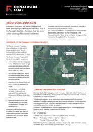
Tasman Extension Project<br />
Environmental Impact Statement<br />
<strong>SECTION</strong> 1<br />
<strong>INTRODUCTION</strong>
Tasman Extension Project – Environmental Impact Statement<br />
TABLE OF CONTENTS<br />
1 <strong>INTRODUCTION</strong> 1-1<br />
1.1 PROJECT OVERVIEW 1-1<br />
1.1.1 Purpose of this Report 1-1<br />
1.1.2 Background 1-1<br />
1.1.3 Project Summary 1-1<br />
1.1.4 Site Location and Tenure 1-5<br />
1.1.5 Proponent 1-8<br />
1.2 DIRECTOR-GENERAL’S<br />
REQUIREMENTS 1-8<br />
1.3 PROJECT CONSULTANTS 1-8<br />
1.4 DOCUMENT STRUCTURE 1-10<br />
LIST OF TABLES<br />
Table 1-1 Project Summary<br />
Table 1-2 Director-General’s Requirements –<br />
Reference Summary<br />
Table 1-3 Content Requirements of an EIS –<br />
Clause 7 of Schedule 2 of the EP&A<br />
Regulation<br />
LIST OF FIGURES<br />
Figure 1-1<br />
Figure 1-2<br />
Figure 1-3a<br />
Figure 1-3b<br />
Regional Location<br />
Aerial Photograph of the Project Area and<br />
Surrounds<br />
Relevant Land Ownership Plan<br />
Relevant Land Ownership List<br />
LIST OF ATTACHMENTS<br />
Attachment 1<br />
Attachment 2<br />
Attachment 3<br />
Attachment 4<br />
Attachment 5<br />
Attachment 6<br />
Attachment 7<br />
Attachment 8<br />
Director-General’s Requirements<br />
Development Application Area and Real<br />
Property Descriptions<br />
Relevant Environmental Planning<br />
Instruments<br />
Potential Interactions between the Project<br />
and Other Major Projects<br />
Community Information<br />
Water Licensing Requirements<br />
Peer Review Letters<br />
Additional Road Transport Assessment<br />
Information<br />
1-i
Tasman Extension Project – Environmental Impact Statement<br />
1 <strong>INTRODUCTION</strong><br />
This document is an Environmental Impact<br />
Statement (EIS) for the Tasman Extension Project<br />
(the Project). The Project provides for the<br />
extension and continuation of operations at the<br />
existing Tasman Underground Mine.<br />
The existing Tasman Underground Mine is located<br />
within Mining Lease (ML) 1555, approximately<br />
20 kilometres (km) west of the Port of Newcastle in<br />
New South Wales (NSW) (Figure 1-1). The<br />
Tasman Underground Mine is owned and operated<br />
by Newcastle Coal Company Pty Ltd, a wholly<br />
owned subsidiary of Donaldson Coal Pty Limited<br />
(Donaldson Coal) 1 . Donaldson Coal is a wholly<br />
owned subsidiary of Gloucester Coal Ltd (GCL).<br />
Donaldson Coal also owns and operates the<br />
Donaldson Open Cut Mine and Abel Underground<br />
Mine, which are located approximately 10 km<br />
north-east of the Tasman Underground Mine<br />
(Figure 1-1).<br />
1.1 PROJECT OVERVIEW<br />
1.1.1 Purpose of this Report<br />
This EIS has been prepared to accompany a<br />
Development Application made for the Project, in<br />
accordance with Part 4 of the NSW Environmental<br />
Planning and Assessment Act, 1979 (EP&A Act).<br />
The Project is a “State Significant Development” to<br />
which Division 4.1 of Part 4 of the EP&A Act applies<br />
in accordance with the State Environmental<br />
Planning Policy (State and Regional Development)<br />
2011 (State and Regional Development SEPP).<br />
This EIS considers the potential environmental<br />
impacts of the Project in accordance with clauses 6<br />
and 7 in Schedule 2 of the NSW Environmental<br />
Planning and Assessment Regulation, 2000<br />
(EP&A Regulation) and the Director-General’s<br />
Requirements (DGRs) issued by the NSW<br />
Department of Planning and Infrastructure (DP&I)<br />
on 14 December 2011 (Attachment 1). The DGRs<br />
were issued in accordance with clause 3 of<br />
Schedule 2 of the EP&A Regulation. A summary of<br />
the DGRs is provided in Section 1.2.<br />
1<br />
At all relevant times in relation to the Project,<br />
Donaldson Coal will be acting as an agent for and on<br />
behalf of Newcastle Coal Company Pty Ltd. For<br />
consistency, the remainder of this EIS and all its<br />
appendices will refer to Donaldson Coal in relation to<br />
activities and actions conducted by either party.<br />
1.1.2 Background<br />
The location of the existing Tasman Underground<br />
Mine is shown on Figures 1-1 and 1-2. A<br />
description of the existing Tasman Underground<br />
Mine operations is provided in Section 2.1.<br />
The Tasman Underground Mine has been approved<br />
to produce approximately 975,000 tonnes per<br />
annum (tpa) of run-of-mine (ROM) coal from the<br />
Fassifern Seam. The Tasman Underground Mine is<br />
a bord and pillar operation, which uses continuous<br />
miners for first workings and secondary total and<br />
partial extraction.<br />
The underground mining operations at the Tasman<br />
Underground Mine are supported by an existing pit<br />
top facility off George Booth Drive and other<br />
ancillary infrastructure.<br />
The existing Tasman Underground Mine pit top<br />
facility comprises ROM coal handling infrastructure,<br />
administration facilities, worker amenities and<br />
stores buildings, workshop compound, bunded fuel<br />
tank area, transformer, water management systems<br />
and mine infrastructure.<br />
ROM coal produced at the Tasman Underground<br />
Mine is transported to the Bloomfield Coal Handling<br />
and Preparation Plant (CHPP) via approximately<br />
16 km of public roads (i.e. George Booth Drive and<br />
John Renshaw Drive). The coal is processed at the<br />
Bloomfield CHPP prior to rail transport to the Port of<br />
Newcastle and other customers. Bloomfield<br />
Collieries Pty Limited (Bloomfield) own and operate<br />
the Bloomfield CHPP within Consolidated Coal<br />
Lease (CCL) 761. The Bloomfield CHPP is<br />
approved to operate under the Abel Underground<br />
Mine Project Approval (05_0136).<br />
Donaldson Coal continues to operate in a<br />
co-operative manner with the Bloomfield Colliery<br />
operations. Commercial arrangements exist<br />
between Donaldson Coal and Bloomfield for the<br />
handling and processing of ROM coal at the<br />
Bloomfield CHPP and loading of trains for transport<br />
to customers.<br />
1.1.3 Project Summary<br />
The Project provides for the continuation and then<br />
extension of operations at the Tasman<br />
Underground Mine and would extend the current<br />
operations by approximately 15 years. Table 1-1<br />
provides a summary comparison of the existing<br />
Tasman Underground Mine and the Project<br />
components including upgrades.<br />
1-1
Tasman Extension Project – Environmental Impact Statement<br />
Table 1-1<br />
Project Summary<br />
Project Feature<br />
Mine Life<br />
Mining Method and<br />
ROM Coal<br />
Production<br />
Summary of the Existing Tasman<br />
Underground Mine<br />
Scheduled cessation of mining operations at end<br />
of 2014.<br />
Existing ML 1555 is valid to 26 September 2025.<br />
Bord and pillar mining with a combination of total<br />
and partial pillar extraction supplemented by<br />
augering.<br />
ROM coal production of up to approximately<br />
975,000 tpa.<br />
Implementation of subsidence control zones<br />
(SCZs) to manage impacts on surface<br />
infrastructure, cliff lines and steep slopes.<br />
Summary of the Project<br />
A 17 year Project providing approximately<br />
15 years of further operational life (i.e. until<br />
approximately 2029).<br />
Bord and pillar mining with a combination of total<br />
and partial pillar extraction.<br />
ROM coal production of up to approximately<br />
1,500,000 tpa (1.5 million tonnes per annum<br />
[Mtpa]).<br />
Implementation of SCZs to manage impacts on<br />
principal residences, surface infrastructure, cliff<br />
lines, steep slopes, streams and vegetation to<br />
meet defined subsidence performance measures.<br />
Coal Seam/s Underground mining of the Fassifern Seam. Continuation of mining of the Fassifern Seam.<br />
ROM Coal<br />
Surface<br />
Infrastructure Area<br />
and Mine Entry<br />
ROM Coal Transport<br />
Ventilation<br />
Water Management<br />
Production of approximately 10 million<br />
tonnes (Mt) over the life of the mine.<br />
Tasman Underground Mine pit top facility off<br />
George Booth Drive comprising ROM coal<br />
handling infrastructure, administration facilities,<br />
worker amenities and stores buildings, workshop<br />
compound, bunded fuel tank area, transformer<br />
and miscellaneous mine infrastructure.<br />
Decommissioning and rehabilitation of the<br />
existing Tasman Underground Mine pit top facility<br />
at the end of the mine life.<br />
Transport of ROM coal via approximately 16 km<br />
of public roads (George Booth Drive, John<br />
Renshaw Drive) to Bloomfield CHPP.<br />
Transport of up to 4,000 tonnes per day.<br />
Movement of coal by road restricted to 7.00 am to<br />
10.00 pm Monday to Friday. No coal transport by<br />
road on weekends or public holidays.<br />
Ventilation fan at Tasman Underground Mine pit<br />
top facility.<br />
Water management system at the Tasman<br />
Underground Mine pit top comprises water<br />
management storages, runoff diversions and<br />
control, sediment control, mine dewatering and<br />
sewage treatment.<br />
Make-up water trucked from Bloomfield Colliery or<br />
Donaldson Open Cut Mine, if required.<br />
Excess water stored in sumps and dams, trucked<br />
off-site or stored in underground workings.<br />
Underground mining of the West Borehole Seam.<br />
Production of approximately 18.7 Mt additional to<br />
the existing Tasman Underground Mine.<br />
Development of new pit top facility off George<br />
Booth Drive comprising ROM coal handling<br />
infrastructure, administration facilities, worker<br />
amenities and stores buildings, workshop<br />
compound, bunded fuel tank area, transformer<br />
infrastructure, miscellaneous mine infrastructure<br />
and other associated mine infrastructure.<br />
Decommissioning and rehabilitation, or<br />
placement in care and maintenance, of the<br />
existing Tasman Underground Mine pit top facility<br />
following completion of mining in the Fassifern<br />
Seam.<br />
Decommissioning and rehabilitation of the new<br />
pit top facility at the end of the Project life.<br />
Transport of ROM coal from the Tasman<br />
Underground Mine pit top and new pit top via<br />
George Booth Drive and John Renshaw Drive to<br />
Bloomfield CHPP.<br />
Transport of up to 4,000 tonnes per day prior to<br />
commissioning of the Hunter Expressway and up<br />
to approximately 6,200 tonnes per day following<br />
commissioning of the Hunter Expressway.<br />
Movement of coal by road restricted to 7.00 am<br />
to 10.00 pm Monday to Friday and 7.00 am to<br />
6.00 pm Saturday (except in the case of<br />
exceptional circumstances 1 ) with coal transport<br />
on no more than 26 Saturdays in a financial year.<br />
No coal transport by road on Sunday or public<br />
holidays.<br />
Installation of a new main surface fan on an<br />
upcast ventilation shaft.<br />
A similar water management system is proposed<br />
at the new pit top.<br />
1-4
Tasman Extension Project – Environmental Impact Statement<br />
Table 1-1 (Continued)<br />
Project Summary<br />
Project Feature<br />
Hours of Mining<br />
Operation<br />
Operational<br />
Workforce<br />
Power Supply<br />
Monitoring of<br />
Subsidence Impacts<br />
Remediation and<br />
Rehabilitation Works<br />
1<br />
Summary of the Existing Tasman<br />
Underground Mine<br />
24 hours per day, seven days per week. No change.<br />
Approximately 110 personnel (excluding service<br />
providers and general management).<br />
Overhead 11 kilovolt (kV) electricity transmission<br />
line from West Wallsend.<br />
Monitoring of subsidence and subsidence impacts<br />
over underground mining and mine development<br />
areas.<br />
Progressive rehabilitation of surface disturbance<br />
areas (e.g. exploration drill pads).<br />
Remediation of previously mined areas impacted<br />
by subsidence effects, where required.<br />
Summary of the Project<br />
Approximately 150 personnel (excluding service<br />
providers and general management).<br />
Power supply infrastructure for the new pit top<br />
facility would be the subject of a separate<br />
assessment approvals processes.<br />
Power supply would likely comprise an overhead<br />
33 kV electricity transmission line from Heddon<br />
Greta. Power supply for construction and initial<br />
development would be via an extension of the<br />
existing 11 kV supply to the Orica Australia Pty<br />
Limited (Orica) facilities or diesel generators.<br />
Continuation of subsidence monitoring in areas<br />
proposed for mining as part of the Project.<br />
Ongoing surface rehabilitation, mitigation and<br />
remediation works.<br />
Rehabilitation of mine related infrastructure areas<br />
that are no longer required.<br />
Exceptional circumstances include unexpected events such as a significant disruption to the haulage route. Hours would be extended in<br />
accordance with a contingency plan in the Road Transport Protocol with the agreement of the DP&I.<br />
The main activities associated with the development<br />
of the Project would include:<br />
• continued underground mining of the Fassifern<br />
Seam using a combination of total and partial<br />
pillar extraction methods within ML 1555;<br />
• underground mining of the West Borehole<br />
Seam using a combination of total and partial<br />
pillar extraction methods (Figure 1-2);<br />
• production of ROM coal up to 1.5 Mtpa;<br />
• development of a new pit top facility,<br />
associated ROM coal handling infrastructure<br />
and intersection with George Booth Drive<br />
(Figure 1-2);<br />
• development of ventilation surface<br />
infrastructure;<br />
• continued transport of Fassifern Seam ROM<br />
coal from the existing Tasman Underground<br />
Mine pit top to the Bloomfield CHPP via truck<br />
on public and private roads (Figure 1-2) to<br />
approximately 2015 (inclusive);<br />
• transport of West Borehole Seam ROM coal<br />
from the new pit top to the Bloomfield CHPP<br />
via truck on public and private roads;<br />
• progressive development of sumps, pumps,<br />
pipelines, water storages and other water<br />
management equipment and structures;<br />
• ongoing exploration activities;<br />
• ongoing surface monitoring, rehabilitation and<br />
remediation of subsidence effects; and<br />
• other associated infrastructure, plant,<br />
equipment and activities.<br />
Subsidence control zones (SCZs) would be<br />
implemented to manage impacts on principal<br />
residences, surface infrastructure, cliff lines, steep<br />
slopes, streams and vegetation to meet defined<br />
subsidence performance measures (Section 2.6.3).<br />
1.1.4 Site Location and Tenure<br />
The Project is located within ML 1555 (Figure 1-1),<br />
Exploration Licence (EL) 5337, EL 5498 and<br />
EL 5497.<br />
Donaldson Coal has lodged a Mining Lease<br />
Application (MLA) (MLA 416) for the portions of the<br />
Project mining area to the west and south of<br />
ML 1555 with the NSW Division of Resources and<br />
Energy (DRE) (within the NSW Department of<br />
Trade and Investment, Regional Infrastructure and<br />
Services [DTIRIS]) (Figures 1-3a and 1-3b).<br />
1-5
2 Newcastle Coal Company Pty Limited<br />
3 Coal & Allied Operations Pty. Limited<br />
6 Hunter Development Corporation<br />
10 Roads and Traffic Authority of New South Wales<br />
13 The Council of the Shire of Lake Macquarie<br />
14 Orica Australia Pty Limited<br />
18 Anthony Raymond Sager<br />
19 Anthony Scott Green and Karen Lesley Green as Joint Tenants<br />
20 Barry John Colefax and Helen Ruth Colefax as Joint Tenants<br />
23 Broadcast Australia Pty Ltd<br />
24 Bruce Graham Smith and Michelle Smith as Joint Tenants<br />
25 Carol Ann Young<br />
27 Christopher William Carr and Pamela Margaret Carr as Joint Tenants<br />
28 Colin Claude Eacott and Margaret Ann Eacott as Joint Tenants<br />
30 Colin Richard Andrews and Betty Andrews as Joint Tenants<br />
32 Craig Robert Bloomfield<br />
34 Darren Patrick Treacy<br />
35 David Hoey and Julie Anne Hoey as Joint Tenants<br />
36 Garry Baldwin and Coral Baldwin as Joint Tenants<br />
37 Garry William Cameron and Kathleen Mary Cameron as Joint Tenants<br />
39 Glenn Wesley Andrews<br />
41 Graham Paul Laing<br />
44 Gregory John McCarthy and Simone Christine McCarthy as Joint Tenants<br />
45 Gregrey Kenneth Hooler<br />
46 H.l. Eco Trades Pty Ltd<br />
48 Hermien Spruce and Jason William Rhind as Tenants in Common in Equal<br />
Shares<br />
49 Istvan Fityus<br />
50 J. & A. Brown & Abermain Seaham Collieries Limited<br />
51 Jason Mitchell Spruce<br />
52 Jason Patrick Kelly in 1/100 Share and Nicole Carla Kelly in<br />
99/100 Share as Tenants in Common<br />
53 Jo-anne Louise Parkinson<br />
56 Kevin Arthur Baldwin and Hilda Doris Baldwin as Joint Tenants<br />
57 Kevin Harold Starr and Donna Margaret Starr as Joint Tenants<br />
58 Kevin Mark Spruce and Loretta Joy Spruce as Joint Tenants<br />
59 Kevin Raymond Mitchell and Rodney Leonard Mitchell as Tenants in<br />
Common in Equal Shares<br />
65 Mark Andrew Honeysett<br />
66 Maztrok Pty Limited<br />
68 Michael Richard Leenderts<br />
70 The Minister for Lands<br />
71 NBN Limited<br />
72 Neville Francis Mould and Maria Coral Mould as Joint Tenants<br />
73 Niel Eric Lawson Horning Allen and Kerry Hamilton Allen as Joint Tenants<br />
74 Patricia June Crowhurst<br />
76 Paul Leslie William Foster and Janette Anne Foster as Joint Tenants<br />
77 Perpetual Trustee Company Limited and Gail Sara Smith as Joint Tenants<br />
78 Peter Darrel James Foster<br />
79 Peter Glenn Fraser and Janene Anne Fraser as Joint Tenants<br />
82 Peter Stephen Evans and Susan Patricia Evans as Joint Tenants<br />
83 Peter Warren Dryden and Donna Louise Dryden as Joint Tenants<br />
84 Phillip Clarence Pemberton and Lynette Myrtle Pemberton as Joint<br />
Tenants<br />
85 Richmond Vale Futures Pty Limited<br />
86 Robert William Prudius and Marites Prudius as Joint Tenants<br />
89 Shane Robert Gorman and Robyn Denise Gorman as Joint Tenants<br />
90 Stephen John Wile<br />
95 The State of New South Wales<br />
96 Transgrid<br />
98 Administered by National Parks and Wildlife<br />
DCL-09-01 EIS Sect1_001C<br />
Note: Correct as of October 2011<br />
Source: Department of Lands (2011) and<br />
Donaldson Coal Pty Ltd (2009)<br />
TASMAN EXTENSION PROJECT<br />
FIGURE 1-3b<br />
Relevant Land Ownership List
Tasman Extension Project – Environmental Impact Statement<br />
Donaldson Coal has lodged a MLA for the pit top,<br />
ventilation infrastructure and northern portion of the<br />
Project mining area (MLA 426) with DRE<br />
(Figure 1-3a). Donaldson Coal will also continue to<br />
apply for and renew the exploration tenements with<br />
the DRE as required.<br />
The Development Application area includes those<br />
lands listed in the real property descriptions<br />
provided in support of the Development Application<br />
submitted to the DP&I (Attachment 2). Relevant<br />
land ownership information for parcels of land within<br />
the immediate vicinity of the Project is provided on<br />
Figures 1-3a and 1-3b.<br />
The Development Application area is within the<br />
Cessnock and Lake Macquarie Local Government<br />
Areas (LGAs) (Figure 1-1). A description of the<br />
land zoning in the Development Application area is<br />
provided in Section 6.2 and Attachment 3.<br />
1.1.5 Proponent<br />
Newcastle Coal Company Pty Ltd (ABN 40 074 900<br />
208), a wholly owned subsidiary of Donaldson Coal<br />
(ABN 87 073 088 945), is the proponent for the<br />
Project 2 . The contact details for Donaldson Coal<br />
are:<br />
Donaldson Coal Pty Limited<br />
Level 7, 167 Macquarie Street<br />
Sydney NSW 2000 Australia<br />
Phone: (02) 9220 9900<br />
Further information on the proponent and its coal<br />
mining operations can be found at:<br />
http://www.gloucestercoal.com.au/<br />
1.2 DIRECTOR-GENERAL’S<br />
REQUIREMENTS<br />
The DGRs for the Project were issued by the<br />
Director-General of the DP&I on 14 December 2011<br />
(Attachment 1).<br />
A summary of the DGRs is provided in Tables 1-2<br />
and 1-3. Tables 1-2 and 1-3 also provide the<br />
relevant section of this EIS where the DGRs are<br />
addressed.<br />
1.3 PROJECT CONSULTANTS<br />
This EIS was prepared by Resource Strategies Pty<br />
Ltd with specialist input provided by the following<br />
organisations:<br />
• Donaldson Coal project team (project design,<br />
alternatives and justification, preliminary<br />
hazard analysis, environmental risk<br />
assessment, background data, resource<br />
economics, consultation, rehabilitation,<br />
remediation and Statement of Commitments);<br />
• Minter Ellison (legal review);<br />
• Ditton Geotechnical Services (DgS)<br />
(subsidence assessment);<br />
• RPS Aquaterra (groundwater assessment);<br />
• Heritage Computing (technical groundwater<br />
advice);<br />
• Evans & Peck Pty Ltd (surface water<br />
assessment);<br />
• Fluvial Systems Pty Ltd (geomorphology<br />
assessment);<br />
• FRC Environmental (aquatic ecology<br />
assessment);<br />
• Hunter Eco (terrestrial flora assessment);<br />
• Biosphere Environmental Services Pty Ltd<br />
(terrestrial fauna assessment);<br />
• Halcrow Pacific Pty Ltd (road transport<br />
assessment);<br />
• SLR Consulting Pty Ltd (noise and blasting<br />
impact assessment);<br />
• PAEHolmes (air quality and greenhouse gas<br />
assessment);<br />
• South East Archaeology Pty Limited<br />
(Aboriginal cultural heritage assessment);<br />
• Maximum Archaeology and Heritage<br />
(non-Aboriginal heritage assessment);<br />
• Gillespie Economics (socio-economic<br />
assessment);<br />
• Safe Production Solutions (SP Solutions)<br />
(environmental risk assessment);<br />
• Ardill Payne and Partners (pit top design and<br />
land contamination assessment); and<br />
• GHD (pit top roundabout design and private<br />
driveway/George Booth Drive review).<br />
2<br />
At all relevant times in relation to the Project,<br />
Donaldson Coal will be acting as an agent for and on<br />
behalf of Newcastle Coal Company Pty Ltd. For<br />
consistency, the remainder of this EIS and all its<br />
appendices will refer to Donaldson Coal in relation to<br />
activities and actions conducted by either party.<br />
1-8
Tasman Extension Project – Environmental Impact Statement<br />
Table 1-2<br />
Director-General’s Requirements – Reference Summary*<br />
Summary of Director-General’s Requirements<br />
EIS Reference<br />
General Requirements<br />
The EIS must include:<br />
• Form requirements in Clause 6 of Schedule 2 of the EP&A Regulation. Front of EIS and Attachment 2<br />
• Content requirements in Clause 7 of Schedule 2 of the EP&A Regulation. Refer to Table 1-3<br />
• Description of the Project, including staging of the Project. Section 2<br />
• Project justification. Section 6.7 and<br />
Appendices A and M<br />
• Interaction of the Project with existing, approved and proposed mining<br />
operations.<br />
Sections 2 and 4<br />
and Attachment 4<br />
• Plans of proposed building works. Section 2<br />
• Consideration of relevant environmental planning instruments. Section 6.5 and Attachment 3<br />
• Risk assessment of the potential environmental impacts of the Project. Section 4.1 and<br />
Appendix O<br />
• Description of the existing environment. Section 4<br />
• Assessment of the potential environmental impacts of all stages of the Project,<br />
Section 4<br />
including cumulative impacts.<br />
• Description of the measures to avoid, minimise and/or offset the potential<br />
Sections 4, 5, 6 and 7<br />
impacts of the Project including contingency plans.<br />
• Consolidated summary of all proposed environmental management and<br />
Section 7<br />
monitoring measures.<br />
Key Issues<br />
• Subsidence. Section 4.2 and Appendix A<br />
• Land Resources. Section 4.3 and Appendix A<br />
• Water Resources. Sections 4.4 to 4.6 and 6,<br />
Appendices B, C and D and<br />
Attachment 6<br />
• Biodiversity. Sections 4.7 to 4.9<br />
and Appendices E, F and G<br />
• Heritage. Sections 4.10 and 4.11<br />
and Appendices K and L<br />
• Air Quality. Section 4.14 and Appendix J<br />
• Greenhouse Gases. Section 4.15 and Appendix J<br />
• Noise. Section 4.13 and Appendix I<br />
• Traffic and Transport. Section 4.12, Appendices H and M<br />
and Attachment 8<br />
• Visual. Section 4.19 and Appendix A<br />
• Waste. Section 2.11<br />
• Hazards. Section 4.18 and Appendix N<br />
• Social and Economic. Sections 4.16 and 4.17<br />
and Appendix M<br />
• Rehabilitation. Section 5<br />
Plans and Documents<br />
• Relevant plans, architectural drawings and diagrams. Section 2<br />
Consultation Requirements<br />
• Describe consultation with relevant local, State or Commonwealth Government<br />
authorities, service providers, community groups or affected landowners.<br />
• Describe the consultation process and the issues raised, and identify where<br />
the design of the development has been amended in response to these issues.<br />
* The complete version of the DGRs is presented in Attachment 1.<br />
Section 3 and Attachment 5<br />
Section 3<br />
1-9
Tasman Extension Project – Environmental Impact Statement<br />
Table 1-3<br />
Content Requirements of an EIS – Clause 7 of Schedule 2 of the EP&A Regulation<br />
The EIS must include:<br />
Summary of Clause 7 of the EP&A Regulation<br />
EIS Reference<br />
• Summary of the EIS. Executive Summary<br />
• Objectives of the Project. Sections 1.1 and 6<br />
• Analysis of any feasible alternatives to the Project, including the consequences of not<br />
Section 6.7.2<br />
carrying out the Project.<br />
• Description of the Project. Section 2<br />
• Description of the environment likely to be affected by the Project. Section 4<br />
• The likely impact on the environment of the Project. Section 4<br />
• Description of the measures proposed to mitigate any adverse effects of the Project on the<br />
environment.<br />
• A list of any approvals that must be obtained under any other Act or law before the Project<br />
may lawfully be carried out.<br />
• Compilation (in a single section of the environmental impact statement) of the measures<br />
proposed to mitigate any adverse effects of the Project on the environment.<br />
• Justification of the Project, having regard to biophysical, economic and social considerations,<br />
including the principles of ecologically sustainable development (ESD).<br />
Section 4<br />
Sections 6.2 and 6.3<br />
Section 7<br />
Section 6.7<br />
In addition to the above, peer review of the surface<br />
water assessment was undertaken by Emeritus<br />
Professor Tom McMahon (Attachment 7).<br />
1.4 DOCUMENT STRUCTURE<br />
This EIS comprises a main text component and<br />
supporting studies, which include Appendices A<br />
through Q. An overview of the main text sections is<br />
presented below:<br />
Section 1<br />
Section 2<br />
Section 3<br />
Section 4<br />
Section 5<br />
Provides an introduction to the<br />
Project and this EIS.<br />
Describes the various components<br />
and stages of the Project.<br />
Describes the consultation<br />
undertaken in relation to ongoing<br />
community consultation, the Project<br />
and the preparation of this EIS.<br />
Details the environmental<br />
assessment for the Project including:<br />
a description of the existing<br />
environment; an assessment of<br />
potential impacts; and a description<br />
of the measures that would be<br />
implemented to avoid, minimise,<br />
mitigate, offset, manage and/or<br />
monitor the potential impacts of the<br />
Project.<br />
Describes the rehabilitation and<br />
remediation measures for the Project.<br />
Section 6<br />
Section 7<br />
Section 8<br />
Section 9<br />
Outlines the statutory provisions<br />
relevant to the Project, describes the<br />
alternatives considered and provides<br />
a Project justification.<br />
Provides a summary of the proposed<br />
environmental mitigation,<br />
management, monitoring and<br />
reporting, and specific environmental<br />
commitments in relation to the<br />
Project.<br />
Lists the documents referred to in<br />
Sections 1 to 7 of this EIS.<br />
Defines abbreviations, acronyms and<br />
terms used in Sections 1 to 7 of this<br />
EIS.<br />
Attachments to the main text are also provided as<br />
follows:<br />
Attachment 1 Director-General’s Requirements.<br />
Attachment 2 Development Application Area and<br />
Real Property Descriptions.<br />
Attachment 3 Relevant Environmental Planning<br />
Instruments.<br />
Attachment 4 Potential Interactions between the<br />
Project and Other Major Projects.<br />
Attachment 5 Community Information.<br />
Attachment 6 Water Licensing Requirements.<br />
Attachment 7 Peer Review Letters.<br />
Attachment 8 Additional Road Transport<br />
Assessment Information.<br />
1-10
Tasman Extension Project – Environmental Impact Statement<br />
Appendices A to Q contain supporting information,<br />
including a number of specialist reports:<br />
Appendix A<br />
Appendix B<br />
Appendix C<br />
Appendix D<br />
Appendix E<br />
Appendix F<br />
Appendix G<br />
Appendix H<br />
Appendix I<br />
Appendix J<br />
Appendix K<br />
Appendix L<br />
Appendix M<br />
Appendix N<br />
Appendix O<br />
Appendix P<br />
Appendix Q<br />
Subsidence Assessment.<br />
Groundwater Assessment.<br />
Surface Water Assessment.<br />
Geomorphology Assessment.<br />
Aquatic Ecology Assessment.<br />
Flora Assessment.<br />
Terrestrial Fauna Assessment.<br />
Road Transport Assessment.<br />
Noise and Vibration Impact<br />
Assessment.<br />
Air Quality and Greenhouse Gas<br />
Assessment.<br />
Aboriginal Cultural Heritage<br />
Assessment.<br />
Non-Aboriginal Heritage Assessment.<br />
Socio-Economic Assessment.<br />
Preliminary Hazard Analysis.<br />
Environmental Risk Assessment.<br />
Land Contamination Assessment.<br />
Private Driveway/George Booth Drive<br />
Review.<br />
1-11