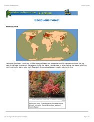
Ecoscenarios Combined - FOSSweb
Ecoscenarios Combined - FOSSweb
Ecoscenarios Combined - FOSSweb

You also want an ePaper? Increase the reach of your titles
YUMPU automatically turns print PDFs into web optimized ePapers that Google loves.
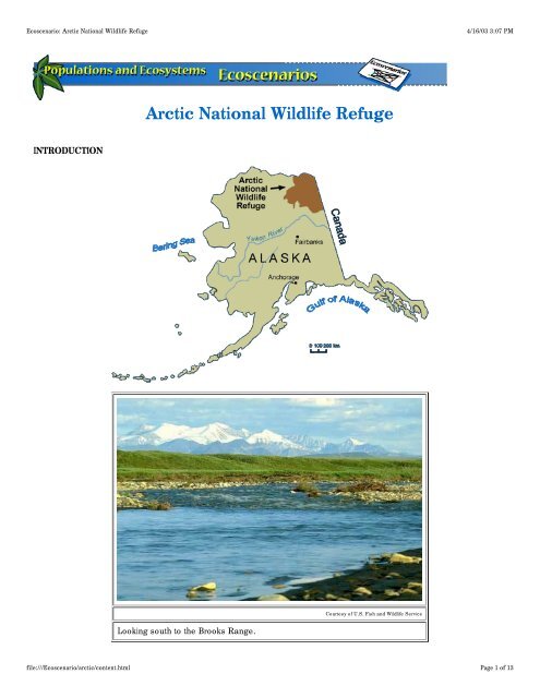
Ecoscenario: Arctic National Wildlife Refuge<br />
4/16/03 3:07 PM<br />
Arctic National Wildlife Refuge<br />
INTRODUCTION<br />
Courtesy of U.S. Fish and Wildlife Service<br />
Looking south to the Brooks Range.<br />
file:///Ecoscenario/arctic/content.html<br />
Page 1 of 13
Ecoscenario: Arctic National Wildlife Refuge<br />
4/16/03 3:07 PM<br />
The Arctic National Wildlife Refuge in the northeast corner of Alaska is one of the most pristine, undisturbed places<br />
on Earth. It covers 7,700,000 hectares (19 million acres). To the south is the rugged Brooks Range and to the north,<br />
the icy Arctic Ocean. The 600,000-hectare (1.5 million-acre) coastal plain is the most productive part of the refuge<br />
and the area used most by wildlife. This area is dominated by an ecosystem known as middle arctic tundra. The<br />
treeless landscape is flat and covered with low-growing plants.<br />
The Arctic National Wildlife Refuge is sometimes called America's Serengeti because of the number of animals that<br />
live here. Huge herds of caribou, as well as polar bears and musk ox, roam this vast plain. The Gwich'in<br />
Athabascan Indians have depended on these animal resources for over 12,000 years.<br />
Courtesy of Jon Nickles, U.S. Fish and<br />
Wildlife Service<br />
A caribou makes its way<br />
across the marshy arctic<br />
tundra.<br />
Courtesy of U.S. Fish and Wildlife Service<br />
The coastal plain of the Arctic National Wildlife<br />
Refuge is pitted with ponds during the short<br />
summer.<br />
Two conservationists, National Park Service planner George Collins and biologist Lowell Sumner, recognized the<br />
unique nature of this ecosystem and began efforts to protect it in 1952. Federal protection started in 1960 with the<br />
establishment of the Arctic National Wildlife Range. In 1980, the U.S. Congress passed the Alaska Lands Act,<br />
renamed the area the Arctic National Wildlife Refuge, and doubled the size of the protected area. The refuge is the<br />
largest designated wilderness in the National Wildlife Refuge System. It is administered by the U.S. Fish and<br />
Wildlife Service in the Department of the Interior.<br />
Congress created the refuge to protect the wildlife and habitats of this ecosystem for the benefit of people now and<br />
in the future. The Arctic National Wildlife Refuge and two parks in neighboring Canada have been proposed to form<br />
an international park. Many of the refuge's wildlife species are protected by international treaties.<br />
ABIOTIC DATA<br />
Frost, snowfall, and freezing conditions shape the tundra landscape in the Arctic National Wildlife Refuge. The<br />
extreme cold creates a layer of permanently frozen soil called permafrost. In May when the snow melts, the surface<br />
soil becomes waterlogged because water can't drain through the permafrost. The region becomes saturated with<br />
standing water and flowing streams.<br />
file:///Ecoscenario/arctic/content.html<br />
Page 2 of 13
Ecoscenario: Arctic National Wildlife Refuge<br />
4/16/03 3:07 PM<br />
Because the Arctic National Wildlife Refuge is so far north, entirely above the Arctic Circle, the growing season is<br />
short, only 50–60 days. During summer the Sun never dips below the horizon, but its long, slanting rays do little to<br />
heat up the air. Temperatures range from 2 to12°C (36 to 54°F). During winter the Sun never rises above the<br />
horizon. The noon sky looks like predawn. In winter, the temperature averages –34°C (–30°F).<br />
There is little precipitation in winter or summer. Yearly precipitation, including snow, is only 15–25 centimeters (6–<br />
10 inches). Wind is a major factor in this area and can blow up to 160 kilometers per hour (100 miles per hour).<br />
file:///Ecoscenario/arctic/content.html<br />
Page 3 of 13
Ecoscenario: Arctic National Wildlife Refuge<br />
4/16/03 3:07 PM<br />
Courtesy of ConocoPhillips Alaska, Inc.<br />
Snow still covers the windswept tundra in spring.<br />
Snow can benefit plants and animals because of its insulating qualities. Snow shelters plants and animals from the<br />
strong winds and protects the ground from disturbance. Small mammals, such as lemmings, make tunnels beneath<br />
the snow and avoid detection by predators.<br />
Courtesy of Environment Canada, Yukon<br />
Snow that falls in the winter often melts during May.<br />
The ground has two layers, an active layer and a permafrost layer. The top active layer is made of dead and partially<br />
decayed plant material. It is very wet because the water cannot drain through the permafrost below. The active layer<br />
is not considered true soil, because the plant material decomposes too slowly. The depth of the active layer<br />
changes through the season from 0 to 45.5 centimeters (0 to 18 inches). Below the active layer is permafrost, made<br />
file:///Ecoscenario/arctic/content.html<br />
Page 4 of 13
Ecoscenario: Arctic National Wildlife Refuge<br />
4/16/03 3:07 PM<br />
up of gravel, frozen groundwater, and finer material. Permafrost never thaws.<br />
BIOTIC DATA<br />
Biotic diversity in arctic tundra is generally low, food webs are simple, and populations usually have large<br />
fluctuations in size due to changing abiotic conditions. Plants and animals reproduce quickly in the short summer<br />
season.<br />
Because of the permafrost, plants in the Arctic National Wildlife Refuge do not have deep roots. Only hardy plants<br />
that grow close to the ground can endure the effects of wind and cold temperatures. Grasses and sedges form in<br />
protective clumps called tussocks, and shrubs like willow and Labrador tea tend to be small species, under 1 meter<br />
(3 feet) tall. Because of the short growing season, many plants rely on asexual reproduction, such as cloning or<br />
budding, instead of flowering and forming seeds.<br />
Courtesy of ConocoPhillips Alaska, Inc.<br />
Sedges form tussocks on the tundra.<br />
Annual productivity, or the amount of energy provided by the producers in this ecosystem, is low. High metabolic<br />
rates of some herbivores burn most of the calories that are provided by the producers. Because there is a limited<br />
amount of energy to go around, food webs are relatively simple.<br />
Important producers in the tundra are moss, reindeer lichen, cotton grass, sedges, and willows. Tundra plants are<br />
adapted to grow in this harsh environment. Plants are low and tough, and leaves are small with a thick epidermis to<br />
file:///Ecoscenario/arctic/content.html<br />
Page 5 of 13
Ecoscenario: Arctic National Wildlife Refuge<br />
4/16/03 3:07 PM<br />
slow transpiration. Vegetation is dark green to red. This allows plants to absorb more of the limited solar radiation.<br />
Courtesy of U.S. Fish and Wildlife Service<br />
Caribou give birth on the coastal plain during summer, most within Area 1002.<br />
Reindeer lichen is two different organisms living together in a symbiotic relationship. A photosynthetic alga lives<br />
inside a protective, structural fungus. This lichen has a treelike form and forms hummocks on the soil. Lichen<br />
serves as the major food of the caribou, especially during the winter. Caribou use a front antler tine and hooves to<br />
scrape snow cover away from lichen.<br />
Musk ox, polar bears, and caribou roam the coastal plain. They breed there in the summer where there is abundant,<br />
nutritious food and few predators. Standing water on the summer tundra is an excellent breeding ground for<br />
mosquitoes and black flies. Swarms of these insects are attracted to caribou herds and are such a nuisance that<br />
the caribou find it difficult to feed. Coastal breezes provide the caribou with some relief from mosquitoes and black<br />
flies.<br />
Courtesy of Environment Canada, Yukon<br />
How does temperature affect mosquitoes that bother the<br />
caribou?<br />
file:///Ecoscenario/arctic/content.html<br />
Page 6 of 13
Ecoscenario: Arctic National Wildlife Refuge<br />
4/16/03 3:07 PM<br />
Other animals found on the tundra include arctic foxes, snowshoe hares, lemmings, snow geese, and snowy owls.<br />
Many species of migratory birds nest on the marshy tundra during the short summer, leaving in fall to spend winter<br />
in warmer areas.<br />
Animals living on the tundra have adaptations to keep them warm. Weasels, rabbits, hares, and musk ox have two<br />
layers of hair, a soft, short layer close to the skin and a coarser, longer layer of guard hairs. Both layers work to<br />
keep warm air near the body and cold air and snow away. Some animals also have small ears, short legs, and<br />
short tails, which help reduce heat loss.<br />
Caribou have long, dense winter coats with hollow hairs for effective insulation. Both males and females have<br />
antlers, which are covered with velvet and fed by many blood vessels as they grow. Large concave hooves help<br />
caribou paw through the snow to reach buried lichens. Their broad hooves act like snowshoes and help them cross<br />
snow in winter and walk through soft, boggy pools in summer.<br />
Courtesy of U.S. Fish and Wildlife Service<br />
The huge Porcupine Herd migrating across the tundra of the Arctic National Wildlife Refuge.<br />
Caribou migrate in huge herds from their wintering grounds in the Brooks Range taiga to calving grounds on the<br />
coastal plain over 640 kilometers (400 miles) away. They return yearly to the same calving grounds because there<br />
are few predators and high-quality food is abundant. Calving occurs during a 10 days in late May to early June. At<br />
this time, cows and calves are most vulnerable to predators and sensitive to any disturbances.<br />
Musk ox have roamed in the arctic since the Ice Age. They are well adapted for living on the tundra. To keep warm,<br />
they have a long, shaggy coat of guard hairs with shorter underfur that is extremely soft and fine. It can protect the<br />
musk ox in temperatures as low as –73ºC (–100ºF). The underfur, or wool (called qiviut), is shed in summer and<br />
collected by Alaskan natives to make woolen clothing.<br />
Musk ox travel in herds of 20–30 animals. When attacked by wolves, the larger adults form a circle with their horns<br />
facing outward. Young musk ox are protected in the middle of this circle. Extremely efficient at processing food,<br />
they need only one-sixth the food a similar-sized cow would use. In seasons when food is especially poor, they<br />
may wander into the wolves' range in search of food.<br />
file:///Ecoscenario/arctic/content.html<br />
Page 7 of 13
Ecoscenario: Arctic National Wildlife Refuge<br />
4/16/03 3:07 PM<br />
Courtesy of U.S. Fish and Wildlife Service<br />
Musk ox huddle together for protection from<br />
predators and cold weather.<br />
Courtesy of U.S. Fish and Wildlife Service<br />
Snow geese and other migratory birds nest in the<br />
Arctic National Wildlife Refuge during the short<br />
summer.<br />
Small rodents, like snowshoe hares and lemmings, are common on the tundra. Their populations are closely linked<br />
to their food supply and predator population. During summers when food is abundant, litters are larger and the<br />
populations grow. Larger populations of rodents support larger populations of predators, such as lynx and snowy<br />
owls.<br />
Many animals on the tundra have two color phases, one for summer and one for winter. Snowshoe hares and arctic<br />
foxes have heavier winter fur that is white and helps to camouflage them in snow. This fur is shed in summer to<br />
reveal darker fur. Some birds that remain in the arctic year-round, such as the willow ptarmigan, have white plumage<br />
in winter and darker plumage in summer.<br />
Wolves, foxes, and weasels are predators found on the tundra. A wolf pack will kill 11–14 caribou annually, usually<br />
during migration or in winter. Wolves will also attack musk ox, but they live out of the wolves' range most of the<br />
year. Arctic foxes are well adapted to live in the cold and do not need to hibernate in winter. They hunt small<br />
rodents and feed on abandoned kills of other predators.<br />
Polar bears are found in the Arctic National Wildlife Refuge, but spend most of their life on the ice flows in the Arctic<br />
Ocean. They feed primarily on seals, but will also eat fish, seaweed, grass, birds, and occasionally caribou. They<br />
return to the coastal plain in winter to hibernate. They spend so much of their life in the water and on the ice that<br />
they are considered to be marine mammals, like sea otters. They have thick, white fur that protects them from the<br />
icy water and camouflages them on snow and in the water. Wide paws and coarse fur on the soles of their feet give<br />
them traction on ice.<br />
ISSUES<br />
A long-standing issue in the Arctic National Wildlife Refuge is whether the coastal plain should be developed for oil<br />
drilling. Other areas in Alaska, such as Prudhoe Bay, have already experienced oil drilling. Petroleum scientists<br />
have examined part of the refuge, called Area 1002, and predict that oil is there. When the U.S. Congress<br />
established the Arctic National Wildlife Range in 1960, they made provisions to authorize future oil development in<br />
the northern part. People have been debating the issue of oil and gas drilling in Area 1002 for almost 40 years.<br />
file:///Ecoscenario/arctic/content.html<br />
Page 8 of 13
Ecoscenario: Arctic National Wildlife Refuge<br />
4/16/03 3:07 PM<br />
Courtesy of U.S. Fish and Wildlife Service<br />
A developed oil field might look like this one in<br />
Prudhoe Bay, Alaska.<br />
The process of drilling for oil<br />
Oil, like other fossil fuels, comes from decayed and pressurized plant material that has been buried and partially<br />
fossilized. Deep beneath the surface and permafrost, oil moves through rocks with microscopic holes (porous rock)<br />
until it comes in contact with nonporous rock. It collects at the contact of these two types of rock. The first step in<br />
drilling for oil is determining if a location has the kinds of rocks that are associated with oil deposits. Scientists can<br />
tell about buried rock by drilling cores of the rock or by tracing sound waves as they travel through different rock<br />
types (seismic surveying). Next, oil wells are built, tapping into the deposit. The high pressures underground force<br />
the oil up the well, where it can be collected. A pipeline transports this crude oil to a refinery. Here the crude oil is<br />
refined to oil that can be used to generate electricity or lubricate machines. In the arctic, oil development in isolated<br />
areas involves building roads, drilling platforms, pipelines, refineries, and housing facilities for workers.<br />
Courtesy of U.S. Fish and Wildlife Service<br />
During seismic exploration activities in<br />
March 1985, vehicles compacted the snow<br />
and damaged underlying plants.<br />
Courtesy of U.S. Fish and Wildlife Service<br />
Fifteen years later, scars from the<br />
seismic exploration activities can<br />
still be seen.<br />
file:///Ecoscenario/arctic/content.html<br />
Page 9 of 13
Ecoscenario: Arctic National Wildlife Refuge<br />
4/16/03 3:07 PM<br />
THE DEBATE<br />
Before making decisions that affect an ecosystem, it is important to gather information from a variety of sources.<br />
Below are the views of several individuals or groups that have an interest in the future of the Arctic National Wildlife<br />
Refuge. After each quote the hyperlink goes to the original source of the quote. Refer to these sites for more<br />
information.<br />
Use the information provided to decide where you stand on this debate.<br />
DEBATE: Should oil drilling be allowed in the Arctic National Wildlife Refuge?<br />
People who support drilling in the Arctic National Wildlife Refuge<br />
Benjamin P. Nageak of the Inupiat people and former mayor of North Slope Borough, Alaska, on Arctic National<br />
Wildlife Refuge development<br />
"I fully understand the fears of many people that the presence of the oil industry on the coastal plains will disrupt<br />
the wildlife. They fear that industry activity will destroy a part of this earth that should be preserved.<br />
In 1969, when oil was first discovered on our lands, those fears were foremost in our minds as we fought for selfdetermination<br />
in order to be able to protect our resources. Since then, we have had over twenty years of working<br />
with the oil industry here. We enacted strict regulations to protect our land and the oil companies have consistently<br />
met the standards we imposed.<br />
"ANWR holds resources that can be extracted safely with care and concern for the entire ecosystem it<br />
encompasses. The Inupiat people, working through the North Slope Borough, will act in the same careful, caring<br />
and cautious manner we always have when dealing with our lands and the seas."<br />
http://www.anwr.org/people/nageak.html<br />
R. Dobie Langenkamp, National Energy-Environment Law and Policy Institute (NELPI), University of Tulsa,<br />
Oklahoma<br />
"30 years of experience in the existing North Slope oil fields, 80 miles west of ANWR, show no detrimental effects<br />
on caribou. In fact the Central Arctic caribou herd, which uses that area, has tripled in size since oil development<br />
began in the early 1970's."<br />
http://www.anwr.org/anwrtest/FP98/caribou.htm<br />
Mortimer B. Zuckerman, editor in chief, U.S. News & World Report<br />
"Here are some of the new developments: Directional or slant drilling makes it possible to drill numerous wells from<br />
a single small production pad, resulting in a footprint so small as to have virtually no impact on wildlife. Even if<br />
enormous reserves were discovered, only a fraction of the 1.5 million acres would be affected. There's more. During<br />
winter, when no caribou are present, ice roads, ice airstrips, and ice platforms would replace gravel, so that in<br />
spring, when the ice melts, the drilling during the harsh winter would have left virtually no footprint."<br />
http://www.anwr.org/features/conundrum.htm<br />
Lon Sonsalla, mayor, City of Kaktovik, Alaska, the only community located within the coastal plain of the Arctic<br />
National Wildlife Refuge<br />
"The most important thing is the future for the people out here. Declining revenues in the North Slope Borough have<br />
affected everybody who lives here. We're looking forward to the future and we are not sure what the future would be<br />
like without ANWR."<br />
http://www.anwr.org/features/whotocall.htm<br />
Survey results of residents of Kaktovik, Alaska<br />
78% of residents surveyed thought the coastal plain of the Arctic National Wildlife Refuge should be open to oil and<br />
gas exploration.<br />
75% were satisfied with the environmental practices of the oil industry on the North Slope.<br />
71% felt the quality of life in Kaktovik will diminish if oil development ceases.<br />
http://www.kaktovik.com/anwr_survey.htm<br />
file:///Ecoscenario/arctic/content.html<br />
Page 10 of 13
Ecoscenario: Arctic National Wildlife Refuge<br />
4/16/03 3:07 PM<br />
Courtesy of U.S. Fish and Wildlife Service<br />
This is one way the Arctic National Wildlife Refuge Area 1002 could be developed.<br />
People who oppose drilling in the Arctic National Wildlife Refuge<br />
Roger Kaye (wilderness specialist/pilot) and Jim Kurth (Arctic National Wildlife Refuge manager, 1995 to 2000), 6th<br />
World Wilderness Congress, Bangalore, India, October 1998<br />
"Lowell Sumner compared the Refuge to a national monument most Americans will never see. But by just knowing<br />
it is there, they have a tangible entity to which they can attach national values they hold dear and believe should be<br />
enduring. The Arctic Refuge serves a similar function for natural values...So we stand committed to the<br />
promise— the promise made by the past generation to all future generations—that this remnant landscape will be<br />
passed on undiminished, that its values will endure."<br />
http://alaska.fws.gov/nwr/arctic/indiacon.html<br />
Faith Gemmill of the Gwich'in Indian Nation<br />
" The birthplace of the Porcupine River Caribou Herd is considered Sacred. In 1988, when we heard of the proposed<br />
oil development, we gathered for the first time in over a hundred years in Arctic Village. Everyone spoke resolutely<br />
about how important the caribou are to our culture. At the end of the gathering, we spoke with one voice, one mind<br />
and one heart with a renewed commitment to protect our way of life for future generations."<br />
http://www.alaska.net/~gwichin/background.html<br />
Member of the Gwich'in community<br />
"The oil companies say there is over 27 billion barrels of oil under Area 1002, but only a small portion of that can<br />
actually be recovered."<br />
USGS report, Arctic National Wildlife Refuge, 1002 Area, Petroleum Assessment, 1998, Including Economic<br />
Analysis<br />
"Recoverable oil within the ANWR 1002 area is estimated to be between 4.3 and 11.8 billion barrels, with a mean<br />
value of 7.7 billion barrels."<br />
file:///Ecoscenario/arctic/content.html<br />
Page 11 of 13
Ecoscenario: Arctic National Wildlife Refuge<br />
4/16/03 3:07 PM<br />
http://geology.cr.usgs.gov/pub/fact-sheets/fs-0028-01/fs-0028-01.htm<br />
Norma Kassi, Gwich'in activist and Caribou Commons Project speaker<br />
"The relationship between the Gwich'in and the caribou is not one of convenience; it is one of necessity. A healthy<br />
Porcupine Caribou Herd is necessary for the continued survival of Gwich'in culture."<br />
http://www.cariboucommons.com/issue/issue.html<br />
Tanana Chiefs Conference, Inc., board of directors, Resolution No. 90-2, March 1990<br />
" Protect Porcupine Herd—Its Ecosystem and the Gwitch'in Way of Life<br />
"NOW THEREFORE BE IT RESOLVED: That the Tanana Chiefs Conference Board of Directors urges the U.S.<br />
Congress and President to recognize the rights of our Gwitch'in people to continue to live their way of life by<br />
prohibiting development in the calving and post-calving grounds of the Porcupine Caribou Herd; and<br />
"BE IT FURTHER RESOLVED: That the 1002 area of the Arctic National Wildlife Refuge be made Wilderness to<br />
achieve this end."<br />
http://arcticcircle.uconn.edu/ANWR/tanana.html<br />
What has happened in this debate?<br />
In 1980 President Jimmy Carter signed the Alaska National Interest Lands Conservation Act. This act expanded the<br />
refuge to its present size of 7,700,000 hectares (19 million acres). The Alaska Lands Acts left Area 1002 open for<br />
possible oil development upon the approval of Congress.<br />
The United States and Canada agreed in 1987 that they both have the responsibility of overseeing Porcupine<br />
Caribou Herd habitat within the Arctic National Wildlife Refuge.<br />
A 1996 congressional study was conducted to assess the oil and gas potential of Area 1002. At that time it was<br />
concluded that the low price for oil did not make it profitable to open up the Arctic National Wildlife Refuge for<br />
drilling. The debate was reopened in 2001 after oil prices had risen and drilling in the refuge would be profitable.<br />
Government officials disagree about oil drilling in the Arctic National Wildlife Refuge. They could decide either to<br />
make it a permanent reserve or to open it for drilling.<br />
The debate continues as Congress prepares to act on this issue. As the time draws near for Congress to act,<br />
supporters for both sides of the issue work to sway public opinion.<br />
Questions<br />
Which side of this debate do you support?<br />
What scientific evidence supports your position?<br />
After looking at the evidence, did you change your position? Please explain why.<br />
WEB LINKS<br />
U.S. Fish and Wildlife Official Arctic National Wildlife Refuge - http://www.r7.fws.gov/nwr/arctic/arctic.html<br />
Arctic National Wildlife Refuge - http://www.anwr.org/<br />
Arctic National Wildlife Refuge: A Special Report - http://arcticcircle.uconn.edu/ANWR/<br />
Benjamin P. Nageak of the Inupiat people and former mayor of North Slope Borough, Alaska, on Arctic National<br />
Wildlife development - http://www.anwr.org/people/nageak.html<br />
City of Kaktovik, Alaska, ANWR Survey - http://www.kaktovik.com/anwr_survey.htm<br />
file:///Ecoscenario/arctic/content.html<br />
Page 12 of 13
Ecoscenario: Arctic National Wildlife Refuge<br />
4/16/03 3:07 PM<br />
Congressional Research Service, CRS Issue Brief for Congress: The Arctic National Wildlife Refuge, September<br />
1996 - http://cnie.org/NLE/CRSreports/Biodiversity/biodv-14.cfm<br />
Congressional Research Service, CRS Issue Brief for Congress: The Arctic National Wildlife Refuge: The Next<br />
Chapter, August 2001 - http://cnie.org/NLE/CRSreports/Natural/nrgen-23.cfm<br />
Faith Gemmill of the Gwich'in Indian Nation - http://www.alaska.net/~gwichin/background.html<br />
George N. Ahamaogk, North Slope Borough mayor - http://www.anwr.org/features/ahmaogak-speech.htm<br />
Gwich'in Steering Committee - http://www.alaska.net/~gwichin/index.html<br />
Lon Sonsalla, mayor, City of Kaktovik, Alaska - http://www.anwr.org/features/whotocall.htm<br />
Michael Grunwald, Washington Post staff writer, Some Facts Clear in the War of Spin over Arctic Refuge,<br />
Wednesday, March 6, 2002 - http://www.washingtonpost.com/ac2/wp-dyn/A44300-2002Mar5?language=printer<br />
Mortimer B. Zuckerman, editor in chief, U.S. News & World Report -<br />
http://www.anwr.org/features/conundrum.htm<br />
Norma Kassi, Gwich'in activist and Caribou Commons Project speaker - http://www.cariboucommons.com/issue/<br />
issue.html<br />
Northern Alaska Environmental Center, Alaska's Arctic -<br />
http://northern.org/artman/publish/arctic.shtml<br />
R. Dobie Langenkamp, National Energy-Environment Law and Policy Institute (NELPI), University of Tulsa,<br />
Oklahoma - http://www.anwr.org/anwrtest/FP98/caribou.htm<br />
Roger Kaye and Jim Kurth, The Arctic National Wildlife Refuge: The Evolving Meaning of a Symbolic Landscape -<br />
http://alaska.fws.gov/nwr/arctic/indiacon.html<br />
Taiga Net, Porcupine Caribou Herd - http://www.taiga.net/caribou/pch/<br />
Tanana Chiefs Conference, Inc., board of directors, Resolution No. 90-2, March 1990 - http://arcticcircle.uconn.edu/<br />
ANWR/tanana.html<br />
U.S. Fish and Wildlife Service, news release, Secretary Babbitt on USGS Assessment of Oil Reserves under<br />
Arctic National Wildlife Refuge, May 1998 - http://darwin.eeb.uconn.edu/Documents/fws-980517.html<br />
U.S. Fish and Wildlife Service, news release, Secretary of the Interior Bruce Babbitt on New Legislation by Senator<br />
Frank Murkowski to Permit Oil Exploration in the Arctic National Wildlife Refuge, March 2000 - http://news.fws.gov/<br />
NewsReleases/R9/A11C3D39-AC20-11D4-A179009027B6B5D3.html<br />
USGS report, Arctic National Wildlife Refuge, 1002 Area, Petroleum Assessment, 1998, Including Economic<br />
Analysis - http://geology.cr.usgs.gov/pub/fact-sheets/fs-0028-01/fs-0028-01.htm<br />
file:///Ecoscenario/arctic/content.html<br />
Page 13 of 13
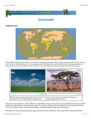
Ecoscenario: Cimarron National Grasslands<br />
4/16/03 3:09 PM<br />
Cimarron National Grassland<br />
INTRODUCTION<br />
Cimarron National Grassland is located in the southwest corner of Kansas. This grassland covers 44,500 hectacres<br />
(110,000 acres) in Morton and Stevens counties. The Cimarron River runs through the middle of Cimarron National<br />
Grassland. The Santa Fe Trail, an 1800s route from Missouri to Santa Fe, New Mexico, passes through the<br />
Cimarron National Grassland.<br />
Courtesy of U.S. Department of Agriculture, Forest Service<br />
The Santa Fe Trail was an important<br />
trade route between Missouri and New<br />
Mexico.<br />
The southwestern portion of the vast grassland of the central United States and Canada is classified as a<br />
shortgrass prairie. It was home to huge herds of grazing bison. Native Americans of the Great Plains depended on<br />
the bison for survival. They were nomadic and followed and hunted the great herds. Pronghorn antelope and elk also<br />
grazed across the prairie. The shortgrass prairie also provides excellent habitat for black-tailed prairie dogs,<br />
lesser<br />
prairie chickens, and black-footed ferrets.<br />
file:///Ecoscenario/cimarron/content.html<br />
Page 1 of 12
Ecoscenario: Cimarron National Grasslands<br />
4/16/03 3:09 PM<br />
As settlers began moving west, the grassland was converted to grazing lands for cattle. Over 100 years ago, the<br />
land of Cimarron National Grassland was a cattle ranch known as Point of Rocks Ranch, operated by the Beaty<br />
brothers. This was the first permanent settlement in the area. Around 1885, homesteaders began to settle in this<br />
area as well. The rolling grassland was turned into a sea of wheat and other grains.<br />
Years of cattle grazing and farming, followed by a drought, degraded the soils and made them unproductive. By the<br />
1930s many acres were barren. The strong winds that blow across the prairie swept up the loose soil, creating huge<br />
dust and sand storms. This area was part of the Dust Bowl, an area that covered parts of Kansas, Oklahoma, and<br />
Texas, named for the great dust storms. Morton County, where part of Cimarron National Grassland is, was one of<br />
the most devastated areas.<br />
Courtesy of U.S. Department of Agriculture, Forest Service<br />
Green area northwest of Elkhart, Kansas, is land in the Cimarron<br />
National Grassland.<br />
The U.S. government wanted to stabilize the soil so the land could be used again for agriculture. Healthy<br />
grasslands reduce soil erosion and water runoff and provide a dependable supply of summer forage for livestock and<br />
wildlife. The U.S. Congress approved the Bankhead-Jones Farm Tenant Act in 1937, allowing the government to buy<br />
some of this unproductive land with loose soil. The land was first administered by the U.S. Soil Conservation<br />
Service and in 1954 was turned over to the U.S. Department of Agriculture Forest Service. The former Point of<br />
Rocks Ranch became Cimarron National Grassland in 1960. It is the largest tract of public land in Kansas.<br />
Cimarron National Grassland is now a mixed-grass and shortgrass prairie. Riparian plant communities occur along<br />
the Cimarron River. Pronghorn antelope, bison, white-tailed deer, and cattle graze the land. This section of Kansas<br />
is at the heart of a major bird migration route. The surrounding land is primiarly agricultural, so Cimarron National<br />
Grassland serves as an important wintering island for birds.<br />
ABIOTIC DATA<br />
The climate of Cimarron National Grassland is semiarid, with warm summers and cold, dry winters. Winds blow<br />
across the grasslands, which makes the soil even drier. The growing and grazing season in this ecosystem is<br />
between April and September.<br />
file:///Ecoscenario/cimarron/content.html<br />
Page 2 of 12
Ecoscenario: Cimarron National Grasslands<br />
4/16/03 3:09 PM<br />
Cimarron National Grassland receives only around 25 centimeters (10 inches) of precipitation annually. Winds blow<br />
across the prairie at speeds up to 24 kilometers per hour (15 miles per hour). Moving air increases the rate of<br />
evaporation, causing plants to use water more quickly.<br />
About one-third of the annual rainfall occurs in the summer months of July and August.<br />
More precipitation falls during the summer than winter. Summer temperatures average 25°C (77°F); winter<br />
temperatures average 3°C (37°F). Precipitation can fall as rain or snow.<br />
file:///Ecoscenario/cimarron/content.html<br />
Page 3 of 12
Ecoscenario: Cimarron National Grasslands<br />
4/16/03 3:09 PM<br />
Hot summers and cold winters are typical for Cimarron National Grassland.<br />
Grass fires are an essential part of grassland ecosystems. Fire quickly breaks down organic material and returns<br />
minerals to the soil. Fires start naturally from lightning strikes. They quickly burn through dead grass and forbs and<br />
are spread by high prairie winds. Native Americans understood the importance of grass fires and often set them.<br />
They used them to clear lands and drive bison herds to areas where they were easier to kill. Until homesteaders<br />
actively fought the fires to protect buildings and crops, grass fires annually swept across the prairie.<br />
BIOTIC DATA<br />
Cimarron National Grassland is a shortgrass prairie grassland. The landscape is dominated by wide expanses of<br />
grass-covered prairie. Some of the dominant grasses are blue grama, side-oats grama, and buffalo grass. Side-oats<br />
grama is the tallest, growing 0.3–1 meters (1–3.5 feet) tall. It makes excellent nesting material for birds and small<br />
rodents and the seeds and leaves are good forage. Blue grama is a little bit shorter, growing 0.3–0.6 meters (1–2<br />
feet) tall. It is also good forage and nesting material. Buffalo grass is shortest, only 10–30 centimeters (4–12<br />
inches) tall. It spreads across the ground with creeping runners called stolons. While buffalo grass is a poor forage<br />
and nesting material for birds and small mammals, it is important food for pronghorn antelope, bison, cattle, and<br />
other grazing animals. The root systems of prairie grasses grow deeply into the soil. The deep roots survive fires<br />
that destroy the exposed top.<br />
Other range plants found growing among the grass at Cimarron are western ragweed, common sunflower,<br />
prickly<br />
pear cactus, sagebrush, and western buckwheat. A few trees dot the landscape, such as the cottonwood tree,<br />
Osage orange, and eastern red cedar. Trees are usually found growing along stream banks, near water wells, or<br />
near ponds. Most sapling trees in the open grassland burn before they can grow large enough to withstand a grass<br />
fire.<br />
file:///Ecoscenario/cimarron/content.html<br />
Page 4 of 12
Ecoscenario: Cimarron National Grasslands<br />
4/16/03 3:09 PM<br />
Some of the birds found at Cimarron are western meadowlark, horned lark, ferruginous hawk, golden eagle, and the<br />
lesser prairie chicken. The larks and lesser prairie chickens depend on the seeds produced by the grasses and<br />
other range plants. Prairie chickens were once extremely abundant in Cimarron, but their numbers have declined<br />
since the 1800s. Their decline is primarily the result of habitat loss, as land was cleared for agriculture. The use of<br />
herbicides and increased periods of drought have further reduced their habitat.<br />
Prairie dog towns were once common on the shortgrass prairie. Black-tailed prairie dogs live in a network of<br />
underground tunnels and chambers. Multiple entrances help ventilate the town and provide escape routes from<br />
predators and grass fires. A large prairie dog town may cover thousands of acres. In the late 1800s it is estimated<br />
that 280 million hectares (700 million acres) of the Great Plains was covered by prairie dog towns. Today 90–95%<br />
have been lost to agriculture or human development. There are only about 610,000 hectares (1.5 million acres) of<br />
prairie dog towns today. Their burrows are also home to black-footed ferrets, whose primary food source is prairie<br />
dogs. As the prairie dog towns declined, so did the populations of ferrets.<br />
Ranchers see prairie dogs as pests. Prairie dog towns make rangeland unusable by cattle. Few plants grow in<br />
prairie dog towns, and the ground is filled with holes that cattle may step in and injure themselves. Ranchers and<br />
recreational hunters often kill prairie dogs. When traps or baits are used, these also kill the black-footed ferrets. The<br />
reduced numbers of prairie dogs in a town means that there is less food for the ferrets.<br />
Courtesy of Nebraska Game and Wildlife Commission<br />
Black-footed ferrets once lived<br />
throughout the Great Plains.<br />
Black-footed ferrets are a rare sight.<br />
Courtesy of LuRay Parker, U.S. Fish and Wildlife Service<br />
The black-footed ferret is the rarest mammal in North America. The Endangered Species Act protects endangered<br />
file:///Ecoscenario/cimarron/content.html<br />
Page 5 of 12
Ecoscenario: Cimarron National Grasslands<br />
4/16/03 3:09 PM<br />
animals like the black-footed ferret by outlawing hunting of the animals and conserving important habitat.<br />
Black-footed ferrets are making a slow comeback through captive breeding programs.<br />
The black-footed ferret was thought to be extinct in the wild until a population was discovered in Wyoming in 1981.<br />
Today, captive breeding programs at zoos around the United States are helping the ferret make a comeback. In<br />
1991, some black-footed ferrets were released into the wild in Wyoming, Montana, and South Dakota. Small<br />
populations of ferrets, about 220 animals, can be found in these states.<br />
The shortgrass praire is also home to plains pocket gophers. They live underground, but not in elaborate tunnels<br />
like prairie dogs. Pocket gophers have fur-lined cheek pouches where they carry grass seeds they collect. Prairie<br />
rattlesnakes, active year round, may search all these burrows and tunnels for food.<br />
The swift fox and black-tailed jackrabbit are small mammals found in Cimarron National Grassland. The swift fox,<br />
sometimes called a kit fox, is an omnivore. It can run 40 kilometers per hour (25 miles per hour) over small<br />
distances. The black-tailed jackrabbit is actually a hare. It lives in social groups of 25–30 and is active at night.<br />
Jackrabbits do not live in burrows. Both the swift fox and jackrabbit rely on speed and quick direction changes to<br />
escape predators.<br />
file:///Ecoscenario/cimarron/content.html<br />
Page 6 of 12
Ecoscenario: Cimarron National Grasslands<br />
4/16/03 3:09 PM<br />
Courtesy of Doug Canfield,<br />
U.S. Fish and Wildlife Service<br />
Courtesy of Jack Dykinga, U.S. Department of Agriculture<br />
Art Explosion<br />
Black-tailed prairie dog Pronghorn antelope American bison<br />
The American bison, the largest land animal in North America, has roamed the prairie since prehistoric times.It has<br />
been estimated that 30–200 million bison roamed the Great Plains in the 1700s and 1800s. With the westward<br />
expansion, bison were slaughtered for meat and hides. By 1885 there were only 500 bison left. They were at the<br />
brink of extinction, but in protected areas like Cimarron National Grassland they have recovered. There are now<br />
more than 65,000 bison.<br />
The grassland is also home to elk and pronghorn antelope. Pronghorns are extremely fast runners, able to maintain<br />
speeds of 110 kilometers per hour (70 miles per hour) for up to 4 minutes. A more usual cruising speed for them is<br />
50 kilometers per hour (30 miles per hour).<br />
ISSUES<br />
One issue in Cimarron National Grassland is how to deal with rangeland fires. Some people view fire as beneficial to<br />
the ecosystem, and believe it is a tool for management. Others feel fire is dangerous, and should be put out<br />
quickly.<br />
Fire ecosystems like Cimarron National Grassland<br />
Many ecosystems are adapted to fire. Natural fires caused by lightning help shape the grassland landscape. Fires<br />
move across the prairie quickly, burning dead grass, but not getting hot enough to damage the root system. Sapling<br />
trees trying to get a foothold in the grassland are destroyed in grass fires. Few animals are lost, as most can flee<br />
the fires. Grass quickly grows back, and animals return to a renewed, lush grassland.<br />
Fires affect animals in various ways. Most are able to outrun the fires, but a few slower animals may have trouble<br />
escaping a fast-moving fire. Fire also destroys the cover small mammals use to hide from predators. Animals that<br />
can fly or run from the immediate danger of the fire may benefit. Once the animals disperse from the burned area,<br />
their numbers are less concentrated. Disease cannot spread as easily, so there are fewer deaths due to illness.<br />
Burrowing animals, like prairie dogs and pocket gophers, or species that live near water, like amphibians, may be<br />
unaffected by fire.<br />
Many species of birds, such as the bobolink, western meadowlark, and grasshopper sparrow, thrive in the open<br />
grassland meadows with no woody vegetation. They avoid areas that have been recently burned, but return when<br />
grasses regrow.<br />
file:///Ecoscenario/cimarron/content.html<br />
Page 7 of 12
Ecoscenario: Cimarron National Grasslands<br />
4/16/03 3:09 PM<br />
Courtesy of University of Nebraska Cooperative Extension<br />
Fires are now set in grasslands as part of<br />
management practices.<br />
Courtesy of University of Nebraska Cooperative Extension<br />
Prescribed grass fires are closely monitored to<br />
prevent uncontrolled burning.<br />
Fire policy<br />
Historically, the western United States was covered with huge areas of grassland. Native Americans used fire to<br />
stimulate grass growth and to herd bison. Early settlers used fire to clear land for agriculture. But after lands were<br />
cleared, fires were suppressed to protect crops and structures. Fire destroyed food sources and habitat for animals,<br />
which the public thought would be bad for the ecosystem. In 1935, the U.S. Forest Service set a goal of making<br />
sure all fires were out by 10 a.m. the following day. This disruption to the natural recycling of nutrients may have<br />
been one of the contributors to the depletion of the soil in the 1930s Dust Bowl.<br />
The suppression of fire also allows dead grasses and debris to build up. Woody trees and shrubs start to invade<br />
grasslands. This sets the stage for larger and hotter fires. Hot, intense fires destroy root systems and sterilize the<br />
soil. It may take many years for grasses to regrow and wildlife to return following an intensely hot fire.<br />
As the importance of fire was better understood, a policy called "back to nature" or "let it burn" was adopted by the<br />
U.S. Forest Service and the National Park Service. In this policy, forest and grassland fires were permitted to burn<br />
themselves out. Many Americans criticized this policy after one-third of Yellowstone National Park burned 1988.<br />
The park was allowed to burn for 4 months. The only firefighting efforts were to protect buildings and structures in<br />
the park.<br />
Better understanding of the grassland ecosystem has taught the U.S. Forest Service the importance of fire.<br />
Prescribed burning, planned and controlled, has increased over the last 40 years. This means that park managers<br />
set small, controllable fires. These fires reduce the buildup of fire fuel like dead plants. With this fuel gone, larger<br />
fires cannot spread as easily, and burn out more quickly. Prescribed burns can also help control non-native plant<br />
species and return vital nutrients to the soil.<br />
The fires that occur in Cimarron National Grassland are called stand-replacement fires. The fire kills only the aboveground<br />
parts of the plants. Introduced plant species with shallow root systems, not adapted to grasslands, are<br />
destroyed. These controlled fires also keep down the growth of woody plants. Without fires, trees and shrubs would<br />
slowly begin to appear on the prairie, and slowly convert it to woodland.<br />
In 2000, many wildfires burned out of control across the United States. These fires destroyed over 2.5 million<br />
hectares (6.3 million acres), mostly in Idaho and Montana. While it may seem that there are more wildfires burning<br />
in the United States than ever before, there are actually many fewer than in 1850. Overgrazing and fire suppression<br />
have led to dense thickets of trees and shrubs in some areas, which differ from the open forests and grasslands<br />
found before 1900.<br />
file:///Ecoscenario/cimarron/content.html<br />
Page 8 of 12
Ecoscenario: Cimarron National Grasslands<br />
4/16/03 3:09 PM<br />
Art Explosion<br />
Art Explosion<br />
Many ecosystems are adapted to fire.<br />
Fires move quickly across an open grassland. The fire<br />
does not get hot enough to destroy roots of native<br />
grasses.<br />
One of the keys to restoring an area like Cimarron National Grassland is returning the area to its natural cycle of<br />
burning. The National Forest Service plans burns well in advance. Prescribed fires in spring 2001 ranged from 2 to<br />
200 hectares (5 to 500 acres), and covered a total of 884 hectares (2185 acres). The most common size was an<br />
area of 130 hectares (320 acres).<br />
All fires in Cimarron National Grassland are regulated. Visitors cannot build open fires. To cook food or to stay<br />
warm, park visitors must use charcoal fires or gas stoves.<br />
Courtesy of George Vanover, U.S. Department of Agriculture Forest Service<br />
A prescribed burn is carefully set to reduce the amount of<br />
fuel in an ecosystem.<br />
THE DEBATE<br />
Before making decisions that affect an ecosystem, it is important to gather information from a variety of sources.<br />
Below are the views of several individuals or groups that have an interest in the future of the Cimarron National<br />
Grassland. After each quote the hyperlink goes to the original source of the quote. Refer to these sites for more<br />
information.<br />
Use the information provided to decide where you stand on this debate.<br />
file:///Ecoscenario/cimarron/content.html<br />
Page 9 of 12
Ecoscenario: Cimarron National Grasslands<br />
4/16/03 3:09 PM<br />
DEBATE: Should fires be permitted to burn in natural areas like Cimarron National Grassland?<br />
People who support using prescribed fires to improve grassland<br />
Ross W. Gorte, specialist in natural resources policy, Environment and Natural Resources Policy Division, CRS<br />
Report for Congress, Forest Fires and Forest Health<br />
"Following the Yellowstone fires in 1988, however, the use of prescribed natural fire was halted. While one can<br />
question whether the prescriptions were sufficiently responsive to burning conditions (fuel moisture, precipitation,<br />
dry lightning, winds, etc.), the termination of prescribed natural fire policies may have been an overreaction to the<br />
public sentiment."<br />
http://www.cnie.org/nle/crsreports/forests/for-23.cfm<br />
U.S. Department of Agriculture Forest Service, Fire and Aviation Management<br />
"Fire has helped shape North America's wild areas for thousands of years—its presence is essential for the survival<br />
of many plants and animals. We've learned that the lack of periodic fire in many wild areas increases risks to<br />
society and the environment. Much of the danger of destructive fire can be reduced through the increased<br />
application of prescribed fire and the planned use of wildland fire."<br />
http://www.fs.fed.us/fire/fireuse/rxfire/ecology/index.html<br />
George Wuerthner, Smokey the Bear's Legacy on the West<br />
"No single human modification of the environment has had more pervasive and widespread negative consequences<br />
for the ecological integrity of North America than the suppression of fire. Fire suppression has destroyed the natural<br />
balance of the land more than overgrazing, logging, or the elimination of predators."<br />
http://www.fire-ecology.org/research/smokey_bear_legacy.htm<br />
U.S. Geological Survey Northern Prairie Wildlife Research Center, Effects of Fire in the Northern Great Plains:<br />
Effects of Fire on Upland Grasses and Forbs<br />
"One of the simplest and least expensive practices to improve poor quality grassland is prescribed burning."<br />
http://www.npwrc.usgs.gov/resource/2000/FIRE/GRASFORB.HTM<br />
Douglas H. Johnson, U.S. Geological Survey Northern Prairie Wildlife Research Center: Effects of Fire on Bird<br />
Populations in Mixed-Grass Prairie: A Proposed Conservation Strategy<br />
"Results presented here suggest a conservation strategy for the northern Great Plains involving prescribed burning.<br />
On large areas, such as wildlife refuges, only portions should be burned in any particular year, and these on a<br />
rotational basis. The same prescription would apply to smaller areas that can be considered as components in a<br />
landscape, such as waterfowl production areas. They should be burned periodically, but not all in the same year.<br />
That strategy will assure that in any given year habitats in a variety of successional stages will be available for a<br />
variety of breeding bird species.<br />
"Although true grassland birds suffer short-term habitat losses from a burn, they do require grassland, which in turn<br />
requires periodic fire for maintenance. Several of these species have suffered long-term population declines.<br />
Moreover, they typically do not attain high densities or reproduce successfully in habitats other than grassland, as<br />
do birds in the other two categories. Furthermore, these species generally have breeding distributions centered in<br />
the grasslands of the midcontinent."<br />
http://www.npwrc.usgs.gov/resource/1999/firebird/conserve.htm<br />
U.S. Forest Service ranger<br />
"Many plants are adapted to fire. Some plants have seeds that can only germinate after a fire, either because they<br />
need to be heated or because there is something in the smoke the triggers that response. Fires also kill shrubs and<br />
small trees that start to appear in grasslands in the absence of fire."<br />
U.S. Department of Agriculture Forest Service, Historic Fire Regimes<br />
http://www.fs.fed.us/r4/curlew/Caribou_main/Caribou/forest_plan/Deis/Chapter3/fire_management/<br />
chapter_3_fire_historic_fire_regimes.htm<br />
People who are opposed to using prescribed fires in grasslands<br />
Resident near a proposed burn area<br />
"Look at what happened near Lewiston, California, on July 2, 1999. Even when fire personnel are there to watch the<br />
file:///Ecoscenario/cimarron/content.html<br />
Page 10 of 12
Ecoscenario: Cimarron National Grasslands<br />
4/16/03 3:09 PM<br />
fire, it can get out of control. I can't afford to lose my wheat fields or my home to an out-of-control fire."<br />
Bureau of Land Management report, Procedures Not Followed in Escaped Prescribed Fire, BLM Investigative Team<br />
Concludes, July 26, 1999<br />
"The Lowden Ranch prescribed fire jumped over control lines and burned about 2,000 acres before being controlled<br />
five days after it started. It destroyed 23 residences, as well as other structures."<br />
http://www.fire.blm.gov/News/press.htm<br />
Christina Ward, staff writer, DisasterRelief.org<br />
"New Mexico's 'Cerro Grande' fire, as it was called, may have been one of the most controversial, sparking<br />
widespread debate about U.S. fire management policy.<br />
"The Cerro Grande fire began as a prescribed burn in Bandelier National Monument, set by the National Park<br />
Service on May 4, 2000. It was intended to clear away dry underbrush that might ignite a more dangerous blaze<br />
later in the season. The plan backfired.<br />
"More than 43,000 acres burned, and 25,000 people were forced to evacuate. The fire destroyed or damaged 115<br />
buildings at the Los Alamos National Laboratory, birthplace of the atomic bomb, and came very close to a building<br />
that contained radioactive tritium."<br />
http://www.disasterrelief.org/Disasters/010509losalamosyear/<br />
National Jewish Medical and Research Center, Acrid Smoke from Raging Wildfires Hazardous to Those with Lung,<br />
Heart Diseases<br />
"The winds that fan the flames of summertime wildfires also can distribute large plumes of thick smoke miles from<br />
the actual fire, causing lung and heart problems for those with chronic health problems.<br />
'People closest to the fires are most at risk. That's why individuals living and working in communities near wildfires<br />
are often evacuated,' explains Lisa Maier, M.D., a physician in the Division of Environmental and Occupational<br />
Health Sciences at National Jewish Medical and Research Center."<br />
http://www.nationaljewish.org/news/healthtips/wildfires.html<br />
Homeowner near Cimarron National Grassland<br />
"We moved to the prairie to get away from city pollution. When the prairie is on fire, it is as bad as a smog alert day<br />
in the city."<br />
NASA Earth Observatory, First global carbon monoxide (air pollution) measurements, April 30, 2000<br />
"Carbon monoxide is a gaseous by-product from the burning of fossil fuels, in industry and automobiles, as well as<br />
burning of forests and grasslands."<br />
http://earthobservatory.nasa.gov/Newsroom/NewImages/images_topic.php3?topic=atmosphere&img_id=4894<br />
Questions<br />
Which side of this debate do you support?<br />
What scientific evidence supports your position?<br />
After looking at the evidence, did you change your position? Please explain why.<br />
WEB LINKS<br />
U.S. Department of Agriculture, Cimarron National Grassland - http://www.fs.fed.us/r2/psicc/cim/<br />
Bureau of Land Management report, Procedures Not Followed In Escaped Prescribed Fire, BLM Investigative Team<br />
Concludes, July 26, 1999 - http://www.fire.blm.gov/News/press.htm<br />
Christina Ward, staff writer, DisasterRelief.org - http://www.disasterrelief.org/Disasters/010509losalamosyear/<br />
Congressional Research Service, CRS Report for Congress, Forest Fire Protection -<br />
www.cnie.org/nle/crsreports/<br />
file:///Ecoscenario/cimarron/content.html<br />
Page 11 of 12
Ecoscenario: Cimarron National Grasslands<br />
4/16/03 3:09 PM<br />
forests/for-34.pdf (PDF format)<br />
Douglas H. Johnson, U.S. Geological Survey Northern Prairie Wildlife Research Center, Effects of Fire on Bird<br />
Populations in Mixed-Grass Prairie: A Proposed Conservation Strategy - http://www.npwrc.usgs.gov/resource/1999/<br />
firebird/conserve.htm<br />
Flora and Fauna of the Great Plains - http://www.gpnc.org/floraof.htm<br />
George Wuerthner, Smokey the Bear's Legacy on the West - http://www.fire-ecology.org/research/<br />
smokey_bear_legacy.htm<br />
Kansas Department of Wildlife and Parks - http://www.kdwp.state.ks.us/<br />
NASA Earth Observatory, first global carbon monoxide (air pollution) measurements, April 30, 2000 -http://<br />
earthobservatory.nasa.gov/Newsroom/NewImages/images_topic.php3?topic=atmosphere&img_id=4894<br />
National Interagency Fire Center - http://www.nifc.gov/index.html<br />
National Jewish Medical and Research Center, Acrid Smoke from Raging Wildfires Hazardous to Those with Lung,<br />
Heart Diseases - http://www.nationaljewish.org/news/healthtips/wildfires.html<br />
Nebraska Cooperative Extension EC 98-148-A, Grassland Management with Prescribed Fire - http://<br />
www.ianr.unl.edu/pubs/range/ec148.htm<br />
Prairie Parcel Restoration - http://www-ed.fnal.gov/help/prairie/Prairie_Res/care_main.html<br />
Ross W. Gorte, CRS Report for Congress, Forest Fires and Forest Health - http://www.cnie.org/nle/crsreports/<br />
forests/for-23.cfm<br />
Santa Fe National Historic Trails - http://www.nps.gov/safe/fnl-sft/webvc/vchome2.htm<br />
Santa Fe National Historic Trails, Point of Rocks, Cimarron National Grassland, Kansas - http://www.nps.gov/safe/<br />
fnl-sft/photos/kspages/ptroxks.htm<br />
U.S. Department of Agriculture Forest Service, Fire and Aviation Management - http://www.fs.fed.us/fire/fireuse/<br />
rxfire/ecology/index.html<br />
U.S. Department of Agriculture Forest Service, Fire and Aviation Management, News and Information - http://<br />
www.fs.fed.us/fire/news_info/<br />
U.S. Department of Agriculture Forest Service, Historic Fire Regimes - http://www.fs.fed.us/r4/curlew/<br />
Caribou_main/Caribou/forest_plan/Deis/Chapter3/fire_management/<br />
chapter_3_fire_historic_fire_regimes.htm<br />
U.S. Fish and Wildlife Service, Mountain-Prairie Region, Black-Footed Ferret Recovery: At the Crossroads, April<br />
1995 - http://mountain-prairie.fws.gov/feature/ferrets.html<br />
U.S. Geological Survey Northern Prairie Wildlife Research Center, Effects of Fire in the Northern Great Plains;<br />
Effects of Fire on Upland Grasses and Forbs - http://www.npwrc.usgs.gov/resource/2000/FIRE/GRASFORB.HTM<br />
file:///Ecoscenario/cimarron/content.html<br />
Page 12 of 12
Ecoscenario: Delaware Water Gap National Recrational Area<br />
4/16/03 3:11 PM<br />
Delaware Water Gap National Recreation Area<br />
INTRODUCTION<br />
The Delaware Water Gap National Recreation Area is a 64.3-kilometer (40-mile) stretch of the middle Delaware<br />
River, bordering the states of New Jersey and Pennsylvania. The Delaware River is the largest free-flowing river in<br />
the eastern United States, one of the few remaining in North America. There are no dams to block this river as it<br />
winds between mountain ridges and down river valleys to the ocean. The Delaware River is in the center of a<br />
watershed that covers 21,789 square kilometers (13,539 square miles) of Delaware, New York, New Jersey, and<br />
Pennsylvania. The Delaware River originates in the Catskill Mountains of New York and flows into Delaware Bay<br />
between Delaware and New Jersey.<br />
file:///Ecoscenario/delgap/content.html<br />
Page 1 of 14
Ecoscenario: Delaware Water Gap National Recrational Area<br />
4/16/03 3:11 PM<br />
Courtesy of National Park Service<br />
The Delaware Water Gap is known for the steep slopes and cliffs on either<br />
side of the river.<br />
The Delaware Water Gap National Recreation Area has always attracted people with its beauty and natural<br />
resources. The earliest known inhabitants in this region, the Lenni-Lenape Indians, made their home here before the<br />
arrival of European settlers.<br />
In early colonial times Dutch settlers mined the mountains for copper. The mountain ridges were sites for forts<br />
during the French-Indian War, and remnants of Revolutionary and Civil War cemetaries can still be found. Forty<br />
kilometers (25 miles) of the 3476-kilometer (2160-mile) Appalachian Trail runs along the ridge tops in the Delaware<br />
Water Gap National Recreation Area. In the late 19th century, the area was a popular resort and vacation area for<br />
tourists from Philadelphia and New York City. Later, the area was used in silent movies, and became the home of<br />
numerous family and youth summer camps.<br />
The Delaware Water Gap National Recreation Area borders 64 kilometers (40 miles) of the Delaware River, and<br />
covers 28,000 hectares (69,000 acres) in New Jersey and Pennsylvania. This park was established on September<br />
1, 1965, for public recreational activities, to preserve scenic and scientific resources, and to protect the area around<br />
the proposed Tocks Island Dam and Reservoir. In 1978, part of the Delaware Water Gap National Recreation Area<br />
was designated a National Wild and Scenic River. After years of planning and public opposition, plans for the<br />
controversial dam and reservoir were abandoned in 1992. The recreation area focuses on outdoor activities such as<br />
boating, fishing, canoeing, and swimming.<br />
file:///Ecoscenario/delgap/content.html<br />
Page 2 of 14
Ecoscenario: Delaware Water Gap National Recrational Area<br />
4/16/03 3:11 PM<br />
Courtesy of National Park Service<br />
The Delaware Water Gap National<br />
Recreational Area is a popular spot for<br />
water sports, such as fishing.<br />
The Delaware Water Gap National Recreation Area is within a day's drive of 60 million people. In 1994, there were<br />
4.37 million visitors to the Delaware Water Gap, compared to 3.4 million in Yellowstone National Park that same<br />
year.<br />
Courtesy of National Park Service<br />
Trails through riparian forest line the riverbanks.<br />
Courtesy of National Park Service<br />
Small streams throughout the watershed feed into<br />
the Delaware River.<br />
The Delaware River is one of the cleanest rivers in the United States. The Delaware Water Gap National Recreation<br />
Area is an example of a freshwater ecosystem. This aquatic ecosystem is bordered by a riparian (river) forest buffer.<br />
A riparian forest buffer is a band of trees, shrubs, and native vegetation that borders a stream or river. The buffer<br />
zone protects the waterway by trapping and filtering pollutants as the groundwater flows through the subsurface.<br />
Together, the river and the buffer zone make up the freshwater ecosystem.<br />
file:///Ecoscenario/delgap/content.html<br />
Page 3 of 14
Ecoscenario: Delaware Water Gap National Recrational Area<br />
4/16/03 3:11 PM<br />
ABIOTIC DATA<br />
Summers at Delaware Water Gap National Recreation Area are warm and humid, and winters are cold. Average<br />
summer air temperatures range between 17 and 23°C (62 and 73°F). Water temperatures are similar, but drop a few<br />
degrees as the water tumbles through ravines. Thunderstorms and dense fog are common in the summer.<br />
Sometimes large volumes of cold water flow down the river when excess water is released from Cannonsville<br />
Reservoir on the West Fork of the Delaware River in New York. This causes the water temperature in the Delaware<br />
River to drop.<br />
The Delaware Water Gap has cold winters. Air temperatures range between -2°C and 2.5°C (28 and 36.5°F). Water<br />
temperature drops to freezing, and most of the river is covered in ice each winter. Snow and ice storms are<br />
common.<br />
file:///Ecoscenario/delgap/content.html<br />
Page 4 of 14
Ecoscenario: Delaware Water Gap National Recrational Area<br />
4/16/03 3:11 PM<br />
Mountain elevations in the Delaware Water Gap National Recreation Area range between 150 and 430 meters (500<br />
and 1500 feet). Delaware River water depth is measured in Montague, New Jersey. Normally, the water is 1.5–2<br />
meters (5–6 feet) deep, but during floods the water can reach 7.5 meters (25 feet) deep. Floods occur because of<br />
stormy weather or because water has been released from an upstream reservoir, like the Cannonsville Reservoir in<br />
New York.<br />
The water in the Delaware Water Gap is generally smooth and quick-flowing. There are a few small rapids, but most<br />
of the river is a series of shallow riffles and quiet pools. The river substrate is pebbles and cobbles deposited by<br />
ancient glaciers.<br />
BIOTIC DATA<br />
The river, streams, and ponds of the Delaware Water Gap are bordered by a riparian forest dominated by eastern<br />
hemlock. The hemlock forest is intermingled with other species of tress, such as white pine, sugar maple, birch,<br />
and oak. This thick canopy of trees shades the water and helps produce the cool water temperatures and low light<br />
levels preferred by brook trout. The hemlock trees are also important bird breeding habitat, especially for the<br />
Blackburnian warbler, winter wren, and other songbirds. In June, flame azaleas burst into bloom and cover sunny<br />
hillsides. In summer, berry vines supplement the diet of black bears and raccoons.<br />
Along the banks of streams and calm pools, narrow-leaf cattails grow. They provide shelter and protection for many<br />
small animals. Near the water you might find amphibians like slimy salamanders and American toads. Amphibians<br />
breathe through their skin, which must stay moist for this gas exchange to occur. In the pond shallows, great blue<br />
herons hunt, and mallard ducks dabble. Northern water shrews dive from the stream's edge into the water to look for<br />
insects and small fish.<br />
Beavers haul logs from the surrounding forest to the water to build their lodges and dams. Common map turtles<br />
bask on the partially submerged logs of beaver dams and lodges. Some abandoned beaver lodges may be occupied<br />
by minks that forage along the riverbank.<br />
file:///Ecoscenario/delgap/content.html<br />
Page 5 of 14
Ecoscenario: Delaware Water Gap National Recrational Area<br />
4/16/03 3:11 PM<br />
Courtesy of the National Park Service<br />
Tree diversity in the hemlock forests at the Delaware<br />
Water Gap National Recreation Area.<br />
Courtesy of the National Park Service<br />
Plant diversity in the hemlock forests at the<br />
Delaware Water Gap National Recreation Area.<br />
The surface of a summer pond might be covered in small insects, mayflies, each only 2.5 centimeters (1.0 inches)<br />
or less in length. Mayflies spend most of their lives as nymphs, clinging to underwater plants and eating algae and<br />
detritus. When they molt and emerge as adults, they live only a few hours or days. The mayflies floating on the<br />
water are the adults that have already mated and laid their eggs.<br />
A closer look at the water and at the rocks in it reveals a film of blue-green algae. These cyanobacteria are<br />
important producers in a freshwater ecosystem. Blue-green algae are very sensitive to changes in water nutrient<br />
levels. For instance, an increase in nitrogen can cause algae to grow rapidly. This is called an algal bloom. When<br />
the massive population of algae dies, the decomposition process can consume all the oxygen in the water. Such<br />
blooms decrease the amount of oxygen available to other organisms in the water.<br />
Howard Evans, Gillette Entomology Club at<br />
Colorado State University<br />
An adult mayfly rests on a plant stem.<br />
The rocks, vegetation, and mud of the stream bottom are covered with organisms. Tiny crustaceans called scuds,<br />
only 5–20 mm (0.2–0.8 inches) long, swim through the vegetation. Aquatic snails scrape algae off submerged plant<br />
stems and rocks. Freshwater mussels live in the muddy stream bottom, and get their food by siphoning water and<br />
file:///Ecoscenario/delgap/content.html<br />
Page 6 of 14
Ecoscenario: Delaware Water Gap National Recrational Area<br />
4/16/03 3:11 PM<br />
mud and filtering out plankton, algae, and detritus. In the early summer, tiny black tadpoles, larvae of the American<br />
toad, and other amphibians feed on plankton and algae. Wolf spiders lurk in the vegetation, waiting to capture<br />
another meal.<br />
Courtesy of National Park Service<br />
A bald eagle on the lookout for a fish dinner.<br />
Gerard Lacz, Animals Animals<br />
Brook trout are prey to bald eagles, bears, and<br />
humans.<br />
Farther out in the water, where it is deeper and cooler, brook trout lurk in the shade of the hemlock tree. They live in<br />
the gravely riverbeds where the water is clear and cool. The brook trout is a major predator of bottom-dwelling<br />
invertebrates and land-dwelling insects that fall into the water. Channel catfish live and feed along the muddy<br />
bottoms of ponds and rivers. Smallmouth bass swim in deeper water, and catch larger prey like frogs and smaller<br />
fish. These fish are eaten by still larger animals, like bald eagles and black bears.<br />
Freshwater ecosystems, like that at the Delaware Water Gap National Recreation Area, have intermediate<br />
levels of primary productivity, as compared to other ecosystems.<br />
Annual productivity, or the amount of energy provided by the producers in this ecosystem, is intermediate, about<br />
2400 kilocalories/square meter/year of blue-green algae and plant material. The productivity in this ecosystem<br />
changes with abiotic conditions such as temperature, depth, and water quality.<br />
file:///Ecoscenario/delgap/content.html<br />
Page 7 of 14
Ecoscenario: Delaware Water Gap National Recrational Area<br />
4/16/03 3:11 PM<br />
ISSUES<br />
Although today the Delaware River is one of the cleanest rivers in the United States, pollution from industry and<br />
urbanization has taken its toll on this river since the 1700s. Early settlements along the river dumped raw sewage<br />
directly into the water, and thousands of people died every year from waterborne diseases. As industrialization<br />
increased in the watershed, it became a polluted disaster area. By the 1940s,chemical factory wastes and<br />
untreated human sewage had fouled the river so badly that no fish could survive in its oxygen-depleted waters.<br />
Many efforts were undertaken to clean up the Delaware River, with little impact. In 1962, the Delaware River Basin<br />
Comission was created and combined the efforts of New York, New Jersey, Delaware, and Pennsylvania. In 1972,<br />
the Commission received $1 billion in federal grants under the Water Pollution Control Act, and the river began its<br />
dramatic comeback.<br />
While the efforts and results of the Delaware River cleanup are a victory for clean waterways, the issue has not<br />
gone away. New and unforeseen threats are arising for the Delaware River and many other rivers in North America.<br />
Courtesy of National Park Service<br />
Invertebrates are indicators of stream health because they are the first organisms to<br />
be affected by pollutants. Data on the number of invertebrate species, such as those<br />
shown above, can be used to locate problem spots early.<br />
While the water in the Delaware River is clean, the years of industrial pollution have left a legacy in the river bottom.<br />
Pollutants such as PCBs, mercury, lead, DDT, and other pesticides remain in river-bottom detritus. Invertebrates,<br />
such as scuds and zooplankton, feed on detritus and ingest the pollutants. These pollutants work up the food chain<br />
and are concentrated in fish and the fishes predators: bald eagles, black bears, and humans.<br />
Other threats to the river are ongoing. During storms, pollution from the land in the watershed is washed into the<br />
river. This includes herbicides and pesticides, fertilizers, and mine tailings. The most damaging is what is called<br />
point-source pollution. These direct discharges come from sewage treatment plants, factories, chemical and power<br />
plants, paper mills, and refineries. Increased regulations for industry and agriculture increase the cost for those<br />
goods and services to consumers.<br />
file:///Ecoscenario/delgap/content.html<br />
Page 8 of 14
Ecoscenario: Delaware Water Gap National Recrational Area<br />
4/16/03 3:11 PM<br />
The Delaware Water Gap National Recreation Area is in a part of Pennsylvania that experiences acid precipitation.<br />
This "acid rain" affects all the watersheds in this part of Pennsylvania.<br />
Acid rain<br />
In the 1960s, people began to notice changes in normally productive lakes. Populations of fish and other aquatic<br />
organisms were declining. Trees that bordered lakes and streams were dying. This was happening not only in the<br />
United States and Canada, but also in Europe, Asia, and Australia. All of the affected areas were downwind from<br />
industrial centers.<br />
Courtesy of U.S. Environmental Protection Agency<br />
Rainwater, naturally acidic, has a pH between 5 and<br />
5.6. Acid rain, pH 4, is ten times more acidic than<br />
rainwater.<br />
Scientists suggested that pollution from factories and automobiles is poisoning the water in lakes and streams.<br />
Factory and automobile pollution frequently contains sulfur dioxide and nitrogen oxide gases. These gases rise into<br />
the air, where they dissolve in droplets of atmospheric water to form sulfuric acid and nitric acid. When this acid<br />
falls with rain, snow, sleet, hail, or fog, it is called acid precipitation.<br />
file:///Ecoscenario/delgap/content.html<br />
Page 9 of 14
Ecoscenario: Delaware Water Gap National Recrational Area<br />
4/16/03 3:11 PM<br />
Why is acid rain such a problem?<br />
An acid is a chemical that in a water solution tastes sour and reacts easily with many other substances. Lemon<br />
juice, vinegar, and hydrochloric acid are acids. Lemon juice and vinegar are dilute acids, and hydrochloric acid is<br />
strong. Acidity is a measurement of how many charged hydrogen ions are in a solution. This is called pH, and it is<br />
measured on a scale of 1 to 14. Solutions with a pH between 1 and 6.9 are acidic, and those between 7.1 and 14<br />
are basic. Liquids with a pH of 7, like pure water, are neutral. There is a tenfold difference between each number on<br />
the scale. So a solution with a pH close to 2, like lemon juice, is ten times more acidic than a solution with a pH 3.<br />
Rainwater is naturally a little bit acidic, pH 5–5.6. Normally, rainwater picks up some minerals as it flows through<br />
the ground to lakes and streams. The pH of a lake or stream depends in part on what rocks and minerals are in the<br />
watershed and the river bottom. Some rocks, like limestone, are basic and neutralize acids. Most healthy lakes and<br />
streams have a pH between 7 and 9.2.<br />
Courtesy of National Atmospheric Deposition Program<br />
This map shows the pH of rain that fell in the United States in 1994.<br />
Acid precipitation, or acid rain, officially has a pH less than 5.6. However, the pH of acid rain can be as low as that<br />
of lemon juice or vinegar. Acid rain may fall directly into a lake or stream, or flow there as runoff from the watershed.<br />
If the lake contains limestone bedrock, the acid is neutralized for a while. However, eventually all the neutralizing<br />
capacity, or buffer, in the bedrock is used up, and the pH of the lake or stream begins to drop. When it receives<br />
acid precipitation, the pH of a lake can drop from 9.2 to below 4.5 in less than 10 years.<br />
file:///Ecoscenario/delgap/content.html<br />
Page 10 of 14
Ecoscenario: Delaware Water Gap National Recrational Area<br />
4/16/03 3:11 PM<br />
Courtesy of National Atmospheric Deposition Program<br />
This map shows the pH of rain that fell in the United States in 2001. While areas of the<br />
northeastern United States are seeing less acid rain, it has increased in the southeastern<br />
United States.<br />
Plants and animals can live only within a certain pH range. Aquatic plants grow best between pH 7 and 9.2. As the<br />
pH drops to 6.0, crustaceans, insects, and some plankton are negatively affected. When the pH of a lake drops<br />
below 5.5, mussels and aquatic snails are affected. Acidic water will even begin dissolving their shells. When the<br />
pH drops to 5.0, some frogs and fish have died, and plants that prefer acidic conditions, such as mosses, invade<br />
the area. When the pH falls below 4.5, all fish die and the water contains few animals or microorganisms. Acid rain<br />
decreases habitat quality, because the ponds are no longer habitable by aquatic animals, and no longer provide<br />
food to forest animals that go there to feed.<br />
Acid rain dissolves nutrients and minerals out of the soil and washes them away. Without the proper nutrients,<br />
plants cannot grow as vigorously and may become weak. Acid rain also dissolves toxic minerals from the soil.<br />
These toxic minerals may accumulate in groundwater or in ponds, further stressing organisms. They may also<br />
block a plant's access to important minerals or clog stomata, making gas exchange and photosynthesis difficult.<br />
Such conditions also encourage the growth of pests and fungi on plants.<br />
What has happened in this issue?<br />
In 1990, laws were passed and other programs were started to help reduce acid rain. Due to these measures, sulfur<br />
dioxide emissions have dropped. However, the nitrogen oxide levels have not changed. In order to see real recovery,<br />
the amount of nitrogen oxide would need to drop, too.<br />
Efforts to keep the Delaware River clean continue. A current project to dredge the lower Delaware to make it deeper<br />
has met resistance from the public. They fear that the dredging will stir up more of the old pollutants buried under<br />
the mud.<br />
New power plants<br />
file:///Ecoscenario/delgap/content.html<br />
Page 11 of 14
Ecoscenario: Delaware Water Gap National Recrational Area<br />
4/16/03 3:11 PM<br />
Reliant Power wants to build a power plant just south of Portland, Pennsylvania. This is only a few miles from the<br />
Delaware Water Gap. The company already owns two other power plants in this area. The power generated at the<br />
new plant would not be used in Pennsylvania, but would be sold to New York and New Jersey. These states have<br />
stricter environmental protection measures than Pennsylvania does. Reliant Power's plants in Pennsylvania are<br />
currently the worst sources of pollution in the area. Power plants increase the amount of particulate matter in the air<br />
and produce nitrogen oxide and sulfur dioxide. They also reduce water levels, create noise pollution, and produce<br />
steam that makes foggy and hazy conditions.<br />
THE DEBATE<br />
Before making decisions that affect an ecosystem, it is important to gather information from a variety of sources.<br />
Below are the views of several individuals or groups that have an interest in the future of the Delaware Water Gap<br />
National Recreation Area. After each quote the hyperlink goes to the original source of the quote. Refer to these<br />
sites for more information.<br />
Use the information provided to decide where you stand on this debate.<br />
DEBATE: Should there be stricter control of pollution and acid rain sources?<br />
People who believe regulations are strict enough<br />
Housing developer<br />
"If my company plans to build a new housing development we have to pay extra to support a bigger waste treatment<br />
plant and nonpoint source pollution. Nonpoint source pollution is pollution they can't determine where it comes from.<br />
It's not even pollution because of our development. This is going to make the price of the new homes go even<br />
higher."<br />
U.S. Environmental Protection Agency, Nonpoint Source News-Notes, Notes on Watershed Management, Urban<br />
Watershed Bill Introduced, May/June 1994 Issue #36<br />
"The first prong requires that an applicant for Commission project approval submit and implement nonpoint source<br />
pollution control plans for new or increased nonpoint source loads generated in a project's new or expanded service<br />
area. For example, if a wastewater treatment plant project of 10,000 gallons per day or greater is proposed to serve<br />
a new housing development, a nonpoint source control plan for the housing development serviced by that plant must<br />
be implemented. Water supply projects greater than 100,000 gallons per day and selected other types of projects in<br />
the drainage area to Special Protection Waters are similarly affected."<br />
http://www.epa.gov/owow/info/NewsNotes/issue36/nps36wat.html<br />
Homeowner in Delaware River watershed<br />
"Our town was built a hundred years ago with an old-fashioned sewage system. They would have to tear up the<br />
whole town to replace it with a new one. We're just a small community, we couldn't be adding that much pollution<br />
anyway. All the new regulations for factories and new construction should take care of the problem without making<br />
us have to pay."<br />
Delaware Riverkeeper Network, fact sheet, Delaware River<br />
"Another hazard to the health of the river comes from point-source pollution—direct discharges from municipal and<br />
industrial sewage treatment plants, power plants, chemical plants, paper mills, refineries, and refracteries. Most<br />
point-source dischargers have permits issued under the Clean Water Act and the National Pollution Discharge<br />
Elimination System. These permits limit the quantities and types of pollutants permitted to be contained in the<br />
wastewater. There are 1600 permitted discharge points in the Delaware Watershed. "<br />
http://www.delawareriverkeeper.org/factsheets/delaware.html<br />
Visitor to Delaware Water Gap National Recreation Area<br />
"I bring my family here so we can have fun. Now they are telling us we can't use our jet skis because they pollute<br />
the water. This is a recreation area and this is what we do for recreation."<br />
Cat Lazaroff, Jet Skis Banned in Most U.S. Parks<br />
"The National Park Service announced new rules today intended to reduce the impact of personal watercraft use in<br />
the National Park system. Still, some environmentalists say the regulations do not go far enough to protect<br />
waterways from pollution and damage caused by jet skis and other watercraft."<br />
http://ens-news.com/ens/mar2000/2000-03-21-06.asp<br />
file:///Ecoscenario/delgap/content.html<br />
Page 12 of 14
Ecoscenario: Delaware Water Gap National Recrational Area<br />
4/16/03 3:11 PM<br />
People who believe regulations should be stricter:<br />
Division of Research and Resource Planning, 1998 Natural Resources News, Delaware Water Gap National<br />
Recreation Area<br />
"Besides the obvious environmental justification for these extremely stringent regulations, economic benefits are<br />
protected as well. Direct economic benefits derived from river recreation in this reach of the Delaware are estimated<br />
to exceed $70 million per year and growing. Benefits include the employment of hundreds of persons in the canoe<br />
livery and fishing guide business sectors and thousands in the service/tourism sector."<br />
http://www.nps.gov/dewa/InDepth/NRnews/natnews1.html<br />
President Bill Clinton to U.S. Representative Rush Holt (D-NJ)<br />
"As you know, the future of the Delaware River, the longest free-flowing river in the eastern United States, is vital to<br />
the economy of the regions surrounding this important waterway. Wild and Scenic River designation will encourage<br />
natural and historic resource preservation and protect precious open space. By allowing local municipalities to<br />
sustain and protect the Delaware River as one of our nation's national treasures, this law will help to ensure the<br />
vitality of these communities and the quality of life of their citizens."<br />
http://www.state.nj.us/drbc/wild_scenic.htm<br />
Sport fisherman on the Delaware River<br />
"The river water looks very clean, but they tell us we shouldn't eat the fish because they have mercury and PCBs in<br />
them. They need to do more to clean up the sediments in the river."<br />
Study funded by the U.S. Environmental Protection Agency, Regions II & III, and the Delaware River Basin<br />
Commission<br />
"The report indicates that the current fish contamination problem cannot be attributed solely or predominantly to<br />
'historic' sediment contamination already in the estuary, as many resource managers have believed. Indeed, the<br />
active loading entering the estuary from sewage treatment plants, combined sewage outflows (CSOs), and<br />
tributaries is sufficient, independent of the PCBs already in estuary sediments, to cause water quality criteria<br />
exceedances and associated fish contamination."<br />
http://www.newhopepa.com/DelawareRiver/currentissues_2.htm<br />
Questions<br />
Which side of this debate do you support?<br />
What scientific evidence supports your position?<br />
After looking at the evidence, did you change your position? Please explain why.<br />
WEB LINKS<br />
National Park Service, Delaware Water Gap National Recreation Area - http://www.nps.gov/dewa/<br />
Cat Lazaroff, Jet Skis Banned in Most U.S. Parks - http://ens-news.com/ens/mar2000/2000-03-21-06.asp<br />
Courier-Post, A River's Rebirth - http://www.southjerseynews.com/river/<br />
Delaware River Basin Commission, Home Page - http://www.state.nj.us/drbc/drbc.htm<br />
Delaware River Basin Commission, The Delaware River Basin -<br />
http://www.state.nj.us/drbc/thedrb.htm<br />
Delaware Riverkeeper Network, fact sheet, Carrying Capacity in Delaware Water Gap National Recreation Area -<br />
http://www.delawareriverkeeper.org/factsheets/carrying_capacity.html<br />
Delaware Riverkeeper Network, fact sheet, Delaware River -<br />
http://www.delawareriverkeeper.org/factsheets/<br />
file:///Ecoscenario/delgap/content.html<br />
Page 13 of 14
Ecoscenario: Delaware Water Gap National Recrational Area<br />
4/16/03 3:11 PM<br />
delaware.html<br />
Delaware River, New Hope, Pennsylvania - http://www.newhopepa.com/DelawareRiver/currentissues_2.htm<br />
Division of Research and Resource Planning, 1998 Natural Resources News, Delaware Water Gap National<br />
Recreation Area, - http://www.nps.gov/dewa/InDepth/NRnews/natnews1.html<br />
Kathleen Kodish Reeder, National Park Service, Restoring a Watershed: Applying New Technology to Migrate Acid<br />
Mine Drainage in the Northeast - http://www2.nature.nps.gov/pubs/yir/yir2000/pages/07_new_horizons/<br />
07_02_reeder.html<br />
National Atmospheric Deposition Program, isopleth maps - http://nadp.sws.uiuc.edu/isopleths/<br />
National Park Service, Delaware Water Gap National Recreation Area, History - http://www.nps.gov/dewa/InDepth/<br />
CRindex.html<br />
National Park Service, Executive Summary: Lower Delaware River Management Plan - http://www.nps.gov/chal/sp/<br />
p07new1.htm<br />
National Park Service, New Projects at Delaware Water Gap National Recreation Area - http://www.nps.gov/phso/<br />
science/newprojDEWA.htm<br />
New Jersey's Great Northwestern Skylands, Delaware Water Gap National Recreation Area - http://<br />
www.njskylands.com/pkdwgnra.htm<br />
President Bill Clinton to U.S. Representative Rush Holt (D-N.J.) - http://www.state.nj.us/drbc/wild_scenic.htm<br />
U.S. Environmental Protection Agency, Nonpoint Source News-Notes, Notes on Watershed Management, Urban<br />
Watershed Bill Introduced, May/June 1994 Issue 36 - http://www.epa.gov/owow/info/NewsNotes/issue36/<br />
nps36wat.html<br />
file:///Ecoscenario/delgap/content.html<br />
Page 14 of 14
Ecoscenario: El Yunque Caribbean National Forest<br />
4/16/03 3:14 PM<br />
El Yunque Caribbean National Forest<br />
INTRODUCTION<br />
file:///Ecoscenario/elyunque/content.html<br />
Page 1 of 16
Ecoscenario: El Yunque Caribbean National Forest<br />
4/16/03 3:14 PM<br />
Courtesy ofFather Alejandro Sánchez<br />
The canopy of trees in El Yunque forms a green carpet that covers the mountains, Sierra de<br />
Luquillo.<br />
The island of Puerto Rico is a self-governing commonwealth under the jurisdiction of the United States. It is in the<br />
Caribbean Sea, 1,600 km (1,000 miles) southeast of Florida. On the eastern tip of Puerto Rico, 40 kilometers (24.8<br />
miles) from the capital of San Juan, is the Caribbean National Forest, commonly called El Yunque<br />
(el•YOONG•kay). It is the only tropical rain forest in the U.S. National Forest System. El Yunque Peak rises 1065<br />
meters (3494 feet) among the rugged, isolated mountians of Sierra de Luquillo. El Yunque gets its name from the<br />
cloud-shrouded mountain tops. The native Tiano people called these mountain tops "yuke," meaning "white lands."<br />
Courtesyof NASA<br />
The island of Puerto Rico is in the Caribbean Sea,<br />
southeast of Florida. Cloud cover marks the location of El<br />
Yunque.<br />
Courtesyof Father Alejandro Sánchez<br />
Dense forests were cut for shipbuilding in the<br />
19th century.<br />
El Yunque covers approximately 11,300 hectares (28,000 acres) of diverse vegetation. The forest was originally<br />
established in 1876 when Puerto Rico was still under Spanish rule. King Alfonso XII of Spain proclaimed El Yunque<br />
a forest reserve. It became one of the first reserves in the Western Hemisphere. He declared this reserve, not to<br />
file:///Ecoscenario/elyunque/content.html<br />
Page 2 of 16
Ecoscenario: El Yunque Caribbean National Forest<br />
4/16/03 3:14 PM<br />
preserve the diversity and beauty of El Yunque, but because the forests were filled with trees that were used to build<br />
ships. By declaring it a reserve, the lumber was protected from enemies that might make ships to fight the Spanish.<br />
This land passed to the United States in 1898, and was renamed the Luquillo Forest Reserve in 1903.<br />
ABIOTIC DATA<br />
Because Puerto Rico is south of the Tropic of Cancer, it has a tropical climate. There is no distinct wet or dry<br />
season at El Yunque; it rains year-round. The temperature and length of daylight remain fairly constant throughout<br />
the year. All these factors provide a year-round growing season.<br />
The elevations at El Yunque vary from about 100 to 1000 meters (300 to 3500 feet). The highest point is Pico del<br />
Toro, 1080 meters (3542 feet). Mountain slopes are very steep, often angling up at more than 45°. Temperatures do<br />
not vary much through the year. The temperature is warm, and ranges from 25.5 to 28°C (78 to 82°F) at lower<br />
elevations to highs of only 17.5°C (63.5°F) in the mountains.<br />
It rains daily at El Yunque, with slightly more rain in the winter. Average precipitation is 510 centimeters (200<br />
inches) per year. The amount of rainfall in Puerto Rico varies in relationship to El Yunque Peak. The peak creates a<br />
rain shadow. Trade winds bring heavy rainfall to El Yunque Peak and the rain forest, while San Juan, to the east,<br />
receives only 150 centimeters (60 inches) per year. On the south coast, Ponce receives only 91 centimeters (36<br />
inches) per year.<br />
file:///Ecoscenario/elyunque/content.html<br />
Page 3 of 16
Ecoscenario: El Yunque Caribbean National Forest<br />
4/16/03 3:14 PM<br />
Rainfall remains constant throughout most of the year.<br />
Day length does not vary much in the tropics. There are 11 to 13.25 hours of light each day throughout the year.<br />
The soil at El Yunque contains a lot of clay (45–75%). As in most tropical forests, most soil nutrients are in the top<br />
10 centimeters (4 inches). Nutrients are quickly washed away from soil by heavy rains.<br />
Tropical storms and hurricanes frequently pass over Puerto Rico and El Yunque. Both Hurricane Hugo in 1990 and<br />
Hurricane Georges in 1998 damaged the forest. Hurricane Georges was especially damaging, with winds over 185<br />
kilometers per hour (115 miles per hour), which knocked down trees and ruined buildings. This hurricane caused<br />
over $5 million in damage to El Yunque. Hurricane season in the Caribbean lasts from June to November.<br />
file:///Ecoscenario/elyunque/content.html<br />
Page 4 of 16
Ecoscenario: El Yunque Caribbean National Forest<br />
4/16/03 3:14 PM<br />
Courtesyof Father Alejandro Sánchez<br />
This opening in the canopy is the result of Hurricane Georges in 1998. In a few<br />
years the surrounding palms will close the gap.<br />
BIOTIC DATA<br />
El Yunque has four kinds of tropical forest: subtropical rain forest above 600 meters (1968 feet), cloud forest high in<br />
the mountains, high wet forest between these two, and lowland wet forest at the lower elevations. The subtropical<br />
rain forest is dominated by sierran palms and pumpwood trees; the cloud forest is dominated by dwarf trees.<br />
file:///Ecoscenario/elyunque/content.html<br />
Page 5 of 16
Ecoscenario: El Yunque Caribbean National Forest<br />
4/16/03 3:14 PM<br />
Courtesy ofFather Alejandro Sánchez<br />
Pumpwood trees have a characteristic<br />
umbrella shape.<br />
Courtesy ofFather Alejandro Sánchez<br />
Sierran palms form the forest canopy.<br />
In a tropical forest are four distinct layers, the forest floor, the understory, the canopy, and the emergent layer.<br />
The forest floor is covered with leaf litter, detritus, mushrooms, isopods, and insects. Leaves that fall on the forest<br />
floor may decompose in a few weeks rather than years. Nutrients are quickly absorbed by nearby plants or washed<br />
away by frequent rains.<br />
file:///Ecoscenario/elyunque/content.html<br />
Page 6 of 16
Ecoscenario: El Yunque Caribbean National Forest<br />
4/16/03 3:14 PM<br />
Courtesyof Father Alejandro Sánchez<br />
Damp leaf litter decomposes quickly.<br />
Courtesyof Father Alejandro Sánchez<br />
Damp conditions encourage algal growth on<br />
everything, including this Caracolus snail. Two<br />
smaller Nenia snails are grazing on the algae.<br />
Next is the understory, a mass of vines, dwarf trees, and plants that can survive in low light with very little air<br />
circulation. Plants rely on insects for pollination and produce large, sweet-smelling, and colorful flowers to attract<br />
pollinators. Many of the animals that pollinate these plants live their entire lives in the understory. Ants,<br />
twig dwarf<br />
anoles, geckos, walkingsticks, and giant crab spiders live in the understory.<br />
The larger trees make up the rain-forest canopy. These trees typically have large, deep-green leaves near the tops,<br />
like sierran palms and pumpwood trees. The dark leaves absorb most of the sunlight; only about 5% filters through<br />
to the understory. Rain and moisture that falls on the leaves drop to the forest floor. Epiphytes, like orchids and<br />
bromeliads, are plants that grow on other plants without ever touching the ground. They grow high in canopy trees<br />
to capture sunlight and obtain water and minerals from rainfall. Red-tailed hawks make their nests in the tall canopy<br />
trees, but feed on the abundant life of the understory. Endangered Puerto Rican parrots live in cavities of larger trees.<br />
The familiar "koooooooo-keee" call of the coqui frog can be heard throughout the canopy, understory, and forest<br />
floor. The coqui frog is a favorite among Puerto Ricans and is their unofficial national mascot. The populations of the<br />
Puerto Rican parrot and coqui frog have drastically decreased in Puerto Rico since the 1500s.<br />
file:///Ecoscenario/elyunque/content.html<br />
Page 7 of 16
Ecoscenario: El Yunque Caribbean National Forest<br />
4/16/03 3:14 PM<br />
Courtesy ofFather Alejandro Sánchez<br />
Coqui frogs climb up into trees at night, looking<br />
for food and mates. They jump back to the forest<br />
floor rather than climb down.<br />
Centipedes forage for prey on the forest floor.<br />
Courtesy ofFather Alejandro Sánchez<br />
The tallest trees make up the emergent layer, which rises above the dense canopy of shorter trees. These trees<br />
take advantage of increased air circulation and rely on wind pollination and winged seeds for seed dispersal. Thick,<br />
waxy leaves reduce the amount of water released through transpiration in the hot tropical sun.<br />
Each layer of the rain forest is characterized by a community of organisms and distinct food webs. Some animal<br />
populations do not move beyond the layer they live in. There are more than 200 species of birds found in Puerto<br />
Rico and many more species of insects and invertebrates.<br />
Invertebrates are especially diverse and numerous at El Yunque. Ants, beetles, butterflies, termites, spiders, and<br />
many other types of invertebrates are found in every forest layer. The climate is warm and moist enough for reptiles<br />
and amphibians such as the coqui frog, anoles, and geckos. Historical records show 22 kinds of mammals in<br />
Puerto Rico. While many still live in Puerto Rico today, such as the Jamaican fruit bat, many of the native species<br />
have disappeared, and nonnative mammals, such as rats and mongooses, are there instead. The larger predators<br />
include red-tailed hawks, tarantulas, and centipedes.<br />
file:///Ecoscenario/elyunque/content.html<br />
Page 8 of 16
Ecoscenario: El Yunque Caribbean National Forest<br />
4/16/03 3:14 PM<br />
Courtesy ofGerardo R. Camilo<br />
Red-tailed hawk and chick in a nest high in the<br />
canopy<br />
The densest vegetation grows along streams.<br />
Courtesy ofFather Alejandro Sánchez<br />
Plant and animal life at El Yunque is diverse, as you would expect for a tropical forest. However, El Yunque has<br />
fewer species than a mainland tropical forest, such as those in Central and South America. Islands have a smaller<br />
land area for organisms to use than mainlands do, and island populations are isolated from populations on the<br />
mainland. Over time these small populations have adapted to their unique environment. When populations of plants<br />
or animals are small, there is a greater chance that they will become extinct if too much pressure is placed on the<br />
population.<br />
Annual productivity, or the amount of energy provided by the producers in this ecosystem, is very high, 6750<br />
kilocalories/square meter/year. Because there is not much variation in day length, temperature, or precipitation,<br />
there are no seasons here. Plants can grow and flower year-round. Migrating birds visit the undisturbed core of El<br />
Yunque. These neotropical migrant birds are flying between their wintering grounds in Central and South America<br />
and their breeding grounds in North America.<br />
ISSUES<br />
The primary concern for tropical forests, including El Yunque, is how to deal with habitat loss and destruction in the<br />
past, present, and future. Worldwide, rain forests cover 6% of Earth's surface, yet contain half of all plant and<br />
file:///Ecoscenario/elyunque/content.html<br />
Page 9 of 16
Ecoscenario: El Yunque Caribbean National Forest<br />
4/16/03 3:14 PM<br />
animal species. That means they contain anywhere from 2 million to 20 million species. The rain forests, and the<br />
species that live in them, are being lost very rapidly. Each hour, about 3600 hectares (9000 acres) of rain forest are<br />
cleared. At the same time, six plant or animal species go extinct.<br />
On Puerto Rico, tropical forest once covered the island. About 85% of the forest was cleared for agriculture and<br />
urban development. Trees were sold for lumber and burned to make charcoal. Today, foresters use the Caribbean<br />
National Forest to study which trees would be good to grow and sell.<br />
The decline of the Puerto Rican parrot and coqui frog indicate that this tropical system might be in trouble.<br />
Biologists blame habitat loss and hunting for the decline of these animals. The Puerto Rican parrot makes its nest<br />
in cavities of very large trees. With the removal of most of the rain forest, only small patches of large trees<br />
remained. El Yunque still has a large enough forest to support the large trees needed by the parrots.<br />
As the forests become more fragmented into smaller patches, they can support smaller and smaller populations of<br />
organisms. When populations are small, the effects of hurricanes, parasitic flies, competition, and predation are<br />
more devastating.<br />
Eighty percent of the life-forms in tropical rain forests have not been named or scientifically identified. Some live<br />
only in very small and remote areas and could be important sources of drugs or other medical uses. The fear is that<br />
species are disappearing with rain forests before they are even discovered and scientifically described.<br />
In some underdeveloped countries, rain-forest land is cleared to provide land for grazing and agriculture. This may<br />
be the only way for a family to obtain food. Large trees are cleared and sold to lumber companies. The remaining<br />
vegetation is often burned to clear the land. The open space is then used to raise cattle or crops that are more<br />
profitable.<br />
How tropical forests are cleared<br />
Tropical logging has similar impacts as logging in temperate deciduous forests. Roads are made, and soil gets<br />
compacted by heavy vehicles and machinery. The roads become barriers to small organisms in the understory, and<br />
forests become fragmented. Many tropical logging efforts focus on old-growth forest, the oldest and largest trees.<br />
The larger trees are more profitable to the lumber companies because they can get larger, more expensive cuts of<br />
lumber. Old-growth forests are usually clear-cut: every tree, no matter the size, is cut.<br />
If the land is to be used for cattle grazing or agriculture, it must first be cleared. If there is no large timber, the plants<br />
are burned where they are felled, because they aren't worth selling to timber companies. This type of forest clearing<br />
is called slash and burn. Areas cleared for logging, cattle grazing, or other reasons have a difficult time recovering in<br />
the tropics. Cleared areas are susceptible to erosion, and the shallow, nutrient-poor soil is good cropland for only a<br />
few years. Then a new area is cleared.<br />
The small stands of tropical forest that remain are not as healthy as an intact forest. The edges of the forest receive<br />
more sun. These forest fragments are often too small to support populations of large tropical animals and birds.<br />
file:///Ecoscenario/elyunque/content.html<br />
Page 10 of 16
Ecoscenario: El Yunque Caribbean National Forest<br />
4/16/03 3:14 PM<br />
Courtesy of J. M.Meyers, National Biological Service, U.S. GeologicalSurvey<br />
Puerto Rican parrots<br />
El Yunque as an example of past forest destruction<br />
Clearing a tropical forest impacts the plants and animals that live there. The Puerto Rican parrot, which lives in the<br />
El Yunque Caribbean National Forest, is an excellent example. At the time of Spanish conquest, tropical forest<br />
covered much of Putero Rico. The parrots lived in all habitats on the island and surrounding islands. The population<br />
is estimated to have been 100,000–1,000,000 birds.<br />
In the late 1800s and early 1900s, agriculture and urban development destroyed 90% of the forested land on the<br />
island. This habitat destruction, along with hunting, contributed to the decline of the Puerto Rican parrot. In 1937 the<br />
parrot population was estimated to be about 2000 birds. The birds were found only in the forests of the Serria de<br />
Luquillo. In the late 1940s hunting Puerto Rican parrots was banned.<br />
file:///Ecoscenario/elyunque/content.html<br />
Page 11 of 16
Ecoscenario: El Yunque Caribbean National Forest<br />
4/16/03 3:14 PM<br />
Courtesyof Father Alejandro Sánchez<br />
As the human population in Puerto Rico grows, large sections of the forest are<br />
cut to make way for residential development, such as this one near Caguas.<br />
The Puerto Rican Parrot Recovery Program started in 1968. This program is run by the U.S. Forest Service, the<br />
Puerto Rican Department of Natural Resources, the U.S. Fish and Wildlife Service, and the World Wildlife<br />
Federation. The program is trying to increase the parrot population so it will no longer be in danger of extinction. In<br />
the 1970s the population reached a low of only 14 parrots. Nest sites of the parrot are guarded, monitored, and<br />
maintained. By 1989 the population had increased to 47.<br />
Before Hurricane Georges in 1998, over 140 Puerto Rican parrots existed, two-thirds in captivity. After the hurricane<br />
only 6 breeding pairs remained. There are currently about 25–26 parrots in the forest and 56 in captivity. On June<br />
27, 2000, 10 Puerto Rican parrots were released, and on June 2, 2001, another 16 were released into the wild from<br />
the captive breeding program.<br />
file:///Ecoscenario/elyunque/content.html<br />
Page 12 of 16
Ecoscenario: El Yunque Caribbean National Forest<br />
4/16/03 3:14 PM<br />
While the number of Puerto Rican parrots is slowly increasing, El Yunque is faced with the disappearance of<br />
another of its unique species. The coqui frog is a small tropical tree frog and a favorite tropical forest animal of<br />
Puerto Ricans. It is known for its singing chirps of "ko-kee...ko-kee..." Several species are now considered extinct,<br />
and others are found only in specific sites within the forest. Will further destruction of the forest signal the end of<br />
this frog?<br />
Fran Hall, PhotoResearchers, Inc.<br />
Coqui frogs are becoming rarer in Puerto Rico.<br />
The issues of habitat loss, rain-forest destruction, and extinction of species is not unique to El Yunque Caribbean<br />
National Forest. Rain forests throughout the world face the same stresses and pressures. Because of the wide<br />
diversity of species of organisms found in the rain forest, the plants and animals that are threatened are unique to<br />
each tropical forest.<br />
THE DEBATE<br />
file:///Ecoscenario/elyunque/content.html<br />
Page 13 of 16
Ecoscenario: El Yunque Caribbean National Forest<br />
4/16/03 3:14 PM<br />
Before making decisions that affect an ecosystem, it is important to gather information from a variety of sources.<br />
Below are the views of several individuals or groups that have an interest in the future of the El Yunque Caribbean<br />
National Forest. After each quote the hyperlink goes to the original source of the quote. Refer to these sites for more<br />
information.<br />
Use the information provided to decide where you stand on this debate.<br />
DEBATE: Should rain forests be cleared for logging, cattle grazing, and other development?<br />
People who support clearing more rain forest for development<br />
Cattle rancher in Costa Rica<br />
"It is possible to raise cattle on rain-forest land with more scientific ranching methods. The government is helping<br />
farmers use their land more efficiently. This will mean that less rain forest will be cut down in the future."<br />
PBS and Turner Adventure Learning, Science in the Rainforest: Some Costa Rican Ranchers Are Thinking Green<br />
"By using modern management methods, genetically improved herds, better veterinary care, and feedlots, Costa<br />
Rican ranchers could produce the same amount of beef on a fraction of the land, Amador says. 'In Costa Rica, the<br />
days of burning down rainforest to create cattle pasture are over,' he says."<br />
http://www.pbs.org/tal/costa_rica/treepast.html<br />
Resident of Hawaii<br />
"I don't see the need to worry about losing the coqui frogs in Puerto Rico. They have become a pest here in Hawaii.<br />
And I understand they have been introduced to several other Caribbean islands and are doing just fine."<br />
Hawaii Ecosystems at Risk, Alien Caribbean Frogs in Hawaii<br />
"Non-native Caribbean frogs ( Eleutherodactylus spp.; not true 'tree frogs', as some have called them) have become<br />
established in small areas in Hawaii. They cause both environmental and 'people' problems. These creatures may<br />
have a special appeal to some people; and, as many people know, frogs and other amphibians are having problems<br />
on a global scale. However, these frogs do not belong in Hawaii: their existence here causes serious problems to<br />
Hawaii's special native flora and fauna, and the extremely loud noise they make may cause sleepless nights for<br />
Hawaii residents and visitors."<br />
http://www.hear.org/AlienSpeciesInHawaii/species/frogs/index.html<br />
T. S. Campbell, The Puerto Rican Coqui, Eleutherodactylus coqui; Institute for Biological Invasions Invader of the<br />
Month<br />
"This small amphibian affects humans in their pursuit of happiness, and their loud call is the main reason they are<br />
considered pests. In the U.S. Virgin Islands, the exotic but familiar coqui is just one more in a large suite of<br />
vociferous anurans."<br />
http://invasions.bio.utk.edu/invaders/coqui.html<br />
Kayu International Teak, Forest Management/Environment<br />
"Logging inevitably affects the environment. But with careful planning and sound operational practices, disturbances<br />
to the forest can be minimized. [With] continuously improved felling techniques, improved overall forest<br />
management, innovative harvesting methods, downstream processing coupled with commitment from timber<br />
producing countries, sustainable logging can be achieved."<br />
http://www.kayu.com/tropicalrainforests/<br />
People who support preserving the world's rain forests<br />
Medical researcher<br />
"Many of the medicines we use today were derived from rain forest plants. There is no way to estimate how many<br />
there are out there that we haven't yet discovered."<br />
Raintree Nutrition, Rainforest Facts<br />
"Rainforests currently provide sources providing one-fourth of today's medicines, and 70% of the plants found to<br />
have anti-cancer properties are found only in the rainforest. The rainforest and its immense undiscovered biodiversity<br />
holds the key to unlocking tomorrow's cures for devastating diseases. How many cures to devastating disease have<br />
we already lost?"<br />
http://rain-tree.com/facts.htm<br />
file:///Ecoscenario/elyunque/content.html<br />
Page 14 of 16
Ecoscenario: El Yunque Caribbean National Forest<br />
4/16/03 3:14 PM<br />
Resident near El Yunque<br />
"We love to hear the sounds of the coqui frogs at night. We used to hear them all over Puerto Rico; now they are<br />
only at El Yunque."<br />
U.S. Fish and Wildlife Service, Division of Endangered Species, Species Accounts: Golden Coqui<br />
(Eleutherodactylus jasperi)<br />
"The coqui's threatened status is based on the past and potential loss of habitat to development for homes,<br />
agriculture and other purposes; on the potential for overcollecting; and on the fact that the species has a<br />
specialized, obligate bromeliad-dwelling mode of existence coupled with a low reproductive rate, inability to<br />
disperse, and a limited range, thus making its existence naturally precarious. Recent studies indicate that acid rain<br />
may play a role in the decline of this and other species of Eleutherodactylus in Puerto Rico."<br />
http://endangered.fws.gov/i/d/sad0e.html<br />
Nick Brokaw, Luquillo Experimental Forest, Long-Term Ecological Research Project, Disturbance and Recovery<br />
"Disturbance and recovery are major drivers of ecosystem structure and function in the Luquillo Experimental Forest<br />
(LEF). Two striking features of disturbance in the LEF are the long history of natural hurricane disturbance and the<br />
recent history of drastic human disturbance. Other natural disturbances include landslides, treefalls, floods, and<br />
droughts. Human disturbances include clearing for pasture and crops, creation of coffee plantations, logging, road<br />
construction, and withdrawal of water from streams. The frequency and variety of this disturbance regime creates a<br />
landscape of patches differing according to how and when they were last disturbed. An important overall finding is<br />
that the forest recovers fairly quickly after natural disturbance, since local species are adapted to these natural<br />
events. By contrast, the impacts of human disturbance, which are novel and drastic events in evolutionary history,<br />
last longer."<br />
http://luq.lternet.edu/research/projects/disturbance_and_recovery_description.html<br />
Tropical Rainforests, Saving What Remains<br />
"There are numerous forest products that can be collected in a renewable fashion on a small scale by local<br />
peoples. Although peasant farmers must still overcome their ignorance of sustainable forest products and overcome<br />
the difficulties of distribution, the harvesting of forest products without destroying the forest can be more profitable<br />
than the other alternative."<br />
http://www.mongabay.com/1003.htm<br />
Rainforest Action Network, Rainforests and Global Warming: Rainforest Fact Sheets<br />
"Clearing and burning rainforests release vast amounts of greenhouse gases such as carbon dioxide, methane,<br />
ozone, and nitrous oxide into the atmosphere. Each year deforestation contributes 23–30 percent of all carbon<br />
dioxide in the atmosphere...The destruction of the Earth's rainforests not only contributes to global warming, but, as<br />
noted, also undermines the long-term ability of the Earth's atmosphere to neutralize greenhouse gases...This<br />
diminishes the Earth's ability to stabilize the atmosphere."<br />
http://www.ran.org/info_center/factsheets/04a.html<br />
Questions<br />
Which side of of this debate do you support?<br />
What scientific evidence supports your position?<br />
After looking at the evidence, did you change your position? Please explain why.<br />
WEB LINKS<br />
U.S. Department of Agriculture, Forest Service, Caribbean National Forest - http://www.southernregion.fs.fed.us/<br />
caribbean/<br />
El Boricua un Poquito de Todo...a monthly bilingual, cultural publication for Puerto Ricans - http://<br />
www.elboricua.com/coqui.html<br />
file:///Ecoscenario/elyunque/content.html<br />
Page 15 of 16
Ecoscenario: El Yunque Caribbean National Forest<br />
4/16/03 3:14 PM<br />
Exploratorium, Sounds of the Rainforest - http://www.exploratorium.net/frogs/rainforest/index.html<br />
Father Sánchez's website of West Indian natural history - http://www.kingsnake.com/westindian/<br />
Hawaii Ecosystems at Risk, U.S. Geological Survey, Alien Caribbean Frogs in Hawaii - http://www.hear.org/<br />
AlienSpeciesInHawaii/species/frogs/index.html<br />
Hecho en Puerto Rico, El Yunque -<br />
http://www.hechoenpuertorico.org/yunque/<br />
International Institute of Tropical Forestry (IITF), U.S. Department of Agriculture Forest Service - http://<br />
luq.lternet.edu/iitf/index.html<br />
J. Michael Meyers, U.S. Department of the Interior, National Biological Service, Puerto Rican Parrots - http://<br />
biology.usgs.gov/s+t/noframe/b016.htm<br />
Kayu International Teak, Forest Management/Environment -<br />
http://www.kayu.com/tropicalrainforests/<br />
Luquillo Experimental Forest, Long-term Ecological Research Project - http://luq.lternet.edu/<br />
Nick Brokaw, Luquillo Experimental Forest, Long-Term Ecological Research Project, Disturbance and Recovery -<br />
http://luq.lternet.edu/research/projects/disturbance_and_recovery_description.html<br />
Pajaro Jai Foundation, Rain Forest Furniture -<br />
http://www.jabinc.org/PJF/pjf_furnitur.htm<br />
PBS and Turner Adventure Learning, Science in the Rainforest, Some Costa Rican Ranchers Are Thinking Green -<br />
http://www.pbs.org/tal/costa_rica/treepast.html<br />
Rainforest Action Network, fact sheets -<br />
http://www.ran.org/info_center/factsheets/<br />
Rainforest Action Network, Rainforests and Global Warming: Rainforest Fact Sheets - http://www.ran.org/<br />
info_center/factsheets/04a.html<br />
Rainforest Alliance, Rainforest Resources/Facts -<br />
Rainforest Alliance, Sustainable Agriculture -<br />
Raintree Nutrition, Rainforest Facts -<br />
http://www.rainforest-alliance.org/resources/index.html<br />
http://www.rainforest-alliance.org/programs/cap/<br />
http://rain-tree.com/facts.htm<br />
Smithsonian Tropical Research Institute, Rainforests -<br />
Tropical Rainforests - http://www.mongabay.com/home.htm<br />
Tropical Rainforests, Saving What Remains -<br />
http://www.stri.org/Rainforest/<br />
http://www.mongabay.com/1003.htm<br />
T. S. Campbell, The Puerto Rican Coqui, Eleutherodactylus coqui. Institute for Biological Invasions Invader of the<br />
Month - http://invasions.bio.utk.edu/invaders/coqui.html#Impacts<br />
U.S. Fish and Wildlife Service, Division of Endangered Species, Species Accounts: Golden Coqui<br />
(Eleutherodactylus jasperi) - http://endangered.fws.gov/i/d/sad0e.html<br />
World Rainforest Information Portal, Cattle Ranching - http://www.rainforestweb.org/Rainforest_Destruction/<br />
Cattle_Ranching/?state=more<br />
file:///Ecoscenario/elyunque/content.html<br />
Page 16 of 16
Ecoscenario: Everglades National Park<br />
4/16/03 3:15 PM<br />
Everglades National Park<br />
INTRODUCTION<br />
The Everglades are subtropical wetlands on the southern tip of Florida. A shallow sheet of water flows through<br />
prairies of saw grass. It is commonly referred to as a "river of grass." Early Native American inhabitants called the<br />
Everglades Pa-hay-okee (grassy water). This river starts at Lake Okeechobee and flows south to Florida and<br />
Biscayne Bays. It once covered an area of 1,619,000 hectares (4,000,000 acres). Everglades National Park<br />
currently covers 610,684 hectares (1,509,000 acres) at the southern tip of Florida.<br />
Courtesy of U.S. Geological Survey<br />
Panoramic view of a saw-grass prairie and hammock in Everglades National Park<br />
There is evidence that the Everglades have been inhabited by humans continuously from 10,000 B.C.E. The paleo-<br />
Indians lived with mammoths and other megafauna in an arid climate. The climate slowly changed. In postglacial<br />
time, about 5000 years ago, the area was swampy and had a subtropical climate like today's.<br />
file:///Ecoscenario/everglades/content.html<br />
Page 1 of 17
Ecoscenario: Everglades National Park<br />
4/16/03 3:15 PM<br />
When Spaniards arrived in the 1500s, at least five tribes of Native Americans were living in the Everglades, totaling<br />
about 20,000. By 1763, when the English arrived, most of the natives had migrated to Cuba with the Spaniards, and<br />
only a few hundred remained. Europeans settled in the northern part of Florida and generally avoided the swampy,<br />
southern tip. During the Seminole Wars, groups of Florida Native Americans settled in the Everglades to avoid<br />
removal.<br />
Courtesy of National Park Service<br />
Early efforts at dredging canals through<br />
the Everglades<br />
Courtesy of National Park<br />
Service<br />
Ernest F. Coe is<br />
sometimes<br />
called "the<br />
Father of the<br />
Everglades"<br />
because of his<br />
efforts to<br />
preserve this<br />
habitat.<br />
Early settlers considered the Everglades a worthless swamp. During the 1800s the idea of draining the swamps<br />
became popular. Drainage canals were dug with little regard to the dynamics of this slow-moving river. When they<br />
became clogged with silt, the project was abandoned. The Everglades were able to recover from the futile attempts<br />
to drain them. At the end of the 1800s there were only a few settlements in southern Florida, clustered along the<br />
coastline. The only way to reach these settlements was by boat.<br />
As a young man, Ernest F. Coe was struck by the unusual beauty of the Everglades landscape. He was upset by<br />
the efforts to change this ecosystem and the uncontrolled killing of birds and removal of native flowers. In 1928 he<br />
established the Tropical Everglades National Park Association (later changed to Everglades National Park<br />
Association). He pushed for the establishment of a national park. As a result of his efforts, President Harry Truman<br />
dedicated the Everglades National Park in 1947. The original park covered only 186,235 hectares (460,000 acres).<br />
file:///Ecoscenario/everglades/content.html<br />
Page 2 of 17
Ecoscenario: Everglades National Park<br />
4/16/03 3:15 PM<br />
Courtesy of National Park Service<br />
President Harry Truman dedicates<br />
Everglades National Park,<br />
December 6, 1947.<br />
Art Explosion<br />
The Everglades ecosystem contains sloughs, saw-grass<br />
prairies, and wet marshes. Vast stretches of saw grass hide this<br />
slow-moving river.<br />
The desire to drain the swamps persisted, however, and in 1948 Congress authorized the Central and South Florida<br />
Project. Roads, canals, and levees were built throughout southern Florida, surrounding the park. The water was<br />
diverted to cities and agricultural fields. This organized effort severely changed the ecosystem. Up to 50% of the<br />
wetland was drained, and up to 90% of some native populations of plants and animals were lost.<br />
The Everglades ecosystem contains a variety of plant communities that are mixed together. The three most<br />
dominant are the saw-grass marshes, wet prairies, and areas of standing or slow-moving water in ponds and<br />
sloughs. You can find fish, tree frogs, bullfrogs, water snakes, and alligators here. Wading birds forage in these<br />
habitats and nest on low islands that dot the landscape.<br />
Courtesy of Phil Stokoe<br />
Art Explosion<br />
An alligator suns itself on a log.<br />
The anhinga spreads its wings<br />
to dry in the sun.<br />
file:///Ecoscenario/everglades/content.html<br />
Page 3 of 17
Ecoscenario: Everglades National Park<br />
4/16/03 3:15 PM<br />
ABIOTIC DATA<br />
The weather in the Everglades is warm year-round, with distinct wet and dry seasons. However, even the dry<br />
seasons have some rainfall. All this precipitation enters a watershed that flows through Everglades National Park.<br />
The watershed starts with the Kissimmee River, then drains into Lake Okeechobee. When Lake Okeechobee is full,<br />
water flows south into the Everglades. This usually happens in the wet season between May and October. The<br />
Everglades receive 100–165 centimeters (40–65 inches) per year of precipitation. Almost 70% of this falls as rain<br />
during the wet season, which begins with thunderstorms in May and ends in October.<br />
Illustration by Leigh Anne McConnaughey<br />
Historical flow of water from Lake<br />
Okeechobee across southern Florida<br />
file:///Ecoscenario/everglades/content.html<br />
Page 4 of 17
Ecoscenario: Everglades National Park<br />
4/16/03 3:15 PM<br />
Precipitation in the Everglades falls mostly during the wet season. Wet and dry<br />
seasons are distinct.<br />
The temperature during the wet season averages about 27°C (80°F). Humidity is generally high and can be 90% or<br />
more during the wet season, which means the air is almost saturated with water vapor. Much of the moisture the<br />
Everglades receive through the year is lost to evaporation, transpiration, and runoff. During the dry season, between<br />
November and April, the water levels slowly drop. The temperature in the dry season averages about 21°C (70°F).<br />
file:///Ecoscenario/everglades/content.html<br />
Page 5 of 17
Ecoscenario: Everglades National Park<br />
4/16/03 3:15 PM<br />
Temperatures are warm in the Everglades year-round.<br />
Southern Florida is very flat, with the highest elevation only 2.5 meters (8 feet) above sea level. Because the terrain<br />
is so flat, the overflowing water from Lake Okeechobee creates a wide, shallow, slow-moving river as it flows down<br />
the gentle slope to the south. The sheetlike flow through the Everglades is called laminar flow. At places, the river is<br />
80 kilometers (50 miles) wide, but only 0.3–0.9 meters (1–3 feet) deep. It moves up to 30 meters (100 feet) per day<br />
during the wet season, with very little, if any, flow during the dry season.<br />
The flat terrain is interrupted by small hammocks, or islands, in the river. The substrate of the Everglades is<br />
primarily limestone bedrock, overlaid with marl and peat. Drainage is poor in many areas.<br />
file:///Ecoscenario/everglades/content.html<br />
Page 6 of 17
Ecoscenario: Everglades National Park<br />
4/16/03 3:15 PM<br />
Water depth in the Everglades changes through the year.<br />
Hurricanes are natural events in southern Florida. The intense rains and temporary flooding may actually help keep<br />
the ecosystem healthy. Since 1916, 96 tropical storms have hit southern Florida, only eight of which were<br />
hurricanes. In 1992 Hurricane Andrew roared across Everglades National Park, damaging structures and vegetation<br />
near the main Visitors Center. Most of the damage was to human-made structures. Disruptions to animals and<br />
nesting grounds had a temporary impact. Trees stripped of leaves by high winds were budding again within a few<br />
weeks.<br />
BIOTIC DATA<br />
The Everglades ecosystem consists of several interspersed and interdependent plant communities. Small changes<br />
in elevation, water depth, or salinity cause great differences in plant communities. The three most prominent<br />
communities in the Everglades are saw-grass prairies, freshwater ponds and sloughs, and swamps and marshes.<br />
There are also mangrove swamps, pine forests, and coastal prairie plant communities.<br />
Most of the Everglades is covered by saw-grass prairie. Saw grass, the most abundant plant in this ecosystem, is<br />
not actually a grass, but a sedge. This sedge gets its name from sharp, serrated edges that look like a saw blade.<br />
Few grazing animals eat saw grass because of the sharp edges. The water flows slowly through the saw grass. A<br />
saw-grass prairie hides the water, and from a distance it looks like solid ground. Channels, or sloughs, that form in<br />
the saw grass are a little deeper and allow the water to flow flaster.<br />
file:///Ecoscenario/everglades/content.html<br />
Page 7 of 17
Ecoscenario: Everglades National Park<br />
4/16/03 3:15 PM<br />
Courtesy of Gary Stolz, U.S. Fish and Wildlife Service<br />
A thin sheet of water flows through a saw-grass<br />
prairie.<br />
A slough in the saw-grass prairie<br />
Courtesy of U.S. Geological Survey<br />
Sloughs are found in the middle of the saw-grass prairie. The deeper water of a slough provides important habitat for<br />
larger fish and the birds, such as anhinga, that feed on them. Along the edges of sloughs, alligators create ponds<br />
called gator holes. They deepen the holes and remove vegetation by digging in the muddy bottom with feet and<br />
snouts. This creates a mud bank around the edges.<br />
Art Explosion<br />
Marshes and saw-grass prairies are important<br />
habitat for wading birds.<br />
Gator holes provide year-round habitat for a wide<br />
range of animals.<br />
Art Explosion<br />
Gator holes are important habitats for birds, fish, snails, frogs, and turtles. They provide a water source for<br />
mammals in the dry season. But mammals that seek water at a gator hole may end up as dinner for the alligator.<br />
The muddy banks provide a foothold for larger shrubs and trees. Eventually the gator hole becomes a pond. Ponds<br />
quickly become covered with duckweed, floating bladderwort, and water lilies. This is an excellent breeding ground<br />
for mosquitoes and the mosquito fish that eat them.<br />
The small tree islands are called hammocks. They rise about 0.3 meters (1 foot) above the surrounding marshes<br />
and prairies. This slight rise in elevation keeps trees high enough above the water table to allow oxygen to reach the<br />
roots and prevents flooding. Large trees, such as live oaks, gumbo-limbos, and pines, are found on hammocks.<br />
file:///Ecoscenario/everglades/content.html<br />
Page 8 of 17
Ecoscenario: Everglades National Park<br />
4/16/03 3:15 PM<br />
Hammocks provide habitat for mink, snail kites, raccoons, and the Florida panther.<br />
Hammocks rise above the saw-grass prairie or<br />
marshland. They are named for the kinds of trees they<br />
contain.<br />
Art Explosion<br />
Art Explosion<br />
A view from inside a hardwood<br />
hammock<br />
The several kinds of hammocks are classified by the kind of trees found there. Hardwood hammocks contain trees<br />
with dense wood, like West Indian mahogany, strangler fig, and gumbo-limbo. Cypress heads are hammocks of<br />
bald cypress trees. Bald cypress can survive in standing water. Eventually mud, silt, and debris fills in and forms a<br />
hammock.<br />
Art Explosion<br />
Bald cypress are the only conifers that can grow<br />
in standing water.<br />
Hammocks provide habitat for<br />
raccoons and other small<br />
mammals.<br />
Art Explosion<br />
The freshwater swamps and marshes make up 33% of the Everglades. Swamps and marshes become covered with<br />
algal mats called periphyton. These algal mats are the primary producers in this ecosystem, and provide oxygen,<br />
soil-building material, and an area for birds and other animals to lay eggs. Plants such as St.-John's-wort and<br />
bladderwort grow here. Wading birds, such as great blue herons and roseate spoonbills, feed in freshwater<br />
marshes, but return to hammocks to nest.<br />
file:///Ecoscenario/everglades/content.html<br />
Page 9 of 17
Ecoscenario: Everglades National Park<br />
4/16/03 3:15 PM<br />
Courtesy of U.S. Geological Survey<br />
Courtesy of U.S. Geological Survey<br />
Freshwater marsh contains still<br />
ponds surrounded by trees.<br />
Periphyton algal mat<br />
Annual productivity, or the amount of energy provided by the producers in this ecosystem, is 6450 kilocalories/<br />
square meter/year of plant and algal material. This productivity is very high, almost as high as the most productive<br />
ecosystem, the rain forest. There are productivity differences between the wet and dry season. Usually, producers<br />
are more active during the wet season.<br />
ISSUES<br />
Fresh water is vital to all living organisms. Water use and quality are the primary issues concerning Everglades<br />
National Park and the people that live in Florida. Water diversion for agricultural and urban development, especially<br />
in the last 50 years, has reduced the Everglades ecosystem to less than half its original size.<br />
file:///Ecoscenario/everglades/content.html<br />
Page 10 of 17
Ecoscenario: Everglades National Park<br />
4/16/03 3:15 PM<br />
Courtesy of Phil Stokoe<br />
The spoonbill uses its flattened bill to sift<br />
through the muddy bottom in search of tiny<br />
invertebrates.<br />
Courtesy of George Gentry, U.S. Fish and Wildlife Service<br />
Florida panthers are one of the endangered species that<br />
live in the Everglades. Panthers need a large area to<br />
roam for food and mates. Water diversion has changed<br />
the amount of area suitable for these large cats.<br />
History of water issues in the Everglades<br />
Water of the Everglades used to flow uninterrupted from Lake Okeechobee to the southern tip of Florida and out into<br />
the Atlantic Ocean and the Gulf of Mexico. The river flowed continuously, with heavier flow during the wet season.<br />
As people began to settle in Florida, the desire for land began an effort to drain the "useless swamp" to open up<br />
more land for agriculture and cities. The draining of the Everglades began in 1906. As the population of Florida grew,<br />
the demand for water for drinking and agriculture also grew.<br />
Art Explosion<br />
Water diversion structures have changed how water<br />
flows through Florida and the Everglades.<br />
Courtesy of U.S. Geological Survey<br />
Canals drain water from wetlands and divert it to<br />
reservoirs to be used by cities or for irrigation.<br />
In 1948, a year after the establishment of Everglades National Park, Congress created the Central and South<br />
Florida Project. The Army Corps of Engineers began building a network of roads, canals, levees, and water-control<br />
structures across southern Florida. As more dry land was created, areas were opened for agriculture and increased<br />
urban development. Crops, such as rice and sugar cane, that are suited to the hot and wet climate flourished.<br />
Congress also set aside the northern section of the Everglades ecosystem for agriculture. This section, planted with<br />
file:///Ecoscenario/everglades/content.html<br />
Page 11 of 17
Ecoscenario: Everglades National Park<br />
4/16/03 3:15 PM<br />
sugar cane and winter vegetables, was called the Everglades Agricultural Area. It covered 27% of the historical<br />
Everglades ecosystem.<br />
Courtesy of U.S. Geological Survey<br />
Water must be diverted into rice fields to periodically<br />
flood them.<br />
Courtesy of U.S. Geological Survey<br />
Sugar cane grows well in hot, well-irrigated fields of<br />
Florida.<br />
At the time of this increase in development, a reporter for the Miami Herald, Marjory Stoneman Douglas, fought for<br />
the preservation of the Everglades. She was against water diversion projects even before biological changes were<br />
noted by scientists. She worked with Ernest F. Coe for the preservation of the Everglades ecosystem.<br />
Today, there are 2240 km (1400 miles) of water diversion structures, like levees, canals, and reservoirs, throughout<br />
the Everglades. They affect the amount and quality of water that reaches the Everglades ecosystem and Everglades<br />
National Park.<br />
Courtesy of U.S. Geological Survey<br />
Marjory Stoneman<br />
Douglas fought for the<br />
preservation of the<br />
Everglades.<br />
Everglades National Park is not isolated from the Everglades ecosystem. Things that happen outside of the<br />
boundaries impact the park. Water from the Kissimmee River and Lake Okeechobee historically flows through the<br />
Everglades. Anything that decreases the amount of water that flows into the Kissimmee or Lake Okeechobee<br />
decreases the amount of water flowing through the Everglades. Water diversions between Lake Okeechobee and<br />
file:///Ecoscenario/everglades/content.html<br />
Page 12 of 17
Ecoscenario: Everglades National Park<br />
4/16/03 3:15 PM<br />
the park also affect the system.<br />
There are some water-control measures in operation now to hold fresh water temporarily and then flood the<br />
Everglades. Unfortunately, water is released during both the wet and dry seasons. Some animals in the Everglades<br />
are adapted for particular patterns of wet and dry seasons. Changes in the amount, quality, and timing of water in<br />
the ecosystem affect the plants and animals that live there. Animals such as apple snails and alligators build their<br />
nests along the high-water line. When more water is allowed to flow into the Everglades, whether in the wet or dry<br />
season, these nests are flooded and the eggs destroyed. Water diverted in the dry season causes the water to be<br />
too low to support apple snail and snail kite populations. When water levels are low, salt water from the ocean can<br />
seep into the water table and damage the animals and plants that can tolerate only fresh water.<br />
Fertilizers and other pollutants are being washed into the water from agricultural areas and cities. Runoff from<br />
agricultural areas flows into the Everglades, destroying algal mats and poisoning fish.<br />
Water diversions have destroyed 65% of the original extent of the Florida Everglades ecosystem.<br />
The Everglades ecosystem is home to many threatened or endangered species. The list includes West Indian<br />
manatee, Florida panther, American alligator, American crocodile, snail kite, Schaus swallowtail butterfly, wood<br />
stork, several sea turtles, and many other animals. One plant, Garber's spurge, is also on the threatened species<br />
list. These organisms have very small populations because they no longer have access to appropriate habitat.<br />
Humans killed some of the animals for sport or because they saw them as a nuisance. Some people think that<br />
endangered species should not be protected, because they cannot survive in a world modified by humans. However,<br />
there are laws to help the populations of these organisms.<br />
For each endangered species a specialized plan considers all the factors it will need to survive. For instance, the<br />
plan for Florida panther conservation and recovery includes corridors of wetlands that would allow the large cat to<br />
travel widely when hunting.<br />
Restoration efforts<br />
A program called Save Our Everglades was started by the State of Florida in 1983. The goal was to make the<br />
Everglades ecosystem look more like the Everglades of 1900 by the year 2000. An area of 23,000 square<br />
kilometers (9000 square miles) was targeted for this program. Plans included trying to make the waters cleaner by<br />
reducing pollutants and restoring habitat.<br />
This project resulted in the expansion of Everglades National Park in 1989 to its current size of 566,700 hectares<br />
(1,400,300 acres) to help stop the decline of some of the seabirds. This boundary change directed the Army Corps<br />
of Engineers to build water structures that would restore the sheetlike flow of water in the Everglades. In 1996<br />
Congress approved $200 million to help restore the Everglades.<br />
Congress accepted a $7.8 billion plan for additional restoration efforts in 2000. Some of this restoration would<br />
include removing or modifying some of the water-diversion structures to increase the amount of water flowing into<br />
the Everglades. It would also involve building reservoirs in the Everglades to hold fresh water. Before making such<br />
changes, agreements had to be negotiated among all those who had interests in preserving the Everglades or using<br />
the water, such as environmentalists, businesses, agricultural interests, and government officials.<br />
The plan's design did not please some environmentalists. They felt it gave too much control to the Army Corps of<br />
Engineers, who would change the water structures. Instead, the environmentalists suggested generating funds for<br />
Everglades restoration by taxing sugar cane. The sugar industry spent $24 million encouraging Floridians to vote<br />
against this alternative plan, ultimately defeating it.<br />
THE DEBATE<br />
Before making decisions that affect an ecosystem, it is important to gather information from a variety of sources.<br />
Below are the views of several individuals or groups that have an interest in the future of Everglades National Park.<br />
After each quote the hyperlink goes to the original source of the quote. Refer to these sites for more information.<br />
Use the information provided to decide where you stand on this debate.<br />
file:///Ecoscenario/everglades/content.html<br />
Page 13 of 17
Ecoscenario: Everglades National Park<br />
4/16/03 3:15 PM<br />
DEBATE: Should water continue to be diverted from the Florida Everglades?<br />
People who support current water-diversion efforts in southern Florida<br />
Florida farmer<br />
"Florida agriculture provides jobs and supplies food to much of the United States. We need to maintain dry land so<br />
the farms can continue."<br />
Florida Agricultural Facts, Florida Agriculture Overview<br />
"In 1998, Florida farmers utilized a little more than 10 million of the state's 35 million acres to produce more than 35<br />
billion pounds of food, and more than 1.5 million tons of livestock feed. Florida farmers employed an average of<br />
57,000 farm workers monthly in 1998, and paid them more than $1 billion. They accounted for a $20 billion direct<br />
impact on the state's economy; and added a direct and indirect impact of $55 billion."<br />
http://www.fl-ag.com/agfacts/overview99.htm<br />
South Florida resident<br />
"The water management system has worked hard to set up a plan to restore the Everglades and still allow us to<br />
use the water."<br />
South Florida Water Management District, Mission Statement<br />
"South Florida Water Management District's mission is to manage and protect water resources of the region by<br />
balancing and improving water quality, flood control, natural systems, and water supply. Today, the collective goal<br />
of water managers, is one of sustainable development—an integrated, long-range planning approach which can<br />
bolster the economy, promote quality communities, secure healthy ecosystems and ensure that today's progress<br />
does not come at tomorrow's expense. Land-use and water resource decisions must be made with an eye toward<br />
how future generations will live."<br />
http://www.sfwmd.gov/org/wrp/ Click "The District's Mission."<br />
New resident to Florida<br />
"My family just moved to Florida. We love the climate here. I expect the city to provide us with clean drinking water.<br />
There should be enough water for everyone."<br />
National Park Service, Population Growth, Everglades National Park<br />
"Today, 900 people move to Florida daily; 39 million people vacation here some years; 12 million come in winter's<br />
dry season as water supplies naturally drop...Florida's daily population increase of 900 residents creates new<br />
demands to supply 200,000 more gallons of fresh water every day."<br />
http://www.nps.gov/ever/eco/crowds.htm<br />
Voter in southern Florida<br />
"They are building a huge desalination plant up in Tampa Bay. It will turn ocean water into drinking water. But its not<br />
going to provide enough water so they will still have to use the groundwater. If they built something like that down<br />
here we would still be using groundwater and paying more on our water bill every month."<br />
Water Technology, Industry Projects<br />
"Tampa Bay Seawater Desalination Project is a key component of Tampa Bay Water's Master Water Plan. To meet<br />
the region's water needs, Tampa Bay Water must tap into new sources of water other than groundwater. By 2003,<br />
the plan calls for the creation of 53 million gallons a day of new water sources and a total of 111 million gallons a<br />
day by 2008. Tampa Bay Water is a newly created regional water utility. TBSDP's output is anticipated to be 25<br />
million gallons per day, with a possibility of rising to 35 million gallons per day in the future. The seawater<br />
desalination project is one piece of the water supply solution and will provide 10% of the region's overall water<br />
supply by 2008."<br />
http://www.water-technology.net/projects/tampa/<br />
Sugar cane farmer<br />
"We have been working hard to make sure that the water we use is clean before we return it to the water system.<br />
We want to preserve Florida's environment and still be able to grow sugar cane."<br />
Sugar Cane Growers Cooperative of Florida, Commitment to the Environment<br />
"Cooperative members and their families have farmed the lands of the Everglades Agricultural Area for generations.<br />
It only makes sense that we would care for our most vital asset, our land. We have led the way in technological<br />
breakthroughs that make farming more environmentally friendly. Through the incorporation of Best Management<br />
Practices (BMPs), farmers have reduced the use of chemicals, fertilizers and pesticides. The result is cleaner water<br />
file:///Ecoscenario/everglades/content.html<br />
Page 14 of 17
Ecoscenario: Everglades National Park<br />
4/16/03 3:15 PM<br />
and healthier soil."<br />
http://www.scgc.org/commitment_to_the_environment.htm<br />
People who support stopping water diversion in southern Flroida<br />
Shirley Beccue, National Park Service<br />
"Today it is not enough to merely appreciate nature, we have to actively work to protect it. What we do today toward<br />
that goal is the legacy we leave our children and their children. The extinction of a species is forever...and the<br />
decision is ours."<br />
http://www.nps.gov/ever/eco/danger.htm<br />
Visitor to Everglades National Park<br />
"I remember seeing a lot more birds and wildlife when my family vacationed here in the 1950s. But not as many<br />
people lived here then. Cities use up a lot of the water that used to come here."<br />
Nicole T. Carter, CRS Report to Congress, South Florida Ecosystem Restoration and the Comprehensive<br />
Everglades Restoration Plan<br />
"The Everglades are also affected by degraded water quality. Pollutants from urban areas and agricultural runoff,<br />
including excess nutrients (such as phosphorus and nitrogen), metals, and pesticides, have negatively affected<br />
plant and animal populations. Nutrients entering the Everglades have caused a decline in native vegetation and an<br />
overabundance of invasive exotic species. Changes in the quantity, quality, and timing of freshwater flows have also<br />
disrupted the equilibrium of coastal estuaries and reef systems. Pressure on the South Florida ecosystem is<br />
anticipated to worsen if South Florida's current population doubles as forecasted to 12 million inhabitants in 2050."<br />
http://www.cnie.org/nle/crsreports/biodiversity/biodv-38.cfm<br />
Environmentalist in southern Florida<br />
"The government has a plan for restoring the Everglades ecosystem, but it does not go far enough. There is still too<br />
much water being diverted. It takes care of the cities first and the Eveglades gets the water that is leftover."<br />
Nicole T. Carter, CRS Report to Congress, South Florida Ecosystem Restoration and the Comprehensive<br />
Everglades Restoration Plan<br />
"Some environmental groups question the extent to which CERP contributes to Everglades restoration and whether<br />
so complicated and costly a plan is necessary. There is also concern that the Plan does not include enough<br />
measures to improve water quality in the Everglades. Some groups and federal agencies have expressed concern<br />
that CERP does not explicitly give natural systems precedence in water allocation, and that it is focused first on<br />
water supply rather than ecological restoration."<br />
http://www.cnie.org/nle/crsreports/biodiversity/biodv-38.cfm<br />
Southwest Florida, Water Management District, Seawater Desalination Right Now for the Right Reasons<br />
"Seawater desalination also has consistently been among the most popular alternative water sources in area public<br />
opinion surveys. In a 1997 District survey, nearly 50 percent of the respondents chose seawater desalination as<br />
their preferred alternative water source, higher than all other alternatives. In fact, 87 percent rated seawater<br />
desalination as either a good or very good alternative water source for their homes. A considerable majority of the<br />
respondents, 72 percent, said they were willing to pay $3 or more per month on their water bills to ensure a safe<br />
and sustainable water supply and to protect wetland and lake environments."<br />
http://www.swfwmd.state.fl.us/about/isspapers/desal.html<br />
South Florida Wading Bird Report, Dale E. Gawlik, editor, October 2001<br />
"System-wide patterns this year added to the mountain of evidence that wading birds are extremely sensitive to<br />
changing hydrologic conditions. Nest success differences in Roseate Spoonbills in Florida Bay and switches in<br />
nesting effort and foraging locations among regions of the Everglades are reminders that wading bird monitoring is a<br />
powerful tool for assessing the state of the ecosystem, and therefore the success of restoration<br />
efforts...Unfortunately, 2001 was noteworthy in that there was some nest failure, particularly in Everglades National<br />
Park."<br />
http://www.sfwmd.gov/org/wrp/wrp_evg/projects/wading01/summary.html<br />
Questions<br />
Which side of this debate do you support?<br />
file:///Ecoscenario/everglades/content.html<br />
Page 15 of 17
Ecoscenario: Everglades National Park<br />
4/16/03 3:15 PM<br />
What scientific evidence supports your position?<br />
After looking at the evidence, did you change your position? Please explain why.<br />
WEB LINKS<br />
National Park Service, Everglades National Park Official Website - http://www.nps.gov/ever/welcome2.htm<br />
American Park Network, Everglades National Park - http://www.americanparknetwork.com/parkinfo/ev/index.html<br />
Duke University Wetlands Center - http://taxodium.env.duke.edu/wetland/<br />
Everglades National Park, U.S. National Parks.net, not associated with government national parks websites - http://<br />
www.everglades.national-park.com/<br />
Everglades Restoration, Rescuing an Endangered Ecosystem: the Journey to Restore America's Everglades - http://<br />
www.evergladesplan.org/<br />
Florida Agricultural Facts, Florida Agriculture Overview -<br />
http://www.fl-ag.com/agfacts/overview99.htm<br />
Florida Coastal Everglades Long-Term Ecological Reserch - http://fcelter.fiu.edu/<br />
Florida Department of Environmental Protection, Everglades Technical Support links - http://www.dep.state.fl.us/<br />
water/everglades/links.htm<br />
Florida Water Services, Water Conservation Links - http://www.florida-water.com/conserve_links.htm<br />
Friends of the Everglades, founded by Marjory Stoneman Douglas - http://www.everglades.org/<br />
Governor's Commission for a Sustainable South Florida, archived reports - http://fcn.state.fl.us/everglades/gcssf/<br />
gcssf-reports.html<br />
Governor's Commission for the Everglades - http://www.everglades.state.fl.us/<br />
National Park Service, Endangered Species -<br />
National Park Service, The Everglades Ecosystem -<br />
National Park Service, History of Everglades National Park -<br />
http://www.nps.gov/ever/eco/danger.htm<br />
National Park Service, Population Growth, Everglades National Park -<br />
http://www.nps.gov/ever/eco/index.htm<br />
http://www.nps.gov/ever/eco/history.htm<br />
http://www.nps.gov/ever/eco/crowds.htm<br />
Nicole T. Carter, CRS Report to Congress, South Florida Ecosystem Restoration and the Comprehensive<br />
Everglades Restoration Plan - http://www.cnie.org/nle/crsreports/biodiversity/biodv-38.cfm<br />
South Florida Wading Bird Report, Dale E. Gawlik, editor, October 2001 - http://www.sfwmd.gov/org/wrp/wrp_evg/<br />
projects/wading01/index.html<br />
South Florida Water Management District, Everglades - http://www.sfwmd.gov/koe_section/2_everglades.html<br />
South Florida Water Management District, Mission Statement - http://www.sfwmd.gov/org/wrp/ Click "The District's<br />
Mission."<br />
South Florida Water Management District, South Florida Watershed Ecosystems -<br />
http://www.sfwmd.gov/org/wrp/<br />
file:///Ecoscenario/everglades/content.html<br />
Page 16 of 17
Ecoscenario: Everglades National Park<br />
4/16/03 3:15 PM<br />
Southwest Florida, Water Management District, Seawater Desalination Right Now for the Right Reasons - http://<br />
www.swfwmd.state.fl.us/about/isspapers/desal.html<br />
Sugar Cane Growers Cooperative of Florida, Commitment to the Environment - http://www.scgc.org/<br />
commitment_to_the_environment.htm<br />
Threatened and Endangered Species of South Florida's National Parks, Everglades Digital Library - http://<br />
everglades.fiu.edu/education/threatenedbr.html<br />
U.S. Geological Survey, Water Resources of Florida, Comprehensive Everglades Restoration Plan - http://<br />
fl.water.usgs.gov/CERP/cerp.htm<br />
Water Technology, Industry Projects - http://www.water-technology.net/projects/tampa/<br />
World Heritage Committee, Everglades National Park - http://whc.unesco.org/sites/76.htm<br />
file:///Ecoscenario/everglades/content.html<br />
Page 17 of 17
Ecoscenario: Florida Keys National Marine Sanctuary<br />
4/16/03 3:17 PM<br />
Florida Keys National Marine Sanctuary<br />
INTRODUCTION<br />
Courtesy of Mike White, Florida Keys National Marine Sanctuary<br />
Coral reefs have been called the rain forest of the oceans because of the<br />
abundance and diversity of life found there.<br />
file:///Ecoscenario/flakeys/content.html<br />
Page 1 of 18
Ecoscenario: Florida Keys National Marine Sanctuary<br />
4/16/03 3:17 PM<br />
Off the tip of Florida is an archipelago of 1700 islands called the Florida Keys. This island chain is a coral reef that<br />
begins at the tip of Florida, just south of Key Biscayne and curves southwest for 202 kilometers (126 miles). It ends<br />
145 kilometers (90 miles) north of Cuba.<br />
Many of the islands are too small for people to live on. Surrounding the keys is Florida Keys National Marine<br />
Sanctuary. This marine sanctuary covers 9600 square kilometers (2800 square nautical miles). It is the closest<br />
federally protected coral reef to the continental United States. The reefs of Florida Keys National Marine Sanctuary<br />
form the only living coral barrier reef in North America. It is the third largest system of coral reefs in the world. Only<br />
the Great Barrier Reef of Australia and barrier reefs off Belize are larger. The warm clear water ranges in depth from<br />
0.6 to 610 meters (2 to 2000 feet) with an average of 15.25 meters (50 feet).<br />
The ocean currents that pass through the Florida Keys connect with the Gulf Stream and major shipping routes<br />
along the Atlantic seaboard. The reefs are littered with ships washed onto the shallow reefs by hurricanes, sudden<br />
tropical storms, or navigation errors. Ships grounded on reefs break apart and are scattered by waves. Since the<br />
1500s, over 800 wrecks have been recorded. In the early 1900s most of the wrecks were salvaged, and today little<br />
evidence remains.<br />
In 1957, a group of scientists and conservationists held a meeting in the Florida Everglades to discuss the state of<br />
the keys. They were worried that the crowds of visitors often damaged the coral and were destroying the reefs. This<br />
meeting resulted in the founding of the world's first underwater park, the John Pennekamp Coral Reef State Park, in<br />
1960.<br />
Courtesy of Florida Keys National Marine Sanctuary<br />
Map of the Florida Keys shows several areas of management, including the Florida Keys<br />
National Marine Sanctuary, wildlife refuges, two national parks, and state managed areas.<br />
Problems like pollution and overharvesting of sea life also threatened this ecosystem. The coral reefs could be<br />
better managed and monitored if they were included within a state or national refuge or park. The creation of the<br />
National Marine Sanctuary System in 1972 helped protect the special ecological, historical, and recreational<br />
resources of unique ocean habitats. Two areas of the Florida Keys were designated as sanctuaries, one in 1975<br />
and another in 1981. These areas, together with the waters surrounding the entire Florida Keys, became Florida<br />
file:///Ecoscenario/flakeys/content.html<br />
Page 2 of 18
Ecoscenario: Florida Keys National Marine Sanctuary<br />
4/16/03 3:17 PM<br />
Keys National Marine Sanctuary on November 15, 1990.<br />
The reefs of Florida Keys National Marine Sanctuary are biologically diverse and productive. Coral reefs are called<br />
the rain forests of the ocean because of the diversity of organisms found there. The core of a reef is composed of<br />
the calcareous skeleton of the coral polyp. The area around the the colonial corals provides habitat for calcareous<br />
algae, fish, worms, and other marine organisms. The coral reefs are the dominant feature here. The Florida Keys<br />
also have beds of turtle grass and mangrove forests. All these communities provide important habitat for marine fish<br />
and other animals.<br />
ABIOTIC DATA<br />
Florida Keys National Marine Sanctuary is a tropical ocean with a tropical maritime climate. There are two long<br />
seasons. May to October is the wet season, with an average of 14 centimeters (5.5 inches) of rain each month.<br />
Average temperatures during the wet season are hot, around 27°C (80°F), and average relative humidity is 75%. The<br />
water temperature during the summer months also averages 27°C (80°F).<br />
The dry season is November to April. While there are occasional cold fronts and rain, only about 5 centimeters (2<br />
inches) of precipitation falls each month. Cooler temperatures range between 20 and 24°C (68 and 75°F).<br />
file:///Ecoscenario/flakeys/content.html<br />
Page 3 of 18
Ecoscenario: Florida Keys National Marine Sanctuary<br />
4/16/03 3:17 PM<br />
The Florida Keys receive fairly direct sunlight throughout most of the year. Sunlight penetrates ocean water to about<br />
80 meters (260 feet). This lighted layer is called the photic zone. Much of the water in the Keys, which has an<br />
average depth of 15.25 meters (50 feet), is entirely in the photic zone. Sunlight penetrates the water and reflects off<br />
the the white sands in the shallow seas. Warm water and ample sunlight provide an ideal habitat for photosynthetic<br />
organisms. Corals live only in the photic zone.<br />
Farther from shore the water is much deeper, up to 610 meters (2000 feet). The deeper water is the aphotic zone. It<br />
is dark from about 80 meters (260 feet) to the ocean floor. The ocean floor is littered with debris broken from the<br />
reef.<br />
file:///Ecoscenario/flakeys/content.html<br />
Page 4 of 18
Ecoscenario: Florida Keys National Marine Sanctuary<br />
4/16/03 3:17 PM<br />
Courtesy of MODIS Rapid Response Project, NASA/GSFC<br />
Satellite photo of southern Florida, Bahamas, and Cuba. Light<br />
blue areas show the shallow shelves where coral reefs can<br />
survive.<br />
Barrier reefs like those in the Florida Keys are obstacles to ocean waves. Behind the reef is an area of calm, warm,<br />
shallow water called a lagoon. Lagoons are important habitats for juvenile fish and organisms that cannot tolerate<br />
the open ocean or turbulent reef.<br />
Between June 1 and November 30 each year there is a 13–16% probability of a hurricane in the Florida Keys.<br />
Hurricanes form in zones of low air pressure off the west coast of Africa. Air currents direct them toward the<br />
Caribbean and the east coast of North America. Hurricane winds and high waves damage reefs by breaking<br />
branching coral and displacing many organisms. The most serious damage, however, is the result of fine sediment<br />
stirred up into the water. It reduces the sunlight in the water. Fine sediment that settles on coral polyps can also<br />
smother them. Recent hurricanes that passed through the Florida Keys include Hurricane Andrew in 1992,<br />
Hurricane Georges in 1998, and Hurricane Irene in 1999.<br />
file:///Ecoscenario/flakeys/content.html<br />
Page 5 of 18
Ecoscenario: Florida Keys National Marine Sanctuary<br />
4/16/03 3:17 PM<br />
Courtesy of NOAA, Atlantic and Meteorological Laboratory<br />
Hurricane Irene passed over the Florida Keys and southern Florida in October 1999.<br />
Even though the Florida Keys National Marine Sanctuary is so large and productive, it does not have as much coral<br />
coverage as other coral reefs. Many of the corals here are at the edge of their range of temperature tolerance. They<br />
would be unable to live even a little farther north. They can live here only because currents from the south bring<br />
warm water year-round, and the tropical marine climate area keeps the air warm and humid.<br />
The sanctuary is near the Gulf Stream, which is a strong northward current. The Loop Current of the Gulf of Mexico<br />
and the Florida Current both merge with the Gulf Stream, bringing with them warm water from the Caribbean, South<br />
America, and Florida Bay. The convergence of these currents creates large, spinning, counterclockwise eddies in<br />
the ocean called gyres.<br />
The water of the Florida Keys has salinity ranging between 3.3 and 3.6%. Average ocean water is 3.5%. Salinity<br />
increases when there are dry conditions in south Florida. Low amounts of rain and runoff mean less water to dilute<br />
the concentration of salt in the ocean. Evaporation further concentrates the salt, and the salinity increases.<br />
In general, water in tropical regions such as Florida Keys National Marine Sanctuary is nutrient poor. Runoff from<br />
land, both residential and agricultural, can increase the concentration of nutrients present, and can carry pollutants.<br />
BIOTIC DATA<br />
The core of a coral reef is a buildup of skeletal material of the coral polyp. Coral polyps are tiny, soft, sea anemone–<br />
like animals that build a cup of calcium carbonate around themselves for protection. Thousands of these tiny polyps<br />
build their skeletons together in a colony. The colony continually builds on old skeletons and can over time become<br />
file:///Ecoscenario/flakeys/content.html<br />
Page 6 of 18
Ecoscenario: Florida Keys National Marine Sanctuary<br />
4/16/03 3:17 PM<br />
hundreds of meters tall.<br />
Data from Florida Marine Research Institute<br />
The greatest diversity of organisms can be found around patch reefs and deep<br />
offshore reefs.<br />
There are four main types of coral habitat in Florida Keys National Marine Sanctuary: hardbottom, patch reef,<br />
shallow offshore reef, and deep offshore reef. The hardbottom area is dominated by soft corals, such as sea fans,<br />
with a sandy substrate. A patch reef is a tall mound of coral dominated by massive corals, like brain coral. A higher<br />
diversity of organisms is found here. Shallow offshore reefs are found in zones of high-energy water. These are<br />
usually the barrier reefs. They are dominated by branching corals, such as staghorn and elkhorn corals. The deep<br />
offshore reefs are dominated by the massive corals and bottom-dwelling organisms.<br />
file:///Ecoscenario/flakeys/content.html<br />
Page 7 of 18
Ecoscenario: Florida Keys National Marine Sanctuary<br />
4/16/03 3:17 PM<br />
Courtesy of Mike White, Florida Keys National Marine Sanctuary<br />
A variety of organisms around a coral reef provides sheleter and food.<br />
Coral provides the habitat for the other organisms that live there. The large coral heads provide a hard substrate for<br />
soft corals, such as sea fans, sea whips, and sponges, to attach. Christmas tree worms burrow into the coral<br />
skeleton. These animals are filter feeders, gathering food from the water that passes over or through their bodies.<br />
Christmas tree worms have special feathery structures they use to capture food. Sea fans, a non–reef-building<br />
coral, catch food with their tiny tentacles.<br />
Coral polyps also receive food from photosynthetic algae, zooxanthellae, that live in its tissues. The corals benefit<br />
from the food and oxygen the zooxanthellae produce. A mutually beneficial relationship like this is called<br />
symbiosis. Zooxanthellae also give the corals their bright colors. Living among the corals are other photosynthetic<br />
algae. Warm, clear water in the photic zone is essential for the survival of these organisms.<br />
Courtesy of William Fitt, University of Georgia<br />
Zooxanthellae live within the tissue of coral polyps and<br />
produce food through photosynthesis for themselves and<br />
the coral.<br />
Courtesy of Florida Keys National Marine<br />
Sanctuary<br />
Each bump on this<br />
branch of staghorn coral<br />
contains a coral polyp.<br />
file:///Ecoscenario/flakeys/content.html<br />
Page 8 of 18
Ecoscenario: Florida Keys National Marine Sanctuary<br />
4/16/03 3:17 PM<br />
Animals graze on the coral polyps and algae throughout the reef. Flamingo tongue snails have a scraping tongue<br />
they use to feed on the sea fan polyps. Parrot fish feed by scraping the top of the coral with their strong teeth. They<br />
digest the polyp and the skeleton that is scraped up passes through the parrot fish's digestive tract unchanged. It is<br />
excreted and add to the sand surrounding the reef. Angelfish feed exclusively on sponge, and three-spot<br />
damselfish groom patches of algae that they eat.<br />
Courtesy of Florida Keys National Marine Sanctuary<br />
Parrot fish use bony teeth to scrape<br />
off coral polyps.<br />
Courtesy of Florida Keys National Marine Sanctuary<br />
Schoolmasters and striped grunts move in<br />
large schools for protection.<br />
Fish of all sizes, shapes, and colors can be found darting around the reef. Some large schools of fish, such as<br />
sergeant majors and schoolmasters, can be seen searching for food. They swim and turn as if they are one large<br />
fish. Barracudas hover motionless and wait for prey to come to them.<br />
During the day, spiny lobsters and long-spined black urchins hide in the reef. At night they come out to feed. The<br />
urchin dines on turtle grass and algae. The spiny lobster eats detritus, worms, sea urchins, and most anything that<br />
comes within its reach.<br />
Fish living around coral reefs come in a wide variety of colors. Some, such as the three-spot damselfish, have<br />
different color phases from juvenile to adult. Color phases help the fish blend in with its surroundings and hide from<br />
predators. Nassau groupers can change color quickly to camouflage themselves.<br />
file:///Ecoscenario/flakeys/content.html<br />
Page 9 of 18
Ecoscenario: Florida Keys National Marine Sanctuary<br />
4/16/03 3:17 PM<br />
Courtesy of Florida Keys National Marine Sanctuary<br />
A southern stingray swims close to<br />
the bottom, looking for food. The<br />
stingray's mouth is on the underside<br />
of its body.<br />
Courtesy of Homer Montgomery, University of Texas at Dallas<br />
Calcareous green algae have rootlike structures called<br />
holdfasts that anchor them to the sandy lagoon bottom.<br />
Between the barrier reef and the shoreline are lagoons, with calm water and sandy bottom. The lagoon bottom is<br />
usually covered with turtle grass and calcareous green algae. Juvenile fish that cannot tolerate the waves of the<br />
barrier reef live here. Bottom dwellers such as the southern stingray and gulf flounder settle into the sand to feed.<br />
Stingrays may look vicious, but are dangerous to humans only if you step on them.<br />
Annual productivity, or the amount of energy provided by the producers in this ecosystem, is very high—about 6750<br />
kilocalories/square meter/year primary production from plants and algae. Coral reefs are often compared to tropical<br />
rain forests, because both support highly diverse life and are susceptible to damage from human activities because<br />
they are fragile. These systems both have a high economic value if properly conserved.<br />
ISSUES<br />
A major issue for Florida Keys National Marine Sanctuary, and for coral reefs worldwide, is the death and<br />
destruction of corals. This loss of coral reef habitat is due to disease, overfishing, careless recreational use, and a<br />
file:///Ecoscenario/flakeys/content.html<br />
Page 10 of 18
Ecoscenario: Florida Keys National Marine Sanctuary<br />
4/16/03 3:17 PM<br />
phenomenon called coral bleaching.<br />
What is happening to the coral reefs?<br />
Maintaining the health of coral reefs is important for many reasons. They are some of the most productive and<br />
diverse ecosystems on Earth. One-quarter of all marine species are found in coral reefs. Reefs are a major source<br />
of income and food for many of the world's people. For instance, the reefs of Florida Keys National Marine<br />
Sanctuary support diving and fishing industries, both of which are important to tourists visiting the area. Organisms<br />
of the coral reefs are being studied as possible sources for new medicines. The reef structures buffer the land from<br />
destructive storms. The reefs are important in the nutrient and gas cycles. Of all the calcium flowing into the world's<br />
oceans each year, half is captured by coral-reef organisms. All these factors depend on a healthy and diverse coral<br />
ecosystem.<br />
file:///Ecoscenario/flakeys/content.html<br />
Page 11 of 18
Ecoscenario: Florida Keys National Marine Sanctuary<br />
4/16/03 3:17 PM<br />
Courtesy of William Harrigan, Florida Keys National<br />
Marine Sanctuary<br />
Careless snorkelers can<br />
damage and break fragile<br />
coral by standing on or leaning<br />
against the reef.<br />
Courtesy of Florida Keys National Marine Sanctuary<br />
Signs posted near popular snorkeling<br />
sites, dive boats, and piers remind divers<br />
to be careful near coral.<br />
Courtesy of William Harrigan, Florida Keys National<br />
Marine Sanctuary<br />
Even a light touch can destroy<br />
the soft-bodied coral polyps<br />
living in their hard skeletons.<br />
Divers and snorkelers are drawn to the beauty and diversity of coral reefs worldwide. The climate and location is<br />
perfect for many recreational activities that humans seek. Warm, shallow water is ideal for swimming, snorkeling,<br />
diving, fishing, and boating. Many casual visitors are not aware of the dangers that these activities pose for the<br />
ecosystem.<br />
Courtesy of Harold Hudson, Florida Keys National Marine Sanctuary<br />
A motorboat prop can tear up sea grasses in<br />
shallow lagoons.<br />
Courtesy of Paige Gill, Florida Keys National Marine Sanctuary<br />
A diver inspects the damage caused by a<br />
boat's keel grounded on a reef.<br />
Coral reef ecosystems have survived changes in sea level, ice ages, and periods of mass extinction on land.<br />
However, the current rate of damage is a serious global threat to coral reefs. Over one-half of the world's reefs are at<br />
high or moderate risk from human disturbance. A result of this disturbance is damage or death of the corals. This<br />
often leads to a syndrome where corals become diseased or bleached.<br />
In the 1980s, people noticed widespread damage and bleaching of coral reefs. This occurred not only in places with<br />
lots of human traffic, but in undisturbed areas. Some coral reefs showed extensive damage. In the Indian Ocean<br />
90% were damaged in a single year. In the Caribbean the reefs have the lowest total cover of living coral.<br />
file:///Ecoscenario/flakeys/content.html<br />
Page 12 of 18
Ecoscenario: Florida Keys National Marine Sanctuary<br />
4/16/03 3:17 PM<br />
Courtesy of Florida Keys National Marine Sanctuary<br />
Healthy elkhorn coral, left, next to a bleached coral<br />
Courtesy of John Halas, Florida Keys National Marine Sanctuary<br />
Bleaching across the top of a brain coral<br />
What is killing the coral reefs?<br />
Corals live in a symbiotic relationship with zooxanthellae, photosynthetic algae. The two organisms depend on each<br />
other for survival. The coral uses energy and oxygen produced by the algae, and the algae have a place to live within<br />
the coral. Under certain conditions, such as when the water temperature increases or when the water becomes very<br />
saline, the coral expel the algae that live inside them. As a result, they lose the color the algae give them. Their<br />
white calcium skeletons show through their transparent bodies. This is coral bleaching. The coral can live only a<br />
short time without their symbiotic algae. The most severe coral bleaching ever recorded occurred in 1998, which<br />
corresponds to an El Niño. It is estimated that it takes a coral reef 30–100 years to recover from a single bleaching<br />
event. Because so many bleaching events have been occurring, it could take up to 500 years before the corals<br />
return to their normal levels.<br />
Courtesy of Paige Gill, Florida Keys National Marine Sanctuary<br />
Black band disease on coral<br />
Courtesy of G. P. Schmahl, Florida Keys National Marine Sanctuary<br />
Fungal disease on sea fan<br />
There are several diseases that also weaken the health of corals and may cause them to die. These diseases affect<br />
the polyps, the living part of the corals. Sometimes the disease is preceded by a bleaching phase. Most of these<br />
diseases are named for their appearance. For instance, one form is called black band disease, because the stony<br />
reef coral it infects develops a black band of dying coral polyps. The number of cases of coral disease seems to be<br />
on the rise. In 1996, 25 research stations reported disease. The following year, 97 research stations reported<br />
cases.<br />
One possible source of coral disease is the runoff of water from adjacent agricultural areas. Runoff often contains<br />
high concentrations of nitrogen, an important nutrient for plants and algae. Increase in nutrients can cause algal<br />
blooms that deplete oxygen and block sunlight.<br />
file:///Ecoscenario/flakeys/content.html<br />
Page 13 of 18
Ecoscenario: Florida Keys National Marine Sanctuary<br />
4/16/03 3:17 PM<br />
What is being done to study and restore the reefs of Florida Keys National Marine Sanctuary<br />
Studying why coral becomes bleached or diseased poses many obstacles, the main one being access.<br />
Conventional diving allows scientists access to the reef for only a few hours a day. Longer dives require a longer<br />
time for divers to decompress as they rise to the surface. The research laboratory Aquarius has helped solve this<br />
problem.<br />
Courtesy of P. Auster, OAR/National Undersea Research Program, NOAA Photo Library<br />
Courtesy of D. Kesling, OAR/National Undersea Research Program, NOAA Photo<br />
Library<br />
Aquarius at Conch Reef, Key Largo, Florida Keys Aquarius aquanauts discuss dive plans during<br />
National Marine Sanctuary<br />
coral-feeding study.<br />
The Aquarius is an underwater laboratory located in 18 meters (60 feet) of water about 5.6 kilometers (3.5 miles)<br />
offshore in Florida Keys National Marine Sanctuary. Scientists live in the Aquarius for up to 10 days at a time, using<br />
saturation diving. They can spend a longer time in the water without the lengthy decompression process each day.<br />
The Aquarius is owned by the National Oceanic and Atmospheric Administration (NOAA) and operated by the<br />
National Undersea Research Center at the University of North Carolina at Wilmington.<br />
Courtesy of John Halas, Florida Keys National Marine Sanctuary<br />
Broken elkhorn coral<br />
Artificial reefs<br />
Reefs that have been damaged or broken by careless boaters can often be repaired by replacing broken coral heads<br />
in their natural position. Larger breaches in the reef complex can be repaired by placing concrete blocks to serve as<br />
file:///Ecoscenario/flakeys/content.html<br />
Page 14 of 18
Ecoscenario: Florida Keys National Marine Sanctuary<br />
4/16/03 3:17 PM<br />
a substrate for coral growth. It takes many years for a repaired coral to be fully restored.<br />
Scattered among the natural coral reef ecosystem are a few artificial reefs. The base of an artificial reef is often an<br />
old ship purposely sunk. The USS Spiegel Grove was sunk near Key Largo in spring 2002. Similar to shipwrecks,<br />
these relics form a substrate for marine organisms. These ships are strategically placed in locations suitable for<br />
reef growth. Before being scuttled, the ships are prepared by removing all hazardous materials such as wood, oil,<br />
fuel, and loose equipment.<br />
After only a few years coral and algae colonies begin growing and fish take up residence in the structure of the ship.<br />
Artificial reefs are popular dive locations.<br />
Restoration<br />
On August 10, 1994, a 47-meter (155-foot) research vessel called the R/V Columbus Iselin ran into a coral reef of<br />
Florida Keys National Marine Sanctuary. The reef was damaged in four areas. The ship destroyed 345 square<br />
meters (3713 square feet) of living coral and 338 square meters (3638 square feet) of older reef. Hurricane Georges<br />
moved more rubble, making things worse.<br />
Restoration efforts have begun to repair the damage. Restoration involves rebuilding the reef structure, using<br />
limestone boulders, a rebar lattice, and special poured cement. Special arrangements of rocks are used so that<br />
coral polyps are encouraged to settle and grow. Some of the damaged corals could be saved and reattached with<br />
cement. Healthy corals from other areas were directly transplanted to the site. The University of Miami, which<br />
owned the boat, had to pay almost $4 million in fines to help offset the restoration costs.<br />
Courtesy of Florida Keys National Marine Sanctuary<br />
A lattice of rebar holds boulders in place<br />
before concrete is poured to stabilize the<br />
structure.<br />
Courtesy of Florida Keys National Marine Sanctuary<br />
Coral is transplanted on top of the newly<br />
restored reef base.<br />
Protecting the reefs<br />
Some areas within Florida Keys National Marine Sanctuary have special designations such as "research only" or<br />
"no-take" (which means no fishing or collecting). These designations help preserve the critical habitats and species<br />
in the ecosystem by changing how the area is used. The Tortugas Ecological Reserve was recently protected as an<br />
ecological no-take reserve.<br />
The Gulf Stream has been used as a shipping route for centuries, and commercial transport ships continue to pass<br />
through the Florida Keys. Restrictions on international shipping is helping protect the reefs. No-anchoring zones<br />
provide protection from heavy ship anchors in coral reefs. Shipping lanes have been changed to direct traffic away<br />
from sensitive areas.<br />
Florida Keys National Marine Santuary was designated an "area to be avoided" in 1990. Designation as a<br />
"particularly sensitive sea area" would also change shipping routes. Such designations must be approved by the<br />
organization that controls international ocean shipping traffic. Today, only two areas are considered "particularly<br />
sensitive sea areas," and both contain coral reefs. These areas are the Great Barrier Reef of Australia and the<br />
file:///Ecoscenario/flakeys/content.html<br />
Page 15 of 18
Ecoscenario: Florida Keys National Marine Sanctuary<br />
4/16/03 3:17 PM<br />
Sabana-Camagüey Archipelago in Cuba.<br />
THE DEBATE<br />
Before making decisions that affect an ecosystem, it is important to gather information from a variety of sources.<br />
Below are the views of several individuals or groups that have an interest in the future of Florida Keys National<br />
Marine Sanctuary. After each quote the hyperlink goes to the original source of the quote. Refer to these sites for<br />
more information.<br />
Use the information provided to decide where you stand on this debate.<br />
DEBATE: Should more restrictions limit activities on and around coral reefs?<br />
People who oppose restrictions on waters near coral reefs<br />
Vacation boater at the Florida Keys<br />
"Boats can be used safely around the reefs if you learn to read the water. Looking at the color of the water can tell<br />
you when you are too shallow or near a reef. Recreational use does not damage the reef."<br />
Florida Keys On-line Guide, Boating<br />
"Many boaters do not realize that coral reefs and seagrass beds in the Florida Keys can be growing within inches of<br />
the water's surface whether they are located close to shore or several miles from shore."<br />
http://www.florida-keys.fl.us/boating.htm<br />
Scuba diver<br />
"There are buoys out there to tie the dive boat to, so that we don't have to anchor on a reef. But some of the reefs<br />
don't have buoys. We try to be careful with our anchor at those reefs."<br />
Florida Keys Mooring Buoy System<br />
"Reef mooring buoys eliminate the need to drop anchor on fragile coral reefs by providing boaters with a convenient<br />
means of securing your boat. Anchors, line and chain can break and damage living coral formations."<br />
http://www.fknms.nos.noaa.gov/mbuoy/welcome.html<br />
People who support restrictions on water near coral reefs<br />
Marine Protected Areas of the United States<br />
"The Florida Keys have been a popular destination for explorers, scientists and tourists for centuries. However, their<br />
popularity has led to pollution of the marine ecosystem and overuse of resources."<br />
http://mpa.gov/mpadescriptive/cs_fknms.html<br />
U.S. Environmental Protection Agency<br />
"Water quality in most confined waters and some nearshore waters is deteriorating, and this degradation may be<br />
affecting biota inhabiting nearshore areas."<br />
http://www.epa.gov/region4/programs/cbep/fl-nms.html<br />
Florida Department of Environmental Protection<br />
"Habitat Loss—The Florida Keys are known for the fragile natural systems in this Ecosystem Management area,<br />
namely, the coral reefs, vast seagrass meadows, mangrove forests, upland hardwood hammock, and rocky<br />
outcrops. These unique habitats are home to numerous endangered and threatened species such as key deer,<br />
American crocodile, and tree snails, as well as commercially important species, such as Florida lobster, stone<br />
crab, grouper, and other fin fish. These habitats are also very sensitive to impacts from development and overfishing.<br />
There are many efforts toward acquisition and preservation of these habitat types by federal, state, and local<br />
governments, as well as private conservation groups."<br />
http://www.dep.state.fl.us/south/watershed/keys/keys.html<br />
Questions<br />
Which side of this debate do you support?<br />
What scientific evidence supports your position?<br />
file:///Ecoscenario/flakeys/content.html<br />
Page 16 of 18
Ecoscenario: Florida Keys National Marine Sanctuary<br />
4/16/03 3:17 PM<br />
After looking at the evidence, did you change your position? Please explain why.<br />
WEB LINKS<br />
Florida Keys National Marine Sanctuary - http://www.fknms.nos.noaa.gov/<br />
Access NOAA, Florida Keys Achieve Historic Protection! - http://www.accessnoaa.noaa.gov/jun0702/<br />
floridakeys.html<br />
Aquarius, the World's Only Underwater Laboratory -<br />
http://www2.uncwil.edu/nurc/Aquarius/<br />
Environmental News Network, Waste Containment Required in Florida Keys National Marine Sanctuary - http://<br />
www.enn.com/news/enn-stories/2001/07/07252001/keys_44397.asp<br />
Florida Department of Environmental Protection - http://www.dep.state.fl.us/south/watershed/keys/keys.html<br />
Florida Department of Environmental Protection, John Pennekamp Coral Reef State Park - http://<br />
www.dep.state.fl.us/parks/district5/johnpennekamp/index.asp<br />
Florida Fish and Wildlife Conservation Commission, Florida Marine Research Institute - http://www.floridamarine.org/<br />
features/category_sub.asp?id=1459<br />
Florida Keys and Key West, The Spiegel Grove Wreck -<br />
http://www.fla-keys.com/spiegelgrove/spiegelnews.htm<br />
Florida Keys Mooring Buoy System - http://www.fknms.nos.noaa.gov/mbuoy/welcome.html<br />
Florida Keys National Marine Sanctuary - http://www.florida-keys.fl.us/ntmarine.htm<br />
Florida Keys National Marine Sanctuary, Clickable Map - http://www.fknms.nos.noaa.gov/research_monitoring/<br />
map.html<br />
Florida Keys National Marine Sanctuary, Shipwreck Trail - http://www.fknms.nos.noaa.gov/sanctuary_resources/<br />
shipwreck_trail/welcome.html<br />
Florida Keys On-line Guide, Boating - http://www.florida-keys.fl.us/boating.htm<br />
Harbor Branch Oceanographic Institute, Florida Reef Restoration - http://www.at-sea.org/missions/reseed/<br />
preview.html<br />
Marine Protected Areas of the United States - http://mpa.gov/welcome.html<br />
Marine Protected Areas of the United States, Florida Keys - http://mpa.gov/mpadescriptive/cs_fknms.html<br />
Naples Daily News, Black Water: Nitrogen-Rich Agricultural Runoff Possible Black Water Catalyst - http://<br />
www.naplesnews.com/02/03/naples/d758431a.htm<br />
National Coral Reef Institute - http://www.nova.edu/ocean/ncri/<br />
National Marine Sanctuaries - http://www.sanctuaries.nos.noaa.gov/welcome.html<br />
National Marine Santuaries, Columbus Iselin Coral Reef Restoration Project - http://www.sanctuaries.nos.noaa.gov/<br />
special/columbus/restoration.html<br />
United States Coral Reef Task Force - http://coralreef.gov/<br />
file:///Ecoscenario/flakeys/content.html<br />
Page 17 of 18
Ecoscenario: Florida Keys National Marine Sanctuary<br />
4/16/03 3:17 PM<br />
U.S. Environmental Protection Agency, Coastal Watersheds, Coral Reefs and Your Coastal Watershed - http://<br />
www.epa.gov/owow/oceans/factsheets/fact4.html<br />
U.S. Environmental Protection Agency, Coral Reef Protection -<br />
http://www.epa.gov/owow/oceans/coral/<br />
U.S. Environmental Protection Agency, Florida Keys National Marine Sanctuary Water Quality Protection Program -<br />
http://www.epa.gov/region4/programs/cbep/fl-nms.html<br />
U.S. Environmental Protection Agency, Treasured Waters: Protecting Our Coastal and Marine Resources - http://<br />
www.epa.gov/owowwtr1/oceans/treasure/<br />
file:///Ecoscenario/flakeys/content.html<br />
Page 18 of 18
Ecoscenario: Mono Lake<br />
4/16/03 3:18 PM<br />
Mono Lake<br />
INTRODUCTION<br />
Courtesy of Teri Dannenberg<br />
Tufa towers dominate the landscape at Mono Lake.<br />
If there were lakes on the Moon, what would they look like? Maybe like Mono Lake in eastern California. Mono Lake is desolate. Huge<br />
expanses of desert stretch out from the lake in three directions, and the mighty Sierra Nevada rise up on the fourth side. It's freezing cold<br />
in the winter and dry and windy in the summer. Sagebrush and desert grasses come right down to the salt-crusted shore. Mono Lake is<br />
a salty lake, far saltier than the ocean.<br />
file:///Ecoscenario/mono/content.html<br />
Page 1 of 11
Ecoscenario: Mono Lake<br />
4/16/03 3:18 PM<br />
Mono Lake is a unique and ancient ecosystem. It is at least 760,000 years old, making it the oldest lake in the United States. The lake<br />
is a tiny leftover puddle from a huge lake that covered a bit of California and a large part of Nevada and Utah hundreds of thousands of<br />
years ago. When ancient Lake Lahontan receded, only Great Salt Lake, Mono Lake, and a handful of other small basins retained water.<br />
The minerals from the lake water concentrated in the small lakes, resulting in the high salt concentrations. Alkaline lakes, such as Mono<br />
Lake, are found throughout the world.<br />
The origin of the name Mono, pronounced MOH•noh, is unclear, but may have been a Yokut word for fly eater. The first humans to live<br />
here were the Kutzadika'a, a small group of Native Americans. Their name roughly translates to fly eaters because of the kutsavi, or<br />
alkali fly pupae they harvested and ate. The word Mono is not in their vocabulary.<br />
Art Explosion<br />
The rising Sun casts an eerie light on tufa towers and lake surface.<br />
The first Europeans arrived in the Mono Lake basin in 1852. A few years later, gold was discovered in the hills north of Mono, and the<br />
boom towns of Aurora, Bodie, and Lundy sprang up. A rush to build consumed the nearby piñon pine forests and deprived the<br />
Kutzadika'a protection and sufficient hunting to sustain the tribe. Most members moved from the Mono Lake basin, and only a few<br />
remain in the area today. By 1863, the population of Aurora reached over 5000. Most residents were miners, but a few had other reasons<br />
for being there. One notable resident was Samuel Clemens, better known by his penname of Mark Twain. He spent six months trying his<br />
luck as a miner before going bust. Stories of his adventures in Aurora appear in his novel, Roughing It.<br />
Courtesy of Teri Dannenberg<br />
The ghost town of Bodie lies in the hills north of<br />
Mono Lake.<br />
Courtesy of Teri Dannenberg<br />
Once a booming gold rush town, Bodie has been<br />
preserved, but not restored, as a California State<br />
Historical Park.<br />
The gold boom lasted only a few years, and by 1877 the population of Mono County was less than 1000. Mining continued in the area<br />
until the 1930s and the Depression. Today, only ghost towns remain of the once prosperous mining towns and ranches. Many ranchers<br />
sold their land and water rights to the Los Angeles Department of Water and Power and moved. The city of Los Angeles is the largest<br />
landowner in the area.<br />
file:///Ecoscenario/mono/content.html<br />
Page 2 of 11
Ecoscenario: Mono Lake<br />
4/16/03 3:18 PM<br />
In 1941 Los Angeles began diverting water from the freshwater streams that feed Mono Lake. Aquaducts carried the water 563 kilometers<br />
(352 miles) to a rapidly growing city. Changes to the lake were dramatic. Without a freshwater source the salinity of the lake doubled. By<br />
1995 the water level had dropped over 13.7 meters (45 feet).<br />
Even though it looks barren and deserted at first glance, Mono Lake is actually one of the most productive ecosystems on the continent.<br />
Below the water's surface a huge population of algae is the base of a food chain. Massive populations of brine shrimp and brine flies feed<br />
on the algae. These crustaceans and insects in turn provide nourishment for populations of birds that come to Mono Lake from as far<br />
away as the Arctic Circle and the equator. Millions of birds visit Mono Basin between midsummer and fall, feasting on the abundant food<br />
and nesting on the protected islands.<br />
ABIOTIC DATA<br />
Mono Lake, the largest lake completely in California, covering 183 square kilometers (70.5 square miles), sits in a broad, shallow basin<br />
with no outlet. Water flows into the lake from several small freshwater streams, but no water ever flows out. Fresh water picks up minute<br />
amounts of salt in its journey to the basin, and the only way out for the water is through evaporation. Consequently, over the years salt<br />
has built up in the lake. Mono Lake basin is an active volcanic area. The two islands, Negit and Paoha, are actually small volcanic cinder<br />
cones sticking out of the lake. Paoha, larger of the two cinder cones, still spouts steam from vents, and there are several hot springs on<br />
the island as well.<br />
Courtesty of Teri Dannenberg<br />
Negit Island is the exposed top of a volcanic cinder<br />
cone.<br />
Courtesy of the Mono Lake Committee<br />
David Gaines demonstrates that floating in the superalkaline<br />
water is almost effortless.<br />
Salt<br />
The most important abiotic factor in Mono Lake is high salt content. In fact, Mono Lake contains about 280 million tons of dissolved<br />
salts. These salts are composed of many different salts, one of which is sodium chloride or table salt. This makes the water alkaline.<br />
Alkaline water is basic (as opposed to acidic). The alkali salts raise the pH to about 10, and the water feels slippery between your<br />
fingers. If you wanted to make your own Mono Lake water at home, you would stir up this recipe.<br />
37 ml sodium chloride (table salt)<br />
67 ml sodium bicarbonate (baking soda)<br />
10 ml magnesium sulfate (Epsom salt)<br />
a pinch of sodium borate (borax)<br />
a pinch of phosphate (detergent)<br />
1 liter water<br />
Light and temperature<br />
Mono Lake is wedged between the Great Basin (a high desert) and the Sierra Nevada at an elevation of about 2000 meters (6560 feet).<br />
At this elevation winter temperatures are cold, rarely going over 5°C (41°F) during the day and plunging to –8°C (18°F) at night. Days are<br />
short during the winter, with only 9 hours of light on December 21, the winter solstice.<br />
During the summer, temperatures are generally pleasant, averaging 28°C (82°F) for highs and falling to 9°C (48°F) at night. The longest<br />
summer days are 15 hours long.<br />
file:///Ecoscenario/mono/content.html<br />
Page 3 of 11
Ecoscenario: Mono Lake<br />
4/16/03 3:18 PM<br />
During the summer a layer of warm water forms on top of the lake. When fall weather sets in, that top layer is chilled. As it cools, the<br />
water contracts and gets denser. In the fall the surface water gets dense enough to plunge to the bottom of the lake. This is a<br />
phenomenon known as turnover. The force of the turnover brings nutrients to the surface, starting an algal bloom that establishes the<br />
base of the food web in the Mono Lake ecosystem.<br />
Precipitation and water<br />
Rain and snow are critically important to the stability of Mono Lake. Typical total annual precipitation is around 35 centimeters (14<br />
inches). That isn't a lot. Fresh water coming into the lake is essential to offset the water lost to evaporation.<br />
If less water comes into the lake than is lost to evaporation, the lake will shrink, but the amount of salt will not. As a result, the lake<br />
water will get saltier. This is exactly what happened between 1941 and 1981. Water was diverted out of streams that delivered fresh<br />
water to Mono Lake, and the lake declined steadily for 40 years. By 1981, the volume of the lake was down by half, and the salt<br />
concentration had doubled. The water level in the lake had dropped 13.7 meters (45 feet), exposing hundreds of tufa towers that had been<br />
hidden below the lake's surface.<br />
file:///Ecoscenario/mono/content.html<br />
Page 4 of 11
Ecoscenario: Mono Lake<br />
4/16/03 3:18 PM<br />
Courtesy of Mono Lake Committee<br />
Water level fluctuations since 1850<br />
Tufa Towers<br />
Some of the most dramatic features of Mono Lake are the tufa (TOO•fah) towers. These strangely shaped spires rise from the water near<br />
the shoreline. Tufa towers form underwater over springs. When the carbonate-rich spring water comes in contact with the sodium<br />
bicarbonate (baking soda) in the water, the carbonate precipitates and forms limestone. The limestone builds up over the spring, and<br />
after centuries a tufa tower forms. Some are as tall as 9 meters (30 feet).<br />
Tufa towers became visible above the water when the water level began dropping in 1941. Once exposed, the towers are subjected to<br />
weather, resulting in rapid erosion.<br />
Courtesy of Teri Dannenberg<br />
Tufa towers formed underwater for<br />
centuries until a drop in the water level<br />
exposed them.<br />
Courtesy of Teri Dannenberg<br />
Some tufa towers are completely exposed<br />
on dry land. Lost in vegetation, they are<br />
subjected to weathering and erosion.<br />
Islands<br />
The two islands in Mono Lake, Negit and Paoha, provide critical shelter for many of the lake's nesting birds, particularly the California<br />
gull. Isolation on the islands provides protection from predatory animals, such as coyotes.<br />
file:///Ecoscenario/mono/content.html<br />
Page 5 of 11
Ecoscenario: Mono Lake<br />
4/16/03 3:18 PM<br />
Courtesy of Teri Dannenberg<br />
Negit (left) and Paoha (right) islands provide protected nesting grounds for<br />
migrating birds.<br />
BIOTIC DATA<br />
Even though it has none of the organisms you might expect to find in a lake, like fish and frogs, Mono Lake is filled with life. It is one of<br />
the most productive ecosystems in North America. The base of the food web is microscopic planktonic algae. During the winter and early<br />
spring, after the lake has turned over, bringing nutrients to the surface layer of water, algae reproduce very quickly. By March the lake is<br />
"as green as pea soup" with photosynthesizing algae.<br />
Art Explosion<br />
Blooms of planktonic and benthic algae<br />
give the water a green cast.<br />
Art Explosion<br />
Migrating birds stop at Mono Lake to eat<br />
brine shrimp and brine flies that feed on<br />
the algae.<br />
At this time countless<br />
brine shrimp hatch out of their hard-shelled cysts on the bottom of the lake. Microscopic themselves at first, they<br />
file:///Ecoscenario/mono/content.html<br />
Page 6 of 11
Ecoscenario: Mono Lake<br />
4/16/03 3:18 PM<br />
feed eagerly on the algae, and after a few weeks they mature and produce a huge second generation of brine shrimp. In June and July, 4<br />
or 5 trillion mature brine shrimp, each about 1 centimeter (0.4 inches) long, fill the lake.<br />
At the same time, the larvae of the brine flies (also known as alkali flies) that have been inactive on the lake bottom wake up and start<br />
eating the benthic algae that grow on the lake bottom. By midsummer, millions of brine flies are skittering across the surface of the lake.<br />
Courtesy of Teri Dannenberg<br />
California gulls feeding on brine flies at the<br />
shoreline. The darker area at the water's edge is<br />
adult brine flies.<br />
Courtesy of Teri Dannenberg<br />
Brine fly larvae and adults cover the lake bottom and<br />
the shoreline.<br />
The bounty of shrimp and flies is eaten by huge numbers of birds. Nesting birds include 50,000 California gulls (85% of California's<br />
breeding population and second largest colony in the world) and 400 snowy plovers (11% of the state's breeding population). Migratory<br />
birds include 1–2 million eared grebes (30% of the North American population), 80,000 Wilson's phalaropes (10% of the world<br />
population), 60,000 red-necked phalaropes (3% of the world population), and smaller numbers of 79 other species of water birds.<br />
Courtesy of Mono Lake Committee<br />
Courtesy of Mono Lake Committee<br />
A pair of mating brine shrimp<br />
Millions of birds feed on the trillions of brine shrimp in Mono<br />
Lake.<br />
Mono Lake is a critically important feeding stop for birds migrating south from Canada. The phalaropes and grebes arrive at the lake<br />
completely depleted of energy reserves. They linger there for several weeks, gorging on shrimp and flies until they have doubled their<br />
body weight with high-energy fats. Refueled and refreshed, they can complete their migration to Central and South America.<br />
With the departure of the last migrating birds, Mono Lake is briefly quiet. The surface is devoid of life—no flies, no birds. The lake water<br />
is clear and still. The brine shrimp ate all the algae, and in turn were eaten by the migratory birds. The brine shrimp egg cysts lie waiting<br />
on the lake bottom with the dormant larvae of the brine flies. The chill of autumn closes in, and Mono Lake gets cold. Then the lake turns<br />
over for the 760 thousandth time, and the few remaining algae respond. The cycle repeats.<br />
ISSUES<br />
There is really only one issue at Mono Lake...fresh water. Life depends on it in Mono Lake as surely as it does in every other ecosystem<br />
file:///Ecoscenario/mono/content.html<br />
Page 7 of 11
Ecoscenario: Mono Lake<br />
4/16/03 3:18 PM<br />
on Earth. Humans have a tremendous thirst for water, and whenever they see an opportunity to gather some up and apply it to human<br />
use and enterprise, they usually do.<br />
The Los Angeles Department of Water and Power looked at the streams running out of the Sierra Nevada into what seemed to be a<br />
salty, useless lake, and contracted to build a system of diversion dams to ship the water south for Angelinos. The project was completed<br />
in 1941, and virtually all the water destined for Mono Lake was piped to southern California. Without the annual inflow of fresh water, the<br />
lake began to dry up. The lake level, standing at 1956.5 meters (6417 feet) in 1941, began a steady decline. The water level dropped 30<br />
centimeters (1 foot) or so each year. Twenty years later the lake stood at 1950 meters (6396 feet), a drop of 6.5 meters (21 feet) since<br />
the onset of diversion.<br />
Courtesy of Mono Lake Committee Courtesy of Mono Lake Committee Courtesy of Mono Lake Committee<br />
Photo taken in 1962 when the water level was<br />
already 7.5 meters (25 feet) below the<br />
original level.<br />
The same tufa towers in a photo taken in<br />
1968.<br />
The tufa towers are completely exposed in<br />
this photo taken in 1995.<br />
By the mid-1970s the lake level was down 12 meters (40 feet). The lake held half the amount of water it had before diversions started.<br />
The effects were starting to show in the ecosystem. The salt was twice as concentrated, and this stressed the populations of primary<br />
consumers, the brine flies and brine shrimp. The shrimp were not growing as large as usual, and their numbers were declining. This<br />
became clear in 1981 when the brine shrimp production was so reduced that the 50,000 breeding California gulls were not able to catch<br />
enough shrimp to feed their offspring, and 25,000 half-grown chicks starved to death. A generation of California gulls was lost.<br />
Furthermore, the water was so low at this time that a land bridge developed, connecting Negit Island to the mainland. This allowed<br />
predators like coyotes to walk to the nesting area, where they ate the gull eggs and chicks and drove the adults away.<br />
In addition to the changes to the lake populations, the lower water level caused other problems. As water evaporated, the lake shrank<br />
exposing a layer of alkaline salts. High winds stir up these salts and create toxic dust storms. These dust storms are a health hazard for<br />
everyone living in the Mono Lake basin.<br />
Courtesy of Teri Dannenberg<br />
A rim of salts appeared as the water level dropped.<br />
Courtesy of Teri Dannenberg<br />
High winds stir up an alkaline dust storm that<br />
decreases visibility.<br />
In 1978 a young man named David Gaines recognized the plight of Mono Lake and founded an action group called the Mono Lake<br />
Committee. He started to work on ways to reverse the damage done by the water diversions. He worked tirelessly with the National<br />
Audubon Society, California Trout, the California Department of Fish and Game, the U.S. Forest Service, and the Los Angeles<br />
Department of Water and Power (LADWP) to find solutions to the problem. Often the issues ended up in court.<br />
In 1984 the first of several lawsuits was decided in favor of Mono Lake. The LADWP was ordered to release 0.57 cubic meters (19 cubic<br />
feet) of water per second into the lake. In 1986 another suit resulted in the release of another 0.3 cubic meter (10 cubic feet) per second.<br />
file:///Ecoscenario/mono/content.html<br />
Page 8 of 11
Ecoscenario: Mono Lake<br />
4/16/03 3:18 PM<br />
The lake was now maintaining, but not regaining its level. (Note: 1 cubic foot per second is about 450 gallons of water per minute!)<br />
David Gaines was killed in an automobile accident in 1988, but the work that he started continued. The California Supreme Court issued<br />
a landmark decision on September 28, 1994. It ruled that the LADWP had to renegotiate its license. It was required to release enough<br />
water to restore the lake to a level of 1948 meters (6391 feet), and enough water after that to stabilize Mono Lake at that level. This is<br />
expected to take 10–20 years. By October 1998, the water elevation was 1946 meters (6384 feet) and still rising. While 1948 meters<br />
(6391 feet) is below the pre-diversion level, it represents a compromise between the needs of natural systems and the needs of people.<br />
Courtesy of Teri Dannenberg<br />
Brush and shrubs that grew around exposed tufa towers die as the alkaline water inches<br />
back.<br />
This water level should guarantee the vitality of the ecosystem, prevent a land bridge from reaching Negit Island, allow trout to spawn in<br />
the freshwater creeks feeding Mono Lake, and ensure excellent scenic views for Mono Lake visitors. On September 28, 1994, the day of<br />
the decision, Marc Del Piero of the State Water Resources Control Board proclaimed, "Let this be known as the day we saved Mono<br />
Lake."<br />
Is Mono Lake saved? What demand will be placed on the precious fresh water flowing into the briny lake when California's human<br />
population, which is 35 million, reaches 50 million or more in a generation or two? Will we still have the will to protect the lake for the<br />
benefit of the shrimp, flies, and migratory birds? They do have a valid claim...they were here 760,000 years before us.<br />
THE DEBATE<br />
Before making decisions that affect an ecosystem, it is important to gather information from a variety of sources. Below are the views of<br />
several individuals or groups that have an interest in the future of Mono Lake. After each quote the hyperlink goes to the original source of<br />
the quote. Refer to these sites for more information.<br />
Use the information provided to decide where you stand on this debate.<br />
DEBATE: Should water be diverted from Mono Lake to southern California?<br />
People who support water-diversion level outlined by the 1998 court decision<br />
Los Angeles Department of Water and Power official<br />
"Our conservation efforts and contol of the lands in the Mono Lake basin has made the area a desirable vacation spot."<br />
Los Angeles Department of Water and Power, Recreational Uses of City of Los Angeles, Eastern Sierra Land<br />
"The Eastern Sierra is truly a recreation paradise, from the tall mountain peaks laced with lakes and streams to the valley floors. Visitors<br />
to, and residents of, this beautiful area will find much to enjoy. Most of the land is owned and administered by the United States Forest<br />
Service and the Bureau of Land Management."<br />
http://web.ladwp.com/~wsoweb/Aqueduct/recuses/recreationindex.htm<br />
Birdwatcher<br />
"In 1987 only 10,594 birds were counted in our annual fall shorebird count. In 2001 there were 40,606 and that doesn't even include the<br />
California gulls or eared grebes. There were over 28,000 red-necked phalaropes. Mono Lake is returning to its pre-diversion numbers of<br />
birds."<br />
Mono Basin Clearinghouse, Raw Data and Field Notes from Mono Lake - http://www.monobasinresearch.org/data/index.html<br />
People who support returning Mono Lake to its prediversion level<br />
file:///Ecoscenario/mono/content.html<br />
Page 9 of 11
Ecoscenario: Mono Lake<br />
4/16/03 3:18 PM<br />
Ornithologist studying birds at Mono Lake<br />
"Even though the water has risen, the habitat used by the waterfowl is still in danger."<br />
David Carle, park ranger, Mono Lake Tufa State Reserve, The Mono Lake Water Issue: An Update as of October 1998<br />
"The Water Board decision recognizes that some of Mono Lake's pre-diversion qualities will not be restored at the 6392 level. A waterfowl<br />
habitat restoration plan is also required, to help mitigate lost shoreline qualities that once attracted close to a million ducks and geese."<br />
http://www.thesierraweb.com/sightseeing/monolake/update.html<br />
Conservationist<br />
"People in cities need to work more on conservation methods to use less water. Then they won't have to divert as much water from areas<br />
like Mono Lake."<br />
Living Lakes, Water Diversion for Urban Use<br />
"Solutions involve finding ways for the urban area to use less water. The most cost effective way to do this is to implement water<br />
conservation measures. Low-flow plumbing fixtures (showerheads, toilets, and faucets) are the most permanent method, although<br />
changing behavioral practices can be extremely effective. The City of Los Angeles reduced its water use by 30% during a drought in 1991<br />
by requiring residents to conserve water, and it has maintained a 1970s level of water use despite a population increase of 1 million<br />
people."<br />
http://www.livinglakes.org/issues/diversions.htm<br />
Mono Lake Committee, Restoration<br />
"On Lee Vining Creek, several historic channels have been reopened and rewatered downstream from Highway 395, providing fish habitat<br />
and recharging the groundwater table so that riparian vegetation can become reestablished across portions of the former floodplain.<br />
Willow, cottonwood, and Jeffrey pine seedlings have been planted generally in areas too removed from the stream channels to be<br />
regenerated naturally. Livestock grazing was excluded from the riparian corridor to promote vegetative recovery. Mechanical work such as<br />
digging pools and laying gravel bars was tried when flows were lower, but now the emphasis of restoration is on mimicking natural flows."<br />
http://www.monolake.org/politicalhistory/restore.htm<br />
Questions<br />
Which side of this debate do you support?<br />
What scientific evidence supports your position?<br />
After looking at the evidence, did you change your position? Please explain why.<br />
WEB LINKS<br />
Mono Lake Committee - http://www.monolake.org/index.html<br />
American University, Trade Environment Database, TED Case Studies, The Los Angeles Aqueduct and the Owens and Mono Lakes<br />
(MONO Case) - http://www.american.edu/TED/MONO.HTM<br />
Center for the Study of the Environment, Mono Lake: A Lesson in Environmental Problem Solving - http://www.naturestudy.org/projects/<br />
mono.htm<br />
David Carle, park ranger, Mono Lake Tufa State Reserve, The Mono Lake Water Issue: An Update as of October 1998 - http://<br />
www.thesierraweb.com/sightseeing/monolake/update.html<br />
Eastern Sierra Webpage, Lee Vining & Mono Lake - http://www.thesierraweb.com/sightseeing/monolake.html<br />
Institute for Computational Earth System Science, Biogeographical Processes Group, Mono Lake map - http://www.icess.ucsb.edu/<br />
biogeo/mono1/mono.html<br />
Living Lakes, Mono Lake - http://www.livinglakes.org/mono/<br />
Living Lakes, Water Diversion for Urban Use -<br />
http://www.livinglakes.org/issues/diversions.htm<br />
Los Angeles Department of Water and Power, Mono Basin Watershed: Mono Lake Level Restoration - http://web.ladwp.com/~wsoweb/<br />
Aqueduct/WatershedMgmtWeb/monobasin.htm<br />
Los Angeles Department of Water and Power, Recreational Uses of City of Los Angeles, Eastern Sierra Land - http://web.ladwp.com/<br />
~wsoweb/Aqueduct/recuses/recreationindex.htm<br />
Los Angeles Department of Water and Power, Welcome to the Los Angeles Aqueduct -<br />
Mono Basin Clearinghouse, Mono Basin Reports and Studies Online -<br />
http://web.ladwp.com/~wsoweb/Aqueduct/<br />
http://www.monobasinresearch.org/onlinereports/index.html<br />
file:///Ecoscenario/mono/content.html<br />
Page 10 of 11
Ecoscenario: Mono Lake<br />
4/16/03 3:18 PM<br />
Mono Basin Clearinghouse, Raw Data and Field Notes from Mono Lake - http://www.monobasinresearch.org/data/index.html<br />
Mono Basin Clearinghouse, Summary of Mono Lake Litigation and Legislation -<br />
Mono Lake Committee, Restoration - http://www.monolake.org/politicalhistory/restore.htm<br />
Mono Lake Tufa State Reserve - http://www.parks.ca.gov/default.asp?page_id=514<br />
http://www.monobasinresearch.org/timelines/polchr.htm<br />
Mono Lake, Water Resources Control Board Decision 1631 - http://www.appliedhydrogeology.com/Mono%20Lake%20-<br />
%20Water%20Resources%20Control%20Board%20Decision%201631.htm<br />
Sierra Gateway Maps, Mono Lake map - http://www.sierragatewaymap.com/mono-map.html<br />
file:///Ecoscenario/mono/content.html<br />
Page 11 of 11
Ecoscenario: Monongahela National Forest<br />
4/16/03 3:20 PM<br />
Monongahela National Forest<br />
INTRODUCTION<br />
file:///Ecoscenario/mononga/content.html<br />
Page 1 of 11
Ecoscenario: Monongahela National Forest<br />
4/16/03 3:20 PM<br />
Carr Clifton, Minden Pictures<br />
Fall colors of deciduous trees in Monongahela National Forest.<br />
Monongahela National Forest is located in the Allegheny Mountains of West Virginia. This national forest covers over<br />
364,000 hectares (909,000 acres) in the eastern part of the state, spread across ten West Virginia counties, and is the<br />
fourth largest national forest in the northeaste United States. The landscape is rugged with spectacular views of exposed<br />
rocks, spring floral displays, and the changing fall leaves of the deciduous forest.<br />
file:///Ecoscenario/mononga/content.html<br />
Page 2 of 11
Ecoscenario: Monongahela National Forest<br />
4/16/03 3:20 PM<br />
Courtesy of U.S. Department of Agriculture, Forest Service<br />
Monongahela National Forest covers a large area in eastern<br />
West Virginia.<br />
In the 1880s forests in the Allegheny Mountains and throughout the Northeast were extensively logged for timber. Clearcut<br />
logging removed all vegetation in many areas. This increased the erosion of soil, which washed into streams and<br />
polluted water with mud and silt. In the Monongahela region, two major forest fires, one starting near a Civil War camp and<br />
another by lumbering activity, further increased the amount of silt washed into streams.<br />
President Theodore Roosevelt created the National Forest Service to protect forests and watersheds and to prevent further<br />
damage. In 1908 the U.S. Congress allocated money to determine which watersheds should be protected. In 1911 the<br />
Weeks Act passed, allowing the Forest Service to acquire forested land that would help protect these watersheds. Among<br />
the first lands bought was 2900 hectares (7200 acres) near the Monongahela river. This land became Monongahela<br />
National Forest on April 28, 1920.<br />
Courtesy of John Warner<br />
The Monongahela River is one of six rivers<br />
with headwaters in Monongahela National<br />
Forest.<br />
file:///Ecoscenario/mononga/content.html<br />
Page 3 of 11
Ecoscenario: Monongahela National Forest<br />
4/16/03 3:20 PM<br />
The U.S. Forest Service's mission was to promote the most beneficial use of the forest rescources without damaging the<br />
native environment. Prior to the creation of the National Forest Service, most forests were harvested for the large trees that<br />
yield the most lumber. Smaller, immature trees were cut to make removal of the larger trees easier and were left to decay<br />
where they fell. Most logging operations began at the mouth of a river and worked upward, toward the headwaters. It was<br />
believed that, by the time the operation reached the headwaters the forest at the mouth would have regenerated. But as<br />
logging operations became bigger and more efficient at removing trees, many watersheds were completely logged before<br />
any regrowth had occured.<br />
The Monongahela area was covered with virgin spruce forest, mixed with hemlock, white oak, and poplar prior to logging.<br />
Today, the forest is primarily a second-growth forest of more than 75 species of trees, such as black cherry, oak,<br />
hemlock, and poplar, with some spruce.<br />
Monongahela National Forest is a popular vacation area. It is within a day's drive of one-third of the population in the<br />
United States and is a popular destination for camping, hiking, fishing, and hunting. Elevations in the rugged terrain range<br />
from 274 to 1482 meters (899 to 4861 feet). The headwaters for the Monongahela, Potomac, Greenbrier, Elk, Tygart, and<br />
Gauley Rivers lie within the forest.<br />
The forest also provides jobs and income to the local economy through the lumber industry, as well as coal mining and<br />
natural gas wells. Management of these natural resources is monitored by the U.S. Forest Service.<br />
ABIOTIC DATA<br />
The climate at Monongahela National Forest is characterized by warm summers and cold winters. In the summer, the<br />
temperature averages 19.7°C (67.5°F). In the winter, it drops to 1°C (33.8°F). Sometimes there is snow, but most of the<br />
precipitation falls as rain. The peak growing season is about 6 months long, slowing in the fall and winter due to cold<br />
temperatures and snowfall.<br />
There are no distinct wet and dry seasons. A rain shadow affects the amount of rain received on the west and east sides<br />
of the forest. Storms usually come from the west, dropping most of their moisture as they rise over the Allegheny<br />
Mountains. As the storm passes over the eastern half of the forest, two-thirds of the moisture has already fallen as rain. In<br />
some years, the western half of Monongahela National Forest may receive as much as 150 centimeters (60 inches) of<br />
precipitation, while the eastern half receives only 75 centimeters (30 inches).<br />
file:///Ecoscenario/mononga/content.html<br />
Page 4 of 11
Ecoscenario: Monongahela National Forest<br />
4/16/03 3:20 PM<br />
Elevation varies considerably in Monongahela National Forest. The lowest elevation is 275 meters (902 feet) at<br />
Petersburg. The highest peak is Spruce Knob, with an elevation of 1482 meters (4861 ft.).<br />
The soil and substrate in Monongahela National Forest is a deep layer of organic material formed from decaying leaves<br />
and wood.<br />
BIOTIC DATA<br />
Forests, including the deciduous forest at Monongahela, have layers. The canopy layer, includes the tops of the tallest<br />
trees. Below that is a layer of saplings and small trees. The shrub and herb layer is closer to the ground and is<br />
sometimes called the understory. On the forest floor is the ground layer, covered in the shortest plants and leaf litter.<br />
Art Explosion<br />
The understory of the deciduous forest contains<br />
mosses, ferns, lichens, and herbaceous plants.<br />
Courtesy of U.S. Department of Agriculture, Forest Service<br />
Springs and small streams throughout the<br />
forest keep the forest floor moist.<br />
In Monongahela National Forest there are 75 species of trees, including the sugar maple. This canopy tree stands 21–30<br />
meters (70–100 feet) tall. In the trees live many species of birds. Over 230 species, including robins, woodcocks, and wild<br />
turkeys, are known to live in the forest, either year-round or during migrations. The trees with birds also harbor squirrels,<br />
file:///Ecoscenario/mononga/content.html<br />
Page 5 of 11
Ecoscenario: Monongahela National Forest<br />
4/16/03 3:20 PM<br />
bats, and insects. In the tallest trees, flying squirrels can be seen gliding from tree to tree.<br />
Saplings of sugar maple trees are mixed with adult American beech and black cherry trees. These trees prefer welldrained<br />
soils, so might grow in areas a little too dry for sugar maples. Beech trees provide very dense shade in summer<br />
under which very few plants can grow.<br />
Charles Palek, Earth Scenes<br />
Flame azaleas in the shrub layer of the forest burst<br />
into bloom in the spring.<br />
John Sohlden, Visuals Unlimited<br />
Young beech trees grow so densely that sunshine<br />
is almost completely blocked from the forest floor.<br />
Where the shade from the canopy and sapling layers is not too dense, there is a shrub layer. In open woodlands areas<br />
catawba rhododendrons, red elderberry, and flame azaleas grow and bloom. The flowers of these woody shrubs brighten<br />
the forest in late May and early June. Fruit from the cherry trees and elderberries attract birds, raccoons, opossums,<br />
white-tailed deer, black bears, and humans.<br />
In open areas in or near the forest live other animals like the red fox and the woodchuck. Black bears, skunks, and whitetailed<br />
deer wander across the forest, looking for food and shelter. Raccoons, bobcats, and opossums also climb in the<br />
trees.<br />
Courtesy of Phil Stokoe<br />
Virginia opossum<br />
Near streams, where elderberries grow, is a good place to look for spotted salamanders. They spend most of their time in<br />
the moist forest soil and leaf litter. Tree trunks near streams often bear the toothmarks of American beavers, which use<br />
logs to build dams and lodges. The fisher, a weasel, is often found near water, but generally avoids open spaces.<br />
Round-leaved sundews grow in wetter areas of the open woodlands. Insects attracted to the sundew get caught on its<br />
sticky leaves. Chemicals in this sticky sap slowly break down the dead insects, and the sundew absorbs the nutrients.<br />
file:///Ecoscenario/mononga/content.html<br />
Page 6 of 11
Ecoscenario: Monongahela National Forest<br />
4/16/03 3:20 PM<br />
The ground layer contains a mixture of lichens, clubmosses, and moss. These organisms, along with the roots of the<br />
taller plants, help keep the soil in place. Moss covers the ground in damp shady places, and may grow at the base of tree<br />
trunks or on decaying stumps. Mushrooms, earthworms, and bacteria are also important in this layer, as they break down<br />
detritus and return nutrients to the soil.<br />
Annual productivity, or the amount of energy provided by the producers in this ecosystem, is high, about 4650 kilocalories/<br />
square meter/year of plant material.<br />
Except for 52 hectares (130 acres) the deciduous forest of Monongahela today is a secondary forest. Secondary forests<br />
are seldom as diverse as the primary, or original old-growth, forest. The trees tend to be smaller, both because older trees<br />
have been removed and because growth is stunted. More than a century ago, in Monongahela National Forest, the<br />
primary trees were spruce and white pine with interspersed hardwood, or deciduous, trees. There were some very large<br />
trees. Hemlocks, white oaks, and poplars had diameters of almost 2 meters (6.5 feet). The understory was predominantly<br />
laurels. A remnant of this virgin forest, the Gaudineer Knob Scenic Area, was spared from logging.<br />
ISSUES<br />
The mission of the U.S. Forest Service is to manage the resources of forest and grasslands for the public. It was originally<br />
established in 1905 to provide quality water and timber to the country. Congress directed the Forest Service to manage<br />
the renewable resources as well as public recreational use.<br />
Its mission also includes active research in the fields of forestry, rangeland management, and forest resource utilization.<br />
At issue in Monongahela National Forest is how logging activities should be conducted within the forest boundaries.<br />
How are natural and logged forests different?<br />
Before logging, forests experienced gaps and thinning only when trees fell naturally due to age, disease, or animal action<br />
like beaver gnawing. A forest had tipped-up roots, dead snags, and downed trees. These created habitat for birds and<br />
other animals.<br />
Forestry techniques vary, from the cutting of single trees, to cutting small plots at different times, to clear cutting large<br />
areas. Anything except cutting of single trees leads to areas where all the trees are the same age and height, and the<br />
understory is very simple. Trees are harvested for commercial purposes before they die a natural death.<br />
file:///Ecoscenario/mononga/content.html<br />
Page 7 of 11
Ecoscenario: Monongahela National Forest<br />
4/16/03 3:20 PM<br />
Courtesy of John Warner<br />
Blackwater Canyon is privately owned land<br />
that borders Monongahela National Forest. It<br />
has recently been opened to logging.<br />
Courtesy of Steve Holmer, American Lands Alliance<br />
Temporary road cut through<br />
Monongahela National Forest to remove<br />
felled trees.<br />
In most logging operations, roads are built to get equipment and trucks into the area. Logs are hauled offsite to a mill, cut<br />
into boards, and sold by the lumber companies.<br />
Logging in West Virginia<br />
In the early 1800s, the forests of West Virginia were filled with large spruce, hemlock, white oak, and poplar trees. These<br />
trees were attractive to logging interests, which began clearing the trees for lumber. Spruce and pine trees were the first<br />
trees cut, because their trunks float in water, making transportation to sawmills easier. When the spruce trees had mostly<br />
been cut, logging efforts focused on other species. Black cherry and white oak were the most valuable timber hardwoods.<br />
At first, lumbering progress was slow because it used inefficient techniques like simple cross-cutting and water-powered<br />
mills. In 1880 circular saws and steam engines arrived, and large-scale "production" milling began. A few years later,<br />
logging techniques advanced with the addition of band saws, which could cut logs into boards very quickly. It would take 7<br />
hectares (17 acres) of trees a day to keep a band-saw mill running. A new type of locomotive engine, called the Shay<br />
locomotive, further increased logging activity. Because it could climb hills and make sharper turns, this engine allowed<br />
trains to be used to remove logs.<br />
Between 1880 and 1920 most of the forests in West Virginia had been logged. When large trees are cleared from a forest,<br />
there are fewer living plants to help keep the soil intact. Silt and soil ran into streams, polluting streams and the<br />
downstream watersheds. The ash and soot from forest fires in the area, started by Civil War activity or logging operations,<br />
further damaged waterways. Because people need fresh water for drinking, bathing, agriculture, and industry, this pollution<br />
was not desirable.<br />
file:///Ecoscenario/mononga/content.html<br />
Page 8 of 11
Ecoscenario: Monongahela National Forest<br />
4/16/03 3:20 PM<br />
In 1905 the U.S. Congress gave the Forest Service money to determine which watersheds should be protected. The<br />
Forest Service needed to acquire the rights to forested land near these watershed to keep them from being damaged. The<br />
Weeks Act in 1911 allowed it to do this. The land that became Monongahela National Forest was among the first areas<br />
the Forest Service purchased.<br />
Most of the forested areas in Monongahela National Forest today are secondary forests. The old-growth trees were clearcut<br />
between 1880 and 1920, because bigger trees mean better boards with fewer knots. Logging practices continue in<br />
Monongahela National Forest, such as removing single trees or clear-cutting 10-hectare (25-acres) blocks.<br />
Current logging laws<br />
Some government officials, such as Georgia representative Cynthia McKinney, are sponsoring an act that would end the<br />
sale of timber from federal lands, and would help restore 100 years of damage to national forests.<br />
Before leaving office, President Bill Clinton signed a plan that would make 24 million hectares (60 million acres) off limits<br />
to new roads and most logging. This plan includes 31% of all U.S. Forest Service lands. Under this plan, some current<br />
logging operations could continue, but new projects would not be allowed. As of spring 2002, this plan was still under<br />
review.<br />
THE DEBATE<br />
Before making decisions that affect an ecosystem, it is important to gather information from a variety of sources. Below<br />
are the views of several individuals or groups that have an interest in the future of the Monongahela National Forest. After<br />
each quote the hyperlink goes to the original source of the quote. Refer to these sites for more information.<br />
Use the information provided to decide where you stand on this debate.<br />
DEBATE: How should logging be conducted in national forests?<br />
People who support increased logging in national forests<br />
Steven J. Milauskas, forest operations specialist, West Virginia University Appalachian Hardwood Center, What Is Low-<br />
Impact Logging?<br />
"Generally, gentle logging systems incorporate several practices that most foresters, landowners, and conscientious<br />
loggers could agree on regardless of the type of equipment used...having a good understanding among landowner, logger,<br />
and forester of how the site will be harvested, what will be removed, how it will be removed, and measures taken to protect<br />
and enhance the remaining stand of trees."<br />
http://www.wvu.edu/~agexten/forestry/logging.htm<br />
Logging company operator<br />
"There are new laws in place that regulate how logging operators conduct the logging so that we protect the environment<br />
and don't pollute the rivers. If we increase our production, we still have to follow those guidelines. If we don't, we get hit<br />
with some pretty big fines."<br />
West Virginia Logging Sediment Control Act<br />
"The law, and accompanying regulations, empowers the Division of Forestry to issue compliance orders to correct<br />
problems and, when necessary, to suspend a logging operation until specified corrections are made to bring the operation<br />
into compliance with the law. The operation may be immediately suspended when human life is endangered,<br />
uncorrectable damage to the environment is imminent, an operator is not licensed, uncorrectable water pollution may<br />
result, or a certified logger is not supervising the operation."<br />
http://www.wvu.edu/~exten/depts/af/ahc/wvlsca.pdf (pdf file)<br />
People who discourage increased logging in national forests<br />
Woodworker<br />
"A lot of products come from the forest without having to cut all of the trees down. If the forest is clear-cut, all of those<br />
industries will be affected."<br />
William N. Grafton, wildlife specialist, West Virginia University Extension Service, Forest Provides Income from Crafts,<br />
Edibles, and More<br />
"A typical logging operation removes only the best wood and leaves the rest behind. This 'rest' includes the stumps,<br />
knots, burls, and tree forks that craftsmen prefer for bowls, carvings, tabletops, etc. These tree sections contain the<br />
fancy, wavy, swirling grain patterns valued by craftsmen."<br />
file:///Ecoscenario/mononga/content.html<br />
Page 9 of 11
Ecoscenario: Monongahela National Forest<br />
4/16/03 3:20 PM<br />
http://www.wvu.edu/~agexten/forestry/frestinc.htm<br />
Lumber company owner<br />
"We have always cut timber on federal lands. They are the forestry experts and manage it so my company will have<br />
timber to cut into the future."<br />
U.S. Department of Agriculture, Forest Service, Mission Statement<br />
"Mission: The mission of the USDA Forest Service is to sustain the health, diversity, and productivity of the Nation’s<br />
forests and grasslands to meet the needs of present and future generations."<br />
http://www.fs.fed.us/aboutus/mission.shtml<br />
Homes, paper, furniture, and other products are made<br />
from wood.<br />
Art Explosion<br />
Art Explosion<br />
Much of the wood logged<br />
in Monongahela National<br />
Forest has been used to<br />
build furniture, like<br />
rocking chairs.<br />
Questions<br />
Which side of this debate do you support?<br />
What scientific evidence supports your position?<br />
After looking at the evidence, did you change your position? Please explain why.<br />
WEB LINKS<br />
U.S. Department of Agriculture, Forest Service, Monongahela National Forest - http://www.fs.fed.us/r9/mnf/index.shtml<br />
Appalachian Focus Logging News, Man Imprisoned for Selling Stolen Monongahela Trees - http://<br />
www.appalachianfocus.org/_logging1/00000038.htm<br />
Charleston Gazette Online, The Forest for the Trees -<br />
http://www.wvgazette.com/static/series/timber/<br />
Environmental News Service, National Forest Logging Costs Outweigh Benefits - http://ens-news.com/ens/mar2000/2000-<br />
03-13-06.asp<br />
Environmental News Service, Judge Blocks National Forest Roadless Rule - http://ens-news.com/ens/may2001/2001-05-<br />
11-06.asp<br />
Gerald Williams, Forest History Society, Controversy over Clearcutting, -<br />
http://www.lib.duke.edu/forest/usfscoll/policy/<br />
file:///Ecoscenario/mononga/content.html<br />
Page 10 of 11
Ecoscenario: Monongahela National Forest<br />
4/16/03 3:20 PM<br />
Forest_Management/Clearcutting/index.html<br />
Steven J. Milauskas, forest operations specialist, West Virginia University Appalachian Hardwood Center, What Is Low-<br />
Impact Logging? - http://www.wvu.edu/~agexten/forestry/logging.htm<br />
Tom Cain, Fisheries Biologist, Monongahela National Forest, West Virginia Watershed Network, Lessons from Seneca<br />
Creek - http://www.nrac.wvu.edu/wvwn/newsletters/summer98/seneca.htm<br />
U.S. Department of Agriculture, Forest Service, The Fernow Experimental Forest - http://www.fs.fed.us/ne/parsons/<br />
fefhome.htm<br />
U.S. Department of Agriculture, Forest Service, Mission Statement -<br />
http://www.fs.fed.us/aboutus/mission.shtml<br />
U.S. Department of Agriculture, Forest Service, Monongahela National Forest, Forest Planning - http://www.fs.fed.us/r9/<br />
mnf/environmental/environmental_index.htm<br />
U.S. Department of Agriculture, Forest Service, Monongahela National Forest, Wilderness Areas - http://www.fs.fed.us/<br />
r9/mnf/sp/wilderness_areas.htm<br />
U.S. Environmental Protection Agency, Glady Fork Environmental Impact Statement, Monongahela National Forest,<br />
Randolph and Tucker Counties, West Virginia - http://www.epa.gov/fedrgstr/EPA-IMPACT/2002/July/Day-05/i16816.htm<br />
Water Quality and Best Management Plans for Loggers - http://www.usabmp.net/launch.html?state=wv<br />
Watershed Atlas, Explore the Monongahela Watershed -<br />
Westvaco Natural Resources Center, West Virginia Forestry Facts -<br />
http://www.watershedatlas.org/fs_explrmon.html<br />
http://www.caf.wvu.edu/westvaco/facts.htm<br />
West Virginia Division of Natural Resources, Black Bear Research in Southern West Virginia - http://www.dnr.state.wv.us/<br />
wvhunting/bbrp.htm<br />
West Virginia Division of Natural Resources, Research Updates - http://www.dnr.state.wv.us/wvhunting/research.htm<br />
West Virginia Logging Sediment Control Act - http://www.wvu.edu/~exten/depts/af/ahc/wvlsca.pdf (pdf file)<br />
West Virginia University Extension Service, Center for Agriculture, Natural Resouces, and Community Development,<br />
Forestry and Wood Products - http://www.wvu.edu/~agexten/forestry/forestry.htm<br />
West Virginia Watershed Network - http://www.nrac.wvu.edu/wvwn/<br />
William N. Grafton, wildlife specialist, West Virginia University Extension Service, Forest Provides Income from Crafts,<br />
Edibles, and More - http://www.wvu.edu/~agexten/forestry/frestinc.htm<br />
file:///Ecoscenario/mononga/content.html<br />
Page 11 of 11
Ecoscenario: Monterey Bay National Marine Sanctuary<br />
4/16/03 3:22 PM<br />
Monterey Bay National Marine Sanctuary<br />
INTRODUCTION<br />
file:///Ecoscenario/monterey/content.html<br />
Page 1 of 14
Ecoscenario: Monterey Bay National Marine Sanctuary<br />
4/16/03 3:22 PM<br />
Kenneth W. Fink, Photo Researchers<br />
Monterey Bay National Marine Sanctuary starts at the shoreline and extends up to 50 km (31<br />
miles) into the ocean.<br />
Monterey Bay National Marine Sanctuary is one of 13 national marine sanctuaries. A marine sanctuary is like a national<br />
park in the ocean. Monterey Bay is the largest of all the marine sanctuaries, covering 13,730 square kilometers (5360<br />
square miles). The sanctuary is in the Pacific temperate ocean. It stretches from San Francisco to Santa Barbara, and<br />
extends from the shore into the ocean an average of 50 kilometers (31 miles).<br />
file:///Ecoscenario/monterey/content.html<br />
Page 2 of 14
Ecoscenario: Monterey Bay National Marine Sanctuary<br />
4/16/03 3:22 PM<br />
Courtesy of the Monterey Bay National Marine Sanctuary<br />
This relief map of Monterey Bay National Marine Sanctuary shows<br />
the extent of the continental shelf and the location of ocean<br />
canyons.<br />
In the 1800s Americans recognized the need to protect certain areas of the United States from development and to<br />
preserve them in their natural state. This led to the establishment of Yellowstone National Park in 1872, the National<br />
Forest Service in 1905, and the National Park Service in 1916. The oceans and coastal waters were not included in either<br />
of these systems. It was not until 1969, when a huge oil spill devastated the coastline of southern California, that the need<br />
to protect North America's coastal waters came to public attention.<br />
The national marine sanctuary system was established in 1972. A sanctuary protects ocean waters, the habitats in them,<br />
and the local cultural history. Activities like dumping waste and drilling for oil are not allowed. Activities like fishing and<br />
recreation are permitted but regulated. In 1977 Monterey Bay was included in a study to designate it as a sanctuary.<br />
People fought to include the central coast of California to protect it from oil drilling. Monterey Bay National Marine<br />
Sanctuary was designated by congress on September 18, 1992, as the 11th and largest sanctuary in the system. As of<br />
2000, with the designation of Thunder Bay in the Great Lakes, there are 13 national marine sanctuaries in the United<br />
States.<br />
The central coast of California supports a unique ecosystem known as the kelp forest. Several varieties of kelp (algae)<br />
grow from the rocky seabed to the ocean surface. These "forests" of kelp are home to fish, sea otters, snails, sea urchins,<br />
crabs, and many other living things. The kelp forest is one of the natural features people were hoping to protect by<br />
founding the sanctuary.<br />
file:///Ecoscenario/monterey/content.html<br />
Page 3 of 14
Ecoscenario: Monterey Bay National Marine Sanctuary<br />
4/16/03 3:22 PM<br />
Courtesy of John Schexnayder<br />
Patches of kelp forest often occur close to shore.<br />
Monterey Bay National Marine Sanctuary also has other coastal and near-coastal marine habitats. These include sandy<br />
beaches, coastal dunes, rocky intertidal, and deep ocean. In the spring, water from deep underwater canyons moves up<br />
to the surface. The water is cold and contains lots of nutrients that help phytoplankton grow. This movement of water to<br />
the ocean surface is called upwelling. Upwelling brings nutrients up to the layer of water that has sunlight, resulting in high<br />
productivity by phytoplankton in Monterey Bay.<br />
ABIOTIC DATA<br />
The ocean is influenced by abiotic factors in the air and water, and along the ocean bottom. Monterey Bay National<br />
Marine Sanctuary is affected by ocean currents, nutrient upwelling, and El Niño events. The shape of the seabed and the<br />
strength of waves are also important.<br />
A typical day during summer and early fall at Monterey Bay National Marine Sanctuary is cool, with air temperatures of<br />
16–18°C (61–64°F). At this time of year, winds blow from the northwest at about 4–4.5 meters/second (8–9 knots). The<br />
skies may be somewhat cloudy, but rain rarely falls. This is the dry season at Monterey Bay.<br />
file:///Ecoscenario/monterey/content.html<br />
Page 4 of 14
Ecoscenario: Monterey Bay National Marine Sanctuary<br />
4/16/03 3:22 PM<br />
The wet season is between November and early April. Different amounts of rain fall at different places in Monterey Bay<br />
National Marine Sanctuary. For instance, at Monterey Bay 48 centimeters (19 inches) of rain falls, while Santa Cruz, just<br />
40 kilometers (25 miles) north, gets 150 centimeters (60 inches). During the wet season, temperatures are cooler but not<br />
extremely cold, usually about 10–13°C (50–55°F). A gentler wind blows from the west in the wet season, 2–3 meters/<br />
second (4–6 knots).<br />
Two ocean currents come into Monterey Bay: the California Current and the California Undercurrent. The California Current<br />
is moving water from the subarctic ocean near Alaska. This water is cool and not very salty. The California Undercurrent<br />
moves water up from the tropical ocean. This water is warm and salty. The strength of these currents compared to one<br />
another changes during the year. In the fall and winter, the undercurrent is stronger, so the overall current in Monterey Bay<br />
National Marine Sanctuary is northward. In the spring and summer, the California Current is stronger. The overall current in<br />
this season moves water south.<br />
This mix of subarctic and tropical waters affects the water temperature and salinity at Monterey Bay. Usually the water<br />
there has a salinity of 0.033%. Average ocean water has a salinity of 0.035%. Streams flowing into the ocean can also<br />
affect salinity. The water is warmest in the early fall, 15°C (59°F), and coolest in the late winter, 11°C (52°F). Deep water<br />
is cooler.<br />
file:///Ecoscenario/monterey/content.html<br />
Page 5 of 14
Ecoscenario: Monterey Bay National Marine Sanctuary<br />
4/16/03 3:22 PM<br />
Courtesy of NOAA Photo Library<br />
Light levels are low on the ocean bottom in a kelp forest.<br />
Light does not penetrate water easily. For this reason, the amount of light on the ocean's surface is not the same amount<br />
that hits the ocean floor. The top few meters has a lot of light and is called the photic zone. The amount of light decreases<br />
with depth. In some areas, light can penetrate as deep as 900 meters (3000 feet). In a kelp forest, the light cannot go as<br />
deep because the kelp is so dense. The area that does not have light is called the aphotic zone.<br />
When northwest winds blow on the surface of the ocean, they cause deep water upwelling. Upwelling brings cold, nutrientrich<br />
water to the surface from 25–300 meters (80–1000 feet) below. The surface temperature may drop as much as 5°C<br />
(9°F) with upwelling. Nutrients, like nitrates, phosphates, and silicates, are brought up to the photic zone. Here they are<br />
available to organisms that photosynthesize. Upwelling is strongest in the spring.<br />
Courtesy of NOAA Photo Library<br />
In January 1998, during the El Niño event, warm equatorial waters did not contain nutrients needed by<br />
phytoplankton to grow and produce chlorophyll.<br />
Every 3 to 7 years, El Niño disrupts the ocean-atmosphere system in the Pacific Ocean. El Niño, which usually occurs in<br />
the winter, is caused by a change of current patterns near the equator. Weaker equatorial winds cannot draw up the<br />
colder, nutrient-rich water from deep in the ocean. This allows the warmer, nutrient-poor surface water to flow in the<br />
currents that feed Monterey Bay.<br />
file:///Ecoscenario/monterey/content.html<br />
Page 6 of 14
Ecoscenario: Monterey Bay National Marine Sanctuary<br />
4/16/03 3:22 PM<br />
Courtesy of NOAA Photo Library<br />
By July 1998, at the end of the El Niño event, colder equatorial water appeared. A bloom of photosynthetic<br />
phytoplankton and chlorophyll indicated increased nutrients.<br />
During an El Niño year, the water at Monterey Bay National Marine Sanctuary and along the entire west coast of the<br />
United States is unusually warm, which results in higher rainfall and more storms. Some years with very strong El Niño<br />
events were 1982–1983 and 1997–1998. The year following an El Niño usually is a La Niña year. During La Niña, the water<br />
is cooler than normal.<br />
Courtesy of Monterey Bay National Marine Sanctuary<br />
Rockfish populations are affected by El Niño and La Niña<br />
conditions. El Niño is not bad for all of the fishes.<br />
The ocean floor in Monterey Bay National Marine Sanctuary is mostly hard granite. Some sandy ocean floor is found in<br />
coves closer to shore. Within the sanctuary, the ocean floor drops gradually at first. This shallow area is the continental<br />
shelf. As you move farther from land, the ocean floor drops steeply onto the abyssal plain. The sanctuary also has<br />
underwater canyons up to 4000 meters (13,000 feet) deep. Monterey Canyon is the deepest, and it runs right out from<br />
Monterey Bay. Because these deep canyons are so close to shore, deep-ocean creatures can be observed near the<br />
coast, making Monterey Bay a unique area.<br />
file:///Ecoscenario/monterey/content.html<br />
Page 7 of 14
Ecoscenario: Monterey Bay National Marine Sanctuary<br />
4/16/03 3:22 PM<br />
BIOTIC DATA<br />
Monterey Bay National Marine Sanctuary is dominated by the ecosystem called a kelp forest. The trees in this forest are<br />
actually species of algae commonly known as kelp. In Monterey Bay National Marine Sanctuary there are two dominant<br />
kinds of kelp. The more common species is giant kelp. It prefers sites with calm water where each individual kelp can live<br />
for up to 10 years. Giant kelp can grow as much as 0.6 meter (2 feet) a day when it gets enough light. The other species<br />
is bull kelp.<br />
It grows mostly in exposed areas with plenty of water motion. It has an annual life cycle. Because these kelp<br />
prefer different amounts of water motion, giant kelp might be more abundant in calm years, while bull kelp would dominate<br />
in years with rough surf.<br />
Like forests on land, kelp forests need sunlight. They grow in the photic zone. Kelp forests usually are found in water<br />
between 2 and 30 meters (6 and 100 feet) deep. Also, like terrestrial forests, kelp forests have patterns of seasonal<br />
growth. In the spring, juvenile kelp grow quickly. By summer, there is a lush canopy of kelp. In the fall, growth slows, and<br />
the kelp fronds become ragged and torn, partly because of the invertebrates that feed on them. In the winter, when the surf<br />
is higher, kelps tear loose from the ocean floor. Giant kelp grows very slowly in the winter, and bull kelp dies.<br />
Kelp requires cold temperatures to reproduce sexually, which starts the cycle over each year. During El Niño years,<br />
however, the temperatures are higher than normal, so the kelp may not be able to reproduce. For giant kelp, this results in<br />
older, more fragile kelp throughout the kelp forest during the following year. Bull kelp would die back completely if it could<br />
not reproduce.<br />
Courtesy of Monterey Bay National Marine Sanctuary<br />
Kelp continues to grow up to 0.6 meter (2 feet) per day after<br />
reaching the water surface. The fronds form a dense mat along<br />
the surface.<br />
The kelp forest can be divided into layers that support different communities of organisms—substrate, midwater, and<br />
canopy. The substrate layer is at the bottom, where the kelps are attached to rocks with rootlike structures called<br />
holdfasts. Abalones, bat stars, brittle stars, and sea urchins are a few of the animals found in the substrate layer.<br />
Lobsters and hermit crabs hide in the rocks and scavenge for bits of detritus.<br />
The midwater layer is where the leaflike fronds of kelp are suspended in the water. Turban snails and purple-ringed top<br />
snails cruise up and down the fronds in search of food. Fish, such as garibaldi, sheepheads, and giant kelpfish, swim<br />
among the fronds. The señorita fish's slender body is easily camouflaged by the kelp fronds. Kelp crabs climb up and<br />
down the kelp stipe, adding bits of kelp to their carapace for camouflage.<br />
file:///Ecoscenario/monterey/content.html<br />
Page 8 of 14
Ecoscenario: Monterey Bay National Marine Sanctuary<br />
4/16/03 3:22 PM<br />
Art Explosion<br />
Nudibranchs, related to octopuses and snails,<br />
graze on kelps.<br />
Art Explosion<br />
Hermit crabs scavenge for detritus for food and<br />
abandoned shells for shelter on the rocky<br />
substrate.<br />
The canopy layer is closest to the surface. Here, the kelp blades bob on the surface waves. Colorful nudibranchs<br />
(NEW•duh•braynks) slide across the kelp blades. Nudibranchs can be found in the substrate layer as well. Some kelp<br />
fronds are covered with small encrusting bryozoans. Zooplankton and phytoplankton float in the water near the surface,<br />
moving with the current.<br />
The sea otter makes its home in the canopy. The sea otter is a marine mammal up to 1.2 meters (4 feet) long and related<br />
to weasels. It is very rarely seen out of the water. To keep warm in the cold Pacific waters, otters have extremely dense<br />
fur, which traps air between individual hairs. This keeps the otter's skin dry as it dives to the ocean floor for food. Sea<br />
otters have a broad diet of shellfish, sea urchins, crab, fish, and snails. Otters use rocks, shells, and even discarded<br />
glass soda bottles as tools to help break open urchins and shellfish. They may eat up to one-quarter of their weight each<br />
day.<br />
Courtesy of Monterey Bay National Marine Sanctuary<br />
Sea otters float atop the kelp forest at Cannery Row.<br />
Annual productivity, or the amount of energy provided by the producers in this ecosystem, changes with the amount of<br />
upwelling. Kelp forests are one of the most productive ecosystems. During upwelling the productivity is off the chart. The<br />
average throughout the year is over 7000 kilocalories/square meter/year.<br />
file:///Ecoscenario/monterey/content.html<br />
Page 9 of 14
Ecoscenario: Monterey Bay National Marine Sanctuary<br />
4/16/03 3:22 PM<br />
ISSUES<br />
A primary concern for the kelp forest is the impact of fishing, kelp harvesting, and ocean farming or mariculture. People<br />
have used the oceans as a source for food for centuries, fishing and hunting for fish, invertebrates, whales, and other sea<br />
animals. Historically, fishing and hunting have had a significant impact on the kelp forest ecosystem.<br />
Fishing<br />
European traders reported the vast riches of the West Coast oceans in the 1700s. Many countries sent explorers and<br />
traders to reap the wealth of the kelp forest. The Chinese began harvesting kelp, abalone, squid, and shark in 1850. Italian<br />
immigrants fished and supplied the markets in San Francisco. By 1900, abalone was so scarce that commercial harvest<br />
was banned. Offshore fleets of fishing ships came from Japan, Russia, and Vietnam.<br />
Monterey Bay is the location of Cannery Row, made famous in a book by John Steinbeck. The seemingly inexhaustible<br />
supply of sardines supported the local canning industry. In the 1940s and 1950s the sardine populations crashed,<br />
because of overharvesting and pollution.<br />
The sardine population has not fully recovered from this crash. While over 3 million tons of sardines were harvested<br />
file:///Ecoscenario/monterey/content.html<br />
Page 10 of 14
Ecoscenario: Monterey Bay National Marine Sanctuary<br />
4/16/03 3:22 PM<br />
annually in the 1930s, only 5000 tons were caught each year in the 1970s. Regulations on sardine fishing have helped the<br />
population increase slowly since the mid-1980s.<br />
Limited fishing and hunting still occur in Monterey Bay National Marine Sanctuary. Several organisms, including kelp and<br />
abalone, are raised and harvested within the sanctuary. This method for farming the ocean is called mariculture.<br />
Sea otters<br />
Another concern was how the hunting of sea otters affected the kelp forest. Sea otters were hunted by Native Americans<br />
for thousands of years. In the mid-1700s Russia began hunting sea otters. Within 50 years the northern populations in<br />
Alaska were nearly eliminated. At about this time the Hudson Bay Company began hunting otters down the Pacific coast.<br />
By the 1920s only one colony existed south of Alaska, at Point Sur, California. The colony's location was kept secret by<br />
a small group of researchers. All the current California sea otters are descended from this colony.<br />
As the otters disappeared from some areas, the kelp forests also disappeared. Researchers wondered if the hunting of<br />
sea otters was related to the disappearance of kelp forests. Sea otters eat sea urchins, which in turn eat kelp. With their<br />
predator gone, sea urchin populations grew. Large numbers of urchins grazed on kelp stipes and holdfasts, clearing large<br />
areas of kelp forest. New kelp was quickly eaten by sea urchins. These kelp-free areas patrolled by sea urchins are<br />
known as urchin barrens. When sea otters returned to these areas, the kelp forest thrived again.<br />
This graph shows the number of sea otters in Monterey Bay National Marine<br />
Sanctuary from 1900 to 2000. Before sea otter hunting began in 1741, there were<br />
about 20,000 animals here.<br />
While the sea otter population along the California coast had grown to almost 2400 in 1995, in the last few years it has<br />
been declining. Sea otters are having just as many pups, but pups and adults aren't surviving as well. There are several<br />
possible causes for this decrease. About 40% of the dead sea otters found appear to have died from disease, which could<br />
be caused by increased pollution. Tissue from some dead otters had high levels of pesticides and agricultural chemicals<br />
like DDT. Oil from spills penetrates the fur, making it impossible for the underfur to stay dry. Oil and other pollution affects<br />
the populations of sea otter prey, which could impact sea otter survival as well.<br />
Accidents, such as being hit by a boat, are responsible for up to 20% of sea otter deaths. A few otters also die each year<br />
after becoming tangled in gill nets used by commercial fishers. Natural predators such as sharks also play a role. In<br />
Alaska, orca (killer whales) have recently been preying on sea otters.<br />
Researchers don't fully understand why the number of sea otters is continuing to drop.<br />
Giant kelp<br />
file:///Ecoscenario/monterey/content.html<br />
Page 11 of 14
Ecoscenario: Monterey Bay National Marine Sanctuary<br />
4/16/03 3:22 PM<br />
Several species of kelp are harvested from Monterey Bay National Marine Sanctuary. Chinese immigrants harvested<br />
intertidal kelp in the 1850s, sending it back to China to be sold. The first large-scale harvest of kelp began during World<br />
War I. The kelp was burned and reduced to potash, a key ingredient in gunpowder.<br />
Early methods of harvesting used cables to encircle large areas of kelp and pull it up. This pulled up everything on the<br />
ocean bottom and all the organisms living along the stipe. Today, kelp is harvested by cutting the stipes about 1.2 meters<br />
(4 feet) below the water's surface. The holdfast and most of the stipe remains intact. The kelp regrows quickly and can be<br />
cut again later.<br />
Kelp is the source of algin. Algin is an additive that gives foods a smooth and creamy feel. It is found in pudding, salad<br />
dressing, tomato sauce, bakery icing, gravy, sauces, dietetic salad dressing, and milkshake powder.<br />
Because the kelp forest ecosystem is so complex, it is hard to say how fishing, hunting, and mariculture may affect<br />
Monterey Bay National Marine Sanctuary. Giant kelp harvesting is of concern right now because it involves the dominant<br />
plant of kelp forests.<br />
What has happened?<br />
In October 2000 a scientific committee from Monterey Bay National Marine Sanctuary issued a report on kelp harvesting<br />
in the sanctuary. This report, which combines the findings of many scientists, makes recommendations about kelp<br />
harvesting. It suggests that some areas should have no mechanical harvesting, which would separate recreational and<br />
commercial uses of the kelp forests. It suggests that only giant kelp be harvested and that kelp harvesting should happen<br />
only in winter, since kelp have already finished annual reproduction by then. It also suggests reducing the amount of kelp<br />
cover removed. This would mean that a particular bed of kelp would not all be cut at the same time. Another suggested<br />
strategy is to allow more time for kelp forests to recover from cutting. Some of these suggestions could lead to a cycle of<br />
kelp abundance in specific beds. There would be "good kelp years" and "bad kelp years" as a result. Such a pattern<br />
would be difficult for abalone farmers, who need consistent access to kelp in order to keep their farms going.<br />
THE DEBATE<br />
Before making decisions that affect an ecosystem, it is important to gather information from a variety of sources. Below<br />
are the views of several individuals or groups that have an interest in the future of Monterey Bay National Marine<br />
Sanctuary. After each quote the hyperlink goes to the original source of the quote. Refer to these sites for more<br />
information.<br />
Use the information provided to decide where you stand on this debate.<br />
DEBATE: Should fishing and giant kelp harvesting be allowed in Monterey Bay National Marine Sanctuary?<br />
People who support continuing fishing and kelp harvesting<br />
Commercial fishing boat operator<br />
"It's not the fishing industry that is causing a problem in the sanctuary. It's from all the pollution that runs off the<br />
agricultural areas. That is why the populations of some of the animals here are going down."<br />
Water Quality Protection Program for Monterey Bay National Marine Sanctuary, Action Plan IV: Agriculture and Rural<br />
Lands<br />
"The Sanctuary's watersheds receive rainfall, runoff from urban and rural lands, and return flows from irrigation which travel<br />
downhill to streams, rivers, wetlands, harbors and ultimately out to the Sanctuary. This runoff can pick up a variety of<br />
potential pollutants such as sediments, oils and grease, nutrients, pesticides, and pathogens, which can then be carried<br />
to the surrounding rivers and wetland areas that sustain many Sanctuary species."<br />
http://montereybay.nos.noaa.gov/resourcepro/reports/AgactionIV_99/ag99_issues.html<br />
Kelp harvester<br />
"The sanctuary and NOAA issued a report that says kelp harvesting doesn't affect the kelp forest."<br />
Monterey Bay National Marine Sanctuary, Kelp Management Report, October 2000<br />
"The MBNMS Kelp Management Report discusses what is known about kelp harvesting in the MBNMS, as well as the<br />
known environmental impacts from the activity. This review concludes:<br />
• When kelp harvesting is done on a limited scale, there is generally little detectable effect on the MBNMS kelp forest<br />
resources within the Sanctuary, and<br />
• Few long-term studies exist that can determine the point at which intensive repetitious harvesting, especially in a<br />
file:///Ecoscenario/monterey/content.html<br />
Page 12 of 14
Ecoscenario: Monterey Bay National Marine Sanctuary<br />
4/16/03 3:22 PM<br />
confined space, will begin to cause significant ecological impacts."<br />
http://montereybay.nos.noaa.gov/research/techreports/Kelpreportfinal/execsummary.html<br />
People who support further limitations on fishing and kelp harvesting<br />
Pacific Grove resident<br />
"It is important for us to preserve as much of the coastal environment as possible. Our town just erected signs to help<br />
people understand the importance of not disturbing the environment. Fishing disturbs the enviroment and should be<br />
limited."<br />
Sandy Koffman, mayor of Pacific Grove<br />
"The City of Pacific Grove is committed to protection and preservation of our shoreline and tidepools. We are grateful to<br />
the organizations and individuals who have contributed to the development of the new interpretative signs and research<br />
project, and we look forward to continued collaboration to improve public awareness and understanding of these<br />
magnificent and fragile resources."<br />
http://www.mbnms.nos.noaa.gov/intro/press_releases/010208.html<br />
Marine biologist<br />
"Just because current kelp harvesting hasn't damaged the kelp forest, it doesn't mean that eventually it won't harm it."<br />
Monterey Bay National Marine Sanctuary, Kelp Management Report, October 2000<br />
"The MBNMS Kelp Management Report discusses what is known about kelp harvesting in the MBNMS, as well as the<br />
known environmental impacts from the activity. This review concludes:<br />
• When kelp harvesting is done on a limited scale, there is generally little detectable effect on the MBNMS kelp forest<br />
resources within the Sanctuary, and<br />
• Few long-term studies exist that can determine the point at which intensive repetitious harvesting, especially in a<br />
confined space, will begin to cause significant ecological impacts."<br />
http://montereybay.nos.noaa.gov/research/techreports/Kelpreportfinal/execsummary.html<br />
Questions<br />
Which side of this debate do you support?<br />
What scientific evidence supports your position?<br />
After looking at the evidence, did you change your position? Please explain why.<br />
WEB LINKS<br />
Monterey Bay National Marine Sanctuary - http://montereybay.nos.noaa.gov/<br />
Anne Canright, Ocean 98, Ocean Upwelling: So Cold, So Rich with Life -<br />
http://www.ocean98.org/cacoast2.htm<br />
California's Nearshore Waters and Open Ocean - http://ceres.ca.gov/ceres/calweb/coastal/waters.html<br />
Kelp Watch - http://www.kelpwatch.tas.gov.au/index.html<br />
Kelp Watch, Commercial Giant Kelp Harvesting - http://www.kelpwatch.tas.gov.au/h_c.html<br />
Monterey Bay Aquarium - http://www.mbayaq.org/<br />
Monterey Bay Aquarium Research Institute - http://www.mbari.org/default.htm<br />
Monterey Bay National Marine Sanctuary, Kelp Management Report, October 2000 - http://montereybay.nos.noaa.gov/<br />
research/techreports/Kelpreportfinal/welcome.html<br />
Monterey Bay National Marine Sanctuary, Site Characterization - http://montereybay.nos.noaa.gov/sitechar/welcome.html<br />
Monterey Bay Sanctuary Foundation - http://www.mbnmsf.org/<br />
file:///Ecoscenario/monterey/content.html<br />
Page 13 of 14
Ecoscenario: Monterey Bay National Marine Sanctuary<br />
4/16/03 3:22 PM<br />
National Oceanic and Atmospheric Administration, National Marine Sanctuaries - http://www.sanctuaries.nos.noaa.gov/<br />
National Oceanic and Atmospheric Administration, What Is an El Niño? - http://www.pmel.noaa.gov/tao/elnino/el-ninostory.html<br />
Sandy Koffman, mayor of Pacific Grove - http://www.mbnms.nos.noaa.gov/intro/press_releases/010208.html<br />
Trade and Environmental Database, Sea Urchin Trade -<br />
http://www.american.edu/TED/urchin.htm<br />
Water Quality Protection Program for Monterey Bay National Marine Sanctuary, Action Plan IV: Agriculture and Rural<br />
Lands, Water Quality Issues - http://montereybay.nos.noaa.gov/resourcepro/reports/AgactionIV_99/ag99_issues.html<br />
file:///Ecoscenario/monterey/content.html<br />
Page 14 of 14
Ecoscenario: Saguaro National Park<br />
4/16/03 3:23 PM<br />
Saguaro National Park<br />
INTRODUCTION<br />
Art Explosion<br />
Saguaro cactus dominates the landscape at Saguaro National Park.<br />
file:///Ecoscenario/saguaro/content.html<br />
Page 1 of 12
Ecoscenario: Saguaro National Park<br />
4/16/03 3:23 PM<br />
Saguaro National Park is in southern Arizona, near Tucson. It is part of the Sonoran Desert of southern California,<br />
Arizona, and northwestern Mexico. This is one of the most diverse and, by desert standards, the lushest of North<br />
American deserts. The desert is named for the huge saguaro (suh•WHAH•roh) cactus that dominates the<br />
landscape.<br />
The Sonoran Desert was first inhabited by the Tohono O'Odham Indians. They were drawn to the area by the sweet<br />
fruit of the saguaro cactus. In 1933 the extensive forest of saguaros east of Tucson was made a national monument<br />
by President Herbert Hoover, to preserve the desert icon. The winter of 1937 was very cold, and some of the<br />
saguaros were damaged by frost. The skin of the cacti blistered, and some died. People thought that the freeze<br />
damage was a disease, and they worried that all saguaros were at risk. This led to the preservation of the saguaro<br />
forest to the west of Tucson. Most of the saguaros in the western section of Saguaro National Monument were<br />
younger than those in the eastern section.<br />
Cattle grazing was still allowed in the area, and the cattle trampled young saguaros. In the late 1950s all cattle<br />
were removed, and the saguaros were allowed to regrow. Because of their slow growth rate, they are still recovering.<br />
Today the saguaros are either very young or very old, with few middle-age cacti.<br />
In November 1961, President Kennedy signed a bill and expanded the monument to include Tucson Mountain Park.<br />
In 1975, 28,900 hectares (71,400 acres) of the Saguaro Wilderness Area was added. On October 14, 1994,<br />
Saguaro National Park was established from the Saguaro National Monument and Saguaro Wilderness Area for a<br />
total of 37,000 hectares (91,400 acres).<br />
In addition to the saguaro desert flora and fauna, the park includes ancient Tohono O'Odham campsites and<br />
petroglyphs and remnants of ranching, mining, and homesteading.<br />
Art Explosion<br />
A dramatic sunset silhouettes saguaro cacti.<br />
Tucson, Arizona, is surrounded by Saguaro National Park. Many people say that the desert is especially beautiful<br />
after it rains. After a storm, you can smell the creosote bushes, which some people say "smell like the desert."<br />
Saguaro National Park had 3.4 million visitors in 1999. Because of its proximity to Tucson, some of the roads in the<br />
park are used as shortcuts by commuters traveling to homes on the borders of the park.<br />
file:///Ecoscenario/saguaro/content.html<br />
Page 2 of 12
Ecoscenario: Saguaro National Park<br />
4/16/03 3:23 PM<br />
ABIOTIC DATA<br />
The Sonoran Desert is hot. Summer temperatures can range from 38 to 46°C (100 to 115°F) with extremes to 49°C<br />
(120°F). Evenings quickly cool to lows around 27°C (80°F). Winters are mild, with daytime temperatures of 16–21°C<br />
(60–70°F) and evening lows of 4°C (39°F). Upper elevations occasionally see freezing temperatures. Southern<br />
Arizona is a favorite winter vacation destination for people escaping from a harsh northern winter.<br />
July begins the rainy season and peaks in September. Powerful thunderstorms are fed by moist winds from the Gulf<br />
of Mexico. Despite the dramatic monsoon rainy season, the Sonoran Desert receives only 2.5–36 centimeters (1–<br />
14 inches) of rain each year. Saguaro National Park usually receives about 25 centimeters (10 inches) per year.<br />
Mountains that surround the park create a rain shadow, and the air loses most of its moisture before reaching the<br />
park.<br />
Courtesy of Brian Mayeux, NOAA Photo Gallery<br />
Lightning strikes before a summer thunderstorm.<br />
The soil in Saguaro National Park is shallow, reddish, sandy soil. Rainfall quickly evaporates or is absorbed by<br />
file:///Ecoscenario/saguaro/content.html<br />
Page 3 of 12
Ecoscenario: Saguaro National Park<br />
4/16/03 3:23 PM<br />
desert plants.<br />
BIOTIC DATA<br />
All ecosystems depend on the Sun for energy, but organisms in the Sonoran Desert survive in spite of the Sun and<br />
its intense heat. Plant and animal life is abundant in Saguaro National Park and throughout the Sonoran Desert.<br />
Organisms are adapted to this harsh environment. Despite the intense sunlight, the growing season in the desert is<br />
short because of the lack of water.<br />
The most dominant organism is the large saguaro cactus. It can grow up to 15 meters (49 feet) tall. Its huge<br />
humanlike shape dwarfs everything else, including humans. The time needed by the cactus to reach those amazing<br />
heights can exceed 100 years. A saguaro cactus may grow only 0.6 centimeter (0.25 inch) during its first year and<br />
may need as many as 30 years to reach 1 meter (3 feet). It begins to flower after about 55 years. The distinctive<br />
arms do not appear until the cactus is between 50 and 100 years old.<br />
file:///Ecoscenario/saguaro/content.html<br />
Page 4 of 12
Ecoscenario: Saguaro National Park<br />
4/16/03 3:23 PM<br />
Art Explosion<br />
Humans are dwarfed by giant saguaro<br />
cactus.<br />
Courtesy of Anne Marie Gearhart<br />
Thorns grow along the pleats of a<br />
saguaro cactus.<br />
During the rainy season, saguaros absorb huge amounts of water. Their accordian shape expands to hold more<br />
water, and a thick, waxy epidermis slows transpiration.<br />
Mixed with the saguaros are mesquite trees, ocotillo, creosote bushes, barrel cactus, prickly pear, and grama<br />
grass. Each has its own adaptation for collecting and storing water. Cacti photosynthesize with the epidermis layer<br />
of their stems. Thorns are leaves that have shrunk over time. The thorns also protect cacti by discouraging animals<br />
from browsing on their water-rich tissues.<br />
Some long-lived plants, such as mesquite trees and creosote bushes, have exceptionally long roots to reach water<br />
deep in the earth. Other plants, including prickly pear and saguaro cactus, have shallow, netlike roots to help<br />
capture water from the brief rains.<br />
Soils in the desert are generally poor. In many places the ground is covered with a thin rocky layer called desert<br />
pavement. It is a layer of pebbles and small rocks. All the surrounding sand has been blown or washed away,<br />
leaving a surface that looks as if it was placed there on purpose. Desert pavement may take thousands of years to<br />
form. Directly beneath the layer of pebbles is a thin layer of soil that contains organic material. This layer is rich in<br />
cyanobacteria (blue-green algae), and may support substantial growths of algae, lichens, and mosses.<br />
file:///Ecoscenario/saguaro/content.html<br />
Page 5 of 12
Ecoscenario: Saguaro National Park<br />
4/16/03 3:23 PM<br />
Art Explosion<br />
Art Explosion<br />
Thorns protect cacti by preventing animal browsing.<br />
Flowers bloom from modified<br />
stems of a prickly pear.<br />
Many young plants, such as the saguaro, cannot tolerate the intense desert sun. They grow only under nurse<br />
plants, which shade them in early life. The seedlings grow in the shade of a mesquite tree or creosote bush. It may<br />
take a saguaro 50 years to grow taller than its nurse plant. Some plants live their whole lives in the shade of a nurse<br />
plant.<br />
Courtesy of Bureau of Land Management<br />
The desert tortoise spends the hottest part of the<br />
day in its burrow and emerges in the early<br />
morning or late afternoon to feed on grasses and<br />
seeds.<br />
Courtesy of Anne Marie Gearhart<br />
A saguaro grows near<br />
creosote and mesquite<br />
trees that may have served<br />
as nurse trees for the<br />
young cactus.<br />
During the day, the desert seems quiet, except for the occasional bird or the deafening buzz of cicadas. A closer<br />
look might reveal black-tailed jackrabbits or a collared peccary resting in the shade of a saguaro. Few animals<br />
file:///Ecoscenario/saguaro/content.html<br />
Page 6 of 12
Ecoscenario: Saguaro National Park<br />
4/16/03 3:23 PM<br />
venture out duing the heat of the day. Reptiles, such as the western diamondback rattlesnake, can be found<br />
sunning in the morning, but they will retreat to shade during the heat of the day. Red-tailed hawks glide on hot<br />
thermal wind currents, and roadrunners dart across open spaces, each searching for food.<br />
As night approaches and temperatures cool, the desert becomes alive. At dusk or dawn you might see a coyote.<br />
Cactus flowers open. Mexican long-tongued bats and white-lined sphinx moths emerge, seeking nectar and fruit.<br />
Even the desert floor appears alive as scorpions and other insects come out of their hiding places in search of water<br />
and food. After a summer rain, thousands of black and green-striped hornwoms (sphinx moth larvae) begin a mass<br />
migration across the desert floor.<br />
Desert tortoises escape intense daytime heat by estivating, which is similar to hibernating, in burrows. Estivating<br />
animals burrow underground and appear to be asleep or dead. Animals may also have adaptations that help them<br />
cope with the lack of water. Desert tortoises, kangaroo rats, and other desert animals can go a long time without<br />
drinking water. They get all the water they need from the plant stems or seeds that they eat.<br />
Art Explosion<br />
Art Explosion<br />
Summer rains trigger a mass migration of<br />
hornworms.<br />
Scorpions seek dark, cool spaces during the day.<br />
During the late summer, Saguaro National Park gets more rain than can seep quickly into the ground. The water<br />
creates temporary rivers in the usually dry washes. Diversity of plants and animals along washes is particularly<br />
high.<br />
Plants that live for only a few weeks may have seeds that lie dormant for years, waiting for just the right<br />
environmental conditions. When the rain comes, these seeds sprout and grow quickly into fields of wildflowers,<br />
such as desert paintbrush, firewheel, and morning glory. They complete their life cycle before the moisture<br />
disappears and the temperature gets too hot. These flowers are called ephemeral because their blooming season is<br />
so short. Yellow creosote flowers and flame-orange ocotillo flowers brighten the desert and give it a distinctive smell<br />
for a few brief weeks following a good soaking.<br />
file:///Ecoscenario/saguaro/content.html<br />
Page 7 of 12
Ecoscenario: Saguaro National Park<br />
4/16/03 3:23 PM<br />
Courtesy of Anne Marie Gearhart<br />
Cacti have adaptations to reduce water loss. The spines<br />
are actually reduced leaves.<br />
Courtesy of Anne Marie Gearhart<br />
Photosynthesis ocurrs in the stems of prickly<br />
pear cactus instead of in its leaves. Flowers<br />
bloom on ends of stems. They will ripen to bright<br />
red fruit.<br />
Even though Saguaro National Park is lush compared to other deserts, the annual productivity, or the amount of<br />
energy provided by the producers in this ecosystem, is very low, only 390 kilocalories/square meter/year of plant<br />
material. The harsh environmental conditions make it difficult for plants to grow.<br />
ISSUES<br />
Saguaro National Park is a small section of the larger Sonoran Desert ecosystem. A national park is a protected<br />
area, and rangers have the authority to prevent off-road vehicle use within its boundaries. But the ecosystem does<br />
not stop at the boundaries, and animals are not contained in fences like a zoo.<br />
Off-roading in the desert<br />
Off-road vehicles (ORV) are any type of motor-driven vehicle designed for use where there aren't roads. These<br />
vehicles include sport utility vehicles, all-track trucks, all-terrain vehicles, and motorcycles. In snowy areas, ORVs<br />
file:///Ecoscenario/saguaro/content.html<br />
Page 8 of 12
Ecoscenario: Saguaro National Park<br />
4/16/03 3:23 PM<br />
include snowmobiles. On the water, jet skis are considered ORVs.<br />
Off-road driving has become a favorite past time for people living near the desert. In 1997 there were 48,900 ORVs<br />
registered in Arizona. People like to drive ORVs in the desert because it is dry and the terrain is fun.<br />
Art Explosion<br />
Some national parks and wilderness areas have<br />
roads that are specifically designated for four-wheel<br />
drive and off-road use.<br />
Courtesy of Bureau of Land Management<br />
Off-road vehicles travel along a well-worn dirt road.<br />
The desert floor may look flat, but it actually has parallel ridges. Rainwater from seasonal storms moves sand as it<br />
drains off the desert floor. This creates ridges. Driving across the desert floor can feel like you are driving across a<br />
giant rippled potato chip. Spaces between cacti and other plants are often not big enough for ORVs to pass easily.<br />
Some people enjoy the challenge of figuring out how to drive across the ridged ground through all the plants. Other<br />
people enjoy racing on hillsides or dunes. Some people are out to explore, and like to drive up washes. Washes are<br />
good places to look for animal life, because sometimes there are ponds of water left from rains.<br />
The continued ORV use has long-term effects on the desert. Vegetation is torn up, desert pavement is destroyed,<br />
and soil is compacted. Rainwater cannot be absorbed in the compacted soil, and with no vegetation to hold it, water<br />
quickly flows away. This increases erosion and sediment flowing into rivers.<br />
Animals that burrow cannot dig into compacted soil. Animals, such as desert tortoises and horned lizards, are<br />
camouflaged by sandy soil. They are often overlooked or mistaken for rocks. Desert tortoises move too slowly to<br />
escape speeding vehicles, and many are killed.<br />
What has happened<br />
ORV advocates and conservationists came to a compromise over off-roading in some popular desert areas. At<br />
Imperial Dunes, near San Diego, California, an off-roading organization was able to keep the dunes from being<br />
included in the Desert Protection Act. This act closed 2.8 million hectares (7 million acres) to off-roading in<br />
southern California.<br />
The amount of land available to off-roading may be changing. In 2000, just before leaving office, President Clinton<br />
signed the Roadless Initiative, declaring 24 million hectares (60 million acres) as roadless areas. This restricts<br />
access to about 31% of the wilderness areas controlled by the U.S. Forest Service for ORVs. New roads cannot be<br />
built in these wilderness areas. The Roadless Initiative changes the mission of the U.S. Forest Service. While it<br />
used to be involved in multiple uses of the forest lands, like logging, grazing, and recreation, the Forest Service will<br />
now focus on preserving wilderness areas. Implementation of the Roadless Initiative is still being reviewed by<br />
President Bush's administration in 2003.<br />
THE DEBATE<br />
file:///Ecoscenario/saguaro/content.html<br />
Page 9 of 12
Ecoscenario: Saguaro National Park<br />
4/16/03 3:23 PM<br />
Before making decisions that affect an ecosystem, it is important to gather information from a variety of sources.<br />
Below are the views of several individuals or groups that have an interest in the future of Saguaro National Park and<br />
deserts of the southwest United States. After each quote the hyperlink goes to the original source of the quote.<br />
Refer to these sites for more information.<br />
Use the information provided to decide where you stand on this debate.<br />
DEBATE: Should off-roading be allowed in deserts like Saguaro National Park?<br />
People who think off-road use should not be restricted<br />
Sport hunter in the Sonoran Desert<br />
"The BLM sets up rules for off-roaders to follow and if everyone is careful there isn't any damage to the land."<br />
Santa Catalina Ranger District, Tucson, Arizona, Off-Highway Vehicles<br />
"The Forest Service roads in Santa Catalina Ranger District offer some of the best off-highway outdoor recreation<br />
opportunities available in Tucson. These roads provide an opportunity to visit the broad natural diversity ranging<br />
from the saguaro cactus–studded Sonoran desert floor to the Sky Island mountain range...If you choose to drive<br />
these low-standard roads, be prepared to encounter rocks and boulders, road washouts, downed trees, brush<br />
encroaching on the roadway. Always be prepared to stop for wildlife or cattle in the roadway. When you open a<br />
closed gate, always close that gate behind you."<br />
http://www.fs.fed.us/r3/coronado/scrd/rec/ohv/ohv.htm<br />
John Brabyn, The Image Problem of Off-Road Travel<br />
"The popular image of 4WD vehicle users as yahoos who tear up the landscape by irresponsible trail blazing and<br />
vehicular acrobatics is, happily, now largely a myth. In my many thousands of miles of desert travel on dirt roads<br />
and trails, I have yet to witness such behavior. (No doubt there are still a few who are irresponsible— just as there<br />
are irresponsible backpackers.) The reality is that people nowadays use their 4WD vehicles as a means to access,<br />
explore and appreciate the great, remote natural areas of the back country. The vehicle users I have met in these<br />
areas are responsible appreciators of nature who adhere to the Tread Lightly principles—a set of common-sense<br />
rules for low-impact travel by vehicle."<br />
http://home.earthlink.net/~cyberkiwi/environment/<br />
Tread Lightly on Public and Private Lands, TreadLightly! Information<br />
"Tread Lightly! is dedicated to protecting public and private lands through education. Emphasis is placed on<br />
responsible use of off-highway vehicles, other forms of backcountry travel and low impact principles applicable to all<br />
recreation activities. Through educational materials, editorial coverage, and manufacturer-generated advertising and<br />
promotions, Tread Lightly! has been able to urge outdoorsmen to be responsible toward the environment and to help<br />
preserve future opportunities for outdoor recreation."<br />
http://www.4x44u.com/pub/k2/treadlightly!/tlinfo.htm<br />
Officer with the Arizona Game and Fish Department<br />
"We want to help people learn to be responsible with off-highway use. This will help keep lands open for recreation."<br />
Arizona Game and Fish Department, Off-Highway Vehicle Program<br />
"The purpose of the Arizona Game and Fish Department's Off-Highway Vehicle Safety and Habitat Protection<br />
Program is to promote safe, responsible, and ethical off-highway vehicle use while emphasizing protection of<br />
environmental resources."<br />
http://159.87.132.194/outdoor_recreation/off_highway.html<br />
People who think off-road use should be stopped in the desert<br />
Resident near Saguaro National Park<br />
"I've seen how off-road use has changed the Mojave Desert in California and I don't want it to look like that around<br />
here."<br />
Fault Line, case study, Near Red Rock Canyon State Park<br />
"In some areas, intense use has stripped all but the largest shrubs from the hillsides and carved deep ruts into the<br />
landscape. Unmanaged riding has caused the fragile desert soil to run downhill in huge quantities during rainstorms,<br />
burying what vegetation remains at the bottom of slopes."<br />
file:///Ecoscenario/saguaro/content.html<br />
Page 10 of 12
Ecoscenario: Saguaro National Park<br />
4/16/03 3:23 PM<br />
http://www.faultline.org/news/2001/07/shoreoffroad2.html<br />
Jennifer Haley and David Bainbridge, National Park Service, Desert Restoration: Do Something or Wait a Thousand<br />
Years<br />
"While historical photos, written descriptions and air photos can provide a good first look at above-ground<br />
disturbance patterns, some of the most important impacts of human activities are the often unseen effects at and<br />
below ground level. There are physical, hydrologic, chemical and biological changes after disturbance which make<br />
conditions much less favorable for soil microbes and plants. These changes include reduced infiltration and fertility,<br />
increased compaction and soil strength, increased erosion and reduced biological activity."<br />
http://www.werc.usgs.gov/mojave-symposium/abstracts.html#9<br />
Kristin H. Berry and Philip Medica, National Biological Service, Desert Tortoises in the Mojave and Colorado Deserts<br />
"Within the United States, desert tortoises live in the Mojave, Colorado, and Sonoran deserts of southeastern<br />
California, southern Nevada, southwestern Utah, and western Arizona...The U.S. government treats the desert<br />
tortoise as an indicator or umbrella species to measure the health and well-being of the ecosystems it inhabits. The<br />
tortoise functions well as an indicator because it is long-lived, takes 12–20 years to reach reproductive maturity,<br />
and is sensitive to changes in the environment...Higher than normal losses or mortality rates were attributed to<br />
many causes, such as illegal collecting, vandalism, upper respiratory tract disease or shell disease, predation by<br />
common ravens, crushing by vehicles both on and off roads, and trampling by livestock."<br />
http://biology.usgs.gov/s+t/noframe/d284.htm<br />
American Lands, Off-Road Vehicles: A Growing Threat to Public Lands and Waters: Environmental Impacts: Soil<br />
and Vegetation<br />
"When ORV users leave established roads and trails, the machines create new paths through forests. Some riders<br />
drive their vehicles straight up ravines and hillsides, through the desert, and across streams and grasslands. This<br />
contributes to soil compaction, destruction of vegetation, and the spread of noxious weeds."<br />
http://www.americanlands.org/forestweb/offroad.htm<br />
Questions<br />
Which side of this debate do you support?<br />
What scientific evidence supports your position?<br />
After looking at the evidence, did you change your position? Please explain why.<br />
WEB LINKS<br />
National Park Service, Saguaro National Park - http://www.nps.gov/sagu/<br />
ABCnews.com, Off the Beaten Track -<br />
http://abcnews.go.com/sections/us/DailyNews/suvs990907.html<br />
American Lands, Off-Road Vehicles: A Growing Threat to Public Lands and Waters: Environmental Impacts: Soil<br />
and Vegetation - http://www.americanlands.org/forestweb/offroad.htm<br />
Arizona Game and Fish Department, Off-Highway Vehicle Program -http://159.87.132.194/outdoor_recreation/<br />
off_highway.html<br />
Bureau of Land Management in California, Imperial Dunes Draft Management Plan Available for Comment - http://<br />
www.ca.blm.gov/news/2002/03/nr/CDDnews33_Imperial_dunes_draft_management_plan.html<br />
Desert Tortoise Council - http://www.deserttortoise.org/<br />
Desert Tortoise Preserve Committee - http://www.tortoise-tracks.org/gopherus.html<br />
file:///Ecoscenario/saguaro/content.html<br />
Page 11 of 12
Ecoscenario: Saguaro National Park<br />
4/16/03 3:23 PM<br />
Fault Line, case study, Near Red Rock Canyon State Park - http://www.faultline.org/news/2001/07/<br />
shoreoffroad2.html<br />
Friends of Saguaro National Park - http://www.friendsofsaguaro.org/welcome.html<br />
Jennifer Haley and David Bainbridge, National Park Service, Desert Restoration: Do Something or Wait a Thousand<br />
Years - http://www.werc.usgs.gov/mojave-symposium/abstracts.html#9<br />
John Brabyn, The Image Problem of Off-Road Travel - http://home.earthlink.net/~cyberkiwi/environment/<br />
Kristin H. Berry and Philip Medica, National Biological Service, Desert Tortoises in the Mojave and Colorado<br />
Deserts - http://biology.usgs.gov/s+t/noframe/d284.htm<br />
National Park Service, Saguaro National Park, Bicycle Trail Closed at Saguaro National Park - http://www.nps.gov/<br />
sagu/press/press_release.htm<br />
Natural Trails and Waters Coalition - http://www.naturaltrails.org/issues/factsheets/fs_usfs.html<br />
Open Lands/Off Road Vehicles Subcommittee Meeting, Pima County Department of Environmental Quality<br />
Conference Room, Tucson, Arizona - http://www.deq.co.pima.az.us/air/pcneap/pdf/NEAP1-24.PDF<br />
Saguaro Juniper Corporation, Information and Images - http://www.saguaro-juniper.com/i_and_i/i_and_i.html<br />
Saguaro National Park - http://www.saguaro.national-park.com/<br />
Santa Catalina Ranger District, Tucson, Arizona, Off Highway Vehicles - http://www.fs.fed.us/r3/coronado/scrd/rec/<br />
ohv/ohv.htm<br />
Side Canyon Travel Southwest, Saguaro National Park - http://www.sidecanyon.com/features/deserts2a.htm<br />
The Sonoran Desert: 5000 Square Miles of Silence - http://www.oneworldjourneys.com/sonoran/index2.html<br />
Sonoran Desert Naturalist - http://arizonensis.org/sonoran/index.html<br />
Tread Lightly On Public and Private Lands, TreadLightly! Information - http://www.4x44u.com/pub/k2/treadlightly!/<br />
tlinfo.htm<br />
U.S. Department of Agriculture, Forest Service, Roadless Area Conservation -<br />
http://www.roadless.fs.fed.us/<br />
U.S. Geological Survey, New Study Underscores Fragility of Southern California Deserts - http://biology.usgs.gov/pr/<br />
newsrelease/1999/10-22.html<br />
Worth Allen, National Outdoor Leadership School, The Leader, Issue Room: Roadless Initiative - http://<br />
www.nols.edu/alumni/leader/02spring/issueroom.shtml<br />
file:///Ecoscenario/saguaro/content.html<br />
Page 12 of 12
Ecoscenario: Yellowstone National Park<br />
4/16/03 3:25 PM<br />
Yellowstone National Park<br />
INTRODUCTION<br />
file:///Ecoscenario/yellow/content.html<br />
Page 1 of 15
Ecoscenario: Yellowstone National Park<br />
4/16/03 3:25 PM<br />
Courtesy of Teri Dannenberg<br />
Lower falls of Yellowstone River. Yellowstone<br />
National Park got its name from the yellow rhyolite<br />
seen in the canyon walls.<br />
Yellowstone National Park may be the best-known national park. It is noted for its many beautiful sights. There are<br />
mountain slopes covered in taiga (TIE•guh) forest surrounding grassland valleys, raging rivers, and spectacular<br />
waterfalls. Wildlife, such as, elk, bison, and moose, can be regularly seen. The geothermal pools and geysers that<br />
dot the landscape make this a remarkable place to visit. Yellowstone National Park is America's first national park. It<br />
was the first place in the world set aside for people to preserve and enjoy the beauty of the land and the resources it<br />
offered.<br />
Volcanism began in Yellowstone about 50 million years ago during the period when the Rocky Mountains formed.<br />
Yellowstone National Park is above an old hot spot in Earth's mantle. A dome formed 600,000 years ago as the<br />
magma was forced upward. The rock over the magma body collapsed and formed a huge caldera, a large bowlshaped<br />
depression. Eruptions of rhyolite, tuff, and ash poured from the fractured rock. As the remaining magma body<br />
slowly cools, groundwater is heated to create the largest grouping of geothermal features in the world.<br />
file:///Ecoscenario/yellow/content.html<br />
Page 2 of 15
Ecoscenario: Yellowstone National Park<br />
4/16/03 3:25 PM<br />
Geothermal pools bubble and steam with water heated by a<br />
magma body deep underground.<br />
Art Explosion<br />
Art Explosion<br />
Geysers push hot water and steam up<br />
to 55 meters (180 feet) into the air.<br />
The first known inhabitants of the Yellowstone area were the Sheepeater Indians, a band of Shoshone. The area was<br />
used by other bands of Native Americans as they traveled through the valleys, but only the Sheepeaters made<br />
permanent settlements here. The Minnetaree called the river Mi tsi a da zi or Rock Yellow River, because of the<br />
yellow canyon walls, and French fur trappers translated it to Yellow Stone.<br />
John Colter was the first European American to describe Yellowstone. In 1805 Colter was scouting for the Lewis and<br />
Clark expedition when a Native American guide known as Old Toby led him through the Yellowstone area. His<br />
descriptions of geysers and other geothermal features were met with wonder and disbelief. The area was nicknamed<br />
Colter's Hell.<br />
Mountain men, fur trappers, and gold prospectors visited Yellowstone in the following years. In 1870 an expedition led<br />
by Ferdinand V. Hayden, the head of the newly established U.S. Geological Survey, entered Yellowstone to explore<br />
and document the region. Artist Thomas Moran and photographer William H. Jackson accompanied the group.<br />
Moran's watercolors and Jackson's photographs finally conveyed the beauty and wonder of Yellowstone to the world.<br />
On March 1, 1872, President Ulysses S. Grant signed the bill that established Yellowstone National Park and set<br />
aside 899,121 hectares (2,220,829 acres) as the first wilderness area for "the benefit and enjoyment of the people."<br />
The park became a popular spot for sportsmen and hunters to visit and soon began to show signs of poaching and<br />
vandalism. In 1894, Congress passed the Lacey Act which gave protection to all wildlife in Yellowstone, except for<br />
wolves and coyotes.<br />
file:///Ecoscenario/yellow/content.html<br />
Page 3 of 15
Ecoscenario: Yellowstone National Park<br />
4/16/03 3:25 PM<br />
Courtesy of Teri Dannenberg<br />
Grand Teton National Park is in the Yellowstone ecosystem.<br />
Yellowstone National Park is in the greater Yellowstone ecosystem, which also includes Grand Teton National Park<br />
and several national forests in Wyoming, southern Montana, and eastern Idaho. During its first year as a national<br />
park 300 visitors explored Yellowstone. In 2001 the number of visitors was a staggering 2,758,710.<br />
The most distinctive feature of Yellowstone National Park is the geothermal activity. Magma masses close to the<br />
surface create geothermal pools, ponds, and geysers. Geysers, like Old Faithful, throw super-heated water into the<br />
air. Old Faithful erupts every 76 to 100 minutes, and can send water over 55 meters (180 feet) into the air. Hot<br />
springs contain water heated by the same underground magma. Steam rises from these pools, carrying with it vapors<br />
that have the rotten-egg smell of sulfur. Fumaroles (steam vents) occur when there is not enough water for a hot<br />
spring. Mudpots form when a hot spring becomes choked with mud. The super-heated mud bubbles and simmers like<br />
a pot of thick soup. The water in these pools is so hot that few organisms can live in them. However, they are home to<br />
cyanobacteria (blue-green algae) and algae adapted to live in geothermal water. These color the geothermal areas<br />
yellow and orange.<br />
file:///Ecoscenario/yellow/content.html<br />
Page 4 of 15
Ecoscenario: Yellowstone National Park<br />
4/16/03 3:25 PM<br />
Art Explosion<br />
Colorful algae and cyanobacteria are among the few<br />
organisms that can survive in geothermal pools.<br />
The greater Yellowstone ecosystem includes many different habitats. In addition to the unusual thermal pond<br />
ecosystems, there are freshwater lakes and streams, sagebrush scrub, grasslands, alpine forests, and alpine<br />
meadows. The dominant habitat is taiga, or boreal forest. Taiga grows in regions of cold continental or subarctic<br />
climates, characterized by long, cold winters and short summers. In the taiga, the dominant plants are coniferous<br />
trees like lodgepole pines and spruce. The conelike shape and needled branches of these trees help them shed the<br />
snow that covers them each winter. Yellowstone National Park has a reputation as wonderful wildlife habitat. Yearround,<br />
visitors come to see elk, moose, bison, mule deer, coyotes, and bears. If visitors are especially lucky, they<br />
may see a wolf or one of the three species of large cats, such as the lynx, that inhabit the park.<br />
ABIOTIC DATA<br />
Yellowstone National Park experiences long, cold winters and short summers. Temperature and precipitation are<br />
unpredictable. With elevations ranging from 1610 meters (5282 feet) to 3462 meters (11,355 feet), visitors can<br />
experience a wide range of temperatures and weather conditions in one day.<br />
Courtesy of Teri Dannenberg<br />
Snow can fall anytime of year. Snow covering these<br />
arrowleaf balsamroots fell in June.<br />
Art Explosion<br />
Bison graze in a meadow covered by deep<br />
snow. They use their massive heads to sweep<br />
snow away from vegetation.<br />
file:///Ecoscenario/yellow/content.html<br />
Page 5 of 15
Ecoscenario: Yellowstone National Park<br />
4/16/03 3:25 PM<br />
In autumn, snowstorms become increasingly common. By early November, all but a few roads into the park are<br />
closed by snow. In the winter, average snowfall is near 380 centimeters (150 inches). Temperatures may drop lower<br />
than the –20°C (–4°F) average when cold Chinook winds blow from the north. A record low temperature of –54°C (–<br />
66°F) was recorded at Madison in 1933. The only areas not covered by a thick blanket of snow are the thermal areas.<br />
Warm waters from hot springs flow into streams and rivers and keep the water flowing year-round.<br />
Even into the spring, 30 centimeters (12 inches) of snow can fall in 24 hours. The summer is rainy, with afternoon<br />
thunderstorms in July and August. Unexpected snows can fall at the upper elevations.<br />
file:///Ecoscenario/yellow/content.html<br />
Page 6 of 15
Ecoscenario: Yellowstone National Park<br />
4/16/03 3:25 PM<br />
Courtesy of Teri Dannenberg<br />
Mudpots are geothermal pools that have become<br />
clogged with carbonate mud.<br />
Courtesy of Teri Dannenberg<br />
Fumaroles spew steam from small fissures in the<br />
ground.<br />
Yellowstone National Park is considered to be geothermally and seismically active. A magma body beneath Earth's<br />
surface heats the surrounding rocks. These hot rocks in turn heat groundwater to over 200°C (400°F). At this<br />
temperature, steam usually forms. But in underground chambers, pressure keeps the water in its liquid state. This<br />
super-heated water forms the hot springs, geysers, and other geothermal features of Yellowstone.<br />
If the super-heated water comes to the surface slowly and gradually loses its heat, a hot spring forms. If pressure<br />
builds up in an underground chamber, however, the water can be forced to the surface quickly through a small<br />
opening. A geyser results. During the eruption, the pressure is released and the geyser stops. After a time the<br />
pressure builds to produce another eruption. The time between eruptions is unpredictable for most geysers. Old<br />
Faithful geyser was named because of its short and predictable cycle. It erupts every 76 to 100 minutes. There are<br />
over 300 geysers and 10,000 thermal features in the park.<br />
Yellowstone has more geysers than anywhere else in the world. Over 75% of the geysers on Earth are here. Some<br />
are rare acid geysers. In addition to being very hot, these geysers, and their surrounding pools have a pH as low as<br />
3.3 to 3.8. Compare this pH to that of fresh water (near 7) or vinegar (3).<br />
Art Explosion<br />
Tourists visiting a geothermal area can see hot<br />
springs, geysers, fumaroles, and mudpots.<br />
Art Explosion<br />
Steam from super-heated water rises from a<br />
hot-spring pond. Nearby trees cannot survive the<br />
very acidic water and steam.<br />
Because of the recent volcanic activity, the entire greater Yellowstone ecosystem is subject to earthquakes. Most<br />
are minor, and only a few can be felt. The earthquakes cause the water that flows to hot springs and geysers to<br />
file:///Ecoscenario/yellow/content.html<br />
Page 7 of 15
Ecoscenario: Yellowstone National Park<br />
4/16/03 3:25 PM<br />
change periodically.<br />
As with all forests, fire is an important abiotic factor. Years of fire suppression in Yellowstone resulted in buildup of<br />
dry underbrush. In 1972 Yellowstone National Park managers decided to let fires burn themselves out. Between 1972<br />
and 1987 there were over 200 forest fires in Yellowstone National Park. Most of these fires were small and went out<br />
quickly. In 1988 it was different. A fire burned more than one-third of the park. Many people criticized the National<br />
Park Service for their "let it burn" policy. These people felt that the forests were destroyed. However, many plants,<br />
such as the lodgepole pine, respond quite well to fires. The ecosystem in Yellowstone National Park has been able<br />
to recover.<br />
Courtesy of Teri Dannenberg<br />
Courtesy of Teri Dannenberg<br />
Forest fire at Yellowstone in 1988<br />
Firefighters on the scene<br />
Forest fires assure a healthy forest by clearing the forest floor of accumulated debris and opening the forest canopy.<br />
Meadows are quickly covered by grass, wildflowers, and aspen saplings following a fire. Shrubs and rapid-growing<br />
aspen take over a few years later. The aspen cover protects small lodgepole pines. As the aspens reach maturity and<br />
begin dying, the pines are tall enough to dominate the forest. Forest fires clear mature lodgepole pine stands to begin<br />
the cycle again.<br />
Courtesy of Teri Dannenberg<br />
Open paths left on this ridge after the 1988 fire will become<br />
meadows.<br />
Courtesy of Teri Dannenberg<br />
New growth the year after the 1988 fire. Wildflowers,<br />
grass, and saplings spring up in a newly opened<br />
meadow.<br />
file:///Ecoscenario/yellow/content.html<br />
Page 8 of 15
Ecoscenario: Yellowstone National Park<br />
4/16/03 3:25 PM<br />
BIOTIC DATA<br />
Lodgepole pines dominate the taiga of Yellowstone. Quaking aspen trees add to the forest canopy. In the open forest<br />
meadows you find arrowleaf balsamroot and wheatgrass. Rodents, such as yellow-bellied marmots and chipmunks,<br />
live in the meadows and forest. Moose graze on pond lilies in the streams and ponds. Birds, such as dippers,<br />
trumpeter swans, osprey, and mallard ducks, visit the ponds and streams for their meals. Beavers build dams and<br />
their lodges in streams and change the landscape. Blocked streams eventually fill with sediments and become<br />
meadows.<br />
Courtesy of Teri Dannenberg<br />
A beaver dam slows the flow of a stream, and the beavers<br />
build their lodges in the quiet pool that forms behind it.<br />
Courtesy of Teri Dannenberg<br />
Mallard ducks have used this beaver lodge as a<br />
nesting site. The female and ducklings are<br />
camouflaged by vegetation growing on top of the<br />
lodge.<br />
Courtesy of Teri Dannenberg<br />
A stream with a beaver dam and lodges slowly fills in the valley and over time<br />
becomes a meadow.<br />
file:///Ecoscenario/yellow/content.html<br />
Page 9 of 15
Ecoscenario: Yellowstone National Park<br />
4/16/03 3:25 PM<br />
The most abundant large mammal in Yellowstone is the elk. Their numbers vary with the seasons. In summer there<br />
are seven or eight herds, totaling almost 30,000 animals. In the winter, many elk migrate out of the park, many to an<br />
elk refuge near Jackson, Wyoming. About 15,000–22,000 elk winter in the park.<br />
Male elk, or bulls, are often solitary.<br />
Courtesy of National Park Service<br />
Courtesy of Teri Dannenberg<br />
Female elk (cows), calves, and yearlings stay in herds that<br />
are led by a dominant bull elk.<br />
On the rocky cliffs of Yellowstone's mountains you might spot bighorn sheep. These sheep can walk on the steep<br />
cliff faces, making it possible to avoid less-nimble predators. In the densely wooded slopes bears search for the<br />
sweet fruit of wild huckleberries. Down in the flat grasslands, bison and pronghorn antelope graze on grasses and<br />
sedges. In the northern sections of the park, the snow is not as deep in winter. Here you might see a bobcat,<br />
because bobcats avoid deep snow. Wildcats, like bobcats and lynx that also occur in the park, are rarely seen. The<br />
cats are most active at night, and avoid people.<br />
Courtesy of Teri Dannenberg<br />
Two bighorn rams facing off before fighting by crashing into<br />
each other with their horns.<br />
Courtesy of Teri Dannenberg<br />
Marmots make their homes under rocks and rubble.<br />
Black bears, brown bears, coyotes, and wolves are difficult to spot, but sightings are more common now that their<br />
numbers are increasing. Wolves can be heard calling to each other in the night.<br />
Annual productivity, or the amount of energy provided by the producers in this ecosystem, is high, 3600 kilocalories/<br />
square meter/year of plant material.<br />
file:///Ecoscenario/yellow/content.html<br />
Page 10 of 15
Ecoscenario: Yellowstone National Park<br />
4/16/03 3:25 PM<br />
ISSUES<br />
In the early 1900s in an effort to stablize the herds of elk, bison, and mule deer, predators ( wolves, cougars, and<br />
coyotes) were removed or eliminated from the park. By the time it was discovered that it was not predators, but<br />
reduction of winter grazing lands, that had caused the decline, the population of wolves had become dangerously<br />
small. Wolf sightings became rarer and rarer until 1970, when no wolves were reported in Yellowstone National Park.<br />
The reintroduction of wolves has been an issue at Yellowstone National Park. National park policy calls for the<br />
restoration of a species when sufficient habitat exists to support the population, management can prevent threats to<br />
outside interests, the restored species is almost identical to the lost species, and the loss of the species is the<br />
result of human activities.<br />
Wolves were in the Yellowstone ecosystem before the park was founded in 1872. Wolf-removal programs were<br />
instituted to benefit the elk, deer, and moose. By the 1940s sightings of wolves had become rare. In the 1970s there<br />
was no evidence that breeding pairs of wolves remained in Yellowstone.<br />
The wolves were gone, but the population of elks continued to decline. Yellowstone National Park began managing<br />
the elk population, and their numbers increased from 3100 in 1968 to over 30,000 today. Park managers say that elk<br />
are returning the Yellowstone ecosystem to a natural balance, in which elk numbers are limited by food supply.<br />
Others worry that there are now too many elk and that they are changing the landscape of Yellowstone from forest to<br />
elk grazing land. Elk browse on tender aspen saplings, reducing the number that mature. This disrupts the normal<br />
forest succession in Yellowstone.<br />
In 1978 the U.S. Fish and Wildlife Service proposed the reintroduction of wolves into the Yellowstone ecosystem. It<br />
was predicted that the populations of elk, bison, mule deer, and moose would be regulated by wolf predation.<br />
Ranchers and hunters outside the park immediately opposed reintroduction. Ranchers were worried that wolves<br />
would find cattle and sheep easier prey than elk. Hunters were worried that elk populations would be reduced and<br />
that fewer hunting permits would be issued.<br />
file:///Ecoscenario/yellow/content.html<br />
Page 11 of 15
Ecoscenario: Yellowstone National Park<br />
4/16/03 3:25 PM<br />
In autumn 1995, amid the protest of ranchers, 14 Canadian gray wolves were released in the Lamar Valley of<br />
Yellowstone National Park. The next year, 17 more wolves were released at Blacktail Plateau and Firehole Valley.<br />
The wolves each had a radio collar so their movements could be monitored.<br />
Art Explosion<br />
Art Explosion<br />
A wolf feeds on a deer carcass.<br />
Female wolf with pups<br />
Some people tried to stop wolf reintroduction, claiming that it was illegal. They wanted the gray wolf removed from<br />
areas in which it was released. The wolves that were released had been raised in Canada. Some people were upset<br />
that the wolves had come from so far away. In January 2000 the wolf reintroduction program was ruled legal. As of<br />
December 2001 there were about 216 wolves in the park, living in 24 packs. There are 14 breeding pairs. Usually<br />
there is one breeding pair for each pack of about ten wolves. People are also discussing whether gray wolves should<br />
file:///Ecoscenario/yellow/content.html<br />
Page 12 of 15
Ecoscenario: Yellowstone National Park<br />
4/16/03 3:25 PM<br />
be released in other wild places in North America, such as the southern Rockies of Wyoming, Colorado, and northern<br />
Utah.<br />
THE DEBATE<br />
Before making decisions that affect an ecosystem, it is important to gather information from a variety of sources.<br />
Below are the views of several individuals or groups that have an interest in the future of the Yellowstone ecosystem.<br />
After each quote the hyperlink goes to the original source of the quote. Refer to these sites for more information.<br />
Use the information provided to decide where you stand on this debate.<br />
DEBATE: Should wolves be reintroduced to the Yellowstone ecosystem?<br />
People who support the reintroduction of wolves to the Yellowstone ecosystem<br />
Wildlife biologist<br />
"Wolves will not be a threat to humans or livestock. We won't find them hanging around the garbage dumps like<br />
bears. There are plenty of elk, and wolves are not going to be attracted to areas where people live."<br />
National Park Service, Yellowstone National Park, Wolf Restoration to Yellowstone<br />
"Their social structure and pack behavior minimizes their need to scavenge food or garbage available from human<br />
sources. Compared to bears, whose diet is predominantly vegetarian...The wolves' primary need is for prey, which is<br />
most likely to be elk, deer, and other ungulates in these recovery areas."<br />
http://www.nps.gov/yell/nature/animals/wolf/wolfrest.html<br />
Ecologist<br />
"The wolves have been successful in establishing territories in the park. They have become a part of their ecosystem<br />
again."<br />
National Park Service, Yellowstone National Park, Wolf Restoration to Yellowstone<br />
"An estimated 20,000 park visitors have observed wolves since their return in 1995. The program's visibility has<br />
resulted in opportunities to educate audiences about predator-prey relationships, endangered species restoration,<br />
and the importance of maintaining intact ecosystems."<br />
http://www.nps.gov/yell/nature/animals/wolf/wolfrest.html<br />
Wolf researcher<br />
"The wolves are meant to be in this ecosystem. Even when we try to help them re-establish packs, they manage to<br />
do well without us."<br />
National Wildlife Federation, Rebirth of Yellowstone's Wolves: The Saga of the First Wolf Pups Born in the Region in<br />
Seven Decades<br />
"A fierce summer storm swept through the area, knocking down the holding pen's fences. Moments later, the pups<br />
fled the compound. Phillips and other Park Service staff eventually returned six of the youngsters to their mother. The<br />
other two eluded capture and soon found an adoptive parent: a year-old male from another pack called Number 8."<br />
http://www.nwf.org/nationalwildlife/1997/wolfas7.html<br />
People who oppose the reintroduction of wolves to the Yellowstone ecosystem<br />
Resident of Jackson, Wyoming<br />
"The wolves are going to get used to people and soon they will be coming into our towns looking for food. We have<br />
had this problem with coyotes in the past. It will be too dangerous for children to play outdoors."<br />
Bearman's Yellowstone Wolf Update<br />
"In the past, coyotes have been fed by visitors, only to then attack cross country skiers and sometime visitors<br />
standing near the roadway after they become habituated to humans and learn that humans often have food with them.<br />
Wolves could do the same thing, and they also will lose any fear they have of humans and leave the park, placing<br />
them in even greater danger."<br />
http://www.yellowstone-bearman.com/w_update.html<br />
CNN Interactive, Wolves' Return to Yellowstone Sparks Controversy<br />
"(Wolf) number 27 killed almost 50 sheep a few weeks ago, and had to be destroyed. The rancher who lost sheep<br />
was compensated with money from Defenders of Wildlife, a pro-wolf group."<br />
http://www.cnn.com/EARTH/9711/12/yellowstone.wolves/<br />
file:///Ecoscenario/yellow/content.html<br />
Page 13 of 15
Ecoscenario: Yellowstone National Park<br />
4/16/03 3:25 PM<br />
Rancher in Montana<br />
"As the wolves are multiplying, they are hunting farther away from their original areas. Livestock and even family pets<br />
are being killed."<br />
Timber Wolf Information Network, Status of Gray Wolf Recovery, Week of 6/22 to 6/28, 2002, Gray Wolf Recovery<br />
Weekly Progress Report<br />
"An apparently lone wolf-like canid was confirmed to have killed a llama on private property near Big Fork, Montana.<br />
The area is a patchwork of ranchettes. At first it was suspected to be dogs because the llama was bitten in several<br />
places (not a clean kill) but then a wolf-sized track was found."<br />
http://www.timberwolfinformation.org/updates/yellowstone/index.cfm?start=24 Click Next until the report for the week<br />
of 6/22 - 6/28 2002 is displayed.<br />
Questions<br />
Which side of this debate do you support?<br />
What scientific evidence supports your position?<br />
After looking at the evidence, did you change your position? Please explain why.<br />
WEB LINKS<br />
National Park Service, Official Website for Yellowstone National Park - http://www.nps.gov/yell/home.htm<br />
American Park Network, Yellowstone National Park - http://www.americanparknetwork.com/parkinfo/ye/<br />
Bearman's Yellowstone Wolf Update - http://www.yellowstone-bearman.com/w_update.html<br />
CNN Interactive, Wolves' Return to Yellowstone Sparks Controversy - http://www.cnn.com/EARTH/9711/12/<br />
yellowstone.wolves/<br />
Meg Streepey, University of Michigan, Geysers and the Earth's Plumbing Systems - http://www.umich.edu/~gs265/<br />
geysers.html<br />
National Park Service, Geology Fieldnotes, Yellowstone - http://www.aqd.nps.gov/grd/parks/yell/<br />
National Park Service, Official Website for Yellowstone National Park, Wolf Pack Map - http://www.nps.gov/yell/<br />
nature/animals/wolf/wolfup.html<br />
National Park Service, Official Website for Yellowstone National Park, Yellowstone Wildlife Pages - http://<br />
www.nps.gov/yell/nature/animals/index.htm<br />
National Park Service, Yellowstone National Park - http://www.nps.gov/yell/<br />
National Park Service, Yellowstone National Park, Wolf Restoration to Yellowstone - http://www.nps.gov/yell/nature/<br />
animals/wolf/wolfrest.html<br />
National Wildlife Federation, Rebirth of Yellowstone's Wolves: The Saga of the First Wolf Pups Born in the Region in<br />
Seven Decades - http://www.nwf.org/nationalwildlife/1997/wolfas7.html<br />
Thomas D. Brock, University of Wisconsin at Madison, Life at High Temperatures - http://www.bact.wisc.edu/<br />
bact303/b27<br />
Timber Wolf Information Network, Status of Gray Wolf Recovery, Week of 6/22 to 6/28, 2002, Gray Wolf Recovery<br />
Weekly Progress Report - http://www.timberwolfinformation.org/updates/yellowstone/index.cfm?start=5<br />
file:///Ecoscenario/yellow/content.html<br />
Page 14 of 15
Ecoscenario: Yellowstone National Park<br />
4/16/03 3:25 PM<br />
The Total Yellowstone Page - http://www.yellowstone-natl-park.com/<br />
The Total Yellowstone Page, Wolf Report - http://www.yellowstone-natl-park.com/wolf.htm<br />
University of Utah, Seismology and Active Tectonics Research Group, Yellowstone Hotspot - http://<br />
www.mines.utah.edu/~rbsmith/RESEARCH/YellowstoneHotspot.html<br />
U.S. Geological Survey, Geysers, Fumaroles, and Hot Springs -<br />
http://pubs.usgs.gov/gip/volc/geysers.html<br />
Western Treasures, dedicated to the Nez Perce and Wyoming, Early History of Yellowstone National Park - http://<br />
www.nezperce.com/yelpark9.html<br />
YellowstoneNationalPark.com - http://www.yellowstonenationalpark.com/index.htm<br />
Yellowstone.net, Yellowstone National Park History -<br />
Yellowstone-Park.net - http://www.yellowstone-park.net/Default.htm<br />
http://www.yellowstone.net/history.htm<br />
file:///Ecoscenario/yellow/content.html<br />
Page 15 of 15