

1jiFVR8
1jiFVR8
1jiFVR8

Create successful ePaper yourself
Turn your PDF publications into a flip-book with our unique Google optimized e-Paper software.
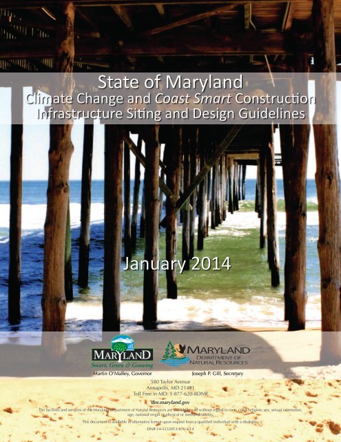
State of Maryland Climate Change and Coast Smart Construction<br />
State of Maryland<br />
Climate Change and Coast Smart Construction<br />
Infrastructure Siting and Design Guidelines<br />
January 2014<br />
Martin O’Malley, Governor<br />
580 Taylor Avenue<br />
Annapolis, MD 21401<br />
Toll Free in MD: 1-877-620-8DNR<br />
dnr.maryland.gov<br />
Joseph P. GIll, Secretary<br />
The facilities and services of the Maryland Department of Natural Resources are available to all without regard to race, color, religion, sex, sexual orientation,<br />
age, national origin or physical or mental disability.<br />
This document is available in alternative format upon request from a qualified individual with a disability.<br />
DNR 14-1232013-676 1/14
Maryland Commission on Climate Change<br />
Background<br />
This report is a product of the Climate Change and Coast Smart Construction Working Group; a subgroup of the Maryland<br />
Commission on Climate Change, Adaptation and Response Working Group. The report was prepared in response to directives<br />
outlined in State of Maryland, Gubernatorial Executive Order 01.01.2012.29.<br />
Climate Change and Coast Smart Construction Working Group<br />
Numerous State agency staff, as well as other interested parties and individuals, contributed immensely to the preparation of this<br />
report. A special thanks is due to the following members of the Climate Change and Coast Smart Construction Working Group: Meg<br />
Andrews, Don Halligan (Department of Transportation); Chuck Beall (Daft McCune Walker); Barbara Boumboulis (State Treasurer’s<br />
Office); Terri Garraty, Fiona Burns (Department of Budget and Management); Kate Charbonneau, Kelly Collins, Zoë Johnson, Jordan<br />
Loran, Terry Martin, Sandi Olek, Ren Serey, Kate Skaggs, Helen Stewart, Nick Kelly, Alexandra Olaya, Jackie Koehn (Department<br />
of Natural Resources); La Verne Gray, Peter Conrad, Chuck Boyd, Jason Dubow (Department of Planning); David Costello, Jeffrey<br />
Fretwell, Dave Guignet, Kevin Wagner (Department of the Environment); Dennis Dare (Ocean City); Devon Dodson, Anne Eisele,<br />
Kristen Ahearn (Maryland Energy Administration); Cecelia Donovan, Mike Herzberger, Kenna Oseroff (Maryland Environmental<br />
Service); William Gluck, Bart Thomas, Mostafa Izadi (Department of General Services); Elizabeth Habic, Gregory Slater (MDOT,<br />
State Highway Administration); Richard Higgins, Tim Lavalle (Department of Business and Economic Development); Elizabeth<br />
Hughes, Nell Ziehl (Maryland Historical Trust); Mark James (Maryland Emergency Management Agency); Nancy Jones (UMD<br />
Center for Environmental Science); Shawn Kiernan (Maryland Port Administration); Les Knapp (Maryland Association of Counties);<br />
Lisa Lowe, Ken Miller (Department of Information Technology); Ed Landon, Caroline Varney-Alvarado (Department of Housing<br />
and Community Development); Patrick McMahon, John Newton (MDOT, Transit Administration); Ashish Solanki, Wayne Schuster<br />
(MDOT, Aviation Administration); and Ashley Valis (Office of the Governor).<br />
Editor<br />
Zoë P. Johnson, Chesapeake and Coastal Service<br />
Maryland Department of Natural Resources<br />
Graphic Layout<br />
Lauren Dorrill, Office of Communications<br />
Maryland Department of Natural Resources<br />
Cover Images<br />
Ellen Christianson (front)<br />
Kip Brennan (back)<br />
Preferred Citation<br />
Z.P. Johnson (ed.). 2013. Climate Change and Coast Smart Construction: Infrastructure Siting and Design Guidelines.<br />
Special Report of the Adaptation Response Working Group of the Maryland Commission on Climate Change. Maryland<br />
Department of Natural Resources, Annapolis, MD.<br />
Availability<br />
This report is available in electronic format online at dnr.maryland.gov/climatechange and climatechange.maryland.gov.<br />
Print copies are available upon request to the Maryland Department of Natural Resources.<br />
Acronyms<br />
EO: Executive Order<br />
CRS: Community Rating System<br />
DBED: Department of Business and Economic<br />
Development<br />
DBM: Department of Budget and Management<br />
DFRIM: Digital Flood Insurance Rate Map<br />
DGS: Department of General Services<br />
DHCD: Department of Housing and Community<br />
Development<br />
DNR: Department of Natural Resources<br />
DoIT: Department of Information Technology<br />
FEMA: Federal Emergency Management Agency<br />
HMA: Hazard Mitigation Assistance<br />
IAC: Interagency Committee of Public School Construction<br />
LiMWA: Limit of Moderate Wave Action<br />
MCCC: Maryland Commission on Climate Change<br />
MDE: Maryland Department of the Environment<br />
MEMA: Maryland Emergency Management Agency<br />
MDOT: Maryland Department of Transportation<br />
MDP: Maryland Department of Planning<br />
MTP: Maryland Transportation Plan<br />
NOAA: National Oceanic and Atmospheric Administration<br />
NFIP: National Flood Insurance Program<br />
SHA: State Highway Administration
Table of Contents<br />
State of Maryland Climate Change and Coast Smart Construction<br />
Executive Summary 3<br />
Section I: Introduction 5<br />
Need for Resilience ................................................................................................5<br />
Maryland’s Action on Climate Change .................................................................5<br />
Infrastructure at Risk ...............................................................................................6<br />
Working Group Charge ..........................................................................................6<br />
Process<br />
.....................................................................................................................6<br />
Section II: Coast Smart Construction - Siting and Design Guidelines 7<br />
Planning Principles .................................................................................................7<br />
Policy Framework....................................................................................................7<br />
Siting Guidelines .....................................................................................................7<br />
Design Guidelines<br />
...................................................................................................8<br />
Section III: Institutionalization into State Policy and Programs 11<br />
Architecture, Engineering, Construction and Design Manuals .........................11<br />
Regulatory Programs .............................................................................................11<br />
State Planning, Permitting and Review................................................................11<br />
Disaster Planning and Response ..........................................................................11<br />
Capital Budgeting .................................................................................................11<br />
State Grant and Loan Programs ...........................................................................11<br />
Section IV: Technical Tools and Resources 15<br />
Sea Level Rise Projections ....................................................................................15<br />
Floodplain Mapping .............................................................................................16<br />
Data Availability ....................................................................................................16<br />
Mapping Applications ...........................................................................................17<br />
Community Assistance..........................................................................................18<br />
Section V: Recommendations & Next Steps 18<br />
State Policy and Practices .....................................................................................19<br />
Data, Mapping and Modeling ..............................................................................20<br />
Education and Outreach .......................................................................................20<br />
Section VI: Conclusion 20<br />
Appendices 21<br />
Definitions .............................................................................................................21<br />
References .............................................................................................................23<br />
Executive Order.....................................................................................................24<br />
Project Screening Checklist<br />
..................................................................................29
3<br />
Maryland Commission on Climate Change<br />
Executive Summary<br />
Introduction<br />
To protect Maryland’s people, property, natural resources, and public investments in light of changing conditions,<br />
Governor Martin O’Malley issued the Climate Change and “Coast Smart” Construction Executive Order (EO) in<br />
December 2012. The EO enacts a number of policy directives to increase the resilience of the State’s investments<br />
to sea level rise and coastal flooding. Section 5 of the EO directed the Maryland Department of Natural Resources<br />
(DNR), Chair of the Maryland Commission on Climate Change’s Adaptation and Response Working Group, to<br />
provide “Coast Smart” construction guidance, including recommendations for the siting and design of State<br />
structures, as well as other infrastructure-based projects. Contained in this report are the recommendations of<br />
Climate Change and Coast Smart Construction Working Group, convened by DNR to assist with this task.<br />
In short, the State should employ Coast Smart practices when constructing all new State structures, reconstructing<br />
or rehabilitating substantially damaged State structures, or making other major infrastructure improvements in<br />
Maryland’s coastal zone, such as roads, bridges, sewer and water systems, drainage systems and essential public<br />
utilities. Similar measures should be applied to non-State structure or infrastructure projects if partially or fully<br />
funded by State agencies; and, to non-State projects located on State-owned lands.<br />
Coast Smart Construction Practices<br />
• New State structures, the reconstruction of substantially damaged State structures, and/or other new<br />
major infrastructure projects should be avoided within areas likely to be inundated by sea level rise<br />
within the next 50-years.<br />
• New State “critical or essential facilities” shall not be located within Special Flood<br />
Hazard Areas designated under the NFIP and should be protected from damage<br />
and loss of access as a result of a 500-year flood.<br />
• Ecological features that may serve to buffer a project from the impacts<br />
of future sea level rise, coastal flooding or stormsurge or that<br />
support general climate adaptation practices, shall be<br />
identified, protected and maintained.<br />
Exceptions to these guidelines may be considered,<br />
provided that it can be demonstrated that<br />
projects have been designed to increase<br />
resiliency to future impacts.<br />
Siting Guidelines<br />
.........<br />
• New State<br />
structures, the<br />
reconstruction of<br />
substantially damaged<br />
State structures, and/or<br />
other new major infrastructure<br />
projects shall be designed to avoid<br />
or minimize future impacts over the<br />
anticipated design life of a project.<br />
Design Guidelines<br />
• New State structures and the reconstruction or<br />
rehabilitation of substantially damaged State structures<br />
located in Special Flood Hazard Areas shall be constructed<br />
with a minimum of two (2) feet of freeboard above the 100-year<br />
base flood elevation, as defined by NFIP.<br />
• State structures serving transportation purposes that are not water<br />
dependent or dependent on integral infrastructure shall be constructed with<br />
a minimum of two (2) feet of freeboard above the 100-year base flood elevation, as<br />
defined by the NFIP.<br />
• Flooding potential should be considered when choosing building materials for all structural<br />
projects, including minor improvements or maintenance and repair.<br />
• Structures and infrastructure proposed within a Limit of Moderate Wave Action boundary as mapped<br />
under the NFIP, shall be designed in compliance with construction standards applicable for V Zones.<br />
Exceptions to these guidelines may be warranted based on consideration of certain factors.<br />
State agencies should take the necessary steps to incorporate the recommended Coast Smart practices into all<br />
appropriate architecture, engineering, construction and design manuals, State planning programs, regulatory<br />
programs, permitting and review processes, disaster planning and response, capital budgeting, and State grant<br />
and loan programs. The following recommendations are intended to guide these actions and more.<br />
State Policy & Practice<br />
State-Agency Oversight. Maryland’s Smart Growth Sub Cabinet should provide oversight to individual State<br />
agencies as they undertake the process to institutionalize the Coast Smart Siting and Design Guidelines.
State of Maryland Climate Change and Coast Smart Construction<br />
4<br />
Implementation Plans. State agencies should develop or amend an agency specific implementation plan. This plan<br />
should include the status and next steps toward incorporation of the Coast Smart Siting and Design Guidelines<br />
into applicable State policy and programs; the identification of appropriate categorical exceptions; and, cost, size<br />
and use application thresholds.<br />
Review Authority. The State should appoint a formal body with authority to develop a process to allow a unit<br />
of State government or a capital grant or loan recipient to obtain an “exception” from strict application of<br />
the recommended Coast Smart Siting and Design Guidelines. At a minimum, the exception process should<br />
provide for consideration of the siting and design guideline exception criteria, as recommended in the full<br />
report; proposed structural and ecosystem-based resiliency measures; cost-benefit analysis; socio-economic<br />
considerations; historic preservation considerations; statutory or regulatory conflicts; external grant funding<br />
criteria; and mapping error.<br />
State Grant and Loan Programs. The Coast Smart Construction Siting and Design Guidelines should be used to guide<br />
allocation of State funding, primarily in the form of grants and loans, for non-State structure and infrastructure projects.<br />
Tracking and Reporting. The State should establish an annual reporting and review process to monitor and track<br />
individual State agency actions related to implementation of the policy and practices, including siting and design<br />
guideline exemption determinations.<br />
Funding Needs. The State should address funding and revenue constraints to ensure adequate support for current<br />
and future infrastructure protection needs.<br />
Nature-Based Protection Measures. DNR should take steps to identify and assess key natural features, such as<br />
wetlands, vegetated and forested buffers, etc., that protect coastal communities and other built environments and<br />
prioritize and target, as appropriate, for conservation and restoration purposes.<br />
Data, Mapping and Modeling<br />
Sea Level Rise Scenarios. All State agencies should utilize the sea level rise scenarios set forth by the Maryland<br />
Commission on Climate Change Scientific and Technical Working Group (2013) in the application of the Coast<br />
Smart planning principles, policy framework, and siting and design guidelines.<br />
Climate Science. The Scientific and Technical Working Group must stay abreast of the latest climate science; and, as<br />
warranted, periodically update sea level rise scenarios and planning guidance using the best scientific data available.<br />
Decision-Support Tools. The State should continue to develop State-level data and decision support tools to better<br />
understand, prepare for and respond to climate change and sea level rise.<br />
Data and Mapping Products. A number of other specific data products should also be developed, including: an<br />
analysis of the 1% annual change stillwater elevation data combined with 50-year and 100-year sea level rise<br />
projections; enhanced storm surge risk products that factor in sea level rise; and, refined sea level rise inundation<br />
area mapping, derived from 2013-14 LiDAR imagery acquisitions.<br />
Education & Outreach<br />
Cost–Benefit Guidance. The State should develop detailed cost/benefit guidance to better inform State infrastructure<br />
investment decisions and implementation of the recommended Coast Smart Siting and Design Guidelines.<br />
Education Campaign. The State should launch a Coast Smart Construction Education Campaign to engage county<br />
and municipal officials, determine the needs of local jurisdictions, and convey the need for improved resilience.<br />
Next Steps<br />
The planning principles, policy framework, and siting and design guidelines<br />
contained in this report, should be used to guide what, where and<br />
how State infrastructure investments decisions are made within vulnerable<br />
areas. Following on the heels of the Climate Change and Coast<br />
Smart Construction EO, implementation of the recommendations laid<br />
out in this report are critical steps towards ensuring the protection of<br />
Maryland’s people, property, natural resources, and public investments<br />
and to certify safe, sound and wise investments over time.<br />
Source: UMCES, IAN<br />
JANE THOMAS
5<br />
Maryland Commission on Climate Change<br />
I. Introduction<br />
Maryland’s Vulnerability to Sea Level Rise<br />
Need for Resilience<br />
Due to its low-lying topography and proximity<br />
along the mid-Atlantic coast, the State of<br />
Maryland is one of the most vulnerable States<br />
in the country to sea level rise. Tide gauge<br />
measurements show that Maryland has<br />
experienced approximately one-foot of sea level<br />
rise over the last century; and alarmingly, impacts<br />
such as increased coastal flooding, inundation<br />
of low-lying lands, more shoreline erosion, and<br />
salt-water intrusion are already being detected.<br />
Over the next century, the rate of sea level rise<br />
within Maryland waters is expected to more<br />
than double, resulting in a 1.4 foot increase of<br />
relative sea level rise by 2050 and 3.7 feet by<br />
2100 (Boesch et al., 2013). The combined forces<br />
of regional land subsidence, expansion of the<br />
volume of the ocean due to warming, melting<br />
glaciers, and changes in ocean currents all play<br />
a part. As sea level and other climate change<br />
impacts continue to increase in the years to Source: MCCC, 2008<br />
come, Maryland’s people, property, natural<br />
resources, and public investments will be ever more at risk.<br />
Maryland’s Action on Climate Change<br />
In 2007, Governor Martin O’Malley launched the Commission on Climate<br />
Change (MCCC), charting Maryland’s course as a national leader on climate<br />
science, carbon mitigation and climate change adaptation. The notable release<br />
of the MCCC’s Climate Action Plan in 2008 was the impetus behind many statelevel<br />
actions, including the passage of Maryland’s Greenhouse Gas Reduction Act<br />
in 2009. A key component of the Climate Action Plan is its Adaptation Strategy<br />
which, details the actions necessary to protect Maryland’s environmental heritage,<br />
public safety and future economic well-being from the impacts of climate change.<br />
The Strategy is comprised of two components. The first (Phase I) is focused<br />
on strategies to reduce Maryland’s vulnerability to sea level rise and coastal<br />
storms and the second (Phase II), centers on building ecological, societal and<br />
environmental resilience to changes in temperature and precipitation within a<br />
range of sectors (i.e., agriculture, water resources,<br />
etc.). Implementation of both components is well<br />
underway. Recent accomplishments include: passage of the Living Shoreline<br />
Protection Act; launch of the Coast Smart Communities Initiative; revisions<br />
to the State’s land acquisition program, GreenPrint, to target land to allow for<br />
landward migration of wetlands in response to sea level rise; and, the designation<br />
of Climate Change Impact Areas in PlanMaryland, Maryland’s recently adopted<br />
State Development Plan.<br />
In July 2013, Maryland released its final Greenhouse Gas Reduction Plan, which<br />
lays out a comprehensive framework for reducing greenhouse gases in Maryland<br />
by 25% of 2006 levels by the year 2020. Chapter 8 of the Greenhouse Gas<br />
Reduction Plan details Maryland’s change adaptation strategy and includes indepth<br />
information on Maryland’s current and planned progress to implement key<br />
actions. The report is available online at climatechange.maryland.gov.
State of Maryland Climate Change and Coast Smart Construction<br />
6<br />
County/City<br />
State Owned and Critical Facility Exposure to Sea Level Rise<br />
State Owned Facilities<br />
Critical Facilities<br />
Square mi.<br />
High Risk (0-Moderate Risk (2- Low Risk High Risk (0- Moderate Risk Low Risk<br />
(land area)<br />
2 ft RSLR) 5 ft RSLR) (5-10 ft RSLR) 2 ft RSLR) (2-5 ft RSLR) (5-10 ft RSLR)<br />
Population<br />
Anne Arundel County 7 4 6 151 92 95 415.9 512,790<br />
Baltimore County 6 1 4 70 55 122 598.6 785,618<br />
Calvert County 1 0 20 24 22 13 215.2 88,698<br />
Caroline County 0 0 333 47 8 48 320.1 29,772<br />
Cecil County 0 0 2 57 21 22 348.1 99,926<br />
Charles County 0 0 0 28 6 6 461.0 140,764<br />
Dorchester County 5 14 45 123 56 39 557.5 31,998<br />
Harford County* – – – – – – 440.4 240,351<br />
Kent County 0 1 1 44 33 24 279.4 20,151<br />
Prince George's County* – – – – – – 485.4 820,852<br />
Queen Anne's County 0 1 9 75 54 49 372.2 47,091<br />
Somerset County 8 55 21 69 66 36 327.2 26,119<br />
St. Mary's County 150 76 3 40 27 42 361.3 101,578<br />
Talbot County 1 0 23 61 33 40 269.1 36,215<br />
Wicomico County 0 19 3 49 42 56 377.2 94,046<br />
Worcester County 2 98 1 71 180 148 473.2 49,274<br />
City of Baltimore* – – – – – – 80.0 631,366<br />
Grand Total 180 269 471 909 695 740 6381.9 3,756,609<br />
*Vulnerability data not available from MDDNR<br />
Source: MEMA, 2011<br />
State Owned and Critical Facility Exposures to Sea Level Rise<br />
Infrastructure at Risk<br />
Maryland has thousands<br />
of miles and acres of<br />
developed property<br />
in future sea level rise<br />
vulnerable areas. These<br />
areas contain billions of<br />
dollars worth of public and<br />
private investments at risk<br />
to future damage from sea<br />
level rise, coastal flooding<br />
and stronger coastal storms.<br />
The need and timeliness of<br />
preparing for such impacts has been heightened after seeing the devastation caused by Hurricanes Isabel in 2003<br />
and Sandy in 2012. The cumulative cost to Maryland taxpayers of severe weather events in 2011 and 2012 was<br />
over $70 million. Twenty-three counties in Maryland required federal assistance in the wake of Sandy. State and<br />
local governments need to continue to work hard to plan and prepare for the very likely possibility that the State<br />
may see more storms like Sandy in the future.<br />
Recognizing the need to make safe, sound and wise investments in light of changing conditions, Governor<br />
O’Malley signed the Climate Change and Coast Smart Construction Executive Order (EO) 01.01.2012.29 in<br />
December 2012, enacting a number of policy directives to increase the resilience of the State’s infrastructure<br />
investments to future sea level rise and coastal storms. In particular, the EO directs that all State agencies consider<br />
the risk of coastal flooding and sea level rise when they design capital budget projects and charges the Department<br />
of General Services with updating its architecture and engineering guidelines to require new and rebuilt State<br />
structures are elevated two or more feet above the 100-year base flood elevation.<br />
Working Group Charge<br />
The EO charges the Maryland Department of Natural Resources (DNR) to work with the MCCC, local<br />
governments and other parties as appropriate, to develop:<br />
1. Recommendations for additional Coast Smart criteria for the siting and design of new,<br />
reconstructed, or rehabilitated State structures, as well as other infrastructure improvements<br />
such as roads, bridges, sewer and water systems, drainage systems, and essential public utilities;<br />
2. Recommendations concerning the potential application of Coast Smart guidelines to non-State<br />
infrastructure projects that are partially or fully funded by State agencies; and<br />
3. Other recommendations for executive and/or legislative action.<br />
The Process<br />
In February 2013, DNR convened the Climate Change and Coast Smart Construction Working Group to<br />
undertake specific tasks as outlined in the EO. Included in the Group were representatives from Maryland<br />
Departments of Environment, Housing and Community Development, Transportation, Planning, General<br />
Services, Budget and Management, Business and Economic Development, Information Technology and the<br />
Maryland Energy Administration, Historical Trust, Emergency Management Agency, as well as the Maryland<br />
State Treasurer’s Office, University System of Maryland, Maryland Environmental Service, Maryland Municipal<br />
League and Maryland Association of Counties. In all, 45 representatives from State and local departments,<br />
offices and organizations actively participated in the process to develop the following recommendations.
7<br />
Maryland Commission on Climate Change<br />
II. Coast Smart Construction —<br />
Siting and Design Guidelines<br />
As a guide to how, where and what we build in future sea level rise vulnerable areas, the following planning<br />
principles, policy framework, siting and design guidelines are recommended.<br />
Planning Principles<br />
To protect Maryland’s environmental heritage, public safety and future economic well-being and to guide the<br />
fundamental intent of the Comprehensive Strategy for Reducing Maryland’s Vulnerability to Climate Change<br />
(2008), the MCCC’s Adaptation and Response Working Group recommended that the Governor and the<br />
Maryland General Assembly take legislative and policy actions to:<br />
• Avoid and/or reduce impact to the existing built environment, as well as to future growth and<br />
development in vulnerable coastal areas;<br />
• Shift to sustainable economies and investments; and, avoid assumption of the financial risk of<br />
development and redevelopment in highly hazardous coastal areas;<br />
• Enhance preparedness and planning efforts to protect human health, safety and welfare; and<br />
• Protect and restore Maryland’s natural shoreline and its resources, including its tidal wetlands and<br />
marshes, vegetated buffers, and Bay Islands, that inherently shield Maryland’s shoreline and interior.<br />
{ }<br />
Policy Framework<br />
Guided by the principles outlined above, the State should employ Coast Smart practices when constructing all<br />
new State structures, reconstructing or rehabilitating substantially damaged State structures, or making other<br />
major infrastructure improvements in Maryland’s coastal zone, such as roads, bridges, sewer and water systems,<br />
drainage systems and essential public utilities.<br />
For the purposes of this document, Coast Smart means a practice in which, preliminary planning, siting, design,<br />
construction, operation, maintenance, and repair of a structure avoids or, in the alternative, minimizes future<br />
impacts associated with coastal flooding and sea level rise. Coast Smart includes both siting and design guidelines<br />
that are applicable throughout the entire life cycle of a project. Similar measures should be applied to non-State<br />
structure or infrastructure projects if partially or fully funded by State agencies; and, to non-State projects located<br />
on State-owned lands.<br />
Siting Guideline Depiction<br />
UMES, IAN<br />
Siting Guidelines<br />
The following specifications related to the location of a<br />
structure, infrastructure or use on a lot or parcel or within a<br />
larger geographic area are recommended:<br />
1. Construction of new State structures, the reconstruction<br />
of substantially damaged State structures, and/or other new<br />
major infrastructure projects should be avoided, to the fullest<br />
extent practicable, within areas likely to be inundated by sea<br />
level rise within the next 50-years.<br />
2. New State “critical or essential facilities” shall not be<br />
located within Special Flood Hazard Areas designated under<br />
the National Flood Insurance Program (NFIP) and be protected<br />
from damage and loss of access as a result of the 500-year<br />
flood.<br />
3. Ecological features that may serve to buffer the project<br />
from the impacts of future sea level rise, coastal flooding or
State of Maryland Climate Change and Coast Smart Construction<br />
8<br />
Source: MCCC, 2011<br />
Protective Natural Features<br />
or storm surge (e.g., vegetated<br />
or forested buffers,<br />
dunes, wetland adaptation<br />
areas) or that support<br />
general climate adaptation<br />
practices (e.g., habitat adaptation<br />
areas), shall be<br />
identified, protected and<br />
maintained.<br />
4. Whenever possible, onsite<br />
mitigation measures<br />
should be directed towards<br />
enhancing, restoring<br />
or creating ecological<br />
features to provide additional<br />
protection against<br />
future sea level rise and<br />
coastal storm impacts.<br />
Siting Guideline Exception Criteria<br />
Exceptions to the Siting Guidelines, outlined above, may be considered for the following project types, provided<br />
that it can be demonstrated that projects have been designed to increase resiliency to future impacts:<br />
a. Water-dependent uses. Projects that require continued direct access to the water as an integral part of the<br />
use, or facilities that directly support water dependent uses.<br />
b. Existing transportation system assets. Projects that support the continued function of existing<br />
transportation system assets.<br />
c. Passive public access. Projects that provide either recreational or scenic access to water bodies or<br />
shoreline areas which, need to be within a flood zone for their purpose.<br />
d. Temporary structures or uses. Structures intended to be in place for less than 180 consecutive<br />
days in any given calendar year or will be removed at the end of a construction project.<br />
e. Stabilization projects. Actions to secure and maintain assets, structures, infrastructure, and natural and<br />
cultural resources to prevent additional damage and to prevent future resource/facility damage; efforts<br />
to mitigate a safety or environmental hazard; sand dune and beach restoration; mold remediation; facility<br />
weatherization; silt fencing; and minor repairs and restorations.<br />
CURTIS BRANDT<br />
Boatyard: water-dependant use
9<br />
Maryland Commission on Climate Change<br />
f. Maintenance, Repair, Renovation and Rehabilitation of Existing Structures. Exceptions for these activities should<br />
be based on an analysis of the scope, function and importance of the project, including historic and cultural<br />
preservation considerations, and the extent of damage; provided, that it can be demonstrated that measures have<br />
been taken to ensure the project is designed to increase resiliency to future impacts.<br />
Design Guidelines<br />
The following<br />
structural specifications<br />
related to<br />
the shape, size,<br />
or form of construction<br />
practice<br />
guidelines are recommended:<br />
1. To avoid or minimize<br />
preventable<br />
damages and exposure<br />
of State resources<br />
to risk, all new State structures, the reconstruction of substantially damaged State structures, and/or other<br />
Design guideline depiction<br />
new major infrastructure projects shall be designed to avoid or minimize future impacts associated with future<br />
sea level rise, coastal flooding and storm surge over the anticipated design life of a project.<br />
2. All new State structures and the reconstruction or rehabilitation of substantially damaged State structures<br />
located in Special Flood Hazard Areas shall be constructed with a minimum of two (2) feet of freeboard above<br />
the 100-year base flood elevation, as defined by the NFIP. Users should take note that the Regulatory floodplain<br />
maps along the Maryland shoreline are being revised by Federal Emergency Management Agency (FEMA). This<br />
revision began in 2011 and should be completed sometime in 2015. For State purposes, the regulatory 100-year<br />
floodplain elevation is defined on the Flood Insurance Rate Map (FIRM) or Digital Flood Insurance Rate Map<br />
(DFIRM) that will be in effect at the time construction will begin.<br />
Damage from Hurricane Isabel<br />
Freeboard Standard<br />
ZOE JOHNSON<br />
3. State structures serving<br />
transportation purposes that are<br />
not water dependent or dependent<br />
on integral infrastructure shall be<br />
constructed with a minimum of two<br />
(2) feet of freeboard above the 100-<br />
year base flood elevation, as defined<br />
by the NFIP.<br />
4. Flooding potential should be considered<br />
when choosing building<br />
materials for all structural projects,<br />
including minor improvements or<br />
maintenance and repair, as corrosion<br />
and other environmental and health<br />
consequences can become a concern<br />
for materials subjected to flood<br />
waters (MDE, 2010). Utilize FEMA<br />
standards (44CFR60.3(c)(3)(ii)) for<br />
dry-proofing or wet-proofing parts of<br />
a structure or portion of infrastructure<br />
located below base flood elevation<br />
to prevent or minimize the effect of<br />
coastal flooding (MDE, 2010).<br />
Source: MCCC, 2008
10<br />
State of Maryland Climate Change and Coast Smart Construction<br />
5. Structures and infrastructure proposed within a Limit of Moderate Wave Action (LiMWA) boundary, also known<br />
as the “Coastal A Zone,” when mapped under the NFIP shall be designed in compliance with construction<br />
standards applicable for V Zones. The LiMWA is a boundary that identifies the landward location of the 1.5 ft<br />
wave height delineating a zone called the “Coastal A Zone” where wave damage is substantial.<br />
Design Guideline Exception Criteria<br />
Exceptions to the Design Guidelines, as outlined above, may be warranted based on consideration of the<br />
following factors:<br />
1. Danger that materials may be swept onto other lands to the injury of others;<br />
2. Danger to life and property due to flooding or erosion damage;<br />
3. Susceptibility of the proposed structure or infrastructure and its contents to flood damage and the effect<br />
of such damage to the State of Maryland;<br />
4. Importance of the services to the State of Maryland provided by the proposed structure or infrastructure;<br />
5. Availability of suitable alternative locations that are subject to a lower risk of flooding or erosion damage;<br />
6. Necessity or benefits of a waterfront location;<br />
7. Compatibility of the proposed use of the structure or infrastructure with existing and anticipated<br />
development;<br />
8. Need to maintain eligibility or designation as a historic structure as defined by the U.S. Department of<br />
the Interior and/or the Maryland Historical Trust;<br />
9. Safety of access to and from a site, facility or the structure or infrastructure by passenger and emergency<br />
vehicles during a flood;<br />
10. Expected heights, velocity, duration, rate of rise, and sediment transport of the floodwaters and the<br />
effects of any wave action expected at the site;<br />
11. Costs of providing government services during and after flood conditions, including maintenance and<br />
repair of public utilities and facilities such as sewer, gas, electrical, and water systems, and streets and<br />
bridges;<br />
12. Comments provided by the Maryland Department of Transportation (MDOT) regarding the application<br />
of freeboard requirements on the transportation function of a given structure;<br />
13. Comments provided by the Maryland Department of the Environment (MDE) and the NFIP State<br />
Coordinator.<br />
DNR<br />
The Chesapeake Bay Bridge
11<br />
Maryland Commission on Climate Change<br />
III. Institutionalization into State Policy and Programs<br />
The process to institutionalize consideration of the planning principles, policy framework and siting and<br />
design guidelines into all appropriate planning, design and construction processes should begin immediately.<br />
Recognizing that each agency administers State programs differently based on its mission, the incorporation<br />
of these guidelines into the following State programs should be accomplished by each respective lead agency,<br />
as follows:<br />
Architecture, Engineering, Construction and Design Manuals<br />
Procedural Manual for Professional Services<br />
The Procedural Manual serves as a guide for providing professional services during all phases of design and<br />
preparation of contract documents for capital projects involving the construction, alteration or renovation of State<br />
buildings with an estimated construction cost greater than $2 million. It is intended that the procedures also be<br />
followed to the fullest extent practicable for other State public improvements such as facilities renewal projects,<br />
special structures, roads, utilities, and site improvements.<br />
Chapter II, Section 6 of the Manual outlines Coastal/Flood Plain Design Requirements in two subsections: 6.1<br />
Chesapeake Bay Critical Area Consideration and 6.2 Climate Change and Coast Smart Construction. Appendix<br />
C of the Manual covers Floodplain Management Criteria for Flood Prone Areas. The Maryland Department<br />
of General Services (DGS) should incorporate the recommended Coast Smart Construction Siting and Design<br />
Guidelines into Chapter II, Section 6 as appropriate.<br />
State School Construction Manuals<br />
The University System of Maryland, St. Mary’s College, the Interagency Committee on Public School<br />
Construction, and Morgan State College should incorporate the recommended Coast Smart Construction<br />
Siting and Design Guidelines into all appropriate administrative procedures and policy guidelines as well as<br />
their architecture, engineering, construction and design manuals.<br />
Regulatory Programs<br />
Chesapeake and Atlantic Coastal Bays Critical Area Act<br />
In accordance with EO 01.01.2012.29, the Critical Area Commission for the Chesapeake and Atlantic Coastal<br />
Bays is currently undertaking the process to evaluate existing regulations and policies for State Agency Actions<br />
Resulting in Development on State-Owned Lands and the adoption of new or revised provisions that address<br />
climate change and the risk of future sea level rise and other extreme weather-related impacts. During this process,<br />
consideration should be given to the recommended Coast Smart Construction Siting and Design Guidelines, as<br />
outlined in this report.<br />
State Planning, Permitting and Review<br />
PlanMaryland<br />
PlanMaryland, the State Development Plan for the State of Maryland, serves as<br />
a guide to the economic and physical development of the State. As provided<br />
in EO 01.01.2011.22, PlanMaryland is to make State policies on development<br />
transparent so local governments can more efficiently access State resources.<br />
State agencies are to also consider PlanMaryland when making decisions about<br />
actions that affect development in the State. The Climate Change Impact Area<br />
designation process has been incorporated into PlanMaryland. These areas<br />
include: 50 and 100-year sea level rise inundation zones; 100-year floodplain;<br />
and Category 1-4 storm surge risk zones. Climate Change Impact Areas are<br />
currently being used by State agencies and local governments to identify<br />
vulnerable areas, as well as areas to target for implementation of climate change<br />
and sea level rise resilience measures.<br />
PlanMaryland provides a framework for a collaborative process between State<br />
and local governments to address climate change and sea level rise impacts. The<br />
process to implement PlanMaryland is being used to facilitate the evaluation of State resource allocation and policies in<br />
Climate Change Impact Areas, as well as coordination with local governments. The recommended Coast Smart Siting
State of Maryland Climate Change and Coast Smart Construction12<br />
and Design Guidelines and associated Exception Criteria should be used as the framework to evaluate and guide State<br />
investment decisions within these areas.<br />
State Clearinghouse<br />
The Maryland State Clearinghouse for Intergovernmental Assistance (Clearinghouse) manages the review and<br />
coordination process for projects and grants in accordance with Presidential EO 12372 and Gubernatorial<br />
EO 01.01.1983.17. Designated as the State Single Point of Contact, the Clearinghouse functions as a<br />
conduit for enabling communication among federal, State and local governments to direct and sustain<br />
growth in Maryland to those areas already supported with the necessary infrastructure and/or identified for<br />
future growth. This is achieved by providing a comprehensive review of proposed development projects in<br />
Maryland at varying stages.<br />
The process fosters partnerships at the different levels of governments and affords one-stop access to the<br />
views of government officials. In addition, citizens, State agency project reviewers and local governments<br />
are provided the opportunity to learn about and comment on the proposed projects to ensure they are<br />
consistent with agency, State and local plans, programs and objectives. The Clearinghouse is currently<br />
evaluating its review and coordination process to identify opportunities to enhance its effectiveness fostering<br />
communication among federal, State and local agencies. As a component of this effort, the Clearinghouse is<br />
considering revisions and enhancements to its process, as appropriate, regarding projects and grants that are<br />
located in or affected by the PlanMaryland Climate Change Impact Areas. As part of this ongoing process,<br />
the Clearinghouse should also integrate consideration of the Coast Smart Siting and Design Guidelines, as<br />
recommended in this report.<br />
Maryland Transportation Plan<br />
In accordance with State and federal statutory requirements, the Maryland Transportation Plan (MTP) serves as a<br />
guide and policy framework and establishes a context for transportation investment that supports Statewide goals<br />
and objectives. The current MTP contains the following objectives:<br />
• Institutionalize the consideration of future sea levels and storm conditions in prioritizing infrastructure<br />
investments in coastal areas; and<br />
• Enhance preparedness and planning efforts to protect human health, safety and welfare in light<br />
changing climate conditions.<br />
MDOT’s modal agencies have incorporated consideration of climate impacts into their existing project planning<br />
processes. The State Highway Administration (SHA) and the Maryland Transportation Authority (MDTA) have<br />
developed a climate change adaptation strategy and implementation plan to address severe weather and climate<br />
change impacts to the State maintained highway network. This plan was completed in 2012 and will be utilized to<br />
address the results of the vulnerability assessment, currently underway by the SHA.<br />
SHA received a grant in April 2013 to pilot a study to further develop the Federal Highway Administration, “Climate<br />
Change & Extreme Weather Vulnerability Assessment Framework.” The vulnerability assessment is being conducted<br />
to evaluate the entire State-maintained network and analyze areas where reoccurring flood events occur. Data<br />
collection and mapping applications developed during the pilot will provide the agency with additional information<br />
to further the integration of climate change vulnerability assessments into agency practices. Selected sites will be<br />
evaluated for potential engineering-design solutions and other sites may be recommended for further study to<br />
determine the best solution for resolving the problem. Additionally, MDOT modal administrations are developing<br />
plans to include climate impacts into the pre-planning process for compliance with the National Environmental<br />
Policy Act. These processes will be finalized to align with forthcoming guidance from the President’s Council on<br />
Environmental Quality. In undertaking the activities detailed above, the recommended Coast Smart Siting and Design<br />
Guidelines should be used as the framework to further analyze, evaluate and guide MDOT modal administration<br />
climate change and sea level rise planning efforts.<br />
Disaster Planning and Response<br />
Maryland State Hazard Mitigation Plan<br />
Under the planning requirements of the Disaster Mitigation Act of 2000 (44 CFR 201.4), the 2011 Maryland<br />
State Hazard Mitigation Plan Update serves as guidance for hazard mitigation for the State of Maryland. Its
13<br />
Maryland Commission on Climate Change<br />
County/City<br />
State and Critical State Facilities and Critical within Facilities FEMA within 100-year FEMA 100-year flood flood zonezones<br />
Number of<br />
Critical<br />
Facilities<br />
Critical Facilities<br />
Building and<br />
Contents Values<br />
State Facilities<br />
Number of Building and<br />
State Facilities Contents Values<br />
Anne Arundel County 443 $1,103,200 16 $25,137,983<br />
Baltimore County 717 $9,734,000 63 $184,312,142<br />
Baltimore City 1,049 $149,117,733 106 $1,127,435,779<br />
Calvert County 55 $2,445,813 5 $1,935,284<br />
Caroline County 458 $4,581,227 333 $106,551,157<br />
Cecil County 265 $1,308,667 4 $149,816<br />
Charles County 75 $0 4 $496,269<br />
Dorchester County 203 $7,335,333 19 $1,990,181<br />
Harford County 319 $29,786,800 3 $117,089<br />
Kent County 86 $2,544,400 1 $974,500<br />
Prince George's County 749 $7,488,840 6 $13,340,297<br />
Queen Anne's County 136 $5,587,480 1 $0<br />
Somerset County 184 $588,267 62 $15,540,817<br />
St. Mary's County 330 $10,209,200 227 $531,629,696<br />
Talbot County 149 $1,521,653 20 $6,573,363<br />
Wicomico County 274 $2,311,067 22 $86,973,263<br />
Worcester County 398 $7,045,373 46 $10,669,632<br />
Grand Total 7,484 $321,160,506 966 $2,167,483,376<br />
Source: MEMA, 2010<br />
vision is supported by a central<br />
goal, objectives and strategies<br />
for Maryland State government,<br />
local governments and organizations<br />
that will reduce or prevent<br />
injury from natural hazards<br />
to people, property, infrastructure<br />
and critical State facilities.<br />
The plan features a comprehensive<br />
natural hazard identification,<br />
risk assessment and vulnerability<br />
analysis, that ranks<br />
hazard risks across Maryland.<br />
The risk analysis uses a comparative<br />
formula that includes<br />
total population, population<br />
density, damages, injury and<br />
deaths from past hazard events,<br />
geographic extent of the hazard,<br />
and each hazard’s ranking in local hazard mitigation plans. The plan also includes mitigation strategies to address<br />
identified vulnerabilities; provide a thorough capability assessment; and concludes with plan implementation<br />
and maintenance procedures.<br />
As a component of the 2011 Update, exposure and risk to coastal flooding and sea level rise was evaluated<br />
by intersecting the MDE and DNR hazard layers with the Maryland critical and State-owned facility geospatial<br />
database. Risk to State-owned and critical facilities was evaluated for 22 facility categories. The plan identified 3<br />
principle actions that align with the Coast Smart planning principles and policy framework:<br />
• Inventory hazard risks to State-owned facilities and identify their risks to<br />
hazards including climate change related hazards (e.g., sea level rise, coastal and riverine stream erosion,<br />
and increased flooding);<br />
• Incorporate climate change and coastal hazard considerations into building codes for coastal communities<br />
(e.g., freeboard, septic siting); and<br />
• Leverage relationships with universities/scientists, through programs such as Cooperative Extension, to<br />
educate on hazards and climate change.<br />
As part of the 2014 Plan revision, the Maryland Emergency Management Agency (MEMA) should review and<br />
update progress on these actions and additional recommended Coast Smart Construction Siting and Design<br />
Guidelines, as appropriate.<br />
Hazard Mitigation Assistance (HMA)<br />
The U.S. Department of Homeland Security, FEMA HMA programs present<br />
a critical opportunity to reduce the risk to individuals and property from<br />
natural hazards while simultaneously reducing reliance on Federal disaster<br />
funds. The HMA programs provide funding for eligible activities that are<br />
consistent with the Presidential Policy Directive 8: National Preparedness<br />
(PPD-8), and the National Mitigation Framework’s Long-term Vulnerability<br />
Reduction capability. Hazard mitigation projects submitted to MEMA<br />
should be reviewed for eligibility by the MEMA staff and the Mitigation<br />
Advisory Committee to insure that all State applications are consistent with<br />
the recommended Coast Smart Siting and Design Guidelines. The HMA<br />
program reduces community vulnerability to disasters and their effects,<br />
promote individual and community safety and resilience, and promote community vitality.<br />
National Flood Insurance Program (NFIP)<br />
In Maryland tidal and non-tidal programs are regulated differently by various levels of government. MDE regulates
State of Maryland Climate Change and Coast Smart Construction14<br />
all activities in non-tidal waters and their associated floodplains through the State’s Waterway Construction<br />
Program and oversees community involvement and participation in FEMA’s NFIP.<br />
Tidal floodplains are only regulated at the local level via the requirements on the community to participate in the<br />
NFIP. However, all Special Flood Hazard Areas mapped on a community’s Flood Insurance Rate Maps (FIRMs)<br />
are subject to regulatory requirements at the local level. The State Office of the NFIP, MDE acts as a liaison<br />
between these communities and FEMA to ensure all development meets the NFIP requirements. Communities<br />
participate in this program so that flood insurance is available in their community and may set higher standards,<br />
like freeboard, to receive reductions in premiums and guide development away from the floodplains. It is<br />
imperative that State activities match, where possible, the local NFIP regulations to avoid a reduction in premium<br />
discounts or suspension from the NFIP Program on the local community. State construction projects should be<br />
designed in accordance with the recommended Coast Smart Construction Siting and Design Guidelines or NFIP<br />
regulations of the local jurisdiction, whichever are more stringent.<br />
Capital Budgeting<br />
Facility Program Manual<br />
Section 3-602(d) of the State Finance and Procurement Article requires that before an appropriation may be<br />
authorized for a capital project, the unit of State government requesting the appropriation shall submit a facility<br />
program justifying the project (Part I) and describing, in detail, the scope and purpose of the project (Part II).<br />
The Facility Program Manual defines and describes the content of a facility program; provides instruction on the<br />
preparation of a facility program; and provides information regarding facility program submission requirements.<br />
The Department of Budget and Management (DBM) and DGS should amend the Facility Program Manual to<br />
require that in developing a facility program, the recommended Coast Smart Siting and Design Guidelines must<br />
be used to assess the potential for impacts related to sea level rise and coastal flooding.<br />
State Grant and Loan Programs<br />
The Coast Smart Construction Siting and Design Guidelines should be used to guide allocation of State funding,<br />
primarily in the form of grants and loans, for non-State structure and infrastructure projects. State grant and loan<br />
programs, including but not limited to the following, should be further analyzed to determine whether additional<br />
executive, legislative or administrative requirements will be necessary to accomplish this task:<br />
• Capital Grant Recipients (Local) — DGS/DBM<br />
• Sustainable Communities funding programs — DHCD<br />
• Community Development Block Grants — DHCD<br />
• Program Open Space (Local) — DNR<br />
• Bay Restoration Trust Fund (Local) — DNR<br />
• Waterway Improvement Program — DNR<br />
• MDOT Secretary’s Aviation Grant Program — MDOT<br />
• Clean Water and Drinking Water State Revolving Funds — MDE<br />
• Maryland Economic Development Authority & Assistance Fund — DBED<br />
• Maryland Industrial Development Financing Authority — DBED<br />
• Maryland Economic Assistance Fund — DBED<br />
• Public School Construction — IAC<br />
• Community College Construction Grant Program — MHEC/MACC<br />
• Local Jails and Detention Centers — DSPCS<br />
• Community Health Facilities Grant Program — DHMH<br />
• Federally Qualified Health Centers Grant Program — DHMH<br />
• Private Higher Education Facilities Grant Program — Maryland Independent College and University Association<br />
In the interim, the use of State programs and resources for proposed structures and infrastructure projects<br />
located within areas vulnerable to future sea level rise and coastal flooding should be subject to additional<br />
review and evaluation consistent, with applicable law and policy, to ensure the most appropriate State action<br />
and investment of resources. State investments in these areas should be evaluated on a case-by-case basis<br />
considering: existing structures and investments; the need for the project; vulnerability of the project; longterm<br />
benefits; the extent of resiliency measures incorporated into State or local climate adaptation plans; and,<br />
the project siting and design.
15<br />
Maryland Commission on Climate Change<br />
IV. Technical Tools and Resources<br />
Sea Level Rise Projections<br />
Section 7 of the Climate Change and Coast Smart Construction EO directs<br />
the MCCC’s Scientific and Technical Working Group to review the sea level<br />
rise projections in the Maryland Climate Action Plan (2008) and provide<br />
updated projections based on an assessment of the latest climate change<br />
science and federal guidance. To fulfill the task, Dr. Donald F. Boesch,<br />
President of the University of Maryland Center for Environmental Science,<br />
convened a panel of highly qualified scientific experts on sea level rise<br />
drawn from Maryland and the Mid-Atlantic region (VA, DE, NJ, PA).<br />
The panel applied the process-based approach used by the National<br />
Research Council (National Academy of Sciences) in 2012 to project sea<br />
level rise along the U.S. West Coast. “Best” estimates were made of the<br />
various contributions to relative sea level rise: thermal expansion of ocean<br />
volume, the melting of glaciers and Greenland and Antarctic ice sheets,<br />
changing ocean dynamics such as slowing of the Gulf Stream, and vertical<br />
land movement. “High” and “Low” estimates for these contributions were<br />
also made, resulting in a range outside of which, the amount of sea level rise expected in 2050 and 2100 would<br />
be considered very unlikely.<br />
The “Best” estimate of mean sea level rise along Maryland’s shorelines by 2050 (over the mean level in the year<br />
2000) is 1.4 feet; based on present scientific understanding. It is unlikely to be less than 0.9 foot or greater than<br />
2.1 feet. The “Best” estimate for mean sea level rise by 2100 is 3.7 feet; it is unlikely to be less than 2.1 feet or<br />
greater than 5.7 feet.<br />
As Stated in the report, sea level rise by 2050 will be largely determined by the inertia of Earth’s present climate<br />
system, including melting of land ice, but over the longer term will be very dependent on the trajectory of human<br />
greenhouse gas emissions during the 21 st century. Success in global emission reductions over the next 50 years<br />
will determine whether generations during the following centuries will have to contend with sea levels more than<br />
10 feet higher than they are today or as little as 3 feet higher.<br />
The Scientific and Technical Working Group recommends that it is prudent to plan for relative sea level rise<br />
in Maryland of 2.1 feet by 2050 in order to accommodate the high end of the range of the projections. For a<br />
public investment of which, the design life is not expected to extend beyond this century or where infrequent<br />
flooding is tolerable, it might be acceptable to use the “Best” estimate of 3.7 feet for adaptation planning.<br />
However, where an investment is expected to last longer than this or where there is a very low acceptance<br />
of any flooding risk, the “High” estimate of 5.7 feet<br />
of relative sea level rise might be more appropriate.<br />
Moreover, the report notes that accounting for storm<br />
surge on top of sea level will be necessary for specific<br />
elevation planning.<br />
The State should use the most up-to-date sea level<br />
rise projections for Maryland in order to site and<br />
design State investments in a manner that will avoid<br />
or minimize future loss or damages. The State should<br />
stay abreast of the latest sea level rise science and as<br />
it evolves, provide additional guidance on sea level<br />
rise projections for Maryland as needed. Until such<br />
time as updated sea level rise projections are issued<br />
for the State, the sea level rise projections issued by<br />
the Scientific and Technical Working Group in June<br />
2013 should be used to guide siting and design of<br />
State investments.<br />
Projections Projections of relative of relative sea-level sea-level rise rise for for Maryland<br />
Projected Sea Level Rise (feet)<br />
7<br />
6<br />
5<br />
4<br />
3<br />
2<br />
1<br />
0<br />
Source: Boesch et al., 2013<br />
Highest Estimate<br />
(2.1 ft)<br />
Best Estimate (1.4 ft)<br />
Lowest Estimate<br />
(0.9 ft)<br />
Highest Estimate<br />
(5.7 ft)<br />
Best Estimate<br />
(3.7 ft)<br />
Lowest Estimate<br />
(2.1 ft)<br />
2050 2100<br />
Year
16<br />
State of Maryland Climate Change and Coast Smart Construction<br />
Floodplain Mapping<br />
The FEMA Region III office has initiated a coastal analysis and mapping study to produce updated Digital<br />
Flood Insurance Rate Maps (DFIRMs) for coastal counties within Region III. The new coastal flood hazard<br />
analyses, initiated in the Fall of 2009, is utilizing updated 1% annual chance stillwater elevations obtained from<br />
a comprehensive storm surge study being concurrently performed by FEMA Region III. The storm surge study is<br />
one of the most extensive coastal storm surge analyses to date, encompassing coastal floodplains in three States<br />
and including the largest estuary in the U.S. Ultimately, the study will update the coastal storm surge elevations<br />
within the States of Virginia, Maryland, Delaware, and Pennsylvania including the Atlantic Ocean, Chesapeake<br />
Bay and its tributaries, and the Delaware Bay. This study differs from the storm surge mapping performed as part of<br />
Hurricane Evacuation Studies in that the resulting stillwater elevations are based on probability of occurrence as<br />
opposed to Hurricane Category events. However, it is recommended that emergency managers still utilize their<br />
hurricane evacuation studies and hurricane category storm surge maps for evacuation planning and decisionmaking<br />
purposes.<br />
An updated coastal flood study was needed<br />
to obtain a better estimate of coastal flood<br />
hazards and risk for Region III as the<br />
current, or effective paper FIRM maps of<br />
the 1970’s and 80’s, are outdated primarily<br />
due to the age of the data and mapping<br />
methodologies. Additionally, major changes<br />
in NFIP policies and methodologies have<br />
occurred since the original effective date of<br />
many flood insurance studies in the area,<br />
creating the need for an update that would<br />
reflect a more detailed and complete hazard<br />
determination. DFIRMs are being released<br />
by MDE in conjunction with FEMA on<br />
a community by community basis. Most<br />
communities have received Preliminary<br />
updates of their maps (Preliminary-DFIRMs)<br />
and some have already adopted the newer<br />
Garr ett<br />
Maryland Digital Flood Insurance Rate Map Schedule<br />
W e s t V i r g i n i a<br />
Miles<br />
Map Prepared By:<br />
Maryland Department of the Environment<br />
Montgomery Park Business Center V i r g i n i a<br />
1800 Washington Boulevard, Suite 450<br />
Baltimore, MD 21230-1718<br />
P e n n s y l v a n i a<br />
Caroline D e l a w a r e<br />
N e w J e r s e y<br />
MAP GENERATED NOVEMBER, 2013<br />
floodplain maps in the form of a DFIRM. For more information, visit: FEMA’s Map Service Center at msc.fema.<br />
gov or Maryland’s DFIRM Outreach Program at mdfloodmaps.com.<br />
It is noted, however, that the existing DFIRM mapping products as well as the updated coastal flood study<br />
for Maryland do not take into account future conditions, such as sea level rise. This is one reason why the<br />
incorporation of 2 or more feet of “freeboard” above the mapped 100-year base flood elevation for structural<br />
projects is so important. It is generally understood that as sea level rises the boundary of the mapped 100-year<br />
floodplain will also increase. To inform the State’s understanding of risk, it is recommended that the State pursue<br />
the development of risk product which analyzes new DFIRM data in conjunction with sea level rise of up to 6 feet<br />
(to take in account the “highest” sea level rise scenarios for Maryland). The State should also pursue acquisition<br />
of the 1% annual change stillwater elevation data combined with 50-year and 100-year sea level rise projections.<br />
Data Availability<br />
There are several geospatial databases that can be used to accurately locate existing and future physical structures<br />
and assisting in “ground truthing” model predictions. These Statewide databases include high-resolution digital<br />
aerial imagery, parcel data, address points, elevations and roadways. Much of this data is available on Maryland<br />
iMap (imap.maryland.gov): Maryland’s one-stop-shop for geospatial data.<br />
Elevation data. Maryland has a database of accurate elevations, collected over the last 10 years using aerial-based<br />
laser surveying instruments (LiDAR). As new data are collected they are added to the database. These data are<br />
available to support both engineering and environmental review efforts for site level landscape analysis and to<br />
determine the location of a proposed project in relation to 50 and 100-year sea level rise inundation zones. For<br />
more information, visit esrgc.org/mapservices.<br />
Allegany<br />
Wash ington<br />
MARYLAND DIGITAL FLOOD INSURANCE<br />
RATE MAP (DFIRM) SCHEDULE<br />
«<br />
DFIRM Status<br />
0 40<br />
Projection:<br />
Lambert Conformal Conic NAD_1983_<br />
StatePlane_Maryland_FIPS_1900 Meters<br />
Martin O'Malley, Governor<br />
Anthony G. Brown, Lt. Governor<br />
Robert M. Summers, Secretary<br />
PRELIMINARY<br />
EFFECTIVE<br />
NOT RELEASED<br />
Fr eder ick<br />
For more information, visit mdfloodmaps.com<br />
Montgomery<br />
Carroll<br />
D C<br />
Charles<br />
V i r g i n i a<br />
Baltimor e<br />
Cou nty<br />
Howard<br />
Pr in ce<br />
Georges<br />
Baltimor e<br />
Cou nty<br />
Baltimor e<br />
City<br />
Anne<br />
Aru ndel<br />
Calvert<br />
St. Marys<br />
Harford<br />
Ken t<br />
Talbot<br />
Queen<br />
Annes<br />
Cecil<br />
Dor chester<br />
Somer set<br />
Wicomico<br />
Worcester
17<br />
Maryland Commission on Climate Change<br />
High-Resolution Digital Aerial Imagery. Since 2007, Maryland has been acquiring high-resolution aerial imagery<br />
on a three-year collection cycle. The Eastern Shore was flown in the spring of 2013 and the Western Shore,<br />
last flown in 2011, will be flown in 2014. These data have a resolution of six inches, are flown on leaf-off<br />
conditions and come in natural color and color infrared products. These images will provide both engineering<br />
and environmental review efforts to visually inspect site-level landscapes for features from the office prior to onsite<br />
inspections.<br />
Parcel Data. MDP has maintained a Statewide database of parcels since the mid-1990’s. Parcel point data is<br />
available Statewide. MDP has also developed polygon data for 10 counties (many of which are coastal counties)<br />
and has collected and normalized County based parcel polygons for the rest of the State. These parcels are<br />
generally located accurately on the map and can be used to assist with both siting and engineering design efforts.<br />
For more information, visit planning.maryland.gov/OurProducts/PropertyMapProducts.<br />
Address Points. Local governments have created and maintain an accurate database of addresses. These<br />
addresses are represented by a point (dot on the map) that in most instances is located on the primary structure.<br />
The Maryland Department of Information Technology has an Address Coordinator and is in the process of<br />
collecting these data from each county and creating a seamless address database. Having accurate addresses<br />
and building locations will support both engineering and environmental review efforts. For more information,<br />
visit imap.maryland.gov.<br />
Roadways. SHA has been collecting and maintaining a geospatial database of State-owned roadways (road<br />
centerlines). It is now in the process of forming partnership with local governments to collect local roads data created<br />
and maintained by the counties. When compiled in 2014, the data will support both siting and engineering design of<br />
roads and other transportation assets within and near areas vulnerable to sea level rise and coastal flooding.<br />
Building Polygons. Building outlines are maintained generally by counties in Maryland via planimetric mapping<br />
techniques. Several State agencies (MDP, MDE, DOITT) have collected building polygons to support specific<br />
applications. Data distribution agreements limit the sharing of this data for some counties.<br />
Mapping Applications<br />
Maryland’s Coastal Atlas is an interactive mapping tool that can be used to determine the location of a project in<br />
relation to projected sea level rise inundation, historic and projected shore erosion, coastal flooding and storm<br />
surge areas. For more information, visit dnr.maryland.gov/ccp/coastalatlas.<br />
Alternatively, Maryland’s Climate Change Impact Area Mapper (CCIA) can also be used. The CCIA mapper is an<br />
online tool provided by DNR for management decision-making, planning,and education purposes. The mapper<br />
brings together multiple data layers from different sources to illustrate land areas in Maryland that are projected<br />
to be the most sensitive to anticipated changes in climate. The layers include areas vulnerable to sea level rise,<br />
storm surge, coastal flooding, drought and rising temperatures. For more information visit dnr.maryland.gov/<br />
climatechange/mapper.asp or mdfloodmaps.com/flood_risk.<br />
Coastal Atlas Online Mapping Tool
18<br />
State of Maryland Climate Change and Coast Smart Construction<br />
Cost-Benefit Analysis<br />
In some instances, a cost-benefit analysis might help the State decide on the merit of proceeding with a capital<br />
investment in an area that might be affected by sea level rise in the future. A cost-benefit analysis, when conducted,<br />
can provide a perspective on the life-cycle costs of a capital investment, providing insights for decision-makers<br />
into the cost-effectiveness and expected longevity of a capital investment, and whether the project’s life span is<br />
compatible with the projected incremental sea level rise or inundation potential.<br />
In June 2013, National Oceanic and Atmospheric Administration (NOAA) released “An Economic Framework for<br />
Coastal Community Infrastructure” (ERG, 2013) to help planners evaluate options for adapting coastal structures and<br />
infrastructure to make it more resilient, reducing the effects of sea level rise and high water level events such as storm<br />
surge and astronomical high tides. For more information, visit csc.noaa.gov/digitalcoast/publications/adaptation.<br />
This framework serves as an excellent tool to help inform implementation of the Coast Smart Siting and Design<br />
Guidelines identified in this report. Moving forward, it is recommended that the State build off this framework,<br />
refining and adopting specific elements as necessary, to ensure that the full cost and benefits of climate adaptation<br />
measures are identified and considered during structure and infrastructure siting and design processes.<br />
Community Assistance<br />
As Maryland State agencies begin implementing the recommended Coast Smart Siting and Design Guidelines,<br />
the State should communicate and recommend to local governments and private investors that building resilience<br />
to future sea level rise and climate change is now, more than ever, an important consideration.<br />
Along these lines, DNR’s CoastSmart Communities Program will continue to provide on-the-ground sea level<br />
rise planning expertise, training, and technical mapping tools to help local governments in Maryland. The<br />
recently developed CoastSmart Scorecard is a tool that will help communities in Maryland prepare for sea level<br />
rise and other coastal hazards. The Scorecard provides planning<br />
guidance in five major sectors: Risk and Vulnerability Assessment;<br />
People and Property; Infrastructure and Critical Facilities; Natural<br />
Resources; and Societal and Economic Impacts, and can be used<br />
to develop a custom made strategic planning and response guide.<br />
The Scorecard recognizes the importance of the Federal Emergency<br />
Management Agency’s Community Rating System (CRS) and suggests<br />
areas of overlap where working through the Scorecard may help an<br />
application or maintenance to CRS.<br />
Launched by Governor O’Malley in April 2009, Maryland’s<br />
CoastSmart Communities Program has awarded more than a halfmillion<br />
dollars to coastal communities to help prepare for the<br />
anticipated impacts of climate change. In partnership with the<br />
NOAA, the State provides grants to coastal communities to support<br />
the planning and preparation of climate adaptation projects.<br />
CoastSmart Communities grants favor local government who have<br />
gone through a Scorecard exercise and are proposing a project that<br />
was identified as the next steps towards becoming “Coast Smart.”<br />
For more information on the CoastSmart Communities Program, visit<br />
dnr.maryland.gov/coastsmart.<br />
V. Recommendations & Next Steps<br />
The Coast Smart Planning Principles, Policy Framework and Siting and Design Guidelines, presented above,<br />
were developed for the purposes of increasing the resilience of Maryland’s built infrastructure to the impacts<br />
of climate change and sea level rise over the long-term. That said, implementation of the recommendations<br />
contained in this report will require further state-level action, as follows:
19<br />
Maryland<br />
Commission on Climate Change<br />
State Policy and Practices<br />
1. State Agency Oversight. Maryland’s Smart Growth Sub Cabinet should provide oversight to individual State<br />
agencies as they undertake the process to institutionalize the Coast Smart Siting and Design Guidelines into<br />
appropriate architecture engineering, construction and design manuals; regulatory programs; State planning,<br />
permitting and review processes; disaster planning and response programs; and capital budgeting programs.<br />
2. Review Authority. The State should appoint a formal body with authority, such as the Governor’s Smart Growth<br />
Subcabinet established under Code State Government Article, §9-1406, to develop a process to allow a unit of<br />
State government or a capital grant or loan recipient to obtain an “exception” from strict application of the<br />
recommended Coast Smart Siting and Design Guidelines. At a minimum, it is recommended that the exception<br />
process provide for consideration of the following:<br />
a. Siting Guideline Exception Criteria (as more fully described on page 10 of this document.)<br />
b. Design Guideline Exception Criteria (as more fully described on page 12 of this document.)<br />
c. Structural and Ecosystem-Based Resiliency Measures. Proposed construction<br />
practices and site development standards for the protection of structural and<br />
ecological features on site, in anticipation of the need to prepare for, respond to, and recover<br />
from extreme weather events, sea level rise inundation, coastal flooding, storm surges and shoreline erosion.<br />
d. Cost-Benefit Analysis. The full extent of short-term and long-term costs, including<br />
those associated with additional shore protection, emergency response during<br />
extreme weather events, and the potential necessity of rebuilding or repairing damaged structures.<br />
e. Socio-Economic Considerations. The necessity of continued investment of State resources in coastal<br />
communities in order to protect and stimulate economic growth and revitalization.<br />
f. Historic Preservation Considerations. The necessity of continued investment of state resources<br />
in properties individually listed or determined eligible for listing in the National Register of Historic<br />
Places or a contributing resource within a historic district listed on or determined eligible for listing in<br />
the National Register.<br />
g. Statutory/Regulatory Conflicts. Statutory or regulatory requirements (e.g., Americans with<br />
Disabilities Act) that may conflict with the strict application of the Coast Smart Siting and Design<br />
Guidelines.<br />
h. External Grant Funding Criteria. Specific grant requirements which may specify alternative<br />
construction standards or practices and/or may preclude application of strict interpretation of the<br />
Siting and Design Guidelines.<br />
i. Mapping Error. Land elevations shown on mapping products or tools are proven to be inaccurate<br />
by a licensed surveyor or engineer.<br />
3. Implementation Plan. In recognition of the unique nature of infrastructure investment decisions, it is<br />
recommended that respective State agencies review internal processes and develop or amend an agency specific<br />
implementation plan. This plan should include the status and next steps toward incorporation of the Coast<br />
Smart Siting and Design Guidelines into applicable State policy and programs; the identification of appropriate<br />
categorical exceptions; and, cost, size and use application thresholds. Agency specific implementation plans<br />
should be used to inform development of the formalized “exception” review and approval process.<br />
4. State Grant and Loan Programs. The Coast Smart Construction Siting and Design Guidelines should be<br />
used to guide allocation of State funding, primarily in the form of grants and loans, for non-State structure and<br />
infrastructure projects. As detailed on page 14 of this report, State grant and loan programs should be further<br />
analyzed to determine whether additional executive, legislative or administrative requirements will be necessary<br />
to accomplish this recommendation. In the interim, the use of State programs and resources for non-State<br />
structure and infrastructure projects located within areas vulnerable to future sea level rise and coastal flooding<br />
should be undergo additional review and evaluation, consistent with applicable law and policy, to ensure the<br />
most appropriate State action and investment of resources.<br />
5. Tracking and Reporting. The State should establish an annual reporting and review process to monitor and<br />
track individual State agency actions related to implementation of the policy and practices, including categorical
State of Maryland Climate Change and Coast Smart Construction20<br />
exemption determinations, as outlined in this report. This process should be used for the purposes of further<br />
development or refinement of recommended siting and design guidelines and State policy procedures.<br />
6. Funding Needs. As recommended in Maryland’s Phase II Climate Adaptation Strategy (2011), the State<br />
should address funding and revenue constraints to ensure adequate support for current and future infrastructure<br />
protection needs. Over the long-term, the State will need to review and adjust its existing infrastructure funding<br />
priorities to account for critical planning and construction needs in light of climate change and sea level rise.<br />
7. Nautre-Based Protection Measures. While the focus of this report is placed on Coast Smart principles for built<br />
or grey-infrastructure, it should not go unmentioned that the protection and creation of green infrastructure is<br />
equally important, particularly in light of climate change and sea level rise. The ecosystem-based services that<br />
key natural features, such as wetlands, vegetated and forested buffers, etc. provide in terms of buffering coastal<br />
communities and other built environments from the impacts of extreme storms are critically important. DNR<br />
should take steps to identify and analyze these features and prioritize and target, as appropriate, for conservation<br />
and restoration purposes.<br />
Data, Mapping and Modeling<br />
1. Sea Level Rise Scenarios. All State agencies should utilize the sea level rise scenarios set forth by the MCCC’s<br />
Scientific and Technical Working Group (2013) in the application of the Coast Smart planning principles, policy<br />
framework, and siting and design guidelines.<br />
2. Climate Science. The Scientific and Technical Working Group must stay abreast of the latest climate science; and, as<br />
warranted, periodically update sea level rise scenarios and planning guidance using the best scientific data available.<br />
3. Decision-Support Tools. The State should continue to develop state-level data and decision support tools to<br />
better understand, prepare for and respond to climate change and sea level rise. In particular, more sophisticated<br />
mapping applications should be developed to more precisely identify whether the entirety of a proposed project<br />
site would be affected by sea level rise and over what time frames, or whether portions of a project site could still<br />
proceed without undue risk.<br />
4. Data and Mapping Products. A number of other specific data products should also be developed, including:<br />
an analysis of the 1% annual change stillwater elevation data combined with 50-year and 100-year sea level rise<br />
projections; enhanced storm surge risk products that factor in sea level rise; and, refined sea level rise inundation<br />
area mapping, derived from 2013-14 LiDAR imagery acquisitions.<br />
Education and Outreach<br />
1. Cost-Benefit Guidance. The State should develop detailed cost/benefit guidance to better inform State<br />
infrastructure investment decisions. The NOAA framework serves as an excellent tool to help inform<br />
implementation of the Coast Smart Siting and Design Guidelines identified in this report; however, moving<br />
forward, it is recommended that the State build off this framework, refining and adopting specific elements as<br />
necessary, to ensure that the full cost and benefits of climate adaptation measures are identified and considered<br />
during structure and infrastructure siting and design processes.<br />
2. Outreach Campaign. The State should launch a Coast Smart Construction Education Campaign to engage<br />
local county and municipal officials; assess the needs of local jurisdictions; and, convey the need for climate<br />
change and sea level rise resilience measures.<br />
VI. Conclusion<br />
Climate change and sea level rise are not single issues, but overarching factors that shift the conditions under which<br />
Maryland’s infrastructure and planning decisions are based. These factors must be addressed during infrastructure<br />
planning, design, construction and capital budgeting processes if we are to achieve a sustainable Maryland.<br />
The planning principles, policy framework, and siting and design guidelines contained in this report, should be<br />
used to guide what, where and how State infrastructure investments decisions are made within vulnerable areas.<br />
Following on the heels of the Climate Change and Coast Smart Construction EO issued in December 2012,<br />
implementation of the recommendations laid out in this report are critical steps towards ensuring the protection<br />
of Maryland’s people, property, natural resources, and public investments and to certify safe, sound and wise<br />
investments over time.
21<br />
Maryland Commission on Climate Change<br />
VI. Appendices<br />
Appendix A — Definitions<br />
Base Flood: A flood having a one-percent chance of being equaled or exceeded in any given year; the base flood<br />
also is referred to as the 1-percent annual chance (100-year) flood.<br />
Base Flood Elevation: The water surface elevation of the base flood in relation to the datum specified on Flood<br />
Insurance Rate Maps. In areas of shallow flooding, the base flood elevation is the highest adjacent natural grade<br />
plus the depth number specified in feet on the Flood Insurance Rate Map, or at least four (4) feet if the depth<br />
number is not specified.<br />
Climate Change: Any change in climate over time, whether due to natural variability or as a result of human<br />
activity. Climate refers to long-term trends in weather that extend multi-decadal periods.<br />
Coast Smart: A construction practice in which, preliminary planning, siting, design, construction, operation,<br />
maintenance, and repair of a structure avoids or, in the alternative, minimizes future impacts associated with<br />
coastal flooding and sea level rise. “Coast Smart” includes design criteria and siting guidelines that are applicable<br />
throughout the entire life cycle of a project.<br />
Critical and Essential Facilities: Buildings and other structures that are intended to remain operational in the<br />
event of extreme environmental loading from flood, wind, snow or earthquakes [Note: See Maryland Building<br />
Performance Standards, Sec. 1602 and Table 1604.5]. Critical and essential facilities typically include hospitals,<br />
fire stations, police stations, storage of critical records, facilities that handle or store hazardous materials, airports,<br />
transit and highway access and other essential transportation, and similar facilities.<br />
Design Guidelines: Structural specifications related to the shape, size, or form of a construction practice.<br />
Design Life: The period of time during which, the item is expected by its designers to work within its specified<br />
parameters; in other words, the life expectancy of the item. It is the length of time between placement into service<br />
of a single item and that item’s onset of wear-out, that is, where additional maintenance is no longer sufficient to<br />
prolong its life expectancy.<br />
Erosion Vulnerability: The susceptibility of a given stretch of shoreline to future change in shoreline position due<br />
to erosion.<br />
Flood or Flooding: A general and temporary condition of partial or complete inundation of normally dry land<br />
areas from: (1) The overflow of inland or tidal waters, and/or (2) The unusual and rapid accumulation or runoff of<br />
surface waters from any source.<br />
Freeboard: A factor of safety that compensates for uncertainty in factors that could contribute to flood heights greater<br />
than the height calculated for a selected size flood and floodway conditions, such as wave action, obstructed bridge<br />
openings, debris and ice jams, climate change, and the hydrologic effect of urbanization in a watershed.<br />
Habitat Adaptation Areas: Areas that may serve as wildlife habitat, wildlife corridors or support high priority<br />
aquatic and terrestrial living resources in the future. These include, but are not limited to areas with hydric soils<br />
suitable for future tidal wetland establishment and marsh-dependent breeding bird habitat, as well as species<br />
and habitat representation areas, ecosystem and habitat type replication areas, and refugia or relocation areas for<br />
climate-sensitive species.<br />
Historic Structure: Eligibility or designation as a historic structure as defined by the U.S. Department of the<br />
Interior and/or the Maryland Historical Trust.<br />
Infrastructure: Built infrastructure, including roads, bridges, sewer and water systems, drainage systems, and<br />
essential public utilities.<br />
Inundation: The condition of formerly dry areas becoming permanently submerged, such as when the annual<br />
average elevation of Mean Lower Low Water (MLLW) rises relative to land (SERDP 2013).<br />
Fullest Extent Practicable: Actions or practices capable of being effected, done, or put into practice.<br />
Limit of Moderate Wave Action (LiMWA): The LiMWA identifies areas that will be affected by waves with a 1.5<br />
foot wave height or greater within the coastal A zone. While FEMA currently does not require special floodplain
22<br />
State of Maryland Climate Change and Coast Smart Construction<br />
management standards or flood insurance purchase requirements based on LiMWA delineations, it is likely that<br />
properties and structures within the LiMWA will receive substantial damage from wave action during a onepercent-annual-chance<br />
flood event.<br />
Non-State Structure and Infrastructure Projects: Structures and built infrastructure, including roads, bridges,<br />
sewer and water systems, drainage systems, and essential public utilities, used primarily for non-State purposes.<br />
Permanent Structure: A structure, as defined herein, installed, used, or erected for a period of greater than 180 days.<br />
Replacement Cost: The current replacement cost of property is the amount it would cost to replace the property<br />
today using materials of the same kind and quality, with no deduction for depreciation, and does not include the<br />
value of land.<br />
Resilience: Capability to anticipate, prepare for, respond to, and recover from significant multi-hazard threats<br />
with minimum damage to social well being, the economy, and the environment (NRC 2010).<br />
Risk: Combination of the magnitude of the potential consequence(s) of climate change impact(s) and the<br />
likelihood that the consequences(s) will occur (NRC 2010).<br />
Sea Level Rise Vulnerability: The susceptibility of a coastal area to seasonally high-tides or prolonged or permanent<br />
inundation or submergence due to a combination of land subsidence and future rise in water level.<br />
Siting Guidelines: Specifications related to the location of a structure or use on a lot or parcel or within a larger<br />
geographic area.<br />
Special Flood Hazard Areas: Land in the floodplain subject to a one-percent or greater chance of flooding in any<br />
given year and are designated by the Federal Emergency Management Agency in Flood Insurance Studies and on<br />
Flood Insurance Rate Maps as Zones A, AE, AH, AO, A1-30, and A99, and Zones VE and V1-30.<br />
Storm Surge: Abnormal and significant rise of water generated by a storm, over and above the predicted astronomical tides.<br />
State-Funded: Partially or fully funded with State of Maryland monies.<br />
Stillwater: The 100-year floodplain elevation on a FIRM or DFIRM before wave heights and wave runups are<br />
added. Stillwater elevations should match the 100-year floodplain elevations is all coastal A-zones, but in areas<br />
where wave heights are included (LiMWA’s and V-zones), stillwater elevations do not include wave heights. For<br />
regulatory purposes, the 100-year elevation must include wave heights.<br />
Structure: That which is built or constructed; specifically, a walled or roofed building, including a gas or liquid<br />
storage tank that is principally above ground, as well as a manufactured home. A structure, whether permanent<br />
or temporary, is not intended to include roads, bridges, rail tracks, dredge material containments facilities or other<br />
transportation infrastructure that are not roofed buildings.<br />
State Structure and Infrastructure Projects: Structures and built infrastructure, including but not limited to roads,<br />
bridges, sewer and water systems, drainage systems, and essential public utilities, planned and built by Maryland<br />
State agencies, used primarily for State purposes.<br />
Substantial Damage: Damage of any origin sustained by a structure whereby the cost of restoring the structure<br />
to before damaged condition would equal or exceed 50 percent of the replacement cost of the structure before<br />
the damage occurred.<br />
Temporary Structures: Structures or uses intended to be in place for 180 consecutive days or less in any given<br />
calendar year or will be removed at the end of a construction project.<br />
Water Dependent Uses: A use which cannot perform its intended purpose unless it is located or carried out in<br />
close proximity to water; the term includes docking facilities, port facilities that are necessary for the loading and<br />
unloading of cargo or passengers, and ship building and ship repair facilities, but does not include long-term<br />
storage or related manufacturing facilities.<br />
Wetland Migration: Long-term inland and upward movement of tidal wetlands, limited by human and geological<br />
barriers, in response to changes in sea level.<br />
Vulnerability Assessment: Practice of identifying and evaluating the effects of climate change and climate variability<br />
on natural and human systems, so as to understand system sensitivity, exposure, and adaptive capacity (SERDP 1013).
23<br />
Maryland Commission on Climate Change<br />
Appendix B — References<br />
Boesch, D.F., L.P. Atkinson, W.C. Boicourt, J.D. Boon, D.R. Cahoon, R. A. Dalrymple, T. Ezer, B.P. Horton,<br />
Z.P. Johnson, R.E. Kopp, M. Li, R.H. Moss, A. Parris, C.K., Sommerfield. 2013. Updating Maryland’s Sea Level<br />
Rise Projections. Special Report of the Scientific and Technical Working Group to the Maryland Climate<br />
Change Commission, 22 pp. University of Maryland Center for Environmental Sciences, Cambridge, MD.<br />
Eastern Research Group, Inc. What Will Adaptation Cost? An Economic Framework for Coastal Community<br />
Infrastructure. 2013. National Oceanic and Atmospheric Administration, Coastal Services Center. Silver<br />
Spring, Maryland.<br />
San Francisco Bay Conservation and Development Commission. 2011. Resolution No. 11-08: Adoption of<br />
Bay Plan Amendment No. 1-08 Adding New Climate Change Findings and Policies to the Bay Plan; and<br />
Revising the Bay Plan Tidal Marsh and Tidal Flats; Safety of Fills; Protection of the Shoreline; and Public<br />
Access Findings and Policies. San Francisco, California.<br />
Maryland Commission on Climate Change. 2008. Comprehensive Strategy for Reducing Maryland’s<br />
Vulnerability to Climate Change: Phase 1: Sea Level Rise and Coastal Storms. Maryland Department of<br />
Natural Resources, Annapolis, Maryland.<br />
Maryland Commission on Climate Change. 2011. Comprehensive Strategy for Reducing Maryland’s<br />
Vulnerability to Climate Change: Phase II: Building Societal, Economic and Ecological Resilience. Maryland<br />
Department of Natural Resources, Annapolis, Maryland.<br />
Maryland Department of the Environment. 2010. Maryland Model Floodplain Management Ordinance.<br />
Baltimore, Maryland.<br />
Maryland Department of Housing and Community Development. 2010. A Review of Current Statewide<br />
Building Codes and Recommendations for Enhancement in Coastal Regions of Maryland. Crownsville,<br />
Maryland.<br />
Maryland Port Administration. 2010. Climate Change Vulnerability Assessment. Baltimore, Maryland.<br />
Maryland Emergency Management Agency. 2010. Maryland State Hazard Mitigation Plan. Reisterstown,<br />
Maryland.<br />
National Research Council. 2011. Committee on America’s Climate Choices. National Academies Press.<br />
Washington, D.C.<br />
Strategic Environmental Research and Development Program. 2013. Assessing Impacts of Climate change<br />
on Coastal Military Installations: Policy Implications. US Department of Defense.
24<br />
State of Maryland Climate Change and Coast Smart Construction<br />
Appendix C — Executive Order No. 01.01.2012.29
25<br />
Maryland<br />
Commission on Climate Change
State of Maryland Climate Change and Coast Smart Construction26
27<br />
Maryland<br />
Commission on Climate Change
State of Maryland Climate Change and Coast Smart Construction28
29<br />
Maryland Commission on Climate Change<br />
Appendix D — Project Screening Checklist<br />
Application of the Coast Smart Construction Siting and Design Guidelines as detailed above should be<br />
administered through the following project screening process:<br />
1. Project Scope. Timescale for which project planning, design, construction, maintenance and<br />
operational decisions are being made:<br />
a. Short-term projects (design life < 25 years).<br />
b. Medium-term projects (design life between 25-50 years).<br />
c. Long-term projects (design life between 50 – 100 years).<br />
d. Very long-term projects (design life > 100 years).<br />
2. Project location. Proposed project’s vulnerability to sea level rise impacts (i.e., future inundation,<br />
flooding and storm surge) over the course of the project’s design life.<br />
a. Is the project within a 50- or 100- year sea level rise inundation zone?<br />
i. For planning of new State structures or other infrastructure for which the design life is not<br />
expected to extend beyond 2100 (short- to medium-term projects) or with a relatively high risk<br />
tolerance limit (e.g., rare flooding is tolerable), it is recommended that the sea level rise<br />
projection of 2.1 feet by 2050 and 3.7 feet by 2100 be used to assess vulnerability.<br />
ii. For structures or public infrastructure projects for which the design life is expected to extend<br />
beyond 2100 (long- to very long-term projects) or where there is a very low acceptance of any<br />
flooding risk, the relative sea-level rise estimate of 5.7 feet should be utilized.<br />
b. Is the project within a mapped Special Flood Hazard Area? What is the 100-year flood elevation<br />
for the project’s location?<br />
i. Is the proposed first floor elevation above the 100-year Base Flood Elevation? Is the project<br />
within a Limit of Moderate Wave Action (LiMWA) on the FEMA Coastal studies?<br />
c. Is the project within a storm surge inundation zone (Category 1-4)?<br />
i. Assess additional risk of heightened storm surge due to future sea level rise.<br />
3. Ecosystem Resiliency. Identify ecological features on site that may serve to buffer the project from<br />
the impacts of future sea level rise, coastal flooding or storm surge (e.g., vegetated or forested buffer,<br />
dunes, wetland or marsh system). These may include:<br />
a. Potential wetland migration or habitat adaptation areas on site; or<br />
b. Natural features that could be enhanced, restored or created to provide additional protection<br />
against future sea level rise and coastal storm impacts.<br />
4. Resiliency Measures. Identify Coast Smart Siting and Design Guidelines incorporated into project<br />
siting, design, construction, maintenance and operational planning, or other measures included in State<br />
or local climate adaptation plans (e.g., flood gates) that are scientifically workable and with a likelihood<br />
of construction within the needed timeframe. These may include:<br />
a. Siting considerations (e.g., project has been sited outside areas vulnerable to sea level rise within<br />
the project’s anticipated design life, incorporation of ecosystem resiliency measures);<br />
b. Design considerations (e.g., height of “freeboard” building materials);<br />
c. Type of construction (e.g., relocatable, portable, expendable in the event of storm damage); or<br />
d. Functional use restrictions (e.g., temporary).<br />
5. Cost/Benefit Analysis. Assess anticipated benefits and costs of the proposed project, taking into<br />
account the following factors:
30<br />
State of Maryland Climate Change and Coast Smart Construction<br />
a. Risk v. Time. Potential risk associated with sea level rise, coastal flooding and storm surge over<br />
the project’s anticipated design life.<br />
b. Risk Tolerance. Determination of risk tolerance (low, medium, high) for the proposed project.<br />
c. Socio-economic Considerations. Full extent of costs over both short and long terms, including<br />
costs associated with the need for additional shore protection, emergency response during extreme<br />
events, and the possible need for the repair or rebuilding of damaged structures.<br />
d. Environmental Impacts. Increased impact of the project to the environment due to the<br />
incorporation of resiliency measures (e.g., increasing the height of a bridge may necessitate need for<br />
larger bridge abutments with greater impact to waterway and nearby wetland areas).<br />
NATHAN HUBER
Maryland Commission on Climate Change