Longitude and Latitude Teacher Page - Challenger Learning Center
Longitude and Latitude Teacher Page - Challenger Learning Center
Longitude and Latitude Teacher Page - Challenger Learning Center

Create successful ePaper yourself
Turn your PDF publications into a flip-book with our unique Google optimized e-Paper software.
LONGITUDE AND LATITUDE<br />
TEACHER PAGE<br />
Background Information<br />
Lines of longitude or meridians – <strong>Longitude</strong> is a position on the Earth’s<br />
surface indicating the distance east or west of Greenwich, Engl<strong>and</strong>, the Prime<br />
Meridian. The distance, expressed in degrees, minutes, <strong>and</strong> seconds – is<br />
measured along a latitude line. The imaginary half-circles connecting the<br />
points of the same longitude, from the North Pole to the South Pole are called<br />
Meridians. On the opposite side of the glove from Greenwich is the<br />
international date line, 180 degrees West or East. At the equator, one degree of<br />
longitude equals 111.32km – at the poles, it is zero.<br />
Lines of latitude or parallels – the latitude of a point on the Earth’s surface is<br />
its distance north or south of the equator. Lines of latitude extend east or west<br />
at precise intervals from the equator, which I the 0 degree parallel. Because the<br />
latitude lines are drawn around the Earth sphere, they can be divided as a circle<br />
into degrees, minutes, <strong>and</strong> seconds. The length of a degree of latitude<br />
becomes larger as distance from the equator increases.<br />
The equator is a line around the center of the earth that is equal distance from<br />
both poles.<br />
Objective<br />
Upon completion of this activity, students will be able to:<br />
• locate cities using longitude <strong>and</strong> latitude.<br />
• plot cities on a map with reference to longitude <strong>and</strong> latitude.<br />
Instructional Time<br />
45 Minutes<br />
Materials<br />
Student pages<br />
Maps<br />
Pencil<br />
Ruler<br />
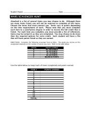
Procedure<br />
1. Prepare overhead or drawing to demonstrate longitude <strong>and</strong> latitude.<br />
2. Copy student lab sheet <strong>and</strong> map.<br />
3. Review/Introduce to students the use of longitude <strong>and</strong> latitude.<br />
4. Instruct students to complete worksheet by locating the longitude <strong>and</strong><br />
latitude of the ten cities listed. Then, use the longitude <strong>and</strong> latitude they<br />
determined to plot the cities on the world map.
LONGITUDE AND LATITUDE<br />
TEACHER PAGE<br />
Extensions<br />
• Study different types of maps: projections <strong>and</strong> topographic. Research<br />
cartography.<br />
• Discover how to find your latitude by using the altitude of stars.<br />
• Draw a map to scale.<br />
• Write for additional maps <strong>and</strong> information:<br />
National Cartographic Information <strong>Center</strong><br />
507 National <strong>Center</strong><br />
Reston, VA 22092<br />
• Take an old basketball <strong>and</strong> mark it with lines of longitude <strong>and</strong> latitude.
TEACHER PAGE<br />
LONGITUDE AND LATITUDE
LONGITUDE AND LATITUDE<br />
TEACHER PAGE
LONGITUDE AND LATITUDE<br />
TEACHER PAGE
LONGITUDE AND LATITUDE<br />
TEACHER PAGE
LONGITUDE AND LATITUDE<br />
TEACHER PAGE
LONGITUDE AND LATITUDE<br />
TEACHER PAGE
LONGITUDE AND LATITUDE<br />
TEACHER PAGE
LONGITUDE AND LATITUDE<br />
ANSWER KEY<br />
As an astronaut on the way to Mars, you have to plot the l<strong>and</strong>ing path. It<br />
will be important for you to be able to use longitude <strong>and</strong> latitude lines<br />
correctly. The longitude <strong>and</strong> latitude grid will help you to locate certain<br />
points on Mars.<br />
Directions: Practice this skill by locating the longitude <strong>and</strong> latitude of each of the cities listed<br />
below from the maps provided by your teacher. Since the cities are not located exactly on the<br />
grid lines, use an estimate of the degrees. When finished determining the longitude <strong>and</strong><br />
latitude, plot the cities on the world map.<br />
CITY LONGITUDE LATITUDE<br />
1. Greenwich, Engl<strong>and</strong> 0° 53°N<br />
2. Moscow, Russia 38°E 56°N<br />
3. New York, New York 74°W 41°N<br />
4. Sydney, Australia 151°E 34°S<br />
5. Beijing, China 116°E 40°N<br />
6. Buenos Aires, Argentina 58°W 35°S<br />
7. Capetown, South Africa 25°E 12°S<br />
8. Cario, Egypt 31°E 30°N<br />
9. Edmonton, Canada 114°W 53°N<br />
10. Calcutta, India 88°E 22°N