Complete UDC - Forsyth County Government
Complete UDC - Forsyth County Government
Complete UDC - Forsyth County Government

You also want an ePaper? Increase the reach of your titles
YUMPU automatically turns print PDFs into web optimized ePapers that Google loves.
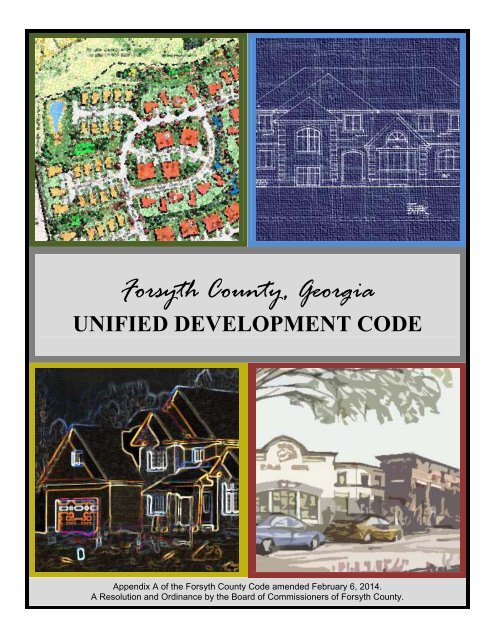
<strong>Forsyth</strong> <strong>County</strong>, Georgia<br />
UNIFIED DEVELOPMENT CODE<br />
Appendix A of the <strong>Forsyth</strong> <strong>County</strong> Code amended February 6, 2014.<br />
A Resolution and Ordinance by the Board of Commissioners of <strong>Forsyth</strong> <strong>County</strong>.
UNIFIED DEVELOPMENT CODE<br />
APPENDIX A OF THE FORSYTH COUNTY CODE OF ORDINANCES<br />
Amended 02-06-2014<br />
Board of Commissioners - Current Members<br />
Ralph J. Amos, Chairman<br />
Cindy Jones Mills, Vice Chairman<br />
Brian Tam, Secretary<br />
Todd Levent, Member<br />
Jim Boff, Member<br />
<strong>County</strong> Manager: Doug Derrer<br />
Director of Department of Planning and Community Development: Thomas W. Brown, AICP<br />
PREFACE<br />
<strong>Forsyth</strong> <strong>County</strong>’s first land use regulations went into effect in 1973. Another Resolution became effective<br />
on December 11, 1979, that replaced the prior regulations adopted some six years earlier. The preparation of the<br />
<strong>County</strong>’s Zoning and Land Use Resolution and Ordinance began in mid 1978. Over a 17-month period, the persons<br />
involved dedicated a great amount of voluntary time and effort to study and revise the draft. The goals of the<br />
revision process in 1978 and 1979 were to ensure orderly development of land use; to protect the citizens from harm<br />
arising out of disorderly development or improper construction techniques; and to make the regulations minimally<br />
restrictive, yet strong enough to achieve the goals in mind.<br />
The 1979 Resolution and Ordinance, most recently referred to as Ordinance 30J, has been amended and<br />
readopted a number of times to respond to changing conditions. As <strong>Forsyth</strong> <strong>County</strong> prepares to enter the New<br />
Millennium, a new set of zoning and subdivision regulations is needed.<br />
Toward that end, the <strong>Forsyth</strong> <strong>County</strong> Board of Commissioners, with technical assistance from the Georgia<br />
Mountains Regional Development Center and guidance from an appointed Master Land Use Committee, prepared<br />
an update to the land use element of the comprehensive plan of <strong>Forsyth</strong> <strong>County</strong> in 1997 and 1998. Among the many<br />
important goals of the land use plan are the following:<br />
(A) Encourage development patterns that avoid the uneconomical extension of public facilities and<br />
services and are more successful at creating a sense of community;<br />
(B) Manage growth so as to not overburden the <strong>County</strong> infrastructure nor significantly detract from quality<br />
of life;<br />
(C) Work toward a residential buildout population of 225,000 to 275,000 people;<br />
(D) Provide more detailed design guidance for major activity centers and commercial and industrial<br />
corridors to enhance the visual qualities of development;<br />
(E) Provide for developments containing mixes of office, commercial and residential uses;<br />
(F) Establish more flexible mixed-use development regulations and other flexible regulations that allow<br />
for creative site designs to accommodate site-specific conditions;<br />
(G) Strengthen the role of land development regulations in guiding the development of the <strong>County</strong>;
(H) Protect and conserve the beauty and integrity of the <strong>County</strong>’s natural features and historic resources;<br />
and<br />
(I) Encourage alternative modes of transportation.<br />
In 1999, the Board of Commissioners of <strong>Forsyth</strong> <strong>County</strong> appointed a thirty-two-member committee to<br />
guide the process of comprehensively revising Ordinance 30J to meet the goals of the land use plan. The committee<br />
represented a wide array of interests. <strong>Forsyth</strong> <strong>County</strong> also contracted with a planning and development consultant to<br />
help the staff of the Department of Planning and Development revise the existing regulations and prepare new<br />
chapters.<br />
The Unified Development Code represents a comprehensive revision of the <strong>County</strong>’s zoning and<br />
subdivision regulations to address growth and development issues the <strong>County</strong> will face in the first decade of the<br />
twenty-first century. However, changes to the code will periodically be proposed and considered because of the<br />
need to respond to citizens and to the changing conditions of our <strong>County</strong>. For these reasons, persons purchasing the<br />
code from the Department of Planning and Development should be aware that changes will be made periodically<br />
and should verify that they have the most current edition available.<br />
Anyone considering rezoning, construction, development or any other change in land use should consult<br />
with the Department of Planning and Development as early as possible to be sure any plans conform to the current<br />
land use requirements.<br />
Please remember this CAUTION: the regulations may be modified from time to time and any changes will<br />
govern.
Table of Contents<br />
Unified Development Code of <strong>Forsyth</strong> <strong>County</strong> - i -<br />
TABLE OF CONTENTS<br />
CHAPTER 1<br />
CHAPTER 2<br />
RESOLUTION AND ORDINANCE<br />
SHORT TITLE AND CONTENTS<br />
2-1.1 Short Title.<br />
2-1.2 Contents.<br />
CHAPTER 3<br />
DEFINITIONS<br />
ARTICLE I, GENERAL PROVISIONS REGARDING DEFINITIONS: (Revised 9/7/06)<br />
ARTICLE II, SPECIFIC DEFINITIONS: (Revised 10/2/08, 5/5/11, 12/1/11, 4/5/12, 5/3/12, 11/1/12, 1/3/13, 2/7/13)<br />
CHAPTER 4<br />
FORSYTH COUNTY PLANNING COMMISSION<br />
ARTICLE I, CONTINUATION:<br />
4-1.1 Continued Existence.<br />
4-1.2 Jurisdiction.<br />
ARTICLE II, POWERS AND DUTIES: (Revised 11/1/07)<br />
4-2.1 Comprehensive Plan.<br />
4-2.2 Small Area Plans.<br />
4-2.3 Zoning.<br />
4-2.4 Subdivision Regulations.<br />
4-2.5 Plats and Maps.<br />
4-2.6 Information to Officials.<br />
4-2.7 Public Hearings and Recommendations. (Revised 4/5/12)<br />
4-2.8 Variances.<br />
4-2.9 Minutes and Public Records.<br />
4-2.10 Additional Powers.<br />
ARTICLE III, APPOINTMENT, TERMS OF MEMBERSHIP AND DISMISSAL:<br />
4-3.1 Appointment.<br />
4-3.2 Terms. (Revised 7/1/10)<br />
4-3.3 Number.<br />
4-3.4 Officers.(Revised 12/1/11)<br />
4-3.5 Dismissal.<br />
CHAPTER 5<br />
FORSYTH COUNTY PLANNING & COMMUNITY DEVELOPMENT DEPARTMENT<br />
ARTICLE I, ESTABLISHMENT:<br />
5-1.1 Creation. (Revised 12/1/11)<br />
ARTICLE II, PERSONNEL: (Revised 12/16/10, 12/1/11)<br />
5-2.1 Director.<br />
ARTICLE III, FUNCTIONS, POWERS AND DUTIES:<br />
5-3.1 No Legislative Power.<br />
5-3.2 Functions.<br />
5-3.3 Assistance to Planning Commission and Zoning Board of Appeals. (Revised 12/1/11)<br />
5-3.4 Approval of Subdivisions.<br />
5-3.5 Administrative and Interpretative Functions.<br />
5-3.6 Enforcement Powers.<br />
5-3.7 Comprehensive Plan.
Table of Contents<br />
Unified Development Code of <strong>Forsyth</strong> <strong>County</strong> - ii -<br />
5-3.8 Zoning Regulations.<br />
5-3.9 Subdivision Regulations.<br />
5-3.10 Plats and Maps.<br />
5-3.11 Information to Officials.<br />
5-3.12 Recommendations.<br />
CHAPTER 6<br />
FORSYTH COUNTY ZONING BOARD OF APPEALS<br />
ARTICLE I, CONTINUATION:<br />
6-1.1 Existence Continued. (Revised 11/15/04, 7/1/10)<br />
ARTICLE II, MEETINGS AND RECORDS:<br />
6-2.1 Meetings. (Revised 11/15/04)<br />
6-2.2 Minutes and Public Records. (Revised 12/1/11)<br />
6-2.3 Person Responsible.<br />
ARTICLE III, POWERS: (Revised 4/3/08)<br />
6-3.1 Powers. (Revised 7/18/13)<br />
ARTICLE IV, APPEAL OF AN ADMINISTRATIVE DECISION OR ORDINANCE DECISION: (Revised<br />
11/1/07)<br />
6-4.1 Appeals of Administrative Decisions.<br />
ARTICLE V, VARIANCES: (Revised 11/15/04)<br />
6-5.1 Variances. (Revised 7/18/13)<br />
ARTICLE VI, APPEAL OF ZBA DECISIONS: (Revised 11/15/04)<br />
6-6.1 Administrative Decisions.<br />
6-6.2 Variances.<br />
6-6.3 Conflict with other ordinances.<br />
CHAPTER 7<br />
PERMITS, CERTIFICATES, FEES AND FINANCES<br />
ARTICLE I, LAND DISTURBANCE PERMITS:<br />
7-1.1 Land Disturbance Permit Required.<br />
7-1.2 Land Disturbance Permit Plan Review Procedures. (Revised 11/1/07, 7/18/13)<br />
7-1.3 Clearing and Grubbing and/or Grading Permits.<br />
7-1.4 Road Construction Permits.<br />
7-1.5 Site Development Permits.<br />
7-1.6 Erosion Control.<br />
7-1.7 Expiration. (Revised 11/15/04, 7/18/13)<br />
ARTICLE II, BUILDING PERMITS:<br />
7-2.1 When Required. (Revised 11/15/04)<br />
7-2.2 Erosion Control.<br />
7-2.3 Sewage Disposal.<br />
7-2.4 Water Supply.<br />
7-2.5 Land Disturbance Permit. (Revised 11/15/04)<br />
7-2.6 Application.<br />
7-2.7 Egress and Ingress Required.<br />
7-2.8 False Statement.<br />
7-2.9 Deviation From Application.<br />
7-2.10 Report of Deviations.<br />
7-2.11 Lots in Subdivisions.<br />
7-2.12 Application Review Period. (Revised 3/26/01)<br />
7-2.13 Expiration. (Revised 3/26/01)
Table of Contents<br />
Unified Development Code of <strong>Forsyth</strong> <strong>County</strong> - iii -<br />
ARTICLE III, TRADE PERMITS:<br />
7-3.1 Permits Required.<br />
ARTICLE IV, CERTIFICATES OF OCCUPANCY:<br />
7-4.1 When Required.<br />
7-4.2 Requirements to be Met.<br />
7-4.3 Duties of Department of Planning and Community Development. (Revised 12/1/11)<br />
7-4.4 Time of Application and Issuance.<br />
7-4.5 Denial and Notice.<br />
7-4.6 Furnishing of Utility Service.<br />
7-4.7 Records.<br />
ARTICLE V, STANDARDS FOR PERMITS AND CERTIFICATES:<br />
7-5.1 Compliance.<br />
7-5.2 Building Code. (Revised 11/15/04)<br />
7-5.3 Plumbing Code. (Revised 11/15/04)<br />
7-5.4 Mechanical Code. (Revised 11/15/04)<br />
7-5.5 Gas Code. (Revised 11/15/04)<br />
7-5.6 Electrical Code. (Revised 11/15/04)<br />
7-5.7 Energy Code.<br />
7-5.8 Review. (Revised 12/1/11)<br />
7-5.9 Inspections. (Revised 11/15/04, 12/1/11)<br />
7-5.10 Other Inspections. (Revised 11/15/04)<br />
7-5.11 Inspection Personnel. (Revised 12/1/11)<br />
7-5.12 Factory-built Housing. (Revised 12/1/11)<br />
7-5.13 Driveway Culverts.<br />
7-5.14 Building Sewers.<br />
ARTICLE VI, ZONING COMPLIANCE:<br />
7-6.1 Intent. (Revised 12/1/11)<br />
7-6.2 Certificate of Zoning Compliance. (Revised 12/1/11)<br />
7-6.3 Reliance.<br />
ARTICLE VII, FEES GENERALLY:<br />
7-7.1 Purpose.<br />
7-7.2 Revenue. (Revised 12/1/11)<br />
ARTICLE VIII, FEE AMOUNTS:<br />
7-8.1 Generally.<br />
7-8.2 Building Permits. (Revised 11/15/04)<br />
7-8.3 Certificate of Occupancy.<br />
7-8.4 Collecting Authority. (Revised 12/1/11)<br />
ARTICLE IX, FINANCES:<br />
7-9.1 Depository.<br />
7-9.2 Expenditures. (Revised 12/1/11)<br />
7-9.3 Advertising Fees. (Revised 12/1/11)<br />
CHAPTER 8 ZONING AND APPLICATION PROCEDURES (Revised 11/1/07, 12/1/11, 4/5/12,<br />
5/2/13)<br />
ARTICLE I, APPLICATION OF REGULATIONS:<br />
8-1.1 Authority to Amend.<br />
ARTICLE II, REQUIRED INFORMATION:<br />
8-2.1 Requirements for all Applications. (Revised 4/5/12, 5/2/13, 2/6/14)
Table of Contents<br />
Unified Development Code of <strong>Forsyth</strong> <strong>County</strong> - iv -<br />
8-2.2 Withdrawal of Applications.<br />
8-2.3 Reconsideration of Applications.<br />
8-2.4 Copies of Policies and Procedures.<br />
ARTICLE III, PUBLIC HEARINGS AND NOTICES FOR ALL APPLICATIONS: (revised 4/3/08)<br />
8-3.1 Public Hearing Required.<br />
8-3.2 Who Holds Hearings. (Revised 4/5/12, 7/18/13)<br />
8-3.3 Advertisement of Public Hearings. (Revised 4/5/12)<br />
8-3.4 Conduct of Public Hearings and Procedures for Considering Applications. (Revised 4/5/12)<br />
ARTICLE IV, AMENDING THE TEXT OF THIS CODE:<br />
8-4.1 Purpose and Intent.<br />
8-4.2 Authority to Amend.<br />
8-4.3 Statement of Policy.<br />
8-4.4 Procedures.<br />
8-4.5 Director’s Responsibilities.(Revised 12/1/11)<br />
ARTICLE V, REZONINGS, CONDITIONAL USE PERMITS, AND SKETCH PLATS: (Revised 4/5/12, 5/2/13)<br />
8-5.1 Purpose and Intent. (Revised 4/5/12)<br />
8-5.2 Authority to Amend. (Revised 4/5/12)<br />
8-5.3 When Required. (Revised 7/1/10, 4/5/12)<br />
8-5.4 Application Requirements. (Revised 10/7/10, 4/5/12, 5/2/13)<br />
8-5.5 Procedures. (Revised 7/1/10, 10/7/10, 4/5/12, 5/2/13)<br />
ARTICLE VI, VARIANCES:<br />
8-6.1 Purpose and Intent.<br />
8-6.2 When Required.<br />
8-6.3 Application Requirements. (Revised 7/18/13)<br />
8-6.4 Procedures. (Revised 12/1/11, 7/18/13)<br />
ARTICLE VII, APPEALS OF ADMINISTRATIVE DECISIONS:<br />
8-7.1 Purpose and Intent.<br />
8-7.2 When Required.<br />
8-7.3 Application Requirements. (Revised 10/7/10)<br />
8-7.4 Procedures.<br />
ARTICLE VIII, APPEAL OF ZONING BOARD OF APPEALS DECISIONS:<br />
8-8.1 Purpose and Intent.<br />
8-8.2 When Required.<br />
8-8.3 Application Requirements. (Revised 10/7/10)<br />
8-8.4 Procedures.<br />
ARTICLE IX, ZONING CONDITION AMENDMENTS:<br />
8-9.1 Purpose and Intent.<br />
8-9.2 When Required. (Revised 4/5/12)<br />
8-9.3 Application Requirements.<br />
8-9.4 Procedures.<br />
ARTICLE X, HOME OCUPATION APPLICATIONS: (Created 4/5/12)<br />
8-10.1 Purpose and Intent.<br />
8-10.2 When Required.<br />
8-10.3 Application Requirements.<br />
8-10.4 Procedures.<br />
ARTICLE XI, APPEAL OF BOARD OF COMMISSIONERS DECISIONS:<br />
8-11.1 Appeal of Board of Commissioners Decisions.
Table of Contents<br />
Unified Development Code of <strong>Forsyth</strong> <strong>County</strong> - v -<br />
CHAPTER 9<br />
ZONING AND OVERLAY DISTRICTS<br />
ARTICLE I, ESTABLISHMENT OF DISTRICTS:<br />
9-1.1 Establishment of Zoning Districts. (Revised 12/20/04, 7/1/10)<br />
9-1.2 Establishment of Overlay Districts. (Revised 4/3/08, 5/5/11, 5/3/12)<br />
9-1.3 Zoning District Boundaries.<br />
9-1.4 Overlay District Boundaries. (Revised 5/3/12, 2/6/14)<br />
ARTICLE II, INTERPRETATION OF DISTRICT BOUNDARIES:<br />
9-2.1 Property Lines.<br />
9-2.2 Street Centerlines.<br />
9-2.3 <strong>Government</strong> Lines.<br />
9-2.4 Lines Parallel to Street Centerlines.<br />
9-2.5 Stream or River Centerlines.<br />
9-2.6 Director Determination.<br />
CHAPTER 10<br />
GENERAL PROVISIONS AND NONCONFORMING SITUATIONS<br />
ARTICLE I, GENERAL PROVISIONS: (Revised 10/14/02)<br />
10-1.1 Application of Regulations.<br />
10-1.2 Minimum Requirements.<br />
10-1.3 Every Use Must Be On a Lot.<br />
10-1.4 One Principal Building On a Lot.<br />
10-1.5 Reduction in Performance Standards Prohibited. (Revised 11/1/12)<br />
10-1.6 Setback Reduction. (Revised 11/1/12)<br />
10-1.7 Setbacks and Buffers, <strong>Government</strong> Line. (Revised 11/15/04, 11/1/12)<br />
10-1.8 Setbacks and Buffers, Adjacent Local <strong>Government</strong>s. (Revised 11/15/04)<br />
10-1.9 Setbacks and Buffers, Lots Accessed from an Easement. (Revised 11/1/07, 11/1/12)<br />
10-1.10 Setback and Planting Requirements for Georgia Highway 400. (Revised 11/1/07, 10/7/10, 11/1/12)<br />
10-1.11 Height Limitations.<br />
10-1.12 Use Prohibited When Not Specified.<br />
10-1.13 Outside Construction. (Revised 11/15/04)<br />
10-1.14 Commercial Maintenance Requirements. (Revised 1/11/06)<br />
10-1.15 Setback Exemptions (Added 11/1/12)<br />
10-1.16 Setback Encroachments (Added 11/1/12, Revised 7/18/13)<br />
10-1.17 Determination of Setbacks (Added 11/1/12)<br />
10-1.18 Determination of Yards (Added 11/1/12)<br />
ARTICLE II, NONCONFORMING SITUATIONS:<br />
10-2.1 Nonconforming Lots. (Revised 11/15/04)<br />
10-2.2 Nonconforming Structures. (Revised 11/15/04)<br />
10-2.3 Nonconforming Uses. (Revised 11/15/04)<br />
10-2.4 Buildings Under Construction. (Revised 11/15/04)<br />
CHAPTER 11 RESIDENTIAL DISTRICTS (Revised 12/13/07, 1/3/13, 5/2/13)<br />
ARTICLE I, RESIDENTIAL DISTRICTS PRIOR TO <strong>UDC</strong> VERSION 5: (Created 1/3/13)<br />
11-1.1 Purpose and Intent.<br />
11-1.2 Permitted Uses.<br />
11-1.3 Performance Standards.<br />
ARTICLE II, SINGLE FAMILY RESIDENTIAL DISTRICT (Res1):<br />
11-2.1 Purpose and Intent. (Revised 1/3/12)<br />
11-2.2 Permitted Uses. (Revised 12/1/05, 7/1/10, 4/5/12, 5/3/12, 1/3/13, 2/7/13)<br />
11-2.3 Performance Standards. (Revised 12/1/05, 11/1/12, 1/3/13)
Table of Contents<br />
Unified Development Code of <strong>Forsyth</strong> <strong>County</strong> - vi -<br />
ARTICLE III, SINGLE FAMILY RESIDENTIAL DISTRICT (Res2):<br />
11-3.1 Purpose and Intent.<br />
11-3.2 Permitted Uses. (Revised 12/13/07, 7/1/10, 4/5/12, 5/3/12, 1/3/13, 2/7/13)<br />
11-3.3 Performance Standards. (Revised 11/1/12)<br />
ARTICLE IV, SINGLE FAMILY RESIDENTIAL DISTRICT (Res3):<br />
11-4.1 Purpose and Intent. (Revised 11/1/07)<br />
11-4.2 Permitted Uses. (Revised 12/13/07, 7/1/10, 4/5/12, 5/3/12, 1/3/13, 2/7/13)<br />
11-4.3 Performance Standards. (Revised 11/1/12, 5/2/13, 7/18/13)<br />
11-4.4 Special Application Requirements.<br />
ARTICLE V, SINGLE FAMILY RESIDENTIAL DISTRICT (Res4):<br />
11-5.1 Purpose and Intent. (Revised 11/1/07)<br />
11-5.2 Permitted Uses. (Revised 12/13/07, 7/1/10, 4/5/12, 5/3/12, 1/3/13, 2/7/13)<br />
11-5.3 Performance Standards. (Revised 11/1/12, 7/18/13)<br />
11-5.4 Special Application Requirements. (Revised 11/1/07)<br />
ARTICLE VI, MULTI FAMILY RESIDENTIAL DISTRICT (Res6):<br />
11-6.1 Purpose and Intent. (Revised 11/1/07)<br />
11-6.2 Permitted Uses. (Revised 12/13/07, 7/1/10, 4/5/12, 5/3/12, 1/3/13, 2/7/13)<br />
11-6.3 Performance Standards. (Revised 11/1/12)<br />
11-6.4 Special Application Requirements. (Revised 11/1/07)<br />
ARTICLE VII, MANUFACTURED/MOBILE HOME PARK DISTRICT (MHP):<br />
11-7.1 Purpose and Intent. (Revised 2/7/13)<br />
11-7.2 Permitted Uses. (Revised 7/1/10, 4/5/12, 5/3/12, 1/3/13, 2/7/13)<br />
11-7.3 Performance Standards. (Revised 11/1/12)<br />
11-7.4 Site Plan Review & Approval Required. (Revised 2/7/13)<br />
11-7.5 General Development Requirements. (Revised 2/7/13)<br />
11-7.6 Home Spaces in Manufactured/Mobile Home Parks. (Revised 2/7/13)<br />
CHAPTER 12 COMMERCIAL AND OFFICE DISTRICTS (Revised 10/2/08, 4/5/12)<br />
ARTICLE I, NEIGHBORHOOD SHOPPING DISTRICT (NS):<br />
12-1.1 Purpose and Intent.<br />
12-1.2 Permitted and Conditional Uses. (Revised 10/2/08, 4/5/12, 5/3/12, 1/3/13)<br />
12-1.3 Performance Standards. (Revised 7/1/10, 11/1/12)<br />
12-1.4 Site Development Regulations.<br />
ARTICLE II, URBAN VILLAGE DISTRICT (UV):<br />
12-2.1 Purpose and Intent.<br />
12-2.2 Permitted and Conditional Uses. (Revised 10/2/08, 4/5/12, 5/3/12, 1/3/13)<br />
12-2.3 Performance Standards. (Revised 7/1/10, 11/1/12)<br />
12-2.4 Site Development Regulations.<br />
ARTICLE III, COMMERCIAL BUSINESS DISTRICT (CBD):<br />
12-3.1 Purpose and Intent. (Revised 1/11/06)<br />
12-3.2 Permitted and Conditional Uses. (Revised 10/2/08, 4/5/12, 5/3/12, 1/3/13)<br />
12-3.3 Performance Standards. (Revised 7/1/10, 11/1/12)<br />
12-3.4 Site Development Regulations.<br />
ARTICLE IV, HIGHWAY BUSINESS DISTRICT (HB):<br />
12-4.1 Purpose and Intent.<br />
12-4.2 Permitted and Conditional Uses. (Revised 10/2/08, 4/5/12, 5/3/12, 1/3/13)<br />
12-4.3 Performance Standards. (Revised 7/1/10, 11/1/12)<br />
12-4.4 Site Development Regulations.
Table of Contents<br />
Unified Development Code of <strong>Forsyth</strong> <strong>County</strong> - vii -<br />
ARTICLE V, HEAVY COMMERCIAL DISTRICT (HC):<br />
12-5.1 Purpose and Intent.<br />
12-5.2 Permitted and Conditional Uses. (Revised 10/2/08, 4/5/12, 5/3/12, 1/3/13)<br />
12-5.3 Performance Standards. (Revised 7/1/10, 11/1/12)<br />
12-5.4 Site Development Regulations.<br />
ARTICLE VI, BUSINESS PARK (BP):<br />
12-6.1 Purpose and Intent.<br />
12-6.2 Permitted and Conditional Uses. (Revised 10/2/08, 4/5/12, 5/3/12, 1/3/13)<br />
12-6.3 Performance Standards. (Revised 7/1/10, 11/1/12)<br />
12-6.4 Site Development Regulations.<br />
ARTICLE VII, OFFICE AND INSTITUTIONAL DISTRICT (O&I):<br />
12-7.1 Purpose and Intent.<br />
12-7.2 Permitted and Conditional Uses. (Revised 10/2/08, 4/5/12, 5/3/12, 1/3/13)<br />
12-7.3 Performance Standards. (Revised 7/1/10, 11/1/12)<br />
12-7.4 Site Development Regulations.<br />
ARTICLE VIII, OFFICE RESIDENTIAL DISTRICT (OR):<br />
12-8.1 Purpose and Intent.<br />
12-8.2 Permitted and Conditional Uses. (Revised 10/2/08, 4/5/12, 5/3/12, 1/3/13)<br />
12-8.3 Performance Standards. (Revised 7/1/10, 11/1/12)<br />
12-8.4 Site Development Regulations.<br />
ARTICLE IX, OFFICE COMMERCIAL MULTIPLE STORY DISTRICT (OCMS):<br />
12-9.1 Purpose and Intent.<br />
12-9.2 Permitted and Conditional Uses. (Revised 10/2/08, 4/5/12, 5/3/12, 1/3/13)<br />
12-9.3 Performance Standards. (Revised 7/1/10, 11/1/12)<br />
12-9.4 Site Development Regulations.<br />
ARTICLE X, GENERAL SITE DEVELOPMENT AND DESIGN REGULATIONS FOR ALL COMMERCIAL<br />
AND OFFICE DISTRICTS:<br />
12-10.1 Purpose and Intent.<br />
12-10.2 Applicability.<br />
12-10.3 Utilities.<br />
12-10.4 Grading and Site Development. (Revised 9/7/06)<br />
12-10.5 Curb Cuts and Access Specifications. (Revised 11/15/04)<br />
12-10.6 Interparcel Connections. (Revised 11/1/07)<br />
12-10.7 Location of Loading and Unloading Areas.<br />
12-10.8 Location of Parking Areas.<br />
12-10.9 Open Display of Vehicles, Equipment, and Merchandise. (Revised 11/1/07)<br />
12-10.10 Screening of Outside Storage Yards. (Revised 2/1/07)<br />
12-10.11 Screening of Dumpsters.<br />
12-10.12 Outdoor Lighting. (Revised 11/15/04)<br />
12-10.13 Building Materials.<br />
12-10.14 Building and Utility Appurtenances.<br />
12-10.15 Landscaping. (Revised 11/1/07, 12/1/11)<br />
12-10.16 Signage. (Revised 9/7/06)<br />
12-10.17 Plans. (Revised 12/1/11)<br />
12-10.18 Maintenance.<br />
12-10.19 Fencing (Revised 2/1/07)<br />
ARTICLE XI, ADDITIONAL REQUIREMENTS FOR LARGE-SCALE RETAIL ESTABLISHMENTS 40,000<br />
SQUARE FEET OR GREATER: (Revised 1/11/06)<br />
12-11.1 Purpose and Intent.
Table of Contents<br />
Unified Development Code of <strong>Forsyth</strong> <strong>County</strong> - viii -<br />
12-11.2 Restrictive Covenants.<br />
12-11.3 Delivery and Garbage Pick-up.<br />
12-11.4 Infrastructure Requirements.<br />
12-11.5 Site Design Guidelines and Requirements. (Revised 11/1/07, 7/1/10)<br />
12-11.6 Architectural Design Standards. (Revised 11/1/07)<br />
ARTICLE XII, ADDITIONAL REQUIREMENTS FOR LARGE-SCALE RETAIL ESTABLISHMENTS 75,000<br />
SQUARE FEET OR GREATER: (Revised 1/11/06)<br />
12-12.1 Re-use of Properties.<br />
12-12.2 Vacancy Maintenance Requirements.<br />
12-12.3 Location Criteria.<br />
CHAPTER 13<br />
DESIGN GUIDELINES FOR ACTIVITY CENTERS<br />
ARTICLE I, PURPOSE AND INTENT: (Revised 11/15/04)<br />
ARTICLE II, DESIGN STANDARDS:<br />
13-2.1 Detention Basins.<br />
13-2.2 Connectivity and Roadway Design Criteria.<br />
13-2.3 Building Height and Mass.<br />
13-2.4 Arrangement and Siting of Buildings.<br />
13-2.5 Compatibility.<br />
13-2.6 Building Appearance and Architectural Details. (Revised 11/1/12)<br />
13-2.7 Signage.<br />
13-2.8 Parking.<br />
13-2.9 Landscaping, Trees, and Natural Environment.<br />
13-2.10 Public Spaces and Streetscape Improvements.<br />
13-2.11 Pedestrian and Bicycle Access and Connections.<br />
13-2.12 Transit Access and Connections.<br />
13-2.13 Lighting. (Revised 11/15/04)<br />
CHAPTER 14 INDUSTRIAL AND MINING DISTRICTS (Revised 10/2/08, 4/5/12, 5/3/12)<br />
ARTICLE I, RESTRICTED INDUSTRIAL DISTRICT (M1):<br />
14-1.1 Purpose and Intent.<br />
14-1.2 Permitted and Conditional Uses. (Revised 10/2/08, 4/5/12, 5/3/12, 1/3/13)<br />
14-1.3 Performance Standards. (Revised 7/1/10, 11/1/12)<br />
14-1.4 Site Development Regulations.<br />
ARTICLE II, HEAVY INDUSTRIAL DISTRICT (M2):<br />
14-2.1 Purpose and Intent.<br />
14-2.2 Permitted and Conditional Uses. (Revised 10/2/08, 4/5/12, 5/3/12, 1/3/13)<br />
14-2.3 Performance Standards. (Revised 7/1/10)<br />
14-2.4 Site Development Regulations.<br />
14-2.5 Application Requirements for Conditional Uses.<br />
ARTICLE III, MINING OPERATIONS DISTRICT (MINE):<br />
14-3.1 Purpose and Intent.<br />
14-3.2 Permitted Uses. (Revised 10/2/08, 4/5/12, 5/3/12)<br />
14-3.3 Performance Standards. (Revised 7/1/10)<br />
14-3.4 Site Development Regulations.<br />
14-3.5 Application Requirements.<br />
ARTICLE IV, GENERAL SITE DEVELOPMENT AND DESIGN REGULATIONS FOR INDUSTRIAL AND<br />
MINING DISTRICTS:<br />
14-4.1 Purpose and Intent.
Table of Contents<br />
Unified Development Code of <strong>Forsyth</strong> <strong>County</strong> - ix -<br />
14-4.2 Applicability.<br />
14-4.3 Utilities.<br />
14-4.4 Grading and Site Development. (Revised 9/7/06, 12/1/11)<br />
14-4.5 Curb Cuts and Access Specifications. (Revised 12/1/11)<br />
14-4.6 Interparcel Connections.<br />
14-4.7 Location of Loading and Unloading Areas.<br />
14-4.8 Screening of Outside Storage Yards.<br />
14-4.9 Screening of Dumpsters. (Revised 11/15/04)<br />
14-4.10 Outdoor Lighting. (Revised 11/15/04)<br />
14-4.11 Building Materials.<br />
14-4.12 Building and Utility Appurtenances.<br />
14-4.13 Landscaping. (Revised 9/7/06, 12/1/11)<br />
14-4.14 Signage. (Revised 9/7/06)<br />
14-4.15 Plans. (Revised 12/1/11)<br />
CHAPTER 15 AGRICULTURAL DISTRICTS (Revised 10/2/08, 7/1/10, 4/5/12, 5/3/12)<br />
ARTICLE I, AGRICULTURAL DISTRICT (A1):<br />
15-1.1 Purpose and Intent.<br />
15-1.2 Permitted Uses. (Revised 10/2/08, 7/1/10, 10/7/10, 4/5/12, 5/3/12, 1/3/13)<br />
15-1.3 Performance Standards.<br />
ARTICLE II, AGRICULTURAL-RESIDENTIAL DISTRICT (AG-RES):<br />
15-2.1 Purpose and Intent.<br />
15-2.2 Permitted Uses. (Revised 10/2/08, 7/1/10, 4/5/12, 5/3/12, 1/3/13)<br />
15-2.3 Performance Standards. (Revised 11/1/12)<br />
CHAPTER 16 SUPPLEMENTARY REGULATIONS FOR SPECIFIC USES (Revised 10/2/08,<br />
4/5/12)<br />
ARTICLE I, AIRPORTS AND HELIPORTS: (Revised 10/2/08)<br />
16-1.1 Generally. (Revised 10/2/08)<br />
16-1.2 Types of Permits. (Revised 10/2/08)<br />
16-1.3 Permit Issuance, General Airport Uses.<br />
16-1.4 Permit Issuance, Limited Airport Uses.<br />
16-1.5 Permit Issuance, Heliport Use. (Revised 10/2/08)<br />
ARTICLE II, COMMUNICATION TOWERS AND COMMUNICATION ANTENNA PERMITS:<br />
16-2.1 Purpose and Intent.<br />
16-2.2 Applicability.<br />
16-2.3 General Requirements.<br />
16-2.4 Application Requirements.<br />
16-2.5 Zoning Requirements. (Revised 11/15/04)<br />
16-2.6 Performance and Construction Standards. (Revised 11/15/04)<br />
16-2.7 Variances.<br />
ARTICLE III, HOME BUSINESSES:<br />
16-3.1 Classification of Home Businesses. (Revised 11/15/04, 6/2/11, 4/5/12)<br />
16-3.2 General Requirements and Performance Criteria. (Revised 11/15/04, 4/5/12)<br />
16-3.3 Procedures. (Revised 11/1/07, 12/1/11, 4/5/12)<br />
ARTICLE IV, SUPPLEMENTARY REGULATIONS FOR SPECIFIC USES:<br />
16-4.1 Accessory Structures in Residential Districts. (Revised 9/7/06, 12/2/10, 1/6/11)<br />
16-4.2 Accessory Apartments, Attached. (Revised 9/7/06, 2/7/13)<br />
16-4.3 Accessory Apartments, Detached. (Revised 9/7/06)<br />
16-4.4 Automobile Sales Establishments.
Table of Contents<br />
Unified Development Code of <strong>Forsyth</strong> <strong>County</strong> - x -<br />
16-4.5 Churches, Temples, Synagogues, and Places of Worship. (Revised 11/15/04, 1/3/13)<br />
16-4.6 Commercial Recreational Facilities, Outdoor. (Revised 9/7/06)<br />
16-4.7 Condominiums. (Revised 9/25/03)<br />
16-4.8 Senior Housing. (Revised 12/13/07)<br />
16-4.9 Convenience Stores.<br />
16-4.10 Demolition of Historic Structures.<br />
16-4.11 Drive-Through Facilities.<br />
16-4.12 Fences and Walls. (Revised 11/1/07, 11/1/12)<br />
16-4.13 Horses. (Revised 9/25/03)<br />
16-4.14 Junk Vehicles.<br />
16-4.15 Junk Yards.<br />
16-4.16 Livestock. (Revised 9/25/03)<br />
16-4.17 Manufactured/Mobile Homes. (Revised 11/15/04, 2/7/13)<br />
16-4.18 Manufactured/Mobile Homes for Health Hardships and Elderly Housing. (Revised 9/25/03, 2/7/13)<br />
16-4.19 Removal. (Revised 11/15/04, 2/7/13)<br />
16-4.20 Mini-Warehouses.<br />
16-4.21 Outdoor Lighting. (Revised 7/17/08)<br />
16-4.22 Poultry Houses.<br />
16-4.23 Sand Dredging Within Creek Banks.<br />
16-4.24 Storage of Petroleum Products and Explosives.<br />
16-4.25 Timber Harvesting (Created 4/5/12)<br />
16-4.26 Townhouses. (Revised 11/15/04, 11/1/12)<br />
16-4.27 Transportation and Utility Facilities.<br />
CHAPTER 17<br />
PARKING AND LOADING REGULATIONS<br />
ARTICLE I, PURPOSE AND APPLICABILITY:<br />
17-1.1 Purpose and Intent.<br />
17-1.2 Applicability.<br />
ARTICLE II, REQUIRED PARKING:<br />
17-2.1 Required Minimum Number of Parking Spaces. (Revised 9/7/06, 2/7/13)<br />
17-2.2 Interpretations of Parking Requirements.<br />
17-2.3 Reduction of Required Parking for Off-Site Arrangements.<br />
17-2.4 Reduction of Required Parking for Mixed or Joint Use of Parking Spaces.<br />
17-2.5 Reduction of Required Parking for Alternative Transportation Arrangements.<br />
17-2.6 Reduction of Required Parking When On-Street Parking is Permitted.<br />
17-2.7 Parking Maximums. (Revised 6/7/11)<br />
17-2.8 Parking Space and Isle Specifications. (Revised 11/1/07, 6/2/11)<br />
ARTICLE III, LOADING AREAS:<br />
17-3.1 Loading Areas Required for Specified Uses.<br />
17-3.2 Loading Area Specifications.<br />
17-3.3 Minimum Number of Off-Street Loading Spaces Required.<br />
ARTICLE IV, GENERAL PARKING AND LOADING AREA SPECIFICATIONS:<br />
17-4.1 Location of Parking and Loading Areas. (Revised 12/1/11)<br />
17-4.2 Accessory Uses of Parking Lots and Loading Areas.<br />
ARTICLE V, PARKING AND LOADING AREA IMPROVEMENT REQUIREMENTS:<br />
17-5.1 Access.<br />
17-5.2 Drainage.<br />
17-5.3 Surfacing. (Revised 11/15/04)<br />
17-5.4 Striping.<br />
17-5.5 Lighting. (Revised 11/15/04)<br />
17-5.6 Signs.
Table of Contents<br />
Unified Development Code of <strong>Forsyth</strong> <strong>County</strong> - xi -<br />
17-5.7 Landscaping. (Revised 2/1/07)<br />
ARTICLE VI, SPECIAL PARKING REQUIREMENTS:<br />
17-6.1 Accessible Parking Spaces. (Revised 11/15/04)<br />
17-6.2 Stacking Spaces for Drive-Through Facilities.<br />
17-6.3 Semi-Tractor Trailer Parking.<br />
17-6.4 Commercial Vehicles in Agricultural Zoning Districts. (06/2/11)<br />
ARTICLE VII, PLANS:<br />
CHAPTER 18<br />
SUBDIVISIONS AND LAND DEVELOPMENT<br />
ARTICLE I, PURPOSE AND ADMINISTRATIVE PROVISIONS:<br />
18-1.1 Title.<br />
18-1.2 Purposes.<br />
18-1.3 Authority and Delegation. (Revised 11/1/07, 12/1/11, 7/18/13)<br />
18-1.4 Applicability and Prohibitions.<br />
18-1.5 Exemptions from Plat Approval. (Revised 3/26/01)<br />
18-1.6 Variances.<br />
18-1.7 Appeals. (Revised 11/15/04)<br />
18-1.8 Enforcement, Violations, and Penalties. (Revised 12/1/11)<br />
ARTICLE II, GENERAL PROVISIONS:<br />
18-2.1 Land is One Tract until Subdivided. (Revised 11/1/07, 11/1/12)<br />
18-2.2 Lot Combinations. (Revised 11/1/12)<br />
18-2.3 Boundary Line Adjustments. (Revised 11/1/12)<br />
18-2.4 Access Requirements. (Revised 11/15/04)<br />
ARTICLE III, STREETS AND DEDICATIONS IN MAJOR SUBDIVISIONS:<br />
18-3.1 Requirements for Streets. (Revised 11/15/04, 12/1/11)<br />
18-3.2 Dedications, Generally.<br />
ARTICLE IV, DESIGN REQUIREMENTS FOR LOTS:<br />
18-4.1 Adequate Building Area Required. (Revised 11/1/12)<br />
18-4.2 Lot Remnants Shall Not Be Permitted.<br />
18-4.3 Service Areas.<br />
18-4.4 Lot Area.<br />
18-4.5 Lot Width.<br />
18-4.6 Side Lot Lines.<br />
18-4.7 Corner Lots. (Revised 11/1/07, 11/1/12)<br />
18-4.8 Lot Depth.<br />
18-4.9 Double Frontage Lots. (Revised 11/15/04)<br />
18-4.10 Locations Adjacent to Major Street. (Revised 11/15/04, 11/1/12)<br />
18-4.11 Drainage. (Revised 11/1/07)<br />
18-4.12 Natural Features and Assets.<br />
18-4.13 Flag Lots and Tracts Prohibited.<br />
ARTICLE V, REQUIRED IMPROVEMENTS:<br />
18-5.1 Required Improvements.<br />
18-5.2 Improvements Mandatory.<br />
18-5.3 Plans Required.<br />
18-5.4 Engineered Drawings.<br />
18-5.5 Survey Monuments for Subdivisions.<br />
18-5.6 Streets.<br />
18-5.7 Street Signs.<br />
18-5.8 Curbs and Gutters.<br />
18-5.9 Sidewalks, When Required.
Table of Contents<br />
Unified Development Code of <strong>Forsyth</strong> <strong>County</strong> - xii -<br />
18-5.10 Sidewalks, Location.<br />
18-5.11 Improvements on Abutting Public Streets.<br />
18-5.12 Reserve Strips.<br />
18-5.13 Grading.<br />
18-5.14 Drainage System. (Revised 11/1/07)<br />
18-5.15 Drainage Easements and Riparian Buffers. (Revised 11/1/07)<br />
18-5.16 Water Main Requirements. (Revised 11/1/07)<br />
18-5.17 Water System Requirements. (Revised 12/1/11, 4/5/12)<br />
18-5.18 Sewage System. (Revised 2/23/04, 4/5/12)<br />
18-5.19 Water Impounding Structures. (Revised 11/1/07)<br />
18-5.20 Oversizing of Improvements and Utilities.<br />
18-5.21 Fire Flow and Fire Access. (Revised 11/1/07)<br />
18-5.22 Subdivision Improvement Guarantees.<br />
18-5.23 Common/Amenities Areas. (Revised 11/15/04)<br />
18-5.24 Maintenance of Common, Non-Public Facilities. (Revised 11/1/07)<br />
18-5.25 Utilities. (Revised 11/15/04)<br />
ARTICLE VI, APPLICATION REQUIREMENTS AND PROCEDURES:<br />
18-6.1 Application Requirements. (Revised 12/1/11, 11/1/12)<br />
18-6.2 Sketch Plat. (Revised 11/1/07)<br />
18-6.3 Construction Plans. (Revised 11/1/07, 12/1/11)<br />
18-6.4 Final Plat. (Revised 11/1/07, 12/1/11)<br />
ARTICLE VII, SUPPLEMENTARY PROVISIONS FOR MINOR SUBDIVISIONS:<br />
18-7.1 Flag Lots. (Revised 3/26/01)<br />
18-7.2 Access. (Revised 11/15/04)<br />
18-7.3 Limitations on Minor Subdivisions. (Revised 11/1/07)<br />
ARTICLE VIII, INTRAFAMILY LAND TRANSFERS:<br />
18-8.1 Eligibility.<br />
18-8.2 Plat and Procedural Requirements. (Revised 12/1/11)<br />
ARTICLE IX, PRIVATE STREETS:<br />
18-9.1 Private Streets Permitted. (Revised 5/12/03)<br />
18-9.2 General Provisions.<br />
18-9.3 Street Names and Easements for Private Streets. (Revised 3/26/01)<br />
18-9.4 Maintenance.<br />
18-9.5 Specifications for Plats Involving Private Streets.<br />
18-9.6 Requirement for Purchaser’s Acknowledgement of Private Responsibilities.<br />
ARTICLE X, GENERAL BUFFER REGULATIONS: (Enacted 11/1/07)<br />
18-10.1 Buffer Protection Requirements.<br />
18-10.2 Augmentation.<br />
18-10.3 Prohibited Encroachments. (Revised 11/1/12)<br />
18-10.4 Buffer Measurement.<br />
18-10.5 Buffer Controls by Type. (Revised 10/7/10, 12/1/11, 11/1/12, 1/3/13)<br />
ARTICLE XI, STREAM BUFFER REQUIREMENTS: (Enacted 11/1/07)<br />
18-11.1 Applicability.<br />
18-11.2 Stream Buffer Requirements. (Revised 12/1/11)<br />
18-11.3 Administration of Stream Buffer Requirements.<br />
CHAPTER 19<br />
CONSERVATION SUBDIVISIONS<br />
ARTICLE I, PURPOSE AND INTENT: (Revised 11/1/07)
Table of Contents<br />
Unified Development Code of <strong>Forsyth</strong> <strong>County</strong> - xiii -<br />
ARTICLE II, APPLICABILITY OF CHAPTER 18 AND CHAPTER 11 TO CONSERVATION SUBDIVISIONS:<br />
(Revised 11/1/07)<br />
ARTICLE III, CONSERVATION AREAS AND OPEN SPACES:<br />
19-3.1 Primary Conservation Areas. (Revised 11/1/07)<br />
19-3.2 Secondary Conservation Areas. (Revised 11/1/07)<br />
19-3.3 Guidelines for Secondary Conservation Areas. (Revised 11/1/07)<br />
19-3.4 Required Open Space Specifications. (Revised 11/1/07)<br />
19-3.5 Standards for Designing Open Space Networks. (Revised 11/1/07)<br />
19-3.6 Conservation Easement Required. (Revised 11/1/07)<br />
19-3.7 Guidelines for Drafting Conservation Easements.<br />
19-3.8 Required Ownership of Open Spaces.<br />
19-3.9 Homeowners Association. (Revised 11/1/07)<br />
19-3.10 Fee Simple Dedication to <strong>Forsyth</strong> <strong>County</strong>. (Revised 12/1/11)<br />
ARTICLE IV, DESIGN STANDARDS AND GUIDELINES FOR LOT CONFIGURATIONS AND<br />
BUILDING ORIENTATIONS: (Revised 11/1/07, 11/1/12)<br />
ARTICLE V, REQUIREMENTS:<br />
19-5.1 Density, Lot Size, and Yield Plan. (Revised 11/1/07)<br />
19-5.2 Sewage Treatment and Disposal Systems. (Revised 11/1/07)<br />
19-5.3 Riparian Buffers. (Repealed 11/1/07)<br />
ARTICLE VI, DESIGN STANDARDS AND GUIDELINES FOR STREETS:<br />
19-6.1 Introduction. (Revised 11/1/07)<br />
19-6.2 Location and Alignment.<br />
19-6.3 Lengths and Curves.<br />
19-6.4 Separate Travel Lanes.<br />
19-6.5 Right-of-Way Clearance.<br />
19-6.6 Connections. (Revised 11/1/07)<br />
19-6.7 Cul-de-Sacs. (Revised 11/1/07)<br />
19-6.8 Reverse Curves.<br />
19-6.9 Single-Loading Streets.<br />
19-6.10 Curbs and Drainage.<br />
19-6.11 Street Trees.<br />
19-6.12 Sidewalks.<br />
19-6.13 Signage.<br />
ARTICLE VII, PROCEDURES:<br />
19-7.1 Pre-application Conference. (Revised 11/1/07, 12/1/11)<br />
19-7.2 Existing Features and Site Analysis. (Revised 11/1/07)<br />
19-7.3 Yield Plan. (Enacted 11/1/07)<br />
ARTICLE VIII, CRITERIA FOR APPROVAL:<br />
19-8.1 Evaluation Criteria for Approval. (Revised 11/1/07)<br />
19-8.2 Justifiable Grounds for Denial. (Revised 11/1/07)<br />
CHAPTER 20 PLANNED UNIT DEVELOPMENTS (Revised 5/17/04)<br />
ARTICLE I, PURPOSE AND INTENT AND APPLICABILITY:<br />
20-1.1 Purpose and Intent.<br />
20-1.2 Development as a Unit.<br />
ARTICLE II, USES WITHIN PLANNED UNIT DEVELOPMENT DISTRICTS:<br />
20-2.1 Generally.<br />
20-2.2 Recommendations.
Table of Contents<br />
Unified Development Code of <strong>Forsyth</strong> <strong>County</strong> - xiv -<br />
ARTICLE III, PERFORMANCE STANDARDS:<br />
20-3.1 Minimum Acreage.<br />
20-3.2 Dimensional Requirements. (Revised 11/1/12)<br />
20-3.3 Residential Density.<br />
20-3.4 Recommendations for Design.<br />
ARTICLE IV, APPLICATION REQUIREMENTS AND PROCEDURES: (Revised 5/17/04)<br />
20-4.1 Revisions.<br />
ARTICLE V, PERMITS AND CERTIFICATES:<br />
20-5.1 Building Permits. (Revised 12/1/11)<br />
20-5.2 Certificate of Occupancy. (Revised 12/1/11)<br />
20-5.3 Other Permits or Certificates.<br />
20-5.4 Control of Area Following Completion.<br />
CHAPTER 20(B) MASTER PLANNED DISTRICT (Revised 12-20-04)<br />
ARTICLE I, PURPOSE AND INTENT:<br />
20B-1.1 Purpose and Intent.<br />
ARTICLE II, USES PERMITTED:<br />
20B-2.1 General.<br />
20B-2.2 Commercial and Office Uses.<br />
20B-2.3 Residential Uses.<br />
20B-2.4 Open Space.<br />
ARTICLE III, GENERAL CONDITIONS:<br />
20B-3.1 Traffic Study.<br />
20B-3.2 Code Provisions.<br />
20B-3.3 Water and Sewer.<br />
20B-3.4 Variance Requests.<br />
20B-3.5 Residential Density. (Revised 7/1/10)<br />
ARTICLE IV, PROCEDURES:<br />
20B-4.1 Pre-Application Meeting.<br />
20B-4.2 Master Development Plan.<br />
ARTICLE V, CRITERIA FOR APPROVAL:<br />
20B-5.1 Standard Criteria.<br />
20B-5.2 Design Criteria.<br />
ARTICLE VI, AMENDMENTS:<br />
20B-6.1 Conformance to Approved Master Development Plan.<br />
20B-6.2 Minor Amendments.<br />
20B-6.3 Major Amendments.<br />
CHAPTER 21<br />
OVERLAY DISTRICTS<br />
ARTICLE I, GENERAL PROVISIONS:<br />
21-1.1 Purpose. (Revised 11/15/04)<br />
21-1.2 Applicability.<br />
ARTICLE II, PROTECTED WATER SUPPLY WATERSHED OVERLAY DISTRICT:<br />
21-2.1 Minimum Criteria for the Big Creek Small Water Supply Watersheds. (Revised 7/1/10)
Table of Contents<br />
Unified Development Code of <strong>Forsyth</strong> <strong>County</strong> - xv -<br />
21-2.2 Minimum Criteria for the Etowah and Upper Chattahoochee Large Water Supply Watersheds.<br />
ARTICLE III, PROTECTED GROUNDWATER RECHARGE DISTRICT:<br />
21-3.1 Permitted Uses. (Revised 2/7/13)<br />
21-3.2 Exemptions.<br />
ARTICLE IV, THE ETOWAH RIVER CORRIDOR PROTECTION DISTRICT:<br />
21-4.1 Permitted Uses.<br />
21-4.2 Exemptions.<br />
ARTICLE V, WETLAND PROTECTION DISTRICT:<br />
21-5.1 Permitted Uses.<br />
ARTICLE VI, ATLANTA HIGHWAY-McFARLAND PARKWAY-MULLINAX ROAD OVERLAY DISTRICT.<br />
(Revised 6/21/04, 5/5/11, 5/3/12)<br />
21-6.1 Purpose.<br />
21-6.2 District delineation.<br />
21-6.3 Permitted uses.<br />
21-6.4 Design plan review.<br />
21-6.5 Site Design Standards<br />
ARTICLE VII, CASTLEBERRY-BETHELVIEW CROSSROADS OVERLAY ZONING DISTRICT: (Revised<br />
1/4/07)<br />
21-7.1 Purpose.<br />
21-7.2 Delineation of District.<br />
21-7.3 Permitted Uses.<br />
21-7.4 Design Plan Administrative Review. (Revised 6/16/11, 12/1/11)<br />
21-7.5 Site Design Standards. (Revised 12/1/11)<br />
21-7.6 Architectural Design Standards.<br />
21-7.7 Signage.<br />
21-7.8 Miscellaneous Provisions.<br />
ARTICLE VIII, PEACHTREE PARKWAY-BETHELVIEW ROAD OVERLAY DISTRICT: (Revised 2/1/07,<br />
5/3/12)<br />
21-8.1 Purpose.<br />
21-8.2 Delineation of District. (Revised 5/3/12)<br />
21-8.3 Permitted Uses. (Revised 5/3/12)<br />
21-8.4 Design Plan Administrative Review. (Revised 6/16/11, 12/1/11)<br />
21-8.5 Site Design Standards. (Revised 5/3/12)<br />
21-8.6 Architectural Design Standards. (Revised 5/3/12)<br />
21-8.7 Signage.<br />
ARTICLE IX, RONALD REAGAN/UNION HILL OVERLAY DISTRICT: (Revised 4/3/08)<br />
21-9.1 Purpose.<br />
21-9.2 Boundaries and Description of Area.<br />
21-9.3 Relationship to Underlying Zoning and Other Regulations.<br />
21-9.4 Sub-Area 1 (Regional Mixed-Use). (Revised 11/1/12)<br />
21-9.5 Sub-Area 2 (Village Commercial and Mixed-Use).<br />
21-9.6 Sub-Area 3 (Residential with Limited Commercial).<br />
21-9.7 Architectural Design Standards.<br />
21-9.8 General Regulations. (Revised 11/1/12)<br />
21-9.9 Applicability. (Revised 5/5/11)<br />
21-9.10 Administrative Interpretations. (Revised 12/1/11, 11/1/12)
Table of Contents<br />
Unified Development Code of <strong>Forsyth</strong> <strong>County</strong> - xvi -<br />
ARTICLE X, CAMPGROUND-POST-CASTLEBERRY-SHILOH-PITTMAN ROAD OVERLAY DISTRICT:<br />
(Added 5/3/12)<br />
21-10.1 Purpose.<br />
21-10.2 District delineation.<br />
21-10.3 Board Fences along Roadways.<br />
21-10.4 Landscaping along Roadways.<br />
21-10.5 Design plan review.<br />
ARTICLE XI, BUFORD HIGHWAY OVERLAY DISTRICT: (added 2/6/14)<br />
21-11.1 Purpose<br />
21-11.2 Delineation of District.<br />
21-11.3 Permitted Uses.<br />
21-11.4 Design Plan Administrative Review.<br />
21-11.5 Site Design Standards.<br />
21-11.6 Signage.<br />
21-11.7 Lighting.<br />
21-11.8 Fuel Stations.<br />
21-11.9 Vehicle Sales, Service, Parts and Repair Facilities.<br />
21-11.10 Vehicle Sales, Parts and Repair Facilities, not including Vehicle Sales.<br />
CHAPTER 22<br />
ENFORCEMENT AND LEGAL STATUS PROVISIONS<br />
ARTICLE I, PREVENTATIVE ACTION:<br />
22-1.1 Injunction.<br />
22-1.2 Civil Penalties.<br />
ARTICLE II, REMEDIAL ACTIONS:<br />
22-2.1 Criminal Penalties. (Revised 9/25/03)<br />
ARTICLE III, CONFLICT WITH OTHER ORDINANCES:<br />
ARTICLE IV, REPEAL OF CONFLICTING RESOLUTIONS AND/OR ORDINANCES:<br />
ARTICLE V, VALIDITY AND SEPARABILITY:<br />
ARTICLE VI, ADOPTION AND EFFECTIVE DATE: (Revised 5/2/13)
Chapter 1, Resolution<br />
Unified Development Code of <strong>Forsyth</strong> <strong>County</strong> -1-1-<br />
CHAPTER ONE<br />
A RESOLUTION AND ORDINANCE<br />
BY<br />
THE BOARD OF COMMISSIONERS<br />
OF<br />
FORSYTH COUNTY<br />
A Resolution and Ordinance to repeal Ordinance Number 30J which is the Comprehensive Zoning and<br />
Land Use Resolution and Ordinance for <strong>Forsyth</strong> <strong>County</strong>, Georgia; to replace Ordinance Number 30 with a new set<br />
of zoning and land use regulations known as the Unified Development Code; to provide an effective date.<br />
WHEREAS the Constitution of the State of Georgia, approved by the voters of the State in November,<br />
1982, and effective July 1, 1983, provides in Article IX, Section II, Paragraph IV thereof, that the governing<br />
authority of the <strong>County</strong> may adopt plans and exercise the power of zoning; and<br />
WHEREAS, The Georgia General Assembly has enacted the Georgia Planning Act of 1989, (Georgia<br />
Laws, 1989, pp. 1317-1391, Act 634) which among other things provides for local governments to adopt plans and<br />
regulations to implement plans for the protection and preservation of natural resources, the environment, vital areas,<br />
and land use; and<br />
WHEREAS, the Georgia Department of Community Affairs has promulgated Minimum Standards and<br />
Procedures for Local Comprehensive Planning (Chapter 110-3-2 of Rules of the Georgia Department of Community<br />
Affairs) to implement the Georgia Planning Act of 1989, said standards and procedures were ratified by the Georgia<br />
General Assembly, and said rules require local governments to describe regulatory measures and land development<br />
regulations needed to implement local Comprehensive Plans; and<br />
WHEREAS, the Georgia Department of Natural Resources has promulgated Rules for Environmental<br />
Planning Criteria, commonly known as the “Part Five” Standards, said rules were ratified by the Georgia General<br />
Assembly, and said rules require local governments to plan for the protection of the natural resources, the<br />
environment, and vital areas of the state; and<br />
WHEREAS, the Board of Commissioners of <strong>Forsyth</strong> <strong>County</strong> has adopted a Comprehensive Plan in<br />
accordance with the requirements of the Georgia Planning Act of 1989, Rules of the Georgia Department of<br />
Community Affairs, and Rules of the Georgia Department of Natural Resources, and said plan has been revised<br />
from time to time; and<br />
WHEREAS, the Board of Commissioners of <strong>Forsyth</strong> <strong>County</strong> adopted the Comprehensive Zoning and Land<br />
Use Resolution of <strong>Forsyth</strong> <strong>County</strong>, Georgia, on December 10, 1979, and it has been amended a number of times;<br />
and<br />
WHEREAS, the Update of the Land Use Element from the <strong>Forsyth</strong> <strong>County</strong> Comprehensive Plan specifies a<br />
number of goals and policies that are not currently implemented by the <strong>County</strong>’s land use regulations; and<br />
WHEREAS the Board of Commissioners wishes to assure compliance with its Comprehensive Plan; and<br />
WHEREAS, the Board of Commissioners appointed a committee of citizens and developers to prepare,<br />
with staff and consultant assistance, a complete revision of the Comprehensive Zoning and Land Use Resolution of<br />
<strong>Forsyth</strong> <strong>County</strong>; and<br />
WHEREAS, the Board of Commissioners desires to promote the health, safety, welfare, morals,<br />
convenience, order, and prosperity of <strong>Forsyth</strong> <strong>County</strong> and its citizens; and<br />
WHEREAS, the Board of Commissioners wishes to promote responsible growth, lessen congestion in the<br />
public thoroughfares, secure safety from fire and health dangers, and promote desirable living conditions; and<br />
WHEREAS, the Board of Commissioners wishes to assure adequate light and air, and the sound<br />
development and use of land which provides adequate transportation, water supply, drainage, sanitation, educational<br />
opportunity and recreation; and<br />
WHEREAS, the Board of Commissioners desires to regulate the height, bulk, and the size of buildings and<br />
structures; and<br />
WHEREAS, the Board of Commissioners wishes to classify land uses, establish procedures and regulations<br />
for the subdivision and development of land, and regulate the distribution and density of uses on the land to avoid<br />
the undue concentration of population, prevent the encroachment of incompatible land uses within residential areas,<br />
and preserve property values; and<br />
WHEREAS, the Board of Commissioners wishes to provide for attractive, economically viable areas for<br />
business and industry; and
Chapter 1, Resolution<br />
Unified Development Code of <strong>Forsyth</strong> <strong>County</strong> -1-2-<br />
WHEREAS, the Board of Commissioners wishes to provide for economically sound and stable land<br />
development by assuring the provision in land developments of adequate streets, utilities, services, traffic access and<br />
circulation, public open spaces and maintenance continuity; and<br />
WHEREAS, the Board of Commissioners desires to provide illustrations to accompany the Code that will<br />
aid citizens and property owners in the understanding of the Code; and<br />
WHEREAS, the Board of Commissioners finds that the regulations contained in this Unified Development<br />
Code are the minimum necessary to accomplish the various public purposes; and<br />
WHEREAS, the General Assembly of the State of Georgia enacted Ga. Laws 1985, page 1139, Act. No.<br />
662, providing for an amendment to Title 36 of the Official Code of Georgia Annotated, codified as O.C.G.A.<br />
sections 36-66-1 et seq, so as to provide procedures for the exercise of zoning powers by counties; and,<br />
WHEREAS, the General Assembly of the State of Georgia in said Act 662 provided for an amendment to<br />
Title 36 of the Official Code of Georgia by adding thereto Chapter 66, codified as O.C.G.A. sections 36-66-1 et seq,<br />
providing for zoning procedures and in particular specifying the minimum days for notice, advertisement, and<br />
posting of signs relating to zoning hearings, for requiring such hearings, and for other purposes; and,<br />
WHEREAS appropriate public notice and hearing have been accomplished;<br />
NOW THEREFORE BE IT RESOLVED AND ORDAINED by the Board of Commissioners of <strong>Forsyth</strong><br />
<strong>County</strong>, Georgia, and it is hereby resolved and ordained by the authority of the same, that the following chapters and<br />
sections known collectively as the Unified Development Code of <strong>Forsyth</strong> <strong>County</strong> be enacted into law.
Chapter 2, Short Title and Contents<br />
Unified Development Code of <strong>Forsyth</strong> <strong>County</strong> - 2-1 -<br />
CHAPTER TWO<br />
SHORT TITLE AND CONTENTS<br />
2-1.1 Short Title. This enactment shall be known as the “Unified Development Code of <strong>Forsyth</strong><br />
<strong>County</strong>, Georgia."<br />
2-1.2 Contents. A table of contents shall be provided as a precedent to this Code to aid readers in the<br />
location of its particular contents.
Chapter 3, Definitions<br />
Unified Development Code of <strong>Forsyth</strong> <strong>County</strong> -3-1-<br />
CHAPTER THREE<br />
DEFINITIONS<br />
ARTICLE I, GENERAL PROVISIONS REGARDING DEFINITIONS:<br />
3-1.1 The word "shall" is always mandatory and not merely directory.<br />
3-1.2 Words used in the present tense include the future tense.<br />
3-1.3 When not inconsistent with the context, words used in the singular number shall include the plural<br />
and those in the plural number shall include the singular.<br />
3-1.4 Terms not defined in this Code shall have their customary dictionary definitions unless the context<br />
indicates otherwise.<br />
3-1.5 Where the term "<strong>County</strong> Attorney" is used it shall mean either the <strong>County</strong> Attorney or any<br />
attorney designated by the Board of Commissioners acting on behalf of the <strong>County</strong>.<br />
3-1.6 Any terms related to solid waste disposal or alteration shall have the meaning attributed to those<br />
terms in Ordinance No. 84, (Solid Waste Management Ordinance) or O.C.G.A. 12-8-22, as that section now reads,<br />
or hereafter may be amended.<br />
3-1.7 Any terms used herein, not defined in Ordinance No. 84 (Solid Waste Management Ordinance) or<br />
O.C.G.A. 12-8-22, shall have the meaning as attributed in Chapter 391-3-4, Rules of Georgia Department of Natural<br />
Resources, Environmental Protection Division as may be amended from time to time.<br />
ARTICLE II, SPECIFIC DEFINITIONS:<br />
Abutting: Having property lines in common, or having property separated by only an alley. Separation by<br />
a street right-of-way is not considered abutting.<br />
Accessory Apartment, Attached: A second dwelling unit that is added to the structure of an existing sitebuilt<br />
single family dwelling, for use as a complete, independent living facility for a single household, with<br />
provisions within the attached accessory apartment for cooking, eating, sanitation and sleeping. Such a dwelling is<br />
considered an accessory use to the principal dwelling.<br />
Accessory Apartment, Detached: A second dwelling unit that is added to an existing accessory structure<br />
(e.g., residential space above a detached garage), or as a new freestanding accessory building (e.g., manufactured<br />
home), for use as a complete, independent living facility for a single household, with provision within the attached<br />
accessory apartment for cooking, eating, sanitation and sleeping. Such a dwelling is considered an accessory use to<br />
the principal dwelling.<br />
Accessory Building: A building subordinate to the main building on a lot and used for purposes<br />
customarily incidental to those of the main building.<br />
Accessory Structure: A structure subordinate to the main building on a lot and used for purposes<br />
customarily incidental to those of the main building and located on the same lot as the principal building.<br />
Accessory Use: A use of the land or building or portion thereof customarily incidental and subordinate to<br />
the principal use and located on the same lot with such principal use.<br />
Active Recreational Facilities: Equipment and areas prepared for active use for recreational and leisure<br />
purposes, including but not limited to: playground equipment (swing sets and climbing structures); pools; courts for<br />
basketball, volleyball, and tennis; community buildings for recreational events and accessory uses. Trails and<br />
bikeways through open spaces shall not be considered Active Recreational Facilities if constructed of pervious<br />
materials. Open fields utilized for soccer, baseball, or football shall not be considered Active Recreational<br />
Facilities.<br />
Agriculture: The commercial cultivation or growth from or on the land of horticultural, floricultural,<br />
forestry, dairy, livestock, poultry, and apiarian products. Included within the definition of "agriculture" shall be the<br />
importation, storage, or distribution in bulk, unpackaged form of raw materials directly to persons engaged in<br />
agriculture. "Raw materials" for purposes of this definition shall include organic materials such as straw, hay,<br />
animal feeds, sawdust, mulches, and like items. "Raw materials" shall also include inorganic dolomitic lime. "Raw<br />
materials" shall not include farm equipment, building materials, chemicals, fertilizer, manure not produced on the<br />
premises, packaged materials not produced on the premises, materials distributed for resale not produced on the<br />
premises, or materials not expended in the production of the above listed products.<br />
Aircraft: Any machine that may be heavier or lighter than air, which is used or designated for navigation or<br />
flight in the air. This definition does not include helicopters.
Chapter 3, Definitions<br />
Unified Development Code of <strong>Forsyth</strong> <strong>County</strong> -3-2-<br />
Airport: Any area of land, water, or mechanical structure which is used for the landing and takeoff of<br />
aircraft and includes any appurtenant structures and areas which are used or intended to be used for airport<br />
buildings, other airport facilities, rights-of-way, or easements, but not to include heliports.<br />
Alteration: Any change in the supporting members of a building or structure such as bearing walls<br />
columns, and girders, except such emergency change as may be required for safety purposes; any addition to a<br />
building; any change in use; or, any movement of a building from one location to another.<br />
Alley: A strip of land dedicated to public use providing vehicular and pedestrian access to the rear of<br />
properties which abut and are served by a public road or street.<br />
Alternative tower structure: Clock towers, bell towers, church steeples, water towers, light/power poles,<br />
electric transmission towers, man-made trees (without accessory buildings/structures), and similar natural or manmade<br />
alternative-design mounting structures that camouflage or conceal the presence of antennas or towers.<br />
Apartment House: A structure containing three or more dwelling units.<br />
Aquifer: Any stratum or zone of rock beneath the surface of the earth capable of containing or producing<br />
water from a well.<br />
Assisted Living Facility: A residential facility that provides assistance with non-medical aspects of daily<br />
activities in an atmosphere of separate, private living for seniors. Twenty-four hour supervision is provided and is<br />
designed for seniors who need some level of support for daily living. Personal care services include, but are not<br />
limited to, meals, housekeeping, transportation, laundry, grooming, medication management and other functions of<br />
daily living. These facilities may be freestanding or part of a CCRC.<br />
Auction: A public sale of property to the highest bidder; or a facility dedicated to a public sale of property<br />
to the highest bidder.<br />
Automobile sales and service establishment: New and used car, truck, tractor, trailer, boat, recreational<br />
vehicle, camper, motorcycle, and other motorized vehicle sales, leasing, rental, and service, including mobile and<br />
manufactured home and modular building sales, and agricultural implement and equipment. This definition includes<br />
automotive services such as rental car facilities, top and body, paint, automotive glass, transmission, and tire repair<br />
shops, car washes, including automated and staffed facilities, and oil change and lubrication facilities.<br />
Bed and Breakfast Inn: A facility where overnight accommodations are provided to transients for<br />
compensation, with or without a morning meal, and where the operators of the facility live on the premises.<br />
Bedroom: A room intended for, or capable of, being used for sleeping and is at least seventy square feet in<br />
area. A room designated on building plan submittals as a “den,” “study,” “loft,” “bonus room,” or other extra room<br />
satisfying the criteria in this definition and is not a kitchen, living room, or bath, and which may contain closets or<br />
access to a bathroom, may be considered a bedroom for purposes of computing bedroom area and building code<br />
compliance.<br />
Block: An area of land within a subdivision that is entirely surrounded by public streets, public lands,<br />
railroad rights-of-way, watercourses, or other well defined and fixed boundaries.<br />
Block Corner: The corner of any subdivision block where two streets intersect.<br />
Board: Board of Commissioners<br />
Boarding House: A dwelling unit or part thereof in which, for compensation, lodging and meals are<br />
provided; personal and financial services may be offered as well.<br />
Buffer: This pertains to all buffers. Natural vegetated and/or landscaped areas used to physically and<br />
visually separate land uses to mitigate adverse impacts from adjacent permitted uses including, but not limited to,<br />
noise, odor, dust, fumes, glare, or unsightly storage of merchandise and/or materials.<br />
Buffer, Disturbed: A buffer that is allowed to be altered through grading and/or clearing of vegetation<br />
during the development of a site.<br />
Buffer, Exterior: An existing and/or augmented buffer, where prescribed, that may be disturbed for grading<br />
and/or development of a site. Where required, exterior buffers shall abut all lot lines and rights-of-way.<br />
Buffer, GA 400: An undisturbed buffer along the limited-access portion of the GA 400 corridor.<br />
Buffer, Large Scale Retail: An existing and/or augmented buffer that meets country buffer standards and<br />
shall remain undisturbed as applied to large scale retail establishments when the subject property abuts a residential,<br />
agricultural, or OR zoning district.<br />
Buffer, Stream: An undisturbed buffer located on both sides of all State Waters, measured horizontally<br />
from the top of the bank.<br />
Buffer, Side and Rear: An undisturbed and/or augmented buffer as applied to commercial, industrial, and<br />
mining zoning districts when subject property abuts a residential, agricultural, or OR zoning district.<br />
Buffer, Undisturbed: A buffer that is unaltered from clearing and grading processes.
Chapter 3, Definitions<br />
Unified Development Code of <strong>Forsyth</strong> <strong>County</strong> -3-3-<br />
Building: Any structure having a roof supported by columns, walls, or by other means, and intended for<br />
shelter, housing, or enclosure of any individual, animal, process, equipment, goods, or materials of any kind.<br />
Building Envelope: The three dimensional space in which a building or structure may be constructed that<br />
is created by required setbacks, height restrictions and any other required physical limitations of a lot.<br />
Building Height: The vertical distance on the front face of a building or structure from the finished grade at<br />
the lowest point at the foundation adjacent to the front side of the structure to the highest finished roof surface in the<br />
case of flat roofs; or in the case of a gable, hip, or gambrel roof, the mean height between the eaves and the ridge of<br />
a gable, hip or gambrel roof.<br />
Business Park: A tract of land, or a subdivision of land, with two or more separate industrial buildings or<br />
related uses planned, designed, constructed, or managed on an integrated and coordinated basis with special<br />
attention to on-site traffic patterns, parking, utilities, building design and orientation, and open space.<br />
Business Service Establishment: A facility engaged in support functions to establishments operating for a<br />
profit on a fee or contract basis including but not limited to: advertising agencies, consumer credit and/or collection<br />
agency, photocopying, blueprinting and duplication services, mailing agencies, computer and data processing<br />
services, detective agencies, consulting firms, accounting, auditing and bookkeeping services, personal supply<br />
services, employment agencies, and interior decorators.<br />
Camouflaged Communication Tower: A tower designed to unobtrusively blend into the existing<br />
surroundings and be disguised so as to not have the appearance of a communication tower. Such structures shall be<br />
considered communication towers and not spires, belfries, cupolas, or other appurtenances usually required to be<br />
placed above the roof level for purposes of applying height limitations. It is recognized that due to their height, such<br />
structures must be designed with sensitivity to elements such as building bulk, massing, and architectural treatment<br />
of both the tower and surrounding development. Camouflaged towers on developed property must be disguised to<br />
appear as either a part of the structure housing the principal use or an accessory structure that is normally associated<br />
with the principal use occupying the property. Camouflaged communication towers developed on unimproved<br />
property must be disguised to blend in with the existing vegetation. An example of a camouflaged communication<br />
tower would be a tower that is constructed in the form and shape of a tree in order to appear to be part of a forested<br />
area, or a tower constructed to appear to be or to actually be a component of a bell or clock tower on sites with<br />
existing industrial or institutional development, or to be or appear to be a component of a church steeple on sites<br />
with existing churches.<br />
Campground: A plot of ground upon which two or more campsites are located, established, or maintained<br />
for occupancy by camping units as temporary living quarters. In this instance, “temporary” refers to occupancy for<br />
not more than thirty (30) continuous days.<br />
Center Line: That line surveyed and monumented by the governing body as the center line of the street; or<br />
if such center line has not been surveyed, it shall be that line running midway within the pavement of the road or that<br />
line running midway within the travel way if unpaved.<br />
Certification: A signed, written statement from the proper <strong>County</strong> authority stating that specific<br />
constructions, inspections, or tests where required have been performed and that such comply with the applicable<br />
requirements of this Code or regulations adopted pursuant thereto.<br />
Church: A building or structure, or groups of buildings or structures, that by design and construction are<br />
primarily intended for conducting organized religious services.<br />
Clinic: An institution or professional office, other than a hospital or nursing home, where persons are<br />
counseled, examined, and/or treated by one or more persons providing any form of healing or medical health<br />
service. Persons providing these services may offer any combination of counseling, diagnostic, therapeutic or<br />
preventative treatment, instruction, or services, and which may include medical, physical, psychological, or mental<br />
services and facilities for primarily ambulatory persons. A clinic allows lodging and care in cases of medical<br />
necessity.<br />
Club or Lodge, Nonprofit: A building or premises used by non-profit associations or organizations of an<br />
educational, fraternal, or social character. Representative organizations include elks, veterans of foreign wars, and<br />
lions. The term shall not include casinos, nightclubs, bottle clubs, or other establishments operated or maintained<br />
for profit.<br />
Co-location: The placement of antennas of two or more service providers upon a single tower or other<br />
structure.<br />
Commercial Recreational Facility, Indoor: A use that takes place within an enclosed building that involves<br />
the provision of sports and leisure activities to the general public for a fee, including but not limited to the following:<br />
assembly halls, auditoriums, meeting halls, art galleries and museums, billiard halls and pool rooms, amusement<br />
halls, video arcades, ice and roller skating rinks, fully-enclosed theaters, physical fitness centers and health clubs.
Chapter 3, Definitions<br />
Unified Development Code of <strong>Forsyth</strong> <strong>County</strong> -3-4-<br />
Commercial Recreational Facility, Outdoor: A use of land and/or buildings that involves the provision of<br />
sports and leisure activities to the general public for a fee, including but not limited to the following: stadiums,<br />
amphitheaters, circuses and carnivals, fairgrounds, drive-in theaters, golf driving ranges, miniature golf courses,<br />
batting cages, race tracks for animals or motor-driven vehicles, trout ponds, equestrian centers and horse and pony<br />
riding rinks, botanical and zoological gardens, recreational vehicle parks, ultra-light flight parks, and bungee<br />
jumping. A golf course and private club that is built as part of a single-family residential subdivision and that<br />
operates in a quasi-public manner is not considered to be an outdoor commercial recreational facility.<br />
Communication Antenna: An antenna designed to transmit or receive communications as authorized by<br />
Federal Communications Commission.<br />
Communication Tower: Any structure that is designed and constructed primarily for the purpose of<br />
supporting communication (transmission or receiving) equipment, including but not limited to self-supporting lattice<br />
towers, guy towers, or monopole towers. The term communication tower includes radio and television transmission<br />
towers, microwave towers, common-carrier towers, cellular telecommunication towers, satellite fiber optic towers,<br />
man-made trees (with accessory buildings/structures) and other similar structures. The term communication tower<br />
shall not include amateur radio operators’ equipment, as licensed by the Federal Communications Commission. No<br />
tower shall exceed 200 feet in height (including antenna) when freestanding, or twenty (20) percent above the<br />
building height when placed on top of buildings.<br />
Community Onsite Sewage Management System: A method of sewage treatment which may be similar to<br />
a Septic Tank System, but a Community Onsite Sewage Management System routes sewage, wastewater, or effluent<br />
(whether for storage, pumping and transporting, percolation, or continuation of the function or process of a Septic<br />
Tank or Septic Tank System) from one or more lots to a drain field, collection point, settling tank, back-up drain<br />
field, or other equipment or component for sewage disposal or storage which is located on another lot, tract or<br />
property. Treatment or partial treatment of sewage shall not disqualify a system from falling within this definition.<br />
Community Onsite Sewage Management Systems are prohibited<br />
Competent Substantial Evidence: Such reliable and complete evidence as would enable the reviewing<br />
authority to make an informed decision. Such evidence may include signed and sealed reports, and opinions<br />
prepared by licensed professionals or qualified experts.<br />
Comprehensive Plan or Plan: Any plan adopted by the <strong>Forsyth</strong> <strong>County</strong> Board of Commissioners, or any<br />
plan adopted by a regional development center covering <strong>Forsyth</strong> <strong>County</strong>, or portion of such plan or plans. This<br />
definition shall be construed liberally to include the major thoroughfare plan, master parks and recreation plan, or<br />
any other study, document, or written recommendation pertaining to subjects normally within the subject matter of a<br />
Comprehensive Plan as provided by the Georgia Planning Act of 1989 as may be amended from time to time.<br />
Conditional Use: A use that would not be appropriate generally or without restriction throughout the<br />
particular zoning district and is not automatically permitted by right within a zoning district, but which, if controlled<br />
as to number, area, location or relation to the neighborhood, may be found and approved by the Board of<br />
Commissioners within a particular zoning district.<br />
Condominium (Building): A building containing multiple attached dwellings, where each dwelling unit is<br />
designed for or occupied by a single family or household, and where the tenant holds full title to the unit and joint<br />
ownership in the common grounds.<br />
Conservation Areas, Primary: Any property qualifying as conservation use property under O.C.G.A.<br />
Section 48-5-7.4, as may be amended from time to time; and any steep mountain slopes, floodplains, wetlands,<br />
waterbodies, upland buffers around wetlands and waterbodies, critical wildlife habitat, and sites of historic, cultural,<br />
or archaeological significance, located outside of building envelopes and lots established for building purposes.<br />
Conservation Areas, Secondary: Prime farmland, natural meadows, mature woodlands, farm fields,<br />
localized aquifer recharge areas, and lands containing scenic views and sites, located outside of building envelopes<br />
and lots established for building purposes.<br />
Conservation Easement: A legally enforceable agreement between a property owner and the holder of the<br />
easement, in a form acceptable to the <strong>County</strong> Attorney and recorded in the office of the Clerk of The Superior Court<br />
of <strong>Forsyth</strong> <strong>County</strong>. A conservation easement restricts the existing and future use of the defined tract or lot to<br />
conservation use, agriculture, passive recreation, or other use approved by the <strong>Forsyth</strong> <strong>County</strong> Board of<br />
Commissioners and prohibits further subdivision or development. Such agreement also provides for the<br />
maintenance of open spaces and any improvements on the tract or lot. Such agreement cannot be altered except<br />
with the express written permission of the easement holder and any other co-signers. A conservation easement may<br />
also establish other provisions and contain standards that safeguard the tract or lot's special resources from negative<br />
changes.
Chapter 3, Definitions<br />
Unified Development Code of <strong>Forsyth</strong> <strong>County</strong> -3-5-<br />
Conservation Subdivision: A subdivision, as defined by this Code, where open space is the central<br />
organizing element of the subdivision design and that identifies and permanently protects all primary and all or some<br />
of the secondary conservation areas within the boundaries of the subdivision.<br />
Construction/Demolition Waste Landfill: A disposal facility accepting waste building materials and rubble<br />
resulting from construction, remodeling, repair and demolition operations on pavements, houses, commercial<br />
buildings, and other structures. Such wastes include, but are not limited to, asbestos containing waste, wood, bricks,<br />
metal, concrete, wall board, paper, cardboard, inert waste landfill material and other nonputrescible wastes which<br />
have a low potential for groundwater contamination.<br />
Contiguous Common Parcels: Parcels adjoining or touching other land at a common point and having a<br />
common owner, regardless of whether or not portions of the parcels have separate tax lot numbers, or were<br />
purchased in different land lots, or were purchased at different times.<br />
Continuance: The postponement or adjournment of proceedings to a later specified date.<br />
Continuing Care Retirement Community (CCRC): A development, controlled by either a public body,<br />
institutional body, or corporation, comprised of senior housing and any combination of non-medical and medical<br />
resident services. A CCRC may include senior independent living, assisted living or skilled nursing facilities, or any<br />
combination thereof. Housing may be provided as single family detached dwellings, single family attached<br />
dwellings, multifamily dwellings, and/or an institutional setting.<br />
Contractor’s Establishment: An establishment engaged in the provision of construction activities, including<br />
but not limited to, plumbing, electrical work, building, grading, paving, roofing, carpentry, and other such activities,<br />
including the storage of material and the overnight parking of commercial vehicles. Also, this definition includes<br />
landscaping companies, as defined by this Code.<br />
Convalescent home: An installation other than a hospital where two or more persons afflicted with illness,<br />
injury, or an infirmity are housed or lodged, and furnished with nursing care.<br />
Convenience Store: A retail store with a retail floor area of less than 2,500 square feet that sells groceries<br />
and may also sell gasoline; does not include automotive service establishments.<br />
<strong>County</strong> Commission: The <strong>Forsyth</strong> <strong>County</strong> Board of Commissioners or "Board".<br />
<strong>County</strong> Health Department: The <strong>Forsyth</strong> <strong>County</strong> Health Department.<br />
Cul-de-sac: A dead-end street of limited length having a primary function of serving adjoining land, and<br />
constructed with a turnaround at its end.<br />
Cul-de-sac, Temporary: A nonpermanent vehicular turn around located at the termination of a street or<br />
alley.<br />
Cut: A portion of land surface or area from which earth is removed by excavating; the depth below original<br />
ground surface to excavated surface.<br />
Cutoff Fixture: An outdoor light fixture shielded or constructed in such a manner that it emits up to, but no<br />
more than, 2.5% light spillage above the horizontal plane of the fixture.<br />
Day Care Center: Also referred to as a child care center, kindergarten, family day care, play school,<br />
nursery, etc.; a structure or portion of a structure wherein is provided care and supervision of persons away from<br />
their place of residence for less than 24 hours a day on a regular basis for compensation.<br />
Deceleration Lane: An added roadway lane, of a specified distance and which may include a taper, as<br />
approved by the Director of Engineering, that permits vehicles to slow down and leave the main vehicle stream.<br />
Decibel: A unit measuring the intensity or loudness of sound.<br />
Dedication: The deliberate appropriation of land by an owner for any general and public use or purpose,<br />
reserving to himself no other rights than such as are compatible with the full exercise and enjoyment of the public<br />
uses to which the property has been devoted.<br />
Dedication Plat: A plat that indicates property to be dedicated for public right-of-way or land for public<br />
use.<br />
Defer: To postpone an application until a later specified date.<br />
Density: The number of dwelling units developed, or to be developed, per gross acre of land, or the gross<br />
square footage of a building per acre of land.<br />
Development: Any manmade change on improved or unimproved real estate, including but not limited to,<br />
buildings, structures, mining, dredging, filling, grading, paving, excavation, drilling, or permanent storage of<br />
materials or equipment.<br />
Director: The Director of the Department of Planning and Community Development of <strong>Forsyth</strong> <strong>County</strong>,<br />
Georgia, or his/her designee.<br />
Director of Engineering: The person employed or otherwise retained or designated by <strong>Forsyth</strong> <strong>County</strong> to<br />
review engineering aspects of land subdivision and developments.
Chapter 3, Definitions<br />
Unified Development Code of <strong>Forsyth</strong> <strong>County</strong> -3-6-<br />
Director of Water & Sewer: The Director of the Department of Water & Sewer of <strong>Forsyth</strong> <strong>County</strong>,<br />
Georgia, or his/her designee.<br />
Diversion: A channel with or without a supporting ridge on the lower side, constructed to divert water to a<br />
desirable outlet across or at the bottom of a slope.<br />
DRASTIC: The standardized system for evaluating groundwater pollution potential using the<br />
hydrogeologic settings described in U.S. Environmental Protection Agency document EPA-600/2-87-035. The<br />
"DRASTIC" methodology is the most widely used technique for evaluating pollution susceptibility.<br />
Drive-in: A retail or service enterprise wherein service is provided or goods are sold to the customer within<br />
a motor vehicle and outside of a principal building.<br />
Dwelling, Single-Family Attached: (See Townhouse).<br />
Dwelling, Single-Family Detached: A completely independent residential structure, occupying its own<br />
structure from ground to roof, designed for or occupied exclusively by one (1) family and meeting or exceeding the<br />
local building code for on-site construction, and separated from other single-family detached dwellings by yards.<br />
Dwelling, Two-Family (Duplex): A single structure, meeting or exceeding the local building code for onsite<br />
construction, consisting of two independent dwelling units attached on one side, each designed for or occupied<br />
exclusively by two (2) families in separate dwelling units each with its own separate entrance, located either on a<br />
single lot or two lots (each unit under fee simple ownership) with the common lot line drawn along the line of the<br />
common wall of the two attached units.<br />
Dwelling Unit: One or more rooms connected together and constituting a separate, independent<br />
housekeeping establishment for use on a basis involving owner occupancy or rental or lease on a weekly, monthly or<br />
longer basis, with provisions for cooking, eating and sleeping, and physically set apart from any other rooms or<br />
dwelling units in the same structure.<br />
Easement: An incorporeal interest in land owned and possessed by another, permitting its limited use or<br />
enjoyment on, over, or under said land without actual occupancy.<br />
Embankment: A man-made structure of soil, rock or other material.<br />
Erosion: The wearing away of land surface by the action of wind, water or gravity.<br />
Escrow Account: A type of subdivision improvement guarantee where the subdivider deposits either cash,<br />
a note, a bond, or some other instrument readily convertible to cash for specific face value specified by the Director<br />
of Engineering to cover the costs of required improvements.<br />
Etowah River Corridor Protection District: All land, inclusive of islands, not regulated under the<br />
Metropolitan River Protection Act (O.C.G.A. 12-5-440 through 12-5-457), in areas of a protected river and being<br />
within one hundred (100) feet horizontally on both sides of the river, as measured form the river banks.<br />
The 100-foot buffer shall be measured horizontally from the uppermost part of the river bank, usually<br />
marked by a break in slope. Although not within the measured 100 foot wide buffer, the area between the top of the<br />
bank and the edge of the river shall be treated by <strong>Forsyth</strong> <strong>County</strong> in the same manner as the river corridor and shall<br />
be included within the River Corridor Protection Plan.<br />
Because stream channels move due to natural processes such as meandering, river bank erosion, and<br />
jumping of channels, the river corridor may shift with time. For the purposes of these standards, the river corridor<br />
shall be considered to be fixed at its position at the beginning of each review period for the <strong>Forsyth</strong> <strong>County</strong><br />
Comprehensive Plan. Any shift in the location of the protected river after the start of the review period will require<br />
a revision of the boundaries of the river corridor at the time of the next review by the Department of Community<br />
Affairs.<br />
In the context of “conservation use property,” in Chapter 14 and “conservation subdivisions” in Chapter 19,<br />
“river corridor” shall also mean any area, proximal to rivers and perennial streams, shown on a published Federal<br />
Emergency Management Agency flood insurance map to be in the 100-year floodplain and that meets the definition<br />
of "natural conditions" as defined in this Code.<br />
Excavation: See "Cut."<br />
Existing Grade: The vertical location of the existing ground surface prior to cutting, excavation, or filling.<br />
Existing Private Sewage Treatment Plant: Any facility designed for the treatment of sewage, except for a<br />
Community On Site Sewage Management System, that serves two or more structures or dwellings. Such a facility is<br />
constructed, owned, maintained and operated by an entity or person other than a municipality or governmental<br />
agency. Such a facility is considered existing if a permit by the appropriate State regulatory agency was issued, a<br />
DDR has been submitted to the appropriate State regulatory agency, or the facility was approved by the Board of<br />
Commissioners, prior to the amendments to the Unified Development Code dated February 23, 2004.<br />
Extraction: A use involving on-site extraction of surface or subsurface mineral products or natural<br />
resources. Typical uses are quarries, borrow pits, sand and gravel operations, and mining. Specifically excluded
Chapter 3, Definitions<br />
Unified Development Code of <strong>Forsyth</strong> <strong>County</strong> -3-7-<br />
from this definition are grading and removal of dirt associated with an approved site plan or subdivision, or<br />
excavations associated with, and for the improvement of, a bona fide agricultural use.<br />
Family: An individual, or two (2) or more persons related by blood, marriage, adoption, or guardianship,<br />
or a group of up to five (5) unrelated persons operating as a family unit, occupying a single dwelling unit and using<br />
the same cooking facilities; provided, however, that domestic servants employed on the premises or two (2) roomers<br />
or boarders, may be housed on the premises without being counted as a separate family of families. A family is<br />
distinguished from a group occupying a boarding house, rooming house, hotel, nursing home, or convalescent home,<br />
or similar homes, regardless of whether said home provides charitable services or operates for profit.<br />
Farm: An area of land principally devoted to agriculture.<br />
Farm Supply Store: An establishment engaged in the retail sale of animal feeds, fertilizers, agricultural<br />
chemicals, pesticides, seeds and other such farm supplies.<br />
Fast Food Restaurant: Any restaurant whose design or principal method of operation includes four or more<br />
of the following characteristics: 1) 45% or more of the floor area is devoted to food preparation, employee work<br />
space, and customer service area; 2) A permanent menu board is provided from which to select and order food; 3) If<br />
a chain or franchised restaurant, standardized floor plans are used over several locations; 4) Customers pay for food<br />
before consuming it; 5) A self-service condiment bar is provided; 6) Trash receptacles are provided for self-service<br />
bussing.; 7) Furnishing plan indicates hard-finished, stationary seating arrangements; or 8) The majority of the main<br />
course food items are packaged to leave the premises prior to the customer order, rather than being prepared after<br />
the customer order.<br />
Fence: A structural barrier for enclosure, screening, or demarcation.<br />
Final Plat: The final drawing of a subdivision and, as applicable, dedication, prepared for filing for record<br />
with the Clerk of the <strong>Forsyth</strong> <strong>County</strong> Superior Court, and containing all elements and requirements set forth in<br />
Chapter Eighteen of this Code.<br />
Finance, Insurance, and Real Estate Establishment: Such uses include but are not limited to banks, savings<br />
and loan institutions and credit unions, security and commodity exchanges, insurance agents, brokers, and service,<br />
real estate brokers, agents, managers, and developers, trusts, and holding and investment companies.<br />
Finished Grade: The final grade or elevation of the ground surface forming the proposed design.<br />
Foot-candle: A unit of measure for illuminance on a surface that is everywhere one foot from a point<br />
source of light of one candle, and equal to one lumen per square foot of area.<br />
Full Cutoff Fixture: An outdoor light fixture shielded or constructed in such a manner that it emits no light<br />
above the horizontal plane of the fixture.<br />
Geographic Antenna Placement Area: The general vicinity within which the placement of an antenna is<br />
necessary to meet the engineering requirements of an applicant’s cellular network or other broadcasting need.<br />
Greenhouse: A building designed or used for growing or propagating plants, with walls or roof usually<br />
designed to transmit light.<br />
<strong>Government</strong> Agency: Any department, commission, independent agency, or instrumentality of the United<br />
States or of the State of Georgia, or any <strong>County</strong>, city, authority, district, or other governmental unit.<br />
Grading: The stripping, cutting, filling, stockpiling, or any combination thereof, and activities where the<br />
land itself in its cut or filled.<br />
Grading Permit: A permit issued to authorize earth work to be performed under the terms of this Code.<br />
Grassed Waterway: A natural or constructed waterway, usually broad and shallow, with approved erosionresistant<br />
vegetation thereon, established to conduct surface water from a field, diversion, or other site feature.<br />
Guest House: A lodging unit for temporary guests in an accessory building. No such lodging unit shall<br />
contain independent cooking or kitchen facilities and shall not be rented or otherwise used as a separate dwelling.<br />
Habitat for Endangered or Threatened Species: An area verified by the Georgia Department of Natural<br />
Resources as 1) actually containing naturally-occurring individuals of a species that has been listed as endangered or<br />
threatened under the Federal Endangered Species Act, as amended, and 2) being likely to support the continued<br />
existence of that species by providing for a significant portion of that species' biological requirements, and that<br />
meets the definition of "natural conditions" as defined by this Code.<br />
Hazardous Waste: Any solid waste which has been defined as a hazardous waste in regulations,<br />
promulgated by the administrator of the United States Environmental Protection Agency pursuant to federal act,<br />
which are in force and effect on February 1, 1988, codified as 40 C.F.R. Section 261.3. as may be amended from<br />
time to time.<br />
Health Department: The <strong>Forsyth</strong> <strong>County</strong> Health Department.<br />
Helicopter: An aircraft whose support in the air is derived chiefly from the aerodynamic forces acting on<br />
one or more rotors turning about substantially vertical axis.
Chapter 3, Definitions<br />
Unified Development Code of <strong>Forsyth</strong> <strong>County</strong> -3-8-<br />
Helipad: A location where helicopters take off and land. Helipads do not include facilities for<br />
maintenance, repair, fueling, storage of helicopters, or other incidental uses.<br />
Heliport: A facility used routinely and regularly for the landings and takeoffs of one or more helicopters.<br />
Heliports may include service areas devoted to terminals, maintenance and repair, fueling, and/or helicopter storage<br />
High Erosion Susceptibility: Lands shown in the Comprehensive Plan of <strong>Forsyth</strong> <strong>County</strong> as containing<br />
soils that are highly erodible, or soils described in the <strong>County</strong> Soil Survey as possessing severe erosion potential.<br />
Historic Property: Any parcel shown as a historic property, building, structure, or site on the Historic<br />
Resources Survey of <strong>Forsyth</strong> <strong>County</strong>, or any other property, building, structure, or site that can be shown to be<br />
significant with respect to the <strong>County</strong>’s, state’s or nation’s history, including homes, carriage houses, and servants'<br />
houses, among others.<br />
Home Business: Refer to Professional Home Offices, section 16-3.1(A); and Home Occupations, section<br />
16-3.1(B).<br />
Home Owners Association: An organization formed for the maintenance and operation of the common<br />
areas of a development, where membership in the association is automatic with the purchase of a dwelling unit or lot<br />
within the development, with the ability to legally assess each owner of a dwelling unit or lot and which has<br />
authority to place a lien against all dwelling units and lots within the development.<br />
Hotel: A facility offering transient lodging accommodations to the general public and providing additional<br />
services, such as restaurants, meeting rooms, entertainment, and recreational facilities.<br />
Impervious Surface: A man-made structure or surface which prevents the infiltration of storm water into<br />
the ground below the structure or surface. Examples include but are not limited to buildings, roads, driveways,<br />
parking lots, decks, swimming pools, or patios.<br />
Incorporeal: Without body; not of material nature.<br />
Industrial: Areas where manufacturing, assembling, warehousing, bulk storage, and similar industrial<br />
operations are the dominant use.<br />
Industrialized Building: Any structure or component thereof which is wholly or in substantial part made,<br />
fabricated, formed, or assembled in manufacturing facilities for installation or assembly and installation on a<br />
building site and has been manufactured in such a manner that all parts or processes cannot be inspected at the<br />
installation site without disassembly, damage to, or destruction thereof. Industrialized buildings are constructed and<br />
regulated in accordance with O.C.G.A. Title 8, Chapter 2, Article 2, Part 1, Section 8-2-110 through 8-2-121, as the<br />
same may be hereafter amended.<br />
Industrialized Housing: Any structure or component thereof, designed primarily for residential occupancy,<br />
which is wholly or substantially made, fabricated, formed or assembled in manufacturing facilities and assembled on<br />
a building site; and is designed only for erection or installation on a building site on a permanent foundation and is<br />
not intended to be used other than on a permanent foundation; and is not designed to be moved once so erected or<br />
installed; and is designed and manufactured to comply with the most recent provisions of the Georgia Industrialized<br />
Buildings Program; and is designed with a minimum roof pitch of 5:12. The above definition shall be presumed to<br />
have been met where there appears affixed to the structure the seal of the Georgia Department of Community<br />
Affairs. The term "industrialized housing" shall not include a "mobile home" or “manufactured home” as herein<br />
defined or previously occupied houses moved from other locations.<br />
Inert Waste Landfill: A disposal facility accepting only wastes that will not or are not likely to cause<br />
production of leachate of environmental concern. Such wastes are limited to earth and earth-like products, concrete,<br />
cured asphalt, rock, bricks, yard trimmings, stumps, limbs, and leaves, and specifically excluding industrial and<br />
demolition waste.<br />
Junk Vehicle: Any wheeled contrivance or part thereof, propelled by power and used primarily for the<br />
transportation of persons or property on public streets and highways, or to serve some function such as grading,<br />
dredging, or tilling, located in public view and, inoperative, or, where such is required by law, bearing no current,<br />
valid license plate.<br />
Junk Yard: The use of any space, outside an enclosed building for the storage, keeping, salvage and/or sale<br />
of, junk, scrap metal, or other scrap materials, including the dismantling, demolition, or abandonment of four (4) or<br />
more automobiles or other vehicles or machinery or parts thereof.<br />
Kennel: Any facility used for the purpose of boarding, breeding or sale of animals (excluding horses,<br />
swine, goats, and geese) or pets and any other customarily incidental treatment of the animals such as grooming,<br />
cleaning, selling of pet supplies, or otherwise.<br />
Land Application: Alternative method wastewater disposal where the treated wastewater is sprayed on the<br />
ground surface through an irrigation system or injected under the ground surface in the vegetative root zone. Land
Chapter 3, Definitions<br />
Unified Development Code of <strong>Forsyth</strong> <strong>County</strong> -3-9-<br />
Application shall not be permitted except when utilized for Public Sewer as defined herein, and except as to Existing<br />
Private Sewage Treatment Plants as defined herein.<br />
Landscaping Company: A business engaged in the provision of landscaping services and/or the wholesale<br />
or retail sale of landscaping products including but not limited to sod, trees, landscaping timbers, and earth covering<br />
materials. The processing of wood into timbers, mulch, and/or chips is considered an incidental use of a landscaping<br />
company whose primary purpose is the wholesale or retail sale of landscaping products.<br />
Landscaped Areas: Areas devoted to the installation and permanent maintenance of trees, shrubs, ground<br />
covers, turf grasses, mulch, and other similar materials. At least 75 percent of a landscaped area must be covered by<br />
live plant material at the time of plant maturity and must consist of at least three of the following elements:<br />
vegetative ground cover, herbaceous ornamentals, shrubs, trees. Examples of landscaped areas include landscape<br />
strips and landscaped open space.<br />
Land-Disturbing Activity: Any grading, scraping, excavating, or filling of land; clearing of vegetation; and<br />
any construction, rebuilding, or alteration of a structure. Land-disturbing activity shall not include activities such as<br />
ordinary maintenance and landscaping operations, individual home gardens, yard and grounds upkeep, repairs,<br />
additions or minor modifications to a single family dwelling, and the cutting of firewood for personal use.<br />
Land Reclamation: The return of land that has been disturbed by mining activities to productive use.<br />
Reclamation procedures may include addition of topsoil, return of vegetative cover, planting of trees and restoration<br />
of landforms.<br />
Land Use Existing Prior to the Promulgation of the Etowah River Corridor Protection District (as applied to<br />
the Etowah River Corridor Protection District): Any land use or land-disturbing activity, including all human<br />
endeavors directly associated with such use or activity, which, prior to the promulgation of the Etowah River<br />
Corridor Protection District falls within one of the following categories:<br />
1. is completed;<br />
2. is under construction;<br />
3. is fully approved by the governing authority;<br />
4. all materials have been submitted for approval by the governing authority; or<br />
5. is zoned for such use and expenditures in excess of $2,500.00 have been made in preparation<br />
for construction in accordance with such zoning.<br />
6. Within the Etowah River Corridor Protection District, industrial and commercial land uses<br />
existing prior to the promulgation of the Etowah River Corridor Protection District are exempt<br />
from these criteria provided that:<br />
(a) Industrial and commercial uses of river corridors shall not impair the drinking<br />
quality of the river; and<br />
(b) Industrial and commercial activity within the river corridor shall meet all state and<br />
federal environmental rules and regulations.<br />
Letter of Credit: A type of subdivision improvement guarantee whereby a subdivider secures an instrument<br />
from a bank or other institution or from a person with resources sufficient to cover the cost of improvements<br />
required by the <strong>County</strong>. The instrument pledges the creditor to pay the cost of improvements in case of default by<br />
the subdivider.<br />
Light Trespass: The shining of light produced by a light fixture beyond the boundaries of the property on<br />
which it is located.<br />
Livestock: Domesticated animals, including but not limited to cattle, goats, sheep, llamas and alpacas<br />
raised for profit or personal use. Specifically excluded from the definition of livestock are pigs, hogs and horses.<br />
Local <strong>Government</strong>: <strong>Forsyth</strong> <strong>County</strong> Board of Commissioners.<br />
Lodging Service: A facility that offers temporary shelter accommodations, or place for such shelter, open<br />
to the public for a fee, including but not limited to inns, hotels, motels, and motor hotels, and rooming and boarding<br />
houses.<br />
Lot: A portion or parcel of land separated from other portions or parcels by description (such as on a<br />
subdivision plat of record or a survey map or plat) or described by metes and bounds, and intended for use, transfer<br />
of ownership, or for building development. A lot shall not include any portion of a dedicated right-of-way.<br />
Lot, Corner: A lot abutting upon two or more streets at their intersection.<br />
Lot, Depth: The average horizontal distance between the front and rear lot lines.<br />
Lot, Double Frontage: A lot other than a corner lot that has frontage upon two or more streets that do not<br />
intersect at a point abutting the property.<br />
Lot, Flag: A tract of land or lot where access to the public road is by a narrow strip of land not meeting<br />
minimum lot width requirements in the particular zoning district which the tract or lot is located.
Chapter 3, Definitions<br />
Unified Development Code of <strong>Forsyth</strong> <strong>County</strong> -3-10-<br />
Lot, Through: See Lot, Double Frontage.<br />
Lot Frontage: The width in linear feet of a lot where it abuts the right-of-way of any street.<br />
Lot Line: Any line bounding a lot as herein defined. Lot lines for unusual lot configurations may be<br />
determined by the planning director.<br />
Lot Line, Front: A lot line which abuts or intersects a right-of-way or easement used for primary access to<br />
the lot.<br />
Lot Line, Rear: Lot line(s) that do not intersect and are generally opposite and parallel to the front lot line.<br />
Lot Line, Side: Lot line(s) that intersect or are generally perpendicular to the front lot line.<br />
Lot of Record: A lot which is part of a subdivision approved by <strong>Forsyth</strong> <strong>County</strong> in accordance with land<br />
subdivision requirements, a plat of which has been recorded in the records of the Clerk of the <strong>Forsyth</strong> <strong>County</strong><br />
Superior Court; or a parcel of land, the deed of which was recorded in the same office prior to September 24, 1973.<br />
Lot Width: The shortest distance between side lot lines measured at the required front setback.<br />
Manufactured Home: A new or pre-owned structure, transportable in one or more sections, which, in the<br />
traveling mode, is eight (8) body feet or more in width or forty (40) body feet or more in length, when erected on<br />
site, is three hundred twenty (320) or more square feet in floor area, and which is built on a permanent chassis and<br />
designed to be used as a dwelling with or without a permanent foundation when connected to the required utilities,<br />
and includes the plumbing, heating, air-conditioning, and electrical systems contained therein; or a structure that<br />
otherwise comes within the definition of a "manufactured home" under the National Manufactured Housing<br />
Construction and Safety Standards Act of 1974, as may be amended from time to time (42 U.S.C. 5401,et seq.).<br />
Manufactured/Mobile Home, Pre-owned: Any manufactured/mobile home that has been previously used as<br />
a residential dwelling and has been titled.<br />
Manufactured/Mobile Home Park: Any property on which three (3) or more manufactured/mobile homes<br />
are located or intended to be located for purposes of residential occupancy.<br />
Manufactured/Mobile Home Space: An area within a manufactured/mobile home park, distinguished from<br />
a lot in a subdivision under fee simple ownership, upon which a single manufactured/mobile home is or may be<br />
placed and which provides space for the belongings and activities of the occupant.<br />
Manufactured/Mobile Home Subdivision: A subdivision designed primarily for the use and occupancy of<br />
manufactured/mobile homes on individual lots.<br />
Manufacturing, Processing, Assembling: The mechanical or chemical transformation of materials or<br />
substances into new products. The land uses engaged in these activities are usually described as plants, factories or<br />
mills and characteristically use power-driven machines and materials handling equipment. Establishments engaged<br />
in assembling component parts of manufactured products are also considered under this definition if the new product<br />
is neither a fixed structure nor other fixed improvement. Also included is the blending of materials such as<br />
lubricating oils, plastic resins, or liquors. This definition does not include harvesting of crops or hay.<br />
Materials Recovery Facility: A solid waste handling facility that provides for the extraction from solid<br />
waste of recoverable material, materials suitable for use as a fuel or soil amendment, or any combination of such<br />
materials.<br />
Mineral: An inanimate constituent of the earth, in either solid, liquid or gaseous state that, when extracted<br />
from the earth, is usable in its natural form or is capable of conversion into usable form as a metal, a metallic<br />
compound, a chemical, an energy source, a raw material for manufacturing, or construction material.<br />
Mineral Resource Area: An area in which minerals are located in sufficient concentration in veins,<br />
deposits, bodies, beds, seams, fields, pools or otherwise, as to be capable of economic recovery.<br />
Miscellaneous Service Establishment: Those services not otherwise specifically classified or substantially<br />
similar in character to lodging services, automotive services, personal services, and business services. Such<br />
facilities include but are not limited to funeral homes, mortuaries, and mausoleums, palm reading and fortune<br />
telling, pet grooming, pet psychologists and dog obedience schools, and taxidermists.<br />
Mobile Home: A new or pre-owned structure, transportable in one or more sections, which, in the traveling<br />
mode, is eight (8) body feet or more in width or forty (40) body feet or more in length, when erected on site, is three<br />
hundred twenty (320) or more square feet in floor area, and which is built on a permanent chassis and designed to be<br />
used as a dwelling with or without a permanent foundation when connected to the required utilities, and includes the<br />
plumbing, heating, air-conditioning, and electrical systems contained therein; and built prior to June 15, 1976.<br />
Modular Dwelling: (see “Industrialized Housing”).<br />
Motel: An establishment providing sleeping accommodations with a majority of all rooms having direct<br />
access to the outside without the necessity of passing through a main lobby of a building.<br />
Mulching: The application of plant or other suitable materials on the soil surface to conserve moisture,<br />
hold soil in place, and aid in establishing plant cover.
Chapter 3, Definitions<br />
Unified Development Code of <strong>Forsyth</strong> <strong>County</strong> -3-11-<br />
Multifamily Dwelling: A dwelling on a single lot, designed for or occupied by three (3) or more families<br />
living independently of each other, with the number of families in residence not exceeding the number of dwelling<br />
units provided. Apartments and residential condominiums are considered to be multi-family dwellings.<br />
Natural Conditions: The flora, fauna, soil and water conditions that would develop on a specific tract of<br />
land if all human interference were to be removed. The tract of land must have been undisturbed for a sufficient<br />
period of time for natural processes to dominate the tract. This period of time will vary among environments.<br />
Natural Ground Surface: The ground surface in its original state before any grading, excavation or filling.<br />
New Private Sewage Treatment Plant: Any facility designed for the treatment of sewage, except for a<br />
Community Onsite Sewage Management System, that serves two or more structures or dwellings, which is<br />
constructed, owned, maintained and operated by entities or persons other than <strong>Forsyth</strong> <strong>County</strong> or its designee. New<br />
Private Sewage Treatment Plants are prohibited. [A sewage treatment plant owned by <strong>Forsyth</strong> <strong>County</strong> and operated<br />
by <strong>Forsyth</strong> <strong>County</strong>, its contractors, agents, or licensees, shall fall within the definition of Public Sewer, regardless of<br />
the type, design, or technology of the system, regardless of whether it would be allowed or prohibited if otherwise<br />
owned and operated, and regardless of who or what entity originally constructed, owned or permitted the facility.]<br />
Non-Conforming Building or Structure: A building that does meet one or more setbacks for the zoning<br />
district in which said building or structure is located, or a building or structure that exceeds the maximum lot<br />
coverage for the zoning district in which said building or structure is located, or a principal building or accessory<br />
structure that that otherwise does not comply with dimensional requirements established by this Code for the<br />
particular principal building or accessory structure.<br />
Non-Conforming Lot: A lot which does not conform to the lot requirements of the zoning district in which<br />
the lot is located as established by this Code but which was a lot of record prior to the effective date of this Code.<br />
Non-Conforming Use: A building, structure, or land occupied by a use that does not conform to the use<br />
regulations of the zoning district in which it is situated.<br />
Non-Integral Wing Wall: A continuation of a building wall that projects beyond the exterior walls of a<br />
building. Non-Integral Wing Walls are not integral to the structure and do not provide direct physical contact for the<br />
support of a building or structure.<br />
Non-Profit Association: A group organized for purposes other than generating profit, such as a charitable,<br />
scientific or literary organization.<br />
Nonstructural Stormwater Management Practice: Any natural or planted vegetation or other nonstructural<br />
component of the stormwater management plan that provides for or enhances stormwater quantity and/or quality<br />
control or other stormwater management benefits, and includes, but is not limited to, riparian buffers, open and<br />
green space areas, overland flow filtration areas, natural depressions, and vegetated channels.<br />
Nursery/Greenhouses: A retail or wholesale establishment whereby the goods sold, i.e., plants, shrubs and<br />
trees, are grown and raised on site from a seed or seedling. An operator of a nursery/greenhouse should have a live<br />
plant license from the state of Georgia. The selling of goods not grown on site, such as rocks, mulch (unless created<br />
from vegetation grown on-site), stones, wheelbarrows, rakes, etc., is prohibited.<br />
Office: A building, or portion thereof, wherein predominantly administrative, professional, or clerical<br />
operations are performed, and not involving retail sales.<br />
On-Site Construction: Construction, by convenient means, of a building on the site where it is to be<br />
occupied. This form of construction may include a pre-fabrication of certain building components as well as<br />
"industrialized housing" as herein defined, but shall not be interpreted to include the on-site assemblage of mobile<br />
homes or manufactured homes.<br />
Open Air Business: Any commercial establishment with the principal use of displaying products in an area<br />
exposed to open air on three or more sides, including but not limited to rock yards, nurseries and garden supply<br />
stores, lumber and building materials yards, flea markets, statuaries and monument sales establishments, Christmas<br />
tree lots and firewood sales lots, liquid petroleum dealers and tank sales.<br />
Open Space: Within the context of Chapter Nineteen, Conservation Subdivision, any combination of<br />
primary conservation areas and secondary conservation areas, as defined, that together form a permanent, undivided<br />
or relatively undivided, undeveloped area. Easements for electric transmission lines or any other above-ground<br />
improvement shall not be considered open space. Within the context of other chapters of this Code, “open space”<br />
shall have more liberalized meaning to include buffers and areas not containing any man-made structures or<br />
pavements. For all zoning districts requiring open space, including Conservation Subdivisions, Structural<br />
Stormwater Control practices shall not be counted toward the required open space. Nonstructural Stormwater<br />
Control practices, however, may count toward required open space. An Active Recreational Facility may not be<br />
located in the required open space. Passive amenities, such as walking trails, may be located in required open space,<br />
but passive amenities may not comprise more than 25% of the required open space and may not include impervious
Chapter 3, Definitions<br />
Unified Development Code of <strong>Forsyth</strong> <strong>County</strong> -3-12-<br />
materials. Areas dedicated to Land Application shall not be counted toward required open space unless the<br />
application is above ground and the area affected can be utilized for such activities as ball fields, golf courses, park<br />
areas, etc.<br />
Open Space, Public: Within the context of Chapter 18, an area within a development or subdivision<br />
designed and intended for the use and enjoyment of all residents or for the use and enjoyment of the public in<br />
general.<br />
Open Storage Yard: An area(s) dedicated as an exterior depository, stockpiling, or safekeeping of<br />
materials, products, vehicles, trailers, boats, and the like. Outside storage yards may be enclosed by a structure that<br />
includes a roof, but no side walls, in which case the structure shall be deemed outside storage. Outside storage yards<br />
may involve fencing or screening without a roof in which case fencing or screening shall be deemed outside storage.<br />
Parking lots do not qualify as outside storage yards. Outside storage yards do not involve any product representation<br />
or signage except for those emergency or safety-related signs specifically approved by <strong>Forsyth</strong> <strong>County</strong>. Vending<br />
machines accessory to allowable uses do not constitute outside storage. The parking or storage or vehicles,<br />
equipment, and merchandise for a period of less than 96 hours does not constitute outside storage.<br />
Original Tract: A unit of land which the owner holds under single or unified ownership, or which the<br />
owner holds controlling interest on the effective date of this Code, where all land abutting said tract is separately<br />
owned by others, not related to or associated by business partnership with the owner.<br />
Outdoor Display: The keeping of any goods, material, or merchandise outside of a business, building or<br />
establishment or in an area visible from a public right-of-way, for display, advertisement, or purposes of attracting<br />
rental or sales. Such definition shall not be construed as including the temporary loading or unloading of such<br />
goods, material, or merchandise to or from a fully enclosed area.<br />
Overburden: All of the earth and other materials which lie above natural deposits of minerals, including<br />
such earth and other materials disturbed from their natural state in the process of surface mining.<br />
Overlay District: A defined geographic area that encompasses one or more underlying zoning districts and<br />
that imposes additional requirements above those required by the underlying zoning district. An overlay district can<br />
be coterminous with existing zoning districts or contain only parts of one or more such districts.<br />
Parking Space: An area devoted to the temporary storage of a vehicle.<br />
Particulate Matter: Material, other than water, which is suspended in or discharged into the atmosphere in a<br />
finely divided form as a liquid or solid.<br />
Pedestrian Way: A public right-of-way or private easement across a block or within a block to provide<br />
access for pedestrians and which may, in addition to providing pedestrian access, be used for the installation of<br />
utility lines.<br />
Performance Bond: A type of developmental improvement guarantee in the form of a bond, secured by the<br />
developer from a bonding company, in an amount specified by the Board to cover the costs of required<br />
improvements, and payable to the <strong>County</strong>. The <strong>County</strong> may call in the performance bond in the event the developer<br />
defaults on required improvements.<br />
Permit: Any written authorization for building, construction, alteration, occupancy, or other matter<br />
required by this Code to be approved by a designated commission, board, official, or employee. The person to<br />
whom such permit is issued shall be known as the "permittee."<br />
Person: A natural human being, estate, association, firm, partnership, corporation, or other legal entity.<br />
Perennial River: A river or section of a river that flows continuously throughout the year.<br />
Perennial Stream: A stream which flows throughout the whole year as indicated on a United States<br />
Geological Survey quadrangle map.<br />
Personal Care Home: A residential facility that provides daily living assistance with meals, dressing,<br />
movement, bathing, and other similar personal needs, or general supervision of the physical and mental well-being<br />
of a person who is incapable of maintaining a private, independent residence, or who is incapable of managing his or<br />
her person, whether or not a guardian has been appointed for such person. Senior housing shall not be included<br />
under this definition.<br />
Personal Service Establishment: A facility engaged in the provision of services to persons and their<br />
apparel, including but not limited to barber and beauty shops, coin-operated and full service laundries and dry<br />
cleaners, photographic studios, shoe repair and shoeshine shops, dance studios, schools, and halls, specialized<br />
instructional studios and schools, and travel agencies.<br />
Planned Unit Development: A form of development usually characterized by a unified site design for a<br />
number of housing units, clustered buildings, common open space, and a mix of building types and land uses in a<br />
slightly more dense setting than allowable on separate zoned lots.<br />
Planning Commission: The <strong>Forsyth</strong> <strong>County</strong> Planning Commission.
Chapter 3, Definitions<br />
Unified Development Code of <strong>Forsyth</strong> <strong>County</strong> -3-13-<br />
Planning and Community Development Department: That person or body of persons designated by the<br />
governing authority of <strong>Forsyth</strong> <strong>County</strong> to handle certain ministerial affairs of the Planning Commission,<br />
enforcement duties, and administration of this Code.<br />
Pollution Susceptibility: The relative vulnerability of an aquifer to being polluted from spills, discharge,<br />
leaks, impoundments, application of chemicals, injections, and other human activities in a recharge area.<br />
Pollution Susceptibility Maps: Maps prepared by the Department of Natural Resources showing relative<br />
vulnerability of aquifers to pollution. Pollution susceptibility maps categorize the land areas of the State into areas<br />
having high, medium and low groundwater pollution potential.<br />
Principal Building: A building in which is conducted the main or principal use of the lot on which said<br />
building is situated.<br />
Private On-Site Sewage Disposal System: A system for collection and disposal of sewage, with each and<br />
every component located and functioning completely within the boundaries of a single lot and serving exclusively<br />
the permitted improvements on said lot, and receiving no sewage, waste or substance from any other source.<br />
Includes traditional Septic Tank Systems as well as improvements and technological advances thereupon, provided<br />
the system is acceptable to and approved by the Georgia Department of Human Resources and the <strong>Forsyth</strong> <strong>County</strong><br />
Health Department.<br />
Processing: (See definition of Manufacturing, Processing, and Assembling).<br />
Professional Architect: An architect duly registered or otherwise authorized by the State of Georgia to<br />
practice in the field of architecture.<br />
Professional Engineer: An engineer duly registered or otherwise authorized by the State of Georgia to<br />
practice in the field of civil engineering.<br />
Professional Surveyor: A surveyor duly registered or otherwise authorized by the State of Georgia to<br />
practice in the field of land surveying.<br />
Protected River: Any perennial river or watercourse with an average annual flow of at least 400 cubic feet<br />
per second as determined by appropriate United States Geological Survey documents. However, those segments of<br />
rivers covered by the Metropolitan River Protection Act are specifically excluded from the definition of a protected<br />
river.<br />
Protective Covenants: Contracts made between private parties as to the manner in which land may be used,<br />
with the view toward protecting and preserving the physical and economic integrity of any given area.<br />
Public use: Any building, structure, or use owned and/or operated by the federal government, state of<br />
Georgia, <strong>Forsyth</strong> <strong>County</strong> or other <strong>County</strong>, the city of Cumming or other municipality, or any authority, agency,<br />
board, or commission of the above governments, that is necessary to serve a public purpose, such as but not limited<br />
to the following: government administrative buildings, post offices, police and fire stations, libraries and publicly<br />
operated museums, public health facilities and public hospitals, public works camps, parks and community centers,<br />
public roads and streets, airports, water and sanitary sewerage intake, collection, pumping, treatment, and storage<br />
facilities, emergency medical facilities, and jails and correctional facilities.<br />
Public Sewer: Includes and is limited to: (a) any sewer collection, disposal or treatment system owned by<br />
<strong>Forsyth</strong> <strong>County</strong> and operated by <strong>Forsyth</strong> <strong>County</strong>, its contractors, agents, or licensees; and (b) any sewer collection,<br />
disposal or treatment system owned by a municipality or other political subdivision of the State of Georgia and<br />
approved by the Director of Water and Sewer as a public sewer for the purposes of this Code. Public Sewer shall<br />
specifically include any sewer collection, disposal or treatment system built by a non-governmental entity via an<br />
approved variance meeting the design and performance standards of <strong>Forsyth</strong> <strong>County</strong> and titled, owned and operated<br />
by <strong>Forsyth</strong> <strong>County</strong> or its designee.<br />
Public Utility or Utilities: A service or services provided by a public utility company, or, as approved by<br />
the Board, a private entity which provides such service or services, and all equipment and structures necessary to<br />
provide such services.<br />
Quadrangle Map: The most recently published United States Geological Survey 7.5 minute topographic<br />
map, prepared at a scale of 1:24,000.<br />
Quadraplex: Four single family dwelling units in one structure utilizing common walls on two sides and a<br />
side and rear or front yard on the other two sides. Quadraplexes can be located on a single lot with or without other<br />
quadraplexes (i.e., an apartment complex with four-unit buildings, or each unit may be located on its own lot (i.e.,<br />
fee simple ownership with "zero lot line" on two sides). Also known and referred to as "fourplex."<br />
Reasonable Cause: Such a state of facts, based on reliable evidence or information, as would lead a person<br />
of ordinary care and prudence to believe and have an honest, strong, articulable suspicion that premises to be<br />
inspected are in violation of <strong>County</strong> ordinances, including this Code, or there exists circumstances posing a<br />
detrimental risk to the health, safety, and welfare of <strong>Forsyth</strong> <strong>County</strong> citizens.
Chapter 3, Definitions<br />
Unified Development Code of <strong>Forsyth</strong> <strong>County</strong> -3-14-<br />
Recharge Areas: Any portion of the earth's surface, where water infiltrates into the ground to replenish an<br />
aquifer.<br />
Reclamation Plan: A written proposal for reclamation of mined or disturbed areas including land uses,<br />
maps, and documents as required to describe reclamation, and where relevant, grading specifications and manner<br />
and type of revegetation.<br />
Recreational Vehicle: A vehicular-type, portable structure without a permanent foundation that can be<br />
towed, hauled, or driven and is primarily designed as a temporary living accommodation for recreational, camping,<br />
and travel use and including, but not limited to, travel trailers, truck campers, camping trailers, and self-propelled<br />
motor homes.<br />
Recreational Vehicle Park: A developed campground, governed by a set of public or private management<br />
rules, that accommodates recreational vehicles on camping spaces for paying guests and which may include parkowned<br />
recreational vehicle(s) for rent. A recreational vehicle park is distinguished from a campground in that all or<br />
some of the camping sites provide recreational vehicle utility connection assemblies to enable the camping unit to<br />
connect with water, sewage disposal, electric power, and/or telephone, and sometimes cable television.<br />
Recovered Materials: Those materials which have known use, reuse, or recycling potential; can be feasibly<br />
used, reused or recycled; and have been diverted or removed from the solid waste stream for sale, use, reuse, or<br />
recycling, whether or not requiring subsequent separation and processing.<br />
Recovered Materials Processing Facility: A facility engaged solely in the storage, processing, and resale or<br />
reuse of recovered materials. Such term shall not include a solid waste handling facility; provided, however, any<br />
solid waste generated by such facility shall be subject to all applicable laws and regulations relating to such solid<br />
waste.<br />
Recycling: The process by which waste products are reduced to raw materials and transformed into new<br />
and often different products.<br />
Recycling Center: A lot or parcel of land, with or without buildings, upon which used materials are<br />
separated and processed for shipment for eventual reuse in new products.<br />
Recycling Collection Point: An incidental use that serves as a neighborhood drop-off point for temporary<br />
storage of recyclables.<br />
Recycling Plant: A facility in which recyclables are reprocessed and treated to return such products to a<br />
condition in which they may be used again in new products.<br />
Relocated Residential Structure: A detached, single family dwelling that is moved or disassembled into<br />
more than one structure and moved to another site, whether temporary or permanent.<br />
Reservation: A method of holding land for future public use by showing proposed public areas on a<br />
subdivision plat.<br />
Reserve Strip: A strip of land across the end of, or along the edge of, a street, alley, or lot for the purpose<br />
of controlling access which is reserved or held until future street extension or widening.<br />
Residence for Caretaker or Night watchman: A dwelling designed or intended for occupancy by a<br />
person(s) owning, employed in, or dealing with, and responsible for the security and maintenance of the land on<br />
which it is situated.<br />
Research Laboratory: A facility for scientific laboratory research in technology-intensive fields, including<br />
but not limited to biotechnology, pharmaceuticals, genetics, plastics, polymers, resins, coatings, fibers, fabrics,<br />
films, heat transfer, and radiation research facilities, computer software, information systems, communication<br />
systems, transportation, geographic information systems, multi-media and video technology. Also included in this<br />
definition are facilities devoted to the analysis of natural resources, medical resources, and manufactured materials,<br />
including environmental laboratories for the analysis of air, water, and soil; medical or veterinary laboratories for<br />
the analysis of blood, tissue, or other human medical or animal products, and forensic laboratories for analysis of<br />
evidence in support of law enforcement agencies.<br />
Residential Zoning District: Any R1R, CR1, R1, R2R, R2, R3, R4, LR, Res1, Res2, Res3, Res4, Res6<br />
MHP or any district described in Chapter 11 of this Code.<br />
Retail Trade Establishment, Enclosed: Any business offering goods and products for sale to the public,<br />
which may include the incidental repair of such goods and products, that operates entirely within a structure<br />
containing a roof and walls on all sides, except for outdoor display or other use during business hours and accessory<br />
storage in enclosed, subordinate buildings. These include but are not limited to the following: convenience stores<br />
including the sale of gasoline, hardware, paint, glass and wallpaper stores, grocery and miscellaneous food stores<br />
including retail bakeries, apparel, shoe, and accessory clothing stores, furniture, upholstery, floor covering,<br />
household appliance and home furnishing stores, musical instrument stores, radio, television, and computer stores,<br />
record, tape, and compact disc stores, eating and drinking places not involving drive-in or drive-through facilities,
Chapter 3, Definitions<br />
Unified Development Code of <strong>Forsyth</strong> <strong>County</strong> -3-15-<br />
drug stores, apothecaries and proprietary stores, liquor stores and bottle shops, used merchandise stores and pawn<br />
shops, sporting goods stores and bicycle shops, art and stationery stores, hobby, toy, and game shops, jewelry, gift,<br />
novelty, souvenir and antique shops, camera and photographic supply stores, luggage and leather goods stores,<br />
sewing, needlework, and piece goods stores, catalogue and mail order stores, newsstands, florists, tobacco shops,<br />
automotive parts stores not involving repair, video rental and sales stores, and watch and clock sales and repair<br />
shops.<br />
Retaining Wall: A wall, terraced combination of walls, or similar structure located at a grade change to<br />
hold the soil on the up-hillside from slumping, sliding, or falling. Retaining walls are not integral to the structure<br />
and do not provide direct physical contact for the support of a building or structure.<br />
Right-of-Way: An area of land not on a lot that is dedicated for public or private use to accommodate a<br />
transportation system and necessary public utility infrastructure, including but not limited to water lines, sewer lines,<br />
power lines and gas lines. In no case shall a right-of-way be construed to mean an easement.<br />
River Bank: The rising ground, bordering a river, which serves to confine the water to the natural channel<br />
during the normal course of flow.<br />
River Corridor Protection Plan: That part of <strong>Forsyth</strong> <strong>County</strong> Comprehensive Plan which deals with the<br />
river corridor protection requirements specified in rules of the Georgia Department of Natural Resources and state<br />
law, as appropriate.<br />
Road: See Street.<br />
Roadside Stand: A structure, or portion thereof, for the shelter, display, and sale of agricultural products<br />
produced on the premises, with no space for customers within the structure itself.<br />
Salvage Yard: A place of business primarily engaged in the storage, sale, dismantling or other processing<br />
of uses or waste materials which are not intended for reuse in their original forms. Typical uses include paper and<br />
metal salvage yards, used tire storage yards, or retail and/or wholesale sales of used automobile parts and supplies.<br />
Scenic Corridor: Any corridor paralleling both sides of a public road that has been formally identified by<br />
Resolution of the <strong>Forsyth</strong> <strong>County</strong> Board of Commissioners as a scenic corridor worthy of special protection through<br />
an overlay district or other special provisions governing land uses and development and their aesthetic effects on<br />
road travelers.<br />
Scenic Views and Sites: Those geographic areas containing visually significant or unique natural features,<br />
as identified in the <strong>Forsyth</strong> <strong>County</strong> Comprehensive Plan, or by an applicant of a conservation subdivision if such<br />
information is accepted by the Planning Commission in the sketch plat review process.<br />
Sediment: Solid material, both mineral and organic, that is in suspension, is being transported, or has been<br />
moved, from its site of origin by air, water, or gravity as a product of erosion.<br />
Sediment Basin: See "Debris Basin."<br />
Sediment Pool: The reservoir space allotted to the accumulation of submerged sediment during the life of<br />
the structure.<br />
Semi-Cutoff Fixture: An outdoor light fixture shielded or constructed in such a manner that it emits up to,<br />
but no more than, 5.0% light spillage above the horizontal plane of the fixture.<br />
Semi-Public Use: Any building, structure, or use, owned and/or operated by private utilities or private<br />
companies for a public purpose, or that is reasonably necessary for the furnishing of adequate service by such<br />
utilities, such as but not limited to the following: underground and overhead gas, steam or water distribution or<br />
transmission lines or systems, including incidental wires, cables and poles.<br />
Senior Housing: A single family, multifamily, or residential care facility development intended for,<br />
operated for, and designed to accommodate residents fifty-five (55) years of age and older. A variety of<br />
development types fall under this category including senior independent living, assisted living facilities, skilled<br />
nursing facilities, and continuing care retirement communities.<br />
Senior Independent Living: Housing that is designed and operated for seniors in good health who are<br />
capable of maintaining independent households. Individual dwellings are designed to promote independent living<br />
through living, sleeping, kitchen and sanitary facilities located within each unit. Such housing may provide certain<br />
services such as security, housekeeping, and recreational and social activities.<br />
Sensitive Natural Areas: Any area, as identified now or hereafter by the Department of Natural Resources,<br />
which contains one or more of the following:<br />
1. habitat, including nesting sites, occupied by rare or endangered species;<br />
2. rare or exemplary natural communities;<br />
3. significant landforms, hydroforms, or geological features; or<br />
4. other areas so designated by the Department of Natural Resources; and which is sensitive or<br />
vulnerable to physical or biological alteration.
Chapter 3, Definitions<br />
Unified Development Code of <strong>Forsyth</strong> <strong>County</strong> -3-16-<br />
Septic Tank: An approved watertight tank designed or used to receive sewage from a building sewer and to<br />
affect separation and organic decomposition of sewerage solids, and discharging sewage effluent to an absorption<br />
field or other management system.<br />
Septic Tank System: Traditional wastewater disposal method consisting of an in-ground settling tank for<br />
solids removal and a drain field for water disposal. Soil bacteria clean the wastewater as it percolates through the<br />
soil from the drain field. The traditional septic system requires that a settling tank, drain field, and back-up drain<br />
field be provided within the boundaries of each individual lot.<br />
Setback: The distance between a right-of-way or lot line and the nearest point of a structure, building or<br />
projection therefrom including the land area located between said points.<br />
Setback, Exterior: A Setback placed around the entire perimeter of a development or property. An<br />
Exterior Setback is required even if a property or lot line abuts an existing street.<br />
Shade Tree: A tree in a public place, street right-of-way, or special easement, planted to provide canopy<br />
that will obscure the sun and heat from the ground.<br />
Shooting Range, Indoor: The use of a structure of other confined space for the enclosed safe discharging of<br />
firearms for purposes of target practice or temporary competitions, which is not available for such use by the general<br />
public without payment of a fee, membership contribution, or dues.<br />
Shooting Range, Outdoor: The use of land for the unenclosed safe discharging of firearms for purposes of<br />
target practice, skeet and trap shooting, mock war games, or temporary competitions, such as turkey shoots, which is<br />
not available for such use by the general public without payment of a fee, membership contribution, or dues.<br />
Excluded from this definition shall be general hunting and unstructured discharging of firearms on private property.<br />
Sidewalk: A hard-surfaced pedestrian access area adjacent to or within the right-of-way of a public road.<br />
Sign: Any outdoor advertising device.<br />
Significant Groundwater Recharge Area: Any area shown on the most recent edition of Georgia Geologic<br />
Survey Hydrologic Atlas 18 to be a significant groundwater recharge area. Mapping of recharge areas is based on<br />
outcrop area, lithology, soil type and thickness, slope, density of lithologic contracts, geologic structure, the<br />
presence of karst, and potentiometric surfaces. Significant recharge areas for <strong>Forsyth</strong> <strong>County</strong> are typified by those<br />
in the Piedmont and Blue Ridge, where rocks have little primary porosity, with most groundwater being stored in the<br />
overlying soils. The significant recharge areas are those with thicker soils. Field mapping indicates that thick soils<br />
in the Piedmont and Blue Ridge are characterized by a density of two or more geologic contacts per four square<br />
miles (source: 1976 1:500,000 Geologic Map of Georgia) and slopes lower than eight (8) percent. These aquifer<br />
recharge areas, which contain soils with properties that support the recharging of groundwater, are mapped on the<br />
Official Zoning Map of <strong>Forsyth</strong> <strong>County</strong> and/or on the Official Overlay District Map of <strong>Forsyth</strong> <strong>County</strong>.<br />
Groundwater recharge areas represent freshwater resources for some residents of the <strong>County</strong>.<br />
Site: Any plot or parcel of land, or a combination of contiguous lots or parcels of land, where grading,<br />
building, construction, or alteration is performed or permitted.<br />
Site Plan: A drawing showing the following information: Proposed layout of streets and lots; Lot or tract<br />
dimensions with required setbacks shown; Buffers and natural areas proposed; Buffer fences where appropriate;<br />
Areas reserved for future construction; Proposed structures with dimensions and square footages (except for single<br />
family subdivisions); Proposed uses for each structure (i.e. retail sales, offices, single family residence, etc.); Current<br />
zoning district of the subject property and abutting property, and the proposed zoning district, as applicable;<br />
Location and use of all structures on abutting property; Right-of-way locations and dimensions and names of all<br />
roads and streets bounding the property in question; Driveways and parking areas with number of parking spaces,<br />
where appropriate; Loading and unloading facilities, where appropriate; Storm drainage and structures, where<br />
appropriate; water, gas and electric utility lines preliminary locations plus points of utility access; and Wastewater<br />
facilities including preliminary areas reserved for drain fields and septic tanks or point of access.<br />
Sketch Plat: A detailed drawing of a proposed major subdivision, multi-family residential subdivision,<br />
institutional, office, commercial, or industrial development, showing the layout of streets, lots, blocks, open spaces,<br />
and other elements identified in Section 8-2.1 (E) that are consistent with the requirements of this Code. The sketch<br />
plat must include or otherwise identify the location of buildings, parking areas, buffers, setbacks, landscaping,<br />
proposed densities, height restrictions, lot sizes, roadway access (es), open spaces, streets, and overlay districts. The<br />
sketch plat shall be the basis for the approval or disapproval of the layout of a major subdivision, multi-family<br />
residential subdivision and/or the layout of an institutional, office, commercial or industrial development.<br />
Skilled Nursing Facility: A residential facility that provides twenty-four (24) hour nursing care as well as<br />
custodial care for seniors. Such a facility typically offers personal care, recreational activities, physical and<br />
occupational therapy, and all meals. These facilities may be freestanding or part of a CCRC. Residents may stay<br />
temporarily for a period of rehabilitation, or may be there for long-term care.
Chapter 3, Definitions<br />
Unified Development Code of <strong>Forsyth</strong> <strong>County</strong> -3-17-<br />
Slope: Degree of deviation of a surface from the horizontal, usually expressed in percent or degree; the<br />
ratio of the difference in elevation between two points on the ground, and the horizontal distance between these two<br />
points. For purposes of determining steep slopes eligible for current use assessment under Georgia State law, slope<br />
shall be measured between two points on the ground separated by 500 feet or more.<br />
Soil: All unconsolidated mineral and organic material of whatever origin that overlies bedrock, which can<br />
be readily excavated.<br />
Soil Engineer: A professional engineer who is qualified by education and experience to practice applied<br />
soil mechanics and foundation engineering.<br />
Solid Waste: Discarded putrescible and nonputrescible waste, except water-carried body waste and<br />
recovered materials, and shall include garbage; rubbish, such as paper, cartons, boxes, wood, tree branches, yard<br />
trimmings, furniture and appliances, metal, tin cans, glass crockery, or dunnage, ashes, street refuse, dead animals;<br />
sewage sludges, animal manures, industrial waste, such as waste materials generated in industrial operations, residue<br />
from solid waste thermal treatment technology, food processing waste, demolition waste, abandoned automobiles,<br />
dredging waste, construction waste, and any other waste material in a solid, semi-solid, or liquid state not otherwise<br />
defined here.<br />
Solid Waste Handling Facility: Any facility, the primary purpose of which is the storage, collection,<br />
transportation, treatment, utilization, processing, or disposal, or any combination thereof, of solid waste. (also see<br />
definitions of “materials recovery facility,” “recovered materials processing facility,” and “recovered materials”).<br />
Sound Level: The intensity of sound, measured in decibels.<br />
Sound Level Meter: An instrument designed to measure sound pressure levels and constructed in<br />
accordance with the requirements for General Purpose Sound Level Meters published in the American National<br />
Standards Institute.<br />
State Waters: Any and all rivers, streams, creeks, branches, lakes, reservoirs, ponds, drainage systems,<br />
springs, wells, and other bodies of surface or subsurface water, natural and artificial, lying within or forming a part<br />
of the boundaries of the State which are not entirely confined and retained completely upon the property of a single<br />
individual, partnership or corporation.<br />
Steep Mountain Slopes: An area that (1) is shown on a United States Geological Survey 1:24,000, 7.5<br />
minute quadrangle topographic map to be higher than an elevation in feet of 1,900 feet; and (2) has a slope<br />
exceeding 25 percent; and (3) meets the definition of "natural conditions" provided in this Code. Steep mountain<br />
slopes shall include the crests, summits, and ridge tops which lie at elevations higher than those of adjacent steep<br />
mountain slopes (even though the crests, summits, and ridge tops may have a slope of less than 25 percent),<br />
provided that such crests, summits, and ridge tops are in a natural condition as defined by this Code.<br />
Steep Slopes: Lands with slopes of at least 35 percent, as indicated in the Comprehensive Plan of <strong>Forsyth</strong><br />
<strong>County</strong>, or which are so indicated with aid of a United States Geological Survey 1:24,000, 7.5 minute quadrangle<br />
topographic map or other available topographic information.<br />
Street: Any vehicular way, other than an alley, that: (1) is an existing state, <strong>County</strong> or municipal roadway;<br />
(2) is constructed as shown upon a plat approved pursuant to law and is open to vehicle travel; (3) is constructed and<br />
open to vehicle travel as approved by other official action of the Board of Commissioners; or (4) is constructed and<br />
open to vehicle travel and shown on a plat duly filed and recorded in the Clerk's Office, <strong>Forsyth</strong> <strong>County</strong> Superior<br />
Court prior to the appointment of the Planning Commission and the grant to the Planning Commission of the power<br />
to review plats. Land between the street lines, whether improved or unimproved, shall be considered part of the<br />
street.<br />
Street, Collector: Unless otherwise defined by the Major Transportation Plan or Comprehensive Plan, a<br />
collector street is a public street whose function is to collect traffic from neighborhoods and local streets and which<br />
connects to another public street of equal of greater classification. A collector also may provide direct access to<br />
adjacent properties.<br />
Street, Local: Unless otherwise defined in the <strong>Forsyth</strong> <strong>County</strong> Major Transportation Plan or<br />
Comprehensive Plan, any public street, except an alley, collector, or arterial, and which has a primary function to<br />
provide direct access to adjoining properties and which serves a limited area only, usually a single land subdivision.<br />
Street, Major Arterial: Unless otherwise defined by the <strong>Forsyth</strong> <strong>County</strong> Major Transportation Plan or<br />
Comprehensive Plan, a major arterial street is a street connecting two or more towns or communities, connecting<br />
two highways of equal or greater capacity, or serving as the primary access to a large land area. A major arterial<br />
may also serve a large traffic generator (e.g., an industrial area) and perform a secondary function of providing local<br />
access.<br />
Street, Marginal Access: A residential street parallel and adjacent to a major thoroughfare and which<br />
provides access to abutting properties with protection from through traffic.
Chapter 3, Definitions<br />
Unified Development Code of <strong>Forsyth</strong> <strong>County</strong> -3-18-<br />
Street, Private: A road or street that has not been accepted for maintenance by the <strong>County</strong> and that is not<br />
owned and maintained by the state, City of Cumming, another <strong>County</strong>, or another public entity.<br />
Stripping: Any activity which removes or significantly alters the vegetation surface cover, including<br />
clearing and grubbing operations.<br />
Structural Lot Fills: Fills constructed predominately of rock materials for the purpose of supporting<br />
structures.<br />
Structural Stormwater Control: A structural stormwater management facility or device that controls<br />
stormwater runoff and changes the characteristics of that runoff including, but not limited to, the quantity and<br />
quality, the period of release, or the velocity of flow of such runoff.<br />
Structure: Materials that, when combined, form a construction for use, occupancy, or ornamentation. A<br />
structure may be installed on, above, or below the surface of land or water. For purposes of this Code, all buildings<br />
(including overhangs) are considered structures, but not all structures are considered buildings. Specifically<br />
exempted from the definition of structure are the following: driveways; mail boxes; flag poles; walls, unless they are<br />
an integral part of a structure not exempted herein; light poles/fixtures; patios, at grade; pool decking, at grade;<br />
sidewalks; swing sets; and any construction not requiring a building permit by <strong>Forsyth</strong> <strong>County</strong>.<br />
Subdivider: Any person, as defined by this Code, who undertakes the subdivision of land, and any person<br />
having such a proprietary interest in land to be subdivided as will authorize the maintenance of proceedings to<br />
subdivide such land under this Code, or the authorized agent of such person.<br />
Subdivision: A division of a tract or parcel of land into two (2) or more lots, building sites, or other<br />
divisions for the purpose of sale or building development, whether immediate or future, including all division of<br />
land involving the dedication of a new street or a change in existing streets. The word “subdivision” includes resubdivision<br />
and, when appropriate to the context, relates either to the process of subdividing or to the actual land or<br />
area which is subdivided.<br />
Subdivision, Minor: A subdivision of six (6) or fewer lots which does not involve the construction of a<br />
new public or private street. Because minor subdivisions do not involve the construction of a new public or private<br />
street, they are processed administratively by the Department of Planning and Community Development as final plat<br />
applications that do not require sketch plat approval. Any improvements to an existing public street abutting the<br />
tract proposed for minor subdivision, or the installation of utilities along said existing public road, as may be<br />
required to comply with this Code, shall be done according to plans and permit requirements of this Code, but said<br />
requirements shall not subject the minor subdivision to the requirements for a major subdivision as specified in this<br />
Code.<br />
Subdivision, Major: A subdivision of seven (7) or more lots which may or may not involve the<br />
construction of a new public or private street; or any subdivision of less than seven (7) lots that involves the<br />
construction of a new public or private street. Because major subdivisions involve construction of a new public or<br />
private street or the upgrade of an existing private way to <strong>County</strong> standards, construction plans and land disturbance<br />
permits are required, and major subdivisions are therefore processed in multiple steps including sketch plat approval<br />
(unless specifically exempted), approval of construction plans and issuance of land disturbance permits, and final<br />
plat approval.<br />
Sufficient Capacity: Shall mean that the anticipated additional effluent volume per day (based upon<br />
<strong>Forsyth</strong> <strong>County</strong> Water and Sewer Department usage guidelines) does not exceed the maximum treatment volume per<br />
day as provided in the existing Georgia Department of Natural Resources, Environmental Protection Division<br />
(“EPD”) permit.<br />
Table: To postpone indefinitely the discussion or consideration of an application before the Board of<br />
Commissioners.<br />
Temporary Protection: Stabilization of erosive or sediment producing areas.<br />
Townhouse: One of a series of three (3) or more attached single-family dwelling units where each unit<br />
functions for use as an independent housekeeping unit with its own private entrance and each unit is located on its<br />
own separate lot in fee simple ownership.<br />
Transportation, Communication and Utility Facility: Including but not limited to: bus passenger stations<br />
and terminals, airports, heliports and helistops, taxi cabs and limousine services, radio and television studios and<br />
broadcasting towers, recycling collection centers, truck stops and truck terminals, trucking and courier services,<br />
marinas, railroad facilities, gas, electric, and water supply services, electric substations.<br />
Truck Terminal: A facility for the receipt, transfer, short term storage, and dispatching of goods<br />
transported by truck.<br />
"Used" or "Occupied": In addition to the common dictionary meaning of these words, they shall be<br />
construed to also include the meaning, "intended, arranged, or designated to be used or occupied."
Chapter 3, Definitions<br />
Unified Development Code of <strong>Forsyth</strong> <strong>County</strong> -3-19-<br />
Utility: Public or private water or sewer piping systems, water or sewer pumping stations, electric power<br />
lines, fuel or gas pipelines, telephone lines, roads, cable telephone line, fiber optic cable, driveways, bridges,<br />
river/lake access facilities, storm water systems and drainage ways, and railroads or other utilities identified by<br />
<strong>Forsyth</strong> <strong>County</strong>. As appropriate to the context the term “utility” may also include all persons, companies, or<br />
governmental agencies supplying the same.<br />
Variance: A grant of relief that relaxes or modifies the strict dimensional or numerical requirements of this<br />
Code to permit construction in a manner that would otherwise be prohibited by this Code, based on a showing that<br />
special or unique circumstances exist on a subject property, such as physical surroundings, shape or size, or<br />
topographical conditions, and that due to such special or unique circumstances, compliance would result in<br />
extraordinary and unnecessary hardship or practical difficulty or an inability to meet policies and objectives<br />
specifically identified in the Comprehensive Plan.<br />
Vegetative Protection: Stabilization of erosive or sediment producing areas by covering the soil with:<br />
permanent seeding, producing long-term vegetative covers; short-term seeding producing temporary vegetative<br />
cover; or sodding, producing areas covered with a turf or perennial sod forming grass.<br />
Vibration: The periodic displacement of earth caused by an oscillating movement, and measured in inches.<br />
Vibrations, Impact: Vibrations which occur in discrete impulses separated by an interval of at least one (1)<br />
minute and numbering not more than eight (8) in any twenty-four (24) hour period.<br />
Vibrations, Steady State: Vibrations that are continuous, or vibrations in discrete impulses more frequent<br />
than one hundred (100) per minute.<br />
Visual Quality: The appropriate design, arrangement, and location of any structure in relation to the built<br />
or natural environment to avoid abrupt or severe differences.<br />
Warehouse: Storage of materials, equipment, or products within a building including but not limited to<br />
those for manufacturing use or for distribution to wholesalers or retailers.<br />
Watercourse: Any natural or artificial watercourse, stream, river, creek, channel, ditch, canal, conduit,<br />
culvert, drain, waterway, gully, ravine, or wash in which water flows in a definite direction or course, either<br />
continuously or intermittently, and which has a definite channel, bed and banks, and shall include any area adjacent<br />
thereto subject to inundation by reason of overflow or flood water.<br />
Water Supply Watershed: The area of land upstream of a governmentally owned public drinking water<br />
intake.<br />
Water Supply Watershed Protection Plan: A land use plan prepared and adopted by local government for<br />
the protection of the quality of drinking water obtained from the watershed.<br />
Wetland Protection District: All wetlands within <strong>Forsyth</strong> <strong>County</strong> which are indicated on the official<br />
<strong>Forsyth</strong> <strong>County</strong> overlay district map as "wetlands providing significant wildlife habitat and/or which may be subject<br />
to extensive mitigation."<br />
Wetlands: Those areas that are inundated or saturated by surface or groundwater at a frequency and<br />
duration sufficient to support, and that under normal circumstances do support, a prevalence of vegetation typically<br />
adapted for life in saturated soil conditions, and that meets the definition of natural conditions. Wetlands shall<br />
include any area delineated as a wetland by the U.S. Army Corps of Engineers under their jurisdiction pursuant to<br />
Section 404 of the Federal Clean Water Act, as amended; or any area shown on a 1:24,000 scale, U.S. Fish and<br />
Wildlife Service National Wetland Inventory Map as being a wetland; or any area shown on a 1:24,000 scale,<br />
Georgia Department of Natural Resources landcover database map as being a wetland; or any area shown on an<br />
official <strong>Forsyth</strong> <strong>County</strong> overlay district map as a wetland.<br />
Wetlands, Freshwater: A wetland, as defined in this Code, that does not include any areas defined as<br />
"coastal marshlands" by the State Coastal Marshlands Protection Act.<br />
Wholesale Trade Establishment: An establishment engaged in the selling or distribution of merchandise to<br />
retailers, to industrial, commercial, institutional or professional business users, or to other wholesalers.<br />
Withdrawal With Prejudice: To withdraw an application after the deadline for withdrawal without<br />
prejudice constitutes withdrawal with prejudice and is subject to the limitations posed by this Code for applying<br />
again for a conditional use, rezoning, or variance that was denied.<br />
Withdrawal Without Prejudice: To withdraw an application and have no judgment passed on the merits of<br />
the application. Such withdrawal entitles the applicant to reapply without being subject to limitations posed by this<br />
Code for reapplication.<br />
Yard: An area of a lot between the principal structure and adjoining lot lines, unoccupied and unobstructed<br />
by any portion of a non-exempted structure from the ground upward.<br />
ZBA: Zoning Board of Appeals
Chapter 3, Definitions<br />
Unified Development Code of <strong>Forsyth</strong> <strong>County</strong> -3-20-<br />
Zoning Deadline: The day each month identified in the annual schedule for public hearings adopted by the<br />
Planning Commission in which all applications for rezoning, conditional use permit, sketch plat and home<br />
occupation permit must be received by the Planning and Community Development Department. Any application<br />
received after the applicable Zoning Deadline for the month shall be considered received for the Zoning Deadline<br />
for the following month and processed in conformity with Section 8-2.1.
Chapter 4, <strong>Forsyth</strong> <strong>County</strong> Planning Commission<br />
Unified Development Code of <strong>Forsyth</strong> <strong>County</strong> -4-1-<br />
ARTICLE I, CONTINUATION:<br />
CHAPTER FOUR<br />
FORSYTH COUNTY PLANNING COMMISSION<br />
4-1.1 Continued Existence. The <strong>Forsyth</strong> <strong>County</strong> Planning Commission established on July 5, 1966,<br />
shall continue in existence absent the membership and participation of the City of Cumming. The enactment of this<br />
Code shall in no way alter the composition of the present five representative county members of the Planning<br />
Commission nor disturb the duties and powers previously granted the Planning Commission.<br />
4-1.2 Jurisdiction. The <strong>County</strong> Planning Commission shall exercise all those powers and duties as<br />
herein prescribed in this Code with respect to all unincorporated areas of <strong>Forsyth</strong> <strong>County</strong>.<br />
ARTICLE II, POWERS AND DUTIES:<br />
4-2.1 Comprehensive Plan. The Planning Commission shall prepare, review, and recommend a longrange<br />
comprehensive plan to guide the future development of <strong>Forsyth</strong> <strong>County</strong>.<br />
4-2.2 Small Area Plans. The Planning Commission may prepare, review, and recommend to the<br />
<strong>Forsyth</strong> <strong>County</strong> Board of Commissioners for its adoption small area development plans for identifiable areas<br />
wherein more detailed guidelines are provided to supplement the objectives of the comprehensive plan. The<br />
Planning Commission shall perfect and amend any existing small area plans.<br />
4-2.3 Zoning. The Planning Commission shall prepare and recommend for adoption to the governing<br />
authority of <strong>Forsyth</strong> <strong>County</strong> an official zoning map and zoning regulations for unincorporated <strong>Forsyth</strong> <strong>County</strong> and<br />
recommend perfection and amendment of such map.<br />
4-2.4 Subdivision Regulations. The Planning Commission shall prepare and recommend for adoption<br />
to the Board subdivision regulations for unincorporated <strong>Forsyth</strong> <strong>County</strong> and recommend perfection and amendment<br />
of such regulations.<br />
4-2.5 Plats and Maps. The Planning Commission may prepare and recommend for adoption from time<br />
to time to the Board a plat or plats, or an official map, showing the accurate location of the boundary lines of<br />
existing, proposed, extended, widened or narrowed streets, public open spaces, or public building sites, together with<br />
regulations to control the erection of buildings or other structures within such lines.<br />
4-2.6 Information to Officials. The Planning Commission through the director may make, publish and<br />
distribute maps, plans and reports and recommendations relating to the planned development of <strong>Forsyth</strong> <strong>County</strong> to<br />
public officials and agencies, public utility companies, civic, educational, professional and other organizations, and<br />
citizens of the county as approved by the Board.<br />
4-2.7 Public Hearings and Recommendations. The Planning Commission is hereby delegated by the<br />
Board of Commissioners the responsibility for conducting public hearings on specific applications for an<br />
amendment to the official zoning map as required by Georgia law. The Planning Commission is also authorized to<br />
conduct and shall conduct public hearings on applications for conditional use permits. The Planning Commission<br />
may make recommendations to the Board regarding amendments to the comprehensive plan, the text of this Code,<br />
and the official zoning map, and applications for conditional use permits. In the case of specific applications, the<br />
Planning Commission may make findings and recommendations regarding amendments to the official zoning map,<br />
conditional use permits, and other applications as may be required to be considered by the Planning Commission<br />
pursuant to this Code. The Planning Commission may recommend to the Board programs for public improvements<br />
and the financing thereof.<br />
4-2.8 Variances. The Planning Commission is hereby authorized to consider and make<br />
recommendations regarding variances, as defined by this Code, subject to the limitations and requirements of<br />
Chapter Eight of this Code.<br />
4-2.9 Minutes and Public Records. The Planning Commission, through its appointed Secretary or by<br />
the department, shall keep minutes of its proceedings. Written minutes of the Planning Commission’s meetings and<br />
public hearings shall be prepared by or for the Planning Commission and approved by the Planning Commission.<br />
All minutes of the Planning Commission’s meetings and public hearings shall be maintained as public records in the<br />
Department of Planning and Community Development and available for public inspection during normal business<br />
hours.<br />
4-2.10 Additional Powers. The Planning Commission shall exercise any other powers or duties as<br />
provided to it by law not otherwise delegated to the department by this Code.
Chapter 4, <strong>Forsyth</strong> <strong>County</strong> Planning Commission<br />
Unified Development Code of <strong>Forsyth</strong> <strong>County</strong> -4-2-<br />
ARTICLE III, APPOINTMENT, TERMS OF MEMBERSHIP AND DISMISSAL:<br />
4-3.1 Appointment. The <strong>Forsyth</strong> <strong>County</strong> Board of Commissioners by majority vote shall appoint each<br />
<strong>County</strong> Planning Commission member. Each member of the Board of Commissioners shall make a<br />
recommendation to the Board of Commissioners and the person recommended by the District Commissioner should<br />
reside within the district of the Commissioner making such recommendation.<br />
4-3.2 Terms. The term of the membership on the <strong>County</strong> Planning Commission shall be for each<br />
member, four (4) years running concurrent with the term of the district Commissioner who recommended such<br />
member for approval to the Board and for whose district the Planning Commission member represents pursuant to<br />
Sec. 4-3.1 above, plus an additional ninety (90) day period or until (if occurring earlier than the termination of such<br />
ninety (90) day period): i) reappointment by such member of the Board of Commissioners, or his successor, for<br />
another term; or ii) appointment of a successor Planning Commission member by such member of the Board of<br />
Commissioners, or his successor. Planning Commission members serving on the Planning Commission as of April<br />
1, 2010 shall also be bound by these term requirements, and their respective terms shall run concurrent with the term<br />
of the member, or successor to the former member, of the Board of Commissioners who recommended such<br />
Planning Commission member for their current term as of April 1, 2010.<br />
4-3.3 Number. The <strong>County</strong> Planning Commission shall be composed of five members. No member of<br />
the <strong>Forsyth</strong> <strong>County</strong> Board of Commissioners may simultaneously serve on the <strong>County</strong> Planning Commission.<br />
4-3.4 Officers. The Planning Commission shall elect a chairman from among its members at least<br />
every two (2) years. The Planning Commission may appoint a Secretary, or in lieu of such appointment, the<br />
Director of Planning and Community Development shall serve as the secretary.<br />
4-3.5 Dismissal. The <strong>Forsyth</strong> <strong>County</strong> Board of Commissioners may by majority vote remove any<br />
member of the <strong>County</strong> Planning Commission for cause upon proper notice and hearing.
Chapter 5, <strong>Forsyth</strong> <strong>County</strong> Department of Planning and Community Development<br />
Unified Development Code of <strong>Forsyth</strong> <strong>County</strong> -5-1-<br />
CHAPTER FIVE<br />
FORSYTH COUNTY DEPARTMENT OF PLANNING AND COMMUNITY DEVELOPMENT<br />
ARTICLE I, ESTABLISHMENT:<br />
5-1.1 The Department of Planning and Community Development is the administrative agency for the<br />
efficient exercise of the counties zoning power.<br />
ARTICLE II, PERSONNEL:<br />
5-2.1 Director. The chief executive officer in the <strong>Forsyth</strong> <strong>County</strong> Department of Planning and<br />
Community Development shall be known as the Director of Planning and Community Development. The director<br />
may delegate functions, powers and duties assigned to him by this Code other staff as may be appropriate, without<br />
the need to delegate by formal action.<br />
ARTICLE III, FUNCTIONS, POWERS AND DUTIES:<br />
5-3.1 No Legislative Power. The director and employees of the <strong>Forsyth</strong> <strong>County</strong> Department of<br />
Planning and Community Development shall have no discretionary power whatsoever to alter, waive, ignore,<br />
amend, or otherwise change any provisions of this Code; provided however, that the director shall be authorized to<br />
interpret the provisions of this Code and adopt departmental procedures for the administration thereof in a manner<br />
consistent with the overall purpose and intent of this Code.<br />
5-3.2 Functions. The director and employees of the department shall perform ministerial and<br />
administrative functions only as required under this Code including but not limited to: the issuance of appropriate<br />
permits only upon the permittee complying with all applicable provisions of this Code, the collection of fees, the<br />
collection and compilation of data, the performance of required inspections, and the enforcement of provisions of<br />
this Code.<br />
5-3.3 Assistance to Planning Commission and Zoning Board of Appeals. The director and<br />
employees of the department shall assist the Planning Commission and the Zoning Board of Appeals by performing<br />
clerical and ministerial duties as required, including but not limited to securing appropriate newspaper<br />
advertisements, preparing documents, compiling reports, serving as the Secretary of the Planning Commission and<br />
Zoning Board of Appeals, publishing minutes, and other related matters.<br />
5-3.4 Approval of Subdivisions. The director shall have the power to approve minor subdivision plats<br />
which meet the standards of the Georgia Plat Act for recordation and the provisions of this Code under the<br />
applicable provisions of this Code. Major subdivisions must be approved by the Planning Commission in<br />
accordance with the provisions of this Code.<br />
5-3.5 Administrative and Interpretative Functions. The department is the administrative agency<br />
charged with the administration of this Code and may therefore establish such rules and procedures as may be<br />
necessary, including but not limited to administrative procedures for the filing of applications for amendment to the<br />
official zoning map of <strong>Forsyth</strong> <strong>County</strong> (i.e., rezoning requests), conditional use permits, variances, and other<br />
applications for development approval. The director is hereby authorized to interpret the provisions of this Code<br />
when warranted and appropriate.<br />
5-3.6 Enforcement Powers. The director, the Director of Engineering and the Director of Water &<br />
Sewer and their agents, are hereby authorized to issue written "stop work" and "cease and desist" orders on any<br />
project when the applicant, applicant's business or agent fails to comply with this Code. Such stop work and cease<br />
and desist orders may be lifted at such time as the director, the Director of Engineering and/or the Director of Water<br />
& Sewer are satisfied that a good faith effort is being made to comply with this Code. Nothing shall prevent the<br />
director, the Director of Engineering or the Director of Water & Sewer from reissuing stop work and cease and<br />
desist orders where warranted.<br />
The director, the Director of Engineering or the Director of Water & Sewer or their agents, are hereby<br />
authorized and directed to deny and withhold permits on any new project or applicant pursuant to this Code where<br />
the applicant, applicant's business or agent has failed or refused to comply with <strong>County</strong> requirements or regulations<br />
specified by this Code or any other codes administered by the director, Director of Engineering, or Director of Water<br />
& Sewer.
Chapter 5, <strong>Forsyth</strong> <strong>County</strong> Department of Planning and Community Development<br />
Unified Development Code of <strong>Forsyth</strong> <strong>County</strong> -5-2-<br />
Any permit issued pursuant to this Code may be suspended, revoked, or modified by the director, the Director<br />
of Engineering, or the Director of Water & Sewer as to the project for which it is issued, if the director, Director of<br />
Engineering or Director of Water & Sewer as the case may be finds that the holder is in violation of this Code, or the<br />
specific terms set out in a permit. Review of such suspension shall be appealable to the Zoning Board of Appeals.<br />
5-3.7 Comprehensive Plan. The department shall prepare a Comprehensive Plan for the development<br />
of <strong>Forsyth</strong> <strong>County</strong>.<br />
5-3.8 Zoning Regulations. The department shall prepare and recommend for adoption to the Board of<br />
<strong>Forsyth</strong> <strong>County</strong> a zoning map and regulations for unincorporated <strong>Forsyth</strong> <strong>County</strong> and recommend perfection and<br />
amendment of such map and regulations.<br />
5-3.9 Subdivision Regulations. The department shall prepare and recommend for adoption to the<br />
Board regulations governing the subdivision and development of land in unincorporated <strong>Forsyth</strong> <strong>County</strong> and<br />
recommend perfection and amendment of such regulations.<br />
5-3.10 Plats and Maps. The department may prepare and recommend for adoption to the Board a plat or<br />
plats, or an official map, showing the accurate location of the boundary lines of existing, proposed, extended,<br />
widened or narrowed streets, public open spaces, or public building sites, together with regulations to control the<br />
erection of buildings or other structures within such lines.<br />
5-3.11 Information to Officials. The department may make, publish and distribute maps, plans and<br />
reports and recommendations relating to the planned development of <strong>Forsyth</strong> <strong>County</strong> to public officials and<br />
agencies, public utility companies, civic, educational, professional and other organizations, and citizens of the<br />
<strong>County</strong> as approved by the Board.<br />
5-3.12 Recommendations. The director may make recommendations to the Planning Commission,<br />
Zoning Board of Appeals, and Board regarding amendments to the Comprehensive Plan and the text of this Code,<br />
and in the case of specific applications, may prepare written findings and recommendations regarding amendments<br />
to the official zoning map, conditional use permits, variances, and other applications as may be required to be filed<br />
pursuant to this Code. The director may recommend to the Board programs for public improvements and the<br />
financing thereof.
Chapter 6, <strong>Forsyth</strong> <strong>County</strong> Zoning Board of Appeals<br />
Unified Development Code of <strong>Forsyth</strong> <strong>County</strong> -6-1-<br />
ARTICLE I, CONTINUATION:<br />
CHAPTER SIX<br />
FORSYTH COUNTY ZONING BOARD OF APPEALS<br />
6-1.1 Existence Continued.<br />
(A) The <strong>Forsyth</strong> <strong>County</strong> Zoning Board of Appeals (ZBA), established by resolution of the governing<br />
authority of <strong>Forsyth</strong> <strong>County</strong> on September 24, 1973, shall continue in existence and be governed<br />
hereafter by the provisions of this Code; provided, however, this Code shall in no way alter or change<br />
the existence of said board, the number which has heretofore been, and shall continue to be, five<br />
members. The ZBA shall elect a chairman, vice-chairman, and a secretary at the beginning of each<br />
calendar year. The ZBA shall continue to have full and complete jurisdiction as provided by this<br />
Code.<br />
(B) The <strong>Forsyth</strong> <strong>County</strong> Board of Commissioners by majority vote shall approve each ZBA member<br />
nominated by the respective Board of Commissioners member. Each member of the Board of<br />
Commissioners shall nominate an individual to serve on the ZBA. The term of each member of the<br />
ZBA shall run concurrent with the term of the district Commissioner who recommended such member<br />
for approval to the Board and for whose district the ZBA member represents, plus an additional ninety<br />
(90) day period or until (if occurring earlier than the termination of such ninety (90) day period: i)<br />
reappointment by such member of the Board of Commissioners, or his successor, for another term; or<br />
ii) appointment of a successor ZBA member by such member of the Board of Commissioners, or his<br />
successor. ZBA members serving on the ZBA as of April 1, 2010 shall also be bound by these term<br />
requirements, and their respective terms shall run concurrent with the term of the member, or successor<br />
to the former member, of the Board of Commissioners who nominated such ZBA member for their<br />
current term as of April 1, 2010.<br />
ARTICLE II, MEETINGS AND RECORDS:<br />
6-2.1 Meetings. The ZBA shall adopt a meeting schedule for public hearings at the beginning of each<br />
calendar year. This schedule shall be for the upcoming twelve months. This schedule, however, in no way limits<br />
the ability of the ZBA to schedule additional hearing dates throughout the year. The chairman, or in his absence, the<br />
acting chairman, may administer oaths and compel the attendance of witnesses.<br />
6-2.2 Minutes and Public Records. The ZBA shall keep minutes of its proceedings showing the vote<br />
of each member upon each question, or if absent or failing to vote, an indication of such absenteeism or abstention,<br />
and shall keep records of its examinations and other official actions, all of which shall be immediately filed in the<br />
office of the Planning and Community Development Department and shall be public records.<br />
6-2.3 Person Responsible. The director shall maintain all records and perform all such services<br />
required of him by the ZBA to enable it to fulfill its responsibilities.<br />
ARTICLE III, POWERS:<br />
6-3.1 Powers. The ZBA shall have the following powers:<br />
(A) To hear and decide appeals where it is alleged there is error in any order, requirement, decision, or<br />
determination made by the director in the administration, interpretation, or enforcement of this Code,<br />
or by another other official with appropriate authority, including but not limited to the Director of<br />
Engineering, and Director of Water and Sewer, in the administration of this Code. The ZBA may<br />
reverse or affirm, wholly or partly, or may modify the order, requirement, decision, or determination of<br />
the director, official or administrative officer. The ZBA shall, however, only reverse or modify such a<br />
decision or determination after conducting a public hearing if the ZBA determines the director, official<br />
or administrative officer was clearly erroneous in his interpretation, administration or enforcement of<br />
the Code. It is not sufficient grounds to reverse a decision by the director or other official if the ZBA<br />
merely disagrees with the decision.<br />
(B) To consider and grant, with or without conditions, one or more variances, as outlined in Chapter 8 and<br />
Chapter 18 of the Code. In deciding whether to grant such a variance request, the ZBA must base its<br />
decision on consideration of the criteria delineated in Section 8-6.4 (B)(4)(a) or Section 18-5.18 and
Chapter 6, <strong>Forsyth</strong> <strong>County</strong> Zoning Board of Appeals<br />
Unified Development Code of <strong>Forsyth</strong> <strong>County</strong> -6-2-<br />
18-11.3 of the Code. Variance requests that apply to assemblages of four (4) or more existing or<br />
proposed lots or units shall be relegated to the Board of Commissioners for consideration; the<br />
Commissioners shall base decisions upon the same criteria as the ZBA. Variances described in section<br />
8-6.4(A) may be approved administratively by the director without being presented to the Zoning<br />
Board of Appeals for consideration.<br />
(C) To hear and decide appeals made pursuant to other <strong>County</strong> ordinances granting jurisdiction to the<br />
ZBA. Unless otherwise provided for in the applicable ordinance, the ZBA’s authority shall be limited<br />
to reviewing the appropriate official’s interpretation, administration, or enforcement of the ordinance.<br />
The ZBA may reverse or affirm, wholly or partly, or may modify the order, requirement, decision, or<br />
determination of the director, official or administrative officer. The ZBA shall, however, only reverse<br />
or modify such a decision or determination after conducting a public hearing if the ZBA determines the<br />
Director, official or administrative officer was clearly erroneous in his interpretation, administration or<br />
enforcement of the ordinance. It is not sufficient grounds to reverse a decision by the director or other<br />
official if the ZBA merely disagrees with the decision. If a fine is at issue, the ZBA has the authority<br />
to reduce the fine but may not increase it.<br />
ARTICLE IV, APPEAL OF AN ADMINISTRATIVE DECISION OR ORDINANCE DECISION:<br />
6-4.1 Appeals of Administrative Decisions. Appeals of Administrative Decisions shall be heard by the<br />
ZBA in accordance with Article VII, Chapter 8 of this Code.<br />
ARTICLE V, VARIANCES:<br />
6-5.1 Variances. Variances shall be heard by the ZBA in accordance with Article VI, Chapter 8 of the<br />
Code, unless such requests may be approved administratively pursuant to 8-6.4(A).<br />
ARTICLE VI, APPEALS OF ZBA DECISIONS:<br />
6-6.1 Administrative Decisions. Appeals of the ZBA's ruling on an administrative decision shall be<br />
heard in accordance with Article VIII, Chapter 8 of the Code.<br />
6-6.2 Variances. Appeals from the ZBA’s decision to grant or deny a variance shall be heard in<br />
accordance with Article VIII, Chapter 8 of the Code.<br />
6-6.3 Conflict with other ordinances. If a decision by the ZBA is based upon another <strong>County</strong><br />
ordinance as opposed to this Code, appeals shall be conducted as delineated in the applicable ordinance. If the<br />
ordinance at issue is silent as to the issue of appeals from the ZBA, then Article VI of this Chapter shall control.
Chapter 7, Permits, Certificates, Fees, and Finances<br />
Unified Development Code of <strong>Forsyth</strong> <strong>County</strong> -7-1-<br />
ARTICLE I, LAND DISTURBANCE PERMITS:<br />
CHAPTER SEVEN<br />
PERMITS, CERTIFICATES, FEES AND FINANCES<br />
7-1.1 Land Disturbance Permit Required. No person shall commence excavation, grading, filling,<br />
cutting, stripping, clearing or grubbing unless and until he has a valid land disturbance permit issued pursuant to the<br />
Soil Erosion and Sediment Control Ordinance (Ordinance 73), by the Department of Planning and Community<br />
Development , unless expressly excepted therefrom. The department shall ensure that any of the above actions shall<br />
not render the lot or parcel of land incompatible with the applicable zoning district or use of adjoining properties,<br />
and that adjoining property shall have adequate lateral support or protection from run-off, as the case may be.<br />
7-1.2 Land Disturbance Permit Plan Review Procedures.<br />
(A) Each Land Disturbance Permit (LDP) application must be approved and a LDP issued within twelve<br />
(12) months of the initial plan submittal date. Failure to obtain a permit within twelve (12) months<br />
will require the submittal of a new Land Disturbance Permit application. Any associated plan review<br />
fees must be repaid with the submittal of the new LDP application.<br />
(B) All plans and supporting documents are to be submitted to the department by 5:00 p.m. each Monday,<br />
provided Monday is not a holiday for which the department offices are closed in observance. In such<br />
event, the plans and supporting documents must be submitted by 5:00 p.m. the Friday before the<br />
Monday holiday. The department will distribute the plans and supporting documents to the<br />
appropriate departments for their review. The department will not accept LDP permit applications<br />
without the appropriate fee being submitted with the application and without all other requirements for<br />
submittal.<br />
(C) Nine (9) business days after the plan submittal deadline, a plan review meeting will be held by the<br />
department at which one member of each reviewing department will be present to distribute comments,<br />
if necessary. The comments will be returned to the developer and/or their agent for corrections by<br />
their engineer and/or surveyor.<br />
(D) After the departmental comments have been addressed, and corrections to the plans are made, the<br />
developer and/or their agent will return to each reviewing department to provide evidence that such<br />
changes have been made. If the changes are satisfactory to the reviewing department's discretion, then<br />
said department shall approve the application for plan approval and affix their departmental stamp<br />
indicating approval on the plans.<br />
(E) The developer and/or their agent will deliver to the department, the approved plans, with the<br />
appropriate stamps affixed, as well as a completed application for plan approval. A completed<br />
application will contain the signature of each respective departmental plan review personnel.<br />
(F) The department will verify that the reviewing departments have signed the application for plan<br />
approval and have stamped the plans. If any department has given conditional approval, said<br />
department must list under what conditions their approval is granted. Said conditions must be in letter<br />
form on department letterhead, indicating the project and date of conditional approval, and delivered to<br />
the department prior to, or concurrent with, the sign-off of the plans granted conditional approval.<br />
With any conditional approval, the person so conditioning the plans must sign the letter of conditions<br />
and print their name for further clarification.<br />
(G) After the department has verified that all plans and supporting documents are true and correct, the<br />
director, or his designee, will approve and sign the plans and supporting documents. Construction<br />
plans for major subdivisions must be consistent with sketch plats approved by the <strong>Forsyth</strong> <strong>County</strong><br />
Planning Commission, and the director shall not give final approval without ensuring consistency with<br />
sketch plat approval.<br />
(H) Land disturbance permits will be issued after approvals have been granted by the appropriate<br />
reviewing departments. The permit will be issued at a pre-construction conference with the department<br />
responsible for inspection of the site.<br />
7-1.3 Clearing and Grubbing and/or Grading Permits. Clearing and grubbing is the removal of<br />
trees, shrubs, and vegetation from a piece of property, whether by cutting or other means, insuring not to place,<br />
remove or move earth or, in any way, alter the grade of the land. Grading includes stripping, cutting, filling,<br />
stockpiling, or any combination thereof, and shall include the land itself in its cut or filled condition, to create new<br />
grades. All clearing and grubbing and/or grading plans must be prepared by a licensed land surveyor, landscape
Chapter 7, Permits, Certificates, Fees, and Finances<br />
Unified Development Code of <strong>Forsyth</strong> <strong>County</strong> -7-2-<br />
architect, or engineer. The submittal and review procedures for obtaining a clearing and grubbing permit will be<br />
according to the <strong>Forsyth</strong> <strong>County</strong> plan review procedure policy.<br />
Clearing and grubbing plans will be submitted and reviewed according to the <strong>Forsyth</strong> <strong>County</strong> Plan Review<br />
Procedure Policy, as administratively prepared and adopted by the director.<br />
7-1.4 Road Construction Permits. A road construction permit allows only for the grading for roads<br />
and the installation of utilities and drainage structures necessary for developing a new community.<br />
7-1.5 Site Development Permits. A site development permit allows for the grading and development<br />
of a site, including the installation of utilities and drainage structures.<br />
7-1.6 Erosion Control. A stop work order shall be issued if it is determined by the department and/or<br />
the Department of Engineering that the provisions of the Soil Erosion and Sedimentation Ordinance (Ordinance 73)<br />
are not being followed.<br />
7-1.7 Expiration. Road construction and site development permits shall expire twenty-four (24)<br />
months from the date of issuance. Clearing and grubbing and/or grading permits shall expire twelve (12) months<br />
from the date of issuance. Renewal must be made by application within three (3) months of the expiration date.<br />
Any work performed after the expiration date, but prior to renewal, shall be considered work without a permit and<br />
will be in violation of this Code. Renewals shall be limited to one renewal per permit. Should the permit expire after<br />
the issuance of a renewal, a new permit must be required and all associated application fees must be paid prior to its<br />
issuance.<br />
ARTICLE II, BUILDING PERMITS:<br />
7-2.1 When Required. No building or other structure shall be erected, moved, extended, enlarged,<br />
structurally altered, changed from unfinished to finished space, nor shall any existing or new areas within structures<br />
or buildings be covered or concealed by wall coverings, nor shall any grading, excavation or filling of a new lot for<br />
the construction of any building or structure be commenced until the department has issued a building permit for<br />
such work.<br />
7-2.2 Erosion Control. A stop work order shall be issued if it is determined by the department and/or<br />
the Department of Engineering that the provisions of the Soil Erosion and Sedimentation Ordinance (Ordinance 73)<br />
are not being followed.<br />
7-2.3 Sewage Disposal. No building permit shall be issued for any building or structure unless there is<br />
filed with the department a permit from the <strong>Forsyth</strong> <strong>County</strong> Department of Environmental Health certifying that the<br />
lot has been approved for an individual sewage system according to state regulations and locally adopted codes.<br />
7-2.4 Water Supply. No building permit shall be issued without evidence of adequate water supply as<br />
may be approved by the <strong>Forsyth</strong> <strong>County</strong> Department of Environmental Health. No building permit shall be issued<br />
for any building or structure unless there is filed with the department proof of purchase of a water meter or<br />
installation of a well in areas where water is not available and an on-site well is approved for use.<br />
7-2.5 Land Disturbance Permit. No building permit shall be issued for a commercial or industrial<br />
project or amenities area for a residential subdivision unless there is an active site development permit for the<br />
project.<br />
7-2.6 Application. Each application to the department for a building permit shall be accompanied by a<br />
drawing in duplicate showing:<br />
(A) A survey plat approved by the department ;<br />
(B) The square footage and height of the building to be erected;<br />
(C) The location of the building on the lot;<br />
(D) The location of existing structures on the lot;<br />
(E) The number of dwelling units the building is designed to accommodate (if residential);<br />
(F) The approximate location of existing buildings or structures on adjoining parcels; and<br />
(G) Such other information as may be essential for determining whether the provisions of this Code are<br />
being observed or which may be required by the department or conditions of approval by the Planning<br />
Commission. Survey plats shall be required for all building permit applications. An individual survey<br />
of a parcel in a subdivision approved by the Planning Commission or the department is not required if<br />
the approved subdivision plat meets technical plat standards substantially equal to current standards.<br />
The department may waive the requirement of a plat where it deems such plat not to be necessary.<br />
7-2.7 Egress and Ingress Required. Where construction is proposed upon a lot or parcel of land not<br />
abutting at least sixty (60) feet on a dedicated public street, each application for a building permit on such a lot or<br />
parcel of land not shown as a building lot on a subdivision plat approved by the Planning Commission or department
Chapter 7, Permits, Certificates, Fees, and Finances<br />
Unified Development Code of <strong>Forsyth</strong> <strong>County</strong> -7-3-<br />
shall be accompanied by a true copy of a recorded easement or other document, showing the date and page of<br />
recordation in the Clerk's Office, <strong>Forsyth</strong> <strong>County</strong> Superior Court, giving the lot or parcel access to a public street.<br />
Without such information, a building permit shall not issue. Additionally, the address for the property shall be<br />
clearly identified on the mailbox and the structure prior to the issuance of the Certificate of Occupancy.<br />
7-2.8 False statement. Should any person make any false or untrue statement, knowingly or otherwise,<br />
to department personnel who cause a building permit to be issued in violation of any provisions of this Code, all<br />
permits and certificates shall be void ab initio, and all fees paid by the applicant shall be forfeited without further<br />
action by any official.<br />
7-2.9 Deviation from application. Should any person cause a building or a structure to be erected in a<br />
manner different in size, location, or other characteristic from that represented in the application and accompanying<br />
documents, all permits shall be null and void as of the date of the deviation, and any permits or certificates thereafter<br />
issued shall be void ab initio without further action by any official.<br />
7-2.10 Report of Deviations. It is the duty of the owner of the premises and his agent to bring to the<br />
attention department personnel or inspectors any deviation from the application and accompanying documents.<br />
7-2.11 Lots in Subdivisions. No permit or certificate shall be issued involving a building or a structure<br />
on a lot or parcel involving a subdivision of land unless and until all applicable requirements of Chapter Eighteen,<br />
Subdivisions, and/or Chapter Nineteen, Conservation Subdivisions, as the case may be, are met; provided, however,<br />
model home permits may be issued prior to compliance with all applicable requirements of said chapters if the<br />
following requirements are met:<br />
(A) the lot must be served by a street paved according to <strong>County</strong> standards;<br />
(B) the main water line must be installed and pressurized in front of the model home;<br />
(C) no Certificate of Occupancy will be issued for any model home until the lot upon which the model<br />
home is situated has been given final plat approval and said final plat has been recorded; and<br />
(D) no more than one model home permit per forty (40) lots planned in the subdivision will be issued, with<br />
a maximum of five (5) model home permits available for issuance in any one subdivision.<br />
7-2.12 Application Review Period. Building permit applications require a 72-hour review-period before<br />
activation. This review shall be conducted within three-business days after the date of submittal. All building<br />
permit applications will be considered preliminary until approved. Any building permit that does not have a date<br />
and signature on the "approval" or "issuance" portion of the building permit document shall be considered<br />
preliminary and cannot be relied upon by its applicant. <strong>Forsyth</strong> <strong>County</strong> makes no representation that a building<br />
permit will be approved in releasing the preliminary permit. Any work conducted prior to execution of the above<br />
approval process shall be at the risk of the applicant. <strong>Forsyth</strong> <strong>County</strong> assumes no liability with regard to any work<br />
that takes place prior to approval and final issuance of a building permit. At the conclusion of the review period, the<br />
director shall furnish the applicant with a copy of the approved and issued permit or written notice indicating why<br />
the permit cannot be approved.<br />
7-2.13 Expiration. A building permit shall expire twelve (12) months from the date of issuance.<br />
Renewal must be made by application within three (3) months of the expiration date and payment of one hundred<br />
dollars ($100) to the department. At least one inspection must have been approved prior to renewal of a permit.<br />
Renewals shall be limited to one renewal per permit. Should the permit expire after the issuance of a renewal, a new<br />
permit must be acquired.<br />
ARTICLE III, TRADE PERMITS:<br />
7-3.1 Permits Required. The department shall issue permits for electrical, heating, plumbing, and<br />
other work to be performed on construction of buildings or structures according to state statutes and codes adopted<br />
by the governing authority of the Political Subdivision of <strong>Forsyth</strong> <strong>County</strong>.<br />
ARTICLE IV, CERTIFICATES OF OCCUPANCY:<br />
7-4.1 When Required. A certificate of occupancy is required to be issued by the department in<br />
advance of the use of occupancy of:<br />
(A) Mobile homes and manufactured homes;<br />
(B) A building erected, altered or moved subsequent to September 24, 1973;<br />
(C) A change of use of any building or land;<br />
(D) Any non-conforming use that was existing on September 24, 1973, on the date of the adoption of this<br />
Code, or that is changed, extended, altered or rebuilt thereafter.
Chapter 7, Permits, Certificates, Fees, and Finances<br />
Unified Development Code of <strong>Forsyth</strong> <strong>County</strong> -7-4-<br />
7-4.2 Requirements to be Met. A certificate of occupancy shall not be issued by the department<br />
unless all provisions of this Code and other codes made, adopted, or amended by the governing authority of the<br />
Political Subdivision of <strong>Forsyth</strong> <strong>County</strong> are complied with in the construction of a building or structure or the use of<br />
land. Should any applicable codes not be so complied with, any certificate of occupancy issued shall be void ab<br />
initio.<br />
7-4.3 Duties of Department. It shall be the duty of the department to ensure that the requirements of<br />
this Code and other codes as applicable are complied with prior to issuance of any certificate of occupancy.<br />
7-4.4 Time of Application and Issuance. A certificate of occupancy, either for the whole or a part of a<br />
building, shall be applied for coincident with the application for a building permit and shall be issued within ten (10)<br />
days after the work has satisfactorily passed all required inspections and is in conformity with the provisions of this<br />
Code and other applicable codes.<br />
7-4.5 Denial and Notice. If a certificate of occupancy is denied, the director shall state in writing the<br />
reasons for the denial and the applicant shall be notified of the denial.<br />
7-4.6 Furnishing of Utility Service. The <strong>Forsyth</strong> <strong>County</strong> Water & Sewer Department, The City of<br />
Cumming, any Water and Sewerage Authority, Georgia Power Company, Sawnee Electric Membership<br />
Corporation, BellSouth Telephone Company, or any other public or quasi-public utility company, shall not provide<br />
final service (as opposed to construction or installation of service) to any building or structure unless and until a<br />
certificate of occupancy is issued by the department.<br />
7-4.7 Records. A record of all certificates of occupancy shall be kept on file in the office of the<br />
department and copies shall be furnished on request to any person having a proprietary or tenancy interest in the<br />
building or land involved upon adequate proof of such interest. The department may charge reasonable reproduction<br />
costs for such the reproduction and production of such records.<br />
ARTICLE V, STANDARDS FOR PERMITS AND CERTIFICATES:<br />
7-5.1 Compliance. No permit or certificate shall be issued until the department determines that all<br />
provisions of this Code and other applicable codes will be, or have been, complied with in all respects on proposed<br />
or completed projects. Copies of adopted codes are public record and are available for public review. True and<br />
correct copies of these documents shall be maintained in the office of the department, together with all amendments<br />
thereto, and such documents and amendments shall be accessible in the department to members of the public who<br />
may be affected by them.<br />
7-5.2 Building Code. No building or other structure shall be erected, moved, extended or enlarged, or<br />
structurally altered unless in compliance with all provisions of the International Building Code or International<br />
Residential Code for One and Two Family Dwellings as adopted by the Georgia Department of Community Affairs<br />
and as changed or amended from time to time.<br />
7-5.3 Plumbing Code. No building or other structure shall be erected, moved, extended or enlarged, or<br />
structurally altered unless in compliance with all provisions of the International Plumbing Code or International<br />
Residential Code for One and Two Family Dwellings as adopted by the Georgia Department of Community Affairs<br />
and as changed or amended from time to time.<br />
7-5.4 Mechanical Code. No building or other structure shall be erected, moved, extended or enlarged,<br />
or structurally altered unless in compliance with all provisions of the International Mechanical Code or International<br />
Residential Code for One and Two Family Dwellings as adopted by the Georgia Department of Community Affairs<br />
and as changed or amended from time to time.<br />
7-5.5 Gas Code. No building or other structure shall be erected, moved, extended or enlarged, or<br />
structurally altered unless in compliance with all provisions of the International Fuel Gas Code or International<br />
Residential Code for One and Two Family Dwellings as adopted by the Georgia Department of Community Affairs<br />
and as changed or amended from time to time.<br />
7-5.6 Electrical Code. No building or other structure shall be erected, moved, extended or enlarged, or<br />
structurally altered unless in compliance with all provisions of the National Electrical Code as adopted by the<br />
Georgia Department of Community Affairs and as changed or amended from time to time.<br />
7-5.7 Energy Code. No building or other structure shall be erected, moved, extended or enlarged or<br />
structurally altered unless in compliance with all provisions of the International Energy Conservation Code as<br />
adopted by the Georgia Department of Community Affairs and as changed or amended from time to time<br />
7-5.8 Review. Department personnel shall review all aspects of a proposed project prior to issuance of a<br />
building permit to ensure that the plans for such project comply with all provisions of this Code and the codes<br />
referenced in this chapter. Department personnel shall likewise review existing buildings or structures and
Chapter 7, Permits, Certificates, Fees, and Finances<br />
Unified Development Code of <strong>Forsyth</strong> <strong>County</strong> -7-5-<br />
completed projects prior to issuance of any permits or certificates to ensure that all provisions of this Code and<br />
applicable codes referenced in this chapter are met.<br />
7-5.9 Inspections. Department personnel shall inspect all projects during construction, from time to<br />
time; to ensure that each construction, moving, extension, or alteration project complies at all stages with the<br />
requirements of this Code and all adopted construction codes. Alterations or extensions to buildings or structures<br />
shall be inspected from time to time as necessary. Inspections shall be effected from time to time on new<br />
construction as necessary, but not less than after excavation of foundations prior to pouring. After the permanent<br />
roof has been installed and prior to the framing inspection, the rough plumbing, electrical, gas and mechanical<br />
systems shall be inspected. After all work is complete and prior to occupancy, the final plumbing, electrical, gas and<br />
mechanical systems shall be inspected prior to the final building inspection. After "drying in", after roughing in of<br />
the plumbing system, after roughing in of the mechanical system, after roughing in of the gas system, after roughing<br />
in of the electrical system, and after completion of the above systems and/or after completion of the structure.<br />
7-5.10 Other Inspections. In addition to the inspections above, the building department may make or<br />
require any other inspections to ascertain compliance with all provisions of this code and other codes enforced by<br />
<strong>Forsyth</strong> <strong>County</strong>.<br />
7-5.11 Inspection Personnel. Inspections required by this Code shall be effected by building inspectors<br />
or other personnel of the department who shall be employed for such purpose under the provisions of Chapter Five<br />
of this Code.<br />
7-5.12 Factory-built Housing. Department personnel and employees shall ensure that open construction<br />
factory-built housing meets all requirements of this Code and other applicable codes. In all cases of factory-built<br />
housing, whether open or closed construction, Department personnel and employees shall ensure that all locally<br />
controlled aspects of construction, including but not limited to zoning provisions, footing and foundation<br />
requirements, and other matters not preempted by state regulations are enforced according to the terms of this Code<br />
and applicable codes.<br />
7-5.13 Driveway Culverts. Driveway culverts shall be installed as required by the Engineering<br />
Department’s Stormwater Design Manual. No certificate of occupancy shall be issued for a building or structure for<br />
which access to the building or structure is over a driveway or other way to a public street unless and until an<br />
appropriate culvert not less than eighteen (18) inches in diameter is installed under the driveway surface sufficient to<br />
maintain the integrity of the public drainage system, as required by the Engineering Department’s Stormwater<br />
Design Manual. In exceptional cases an exemption may be granted by the Director of Engineering after a field<br />
inspection. The builder or homeowner must call the Director of Engineering to request an exemption (curb and<br />
gutter subdivisions are exempted).<br />
7-5.14 Building Sewers.<br />
(A) All persons installing sewer service connections for hire in <strong>Forsyth</strong> <strong>County</strong> must have a state<br />
plumber’s license. Contractors shall furnish to the <strong>County</strong> good and sufficient bond to hold the <strong>County</strong><br />
harmless from liability arising from any excavation, cut-in, or other work performed along or across<br />
any public right-of-way. Said bond shall be in the form approved by the <strong>County</strong> Attorney, in the<br />
amount of Ten Thousand Dollars ($10,000).<br />
(B) Developer-constructed sewers to be connected to the public sewer shall conform to the following:<br />
(1) Plans and specifications shall be submitted for review and approval by the <strong>Forsyth</strong> <strong>County</strong> Water<br />
and Sewerage Department.<br />
(2) Sewer design shall conform to the latest Rules and Standards of the Georgia Environmental<br />
Protection Division.<br />
(3) Materials of construction and methods of construction shall be approved and inspected by the<br />
<strong>Forsyth</strong> <strong>County</strong> Water and Sewerage Authority.<br />
(4) No use of the sewer for disposal of wastewater shall be made until it has been inspected and a<br />
certificate of acceptance has been issued by the <strong>Forsyth</strong> <strong>County</strong> Water and Sewerage Authority.<br />
(C) When required by the Water and Sewerage Authority or the <strong>Forsyth</strong> <strong>County</strong> Board of Health, the<br />
owner of any property served by a building sewer carrying industrial wastes shall install a suitable<br />
control manhole in the building sewer to facilitate observation, sampling, and measurement of the<br />
wastes. Such manhole shall be constructed in accordance with plans approved by the Water and<br />
Sewerage Authority.
Chapter 7, Permits, Certificates, Fees, and Finances<br />
Unified Development Code of <strong>Forsyth</strong> <strong>County</strong> -7-6-<br />
ARTICLE VI, ZONING COMPLIANCE:<br />
7-6.1 Intent. The determination whether a proposed use is proper in a given zoning district shall be<br />
made by the director of the department. Interpretations concerning the meaning of this Code may be important in a<br />
particular case. Persons should not expend money on project development until the director has determined in<br />
writing that the proposed use is proper, as evidenced by a certificate of zoning compliance.<br />
7-6.2 Certificate of Zoning Compliance. A certificate of zoning compliance shall be issued in a form<br />
to be determined by the department as evidence that a proposed use complies with this Code. A certificate of zoning<br />
compliance may be issued upon written request by the owner of the property in question or his/her authorized agent,<br />
even though such request is outside the process of applying for a building permit or certificate of occupancy;<br />
provided, however, that such requests for certificate of zoning compliance shall be produced by the department only<br />
upon the payment of a certificate fee, if required, and according to a schedule implemented by the director.<br />
7-6.3 Reliance. Until a certificate of zoning compliance is obtained with regard to a particular project, a<br />
person expending money in any way on project planning or development does so at his own risk. No person shall be<br />
deemed to have expended funds in reliance on zoning provisions unless and until a certificate of zoning compliance<br />
is obtained.<br />
ARTICLE VII, FEES GENERALLY:<br />
7-7.1 Purpose. All fees for plat review, plat approval, permit issuance, certificate issuance, and<br />
inspections imposed by or pursuant to this Code are hereby declared to be license charges made in pursuance of the<br />
police power for the regulation and control of the development, construction, and building industries, and the trade<br />
classifications thereunder, for the protection and welfare of the citizens of <strong>Forsyth</strong> <strong>County</strong>.<br />
7-7.2 Revenue. Operation of the Planning Commission and the department, and the fees collected<br />
pursuant to such operation, shall be treated as general unrestricted revenue to the Political Subdivision of <strong>Forsyth</strong><br />
<strong>County</strong>.<br />
ARTICLE VIII, FEE AMOUNTS:<br />
7-8.1 Generally. Fees charged for building permits and subdivision approval shall relate to the<br />
complexity of the project involved and the consequent increased burden of regulation and enforcement within the<br />
<strong>County</strong>. Fee amounts will be determined and set by the Board of Commissioners periodically. For any conditional<br />
use under this Code, for variances to the requirements herein, or for special application requirements specified by<br />
this Code, applicants shall submit any additional amounts as deemed sufficient and appropriate by the <strong>County</strong> in<br />
order to obtain any needed technical expertise so as to assist <strong>County</strong> staff in evaluating the request.<br />
7.8.2 Building Permits.<br />
(A) Building permit fees shall be charged according to the <strong>Forsyth</strong> <strong>County</strong> Building Permit Fee Schedule,<br />
as adopted by the Board.<br />
(B) If the Building Inspection Department fails the inspection because of defects noted at the time of an<br />
inspection, a trade violation fee in the amount of twenty-five dollars ($25.00) shall be charged for the<br />
first inspection and shall increase in increments of twenty-five dollars ($25.00) for each subsequent<br />
failed inspection for the same code violations. The Chief Building Inspector shall have the authority to<br />
place the project under stop work after the third failed inspection of the same violations and have the<br />
contractor or sub-contractor pay all accrued trade violation fees due to date.<br />
(C) Building construction plans shall be reviewed under the same fee schedule as the <strong>Forsyth</strong> <strong>County</strong> Fire<br />
Department. Fees shall be paid at the time plans are submitted for review and major revisions to plans<br />
shall be charged the same as a new plan submittal.<br />
(D) Any and all fees shall be paid by the person to whom the permit is issued prior to such issuance. Any<br />
additional fees incurred subsequent to permit issuance shall be paid prior to issuance of a certificate of<br />
occupancy. All fees shall be paid to the department. Should any work be performed for which a<br />
permit is required under this Code prior to this issuance of such permit, then and in that event the fees<br />
as set forth herein or pursuant to this Code shall be doubled. Should a formal written notification from<br />
the director, Building Official, or other official be forwarded prior to obtaining a permit, an additional<br />
penalty of twenty-five dollars ($25.00) shall be paid at the time of application to cover administrative<br />
costs.
Chapter 7, Permits, Certificates, Fees, and Finances<br />
Unified Development Code of <strong>Forsyth</strong> <strong>County</strong> -7-7-<br />
7-8.3 Certificate of Occupancy. No additional fee shall be charged for issuance of a certificate of<br />
occupancy applied for in conjunction with application for a building permit.<br />
7-8.4 Collecting Authority. Department personnel shall collect all fees and account for them under the<br />
provisions of this chapter.<br />
ARTICLE IX, FINANCES:<br />
7-9.1 Depository. All monies collected pursuant to this Code during a given calendar month shall be<br />
deposited with the Board of Commissioners of <strong>Forsyth</strong> <strong>County</strong> by the fifteenth (15th) day of the next month<br />
following together with a signed statement of the director detailing the general categories of receipts.<br />
7-9.2 Expenditures. All disbursements for operation of the department, Planning Commission and the<br />
Zoning Board of Appeals shall be made by the office of the <strong>County</strong> Administrator in the same manner as other<br />
<strong>County</strong> offices.<br />
7-9.3 Advertising Fees. All costs for advertising public hearings on proposed changes in the zoning<br />
map, variances, conditional uses, and similar advertisements necessitated by a request of an applicant or other third<br />
party shall be borne by such person who shall deposit with the director upon making such application a bank draft or<br />
other commercial paper payable to the official organ in <strong>Forsyth</strong> <strong>County</strong> in a sum as determined by the Board of<br />
Commissioners of <strong>Forsyth</strong> <strong>County</strong>.
Chapter 8, Zoning and Application Procedures<br />
Unified Development Code of <strong>Forsyth</strong> <strong>County</strong> -8-1-<br />
ARTICLE I, APPLICATION OF REGULATIONS:<br />
CHAPTER EIGHT<br />
ZONING AND APPLICATION PROCEDURES<br />
This chapter establishes the authority to amend this Code, including the zoning map, and establishes the appropriate<br />
procedures to do so. It specifies the application requirements and process for the following types of applications:<br />
amendments to the official text of this Code, amendments to the official zoning map/rezonings (hereafter only<br />
referred to as rezonings), conditional use permits (CUPs), home occupations, sketch plats, variances, appeals of<br />
administrative decisions, appeals of Zoning Board of Appeals decisions, and zoning condition amendments.<br />
ARTICLE II, APPLICATION REQUIREMENTS:<br />
The following requirements shall be submitted for all applications, unless otherwise specified in the text of this<br />
chapter. Additional requirements that vary per application type are delineated in Articles IV through X of this<br />
chapter. <strong>County</strong> initiated applications are exempt from these requirements, but shall otherwise follow all<br />
requirements of the Georgia Zoning Procedures Act. A summary of application requirements can be found in Table<br />
8.1. An optional pre-application meeting may be requested by the applicant to discuss the general aspects of the<br />
proposal, the process, and information that will be required from the applicant in order to submit a complete<br />
application. Preliminary discussions are not binding on either the applicant or the county. This is often the first<br />
opportunity to review submittal requirements and procedures and is intended to assist in filing complete<br />
applications.<br />
8-2.1 Requirements for All Applications. All applications specified in this chapter shall be submitted<br />
on forms provided by the county and shall be submitted with the documentation required for each type of<br />
application. The director is hereby authorized to establish administrative deadlines for the receipt of applications<br />
and associated information in accordance with the provisions of this chapter.<br />
(A) Form. All applications shall be submitted using the appropriate application form per each application<br />
type, as specified by the department.<br />
(1) Review of Application <strong>Complete</strong>ness. Upon submittal, each application shall be subjected to a<br />
Review of Application <strong>Complete</strong>ness prior to being officially accepted by the county. An<br />
application shall be considered “complete” if it is submitted on the required form, includes all<br />
submittal information, including all exhibits specified by the director, and accompanied by the<br />
application processing fee as adopted by the Board of Commissioners and as may be revised<br />
periodically. The Review of Application <strong>Complete</strong>ness shall be conducted by county staff within<br />
five (5) business days of the submittal deadline. If the county determines the application is<br />
complete, the application shall be processed pursuant to this chapter. If the county determines that<br />
the application is incomplete, county staff shall notify the applicant of that fact via the contact<br />
information provided and specify the ways in which the application is deficient. All incomplete<br />
applications shall receive no further processing until the deficiencies are corrected via a new<br />
submittal. Resubmittal of the application shall be treated as a new application. Under no<br />
circumstances may county staff delay conducting the Review of Application <strong>Complete</strong>ness in<br />
excess of five (5) business days of the submittal deadline. If the Review of Application<br />
<strong>Complete</strong>ness is not completed within five (5) business days of the submittal deadline, the<br />
application shall be determined complete.<br />
(B) Submittal Fees. All applications shall be submitted with the required fee. The amount of each fee<br />
will be established by the director, and approved by the Board of Commissioners, which may be<br />
revised periodically. Applicants may apply for more than one application simultaneously and such<br />
applications may be simultaneously considered by the county as more specifically provided by this<br />
chapter. In the case that more than one application is filed simultaneously, the applicant shall be<br />
responsible for filing the appropriate information and paying the specified fees for each application<br />
filed. All fees are nonrefundable once the application has been determined complete.<br />
(C) Boundary Survey. All applications shall be accompanied by ten (10) copies of a boundary survey<br />
prepared by a registered land surveyor, and one (1) copy of the boundary survey shall be reduced to a<br />
size of 8.5 inches by 11 inches.
Chapter 8, Zoning and Application Procedures<br />
Unified Development Code of <strong>Forsyth</strong> <strong>County</strong> -8-2-<br />
(D) Legal Description. All applications shall be accompanied by a written metes and bounds legal<br />
description. It must establish a point of beginning and from the point of beginning give each<br />
dimension bounding the property, calling the directions (e.g. north, northeasterly, southerly, etc.)<br />
which the boundary follows around the property returning to the point of beginning. If there are<br />
multiple properties, all properties shall be combined into one legal description.<br />
(E) Site Plan Minimum Requirements. All applications shall be accompanied by ten (10) copies of a<br />
site plan and one (1) copy of the site plan reduced to a size of 8.5 inches by 11 inches. For applications<br />
for properties greater than 10 acres, the required site plan shall be prepared in full compliance with this<br />
subsection by a land surveyor, professional engineer, landscape architect or architect licensed to<br />
practice in the state of Georgia and shall be stamped and sealed by such stated professional in accord<br />
with Georgia law. The site plan so prepared may contain a disclaimer, as allowed by industry practice<br />
or applicable licensure requirements that the site plan is not to be considered an engineered document.<br />
For applications regarding properties of 10 acres or less, the site plan shall comply with the minimum<br />
information contents described in this subsection, but need not be prepared by a licensed professional<br />
as noted above. All details submitted on a site plan shall meet all requirements as identified in this<br />
Code and all other county regulations; or include reference to a specific variance request which shall<br />
also be included on the submitted application. Unless otherwise specified in the board approval, the<br />
site plan submitted as part of the application shall be considered binding on the applicant and must be<br />
followed. Site plans submitted under the requirements of this chapter are not engineered, and as such<br />
the term ‘binding’ does not imply that it is site plan specific; rather it implies that the locations and/or<br />
uses are what the applicant intends to implement on the subject property. In any instance where the<br />
site plan conflicts with this Code, or any other county regulation, and there is not an approved<br />
variance, the regulation shall take precedent. The boundary of the site plan shall match the boundaries<br />
of the submitted boundary survey and the legal description. The site plan shall at minimum contain the<br />
following information (as applicable):<br />
(1) Proposed layout of streets, alleys, lots, and pedestrian circulation systems;<br />
(2) Lot or tract dimensions with required setbacks shown;<br />
(3) Required and proposed buffers;<br />
(4) Required or proposed natural areas, landscape areas, common space, and opens space;<br />
(5) Proposed structures with square footages (except for single family residential subdivisions);<br />
(6) Proposed uses for each structure (e.g. retail sales, offices, townhouses, etc.);<br />
(7) Existing zoning district of the subject property and abutting property, and the proposed zoning<br />
district;<br />
(8) Proposed and existing location and use of all structures on the subject property;<br />
(9) Existing and proposed right-of-way locations and dimensions and names of all roads and streets<br />
bounding the subject property;<br />
(10) Driveways and parking areas with number of parking spaces;<br />
(11) Loading and unloading facilities;<br />
(12) Preliminary and existing locations of storm drainage and structures;<br />
(13) Preliminary and existing locations and point of access for major utility lines (e.g. water, gas,<br />
electric, etc.);<br />
(14) Preliminary and existing wastewater facilities including areas reserved for drain fields and septic<br />
tanks or point of access, sewer easements and manholes;<br />
(15) Tax map/parcel number and owner name of subject property and all abutting property owners as<br />
shown on current county tax map records;<br />
(16) Existing tree canopy (general location of existing canopy as indicated on the county GIS aerial<br />
photography); and<br />
(17) Preliminary locations of environmental conditions (e.g. streams, wetlands, watershed protection<br />
districts, flood hazard areas, river corridor boundaries, groundwater recharge areas, etc.).<br />
(F) Confirmation of Paid Taxes. A copy of the paid tax receipt for subject property or a statement by an<br />
official in the Tax Commissioner’s Office or other official document issued by the Tax<br />
Commissioner’s Office indicating taxes have been paid for the last year that they were due.<br />
(G) Additional Application Requirements. Articles IV through IX of this Chapter identify additional<br />
application requirements per each type of application.<br />
8-2.2 Withdrawal of Applications. Applications as specified in this Chapter may be withdrawn in<br />
conformance with the following provisions or as specified in this Code:
Chapter 8, Zoning and Application Procedures<br />
Unified Development Code of <strong>Forsyth</strong> <strong>County</strong> -8-3-<br />
(A) Applicant Withdrawal. All applications may be withdrawn upon the written request of the applicant.<br />
Withdrawal requests received prior to the date that public notice is provided in a newspaper of general<br />
circulation may be withdrawn without prejudice, and shall be permitted to be withdrawn without<br />
prejudice. Once public notice is provided in the newspaper of general circulation, the application shall<br />
be withdrawn with prejudice. However, the applicant may withhold the written request for withdrawal<br />
until the public hearing, in which the board with jurisdiction may permit applications to be withdrawn<br />
at the public hearing, but the withdrawal shall be with prejudice unless extenuating circumstances are<br />
evident and the board grants approval to withdraw without prejudice. There shall be no requirement<br />
that the pertinent board make specific findings of extenuating circumstances in order to allow<br />
withdrawal without prejudice. In no event shall an application be withdrawn more than once without<br />
prejudicing the right of the applicant to apply again within twelve (12) months from the date the<br />
application was made.<br />
(B) Administrative Withdrawal. In order to remove applications where there has been no action taken<br />
by the applicant for a period of one hundred and eighty (180) days, the director is hereby authorized to<br />
administratively withdraw said applications. The one hundred and eighty (180) days shall be measured<br />
starting from the last documented administrative or board action. Documentation shall be kept on file<br />
indicating the department’s attempts to contact the applicant via the contact information provided. All<br />
administratively withdrawn applications shall be considered withdrawn with prejudice.<br />
8-2.3 Reconsideration of Applications. If an application is withdrawn with prejudice or denied by the<br />
Zoning Board of Appeals or Board of Commissioners, then the same property with a substantially similar<br />
application may not be submitted for reconsideration until the expiration of at least twelve (12) months immediately<br />
following the withdrawal at the Planning Commission public hearing or defeat of the application by the Zoning<br />
Board of Appeals or Board of Commissioners at their public hearing, as the case may be.<br />
8-2.4 Copies of Policies and Procedures, etc. Copies of this chapter, and any rules of procedure<br />
adopted by the Planning Commission, Zoning Board of Appeals, or Board of Commissioners, shall be available for<br />
distribution to the general public by the department during regular business hours.<br />
ARTICLE III, PUBLIC HEARINGS AND NOTICES FOR ALL APPLICATIONS:<br />
8-3.1 Public Hearing Required. All applications as specified in this chapter shall require a public<br />
hearing prior to action on said application.<br />
8-3.2 Who Holds Hearings. The Planning Commission, Zoning Board of Appeals, or Board of<br />
Commissioners shall hold a public hearing on all applications. The public hearing shall constitute the public hearing<br />
that is required by the State Zoning Procedures Law (Title 36 of the Official Code of Georgia Annotated, sections<br />
36-66-1 et seq.). All public hearings shall be heard in accordance with the annual schedule prepared for and adopted<br />
by each individual board, and as may be amended periodically. Public hearings shall be heard by:<br />
(A) Planning Commission. The Planning Commission is hereby designated as the board that shall hold a<br />
public hearing on applications to amend the text of this Code, rezoning applications, conditional use<br />
permits, and home occupations. The Planning Commission shall also hold the public hearing on all<br />
variance requests that were filed and scheduled to be considered simultaneously and pertaining to the<br />
same property with a rezoning, conditional use permit, or home occupation application.<br />
Recommendations on approval or denial of variances shall be made in accordance with the provisions<br />
set forth in Article VI of this Chapter.<br />
(B) Zoning Board of Appeals. The Zoning Board of Appeals is hereby designated as the board that shall<br />
hold a public hearing on all appeals of administrative decisions and all variances; with the exception of<br />
variance requests that are approved administratively pursuant to 8-6.4 A; variance requests that would<br />
simultaneously apply to four (4) or more existing or proposed lots or units within a single subdivision;<br />
or for variance requests that were filed and scheduled to be considered simultaneously and pertaining<br />
to the same property with another application in which the authority to hold the public hearing rests<br />
with either the Planning Commission or Board of Commissioners.<br />
(C) Board of Commissioners. The Board of Commissioners is hereby designated as the board that shall<br />
hold the second public hearing on all amendments to the text of this Code. The Board of<br />
Commissioners shall also hold public hearings on all sketch plat applications and all variance<br />
applications that would simultaneously apply to four (4) or more existing or proposed lots or units<br />
within a single subdivision that are not being simultaneously considered with a rezoning, or<br />
conditional use permit application. The Board of Commissioners shall also hold the public hearing for
Chapter 8, Zoning and Application Procedures<br />
Unified Development Code of <strong>Forsyth</strong> <strong>County</strong> -8-4-<br />
appeals of Zoning Board of Appeals decisions and zoning condition amendments. Delegation of<br />
public hearings to the Planning Commission or Zoning Board of Appeals in no way abrogates the right<br />
of the Board of Commissioners to initiate and conduct, at its discretion, a public hearing for any<br />
application.<br />
8-3.3 Advertisement of Public Hearings. Applications to amend the text of this Code shall be<br />
advertised in accordance with (A) and (B) of this section. All other applications shall be required to meet the<br />
following public hearing notice requirements:<br />
(A) Preparation of Public Notice. Notice of public hearings before the Planning Commission and the<br />
Zoning Board of Appeals shall be prepared and presented for publication by the director. Notice of<br />
public hearings before the Board of Commissioners shall be prepared and presented for publication by<br />
the county manager.<br />
(B) Newspaper. All applications shall publish a public hearing notice within a newspaper of general<br />
circulation in <strong>Forsyth</strong> <strong>County</strong> at least fifteen (15), but not more than forty-five (45) days prior to the<br />
date of any public hearing. All notices shall include, with the exception of amending the text of this<br />
Code, the application number, date, time, location, and purpose of the public hearing. In addition, the<br />
following additional notice requirements shall be provided:<br />
(1) Rezonings: Existing and proposed zoning classifications;<br />
(2) Conditional Use Permits, Home Occupation applications ,and Sketch Plats: Proposed use and<br />
existing zoning district;<br />
(3) Variances: Proposed Code provisions requested to be modified. Each article of this Code<br />
requested to be varied shall be separately identified in all required notices;<br />
(4) Appeals of Administrative Decisions: Purpose of the appeal;<br />
(5) Appeals of Zoning Board of Appeals Decisions: Purpose of the appeal;<br />
(6) Zoning Condition Amendments: Application number of which conditions are being requested to<br />
be modified.<br />
(C) Public Hearing Sign(s). Public Hearing signs shall comply with the following procedures.<br />
(1) A public hearing sign shall be placed in a conspicuous location on the subject property at least<br />
twenty-one (21), but not more than forty-five (45) days prior to the date of the scheduled hearing.<br />
The required sign shall state the time, place and purpose of the public hearing.<br />
(2) Where the land owned by the applicant does not border upon a public road in order that a<br />
passersby may see the sign which provides the public notice, the required sign shall be placed on<br />
the right-of-way of a public road nearest the property in question as well as upon the subject<br />
property.<br />
(3) Acts of vandalism or natural occurrences which may diminish the effectiveness of the public<br />
notice provided shall not void any proceedings or actions taken by any of the three boards or the<br />
director.<br />
(4) Once the Zoning Board of Appeals or Board of Commissioners has made a final motion upon any<br />
application requiring a public hearing, the applicant shall be responsible for the removal of all<br />
public hearing signs. Failure to do so will result in a fine of one hundred dollars ($100) per day<br />
until the sign(s) are removed. Calculation of the fine shall begin three (3) days after the motion to<br />
act on the application or the date the application is withdrawn.<br />
(D) Additional Information. The director may request additional information regarding public notice if<br />
said information is deemed necessary to help the public understand the application request.<br />
8-3.4 Conduct of Public Hearings and Procedures for Considering Applications. The following<br />
procedures shall govern public hearings held for purposes of considering applications as specified in this Chapter.<br />
(A) Presiding officer. The public hearing shall be conducted by the presiding officer. The presiding<br />
officer shall be the Chairman, or in the Chairman’s absence, a designated member of the body hearing<br />
the request according to each board’s rules and procedures.<br />
(B) Requirements for speakers. Persons wishing to speak in support (including applicant and designated<br />
spokesperson) or opposition to any application shall provide their name, address, and telephone<br />
number on the specified form to county staff prior to speaking at the public hearing. In addition, each<br />
person shall be required to disclose any campaign contributions/gifts equal to or greater than $100<br />
given to any <strong>Forsyth</strong> <strong>County</strong> elected official within two (2) years of the public hearing date.<br />
(C) Time limits. Speakers at the public hearing shall be allowed up to ten (10) minutes per side, provided,<br />
however, that the presiding officer may at his or her discretion elect to extend this time period equally
Chapter 8, Zoning and Application Procedures<br />
Unified Development Code of <strong>Forsyth</strong> <strong>County</strong> -8-5-<br />
to proponents and opponents. The presiding officer may also, at his or her discretion, permit<br />
presentations by other persons and allow the same to exceed the allotted times.<br />
(D) Actions made in public. Any recommendation, finding, decision, or other action taken by the<br />
Planning Commission, Zoning Board of Appeals, or Board of Commissioners will be made in public,<br />
at the time of the public hearing or at the time said application is continued or deferred for future<br />
consideration at a regular meeting of the respective body; provided, however, that an application may<br />
be tabled only by the Board of Commissioners.<br />
(E) Effect of Board Decisions. All findings, or other action of the Planning Commission regarding<br />
applications for rezoning and conditional use permits, shall be in the form of recommendations to the<br />
Board of Commissioners. The findings and decision of the Zoning Board of Appeals shall be final<br />
unless a person aggrieved shall, within ten (10) days of such decision, petition the Board of<br />
Commissioners of <strong>Forsyth</strong> <strong>County</strong> to review the decision. All decisions by the Board of<br />
Commissioners shall be final, although an appeal of a Board decision may be made in conformance<br />
with Article XI of this Chapter.<br />
ARTICLE IV, AMENDING THE TEXT OF THIS CODE:<br />
8-4.1 Purpose and Intent. The intent of this article is to specify provisions for amending the text of<br />
this Code.<br />
8-4.2 Authority to Amend. The text of this Code may be amended from time to time only by the<br />
Board of Commissioners.<br />
8-4.3 Statement of Policy. Amendments to this text will be made only if they bear a substantial<br />
relation to the public health, safety, morality or general welfare.<br />
8-4.4 Procedures. Amending the text of this Code shall be made in accordance with the requirements<br />
of this Chapter or as specified by the director.<br />
(A) Public Hearing. All applications to amend the text of this Code shall receive two public hearings in<br />
accordance with the provisions as set forth in Article III of this Chapter.<br />
(1) Planning Commission recommendation. The Planning Commission shall make a<br />
recommendation to the Board of Commissioners regarding amending the text of this Code. The<br />
Planning Commission’s recommendation shall be in the form of a motion for approval, approval<br />
with modifications, or denial. The Planning Commission shall strive to make a recommendation<br />
following the closure of the public hearing; however, the Planning Commission shall have thirtyone<br />
(31) days from the date of the public hearing to provide its recommendation to the Board of<br />
Commissioners. If the Planning Commission does not provide a recommendation within the<br />
thirty-one (31) days from the date of the public hearing, the department shall automatically<br />
schedule it for consideration by the Board of Commissioners without the benefit of a<br />
recommendation from the Planning Commission.<br />
(2) Board of Commissioners Action. Upon completion of the public hearing and recommendation<br />
by the Planning Commission, or upon expiration of the thirty-one (31) day time period allowed for<br />
the Planning Commission to provide a recommendation, all amendments to the text of this Code<br />
shall be scheduled for a second public hearing by the Board of Commissioners in accordance with<br />
Article III of this Chapter. The Board of Commissioners may return it to the Planning<br />
Commission or the department, or both, for further study, or it may approve it. In addition, the<br />
Board may approve it with modifications, or it may deny it.<br />
a) General Considerations for Decision. The following items shall be considered when<br />
amending the text of this Code.<br />
(i) Amendments to this text will be made only if they bear a rational relation to the public<br />
health, safety, morality or general welfare.<br />
(3) Board of Commissioner Decision. Board of Commissioner approval to amend the text of this Code shall<br />
be in the form of a resolution.<br />
8-4.5 Director’s Responsibilities. The director shall conduct a continued study of the needs of the<br />
county and shall, from time to time, prepare such modifications, revisions, or amendments to this Code, including<br />
the official zoning map and any adopted overlay district maps, as may be necessary to conform to the<br />
Comprehensive Plan, land use studies, major transportation plans, and other documents. The modifications,<br />
revisions, or amendments shall include such text providing definitions, specifications, and conditions as may be
Chapter 8, Zoning and Application Procedures<br />
Unified Development Code of <strong>Forsyth</strong> <strong>County</strong> -8-6-<br />
appropriate to the matter considered, as well as maps delineating any geographical changes. Submissions shall be<br />
made to Planning Commission and the Board of Commissioners.<br />
ARTICLE V,<br />
REZONINGS, CONDITIONAL USE PERMITS, AND SKETCH PLATS:<br />
8-5.1 Purpose and Intent. The intent of this article is to specify provisions for filing and consideration<br />
of rezonings; conditional use permits (CUP’s), and sketch plats.<br />
8-5.2 Authority to Amend. The official zoning map may be amended from time to time through the<br />
rezoning process only by the Board of Commissioners. The Board of Commissioners is also the designated decision<br />
making authority on granting conditional use permit, and sketch plat approvals.<br />
8-5.3 When Required. All rezoning, conditional use permit, and sketch plat applications shall be<br />
required in accordance with the following specifications:<br />
(A) Rezonings. Applications for rezonings shall be required when proposed land use or land development<br />
is not in conformance with the existing zoning district.<br />
(1) Rezonings Not Permitted. No rezoning shall be made nor accepted by the department involving<br />
a request to rezone to the following zoning districts:<br />
a) R1R<br />
b) CR1<br />
c) R1<br />
d) R2R<br />
e) R2<br />
f) R3<br />
g) R4<br />
h) LR<br />
i) OSR<br />
j) PUD<br />
(2) Rezonings Permitted. Applications for rezoning may be filed for the following zoning districts:<br />
a) Agricultural Districts:<br />
(i) A1—Agricultural District<br />
(ii) Ag-Res—Agricultural Residential District<br />
b) Residential Zoning Districts:<br />
(i) Res1—Single Family Residential District<br />
(ii) Res2—Single Family Residential District<br />
(iii) Res3—Single Family Residential District<br />
(iv) Res4—Single Family Residential District<br />
(v) Res6—Multi Family Residential District<br />
(vi) MHP—Manufactured Home Park District<br />
c) Commercial Zoning Districts:<br />
(i) BP—Business Park District<br />
(ii) CBD—Commercial Business District<br />
(iii) HB—Highway Business District<br />
(iv) HC—Heavy Commercial District<br />
(v) NS—Neighborhood Shopping District<br />
(vi) O&I—Office and Institutional District<br />
(vii) OR—Office Residential District<br />
(viii) OCMS—Office Commercial Multiple Story<br />
(ix) UV—Urban Village District<br />
d) Industrial and Mining Districts:<br />
(i) M1—Restricted Industrial District<br />
(ii) M2—Heavy Industrial District<br />
(iii) Mine—Mining Operations District<br />
e) Master Planned Districts:<br />
(i) MPD—Master Planned District<br />
(B) Conditional Use Permits. Applications for conditional use permits shall be required as specified<br />
in the Uses Permitted tables in this Code.
Chapter 8, Zoning and Application Procedures<br />
Unified Development Code of <strong>Forsyth</strong> <strong>County</strong> -8-7-<br />
(C) Home Occupations. Applications for home occupations shall be required in accordance with<br />
Chapter 8, Article X, and Chapter 16, Article III of this Code.<br />
(D) Sketch Plats. Applications for sketch plats afford the director and the Board of Commissioners<br />
an opportunity, prior to construction or build-out of a proposed development, to review a detailed<br />
site plan (“sketch plat”) of the proposed subdivision or land development in order to ensure<br />
development compliance with the Unified Development Code and all other county ordinances and<br />
regulations. The sketch plat process is also an opportunity to allow public participation with<br />
respect to those developments for which a sketch plat is required. All major subdivisions and any<br />
other land development requiring a permit for land disturbance that involves either a tract of land<br />
five (5) acres or more, or an area of disturbance five (5) acres or more, shall require the<br />
submission of a sketch plat to the director. However, it is not the intent of this Code to require an<br />
applicant who already has a site plan that was approved as part of a rezoning or conditional use<br />
application, to go through a public review process a second time for the same or substantially the<br />
same development. Accordingly, a sketch plat shall not be required for major subdivisions or said<br />
land development when the development proposal found by the director is substantially in<br />
accordance with the site plan on file in the department. If a proposed sketch plat does not<br />
substantially conform to the site plan on file, or if there is no development plan on file for the<br />
subject property, then a sketch plat approval shall be required. Prior to the issuance of any permit<br />
for land disturbance, the Board of Commissioners shall hold a public hearing and must approve<br />
the sketch plat if required.<br />
(1) Amendments to Approved Site Plans/Sketch Plats. The director is authorized to approve<br />
minor amendments to site plans/sketch plats. Minor amendments shall include, but are not<br />
limited to, adjusting residential lot lines, modifying the layout of internal roads to a<br />
subdivision, or relocating open space. Any proposed amendment to a sketch plat that is<br />
determined by the director to constitute a public interest, that decreases the amount of open<br />
space by ten (10) percent or more, or that increases the density by ten (10) percent or more<br />
shall be deemed a major amendment. The relocation of an active amenities area from the<br />
interior to the exterior of the property or to a different location on the exterior of the property,<br />
reduction in minimum lot size, and change of proposed use shall constitute a major<br />
amendment. For all amendments to sketch plats determined to be major amendments, the<br />
Board of Commissioners shall be required to hold a public hearing, but such hearing shall be<br />
limited specifically to testimony regarding whether the proposed amendment should or should<br />
not be approved. The Board of Commissioners shall approve, conditionally approve, or deny<br />
the proposed major amendment to a sketch plat. Procedures for considering a major<br />
amendment to a sketch plat shall be the same as required for an initial application for sketch<br />
plat approval.<br />
8-5.4 Application Requirements. All applications for rezonings, conditional use permits and sketch<br />
plats, not including county initiated applications, shall provide the information as specified in this section. If an<br />
applicant submits a variance or multiple variances simultaneously with a rezoning, conditional use permit or sketch<br />
plat application, a separate fee for each section of the Code being varied as well as a written justification shall be<br />
required as specified in 8-6.3 (B). Application requirements as specified in sections 8-5.4 (A), (B) and (D) through<br />
(H) shall be submitted with the Application for Zoning Review. Application requirements as specified in section 8-<br />
5.4 (C) shall be submitted at least one week prior to a Planning Commission work session at which the application<br />
will be considered.<br />
(A) Requirements for All Applications. All applications for rezonings, conditional use permits and<br />
sketch plats shall provide the appropriate information as specified in sections 8-2.1 (A) through (G) of<br />
this Chapter.<br />
(B) Public Participation Plan. All rezoning, conditional use permits and sketch plat applications shall<br />
include a public participation plan in accordance with this section and as required by the department.<br />
(1) Purpose. The purpose of the public participation plan is to:<br />
a) Ensure that applicants pursue early and effective citizen participation in conjunction with their<br />
applications, giving them the opportunity to understand and try to mitigate any real or<br />
perceived impacts their application may have on the community;<br />
b) Ensure that the citizens and property owners of <strong>Forsyth</strong> <strong>County</strong> have an adequate opportunity<br />
to learn about applications that may affect them and to work with applicants to resolve<br />
concerns at an early stage of the process;
Chapter 8, Zoning and Application Procedures<br />
Unified Development Code of <strong>Forsyth</strong> <strong>County</strong> -8-8-<br />
c) Facilitate ongoing communication between the applicant, interested citizens and property<br />
owners, county staff and elected officials throughout the application review process;<br />
d) The public participation plan is not intended to produce complete consensus on all<br />
applications, but to encourage applicants to be good neighbors and to allow for informed<br />
decision making.<br />
(2) Minimum Requirements. At a minimum, the applicant shall submit the following:<br />
a) Public Participation Letter. A copy of the letter to be sent to all persons and organizations<br />
per department procedures. The letter shall meet the requirements as set forth by the<br />
department, but at a minimum shall include:<br />
(i) Application number;<br />
(ii) Applicant name;<br />
(iii) Contact information;<br />
(iv) Details regarding the date, time and location of the required public participation meeting<br />
and any additional proposed meetings. If the date, time and location of the required<br />
public participation meeting is not known at the time of application submittal, said details<br />
shall be submitted at the Zoning Review Meeting;<br />
(v) Statement of what type of application was submitted to the county;<br />
(vi) Brief description of the design of the project and/or scope of proposed development and<br />
where more information may be obtained, e.g. via the county’s Web site;<br />
(vii) 8.5 x 11” copy of the site plan (if applicable).<br />
(C) Public Participation Report. All rezoning, conditional use permit and sketch plat applications shall<br />
include a public participation report that is submitted in accordance with this section and as required by<br />
the department. The Public Participation Report shall include a written explanation of the results of<br />
the implementation of the public participation plan. The report shall be submitted at least one week<br />
prior to a Planning Commission work session at which the application will be considered. The report<br />
will be on file in the department.<br />
(1) Minimum Requirements. At a minimum, the Public Participation Report shall include the<br />
following information:<br />
a) Executive Summary:<br />
(i) Summary of public participation meeting(s):<br />
(a) Dates, times, locations of all meetings that occurred during the Applicant Work Time<br />
period;<br />
(b) List of the parties that were notified.<br />
(c) Summary of attendee concerns per meeting.<br />
(ii) Composite summary of all concerns that will be addressed on the site plan or via<br />
applicant requested zoning conditions.<br />
(iii) Composite summary of all concerns that will not be addressed and the reasons why these<br />
concerns will not be addressed.<br />
b) Applicant Requested Zoning Conditions, including:<br />
(i) List of all applicant requested zoning conditions;<br />
(ii) List of all applicant requested modifications to recommended staff zoning conditions and<br />
reasons for requested change.<br />
c) Supporting Documentation, including copies of:<br />
(i) Meeting sign in sheets from all citizen meetings;<br />
(ii) Signed Official USPS Certificate of Mailing forms;<br />
(iii) Letters, notices, newsletters or any other publication used for public participation efforts<br />
during the Applicant Work Time.<br />
(2) Incomplete Public Participation Report. The Public Participation Report will be reviewed prior<br />
to forwarding an application for Board consideration. If the Public Participation Report does not<br />
meet the criteria as set forth in section 8-5.4 (B) and (C) (1), then the application shall be<br />
considered incomplete and shall not be scheduled for a public hearing.<br />
(D) Written Evaluation. All rezoning and conditional use permit applications which involve ten (10)<br />
acres or more shall include a written evaluation of the proposed project that considers each of the<br />
following factors:<br />
(1) How the proposed project is in conformance with section 10-1.8 of this Code;
Chapter 8, Zoning and Application Procedures<br />
Unified Development Code of <strong>Forsyth</strong> <strong>County</strong> -8-9-<br />
(2) The impact on the local population density pattern and public infrastructure, including but not<br />
limited to schools, utilities and roads;<br />
(3) Whether there are substantial reasons why the property affected cannot be used in accordance with<br />
existing zoning;<br />
(4) The extent to which the proposed changes are consistent with the Comprehensive Plan; and<br />
(5) Any other factors relevant to the balancing of interests in promoting the public health, safety,<br />
morality or general welfare and in promoting the public health, safety, morality or general welfare<br />
with the right to reasonable use of property.<br />
(E) Traffic Study. All rezoning and sketch plat applications shall include a traffic study for any<br />
residential applications containing one hundred and fifty (150) or more units, unless waived by the<br />
Director of Engineering.<br />
(F) Title Opinion. All applications for rezoning, conditional use permit and sketch plat applications shall<br />
provide a title opinion issued by a duly admitted member of the State Bar of Georgia in good standing.<br />
In addition to confirming ownership of the subject property, the title opinion shall also identify and<br />
provide copies of any covenants, deed restrictions and easements encumbering the property and shall<br />
further identify whether any of the identified covenants, deed restrictions and/or easements prohibit the<br />
use being sought by the application. The title opinion shall be rendered no more than 120 days prior to<br />
the original Application for Zoning Review.<br />
(G) Sewage Disposal. All rezoning and sketch plat applications shall identify and specifically describe a<br />
sewage disposal system that conforms to the requirements of this Code. If the project will be served<br />
by sewer, a pre-application meeting shall be required prior to submittal with the <strong>Forsyth</strong> <strong>County</strong> Water<br />
& Sewer Department and/or City of Cumming (whichever has jurisdiction) to identify the availability<br />
of sewer capacity and the location, connection and route of sewer lines. If applicant proposal relies<br />
upon future outlay of sewer, then a phasing plan shall be required that identifies: (1) How the project<br />
coincides or differs from the <strong>County</strong> Sewer Master Plan; (2) properties affected along the proposed<br />
sewer infrastructure, including showing proposed easements required, and; (3) funding and<br />
construction time frame. <strong>County</strong> staff shall assess the implications of sewer access not anticipated by<br />
the <strong>County</strong> Sewer Master Plan, as per 8-5.5 (F) (3) (b) (vii).<br />
(H) Disclosure of Campaign Contributions and Gifts to Public Officials. All rezoning, conditional use<br />
permit and sketch plat applications shall include disclosure, pursuant to the <strong>Forsyth</strong> <strong>County</strong> Code of<br />
Ethics (<strong>Forsyth</strong> <strong>County</strong> Resolution and Ordinance #77), of any campaign contributions and gifts equal<br />
to or greater than $100 given to any <strong>Forsyth</strong> <strong>County</strong> elected official within two years of the application<br />
filing date.<br />
8-5.5 Procedures. All rezonings, conditional use permits and sketch plats, not including county initiated<br />
applications, shall comply with the following procedures as set forth in this article.<br />
(A) Application for Zoning Review. All rezoning, conditional use permit and sketch plat applications<br />
require an Application for Zoning Review in conformance with the application requirements as set<br />
forth in section 8-5.4 of this Article. Each application will be subject to a Review of Application<br />
<strong>Complete</strong>ness as specified in section 8-2.1 (A) (1). Upon acceptance of the application, the<br />
department shall schedule a Zoning Review Meeting for each application and forward all submittal<br />
information to other county staff for review and recommendations.<br />
(B) Zoning Review Meeting. <strong>County</strong> staff will be available to discuss the rezoning, conditional use<br />
permit and sketch plat application and will provide a staff review to inform the applicant of additional<br />
necessary requirements as well as to provide a recommendation about the proposed project. If the<br />
date, time and location of the required public participation meeting were not submitted with the public<br />
participation plan, they shall be submitted at the Zoning Review Meeting.<br />
(1) Staff Review and Recommendation. At the Zoning Review Meeting, county staff will provide<br />
the applicant with a written document specifying the following:<br />
a) Applicability of county policies, plans and requirements as they apply to the proposed<br />
development;<br />
b) Appropriateness of the development with respect to the policies set forth in the<br />
Comprehensive Plan and the regulations in this Chapter;<br />
c) Scope of public participation, including minimum contact requirements;<br />
d) Any site plan considerations or requirements;<br />
e) Any concerns or requirements related to the anticipated impact upon public rights-of-way and<br />
public improvements and appropriate requirements to mitigate those impacts;
Chapter 8, Zoning and Application Procedures<br />
Unified Development Code of <strong>Forsyth</strong> <strong>County</strong> -8-10-<br />
f) Any concerns related to land use and overall project design;<br />
g) Possible alternatives or modifications related to proposed application; and<br />
h) Procedures that will need to be completed prior to the application moving forward for Board<br />
consideration.<br />
(2) After the Zoning Review Meeting, the same written document will be available to the applicant<br />
and the public and will also be disseminated to the Planning Commission and the Board of<br />
Commissioners.<br />
(3) The staff recommendations are intended to serve as a guide and to advise the applicant prior to the<br />
application moving forward for Board consideration of any issues that will or may subsequently<br />
be presented to the Planning Commission and Board of Commissioners. The information<br />
presented by county staff is intended to be used by the applicant during the Applicant Work Time<br />
to ensure the applicant is aware of all issues prior to a public hearing.<br />
(C) Applicant Work Time. Applicants who have received the Staff Review and Recommendation have a<br />
minimum of ten (10) days and a maximum of one hundred and eighty (180) days (approximately 6<br />
months) to finalize their applications for rezoning, conditional use permit or sketch plat, finalize any<br />
site plan details, fully implement the required public participation plan and determine all applicant<br />
proposed conditions.<br />
(1) Duration. The one hundred and eighty (180) day time frame automatically starts on the day after<br />
the Zoning Review Meeting and can end in one of the following six actions:<br />
a) Application is placed on an agenda for a scheduled public hearing;<br />
b) Applicant withdraws application without prejudice;<br />
c) Applicant initiates or is required to resubmit for an additional Zoning Review Meeting;<br />
d) Applicant initiates or is required to submit a new rezoning application due to a major<br />
application change(s);<br />
e) Applicant does not meet the specified requirements within the one hundred and eighty (180)<br />
days and the director administratively processes the application as withdrawn in accordance<br />
with section 8-2.2 (B); or<br />
f) Director grants an extension because the application has not finalized the mandated<br />
Development of Regional Impact (DRI) review or is being delayed because of some other<br />
county, state or federal requirements.<br />
(2) Implementation of Public Participation Plan. The applicant shall implement the public<br />
participation plan only during the Applicant Work Time.<br />
a) Public Participation Letter. The applicant shall obtain a list of all persons and organizations<br />
from the department at the Zoning Review Meeting. Each contact shall be sent the Public<br />
Participation Letter postmarked no earlier than the date of the Zoning Review Meeting.<br />
<strong>County</strong> staff will notify members on the official Interested Parties List, affected political<br />
jurisdictions and public agencies. At a minimum, the applicant shall contact the following in<br />
accordance with department procedures:<br />
(i) Adjacent or nearby residents or property owners within 500 feet of any part of the subject<br />
property;<br />
(ii) Adjacent or nearby homeowner associations (HOAs) within 500 feet of any part of the<br />
subject property.<br />
b) Public Participation Sign. The applicant shall obtain the Public Participation Sign from the<br />
department at the Zoning Review Meeting.<br />
(i) Content. At a minimum, the sign shall include:<br />
(a) Application number;<br />
(b) Applicant name;<br />
(c) Contact information;<br />
(d) Proposed change in zoning and/or request for conditional use(s);<br />
(e) Meeting date, time and location for the applicant sponsored Public Participation<br />
Meeting.<br />
(ii) Posting Requirements. The sign shall be posted on the subject property at least ten (10)<br />
days prior to the date of the public participation meeting. At least one sign shall be<br />
placed on the subject property along where said property abuts every public right-of-way.<br />
If a property line abuts the same right-of-way for greater than five hundred (500) feet,<br />
then two signs shall be required along said right-of-way. If the subject property does not
Chapter 8, Zoning and Application Procedures<br />
Unified Development Code of <strong>Forsyth</strong> <strong>County</strong> -8-11-<br />
abut a public right-of-way, then placement of the sign shall be in accordance with 8-<br />
3.3(C). A signed affidavit with a dated photo of the sign placing said sign against a<br />
verifiable property landmark shall be submitted to the department within two (2) business<br />
days after the Zoning Review Meeting. Failure to submit the affidavit shall result in the<br />
public participation report being incomplete and the application shall not move forward<br />
for Board consideration until all posting requirements are met.<br />
c) Public Participation Meeting. A public participation meeting shall be held in a location<br />
relatively near the subject property and shall be held no earlier than ten (10) days after the<br />
Zoning Review Meeting and only during the Applicant Work Time. The meeting shall be<br />
announced by the public participation letter and the public participation sign.<br />
(D) Major Application Change. During the Applicant Work Time, the county acknowledges that there<br />
may be various site plan and application changes that result from county staff comments,<br />
implementation of the public participation plan or through discussions with the various stakeholders.<br />
However, the department also has the responsibility to ensure that an application under review for<br />
Board consideration, including a site plan, is submitted in conformance with this Code and any other<br />
county ordinance, state or federal regulations, as applicable. As such, this section defines the<br />
following situations as Major Application Changes that may require a revised Application for Zoning<br />
Review and subsequent public participation meeting or a new application depending on the extent and<br />
nature of the proposed change(s). All applications that undergo a major application change shall not<br />
move forward for Board consideration until a revised Staff Report is completed.<br />
(1) Any change in proposed zoning classification, which results in a more intense land use;<br />
(2) Any change in method of sewage treatment;<br />
(3) Any change in use or housing type;<br />
(4) Any change in the boundary of the subject property (not including minor surveying<br />
inconsistencies);<br />
(5) Adding variances or conditional uses;<br />
(6) 10% or greater increase in the number of lots;<br />
(7) 10% or greater increase in the density;<br />
(8) 10% or greater decrease in the amount of open space; or<br />
(9) As specified by the Director.<br />
(E) Board Consideration. Within one hundred and eighty (180) days from the Zoning Review Meeting,<br />
the applicant shall submit to the department a completed Public Participation Report. The submittal<br />
shall be in conformance with the provisions set forth in Article II and this article. All applications<br />
determined complete by the department shall be subject to the following restrictions:<br />
(1) Applicant Changes. No changes shall be allowed to any application moving forward for Board<br />
consideration once it is determined complete by the department, except as allowed by the director.<br />
(2) Public Hearing Sign. The applicant shall be required to replace the Public Participation Sign(s)<br />
with the Public Hearing Sign(s) on the subject property in accordance with section 8-3.3(C). The<br />
applicant shall be required to obtain the sign from the department and place the sign on the subject<br />
property in a timeframe as specified in department procedures.<br />
(3) Scheduling of Public Hearing. The department shall both advertise and schedule the application<br />
for a Public Hearing in accordance to the provisions in Article III of this Chapter.<br />
(4) Staff Report. <strong>County</strong> staff shall review each application in its entirety, finalize a Staff Report,<br />
and submit all necessary information to the Planning Commission and Board of Commissioners<br />
with sufficient time for board review prior to the Public Hearing. The Staff Report will be based<br />
upon the general considerations set forth in 8-5.5 (F) (2) (a) and the special considerations set<br />
forth in 8-5.5 (F) (2) (b).<br />
(F) Public Hearing. All rezoning, conditional use permit, and sketch plat applications shall receive a<br />
public hearing in accordance with the provisions as set forth in Article III of this Chapter. In addition,<br />
all home occupation permit applications that are required to go before the Planning Commission shall<br />
also receive a public hearing in accordance with Article III of this chapter.<br />
(1) Planning Commission Recommendation. The Planning Commission shall receive and review a<br />
complete submittal from the department which includes a completed application, site plan and all<br />
applicant proposed zoning conditions. The Planning Commission shall also receive from the<br />
department and review a completed Staff Report including an analysis, a recommendation, staff<br />
recommended zoning conditions as well as review and recommendation of all applicant
Chapter 8, Zoning and Application Procedures<br />
Unified Development Code of <strong>Forsyth</strong> <strong>County</strong> -8-12-<br />
recommended conditions. Therefore, the Planning Commission shall have all the information<br />
necessary to make a recommendation to the Board of Commissioners on all applications for<br />
rezonings and conditional use permits. The Planning Commission’s recommendation to the Board<br />
of Commissioners shall be in the form of a motion for approval, approval with conditions or<br />
denial. Further, the Planning Commission may, in acting on said application, recommend a<br />
reduction of the land area for which the application is made, recommend a change in the proposed<br />
zoning district to a less intense district than the one requested by the applicant, or recommend the<br />
addition or deletion of conditions or specifications of the application. The Planning Commission<br />
shall strive to make a recommendation on the application following the closure of the public<br />
hearing; however, the Planning Commission shall have until the next scheduled Planning<br />
Commission regular meeting from the date of the public hearing to provide its recommendation to<br />
the Board of Commissioners. If the Planning Commission does not provide a recommendation on<br />
rezoning and conditional use permit applications within this time frame from the date of the public<br />
hearing or within a maximum of one hundred (100) days from the date of the Public Participation<br />
Report submittal, whichever comes first, the department shall automatically schedule the<br />
application for consideration by the Board of Commissioners without the benefit of a<br />
recommendation from the Planning Commission.<br />
(2) Board of Commissioners Action on Rezonings and Conditional Use Permits. All applications<br />
for rezoning and conditional use permits shall be scheduled for consideration by the Board of<br />
Commissioners upon the completion of the public hearing and recommendation by the Planning<br />
Commission or upon expiration of the time period allowed for the Planning Commission to<br />
provide a recommendation or if there is no Planning Commission recommendation rendered<br />
within the maximum of one hundred (100) days from the Public Participation Report submittal,<br />
whichever comes first. Before taking action on said applications, the Board of Commissioners<br />
shall consider the Planning Commission’s recommendation, if any, the Staff Report and any<br />
application materials forwarded by the department to the Board. In addition, the Board of<br />
Commissioners may at its discretion recognize the applicant and consider information submitted<br />
by the applicant at the time the Board is considering the application. However, if the Board<br />
permits the applicant to provide testimony or to submit additional materials after the public<br />
hearing by the Planning Commission, in fairness to the public the Board of Commissioners should<br />
open the floor to comments or questions from the general public on the applicant’s testimony or<br />
additional materials provided in support of the application. The Board of Commissioners may<br />
return the application to the Planning Commission or the department, or both, for further study or<br />
it may approve the application. In addition, the Board may approve the application with<br />
conditions or it may deny the application. Further, the Board may, in acting on said application,<br />
reduce the land area for which the application is made, change the zoning district to a less intense<br />
district than the one requested by the applicant, add or delete conditions or specifications of the<br />
application, or allow the application to be withdrawn with or without prejudice.<br />
a) General Considerations for Decision. The following items shall be considered for rezoning,<br />
and conditional use permit applications:<br />
(i) Any requirements of this Code, the purpose of which is to give surrounding property<br />
owners notice of the use to which property would be put or zoning district requested,<br />
shall be strictly complied with;<br />
(ii) The fact that there is already ample land in the requested classification shall not of itself<br />
justify denial or approval of an application for a change in zoning classification;<br />
(iii) The mere fact that a certain zoning classification is in effect at the time property is<br />
acquired does not preclude the new owner from seeking a new classification;<br />
(iv) No threat to the safety or morality of the citizens of the county shall be found to exist<br />
from a commercial development of land alone;<br />
(v) The disposition of every rezoning shall be made on the facts applicable to that particular<br />
case, considering the merits of the land in question, the impact of a decision upon the<br />
landowner's property rights and the legitimate interests of the community.<br />
b) Special Considerations for Decision. As appropriate, the following items shall be<br />
considered for rezoning and conditional use permit applications:<br />
(i) Land development plans, including projected densities;<br />
(ii) Comprehensive Plan/future land use map:
Chapter 8, Zoning and Application Procedures<br />
Unified Development Code of <strong>Forsyth</strong> <strong>County</strong> -8-13-<br />
(a) Whether or not the applicant's proposal is in conformity with the policy and intent of<br />
the <strong>Forsyth</strong> <strong>County</strong> Comprehensive Plan;<br />
(b) Whether or not the applicant's proposal will permit a use that is suitable in view of<br />
the use and development of adjacent and nearby properties;<br />
(c) Whether or not the applicant’s proposal will have an adverse affect on the usability<br />
of adjacent or nearby property;<br />
(d) Whether or not the applicant’s proposal would result in a use that would cause an<br />
excessive or burdensome use of existing streets, transportation facilities, utilities or<br />
schools;<br />
(e) Whether or not there are existing and changing conditions affecting the use and<br />
development of the property, which give supporting grounds for approving the<br />
applicant's proposal.<br />
(iii) Existing uses and zoning of nearby property:<br />
(a) Use and classifications of other property;<br />
(b) Effect upon residents of adjoining property.<br />
(iv) Land values:<br />
(a) Impact of change on values of adjacent and nearby properties;<br />
(b) Opinions as to most advantageous use.<br />
(v) Roads and traffic:<br />
(a) Character of adjacent and boundary roads;<br />
(b) Intersections;<br />
(c) Planned development by public agencies;<br />
(d) Planned private developments;<br />
(e) Effect of increased traffic on safety.<br />
(vi) Rivers, streams and drainage:<br />
(a) Flood plains;<br />
(b) Soil erosion and sedimentation;<br />
(c) Protected areas;<br />
(d) Pollution of surface and sub-surface water.<br />
(vii) Utilities:<br />
(a) Sewage disposal;<br />
(b) Water supply;<br />
(c) Whether the proposed method of sewage treatment is consistent with the <strong>County</strong><br />
Sewer Master Plan;<br />
(d) Whether the proposed rezoning and proposed water usage is consistent with the<br />
<strong>County</strong> Water Master Plan;<br />
(e) Whether the proposed rezoning is consistent with any and all regional agreements,<br />
e.g., regional water agreements and regional sewer agreements.<br />
(viii) Other special considerations:<br />
(a) Buffer zones;<br />
(b) Noise;<br />
(c) Odor;<br />
(d) Fire protection;<br />
(e) Terrain or topography;<br />
(f) Schools;<br />
(g) Animals;<br />
(h) Visual intrusions on neighbors;<br />
(i) Aesthetics;<br />
(j) Site plans and plats;<br />
(k) Lighting;<br />
(l) Hours of operation.<br />
(ix) The Planning Commission may recommend changes and the Board of Commissioners<br />
may make changes as they deem appropriate to any submission.<br />
(3) Board of Commissioner Action on Sketch Plats. All sketch plat applications shall be scheduled<br />
for public hearing in front of the Board of Commissioners and consideration will be without the<br />
benefit of a Planning Commission recommendation.
Chapter 8, Zoning and Application Procedures<br />
Unified Development Code of <strong>Forsyth</strong> <strong>County</strong> -8-14-<br />
a) General Considerations for Decision. The following criteria shall be utilized by the Board<br />
of Commissioners in determining whether a submitted sketch plat is acceptable:<br />
(i) Whether the proposed development is in compliance with all pertinent sections of the<br />
Unified Development Code, including but not limited to densities, height restrictions, lot<br />
size, setbacks, buffers, roadway access, overlay districts, uses, streets and open spaces;<br />
(ii) Whether the proposed development is in compliance with all other <strong>Forsyth</strong> <strong>County</strong><br />
ordinances, codes and regulations, including but not limited to the Tree Preservation<br />
Ordinance (81), Soil Erosion and Sedimentation Ordinance (73), Storm Water<br />
Management Ordinance (75), Flood Damage Prevention Ordinance (55) and the Public<br />
Sewer System Ordinance (6);<br />
(iii) Whether provision has been made for a water supply system that is compliant with<br />
pertinent county ordinances and regulations and is otherwise sufficient in terms of<br />
quantity, dependability and quality to provide an appropriate supply of water for the type<br />
of development proposed;<br />
(iv) If a public sewage system is proposed, whether adequate provision has been made for<br />
such a system under pertinent county ordinances and regulations and, if other methods of<br />
sewage disposal are proposed including septic, that such systems comply with all<br />
pertinent federal, state and local laws and regulations;<br />
(v) If the tendered sketch plat reveals areas deemed by the director to be unsuitable for<br />
development due to the likelihood of flooding or improper drainage or due to rock<br />
formations, topography, utility easements or other characteristics rendering the proposed<br />
development harmful to the safety, health and general welfare of the citizens of the<br />
county, whether the proposed development makes accommodations for such<br />
characteristics such that the health, safety and welfare of the county is not unduly<br />
impacted;<br />
(vi) Whether proposed roads provide safe, convenient and functional system for vehicular,<br />
pedestrian and bicycle circulation and are otherwise consistent with the Comprehensive<br />
Plan and Master Transportation Plan.<br />
(G) Board of Commissioner Decision. Board of Commissioner approval of a rezoning application shall<br />
be in the form of a resolution. Approvals of conditional use permits and sketch plat applications shall<br />
be documented in a letter sent out by the department. Granting approval does not ensure the<br />
availability of utilities or other infrastructure in connection with development of the site.<br />
(H) Application for Land Disturbance Permit or Building Permit. Rezoning, conditional use permit<br />
and sketch plat applications approved by the Board of Commissioners are eligible to continue with the<br />
development process by applying for the appropriate land disturbance permit or building permit<br />
provided that all subsequent submittals are in conformance with the approved Board of<br />
Commissioner’s decision and all requirements identified in this Code as well as other county, state and<br />
federal requirements, as applicable.
Chapter 8, Zoning and Application Procedures<br />
Unified Development Code of <strong>Forsyth</strong> <strong>County</strong> -8-15-<br />
Figure 8.1. Rezoning, Conditional Use Permit (CUP) and Sketch Plat Process<br />
ARTICLE VI, VARIANCES:<br />
8-6.1 Purpose and Intent. It is the intent of this article to specify provisions for the filing and<br />
consideration of applications for variances.<br />
8-6.2 When Required. A variance, as defined by this Code, shall only be granted for the dimensional<br />
or numerical requirements of this Code and shall not be granted for the purpose of permitting a use which is not<br />
permitted in the zoning district in which the subject property is located. Dimensional or numerical requirements of<br />
this Code that may be varied are as follows:
Chapter 8, Zoning and Application Procedures<br />
Unified Development Code of <strong>Forsyth</strong> <strong>County</strong> -8-16-<br />
(A) Performance standards specified for any of the various zoning districts, including buffer requirements<br />
and setbacks and any land development regulations specified for any of the various zoning districts,<br />
but specifically excluding minimum lot size or maximum density requirements. The Board of<br />
Commissioners, however, may grant a lot size variance if in addition to the criteria found in 8-<br />
6.4(B)(4)(a), the Board of Commissioners’ determines:<br />
(A) The variance request is for an individual residential lot not in a platted subdivision; or<br />
(B) The variance request is for a lot in a minor subdivision.<br />
a) If the Board grants a lot size variance for either reason, the variance may not exceed ten<br />
(10%) percent of the total lot size required for a given zoning district, and it can only be<br />
granted for one lot in a minor subdivision.<br />
(B) The provisions of Chapter Ten, “General Provisions, and Nonconforming Situations.”<br />
(C) The requirements of Chapter Sixteen, “Supplementary Regulations for Specific Uses.”<br />
(D) The requirements of Chapter Seventeen, “Parking and Loading Regulations.”<br />
(E) The requirements of Chapter Eighteen, “Subdivisions and Land Development.”<br />
(F) The requirements of Chapter Nineteen, “Conservation Subdivisions.”<br />
(G) The buffer and setback requirements established in Chapter Twenty-One, “Overlay Districts,” but<br />
specifically excluding the variance of any provisions regarding permitted or prohibited uses or any<br />
minimum lot size established pursuant to that Chapter.<br />
8-6.3 Application Requirements. All applications for variances, as defined by this Code shall provide<br />
the information as specified in this section.<br />
(A) Requirements for All Applications. All applications for variances shall provide the appropriate<br />
information as specified in sections 8-2.1 (A) through (G) of this Chapter. When more than one<br />
variance is simultaneously requested, the applicant shall pay a separate variance application fee for<br />
each article of this Code that is requested to be varied, but the applicant may file a multiple variance<br />
request as one consolidated application for Board consideration so long as each variance requested is<br />
individually justified according to the criteria for granting variances as specified in this article.<br />
(1) Site Plan. All site plans submitted for variances shall be submitted in conformance with 8-2.1(E).<br />
For variance applications, the site plan shall clearly delineate and label the requested variance(s).<br />
Applications for variances that involve proposed modifications to a site plan that was already<br />
approved by one of the three boards in conformance with the Chapter, shall only include changes<br />
to the new site plan that directly relate to the variance being requested and shall not include any<br />
new site plan details which are not related to the variance being requested. Depending on the<br />
scope of changes, the director may require the applicant to also submit a sketch plat application.<br />
(B) Written Evaluation. The applicant for a variance shall submit documentation justifying the variance<br />
and explaining why it should be granted. The justification must specifically address, for each variance<br />
requested, the criteria for granting variances as specified in this article.<br />
8-6.4 Procedures. Applications for variances shall comply with the following procedures.<br />
(A) Application for Administrative Approval.<br />
(1) Applicants may submit a variance application to the department for administrative approval by the<br />
director if the requested variance complies with the limitations set forth in subsection (A)(3),<br />
below. All other variance requests shall be reviewed by the appropriate board or council.<br />
(2) Variances submitted for administrative approval are exempt from the requirements set forth in<br />
Sections 8-6.4(B) and 8-6.4(C). Notwithstanding the foregoing sentence, the director shall apply<br />
the considerations set for in Section 8-6.4(C)(4)(a) when considering administrative approval of a<br />
variance.<br />
(3) No variance shall be approved administratively by the director unless the requested variance does<br />
not vary the standard otherwise set forth in this Code by more than fifteen (15) percent and only<br />
for the following performance standards:<br />
a) Maximum building height.<br />
b) Building setbacks.<br />
c) Building separation.<br />
d) The following buffers:<br />
(i) Residential exterior.<br />
(ii) Georgia Highway 400.<br />
(iii) Large scale retail.<br />
(iv) Senior housing.
Chapter 8, Zoning and Application Procedures<br />
Unified Development Code of <strong>Forsyth</strong> <strong>County</strong> -8-17-<br />
(v) Side and rear.<br />
(B) Application for Board Consideration. Applicants shall submit to the department an Application for<br />
Board consideration when the criteria exceed those processed under administrative review. The<br />
submittal shall be in conformance with the provisions set forth in Article II and this article. All<br />
applications determined complete by the department shall be subject to the following restrictions:<br />
(1) Applicant Changes. No changes shall be allowed to any Application for Board consideration<br />
once it determined complete by the department.<br />
(2) Public Hearing Sign. The applicant shall be required to place the Public Hearing Sign(s) on the<br />
subject property in accordance with section 8-3.3(C). The applicant shall be required to obtain the<br />
sign from the department in accordance with department procedures.<br />
(3) Scheduling of Public Hearing. The department shall both advertise and schedule the application<br />
for a Public Hearing in accordance to the provisions in Article III of this Chapter.<br />
(4) Staff Report. <strong>County</strong> staff shall review each Application for Board consideration in its entirety,<br />
compile a Staff Report, and submit all necessary information to Zoning Board of Appeals or the<br />
Board of Commissioners with sufficient time for board review prior to the Public Hearing.<br />
(C) Public Hearing. Variance applications for board consideration shall receive a public hearing in<br />
accordance with the provisions as set forth in Article III of this Chapter.<br />
(1) Applicant Initiated Postponement. The applicant for a variance may request postponement of<br />
any public hearing for the application, and such postponement may be granted by the county,<br />
provided:<br />
a) Postponement is not requested more than three (3) times for any one application; and<br />
b) The total period of time requested for postponement does not exceed six (6) months; and<br />
c) The applicant agrees to pay for the costs of readvertising the application for public hearing<br />
and agrees to post public notice signs on the property.<br />
(2) Zoning Board of Appeals Initiated Postponement. The Zoning Board of Appeals ability to<br />
postpone applications shall be limited to situations in which the postponement will allow the<br />
respective board to obtain additional information from the applicant or allow the applicant and any<br />
opposition to negotiate.<br />
(3) Board of Commissioners Initiated Postponement. Shall follow the rules and procedures<br />
adopted by the Board of Commissioners.<br />
(4) Zoning Board of Appeals or Board of Commissioners Action on Variances. Following the<br />
completion of the public hearing on a variance request, the Zoning Board of Appeals or Board of<br />
Commissioners shall take action in accordance with Article III of this Chapter.<br />
a) General Considerations for Decision. The Zoning Board of Appeals or Board of<br />
Commissioners as the case may be shall make a decision on each variance based on findings<br />
that consider each of the following:<br />
(i) The variance shall not have the effect of negating any of the various purposes and<br />
intentions of this Code;<br />
(ii) The variance if granted will not be detrimental to the public safety, health, or welfare of<br />
the public or injurious to other property;<br />
(iii) The conditions on which the request is based are unique to the property for which the<br />
relief is sought and are not applicable generally to other property;<br />
(iv) Because of the particular physical surroundings, shape, size, or topographical conditions<br />
of the specific property involved, an extraordinary hardship or practical difficulty would<br />
result, as distinguished from a mere inconvenience, if the strict letter of these regulations<br />
is carried out;<br />
(v) The variance requested is the minimum necessary to accomplish the development or<br />
building; and<br />
(vi) In the case of an amendment to a buffer or setback required by this Code, including those<br />
specified in Chapter Twenty-One, the variance application shows how equal or greater<br />
protection will be achieved of the adjacent property or natural resource affected by the<br />
proposed development, should the variance be granted.<br />
(D) Decision. Administrative review, Zoning Board of Appeals, Planning Commissioner or Board of<br />
Commissioner approval of a variance application shall be valid in perpetuity, except that if a variance<br />
was approved as a part of, and simultaneous to, a rezoning or conditional use permit approval, then the<br />
variance shall terminate upon a change of zoning, upon a change of zoning conditions negating the
Chapter 8, Zoning and Application Procedures<br />
Unified Development Code of <strong>Forsyth</strong> <strong>County</strong> -8-18-<br />
basis for the variance, or upon a determination by the Department that the property is being used in a<br />
manner different than the use authorized by the conditional use permit.<br />
(E) Application for Land Disturbance Permit or Building Permit. Applicants for variances approved<br />
by the director, the Zoning Board of Appeals, the Planning Commission when the request is associated<br />
with a home occupation permit necessitating board approval, or the Board of Commissioners are<br />
eligible to continue with the development process by applying for the appropriate land disturbance<br />
permit or building permit; provided however, that all subsequent submittals are in conformance with<br />
the approved variance decision, all requirements identified in this Code, and other county, state, and<br />
federal requirements, as applicable.<br />
ARTICLE VII, APPEALS OF ADMINISTRATIVE DECISIONS:<br />
8-7.1 Purpose and Intent. It is the intent of this article to specify provisions for the filing and<br />
consideration of applications for appeals of administrative decisions.<br />
8-7.2 When Required. Appeals to the Zoning Board of Appeals may be taken by any person aggrieved<br />
by any decision of the director or other official, including but not limited to the Directors of Engineering and Water<br />
and Sewer, in the administration or interpretation of this Code or other county ordinances granting jurisdiction of the<br />
Zoning Board of Appeals. Appeals of administrative decision applications shall be made within thirty (30) days of<br />
the date of the decision or action being appealed. The application shall be filed in accordance with the public<br />
hearing schedule adopted by the Zoning Board of Appeals, and the director shall schedule the matter to be heard on<br />
the next available hearing date.<br />
(A) Stop Work Order. In order to preserve the status quo while the parties’ rights are being determined,<br />
the director shall have the authority to issue a stop work order if the appealed action or decision<br />
permits construction to commence or continue. Stop Work Orders shall comply with Chapter 5 and<br />
Chapter 22 of this Code. The director’s entitlement to issue a stop work order shall in no way place<br />
upon the director an affirmative obligation to do so. The decision of whether to issue a stop work<br />
order shall be in the sole discretion of the director.<br />
8-7.3 Application Requirements. All applications for appeals of administrative decisions, as defined<br />
by this Code shall provide the information as specified in this section.<br />
(A) Requirements for All Applications. All applications for appeals of administrative decisions shall<br />
provide the appropriate information as specified in sections 8-2.1 (A), (B) and (G) of this Chapter.<br />
(1) Site Plan. All site plans submitted for appeals of administrative decisions shall be submitted in<br />
conformance with 8-2.1(E). For appeals of administrative decisions, the site plan is optional and<br />
should only be submitted if said site plan graphically helps to present the applicant’s case.<br />
(B) Written Evaluation. The applicant for an appeal of administrative decision shall submit a written<br />
notice of appeal within thirty (30) days after the date of the action or decision complained of. The<br />
written notice of appeal shall set forth concisely the action or decision being appealed as well as the<br />
grounds upon which the appeal is based.<br />
8-7.4 Procedures. All applications for appeals of administrative decisions shall comply with the<br />
following procedures.<br />
(A) Application for Board Consideration. Applicants shall submit to the department an Application for<br />
Board consideration. The submittal shall be in conformance with the provisions set forth in Article II<br />
and this article. All applications determined complete by the department shall be subject to the<br />
following restrictions:<br />
(1) Applicant Changes. No changes shall be allowed to any Application for Board consideration<br />
once it determined complete by the department.<br />
(2) Public Hearing Sign. The applicant shall be required to place the Public Hearing Sign(s) on the<br />
subject property in accordance with section 8-3.3(C). The applicant shall be required to obtain the<br />
sign from the department in accordance with department procedures.<br />
(3) Scheduling of Public Hearing. The department shall both advertise and schedule the application<br />
for a Public Hearing in accordance to the provisions in Article III of this Chapter.<br />
(4) Staff Report. <strong>County</strong> staff shall review each Application for Board consideration in its entirety,<br />
compile a Staff Report, and submit all necessary information to Zoning Board of Appeals with<br />
sufficient time for board review prior to the Public Hearing.<br />
(B) Public Hearing. All appeal of administrative decision applications shall receive a public hearing in<br />
accordance with the provisions as set forth in Article III of this Chapter.
Chapter 8, Zoning and Application Procedures<br />
Unified Development Code of <strong>Forsyth</strong> <strong>County</strong> -8-19-<br />
(1) Applicant Initiated Postponement. The applicant for an appeal of administrative decision may<br />
request postponement of any public hearing for the application, and such postponement may be<br />
granted by the county, provided:<br />
a) Postponement is not requested more than three (3) times for any one application; and<br />
b) The total period of time requested for postponement does not exceed six (6) months; and<br />
c) The applicant agrees to pay for the costs of readvertising the application for public hearing<br />
and agrees to post public notice signs on the property.<br />
(2) Zoning Board of Appeals Initiated Postponement. The Zoning Board of Appeals ability to<br />
postpone applications shall be limited to situations in which the postponement will allow the<br />
respective board to obtain additional information from the applicant or allow the applicant and any<br />
opposition to negotiate.<br />
(3) Zoning Board of Appeals Action on Appeals of Administrative Decisions. During the public<br />
hearing for an appeal of administrative decision, the Zoning Board of Appeals shall hear and<br />
consider all facts material to the appeal and render a decision. Following the completion of the<br />
public hearing on an appeal of administrative decision request, the Zoning Board of Appeals may<br />
affirm, reverse, or modify the action or decision appealed from, provided that the Zoning Board of<br />
Appeals shall not take any action which conflicts with or nullifies any of the provisions of this<br />
Code or any other county ordinances.<br />
(C) Zoning Board of Appeals Decision. A Zoning Board of Appeals decision on appeals stays all legal<br />
proceedings in furtherance of the action appealed from, unless the director certifies to the Zoning<br />
Board of Appeals, after the notice of appeal shall have been filed with him, that by reason of facts<br />
stated in the certificate a stay would, in his opinion, cause imminent peril to life and property. In such<br />
case, proceedings shall not be stayed other than by a restraining order by a court of record on<br />
application, on notice to the director, and on due cause shown.<br />
(D) Application for Land Disturbance Permit or Building Permit. Appeal of administrative decision<br />
applications approved by the Zoning Board of Appeals are eligible to continue with the development<br />
process by applying for the appropriate land disturbance permit or building permit; provided however,<br />
that all subsequent submittals are in conformance with the approved board decision, all requirements<br />
identified in this Code, and other county, state, and federal requirements, as applicable.
Chapter 8, Zoning and Application Procedures<br />
Unified Development Code of <strong>Forsyth</strong> <strong>County</strong> -8-20-<br />
Figure 8.2 Variance and Appeal of Administrative Decision Process<br />
ARTICLE VIII, APPEAL OF ZONING BOARD OF APPEAL DECISIONS:<br />
8-8.1 Purpose and Intent. It is the intent of this article to specify provisions for the filing and<br />
consideration of applications for appeals of Zoning Board of Appeal decisions.<br />
8-8.2 When Required. Appeals of Zoning Board of Appeal decisions may be taken by any person<br />
aggrieved by any decision of the Zoning Board of Appeals. The appeal of a Zoning Board of Appeal decision<br />
shall be made within ten (10) days of the date of the public hearing in which the decision was rendered. The<br />
application shall be filed in accordance with the public hearing schedule adopted by the Board of Commissioners,<br />
and the Director shall schedule the matter to be heard on the next available hearing date.<br />
8-8.3 Application Requirements. All applications for an appeal of Zoning Board of Appeal decisions<br />
shall provide information as specified in this section.<br />
(A) Requirements for All Applications. All applications for appeals of Zoning Board of Appeals<br />
decisions shall provide the appropriate information as specified in sections 8-2.1 (A), (B) and (G) of<br />
this Chapter.
Chapter 8, Zoning and Application Procedures<br />
Unified Development Code of <strong>Forsyth</strong> <strong>County</strong> -8-21-<br />
(B) Written Evaluation. The applicant for an appeal of Zoning Board of Appeals decision shall submit a<br />
petition in writing, justifying why said appeal is requested and should be granted. The director shall<br />
thereupon assemble the record in the case and submit the same to the Board of Commissioners within<br />
fifteen (15) days of service upon the director. The applicant shall set forth clearly and concisely the<br />
reasons why the Board of Commissioners should review the decision, including therein any error,<br />
procedural or substantive, allegedly committed by the Zoning Board of Appeals.<br />
8-8.4 Procedures. All applications for appeals of Zoning Board of Appeals decisions shall comply with<br />
the following procedures.<br />
(A) Application for Board Consideration. Applicants shall submit to the department an Application for<br />
Board consideration. The submittal shall be in conformance with the provisions set forth in Article II<br />
and this article. All applications determined complete by the department shall be subject to the<br />
following restrictions:<br />
(1) Applicant Changes. No changes shall be allowed to any Application for Board consideration<br />
once it determined complete by the department.<br />
(2) Public Hearing Sign. The applicant shall be required to place the Public Hearing Sign(s) on the<br />
subject property in accordance with section 8-3.3(C). The applicant shall be required to obtain the<br />
sign from the department in accordance with department procedures.<br />
(3) Scheduling of Public Hearing. The department shall both advertise and schedule the application<br />
for a Public Hearing in accordance to the provisions in Article III of this Chapter.<br />
(4) Staff Report. <strong>County</strong> staff shall review each Application for Board consideration in its entirety,<br />
compile a Staff Report, and submit all necessary information to the Board of Commissioners with<br />
sufficient time for Board review prior to the Public Hearing.<br />
(B) Petition for Public Hearing. The Board of Commissioners shall review the petition and the record in<br />
the case, within thirty (30) days of the receipt of the petition, and determine whether to grant review.<br />
In determining whether to grant review, the Board of Commissioners shall consider the petition for<br />
review, the record of the case, and the decision of the Zoning Board of Appeals. Upon the grant of a<br />
review by the Board of Commissioners, the director shall schedule the matter for the next available<br />
public hearing. The petitioner and the applicant for the appeal shall be notified of the time and place<br />
when the hearing in the case will be held.<br />
(1) General Considerations for Board of Commissioners Decision to Review. A review shall be<br />
granted only in those cases in which the Board of Commissioners finds:<br />
a) A procedural or substantive error which has materially prejudiced the rights of the applicant<br />
before the Zoning Board of Appeals, or undue hardship of a personal or financial nature upon<br />
the applicant before the Zoning Board of Appeals by reason of the denial of the application by<br />
the Zoning Board of Appeals, such hardship not being occasioned by a negligent or willful act<br />
on the part of the applicant or attributable to him; or<br />
b) Substantial costs laid upon the applicant before the Zoning Board of Appeals, by reason of the<br />
denial of the application by the Zoning Board of Appeals, such costs not being occasioned by<br />
a negligent or willful act on the part of the applicant before the Zoning Board of Appeals or<br />
attributable to him; or<br />
c) The director or any other official with the appropriate authority to administer the Code or<br />
other <strong>County</strong> ordinances requests the Board of Commissioners review a Zoning Board of<br />
Appeals’ decision due to the Zoning Board of Appeals failing to base its decision on the<br />
criteria listed in Section 8-6.4(B)(4)(a) of the Code or in the case of overturning an<br />
administrative decision, the Zoning Board of Appeals failed to follow the letter and intent of<br />
the applicable Code or ordinance section; or<br />
d) The granted variance or reversal of an administrative decision works a substantial hardship to<br />
the rights and interests of an aggrieved person disproportionate to the benefit conferred to the<br />
applicant before the Zoning Board of Appeals; or<br />
e) A decision by the Zoning Board of Appeals is detrimental to the general health, welfare and<br />
safety of the public.<br />
(i) An "act" within the meaning of the preceding subparagraphs shall also include omissions.<br />
A review will not be granted by the Board of Commissioners in any case in which the<br />
relief sought by the applicant before the Zoning Board of Appeals is the direct and<br />
reasonable consequence of the applicant's violation of federal or state law or an ordinance<br />
of <strong>Forsyth</strong> <strong>County</strong>.
Chapter 8, Zoning and Application Procedures<br />
Unified Development Code of <strong>Forsyth</strong> <strong>County</strong> -8-22-<br />
(2) Effect of Denial of Review by Board of Commissioners. A denial of a review by the Board of<br />
Commissioners shall be an affirmation of the decision of the Zoning Board of Appeals.<br />
(C) Public Hearing. All appeals of Zoning Board of Appeal decision applications shall receive a public<br />
hearing in accordance with the provisions as set forth in Article III of this Chapter. Additional notice<br />
shall be given to interested parties as determined by the director. Such notice to interested parties shall<br />
be sent by first class United States postage to the address indicated in the official tax records of the<br />
<strong>County</strong>.<br />
(1) Receipt of Evidence by Board of Commissioners. The Board of Commissioners shall receive<br />
either oral or written evidence from the petitioner, the applicant before the Zoning Board of<br />
Appeals and from property owners and parties of record at the time the Zoning Board of Appeals<br />
considered the matter. The Board of Commissioners shall confine the evidence to matters relating<br />
to the issues set forth in the minutes of the Zoning Board of Appeals and the petition for review.<br />
The proceedings shall be recorded and shall be open to the public.<br />
(2) Board of Commissioners Action. Upon conclusion of the public hearing, the Board of<br />
Commissioners shall consider the case and its action concerning the decision being reviewed. Its<br />
decision shall be announced in a public meeting, either following the hearing or at any other<br />
scheduled meeting. The decision of the Board of Commissioners shall be in writing and shall<br />
a) Affirm the decision of the Zoning Board of Appeals, or<br />
b) Return the case to the Zoning Board of Appeals for reconsideration, with or without direction,<br />
or<br />
c) Take such action by way of relief to the applicant as the Board of Commissioners deems<br />
appropriate and lawful.<br />
(D) Board of Commissioners Decision. The decision of the Board of Commissioners shall be included in<br />
the minutes and a written report thereof shall be sent to the applicant before the Zoning Board of<br />
Appeals and the petitioner to an address provided by the applicant before the Zoning Board of Appeals<br />
and the petitioner. Upon the conclusion of the case, the record and all matters adduced at the hearing<br />
shall be transmitted to the director for retention.<br />
(E) Application for Land Disturbance Permit or Building Permit. The applicant is eligible to continue<br />
with the development process by applying for the appropriate land disturbance permit or building<br />
permit (if applicable); provided however, that all subsequent work and/or submittals are in<br />
conformance with the approved Board of Commissioner decision and all requirements identified in this<br />
Code, and other <strong>County</strong>, state, and federal requirements, as applicable.<br />
ARTICLE IX, ZONING CONDITION AMENDMENTS:<br />
8-9.1 Purpose and Intent. It is the intent of this article to specify provisions for the filing and<br />
consideration of applications for zoning condition amendments. By requesting Board action regarding zoning<br />
conditions, the applicant may be subject to additional conditions given that the Board of Commissioners must<br />
review the application in its entirety in determining whether an amendment is warranted.<br />
8-9.2 When Required. Applications for zoning condition amendments shall be required when land<br />
development or proposed land development may be unable to comply with the approved zoning conditions that were<br />
adopted by the Board of Commissioners during approval of a rezoning, conditional use permit, or sketch plat<br />
application. An application for a zoning condition amendment shall also be required to amend conditions as enacted<br />
by the Zoning Board of Appeals during an approval of a variance application. Applications for zoning condition<br />
amendments shall also be required to amend conditions placed on sketch plat applications for any application that<br />
was approved by the Planning Commission when they had jurisdictional decision making authority over sketch plat<br />
applications.<br />
8-9.3 Application Requirements. All applications for zoning condition amendments, as defined by<br />
this Code shall provide the information as specified in this section. Changes in zoning conditions that conflict with<br />
other parts of this Code shall also require an approved variance which may be heard simultaneously by the Board of<br />
Commissioners. Permitted variances shall be in conformance with 8-6.2 and 8-6.3 of this Chapter. Applications for<br />
zoning condition amendments may be heard simultaneously on the same public hearing date as an associated sketch<br />
plat application provided however, said applications shall retain their separate application files and numbers.<br />
(A) Requirements for All Applications. All applications for zoning condition amendments shall provide<br />
the appropriate information as specified in sections 8-2.1 (A) through (G) of this Chapter.
Chapter 8, Zoning and Application Procedures<br />
Unified Development Code of <strong>Forsyth</strong> <strong>County</strong> -8-23-<br />
(1) Site Plan. All site plans submitted for zoning condition amendments shall be submitted in<br />
conformance with 8-2.1 (E). The site plan is only required if the requested language being<br />
modified involves a reconfiguration of the site plan approved as part of the original application.<br />
The reconfigured site plan shall only include changes that directly relate to the language being<br />
modified and shall not include any new site plan details which are not related to the language<br />
modifications. Depending on the scope of changes, the director may require the applicant to also<br />
submit a sketch plat application.<br />
(B) Public Participation Plan. All zoning condition amendment applications shall include a public<br />
participation plan in accordance with section 8-5.4 (B) of this chapter, with the exception of public<br />
participation sign and public participation meeting.<br />
(C) Public Participation Report. All zoning condition amendment applications shall include a public<br />
participation report in accordance with section 8-5.4 (C) of this chapter.<br />
(1) Incomplete Public Participation Report. The Public Participation Report shall be required prior<br />
to the public hearing. If the Public Participation Report does not meet the criteria as set forth in<br />
the Public Participation Plan, section 8-5.4 (B), then the application shall be considered<br />
incomplete and shall be postponed from being scheduled for a public hearing.<br />
(D) Written Evaluation. The applicant for a zoning condition amendment shall submit sufficient written<br />
information describing why the conditions cannot be met and the exact language of zoning conditions<br />
requested to be modified and as proposed to be modified. The written evaluation shall also include<br />
written justification for any request of variances as specified in 8-6.2 and 8-6.3(A) (1) and (B).<br />
(E) Disclosure of Campaign Contributions and Gifts to Public Officials. All zoning condition<br />
amendment applications shall include disclosure, pursuant to the <strong>Forsyth</strong> <strong>County</strong> Code of Ethics<br />
(<strong>Forsyth</strong> <strong>County</strong> Resolution and Ordinance #77), of any campaign contributions/gifts equal to or<br />
greater than $100 given to any <strong>Forsyth</strong> <strong>County</strong> elected official within two years of the application<br />
filing date.<br />
8-9.4 Procedures. All applications for zoning condition amendments shall comply with the following<br />
procedures:<br />
(A) Application for Board Consideration. Applicants shall submit to the department an Application for<br />
Board consideration. The submittal shall be in conformance with the provisions set forth in Article II<br />
and this article. All applications determined complete by the department shall be subject to the<br />
following restrictions:<br />
(1) Applicant Changes. No changes shall be allowed to any Application for Board consideration<br />
once it determined complete by the department, except as specified by the director.<br />
(2) Public Hearing Sign. The applicant shall be required to place the Public Hearing Sign(s) on the<br />
subject property in accordance with section 8-3.3(C). The applicant shall be required to obtain the<br />
sign from the department in accordance with department procedures.<br />
(3) Scheduling of Public Hearing. The department shall both advertise and schedule the application<br />
for a Public Hearing in accordance to the provisions in Article III of this Chapter.<br />
(4) Staff Report. <strong>County</strong> staff shall review each Application for Board consideration in its entirety,<br />
compile a Staff Report, and submit all necessary information to the Board of Commissioners with<br />
sufficient time for Board review prior to the Public Hearing.<br />
(B) Public Hearing. All zoning condition amendment applications shall receive a public hearing in<br />
accordance with the provisions as set forth in Article III of this Chapter.<br />
(1) Applicant Initiated Postponement. The applicant for a zoning condition amendment may request<br />
postponement of any public hearing for the application, and such postponement may be granted by<br />
the <strong>County</strong>, provided:<br />
a) Postponement is not requested more than three (3) times for any one application; and<br />
b) The total period of time requested for postponement does not exceed six (6) months; and<br />
c) The applicant agrees to pay for the costs of readvertising the application for public hearing<br />
and agrees to post public notice signs on the property.<br />
(2) Board of Commissioners Initiated Postponement. Shall follow the rules and procedures<br />
adopted by the Board of Commissioners.<br />
(3) Board of Commissioners Action on Zoning Condition Amendments. All zoning condition<br />
amendment applications shall be scheduled for public hearing in front of the Board of<br />
Commissioner and consideration will be without the benefit of a Planning Commission<br />
recommendation.
Chapter 8, Zoning and Application Procedures<br />
Unified Development Code of <strong>Forsyth</strong> <strong>County</strong> -8-24-<br />
a) General Considerations for Decision. To determine whether a zoning condition amendment<br />
application should be approved, the Board of Commissioners shall utilize the same criteria<br />
used in the original determination when the conditions were enacted.<br />
(C) Board of Commissioner Decision. Approvals of zoning condition amendment applications shall be<br />
documented in a letter sent out by the department.<br />
(D) Application for Land Disturbance Permit or Building Permit. Zoning condition amendment<br />
applications approved by the Board of Commissioners are eligible to continue with the development<br />
process by applying for the appropriate land disturbance permit or building permit; provided however,<br />
that all subsequent submittals are in conformance with the approved Board of Commissioner decision<br />
and all requirements identified in this Code, and other <strong>County</strong>, state, and federal requirements, as<br />
applicable.
Chapter 8, Zoning and Application Procedures<br />
Unified Development Code of <strong>Forsyth</strong> <strong>County</strong> -8-25-<br />
Figure 8.3 Alternative Design Review, Appeal of Zoning Board of Appeals Decision and Zoning Condition<br />
Amendment Process<br />
ARTICLE X, HOME OCCUPATION APPLICATIONS:<br />
8-10.1 Purpose and Intent. It is the intent of this article to specify provisions for the filing and<br />
consideration of applications for home occupation permits not meeting the exemption criteria found in section 16-<br />
3.1 (D) of this Code. By requesting Planning Commission action regarding home occupations, the applicant may be<br />
subject to additional conditions.<br />
8-10.2 When Required. Applications for home occupation permits for consideration by the Planning<br />
Commission shall be required when any application for a home business, as provided by the provisions of section<br />
16-3.1 of this Code, is determined to be a home occupation.<br />
8-10.3 Application Requirements. All home occupation applications shall provide the information as<br />
specified in this section. Any proposed home occupation containing associated land use elements in conflict with<br />
other requirements of this Code shall, if otherwise subject to a variance, require an approved variance which may be<br />
heard simultaneously. A variance shall only be granted for the dimensional requirements of this Code.<br />
(A) Requirements for All Applications. All applications for home occupation permits shall provide the<br />
appropriate information as specified in sections 8-2.1 (A) (B) (C) and (F) of this Chapter.<br />
1) Site Plan. All applications submitted for a home occupation shall include a drawing showing:<br />
a) A survey plat approved by the department;<br />
b) The location of the single family structure on the parcel;
Chapter 8, Zoning and Application Procedures<br />
Unified Development Code of <strong>Forsyth</strong> <strong>County</strong> -8-26-<br />
c) The total floor area used to conduct activities associated with the home occupation;<br />
d) The location of any accessory buildings to be used in association with the home occupation;<br />
e) The location of existing or proposed buffers and landscaping;<br />
f) The vehicle parking location and area dimensions;<br />
(B) Disclosure of Campaign Contributions and Gifts to Public Officials. All home occupation permit<br />
applications shall include disclosure, pursuant to the <strong>Forsyth</strong> <strong>County</strong> Code of Ethics (<strong>Forsyth</strong> <strong>County</strong><br />
Resolution and Ordinance #77), of any campaign contributions or gifts equal to or greater than $100<br />
given to any <strong>Forsyth</strong> <strong>County</strong> elected official within two years of the application filing date.<br />
8-10.4 Procedures. All applications for home occupation permits shall comply with the following<br />
procedures:<br />
(A) Application for Board Consideration. Applicants shall submit to the department an Application for<br />
Board consideration. The submittal shall be in conformance with the provisions set forth in this article.<br />
All applications determined complete by the department shall be subject to the following restrictions:<br />
(1) Applicant Changes. No changes shall be allowed to any Application for Board consideration<br />
once it determined complete by the department, except as specified by the director.<br />
(2) Public Hearing Sign. The applicant shall be required to place the public hearing sign(s) on the<br />
subject property in accordance with section 8-3.3(C) of this Chapter. The applicant shall be<br />
required to obtain the sign from the department in accordance with department procedures.<br />
(3) Scheduling of Public Hearing. The department shall forward the necessary information to<br />
advertise and schedule the application for a public hearing in accordance to the provisions in<br />
Article III of this Chapter.<br />
(4) Staff Report. <strong>County</strong> staff shall review each Application for Board consideration in its entirety,<br />
compile a Staff Report, and submit all necessary information to the Planning Commission with<br />
sufficient time for review prior to the public hearing.<br />
(B) Public Hearing. Home occupation applications, not meeting the exemption criteria found in section<br />
16-3.1 (D) of this Code, shall receive a public hearing in accordance with the provisions as set forth in<br />
Article III of this Chapter.<br />
(1) Applicant Initiated Postponement. The applicant for a home occupation permit may request<br />
postponement of any public hearing for the application, and such postponement may be granted by the<br />
<strong>County</strong>, provided:<br />
a) Postponement is not requested more than two (2) times for any one application; and<br />
b) The total period of time requested for postponement does not exceed three (3) months; and<br />
c) The applicant agrees to pay for the costs of advertising the application for public hearing and<br />
agrees to post public notice signs on the property.<br />
(2) Planning Commissioners Action on Home Occupation Applications. All home occupation<br />
applications, not meeting the exemption criteria found in section 16-3.1 (D) of this Code, shall be<br />
scheduled for public hearing before the Planning Commission.<br />
(3) General Considerations for Decision. The Planning Commission shall consider the following<br />
when determining whether to approve a home occupation:<br />
a) Whether the request will impose upon existing residential and agricultural property owners<br />
excessive noise, excessive traffic, nuisance, fire hazard, and other possible adverse effects<br />
from activities of a quasi-commercial nature being conducted in residential and agricultural<br />
areas;<br />
b) Whether certain home occupational uses can be beneficial to both the community as well as<br />
the residential proprietor;<br />
c) Whether the nature of the proposed investment or business activity pose a reasonable risk of<br />
expanding such a degree that the use, value, tranquility and harmony of the residential area<br />
will be unduly impaired; and<br />
d) The county’s obligation to protect the integrity of its residential and agricultural areas from<br />
activities that detract from the residential or rural character of a community and may unduly<br />
burden nearby property owners.<br />
(4) Planning Commission Determination. Approvals of home occupation applications shall be<br />
documented in a written notification from the department.
Chapter 8, Zoning and Application Procedures<br />
Unified Development Code of <strong>Forsyth</strong> <strong>County</strong> -8-27-<br />
Figure 8.4 Home Occupation Application Process<br />
ARTICLE XI, APPEAL OF BOARD OF COMMISSIONER DECISIONS:<br />
8-11.1 Appeal of Board of Commissioners Decisions. Any person, persons, or entities jointly or<br />
severally aggrieved by a final decision by the Board of Commissioners regarding this Code or any application may<br />
make an appeal by writ of certiorari to the Superior Court of the <strong>County</strong>. The appeal shall be a de novo<br />
determination of the decision before the judge of the Superior Court without a jury. Any appeal must be filed within<br />
thirty (30) days of the decision, and, upon failure to file the appeal within thirty (30) days, the decision shall be final.<br />
For the purposes of this section, the appeal time shall run from the day the particular vote or action is taken.
Chapter 8, Zoning and Application Procedures<br />
Unified Development Code of <strong>Forsyth</strong> <strong>County</strong> -8-28-<br />
Table 8.1. Summary of Application Requirements.<br />
Requirement<br />
Amend Text<br />
of this Code<br />
Rezonings<br />
Conditional<br />
Use Permits<br />
(CUP)<br />
Home<br />
Occupation<br />
Sketch Plats<br />
Variances<br />
Appeals of<br />
Administrativ<br />
e Decisions<br />
Appeals of<br />
ZBA<br />
Decisions<br />
Zoning<br />
Condition<br />
Amendments<br />
Application<br />
Form<br />
Required Required Required Required Required Required Required Required<br />
Fee Required Required Required Required Required Required Required Required<br />
Legal<br />
Description<br />
Required Required Required Required Required<br />
Boundary<br />
Survey<br />
Required Required Required Required Required Required<br />
Site Plan<br />
Verification<br />
of Paid Taxes<br />
Written<br />
Evaluation<br />
Traffic Study<br />
Sewage<br />
Disposal<br />
Agreement/<br />
Affidavit<br />
Zoning<br />
Review<br />
Submittal<br />
Public<br />
Participation<br />
Plan<br />
Applicant<br />
sponsored<br />
Public<br />
Meeting<br />
Public<br />
Participation<br />
Sign<br />
Public<br />
Participation<br />
Report<br />
Required<br />
Required<br />
Required<br />
if new<br />
construction<br />
Required<br />
Required<br />
Required<br />
if request<br />
changes<br />
approved<br />
site plan<br />
Required Required Required Required Required Required<br />
Required<br />
if > 10<br />
acres<br />
Required<br />
if > 150<br />
units<br />
Required<br />
Required<br />
if > 10<br />
acres<br />
Required<br />
if > 150<br />
units<br />
Required<br />
Required Required Required<br />
Required Required Required Required<br />
Required Required Required Required<br />
Required Required Required<br />
Required Required Required<br />
Required Required Required Required<br />
Title Opinion Required Required Required<br />
Disclosure of<br />
Campaign<br />
Contributions<br />
and Gifts<br />
Required Required Required Required Required
Chapter 8, Zoning and Application Procedures<br />
Unified Development Code of <strong>Forsyth</strong> <strong>County</strong> -8-29-<br />
Requirement<br />
Amend Text<br />
of this Code<br />
Rezonings<br />
Conditional<br />
Use Permits<br />
(CUP)<br />
Home<br />
Occupation<br />
Sketch Plats<br />
Variances<br />
Appeals of<br />
Administrativ<br />
e Decisions<br />
Appeals of<br />
ZBA<br />
Decisions<br />
Zoning<br />
Condition<br />
Amendments<br />
Public<br />
Hearing<br />
Public<br />
Hearing Sign<br />
Legal Ad in<br />
Newspaper<br />
Required Required Required Required Required<br />
Required Required Required Required<br />
Required Required Required Required Required<br />
Required for<br />
Applications<br />
for Board<br />
consideration<br />
Required for<br />
Applications<br />
for Board<br />
consideration<br />
Required for<br />
Applications<br />
for Board<br />
consideration<br />
Required Required Required<br />
Required Required Required<br />
Required Required Required
Chapter 9, Zoning and Overlay Districts<br />
Unified Development Code of <strong>Forsyth</strong> <strong>County</strong> -9-1-<br />
ARTICLE I, ESTABLISHMENT OF DISTRICTS:<br />
CHAPTER NINE<br />
ZONING AND OVERLAY DISTRICTS<br />
9-1.1 Establishment of Zoning Districts. For the purpose of this Code, unincorporated <strong>Forsyth</strong><br />
<strong>County</strong>, Georgia, is divided into use districts designated as follows:<br />
(A) Res1 Single Family Residential District;<br />
(B) Res2 Single Family Residential District;<br />
(C) Res3 Single Family Residential District;<br />
(D) Res4 Single Family Residential District;<br />
(E) Res6 Multi-Family Residential District;<br />
(F) MHP Manufactured Home Park District;<br />
(G) R1R Single Family Residential Restricted District;<br />
(H) CR1 Single Family Community Residential District;<br />
(I) R1 Single Family Residential District;<br />
(J) R2R Single Family Residential Restricted District;<br />
(K) OSR Open Space Residential District;<br />
(L) R2 Single Family Residential District;<br />
(M) R3 Multi-Family Residential District;<br />
(N) R4 Mobile Home Park District<br />
(O) LR Lake Residential District;<br />
(P) NS Neighborhood Shopping District;<br />
(Q) UV Urban Village District;<br />
(R) HB Highway Business District;<br />
(S) CBD Commercial Business District;<br />
(T) HC Heavy Commercial District;<br />
(U) BP Business Park;<br />
(V) O&I Office and Institutional District;<br />
(W) OR Office Residential District;<br />
(X) OCMS Office Commercial Multiple Story District;<br />
(Y) M1 Restricted Industrial District;<br />
(Z) M2 Heavy Industrial District;<br />
(AA) MINE Mining Operations District;<br />
(BB) A1 Agricultural District;<br />
(CC) Ag RES Agricultural Residential District;<br />
(DD) PUD Planned Unit Development District;<br />
(EE) MPD Master Planned District.<br />
9-1.2 Establishment of Overlay Districts. For the purpose of this Code, certain portions of<br />
unincorporated <strong>Forsyth</strong> <strong>County</strong>, Georgia, is divided into overlay districts designated as follows:<br />
(A) Protected Water Supply Watershed Overlay Districts;<br />
(B) Protected Groundwater Recharge Area Overlay Districts;<br />
(C) The Etowah River Corridor Protection District;<br />
(D) Wetland Protection District Overlays;<br />
(E) Atlanta Highway-McFarland Parkway-Mullinax Road Overlay District<br />
(F) Castleberry-Bethelview Crossroads Overlay Zoning District;<br />
(G) Peachtree Parkway-Bethelview Road Overlay District;<br />
(H) Ronald Reagan/Union Hill Overlay District;<br />
(I) Campground-Castleberry-Kelly Mill-Pittman-Post-Shiloh Road Overlay District<br />
(J) Buford Highway Overlay District<br />
9-1.3 Zoning District Boundaries. The boundaries of the aforementioned zoning districts are hereby<br />
established as shown on a map entitled "Official Zoning Map of <strong>Forsyth</strong> <strong>County</strong>," which along with any explanatory<br />
matter thereon is hereby made a part of this Code and shall be on file in the office of the Department of Planning and<br />
Community Development, <strong>Forsyth</strong> <strong>County</strong>, Georgia, said map being marked as Exhibit "A" and attached hereto.
Chapter 9, Zoning and Overlay Districts<br />
Unified Development Code of <strong>Forsyth</strong> <strong>County</strong> -9-2-<br />
9-1.4 Overlay District Boundaries. The boundaries of the aforementioned overlay districts are hereby<br />
established as shown on a map entitled "Official Zoning Map of <strong>Forsyth</strong> <strong>County</strong>," which is hereby made a part of<br />
this Code and shall be on file in the office of the Department of Planning and Community Development, <strong>Forsyth</strong><br />
<strong>County</strong>, Georgia, said map being marked as Exhibit "A" and attached hereto. Alternatively, the Department of<br />
Planning and Community Development may elect to present the overlay district boundaries on a separate map or<br />
maps entitled “Official Overlay District Map of <strong>Forsyth</strong> <strong>County</strong>,” which if such alternative is chosen shall along<br />
with any explanatory matter thereon be made a part of this Code and shall be on file in the office of the department,<br />
said map or maps being marked as Exhibit "B" and attached hereto.<br />
ARTICLE II, INTERPRETATION OF DISTRICT BOUNDARIES:<br />
Where uncertainty exists with respect to the boundaries of any of the aforementioned zoning or overlay districts<br />
as shown on the Official Zoning Map, Official Overlay District Map, or both, the following rules shall apply:<br />
9-2.1 Property Lines. Where boundaries are indicated as approximately following property lines or<br />
such lines extended, such property lines or such lines extended, as indicated by boundary survey, deed, or legal<br />
description maintained in the official file of said zoning adoption or amendment, if available, or if not available such<br />
survey, deed, or legal description for such property in question recorded in the official records of the Clerk of<br />
Superior Court, <strong>Forsyth</strong> <strong>County</strong>, shall be construed to be such boundaries.<br />
9-2.2 Street Centerlines. Where district boundaries are indicated as approximately following the<br />
centerlines of streets or highways, the actual centerlines shall be construed to be the boundaries. In cases where the<br />
centerline of a street or highway is a zoning district boundary and such street or highway is abandoned or vacated,<br />
the regulations applicable to the property to which it reverted shall apply to such vacated or abandoned street or<br />
highway.<br />
9-2.3 <strong>Government</strong> Lines. Where district boundaries are indicated as approximately following the<br />
county line, or the corporate limits line of any incorporated place, of the militia district line of any militia district, of<br />
the land lot line of any land lot, the actual county line, corporate limits line, militia district line or land lot line shall<br />
be construed to be such boundaries.<br />
9-2.4 Lines Parallel to Street Centerlines. Where district boundaries are indicated as approximately<br />
parallel to the center line of streets or highways, such district boundaries, unless specifically indicated, shall be<br />
construed as being actually parallel thereto and at a distance of 150, 300, 500 or 1,000 feet from the center line of<br />
such streets and highways, each above district boundary being shown at scale on the aforementioned map or maps.<br />
9-2.5 Stream or River Centerlines. Where district boundaries are indicated as approximately<br />
following the centerline of streambeds or riverbeds, such actual centerline shall be construed to be such boundaries.<br />
9-2.6 Director Determination. In the case where the exact location of a boundary cannot be<br />
determined by the foregoing methods, the director shall make such a determination which may be appealed to the<br />
Zoning Board of Appeals in accordance with procedures and requirements for appeals as specified by this Code.
Chapter 10, General Provisions and Nonconforming Situations<br />
Unified Development Code of <strong>Forsyth</strong> <strong>County</strong> -10-1-<br />
ARTICLE I, GENERAL PROVISIONS:<br />
CHAPTER TEN<br />
GENERAL PROVISIONS AND<br />
NONCONFORMING SITUATIONS<br />
10-1.1 Application of Regulations. No building, structure, land, water, or open space shall hereafter be<br />
used or occupied, and no building or structure or part thereof shall hereafter be erected, constructed, reconstructed,<br />
moved, structurally altered, and no new use or change shall be made of any building, structure, land, water, or open<br />
space unless in conformity with all the regulations specified in this Code. No utility may locate, operate, or expand<br />
without the approval of the Board.<br />
10-1.2 Minimum Requirements. The regulations set forth in this Code shall, unless the specific context<br />
indicates otherwise, be considered minimum requirements and shall apply uniformly to each class or kind of<br />
building, structure, or use.<br />
10-1.3 Every Use Must Be On a Lot. No building or structure shall be erected or use established unless<br />
it is on a lot of record, except as otherwise specifically provided.<br />
10-1.4 One Principal Building On a Lot. In any residential zoning district, only one principal building<br />
and its accessory buildings may hereafter be erected on any one lot. In the A1 district, a maximum of two principal<br />
buildings on a lot shall be permitted.<br />
10-1.5 Reduction in Performance Standards Prohibited. No lot shall be reduced, divided, or changed<br />
so that the size of lot, width of lot, street frontage, size of setbacks, or any other dimensional requirement of this<br />
Code is not maintained, unless such reduction or division is necessary to provide land which is acquired for a public<br />
purpose, or unless a variance is granted pursuant to applicable provisions of this Code.<br />
10-1.6 Setback Reduction. The front setback requirements of this Code may be reduced without<br />
requiring a variance in cases where one or more existing buildings located wholly or partially within one hundred<br />
(100) feet on either side of the proposed building or dwelling, on the same side of the same block and zoning<br />
district, and fronting on the same street of such block, is less than the minimum required front setback as shown on a<br />
survey provided by the applicant. In such cases, the setback on such lots may be less than the required setback, but<br />
not less than the average of the existing setbacks on the aforementioned lots, or a distance of ten (10) feet from the<br />
closest edge of the street right-of-way line, whichever is greater.<br />
10-1.7 Setbacks and Buffers, <strong>Government</strong> Line. Where a lot or parcel of land is zoned Residential or<br />
Agricultural, the side and rear setbacks and exterior buffers required by this Code shall not apply when such<br />
property line is adjacent to, and contiguous with, property owned by the United States Army Corps of Engineers,<br />
United States of America.<br />
10-1.8 Setbacks and Buffers, Adjacent Local <strong>Government</strong>s. Applicants for re-zoning adjacent to<br />
property outside the <strong>Forsyth</strong> <strong>County</strong> <strong>Government</strong> jurisdiction such as the City of Cumming shall submit official,<br />
current zoning verification of adjacent property from that jurisdiction. Such zoning may be subject to further<br />
investigation on the part of staff. Setbacks and buffer requirements shall apply to the property per the adjacent<br />
property’s zoning district equivalent in the <strong>Forsyth</strong> <strong>County</strong> <strong>UDC</strong> and its respective performance standards.<br />
10-1.9 Setbacks and Buffers, Lots Accessed from an Easement. For all lots, in which an access<br />
easement serves as the primary method of access, the side of the lot that first abuts or intersects the easement shall<br />
be considered the front lot line for purposes of establishing setback and buffer requirements.<br />
Figure 10.1<br />
Source: Gwinnett <strong>County</strong>, GA
Chapter 10, General Provisions and Nonconforming Situations<br />
Unified Development Code of <strong>Forsyth</strong> <strong>County</strong> -10-2-<br />
10-1.10 Setback and Planting Requirements for Georgia Highway 400:<br />
(A) Limited Access (Fulton <strong>County</strong> to SR 369 right-of-way):<br />
(1) A minimum setback of sixty (60) feet from the right-of-way of Georgia Highway 400 must be<br />
maintained with the first forty (40) feet being an undisturbed buffer that shall meet the<br />
requirements of the <strong>Forsyth</strong> <strong>County</strong> Buffer Standards.<br />
(B) Controlled Access (SR 369 right-of-way to Dawson <strong>County</strong>):<br />
(1) A minimum sixty (60) foot front setback shall be maintained along all property fronting the<br />
Georgia Highway 400 right-of-way.<br />
(2) A minimum twenty-five (25) foot wide landscape strip shall be maintained along all property<br />
fronting the Georgia Highway 400 right-of-way.<br />
a. The landscape strip shall contain one (1) overstory tree and ten (10) shrubs per thirty-five (35)<br />
linear feet of strip length.<br />
b. Trees shall be a minimum two (2) inch caliper at time of planting. Shrubs shall be a minimum<br />
of two (2) feet high at time of planting.<br />
c. Trees and shrubs need not be evenly spaced but may be grouped as long as adequate space is<br />
provided for future growth and the spacing between trees does not exceed seventy (70) feet as<br />
measured parallel to the Georgia Highway 400 right-of-way.<br />
d. The landscape strip shall be designed with at least thirty (30) percent coverage in mulched<br />
planting beds. Planting beds may include the required trees and shrubs as well as additional<br />
landscape plantings in any combination.<br />
e. The remaining ground area within the landscape strip shall be planted with appropriate ground<br />
cover species or grass.<br />
10-1.11 Height Limitations. No building or structure shall hereafter be erected, constructed,<br />
reconstructed, or altered, except as otherwise specifically provided by this Code, to exceed the maximum height for<br />
the zoning district in which said building or structure is located; provided, however, that the Board of<br />
Commissioners may permit buildings and structures to exceed height limitations upon approval of a conditional use<br />
as specified in this Code.<br />
The height limitations established herein shall not apply to chimneys, smokestacks, church spires and steeples,<br />
domes, flag poles, public monuments, observation towers, water towers, non-commercial radio and television<br />
towers, electricity transmission towers, and utility poles.<br />
10-1.12 Use Prohibited When Not Specified. Except as otherwise provided, any use not specifically<br />
permitted in a zoning district as provided by this Code shall be prohibited in that district.<br />
10-1.13 Outside Construction. Outside construction shall be limited to the hours of 7:00 AM to 7:00 PM<br />
Monday to Friday; 8:00 AM to 6:00 PM Saturday; and there will be no outside construction on Sunday.<br />
10-1.14 Commercial Maintenance Requirements. Developments in commercially zoned districts shall<br />
comply with the following site maintenance requirements once Certificate of Occupancy has been released;<br />
regardless of tenant or absence of tenant Owner shall be responsible for ensuring that:<br />
(A) Cleanliness of the entire site shall be maintained by removing any trash, rubbish, or other debris<br />
deposited on the site.<br />
(B) Landscaping shall be maintained and dead or damage plants shall be replaced<br />
(C) Damaged elements of building (such as but not limited to broken windows) and site (such as but not<br />
limited to curb stops, parking stripes, dumpster screening) shall be repaired or replaced if damaged,<br />
dilapidated or in disrepair.<br />
(D) Should any single occupant premise become vacant for more than 60 days, and the owner fails to<br />
maintain the property in accordance with the conditions above and upon notification from the <strong>County</strong><br />
for such failure, the owner shall be subject to citation by the appropriate <strong>County</strong> Code Enforcement<br />
Officer and shall be subject to the maximum fine permitted for ordinance violations for each violation<br />
of any provision of this ordinance.<br />
10-1.15 Setback Exemptions. The following shall be exempted from setback requirements;<br />
(A) Fences and freestanding walls (per the requirements in Chapter 16-4.12)<br />
(B) Uncovered entrance platforms<br />
(C) Steps and patios which are on grade<br />
10-1.16 Encroachments. The following shall be permitted to encroach up to eighteen (18) inches into a<br />
required setback or building separation:<br />
(A) Gutters<br />
(B) Overhangs
Chapter 10, General Provisions and Nonconforming Situations<br />
Unified Development Code of <strong>Forsyth</strong> <strong>County</strong><br />
-10-3-<br />
(C) Footers<br />
(D) Sills<br />
(E) Belt courses<br />
(F) Cornices<br />
(G) Chimneys<br />
(H) Other architectural features as determined by the director.<br />
10.1.17 Determination of Setbacks. Front, side and rear setbacks shall be measured from<br />
their<br />
corresponding lot line(s).<br />
Corner lot frontage is determined per Section 18-4.7.<br />
Figure 10.2<br />
Source: Gwinnett <strong>County</strong>, GA<br />
(A) Flag lots. The lot line(s) adjacent and perpendicular too the “pole” of a flag lot shalll be determinedd to be<br />
the front lot<br />
line(s) for purposes of setback calculation.<br />
Figure 10.3<br />
Source: Gwinnett <strong>County</strong>, GA<br />
(B) Triangular-shapedetermined to have no rear lot line or corresponding setback requirement.<br />
Figure 10.4<br />
lots. A lot where two opposing side lot lines intersect at the rear of a lot shall be<br />
Source: Gwinnett <strong>County</strong>, GA
Chapter 10, General Provisions and Nonconforming Situations<br />
Unified Development Code of <strong>Forsyth</strong> <strong>County</strong> -10-4-<br />
10.1.18 Determination of Yards.<br />
(A) Lots without a principal structure shall be determined as having no yards.<br />
(B) Lots with a principal structure shall have its yards determined as follows:<br />
1. Front Yard. A yard extending across the total width of a lot between side lot lines and being that<br />
area between the front lot line and that line or lines established by the front wall or walls of the<br />
principal structure projected to intersect the side lot lines. There can only be one front yard.<br />
2. Rear Yard. A yard extending across the total width of a lot between side lot lines and being that<br />
area between the rear lot line and that line or lines established by the rear wall or walls of the<br />
principal structure projected to intersect the side lot lines.<br />
3. Side Yard. A yard extending the total depth of a lot between the front and rear yards and being that<br />
area between the side lot lines and that line or lines established by the side wall or walls of the<br />
principal structure.<br />
ARTICLE II, NONCONFORMING SITUATIONS:<br />
10-2.1 Nonconforming Lots. A lot of record that does not conform to the minimum lot size or minimum<br />
lot width for the zoning district in which it is located may be used as a building site, provided that the access, height,<br />
and setback requirements of the zoning district in which the lot of record is located are complied with or a variance<br />
is obtained and provided further, that the lot meets all the current standards and requirements of the <strong>Forsyth</strong> <strong>County</strong><br />
Health Department.<br />
10-2.2 Nonconforming Structures. A nonconforming structure may continue to be occupied and used,<br />
except that the nonconforming structure shall not be:<br />
(A) Repaired, rebuilt, or altered after damage exceeding 50% of its replacement cost at the time of<br />
destruction;<br />
(B) Enlarged or altered in a way which increases its nonconformity.<br />
10-2.3 Nonconforming Uses. To avoid undue hardship, the lawful but nonconforming use of any<br />
structure or land at the time of the enactment of this Ordinance or any amendment thereto may be continued even<br />
though such use does not conform with the provisions of this Ordinance, except that the nonconforming use shall not<br />
be:<br />
(A) Changed to another nonconforming use;<br />
(B) Re-established after discontinuance for 60 days or more;<br />
(C) Repaired, rebuilt or altered after damage exceeding 50% of its replacement cost at the time of<br />
destruction;<br />
(D) Enlarged or altered in a way which increases its nonconformity.<br />
Nothing herein shall be deemed to prevent the strengthening or restoring to a safe condition any structure or part<br />
thereof declared to be unsafe by an official charged with protecting the public safety or health, upon order of such<br />
official.<br />
10-2.4 Buildings Under Construction. Nothing in this article shall be construed to require a change in<br />
the plans, construction, or designated use of any building or structure on which actual construction was lawfully<br />
begun prior to the effective date of this Code.
Chapter 11, Residential Districts<br />
Unified Development Code of <strong>Forsyth</strong> <strong>County</strong> -11-1-<br />
CHAPTER ELEVEN<br />
RESIDENTIAL DISTRICTS<br />
ARTICLE 1, RESIDENTIAL DISTRICTS PRIOR TO <strong>UDC</strong> VERSION 5:<br />
11-1.1 Purpose and Intent. Residential districts existent prior to September 25, 2003, are to comply with<br />
permitted uses and performance standards as specified in this article.<br />
11-1.2 Permitted Uses. As provided in Table 11.1(a).<br />
11-1.3 Performance Standards. As provided in Table 11.2(a).<br />
ARTICLE II, SINGLE FAMILY RESIDENTIAL DISTRICT (RES1):<br />
11-2.1 Purpose and Intent. Res1 districts are intended to provide for subdivisions and neighborhoods<br />
consisting of detached single family dwellings surrounded by yards that provide a desirable and healthy environment.<br />
Res1 districts provide for detached manufactured/mobile homes and site built single family detached dwellings on<br />
individual lots. Res1 districts are generally served by public water supply, and public sanitary sewer is generally not<br />
available. Res1 districts are considered appropriate in areas designated in the <strong>Forsyth</strong> <strong>County</strong> Comprehensive Plan,<br />
Land Use Element, as residential, one unit per acre. Res1 districts are generally not considered appropriate in areas<br />
designated in the <strong>Forsyth</strong> <strong>County</strong> Comprehensive Plan, Land Use Element, residential 1.5, 2 or 6 units per acre<br />
regardless of the overall density of the proposed development.<br />
11-2.2 Permitted Uses. As provided in Table 11.1(b). Certain specific uses are regulated by Chapter 16.<br />
11-2.3 Performance Standards. As provided in Table 11.2(b).<br />
ARTICLE III, SINGLE FAMILY RESIDENTIAL DISTRICT (RES2):<br />
11-3.1 Purpose and Intent. Res2 districts are intended to provide for subdivisions and neighborhoods<br />
consisting of detached single family dwellings surrounded by yards that provide a desirable and healthy environment.<br />
Single-family dwelling units are restricted to site-built residences to maintain the overall image and character of the<br />
districts, and to preserve property values. Res2 districts are generally served by public water supply, and public<br />
sanitary sewer is generally not available. Because Res2 districts are generally served by individual septic tanks,<br />
maximum density is based on the health requirement that lots must be large enough to accommodate a septic tank drain<br />
field and replacement drain field area. Res2 districts are considered appropriate in areas designated in the <strong>Forsyth</strong><br />
<strong>County</strong> Comprehensive Plan, Land Use Element, as residential 1.5 units per acre or residential 2 units per acre. They<br />
are generally not considered appropriate in areas designated for residential 1 unit per acre, and residential, 6 units per<br />
acre as indicated in the Comprehensive Plan, Land Use Element regardless of the overall density of the proposed<br />
development.<br />
11-3.2 Permitted Uses. As provided in Table 11.1(b). Certain specific uses are regulated by Chapter 16.<br />
11-3.3 Performance Standards. As provided in Table 11.2(b).<br />
ARTICLE IV, SINGLE FAMILY RESIDENTIAL DISTRICT (RES3):<br />
11-4.1 Purpose and Intent. Res3 districts are intended to provide for subdivisions and neighborhoods<br />
consisting of detached single family dwellings surrounded by yards that provide a desirable and healthy environment.<br />
The Res3 district is intended for larger-scale subdivisions built to higher than minimum standards. Open space should<br />
be provided for throughout the development and should be accessible and available for recreational use by residents.<br />
Due to the larger scale of development, a public service impact statement is required for requests to rezone to this<br />
district. Since a higher density is permitted, Res3 districts must be served by public water and Public Sewer or an<br />
Existing Private Sewage Treatment Plant with Sufficient Capacity. Single-family dwelling units are restricted to sitebuilt<br />
residences to maintain the overall image and character of the districts, and to preserve property values. Res3<br />
districts shall be considered appropriate in areas designated in the <strong>Forsyth</strong> <strong>County</strong> Comprehensive Plan, Land Use<br />
Element, as residential 2 units per acre and where compatible with surrounding land uses, density and performance<br />
standards. Res3 districts shall not be considered appropriate in areas designated in the <strong>Forsyth</strong> <strong>County</strong> Comprehensive<br />
Plan, Land Use Element, residential 1, 1.5, or 6 units per acre regardless of the overall density of the proposed<br />
development.<br />
11-4.2 Permitted Uses. As provided in Table 11.1(b). Certain specific uses are regulated by Chapter 16.
Chapter 11, Residential Districts<br />
Unified Development Code of <strong>Forsyth</strong> <strong>County</strong> -11-2-<br />
11-4.3 Performance Standards. As provided in Table 11.2(b).<br />
11-4.4 Special Application Requirements. In addition to standard rezoning application requirements,<br />
applications for rezoning to the Res3 zoning district shall be accompanied by the following:<br />
(A) Public service impact statement. A public service impact statement that indicates, at minimum, the<br />
forecasted impacts of the proposed development on the public road system, <strong>County</strong> school system,<br />
<strong>County</strong> fire department, <strong>County</strong> law enforcement services, and <strong>County</strong> water and waste water systems.<br />
The public service impact statement must forecast the total future population load and projected revenues<br />
for each public service required by the residents of the zoning district.<br />
(B) Improvements and Amenities Statement. A written statement about the level and quality of utilities,<br />
required improvements and amenities to be provided, and how these meet and/or exceed minimum<br />
requirements (per Section 18-5 of this Code) of the <strong>County</strong>.<br />
ARTICLE V, SINGLE FAMILY RESIDENTIAL DISTRICT (RES4):<br />
11-5.1 Purpose and Intent. The Res4 district is intended to provide for single family, primarily detached<br />
dwellings situated on smaller lots and with buildings located closely together; attached duplex and quadraplex units<br />
may also be permitted. To compensate for reduced lot sizes and setbacks, greater open space is required. Open space<br />
should be provided for throughout the development and should be accessible and available for recreational use by<br />
residents. Public water and sanitary sewer are required for developments within Res4 districts. Res4 districts shall<br />
connect to Public Sewer or an Existing Private Sewage Treatment Plant with Sufficient Capacity. Res4 districts shall<br />
be considered appropriate in areas designated in the <strong>Forsyth</strong> <strong>County</strong> Comprehensive Plan, Land Use Element, as<br />
residential, six units per acre. Res4 districts shall not be considered appropriate in areas designated in the <strong>Forsyth</strong><br />
<strong>County</strong> Comprehensive Plan, Land Use Element, residential 1, 1.5 or 2 units per acre regardless of the overall density<br />
of a proposed development.<br />
11-5.2 Permitted Uses. As provided in Table 11.1(b). Certain specific uses are regulated by Chapter 16.<br />
11-5.3 Performance Standards. As provided in Table 11.2(b).<br />
11-5.4 Special Application Requirements. Applications for rezoning to the Res4 zoning district shall, in<br />
addition to the general requirements for rezoning applications specified in Chapter 8, submit the following as part of the<br />
application:<br />
(A) Proof of availability of adequate sewer capacity including the size and location of connection points;<br />
(B) A traffic study, including summary.<br />
(C) Improvements and Amenities Statement. A written statement about the level and quality of utilities,<br />
required improvements and amenities to be provided, and how these meet and/or exceed minimum<br />
requirements (per Section 18-5 of this Code) of the <strong>County</strong>.<br />
ARTICLE VI, MULTI FAMILY RESIDENTIAL (RES6):<br />
11-6.1 Purpose and Intent. The Res6 district is intended to provide for single family attached dwellings,<br />
multifamily dwellings and also allows options to increase housing variety and opportunities. In addition, Res6 districts<br />
may allow institutional type residences and other conditional institutional uses, but not to such an extent as to sacrifice<br />
the overall residential image and character. Open space should be provided for throughout the development and shall<br />
be accessible and available for recreational use by residents. Public water and sanitary sewer are required for<br />
developments within Res6 districts. Res6 districts shall connect to Public Sewer or an Existing Private Sewage<br />
Treatment Plant with Sufficient Capacity. The overall density of Res6 developments is six units per acre and therefore<br />
allows for fee simple townhouses, low density apartments and condominiums. Res6 districts shall be considered<br />
appropriate only in areas designated in the <strong>Forsyth</strong> <strong>County</strong> Comprehensive Plan, Land Use Element, as residential, six<br />
units per acre. Res6 districts shall not be considered appropriate in areas designated in the <strong>Forsyth</strong> <strong>County</strong><br />
Comprehensive Plan, Land Use Element, as residential 1 unit, 1.5 units or 2 units per acre regardless of the overall<br />
density of the proposed development.<br />
11-6.2 Permitted Uses. As provided in Table 11.1(b). Certain specific uses are regulated by Chapter 16.<br />
11-6.3 Performance Standards. As provided in Table 11.2(b).<br />
11-6.4 Special Application Requirements. Applications for rezoning to the Res6 zoning district shall, in<br />
addition to the general requirements for rezoning applications specified in Chapter 8, submit the following as part of the<br />
application:<br />
(A) Proof of availability of adequate sewer capacity including the size and location of connection points.<br />
(B) A traffic study, including summary.
Chapter 11, Residential Districts<br />
Unified Development Code of <strong>Forsyth</strong> <strong>County</strong> -11-3-<br />
(C) Improvement and Amenities Statement. A written statement about the level and quality of utilities,<br />
required improvements and amenities to be provided, and amenities to be provided, and how these meet<br />
and/or exceed minimum requirements (per Section 18-5 of this Code) of the <strong>County</strong>.<br />
ARTICLE VI, MANUFACTURED/MOBILE HOME PARK DISTRICT (MHP):<br />
11-7.1 Purpose and Intent. MHP districts are intended to provide for affordable housing developments<br />
consisting of detached manufactured/mobile homes surrounded by minimal yards. The Manufactured/Mobile Home<br />
Park District is intended to provide for the leasing of spaces for the placement of manufactured/mobile homes, owned<br />
or rented by tenants, within a planned residential community. A manufactured/mobile home park is different from a<br />
residential subdivision in that the individual home spaces for manufactured/mobile homes are leased rather than platted<br />
and sold. By requiring less land per home space, manufactured/mobile home parks are built at densities greater than<br />
those for other detached dwellings. Service facilities such as laundry and leasing office are permitted uses in MHP<br />
districts. MHP districts are only considered appropriate in areas designated in the <strong>Forsyth</strong> <strong>County</strong> Comprehensive<br />
Plan, Land Use Element, as residential, six units per acre. MHP districts are generally not considered appropriate in<br />
areas designated in the <strong>Forsyth</strong> <strong>County</strong> Comprehensive Plan, Land Use Element, as residential 1, 1.5 or 2 units per acre<br />
regardless of the overall density of the proposed development.<br />
11-7.2 Permitted Uses. As provided in Table 11.1(b). Certain specific uses are regulated by Chapter 16.<br />
11-7.3 Performance Standards. As provided in Table 11.2(b).<br />
11-7.4 Site Plan Review and Approval Required. No manufactured/mobile home park shall be developed<br />
until and unless a site plan shall have been approved by the director and Director of Engineering.<br />
11-7.5 General Development Requirements. In addition to the performance standards specified in Table<br />
11.2(b), development within the MHP district shall meet the following requirements:<br />
(A) Site Frontage and Minimum Width. Properties containing manufactured/mobile home parks shall have<br />
a minimum of two hundred (200) feet of public road frontage and a minimum lot width of two hundred<br />
(200) feet throughout the entire depth of the developed portion of the property.<br />
(B) Perimeter Buffer or Landscaping. A minimum twenty (20) foot wide buffer, where natural vegetation<br />
exists, or where no natural vegetation exists, a landscape strip with evergreen trees and a solid wooden<br />
fence of six (6) feet in height shall be installed and maintained around the entire perimeter of the<br />
development, except for approved access crossings.<br />
(C) Open and Recreational Areas. A minimum of 20 percent of the site area shall be open space and<br />
recreational area, including the required perimeter buffer and landscaping. A minimum of five percent of<br />
the total site area, counted as part of the required 20 percent, shall be devoted to active recreational<br />
facilities.<br />
(D) Community Services. As part of the site plan review process, the developer may propose and the <strong>County</strong><br />
may approve one or more other structures for manufactured/mobile home park occupants, such as<br />
laundries, storage, garages, parking, and park offices. Any structure that draws its trade from outside the<br />
park boundaries is prohibited.<br />
(E) Access. The road system, both within and adjacent to the proposed park, shall be designed to meet the<br />
requirements of the <strong>County</strong> Fire Marshal’s Office and the traveling public to include the following: 1) All<br />
interior roads shall be private but constructed to provide fire apparatus access and paved; 2) One-way<br />
interior roads shall be constructed with a minimum surface width of fourteen (14) feet, and shall be<br />
designated "no parking"; 3) Two-way interior roads shall be constructed with a minimum surface width of<br />
twenty-four (24) feet, and shall be designated "no parking"; 4) Interior roads shall be clearly marked at<br />
each intersection to identify traffic directions and space numbers served by the road.<br />
(F) Guest Parking. In addition to on-site parking, guest parking spaces shall be provided as part of the<br />
development, at a ratio of one parking space for every six (6) home spaces. Guest parking spaces shall be<br />
grouped and distributed evenly throughout the manufactured/mobile home park.<br />
(G) Utilities. All manufactured/mobile home parks, and each home space within the park, shall be served by<br />
approved public water and public sanitary sewer or community sewerage system.<br />
(H) Drainage. Drainage facilities shall be designed by an engineer and are subject to the approval of the<br />
Director of Engineering as part of the site plan review process.<br />
(I) Refuse Collection. Each manufactured/mobile home park shall provide refuse collection pads at<br />
locations convenient to each home space.<br />
(J) Walkways. Sidewalks shall be required along one side of the street and in areas where pedestrian traffic<br />
is expected, such as around recreation, management, mailbox groupings if provided, and service areas.
Chapter 11, Residential Districts<br />
Unified Development Code of <strong>Forsyth</strong> <strong>County</strong> -11-4-<br />
(K) Park Rules. The property owner or manager shall submit operating rules and regulations governing the<br />
park to the director.<br />
11-7.6 Home Spaces in Manufactured/Mobile Home Parks.<br />
(A) Design. Each home space shall be designed and constructed at such elevation, distance, and angle with<br />
respect to its access to provide for safe and efficient placement and removal of manufactured/mobile<br />
homes.<br />
(B) Width, Depth, and Size of Spaces. Each home space shall be at least forty (40) feet wide and seventy<br />
five (75) feet in depth. The minimum area for a home space shall be 3,000 square feet.<br />
(C) Stands. Each home space shall be provided with a concrete pad of sufficient size to accommodate the<br />
typical manufactured/mobile home to be located within that space, and the pad should be large enough to<br />
accommodate patios and provide for the anchoring of the home to secure it against movement; provided,<br />
however, that any individual stand shall be no less than fourteen (14) feet by sixty (60) feet and spaces<br />
intended to serve double-wide homes shall be at least twenty four (24) feet by sixty (60) feet.<br />
(D) Use of Spaces. No more than one (1) manufactured/mobile home shall occupy any individual home<br />
space. Recreational vehicles shall not be permitted on any home space, except that park management may<br />
permit a household with a valid lease agreement for a recreational vehicle to occupy a home space on a<br />
home space not occupied by a manufactured/mobile home for a period not to exceed fourteen (14) days<br />
within any six month period.<br />
(E) Space Identification Numbers. Home space numbers at least four inches in height shall identify each<br />
home space and shall remain readily identifiable while in use.<br />
(F) Parking. Two on-site parking spaces shall be provided on each home space or immediately off-site.<br />
(G) Walkways. A walkway at least two (2) feet wide must be provided from each individual home space to<br />
connect the manufactured/mobile home with the common walk or street.<br />
(H) Setbacks. No manufactured/mobile home shall be located closer than five (5) feet to a home space<br />
boundary, and home spaces shall be designed to provide for a minimum of twenty (20) feet of separation<br />
between manufactured/mobile homes on abutting home spaces.<br />
(I) Additions and Accessory Structures. Decks, porches, outdoor storage, or other exterior additions may<br />
be constructed or erected on a home space, subject to the approval of the park management. No such<br />
accessory structure shall be located closer than five (5) feet to a manufactured/mobile home space<br />
boundary.
Chapter 11, Residential Districts<br />
Unified Development Code of <strong>Forsyth</strong> <strong>County</strong> -11-5-<br />
TABLE 11.1(a)<br />
USES PERMITTED IN RESIDENTIAL DISTRICTS<br />
P = Permitted<br />
C = Conditional<br />
X = Not Permitted<br />
Uses R1R CR1 R1 R2R R2 R3 R4 LR OSR<br />
Accessory apartment, attached P P P P P P X P P<br />
Accessory apartment, detached C C C C C C X C C<br />
Active recreational facilities P P P P P P P P P<br />
Agricultural production of field<br />
crops, fruits, nuts, and vegetables<br />
P X P X X X X X X<br />
Accessory uses and structures<br />
determined by the director to be<br />
normally incidental to one or more<br />
permitted principal uses<br />
P P P P P P P P P<br />
Adult Entertainment & Adult<br />
Materials Establishments<br />
X X X X X X X X X<br />
Apiaries P P P P P P P P P<br />
Bed and breakfast inns X X C X X X X X X<br />
Boarding houses X X X X X P X X X<br />
Campgrounds X X X X X X X X X<br />
Cemeteries C C C C C C C C C<br />
Churches, temples, synagogues,<br />
and places of worship, including<br />
cemeteries as accessory uses<br />
Club or lodge, nonprofit<br />
C<br />
(Note<br />
3)<br />
C<br />
(Note<br />
3)<br />
C<br />
(Note<br />
3)<br />
X<br />
C<br />
(Note<br />
3)<br />
C<br />
(Note<br />
3)<br />
C<br />
(Note<br />
3)<br />
X<br />
C<br />
(Note<br />
3)<br />
X<br />
C<br />
(Note<br />
3)<br />
C<br />
(Note<br />
3)<br />
X<br />
X<br />
C<br />
(Note<br />
3)<br />
C<br />
(Note<br />
3)<br />
Communication towers X X X X X X X X X<br />
Conservation areas P P P P P P P P P<br />
Conservation Subdivision<br />
Country clubs, including golf<br />
courses and clubhouses including<br />
restaurants and golf pro shops as<br />
accessory uses<br />
Day care centers serving ten<br />
persons or less<br />
Day care centers serving more<br />
than ten persons<br />
P<br />
(Note<br />
2)<br />
C<br />
(Note<br />
3)<br />
P<br />
(Note<br />
2)<br />
C<br />
(Note<br />
3)<br />
P<br />
(Note<br />
2)<br />
C<br />
(Note<br />
3)<br />
P<br />
(Note<br />
2)<br />
C<br />
(Note<br />
3)<br />
P<br />
(Note<br />
2)<br />
C<br />
(Note<br />
3)<br />
X<br />
X<br />
P<br />
(Note<br />
2)<br />
X X X<br />
C<br />
(Note<br />
3)<br />
X<br />
P<br />
(Note<br />
2)<br />
C<br />
(Note<br />
3)<br />
C C C C C C C C C<br />
X X X X X C X X X<br />
Dwellings, single-family detached P P P P P P P P P<br />
Dwellings, single-family attached<br />
(townhouses)<br />
X X X X X P X X X<br />
Dwellings, two-family (duplexes) X X X X X P X X X<br />
Dwellings, four-family<br />
(quadraplex)<br />
X X X X X P X X X
Chapter 11, Residential Districts<br />
Unified Development Code of <strong>Forsyth</strong> <strong>County</strong> -11-6-<br />
Uses R1R CR1 R1 R2R R2 R3 R4 LR OSR<br />
Dwellings, single-family attached,<br />
joint ownership of common<br />
X X X X X P X X X<br />
grounds (condominiums)<br />
Dwellings, multi-family<br />
(apartments)<br />
X X X X X P X X X<br />
Forest uses associated with<br />
production, management and P P P P P P P P P<br />
harvesting of timber<br />
Gardens, non-commercial P P P P P P P P P<br />
Greenhouses, non-commercial P P P P P P P P P<br />
Guest houses P P P P P P P P P<br />
Horse stables, non-commercial P X P C C X X X C<br />
Industrialized housing P P P P P P P P P<br />
Kennels, Animal Hospitals and<br />
Veterinary Clinics<br />
X X X X X X X X X<br />
Land application systems (spray<br />
irrigation fields) for sewage waste<br />
disposal (Note 4)<br />
C C C C C C C C C<br />
Livestock raising, not including<br />
poultry and hogs<br />
P X P X X X X X X<br />
Major subdivisions for single<br />
family detached dwellings (Note 5)<br />
P P P P P P X P P<br />
Major subdivisions for<br />
manufactured homes<br />
X X P X P X X X X<br />
Manufactured/Mobile homes X X P X P X X P X<br />
Manufactured/Mobile home parks X X X X X X P X X<br />
Minor subdivisions for single<br />
family detached dwellings (Note 5)<br />
P P P P P P X P P<br />
Minor subdivisions for<br />
manufactured/mobile homes<br />
X X P X P X X P X<br />
Open spaces P P P P P P P P P<br />
Personal care homes and<br />
institutionalized living facilities,<br />
serving ten persons or less<br />
C C C C C P X C C<br />
Personal care homes and other<br />
institutionalized living facilities, X X X X X C X X X<br />
serving more than ten persons<br />
Poultry houses X X X X X X X X X<br />
Professional home offices P P P P P P P P P<br />
Public and semi-public uses P P P P P P P P P<br />
Relocated residential structures X X P X P X X X X<br />
Roadside stands for the sale of<br />
produce and agricultural products<br />
produced on the premises<br />
P X P X X X X X X
Chapter 11, Residential Districts<br />
Unified Development Code of <strong>Forsyth</strong> <strong>County</strong> -11-7-<br />
Uses R1R CR1 R1 R2R R2 R3 R4 LR OSR<br />
Schools for dance, martial arts,<br />
and other disciplines operated for<br />
profit or nonprofit<br />
C<br />
(Note<br />
3)<br />
C<br />
(Note<br />
3)<br />
C<br />
(Note<br />
3)<br />
C<br />
(Note<br />
3)<br />
C<br />
(Note<br />
3)<br />
C<br />
(Note<br />
3)<br />
X<br />
C<br />
(Note<br />
3)<br />
C<br />
(Note<br />
3)<br />
Schools, private and parochial<br />
Uses not specified in this table<br />
C<br />
(Note<br />
3)<br />
(Note<br />
1)<br />
C<br />
(Note<br />
3)<br />
(Note<br />
1)<br />
C<br />
(Note<br />
3)<br />
(Note<br />
1)<br />
C<br />
(Note<br />
3)<br />
(Note<br />
1)<br />
C<br />
(Note<br />
3)<br />
(Note<br />
1)<br />
C<br />
(Note<br />
3)<br />
(Note<br />
1)<br />
X<br />
(Note<br />
1)<br />
C<br />
(Note<br />
3)<br />
(Note<br />
1)<br />
C<br />
(Note<br />
3)<br />
(Note<br />
1)<br />
Notes<br />
Table 11.1(a)<br />
(1) In cases where a use is proposed but is not listed in this table, the director shall make an administrative<br />
determination as to whether or not the use is permitted in the zoning district or districts in question. The director<br />
will compare the proposed use to substantially similar uses to determine if the proposed use will be considered a<br />
prohibited, permitted, or conditional use. In making such determinations, the director shall consult the purpose and<br />
intent statements of the zoning district or districts in question, in addition to comparing the use in question to uses<br />
specifically listed in this table.<br />
(2) Guidelines for Conservation Subdivisions are found in Chapter 19, Conservation Subdivisions.<br />
(3) All accessory uses shall be identified in the conditional use permit application and on the associated site plan.<br />
Accessory uses proposed to be added after the initial conditional use permit approval shall require a new<br />
conditional use permit.<br />
(4) In addition to receiving <strong>County</strong> approval, all applicable state and federal approvals must be obtained.<br />
(5) In the R3 zoning district, major and minor subdivisions for single family detached dwellings require a 6,000 sq. ft.<br />
lot and have a maximum density of 4 units per acre.<br />
(6) Regulations for home businesses are found in Chapter 16, article 3.
Chapter 11, Residential Districts<br />
Unified Development Code of <strong>Forsyth</strong> <strong>County</strong> -11-8-<br />
TABLE 11.1(b)<br />
USES PERMITTED IN RESIDENTIAL DISTRICTS<br />
P = Permitted<br />
C = Conditional<br />
X = Not Permitted<br />
Uses Res1 Res2 Res3 Res4 Res6 MHP<br />
Accessory apartment, attached C C C C X X<br />
Accessory apartment, detached C C C C X X<br />
Active recreational facilities P P P P P P<br />
Agricultural production of field crops,<br />
fruits, nuts, and vegetables<br />
P X X P X X<br />
Accessory uses and structures<br />
determined by the director to be<br />
normally incidental to one or more<br />
permitted principal uses<br />
P P P P P P<br />
Adult Entertainment & Adult<br />
Materials Establishments<br />
X X X X X X<br />
Apiaries P P P P P P<br />
Bed and breakfast inns X X X X X X<br />
Boarding houses X X X X X X<br />
Campgrounds X X X X X X<br />
Cemeteries C C C C C C<br />
Churches, temples, synagogues,<br />
and places of worship, including<br />
cemeteries as accessory uses<br />
C<br />
(Note 3)<br />
C<br />
(Note 3)<br />
C<br />
(Note 3)<br />
C<br />
(Note 3)<br />
C<br />
(Note 3)<br />
C<br />
(Note 3)<br />
Club or lodge, nonprofit<br />
C<br />
C<br />
X X X<br />
(Note 3)<br />
(Note 3)<br />
X<br />
Communication towers X X X X X X<br />
Conservation areas P P P P P P<br />
Conservation Subdivision P (Note 2) P (Note 2) P (Note 2) X X X<br />
Country clubs, including golf courses<br />
and clubhouses including<br />
restaurants and golf pro shops as<br />
accessory uses<br />
C<br />
(Note 3)<br />
C<br />
(Note 3)<br />
C<br />
(Note 3)<br />
C<br />
(Note 3)<br />
Day care centers serving ten<br />
persons or less<br />
C C C C C C<br />
Day care centers serving more than<br />
ten persons<br />
X X X X X X<br />
Dwellings, single-family detached P P P P P (Note 5) X<br />
Dwellings, single-family attached<br />
(townhouses)<br />
X X X P P X<br />
Dwellings, two-family (duplexes) X X X P P X<br />
Dwellings, four-family<br />
(quadraplexes)<br />
X X X P P X<br />
X<br />
X
Chapter 11, Residential Districts<br />
Unified Development Code of <strong>Forsyth</strong> <strong>County</strong> -11-9-<br />
Uses Res1 Res2 Res3 Res4 Res6 MHP<br />
Dwellings, multi-family (apartments) X X X X P X<br />
Dwellings, single-family attached,<br />
joint ownership of common grounds<br />
(condominiums)<br />
Forest uses associated with<br />
production, management and<br />
harvesting of timber<br />
X X X P P X<br />
P P P P P P<br />
Gardens, non-commercial P P P P P P<br />
Greenhouses, non-commercial P P P P P P<br />
Guest houses P P P P P P<br />
Horse stables, non-commercial C C X X X X<br />
Industrialized housing P P P P X P<br />
Kennels, Animal Hospitals and<br />
Veterinary Clinics<br />
X X X X X X<br />
Land application systems (spray<br />
irrigation fields) for sewage waste<br />
disposal (Note 4)<br />
Livestock raising, not including<br />
poultry and hogs<br />
Major subdivisions for single family<br />
detached dwellings<br />
Major subdivisions for single family<br />
attached dwellings<br />
C C C C C C<br />
C X X X X X<br />
P P P P P X<br />
X X X P P X<br />
Manufactured/Mobile homes P X X X X P<br />
Manufactured/Mobile home parks X X X X X P<br />
Minor subdivisions for single family<br />
detached dwellings<br />
P P P P X X<br />
Minor subdivisions for<br />
manufactured/mobile homes<br />
P X X X X X<br />
Open spaces P P P P P P<br />
Personal care homes and<br />
institutionalized living facilities,<br />
C C C C C P<br />
serving ten persons or less<br />
Personal care homes and other<br />
institutionalized living facilities,<br />
X X X X X X<br />
serving more than ten persons<br />
Poultry houses X X X X X X<br />
Professional home offices P P P P P P<br />
Public and semi-public uses P P P P P P<br />
Relocated residential structures P X X X X X
Chapter 11, Residential Districts<br />
Unified Development Code of <strong>Forsyth</strong> <strong>County</strong> -11-10-<br />
Uses Res1 Res2 Res3 Res4 Res6 MHP<br />
Roadside stands for the sale of<br />
produce and agricultural products<br />
produced on the premises<br />
C X X X X X<br />
Schools for dance, martial arts, and<br />
other disciplines operated for profit<br />
or nonprofit<br />
Schools, private and parochial<br />
Senior housing, assisted living<br />
facility<br />
Senior housing, continuing care<br />
retirement community (CCRC)<br />
C<br />
(Note 3)<br />
C<br />
(Note 3)<br />
C<br />
(Note 3)<br />
C<br />
(Note 3)<br />
C<br />
(Note 3)<br />
C<br />
(Note 3)<br />
C<br />
(Note 3)<br />
C<br />
(Note 3)<br />
C<br />
(Note 3)<br />
C<br />
(Note 3)<br />
X X X C C X<br />
X X X X X X<br />
Senior housing, senior independent<br />
living<br />
X C C C C X<br />
Senior housing, skilled nursing<br />
facility<br />
X X X X X X<br />
Uses not specified in this table (Note 1) (Note 1) (Note 1) (Note 1) (Note 1) (Note 1)<br />
X<br />
X<br />
Notes<br />
Table 11.1(b)<br />
1. In cases where a use is proposed but is not listed in this table, the director shall make an administrative<br />
determination as to whether or not the use is permitted in the zoning district or districts in question. The director<br />
will compare the proposed use to substantially similar uses to determine if the proposed use will be considered a<br />
prohibited, permitted, or conditional use. In making such determinations, the director shall consult the purpose and<br />
intent statements of the zoning district or districts in question, in addition to comparing the use in question to uses<br />
specifically listed in this table.<br />
2. Guidelines for Conservation Subdivisions are found in Chapter 19, Conservation Subdivisions.<br />
3. All accessory uses shall be identified in the conditional use permit application and on the associated site plan.<br />
Accessory uses proposed to be added after the initial conditional use permit approval shall require a new<br />
conditional use permit.<br />
4. In addition to the receiving <strong>County</strong> approval, all applicable state and federal approvals must be obtained.<br />
5. Single Family Detached is permitted but density is limited to 5 units to the acre.<br />
6. Regulations for home businesses are found in Chapter 16, article 3.
Chapter 11, Residential Districts<br />
Unified Development Code of <strong>Forsyth</strong> <strong>County</strong> -11-11-<br />
TABLE 11.2(a)<br />
PERFORMANCE STANDARDS<br />
FOR RESIDENTIAL DISTRICTS<br />
Performance<br />
Standard<br />
Minimum lot<br />
area for<br />
zoning to the<br />
district<br />
Maximum<br />
area for the<br />
district<br />
Minimum lot<br />
size in sq. ft.<br />
of land area<br />
with individual<br />
on-site<br />
sewage<br />
disposal<br />
Maximum<br />
density per<br />
acre with<br />
individual onsite<br />
sewage<br />
disposal<br />
Minimum lot<br />
size when<br />
connected to<br />
approved<br />
public or<br />
private sewer<br />
system<br />
Maximum<br />
density per<br />
acre when<br />
connected to<br />
approved<br />
public or<br />
private sewer<br />
system<br />
Minimum lot<br />
width (feet)<br />
(Note 2)<br />
Minimum lot<br />
size for major<br />
sub-divisions<br />
for<br />
manufactured<br />
homes<br />
Residential Zoning Districts<br />
R1R CR1 R1 R2R R2 R3 R4 OSR LR<br />
None<br />
100<br />
acres<br />
None None None None 5 acres None None<br />
None None None None None None<br />
15<br />
acres<br />
None<br />
None<br />
30,000 NA 40,000 25,500 30,000 NA NA 20,000 25,500<br />
1.45<br />
units<br />
per<br />
acre<br />
30,000<br />
1.45<br />
units<br />
per<br />
acre<br />
NA<br />
12,000<br />
with an<br />
avg. of<br />
19,500<br />
2.2<br />
units<br />
per<br />
acre<br />
1.09<br />
units<br />
per<br />
acre<br />
1.71<br />
units<br />
per<br />
acre<br />
1.45<br />
units<br />
per<br />
acre<br />
NA<br />
NA<br />
1.00<br />
units<br />
per<br />
acre<br />
1.71<br />
units<br />
per<br />
acre<br />
40,000 22,000 30,000 7,260 NA 20,000 25,500<br />
1.09<br />
units<br />
per<br />
acre<br />
1.98<br />
units<br />
per<br />
acre<br />
1.45<br />
units<br />
per<br />
acre<br />
6 units<br />
per<br />
acre<br />
8 units<br />
per<br />
acre<br />
1.00<br />
units<br />
per<br />
acre<br />
1.71<br />
units<br />
per<br />
acre<br />
100 100 150 100 100 80 feet NA 80 100<br />
NA NA 43,560 NA 43,560 NA NA NA NA
Chapter 11, Residential Districts<br />
Unified Development Code of <strong>Forsyth</strong> <strong>County</strong> -11-12-<br />
Performance<br />
Standard<br />
Maximum<br />
height<br />
Minimum<br />
open space<br />
(percent of<br />
total site<br />
area)<br />
Minimum<br />
front setback<br />
(Note 1)<br />
Minimum side<br />
setback<br />
Minimum rear<br />
setback<br />
Minimum<br />
exterior<br />
setback,<br />
(major subdivisions<br />
only)<br />
Minimum<br />
heated floor<br />
area per<br />
dwelling unit<br />
TABLE 11.2(a)<br />
PERFORMANCE STANDARDS<br />
FOR RESIDENTIAL DISTRICTS<br />
Residential Zoning Districts<br />
R1R CR1 R1 R2R R2 R3 R4 OSR LR<br />
35 feet 35 feet 35 feet 35 feet 35 feet 35 feet 35 feet 35 feet 35 feet<br />
None 10% None None None 15% 20%<br />
2<br />
contiguous<br />
acres<br />
None<br />
35 feet 30 feet 50 feet 30 feet 30 feet 20 feet 50 feet 25 feet 25 feet<br />
10 feet 10 feet 25 feet 10 feet 10 feet 10 feet 10 feet 10 feet 10 feet<br />
25 feet 25 feet 40 feet 25 feet 25 feet 25 feet 15 feet 25 feet 25 feet<br />
50 feet 50 feet 50 feet 50 feet 50 feet 50 feet 50 feet 50 feet 50 feet<br />
700 sq.<br />
feet<br />
1250<br />
sq. feet<br />
700 sq.<br />
feet<br />
1100<br />
sq. feet<br />
700 sq.<br />
feet<br />
400 sq.<br />
feet<br />
550 sq.<br />
feet<br />
700 sq.<br />
feet<br />
Notes<br />
Table 11.2(a)<br />
(1) For corner lots and double frontage lots, this setback shall be observed along both frontages.<br />
(2) The minimum lot width for single family detached units shall be 60 feet for any project that is zoned<br />
R3 and has an approved sketch plat that identifies the proposed use as single family detached units.<br />
1200<br />
sq. feet
Chapter 11, Residential Districts<br />
Unified Development Code of <strong>Forsyth</strong> <strong>County</strong> -11-13-<br />
TABLE 11.2(b)<br />
PERFORMANCE STANDARDS<br />
FOR RESIDENTIAL DISTRICTS<br />
Performance Standards<br />
Residential Zoning Districts<br />
Res1 Res2 Res3 Res4 Res6 MHP<br />
Minimum lot area for zoning<br />
to the district<br />
N/A N/A N/A N/A N/A 5 acres<br />
Maximum area for the<br />
district<br />
N/A N/A N/A N/A N/A 15 acres<br />
Minimum lot size in sq. ft. of<br />
land area with individual onsite<br />
37,000 25,500 N/A N/A N/A N/A<br />
sewage disposal<br />
Maximum density per acre<br />
1.00 unit 1.71 units<br />
with individual on-site<br />
per acre per acre<br />
sewage disposal<br />
N/A N/A N/A N/A<br />
Minimum lot size in sq. ft.<br />
when connected to<br />
10,000<br />
37,000 18,500<br />
approved public or private<br />
(Note 1)<br />
8,000 4,000 N/A<br />
sewer system<br />
Maximum density per acre<br />
6.00 8.00<br />
when connected to<br />
1.00 unit 2.00 units 2.5 units 3.5 units<br />
units per units per<br />
approved public or private per acre per acre per acre per acre<br />
acre acre<br />
sewer system<br />
Minimum lot width (feet) 100 100 65 60 N/A N/A<br />
Maximum height 35 feet 35 feet 35 feet 35 feet 35 feet 35 feet<br />
Minimum open space<br />
(percent of total site<br />
area)(for major subdivisions<br />
None None 15% 22% 40% 20%<br />
only)<br />
Minimum front setback<br />
(Note 2)<br />
Minimum side setback<br />
50 feet 30 feet 25 feet 20 feet 20 feet 50 feet<br />
25 feet<br />
5 feet<br />
with no<br />
less than<br />
20 ft.<br />
between<br />
structures<br />
5 feet<br />
with no<br />
less than<br />
20 ft.<br />
between<br />
structures<br />
5 feet<br />
with no<br />
less than<br />
20 ft.<br />
between<br />
structures<br />
10 feet 15 feet<br />
Minimum rear setback 25 feet 25 feet 25 feet 20 feet 20 feet 15 feet<br />
Minimum exterior setback,<br />
(major sub-divisions only 50 feet 50 feet 50 feet 50 feet 50 feet 50 feet<br />
and MHP districts)<br />
Minimum exterior buffer (for<br />
major subdivisions more<br />
than 50 acres) (Note 3)<br />
25 feet 25 feet 25 feet 25 feet 25 feet 25 feet<br />
Minimum heated floor area<br />
per dwelling unit<br />
1,000 sq.<br />
ft.<br />
1,000 sq.<br />
ft.<br />
* 1,250 sq. ft. minimum for lots not part of a major subdivision<br />
**800 sq. ft. minimum for lots not part of a major subdivision<br />
2,000 sq.<br />
ft. *<br />
1,250<br />
sq. ft. **<br />
600<br />
sq. ft.<br />
700<br />
sq. ft.
Chapter 11, Residential Districts<br />
Unified Development Code of <strong>Forsyth</strong> <strong>County</strong> -11-14-<br />
Notes<br />
Table 11.2(b)<br />
(1) Res3 rezoning applications approved by the Board of Commissioners prior to November 1, 2007, may comply<br />
with a 9,000 sq. ft. lot size. Res3 rezoning applications submitted prior to November 1, 2007, where application<br />
approval occurred after November 1, 2007, may also comply with the 9,000 sq. ft. lot size.<br />
(2) For corner lots and double frontage lots, this setback shall be observed along both frontages.<br />
(3) One of the following shall be required: (I)(a) residential subdivision covenants shall be prepared requiring exterior<br />
lots to have a 25 foot exterior buffer which may be included in lot size calculation, to be enforced by an<br />
incorporated property owner’s association; (b) where a property owners’ association is not incorporated, deed<br />
restrictions shall be recorded and referenced on the final subdivision plat requiring exterior lots to have a 25 foot<br />
exterior buffer which may be included in lot size calculation; or (II) establish an exterior buffer with the buffer not<br />
being included in the lot size calculation. If option (I) is utilized, then the buffer shall not be counted toward the<br />
required open space. If option (II) is utilized, then the buffer may be counted toward the required open space.<br />
GENERAL EXTERIOR BUFFER GUIDELINES: The exterior buffer shall begin at the edge of the lot line,<br />
dedicated right of way, or property line, whichever is applicable. The buffer may be disturbed, but it must be replanted<br />
in accordance with the <strong>Forsyth</strong> <strong>County</strong> Buffer Standards. If the buffer is undisturbed, it still must meet the purposes<br />
and intent of the <strong>Forsyth</strong> <strong>County</strong> Buffer Standards, to wit, an undisturbed buffer must be supplemented with additional<br />
plantings if it is not visually impervious. Buffer plantings must be identified on either a landscape plan or Tree<br />
Protection and Replacement Plan to demonstrate compliance. Any plantings that die within the first year must be<br />
replaced.
Chapter 12, Commercial and Office Districts<br />
Unified Development Code of <strong>Forsyth</strong> <strong>County</strong> -12-1-<br />
CHAPTER TWELVE<br />
COMMERCIAL AND OFFICE DISTRICTS<br />
ARTICLE I, NEIGHBORHOOD SHOPPING DISTRICT (NS):<br />
12-1.1 Purpose and Intent. Several areas have been designated as appropriate for development as<br />
neighborhood activity centers. Some neighborhood activity centers exist and are developed or developing according<br />
to a conventional automobile-dependent model for suburban shopping centers. It is the intent of the <strong>County</strong> that<br />
existing neighborhood shopping districts be encouraged, as additional development and redevelopment occurs<br />
within them, to be retrofitted as neighborhood activity centers, consistent with design guidelines for activity centers<br />
specified in this Chapter. New neighborhood shopping districts may be established around intersections indicated<br />
on the Comprehensive Plan, Land Use Element, subject to conformance with design guidelines for activity centers<br />
specified in this Chapter.<br />
Neighborhood shopping districts are activity centers that provide convenient commercial developments that<br />
serve residential areas within an approximate one-half mile radius. Generally, the uses permitted to locate in NS<br />
districts are those that have an economic threshold of 5,000 population or less. Some uses that are not retail or<br />
service in nature are also allowed so a variety of uses may locate in existing buildings. In any given location, NS<br />
districts are not intended to exceed ten acres of land or a total gross leaseable floor area of more than 75,000 square<br />
feet, and in many cases they are not that large in area or square footage. Individual establishments do not exceed<br />
10,000 square feet. Neighborhood shopping districts contain uses of low intensity when compared to urban village<br />
districts and commercial business districts.<br />
This district is to intended to discourage the random sprawl of commercial development by concentrating<br />
neighborhood-serving businesses in activity centers at road intersections rather than in a strip or linear pattern, and<br />
to limit commercial and other uses to those that do not compete with the continued development of urban villages.<br />
Objectives of the neighborhood shopping district are to encourage new smaller-scale activity centers that have<br />
definable edges, to locate shops and services at high visibility places, and to require that new buildings respect the<br />
scale and design of existing neighborhoods and fit into the streetscape. Some of the residential areas served by<br />
neighborhood shopping districts are within walking distance, and therefore, pedestrian access is facilitated and offstreet<br />
parking is restricted.<br />
Development within the NS district is subject to the general site development and design regulations and is<br />
further encouraged to adhere to the design guidelines for activity centers.<br />
12-1.2 Permitted and Conditional Uses. As provided in Table 12.1. Certain specific uses are regulated<br />
by Chapter 16.<br />
12-1.3 Performance Standards. As provided in Table 12.2.<br />
12-1.4 Site Development Regulations. As provided in Chapter 12, Article 10. In addition, development<br />
within the NS district should adhere to the design guidelines for activity centers as specified in Chapter 13.<br />
However, newly established NS districts are expected to substantially conform to the design guidelines for activity<br />
centers.<br />
ARTICLE II, URBAN VILLAGE (UV):<br />
12-2.1 Purpose and Intent. These districts are intended to provide mixed use centers of moderate<br />
intensity, including primarily commercial developments that serve the recurring weekly shopping and service needs<br />
of residential areas within an approximate one and one-half to two-mile radius. Generally, the uses permitted to<br />
locate in the UV district are those that have an economic threshold of between 10,000 and 40,000 population. In any<br />
given location, UV districts are not intended to exceed seventy-five acres of land. UV districts do not exceed a total<br />
gross leasable floor area of more than 300,000 square feet for retail and service uses. Individual establishments do<br />
not exceed 60,000 square feet. “Big box” retail is not considered appropriate in urban village zoning districts unless<br />
reduced considerably in scale and intensity and developed according to design guidelines for activity centers. UV<br />
districts contain uses of approximately twice the intensity of NS districts but of lower intensity when compared to<br />
the Commercial Business zoning district (CBD).<br />
Urban Village zoning districts are intended to discourage the random sprawl of commercial development by<br />
concentrating businesses in focus areas at road intersections rather than in a strip or linear pattern. Objectives of the<br />
urban village zoning district are to accommodate the automobile but provide environments that facilitate pedestrian<br />
access. The urban village should be pedestrian friendly and human scaled, with wide sidewalks, period furnishings
Chapter 12, Commercial and Office Districts<br />
Unified Development Code of <strong>Forsyth</strong> <strong>County</strong> -12-2-<br />
and lighting, and landscape planting. Pedestrian safety must be facilitated with crosswalks, crossing lights, and<br />
shelters. Vehicular traffic should be slowed within the district and parking developed on-street where permitted and<br />
off-street.<br />
Urban villages provide for a mixture of compatible land uses. Some uses that are not retail or service in nature<br />
are also allowed so a variety of uses may locate in existing buildings. This district may also include cultural and<br />
social activities, museums, and theaters. Objectives of UV districts are to encourage activity centers that have<br />
definable edges, to locate shops and services at high visibility places, and to provide for an attractive building<br />
arrangement and streetscape.<br />
12-2.2 Permitted and Conditional Uses. As provided in Table 12.1. Certain specific uses are regulated<br />
by Chapter 16.<br />
12-2.3 Performance Standards. As provided in Table 12.2.<br />
12-2.4 Site Development Regulations. As provided in Chapter 12, Article 10. In addition, development<br />
within the UV district should adhere to the design guidelines for activity centers as specified in Chapter 13.<br />
However, newly established UV districts are expected to substantially conform to the design guidelines for activity<br />
centers.<br />
ARTICLE III, COMMERCIAL BUSINESS DISTRICT (CBD):<br />
12-3.1 Purpose and Intent. This district is intended to provide for the more intensive commercial uses<br />
that serve the weekly and less frequent shopping and service needs of the locality and region. Commercial business<br />
districts permit uses of approximately twice the intensity of village activity center districts. While the size of<br />
establishment is unlimited, those developments that are 75,000 square feet or greater are limited to location criteria<br />
as defined by 12-11.4(c) and 12-12.3. Development is expected to be generally auto-accommodating, although<br />
adequate provision should be made for pedestrian and bicycle access per the Bicycle Transportation and Pedestrian<br />
Plan and for public transit where appropriate.<br />
Where the Future Land Use map shows Activity Center designations, pedestrian-oriented provisions are a<br />
requirement for rezoning (Chapter 13 offers guidelines). Furthermore, Activity Center areas are intended for mixeduse<br />
developments. Zoning applications for these areas should limit individual establishments to less than 100,000<br />
square feet (per Comprehensive Plan Chapter 7 land use definitions). As such, a CBD zoning is not always<br />
appropriate for Activity Center areas. Similarly, where the Future Land Use map indicates Corridor Transitional, rezoning<br />
applications shall be considered for CBD only where applicant demonstrates elements that integrate the<br />
development with adjacent uses either through architecture, buffers, landscaping or other controls to minimize the<br />
impacts on surrounding lower intensity land uses, including conditions that limit uses to lower intensity activities.<br />
12-3.2 Permitted and Conditional Uses. As provided in Table 12.1. Certain specific uses are regulated<br />
by Chapter 16.<br />
12-3.3 Performance Standards. As provided in Table 12.2 and when applicable, per Articles 11 and 12.<br />
12-3.4 Site Development Regulations. As provided in Chapter 12, Article 10 and when applicable,<br />
Articles 11 and 12. Newly established CBD districts are not required to conform to Chapter 13, design guidelines<br />
for activity centers. However, the principles and guidelines for activity centers may be considered in the rezoning<br />
process for CBD zoning districts to ensure compatibility with adjacent residential neighborhoods.<br />
ARTICLE IV, HIGHWAY BUSINESS DISTRICT (HB):<br />
12-4.1 Purpose and Intent. These districts are intended to provide commercial activities specifically<br />
designed to serve patrons from automobiles and to serve automobile needs. Development in the highway business<br />
district is expected to be predominantly auto-accommodating. The <strong>County</strong>’s intent in establishing this district is to<br />
provide for highway commercial developments while improving their appearance and function. A string of<br />
freestanding businesses leads to an anonymous character of most highways. This district is intended to provide for<br />
the gradual visual improvement of commercially developed corridors. Improvements and new development within<br />
this district must be consistent with general site development and design regulations that are designed to improve<br />
views from the roadway and provide for enhanced treatment of roadway edges. Strip commercial revitalization<br />
districts must protect adjacent single family residential areas with buffers and screening. The reuse of aging<br />
commercial areas is encouraged to reinforce the <strong>County</strong>’s efforts to remain free of blight over the long term.<br />
12-4.2 Permitted and Conditional Uses. As provided in Table 12.1. Certain specific uses are regulated<br />
by Chapter 16.<br />
12-4.3 Performance Standards. As provided in Table 12.2.
Chapter 12, Commercial and Office Districts<br />
Unified Development Code of <strong>Forsyth</strong> <strong>County</strong> -12-3-<br />
12-4.4 Site Development Regulations. As provided in Chapter 12, Article 10. Newly established HB<br />
districts are not required to conform to Chapter 13, design guidelines for activity centers.<br />
ARTICLE V, HEAVY COMMERCIAL DISTRICT (HC):<br />
12-5.1 Purpose and Intent. These districts are intended to provide areas for the operation of heavy<br />
commercial uses such as contractor’s establishments, open storage yards, and pre-fabricated metal shop and pole<br />
buildings. These districts are not suitable for location adjacent to single family residential subdivisions unless<br />
extensively buffered, screened, and separated from residential neighborhoods. Heavy commercial uses are generally<br />
not compatible with retail shopping and service uses, because they are not frequented by the traveling public but<br />
instead cater to a limited clientele. HC districts do not create pedestrian friendly environments. These areas do not<br />
necessarily require highway frontage but have access to major roads either directly or through other commercially<br />
zoned properties. Due to their infrequent or low volume use, heavy equipment storage and use areas are not<br />
necessary required to be paved with asphalt or concrete but must be appropriately surfaced with at least gravel and<br />
drained. Uses that require frequent visitations should provide for paved parking areas. Equipment and storage yards<br />
are typically required to be secured with chain link fencing, including barbed wire top strands. Lighting of yards is<br />
required for security purposes but not at a level needed for nighttime human activity. Activity is dormant outside of<br />
regular business hours, except for occasional starting, exiting, and entering of service vehicles and trucks.<br />
12-5.2 Permitted and Conditional Uses. As provided in Table 12.1. Certain specific uses are regulated<br />
by Chapter 16.<br />
12-5.3 Performance Standards. As provided in Table 12.2.<br />
12-5.4 Site Development Regulations. As provided in Chapter 12, Article 10. Newly established HC<br />
districts are not required, nor expected, to conform to Chapter 13, design guidelines for activity centers.<br />
ARTICLE VI, BUSINESS PARK (BP):<br />
12-6.1 Purpose and Intent. These districts are established to promote sound and harmonious economic<br />
development by providing high-quality business and distribution sites for research laboratories, wholesale centers,<br />
and commerce in an attractive, campus-style setting with good access to major roads and provided with public water<br />
supply and sewerage. Generally, a business park requires ten acres or more of land, with frontage on a state<br />
highway or with arterial access connecting to a nearby state highway, and requires the development of one or more<br />
new public roads built to accommodate large trucks. Business parks are intended to accommodate the overnight<br />
parking and storage of trucks and truck trailers subject to consistency with a campus-style environment. Roads and<br />
utilities are installed for multiple development sites that are graded and prepared for individual sale or lease.<br />
Campus developments that include individual sites to be sold and developed must comply with applicable<br />
requirements for subdivisions. In addition, proposals for BP districts are expected to submit for public review, and<br />
abide by, a set of restrictive covenants designed to ensure an attractive campus-style environment and compatibility<br />
with adjacent land uses.<br />
12-6.2 Permitted and Conditional Uses. As provided in Table 12.1. Certain specific uses are regulated<br />
by Chapter 16.<br />
12-6.3 Performance Standards. As provided in Table 12-2.<br />
12-6.4 Site Development Regulations. As provided in Chapter 12, Article 10. Newly established BP<br />
districts are not required to conform to Chapter 13, design guidelines for activity centers. However, development is<br />
expected to be consistent with principles of campus planning for business parks and compatibility as may be<br />
articulated in restrictive covenants.<br />
ARTICLE VII, OFFICE AND INSTITUTIONAL DISTRICT (O&I):<br />
12-7.1 Purpose and Intent. These districts are established to promote the development of a<br />
complementary mix of professional, medical, and general offices and institutional uses that are oriented toward the<br />
provision of services rather than the sale of products. Generally, O&I districts are intended to accommodate office<br />
developments that provide in the aggregate less than 75,000 square feet of gross floor area. Office developments<br />
greater than 75,000 square feet are appropriate in CBD districts, or integrated into urban villages. Business services<br />
and restaurants that are integrated into, and which are primarily intended to serve office parks containing at least<br />
50,000 square feet of gross floor area, are permitted so as to reduce vehicle trips. Restaurants that serve more than<br />
the office park or that cater to passerby traffic may be permitted as conditional uses. O&I districts may be
Chapter 12, Commercial and Office Districts<br />
Unified Development Code of <strong>Forsyth</strong> <strong>County</strong> -12-4-<br />
appropriate as a transition between activity centers and single family residential neighborhoods, although vacant<br />
tracts situated as such shall not necessarily be assumed to be appropriate for O&I zoning.<br />
12-7.2 Permitted and Conditional Uses. As provided in Table 12.1. Certain specific uses are regulated<br />
by Chapter 16.<br />
12-7.3 Performance Standards. As provided in Table 12.2.<br />
12-7.4 Site Development Regulations. As provided in Chapter 12, Article 10. Development within<br />
existing O&I districts is strongly encouraged to consider appropriate aspects of the activity center design guidelines<br />
specified in Chapter 13. When new O&I districts are proposed to abut or are be located within 1,000 feet of a NS or<br />
UV zone, such districts will be reviewed for consistency with, and expected to conform to, design guidelines for<br />
activity centers.<br />
ARTICLE VIII, OFFICE RESIDENTIAL DISTRICT (OR):<br />
12-8.1 Purpose and Intent. These districts are appropriate in areas situated between activity centers or<br />
office and institutional districts and single family residential areas. These districts are intended to provide for low<br />
intensity, small-scale offices that do not exceed 5,000 square feet of gross floor area devoted to offices on an<br />
individual site. Development is intended to be of an intensity, scale, and character similar to nearby residential<br />
development to promote compatibility with the surrounding area. All new development is required to be in<br />
architectural harmony with existing residential structures.<br />
OR districts are particularly appropriate for properties that front collector or arterial streets on the fringe of<br />
stable residential neighborhoods. Rezoning to the OR district is anticipated at the individual parcel level in such<br />
locations, though parcels situated as such shall not necessarily be assumed to appropriate for OR uses. Development<br />
within OR districts are expected to have roof-pitches and architectural treatments similar to detached single-family<br />
residences, parking areas in proportion to single family residential uses, and site development features that ensure a<br />
coexistence with the adjacent, quiet residential living environment. OR districts allow the conversion of existing<br />
residential structures to offices. Small-scale institutional residential facilities, and small day care centers, are<br />
permitted as conditional uses.<br />
12-8.2 Permitted and Conditional Uses. As provided in Table 12.1. Certain specific uses are regulated<br />
by Chapter 16.<br />
12-8.3 Performance Standards. As provided in Table 12.2.<br />
12-8.4 Site Development Regulations. As provided in Chapter 12, Article 10. Development within OR<br />
districts is strongly encouraged to consider applicable residential design guidelines to ensure compatibility with<br />
adjacent residential neighborhoods.<br />
ARTICLE IX, OFFICE COMMERCIAL MULTIPLE STORY (OCMS):<br />
12-9.1 Purpose and Intent. These districts are intended to provide for significant vertical (multi-story)<br />
developments within employment centers. Uses within these districts are primarily office and major institutional<br />
uses but may include a mix of retail, service, and restaurant space, typically on the ground floor within a single<br />
building. Only those commercial uses that support a predominantly pedestrian orientation are permitted.<br />
Automobile-related businesses, open air businesses, open storage yards, and other uses that do not support<br />
pedestrian activity between and among uses in the employment center are not permitted. Individual business<br />
establishments do not exceed 25,000 square feet in these districts.<br />
A minimum of fifteen acres is required to establish an office-commercial multi-story district; this requirement is<br />
intended to ensure that buildings and developments are master planned, to provide adequate setbacks and buffering,<br />
and to avoid small-scale, piecemeal, uncoordinated development of multi-story buildings that would be out of<br />
character with the purposes of this district. Minimum setbacks are greater in these districts because of the greater<br />
height permitted. These districts are not appropriate adjacent to residential and office residential districts unless<br />
extensively separated and buffered at side and rear property lines according to a sliding scale of increased buffer<br />
widths and setbacks determined on the basis of the number of stories. In most instances, multi-story buildings will<br />
need to be accompanied by decked parking structures rather than (or in addition to) surface parking lots because of<br />
the limitations on building coverage and the minimum open space requirements. These districts are only appropriate<br />
in areas with arterial road access and where developments are adequately served by public water, sanitary sewerage,<br />
fire, emergency medical services, police and/or private security, and other public facilities and services.<br />
12-9.2 Permitted and Conditional Uses. As provided in Table 12.1. Certain specific uses are regulated<br />
by Chapter 16.
Chapter 12, Commercial and Office Districts<br />
Unified Development Code of <strong>Forsyth</strong> <strong>County</strong> -12-5-<br />
12-9.3 Performance Standards. As provided in Table 12.2.<br />
12-9.4 Site Development Regulations. As provided in Chapter 12, Article 10.<br />
TABLE 12.1<br />
PERMITTED USES IN COMMERCIAL AND OFFICE DISTRICTS<br />
P = Permitted, C = Conditional, X = Not Permitted<br />
Use<br />
Accessory uses and structures<br />
determined by the director to be<br />
normally incidental to one or<br />
more permitted principal uses<br />
Commercial and Office Zoning Districts<br />
NS UV CBD HB HC BP O&I OR OCMS<br />
P P P P P P P P P<br />
Apiaries P P P P P P P P P<br />
Adult entertainment and adult<br />
materials establishments<br />
Automobile sales and service<br />
establishments<br />
X X X X X X X X X<br />
X X P P X X X X X<br />
Bed and breakfast inns X C P P X X X X P<br />
Business service<br />
establishments, not exceeding<br />
2,500 square feet of gross floor<br />
area<br />
P P P P X P C C P<br />
Business service establishments<br />
of 2,500 square feet or more of<br />
gross floor area<br />
C P P P X P X X P<br />
Campgrounds X X C C X X X X X<br />
Cemeteries X X P P X X X X X<br />
Churches, temples,<br />
synagogues, and places of<br />
worship, including cemeteries as<br />
accessory uses<br />
P<br />
(Note 1)<br />
P<br />
(Note 1)<br />
P<br />
(Note 1)<br />
P<br />
(Note 1)<br />
P<br />
(Note 1)<br />
P<br />
(Note 1)<br />
P<br />
(Note 1)<br />
P<br />
(Note 1)<br />
P<br />
(Note 1)<br />
Clinics X P P P X C P C P<br />
X P P P C P P C P<br />
Club or lodge, nonprofit<br />
(Note 1) (Note 1) (Note 1) (Note 1) (Note 1) (Note 1) (Note 1) (Note 1)<br />
Colleges, universities, and trade<br />
and technical schools<br />
X C P P X P C X P<br />
Commercial recreational facility,<br />
indoor<br />
X<br />
P<br />
(Note 1)<br />
P<br />
(Note 1)<br />
P<br />
(Note 1)<br />
X<br />
C<br />
(Note 1<br />
and 2)<br />
C<br />
(Note 1<br />
and 2)<br />
X<br />
P<br />
(Note 1)<br />
Commercial recreational facility,<br />
outdoor<br />
X<br />
X<br />
C<br />
(Note 1)<br />
C<br />
(Note 1)<br />
C<br />
(Note 1)<br />
X X X<br />
C<br />
(Note 1)<br />
Communication towers and<br />
antennas<br />
C C C C C C C C C<br />
Conservation areas P P P P P P P P P<br />
Conservation subdivisions X X X X X X X X X<br />
Contractor’s establishments X X P P P P X X X<br />
Convenience stores, with or<br />
without gasoline pumps<br />
Day care centers serving ten<br />
persons or less<br />
P P P P X X X X P<br />
P P P P X P P P P
Chapter 12, Commercial and Office Districts<br />
Unified Development Code of <strong>Forsyth</strong> <strong>County</strong> -12-6-<br />
Use<br />
Day care centers serving more<br />
than ten persons<br />
Commercial and Office Zoning Districts<br />
NS UV CBD HB HC BP O&I OR OCMS<br />
P P P P X C P C P<br />
Drive-through facilities C C P P X X X X C<br />
Dwellings, single-family<br />
detached<br />
X X X X X X X X X<br />
Dwellings, single-family<br />
attached (townhouses)<br />
X X X X X X X X X<br />
Dwellings, two-family (duplexes) X X X X X X X X X<br />
Dwellings, multi-family X X X X X X X X X<br />
Finance, insurance and real<br />
estate establishments, less than<br />
5000 square feet of gross floor<br />
area per establishment<br />
P P P P X P P X P<br />
Finance, insurance and real<br />
estate establishments of 5000<br />
square feet or more of gross<br />
floor area per establishment<br />
X P P P X P P X P<br />
Forest uses associated with<br />
production, management and<br />
harvesting of timber<br />
P P P P P P P P P<br />
Heliports and Helipads X X C C C X X X X<br />
Hospitals and related health<br />
services not otherwise specified<br />
X X P P X X C X P<br />
Junk yards X X X X C X X X X<br />
Kennels, Animal Hospitals and<br />
Veterinary Clinics with outdoor<br />
facilities such as pens, kennels,<br />
runs, etc.<br />
Kennels, Animal Hospitals and<br />
Veterinary Clinics without<br />
outdoor facilities<br />
X X C C C X X X X<br />
X X P P P X X X X<br />
Lodging services X C P P X X X X P<br />
Machine shops X X P P P P X X X<br />
Minor subdivisions for nonresidential<br />
uses<br />
P P P P P P P P P<br />
Major subdivisions for nonresidential<br />
uses<br />
P P P P P P P P P<br />
Manufacturing, processing, and<br />
assembling<br />
X X C C C P X X X<br />
Mini-warehouses X X P P P P X X X<br />
Miscellaneous service<br />
establishments<br />
X C P P X C X C P<br />
Offices P P P P P P P P P<br />
Open air businesses X C P P X X X X X<br />
Open storage yards X X C P P P X X C
Chapter 12, Commercial and Office Districts<br />
Unified Development Code of <strong>Forsyth</strong> <strong>County</strong> -12-7-<br />
Use<br />
Personal care homes and<br />
institutionalized living facilities,<br />
serving ten persons or less<br />
Personal care homes and<br />
institutionalized living facilities,<br />
serving more than ten persons<br />
Personal service<br />
establishments, not exceeding<br />
2,500 square feet of gross floor<br />
area per establishment<br />
Personal service establishments<br />
greater than 2,500 square feet<br />
of gross floor area per<br />
establishment<br />
Commercial and Office Zoning Districts<br />
NS UV CBD HB HC BP O&I OR OCMS<br />
C P P P X X C C P<br />
X P P P X X C X P<br />
P P P P X P C C P<br />
X P P P X P X X P<br />
Public and semi-public uses P P P P P P C P P<br />
Restaurants, including outside<br />
seating areas but not including<br />
drive-ins or drive-through<br />
facilities<br />
Residence for caretaker or night<br />
watchman<br />
Retail trade establishments,<br />
enclosed<br />
Schools, private and parochial<br />
Schools for dance, martial arts,<br />
and other disciplines operated<br />
for profit or nonprofit<br />
Senior housing, assisted living<br />
facility<br />
Senior housing, continuing care<br />
retirement community (CCRC)<br />
Senior housing, senior<br />
independent living<br />
P P P P P P C C P<br />
X X C C P P X X X<br />
P P P P P P X X P<br />
P<br />
(Note 1)<br />
X<br />
P<br />
(Note 1)<br />
P<br />
(Note 1)<br />
P<br />
(Note 1)<br />
P<br />
(Note 1)<br />
P<br />
(Note 1)<br />
P<br />
(Note 1)<br />
X<br />
X<br />
P<br />
(Note 1)<br />
X<br />
P<br />
(Note 1)<br />
C<br />
(Note 1)<br />
X<br />
X<br />
P<br />
(Note 1)<br />
P<br />
(Note 1)<br />
X C C X X X C X X<br />
X C C X X X C X X<br />
X C C X X X C X X<br />
Senior housing, skilled nursing<br />
facility<br />
X C C X X X C X X<br />
Service stations X X P P P X X X C<br />
Shooting range, indoor X X<br />
Shooting range, outdoor X X<br />
P<br />
(Note 3)<br />
C<br />
(Note 3)<br />
P<br />
(Note 3)<br />
C<br />
(Note 3)<br />
X X X X<br />
C<br />
(Note 3)<br />
X X X<br />
Temporary structures and uses C P P P P P C P P<br />
Transportation, communication,<br />
and utility facilities<br />
X X C C C C X X C<br />
P<br />
(Note 3)<br />
C<br />
(Note 3)<br />
Uses not specified in this table (Note 4) (Note 4) (Note 4) (Note 4) (Note 4) (Note 4) (Note 4) (Note 4) (Note 4)<br />
Warehouses and storage<br />
buildings not exceeding 10,000<br />
square feet on a given site<br />
X X C X X X X X X<br />
Wholesale trade establishments X X C X X P X X X
Chapter 12, Commercial and Office Districts<br />
Unified Development Code of <strong>Forsyth</strong> <strong>County</strong> -12-8-<br />
Notes<br />
Table 12.1<br />
(1) Prior to development of any associated accessory uses, approval of the site plan must be granted by the Board of<br />
Commissioners. If the accessory use is a school, a conditional use permit is required and all requirements for a<br />
conditional use permit must be followed.<br />
(2) Within the Business Park (BP) and Office and Institutional (O&I) zoning districts, only the following indoor<br />
commercial recreational facilities shall be considered as conditional uses (C): assembly halls, auditoriums,<br />
meeting halls, art galleries and museums, physical fitness centers, and health clubs. All other indoor commercial<br />
recreational facilities are considered prohibited (X).<br />
(3) See Ordinance No. 103 (Shooting Range Ordinance).<br />
(4) In cases where a use is proposed but is not listed in this table, the director shall make an administrative<br />
determination as to whether or not the use is permitted in the zoning district or districts in question. The<br />
director will compare the proposed use to substantially similar uses to determine if the proposed use will be<br />
considered a prohibited, permitted, or conditional use. In making such determinations, the director shall consult<br />
the purpose and intent statements of the zoning district or districts in question, in addition to comparing the use<br />
in question to uses specifically listed in this table.
Chapter 12, Commercial and Office Districts<br />
Unified Development Code of <strong>Forsyth</strong> <strong>County</strong> -12-9-<br />
TABLE 12.2<br />
PERFORMANCE STANDARDS<br />
FOR COMMERCIAL OF OFFICE DISTRICTS<br />
Performance<br />
Standard<br />
Minimum lot area<br />
for zoning to the<br />
district (Note 1)<br />
Maximum building<br />
coverage (% of lot)<br />
Maximum gross<br />
square footage per<br />
business<br />
establishment<br />
Maximum height<br />
(number of stories)<br />
Maximum height<br />
(feet)<br />
Minimum<br />
landscaped open<br />
space (%)<br />
Minimum front<br />
landscape strip<br />
paralleling right-ofway<br />
(Note 4)<br />
Minimum setback<br />
for all lot lines<br />
abutting right-ofway<br />
Minimum buffer<br />
along lot line<br />
abutting a<br />
residential, OR, A1<br />
or AG-Res district<br />
Minimum setback<br />
along lot line<br />
abutting a<br />
residential, A1, AG-<br />
Res, or OR district<br />
Minimum side<br />
setback<br />
Minimum rear<br />
setback<br />
Minimum rear<br />
setback abutting an<br />
alley<br />
Commercial and Office Zoning Districts<br />
NS UV CBD HB HC BP O&I OR OCMS<br />
1 acre 5 acres None None 0.5 acre 10 acres 2 acres<br />
0.5<br />
acre<br />
15<br />
acres<br />
23% 46% 70% 55% 55% 35% 35% 18% 55%<br />
10,000<br />
square<br />
feet<br />
2<br />
stories<br />
60,000<br />
square<br />
feet<br />
3<br />
stories<br />
No<br />
maximum<br />
5<br />
stories<br />
No<br />
maximum<br />
3<br />
stories<br />
40,000<br />
square<br />
feet<br />
2<br />
stories<br />
10,000<br />
square<br />
feet<br />
(Note 2)<br />
3<br />
stories<br />
10,000<br />
square<br />
feet<br />
3<br />
stories<br />
2,500<br />
square<br />
feet<br />
2<br />
stories<br />
25,000<br />
square<br />
feet<br />
10<br />
stories<br />
35 45 75 45 35 60 45 35 135<br />
20% 15% 15% 15% 15% 30% 20% 20% 25%<br />
10 feet 10 feet 10 feet 10 feet 10 feet 25 feet 10 feet 10 feet 40 feet<br />
10 feet 10 feet 40 feet 40 feet 50 feet 50 feet 40 feet 40 feet<br />
20 feet 30 feet 40 feet 40 feet 50 feet 50 feet 30 feet 15 feet<br />
30 feet 40 feet<br />
10 feet<br />
(Note<br />
5)<br />
10 feet<br />
(Note<br />
5)<br />
50 feet<br />
(Note<br />
7)<br />
10 feet<br />
(Note<br />
5)<br />
50 feet 60 feet 60 feet 40 feet 30 feet<br />
10 feet<br />
of setback<br />
per<br />
story<br />
75 feet,<br />
plus 5<br />
feet<br />
buffer<br />
per<br />
story<br />
85 feet,<br />
plus 5<br />
feet setback<br />
per<br />
story<br />
15 feet 30 feet 30 feet 25 feet 15 feet 50 feet<br />
25 feet 25 feet 25 feet 25 feet 30 feet 30 feet 25 feet 25 feet 75 feet<br />
10 feet 10 feet None 10 feet 30 feet 30 feet 25 feet 25 feet 75 feet
Chapter 12, Commercial and Office Districts<br />
Unified Development Code of <strong>Forsyth</strong> <strong>County</strong> -12-10-<br />
Performance<br />
Standard<br />
Maximum density,<br />
residential uses<br />
(units per acre)<br />
(Note 6)<br />
Minimum heated<br />
floor space (Note 3)<br />
Commercial and Office Zoning Districts<br />
NS UV CBD HB HC BP O&I OR OCMS<br />
4 units<br />
per<br />
acre<br />
1,000<br />
square<br />
feet<br />
6 units<br />
per<br />
acre<br />
900<br />
square<br />
feet<br />
10<br />
units<br />
per<br />
acre<br />
900<br />
square<br />
feet<br />
6 units<br />
per<br />
acre<br />
900<br />
square<br />
feet<br />
Not<br />
permitted<br />
700<br />
square<br />
feet<br />
Not<br />
permitted<br />
700<br />
square<br />
feet<br />
Not<br />
permitted<br />
900<br />
square<br />
feet<br />
4 units<br />
per<br />
acre<br />
900<br />
square<br />
feet<br />
10 units<br />
per acre<br />
700<br />
square<br />
feet<br />
Notes:<br />
Table 12.2<br />
(1) A smaller area can be rezoned to this category if combined with an existing and when combined, the two<br />
parcels meet this minimum size.<br />
(2) This provision does not apply to manufacturing, processing, and assembling, office uses, and wholesale or<br />
warehousing uses, when permitted and located in the BP district.<br />
(3) The minimum heated floor area per dwelling unit excludes common areas such as common hallways and shared<br />
spaces. This performance standard is solely for those properties zoned commercial with a conditional use<br />
permit for residential dwellings approved prior to the May 17, 2004 amendments to the <strong>UDC</strong>. This<br />
performance standard should not be interpreted as permitting residential dwellings in a commercial district.<br />
(4) Measured from the dedicated right-of-way.<br />
(5) The side setback in a NS, UV, or CBD zoning district may be reduced to zero setback on a side where an<br />
existing building(s) on property abutting the subject property is or will be constructed without a side setback.<br />
The purpose of this provision is to allow for a continuous building façade across property lines to create a<br />
pedestrian-oriented streetscape that would otherwise be interrupted by a side setback requirement.<br />
(6) Where permitted, single family detached dwellings, single family attached dwellings, two family dwellings<br />
(duplexes), and multi family dwellings within the NS, UV and CBD districts shall be limited to twenty-five<br />
percent (25%) of the total acreage. Such residential uses shall be connected to sewer. This performance<br />
standard is solely for those properties zoned commercial with a conditional use permit for residential dwellings<br />
approved prior to the May 17, 2004 amendments to the <strong>UDC</strong>. This performance standard should not be<br />
interpreted as permitting residential dwellings in a commercial district.<br />
(7) For individual retail 40,000 square feet or greater, see also Article 11 and Article 12 for minimum standards.<br />
ARTICLE X, GENERAL SITE DEVELOPMENT AND DESIGN REGULATIONS FOR ALL<br />
COMMERCIAL AND OFFICE DISTRICTS:<br />
12-10.1 Purpose and Intent. Careful attention to attractive and citizen-friendly urban design is in the<br />
economic interests of the <strong>County</strong>, its citizens, and business owners. The <strong>County</strong>’s Land Use Element of the<br />
Comprehensive Plan places an emphasis on design guidelines to improve the aesthetic appearance and function of<br />
the <strong>County</strong>’s commercial areas. The Land Use Element reveals civic concerns over design-related issues, such as<br />
pedestrian access, safe bike routes, roadway landscaping and medians, attractive shopping centers, and less intrusive<br />
parking lots. Attractive and integrated urban design features tend to improve the <strong>County</strong>’s image, raise overall<br />
property values, attract new businesses and residents, and improve the quality of life. Investment in design features<br />
tends to result in a positive return on investment for government, private industry, and property owners. For<br />
example, the money spent on landscaped roadway medians, sidewalks, and street trees is likely to be amply returned<br />
in the form of increased tax revenue resulting from the overall increase in property values that accompanies<br />
attractive and desirable urban and suburban areas.<br />
Much of the existing commercial development in <strong>Forsyth</strong> <strong>County</strong>, particularly development along the <strong>County</strong>'s<br />
principal highways, is in need of aesthetic and functional enhancement. Existing conditions that are inconsistent<br />
with the objectives of the <strong>County</strong>’s Land Use Element include: chain link fencing enclosures of autos and trailers<br />
without adequate screening; various building materials and/or equipment stored in front yards in view of the<br />
traveling public; continuous, uncurbed, highway access; old, dilapidated, and/or unattractive awnings and façade<br />
treatments; excessive signage in the form of fluttering ribbons, portable signs, sandwich signs, and welcome flags; a<br />
lack of front yard landscaping; storage/maintenance bay doors and loading areas facing the highway; dumpsters
Chapter 12, Commercial and Office Districts<br />
Unified Development Code of <strong>Forsyth</strong> <strong>County</strong> -12-11-<br />
placed in front/side yards in unobstructed view from highways; and a general lack of interparcel access (i.e.,<br />
connections between adjacent developments).<br />
It is the intent of <strong>Forsyth</strong> <strong>County</strong> to require that new commercial developments install appropriate<br />
improvements and comply with general design regulations that are intended to improve aesthetic appearance and<br />
function. It is also the intent of the <strong>County</strong> to require substantial progress toward compliance with these<br />
improvement requirements and general design regulations in cases where existing businesses are expanded.<br />
These design regulations are intended to merge traffic engineering, civil engineering, urban design, landscape<br />
architecture, and land use planning principles into a set of regulations for commercial developments and properties<br />
in the unincorporated areas of the <strong>County</strong>. The regulations are the minimum necessary to: preserve the carrying<br />
capacity of major arteries; reduce the number of vehicular turning movements to and from the major artery, thereby<br />
reducing the potential for automobile and pedestrian traffic accidents; encourage and promote the most suitable uses<br />
of land; ensure the adequate grading and draining of developments; promote an environment which reduces the<br />
visual clutter and other distracting characteristics resulting from various aspects typical of urban and suburban<br />
commercial strip development; prohibit the needless, wasteful and purposeless aesthetic degradation of the <strong>County</strong>’s<br />
highway and major street corridors; and promote a more healthy environment.<br />
12-10.2 Applicability. This article shall apply to all properties located within all commercial and office<br />
zoning districts of unincorporated <strong>Forsyth</strong> <strong>County</strong>. New development shall be required to conform to these<br />
regulations. A substantial improvement of an existing development shall be required to conform to these regulations<br />
or make substantial progress toward meeting the regulations contained within this chapter.<br />
12-10.3 Utilities. All telephone and electricity transmission lines serving uses on site shall be installed<br />
underground.<br />
12-10.4 Grading and Site Development. Buildings and parking lots shall be appropriately drained so as<br />
to prevent damage to abutting properties or public streets. Grading plans for new development shall be submitted to<br />
the director, who shall disseminate the plans to all appropriate departments for review and approval, and all grading<br />
activities shall comply with approved plans. Stormwater management plans shall be submitted to the director and<br />
shall be reviewed by the Director of Engineering for review and approval, and all such drainage improvements shall<br />
be designed, installed and maintained in accordance with the standards of Ordinance No. 75 (Stormwater<br />
Management Ordinance) as adopted and as may be amended from time to time. All disturbed or graded ground<br />
areas of a building site not used for buildings or open storage areas shall be appropriately stabilized and grassed or<br />
covered with plants or landscaping materials.<br />
12-10.5 Curb Cuts and Access Specifications. All entrances or exits of any street or driveway, public or<br />
private, from or to any state highway shall be approved by the State Department of Transportation and the Director<br />
of Engineering prior to the construction of such entrances or exits and prior to the issuance of any development<br />
permit for any improvement to be served by such entrances or exits.<br />
No curb cut or access driveway shall be permitted to be located closer than one hundred (100) feet to the nearest<br />
existing or proposed right-of-way of an intersecting roadway or closer than forty (40) feet to a side property line<br />
unless the adjacent property owner is in agreement with the encroachment of the driveway and approval is obtained<br />
from the Director of Engineering. Curb cuts or access driveways shall be no narrower than twenty four (24) feet<br />
from back of curb to back of curb. Strict adherence to these requirements may not be practical in all instances as<br />
determined by the Director of Engineering. The Director of Engineering may limit the maximum width of a curb<br />
cut and/or the number of curb cuts to a parcel as necessary when it is deemed to be of benefit to the safety and<br />
welfare of the public.<br />
The Director of Engineering must approve any commercial or office development accessed by an easement.<br />
Such approval will only be granted upon verification that the proposed access maintains a safe and efficient<br />
transportation network.<br />
In cases of a substantial improvement of an existing development on a site that does not meet these curb cut and<br />
access specifications, the applicant may be required by the Director of Engineering to prepare an access plan as part<br />
of plans for the substantial improvement that either meets these requirements or moves substantially toward<br />
compliance with these regulations. Approval by the Georgia Department of Transportation and the Director of<br />
Engineering shall be required, as applicable.<br />
Additional right-of-way shall be dedicated to the public as required by the most current functional classification<br />
of <strong>Forsyth</strong> <strong>County</strong> roads as designated in the Major Transportation Plan. Roadway entrances and improvements,<br />
including necessary acceleration and/or deceleration lane(s) and right/left turn lanes, shall be designed, installed, and<br />
maintained as approved by the State Department of Transportation, as applicable, or the Director of Engineering, in<br />
accordance with State or <strong>County</strong> requirements, as applicable and as may be amended from time to time.
Chapter 12, Commercial and Office Districts<br />
Unified Development Code of <strong>Forsyth</strong> <strong>County</strong> -12-12-<br />
The following factors may be considered during the review and approval of a specific location of an entrance:<br />
1) The location of existing or planned median breaks; 2) separation requirements between the entrance and major<br />
intersections; 3) separation requirements between other entrances; 4) the need to provide shared access with other<br />
sites; 5) the need to align with previously approved or constructed access points on the opposite side of the street; 6)<br />
and the minimum number of entrances needed to move traffic onto and off the site safely and efficiently.<br />
12-10.6 Interparcel Connections. New development that contains or is intended to contain more than<br />
one building or use on site shall provide connections so that automobile trips between and among such buildings or<br />
uses can be accomplished without using the highway or major street. New developments and substantial<br />
improvements to existing developments shall provide for pedestrian and automobile access connections between<br />
adjacent properties under different ownership when the uses of the properties are of such compatibility that patrons<br />
may frequent both buildings or uses in the same vehicle trip.<br />
12-10.7 Location of Loading and Unloading Areas. All areas and facilities devoted to the loading and<br />
unloading of goods and merchandise shall be located to the side or rear of the building and lot. Loading and<br />
unloading areas shall not front the right-of-way of the highway or major street. Overhead doors for loading bays<br />
shall not face the highway or major street.<br />
In cases where this regulation is not practical for new development, or in cases where an existing building to be<br />
substantially improved does not meet the requirements in this section, the property shall be screened from view from<br />
the highway or major street along the entire property frontage, except in cases where access areas are approved.<br />
Buildings that are permitted to have overhead doors facing the public right-of-way shall incorporate design features<br />
so that aesthetic impact of the overhead doors is softened through architectural detailing, or staggering with recesses<br />
and projections.<br />
12-10.8 Location of Parking Areas. Parking areas shall be set back at least ten (10) feet from public<br />
rights-of-ways. Parking areas are encouraged but not required to be located in side and rear yards where such<br />
parking areas can be partially or wholly screened by buildings from the public right-of-way.<br />
12-10.9 Open Display of Vehicles, Equipment, and Merchandise. In commercial zoning districts where<br />
permitted, the outside storage or display of vehicles, equipment, and merchandise to be rented, leased, or sold, shall<br />
be visible along no more than thirty percent (30%) of the frontage of the property abutting the highway or major<br />
street, excluding approved driveway entrances and exits. Major streets include all roads classified by the <strong>Forsyth</strong><br />
<strong>County</strong> Transportation Plan as minor arterial and greater and include Freedom Parkway, Ronald Reagan Boulevard<br />
and Old Atlanta Road. Screening may be accomplished by vegetation, by a building that meets architectural<br />
standards of this chapter, by an earthen berm, by a 100 percent opaque, solid wooden fence or wall, or combination<br />
of these screening methods. Vegetative screening must be specified on the applicant’s landscape plan. The use of<br />
low-lying landscaping that does not screen the display areas from view from the public right-of-way shall not be<br />
deemed to comply with this requirement.<br />
12-10.10 Screening of Outside Storage Yards. All areas devoted to the outside storage of vehicles,<br />
merchandise, and/or equipment not intended for display for public rent, lease, or sale, shall be screened from view<br />
from the right-of-way of the highway or major street along the entire property frontage, except in areas where access<br />
crossings have been approved. Screening may be accomplished by vegetation, by a building that meets architectural<br />
standards of this chapter, by an earthen berm, by a 100 percent opaque, solid wooden fence or wall, or combination<br />
of these screening methods. Vegetative screening must be specified on the applicant’s landscape plan. The use of<br />
low-lying landscaping that does not screen the display areas from view from the public right-of-way shall not be<br />
deemed to comply with this requirement.<br />
12-10.11 Screening of Dumpsters. All garbage dumpsters and other similar areas devoted to the storage of<br />
waste materials shall be screened on three (3) sides of said dumpster or area with a minimum six (6) foot high solid<br />
wooden fence, or a wall constructed of materials substantially similar in appearance to the building on site that<br />
complies with the architectural requirements of these regulations. In addition, said dumpster areas shall be gated on<br />
the fourth side, and the gate shall be architecturally finished.<br />
12-10.12 Outdoor Lighting. See Chapter 16.<br />
12-10.13 Building Materials. Building exteriors not screened from view from the right-of-way or any<br />
property line shall have an architectural treatment of brick, brick/frame, stone, or stucco, or another architectural<br />
treatment approved by the director. Any awnings shall be maintained in good order, and any dilapidated awnings or<br />
canopies shall be removed.<br />
12-10.14 Building and Utility Appurtenances. All water towers, cooling towers, storage tanks, and other<br />
structures or equipment incidental to the primary use of a building or site shall be architecturally compatible with the<br />
principal building or effectively screened from view from the public right-of-ways. All rooftop mechanical<br />
equipment shall be screened from the view from the public right-of-way and adjacent streets by material compatible
Chapter 12, Commercial and Office Districts<br />
Unified Development Code of <strong>Forsyth</strong> <strong>County</strong> -12-13-<br />
with the building architecture, by the use of a parapet wall, or by specially designed rooftop penthouse enclosures.<br />
Ground mounted equipment such as power transformers and air-conditioning units shall be screened from view from<br />
public right-of-ways by fencing or landscaping.<br />
12-10.15 Landscaping. Every building site and commercial use area shall be landscaped. A minimum tenfoot<br />
wide landscape strip shall be installed and maintained along the entire property fronting the highway or major<br />
street, except in cases where access areas are approved. A minimum six-foot wide landscape strip shall be required<br />
along all side and rear lot or lease lines, except in cases where access areas are approved. The area surrounding the<br />
road entrance(s) to the site or area, the front landscape strip, required parking lot landscaping, and all other required<br />
landscape and/or open spaces, shall be designed, installed, and maintained according to plans prepared by a<br />
professional landscape architect, architect, surveyor, engineer, or land planner submitted to and approved by the<br />
department. Landscaping shall be reviewed and approved via submittal of a landscaping plan prior to the issuance<br />
of a site development permit. Plantings shall be completed prior to issuance of a final plat or as built approval by<br />
the department. Tree installation and removal shall be in compliance standards provided in Ordinance No. 98 (Tree<br />
Protection and Replacement Ordinance), as may be amended from time to time, and administrative standards for the<br />
preservation and replacement of trees as adopted and as may be amended from time to time. The six (6) foot and ten<br />
(10) foot landscape strips required in this section shall not be required for any front, side, or rear lot or lease lines<br />
that require a buffer, which is equal to or greater than the depth of the otherwise required landscape strip.<br />
12-10.16 Signage. All signs in commercial districts shall comply as applicable with Ordinance No. 74<br />
(Sign Ordinance), as may be amended from time to time.<br />
12-10.17 Plans. Site development as-built drawings, containing a boundary survey, location, elevation,<br />
height, and square footage of buildings, parking areas, utilities, walls, and stormwater facilities, pertinent site<br />
development data, and any other requirements of the Planning Director or Director of Engineering, shall be<br />
submitted to and approved by the department prior to the issuance of a certificate of occupancy.<br />
12-10.18 Maintenance. Commercially zoned properties require maintenance per Chapter 10-1.14.<br />
12-10.19 Fencing.<br />
(A) Chain link fencing is prohibited along any road frontage in all commercial zoning districts except<br />
Heavy Commercial (HC). Road frontage is defined as the property line abutting a public right of way<br />
that provides public access or visibility to the premises.<br />
(B) Chain link fencing may be allowed along the sides or rear if screened from view of the right of way<br />
with vegetation for the full length and height of fencing material. Chain link fencing may also be<br />
allowed if located within the front yard as long as the length of fencing does not measure more than<br />
twenty-five (25) percent of the road frontage length if screened from view of the right of way with<br />
vegetation for the full length and height of fencing material.<br />
ARTICLE XI, ADDITIONAL REQUIREMENTS FOR LARGE-SCALE RETAIL ESTABLISHMENTS<br />
40,000 SQUARE FEET OR GREATER:<br />
12-11.1 Purpose and Intent. “Large-scale retail” refers to any individual retail establishment that is<br />
40,000 square feet or greater. This size threshold refers to an individual establishment and its associated outdoor<br />
areas used for display and storage. The purpose of establishing requirements for large-scale retail establishments is<br />
to apply design standards and additional conditions to large developments proposed in <strong>Forsyth</strong> <strong>County</strong> in order to<br />
ensure that such developments are appropriately located, are integrated with surrounding area or positively<br />
contribute to the changing community character, and meet the <strong>County</strong>’s goals for new commercial development per<br />
the Comprehensive Plan. As such, these regulations intend to promote high quality materials and design, promote<br />
pedestrian-friendly environments, encourage infrastructure concurrency, and encourage responsible storm-water<br />
management practices.<br />
Furthermore, within newly emerging centers of commercial activity, large-scale retail development plays an<br />
important role in defining the direction of the community character. In the absence of previously adopted Overlay<br />
Design Standards regulating sites for new large-scale retail, prior to the issuance of a land-disturbance permit,<br />
applicants shall work with Planning Staff to establish an architectural theme for the area in keeping with surrounding<br />
characteristics and/or with the Sub-Area Vision documented in the Comprehensive Plan. The architectural theme<br />
area shall be the subject of a future overlay designation to be defined by the Board of Commissioners.<br />
12-11.2 Restrictive Covenants. For individual retail establishments 75,000 square feet or greater, a<br />
landlord shall not be permitted to enter into a lease agreement whereby the landlord is precluded from marketing and<br />
renting to future lessees once a tenant has vacated the premises. Once a tenant has vacated the premises, the<br />
landlord shall be free to market to any person or company allowed by <strong>County</strong> codes.
Chapter 12, Commercial and Office Districts<br />
Unified Development Code of <strong>Forsyth</strong> <strong>County</strong> -12-14-<br />
12-11.3 Delivery and Garbage Pick-Up. Hours for truck delivery or for garbage pick-up services shall<br />
be limited to the hours between 7:00 a.m. and 9:00 p.m. Trucks shall turn off their engines during deliveries; trucks<br />
with refrigeration units may be exempt from this provision. Signs posted in delivery area shall advise truck drivers<br />
of this requirement.<br />
12-11.4 Infrastructure Requirements.<br />
(A) Availability of Sewer. Large-scale retail establishments shall be served by either Public Sewer, or an<br />
existing Private Sewage Treatment Plant. Private Sewage Treatment Plant service shall only be<br />
approved if the proposed site was approved by the <strong>Forsyth</strong> <strong>County</strong> BOC as part of the service area for<br />
the Private Plant. If the property where the development is to be located is already correctly zoned,<br />
proof of sewer availability must be demonstrated prior to a land disturbance permit being issued. If the<br />
property needs to be rezoned or obtain sketch plat approval, the applicant for the rezoning/sketch plat<br />
approval must demonstrate sewer will be available within one year of the rezoning/sketch plat request<br />
being approved or by the time a land disturbance permit is issued, whichever is sooner. In no case<br />
shall a Certificate of Occupancy be released without existing, operational access to off-site sewage<br />
treatment.<br />
(B) Traffic Study. A traffic study is required for all large-scale retail development. Two copies of said<br />
traffic study shall be submitted with all rezoning requests and/or sketch plat applications for approval<br />
by the Director of Engineering. If rezoning or sketch plat approval is not required, two copies of a<br />
traffic study shall be submitted with an application for a land disturbance permit. Based on the<br />
approved traffic study, the <strong>Forsyth</strong> <strong>County</strong> Master Transportation Plan, and any other local, state or<br />
federal requirements, the Director of Engineering shall determine all necessary road improvements to<br />
be completed.<br />
(C) Access Road Classification. Additionally, individual retail establishments 75,000 square feet or<br />
greater shall not be accessed via Minor Collector or Local Streets, as classified by the Master<br />
Transportation Plan, unless there is also frontage on a road of higher classification (Arterial, Highway,<br />
etc). Under exceptionally unusual circumstances, if there already exists a concentration of commercial<br />
activity, the Director of Engineering may waive the road classification criteria based upon<br />
documentation that road improvements with identified funding sources will accommodate anticipated<br />
project-generated traffic volume to the degree that LOS D or better is maintained for the affected road<br />
segment.<br />
12-11.5 Site Design Guidelines and Requirements.<br />
(A) Open Space. A minimum of twenty percent (20%) of the site shall be landscaped open space.<br />
(B) Location of Loading and Unloading Areas. All areas and facilities devoted to loading and unloading<br />
of goods and merchandise shall be located to the side or rear of the building and lot. Location should<br />
be restricted, however, to whichever location does not abut a residentially zoned property, if<br />
applicable.<br />
(C) Outdoor Storage and Display. Neither parking lots, nor areas immediately adjacent to the buildings<br />
other than garden center uses shall be used for storage or sale of goods. Garden center goods shall be<br />
within areas enclosed by decorative fencing and be at least partially screened. Display or sale of goods<br />
outside the interior permanent and sheltered portions of a building is prohibited. Exceptions to this<br />
provision include: seasonal holiday trees, seasonal sales of nursery supplies, and pumpkin sales. In<br />
no instance shall outdoor display obstruct sidewalks or otherwise impede pedestrian movement to<br />
entrance of the store.<br />
(D) Setbacks and Buffer, adjacent to residentially zoned parcels. If the subject property abuts a residential,<br />
OR, A1, or AG-Res district, the following minimum side or rear setback and buffer requirements<br />
apply:<br />
(1) The minimum setback shall be 100 feet, the first 50 feet being an undisturbed buffer, which shall<br />
meet the requirements of the <strong>Forsyth</strong> <strong>County</strong> Buffer Standards.<br />
(2) To ensure that a visual buffer is achieved, the <strong>County</strong> may or may not require the installation of a<br />
four-foot high earthen berm with plantings per the <strong>Forsyth</strong> <strong>County</strong> Buffer Standards. The <strong>County</strong><br />
Arborist will make the determination of a berm requirement based upon a review of the Tree<br />
Protection and Replacement Plan and existing topography and vegetation.<br />
(E) Landscaping.<br />
(1) Walkways shall feature adjoining planted landscaped areas for no less than fifty (50) percent of<br />
their length.<br />
(2) Along the building façade featuring the primary entrance, within in an area no further than 15 feet
Chapter 12, Commercial and Office Districts<br />
Unified Development Code of <strong>Forsyth</strong> <strong>County</strong> -12-15-<br />
FIGURE 1<br />
from the foundation, there shall be landscaping with trees. Minimum installation requires 4.5<br />
caliper inches per 100 linear feet with a 1 ½ inch caliper and 8 foot installation height minimum<br />
for each tree. Trees shall count towards the tree density requirement as outlined in Ordinance No.<br />
98 (Tree Protection and Replacement Ordinance). Tree placement should be grouped and<br />
staggered rather than following a regulated line along the façade. Tree placement must be<br />
approved by the <strong>County</strong> Arborist. Trees located in the sidewalks or other areas subject to<br />
pedestrian traffic shall require tree grates or other suitable tree protection measures; method of tree<br />
protection shall be indicated on plans.<br />
(3) Landscape strips requirements. In addition to section 12-10.15:<br />
(a) The required minimum landscape strip shall be 15-feet wide along the entire property fronting<br />
a public street.<br />
(b) All landscape strips are required to contain a combination of at least two of the following<br />
elements: vegetative ground cover, herbaceous ornamentals, or low to mid-level shrubs; they<br />
must also include a combination of large canopy trees with either understory trees or large<br />
shrubs. One-third of landscaping plantings shall be of the evergreen variety. Understory trees<br />
must be six to eight feet in height at time of planting. Large shrubs must be four to six feet in<br />
height at time of planting and reach a height of at least eight feet.<br />
(4) Landscape Installment and Maintenance. A landscape installment guaranty must be provided<br />
prior to the release of Certificate of Occupancy (CO). The guaranty shall be stamped and signed<br />
by a registered landscape architect certifying that landscaping meets the standards of this Code.<br />
Landscape plantings must be replaced if damaged or dead.<br />
(F) Parking and Pedestrian Circulation and Parking Islands. Parking areas are transitional spaces where<br />
users change modes of travel from car, bus or bicycle to pedestrian. As such, parking areas should<br />
provide safe, convenient, and efficient access to serve all travel modes. They should be distributed<br />
around large buildings in order to shorten the distance to other buildings and public sidewalks and to<br />
reduce the overall visual impact of the paved surface. If buildings are located closer to streets, the<br />
visual scale of the complex is reduced, pedestrian traffic is encouraged, and architectural details take<br />
on added importance.<br />
(1) Parking lot location. Parking areas should be distributed around large buildings along not less than<br />
two facades (front, rear or sides) in order to shorten the distance to other buildings and public<br />
sidewalks. Parking shall be of an adequate distance from loading areas as to avoid any points of<br />
conflict and ensure pedestrian safety. No more than fifty (50) percent of the off-street parking<br />
area for the lot, tract or area of land devoted to the large retail establishment should be located<br />
along the property fronting a public road and between the front façade and the road (the "Front<br />
Parking Area"). See Figures 1, 2, and 3 for examples that compare desirable layouts to traditional<br />
parking distribution.<br />
Source: Surprise, AZ
Chapter 12, Commercial and Office Districts<br />
Unified Development Code of <strong>Forsyth</strong> <strong>County</strong> -12-16-<br />
FIGURE 2<br />
FIGURE 3<br />
(2) Parking lot location and parking islands requirements. Large-scale retail establishments shall<br />
provide a minimum of 15% of the total front parking area as landscaped islands. Side and rear<br />
parking lots shall provide a minimum of 12.5% of the total parking area as landscaped islands.<br />
(a) Each parking island is required to contain a combination of at least two of the following<br />
elements: grass, shrubbery, flowers, or other landscaping material, in addition to the tree<br />
requirements delineated below.<br />
(b) Parking island tree specifications. In addition to the requirements of the Ordinance No. 98<br />
(Tree Protection and Replacement Ordinance), the following standards for tree islands apply:<br />
(i) Trees shall be provided and maintained adjacent to, and in the interior portion of, parking<br />
lots in a ratio of 1 tree for each 7 parking spaces. In addition, every parking space shall be<br />
within 50 feet of the trunk of a tree.<br />
(ii) Trees shall be at least 3 inches in caliper and shall be an Overstory species. The<br />
minimum planting area or island for each tree shall be at least 200 square feet. If shared<br />
with other trees, 100 square feet for each additional tree shall be added.<br />
(iii) Each planting area or island shall not be less than 4 feet in width in any direction. Each<br />
Landscape Island shall be maintained such that plantings are allowed to be established.<br />
Any dead plantings shall be replaced.<br />
(c) Landscape islands shall be located at the end of every Parking Bay and at every 150 linear<br />
feet of continuous parking space. Measuring from the trunk, the tree must be a minimum of 6<br />
feet from the back of the curb. No portion of an island less than three feet in width may be<br />
counted in the area. Landscape islands for Single Parking Bays shall contain a minimum of<br />
200 square feet. Landscape islands for Double Parking Bays shall require a minimum of two<br />
200 square foot islands or one continuous Landscape Island of 400 square feet.<br />
(d) Landscape islands shall be located in such a manner as to divide and break up the parking<br />
area. A planting area, which intrudes upon or is located wholly within a generally rectangular
Chapter 12, Commercial and Office Districts<br />
Unified Development Code of <strong>Forsyth</strong> <strong>County</strong> -12-17-<br />
area that is (a) devoted to parking and (b) between a building and a Lot line or between two<br />
buildings will generally serve this purpose.<br />
(3) Pedestrian Circulation.<br />
(a) Sidewalks at least five (5) feet in width shall be provided along all sides of the lot that abut a<br />
public street.<br />
(b) Continuous internal pedestrian walkways, no less than five (5) feet in width, shall be provided<br />
from the public sidewalk or right-of-way to the principal customer entrance of all principal<br />
buildings on the site. At a minimum, walkways shall connect focal points of pedestrian<br />
activity such as, but not limited to, transit stops, street crossings, building and store entry<br />
points.<br />
(c) Sidewalks, no less than five (5) feet in width, shall be provided along the full length of the<br />
building along any facade featuring a customer entrance, and along any facade abutting public<br />
parking areas. Such sidewalks shall be located at least six (6) feet from the facade of the<br />
building to meet landscaping requirements in section 12-11.4 E (2) above.<br />
(d) All internal pedestrian walkways shall be distinguished from driving surfaces through the use<br />
of color and durable, low maintenance surface materials such as pavers, bricks, or scored<br />
concrete to enhance pedestrian safety and comfort, as well as the attractiveness of the<br />
walkways.<br />
(4) Excess parking. To avoid excessive parking surpluses which increase impervious surfaces, parking<br />
shall not be provided in quantities greater than 10% of the required minimum. For large-scale<br />
retail developments exceeding the minimum parking requirements, all excess parking shall be of<br />
porous material.<br />
(5) Interconnectivity. Unless waived by the Planning Director, developments shall provide direct<br />
connections and safe street crossings to adjacent land uses, either to existing adjacent commercial<br />
(via shared curb-cuts or cross-access easements) or plan for such connectivity to future adjacent<br />
commercial by providing drive-way stub-out.<br />
(G) Transit Stops. Large-scale retail developments 75,000 square feet or greater shall cooperate with the<br />
Georgia Department of Transportation and the Georgia Regional Transportation Authority or its<br />
successor to establish park and ride lots should these agents deem the site an appropriate location.<br />
(H) Public Spaces. Each retail establishment subject to these standards shall contribute to the<br />
establishment or enhancement of community and public spaces by providing at least (2) two of the<br />
following: patio/seating area, pedestrian plaza with benches, transportation center, window shopping<br />
walkway, outdoor playground area, kiosk area, water feature, clock tower, or other such deliberately<br />
shaped area and/or a focal feature or amenity that, in the judgment of the Planning Director, adequately<br />
enhances such community and public spaces. Any such areas shall have direct access to the public<br />
sidewalk network and such features shall not be constructed of materials that are inferior to the<br />
principal materials of the building and landscape.<br />
12-11.6 Architectural Design Standards. The intent of architectural design standards is to ensure a base<br />
level of quality architecture that is responsive to its context and contributes to the architectural character of an area<br />
rather than a design solution that is based on a standardized formula or market prototype superimposed on the<br />
selected site.<br />
All buildings shall be designed to be compatible with the surrounding land uses. In predominantly rural or<br />
rural-residential areas, proposals must demonstrate landscaping and architectural treatment aimed to integrate into<br />
the surrounding character; in the case of poor context (i.e., areas in transition or ready for redevelopment) then the<br />
proposed development will cultivate new standards for the area by meeting the minimum requirements below.
Chapter 12, Commercial and Office Districts<br />
Unified Development Code of <strong>Forsyth</strong> <strong>County</strong> -12-18-<br />
FIGURE 4<br />
Source: City of Toledo<br />
In multiple building developments, all buildings and structures in the development shall be of similar<br />
architectural style and shall demonstrate an overall cohesive architectural theme that creates a sense of place.<br />
Building design that is based on a standardized formula associated with a business or franchise shall be modified to<br />
meet the provisions of this section.<br />
(A) Facades and Exterior Walls.<br />
(1) Front facades greater than one hundred (100) feet in length, measured horizontally, shall<br />
incorporate wall plane projections or recesses having a depth of at least three (3) percent of the<br />
length of the facade. No uninterrupted length of any facade shall exceed one hundred (100)<br />
horizontal feet.<br />
(2) Minimum Wall Articulation. Front facade design shall provide varying wall offsets and other<br />
architectural features to create horizontal (wall) and vertical building articulation. Along with the<br />
wall plane requirements in (1) above, at least two of the following treatments shall be<br />
incorporated:<br />
(a) change in texture or masonry pattern<br />
(b) fenestrian (window treatment)<br />
(c) an expression of architectural or structural bays through a change in plane no less than twelve<br />
inches in width, such as an offset, reveal or projecting rib<br />
(d) an equivalent element that subdivides the wall into pedestrian scale proportions, as approved<br />
by the Director of Planning<br />
FIGURE 5<br />
Source: Fort Collins, CO<br />
(B) Entryways.<br />
(1) The principle entry area of a building or, if among larger development, the largest tenant or central<br />
location of a group of buildings shall be articulated and should express greater architectural detail<br />
than other portions of the building, featuring no fewer than three (3) of the following elements:<br />
(a) overhangs<br />
(b) canopies<br />
(c) recesses/projections<br />
(d) arcades<br />
(e) corniced parapets over the door
Chapter 12, Commercial and Office Districts<br />
Unified Development Code of <strong>Forsyth</strong> <strong>County</strong> -12-19-<br />
(f) peaked roof forms<br />
(g) arches<br />
(h) display windows<br />
(i) moldings or tile work integrated into the building<br />
(j) integral planters or wing walls that incorporate landscaped areas and/or places for sitting.<br />
Where additional stores will be located in the large retail establishment, each such store that is 5,000 square<br />
feet and greater shall have at least one (1) exterior customer entrance, which shall conform to the above<br />
requirements.<br />
(C) Roof features. Rooflines shall incorporate roof features (extensions, and/or projections such as gable,<br />
hip, parapet, dormers or others) that achieve visual interest through variation along 35% of the entire<br />
horizontal length of roofline. These features shall conform to the following specifications:<br />
(1) Roof projections shall extend a minimum 15 feet from the exterior wall except for parapet<br />
extensions which shall rise a minimum of 10 feet above the parapet’s baseline. Parapets shall<br />
feature three dimensional cornice treatment. Roof features shall not exceed the average height of<br />
the supporting walls.<br />
(2) Cornices, if present, shall feature three dimensional treatments of not less than twelve (12) inches<br />
in profile. Overhang eaves, if present, shall extend no less than 3 feet past the supporting walls.<br />
(3) The roof pitch of sloped roofs shall be a minimum of 4:12.<br />
(D) Screening rooftop equipment. Roof top equipment such as HVAC units shall be fully screened.<br />
Screening shall be of material that serves as sound proofing to minimize noise trespass.<br />
FIGURE 6<br />
(E) Colors. Facades shall be of low reflectance, subtle, neutral or earth tone colors. The use of high<br />
intensity colors, primary colors, metallic colors, black or fluorescent colors is prohibited. Building<br />
trim and accent areas may feature higher intensity colors, subject to approval of the Planning Director.<br />
(F) Exterior building material. The following building materials are prohibited from front and side facades:<br />
smooth-faced concrete block, plastic siding, smooth-faced tilt-up concrete panels, corrugated metal<br />
siding, and prefabricated steel panels. Textured concrete masonry units (CMU) is permitted but shall<br />
be limited to 70% of total front façade with remaining façade material composed of brick, stone,<br />
stucco, glass or other high quality material. Tilt-up panels may be used only for rear loading areas that<br />
are not visible to the public.<br />
(G) Exemptions. The director may exempt all or parts of the design standards in this section for<br />
commissioned buildings by an architect for a site when the design constitutes a unique, one of a kind<br />
building that meets or exceeds the intent of these design standards, as demonstrated by architectural<br />
elevations.<br />
ARTICLE XII. ADDITIONAL LOCATION AND ZONING REQUIREMENTS FOR LARGE-SCALE<br />
RETAIL ESTABLISHMENTS 75,000 SQUARE FEET OR GREATER:<br />
Individual large-scale retail establishments 75,000 square feet or greater shall comply with the provisions of this<br />
section to minimize their public impacts. This section regulates the location of individual retail establishments that<br />
are 75,000 square feet or greater and ensures that excessively sized buildings do not remain abandoned and/or empty<br />
for a significant period of time. The 75,000 square foot threshold refers to an individual structure and its associated<br />
outdoor areas used for display and storage.
Chapter 12, Commercial and Office Districts<br />
Unified Development Code of <strong>Forsyth</strong> <strong>County</strong> -12-20-<br />
12-12.1 Re-use of Properties. Plans for the removal or adaptive re-use of the principal structure governed<br />
by this ordinance shall be made should the facility not be used for commercial retail purposes for a period of 24<br />
consecutive months.<br />
The owner and/or lessee meets the intent of this section if he or she provides an executed lease, a sale<br />
agreement or evidence of a pending lease/sale agreement (executed within 24 months), or executes an adaptive reuse<br />
agreement with the <strong>County</strong>.<br />
12-12.2 Vacancy Maintenance Requirements. In addition to maintenance requirements established by<br />
<strong>UDC</strong> 10-1.14, owner shall provide security patrols on the site to deter vandalism or other illegal activities on the<br />
property.<br />
12-12.3 Location Criteria. Individual retail establishments 75,000 square feet or greater may only<br />
locate on property that is properly zoned and meets the location criteria established herein. Establishments under the<br />
same corporate ownership proposed on the same development site but with separate structures aimed to defeat the<br />
intent of this Code may still be limited to this location criteria, per administrative decision by the Planning Director.<br />
In addition to the items established in Chapter 8 of this Code, for considering zoning amendments, the following<br />
will be considered to evaluate approval or denial of proposed large-scale retail use:<br />
(A) Areas identified by the Future Land Use map as Activity Center use are generally not appropriate for<br />
individual large-scale establishments that are 75,000 square feet or greater and the Comprehensive<br />
Plan explicitly states nothing greater than 100,000 square feet should be considered within Activity<br />
Centers; applicant must demonstrate exceptional efforts for pedestrian-oriented and village-center<br />
oriented site-design for this use to be considered appropriate within Activity Center designations.<br />
(B) Individual establishments 75,000 square feet or greater shall not be adjacent to existing residential<br />
subdivisions composed of 30 lots or more, except that this prohibition shall not be applicable if along<br />
the shared property line a 150 foot setback is provided, of which 100 feet shall be an undisturbed<br />
buffer. Furthermore, the undisturbed buffer shall be augmented with plantings per the <strong>County</strong> Buffer<br />
Standards if existing vegetation does not achieve the intended visual screen.
Chapter 13, Design Guidelines for Activity Centers<br />
Unified Development Code of <strong>Forsyth</strong> <strong>County</strong> -13-1-<br />
ARTICLE I, PURPOSE AND INTENT:<br />
CHAPTER THIRTEEN<br />
DESIGN GUIDELINES FOR ACTIVITY CENTERS<br />
This chapter presents a set of general design guidelines for the development of neighborhood shopping districts<br />
and urban village districts. Such guidelines are in addition to, and do not negate or supersede, the regulations<br />
applicable to activity centers in Article X of Chapter 12 and any other applicable requirements of this Code.<br />
Requests to rezone property to a neighborhood shopping district or urban village district shall be evaluated against<br />
these design guidelines, and substantial nonconformity with these design guidelines may be the basis for denying a<br />
request for neighborhood shopping or urban village zoning districts.<br />
Development designs should utilize the opportunities and reflect the constraints created by flood plains, slopes,<br />
soils, native vegetation, and other physical features. Engineering techniques should not be utilized to force-fit<br />
development into the natural environment.<br />
ARTICLE II, DESIGN STANDARDS:<br />
13-2.1 Detention Basins. Open storm drainage and detention areas visible to the public should be<br />
incorporated into the design of the development as an attractive amenity or focal point. For example, spray<br />
fountains or water falls are attractive alternatives for moving water. Wet-bottom basins are encouraged for basins<br />
visible to the public or from adjacent property. Dry basins, where used, should be sloped adequately to ensure<br />
proper surface drainage, designed so slopes and bottoms can be easily maintained, and extensively landscaped.<br />
13-2.2 Connectivity and Roadway Design Criteria. The roadway pattern within an activity center<br />
should not require short trips between developments in the activity center to use arterials; it should be possible for<br />
trips of this sort to be made using access connections between developments within the activity center. The road<br />
network of any one development or site within the activity center should interconnect with the road network of any<br />
adjacent development or site within the activity center. Developments where the internal road networks are isolated<br />
from all adjacent sites are discouraged.<br />
Where compatible, automobile trips from adjacent residential neighborhood(s) to the neighborhood shopping<br />
zoning district or urban village zoning district should be possible without requiring travel along the major street.<br />
Outparcels should be connected to and served from the internal streets of the activity center of which they are a part.<br />
Major driveways serving the activity center should include planted center medians. Planted medians are desired<br />
because they: 1) enhance the overall appearance of the activity center and improve economic attractiveness; 2)<br />
provide refuge for pedestrians; and 3) improve traffic safety. Road speeds within an activity center should generally<br />
not exceed thirty (30) mph., and should be compatible with the pedestrian nature and scale of the activity center.<br />
13-2.3 Building Height and Mass. Within an activity center, a logical hierarchy of building forms<br />
should be created. Building heights and masses should be greatest in the focus area and inner portion of the support<br />
area (the part closest to the focus area), and should transition to lower heights and less mass outward from the focus<br />
area to the outer edge of the support area. Building massing should be varied to create a logical hierarchy of building<br />
forms, to break up long expanses of façade, and to create shade and shadow. Buildings at the outer edge of an<br />
activity center’s support area should be comparable in height and mass with the surrounding neighborhood beyond<br />
the support area. Building heights within a neighborhood shopping zoning district or urban village zoning district<br />
should be no more than two (2) stories. Building heights within an urban village should be no more than four (4)<br />
stories.<br />
13-2.4 Arrangement and Siting of Buildings. Building location, setbacks, and orientation should be<br />
carefully considered so as to increase pedestrian comfort. For example, a shaded pedestrian plaza may be created by<br />
siting buildings to maximize shade potential. Buildings in an activity center should be arranged in a manner that<br />
creates a sense of enclosure and defined space. A site’s buildings should be arranged so that they help to frame and<br />
define the fronting streets, as well as the internal streets of the activity center, giving deliberate form to streets and<br />
sidewalk areas. Buildings on a site in a neighborhood shopping zoning district or urban village zoning district<br />
should be arranged so that a sufficient number of the site’s buildings or portion of the site’s aggregate building mass<br />
has an orientation towards the fronting street(s), and the buildings are located in relatively close relation to those<br />
fronting street(s), so as to effectively frame and define the fronting street(s) and the pedestrian accesses along those<br />
streets.
Chapter 13, Design Guidelines for Activity Centers<br />
Unified Development Code of <strong>Forsyth</strong> <strong>County</strong> -13-2-<br />
As far as practicable, buildings in activity centers should not be separated from fronting streets by large parking<br />
lots. At a minimum, placement of outparcel buildings between a large parking lot and the street should be used to<br />
help define the streetscape, and lessen the visual impact of the parking lot from the street. Whenever an activity<br />
center is split across streets or quadrants of an intersection, the buildings on the different quadrants of the street<br />
should not be separated from each other by parking lots. The line and massing of the buildings and structures on<br />
each quadrant should be arranged such that they are as close to each other as possible and linked by crosswalks and<br />
pedestrian paths, so as to encourage pedestrian movement between the quadrants on opposite sides of the street(s).<br />
At a minimum, sensitive placement of outparcel buildings along the opposite sides of the street can be used to<br />
help define the streetscape, and bring development on quadrants of intersections in closer relation to each other. In<br />
such cases, the outparcel buildings should also be located in close relation to the street and to each other, and in a<br />
common alignment. Outparcels should also be connected to and served from the internal streets of the activity center<br />
or development. In activity centers, the design of outparcel buildings and sites should be integrated into the overall<br />
design of the activity center. Outparcel buildings should have architectural, design, and pedestrian connections<br />
strongly linking them with the rest of the activity center. For example, covered pedestrian walkways linking<br />
outparcel buildings with the main buildings of the center could provide a strong design connection.<br />
All buildings in the activity center should be in close physical proximity to each other, to the extent allowed by<br />
site topography, and well-connected by pedestrian sidewalks and ways as opposed to being separated from one<br />
another by large parking areas. One should not have to walk in and along parking aisles, driveways, or roadways to<br />
get from any one building to another; rather, pedestrian ways should be well defined and separated where possible<br />
from automobile access ways.<br />
13-2.5 Compatibility. Building design and landscaping in activity centers should be compatible and<br />
harmonious with adjacent neighborhoods. In general, residential densities and non-residential intensities should be<br />
highest within activity centers, transitioning to progressively lower densities moving outwards from the focus area to<br />
the outer edge of the activity center.<br />
Adverse noise and lighting impacts from one site onto adjacent or nearby sites should be avoided, minimized, or<br />
mitigated. Design elements should be accomplished in a manner to control noise generated from service activities<br />
and mechanical equipment. Vegetated buffers and screening should be provided to ensure appropriate separations<br />
and transitions between activity centers and abutting residential neighborhoods or other lower-intensity land uses. If<br />
a development or individual building is designed to back up to residential or other site sensitive areas, significant<br />
landscaping and berms are strongly encouraged in addition to screening walls or fences to provide an adequate<br />
buffer.<br />
When fencing is provided along a property line, a decorative fencing material and architectural accents should<br />
be used which are compatible with the building façades in the activity center. Fencing that creates variety, such as<br />
staggering the fence line and incorporating wrought-iron and masonry columns, is encouraged. Screening walls<br />
should reflect the same level of architectural design as the primary structure, including landscaping to soften the<br />
wall’s appearance.<br />
13-2.6 Building Appearance and Architectural Details. The design, architecture, materials, and colors<br />
of buildings within an activity center should be harmonious and adhere to a common design theme. Architectural<br />
designs should provide visual interest and variety, yet be consistent with the architectural character of the activity<br />
center.<br />
Buildings that are oriented towards the fronting street(s), and buildings located in relatively close relation to<br />
fronting street(s) should include architectural elements such as canopies or awnings and street-level display<br />
windows. Covered building fronts facing streets should not be permanently enclosed. Soft, flameproof awnings are<br />
encouraged over the first floors of buildings facing streets.<br />
All building elevations should be finished with the same level of architectural detail and quality. Architectural<br />
details such as texture, pattern, color, and building form used on front façade(s) should be incorporated on all visible<br />
building facades. However, such guidelines do not apply to any façade(s) facing service courts or other areas<br />
generally not visible to the public. Monotonous blank building walls should be avoided.<br />
Materials requiring low maintenance are recommended over high maintenance materials. For example,<br />
materials with integral color are generally recommended over materials that require painting.<br />
Individual corporate image architectural design elements and colors should be incorporated only as secondary<br />
elements to the development and not as the dominant element. Such corporate image elements should be consistent<br />
with and blend into the larger theme of the activity center.<br />
Ground and building-mounted mechanical equipment, such as coolers, HVAC equipment, meters, utility banks,<br />
trash receptacles, and electrical or telephone utility cabinets should be placed within the interior side and rear yards<br />
or when required in the front or corner side yards which should be screened with landscape materials.
Chapter 13, Design Guidelines for Activity Centers<br />
Unified Development Code of <strong>Forsyth</strong> <strong>County</strong> -13-3-<br />
13-2.7 Signage. Window panes should not be painted for permanent advertising purposes, but lettering<br />
for the identification of the place of business is encouraged, provided the letters are not greater than six inches in<br />
height. Wooden signs of a small scale that hang from a projection support by chain adjacent to pedestrian ways and<br />
sidewalks are encouraged to provide a main street atmosphere. Monument signs are strongly encouraged over polemounted<br />
signs.<br />
13-2.8 Parking. For any sites or developments that include significant amounts of parking, site design<br />
should avoid a "sea of parking" impression from the fronting streets (i.e., where vast amounts of surface parking<br />
dominate the view(s) from the fronting street(s) to the site’s primary buildings). This design guideline is particularly<br />
applicable to shopping centers.<br />
The presence of vast parking lots between the fronting street and the buildings results in the principal buildings<br />
being set back from the roadway to such an extent that it discourages pedestrian access to the site and will frustrate<br />
any future transit connections to the site. Streetscapes that are dominated by parking lots detract from the character<br />
proposed to be created by the activity center. Single, very large parking lots should be avoided. Rather than having<br />
a single, very large contiguous parking area between the fronting street and the buildings, the parking should be<br />
broken up into smaller lots or fields of 50-100 cars by landscape strips, peninsulas, or grade separations. Generous<br />
amounts of parking should be directed to the rear and sides of the buildings or site. This guideline does not mean<br />
that there should be no parking areas between the fronting street(s) and the principal buildings in shopping centers or<br />
other large nonresidential or multifamily developments. The intent is to significantly reduce the amount of large<br />
surface parking between the fronting street(s) and the principal buildings, allowing the buildings to be brought closer<br />
to the fronting street(s), in support of a more attractive and pedestrian-friendly environment.<br />
Parking lots that face a street should be partially screened from the street by a low fence, wall, hedge, berm, or<br />
vegetated buffer. If a parking lot fronts an arterial or major collector, and is of such a size that it dominates views<br />
from the fronting arterial/collector and detracts from the overall streetscape and community appearance, then it is<br />
recommended that the parking lot be screened or buffered in its entirety from view along the fronting roadway(s).<br />
Parking aisles should be separated from one another by planted medians with shade trees. When possible, it is<br />
recommended that parking aisles and their shade trees be aligned in a solar orientation to cast shade on parked cars<br />
during the summer months, if such an orientation does not compromise other design criteria in this chapter.<br />
13-2.9 Landscaping, Trees, and Natural Environment. Significant landscaped and/or natural<br />
streetscapes along roadways are encouraged. Landscaping areas should be combined to form larger clusters at<br />
highly visible locations. Landscape design should create variety, interest, and view corridors for visibility. Plant<br />
materials should be placed intermittently against long expanses of building walls, fences, and other barriers to create<br />
a softening effect. Foundation planters should be provided as appropriate along front building façades. A variety of<br />
deciduous and evergreen species should be used to provide visual interest and resist disease; however, a minimum of<br />
one-third of the plantings should be evergreen coniferous species.<br />
Existing vegetation and large specimen trees should be preserved and incorporated into site design when<br />
possible, in order to create a natural appearance and the impression of a mature landscape. A sufficient number of<br />
trees, of appropriate type, should be preserved along road frontages adjacent to and within the activity center.<br />
Additional trees should be planted between curbs and sidewalks to create a tree canopy that helps to define the<br />
streetscape and that provides shade at maturity. Parking aisles should be separated from one another by planted<br />
medians with shade trees. Trees should be incorporated around the building exterior to soften the building<br />
appearance and to create a place of relief from the summer sun.<br />
Trees recommended for providing large canopy potential include but are not limited to Live Oak, Maple,<br />
Sycamore, Elm, Hickory, and Ash. Trees with a pyramidal canopy potential include Slash Pine, Red Cedar,<br />
Magnolia, Cypress, American Holly, and River Birch. Understory trees, six to eight feet in height, and that may<br />
reach a height of twenty feet at maturity include but are not limited to Dogwood, Wax Myrtle, and Crepe Myrtle.<br />
Large shrubs, four to six feet in height at time of planting, and that may reach a height of at least eight feet, include<br />
Elaeagnus, Photinia, Juniper, Holly, Viburnum, and Pampas Grass. Tree installation and removal shall be in<br />
compliance standards provided in Ordinance Number 98 of <strong>Forsyth</strong> <strong>County</strong> (Tree Preservation and Replacement<br />
Ordinance), as may be amended from time to time, and administrative standards for the preservation and<br />
replacement of trees as adopted and as may be amended from time to time.<br />
Development should generally conform to the natural terrain to the extent practical, but not at the expense of<br />
compromising other guidelines, or at the expense of precluding innovative design that would be an asset to the<br />
community, in accord with the general spirit and intent of these guidelines.<br />
13-2.10 Public Spaces and Streetscape Improvements. Elements such as landscaping, street furniture,<br />
public open spaces and plazas, and amenities create contrast to and soften the built environment by making the<br />
walking experience more enjoyable and inviting. Landscape areas should be designed to form plazas, open spaces,
Chapter 13, Design Guidelines for Activity Centers<br />
Unified Development Code of <strong>Forsyth</strong> <strong>County</strong> -13-4-<br />
and other focal points within the activity center. Pedestrian-oriented public outdoor spaces should be incorporated<br />
as design elements into activity centers. These public spaces may include a formal park or town green, small formal<br />
parks/plazas, and so forth, as focal points for community interaction. These public spaces should be integrated<br />
purposefully into the overall design of the activity center, and not merely be residual areas left over after buildings<br />
and parking lots are sited. These spaces should also be placed next to the areas that generate the users, such as street<br />
corners, shops and restaurants, stores, daycare, and dwellings.<br />
Within an activity center, street furniture (e.g., benches, trash receptacles), lighting, and sensitively arranged<br />
uses such as outdoor cafes should be provided to encourage human interaction and street life. Street furniture,<br />
including benches, and trash receptacles (waste bins) should be provided along streets in focus areas and preferably<br />
extended with the same architectural theme along public streets in the support areas of the activity center as well.<br />
Street furniture plans should include pedestrian walk lighting, trash receptacles (waste bins), and seating facilities<br />
for every four hundred (400) feet of walk. Advertising is not permitted on street furniture. Public telephones and<br />
water fountains are encouraged. Outdoor public art may be provided in open spaces, plazas, and along streetscapes<br />
to provide visual interest and diversity.<br />
13-2.11 Pedestrian and Bicycle Access and Connections. Access to developments within activity<br />
centers should serve the needs of the pedestrian and bicyclist as well as the motorist. Equal importance should be<br />
placed on accommodating and providing for pedestrian and bicycle circulation patterns. The pedestrian and bicycle<br />
paths of any one development or site within the activity center should interconnect with the pedestrian and bicycle<br />
paths of any adjacent development or site. Sidewalks should be provided along all road frontages to connect with<br />
existing or future sidewalks along the road frontages on adjacent properties. An activity center should provide for<br />
pedestrian connections into adjacent residential neighborhoods. Sidewalks should also connect buildings within the<br />
activity center to the <strong>County</strong>’s open space or greenway system as may be established. All points of human activity<br />
within a development or site should be accessible to pedestrian and bicycle traffic via pedestrian/bicycle paths.<br />
Walkways should be provided between buildings in the activity center. Covered walkways are encouraged,<br />
particularly where short distances exist between buildings.<br />
Pedestrian crosswalks and bicycle crossings should be provided throughout the activity center as necessary for<br />
the safety and convenience of pedestrian travel and bicycle traffic between residential, shopping, employment,<br />
recreation, and institutional uses in the center. The number and length of pedestrian crossings through paved<br />
parking areas and drives should be kept to a minimum. Where pedestrian crossings must cross paved parking areas<br />
and drives, decorative paving material (i.e., pavers, stamped or textured concrete, or color concrete) should be used<br />
to delineate the pedestrian crossing. Ramps meeting the Americans With Disabilities Act (ADA) requirements must<br />
be installed at all crossings.<br />
The travel ways for bicycle traffic should be designed to minimize automobile-bicycle travel conflict, keeping<br />
bicyclists safely out of the automotive stream. Specifically designated bicycle parking or places to store/park and<br />
lock bicycles should be provided or accommodated at points throughout an activity center’s focus area and in close<br />
proximity to on-site structures and uses. Generally, activity centers should provide one bicycle parking space for<br />
every twenty (20) vehicle parking spaces provided.<br />
13-2.12 Transit Access and Connections. Activity centers should accommodate existing bus stops or<br />
include location(s) for future local transit stop(s), sited in accordance with long range <strong>County</strong> plans for transit.<br />
Transit stops should include a bus pullout bay, designed to appropriate standards of the <strong>County</strong> or transit provider.<br />
All transit stop facilities must be designed to ensure safe movement of pedestrians and the handicapped.<br />
Transit stops should be connected with the area’s pedestrian/bicycle pathway system. Transit stops in an<br />
activity center should be identifiable, well lighted, and within a reasonable walk of all buildings in the activity<br />
center. Transit stops should have one or more shelters to protect users during inclement weather. Separate shelters<br />
may not be necessary if shelter design is incorporated into the building design in a manner that is suitable for<br />
waiting out of inclement weather while waiting for transit. Seating within and outside of the shelter should be<br />
provided. Landscaping around shelters, especially that which provides shading, is strongly encouraged.<br />
Street furniture, including benches, and trash receptacles (waste bins) should be provided at transit stops. Any<br />
architectural theme for street furniture should be continued and extended throughout the development, especially<br />
along the same road frontage, in order to provide the link of consistence and uniformity needed to create and expand<br />
the activity center concept. Street furniture plans should include pedestrian walk lighting, trash receptacles (waste<br />
bins), and seating facilities for every four hundred (400) feet of walk. Advertising is not permitted on street<br />
furniture or transit shelters. Phone booths and information displays showing transit routing are also encouraged.<br />
The reservation or provision of parking space for park and ride or carpool uses is encouraged within activity<br />
centers.
Chapter 13, Design Guidelines for Activity Centers<br />
Unified Development Code of <strong>Forsyth</strong> <strong>County</strong> -13-5-<br />
13-2.13 Lighting. Lighting should be used to highlight or accent architectural features and create visual<br />
interest. Exterior neon lighting, illuminated banding, or other lighting that creates a glow is strongly discouraged<br />
unless approved as part of an overall theme for the activity center. The style of lighting should reflect the<br />
architectural character of the activity center. Post top lighting fixtures and poles and decorative lamps are strongly<br />
preferred.
Chapter 14, Industrial and Mining Districts<br />
Unified Development Code of <strong>Forsyth</strong> <strong>County</strong> -14-1-<br />
CHAPTER FOURTEEN<br />
INDUSTRIAL AND MINING DISTRICTS<br />
ARTICLE I, RESTRICTED INDUSTRIAL DISTRICT (M1):<br />
14-1.1 Purpose and Intent. The purposes of these districts are to provide and reserve suitable areas for a<br />
variety of industrial uses including manufacturing, wholesale trade and distribution activities. Restricted industrial<br />
districts are only intended to be located in areas with relatively level topography, adequate water and sewerage<br />
facilities, and access to arterial streets and highways. Restricted industrial districts may be appropriate at the single<br />
lot level of development; however, restricted industrial uses are encouraged to locate in planned industrial parks and<br />
be designed in a campus-style setting. Vehicular activities in restricted industrial districts consist predominantly of<br />
trucks, with some passenger vehicle traffic, and the road system is built to support truck traffic. Provisions for<br />
pedestrians are not required, although pedestrian access to such districts is possible.<br />
The industries locating in this district are characterized as lower in intensity, cleaner, and generally more<br />
compatible when located adjacent to commercial areas than are heavy manufacturing uses. Restricted industrial<br />
districts are intended to permit only those light industrial and other uses that will not generate excessive noise,<br />
particulate matter, vibration, smoke, dust, gas, fumes, odors, radiation and other nuisance characteristics. Restricted<br />
industry is capable of operation in such a manner as to control the external effects of the manufacturing process,<br />
such as odors, vibrations, emissions, or other nuisance characteristics through prevention or mitigation devices and<br />
conduct of operations within the confines of buildings. Heavy commercial activities and open storage businesses are<br />
also included as permitted uses in these districts; however, restricted industrial districts do not service the general<br />
public and, therefore, business uses are generally not permitted.<br />
14-1.2 Permitted and Conditional Uses. As provided in Table 14.1. Certain specific uses are regulated<br />
by Chapter 16.<br />
14-1.3 Performance Standards. As provided in Table 14.2.<br />
14-1.4 Site Development Regulations. As provided in Article IV of this chapter.<br />
ARTICLE II, HEAVY INDUSTRIAL DISTRICT (M2):<br />
14-2.1 Purpose and Intent. Heavy industrial districts are intended to provide suitable areas for<br />
manufacturing, assembling, fabrication and processing, bulk handling, storage, warehousing and trucking. The uses<br />
associated with this district are likely to generate significant levels of truck traffic, noise, pollution, vibration, dust,<br />
fumes, odors, radiation, radioactivity, poisons, pesticides, herbicides, or other hazardous materials, fire or explosion<br />
hazards, or other undesirable conditions. Conditional uses permitted in this district are primarily those known to<br />
create a safety hazard or produce particulate matter, thus being subject to various state and/or federal environmental<br />
laws. Heavy industrial districts are highly unsuitable adjacent to residential districts and are generally unfit for the<br />
sustained activity of humans and animals. Therefore, uses involving human activity such as dwellings, care centers,<br />
and certain commercial uses are not permitted. Conditional uses require impact statements to determine their<br />
compatibility with adjacent and nearby uses. Activity at heavy industrial sites consists predominantly of trucks,<br />
rather than passenger vehicles, and the road system is built to support truck traffic. Provisions for pedestrians are<br />
not required.<br />
14-2.2 Permitted and Conditional Uses. As provided in Table 14.1. Certain specific uses are regulated<br />
by Chapter 16.<br />
14-2.3 Performance Standards. As provided in Table 14.2.<br />
14-2.4 Site Development Regulations. As provided in Article IV of this chapter.<br />
14-2.5 Application Requirements for Conditional Uses. In addition to the requirements for conditional<br />
uses as required by this Code, applications for a conditional use in the M2 district shall include an impact statement<br />
prepared by a qualified professional that addresses the impact of the proposed use on abutting and nearby buildings,<br />
uses, and properties. The impact statement shall address those external effects determined by the director to be<br />
likely to exist if said use is established, including but not limited to, electromagnetic interference, noise, vibration,<br />
fumes, odors, dust and air particulates, illumination, truck traffic, and water table protection. The impact statement<br />
shall recommend specific measures to mitigate such impacts and provisions for monitoring and enforcing mitigation<br />
measures, and, if approved, the recommendations of the impact statement shall be considered conditions of approval<br />
unless otherwise specified by action of the <strong>Forsyth</strong> <strong>County</strong> Board of Commissioners. At the option of the Board of<br />
Commissioners at the <strong>County</strong>’s expense, an independent impact statement may be secured prior to its taking action
Chapter 14, Industrial and Mining Districts<br />
Unified Development Code of <strong>Forsyth</strong> <strong>County</strong> -14-2-<br />
on a conditional use in the M2 district to review the impact statement submitted by the applicant or to otherwise<br />
address probable adverse impacts of the proposed development; provided that an application process for a<br />
conditional use in the M2 district shall be extended no more than sixty-two (62) days beyond normal processing<br />
times for the purposes of securing an independent impact statement.<br />
ARTICLE III, MINING OPERATIONS DISTRICT (MINE):<br />
14-3.1 Purpose and Intent. These districts are specifically established to provide for the mining,<br />
extraction, crushing, and quarrying, as appropriate, of sand, rock, precious metals, and other minerals or elements<br />
removed from the earth. Mining districts allow a range of other heavy industrial uses that may be accessory to<br />
mining operations or economically linked to such uses. However, uses permitted in industrial districts should be<br />
sited in industrial districts, not the MINE district unless such uses involve extraction of materials.<br />
These districts may be suitable adjacent to agricultural zoning districts. Extensive building and operation<br />
setbacks and generous buffers are required to ensure that mining districts do not pose physical hazards or nuisances<br />
(e.g., dust, noise, vibration, etc.) to neighboring dwellings, schools, parks, churches, hospitals, commercial<br />
buildings, and public buildings and roads.<br />
14-3.2 Permitted Uses. As provided in Table 14.1. Certain specific uses are regulated by Chapter 16.<br />
14-3.3 Performance Standards. As provided in Table 14.2.<br />
14-3.4 Site Development Regulations. As provided in Article IV of this chapter.<br />
14-3.5 Application Requirements. Any application for rezoning to the MINE district must be<br />
accompanied by the following:<br />
(A) A detailed site plan as required by the director. At a minimum, the site plan shall indicate the<br />
following: proposed location of phased mining operations; proposed locations or disposition of topsoil,<br />
overburden, and by-products, on- or off-site.<br />
(B) A letter of intent describing the date proposed for the commencement of operations and their expected<br />
durations, including proposed hours and days of operation. Operations shall not be permitted on<br />
Sundays and holidays, nor will they be permitted within the hours of 7:00 p.m. and 7:00 a.m. on any<br />
day. Said letter shall also describe the nature of mining operations, method(s) of extraction, and<br />
equipment and materials (e.g., explosives) to be used. The letter of intent and any actions stipulated to<br />
or reasonably implied from the language of the letter of intent shall become conditions of development<br />
approval, if the rezoning application is approved.<br />
(C) Written evidence by a geologist or other competent professional qualified to make such a judgment<br />
that the site to be rezoned MINE contains a mineral resource area or other valuable surface or<br />
subsurface substances that can be economically mined.<br />
(D) An impact statement prepared by a qualified professional that addresses the impact of the proposed<br />
mining operation on abutting and nearby buildings, uses, and properties. The impact statement shall<br />
address those external effects determined by the director to be likely to exist if said use is established,<br />
including but not limited to as appropriate, electromagnetic interference, noise, vibration, fumes, odors,<br />
dust and air particulates, illumination, truck traffic, and water table protection. The impact statement<br />
shall recommend specific measures to mitigate such impacts and provisions for monitoring and<br />
enforcing mitigation measures, and, if approved, the recommendations of the impact statement shall be<br />
considered conditions of approval unless otherwise specified by action of the <strong>Forsyth</strong> <strong>County</strong> Board of<br />
Commissioners. At the option of the Board of Commissioners and at the applicant's expense, an<br />
independent impact statement may be secured prior to its taking action on a rezoning request for MINE<br />
district to review the impact statement submitted by the applicant or to otherwise address probable<br />
adverse impacts of the proposed development; provided that an application process for rezoning to<br />
MINE shall be extended no more than sixty-two (62) days beyond normal processing times for the<br />
purposes of securing an independent impact statement.<br />
(E) An operations plan and all documents submitted or prepared for submission to the Georgia Department<br />
of Natural Resources for the purpose of obtaining a State Mining Permit. It shall be the responsibility<br />
of the applicant to update all information during the State application process and to inform the<br />
director of the final disposition of the State permit process. Operations plans, if approved, shall be<br />
considered conditions of development approval, unless otherwise specified by the director.<br />
(F) A reclamation plan which shall include a description of how the excavated land will be restored,<br />
statement of intended future use of the land, and phasing and timing estimates of reclamation and
Chapter 14, Industrial and Mining Districts<br />
Unified Development Code of <strong>Forsyth</strong> <strong>County</strong> -14-3-<br />
rehabilitation activities. Reclamation plans, if approved, shall be considered conditions of<br />
development approval, unless otherwise specified by the Director. The Board of Commissioners of<br />
<strong>Forsyth</strong> <strong>County</strong> may require an applicant to post a bond calculated on a specific amount per acre for<br />
the purpose of insuring proper reclamation of the land.<br />
TABLE 14.1<br />
PERMITTED USES IN INDUSTRIAL AND MINING DISTRICTS<br />
Uses<br />
P = Permitted<br />
C = Conditional<br />
X = Not Permitted<br />
Accessory uses and structures<br />
determined by the Board to be<br />
normally incidental to one or more<br />
permitted principal uses<br />
Industrial and Mining Zoning Districts<br />
Heavy<br />
Industrial<br />
District (M2)<br />
Restricted<br />
Industrial District<br />
(M1)<br />
Mining<br />
Operations<br />
District (MINE)<br />
P P C<br />
Acid manufacturers X C X<br />
Adult entertainment and adult<br />
materials establishments<br />
P (Note 1) P (Note 1) X<br />
Ammonia, bleach, and chlorine<br />
manufacturers<br />
X C X<br />
Animal rendering and recycling plants X C X<br />
Apiaries P P P<br />
Apparel manufacturing P P X<br />
Asphalt plants X C C<br />
Automobile (truck, trailer, etc.) sales,<br />
unenclosed or enclosed, not<br />
exceeding 20 percent of the lot area<br />
P P X<br />
Automobile (truck, trailer, etc.) sales,<br />
unenclosed or enclosed, exceeding 20<br />
X P X<br />
percent of the lot area<br />
Automobile service establishments P P X<br />
Bottling and canning plants P P X<br />
Breweries and distilleries X C X<br />
Camera and photographic equipment<br />
manufacturing<br />
P P X<br />
Cement, lime, gypsum or plaster of<br />
paris manufacturers<br />
X C C<br />
Ceramic production facilities C P X<br />
Churches, temples, synagogues, and<br />
places of worship, including<br />
cemeteries as accessory uses<br />
P<br />
(Note 2)<br />
P<br />
(Note 2)<br />
Coal and tar products manufacturers X C X<br />
X
Chapter 14, Industrial and Mining Districts<br />
Unified Development Code of <strong>Forsyth</strong> <strong>County</strong> -14-4-<br />
Uses<br />
Coating of cans, coils, fabrics, vinyl,<br />
metal furniture, appliance surfaces,<br />
wire, paper, and flat wood paneling<br />
Cold storage plants and frozen food<br />
lockers<br />
Restricted<br />
Industrial District<br />
(M1)<br />
Industrial and Mining Zoning Districts<br />
Heavy<br />
Industrial<br />
District (M2)<br />
Mining<br />
Operations<br />
District (MINE)<br />
X C X<br />
C P X<br />
Commercial sales of the product(s)<br />
permitted to be manufactured,<br />
assembled, or processed, unenclosed<br />
or enclosed, not to exceed twenty (20)<br />
percent of the lot area<br />
Commercial sales of the product(s)<br />
permitted to be extracted, unenclosed,<br />
exceeding twenty (20) percent of the<br />
lot area but not exceeding fifty (50)<br />
percent of the lot area<br />
P P P<br />
X C P<br />
Commercial recreational facilities,<br />
indoor<br />
P C X<br />
Commercial recreational facilities,<br />
outdoor<br />
C C C<br />
Communication towers and<br />
communication antennas<br />
C C C<br />
Contractor’s establishments P P P<br />
Convenience stores, with or without<br />
gasoline pumps<br />
C C X<br />
Cosmetics and toiletries<br />
manufacturers<br />
P P X<br />
Dry cleaning plants P P X<br />
Dwellings, single-family detached X X X<br />
Dwelling for caretaker or night<br />
watchman<br />
P P P<br />
Electronics assembly and<br />
manufacturing of communications<br />
P P X<br />
equipment<br />
Explosives storage C P P<br />
Exterminating and pest control<br />
businesses<br />
P P X<br />
Extraction industries – extraction and<br />
removal of sand, gravel, top soil, clay,<br />
dirt, precious metals, gems, and<br />
X X P<br />
minerals<br />
Feed, grain, and fertilizer<br />
manufacturers<br />
X C X<br />
Fuel oil distributors P P X<br />
Fiberglass insulation manufacturers X C X
Chapter 14, Industrial and Mining Districts<br />
Unified Development Code of <strong>Forsyth</strong> <strong>County</strong> -14-5-<br />
Uses<br />
Food processing plants, including fish<br />
and poultry facilities<br />
Forest uses associated with<br />
production, management and<br />
harvesting of timber<br />
Restricted<br />
Industrial District<br />
(M1)<br />
Industrial and Mining Zoning Districts<br />
Heavy<br />
Industrial<br />
District (M2)<br />
Mining<br />
Operations<br />
District (MINE)<br />
C C X<br />
P P P<br />
Hazardous waste receiving, handling,<br />
and disposal facilities<br />
X X X<br />
Heliports and Helipads C C C<br />
Ice manufacturing P P X<br />
Incinerators, including medical wastes X C X<br />
Instrument assembly and<br />
manufacturing<br />
P P X<br />
Junkyards, wrecked motor vehicle<br />
compounds, and wrecker services<br />
C C C<br />
Kennels, Animal Hospitals, Veterinary<br />
Clinics<br />
C X X<br />
Landfills X C C<br />
Linoleum manufacturers X C X<br />
Lumber yards, planing and sawmills P P P<br />
Machine shops P P X<br />
Manufacturing, processing, recycling,<br />
and assembling within buildings, not<br />
otherwise specified<br />
P C C<br />
Manufacturing, processing, recycling,<br />
and assembling of chemicals, floor<br />
coverings, glass, and rubber, unless<br />
more specifically listed in this table<br />
X C X<br />
Metal products manufacturing P P X<br />
Mini-warehouses P P X<br />
Miscellaneous service establishments P C X<br />
Offices and showrooms, as a principle<br />
use or as accessory uses to one or<br />
more permitted principal uses<br />
P P P<br />
Office Commercial Multiple Story<br />
(OCMS) Zoning District uses and<br />
performance standards<br />
Open air businesses, subject to<br />
limitations for open storage yards as<br />
provided in this table<br />
C<br />
(Note 3)<br />
X<br />
P P P<br />
Open storage yards, not exceeding<br />
20% of the total lot<br />
P P P<br />
Open storage yards, more than 20%<br />
but not exceeding 80% of the total lot<br />
C P P<br />
Optical goods manufacturers P P X<br />
Petroleum bulk storage sites X P C<br />
X
Chapter 14, Industrial and Mining Districts<br />
Unified Development Code of <strong>Forsyth</strong> <strong>County</strong> -14-6-<br />
Uses<br />
Industrial and Mining Zoning Districts<br />
Heavy<br />
Industrial<br />
District (M2)<br />
Restricted<br />
Industrial District<br />
(M1)<br />
Mining<br />
Operations<br />
District (MINE)<br />
Pharmaceuticals and medical supplies<br />
manufacturers<br />
P P X<br />
Printing, blueprinting, publishing, and<br />
book binding facilities<br />
P P X<br />
Public and semi-public uses P P P<br />
Pulp mills X C X<br />
Recycling and recovery facilities C C X<br />
Research laboratories, and ancillary<br />
manufacturing.<br />
C C C<br />
Restaurants, not including drive-in or<br />
drive-through facilities<br />
P P X<br />
Retail Trade Establishments X X X<br />
Salvage yards C P X<br />
Schools, private, parochial, vocational<br />
P<br />
-technical and business<br />
(Note 2)<br />
X<br />
X<br />
Service stations P P X<br />
Shooting range, indoor P (Note 4) C (Note 4) X<br />
Shooting range, outdoor C (Note 4) C (Note 4) C (Note 4)<br />
Sign fabrication and painting shops P P X<br />
Solid waste transfer stations C C C<br />
Solvent metal cleaning X C X<br />
Stock yards and slaughterhouses X C X<br />
Temporary structures and uses, with<br />
written approval of the Board<br />
C C C<br />
Textile manufacturing and processing P P X<br />
Tire retreading and recapping facilities C P X<br />
Transportation, communication, and<br />
utility facilities, except truck terminals<br />
C P C<br />
Truck terminals P P P<br />
Uses not specified in this table (Note 5) (Note 5) (Note 5)<br />
Volatile organic liquid handling and<br />
storage<br />
X C X<br />
Warehouses and storage buildings P P P<br />
Wholesale trade establishments P P X<br />
Wineries C P X<br />
Wood products manufacturing P P X<br />
Notes<br />
Table 14.1<br />
(1) See the <strong>Forsyth</strong> <strong>County</strong> Adult Establishment Ordinance, Ordinance 85.<br />
(2) Prior to development of any associated accessory uses, approval of the site plan must be granted by the Board of<br />
Commissioners. If the accessory use is a school, a conditional use permit is required and all requirements for<br />
conditional use permits must be met.<br />
(3) The Office Commercial Multiple Story (OCMS) zoning district uses and performance standards may be applied<br />
within the M1 district per conditional use.<br />
(4) See Ordinance No. 103 (Shooting Range Ordinance).
Chapter 14, Industrial and Mining Districts<br />
Unified Development Code of <strong>Forsyth</strong> <strong>County</strong> -14-7-<br />
(5) In cases where a use is proposed but is not listed in this table, the director shall make an administrative<br />
determination as to whether or not the use is permitted in the zoning district or districts in question. The<br />
director will compare the proposed use to substantially similar uses to determine if the proposed use will be<br />
considered a prohibited, permitted, or conditional use. In making such determinations, the director shall consult<br />
the purpose and intent statements of the zoning district or districts in question, in addition to comparing the use<br />
in question to uses specifically listed in this table.<br />
TABLE 14.2<br />
PERFORMANCE STANDARDS FOR INDUSTRIAL AND MINING OPERATIONS<br />
Performance Standard<br />
Minimum lot area for zoning to<br />
the district<br />
Maximum building coverage<br />
(% of lot)<br />
Maximum height (number of<br />
stories)<br />
Industrial and Mining Zoning Districts<br />
Restricted Industrial<br />
District (M1)<br />
Heavy Industrial<br />
District (M2)<br />
Mining Operations<br />
District (MINE)<br />
50 acres where<br />
blasting or crushing<br />
1 acre (Note 1) 1 acre<br />
operations are<br />
involved; 5 acres<br />
without blasting or<br />
crushing operations<br />
55 percent 55 percent 55 percent<br />
5 stories 5 stories 5 stories<br />
Maximum height 75 feet 75 feet 100 feet<br />
Minimum landscaped open<br />
space (percentage of total lot<br />
area)<br />
Minimum width of landscape<br />
strip paralleling right-of-way<br />
(Note 2)<br />
Minimum front setback from lot<br />
lines abutting right-of-way<br />
(Note 2 and 4)<br />
Minimum buffer along lot line<br />
abutting a commercial or office<br />
district, except the OR district<br />
Minimum setback along lot line<br />
abutting a commercial or office<br />
district, except the OR district<br />
(Note 4)<br />
Minimum buffer along lot line<br />
abutting a residential, A1, OR<br />
or AG-Res district (Note 3)<br />
20 percent 15 percent 10 percent<br />
25 feet 25 feet 50 feet<br />
50 feet 50 feet 50 feet<br />
20 feet 25 feet 30 feet<br />
30 feet 35 feet 40 feet<br />
60 feet 75 feet 100 feet<br />
Minimum setback along lot line<br />
abutting a residential, OR, A1<br />
or AG-Res district (Note 3 & 4)<br />
75 feet 90 feet 125 feet<br />
Minimum side setback (Note 4) 15 feet 15 feet 15 feet
Chapter 14, Industrial and Mining Districts<br />
Unified Development Code of <strong>Forsyth</strong> <strong>County</strong> -14-8-<br />
Performance Standard<br />
Restricted Industrial<br />
District (M1)<br />
Industrial and Mining Zoning Districts<br />
Heavy Industrial<br />
District (M2)<br />
Mining Operations<br />
District (MINE)<br />
Minimum rear setback (Note 4) 25 feet 25 feet 25 feet<br />
Minimum rear setback abutting<br />
an alley designed for industrial<br />
uses<br />
None None None<br />
Electromagnetic interference<br />
There shall be no electromagnetic interference that adversely affects<br />
the operation of any equipment other than that belonging to the<br />
creator of such interference, or that does not conform to the<br />
regulations of the Federal Communications Commission.<br />
Glare and Heat<br />
Every use and activity shall be so operated that it does not emit heat<br />
or heated air beyond the boundary of the lot on which it is located. No<br />
direct or sky-reflected glare shall emanate from any use or activity so<br />
as to be visible at any point on or beyond the boundary of the lot on<br />
which such use or activity is located.<br />
Noise<br />
All equivalent sound levels at the boundaries of an industrial or<br />
mining district shall not exceed 60 DbA LEQ for projects adjacent to<br />
residential or office residential districts or noise sensitive, or public<br />
properties; 65 dBA LEQ for projects adjacent to commercial or office<br />
districts; 75 dBA LEQ for projects adjacent to other industrial or<br />
mining districts. Method of measurement: Measurements shall be<br />
made with a calibrated sound level meter in good operating condition,<br />
meeting the requirements of a Type I or Type II meter, as specified in<br />
ANSI Standards, Section 1.4 - 1971. For purposes of this section, a<br />
sound level meter shall contain at least an "A" weighting network, and<br />
both fast and slow response capability.<br />
Odor<br />
No continuous, frequent, or repetitive emission of odors or odorcausing<br />
substances which would be offensive beyond any property<br />
line of any industrial or mining district will be permitted. An odor<br />
emitted no more than fifteen (15) minutes in any one (1) day shall not<br />
be deemed as continuous, frequent, or repetitive. The existence of an<br />
odor shall be presumed when analysis by a competent technician<br />
demonstrates that a discernible odor is being emitted. Any process<br />
which may involve the creation or emission of any odors shall be<br />
provided with a primary and a secondary safeguard system so that<br />
control will be maintained if the primary safeguard system fails.<br />
Smoke and particulate matter<br />
Emissions shall not exceed applicable state standards as adopted in<br />
Rules of the Georgia Department of Natural Resources,<br />
Environmental Protection Division, Chapter 391-3-1, Air Quality<br />
Control as may be amended from time to time.
Chapter 14, Industrial and Mining Districts<br />
Unified Development Code of <strong>Forsyth</strong> <strong>County</strong> -14-9-<br />
Performance Standard<br />
Restricted Industrial<br />
District (M1)<br />
Industrial and Mining Zoning Districts<br />
Heavy Industrial<br />
District (M2)<br />
Mining Operations<br />
District (MINE)<br />
Ground vibration as measured at the boundary of an industrial or<br />
mining zoning district shall not exceed 1.0 inches per second peak<br />
velocity, steady state, or 2.0 inches per second, impact state.<br />
Exemptions: These provisions shall not apply to:<br />
(a) Vibration resulting from the operation of any road vehicle.<br />
(b) Vibration resulting from construction activities and equipment.<br />
(c) Vibration resulting from roadway maintenance and repair<br />
equipment.<br />
Vibration<br />
Method of measurement: Vibration measurement procedures shall<br />
conform to the following.<br />
(a) Instrumentation shall be capable of measuring RMS value of the<br />
vibration velocity over the frequency range of 2 to 250 Hz.<br />
(b) Measurement values shall be recorded for a sufficient period of<br />
observation to provide a representative sample.<br />
(c) Attachment of the vibration transducer to the ground shall be by<br />
magnetic or screw attachment to a steel bar of a minimum of 9 inches<br />
in length, driven to a depth of 3 inches to 1 foot in the ground. The<br />
mass of the transducer should closely match the density of the<br />
ground or other material it displaces.<br />
Notes<br />
Table 14.2<br />
(1) One acre is required to rezone to the M1 district, unless the property is adjoining property already zoned<br />
industrial, in which case the property to be rezoned can be less than one acre. This does not imply that the lot<br />
smaller than one acre to be rezoned industrial is required to be included as part of the lot already zoned<br />
industrial.<br />
(2) Buffer and landscape strips along roadways shall begin at the dedicated right-of-way lines, and at the existing<br />
right-of-way line if a state route.<br />
(3) This standard shall not apply to an industrial lot that has been platted and developed for industrial use but on<br />
which a building has not been constructed, when a residential, OR, A1or AG-Res zoning district is subsequently<br />
established abutting the side or rear lot line of said industrial lot.<br />
(4) For MINE districts, setbacks shall apply to all mining activities as well as buildings and structures.<br />
ARTICLE IV, GENERAL SITE DEVELOPMENT AND DESIGN REGULATIONS FOR INDUSTRIAL<br />
AND MINING DISTRICTS:<br />
14-4.1 Purpose and Intent. It is the intent of <strong>Forsyth</strong> <strong>County</strong> to require that new industrial<br />
developments and mining operations install appropriate improvements and comply with general design regulations<br />
that are intended to improve their appearance, compatibility, and function. It is also the intent of the <strong>County</strong> to<br />
require substantial progress toward compliance with these improvement requirements and general design regulations<br />
in cases where existing industrial or mining operations are expanded.<br />
14-4.2 Applicability. This article shall apply to all properties located within all industrial and mining<br />
zoning districts of unincorporated <strong>Forsyth</strong> <strong>County</strong>. New development shall be required to conform to these<br />
regulations. A substantial improvement of an existing development shall be required to conform to these regulations<br />
or make substantial progress toward meeting the regulations contained within this chapter.<br />
14-4.3 Utilities. All telephone, electricity, and gas transmission lines serving uses on site shall be<br />
installed underground.
Chapter 14, Industrial and Mining Districts<br />
Unified Development Code of <strong>Forsyth</strong> <strong>County</strong> -14-10-<br />
14-4.4 Grading and Site Development. Buildings and parking lots shall be appropriately drained so as<br />
to prevent damage to abutting properties or public streets. Grading plans for new development shall be submitted to<br />
the director for review and approval by the department and Director of Engineering, and all grading activities shall<br />
comply with approved plans. Stormwater management plans shall be submitted to the director for review and<br />
approval by the department and Director of Engineering, and all such drainage improvements shall be designed,<br />
installed and maintained in accordance with the standards of Ordinance No. 75 (Stormwater Management<br />
Ordinance) as adopted and as may be amended from time to time. All disturbed or graded ground areas of a<br />
building site not used for buildings or open storage areas shall be appropriately stabilized and grassed or covered<br />
with plants or landscaping materials.<br />
14-4.5 Curb Cuts and Access Specifications. All entrances or exits of any street or driveway, public or<br />
private, from or to any state highway shall be approved by the State Department of Transportation and the Director<br />
of Engineering prior to the construction of such entrances or exits and prior to the issuance of any development<br />
permit for any improvement to be served by such entrances or exits.<br />
No curb cut or access driveway shall be permitted to be located closer than one hundred (100) feet to the nearest<br />
existing or proposed right-of-way of an intersecting roadway or closer than forty (40) feet to a side property line<br />
unless the adjacent property owner is in agreement with the encroachment of the driveway and approval is obtained<br />
from the Director of Engineering. Curb cuts or access driveways shall be no narrower than twenty four (24) feet<br />
from back of curb to back of curb. Strict adherence to these requirements may not be practical in all instances as<br />
determined by the Director of Engineering. The Director of Engineering may limit the maximum width of a curb<br />
cut and/or the number of curb cuts to a parcel as necessary when it is deemed to be of benefit to the safety and<br />
welfare of the public.<br />
In cases of a substantial improvement of an existing development on a site that does not meet these curb cut and<br />
access specifications, the applicant may be required by the Director of Engineering to prepare an access plan as part<br />
of plans for the substantial improvement that either meets these requirements or moves substantially toward<br />
compliance with these regulations. Approval by the Georgia Department of Transportation and the Director of<br />
Engineering shall be required, as applicable.<br />
Additional right-of-way shall be dedicated to the public as required by the most current functional classification<br />
of <strong>Forsyth</strong> <strong>County</strong> roads as designated in the Major Transportation Plan. Roadway entrances and improvements,<br />
including necessary acceleration and/or deceleration lane(s) and left/right turn lanes, shall be designed, installed, and<br />
maintained as approved by the State Department of Transportation, as applicable, or the Director of Engineering, in<br />
accordance with State or <strong>County</strong> requirements, as applicable and as may be amended from time to time.<br />
The following factors may be considered during the review and approval of a specific location of an entrance:<br />
The location of existing or planned median breaks; separation requirements between the entrance and major<br />
intersections; separation requirements between other entrances; the need to provide shared access with other sites;<br />
the need to align with previously approved or constructed access points on the opposite side of the street; and the<br />
minimum number of entrances needed to move traffic onto and off the site safely and efficiently.<br />
14-4.6 Interparcel Connections. Interparcel connections are not required between developments in<br />
industrial and mining districts. However, connections between adjacent properties under different ownership within<br />
commercial and/or industrial districts may be provided when the uses of the properties are of such compatibility that<br />
truck traffic may be needed between buildings or uses.<br />
14-4.7 Location of Loading and Unloading Areas. Loading and unloading areas shall not be located<br />
closer than fifty (50) feet from the right-of-way of a public street.<br />
14-4.8 Screening of Outside Storage Yards. All areas devoted to the outside storage of vehicles,<br />
merchandise, and/or equipment shall be screened from view from the right-of-way of the highway or major street<br />
along the entire property frontage, except in areas where access crossings have been approved. Screening may be<br />
accomplished by a natural vegetative buffer, by a building that meets architectural standards of this Chapter, by an<br />
earthen berm, by a 100 percent opaque, solid wooden fence or wall, or combination of these screening methods.<br />
The use of low-lying landscaping that does not screen the storage areas from view from the public right-of-way shall<br />
not be deemed to comply with this requirement.<br />
14-4.9 Screening of Dumpsters. All garbage dumpsters and other similar areas devoted to the storage of<br />
waste materials shall be screened on three (3) sides of said dumpster or area with a minimum six (6) foot high solid<br />
wooden fence, or a wall constructed of materials substantially similar in appearance to the building on site that<br />
complies with the architectural requirements of these regulations. In addition, said dumpster areas shall be gated on<br />
the fourth side, and the gate shall be architecturally finished.<br />
14-4.10 Outdoor Lighting. See Chapter 16.
Chapter 14, Industrial and Mining Districts<br />
Unified Development Code of <strong>Forsyth</strong> <strong>County</strong> -14-11-<br />
14-4.11 Building Materials. Building exteriors not screened from view from the right-of-way or any<br />
property line shall be of masonry or decorative type metal construction with a twenty (20) year finish, its equivalent,<br />
or superior construction. Uncolored or exposed galvanized iron or aluminum or fiberglass shall not be utilized as an<br />
exterior finish. Prohibited construction materials shall include, without limitation, exposed concrete block, weeping<br />
mortar joints, unnatural brick tones, uncolored or exposed galvanized iron or aluminum or fiberglass.<br />
14-4.12 Building and Utility Appurtenances. All water towers, cooling towers, storage tanks, and other<br />
structures or equipment incidental to the primary use of a building or site shall be architecturally compatible with the<br />
principal building or effectively screened from view from the public right-of-ways. All rooftop mechanical<br />
equipment shall be screened from the view from the public right-of-way and adjacent streets by material compatible<br />
with the building architecture, by the use of a parapet wall, or by specially designed rooftop penthouse enclosures.<br />
Ground mounted equipment such as power transformers and air conditioning units shall be screened from view from<br />
public right-of-ways by fencing or landscaping.<br />
14-4.13 Landscaping. Every building site and industrial use area shall be landscaped. In addition to the<br />
minimum front landscape strip required in Table 14.2, a minimum six foot wide landscape strip shall be required<br />
along all side and rear lot or lease lines, except in cases where access areas are approved. The area surrounding the<br />
road entrance(s) to the site or area, front, side, and rear landscape strips, required parking lot landscaping, and all<br />
other required landscaping and/or open spaces shall be designed, installed, and maintained according to plans<br />
prepared by a professional landscape architect, architect, surveyor, engineer, or land planner submitted to and<br />
approved by the department. Landscaping shall be completed prior to issuance of a certificate of occupancy by the<br />
Department, unless appropriate provisions are made to guarantee the installation of landscaping after such certificate<br />
is issued, such as approval by the department of a bond for landscaping. Tree installation and removal shall be in<br />
compliance with standards provided in Ordinance No. 98 (Tree Protection and Replacement Ordinance), as may be<br />
amended from time to time, and administrative standards for the preservation and replacement of trees as adopted<br />
and as may be amended from time to time.<br />
14-4.14 Signage. All signs in industrial and mining districts shall comply as applicable with Ordinance<br />
No. 74 (Sign Ordinance), as may be amended from time to time.<br />
14-4.15 Plans. Site development as-built drawings, containing a boundary survey, location, elevation,<br />
height, and square footage of buildings, parking areas, utilities, walls, and stormwater facilities, pertinent site<br />
development data, and any other requirements of the director or Director of Engineering, shall be submitted to and<br />
approved by the department prior to the issuance of a certificate of occupancy.
Chapter 15, Agricultural and Conservation Districts -15-1-<br />
ARTICLE I, AGRICULTURAL DISTRICT (A1):<br />
CHAPTER FIFTEEN<br />
AGRICULTURAL DISTRICTS<br />
15-1.1 Purpose and Intent. Land designated as agricultural constitutes a valuable natural resource<br />
whose protection is in the public interest. The Agricultural District is established to maintain those areas with land<br />
characteristics such as soil moisture, temperature and content suitable for farming (fields, pastures, farmsteads,<br />
specialty farms), dairy, livestock, forestry operations and other agricultural activities; to protect land used or needed<br />
for food production and other agricultural uses from encroachment by untimely and unplanned residential,<br />
commercial or industrial development; and to permit the continuation of agricultural uses in areas where it remains<br />
viable.<br />
The agricultural district is intended to provide for the continuation of agriculture as a viable land use and<br />
component of the local economy until market conditions and public services support conversion of agricultural land<br />
to rural or suburban residential land subdivisions and uses, or other uses. The Agricultural District also helps to<br />
preserve the rural, open space character that exists in many portions of the <strong>County</strong>. Such areas are accessed only by<br />
rural roads, do not have existing public sanitary sewerage facilities, are predominantly rural in character, and consist<br />
substantially of larger unsubdivided and undeveloped tracts.<br />
15-1.2 Permitted Uses. As provided in Table 15.1. Certain specific uses are regulated by Chapter 16.<br />
15-1.3 Performance Standards. As provided in Table 15.2.<br />
ARTICLE II, AGRICULTURAL-RESIDENTIAL DISTRICTS (AG-RES):<br />
15-2.1 Purpose and Intent. Agricultural-Residential districts are established to provide for rural farm or<br />
very low density, development in areas where agricultural pursuits and low-density residential uses can coexist<br />
without conflict. Agricultural-Residential districts do not allow intensive agricultural uses such as hog farms and<br />
poultry houses that could have malodorous effects on residential uses. Subdivision road improvements for curb and<br />
gutter, required by Chapter 18 of this Code, do not apply to properties within Agricultural-Residential districts.<br />
15-2.2 Permitted Uses. As provided in Table 15.1. Certain specific uses are regulated by Chapter 16.<br />
15-2.3 Performance Standards. As provided in Table 15.2.
Chapter 15, Agricultural and Conservation Districts -15-2-<br />
P = Permitted<br />
C = Conditional<br />
X = Not Permitted<br />
TABLE 15.1<br />
USES PERMITTED IN AGRICULTURAL DISTRICTS<br />
Uses A1 AG-RES<br />
Accessory apartments, attached P P<br />
Accessory apartments, detached C C<br />
Accessory uses and structures determined by the Director to be normally<br />
incidental to one or more permitted principal uses, including but not limited to<br />
barns, grain storage facilities, and implement sheds.<br />
Agricultural uses including the production of field crops, fruits, nuts, and<br />
vegetables<br />
P P<br />
Agricultural experiment stations C X<br />
Apiaries P P<br />
Auction facilities for agricultural products C X<br />
Bed and breakfast inns C X<br />
Boarding homes for agricultural workers C X<br />
Campgrounds C X<br />
Cemeteries P P<br />
Churches, temples, synagogues, and places of worship, including cemeteries<br />
as accessory uses.<br />
C<br />
(Note 3)<br />
C<br />
(Note 3)<br />
Clubs, lodges, fraternal institutions and other places of assembly for non-profit<br />
membership groups<br />
P<br />
C<br />
(Note 3)<br />
Communication towers and antennas C C<br />
Dairies C C<br />
Dwellings, single-family detached, farm related and subordinate to the principal<br />
use of the property for agricultural uses.<br />
P P<br />
Explosives storage C X<br />
Farm supply stores and feed and grain stores C X<br />
Farm Wineries C X<br />
Forest uses associated with production, management and harvesting of timber P P<br />
Golf Courses/Country Clubs C C<br />
Heliports and Helipads C X<br />
Hog farms C X<br />
Horse stables, commercial C X<br />
Horse stables, non-commercial P P<br />
Industrialized housing P X<br />
Kennels, Animal Hospitals, Veterinary Clinics C X<br />
Landfills, inert waste X X<br />
Livestock raising, not including poultry and hogs P X<br />
Manufactured or mobile homes, farm related and subordinate to the principal<br />
use of the property for agricultural uses<br />
P X<br />
Major residential subdivisions involving a new public or private street and no<br />
more than seven (7) lots<br />
P X<br />
P<br />
X
Chapter 15, Agricultural and Conservation Districts -15-3-<br />
Uses A1 AG-RES<br />
Major subdivisions meeting the definition of “conservation subdivision,” for<br />
single family detached dwellings or manufactured homes (Note 1)<br />
X P<br />
Major subdivisions for single family detached dwellings or manufactured<br />
homes<br />
X P<br />
Minor residential subdivisions (Note 1) P P<br />
Nurseries and greenhouses: wholesale and retail sale of trees, plants, and<br />
shrubs<br />
P P<br />
Poultry houses P X<br />
Processing operations related to agriculture X X<br />
Professional home offices P P<br />
Public and semi-public buildings, structures and uses P P<br />
Relocated residential structures P X<br />
Roadside stands for the sale of produce and agricultural products produced on<br />
the premises<br />
P P<br />
Schools, private, parochial, vocational-technical, business, etc. X X<br />
Uses not specified in this table (Note 2) (Note 2)<br />
Notes<br />
Table 15.1<br />
(1) The performance standards applicable to the A1 and AG-RES districts shall apply to development approved as<br />
conservation subdivisions.<br />
(2) In cases where a use is proposed but is not listed in this table, the director shall make an administrative<br />
determination as to whether or not the use is permitted in the zoning district or districts in question. The<br />
director will compare the proposed use to substantially similar uses to determine if the proposed use will be<br />
considered a prohibited, permitted, or conditional use. In making such determinations, the director shall consult<br />
the purpose and intent statements of the zoning district or districts in question, in addition to comparing the use<br />
in question to uses specifically listed in this table.<br />
(3) All accessory uses shall be identified in the conditional use permit application and on the associated site plan.<br />
Accessory uses proposed to be added after the initial conditional use permit approval shall require a new<br />
conditional use permit.<br />
(4) Regulations for home businesses are found in Chapter 16, article 3.
Chapter 15, Agricultural and Conservation Districts -15-4-<br />
TABLE 15.2<br />
PERFORMANCE STANDARDS FOR AGRICULTURAL DISTRICTS<br />
Performance Standard A1 AG-RES<br />
Minimum lot area for zoning to the district No min. No min.<br />
Minimum lot size 1 acre 2 acre<br />
Maximum gross density for dwellings 1 unit per acre 1 unit per two acres<br />
Minimum lot width 150 feet 150 feet<br />
Performance Standard A1 AG-RES<br />
Maximum height (number of stories) 5 stories 2 stories<br />
Maximum height (feet) 50 35<br />
Minimum front setback 50 feet 50 feet<br />
Minimum side setback 25 feet 25 feet<br />
Minimum rear setback 25 feet 25 feet<br />
Minimum buffer on side and rear (Note 1) 25 feet 25 feet<br />
Minimum exterior setback (Major subdivisions only) 50 feet 50 feet<br />
Minimum heated floor area per dwelling unit, square feet 700 700<br />
Notes:<br />
(1) This requirement only applies to commercial uses in these districts. The director shall make the determination<br />
of a proposed use is considered commercial.
Chapter 16, Supplementary Regulations for Specific Uses<br />
Unified Development Code of <strong>Forsyth</strong> <strong>County</strong> -16-1-<br />
CHAPTER SIXTEEN<br />
SUPPLEMENTARY REGULATIONS FOR SPECIFIC USES<br />
ARTICLE I, AIRPORTS, HELIPORTS AND HELIPADS:<br />
16-1.1 Generally. No person shall hereinafter construct, maintain or operate any airport, heliport or<br />
helipad in <strong>Forsyth</strong> <strong>County</strong> without the owner thereof having first obtained a conditional use permit as hereinafter set<br />
forth.<br />
16-1.2 Types of Permits.<br />
(A) Limited Airport Use: Use of an airport by the owner thereof solely for private transportation purposes<br />
without charge or fee; provided, however, that no aircraft utilizing the airport exceeds the capacity for<br />
carrying a maximum of four adult passengers, and, provided further, that no aircraft utilizing the<br />
facility is powered or otherwise propelled by turbine or jet engines and further, that no aircraft is stored<br />
or hangared at the airport for a charge or fee, no flight or ground instruction is carried on at, or from,<br />
the airport, no instrument, air frame, or engine repair is undertaken at the airport for third parties for a<br />
charge or fee, and no fuel, supplies, or aircraft sales are undertaken at the airport.<br />
(B) General Airport Use: Use of an airport by a person for other than private transportation purposes, use<br />
of an airport by aircraft with a capacity to carry more than four adult passengers, use of an airport by<br />
aircraft propelled by jet or turbine engines, use of an airport for any commercial activity prohibited in<br />
Section 16-1.2 (A) above.<br />
(C) Heliport Use: Use of a heliport for routine and regular landings and takeoffs of one or more<br />
helicopters whether for private, non-commercial purposes or not.<br />
(D) Helipad Use: Use of a helipad for landings and takeoffs of helicopters whether for private, noncommercial<br />
purposes or not.<br />
16-1.3 Permit Issuance, General Airport Uses. The Board of Commissioners may issue a general<br />
airport use permit provided:<br />
(A) The proposed airport site shall be of sufficient size to meet the Federal Aviation Administration<br />
requirements for the class of airport proposed.<br />
(B) There shall be no existing or proposed flight obstructions such as towers, chimneys or other natural<br />
obstructions outside the proposed airport which would fall within the approach zone to any of the<br />
proposed airport runways or landing strips.<br />
(C) There shall be sufficient distance between the end of each usable landing strip and the airport boundary<br />
to satisfy the requirements of the Federal Aviation Administration and in no event shall the landing<br />
strip, or strips, be less than 200 feet from any property line. In cases where air rights or easements<br />
have been acquired from the owners of abutting properties in which approach zones, satisfactory<br />
evidence thereof shall be submitted with the application.<br />
(D) Adequate space for off-street parking shall be provided.<br />
(E) Application shall be accompanied by a plan, drawn to scale, showing the proposed location of the<br />
airport; boundary lines; dimensions; names of the owners of abutting properties; proposed layout of<br />
runways; landing strips or areas, taxi strips, aprons, roads, parking areas, hangars, buildings, and other<br />
structures and facilities; the location and height of all buildings, structures, trees and overhead wires<br />
falling within the airport approach zone in less than five hundred (500) feet distance from the boundary<br />
lines of the airport; other pertinent data such as topography and grading plan, drainage, water, and<br />
sewage, etc.; such licenses and permits as may be required by the Federal Aviation Administration and<br />
the Georgia Department of Transportation for the class of airport proposed.<br />
(F) All applications for general airport use permits shall be subject to the same notice and review<br />
procedures required for the enactment of amendments to this resolution.<br />
(G) The Board of Commissioners shall have determined that all of the foregoing requirements have been<br />
satisfied, and further, that the benefits of and need for the proposed airport are greater than any<br />
possible depreciating effects and damages to the neighboring properties.<br />
16-1.4 Permit Issuance, Limited Airport Uses. The Board of Commissioners may issue limited airport<br />
use permits provided all requirements of foregoing Section 16-1.3 have been satisfied and upon sworn affidavit by<br />
the applicant certifying that the airport shall be used only for the limited airport uses set forth in Section 16-1.2 (A)<br />
of this Resolution.<br />
Limited airport use permits shall not be assignable or transferable and shall terminate automatically upon any<br />
usage in conflict with those permitted in Section 16-1.2 (A).
Chapter 16, Supplementary Regulations for Specific Uses<br />
Unified Development Code of <strong>Forsyth</strong> <strong>County</strong> -16-2-<br />
16-1.5 Permit Issuance, Heliport and Helipad Use. Heliports and helipads require conditional use<br />
permits in specified commercial, industrial and agricultural zoning districts. Heliports and helipads have unique<br />
land use impacts and must be consistent with public interest and safety. Such facilities must meet applicable safety<br />
standards of the Federal Aviation Administration, state safety standards, and fire suppression and safety standards of<br />
the Fire Marshal. The Board of Commissioners may issue heliport and helipad use permits at a fee to be set by the<br />
Board from time to time, provided all requirements of foregoing Section 16-1.3 have been satisfied and upon sworn<br />
affidavit by the applicants certifying that the heliport or helipad shall be used only for the uses set forth in Section<br />
16-1.2(C) and (D) of this Code. Heliport and helipad use permits shall not be assignable or transferable and shall<br />
terminate automatically upon any usage in conflict with those permitted in Section 16-1.2(C) and (D). Helicopter<br />
landing areas shall be at least 200 feet from all property lines adjacent to residential and agricultural zoning districts<br />
and at least 50 feet from property lines in all other zoning districts. Air ambulances shall comply only with a 50 foot<br />
setback from all property lines. All take-off, landing, and parking areas for heliports must be surfaced with a dust<br />
proof material. The director or Board of Commissioners may require an acoustical report and a noise mitigation<br />
plan be approved and implemented prior to the issuance of any permit for a heliport or helipad.<br />
ARTICLE II, COMMUNICATION TOWERS AND COMMUNICATION ANTENNA PERMITS:<br />
16-2.1 Purpose and Intent. The purpose of this section is to establish guidelines for the siting of all<br />
wireless, microwave towers, common carrier towers, cellular, television and radio telecommunications towers and<br />
antennas. The regulations and requirements set forth herein are adopted for the following purposes:<br />
(A) To provide for the location of communication towers and communication antennas in <strong>Forsyth</strong> <strong>County</strong>;<br />
(B) To protect residential areas and land uses from potential adverse impacts of communication towers and<br />
antennas;<br />
(C) To minimize adverse visual impacts of communication towers and antennas through careful design,<br />
siting, landscape screening and innovative camouflaging techniques;<br />
(D) To accommodate the growing need for communication towers and antennas while minimizing the total<br />
number of towers within the community necessary to provide adequate personal wireless services to<br />
residents of <strong>Forsyth</strong> <strong>County</strong>;<br />
(E) To promote and encourage shared use/co-location of existing and new communication towers as a<br />
primary option rather than construction of additional single-use towers;<br />
(F) To consider public health, safety and welfare;<br />
(G) To encourage the design and construction of towers and antennas to minimize adverse visual impacts;<br />
(H) To avoid potential damage to adjacent properties from tower failure through engineering and careful<br />
siting of tower structures.<br />
16-2.2 Applicability.<br />
(A) All new communication towers and communication antennas in <strong>Forsyth</strong> <strong>County</strong> shall be subject to<br />
these regulations and all other applicable regulations. For purposes of measurement, communication<br />
tower setbacks and separation distances as set forth in this Article shall be calculated and applied<br />
irrespective of <strong>County</strong> and municipal jurisdictional boundaries.<br />
(B) All communication towers and communication antennas legally existing on February 8, 1999 shall be<br />
considered legal non-conforming uses, allowed to continue their usage as they presently exist:<br />
provided however, anything other than routine maintenance, including without limitation, structural<br />
modifications including provisions for additional antennas or additional providers and/or new<br />
construction on an existing communication tower, shall comply with the requirements of this Article<br />
with the exception of separation distances. Routine maintenance shall be permitted on such existing<br />
towers.<br />
(C) The performance and construction standards provided for in this Article shall apply to all new<br />
communication tower construction including such construction that shall occur in areas zoned under<br />
the Commercial Tower zoning designation established by Ordinance 30J, now repealed.<br />
(D) All government towers with public safety systems or equipment shall be exempt from the requirements<br />
of this subsection. However, private facilities and structures proposed for placement on<br />
governmentally owned property shall not be exempt.<br />
(E) This ordinance shall not govern any tower, or the installation of any antenna, that is thirty five (35) feet<br />
or less in height and is owned and operated by a federally-licensed amateur radio station operator from<br />
the operator’s residence.
Chapter 16, Supplementary Regulations for Specific Uses<br />
Unified Development Code of <strong>Forsyth</strong> <strong>County</strong> -16-3-<br />
16-2.3 General Requirements.<br />
(A) Principal or Accessory Use. A tower and/or antenna is considered a principal use if located on any<br />
lot or parcel of land as the sole or primary structure, and is considered an accessory use if located on a<br />
lot or parcel shared with a different existing primary use or existing structure. An existing use or<br />
structure on the same lot or parcel shall not preclude the installation of an antenna or tower. For<br />
purposes of determining whether the installation of a tower or antenna complies with zoning district<br />
requirements, including but not limited to set-back, buffer and other requirements, the dimensions of<br />
an entire lot or parcel shall control, even though the antenna or tower may be located on a leased area<br />
within such lot or parcel. Towers that are constructed, and antennas that are installed, in accordance<br />
with the provisions of this ordinance shall not be deemed to constitute the expansion of a nonconforming<br />
use or structure.<br />
(B) Inventory of Existing Sites. To facilitate the co-location of antennas, each applicant seeking to locate<br />
a new tower, alternative tower structure or antenna, or to modify any such existing structure, shall<br />
provide to the department an inventory of existing towers or alternative tower structures. Applicants<br />
seeking to erect an amateur radio tower or antenna as defined by Federal Communications<br />
Commission (FCC) regulations, shall be exempt from this provision. The inventory shall include all<br />
such structures that are within the jurisdiction of the governing authority; within a municipality<br />
located, in whole or in part, within <strong>Forsyth</strong> <strong>County</strong>; and within a one mile border of <strong>Forsyth</strong> <strong>County</strong>,<br />
and shall include specific information about the location (latitude and longitude coordinates), height,<br />
design, tower type and general suitability for antenna co-location of each tower, and other pertinent<br />
information as may be required by the department. The department may share such information with<br />
other applicants for a Communication Tower permit under this Ordinance or other organizations<br />
seeking to locate towers or antennas within the jurisdiction of the governing authority, provided,<br />
however that the department is not, by sharing such information, in any way representing or<br />
warranting that such sites are available or suitable.<br />
16-2.4 Application Requirements.<br />
(A) In addition to and in conjunction with the information required with a rezoning application, each<br />
application shall include a scaled site plan with topographical information, an elevation view, and other<br />
supporting drawings, calculations and documentation.<br />
(B) The site plan must include setbacks, drives, parking, fencing, landscaping, adjacent uses, also the<br />
distances to all residences and schools, including daycare and nursery schools within 1000 feet, and<br />
any other information necessary to review the request.<br />
(C) Documentation of radio frequency range, coverage area, and tower height requirements.<br />
(D) Location and height of all existing towers owned by the applicant inside of and within one mile of the<br />
boundary of <strong>Forsyth</strong> <strong>County</strong>.<br />
(E) New freestanding communication towers and communication antennas shall not be allowed unless the<br />
applicant makes an affirmative showing based on competent substantial evidence that:<br />
(1) Existing towers and buildings do not technologically afford the applicant the ability to provide<br />
service to the service area of the applicant or service provider, or the cost or contractual<br />
provisions required by a tower owner to share an existing tower or structure or to adapt an existing<br />
tower or structure for sharing are unreasonable, and<br />
(2) The geographical boundaries of the proposed service area cannot technologically be bifurcated to<br />
avoid the necessity for a freestanding tower/antenna, and<br />
(3) There exists a present demand and formal commitment by wireless services providers to locate at<br />
the proposed site.<br />
16-2.5 Zoning Requirements. Communication towers and communication antennas are considered<br />
conditional uses and upon proper application and approval may be permitted in zoning districts as specified in the<br />
Permitted Uses tables found in the individual zoning district chapters of this Code.<br />
16-2.6 Performance and Construction Standards.<br />
(A) Structural Design. New Communication towers/antennas and modifications to existing structures<br />
including, without limitation, the addition of height, antennas or providers shall be constructed in<br />
accordance with all applicable <strong>County</strong> Building Codes and shall meet or exceed current standards and<br />
regulations of all applicable Federal, State and Local authorities. Lattice tower structures are<br />
prohibited.<br />
(B) Setbacks. Communication tower/antenna setbacks shall be measured from the base of the<br />
tower/antenna or protruding building structure at the base of the tower, whichever is closest to the
Chapter 16, Supplementary Regulations for Specific Uses<br />
Unified Development Code of <strong>Forsyth</strong> <strong>County</strong> -16-4-<br />
property line, to the property line of the parcel on which it is located. Communication towers/antennas<br />
and their accessory structures shall comply with the minimum lot and setback requirements of the<br />
district in which they are located. In cases where there is a conflict between the minimum lot setback<br />
and street setback requirements, the greater setback shall apply. Guy wires and support anchors are not<br />
required to meet setbacks, however they shall not extend outside of the property line and must be<br />
contained within the fenced area of the tower site.<br />
(C) Separation from Residential Uses. Separation requirements for communication towers from<br />
residentially zoned lands or residential uses shall be a minimum of 500 linear feet. Communication<br />
tower separation shall be measured from the base of the tower to the closest point of off-site uses.<br />
(D) Separation Distances Between Communication Towers. Separation distances between<br />
communication towers shall be applicable for and measured between the proposed tower and those<br />
towers that are existing and/or have received land use or building permit approval from the <strong>County</strong>.<br />
The separation distances shall be measured by drawing or following a straight line between the base of<br />
the existing tower and the proposed base, pursuant to a site plan, of the proposed tower. Minimum<br />
separation distances (listed in linear feet) shall be as follows:<br />
TABLE 16.1<br />
(E) Fencing. A chain link fence or wall not less than six (6) feet in height, from finished grade equipped<br />
with an appropriate anti-climbing device shall be provided around each communication tower. Access<br />
to the tower shall be through a locked gate.<br />
(F) Landscaping. The visual impacts of a communication tower shall be mitigated by landscaping.<br />
Where adequate vegetation is not present, tower facilities shall be landscaped with a landscape buffer<br />
which effectively screens the view of the tower compound. The use of existing vegetation shall be<br />
preserved to the maximum extent practicable and may be used as a substitute for or in supplement<br />
towards meeting landscaping requirements.<br />
(1) Landscape buffers shall be a minimum of ten (10) feet in width and located outside the fenced<br />
perimeter of the tower compound; and<br />
(2) A continuous hedge at least thirty (30) inches high at planting and capable of growing to at least<br />
thirty-six (36) inches in height within eighteen (18) months shall be planted in front of the above<br />
referenced buffer; and<br />
(3) All landscaping shall be of the evergreen variety and shall conform with the buffer standards<br />
available for inspection at the department.<br />
(G) Height.<br />
(1) No freestanding communication tower/antenna shall exceed 200 feet in height from ground level.<br />
(2) Where installed on top of a building, no communication tower/antenna shall extend greater than<br />
20% over the building height.<br />
(3) An existing communication tower may be modified to a taller height not to exceed 20 feet over the<br />
tower’s existing height to accommodate the co-location of an additional communication<br />
antenna(s).<br />
(a) The height change referred to in this subsection may only occur one time per communication<br />
tower.
Chapter 16, Supplementary Regulations for Specific Uses<br />
Unified Development Code of <strong>Forsyth</strong> <strong>County</strong> -16-5-<br />
(b) The additional height referred to in this subsection shall not require an additional distance<br />
separation. The communication tower premodification height shall be used to calculate such<br />
distance separations.<br />
(H) Illumination. Communication towers/antennas shall not be artificially lighted except to assure human<br />
safety or as required by the Federal Aviation Administration.<br />
(I) Co-location. Proposed communication antennas may and are encouraged to co-locate onto existing<br />
communication towers, provided such co-location is accomplished in a manner consistent with zoning<br />
and performance standards, new or additional conditional use approval is not required. If it is<br />
determined by the <strong>County</strong> that the proposed tower is situated in a location which will benefit the<br />
<strong>County</strong>’s telecommunication systems, then the tower shall be engineered and constructed to<br />
accommodate the additional telecommunication equipment beneficial to the public system at a cost to<br />
the <strong>County</strong> no greater than the actual expense of the provider in so engineering and constructing the<br />
tower to meet the <strong>County</strong>’s needs.<br />
(1) Monopole communication towers shall be engineered and constructed to accommodate a<br />
minimum of one additional communication service provider.<br />
(2) Lattice communication towers that were approved but not yet constructed prior to effective date of<br />
this Code shall be engineered and constructed to accommodate a minimum of two additional<br />
communication service providers.<br />
(3) Camouflaged communication towers may be engineered and constructed without accommodating<br />
additional communication service providers.<br />
(4) Communication towers located within electrical substations may be engineered and constructed<br />
without accommodating additional communication service providers. Such towers shall be<br />
monopole construction and shall be subject to all of the requirements of Article II, Communication<br />
Tower and Communication Antenna Permits.<br />
(J) Noninterference. No communication tower or antenna shall interfere with public safety<br />
communication. Frequency coordination is required to ensure noninterference with public safety<br />
system and/or public safety entities.<br />
(K) Documentation. Documentation to demonstrate conformance with the requirements of Performance<br />
Standards shall be submitted by the applicant with all requests to construct locate or modify a<br />
communication tower/antenna. A statement by the applicant as to how construction of the<br />
communication tower will accommodate co-location of additional antennas for future users shall be<br />
included with the documentation. Documentation evidencing a present commitment from service<br />
providers to locate at the proposed site shall also be included by applicant. Documentation<br />
demonstrating proof of appropriate liability insurance shall also be provided.<br />
(L) Signs and Advertising. A small sign placed on the entrance gate of sufficient size, not to exceed four<br />
(4) feet in total area shall display the name of the person or corporation owning the tower, the name of<br />
the person or corporation owning the property (if different from tower owner) and a current mailing<br />
address with a name and phone number of a person to contact in case of an emergency. All other<br />
signage is prohibited and the use of any portion of a tower for sign or advertising purposes including,<br />
without limitation, company name, banners, or streamers, is prohibited.<br />
(M) Abandonment. Without waiving the <strong>County</strong>’s right to determine whether or not a communication<br />
tower has been abandoned, it shall be the joint duty of both the property owner and tower owner to<br />
notify the <strong>County</strong> in writing of any intent to abandon use of the tower. Said notice shall include steps<br />
that tower and/or property owner shall take to accomplish removal of the tower structures. In the event<br />
the use of any communication tower has been discontinued for a period of 180 consecutive days, the<br />
tower shall be deemed to have been abandoned. Upon such abandonment, the owner/operator of the<br />
tower shall have an additional 180 days within which to: (1) reactivate the use of the tower or transfer<br />
the tower to another owner/operator who makes actual use of the tower; or (2) dismantle and remove<br />
the tower. The Owner of the real property shall be ultimately responsible for all costs of dismantling<br />
and removal and in the event the tower is not removed within 180 days of abandonment, the <strong>County</strong><br />
may proceed to do so and assess the costs against the real property. The lien of such assessment shall<br />
bear interest, have priority and be collectable at the same rate and in the like manner as provided for by<br />
Georgia law. At the earlier of 181 days from the date of abandonment without reactivation or upon<br />
completion of dismantling and removal, any conditional use permit, waiver and/or variance approval<br />
for the tower shall automatically expire.
Chapter 16, Supplementary Regulations for Specific Uses<br />
Unified Development Code of <strong>Forsyth</strong> <strong>County</strong> -16-6-<br />
(N) Finished Color. Communication towers not requiring FAA painting/marking shall have either<br />
galvanized finish or be painted a non-contrasting blue, gray or black finish. The color should be<br />
selected so as to minimize the equipment’s visibility.<br />
(O) Liability Insurance. Liability insurance in an amount not less than $1,000,000 shall be maintained by<br />
the owner and operator of the facility until such facility is dismantled and removed from the parent<br />
site. Failure to maintain insurance coverage shall constitute a violation of this Code and grounds for<br />
revocation of conditional use approval. Proof of same shall be supplied to the department upon<br />
application.<br />
(P) Fees.<br />
(1) The fees for conditional use approval for a communication tower/antenna shall be the same as<br />
rezoning fees for the CBD category.<br />
(2) The development permit fees shall be the same as for any commercial development.<br />
(3) The building permit fees shall be set at $200.00 and shall cover the tower and associated<br />
equipment building. Any other permits required shall be charged at the prescribed rate at the time<br />
of development or construction.<br />
(4) As with any conditional use or special exception application, the applicant shall be required to<br />
submit additional amounts as deemed sufficient and appropriate by the <strong>County</strong> in order to obtain<br />
any needed technological expertise so as to assist <strong>County</strong> staff in evaluation the request.<br />
16-2.7 Variance. Any request for variance from the provisions of this article shall be presented directly<br />
to the <strong>Forsyth</strong> <strong>County</strong> Board of Commissioners.<br />
ARTICLE III, HOME BUSINESSES:<br />
16-3.1 Classification of Home Businesses. A home business may be classified as “professional home<br />
office” or "home occupation" based on the specific characteristics of and activities associated with said home<br />
business. A “professional home office” is more restricted than a “home occupation” as detailed below; with one<br />
principle distinguishing characteristic being that a professional home office does not permit non-residential<br />
employees. The determination as to whether a home business is classified as a “professional home office” or "home<br />
occupation" shall be made by the director as set forth herein.<br />
(A) Professional Home Offices. Professional home offices are businesses that, by their nature,<br />
appearance and inherent operational activities and characteristics, are less intensive in character and<br />
activity and are, therefore, less likely to have a noticeable and negative impact on the residential or<br />
agricultural character of the subject property and surrounding neighborhood. Due to the less intensive<br />
nature of these activities, applications for professional home office need only be reviewed by staff for<br />
administrative approval and more than one (1) professional home office per residence may be granted.<br />
A professional home office shall comply with all of the following performance criteria and general<br />
requirements set forth in this article:<br />
(1) Activities associated with a professional home office shall be conducted entirely within residential<br />
dwelling including an attached garage, or, one (1) detached garage when no attached garage exists;<br />
and<br />
(2) The display, storage or parking of materials, goods, supplies, or equipment outside of the dwelling<br />
or within an accessory building (excluding an attached garage) is prohibited except as may be<br />
permitted in the Agricultural zoning districts as provided for in Chapter 17, Section 6.4; and<br />
(3) There shall be no non-resident employees working upon the property for which a professional<br />
home office license has been granted; and<br />
(4) There shall be only two customers on the premises; and<br />
(5) No more than one (1) vehicle, used primarily as a passenger vehicle, shall be permitted in<br />
connection with the professional home office. Trucks with three or more axels, tractor trailers,<br />
heavy equipment, etc. are not allowed except as may be permitted in the Agricultural zoning<br />
districts as provided for in Chapter 17, Section 6.4; and<br />
(6) The use of exterior signage is prohibited;<br />
(B) Home Occupations. Home Occupations are businesses that, by their nature, appearance and inherent<br />
operational activities and characteristics, are potentially more intensive in character and activity and<br />
are, therefore, more likely to have a noticeable and negative impact on the residential or agricultural<br />
character of the subject and surrounding properties. Due to the more intensive nature of these
Chapter 16, Supplementary Regulations for Specific Uses<br />
Unified Development Code of <strong>Forsyth</strong> <strong>County</strong> -16-7-<br />
activities, only one (1) home occupation is allowed per residence. Home occupations shall comply<br />
with all of the following performance criteria and general requirements set forth in this article:<br />
(1) Unless otherwise specifically approved by the Planning Commission, all activities associated with<br />
a home occupation shall be conducted entirely within the residential dwelling and/or in an<br />
enclosed accessory building or structure, provided said building meets all the requirements of this<br />
Code; and<br />
(2) The display, storage or parking of materials, goods, supplies, or equipment outside of the dwelling<br />
is permitted in an enclosed accessory building except as may be permitted in the Agricultural<br />
zoning districts as provided for in Chapter 17, Section 6.4; and<br />
(3) The number of part or full-time non-resident employees working upon the premises for which a<br />
home occupation license has been granted shall not exceed three (3) employees; and<br />
(4) There shall only be only two customers on the premises at any given time; and<br />
(5) There shall be no retail sales of goods not made on the premises; and<br />
(6) No more than two (2) vehicles, used primarily as passenger vehicles, shall be permitted in<br />
connection with the home occupation. Trucks with three or more axels, tractor trailers, heavy<br />
equipment, etc. are not allowed except as may be permitted in the Agricultural zoning districts as<br />
provided for in Chapter 17, Section 6.4; and<br />
(7) Exterior signs shall be limited to one (1) sign not greater than two (2) square feet in area and flushmounted<br />
to the residential dwelling<br />
(C) Prohibited Home Business.<br />
(1) Any type of repair or assembly of vehicles or equipment with internal combustion engines or of<br />
large appliances or any other work related to automotive parts is prohibited.<br />
(2) Group instruction, assembly or activity is prohibited.<br />
(3) Call centers, and dispatch centers.<br />
(4) Special events facilities, to include outdoor commercial recreation.<br />
(5) Lodging services<br />
(6) Private clubs<br />
(D) Home Occupations in Agricultural Zoning Districts. All home occupation applications in<br />
Agricultural zoning districts shall require a public hearing before the Planning Commission, except if<br />
the following conditions are satisfied then staff approval shall be authorized:<br />
(1) Minimum lot area. The parcel shall be a minimum of five (5) acres in size and zoned Agricultural<br />
(A1) or Agricultural-Residential (AG-RES).<br />
(2) Hours. Hours of operation shall be limited between the hours of 7 a.m. to 7 p.m., seven (7) days a<br />
week.<br />
16-3.2 General Requirements and Performance Criteria. Both professional home offices and home<br />
occupations shall comply with the following requirements prior to or as a result of compliance with any conditions<br />
of approval required for issuance of a professional home office or home occupation license. Nothing herein is<br />
intended to supersede restrictive covenants, or other private agreement or restriction, where the provisions of the<br />
covenant, private agreement or restriction impose duties and obligations more restrictive or standards that are higher<br />
than the requirements of these regulations.:<br />
(A) All applicable state, federal, and local business and/or occupational licenses shall be obtained or<br />
applied for at the time of application for either a professional home office or home occupation license.<br />
All activities associated with a home occupation or professional home office and the residential<br />
dwelling, accessory building(s), structures(s), and overall property from which such home<br />
occupation/professional home office is being conducted shall comply with all applicable county and<br />
state building, fire, sanitary and health requirements and regulations. Non-compliance with any<br />
applicable requirement and/or regulations may be grounds for denial or revocation of a home<br />
occupation or professional home office application.<br />
(B) The owner/proprietor of a home business shall be responsible for notifying the director of any changes<br />
to the conduct , nature or scope of the home business that render the business different from that<br />
included in the description provided as part of the application, or from any conditions or restrictions<br />
imposed as part of the license. Such changes may result in the discontinuation of the use, or the need<br />
for a new application and reclassification of the home occupation or professional home office.<br />
(C) The home business shall be conducted from the owner’s/proprietor’s principle domicile or permanent<br />
home.
Chapter 16, Supplementary Regulations for Specific Uses<br />
Unified Development Code of <strong>Forsyth</strong> <strong>County</strong> -16-8-<br />
(D) Activities associated with a home business shall not generate any solid or liquid waste, water<br />
consumption, traffic, noise, vibrations, smoke, dust, odor, heat, glare, disturbance or interference with<br />
the provision of electrical, television or other utility services, or create any safety hazards exceeding<br />
those which are typically and customarily produced by and/or associated with a residential dwelling<br />
and residential uses in the zoning district and surrounding neighborhood within which the subject<br />
property and home business is located. Light spillage restrictions as outlined in 16-4.21 shall be met<br />
and maintained. The total area used to conduct activities associated with a home business should not<br />
exceed 33% of the finished space within the principal building. For purposes of this calculation,<br />
finished space within the principal building shall exclude unheated areas such as porches, unfinished<br />
basements, garages and decks.<br />
(1) All licensed owners/proprietors of home businesses that verifiably existed on or before November<br />
22, 1999 that are nonconforming with the area requirements specified in this article, shall be<br />
exempt from these requirements. Such businesses shall be permitted to expand in conformance<br />
with the requirements of this article and Code.<br />
(E) The residential dwelling, accessory buildings and structures, and overall property shall remain<br />
residential in character and appearance that are typical and customary for residential property located<br />
in the zoning district within which the home business is located. Structural and other alterations and<br />
alterations in the exterior or interior appearance that will make the dwelling, buildings, and/or the site<br />
appear or function similar to a commercial operation are prohibited. Prohibited alterations may<br />
include, but are not limited to, the creation of a separate or exclusive entrance(s) for business purposes,<br />
use of signage or other advertising other than that allowed as set forth herein and commercial-like<br />
exterior lighting.<br />
(F) All parking shall be located in an off-street location on a paved, gravel or other suitable parking<br />
surface. Parking on lawn areas is prohibited.<br />
(G) Wholesale or retail sales from within a residential dwelling, accessory building or structure, or from a<br />
residential property on a regular or year-round basis or as a primary activity or function of the home<br />
occupation or professional home office shall be prohibited except for sales conducted entirely via the<br />
mail, telephone or internet. No goods or products intended for sale shall be displayed outside of a<br />
dwelling, accessory building or structure, or elsewhere on the property. This provision is not intended<br />
to limit or prohibit the sale of agricultural products grown from the same agricultural property. In<br />
addition, year-round retail sales comprising the primary business activity of a home occupation shall<br />
be permitted on agriculturally zoned parcels (A1) when approved by the Planning Commission.<br />
(H) Truck deliveries or pick-ups of supplies or products associated with a home business shall be limited to<br />
the type of vehicles and pick-up/delivery hours that are typical and customary for residential dwellings<br />
and uses located in the zoning district within which the home business is located. Specifically, these<br />
vehicles shall be limited to the types of vehicles associated with the delivery of domestic mail and<br />
packages.<br />
(I) In order to ensure that a home business does not become a nuisance to the surrounding properties and<br />
property owners, the director, or Planning Commission may impose reasonable conditions as deemed<br />
necessary to protect the health, safety, and welfare of said properties, property owners and general<br />
public.<br />
(J) Owners/proprietors of a home occupation shall permit a limited inspection of the premises by the<br />
director or other duly authorized agent of the Board of Commissioners or other agency having<br />
jurisdiction or responsibility for enforcing applicable laws, requirements, and regulations at the time of<br />
application or after the home occupation has commenced operation in order to determine compliance<br />
with the requirements of this Code and/or the conditions of the license. Failure to cooperate in<br />
providing such access may result in the immediate discontinuation of the home occupation or<br />
professional home office license.<br />
(K) Owners/proprietors of all home businesses shall maintain a valid business license. Failure to hold a<br />
valid business license will invalidate the home occupation or professional home office.<br />
(L) All home occupation and professional home office licenses shall be deemed valid for an initial twelvemonth<br />
period unless otherwise provided for as a condition of the approval. After the initial twelvemonth<br />
period, all home occupation and professional home office permits shall expire on the first day of<br />
April. The director may revoke a home occupation and professional home office license if any of the<br />
following circumstances occur:
Chapter 16, Supplementary Regulations for Specific Uses<br />
Unified Development Code of <strong>Forsyth</strong> <strong>County</strong> -16-9-<br />
(1) Changes occur in the activities or character of the home occupation or professional home office<br />
being conducted that warrant additional review and approval by the director, or Planning<br />
Commission;<br />
(2) Whenever the director has reasonable cause to believe that any of the general or specific<br />
requirements and/or performance criteria set forth in the Code, or conditions imposed as part of<br />
the professional home office or home occupation are being or have been violated, or, any activity<br />
associated with conduct of the home occupation or professional home business becomes<br />
hazardous, harmful, noxious, offensive or a nuisance to the surrounding neighborhood and<br />
properties.<br />
(M) If the director does revoke a home occupation or professional home office license, the director's<br />
decision may be appealed to the ZBA.<br />
(N) The granting of a home occupation or professional home office license shall not constitute a covenant<br />
running with the property from which such home business is being conducted. A home occupation or<br />
professional home office license shall not be transferable to another property and shall automatically<br />
and immediately terminate and become null and void upon the sale, lease, or transfer of said property<br />
to a party different than to whom the home occupation or professional home office license was<br />
originally granted.<br />
16-3.3 Procedures.<br />
(A) An appeal of any decision by the director shall be processed and considered by the Zoning Board of<br />
Appeals as set forth in Chapter 8 of this Code.<br />
(B) All renewal applications for home occupation and professional home office licenses shall be reviewed<br />
and either approved, approved with conditions, or denied by the director within thirty (30) days of the<br />
date said renewal application has been received by the department.<br />
ARTICLE IV, SUPPLEMENTARY REGULATIONS FOR SPECIFIC USES:<br />
16-4.1 Accessory Structures in Residential Districts. Accessory structures are permitted in all<br />
residential zoning districts. Accessory structures shall meet the following standards:<br />
(A) The height of the accessory structure shall not exceed the height of the principal building.<br />
(B) Accessory structures must be constructed in conjunction with or after the principal building is<br />
constructed.<br />
(C) The following limitations on the allowable square feet of accessory structures exclude swimming<br />
pools. The limitations are aggregate and may be distributed among any permitted accessory structures.<br />
Finished spaces within the principal building shall exclude unheated areas such as porches, unfinished<br />
basements, garages and decks.<br />
TABLE 16.2<br />
Lot Size<br />
< 1 Acre<br />
≥ 1 Acre and < 3 Acres<br />
≥ 3 Acres<br />
Maximum Size<br />
30% of the finished space within the principal<br />
building or 1,000 square feet, whichever is greater<br />
60% of the finished space within the principal<br />
building or 1,000 square feet of building space per<br />
acre of lot area, whichever is greater<br />
90% of the finished space within the principal<br />
building or 1,000 square feet of building space per<br />
acre of lot area, whichever is greater<br />
(D) Accessory structures greater than 550 square feet shall have exterior finishes substantially similar to<br />
those on the principal dwelling.<br />
(E) Accessory structures shall conform to the setback requirements of the zoning district in which they are<br />
located.<br />
(F) Attached Accessory Apartments shall be regulated through Section 16-4.2.<br />
(G) Detached Accessory Apartments shall be regulated through Section 16-4.3.
Chapter 16, Supplementary Regulations for Specific Uses<br />
Unified Development Code of <strong>Forsyth</strong> <strong>County</strong> -16-10-<br />
16-4.2 Accessory Apartments, Attached. In zoning districts where permitted, attached accessory<br />
apartments shall meet the following requirements:<br />
(A) Only one attached accessory apartment shall be permitted on a lot, and an accessory apartment shall<br />
not be permitted in conjunction with a home occupation, professional home office, detached accessory<br />
apartment, or manufactured/mobile home permitted under hardship conditions.<br />
(B) One additional off-street parking space is required, which must be located in a side or rear yard.<br />
(C) At least four hundred (400) square feet of heated floor area shall be provided per occupant. The heated<br />
floor area for an accessory apartment shall be at least 400 square feet and shall not exceed 1,000 square<br />
feet or the size of the principal dwelling, whichever is less.<br />
(D) The entrance to the accessory apartment shall be from a rear or side yard and shall not face the street to<br />
which the principal dwelling is oriented.<br />
(E) Any additions to accommodate accessory apartments shall have exterior finishes or architectural<br />
treatments (e.g., brick, wood, stucco, etc.) of an appearance substantially similar to those on the<br />
principal dwelling.<br />
(F) The <strong>Forsyth</strong> <strong>County</strong> Health Department must certify that existing or proposed water, sanitary sewer,<br />
and/or septic tank facilities are adequate to serve both the principal dwelling and the accessory<br />
apartment.<br />
(G) The addition of an attached accessory apartment shall not count in density calculations.<br />
16-4.3 Accessory Apartments, Detached. In zoning districts where permitted, detached accessory<br />
apartments shall meet the following requirements:<br />
(A) Only one detached accessory apartment shall be permitted on a lot, and a detached accessory apartment<br />
shall not be permitted in conjunction with a home occupation, professional home office, attached<br />
accessory apartment, or manufactured home permitted under hardship conditions.<br />
(B) One additional off-street parking space is required, which must be located in a side or rear yard.<br />
(C) At least four hundred (400) square feet of heated floor area shall be provided per occupant. The heated<br />
floor area for an accessory apartment shall be at least 400 square feet and shall not exceed 1,000 square<br />
feet or the size of the principal dwelling, whichever is less.<br />
(D) The entrance to the accessory apartment shall be from a rear or side yard and shall not face the street to<br />
which the principal dwelling is oriented.<br />
(E) Any additions to accommodate accessory apartments shall have exterior finishes or architectural<br />
treatments (e.g., brick, wood, stucco, etc.) of an appearance substantially similar to those on the<br />
principal dwelling.<br />
(F) The <strong>Forsyth</strong> <strong>County</strong> Health Department must certify that existing or proposed water, sanitary sewer,<br />
and/or septic tank facilities are adequate to serve both the principal dwelling and the accessory<br />
apartment.<br />
(G) If the detached accessory apartment is a manufactured home, then it must meet applicable requirements<br />
for manufactured homes as specified in this chapter.<br />
(H) Unless incorporated into an existing accessory structure (e.g., garage), detached accessory apartments<br />
shall be allowed in rear yards only.<br />
(I) The addition of a detached accessory apartment shall count in density calculations.<br />
16-4.4 Automobile Sales Establishments. Establishments that sell, rent, or lease automobiles must<br />
provide parking specifically identified and devoted to customers. Adequate space must be allocated, specifically<br />
identified, and reserved on the site for the unloading of vehicles brought to the site by car carriers. It shall be a<br />
violation to park vehicles for sale, rent, or lease in customer parking or unloading areas. When abutting a residential<br />
zoning district or office residential district, automobile sales establishments require submittal and approval of a<br />
photometric plan for lighting to ensure compatibility with adjacent land uses. Outside loudspeakers shall not be<br />
permitted; digital pagers or other means must be used to communicate between employees in the office and on the<br />
premises.<br />
16-4.5 Churches, Temples, Synagogues, and Places of Worship. Prior to development of any<br />
associated accessory uses, approval of the site plan must be granted by the Board of Commissioners. For those<br />
accessory uses requiring sketch plat approval per Article V of Chapter 8 of this Code, the Board of Commissioners<br />
shall conduct the required public hearing. The director shall schedule the matter with the Board of Commissioners<br />
within 60 days of the receipt of the sketch plat application. If the accessory use is a school, a conditional use permit<br />
must be obtained.<br />
16-4.6 Commercial Recreational Facilities, Outdoor. Outdoor commercial recreational facilities are<br />
typically accompanied by substantial off-site impacts and therefore require public scrutiny and approval only as
Chapter 16, Supplementary Regulations for Specific Uses<br />
Unified Development Code of <strong>Forsyth</strong> <strong>County</strong> -16-11-<br />
conditional uses. Uses that propose night lighting other than incidental security lighting shall be required to submit a<br />
photometric plan to enable the evaluation of impacts from illumination. A written evaluation of noise impacts is<br />
required at the time the following conditional uses are considered: stadiums, amphitheaters, and race tracks for<br />
animals and motor driven vehicles; such projects may be required to construct noise attenuation walls or otherwise<br />
address off-site noise impacts. Traffic impact statements are required for stadiums, amphitheaters, racetracks for<br />
animals or motor-driven vehicles, and recreational vehicle parks, and the adequacy of existing road infrastructure<br />
shall be considered as one of the bases for approval or denial of such conditional uses.<br />
16-4.7 Condominiums. If an applicant files a rezoning application requesting to rezone to the Res6<br />
district, the applicant must specifically identify on the site plan submitted that the proposed development is being<br />
developed as condominiums. All condominium developments must meet the performance standards of the<br />
applicable zoning district and conform to the following requirements:<br />
(A) Setbacks. All buildings must be setback at least 10 feet from the edge of the Right of Way or Access<br />
and Utility Easement. There shall be an exterior setback of 50 feet.<br />
(B) Building Separation. Minimum building separation is 15 feet.<br />
(C) Units Per Building. For each condominium building there shall be no more than 6 units per building.<br />
(D) Streets. All streets within a condominium development shall be built to <strong>County</strong> specifications and<br />
dedicated to the public; provided, however, that the rear of the condominiums may have vehicular<br />
access by way of a private access easement or alley.<br />
(E) As-builts. Each condominium development or phase thereof shall have an asbuilt approved by the<br />
<strong>County</strong>, and the asbuilt shall be recorded with the Clerk of Court prior to a certificate of occupancy<br />
being issued for any unit or building.<br />
16-4.8 Senior Housing. These provisions are intended to permit the development of a variety of senior<br />
housing options including, but not limited to, senior independent living, assisted living facilities, skilled nursing<br />
facilities, and continuing care retirement communities (CCRC). These provisions serve as a supplement to the<br />
underlying zoning district and where conflicts may occur, the terms of this section shall apply. Applicants shall<br />
request a conditional use permit (CUP) for any senior housing option, including proposed projects within Master<br />
Planned Districts (MPD), and must comply with regulations as outlined in this section in order to qualify for such<br />
permit.<br />
(A) Density, Lot Size, Applicable Standards and Use Limitations. Criteria shall be met as provided in<br />
Table 16.3. These standards are in addition to the criteria contained elsewhere in this article<br />
pertaining to condominiums and townhouses. Please note that density is calculated based on all senior<br />
housing units including rooms within assisted living and skilled nursing facilities.<br />
TABLE 16.3 SENIOR HOUSING CRITERIA BY ZONING DISTRICT<br />
Zoning<br />
District<br />
Res2<br />
Res3<br />
Res4<br />
Res6<br />
CBD<br />
Minimum<br />
Lot Size<br />
for Single<br />
Family<br />
Detached<br />
Maximum<br />
Density<br />
Open<br />
Space<br />
12,000 2 / acre N/A<br />
9,000 2.5 / acre<br />
5,000 4 - 6/acre*<br />
3,000 6 - 8/acre*<br />
3,000<br />
10 -<br />
22/acre*<br />
15<br />
Percent<br />
Support<br />
Services **<br />
Age<br />
Restriction<br />
Accessibility<br />
Standards<br />
Design<br />
Regulations<br />
Permitted Uses<br />
Not<br />
permitted*** Required Required Required Single Family Detached<br />
Not<br />
permitted*** Required Required Required Single Family Detached<br />
22<br />
Percent Permitted Required Required Required<br />
40<br />
Percent Permitted Required Required Required<br />
15<br />
Percent Required Required Required Required<br />
Single Family Detached/Attached<br />
Multifamily: Condominiums only<br />
Assisted Living Facility<br />
Single Family Detached/Attached<br />
Multifamily<br />
Assisted Living Facility<br />
Single Family Detached 20% max<br />
Single Family Attached<br />
Multifamily<br />
Assisted Living Facility<br />
Skilled Nursing Facility
Chapter 16, Supplementary Regulations for Specific Uses<br />
Unified Development Code of <strong>Forsyth</strong> <strong>County</strong> -16-12-<br />
Zoning<br />
District<br />
O& I<br />
UV<br />
MPD<br />
Minimum<br />
Lot Size<br />
for Single<br />
Family<br />
Detached<br />
3,000<br />
3,000<br />
Maximum<br />
Density<br />
10 -<br />
22/acre*<br />
10 -<br />
22/acre*<br />
Open<br />
Space<br />
Support<br />
Services **<br />
Age<br />
Restriction<br />
Accessibility<br />
Standards<br />
Design<br />
Regulations<br />
20<br />
Percent Required Required Required Required<br />
15<br />
Percent Required Required Required Required<br />
Permitted Uses<br />
Single Family Detached 20% max<br />
Single Family Attached<br />
Multifamily<br />
Assisted Living Facility<br />
Skilled Nursing Facility<br />
Single Family Detached 20% max<br />
Single Family Attached<br />
Multifamily<br />
Assisted Living Facility<br />
Skilled Nursing Facility<br />
Single Family Detached/Attached<br />
Multifamily<br />
Assisted Living Facility<br />
Skilled Nursing Facility<br />
3,000<br />
10 -<br />
22/acre*<br />
20<br />
Percent Required Required Required Required<br />
* Refer to Density Bonus Table for density range options (Table 16.4).<br />
** Refer to Support Services list for primary and secondary services.<br />
*** Support Services, as defined in 16-4.8B, are not permitted in Res2 and Res3 as a collection of services for the purpose of daily living<br />
assistance. Individual services, otherwise not prohibited in the underlying zoning district, will be allowed.<br />
At the time of a conditional use permit (CUP) application, the applicant shall indicate via site plan and<br />
any other appropriate means the proposed resident housing types and locations, as well as density per<br />
housing type. The site plan shall also depict the location and square footage of any commercial<br />
development, open space/recreational areas, and any other planned features. Commercial development<br />
shall be intended for the use and convenience of residents of the principal use. Public water and<br />
sanitary sewer are required for all senior housing developments. Proof of availability of adequate<br />
sewer capacity including the size and location of connection points must be submitted as a part of the<br />
conditional use permit application. Changes that comprise adjustments to density or housing types in<br />
excess of 10% once a conditional use permit (CUP) is granted, necessitate a reapplication.<br />
(B) Support Services. Support services are required in all commercial districts, the master planned<br />
district, and in assisted living facilities. Such services shall include at least six (6) of the following<br />
primary services and at least four (4) of the following secondary services must be offered as a<br />
condition of occupancy in the development.<br />
(1) Primary Services:<br />
(a) One meal per day at an on-site dining facility.<br />
(b) 24-hour on call medical care.<br />
(c) On-site Licensed Practical Nurse (LPN).<br />
(d) An on-call Registered Nurse (RN) to perform medical functions on an as needed basis<br />
(administer shots, medications, etc.).<br />
(e) On-site medical facilities.<br />
(f) Linen and housekeeping services.<br />
(g) Security system and monitoring service which includes an emergency call system with 24-<br />
hour on-site response (senior apartments shall include door alarms for individual dwelling<br />
units and intercom service to front door, apartment entry and front desk; residential care and<br />
nursing facilities shall include wall mounted switches, wireless pendants for residents, and/or<br />
intercom service).<br />
(h) Transportation service, accessible to all residents, which shall be maintained and operated by<br />
the facility. Transportation must be operational when occupancy reaches no greater than<br />
twenty (20) percent. Service shall offer regular and frequent daily service on a scheduled<br />
basis (i.e. weekly shopping, dining, entertainment trips).<br />
(i) Periodic lawn and home maintenance (lawn care, painting repairs, etc.).<br />
(2) Secondary Services:<br />
(a) Physical therapy facilities and sessions.<br />
(b) Delivery of prescribed medications on a regular schedule.<br />
(c) Small scale pharmacy.<br />
(d) Care Technician services - bathing, changing clothes, etc..
Chapter 16, Supplementary Regulations for Specific Uses<br />
Unified Development Code of <strong>Forsyth</strong> <strong>County</strong> -16-13-<br />
(e) On-site beauty salon and barber shop.<br />
(f) On-site meals for residents who desire more than one meal per day in a dining facility as<br />
provided by the mandatory association dues.<br />
(g) Fitness Center (exercise rooms and/or pool).<br />
(h) Indoor recreation space (game/entertainment rooms, recreation center, auditorium or meeting<br />
hall, etc.).<br />
(i) Outdoor recreation space (golf course, bowling green, playing fields, outdoor fitness areas,<br />
walking trails, lawn and picnic areas, community garden, etc.).<br />
(j) Library.<br />
(k) Worship center/chapel.<br />
(l) Private dining room and/or guest suite for family visits.<br />
(C) Age Restriction. Senior housing shall, at a minimum, have 90% of the occupied units<br />
be inhabited by at least one person 55 years or older. The organization established for the<br />
management of the development shall comply with the U. S. Department of Housing and Urban<br />
Development (HUD) rules for verification of occupancy and shall maintain procedures for routinely<br />
determining the occupancy of each unit. Such procedures may be part of a normal leasing or<br />
purchasing agreement and must provide for regular updates as required by HUD.<br />
(1) Deed Restrictions: Approval of a conditional use permit (CUP) for a development consisting of<br />
age restricted housing shall be conditioned upon either the placement of restrictive covenants on<br />
the deeds or the developer/organization established for the management of the development,<br />
ensuring and enforcing compliance. These restrictions shall run in perpetuity with the land and in<br />
either case:<br />
(a) Occupancy shall be limited to persons in accordance with age restrictions as noted in section<br />
above as well as state and federal housing guidelines, and that<br />
(b) No further development of the parcel including increasing the number of dwelling units or<br />
enlarging the permitted buildings is allowed without first applying for and receiving a revised<br />
conditional use permit (CUP).<br />
(D) Accessibility Standards. All senior housing individual dwelling units, with the exception of assisted<br />
living and skilled nursing facilities, shall incorporate accessibility standards which must include the<br />
following minimum features:<br />
(1) At least one step free entrance to the main floor at either the front or side of the structure; if only<br />
one is provided, it shall not be from a patio or raised deck.<br />
(2) Main floor shall include a kitchen, entertaining area, and master bedroom with full bathroom.<br />
(3) Every door on the main floor shall provide a minimum 34” of clear passage.<br />
(4) Blocking shall be installed in the master bath around toilet, tub, and shower for placement or<br />
future placement of grab bars.<br />
(E) Design Regulations. Senior housing residential units shall incorporate the following design standards<br />
according to the designated zoning district.<br />
(1) Single family detached in Res2, Res3, Res4, Res6, CBD, O & I, UV, and MPD:<br />
(a) Exterior walls shall be clad in brick, stone, stucco, and/or fiber cement horizontal siding and/or<br />
shakes/shingles.<br />
(b) A paved five foot (5’) wide sidewalk system shall be constructed which connects recreation<br />
areas, homes, clubhouse, and other amenities.<br />
(c) A pathway system connecting open space areas accessible to neighborhood residents and<br />
connecting those areas to neighborhood streets and sidewalks shall be constructed in Res3<br />
developments (open space not required in Res2 district).<br />
(2) Single family attached in Res4, Res6, CBD, O & I, UV, and MPD:<br />
(a) Exterior walls shall be clad in brick, stone, stucco, and/or fiber cement horizontal siding<br />
and/or shakes/shingles.<br />
(b) A paved five foot (5’) wide sidewalk system shall be constructed which connects recreation<br />
areas, homes, clubhouse, and other amenities.<br />
(c) A pathway system connecting open space areas accessible to neighborhood residents and<br />
connecting those areas to neighborhood streets and sidewalks shall be constructed in Res4 and<br />
Res6 developments.<br />
(d) The primary material on the front elevation shall also be used on the side and rear elevations.<br />
There shall be a combination of no less than two (2) of the above listed materials on each
Chapter 16, Supplementary Regulations for Specific Uses<br />
Unified Development Code of <strong>Forsyth</strong> <strong>County</strong> -16-14-<br />
façade of the building.<br />
(e) All units with front-loaded garages shall have garage faces with decorative design treatments.<br />
(3) Multifamily residences in Res6, CBD, O & I, UV, MPD, and condominiums in Res4:<br />
(a) Exterior walls shall be clad with brick, stone, and/or fiber cement horizontal siding and/or<br />
shakes/shingles. No more than twenty percent (20%) shall include accent wall materials such<br />
as exterior finish insulation systems, stucco and painted dimension wood.<br />
(b) The primary material on the front elevation shall also be used on the side and rear elevations.<br />
There shall be a combination of no less than two (2) of the above listed materials on each<br />
façade of the building.<br />
(c) Heating, cooling, kitchen and other mechanical equipment; conduits, service panels, meters<br />
and other electrical equipment; and refuse collection facilities shall be located and/or screened<br />
so as not to be visible from adjacent development and/or the street.<br />
(d) A minimum exterior setback of fifty feet (50’), the first twenty-five feet (25’) being an<br />
exterior buffer, shall be required in CBD, O & I, UV, and MPD zoning districts, The exterior<br />
buffer shall meet <strong>Forsyth</strong> <strong>County</strong> Buffer Standards, but such requirement shall be exempted<br />
along the entire road frontage on which the primary entrance is located.<br />
(4) Residential facilities (assisted living and/or skilled nursing) in Res4, Res6, CBD, O & I, UV, and<br />
MPD:<br />
(a) Exterior walls shall be clad with brick, stone, and/or fiber cement horizontal siding and/or<br />
shakes/shingles. No more than twenty-five percent (25%) shall include accent wall materials<br />
such as exterior finish insulation systems, stucco, and painted dimension wood.<br />
(b) The primary material on the front elevation shall also be used on the side and rear elevations.<br />
There shall be a combination of no less than two (2) of the above listed materials on each<br />
façade of the building.<br />
(c) Freestanding accessory structures shall have architectural detailing and design elements<br />
consistent with the primary building(s) of the development complex to provide a cohesive<br />
design.<br />
(d) Heating, cooling, kitchen and other mechanical equipment; conduits, service panels, meters<br />
and other electrical equipment; and refuse collection facilities shall be located and/or screened<br />
so as not to be visible from adjacent development and/or the street.<br />
(e) A minimum exterior setback of fifty feet (50’), the first twenty-five feet (25’) being an exterior<br />
buffer, shall be required in CBD, O & I, UV, and MPD zoning districts, The exterior buffer<br />
shall meet <strong>Forsyth</strong> <strong>County</strong> Buffer Standards, but such requirement shall be exempted along the<br />
entire road frontage on which the primary entrance is located.<br />
(F) Parking. Senior housing parking requirements in all districts:<br />
(1) The required number of parking stalls is one per senior housing unit including rooms within<br />
assisted living and skilled nursing facilities. Garages for detached housing units will be<br />
considered as satisfying the parking stall requirement. This may be reduced to one stall per one and<br />
one-half dwelling units if justification for the reduction can be provided based on the number and<br />
types of services and activities to be provided on-site or other factors which affect parking demand.<br />
(G) Density Bonus Options. Density may be increased where a density range is shown in Table 16.3.<br />
Density bonus options shall be approved by the Board of Commissioners as part of the conditional use<br />
permit (CUP) application process. These options are outlined in Table 16.4.<br />
TABLE 16.4 DENSITY BONUS TABLE<br />
Zoning District<br />
CBD O & I UV MPD<br />
Base Density* 10 10 10 10<br />
Assisted Living Units<br />
(5-19%)**<br />
+2 +2 +2 +2<br />
Assisted Living Units<br />
(20%)**<br />
Assisted Living Units<br />
(20-29%)**<br />
+3 +3 +3 +3<br />
+3 +3 +3 +3
Chapter 16, Supplementary Regulations for Specific Uses<br />
Unified Development Code of <strong>Forsyth</strong> <strong>County</strong> -16-15-<br />
Assisted Living Units<br />
(30-49%)**<br />
Assisted Living Units<br />
(50% or more)**<br />
Zoning District<br />
CBD O & I UV MPD<br />
+4 +4 +4 +4<br />
+6 +6 +6 +6<br />
Skilled Nursing Facility +10 +10 +10 +10<br />
Maximum Allowed Density 22 22 22 22<br />
* Once a CUP is approved, the base density may not be exceeded without site plan<br />
approval for assisted living units and/or a skilled nursing facility.<br />
** Percentages are based on the total number of units and are the minimum necessary to achieve<br />
a bonus density. Please note that the maximum allowed density may not be exceeded and a<br />
variance shall not be granted.<br />
Res4 and Res6 Districts may be granted up to two (2) additional units per acre<br />
provided that a minimum of twenty-five percent (25%) of the total number<br />
of units are assisted living units. A maximum allowed density of six (6) units per<br />
acre for Res4 and eight (8) units per acre for Res6 may not be exceeded and a<br />
variance shall not be granted.<br />
16-4.9 Convenience Stores. Convenience stores require a minimum lot area of one-half acre. Gasoline<br />
pump islands in NS and UV districts shall be located a minimum of fifty (50) feet from all public right-of-ways, and<br />
canopies over gasoline pump islands shall extend no closer than thirty-five (35) feet to any public right-of-way.<br />
Lighting shall not exceed twenty foot-candles under gasoline pump island canopies in NS districts or 30 footcandles<br />
in UV districts. In NS and UV districts, a photometric plan is required to evaluate the amount of<br />
illumination the convenience store and gasoline pump island canopy underlighting will have on the neighborhood<br />
activity center and surrounding residential areas, and to ensure compliance with maximum illumination levels<br />
specified in this section.<br />
16-4.10 Demolition of Historic Structures.<br />
(A) <strong>Forsyth</strong> <strong>County</strong> has more than 400 properties that have been documented in the <strong>County</strong>’s historic<br />
resources survey. Preservation and maintenance of historic structures contribute to the cultural<br />
heritage of the <strong>County</strong> and are therefore in the long-term interest of the <strong>County</strong>. It is the intent of this<br />
section to provide an opportunity for preservation, but not to preclude demolition of historic structures.<br />
(B) Applications for land disturbance on sites containing a historical structure and that propose the<br />
demolition of structures shall be reviewed by the director. In cases where a building or structure<br />
proposed for demolition is documented in the <strong>County</strong>’s historic resources survey, the following<br />
procedures shall apply:<br />
(1) An automatic sixty (60) day delay on action regarding the demolition of the historic structure shall<br />
be invoked by the director to determine the significance of the historic building or structure and to<br />
allow time for the director to educate the property owner on potential rehabilitation programs and<br />
benefits as well as development options for preserving the building or structure. The automatic<br />
sixty (60) day delay on demolition of historic buildings and structures shall not apply to buildings<br />
or structures deemed by the director as in immediate danger to the health, safety, or welfare of the<br />
occupants, the owner, or the general public. During the sixty (60) day delay period, the director<br />
may issue the applicant’s land disturbance permit so long as measures satisfactory to the director<br />
have been taken to protect the historic building or structure from harm.<br />
(2) The director may complete, or request from the historic sites division of the Georgia Department<br />
of Natural Resources or another agency or professional person with expertise in historic<br />
preservation, an investigation of the historical or cultural value of the building or structure<br />
proposed for demolition. The desirability, economic feasibility, historical value, current<br />
condition, costs of restoration or repair, prospects for relocation to another site, and integration<br />
into development plans shall be considered in such an investigation.<br />
(3) The director shall present the results of the investigation to the property owner within forty-five<br />
days. The property owner shall have until the expiration of the sixty (60) day delay period to<br />
consider options for the historic building or structure and to choose his or her option, which may<br />
include rehabilitation, relocation to another part of the site, arrangement for the sale or donation
Chapter 16, Supplementary Regulations for Specific Uses<br />
Unified Development Code of <strong>Forsyth</strong> <strong>County</strong> -16-16-<br />
and relocation of the building or structure to another site, integration of the structure into<br />
development plans, or demolition of the structure. The director shall respect the decision of the<br />
property owner and issue the permit for demolition, as originally requested, if that is the choice of<br />
the property owner. The director shall keep a record of the disposition of historic buildings and<br />
structures for future updates to the historic resources survey of the <strong>County</strong>.<br />
16-4.11 Drive-Through Facilities. Drive through facilities in neighborhood shopping (NS) districts are<br />
conditional uses because by their very nature they cater to the automobile and therefore detract from the pedestrian<br />
orientation of neighborhood activity centers. Drive-through facilities for fast food establishments and staffed bank<br />
teller facilities shall not be permitted in NS districts. In cases where conditionally permitted in NS or UV districts,<br />
drive-through facilities shall not be located within fifty (50) feet of public right-of-ways or within fifty (50) feet of a<br />
residential or office residential zoning district. Stacking lanes for drive-through facilities, where permitted, must be<br />
designed in a manner so that vehicle queuing does not interfere with access driveways, interparcel connections, or<br />
maneuverability in and out of off-street parking spaces. Stacking lanes shall be clearly identified through the use of<br />
striping, landscaping, and/or signs, and stacking lanes for fast-food establishments shall provide a means for<br />
vehicles to escape from the drive-through queuing stream.<br />
16-4.12 Fences and Walls. Fences and walls, whether open or solid, and whether constructed of wood,<br />
metal, wire, masonry, or other material, shall be governed by the provisions of this section, except for agricultural<br />
and/or lots not located within a final platted subdivision are exempt from this section and its following requirements.<br />
(A) Fences and freestanding walls up to forty eight (48) inches in height are allowed in front yards<br />
established by the zoning district in which the subject property is located. Fences up to eight (8) feet<br />
high are allowed in required side or rear setbacks. Building permits are required for fences and walls<br />
over six (6) feet in height.<br />
(B) Regardless of height, Retaining Walls and Non-Integral Wing Walls are permitted in the setback.<br />
Retaining Walls and Non-Integral Wing Walls over six (6) feet in height (measured from the bottom of<br />
the footing to the top of the wall) require a permit and must be engineered. Terraced combinations of<br />
walls that are separated by a distance greater than the height of the tallest individual section will be<br />
considered separate walls.<br />
(C) Gates located in front yards shall be limited to no greater than six and one-half feet in height.<br />
16-4.13 Horses. In Res1, horses are permitted if a conditional use permit is obtained, and a lot is a<br />
minimum of two acres. The maximum number of horses may not exceed one horse per acre on any given lot. All<br />
structures, pens, or corrals for horses must be a minimum of 50 feet from the property line. In addition, the boarding<br />
of horses must in compliance with all of the rules and regulations of the <strong>Forsyth</strong> <strong>County</strong> Health Department and all<br />
applicable state and federal rules and regulations.<br />
16-4.14 Junk Vehicles. No junk vehicles, as defined in this Code, shall be parked or stand on any property in<br />
the unincorporated portions of <strong>Forsyth</strong> <strong>County</strong> unless:<br />
(A) It shall be located away from public view; and<br />
(B) It shall be on property appropriately zoned with a land use permit issued by the director for the<br />
operation of an automobile wrecking business or junk yard; and<br />
(C) It shall be on the premises of a business enterprise operated an a lawful manner, when necessary to the<br />
operation of such business enterprise, or it shall be on property occupied and used for the repair,<br />
remodeling, or reconditioning of vehicles in accordance with other provisions of this Code; or<br />
(D) They are junk vehicles on school grounds which are utilized for training purposes by the <strong>Forsyth</strong><br />
<strong>County</strong> Board of Education or an institution of licensed under the proprietary school laws of the State<br />
of Georgia, or they are vehicles involved in an accident in which either police investigators or<br />
insurance investigators need the wreck to remain at or near where the accident occurred or at some<br />
other place where it may be inspected and evaluated for their purposes; or<br />
(E) Farm vehicles or farm machinery which is used or which is located on a working farm.<br />
The maintenance and presence of any junk vehicles on any property within the unincorporated portions of<br />
<strong>Forsyth</strong> <strong>County</strong> open to public view or otherwise not in compliance with this Code shall constitute a public<br />
nuisance.<br />
16-4.15 Junk Yards. Any junk yard operated or maintained in unincorporated <strong>Forsyth</strong> <strong>County</strong>, including<br />
automobile junk yards, shall be screened from public view by a solid wall, planted screen, or similar opaque<br />
partition which shall not be less than six (6) feet in height. Such wall, screen, or partition shall comply in all<br />
respects with all setback requirements for the district in which it is located. The maintenance and presence of any<br />
junk vehicles on any property within the unincorporated portions of <strong>Forsyth</strong> <strong>County</strong> open to public view or<br />
otherwise not in compliance with this Code shall constitute a public nuisance.
Chapter 16, Supplementary Regulations for Specific Uses<br />
Unified Development Code of <strong>Forsyth</strong> <strong>County</strong> -16-17-<br />
16-4.16 Livestock. In Res1, the raising of livestock requires a conditional use permit. In addition to<br />
complying with the performance standards of Res1, the minimum lot size for livestock is two acres and no more<br />
than one animal qualifying as livestock per acre. All structures, pens or corrals housing livestock must be located at<br />
least 50 feet from any property line. In addition, the raising of livestock must be in compliance with all of the rules<br />
and regulations of the <strong>Forsyth</strong> <strong>County</strong> Health Department and all applicable state and federal rules and regulations.<br />
16-4.17 Manufactured/Mobile Homes. Manufactured/mobile homes may be located, erected or installed<br />
only in those districts in which manufactured/mobile homes are a permitted use, as specified in Table 11.1(a), Table<br />
11.1(b) and Table 15.1 unless otherwise specified by this Code, and only on a lot or parcel containing a minimum of<br />
one (1) acre. Only one manufactured/mobile home shall be located on a given lot, except as specifically provided in<br />
Section 16-4.18, Manufactured/Mobile Homes for Health Hardships.<br />
In zoning districts where permitted, all manufactured/mobile homes, whether located upon individual lots or<br />
within a manufactured/mobile home park, shall be subject to the following regulations prior to occupancy:<br />
(A) License required; permit purchase. Any installation of a manufactured or mobile home shall be<br />
performed by a licensed installer. No manufactured or mobile home shall be installed or set up on site<br />
without first obtaining a permit from the Georgia Office of Insurance and Safety Fire Commissioner<br />
and the department.<br />
(B) Foundation. The home must be set on an appropriate foundation system.<br />
(C) Skirting. All manufactured/mobile homes shall be skirted or underpinned with brick, masonry,<br />
concrete, or siding of like or similar character to the manufactured home that completely encloses the<br />
perimeter of the undercarriage.<br />
(D) Hauling Mechanisms. The transportation mechanisms, including wheels, axles, and hitch, must be<br />
removed.<br />
(E) Installation Regulations. Manufactured/mobile homes shall be installed in accordance with rules for<br />
manufactured homes promulgated by the Georgia Office of Insurance and Safety Fire Commissioner,<br />
as may be amended from time to time, and the installation instructions from the manufacturer, as<br />
appropriate.<br />
(F) Porches, landings, and decks. Porches, landings, and decks shall be self-supporting and shall be<br />
constructed in compliance with the International Residential Code as adopted and amended from time<br />
to time by the Georgia Department of Community Affairs<br />
16-4.18 Manufactured/Mobile Homes for Health Hardships. In the A1, R1, R2, LR, and Res1 districts,<br />
a manufactured or mobile home may be installed in the rear yard of a lot containing a detached single family<br />
dwelling, a manufactured home or a mobile home, in cases where (1) an affidavit exists from a medical practitioner,<br />
found acceptable by the Zoning Board of Appeals, that a health or health related problem of a family member<br />
warrants close proximity of that relative for care or monitoring purposes; or (2) said second dwelling on the lot is to<br />
be occupied exclusively by an individual who has attained the age of sixty-five (65) years or more. Such<br />
manufactured/mobile homes shall only be approved in the two instances described above, if they meet the following<br />
performance standards:<br />
(A) Approved Septic System. The manufactured/mobile home can be connected to a public sanitary sewer<br />
or septic system with capacity available as approved by the health officer.<br />
(B) Setbacks. The manufactured/mobile home meets the minimum required setbacks for principal<br />
buildings for the district in which it is located.<br />
16-4.19 Removal. A location and utilization of the manufactured/mobile home approved pursuant to<br />
section 16-4.18 shall be temporary, not to exceed one (1) year; provided, however, that the director may renew the<br />
temporary use if no complaints have been received by the director. It shall be unlawful for another person to occupy<br />
a temporary manufactured/mobile home except as approved under the original hardship or age exception. A<br />
manufactured/mobile home placed pursuant to a Hardship Exemption as allowed in this section may not be rented to<br />
another individual once the condition justifying the hardship condition is alleviated. The director shall order the<br />
removal of a manufactured/mobile home in cases where the director finds that no hardship continues to exist, or the<br />
unit is no longer occupied by an elderly relative, in which case the owner of real property shall within thirty (30)<br />
days remove the manufactured/mobile home from the lot.<br />
16-4.20 Mini-Warehouses.<br />
(A) Area. The minimum lot size for a mini-warehouse development shall be two acres, and the maximum<br />
developed area for a mini-warehouse shall be four acres.<br />
(B) Storage Unit Specifications and Uses. Individual storage units shall not exceed eight hundred (800)<br />
square feet and may not be used for the storage of hazardous materials or toxic substances. The use of<br />
individual storage units for living, sales, or hobbies is prohibited. No individual mini-warehouse
Chapter 16, Supplementary Regulations for Specific Uses<br />
Unified Development Code of <strong>Forsyth</strong> <strong>County</strong> -16-18-<br />
building shall be more than two hundred (200) feet long. In the Heavy Commercial (HC) and Business<br />
Park (BP) districts, mini-warehouses are limited to single-story buildings. Multi-story buildings are<br />
permitted for mini-warehouses in the Highway Business (HB) and Commercial Business District<br />
(CBD) districts.<br />
(C) Access. Access to mini-storage developments is limited to passenger vehicles and two-axle trucks (no<br />
semis are permitted). Interior drives between buildings shall be a minimum of twenty (20) feet wide.<br />
(D) Parking. Leasing office parking shall be provided at a standard of one space per (forty) 40 ministorage<br />
units, plus one space for the facility manager, with a minimum of two on-site parking spaces.<br />
(E) Right-of-way Screening Required. Fencing adjacent to a public right-of-way shall be required in the<br />
form of an architecturally finished wall or solid, opaque wooden fence.<br />
(F) Outdoor Storage. Outdoor storage is prohibited unless an open storage yard is permitted in the<br />
zoning district in which the development is located.<br />
(G) Hours of Operation. Mini-warehouse developments shall not be accessible to the general public<br />
(excluding on-site managers) between the hours of midnight and 5:00 a.m.<br />
16-4.21 Outdoor Lighting. Outdoor lighting shall be designed to provide the minimum lighting<br />
necessary to ensure adequate safety, night vision, and comfort, and not create or cause excessive glare onto adjacent<br />
properties and public street right-of-way.<br />
(A) Fixture Type.<br />
(1) Commercial and Industrial Zoning Districts. All outdoor lighting shall be Full Cutoff Fixtures<br />
except the following:<br />
(a) Pedestrian light fixtures fourteen (14) feet in height or less may be Cutoff or Semi-Cutoff<br />
Fixtures.<br />
(b) Uplighting of flags, steeples, monuments, buildings and landscaping must use narrow beam,<br />
shielded luminaries. Illuminance at the level of the illuminated object shall not exceed ten (10)<br />
foot-candles.<br />
(2) Residential and Agricultural Zoning Districts. All street lights shall be Full Cutoff, Cutoff or<br />
Semi-Cutoff Fixtures.<br />
(B) Light Spillage.<br />
(1) Commercial and Industrial Zoning Districts. Outdoor lighting shall be designed so as to minimize<br />
light spillage to not more than one (1) foot-candle along any residential or agricultural property<br />
line and two (2) foot-candles at any public street right-of-way, commercial, or industrial property<br />
line.<br />
(2) Residential and Agricultural Zoning Districts. Street lights, amenity area lighting, and lighting for<br />
non-residential uses shall be designed so as to minimize light spillage along the exterior of the<br />
development to not more than one (1) foot-candle along any residential or agricultural property<br />
line and two (2) foot-candles at any public street right-of-way, commercial, or industrial property<br />
line.<br />
(C) Height.<br />
(1) Commercial and Industrial Zoning Districts. Outdoor lighting in commercial and industrial<br />
zoning districts shall be limited to thirty-five (35) feet in overall height except under the following<br />
conditions when such lighting shall be limited to twenty-five (25) feet in overall height:<br />
(a) Project adjacent to residential and/or agricultural property.<br />
(b) Project contains both commercial and residential uses.<br />
(2) Residential and Agricultural Zoning Districts. Street lights shall be limited to twenty (20) feet in<br />
height.<br />
16-4.22 Poultry Houses. In the A1, Agricultural District, poultry houses shall be setback a minimum of<br />
one hundred (100) feet from any property line.<br />
16-4.23 Sand Dredging Within Creek Banks. The process of removing sand by pump action between<br />
the established banks of streams and creeks shall be allowed between the established banks of such waterways<br />
within all use districts in <strong>Forsyth</strong> <strong>County</strong>; provided, however, that written permission of the landowner is obtained<br />
from <strong>Forsyth</strong> <strong>County</strong> and the Georgia Department of Natural Resources, Environmental Protection Division; and,<br />
provided further, that all other necessary permits are obtained prior to the commencement of the operation.<br />
16-4.24 Storage of Petroleum Products and Explosives. Any storage of petroleum products or<br />
explosives must be approved by the <strong>County</strong> Fire Chief. No such storage area shall be permitted until the necessary<br />
permits and approvals are received from the Georgia State Fire Marshal and/or federal agency, as may be required.
Chapter 16, Supplementary Regulations for Specific Uses<br />
Unified Development Code of <strong>Forsyth</strong> <strong>County</strong> -16-19-<br />
No such storage area shall be located within five-hundred (500) feet of a residential or office residential zoning<br />
district.<br />
16-4.25 Timber Harvesting. Timber harvesting shall be permitted subject to the following requirements:<br />
(A) The timber harvest shall be in accordance with a forest management plan for the tract prepared by a<br />
registered forester. The required contents of a forest management plan shall be as set forth in<br />
guidelines to be established by the <strong>Forsyth</strong> <strong>County</strong> arborist and as approved by the <strong>Forsyth</strong> <strong>County</strong><br />
Director of Planning and Community Development.<br />
(B) The property shall be a minimum of ten (10) acres in size.<br />
(C) There shall be a fifty (50) foot exterior timber harvesting setback around the entire perimeter of the<br />
property, which shall remain undisturbed with the exception of approved access to the property from<br />
the road.<br />
(D) All stream buffers shall remain undisturbed except for haul road and skid trail crossings.<br />
(E) Timber harvesting shall be restricted to thinning only. A minimum basal area of thirty (30) square feet<br />
per acre shall remain on the property following the harvest. Remaining trees on site must be left in<br />
good condition with no injuries to the trunk, crown or root system. Required buffers and setbacks shall<br />
not be included in calculating the minimum basal area to remain. Clear cutting shall not be allowed.<br />
(F) All trees to be removed shall be marked at four and one-half (4.5) feet above the ground and at ground<br />
level so as to be identifiable before and after harvest.<br />
(G) Trees thirty (30) inches in diameter or larger as measured at four and one-half (4.5) feet above the<br />
ground shall not be removed and their critical root zone shall be protected. The following species are<br />
exempt from this restriction: pine (Pinus spp.), poplar (Liriodendron tulipifera) and sweetgum<br />
(Liquidambar styraciflua).<br />
(H) Logging slash shall be scattered across the site or piled no higher than two (2) feet.<br />
(I) All activity on the site shall be in compliance with the <strong>Forsyth</strong> <strong>County</strong> Soil Erosion and Sedimentation<br />
Control Ordinance, all Best Management Practices as described in the Georgia Forestry Commission<br />
document “Recommended Best Management Practices for Forestry in Georgia” and the U.S. Clean<br />
Water Act, Section 404, EPA, 40 CFR, Part 232.3(c)(6).<br />
(J) A plan and supporting documentation meeting the minimum requirements of the Department of<br />
Planning and Community Development shall be submitted for review and approval prior to timber<br />
harvesting activity. Any associated plan review fees must be paid with the submittal of the plan.<br />
(K) The director may approve exceptions to address disease or insect infestations documented by a<br />
registered forester or certified arborist.<br />
(L) In no event shall any provision of this section have application to timber harvesting that qualifies as<br />
forestry land management practices or agricultural operations as defined in O.C.G.A. 12-7-17, not<br />
incidental to development, on tracts which are zoned for forestry, silvicultural or agricultural purposes,<br />
or that are unzoned.<br />
16-4.26 Townhouses. Townhouse subdivisions are not subject to the minimum lot width standards<br />
specified in Table 11.2(a) and Table 11.2(b), but shall conform to the following requirements:<br />
(A) Subdivision Plat Approval Required. Each townhouse development or phase thereof shall require<br />
subdivision plat approval in accordance with Chapter 18 of this ordinance and resolution.<br />
(B) Streets. All streets within a townhouse development shall be built to <strong>County</strong> specifications and<br />
dedicated to the public; provided, however, that the rear of townhouses may have vehicular access by<br />
way of a private access easement or alley.<br />
(C) Lot Size. Each single family attached dwelling unit must be on a lot of at least 2,500 square feet.<br />
(D) Minimum Lot and Unit Width. Each lot shall be at least twenty-four (24) feet wide. The minimum<br />
width of each unit shall also be twenty-four (24) feet.<br />
(E) Setbacks. On interior lots the side setback on the side containing the common wall is reduced to zero.<br />
The site setback on the side opposite the common wall must meet the requirement for the side yard for<br />
the zoning district in which it is located.<br />
(F) Units Per Building and Roof Variations. To avoid a monotonous appearance, for any given<br />
building, no more than six (6) units may have common walls i.e., no more than six (6) units per<br />
building. Any building containing more than three (3) units with common walls must have the roof of<br />
each attached unit distinct from the other through separation or offsets in roof design.<br />
16-4.27 Transportation and Utility Facilities. These facilities are permitted only as conditional uses<br />
because of various off-site impacts that may result there from, including but not limited to, generation of waste,<br />
danger of explosion, crash, or bodily injury and dangers to adjacent land uses, substantial surface, air, or water
Chapter 16, Supplementary Regulations for Specific Uses<br />
Unified Development Code of <strong>Forsyth</strong> <strong>County</strong> -16-20-<br />
traffic, noise exceeding levels fit for safety to the human ear, offensive or unpleasant odors, noxious gases and<br />
fumes, excessive temporary or sustained vibration, electromagnetic radiation, environmental degradation through<br />
spillage of chemicals or fuels, and aesthetic effects, among others. Prior to the approval of any use defined as a<br />
transportation and utility facility, the applicant shall submit a project impact statement that addresses the potential<br />
for effects cited in this section and, where such effects are found to be present when such activities are initiated,<br />
measures that will mitigate such effects. The <strong>County</strong> may consult with state and/or federal agencies with or without<br />
direct regulatory authority over such uses and shall be allowed an additional sixty (60) days beyond normal<br />
processing times for such conditional uses described in this section.
Chapter 17, Parking and Loading Regulations<br />
Unified Development Code of <strong>Forsyth</strong> <strong>County</strong> -17-1-<br />
ARTICLE I, PURPOSE AND APPLICABILITY:<br />
CHAPTER SEVENTEEN<br />
PARKING AND LOADING REGULATIONS<br />
17-1.1 Purpose and Intent.<br />
(A) Establish requirements for minimum off-street parking and loading areas in proportion to the need<br />
created by each use;<br />
(B) To reduce congestion in the streets and to ensure that uses and functions of public rights-of-ways are<br />
not interrupted;<br />
(C) Establish certain maximum as well as minimum requirements for parking spaces to reduce<br />
development costs and ensure that excess impervious surfaces are not constructed, while providing for<br />
additional parking spaces additions when a demonstrated need exists;<br />
(D) To promote flexible approaches to the provision of off-street parking, including in some cases, as<br />
appropriate, use of on-street parking, shared parking arrangements, smaller spaces for compact cars,<br />
and unimproved overflow or spillover parking areas.<br />
(E) To encourage the provision of bicycle parking and park and ride facilities, where warranted.<br />
(F) To establish design and improvement specifications for the development of parking lots, access aisles,<br />
parking decks, and connections of parking lots and decks to public streets.<br />
(G) To ensure that parking areas will be compatible with abutting residential districts.<br />
17-1.2 Applicability. This chapter shall apply to any new building constructed; for new uses or<br />
conversions of existing, conforming buildings; and for enlargements of existing structures. In addition, this chapter<br />
shall apply to any development providing five (5) or more off-street parking spaces. This chapter shall not be<br />
construed as to require additional parking spaces to be furnished for an existing building which is repaired, altered,<br />
maintained, or modernized, where no significant structural alterations are made and the size of the building is not<br />
increased; provided, however, that when the occupancy of any building is changed to another use, parking shall be<br />
provided to meet the requirements of this chapter for the new use.<br />
ARTICLE II, REQUIRED PARKING:<br />
17-2.1 Required Minimum Number of Parking Spaces. No existing facility used for off-street parking<br />
shall be reduced in capacity to less than the minimum required number of spaces, or altered in design or function to<br />
less than the minimum standards, unless specifically provided for in this chapter. Buildings, structures, and uses<br />
shall meet the following:
Chapter 17, Parking and Loading Regulations<br />
Unified Development Code of <strong>Forsyth</strong> <strong>County</strong> -17-2-<br />
TABLE 17.1<br />
MINIMUM NUMBER OF OFF-STREET PARKING SPACES REQUIRED<br />
Use<br />
Commercial Uses<br />
Art gallery<br />
Auto parts store<br />
Automobile sales<br />
Automobile service and repair<br />
Bank, credit union, savings and loan<br />
Barber shop or beauty parlor<br />
Bed and breakfast inn<br />
Billiard hall/amusement arcade<br />
Bowling alley<br />
Convenience store<br />
Dance hall or school<br />
Funeral home or mortuary<br />
Furniture, carpet, appliance and home furnishing<br />
store<br />
Hardware store<br />
Health or fitness club<br />
Hotel or motel<br />
Kennel<br />
Laundromat<br />
Nursery or greenhouse<br />
Office – medical<br />
Office – professional<br />
Open air sales<br />
Photographic studio<br />
Restaurant, bar, or tavern<br />
Retail store, not otherwise classified<br />
Self-storage facility (mini-warehouse)<br />
Service station<br />
Shopping center<br />
Theater, cinema<br />
Veterinarian, animal hospital<br />
Parking Spaces Required<br />
(Per Gross Floor Area Devoted to the Use, or Per Employee on<br />
Largest Shift, Except as Otherwise Specified)<br />
One per 400 square feet<br />
One per 400 square feet plus one per employee<br />
One per employee, plus one per 150 square feet of repair<br />
space, plus one per 600 square feet of showroom<br />
Two per service bay<br />
One per 300 square feet (also see stacking requirements for<br />
drive-through facilities)<br />
One and one-half per operator’s chair, plus one per employee<br />
Two for the owner-operator plus one per guest bedroom<br />
One per 200 square feet<br />
Two for each alley, plus one per each employee<br />
One per 250 square feet plus one per employee<br />
One space per 150 square feet<br />
One per four seats, plus one per two employees, plus one for<br />
each hearse, ambulance, or company vehicle<br />
One per 1,000 square feet plus one per employee and one per<br />
delivery truck<br />
One per 400 square feet plus one per employee<br />
Ten plus one per each 250 square feet over 1000 square feet<br />
One per guest room, plus one per employee, plus one per<br />
specified requirements for restaurants and meeting rooms as<br />
applicable<br />
One per 400 square feet, plus one per employee<br />
One per each two washer/dryer combinations<br />
One per 1,000 square feet devoted to sales<br />
One per 300 square feet<br />
One per 300 square feet<br />
One per 600 square feet of area devoted to open sales<br />
One per 400 square feet<br />
One per 100 square feet<br />
One per 250 square feet<br />
One per facility manager, plus one per each forty storage units,<br />
with two spaces total minimum<br />
One per 2 employees plus three for each service bay<br />
Four and one-half spaces per 1000 square feet.<br />
One per three fixed seats<br />
Four per practitioner
Chapter 17, Parking and Loading Regulations<br />
Unified Development Code of <strong>Forsyth</strong> <strong>County</strong> -17-3-<br />
Industrial Uses<br />
Manufacturing, processing, assembling<br />
Warehouse<br />
Wholesale merchandise<br />
Institutional Uses<br />
Parking Spaces Required<br />
Two per three employees<br />
One per two employees or one per 1,000 square feet, whichever<br />
is greater<br />
One per 2,000 square feet<br />
Church, temple, synagogue & place of worship<br />
Day care center<br />
<strong>Government</strong> office<br />
Hospital<br />
Library or museum<br />
Nursing home<br />
Post office<br />
School - elementary<br />
School - middle<br />
School - high<br />
Residential Uses<br />
Apartment, one bedroom<br />
Apartment, two bedroom<br />
Apartment, three bedroom<br />
Home occupation<br />
Manufactured/Mobile home<br />
Manufactured home park<br />
Residence within building containing a nonresidential<br />
use<br />
Single family detached or attached<br />
Two family dwelling<br />
Recreational Uses<br />
Amusement park<br />
Assembly hall or auditorium<br />
Basketball court<br />
Billiard hall<br />
Community center<br />
Country club<br />
Golf course<br />
Golf driving range, principal use<br />
Marina<br />
Miniature golf<br />
Shooting Range<br />
Skating rink<br />
Stadium or sport arena<br />
Swimming pool – subdivision amenity<br />
Swimming pool – public<br />
Tennis or racquet ball court<br />
One per four seats in room with greatest seating capacity<br />
One per employee, plus one per eight children, plus one space<br />
for each vehicle associated with facility<br />
One per 300 square feet<br />
One per four beds, plus one per two employees<br />
One per 300 square feet<br />
One per three patient beds<br />
One per 200 square feet<br />
One per employee plus 1 additional per 10 employees<br />
One per ten students or one per five seats in auditorium or main<br />
assembly area, whichever is greater<br />
One per employee plus 1 per 10 students or 1 per 5 seats in<br />
auditorium or main assembly area, whichever is greater<br />
One per unit<br />
One and one-half per unit<br />
Two per unit<br />
See Section 16-3.1 and 17-6.4 of this Code<br />
Two per unit<br />
See R-4 district provisions<br />
One per unit<br />
Two per unit<br />
Two per unit<br />
Per parking generation study funded by applicant and approved<br />
by the Director<br />
One per four fixed seats, or one per 150 square feet of seating<br />
area, whichever is less<br />
Five per court<br />
Two per table<br />
One per 250 square feet<br />
One per four hundred (400) square feet of gross floor area. Plus<br />
one and one-half per hole for golf course, two (2) per tennis<br />
court, and one (1) per one hundred (100) square feet of surface<br />
for swimming pools<br />
Three per hole<br />
One for every tee<br />
One per two boat slips<br />
Two per hole<br />
One per firing point, plus one per employee<br />
One per 250 square feet<br />
One per twelve feet of bench seating<br />
One per 150 square feet of surface water area<br />
One per 100 square feet of surface water area<br />
Two spaces per court
Chapter 17, Parking and Loading Regulations<br />
Unified Development Code of <strong>Forsyth</strong> <strong>County</strong> -17-4-<br />
17-2.2 Interpretations of Parking Requirements.<br />
(A) Fractions. Where a fractional space results during the calculation of required parking, the required<br />
number of parking spaces shall be construed to be the next highest whole number.<br />
(B) Parking Space Requirement Not Specified. Where the parking requirement for a particular use is not<br />
described in this chapter, and where no similar use is listed, the director shall determine the number of<br />
spaces to be provided based on requirements for similar uses, location of the proposed use, the number<br />
of employees on the largest shift, and the expected demand and traffic generated by the proposed use.<br />
(C) Required Parking for Multiple Uses. When a building includes a combination of uses, the required<br />
number of parking spaces shall be the sum of the required parking for each use, when the multiple uses<br />
operate simultaneously. For non-simultaneous use, the parking requirements for the use requiring the<br />
greater number of parking spaces will govern.<br />
17-2.3 Reduction of Required Parking for Off-Site Arrangements. Off-site parking may be used in<br />
combination to meet minimum parking space requirements; a reduction of required off-street parking spaces on a<br />
given site may be permitted by the director in cases where additional off-street, off-site, parking area of sufficient<br />
quantity and in conformity with this chapter compensates for the reduction, subject to the following:<br />
(A) The property is under one ownership, or a valid agreement exists between the two property owners for<br />
use of the parking area;<br />
(B) Off-site parking shall not exceed fifty (50) percent of the required parking for a building or buildings.<br />
(C) Off-site parking shall be located within eight hundred (800) feet of the building or buildings in which it<br />
is leased to serve.<br />
(D) Lease agreements, as applicable, must be of sufficient duration to serve the use or uses proposed to be<br />
partially served by the off-site leased parking.<br />
(E) Safe and convenient pedestrian access, such as a sidewalk or path, must exist or be provided from the<br />
structure or use to the off-site parking lot.<br />
17-2.4 Reduction of Required Parking for Mixed or Joint Use of Parking Spaces. The director may<br />
authorize a reduction in the total number of required off-street parking spaces for two or more uses jointly providing<br />
parking facilities when their respective hours of need of maximum parking do not normally overlap, provided that<br />
the developer submits sufficient data to demonstrate that the hours of maximum demand for parking at the<br />
respective uses do not normally overlap.<br />
17-2.5 Reduction of Required Parking for Alternative Transportation Arrangements. The director<br />
may in individual cases administratively authorize a reduction in the minimum number of parking spaces for<br />
projects that are directly served by public transit and for projects that provide bicycle parking, provided that it can be<br />
shown that such available alternative travel modes will reduce the overall need for parking on the site proportional<br />
to the requested reduction in parking spaces.<br />
17-2.6 Reduction of Required Parking When On-Street Parking is Permitted. The director may in<br />
individual cases administratively authorize a reduction in the minimum number of parking spaces for projects that<br />
are directly served by on-street parking approved by the Director of Engineering.<br />
17-2.7 Parking Maximums. To avoid excessive surpluses which increase development costs and<br />
impervious surfaces, parking shall not be provided in quantities greater than twenty five (25) percent above the<br />
required minimum; provided, however, the following:<br />
(A) The director may allow parking at a rate in excess of twenty five (25) percent above the required<br />
number of spaces, on a case-by-case basis based upon the scale and impacts of the request, for good<br />
cause shown. The applicant shall make said request in writing which shall include documentation from<br />
an acceptable industry publication (e.g., Institute of Transportation Engineers, Urban Land Institute,<br />
American Planning Association, etc.) or by a study prepared by a traffic engineering firm that<br />
documents parking requirements.<br />
(B) The director may allow a land area for parking that exceeds twenty five (25) percent above the required<br />
number of spaces to be designed and reserved for future parking use. In such a case, said reserved<br />
parking area shall not be developed except by written permission from the Director, upon<br />
demonstration by the applicant that existing parking spaces are occupied at a rate of ninety (90) percent<br />
or higher for twenty five (25) percent or more of the regular business hours in which the business or<br />
use operates during a non-holiday week.
Chapter 17, Parking and Loading Regulations<br />
Unified Development Code of <strong>Forsyth</strong> <strong>County</strong> -17-5-<br />
17-2.8 Parking Space and Isle Specifications.<br />
(A) Space Size. An off-street parking space shall be a minimum of nine (9) feet in width and eighteen (18)<br />
feet in length.<br />
(B) Compact Parking. Compact auto parking spaces, shall be not less than eight (8) feet wide by<br />
seventeen (17) feet long and may be used in commercial parking uses when more than twenty (20)<br />
parking spaces are required, provided the area is clearly marked and not more than twenty (20) percent<br />
of the entire parking area is designated compact auto parking.<br />
(C) Ninety Degree Angled Parking. For a single row of ninety (90) degree head-in parking, the<br />
minimum depth for a parking space plus the width of the aisle shall be forty-two (42) feet. For two (2)<br />
rows of ninety (90) degree head-in parking using the same aisle, the minimum depth for parking spaces<br />
plus the width of the aisle shall be sixty (60) feet.<br />
(D) Forty Five Degree Angled Parking. For a single row of forty-five (45) degree head-in parking the<br />
minimum width of parking space plus aisle shall be thirty-one (31) feet. For two (2) rows of forty-five<br />
(45) degree head-in parking using the same aisle, the minimum width for parking space plus aisle shall<br />
be fifty (50) feet.<br />
(E) Thirty Degree Angled Parking. For a single row of thirty (30) degree head-in parking the minimum<br />
width for a parking space plus aisle shall be twenty-nine (29) feet. For two (2) rows of thirty (30)<br />
degree head-in parking using the same aisle, the minimum width for parking spaces plus aisle shall be<br />
forty-five (45) feet.<br />
(F) Parallel Parking. A single row of parking spaces may be provided parallel to an aisle, provided they<br />
are at least twenty-two (22) feet in length and eight (8) feet in width.<br />
(G) Driveway Direction. Driveways less than twenty (20) feet in width, if provided, shall be marked and<br />
limited to traffic flow in one (1) direction only.<br />
ARTICLE III, LOADING AREAS:<br />
17-3.1 Loading Areas Required for Specified Uses. On the same lot with every building, structure or<br />
part thereof, erected or occupied for manufacturing storage, warehouse, truck freight terminal, department store,<br />
wholesale store, market, hotel, hospital, mortuary, dry cleaning plant, retail business or other uses similarly<br />
involving the receipt or distribution of vehicles, materials or merchandise, there shall be provided and maintained<br />
adequate space for the standing, loading and unloading of such materials to avoid undue interference with public use<br />
of streets and alleys.<br />
17-3.2 Loading Area Specifications. Unless otherwise approved by the director, loading spaces shall be<br />
a minimum of fourteen (14) feet wide, sixty (60) feet long, with fourteen (14) feet of height clearance. Said loading<br />
area shall be located to the rear of the building unless site design precludes a rear location, in which case loading<br />
shall be to the side of a building.<br />
17-3.3 Minimum Number of Off-Street Loading Spaces Required. One off -street loading space shall<br />
be provided for the first 10,000 square feet of gross floor area or fractional part thereof for light industrial use and<br />
one off-street loading space for the first 5,000 square feet of gross floor area or fractional part thereof for retail or<br />
other non-industrial use for which a loading space is required. One additional space shall be required for each<br />
additional 25,000 square feet of gross floor area or fractional part thereof for light industrial use and for each<br />
additional 10,000 square feet of gross floor area or fractional part thereof for retail or other non-industrial use.<br />
ARTICLE IV, GENERAL PARKING AND LOADING AREA SPECIFICATIONS:<br />
17-4.1 Location of Parking and Loading Areas. All off-street parking and off-street loading spaces<br />
shall be located on the same lot as the structure or use, except as otherwise specifically permitted by this Chapter.<br />
(A) Interference with Right-of-Ways Prohibited. Parking space and loading area arrangements that require<br />
vehicles to back out into the public road right-of-way are prohibited except in village activity centers<br />
where speeds are low and the arrangement is approved by the Director of Engineering. Entrances to<br />
off-street parking for single family detached dwellings and manufactured homes onto a local street<br />
shall be exempt from this requirement.<br />
(B) Connections. The director may require that parking areas and loading zones connect to other parcels.
Chapter 17, Parking and Loading Regulations<br />
Unified Development Code of <strong>Forsyth</strong> <strong>County</strong> -17-6-<br />
17-4.2 Accessory Uses of Parking Lots and Loading Areas. Parking facilities and loading areas shall<br />
be operated and maintained in accordance with the following:<br />
(A) Parking and loading areas shall not be used for the sale, storage, repair or dismantling of any<br />
equipment, materials or supplies, except that upon application the Planning Director may approve<br />
temporary structures and uses such as tent sales.<br />
(B) Parking and loading areas shall not be used to store vehicles for sale, except in cases where the<br />
property owner owns the vehicle(s), provided auto sales is a permitted use in the district in which the<br />
property is located. This provision shall not apply to the placing of a "For Sale" sign on or in one<br />
licensed vehicle, boat, or other vehicle at the same time located in a private residential driveway or<br />
front yard and which licensed vehicle, boat, or other vehicle is owned by an occupant of said private<br />
residence.<br />
(C) An attendant's shelter building which does not contain more than 50 square feet of gross floor area and<br />
which is set a distance of not less than 20 feet from any boundary of the parking lot may be permitted.<br />
ARTICLE V, PARKING AND LOADING AREA IMPROVEMENT REQUIREMENTS:<br />
17-5.1 Access. All parking shall have access to a public street. All loading areas shall have access to a<br />
public street or alley.<br />
17-5.2 Drainage. Parking and loading areas shall be properly graded for drainage, and they shall be<br />
drained so as to prevent damage to abutting properties or public streets. Curbing shall be installed as required by the<br />
Director of Engineering when considered necessary for drainage.<br />
17-5.3 Surfacing. Parking and loading areas shall be surfaced with concrete, asphaltic concrete, asphalt,<br />
or other dust-free surface; provided, however, that porous pavement parking spaces may be substituted for standard<br />
dust free pavements subject to the approval of the Director of Engineering according to standards that may be<br />
adopted by the Director of Engineering. The Director may approve a gravel parking lot if the lot is to be used for<br />
the storage of vehicles or heavy equipment.<br />
17-5.4 Striping. All parking and loading spaces must be striped with paint lines, lined with curbstones,<br />
or otherwise permanently marked to designate the space.<br />
17-5.5 Lighting. Adequate lighting shall be provided if the facilities are to be used at night or if<br />
necessary for security purposes. See Chapter 16 for lighting requirements.<br />
17-5.6 Signs. Signs essential to the proper functioning of the parking lot and loading areas shall be<br />
installed. Such signs shall not be illuminated, shall not exceed four feet in area, or nine feet in height.<br />
17-5.7 Landscaping. For all parking lots, a ten (10) feet wide strip of land along the entire front<br />
perimeter of the site, located between the front property line and any vehicular use area, shall be landscaped. Any<br />
appropriately located landscaped or buffered areas, required by this Code, or other codes, can be counted toward this<br />
requirement,<br />
(A) Any parking area exceeding twenty (25) spaces shall provide a minimum of twelve and one half<br />
percent (12.5%) of the total parking area as landscaped islands. Landscape strips along the perimeter<br />
of a parking area shall not count toward meeting this requirement.<br />
(B) Each landscape area shall contain turf grasses, shrubs, trees, or other landscape material in any<br />
combination, but must consist of at least three plant types. Interior planting areas shall be located to<br />
most effectively relieve the monotony of large expanses of paving and contribute to orderly circulation<br />
of vehicular and pedestrian traffic. In order to achieve these objectives, trees shall be provided<br />
adjacent to and within the interior portion of parking areas in a ratio of one (1) tree for every ten (10)<br />
parking spaces. In addition, every parking space shall be within fifty (50) feet of the trunk of a tree.<br />
(C) Landscape strips for parking lots along the right-of-way of any road classified as a Minor Arterial or<br />
greater shall feature a three (3) foot high evergreen hedge and/or a three (3) foot high vegetated berm.<br />
Applicants may opt to provide an additional five (5) feet to the landscape strip [for a total of fifteen<br />
(15) feet] in lieu of the aforementioned features.
Chapter 17, Parking and Loading Regulations<br />
Unified Development Code of <strong>Forsyth</strong> <strong>County</strong> -17-7-<br />
ARTICLE VI, SPECIAL PARKING REQUIREMENTS:<br />
17-6.1 Accessible Parking Spaces.<br />
(A) Number Required. The required number of accessible parking spaces shall be as provided in Table<br />
17.2 below. Accessible parking spaces shall be included in the total number of required spaces and not<br />
in addition to the minimum parking requirements. Accessible parking spaces shall comply with all<br />
requirements of the State of Georgia, including, but not limited to location, dimensions, and<br />
identification of accessible spaces.<br />
17-6.2 Stacking Spaces for Drive-Through Facilities. Stacking spaces shall be provided for any use having a<br />
drive-through facility or areas having drop-off and pick-up areas in accordance with the following. Financial<br />
institutions with drive-through windows, restaurants with drive-through facilities, car washes (automated or staffed<br />
facilities), drive-through photo finishing booths, and drive-through coffee sales facilities, and any other uses with<br />
drive-through facilities shall provide three stacking spaces for each window or drive-through service facility.<br />
Stacking spaces shall begin at the window or communication/mechanical device (e.g., order board) first encountered<br />
by the vehicle user. The following general standards shall apply to all stacking spaces and drive-through facilities:<br />
(A) Stacking spaces and lanes for drive-through stations shall not impede on and off site traffic<br />
movements, shall not cross or pass through off street parking areas, and shall not create a potentially<br />
unsafe condition where crossed by pedestrian access to a public entrance of a building.<br />
(B) Drive through lanes shall be separated from off-street parking areas. Individual lanes shall be striped,<br />
marked or otherwise distinctly delineated.<br />
(C) All drive-through facilities shall be provided with a bypass lane with a minimum width of ten (10) feet.<br />
17-6.3 Semi-Tractor Trailer Parking. For those uses which cater to the parking of semi-tractor trailers,<br />
designated off-street parking spaces shall be required in proportion to the use as determined by the director. All<br />
parking spaces designated for semi-tractor trailer parking shall be at least fourteen (14) feet in width and sixty (60)<br />
feet in length.
Chapter 17, Parking and Loading Regulations<br />
Unified Development Code of <strong>Forsyth</strong> <strong>County</strong> -17-8-<br />
17-6.4 Commercial Vehicles in Agricultural Zoning Districts. One commercial vehicle and attached<br />
licensed and tagged trailer per acre, with a maximum of two, shall be allowed to be parked in connection with a<br />
residential dwelling unit in the Agricultural zoning districts if owned by the occupants of the dwelling unit or owned<br />
by a firm, corporation or entity for which a dwelling unit occupant is employed provided they meet the conditions<br />
listed herein. Nothing in this Section shall be deemed to supersede the non-conforming uses provisions in Chapter<br />
10 of this Code.<br />
(A) Commercial vehicle. A commercial vehicle means any self-propelled licensed motor vehicle used on a<br />
highway in commerce to transport passengers or property and has a gross vehicle weight rating or<br />
gross combination weight rating of 26,000 or more pounds.<br />
(B) Minimum lot area. The parcel must be a minimum of one acre in size and zoned Agricultural (A1) or<br />
Agricultural-Residential (AG-RES).<br />
(C) Parking area surface. Unless the vehicle and attached trailer are otherwise parked or stored in an<br />
enclosed structure, the parking of one commercial vehicle including attached trailer, shall be limited to<br />
a stabilized surface made of concrete, crushed stone, gravel, asphalt, or pavers designated for the<br />
commercial vehicle and attached trailer, if applicable.<br />
(D) Vehicle parking location. No portion of a front yard may be used to park a commercial vehicle that is<br />
not a part of the driveway or parking area. If a designated parking area cannot be provided then the<br />
commercial vehicle and attached trailer, if applicable, must be located in the rear yard.<br />
(E) Setbacks. The commercial vehicle and attached trailer parking area must be setback a minimum of<br />
twenty-five (25) feet from any property line.<br />
(F) Exemptions. The provisions of this code shall not be construed to apply to:<br />
1. Vehicles owned by persons or business firms at the site for temporary business purposes, delivery,<br />
service or repair.<br />
2. Any vehicle involved in ongoing bona fide agricultural operations.<br />
3. Any vehicle owned by government or public utility such as electric, telephone, gas or cable<br />
television that is being used for service or repair on permitted construction projects.<br />
4. Any vehicle temporarily parked on the property for construction purposes where construction is<br />
underway and for which a current building permit or land disturbance permit has been issued by<br />
<strong>Forsyth</strong> <strong>County</strong>.<br />
5. Vehicles such as pickup trucks, vans or landscape trailers with two axles not meeting the<br />
definition of commercial vehicle.<br />
ARTICLE VII, PLANS:<br />
No permit shall be issued for any parking facility until the plans and specifications, including required<br />
entrances, exits, and aisles, landscaping, screening, surface materials and drainage, have been submitted for review<br />
and are in compliance with this code. Plans and specifications shall include proper drainage and retention, surface<br />
materials, curbing and screening as required, all parking areas clearly marked and dimensioned, with handicapped<br />
and loading or other special (i.e., compact, porous material) spaces designated. Before any building permit is issued,<br />
the parking lot layout must be found by the director to be in compliance with all requirements of this chapter.
Chapter 18, Subdivision and Land Development<br />
Unified Development Code of <strong>Forsyth</strong> <strong>County</strong> -18-1-<br />
CHAPTER EIGHTEEN<br />
SUBDIVISIONS AND LAND DEVELOPMENT<br />
ARTICLE I, PURPOSE AND ADMINISTRATIVE PROVISIONS:<br />
18-1.1 Title. These regulations shall be known and may be referred to as the subdivision and land<br />
development regulations of <strong>Forsyth</strong> <strong>County</strong>.<br />
18-1.2 Purposes. This chapter is adopted with the following purposes:<br />
(A) To promote the orderly, planned, efficient, and economic development of the unincorporated portions<br />
of <strong>Forsyth</strong> <strong>County</strong> and to guide future growth in accordance with the Comprehensive Plan.<br />
(B) To ensure that lands subdivided are of such character that they can be used for building purposes<br />
without danger to the health or safety of its residents, and to secure safety from fire, flood, or other<br />
menace.<br />
(C) To prevent the pollution of air, streams, and ponds; to encourage the wise use and management of<br />
natural resources throughout the unincorporated portions of <strong>Forsyth</strong> <strong>County</strong>, and to preserve the<br />
topography and beauty of the community and the value of land.<br />
(D) To ensure the proper provision of improvements such as drainage, water, sewerage, and capital<br />
improvements such as schools, parks, playgrounds, recreational facilities, and transportation facilities.<br />
(E) To provide for open spaces through the most efficient design and layout of the land.<br />
(F) To establish procedures for the subdivision and re-subdivision of land in order to further the orderly<br />
development of land.<br />
(G) To provide for the proper monumenting of subdivided land and proper legal descriptions.<br />
(H) To help eliminate the costly maintenance problems which develop when streets and lots are established<br />
without proper consideration given to various public purposes.<br />
(I) To facilitate and inform lot purchasers who generally lack the specialized knowledge needed to<br />
evaluate subdivision improvements and design.<br />
18-1.3 Authority and Delegation. These regulations are adopted pursuant to powers vested in counties<br />
by the State of Georgia Constitution and pursuant to state administrative rules for the adoption and implementation<br />
of Comprehensive Plans and the protection of vital areas of the State. The Board of Commissioners is vested with<br />
the authority to review, approve, conditionally approve, and disapprove sketch plats, and to grant variances from the<br />
requirements of chapter 18 and chapter 19 of this Code when applications for variance(s) are submitted<br />
simultaneously with a sketch plat application and pertain to the same property as the sketch plat application.<br />
The Director of Planning and Community Development is vested with the authority to review, approve,<br />
conditionally approve or disapprove final plats of minor subdivisions and minor re-subdivisions, lot combination<br />
plats, lot line adjustments, dedication plats, construction plans and final plats of major subdivisions when such<br />
sketch plat approval of construction plans has been obtained.<br />
The Director of Planning and Community Development shall also be authorized to review major subdivisions<br />
and major re-subdivisions for conformity to the requirements of this Code, and to make reports and<br />
recommendations to the Planning Commission on major subdivisions and major re-subdivisions, and to administer,<br />
interpret, and enforce the provisions of this chapter. The Director of Planning and Community Development shall<br />
further be authorized to administratively approve variances where expressly authorized in this Code. The Director<br />
of Engineering is vested with the authority to require and approve improvements and improvement guarantees<br />
specified in this chapter.<br />
18-1.4 Applicability and Prohibitions.<br />
(A) The subdivision regulations of <strong>Forsyth</strong> <strong>County</strong> shall apply to all real property within unincorporated<br />
<strong>Forsyth</strong> <strong>County</strong>, but specifically excluding the subdivision of property as outlined in Section 18-1.5,<br />
"Exemptions."<br />
(B) Effect of prior subdivision regulations. At the subdivider's request, a plat that received preliminary<br />
approval under prior subdivision requirements may be processed through the final plat process under<br />
such requirements.<br />
(C) No person shall sell, advertise, or offer to sell, by deed, map, plat or other instrument, any parcel of<br />
land not subdivided under the requirements of this chapter.
Chapter 18, Subdivision and Land Development<br />
Unified Development Code of <strong>Forsyth</strong> <strong>County</strong> -18-2-<br />
(D) No plat of land subdivision shall be entitled to be recorded in the Office of the Clerk of the Superior<br />
Court of <strong>Forsyth</strong> <strong>County</strong>, and it shall be unlawful to record such a plat of land subdivision, unless and<br />
until it shall have been approved in accordance with the requirements of this chapter.<br />
(E) It shall be unlawful for any person to transfer or sell land by reference to, or by exhibition of, or by<br />
other use of, a plat of a land subdivision that has not been approved and recorded in accordance with<br />
the requirements of this chapter. The description of such land by metes and bounds in the instrument<br />
of transfer shall not exempt the transaction.<br />
(F) No person shall commence construction of any improvements on any land, prior to the approval of<br />
construction plans and engineering plans for said improvements.<br />
(G) No building permit or certificate of occupancy shall be issued for a building, structure, or use, nor shall<br />
any excavation, grading, or land disturbance applications be approved, on any parcel of land created by<br />
subdivision after the effective date of this Code that has not been approved in accordance with the<br />
provisions of this Chapter.<br />
(H) No land dedicated as a public street or for other public purpose shall be opened, extended, or accepted<br />
as a public street or for other purpose unless such improvements are constructed in accordance with the<br />
specifications of this chapter and formally approved and accepted as public improvements by the<br />
Board of Commissioners.<br />
(I) No street or road will be accepted for maintenance by the <strong>County</strong> unless the property owner(s) first<br />
constructs the road to <strong>County</strong> standards.<br />
18-1.5 Exemptions from Plat Approval. The following types of land divisions, transfers, and sales are<br />
specifically exempted from the plat approval requirements of this chapter; provided, however, that such exemptions<br />
shall not apply to land development requirements of this Chapter, and such exemptions shall not require the <strong>County</strong><br />
to issue permits should the resulting lots or parcels not meet applicable requirements of this Code.<br />
(A) The creation and sale of cemetery plots.<br />
(B) The sale of lots consistent with previously approved and recorded plats or deeds.<br />
(C) The creation of leaseholds for space within a multiple-occupancy building or the division of property<br />
into leaseholds for commercial, industrial, or institutional use.<br />
(D) The creation of leaseholds for the agricultural use of property where the use does not involve the<br />
construction of a building to be used as a residence or for other purpose not directly related to<br />
agricultural use of the land or crops or livestock raised thereon.<br />
(E) Any division of land to heirs through a judicial estate proceeding, or any division of land pursuant to a<br />
judicial partition, or any division of land occurring from the foreclosure of a deed of trust.<br />
(F) Dedication plats prepared for the sole purpose of conveying right-of-way for a public street or highway<br />
to <strong>Forsyth</strong> <strong>County</strong>, the City of Cumming, or the State of Georgia; provided, however, that such road<br />
right-of-way dedication plat shall bear the signature of the Director of Engineering prior to its<br />
recording.<br />
18-1.6 Variances. Repealed 3-26-01.<br />
18-1.7 Appeals. Any person aggrieved by an interpretation or decision of the director, Director of<br />
Engineering, or Director of Water and Sewer, or other official responsible for the administration of this chapter may<br />
file an appeal to the <strong>Forsyth</strong> <strong>County</strong> Zoning Board of Appeals.<br />
18-1.8 Enforcement, Violations, and Penalties. The Director of Planning and Community<br />
Development shall enforce the provisions of this chapter. The director is authorized to issue stop-work orders and<br />
issue citations for violations of this chapter. If it is discovered that a plat was recorded but was not eligible for<br />
recording under the provisions of this chapter, then in such an event the director shall cause to be filed a notice of<br />
revocation of approval of said plat in the Clerk's Office, <strong>Forsyth</strong> <strong>County</strong> Superior Court, with cross reference noted<br />
on the plat to the filed revocation, in a form to be approved by the <strong>County</strong> Attorney. In addition to remedies<br />
associated with violations to this Code, the director may institute proceedings to obtain injunction, abatement, or any<br />
other appropriate action or actions, to prevent, enjoin, or abate such unlawful action.<br />
ARTICLE II, GENERAL PROVISIONS:<br />
18-2.1 Land is One Tract until Subdivided. Until property proposed for subdivision has received plat<br />
approval and been properly recorded, the land involving the subdivision shall be considered as one tract.<br />
18-2.2 Lot Combinations. An existing lot line forming the boundary between two lots located within<br />
the same subdivision may be removed or eliminated through the plat revision process which conforms to the
Chapter 18, Subdivision and Land Development<br />
Unified Development Code of <strong>Forsyth</strong> <strong>County</strong> -18-3-<br />
requirements of this chapter. In the case no plat applies to the subject lots or parcels, a boundary survey and plat<br />
depicting all lots involved in the lot combination shall be required to be approved by the director and recorded.<br />
Such combination plat shall be titled with the same name as that of the original subdivision and shall indicate<br />
thereon that the replat is for the purpose of removing the lot lines between specific lots.<br />
18-2.3 Boundary Line Adjustments. One or more existing lot lines forming boundaries between platted<br />
lots located within the same subdivision, or one or more lot lines between abutting lots or parcels may be adjusted<br />
through a final plat revision process that requires the approval of the director and recording of a plat meeting the<br />
specifications of a final plat. In the case no final plat applies to the subject lots or parcels, a boundary survey and<br />
plat of the entire lots involved in the boundary line adjustment shall be required to be approved by the director and<br />
recorded. Such plat showing said boundary line adjustment shall be titled with the same name as that of the original<br />
subdivision and shall include thereon that the replat is for the purpose of adjusting the lot lines between specific lots.<br />
18-2.4 Access Requirements.<br />
(A) Minimum Access Standards. All lots and tracts hereafter created must front a minimum of sixty feet<br />
(60') on a <strong>County</strong>, City, or State approved public road, with the exception of cul-de-sac lots, which<br />
must front a minimum of twenty feet (20') on a <strong>County</strong> approved public road. In the event property is<br />
a landlocked lot, as of the effective date of this Code, the property owner shall acquire a minimum<br />
twenty (20) foot easement to a State, City, or <strong>County</strong>-maintained road, and said easement shall be duly<br />
recorded and made a part of the property deed. No building permit shall be issued for any lot that does<br />
not meet the minimum access standards of this section, except as otherwise specifically permitted, until<br />
such time as there exists a road or street meeting all <strong>County</strong> standards.<br />
(B) Plats Straddling Jurisdictional Boundaries. Whenever access to the subdivision is required across land<br />
within the jurisdictional boundaries of another local government, the Planning Commission may<br />
request assurance from the local government authority that access is legally established, and from the<br />
local government engineer that the access road is adequately improved, or that a guarantee has been<br />
duly executed and is sufficient in amount to assure the construction of the access road. In general, lot<br />
lines should be laid out so as not to cross jurisdictional boundary lines.<br />
(C) Additional Rights-of-Way. Subdivisions that adjoin existing streets shall dedicate additional right-ofway<br />
to meet the minimum street width requirements specified by the <strong>County</strong>’s Major Transportation<br />
Plan, and the entire right-of-way shall be provided where any part of the subdivision is on both sides of<br />
the street; provided that when the subdivision is located on one side of an existing street, one-half of<br />
the required right-of-way, measured from the center line of the existing roadway, shall be provided.<br />
ARTICLE III, STREETS AND DEDICATIONS IN MAJOR SUBDIVISIONS:<br />
18-3.1 Requirements for Streets.<br />
(A) Public Streets Required. Access to every lot in a major subdivision shall be provided over a public<br />
street, whether it is privately maintained or maintained by the <strong>County</strong>. Construction of a privately<br />
maintained road requires prior approval by the Board and must be constructed to current <strong>County</strong><br />
standards. All streets and other features in the Major Transportation Plan of <strong>Forsyth</strong> <strong>County</strong>, Georgia,<br />
shall be platted by the subdivider in the locations and to the dimensions indicated in the Major<br />
Transportation Plan adopted by the Board of Commissioners.<br />
(B) Street Alignment, Intersections and Jogs. Streets shall be aligned to join with planned or existing<br />
streets. Under normal conditions, streets shall be laid out so as to intersect as nearly as possible at<br />
right angles. Street jogs with center-line offsets of less than 150 feet shall not be permitted.<br />
(C) Continuation of Existing Streets and Connections. Existing streets shall be continued as the same<br />
or greater width, but in no case less than the required width. The Planning Commission or Board of<br />
Commissioners may require that a major subdivision provide one or more future connections to<br />
adjoining subdivisions or unsubdivided tracts.<br />
(D) Street Plans for Future Phases of the Tract. Where the plat proposed to be subdivided includes only<br />
part of the tract owned or intended for development by the subdivider, a tentative plan of a future street<br />
system for the portion not slated for immediate subdivision consideration shall be prepared and<br />
submitted by the subdivider.<br />
(E) Marginal Access Streets. Whenever the proposed subdivision contains or is adjacent to the right-ofway<br />
of a U.S. or State highway, a marginal access street approximately parallel and adjacent to such
Chapter 18, Subdivision and Land Development<br />
Unified Development Code of <strong>Forsyth</strong> <strong>County</strong> -18-4-<br />
right-of-way may be required at a distance suitable for the appropriate use of land between such street<br />
and right-of-way.<br />
(F) Alleys and Service Access. Alleys may be provided. If they are provided, they must be paved. The<br />
pavement width of an alley must be no wider than twenty (20) feet. Dead-end alleys shall be avoided<br />
were possible; but if unavoidable, they shall be provided with adequate turn-around facilities. Service<br />
access shall be provided in commercial and industrial districts for off-street loading, unloading, and<br />
parking consistent with and adequate for the uses proposed.<br />
(G) Street and Subdivision Names. Street and subdivision names require prior approval by the <strong>County</strong>.<br />
Street and subdivision names shall not be approved that will duplicate or be confused with names of<br />
existing streets and subdivisions in the <strong>County</strong>.<br />
(H) Block Length. Intersecting streets shall be provided at such intervals so as to provide adequate cross<br />
traffic. Blocks in residential subdivisions should not exceed one thousand eight hundred (1800) feet<br />
nor be less than six hundred (600) feet in length, except where topography or other conditions justify a<br />
departure from these standards. In blocks longer than eight hundred (800) feet, pedestrian ways and/or<br />
easements through the block may be required by the Planning Commission near the center of blocks.<br />
(I) Block Width. The width of the block shall normally be sufficient to allow two (2) tiers of lots of<br />
appropriate depth. Blocks intended for business or industrial use shall be of such width as to be<br />
considered most suitable for their respective use, including adequate space for off-street parking and<br />
deliveries.<br />
(J) Street Entrances. All street entrances to major subdivisions must be landscaped per plans submitted<br />
to and approved by the <strong>Forsyth</strong> <strong>County</strong> Department of Planning and Community Development. The<br />
proposed location of street entrance monuments, if provided, must be shown on the Final Plat and<br />
approved by the <strong>County</strong>. Street entrance monuments must be setback 10 feet from the right-of-way or<br />
out of the clear zone for the main road, whichever is greater. Required landscaping must be in place<br />
prior to the approval of a Final Plat; provided, however, that the director may allow the planting of<br />
landscaping to be delayed by one season, when there exists adverse seasonal weather conditions,<br />
subject to the posting of a landscape bond in a form approved by the director.<br />
18-3.2 Dedications, Generally. Subdivision streets and right-of-ways and other lands to be dedicated to<br />
the public shall be accepted by the <strong>County</strong> only upon the delivery to the Board of Commissioners of the general<br />
warranty deed conveying fee simple title of such right-of-ways and lands. The warranty deed shall be accompanied<br />
by an attorney's certificate of title and a tax transfer form addressed to the <strong>Forsyth</strong> <strong>County</strong> Board of Commissioners<br />
certifying that the grantor in such deed is vested with marketable fee simple title to the property conveyed thereby,<br />
free and clear of all liens and encumbrances, and further that the individual executing such deed has full authority to<br />
do so. Acceptance of such dedication shall be accomplished by resolution of the Board of Commissioners, a<br />
certified copy of which resolution shall be attached to both the deed of dedication and the final plat.<br />
ARTICLE IV, DESIGN REQUIREMENTS FOR LOTS:<br />
This article shall apply to major and minor subdivisions, unless specifically indicated otherwise.<br />
18-4.1 Adequate Buildable Area Required. Land subject to flooding, improper drainage or erosion, or<br />
that is unsuitable for residential use for topographical or other reasons, shall not be platted for residential use nor for<br />
any other use that will continue or increase the danger to health, safety, or of property destruction, unless the hazards<br />
can be and are corrected. Each lot shall contain an adequate building site not subject to flooding and outside the<br />
limits of any existing easements or setbacks required by this Code.<br />
18-4.2 Lot Remnants Shall Not Be Permitted. All remnants of lots below minimum size left over after<br />
subdividing of a larger tract must be added to adjacent lots, rather than allowed to remain as unusable parcels. The<br />
director of Planning and Community Development may permit a lot remnant for a specific purpose such as a<br />
detention pond, provided that access and design is appropriate and the lot remnant is restricted to specific nonbuilding<br />
use.<br />
18-4.3 Service Areas. Commercial and industrial lots shall be adequate to provide service areas and offstreet<br />
parking suitable to the use intended.<br />
18-4.4 Lot Area. The minimum lot area shall not be less than that established by the zoning district in<br />
which the subdivision is located.<br />
18-4.5 Lot Width. No portion of a lot shall be narrower than sixty feet (60), with the exception of culde-sac<br />
lots and lots on the inside of curves whose side property lines are perpendicular or radial to the road.
Chapter 18, Subdivision and Land Development<br />
Unified Development Code of <strong>Forsyth</strong> <strong>County</strong> -18-5-<br />
18-4.6 Side lot lines. Insofar as practical, side lot lines shall be at right angles to straight street lines or<br />
radial to curved street lines.
Chapter 18, Subdivision and Land Development<br />
Unified Development Code of <strong>Forsyth</strong> <strong>County</strong> -18-6-<br />
18-4.7 Corner Lots. For purposes of determining the front setback on residential corner lots, the lot line<br />
with less street frontage than the other may be considered the front. This designation only applies if the lot line<br />
considered the front has adequate width to meet the front setback requirements. In cases where the two property<br />
lines with street frontage measure exactly the same and neither lot line measures less frontage, then the applicant<br />
may designate on the plat either one as the front, provided that front setback requirements are met. In no case shall<br />
the applicant be required to designate both lines as the front.<br />
18-4.8 Lot Depth. Residential lots shall have a depth of not less than 100 feet, unless circumstances<br />
make these limitations impracticable.<br />
18-4.9 Double Frontage Lots. Double frontage and reverse frontage lots should be avoided except<br />
where essential to provide separation of residential development from arterials or overcome specific disadvantages<br />
of topography or orientation. A ten (10) foot no access easement shall be required along one of the frontages.<br />
18-4.10 Locations Adjacent to Major Street. Where a subdivision borders a freeway, a major arterial, or<br />
any other major source of noise, the subdivision should be designed to reduce noise in residential lots to a<br />
reasonable level via a landscaped buffer area or lots with greater depth from the major street to enable increased<br />
setbacks from the street. Double frontage lots with frontage on a major arterial shall have additional depth in order<br />
to allow space for screen planting along the lot line abutting a major arterial. The director may require a ten (10)<br />
foot no access easement for double frontage lots for the section of a lot abutting the major arterial.<br />
18-4.11 Drainage. Where the subdivision is traversed by a watercourse, drainage way, channel or stream,<br />
there shall be provided a stormwater or drainage easement of adequate width as determined by the Director of<br />
Engineering and as set forth in 18-5.15. Drainage shall also be designed in accord with Ordinance No. 75<br />
(Stormwater Management Ordinance), the Georgia Stormwater Management Manual and the <strong>Forsyth</strong> <strong>County</strong><br />
Addendum that provides the <strong>County</strong> with the authority to manage drainage. If there exists a conflict between this<br />
paragraph and <strong>Forsyth</strong> <strong>County</strong>’s stormwater management regulations, the stricter stormwater requirement shall<br />
control. Parallel streets may be required by the Planning Commission in connection therewith.<br />
18-4.12 Natural Features and Assets. In the subdividing of land, due regard shall be shown for all<br />
natural features, such as tree growth, watercourses, historic sites or similar conditions which, if preserved, will add<br />
attractiveness to the proposed development and safety from hazards.<br />
18-4.13 Flag Lots and Tracts Prohibited. No lot within a major subdivision plat shall be approved<br />
which constitutes a flag lot.<br />
ARTICLE V, REQUIRED IMPROVEMENTS:<br />
This article shall apply to major and minor subdivisions, unless specifically indicated otherwise.<br />
18-5.1 Required Improvements. Each subdivider, and each developer of a lot that abuts a public street,<br />
shall be required to submit plans and make the improvements required by this chapter in accordance with the<br />
established rules and procedures in this article and the <strong>Forsyth</strong> <strong>County</strong> Engineering Department's Construction<br />
Standards and Specifications or as otherwise adopted by the <strong>Forsyth</strong> <strong>County</strong> Engineering Department. No<br />
subdivision plat shall be granted final approval, and no certificate of occupancy for any building shall be granted,<br />
until the improvements required of that subdivision or land development have been installed.<br />
18-5.2 Improvements Mandatory. Every subdivider/developer shall be required to make the<br />
improvements in accordance with the specifications herein and otherwise adopted by <strong>Forsyth</strong> <strong>County</strong>.<br />
18-5.3 Plans Required. No person shall construct or install any public or private utilities or<br />
improvements required by this chapter without first obtaining <strong>County</strong> review and approval of engineering plans,<br />
profiles and specifications therefor.<br />
18-5.4 Engineered Drawings. Engineering drawings for public streets, including cross sections and<br />
centerline profiles, and public and private water, sewer, and utility systems, certified by a professional engineer<br />
registered in the State of Georgia, or if authorized under state law, a registered land surveyor, or professional<br />
landscape architect, shall be required to be submitted for review and approval, and such plans must meet the<br />
requirements of the <strong>Forsyth</strong> <strong>County</strong>, Georgia, Construction Standards and Specifications and applicable provisions<br />
of this Code. Prior to approval and recording of a final plat, a registered land surveyor or professional engineer for<br />
the subdivider/developer shall submit one copy of all finished, as-built plans of improvements, demonstrating that<br />
said improvements, as installed, meet the requirements of this chapter and certifying that the plans accurately reflect<br />
actual construction and installation. The Director of Engineering shall maintain all as-built street and utility plans<br />
for future use by the <strong>County</strong>.
Chapter 18, Subdivision and Land Development<br />
Unified Development Code of <strong>Forsyth</strong> <strong>County</strong> -18-7-<br />
18-5.5 Survey Monuments for Subdivisions. For all subdivisions, a Georgia registered land surveyor<br />
shall install permanent survey monuments at all property corners and land lot lines. Lot corners shall be marked with<br />
metal rods not less than 1/2" in diameter and 18" in length and driven so as to be stabilized in the ground.<br />
(A) Permanent survey monuments shall also be installed in accordance with the most recent edition of<br />
Section 180-5-.05 Monument Rules of State Board of Registration for Professional Engineers & Land<br />
Surveyors and the Georgia Plat Act (O.C.G.A. 15-6-67) as may be amended from time to time.<br />
(B) A completed monument description along with survey coordinate data will be submitted to the<br />
Geographic Information Office (GIO). Station descriptions will be submitted in a digital format<br />
compatible with <strong>County</strong> systems.<br />
(C) The two primary stations as referenced in Section 180-7-.05 Monument of the Rules of State Board of<br />
Registration for Professional Engineers and Land Surveyors will be provided in latitude and longitude<br />
and in State Plane Coordinates, DATUM NAD 83, and are to include a Z-value (elevation).<br />
(D) The two primary stations will be a minimum of thirty-six inches (36") deep and twelve inches (12") in<br />
diameter, placed in poured concrete.<br />
18-5.6 Streets. All streets required to be constructed as part of a major subdivision process, or as<br />
required to be improved as part of a minor subdivision or land development, shall be constructed and improved,<br />
including pavement, in accordance with the standards and specifications for street construction as required by<br />
current <strong>Forsyth</strong> <strong>County</strong>, Georgia, Construction Standards and Specifications of the Department of Engineering and<br />
as provided by this Code.<br />
18-5.7 Street Signs. Signs for street names, directions of travel, traffic control, and hazards shall be<br />
provided as directed by the Director of Engineering. Unless otherwise approved by the Director of Engineering,<br />
street signs shall be installed in accordance with current <strong>County</strong> Engineering Standards.<br />
18-5.8 Curbs and Gutters. The Director of Engineering may require curbs and gutters where in his/her<br />
opinion, curbs and gutters are considered essential to adequately handle storm drainage and allow for the placement<br />
of underground utilities. Where required, curbs and gutters shall be installed in accordance with <strong>Forsyth</strong> <strong>County</strong><br />
Construction Standards and Specifications. All streets and roads not using the curb and gutter design described in<br />
the Construction Standards and Specifications must meet all construction and drainage standards for ditches, slopes,<br />
and grassing and which shall be guaranteed for a minimum of three years.<br />
18-5.9 Sidewalks, When Required. Sidewalks shall be provided in accordance with the <strong>Forsyth</strong> <strong>County</strong><br />
Comprehensive Plan.<br />
18-5.10 Sidewalks, Location. Sidewalks shall parallel the street pavement as much as possible, but the<br />
Director of Engineering may permit sidewalks to be designed and constructed so that they meander around<br />
permanent obstructions or deviate from a linear pattern for design purposes.<br />
18-5.11 Improvements on Abutting Public Streets. Where a major or minor subdivision abuts and<br />
accesses a public street, the subdivider shall install curb and gutter, sidewalk, other road improvements, and a<br />
deceleration lane according to standards and specifications of the <strong>County</strong> as required by the Director of Engineering.<br />
Where a land development abuts and accesses a public street, the land developer shall install curb and gutter,<br />
sidewalk, other road improvements, and a deceleration lane according to standards and specifications of the <strong>County</strong><br />
as required by the Director of Engineering.<br />
18-5.12 Reserve Strips. Reserve strips controlling access to streets shall be prohibited except under<br />
conditions accepted by the <strong>County</strong>.<br />
18-5.13 Grading. All trees, brush, stumps, rocks, or other debris shall be cleared from the street right-ofway,<br />
except in cases where trees are required to be preserved by the director in a manner acceptable to the Director<br />
of Engineering. All streets shall be graded to lines and grades as to comply with current <strong>County</strong> standards.<br />
18-5.14 Drainage System. An adequate drainage system, including necessary open ditches, pipes,<br />
culverts, intersectional drains, drop inlets, bridges, etc., shall be provided for the proper drainage of all surface<br />
water. Cross-drains shall be provided to accommodate all natural water flow, and shall be of sufficient length and<br />
no less than twenty (20) feet of the top of the stream bank to permit full-width roadways and the required slopes.<br />
Drainage shall also be designed in accord with Ordinance No. 75 (Stormwater Management Ordinance), the Georgia<br />
Stormwater Management Manual and the <strong>Forsyth</strong> <strong>County</strong> Addendum that provides the <strong>County</strong> with the authority to<br />
manage drainage. If there exists a conflict between this paragraph and <strong>Forsyth</strong> <strong>County</strong>’s stormwater management<br />
regulations, the stricter stormwater requirement shall control.<br />
18-5.15 Drainage Easements and Riparian Buffers. Where an irrigation ditch or channel, natural<br />
creek, stream or other drainage way crosses a subdivision or land development, the subdivider or developer shall<br />
provide an easement sufficient for drainage and maintenance. Easements shall be provided for all drainage facilities
Chapter 18, Subdivision and Land Development<br />
Unified Development Code of <strong>Forsyth</strong> <strong>County</strong> -18-8-<br />
as approved by the Director of Engineering. When a subdivision or land development is traversed by a watercourse,<br />
drainage way, channel, or intermittent stream, a stormwater or drainage easement of at least twenty (20) feet shall be<br />
provided.<br />
18-5.16 Water Main Requirements. Water mains within major and minor subdivisions must be provided<br />
with connections to each lot in the subdivision and each land development, except as otherwise specifically<br />
provided. Minimum diameter of water pipes shall normally be eight (8) inches. If road widening is required as part<br />
of the project, such as addition of a left turn lane or deceleration lane, any necessary water main relocation (as<br />
determined by <strong>Forsyth</strong> <strong>County</strong>) will be done at the developer’s expense. Where a subdivision or development is<br />
planned on a road that does not have existing <strong>County</strong> water, and <strong>County</strong> water is extended to serve the property, or<br />
when an upsized <strong>County</strong> water line is extended to serve a development, then the water main shall be extended along<br />
the entire frontage of the property where abutting <strong>County</strong> right-of-way.<br />
18-5.17 Water System Requirements. If a <strong>County</strong> and/or municipal water supply is not available to the<br />
subdivision at the time of constructing improvements for a subdivision or land development, then the subdivider or<br />
developer shall provide an adequate water source and an adequate water storage facility. Any community<br />
(subdivision) water system shall be approved by and constructed in accordance with the most current <strong>Forsyth</strong><br />
<strong>County</strong> Water & Sewer Department Standards. The community (subdivision) water system plan shall also be<br />
approved by the <strong>Forsyth</strong> <strong>County</strong> Health Officer and a Letter of Approval from the Georgia Department of Natural<br />
Resources shall accompany the final plat application; provided, however, that in any minor or major subdivision<br />
containing not less than one (1) acre, a community water system need not be installed if the final subdivision plat<br />
contains thereon a notation that no such community water system is to be installed. This exception applies only to<br />
those major or minor subdivisions in which the lots are all greater than one (1) acre, and each lot is to be served by<br />
an individual groundwater well. In this situation, a groundwater well must be approved by the <strong>Forsyth</strong> <strong>County</strong><br />
Health Department prior to issuance of a building permit for the lot. No building permit shall be issued within a<br />
subdivision or for the development of land, if there is not present throughout the subdivision or the land<br />
development an adequate water supply served by a <strong>County</strong> or municipal service system or by a water authority,<br />
unless and until the developer installs a proper water supply system and delivers to the Department of Planning and<br />
Community Development a certificate by the Georgia Department of Natural Resources certifying that the water<br />
system meets all applicable standards.<br />
18-5.18 Sewage System. The sewage disposal options available to each subdivision and land<br />
development shall be limited to: (a) Public Sewer; (b) Existing Private Sewage Treatment Plant with Sufficient<br />
Capacity; or (c) Private On-Site Sewage Disposal Systems. In every instance where Public Sewer is available it<br />
shall be the sole sewage disposal option, and each house, building or property used for human occupancy,<br />
employment or other purposes shall be required to connect to and utilize Public Sewer. The availability of Public<br />
Sewer shall be deemed to exist when any portion of the development is within 5000 feet of a Public Sewer line and<br />
the Public Sewer line can accommodate the anticipated effluent load. The five-thousand (5000) feet requirement<br />
applies to development that is within five-thousand (5000) feet of an existing sewer line or sewer line under<br />
construction when measured along the gravity route from the property line. The five-thousand (5000) feet<br />
requirement does not apply to existing developments on septic where the existing septic system is adequate for the<br />
expanded or remodeled facility or home. The installations necessary for sewage disposal shall be installed by and at<br />
the expense of the sub-divider, land developer, or lot purchaser, in conformity with the requirements of the <strong>Forsyth</strong><br />
<strong>County</strong> Health Department and existing policies, regulations, standards and ordinances approved by the Board of<br />
Commissioners.<br />
(A) Exemptions – An exemption to the Public Sewer connection requirement may be granted if a<br />
development meets certain criteria as defined in this section.<br />
1. For residential subdivisions composed of twenty-five (25) lots or less or stand-alone single houses,<br />
a variance can be granted by the Director of Water & Sewer when the gravity flow distance<br />
exceeds two-hundred (200) feet per residential lot or unit measured from the property line.<br />
2. For all non-residential development, a variance can be granted by the Director of Water & Sewer<br />
when the distance exceeds two-hundred (200) feet per residential equivalent. One residential<br />
equivalent is equal to two-hundred and seventy (270) gallons of sewer capacity.<br />
3. Additional Requirements that may be imposed in the reasonable discretion of the Director of<br />
Water & Sewer.<br />
(a) An entire property will be evaluated for potential development needs and shall not be allowed<br />
to subdivide into smaller units to avoid extending to sewer.<br />
(b) Any development granted a variance shall note in its’ covenants that sewer connection will be
Chapter 18, Subdivision and Land Development<br />
Unified Development Code of <strong>Forsyth</strong> <strong>County</strong> -18-9-<br />
required if and when gravity sewer is established within two-hundred (200) feet of the<br />
property per the <strong>Forsyth</strong> <strong>County</strong> Health Department’s ruling and all costs, including tap fees,<br />
to make the connection, will be at the property owner’s expense.<br />
(c) Any proposed development consisting of more than one house or business that is granted a<br />
variance shall install “dry” sewer within the development to provide future service to each lot<br />
or potential customer connection. The “dry” sewer will be installed in the streets, or in other<br />
locations approved by the Department of Water & Sewer. Each potential service connection<br />
will be served by a 6” lateral. The sewer will extend to the downstream portion of the<br />
development, and terminate at a location and invert elevation to be approved by the Director<br />
of Water & Sewer. All sewer infrastructure will be installed and tested in accordance with<br />
<strong>Forsyth</strong> <strong>County</strong> specifications.<br />
(B) Sewer Variance – The variance limitations of Chapter 8 notwithstanding, in the event there exists no<br />
available Public Sewer or Existing Private Sewage Treatment Plant with Sufficient Capacity, and<br />
utilization of a Private On-site Sewage Disposal System is not feasible, a sewer variance may be<br />
requested that, if granted, will authorize the collaborative public/private financing, design,<br />
construction, and operation of a Public Sewer facility.<br />
1. Pre-Application Meeting with Water and Sewer Department – Prior to submittal of an application<br />
for a sewer variance, a pre-application meeting shall be conducted with the Director of the Water<br />
and Sewer Department, or his designee, to discuss each of the criteria set forth in (A)(5)(a-j) of<br />
this section. In addition to those enumerated items, the proposed design of the public sewer<br />
facility, anticipated financing of the proposed public sewer facility, anticipated capacity and<br />
proposed construction time-line shall also be discussed. Within ten (10) business days of the<br />
meeting, the Water and Sewer Department shall issue a memorandum providing a preliminary<br />
recommendation in favor of or in opposition to the proposed sewer variance. This memorandum<br />
shall be included as part of the sewer variance application filed with the Planning and Community<br />
Development department. A sewer variance application unaccompanied by such a memorandum<br />
shall not be accepted for filing. (Note: A recommendation in favor of or in opposition to a<br />
proposed sewer variance shall not be dispositive of whether a variance will be granted or denied).<br />
2. Application Requirements – In addition to the Water and Sewer memorandum identified in section<br />
(A)(1), an applicant for a sewer variance shall also provide all information required in the sewer<br />
variance application form as well as a written letter explaining the grounds upon which such<br />
variance is requested and should be granted. Such letter must specifically address and provide<br />
information pertinent to the criteria for granting sewer variances as specified in (A) (5) (a-j) of this<br />
section.<br />
3. Public Hearing – All applications for a sewer variance shall require public hearings and notice as<br />
specified in the applicable provisions of Chapter 8 of this Code.<br />
4. Who Considers variances – Variances under this section shall be reviewed as provided in Section<br />
8-3.2 of this Code.<br />
5. Criteria to Consider for Variance Applicants - The applicant for any sewer variance shall provide<br />
written justification as to why the standard sewer or waste disposal options present a hardship.<br />
The Zoning Board of Appeals, Planning Commission, and/or Board of Commissioners as the case<br />
may be shall make a decision on each sewer variance based on the following criteria.<br />
(a) The feasibility of utilization of Private On-site Sewage Management Systems;<br />
(b) The financial feasibility of a Public Sewer facility at the proposed location;<br />
(c) The proximity to the subdivision or development to Existing Private Sewer Treatment Plant or<br />
Public Sewer;<br />
(d) The estimated period of time before Public Sewer will become available to the subdivision or<br />
development, in accord with the <strong>Forsyth</strong> <strong>County</strong> Master Sewer Plan;<br />
(e) Whether a Public Sewer facility at the proposed location would be incompatible with <strong>Forsyth</strong><br />
<strong>County</strong>’s Master Sewer Plan;<br />
(f) The anticipated additional demand and/or burden on existing infrastructure (i.e., roads,<br />
schools, fire services, etc.) that will be generated by the proposed subdivision or development;<br />
(g) Whether a Public Sewer facility at the proposed location would assist <strong>Forsyth</strong> <strong>County</strong> in<br />
achieving those water reuse and return objectives established by pertinent state and local<br />
regulatory authorities;
Chapter 18, Subdivision and Land Development<br />
Unified Development Code of <strong>Forsyth</strong> <strong>County</strong> -18-10-<br />
(h) Whether the sewer variance, if granted, will be detrimental to the public safety, health, or<br />
welfare of the public or injurious to other property;<br />
(i) Whether the conditions upon which the sewer variance request is based are unique to the<br />
subdivision or development for which the relief is sought and are not applicable generally to<br />
other subdivisions or developments; and<br />
(j) Whether, because of the particular location, physical surroundings, environmental<br />
considerations, archaeological or historical considerations, shape, size, or topographical<br />
conditions of the specific subdivision or development involved, an extraordinary hardship,<br />
environmental or health hazard, or practical difficulty would result, as distinguished from a<br />
mere inconvenience, if available sewer options are utilized.<br />
6. Variance Decision – A variance application submitted as part of a rezoning request shall be<br />
considered and decided coterminous with the rezoning application. A variance application not<br />
submitted as part of a rezoning request shall have a decision rendered within 180 days from the<br />
date the application is submitted. If no decision is forthcoming within 180 days, then the sewer<br />
variance shall be deemed granted, per the application.<br />
7. Review of Variance Decisions – Review of Variance Decisions under this section shall be<br />
conducted consistent with Chapter 8, Article VIII of this Code.<br />
(C) Granting of a Sewer Variance – In the event a sewer variance is granted, the applicant and <strong>County</strong><br />
representatives shall promptly meet and develop plans for a collaborative sewer collection, treatment and<br />
disposal system which shall be built in accordance with <strong>Forsyth</strong> <strong>County</strong> design specifications, and titled,<br />
owned and operated by <strong>Forsyth</strong> <strong>County</strong> or its designee. As part of this collaborative effort, the <strong>County</strong> and<br />
the applicant shall meet and formulate a strategy for the (1) financing of the sewer plant, if applicable, (2)<br />
remuneration of sewer financing expenses to the applicant, if applicable, (3) capacity allocations, (4)<br />
competitive bid criteria, (5) time-line for commencement of construction, (6) permitting issues, and (7) any<br />
other matters necessary and pertinent to the construction and financing of the Public Sewer. Adherence to<br />
<strong>Forsyth</strong> <strong>County</strong> design specifications with respect to the Public Sewer facility shall not be a negotiable<br />
item.<br />
(1) Disputed Terms – If, after good faith attempts are exhausted, the <strong>County</strong> and the applicant are<br />
unable to reach resolution on any or all of the terms of a collaborative agreement to construct a<br />
Public Sewer facility, a three member panel shall be assembled to consider and resolve disputed<br />
terms. The <strong>County</strong> and the applicant shall jointly prepare a statement indicating those terms that<br />
are agreed upon and those terms that are disputed. This statement shall be provided to the panel.<br />
More than one panel may be assembled if the disputed terms encompass multiple subject areas<br />
requiring panels with varied expertise.<br />
(2) Panel Membership - One member of the panel shall be a qualified professional chosen by the<br />
applicant; one member of the panel shall be a qualified professional chosen by the <strong>County</strong>. The<br />
third member shall be a qualified professional chosen by both the <strong>County</strong> and applicant-appointed<br />
panel members. The panel shall consider the variance application, documentation on file as part<br />
of the variance process, and the joint statement by the <strong>County</strong> and applicant, and shall issue a<br />
decision resolving the disputed terms within thirty days of assembly. A majority of the panel must<br />
resolve disputed issues. The decision of a panel shall be final.<br />
(3) Contract formation – Upon receipt of the panel(s)’ decision, the <strong>County</strong> and the applicant shall<br />
enter into an agreement for the construction of a Public Sewer facility incorporating the terms<br />
mutually agreed upon and/or as resolved by the panel. This contract shall be subject to approval<br />
by the <strong>Forsyth</strong> <strong>County</strong> Board of Commissioners, which approval shall not be unreasonably<br />
withheld or delayed.<br />
(4) Withdrawal - At any time prior to execution of the contract identified above, the applicant shall be<br />
permitted to withdraw the request for a collaborative Public Sewer agreement. In the event of<br />
withdrawal, no party may make a renewed sewer variance request involving the same property for<br />
a period of one (1) year.<br />
(5) Appeal – In lieu of withdrawal, an applicant may, within 30 days of a panel decision, appeal to the<br />
superior court to determine whether the panel decision was the product of (1) corruption, fraud or<br />
misconduct, (2) an overstepping by the panel of their authority or such imperfect execution of it<br />
that a final and definite award upon the subject matter submitted was not made; or (3) a manifest<br />
disregard of the law.
Chapter 18, Subdivision and Land Development<br />
Unified Development Code of <strong>Forsyth</strong> <strong>County</strong> -18-11-<br />
18-5.19 Water Impounding Structures. The minimum design standards and specifications for any<br />
proposed dam or water impounding structure within the subdivision shall be the criteria used in the "Georgia Safe<br />
Dams Act of 1978" (Ga. Code Ann. Section 12-5-370, et.seq. as may be amended from time to time) and all current<br />
standards, as applicable and as required by the Director of Engineering. Any existing structure within a proposed<br />
subdivision shall be brought structurally in line with the standards and specifications stated herein prior to final plat<br />
approval. The design, plans and specifications must be prepared by a qualified professional engineer, and be<br />
reviewed by the Director of Engineering. This in no way relieves the developer of any liability for damages directly<br />
or indirectly related to any water impounding structure throughout the life of such structure. Water impounding<br />
structures shall be installed in accord with Ordinance No. 75 (Stormwater Management Ordinance), the Georgia<br />
Stormwater Management Manual and the <strong>Forsyth</strong> <strong>County</strong> Addendum that provides the <strong>County</strong> with the authority to<br />
manage water impounding structures. If there exists a conflict between this paragraph and <strong>Forsyth</strong> <strong>County</strong>’s<br />
stormwater management regulations, the stricter water impoundment requirement shall control.<br />
18-5.20 Oversizing of Improvements and Utilities. The subdivider or land developer shall construct such<br />
oversized improvements the Director of Engineering determines are necessary, provided that the subdivider shall not<br />
be obligated for the additional cost of improvements and utilities that are not uniquely required for that<br />
development, and provided the subdivider agrees to a proposal by the Director of Engineering to share in the cost<br />
arrangements for over-sizing improvements. A formula may be developed by the <strong>County</strong> to provide for a sharing of<br />
the cost of other improvements needed to serve the subdivision when certain of the improvements are necessary to<br />
serve other developments in the vicinity.<br />
18-5.21 Fire Flow and Fire Access. Fire hydrants with appropriate water pressure at appropriate intervals<br />
throughout the subdivision or to a land development shall be provided by the subdivider or land developer as<br />
required by the <strong>County</strong> Fire Department. Minimum required fire flows are 750 GPM for residential and 1,500 GPM<br />
for commercial/industrial unless otherwise specified by the Fire Chief or his designee. Residential fire flow shall be<br />
no less than 1,000 GPM when the distance between structures is less than 20 feet. Fire lanes shall be provided as<br />
required by the <strong>County</strong> Uniform Fire Code and where necessary to protect the area and provide emergency access.<br />
18-5.22 Subdivision Improvement Guarantees. In order to protect the <strong>County</strong> and prospective<br />
purchasers of and residents in a subdivision, the subdivider/developer shall provide to the <strong>County</strong> financial security<br />
to guarantee the installation of public improvements. The subdivider's or developer's financial guarantee may be any<br />
of the following: (1) An escrow of funds with the <strong>County</strong>; (2) An escrow with a bank or savings and loan<br />
association upon which the <strong>County</strong> can draw; (3) An irrevocable letter of commitment or credit upon which the<br />
<strong>County</strong> can draw; (4) A performance bond for the benefit of the <strong>County</strong> upon which the <strong>County</strong> can collect; (5) A<br />
certificate of deposit with assignment letter; and (6) Any other form of guarantee approved by the Board of<br />
Commissioners that will satisfy the objectives of this section. The guarantee shall be in an amount to secure the full<br />
costs, as determined by the <strong>County</strong>, of constructing or installing the improvements and utilities required. All<br />
drainage facility construction shall be guaranteed for a minimum of three (3) years.<br />
18-5.23 Common/Amenities Areas. In residential developments, a common area to be used by the<br />
homeowners for a playground and/or park must be provided in any subdivision planned for fifty (50) units or more.<br />
This area shall be provided at the rate of no less than five (5) percent of the total area of land within the proposed<br />
subdivision. Any amenities area may be used as credit for common area. The common/amenities areas must be<br />
accessible. In residential developments, any amenities area, tennis court, swimming pool, playground, etc. must be<br />
permitted and under construction before the issuance of a Final Plat.<br />
18-5.24 Maintenance of Common, Non-Public Facilities. Where the subdivision has an incorporated<br />
property owner's association for management, the title of all common areas, drainage easements and amenities areas<br />
not accepted for dedication to the public shall be conveyed to the association for management and maintenance.<br />
Where a property owners' association is not incorporated, deed restrictions shall be recorded and referenced on the<br />
final subdivision plat. Inspection and Maintenance of these facilities shall be monitored in accord with the <strong>Forsyth</strong><br />
<strong>County</strong> Addendum to the Georgia Stormwater Management Manual, Section 4.2.2. If there exists a conflict<br />
between this paragraph and <strong>Forsyth</strong> <strong>County</strong>’s stormwater management regulations, specifically including Section<br />
4.2.2 of the Addendum, the stricter inspection and maintenance obligations shall control.<br />
18-5.25 Utilities. Electric power lines, telephone lines, cable telephone line, fiber optic cable, and<br />
similar utilities shall be underground.
Chapter 18, Subdivision and Land Development<br />
Unified Development Code of <strong>Forsyth</strong> <strong>County</strong> -18-12-<br />
ARTICLE VI, APPLICATION REQUIREMENTS AND PROCEDURES:<br />
18-6.1 Application Requirements. The Director of Planning and Community Development shall not<br />
accept any application for the subdivision or development of land as complete unless and until the application meets<br />
all pertinent requirements specified in this Chapter. Application requirements for land subdivisions and land<br />
developments are summarized in Table 18.1. All plats and construction plans shall be submitted in accordance with<br />
the requirements specified in Table 18.2.<br />
TABLE 18.1<br />
APPLICATION REQUIREMENTS<br />
Requirement<br />
Major Subdivision<br />
Minor<br />
Subdivision<br />
Construction<br />
Final Plat<br />
plans<br />
Pre-application review with staff<br />
Recommended<br />
Application form completed Required Required<br />
Letter requesting approval with name, address,<br />
and phone of applicant<br />
Number of copies of plat<br />
4 Copies or as<br />
specified by<br />
the director<br />
9 Copies or<br />
as specified<br />
by the<br />
director<br />
10 Copies<br />
or as<br />
specified by<br />
the director<br />
Filing fee per Resolution/schedule Required Required Required<br />
Description of type of water supply and<br />
sewerage system and utilities to be provided<br />
Required Required Required<br />
Water model sealed by a Professional<br />
Engineer<br />
Required<br />
Soil test for each lot proposed for on-site septic<br />
tank and drainfield<br />
Required Required<br />
Data on existing conditions<br />
Traffic Study<br />
Public Participation Plan/Report<br />
Hydrological or other engineering study<br />
Per <strong>County</strong><br />
Engineer<br />
Required<br />
Development of regional impact application<br />
Subdivision entrance monument and<br />
landscaping elevation/plan<br />
Warranty deed for the dedication of streets and<br />
other public place<br />
Written approval from electric utility company<br />
regarding installation of service points and<br />
street lights<br />
Required<br />
Required<br />
Required<br />
As-built drawings of public improvements<br />
Required<br />
Subdivision improvement guarantee<br />
Required<br />
Certificate of title Required Required<br />
Plat Certificates Required Required
Chapter 18, Subdivision and Land Development<br />
Unified Development Code of <strong>Forsyth</strong> <strong>County</strong> -18-13-<br />
TABLE 18.2<br />
PLAT AND PLAN REQUIREMENTS<br />
Information Required to be on the Plat or Construction Plans<br />
Construction<br />
Plans<br />
Final Plat<br />
Scale (minimum) 1"=100 feet 1"=100 feet<br />
Sheet size (maximum) 24" x 36" 18" x 22"<br />
North arrow and graphic engineering scale Required Required<br />
Reference to north point (magnetic, true north, or grid north)<br />
Required<br />
Proposed name of subdivision and phases, if any Required Required<br />
Vicinity Map Required Required<br />
Total acreage of the property being subdivided Required Required<br />
Name, address, and telephone of owner of record Required Required<br />
Name, address and telephone of subdivider Required Required<br />
Name, address and telephone of preparer of plat Required Required<br />
Date of plat drawing and revision date(s) if any Required Required<br />
Exact boundaries of the tract to be subdivided by bearings and<br />
distances, tied to one or more permanent monuments.<br />
Required Required<br />
Names of owners of record of all abutting land Required Required<br />
Bearings and distances to one or more land lot line(s), and any<br />
Municipal or <strong>County</strong> boundaries within the property.<br />
Recommended Required<br />
Existing buildings and structures on or encroaching on the tract to<br />
be subdivided<br />
Existing streets, utilities and easements on and adjacent to the<br />
tract<br />
As-built fire flow test at each fire hydrant for residential<br />
developments<br />
Environmental conditions (streams, wetlands, watershed<br />
protection districts, flood hazard areas, river corridor boundaries,<br />
etc.)<br />
Location of any bury sites. A statement, in bold print, stating:<br />
"The only material to be buried on-site is vegetative material,<br />
provided it is not buried within 100 feet of any property line or<br />
enclosed structure. Construction waste may neither be burned<br />
nor buried and must be taken to a state approved landfill."<br />
Required<br />
Required<br />
Required<br />
Required<br />
Not Shown<br />
Required<br />
Required<br />
Required<br />
Not Shown<br />
Preliminary tree protection and replacement plan Required Not Shown<br />
Block boundaries lettered and each lot numbered consecutively<br />
counterclockwise without repetition<br />
Required<br />
Dimension of all lots Approximate Exact<br />
Locations of streets, alleys, lots, open spaces, and any public use<br />
reservations and/or common areas<br />
Required Required<br />
Right-of-way widths and pavement widths for existing and<br />
proposed streets<br />
Required Required<br />
Locations, widths and purposes of easements Required Required<br />
Street centerlines showing lengths of tangents and curb data Required Required<br />
Acreage to be dedicated to the public<br />
Required<br />
Street names Required Required
Chapter 18, Subdivision and Land Development<br />
Unified Development Code of <strong>Forsyth</strong> <strong>County</strong> -18-14-<br />
Information Required to be on the Plat or Construction Plans<br />
Street mailing address for each lot<br />
Construction<br />
Plans<br />
Final Plat<br />
Required<br />
Topography (U.S.G.S. Quad maps are sufficient for sketch plat) Required Not Shown<br />
Digital submission (in format required by <strong>County</strong> Information<br />
Technology Staff)<br />
Required<br />
Minimum front setback for all lots Required Required<br />
Location and description of all monuments<br />
Required<br />
Certificate of ownership and dedication<br />
Required<br />
Plat recording and signature block<br />
Required<br />
Signature block for Planning Commission approval<br />
Land surveyor's stamp, certificate, signature, including field<br />
survey and closure statement<br />
Required<br />
Required<br />
Required<br />
Statement of and reference to private covenants Recommended Required<br />
Schedule of construction for all proposed projects with particular<br />
attention to development planned for the first year<br />
Required<br />
18-6.2 Sketch Plat. Sketch Plat purpose, requirements and procedures are addressed in Chapter 8 of this Code.<br />
18-6.3 Construction Plans.<br />
(A) Application. Upon approval of a sketch plat, the subdivider or land developer may apply for<br />
construction plans approval. In the case of a minor subdivision, or in cases where a sketch plat is not<br />
required by this article, the subdivider or land developer may apply for approval of construction plans;<br />
provided, however, that in the case of a minor subdivision or land development the applicant for<br />
construction plan approval should hold a pre-application conference with the Department to ensure that<br />
plans meet the intent and specific provisions of this Code. The construction plan approval process is<br />
administrative. Applications for construction plan approval shall be made in accordance with<br />
requirements shown in Table 18.1 and 18.2. No application for a construction plan shall be accepted<br />
for processing or approved by the director until a sketch plat, if required, has been approved and the<br />
proposed construction plans are found by the director to substantially conform with said approval and<br />
any conditions of such approval.<br />
(B) Director’s Decision Criteria. The only basis upon which the director may deny a construction plan is<br />
the failure of the application to meet the requirements of this Code or any other applicable <strong>Forsyth</strong><br />
<strong>County</strong> Ordinance or the failure of the construction plans and application to meet the requirements of<br />
sketch plat approval specified by the Planning Commission.<br />
(C) Certificate of Approval. All copies of the construction plans shall be noted by inscription on the plat<br />
as follows:<br />
"Pursuant to the Unified Development Code of <strong>Forsyth</strong> <strong>County</strong>, Georgia, and all requirements<br />
of approval having been fulfilled, these construction plans have been given approval by all<br />
Reviewing Departments, with final approval by the director, or a designee of the Planning &<br />
Development Department, the issuing authority for <strong>Forsyth</strong> <strong>County</strong>. Construction plan<br />
approval does not constitute approval of a final plat, if required, and does not entitle this plat<br />
and plans to recordation in the Clerk's Office, <strong>Forsyth</strong> <strong>County</strong> Superior Court. The certificate<br />
of construction plan approval shall expire and be null and void one year from the date of the<br />
Planning & Development Department approval stamp as found on the cover sheet of these<br />
plans.”<br />
(D) Certificate Expiration. The Planning & Development Department stamp of approval on<br />
construction plans shall certify that the plans are approved, but such stamp shall not constitute<br />
approval of a final plat, if required. In the case of a subdivision, it indicates only the layout has
Chapter 18, Subdivision and Land Development<br />
Unified Development Code of <strong>Forsyth</strong> <strong>County</strong> -18-15-<br />
been approved as a guide to the preparation of final plat, and that improvements are authorized to<br />
be constructed. Construction plan approval shall expire and be null and void one year from the<br />
date of Planning & Development Department approval stamp as found on the cover sheet of said<br />
plans, unless activity toward improvement upon the land has been initiated, or unless an extension<br />
of time is approved by the Department.<br />
18-6.4 Final Plat.<br />
(A) When Required. All major and minor subdivisions shall require final plat approval. The final plat<br />
approval process is administrative. Applications shall be made in accordance with requirements shown<br />
in Table 18.1.<br />
(B) Criteria For Approval. The Director of Planning and Community Development may grant final plat<br />
approval if the following conditions are met:<br />
(1) A sketch plat of the proposed subdivision has been previously officially approved by the <strong>County</strong><br />
when required.<br />
(2) Construction plans have been approved by the director.<br />
(3) All improvements have been installed and inspected by the Director of Engineering, or adequate<br />
provisions have been made to guarantee such improvements. The <strong>Forsyth</strong> <strong>County</strong> and/or City of<br />
Cumming Water and Sewer Department must approve utility construction prior to the approval of<br />
the final plat.<br />
(4) The final plat meets all applicable requirements of this Code.<br />
(5) A complete final plat application has been submitted, including all supporting materials required<br />
by this Chapter for final plats.<br />
(6) If a final plat has not been approved within one (1) year of initial submittal, the application for<br />
final plat approval is null and void. The final plat must be resubmitted and the applicant must pay<br />
a resubmittal fee.<br />
Final plats and applications that meet the above-referenced conditions shall be considered a<br />
ministerial action of approval by the Director of Planning and Community Development. Denial of a<br />
final plat shall be permitted only upon specific findings that one or more of the above-referenced<br />
conditions have not been met.<br />
(C) Approval Certificate. Upon approval of the final plat, a certificate, stamped directly on the plat, shall<br />
state:<br />
"Pursuant to the Unified Development Code of <strong>Forsyth</strong> <strong>County</strong>, Georgia, and all requirements<br />
of approval having been fulfilled, this final plat was given approval by all Reviewing<br />
Departments, with final approval by the director, or a designee of the Planning &<br />
Development Department, the issuing authority for <strong>Forsyth</strong> <strong>County</strong>. This final plat is entitled<br />
to recordation in the Clerk's Office, <strong>Forsyth</strong> <strong>County</strong> Superior Court, on or after the date as<br />
indicated on the Planning & Development Department approval stamp as found on the cover<br />
sheet of these plans."<br />
(D) Additional Plat Specifications. In addition to required by Table 18.2 to be supplied on a final plat,<br />
each final plat shall contain the following certificates.<br />
(1) Surveyor’s Certificate. A certificate by a surveyor directly on the final plat as follows:<br />
"It is hereby certified that this plat is true and correct and was prepared from an actual<br />
survey of the property by me or persons under my supervision; that all monuments shown<br />
hereon actually exist or are marked as "future," and that their location, size, type and<br />
material are correctly shown; and that all engineering requirements of the Unified<br />
Development Code of <strong>Forsyth</strong> <strong>County</strong>, Georgia, have been fully complied with.<br />
By:<br />
Registered Georgia Land Surveyor No.:
Chapter 18, Subdivision and Land Development<br />
Unified Development Code of <strong>Forsyth</strong> <strong>County</strong> -18-16-<br />
(2) Owner’s Certificate. A certificate by the owner directly on the final plat, signed in an<br />
appropriate manner as follows:<br />
"The owner of the land shown on this plat and whose name is subscribed hereto, in<br />
person or through a duly authorized agent, certifies that this plat was made from an actual<br />
survey, and that all state and local taxes or other assessments now due on this land have<br />
been paid. Said owner donates and dedicates to the public for use forever the street rightof-way<br />
as shown on this plat.<br />
Owner<br />
Signed, sealed and delivered<br />
in the presence of:<br />
Witness<br />
Notary Public"<br />
ARTICLE VII, SUPPLEMENTARY PROVISIONS FOR MINOR SUBDIVISIONS:<br />
Notwithstanding other provision of this chapter, minor subdivisions shall be governed by the following:<br />
18-7.1 Flag Lots. Flag lots within minor subdivisions shall be permitted, provided that flag lots within a<br />
minor subdivision shall meet the minimum access requirements as specified by this Code. At no point may the staff<br />
or "pole" portion of a flag lot be less than sixty (60) feet in width. Minor subdivisions may contain more than one<br />
flag lot; however flag lots may not adjoin each other or share common property lines. This provision shall not be<br />
construed to prohibit the approval of two contiguous flag lots in separate minor subdivisions under separate<br />
ownership. Under no circumstances may two flag staffs or "poles" be contiguous.<br />
18-7.2 Access. A maximum of three (3) lots within a minor subdivision may fail to abut a public road or<br />
street only in an instance where the subdivider provides access to said individual lot over and across a valid<br />
easement containing a minimum width of twenty (20) feet. The location and dimensions of such access shall be<br />
shown upon the minor subdivision plat and clearly identified as an easement and shall only be used for a maximum<br />
of three (3) parcels, whether previously platted or newly created under the terms of this chapter. In instances where<br />
a minor subdivision contains such lots that do not abut a public road, the final plat of the minor subdivision shall<br />
also contain the following owner’s certificate:<br />
"I, the undersigned owner hereby dedicate the access easement shown on this plat to the common use of the<br />
owner, or owners, of the lot within this subdivision. It is further acknowledged that the accessway and any<br />
improvements within such access easement shall not be accepted by <strong>Forsyth</strong> <strong>County</strong>, Georgia, but shall<br />
remain privately owned and maintained.<br />
Owner<br />
Signed, sealed and delivered<br />
in the presence of:<br />
Witness<br />
Notary Public"<br />
18-7.3 Limitations on Minor Subdivisions.<br />
(A) Purpose. Minor subdivisions provide certain advantages that tend to favor their use over the filing of<br />
major subdivision applications. Said advantages include a shorter application period and approval<br />
process, less public scrutiny, and less rigorous requirements for access to three of the lots in a minor
Chapter 18, Subdivision and Land Development<br />
Unified Development Code of <strong>Forsyth</strong> <strong>County</strong> -18-17-<br />
subdivision. Given these advantages, the prospect exists that subdividers may seek to divide a parcel<br />
via consecutive and/or contiguous minor subdivisions instead of filing for a major subdivision. It is<br />
the intent of the Board of Commissioners to prohibit the practice of “chain” subdivisions where the<br />
same land owner subdivides land and then files minor subdivision applications on contiguous common<br />
parcels, which collectively total seven (7) or more lots. It is also the intent of the Board of<br />
Commissioners to prohibit minor subdivisions adjacent to each other within a three-year time period,<br />
in cases where part of an original tract of land is now owned by another person or entity and was<br />
transferred or sold to another owner with the apparent intent to circumvent the major subdivision<br />
process.<br />
(B) Contiguous common parcels, as defined by this Code, shall be referenced on all applications for minor<br />
subdivisions and contiguous common parcels shall be considered part of any application for minor<br />
subdivision, for purposes of determining whether or not the division of land proposed is a major<br />
subdivision or a minor subdivision. Contiguous common parcels shall not be counted as lots in the<br />
case of a minor subdivision.<br />
(C) Land within a minor subdivision, including all contiguous parcels owned by the subdivider, shall not<br />
be further divided for a period of three years unless a sketch plat application is filed and approved as a<br />
major subdivision pursuant to the requirements of this chapter.<br />
(D) If property proposed to be subdivided was part of an original tract, and if the property proposed to be<br />
subdivided abuts land that has been divided as a minor subdivision in the last three years, then minor<br />
subdivision of said property shall be prohibited. This provision shall not be construed to prohibit the<br />
approval of two contiguous minor subdivisions under separate ownership; however, this provision is<br />
intended to be construed liberally so that one property owner does not develop a minor subdivision on<br />
part of an original tract and transfer or sell another part of the original tract for the purposes of minor<br />
subdivision within a three year period. It is the intent that land abutting a minor subdivision that was<br />
owned by the subdivider of the abutting minor subdivision shall not be subdivided as a minor<br />
subdivision for a period of three years, regardless of ownership.<br />
ARTICLE VIII, INTRAFAMILY LAND TRANSFERS:<br />
18-8.1 Eligibility. A land subdivision shall qualify as an intrafamily subdivision plat if it meets the<br />
following requirements:<br />
(A) Each and every conveyance of a tract or parcel of land contained within the subdivision plan shall be<br />
an intra-family transfer to the children or the spouse and children of the Grantor or surviving heirs of<br />
deceased children of the Grantor.<br />
(B) No consideration shall pass from the Grantees to the Grantors other than love and affection. Transfers<br />
for money, tangible or intangible personal property, real property exchanges, or other conveyances for<br />
consideration are excluded.<br />
(C) The provisions of this Article shall be available only for minor subdivisions.<br />
(D) The provisions of this Article shall apply only to simultaneous transfers of tracts or parcels of land and<br />
all platted parcels shall be immediately transferred with recording of the deeds simultaneously with the<br />
final subdivision plat.<br />
(E) The proposed subdivision must meet all requirements of this Code<br />
(F) No Grantee shall receive more than one approved parcel.<br />
18-8.2 Plat and Procedural Requirements. To be eligible for approval, the following requirements<br />
shall be met:<br />
(A) The proposed subdivision must contain only lots which are one (1) acre or greater in area, unless a<br />
variance is obtained.<br />
(B) Each subdivided parcel shall be substantially equal in area as topography permits.<br />
(C) A plat of the proposed subdivision shall be presented for approval to the Planning Commission.<br />
(D) An easement for ingress and egress, minimum sixty (60) feet wide at all points, shall be shown on the<br />
plat running from a public road maintained by the State of Georgia, the Political Subdivision of<br />
<strong>Forsyth</strong> <strong>County</strong> or the City of Cumming to each divided tract or parcel. If such easement runs across<br />
lands of persons other than those owned by the proposed Grantor(s), reference must be given on the<br />
subdivision plat to the place of recording of the deed granting the sixty (60) foot easement across the
Chapter 18, Subdivision and Land Development<br />
Unified Development Code of <strong>Forsyth</strong> <strong>County</strong> -18-18-<br />
property of such other person(s). The easement shall be owned by the Grantees in fee simple as<br />
tenants in common.<br />
(E) The plat must contain thereon a notation as follows:<br />
"The easement shown on this plat is for the exclusive use of the approved lots<br />
____________________ shown. No other property shall be allowed to use the easement for<br />
ingress and egress until the easement meets <strong>County</strong> standards and is accepted by the<br />
governing authority. The approved lots shall not be further subdivided until such acceptance<br />
or upon the grant of variance pursuant to regulations. The property owner(s) shall be required<br />
to bring said easement and the travel way within the easement up to <strong>County</strong> standards prior to<br />
the dedication of the right-of-way and acceptance of maintenance by the <strong>County</strong>."<br />
(F) The name of each Grantee shall be shown on each tract created.<br />
(G) The sixty (60) foot easement shall traverse the tracts or parcels to be conveyed contiguous to the<br />
boundaries thereof and shall not divide a single tract or parcel.<br />
(H) All deeds, affidavits, and costs for recording shall be submitted to the Planning and Community<br />
Development Department at the same time the final plat is presented for approval.<br />
(I) The platted easement shall be cleared of trees and brush for safety purposes along the centerline<br />
thereof to a minimum width of thirty (30) feet with an installed traveled surface in the center of such<br />
thirty (30) foot strip, such installed traveled surface to be graded to a minimum width of twenty two<br />
(22) feet with adequate drainage provided to prevent flooding of the roadbed. All tracts or parcels<br />
shall use this right-of-way for ingress and egress to the publicly maintained road.<br />
(J) The sixty (60) foot easement shall show two ten (10) foot wide strips within such right-of-way and<br />
contiguous to the boundaries thereof within which all utility installations serving the parcels shall be<br />
placed.<br />
(K) The subdivision plat shall contain thereon, in addition to other notations required by this chapter for<br />
final plats, a notation that "no warranty deed, quit-claim deed, executor's or administrator's deed or<br />
assent to devise, or other transfer of any interest in the property shall be executed or recorded<br />
transferring any tract or parcel, or portions thereof, unless such division has been specifically approved<br />
by the Planning Commission.<br />
(L) An affidavit, signed by all Grantors and Grantees in a form approved by the <strong>County</strong> Attorney, stating<br />
that no consideration for the transfer of the properties shall pass other than love and affection, shall be<br />
filed with the Department of Planning and Community Development.<br />
ARTICLE IX, PRIVATE STREETS:<br />
18-9.1 Private Streets Permitted. Notwithstanding other provisions of this chapter (Section 18-2.4(A)<br />
and Section 18-3.1(A)), private streets may upon application be permitted by the Board of Commissioners within<br />
major subdivisions, subject to the requirements of this article. Applications for approval of private streets shall be<br />
considered by the Board of Commissioners. The Board of Commissioners may impose conditions on the approval<br />
of private streets to ensure the health, safety and welfare of the general public and to mitigate potential problems<br />
with private streets.<br />
Notwithstanding other provisions of this chapter (Section 18-2.4(A) and Section 18-3.1(A)), a private street<br />
may be permitted as part of a subdivision containing six or fewer lots on lands zoned A1 and LR, without the<br />
specific approval of the Board of Commissioners, as a major subdivision, subject to the requirements of this article;<br />
provided, however, that no more than six (6) lots shall be served by any individual private street pursuant to this<br />
provision.<br />
A private streets shall not be permitted or approved pursuant to this article when it is proposed in a location<br />
shown on the <strong>County</strong>’s official map as a future public street or on the <strong>County</strong>’s major thoroughfare plan as a public<br />
street.<br />
18-9.2 General Provisions.<br />
(A) It shall be unlawful for any person, firm, or corporation to construct a new private street or alter an<br />
existing private street or to cause the same to be done without first obtaining a land disturbance permit<br />
for such construction or alteration from the Department.<br />
(B) It shall be unlawful for more than six (6) lots to be served by a private street, except as may be<br />
specifically approved by the Board of Commissioners as provided in Section 18-9.1.
Chapter 18, Subdivision and Land Development<br />
Unified Development Code of <strong>Forsyth</strong> <strong>County</strong> -18-19-<br />
(C) All private streets shall be constructed to all standards for public streets as required by this Code,<br />
construction specifications of the <strong>County</strong> Engineering Department, and the Director of Engineering.<br />
No land disturbance permit for a private street shall be issued unless the proposed street is in<br />
conformity with <strong>County</strong> standards and requirements for public streets and the provisions of this Code.<br />
(D) No final plat involving a private street shall be approved unless said final plat conforms to the<br />
requirements of this chapter.<br />
(E) All provisions of this chapter regarding public streets, including the design, submittal of plans,<br />
required improvements, etc., shall apply to all private streets approved pursuant to this article.<br />
18-9.3 Street Names and Easements for Private Streets. Private streets shall be named. The<br />
subdivider of land involving a public street shall install street signs with content containing the street name and the<br />
designation “private,” as approved by the Director of Engineering. Easements for private streets shall be designated<br />
on final plats as general purpose public access and utility easements, along with the name of said private street. Said<br />
easement shall at minimum be of the same width as that required for the right-of-way of a public street by the major<br />
thoroughfare plan and the Director of Engineering for the type of public street (local, collector, etc.) most closely<br />
resembling the proposed private street. Easements for private streets shall not be included in any calculation of<br />
minimum lot size or density limitations established by this Code. In the cases of private streets serving six (6) lots<br />
or less, the general purpose public access and utility easement for the private street shall be shown in a manner on<br />
the final plat such that each lot fronting the private street extends to the centerline of the private street. No lot shall<br />
be permitted to be divided by the general purpose public access and utility easement required and established for a<br />
private street. In the cases of private streets serving seven (7) or more lots, the general purpose public access and<br />
utility easement for a private street shall be drawn as its own discrete parcel to be dedicated to a private homeowners<br />
association (i.e., not shown to be a part of any lot).<br />
18-9.4 Maintenance. The <strong>County</strong> shall not maintain, repair, resurface, rebuild, or otherwise improve<br />
streets, signs, drainage improvements or any other appurtenances within general purpose public access and utility<br />
easements established for private streets. A private maintenance covenant recorded with the <strong>County</strong> Clerk of the<br />
Superior Court shall be required for any private street and other improvements within general purpose public access<br />
and utility easements established for private streets. The covenant shall set out the distribution of expenses,<br />
remedies for non-compliance with the terms of the agreement, rights to the use of easements, and other pertinent<br />
considerations. The Covenant shall specifically include the following terms:<br />
(A) The Covenant shall establish minimum annual assessments in an amount adequate to defray costs of<br />
ordinary maintenance and procedures for approval of additional needed assessments. The Covenant<br />
shall also specify that the funds from such assessments will be held by a homeowners or property<br />
owners association in cases of a subdivision fronting on a private street.<br />
(B) The Covenant shall include a periodic maintenance schedule.<br />
(C) The Covenant for maintenance shall be enforceable by any property owner served by the private street.<br />
(D) The Covenant shall establish a formula for assessing maintenance and repair costs equitably to<br />
property owners served by the private street.<br />
(E) The Covenant shall run with the land.<br />
(F) The Board of Commissioners may, at its discretion, as a condition of approving private streets, require<br />
a performance bond and/or maintenance bond be submitted by the subdivider and held by a<br />
homeowners or property owners association, or the Board may require that the subdivider pay an<br />
amount of money as recommended by the Director of Engineering into an escrow account or other<br />
suitable account for the maintenance and repair of private streets and stormwater management<br />
improvements, to be drawn from by the homeowners or property owners association as maintenance<br />
and repair needs may arise.<br />
18-9.5 Specifications for Final Plats Involving Private Streets. No final plat involving a private street<br />
shall be approved by the Department for recording unless and until it shall contain the following on the face of the<br />
plat:<br />
(A) Deed book and page reference to the recorded covenant required in Section 18-9.4 above.<br />
(B) “WARNING, <strong>Forsyth</strong> <strong>County</strong> has no responsibility to build, improve, maintain, or otherwise service<br />
the private streets, drainage improvements, and other appurtenances contained within the general<br />
public purpose access and utility easement or easements for private streets shown on this plat.”<br />
(C) “Grant of Easement. The general purpose public access and utility easement(s) shown on this plat for<br />
private street(s) is hereby granted and said grant of rights shall be liberally construed to provide all<br />
necessary authority to the <strong>County</strong>, and to public or private utility companies serving the subdivision,
Chapter 18, Subdivision and Land Development<br />
Unified Development Code of <strong>Forsyth</strong> <strong>County</strong> -18-20-<br />
for the installation and maintenance of utilities, including, but not limited to electric lines, gas lines,<br />
telephone lines, water lines, sewer lines, cable television lines, and fiber optic cables, together with the<br />
right to trim interfering trees and brush, together with a perpetual right of ingress and egress for<br />
installation, maintenance, and replacement of such lines.<br />
Signature of Property Owner”<br />
(D) The following certificate of dedication shall be required, unless the Board of Commissioners or other<br />
authorized representative of <strong>Forsyth</strong> <strong>County</strong> waives the dedication requirement.<br />
“Certificate of Dedication. All water and sewer lines installed within the general purpose<br />
public access and utility easement(s) shown on this plat for private street(s) are hereby<br />
dedicated to <strong>Forsyth</strong> <strong>County</strong>.<br />
Signature of Property Owner”<br />
18-9.6 Requirement for Purchaser’s Acknowledgement of Private Responsibilities. Prior to the sale<br />
or as a condition of the closing of a real estate transaction involving any lot served by a private street in <strong>Forsyth</strong><br />
<strong>County</strong>, the subdivider or seller of said lot shall execute a notarized purchaser’s acknowledgement of private street<br />
construction and drainage maintenance responsibilities set forth below. A copy of the purchaser’s acknowledgement<br />
shall be retained by the purchaser and shall be required to be submitted as a condition of a building permit for a<br />
principal building on said lot:<br />
“Purchaser’s Acknowledgement of Private Street and Drainage Maintenance Responsibility.<br />
(I) (We) have read the Declaration of Covenant which pertains to the lot that is the subject of this real<br />
estate transaction ______________ (insert address or attach legal description). (I) (We) understand that<br />
the Declaration of Covenant applies to the lot that (I am) (we are) purchasing and requires (me) (us) to<br />
provide a specified percentage or amount of the financing for the construction and maintenance of any<br />
private street and drainage facilities serving the lot which (I am) (we are) purchasing, and that owners of<br />
other lots in this plat may sue and recover for those costs which this covenant requires (me) (us) to pay,<br />
plus their damages resulting from (my) (our) refusal to contribute, plus reasonable attorneys fees. (I) (we)<br />
further understand that the <strong>County</strong> has no obligation to assist with the maintenance and improvement of the<br />
private street, drainage facilities, and other appurtenances within the general purpose public access and<br />
utility easement for the private road serving the lot in question. I (we) understand that a copy of this<br />
purchaser’s acknowledgement shall be required as a condition of the issuance of a building permit for a<br />
principal building on the lot (I am) (we are) purchasing.<br />
Purchaser<br />
Purchaser “<br />
ARTICLE X, GENERAL BUFFER REGULATIONS:<br />
18-10.1 Buffer Protection Requirements. All undisturbed buffers (whether exterior buffers or stream buffers<br />
or any other designation) shall be identified with orange, four-foot tree-save fencing prior land-disturbance. Treesave<br />
fencing shall remain in place until issuance of Certificate of Occupancy or Certificate of Completion.<br />
18-10.2 Augmentation. All buffers are required to be undisturbed, except as provided below. Undisturbed<br />
buffers shall be augmented, however, with plantings in order to satisfy requirements of the <strong>Forsyth</strong> <strong>County</strong> Buffer<br />
Standards if sparsely vegetated.<br />
18-10.3 Prohibited Encroachments. Prohibited buffer encroachments include, but are not limited to,<br />
buildings, pavement, parking, service areas, detention ponds, roads, septic tanks, septic drain fields, and walls,<br />
unless otherwise specified in Section 18-11. A buffer may be disturbed for approved access and utility crossings<br />
including, but not limited to, water and sewer lines, drainage pipes, and gas lines provided that it does so via a<br />
perpendicular crossing that does not run parallel within the buffer. An exception to a perpendicular crossing<br />
restriction may be requested for Side and Rear Buffers. If a required buffer cannot provide a visually impervious<br />
screen, it shall be supplemented with additional plantings as specified in the <strong>Forsyth</strong> <strong>County</strong> Buffer Standards.<br />
Specific buffer types are defined below.
Chapter 18, Subdivision and Land Development<br />
Unified Development Code of <strong>Forsyth</strong> <strong>County</strong> -18-21-<br />
18-10.4 Buffer Measurement. The specified width of a buffer is measured as extending along the entire<br />
portion of the common property line and from the common property line extending into the interior of the subject<br />
parcel.<br />
18-10.5 Buffer Controls by Type. The following regulations are found in various chapters of this Code,<br />
including Chapter 10 General Provisions, Chapter 16 Supplementary Regulations and Chapters 11, 12, 14 regulating<br />
Zoning Districts. For convenience, these regulations are itemized here.<br />
(A) Residential Exterior. The exterior buffer required by Chapter 11 for some residential developments<br />
may be disturbed for grading and/or development of a site.<br />
(B) Georgia Highway 400 – Limited Access (Fulton <strong>County</strong> to SR 369 right-of-way). The required buffer<br />
shall meet the requirements of the <strong>Forsyth</strong> <strong>County</strong> Buffer standards to achieve a visual screen.<br />
(C) Large Scale Retail. The buffer required along property lines abutting residential, agricultural or OR<br />
zoning district shall remain undisturbed.<br />
(D) Stream Buffer. See Section 18-11.<br />
(E) Side and Rear Buffer Zoning District requirements. The buffer required along property lines abutting<br />
residential, agricultural or OR zoning districts may disturbed and replanted when site conditions<br />
dictate, as documented by the Engineer of Record and as permitted by the Director of Planning and/or<br />
Engineering. Specifically, such disturbance may occur only in instances where erosion control issues,<br />
stormwater management methods (excluding structural stormwater control practices), topography,<br />
and/or the installation of water and sewer lines require clearing and/or grading. In regards to utility<br />
crossings, in instances where the line must run parallel within the buffer, compliance with the <strong>Forsyth</strong><br />
<strong>County</strong> Buffer Standards must be met; said easement cannot reduce the minimum planting requirement<br />
or width of the required buffer. All disturbed buffers must comprise of one extra row of plantings in<br />
addition to the minimum requirements as indicated in the <strong>Forsyth</strong> <strong>County</strong> Buffer Standards prior to<br />
final site approval.<br />
ARTICLE XI, STREAM BUFFER REGULATIONS:<br />
18-11.1 Applicability. The provisions of this Article shall apply to all land development activity on<br />
property containing State Waters as defined in Chapter 3 of this Unified Development Code. These requirements<br />
are in addition to, and do not supersede, any applicable buffer requirements established under state law, and<br />
approval under or exemption from the requirements of this Article does not constitute approval under or exemption<br />
from buffer requirements established under state law or from other applicable local, state or federal regulations.<br />
(A)<br />
The requirements of this Article shall not apply to the following activities:<br />
(1) Work consisting of the repair or maintenance of any lawful use of land that is zoned and approved for<br />
such use on or before the effective date of this Article.<br />
(2) Existing agriculture, silviculture, landscaping, gardening and lawn maintenance.<br />
(3) Any land development activity that is under construction, permitted for development, or has been<br />
submitted for approval as of the effective date of this Article.<br />
(4) Multi-Phased land-disturbance activities. With respect to the applicability of this Article, a grace<br />
period shall exist for multi-phased developments (whether for office parks, master-planned<br />
communities or otherwise identified multi-phase developments) for which any of the following exist<br />
prior to the effective date of this Article:<br />
(a) initial phases have already been permitted, or<br />
(b) a site plan had been approved through the sketch plat process showing an alternate stream<br />
buffer or,<br />
(c) an approval for zoning included conditioning the property to a specific site-plan, provided that<br />
the approval date preceded November 14, 2004.<br />
For such developments, discrete phases that have not been submitted for permit approval as of the effective<br />
date of this Article shall be allowed two years to do so and shall be allowed to utilize the previous stream<br />
requirements identified on their site plans or zoning condition. Permit applications submitted more than<br />
two years after the effective date of this article, however, shall meet the buffer and setback requirements<br />
herein.<br />
(B) Exemptions. The following specific activities are exempt from this Article. Exemption of these activities<br />
does not constitute an exemption for any other activity proposed on a property.<br />
(1) Activities for the purpose of building the following:
Chapter 18, Subdivision and Land Development<br />
Unified Development Code of <strong>Forsyth</strong> <strong>County</strong> -18-22-<br />
(a) a stream crossing by a driveway, transportation route or utility line;<br />
(b) Water and Sewer utility lines and pumping stations, provided that the Director of Water and Sewer<br />
determines that the buffer is the best location for such facilities;<br />
(c) public water supply intake or public wastewater outfall structures;<br />
(d) intrusions necessary to provide access to a property;<br />
(e) public access facilities that must be on the water including boat ramps, docks, foot trails leading<br />
directly to the river, fishing platforms and overlooks;<br />
(f) unpaved foot trails and paths; any paths or trails constructed and maintained by the <strong>County</strong>, and;<br />
any paths that connect to a <strong>County</strong> trail system, subject to approval by the <strong>County</strong> Engineer.<br />
(g) activities to restore and enhance stream bank stability, vegetation, water quality and/or aquatic<br />
habitat, so long as native vegetation and bioengineering techniques are used.<br />
(h) water features designed specifically for stormwater best management practices, as determined by<br />
the Director of Engineering.<br />
(2) Public sewer line easements paralleling the creek, except that all easements (permanent and<br />
construction) and land disturbance should be at least 25 feet from the top of the bank. This includes<br />
such impervious cover as is necessary for the operation and maintenance of the utility, including but<br />
not limited to manholes, vents and valve structures. This exemption shall not be construed as allowing<br />
the construction of roads, bike paths or other transportation routes in such easements, regardless of<br />
paving material, except for access for the uses specifically cited in (1) above.<br />
(3) Authorized land development activities within a right-of-way.<br />
(4) Within an easement of any utility existing at the time this Article takes effect or approved under the<br />
terms of this Unified Development Code, land disturbance activities and such impervious cover as is<br />
necessary for the operation and maintenance of the utility, including but not limited to manholes, vents<br />
and valve structures.<br />
(5) Emergency work necessary to preserve life or property. However, when emergency work is performed<br />
under this section, the person performing it shall report such work to the Department of Engineering on<br />
the next business day after commencement of the work. Within 5 days thereafter, the person shall<br />
apply for a permit and perform such work within such time period as may be determined by the<br />
Department of Engineering to be reasonably necessary to correct any impairment such emergency<br />
work may have caused to the water conveyance capacity, stability or water quality of the protection<br />
area.<br />
(6) Forestry and silviculture activities on land that is zoned for forestry, silvicultural or agricultural uses<br />
and are not incidental to other land development activity. If such activity results in land disturbance in<br />
the buffer that would otherwise be prohibited, then no other land disturbing activity other than normal<br />
forest management practices will be allowed on the entire property for three years after the end of the<br />
activities that intruded on the buffer.<br />
18-11.2 Stream Buffer Requirements. All land development activity subject to this Article shall meet the<br />
following requirements:<br />
(A) An undisturbed natural vegetative buffer shall be maintained for 50 feet, measured horizontally, on both<br />
banks (as applicable) of State waters as measured from the top of the bank.<br />
(B) An additional setback shall be maintained for 25 feet, measured horizontally, beyond the undisturbed<br />
natural vegetative buffer, wherein all impervious cover shall be prohibited, except for stormwater<br />
management facilities. Grading, filling and earthmoving shall be minimized within the setback; allowance<br />
for such activity shall consider needs for retaining walls and other topographical requirements as<br />
determined by the Department of Engineering.<br />
(C) No septic tanks or septic tank drain fields shall be permitted within the buffer.<br />
(D) Additional Permit Application Requirements for Developments on Properties that Contain State Waters.<br />
Any permit application for property requiring buffers and setbacks hereunder must include the following:<br />
(1) A site plan showing:<br />
(a) The location of all State waters on the property;<br />
(b) Limits of required buffers and setbacks on the property;<br />
(c) Buffer zone topography with contour lines at no greater than five (5) foot contour intervals;<br />
(d) Delineation of forested and open areas in the buffer zone; and,
Chapter 18, Subdivision and Land Development<br />
Unified Development Code of <strong>Forsyth</strong> <strong>County</strong> -18-23-<br />
(e) Detailed plans of all proposed land development in the buffer and of all proposed impervious<br />
cover within the setback, including documentation establishing a properly approved variance or<br />
qualifying exemption that would permit land disturbing activity within a buffer or setback;<br />
(2) A written description of any proposed land development within the buffer and setback; and,<br />
(3) Any other documentation that the Director of Planning and Community Development or Director of<br />
Engineering may reasonably deem necessary for review of the application and to insure that the buffer<br />
zone regulation is addressed in the approval process. All buffer and setback areas must be recorded on<br />
the plat, final plat, or as-built of the property following plan approval.<br />
18-11.3 Administration of Stream Buffer Requirements.<br />
(A) Variance Procedures. Variances from the above buffer and setback requirements may be granted in<br />
accordance with the following provisions:<br />
(1) Who Considers Variances. Variances under this section shall be reviewed as provided in Chapter<br />
8 of this Code and apply to those requested in conjunction with zoning application requests.<br />
(2) Public Hearing. All applications for a stream buffer variance shall require a public hearing and<br />
notice as specified in the applicable provisions of Chapter 8 of this Code.<br />
(3) Variances will be considered only in the following cases:<br />
(a) When a property's shape, topography or other physical conditions existing at the time of the<br />
adoption of this Article prevents land development unless a buffer variance is granted.<br />
(b) Unusual circumstances wherein strict adherence to the minimal buffer requirements in this<br />
Article would create an extraordinary hardship, as distinguished from a mere inconvenience.<br />
Variances will not be considered when, following adoption of this Article, actions of any property<br />
owner of a given property have created conditions of a hardship on that property.<br />
(4) At a minimum, a variance request shall include the following information:<br />
(a) A site plan that includes locations of all streams, wetlands, floodplain boundaries and other<br />
natural features, as determined by field survey;<br />
(b) A description of the shape, size, topography, slope, soils, vegetation and other physical<br />
characteristics of the property;<br />
(c) A detailed site plan that shows the locations of all existing and proposed structures and other<br />
impervious cover, the limits of all existing and proposed land disturbance, both inside and<br />
outside the buffer and setback. The exact area of the buffer to be affected shall be accurately<br />
and clearly indicated;<br />
(d) Documentation of the extraordinary hardship should the buffer be maintained;<br />
(e) At least one alternative plan, which does not include a buffer or setback intrusion, or an<br />
explanation of why such a site plan is not possible;<br />
(f) A calculation of the total area and length of the proposed intrusion;<br />
(g) A stormwater management site plan, if applicable; and,<br />
(h) A buffer mitigation plan in accordance with the Stream Buffer Mitigation Checklist. <strong>Forsyth</strong><br />
<strong>County</strong> acknowledges the beneficial functions of undisturbed stream buffers including: water<br />
quality protection, pollutant/runoff infiltration, maintenance of base flow water levels,<br />
erosion/sedimentation reduction, increased channel/bank stability, stream shading, support<br />
of aquatic and terrestrial wildlife habitats, and recreational/aesthetic value. To compensate<br />
for the lost stream buffer functions due to impacts, mitigation should revegetate, protect,<br />
and otherwise maintain and improve stream buffer functioning at the same site where the<br />
impact will occur.<br />
(5) Incomplete applications which fail to include the above information shall not be considered.<br />
(6) The Department of Engineering shall prepare and submit to the board considering the variance<br />
(Zoning Board of Appeals, Planning Commission and/or Board of Commissioners) a technical<br />
comment on the applicant’s mitigation measures, alternative designs and/or explanations of why<br />
an alternative plan is not possible.<br />
(7) The following criteria will be considered in determining whether to issue a variance:<br />
(a) The shape, size, topography, slope, soils, vegetation and other physical characteristics of the<br />
property;<br />
(b) The locations of all State Waters and on the property, including along property boundaries;<br />
(c) The location and extent of the proposed buffer or setback intrusion; and,
Chapter 18, Subdivision and Land Development<br />
Unified Development Code of <strong>Forsyth</strong> <strong>County</strong> -18-24-<br />
(d) Whether request is the minimum necessary to accomplish the proposed development and<br />
whether alternative designs are possible which require less intrusion or no intrusion;<br />
(e) The long-term and construction water-quality impacts of the proposed variance;<br />
(f) Whether issuance of the variance is at least as protective of natural resources and the<br />
environment.<br />
(B) Responsibility. Neither the issuance of a development permit nor compliance with the conditions<br />
thereof, nor with the provisions of this Article shall relieve any person from any responsibility<br />
otherwise imposed by law for damage to persons or property; nor shall the issuance of any permit<br />
hereunder serve to impose any liability upon <strong>Forsyth</strong> <strong>County</strong>, its officers or employees, for injury or<br />
damage to persons or property.<br />
(C) Validity. Approvals are valid per Section 8-6.4 (C) of this Code.<br />
(D) Review of Variance Decisions. Applicants may petition the Board of Commissioners regarding<br />
variance decisions per Chapter 8, Article VIII of this Code.<br />
(E) Inspection. The Director of Engineering may cause inspections of the work in the buffer or setback to<br />
be made periodically during the course thereof and shall make a final inspection following completion<br />
of the work. The permittee shall assist the Director of Engineering in making such inspections. <strong>Forsyth</strong><br />
<strong>County</strong> shall have the authority to conduct such investigations as it may reasonably deem necessary to<br />
carry out its duties as prescribed in this Article, and for this purpose to enter at reasonable time upon<br />
any property, public or private, for the purpose of investigating and inspecting the sites of any land<br />
development activities within the protection area. No person shall refuse entry or access to any<br />
authorized representative or agent who requests entry for purposes of inspection, and who presents<br />
appropriate credentials, nor shall any person obstruct, hamper or interfere with any such representative<br />
while in the process of carrying out official duties.<br />
(F) Violations, Enforcement and Penalties. Any violation of the provisions of this Article or the<br />
requirements of an approved site plan or permit may be subject to the enforcement actions detailed<br />
in Chapter 22 of the <strong>UDC</strong> or Ordinance No. 73 (Soil and Sedimentation Control Ordinance),<br />
Section VII, whichever shall result in the greater potential penalty to the offender. Any such action<br />
or inaction which is continuous with respect to time is deemed to be a public nuisance and may be<br />
abated by injunctive or other equitable relief.
Chapter 19, Conservation Subdivisions<br />
Unified Development Code of <strong>Forsyth</strong> <strong>County</strong> -19-1-<br />
ARTICLE I, PURPOSE AND INTENT:<br />
CHAPTER NINETEEN<br />
CONSERVATION SUBDIVISIONS<br />
This chapter is intended to provide for residential subdivisions that are designed based first and foremost on the<br />
provision and preservation of open space, but that accommodate the entire amount of development that would<br />
otherwise be legally possible under conventional subdivision designs, and that:<br />
(A) Minimize the environmental and visual impacts of new development on critical resources and<br />
historically and culturally significant sites and structures.<br />
(B) Contribute to an interconnected network of permanent open space in the <strong>County</strong>.<br />
(C) Provide for undivided open spaces within new developments.<br />
(D) Create more attractive and pleasing living environments.<br />
(E) Reduce the demand on public expenditures for open space, parkland, play fields, and other areas for<br />
active and passive recreation.<br />
(F) Meet design requirements and guidelines established in this chapter for the protection of conservation<br />
areas.<br />
ARTICLE II, APPLICABILITY OF CHAPTER 18 AND CHAPTER 11 TO CONSERVATION<br />
SUBDIVISIONS:<br />
It is the intent of this chapter to create and preserve open space and to provide alternative standards for the<br />
development of land to those specified in Chapter 18, Subdivisions and Land Development and those specified in<br />
Chapter 11, Residential Districts. Provisions of Chapter 18 and Chapter 11 that are specifically addressed in this<br />
chapter shall not apply. However, in cases where the provisions for conservation subdivisions do not address a<br />
particular question or issue, the provisions of Chapter 18 and Chapter 11 shall apply.<br />
ARTICLE III, CONSERVATION AREAS AND OPEN SPACES:<br />
19-3.1 Primary Conservation Areas. A conservation subdivision incorporates, and shall include, all<br />
primary conservation areas into undivided, permanent, open spaces. Primary conservation areas, as defined by this<br />
Code, include the following: habitats for endangered or threatened species, wetlands, flood plains, State Waters,<br />
shorelines, and associated buffers, historic, cultural, and archaeological sites, and steep mountain slopes.<br />
19-3.2 Secondary Conservation Areas. A conservation subdivision shall identify secondary<br />
conservation areas and shall integrate all or a portion of them into undivided, permanent, open spaces. “Undivided”<br />
refers to contiguous, usable open spaces; small strips of land remaining randomly among parcels or isolated “alley”<br />
strips do not qualify as meeting the required conservation areas standards. Secondary conservation areas, as defined<br />
by this Code, include the following: prime farmlands or open meadows; tree coverage areas and mature woodlands;<br />
aquifer recharge areas; steep slopes, and scenic views and sites. While secondary conservation areas also include<br />
designed and newly created open spaces such as neighborhood commons and village greens, these areas must be<br />
large enough spaces to constitute a design amenity for community members, not individual yards. The amount of<br />
acreage dedicated to Secondary Conservation Areas must equal at least 15% of the total Primary Conservation<br />
Areas.<br />
19-3.3 Guidelines for Secondary Conservation Areas. The following section provides standards and<br />
guidelines for establishing and protecting secondary conservation areas. Because each site is unique, not all of the<br />
following apply; however applicant shall identify features that apply to the subject site – including identifying scenic<br />
views, slopes steeper than 35%, among others – and shall identify which of the following will be incorporated into<br />
the development in order to meet the design intent of this district.<br />
(A) Site Values. Priorities for conserving or developing secondary conservation areas should be based on<br />
an understanding of what on the given property is more special, unique, irreplaceable, environmentally<br />
valuable, historic, scenic, etc., compared with other similar features and in relationship to neighboring<br />
parcels.<br />
(B) Site Homes at Edges of Fields. Conservation subdivisions should minimize the number of homes<br />
sited in open fields, if farmland protection, meadow preservation are principal objectives. Residences
Chapter 19, Conservation Subdivisions<br />
Unified Development Code of <strong>Forsyth</strong> <strong>County</strong> -19-2-<br />
should be located adjacent to tree lines and wooded field edges. Maintain irregular field edges when<br />
they occur.<br />
(C) Preserve Agricultural Structures. Existing agricultural structures such as barns should be preserved<br />
where possible.<br />
(D) Aquifer Recharge Areas. Conservation subdivisions may be restricted within significant<br />
groundwater recharge areas due to an inability to comply with rules for environmental planning criteria<br />
as adopted by the Georgia Department of Natural Resources, Environmental Protection Division, as<br />
may be adopted and implemented by <strong>Forsyth</strong> <strong>County</strong>.<br />
(E) Soils. Development of soils with high erosion susceptibility is discouraged. Hydric soils should be<br />
identified and should not be developed unless it can be shown they are not wetlands. House lots<br />
should be located on the deepest, driest, or best-drained soils available on the parcel.<br />
(F) Steep Slopes. Where possible, structures should not be placed at the top of ridge lines, and building<br />
envelopes should not include ridge lines, in order to preserve the natural view of ridges. Structures<br />
required to be sited in steeply sloping areas should have their heights lower than the ridge line. Unless<br />
extremely constrained by topography, and where better design layouts are not possible, building<br />
envelopes shall not include areas with slopes of 35 percent or more. Lots with slopes of twenty five<br />
(25) percent or more are discouraged because they: 1) may not ensure the provision of yards suitable<br />
for lawns and play areas; 2) pose challenges with respect to septic tank drain fields; and 3) pose<br />
erosion control concerns.<br />
(G) Buffers and Screening.<br />
(1) Conservation subdivisions shall provide a 25 foot exterior buffer<br />
(2) Stream buffers shall not be incorporated within individual residential lots.<br />
(H) Scenic Views, Sites, and Vistas. Scenic views, sites, and vistas should be unblocked and<br />
uninterrupted. Views can be created or opened up further by pruning limbs and selectively removing<br />
trees, as opposed to clear-cutting.<br />
(I) Active Recreational Facilities. Active recreational facilities, if provided, shall not be located in the<br />
primary or secondary conservation areas; pervious surface pedestrian pathways may be allowed.<br />
Active recreational facilities shall not count toward required open space.<br />
(J) Golf Courses prohibited. Golf courses do not comply with the conservation intent of this chapter and<br />
thus are not permitted uses.<br />
19-3.4 Required Open Space Specifications.<br />
(A) Percent of Site Area. Each conservation subdivision shall provide a minimum of forty percent (40%)<br />
of its total land area as open space, as defined by this Code.<br />
(B) Minimum Size. The minimum size of a conservation subdivision shall be twenty-five (25) acres and<br />
shall include no less than five (5) acres of contiguous open space; the purpose of this minimum open<br />
space acreage is to avoid prospects where minor subdivisions are proposed simply to reduce lot sizes<br />
and development costs or that provide only small, scattered open spaces that would not functionally<br />
contribute to the overall open space network of the <strong>County</strong>.<br />
(C) Permitted Uses. See definitions of primary conservation area, secondary conservation area, active<br />
recreational facility, and open space. The <strong>County</strong> may permit part of the open space within a<br />
conservation subdivision to be retained in the hands of the original farmer or leased to a farmer for<br />
agricultural uses. Uses not expressly authorized via the rezoning and/or sketch plat process are<br />
prohibited.<br />
(D) Limits of Disturbance. No mass clearing or mass grading shall be permitted in the primary or<br />
secondary space; encroachments for infrastructure and stormwater shall be granted only for<br />
perpendicular buffer crossings that have been reviewed and approved per Chapter 18, Article XI.<br />
19-3.5 Standards for Designing Open Space Networks. This section provides standards and guidelines<br />
for establishing open space networks.<br />
(A) Minimum Width. The width of any open space tract shall be at least twenty-five (25) feet.<br />
(B) Location. When a conservation subdivision site abuts an existing conservation area, park, nature<br />
preserve, or public undeveloped land, such as the 1085 line of the U.S. Army Corps of Engineers<br />
around Lake Lanier, conservation areas shall be designed so that they are located along the common<br />
boundary line.<br />
(C) Pedestrian and Multi-purpose Paths. Open spaces shall provide for pedestrian and/or multi-use<br />
paths, between five (5) and eight (8) feet wide, and shall be designed to connect with sidewalk network<br />
and/or as functional pathways to common area and/or amenity destinations. Motorized vehicles shall
Chapter 19, Conservation Subdivisions<br />
Unified Development Code of <strong>Forsyth</strong> <strong>County</strong> -19-3-<br />
not be permitted on trail systems except for maintenance, construction, or public safety purposes. This<br />
prohibition shall be included within the required covenants. Where appropriate and convenient, such<br />
pedestrian and multi-purpose paths should be made handicapped accessible.<br />
(D) Path/Street Crossings. Where path systems cross an internal subdivision street, the access points<br />
should be directly across from each other, clearly identified both to the motorist and pedestrian, and<br />
located with appropriate sight distance as determined by the Director of Engineering, subject to the<br />
approval of the Engineering Department. Where a path crosses any <strong>County</strong> road, the path should be<br />
grade separated (i.e., by a tunnel or bridge), or located at a traffic control device approved by the<br />
Director of Engineering and Planning Director.<br />
(E) Prohibited from Lots. Paths are not intended to be accessed via easements through individual<br />
residential lots. Paths are required to be located external to individual residential lots.<br />
19-3.6 Conservation Easement Required. All primary conservation areas, and all secondary<br />
conservation areas shown on the rezoning application site plan and/or sketch plat and required to be retained as open<br />
space, shall be permanently protected from further subdivision, development, and unauthorized use, by a<br />
conservation easement. A conservation easement, as defined by this Code, shall be approved by <strong>Forsyth</strong> <strong>County</strong> and<br />
1) co-signed by <strong>Forsyth</strong> <strong>County</strong> and donated to a conservation organization or land trust; or 2) co-signed by <strong>Forsyth</strong><br />
<strong>County</strong> and donated to a homeowners association; or 3) donated to <strong>Forsyth</strong> <strong>County</strong> if accepted by the <strong>County</strong>.<br />
Copies of the draft easements and delineation of primary and secondary conservation areas shall be submitted for<br />
review concurrent with the submittal of a land disturbance permit application.<br />
19-3.7 Guidelines for Drafting Conservation Easements. The following guidelines are offered for<br />
drafting conservation easements and may be required:<br />
(A) The easement recognizes and describes in a statement of purpose the special qualities of the property<br />
subject to the easement. Preferably, conditions within the tract subject to the conservation easement<br />
are shown by map and/or photograph.<br />
(B) The easement clearly identifies the owner of the property subject to the easement, the holder of the<br />
easement, and co-signer, and the responsibilities of the property owner, easement holder, and cosigner.<br />
(C) The easement specifically and clearly identifies the boundaries of the property subject to the easement,<br />
preferably by metes and bounds legal description and survey plat.<br />
(D) The easement contains restrictions as to what the owner may do with the property and specifically<br />
delineate what may not be done with the property. Limitations may include but may not be confined to<br />
prohibitions against subdivision, earthmoving, dumping, signs, utility lines, construction, changes to<br />
existing structures, and uses made of the property.<br />
(E) The easement provides for the right of the easement holder and co-signer to inspect the property to<br />
assure observance of restrictions. It also provides for enforcement procedures.<br />
(F) The easement provides for the maintenance of property.<br />
(G) The easement contains provisions governing its amendment, including provisions that the easement<br />
shall not be altered except with the express written permission of the easement holder, property owner,<br />
and any co-signers.<br />
19-3.8 Required Ownership of Open Spaces. In addition to a conservation easement, the open space<br />
shall be permanently protected through ownership either by a homeowners association or by <strong>Forsyth</strong> <strong>County</strong>, if<br />
accepted by the <strong>County</strong>, in accordance with this article.<br />
19-3.9 Homeowners Association. Open spaces may be owned and managed in common by a<br />
homeowners association, subject to the following requirements:<br />
(A) The developer of the conservation subdivision shall provide to the Director for approval, prior to the<br />
approval of a final plat, a description of the homeowners association, including bylaws and methods<br />
for maintaining open space.<br />
(B) The homeowners association shall be established by the conservation subdivision developer and<br />
endowed with a financial subsidy from the developer prior to the approval of a final plat on the<br />
property involving a conservation subdivision.<br />
(C) Membership of each non-open space lot owner in the conservation subdivision shall be mandatory<br />
(required) and automatic.<br />
(D) The homeowners association shall be responsible for maintenance, insurance, and taxes on the open<br />
space within the conservation subdivision. The association shall be required to assess dues for the<br />
maintenance of open space, purchase of insurance, and payment of taxes, unless another income source<br />
is proven to be available. Members of the association shall share equitably the costs of open space
Chapter 19, Conservation Subdivisions<br />
Unified Development Code of <strong>Forsyth</strong> <strong>County</strong> -19-4-<br />
development and maintenance as indicated in bylaws. The association shall be empowered with the<br />
legal ability to place liens on non-open space lot owners for failure to pay association dues.<br />
(E) Said homeowners association shall not be dissolved without the consent of the Board of<br />
Commissioners. If common ownership of open spaces by a homeowners association is proposed and<br />
approved, then open spaces shall be subject to permanent deed and final plat restrictions or covenants<br />
on the future use, development, and subdivision of open spaces, in addition to the requirement of a<br />
conservation easement.<br />
(F) The Board of Commissioners may require that the homeowners association establish a minimum<br />
amount of funds to be initially deposited and maintained in a maintenance account.<br />
19-3.10 Fee Simple Dedication to <strong>Forsyth</strong> <strong>County</strong>. Dedication in fee-simple ownership to the public for<br />
recreational and/or open space use, is a possible mechanism for the permanent retention and maintenance of open<br />
spaces within the conservation subdivision, at the sole discretion of the Board of Commissioners, and subject to the<br />
following:<br />
(A) Dedication to the <strong>County</strong> shall only be approved if the Board of Commissioners finds that the size,<br />
shape, location, type of open space, or cost of development or maintenance of such open space or the<br />
availability of open space would make public ownership desirable or necessary.<br />
(B) The decision to accept open spaces for fee simple public ownership shall be at the sole discretion of the<br />
Board of Commissioners but guided by recommendations of the Planning Director, Planning<br />
Commission, the Comprehensive Plan as it pertains to open space acquisition, and the <strong>County</strong> Parks<br />
and Recreation Director.<br />
(C) The Board of Commissioners generally will require dedication of all open space or park and recreation<br />
areas indicated for acquisition in the <strong>County</strong>’s Comprehensive Plan or capital improvement program.<br />
(D) The Board of Commissioners may require a maintenance bond or other financial security with a<br />
duration of twelve (12) months following public acceptance in an amount sufficient to ensure that such<br />
lands do not cause unwarranted public expenditures because of faulty conditions or construction. The<br />
Board shall have authority to cash said bond in the event substandard conditions or construction are<br />
evident. Otherwise, following the one year period following public dedication, with satisfactory<br />
performance, the Board shall return the performance bond to the subdivider.<br />
(E) In addition to the required conservation easement, a deed for open space lands in a form acceptable to<br />
the <strong>County</strong> Attorney in favor of <strong>Forsyth</strong> <strong>County</strong> shall be signed and recorded prior to the approval of<br />
any final plat pertaining to land within the conservation subdivision.
Chapter 19, Conservationn Subdivisions<br />
Unified Development Code of <strong>Forsyth</strong> <strong>County</strong> -19-5-
Chapter 19, Conservationn Subdivisions<br />
Unified Development Code of <strong>Forsyth</strong> <strong>County</strong> -19-6-
Chapter 19, Conservationn Subdivisions<br />
Unified Development Code of <strong>Forsyth</strong> <strong>County</strong> -19-7-
Chapter 19, Conservation Subdivisions<br />
Unified Development Code of <strong>Forsyth</strong> <strong>County</strong> -19-8-<br />
ARTICLE IV, DESIGN STANDARDS AND GUIDELINES FOR LOT CONFIGURATIONS AND<br />
BUILDING ORIENTATIONS:<br />
In a conventional subdivision, drawing lot lines to meet zoning requirements are one of the first steps in the<br />
design process. Identifying house locations should be the third step in the conservation subdivision design process,<br />
after determining primary and secondary conservation areas. The following article provides standards and guidelines<br />
for conservation subdivisions.<br />
(A) Homes shall not front directly on off-site streets.<br />
(B) Each lot shall be abutted on at least one side by open space, unless a design constriction justifies a lot to not<br />
meet this criterion (maximizing number of lots does not constitute an acceptable justification). A written<br />
notation shall be included to explicitly explain the design constraint for the particular lot.<br />
(C) Lot widths shall not be less than sixty (60) feet.<br />
(D) Lots that back up onto permanent open space can be shallower in depth because the existence of open space<br />
extends the perceived depths of such lots.<br />
(E) The minimum setback for buildings and structures on lots abutting primary conservation areas to the rear or<br />
side lot line shall be seventy-five (75) feet along the adjoining lot line and all points therein.<br />
(F) Fencing should not be provided in between lots and shall not be permitted on the perimeter of conservation<br />
subdivisions or abutting conservation areas.<br />
(G) Setbacks for front, side and rear lot lines shall be a minimum of fifteen (15) feet from the front lot line<br />
(measured from the edge of the dedicated right of way or from access alley easement), five (5) feet from<br />
the side lot line, with a minimum of twenty (20) feet between structures, twenty (20) feet from the rear lot<br />
line and fifty (50) feet exterior.<br />
(H) This chapter does not establish maximum lot sizes and maximum lot widths. However, conservation<br />
subdivision designers should strongly consider limiting the size and widths of lots to avoid the look of<br />
conventional subdivisions. In most instances, lots in conservation subdivisions should not exceed the<br />
minimum lot sizes and lot frontages specified for the zoning district in which it is located.<br />
ARTICLE V, REQUIREMENTS:<br />
19-5.1 Density, Lot Size and Yield Plan. In conservation subdivisions, lot sizes are allowed to be<br />
smaller than typically found in conventional subdivisions. The minimum lot size shall be as provided in Table 19.1,<br />
so as to ensure that lots created will not be substantially out of character with lot sizes in conventional subdivisions<br />
within the same zoning district. The development should, however, be density neutral i.e., the overall number of<br />
dwellings allowed should be no more than the total number of dwellings a conventional subdivision layout would<br />
yield. For this reason, the applicant shall develop a yield plan which shows the site developed as a conventional<br />
subdivision and the maximum number of lots the site would theoretically yield. The design of the yield plan must<br />
be realistic and account for areas that cannot be developed such as floodplain, stream buffers and wetlands.<br />
TABLE 19.1<br />
MINIMUM LOT SIZES FOR CONSERVATION SUBDIVISIONS BY ZONING DISTRICT<br />
Zoning District<br />
Minimum Lot Size<br />
Res1 12,000<br />
Res2 12,000<br />
Res3 9,000<br />
R1R 12,000<br />
CR1 9,000<br />
R1 16,000<br />
R2R 9,000<br />
R2 12,000<br />
LR 9,000<br />
19-5.2 Sewage Treatment and Disposal Systems. A conservation subdivision must be served by Public<br />
Sewer or Existing Private Sewage Treatment Plant with sufficient capacity.
Chapter 19, Conservationn Subdivisions<br />
Unified Development Code of <strong>Forsyth</strong> <strong>County</strong> -19-9-
Chapter 19, Conservationn Subdivisions<br />
Unified Development Code of <strong>Forsyth</strong> <strong>County</strong> -19-10-
Chapter 19, Conservation Subdivisions<br />
Unified Development Code of <strong>Forsyth</strong> <strong>County</strong> -19-11-<br />
ARTICLE VI,<br />
DESIGN STANDARDS AND GUIDELINES FOR STREETS:<br />
19-6.1 Introduction. After identifying all primary conservation areas, secondary conservation areas,<br />
potential development areas, and house sites, the fifth step in the conservation subdivision design process is to<br />
design the street alignments. Lot lines are drawn as a fourth step, after the open spaces, house sites, and road<br />
network have been determined. This article provides standards and guidelines for designing streets serving<br />
conservation subdivisions. While the entire set of items below are not requirements, site plans shall demonstrate<br />
substantial compliance with the following standard practices of developing true conservation subdivision design.<br />
19-6.2 Location and Alignment. Designers should avoid crossing wetlands with streets where possible.<br />
Existing farm roads should be incorporated into conservation subdivision designs. Roads should follow existing<br />
contours with a minimum of cut and fills and disturbance for construction. In cases where agricultural protection or<br />
meadow preservation is a primary objective, new roads should be placed along the edge of a field, rather than<br />
through the middle, so as to be less intrusive on the open space character of the tract.<br />
19-6.3 Lengths and Curves. The length of roads should be minimized to reduce costs and aesthetic<br />
impacts. Long, straight road segments should be avoided. Curvilinear designs are preferred for rural conservation<br />
subdivisions. Streets should be curved and aligned to produce vistas of open space elements, where possible. Short,<br />
straight, interconnected streets (i.e., grid patterns) are appropriate for village areas when included in conservation<br />
subdivisions.<br />
19-6.4 Separate Travel Lanes. Where necessary, the directional travel lanes should split or curve apart<br />
to protect natural features. In cases where travel lanes are split or curve apart, the minimum width of each travel<br />
lane should be ten (10) feet in paved width.<br />
19-6.5 Right-of-Way and Clearance. Rights-of-ways should be only wide enough to accommodate the<br />
required street width improvement, adequate shoulder bases for utilities, bikeways and/or walkways, and open storm<br />
drainage ditches at appropriate bank slope. Drainage easements may be provided in lieu of expanding the right-ofway<br />
for drainage ditches if approved by the Director of Engineering. The entire right-of-way may not necessarily<br />
have to be cleared if it can be shown to the satisfaction of the Director of Engineering that remaining trees or other<br />
features do not pose a traffic safety hazard.<br />
19-6.6 Connections. Streets shall be connected with one another unless doing so involves traversing<br />
designated Conservation Areas; preferably streets connect in three-way intersections, so that the number of dead<br />
ends are minimized. An exception will be allowed when a street connection would cross conservation areas and<br />
break up open space amenities, in which case 19-6.7 provisions shall govern. Whenever possible, streets should be<br />
designed to connect with adjoining properties.<br />
19-6.7 Cul-de-Sacs. Traditional cul-de-sacs are discouraged. Cul-de-sacs create large expanse of<br />
impervious cover and increase the amount of stormwater runoff. As such, street loops, “hammerhead” and/or culde-sac<br />
with planted centers meet the intent and purpose of Conservation Subdivision districts and shall be the<br />
preferred design option for non-connecting street ends. See also Figures 19.4 and 19.5 of Conservation<br />
Subdivisions that feature design solutions to the traditional cul-de-sac.<br />
19-6.8 Reverse Curves. For roads serving less than 2,000 average daily traffic and where speed limits<br />
are controlled to prevent high-speed traffic, reverse curves (consecutive left and right curves without a straight<br />
segment separating them) are considered appropriate and may be encouraged, subject to the approval of the Director<br />
of Engineering.<br />
19-6.9 Single-Loading Streets. “Single-loading streets” (i.e., having houses only on one side) are<br />
considered appropriate and encouraged, particularly around village greens or neighborhood commons.<br />
19-6.10 Curbs and Drainage. Because curbs detract from rural character of conservation subdivisions,<br />
natural drainage systems are encouraged in lieu of curbs in conservation subdivisions located in rural areas.<br />
Existing natural drainage ways should be retained where possible. The Director of Engineering may require curbs<br />
when in his/her opinion curbs are considered essential to adequately handle storm drainage and allow for the<br />
placement of underground utilities.<br />
19-6.11 Street Trees. Street tree plantings are encouraged, provided that they are located so as not to<br />
present a traffic safety hazard, as determined by the Director of Engineering.<br />
19-6.12 Sidewalks. Concrete or asphalt sidewalks may detract from the character of rural conservation<br />
subdivisions. Safe access for pedestrians and bicyclists should be provided via a trail system in the open spaces and<br />
where needed along the improved or semi-improved shoulders of roads.<br />
19-6.13 Signage. In cases where it is determined that signs identifying street entrances to conservation<br />
subdivisions are appropriate, the signage should be limited to one monument sign per entrance to the off-site road
Chapter 19, Conservation Subdivisions<br />
Unified Development Code of <strong>Forsyth</strong> <strong>County</strong> -19-12-<br />
with an area not to exceed eight (8) square feet, constructed of natural materials (i.e., wood or stone) with<br />
landscaping at the base of the monument. This provision is not intended to apply to traffic safety signs within public<br />
rights-of-ways; provided, however, that traffic safety signs should be constructed of materials compatible with the<br />
conservation subdivision as opposed to following standard <strong>County</strong> specifications, subject to approval of the Director<br />
of Engineering.<br />
ARTICLE VII, PROCEDURES:<br />
In addition to the application procedures for zoning approval, sketch plat approval, preliminary and final plat<br />
approval, as specified in Chapter 18 of this Code, conservation subdivisions shall comply with the following<br />
procedures.<br />
19-7.1 Pre-application Conference. A pre-application conference with the department is required prior<br />
to the submission of a rezoning or sketch plat application, including those submitted as conceptual plans as part of a<br />
rezoning application. At the time of a pre-application conference, the department shall make available all relevant<br />
information about primary and secondary conservation areas, including soil survey, natural resource maps, and<br />
geographic information. The department may charge reasonable reproduction costs for this information. Ideally,<br />
the pre-application conference will be preceded by the submittal of a boundary survey of the property to be<br />
subdivided with sufficient time for the Department to collect applicable information.<br />
19-7.2 Existing Features and Site Analysis. The applicant shall submit an analysis of existing features<br />
on the site, to at minimum include the following:<br />
(A) Significant wildlife habitats, if any. If information on habitats is not available, the wildlife potential of<br />
various soil types on the site shall be identified and examined.<br />
(B) Soils, including analysis of suitability for septic tanks, erosion potential, prime farmland, and<br />
identification of hydric soils.<br />
(C) Wetlands.<br />
(D) Floodplains. Areas of 100 year flood plain as identified on flood hazard boundary maps or flood<br />
insurance rate maps developed by the Federal Emergency Management Agency.<br />
(E) Steep mountain slopes and steep slopes, as defined by this Code.<br />
(F) Historic, archaeological, and cultural features. Applicant shall refer to the <strong>Forsyth</strong> <strong>County</strong> Historic<br />
Resources Survey and data from the State Archeologist (Historic Preservation Division of the<br />
Department of Natural Resources) when developing in areas of suspected cultural and/or historical<br />
resources.<br />
(G) Tree cover/woodlands.<br />
(H) Views into and out from the site, and any scenic qualities.<br />
(I) Aquifer recharge areas.<br />
19-7.3 Yield Plan. Along with all other required documents and site plan submittals for rezoning and/or<br />
sketch plat applications, applicants shall submit a yield plan that demonstrates the number of lots that would be<br />
generated if the site were developed as a conventional subdivision.<br />
ARTICLE VIII, CRITERIA FOR APPROVAL:<br />
19-8.1 Evaluation Criteria For Approval. In addition to the criteria listed in Article V of Chapter 8,<br />
evaluation criteria for a rezoning approval or sketch plat for a conservation subdivision shall be based on the extent<br />
to which the plan meets the following criteria:<br />
(A) All primary conservation areas are protected as permanent open space.<br />
(B) A sufficient amount of secondary conservation areas are protected as permanent open space, as<br />
opposed to being devoted to lots and other uses including but not limited to sewage treatment facilities,<br />
and storm water management. “Sufficient” means that secondary areas meet requirements established<br />
within 19-3.2, but also meet the over-all intent of conservation design.<br />
(C) The configuration of the open space tract is contiguous and undivided.<br />
(D) The conservation subdivision meets the regulations specified in this Chapter.<br />
(E) The conservation subdivision meets applicable provisions of Chapter 18, subdivisions of this Code, to<br />
the extent they are interpreted by the Director to be applicable to a conservation subdivision.<br />
19-8.2 Grounds for Denial. In addition to the criteria listed in Section 18-6.2 and Article V of Chapter 8<br />
of this Code, approval or denial of a rezoning and/or sketch plat application for a conservation subdivision shall<br />
include but are not limited to the following:
Chapter 19, Conservation Subdivisions<br />
Unified Development Code of <strong>Forsyth</strong> <strong>County</strong> -19-13-<br />
(A) The application fails to fully identify primary and secondary conservation areas, or the amount of the<br />
secondary conservation areas are determined to be insufficient.<br />
(B) The proposed method of sewage treatment is inappropriate for the site or found to be potentially<br />
dangerous to public heath.<br />
(C) One or more of the lots within the conservation subdivision are too small to meet the minimum lot size<br />
established by this Chapter.<br />
(D) The street configuration does not provide for connectivity, or preserve natural features, or it is found to<br />
be inconsistent with the open space character of the subject property and its surroundings.<br />
(E) The proposed open space network is divided, not functional, inconsistent with open space plans of the<br />
<strong>County</strong>, or does not provide for the protection of the most valuable secondary conservation areas on<br />
the site given the natural and scenic properties inherent on the site, as substantiated by photographs or<br />
other documentation.<br />
(F) The proposed open space network fails to maximize the length of the common boundary between<br />
conservation areas on site and conservation areas or parkland abutting the conservation subdivision<br />
site.<br />
(G) The rezoning application and/or sketch plat appears to be submitted for the major purpose of<br />
circumventing improvement requirements that would otherwise be required for conventional<br />
subdivisions pursuant to Chapter 18 of this Code<br />
(H) The design fails to incorporate standards and guidelines established herein, thus failing to comply with<br />
the intention of Conservation Subdivisions, and/or the yield plan indicates that the application was<br />
submitted for the major purpose of increasing lot yield only.
Chapter 20, Planned Unit Development District<br />
Unified Development Code of <strong>Forsyth</strong> <strong>County</strong> -20-1-<br />
CHAPTER TWENTY<br />
PLANNED UNIT DEVELOPMENT DISTRICT<br />
ARTICLE I, PURPOSE AND INTENT AND APPLICABILITY:<br />
20-1.1 Purpose and Intent. The provisions of this Chapter are intended to establish a zoning district that<br />
will:<br />
(A) Encourage and allow the development of tracts of land as planned neighborhoods or communities<br />
according to designs that coordinate building forms that are interrelated and architecturally<br />
harmonious;<br />
(B) Encourage and allow unique, flexible, creative, and imaginative arrangements and mixes of land use in<br />
site planning and development, consistent with the Comprehensive Plan of <strong>Forsyth</strong> <strong>County</strong>;<br />
(C) Encourage a broader mix of residential housing types, including detached and attached dwellings, than<br />
would normally be constructed in conventional subdivisions;<br />
(D) Preserve the natural amenities of the land through maintenance of conservation areas and open spaces<br />
within developments, provide amenities, and provide where needed the civic and semi-public uses<br />
(e.g., schools, playgrounds, meeting halls, etc.) that help to make up a community;<br />
(E) Provide for an efficient use of land resulting in smaller networks of utilities and streets and thereby<br />
lower development and housing costs; and<br />
(F) Provide an environment of stable character compatible with surrounding residential areas;<br />
(G) Establish application requirements that are more rigorous than the requirements for rezoning to other<br />
zoning districts but no more onerous than is necessary to enable thorough analyses;<br />
(H) Provide for slightly higher gross and net development densities and intensities as an inducement to<br />
develop in a manner consistent with the purposes of this chapter.<br />
20-1.2 Development as a Unit. The land within an approved Planned Unit Development District is<br />
intended to be planned and developed by a single developer or group as a single, entire unit of land. Land within a<br />
Planned Unit Development District shall not be subdivided and sold to others prior to completion of the installation<br />
of required improvements.<br />
ARTICLE II, USES PERMITTED WITHIN PLANNED UNIT DEVELOPMENT DISTRICTS:<br />
20-2.1 Generally. It is the intent of the Planned Unit Development District to provide maximum<br />
flexibility with regard to the mixture of land uses. Within a Planned Unit Development District, any land use, may<br />
be permitted if such use or uses can be shown to provide an orderly relation and function to other uses in the<br />
development and to existing land uses, as well as with due regard to the Comprehensive Plan of <strong>Forsyth</strong> <strong>County</strong>.<br />
The permitted use or uses of property located in the planned unit development shall be determined at the time the<br />
zoning district and development plan is approved, and development within the district shall be limited to those uses<br />
specifically requested as part of the application and approved by the Board of Commissioners, unless otherwise<br />
specifically noted in the Board’s approval of the planned unit development zoning district.<br />
20-2.2 Recommendations. The following principles for proposing and mixing land uses are<br />
recommended:<br />
(A) Uses should be predominantly residential in accordance with the use recommendations of the<br />
Comprehensive Plan;<br />
(B) Where appropriate, the planned unit development should provide for more than just one type of dwelling<br />
unit, such as townhouses, duplexes, and multi-family dwellings;<br />
(C) Multi-family dwellings should not comprise more than twenty-five (25) percent of the total dwelling units<br />
within the proposed development;<br />
(D) Sites for churches, schools, community or club buildings, and similar civic or semi-public facilities are<br />
encouraged to be provided, where appropriate;<br />
(E) Commercial and offices uses, if proposed, should be located in careful relation to other land uses within<br />
and outside of the development; they should be scaled so that they primarily serve the occupants of the<br />
planned unit development; they should be designed and oriented to face the interior of the planned unit<br />
development rather than oriented toward passer-by traffic exterior to the planned unit development; In<br />
residential districts, the amount of land in a planned unit development devoted to commercial and office
Chapter 20, Planned Unit Development District<br />
Unified Development Code of <strong>Forsyth</strong> <strong>County</strong> -20-2-<br />
uses should not exceed fifteen (15) percent of the unit of land within the planned unit development unless it<br />
can be shown that a greater percentage of land devoted to such uses is more conducive to the mix of uses.<br />
(F) Industrial uses are not typically considered to be appropriate for inclusion within planned unit<br />
developments; however, such uses are not prohibited and may be proposed and approved in larger (e.g.,<br />
twenty acres or more) planned unit developments where living and working areas need to be proximate to<br />
one another, subject to separation and screening requirements to avoid nuisances.<br />
ARTICLE III, PERFORMANCE STANDARDS:<br />
20-3.1 Minimum Acreage. A planned unit development district must contain a minimum area of twenty<br />
(20) contiguous acres.<br />
20-3.2 Dimensional Requirements. There shall be no requirements for minimum lot size, minimum lot<br />
width, lot coverage and setbacks, or height requirements that apply to planned unit developments. Dimensional<br />
requirements shall be as proposed by the applicant of the planned unit development and as approved by the Planning<br />
Commission and Board of Commissioners via a letter of intent and detailed site plan approved during the rezoning<br />
process, and as may be subsequently shown on the sketch plat approved by the Planning Commission.<br />
20-3.3 Residential Density. The maximum number of dwelling units per acre in residential areas of the<br />
planned unit development should not exceed 1.2 times the gross density recommended by the future land use map of<br />
the Comprehensive Plan for the unit of land unless such density is found the Board of Commissioners to be justified<br />
to achieve the goals of the Land Use Plan. For purposes of this section, density shall be interpreted as the number of<br />
dwelling units per gross area devoted to residential development, and, in addition to land area and parcels used<br />
primarily for residential purposes, all open spaces including private lakes reserved for common usage within the<br />
planned unit development. Gross acreage for residential development shall exclude areas of dedicated street rightsof-way<br />
existing prior to development, and all lands devoted to non-residential uses.<br />
20-3.4 Recommendations for Design.<br />
(A) Unless topographical or other barriers protect the privacy of existing adjoining uses, structures or<br />
buildings located at the perimeter of the planned unit development should be setback a distance of at<br />
least one hundred (100) feet to protect the privacy and amenities of adjacent, existing uses.<br />
(B) Structures or buildings located at the perimeter of the development should be permanently screened in<br />
a manner that sufficiently protects the privacy and amenities of the adjacent, existing uses.<br />
(C) Portions of the development containing commercial and office uses are specifically encouraged to<br />
conform to the general site development and design regulations for commercial and office zoning<br />
districts as specified in Chapter 12, Article 10 of this Code.<br />
(D) Planned unit developments of sufficient size are specifically encouraged to conform to the design<br />
guidelines for activity centers provided in Chapter 13 of this Code, as may be considered appropriate<br />
to the specific land development context.<br />
(E) Residential portions of planned unit developments that are intended to be subdivided are specifically<br />
encouraged to conform to provisions for conservation subdivisions as specified in Chapter 19 of this<br />
Code, as may be considered appropriate to the specific land development context.<br />
(F) Land uses proposed to be a part of a planned unit development that have Code provisions specifically<br />
pertaining to such uses, as specified in Chapter 16 of this Code, will typically be expected to comply<br />
with the applicable requirements of Chapter 16, unless specific reasons can be show why such<br />
requirements should not apply.<br />
ARTICLE IV, APPLICATION REQUIREMENTS AND PROCEDURES:<br />
20-4.1 Revisions. Amendments to approved planned unit developments shall be permitted but governed<br />
by the modification process established in Article IX of Chapter Eight of this Code.<br />
ARTICLE V, PERMITS AND CERTIFICATES:<br />
20-5.1 Building Permits. The department shall issue building permits for buildings and structures in the<br />
area covered by the approved sketch plan for a planned unit development if they are in substantial conformity with<br />
the approved planned unit development, in accordance with the development schedule, after improvements are<br />
installed in accordance with applicable improvement requirements in accordance with approved construction plans<br />
for said improvements, and if found to be in conformance with all other applicable regulations.
Chapter 20, Planned Unit Development District<br />
Unified Development Code of <strong>Forsyth</strong> <strong>County</strong> -20-3-<br />
20-5.2 Certificate of Occupancy. The department shall issue a certificate of occupancy for any<br />
completed building or structure located in the area covered by the planned unit development if it conforms to the<br />
requirements of the approved planned unit development and all other applicable regulations.<br />
20-5.3 Other Permits or Certificates. No work, including, but not limited to, grading and other land<br />
disturbing activities, which requires permits or certificates, shall be commenced in a planned unit development until<br />
all permits or certificates required under other provisions of this Code are obtained.<br />
20-5.4 Control of Area Following Completion. After completion of a planned unit development, the<br />
use of land and construction, modification or alteration of any buildings or structures within the area covered by the<br />
planned unit development shall be regulated by the planned unit development and approved sketch plat and<br />
construction plans as well as other applicable provisions of this Code.
Chapter 20B, Master Planned District<br />
Unified Development Code of <strong>Forsyth</strong> <strong>County</strong><br />
-20B-1-<br />
ARTICLE I, PURPOSE AND INTENT:<br />
CHAPTER TWENTY (B)<br />
MASTER PLANNED DISTRICT<br />
20B-1.1 Purpose and Intent. The Master Planned District is intended to provide for mixed-use<br />
development. Uses must complement and be compatible with the orderly development of the project as well as<br />
surrounding land uses. The Master Planned District may be developed in distinct pods or can be integrated with a<br />
mix of uses being interspersed with one another, including multiple uses within the same structure. The density of<br />
residential development and intensity of nonresidential development should be consistent with the recommendations<br />
of the <strong>Forsyth</strong> <strong>County</strong> Comprehensive Plan.<br />
The provisions of this chapter are intended to establish a zoning district that will:<br />
(A) Provide a mechanism to incorporate and implement the goals and intent of the <strong>Forsyth</strong> <strong>County</strong><br />
Comprehensive Plan in a manner that is not possible in conventional zoning classifications;<br />
(B) Allow for a mixture of complementary land uses based upon the existing and planned road networks in<br />
order to assure safe and efficient transportation patterns;<br />
(C) Provide for an orderly and creative arrangement of land uses in relation to each other and to the<br />
surrounding community;<br />
(D) Provide for the mobility of all inhabitants by walking, biking, or other means of transportation with<br />
diminished emphasis on the automobile;<br />
(E) Maintain mobility along traffic corridors and state highways;<br />
(F) Provide transitions between high traffic corridors and low density residential development;<br />
(G) Create a development of the highest architectural and aesthetic quality by demonstrating such<br />
standards via an approval process that is more rigorous than the requirements for rezoning to other<br />
zoning districts but no more onerous than is necessary to enable thorough analysis;<br />
(H) Minimize the environmental impacts of new development;<br />
(I) Promote the efficient use of land resulting in networks of utilities, streets, and other infrastructure<br />
features that maximize the allocation of fiscal and natural resources;<br />
(J) Stage development of this type in a manner which can be accommodated by the timely provision of<br />
public utilities, public facilities, public services, and public road improvements; and<br />
(K) Encourage the creation of new employment opportunities.<br />
ARTICLE II, USES PERMITTED:<br />
20B-2.1 General. Uses shall provide an orderly relation and function to other uses in the development and<br />
to existing land uses, as well as with due regard to the Comprehensive Plan of <strong>Forsyth</strong> <strong>County</strong>. Development within<br />
the district shall be limited to those uses specifically requested as part of the Master Development Plan and approved<br />
by the Board of Commissioners, unless otherwise specifically noted in the approval of the Master Planned District.<br />
20B-2.2 Commercial and Office Uses. A minimum of twenty-five (25) percent of the Master Planned<br />
District shall consist of commercial and office land uses. Land use calculations shall be calculated by gross floor<br />
area for Master Planned Districts that contain a vertical mixture of uses and shall be calculated by total project land<br />
area for Master Planned Districts that contain a horizontal mixture of uses.<br />
20B-2.3 Residential Uses. A minimum of twenty-five (25) percent the Master Planned District shall<br />
consist of residential uses. Land use calculations shall be calculated by gross floor area for Master Planned Districts<br />
that contain a vertical mixture of uses and shall be calculated by total project land area for Master Planned Districts<br />
that contain a horizontal mixture of uses.<br />
20B-2.4 Open Space. The Master Planned District shall require open space be provided on a per unit<br />
calculation with a minimum of twenty (20) percent of the gross acreage in open space. For the purposes of this<br />
chapter, open space shall include areas within the Master Planned District designed and intended for the active and<br />
passive recreational needs of the residential and employment based population of the Master Planned District or for<br />
the public in general. Open space shall be owned by a homeowners association or similar body and shall not be part<br />
of individual residential lots. Table 20B-1 provides a summary of the per unit calculation.
Chapter 20B, Master Planned District<br />
Unified Development Code of <strong>Forsyth</strong> <strong>County</strong><br />
-20B-2-<br />
ARTICLE<br />
III, GENERAL CONDITIONS:<br />
20B-3.1 Traffic<br />
Study. A traffic study shall be required, unless waived<br />
by the Director of Engineering. If<br />
required, information on internal capture rates may be<br />
required as part of the traffic study.<br />
20B-3.2 Code Provisions. Whenever there is a conflict or difference between the provisions of this chapter<br />
and those of other chapters of the Unified Development Code, the provisions of this chapter shall prevail. Subjects<br />
not covered by this chapter shall be<br />
governed by<br />
the respective provisions found elsewhere in the Unified<br />
Development Code.<br />
20B-3.3 Water and Sewer. Public water shall be required d for all Master r Planned Districts. Public Sewer or<br />
an Existing Private Sewage Treatment Plant with Sufficient Capacity shall bee required for all Master Planned<br />
Districts.<br />
20B-3.4 Variance Requests. Applications requesting rezoning to the Master Planned District must identify<br />
all variance requests in the rezoning application and represent such requests in the Master Development<br />
Plan.<br />
Variances shall be limited to the requirements of the Unified Development Codee and shall follow the requirements<br />
of Chapter<br />
8.<br />
20B-3.5 Residential Density. . The residential density of a Master Planned District shall be limited to six<br />
(6) dwelling units per acre. To determine the maximum number of f residential dwelling units, six (6) dwelling<br />
units<br />
per acre shall be multiplied by:<br />
(A) One hundred (100) percent of<br />
the land identified as residential land uses, open space, and vertical mixed<br />
use areas; and<br />
(B) One hundred (100) percent of<br />
the land area identified as horizontally separated (i.e. no<br />
vertical mixed use)<br />
commercial and<br />
office uses, up to a maximum of twenty-five (25) percent of the total area involved in the<br />
Master Planned District.<br />
TABLE 20B.2<br />
CONCEPTUAL EXAMPLES FOR CALCULATING RESIDENTIAL DENSITY<br />
Example 1 – 100-acre horizontally<br />
separated MPD:<br />
Res (55) + Open Space (20) + Com<br />
(25) x 6 = 600 units<br />
Example 2 – 100-acre horizontally<br />
separated MPD:<br />
Res (25) + Open Space (20) + Com (25)<br />
x 6 = 420 units<br />
Example<br />
3 – 100-acres with<br />
Vertical<br />
Mixed Use Areas:<br />
Vert. MU (25) + Res (25) + Open Space<br />
(20) + Com<br />
(25) x 6 = 570<br />
units<br />
Residential<br />
55 acres<br />
Residential<br />
25 acres<br />
Openn Space<br />
20 acres<br />
Vert. Mixed Use<br />
25 acres<br />
Residential<br />
25 acres<br />
Open Space<br />
20 acres<br />
Commercial<br />
25 acres<br />
Commercial<br />
55 acres<br />
Open Space<br />
20 acres<br />
Commercial<br />
30 acres
Chapter 20B, Master Planned District<br />
Unified Development Code of <strong>Forsyth</strong> <strong>County</strong><br />
-20B-3-<br />
ARTICLE IV, PROCEDURES:<br />
20B-4.1 Pre-Application Meeting. Before submitting an application for rezoning to Master Planned<br />
District, the applicant shall confer with the director to determine the feasibility for the proposed plan and its<br />
relationship to the <strong>Forsyth</strong> <strong>County</strong> Comprehensive Plan and the Unified Development Code.<br />
20B-4.2 Master Development Plan. To enable a thorough analysis of an application for the Master<br />
Planned District, the application requirements exceed those of other zoning districts. In addition to the standard<br />
requirements, applications for the Master Planned District shall include a Master Development Plan. To avoid<br />
duplication, the information required for the Master Development Plan can be combined with the standard<br />
requirements to amend the official zoning map. The Master Development Plan shall include:<br />
(A) The Uniform Plan. A plan of the project showing the location of proposed zones and the general<br />
trajectories of the various thoroughfares. At a minimum, the Uniform Plan shall differentiate between<br />
the following zones:<br />
(1) Residential Zones<br />
(2) Shopping, Business, or Trade Zones<br />
(3) Civic and Institutional Zones<br />
(4) Open Space Zones<br />
(5) Vertical Mixed Use Zones<br />
The applicant may develop more specific zones and or modify the name of the zones to better<br />
represent the theme of the proposed Master Planned District. An application is not required to include<br />
each of the zones listed above, see Article II of this Chapter for requirements related to permitted uses.<br />
(B) Land Use Standards. A matrix of text and or diagrams that regulate the permitted uses and<br />
performance standards for each zone identified in the Uniform Plan. Regulations of the Unified<br />
Development Code that are not listed in the Land Use Standards shall default to the standards<br />
identified in other chapters, which will be determined by the director in any case in which applying the<br />
regulations of other chapters would be unclear. At a minimum, the following shall be established for<br />
each zone identified in the Uniform Plan:<br />
(1) Permitted uses<br />
(2) Minimum lot size<br />
(3) Minimum lot width<br />
(4) Minimum setbacks<br />
(5) Minimum building separation<br />
(6) Buffers and impervious surface setbacks<br />
(7) Maximum height<br />
(8) Maximum building coverage<br />
(9) Parking and loading requirements<br />
(C) Community Standards. The community standards are a written code that will be utilized by the<br />
developer to ensure continuity throughout the life of the project. All Master Planned Districts shall<br />
require the establishment of a board responsible for the enforcement of the community standards. The<br />
community standards are intended to produce visual compatibility among various building types and<br />
shall be required prior to the issuance of a building permit. At a minimum, the Community Standards<br />
shall address lighting, signage, fences, landscaping, building materials, building colors, and other<br />
architectural features.<br />
(D) Additional Requirements. Text and or diagrams providing the following information:<br />
(1) A construction phasing schedule for phased projects;<br />
(2) Method of water and sewer service, including verification of capacity;<br />
(3) A summary of the anticipated maintenance and ownership of streets and open spaces;<br />
(4) Proposed amount and general location of open space;<br />
(5) Proposed maximum number of residential dwelling units by type and minimum lot size. Examples<br />
include, but are not limited to: single family detached, single family attached, townhomes, and<br />
apartments. Information on lot size shall be classified by the following:<br />
(a) Lots over 18,000 sq. ft.<br />
(b) Lots 12,000 to 18,000 sq. ft.<br />
(c) Lots 6,000 to 11,999 sq. ft.<br />
(d) Lots under 6,000 sq. ft.<br />
(e) Any unit not located on a individual lot
Chapter 20B, Master Planned District<br />
Unified Development Code of <strong>Forsyth</strong> <strong>County</strong><br />
-20B-4-<br />
(6) Proposed maximum gross floor area devoted to non-residential uses;<br />
(7) Typical information on landscape features in relation to streets, parking areas, sidewalks, building<br />
footprints, and utilities;<br />
(8) A plan identifying the existing tree canopy. Information available from the <strong>County</strong>'s GIS data is<br />
acceptable for the rezoning stage;<br />
(9) Existing topography with contour intervals no greater than 4 feet. Information available from the<br />
<strong>County</strong>'s GIS data is acceptable for the rezoning stage;<br />
(10) State waters, wetlands, and floodplains. Information available from the <strong>County</strong>'s GIS data is<br />
acceptable for the rezoning stage; and<br />
(11) A summary of issues related to connectivity. The information should include available information<br />
on private and public streets; significant vehicular parking and loading areas; the provision of<br />
bicycle parking areas, paths, sidewalks, and other similar features; and interconnections to<br />
adjoining property.<br />
ARTICLE V, CRITERIA FOR APPROVAL:<br />
20B-5.1 Standard Criteria. In considering and acting upon applications for rezoning to the Master<br />
Planned District, the Planning Commission and the Board of Commissioners shall consider and base their<br />
recommendation and decision, respectively, on the general considerations and special considerations described in<br />
Chapter 8, Article V of this Code; provided, however, that the Planning Commission and Board of Commissioners<br />
will additionally consider the extent to which the proposal follows the recommendations and requirements of this<br />
chapter.<br />
20B-5.2 Design Criteria. In addition to the standard criteria, the following design criteria will be used to<br />
evaluate the rezoning application's conformity with the purpose and intent of this Chapter. Appropriate criteria that<br />
have not been incorporated into the Master Development Plan will be utilized to develop recommended zoning<br />
conditions as part of the review process.<br />
(A) General Site Design<br />
(1) The minimum size for a Master Planned District should not be less than twenty (20) acres.<br />
(2) A functional town center, community green, park, or other focal point should be included to create<br />
character and identity.<br />
(3) Perimeter setbacks and buffers should protect the privacy and amenity of adjoining uses both<br />
existing and anticipated.<br />
(4) The Master Planned District should incorporate multi-modal transportation elements in the<br />
development, depending on the foreseeable needs of future residents and users of the site, and the<br />
relationship of the project site to the community at large. Such multi-modal elements may include<br />
provisions for mass transit stops or stations, car pooling lots, pedestrian and bicycle paths and<br />
lanes, bicycle parking areas, and other similar provisions.<br />
(5) A grid system of streets is preferred over cul-de-sac designs. Block length should be conducive to<br />
pedestrian traffic.<br />
(6) Interconnections to adjoining property, whether developed or undeveloped, should be included<br />
and incorporated into the design where appropriate. Proposed parcels should be arranged and<br />
designed so as to allow for the opening of future streets and provide access to those areas not<br />
presently served by streets.<br />
(B) Aesthetic Quality<br />
(1) When appropriate, streets should terminate at a focal point, which may be a civic building,<br />
principal use, church, bell tower, gazebo, or other similar feature.<br />
(2) The location and width of residential garage doors should be designed so as to not dominate the<br />
streetscape. Standards on garage width and garage setbacks should be used to ensure that garage<br />
doors do not dominate the streetscape.<br />
(3) Attached housing should be designed to reduce the monolithic nature of the structure.<br />
(4) Fences, walls, and berms should be designed and maintained in relationship with the character of<br />
the surrounding land uses and structures. Retaining walls should be constructed of architectural<br />
masonry or faced with rock, brick, and/or constructed to blend with adjacent surroundings.<br />
(5) Detention and retention structures are discouraged in areas subject to view from a public street if<br />
not used both for aesthetic purposes and designed so as to not require a fenced enclosure.
Chapter 20B, Master Planned District<br />
Unified Development Code of <strong>Forsyth</strong> <strong>County</strong><br />
-20B-5-<br />
(6) Master Planned Districts are encouraged to utilize creative methods for stormwater management,<br />
when such methods provide additional open space opportunities.<br />
(7) Service and loading zones should be located to minimize visibility from public streets and<br />
neighboring properties.<br />
(C) Site Development<br />
(1) Transitions at property edges should seem natural for the surrounding terrain.<br />
(2) Cut and fill slopes should be rounded where they meet natural grade so that they blend with the<br />
natural slope.<br />
(D) Parking<br />
(1) Decorative fences or walls, plantings, berms, or other similar features should be used to screen<br />
surface parking lots from public view or soften their visual impact.<br />
(2) The location and design of parking structures should minimize their visibility from the street or<br />
other public areas.<br />
(3) Surface parking lots should be oriented behind or to the side of a building when possible. Surface<br />
parking lots should not be located on street corners.<br />
(E) Pedestrian Scale<br />
(1) For predominantly nonresidential areas, activities such as shops, offices or other commercial space<br />
should be located along the ground level of street frontage.<br />
(2) For nonresidential uses, corner buildings should make a strong tie to the building lines of each<br />
street. However, this does not preclude angled or sculpted building corners or an open plaza at the<br />
corner. Vertical focal points to visually “anchor” corners are encouraged.<br />
(3) Comfortable and attractive street furniture should be provided in public spaces for public<br />
enjoyment, comfort, and convenience. These may include seats and benches, drinking fountains,<br />
trash receptacles, information kiosks, directories, or other similar features.<br />
(4) Nonresidential building entrances should be visible from the street, well-lit, and easily accessible.<br />
Articulation such as canopies and roof forms should be used to further identify entrances.<br />
(5) Nonresidential uses that face a street or pedestrian area should have transparent windows along<br />
each first floor wall.<br />
(6) Nonresidential buildings should have at least one entrance facing every abutting street.<br />
(7) Clear pedestrian and visual paths should be established using a combination of covered arcades,<br />
covered walkways, courtyards, landscape patterns, consistent paving materials, minimal<br />
interruption of pedestrian paths, and other similar features.<br />
(8) Sidewalks should be present in all residential areas. In nonresidential areas, sidewalks should be<br />
present along both sides of all streets.<br />
(F) Landscape and Natural Environment<br />
(1) Specific emphasis should be placed on the preservation or planting of trees between buildings and<br />
the street.<br />
(2) Existing topography, significant tree cover, state waters and other natural features should be<br />
considered and incorporated into the project design whenever possible.<br />
(3) Required open space should be distributed throughout the project.<br />
(G) Built Environment<br />
(1) The height of any structure should be compatible with the existing buildings in the area, and<br />
proposed structures within the project site.<br />
(2) Limitations on the height, size, and type of exterior signage should produce an overall theme that<br />
is compatible with proposed buildings and surrounding property.<br />
ARTICLE VI, AMENDMENTS:<br />
20B-6.1 Conformance to Approved Master Development Plan. All further development of the property<br />
shall conform to the approved Master Development Plan, regardless of any change in ownership, unless the <strong>County</strong><br />
approves minor or major amendments.<br />
20B-6.2 Minor Amendments. The director may approve minor amendments to the approved Master<br />
Development Plan, which are in compliance with the provisions and intent of this chapter, and do not depart from<br />
the principal concept of the approved Master Development Plan. Minor amendments are those determined by the<br />
director of the department to meet the purpose and intent of the Master Planned District, which would not affect<br />
adjacent properties. Minor amendments shall be approved as part of the land disturbance permitting process. The
Chapter 20B, Master Planned District<br />
Unified Development Code of <strong>Forsyth</strong> <strong>County</strong><br />
-20B-6-<br />
director of the department may require the applicant to provide written justification for the minor amendment if such<br />
justification is not evident within the land disturbance permit itself.<br />
20B-6.3 Major Amendments. Should the director determine that a requested change or deviation from the<br />
approved Master Development Plan departs from the principles of the Master Development Plan and would affect<br />
adjacent properties, the proposed modification will be classified as a major amendment. The applicant may apply for<br />
approval of a major amendment to the Board of Commissioners as an application for modification of conditions of<br />
zoning, as established in Chapter 8 Article IX of this Code.
Chapter 21, Overlay Districts<br />
Unified Development Code of <strong>Forsyth</strong> <strong>County</strong> - 21 - 1 -<br />
ARTICLE I, GENERAL PROVISIONS:<br />
CHAPTER TWENTY-ONE<br />
OVERLAY DISTRICTS<br />
21-1.1 Purpose. The purpose of overlay districts established by Chapter Nine, Article I of this Code is to<br />
conserve natural resources or realize development objectives without unduly disturbing the expectations for<br />
development allowed by the existing zoning district provisions applicable to particular properties. The existing<br />
zoning district provisions may properly regulate the relevant district, in general, but more specific and targeted<br />
provisions contained in an overlay district are needed to accomplish pressing land use objectives.<br />
21-1.2 Applicability. The provisions of this Chapter are applicable to those parcels within<br />
unincorporated <strong>Forsyth</strong> <strong>County</strong> that have particular development constraints:<br />
(A) The protected water supply watershed overlays as designated in Chapter 9 of this Code consist of the<br />
land areas that drain to the public water supply intake or water supply reservoir. The boundaries of<br />
these overlays are defined by the ridge lines of the respective watersheds and the boundary of a radius<br />
of seven (7) miles upstream of the respective public water supply intakes.<br />
(B) The protected groundwater recharge area overlay district, as designated in Chapter 9, consist of all<br />
lands within the jurisdiction of <strong>Forsyth</strong> <strong>County</strong>, Georgia that are mapped as significant recharge areas<br />
by the Georgia Department of Natural Resources in Hydrologic Atlas 18, 1989 edition.<br />
(C) The Etowah River Corridor Protection District overlay district, as designated in Chapter 9, consist of<br />
all areas within one hundred (100) feet horizontally on both sides of the Etowah River, in <strong>Forsyth</strong><br />
<strong>County</strong>.<br />
(D) Wetland Protection District overlay districts, as designated in Chapter 9, consist of all wetlands within<br />
the jurisdiction of <strong>Forsyth</strong> <strong>County</strong>.<br />
ARTICLE II, PROTECTED WATER SUPPLY WATERSHED OVERLAY DISTRICT:<br />
21-2.1 Minimum Criteria for the Big Creek Small Water Supply Watershed.<br />
(A) Permitted Uses for Perennial Stream Corridors within a Seven Mile Radius Upstream of a<br />
<strong>Government</strong>ally Owned Public Drinking Water Supply Intake. All uses allowed in the underlying<br />
zoning districts as established by this Code except for those listed in prohibited uses below are<br />
permitted in the Water Supply Watershed Protection Overlay District, subject to the following<br />
conditions and standards:<br />
(1) A buffer shall be maintained for a distance of 100 feet on both sides of the stream as measure from<br />
the stream banks.<br />
(2) No impervious surface shall be constructed within a 150 foot setback area on both sides of the<br />
stream as measured from the stream banks.<br />
(3) Septic tanks and septic tanks drainfields are prohibited in the setback areas of (b) above.<br />
(B) Permitted Uses for Perennial Stream Corridors outside a Seven Mile Radius Upstream of a<br />
<strong>Government</strong>ally Owned Public Drinking Water Supply Intake. All uses allowed in the underlying<br />
zoning districts as established by this Code except for those listed in prohibited uses below are<br />
permitted in the Water Supply Watershed Protection Overlay District, subject to the following<br />
conditions and standards:<br />
(1) A buffer shall be maintained for a distance of fifty (50) feet on both sides of the stream as measure<br />
from the stream banks.<br />
(2) No impervious surface shall be constructed within a seventy-five (75) foot setback area on both<br />
sides of the stream as measured from the stream banks.<br />
(3) Septic tanks and septic tanks drainfields are prohibited in the setback areas of (b) above.<br />
(C) General Criteria for the Big Creek Small Water Supply Watershed: The following criteria apply to all<br />
locations in a small water supply watershed:<br />
(1) New sanitary landfills are allowed only if they have synthetic liners and leachate collection<br />
systems.<br />
(2) New hazardous waste treatment or disposal facilities are prohibited.<br />
(3) The impervious surface area, including all public and private structures, utilities, or facilities, for<br />
that portion of the water supply watershed within unincorporated <strong>Forsyth</strong> <strong>County</strong> shall be limited
Chapter 21, Overlay Districts<br />
Unified Development Code of <strong>Forsyth</strong> <strong>County</strong> - 21 - 2 -<br />
to twenty-five (25) percent, or existing use, whichever is greater. The impervious surface area<br />
requirement shall be calculated based upon that portion of the water supply watershed within<br />
unincorporated <strong>Forsyth</strong> <strong>County</strong>; discrete parcels or projects will not be required to independently<br />
satisfy the impervious surface area limitations set forth above.<br />
(a) Alternative criteria that provides equal or better protection of the water supply watershed shall<br />
also be acceptable if approved by Georgia Environmental Protection Division (EPD).<br />
(4) New facilities which handle hazardous materials of the types listed in Section 312 of the Resource<br />
Conservation and Recovery Act of 1976 (excluding underground storage tanks), and amounts of<br />
10,000 pounds on any one day or more, shall perform their operations on impervious surfaces in<br />
conformance with any applicable federal spill prevention requirements or the requirements of the<br />
Standard Fire Prevention Code.<br />
(D) Exemptions.<br />
(1) Land uses established prior to the promulgation of the Water Supply Watershed Protection Plan.<br />
(2) Mining activities permitted by the Department of Natural Resources under the Surface Mining<br />
Act.<br />
(3) Utilities are exempt from the stream corridor buffer and setback area provisions of the Water<br />
Supply Watershed Protection Plan if the utilities to be located in the buffer or setback areas cannot<br />
feasibly be located outside these areas;<br />
(a) The utilities shall be located as far from the stream bank as reasonably possible.<br />
(b) The installation and maintenance of the utilities shall be such to protect the integrity of the<br />
buffer and setback areas as best as reasonably possible.<br />
(c) The utilities shall not impair the quality of the drinking water stream.<br />
(4) Forestry and agricultural activities are exempt from the stream corridor buffer and setback area<br />
provisions of Water Supply Watershed Protection Plans in accordance with the following<br />
conditions:<br />
(a) The activity shall be consistent with best management practices established by the Georgia<br />
Forestry Commission or the Georgia Department of Agriculture.<br />
(b) The activity shall not impair the quality of the drinking water stream.<br />
21-2.2 Minimum Criteria for the Etowah and Upper Chattahoochee Large Water Supply<br />
Watersheds.<br />
(A) A large water supply watershed has 100 square miles or more of land within the drainage basin<br />
upstream of a governmentally owned public drinking water supply intake.<br />
(B) The corridors of all perennial streams in a large water supply watershed tributary to a water supply<br />
reservoir within a seven (7) mile radius of the reservoir boundary are protected by the following<br />
criteria:<br />
(1) A buffer shall be maintained for a distance of 100 feet on both sides of the stream as measured<br />
from the stream banks.<br />
(2) No impervious surface shall be constructed within a 150-foot setback area on both sides of the<br />
stream as measured from the stream banks.<br />
(3) Septic tanks and septic tank drainfields are prohibited in the setback area of ii. above.<br />
(C) New facilities, located within seven (7) miles of a water supply intake or water supply reservoir, which<br />
handle hazardous materials of the types listed in Section 312 of the Resource Conservation and<br />
Recovery Act of 1976 (excluding underground storage tanks) and amounts of 10,000 pounds on any<br />
one day or more, shall perform their operations on impervious surfaces and in conformance with any<br />
applicable federal spill prevention requirements or the requirements of the Standard Fire Prevention<br />
Code.<br />
(D) New facilities located outside the seven-mile radius that handle hazardous materials shall perform their<br />
operations on impermeable surfaces having spill and leak collection systems as prescribed by the<br />
Department of Natural Resources.<br />
ARTICLE III, PROTECTED GROUNDWATER RECHARGE AREA DISTRICT:<br />
21-3.1 Permitted Uses. All uses allowed in the underlying zoning districts as established by this Code<br />
except for those listed in prohibited uses below are permitted in a Protected Groundwater Recharge Area Overlay<br />
District subject to the following conditions and standards:
Chapter 21, Overlay Districts<br />
Unified Development Code of <strong>Forsyth</strong> <strong>County</strong> - 21 - 3 -<br />
(A) The Department of Natural Resources shall not issue any permits for new sanitary landfills not having<br />
synthetic liners and leachate collection systems.<br />
(B) The Department of Natural Resources shall not issue any new permits for the land disposal of<br />
hazardous wastes.<br />
(C) The Department of Natural Resources shall require all new facilities permitted or to be permitted to<br />
treat, store, or dispose of hazardous waste to perform such operations on an impermeable pad having a<br />
spill and leak collection system.<br />
(D) New above-ground chemical or petroleum storage tanks, having a minimum volume of 660 gallons,<br />
shall have secondary containment for 110 percent of the volume of such tanks or 110 percent of the<br />
volume of the largest tank in a cluster of tanks. (Note: These figures are consistent with US EPA rules<br />
for oil pollution prevention, 40 CFR 112.1.) Such tanks used for agricultural purposes are exempt,<br />
provided they comply with all Federal requirements.<br />
(E) New agricultural waste impoundment sites shall be lined if they are within:<br />
(1) A high pollution susceptibility area;<br />
(2) A medium pollution susceptibility area and exceed 15 acre-feet;<br />
(3) A low pollution susceptibility area and exceed 50 acre-feet.<br />
As a minimum, the liner shall be constructed of compacted clay having a thickness of one-foot and<br />
a vertical hydraulic conductivity of less than 5 x10⁻⁷ cm/sec or other criteria established by the U.S.<br />
Soil Conservation Service; the Georgia Department of Natural Resources, Environmental Protection<br />
Division; and/or <strong>Forsyth</strong> <strong>County</strong>. (The average size of existing agricultural waste impoundments in<br />
Georgia is about 15 acre-feet; sheeps-foot rollers or pans with heavy rubber tires, which are normal<br />
equipment for most Georgia earth moving contractors, should be able to compact clay to the<br />
recommended vertical hydraulic conductivity.)<br />
(F) New homes served by septic tank/drain field systems shall be on lots having the following minimum<br />
size limitations as identified on Table MT-1 of the Department of Human Resources' Manual for On-<br />
Site Sewage Management Systems (hereinafter "DHR Table MT-1"):<br />
(1) 150% of the subdivision minimum lot size of DHR Table MT-1 if they are within a high pollution<br />
susceptibility area; and<br />
(2) 125% of the subdivision minimum lot size of DHR Table MT-1 if they are within a medium<br />
pollution susceptibility area; and<br />
(3) 110% of the subdivision minimum lot size of DHR Table MT-1 if they are within a low pollution<br />
susceptibility area.<br />
(G) New manufactured/mobile home parks served by septic tank/drain field systems shall have lots or<br />
spaces having the following size limitation as identified on Table MT-2 of the Department of Human<br />
Resources' Manual for On-Site Sewage Management Systems (hereinafter "DHR Table MT-2):<br />
(1) 150% of the subdivision minimum lot or space size of DHR Table MT-2 if they are within a high<br />
pollution susceptibility area; and<br />
(2) 125% of the subdivision minimum lot or space size of DHR Table MT-2 if they are within a<br />
medium pollution susceptibility area, and<br />
(3) 110% of the subdivision minimum lot or space size of DHR Table MT-2 if they are within a low<br />
pollution susceptibility area.<br />
(H) If <strong>Forsyth</strong> <strong>County</strong> requires a larger lot size than that required by (F) above for homes or by (G) above<br />
for manufactured/mobile homes, the larger lot size shall be used.<br />
(I) No construction may proceed on a building or manufactured/mobile home to be served by a septic tank<br />
unless the <strong>Forsyth</strong> <strong>County</strong> Health Department first approves the proposed septic tank installation as<br />
meeting the requirements of the DHR Manual and (F), (G), and (H) above.<br />
(J) New facilities which handle hazardous materials of the types listed in Section 312 of the Resource<br />
Conservation and Recovery Act of 1976 (excluding underground storage tanks), in amounts of 10,000<br />
pounds on any one day or more, shall perform their operations on impervious surfaces in conformance<br />
with any applicable federal spill prevention requirements or the requirements of the Standard Fire<br />
Prevention Code.<br />
(K) The Department of Natural Resources shall require conservative design in any new permits for the<br />
spray irrigation of waste waters or the land spreading of waste water sludge in areas having high<br />
pollution susceptibility. This shall be accomplished by comparing the Department's CRITERIA FOR<br />
SLOW RATE LAND TREATMENT (February, 1986 or latest edition) with amendments and other
Chapter 21, Overlay Districts<br />
Unified Development Code of <strong>Forsyth</strong> <strong>County</strong> - 21 - 4 -<br />
technical publications to site specific information submitted by a registered professional engineer for<br />
each project.<br />
(L) Permanent storm water infiltration basins shall not be constructed in areas having high pollution<br />
susceptibility.<br />
(M) Exclusive of mining settling basins, new waste water treatment basins shall have an impermeable liner<br />
in areas having high pollution susceptibility.<br />
21-3.2 Exemptions. Any lot of record on or before February 14, 2000 is exempt from the lot<br />
requirements of Section 21-3.1 (F) and (G) above.<br />
ARTICLE IV, THE ETOWAH RIVER CORRIDOR PROTECTION DISTRICT:<br />
21-4.1 Permitted Uses. All uses allowed in the underlying zoning districts as established by this Code<br />
except for those listed in Prohibited Uses below are permitted in the Etowah River Corridor Protection District<br />
Overlay, subject to the following conditions and standards:<br />
(A) Standards and requirements established in the Metropolitan River Protection Act and the Erosion and<br />
Sedimentation Act are not superseded by the Etowah River Corridor Protection District standards.<br />
(B) Protection criteria:<br />
(1) The Etowah River Corridor Protection District shall provide for the maintenance of a natural<br />
vegetative buffer except as otherwise provided herein.<br />
(2) The Etowah River Corridor Protection District shall not prohibit the building of single family<br />
dwellings, including the usual appurtenances, within the buffer area, subject to the following<br />
conditions<br />
(a) The dwelling shall be in compliance with all <strong>Forsyth</strong> <strong>County</strong> zoning regulations.<br />
(b) The dwelling shall be located on a tract of land containing at least two acres. For the purpose<br />
of these standards, the size of the tract of land shall not include any area that lies within the<br />
protected river (that is, for tracts of land that include portions of a protected river, the area<br />
between the river banks can not be counted towards the two acre minimum size).<br />
(c) There shall be only one such dwelling on each two-acre or larger tract of land.<br />
(d) A septic tank or tanks serving such a dwelling may be located within the buffer area.<br />
(e) Septic tank drainfields shall not be located within the buffer area.<br />
(C) Within the Etowah River Corridor Protection District, industrial and commercial land uses existing<br />
prior to the promulgation of the Etowah River Corridor Protection District are exempt from these<br />
criteria provided that:<br />
(1) Industrial and commercial uses of river corridors shall not impair the drinking quality of the river;<br />
and<br />
(2) Industrial and commercial activity within the river corridor shall meet all state and federal<br />
environmental rules and regulations.<br />
(D) Except as expressly provided for under section (20A-4.1) (b) of these criteria (dealing with single<br />
family dwellings within the Etowah River Corridor Protection District), septic tanks and septic tank<br />
drainfields are prohibited within river corridors.<br />
(E) The Etowah River Protection District shall provide for the construction of road crossings and utility<br />
crossings of river corridors, provided that construction of such road and utility crossings shall meet all<br />
requirements of the Erosion and Sedimentation Control Act of 1975, and the <strong>Forsyth</strong> <strong>County</strong> Soil<br />
Erosion and Sedimentation Control Ordinance (Ordinance No. 73) and any other applicable local<br />
ordinances on soil erosion and sedimentation control.<br />
(F) The Etowah River Protection District shall provide the following acceptable uses of river corridors,<br />
provided that such uses do not impair the long-term functions of the protected river or the river<br />
corridor and are consistent with applicable Federal, Georgia and <strong>Forsyth</strong> <strong>County</strong> regulations:<br />
(1) Timber production and harvesting, subject to the following conditions:<br />
(a) Forestry activity shall be consistent with best management practices established by the<br />
Georgia Forestry Commission, and<br />
(b) Forestry activity shall not impair the drinking quality of the river water as defined by the<br />
federal Clean Water Act, as amended.<br />
(2) Wildlife and fisheries management activities consistent with the purposes of O.C.G.A. 12-2.8.<br />
(3) Wastewater treatment.
Chapter 21, Overlay Districts<br />
Unified Development Code of <strong>Forsyth</strong> <strong>County</strong> - 21 - 5 -<br />
(4) Recreational usage consistent either with the maintenance of a natural vegetative buffer or with<br />
river-dependent recreation. For example, a boat ramp would be consistent with this criterion but a<br />
hard surface tennis court would not. Parking lots are not consistent with this criterion. Paths and<br />
walkways within the river corridor are consistent with this criterion.<br />
(5) Natural water quality treatment or purification.<br />
(6) Agricultural production and management, subject to the following conditions:<br />
(a) Agricultural activity shall be consistent with best management practices established by the<br />
Georgia Soil and Water Conservation Commission;<br />
(b) Agricultural activity shall not impair the drinking quality of the river water as defined by the<br />
federal Clean Water Act, as amended; and<br />
(c) Agricultural activity shall be consistent with all state and federal laws, and all regulations<br />
promulgated by the Georgia Department of Agriculture.<br />
(7) Other uses permitted by the Department of Natural Resources or under Section 404 of the Clean<br />
Water Act.<br />
(G) Handling areas for the receiving and storage of hazardous waste are prohibited within river corridors.<br />
(H) Hazardous waste or solid waste landfills are prohibited within river corridors.<br />
(I) The natural vegetative buffer shall be restored as quickly as possible following any land-disturbing<br />
activity within the river corridor.<br />
(J) Except as noted above, all construction within the buffer area shall be prohibited.<br />
21-4.2 Exemptions.<br />
(A) Land uses existing prior to the promulgation of the Etowah River Corridor Protection District.<br />
(B) Mining activities, if permitted by the Department of Natural Resources pursuant to the Georgia Surface<br />
Mining Act of 1968, as amended.<br />
(C) Utilities, (except as discussed above in Section 21-4.1 (E)), if such utilities cannot feasibly be located<br />
outside the buffer area (feasibility shall be decided conservatively by the local government), provided<br />
that:<br />
(1) The utilities shall be located as far from the river bank as reasonably possible;<br />
(2) Installation and maintenance of the utilities shall be such as to protect the integrity of the buffer;<br />
and<br />
(3) Utilities shall not impair the drinking quality of the river water.<br />
(D) Specific forestry and agricultural activities except as discussed above in Sections 21-4.1 (F) 1 and 21-<br />
4.1 (F) 6.<br />
ARTICLE V, WETLAND PROTECTION DISTRICT:<br />
21-5.1 Permitted Uses. All uses allowed in the underlying zoning districts as established by this Code,<br />
except for those listed in prohibited uses below, are permitted in the Wetland Protection Overlay District, subject to<br />
the following conditions and standards:<br />
(A) No development permit will issue on a project that appears to contain wetlands until a determination<br />
has been made by the Corps of Engineers on whether jurisdictional wetlands exist on the site. If there<br />
are jurisdictional wetlands on the site that will be disturbed by the proposed development, the applicant<br />
must obtain a wetlands alteration Section 404 Permit from the U.S. Army Corps of Engineers.<br />
(B) If a project appears to contain wetlands, the following note must be printed in bold-face type on all<br />
development plans:<br />
This site contains wetlands. The applicant will first obtain a wetland alteration Section 404<br />
Permit from the Corps of Engineers prior to disturbing any jurisdictional wetlands.<br />
(C) Prohibited uses of wetland areas include:<br />
(1) Receiving areas for toxic or hazardous waste or other contaminants;<br />
(2) Hazardous or sanitary waste landfills.<br />
(D) Use of wetland areas without long term impairment is permitted. Acceptable uses may include:<br />
(1) Timber production and harvesting;<br />
(2) Wildlife and fisheries management;<br />
(3) Wastewater treatment;<br />
(4) Recreation;<br />
(5) Natural water quality treatment or purification;<br />
(6) Other uses permitted under Section 404 of the Clean Water Act.
Chapter 21, Overlay Districts<br />
Unified Development Code of <strong>Forsyth</strong> <strong>County</strong> - 21 - 6 -<br />
ARTICLE VI, ATLANTA HIGHWAY-MCFARLAND PARKWAY-MULLINAX ROAD OVERLAY<br />
DISTRICT:<br />
21-6.1 Purpose. The purpose of this overlay district is to establish minimum standards for development,<br />
exterior architectural design, parking, fencing and landscaping that contribute to the district's recruitment and<br />
retention of businesses. This is accomplished through the enhancement of business and industrial development and<br />
redevelopment through the creation of visual interest and design flexibility. Architectural design standards are<br />
intended to promote architectural continuity and consistency, corridor landscaping for aesthetic benefit, and flexible<br />
parking design to minimize impediments to development. It is the intent of this overlay to allow for flexibility in<br />
responding to unique characteristics and constraints inherent with different businesses, specific parcels, and related<br />
neighborhood areas.<br />
21-6.2 District delineation. The Atlanta-McFarland Commerce Overlay District shall consist of those<br />
parcels within the boundary identified on the Official Overlay District Map of <strong>Forsyth</strong> <strong>County</strong>. Regulations apply to<br />
parcels or portions of parcels that fall within 1,000 feet of the centerline of Atlanta Highway; and parcels or portions<br />
of parcels that fall within 500 feet of the centerline of McFarland Parkway; and parcels or portions of parcels that<br />
fall within 500 feet of the centerline of Mullinax Road. Where land is classified as within the overlay district, the<br />
regulations governing development in the overlay district shall apply in addition to the regulations governing<br />
development in the underlying base zoning district. In the event of an express conflict between the standards<br />
governing a base zoning district and those governing an overlay district, the standards governing the overlay district<br />
shall control.<br />
21-6.3 Permitted uses. All uses allowed in the underlying zoning districts as established by this Code,<br />
are permitted in the Overlay District.<br />
21-6.4 Design plan review. Plan review shall be performed by county staff. Site development plans,<br />
architectural elevations, exterior finish plans, and landscape plans must be submitted to the department at the time of<br />
application for a land disturbance permit. Lighting plans must be submitted prior to the issuance of a building<br />
permit. Submitted plans shall address and conform to all provisions set forth under chapter 21, article VI. Should the<br />
proposed exterior building materials not meet all of the standards contained within the regulations, then the proposed<br />
design must be submitted for public hearing to the <strong>Forsyth</strong> <strong>County</strong> Board of Commissioners for review and approval<br />
as an alternate design review.<br />
(A) Exemptions. Development shall be exempted from Chapter 12, Article XI, additional requirements for<br />
large scale retail establishments forty thousand (40,000) square feet or greater, also known as the big<br />
box ordinance, with the exception of the requirement of a traffic study.<br />
21-6.5 Site Design Standards.<br />
(A) Landscaping. The following is in addition to the Tree Protection and Replacement Ordinance.<br />
Landscape strips along right of ways.<br />
(1) For all properties, a minimum fifteen (15) foot wide landscape strip paralleling the road frontage<br />
shall be provided along the proposed future rights of way of Atlanta Highway (State Route 9),<br />
McFarland Parkway, and Mullinax Road. Plantings within fifteen (15) foot wide landscape areas<br />
are required. A minimum of ten (10) feet of the required fifteen (15) foot landscape strip shall be<br />
located outside of utility easements to accommodate the required trees and shrubs.<br />
(2) Landscape strips along the side and rear lot or lease lines. In commercial and industrial districts,<br />
landscape strips shall be required along all side and rear lot or lease lines. Each required<br />
landscape strip shall meet an average width of ten (10) feet with no portion of the landscape strip<br />
less than six (6) feet in width.<br />
(3) Minimum buffer and minimum building setback performance standard, as provided in Table 12.2<br />
for properties along a residential, Office Residential, or Agricultural districts.<br />
(4) Minimum buffer and minimum building setback performance standard, as provided in Table14.2,<br />
for properties abutting a residential, Office Residential, or Agricultural district.<br />
(5) All landscape strips and landscape areas are required to contain a variety of overstory trees with an<br />
understory of shrubs and herbaceous materials. Trees shall count towards the tree density<br />
requirements of the Tree Protection and Replacement Ordinance. All landscape strips shall contain<br />
a minimum of one overstory tree and fours shrubs per forty (40) linear feet of strip length. All<br />
proposed shrubs shall be a minimum of three-gallon container size and two (2) feet in height at<br />
time of planting. All proposed overstory trees shall be a minimum three-inch caliper at time of
Chapter 21, Overlay Districts<br />
Unified Development Code of <strong>Forsyth</strong> <strong>County</strong> - 21 - 7 -<br />
planting. Trees and shrubs may be grouped or staggered and need not be evenly spaced within the<br />
strips.<br />
(6) All landscape design shall incorporate a minimum of forty (40) percent evergreen plantings.<br />
(7) Creation of a multifunctional landscape, incorporating detention, retention, and infiltration is<br />
recommended.<br />
(8) The required fences shall be incorporated into the design of the frontage landscape strip and<br />
shown on the landscape plan.<br />
(B) Board Fences. Board fences shall be installed along Atlanta Highway (State Route 9), McFarland<br />
Parkway and Mullinax Road.<br />
(1) For all properties, four board style black fences shall consist of a minimum of 1-inch thick, 4-inch<br />
wide fence board affixed to 4-inch posts spaced a maximum of ten (10) feet apart. The board<br />
fences shall be a minimum of four (4) feet and a maximum of six (6) feet in height. Natural stone<br />
or brick masonry columns may be used in the fence design.<br />
(2) Fence materials shall be comprised of treated lumber, fiber cement, vinyl or steel.<br />
(3) Chain link or coated chain link fencing is prohibited along the road frontage.<br />
(4) Individual lots of record within residential or agricultural districts are exempt from this<br />
requirement.<br />
(C) Architectural Building Materials. The following design standards are established to create architectural<br />
consistency throughout the overlay district.<br />
(1) Exterior building materials on all commercial and industrial development visible from the rightof-way<br />
shall consist of a minimum of seventy (70) percent per vertical wall plane of brick, natural<br />
or pre-cast stone, stucco, pre-finished colored architectural masonry with a rough-hewn texture,<br />
and glass. If multiple establishments are designed for location within one contiguous structure, the<br />
minimum percentage requirements may be satisfied with reference to the entire facade rather than<br />
individual facade fronts.<br />
(2) Accent wall materials on all commercial development shall not exceed thirty (30) percent per<br />
vertical wall plane. Accent building materials include, but are not limited to, stucco, thin brick,<br />
and durable and painted dimension wood. If multiple establishments are designed for location<br />
within one contiguous structure, the percentage pertains to the entire facade rather than individual<br />
facade fronts. Smooth faced or painted concrete masonry units, efis, aluminum siding, vinyl<br />
siding, and corrugated steel are prohibited.<br />
(3) Metal coping and metal framing for windows and doors is acceptable.<br />
(4) Building colors should emphasize earth tones. The use of highly reflective or glossy materials<br />
should be limited.<br />
(5) Retaining walls must be faced with stone or brick.<br />
Table 21.6 PERFORMANCE STANDARDS<br />
Minimum landscaped open space 25%<br />
Minimum front yard landscape strip paralleling road frontage<br />
Minimum front building setback/ front yard from dedicated right of way<br />
Minimum rear setback<br />
15 feet<br />
40 feet<br />
25 feet<br />
Minimum side setback<br />
10 feet<br />
Performance standards found in Table 21.6 replace the performance standards contained in <strong>UDC</strong> chapters<br />
12 and 14 for landscape open space, landscaping and building setbacks.<br />
(D) Parking Area Requirements. Parking lot areas shall be designed to ensure a safe flow of traffic in the<br />
business, safe travel of pedestrians, bicyclists and delivery vehicles. The landscape design of the<br />
parking area shall maximize natural areas to optimize natural infiltration.<br />
(1) Number of Parking spaces. Spaces are to be provided in the following amounts per 1000 square<br />
foot (sf) of Gross Floor Area (GFA):
Chapter 21, Overlay Districts<br />
Unified Development Code of <strong>Forsyth</strong> <strong>County</strong> - 21 - 8 -<br />
LAND USE Maximum Minimum<br />
Automotive Sales & Service 4 2<br />
Bank 4 2<br />
Big Box Discount, Mercantile Retail (40k+) 4 2<br />
Churches and other religious/assembly 8 3<br />
Convenience Market/Store 4 3<br />
Drive –Through Restaurant 8 2<br />
Free Standing retail 3 2<br />
General Office Building 3 2<br />
Gymnasiums, Physical Fitness, Health Spas,<br />
Dance Studio<br />
8 3<br />
Hotels and Motels 1.5 per guest room 1.2 per guest room<br />
Industrial: factory, manufacturing, processing,<br />
assembling<br />
2 1<br />
Medical Clinic/Office 6 3<br />
Shopping Center 5 3<br />
Personal Service 3 2<br />
Restaurant, full service (sit-down) 9 5<br />
Warehouse, Storage 1 1<br />
Many uses and mixed-use projects have a large<br />
variability in parking demand. At the option<br />
and expense of the applicant a parking<br />
generation study may be presented to county<br />
staff to validate the parking demand.<br />
To be determined by the<br />
director, based on a<br />
parking generation study<br />
by an engineering firm.<br />
1<br />
(2) Shared Parking on adjacent property. Flexible parking design, to include shared parking<br />
arrangements, are encouraged. See chapter 17 of this Code.<br />
(3) Pervious Parking. Gravel parking surfaces may be permitted for uses which require parking an<br />
average of less than three days per week during a month; places of worship (not schools); and<br />
outdoor recreational facilities with low parking demand. Pervious parking pavers are permitted for<br />
all uses. The use of pervious pavers must be approved by the <strong>County</strong> Engineer. Any conversion<br />
from pervious parking to impervious parking surfaces requires the approval of the county engineer<br />
and may require additional modifications.<br />
(4) Automobile Screening. All parking areas shall be screened from public view with evergreen<br />
shrubs. Shrubs shall be no less than three (3) feet in height as measured from the top of curb of<br />
the parking area.<br />
(5) Accessory uses of parking lots and loading areas. Parking and loading areas shall not be used for<br />
the sale, storage or repair or dismantling of any equipment, materials or supplies. Semi-tractor<br />
trailers may not be used for on-site sales.<br />
(6) Accessible parking spaces. Accessible parking spaces shall comply with all requirements of the<br />
State of Georgia.
Chapter 21, Overlay Districts<br />
Unified Development Code of <strong>Forsyth</strong> <strong>County</strong> - 21 - 9 -<br />
(7) Parking space and aisle specifications. Parking space and aisle specifications shall comply with<br />
chapter 17-2.8, with the exception that the percentage of compact auto parking spaces, may equal<br />
up to thirty (30) percent of the entire parking area.<br />
(E) Service, refuse collection and dumpsters. Service areas, storage areas, and refuse enclosures shall be<br />
oriented away from view from the right of way and screened from public areas. Service areas and<br />
loading areas shall be separated from the primary vehicular and pedestrian circulation areas. All refuse<br />
enclosures shall be enclosed on three sides by a brick, masonry, or cementious wall. Chain link<br />
fencing is prohibited.<br />
(F) Off-Street Loading areas. Loading and unloading areas shall be located and designed so that delivery<br />
vehicles can maneuver safely to and from the public right of way without obstructing or interfering<br />
public right of way or any parking space or parking lot aisle.<br />
(1) No area allocated to loading facilities may be utilized to satisfy requirements for off-street<br />
parking, nor shall any portion of any off street parking area be used to satisfy the area<br />
requirements for loading.<br />
TABLE 21-6.A Loading Area Requirements<br />
Gross leasable Area of Building<br />
Number of Spaces<br />
5,000 – 19,999 1<br />
20,000 – 39,999 2<br />
40,000 -129,999 3<br />
130,000 + 4<br />
(2) Loading area minimum dimensions shall be twelve (12) feet x fifty-five (55) feet, with fourteen<br />
(14) feet of height clearance.<br />
(G) Bicycle Parking Facilities. All commercial and public uses shall provide one bicycle parking space for<br />
every fifty (50) vehicle parking spaces provided; with a minimum of two stalls (a rack) per business<br />
address, where the structure is larger than 5000 square feet.<br />
(H) Mechanical Systems. HVAC, utility cabinets, and other mechanical systems must be screened in a<br />
manner that is architecturally comparable to the building. Parapet heights should remain in proportion<br />
to the overall height of the building.<br />
(I) Architectural and Landscape lighting. In addition to article 16-4.21 Outdoor Lighting, architectural<br />
lighting may be used to highlight special features and to enhance ground level pedestrian areas.<br />
Lighting an entire building façade or major portion thereof is prohibited.<br />
(J) Motor Vehicle Stacking.<br />
(1) Table 21-6.B Stacking Capacity Requirements<br />
Use<br />
Automotive Wash – full service<br />
Food Service<br />
All other uses<br />
Minimum Vehicle Stacking Capacity per drive-through lane<br />
4 vehicle spaces<br />
4 vehicle spaces<br />
3 vehicle spaces<br />
(2) Each stacking space shall be a minimum of nine (9) feet in width and eighteen (18) feet in length.<br />
(3) Drive-through lanes must be striped and marked.<br />
(4) All drive-through facilities shall be provided with a by-pass lane a minimum width of nine (9)<br />
feet.<br />
(5) Drive-through window(s) are prohibited on the side of a building facing a residential district.<br />
(K) Screening of Open Storage Yards. All areas devoted to outside storage of vehicles, merchandise or<br />
equipment shall be screened from view from the right of way. Screening may be accomplished by<br />
vegetation, a masonry wall, fence or combination of fencing and vegetation. Fences or walls may not<br />
exceed eight (8) feet in height. Chain link fencing is prohibited.
Chapter 21, Overlay Districts<br />
Unified Development Code of <strong>Forsyth</strong> <strong>County</strong> - 21 - 10 -<br />
(L) Outdoor display of vehicles, equipment, and merchandise. Outdoor storage or display of vehicles,<br />
equipment, and merchandise to be rented, leased or sold shall not be visible along no more than fifty<br />
(50) percent of the frontage of the property abutting the right of way, excluding approved driveways.<br />
(M) Canopies. A variety of business offer patrons the safety and convenience of canopies.<br />
(1) The overall height of canopies should not exceed twenty (20) feet.<br />
(2) All elements of islands or canopies that are not operational should be architecturally integrated by<br />
use of color, material, and architectural detailing.<br />
(3) Lighting under canopies shall not exceed thirty (30) foot-candles.<br />
(N) Setback Reduction. The front yard building setback requirements (Table 21.6) may be reduced without<br />
requiring a variance in cases where one or more existing building located wholly or partially within<br />
five hundred (500) feet on either side of the proposed building, fronting on the same street of such<br />
block, is less than the minimum required front yard building setback as shown on a survey provided by<br />
the applicant. In such cases, the setback on such lots may be less than the required setback, but not less<br />
than the average of the existing setbacks on the aforementioned lots, or a distance of fifteen (15) feet<br />
from the closest edge of the future right-of-way line, whichever is greater<br />
ARTICLE VII, CASTLEBERRY-BETHELVIEW CROSSROADS OVERLAY ZONING DISTRICT:<br />
21-7.1 Purpose. The purpose of this overlay district is to establish minimum standards for site<br />
development, exterior architectural design, landscaping, and signage of buildings that contribute to the district’s<br />
overall character within a phased development approach to commercial and residential expansion. This is<br />
accomplished through the protection and preservation of the district’s rural qualities, enhancement of commercial<br />
growth through unity of design and quality architecture, and the creation of visual interest through landscape and<br />
architectural features scaled for pedestrian use. Design standards are intended to ensure coordinated design of<br />
building exteriors in order to promote architectural congruence, positively impact adjacent properties, and produce<br />
buildings that augment the character and appearance of the area. It is the goal of this overlay to promote freedom in<br />
design while establishing a baseline for design compatibility. This goal is in accordance with the <strong>County</strong>’s objective<br />
to encourage landscaping, signage, building design, and other development regulations that enhance the image of the<br />
<strong>County</strong> and create value as stated in the economic development section of the Comprehensive Plan’s<br />
implementation program. In addition, the overlay district complies with the respective subarea visions which state<br />
that commercial development will take the form of nodes and will adopt appropriate design standards to promote<br />
quality development throughout the subarea. The subarea visions also maintain that residential communities will<br />
have close proximity to jobs and commercial areas while preserving rural character.<br />
21-7.2 Delineation of District. The Castleberry-Bethelview Crossroads Overlay District shall consist of<br />
those parcels within the circular boundary identified on the Official Overlay District Map of <strong>Forsyth</strong> <strong>County</strong>. Where<br />
land is classified as an overlay district, the regulations governing development in the overlay district shall apply in<br />
addition to the regulations governing development in the underlying base zoning district. In the event of an express<br />
conflict between the standards governing a base zoning district and those governing an overlay district, the standards<br />
governing the overlay district shall control.<br />
21-7.3 Permitted Uses. All uses allowed in the underlying zoning districts as established by this Code,<br />
except for those listed below, are permitted in the Castleberry-Bethelview Crossroads Overlay District:<br />
(A) Theaters<br />
(B) Electronic game playing centers<br />
(C) Adult entertainment centers<br />
(D) Adult novelty stores<br />
(E) Pawn shops<br />
(F) Pool halls<br />
(G) Tattoo parlors<br />
21-7.4 Design Plan Administrative Review. Design review shall be performed by <strong>County</strong> staff.<br />
Should a design not meet all of the standards contained within the regulations, then the proposed design must be<br />
submitted, for public hearing, to the <strong>Forsyth</strong> <strong>County</strong> Board of Commissioners review and approval as an Alternate<br />
Design Review. Architectural elevations, exterior finish schedules, and landscape plans must be submitted to the<br />
department at the time of application for a land disturbance permit. Lighting plans must be submitted prior to the<br />
issuance of a building permit. See Chapter 7 for land disturbance and building permit procedures. Submitted plans<br />
shall address and conform to all provisions set forth under Chapter 21, Section 7.<br />
21-7.5 Site Design Standards
Chapter 21, Overlay Districts<br />
Unified Development Code of <strong>Forsyth</strong> <strong>County</strong> - 21 - 11 -<br />
(A) Landscaping. The intent of this section is to require the integration of all landscape improvements<br />
with the overall project site requirements. All plant materials shall be used to enhance the existing<br />
area, particularly as viewed from an adjacent right-of-way, and to mitigate development impacts.<br />
Landscape plans shall be submitted at the time of application for a land disturbance permit to the<br />
department for design review. The following is in addition to Ordinance No. 98 (Tree Protection and<br />
Replacement Ordinance) and shall be implemented:<br />
(1) Plant materials shall be selected to blend in form, texture, and scale with the design scheme<br />
proposed for the site.<br />
(2) Plant materials shall be used as accent elements at roadside entryways to provide a definite sense<br />
of arrival to both commercial and residential properties. These materials shall be clustered while<br />
maintaining adequate sight distance to and from the entryway. Entryway plantings shall be<br />
compatible with landscape strip species and provide a cohesive transition between landscape<br />
plantings.<br />
(3) All landscape design shall incorporate a minimum of 40% evergreen plantings (trees, shrubs, and<br />
groundcovers). All landscape design shall also incorporate a minimum of 50% native plant<br />
material. Such plant material must be indigenous to the Southeastern U. S. and be approved by the<br />
<strong>County</strong> arborist.<br />
(4) Landscape Strips. Continuous plantings within 15 foot wide landscape strips along the entire<br />
property fronting a public street are required.<br />
(5) Commercial building facades shall be landscaped with trees and tree grate protection devices or<br />
other suitable tree protection measures; method of tree protection shall be indicated on plans.<br />
Tree placement may be grouped and staggered rather than following a regulated line along the<br />
façade. Minimum installation requires 3.0 caliper inches per 50 linear feet for buildings fewer than<br />
40,000 square feet. See 12-11.5 for installation requirements if structure is 40,000 square feet or<br />
greater.<br />
(5) All landscape strips and landscape areas are required to contain a combination of at least two of<br />
the following elements to provide a minimum of three levels of scale: vegetative ground cover,<br />
herbaceous ornamentals, and low to mid-level shrubs in addition to large canopy trees. Trees shall<br />
count towards the tree density requirements as outlined in Ordinance No. 98 (Tree Protection and<br />
Replacement Ordinance).<br />
(6) All parking areas shall be screened from view with evergreen shrubs. Shrubs shall be no less than<br />
three (3) feet in height as measured from the top of curb of the parking areas.<br />
(7) Retaining walls, if necessary, must be faced with stone or brick.<br />
(8) Equestrian-style fencing composed of vinyl and stone masonry columns shall be installed along<br />
Castleberry Road and Bethelview Road. Fence design shall conform to construction detail shown<br />
below. Stone masonry columns shall be placed fifty (50) feet on center.
Chapter 21, Overlay Districts<br />
Unified Development Code of <strong>Forsyth</strong> <strong>County</strong> - 21 - 12 -<br />
(B) Pedestrian and Bicycle Circulation. Pedestrian connections and walkways shall be provided<br />
throughout commercial and mixed use developments.<br />
(1) Commercial buildings shall provide organized circulation for pedestrians with a clear walkway, no<br />
less than 5 feet in width, from the public sidewalk or right-of-way to main entrances of all<br />
principal buildings on the site. At a minimum, walkways shall connect focal points of pedestrian<br />
activity such as, but not limited to, street crossings, transit stops, building and store entry points.<br />
(2) All internal pedestrian walkways shall be distinguished from driving surfaces through the use of<br />
color and durable, low maintenance surface materials such as pavers, bricks, or scored concrete to<br />
enhance pedestrian safety and comfort, as well as the attractiveness of the walkways.<br />
(3) Sidewalks, no less than five (5) feet in width, shall be provided along the full length of the<br />
building along any facade featuring a customer entrance, and along any facade abutting public<br />
parking areas. Such sidewalks shall be located at least six (6) feet from the facade of the building<br />
to allow for landscaping.<br />
(4) Commercial establishments shall design drive-through facilities to minimize vehicular/pedestrian<br />
conflicts.<br />
(5) Commercial establishments shall provide bike racks, benches and/or other street furniture to<br />
encourage alternative transportation use.<br />
21-7.6 Architectural Design Standards. The architectural design standards established herein apply to<br />
all development requiring a land disturbance permit. They are intended to achieve a base level of quality for<br />
architectural and landscape design that is responsive to its context and contributes to the overall character of the<br />
overlay district. The architectural criteria listed below establish minimum design standards for buildings within the<br />
overlay district in order to reduce the impacts of development on adjacent properties. The highest quality of<br />
architectural design and innovation is encouraged. These standards are in addition to the design criteria contained in<br />
Chapters 11 and 12:<br />
(A) Building Materials and Architectural Treatments. The following design standards, guidelines, and<br />
enhancements are established to create a sense of architectural consistency throughout the overlay<br />
district, ensure high quality architectural design, and maintain a sense of rural character.<br />
(1) Commercial development shall adhere to an equestrian design theme through the incorporation of<br />
at least two of the following design elements: roofline features (gable vents, cupolas,<br />
weathervanes, metal pennant flags), façade details (faux or functional barn motif window and door<br />
treatments, equestrian designed wall mounts), and landscape (equestrian bollards, water feature,<br />
outdoor art installation in addition to required equestrian fencing). Design possibilities include,<br />
but are not limited to, those indicated in the photographs below and those listed in Table 21.1.
Chapter 21, Overlay Districts<br />
Unified Development Code of <strong>Forsyth</strong> <strong>County</strong><br />
- 21 - 13 -<br />
TABLEE 21.1<br />
Examples of Equestrian Architectural and Landscape Elements<br />
Weathervane<br />
Aluminum/copper/wrought iron with horse ornament<br />
Cupola<br />
Prefabricated aluminum<br />
Decorative Bollards<br />
Barley twist horse head hitching post in<br />
cast aluminumm<br />
Steel Pennant Flag To be located on apex of f roof gables<br />
Faux façade treatments using painted James Hardie cedarmill vertical<br />
Window/Door<br />
siding and rustic trim with pre-finished<br />
black decorative barn door<br />
Treatments<br />
hinges and<br />
decorative ring latches<br />
Wall Mounts<br />
Cast iron horse hitch mount<br />
Fencee<br />
Rail board equestrian fence required<br />
Art Installation<br />
Equestrian<br />
theme water fountains and/or sculpture<br />
Gable<br />
Vents Prefabricated aluminum open cell louvers with insect<br />
screens<br />
(2) Commercial development shall incorporate design elements of the surrounding architecture,<br />
including roof forms, window fenestration patterns, finishes, and materials and colors, thereby<br />
maintaining the common equestrian<br />
design theme. See Table 21.2 for an approved exteriorr finish<br />
schedule. Alternativee schedules require the submission of a materials sample panel which must be<br />
approved by staff.
Chapter 21, Overlay Districts<br />
Unified Development Code of <strong>Forsyth</strong> <strong>County</strong><br />
- 21 - 14 -<br />
Aluminum weathervane w/ horse ornament, mounted on prefab<br />
aluminum custom<br />
design cupola<br />
Field EIFS Cornice<br />
Brick Veneer<br />
Dormer w/ clear anodized<br />
aluminum storefront w/<br />
laminated glazing<br />
Pre-fab aluminum 36” diameter<br />
open cell louver w/<br />
insect<br />
screen-pre-finished to match field EIFS<br />
Pre-finished standing<br />
seam metal roofing<br />
Decorative<br />
fixture<br />
light<br />
Painted steel<br />
decorative<br />
medallions<br />
Radiused tube<br />
steel clad in<br />
harditrim<br />
Clear anodized<br />
aluminum<br />
storefront<br />
Stone column<br />
Brickk column base<br />
Equestrian motif<br />
bollards<br />
Decorative light fixture<br />
Radiused tube steel clad<br />
in harditrim<br />
Painted<br />
steel decorative<br />
medallions<br />
Painted steel tie rod hung<br />
canopy supports<br />
Pre-fab aluminum 36”<br />
diameter open cell louver l w/<br />
insect screen-pre-finished to match field EIFS<br />
Emblem painted steel flag<br />
Pre-finished<br />
standing seam metal<br />
roofing<br />
Pre-finished metal coping<br />
2” wide score<br />
joint in EIFS<br />
Accent EIFS<br />
Pre-finished 6” x 6”<br />
metal gutter<br />
Field EIFS<br />
Field EIFS<br />
Brick<br />
soldier<br />
course<br />
Decorative<br />
light fixture<br />
Stone<br />
Drive thru<br />
canopy<br />
beyond<br />
Stone soldier<br />
course<br />
8” High<br />
concrete curb<br />
Brick veneer<br />
Cast stone watertable<br />
Stone pilaster
Chapter 21, Overlay Districts<br />
Unified Development Code of <strong>Forsyth</strong> <strong>County</strong> - 21 - 15 -<br />
TABLE 21.2<br />
PRE-APPROVED COMMERCIAL EXTERIOR FINISH SCHEDULE<br />
Material Description Manufacturer Number Color<br />
Brick Triangle Brick Northhampton (modular)<br />
Stone Natural Stone Tennessee Crab Orchard<br />
Mortar Coosa Tan<br />
Field EIFS Dryvit #112 Quarzputz Sandlewood Beige<br />
Accent EIFS Dryvit #108 Sandpebble Manor White<br />
DEFS<br />
To match field EIFS<br />
Painted J. Hardie Vertical Siding Sherwin Williams #2822 Downing Sand<br />
Painted J. Hardie Harditrim Sherwin Williams #2847 Roycroft Bottle Green<br />
Prefinished metal coping, gutter Pac-Clad Forest Green<br />
Water Table and Sills Rock Cast Buff<br />
Standing Seam Metal Roof Pac-Clad Forest Green<br />
Field Paver Pine Hall: Old Paver Series Old Sanibel<br />
Accent Paver Pine Hall: English Edge Series English Edge Ironspot<br />
(3) Any new proposed commercial buildings shall achieve an orderly transition in scale to existing<br />
buildings on adjacent properties and in the immediate area. Building heights for non-residential<br />
developments, when adjacent to a residential use or along a street, shall have an appropriate<br />
transition or step-down of building scale to reduce and mitigate any potential adverse impacts.<br />
(4) Commercial buildings shall be composed of brick, stone and glass with a maximum of 15% of<br />
accent material which may include stucco, exterior insulating finish system (EIFS), painted<br />
dimensioned wood or cement based material, such as Hardiplank. Exterior building material,<br />
except rear facades that do not face a public right-of-way, shall not be of pre-cast concrete,<br />
concrete masonry units, aluminum or vinyl siding, job site tilt up panels, or corrugated steel. An<br />
exterior finish schedule identifying building materials used for all building faces shall be<br />
submitted for approval with building elevations prior to design review. In addition, elevations<br />
should clearly show the location and calculate the amount/percentages of all building materials per<br />
façade.<br />
(5) Front facades of commercial buildings shall include pedestrian-scaled architectural elements or<br />
details at the first floor level. Examples include, but are not limited to, the following:<br />
(a) First story delineation through change of materials, colors, or fenestration; blank wall areas<br />
cannot exceed five vertical feet without delineation.<br />
(b) canopies/awnings/trellises<br />
(c) outdoor dining areas for restaurant establishments<br />
(d) outdoor benches/seating area(s) for commercial retail<br />
(e) soldier coursing or stonework integrated into the building face
Chapter 21, Overlay Districts<br />
Unified Development Code of <strong>Forsyth</strong> <strong>County</strong> - 21 - 16 -<br />
(6) Commercial buildings shall include articulation of the primary entry area which shall feature no<br />
fewer than two of the following elements:<br />
(a) Overhangs<br />
(b) Canopies<br />
(c) recesses/projections<br />
(d) arcades<br />
(e) corniced parapets over the door<br />
(f) peaked roof forms<br />
(g) arches<br />
(h) display windows<br />
(i) integral planters or wing walls that incorporate landscaped areas and/or places for sitting<br />
(7) Exterior facades of a free standing building located on an outparcel of a larger commercial<br />
development and/or accessory commercial structures shall be considered primary facades and<br />
shall employ architectural, site, and landscaping design elements which are integrated with and<br />
common to those used on the primary structure on the site. However, such guidelines do not apply<br />
to any façade(s) facing service courts or other areas generally not visible to the public. Common<br />
design elements shall include colors, architectural details and materials associated with the main<br />
structure or structures on the larger development.<br />
(8) Roof features. Rooflines on commercial buildings shall incorporate roof features (extensions,<br />
and/or projections such as gable, hip, parapet, dormers or others) that achieve visual interest<br />
through variation along one third of the entire horizontal length of roofline. These features shall<br />
conform to the following specifications where applicable:<br />
(a) Roof features shall not exceed the average height of the supporting walls.<br />
(b) The average height of parapets shall not exceed 15% of the height of the supporting wall and<br />
shall not at any point exceed one-third of the height of the supporting wall. Parapets shall<br />
feature three dimensional cornice treatments.<br />
(c) The roof pitch of sloped roofs shall be a minimum of 4:12.<br />
(d) Roof styles for multi-building complexes shall be compatible and consistent with roof designs<br />
for the entire complex.<br />
(e) Appropriately sized and designed gable vents, cupolas and/or weathervanes in keeping with<br />
an equestrian motif, shall be incorporated into the roofline. Illustrative examples are shown in<br />
the following photographs:<br />
(9) Color shades shall be used to unify and integrate the overall development project. Colors on<br />
commercial residential buildings shall be of low reflectance, subtle, neutral or earth tone colors.<br />
See Table 21.2 for a pre-approved color palette for commercial buildings. Building trim may<br />
feature accent colors, subject to approval by staff. If natural brick is used, it shall not be painted.<br />
(10) Material and/or color changes on commercial buildings generally shall occur at a change of plane.<br />
Piecemeal embellishment and frequent changes in material shall be avoided.<br />
(11) New residential development shall use a variety of techniques to avoid the monotonous<br />
appearance of identical homes. Such techniques may employ among others, the use of differing<br />
front elevations, architectural styles, building exteriors or other techniques to provide a more<br />
pleasing appearance to the subdivision. No vinyl or aluminum siding shall be allowed.<br />
(12) New residential development shall respect the scale and character of adjacent residential<br />
neighborhoods through attention to views, building scale and orientation, proximity to adjacent<br />
uses, location of driveways, noise, lighting and landscape.<br />
(B) Exterior Lighting. All lighting shall be designed to integrate with the overall development character.<br />
A lighting plan is required to be submitted at the time of application for a building permit that
Chapter 21, Overlay Districts<br />
Unified Development Code of <strong>Forsyth</strong> <strong>County</strong> - 21 - 17 -<br />
addresses and conforms to all provisions set forth in this section. The lighting plan shall address<br />
fixture design and location. In addition to 16-4.22, the following shall apply:<br />
(1) Lighting shall be architecturally integrated with the style, material, and color of on-site<br />
structures.<br />
(2) Mounting heights and shielding shall be utilized to effectively control glare and light trespass.<br />
Light fixtures over 14’ in height shall be full cutoff fixtures. Pedestrian light fixtures 14’ in<br />
height or less may be cutoff or semi-cutoff fixtures. See 16-4.22 for light spillage and<br />
height regulations.<br />
(3) Lighting shall not blink, flash, or oscillate.<br />
(4) All outside illumination of any building and/or surrounding landscape, except for security<br />
purposes, is prohibited after 11:00 P. M. or when the business closes, whichever is later.<br />
(5) All lighting fixtures on a project site shall be from the same family of fixtures with respect to<br />
design, materials, finish, color, and color of light and shall complement the architectural<br />
theme and materials established by the primary buildings. Compatibility of fixture styles<br />
shall be approved by staff.<br />
(6) Architectural lighting of building facades: Building illumination and architectural lighting<br />
shall be indirect in character and shall respect and reinforce the architectural treatment of the<br />
building.<br />
(a) Upward aimed building façade lighting shall not exceed 900 lumens and shall not require<br />
shields. All upward aimed lights shall be fully confined from projecting into the sky by<br />
eaves, roofs, or overhangs.<br />
(b) Building façade lighting exceeding 900 lumens shall be shielded, aimed downward, and<br />
shall be mounted as flush to a wall as possible.<br />
(c) All lighting shall be fully contained within the vertical surface of the wall being<br />
illuminated.<br />
(d) Highly polished surfaces such as glass, marble, glazed tile, glazed brick, porcelain<br />
Enamel, and highly reflective metals shall not be lighted directly to minimize reflective<br />
glare.<br />
(7) Swivel-mounted luminaries and wall packs are prohibited.<br />
(8) Landscape lighting shall only be utilized to accent landscaping, be pointed away from the<br />
property line, and fixtures shall contain extension shields to minimize glare and light source<br />
visibility.<br />
(C) Screening. In addition to regulations set for in Chapter 12, the following standards shall apply to<br />
commercial development:<br />
(1) All ground mounted mechanical, HVAC, electric and communications transformers and like<br />
systems shall be screened from view from any public right-of-way and any residential use by<br />
one of the following: placement behind the building, 100% opaque fencing, an earthen berm,<br />
and/or a vegetative screen planted according to <strong>County</strong> buffer standards.<br />
(2) Flat roofs, roof mounted equipment and other accessories shall be screened from public view<br />
by a parapet, gable roof, roof screen, or architectural feature. Roof equipment and roof<br />
screens shall be finished to match the roof or parapet wall.<br />
(3) Loading areas shall be screened from the public right-of-way and any residential use by<br />
placement behind the main building, an earthen berm and/or vegetative screen planted<br />
according to <strong>County</strong> buffer standards.<br />
(4) Drive-thru facilities and stacking lanes, when contiguous to any public right-of-way,<br />
residential use, or pedestrian gathering area shall be obscured from view by placement behind<br />
the building, an earthen berm and/or vegetative screen planted according to <strong>County</strong> buffer<br />
standards.<br />
(5) All parking areas shall be screened from view with evergreen shrubs. Shrub height shall be<br />
no less than three (3) feet as measured from the top of curb of the parking areas.<br />
(6) Outside storage is prohibited, except for seasonal sales of holiday trees, nursery supplies, and<br />
pumpkins. In no instance shall outdoor display obstruct sidewalks or otherwise impede<br />
pedestrian movement to the establishment’s entrance.<br />
(7) Storage of shopping carts shall be indoors and/or located adjacent to the building where the<br />
carts are utilized. Storage/enclosure shall be made out of masonry to match the exterior<br />
building materials. Parking lot corrals are allowed.
Chapter 21, Overlay Districts<br />
Unified Development Code of <strong>Forsyth</strong> <strong>County</strong> - 21 - 18 -<br />
(8) Chain link or coated chain link fence is prohibited along road frontage for Castleberry Road<br />
and Bethelview Road. If fences are not located along road frontage, but are visible from the<br />
right of way, fences must be screened by vegetation for their full length and height.<br />
21-7.7 Signage. This section establishes minimum standards to promote and ensure a cohesive and<br />
unified identification program within the overlay district. A detailed signage plan is required to be submitted that<br />
addresses and conforms to all provisions set forth in this section. The signage plan shall address sign dimensions,<br />
color scheme, lighting, location of each sign on the building and on the ground, materials, and height. In addition to<br />
Ordinance No. 74 (Sign Ordinance), the following shall apply:<br />
(A) All sign designs shall conform to established color guidelines and complement the architecture of the<br />
building and site plan in terms of size, shape, color, texture, and lighting.<br />
(B) The architectural color standards of the district apply only to the sign structure not to the sign face.<br />
(C) The size and shape of a sign shall be proportionate with the scale of the structure.<br />
(D) Wall signs shall be flush against the wall, not cover architectural features or details, and not extend<br />
beyond the roof line or outer edges of the building.<br />
(E) Where there is more than one sign on a site, signs shall be complementary to each other in shape and<br />
have related components and type of construction materials.<br />
(F) Monument signs shall match the principal building material(s).<br />
(G) Any exterior light source shall be completely shielded and directed solely on the sign and not upon any<br />
other object or adjacent properties.<br />
(H) Signage shall not have illuminating devices that have a changing light intensity, brightness, or color.<br />
21-7.8 Miscellaneous Provisions<br />
(A) No commercial use shall be designated or operated so as to expose residents to offensive odors, dust,<br />
electrical interference, and/or vibration.<br />
(B) Outdoor seating areas play equipment, and perimeter fencing shall be of compatible and attractive<br />
design that is integrated with the main building architecture.<br />
(C) Amenities such as kiosks, water fountains, and public telephones are encouraged. Outdoor art<br />
installations may also be provided in the open spaces, plazas, and along streetscapes to provide visual<br />
interest and diversity. The following are illustrative examples of equestrian art and fountain<br />
installations that could be adapted for the overlay district:<br />
ARTICLE VIII, PEACHTREE PARKWAY-BETHELVIEW ROAD OVERLAY DISTRICT:<br />
21-8.1 Purpose. The purpose of this overlay district is to establish minimum standards for nonresidential<br />
site development, exterior architectural design, landscaping, lighting and signage that contribute to the<br />
district’s overall character. This is accomplished through enhancement of commercial growth through unity of<br />
design and quality architecture and the creation of visual interest through landscape and architectural features.<br />
Design standards are intended to ensure coordinated design of building exteriors in order to promote visual<br />
congruence, positively impact adjacent properties, and produce buildings that augment the character and appearance<br />
of the area. It is the goal of this ordinance to promote freedom in design while establishing a baseline for design<br />
compatibility. This goal is in accordance with the <strong>County</strong>’s objective to encourage landscaping, signage, building<br />
design, and other development regulations that enhance the image of the <strong>County</strong> and create value as stated in the<br />
implementation program of the Comprehensive Plan. In addition, the overlay district complies with the respective<br />
subarea visions which state that the vicinity will be the site of quality development and business opportunities. The<br />
subarea visions also maintain that the area will be known to have grown in a responsible manner, offering residents<br />
a high quality of life as well as opportunities for employment, shopping, and recreation.<br />
21-8.2 Delineation of District. The Peachtree Parkway/Bethelview Road Overlay District applies to all<br />
properties indicated on the Official Overlay District Map of <strong>Forsyth</strong> <strong>County</strong>. Regulations pertain to parcels or<br />
portions of parcels that fall within 1,000 feet of the centerline of Peachtree Parkway/Highway 141/Bethelview Road<br />
(from Highway 141) to the intersection with Kelly Mill Road with the exception of parcels within the Castleberry-
Chapter 21, Overlay Districts<br />
Unified Development Code of <strong>Forsyth</strong> <strong>County</strong> - 21 - 19 -<br />
Bethelview Crossroads Overlay District. If a portion of a parcel extends beyond the boundary of the overlay district,<br />
overlay regulations may extend to the remaining portion of the parcel(s) at the option of the property owner. Where<br />
land is classified as an overlay district, the regulations governing development in the overlay district shall apply in<br />
addition to the regulations governing development in the underlying base zoning district. In the event of an express<br />
conflict between the standards governing a base zoning district and those governing an overlay district, the standards<br />
governing the overlay district shall control.<br />
21-8.3 Permitted Uses. All uses allowed in the underlying zoning districts as established by this Code<br />
are permitted in the Peachtree Parkway/Bethelview Road Overlay District.<br />
21-8.4 Design Plan Administrative Review. Design review shall be performed by staff. Should a<br />
design not meet all of the standards contained within the regulations, then the proposed design must be submitted,<br />
for public hearing, to the <strong>Forsyth</strong> <strong>County</strong> Board of Commissioners for review and approval as an Alternate Design<br />
Review. Architectural elevations, exterior finish schedules, landscape, and signage plans must be submitted to the<br />
department at the time of application for a land disturbance permit. Lighting plans must be submitted prior to the<br />
issuance of a building permit. See Chapter 7 for land disturbance and building permit procedures. These plans shall<br />
address and conform to all provisions set forth under Chapter 21, Article 8.<br />
21-8.5 Site Design Standards.<br />
(A) Parking for commercial establishments shall be distributed along not less than two sides of the building<br />
exterior. Parking that fronts the main building entrance(s) shall not exceed sixty (60) percent of<br />
parking total or three hundred (300) parking spaces, whichever is less.<br />
(B) New commercial developments and substantial improvements to existing commercial developments<br />
shall provide for pedestrian and automobile access connections between adjacent commercial<br />
properties.<br />
(C) Speed bumps are prohibited within commercial developments. Speed tables are permitted.<br />
(D) Landscaping. The intent of this section is to require the integration of all landscape improvements<br />
with the overall project site requirements. All plant materials shall be used to enhance the existing<br />
area, particularly as viewed from an adjacent right-of-way, and to mitigate development impacts.<br />
Landscape plans shall be submitted to the department for design review. The following is in addition<br />
to Ordinance No. 98 (Tree Protection and Replacement Ordinance) and shall be implemented:<br />
(1) Plant materials shall be used as accent elements at roadside entryways to provide a definite sense<br />
of arrival to commercial properties. Plant materials shall consist of ground cover, herbaceous<br />
ornamentals, shrubs, understory, and/or overstory trees adjacent to the establishment’s monument<br />
sign(s). These materials shall be clustered while maintaining adequate sight distance to and from<br />
the entryway. Entryway plantings shall be compatible with adjacent landscape areas in species<br />
selection and provide a cohesive transition between landscape plantings.<br />
(2) All landscape areas shall provide a design of appropriate character and shall incorporate a<br />
minimum of forty (40%) percent evergreen trees and shrubs. All landscape areas shall also<br />
incorporate a minimum of twenty-five (25%) percent native plant material. Such plant material<br />
must be indigenous to the Southeastern U. S. and be approved by the <strong>County</strong> arborist.<br />
(3) A minimum twenty-five (25) foot wide landscape strip shall be provided along the proposed future<br />
rights-of-way and reservation lines of Georgia Highway 141/Peachtree Parkway/Bethelview Road.<br />
(4) All landscape strips are required to contain a combination of at least two (2) of the following<br />
elements to provide a minimum of three levels of scale: vegetative ground cover, herbaceous<br />
ornamentals, and low to mid-level shrubs in addition to a combination of large canopy trees. All<br />
proposed shrubs should be a minimum of three (3) gallon size and two (2) feet high at time of<br />
planting spaced every five (5) feet on center. Strips must also include large canopy trees with total<br />
caliper measurements equivalent to a minimum of six (6) caliper inches per fifty (50) linear feet<br />
with a minimum two (2) inch caliper and eight (8) foot height required at time of installation for<br />
each tree. Tree placement may be grouped and staggered rather than following a regulated line<br />
along the road frontage. Trees shall count towards the tree density requirements as outlined in<br />
Ordinance 98 (Tree Protection and Replacement Ordinance).<br />
(5) A minimum of ten (10) feet of the required twenty-five (25) foot landscape strip shall be located<br />
behind utility easements so plant material will not be disturbed after installment.<br />
(6) All parking areas shall be screened from view with evergreen shrubs. Shrubs shall be no less than<br />
three (3) feet in height as measured from the top of curb of the parking areas. Exemption to this<br />
requirement may be requested when the site is significantly below road grade level.
Chapter 21, Overlay Districts<br />
Unified Development Code of <strong>Forsyth</strong> <strong>County</strong> - 21 - 20 -<br />
(7) Landscape Installment and Maintenance. Certification by a registered landscape architect<br />
verifying that landscaping meets the standards of this code and the approved plans must be<br />
submitted. In addition, the contractor responsible for landscape installation must certify that all<br />
plant material has been installed per the approved plans. These certifications must be submitted<br />
prior to the approval of the as-built and/or final plat.<br />
(8) All dead and damaged plant material within landscaped areas must be replaced with a similar<br />
species within one month. If weather conditions are not appropriate for replanting, the property<br />
owner may postpone replacement for up to six (6) months. Replacement trees and shrubs shall be<br />
of similar size to trees or shrubs being replaced.<br />
(9) Performance Security. When planting stock availability is low or weather conditions are not<br />
appropriate for planting new trees, shrubs, and/or perennials, the property owner may postpone<br />
planting for up to six (6) months, provided that performance security is posted with <strong>Forsyth</strong><br />
<strong>County</strong> in accordance with the following criteria:<br />
(a) Security shall be in an approved form submitted to the department with appropriate<br />
documentation of stock availability and weather conditions.<br />
(b) Security shall be in an amount equal to 110 percent of the cost of materials, installation, and<br />
guarantee, as demonstrated by a signed contract between the owner and a landscape<br />
contractor<br />
An inspection shall be made of all plantings to assure compliance with plan requirements prior to<br />
release of performance security. <strong>Forsyth</strong> <strong>County</strong> will use the performance security at the time of<br />
expiration if the planting requirements have not been fulfilled, or if the owner has not requested an<br />
extension. Funds received from the performance security will be used to bring the project into<br />
compliance. One six (6) month extension is permitted with documented justification. Any<br />
inspections performed after the final inspection for project release are subject to re-inspection fee<br />
schedules, which shall be maintained on file at the department.<br />
(10) Retaining walls, if necessary, must be faced with brick, stone, cast stone or split face modular<br />
block if visible from the right-of-way.<br />
21-8.6 Architectural Design Standards. The architectural design standards established herein apply to<br />
all commercial development requiring a land disturbance permit. They are intended to achieve a base level of<br />
quality for architectural and landscape design that is responsive to its context and contributes to the overall character<br />
of the overlay district. The architectural criteria listed below establish minimum design standards for buildings<br />
within the overlay district in order to reduce the impacts of commercial development on adjacent properties. The<br />
highest quality of architectural design and innovation is encouraged. These standards are in addition to the design<br />
criteria contained in Chapters 11 and 12.<br />
(A) Building Materials and Architectural Treatments. The following design standards, guidelines, and<br />
enhancements are established to create a sense of architectural consistency throughout the overlay<br />
district and to ensure high quality architectural design.<br />
(1) Exterior building materials on all commercial development shall consist of a minimum of seventyfive<br />
(75) percent per vertical wall plane of brick, natural or pre-cast stone, and/or glass. If<br />
multiple establishments are contained within one contiguous structure, the percentage pertains to<br />
the entire façade rather than individual façade fronts.<br />
(2) Accent wall materials on all commercial development shall not exceed twenty-five (25) percent<br />
per vertical wall plane. Accent building materials include, but are not limited to, exterior finish<br />
insulation systems, stucco, and painted dimension wood. If multiple establishments are contained<br />
within one contiguous structure, the percentage pertains to the entire façade rather than individual<br />
façade fronts. Smooth, split face and/or rib faced concrete masonry units, aluminum siding, vinyl<br />
siding, and corrugated steel are prohibited.<br />
(3) The principle entry area of a building, or if in a shopping center the largest tenant or a central<br />
location of a group of buildings, shall be articulated and should express greater architectural detail<br />
than other portions of the building. Entries shall include at least one of the following or similar<br />
architectural elements:<br />
(a) Overhangs<br />
(b) Canopies<br />
(c) recesses/projections<br />
(d) columns<br />
(e) arcades
Chapter 21, Overlay Districts<br />
Unified Development Code of <strong>Forsyth</strong> <strong>County</strong> - 21 - 21 -<br />
(f) corniced parapets over the door<br />
(g) peaked roof forms<br />
(h) arches<br />
(i) display windows<br />
(j) integral planters or wing walls that incorporate landscaped areas and/or places for sitting<br />
(4) Freestanding accessory structures shall have architectural detailing and design elements consistent<br />
with the primary buildings of the development complex to provide a cohesive design.<br />
(5) Roof features. Rooflines on commercial buildings shall incorporate roof features (extensions,<br />
and/or projections such as gable, hip, parapet, dormers or others) that achieve visual interest<br />
through variation along one third of the entire horizontal length of roofline. These features shall<br />
conform to the following specifications where applicable:<br />
(a) The roof pitch of sloped roofs shall be a minimum of 4:12.<br />
(b) Roof styles for multi-building complexes shall be compatible and consistent with roof designs<br />
for the entire complex.<br />
(6) Burglar bars, fiberglass awnings, and steel-roll down curtains are prohibited except at the<br />
structure’s rear. Burglar bars are prohibited on the rear if visible from a public street. Burglar<br />
bars are also prohibited on the rear of an outparcel building if visible from the main structure.<br />
(B) Color. All exterior painted surfaces on commercial structures visible from the right-of-way shall be<br />
painted in neutrals and earth tones. Neutrals refer to blacks, whites, beiges or grays while earth tones<br />
refer to browns, umbers, sienna, terracotta and brick tones. Fluorescent colors and those bright in<br />
intensity are prohibited. Glass, metal, natural stones, and sign faces are excluded from the color<br />
requirements.<br />
(C) Exterior Lighting. All lighting for commercial development shall be designed to integrate with the<br />
overall development character.<br />
(1) Lighting shall be architecturally integrated with the style, material, and color of on-site structures.<br />
(2) Lighting shall be unobtrusive and refrain from adverse impact of adjacent properties and public<br />
right-of-ways. See 16-4.21 for fixture type, light spillage, and height regulations.<br />
(3) Exposed neon and fluorescent lighting is not permitted except for open and closed signs.<br />
(4) For drive-under canopies and pump islands, the luminaries shall be recessed into the canopy<br />
ceiling so that the bottom of the luminaries does not extend below the ceiling.<br />
(5) Promotional beacons, search lights, laser source lights, strobe lights or any similar light when<br />
projected above the horizon, and lighting used for causing sky glow to attract attention in excess<br />
of the lighting used to provide safety, security and utility are prohibited. Projects that want to<br />
integrate lines or rows of lights within a defined pedestrian plaza may seek administrative<br />
approval upon submission of lighting specifications. Such lights shall not be placed permanently<br />
on building exteriors.<br />
(6) Pedestrian street lights, not to exceed fourteen (14) feet in height, shall be installed along SR<br />
141/Peachtree Parkway from Majors Road to SR 9/Atlanta Highway per GDOT approved lighting<br />
plan.<br />
(D) Screening. In addition to regulations set forth in Chapter 12, the following standards shall apply:<br />
(1) Accessory site features including, but not limited to, meters, meter boxes, electrical transformers,<br />
and other equipment located on the ground shall be screened from view from public rights-of-way,<br />
residential uses, or any residential or agricultural zoning category by placement behind the main<br />
building, 100% opaque fencing, berm and/or a vegetative screen planted according to <strong>County</strong><br />
buffer standards.<br />
(2) Flat roofs, roof mounted equipment and other accessories shall be screened from view from the<br />
public rights-of-way, residential uses or any residential or agricultural zoning category by a<br />
parapet, gable roof, roof screen, or other architectural feature. Roof equipment and roof screens<br />
shall be finished to match the roof or parapet wall. When the relationship between building roofs<br />
and adjoining public streets and/or residential developments make screening of roof equipment<br />
impossible (e.g. road higher than roof), a parapet of no less than four feet in height shall be<br />
installed.<br />
(3) Loading areas shall be screened from the public rights-of-way, residential uses, or any residential<br />
or agricultural zoning category by placement behind the main building or appropriately scaled<br />
wall, the use of earthen berms that are no less than 5 feet in height and/or a vegetative screen<br />
planted according to <strong>County</strong> buffer standards.
Chapter 21, Overlay Districts<br />
Unified Development Code of <strong>Forsyth</strong> <strong>County</strong> - 21 - 22 -<br />
(4) Drive-thru facilities and stacking lanes, when contiguous to any public right-of-way, residential<br />
use, or pedestrian gathering area shall be obscured from view by an earthen berm and/or a<br />
vegetative screen planted according to <strong>County</strong> buffer standards.<br />
(5) Storage of shopping carts shall be located adjacent to the building where the carts are utilized.<br />
Storage/enclosure shall be made out of masonry to match the exterior building materials. Parking<br />
lot corrals are allowed.<br />
(6) Walls or fences, required or otherwise, when visible from the right-of-way shall complement the<br />
exterior materials of the primary structure on site. Tarps and banner signs shall not be attached to<br />
fencing material.<br />
(7) Chain link fencing is prohibited on SR 141/Peachtree Parkway/Bethelview Road frontage. Chain<br />
link fencing may be allowed along the sides and rear of property fronting SR 141/Peachtree<br />
Parkway/Bethelview Road if it is screened with evergreen trees, shrubs, and/or decorative<br />
fencing for the full length and height of the fence.<br />
21.8-7 Signage. This section establishes minimum standards to promote and ensure a cohesive and<br />
unified identification program within the overlay district. A detailed signage plan is required to be submitted that<br />
addresses and conforms to all provisions set forth in this section. The signage plan shall address sign dimensions,<br />
materials, height, color scheme, lighting, and location of each sign on the building and on the ground. In addition to<br />
Ordinance 74 (Sign Ordinance), the following shall apply:<br />
(A) Freestanding sign structure/base materials shall match the principal building material.<br />
(B) Wall signs shall not cover architectural features or details, and not extend beyond the roof line or outer<br />
edges of the building.<br />
(C) Where there is more than one sign on a site; signs shall be complementary to each other in shape and<br />
related components and type of construction materials.<br />
(D) Any exterior light source shall be completely shielded and directed solely on the sign and not upon any<br />
other object or adjacent properties.<br />
(E) Wall mounted raceways shall be painted to match the adjoining wall surface.<br />
ARTICLE IX, RONALD REAGAN/UNION HILL OVERLAY DISTRICT<br />
21-9.1 Purpose. The purpose and intent of the <strong>Forsyth</strong> <strong>County</strong> Board of Commissioners (the<br />
“Commission”) in establishing this overlay district is as follows:<br />
(A) To support flexibility and innovation for regional mixed-use developments encompassing more than<br />
150 acres of land through the complementary integration of office, retail, restaurants, commercial,<br />
entertainment, hotel, residential and recreational land uses.<br />
(B) To encourage pedestrian circulation, integrate open space, and create a regional retail and mixed-use<br />
development.<br />
(C) To enhance the long term economic viability of the southern portion of <strong>Forsyth</strong> <strong>County</strong> by encouraging<br />
regional retail and mixed-use development that increases the tax base and generates a substantial<br />
employment base;<br />
(D) To foster a more balanced relationship between commercial and residential growth to ensure a stable<br />
and healthy tax base in <strong>Forsyth</strong> <strong>County</strong>, and<br />
(E) To encourage an efficient and sustainable community development plan.<br />
21-9.2 Boundaries and Description of Area. The boundaries of the approximate 164-acre Ronald<br />
Reagan/Union Hill Overlay District (the “Overlay”) shall be as shown on the Official Overlay District Map of<br />
<strong>Forsyth</strong> <strong>County</strong>, as established and adopted pursuant to Section 9-1.4 of the <strong>Forsyth</strong> <strong>County</strong> Unified Development<br />
Code (the “<strong>UDC</strong>”). All property within the Overlay shall be developed simultaneously or in phases in accordance<br />
with this Article and generally in accordance with the master development plan for the Overlay attached hereto and<br />
incorporated herein by reference (the “Plan”). The Plan is intended to provide a conceptual context in which<br />
property within the Overlay may be developed in accordance with this Article. The reassignment of land uses for<br />
buildings depicted on the Plan shall not require a formal plan amendment unless such land use reassignment<br />
constitutes a major plan amendment, as set forth in Section 21-9.10 of this Article. Approval of a sketch plat, as set<br />
forth in Chapter 8, Article V of the <strong>UDC</strong>, or any other similar site plan approval shall not be required for new<br />
development within the Overlay.<br />
21-9.3 Relationship to Underlying Zoning and Other Regulations. The provisions of this Article are<br />
supplemental to the zoning district in which the property is located. All properties within the boundaries of the<br />
Overlay shall meet the development requirements of the underlying CBD zoning district, or other zoning district if
Chapter 21, Overlay Districts<br />
Unified Development Code of <strong>Forsyth</strong> <strong>County</strong> - 21 - 23 -<br />
the CBD zoning district is changed for the property, or zoning conditions specific to the property or as such may be<br />
amended, and in addition shall meet all of the provisions of this Article. The provisions of this Article shall be the<br />
only overlay provisions applicable within the boundaries of the Overlay. In the event of a conflict or inconsistency<br />
between the provisions of this Article and any other provision of the <strong>UDC</strong>, applicable conditional use permits, the<br />
<strong>Forsyth</strong> <strong>County</strong> Tree Protection and Replacement Ordinance (the “Tree Ordinance”), the <strong>Forsyth</strong> <strong>County</strong> Sign<br />
Ordinance (the “Sign Ordinance”) or applicable site-specific zoning conditions, this Article shall govern the<br />
development of the property within the boundaries of the Overlay.<br />
21-9.4 Sub-Area 1 (Regional Mixed-Use). This sub-area is intended to provide a high density,<br />
regionally-marketed retail and mixed-use development as identified on the Plan.<br />
(A) Permitted Uses<br />
(1) All uses permitted under CBD (Commercial Business District) zoning, subject to Section 21-<br />
9.8(O) of this Article.<br />
(2) Multi-family dwelling units, not to exceed 400 units, subject to the aggregate residential density<br />
restrictions set forth in section 21-9.8 of this Article. Each unit shall contain a minimum heated<br />
floor space of 900 square feet, except the one-bedroom units shall contain a minimum heated floor<br />
space of 600 square feet.<br />
(3) Ground level retail trade establishments in multi-story buildings otherwise occupied by residential<br />
or office uses.<br />
(B) Building Height Limits<br />
(1) Buildings containing office, hotel and/or residential uses may also include parking uses and shall<br />
be limited to a maximum of twelve (12) occupiable stories, not to exceed a maximum height of<br />
180 feet.<br />
(2) Parking decks shall be limited to a maximum height of eight (8) levels.<br />
(C) Buffers and Setbacks<br />
(1) Setback and Visual Buffer from Georgia Highway 400. A minimum setback of sixty (60) feet<br />
from the right-of-way from Georgia Highway 400 must be maintained with the first forty (40) feet<br />
being a visual buffer. Grading, drainage, and tree plantings may be performed within the visual<br />
buffer as long as the disturbed area is replanted to <strong>Forsyth</strong> <strong>County</strong> Buffer Standards.<br />
(2) Minimum landscape strips and frontage planting strips required by the <strong>UDC</strong> shall not be required<br />
along or adjacent to property lines or lease lines. Landscape strips and frontage planting strips<br />
shall not be required along any property line or lease line where existing or proposed buildings<br />
are, or will be, constructed directly abutting both sides of a common property line or lease line.<br />
The purpose of this provision is to allow for a continuous building façade across property lines<br />
that would otherwise be interrupted by a landscape strip.<br />
(3) Minimum setbacks required by the <strong>UDC</strong> shall not be required along or adjacent to property lines<br />
or lease lines. Setbacks shall not be required along any property line or lease line where existing or<br />
proposed buildings are, or will be, constructed directly abutting both sides of a common property<br />
line or lease line. The purpose of this provision is to allow for a continuous building façade across<br />
property lines that would otherwise be interrupted by a setback.<br />
21-9.5 Sub-Area 2 (Village Commercial and Mixed-Use). This sub-area is intended to provide for a<br />
mix of community scale uses that may include office, hotel, commercial, retail, drug store, bank, restaurant,<br />
residential, and recreational land uses as identified on the Plan.<br />
(A) Permitted Uses<br />
(1) All uses permitted under CBD (Commercial Business District) zoning, subject to Section 21-<br />
9.8(O) of this Article.<br />
(2) Ground level retail trade establishments in multi-story buildings otherwise occupied by residential<br />
or office uses.<br />
(3) Multi-family dwelling units, not to exceed 300 units, subject to the aggregate residential density<br />
restrictions set forth in section 21-9.8 of this Article. Each unit shall contain a minimum heated<br />
floor space of 900 square feet, except the one-bedroom units shall contain a minimum heated floor<br />
space of 600 square feet.<br />
(B) Building Height Limits<br />
(1) Hotels on parcels located within 600 feet of Union Hill Road shall be limited to a maximum height<br />
of eight (8) occupiable stories, not to exceed a maximum height of 130 feet. All other buildings<br />
may include parking facilities and shall be limited to a maximum of six (6) occupiable stories, not<br />
to exceed a maximum height above grade of 90 feet, exclusive of any integrated parking levels.
Chapter 21, Overlay Districts<br />
Unified Development Code of <strong>Forsyth</strong> <strong>County</strong> - 21 - 24 -<br />
(2) Parking decks shall be limited to a maximum height of four (4) levels.<br />
21-9.6 Sub-Area 3 (Residential with Limited Commercial). This sub-area is intended to maximize the<br />
diversity of housing choices within the Overlay by providing a more traditional multi-family residential community<br />
node with limited commercial to include retail, bank, drug store, restaurant, and/or office uses, as indentified on the<br />
Plan.<br />
(A) Permitted Uses<br />
(1) All uses permitted under CBD (Commercial Business District) zoning, subject to Section 21-<br />
9.8(O) of this Article.<br />
(2) Multi-family dwelling units, not to exceed 375 units, subject to the aggregate residential density<br />
restrictions set forth in section 21-9.8 of this Article. Each unit shall contain a minimum heated<br />
floor space of 900 square feet, except the one-bedroom units shall contain a minimum heated floor<br />
space of 600 square feet.<br />
21-9.7 Architectural Design Standards. The architectural design standards established herein apply to<br />
all commercial development requiring a land disturbance permit. They are intended to achieve a base level of quality<br />
for architectural and landscape design that is responsive to its context and contributes to the overall character of the<br />
overlay district. The architectural criteria listed below establish minimum design standards for buildings within the<br />
overlay district in order to reduce the impacts of commercial development on adjacent properties. The highest<br />
quality of architectural design and innovation is encouraged. These standards replace the design criteria contained in<br />
<strong>UDC</strong> Chapters 11 and 12.<br />
(A) Facades and Exterior Walls.<br />
(1) Front facades greater than one hundred (100) feet in length, measured horizontally, shall<br />
incorporate wall plane projections or recesses having a depth of at least two (2) percent of the<br />
length of the facade. No uninterrupted length of any facade shall exceed two hundred (200)<br />
horizontal feet.<br />
(2) Minimum Wall Articulation. Front facade design shall provide varying wall offsets and other<br />
architectural features to create horizontal (wall) and vertical building articulation. Along with the<br />
wall plane requirements in (1) above, at least one of the following treatments shall be<br />
incorporated:<br />
(a) Change in texture or color.<br />
(b) Change in pattern or material.<br />
(c) An equivalent element that subdivides the wall into pedestrian scale proportions.<br />
(B) Building Materials and Architectural Treatments. The following design standards, guidelines, and<br />
enhancements are established to create a sense of architectural consistency throughout the overlay<br />
district and to ensure high quality architectural design.<br />
(1) Exterior building materials on all commercial development shall consist of a minimum of twentyfive<br />
(25) percent per vertical wall plane of brick, natural or a decorative masonry unit pre-cast<br />
stone, and/or glass. If multiple establishments are contained within one contiguous structure, the<br />
percentage pertains to the entire facade rather than individual facade fronts.<br />
(2) Accent wall materials on all commercial development shall not exceed seventy-five (75) percent<br />
per vertical wall plane. Accent building materials include, but are not limited to, exterior finish<br />
insulation systems, stucco, and painted dimension wood. If multiple establishments are contained<br />
within one contiguous structure, the percentage pertains to the entire facade rather than individual<br />
facade fronts. Smooth and/or rib faced concrete masonry units, aluminum siding, vinyl siding, and<br />
corrugated steel are prohibited.<br />
(3) The principle entry area of a building, or if in a shopping center the mall entrances, shall be<br />
articulated and should express greater architectural detail than other portions of the building.<br />
Entries shall include at least one of the following or similar architectural elements:<br />
(a) Overhangs<br />
(b) Canopies<br />
(c) Recesses/projections<br />
(d) Columns<br />
(e) Arcades<br />
(f) Corniced parapets over the door<br />
(g) Peaked roof forms<br />
(h) Arches<br />
(i) Glass entry
Chapter 21, Overlay Districts<br />
Unified Development Code of <strong>Forsyth</strong> <strong>County</strong> - 21 - 25 -<br />
(j) Integral planters or wing walls that incorporate landscaped areas and/or places for sitting<br />
(4) Freestanding accessory structures shall have architectural detailing and design elements consistent<br />
with the primary buildings of the development complex to provide a cohesive design.<br />
(5) Burglar bars, fiberglass awnings, and steel-roll down curtains are prohibited except at the<br />
structure’s rear. Burglar bars are prohibited on the rear if visible from a public street. Burglar bars<br />
are also prohibited on the rear of an outparcel building if visible from the main structure.<br />
(C) Color. All exterior painted surfaces on commercial structures visible from the public right-of-way shall<br />
be painted in neutrals and earth tones. Neutrals refer to blacks, whites, beiges or grays while earth<br />
tones refer to browns, umbers, sienna, terracotta and brick tones. Fluorescent colors and those bright in<br />
intensity are prohibited. Glass, metal, natural stones, and sign faces are excluded from the color<br />
requirements.<br />
(D) Exterior Lighting. All lighting for commercial development shall be designed to integrate with the<br />
overall development character. Parking lot lighting shall be no more than thirty-five (35) feet in height.<br />
(1) Lighting shall be architecturally integrated with neutral or earth tone colors.<br />
(2) Lighting shall be unobtrusive and refrain from adverse impact of adjacent properties outside of the<br />
overlay district and public right-of-ways. See <strong>UDC</strong> 16-4.21 for fixture type and light spillage.<br />
(3) Exposed neon and fluorescent lighting is not permitted except for open and closed signs.<br />
(4) For drive-under canopies, the luminaries shall be recessed into the canopy ceiling so that the<br />
bottom of the luminaries does not extend below the ceiling.<br />
(5) Promotional beacons, search lights, laser source lights, strobe lights or any similar light when<br />
projected above the horizon, and lighting used for causing sky glow to attract attention in excess<br />
of the lighting used to provide safety, security and utility are prohibited. Projects that want to<br />
integrate lines or rows of lights within a defined pedestrian plaza may seek administrative<br />
approval upon submission of lighting specifications. Such lights shall not be placed permanently<br />
on building exteriors.<br />
(E) Screening. The following standards shall apply:<br />
(1) Accessory site features including, but not limited to, meters, meter boxes, electrical transformers,<br />
and other equipment located on the ground shall be screened from view from public rights-of-way<br />
or residential uses by placement behind the main building, 60% opaque fencing, berm and/or a<br />
vegetative screen planted according to <strong>County</strong> buffer standards.<br />
(2) Flat roofs, roof mounted equipment and other accessories shall be screened from view from the<br />
public rights-of-way or residential uses by a parapet, gable roof, roof screen, or other architectural<br />
feature. Roof equipment and roof screens shall be finished to match the roof or parapet wall. When<br />
the relationship between building roofs and adjoining public streets and/or residential<br />
developments make screening of roof equipment impossible (e.g. road higher than roof), a parapet<br />
of no less than four feet in height shall be installed.<br />
(3) Loading areas shall be screened from the public rights-of-way or residential uses by placement<br />
behind the main building or appropriately scaled wall or the use of landscape buffer that is no less<br />
than 5 feet in height.<br />
(4) Walls or fences, required or otherwise, when visible from the public right-of-way shall<br />
complement the exterior materials of the primary structure on site. Tarps and banner signs shall<br />
not be attached to fencing material.<br />
(5) Chain link fencing is prohibited on Ronald Reagan Boulevard and Union Hill Road frontage.<br />
Chain link fencing may be allowed along the sides and rear of property fronting Ronald Reagan<br />
Boulevard if it is screened with evergreen trees, shrubs, and/or decorative fencing for the full<br />
length and height of the fence.<br />
(F) Exemptions. The director may exempt all or parts of the design standards in this section for<br />
commissioned buildings by an architect for a site when the design constitutes a unique, one of a kind<br />
building that meets or exceeds the intent of these design standards, as demonstrated by architectural<br />
elevations.<br />
21-9.8 General Regulations<br />
(A) At least fifteen percent (15%) of the area within the Overlay, exclusive of public roads, public rightsof-way,<br />
and inter-parcel access easements, shall be set aside as open space.<br />
(B) The following elements may be included in the calculations of open space within the Overlay:<br />
(1) Any combination of primary and secondary conservation areas that together form a permanent,<br />
undivided or relatively undivided, undeveloped area.
Chapter 21, Overlay Districts<br />
Unified Development Code of <strong>Forsyth</strong> <strong>County</strong> - 21 - 26 -<br />
(2) All buffers, setbacks and other areas not containing any buildings or pavements.<br />
(3) Plazas, fountains, squares and other similar pedestrian amenities.<br />
(4) Wetlands, creeks, streams and tributaries, drainage areas, detention ponds, and floodplain.<br />
(5) Areas within multi-family residential developments designed and intended for the use and<br />
enjoyment of all residents or the use and enjoyment of the public.<br />
(C) Calculation of Minimum Parking and Loading Spaces<br />
(1) All minimum parking and loading requirements for retail uses based on building floor<br />
area shall be calculated using Gross Leasable Area, as hereinafter defined.<br />
(2) One off-street loading space shall be provided for the first 5,000 square feet of Gross Leasable<br />
Area or fractional part thereof for retail uses for which a loading space is required. One additional<br />
space shall be required for each additional 75,000 square feet of Gross Leasable Area or fractional<br />
part thereof for retail uses.<br />
(3) All minimum parking and loading requirements for office uses based on building floor area shall<br />
be calculated using Gross Building Area, as hereinafter defined.<br />
(4) One off-street loading space shall be provided for the first 5,000 square feet of Gross Building<br />
Area or fractional part thereof for office uses for which a loading space is required. One<br />
additional space shall be required for each additional 100,000 square feet of Gross Building Area<br />
or fractional part thereof for office uses.<br />
(5) Unless otherwise approved by the director, loading spaces shall be a minimum of ten (10) feet<br />
wide, thirty (30) feet long, with fourteen (14) feet of height clearance.<br />
(6) Shared parking may be provided at 3.5 spaces per 1,000 square feet of Gross Leasable Area or<br />
Gross Building Area, for retail or office uses, respectfully, as hereinafter defined, for any<br />
combination of different office and retail land uses within the Overlay (or any<br />
sub-area thereof) when such parking arrangement is supported by:<br />
(a) Documentation from an acceptable industry publication (e.g., Institute of Transportation<br />
Engineers, Urban Land Institute, American Planning Association, etc.); or<br />
(b) A study prepared by a traffic engineering firm that documents parking requirements and<br />
supports the use of shared parking.<br />
(D) Surface Parking Standards<br />
(1) Any parking area exceeding twenty-five (25) spaces shall provide a minimum of ten<br />
percent (10%) of the total parking area as landscape islands. Landscape strips located<br />
between a parking area and a private street, driveway or public road shall count toward<br />
meeting this requirement<br />
(2) At minimum, landscape islands shall be located at the end of every other Parking Bay<br />
and, on average, every 150 linear feet of continuous parking space width.<br />
(3) Landscape islands for single parking bays shall contain a minimum of 150 square feet. Landscape<br />
islands for double parking bays shall require a minimum of 150-square-foot islands on each side<br />
or one continuous landscape island of 300 square feet on one side.<br />
(4) Each parking landscape area shall contain turf grasses, shrubs, trees, or other landscape material in<br />
any combination, but must consist of at least two plant types. Landscape islands shall be located<br />
to effectively avoid large expanses of paving and contribute to orderly circulation of vehicular and<br />
pedestrian traffic.<br />
(5) All trees planted in landscape islands and landscape areas shall be a minimum of three and onehalf<br />
inches in caliper measured 36 inches above ground, shall be a minimum of ten feet in height,<br />
and shall be drought tolerant<br />
(E) Physical Relationships Between Buildings and Uses.<br />
(1) Buffers shall not be required between non-residential uses (including multi-family residential<br />
uses) and single-family or multi-family residential uses internal or external to the<br />
(2) Minimum setbacks or other spatial separations required by the <strong>UDC</strong> shall not be required between<br />
buildings within the boundaries of the Overlay.<br />
(3) Minimum setbacks shall be 10 feet from a public road.<br />
(4) Minimum setbacks shall be 10 feet from common property lines shared with abutting properties<br />
that are zoned for residential development, which are outside of the boundaries of the Overlay<br />
with the exception of Sub-Area 3 in which the minimum building setbacks shall be 20 feet.<br />
(5) Setbacks shall not be required from private streets or driveways.
Chapter 21, Overlay Districts<br />
Unified Development Code of <strong>Forsyth</strong> <strong>County</strong> - 21 - 27 -<br />
(6) Condominium developments and townhouse developments may be located on public<br />
roads or private streets. The developer shall build private streets to <strong>Forsyth</strong> <strong>County</strong> standards.<br />
Private streets built to county standards may be dedicated to the public at the developer’s option.<br />
(F) Residential Density<br />
(1) Residential density within the Overlay shall not be calculated on a per acre basis. Notwithstanding<br />
any other provisions within this Article, residential development within the Overlay shall not<br />
exceed an aggregate total of 875 dwelling units.<br />
(2) Buildings containing condominiums or apartments may include more than six (6) residential units.<br />
(G) Tree Replacement<br />
(1) To be consistent with section 2.11 of the Tree Ordinance, because the Plan exceeds the floor area<br />
threshold for Developments of Regional Impact:<br />
(a) Eighteen (18) tree units per acre shall be provided within the Overlay;<br />
(b) Developers shall not be required to replace Specimen Trees (as defined in the Tree<br />
Ordinance) that are removed during the initial development of a parcel within the Overlay.<br />
(2) Calculations of tree units provided per acre shall include Specimen Trees, and non-specimen trees<br />
with a diameter at breast height of at least 18 inches, that are planted or preserved within the<br />
Overlay, including those within required buffers or open spaces.<br />
(3) In order to provide sufficient growing area for planted trees, a minimum of 300 square feet of<br />
pervious root zone shall be provided for every large tree.<br />
(H) Stream Buffers<br />
(1) Unless a stream buffer encroachment is approved by the State of Georgia Environmental<br />
Protection Division and <strong>Forsyth</strong> <strong>County</strong>, a natural vegetative buffer shall be maintained for 50<br />
feet, measured horizontally, on both banks (as applicable) of State waters as measured from the<br />
top of bank. With the exception of new tree plantings, this 50-foot vegetative buffer shall remain<br />
undisturbed.<br />
(2) Unless a stream buffer encroachment is approved by the State of Georgia Environmental<br />
Protection Division and <strong>Forsyth</strong> <strong>County</strong>, an additional setback shall be maintained for an average<br />
of 30 feet, measured horizontally, beyond the undisturbed natural vegetative buffer. Land<br />
disturbance activities, including but not limited to grading, drainage, retaining walls, utilities,<br />
pervious trails, tree planting and landscaping shall be allowed within this additional setback so<br />
long as any disturbed area is stabilized. Stormwater shall not be discharged across any portion of<br />
the additional stream buffer setback with a width of less than 25 feet.<br />
(I) A 10-foot vegetative buffer shall be maintained adjacent to wetlands within the Overlay. Land<br />
disturbance activities, including but not limited to grading and tree planting, shall be Allowed within<br />
required wetland buffers so long as any disturbed area is replanted to <strong>Forsyth</strong> <strong>County</strong> Buffer Standards.<br />
(J) Specialized <strong>UDC</strong> Requirements for Large Retail Developments Requirements set forth in Chapter 12<br />
and Chapter 18, Articles of the <strong>UDC</strong> specifically for individual retail establishments encompassing<br />
40,000 square feet of floor area or greater, or encompassing 75,000 square feet or greater, shall not<br />
apply within the Overlay.<br />
(K) Maintenance Requirements<br />
(1) During any time a retail building exceeding 40,000 square feet is vacant after its initial opening (a<br />
“Vacant Retail Building”) for a period of at least 90 days (“Vacancy Period”), the owner of the<br />
building shall:<br />
(a) Maintain all on-site parking areas and landscaping in the same condition as they had been<br />
maintained prior to the vacancy;<br />
(b) Operate all lighting in the parking lot and other external areas, exclusive of identification<br />
signs, in the same manner as they had been prior to the vacancy period;<br />
(c) Remove all outdoor identification signs from the site;<br />
(d) Keep the building free of graffiti and repair all other acts of vandalism; and<br />
(e) Provide security patrols on the site to deter vandalism or other illegal activities.<br />
(2) The owner of a retail building exceeding 40,000 square feet, regardless of the building’s<br />
occupancy status, shall be responsible for:<br />
(a) Maintaining cleanliness of entire site by removing any trash, rubbish, or other debris from the<br />
premises;<br />
(b) Maintaining landscaping and replacing dead or damaged plants; and
Chapter 21, Overlay Districts<br />
Unified Development Code of <strong>Forsyth</strong> <strong>County</strong> - 21 - 28 -<br />
(c) Repair or replace building elements that are damaged, dilapidated or in disrepair (such as but<br />
not limited to broken windows).<br />
(3) Should the owner of a Vacant Retail Building fail to maintain the building and premises during the<br />
Vacancy Period in accordance with the requirements of this Article, the owner shall be subject to<br />
citation by the appropriate <strong>County</strong> Code Enforcement Office and shall be subject to the maximum<br />
fine permitted for ordinance violations for each such violation.<br />
(L) Adaptive Reuse.<br />
(1) If an individual retail establishment 75,000 square feet or greater (“Establishment”) is vacated, the<br />
owner and/or lessee (the “Owner”) shall submit a written adaptive reuse and marketing plan (a<br />
“Reuse Plan”) to the Director no later than the end of the 25 th consecutive month of vacancy,<br />
unless events or circumstances beyond the Owner’s control prevents the submittal of the Reuse<br />
Plan.<br />
(2) The Reuse Plan shall include the reason(s) for the continued vacancy, potential use types for the<br />
vacant Retail Establishment, a marketing plan to be executed for the facility and a schedule for the<br />
implementation of the marketing plan (a “Schedule”). The Owner shall execute the Reuse Plan in<br />
accordance with the Schedule, unless events or circumstances beyond the Owner’s control prevent<br />
adherence to the Schedule.<br />
(3) If the Establishment remains vacant for 12 consecutive months after the Reuse Plan’s submittal<br />
date, the Owner shall provide the Director with annual written status reports regarding its plans to<br />
redevelop and/or reuse the property and the reason(s) for the property’s continuing vacancy.<br />
(M) Calculation of Area for Retail and Office Uses<br />
(1) The area of retail uses within the Overlay shall be calculated using “Gross Leasable Area”, which<br />
shall mean the sum of the total horizontal areas of the several floors of all buildings on a lot,<br />
measured from the interior faces of exterior walls and from the center line of joint partitions and<br />
walls separating two (2) or more buildings. The term Gross Leasable Area shall exclude all<br />
outdoor dining areas, outdoor display areas that are accessory to enclosed retail stores, areas<br />
designed for permanent accessory uses such as public toilets, utility closets, mall food courts, mall<br />
management and security offices ,mail distribution or delivery facilities, truck tunnels, enclosed<br />
parking areas, meter rooms, mall concourses, corridors not open to the public, rooftop mechanical<br />
structures, mechanical and equipment rooms and facilities, public and fire corridors, stairwells,<br />
elevators and escalators.<br />
(2) The area of office uses within the Overlay shall be calculated using net rentable area in accordance<br />
with the “Standard Method of Measuring Floor Areas in Office Buildings ANSI/BOMA Z65.1 –<br />
1996”, as adopted by The Building Owners and Managers Association (BOMA) International.<br />
(N) Signage.<br />
(1) A comprehensive signage plan setting forth details relative to sign types, numbers, materials,<br />
construction, lighting, heights, and areas shall be submitted to the director for review and approval<br />
prior to the issuance of sign permits for each development within the Overlay (or each phase<br />
thereof).<br />
(2) Commercial Signs.<br />
(a) Wall Signs.<br />
(i) Department store anchors over 80,000 square feet shall be allowed 3 signs (one per<br />
facade) up to 5% of the overall façade or a maximum of 600 square feet per sign.<br />
(ii) The retail building connecting the department store anchors shall be allowed up to 8 signs<br />
up to 200 square feet per sign.<br />
(iii) Office and hotel buildings over 5 stories are allowed 4 signs (one per façade) up to 5% of<br />
the overall façade area or a maximum of 600 square feet per sign, whichever is greater.<br />
(b) Marquee Signs. Signs within the Overlay are allowed a maximum projection of 12 feet from<br />
the building wall.<br />
(c) Monument Signs (fronting freeways and arterial/collector streets). No more than 2 signs may<br />
be located per entrance to a public street. Maximum sign area shall be limited to 300 square<br />
feet per side, not including wing walls. Signs shall be limited to a maximum height of 12 feet.<br />
(d) Monument Signs (fronting local roads and private streets). No more than 12 signs may be<br />
permitted within the Overlay. Maximum sign area shall be limited to 72 square feet per side.<br />
Signs shall be limited to a maximum height of 10 feet.
Chapter 21, Overlay Districts<br />
Unified Development Code of <strong>Forsyth</strong> <strong>County</strong> - 21 - 29 -<br />
(e) Pole Directional Signage. No more than 24 signs may be located within the Overlay.<br />
Maximum sign area shall be limited to 60 square feet per side. Signs shall be limited to a<br />
maximum height of 10 feet.<br />
(f) Light Pole Graphics. Four-sided signs may be located on poles to serve as directional aids.<br />
Maximum sign area shall be limited to 15 square feet per side. Signs shall be limited to a<br />
maximum height of 12 feet.<br />
(g) Georgia 400 Corridor Signage. A single pylon sign may be located along GA400. Maximum<br />
sign area shall be limited to 400 square feet. The sign shall be limited to a maximum height<br />
of 50 feet.<br />
(3) Residential. All residential development within the Overlay shall be allowed separate signage as<br />
permitted per the Residential Zoning Standards of the Sign Ordinance.<br />
(4) Notwithstanding any other provisions within this Article, the Office Residential Zoning Districts<br />
Performance Standards and Commercial or Industrial Zoning Districts in the Sign Ordinance shall<br />
not apply to the Overlay.<br />
(O) Prohibited Uses. The following uses shall be prohibited within the Overlay.<br />
(a) Convenience stores, with or without gasoline pumps.<br />
(b) Gas stations.<br />
(c) Adult novelty stores.<br />
(d) Adult entertainment centers.<br />
(e) Pawn shops.<br />
(f) Tattoo parlors<br />
21-9.9 Applicability. All properties within the boundaries of the Overlay shall be subject to the<br />
requirements of the <strong>UDC</strong>, the Sign Ordinance and the Tree Ordinance. Properties within Sub-Area 2 and Sub-Area<br />
3 of the Overlay shall be subject to all requirements of this Article and the Plan. Sub-Area 1 may be developed in<br />
accordance with the Article and this Plan. The following provisions of this Article shall not apply to Sub-Area 1 of<br />
the Overlay if Sub-Area 1 does not conform to the Plan: Sections 21-9.4(A)(2), 21-9.4(B), 21-9.4(C)(2), 21-<br />
9.8(C)(6), 21-9.8(D)(1), 21-9.8(D)(2), 21-9.8(D)(3), 21-9.8(D)(4), 21-9.8(E)(1), 21-9.8(E)(3), 21-9.8(E)(4), 21-<br />
9.8(E)(5), 21-9.8(E)(6), 21-9.8(F), 21-9.8(N), 21-9.10(A), 21-9.10(B) and 21-9.10(C). Section 21-9.8(F)(1) shall<br />
not apply to Sub-Area 1 if Sub-Area 1 does not conform to the Plan; and the maximum residential density on the<br />
balance of the Overlay shall be reduced to 675 units. The requirements of the <strong>UDC</strong>, this Article and the Tree<br />
Ordinance shall apply cumulatively to all properties within the Overlay so that each requirement is interpreted<br />
against the overall Plan, not any individual parcel or property.<br />
21-9.10 Administrative Interpretations.<br />
(A) The director is hereby authorized to administratively grant minor Plan amendments for individual<br />
parcels within the Overlay. A minor Plan amendment shall be effective only for the parcel(s) for<br />
which the amendment was requested and shall not affect any other parcel within the Overlay.<br />
(B) Minor Plan amendments shall include, but are not limited to, adjusting lot lines and lease lines,<br />
reducing the size of individual uses, removing approved uses, modifying the layout of internal roads,<br />
relocating open space, reconfiguring building footprints and relocating buildings depicted on the Plan.<br />
Any proposed amendment to the Plan that is determined by the director to constitute a public interest<br />
that decreases the public open space by ten (10) percent or more, increases the density by ten (10)<br />
percent or more, or changes the Overlay boundaries shall be deemed a major amendment. The<br />
addition of proposed uses or the relocation of active amenities to a location closer to the Overlay<br />
boundaries than as shown on the Plan shall constitute major amendments. For all amendments to the<br />
Plan that are determined to be major amendments, the Board of Commissioners shall be required to<br />
hold a public hearing, but such hearing shall be limited specifically to testimony regarding whether the<br />
proposed amendment should or should not be approved.<br />
(C) The director may approve requests for minor plan amendments based on the following considerations:<br />
(1) Whether the amendment conforms to the policy and intent of the <strong>Forsyth</strong> <strong>County</strong> Comprehensive<br />
Plan;<br />
(2) Whether the amendment would be suitable in view of the use and development of adjacent and<br />
nearby properties;<br />
(3) Whether the amendment would have an adverse affect on the usability of adjacent and nearby<br />
Property;<br />
(4) Whether the amendment would impose an excessive burden on streets, transportation facilities or<br />
utilities;
Chapter 21, Overlay Districts<br />
Unified Development Code of <strong>Forsyth</strong> <strong>County</strong> - 21 - 30 -<br />
(5) Whether there are existing or changing conditions affecting the use and development of the<br />
property that support the approval of the amendment.<br />
(D) The director is not authorized to grant variances from the provisions of the underlying CBD zoning<br />
district. Deviations from the underlying CBD zoning district shall require the issuance of a variance<br />
pursuant to Article V and Article VI of the <strong>UDC</strong>.<br />
(E) In the event of a conflict or inconsistency between this Overlay, as interpreted by the director, and (1)<br />
any other provision of the <strong>UDC</strong>, (2) the Sign Ordinance, or (3) the Tree Ordinance, this Article shall<br />
govern the development within the Overlay.<br />
TABLE 21.3<br />
Performance<br />
Standard<br />
Minimum dwelling unit<br />
size<br />
Maximum building<br />
height<br />
Maximum parking deck<br />
height<br />
Max. Residential<br />
density. (Note 1)<br />
GA 400 buffer<br />
Loading Spaces (retail)<br />
Loading Spaces (office)<br />
Loading Space Size<br />
Pervious Root Zone<br />
(Large Trees)<br />
Min. Landscape Island<br />
size (Single Bay)<br />
Min. Landscape Island<br />
size (Double Bay)<br />
Landscape Island<br />
Location<br />
Setbacks (Note 3)<br />
PERFORMANCE STANDARDS SUMMARY<br />
Sub-Area 1 Sub-Area 2 Sub-Area 3<br />
600 sf. (1 bedroom)<br />
900 sf. (all other units)<br />
12 stories or 180 ft.<br />
600 sf. (1 bedroom)<br />
900 sf. (all other units)<br />
6 stories or 90 ft. (office/res)<br />
8 stories or 130 ft. (hotels)<br />
600 sf. (1 bedroom)<br />
900 sf. (all other units)<br />
As set forth in <strong>UDC</strong>.<br />
8 levels 4 levels As set forth in <strong>UDC</strong>.<br />
400 units 300 units 375 units<br />
60 feet (includes 40-foot<br />
visual buffer)<br />
1 space for first 5,000 sf. 1<br />
space for each additional<br />
75,000 sf.<br />
1 space for first 5,000 sf. 1<br />
space for each additional<br />
100,000 sf.<br />
10 ft x 30 ft. Min. 14-foot<br />
clearance<br />
n/a<br />
1 space for first 5,000 sf. 1<br />
space for each additional<br />
75,000 sf.<br />
1 space for first 5,000 sf. 1<br />
space for each additional<br />
100,000 sf.<br />
10 ft x 30 ft. Min. 14-foot<br />
clearance<br />
n/a<br />
1 space for first 5,000 sf.<br />
1 space for each additional<br />
75,000 sf.<br />
1 space for first 5,000 sf.<br />
1 space for each additional<br />
100,000 sf.<br />
10 ft x 30 ft. Min. 14-foot<br />
clearance<br />
300 sf. 300 sf. 300 sf.<br />
150 sf. 150 sf. 150 sf.<br />
300 sf. 300 sf. 300 sf.<br />
Every other parking bay<br />
and avg. every 150 linear<br />
feet of parking width<br />
10 feet from public road<br />
and residential<br />
development outside<br />
Overlay<br />
Every other parking bay and<br />
avg. every 150 linear feet of<br />
parking width<br />
10 feet from public road and<br />
residential development<br />
outside Overlay<br />
Every other parking bay and<br />
avg. every 150 linear feet of<br />
parking width<br />
10 feet from public road and<br />
residential development<br />
outside Overlay
Chapter 21, Overlay Districts<br />
Unified Development Code of <strong>Forsyth</strong> <strong>County</strong> - 21 - 31 -<br />
Performance<br />
Standard<br />
Stream Buffer<br />
Sub-Area 1 Sub-Area 2 Sub-Area 3<br />
50-ft vegetative buffer<br />
Avg. 30-ft additional<br />
setback<br />
50-ft vegetative buffer<br />
Avg. 30-ft additional<br />
setback<br />
50-ft vegetative buffer<br />
Avg. 30-ft additional<br />
setback<br />
Wetland Buffer 10 feet 10 feet 10 feet<br />
Shared Parking for<br />
Mixed-Uses of Retail 3.5 spaces per 1,000 sf. 3.5 spaces per 1,000 sf. 3.5 spaces per 1,000 sf.<br />
and Office<br />
Note 1 – Residential density within the Overlay shall not exceed a total of 875 units.<br />
Note 2 – Setbacks and buffers do not apply to private streets, driveways, or lease lines/property lines within the<br />
Overlay.<br />
Note 3 – The applicability of standards summarized in this table are subject to the provisions of section 21-9.10 of<br />
the Ronald Reagan/Union Hill Overlay District regulations.<br />
ARTICLE X, CAMPGROUND-CASTLEBERRY-KELLY MILL-PITTMAN-POST-SHILOH ROAD<br />
OVERLAY DISTRICT:<br />
21-10.1 Purpose. The purpose of this overlay district is to establish minimum standards for roadway<br />
fencing and landscaping that contribute to the district's recruitment and retention of businesses and enhancement of<br />
residential communities.<br />
21-10.2 District delineation. The Overlay District shall consist of those parcels within the boundary<br />
identified on the Official Overlay District Map of <strong>Forsyth</strong> <strong>County</strong>. Regulations apply to parcels or portions of<br />
parcels that fall within 100 feet of the centerline of Campground Road, Castleberry Road, Kelly Mill Road, Post<br />
Road, Pittman Road and Shiloh Road.<br />
21-10.3 Board Fences along Roadways. Board fences shall be installed along Post Road, Castleberry<br />
Road, Shiloh Road and Pittman Road.<br />
(A) For all properties, four board style black fences shall consist of a minimum 1-inch thick, four (4) inch<br />
wide fence board affixed to four (4) inch posts spaced a maximum of ten (10) feet apart. The Board<br />
fences shall be a minimum of four (4) feet and a maximum of six (6) feet in height. Natural stone or<br />
brick masonry columns may be used in the fence design. Fences shall be constructed using high quality<br />
materials to ensure low repair and maintenance cost.<br />
(B) Fence materials shall be comprised of treated lumber, fiber cement, vinyl or steel.<br />
(C) Chain link or coated chain link fencing is prohibited along the road frontage.<br />
(D) Individual lots of record within residential or agricultural districts are exempt from this requirement.<br />
21-10.4 Landscaping along Roadways. For all properties, a minimum fifteen (15) foot wide landscape<br />
strip shall be provided along the proposed future right of way of Post Road, Castleberry Road, Shiloh Road and<br />
Pittman Road.<br />
(A) Three rows of plantings, with one of these rows in front of the fencing are required. Three levels of<br />
scale shall include herbaceous perennials, shrubs and trees.<br />
(B) All landscape strips shall contain a minimum of one overstory tree and fours shrubs per fifty (50)<br />
linear feet of strip length. All proposed shrubs shall be a minimum of three-gallon container size and<br />
two (2) feet in height at time of planting. All proposed overstory trees shall be a minimum three-inch<br />
caliper at time of planting. Trees and shrubs may be grouped or staggered and need not be evenly<br />
spaced within the strips<br />
(C) Landscape strips shall be located outside utility easements.<br />
(D) Required fences shall be incorporated into the design of the frontage landscape strep and shown on the<br />
landscape plan.<br />
21-10.5 Design plan review. Plan review shall be performed by county staff. Site development plans, and<br />
landscape plans must be submitted to the department at the time of application for a land disturbance permit.<br />
Submitted plans shall address and conform to all provisions set forth under chapter 21, article X.
Chapter 21, Overlay Districts<br />
Unified Development Code of <strong>Forsyth</strong> <strong>County</strong> - 21 - 32 -<br />
ARTICLE XI, BUFORD HIGHWAY OVERLAY DISTRICT:<br />
21-11.1 Purpose. The purpose of this overlay district is to establish minimum standards for landscaping,<br />
lighting and signage that contribute to the district’s overall character. In addition, this overlay is intended to<br />
increase design functionality of vehicle related establishments and to mitigate impacts of commercial uses on<br />
residential areas through additional site design considerations. Buford Highway is a major arterial roadway that<br />
handles significant volumes of traffic and is therefore highly visible to the traveling public. The enhancement of this<br />
well-traveled corridor through a unification of its visual context by way of appropriate design measures offers<br />
benefits such as the protection of land values through improved appearance and utility that may foster business<br />
attraction.<br />
21-11.2 Delineation of District. The Buford Highway Overlay District applies to all properties indicated<br />
on the Official Overlay District Map of <strong>Forsyth</strong> <strong>County</strong>. Where land is located in the Buford Highway Overlay<br />
District, the regulations governing development in the overlay district shall apply in addition to the regulations<br />
governing development in the underlying base zoning district. In the event of an express conflict between the<br />
standards governing a base zoning district and those governing this overlay district, the standards governing the<br />
overlay district shall control.<br />
21-11.3 Permitted Uses. All uses allowed in the underlying zoning districts as established by this Code<br />
are permitted in the Buford Highway Overlay District.<br />
21-11.4 Design Plan Administrative Review. Design review shall be performed by staff. Architectural<br />
elevations, exterior finish schedules, landscape and signage plans must be submitted to the Planning and Community<br />
Development Department at the time of application for a land disturbance permit. Lighting plans must be submitted<br />
prior to the issuance of a building permit. See Chapter 7 for land disturbance and building permit procedures. All<br />
plans shall address and conform to all provisions set forth under Chapter 21, Article 11. Should a design not meet<br />
all of the standards contained within this Article, then the proposed design must be submitted, for public hearing, to<br />
the <strong>Forsyth</strong> <strong>County</strong> Board of Commissioners for review and approval as an Alternate Design Review.<br />
21-11.5 Site Design Standards.<br />
(A) Parking for commercial establishments shall have no more than sixty (60%) percent of the total<br />
number of parking spaces or three hundred (300) parking spaces, whichever is less, located in front of<br />
the main building entrance.<br />
(B) New commercial developments and substantial improvements to existing commercial developments<br />
shall provide for pedestrian and automobile access connections between adjacent properties when<br />
feasible.<br />
(C) Landscaping. Plant materials shall be used to enhance the highway corridor and to mitigate<br />
development impacts. In addition to Ordinance No. 98 (Tree Protection and Replacement Ordinance),<br />
the following requirements shall be implemented for new commercial developments and for existing<br />
commercial developments undergoing substantial site improvements:<br />
(1) Plant materials shall be used as accent elements at roadside entryways to provide a definite sense<br />
of arrival to commercial properties. Plant materials shall consist of ground cover, herbaceous<br />
ornamentals, shrubs, understory, and/or overstory trees adjacent to the establishment’s monument<br />
sign(s). These materials shall be clustered while maintaining adequate sight distance to and from<br />
the entryway. Entryway plantings shall be compatible with adjacent landscape areas in species<br />
selection and provide a cohesive transition between landscape plantings.<br />
(2) All landscape areas shall incorporate a minimum of forty (40%) percent evergreen trees and<br />
shrubs within each area.<br />
(3) A minimum twenty (20) foot wide landscape strip shall be provided along the proposed future<br />
rights-of-way and reservation lines of SR 20/Buford Highway.<br />
(4) Landscape strips must include large canopy trees with total caliper measurements equivalent to a<br />
minimum of six (6) caliper inches per fifty (50) linear feet with a minimum two (2) inch caliper<br />
and at least eight (8) foot height at time of installation required for each tree. All proposed<br />
shrubs should be a minimum of three (3) gallon size and two (2) feet high at time of planting.<br />
Tree and shrub placement may be grouped and staggered rather than following a regulated line<br />
along the road frontage. Trees shall count towards the tree density requirements as outlined in<br />
Ordinance 98 (Tree Protection and Replacement Ordinance).<br />
(5) If the developer opts to provide an additional five (5) feet to the landscape strip to satisfy 17-<br />
5.7(C), then the total width of the front landscape strip shall be twenty-five (25) feet.
Chapter 21, Overlay Districts<br />
Unified Development Code of <strong>Forsyth</strong> <strong>County</strong> - 21 - 33 -<br />
(6) All dead and damaged plant material within landscaped areas must be replaced with a similar<br />
species within one month. If weather conditions are not appropriate for replanting, the property<br />
owner may postpone replacement for up to six (6) months. Replacement trees and shrubs shall<br />
be of similar size to the original installation size of the trees or shrubs being replaced.<br />
(7) Performance Security. When planting stock availability is low or weather conditions are not<br />
appropriate for planting new trees, shrubs, and/or perennials, the property owner may postpone<br />
planting for up to six (6) months, provided that performance security is posted with <strong>Forsyth</strong><br />
<strong>County</strong> in accordance with the following criteria:<br />
(a) Security shall be in a form approved by the Planning and Community Development<br />
Department.<br />
(b) Security shall be submitted to the Planning and Community Development Department with<br />
appropriate documentation showing stock availability and weather conditions necessitating<br />
the postponement of planting.<br />
(c) Security shall be in an amount equal to 110 percent of the cost of materials, installation, and<br />
guarantee, as demonstrated by a signed contract between the owner and a landscape<br />
contractor<br />
An inspection shall be made of all plantings to assure compliance with plan requirements prior to<br />
release of performance security. <strong>Forsyth</strong> <strong>County</strong> will use the performance security at the time of<br />
expiration if the planting requirements have not been fulfilled, or if the owner has not requested an<br />
extension. Funds received from the performance security will be used to bring the project into<br />
compliance. One six (6) month extension is permitted with documented justification. Any<br />
inspections performed after the final inspection for project release are subject to re-inspection fee<br />
schedules, which shall be maintained on file at the Planning and Community Development<br />
Department.<br />
(8) Retaining walls, if necessary and where visible from the right-of-way, must be faced with brick,<br />
stone, cast stone or split face modular block.<br />
(9) Loading areas shall be screened from the rights-of-way, residential uses, or any residential<br />
or agricultural zoning category by placement behind the main building or appropriately scaled<br />
wall, the use of earthen berms that are no less than 5 feet in height and/or a vegetative screen<br />
planted according to <strong>County</strong> buffer standards.<br />
(10) Drive-through facilities and stacking lanes for any facility type, when contiguous to any right-ofway,<br />
residential use, or pedestrian gathering area shall be obscured from view by an earthen berm<br />
and/or a vegetative screen planted according to <strong>County</strong> buffer standards.<br />
(11) Storage of shopping carts shall be located adjacent to the building where the carts are utilized.<br />
Storage or enclosure shall match the exterior building materials.<br />
(12) Walls or fences when visible from the right-of-way shall complement the exterior materials of the<br />
primary structure on site.<br />
(13) Chain link fencing is prohibited for all property lines along SR 20/Buford Highway. Chain link<br />
fencing may be allowed along the sides and rear of property fronting SR 20/Buford Highway if the<br />
chain link fencing is screened with evergreen trees, shrubs, and/or decorative fencing for the full<br />
length and height of the fence.<br />
21.11-6 Signage. The following regulations are the minimum standards intended to promote an<br />
appropriate and cohesive identification program within the Buford Highway Overlay District.<br />
(A) Freestanding sign structures and base materials for commercial establishments shall match the<br />
principal building material.<br />
(B) Wall signs shall not cover architectural features or details, and not extend beyond the roof line or outer<br />
edges of the building.<br />
(C) Where there is more than one sign on a site, signs shall be complementary to each other in shape and<br />
related components and type of construction materials.<br />
(D) Any exterior light source shall be directed solely on the sign and not upon any other object or adjacent<br />
properties.<br />
(E) Wall mounted raceways shall be painted to match the adjoining wall surface.<br />
(F) Banner signs shall not be attached to fencing material.<br />
(G) Electronic message boards and automated changeable copy signs are prohibited in the overlay district<br />
other than on parcels being utilized as a fuel station.
Chapter 21, Overlay Districts<br />
Unified Development Code of <strong>Forsyth</strong> <strong>County</strong> - 21 - 34 -<br />
21.11-7 Lighting. The following standards are the minimum standards intended to ensure that lighting<br />
will avoid adverse impacts on adjacent properties and rights-of-way.<br />
(A) Promotional beacons, search lights, laser source lights, strobe lights or any similar light when<br />
projected above the horizon, and lighting used for causing sky glow to attract attention in excess<br />
of the lighting used to provide safety, security and utility, are prohibited.<br />
(B) For drive-under canopies, any luminaries shall be flat lenses that are translucent and completely flush<br />
with the canopy ceiling so that the bottoms of the luminaries do not extend below the ceiling.<br />
21.11-8 Fuel Stations. These regulations shall apply to all fuel stations including convenience stores with<br />
fuel dispensers.<br />
(A) Access and Internal Circulation.<br />
(1) Provisions for on-site stacking lanes should be provided to supply adequate room around the<br />
fuel pump islands without creating traffic congestion either in adjacent vehicular travel lanes or<br />
along the rights-of-way external to the development. If an applicant wishes to request an<br />
exemption to this provision, a statement signed by a state licensed engineer shall be submitted to<br />
the Planning and Community Development Department, which states that stacking lanes with<br />
additional queuing space are not necessary. Any stacking lanes that are provided shall be<br />
identified on the site plan.<br />
(B) Setbacks.<br />
(1) Pump islands in NS and UV districts shall be located a minimum of fifty (50) feet from all<br />
rights-of-way.<br />
(C) Parking.<br />
(1) No trailers or vehicles shall be parked with the intention of advertising the trailer or vehicle for<br />
sale or rent.<br />
(D) Architectural Design.<br />
(1) All site walls, screen walls, pump island canopies, canopy support columns and other outdoor<br />
covered areas shall be architecturally integrated with the building using similar materials, colors,<br />
and detailing. The design of a facility that shares access with a commercial center shall be<br />
designed to reflect the design elements of that center.<br />
(2) Business identity, either by awnings, accent bands, paint or other applied color schemes, signage,<br />
parapet details and other design embellishments shall not be a dominant architectural feature.<br />
(3) Building accents shall be expressed through differing materials or architectural detailing rather<br />
than applied finishes such as paint.<br />
(4) Either a pump island curb or bollard is required for protection of fuel dispensing units.<br />
(E) Canopy.<br />
(1) Lighted or painted bands of corporate color are prohibited.<br />
(2) The sides (fascia) of the canopy should extend below the canopy roof twelve (12) inches to<br />
minimize the direct view of the light from adjoining property.<br />
(3) Lighting shall not be mounted on the top of the canopy and the sides shall not be illuminated<br />
either internally or externally. This requirement does not pertain to signage attached to the<br />
canopy that is internally illuminated.<br />
(4) Canopies in NS and UV districts shall not extend closer than thirty-five (35) feet to any right-ofway.<br />
(F) Display and Storage.<br />
(1) All display items for sale shall be located within the main building or within designated areas that<br />
are screened from rights-of-way.<br />
(2) Promotional displays shall not impede pedestrian ingress and egress or vehicular traffic sight<br />
lines.<br />
(3) Soft drinks, candy, cigarettes and other similar item dispensers may not be located outside the<br />
main building unless the dispenser is enclosed or set behind a masonry partition that matches the<br />
principal building in material and color.<br />
(G) Landscaping.<br />
(1) One continuous row of evergreen trees shall be planted for fifty (50%) percent of the entire length<br />
of pump island areas that are adjacent to rights-of-way. Such trees shall be planted no farther apart<br />
than ten (10) feet on center.<br />
21.11-9 Vehicle Sales, Service, Parts and Repair Facilities. Establishments that sell, lease or rent<br />
vehicles and those that provide vehicle service, parts and/or repair must provide parking specifically identified and
Chapter 21, Overlay Districts<br />
Unified Development Code of <strong>Forsyth</strong> <strong>County</strong> - 21 - 35 -<br />
devoted to customers. Adequate space must be allocated, specifically identified, and reserved on the site for the<br />
unloading of vehicles brought to the site by vehicle carriers. No trailers or vehicles shall be parked in customer<br />
parking or unloading areas with the intention of advertising the trailer or vehicle for sale or rent. Outside<br />
loudspeakers shall not be permitted. In addition, such facilities shall comply with the following:<br />
(A) Architectural Design.<br />
(1) A facility that shares access with a commercial center shall be designed to reflect the design<br />
elements of that center.<br />
(2) Business identity, either by awnings, accent bands, paint or other applied color schemes, signage,<br />
parapet details and other design embellishments shall not be a dominant architectural feature.<br />
(3) Building accents shall be expressed through differing materials and architectural detailing rather<br />
than through applied finishes such as paint.<br />
(B) Display and Storage.<br />
(1) All accessory retail merchandise such as vehicle parts, tires, lubricants, fuels, or other materials<br />
shall be stored within the building(s).<br />
(C) Business Office.<br />
(1) A permanent structure for the use of a business or sales office is required for all vehicle sales,<br />
leasing and rental establishments.<br />
21-11.10 Vehicle Service, Parts and Repair Facilities, Not Including Vehicle Sales. The following<br />
regulations shall apply to all vehicle service, parts and repair facilities including vehicle car wash facilities, whether<br />
they are automated or staffed establishments, when not combined with vehicle sales, leasing or rental activities.<br />
(A) Access and Internal Circulation.<br />
(1) Access to service bays shall be from the side or rear of the establishment or related screening<br />
devices or methods such as landscaping shall be used to partially screen the view from the rightof-way<br />
into service work areas.<br />
(B) Architectural Design.<br />
(1) A facility that shares access with a commercial center shall be designed to reflect the design<br />
elements of that center.<br />
(2) Business identity, either by awnings, accent bands, paint or other applied color schemes, signage,<br />
parapet details and other design embellishments shall not be a dominant architectural feature.<br />
(3) Building accents shall be expressed through differing materials or architectural detailing and not<br />
through applied finishes such as paint.<br />
(C) Display and Storage.<br />
(1) All retail merchandise such as vehicle parts, tires, lubricants, fuels, or other materials shall be<br />
stored within the building(s).
Chapter 22, Enforcement and Legal Status Provisions<br />
Unified Development Code of <strong>Forsyth</strong> <strong>County</strong> -22-1-<br />
ARTICLE I, PREVENTIVE ACTION:<br />
CHAPTER TWENTY-TWO<br />
ENFORCEMENT AND LEGAL STATUS PROVISIONS<br />
22-1.1 Injunction. If any land or building is used in violation of this Code, the director, the Director of<br />
Engineering, <strong>County</strong> Attorney, and the Board of Commissioners of <strong>Forsyth</strong> <strong>County</strong>, in addition to other remedies,<br />
may institute an action for injunction or other appropriate action to cause cessation of the violation.<br />
22-1.2 Civil Penalties. In addition to or instead of utilization of the injunctive relief provided for in<br />
Section 22-1.1 of this Article and use of the criminal provisions of Section 21-2.1 of Article II, the Board of<br />
Commissioners, the director, the Director of Engineering, and the <strong>County</strong> Attorney may institute civil action to<br />
penalize violation of any part of this Code. The civil penalty shall not exceed one thousand dollars ($1,000.00) per<br />
day per violation. In addition to said civil penalties, reimbursement to the Board of Commissioners for reasonable<br />
attorney fees for the enforcement of the order and costs of litigation, including clerk's deposition and related costs,<br />
are authorized to be awarded by the said appropriate judicial authority.<br />
ARTICLE II, REMEDIAL ACTIONS:<br />
22-2.1 Criminal Penalties. Whoever shall cause any building or structure to be erected, constructed,<br />
reconstructed, or repaired, converted or maintained on any structure or land to be used in violation of the terms of<br />
this Code, or who shall do any acts prohibited by this Code; or who shall fail to do any acts commanded, directed, or<br />
required by this Code, upon a complaint lodged with the <strong>Forsyth</strong> <strong>County</strong> Sheriff's Office or the <strong>Forsyth</strong> <strong>County</strong><br />
Department of Planning and Community Development regarding any section of this Ordinance, a summons may be<br />
issued by the Sheriff's Office or a duly authorized representative of the Planning and Community Development<br />
Department requiring the person or persons to appear before the Judge of the Magistrate Court of <strong>Forsyth</strong> <strong>County</strong> on<br />
a day and time certain to answer for the violation of this Code. If such violation of this Code has not been witnessed<br />
by an Officer of the <strong>County</strong>, a subpoena may be issued to the person making the complaint, requiring such person to<br />
appear on the day and time of the hearing set by the Court to testify on behalf of the <strong>County</strong>. Except as otherwise<br />
provided herein, any person violating any provision of this Code shall be subject to a fine not to exceed $1,000.00,<br />
imprisonment not to exceed 60 days, or both, for each violation. In the event Georgia law is modified to provide for<br />
greater penalties for county ordinance violations, such increased penalties shall become automatically effective with<br />
respect to this Code.<br />
ARTICLE III, CONFLICT WITH OTHER ORDINANCES:<br />
22-3.1 If this Code as amended conflicts with any other Ordinance of <strong>Forsyth</strong> <strong>County</strong>, Georgia, then this<br />
Code as amended shall be controlling between the conflicting provisions.<br />
ARTICLE IV, REPEAL OF CONFLICTING RESOLUTIONS AND/OR ORDINANCES:<br />
22-4.1 All Resolutions and/or Ordinances or parts thereof in conflict with this Code as may be amended<br />
from time to time are hereby repealed.<br />
ARTICLE V, VALIDITY AND SEPARABILITY:<br />
22-5.1 Should any section, paragraph, sentence, clause or phrase of this Code as may be amended from<br />
time to time be declared by a court of competent jurisdiction to be unconstitutional or invalid for any reason, the<br />
remainder of said Code as may be amended from time to time shall not be affected thereby.
Chapter 22, Enforcement and Legal Status Provisions<br />
Unified Development Code of <strong>Forsyth</strong> <strong>County</strong> -22-2-<br />
ARTICLE VI, ADOPTION AND EFFECTIVE DATE:<br />
22-6.1 This Code shall be effective upon its adoption by the Board of Commissioners of <strong>Forsyth</strong> <strong>County</strong>.<br />
Development projects that have approved construction plans, land disturbance permits, and building permits but<br />
which are not constructed on the effective date of this Code shall be permitted to proceed with said approved plans<br />
or permits, regardless of whether such development or building meets the terms of this Code. During a period of six<br />
(6) months following the effective date of this Code, a property owner may apply for and have issued, grading<br />
permits, development permits, or building permits, in accordance with the zoning rules, regulations and ordinances<br />
of <strong>Forsyth</strong> <strong>County</strong> which were in effect prior to the effective date of this Code for the zoning district in which the<br />
property is located. A property owner that fails to within the six (6) month period apply for all required<br />
development approvals under zoning regulations now repealed and now no longer in effect shall lose that right and<br />
shall thereafter be subject to the requirements of this Code. Except as specifically noted in this section, any<br />
application for any building permit, grading permit, development permit, zoning appeal, or request for zoning<br />
amendment received after the effective date of this Code shall be subject to all provisions of this Code as amended,<br />
and shall be regulated by this Code, as may be amended from time to time.<br />
Done this 6th day of February 2014, the public welfare demanding it.<br />
FORSYTH COUNTY BOARD OF COMMISSIONERS<br />
Ralph J. Amos, Chairman<br />
Cindy Jones Mills, Vice Chairman<br />
Brian R. Tam, Secretary<br />
Todd Levent, Member<br />
Jim Boff, Member<br />
ATTEST:<br />
<strong>County</strong> Clerk