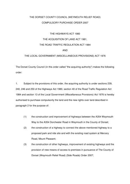
compulsory purchase order 2007 the highways ... - Dorsetforyou.com
compulsory purchase order 2007 the highways ... - Dorsetforyou.com
compulsory purchase order 2007 the highways ... - Dorsetforyou.com

Create successful ePaper yourself
Turn your PDF publications into a flip-book with our unique Google optimized e-Paper software.
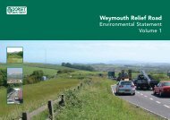
THE DORSET COUNTY COUNCIL (WEYMOUTH RELIEF ROAD)<br />
COMPULSORY PURCHASE ORDER <strong>2007</strong><br />
THE HIGHWAYS ACT 1980<br />
THE ACQUISITION OF LAND ACT 1981,<br />
THE ROAD TRAFFIC REGULATION ACT 1984<br />
AND<br />
THE LOCAL GOVERNMENT (MISCELLANEOUS PROVISIONS) ACT 1976<br />
The Dorset County Council (in this <strong>order</strong> called "<strong>the</strong> acquiring authority") makes <strong>the</strong> following<br />
<strong>order</strong>:<br />
1. Subject to <strong>the</strong> provisions of this <strong>order</strong>, <strong>the</strong> acquiring authority is under sections 239,<br />
240, 246 and 250 of <strong>the</strong> Highways Act 1980, section 40 of <strong>the</strong> Road Traffic Regulation Act<br />
1984 and section 13 of <strong>the</strong> Local Government (Miscellaneous Provisions) Act 1976 is hereby<br />
authorised to <strong>purchase</strong> <strong>com</strong>pulsorily <strong>the</strong> land and <strong>the</strong> new rights over land described in<br />
paragraph 2 for <strong>the</strong> purpose of:<br />
(1) <strong>the</strong> construction and improvement of <strong>highways</strong> between <strong>the</strong> A354 Weymouth<br />
Way to <strong>the</strong> A354 Dorchester Road in Weymouth in <strong>the</strong> County of Dorset;<br />
(2) <strong>the</strong> construction of a highway to connect <strong>the</strong> above mentioned highway to a<br />
proposed park and ride site and with <strong>the</strong> existing road system at Mercery<br />
Road, Mount Pleasant;<br />
(3) <strong>the</strong> construction of o<strong>the</strong>r <strong>highways</strong>, improvement of existing <strong>highways</strong> and <strong>the</strong><br />
provision of new means of access to premises in pursuance of The County of<br />
Dorset (Weymouth Relief Road) (Side Roads) Order <strong>2007</strong>;
(4) use by <strong>the</strong> acquiring authority in connection with <strong>the</strong> construction and<br />
improvement of <strong>highways</strong> and <strong>the</strong> provision of new means of access to<br />
premises as aforesaid;<br />
(5) mitigating <strong>the</strong> adverse effect which <strong>the</strong> existence or use of <strong>the</strong> <strong>highways</strong><br />
proposed to be constructed or improved will have on <strong>the</strong> surroundings<br />
<strong>the</strong>reof; and<br />
(6) <strong>the</strong> carrying out of works on watercourses in connection with <strong>the</strong> construction<br />
and improvement of <strong>highways</strong> as aforesaid;<br />
(7) <strong>the</strong> provision of off-street parking place, including means of access <strong>the</strong>reto<br />
and <strong>the</strong>refrom and buildings or o<strong>the</strong>r facilities necessary to <strong>the</strong>ir use.<br />
2. (1) The land authorised to be <strong>purchase</strong>d <strong>com</strong>pulsorily over land under this <strong>order</strong> are<br />
described in <strong>the</strong> Schedule and delineated and shown coloured pink prepared in duplicate,<br />
sealed with <strong>the</strong> <strong>com</strong>mon seal of <strong>the</strong> acquiring authority and marked "Map referred to in The<br />
Dorset County Council (Weymouth Relief Road) Compulsory Purchase Order <strong>2007</strong>" on <strong>the</strong><br />
said map which consists of nine sheets numbered DC 2372/494/1A, DC 2372/494/2A, DC<br />
2372/494/3A, DC 2372/494/4A, DC 2372/494/5A, DC 2372/494/6A, DC 2372/494/7B, DC<br />
2372/494/8A, DC 2372/494/9A respectively.<br />
2. (2) The new rights to be <strong>purchase</strong>d <strong>com</strong>pulsorily over land under this <strong>order</strong> are<br />
described in <strong>the</strong> Schedule and <strong>the</strong> land is shown coloured blue on <strong>the</strong> said map.<br />
3. Parts 2 and 3 of Schedule 2 to <strong>the</strong> Acquisition of Land Act 1981 are hereby<br />
incorporated with this <strong>order</strong> subject to <strong>the</strong> modifications that references to <strong>the</strong><br />
said Parts of <strong>the</strong> said Schedule to <strong>the</strong> undertaking shall be construed as<br />
references to any building or work constructed or to be constructed on that part of<br />
<strong>the</strong> land authorised to be <strong>purchase</strong>d on <strong>the</strong> said map or, as <strong>the</strong> case may be, on<br />
<strong>the</strong> land over which new rights are authorised to be acquired.
SCHEDULE<br />
Number<br />
on map<br />
Extent, description and situation of<br />
<strong>the</strong> land<br />
Table 1<br />
Qualifying persons under section 12(2)(a) of <strong>the</strong> Acquisition of Land Act 1981 - name and<br />
address<br />
Owners or reputed owners<br />
Lessees or reputed<br />
lessees<br />
Tenants or reputed<br />
tenants (o<strong>the</strong>r than<br />
lessees)<br />
Occupiers<br />
Plot 1<br />
All interests in 179,699 square metres of<br />
Lodmoor North Landfill Site located to<br />
<strong>the</strong> east of Mercery Road in <strong>the</strong> Mount<br />
Pleasant Business Park, DT3 5HN and<br />
north of St Andrews Ave/Monmouth<br />
Avenue, and including Weymouth<br />
Rugby Club playing fields and <strong>the</strong><br />
access track from Monmouth Avenue.<br />
Chief Executive Weymouth &<br />
Portland Borough Council<br />
Municipal Offices North Quay<br />
Weymouth DT4 8TA<br />
Weymouth Rugby Club,<br />
c/o John Lloyd, 43<br />
Over<strong>com</strong>be Drive,<br />
Weymouth, Dorset<br />
- -<br />
Plot 2<br />
All interests in 2,694 square metres of<br />
highway known as Mercery Road,<br />
Mount Pleasant Business Park, DT3<br />
5HN and vacant land to <strong>the</strong> north, all on<br />
<strong>the</strong> east side of New Look House car<br />
park.<br />
Mr Flower KWF Investments<br />
(Poole) Ltd Unit 5 Mitchell<br />
Road Fernside Park<br />
Ferndown Industrial Estate<br />
Ferndown Dorset BH21 7SG<br />
- - -<br />
Plot 3<br />
All interests in 23,065 square metres of<br />
<strong>highways</strong> known as Manor Roundabout<br />
and its approach roads A354 Dorchester<br />
Road, C920 Dorchester Road and A354<br />
Weymouth Way including an adjacent<br />
footpath from <strong>the</strong> Roundabout to Mount<br />
Pleasant Avenue South, and <strong>the</strong><br />
unnamed eastern approach road,<br />
embankment, parts of Bridleway<br />
S1/BR30 and vacant land (reserved for<br />
a future highway) between <strong>the</strong><br />
Roundabout and <strong>the</strong> Weymouth to<br />
Dorchester railway line, except interests<br />
owned by Dorset County Council.<br />
Chief Executive Dorset<br />
County Council County Hall<br />
Colliton Park Dorchester DT1<br />
1XJ<br />
- - -<br />
Plot 4<br />
All interests in 647 square metres of<br />
embankment slope to <strong>the</strong> north and<br />
west of Morrison’s supermarket, 244<br />
Dorchester Road, DT3 5AX and to <strong>the</strong><br />
south east and east of Manor<br />
Roundabout and abutting <strong>the</strong> store car<br />
park and delivery area.<br />
Safeway Limited Hilimore<br />
House Gain Lane Bradford<br />
BD3 7DL, c/o Simeon<br />
Hinchlliffe WM Morrison<br />
Supermarkets PLC, Property<br />
and Development Division,<br />
Hilimore House, Gain Lane,<br />
Bradford, BD7 3DL<br />
Scottish & Sou<strong>the</strong>rn<br />
Electric plc Mr Ken<br />
Hayward Legal<br />
Department 55 Vastern<br />
Road Reading RG1 8BU<br />
Wessex Water Services<br />
Limited Wessex House<br />
Passage Street Bristol<br />
BS2 0JQ<br />
- -<br />
Plot 5<br />
All interests in 43,456 square metres of<br />
grassland south of Two Mile Coppice,<br />
east of <strong>the</strong> Weymouth to Dorchester<br />
railway line, west of Lodmoor North<br />
Landfill Site and north of New Look<br />
House car park, including bridleway<br />
S1/BR30 and its margins between<br />
Greenway Road, eastwards under <strong>the</strong><br />
railway to a point approx 180 metres<br />
north east of <strong>the</strong> railway bridge.<br />
Mr Flower KWF Investments<br />
(Poole) Ltd Unit 5 Mitchell<br />
Road Fernside Park<br />
Ferndown Industrial Estate<br />
Ferndown Dorset BH21 7SG<br />
- - -
Number<br />
on map<br />
Extent, description and situation of<br />
<strong>the</strong> land<br />
Table 1<br />
Qualifying persons under section 12(2)(a) of <strong>the</strong> Acquisition of Land Act 1981 - name and<br />
address<br />
Owners or reputed owners<br />
Lessees or reputed<br />
lessees<br />
Tenants or reputed<br />
tenants (o<strong>the</strong>r than<br />
lessees)<br />
Occupiers<br />
Plot 6<br />
All interests in 5 square metres of land<br />
south of and abutting bridleway<br />
S1/BR30, approx 36 metres east of <strong>the</strong><br />
railway bridge over this path.<br />
Scottish & Sou<strong>the</strong>rn Electric<br />
plc Mr Ken Hayward Legal<br />
Department 55 Vastern Road<br />
Reading RG1 8BU<br />
- - -<br />
Plot 7<br />
Plot 8<br />
All interests in 68,742 square metres of<br />
pasture land abutting <strong>the</strong> north and east<br />
side of Horselynch Plantation, abutting<br />
Lodmoor Nature Reserve in <strong>the</strong> south<br />
and approx 100 metres north west of<br />
Southdown Avenue.<br />
All interests in 171,483 square metres of<br />
Horselynch Plantation woodland and<br />
arable, scrub and grassland to <strong>the</strong> north<br />
west, and abutting Lodmoor Nature<br />
Reserve in <strong>the</strong> south and extending<br />
north north-eastwards for approx 470<br />
metres.<br />
Mary Elizabeth Cake Flat 4<br />
The Chimes 18 McKinley<br />
Road Westcliffe Bournemouth<br />
BH4 8AP<br />
Edward Albert Whettam<br />
Littlewood Farm Frampton<br />
Dorchester DT2 9NJ<br />
Susan Valerie Thornton<br />
Eastwood House Stroudley<br />
Crescent Preston Weymouth<br />
DT3 6NT<br />
Michael Jones<br />
7 Kent Close Granby<br />
Industrial Estate Weymouth<br />
Dorset DT4 9TF<br />
- - -<br />
- - -<br />
Plot 9<br />
Plot 10<br />
All interests in 3,457 square metres of<br />
woodland and scrub on and near <strong>the</strong><br />
eastern embankment of <strong>the</strong> Weymouth<br />
to Dorchester railway line from bridleway<br />
S1/BR30 in <strong>the</strong> south west corner of<br />
Two Mile Coppice to a point approx 161<br />
metres north of <strong>the</strong> north west corner of<br />
<strong>the</strong> Coppice.<br />
All interests in 5,688 square metres of<br />
woodland along <strong>the</strong> western edge of<br />
Two Mile Coppice and abutting <strong>the</strong><br />
Weymouth to Dorchester railway land<br />
between <strong>the</strong> south western corner of <strong>the</strong><br />
Coppice and <strong>the</strong> north western corner.<br />
Network Rail Infrastructure<br />
Limited 40 Melton Street<br />
London NW1 2EE c/o Tom<br />
Higginson 10 th Floor 1<br />
Eversholt Green London NW1<br />
2DN<br />
Julian Purvis Woodland Trust<br />
Autumn Park Dysart Road<br />
Grantham Lincolnshire NG31<br />
6LL<br />
- - -<br />
- - -<br />
Plot 11<br />
All interests in 68,131 square metres of<br />
scrub and grassland ei<strong>the</strong>r side of<br />
bridleway S1/BR33 north east of its<br />
junction with bridleway S1/BR30, and<br />
including footpath S1/FP32 to <strong>the</strong><br />
northwest and b<strong>order</strong>ed by drains to <strong>the</strong><br />
sou<strong>the</strong>ast and southwest.<br />
Mark Balchin Fairbriar<br />
Projects Ltd Ashton House 64<br />
High Street Walton-on-<br />
Thames Surrey KT12 1BW<br />
- - -
Number<br />
on map<br />
Extent, description and situation of<br />
<strong>the</strong> land<br />
Table 1<br />
Qualifying persons under section 12(2)(a) of <strong>the</strong> Acquisition of Land Act 1981 - name and<br />
address<br />
Plot 12<br />
All interests in 46,643 square metres of<br />
grassland, scrub and Lorton<br />
Lane/footpath S1/FP31, including part of<br />
a local nature reserve abutting <strong>the</strong><br />
Weymouth to Dorchester railway from<br />
<strong>the</strong> north western corner of Two Mile<br />
Coppice to and including Lorton<br />
Lane/footpath S1/FP31, and to <strong>the</strong> west<br />
and south of Lorton Barn (Dorset<br />
Wildlife Trust Visitors Centre).<br />
Owners or reputed owners<br />
Mr Scupholme Dorset Trust<br />
for Nature Conservation<br />
Limited Brooklands Farm<br />
Forston Dorchester DT2 7AA<br />
Lessees or reputed<br />
lessees<br />
Tenants or reputed<br />
tenants (o<strong>the</strong>r than<br />
lessees)<br />
- - -<br />
Occupiers<br />
Plot 13<br />
All interests in 11,392 square metres of<br />
land forming part of <strong>the</strong> eastern edge of<br />
<strong>the</strong> highway A354 Dorchester to<br />
Weymouth road, part of <strong>the</strong> highway<br />
known as C54 Broadmayne Road from<br />
Down Farm westwards, and land<br />
between and adjacent to <strong>the</strong>se two<br />
<strong>highways</strong> and abutting bridleway<br />
S7/BR20, except interests owned by<br />
Dorset County Council.<br />
Chief Executive Dorset<br />
County Council County Hall<br />
Colliton Park Dorchester DT1<br />
1XJ<br />
- - -<br />
Plot 14<br />
All interests in 26,257 square metres of<br />
pasture land east of <strong>the</strong> Weymouth to<br />
Dorchester railway, west of Lorton<br />
House, south of and including footpath<br />
S1/FP29 and north of Lorton Lane,<br />
including part of <strong>the</strong> driveway to Lorton<br />
House and part of <strong>the</strong> woodland<br />
b<strong>order</strong>ing <strong>the</strong> north side of Lorton Lane.<br />
Mrs Delia M McLaggan Lorton<br />
House Broadwey Weymouth<br />
Dorset DT3 5QH<br />
- - -<br />
Plot 15<br />
All interests in 20,220 square metres of<br />
grassland being part of Southdown<br />
Ridge and bridleway S1/BR21, from<br />
north of footpath S1/FP29 to <strong>the</strong><br />
sou<strong>the</strong>rn boundary of properties in The<br />
Finches and Kestrel View, Littlemoor,<br />
DT3 5QZ, and located to <strong>the</strong> east of <strong>the</strong><br />
electricity pylon near <strong>the</strong> summit of <strong>the</strong><br />
Ridge.<br />
Mr AH Fletcher Ridgecross<br />
Limited c/o P&O Properties 16<br />
Palace Street London SW1E<br />
5JQ<br />
Stephen Bailey Heron Homes<br />
Thornbury Office Park Midland<br />
Way Thombury BS35 2BS<br />
- - -<br />
Plot 16<br />
All interests in 1,483 square metres of<br />
grassland and highway being part of<br />
Southdown Ridge north and north east<br />
of <strong>the</strong> electricity pylon near <strong>the</strong> summit<br />
of <strong>the</strong> Ridge to and including part of <strong>the</strong><br />
sou<strong>the</strong>rn cul-de-sac of The Finches,<br />
Littlemoor, DT3 5QN.<br />
Unknown - - -<br />
Plot 17<br />
All interests in 623 square metres of<br />
grassland and part of a footpath being<br />
part of open land between No 122<br />
Kestrel View, Littlemoor, DT3 QZ and<br />
Nos. 91 to 107 (odds) Beverley Road,<br />
Littlemoor, DT3 6SE.<br />
Chief Executive Weymouth &<br />
Portland Borough Council<br />
Municipal Offices North Quay<br />
Weymouth DT4 8TA<br />
- - -
Number<br />
on map<br />
Extent, description and situation of<br />
<strong>the</strong> land<br />
Table 1<br />
Qualifying persons under section 12(2)(a) of <strong>the</strong> Acquisition of Land Act 1981 - name and<br />
address<br />
Plot 18<br />
All interests in 9,333 square metres of<br />
grassland and scrub between properties<br />
in The Finches and Kestrel View,<br />
Littlemoor, and including part of highway<br />
known as Goldcrest Close and parts of<br />
<strong>the</strong> Broadwey Stream, except interests<br />
owned by Dorset County Council.<br />
Owners or reputed owners<br />
Chief Executive Dorset<br />
County Council County Hall<br />
Colliton Park Dorchester DT1<br />
1XJ<br />
Lessees or reputed<br />
lessees<br />
Tenants or reputed<br />
tenants (o<strong>the</strong>r than<br />
lessees)<br />
- - -<br />
Occupiers<br />
Plot 19<br />
All interests in 528 square metres of<br />
scrub and grassland abutting <strong>the</strong><br />
nor<strong>the</strong>rn and eastern boundaries of <strong>the</strong><br />
car park to New Look House, Mount<br />
Pleasant Business Park.<br />
Mr Flower KWF Investments<br />
(Poole) Ltd Unit 5 Mitchell<br />
Road Fernside Park<br />
Ferndown Industrial Estate<br />
Ferndown Dorset BH21 7SG<br />
- - -<br />
Plot 20<br />
All interests in 560 square metres of<br />
grassland being part of open land<br />
between No 67 and 78 Reedling Close,<br />
Littlemoor, DT3 5RX and south west of<br />
<strong>the</strong> Reedling Close turning head.<br />
Paul Bedford Persimmon<br />
Homes South Coast Limited<br />
Park View House Fareham<br />
PO16 7HT<br />
- - -<br />
Plot 21<br />
All interests in 469 square metres of<br />
land in <strong>the</strong> south west corner of <strong>the</strong><br />
property Icen Farm (D.J. Contracts),<br />
Icen Lane, DT3 5PX including part of <strong>the</strong><br />
frontage land used for storage and <strong>the</strong><br />
verge and entrances of Icen Lane<br />
(including half width of highway).<br />
Michael Jones<br />
7 Kent Close Granby<br />
Industrial Estate Weymouth<br />
Dorset DT4 9TF<br />
- - -<br />
Plot 22<br />
All interests in 779 square metres of<br />
drainage ditch and Broadwey Stream<br />
with surrounding scrub and grassland<br />
abutting No 31 The Finches and <strong>the</strong><br />
parking area to <strong>the</strong> north east, from<br />
south of Goldcrest Close to The<br />
Finches, Littlemoor between Nos. 25<br />
and 33.<br />
Ryan Homes Ashby House<br />
Walton on Thames Surrey<br />
KT12 1BW<br />
- - -<br />
Plot 23<br />
All interests in 471 square metres of<br />
grassland and scrub to <strong>the</strong> north and<br />
west of Goldcrest Close, Littlemoor, DT3<br />
5QS and abutting Nos. 435/437<br />
Littlemoor Road and <strong>the</strong> parking area to<br />
<strong>the</strong> south.<br />
Ryan Homes Ashby House<br />
Walton on Thames Surrey<br />
KT12 1BW<br />
- - -<br />
Plot 24<br />
All interests in 146 square metres of<br />
highway known as The Finches,<br />
Littlemoor, DT3 5QN, and including <strong>the</strong><br />
footpath to <strong>the</strong> north of and between<br />
Nos. 453 and 467 (odds) Littlemoor<br />
Road, except interests owned by Dorset<br />
County Council.<br />
Chief Executive Dorset<br />
County Council County Hall<br />
Colliton Park Dorchester DT1<br />
1XJ<br />
- - -
Number<br />
on map<br />
Extent, description and situation of<br />
<strong>the</strong> land<br />
Table 1<br />
Qualifying persons under section 12(2)(a) of <strong>the</strong> Acquisition of Land Act 1981 - name and<br />
address<br />
Owners or reputed owners<br />
Lessees or reputed<br />
lessees<br />
Tenants or reputed<br />
tenants (o<strong>the</strong>r than<br />
lessees)<br />
Occupiers<br />
Plot 25<br />
All interests in 40,691 square metres of<br />
pasture land and part of Chalbury<br />
Stream abutting and to <strong>the</strong> south of<br />
Littlemoor Road, from and abutting No<br />
47 Littlemoor Road, DT3 6AB<br />
westwards for approx 397 metres to a<br />
point opposite Gould’s Garden Centre,<br />
(but excluding approx 16 square metres<br />
of land opposite No 80 Littlemoor Road).<br />
Ms J S List Little Wyke Stoke<br />
Farthing Broadchalke,<br />
Salisbury SP5 5ED<br />
Wendy Louisa List Little Wyke<br />
Stoke Farthing Broadchalke<br />
Salisbury SP5 5ED<br />
Simon Paul List Little Wyke<br />
Stoke Farthing Broadchalke,<br />
Salisbury SP5 5ED<br />
- Mr B R and Mrs A<br />
Barnes Wyke Oliver<br />
Farm Chickerell<br />
Weymouth DT3 6BW<br />
-<br />
Ms A M Scutt 36 Morland<br />
Close Hampton Middlesex<br />
TW12 3YY<br />
Plot 26<br />
All interests in 192 square metres of<br />
land <strong>com</strong>prising part of <strong>the</strong> entrance to<br />
<strong>the</strong> Westfield Technical College and St.<br />
Andrews C. of E. Primary School on <strong>the</strong><br />
north side of Littlemoor Road and<br />
including visibility splays adjacent to<br />
Nos. 66 and 76 Littlemoor Road, DT3<br />
6AD, except interests owned by Dorset<br />
County Council.<br />
Chief Executive Dorset<br />
County Council County Hall<br />
Colliton Park Dorchester DT1<br />
1XJ<br />
- - -<br />
Plot 27<br />
All interests in 5,036 square metres of<br />
pasture land abutting and to <strong>the</strong> south of<br />
Littlemoor Road opposite Gould’s<br />
Garden Centre, from and abutting <strong>the</strong><br />
nor<strong>the</strong>rn end of bridleway S1/BR21<br />
eastwards for approx 210 metres.<br />
Mr M Cummings, F H<br />
Cummings Unlimited Unit C<br />
Acorn Business Park Tower<br />
Park Poole BH12 4NZ<br />
- Mr B R and Mrs A<br />
Barnes Wyke Oliver<br />
Farm Chickerell<br />
Weymouth DT3 6BW<br />
-<br />
Plot 28<br />
All interests in 1,853 square metres of<br />
track, bridleway S1/BR21 and grassland<br />
being part of Southdown Ridge abutting<br />
<strong>the</strong> Weymouth to Dorchester railway<br />
embankment north and east of <strong>the</strong><br />
railway arch that leads to <strong>the</strong> Upwey and<br />
Broadwey Station approach road, and<br />
south of Nos. 51 to 78 Reedling Close,<br />
Littlemoor.<br />
Mr AH Fletcher Ridgecross<br />
Limited c/o P&O Properties 16<br />
Palace Street London SW1E<br />
5JQ<br />
Stephen Bailey Heron Homes<br />
Thornbury Office Park Midland<br />
Way Thombury BS35 2BS<br />
- - -<br />
Plot 29<br />
All interests in 1,246 square metres of<br />
land being part of <strong>the</strong> entrance and<br />
landscaped frontage to Gould’s Garden<br />
Centre, Littlemoor Road, DT3 6AD<br />
(including half width of highway).<br />
Mr RJ Gould, Goulds<br />
(Dorchester) Ltd 22-23 South<br />
Street Dorchester Dorset DT1<br />
1DA<br />
- Dorset Trust for Nature<br />
Conservation Limited<br />
Brooklands Farm<br />
Forston Dorchester<br />
Dorset DT2 7AA<br />
-
Number<br />
on map<br />
Extent, description and situation of<br />
<strong>the</strong> land<br />
Table 1<br />
Qualifying persons under section 12(2)(a) of <strong>the</strong> Acquisition of Land Act 1981 - name and<br />
address<br />
Plot 30<br />
All interests in 3,297 square metres of<br />
arable land abutting <strong>the</strong> nor<strong>the</strong>rn<br />
boundary of Littlemoor Road and <strong>the</strong><br />
western boundary of Gould’s Garden<br />
Centre, Littlemoor, DT3 6AD, and to <strong>the</strong><br />
north of <strong>the</strong> Louviers Road (east<br />
end)/Littlemoor Road junction.<br />
Owners or reputed owners<br />
Hugh Alan Diment Fairview<br />
Ashmore Salisbury SP5 5AB<br />
(1/6th)<br />
Peter Henry Diment Well<br />
Cottage Nettle<strong>com</strong>be Bridport<br />
DT6 3SP (1/6th)<br />
Lessees or reputed<br />
lessees<br />
Tenants or reputed<br />
tenants (o<strong>the</strong>r than<br />
lessees)<br />
- Mr Charles Foot Higher<br />
Ashton Farm Dorchester<br />
DT2 9EZ<br />
Occupiers<br />
-<br />
Mrs Bridget Lewis Rhiw<br />
House Craig Penllyn<br />
Cowbridge Vale of Glamorgan<br />
CF71 7RS (1/6th)<br />
FA Diment 3 Anchor Cottages<br />
Weald Sevenoaks TN14 6LS<br />
(1/6th)<br />
DN Diment 3 Anchor Cottages<br />
Weald Sevenoaks TN14 6LS<br />
(1/6th)<br />
William Hatton Wingfield-<br />
Digby 1 West Park Farm<br />
Cottages Coos Lane<br />
Handcross West Sussex<br />
RH17 6AD (1/18th)<br />
Alexander Osborne Wingfield-<br />
Digby The Coach House<br />
Gregories Farm Lane<br />
Beaconsfield<br />
Buckinghamshire HP9 1HJ<br />
(1/18th)<br />
Mrs Claire Louise<br />
O'Donoghue 6 Morgan Street<br />
London E3 5AB (1/18th)<br />
Plot 31<br />
All interests in 3,431 square metres of<br />
grassland and scrub abutting <strong>the</strong><br />
nor<strong>the</strong>rn boundary of Littlemoor Road<br />
opposite Nos. 135 to 139b (odds) and 1<br />
to 7 Park Court, Littlemoor Road, DT3<br />
6AE.<br />
Mrs H C Stainer 28 Lynch<br />
Avenue Weymouth DT4 9DL<br />
- Mr D Dominey 63<br />
Culliford Way Littlemoor<br />
Weymouth DT3 6AW<br />
-
Number<br />
on map<br />
Extent, description and situation of<br />
<strong>the</strong> land<br />
Table 1<br />
Qualifying persons under section 12(2)(a) of <strong>the</strong> Acquisition of Land Act 1981 - name and<br />
address<br />
Owners or reputed owners<br />
Lessees or reputed<br />
lessees<br />
Tenants or reputed<br />
tenants (o<strong>the</strong>r than<br />
lessees)<br />
Occupiers<br />
Plot 32<br />
All interests in 2,718 square metres of<br />
grassland and scrub abutting <strong>the</strong><br />
nor<strong>the</strong>rn boundary of Littlemoor Road<br />
opposite Nos. 4 to 7 Park Court and<br />
Nos.143 to 153 (odds) Littlemoor Road,<br />
DT3 6AF.<br />
Mr G Maynard, 69 Greenway<br />
Road Weymouth Dorset DT3<br />
5BD<br />
Mr Richard Maynard<br />
69 Greenway Road<br />
Weymouth Dorset DT3 5BD<br />
Scottish & Sou<strong>the</strong>rn<br />
Electric plc Mr Ken<br />
Hayward Legal<br />
Department 55 Vastern<br />
Road Reading RG1 8BU<br />
Mr S Barnes Dorset<br />
Tree Care 11<br />
Underhedge Gardens<br />
Southwell Portland<br />
Dorset DT5 2DX<br />
-<br />
Mr John Maynard<br />
69 Greenway Road<br />
Weymouth Dorset DT3 5BD<br />
Mrs Barbara Ellis 86 Camp<br />
Road, Weymouth DT4 9HG<br />
Mrs Ca<strong>the</strong>rine Ellis 86 Camp<br />
Road, Weymouth DT4 9HG<br />
Plot 33<br />
All interests in 21,929 square metres of<br />
arable land abutting <strong>the</strong> nor<strong>the</strong>rn<br />
boundary of Littlemoor Road from<br />
opposite No 153 Littlemoor Road, DT3<br />
6AF to opposite <strong>the</strong> junction of Canberra<br />
Crescent (west end)/Littlemoor Road,<br />
and including part of a ditch and <strong>the</strong><br />
access to Bin<strong>com</strong>be Marsh Dairy and<br />
<strong>the</strong> nor<strong>the</strong>rn half width of Littlemoor<br />
Road highway opposite Nos. 153 to 209<br />
(odds).<br />
Mrs J Davis<br />
69 Greenway Road<br />
Weymouth Dorset DT3 5BD<br />
The Master & Fellows of<br />
Gonville & Caius College in<br />
<strong>the</strong> University of Cambridge<br />
c/o Brian Down Bidwells<br />
Trumpington Road Cambridge<br />
CB2 2LD<br />
- Mr Charles Foot Higher<br />
Ashton Farm Dorchester<br />
DT2 9EZ<br />
-<br />
Plot 34<br />
All interests in 108,472 square metres of<br />
pasture land, grassland, scrub,<br />
entrances, tracks, parts of footpath<br />
S7/FP9, ditches, drains, ponds and<br />
balancing ponds abutting and between<br />
Icen Lane and Littlemoor Road,<br />
(including half width of parts of <strong>the</strong>se<br />
<strong>highways</strong>) from south east of ‘Kingsam’,<br />
Icen Lane, to opposite <strong>the</strong> junction of<br />
Canberra Crescent (west<br />
end)/Littlemoor Road.<br />
Mr C Morgan Neejam 165 Ltd<br />
Beechwood House Lambridge<br />
Lane Badgemore Henley on<br />
Thames Oxon RG9 4NR<br />
- Michael Jones<br />
7 Kent Close Granby<br />
Industrial Estate<br />
Weymouth Dorset DT4<br />
9TF<br />
-<br />
Plot 35<br />
All interests in 33,280 square metres of<br />
pasture land, grassland, scrub,<br />
entrances, parts of footpath S7/FP9,<br />
ditches, drains and balancing ponds<br />
abutting <strong>the</strong> nor<strong>the</strong>rn boundary of<br />
Littlemoor Road, Littlemoor Roundabout<br />
and Brambling Close, from approx 212<br />
metres west of <strong>the</strong> Roundabout to 140<br />
metres east of <strong>the</strong> Roundabout.<br />
Chief Executive Weymouth &<br />
Portland Borough Council<br />
Municipal Offices North Quay<br />
Weymouth DT4 8TA<br />
- - -
Number<br />
on map<br />
Extent, description and situation of<br />
<strong>the</strong> land<br />
Table 1<br />
Qualifying persons under section 12(2)(a) of <strong>the</strong> Acquisition of Land Act 1981 - name and<br />
address<br />
Plot 36<br />
Plot 37<br />
The right to divert and maintain a ditch<br />
11 metres long in 24 square metres of<br />
land on <strong>the</strong> east-west boundary between<br />
pasture fields south of Icen Lane and<br />
east south-east of ‘The Willows’, Icen<br />
Lane, DT3 5PY.<br />
All interests in 580 square metres of<br />
grass verge, scrub, drain and ditch on<br />
<strong>the</strong> sou<strong>the</strong>rn side of Icen Lane (including<br />
half width of highway) from approx 70<br />
metres west, to 41 metres east, of<br />
‘Kingsam’, Icen Lane, DT3 5PY.<br />
Owners or reputed owners<br />
Lessees or reputed<br />
lessees<br />
Tenants or reputed<br />
tenants (o<strong>the</strong>r than<br />
lessees)<br />
Unknown - - -<br />
Unknown - - -<br />
Occupiers<br />
Plot 38<br />
All interests in 399 square metres of<br />
track and arable land to <strong>the</strong> north,<br />
between <strong>the</strong> A354 Dorchester Road also<br />
known as Ridgeway Hill, westwards to<br />
<strong>the</strong> unclassified unpaved Roman Road,<br />
all south west of <strong>the</strong> Bin<strong>com</strong>be Railway<br />
Tunnel sou<strong>the</strong>rn portal.<br />
The Master & Fellows of<br />
Gonville & Caius College in<br />
<strong>the</strong> University of Cambridge<br />
c/o Brian Down Bidwells<br />
Trumpington Road Cambridge<br />
CB2 2LD<br />
Anthony John Paschen<br />
Middle Farm Bin<strong>com</strong>be<br />
Weymouth Dorset DT3<br />
5PT<br />
Mr Charles Foot Higher<br />
Ashton Farm Dorchester<br />
DT2 9EZ<br />
-<br />
Plot 39 - - - - -<br />
Plot 40<br />
All interests in 2,807 square metres of<br />
pasture land, scrub, ponds, drains,<br />
ditches abutting and to <strong>the</strong> south of Icen<br />
Lane, from opposite <strong>the</strong> entrance to<br />
‘Kingsam’, Icen Lane, DT3 5PY<br />
eastwards for approx 53 metres.<br />
Mr A A Bennett<br />
19 Ilchester Road Weymouth<br />
Dorset<br />
- - -<br />
Plot 41<br />
All interests in 14,276 square metres of<br />
Weyside Farm, Icen Lane, DT3 5PY<br />
including part of <strong>the</strong> frontage land used<br />
for storage, <strong>the</strong> entrance and nor<strong>the</strong>rn<br />
verge of Icen Lane (including half width<br />
of highway), and pasture land, drains,<br />
ditches and track to <strong>the</strong> west and north<br />
west of <strong>the</strong> farm buildings, to <strong>the</strong> north<br />
of Icen Lane and to <strong>the</strong> east and north of<br />
‘Kingsam’, Icen Lane.<br />
J H C Bazell Weyside Farm<br />
Icen Lane Upwey Weymouth<br />
DT3 5PY<br />
- - -<br />
Plot 42<br />
All interests in 101 square metres of<br />
woodland and scrub on and near <strong>the</strong><br />
railway embankment north east of <strong>the</strong><br />
railway arch that leads from Southdown<br />
Ridge to <strong>the</strong> Upwey and Broadwey<br />
Station approach road.<br />
Network Rail Infrastructure<br />
Limited 40 Melton Street<br />
London NW1 2EE c/o Tom<br />
Higginson 10 th Floor 1<br />
Eversholt Green London NW1<br />
2DN<br />
- - -<br />
Plot 43<br />
All interests in 25,884 square metres of<br />
pasture land to <strong>the</strong> south of Footpath<br />
S7/FP11 near Coombe Farm east of<br />
Chapel Lane, Broadwey, and extending<br />
southwards to and abutting ‘Kingsam’,<br />
Icen Lane.<br />
Mrs Ca<strong>the</strong>rine Patricia<br />
Phillips, 48 Cirrus Gardens<br />
Hamble Southampton SO31<br />
4RH<br />
- Mr D Loveridge Holwell<br />
Farm Buckland Ripers<br />
Weymouth Dorset DT3<br />
4BP<br />
-
Number<br />
on map<br />
Extent, description and situation of<br />
<strong>the</strong> land<br />
Table 1<br />
Qualifying persons under section 12(2)(a) of <strong>the</strong> Acquisition of Land Act 1981 - name and<br />
address<br />
Plot 44<br />
Plot 45<br />
All interests in 107 square metres of<br />
grassland being part of Southdown<br />
Ridge and bridleway S1/BR21 south of<br />
Nos. 98 to 122 (evens) Kestrel View,<br />
Littlemoor and abutting <strong>the</strong> field<br />
boundary running south south-west from<br />
No 122 Kestrel View.<br />
The right to extinguish part of statutory<br />
footpath S7/FP11 and create a statutory<br />
bridleway on 2,083 square metres of<br />
arable land and stream margins,<br />
abutting and to <strong>the</strong> south west of Icen<br />
Lane between Broadwey and Bin<strong>com</strong>be<br />
and south of <strong>the</strong> stream flowing southwest<br />
from Bin<strong>com</strong>be.<br />
Owners or reputed owners<br />
Mr AH Fletcher Ridgecross<br />
Limited c/o P&O Properties 16<br />
Palace Street London SW1E<br />
5JQ<br />
Stephen Bailey Heron Homes<br />
Thornbury Office Park Midland<br />
Way Thombury BS35 2BS<br />
The Master & Fellows of<br />
Gonville & Caius College in<br />
<strong>the</strong> University of Cambridge<br />
c/o Brian Down Bidwells<br />
Trumpington Road Cambridge<br />
CB2 2LD<br />
Lessees or reputed<br />
lessees<br />
Tenants or reputed<br />
tenants (o<strong>the</strong>r than<br />
lessees)<br />
- - -<br />
Anthony John Paschen<br />
Middle Farm Bin<strong>com</strong>be<br />
Weymouth Dorset DT3<br />
5PT<br />
Mr Charles Foot Higher<br />
Ashton Farm Dorchester<br />
DT2 9EZ<br />
Occupiers<br />
-<br />
Plot 46a All interests in 59,351 square metres of<br />
arable land east of <strong>the</strong> Weymouth to<br />
Dorchester railway, west of The Knoll<br />
and north of and including part of <strong>the</strong><br />
track and footpath S7/FP11 running<br />
eastwards from Chapel Lane,<br />
Broadwey, and including farm buildings,<br />
structures and storage buildings at<br />
Coombe Farm.<br />
Kenneth John Virgin Coombe<br />
Farm Chapel Lane Upwey<br />
Weymouth DT3 5PB<br />
- David Foot Ltd East<br />
Farm Bin<strong>com</strong>be<br />
Weymouth Dorset<br />
-<br />
Plot 46b All interests in 1,960 square metres of<br />
farm track to <strong>the</strong> south west of arable<br />
land south of The Knoll and north of<br />
footpath S7/FP11.<br />
Kenneth John Virgin Coombe<br />
Farm Chapel Lane Upwey,<br />
Weymouth DT3 5PB<br />
- David Foot Ltd East<br />
Farm Bin<strong>com</strong>be<br />
Weymouth Dorset<br />
-<br />
Plot 46c The right to extinguish part of statutory<br />
footpath S7/FP11 and create a statutory<br />
bridleway and cycle track on 155 square<br />
metres of track from <strong>the</strong> gate approx 8<br />
metres east of <strong>the</strong> eastern boundary of<br />
Coombe Farm house eastwards for<br />
approx 14 metres.<br />
Kenneth John Virgin Coombe<br />
Farm Chapel Lane Upwey<br />
Weymouth DT3 5PB<br />
- David Foot Ltd East<br />
Farm Bin<strong>com</strong>be<br />
Weymouth Dorset<br />
-<br />
Plot 46d The right to extinguish part of statutory<br />
footpath S7/FP11 and create a statutory<br />
bridleway on 3,377 square metres of<br />
track, farmyard structures and arable<br />
land from Coombe Farm buildings<br />
eastwards for approx 422 metres to<br />
south of The Knoll.<br />
Kenneth John Virgin Coombe<br />
Farm Chapel Lane Upwey<br />
Weymouth DT3 5PB<br />
- David Foot Ltd East<br />
Farm Bin<strong>com</strong>be<br />
Weymouth Dorset<br />
-
Number<br />
on map<br />
Extent, description and situation of<br />
<strong>the</strong> land<br />
Table 1<br />
Qualifying persons under section 12(2)(a) of <strong>the</strong> Acquisition of Land Act 1981 - name and<br />
address<br />
Owners or reputed owners<br />
Lessees or reputed<br />
lessees<br />
Tenants or reputed<br />
tenants (o<strong>the</strong>r than<br />
lessees)<br />
Occupiers<br />
Plot 47<br />
All interests in 171,555 square metres of<br />
pasture and arable land, <strong>the</strong> house at<br />
West Farm, Bin<strong>com</strong>be Lane, DT3 5PS<br />
and part of <strong>the</strong> garden, driveway and<br />
adjacent woodland, part of <strong>the</strong> frontage<br />
and gardens opposite of Nos. 1, 2 and 3<br />
West Farm Cottages and adjacent<br />
farmyard, approx 349 metres of <strong>the</strong><br />
A354 Dorchester Road east of <strong>the</strong><br />
railway (Ridgeway hill and hairpin bend)<br />
and approx 254 metres of Bin<strong>com</strong>be<br />
Lane, part of bridleways S7/BR12 and<br />
S1/BR47, farm tracks and including a<br />
stream, a silage clamp structure, a<br />
scheduled monument, and land over <strong>the</strong><br />
Bin<strong>com</strong>be Railway Tunnel, from south of<br />
<strong>the</strong> Lower Bin<strong>com</strong>be valley northwards<br />
to approx 3 metres south of bridleway<br />
S7/BR20 and <strong>the</strong> road known as <strong>the</strong><br />
C54 Broadmayne Road on Ridgeway.<br />
The Master & Fellows of<br />
Gonville & Caius College in<br />
<strong>the</strong> University of Cambridge<br />
c/o Brian Down Bidwells<br />
Trumpington Road Cambridge<br />
CB2 2LD<br />
Anthony John Paschen<br />
Middle Farm Bin<strong>com</strong>be<br />
Weymouth Dorset DT3<br />
5PT<br />
David Foot Ltd East<br />
Farm Bin<strong>com</strong>be<br />
Weymouth Dorset<br />
Mrs J Paschen<br />
Middle Farm<br />
Bin<strong>com</strong>be<br />
Weymouth<br />
Dorset DT3<br />
5PT<br />
Plot 48<br />
All interests in 2,058 square metres of<br />
highway being <strong>the</strong> eastern part of <strong>the</strong><br />
A354 Dorchester Road (Ridgeway hill)<br />
from its junction with bridleway S1/BR47<br />
southwards to near <strong>the</strong> top of <strong>the</strong><br />
western cutting of <strong>the</strong> Weymouth to<br />
Dorchester railway, west of <strong>the</strong> road<br />
bridge over <strong>the</strong> railway, except interests<br />
owned by Dorset County Council.<br />
Chief Executive Dorset<br />
County Council County Hall<br />
Colliton Park Dorchester DT1<br />
1XJ<br />
- - -<br />
Plot 49<br />
The right to re-grade <strong>the</strong> levels of a<br />
private access on 22 square metres of<br />
residential property known as ‘Swallows<br />
Rest’, The Ridgeway, Weymouth, DT3<br />
5QQ (fronting onto <strong>the</strong> A354).<br />
William & Margaret Bradley,<br />
Swallows Rest, Ridgeway,<br />
Weymouth, Dorset, DT3 5PZ<br />
- - -<br />
Plot 50<br />
All interests in 29,243 square metres of<br />
arable land abutting and to <strong>the</strong> east of<br />
<strong>the</strong> A354 Dorchester to Weymouth road<br />
(including half width of highway in part)<br />
from <strong>the</strong> nor<strong>the</strong>rn boundary of ‘Swallows<br />
Rest’, The Ridgeway, Weymouth DT3<br />
5QQ southwards to <strong>the</strong> road known as<br />
<strong>the</strong> C54 Broadmayne Road, and also<br />
abutting and to <strong>the</strong> east and north of <strong>the</strong><br />
C54 road and abutting and to <strong>the</strong> west<br />
of Down Farm, including land above <strong>the</strong><br />
Bin<strong>com</strong>be Railway Tunnel.<br />
The Master & Fellows of<br />
Gonville & Caius College in<br />
<strong>the</strong> University of Cambridge<br />
c/o Brian Down Bidwells<br />
Trumpington Road Cambridge<br />
CB2 2LD<br />
Anthony John Paschen<br />
Middle Farm Bin<strong>com</strong>be<br />
Weymouth Dorset DT3<br />
5PT<br />
Mr Charles Foot Higher<br />
Ashton Farm Dorchester<br />
DT2 9EZ<br />
-<br />
Plot 51<br />
All interests in 12,612 square metres of<br />
arable land and farm track to <strong>the</strong> north<br />
west of <strong>the</strong> A354 Dorchester to<br />
Weymouth road and <strong>the</strong> unclassified<br />
unpaved road leading to Roman Road,<br />
from Gypsies Corner south westwards<br />
to bridleway S7/BR14 at its junction with<br />
Roman Road, except interests owned by<br />
Dorset County Council.<br />
Chief Executive Dorset<br />
County Council County Hall<br />
Colliton Park Dorchester DT1<br />
1XJ<br />
- - -
Number<br />
on map<br />
Extent, description and situation of<br />
<strong>the</strong> land<br />
Table 1<br />
Qualifying persons under section 12(2)(a) of <strong>the</strong> Acquisition of Land Act 1981 - name and<br />
address<br />
Plot 52<br />
All interests in 3,277 square metres of<br />
grassland being part of Southdown<br />
Ridge to <strong>the</strong> south of Nos. 82 to 122<br />
(evens) Kestrel View, Littlemoor,<br />
abutting <strong>the</strong> rear of Nos. 82 and 84<br />
Kestrel View and <strong>the</strong> footpath between<br />
Nos. 96 and 98 Kestrel View, and north<br />
of bridleway S1/BR21.<br />
Owners or reputed owners<br />
Mr AH Fletcher Ridgecross<br />
Limited c/o P&O Properties 16<br />
Palace Street London SW1E<br />
5JQ<br />
Stephen Bailey Heron Homes<br />
Thornbury Office Park Midland<br />
Way Thombury BS35 2BS<br />
Lessees or reputed<br />
lessees<br />
Tenants or reputed<br />
tenants (o<strong>the</strong>r than<br />
lessees)<br />
- - -<br />
Occupiers<br />
Plot 53<br />
All interests in 12,208 square metres of<br />
arable land abutting and to <strong>the</strong> south<br />
east of <strong>the</strong> A354 Dorchester to<br />
Weymouth road (including half width of<br />
highway) from and abutting <strong>the</strong> nor<strong>the</strong>rn<br />
boundary of ‘Swallows Rest’, The<br />
Ridgeway, Weymouth DT3 5QQ,<br />
northwards to a field boundary approx<br />
42 metres north of Gypsies Corner.<br />
The Master & Fellows of<br />
Gonville & Caius College in<br />
<strong>the</strong> University of Cambridge<br />
c/o Brian Down Bidwells<br />
Trumpington Road Cambridge<br />
CB2 2LD<br />
Anthony John Paschen<br />
Middle Farm Bin<strong>com</strong>be<br />
Weymouth Dorset DT3<br />
5PT<br />
Mr Charles Foot Higher<br />
Ashton Farm Dorchester<br />
DT2 9EZ<br />
-<br />
Plot 54<br />
All interests in 31,174 square metres of<br />
arable land, laybys, tracks, drains,<br />
ditches and culverts abutting and to <strong>the</strong><br />
east of <strong>the</strong> A354 Dorchester to<br />
Weymouth road (including half width of<br />
highway) from <strong>the</strong> field boundary approx<br />
42 metres north of Gypsies Corner to<br />
<strong>the</strong> junction of <strong>the</strong> A354 and C21201<br />
(Winterborne Herringston road), and<br />
arable land and layby abutting and to<br />
<strong>the</strong> west of <strong>the</strong> A354 (including half<br />
width of highway) from Gypsies Corner<br />
northwards for approx 49 metres.<br />
The Hon William B E<br />
Robertson & Lady Celia Jane<br />
Robertson of Oakridge 30<br />
Grosvenor Road Dorchester<br />
DT1 2BD<br />
Charles William John Norman<br />
The Manor House<br />
Winterborne Monkton<br />
Dorchester DT2 9PT<br />
- Messrs Elworthys The<br />
Manor House<br />
Winterborne Monkton<br />
Dorchester DT2 9PT<br />
-<br />
Plot 55<br />
All interests in 10,520 square metres of<br />
grass verge, footway and boundary<br />
vegetation on <strong>the</strong> east side of <strong>the</strong> A354<br />
Dorchester to Weymouth road and <strong>the</strong><br />
south side of <strong>the</strong> A35 (including half<br />
width of <strong>highways</strong>), from its junction with<br />
<strong>the</strong> C21201 Winterborne Herringston<br />
road northwards to and including <strong>the</strong><br />
A35/A354 Stadium Roundabout<br />
junction.<br />
Unknown - - -<br />
Plot 56<br />
All interests in 785 square metres of<br />
drains, ditches, field entrances and<br />
highway known as Icen Lane from <strong>the</strong><br />
eastern entrance to Icen Farm (D.J.<br />
Contracts), eastwards to a point approx<br />
10 metres east of <strong>the</strong> entrance to ‘The<br />
Willows’, Icen Lane, DT3 5PY.<br />
Unknown - - -
Number<br />
on map<br />
Extent, description and situation of<br />
<strong>the</strong> land<br />
Table 1<br />
Qualifying persons under section 12(2)(a) of <strong>the</strong> Acquisition of Land Act 1981 - name and<br />
address<br />
Plot 57<br />
All interests in 1,141 square metres of<br />
highway being <strong>the</strong> sou<strong>the</strong>rn part of <strong>the</strong><br />
C905 Littlemoor Road from a point<br />
approx 50 metres west of Louviers Road<br />
(western end) to its junction with<br />
Canberra Crescent (west end) (including<br />
half width of highway), and Canberra<br />
Crescent (western end) for approx 8<br />
metres from its junction with Littlemoor<br />
Road (including full width of highway),<br />
except interests owned by Dorset<br />
County Council.<br />
Owners or reputed owners<br />
Chief Executive Dorset<br />
County Council County Hall<br />
Colliton Park Dorchester DT1<br />
1XJ<br />
Lessees or reputed<br />
lessees<br />
Tenants or reputed<br />
tenants (o<strong>the</strong>r than<br />
lessees)<br />
- - -<br />
Occupiers<br />
Plot 58<br />
All interests in 2,254 square metres of<br />
highway being <strong>the</strong> C905 Littlemoor<br />
Road from its junction with Canberra<br />
Crescent (western end), Littlemoor to a<br />
point approx 10 metres east of its<br />
junction with Bin<strong>com</strong>be Rise and<br />
including a lay-by at <strong>the</strong> rear of Nos. 16<br />
to 22 (evens) Canberra Crescent,<br />
except interests owned by Dorset<br />
County Council.<br />
Chief Executive Dorset<br />
County Council County Hall<br />
Colliton Park Dorchester DT1<br />
1XJ<br />
- - -<br />
Plot 59<br />
All interests in 8,925 square metres of<br />
<strong>the</strong> highway being <strong>the</strong> western part of<br />
<strong>the</strong> A354 Dorchester Road (Ridgeway<br />
hill) from its junction with bridleway<br />
S7/BR14 near <strong>the</strong> summit of Ridgeway,<br />
southwards to near <strong>the</strong> top of <strong>the</strong><br />
western cutting of <strong>the</strong> Weymouth to<br />
Dorchester railway, west of <strong>the</strong> road<br />
bridge over <strong>the</strong> railway (including half<br />
width of highway over part of this<br />
length), except interests owned by<br />
Dorset County Council.<br />
Chief Executive Dorset<br />
County Council County Hall<br />
Colliton Park Dorchester DT1<br />
1XJ<br />
- - -<br />
Plot 60<br />
All interests in 4,180 square metres of<br />
arable land abutting and to <strong>the</strong> south of<br />
bridleway S7/BR14, southwards for<br />
approx 121 metres, and also abutting<br />
and to <strong>the</strong> west of <strong>the</strong> A354 Dorchester<br />
to Weymouth road, and including a<br />
scheduled monument and approx 70<br />
metres of Roman Road, an unpaved<br />
unclassified road, to <strong>the</strong> south of its<br />
junction with Bridleway S7/BR14.<br />
The Master & Fellows of<br />
Gonville & Caius College in<br />
<strong>the</strong> University of Cambridge<br />
c/o Brian Down Bidwells<br />
Trumpington Road Cambridge<br />
CB2 2LD<br />
Anthony John Paschen<br />
Middle Farm Bin<strong>com</strong>be<br />
Weymouth Dorset DT3<br />
5PT<br />
Mr Charles Foot Higher<br />
Ashton Farm Dorchester<br />
DT2 9EZ<br />
-
Number<br />
on map<br />
Extent, description and situation of<br />
<strong>the</strong> land<br />
Table 1<br />
Qualifying persons under section 12(2)(a) of <strong>the</strong> Acquisition of Land Act 1981 - name and<br />
address<br />
Plot 61<br />
All interests in 24,357 square metres of<br />
<strong>the</strong> highway, grassland, scrub, earth<br />
banks and vacant land, being <strong>the</strong> C905<br />
Littlemoor Road and Littlemoor<br />
Roundabout from approx 123 metres<br />
east of its junction with Turnstone Close<br />
to 16 metres east of its junction with<br />
Nightingale Drive, and being Goldcrest<br />
Close and Brambling Close for approx<br />
40 and 109 metres respectively from <strong>the</strong><br />
Roundabout including part of footpath<br />
S1/FP121, and being land north east of<br />
properties between No 9 Brambling<br />
Close and No 14 Redpoll Close and<br />
which abuts Icen Lane, except interests<br />
owned by Dorset County Council.<br />
Owners or reputed owners<br />
Chief Executive Dorset<br />
County Council County Hall<br />
Colliton Park Dorchester DT1<br />
1XJ<br />
Lessees or reputed<br />
lessees<br />
Tenants or reputed<br />
tenants (o<strong>the</strong>r than<br />
lessees)<br />
- - -<br />
Occupiers<br />
Plot 62<br />
All interests in 3,302 square metres of<br />
highway being <strong>the</strong> eastern part of <strong>the</strong><br />
A354 Dorchester Road (Ridgeway hill)<br />
from its junction with bridleway S1/BR47<br />
northwards for approx 227 metres<br />
(including half width of highway).<br />
The Master & Fellows of<br />
Gonville & Caius College in<br />
<strong>the</strong> University of Cambridge<br />
c/o Brian Down Bidwells<br />
Trumpington Road Cambridge<br />
CB2 2LD<br />
Anthony John Paschen<br />
Middle Farm Bin<strong>com</strong>be<br />
Weymouth Dorset DT3<br />
5PT<br />
David Foot Ltd East<br />
Farm Bin<strong>com</strong>be<br />
Weymouth Dorset<br />
Mrs J Paschen<br />
Middle Farm<br />
Bin<strong>com</strong>be<br />
Weymouth<br />
Dorset DT3<br />
5PT<br />
Plot 63<br />
All interests in 2,946 square metres of<br />
pasture land being part of two fields<br />
north east of footpath S7/FP11 and<br />
south east of The Knoll, running<br />
eastwards along <strong>the</strong> nor<strong>the</strong>rn boundary<br />
and <strong>the</strong>n <strong>the</strong> eastern boundary west of<br />
<strong>the</strong> stream to where <strong>the</strong> footpath<br />
crosses <strong>the</strong> stream, all west of Icen<br />
Lane.<br />
Mrs Bye 43 Southdown Road<br />
Rodwell Weymouth Dorset<br />
DT4 9LL<br />
Mrs Peters 27 Ullswater<br />
Crescent Radipole Weymouth<br />
DT3 5HF<br />
- - -<br />
Plot 64<br />
All interests in 1,213 square metres of<br />
ditch and scrub east of Nos. 1 to 6<br />
Chandler Close, Mount Pleasant<br />
Business Park and north east of <strong>the</strong><br />
Ambulance Station, Chandler Close and<br />
west of <strong>the</strong> Lodmoor North Landfill Site.<br />
Geometry Properties Limited<br />
New Look House Mercery<br />
Road Mount Pleasant,<br />
Weymouth Dorset DT3 5HJ<br />
- - -<br />
Plot 65<br />
All interests in 268 square metres of<br />
scrub and grassland abutting <strong>the</strong><br />
nor<strong>the</strong>rn boundary of <strong>the</strong> car park to<br />
New Look House, Mount Pleasant<br />
Business Park.<br />
Unknown - - -<br />
Plot 66<br />
All interests in 110 square metres of<br />
grassland and scrub abutting <strong>the</strong><br />
western footway of Mercery Road and<br />
<strong>the</strong> car park access road of New Look<br />
House, Mount Pleasant Business Park.<br />
Geometry Properties Limited<br />
New Look House Mercery<br />
Road Mount Pleasant,<br />
Weymouth Dorset DT3 5HJ<br />
- New Look Retailers Ltd<br />
Mercery Road<br />
Weymouth DT3 5HJ<br />
-<br />
Plot 67a All interests in 193 square metres of<br />
railway embankment, grassland and<br />
scrub on <strong>the</strong> western side of <strong>the</strong><br />
Weymouth to Dorchester railway approx<br />
97 metres south of <strong>the</strong> railway bridge<br />
over bridleway S1/BR30.<br />
Network Rail Infrastructure<br />
Limited 40 Melton Street<br />
London NW1 2EE c/o Tom<br />
Higginson 10 th Floor 1<br />
Eversholt Green London NW1<br />
2DN<br />
- - -
Number<br />
on map<br />
Extent, description and situation of<br />
<strong>the</strong> land<br />
Table 1<br />
Qualifying persons under section 12(2)(a) of <strong>the</strong> Acquisition of Land Act 1981 - name and<br />
address<br />
Plot 67b All interests in 1,473 square metres of<br />
railway embankment, grassland and<br />
scrub on <strong>the</strong> eastern side of <strong>the</strong><br />
Weymouth to Dorchester railway from<br />
and abutting bridleway S1/B30 east of<br />
<strong>the</strong> railway bridge, to a point approx 156<br />
metres to <strong>the</strong> south, north west of <strong>the</strong><br />
New Look House car park.<br />
Owners or reputed owners<br />
Network Rail Infrastructure<br />
Limited 40 Melton Street<br />
London NW1 2EE c/o Tom<br />
Higginson 10 th Floor 1<br />
Eversholt Green London NW1<br />
2DN<br />
Lessees or reputed<br />
lessees<br />
Tenants or reputed<br />
tenants (o<strong>the</strong>r than<br />
lessees)<br />
- - -<br />
Occupiers<br />
Plot 67c The right to construct and maintain a<br />
bridge to carry <strong>the</strong> Weymouth Relief<br />
Road over 383 square metres of railway<br />
track on <strong>the</strong> Weymouth to Dorchester<br />
railway approx 130 metres south of <strong>the</strong><br />
railway bridge over bridleway S1/BR30.<br />
Network Rail Infrastructure<br />
Limited 40 Melton Street<br />
London NW1 2EE c/o Tom<br />
Higginson 10 th Floor 1<br />
Eversholt Green London NW1<br />
2DN<br />
- - -<br />
Plot 68<br />
Plot 69<br />
All interests in 994 square metres of<br />
footpath, grass areas and highway being<br />
<strong>the</strong> C905 Littlemoor Road, abutting No<br />
36 Nuthatch Close, Littlemoor and <strong>the</strong> St<br />
Francis of Assisi church, Merredin<br />
Close, and south east of <strong>the</strong> Turnstone<br />
Close/Littlemoor Road junction.<br />
All interests in 287 square metres of<br />
highway being <strong>the</strong> sou<strong>the</strong>rn and eastern<br />
part of Greenway Road, DT3 5BE<br />
(including half width of highway),<br />
eastwards from its junction with <strong>the</strong><br />
A354 Dorchester Road and including <strong>the</strong><br />
western end of bridleway S1/BR30, all<br />
north west of Manor Roundabout.<br />
Unknown - - -<br />
Unknown - - -<br />
Plot 70<br />
All interests in 8 square metres of <strong>the</strong><br />
driveway to Lorton House, abutting and<br />
to <strong>the</strong> north of Lorton Lane.<br />
Unknown - - -<br />
Plot 71<br />
All interests in 134 square metres of<br />
woodland, scrub and field access on <strong>the</strong><br />
nor<strong>the</strong>rn side of Lorton Lane from <strong>the</strong><br />
railway bridge north eastern parapet<br />
wall, south eastwards for approx 46<br />
metres to and including <strong>the</strong> field<br />
entrance.<br />
Unknown - - -<br />
Plot 72<br />
All interests in 37 square metres of track<br />
and bridleway S1/BR21 between <strong>the</strong><br />
eastern wing walls of <strong>the</strong> railway bridge<br />
linking <strong>the</strong> approach road to Upwey and<br />
Broadwey Station and Southdown<br />
Ridge/Littlemoor housing estate.<br />
Unknown - - -<br />
Plot 73<br />
All interests in 966 square metres of<br />
earth bank, scrub and grassland on <strong>the</strong><br />
south east side of Littlemoor<br />
Roundabout, abutting Nos. 16 to 27, and<br />
to <strong>the</strong> rear of Nos. 28 and 29, The<br />
Woodpeckers, Littlemoor, DT3 5RS.<br />
Ryan of Wimborne Ltd 75<br />
High Street Wimborne Dorset<br />
- - -
Number<br />
on map<br />
Extent, description and situation of<br />
<strong>the</strong> land<br />
Table 1<br />
Qualifying persons under section 12(2)(a) of <strong>the</strong> Acquisition of Land Act 1981 - name and<br />
address<br />
Plot 74<br />
Plot 75<br />
All interests in 2,334 square metres of<br />
highway, grass areas, earth banks and<br />
footpaths being <strong>the</strong> C905 Littlemoor<br />
Road, from approx 12 metres west of its<br />
junction with Nightingale Drive,<br />
eastwards and south eastwards to <strong>the</strong><br />
western boundary of Nos. 5/7 Kestrel<br />
View, Littlemoor, near <strong>the</strong> western end<br />
of Turnstone Close, and including<br />
approx 15 metres of Goldcrest Close<br />
southwards from a point approx 39<br />
metres south of Littlemoor Roundabout.<br />
All interests in 138 square metres of<br />
highway, grassland and earth banks<br />
being part of Brambling Close,<br />
Littlemoor and abutting <strong>the</strong> boundaries<br />
of Nos. 9 and 34 Brambling Close.<br />
Owners or reputed owners<br />
Mrs S Mat<strong>the</strong>ws Freehold<br />
Managers PLC PO Box 2098<br />
London SE1 1WY<br />
Ryan of Wimborne Ltd 75<br />
High Street Wimborne Dorset<br />
Lessees or reputed<br />
lessees<br />
Miss Carole Sandra<br />
Downton 7 Turnstone<br />
Close Weymouth DT3 5PL<br />
Shanzi Yin 11 Turnstone<br />
Close Weymouth DT3 5PL<br />
Phillip Richard O'Brien 9<br />
Turnstone Close<br />
Weymouth DT3 5PL<br />
Mr AR Nineham 5<br />
Turnstone Close<br />
Weymouth DT3 5PL<br />
Tenants or reputed<br />
tenants (o<strong>the</strong>r than<br />
lessees)<br />
- -<br />
- - -<br />
Occupiers<br />
Plot 76 - - - - -<br />
Plot 77<br />
All interests in 1,138 square metres of<br />
grassland and scrub abutting and to <strong>the</strong><br />
south of Icen Lane from opposite <strong>the</strong><br />
entrance to ‘Kingsam’, Icen Lane,<br />
westwards for approx 57 metres.<br />
Ryan of Wimborne Ltd 75<br />
High Street Wimborne Dorset<br />
- - -<br />
Plot 78<br />
All interests in 816 square metres of<br />
highway being <strong>the</strong> sou<strong>the</strong>rn side of <strong>the</strong><br />
C905 Littlemoor Road from approx 73<br />
metres west to approx 38 metres east of<br />
Louviers Road (western end), and <strong>the</strong><br />
full width of Louviers Road for approx 24<br />
metres southwards from its junction with<br />
Littlemoor Road.<br />
Chief Executive Weymouth &<br />
Portland Borough Council<br />
Municipal Offices North Quay<br />
Weymouth DT4 8TA<br />
- - -<br />
Plot 79<br />
The right to extinguish part of statutory<br />
footpath S7/FP11 and create a statutory<br />
bridleway and cycle track on 1,104<br />
square metres of track from <strong>the</strong> eastern<br />
end of Chapel Lane, Broadwey,<br />
eastwards to <strong>the</strong> gate approx 8 metres<br />
east of <strong>the</strong> eastern boundary of Coombe<br />
Farm house, including <strong>the</strong> section of<br />
path beneath <strong>the</strong> Weymouth to<br />
Dorchester railway bridge.<br />
Unknown - - -<br />
Plot 80 - - - - -
Number<br />
on map<br />
Extent, description and situation of<br />
<strong>the</strong> land<br />
Table 1<br />
Qualifying persons under section 12(2)(a) of <strong>the</strong> Acquisition of Land Act 1981 - name and<br />
address<br />
Plot 81<br />
All interests in 1,463 square metres of<br />
highway, earth banks, grassland and<br />
scrub being <strong>the</strong> sou<strong>the</strong>rn part of <strong>the</strong> C54<br />
Broadmayne Road and bridleway<br />
S7/BR20 and <strong>the</strong> eastern part of <strong>the</strong><br />
A354 Dorchester Road (Ridgeway hill),<br />
from opposite <strong>the</strong> western boundary of<br />
Down Farm, westwards to <strong>the</strong> A354 and<br />
<strong>the</strong>n southwards for approx 127 metres<br />
and including land above <strong>the</strong> Bin<strong>com</strong>be<br />
Railway Tunnel, except interests owned<br />
by Dorset County Council.<br />
Owners or reputed owners<br />
Chief Executive Dorset<br />
County Council County Hall<br />
Colliton Park Dorchester DT1<br />
1XJ<br />
Lessees or reputed<br />
lessees<br />
Tenants or reputed<br />
tenants (o<strong>the</strong>r than<br />
lessees)<br />
- - -<br />
Plot 82 - - - - -<br />
Plot 83 - - - - -<br />
Occupiers<br />
Plot 84<br />
All interests in 19 square metres of<br />
hedge and pasture land south of <strong>the</strong><br />
C905 Littlemoor Road and opposite <strong>the</strong><br />
access road to Nos. 80 and 82<br />
Littlemoor Road, DT3 6AD.<br />
RS Williams National Grid 1 st<br />
Floor Lambourne House<br />
Cardiff Business Park Cardiff<br />
CF14 5GI<br />
- - -<br />
Plot 85<br />
All interests in 1,018 square metres of<br />
grassland and scrub abutting <strong>the</strong><br />
nor<strong>the</strong>rn boundary of Littlemoor Road,<br />
opposite Nos. 135 and 137 Littlemoor<br />
Road, DT3 6AE and Nos. 5 to 8 and 14<br />
to 17 Caswell Court, Louviers Road,<br />
DT3 6AY, and north west of <strong>the</strong><br />
Littlemoor Road/Louviers Road (east<br />
end) junction.<br />
Mrs H C Stainer 28 Lynch<br />
Avenue Weymouth DT4 9DL<br />
- - -<br />
Plot 86<br />
All interests in 528 square metres of<br />
grassland and scrub abutting <strong>the</strong><br />
nor<strong>the</strong>rn boundary of Littlemoor Road,<br />
opposite No. 135 Littlemoor Road, DT3<br />
6AE and Nos. 5 to 8 and 14 to 18<br />
Caswell Court, Louviers Road, DT3<br />
6AY, and to <strong>the</strong> north west of <strong>the</strong><br />
Littlemoor Road/Louviers Road (east<br />
end) junction.<br />
Mrs H C Stainer 28 Lynch<br />
Avenue Weymouth DT4 9DL<br />
- - -<br />
Plot 87 - - - - -<br />
Plot 88<br />
All interests in 542 square metres of<br />
scrub and drains abutting <strong>the</strong> north<br />
eastern corner of <strong>the</strong> Lodmoor North<br />
Landfill Site and <strong>the</strong> nor<strong>the</strong>rn corner of<br />
<strong>the</strong> Lodmoor Nature Reserve.<br />
Chief Executive Weymouth &<br />
Portland Borough Council<br />
Municipal Offices North Quay<br />
Weymouth DT4 8TA<br />
- Andrew Dodd<br />
RSPB The Lodge<br />
Sandy Bedfordshire<br />
SG19 2DL<br />
-<br />
Plot 89<br />
All interests in 35 square metres of<br />
highway being Goldcrest Close,<br />
Littlemoor from a point approx 34 metres<br />
east of its junction with The Finches<br />
eastwards for approx 6 metres, except<br />
interests owned by Dorset County<br />
Council.<br />
Chief Executive Dorset<br />
County Council County Hall<br />
Colliton Park Dorchester DT1<br />
1XJ<br />
- - -
Number<br />
on map<br />
Extent, description and situation of<br />
<strong>the</strong> land<br />
Table 1<br />
Qualifying persons under section 12(2)(a) of <strong>the</strong> Acquisition of Land Act 1981 - name and<br />
address<br />
Plot 90<br />
All interests in 11,863 square metres of<br />
highway, earth bank, grassland and<br />
scrub being part of <strong>the</strong> A354 Dorchester<br />
to Weymouth road and land to <strong>the</strong> east<br />
from approx 173 metres south of<br />
bridleway S7/BR20 northwards to<br />
Gypsies Corner, and part of bridleway<br />
S7/BR20 and <strong>the</strong> highway known as <strong>the</strong><br />
C54 Broadmayne Road from <strong>the</strong> A354<br />
to <strong>the</strong> western boundary of Down Farm<br />
including land above <strong>the</strong> Bin<strong>com</strong>be<br />
Railway Tunnel, and part of bridleway<br />
S7/BR14 and <strong>the</strong> unclassified unpaved<br />
road between Roman Road and <strong>the</strong><br />
A354.<br />
Owners or reputed owners<br />
Chief Executive Dorset<br />
County Council County Hall<br />
Colliton Park Dorchester DT1<br />
1XJ<br />
Lessees or reputed<br />
lessees<br />
Tenants or reputed<br />
tenants (o<strong>the</strong>r than<br />
lessees)<br />
- - -<br />
Occupiers<br />
Plot 91<br />
All interests in 202 square metres of<br />
earth bank and scrub on <strong>the</strong> west side of<br />
<strong>the</strong> A354 Dorchester to Weymouth road<br />
and north of and abutting <strong>the</strong> bridleway<br />
S7/BR14 near <strong>the</strong> point where <strong>the</strong> two<br />
meet.<br />
Chief Executive Dorset<br />
County Council County Hall<br />
Colliton Park Dorchester DT1<br />
1XJ<br />
- - -<br />
Plot 92<br />
All interests in 11,023 square metres of<br />
highway being part of <strong>the</strong> C905<br />
Littlemoor Road from Nos. 153/155<br />
Littlemoor Road, DT3 6AF, eastwards to<br />
No 45 Littlemoor Road, DT3 6AB, and<br />
part of Louviers Road (eastern end)<br />
from its junction with Littlemoor Road<br />
southwards for approx 37 metres,<br />
except interests owned by Dorset<br />
County Council.<br />
Chief Executive Dorset<br />
County Council County Hall<br />
Colliton Park Dorchester DT1<br />
1XJ<br />
- - -<br />
Plot 93 - - - - -<br />
Plot 94 - - - - -<br />
Plot 95 - - - - -<br />
Plot 96<br />
All interests in 3,784 square metres of<br />
highway being part of <strong>the</strong> A354<br />
Dorchester Road (Ridgeway hill) from its<br />
junction with bridleway S1/BR47<br />
southwards to <strong>the</strong> top of <strong>the</strong> eastern<br />
cutting of <strong>the</strong> Weymouth to Dorchester<br />
railway, and including <strong>the</strong> eastern lay-by<br />
and land on <strong>the</strong> railway bridge, except<br />
interests owned by Dorset County<br />
Council.<br />
Chief Executive Dorset<br />
County Council County Hall<br />
Colliton Park Dorchester DT1<br />
1XJ<br />
- - -<br />
Plot 97 - - - - -
Number<br />
on map<br />
O<strong>the</strong>r qualifying persons under section 12(2A)(a) of <strong>the</strong><br />
Acquisition of Land Act<br />
1981<br />
Table 2<br />
O<strong>the</strong>r qualifying persons under section 12(2A)(b) of <strong>the</strong><br />
Acquisition of Land Act 1981 - not<br />
o<strong>the</strong>rwise shown in Tables 1 & 2<br />
Name and Address<br />
Description of interest to be<br />
acquired<br />
Name and Address<br />
Description of <strong>the</strong> land for<br />
which <strong>the</strong> person in adjoining<br />
column is likely to make a<br />
claim<br />
Plot 29<br />
HSBC Bank 15 Cornhill,<br />
Dorchester Dorset<br />
Mortgager<br />
This <strong>order</strong> includes land falling within special categories to which section 19 of <strong>the</strong> Acquisition of Land Act 1981 applies, namely<br />
Plot 91 (less than 250 square yards)<br />
Common Land