Constructing Modern EDM Baseline Infrastructure in NSW
Constructing Modern EDM Baseline Infrastructure in NSW
Constructing Modern EDM Baseline Infrastructure in NSW

You also want an ePaper? Increase the reach of your titles
YUMPU automatically turns print PDFs into web optimized ePapers that Google loves.
THE PROFESSION<br />
THE PROFESSION<br />
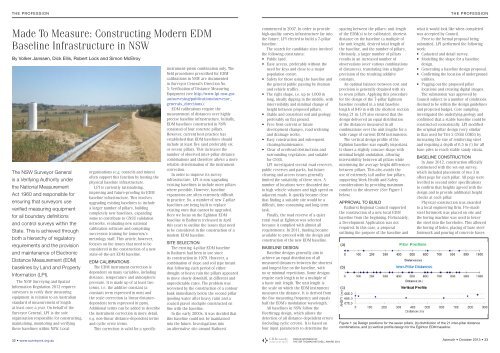
Made To Measure: <strong>Construct<strong>in</strong>g</strong> <strong>Modern</strong> <strong>EDM</strong><br />
<strong>Basel<strong>in</strong>e</strong> <strong>Infrastructure</strong> <strong>in</strong> <strong>NSW</strong><br />
By Volker Janssen, Dick Ellis, Robert Lock and Simon McElroy<br />
The <strong>NSW</strong> Surveyor General<br />
is a Verify<strong>in</strong>g Authority under<br />
the National Measurement<br />
Act 1960 and responsible for<br />
ensur<strong>in</strong>g that surveyors use<br />
verified measur<strong>in</strong>g equipment<br />
for all boundary def<strong>in</strong>itions<br />
and control surveys with<strong>in</strong> the<br />
State. This is achieved through<br />
both a hierarchy of regulatory<br />
requirements and the provision<br />
and ma<strong>in</strong>tenance of Electronic<br />
Distance Measurement (<strong>EDM</strong>)<br />
basel<strong>in</strong>es by Land and Property<br />
Information (LPI).<br />
The <strong>NSW</strong> Survey<strong>in</strong>g and Spatial<br />
Information Regulation 2012 requires<br />
surveyors to verify their measur<strong>in</strong>g<br />
equipment <strong>in</strong> relation to an Australian<br />
standard of measurement of length<br />
at least once a year. On behalf of the<br />
Surveyor General, LPI is the sole<br />
organisation responsible for construct<strong>in</strong>g,<br />
ma<strong>in</strong>ta<strong>in</strong><strong>in</strong>g, monitor<strong>in</strong>g and verify<strong>in</strong>g<br />
these basel<strong>in</strong>es with<strong>in</strong> <strong>NSW</strong>. Local<br />
organisations (e.g. councils and m<strong>in</strong>es)<br />
often support this function by host<strong>in</strong>g the<br />
physical basel<strong>in</strong>e <strong>in</strong>frastructure.<br />
LPI is currently rationalis<strong>in</strong>g,<br />
improv<strong>in</strong>g and future-proof<strong>in</strong>g its <strong>EDM</strong><br />
basel<strong>in</strong>e <strong>in</strong>frastructure. This <strong>in</strong>volves<br />
upgrad<strong>in</strong>g exist<strong>in</strong>g basel<strong>in</strong>es to <strong>in</strong>clude<br />
a larger number of pillars, build<strong>in</strong>g<br />
completely new basel<strong>in</strong>es, expand<strong>in</strong>g<br />
some to contribute to GNSS validation<br />
networks, evaluat<strong>in</strong>g new national<br />
calibration software and complet<strong>in</strong>g<br />
succession tra<strong>in</strong><strong>in</strong>g for tomorrow’s<br />
metrology staff. This article, however,<br />
focuses on the issues that need to be<br />
considered <strong>in</strong> the construction of a new<br />
state-of-the-art <strong>EDM</strong> basel<strong>in</strong>e.<br />
<strong>EDM</strong> CALIBRATIONS<br />
The <strong>EDM</strong> <strong>in</strong>strument correction is<br />
dependent on many variables, <strong>in</strong>clud<strong>in</strong>g<br />
distance, temperature and atmospheric<br />
pressure. It is made up of at least two<br />
terms, i.e. the additive constant (a<br />
constant term expressed <strong>in</strong> mm) and<br />
the scale correction (a l<strong>in</strong>ear distancedependent<br />
term expressed <strong>in</strong> ppm).<br />
Additional terms can be added to describe<br />
the <strong>in</strong>strument correction <strong>in</strong> more detail,<br />
e.g. non-l<strong>in</strong>ear distance-dependent terms<br />
and cyclic error terms.<br />
This correction is valid for a specific<br />
<strong>in</strong>strument-prism comb<strong>in</strong>ation only. The<br />
field procedures prescribed for <strong>EDM</strong><br />
calibrations <strong>in</strong> <strong>NSW</strong> are documented<br />
<strong>in</strong> Surveyor General’s Direction No.<br />
5: Verification of Distance Measur<strong>in</strong>g<br />
Equipment (see http://www.lpi.nsw.gov.<br />
au/survey<strong>in</strong>g/publications/surveyor_<br />
generals_directions).<br />
<strong>EDM</strong> calibrations require the<br />
measurement of distances over highly<br />
precise basel<strong>in</strong>e <strong>in</strong>frastructure. Initially,<br />
<strong>EDM</strong> basel<strong>in</strong>es constructed <strong>in</strong> <strong>NSW</strong><br />
consisted of four concrete pillars.<br />
However, current best practice has<br />
established that <strong>EDM</strong> basel<strong>in</strong>es should<br />
<strong>in</strong>clude at least five (and preferably six<br />
or seven) pillars. This <strong>in</strong>creases the<br />
number of observed <strong>in</strong>ter-pillar distance<br />
comb<strong>in</strong>ations and therefore allows a more<br />
reliable determ<strong>in</strong>ation of the <strong>in</strong>strument<br />
correction.<br />
In order to improve its survey<br />
<strong>in</strong>frastructure, LPI is now upgrad<strong>in</strong>g<br />
exist<strong>in</strong>g basel<strong>in</strong>es to <strong>in</strong>clude more pillars<br />
where possible. However, basel<strong>in</strong>e<br />
expansions are often extremely difficult<br />
<strong>in</strong> practice. So, a number of new 7-pillar<br />
basel<strong>in</strong>es are be<strong>in</strong>g built to replace<br />
exist<strong>in</strong>g ones that cannot be upgraded.<br />
Here we focus on the Egl<strong>in</strong>ton <strong>EDM</strong><br />
basel<strong>in</strong>e <strong>in</strong> Bathurst (released <strong>in</strong> April<br />
this year) to outl<strong>in</strong>e the issues that need<br />
to be considered <strong>in</strong> the construction of a<br />
modern <strong>EDM</strong> basel<strong>in</strong>e.<br />
SITE SELECTION<br />
The exist<strong>in</strong>g 4-pillar <strong>EDM</strong> basel<strong>in</strong>e<br />
<strong>in</strong> Bathurst had been <strong>in</strong> use s<strong>in</strong>ce<br />
its construction <strong>in</strong> 1979. However, a<br />
comb<strong>in</strong>ation of slope and soil type meant<br />
that follow<strong>in</strong>g each period of either<br />
drought or heavy ra<strong>in</strong> the pillars appeared<br />
to move slowly downhill, at different and<br />
unpredictable rates. The problem was<br />
worsened by the construction of a contour<br />
bank immediately below the second pillar<br />
(pool<strong>in</strong>g water after heavy ra<strong>in</strong>) and a<br />
council gravel stockpile constructed on<br />
l<strong>in</strong>e with the basel<strong>in</strong>e.<br />
In the early 2000s, it was decided that<br />
this basel<strong>in</strong>e could not be ma<strong>in</strong>ta<strong>in</strong>ed<br />
<strong>in</strong>to the future. Investigations <strong>in</strong>to<br />
an alternative site around Bathurst<br />
commenced <strong>in</strong> 2007. In order to provide<br />
high-quality survey <strong>in</strong>frastructure far <strong>in</strong>to<br />
the future, LPI elected to build a 7-pillar<br />
basel<strong>in</strong>e.<br />
The search for candidate sites <strong>in</strong>volved<br />
the follow<strong>in</strong>g constra<strong>in</strong>ts:<br />
Public land.<br />
Easy access, preferably without the<br />
need for keys and close to a major<br />
population centre.<br />
Safety for those us<strong>in</strong>g the basel<strong>in</strong>e and<br />
the general public pass<strong>in</strong>g by (human<br />
and vehicle traffic).<br />
The right shape, i.e. up to 1,000 m<br />
long, ideally dipp<strong>in</strong>g <strong>in</strong> the middle, with<br />
<strong>in</strong>tervisibility and m<strong>in</strong>imal change of<br />
height between proposed pillars.<br />
Stable and consistent soil and geology,<br />
preferably on flat ground.<br />
Free from current or future<br />
development changes, road widen<strong>in</strong>g<br />
and dra<strong>in</strong>age works.<br />
Easy construction and subsequent<br />
clear<strong>in</strong>g/ma<strong>in</strong>tenance.<br />
Clear of overhead obstructions and<br />
surround<strong>in</strong>g vegetation, and suitable<br />
for GNSS.<br />
LPI <strong>in</strong>vestigated several road reserves,<br />
public reserves and parks, but future<br />
clear<strong>in</strong>g and access issues generally<br />
limited the suitability of these sites. A<br />
number of locations were discarded due<br />
to high vehicle volumes and high speed on<br />
adjacent roads. It quickly became clear<br />
that f<strong>in</strong>d<strong>in</strong>g a suitable site would be a<br />
difficult, time-consum<strong>in</strong>g and long-term<br />
task.<br />
F<strong>in</strong>ally, the road reserve of a quiet<br />
rural road at Egl<strong>in</strong>ton was selected<br />
because it complied with almost all<br />
requirements. In 2011, fund<strong>in</strong>g became<br />
available to proceed with the design and<br />
construction of the new <strong>EDM</strong> basel<strong>in</strong>e.<br />
BASELINE DESIGN<br />
<strong>Basel<strong>in</strong>e</strong> designs generally aim to<br />
achieve an equal distribution of all<br />
measured distances between the shortest<br />
and longest l<strong>in</strong>e on the basel<strong>in</strong>e, with<br />
no or m<strong>in</strong>imal repetitions. Some designs<br />
require each length to be a multiple of<br />
a basic unit length. The unit length is<br />
the scale on which the <strong>EDM</strong> <strong>in</strong>strument<br />
measures the distance. It is derived from<br />
the f<strong>in</strong>e measur<strong>in</strong>g frequency and equals<br />
half the <strong>EDM</strong>’s modulation wavelength.<br />
All basel<strong>in</strong>es <strong>in</strong> <strong>NSW</strong> follow the<br />
Heerbrugg design, which allows the<br />
detection of all distance-dependent errors<br />
(<strong>in</strong>clud<strong>in</strong>g cyclic errors). It is based on<br />
four <strong>in</strong>put parameters to determ<strong>in</strong>e the<br />
spac<strong>in</strong>g between the pillars: unit length<br />
of the <strong>EDM</strong>(s) to be calibrated, shortest<br />
distance on the basel<strong>in</strong>e (a multiple of<br />
the unit length), desired total length of<br />
the basel<strong>in</strong>e, and the number of pillars.<br />
Obviously, a larger number of pillars<br />
results <strong>in</strong> an <strong>in</strong>creased number of<br />
observations (over various comb<strong>in</strong>ations<br />
of distances), translat<strong>in</strong>g <strong>in</strong>to a higher<br />
precision of the result<strong>in</strong>g additive<br />
constant.<br />
An optimal balance between cost and<br />
precision is generally obta<strong>in</strong>ed with six<br />
to seven pillars. Apply<strong>in</strong>g this procedure<br />
for the design of the 7-pillar Egl<strong>in</strong>ton<br />
basel<strong>in</strong>e resulted <strong>in</strong> a total basel<strong>in</strong>e<br />
length of 849 m with the shortest section<br />
be<strong>in</strong>g 21 m. LPI also ensured that the<br />
design delivered an equal distribution<br />
of the distances measured <strong>in</strong> all<br />
comb<strong>in</strong>ations over the unit lengths for a<br />
wide range of current <strong>EDM</strong> <strong>in</strong>struments.<br />
The vertical design profile of the<br />
Egl<strong>in</strong>ton basel<strong>in</strong>e was equally important.<br />
It shows a slightly concave shape with<br />
m<strong>in</strong>imal height undulation, allow<strong>in</strong>g<br />
<strong>in</strong>tervisibility between all pillars while<br />
m<strong>in</strong>imis<strong>in</strong>g the average height differences<br />
between pillars. This also avoids the<br />
use of extremely tall and/or low pillars,<br />
support<strong>in</strong>g Work Health and Safety<br />
considerations by provid<strong>in</strong>g maximum<br />
comfort to the observer (See Figure 1<br />
below).<br />
APPROVAL TO BUILD<br />
Bathurst Regional Council supported<br />
the construction of a new local <strong>EDM</strong><br />
basel<strong>in</strong>e from the beg<strong>in</strong>n<strong>in</strong>g. Fortunately,<br />
a Development Application was not<br />
required. In this case, a proposal<br />
outl<strong>in</strong><strong>in</strong>g the purpose of the basel<strong>in</strong>e and<br />
what it would look like when completed<br />
was accepted by Council.<br />
Prior to the formal proposal be<strong>in</strong>g<br />
submitted, LPI performed the follow<strong>in</strong>g<br />
work:<br />
Cadastral and detail survey.<br />
Modell<strong>in</strong>g the shape for a basel<strong>in</strong>e<br />
design.<br />
Generat<strong>in</strong>g a basel<strong>in</strong>e design proposal.<br />
Confirm<strong>in</strong>g the location of underground<br />
utilities.<br />
Pegg<strong>in</strong>g out the proposed pillar<br />
locations and creat<strong>in</strong>g digital images.<br />
The submission was approved by<br />
Council subject to a number of conditions<br />
deemed to be with<strong>in</strong> the design guidel<strong>in</strong>es<br />
and projected budget. Core sampl<strong>in</strong>g<br />
<strong>in</strong>vestigated the underly<strong>in</strong>g geology and<br />
confirmed that a stable basel<strong>in</strong>e could be<br />
constructed economically. LPI modified<br />
the orig<strong>in</strong>al pillar design (very similar<br />
to that used for Tier 2 GNSS CORS) by<br />
<strong>in</strong>creas<strong>in</strong>g the size of re<strong>in</strong>forc<strong>in</strong>g steel<br />
and requir<strong>in</strong>g a depth of 6.5 m (!) for all<br />
base piles to reach stable sandy strata.<br />
BASELINE CONSTRUCTION<br />
In June 2012, construction officially<br />
commenced with the set-out survey,<br />
which <strong>in</strong>cluded placement of two 3 m<br />
offset pegs for each pillar. All pegs were<br />
levelled to second order specifications<br />
to confirm that heights agreed with the<br />
design and to provide additional height<br />
checks at each pillar.<br />
Physical construction was awarded<br />
to a local eng<strong>in</strong>eer<strong>in</strong>g firm. Pre-made<br />
steel formwork was placed on site and<br />
the bor<strong>in</strong>g mach<strong>in</strong>e was used to lower<br />
the steel <strong>in</strong>to the boreholes. This allowed<br />
the bor<strong>in</strong>g of holes, plac<strong>in</strong>g of base steel<br />
formwork and pour<strong>in</strong>g of concrete bases<br />
Figure 1: (a) Design positions for the seven pillars, (b) distribution of the 21 <strong>in</strong>ter-pillar distance<br />
<br />
www.surveyors.org.au<br />
PROUD SPONSOR OF<br />
THE SIR THOMAS MITCHELL AWARD 2013
THE PROFESSION<br />
THE PROFESSION<br />
to be performed on the same day. The use<br />
of a concrete pump<strong>in</strong>g mach<strong>in</strong>e allowed<br />
the fill<strong>in</strong>g of the boreholes with concrete<br />
with very little disturbance to the sides of<br />
the holes.<br />
Once the bases were poured, box<strong>in</strong>g<br />
was set up for the pillar section pour. As<br />
PVC pipe was used to form the outside<br />
of the pillars, it only had to be set up<br />
vertical, on l<strong>in</strong>e and at the correct height.<br />
This was easily carried out with str<strong>in</strong>gl<strong>in</strong>e<br />
offsets and the top of the PVC pillar<br />
accurately located by total station. Before<br />
and after the second concrete pour<strong>in</strong>g, a<br />
bracket and prism were used to confirm<br />
that no movement had occurred (See<br />
Figure 2 below).<br />
<br />
<br />
<br />
Once all pillar pours were completed,<br />
the pillars were allowed to cure for<br />
one week before the pillar plates were<br />
grouted <strong>in</strong>to place. Dur<strong>in</strong>g this period,<br />
the bases around the pillars were formed<br />
and poured, and f<strong>in</strong>al landscap<strong>in</strong>g and<br />
clear<strong>in</strong>g occurred. In addition, the safety<br />
barrier construction commenced.<br />
The pillar plates were <strong>in</strong>stalled us<strong>in</strong>g<br />
a low-shr<strong>in</strong>kage grout<strong>in</strong>g mix. The two<br />
end pillar plates were <strong>in</strong>stalled first<br />
and each plate was accurately levelled.<br />
Each subsequent pillar plate was then<br />
grouted and levelled, and its position<br />
confirmed accurately from either end of<br />
the basel<strong>in</strong>e.<br />
Brass number plates were placed <strong>in</strong><br />
the exposed grout to avoid confusion with<br />
pillar number<strong>in</strong>g. All seven pillars were<br />
then sanded, undercoated and pa<strong>in</strong>ted to<br />
protect the PVC pipe. F<strong>in</strong>ally, a sta<strong>in</strong>less<br />
steel etched plaque was affixed to each<br />
pillar.<br />
The erection of the safety barriers<br />
would complete construction. A statement<br />
<strong>in</strong> Council’s approval stated that “even<br />
though a low risk has been determ<strong>in</strong>ed,<br />
it is recommended that an appropriate<br />
safety barrier be <strong>in</strong>stalled at your cost, as<br />
per the RTA’s Road Design Guide”.<br />
As this dead-end rural road has no<br />
posted speed limit, the contractor’s<br />
traffic eng<strong>in</strong>eer deemed that it defaults<br />
to 100 km/h, thus requir<strong>in</strong>g highwayspecification<br />
safety fenc<strong>in</strong>g. In total, the<br />
construction was completed with<strong>in</strong> one<br />
month (Figure 3 below).<br />
<strong>Basel<strong>in</strong>e</strong> verification<br />
Follow<strong>in</strong>g a pillar-settl<strong>in</strong>g period of<br />
four months, the Egl<strong>in</strong>ton <strong>EDM</strong> basel<strong>in</strong>e<br />
was verified by LPI legal metrology staff<br />
<strong>in</strong> November 2012. Dur<strong>in</strong>g verification, all<br />
21 <strong>in</strong>ter-pillar distances were observed<br />
under careful consideration of accurately<br />
measured temperature and atmospheric<br />
pressure us<strong>in</strong>g precise calibrated<br />
<strong>in</strong>struments.<br />
<br />
The relative height differences between<br />
the pillar plates were determ<strong>in</strong>ed to<br />
second order specifications <strong>in</strong> December<br />
2012. Initially, absolute Reduced Levels<br />
(RLs) were obta<strong>in</strong>ed via static GNSS us<strong>in</strong>g<br />
CORSnet-<strong>NSW</strong> and apply<strong>in</strong>g AUSGeoid09.<br />
A levell<strong>in</strong>g connection to surround<strong>in</strong>g<br />
AHD71 marks was then carried out to<br />
provide f<strong>in</strong>al RLs for the pillar plates.<br />
In April 2013, LPI released the Egl<strong>in</strong>ton<br />
<strong>EDM</strong> basel<strong>in</strong>e as its first new 7-pillar<br />
<strong>in</strong>stallation.<br />
Conclusion<br />
LPI is currently <strong>in</strong> the process of<br />
improv<strong>in</strong>g its survey <strong>in</strong>frastructure for<br />
the calibration of <strong>EDM</strong> <strong>in</strong>struments <strong>in</strong> a<br />
variety of ways. This <strong>in</strong>cludes upgrad<strong>in</strong>g<br />
some exist<strong>in</strong>g basel<strong>in</strong>es to <strong>in</strong>clude<br />
more pillars and build<strong>in</strong>g new 7-pillar<br />
basel<strong>in</strong>es <strong>in</strong> key urban locations. This<br />
article has outl<strong>in</strong>ed the issues that need<br />
to be considered <strong>in</strong> the construction of a<br />
modern, state-of-the-art <strong>EDM</strong> basel<strong>in</strong>e,<br />
us<strong>in</strong>g the newly constructed Egl<strong>in</strong>ton<br />
<strong>EDM</strong> basel<strong>in</strong>e <strong>in</strong> Bathurst as an example.<br />
This process is not straightforward,<br />
takes considerable time and effort, and<br />
requires careful consideration of various<br />
issues faced dur<strong>in</strong>g the plann<strong>in</strong>g, site<br />
selection, basel<strong>in</strong>e design and pillar<br />
construction stages. The Egl<strong>in</strong>ton <strong>EDM</strong><br />
basel<strong>in</strong>e is a fundamental piece of survey<br />
<strong>in</strong>frastructure and is now available to the<br />
profession. LPI encourages its immediate<br />
use (see http://www.lpi.nsw.gov.au/<br />
survey<strong>in</strong>g/survey<strong>in</strong>g_services/edm_<br />
basel<strong>in</strong>e_certificates for more details). <br />
A new Australian Standard:<br />
Classification of Subsurface Utility Information<br />
A new Australian Standard, AS5488<br />
Classification of Subsurface Utility<br />
Information, was published on 14<br />
May 2013 and officially launched on<br />
12 June 2013.<br />
Unlike previously published <strong>in</strong>ternational utility Standards<br />
and Guidel<strong>in</strong>es, the Australian Standard AS5488-2013,<br />
Classification of Subsurface Utility Information (SUI), is not an<br />
eng<strong>in</strong>eer<strong>in</strong>g Standard but is unashamedly a survey<strong>in</strong>g and spatial<br />
<strong>in</strong>formation standard due to its attention to absolute spatial<br />
position, metadata and attributes.<br />
Utility services have been placed underground s<strong>in</strong>ce the<br />
early years of the colony: for example, the construction of<br />
Busby’s Bore commenced <strong>in</strong> 1827. The advent of gas, water and<br />
electricity services <strong>in</strong> the latter part of the n<strong>in</strong>eteenth century<br />
<strong>in</strong>evitably led to conflicts between the <strong>in</strong>creas<strong>in</strong>g number of<br />
subsurface utility services. Notwithstand<strong>in</strong>g that such conflicts<br />
were costly to rectify, location technologies were immature and<br />
maps of unknown orig<strong>in</strong> and accuracy were the accepted means<br />
of location prior to the 1970s. However, as society progressed<br />
and utility strikes and conflicts became more prevalent, often<br />
result<strong>in</strong>g <strong>in</strong> <strong>in</strong>jury or death, society looked for means to reduce<br />
the f<strong>in</strong>ancial and personal cost associated with subsurface utility<br />
strikes.<br />
On 23 March 1977, the Institution of Surveyors <strong>NSW</strong> Inc held<br />
a sem<strong>in</strong>ar on “The Need for Common Standards <strong>in</strong> the Record<strong>in</strong>g<br />
and Chart<strong>in</strong>g of Underground Services”. The report of this<br />
sem<strong>in</strong>ar was provided to me by Gary Fuller FIS. John Naughton<br />
FIS, a member of the Institution’s INSURE (Information Needs<br />
for Surveyors <strong>in</strong> the Eighties) Committee that was responsible<br />
for the sem<strong>in</strong>ar, recently (6 June 2013) wrote to me stat<strong>in</strong>g<br />
“Unfortunately our efforts prior to 1980 achieved little except<br />
to leave a spark of frustration at the reluctance of government<br />
to recognise the vulnerability of underground assets”. Two of<br />
the sem<strong>in</strong>ar’s key recommendations recognised the need for<br />
all mapp<strong>in</strong>g to be on a coord<strong>in</strong>ated grid system and common<br />
symbology.<br />
In the USA, recognition of the same problem resulted <strong>in</strong> the<br />
<strong>in</strong>troduction of Subsurface Utility Eng<strong>in</strong>eer<strong>in</strong>g (SUE) <strong>in</strong> Virg<strong>in</strong>ia<br />
<strong>in</strong> 1982. At the same time, progress <strong>in</strong> Australia cont<strong>in</strong>ued to be<br />
non-existent.<br />
More urgent action was taken follow<strong>in</strong>g a “wake-up call” <strong>in</strong><br />
New York City on September 11, 2001. Asset owners then began<br />
to talk more about <strong>in</strong>frastructure protection, their vulnerabilities<br />
& risk and the value <strong>in</strong> accurate mapp<strong>in</strong>g and record<strong>in</strong>g of<br />
their assets. In 2002 the American Society of Civil Eng<strong>in</strong>eers<br />
published ASCE 38-02, the Standard Guidel<strong>in</strong>e for the Collection<br />
and Depiction of Exist<strong>in</strong>g Subsurface Utility Data.<br />
In 2006, the Survey<strong>in</strong>g & Mapp<strong>in</strong>g Industry Council of New<br />
South Wales (SMIC) released an issues paper on ‘Underground<br />
Services Detection & Data’, recommend<strong>in</strong>g common accuracy<br />
standards for data capture of new or replaced underground<br />
utilities and as-built draw<strong>in</strong>gs to be lodged for new or replaced<br />
services. Also <strong>in</strong> 2006, RailCorp <strong>NSW</strong> published a Specification<br />
for the Collection of Services Data, specify<strong>in</strong>g survey accurate<br />
3D location for underground utilities.<br />
In the follow<strong>in</strong>g year, a GITA Workshop <strong>in</strong> Brisbane <strong>in</strong>spired<br />
by the SMIC Issues Paper concluded that “a national standard<br />
for record<strong>in</strong>g the location of underground services is urgently<br />
required” and “critical <strong>in</strong>frastructure protection is a prime driver<br />
for record<strong>in</strong>g the location of underground services”.<br />
In 2009, Ma<strong>in</strong> Roads Western Australia published<br />
Underground Utility Standard 67-08-121, based on the USA<br />
Standard ASCE 38-02. In the same year, the <strong>NSW</strong> Board<br />
of Survey<strong>in</strong>g & Spatial Information (BOSSI) published its<br />
“Roadmap”, which <strong>in</strong>vestigated current standards for record<strong>in</strong>g<br />
underground services and made key recommendations<br />
concern<strong>in</strong>g accuracy, absolute position<strong>in</strong>g, data capture<br />
methods, data quality, symbology and a common data exchange<br />
format.<br />
At 9.30 pm on 15 September 2009, a contractor <strong>in</strong> the Sydney<br />
CBD accidentally cut through 10 Telstra fibre optic and capper<br />
cables. The f<strong>in</strong>al cost of the repair was $800 million and this<br />
directly resulted <strong>in</strong> important changes <strong>in</strong> <strong>NSW</strong> State legislation.<br />
The cost of not know<strong>in</strong>g “where” was significant, and this was<br />
a catalyst for <strong>in</strong>itiat<strong>in</strong>g work towards the development of an<br />
Australian Standard <strong>in</strong> the mapp<strong>in</strong>g and location of underground<br />
utility services.<br />
After lobby<strong>in</strong>g by Cardno, BOSSI and <strong>NSW</strong> Roads & Traffic<br />
Authority (now Roads & Maritime Services - RMS), an <strong>in</strong>dustry<br />
meet<strong>in</strong>g was hosted by Standards Australia on 10 May 2010,<br />
<strong>in</strong>volv<strong>in</strong>g presentations by locally and <strong>in</strong>ternationally respected<br />
experts. This meet<strong>in</strong>g demonstrated <strong>in</strong>dustry commitment to the<br />
development of an Australian Standard. The Project Proposal<br />
was consequently submitted by RMS and SMIC successfully<br />
lobbied for sufficient fund<strong>in</strong>g. Standards Australia then asked<br />
for nom<strong>in</strong>ations from specific national <strong>in</strong>dustry groups for<br />
membership on the Committee. The Committee first met on<br />
17 August 2011, with Mark Gordon represent<strong>in</strong>g Austroads<br />
accept<strong>in</strong>g the nom<strong>in</strong>ation for Chair of the Committee. Also<br />
jo<strong>in</strong><strong>in</strong>g me from our profession on the 22 member Committee<br />
were Norm Bruhn, Bruce Douglas, Paul Harcombe, Bill Kearsley,<br />
John M<strong>in</strong>ehan and Tom Williams. Only twelve months later, the<br />
draft Standard was released for public comment.<br />
The new published Standard recommends the absolute<br />
spatial position<strong>in</strong>g of subsurface utilities <strong>in</strong> three dimensional<br />
coord<strong>in</strong>ates as an improvement upon the widely adopted method<br />
of relative spatial position<strong>in</strong>g that <strong>in</strong>volves measur<strong>in</strong>g offsets<br />
from physical structures and depth below ground level, both<br />
of which can change over time. In countries prone to natural<br />
disasters, such as Australia and New Zealand, or terrorist<br />
attacks, such as the USA, absolute spatial position<strong>in</strong>g appears<br />
to be a logical and necessary improvement when called upon to<br />
locate critical subsurface utility assets after the event.<br />
www.surveyors.org.au<br />
PROUD SPONSOR OF<br />
THE SIR THOMAS MITCHELL AWARD 2013