KASARAGOD - Old.kerala.gov.in - Government of Kerala
KASARAGOD - Old.kerala.gov.in - Government of Kerala
KASARAGOD - Old.kerala.gov.in - Government of Kerala

You also want an ePaper? Increase the reach of your titles
YUMPU automatically turns print PDFs into web optimized ePapers that Google loves.
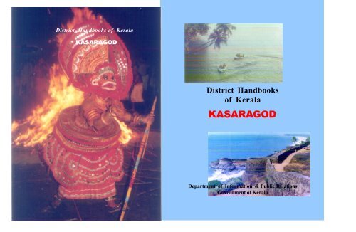
District Handbooks <strong>of</strong> <strong>Kerala</strong><br />
<strong>KASARAGOD</strong><br />
District Handbooks<br />
<strong>of</strong> <strong>Kerala</strong><br />
<strong>KASARAGOD</strong><br />
Department <strong>of</strong> Information & Public Relations<br />
<strong>Government</strong> <strong>of</strong> <strong>Kerala</strong>
District Handbooks<br />
<strong>of</strong> <strong>Kerala</strong><br />
<strong>KASARAGOD</strong><br />
DEPARTMENT OF INFORMATION AND PUBLIC RELATIONS<br />
GOVERNMENT OF KERALA
District Handbooks <strong>of</strong> <strong>Kerala</strong><br />
<strong>KASARAGOD</strong><br />
Department <strong>of</strong> Information and Public Relations<br />
March 2003<br />
Editor - <strong>in</strong> - Chief<br />
G.Rajasekharan . I A S.<br />
Director & Secretary<br />
Compiled by<br />
M. Gangadharan<br />
District Information Officer, Kasaragod<br />
Editor<br />
K. Santhosh Kumar<br />
(Information Officer)<br />
Assistants<br />
N. Radhakrishna Pillai<br />
Ajitha Das<br />
(Translators)<br />
Type sett<strong>in</strong>g and layout<br />
Karma<br />
Contents<br />
1. Introduction ............................................................................5<br />
2. History ....................................................................................5<br />
3. Topography ............................................................................7<br />
4. Climate .....................................................................................8<br />
5. Forest .......................................................................................9<br />
6. Adm<strong>in</strong>istration ......................................................................11<br />
7. Local self <strong>gov</strong>ernment ........................................................13<br />
8. Agriculture ............................................................................14<br />
9. Literacy .................................................................................19<br />
10. Electricity ................................................................................20<br />
11. Fisheries .................................................................................21<br />
12. Health .....................................................................................21<br />
13. Industries ...............................................................................22<br />
14. Men <strong>of</strong> letters ........................................................................24<br />
Published by the Director, Department <strong>of</strong> Information and Public Relations, <strong>Government</strong> <strong>of</strong> <strong>Kerala</strong>.<br />
Pr<strong>in</strong>ted at : KSAVRC Press, Thiruvananthapuram<br />
Copies : 15,000<br />
Price : Rs.10<br />
Every care has been taken to ensure the authenticity <strong>of</strong> the facts given <strong>in</strong> this<br />
hand book. However, the Information and Public Relations Department,<br />
<strong>Government</strong> <strong>of</strong> <strong>Kerala</strong> should not be held responsible for error, if any.<br />
15. Places <strong>of</strong> worship ...................................................................26<br />
16. Places <strong>of</strong> tourist <strong>in</strong>terest........................................................32<br />
17.Barefacts ..................................................................................42
FOREWORD<br />
Reference books have always been <strong>in</strong> great demand <strong>in</strong> <strong>Kerala</strong><br />
and the educated public approach the Information and Public Relations<br />
Department, <strong>Government</strong> <strong>of</strong> <strong>Kerala</strong>, for authentic <strong>in</strong>formation on our State<br />
and districts. It is <strong>in</strong> this context that District Handbooks used to be published.<br />
To be abreast <strong>of</strong> times, the Department has launched a website,<br />
www.prd.<strong>kerala</strong>.<strong>gov</strong>.<strong>in</strong> and ma<strong>in</strong>ta<strong>in</strong>s the State <strong>Government</strong> web portal<br />
www.<strong>kerala</strong>.<strong>gov</strong>.<strong>in</strong>. It has been our s<strong>in</strong>cere endeavour to update these<br />
on a day-to-day basis and popularise the use <strong>of</strong> computers through out<br />
the State to enable <strong>in</strong>formation and services to reach the needy. However<br />
the Department feels that the time is not ripe for a complete switch<br />
over from the pr<strong>in</strong>t media and hence a new series <strong>of</strong> District Handbooks<br />
is now published.<br />
I hope that this book would cater to the requirements <strong>of</strong> the tourists<br />
as well as the general public who seek a handy booklet conta<strong>in</strong><strong>in</strong>g<br />
relevant <strong>in</strong>formation about the district. Suggestions for improvement <strong>of</strong><br />
the publication/the contents <strong>of</strong> the website/portals are welcome.<br />
Thiruvananthapuram,<br />
18th March 2003.<br />
G.Rajasekharan, I.A.S.<br />
Director & Secretary<br />
Information & Public Relations<br />
T<br />
INTRODUCTION<br />
he name, Kasaragod, is said to be derived from the word<br />
Kusirakood mean<strong>in</strong>g Nuxvomica forests (Kanjirakuttom). It is<br />
with the <strong>in</strong>tention <strong>of</strong> bestow<strong>in</strong>g maximum attention on the development <strong>of</strong><br />
backward areas that Kasaragod district was formed on 24th May 1984.<br />
HISTORY<br />
Ly<strong>in</strong>g on the north western coast <strong>of</strong> the State, Kasaragod was<br />
famous from time immemorial. Many Arab travellers, who came to <strong>Kerala</strong><br />
between n<strong>in</strong>th and 14th centuries AD, visited Kasaragod as it was then<br />
an important trade centre. They called this area Harkwillia. Barbose,<br />
the Portuguese traveller, who visited Kumbla near Kasaragod <strong>in</strong> 1514,<br />
had recorded that rice was exported to Male Island whence coir was<br />
imported. Dr. Francis Buccanan, who was the family doctor <strong>of</strong> Lord<br />
Wellesly, visited Kasaragod <strong>in</strong> 1800. In his travelogue, he has <strong>in</strong>cluded<br />
<strong>in</strong>formation on the political and communal set-up <strong>in</strong> places like Athipramba,<br />
Kavvai, Nileswaram, Bekal, Chandragiri and Manjeshwaram.<br />
Kasaragod was part <strong>of</strong> the Kumbala K<strong>in</strong>gdom <strong>in</strong> which there were<br />
64 Tulu and Malayalam villages. When Vijayanagar empire attacked<br />
5
Kasaragod, it was ruled by the Kolathiri K<strong>in</strong>g who had Nileshwaram as<br />
his headquarters. It is said that the characters appear<strong>in</strong>g <strong>in</strong> Theyyam, the<br />
ritualistic folkdance <strong>of</strong> northern <strong>Kerala</strong>, represent those who had helped<br />
K<strong>in</strong>g Kolathiri <strong>in</strong> the fight aga<strong>in</strong>st the attack <strong>of</strong> the Vijayanagar empire.<br />
Dur<strong>in</strong>g the decl<strong>in</strong>e <strong>of</strong> that empire <strong>in</strong> the 14th century, the adm<strong>in</strong>istration <strong>of</strong><br />
this area was vested with the Ikkery Naikans. They cont<strong>in</strong>ued to be the<br />
rulers till the fall <strong>of</strong> the Vijayanagar empire <strong>in</strong> 16th century. Then Vengappa<br />
Naik declared <strong>in</strong>dependence to Ikkery. In 1645 Sivappa Naik took the<br />
reigns and transferred the capital to Bednoor. Thus they came to be<br />
known as Bednoor Naik. Chandragiri and Bekal forts are considered to<br />
be parts <strong>of</strong> a cha<strong>in</strong> <strong>of</strong> Forts constructed by Sivappa Naik.<br />
In 1763 Hyder Ali <strong>of</strong> Mysore conquered Bednoor. His <strong>in</strong>tention<br />
was to capture entire <strong>Kerala</strong>. But when his attempt to conquer Thalassery<br />
fort was foiled , Hyder Ali returned to Mysore and died there <strong>in</strong> 1782.His<br />
son, Tippu Sulthan, cont<strong>in</strong>ued the attack and conquered Malabar. As per<br />
the Sreerangapattanam Treaty <strong>of</strong> 1792, Tippu surrendered Malabar<br />
except Thulunadu (Canara) to the British. The British got it, only after<br />
the death <strong>of</strong> Tippu Sulthan <strong>in</strong> 1799.<br />
Kasaragod was part <strong>of</strong> Bekal taluk <strong>in</strong> the south Canara district <strong>of</strong><br />
Bombay presidency. Kasaragod taluk came <strong>in</strong>to be<strong>in</strong>g when Bekal taluk<br />
was <strong>in</strong>cluded <strong>in</strong> the Madras presidency on 16th April 1882. Though<br />
Vengayil Kunhiraman Nayanar moved a resolution <strong>in</strong> 1913 on the floor <strong>of</strong><br />
Madras Governor's Council demand<strong>in</strong>g the merger <strong>of</strong> Kasaragod taluk<br />
with the Malabar district, it had to be withdrawn because <strong>of</strong> the stiff<br />
opposition <strong>of</strong> the members from Karnataka. In1927, a political convention<br />
held at Kozhikode, passed a resolution stress<strong>in</strong>g the above demand. In the<br />
same year, an organisation titled Malayalee Seva Sanghom was<br />
constituted. Thanks to the efforts made by many em<strong>in</strong>ent persons like<br />
K.P.Kesava Menon, Kasaragod became part <strong>of</strong> <strong>Kerala</strong> follow<strong>in</strong>g the<br />
reorganisation <strong>of</strong> states and formation <strong>of</strong> <strong>Kerala</strong> on the first November<br />
1956.<br />
National Movement<br />
Kasaragod played a prom<strong>in</strong>ent role <strong>in</strong> the National Movement for<br />
the freedom <strong>of</strong> the country. Mohammed Sherul Sahib and Kandige Krishna<br />
Bhat were the frontl<strong>in</strong>e leaders <strong>of</strong> the <strong>in</strong>dependence movement. Umesh<br />
Rao, K.M. Krishnan Nambiar, Shreesankarji, Naranthatta Raman Nair,<br />
A.C. Kannan Nair, T.Gopalan Nair and Meloth Narayanan Nambiar were<br />
prom<strong>in</strong>ent freedom fighters.<br />
The agrarian struggle to end the exploitation and oppression by<br />
landlords and chiefta<strong>in</strong>s were part <strong>of</strong> the National Movement. The<br />
Kadakom Sathyagraha was started follow<strong>in</strong>g the arrest <strong>of</strong> Gandhiji <strong>in</strong><br />
1932. The Palayi Harvest Agitation (1941), Cheemeni Estate Struggle<br />
(1942), Kayyur Agrarian Riot (1944), Eleri Estate Agitation (1946),<br />
Kar<strong>in</strong>thalam Paddy Seizure Revolt (1948) and many other struggles waged<br />
by the peasant organisations accelerated the tempo <strong>of</strong> the freedom movement.<br />
Besides the agitation <strong>of</strong> the peasants, the various struggles unleashed<br />
for the uplift <strong>of</strong> the scheduled castes and tribes also supported and enlivened<br />
the National Movement.<br />
TOPOGRAPHY<br />
Kasaragod district lies between 11 0 18' and 12 0 48' north latitudes<br />
and between 74 0 52' and 75 0 26' east longitudes. The district is marked<br />
<strong>of</strong>f from the adjo<strong>in</strong><strong>in</strong>g areas outside the State by the Western Ghats<br />
which run parallel to the sea and constitute an almost cont<strong>in</strong>uous<br />
mounta<strong>in</strong> wall on the eastern side. The Ghats dom<strong>in</strong>ate the topography.<br />
The cost l<strong>in</strong>e is fr<strong>in</strong>ged with low cliffs alternat<strong>in</strong>g with stretches <strong>of</strong> sand.<br />
A few miles to the <strong>in</strong>terior, the scene changes and the sand level rises<br />
towards the barrier <strong>of</strong> the Ghats and transforms <strong>in</strong>to low red laterite hills<br />
<strong>in</strong>terspersed with paddy fields and coconut gardens.<br />
The district is bounded <strong>in</strong> the east by the Western Ghats, <strong>in</strong> the<br />
west by the Arabian sea, the north by the Canara district <strong>of</strong> Karnataka<br />
and <strong>in</strong> the south by the Kannur District.<br />
6 7
Based on physical features the district falls <strong>in</strong>to three natural divisions-the<br />
low land border<strong>in</strong>g the sea, the mid land consist<strong>in</strong>g <strong>of</strong> the undulat<strong>in</strong>g<br />
country and the forestclad highland on the extreme east.<br />
CLIMATE<br />
The diversity <strong>of</strong> the physical features results <strong>in</strong> a correspond<strong>in</strong>g<br />
diversity <strong>of</strong> climate. In the pla<strong>in</strong>s, the climate is generally hot. Though the<br />
mean maximum temperature is only around 90 0 F, the heat is oppressive<br />
<strong>in</strong> the moisture laden atmosphere <strong>of</strong> the pla<strong>in</strong>s. Humidity is very high and<br />
rises to about 90 per cent dur<strong>in</strong>g the south-west monsoon. The annual<br />
variation <strong>of</strong> temperature is small; the diurnal range is only about 10 0 F.<br />
AVERAGE RAINFALL<br />
Month Ra<strong>in</strong>fall (m.m.)<br />
January 30.9<br />
February 0.0<br />
March 0.0<br />
April 38.1<br />
May 339.9<br />
June 1056.5<br />
July 675.4<br />
August 553.0<br />
September 74.2<br />
October 306.3<br />
November 28.1<br />
December 49.8<br />
Annual 3152.2<br />
The south-west monsoon starts towards the end <strong>of</strong> May or the<br />
beg<strong>in</strong>n<strong>in</strong>g <strong>of</strong> June, heralded by thunder-storms and holds till September<br />
when the ra<strong>in</strong> fades out. October br<strong>in</strong>gs <strong>in</strong> the north-east monsoon. Dry<br />
weather sets <strong>in</strong> by the end <strong>of</strong> December. January and February are the<br />
coolest months <strong>of</strong> the year. March, April and May are generally very hot.<br />
FOREST<br />
Kasaragod district has a forest area <strong>of</strong> 117.5412. sq. kms. fall<strong>in</strong>g<br />
under the Kannur Forest Division. Reserve forest stretches to 86.0221<br />
sq.kms. and vested forest, to 28.4971 sq.kms. It stretches <strong>in</strong> two ranges-<br />
Kasaragod and Kanhangad. The forest produces are shegaibark, sheakoy,<br />
cardamom, canes, fibres, etc. Sambar, the fastest deer, is seen <strong>in</strong> some<br />
areas. Wild boars are a nuisance to the cultivators <strong>of</strong> hilly areas.<br />
RIVERS<br />
There are 12 rivers <strong>in</strong> this district. The longest is Chandragiri (105<br />
kms.) orig<strong>in</strong>at<strong>in</strong>g from Pattimala <strong>in</strong> Coorg and embraces the sea at<br />
Thalangara. The river assumes its name Chandragiri from the name<br />
<strong>of</strong> the place <strong>of</strong> its source Chandragupta Vasti; where the great Maurya<br />
emperor Chandragupta, is believed to have spent his last days as a sage.<br />
The second longest river is Kariankod (64 kms.), across which a dam<br />
is be<strong>in</strong>g built at Kakkadavu. Shiriya (61 kms.), Uppala (50 kms.), Mogral<br />
(34 kms.), Chithari (25 kms.), Nileshwaram (47 kms.), Kavvayi (23 kms.),<br />
Manjeswaram (16 kms.), Kumbala (11 kms.), Bekal (11 kms.) and Kalanad<br />
(8 kms.) are the other rivers. These rivers provide ample irrigation<br />
facilities.<br />
THE PEOPLE<br />
The people <strong>of</strong> this district have, as is the case <strong>in</strong> other parts <strong>of</strong> the<br />
state, a dist<strong>in</strong>ctiveness <strong>in</strong> personal appearance, marked by fairness <strong>of</strong><br />
complexion, regularity <strong>of</strong> features, clean habits and a simple life.<br />
The major religious groups are H<strong>in</strong>dus, Muslims and Christians.<br />
Brahm<strong>in</strong>s, Nairs, Ambalavasis, Thiyyas and Kammalas are the major<br />
divisions <strong>of</strong> the H<strong>in</strong>du community. Thiyyas <strong>in</strong> the northern parts <strong>of</strong><br />
the district are known as Belichappad. The sub-divisions <strong>of</strong> Nair<br />
community are Nambiar, Menon, Kurup etc. Kammalas are artisans like<br />
8 9
Thattan (Goldsmith), Perumkollan (Blacksmith) and Asaris (Carpenters).<br />
Brahm<strong>in</strong>s consist <strong>of</strong> Bhat, Punichitaya, Kukkillaya, Kunikullaya, Ballullaya,<br />
Kadambulithaya, Kakunnaya etc.<br />
Christians are settled ma<strong>in</strong>ly <strong>in</strong> the eastern hilly areas. They are<br />
the early settlers from the southern parts <strong>of</strong> the State. The first group <strong>of</strong><br />
Christian settlers came to Rajapuram <strong>in</strong> 1943. The ma<strong>in</strong> Christian settlements<br />
are Thomapuram, Palavayal, Vellarikundu, Cherupuzha, Bandadka,<br />
Pul<strong>in</strong>gom, Kozhichal, Karibedkom, Malom, Balal, Kanhiradkom, Kadumeni,<br />
Malakkallu, Panathady and Cheemeni. These hilly terra<strong>in</strong>s are converted<br />
<strong>in</strong>to rich plantations.<br />
The Muslims are very pious and they follow rigid religious customs.<br />
The purdha system is observed more strictly here by Muslim women<br />
than <strong>in</strong> any other parts <strong>of</strong> the State.<br />
Cherumas, Mavilans, Parayas, etc. are the scheduled castes. They<br />
are ma<strong>in</strong>ly agricultural labourers. The scheduled tribes consist <strong>of</strong> Koragas<br />
<strong>of</strong> Kasaragod taluk, Marattis <strong>of</strong> Hosdurg and Kasaragod taluks and Adiyans<br />
<strong>of</strong> Eravas.<br />
The cosmopolitan outlook and character <strong>of</strong> the people <strong>in</strong> the district<br />
are because <strong>of</strong> the contact they had with the trade missions that used to<br />
visit this place years back. The H<strong>in</strong>dus, the Muslims and the Christians<br />
are, <strong>in</strong>fluenc<strong>in</strong>g and gett<strong>in</strong>g <strong>in</strong>fluenced by the culture <strong>of</strong> the other. Communal<br />
harmony and religious tolerance are the noteworthy characteristics<br />
<strong>of</strong> the people. Though the people speak different languages, there is no<br />
barrier on the cultural unity. Mosques, temples and churches stand side<br />
by side as a symbol <strong>of</strong> communal harmony.<br />
POPULATION*<br />
Person Male Female<br />
<strong>Kerala</strong> T 31,838,619 15,468,664 16,369,955<br />
R 23,571,484 11,450,785 12,120,699<br />
U 8,267,135 4,017,879 4,249,256<br />
Kasaragod District T 1,203,342 587,763 615,579<br />
R 969,597 474,899 494,69<br />
U 233,745 112,864 120,881<br />
Kasaragod Taluk T 616,176 304,970 311,206<br />
R 519,939 257,806 262,133<br />
U 96,237 47,164 49,073<br />
Hosdurg Taluk T 587,166 282,793 304,373<br />
R 449,658 217,093 232,565<br />
U 137,508 65,700 71,808<br />
T-Total, R-Rural, U-Urban *Census 2001<br />
ADMINISTRATION<br />
For the purpose <strong>of</strong> revenue adm<strong>in</strong>istration, the district is divided<br />
<strong>in</strong>to two taluks and 75 villages.<br />
The Collectorate functions at<br />
the Civil Station, at Vidya<br />
Nagar, Chengala Panchayat,<br />
five kms.away from Kasaragod<br />
town. Kasaragod is the only<br />
revenue division <strong>in</strong> the district<br />
and its Office is at Kanhangad.<br />
Civil Station, Kasaragod<br />
10 11
Villages<br />
1. Kasaragod Taluk 2. Hosdurg Taluk<br />
1. Kasaragod<br />
2. Chengala<br />
3. Thekkil<br />
4. Kalanad<br />
5. Adhur<br />
6. Kudlu<br />
7. Adoor<br />
8. Paady<br />
9. Delampady<br />
10. Muliyar<br />
11. Munnad<br />
12. Koluthur<br />
13. Karivedakam<br />
14. Kuttikole<br />
15. Bediadka<br />
16. Thalangara<br />
17. Bandiadka<br />
18. Kunjathur<br />
19. Hosabettu<br />
20. Ichilango<br />
21. Uppala<br />
22. Kodlamogru<br />
23. Varkady<br />
24. Meenja<br />
25. Paivalike<br />
26. Kadambar<br />
27. Kayyar<br />
28. Bayar<br />
29. Madhur<br />
30. Nettanige<br />
31. Ednad<br />
32. Kumbdaje<br />
33. Bambrana<br />
34. Badre<br />
35. Koipady<br />
36. Badoor<br />
37. Neerchal<br />
38. Enmakaje<br />
39. Bela<br />
40. Maire<br />
41. Badiadka<br />
42. Udma<br />
43. Pallikkera<br />
44. Panaya<br />
45. Periya<br />
46. Pullur<br />
47. Ajanur<br />
48. Chittari<br />
49. Hosdurg<br />
50. Madikai<br />
51. Kanhangad<br />
52. Ambalathara<br />
53. Belur<br />
54. Thayannur<br />
55. Kallar<br />
56. Panathady<br />
57. Balal<br />
58. Maloth<br />
59. Nileswaram<br />
60. Perole<br />
61. K<strong>in</strong>anoor<br />
62. Kar<strong>in</strong>dalam<br />
63. Parappa<br />
64. Beemanady<br />
65. West Eleri<br />
66. Chittarikkal<br />
67. Palaavayal<br />
68. Kayyur<br />
69. Cheemeni<br />
70. Kodakkad<br />
71. Pillicode<br />
72. Cheruvathur<br />
73. Padanna<br />
74. N. Trikaripur<br />
75. S. Trikaripur<br />
LOCAL SELF GOVERNMENT<br />
There are one District<br />
Panchayat,four Block Panchayats<br />
and 39 Grama Panchayats <strong>in</strong> the<br />
district.The Kasaragod District<br />
Panchayat <strong>of</strong>fice functions at the<br />
Civil Station compound.<br />
District Panchayat Build<strong>in</strong>g<br />
Block / Grama Panchayats<br />
Block Telephone Grama Telephone<br />
Panchayat number Panchayat number<br />
1. Manjeshwaram 872673 1. Bellur 460073<br />
2. Kumbdaje 860237<br />
3. Mangalpady 840221<br />
4. Vorkady 802259<br />
5. Puthige 855043<br />
6. Meenja 850262<br />
7. Manjeshwaram 872238<br />
8. Kumbla 813033<br />
9. Paivalige 805028<br />
10. Enmakaje 895031<br />
11. Badiadka 884026<br />
2. Kasaragod (04994) 430230 12. Karadka 460049<br />
13. Kuttikole 495003<br />
14. Muliyar 450226<br />
15. Delampady 470034<br />
16. Chengala 490224<br />
17. Chemmanad 437276<br />
18. Bediadka 410235<br />
19. Madhur 430427<br />
20. Mogral Puthur 422891<br />
12 13
3. Kanhangad (04997) 704048 21. Udma 736242<br />
22. Ajanur 766386<br />
23. Balal 742235<br />
24. Kallar 725100<br />
25. Kodom-Belur 746350<br />
26. Madikkai 740680<br />
27. Pallikkara 772026<br />
28. Panathady 727300<br />
29. Pullur-Periya 794030<br />
4. Nileswaram 780328 30. Cheruvathur 760221<br />
31. Kayyur-Cheemeni 750322<br />
32. Nileswaram 780360<br />
33. East Eleri 721035<br />
34. Pilicode 711504<br />
35. West Eleri 741336<br />
36. Thrikkaripur 710236<br />
37. K<strong>in</strong>anur-Kar<strong>in</strong>thalam 795350<br />
38. Padanna 776259<br />
39. Valiyaparamba 758276<br />
ASSEMBLY, PARLIAMENTARY<br />
CONSTITUENCIES<br />
There are five Assembly and one Parliamentary constituencies <strong>in</strong><br />
the district. Manjeshwaram, Kasaragod, Udma, Hosdurg (reserved for<br />
SC) and Thrikkaripur are the Assembly constituencies. Kasaragod is the<br />
Parliamentary constituency.<br />
AGRICULTURE<br />
Agriculture forms the ma<strong>in</strong>stay <strong>of</strong> the population <strong>of</strong> the district.<br />
The soil <strong>in</strong> the three natural divisions generally fall under three types.<br />
In the highland region it is laterite.<br />
In the midland, the soil is a red ferrug<strong>in</strong>ous<br />
loam <strong>of</strong> lateritic orig<strong>in</strong><br />
with an admixture <strong>of</strong> clay and sand.<br />
The coastal strip is sandy. Diversity<br />
<strong>of</strong> crops and heterogeneity <strong>in</strong><br />
cultivation are the key notes <strong>of</strong><br />
agriculture here.<br />
The eastern tract comprises <strong>of</strong> forests and hilly areas. The forests<br />
comprise <strong>of</strong> a variety <strong>of</strong> timber with teak and other plantations. The hilly<br />
areas are mostly cleared and put to private cultivation; the important crops<br />
be<strong>in</strong>g rubber, cashew and g<strong>in</strong>ger. In the skeletal plateau areas, cashew<br />
trees are cultivated, while <strong>in</strong> some patches, arecanut, pepper and cocoa<br />
are grown. In the coastal tract, paddy, coconut, arecanut, cashew,<br />
tobacco, vegetable and tapioca are cultivated.<br />
Crops<br />
Crops Cultivation<br />
Ox race<br />
Area Ha.<br />
Paddy 1. Virippu 4,749<br />
2. Mundakan 3,420<br />
3. Puncha 217<br />
Coconut 56.183<br />
Arecanut 12,738<br />
Pepper 7,051<br />
Cashew 19,962<br />
Tapioca 1,280<br />
Tobacco 44<br />
Rubber 22,248<br />
Sweet Potato 78<br />
Vegetables 3,126<br />
Pulses 389<br />
Banana 792<br />
G<strong>in</strong>ger 129<br />
Oil Seeds 54<br />
14 15
Land use pattern<br />
As per survey reports, Kasaragod district covers a geographical<br />
area <strong>of</strong> 1,96,130 hectares. The composition <strong>of</strong> the geographical features<br />
are as detailed below:<br />
Particulars<br />
Area <strong>in</strong> Hectares<br />
Forest Area 5,625<br />
Land put to non-agricultural use 19,758<br />
Barren & uncultivable 8,562<br />
Permanent pastures and graz<strong>in</strong>g land --<br />
Land under miscellaneous tree crops 4,568<br />
Cultivable waste 13,308<br />
Fallow other than current fallow 1,319<br />
Current fallow 3,228<br />
Net sown area 1,39,765<br />
Area sown more than once 8,770<br />
Total cropped area (gross) 1,48,535<br />
CPCRI<br />
The Central Plantation Crops Research Institute (CPCRI) is an<br />
establishment hav<strong>in</strong>g national importance. It was established <strong>in</strong> 1970 by<br />
the Indian Council <strong>of</strong> Agricultural Research. Research is carried out on<br />
various branches <strong>of</strong> Agricultural Sciences such as garden<strong>in</strong>g, soil chemistry,<br />
plant production, microbiology, plant diseases, cattle rear<strong>in</strong>g, pisci culture,<br />
etc.With headquarters at Kudlu, five kms. north <strong>of</strong> Kasaragod, the<br />
CPCRI has regional stations at Kayamkulam, Vittal and Kozhikode. Its<br />
research centres are at Peechi, Palode, Hirehally, Appangala, Mohithnagar<br />
and Kehikuchi. There are seed farms at Kidu and Sathigode, one field<br />
station at Thrissur and a World Coconut Germplasm Centre at Sipighat.<br />
The objectives <strong>of</strong> the CPCRI are to serve as national forum for improv<strong>in</strong>g<br />
genetic potential <strong>of</strong> plantation crops, to conduct basic and applied research<br />
on various aspects <strong>of</strong> these crops, to co-ord<strong>in</strong>ate research works be<strong>in</strong>g<br />
done by other <strong>in</strong>stitutions and agencies <strong>in</strong> the country, to serve as an <strong>in</strong>formation<br />
centre on all matters perta<strong>in</strong><strong>in</strong>g to these crops, to produce genetically<br />
superior plant<strong>in</strong>g materials and to carry out all India co-ord<strong>in</strong>ated<br />
cropp<strong>in</strong>g improvement project on coconut, arecanut, spices and cashewnut.<br />
T x D, Mangala arecanut, new species <strong>of</strong> cardamom, turmeric<br />
and cashew, mixed crop and multi-crop system, etc. are some <strong>of</strong> the contributions<br />
<strong>of</strong> the CPCRI for the development <strong>of</strong> agriculture. The most<br />
remarkable venture is tissue culture <strong>in</strong> coconut.<br />
Research on various diseases <strong>of</strong> coconut,<br />
arecanut, cashew, pepper and field<br />
crops has given better yields.<br />
CPCRI is one <strong>of</strong> the ICAR <strong>in</strong>stitute<br />
implement<strong>in</strong>g the NATP project on "Technology<br />
Assessment and Ref<strong>in</strong>ement<br />
Through Institution Village L<strong>in</strong>kage" which<br />
is hav<strong>in</strong>g emphasis on ensur<strong>in</strong>g farmer's participation<br />
<strong>in</strong> agro-eco system analysis, identification<br />
and prioritization <strong>of</strong> problems and<br />
decid<strong>in</strong>g appropriate technological <strong>in</strong>terventions.<br />
Under the project different <strong>in</strong>terventions<br />
have been implemented <strong>in</strong> farmers <strong>in</strong><br />
different micro farm<strong>in</strong>g situations.<br />
Agricultural Technology Information<br />
Centre (ATIC) is established at CPCRI,<br />
Crops<br />
Irrigated area*<br />
Area <strong>in</strong><br />
Hects.<br />
Paddy 3302<br />
Tubers 21<br />
Vegetables 315<br />
Coconut 25670<br />
Arecanut 12996<br />
Cloves and<br />
Nutmeg 39<br />
Other spices 123<br />
Banana 647<br />
Betal leaves 22<br />
Sugarcane 2<br />
Others 1500<br />
* 2000-2001<br />
Kasaragod to provide the required technology <strong>in</strong>formation, diagnostic and<br />
advisory services and supply <strong>of</strong> quality plant<strong>in</strong>g material to farmers through<br />
a s<strong>in</strong>gle w<strong>in</strong>dow delivery system.<br />
The Krishi Vigyan Kendras function<strong>in</strong>g under CPCRI at Kasaragod<br />
and Kayamkulam cater to the tra<strong>in</strong><strong>in</strong>g needs <strong>of</strong> farmers <strong>of</strong> Kasaragod<br />
and Alappuzha Districts respectively. Farmers are immensely benefited<br />
through the vocational tra<strong>in</strong><strong>in</strong>g programmes, front l<strong>in</strong>e demonstrations and<br />
on farm test<strong>in</strong>g <strong>in</strong> the farmers' fields and other technology transfer activities<br />
organised by the Kendras.<br />
16 17
Quality plant<strong>in</strong>g materials <strong>of</strong> coconut, arecanut and cocoa are produced<br />
and distributed to farmers from the various centres <strong>of</strong> CPCRI.<br />
Farmers can write to CPCRI <strong>in</strong> advance for seedl<strong>in</strong>gs and can procure<br />
the same <strong>in</strong> person on <strong>in</strong>timation.<br />
The Institute <strong>of</strong>fers project consultancies to <strong>in</strong>dividuals on nom<strong>in</strong>al<br />
charges on the establishment and ma<strong>in</strong>tenance <strong>of</strong> gardens <strong>of</strong> coconut,<br />
arecanut and cocoa, farm<strong>in</strong>g systems, pests and disease management<br />
and post harvest technology.<br />
CPCRI library has a collection <strong>of</strong> 50,000 documents perta<strong>in</strong><strong>in</strong>g to<br />
palms and cocoa and subscribes to 225 journals. All documents <strong>of</strong> the<br />
library are classified, catalogued and <strong>in</strong>dexed and the process <strong>of</strong> computerization<br />
us<strong>in</strong>g library s<strong>of</strong>tware is <strong>in</strong> progress. Library at the headquarters<br />
and at regional stations provide documentation services to scientists,<br />
researchers, students, farmers and personnel from plantation crops<br />
<strong>in</strong>dustry.<br />
LIVE STOCK POPULATION*<br />
Cattle 1,92,866<br />
Buffaloes 9,397<br />
Sheep 88<br />
Pigs 4,734<br />
Goats 55,602<br />
Fowls 8,80,187<br />
Ducks 2,306<br />
Donkeys 5<br />
Horses & Ponies 113<br />
Dogs 71,075<br />
Mules 15<br />
Rabbits 1,968<br />
Other Poultry 1,277<br />
*as per 1996 Census.<br />
LITERACY<br />
The Saksharatha Programme <strong>of</strong> the <strong>Government</strong> was well received<br />
and due to the zealous campaign conducted by the <strong>Government</strong> as well<br />
as voluntary organisations, the level <strong>of</strong> literacy has a marked improvement.<br />
As per available statistics, the district has 896,367 literates, <strong>of</strong><br />
which the number <strong>of</strong> males is 464,844 and females 431,523.<br />
Literates*<br />
Person Male Female<br />
<strong>Kerala</strong> T 25,625,698 12,817,963 12,807,735<br />
R 18,747,212 9,400,183 9,347,029<br />
U 6,878,486 3,417,780 3,460,706<br />
Kasaragod Dist. T 896,367 464,844 431,523<br />
R 713,595 371,861 341,734<br />
U 182,772 92,983 89,789<br />
Kasaragod Taluk T 447,722 236,585 211,137<br />
R 372,883 198,284 174,599<br />
U 74,839 38,301 36,538<br />
Hosdurg T 448,645 228,259 220,386<br />
R 340,712 173,577 167,135<br />
U 107,933 54,682 53,251<br />
T - Total, R - Rural, U - Urban * Census 2001<br />
18 19
EDUCATIONAL INSTITUTIONS<br />
Institution Govt. Aided Unaided Total<br />
Lower Primary Schools 141 115 7 263<br />
Upper Primary Schools 73 72 4 149<br />
High Schools 43 19 8 70<br />
Higher Secondary Schools 31 14 - 45<br />
Colleges 2 2 - 4<br />
Eng<strong>in</strong>eer<strong>in</strong>g College 1 - - 1<br />
Teacher Tra<strong>in</strong><strong>in</strong>g Institutes 2 1 - 3<br />
Special School for the bl<strong>in</strong>d 1 - - 1<br />
Industrial Tra<strong>in</strong><strong>in</strong>g Institutes 2 - - 2<br />
Industrial Tra<strong>in</strong><strong>in</strong>g Centres - - 7 7<br />
Polytechnic 2 1 - 3<br />
Kendriya Vidyalaya 2 - - 2<br />
Navodaya Vidyalaya 1 - - 1<br />
ELECTRICITY<br />
The exist<strong>in</strong>g power voltage has been <strong>in</strong>creased after the commission<strong>in</strong>g<br />
<strong>of</strong> a 220 KV Sub Station at Mailatt. Besides there are five 110<br />
KV Sub Stations Manjeshwaram, Kubannur, Kasaragod, Mulleria and<br />
Kanhangad. The 110 KV Sub Station at Cheruvathur is started function<strong>in</strong>g.<br />
The work <strong>of</strong> eight 33 KV Sub Stations are <strong>in</strong> progress. The KPCL<br />
a private establishment at Mailatty is the only power generat<strong>in</strong>g unit <strong>in</strong> the<br />
district.<br />
EMPLOYMENT<br />
There are two Employment Exchanges function<strong>in</strong>g <strong>in</strong> the district.<br />
One is at Kasaragod and the other is at Kanhangad.<br />
The number <strong>of</strong> unemployed youths registered at Hosdurg Town<br />
Employment Exchange as on 31st December 2001 was 77,960. Females<br />
39,884 <strong>of</strong> which graduates numbered 7,279 and technically qualified 1,747.<br />
The number <strong>of</strong> unemployed males is 38,076 and females 39,884. The<br />
number <strong>of</strong> persons belong<strong>in</strong>g to scheduled castes registered as unemployed<br />
is 4,648, scheduled tribes 877 and physically handicapped 813.<br />
In Kasaragod Employment Exchange, the total number <strong>of</strong> unemployed<br />
youths registered as on 31st December, 2001 stood at 27,264 <strong>of</strong><br />
which 11,256 are males and 13,038 females. Out <strong>of</strong> this total, the number<br />
<strong>of</strong> technically qualified persons are 522, graduates 1,587, scheduled castes<br />
3,230, scheduled tribes 2,066 and physically handicapped 440. A Self<br />
Employment Scheme KESRU (<strong>Kerala</strong> Self Employment Scheme for the<br />
Registered Unemployed) is implemented through Employment Exchange.<br />
FISHERIES<br />
Kasaragod district has an 80 kms. long sea coast extend<strong>in</strong>g from<br />
Thrikaripur to Bengra-Manjeshwaram. There are many fish-land<strong>in</strong>g centres<br />
<strong>in</strong> this district and some <strong>of</strong> them have fish-land<strong>in</strong>g, clean<strong>in</strong>g and transport<strong>in</strong>g<br />
facilities. There is a light house at Kasaragod.<br />
Bengra-Manjeshwaram, Shiriya, Koipady, Kavugoly, Kasaba, Kizhur,<br />
Kottikulam, Pallikkara, Ajanur, Hosdurg Kadappuram, Thakadappuram,<br />
Punjavi Kadappuram, Padanna Kadappuram, Kadankod, Valiyaparamba<br />
and Thrikaripur Kadappuram are the fish<strong>in</strong>g villages <strong>in</strong> the district. There<br />
are many ice plants <strong>in</strong> the public and private sectors.<br />
HEALTH<br />
In the field <strong>of</strong> health and sanitation, the district lacks modern facilities.<br />
Patients requir<strong>in</strong>g technologically advanced treatment are forced to<br />
go to Mangalapuram, Manipal or Kozhikode.<br />
20 21
HEALTH INSTITUTIONS<br />
Systems Institutions/Particulars Number<br />
Allopathy District Hospital 1<br />
Taluk Hospital 1<br />
Community Health Centres 5<br />
Primary Health Centres 45<br />
Family Welfare Centres 249<br />
T.B. Centre 1<br />
District Medical Stores 1<br />
L.C. Units 2<br />
Food Inspector Offices 3<br />
J.P.H.N. Tra<strong>in</strong><strong>in</strong>g School 1<br />
N.F.C.P. Unit 1<br />
<strong>Government</strong> Blood Banks 2<br />
Doctors <strong>in</strong> <strong>Government</strong> Institution 107<br />
Beds <strong>in</strong> <strong>Government</strong> Institution 667<br />
Private Medical Institutions 64<br />
Private Blood Banks 2<br />
Ayurveda Hospitals 5<br />
Dispensaries 3<br />
Homoeopathy Hospitals 3<br />
Dispensaries 21<br />
INDUSTRIES<br />
Kasaragod has vast potentials for the establishment <strong>of</strong> large and<br />
medium <strong>in</strong>dustries, but the district is at present <strong>in</strong>dustrially backward. There<br />
is no major <strong>in</strong>dustry. As per the latest data available, there are 5,759<br />
small-scale <strong>in</strong>dustrial units <strong>in</strong> the district.<br />
Industrial Scenario<br />
Industry<br />
No.<br />
Large Industry : Nil<br />
Medium Industry : 1<br />
SSI Units : 5,759<br />
Industrial Co-operative Societies : 62<br />
Handloom Societies : 8<br />
Agro based : 665<br />
Rubber based : 129<br />
Plastic based : 68<br />
Forest based : 472<br />
Animal Husbandry : 43<br />
Textile based : 1200<br />
Chemical based : 176<br />
Eng<strong>in</strong>eer<strong>in</strong>g based : 665<br />
Electronics based : 254<br />
M<strong>in</strong>erals : 294<br />
Build<strong>in</strong>g materials : 111<br />
Others : 1682<br />
Identified clusters<br />
For clay based artware - Bediadka<br />
For wood based Industry - Kasaragod<br />
For Handicrafts - Ananthapuram<br />
Roads<br />
Category<br />
Length <strong>in</strong> kms.<br />
National Highways 85.9<br />
State Highways 141.8<br />
Major district roads tarred 310.8<br />
Other district roads tarred 274.7<br />
Other district roads earthern 10.0<br />
The length <strong>of</strong> rail l<strong>in</strong>e pass<strong>in</strong>g through this district is 116 kms.<br />
22 23
MEN OF LETTERS<br />
The Kuttamath Kunniyur family <strong>in</strong> Cheruvathur had given birth to<br />
many poets. The first <strong>of</strong> this galaxy <strong>of</strong> Kuttamath scholars was Kunhunni<br />
Kurup (1813-1885). He was talented Astrologer and Sanskrit scholar.<br />
His important works are Devi Mahatmyam, Kapotha Sandesham and<br />
Vyasolpathi. Kuttamath Cheria Rama Kurup (1847-1906) was a dramatist,<br />
poet, grammarian and Ayurvedic physician <strong>of</strong> considerable merit. He<br />
has composed several Sanskrit works such as Subhadrapaharanam,<br />
Rukm<strong>in</strong>i Swayamvaram and Sita Swayamvaram. His Sarva Garala<br />
Padmochanam is a comprehensive work on Visha Vaidyam (Toxicology).<br />
Among his Malayalam works may be mentioned Kesivadham,<br />
Kamsavadham, Sri Ramavatarams and three Thullal poems, viz.,<br />
Krishnavatharam, Poothanamoksham and Ahalyamoksham.<br />
Kuttamath Kunhi Kelu Kurup (1863-1915) dist<strong>in</strong>guished himself<br />
as a composer <strong>of</strong> Thullal poems, the most important <strong>of</strong> which are<br />
Kharavadham, Seemanth<strong>in</strong>i Swayamvaram, Sita Swayamvaram,<br />
Kuchelagopalam, Sankaracharya Charitham and Radhamadhavam.<br />
He has also organised a Thullal Kaliyogam <strong>of</strong> his own to popularise<br />
Ottnthullal.<br />
Kuttamath Kunhambu Kurup (1855 1911) was a great sanskrit scholar<br />
and Ayurvedic physician. Among his works are a poem Kirtibhooshana<br />
Charitham and three dramas, viz., Vaidarbhi Vasudevam,<br />
Ushanirudham and Amsumatidharmaguptam.<br />
The most dist<strong>in</strong>guished <strong>of</strong> the Kuttamath scholars is Kunhi Krishna<br />
Kurup (1881-1944), who is also known as Mahakavi Kuttamath. He is<br />
the author <strong>of</strong> several important works <strong>in</strong> Malayalam. The earliest <strong>of</strong><br />
his literary composition is a poem called Kaliyamardanam. He has<br />
composed a few dramas such as Devayani Charitham, Balagopalam,<br />
Nachiketas, Dhruvamadhavam, Harischandra Charitham, etc.<br />
and several devotional works like Sri Ramakrishnan Gita and<br />
Mukambikapuranam<br />
Kilippattu. He has also<br />
composed an Attakadha<br />
<strong>in</strong> Malayala m titled<br />
Balagopalam.<br />
P. Kunhiraman<br />
Nair, another famous<br />
poet <strong>of</strong> <strong>Kerala</strong>, hailed<br />
from Bellikoth near<br />
Kanhangad. T. Ubaid,<br />
the cultural leader <strong>of</strong><br />
Yakshaganam<br />
Kasaragod, was born at<br />
Thalangara. Pr<strong>of</strong>icient <strong>in</strong> Malayalam and Kannada, T. Ubaid translated<br />
many Malayalam literary pieces <strong>in</strong>to Kannada and vice-versa. He was<br />
also a researcher <strong>in</strong> Mopla songs.<br />
Rashtrakavi, M. Gov<strong>in</strong>da Pai <strong>of</strong> Manjeshwaram, is <strong>Kerala</strong>'s contribution<br />
to Kannada language and literature. Poet, art critic and literature<br />
researcher, M. Gov<strong>in</strong>da Pai (1883-1963) who has enriched Kannada<br />
literature and poetry by his famous works, was conferred the title <strong>of</strong> poet<br />
laureate by the erstwhile <strong>Government</strong> <strong>of</strong> Madras, along with Mahakavi<br />
Vallathol. He excelled himself as a poet, nationalist, historian, dramatist<br />
and l<strong>in</strong>guist. Gommata J<strong>in</strong>astuti was the first published work <strong>of</strong> Gov<strong>in</strong>da<br />
Pai. Gov<strong>in</strong>da Pai also <strong>in</strong>troduced the sonnet form <strong>in</strong> Kannada.<br />
His Giliv<strong>in</strong>du, which literally means "a bunch <strong>of</strong> parrots", conta<strong>in</strong>s<br />
some rare and beautiful gems <strong>of</strong> Kannada poetry. Gov<strong>in</strong>da Pai also enriched<br />
Kannada learn<strong>in</strong>g with his historical studies and research. He was<br />
an authority on the chronology and history <strong>of</strong> Tulunad. Gov<strong>in</strong>da Pai was<br />
also a prolific prose writer. His earliest composition <strong>in</strong> prose was Srikrishna<br />
Charita (1909) which provides for remarkable read<strong>in</strong>g. His best works<br />
written <strong>in</strong> blank verse, viz., Golgotha (the last days <strong>of</strong> Christ, published <strong>in</strong><br />
1937), Vaisakhi (The last days <strong>of</strong> Buddha, published <strong>in</strong> 1946) and<br />
24 25
Hebberaqlu (The Thumb, the<br />
story <strong>of</strong> Ekalavya retold, published<br />
<strong>in</strong> 1946) have won for<br />
Gov<strong>in</strong>da Pai a last<strong>in</strong>g place <strong>in</strong> the<br />
gallery <strong>of</strong> the greatest poets <strong>of</strong><br />
Kannada literature. These<br />
works also testify to his universal<br />
outlook as well as to his deep<br />
compassion for the poor and the<br />
downtrodden.<br />
Sri Parthisuba, the great<br />
exponent <strong>of</strong> Yakshagana, was<br />
believed to have lived at Kumbla<br />
near Kasaragod. Sri. T.S.<br />
Thirumumbu, a revolutionary<br />
poet, was also a leader <strong>of</strong> the<br />
agrarian movement.<br />
The colourful and ritualistic folk arts like Theyyam and Thirayattom<br />
are performed here. Yakshagana, a colourful dance-drama, orig<strong>in</strong>ally <strong>of</strong><br />
Karnataka is also popularly performed here, and that too, some times <strong>in</strong><br />
Malayalam.<br />
Adoor temple<br />
Theyyam<br />
PLACES OF WORSHIP<br />
Forty five kms. east <strong>of</strong> Kasaragod town, Adoor is noted for its<br />
ancient Siva Temple, believed to have been founded by Arjuna. The temple,<br />
which is known as Sri Mahal<strong>in</strong>geshwara temple, is situated <strong>in</strong> picturesque<br />
surround<strong>in</strong>gs on the southern bank <strong>of</strong> the river Payasw<strong>in</strong>i.<br />
The Makara Samkramam is a very important festival day <strong>in</strong> the<br />
temple when a Sahasra Kumbha Abhishekam with feed<strong>in</strong>g <strong>of</strong> a large<br />
number <strong>of</strong> people takes place. Accord<strong>in</strong>g to tradition, the day co<strong>in</strong>cides<br />
with the anniversary <strong>of</strong> the day on which a harijan spotted the Sival<strong>in</strong>gam.<br />
The annual Jatra or festival <strong>of</strong> the temple starts with Dhwaja Arohanam<br />
(hoist<strong>in</strong>g <strong>of</strong> the temple flag) on the 27th <strong>of</strong> Kumbham (February, March)<br />
and concludes with the Avabhritha Snanam (holy dip) <strong>in</strong> the water <strong>of</strong> the<br />
Payasw<strong>in</strong>i on the fourth <strong>of</strong> Meenam (April) every year.<br />
Ajanur Madiyan Kulom temple<br />
In Ajanur village is situated the famous Madiyan Kulom temple. It is<br />
about five kms. from Kanhangad. The ma<strong>in</strong> deity <strong>of</strong> the temple is<br />
Bhadrakali; but there are also other deities like Kshetrapalan, Bhagavathi<br />
and Bhairavan. A peculiarity <strong>of</strong> this temple is that a Brahm<strong>in</strong> priest performs<br />
pooja only <strong>in</strong> the noon, while the morn<strong>in</strong>g and even<strong>in</strong>g poojas are<br />
performed by a sect called Maniyanis.The festivals <strong>in</strong> the temple fall dur<strong>in</strong>g<br />
the months <strong>of</strong> Edavam (May, June) and Dhanu (December, January).<br />
Ananthapuram<br />
At a distance <strong>of</strong><br />
about five kms. from<br />
Kumbla is the Anantha<br />
puram Temple whichis said<br />
to be the ‘Moolasthanam’<br />
<strong>of</strong> the Ananthapadmanabha<br />
Swami (Sri Padmanabha<br />
Swami Temple) <strong>of</strong> Thiru<br />
vananthapuram. Local<br />
tradition has it that<br />
Ananthapuram Temple<br />
Ananthapadmanabha <strong>of</strong> Thiruvananthapuram had settled down here orig<strong>in</strong>ally.<br />
Anantheswara temple<br />
The fame <strong>of</strong> Manjeshwaram lies <strong>in</strong> the famous Srimad<br />
Anantheswara Temple owned by the Gowda Saraswath community. It<br />
26 27
attracts pilgrims from all over India, particularly from the region ly<strong>in</strong>g<br />
between Kanyakumari and Goa. The annual car Festival <strong>of</strong> the temple is<br />
on the sixth Lunar Day <strong>of</strong> the bright half <strong>of</strong> the Margashira month, usually<br />
between the third week <strong>of</strong> November and the third week <strong>of</strong> December.<br />
It is also called the Shashti Festival as the f<strong>in</strong>al day celebration<br />
takes place on the Skanda Shashti day , a day sacred to Subrahmanya.<br />
In the outer round <strong>of</strong> the temple, there is a flower garden named Anantha<br />
Nandana Vana.<br />
Bela church<br />
About 11 kms. from Kumbla on the Kumbla-Badiadka road, is the<br />
Mother Dolorus Church <strong>of</strong> Bela. This Gothic style Roman Catholic church<br />
which is under the Mangalapuram Diocese, has celebrated its centenary<br />
recently.The Christian church at Kasaragod has also celebrated its centenary<br />
recently. The St. Thomas Church at Chittarikal is another famous<br />
one. The eastern parts <strong>of</strong> the district about <strong>in</strong> a number <strong>of</strong> small and big<br />
churches.<br />
Kizhur Sasta temple<br />
There is an ancient Sastha temple at Chandragiri which is known<br />
as Kizhur Sastha Temple. This is the headquarters <strong>of</strong> the Anjooru<br />
Nayanmar (five hundred Nairs). The festival which is peculiar to this<br />
temple is Pattu Utsavam. Troups <strong>of</strong> pr<strong>of</strong>essional s<strong>in</strong>gers s<strong>in</strong>g jo<strong>in</strong>tly <strong>in</strong><br />
praise <strong>of</strong> the greatness <strong>of</strong> the deity. The dignitaries <strong>of</strong> all the Kazhakams<br />
<strong>of</strong> Saliyas from Pattuvam to Panamboor (present new Mangalapuram)<br />
known as Path<strong>in</strong>alu Nagaram assemble here annually on the second<br />
Saturday <strong>of</strong> Vrischikam (November).<br />
Kumbla Sri Gopala Krishna temple<br />
Two <strong>of</strong> the four sacred temples <strong>of</strong> Kumbla Seema are located <strong>in</strong><br />
Kumbla and its suburbs. They are the Mujankavu Sri Parthasaradhi Temple<br />
and Kanipura (Kaniyara) Sri Gopalakrishna Temple. Kumbla is also called<br />
Kanipura (Kaniyara) after the latter temple.<br />
The temple <strong>of</strong> Sri Parthasarathi <strong>of</strong> Mujankavu is situated <strong>in</strong> Ednad<br />
village, about four kms. east <strong>of</strong> Kumbla and about eight kms. north west<br />
<strong>of</strong> Madhur.<br />
The Sri Gopalakrishna Temple, is situated <strong>in</strong> the heart <strong>of</strong> the town<br />
<strong>of</strong> Kumbla at the foot <strong>of</strong> an elevated hill which rises majestically <strong>in</strong> front<br />
<strong>of</strong> it, with the Kumbla river flank<strong>in</strong>g it on the left (north). The colourful<br />
festival at Kumbla temple which lasts for five days every year, commences<br />
with the Dhwajaarohanam on the Makara Sankramana day.<br />
People <strong>in</strong> thousands from all over the region attend these festivities.<br />
Madhur temple<br />
At Madhur, eight kms.<br />
north east <strong>of</strong> Kasaragod, is<br />
the famous Madhur Srimad<br />
Anantheswara V<strong>in</strong>ayaka<br />
temple. The impos<strong>in</strong>g structure<br />
<strong>of</strong> the temple, with its<br />
turrets and gables and the<br />
copper plate ro<strong>of</strong><strong>in</strong>g, rises<br />
majestically aga<strong>in</strong>st the beautiful<br />
landscape <strong>of</strong> hills, paddy fields and gardens with the river Madhuvah<strong>in</strong>i<br />
Madhur temple<br />
flow<strong>in</strong>g leisurely <strong>in</strong> front <strong>of</strong> it.<br />
The Madhur temple is a Siva temple with Srimad Anantheswara as<br />
its presid<strong>in</strong>g deity. The Sival<strong>in</strong>gam <strong>of</strong> the temple is said to have been found<br />
by a harijan woman, Madharu.<br />
A special festival associated with the Madhur temple is the<br />
Moodappa seva.The large figure <strong>of</strong> Maha Ganapathi is covered with<br />
appam. It requires enormous quantities <strong>of</strong> rice and lakhs <strong>of</strong> rupees for its<br />
conduct. The festival is conducted only periodically <strong>in</strong> view <strong>of</strong> the huge<br />
expenditure <strong>in</strong>volved.It was celebrated <strong>in</strong> April 1962 after a lapse <strong>of</strong> about<br />
160 years, and very recently <strong>in</strong> April 1992.<br />
28 29
The ceil<strong>in</strong>g <strong>of</strong> the Namaskara Mantapam <strong>of</strong> the Madhur Temple<br />
has been decorated with beautiful figures <strong>of</strong> puranic heroes <strong>in</strong> wood<br />
carv<strong>in</strong>g. A closer exam<strong>in</strong>ation <strong>of</strong> the wood carv<strong>in</strong>gs would disclose the<br />
various episodes <strong>of</strong> the Ramayana, beg<strong>in</strong>n<strong>in</strong>g with the Putrakameshtiyagam<br />
and end<strong>in</strong>g with Seetha Swayamvaram.<br />
The Mantapam <strong>in</strong> the <strong>in</strong>terior <strong>of</strong> the temple build<strong>in</strong>g as well as the<br />
outside façade <strong>of</strong> the second and third storeys <strong>of</strong> the ma<strong>in</strong> build<strong>in</strong>g are<br />
also pr<strong>of</strong>use with attractive and exquisite wood carv<strong>in</strong>gs.<br />
Malik D<strong>in</strong>ar mosque<br />
Kasaragod acquired over<br />
the years, considerable importance<br />
as a centre <strong>of</strong> Islam on<br />
the west coast. It is the site <strong>of</strong><br />
one <strong>of</strong> the mosques believed to<br />
have been founded by Malik Ibn<br />
D<strong>in</strong>ar. The mosque, Juma<br />
Masjid, which is one <strong>of</strong> the best<br />
Malik D<strong>in</strong>ar mosque<br />
kept and most attractive <strong>in</strong> the district, is located at Thalangara.It conta<strong>in</strong>s<br />
the grave <strong>of</strong> Malik Ibn Mohammed, one <strong>of</strong> the descendants <strong>of</strong> Malik Ibn<br />
D<strong>in</strong>ar and the place is sacred to Muslims. Another notable mosque, <strong>in</strong><br />
Kasaragod is the Theruvath Mosque which is <strong>in</strong> the centre <strong>of</strong> the town.<br />
An important local celebration takes place every year <strong>in</strong> commemoration<br />
<strong>of</strong> the arrival <strong>of</strong> Malik Ibn D<strong>in</strong>ar. The Uroos attract pilgrims from all over<br />
India.<br />
Narampady church<br />
This is a Roman Catholic church on the Badiadka-Mulleria route,<br />
about 10 kms. from Badiadka. This is known as St. John Britto Church<br />
and this was established <strong>in</strong> 1939.<br />
Nellikkunnu mosque<br />
Uroos, celebrated <strong>in</strong> Nellikkunnu mosque, attracts people <strong>in</strong> thousands.<br />
The Nercha celebration, dur<strong>in</strong>g the second half <strong>of</strong> November, lasts<br />
for one week.<br />
Perne<br />
Of the 18 temples <strong>of</strong> Muchilottu Bhagavathi, Perne is the northern<br />
most and the only one north <strong>of</strong> Payasw<strong>in</strong>i Seema. It is five kms. east <strong>of</strong><br />
Kumbla and near Ananthapuram Lake Temple, on the Kumbla-Badiadka<br />
route . The mass marriage at the time <strong>of</strong> Pooram festival <strong>in</strong> the month <strong>of</strong><br />
Meenam, is a unique feature <strong>of</strong> this temple.<br />
Temples <strong>of</strong> Kasaragod town<br />
Kasaragod has a few important temples. Of these, the Mallikarjuna<br />
temple, situated near the taluk <strong>of</strong>fice, is the most important. The annual<br />
festival have falls <strong>in</strong> the month <strong>of</strong> March and it attracts huge crowds.<br />
One <strong>of</strong> the most important temples <strong>of</strong> the Gowda Saraswathas <strong>in</strong><br />
<strong>Kerala</strong> is the Venkatramana temple.The Sri Arya Karthyayani temple<br />
and the Sri Panduranga temple are also famous temples <strong>of</strong> the place.<br />
Just on the eastern side <strong>of</strong> Pulikunnu by the Payasw<strong>in</strong>i river, there<br />
is a temple belong<strong>in</strong>g to the Thiyya community where thirty n<strong>in</strong>e deities<br />
are worshipped. The ma<strong>in</strong> festival here, called Kaliyattam, falls <strong>in</strong> February/March.<br />
There is also the Palakunnu temple (near Malik Ibn D<strong>in</strong>ar<br />
mosque) ak<strong>in</strong> to the Palakunnu Devasthanam <strong>of</strong> Udma. Bhagavathi<br />
temples, such as Theruvath Bhagawathi and Kadappuram Sri Kurumba<br />
temples, are spread all over the municipal area, worshipped by particular<br />
communities.<br />
Thrikkaripur Sri Chakrapani temple<br />
Sri Chakrapani temple has a hoary past with a legend about its<br />
orig<strong>in</strong> <strong>in</strong> the ancient Brahmandapurana. The great sage Garga, accord<strong>in</strong>g<br />
to the legend describer many a holy place <strong>in</strong> Bharath Varsha<br />
<strong>in</strong>clud<strong>in</strong>g Sri Chakrapani Temple to Yudhishtira, when the Pandava were<br />
dwell<strong>in</strong>g <strong>in</strong> the Gandhamadana Sailya Forest dur<strong>in</strong>g their twelve year exile.<br />
Thrikkaripur where the temple is situated, is about 40 kms. north <strong>of</strong><br />
Kannur town. The temple has been bestow<strong>in</strong>g spiritual solace and prosperity<br />
for generations.<br />
30 31
Trikkannad<br />
This is a Siva temple on the sea shore, with<strong>in</strong> one km. <strong>of</strong> the Bekal<br />
bridge. The place arround Pandyan Kallu, a rock ris<strong>in</strong>g above the sea<br />
near the temple, is an ideal spot for adventurous swimmers. Swimm<strong>in</strong>g <strong>in</strong><br />
the sea is a popular sport here.<br />
Palakunnu Bhagavathi Kshetram is one km. north <strong>of</strong> Trikkannad<br />
on the Kasaragod-Kanhangad road. The annual Bharani festival attracts<br />
thousands.<br />
Bekal<br />
PLACES OF TOURIST INTEREST<br />
Bekal, situated on the seashore <strong>of</strong> Pallikkara village, is an important<br />
place <strong>of</strong> tourist <strong>in</strong>terest <strong>in</strong> the district. It lies 12 kms. south <strong>of</strong> Kasaragod<br />
town. Accord<strong>in</strong>g to<br />
Bekal Rama Nayak, a<br />
local Kannada writer,<br />
the word, Bekal is derived<br />
from the word<br />
Baliakulam, mean<strong>in</strong>g<br />
Big Palace. The<br />
place is said to have<br />
been the seat <strong>of</strong> a big<br />
palace <strong>in</strong> the past. The<br />
Bekal fort<br />
term Baliakulam got<br />
corrupted as Bekulam and later as Bekal.<br />
It was usual <strong>in</strong> older days for every royal palace to be protected by<br />
a fort. The Bekal fort might have, therefore, existed even from early<br />
days <strong>of</strong> the Chirakkal Rajas. While giv<strong>in</strong>g a description <strong>of</strong> the Kolathiri<br />
K<strong>in</strong>gdom <strong>in</strong> his <strong>Kerala</strong> History, K.P. Padmanabha Menon writes; "The<br />
eldest <strong>of</strong> the male members reigned as soveriegn Kolathiri. The next <strong>in</strong><br />
succession, the heir apparent, was the Thekkelamkur. The residence<br />
assigned to him was the Vadakara fort. The third <strong>in</strong> succession was the<br />
Vadakkelamkur <strong>in</strong> charge <strong>of</strong> Vekkolath fort. This V(B)ekkolath fort is<br />
identified by some scholars as the present Bekal".<br />
H.A. Stuart, <strong>in</strong> his Handbook <strong>of</strong> South Canara (1985), makes this<br />
observation: "….. Several forts were built by the Shivappa Nayaks <strong>of</strong><br />
Badnore between 1650 and 1670 A.D. The two forts <strong>of</strong> Bekal and<br />
Chandragiri were orig<strong>in</strong>ally under the Kolathiri or Chirakkal Rajas until<br />
the time <strong>of</strong> Shivappa Nayaka's <strong>in</strong>vasion. Perhaps, the Bednore rulers<br />
might have rebuilt and improved it".<br />
The Bekal fort, which is <strong>of</strong> great historical and archaeological <strong>in</strong>terest,<br />
is the largest and best preserved <strong>of</strong> its k<strong>in</strong>d <strong>in</strong> the district and the<br />
land on which it is situated, runs <strong>in</strong>to the sea with f<strong>in</strong>e bay towards the<br />
south. Accord<strong>in</strong>g to the South Canara Mannual, Bekal fort fell <strong>in</strong>to the<br />
hands <strong>of</strong> Haider Ali <strong>in</strong> 1763. It housed the Huzur <strong>of</strong> Canara dur<strong>in</strong>g Tippu's<br />
time and the rema<strong>in</strong>s <strong>of</strong> a gallow rem<strong>in</strong>iscent <strong>of</strong> the days <strong>of</strong> Mysorean<br />
occupation were seen here till a few years back. After the overthrow <strong>of</strong><br />
Tippu Sultan <strong>in</strong> 1799, Bekal was <strong>in</strong>corporated <strong>in</strong>to the dom<strong>in</strong>ions <strong>of</strong> the<br />
English East India Company. The erstwhile Kasaragod taluk <strong>of</strong> South<br />
Canara district was known as Bekal for more than half a century.<br />
The Bekal fort is now under the Archeological Department <strong>of</strong> the<br />
<strong>Government</strong> <strong>of</strong> India.<br />
There is a Travellers' Bungalow, ma<strong>in</strong>ta<strong>in</strong>ed by the Public Works<br />
Department <strong>of</strong> the State <strong>Government</strong> with<strong>in</strong> the Bekal fort. The natural<br />
scenery at Bekal is allur<strong>in</strong>g and makes a visit to the place an exhilerat<strong>in</strong>g<br />
experience. There is a recently renovated temple dedicated to Hanuman,<br />
at the entrance to Bekal. An old mosque is also situated very near the<br />
fort and this is believed to have been founded by Tippu Sultan.<br />
It was <strong>in</strong> the year 1992 the central <strong>gov</strong>ernment declared Bekal Fort<br />
as a special tourism area. It was with the <strong>in</strong>tention <strong>of</strong> transform<strong>in</strong>g Bekal<br />
32 33
Fort <strong>in</strong>to <strong>in</strong>ternational tourism centre that <strong>in</strong> the year 1995 the <strong>gov</strong>ernment<br />
formed Bekal Tourism Development Corporation.<br />
It is <strong>in</strong> Chemmanad, Udma, Pallikkara and Ajanur Panchayats that<br />
<strong>of</strong> the Bekal tourism project is implemented. At present the corporation is<br />
engaged <strong>in</strong> arrang<strong>in</strong>g basic facilities for the project. Corporation has<br />
decided to acquire 278 hectares <strong>of</strong> land for Bekal development.<br />
Plans for better<strong>in</strong>g and <strong>in</strong>creas<strong>in</strong>g basic facilities will be implemented<br />
<strong>in</strong> the four panchayats where Bekal tourism project is implemented. Water<br />
supply scheme for the entire people <strong>of</strong> Pallikkara, Udma, Ajanur and<br />
Chemmanad will be implemented. In the first phase, programmes like<br />
waste <strong>in</strong>c<strong>in</strong>eration, road construction and <strong>in</strong>stallation <strong>of</strong> street lights will<br />
also be carried out.<br />
B.R.D.C. has programme to develop other tourist centres <strong>of</strong> the<br />
district as part <strong>of</strong> Bekal project. Two House boats have already started<br />
function<strong>in</strong>g at Valiyaparambu this year itself. Boats clubs will be established<br />
at Bekal and Chandragiri soon. A Bekal facility centre was established<br />
<strong>in</strong> 1998 near Bekal Fort. In the facility centre there is an <strong>in</strong>formation<br />
centre.<br />
Chandragiri<br />
Chandragiri lies three kms. south <strong>of</strong> Kasaragod town. It has a<br />
large square situated high above the Chandragiri river on its southern<br />
bank. The fort it said to have been built <strong>in</strong> the 17th century by Sivappa<br />
Nayak <strong>of</strong> Bednore, who established his authority over the area and built a<br />
cha<strong>in</strong> <strong>of</strong> forts. The Chandragiri river, on the bank <strong>of</strong> which it rises, marked<br />
the traditional boundary between <strong>Kerala</strong> and the Tuluva K<strong>in</strong>gdom. There<br />
is a beautiful bridge over the Chandragiri river at Tekkil, five miles from<br />
Chandragiri. A mosque is situated nearby and the view <strong>of</strong> the bridge<br />
with the mosque <strong>in</strong> the background is one <strong>of</strong> the most attractive sights on<br />
a drive along the NH 17 from Kannur to Kasaragod. A long railway<br />
tunnel passes through Chandragiri. A boat club has been recently started<br />
here.<br />
Cheruvathur<br />
Cheruvathur is an important place on the NH 17. The former<br />
Mangalore-Cheruvathur coast road starts from Mangalapuram, the headquarters<br />
<strong>of</strong> the South Canara district and runs through the coast l<strong>in</strong>e, till it<br />
reaches Cheruvathur.<br />
The Kunniyur family <strong>in</strong> Kuttamath Amsom near Cheruvathur has<br />
produced a number <strong>of</strong> illustrious scholars who have contributed greatly to<br />
Malayalam literature.<br />
Edneer mutt<br />
Situated on the Kasaragod-Puthur road, about eight kms. north east<br />
<strong>of</strong> Kasaragod town, this ancient mutt is a reputed seat <strong>of</strong> learn<strong>in</strong>g. It<br />
attracts devotees from all over <strong>Kerala</strong>, Karnataka and other states.<br />
This belongs to the Thotakacharya (one <strong>of</strong> the four disciples <strong>of</strong><br />
Sankaracharya) tradition. Vadakke mutt <strong>in</strong> Trissur was established by a<br />
disciple <strong>of</strong> Thotakacharya. The Swamiji <strong>of</strong> this mutt was the founder <strong>of</strong><br />
Pad<strong>in</strong>jare mutt <strong>in</strong> Trichambaram and Edneer mutt was established by the<br />
swamiji <strong>of</strong> Trichambaram. At present the mutt is renowned for the encouragement<br />
it gives to art and culture.<br />
Gov<strong>in</strong>da Pai memorial<br />
Manjeshwaram is renowned as the native place <strong>of</strong> M. Gov<strong>in</strong>da Pai<br />
(1883-1963), one <strong>of</strong> the greatest Kannada poets <strong>of</strong> modern times. He has<br />
enriched Kannada literature and poetry. He was conferred the title <strong>of</strong><br />
"poet laureate" by the erstwhile <strong>Government</strong> <strong>of</strong> Madras. He was also a<br />
nationalist, historian, dramatist and l<strong>in</strong>guistic.<br />
His residence <strong>in</strong> Manjeshwaram is ma<strong>in</strong>ta<strong>in</strong>ed as a memorial and<br />
the <strong>Government</strong> <strong>of</strong> <strong>Kerala</strong> has established a first grade college dedicated<br />
to his memory.<br />
34 35
Hosdurg fort<br />
The Hosdurg fort with its round bastions, looks impos<strong>in</strong>g from a<br />
distance. Several public <strong>of</strong>fices are located with<strong>in</strong> its premises. There is<br />
a famous temple attached to the fort which is known as Karpooreshwara<br />
temple. The fort is a major attraction for tourists. In Kanhangad, there<br />
are two churches; one Catholic and the other a Protestant. There are<br />
also a number <strong>of</strong> mosques here.<br />
Kammatamkavu<br />
An evergreen forest <strong>of</strong> about 50-60 acres, with a perennial stream,<br />
is a centre <strong>of</strong> worship connected with the Kammatam Bhagavathi Temple.<br />
Kanhangad<br />
Kanhangad, the headquarters <strong>of</strong> the Hosdurg taluk, is 33 kms. south<br />
<strong>of</strong> Kasaragod. It has an area <strong>of</strong> 32 sq. kms. and a population <strong>of</strong> 23,621.<br />
Kanhangad has the rem<strong>in</strong>ents <strong>of</strong> a large fort built by Somasekhara Nayak<br />
<strong>of</strong> Ikkeri (1714-39). It is locally called Hosdurg (hosa, new and durg, fort)<br />
and it is after this fort that the Hosdurg taluk derives its name.<br />
Kanwatirtha Beach resort<br />
The clean and neat 3-4 kms. long beach and the swimm<strong>in</strong>g pool<br />
like lake, half a km. long and proportionately broad, formed by sea water,<br />
are gift <strong>of</strong> nature.<br />
Kasaragod town<br />
Kasaragod municipal town is situated on the banks <strong>of</strong> the Chandragiri<br />
river and is 31 m. above sea level. Kasaragod is an important bus<strong>in</strong>ess<br />
centre. Arecanuts and copra are the ma<strong>in</strong> trade.Pepper, copra and cashewnuts<br />
are the important commodities transported from here. One <strong>of</strong> the<br />
important local <strong>in</strong>dustries is cloth cap mak<strong>in</strong>g, which is the ma<strong>in</strong> means <strong>of</strong><br />
livelihood <strong>of</strong> a large number <strong>of</strong> Muslim women. The caps manufactured<br />
at Kasaragod are exported to Zanzibar and other African countries.<br />
Kasaragod is one <strong>of</strong> the m<strong>in</strong>or ports <strong>of</strong> the district. The port is<br />
located on the eastern bank <strong>of</strong> the backwaters formed by the Chandragiri<br />
river, which is separated from the sea by a sand spit <strong>of</strong> about one kilometer<br />
length. Schooners do not call at this port but anchor outside the bar.<br />
Be<strong>in</strong>g the district headquarters, Kasaragod is a fairly developed urban<br />
centre. There are a number <strong>of</strong> educational <strong>in</strong>stitutions <strong>in</strong> the town. The<br />
<strong>Government</strong> College, Kasaragod, established <strong>in</strong> 1957, is the premier educational<br />
<strong>in</strong>stitution <strong>of</strong> the place.<br />
Kottancheri hills<br />
This ra<strong>in</strong> forest near Panathur, is a beautiful picnic centre which is<br />
also ideal for trekk<strong>in</strong>g. 'Talakkaveri', <strong>in</strong> the Brahmagiri mounta<strong>in</strong>s <strong>of</strong> Coorg,<br />
is quite near Kottancheri Hills.<br />
Kottappuram<br />
The place derived its name from the mud fort built by the Nileswar<br />
Rajas and later annexed by the Bednore Nayakas <strong>in</strong> the 18th century. A<br />
Juma Masjid and a H<strong>in</strong>du shr<strong>in</strong>e stand close by.<br />
Kudlu<br />
It was at Kudlu <strong>in</strong> the suburbs <strong>of</strong> Kasaragod, where the famous<br />
eight day discourse between Madhavacharya, the great Dwaita philosopher<br />
and Trivikrama Pandit, the famous Adwaita scholar, took place. The<br />
discourse held <strong>in</strong> the presence <strong>of</strong> k<strong>in</strong>g Jayasimba <strong>of</strong> Kumbla, ended <strong>in</strong> the<br />
victory <strong>of</strong> Madhavacharya and the acceptance <strong>of</strong> the Dwaita philosophy<br />
by Trivikrama Pandit.<br />
36 37
Kumbla<br />
Kumbla, which is situated 13 kms. north <strong>of</strong> Kasaragod town, was<br />
the seat <strong>of</strong> the Rajas <strong>of</strong> Kumbla who once held sway over the southern<br />
part <strong>of</strong> the Tuluva country which <strong>in</strong>cluded the present Kasaragod taluk.<br />
The town stands on a bold pen<strong>in</strong>sula <strong>in</strong> a lagoon seperated from the sea<br />
by a sand spit and connected to it by a narrow channel. In 1514, Duarte<br />
Borbosa, the Portuguese traveller, visited Kumbla and he had recorded<br />
that he had found the people export<strong>in</strong>g a very bad quality brown rice to<br />
Maldives <strong>in</strong> exchange for coir, from the small port here. Early <strong>in</strong> the 16th<br />
century, the port paid a tribute <strong>of</strong> 800 loads <strong>of</strong> rice to the Portuguese.<br />
When Tippu captured Mangalapuram, the Kumbla Raja fled to<br />
Thalassery; but he returned <strong>in</strong> 1799 and after an unsuccessful bid for<br />
<strong>in</strong>dependence, submitted to the English and accepted a small pension <strong>of</strong><br />
Rs. 11,788 per annum <strong>in</strong> 1804.<br />
It was <strong>in</strong> Kumbla that Parthishubha was born <strong>in</strong> the 18th century<br />
and composed all his Yakshagana Prasangas which earned for him the<br />
title, 'Father <strong>of</strong> Yakshagana'.<br />
Maipady palace<br />
Once, the present Maipady was the seat <strong>of</strong> the Kumbla Rajas.<br />
The palace is about eight kms. from Kasaragod on the Kasaragod-Perla<br />
road and with<strong>in</strong> three kms. from Madhur.<br />
Manjeshwaram<br />
Manjeshwaram lies <strong>in</strong> the northern most extremity <strong>of</strong> <strong>Kerala</strong> and is<br />
a place <strong>of</strong> historical and religious importance. Accord<strong>in</strong>g to Manjula<br />
Kshetra Mahatmya, a legend which deals with the history <strong>of</strong> the place<br />
and describes the pilgrimage undertaken by Virupaksha, a Gowda<br />
Saraswatha Brahm<strong>in</strong> sa<strong>in</strong>t, this village was known as Manjula Khetra,<br />
Manjukhetra or Manjarisha. The southern portion <strong>of</strong> the town stands on<br />
a pla<strong>in</strong> and the northern portion, on a steep bank which overhangs the<br />
river. These two portions were held by the Ja<strong>in</strong> Bangara Raja and the<br />
Vittal Raja respectively, until Tippu Sultan hanged the former and forced<br />
the latter to take refuge with the English at Thalassery. Manjeshwaram<br />
has been for long, the seat <strong>of</strong> a flourish<strong>in</strong>g community <strong>of</strong> a Gowda<br />
Saraswatha or Konk<strong>in</strong>i Brahm<strong>in</strong>s. There are two old Ja<strong>in</strong>a Bastis at<br />
Bangra Manjeshwaram on the southern bank <strong>of</strong> the Manjeshwaram river.<br />
Nileswaram<br />
Nileswaram, which is the abbreviated form <strong>of</strong> Nilakanta Iswar,<br />
was formerly the seat <strong>of</strong> the Nileswaram Rajas who belonged to the<br />
family <strong>of</strong> Kolathiris. It was annexed by Somasekhara Nayaka <strong>of</strong> Bednore<br />
<strong>in</strong> 1737 after a struggle <strong>of</strong> twelve years <strong>in</strong> which the French and the<br />
English took part. When the Bednore Nayaka <strong>in</strong>vaded the territory, the<br />
Nileswar Raja obta<strong>in</strong>ed the aid <strong>of</strong> the English who had their factory at<br />
Thalassery. In 1737, a treaty was signed by which the Bednorians agreed<br />
not to advance south <strong>of</strong> the Valapattanam river and the English obta<strong>in</strong>ed<br />
commercial concessions <strong>in</strong>clud<strong>in</strong>g the monopoly <strong>of</strong> pepper and cardamom<br />
<strong>in</strong> those portions <strong>of</strong> the Kolathiri dom<strong>in</strong>ion, which were occupied by<br />
the Bednore people.<br />
The fort at Nileswaram, however, rema<strong>in</strong>ed <strong>in</strong> the hands <strong>of</strong> the<br />
Raja and he allied himself with the French who held the fort on his behalf<br />
till 1761. In the meantime, Bednore was captured by Haider Ali and the<br />
Raja rema<strong>in</strong>ed <strong>in</strong> power at Nileswaram till the territory was annexed by<br />
the English <strong>in</strong> 1799 and the Raja was forced to submit and accept a pension.<br />
Among the temples <strong>of</strong> the place, mention may be made <strong>of</strong> the<br />
Sri Kottappuram Vettakorumakan temple, Mannampurathu kavu, Pallikkara<br />
Bhagavathi temple and the Thaliyil Neelakanta temple.<br />
38 39
Nityananda Asramam<br />
There are two notable ashramams <strong>in</strong> Kanhangad,viz.,the<br />
Nityanandasramam and the Anandasramam. The former, which is situated<br />
on the hillock about half a km. south <strong>of</strong> the Hosdurg taluk <strong>of</strong>fice, was<br />
founded by Swami Nityananda.The spot was at first part <strong>of</strong> a forest area.<br />
Here Swami Nityananda constructed 45 guhas (caves) <strong>in</strong> a mounta<strong>in</strong><br />
slope. There is a temple built <strong>in</strong> 1963, after the style and design <strong>of</strong> the<br />
famous Somanatha temple <strong>in</strong> Gujarat. A full size statue <strong>of</strong> Swami<br />
Nityananda <strong>in</strong> sitt<strong>in</strong>g posture made <strong>of</strong> panchaloha is one <strong>of</strong> the attractions<br />
<strong>of</strong> the ashramam.<br />
Anandashramam, situated about five kms. east <strong>of</strong> the Kanhangad<br />
Railway Station, was founded <strong>in</strong> 1939 by Swami Ramadas, a great<br />
Vaishnava sa<strong>in</strong>t <strong>of</strong> modern times. The ma<strong>in</strong> ashramam and other build<strong>in</strong>gs<br />
have a beautiful sett<strong>in</strong>g <strong>in</strong> the midst <strong>of</strong> shady mango, coconut and<br />
other groves. There is a hill to the east <strong>of</strong> the ashramam, to which the<br />
devotees retire for quiet meditation and from its west, the surround<strong>in</strong>g<br />
extensive landscape can be seen <strong>in</strong> its natural grandeur. The spot at the<br />
highest po<strong>in</strong>t <strong>of</strong> the hill is so fasc<strong>in</strong>at<strong>in</strong>g that the devotees, who go up the<br />
hill and sit silently, are blessed with deep peace and tranquility.<br />
Povval fort<br />
This is an old fashioned fort on the Kasaragod-Mulleria route, about<br />
10 kms. from Kasaragod.<br />
Posadigumpe<br />
Posadigumpe is an ideal picnic centre, located on a hillock, 487.68<br />
metres above sea level <strong>in</strong> Dharmathadka, about 18 kms. east <strong>of</strong> Mangalpady.<br />
On top <strong>of</strong> it, one can see the Arabian sea and the vast arecanut gardens<br />
<strong>of</strong> Kasaragod, extend<strong>in</strong>g up to Mangalapuram city and to Kudremukh.<br />
Ranipuram<br />
The former<br />
Madathumala has<br />
taken this new name<br />
recently. Ly<strong>in</strong>g 780<br />
metres above sea<br />
level, it is only 9<br />
kms.from Panathur,<br />
which is 48 kms. east<br />
<strong>of</strong> Kanhangad .The<br />
Retreat hall, Ranipuram<br />
extensive forest <strong>of</strong><br />
Madathumala merges with the forests <strong>of</strong> Karnataka.The natural beauty<br />
is comparable only to Ooty. This place is quite ideal for trekk<strong>in</strong>g.<br />
Tulur vanam<br />
Also known as Kekulom (the eastern place), Tulur vanam is four<br />
kms. east <strong>of</strong> Panathur. The temple here is consecrated to Kshetrapalan<br />
and Bhagavathi. The eight day annual festival commenc<strong>in</strong>g from Sivarathri,<br />
attracts large crowds from all over the district, as well as from Coorg.<br />
Valiyaparamba<br />
Separated from the ma<strong>in</strong>land by backwaters, this fish<strong>in</strong>g village is<br />
an island with the Arabian sea as one <strong>of</strong> the borders and is an ideal picnic<br />
centre.<br />
Veeramala hills<br />
This hill top with ru<strong>in</strong>s <strong>of</strong> a Dutch fort, built <strong>in</strong> the 18th century, is a<br />
picnic spot from where the natural beauty <strong>of</strong> Kariangot river and surround<strong>in</strong>gs<br />
can be enjoyed. The Cheruvathur-Kariangot portion <strong>of</strong> NH 17<br />
runs paralleled to the hill near Mayica, Cheruvathur.<br />
40 41
BARE FACTS<br />
Area (sq.kms.) : 1992 Sq.kms.<br />
Population (<strong>in</strong> 000's) : 1203342<br />
Male (<strong>in</strong> 000's) : 587763<br />
Female (<strong>in</strong> 000's) : 615579<br />
Sex ratio: females/1000 males : 1042<br />
Density <strong>of</strong> population : 604<br />
*****<br />
42
![DÆt]-Pp-I-fn¬ - Old.kerala.gov.in - Government of Kerala](https://img.yumpu.com/24938081/1/190x245/daet-pp-i-fna-oldkeralagovin-government-of-kerala.jpg?quality=85)
![sF.-Sn.-bn-eqsS ka{K ]ptcm-K-Xn-bn-te°v](https://img.yumpu.com/24938067/1/190x245/sf-sn-bn-eqss-kak-ptcm-k-xn-bn-teav.jpg?quality=85)