Sandbanks Draft Veg Mgmt Plan - Ontario Parks
Sandbanks Draft Veg Mgmt Plan - Ontario Parks
Sandbanks Draft Veg Mgmt Plan - Ontario Parks

Create successful ePaper yourself
Turn your PDF publications into a flip-book with our unique Google optimized e-Paper software.
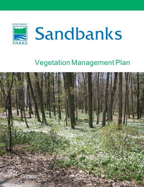
<strong>Sandbanks</strong><br />
<strong>Veg</strong>etation Management <strong>Plan</strong>
ISBN: 978-1-4435-1452-1 (PDF)<br />
MNR: 52584 (PDF)<br />
© 2009, Queen’s Printer for <strong>Ontario</strong><br />
Printed in <strong>Ontario</strong>, Canada<br />
Cover photo: <strong>Sandbanks</strong> Provincial Park<br />
Additional copies of this publication are obtainable from:<br />
<strong>Sandbanks</strong> Provincial Park<br />
R.R. #1<br />
Picton, ON K0K 2T0<br />
TEL: 613-393-3319<br />
FAX: 613-393-3404<br />
EMAIL: don.bucholtz@ontario.ca<br />
Recommended Citation:<br />
OMNR. 2009. <strong>Sandbanks</strong> <strong>Veg</strong>etation Management <strong>Plan</strong>. Queen’s Printer for <strong>Ontario</strong>. 28<br />
pp. + Appendices.<br />
i
Summary of Key Management Recommendations<br />
All park staff involved with operations potentially affecting <strong>Sandbanks</strong>’ vegetation<br />
communities will be required to be familiar with this plan’s intent and specific directives.<br />
Operations and Maintenance Policies (Section 3.1)<br />
• Herbicide use is restricted and must be in compliance with provincial regulations<br />
(p. 12)<br />
• Herbicide use must be kept to a minimum, using suggested chemicals and<br />
avoiding areas where park visitors and staff may contact it (p. 12)<br />
• Unless it is unsafe to do so, windthrown and dead standing trees should be left in<br />
place as they serve important ecological functions. Refer to Appendix A for a<br />
decision guide (p. 13)<br />
• When woody material must be removed from the site, it will be used to create<br />
brush piles for restoration, chipped for trail maintenance, or salvaged for firewood<br />
(p. 13)<br />
• Native insect pest outbreaks and diseases are natural processes and should not<br />
be controlled unless significant values within or adjacent to the park are<br />
threatened or the pest is a recent invader to <strong>Ontario</strong>. Forest Health Unit and<br />
zone office staff must be consulted. (p. 14)<br />
• Fire management will be in accordance with existing policies and strategies (p.<br />
15)<br />
• Mowing will be done to the least extent possible, and will not damage natural<br />
vegetation or trees. A mowing plan will be developed (p. 15)<br />
• Leaves and vegetation debris will be disposed of in a composting area (p. 15)<br />
• Native trees and shrubs from a local source will be used for landscaping (p. 16)<br />
Protection and Education Policies (Section 3.2)<br />
• Any proposed developments in nature reserve and natural environment zones<br />
require consultation with zone ecologist (p. 16)<br />
• <strong>Plan</strong>t and seed collection must be approved through a research permit or an<br />
agreement with an Aboriginal user (p. 18)<br />
• The NHE program should continue to include messages about vegetation<br />
stewardship (p. 19)<br />
• All staff must ensure locations of species at risk are kept confidential (p. 16)<br />
Restoration Activities Policies (Section 3.3)<br />
• Habitat destruction in development zones will be assessed and mitigated where<br />
feasible. (p. 20)<br />
• Local native stock will be used for all planting and restoration in the park. (p. 20)<br />
Invasive and Exotic Species (Section 3.4)<br />
• Aggressive invasive species should be controlled when possible following<br />
approved guidelines. (p. 20)<br />
• Invasive species that may pose a threat to park environments should be<br />
monitored. (p. 20)<br />
• Test plots will be established to determine the threat of Purple Loosestrife (p. 21)<br />
• Many ornamental shrubs, periwinkle (myrtle), ground ivy, euphorbias, bellflower,<br />
orange day lily, and sweet violet must not be used in landscaping and should be<br />
removed where established (p. 21)<br />
iii
Table of Contents<br />
1.0 Introduction..............................................................................................................1<br />
1.1. Location and Setting...............................................................................................1<br />
1.2. Regional Ecology & <strong>Sandbanks</strong> Overview .............................................................1<br />
1.3. Context for <strong>Veg</strong>etation Stewardship <strong>Plan</strong>ning........................................................3<br />
1.4. Goals and Objectives of <strong>Veg</strong>etation Stewardship ..................................................4<br />
2.0 <strong>Veg</strong>etation Communities – Descriptions, Historical Influences, and Successional<br />
Processes .........................................................................................................................5<br />
2.1. Beach and Dune Communities...............................................................................5<br />
2.2. Forest Communities ...............................................................................................7<br />
2.3. Wetland Communities ............................................................................................8<br />
2.4. Agricultural Lands & Disturbed Areas.....................................................................9<br />
2.5. <strong>Plan</strong>tations............................................................................................................11<br />
3.0 General <strong>Veg</strong>etation Stewardship Policies .............................................................12<br />
3.1. Operations and Maintenance ...............................................................................12<br />
3.2. Protection and Education .....................................................................................16<br />
3.3. Restoration Activities............................................................................................19<br />
3.4. Invasive and Exotic Species.................................................................................20<br />
4.0 <strong>Veg</strong>etation Management Units and Management Prescriptions ...........................22<br />
4.1. Beaches and Dunes .............................................................................................22<br />
4.2. <strong>Plan</strong>tations............................................................................................................22<br />
4.3. Woodlands............................................................................................................23<br />
4.4. Agricultural Lands.................................................................................................23<br />
5.0 Research and Monitoring Needs...........................................................................24<br />
6.0 Funding/Linkages..................................................................................................25<br />
7.0 Summary of Public Consultation and Environmental Assessment Requirements for<br />
Implementation................................................................................................................25<br />
8.0 General References and Resources.....................................................................26<br />
Appendices and Implementation Schedules:<br />
A. Hazardous Tree Treatment Options<br />
B. <strong>Plan</strong>tation Renaturalization Implementation Schedule<br />
C. Local Native <strong>Plan</strong>t Sources<br />
D. Invasive Species Monitoring and Control Guidelines<br />
E. Invasive Species Information Sheets<br />
F. Woodlands Monitoring Protocol<br />
G. Restoration Implementation Schedule<br />
H. <strong>Sandbanks</strong> Species List<br />
iv
1.0 Introduction<br />
This vegetation stewardship plan is intended to provide direction for management and<br />
stewardship activities at <strong>Sandbanks</strong> Provincial Park. It begins with the ecological and<br />
planning context for vegetation stewardship. The main community types found in the<br />
park, as well as the relevant successional processes, are described. An overview of<br />
general policies is provided before detailed policies are described for specific vegetation<br />
management units.<br />
1.1. Location and Setting<br />
<strong>Sandbanks</strong> Provincial Park is an approximately 1600 ha Natural Environment class<br />
provincial park located in Prince Edward County (Figure 1), about 15 km southwest of<br />
the town of Picton. <strong>Sandbanks</strong> encompasses most of the county’s southwestern<br />
shoreline between the village of Wellington and Salmon Point. The park is a popular<br />
summer destination, with over 500,000 visitors for the 2005 operating season.<br />
The park is composed of three distinct land areas (Figure 2 – see insert): two large<br />
coastal baymouth bar formations joined by an intervening area of scenic rural land on a<br />
limestone peninsula. These three areas will be referred to as the West Lake Dunes,<br />
Woodlands/Agricultural, and Outlet sectors throughout this document in order to<br />
minimize confusion and remain consistent with the 1993 park management plan.<br />
1.2. Regional Ecology & <strong>Sandbanks</strong> Overview<br />
Located in Ecodistrict 6E-15 (Picton), <strong>Sandbanks</strong> Provincial Park is situated at the<br />
southern edge of the Great Lakes-St. Lawrence Forest Region. The forest zone<br />
represents a transitional zone between the principally deciduous tree species to the<br />
south, west, and east and the coniferous forests to the north. The park’s vegetation is<br />
characteristic of this region, but some species are more commonly associated with the<br />
Deciduous Forest Region. The park is home to an extremely diverse range of other<br />
plants in a variety of ecosystems.<br />
Ecodistrict 6E-15 encompasses all of Prince Edward County, its archipelago of islands,<br />
and areas extending east along the Lake <strong>Ontario</strong> shoreline to the Kingston area. The<br />
ecodistrict is a shallowly covered plain of Ordovician limestone. Prince Edward County<br />
is essentially an island in Lake <strong>Ontario</strong>; its southern position and lake-buffered climate<br />
allow it to support many Carolinian species as well as a successful wine industry.<br />
The park encompasses significant coastal ecosystems and earth science features. The<br />
West Lake dunes (also referred to as the <strong>Sandbanks</strong> Coastal Sand Bar Dunes)<br />
comprise a provincially significant ANSI 1 , while the forested dunes and pannes 2 of the<br />
1 ANSI – Area of Natural and Scientific Interest: a systematically selected area containing landscapes or<br />
features identified as having values related to protection, natural heritage, scientific study, or education.<br />
Provincially significant ANSIs contain the best examples of landform or vegetation features of each<br />
ecodistrict.<br />
2 panne: also referred to as Great Lakes coastal meadow marshes or shoreline fens, these are specialized<br />
habitats restricted to near-shore areas of the Great Lakes. Their low nutrient levels and extreme water level<br />
fluctuations limit their flora to mainly sedges and rushes.<br />
<strong>Sandbanks</strong> <strong>Veg</strong>etation Management <strong>Plan</strong> 1 of 28<br />
<strong>Ontario</strong> <strong>Parks</strong>, SE Zone<br />
2009
<strong>Sandbanks</strong> <strong>Veg</strong>etation Management <strong>Plan</strong> 2 of 28<br />
<strong>Ontario</strong> <strong>Parks</strong>, SE Zone<br />
2009
Outlet Sector and the former “sugar bush” of the Woodlands/Agricultural Sector are<br />
considered sites of biological interest 3 (Snetsinger et al 2001). Descriptions of the dunes<br />
and recommendations for their protection are described in greater detail in the<br />
<strong>Sandbanks</strong> Dune Stewardship Strategy<br />
The geomorphology of the dunes has been well documented throughout the past several<br />
decades. Life science investigations have been more limited. A reconnaissance<br />
inventory of the entire park was completed in 1990 (Norris and Cuddy), and a recent<br />
investigation of significant plant species was conduced by V. Brownell (1999). The park<br />
contains a diverse mix of significant coastal ecosystems, cultural landscapes, and<br />
remnant deciduous forests that are representative of the pre-settlement vegetation of the<br />
ecodistrict. These ecological communities are described in detail in section 2.<br />
1.3. Context for <strong>Veg</strong>etation Stewardship <strong>Plan</strong>ning<br />
<strong>Ontario</strong> <strong>Parks</strong> has defined ecological integrity as the<br />
first priority for park management. The objectives of<br />
<strong>Ontario</strong> <strong>Parks</strong> are to ensure that provincial parks<br />
protect significant natural, cultural, and recreational<br />
environments, while providing ample opportunities for<br />
visitors to participate in recreational activities.<br />
This <strong>Veg</strong>etation Stewardship <strong>Plan</strong> will provide<br />
direction for protecting and promoting the<br />
appreciation of the park’s forests, old fields, wetlands,<br />
Pine plantations, deciduous<br />
woodlots, active agriculture, and<br />
retired fields near West Point<br />
and other vegetation communities. It will also address the vegetation management<br />
principles and issues identified in the current park management plan.<br />
The current park management plan for <strong>Sandbanks</strong>, released in 1993, was developed<br />
with full public consultation. The management plan highlights the need to address the<br />
impacts of intensive human use on the park environment, calling for the development of<br />
vegetation and dune management plans. In the event that a new or updated<br />
management plan is prepared before this vegetation stewardship plan expires, the<br />
policies of the stewardship plan will continue to apply as long as they do not conflict with<br />
new management direction. The intention to provide protection and restoration to<br />
natural areas should be maintained.<br />
As a Natural Environment class provincial park, the emphasis of management at<br />
<strong>Sandbanks</strong> is on protection of natural features while providing opportunities for<br />
compatible use:<br />
Goal<br />
• Protect and interpret its provincially significant freshwater bay mouth dune<br />
formations and associated ecosystems and its significant cultural heritage<br />
features, while offering a range of high quality, compatible recreational<br />
experiences.<br />
3<br />
recommended status only<br />
<strong>Sandbanks</strong> <strong>Veg</strong>etation Management <strong>Plan</strong> 3 of 28<br />
<strong>Ontario</strong> <strong>Parks</strong>, SE Zone<br />
2009
Objectives<br />
• Resource Protection: to protect provincially significant elements of the<br />
natural landscape of <strong>Ontario</strong><br />
• Heritage Appreciation: to provide opportunities for the exploration and<br />
appreciation of the natural heritage of <strong>Ontario</strong><br />
• Recreation: to provide outdoor recreation opportunities from high intensity<br />
day use to low intensity wilderness experiences<br />
• Tourism: to provide <strong>Ontario</strong> residents and visitors with opportunities to<br />
discover and experience the distinctive regions of the province<br />
The guidelines in this stewardship plan will help <strong>Sandbanks</strong> meet these objectives in<br />
terms of vegetation. This stewardship plan describes the vegetation communities<br />
present in the park, assigns those communities to <strong>Veg</strong>etation Management Units (VMU),<br />
and provides policies for management actions and implementation. The <strong>Veg</strong>etation<br />
Stewardship <strong>Plan</strong> also provides some direction regarding dune management until a full<br />
Dune Stewardship <strong>Plan</strong> can be prepared.<br />
• All park staff involved with operations potentially affecting <strong>Sandbanks</strong>’<br />
vegetation communities will be required to be familiar with this plan’s intent<br />
and specific directives.<br />
1.4. Goals and Objectives of <strong>Veg</strong>etation Stewardship<br />
The goal of vegetation stewardship at <strong>Sandbanks</strong> is to ensure the protection and<br />
perpetuation of the full diversity of naturally occurring vegetation communities in the park<br />
and the processes that have led to their development. This goal will be achieved<br />
through various maintenance and restoration management techniques.<br />
The specific objectives of vegetation management are:<br />
• to conserve natural communities and significant species while allowing for<br />
natural succession<br />
• to restore or enhance natural vegetation features and processes that have<br />
been, or may be, lost or degraded<br />
• to eliminate or reduce the threat of non-native invasive species where<br />
possible<br />
• to provide opportunities for park visitors to appreciate and learn about the<br />
diverse vegetation communities of the park in ways that do not threaten<br />
existing natural values<br />
• to ensure the safety of park visitors<br />
In meeting these objectives it may be necessary to take an active approach to<br />
vegetation management in order to counter the history of human impacts and promote<br />
the restoration of natural processes.<br />
<strong>Sandbanks</strong> <strong>Veg</strong>etation Management <strong>Plan</strong> 4 of 28<br />
<strong>Ontario</strong> <strong>Parks</strong>, SE Zone<br />
2009
2.0 <strong>Veg</strong>etation Communities – Descriptions, Historical Influences, and<br />
Successional Processes<br />
The principles of this <strong>Veg</strong>etation Management<br />
<strong>Plan</strong> will apply to all terrestrial communities, and<br />
shoreline aquatic communities in Lake <strong>Ontario</strong>,<br />
West Lake, East Lake, and the Outlet River.<br />
They will not apply to the park’s open water<br />
aquatic communities of Lake <strong>Ontario</strong> and West<br />
Lake as these communities are strongly<br />
influenced by environmental factors and<br />
management practices outside the park boundaries.<br />
Beach, dune, wetland, and plantation<br />
communities on the West Lake bar.<br />
Some limited inventories have been undertaken to characterize the vegetation<br />
communities of <strong>Sandbanks</strong>, including species checklists in the 1970s and 80s and<br />
inventories in 1990 (Norris and Cuddy) and 1999 (Brownell). An updated Life Science<br />
Checksheet was completed for the ANSI portion of the park in 2001 (Snetsinger et al).<br />
Ecological Land Classification (ELC) staff visited the park in 1994 and identified some<br />
forest communities. Southeastern Zone staff conducted further vegetation community<br />
identification through field work and air photo interpretation in 2002 and 2003. The<br />
community descriptions below are based on these information sources.<br />
In an effort to use current standardized terminology, communities are described<br />
following the current Ecological Land Classification (ELC) for Southern <strong>Ontario</strong> (Lee et al<br />
1998). The newest iteration of the ELC, which has more accurate descriptions of Sand<br />
Dune ecosites, is in preparation. Ecosites, and detailed vegetation types 4 when<br />
possible, are described in the text below (Figure 2). The scientific names of plants<br />
mentioned below are found in Appendix H. Non-native species are marked with an<br />
asterisk.<br />
2.1. Beach and Dune Communities<br />
The most significant features at <strong>Sandbanks</strong> are its coastal dune communities and<br />
associated pannes, due to their extensiveness, uncommon species, and relative lack of<br />
disturbance (Snetsinger et al 2001, Norris and Cuddy 1990, Macdonald 1987). One of<br />
the grassland communities found in this habitat is ranked as significant by the Natural<br />
Heritage Information Centre (NHIC).<br />
Beach/Bar Ecosites<br />
Found along the West Lake Dunes and Outlet sectors of Lake <strong>Ontario</strong> shoreline,<br />
these ecosites are subjected to active shoreline processes: periodic high water<br />
levels and storm events, wave action, erosion, deposition, ice scour, and<br />
extremes in moisture and temperature. They are the most intensively used areas<br />
4 Ecosites and vegetation types are terms used in the ELC to describe sites at a variety of scales.<br />
Ecosites are areas with a homogeneous combination of soils and vegetation and are usually mapped at a<br />
scale of 1:10,000 or more. <strong>Veg</strong>etation types are a further subdivision of ecosites, and are based on species<br />
composition. The term community is used generally to describe vegetation assemblages.<br />
<strong>Sandbanks</strong> <strong>Veg</strong>etation Management <strong>Plan</strong> 5 of 28<br />
<strong>Ontario</strong> <strong>Parks</strong>, SE Zone<br />
2009
of the park. As a result of these conditions vegetation is quite sparse and limited<br />
mainly to Marram Grass, Wormwood, and small Eastern Cottonwoods. The<br />
beach/bar ecosites have mineral substrates including sand, gravel, or cobble.<br />
Specific ecosites at <strong>Sandbanks</strong> include Mineral Open Beach/Bar (BBO1),<br />
Mineral Shrub Beach/Bar (BBS1), and small amounts of Wormwood Gravel<br />
Open Beach <strong>Veg</strong>etation Type (BBO1-2), a community ranked as S2S3 by the<br />
NHIC.<br />
Sand Dune Ecosites<br />
The sand dune ecosites are extensive and complex, covering most of the West<br />
Lake Dunes and Outlet sectors. Sand dunes are defined as active, often rolling,<br />
hills of accumulated sand above the normal reach of waves and subject to<br />
erosion and deposition by wind. These ecosites experience drought and<br />
temperature extremes, and have low nutrient availability since organic materials<br />
do not accumulate. <strong>Veg</strong>etation consists of patches of graminoid 5 , shrub, and<br />
tree species that are adapted to unstable and dry environments. These include<br />
Canada Wild Rye, Wild Grape, Starry False Solomon’s Seal, and various beachassociated<br />
willows, poplars, dogwoods, and cedars. Significant species include:<br />
Marram Grass, Bugseed, Plains Puccoon, Gray-stemmed Goldenrod, Big<br />
Bluestem, and Little Bluestem. As the most distinctive and extensive ecological<br />
features of the park, a variety of sand dune ecosites are present: Open Sand<br />
Dune (SDO1) ecosites, ranked as S2; Sand Cherry (SDS1-1) and Juniper<br />
(SDS1-3) Shrub Dune vegetation types, both ranked as S2; and Cottonwood<br />
(SDT1-1) and Balsam Poplar (SDT1-2) Treed Dune vegetation types, both<br />
ranked as S1. The forested backdunes, particularly of the Outlet sector, have<br />
been naturally stabilized by Eastern White Cedar – here the vegetation<br />
communities grade into a mixed forest ecosite.<br />
History & successional processes: Both the West Lake Dunes sector and the dunes<br />
of the Outlet sector have a long history of human use. The West Lake Dunes were<br />
naturally forested until around 1850. Timber cutting and cattle grazing in the late 1700s<br />
and early 1800s destabilized the dunes and caused their migration inland. Reforestation<br />
of the eastern portion of this sector in the 1920s to 1960s prevented further migration of<br />
the dunes, but the unforested parts of the dunes remain active. Sand mining operations<br />
began in 1915 and continued until the early 1970’s when public opposition resulted in<br />
the closure of the operations on the shores of West Lake. The recreational facilities in<br />
this area were initially established in 1962.<br />
The dunes and beaches of the Outlet sector have been used for recreation since the<br />
1800s and parking lots and campsites have been present since 1959. The back dunes<br />
of the Outlet sector remain naturally forested. In both areas, dune colonizers like<br />
Marram Grass stabilize the sand and provide organic material, allowing shrubs and trees<br />
to establish. When stabilizing vegetation is removed through trampling, the dunes<br />
become active, leading to eventual tree death and blowouts.<br />
Condition: Despite previous human activity, the West Lake Dunes sector is in relatively<br />
good condition and contains the best examples of natural dune communities.<br />
Nonetheless, beach visitation and unauthorized vehicle use have impacts on these<br />
vegetation communities that must be addressed. The dunes and beaches of Outlet<br />
5 graminoid – a term that refers to grasses, sedges, and rushes collectively<br />
<strong>Sandbanks</strong> <strong>Veg</strong>etation Management <strong>Plan</strong> 6 of 28<br />
<strong>Ontario</strong> <strong>Parks</strong>, SE Zone<br />
2009
sector receive much heavier visitation and are zoned accordingly in the park<br />
management plan. These communities are less diverse than those in West Lake Dunes<br />
sector.<br />
Value to wildlife: The varied vegetation composition of the beach and dune<br />
environments provide valuable habitat for a diverse community of birds, especially<br />
during migration. It also provides cover for small mammals and their predators,<br />
especially in the West Lake Dunes sector. Their contiguous, undisturbed nature benefits<br />
wildlife. Interestingly, huge congregations of several species of dragonfly have been<br />
noted in the cedar trees on the West Lake Dunes in the fall (Catling and Brownell 1998).<br />
2.2. Forest Communities<br />
A variety of deciduous, coniferous, and mixed forest communities are found in the park<br />
on the dunes and in the intervening landscape. Coniferous plantations are described in<br />
section 2.4, Cultural Landscapes.<br />
Deciduous Forest Ecosites<br />
At <strong>Sandbanks</strong>, these ecosites are mainly small (< 10 ha) patches of shadetolerant<br />
forest remnants, some of which have very old (>150 years) trees. These<br />
forests are found where soils are more developed, especially around the<br />
Woodlands Campground, along County Road 12 and MacDonald Lane, and in<br />
the upland portion at the east end of the Outlet sector. The canopies of these<br />
forest patches are dominated by Sugar Maple, Red Oak, and White Ash, with<br />
associated Black Cherry, American Beech, Basswood, and Black Maple. The<br />
subcanopies and understories are generally sparse (< 25% cover), with<br />
occasional Ironwood, elms, and hickories. The ground layer, while diverse in<br />
some areas, also tends to be sparse. Forest vegetation types include Dry-Fresh<br />
Oak-Hardwood Deciduous Forest Type (FOD2-4), Dry-Fresh Sugar Maple<br />
(FOD5-1), Sugar Maple – Oak (FOD5-3), and Sugar Maple – White Ash<br />
(FOD5-8) Deciduous Forest vegetation types.<br />
Mixed Forest Ecosites<br />
The naturally forested dunes of Outlet Sector are composed of this forest type,<br />
which is dominated by White Cedar, along with scattered patches of White Birch,<br />
American Elm, White Ash, and Red Oak. The subcanopy and understorey are<br />
relatively dense and include a variety of shrub species: Chokecherry, White<br />
Spruce, White Pine, Hemlock, Riverbank Grape, serviceberries, buckthorns*, and<br />
honeysuckles*. Some smaller sections of mixed forest are found in the<br />
Woodlands/Agricultural Sector near West Point and the Dunes Day Use area.<br />
These communities can be generally described as Dry-Fresh White Cedar<br />
Mixed Forest Ecosite (FOM4) ecosites.<br />
History & Successional Processes: For the most part, the mature deciduous and<br />
mixed forests that remain in the park have been present since the early 1900s or earlier.<br />
Mature deciduous woodlots in the Woodlands/Agricultural Sector have been used<br />
sporadically for maple syrup production or fuelwood harvesting since that time. Small<br />
patches of younger deciduous forest exist in a few locations – these are either sites that<br />
are succeeding naturally from a nearby seed source, or are naturalized plantations.<br />
Aerial photography indicates that the mixed forest community along the back of the<br />
Outlet Sector has been relatively intact throughout the last century.<br />
<strong>Sandbanks</strong> <strong>Veg</strong>etation Management <strong>Plan</strong> 7 of 28<br />
<strong>Ontario</strong> <strong>Parks</strong>, SE Zone<br />
2009
Condition: Due to their long history of human use, forests in the park are generally<br />
degraded, with sparse or disturbed understories and an apparent lack of woody debris<br />
and natural regeneration. There is also a lack of hydrological diversity in the forests –<br />
the forest floor is fairly uniform in microtopography and moisture levels. Existing mature<br />
deciduous woodlots in the Woodlands/Agricultural sector are small and isolated. The<br />
forests 6 of the Outlet Sector are busy campgrounds. Patches of invasive species are<br />
present in the ground cover and may threaten the natural understorey community.<br />
The park staff has noted a visible browse line indicative of high levels of deer browse<br />
near the 4-way stop on County Road 12. However, a recent wildlife assessment<br />
indicates that deer numbers in the park are generally low, with possible seasonal<br />
congregations occurring. Because the park is open to the surrounding landscape, there<br />
is not a concern of deer over-abundance.<br />
Value to Wildlife: The park’s forest remnants provide important habitat for a variety of<br />
wildlife. The variety of forest blocks and their proximity to other habitat types are<br />
important to migrating and breeding birds, especially those that use forest edges. Some<br />
interior forest species are present, but their numbers are limited due to the small size<br />
and fragmentation of forest patches. Forested areas and edges have the greatest<br />
diversity of breeding bird species in the park, including some regionally rare species (J.<br />
Dewey, pers. comm.). They may also provide nesting habitat for Southern Flying<br />
Squirrels (Special Concern federally). Forested areas are generally lacking in<br />
amphibians and reptiles, due to the lack of vernal pools, ground cover, downed woody<br />
debris, and easy access to water.<br />
2.3. Wetland Communities<br />
Wetlands are confined to small areas of shoreline marsh and the panne communities of<br />
the West Lake Dunes and Outlet sector.<br />
Meadow Marsh Ecosites (Pannes)<br />
This ecosite is found extensively in the West Lake Dunes sector in the interdunal<br />
slack areas behind the foredunes and to a lesser extent in the Outlet sector<br />
between the beachfront and the forested backdunes, on the north side of the<br />
road. They were formerly found in the area where the parking lots were<br />
constructed in the Outlet sector. Pannes are graminoid-dominated flat<br />
depressions between sand dunes that have fluctuating water levels – they are<br />
arguably the park’s most ecologically unique vegetation features. The<br />
<strong>Sandbanks</strong> pannes of the West Lake Dunes Sector are considered the best<br />
developed in the Great Lakes region. They generally have alkaline soils<br />
developed on calcareous sands. These ecosites support concentrations of rare<br />
species, including Low Nutrush. The <strong>Sandbanks</strong> pannes are composed of a<br />
complex of vegetation types that are better differentiated in the unreleased<br />
version of the ELC; in the current version, they fall under the Graminoid Coastal<br />
Meadow Marsh (MAM4-1) vegetation type, ranked as S2.<br />
6 The sugar-black maple forest of Outlet campground once had a cedar understorey and a very rich and<br />
diverse flora of spring herbs, as noted in an International Biological Programme survey in 1969. No other<br />
stand of this type was known in eastern <strong>Ontario</strong>. The site is still known for its wildflower diversity, but Garlic<br />
Mustard and trampling threaten the ground layer.<br />
<strong>Sandbanks</strong> <strong>Veg</strong>etation Management <strong>Plan</strong> 8 of 28<br />
<strong>Ontario</strong> <strong>Parks</strong>, SE Zone<br />
2009
Shallow Marsh Ecosites<br />
A few small marsh areas are found on the park shorelines, including the<br />
southwest shore of West Lake, southwest corner of East Lake, and the Outlet<br />
River. The marshes typically consist of large-leaved emergent plants like Cattail,<br />
Pickerel-weed, and Softstem Bulrush. The provincially rare Swamp Rose Mallow<br />
(Special Concern federally) is found in this habitat type along the Outlet River, as<br />
is Narrow-leaved Water-plaintain. The dominant vegetation type in these areas<br />
is Cattail Mineral Shallow Marsh (MAS2-1) vegetation type.<br />
History and Successional Processes: The park’s wetland communities, except the<br />
pannes in Outlet sector, have not changed noticeably in the last several decades. The<br />
stabilization of the dunes, as well as the stable water levels of Lake <strong>Ontario</strong>, mean that<br />
the environmental conditions that drive hydrological processes in the panne sites have<br />
remained relatively constant.<br />
Condition: The marshes and pannes of <strong>Sandbanks</strong> are generally undisturbed. The<br />
Outlet River has been artificially channelized near its mouth and there is concern that<br />
motor watercraft traffic disturbs the aquatic vegetation. The West Lake sector pannes<br />
have some trails and remnants of old roads through them, but these receive little traffic<br />
and appear to have a limited effect on the vegetation. A diverse panne community once<br />
existed alongside the mixed coniferous forest of the East Lake Sector. Remnants of this<br />
community bear some resemblance to those of the West Lake Dunes pannes, but are<br />
much more disturbed and fragmented.<br />
Wildlife: The park’s wetland habitats provide essential habitat to birds, fish, insects,<br />
reptiles, and amphibians. The marshes have a high ecological value as staging and<br />
nesting areas for many birds, including Least Bitterns (Threatened) and Black Terns<br />
(Special Concern provincially), while the pannes are important foraging habitat for<br />
migrating birds and nesting habitat for shorebirds. The marshes are particularly<br />
important for amphibians and reptiles, including turtle species at risk. The Outlet River<br />
and East Lake marshes, and fishless ponds of the pannes, provide the only natural<br />
breeding habitat for many species of dragonflies, including some provincially rare<br />
species.<br />
2.4. Agricultural Lands & Disturbed Areas<br />
The current version of the ELC does not deal with these areas comprehensively. ELC<br />
codes are not used to describe the cultural landscapes below.<br />
The area between the two dune areas has a deeper, more advanced soil profile that, like<br />
much of Prince Edward County, has been used extensively for agriculture. There are 3<br />
basic types of agricultural lands in the park: active agricultural lands, retired agricultural<br />
lands, and hedgerows.<br />
Active Agricultural Lands<br />
Several fields (~45 ha) are currently in cultivation through a long-standing lease<br />
agreement with a farmer. In fields with deeper soils, cash crops such as barley,<br />
soybeans, and corn are rotated. Fields with poor soil are used for alfalfa hay.<br />
Cash crop fields are generally heavily fertilized and treated with Roundup.<br />
<strong>Sandbanks</strong> <strong>Veg</strong>etation Management <strong>Plan</strong> 9 of 28<br />
<strong>Ontario</strong> <strong>Parks</strong>, SE Zone<br />
2009
“Weedy” native and non-native species grow in the borders, including Orchard<br />
Grass, Reed Canary Grass, clovers, milkweeds, asters.<br />
Retired Agricultural Lands<br />
A selection of agricultural areas has been retired gradually over the past 20<br />
years, comprising about 158 ha. These fields are priorities for restoration as<br />
outlined in Section 4. <strong>Veg</strong>etation composition of retired fields depends on how<br />
long they have been left fallow, last treatment of site, proximity to seed sources,<br />
and type and depth of soil. Typically, these fields are dominated by non-native<br />
and native grasses and herbs (Common Timothy, Canada Bluegrass, Poverty<br />
Oat Grass, Orchard Grass, Common Milkweed, goldenrods and asters). In some<br />
fields European Buckthorn* is invading, threatening the ongoing succession of<br />
the site.<br />
Hedgerows<br />
Although less prevalent than in the past, there are many hedgerows throughout<br />
the Woodlands/Agricultural sector (~27 ha). Their species composition and<br />
density vary tremendously, but most contain remnants of the original forest<br />
cover. While native hardwoods may form the canopy of some hedgerows, the<br />
understorey layers are generally composed of early successional species like<br />
buckthorn, hawthorn, crabapple, and Red Cedar.<br />
Disturbed Sites<br />
There are several disturbed areas within the park, generally restricted to<br />
development zones, and less than 30 ha. These areas include roadsides, lawns<br />
and tile beds, and the campsites. The disturbed areas are typically composed of<br />
mainly non-native species. It is in these areas that invasive herbs like Garlic<br />
Mustard and Dog-Strangling Vine have gained a foothold.<br />
History & Successional Processes: As described above, these areas have a varied<br />
history. While natural succession appears to be taking place around the edges of some<br />
old fields, most of these areas are in a state of stalled succession, due to ongoing<br />
activities, intensity of historic use, or domination by invasive species like buckthorn.<br />
Condition: Due to their very nature, all of these areas are clearly disturbed. However,<br />
some of the old fields and hedgerows do have the capacity to become higher quality<br />
natural areas.<br />
Value to Wildlife: Although disturbed, these areas provide a diversity of habitats to<br />
wildlife. A large proportion of breeding birds in park partially or completely rely on open<br />
areas to fulfill their habitat requirements, including the Red-headed Woodpecker. This<br />
rare bird (Special Concern) has been observed nesting near Lakeshore Lodge and in the<br />
maple row along County Road 12 in the past. It uses open areas for foraging. Old fields<br />
and shrub thickets/hedgerows are particularly important to many of the breeding birds.<br />
Migrating shorebirds use the open fields for foraging, but many prefer recently tilled<br />
fields. There is some concern that active fields may be a sink for breeding birds since<br />
hay is harvested before the first clutch fledges. Old fields in particular also provide<br />
habitat for small mammals, which are prey for many other species. All open areas are<br />
also important butterfly habitat due to their abundance of nectar plants and larval host<br />
species.<br />
<strong>Sandbanks</strong> <strong>Veg</strong>etation Management <strong>Plan</strong> 10 of 28<br />
<strong>Ontario</strong> <strong>Parks</strong>, SE Zone<br />
2009
2.5. <strong>Plan</strong>tations<br />
The current version of the ELC does not deal with these areas comprehensively. ELC<br />
codes are not used to describe the plantations below.<br />
The east end of the West Lake dunes is covered in a patchy plantation that stretches<br />
from the shore of Lake <strong>Ontario</strong> at Richardson’s Campground back to the eastern corner<br />
of West Lake, and inland to County Road 12, an area of approximately 80 ha. The<br />
plantation and its history are described in detail in Implementation Schedule B. Most<br />
of the area was planted in Scots Pine, with scattered individuals or patches of Jack Pine,<br />
Mugho Pine, Eastern White Pine, European Larch, Red Pine, Black Locust, and<br />
Hackberry. There is also a 2 ha Norway Spruce stand at the easternmost corner of the<br />
plantation.<br />
History and Successional Processes: The plantation was established in stages from<br />
the 1920s to the 1960s, in association with a Department of Lands and Forests nursery<br />
that was on site. The intent was to prevent the migration of the dunes onto valuable<br />
farmland. In some areas, typically the lowlands on the edges of the plantations, some<br />
succession of shrubby and deciduous species is occurring. In the most open areas,<br />
aggressive pioneer species dominate. The upland areas are quite dry and open with little<br />
soil cover and little succession.<br />
Condition: The Scots Pine are generally unhealthy, with many trees dead or dying.<br />
Pine Shoot Beetle and Sirex Wood Wasp have been identified as sources of mortality.<br />
Some of the Black Locust also appear unhealthy.<br />
Value to Wildlife: The dense conifer areas provide winter cover for deer and other<br />
species. A canid den has been found in the plantation. Forest Bird Monitoring has not<br />
revealed any notable species and bird species diversity is relatively low, although the<br />
plantation edges have provided nesting habitat to regionally rare birds (J. Dewey pers.<br />
comm.). Hawks (Sharp-shinned, Coopers) have occasionally nested in the plantation in<br />
the past, and Wild Turkeys are often seen. The Hackberry plantation provides habitat<br />
for butterfly species that depend on Hackberry.<br />
<strong>Sandbanks</strong> <strong>Veg</strong>etation Management <strong>Plan</strong> 11 of 28<br />
<strong>Ontario</strong> <strong>Parks</strong>, SE Zone<br />
2009
3.0 General <strong>Veg</strong>etation Stewardship Policies<br />
General vegetation stewardship policies are detailed below under four broad categories:<br />
operations and maintenance, protection and education, restoration activities, and<br />
invasive species. These policies, which apply to all areas of the park, are based on<br />
<strong>Ontario</strong> <strong>Parks</strong> policy and the direction provided in the 1993 Management <strong>Plan</strong>. If<br />
<strong>Ontario</strong> <strong>Parks</strong> policy or the management plan are updated, the more conservative<br />
policies will apply. Policies specific to certain environments or management zones are<br />
detailed in section 4: <strong>Veg</strong>etation Management Units and Prescriptions.<br />
3.1. Operations and Maintenance<br />
Policies in this section apply to the day-to-day operations and maintenance of the park.<br />
It is essential that the maintenance staff is familiar with, and follows, these<br />
guidelines.<br />
Herbicide Use<br />
All herbicide use must be in compliance with <strong>Ontario</strong> <strong>Parks</strong> policy PM 2.16, Use of<br />
Pesticides and Herbicides in Provincial <strong>Parks</strong>. Any person authorized to apply herbicides<br />
in the park must comply with the Pesticides Act.<br />
As stated in the management plan, noxious weeds like Poison Ivy and non-native<br />
invasive species may be controlled with herbicides as required. Only herbicides that<br />
biodegrade quickly, have low or no soil activity and for which environmental impacts<br />
have been tested and shown to be minimal will be used (e.g. glyphosate and triclopyr).<br />
Herbicide use will be kept to a minimum and alternatives to chemical herbicides will<br />
continue to be used whenever possible. Spraying will only be done where park visitors<br />
or park staff are not at risk of contact during normal activities, preferably during the offpeak<br />
season.<br />
Poison Ivy may be controlled in development zones or along trails in natural environment<br />
or historic zones where park visitors may come into contact with the plant.<br />
The urgent need to reduce or eliminate invasive exotic species from the park represents<br />
an exceptional circumstance, and small, localized applications may be used to control<br />
exotic species in all areas of the park. Further details on invasive species control is<br />
provided in section 3.4.<br />
Herbicidal spraying along adjacent transportation corridors could have a detrimental<br />
effect on plant communities within the park, especially in areas targeted for restoration.<br />
Athol Township will be encouraged to use only mechanical means to remove brush from<br />
the portions of County Road 18 and 12 road allowances that are adjacent to the park.<br />
• Herbicide use is restricted and must be in compliance with provincial<br />
regulations<br />
• Herbicide use must be kept to a minimum, using suggested chemicals and<br />
avoiding areas where park visitors and staff may contact it<br />
<strong>Sandbanks</strong> <strong>Veg</strong>etation Management <strong>Plan</strong> 12 of 28<br />
<strong>Ontario</strong> <strong>Parks</strong>, SE Zone<br />
2009
Hazardous Trees and Windthrows<br />
Safety of park visitors is the highest priority for hazardous tree treatment decisions.<br />
Nonetheless, the ecological importance of dead tree material, or downed woody debris,<br />
must also be considered in all cases. Downed woody debris plays a crucial role in forest<br />
ecology, and can be key to restoring natural areas at <strong>Sandbanks</strong>.<br />
Hazardous trees may be felled in development and historical zones or within 15 m of<br />
trails in natural environment zones if threaten the safety of park users.<br />
Dead standing trees will be removed only if absolutely necessary, as they provide<br />
important habitat 7 for birds, mammals, insects, and contribute to ecological processes as<br />
they decompose. Before dead trees are removed the actual risk they pose will be<br />
assessed by the superintendent or designate, and if possible, only broken or rotted limbs<br />
or crowns will be removed, leaving the lower trunk for wildlife.<br />
Windthrown and felled limbs and trunks will be left in place, except those portions that<br />
impede passage on roads or trails, or have fallen on mown portions of day-use areas,<br />
campsites, park facilities, or actively used agricultural fields. When feasible, limbs and<br />
trunks that are removed will be used to create brush piles for restoration of dunes and<br />
agricultural land; otherwise, they will be chipped in place and used for trail maintenance<br />
or salvaged for firewood. Build up of fuel load is unlikely to become an issue except in<br />
the plantation area, which requires other management prescriptions described later.<br />
After high windfall events, trees will only be removed when they pose a threat to the<br />
public, including an increase in fire risk. In cases of extreme weather events like ice or<br />
wind storms, clean up and salvage operations will follow provincial guidelines.<br />
Appendix A details the treatment options for hazardous and windthrown trees and the<br />
criteria for their use. Direction for tree removal in plantation areas is provided in section<br />
3.3.<br />
• Unless it is unsafe to do so, windthrown and dead standing trees should be<br />
left in place as they serve important ecological functions. Refer to<br />
Appendix A for a decision guide.<br />
• When woody material must be removed from the site, it will be used to<br />
create brush piles for restoration, chipped for trail maintenance, or<br />
salvaged for firewood.<br />
Insect Pests<br />
The main Scots Pine plantation is currently affected by a Pine Shoot Beetle infestation<br />
and a European Wood Wasp infestation (see Implementation Schedule B), causing<br />
high tree mortality. New species of invasive pests may be identified. Most outbreaks or<br />
infestations of native insect pests are considered to be natural processes by <strong>Ontario</strong><br />
<strong>Parks</strong>. Neither of these species is native. The park management plan states that insect<br />
7 Cavity-nesting birds, such as the provincially rare Red-headed Woodpecker (Special Concern) and other<br />
woodpeckers, depend on standing dead trees for the construction of nesting cavities. These cavities may in<br />
turn be used by secondary cavity nesters such as Eastern Bluebirds, Eastern Screech Owls, Black-capped<br />
Chickadees, and flying squirrels. The presence of these cavity-dependent species in campsites, day use<br />
areas, and along trails greatly enhances the experience of park users, and increases the educational<br />
opportunities in the park.<br />
<strong>Sandbanks</strong> <strong>Veg</strong>etation Management <strong>Plan</strong> 13 of 28<br />
<strong>Ontario</strong> <strong>Parks</strong>, SE Zone<br />
2009
pests will not be controlled unless they threaten significant park values, such as<br />
vegetation communities or heritage structures, or if they threaten public well-being.<br />
When necessary, park staff will be educated to recognize the various life stages of<br />
serious insect pests, and will cooperate with OMNR and Canadian Forestry Service<br />
(CFS) staff in monitoring programs. Control methods used should give preference to<br />
non-chemical and species-specific treatments when possible, and should be considered<br />
in discussion with the Forest Health Unit and zone office staff.<br />
• Native insect pest outbreaks and diseases are natural processes and<br />
should not be controlled unless significant values within or adjacent to the<br />
park are threatened or the pest is a recent invader to <strong>Ontario</strong>. Forest<br />
Health Unit and zone office staff must be consulted.<br />
Fire Management<br />
MNR recognizes fire as an essential ecosystem process, fundamental to restoring and<br />
maintaining the ecological integrity of protected areas in the Deciduous Forest Region.<br />
Studies of the historical role of fire in this region are limited. Though fire did occur<br />
occasionally, it was much less common than in other forest regions. Aboriginal use of<br />
fire may have been a significant factor but its extent and impacts are not well understood<br />
(Van Sleeuwen, 2006).<br />
The Forest Fire Management Strategy for <strong>Ontario</strong> (OMNR 2004a) provides strategic<br />
direction for the management of wildfire across <strong>Ontario</strong>. <strong>Sandbanks</strong> Provincial Park is in<br />
the Southern <strong>Ontario</strong> Fire Management Zone according to this provincial strategy. Fire<br />
management involves the protection of values and attainment of resource stewardship<br />
objectives in two ways:<br />
• Fire response: the protection of people, property, and natural areas from wildfire<br />
• Fire use: the strategy of maintaining fire as an ecological process through the<br />
application or management of prescribed fire<br />
Given the size and shape of the park, its proximity to adjacent developed areas, and the<br />
fuel load in the plantations, fire management within <strong>Sandbanks</strong> will focus on protection<br />
of public health and safety, property and infrastructure. Therefore all forest fires will<br />
receive a full response and sustained action. Sustained action, if required, will be<br />
directed through an approved Fire Assessment Report that has been developed in<br />
consultation between the Park Superintendent or Zone Manager and authorized fire<br />
management personnel.<br />
“Light on the land” fire suppression techniques will be used whenever feasible. These<br />
minimal impact suppression techniques do not unduly disturb natural or cultural values.<br />
Examples may include limiting the use of heavy equipment or the felling of trees during<br />
fire response.<br />
Consistent with the <strong>Ontario</strong> FireSmart program, a forest fire hazard identification and risk<br />
assessment should be completed for park infrastructure, and steps taken to reduce or<br />
mitigate the threat posed by fire to park infrastructure.<br />
Response for structural fires and forest fires is guided by a municipal forest fire<br />
management agreement between the <strong>Ontario</strong> Ministry of Natural Resources (OMNR)<br />
and the municipality.<br />
<strong>Sandbanks</strong> <strong>Veg</strong>etation Management <strong>Plan</strong> 14 of 28<br />
<strong>Ontario</strong> <strong>Parks</strong>, SE Zone<br />
2009
Prescribed burning is the deliberate, planned, and knowledgeable application of fire by<br />
authorized personnel to a specific land area to accomplish pre-determined objectives.<br />
Prescribed burning to achieve ecological or hazard reduction objectives may be<br />
considered in the future. <strong>Plan</strong>s for any prescribed burning will be developed in<br />
accordance with the MNR Prescribed Burn Policy, its associated planning manual, and<br />
the Class Environmental Assessment for Provincial <strong>Parks</strong> and Conservation Reserves,<br />
in cooperation with Haliburton Fire Management Headquarters.<br />
• Fire management will be in accordance with existing policies and<br />
strategies<br />
Mowing<br />
Mowing will be done to the least extent possible, and only in order to ensure the safety<br />
and comfort of park users. A mowing plan does not exist for the park but will be<br />
developed based on the principles of this strategy.<br />
Roadsides will be maintained to a standard sufficient to ensure visibility. A close mowed<br />
shoulder of up to a maximum of 2 m or less will be maintained adjacent to all paved<br />
roads. The mowed shoulder provides an important safety zone for cyclists and<br />
pedestrians to step off the road to avoid oncoming traffic. Mowing may also serve to<br />
control Poison Ivy. Areas around road intersections and beach parking lots will be rough<br />
cut infrequently throughout the operating season to provide adequate visibility.<br />
Day use areas will continue to be mowed as necessary, although areas where mowing<br />
can be reduced will be targeted by park staff. In some areas, if mowing is eliminated,<br />
efforts to prevent invasion by non-native invasive species will be necessary.<br />
In all mowing and cutting operations, care must be taken to avoid girdling trees and<br />
small shrubs. Damaged trees and shrubs will be protected from further damage by<br />
having tree guards/plastic pipe wrapped around each.<br />
• Mowing will be done to the least extent possible, and will not damage<br />
natural vegetation or trees. A mowing plan will be developed.<br />
Leaf and <strong>Veg</strong>etation Disposal<br />
Unless they are being used in specific restoration actions, leaves and vegetation debris<br />
other than tree trunks and limbs will be placed in a composting area. Dumping leaves<br />
and brush can suppress indigenous vegetation, create conditions favourable to exotic<br />
species, spread seed and roots of exotic species and create a fire hazard; therefore,<br />
dumping of leaves anywhere other than the specified location is strictly prohibited.<br />
Preferably, leaves may be left where they fall or mulched into the lawn. Burning of<br />
leaves is prohibited.<br />
When invasive species are removed, they will be disposed of according to the guidelines<br />
provided in section 3.4.<br />
• Leaves and vegetation debris will be disposed of in a composting area<br />
<strong>Sandbanks</strong> <strong>Veg</strong>etation Management <strong>Plan</strong> 15 of 28<br />
<strong>Ontario</strong> <strong>Parks</strong>, SE Zone<br />
2009
Landscaping<br />
Native trees and shrubs from a local stock source will be used to create shade and<br />
privacy in campgrounds and other areas as necessary. A list of sources for local stock<br />
is provided in Appendix C.<br />
3.2. Protection and Education<br />
Policies detailed in this section provide guidance for monitoring and protecting the<br />
significant natural features of the park. These policies must be consulted before any<br />
planned development activities, including trails, campsites, and other facilities.<br />
Significant Species and Species At Risk<br />
Detailed knowledge of rare plant species in the park is limited to a rare species inventory<br />
and assessment by Brownell (1999). While Brownell’s report is thorough, the work was<br />
limited to 7 field days. The author recognizes the need for further botanical<br />
investigations in the park to verify historical records 8 and to find previously unknown<br />
occurrences of rare species. The park contains many unusual vegetation communities<br />
(see Section 2) that are likely to support more significant species.<br />
<strong>Sandbanks</strong> provides habitat for at least 44 nationally, provincially, or regionally<br />
significant plant species (Appendix H), some of which are considered to be significant<br />
disjuncts 9 from their main populations. Provincially rare species and recommendations<br />
for their protection are listed in Table 3.1. Many of these species are not conspicuous or<br />
easily recognized, and are therefore at risk of accidental destruction.<br />
The majority of rare species in the park occur in nature reserve zones. This zoning does<br />
allow some potentially destructive activities, including the construction of trails and other<br />
nature interpretation facilities. Detailed site planning of trails and other facilities must<br />
include consultation with the zone ecologist prior to construction. All terrain vehicle<br />
(ATV) use by staff must be kept to a minimum in nature reserve areas.<br />
• Any proposed developments in nature reserve and natural environment<br />
zones require consultation with zone ecologist<br />
• All staff must ensure locations of species at risk are kept confidential<br />
8 Butterfly Weed is likely to be extirpated from the park, but Calypso Orchid, seen by Whiting and Catling in<br />
1986, may be presented in the forested dunes of Outlet Sector.<br />
9 disjunct – describes a satellite population that is distant from the core range of a species<br />
<strong>Sandbanks</strong> <strong>Veg</strong>etation Management <strong>Plan</strong> 16 of 28<br />
<strong>Ontario</strong> <strong>Parks</strong>, SE Zone<br />
2009
Table 3.1. Provincially rare species known to occur at <strong>Sandbanks</strong> 10 (Brownell 1999)<br />
Swamp Rose Mallow<br />
Hibiscus moscheutos ssp.<br />
moscheutos<br />
Special Concern; S3<br />
321757E 4862622N 11<br />
Narrow-leaved Waterplantain<br />
Alisma gramineum<br />
S3S4<br />
Marram Grass<br />
Ammophila brevigulata<br />
S3<br />
Long-leaved Reed Grass<br />
Calamovilfa longifolia<br />
S3<br />
316031E 4864807N<br />
Bugseed<br />
Corispermum sp.<br />
S1S3<br />
316009E 4865259N<br />
Ram’s-head Lady’s-slipper<br />
Cypripedium arietinum<br />
S3<br />
Plains Puccoon<br />
Lithospermum caroliniense<br />
S3<br />
316677E 484418N (main population)<br />
Low Nutrush<br />
Scleria verticillata<br />
S3<br />
316621E 4864132N<br />
Gray-stemmed Goldenrod<br />
Solidago nemoralis ssp. decemflora<br />
S1S2<br />
316893E 4864436N<br />
• 4 plants (14 stems) found in 1998<br />
• new record for E. <strong>Ontario</strong>; significant disjunct for population (closest<br />
known population in Niagara area and in upper New York state<br />
• size and quality of marsh habitat must be maintained; potential<br />
threats include changes in water quality and level, and erosion<br />
through wave action<br />
• population should be monitored regularly<br />
• small band of several hundred plants along north shore of Outlet<br />
Creek near woodyard and dock; also along south shore near County<br />
Road 18 bridge<br />
• restricted to Great Lakes beaches and dunes<br />
• dominant ground cover with Sand Cherry on leeward sides of<br />
foredune and sections of back dunes at West Lake<br />
• reduced at Outlet dunes due to trampling and erosion, but<br />
rebounding due to protection – some planted from nursery<br />
• planted plots from Pinery stock are largest populations in park – no<br />
longer used in dune rehabilitation<br />
• nurseries of <strong>Sandbanks</strong> stock still maintained on one tilebed<br />
• unknown origin – possible accidental introduction<br />
• small patch of 50 stems along main path through West Lake bar on<br />
low dune ridge dominated by Little Bluestem<br />
• most easterly North American record; 390 km disjunct from other<br />
<strong>Ontario</strong> populations<br />
• genus is new record for Eastern <strong>Ontario</strong> – taxonomy of genus<br />
unclear, but most species rare in <strong>Ontario</strong><br />
• found in cedar graveyard on loose sand at West Lake dunes in a 30 x<br />
30 m area<br />
• growing with Seaside Spurge and Tall Wormwood<br />
• last seen in 1986 in back Outlet dunes<br />
• needs to be confirmed<br />
• occurs sporadically in foredunes and leeward base of back dunes at<br />
West Lake; one population found in Outlet sector<br />
• thousands of plants along 3 m wide strip at interface of wet panne<br />
and high isolated dune at West Lake<br />
• grows with Twig-rush and white-cedar seedlings<br />
• may be close to proposed dunes trail<br />
• found on active back dunes adjacent to West Lake, northwest of<br />
former pit<br />
10 This document uses the terminology and rankings proposed by the OMNR (June 2006). Species’ status<br />
assessments are made provincially by COSSARO (Committee on the Status of Species at Risk in <strong>Ontario</strong>).<br />
The provincial “S-ranks” are assigned by the OMNR’s Natural Heritage Information Centre (NHIC). S1 –<br />
extremely rare in <strong>Ontario</strong>; S2 – very rare in <strong>Ontario</strong>; S3 – rare to uncommon in <strong>Ontario</strong>.<br />
11 Datum is NAD27. UTMs are not available for all species, and some require verification.<br />
<strong>Sandbanks</strong> <strong>Veg</strong>etation Management <strong>Plan</strong> 17 of 28<br />
<strong>Ontario</strong> <strong>Parks</strong>, SE Zone<br />
2009
<strong>Plan</strong>t and Seed Collection<br />
<strong>Plan</strong>ts may not be collected by anyone other than <strong>Ontario</strong> <strong>Parks</strong> staff unless they<br />
receive permission through a permit. Although there is currently no provincial policy for<br />
traditional plant collection by Aboriginal groups, this activity may be permitted in<br />
consultation with the zone ecologist. Seed collection for use outside the park for<br />
conservation purposes may be permitted on a case-by-case basis through consultation<br />
with the zone ecologist and the park superintendent until an <strong>Ontario</strong> <strong>Parks</strong> seed<br />
collection policy is approved.<br />
Seeds may be collected for use in propagation and planting within the park for<br />
restoration and naturalization purposes. Harvesting effort will be rotated and spread<br />
throughout the park. The amount of seed collected will be limited based on the species,<br />
and determined in consultation with the zone ecologist (OMNR, 2001). Records will be<br />
kept regarding:<br />
• The species and amount of seed harvested;<br />
• The location of harvesting;<br />
• The date of harvesting;<br />
• The destination of seed collected (OMNR, 2001).<br />
A park herbarium was established in 1976 by a summer student. Brownell (1999) noted<br />
several misidentifications, and recommended that the herbarium be organized and<br />
maintained to assist in botanical research in the park. Partners may be encouraged to<br />
do this work, such as students at Sir Sanford Fleming College.<br />
• <strong>Plan</strong>t and seed collection must be approved through a permit or an<br />
agreement with an Aboriginal user<br />
• When seed is collected for use within the park records will be kept<br />
Natural Heritage Education<br />
An important part of the park’s mandate is to educate the public and foster an<br />
appreciation for the park’s natural values. Public education programs are also integral to<br />
fostering understanding, agreement, and compliance with the policies set out in this and<br />
other management plans. Signage may also be used to identify sensitive areas to the<br />
public.<br />
The park’s NHE program already includes several ecology themes. With regards to<br />
vegetation management, public education programs may include the following subjects:<br />
• Unique vegetation communities – focus on different types of communities found<br />
in dunes, their unique features and processes, and how we protect them<br />
• Threats from exotic species – what species are in the park, why we worry about<br />
them, what are appropriate control measures<br />
• Ecological processes in woodlands – how forest ecosystems function, the<br />
importance of downed woody debris, why we need people to be careful in<br />
woodlands<br />
When discussing plant and other species at risk with the public, park staff will continue to<br />
keep the locations of these species confidential in order to ensure their protection from<br />
illegal harvesting, damage from trampling, unapproved seed collection, and other<br />
<strong>Sandbanks</strong> <strong>Veg</strong>etation Management <strong>Plan</strong> 18 of 28<br />
<strong>Ontario</strong> <strong>Parks</strong>, SE Zone<br />
2009
disturbances in accordance with the draft bulletin PM 11.03.02, Species At Risk<br />
Information Guidelines.<br />
• The NHE program should continue to include messages about vegetation<br />
stewardship<br />
3.3. Restoration Activities<br />
Due to its long history of human use, several areas of <strong>Sandbanks</strong> require restoration to<br />
enhance and protect natural features. This section deals with a range of restoration<br />
activities, listed in priority order based on urgency. Funding will be required through<br />
<strong>Ontario</strong> <strong>Parks</strong> or external agencies, but in some cases, volunteer help may be sufficient.<br />
Intensive restoration activities specific to the dunes, plantations, and agricultural lands<br />
are described in further detail in section 4.0, <strong>Veg</strong>etation Management Units and<br />
Implementation Schedules B and G.<br />
Development Zone Restoration<br />
Several areas of the Outlet campground require<br />
restoration to prevent further destruction of<br />
vegetation communities. The riparian ecosystem<br />
along the Outlet River supports many rare species<br />
and at least 3 species at risk, and the shoreline<br />
should be maintained in as natural a state as<br />
possible. Campsites along the river in Area B will be<br />
assessed, and those that are negatively affecting<br />
riparian communities will be removed and restored,<br />
as recommended in the park management plan.<br />
<strong>Veg</strong>etation destruction and<br />
erosion due to pedestrian traffic in<br />
Outlet campground.<br />
Complete vegetation destruction and erosion is apparent along the ridge between<br />
campsites 55 and 59 (see inset). The roots of several mature trees are completely<br />
exposed and at risk of damage. In order to allow this area to recover, a cedar rail fence<br />
should be constructed at the back of campsites 54 and 55, and a chipped path installed<br />
between the campsites to direct pedestrians. Native shrubs like Black and Flowering<br />
Raspberry and Prickly Gooseberry obtained from a local greenhouse supplying local<br />
native stock (Appendix C) can be planted to deflect traffic. All campsites should be<br />
monitored for similar signs of erosion and impact on<br />
the surrounding vegetation.<br />
Much of the panne habitat in the Outlet sector was<br />
lost when the parking lots were constructed.<br />
However, some panne communities and species<br />
remain in isolated areas beside the parking lots and<br />
road. These communities and species are currently<br />
threatened by excessive mowing, uncontrolled<br />
pedestrian traffic, and invasion by Scots Pine. Scots<br />
Pine should be removed from these areas and a fence<br />
erected immediately to protect the most intact panne<br />
remnant panne habitat near<br />
parking lots in Outlet sector<br />
areas. Highly degraded panne areas are good candidates for educational restoration<br />
projects, where mowing and trampling are limited.<br />
<strong>Sandbanks</strong> <strong>Veg</strong>etation Management <strong>Plan</strong> 19 of 28<br />
<strong>Ontario</strong> <strong>Parks</strong>, SE Zone<br />
2009
• Habitat destruction in development zones will be assessed and mitigated<br />
where feasible.<br />
Sourcing <strong>Plan</strong>t Stock for Landscaping and Restoration <strong>Plan</strong>ting<br />
To the extent possible, plants used in development zone landscaping and in restoration<br />
throughout the park will be propagated using seeds from the park, either by establishing<br />
a park nursery or through a partnership with a local nursery. Records are to be kept on<br />
amount of seed harvested, location, data, and destination. If this is not possible, plants<br />
should at least be of local (preferably Prince Edward County or south Northumberland,<br />
Hastings, and Lennox and Addington counties, or eastern <strong>Ontario</strong>) origin. These<br />
measures will help to ensure the continuation of plants that are specially adapted to the<br />
park’s environmental conditions. Appendix C lists local nurseries that may provide<br />
contract propagation or local native plant stock.<br />
Transplanting Marram Grass and other species may be done for restoration purposes.<br />
See section 4.1 for details on Marram Grass transplanting.<br />
• Local native stock will be used for all planting and restoration in the park.<br />
3.4. Invasive and Exotic Species<br />
Approximately 82 of 384, or 20%, of the known terrestrial plant species at <strong>Sandbanks</strong><br />
are not native to <strong>Ontario</strong>. Of these, at least 36 species have the potential to become<br />
invasive 12 . Four in particular, Garlic Mustard, Dog-strangling Vine (or Pale<br />
Swallowwort), Common Buckthorn, and Purple Loosestrife, are already established in<br />
the park and need to be monitored and controlled (Appendix D – Invasive Species<br />
Monitoring and Control Guidelines). The park staff has recently initiated several<br />
monitoring and removal protocols for these species. White Sweet Clover may also be<br />
behaving as an invasive in the dune and panne communities, and its spread should be<br />
tracked. The SE Zone Invasive Exotic <strong>Plan</strong>t Management Strategy provides further<br />
guidelines for managing these plants.<br />
Priorities for control at this point are those plants that are not yet widespread, or that are<br />
threatening significant natural areas: all patches of Dog-Strangling Vine, Garlic Mustard<br />
in the mature deciduous forest in Outlet Campground, and small buckthorn shrubs<br />
where they are becoming newly established. These species are known to spread<br />
quickly and exclude native vegetation if not controlled. Appendix E provides fact sheets<br />
for each species of concern and appropriate control measures. In many cases<br />
herbicides are the only option for effectively controlling established invasive species.<br />
The Invasive Species Strategy and Appendix E provide direction for the proper control<br />
techniques and use of herbicides.<br />
• Aggressive invasive species will be controlled when possible following<br />
approved guidelines.<br />
• Invasive species that may pose a threat to park environments will be<br />
monitored.<br />
12<br />
Invasive exotic plants are species not native to <strong>Ontario</strong> that have the potential to negatively impact native flora, fauna,<br />
and ecosystems, often by spreading and dominating habitat<br />
<strong>Sandbanks</strong> <strong>Veg</strong>etation Management <strong>Plan</strong> 20 of 28<br />
<strong>Ontario</strong> <strong>Parks</strong>, SE Zone<br />
2009
The park staff has controlled Purple Loosestrife in the panne habitat near the <strong>Sandbanks</strong><br />
Beach Day Use parking lot since 1990 in order to prevent its spread into this unique<br />
ecosystem. Anecdotal observations in other nearby similar natural areas suggest that<br />
Purple Loosestrife numbers eventually stabilize without control. Small test plots in which<br />
Purple Loosestrife is not removed have been established to document the true threat of<br />
this species at this site. If the results show that Purple Loosestrife is unlikely to spread<br />
into the pannes, time and resources can be devoted to controlling other species instead.<br />
• Test plots should continue to be monitored to determine the threat of<br />
Purple Loosestrife<br />
Many non-native species can exist in an area for several years before their populations<br />
increase dramatically. For this reason, park policy states that non-native tree or shrub<br />
species must not be used for landscaping or restoration. The use of non-native<br />
ornamental plants for gardening purposes near buildings should be stopped completely,<br />
or limited to species that cannot reproduce or spread in <strong>Ontario</strong>.<br />
• Many ornamental shrubs, periwinkle (myrtle), ground ivy, euphorbias,<br />
bellflower, orange day lily, and sweet violet must not be used in<br />
landscaping and will be removed where established.<br />
<strong>Sandbanks</strong> <strong>Veg</strong>etation Management <strong>Plan</strong> 21 of 28<br />
<strong>Ontario</strong> <strong>Parks</strong>, SE Zone<br />
2009
4.0 <strong>Veg</strong>etation Management Units and Management Prescriptions<br />
The <strong>Veg</strong>etation Management Units (VMU) described in the following tables and shown in Figure 2 indicate where specific vegetation management prescriptions and techniques will be applied. The natural communities<br />
described in section 2, combined with existing park zoning and management requirements, form the basis for the VMU designations. These VMU have been assigned with the intent to provide protection to important<br />
natural values. In development zones, the protection of natural values will be balanced with the need for access, recreational uses, and operational facilities. Areas that do not require specific management actions have not<br />
been assigned to VMU and will be managed under the general policies outlined in section 3.<br />
Zones Management Objectives Management Guidelines <strong>Veg</strong>etation Communities Comments<br />
4.1. Beaches and Dunes<br />
• Outlet Dunes<br />
• Beach/Bar Ecosites<br />
(Natural Environment<br />
Zone)<br />
• Outlet Beach &<br />
Wellington Bay Day<br />
Use area<br />
(Development Zone)<br />
• West Lake Dunes<br />
(Nature Reserve Zone)<br />
• To maintain existing open<br />
dune, beach, and panne<br />
communities and their natural<br />
successional processes, and<br />
to restore these values where<br />
they have been degraded from<br />
past or current human impacts<br />
• To prevent further damage<br />
through the education of park<br />
visitors and the enforcement<br />
of current policies prohibiting<br />
certain activities in the dunes<br />
and on the beaches.<br />
• A complete dune management plan based on the most current scientific<br />
knowledge and research available is required to guide the management,<br />
restoration, and monitoring of the beach and dune environments in the park<br />
(see Section 8.0 for resources).<br />
• Recreational use should not be expanded in any of the dune areas until a dune<br />
management plan is completed. Efforts are needed to limit pedestrian traffic to<br />
a small number of defined trails. Laying down brush has been effective in<br />
preventing trampling at other dune sites and may be used at <strong>Sandbanks</strong>. Trails<br />
should use designs that have worked in other protected areas to limit the<br />
effects of erosion, and should not cause the destruction of any significant<br />
species.<br />
• Destabilized dunes, especially those encroaching on parking areas and other<br />
recreational facilities, will be the focus of restoration. <strong>Plan</strong>ting programs must<br />
be well-designed and use native stock only. <strong>Sandbanks</strong> currently has two<br />
Marram Grass nurseries 13 .<br />
• The beach-side campsites between sites 19 – 38 in Outlet Campground are<br />
causing vegetation destruction and subsequent foredune destabilization. The<br />
1993 management plan calls for the closure of these popular sites. Until<br />
detailed guidelines are provided, the installation of wooden posts in campsites<br />
on the foredune may help to control trampling, and planting beach grass on the<br />
windward side may help restore the dunes.<br />
• Sand Dune Ecosites<br />
• Meadow Marsh Ecosites<br />
(Pannes)<br />
• A dune management strategy is<br />
currently in preparation through an<br />
agreement with Wilfrid Laurier<br />
University.<br />
• The dune management strategy<br />
addresses:<br />
<br />
<br />
<br />
<br />
Appropriate recreational uses<br />
Mitigation of impacts from existing<br />
uses<br />
Guidelines for future uses<br />
Education<br />
4.2. <strong>Plan</strong>tations<br />
• West Lake <strong>Plan</strong>tation<br />
Dunes<br />
(Natural Environment<br />
Zone)<br />
• Richardson<br />
Campground<br />
(Development Zone)<br />
• To encourage succession to<br />
natural forest composition,<br />
while maintaining existing<br />
level of cover for stabilization,<br />
wildlife, and aesthetic<br />
purposes<br />
• To prevent invasion and<br />
spread of non-native tree<br />
species<br />
• A detailed prescription for renaturalizing the plantation areas and reducing fire<br />
risk will be developed with the assistance of relevant experts (Implementation<br />
Schedule B). This plan may recommend the use of prescribed burning. The<br />
prescription will address the problem of rapid die-back of trees due to Pine<br />
Shoot Beetle and other invasive non-native insects<br />
• Park staff will continue to monitor natural areas near plantations for recruitment<br />
of non-native species. Where cover of Scots Pine or Black Locust seedlings or<br />
saplings becomes substantial, young trees will be cut or girdled when possible.<br />
Cut material will be left in place.<br />
• All plantation ecosites • The large Scots Pine plantation in<br />
the West Lake Dunes sector is in<br />
poor health and has been affected<br />
by Pine Shoot Beetle. Diseased<br />
trees are dying, creating openings<br />
in the canopy and contributing<br />
organic matter to the soil; however,<br />
dieback may be occurring too<br />
quickly.<br />
13 A Marram Grass nursery of stock from Pinery Provincial Park was established in 2 plots, encompassing approximately 0.5 ha, in the West Lake Dunes in 1989. The Pinery stock was initially obtained from Michigan. There is concern that these plants may be<br />
geneticially different from the native <strong>Sandbanks</strong> stock, and may therefore weaken the local stock through cross-breeding. There is also some concern that the West Lake Dunes nurseries are affecting dune processes, although this has not been confirmed (Brownell<br />
1999). A nursery also exists on the tile bed next to the park store – these plants are used for restoration in the Outlet Dunes area. Although the history of this particular nursery is unclear, it is unlikely to be Pinery stock (Y. Bree, pers. comm.)<br />
<strong>Sandbanks</strong> <strong>Veg</strong>etation Management <strong>Plan</strong> 22 of 28<br />
<strong>Ontario</strong> <strong>Parks</strong>, SE Zone<br />
2009
Zones Management Objectives Management Guidelines <strong>Veg</strong>etation Communities Comments<br />
4.3. Woodlands<br />
Forested sections of:<br />
• Woodlands Sector<br />
(Natural Environment<br />
Zone)<br />
• Woodlands<br />
Campgrounds<br />
(Development Zone)<br />
• Outlet Campground<br />
(Development Zone)<br />
• West Point<br />
(Historic Zone)<br />
• Park Gate<br />
(Development Zone)<br />
• To establish a continuous tract<br />
of woodland through the park<br />
• To protect and enhance native<br />
forest communities,<br />
maintaining natural ecological<br />
processes<br />
• No further development should be undertaken in this unit without a detailed life<br />
science inventory and ecological assessment.<br />
• When developments in this unit are approved, plant material and topsoil<br />
should be salvaged if possible to be used for restoration.<br />
• The 1993 Management <strong>Plan</strong> recommended a vegetation monitoring program<br />
be implemented in conjunction with the development of the new Woodlands<br />
Campground. Anecdotal evidence suggests that there has been a decrease<br />
in downed woody material (DWD) and forest understorey herbs in the mature<br />
woodlots since the installation of the campgrounds. The monitoring plan<br />
outlined in Appendix F will quantify changes in DWD and vegetation over time<br />
and space. Preliminary results show significant differences in the amount of<br />
DWD at 75 m away from campsites and within 25 m. These results highlight<br />
the importance of educating campers about the negative ecological impacts of<br />
collecting dead wood. It may be appropriate to enact a ban on collecting<br />
DWD in campgrounds in deciduous forests in the park.<br />
• Invasive species are a serious threat in this unit. Areas where the forest floor<br />
is intact and still has native flora are a priority for implementing the measures<br />
outlined in section 3.4.<br />
• Deciduous Forest<br />
Ecosites<br />
• Mixed Forest Ecosites<br />
• These areas are a priority for<br />
protection in the park.<br />
• In the long term, the restoration of<br />
agricultural areas adjacent to this<br />
unit will increase the extent and<br />
continuity of forest.<br />
4.4. Agricultural Lands<br />
Former & current open<br />
agricultural lands of:<br />
• MacDonald Farm<br />
(Historic Zone)<br />
• Woodlands/Agricultural<br />
Sector<br />
(Natural Environment<br />
Zone)<br />
• To create more natural forest<br />
cover in formerly cultivated<br />
areas by implementing the<br />
park restoration strategy<br />
• To maintain historic landscape<br />
patterns of agriculture in the<br />
appropriate zones and areas<br />
• Restoration will not target any individual species, but will encourage habitat<br />
that supports a natural assemblage of wildlife<br />
• Restoration will be implemented following the development of a detailed<br />
restoration plan (Implementation Schedule G), based on the guiding<br />
strategies provided in the 2003 <strong>Veg</strong>etation Restoration Strategy (N-S<br />
Environmental)<br />
• Active Agricultural Lands<br />
• Retired Agricultural<br />
Lands<br />
• Hedgerows<br />
• The MacDonald Farm historic zone<br />
is intended to preserve historic<br />
planting and hedgerow patterns.<br />
The restoration will not affect the<br />
few remaining original hedgerows<br />
and fields as determined through<br />
analysis of aerial photography.<br />
• Woodlands<br />
Campground<br />
(Development Zone)<br />
<strong>Sandbanks</strong> <strong>Veg</strong>etation Management <strong>Plan</strong> 23 of 28<br />
<strong>Ontario</strong> <strong>Parks</strong>, SE Zone<br />
2009
5.0 Research and Monitoring Needs<br />
Several of the proposed management activities provide significant opportunities for<br />
research and monitoring. By monitoring the responses of the earliest phases of<br />
management activities, these activities can be modified to improve their results through<br />
an adaptive management process.<br />
Specific management activities and responses that should be monitored are listed<br />
below. Park staff or external researchers can work with the zone ecologist to develop<br />
appropriate monitoring protocols if they are not provided in this document.<br />
• Removal of non-native conifers from plantations has the potential to have adverse<br />
impacts. Site disturbance may stimulate growth of undesirable species, which may<br />
inhibit the regeneration of desirable species (Implementation Schedule B)<br />
• Experimental control of non-native invasive plants should be conducted in a way that<br />
allows the success of control techniques to be assessed, and to determine the rate of<br />
spread of invasive species (Appendix D)<br />
• The impact of Woodlands Campground on the native understorey in the surrounding<br />
forest needs to be assessed (Appendix F)<br />
• Restoration of damaged vegetation communities in Outlet Campground should be<br />
periodically monitored.<br />
• Restoration of former field areas (Implementation Schedule G). Monitoring needs are<br />
also detailed in North-South Environmental’s 2003 <strong>Veg</strong>etation Restoration Strategy.<br />
Research and monitoring needs will be promoted to other agencies and institutions<br />
whenever possible. When research is conducted in partnership with other agencies or<br />
institutions, research permits will require that summaries of findings or copies of final<br />
publications be provided to park and zone staff.<br />
<strong>Sandbanks</strong> <strong>Veg</strong>etation Management <strong>Plan</strong> 24 of 28<br />
<strong>Ontario</strong> <strong>Parks</strong>, SE Zone<br />
2009
6.0 Funding/Linkages<br />
The projects identified in this plan will require external funding and partnerships in order<br />
to be successfully implemented. Park staff will work in cooperation with zone staff to<br />
identify appropriate experts and partners. Specific management activities requiring<br />
partner support include:<br />
• <strong>Plan</strong>tation management – tree removal<br />
• <strong>Plan</strong>tation management – underplanting with native species<br />
• Invasive species control (where cutting or pulling are appropriate measures)<br />
• Agricultural Area restoration – seed collection and propagation<br />
• Agricultural Area restoration – seed and seedling planting<br />
Potential partner organizations include the Friends of <strong>Sandbanks</strong>, the Prince Edward<br />
County Field Naturalists, the Prince Edward County Stewardship Council, Sir Sanford<br />
Fleming College, as well as various local school groups. Niagara College runs an<br />
internship program for the graduates of their Ecosystem Restoration program. Should<br />
funding become available individuals from this program may be interested in carrying out<br />
proposed restoration activities.<br />
There are many sources of funding that are available to non-governmental<br />
organizations. Partners may be used to obtain funding from these sources for park<br />
management activities. A list of possible funding sources is available from SE Zone.<br />
7.0 Summary of Public Consultation and Environmental Assessment<br />
Requirements for Implementation<br />
As directed by Provincial Park Policy PM 11.03.01 and the Class Environmental<br />
Assessment for Provincial <strong>Parks</strong> and Conservation Reserves (MNR 2005), public<br />
consultation is an important part of the vegetation stewardship planning and<br />
implementation process. The projects described within this strategy are Category “A” or<br />
“B” projects under the Class Environmental Assessment for Provincial <strong>Parks</strong> and<br />
Conservation Reserves. In April 2008 stakeholders and local residents were notified by<br />
mail that the draft plan was available for review, a paid advertisement appeared in the<br />
local newspaper, and the plan was posted on the <strong>Ontario</strong> <strong>Parks</strong> website. Following the<br />
release of the notices and draft document there was a 45-day review and comment<br />
period. No comments were received.<br />
The release of the approved <strong>Sandbanks</strong> <strong>Veg</strong>etation Management <strong>Plan</strong> was announced<br />
in September 2009. The approved plan was made available by<br />
download from the <strong>Ontario</strong> <strong>Parks</strong>’ website:<br />
http://www.ontarioparks.com/english/invit.html, or by request for printed copies. A project<br />
evaluation and statement of completion were prepared for those projects that are<br />
screened as Category “B”.<br />
<strong>Sandbanks</strong> <strong>Veg</strong>etation Management <strong>Plan</strong> 25 of 28<br />
<strong>Ontario</strong> <strong>Parks</strong>, SE Zone<br />
2009
8.0 General References and Resources<br />
Bellhouse, T. and B. Naylor. 1996. The Ecological Function of Down Woody Debris in<br />
the Forest of Central <strong>Ontario</strong>. Version 2.0. <strong>Ontario</strong> Ministry of Natural<br />
Resources, CRST Technical Report No. 43, revised. 29 pp.<br />
Brownell, V.R. 1999. Significant <strong>Plan</strong>t Species Inventory of <strong>Sandbanks</strong> Provincial Park.<br />
<strong>Ontario</strong> <strong>Parks</strong>, South Eastern Zone, Kingston.<br />
Chapman, L.J. and D. F. Putnam. 1984. The Physiography of Southern <strong>Ontario</strong>.<br />
3 rd Edition. <strong>Ontario</strong> Geological Survey. 270 pp.<br />
Crabe, T., R. Bonenberg, and R. Klinkenberg. 1988. Pinery Provincial Park Resource<br />
Management Strategy. Pinery Provincial Park, Wingham District, Southwestern<br />
Region, <strong>Ontario</strong> Ministry of Natural Resources.<br />
Crins, B. Personal Communication. 2003. Senior Conservation Ecologist. <strong>Ontario</strong><br />
<strong>Parks</strong>. <strong>Ontario</strong> Ministry of Natural Resources.<br />
Crins, W.J. 2002. Ecozones, ecoregions and ecodistricts of <strong>Ontario</strong>. Queens<br />
Printer for Ontraio.<br />
Czerwinski, E. Personal Communication. 2004 – 2006. Forest Health Technician.<br />
<strong>Ontario</strong> Ministry of Natural Resources.<br />
Davis, R. 2006. Fire Management Direction for Park <strong>Plan</strong>s. February 2006.<br />
<strong>Draft</strong>. <strong>Plan</strong>ning and Research Section, <strong>Ontario</strong> <strong>Parks</strong>.<br />
Ecological Services. 1999. <strong>Sandbanks</strong> Provincial Park Wildlife Inventory. <strong>Ontario</strong><br />
<strong>Parks</strong>, South Eastern Zone, Kingston.<br />
Farrar, J. L. 1996. Trees in Canada. Canadian Forest Service. Natural<br />
Resources Canada.<br />
Geomatics International Inc. 1995. Management options for old-field sites in<br />
Southern <strong>Ontario</strong>. Guidelines and literature review. Southern Region<br />
Science and Technology Transfer Unit Technical Report TR-009. 17 pp. +<br />
4 appendices.<br />
Havinga, D. & <strong>Ontario</strong> Invasive <strong>Plan</strong>ts Working Group 2000. Sustaining<br />
Biodiveristy, A Strategic <strong>Plan</strong> for Managing Invasive <strong>Plan</strong>ts in Southern<br />
<strong>Ontario</strong>.<br />
Lee, H., W. Bakowsky, J. Riley, J. Bowles, M. Puddister, P. Uhlig, and S. McMurray.<br />
1998. Ecological Land Classification for Southern <strong>Ontario</strong>: First Approximation<br />
and its Application. <strong>Ontario</strong> Ministry of Natural Resources, North Bay.<br />
<strong>Sandbanks</strong> <strong>Veg</strong>etation Management <strong>Plan</strong> 26 of 28<br />
<strong>Ontario</strong> <strong>Parks</strong>, SE Zone<br />
2009
Norris, T. and D. Cuddy. 1990. An Evaluation of the Life Science Resources of<br />
<strong>Sandbanks</strong> Provincial Park. <strong>Ontario</strong> Ministry of Natural Resources, Kemptville.<br />
<strong>Ontario</strong> Ministry of Natural Resources. 1990. <strong>Sandbanks</strong> Provincial Park Management<br />
<strong>Plan</strong>ning Background Information and Issues. Queen’s Printer for <strong>Ontario</strong>.<br />
OMNR. 1993. <strong>Sandbanks</strong> Provincial Park Management <strong>Plan</strong>. Queen’s Printer for<br />
<strong>Ontario</strong>.<br />
OMNR. 2000 a . A Silvicultural Guide to Managing Southern <strong>Ontario</strong>’s Forests.<br />
Version 1.1. <strong>Ontario</strong> Ministry of Natural Resources. Queens Printer for<br />
<strong>Ontario</strong>. Toronto. 684 pp.<br />
OMNR. 2000 b . Conserving the Forest Interior: A Threatened Wildlife Habitat.<br />
Extension Note. Produced by the Land Owner Resource Center and<br />
<strong>Ontario</strong> Ministry of Natural Resources.<br />
OMNR. 2001. Rondeau Provincial Park <strong>Veg</strong>etation Management <strong>Plan</strong>. Queen’s Printer<br />
for <strong>Ontario</strong>.<br />
OMNR. 2003. Beattie Pinery <strong>Veg</strong>etation Stewardship <strong>Plan</strong>. <strong>Ontario</strong> Ministry of<br />
Natural Resources.<br />
OMNR. 2004b. Fire Management Policy for Provincial <strong>Parks</strong> and Conservation<br />
Reserves. <strong>Ontario</strong> Ministry of Natural Resources. Directive No. FM 2:12,<br />
PM 11.03.03, PL 3.03.09.<br />
OMNR. 2004 a . Forest Fire Management Strategy for <strong>Ontario</strong> Ont. Min. Nat. Res.,<br />
Queens Printer for <strong>Ontario</strong>, Toronto. 64 p.<br />
OMNR. 2006. Bronte Creek Provincial Park <strong>Veg</strong>etation Management <strong>Plan</strong>. draft.<br />
Snetsinger, M.A., R. Snetsinger, D. Kristensen, and I.D. Macdonald. 2001 (<strong>Draft</strong>). Life<br />
Science Areas of Natural and Scientific Interest in Site District 6E-15: A Review<br />
and Assessment of Significant Natural Areas in Site District 6E-15. <strong>Ontario</strong><br />
Ministry of Natural Resources, Kingston.<br />
OMNR. 1995 a . Clearing the Way: Preparing the Site for Tree <strong>Plan</strong>ting.<br />
Extension Note. Produced by the LandOwner Resource Center and the<br />
<strong>Ontario</strong> Ministry of Natural Resources.<br />
OMNR. 1999. Management Options for Abandoned Farm Fields. OMNR.<br />
Extension Note. Produced by the Land Owner Resource Center. With<br />
support from the Natural Heritage Information Center and <strong>Ontario</strong><br />
Ministry of Natural Resources.<br />
OMNR. 1999 a . Restoring Old-Growth Features to Managed Forests in Southern<br />
<strong>Ontario</strong>. OMNR Extension Note. Produced by the Landowner Resource<br />
Center. With support from <strong>Ontario</strong> Ministry of Natural Resources and<br />
Eastern <strong>Ontario</strong> Model Forest.<br />
<strong>Sandbanks</strong> <strong>Veg</strong>etation Management <strong>Plan</strong> 27 of 28<br />
<strong>Ontario</strong> <strong>Parks</strong>, SE Zone<br />
2009
OMNR. 2000. Careful Handling and <strong>Plan</strong>ting of Nursery Stock. OMNR.<br />
Extension Note. Produced by the Land Owner Resource Center and<br />
<strong>Ontario</strong> Ministry of Natural Resources.<br />
OMNR. 2004b. Fire Management Policy for Provincial <strong>Parks</strong> and Conservation<br />
Reserves. <strong>Ontario</strong> Ministry of Natural Resources. Directive No. FM 2:12,<br />
PM 11.03.03, PL 3.03.09.<br />
OMNR. 2004 a . Forest Fire Management Strategy for <strong>Ontario</strong> Ont. Min. Nat. Res.,<br />
Queens Printer for <strong>Ontario</strong>, Toronto. 64 p.<br />
OMNR.2005. Springwater <strong>Veg</strong>etation Stewardship <strong>Plan</strong>. <strong>Ontario</strong> Ministry of<br />
Natural Resources.<br />
OMNR. n.d. Managing regeneration in conifer plantations to restore a mixed<br />
Hardwood forest. Produced by the Landowner Resource Center, with support<br />
from <strong>Ontario</strong> Ministry of Natural Resources and Eastern <strong>Ontario</strong> Model Forest.<br />
OMNR. n.d. a . Do you have a healthy woodlot? OMNR Extension Note.<br />
Produced by the LandOwner Resource Center. With support form the<br />
<strong>Ontario</strong> Ministry of Natural Resources and Upper Thames Conservation<br />
Authority.<br />
Ostry, M.E., Mielke, M.E., and Skilling, D.D. 1994. Butternut Strategies for<br />
Managing a Threatened Tree. Gen. Tech. Rep. NC—165. St. Paul, MN:<br />
U.S. Department of Agriculture, Forest Service, North Central Forest<br />
Experiment Station. 7p.<br />
Rodger, L. 1998. Tallgrass Communities of Southern <strong>Ontario</strong>: A Recovery <strong>Plan</strong>.<br />
Report prepared for World Wildlife Fund Canada and the <strong>Ontario</strong> Ministry<br />
of Natural Resources.<br />
TGO, 2001. Fire and the Prairie. Fact Sheet. Tallgrass <strong>Ontario</strong>, <strong>Ontario</strong><br />
Tallgrass Prairie and Savanna Association.<br />
Undersander, D., M. Casler and D. Cosgrove. 1996. Identifying pasture grasses.<br />
University of Wisconsin Extension. A3637<br />
Van Sleeuwen, M. 2006. Natural fire regimes in <strong>Ontario</strong>. <strong>Ontario</strong> Ministry of<br />
Natural Resources Queen’s Printer for <strong>Ontario</strong>, Toronto. 145p<br />
<strong>Sandbanks</strong> <strong>Veg</strong>etation Management <strong>Plan</strong> 28 of 28<br />
<strong>Ontario</strong> <strong>Parks</strong>, SE Zone<br />
2009
APPENDIX A – Hazardous Tree Treatment Options<br />
Hazardous tree removal is restricted to development and historical zones, along<br />
roadsides, and along trails in natural environment and nature reserve zones. The<br />
following treatment options should be considered in the order given. Assessment of<br />
hazardous trees will be done by the park superintendent or designate.<br />
1. No action required<br />
No action is required for trees if they are:<br />
• Dead or living trees that are leaning away from trails, roadways, or facilities,<br />
provided the upturned root mass will not cause damage to trails or roads<br />
• Trees within naturalization areas of development zones that do not pose a risk to<br />
trail, roadways, or facilities outside the naturalization area<br />
2. Thinning of crown<br />
A hazardous tree may be treated by removal of selected limbs in the crown (thinning)<br />
when the trunk and base is sound and:<br />
• The tree has a slight lean or shows signs of shifting (heaving or cracking of soil).<br />
Removing part or all of the crown will reduce its weight and the stress on the<br />
lower trunk and roots<br />
• Weakness and rot is restricted to the upper crown/limbs<br />
• Limbs are interfering with power lines of buildings<br />
3. Cut top and upper limbs leaving bare trunk<br />
Trim back the crown and limbs to the main trunk(s) and limbs, relieving stress on the<br />
root system and reducing the possibility of the tree falling while leaving valuable wildlife<br />
habitat. Document the location of these trees and inspect annually. Use this method<br />
when:<br />
• The tree is located in a campground and day use areas and has significant rot or<br />
weakness in the crown or upper limbs but sound trunk and base.<br />
• Rot is present in the trunk, but enough sound wood is left to support a bare trunk.<br />
• The tree is a softwood or crotched oak.<br />
4. Felling<br />
Felling of a hazardous tree is the final recourse when options 1 to 3 are not adequate to<br />
ensure the safety of park users and facilities. Complete removal is necessary only<br />
when:<br />
• The base will not provide support to a bare trunk<br />
• The tree is leaning such that the root system will not be able to support it, or a<br />
hazard is created by the uplifted roots<br />
• There is substantial cracking in the trunk, indicating that the tree will likely fall<br />
due to wind or to ice accumulation<br />
• When limbing or crown removal is not safe for the cutter/feller or park staff<br />
Unless they obstruct a roadway, trail, or facility or create a safety hazard, felled trees<br />
should be left in place.<br />
<strong>Sandbanks</strong> <strong>Veg</strong>etation Management <strong>Plan</strong> A-1<br />
<strong>Ontario</strong> <strong>Parks</strong>, SE Zone<br />
2009
IMPLEMENTATION SCHEDULE B – <strong>Plan</strong>tation Renaturalization <strong>Plan</strong><br />
Background and Site Description<br />
The West Lake Dunes were naturally forested until around 1850. Timber cutting and cattle<br />
grazing concentrated in the late 1800s destabilized the dunes and caused their migration<br />
inland. Some large cedar skeletons in the northwest portion of the plantation remain as<br />
evidence of this history. The area originally known as <strong>Sandbanks</strong> Provincial Park was<br />
established as a forestry station in 1921. Reforestation of the eastern portion of this sector<br />
from the 1930s to the 1960s prevented further migration of the dunes, but the unforested<br />
parts of the dunes remain active. The core plantation area covers approximately 80<br />
hectares, with 25% of that south of the road in the Richardson Campground area. This plan<br />
refers specifically to the plantation in the natural environment zone on the north side of the<br />
road.<br />
The entire plantation area is extremely patchy. Most of the area was planted in Scots Pine,<br />
with scattered individuals or patches of Jack Pine, Mugho Pine, Eastern White Pine,<br />
European Larch, Red Pine, Norway Spruce, and Black Locust. Large Cottonwoods are also<br />
present throughout, although it is not clear if these were planted. Some areas appear older<br />
than others, spacings vary, and the condition and size of the trees is very variable. The<br />
largest Scots Pines are approximately 20 – 29 cm diameter at breast height (dbh), although<br />
most trees are less than 15 cm dbh. In some sections where the Scots Pine have done well<br />
and are quite tall (> 10 m height), they are surprisingly straight and are perhaps marketable<br />
(although there is very low volume present). Most Scots Pine are unhealthy due to a<br />
number of factors including poor site quality, Pine Shoot Beetle, and Sirex Wood Wasp.<br />
Some Black Locust also appear unhealthy.<br />
Similarly, the understorey and ground cover are variable: in sections of dense pine, there is<br />
almost no understorey or ground layer of vegetation. In more patchy or open areas, young<br />
Scots Pine, White Pine, willows, Eastern White Cedar, Chokecherry, and White Birch have<br />
established to a limited extent. In the most open areas, aggressive pioneer species<br />
dominate.<br />
Deciduous species are moving into the edges of the plantation. In particular, the west side<br />
of the plantation is quite diverse and a variety of deciduous trees and shrubs are present.<br />
This area does not require active restoration.<br />
The entire site is ecologically fragile: the substrate is almost pure sand with a thin layer of<br />
organic material that is mainly composed of pine needles; many areas are diseased; and<br />
invasive or aggressive species other than Scots Pine are scattered throughout.<br />
Fire is a concern at this site. The increasing volume of standing dead timber and downed<br />
woody debris, as well as the extremely dry conditions, make the site vulnerable to fire.<br />
Unlike other types of areas requiring restoration in southern <strong>Ontario</strong>, fire will not enhance<br />
this site – it will destroy the very thin layer of soil and duff present and create open<br />
conditions too quickly to allow for renaturalization.<br />
The area is of unknown value to wildlife. The dense conifer areas likely provide winter cover<br />
to deer and other species. At least one canid den has been found in the plantation. Forest<br />
Bird Monitoring has not revealed any notable species and bird species diversity is relatively<br />
low. Hawks (Sharp-shinned, Coopers) have occasionally nested in the plantation in the<br />
past, and Wild Turkeys are often seen.<br />
<strong>Sandbanks</strong> <strong>Veg</strong>etation Management <strong>Plan</strong> A-2<br />
<strong>Ontario</strong> <strong>Parks</strong>, SE Zone<br />
2009
IMPLEMENTATION SCHEDULE B – <strong>Plan</strong>tation Renaturalization <strong>Plan</strong><br />
Norway Spruce Stand<br />
The 2 ha stand of Norway Spruce is very dense, with almost no light reaching the forest<br />
floor and therefore no natural infiltration of deciduous species. It does, therefore, provide<br />
winter cover for wildlife. Tree diameters and spacing are quite variable. Diameters range<br />
from approximately 10 – 20 cm, and spacings range from 1 – 2 m. Most trees, while in good<br />
health and very straight, have very small crowns (< 30% of height). These trees may be<br />
marketable, although the area is quite small and will not produce substantial yields.<br />
Restoration and Management Goals<br />
<strong>Plan</strong>tation management for conversion to more natural conditions is a fairly new science,<br />
and it is essential that an adaptive management approach be used. Methods applied in<br />
other plantations may not work at <strong>Sandbanks</strong> due to unique site conditions. Also, due to the<br />
extensive nature of the Scots Pine plantation, it must be accepted that Scots Pine and other<br />
non-native tree species may never be completely eradicated. Therefore, the overarching<br />
goal for management of the plantation at <strong>Sandbanks</strong> is to maintain and enhance<br />
healthy ecological processes. This includes:<br />
• encouraging the establishment and spread of self-sustaining native species<br />
• preventing the loss of soil cover and destabilization of sand<br />
• promoting natural succession<br />
• discouraging the establishment of new invasive species<br />
• ensuring the safety of park visitors and staff<br />
The composition of the forested dunes in the Outlet Sector provides an idea of what the<br />
dunes at West Lake might have looked like before they were logged. However, the<br />
plantation is unique in that the sand substrate recently moved into the area from the West<br />
Lake dunes, and the site was originally similar to the surrounding agricultural and woodlot<br />
area.<br />
Restoration and management of this plantation should be considered successful if the site<br />
eventually supports a diversity of self-sustaining native trees, shrubs, and herbaceous plants<br />
that are able to withstand the harsh environmental conditions of the site. Such a scenario<br />
will undoubtedly include non-native species, but as long as they play a positive ecological<br />
role, they will not detract from the overall goal.<br />
Priorities and Recommendations<br />
Management recommendations have been discussed with forestry specialists and <strong>Ontario</strong><br />
<strong>Parks</strong> staff, and are listed below. Park staff are currently working with fire specialists to<br />
develop recommendations for reducing the fire hazard and promoting restoration of the<br />
plantation.<br />
Monitoring<br />
• Monitoring is an essential component of any restoration project, especially when using<br />
adaptive management. Park staff have noticed marked changes in the plantation in the<br />
past 15 years, and more changes are expect to occur naturally and as management<br />
actions are implemented.<br />
• Areas where restoration is planned should be monitored first to determine species<br />
composition and help determine appropriate restoration goals.<br />
<strong>Sandbanks</strong> <strong>Veg</strong>etation Management <strong>Plan</strong> A-3<br />
<strong>Ontario</strong> <strong>Parks</strong>, SE Zone<br />
2009
IMPLEMENTATION SCHEDULE B – <strong>Plan</strong>tation Renaturalization <strong>Plan</strong><br />
• A photographic monitoring program should be established immediately. Stations should<br />
be selected along the trails through the plantation in each unique area (i.e. each area<br />
showing different stand conditions) – approximately 20 – 30 stations. At each station,<br />
the GPS coordinates should be recorded, the location should be pinpointed on a<br />
topographic map, and high quality landscape photographs should be taken in all four<br />
directions. The canopy, subcanopy, understorey, and ground layers in each photo<br />
should be described. This photographic monitoring should take place in mid-summer to<br />
capture the deciduous and herbaceous growth.<br />
Dead Stands<br />
• Several sections of Scots Pine have succumbed to Pine Shoot Beetle within the past 5 –<br />
10 years and have died quickly and fallen. This has occurred on both sides of the main<br />
road, and these guidelines should be applied in both areas.<br />
• Conditions vary in these recently opened areas, but for the most part, the understorey<br />
layer is dominated by aggressive pioneer species like raspberries, Common Buckthorn,<br />
and Poison Ivy. Black Locust and Scots Pine have also been noted regenerating in<br />
these areas.<br />
• In these areas, downed woody debris will contribute to the development of soil.<br />
• Eastern White Cedar saplings or seedlings can be planted in these areas to encourage<br />
succession to a more natural community. Saplings will require mulching around them or<br />
other active management to prevent competition from more aggressive species.<br />
<strong>Plan</strong>ting should be throughout opened areas and approximately 10 – 20 m into the<br />
edges of the surrounding living plantation.<br />
Open Areas<br />
• In some upland areas, the harsh conditions make it difficult to sustain a healthy tree<br />
cover, and there are patches of bare sand. These areas are visible in recent aerial<br />
photography.<br />
• In these areas, the planted trees appear stunted and their roots are visible above the dry<br />
sand. These areas are fragile, and will be vulnerable to destabilization if the trees die.<br />
• One option is to plant Marram Grass in these open areas in order to stabilize the sand.<br />
Marram Grass is adapted to open dune conditions of wind and unstable sand and may<br />
not thrive in these conditions. If this management approach is attempted, its results<br />
should be thoroughly documented.<br />
• Seed from shrubs in the West Lake Dunes that are well-adapted to harsh conditions<br />
(e.g. Heart-leaved Willow, Sand Cherry) can also be collected and planted in these<br />
areas.<br />
Norway Spruce<br />
• If the Norway Spruce area is no longer required for wildlife cover, it will need to be<br />
thinned to encourage establishment of native species.<br />
• Creating small canopy gaps is the preferred option for renaturalizing conifer plantations;<br />
however, this method is not logistically feasible because the trees are so tall and tightly<br />
spaced. Instead, sections of rows should be thinned.<br />
• The initial thinning should aim to remove roughly 30% of the trees as illustrated above.<br />
Thinning should avoid opening up the edge of the stand, as this will promote the<br />
invasion of weedy species.<br />
• The thinned areas will need to be underplanted with seedlings or seeds of the desired<br />
species (Sugar Maple, White Ash) due to the lack of adjacent seed sources and<br />
opportunities for natural dispersal into the site. Seeds may be collected within the park.<br />
<strong>Sandbanks</strong> <strong>Veg</strong>etation Management <strong>Plan</strong> A-4<br />
<strong>Ontario</strong> <strong>Parks</strong>, SE Zone<br />
2009
IMPLEMENTATION SCHEDULE B – <strong>Plan</strong>tation Renaturalization <strong>Plan</strong><br />
• Additionally, it is important to establish key desired species in order to discourage<br />
invasion by unwanted species, which abound in the surrounding area (e.g. Scots Pine,<br />
Common Buckthorn).<br />
• Alternatively, thinning can begin in patches near the edges of the area adjacent to mixed<br />
forest to allow seeds to infiltrate naturally.<br />
• This treatment should be repeated on a 10 year cycle or at an interval that is appropriate<br />
for the rate of renaturalization that takes place. This treatment will also be sufficient to<br />
reduce fire risk.<br />
<strong>Sandbanks</strong> <strong>Veg</strong>etation Management <strong>Plan</strong> A-5<br />
<strong>Ontario</strong> <strong>Parks</strong>, SE Zone<br />
2009
APPENDIX C – Local Native <strong>Plan</strong>t Sources<br />
The following list of suppliers was extracted from the 2004-2005 Native <strong>Plan</strong>t Resource<br />
Guide for <strong>Ontario</strong>, produced by the <strong>Ontario</strong> Chapter of the Society for Ecological<br />
Restoration (SER). All suppliers listed below are either from a certified source as<br />
designated by <strong>Ontario</strong>’s Natural Selections, or follow the SER’s guidelines for native<br />
plant stock. Businesses marked with an asterisk do contract growing. Suppliers marked<br />
with an asterisk do custom seed collection.<br />
<strong>Sandbanks</strong> is situated in Zone 36 of the Tree Seed Zones of Southern <strong>Ontario</strong> as<br />
designated by OMNR in 1996, and Canadian <strong>Plan</strong>t Hardiness Zone 5b (2000).<br />
Arboretum, The<br />
Chalk Lake Greenhouses<br />
University of Guelph<br />
RR#4 Uxbridge ON<br />
Guelph, ON<br />
(905) 649-5284<br />
K1G 2W1<br />
galloway.family@sympatico.ca<br />
(519)824-824-4120<br />
arboretu@uoguelph.ca<br />
Limited quantities and only sell at annual<br />
plant sale.<br />
Ferguson Forest Centre<br />
275 County Rd. 44<br />
Kemptville, ON<br />
K0G 1J0<br />
1-888-791-1103<br />
info@seedlingnursery.com<br />
www.seedlingnursery.com<br />
seedling orders<br />
Glorious Gardens*<br />
Kingston, ON<br />
(613) 531-2797 rosemary_hill@hotmail.com<br />
*will collect seeds<br />
Kimdale Lane Tree Nursery<br />
Lindsay<br />
(705) 324-0479<br />
carl.kimmett@sympatico.ca<br />
Peterborough Ecology Park<br />
Peterborough<br />
(705) 745-3238<br />
www.greenup.on.ca<br />
consulting<br />
The Old Field Garden & Wildflower<br />
Nurserv<br />
2935 Porter Rd. R.R. 1<br />
Oxford Station, ON<br />
K0G 1T0<br />
(613) 258-7945<br />
Oldfieldgarden@sympatico.ca<br />
www.oldfieldgarden.on.ca<br />
on site consulting for restoration<br />
work/design services<br />
Gardens North*<br />
North Gower, ON<br />
(613) 489-0065<br />
seed@gardensnorth.com<br />
Holloway Farms<br />
Stirling, ON<br />
(613) 395-6120<br />
edheuvel@attcanada.net<br />
consulting/restoration<br />
Moonlight Crofters Heritage Trees<br />
Douglas, ON<br />
1-888-291-4799<br />
heritagetrees@on.aibn.com<br />
consulting/restoration<br />
Stewartville Tree Nursery<br />
White Lake, ON<br />
(613) 623-0548<br />
info@prevland.com<br />
specializes in large scale plantations<br />
<strong>Sandbanks</strong> <strong>Veg</strong>etation Management <strong>Plan</strong> A-6<br />
<strong>Ontario</strong> <strong>Parks</strong>, SE Zone<br />
2009
APPENDIX D – Invasive Species Monitoring and Control Guidelines<br />
Monitoring and control of invasive species should follow the guidelines provided in the<br />
SE Zone Invasive Exotic <strong>Plan</strong>t Management Toolkit. These activities should be reported<br />
on the forms provided in the toolkit.<br />
Nine species are considered invasive or potentially invasive at <strong>Sandbanks</strong>. Updated<br />
recommendations for the 5 most invasive species at <strong>Sandbanks</strong> are summarized below.<br />
The other species are Rugosa Rose (Rosa rugosa), Rambler Rose (Rosa multiflora),<br />
European Frogbit (Hydrocharis morsis-ranae), and Eurasian milfoil (Myriophyllum<br />
spicatum). The two rose species are not likely acting as invasives and do not require<br />
formal monitoring. Control of the aquatic species is unlikely to be successful.<br />
GARLIC MUSTARD<br />
Priority for Removal<br />
Location and Abundance<br />
Actions taken to date<br />
Control and Research<br />
Needs<br />
DOG-STRANGLING<br />
VINE<br />
Priority for Removal<br />
Location and Abundance<br />
Actions taken to date<br />
Control and Research<br />
Needs<br />
COMMON BUCKTHORN<br />
Priority for Removal<br />
Location and Abundance<br />
Actions taken to date<br />
Control and Research<br />
Needs<br />
PURPLE LOOSESTRIFE<br />
Priority for Removal<br />
Location and Abundance<br />
Actions taken to date<br />
Control and Research<br />
Needs<br />
High priority in less disturbed areas and in one area of Outlet<br />
Campground A<br />
Outlet River Campground Areas A & B and several other<br />
locations<br />
Hand-pulling, cutting, spraying with glyphosate, brush<br />
blankets<br />
Mechanical methods only in wildflower area of campground<br />
Experimental application of control methods should continue<br />
to be monitored for success<br />
High in all locations<br />
Limited to a few areas, especially Lakeshore Lodge area,<br />
but spreading<br />
Hand-pulling, cutting, spraying with glyphosate<br />
Glyphosate is likely only successful method, but flowering<br />
plants should at least be cut<br />
Medium<br />
Throughout – most common in old field areas<br />
Mapping<br />
Removal should coincide with old field restoration<br />
Medium<br />
East Lake and West Lake wetlands<br />
Hand-pulling in pannes since 1990, and a no-control area<br />
established 2003<br />
If plants do not invade the no-control area within 5-10 years,<br />
control efforts may be reduced<br />
WHITE SWEET<br />
CLOVER<br />
Priority for Removal<br />
Location and Abundance<br />
Medium<br />
Becoming more abundant in disturbed areas of West Lake<br />
<strong>Sandbanks</strong> <strong>Veg</strong>etation Management <strong>Plan</strong> A-7<br />
<strong>Ontario</strong> <strong>Parks</strong>, SE Zone<br />
2009
APPENDIX D – Invasive Species Monitoring and Control Guidelines<br />
Actions taken to date<br />
Control and Research<br />
Needs<br />
pannes<br />
None<br />
Hand pulling and monitoring of invasion and effectiveness of<br />
control<br />
<strong>Sandbanks</strong> <strong>Veg</strong>etation Management <strong>Plan</strong> A-8<br />
<strong>Ontario</strong> <strong>Parks</strong>, SE Zone<br />
2009
APPENDIX E – Invasive Species Information Sheets<br />
Garlic Mustard<br />
Mustard Family<br />
Alliaria petiolata (M. Bieb.) Cavara and Grande<br />
Brassicaceae<br />
Common Names<br />
In North America, Garlic Mustard is the only common named used. Common names<br />
used for this species in England include; Hedge-garlic, Sauce-alone, Jack-by-the-Hedge,<br />
and Poor-man’s-mustard.<br />
Distribution<br />
Introduced from Britain, Belgium, and The Netherlands, and is native to Europe,<br />
commonly occurring south of 68º, and absent from the extreme south. This species also<br />
occurs in North Africa, India, Sri Lanka, and has spread to both North America and New<br />
Zealand.<br />
In <strong>Ontario</strong>, Garlic Mustard is established in the St. Lawrence- Great Lakes Deciduous<br />
Forest Region, and is most abundant in south western <strong>Ontario</strong> and in the Ottawa region.<br />
In the last 25 years, Garlic Mustard has spread to the Canadian Shield, and is now<br />
common in deciduous woods on the Shield.<br />
In SEZ parks, Garlic Mustard is known to occur in Charleston, Murphy’s Point,<br />
<strong>Sandbanks</strong>, Presqu’ile, Voyageur, Darlington and Petroglyphs.<br />
Biology and Ecology<br />
General Description: Garlic Mustard is a true biennial herb, and therefore completes its<br />
life cycle in two years. In the first year, basal rosettes develop, and are recognizable by<br />
June. The rosettes over winter and mature the following spring. Adult plants can grow to<br />
1.9 metres in height, and the plant averages one metre at the time of flowering.<br />
Leaves: Basal leaves are kidney-shaped with scalloped edges, and 6-10 cm in<br />
diameter. Stem leaves are alternate, sharply toothed, triangular, and are 3-8 cm long,<br />
becoming smaller toward the top of the stem. Petioles are pubescent and 1-5 cm long.<br />
Both the basal and stem leaves have a strong garlic odour when crushed, but the scent<br />
becomes weaker as the season progresses, and the scent is absent by fall.<br />
Flowers: Flowers are 6-7 mm in diameter, and consist of 4 white petals that narrow at<br />
the base. Six stamens are present, with two of the stamens shorter than the other four.<br />
Fruit: Fruit capsule 2.5-6 cm long and 2mm wide. Each plant produces an average of 4-<br />
16 capsules, with each capsule producing 10-20 seeds. The seeds are 3mm long and<br />
1mm wide and are black and diagonally ridged. Seeds are dispersed from mid June to<br />
September, and generally fall within a few metres of the parent plant.<br />
Similar species: May be confused with other rosette forming species, especially Viola<br />
spp. (violets). The strong odour can help distinguish Garlic Mustard from other species.<br />
The garlic odour is strongest in spring.<br />
Habitat: Garlic Mustard can be found in open forests, and edge habitats, as well as<br />
under isolated conifer trees. Garlic Mustard can also grow in full sun and full shade, but<br />
grows best in semi-shaded areas. As a disturbance adapted plant, Garlic Mustard is<br />
most commonly found in areas of repeated disturbance, and will stabilize when the<br />
<strong>Sandbanks</strong> <strong>Veg</strong>etation Management <strong>Plan</strong> A-9<br />
<strong>Ontario</strong> <strong>Parks</strong>, SE Zone<br />
2009
APPENDIX E – Invasive Species Information Sheets<br />
disturbance is no longer present. For this reason, campgrounds often have an extremely<br />
high abundance of Garlic Mustard, as visitors are continually disturbing the soils.<br />
Dispersal: Garlic Mustard is spread primarily by humans, including clothing, hair, shoes,<br />
and by vehicles. It is not known if rodents and birds disperse this species, although<br />
isolated plants have been found in forest interiors. This species does not appear to be<br />
wind dispersed, and the seeds do not float well. Garlic Mustard has an ‘advance-retreat’<br />
spread pattern. Nuzzo (2000) noted one colony increased by 36 m one year, and<br />
decreased by 18 m the next. Colonies tend to advance outward and join up with satellite<br />
colonies to form a massive colony.<br />
Potential Threats to Native Flora and Fauna<br />
There has been limited research studying the community dynamics of Garlic Mustard. It<br />
is assumed that Garlic Mustard outcompetes native ground flora, as invaded sites<br />
frequently have lower species diversity than similar sites that have not been invaded<br />
(Nuzzo, 2000; White, 1993). In a study by Faulkner (1996) at Point Pelee National Park<br />
and Rondeau Provincial Park, species diversity and richness was very similar in<br />
quadrats with and without Garlic Mustard at Point Pelee. However, at Rondeau, where<br />
Garlic Mustard is a recent invasion, species diversity and richness was lower in quadrats<br />
with Garlic Mustard than in quadrats with no Garlic Mustard. Falkenberg (1996) believes<br />
that this may be a result of Garlic Mustard invaded areas where native species were<br />
already suppressed due to overgrazing by deer. Bazely (2002) has observed an<br />
increase in native species diversity in Rondeau Provincial Park after White-tailed Deer<br />
numbers were reduced. White-tailed deer do not appear to browse Garlic Mustard, and<br />
overgrazing of native species may allow Garlic Mustard to invade these disturbed areas.<br />
Garlic Mustard may pose a threat to some species of butterflies, including the West<br />
Virginia White (P. virginiensis), a species ranked S3 and Vulnerable by COSSARO.<br />
Larvae oviposited on Garlic Mustard die off before development is completed (Nuzzo,<br />
2000).<br />
Control Methods<br />
• Mechanical control of this species has had mixed results. Cutting plants at ground<br />
level appears to be the most successful mechanical control method. Cut flowering<br />
plants can result in a 99% mortality rate. Cutting above ground level is not as<br />
successful: Nuzzo (2000) found that stems cut 10 cm above the ground resulted in a<br />
71% mortality rate. <strong>Plan</strong>ts should be cut just before flowering. This plant should<br />
never be pulled. Pulling is generally not effective, and can result in more vigorous<br />
growth due to the soil disturbance and root fragments left in the ground (Murphy,<br />
2003; Lamb, 2003).<br />
• Chemical control using Glyphosate has proved successful. Nuzzo (2000) found that<br />
using glyphosate at concentrations of 1, 2, and 3% reduced cover by > 95%. Cover<br />
may be reduced further with higher concentrations. Fall is the preferred time of year<br />
for chemical control, as native plants are dormant, and the herbicide will not be<br />
present in the soil during the growing season. If it is not feasible to apply the<br />
herbicide in the fall, it may be applied in early spring.<br />
<strong>Sandbanks</strong> <strong>Veg</strong>etation Management <strong>Plan</strong> A-10<br />
<strong>Ontario</strong> <strong>Parks</strong>, SE Zone<br />
2009
APPENDIX E – Invasive Species Information Sheets<br />
• Bloodroot (Sanguinaria canadensis) can co-exist, and may even outcompete Garlic<br />
Mustard. <strong>Plan</strong>t in nodes – will take 5 – 10 years to fill in. Can be used as a control<br />
method, or planted after control<br />
measures<br />
carried out.<br />
<strong>Sandbanks</strong> <strong>Veg</strong>etation Management <strong>Plan</strong> A-11<br />
<strong>Ontario</strong> <strong>Parks</strong>, SE Zone<br />
2009
APPENDIX E – Invasive Species Information Sheets<br />
White Sweet Clover<br />
Pea Family<br />
Melilotus alba<br />
Fabaceae<br />
Alternate Common Name(s)<br />
N/A<br />
Distribution<br />
Native to Eurasia, White Sweet Clover was first introduced in the 1600’s and later became a<br />
valuable forage crop and soil nutrient builder. It is also an import species for honey farmer,<br />
the genus name coming from the Greek word meli which means honey. It is distributed<br />
throughout temperate North America.<br />
In SEZ parks, White Sweet Clover occurs in most parks, but is considered a concern due to<br />
its invasiveness into significant habitat in <strong>Sandbanks</strong> and Peter’s Woods.<br />
Biology and Ecology<br />
General Description: White Sweet Clover can grow up to 1.8 meters (6 feet) in height and<br />
have alternately arranged leaves with finely toothed leaf margins. Flowers are white in<br />
colour and are arranged in clusters on a central stem.<br />
Leaves: alternate, compound, trifoliolate, finely toothed leaf margins, 4 to 5 mm long,<br />
smooth or few sparse hairs on leaf bottom, leafstalk up to 2 mm long on lateral leaflet and 5<br />
to 6 mm on terminal leaflet.<br />
Flowers: late spring to fall with white petals in long, slender and spike-like clusters.<br />
Seeds: Annual to biennial, egg shaped. A single plant can produce 14K to 350K<br />
seeds/plant and seeds can remain in seed bank for decades before germinating.<br />
Similar Species<br />
M. officinalis (Yellow Sweet Clover) looks much like M. alba however M. officinalis has<br />
yellow flowers and flowers earlier in season.<br />
Habitat: Broad range of habitat types and is capable of withstanding sever drought and<br />
cold conditions. Commonly found in abandoned fields and along roadsides with direct or<br />
partial sunlight. Also occurs in lowland sites of mountain brush and aspen woodlands.<br />
Gravel to sandy soils that are calcareous though highest abundances occur on rich loams<br />
and clay loams.<br />
Dispersal: Can travel short distances by wind and large distances can be facilitated<br />
through water movement.<br />
Potential Threat to Native Flora and Fauna<br />
White Sweet Clover readily invades open areas. Their size, growth rate and ability to<br />
withstand a wide variety of environmental conditions allow them to restrict a wide variety of<br />
species. They are most problematic in prairies, alvars, natural meadows, and savannas<br />
(Cole, 1991b; botanist survey).<br />
Control Strategies<br />
<strong>Sandbanks</strong> <strong>Veg</strong>etation Management <strong>Plan</strong> A-12<br />
<strong>Ontario</strong> <strong>Parks</strong>, SE Zone<br />
2009
APPENDIX E – Invasive Species Information Sheets<br />
White Sweet clover is a very difficult plant to control however as it does not spread<br />
vegetatively, restricting seed formation can allow for successful management (Cole, 1991).<br />
This can be accomplished through cutting of flowering plants and hand removal techniques<br />
performed for several consecutive years. Prescribed burning may also be used.<br />
• If a prescribed burn is to be used, managers need to consider the likelihood of<br />
cancellation of later burns as burns that are only performed periodically can actually<br />
cause the population to grow in size. In order for this technique to be successful<br />
managers need to burn early in spring followed by herbicide applications or physical<br />
removal techniques later in the fall. Do not use prescribed burns late in the fall as<br />
this has been shown to stimulate the growth of dormant seeds (Environment<br />
Canada, 2003).<br />
• Cutting of flowering plants and hand pulling should focus on first-year plants. The<br />
physical removal of plants should be performed in late fall or early spring and cutting<br />
should be performed before flowers develop.<br />
• If herbicides are used the effects to native species needs to be considered.<br />
• Biological control methods such as the use of Sweet Clover Weevil have so far<br />
proven to be ineffective.<br />
Trifoliolate leaf<br />
Spike-like clusters<br />
<strong>Sandbanks</strong> <strong>Veg</strong>etation Management <strong>Plan</strong> A-13<br />
<strong>Ontario</strong> <strong>Parks</strong>, SE Zone<br />
2009
APPENDIX E – Invasive Species Information Sheets<br />
Common Buckthorn Rhamnus cathartica L.<br />
Glossy Buckthorn<br />
Rhamnus frangula<br />
Buckthorn Family<br />
Rhamnaceae<br />
Alternate Common Name<br />
European Buckthorn<br />
Distribution<br />
Native to most of Europe, and west and north Asia.<br />
In <strong>Ontario</strong>, Buckthorn is found east and south west of the Canadian Shield.<br />
In SEZ, Buckthorn is known to occur in Peter’s Woods, Fitzroy, <strong>Sandbanks</strong>, Presqu’ile,<br />
Darlington, Voyageur, Charleston Lake, Murphys Point, Burntlands, Emily, and Menzel.<br />
Biology and Ecology<br />
Brackets indicate Glossy Buckthorn features where they differ from Common Buckthorn.<br />
General Description: Shrub or small tree, up to 6 m in height. Branches spine tipped (No<br />
spine). Branchlets are stout and purplish-red or grey-brown (brown to gray with pale<br />
lenticels). Leaves persist throughout the winter.<br />
Leaves: Leaves up to 8 cm long and 4 cm wide, and generally opposite, but can be subopposite<br />
or alternate. Elliptic to ovate leaves have a shiny appearance and fold slightly<br />
along the midrib near the tip (Do not fold). Strongly curved veins. Leaf margin toothed. (Leaf<br />
margins wavy).<br />
Flowers: Less than 6 mm in diameter, greenish yellow. Found in dense clusters in the leaf<br />
axils. Early June.<br />
Fruit: Three – four seeds in a berry-like drupe. Clustered fruit turns black when ripe in<br />
August or September.<br />
Similar species: The native Buckthorn, Alder-leaved Buckthorn (Rhamnus alnifolia), has<br />
much narrower leaves, has no thorns, and, as the name implies, looks more like an alder<br />
species.<br />
Habitat: Common Buckthorn found in dry to moist habitats, especially open areas and<br />
successional forests (Soper and Heimburger, 1982). Glossy Buckthorn prefers wetter and<br />
more acidic soils. Buckthorn does not do well in deep shade, and colonies are often evenaged,<br />
as seedlings cannot grow under shade of mature plants.<br />
Dispersal: Dispersed by birds, mice and possibly by members of the deer family. Seed may<br />
also be water dispersed, as the dry fruit of Common Buckthorn can float for 6 days and seed<br />
for 3 days before sinking, while the fresh fruit of Glossy Buckthorn can float for 19 days, and<br />
dry seeds for one week (Converse, 1984). This is significant for populations found along<br />
waterways, or areas that are seasonally flooded (Converse, 1984).<br />
Potential Threats to Native Flora and Fauna<br />
<strong>Sandbanks</strong> <strong>Veg</strong>etation Management <strong>Plan</strong> A-14<br />
<strong>Ontario</strong> <strong>Parks</strong>, SE Zone<br />
2009
APPENDIX E – Invasive Species Information Sheets<br />
Buckthorn can change the soil acidity and profile. This is a concern in areas where the soil is<br />
very thin, such as alvar communities (Murphy, 2003; Lamb, 2003).<br />
Whelan (1992) has found that many species of avifauna use Buckthorn as an alternate<br />
nesting site, and Tyerman (2002) has noted warblers nesting in Buckthorn at Presqu’ile. It is<br />
not known what effect if any this is having on nest predation.<br />
Buckthorn tends to stall natural succession, as it will grow in dense even-aged colonies.<br />
Control Methods<br />
• Mechanical control is not recommended, as suckering is common, and this can lead to<br />
more vigorous growth.<br />
• Underplanting disturbed woods may be effective to prevent an invasion. Undeplanting<br />
may also limit re-invasion where no native saplings are present.<br />
• Girdling is an effective alternative treatment to herbicides if time and resources permit,<br />
as resprouting does not occur. Girdling can be done at any time in the winter. The shrub<br />
should be girdled as close to the base as possible, and the girdle should be 2-3 cm<br />
wide. In plants under 4.5 cm diameter, a flame torch can be used to destroy the<br />
cambium layer. The flame should be in contact with the plant for at least five seconds.<br />
Chemical control is effective using triclopyr (ester formulation), using a 30%+ concentration,<br />
mixed with diesel for cut stump or EZ-Ject treatment (Lamb, 2003; Murphy, 2003). An 8%<br />
concentration is sufficient for foliar spray. Cut stump treatments should be done in March,<br />
and June if using the EZ-Ject system. As Buckthorn tends to suppress other species, a site<br />
restoration may be necessary after control.<br />
Glossy Buckthorn<br />
Common Buckthorn<br />
<strong>Sandbanks</strong> <strong>Veg</strong>etation Management <strong>Plan</strong> A-15<br />
<strong>Ontario</strong> <strong>Parks</strong>, SE Zone<br />
2009
APPENDIX E – Invasive Species Information Sheets<br />
Dog-strangling Vine Vincetoxicum rossicum (Kleo.) Barb. & V. nigrum (L.)<br />
Moench.<br />
Milkweed Family Asclepiadaceae<br />
Alternate Common Name<br />
Black Swallow-wort and Pale Swallow-wort<br />
Distribution<br />
Pale Swallow-wort (V. rossicum) is more prevalent in <strong>Ontario</strong> than Black Swallow-wort (V.<br />
nigrum). This species can be found from Hamilton to Cornwall and north to Lake Simcoe<br />
and Ottawa (Kubisz, 1992). Dog-strangling Vines commonly occur in old fields, disturbed<br />
corridors, and forest edges (Sheeley, 1996). Another Vincetoxicum species, V. hirundinaria<br />
Medik., has been located in a few locations in the Niagara region, but there have been no<br />
records of this species in the past few decades. Black Swallow-wort is native to the<br />
Mediterranean region, and Pale Swallow-wort is native to the Ukraine and southern Russia<br />
(Sheely, 1996).<br />
Dog-strangling Vine is currently found in Presqu’ile, <strong>Sandbanks</strong> and Darlington Provincial<br />
<strong>Parks</strong>. The abundance and distribution at <strong>Sandbanks</strong> is unknown. The distribution at<br />
Presqu’ile is patchy and confined to high use areas, although it is starting to show up in<br />
woodland areas. The Darlington population is spreading, and is also found growing in a<br />
conifer plantation.<br />
Biology and Ecology<br />
General Identification: Vincetoxicum spp. are herbaceous perennial vines, that grow either<br />
erect, or twining on supporting vegetation. Vincetoxicum can grow up to two metres in<br />
height, depending on the habitat. Subterranean buds on the root crown are present. V.<br />
nigrum has rhizomes, but it is yet to be determined if rhizomes are present on V. rossicum.<br />
Leaves: The leaves are opposite, 5-10 cm long, hairless and smooth/shiny, oblong to ovate,<br />
narrowing to a point at the tip, rounded to subcordate at the base with short petioles, and the<br />
margins are entire to wavy.<br />
Flowers: The flowers are 5-9 mm wide, arising from the leaf axil, with 3-10 flowers per<br />
cluster. Black Swallow-wort flowers are purple-black, and Pale Swallow-wort flowers are<br />
pale to dark maroon, purple or pinkish. Both species have 5 fleshy petals<br />
Fruits: The pods are typical of the milkweed family. Pods are 4-7 cm long and slender,<br />
persisting on the vine after splitting lengthwise to release many tufted windborne seeds.<br />
Seeds are released in late summer to fall on windy, dry days.<br />
Similar species: May be confused with other milkweeds when the plants are either young<br />
or stunted.<br />
Habitat: Dog-strangling Vine is associated with disturbed areas, such as hydro corridors, old<br />
fields, quarries, nurseries and Christmas tree farms. Dog-strangling Vine occupies a wide<br />
ecological niche, and does well in full sun or partial shade, and in moist or dry soils. These<br />
plants can also invade deeply shaded areas, although seed production is reduced in this<br />
habitat type. Natural areas that have some type of disturbance regime may also be invaded.<br />
Alvar communities are often invaded due to the extreme hydrologic regime. Although Dog-<br />
<strong>Sandbanks</strong> <strong>Veg</strong>etation Management <strong>Plan</strong> A-16<br />
<strong>Ontario</strong> <strong>Parks</strong>, SE Zone<br />
2009
APPENDIX E – Invasive Species Information Sheets<br />
strangling Vine has not yet invaded alvar communities in the SEZ, these communities<br />
should be closely monitored for invasions. Pale Swallow-wort is associated with calcareous<br />
soils, and this may also be true of Black Swallow-wort (Lawlor, 2001). The habitat in which it<br />
is found in parks has not been fully described.<br />
Dispersal: Wind dispersed.<br />
Impacts<br />
Dog-strangling Vine can form dense stands that exclude and may displace native vegetation<br />
- further research is needed to determine the impact of this on native plant communities<br />
(Lawlor, 2001). Toxic substances present in this species may also have allelopathic<br />
(suppress the growth of other species) properties.<br />
Laboratory trials have shown that Monarch butterflies (Danaus plexippus) will use Black<br />
Swallow-wort as an alternate host to lay their eggs on, rather than the native milkweeds.<br />
Larvae found on Black Swallow-wort experience high levels of mortality. It is possible that<br />
Monarch butterflies may also oviposit on Pale Swallow-wort. It is not yet known how and to<br />
what extent this may affect Monarch populations (Lawlor, 2001).<br />
Control Measures<br />
• Mechanical methods have not proven successful (Lawlor, 2001; McKewan, 2002;<br />
Cappuccino, 2002, Towel, 2002; Christensen, 1998). Both mowing and digging may<br />
actually stimulate growth (Cappuccino, 2002). Digging has the added disadvantage of<br />
disturbing the soil, which may promote more vigorous growth from the seed bank. If root<br />
crowns are dug up, they must be removed from the site, as crowns left on the ground<br />
can re-sprout (Lawlor, 2001) Mowing may be partially successful if this is carried out until<br />
the seed bank is depleted, but the site will need to be completely restored afterwards.<br />
Christensen (1998) found that repeated mowing reduced the average stem height, but<br />
did not have a great effect on total cover. Mowing should be carried out twice per<br />
growing season: once in mid-June, and again in early August.<br />
• Hand-pulling is not recommended, as root crown fragments in the soil will re-sprout<br />
(Lawlor, 2001).<br />
• Mulching has been attempted with both leaf litter and plastic sheeting. A common<br />
problem with this method is that animals will tear the sheeting, and plants can push<br />
through the mulch. Unless a tear resistant fabric can be utilized, this method is not<br />
recommended (Christensen, 1998). Again, this method kills all plants below the mulch or<br />
sheeting, and plastic sheeting can also kill soil microbes.<br />
• Fire may not be effective at reducing the number of mature plants in a colony, but may<br />
be useful after chemical application to remove seedlings, but further research is needed<br />
to substantiate this (Lawlor, 2001).<br />
• Chemical control is the most effective method (Lawlor, 2002; Christensen, 1998;<br />
McKewan). Glyphosate is recommended, as it is not persistent in the soil, and has a low<br />
level of toxicity in animals with no long term negative effects. Triclopyr has been tested<br />
on this species, and results were not as high as plants treated with glyphosate (Lawlor,<br />
2002). Foliar spraying of herbicides appears to be the most successful application<br />
method, but this is only practical in monocultures. Cut-stem application (wicking stems<br />
and leaves of trimmed plants) provides species specific control, and is recommended in<br />
areas where the goal is to release surrounding vegetation. A 5% solution of glyphosate is<br />
required for foliar spraying, and a 50%+ solution for cut-stem application. This dosage is<br />
higher than recommended by the manufacturer. Application should be done at the bud<br />
<strong>Sandbanks</strong> <strong>Veg</strong>etation Management <strong>Plan</strong> A-17<br />
<strong>Ontario</strong> <strong>Parks</strong>, SE Zone<br />
2009
APPENDIX E – Invasive Species Information Sheets<br />
formation stage (early June), early in the flowering stage, and again in August (Lawlor<br />
(2002). Monitoring and control may be necessary in consecutive years to eradicate the<br />
colony, but it is not known how long seeds persist in the soil (Christensen, 1998; Lawlor,<br />
2002).<br />
<strong>Sandbanks</strong> <strong>Veg</strong>etation Management <strong>Plan</strong> A-18<br />
<strong>Ontario</strong> <strong>Parks</strong>, SE Zone<br />
2009
APPENDIX F – Woodlands Monitoring Protocol<br />
Background<br />
The park management plan recommended the development of a monitoring program for<br />
the understorey of the mature forests in Woodlands Campground in conjunction with the<br />
development of the campground. It is known that roads and other unnatural openings in<br />
forests can have negative impacts on the composition of the forest for plants. Also,<br />
downed woody debris (DWD) like sticks and small logs are an important part of a forest<br />
ecosystem, but are often collected by campers for firewood.<br />
The purpose of the monitoring program is to track changes in ecological conditions of<br />
woodlands adjacent to campgrounds. This can best be done by monitoring herbaceous<br />
vegetation and downed woody debris. If negative impacts are observed mitigative<br />
measures can be taken through education, enforcement, or other means as appropriate<br />
or necessary.<br />
Goals for Woodland Monitoring<br />
Ideally, this kind of monitoring program would be established prior to site disturbance in<br />
order to obtain baseline data and track changes in site conditions over time. However,<br />
the monitoring program outlined below will still allow us to determine the changes due to<br />
human activities in:<br />
• ground vegetation of the mature forest<br />
• downed woody debris<br />
The use of control sites will provide a good statistical comparison immediately.<br />
Previous Studies<br />
A preliminary monitoring program was established by the assistant park naturalist in<br />
1997 immediately following the construction of the campground. Forty 1x1 m plots were<br />
randomly located in the forest and field areas of Woodlands Campground. Percent<br />
cover and composition of ground vegetation was determined in each plot in late August<br />
of 1997. Unfortunately, the location of the forest control plots assumed that the impact<br />
of the campground would not extend more than 25m into the forest interior; this is<br />
unlikely, and so those plots cannot function as true controls. It is not possible to relocate<br />
the exact location of these plots. A student project examining soils was also conducted<br />
previously.<br />
Woodland Monitoring Protocol Methods<br />
The protocols outlined below can easily be completed by students if they have sufficient<br />
field identification skills. They are also easily analyzed. Monitoring should take place<br />
every other year.<br />
Monitoring Design<br />
Sites have been selected where campsites are within the forest matrix (Table G-1). At<br />
each site, a 100 meter line (----) is run from the campsite post () into the surrounding<br />
forest, angled to avoid the edge of the forest at the end of the transect. Three 10 meter<br />
transects (⎥⎪⎢) are run approximately perpendicular to this 100 m line: one each at 10 m,<br />
25 m, and 75 m. The transects are run in such a way that they do not overlap the<br />
immediate footprint of the campsite (••••) and they begin at the base of the nearest tree<br />
() on the left side of the 100 m line (see diagram below). This base tree is marked with<br />
orange paint at its base, immediately right of the starting point of the transect. Downed<br />
woody debris and vegetation are evaluated within 50 cm on either side of this 10 m<br />
<strong>Sandbanks</strong> <strong>Veg</strong>etation Management <strong>Plan</strong> A-19<br />
<strong>Ontario</strong> <strong>Parks</strong>, SE Zone<br />
2009
APPENDIX F – Woodlands Monitoring Protocol<br />
transect, and a photo is taken of the transect. The same transects will be evaluated<br />
each time. Orange paint should be brought each year to touch up the marks.<br />
10 m<br />
25 m<br />
75 m<br />
Photographic Monitoring<br />
One of the easiest methods of tracking vegetation change is to photograph an area in<br />
the same location over regular intervals. Although this has not been initiated yet, it can<br />
be initiated immediately in the forested area of the campground and repeated in 5 year<br />
intervals or sooner, depending on staff availability and the rate of vegetation change<br />
• Photos should be taken during downed woody debris monitoring (mid-May) and<br />
during vegetation monitoring (mid-June)<br />
• Photos should be taken with a digital camera. An attempt should be made to take<br />
the pictures in favourable light conditions, and at as high a resolution as possible.<br />
• Photos should be taken at the end of each 10 m transect, so that the transect, the<br />
base tree, and some of the surrounding area is visible. The individual ID information<br />
for the photo should be written on a board and visible within the photo. For example,<br />
the photo taken at campsite 626, at the 75 m distance, in May 2006 should say: 626<br />
– 75 May/06.<br />
• Exact locations of all photos taken should be recorded and stored with the photos<br />
(including campsite post number, direction photos taken in, and GPS coordinates if<br />
possible).<br />
• Photos should be stored on CD, but should also be printed and saved in hardcopy.<br />
<strong>Veg</strong>etation<br />
This protocol allows comparison of numbers, not percent cover, of native and non-native<br />
plants species and tree saplings and shrubs among distances from campsites and<br />
years. It is based on a protocol developed for monitoring tallgrass prairies. Number is<br />
preferable to cover as it is less subjective, faster to evaluate, and simplifies the analysis.<br />
• <strong>Veg</strong>etation monitoring should occur in mid June, prior to the end of the school year<br />
and the July long weekend. This will allow us to evaluate vegetation abundance<br />
without disturbing park visitors and before they can have an immediate impact on<br />
these variables.<br />
• The number of all herbaceous individuals less than 50 cm in height are counted within<br />
a 1 m wide area centred on the 10 m transect (ie: a 10 m 2 plot). In most cases this is<br />
quite easy as understorey diversity and abundance is low. In areas with high<br />
abundance of individual plants numbers can be estimated.<br />
• The number of tree saplings and shrubs (woody species greater than 50 cm in height<br />
and less than 5 cm diameter at breast height) are counted within the same transect as<br />
the herbaceous vegetation.<br />
Downed Woody Debris<br />
This protocol allows comparison of numbers, not volumes, of downed woody debris<br />
among distances from campsites and years. It is based on elements of the Ecological<br />
<strong>Sandbanks</strong> <strong>Veg</strong>etation Management <strong>Plan</strong> A-20<br />
<strong>Ontario</strong> <strong>Parks</strong>, SE Zone<br />
2009
APPENDIX F – Woodlands Monitoring Protocol<br />
Land Classification, Environment Canada’s Ecological Monitoring and Assessment<br />
Network (EMAN), and the SE Zone’s Interior Campsite Impacts protocols.<br />
• The number of pieces of DWD is counted within a 1 m wide area centred on the 10 m<br />
transect (ie: a 10 m 2 plot).<br />
• DWD is recorded according to size class: 2.5 – 10 cm, 10 – 40 cm, and > 40 cm in<br />
diameter, where diameter is estimated based on the expected original size of the stick<br />
or log, and is its largest diameter within the transect.<br />
• DWD is also recorded according to one of three decay classes, modified from the<br />
standard MNR decay classes (see table below).<br />
• In order to count as being within the transect, the DWD must have a diameter of at<br />
least 2.5 cm within the transect area.<br />
• DWD must be at least 30 cm long.<br />
• DWD that is caught in low branches or lying at an angle should be counted only if it<br />
can easily be dropped to the ground (ie: would have been lying on the ground if it<br />
weren’t for branches holding it up).<br />
Decay Class Intact Partially Decayed Decayed<br />
MNR Decay Class 1 and 2 3 4 and 5<br />
Bark Intact Trace or Damaged Absent<br />
Twigs Present or absent Absent Absent<br />
Shape Round Round Round to Oval<br />
Structure Intact Intact Decaying<br />
Colour of Wood Original colour Faded Faded<br />
Portion of log on<br />
ground<br />
elevated on<br />
support points<br />
sagging<br />
all on ground<br />
Analysis<br />
Data can be summarized by park staff if time permits; analysis can be completed by<br />
zone office staff. Both <strong>Veg</strong>etation and Downed Woody Debris can be analyzed using an<br />
ANOVA (Analysis of Variance), as they involve quantitative data. The experimental<br />
treatments that we are looking for differences among are the distances from the<br />
campsites: 10, 25, and 75m. There are 10 repetitions of each experimental treatment.<br />
The response variables that we will conduct the analyses on are:<br />
• <strong>Veg</strong>etation: Total # Native <strong>Plan</strong>ts, Total # Non-native <strong>Plan</strong>ts, Total # Shrubs/Saplings;<br />
Totals by species<br />
• Downed Woody Debris: Total # DWD (can break into decay classes and size classes<br />
to see what type of debris is contributing most to differences)<br />
The null hypothesis that we are testing is: There is no difference in the number of<br />
(indicator species or pieces of DWD) among distances (10, 25, 75m) from the campsite.<br />
Fauna<br />
Amphibians, particularly salamanders and newts, are sensitive to forest understorey<br />
condition and are easy to monitor. A general salamander survey has been initiated in<br />
the park, including four plots in the woodlands campground. A detailed salamander<br />
monitoring protocol has been developed by EMAN.<br />
A preliminary survey of the monitoring sites has revealed little habitat available to<br />
salamanders. However, if it is decided to initiate a more structured salamander<br />
monitoring program in the Woodlands Campground, the EMAN protocol can be adopted.<br />
<strong>Sandbanks</strong> <strong>Veg</strong>etation Management <strong>Plan</strong> A-21<br />
<strong>Ontario</strong> <strong>Parks</strong>, SE Zone<br />
2009
APPENDIX F – Woodlands Monitoring Protocol<br />
Such a protocol would involve laying two pieces of rough-cut lumber at the beginning,<br />
mid-point, and end of each 10 m transect. There is a concern that these materials would<br />
be collected by campers and used as firewood.<br />
Forest bird monitoring has already been initiated in the park. The same standard<br />
methods can be used to assess differences in bird fauna between the forest interior (><br />
100 m from a forest edge) and the campground areas.<br />
<strong>Sandbanks</strong> <strong>Veg</strong>etation Management <strong>Plan</strong> A-22<br />
<strong>Ontario</strong> <strong>Parks</strong>, SE Zone<br />
2009
APPENDIX F – Woodlands Monitoring Protocol<br />
Table G-1. Locations and descriptions of Woodlands Monitoring Transects, established in 2006. Bearings are given without<br />
declination.<br />
Cmpst# 100m<br />
line<br />
10m<br />
bearing<br />
10m comments 25m<br />
bearing<br />
25m comments<br />
75m<br />
bearing<br />
75m comments<br />
bearing<br />
616 89 175 Am Beech - large<br />
angled to avoid road<br />
edge<br />
617 356 80 Sugar Maple - med. age<br />
crossed main transect at<br />
12 m to avoid campsite<br />
623 18 87 Sugar Maple - med. age<br />
ends near 13m and edge<br />
of campsite<br />
625 293 22 Sugar Maple - med. age<br />
starts close to 626 and<br />
doesn't cross main<br />
transect<br />
172 Sugar Maple - med. age<br />
ends just before central<br />
transect to avoid #614<br />
98 Sugar Maple - med. age<br />
several trees have been<br />
cut and removed, soil very<br />
disturbed<br />
111 Sugar Maple - med. age<br />
crosses near 27 m<br />
630 281 352 Sugar Maple - med. age 19 Sugar Maple - large<br />
starts at 24 m<br />
660 35 143 Sugar Maple - small<br />
starts at 11m - tree has<br />
evidence of dog tied to<br />
it?<br />
662 287 23 Sugar Maple - large<br />
doesn't cross main<br />
transect<br />
679 258 331 Red Oak - large<br />
begins on right and goes<br />
to right to avoid campsite<br />
695 338 84 Sugar Maple - small<br />
doesn't cross main<br />
transect, starts at 2nd<br />
177 Sugar Maple - large<br />
115 Sugar Maple - dead<br />
crossed main transect at<br />
76 m, large treefort<br />
nearby<br />
124 Sugar Maple - large<br />
22 Sugar Maple - med. age 22 Sugar Maple - med. age<br />
crosses at 77m<br />
31 Black Cherry - dead<br />
140 Black Cherry - med. age 159 Sugar Maple - med. age<br />
human disturbance<br />
evident<br />
12 Sugar Maple - med. age<br />
starts at 27 m<br />
29 Sugar Maple - med. age<br />
11 Sugar Maple - med. age 338 med. dead tree<br />
through wet depression<br />
and cedar<br />
55 Red Oak - med. age 63 Red Oak - med. age<br />
<strong>Sandbanks</strong> <strong>Veg</strong>etation Management <strong>Plan</strong> A-23<br />
<strong>Ontario</strong> <strong>Parks</strong>, SE Zone<br />
2009
APPENDIX F – Woodlands Monitoring Protocol<br />
tree back<br />
702 345 76 Sugar Maple - med.<br />
starts at 12 m<br />
84 Sugar Maple - small 51 Sugar Maple - med.<br />
<strong>Sandbanks</strong> <strong>Veg</strong>etation Management <strong>Plan</strong> A-24<br />
<strong>Ontario</strong> <strong>Parks</strong>, SE Zone<br />
2009
IMPLEMENTATION SCHEDULE G – Restoration Implementation <strong>Plan</strong><br />
Intensive restoration is required in the former agricultural areas of the park in order to<br />
recreate natural vegetation cover. In 2002, North-South Environmental Consultants were<br />
contracted to prepare a restoration strategy for all former agricultural areas in the park. The<br />
strategy provides an overview of areas requiring restoration in the park, vegetation history,<br />
soils information, priorities for restoration, and general restoration methods.<br />
Table G-1 provides a detailed schedule and overview for restoration, based on the<br />
<strong>Sandbanks</strong> Restoration <strong>Plan</strong> (North-South Environmental 2003) and park staff input. This<br />
table should be used as a guideline for planning restoration implementation as funds<br />
become available. Financial and “manpower” assistance may be available from a variety of<br />
sources. A knowledgeable supervisor will be required if volunteers are used. Once the<br />
Phase I sites have been completed, similar methods can be applied to the remaining sites<br />
as funding and assistance are available.<br />
Methods described below constitute an adaptive management approach and are thought to<br />
be the most likely to produce successful results over time. As each method is applied, it<br />
should be monitored to determine its success before it is applied in a new section. If<br />
necessary, methods can be modified based on observed outcomes.<br />
Pits and Mounds<br />
This technique is intended to mimic the natural pits and mounds, or “microtopography”,<br />
found in forest ecosystems. If the physical makeup of the land can be restored less tree<br />
planting will be required as species naturally seed in. There are many benefits to this<br />
method:<br />
• Facilitates natural regeneration and succession – seeds get trapped in pits, and<br />
wildlife using area spread seeds (e.g. squirrels store seeds in mounds)<br />
• Provides a variety of microhabitats and allows the landscape to store water<br />
• Provides wide range of moisture conditions, increasing diversity<br />
• Provides habitat and water for birds, mammals, frogs, salamanders, and<br />
invertebrates<br />
• Mounds are formed of open aerated soil and organic debris accumulates in pits<br />
• Invasive non-native species are less likely to take over because they are habitat<br />
generalists and are outcompeted by native species that are adapted to the various<br />
microhabitat conditions<br />
This method has been refined in New England and was used<br />
in 2001 by the Nature Conservancy of Canada in a woodlot<br />
and field area in southwestern <strong>Ontario</strong> (Clear Creek Forest),<br />
where they have already seen many positive results. The<br />
methods described below are adapted from the methods<br />
used by these practitioners:<br />
• Review old airphotos to determine natural topography<br />
& drainage of site<br />
• Determine drainage & request permits to block tile<br />
beds from municipality if necessary<br />
• Pits and mounds are created in the fall (preferably September-October) using an<br />
earth mover with a large scooped blade (10 foot blade & 3 foot track) – doing the<br />
work in the fall allows the earth to settle, organic matter to come into the site, and<br />
water to collect before the next growing season<br />
<strong>Sandbanks</strong> <strong>Veg</strong>etation Management <strong>Plan</strong> A-25<br />
<strong>Ontario</strong> <strong>Parks</strong>, SE Zone<br />
2009
IMPLEMENTATION SCHEDULE G – Restoration Implementation <strong>Plan</strong><br />
• Vary size and orientation to approximate natural landscapes – small pits and mounds<br />
should be 3 – 5 m is diameter and 1 m deep, about 250 of each per hectare<br />
• Create several larger ponds per hectare – these will act as deep permanent pools<br />
• Leave a 5-10 m buffer near forest edge so roots of established trees are not<br />
disturbed<br />
• An earth-mover can work approximately 6 hectares/day, at a rate of $500/day<br />
• Seed or plant as necessary or possible – see seeding & planting methods<br />
Hedgerows<br />
Hedgerows should be established around the perimeter of the restoration sites after the land<br />
has been treated. These will help to create linkages in the landscape, act as a barrier to the<br />
spread of invasive seeds, and improve microclimate conditions. This method is described<br />
further in the North-South Environmental report, including appropriate species.<br />
• Create hedgerows composed of native species of the area<br />
• Use fast-growing tree species and caliper stock - will function as a hedgerow and<br />
attain a height out of the reach of deer quicker<br />
• Create 3 or 4 staggered rows of trees spaced approximately 3 m apart to provide a<br />
barrier (the trees within each row should be placed every 1.5 m apart)<br />
• <strong>Plan</strong>t container/potted stock shrubs between each of the rows of trees, spaced<br />
approximately 1 m apart<br />
• <strong>Plan</strong>t the trees early in the spring (April/May) following the planting method below<br />
• Monitor survival of planted stock to determine appropriateness of species<br />
• Use poplars, White Ash, Chokecherry, and sumac in areas close to salted roads<br />
Detailed <strong>Plan</strong>ting Methods<br />
<strong>Plan</strong>ting trees and shrubs on the sites will speed up the process of creating a continuous<br />
canopy by initiating succession and acting as a seed source for continued regeneration.<br />
<strong>Plan</strong>t Selection<br />
• Select trees and shrubs that:<br />
• Grow well in the open and have some deer resistance (e.g. oaks)<br />
• Sucker profusely (e.g. Trembling Aspen and Balsam Poplar)<br />
• Have heavy annual seed crop<br />
• Disperse seeds by birds (e.g. cherries and dogwoods) and wind (e.g. White Birch)<br />
• Initially plant pioneer species that will help to condition the soil and provide shade for<br />
shade tolerant species to grow later. Some climax species can also be mixed in or<br />
added in subsequent years.<br />
• Obtain the plant material from a local supplier (Appendix C).<br />
• Bareroot or container/potted stock of plants can be purchased. The advantages and<br />
disadvantages of each are outlined below.<br />
Bareroot<br />
Cheaper, easy to transport large quantities<br />
Roots must be kept moist at all times<br />
Must be planted when dormant in spring and<br />
Container/potted stock<br />
More expensive, bulky and heavy to<br />
transport<br />
Can be stored easily<br />
More flexible in planting times<br />
<strong>Sandbanks</strong> <strong>Veg</strong>etation Management <strong>Plan</strong> A-26<br />
<strong>Ontario</strong> <strong>Parks</strong>, SE Zone<br />
2009
IMPLEMENTATION SCHEDULE G – Restoration Implementation <strong>Plan</strong><br />
fall<br />
More difficult to plant (roots often curved, not<br />
packed in tightly, holes not big enough,<br />
incorrect depth)<br />
Use only when planting with experienced staff<br />
Easy to plant correctly<br />
Use when planting with volunteers<br />
<strong>Plan</strong>ting <strong>Plan</strong><br />
• Stake out planting locations beforehand, using the nucleation or matrix method.<br />
Nucleation • Establishment of nucleation clumps is a priority over the matrix plantings<br />
as these will help seed the matrix areas and create uneven-aged stands.<br />
• Clumps should be placed on the mounds and be large enough to create<br />
an enhanced microclimate (10-15 trees at 3m spacing).<br />
• Trees should be caliper size as these establish quicker, have more<br />
visual impact, more drought tolerance, and are less susceptible to<br />
herbivory and competition.<br />
• Shrubs should be planted in small groupings of 3 to 5 plants between the<br />
trees with 1m spacing (approximately a shovel length).<br />
Matrix • Matrix plantings will help fill out the canopy.<br />
• Distribute plants throughout the restoration area at a spacing of 1.5m to<br />
create a natural looking forest. These should not be in rows<br />
• Trees should be 2-4L pot size (~1m tall) or tall bareroot “whips” to<br />
provide a balance between cost and adequate presence.<br />
• All woody species plantings should be conducted before June (preferred) or after August<br />
(if necessary) to allow maximum establishment and growth of the plants and minimize<br />
stress on them.<br />
• Water all trees and shrubs prior to planting to ensure adequate moisture for<br />
establishment.<br />
• All plantings should have plastic tubing placed around the lower stem to reduce small<br />
mammal damage and make it easier to locate plantings for future monitoring.<br />
• Wood chip mulch should be applied in a donut-shaped mound around each planting to<br />
decrease competing vegetation and help to hold moisture in the soil.<br />
• Continuing care of the restoration site will be required in the first year or two, including<br />
the following (can use volunteers):<br />
• Monitor for severe drought conditions that may require supplemental watering in July<br />
• Check for extensive deer browse damage that may require treatment (eg. deer<br />
sprays, altered species list, etc)<br />
• Cut any extensive growth of competing vegetation away from the plantings – may<br />
require addition of extra mulch in future years<br />
• Mechanically remove new invasive species from the site<br />
• Remove protective tubing as the trees outgrow them<br />
Volunteer Involvement<br />
<strong>Plan</strong>ting events are an excellent opportunity to involve volunteers in restoring the landscape.<br />
Knowledgeable staff will be required to train and supervise volunteers to ensure quality<br />
control. Some considerations when working with the volunteers are outlined below.<br />
• Provide an overview of the purpose of restoration including anticipated successional<br />
changes.<br />
<strong>Sandbanks</strong> <strong>Veg</strong>etation Management <strong>Plan</strong> A-27<br />
<strong>Ontario</strong> <strong>Parks</strong>, SE Zone<br />
2009
IMPLEMENTATION SCHEDULE G – Restoration Implementation <strong>Plan</strong><br />
• Use container stock of all plants as they provide more consistent results. There is a<br />
much greater likelihood that volunteers will incorrectly plant bareroot stock resulting in<br />
higher mortality.<br />
• Lay out all plants in their intended locations in advance so that the species are placed in<br />
their appropriate microsite conditions.<br />
• Conduct a demonstration planting to ensure that all volunteers are planting to the same<br />
standard.<br />
• Perform a “tug test” on all trees to check the quality of each planting.<br />
Seeding Method<br />
Areas requiring intensive restoration or lacking a good seed source can be seeded. This<br />
method is less expensive than planting and should be used whenever possible. This will be<br />
particularly important in supplementing the matrix plantings. Partners or volunteers may be<br />
interested in helping with seed collection.<br />
• Seeds can be collected from on site but should never be more than 10% of the seed<br />
from the population nor more than 10% from an individual plant.<br />
• Clean and pre-treat the seeds prior to planting or provide them to a local grower to<br />
propagate (see list in Appendix C). Seed may also be available in mixes from native<br />
plant growers but ensure that no non-native or non-local species are included in the mix.<br />
• The following species are known to successfully establish from seed with the appropriate<br />
pre-planting requirements in order to break seed dormancy. There are some conflicting<br />
opinions on the exact times of stratification but these are rough guidelines intended to<br />
simulate winter.<br />
• Round-leaved and Alternate-leaved Dogwood – 90 days cold stratification<br />
• Green Ash – 90-120 days cold moist stratification<br />
• White Oak – none<br />
• Red Oak – 90 days cold stratification<br />
• Common Elderberry – 90 days cold stratification<br />
• Seeding should occur in the spring when ample moisture is available for germination.<br />
• Once a treed canopy has been established native herbaceous species can be<br />
introduced as seed to encourage the growth of this understorey.<br />
Monitoring and Adaptive Management<br />
Follow-up monitoring is essential to this project, as subsequent restoration efforts<br />
will be based on the successes and lessons learned during the initial phases.<br />
Monitoring methods and stations can be set up by zone staff, and can be checked by trained<br />
summer staff.<br />
The location and abundance of all invasive species (particularly European Buckthorn,<br />
Norway Maple,and non-native pines) should be recorded to allow control strategies to be put<br />
in place according to Appendix D.<br />
For all sites restored in the first phase, and sites where intensive restoration has taken<br />
place, the following monitoring program should be followed. At subsequently restored sites<br />
less detailed monitoring (tallies only) can take place. Results from this monitoring will<br />
determine the success of restoration methods and needs for improvement. If different<br />
experimental techniques are attempted the monitoring should be done to allow simple<br />
statistical comparisons of techniques.<br />
<strong>Sandbanks</strong> <strong>Veg</strong>etation Management <strong>Plan</strong> A-28<br />
<strong>Ontario</strong> <strong>Parks</strong>, SE Zone<br />
2009
IMPLEMENTATION SCHEDULE G – Restoration Implementation <strong>Plan</strong><br />
• A tally of all planted individuals should be conducted by species in the following<br />
categories to determine total mortality of the planted material: healthy, mild damage<br />
(some defoliation), medium damage (dead/broken leader), severe damage (only<br />
epicormic branches), and dead.<br />
• Five plots measuring 10m by 10m should be permanently marked and the coordinates<br />
determined by GPS within each restoration site to monitor the growth and survival of all<br />
planted material. Within these plots:<br />
• Four photographs should be taken from the centre point of the plot looking out in<br />
each of the cardinal directions.<br />
• Heights and diameters should be taken of each tree so that they can be tracked over<br />
time.<br />
• Any new “volunteer” trees or shrubs that were not planted (ie: naturally established)<br />
should be noted as such and measured as above.<br />
• Cover estimates should be made for each woody species within the plot as well as a<br />
total percent cover of all woody species for the entire plot, as this provides an<br />
indication of progress towards canopy closure.<br />
• A complete species list for the plot should be created to measure changes in plant<br />
diversity. These data can be analyzed using an appropriate diversity index.<br />
• One 1m by 1m plot should be located in each of the four corners of the larger plot to<br />
measure the percent cover of all herbaceous and graminoid species. Calculate<br />
importance values for each species to note changes over time<br />
• Additional information should be recorded on water levels, wildlife use, damaging agents<br />
(disease, insects, browse, etc.) and signs of disturbance.<br />
Annotated Resources<br />
Barry, W.J., A.S. Garlo, C.A. Wood. 1996. Duplicating the Mound-and-Pool<br />
Microtopography of Forested Wetlands. Restoration and Management Notes<br />
14:1, 14-21.<br />
• provides construction details for pits and mounds method<br />
Bellemare, J., G. Motzkin, and D.R. Foster. 2002. Legacies of the agricultural past in<br />
the forested present: an assessment of historical land-use effects on rich<br />
mesic forests. Journal of Biogeography 29: 1401 – 1420.<br />
• describes effect of historical uses on soil chemistry, even when forest cover is reestablished<br />
– see fewer nutrient-demanding herbs with more recent disturbance<br />
• forest herbs need to re-establish through seed-dispersal – dispersal method can affect reestablishment<br />
success, along with rates of seed production and establishment requirements<br />
• establishment also depends on distance from primary forest and refugia (hedgerows)<br />
• provides good species lists and seed dispersal classification<br />
McLachlin, S.M. and D.R. Bazely. 2001. Recovery patterns of understorey herbs and<br />
their use as indicators of deciduous forest regeneration. Conservation Biology<br />
15: 98-110.<br />
• describes microsite needs of native understorey herbs<br />
Verheyen, K., O. Honnay, G. Motzkin, M. Hermy, and D.R. Foster. 2003. Response of<br />
forest plant species to land-use change: a life-history trait-based approach.<br />
Journal of Ecology 91: 563-577.<br />
• describes how specific life-history traits of different species affect regeneration<br />
<strong>Sandbanks</strong> <strong>Veg</strong>etation Management <strong>Plan</strong> A-29<br />
<strong>Ontario</strong> <strong>Parks</strong>, SE Zone<br />
2009
IMPLEMENTATION SCHEDULE G – Restoration Implementation <strong>Plan</strong><br />
Silvics of North America<br />
http://www.na.fs.fed.us/spfo/pubs/silvics_manual/table_of_contents.htm<br />
An introduction to the use of native plants for restoration<br />
http://www.nps.gov/plants/restore/pubs/intronatplant/toc.htm<br />
<strong>Sandbanks</strong> <strong>Veg</strong>etation Management <strong>Plan</strong> A-30<br />
<strong>Ontario</strong> <strong>Parks</strong>, SE Zone<br />
2009
IMPLEMENTATION SCHEDULE G – Restoration Implementation <strong>Plan</strong><br />
Table G-1. Details on specific techniques are provided in the <strong>Sandbanks</strong> Restoration<br />
Strategy. Soils information was supplemented by conversations with Keith MacDonald.<br />
Implementation will depend on resource availability. All methods should include follow-up<br />
monitoring.<br />
Site Priority<br />
phasing<br />
Restoration<br />
strategy<br />
A & B I Long term<br />
priority 1<br />
Specific techniques<br />
• Pits & mounds<br />
• Hedgerows<br />
C & D I Intensive • Pits & mounds<br />
• Hedgerows<br />
• Seeding and/or planting<br />
E & F I Long term<br />
priority 1<br />
H II Long term<br />
priority 1<br />
G, I, J II Long term<br />
priority 1<br />
K, L, M III Long term<br />
priority 2<br />
• Invasive species removal<br />
• Plough & disc to remove old<br />
grass cover<br />
• Pits & mounds<br />
• Will be difficult to rehabilitate –<br />
requires more research<br />
• Plough & disc to remove old<br />
grass cover where necessary<br />
• Pits & mounds<br />
• Hedgerow on north edge<br />
• Hedgerows<br />
• Might be a problem because of<br />
poor soil – possible campground<br />
O II Intensive • Plough & disc to remove old<br />
grass cover<br />
• Pits & mounds<br />
• Hedgerows<br />
• Seeding &/or planting<br />
N ongoing Natural • Monitor for invasives<br />
Regenerati<br />
on<br />
P II Long term<br />
priority<br />
1/Intensive<br />
Q,R,S III Long term<br />
priority 2<br />
T ongoing Natural<br />
regeneratio<br />
n<br />
U III Long term<br />
priority 2<br />
V I Long term<br />
priority 1<br />
• Create pits & mounds as each<br />
field retired<br />
• Hedgerows<br />
• Seeding &/or planting in NW<br />
corner as possible or necessary<br />
• Plough & disc to remove old<br />
grass cover<br />
• Hedgerows<br />
• Monitor for invasives<br />
• Plough & disc to remove old<br />
grass cover<br />
• Hedgerow on north edge<br />
• Invasive species removal<br />
• Plough & disc to remove old<br />
grass cover<br />
Notes on Current Condition<br />
• Brighton sandy loam, 1-1.5m depth<br />
• Excellent farming soil<br />
• Last farmed 2000, row crop rotation<br />
• Brighton sandy loam, 0.6-1m depth<br />
• Last farmed 2001, row crop rotation<br />
• Disturbed area of concern – invaded by<br />
buckthorn<br />
• Ameliasberg loam, 0.6-1m depth<br />
• Surrounded by hedgerows<br />
• Disturbed area of concern – past soil removal,<br />
existing dump, red cedar & buckthorn invading<br />
• Brighton gravelly sand 0.6-1m depth<br />
• Darlington loam 0.6-1m depth<br />
• Has natural hedgerows<br />
• Last farmed 1995 wheat<br />
• G-maples starting to move in<br />
• K & L – Brighton gravelly sand, 0.6-1m depth<br />
(poor soil)<br />
• M – Athol sandy loam, 1-1.5m<br />
• Last farmed 1990 hay<br />
• Athol sandy loam & Darlington loam, depths<br />
varying 0.6 to over 1.5 m<br />
• Last farmed 1990 hay & 1995 row crop rotation<br />
• Darlington loam, 1-1.5m depth<br />
• Poor farming soil<br />
• Last farmed 2001 alfalfa<br />
• Athol sandy loam depth varies 1 - 1.5m<br />
• Some good farming soil in middle of fields<br />
• Zoned historic in mp, but old hedgerows pattern<br />
no longer present<br />
• Still partially in cultivation 2004 – row crop<br />
rotation, lots of fertilizer & Roundup used<br />
• Small sections near woodlot not farmed since<br />
1990<br />
• Athol sandy loam, depth varies 0.6 to 1.5m<br />
• R&S – soils complex, ridge of limestone gravel<br />
runs through field, other sections sandy loam<br />
• R&S – last farmed 1995 wheat<br />
• Q last farmed 1996 wheat, R, S last farmed 1995<br />
wheat<br />
• Athol sandy loam, depth 0.6-1m<br />
• soil very gravelly & shallow, gets progressively<br />
worse towards water<br />
• Last farmed late 80’s<br />
• Athol sandy loam, depth 0.6-1m<br />
• Soil very gravelly & shallow, gets progressively<br />
worse towards water)<br />
• Last farmed 1992 hay<br />
• Disturbed area of concern – invaded by<br />
buckthorn<br />
• Athol sandy loam<br />
• Soils possibly better than U<br />
• Last farmed late 80’s?<br />
<strong>Sandbanks</strong> <strong>Veg</strong>etation Management <strong>Plan</strong> A-31<br />
<strong>Ontario</strong> <strong>Parks</strong>, SE Zone<br />
2009
APPENDIX H – <strong>Sandbanks</strong> Species List<br />
This list is compiled from a variety of sources and should not be considered exhaustive. Most<br />
records were taken from Norris and Cuddy (1990), who compiled their list from several sources.<br />
Records in Norris and Cuddy that came only from <strong>Sandbanks</strong> <strong>Plan</strong>t List and were not confirmed by<br />
another biologist are not included as there were concerns about possible misidentifications.<br />
Obs: Observers listed are the most recent observations by a recognized botanist or other reliable<br />
source. DC = Norris and Cuddy (1990); JD = J. Dewey, Park Naturalist; VB = Brownell (1999), BC =<br />
Bill Crins, <strong>Ontario</strong> <strong>Parks</strong> Senior Ecologist (field visit 2003), x = other (former inventories by Kathy<br />
Lindsay, Ian MacDonald, Roland Beschel as cited in Norris and Cuddy 1990), miscellaneous field<br />
inventories by Corina Brdar.<br />
Invasive: Species with lower numbers (ie: higher ranks) are more invasive. Following Havinga, D. and<br />
the <strong>Ontario</strong> Invasive <strong>Plan</strong>ts Working Group. 2000. Sustaining Biodiversity: A Strategic <strong>Plan</strong> for<br />
Managing Invasive <strong>Plan</strong>ts in Southern <strong>Ontario</strong>.<br />
COSSARO: Provincial Species At Risk designations.<br />
Non-native: species that are not native to this part of <strong>Ontario</strong>.<br />
VB: designations provided in Brownell 1999. E. Ont = rare in Eastern <strong>Ontario</strong>; LOL = rare in Lake<br />
<strong>Ontario</strong> Lowlands physiographic region.<br />
Family NHIC Scientific Name NHIC Common Name Obs. NHIC<br />
COSSARO<br />
Invasive<br />
Nonnative<br />
VB<br />
Selaginellaceae Selaginella eclipes Hidden Spike-moss VB S4 E.ont<br />
Equisetaceae Equisetum arvense Field Horsetail DC S5<br />
Equisetaceae Equisetum variegatum Variegated Horsetail DC S5<br />
Ophioglossaceae Botrychium virginianum Rattlesnake Fern JD S5<br />
Osmundaceae Osmunda regalis Royal Fern JD S5<br />
Dennstaedtiaceae Pteridium aquilinum Bracken Fern DC S5<br />
Thelypteridaceae Thelypteris palustris Marsh Fern DC S5<br />
Dryopteridaceae Athyrium filix-femina Subarctic Lady-fern JD S5<br />
Dryopteridaceae Cystopteris bulbifera Bulblet Fern JD S5<br />
Dryopteridaceae Cystopteris fragilis Fragile Fern JD S5<br />
Dryopteridaceae Dryopteris carthusiana Spinulose Shield Fern JD S5<br />
Dryopteridaceae Dryopteris goldiana Goldie's Woodfern JD S4<br />
Dryopteridaceae Dryopteris intermedia Evergreen Woodfern DC S5<br />
Dryopteridaceae Dryopteris marginalis Marginal Wood-fern DC S5<br />
Dryopteridaceae Gymnocarpium dryopteris Oak Fern JD S5<br />
Dryopteridaceae Matteuccia struthiopteris Ostrich Fern JD S5<br />
Dryopteridaceae Onoclea sensibilis Sensitive Fern DC S5<br />
Dryopteridaceae Polystichum acrostichoides Christmas Fern JD S5<br />
Polypodiaceae Polypodium virginianum Rock Polypody JD S5<br />
Pinaceae Abies balsamea Balsam Fir DC S5<br />
Pinaceae Larix decidua* European Larch* x SE2 X<br />
Pinaceae Larix laricina American Larch DC S5<br />
Pinaceae Picea abies* Norway Spruce* DC SE3 X<br />
Pinaceae Picea glauca White Spruce DC S5<br />
Pinaceae Picea mariana Black Spruce DC S5<br />
Pinaceae Pinus banksiana Jack Pine DC S5<br />
Pinaceae Pinus mugo* Mugo Pine* x SE1 X<br />
Pinaceae Pinus resinosa Red Pine DC S5<br />
Pinaceae Pinus strobus Eastern White Pine DC S5<br />
Pinaceae Pinus sylvestris* Scotch Pine* DC SE5 2 X<br />
Pinaceae Tsuga canadensis Eastern Hemlock DC S5<br />
<strong>Sandbanks</strong> <strong>Veg</strong>etation Management <strong>Plan</strong> A-32<br />
<strong>Ontario</strong> <strong>Parks</strong>, SE Zone<br />
2009
APPENDIX H – <strong>Sandbanks</strong> Species List<br />
Cupressaceae Juniperus communis Ground Juniper DC S5<br />
Cupressaceae Juniperus virginiana Eastern Red Cedar DC S5<br />
Cupressaceae Thuja occidentalis Eastern White Cedar DC S5<br />
Taxaceae Taxus canadensis Canadian Yew DC S5<br />
Aristolochiaceae Asarum canadense Canada Wild-ginger x S5<br />
Nymphaeaceae Nuphar variegata Yellow Cowlily DC S5<br />
Nymphaeaceae Nymphaea odorata American Water-lily DC S5<br />
Ranunculaceae Actaea pachypoda White Baneberry DC S5<br />
Ranunculaceae Actaea rubra Red Baneberry DC S5<br />
Ranunculaceae Anemone acutiloba Liverleaf x S5<br />
Ranunculaceae Anemone cylindrica Long-fruited Anemone DC S4<br />
Ranunculaceae Anemone virginiana var. riparia River Anemone DC SU<br />
Ranunculaceae Aquilegia canadensis Wild Columbine DC S5<br />
Ranunculaceae Caltha palustris Marsh Marigold DC S5<br />
Ranunculaceae Ranunculus abortivus Kidney-leaved Buttercup x S5<br />
Ranunculaceae Ranunculus acris* Tall Butter-cup* x SE5 X<br />
Ranunculaceae Thalictrum dioicum Early Meadowrue x S5<br />
Berberidaceae Podophyllum peltatum May Apple x S5<br />
Papaveraceae Chelidonium majus* Greater Celandine* DC SE5 X<br />
Papaveraceae Sanguinaria canadensis Bloodroot DC S5<br />
Fumariaceae Dicentra cucullaria Dutchman's Breeches x S5<br />
Ulmaceae Celtis occidentalis Common Hackberry x S4<br />
Ulmaceae Ulmus sp. Elm x<br />
Ulmaceae Ulmus glabra* Wych Elm* DC SE1 4 X<br />
Urticaceae Boehmeria cylindrica False Nettle x S5<br />
Urticaceae Parietaria pensylvanica Pennsylvania Pellitory DC S4<br />
Urticaceae Pilea pumila Canada Clearweed x S5<br />
Urticaceae Urtica dioica ssp. gracilis nil DC S5<br />
Juglandaceae Carya ovata Shag-bark Hickory DC S5<br />
Juglandaceae Juglans cinerea Butternut DC S3? END<br />
Fagaceae Fagus grandifolia American Beech DC S5<br />
Fagaceae Quercus alba White Oak x S5<br />
Fagaceae Quercus macrocarpa Bur Oak x S5<br />
Fagaceae Quercus rubra Northern Red Oak DC S5<br />
Betulaceae Alnus incana ssp. rugosa Speckled Alder x S5<br />
Betulaceae Betula alleghaniensis Yellow Birch DC S5<br />
Betulaceae Betula papyrifera Paper Birch DC S5<br />
Betulaceae Carpinus caroliniana American Hornbeam DC S5<br />
Betulaceae Corylus cornuta Beaked Hazelnut DC S5<br />
Betulaceae Ostrya virginiana Eastern Hop-hornbeam x S5<br />
Chenopodiaceae Chenopodium album(*) White Goosefoot DC SE5 (x)<br />
Chenopodiaceae Corispermum sp. Bugseed VB S1S3<br />
Chenopodiaceae Salsola kali* Russian Thistle* DC SE5 X<br />
Portulaceae Claytonia virginica Narrow-leaved Spring Beauty x S5<br />
Caryophyllaceae Arenaria serpyllifolia* Thyme-leaf Sandwort* x SE5 X<br />
Caryophyllaceae Silene vulgaris* Bladdar Campion* DC SE5 X<br />
Polygonaceae Polygonum sp.(*) nil x (x)<br />
Polygonaceae Polygonum amphibium Water Smartweed DC S5<br />
Polygonaceae Rumex acetosella* Sheep Sorrel* DC SE5 4 X<br />
Polygonaceae Rumex crispus* Curly Dock* DC SE5 X<br />
Clusiaceae Hypericum majus Larger Canadian St. John'swort<br />
x S5<br />
<strong>Sandbanks</strong> <strong>Veg</strong>etation Management <strong>Plan</strong> A-33<br />
<strong>Ontario</strong> <strong>Parks</strong>, SE Zone<br />
2009
APPENDIX H – <strong>Sandbanks</strong> Species List<br />
Clusiaceae Hypericum perforatum* St. John's-wort* DC SE5 4 X<br />
Clusiaceae Hypericum punctatum Common St. John's-wort DC S5<br />
Clusiaceae Triadenum fraseri Marsh St. John's-wort DC S5<br />
Tiliaceae Tilia americana American Basswood DC S5<br />
Malvaceae Hibiscus moscheutos Swamp Rose-mallow x S3 SC<br />
Violaceae Viola adunca Sand Violet VB S4S5 E.Ont<br />
Violaceae Viola pubescens Downy Yellow Violet x S5<br />
Cucurbitaceae Echinocystis lobata Wild Mock-cucumber x S5<br />
Salicaceae Populus balsamifera Balsam Poplar DC S5<br />
Salicaceae Populus deltoides Eastern Cottonwood DC S5<br />
Salicaceae Populus grandidentata Large-tooth Aspen DC S5<br />
Salicaceae Populus tremuloides Trembling Aspen DC S5<br />
Salicaceae Salix sp.(*) Willow(*) x (x)<br />
Salicaceae Salix cordata Sand Dune Willow DC S4S5<br />
Salicaceae Salix eriocephala Heart-leaved Willow VB S5 LOL<br />
Salicaceae Salis exigua Sandbar Willow x S5<br />
Brassicaceae Alliaria petiolata* Garlic Mustard* x SE5 1 X<br />
Brassicaceae Alyssum alyssoides* Pale Alyssum* x SE5 X<br />
Brassicaceae Arabis hirsuta Hairy Rock-cress DC S5<br />
Brassicaceae Barbarea vulgaris* Yellow Rocket* x SE5 3 X<br />
Brassicaceae Cakile edentula American Sea-rocket VB S4 E.Ont<br />
Brassicaceae Capsella bursa-pastoris* Common Shepherd's Purse* DC SE5 X<br />
Brassicaceae Cardamine concatenata Cutleaf Toothwort DC S5<br />
Brassicaceae Cardamine pensylvanica Pennsylvania Bitter-cress DC S5<br />
Brassicaceae Cardamine X maxima nil NC S2S3 E.Ont<br />
Brassicaceae Thlaspi arvense* Field Penny-cress* DC SE5 X<br />
Ericaceae Arctostaphylos uva-ursi Bearberry DC S5<br />
Monotropaceae Monotropa hypopithys American Pinesap VB S4 LOL<br />
Primulaceae Lysimachia ciliata Fringed Loosestrife x S5<br />
Primulaceae Lysimachia terrestris Swamp Loosestrife DC S5<br />
Primulaceae Trientalis borealis Northern Starflower x S5<br />
Grossulariaceae Ribes cynosbati Prickly Gooseberry x S5<br />
Crassulaceae Sedum acre* Gold-moss* DC SE5 X<br />
Saxifragaceae Mitella diphylla Two-leaf Bishop's-cap x S5<br />
Saxifragaceae Saxifraga virginiensis Virginia Saxifrage DC S5<br />
Rosaceae Agrimonia gryposepala Tall Hairy Groovebur x S5<br />
Rosaceae Amelanchier sp. Serviceberry x<br />
Rosaceae Crataegus sp. Hawthorn x<br />
Rosaceae Fragaria vesca Woodland Strawberry DC S5<br />
Rosaceae Fragaria virginiana Virginia Strawberry DC S5<br />
Rosaceae Geum aleppicum Yellow Avens DC S5<br />
Rosaceae Geum canadense White Avens DC S5<br />
Rosaceae Malus sp.(*) nil x (x)<br />
Rosaceae Potentilla anserina Silverweed DC S5<br />
Rosaceae Potentilla argentea* Silvery Cinquefoil* DC SE5 X<br />
Rosaceae Potentilla paradoxa Bushy Cinquefoil NC S3<br />
Rosaceae Potentilla recta* Sulphur Cinquefoil* DC SE5 X<br />
Rosaceae Prunus pumila var. pumila Sand Cherry VB S4? E.Ont<br />
Rosaceae Prunus serotina Wild Black Cherry DC S5<br />
Rosaceae Prunus virginiana Choke Cherry DC S5<br />
Rosaceae Pyrus communis* Common Pear* DC SE4 X<br />
Rosaceae Rosa acicularis Prickly Rose DC S5<br />
Rosaceae Rosa blanda Smooth Rose x S5<br />
<strong>Sandbanks</strong> <strong>Veg</strong>etation Management <strong>Plan</strong> A-34<br />
<strong>Ontario</strong> <strong>Parks</strong>, SE Zone<br />
2009
APPENDIX H – <strong>Sandbanks</strong> Species List<br />
Rosaceae Rosa multiflora* Rambler Rose* DC SE4 1 X<br />
Rosaceae Rosa rugosa* Rugosa Rose* x SE1 X<br />
Rosaceae<br />
Rubus idaeus ssp.<br />
Wild Red Raspberry DC S5<br />
melanolasius<br />
Rosaceae Rubus occidentalis Black Raspberry DC S5<br />
Rosaceae Rubus odoratus Purple Flowering Raspberry DC S5<br />
Fabaceae Astragalus canadensis Canadian Milkvetch DC S4<br />
Fabaceae Coronilla varia* Common Crown-vetch* DC SE5 1 X<br />
Fabaceae Desmodium canadense Showy Tick-trefoil DC S4<br />
Fabaceae Lathyrus japonicus Beach Pea DC S4<br />
Fabaceae Lathyrus maritimus Beach Pea VB ? E.Ont<br />
Fabaceae Lathyrus palustris Vetchling Peavine DC S5<br />
Fabaceae Lotus corniculatus* Birds-foot Trefoil* DC SE5 2 X<br />
Fabaceae Medicago lupulina* Black Medic* x SE5 4 X<br />
Fabaceae Medicago sativa* Alfalfa* DC SE5 X<br />
Fabaceae Melilotus alba* White Sweet Clover* DC SE5 2 X<br />
Fabaceae Robinia pseudo-acacia* Black Locust* x SE5 2 X<br />
Fabaceae Trifolium aureum* Yellow Clover* x SE5 X<br />
Fabaceae Trifolium hybridum* Alsike Clover* DC SE5 X<br />
Fabaceae Trifolium repens* White Clover* DC SE5 4 X<br />
Fabaceae Vicia cracca* Tufted Vetch* DC SE5 2 X<br />
Elaeagnaceae Shepherdia canadensis Canada Buffalo-berry x S5<br />
Haloragaceae Myriophyllum spicatum* Eurasian Water-milfoil* x SE5<br />
Haloragaceae Proserpinaca palustris Marsh Mermaid-weed VB S4 E.Ont<br />
Lythraceae Decodon verticillatus Hairy Swamp Loosestrife DC S5<br />
Lythraceae Lythrum salicaria* Purple Loosestrife* DC SE5 1 X<br />
Onagraceae Circaea lutetiana Southern Broadleaf Enchanter's<br />
Nightshade<br />
DC S5<br />
Onagraceae Epilobium angustifolium Fireweed DC S5<br />
Onagraceae Oenothera biennis Common Evening-primrose DC S5<br />
Onagraceae Oenothera parviflora Northern Evening-primrose DC S4?<br />
Cornaceae Cornus alternifolia Alternate-leaf Dogwood DC S5<br />
Cornaceae Cornus foemina ssp. racemosa Stiff Dogwood DC S5<br />
Cornaceae Cornus rugosa Roundleaf Dogwood DC S5<br />
Cornaceae Cornus stolonifera Red-osier Dogwood DC S5<br />
Viscaceae Arceuthobium pusillum Dwarf Mistletoe VB S5 E.Ont<br />
Celastraceae Celastrus scandens Climbing Bittersweet DC S5<br />
Euphorbiaceae Chamaesyce polygonifolia Seaside Spurge VB S4 E.Ont<br />
Rhamnaceae Rhamnus cathartica* Buckthorn* DC SE5 1 X<br />
Vitaceae Parthenocissus vitacea Virginia Creeper DC S5<br />
Vitaceae Vitis riparia Riverbank Grape DC S5<br />
Aceraceae Acer negundo Box Elder DC S5 1<br />
Aceraceae Acer rubrum Red Maple DC S5<br />
Aceraceae Acer saccharinum Silver Maple DC S5<br />
Aceraceae Acer saccharum Sugar Maple DC S5<br />
Aceraceae Acer saccharum ssp. nigrum Black Maple x S4?<br />
Aceraceae Acer spicatum Mountain Maple DC S5<br />
Anacardiaceae Rhus glabra Smooth Sumac DC S5<br />
Anacardiaceae Rhus radicans Poison Ivy DC S5<br />
Anacardiaceae Rhus typhina Staghorn Sumac DC S5<br />
Geraniaceae Geranium maculatum Wild Crane's-bill DC S5<br />
Geraniaceae Geranium robertianum* Herb-robert* DC SE5 X<br />
Balsaminaceae Impatiens capensis Spotted Jewel-weed DC S5<br />
<strong>Sandbanks</strong> <strong>Veg</strong>etation Management <strong>Plan</strong> A-35<br />
<strong>Ontario</strong> <strong>Parks</strong>, SE Zone<br />
2009
APPENDIX H – <strong>Sandbanks</strong> Species List<br />
Araliaceae Aralia nudicaulis Wild Sarsaparilla x S5<br />
Araliaceae Aralia racemosa American Spikenard x S5<br />
Apiaceae Cicuta bulbifera Bulb-bearing Water-hemlock DC S5<br />
Apiaceae Daucus carota* Wild Carrot* DC SE5 X<br />
Apiaceae Heracleum lanatum Cow-parsnip VB S5 E.Ont<br />
Apiaceae Osmorhiza claytonii Hairy Sweet-cicely DC S5<br />
Apiaceae Pastinaca sativa* Wild Parsnip* DC SE5 3 X<br />
Apiaceae Sanicula marilandica Black Snake-root DC S5<br />
Gentianaceae Gentianopsis crinita Fringed Gentian x S5<br />
Apocynaceae Apocynum androsaemifolium Spreading Dogbane DC S5<br />
Asclepiadaceae Asclepias incarnata Swamp Milkweed DC S5<br />
Asclepiadaceae Asclepias syriaca Kansas Milkweed DC S5<br />
Asclepiadaceae Asclepias tuberosa Butterfly Milkweed NC S4 E.Ont<br />
Asclepiadaceae Cynanchum rossicum* European Swallow-wort* x SE5 1 X<br />
Solanaceae Solanum dulcamara* Climbing Nightshade* DC SE5 3 X<br />
Convolvulaceae Calystegia sepium Hedge Bindweed DC S5<br />
Convolvulaceae Convolvulus arvensis* Field Bindweed* x SE5 3 X<br />
Polemoniaceae Phlox divaricata Wild Blue Phlox x S4<br />
Hydrophyllaceae Hydrophyllum virginianum John's Cabbage DC S5<br />
Boraginaceae Cynoglossum officinale* Common Hound's-tongue* DC SE5 X<br />
Boraginaceae Echium vulgare* Common Viper's-bugloss* DC SE5 X<br />
Boraginaceae Lithospermum canescens Hoary Puccoon NC S3<br />
Boraginaceae Lithospermum caroliniense Plains Puccoon VB S3<br />
Boraginaceae Lithospermum officinale* European Gromwell* DC SE5 X<br />
Phrymaceae Phryma leptostachya Lopseed DC S4S5<br />
Verbenaceae Verbena hastata Blue Vervain DC S5<br />
Verbenaceae Verbena simplex Narrow-leaved Vervain DC S4<br />
Lamiaceae Galeopsis tetrahit* Brittle-stem Hempnettle* DC SE5 X<br />
Lamiaceae Leonurus cardiaca* Common Motherwort* DC SE5 X<br />
Lamiaceae Lycopus americanus American Bugleweed DC S5<br />
Lamiaceae Lycopus europaeus* European Bugleweed* x SE5 3 X<br />
Lamiaceae Lycopus uniflorus Northern Bugleweed x S5<br />
Lamiaceae Mentha arvensis Corn Mint DC S5<br />
Lamiaceae Mentha X piperita* Pepper Mint DC SE4 4 X<br />
Lamiaceae Monarda fistulosa Wild Bergamot Bee-balm DC S5<br />
Lamiaceae Nepeta cataria* Catnip* DC SE5 4 X<br />
Lamiaceae Prunella vulgaris(*) Self-heal DC S5 (X)<br />
Lamiaceae Scutellaria galericulata Hooded Skullcap DC S5<br />
Lamiaceae Scutellaria lateriflora Mad Dog Skullcap DC S5<br />
Lamiaceae Stachys hispida Hispid Hedge-nettle DC S4S5<br />
Lamiaceae Teucrium canadense American Germander DC S5<br />
<strong>Plan</strong>taginaceae <strong>Plan</strong>tago major* Nipple-seed <strong>Plan</strong>tain* DC SE5 X<br />
Oleaceae Fraxinus americana White Ash DC S5<br />
Oleaceae Fraxinus nigra Black Ash x S5<br />
Oleaceae Fraxinus pennsylvanica Green Ash DC S5<br />
Oleaceae Syringa vulgaris* Common Lilac* x SE5 2 X<br />
Scrophulariaceae Agalinis paupercula Small-flowered Agalinis x S4S5<br />
Scrophulariaceae Agalinis tenuifolia Slender Agalinus VB S4S5 LOL<br />
Scrophulariaceae Chaenorrhinum minus* Common Dwarf Snapdragon* DC SE5 X<br />
Scrophulariaceae Linaria vulgaris* Butter-and-eggs* DC SE5 4 X<br />
Scrophulariaceae Mimulus ringens Square-stem Monkeyflower DC S5<br />
Scrophulariaceae Penstemon hirsutus Hairy Beardtongue DC S4<br />
Scrophulariaceae Rhinanthus minor Little Yellow-rattle x S4<br />
<strong>Sandbanks</strong> <strong>Veg</strong>etation Management <strong>Plan</strong> A-36<br />
<strong>Ontario</strong> <strong>Parks</strong>, SE Zone<br />
2009
APPENDIX H – <strong>Sandbanks</strong> Species List<br />
Scrophulariaceae Verbascum thapsus* Great Mullein* DC SE5 X<br />
Orobanchaceae Epifagus virginiana Beechdrops x S5<br />
Lentibulariaceae Utricularia intermedia Flatleaf Bladderwort DC S5<br />
Lentibulariaceae Utricularia minor Lesser Bladderwort VB S5 E.Ont<br />
Lentibulariaceae Utricularia vulgaris Greater Bladderwort DC S5<br />
Campanulaceae Campanula aparinoides Marsh Bellflower DC S5<br />
Campanulaceae Campanula rotundifolia American Harebell DC S5<br />
Campanulaceae Lobelia kalmii Kalm's Lobelia DC S5<br />
Rubiaceae Galium sp. Bedstraw x<br />
Rubiaceae Galium triflorum Sweet-scent Bedstraw DC S5<br />
Rubiaceae Hedyotis longifolia Longleaf Bluets VB S4? E.Ont<br />
Caprifoliaceae Diervilla lonicera Northern Bush-honeysuckle x S5<br />
Caprifoliaceae Linnaea borealis Twinflower DC S5<br />
Caprifoliaceae Lonicera canadensis American Fly-honeysuckle x S5<br />
Caprifoliaceae Lonicera dioica Mountain Honeysuckle DC S5<br />
Caprifoliaceae Lonicera tartarica* Tartarian Honeysuckle* DC SE5 1 X<br />
Caprifoliaceae Sambucus canadensis Common Elderberry DC S5<br />
Caprifoliaceae Sambucus racemosa ssp. Red Elderberry DC S5<br />
pubens<br />
Caprifoliaceae Viburnum acerifolium Maple-leaf Viburnum DC S5<br />
Caprifoliaceae Viburnum lentago Nannyberry DC S5<br />
Asteraceae Achillea millefolium(*) Yarrow DC S5 (x)<br />
Asteraceae Ambrosia artemisiifolia Annual Ragweed DC S5<br />
Asteraceae Anaphalis margaritacea Pearly Everlasting DC S5<br />
Asteraceae Antennaria neglecta Field Pussytoes DC S5<br />
Asteraceae Arctium minus* Lesser Burdock* DC SE5 X<br />
Asteraceae Artemisia biennis* Biennial Wormwood* x SE5 X<br />
Asteraceae Artemisia campestris Pacific Wormwood DC S5<br />
Asteraceae Bidens cernua Nodding Beggar-ticks DC S5<br />
Asteraceae Bidens frondosa Devil's Beggar-ticks DC S5<br />
Asteraceae Chrysanthemum<br />
leucanthemum*<br />
Oxeye Daisy* DC SE5 X<br />
Asteraceae Cichorium intybus* Chicory* DC SE5 X<br />
Asteraceae Cirsium arvense* Creeping Thistle* DC SE5 1 X<br />
Asteraceae Conyza canadensis Fleabane x S5<br />
Asteraceae Erechtites hieracifolia Fireweed x S5<br />
Asteraceae Erigeron annuus White-top Fleabane DC S5<br />
Asteraceae Erigeron philadelphicus Philadelphia Fleabane DC S5<br />
Asteraceae Erigeron strigosus Daisy Fleabane DC S5<br />
Asteraceae Eupatorium maculatum Spotted Joe-pye Weed DC S5<br />
Asteraceae Eupatorium perfoliatum Common Boneset DC S5<br />
Asteraceae Eupatorium rugosum White Snakeroot DC S5<br />
Asteraceae Eurybia macrophylla Large-leaf Wood-aster DC S5<br />
Asteraceae Euthamia graminifolia Flat-top Fragrant-golden-rod DC S5<br />
Asteraceae Helianthus strumosus Pale-leaf Sunflower DC S5<br />
Asteraceae Hieracium aurantiacum* Orange Hawkweed* DC SE5 3 X<br />
Asteraceae Hieracium pilosella* Mouseear* DC SE5 X<br />
Asteraceae Inula helenium* Elecampane Flower* DC SE5 4 X<br />
Asteraceae Petasites frigidus* Sweet Coltsfoot x S5 X x<br />
Asteraceae Prenanthes altissima Tall Rattlesnake-root DC S5<br />
Asteraceae Solidago caesia Bluestem Goldenrod DC S5<br />
Asteraceae Solidago flexicaulis Broad-leaved Goldenrod DC S5<br />
<strong>Sandbanks</strong> <strong>Veg</strong>etation Management <strong>Plan</strong> A-37<br />
<strong>Ontario</strong> <strong>Parks</strong>, SE Zone<br />
2009
APPENDIX H – <strong>Sandbanks</strong> Species List<br />
Asteraceae<br />
Solidago nemoralis ssp.<br />
decemflora<br />
Gray-stemmed Goldenrod VB S1S2<br />
Asteraceae Solidago ptarmicoides Prairie Goldenrod x S5<br />
Asteraceae Symphyotrichum boreale Rush Aster DC S5<br />
Asteraceae Symphyotrichum cordifolium Heart-leaf Aster DC S5<br />
Asteraceae Symphyotrichum ericoides White Heath Aster DC S5<br />
Asteraceae Symphyotrichum lanceolatum Panicled Aster DC S5<br />
Asteraceae Symphyotrichum novae-angliae New England Aster DC S5<br />
Asteraceae Taraxacum officinale* Brown-seed Dandelion* DC SE5 X<br />
Asteraceae Tragopogon pratensis* Meadow Goat's-beard* DC SE5 X<br />
Alismataceae Alisma gramineum - S3S4 Grass-leaved Water-plantain VB S3S4<br />
Alismataceae Alisma triviale Northern Water-plantain DC S5?<br />
Alismataceae Sagittaria latifolia Broadleaf Arrowhead DC S5<br />
Hydrocharitaceae Elodea canadensis Broad Waterweed DC S5<br />
Hydrocharitaceae Hydrocharis morsus-ranae* European Frogbit* DC SE5 1 X<br />
Juncaginaceae Triglochin maritimum Common Bog Arrow-grass DC S5<br />
Juncaginaceae Triglochin palustre Slender Bog Arrow-grass VB S5 E.Ont<br />
Potamogetonaceae Potamogeton crispus* Curly Pondweed* DC SE5 1 X<br />
Potamogetonaceae Potamogeton gramineus Grassy Pondweed DC S5<br />
Najadaceae Najas flexilis Slender Naiad DC S5<br />
Araceae Arisaema triphyllum Jack-in-the-pulpit DC S5<br />
Lemnaceae Lemna minor Lesser Duckweed DC S5<br />
Juncaceae Juncus balticus Baltic Rush DC S5<br />
Juncaceae Juncus brachycephalus Small-head Rush VB S4S5 E.Ont<br />
Juncaceae Juncus brevicaudatus Narrow-panicled Rush DC S5<br />
Juncaceae Juncus bufonius Toad Rush DC S5<br />
Cyperaceae Carex aquatilis Water Sedge DC S5<br />
Cyperaceae Carex aurea Golden-fruited Sedge DC S5<br />
Cyperaceae Carex comosa Bristly Sedge DC S5<br />
Cyperaceae Carex crawei Crawe Sedge VB S4 E. Ont<br />
Cyperaceae Carex flava Yellow Sedge DC S5<br />
Cyperaceae Carex garberi Elk Sedge VB S4 E. Ont<br />
Cyperaceae Carex lasiocarpa Slender Sedge DC S5<br />
Cyperaceae Carex pellita Woolly Sedge BC S5<br />
Cyperaceae Carex pensylvanica Pennsylvania Sedge DC S5<br />
Cyperaceae Carex rosea Rosy Sedge DC S5<br />
Cyperaceae Carex viridula Little Green Sedge DC S5<br />
Cyperaceae Cladium mariscoides Twig Rush DC S5<br />
Cyperaceae Cyperus bipartitus Umbrella Sedge VB S5 LOL<br />
Cyperaceae Cyperus esculentus Chufa Flat-sedge DC S5<br />
Cyperaceae Cyperus odoratus Rusty Flatsedge VB S5 E.Ont<br />
Cyperaceae Dulichium arundinaceum Three-way Sedge DC S5<br />
Cyperaceae Eleocharis compressa Flat-stemmed Spike-rush KL S4<br />
Cyperaceae Eleocharis elliptica Slender Spike-rush VB S5 E.Ont<br />
Cyperaceae Eleocharis pauciflora Fewflower Spikerush VB S5 E.Ont<br />
Cyperaceae Rhynchospora capillacea Capillary Beakrush DC S4?<br />
Cyperaceae Scleria verticillata -S3 Low Nutrush VB S3<br />
Poaceae Agrostis hyemalis Winter Bentgrass KL S1<br />
Poaceae Agrostis stolonifera Spreading Bentgrass DC S5<br />
Poaceae Alopecurus aequalis Short-awn Foxtail DC S4S5<br />
Poaceae Ammophila breviligulata American Beachgrass VB S3<br />
Poaceae Andropogon gerardii Big Bluestem DC S4<br />
Poaceae Bromus inermis Awnless Brome DC S5<br />
<strong>Sandbanks</strong> <strong>Veg</strong>etation Management <strong>Plan</strong> A-38<br />
<strong>Ontario</strong> <strong>Parks</strong>, SE Zone<br />
2009
APPENDIX H – <strong>Sandbanks</strong> Species List<br />
Poaceae Calamagrostis canadensis Canada Blue-joint DC S5<br />
Poaceae<br />
Calamovilfa longifolia var. Sand Reed Grass VB S3<br />
magna<br />
Poaceae Dactylis glomerata* Orchard Grass* DC SE5 3 X<br />
Poaceae Danthonia spicata Poverty Oatgrass x S5<br />
Poaceae Echinochloa crusgalli* Barnyard Grass* DC SE5 X<br />
Poaceae Elymus canadensis Nodding Wild-rye DC S4S5<br />
Poaceae Festuca rubra Red Fescue DC S5<br />
Poaceae Festuca saximontana Rocky Mountain Fescue VB S4 E.Ont<br />
Poaceae Muhlenbergia mexicana Mexican Muhly DC S5<br />
Poaceae Panicum capillare Old Witch Panic-grass DC S5<br />
Poaceae Panicum flexile Wiry Witch Grass DC S4<br />
Poaceae Panicum virgatum Old Switch Panic Grass VB S4 E.Ont<br />
Poaceae Phalaris arundinacea Reed Canary Grass DC S5 5<br />
Poaceae Phleum pratense* Meadow Timothy* DC SE5 X<br />
Poaceae Poa compressa* Canada Bluegrass* DC SE5 X<br />
Poaceae Poa nemoralis* Woods Bluegrass* DC SE3<br />
Poaceae Poa pratensis Kentucky Bluegrass DC S5<br />
Poaceae Schizachne purpurascens Purple Oat DC S5<br />
Poaceae Schizachyrium scoparium Little Bluestem VB S4 LOL<br />
Poaceae Sorghastrum nutans Yellow Indian-grass VB S4 LOL<br />
Poaceae Sporobolus cryptandrus Sand Dropseed VB S4 E.ont<br />
Poaceae Sporobolus neglectus Small Dropseed DC S4<br />
Poaceae Zizania aquatica Indian Wild Rice DC S4<br />
Sparganiaceae Sparganium eurycarpum Large Bur-reed DC S5<br />
Typhaceae Typha angustifolia* Narrow-leaved Cattail DC SE5 X<br />
Typhaceae Typha latifolia Broad-leaf Cattail DC S5<br />
Pontederiaceae Heteranthera dubia Grassleaf Mud-plantain DC S5<br />
Pontederiaceae Pontederia cordata Pickerel Weed DC S5<br />
Liliaceae Erythronium americanum Yellow Trout-lily x S5<br />
Liliaceae Maianthemum canadense Wild-lily-of-the-valley x S5<br />
Liliaceae<br />
Maianthemum racemosum ssp.<br />
racemosum<br />
False Solomon's-seal DC S5<br />
Liliaceae Maianthemum stellatum Starflower False Solomon'sseal<br />
Liliaceae Polygonatum pubescens Downy Solomon's-seal DC S5<br />
Liliaceae Trillium grandiflorum Large-flower Trillium DC S5<br />
Liliaceae Uvularia grandiflora Large-flowered Bellwort x S5<br />
Iridaceae Iris pseudacorus* Yellow Iris* DC SE3 4 X<br />
Iridaceae Iris versicolor Blueflag DC S5<br />
Orchidaceae Calypso bulbosa Fairy Slipper NC S4S5 E.Ont<br />
Orchidaceae Corallorhiza trifida Early Coralroot VB S5<br />
Orchidaceae Cypripedium arietinum Ram's-head Lady's-slipper NC S3<br />
Orchidaceae Epipactis helleborine* Eastern Helleborine* DC SE5 X<br />
Orchidaceae Liparis loeselii Loesel's Twayblade DC S4S5<br />
Orchidaceae Spiranthes cernua Nodding Ladies'-tresses x S5<br />
Orchidaceae Spiranthes romanzoffiana Hooded Ladies'-tresses VB S5<br />
DC<br />
S5<br />
<strong>Sandbanks</strong> <strong>Veg</strong>etation Management <strong>Plan</strong> A-39<br />
<strong>Ontario</strong> <strong>Parks</strong>, SE Zone<br />
2009