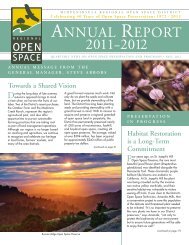
Preserve Passport - Midpeninsula Regional Open Space District
Preserve Passport - Midpeninsula Regional Open Space District
Preserve Passport - Midpeninsula Regional Open Space District

You also want an ePaper? Increase the reach of your titles
YUMPU automatically turns print PDFs into web optimized ePapers that Google loves.
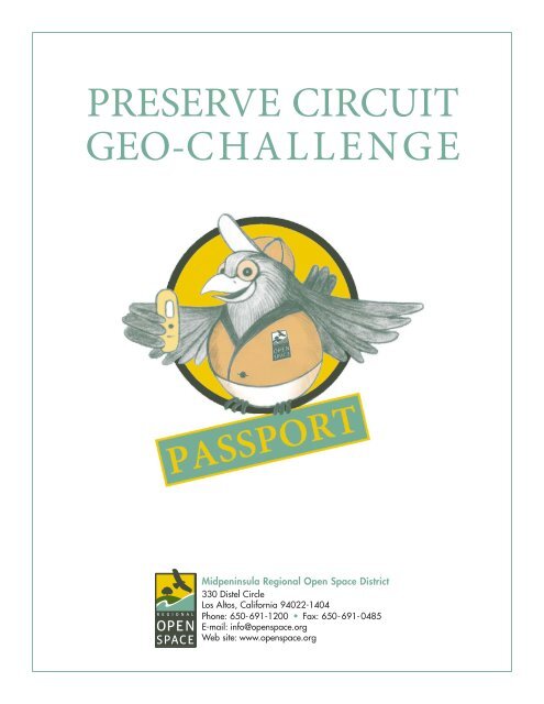
PRESERVE CIRCUIT<br />
GEO-CHALLENGE<br />
<strong>Midpeninsula</strong> <strong>Regional</strong> <strong>Open</strong> <strong>Space</strong> <strong>District</strong><br />
330 Distel Circle<br />
Los Altos, California 94022-1404<br />
Phone: 650-691-1200 • Fax: 650-691-0485<br />
E-mail: info@openspace.org<br />
Web site: www.openspace.org
Instructions for the <strong>Preserve</strong> Circuit Geo-Challenge:<br />
1. Obtain a <strong>Preserve</strong> Circuit Geo-Challenge (“<strong>Preserve</strong> Circuit”) <strong>Passport</strong>.<br />
2. Go to www.geocaching.com, register for a free basic membership, and obtain the GPS<br />
coordinates for the <strong>Preserve</strong> Circuit geocaches (“caches”). Search by user name “MROSD.”<br />
You can also get the coordinates using the hyperlinks at www.openspace.org/preserve_circuit.<br />
3. Start your search to locate the <strong>Preserve</strong> Circuit caches using your<br />
GPS-enabled device. A small number of GPS devices are available<br />
for short term loan through the <strong>District</strong>.<br />
4. Bring water (and food for longer excursions), dress in layers,<br />
wear sturdy footwear, and take a preserve map with you.<br />
5. Search smart! Use your GPS device for guidance only; keep your<br />
eyes on the terrain as you walk. Don’t put your hands where you<br />
can’t see; use a stick or similar object to search around objects.<br />
6. When you find a <strong>Preserve</strong> Circuit cache, sign the log book and<br />
stamp your passport with the stamp located inside the cache<br />
specific for that preserve.<br />
7. There are often small items for trade located in the caches; if<br />
you take something, leave something of equal or greater value.<br />
(Do NOT remove the game piece stamp from the cache!)<br />
8. Share your experiences online when you get home. Log into your Geocaching.com account and track all of the caches you’ve<br />
found. Let us know in your log if you’re a first time visitor to any of the preserves!<br />
Earn Prizes!<br />
• For children 16 years and younger, stamp any 12 of the <strong>Preserve</strong> Circuit cache locations in your passport and receive<br />
a limited custom <strong>District</strong> cache tag.*<br />
• For geocachers of all ages, complete the entire <strong>Preserve</strong> Circuit Geo-Challenge (have every preserve cache location stamped)<br />
and receive a limited custom geocoin.*<br />
To Claim Prizes:<br />
• For age verification purposes, cache tags must be claimed in person, see contact information below.<br />
• Geocoins can be claimed via mail or in person. You may mail in your qualifying passport (keep a copy for your records, the<br />
<strong>District</strong> is not responsible for lost mail) and receive it back along with your custom geocoin or make arrangements in advance<br />
to bring your passport in person to receive your geocoin.<br />
Jennifer Williams • Geocaching Program<br />
<strong>Midpeninsula</strong> <strong>Regional</strong> <strong>Open</strong> <strong>Space</strong> <strong>District</strong> • 330 Distel Circle • Los Altos, CA 94022<br />
650-691-1200<br />
* Prizes are available while supplies last. Please visit www.openspace.org/preserve_circuit to check the status of prize supplies.<br />
Know Before You Go:<br />
Geocaching Etiquette:<br />
• Always replace the cache exactly as found<br />
• Don’t harm the environment while searching<br />
• Re-seal all boxes and bags to keep out the elements<br />
• Don’t expose the cache to non-cachers (be stealthy)<br />
• Don’t put “spoilers” in your on-line logs<br />
Hours, Directions, and Parking<br />
• <strong>Preserve</strong>s are open a half-hour before sunrise until a half-hour after sunset. Parking is limited in some areas. Directions to the<br />
preserves and parking information can be found online at www.openspace.org/preserves. <strong>Preserve</strong> trail maps are available<br />
online as well as at the trailheads.<br />
<strong>Preserve</strong> Uses, Accessibility, and Amenities<br />
• A variety of uses (bicycle, equestrian, dog) are permitted on <strong>District</strong> trails and some trails are accessible to wheelchairs and<br />
strollers. Restrooms are available at only some locations. Please check the information for each preserve before heading out.<br />
Group Outings<br />
• Geocaching is a fun, shared activity, but please note that groups of 20 or more people will require an advance permit<br />
(no fee for permit).<br />
Trail Conditions and Cache Access<br />
• If for some reason a cache is not accessible due to temporary trail closure every attempt will be made to relocate the cache<br />
and update the coordinates. Always obey posted signs.
Bear Creek Redwoods<br />
<strong>Open</strong> <strong>Space</strong> <strong>Preserve</strong><br />
1,377 Acres | 10.3 Miles of Trails<br />
This <strong>Preserve</strong> is not part of this geocaching<br />
challenge. Public access for hiking and<br />
horseback riding only in designated areas<br />
is available by permit until a Master<br />
Plan and trail development can be completed for this <strong>Preserve</strong>. We<br />
encourage you to discover the <strong>Preserve</strong>’s redwoods and old ranch<br />
roads separate from this challenge after obtaining a (no fee) required<br />
permit. There are privately owned geocaches here (that are not part<br />
of this challenge) that you will enjoy finding!<br />
Foothills <strong>Open</strong> <strong>Space</strong> <strong>Preserve</strong><br />
212 Acres | 0.4 Miles of Trails<br />
Foothills <strong>Preserve</strong> is located in the Adobe<br />
Creek watershed above Hidden Villa<br />
Ranch and adjacent to Palo Alto’s Foothills<br />
Park. Here you’ll find a grassy ridgetop<br />
surrounded by steep chaparral-covered<br />
slopes, with oak-madrone woodland in the<br />
ravines and on the north-facing slopes. A<br />
single trail leads from Page Mill Road to the<br />
knoll offering a fine view of the South Bay. Place<br />
Stamp Here<br />
Coal Creek <strong>Open</strong> <strong>Space</strong> <strong>Preserve</strong><br />
508 Acres | 5.4 Miles of Trails<br />
Coal Creek <strong>Preserve</strong> is an ideal place for<br />
a quick afternoon outing. Several trails<br />
can be combined to create a pleasant<br />
two- or three-mile loop and views of the<br />
San Francisco Bay Area can be seen<br />
from the open grassland ridges. The<br />
<strong>Preserve</strong>’s five miles of trails provide<br />
important trail connections between<br />
Skyline Boulevard and Alpine Road for<br />
hikers, bicyclists, and equestrians.<br />
Place<br />
Stamp Here<br />
Fremont Older <strong>Open</strong> <strong>Space</strong> <strong>Preserve</strong><br />
739 Acres | 14.7 Miles of Trails<br />
Visitors to this <strong>Preserve</strong> are often attracted<br />
to the open hayfields, Seven Springs<br />
Canyon, and Hunters Point, a 900-foot<br />
hilltop offering sweeping views of the<br />
Santa Clara Valley. To the west are<br />
chaparral and oak-covered ridges dropping<br />
steeply to Stevens Canyon. Located on the<br />
fringe of urban life and rich in local history,<br />
this <strong>Preserve</strong> features the historic “Woodhills”<br />
home built in 1914. (Note: The house is<br />
leased as a private residence and is open<br />
to the public only during annually scheduled<br />
docent-led tours in the spring.)<br />
Place<br />
Stamp Here<br />
El Corte de Madera Creek<br />
<strong>Open</strong> <strong>Space</strong> <strong>Preserve</strong><br />
2,817 Acres | 35.9 Miles of Trails<br />
Extremely popular with bicyclists, this<br />
<strong>Preserve</strong> also has lots of hearty hiking<br />
opportunities. Visitors to the <strong>Preserve</strong><br />
will find mixed evergreen and redwood<br />
forests, creekside trails, coastal and forest<br />
views, and special features such as rare<br />
sandstone formations. (Note: As part of<br />
the Watershed Protection Program, visitors<br />
are required to stay on designated trails<br />
to reduce erosion and sedimentation in<br />
this <strong>Preserve</strong>.)<br />
Place<br />
Stamp Here<br />
Strether Smith<br />
La Honda Creek<br />
<strong>Open</strong> <strong>Space</strong> <strong>Preserve</strong><br />
5,760 Acres | 3.7 Miles of Trails<br />
This <strong>Preserve</strong> is not part of this geocaching<br />
challenge. Public access for hiking and<br />
horseback riding only in designated areas<br />
is available by permit until a Master<br />
Plan and trail development can be completed for this <strong>Preserve</strong>.<br />
We encourage you to discover this <strong>Preserve</strong> separate from this<br />
challenge after obtaining a (no fee) required permit. There are<br />
privately owned geocaches here (that are not part of this challenge)<br />
that you will enjoy finding!<br />
El Sereno <strong>Open</strong> <strong>Space</strong> <strong>Preserve</strong><br />
1,415 Acres | 7.4 Miles of Trails<br />
Part of a prominent ridge located south<br />
of the town of Saratoga and west of<br />
Los Gatos, this <strong>Preserve</strong> is primarily a<br />
chaparral community with some wooded<br />
areas near the creeks. The <strong>Preserve</strong>’s<br />
wide, gradual trails may provide a glimpse<br />
of the deer, coyote, and brush rabbits that<br />
make their homes here. (Note: This <strong>Preserve</strong><br />
is bordered by private property. Please<br />
respect the boundaries and stay on<br />
designated trails.)<br />
Place<br />
Stamp Here<br />
Frank Crossman<br />
Long Ridge <strong>Open</strong> <strong>Space</strong> <strong>Preserve</strong><br />
2,035 Acres | 13.2 Miles of Trails<br />
Connected to Skyline Ridge <strong>Open</strong> <strong>Space</strong><br />
<strong>Preserve</strong> by one of the longest continuous<br />
segments of the Bay Area Ridge Trail,<br />
this <strong>Preserve</strong> is popular among hikers,<br />
bicyclists, and equestrians alike. Visitors<br />
can take short hikes or rides to scenic<br />
overlooks or longer loops trips. (Note: This<br />
<strong>Preserve</strong> is bordered by private property.<br />
Please respect the boundaries and stay<br />
on designated trails.)<br />
Place<br />
Stamp Here
Karl Gohl Mary Toalson Strether Smith<br />
Los Trancos <strong>Open</strong> <strong>Space</strong> <strong>Preserve</strong><br />
274 Acres | 5.2 Miles of Trails<br />
Los Trancos <strong>Preserve</strong> is situated at about<br />
2,000 feet and offers visitors fresh air<br />
scented with pungent bay leaves, sweet<br />
grass, and damp woods. This <strong>Preserve</strong> is<br />
an ideal place to learn about earthquake<br />
geology as a major fault line splits the<br />
<strong>Preserve</strong> and visitors can enjoy a 1.5-mile<br />
self-guided tour along the San Andreas<br />
Fault Trail. On a clear day, one can spot<br />
the gleaming skyscrapers of San Francisco<br />
and pick out Mt. Diablo across the bay.<br />
Place<br />
Stamp Here<br />
Monte Bello <strong>Open</strong> <strong>Space</strong> <strong>Preserve</strong><br />
3,278 Acres | 15.5 Miles of Trails<br />
Monte Bello <strong>Preserve</strong> is one of the <strong>District</strong>’s<br />
richest in wildlife and ecosystem diversity.<br />
This <strong>Preserve</strong> encompasses the upper<br />
Stevens Creek watershed from Monte<br />
Bello Ridge to Skyline Ridge. The Stevens<br />
Creek riparian corridor is considered to<br />
be one of the finest in the Santa Cruz<br />
Mountains. This <strong>Preserve</strong> is also home<br />
to the Black Mountain Backpack Camp,<br />
the only campsite on <strong>District</strong> lands<br />
(permit required).<br />
Picchetti Ranch <strong>Open</strong> <strong>Space</strong> <strong>Preserve</strong><br />
308 Acres | 3.7 Miles of Trails<br />
Located above Stevens Creek Reservoir,<br />
Picchetti Ranch <strong>Preserve</strong> features hiking<br />
opportunities where visitors may enjoy<br />
hillside orchards that burst into color<br />
in spring, or a hike through oak<br />
woodland. Named after the Picchetti family<br />
who emigrated from Italy in the 1870s,<br />
Picchetti Ranch features a brick winery and<br />
farm complex. A prominent seasonal pond<br />
is also located at this <strong>Preserve</strong>. (Note:<br />
Collecting from the pond is not allowed.)<br />
Place<br />
Stamp Here<br />
Place<br />
Stamp Here<br />
Karl Gohl<br />
Purisima Creek Redwoods<br />
<strong>Open</strong> <strong>Space</strong> <strong>Preserve</strong><br />
4,411 Acres | 24 Miles of Trails<br />
Developed trails and historical logging<br />
roads provide opportunities for easy walks<br />
or long, strenuous outings. The centerpiece<br />
of this <strong>Preserve</strong> is Purisima Creek Canyon,<br />
with its towering redwoods, rushing creek,<br />
and understory of ferns. Magnificent views<br />
of the coast are visible from the northern<br />
area. The Redwood Trail, suitable for all<br />
levels of physical abilities, winds through<br />
tall redwoods just off Skyline Boulevard and<br />
visitors will find wheelchair-accessible picnic<br />
tables along this route.<br />
Place<br />
Stamp Here<br />
Rancho San Antonio<br />
<strong>Open</strong> <strong>Space</strong> <strong>Preserve</strong><br />
3,988 Acres | 24.2 Miles of Trails<br />
Combined with the adjoining County Park,<br />
this heavily visited <strong>Preserve</strong> offers visitors<br />
a unique experience with a sampling of<br />
diverse environments, interesting cultural<br />
history, and a variety of activities. A highlight<br />
of the <strong>Preserve</strong> is Deer Hollow Farm, a<br />
working farm with animals and an organic<br />
garden, as well as numerous ranch buildings.<br />
(Note: This <strong>Preserve</strong> is ideal for a weekday<br />
outing as parking fills early on the weekends<br />
at this very busy location.)<br />
Ravenswood <strong>Open</strong> <strong>Space</strong> <strong>Preserve</strong><br />
376 Acres | 1.3 Miles of Trails<br />
This <strong>Preserve</strong> is comprised of two<br />
noncontiguous areas located south of<br />
the Dumbarton Bridge and adjacent to<br />
San Francisco Bay. The southern area<br />
includes a trail along a levee surrounding<br />
a marsh, and two wheelchair-accessible<br />
observation decks. The marsh attracts a<br />
variety of migrating birds, including<br />
sandpipers, dowitchers, and avocets.<br />
Great blue herons, white pelicans, and<br />
egrets are also common. The northern<br />
area features a refurbished 1-mile trail.<br />
Place<br />
Stamp Here<br />
Place<br />
Stamp Here<br />
Pulgas Ridge <strong>Open</strong> <strong>Space</strong> <strong>Preserve</strong><br />
366 Acres | 6 Miles of Trails<br />
This diverse <strong>Preserve</strong> offers trails that<br />
parallel creeks, ascends on oak-covered<br />
hillside, and travel through heavy<br />
chaparral akin to desert landscapes.<br />
Pulgas Ridge <strong>Preserve</strong> also features<br />
an easy-access trail through a meadow and<br />
the <strong>District</strong>’s only dog off-leash area. Visitors<br />
may let their dogs roam off-leash in the<br />
17.5-acre area in the center of the <strong>Preserve</strong>.<br />
(Note: Dog walkers are required to bag<br />
dog waste and carry it out of the <strong>Preserve</strong><br />
for disposal).<br />
Place<br />
Stamp Here<br />
Deane Little<br />
Russian Ridge <strong>Open</strong> <strong>Space</strong> <strong>Preserve</strong><br />
3,138 Acres | 10.4 Miles of Trails<br />
This <strong>Preserve</strong> is a patchwork of different<br />
plant communities due to it’s ridge location,<br />
steep topography, and numerous<br />
springs that create the headwaters of<br />
Mindego and Alpine Creeks. Russian<br />
Ridge <strong>Preserve</strong> is one of the best places<br />
in the Bay Area to see wildflowers in the<br />
spring. This <strong>Preserve</strong> is also a great place<br />
to see raptors. Red-tailed hawks, turkey<br />
vultures, Cooper’s hawks, sharp-shinned<br />
hawks, and golden eagles have all been<br />
seen on the <strong>Preserve</strong>.<br />
Place<br />
Stamp Here
Strether Smith Deane Little<br />
Karl Gohl David Weintraub<br />
Saratoga Gap <strong>Open</strong> <strong>Space</strong> <strong>Preserve</strong><br />
1,580 Acres | 1.2 Miles of Trails<br />
Saratoga Gap <strong>Preserve</strong> is largely wooded<br />
with Douglas firs, along with grassy hills<br />
scattered with large oaks and madrones.<br />
The one trail in the <strong>Preserve</strong> passes under<br />
the spreading branches of weathered oaks<br />
before dropping into a cool, wooded forest.<br />
Attractive lichen-covered boulders and<br />
sandstone rock outcrops add to the scenic<br />
value of this area.<br />
Place<br />
Stamp Here<br />
Sierra Azul <strong>Open</strong> <strong>Space</strong> <strong>Preserve</strong><br />
18,446 Acres | 26 Miles of Trails<br />
Sierra Azul <strong>Preserve</strong> is the <strong>District</strong>’s largest<br />
<strong>Preserve</strong> comprised of often rugged and<br />
steep terrain. The environment is strikingly<br />
varied. One can visit serpentine grasslands,<br />
hard, rocky, and steep chaparral,<br />
dense stands of bay trees, or quiet, shaded<br />
oak woodland forests. Home to a wide<br />
variety of wildlife, Sierra Azul (“Blue<br />
Range”) is a true wilderness area; yet<br />
surprisingly close to the urban areas of<br />
the South Bay.<br />
Skyline Ridge <strong>Open</strong> <strong>Space</strong> <strong>Preserve</strong><br />
2,143 Acres | 10.9 Miles of Trails<br />
This <strong>Preserve</strong> offers visitors remarkable<br />
ridge vistas and trails through expansive<br />
meadows, oak woodland, and chaparral<br />
communities. Two trails are accessible to<br />
wheelchairs and baby strollers: a half-mile<br />
encircling Alpine Pond and a 1-mile trail<br />
along the shores of Horseshoe Lake; both<br />
areas offer picnic tables for your use. The<br />
David C. Daniels Nature Center, located<br />
at the edge of Alpine Pond, is open to<br />
the public on weekends, April through<br />
mid-November.<br />
St. Joseph’s Hill <strong>Open</strong> <strong>Space</strong> <strong>Preserve</strong><br />
270 Acres | 4.2 Miles of Trails<br />
St. Joseph’s Hill <strong>Preserve</strong> provides a quick<br />
escape from the nearby urban areas. The<br />
often steep trails of this <strong>Preserve</strong> wind<br />
through grassland, chaparral, and oak<br />
woodland offering an interesting variety<br />
of environments and opportunities. At the<br />
eastern edge of the <strong>Preserve</strong>, the top<br />
of 1,250-foot St. Joseph’s Hill features<br />
panoramic views of Santa Clara Valley,<br />
Lexington Reservoir, and the impressive<br />
Sierra Azul mountain range.<br />
Place<br />
Stamp Here<br />
Place<br />
Stamp Here<br />
Place<br />
Stamp Here<br />
Stevens Creek Shoreline<br />
Nature Study Area<br />
55 Acres | 0.5 Miles of Trails<br />
A birder’s paradise, Stevens Creek<br />
Shoreline Nature Study Area, located<br />
adjacent to Mountain View’s Shoreline<br />
Park, offers a 1 /2-mile trail where visitors<br />
may spot pied-billed grebes, great blue<br />
herons, coots, and shovelers. The lucky<br />
visitor may even spot a clapper rail or a<br />
salt marsh harvest mouse, two endangered<br />
species that depend on this sensitive habitat<br />
to survive.<br />
Place<br />
Stamp Here<br />
Teague Hill <strong>Open</strong> <strong>Space</strong> <strong>Preserve</strong><br />
626 Acres | 1 Trail Available<br />
Teague Hill <strong>Preserve</strong> is located in the<br />
Santa Cruz Mountains just above the<br />
town of Woodside. Private property<br />
and California Water Service Company<br />
property make it difficult to visit the<br />
majority of this <strong>Preserve</strong>. Currently, there<br />
is only one official trail along the western<br />
corner of Teague Hill <strong>Preserve</strong> which is<br />
accessible approximately 1 /4 mile east of<br />
Skyline Boulevard on Kings Mountain Road.<br />
(Note: Roadside parking, use caution when<br />
entering and exiting.)<br />
Thornewood <strong>Open</strong> <strong>Space</strong> <strong>Preserve</strong><br />
167 Acres | 1.5 Miles of Trails<br />
Thornewood <strong>Preserve</strong> offers nice, easy<br />
outings through beautiful surroundings.<br />
The <strong>Preserve</strong>’s 3 /4-mile Schilling Lake<br />
Trail gradually winds through sunlit<br />
canopies of big-leaf maples and<br />
moss-covered oaks and ends under the<br />
shade of the giant redwoods that surround<br />
the lake. Schilling Lake is an excellent site to<br />
view waterfowl during their migration.<br />
Place<br />
Stamp Here<br />
Tom Cochrane<br />
Windy Hill <strong>Open</strong> <strong>Space</strong> <strong>Preserve</strong><br />
1,335 Acres | 12.2 Miles of Trails<br />
Windy Hill <strong>Preserve</strong> is named for its<br />
distinctive, breezy, grass-covered<br />
hilltop, which can be seen from many<br />
areas on the peninsula. The <strong>Preserve</strong><br />
is an ideal spot for kite flying. Hang<br />
gliding, paragliding, and remote control<br />
gliding are allowed by obtaining a special<br />
activity permit. Picnic tables are located<br />
adjacent to the Spring Ridge parking area<br />
located on Skyline Boulevard.<br />
Place<br />
Stamp Here<br />
Place<br />
Stamp Here
Geocaching Agreement and Guidelines:<br />
The <strong>District</strong> invites you to enjoy geocaching in a responsible manner within the preserves.<br />
• All geocachers on <strong>District</strong> lands must be registered users with Geocaching.com and must comply with the guidelines<br />
established by the <strong>District</strong> as well as those established by Geocaching.com. Geocaching must be done during normal<br />
preserve hours, must not interfere with wildlife, the natural environment, structures, or other preserve visitors.<br />
• Geocaching, hiking, and other outdoor activities involve risk to both persons and property. There are many variables,<br />
including, but not limited to, weather, fitness level, wildlife, terrain features, and outdoor experience, that must be<br />
considered prior to participation in the activity of geocaching.<br />
• Always exercise common sense and caution. Geocachers assume all risks involved in participation of this activity and<br />
agree to assume responsibility for, and indemnify the <strong>District</strong> for any injury to any person, or damage to their property,<br />
caused while participating in any geocaching activity on <strong>District</strong> lands.<br />
• Please read the <strong>District</strong>’s complete Geocaching Guidelines, and Geocaching Agreement and Release of Liability, before<br />
heading out on your geocaching adventure (www.openspace.org/geocaching_guidelines). Visitors are responsible for<br />
knowing and obeying these guidelines and agreements.<br />
Thank You!<br />
For more information about the<br />
<strong>Midpeninsula</strong> <strong>Regional</strong> <strong>Open</strong> <strong>Space</strong><br />
<strong>District</strong>’s Geocaching Program go to<br />
www.openspace.org/geocaching.