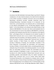
MUTASA CONSTITUENCY
Mutasa.pdf
Mutasa.pdf

You also want an ePaper? Increase the reach of your titles
YUMPU automatically turns print PDFs into web optimized ePapers that Google loves.
<strong>MUTASA</strong> <strong>CONSTITUENCY</strong><br />
11.1 Introduction<br />
According to the 2000 Delimitation Commission Report (pp.35,36,37), Mutasa<br />
Constituency is ‘An area of land bounded by a line drawn from the intersection<br />
of the northern boundary of Holdenby Communal Land by the Zimbabwe-<br />
Mozambique international boundary, generally southwards along the<br />
Zimbabwe-Mozambique international boundary to its intersection by the<br />
Honde River, up the Honde River to its confluence with an unnamed tributary<br />
at map reference 36KVQ839514 on the 1:50 000 Map Stapleford 1832D2,<br />
Edition 1, and up that tributary to its confluence with another tributary at map<br />
reference 36KVQ830482 on the same map; thence south-eastwards direct to<br />
the commencement of a track at map reference 36KVQ834479, on that map,<br />
proceeding south-eastwards along that track to its intersection by the Ngarura<br />
River, up the Ngarura River to its intersection by the southern boundary of<br />
Mutasa North Communal Land, so as to include it; thence generally southwestwards<br />
along the boundaries of the following properties, so as to include<br />
them: the southern boundary of Mutasa North Communal Land, the southeastern<br />
boundary of Mount Ruwinji, the western and southe-western<br />
boundary of Mkondwe of Souldrop, the south-eastern boundaries of the<br />
former Remainder of Summerfield, the south-eastern and south-western<br />
boundary of Stanley, to its south-western beacon, proceeding generally southwestwards<br />
along the boundaries of the following properties, so as to exclude<br />
them: the north-western boundary of Athens, the north-western and southeastern<br />
boundaries of Nyakasapa of Jerain, to its intersection of the latter<br />
boundary by the northern boundary of Mutasa South Communal Land, and<br />
proceeding generally south-westwards along the northern boundaries of<br />
Mutasa South Communal Land, so as to include Tsonzo Small Scale<br />
Commercial Farming Area, to its intersection by a tributary which is also the<br />
southern boundary of Tsonzo 49 down that tributary and the Nyapande River,<br />
down the Nyapande River to its confluence with an unnamed tributary at map<br />
reference 36KVQ574273 on the 1:50 000 Map Watsomba 1832D1, Edition 1;
thence westwards direct to the confluence of two tributaries at map reference<br />
36KVQ525273 on the same map, north-westwards down the tributary to its<br />
intersection by the south-western boundary of Tsonzo 99, and northwestwards<br />
along the south-western boundary of Tsonzo 99, so as to include<br />
it, to its intersection by the Odzi River; up the Odzi and Nyadiri rivers to the<br />
confluence of the latter river with the Dora River; thence north-westwards<br />
direct to the commencement of an unnamed river at map reference<br />
36KVQ496397 on the 1: 50 000 Map Watsomba 1832d1, Edition 1, generally<br />
south-westwards down that river to its confluence with the Nyatanda River up<br />
the Nyatanda and Mubvumira rivers to its intersection of the latter river by the<br />
Manyika-Makoni Communal Land boundary; thence north-westwards and<br />
north-easrwards through geodetic beacon 375/s along that boundary to the<br />
south-western beacon of Remainder of Harewood, Lot 1A Harewood and<br />
Subdivision B of Subdivision A of Harewood, the western, southern and<br />
south-eastern boundaries of the former property Bristow, the south-western<br />
boundary of Hubberholm of Britannia, the north-western and south-western<br />
boundaries of Nyamazi, the south-western and south-eastern boundaries of<br />
Chipazi, the western and southern boundaries of the Remainder of Shitiwa<br />
and the western and southern boundaries of the Remainder of Rupangu to its<br />
south-eastern beacon; thence generally north-eastwards along the<br />
boundaries of the following properties, so as to include them: the northwestern<br />
boundaries of Holdenby Communal Land, the south-western, northwestern<br />
and north-eastern boundaries of Aberfoyle Plantations of Inyanga<br />
Block, the north-western boundary of Lot 1 of Inyanga Block, the northwestern<br />
and north-eastern boundaries of lot 2 of Inyanga Block and the<br />
western and northern boundaries of Holdenby Communal Land to the starting<br />
point.’<br />
Mutasa Constituency is made up of 27 wards. All the wards have got at least one<br />
primary school and 70% of all the wards have got secondary schools. Some of the<br />
wards in Mutasa are commercial farming zones, characterized by small scale and<br />
large commercial farms. The constituency has few major business centers and has got<br />
35 727 voters.
TABLE XI : INFRASTRUCTURE DISTRIBUTION BY WARD<br />
Ward Farm<br />
Prim<br />
Sch<br />
Sec<br />
Sch<br />
Dip<br />
tanks Clinic Hosp<br />
Bus<br />
Cent<br />
Post<br />
Office Counl<br />
1 0 6 3 1 5 - 1 - M<br />
2 2 2 0 0 1 - 0 - M<br />
3 0 2 1 1 1 - 1 - M<br />
4 0 3 2 1 2 - 0 - M<br />
5 0 4 0 1 0 - 0 - M<br />
6 0 3 1 1 4 - 1 1 M<br />
7 0 5 1 2 2 - 0 - M<br />
8 0 2 0 1 2 - 1 - F<br />
9 0 3 1 2 2 - 0 - M<br />
10 0 2 1 3 2 - 0 - M<br />
11 0 2 1 1 2 - 0 - M<br />
12 0 4 1 2 2 - 0 - M<br />
13 0 4 1 1 2 - 0 - M<br />
14 0 4 2 3 1 - 0 - M<br />
15 0 6 0 2 1 - 1 - M<br />
16 0 1 2 1 1 - 0 - F<br />
17 0 1 1 1 1 - 0 - M<br />
18 13 2 1 0 0 - 0 - M<br />
19 0 5 2 3 2 - 0 - M<br />
20 1 5 1 4 1 - 2 1 M<br />
21 0 3 2 0 5 - 1 1 M<br />
22 10 2 0 0 0 - 0 - M<br />
23 18 2 1 2 1 - 0 - M<br />
24 0 3 2 1 2 - 0 - M<br />
25 16 2 0 0 0 - 0 - M<br />
26 0 1 0 1 0 - 0 - M<br />
27 1 2 0 0 2 - 0 - F<br />
11.2 Ward 1<br />
There are 16 518 people in the ward. The ward has 6 primary schools, 3 secondary<br />
schools and 5 health facilities. There is also 1 business centre in this ward.
Education: The primary schools in ward 1 are Chavhanga, Chikomba, Chisuko,<br />
Katiyo Sacred Heart, St Stephens and Sagambe. Of the 6 primary schools, St Stephens<br />
has the least total enrolment, i.e. 370 pupils. The secondary schools in the ward are<br />
Chisuko, Sagamba and St Matthias Tsonzo. Chisuko and Sagamba offer classes up to<br />
‘O’ level while St Matthias is an ‘A’ level school offering both boarding and day<br />
school facilities to pupils.<br />
Health Facilities: The health facilities in ward 1 are;<br />
• Chavhanga clinic which is government owned;<br />
• Chisuko clinic which is manned by 1 nurse and is owned by council. The<br />
clinic has 3 maternity beds at its disposal.<br />
• Sagambe clinic which is owned by council and has 1 maternity bed.<br />
• Aberffolye which is privately owned and has got 2 maternity beds.<br />
• Katiyo clinic which is also privately owned and has 2 maternity beds.<br />
Business Centres: There is one business centre in the ward known as Sagambe. This<br />
business centre however does not have a post office or a police post, and the residents<br />
of this ward have to look somewhere else for these services.<br />
Dip tanks: There is 1 dip tank in the ward.<br />
11.3 WARD 2<br />
The ward has a population of 4 496 people. There are 2 primary schools, no<br />
secondary schools and 1 health facility in this ward. The ward does not however have<br />
any major business centre.<br />
Education: The primary schools in ward 2 are Abberfoyle and Eastern Highlands<br />
which are both farm schools. The ward does not have secondary schools and the<br />
pupils have to travel to other wards for secondary education.<br />
Business Centres: There are no business centers in ward 2 making it difficult for the<br />
residents of the ward to access services such as those offered by the Post Office. The<br />
ward does not also have a police post.<br />
Health Facilities: Ward 2 has only 1 health facility known as EHPL. The facility is<br />
privately owned and offers 4 maternity beds.
Farms: There are 2 A1 farms in the ward.<br />
11.4 WARD 3<br />
There are 9 403 people in the ward. The ward is characterized by 2 primary schools, 1<br />
secondary school, 1 health facility and 1 business centre.<br />
Education: The primary schools in ward 3 are Nyamhingura, Rutsate and Zindi.<br />
Nyamhingura is the only secondary school in the ward and offer classes up to ‘O’<br />
level. The secondary school has a total enrolment of 565 of which 215 are girls.<br />
Health Facilities: The health facility in the ward is Rumbizi Clinic. The clinic is<br />
manned by 1 nurse and helps the residents in providing them with basic health care.<br />
The clinic however does not have a resident doctor.<br />
Business Centres: The business centre in the ward is called Zindi. The centre does<br />
not have postal services or a police post. The center is electrified thereby giving the<br />
area potential for economic development if investors can seize the opportunity of<br />
providing services in the area.<br />
Animal health and management facilities: The ward has 1 dip tank.<br />
11.5 WARD 4<br />
This ward has the highest number of people, totaling 12 081 people. There are 3<br />
primary schools, 2 secondary schools and 2 health facilities.<br />
Education: The 3 primary schools in the ward are Makwara, Muterere and St Peters<br />
Mandeya. Of the three schools, Makwara has the highest total enrolment having 2 050<br />
pupils with boys constituting the larger number of the total. The 2 secondary schools<br />
in ward 4 are Muterere and St Peters Mandeya. Both schools offer ‘O’ Level classes<br />
and are day schools.
Health facilities: The ward has 2 health facilities namely;<br />
• St Peters which is mission-owned and is characterized by 8 maternity beds.<br />
• Mandeya 11 which is owned by council.<br />
Dip tank: The ward has 1 dip tank.<br />
Business Centres: Ward 4 does not have a major business centre.<br />
11.6 WARD 5<br />
The ward has a population of 7 577 people. There are 4 primary schools and no<br />
secondary school.<br />
Education: The 4 primary schools in ward 5 are Loreto, Muparutsa, Pimai and St<br />
Michael Samutete. Pimai has a rare incident where the total enrolment of girls<br />
surpasses that of boys having 429 girls as compared to 417 boys. All the 4 schools are<br />
owned by council. The ward does not have a secondary school.<br />
Health Facilities: There are no health facilities in ward 5. The people of this ward<br />
have to travel to other wards for primary health care.<br />
Business Centers: Ward 5 does not have a major business centre.<br />
11.7 WARD 6<br />
This ward has 9 385 people. There are 3 primary schools, 4 health facilities and 1<br />
secondary school.<br />
Education: The primary schools in ward 6 are Buwu, Nyatsanza, and St Colunbus.<br />
Buwu and Nyatsanza are council owned while St Columbus is mission-owned. In all<br />
the schools the enrolment of girls is slightly higher than that of boys showing a<br />
paradigm shift towards the empowerment of the girl child, a welcome development.<br />
The secondary school in the ward is called St Columbus and offer classes up to ‘O’<br />
level. The school is mission owned and has a total enrolment of 878 pupils.<br />
Health facilities: The health facilities in the ward are;
• Hauna clinic which is owned by the government<br />
• Gatsi clinic which is mission-owned and has 2 maternity beds.<br />
• Ruda clinic which is council owned<br />
• Another Hauna Clinic which is Council owned and is manned by 1 nurse.<br />
All the clinics do not have any resident doctors or ambulance services at their disposal<br />
and have to rely on major hospitals for specialized treatments.<br />
Business centers: Ward 6 has got 1 business centre known as Hauna growth point.<br />
The growth point has a Post Office and a Police Post amongst other infrastructure<br />
such as retail shops. The business centre is therefore essential in providing services,<br />
not only to ward 6 residents but also to residents of other wards. The growth point is<br />
electrified and has therefore a potential to develop if investors are lured.<br />
Animal health and management facilities: Ward 6 has got 1 dip tank.<br />
11.8 WARD 7<br />
The ward has a total population of 8 547 people. There are 5 primary schools, two<br />
health facilities and one secondary school in the ward. There is however no major<br />
business centers in the ward.<br />
Education: The primary schools in ward 7 are Chotombo, Gatsi, Kwambana,<br />
Manunure and Samanga. All the primary schools in this ward have more girls than<br />
boys. Kwambana has the least enrolment, comprising of only 365 pupils. The<br />
secondary school in this ward is Gatsi which is a day school offering classes up to ‘O’<br />
level. The school has a total enrolment of 849 pupils.<br />
Health facilities: There are 2 health facilities in this ward, namely;<br />
• Chitombo clinic which has 1 nurse and is owned by council.<br />
• Samanga clinic which is also owned by council and has got 1 nurse.
Business Centers: Ward 7 does not have a major business centre.<br />
Dip tanks: There are 2 dip tanks in this ward.<br />
11.9 WARD 8<br />
There are 6225 people residing in the ward. The councilor is one of the three female<br />
councilors in the constituency. There are 2 primary schools, no secondary school, 2<br />
health facilities and a business centre in the ward.<br />
Education: The primary schools in ward 8 are Makwasa and Sahumani. Of the two<br />
Sahumani has the higher enrolment, having 964 pupils. There are no secondary<br />
schools in ward 8.<br />
Health facilities: There are 2 clinics in ward 8 namely;<br />
• Sahumani clinic which is council owned and is manned by 1 nurse.<br />
• Mupotedzi clinic which has 1 nurse and is owned by council.<br />
Business Centres: There is 1 business centre with no post office or police post called<br />
Honde Green.<br />
Dip tanks: Ward 8 has 1 dip tank.<br />
11.10 WARD 9<br />
The ward has a population of 5902 people. There are 3 primary schools, 1 secondary<br />
school and 2 health facilities in the ward.<br />
Education: The primary schools in the ward are known as Ngarura, Nyamaende and<br />
Rupinda. Nyamaende has a total of only 124 pupils. The secondary school in the ward<br />
is called Rupinda and offer classes up to ‘O’ level. Rupinda is a day school.<br />
Health facilities: Ward 9 has 2 health facilities namely;<br />
• Rupinda clinic which is owned by government.<br />
• Ngarura clinic which is owned by council.
Business Centres: Ward 9 does not have a major business centre and residents have<br />
to travel to other wards to access services offered by such centers, for instance Postal<br />
services.<br />
Dip tanks: The ward has 2 dip tanks.<br />
11.11 WARD 10<br />
There are 3996 people in this ward. The ward has 2 primary schools, 1 secondary<br />
school and 2 health facilities.<br />
Education: The primary schools in ward 10 are Jombe and Samaringa. Both schools<br />
are owned by council. Of the two Samaringa has the highest enrolment, having a total<br />
of 913 pupils. The secondary school in the ward is Jombe St Peters which offers<br />
classes up to ‘O’ level.<br />
Health Facilities: The health facilities in ward 10 are;<br />
• Honde which is characterized by 1 nurse and 2 maternity beds. The clinic is<br />
mission-owned.<br />
• Samaringa which has 1 nurse and is owned by council.<br />
Business Centres: There are no business centres in the ward and the residents of<br />
ward 10 have to rely on other wards for services such as banking, postal services and<br />
issues that may need the police since the ward does not have a police post.<br />
Animal health and management facilities: There are 2 dip tanks in the ward.<br />
11.12 WARD 11<br />
The ward has a total population of 10 044 people. The ward is characterized by 2<br />
primary schools, 1 secondary school and 2 health facilities.<br />
Education: The primary schools that are in the ward are Newengo and Pafiwa<br />
Mutasa. Both primary schools have more girls in their total enrolment and are owned
y council. The secondary school that is also located in the ward is called Pafiwa and<br />
offers classes up to ‘O’ level. The school has a total enrolment of 1226.<br />
Business Centres: There is no business centre, bank, GMB depot and no post office<br />
in this ward.<br />
Health Facilities: Ward 11 has 2 health facilities namely;<br />
• Mutasa clinic which is council owned and has 2 maternity beds.<br />
• Sakupwanya clinic which is manned by 2 nurses and is also council-owned.<br />
Animal health and management facilities: Ward 11 has got 2 dip tanks.<br />
11.13 WARD 12<br />
The ward has a total population of 5790 people. The ward is characterized by 4<br />
primary schools, 1 secondary school and 2 clinics.<br />
Education: The primary schools in the ward are called Chirarwe, Fatima, Sadziwa<br />
and St David Bonda. Of the four, only Bonda is mission-owned while the others are<br />
owned by the council. The secondary school in the ward is called St David’s Bonda<br />
and is mission-owned. Bonda is an ‘A’ level school which only enrolls girls. The high<br />
school has a total enrolment of 839 girls.<br />
Health Facilities: There are 2 health facilities in the ward helping in mitigating<br />
diseases and improving the health standards of the residents. The health facilities are;<br />
• Bonda Hospital which is mission-owned and is manned by 30 sisters and 8<br />
nurses. The facility offer 40 maternity beds and also have a mortuary. It is the<br />
prime health centre in the constituency.<br />
• Sadziwa clinic which is council owned.<br />
Animal health and management facilities: The ward has got 2 dip tanks.
11.14 WARD 13<br />
Ward 13 has a total population of 4200 people.<br />
Education: There are 4 primary schools, namely Mbaza, St Barbaras, St Ignatius<br />
Magadzire and Triashill. St Ignatius and St Barbaras are mission-owned while the<br />
others are owned by council. Of the four, St Ignatius has the least enrolment, having<br />
only 182 pupils. The secondary school in the ward is called St Barbaras and it offer<br />
classes up to ‘O’ level. The school has 424 pupils.<br />
Health Facilities: The ward has two clinics namely;<br />
• St Barbaras, which is mission-owned. The clinic is characterized by 3 nurses<br />
and offers 10 maternity beds.<br />
• Triashill, which is also mission-owned. The clinic has got 3 nurses and 12<br />
maternity beds.<br />
Both the clinics do not have resident doctors and have to rely on major hospitals as<br />
referential centers.<br />
Business Centres: There is no business centre in ward 13.<br />
Dip tanks: There is only 1 dip tank in the ward.<br />
11.15. WARD 14<br />
Ward 4 has a population of 3014 people. The ward has got 4 primary schools, 2<br />
secondary schools and 1 health facility.<br />
Education: There are 4 primary schools known as Chikumbu, Haparari, Njerama<br />
and Sherukuru. The four schools are owned by council. Chikumbu has the lowest<br />
enrolment, i.e. 264 pupils.<br />
Health facilities: Ward 14 has 1 health facility known as Haparari clinic. The clinic<br />
is manned by 1 nurse and it is owned by the council.<br />
Business centers: The ward does not have any major business centers. The residents<br />
of this ward have to travel to other wards to access services offered by Rural Service<br />
Centers or Growth Points.
Dip tanks: There are 3 dip tanks in the ward.<br />
11.16 WARD 15<br />
The ward has a population of 3646 people.<br />
Education: The ward has 6 primary schools. These are Bethania, Bvumba, Kadzere,<br />
Mapfekera, Ruda and Zambe. The schools are owned by council. Mapfekere has the<br />
least enrolment, i.e. 162 pupils. The ward does not have any secondary schools. The<br />
absence of a secondary school in the ward forces pupils who would have completed<br />
their primary education to travel to other wards in search of secondary school<br />
education.<br />
Health facilities: Ward 15 has 1 health facility called Sherukuru clinic which is<br />
government owned.<br />
Business centers: The ward has 1 business centre known as Sherukuru. The centre<br />
however does not have a Post Office, bank or a police station. These facilities are<br />
important to increase the business potential of the centre.<br />
Dip tanks: There are 2 dip tanks in the ward.<br />
11.17 WARD 16<br />
Ward 16 has a population of 3155 people. The councilor is one of the three female<br />
councilors in the Mutasa constituency.<br />
Education: There is 1 primary school called Mt Jenya which has 206 pupils. The<br />
ward also has 2 secondary schools known as Mt Jenya and Samaringa. Both<br />
secondary schools are day schools which offer classes up to ‘O’ level. All the schools<br />
in the ward are owned by council.<br />
Health Facilities: Ward 16 has 1 health facility known as Mt Jenya clinic which is<br />
owned by council. The clinic is helping the residents in providing primary health care<br />
and helping in awareness campaigns against the spread of diseases.
Business centers: There are no business centers in the ward. The residents of the<br />
ward have therefore to rely on other wards for services that are provided by business<br />
centers.<br />
Dip tanks: There is a single dip tank in the ward.<br />
11.18 WARD 17<br />
The ward has a population of 10 593 people.<br />
Education: There is 1 primary school and 1 secondary school in the ward. The<br />
primary school is known as Vumbunu and has a total enrolment of 757 pupils of<br />
which 393 are boys. The primary school is owned by council. The secondary school<br />
in the ward is also known as Vumbunu and it has day school facilities offering classes<br />
up to ‘O’ level.<br />
Health Facilities: The ward has 1 health facility called Tsonzo Rural Hospital. The<br />
facility offer services to a large catchments, including other wards.<br />
Business centers: Ward 17 does not have any business centers.<br />
Dip tanks: There is 1 dip tank in the ward.<br />
11.19 WARD 18<br />
The ward has a population of 3 370 people. The ward is characterized by vast farms.<br />
There is a general lack of infrastructure in the ward probably attributed by the fact<br />
that the ward is mainly a farming community.<br />
Education: The ward has 2 primary schools and a secondary school. The primary<br />
schools are known as Honde River and Sheba. Honde River is owned by council<br />
while Sheba is a farm school. The secondary school is called Sahumani and offer<br />
classes up to ‘O’ level. The schools are helping in giving education to the farming<br />
community since the pupils do not have to travel very long distances to access<br />
education.
Health Facilities: Ward 18 does not have health facilities. The residents of this ward<br />
have to rely on other wards for treatment and health care.<br />
Business centers: There are no business centers in the ward.<br />
11.20 WARD 19<br />
The ward has a population of 6 494 people. The ward is characterized by 5 primary<br />
schools, 2 secondary schools and 2 health facilities. However the ward does not have<br />
farms like ward 18.<br />
Education: The schools in ward 19 are Chidazembe primary, Domborotinhira<br />
primary, Dunsinane primary, Muponda primary and Mwoyoweshumba. There are also<br />
Mwoyoweshumba and Nyakatsapa secondary schools. The secondary schools are<br />
both ‘O’ level schools.<br />
Health facilities: Ward 19 has 2 health facilities namely;<br />
• Jombe clinic which is government owned.<br />
• Mwoyoweshumba clinic which is owned by council.<br />
Business Centres: There are no major business centers in ward 19.<br />
Dip tanks: There are 3 dip tanks in the ward.<br />
11.21 WARD 20<br />
The ward has a population of 3 511 people.<br />
Education: There are 5 primary schools, namely, Mapara, Mutasa, Nyakatsapa,<br />
St Matthias and Zinyembe. Of the five schools in the ward Zinyembe has the lowest<br />
total enrolment having 213 pupils. The secondary school in the ward is Mapara. The<br />
school has a total enrolment of 210 pupils, and it is a day school offering classes up to<br />
‘O’ level.<br />
Health Facilities: There is 1 health centre in this ward, i.e. Guta Clinic. It is owned<br />
by council and is manned by 1 nurse.
Business Centres: There are 2 business centers namely, Mutasa business center and<br />
Watsomba business center. Both centers are electrified, however of the two, only<br />
Watsomba has a post office while Mutasa has a police post. The ward therefore has<br />
basic infrastructure necessary for human development.<br />
Farms: Ward 20 has 1 farm.<br />
Dip tanks: There are 4 dip tanks in this ward.<br />
11.22. WARD 21<br />
The ward has a population of 7 591 people. This ward is arguably one of the most<br />
developed wards in the Mutasa constituency basing on available infrastructure.<br />
Education: There are 3 primary schools, namely, Elim Penhalonga, Imbeza and<br />
Tsvingwe. Elim Penhalonga is mission-owned, while Imbeza is farm-owned.<br />
Tsvingwe is owned by council. Tsvingwe has the highest total enrolment having 710<br />
pupils. There are 2 secondary schools in the ward called St Augustine’s and<br />
Tsvingwe. St Augustine’s is mission-owned and offer classes up to ‘A’ level. The<br />
school has a total enrolment of 955 pupils. Tsvingwe is an ‘O’ level school and has a<br />
total enrolment of 764 pupils. St Augustine’s has both day and boarding facilities<br />
while Tsvingwe is a day school.<br />
Health Facilities: The ward has 5 health facilities. These are;<br />
• St Augustine’s clinic, which is owned by a mission. The clinic has 2 nurses<br />
and 10 maternity beds at its disposal.<br />
• Dredan clinic, which is privately owned. The clinic is manned by 1 nurse.<br />
• Redwing clinic, which is also privately owned. The clinic is manned by 3<br />
nurses and has 10 maternity beds at its disposal.<br />
• Imbeza clinic, which is privately owned. The clinic is manned by 1 nurse and<br />
offers 2 maternity beds.<br />
• FITC, which is also privately owned.
Business Centres: Ward 21 has 1 business centre known as Penhalonga. The centre<br />
has both a Post Office and a Police Station. The centre offer services to most<br />
surrounding wards since it has most business infrastructure. Penhalonga business<br />
centre is electrified and has the potential to develop if more investors are lured.<br />
11.23 WARD 22<br />
This ward has a population of 2 840 people. The general lack of infrastructure in the<br />
ward can be attributed to the high number of farms in this ward which is a commercial<br />
farming zone.<br />
Education: There is 1 primary school in the ward, namely, Hillcrest Primary. The<br />
school is privately owned and has a total enrolment 812 pupils. There are no<br />
secondary schools in the ward.<br />
Health Facilities: There are no health facilities in the ward and the residents of the<br />
ward have to go to other wards to access health services.<br />
Business Centres: There are no business centers in ward 22.<br />
Farms: There are 10 commercial farms in ward 22.<br />
11.24. WARD 23<br />
This commercial ward has a population of 5823 people. The ward is characterized by<br />
high commercial farming activity.<br />
Education: There are 2 primary schools known as Hartzell and Premier Estate.<br />
Hartzell is mission-owned while Premier Estate is farm-owned. Premier estate has a<br />
total of 170 pupils. The secondary school in the ward is called Hartzell. The school<br />
offer classes up to ‘A’ level and has total enrolment of 882 pupils. Hartzell offer<br />
boarding facilities to its pupils.<br />
Health Facilities: Ward 23 has got 1 health facility known as Old Mutare Hospital.<br />
The hospital is mission-owned and is manned by 12 nurses. The hospital has 27
maternity beds at its disposal and offers its services to a large area including the<br />
surrounding wards.<br />
Business Centres: There are no major business centers in ward 23.<br />
Farms: The ward is characterized by 18 commercial farms making the ward highly<br />
active in agricultural production.<br />
Dip tanks: There are two dip tanks in ward 23.<br />
11.25 WARD 24<br />
The ward has a population of 3981 people.<br />
Education: There are 3 primary schools namely, Mundenda, Old Murapa and St<br />
James Zongoro. The secondary schools in the ward are Mundenda and St James<br />
Zongoro. Both secondary schools offer classes up to ‘O’ level. Both Mundenda<br />
primary and secondary are council owned while both St James Zongoro primary and<br />
secondary are mission owned. The schools help the residents of the ward not to travel<br />
to other wards in search of both primary and secondary education. However, the<br />
absence of an ‘A’ level school in the ward is critical since the pupils have to go to<br />
other wards.<br />
Business Centres: There are no major business centers in ward 24 forcing the<br />
residents to travel to other wards for services.<br />
Dip tanks: Ward 24 has 1 dip tank.<br />
11.26 WARD 25<br />
This commercial ward has a population of 3647 people.<br />
Education: There are 2 primary schools, Fivestreams and Peplow. Fivestreams is<br />
privately owned while Peplow is mission-owned. Of the 2, Peplow has the lower<br />
enrolment, having a total of 266 pupils. There are no secondary schools in ward 25<br />
and pupils have to look for secondary education in other wards after grade 7.
Health Facilities: There are no health facilities in ward 25.<br />
Business Centres: There are no major business centers in the ward.<br />
Farms: There are 16 commercial farms in ward 25 making the ward a commercial<br />
agricultural zone.<br />
11.27 WARD 26<br />
The ward has a population of 4 675 people. This ward is characterized by<br />
only 1 primary school as basic infrastructure making it one of the least<br />
developed wards in the constituency.<br />
Education: The primary school in the ward is called St Georges Muchena. The<br />
school has a total enrolment of 560 of which 293 are boys.<br />
Health Facilities: There no health facilities in the ward.<br />
Business Centres: There are no major business centers in the ward and the residents<br />
of this ward have to travel to other wards to access important services.<br />
Dip tanks: There is a single dip tank in the ward.<br />
11.28 WARD 27<br />
The ward has a population of 958 people.<br />
Education: There are 2 primary schools in the ward. The primary schools are<br />
Korstern and Stapleford. Stapleford has a total enrolment of 170 pupils while<br />
Korstern has 264 pupils. Korstern is council owned while Stapleford is farm owned.<br />
Health Facilities: There are 2 health facilities in the ward namely;<br />
• Sheba clinic, which is privately owned, is manned by 2 nurses. The clinic has<br />
got 1 maternity bed at its diposal.<br />
• Stapleford, which is also privately owned and has 1 maternity bed.<br />
Business Centres: There are no major business centers in the ward.
11.29 Findings<br />
• There are 11 NGOs operating in the constituency. The NGOs are Plan<br />
International, ZERO, DAPP, MDA, SCARP, EU, PUMP AID, AFRICARE,<br />
WORLD VISION, SIDA and BIO-MEDICAL RESEARCH. These NGOs are<br />
operating in different sectors, which include poverty alleviation, health and<br />
sanitation, education, water, environment and resources management.<br />
• The constituency has a total of 49 farms making it largely a commercial<br />
farming area.<br />
• There are 50 projects that are sponsored by the Ministry of Youth, Gender and<br />
Employment Creation in the constituency. These deal in different sectors<br />
which include poultry, garment making, carpentry, retail, candle making, soap<br />
making, welding, saw milling, dairy and market gardening.<br />
11.30. RECOMMENDATIONS<br />
Education: There is need to increase the number of ‘A’ level schools in the<br />
constituency. The constituency has only four ‘A’ level schools in wards; 1, 12,<br />
21 and 23. An increase in the number of ‘A’ levels will help the pupils to go<br />
further than the ordinary secondary level. There is also need to introduce<br />
secondary schools in wards; 15, 18, 22, 25, 26 and 27. The constituency has<br />
several schools which has more girls enrolled. This is commendable and this<br />
should be upheld according all children equal opportunities in education<br />
irregardless of gender.<br />
Gender Representation in Councils: The urban wards have 3 female councilors<br />
representing 11% of the total seat belonging to women. The rural council<br />
seats are dominated by male councilors. The way forward is to introduce the<br />
quota system as envisaged by the SADC Declaration on Gender and amending<br />
of by-laws so that more women can be motivated to become councilors and to<br />
increase awareness amongst women so that they participate in politics.
Hospitals/Clinics: Although health facilities are evenly distributed in the<br />
constituency, there is need to introduce a couple of hospitals to assist the few rural<br />
hospitals that are present in the wards.<br />
Communications: There are only 3 post offices in the whole constituency. This<br />
number is not sufficient, thus there is need to establish more Post Offices in the<br />
wards.<br />
Appendix XII
Diagram 1 below indicates the location of schools, the grade/status of each school,<br />
enrolment by sex, number of teachers at each school and ownership. This information<br />
is by Ward.<br />
Diagram 1<br />
Ward Name Of School Level/<br />
Status<br />
1 Chavhanga<br />
Primary<br />
Chikomba<br />
Primary<br />
Chisuko<br />
Primary<br />
Katiyo<br />
Primary<br />
Pachinje<br />
Primary<br />
Sagamba<br />
Primary<br />
Chisuko<br />
Secondary<br />
Sagambe<br />
Secondary<br />
St Matthias Tsonzo Secondary<br />
2 Aberfoyle<br />
Primary<br />
Eastern Highlands<br />
3 Nyamhingura<br />
Rutsate<br />
Zindi<br />
Nyamhingura<br />
4 Makwara<br />
Muterere<br />
St Peters Mandeya<br />
Muterere<br />
St Peters Mandeya<br />
5 Loreto<br />
Muparutsa<br />
Pimai<br />
Samutete<br />
6 Buwu<br />
Nyatsanza<br />
St Columbus<br />
St Columbus<br />
7 Chitombo<br />
Gatsi<br />
Kwambana<br />
Manunure<br />
Samanga<br />
Gatsi<br />
8 Makwasa<br />
Sahumani<br />
9 Ngarura<br />
Nyamaende<br />
Rupinda<br />
Rupinda<br />
10 Jombe<br />
Samaringa<br />
Jombe<br />
Primary<br />
Primary<br />
Primary<br />
Primary<br />
Secondary<br />
Primary<br />
Primary<br />
Primary<br />
Secondary<br />
Secondary<br />
Primary<br />
Primary<br />
Primary<br />
Primary<br />
Primary<br />
Primary<br />
Primary<br />
Secondary<br />
Primary<br />
Primary<br />
Primary<br />
Primary<br />
Primary<br />
Secondary<br />
Primary<br />
Primary<br />
Primary<br />
Primary<br />
Primary<br />
Secondary<br />
Primary<br />
Primary<br />
Secondary<br />
Boys Girls Ownership Teacher<br />
458<br />
626<br />
477<br />
652<br />
183<br />
633<br />
221<br />
510<br />
329<br />
610<br />
473<br />
158<br />
371<br />
182<br />
350<br />
1066<br />
389<br />
402<br />
485<br />
246<br />
520<br />
487<br />
417<br />
408<br />
320<br />
339<br />
387<br />
501<br />
866<br />
338<br />
181<br />
210<br />
223<br />
478<br />
282<br />
498<br />
298<br />
74<br />
214<br />
164<br />
318<br />
462<br />
266<br />
516<br />
602<br />
1411<br />
528<br />
187<br />
616<br />
133<br />
434<br />
337<br />
524<br />
469<br />
160<br />
339<br />
169<br />
215<br />
984<br />
331<br />
405<br />
342<br />
191<br />
484<br />
431<br />
429<br />
378<br />
382<br />
353<br />
411<br />
377<br />
905<br />
357<br />
184<br />
214<br />
239<br />
371<br />
286<br />
466<br />
290<br />
50<br />
209<br />
137<br />
318<br />
451<br />
245<br />
Council<br />
Council<br />
Council<br />
Council<br />
Council<br />
Council<br />
Farm<br />
Farm<br />
Council<br />
Council<br />
Council<br />
Council<br />
Council<br />
Mission<br />
Council<br />
Council<br />
Council<br />
Council<br />
Council<br />
Council<br />
Mission<br />
Council<br />
Private<br />
Council<br />
Council<br />
Council<br />
Council<br />
Council<br />
Council<br />
Council<br />
Council<br />
Council<br />
Council<br />
11 Newengo Primary 344 357 Council 19<br />
12<br />
15<br />
23<br />
15<br />
9<br />
32<br />
14<br />
24<br />
8<br />
18<br />
10<br />
26<br />
18<br />
20<br />
12<br />
23<br />
21<br />
19<br />
9<br />
17<br />
21<br />
22<br />
19<br />
9<br />
11<br />
12<br />
16<br />
25<br />
15<br />
4<br />
10<br />
17<br />
23
Pafiwa Mutasa Primary 528 573 Council 29<br />
Pafiwa<br />
Secondary 625 601<br />
12 Chirarwe<br />
Fatima<br />
Sadziwa<br />
St David’s Bonda<br />
Primary<br />
Primary<br />
Primary<br />
Primary<br />
230<br />
149<br />
180<br />
192<br />
234<br />
151<br />
175<br />
191<br />
Council<br />
Council<br />
Council<br />
Mission<br />
12<br />
8<br />
10<br />
10<br />
St David’s Bonda Secondary - 839<br />
13 Mbaza<br />
St Barbaras<br />
St Ignatius<br />
Trishill<br />
Primary<br />
Primary<br />
Primary<br />
Primary<br />
260<br />
290<br />
92<br />
265<br />
280<br />
285<br />
90<br />
283<br />
Council<br />
Mission<br />
Mission<br />
Council<br />
7<br />
15<br />
5<br />
15<br />
St Barbaras<br />
Secondary 217 207<br />
14 Chikumbu<br />
Haparari<br />
Njerama<br />
Sherukuru<br />
Primary<br />
Primary<br />
Primary<br />
Primary<br />
120<br />
168<br />
126<br />
198<br />
144<br />
159<br />
103<br />
164<br />
Council<br />
Council<br />
Council<br />
Council<br />
7<br />
5<br />
6<br />
9<br />
Bvumba<br />
Mbaza<br />
Sherukuru<br />
Secondary<br />
Secondary<br />
Secondary<br />
197<br />
358<br />
274<br />
183<br />
284<br />
311<br />
15 Bethania<br />
Bvumba<br />
Kadzere<br />
Mapfekere<br />
Ruda<br />
Zambe<br />
Primary<br />
Primary<br />
Primary<br />
Primary<br />
Primary<br />
Primary<br />
260<br />
240<br />
124<br />
79<br />
152<br />
205<br />
272<br />
254<br />
156<br />
83<br />
123<br />
174<br />
Council<br />
Council<br />
Council<br />
Council<br />
Council<br />
Council<br />
7<br />
6<br />
4<br />
5<br />
7<br />
10<br />
16 Mt Jenya<br />
Primary 160 146 Council 8<br />
Mt Jenya<br />
Samaringa<br />
Secondary<br />
Secondary<br />
41<br />
226<br />
45<br />
251<br />
17 Vumbunu<br />
Primary 393 364 Council 19<br />
Vumbunu<br />
Secondary 210 201<br />
18 Honed River<br />
Sheba<br />
Primary<br />
Primary<br />
188<br />
126<br />
172<br />
113<br />
Council<br />
Farm<br />
9<br />
6<br />
Sahumani<br />
Secondary 465 346<br />
19 Chidazembe<br />
Domborutinhira<br />
Dunsinane<br />
Muponda<br />
Mwoyoweshumba<br />
Primary<br />
Primary<br />
Primary<br />
Primary<br />
Primary<br />
118<br />
540<br />
82<br />
125<br />
314<br />
105<br />
470<br />
58<br />
148<br />
310<br />
Council<br />
Council<br />
Farm<br />
Council<br />
Council<br />
6<br />
13<br />
3<br />
7<br />
16<br />
Mwoyoweshumba<br />
Nyakatsapa<br />
Secondary<br />
Secondary<br />
288<br />
278<br />
199<br />
259<br />
20 Mapara<br />
Mutasa<br />
Nyakatsapa<br />
St Matthias Tsonzo<br />
Zinyembe<br />
Primary<br />
Primary<br />
Primary<br />
Primary<br />
Primary<br />
176<br />
303<br />
288<br />
491<br />
109<br />
174<br />
295<br />
302<br />
428<br />
104<br />
Council<br />
Private<br />
Mission<br />
Mission<br />
Council<br />
9<br />
16<br />
17<br />
26<br />
8<br />
Mapara<br />
Secondary 121 89<br />
21 Elim Penhalonga<br />
Imbeza<br />
Tsvingwe<br />
Primary<br />
Primary<br />
Primary<br />
165<br />
362<br />
373<br />
141<br />
293<br />
337<br />
Mission<br />
Farm<br />
Council<br />
9<br />
8<br />
18<br />
St Augustine’s<br />
Tsvingwe<br />
Secondary<br />
Secondary<br />
584<br />
438<br />
371<br />
326<br />
22 Hillcrest Primary 400 412 Private 23<br />
23 Hartzell<br />
Premier Estate<br />
Hartzell<br />
Primary<br />
Primary<br />
Secondary<br />
471<br />
89<br />
471<br />
459<br />
81<br />
411<br />
Mission<br />
Farm<br />
25<br />
5<br />
24 Mundenda<br />
Old Murapa<br />
St James Zongoro<br />
Mundenda<br />
St James Zongoro<br />
Primary<br />
Primary<br />
Primary<br />
Secondary<br />
Secondary<br />
310<br />
182<br />
413<br />
272<br />
194<br />
324<br />
159<br />
426<br />
234<br />
230<br />
Council<br />
Council<br />
Mission<br />
16<br />
9<br />
21
25 Fivestreams<br />
Peplow<br />
26 St Augustine’s<br />
St Georges<br />
27 Korstern<br />
Stapleford<br />
Primary<br />
Primary<br />
Primary<br />
Primary<br />
Primary<br />
Primary<br />
263<br />
149<br />
411<br />
292<br />
139<br />
93<br />
252<br />
117<br />
393<br />
268<br />
125<br />
77<br />
Farm<br />
Private<br />
Mission<br />
Mission<br />
Council<br />
Farm<br />
7<br />
7<br />
21<br />
15<br />
7<br />
5<br />
Diagram 2 – Total number of schools<br />
Primary Secondary College<br />
Total<br />
schools/Colleges<br />
82 28 -<br />
Diagram 3 - Schools By Ownership<br />
Primary Secondary College<br />
Government 0 - -<br />
Council 58 - -<br />
Mission 11 - -<br />
Private 13 - -