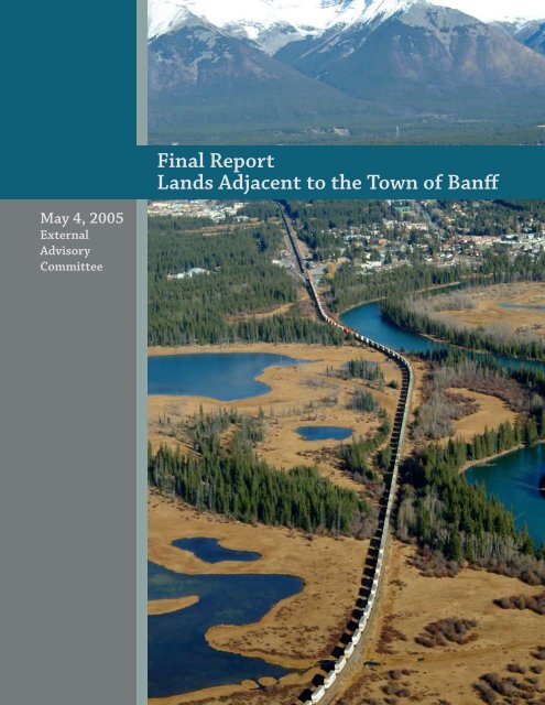
Lands Adjacent to the Town of Banff Final Report
Lands Adjacent to the Town of Banff Final Report
Lands Adjacent to the Town of Banff Final Report

You also want an ePaper? Increase the reach of your titles
YUMPU automatically turns print PDFs into web optimized ePapers that Google loves.
<strong>Final</strong> <strong>Report</strong><br />
<strong>Lands</strong> <strong>Adjacent</strong> <strong>to</strong> <strong>the</strong> <strong>Town</strong> <strong>of</strong> <strong>Banff</strong><br />
May 4, 2005<br />
External<br />
Advisory<br />
Committee
<strong>Lands</strong> <strong>Adjacent</strong> <strong>to</strong> <strong>the</strong> <strong>Town</strong> <strong>of</strong> <strong>Banff</strong><br />
External Advisory Committee<br />
<strong>Town</strong> <strong>of</strong> <strong>Banff</strong><br />
John Stutz, Mayor<br />
Dennis Shuler, former Mayor<br />
Randall McKay, Planning and<br />
Development<br />
Sue Webb, Community Services<br />
Association for Mountain Parks<br />
Protection & Enjoyment<br />
Wanda Bogdane<br />
Julie Canning<br />
Bow Valley Naturalists<br />
Peter Duck<br />
Mike McIvor<br />
Bow Valley Mountain Bike Alliance<br />
Eric Harvie<br />
Stavros Karlos, Technical Biking<br />
Advisor<br />
Public Members<br />
Lorraine Widmer-Carson<br />
Beth Woolley<br />
<strong>Banff</strong> Light Horse Association<br />
Pierre Savard<br />
<strong>Banff</strong> Lake Louise Tourism Bureau<br />
Julie Canning<br />
National Parks Ski Areas<br />
Association<br />
Crosbie Cot<strong>to</strong>n<br />
Under <strong>the</strong> Sleeping Buffalo<br />
Research<br />
Dave Campbell<br />
<strong>Banff</strong> Lake Louise Hotel<br />
Motel Association<br />
Gordon Lozeman<br />
Province <strong>of</strong> Alberta<br />
Steve Donelon<br />
<strong>Banff</strong> National Park<br />
Anne-Marie Buchwald<br />
Mike Murtha
<strong>Lands</strong> <strong>Adjacent</strong> <strong>to</strong> <strong>the</strong> <strong>Town</strong> <strong>of</strong> <strong>Banff</strong><br />
External Advisory Committee<br />
Table <strong>of</strong> Contents:<br />
Introduction...................................................................................................4<br />
An Overview <strong>of</strong> <strong>the</strong> LATB Planning Process................................................5<br />
Considerations...............................................................................................6 - 7<br />
Figure 1..........................................................................................................8<br />
Figure 2..........................................................................................................9<br />
Existing Conditions.......................................................................................10 - 11<br />
Recommendations........................................................................................12 - 24<br />
1. Strategic Goal.................................................................................12 - 13<br />
1.1 Objectives..................................................................12<br />
1.2 Key Actions...............................................................12<br />
2. Fairholme/Johnson Lake Area......................................................14<br />
2.1 Objectives..................................................................14<br />
2.2 Key Actions...............................................................14<br />
3. Cascade Ponds/Two Jack/Minnewanka Area..............................15 - 16<br />
3.1 Objectives.................................................................15<br />
3.2 Key Actions...............................................................15<br />
4. Norquay/Cascade Corridor Area...................................................17 - 18<br />
4.1 Objectives..................................................................17<br />
4.2 Key Actions................................................................17<br />
5. Vermilion Lakes Area....................................................................19 - 20<br />
5.1 Objectives..................................................................19<br />
5.2 Key Actions...............................................................19<br />
6. Sulphur/Sundance Area................................................................21 - 22<br />
6.1 Objectives..................................................................21<br />
6.2 Key Actions...............................................................21<br />
7. Tunnel/Rundle/Indian Grounds Area..........................................23 - 24<br />
7.1 Objectives.......................................................................23<br />
7.2 Key Actions.....................................................................23<br />
8. Implementation............................................................................25
<strong>Lands</strong> <strong>Adjacent</strong> <strong>to</strong> <strong>the</strong> <strong>Town</strong> <strong>of</strong> <strong>Banff</strong><br />
External Advisory Committee<br />
Table <strong>of</strong> Contents:<br />
Appendix<br />
Appendix 1:<br />
Maps that Assisted External Advisory Committee Discussion<br />
Map 1 : Fairholme/Johnson Lake Area................................................2<br />
Map 2 : Cascade Ponds/Two Jack/Minnewanka Area.........................3<br />
Map 3 : Norquay/Cascade Corridor Area..............................................4<br />
Map 4 : Vermilion Lakes Area...............................................................5<br />
Map 5 :Sulphur/Sundance Area............................................................6<br />
Map 6 : Tunnel/Rundle/Indian Grounds Area.....................................7<br />
Map 7 : <strong>Lands</strong> <strong>Adjacent</strong> <strong>to</strong> <strong>the</strong> <strong>Town</strong> <strong>of</strong> <strong>Banff</strong> Overview.....................8<br />
Map 8 : Southside Detail.......................................................................9<br />
Map 9 : <strong>Town</strong>site Ring Trail..................................................................10<br />
Map 10 : Tunnel Bench Map.................................................................11<br />
Map 11 : Tunnel Mountain Bench - Primary and Secondary Trails....12<br />
Map 12 : Trails and Wildlife Corridors.................................................13<br />
Map 13 : Wildlife Corridors...................................................................14<br />
Map 14 : Golf Course Wildlife Corridor................................................15<br />
Map 15 : Vermilion Environmentally Sensitive Site............................16<br />
Map 16 : Global Positioning System Map.............................................17<br />
Map 17 : Topographical Sulphur Map Area..........................................18
<strong>Lands</strong> <strong>Adjacent</strong> <strong>to</strong> <strong>the</strong> <strong>Town</strong> <strong>of</strong> <strong>Banff</strong><br />
External Advisory Committee<br />
Introduction<br />
The management plan for <strong>Banff</strong> National Park was approved in 1997. The plan was amended in 2004 <strong>to</strong> include<br />
an expanded Human Use Management Strategy for all <strong>of</strong> <strong>the</strong> park, with <strong>the</strong> exception <strong>of</strong> <strong>the</strong> <strong>Lands</strong> <strong>Adjacent</strong> <strong>to</strong><br />
<strong>the</strong> <strong>Town</strong> <strong>of</strong> <strong>Banff</strong> (LATB).<br />
This draft human use management strategy, once approved, will become part <strong>of</strong> <strong>the</strong> Human Use Management<br />
Strategy for <strong>the</strong> park. It will be incorporated as an amendment <strong>to</strong> <strong>the</strong> park management plan.<br />
4
<strong>Lands</strong> <strong>Adjacent</strong> <strong>to</strong> <strong>the</strong> <strong>Town</strong> <strong>of</strong> <strong>Banff</strong><br />
External Advisory Committee<br />
An Overview <strong>of</strong> <strong>the</strong> LATB Planning Process<br />
1997 Park Management Plan<br />
2004 Park Human Use Management Strategy<br />
2002 <strong>to</strong> 2005 External Advisory Group prepares recommendations for LATB area<br />
(this document)<br />
2005 Parks Canada review <strong>of</strong> recommendations<br />
2005 Public review <strong>of</strong> recommendations<br />
2005/06 Recommendations revised as necessary<br />
2006 Human Use Management Strategy for LATB<br />
incorporated as Management Plan amendment<br />
5
<strong>Lands</strong> <strong>Adjacent</strong> <strong>to</strong> <strong>the</strong> <strong>Town</strong> <strong>of</strong> <strong>Banff</strong><br />
External Advisory Committee<br />
Considerations<br />
The <strong>Banff</strong> National Park Management Plan reflects legislation in <strong>the</strong><br />
Canada National Parks Act, in particular Section 8.2:<br />
“Maintenance or res<strong>to</strong>ration <strong>of</strong> ecological integrity, through <strong>the</strong> protection<br />
<strong>of</strong> natural resources and natural processes, shall be <strong>the</strong> first priority <strong>of</strong> <strong>the</strong><br />
Minister when considering all aspects <strong>of</strong> <strong>the</strong> management <strong>of</strong> parks.”<br />
“Human use management is <strong>the</strong> direction and guidance <strong>of</strong> people, <strong>the</strong>ir<br />
numbers, <strong>the</strong>ir behaviour, permissible activities and <strong>the</strong> necessary<br />
infrastructure. The objective <strong>of</strong> human use management is <strong>to</strong> allow people <strong>to</strong><br />
enjoy a national park without damaging its ecological integrity.” (<strong>Banff</strong> Park<br />
Management Plan 2004, p.42)<br />
The External Advisory Committee’s recommendations have followed this<br />
direction and also sought opportunities <strong>to</strong> encourage use and enjoyment<br />
in ways that respect ecological integrity.<br />
The location and boundary <strong>of</strong> <strong>the</strong> LATB area are shown in Figures 1 and<br />
2, pages 8 and 9. Because <strong>of</strong> its proximity <strong>to</strong> <strong>the</strong> <strong>Town</strong> <strong>of</strong> <strong>Banff</strong>, this<br />
area has <strong>the</strong> highest levels <strong>of</strong> visi<strong>to</strong>r use and infrastructure in <strong>Banff</strong><br />
National Park. This area is also very important ecologically. Half <strong>of</strong> <strong>the</strong><br />
park’s small area <strong>of</strong> montane habitat is found within <strong>the</strong> LATB boundary.<br />
Major regional wildlife movement corridors encircle <strong>the</strong> <strong>to</strong>wn. The<br />
park’s low elevation wetlands are also found in <strong>the</strong> LATB area. The LATB<br />
area also contains <strong>the</strong> Cave and Basin National His<strong>to</strong>ric Site and many<br />
archaeological and cultural heritage features.<br />
The recommendations in this report were developed by an advisory group comprising numerous interests:<br />
• <strong>Town</strong> <strong>of</strong> <strong>Banff</strong><br />
• <strong>Banff</strong> Light Horse Association<br />
• Bow Valley Mountain Bike Alliance<br />
• Bow Valley Naturalists (local environmental interests)<br />
• <strong>Banff</strong>-Lake Louise Tourism<br />
• National Parks Ski Areas Association<br />
• Under <strong>the</strong> Sleeping Buffalo Research (national environmental interests)<br />
• <strong>Banff</strong>-Lake Louise Hotel/Motel Association<br />
• Province <strong>of</strong> Alberta<br />
• Association for Mountain Parks Protection and Enjoyment<br />
• Residents <strong>of</strong> <strong>the</strong> <strong>Town</strong> <strong>of</strong> <strong>Banff</strong><br />
The challenge facing <strong>the</strong> advisory group has been <strong>to</strong> develop recommendations that protect ecological<br />
conditions and accommodate <strong>the</strong> diverse recreational activities <strong>of</strong> <strong>the</strong> 8,282 residents (<strong>Town</strong> <strong>of</strong> <strong>Banff</strong>, 2004)<br />
and 3.6 million annual visi<strong>to</strong>rs (Parks Canada, 2004).<br />
6
<strong>Lands</strong> <strong>Adjacent</strong> <strong>to</strong> <strong>the</strong> <strong>Town</strong> <strong>of</strong> <strong>Banff</strong><br />
External Advisory Committee<br />
The advisory group has addressed a number <strong>of</strong> important issues:<br />
• Safe crossings <strong>of</strong> <strong>the</strong> Trans Canada Highway and Canadian Pacific<br />
Railway for trail users<br />
• Solutions that encourage human use in appropriate locations<br />
• Human use <strong>of</strong> <strong>the</strong> wildlife crossing structures along <strong>the</strong> TCH<br />
• The need for a formal trail system <strong>to</strong> accommodate all legitimate<br />
users<br />
• The proliferation <strong>of</strong> informal trails that impinge on wildlife habitat<br />
• The need for a formal trail system linking <strong>the</strong> many existing<br />
sections <strong>of</strong> trail and connecting <strong>the</strong> <strong>Town</strong> <strong>to</strong> nearby popular<br />
destinations<br />
• The need for improved trail information and consistent trail<br />
standards<br />
• The need for improved interpretation and public information<br />
throughout <strong>the</strong> LATB area<br />
• Alternatives <strong>to</strong> vehicle use for reaching nearby destinations<br />
• User conflicts on multiple use trails<br />
• The desire for continuing user participation in park management<br />
• The desire for stewardship and volunteer partnerships with<br />
Parks Canada, so that users can actively contribute <strong>to</strong> improved<br />
recreational opportunities<br />
• Recreational use on leasehold land within <strong>the</strong> LATB area<br />
• Quality <strong>of</strong> experience from different points <strong>of</strong> view, for diverse user<br />
groups<br />
• Priorities amongst <strong>the</strong> many projects<br />
In addressing <strong>the</strong>se issues <strong>the</strong> Advisory Committee found it very helpful <strong>to</strong> refer <strong>to</strong> a number <strong>of</strong> maps that<br />
provided visual context <strong>to</strong> <strong>the</strong> range <strong>of</strong> proposals and wildlife information brought <strong>to</strong> <strong>the</strong> committee’s<br />
attention. In order <strong>to</strong> assist readers in a similar manner <strong>the</strong>se maps are included in Appendix 1. However, <strong>the</strong>se<br />
maps do not necessarily represent specific recommendations <strong>of</strong> <strong>the</strong> Advisory Committee. Recommendations<br />
are found in text form in <strong>the</strong> main body <strong>of</strong> this report.<br />
As <strong>the</strong> most intense use <strong>of</strong> <strong>the</strong> LATB area occurs in <strong>the</strong> summer months, <strong>the</strong> advisory group’s<br />
recommendations focus on summer use. The group addressed o<strong>the</strong>r seasonal issues where <strong>the</strong>y were a concern.<br />
7
<strong>Lands</strong> <strong>Adjacent</strong> <strong>to</strong> <strong>the</strong> <strong>Town</strong> <strong>of</strong> <strong>Banff</strong><br />
External Advisory Committee<br />
Figure 1 : <strong>Lands</strong> <strong>Adjacent</strong> <strong>to</strong> <strong>the</strong> <strong>Town</strong> <strong>of</strong> <strong>Banff</strong> Study Area<br />
8
<strong>Lands</strong> <strong>Adjacent</strong> <strong>to</strong> <strong>the</strong> <strong>Town</strong> <strong>of</strong> <strong>Banff</strong><br />
External Advisory Committee<br />
Figure 2 : LATB Planning Units Used<br />
by <strong>the</strong> Advisory Committee<br />
Norquay/Cascade Corridor Area<br />
Cascade Ponds/Two Jack/Minnewanka Area<br />
Vermilion Lakes<br />
Sulphur/Sundance Area<br />
Fairholme/Johnson Lake Area<br />
Tunnel/Rundle/Indian Grounds Area<br />
<strong>Lands</strong> LATB Planning <strong>Adjacent</strong> Units <strong>to</strong> <strong>the</strong> Used <strong>Town</strong> by <strong>the</strong> <strong>of</strong>Advisory <strong>Banff</strong> Study Committee Areas<br />
Scale: 1:85,000<br />
0 0.5 1 1.5 2<br />
Kilometers<br />
<strong>Banff</strong> <strong>Town</strong>site Boundary<br />
<strong>Lands</strong> <strong>Adjacent</strong> Boundary<br />
´<br />
9
<strong>Lands</strong> <strong>Adjacent</strong> <strong>to</strong> <strong>the</strong> <strong>Town</strong> <strong>of</strong> <strong>Banff</strong><br />
External Advisory Committee<br />
Existing Conditions<br />
The 1997 <strong>Banff</strong> National Park Management Plan provides considerable management direction for lands within<br />
<strong>the</strong> LATB area. The purpose <strong>of</strong> <strong>the</strong> LATB strategy is <strong>to</strong> provide more detailed direction within <strong>the</strong> framework <strong>of</strong><br />
<strong>the</strong> park management plan.<br />
The plan recognized <strong>the</strong> significance <strong>of</strong> <strong>the</strong> Cascade wildlife corridor and identified <strong>the</strong> Fairholme and<br />
Vermilion Lakes Environmentally Sensitive Sites. The plan provided specific direction for <strong>the</strong>se areas. The plan<br />
also directed that popular day use areas be upgraded <strong>to</strong> meet <strong>the</strong> needs <strong>of</strong> modern visi<strong>to</strong>rs. Several such areas<br />
exist within <strong>the</strong> LATB area, notably Vermilion Lakes, Johnson Lake and Lake Minnewanka.<br />
The LATB area is <strong>the</strong> most heavily visited part <strong>of</strong> <strong>Banff</strong> National Park, with a wide variety <strong>of</strong> facilities available<br />
(e.g. <strong>the</strong> Upper Hot Springs, Cave and Basin, Mt. Norquay ski area, Sulphur Mountain gondola, <strong>Banff</strong> Springs<br />
golf course, Tunnel Mountain campgrounds, Lake Minnewanka day use area and a dense network <strong>of</strong> trails,<br />
especially in <strong>the</strong> Tunnel Mountain area). The national transportation corridors <strong>of</strong> <strong>the</strong> Trans Canada Highway<br />
(TCH) and Canadian Pacific Railway (CPR) bisect <strong>the</strong> area. O<strong>the</strong>r developments include powerlines, gas<br />
pipelines, dams, gravel pits, sewage treatment facilities, a hydro generating facility and hotels. Dominating<br />
<strong>the</strong> LATB is <strong>the</strong> <strong>Town</strong> <strong>of</strong> <strong>Banff</strong>, an international <strong>to</strong>urism destination with a permanent population <strong>of</strong> more<br />
than 8,000 residents. <strong>Adjacent</strong> <strong>to</strong> <strong>the</strong> LATB area and <strong>the</strong> south boundary <strong>of</strong> <strong>Banff</strong> National Park is <strong>the</strong> <strong>to</strong>wn <strong>of</strong><br />
Canmore, with a current population <strong>of</strong> 12,000 that is expected <strong>to</strong> grow <strong>to</strong> 25,000 in 10 years. All areas <strong>of</strong> <strong>the</strong><br />
LATB contain important ecological characteristics. Four major valleys – Bow, Spray, Forty Mile and Cascade –<br />
converge at <strong>the</strong> centre <strong>of</strong> <strong>the</strong> planning area. They are important regional wildlife corridors. Comparatively rare<br />
montane grassland habitats occur between <strong>the</strong> <strong>Town</strong> and Cascade Mountain and eastwards <strong>to</strong> <strong>the</strong> Fairholme<br />
Bench. The Vermilion Lakes wetland complex is <strong>the</strong> largest in <strong>the</strong> park and provides important habitat for<br />
waterfowl, amphibians, fish and some mammals. The park’s hot springs are concentrated along <strong>the</strong> nor<strong>the</strong>rn<br />
base <strong>of</strong> Sulphur Mountain and provide specialized habitat for plants, fish, amphibians, insects and <strong>the</strong> unique<br />
<strong>Banff</strong> Springs Snail. Many o<strong>the</strong>r individual sites throughout <strong>the</strong> LATB are ecologically significant. All <strong>of</strong> <strong>the</strong><br />
park’s ecosystem stressors are evident in <strong>the</strong> LATB area.<br />
Recreational opportunities include an extensive network <strong>of</strong> formal and informal trails, which are used by<br />
hikers, horse riders, bike riders and cross country skiers. There is also canoeing at Vermilion Lakes and on <strong>the</strong><br />
Bow River; downhill skiing at Mt. Norquay; nature viewing at <strong>the</strong> Cave and Basin Marsh, Vermilion Lakes and<br />
Johnson Lake; and ice climbing at <strong>the</strong> Cascade waterfall.<br />
Much <strong>of</strong> <strong>the</strong> recreational patterns <strong>of</strong> use have developed in a piece-meal and random fashion over <strong>the</strong> last 100<br />
years. For example, <strong>the</strong>re are many kilometres <strong>of</strong> trail but:<br />
• They are <strong>of</strong>ten located in ecologically sensitive areas;<br />
• Some are in wet, muddy areas;<br />
• There are limited connections amongst trails, especially those which originate in <strong>Town</strong>; and<br />
• The TCH and CPR are effective barriers <strong>to</strong> trail connections.<br />
The proliferation <strong>of</strong> informal trails indicates that <strong>the</strong> formal network fails <strong>to</strong> meet <strong>the</strong> needs <strong>of</strong> some users.<br />
The advisory group believes that a more user-friendly network <strong>of</strong> formal trails will help <strong>to</strong> overcome many <strong>of</strong><br />
<strong>the</strong> problems.<br />
10
<strong>Lands</strong> <strong>Adjacent</strong> <strong>to</strong> <strong>the</strong> <strong>Town</strong> <strong>of</strong> <strong>Banff</strong><br />
External Advisory Committee<br />
There is also a need for thorough provision <strong>of</strong> interpretive, directional and appropriate<br />
use/behaviour information <strong>to</strong> improve visi<strong>to</strong>rs’ enjoyment and appreciation <strong>of</strong> <strong>the</strong><br />
surroundings.<br />
From an ecological perspective, human use and infrastructure have been displacing<br />
wildlife and destroying or diminishing habitat for over 100 years. As a result, remaining<br />
areas have become increasingly important and options for alternative wildlife habitat do<br />
not exist. It is important <strong>to</strong> direct human use so that habitat and movement corridors<br />
can continue <strong>to</strong> function. In <strong>the</strong> case <strong>of</strong> large mammals, <strong>the</strong> valley confluence area is a<br />
critical link along <strong>the</strong> Rockies <strong>of</strong> North America and its significance transcends <strong>the</strong> LATB<br />
boundaries.<br />
Recommendations<br />
• Section 1 provides recommendations that apply <strong>to</strong> more than one part <strong>of</strong><br />
<strong>the</strong> LATB area or <strong>to</strong> <strong>the</strong> whole area<br />
• Sections 2-7 provide recommendations for individual geographic areas<br />
represented in Figure 2 page 9<br />
• Section 8 provides recommendations for implementing <strong>the</strong> strategy<br />
11
<strong>Lands</strong> <strong>Adjacent</strong> <strong>to</strong> <strong>the</strong> <strong>Town</strong> <strong>of</strong> <strong>Banff</strong><br />
External Advisory Committee<br />
1. Strategic Goal<br />
To protect ecological integrity and enhance visi<strong>to</strong>r opportunities year-round<br />
1.1 Objectives<br />
1.<br />
2.<br />
3.<br />
4.<br />
5.<br />
6.<br />
7.<br />
8.<br />
9.<br />
10.<br />
11.<br />
To provide high quality visi<strong>to</strong>r experiences in <strong>the</strong> LATB area<br />
To maintain or res<strong>to</strong>re ecological integrity (e.g. by ensuring <strong>the</strong> effectiveness <strong>of</strong><br />
wildlife crossing structures and corridors)<br />
To support improvements in a variety <strong>of</strong> recreational opportunities<br />
To continue <strong>to</strong> provide a variety <strong>of</strong> recreational opportunities and <strong>to</strong> seek, in<br />
a timely way, <strong>to</strong> provide alternatives for those that are displaced by ecological<br />
improvement projects or o<strong>the</strong>r developments<br />
To direct human use <strong>to</strong> already popular locations and <strong>to</strong> develop an improved<br />
access system <strong>to</strong> connect such locations<br />
To identify appropriate activities and facilities for popular locations<br />
To provide opportunities for a variety <strong>of</strong> users <strong>to</strong> safely cross <strong>the</strong> Trans Canada<br />
Highway and <strong>the</strong> CPR tracks<br />
To provide user friendly trail links between <strong>the</strong> <strong>Town</strong> <strong>of</strong> <strong>Banff</strong> and popular<br />
locations<br />
To provide directional information (including maps) that is consistent,<br />
integrated and user friendly<br />
To improve awareness and interpretation <strong>of</strong> <strong>the</strong> ecological and cultural heritage<br />
features <strong>of</strong> <strong>the</strong> LATB area<br />
To provide specific direction <strong>to</strong> Parks Canada for implementing <strong>the</strong> human use<br />
strategy for <strong>the</strong> LATB area<br />
1.2 Key Actions<br />
1.<br />
2.<br />
3.<br />
4.<br />
5.<br />
Provide a trail crossing structure across <strong>the</strong> TCH and CPR, east <strong>of</strong> <strong>Banff</strong> Avenue<br />
and separate from <strong>the</strong> road interchanges<br />
Until <strong>the</strong> trail crossing structure is constructed, direct human use <strong>to</strong> <strong>the</strong><br />
Cascade underpass and provide necessary improvements (NB human use <strong>of</strong><br />
this underpass is already identified in <strong>the</strong> Environmental Assessment for <strong>the</strong><br />
relocation <strong>of</strong> <strong>the</strong> horse corrals)<br />
Direct human use away from all o<strong>the</strong>r wildlife crossing structures<br />
Ensure adequate maintenance <strong>of</strong> park infrastructure that supports visi<strong>to</strong>r<br />
experiences and uses ecologically appropriate materials<br />
Develop a comprehensive plan for <strong>the</strong> interpretation <strong>of</strong> ecological and cultural<br />
heritage features<br />
6. Trails:<br />
•<br />
•<br />
•<br />
•<br />
•<br />
•<br />
Improve trail connectivity by linking existing trails and by providing<br />
new links where needed and ecologically feasible<br />
Provide a multi-use family oriented “ring” trail around <strong>the</strong> <strong>Town</strong> <strong>of</strong><br />
<strong>Banff</strong> by linking existing trails and by providing new links where<br />
needed and ecologically feasible; include a connec<strong>to</strong>r <strong>to</strong> Tunnel<br />
Mountain campgrounds<br />
Provide a commuter trail between <strong>Banff</strong> and adjacent communities<br />
Work with <strong>the</strong> <strong>Town</strong> <strong>of</strong> <strong>Banff</strong> and trail user groups <strong>to</strong> develop a trail<br />
classification system<br />
Manage trails for multiple use unless <strong>the</strong>re are safety or environmental<br />
reasons for limiting and/or separating uses<br />
Incorporate signage indicating trail etiquette, trail classification and<br />
use restrictions<br />
12
<strong>Lands</strong> <strong>Adjacent</strong> <strong>to</strong> <strong>the</strong> <strong>Town</strong> <strong>of</strong> <strong>Banff</strong><br />
External Advisory Committee<br />
•<br />
•<br />
•<br />
7. Signs:<br />
•<br />
•<br />
•<br />
•<br />
Provide more trails, <strong>to</strong> cater <strong>to</strong> a broader range <strong>of</strong> users, including some<br />
that allow for mobility-challenged visi<strong>to</strong>r access<br />
Ensure adequate ongoing maintenance <strong>of</strong> trails and related<br />
infrastructure<br />
Provide trail and site hardening where required <strong>to</strong> maintain visi<strong>to</strong>r<br />
experiences and environmental protection (e.g. Marsh Loop, Hoodoos)<br />
Provide accurate and comprehensive trail information, including<br />
distances, degree <strong>of</strong> difficulty and geographic context<br />
Provide comprehensive information about ecological characteristics<br />
and cultural heritage features<br />
Design a sign plan and map system in conjunction with <strong>the</strong> <strong>Town</strong> <strong>of</strong><br />
<strong>Banff</strong> and user groups and consistent with contiguous parks<br />
Where closures or restrictions are implemented, provide explana<strong>to</strong>ry<br />
material<br />
8. Partner with <strong>the</strong> <strong>Town</strong> <strong>of</strong> <strong>Banff</strong> and ID 9 <strong>to</strong> encourage public transit connections<br />
between hotels, motels and campgrounds and popular locations such as Sulphur<br />
Mountain<br />
9. Continue <strong>to</strong> impose seasonal closures as needed <strong>to</strong> protect sensitive wildlife and<br />
determine whe<strong>the</strong>r o<strong>the</strong>r mitigation measures are required<br />
10. Eliminate trail conflicts between commercial horse operations and o<strong>the</strong>r users<br />
11. Ensure appropriate construction, maintenance and licensing standards for trails<br />
which are used by commercial operations<br />
12. Work in partnership with local opera<strong>to</strong>rs, volunteers, user groups etc., as<br />
applicable, <strong>to</strong> implement <strong>the</strong> recommendations <strong>of</strong> <strong>the</strong> LATB Human Use<br />
Management Strategy<br />
13. Implementation <strong>of</strong> <strong>the</strong> Key Actions must include consistent enforcement <strong>of</strong><br />
regulations, including <strong>the</strong> “dogs on leash” regulation<br />
14. On trails which are heavily used by dog walkers, provide “poop and scoop”<br />
dispensers<br />
13
<strong>Lands</strong> <strong>Adjacent</strong> <strong>to</strong> <strong>the</strong> <strong>Town</strong> <strong>of</strong> <strong>Banff</strong><br />
External Advisory Committee<br />
2. Fairholme/Johnson Lake Area (Appendix 1, Map 1, page 2)<br />
Location<br />
• East side <strong>of</strong> TCH from <strong>the</strong> East Gate <strong>to</strong> Johnson Lake<br />
• Eastern boundary is <strong>the</strong> base <strong>of</strong> <strong>the</strong> Fairholme Range<br />
Ecological Characteristics<br />
• Fairholme Bench is designated as an Environmentally Sensitive Site because it is <strong>the</strong> largest intact<br />
expanse <strong>of</strong> montane habitat remaining in <strong>the</strong> Bow Valley<br />
• As a result <strong>of</strong> recent fires, its importance as wildlife habitat will increase in <strong>the</strong> future<br />
• Johnson Lake and adjacent wetlands provide important aquatic habitats<br />
Recreational Characteristics<br />
• Johnson Lake is readily accessible from <strong>Town</strong> and is a popular day use area with a water focus<br />
• Extensive trail network in <strong>the</strong> vicinity <strong>of</strong> <strong>the</strong> lake, connecting <strong>to</strong> areas <strong>to</strong> <strong>the</strong> north<br />
• A voluntary closure limits use <strong>of</strong> <strong>the</strong> Fairholme Environmentally Sensitive Site<br />
Human Use Issues<br />
• A lack <strong>of</strong> trail connections across <strong>the</strong> TCH <strong>to</strong> <strong>Town</strong><br />
• Unsanctioned use <strong>of</strong> <strong>the</strong> Powerhouse wildlife crossing<br />
• A proliferation <strong>of</strong> informal trails at Johnson Lake<br />
• Impacts <strong>of</strong> heavy use at <strong>the</strong> lake<br />
• Opportunities for improved interpretation<br />
• Dissatisfaction with <strong>the</strong> voluntary nature <strong>of</strong> <strong>the</strong> Environmentally Sensitive Site closure<br />
2.1 Objectives<br />
1.<br />
2.<br />
3.<br />
To continue <strong>to</strong> manage <strong>the</strong> Johnson Lake area as a popular location for daytime<br />
activities<br />
To improve trail connections <strong>to</strong> Johnson Lake from <strong>the</strong> <strong>Town</strong> <strong>of</strong> <strong>Banff</strong> and from<br />
<strong>the</strong> Cascade/Two Jack/Minnewanka areas<br />
To maintain low human use <strong>of</strong> <strong>the</strong> Fairholme Environmentally Sensitive Site<br />
2.2 Key Actions<br />
1.<br />
2.<br />
3.<br />
4.<br />
5.<br />
6.<br />
Provide and improve facilities that support appropriate levels <strong>of</strong> use around<br />
Johnson Lake. Recognized summer uses include beach activities, swimming,<br />
canoeing, fishing, trail use, picnicking, nature viewing. Facilities include<br />
<strong>the</strong> Carver cabin, a trail system, a parking lot, picnic tables, washrooms, and<br />
interpretive signage<br />
Encourage use <strong>of</strong> formal trails by clearly defining, signing and maintaining<br />
<strong>the</strong>m, making improvements where needed. Discourage use <strong>of</strong> informal trails<br />
Improve information and interpretation in <strong>the</strong> Johnson Lake area, notably<br />
about <strong>the</strong> montane ecoregion and prescribed fires<br />
Manage <strong>the</strong> wildlife viewing area at <strong>the</strong> beaver ponds in a way that respects<br />
natural components <strong>of</strong> <strong>the</strong> site<br />
Designate a trail link from <strong>the</strong> <strong>Town</strong> <strong>of</strong> <strong>Banff</strong> <strong>to</strong> Johnson Lake via <strong>the</strong> proposed<br />
crossing structure (see 1.2.1) and “Water<strong>to</strong>wer trail”, with connections <strong>to</strong> <strong>the</strong><br />
Two Jack and Minnewanka areas<br />
Continue <strong>to</strong> minimize and <strong>to</strong> moni<strong>to</strong>r use in <strong>the</strong> Fairholme Environmentally<br />
Sensitive Site<br />
14
<strong>Lands</strong> <strong>Adjacent</strong> <strong>to</strong> <strong>the</strong> <strong>Town</strong> <strong>of</strong> <strong>Banff</strong><br />
External Advisory Committee<br />
3. Cascade Ponds/Two Jack/Minnewanka Area (Appendix 1, map 2, page 3)<br />
Location<br />
• Valley <strong>of</strong> Cascade Creek from <strong>the</strong> TCH <strong>to</strong> Lake Minnewanka<br />
Ecological Characteristics<br />
• Montane habitat but fragmented by <strong>the</strong> many facilities and <strong>the</strong> reduced water flow in Cascade<br />
Creek<br />
• mportant link in <strong>the</strong> north/south regional wildlife corridor connecting <strong>the</strong> upper Cascade valley<br />
and Fairholme Bench<br />
Recreational Characteristics<br />
• Popular driving area<br />
• Busy campground at Two Jack<br />
• Popular day use areas at Cascade Ponds, Two Jack Lake and, particularly, Lake Minnewanka<br />
• Interpretation <strong>of</strong> his<strong>to</strong>ric features at Bankhead<br />
• Departure point for cruises and boating on Lake Minnewanka<br />
• Extensive system <strong>of</strong> trails<br />
Human Use Issues<br />
• Lack <strong>of</strong> trail connection across <strong>the</strong> TCH <strong>to</strong> <strong>Town</strong><br />
• Considerable human use <strong>of</strong> Cascade wildlife underpass; horse use is directed <strong>to</strong> this crossing<br />
• No continuous trail from Cascade Ponds <strong>to</strong> Two Jack campground and Lake Minnewanka<br />
• Potential for increasing water flow in Cascade Creek, with possible interpretation <strong>of</strong> aquatic<br />
environments<br />
• Opportunities for improved interpretation and information at Lake Minnewanka<br />
• Redevelopment <strong>of</strong> <strong>the</strong> Minnewanka day use area required, especially new washrooms for summer<br />
and winter<br />
• Congestion on <strong>the</strong> trail <strong>to</strong> Stewart Canyon which is heavily used by hikers and mountain bike<br />
riders<br />
3.1 Objectives<br />
1.<br />
2.<br />
3.<br />
4.<br />
5.<br />
To provide a slow-paced driving opportunity <strong>to</strong> a variety <strong>of</strong> facilities<br />
To minimize conflicts between mo<strong>to</strong>rized and non-mo<strong>to</strong>rized activities and<br />
amongst user groups<br />
To provide a trail link between <strong>the</strong> <strong>Town</strong> <strong>of</strong> <strong>Banff</strong> and Lake Minnewanka<br />
To work <strong>to</strong>wards res<strong>to</strong>ring water flows in Cascade Creek and developing<br />
interpretive opportunities for aquatic habitats<br />
To continue <strong>to</strong> manage <strong>the</strong> Lake Minnewanka area as a popular location for<br />
daytime activities<br />
3.2 Key Actions<br />
1. Provide and improve facilities that support appropriate levels <strong>of</strong> use around<br />
Lake Minnewanka. Recognized use includes mo<strong>to</strong>rized and non-mo<strong>to</strong>rized<br />
boating, scuba diving, fishing, commercial guiding operations, group <strong>to</strong>urs,<br />
trail use, picnicking, cross-country skiing, snowshoeing, and ice skating and<br />
nature viewing. Facilities include group picnic facilities (tables and shelters),<br />
a commercial <strong>to</strong>ur boat operation, washrooms, boat docks operated by <strong>the</strong><br />
licensee, a boat launch, a scuba launch, parking lots, and a trail system<br />
2. Provide washrooms at <strong>the</strong> Lake Minnewanka day use area during <strong>the</strong> winter<br />
3. Formalize and improve vehicle pull-<strong>of</strong>fs and viewpoints along <strong>the</strong> loop road <strong>to</strong><br />
reduce environmental impact and improve safety<br />
15
<strong>Lands</strong> <strong>Adjacent</strong> <strong>to</strong> <strong>the</strong> <strong>Town</strong> <strong>of</strong> <strong>Banff</strong><br />
External Advisory Committee<br />
4. Provide a trail connection between Cascade Ponds and Lake Minnewanka<br />
• Preferred route is <strong>to</strong> connect <strong>the</strong> existing trail between Cascade Ponds<br />
and Lower Bankhead <strong>to</strong> Lake Minnewanka via <strong>the</strong> trail connection<br />
between Upper Bankhead and <strong>the</strong> Cascade fire road and extension <strong>to</strong><br />
Minnewanka<br />
• Trackset from Cascade ponds <strong>to</strong> Minnewanka via Lower Bankhead in<br />
winter<br />
5. Investigate interpretive opportunities for aquatic habitats in conjunction with<br />
possible increases in water flows through <strong>the</strong> Cascade gravel pits<br />
16
<strong>Lands</strong> <strong>Adjacent</strong> <strong>to</strong> <strong>the</strong> <strong>Town</strong> <strong>of</strong> <strong>Banff</strong><br />
External Advisory Committee<br />
4. Norquay/Cascade Corridor Area (Appendix 1, Map 3, page 4)<br />
Location:<br />
• Unit extends along <strong>the</strong> north side <strong>of</strong> <strong>the</strong> TCH from <strong>the</strong> Minnewanka road <strong>to</strong> <strong>the</strong> Bow Valley<br />
Parkway<br />
• Unit extends south <strong>to</strong> TCH, north <strong>to</strong> LATB boundary, east <strong>to</strong> Minnewanka road, and west <strong>to</strong> Bow<br />
Valley Parkway<br />
• Unit includes Mt. Norquay ski area<br />
Ecological Characteristics<br />
• Montane grasslands<br />
• Important wildlife corridor, including wildlife crossings under TCH<br />
• Artificial impoundment on 40 Mile Creek but with unimpeded through-flow <strong>of</strong> water<br />
• Sheep population along <strong>the</strong> Norquay road; bears use <strong>the</strong> ski area<br />
Recreational Characteristics<br />
• Downhill skiing at Mt. Norquay<br />
• Norquay road is a popular driving route, especially <strong>to</strong> <strong>the</strong> viewpoint overlooking <strong>the</strong> <strong>Town</strong><br />
• Trailheads for Cory/Edith and 40 Mile/Cascade Amphi<strong>the</strong>atre trails<br />
• Mountain bike trails on S<strong>to</strong>ney Squaw Mountain<br />
• Ice climbing at Cascade waterfall<br />
• Informal use <strong>of</strong> <strong>the</strong> airstrip for dog walking and golf practice<br />
• Picnicking at Fireside Day Use Area<br />
Human Use Issues<br />
•<br />
•<br />
•<br />
•<br />
•<br />
•<br />
•<br />
Unsanctioned use <strong>of</strong> wildlife crossings<br />
Late spring opening <strong>of</strong> Fireside picnic site<br />
Uncertainty regarding potential summer use <strong>of</strong> Mt. Norquay ski area<br />
Mt. Norquay ski area may soon begin a long-range plan that would include a public discussion <strong>of</strong><br />
proposals for summer use<br />
S<strong>to</strong>ney Squaw mountain bike trails lack connection <strong>to</strong> <strong>Town</strong><br />
Separate process is addressing decommissioning and future management <strong>of</strong> <strong>the</strong> airstrip<br />
Past unsanctioned mountain biking that formerly occurred on <strong>the</strong> South-facing slopes <strong>of</strong> Mt.<br />
Norquay has been directed <strong>to</strong> designated trails; providing more mountain biking opportunities,<br />
including technical routes, has been discussed as part <strong>of</strong> <strong>the</strong> LATB process<br />
4.1 Objectives<br />
1.<br />
2.<br />
3.<br />
To manage for effective wildlife movements in <strong>the</strong> Cascade corridor<br />
To res<strong>to</strong>re natural water flows in Forty Mile Creek<br />
To continue <strong>to</strong> manage <strong>the</strong> Mt. Norquay area as a popular location for visi<strong>to</strong>r<br />
activities<br />
4.2 Key Actions<br />
1. Provide facilities that support appropriate levels <strong>of</strong> use at Mt. Norquay.<br />
Recognized use includes winter activities, trail use, nature viewing, slow-paced<br />
driving opportunities. Facilities include a formalized trail system, viewpoints,<br />
summer washrooms and an access road<br />
2. Provide trailhead facilities for orientation <strong>to</strong> S<strong>to</strong>ney Squaw, Cascade<br />
Amphi<strong>the</strong>atre, and Forty Mile trails: maps, washrooms, information kiosk, and<br />
garbage disposal<br />
3. Direct use away from Cascade wildlife corridor (airstrip area and buffalo<br />
paddock) by providing alternative trails with <strong>the</strong> exception <strong>of</strong> continued,<br />
formalized access <strong>to</strong> Cascade Falls subject <strong>to</strong> corridor effectiveness moni<strong>to</strong>ring<br />
17
<strong>Lands</strong> <strong>Adjacent</strong> <strong>to</strong> <strong>the</strong> <strong>Town</strong> <strong>of</strong> <strong>Banff</strong><br />
External Advisory Committee<br />
4. Provide a pedestrian and bike route under <strong>the</strong> Trans Canada Highway at <strong>the</strong><br />
Five Mile interchange, <strong>to</strong> provide links <strong>to</strong> <strong>the</strong> Bow Valley Parkway, Fireside<br />
Day-Use area, and <strong>the</strong> Cory/Edith trails from <strong>the</strong> Vermilion Lakes area (see also<br />
5.2.7)<br />
5. Remove Forty Mile dam and associated facilities and rehabilitate <strong>to</strong> a natural<br />
condition<br />
6. S<strong>to</strong>ney Squaw Trail:<br />
a) Formalize <strong>the</strong> connection between <strong>the</strong> upper and lower S<strong>to</strong>ny Squaw<br />
mountain bike trails<br />
b) Provide a safe trail connection <strong>to</strong> <strong>Town</strong> <strong>of</strong> <strong>Banff</strong>:<br />
•<br />
•<br />
Preferred route: provide a connection via <strong>the</strong> 40 Mile Creek<br />
crossing under <strong>the</strong> TCH and a simple bridge across 40 Mile<br />
Creek, <strong>the</strong>n <strong>to</strong> <strong>the</strong> Compound Road<br />
Alternate route: construct trail along <strong>the</strong> North part <strong>of</strong> <strong>the</strong><br />
Highway near <strong>the</strong> fence back <strong>to</strong> <strong>the</strong> Norquay road<br />
7. Allow continued public use <strong>of</strong> <strong>the</strong> Mt. Norquay road; determine <strong>the</strong> future <strong>of</strong> <strong>the</strong><br />
road in conjunction with <strong>the</strong> long range plan for <strong>the</strong> ski area<br />
8. Open <strong>the</strong> Fireside picnic site as early in <strong>the</strong> spring as snow conditions and<br />
wildlife movement permit<br />
9. Continue <strong>to</strong> recognize that <strong>the</strong> south facing slopes <strong>of</strong> Mt. Norquay are not an<br />
appropriate location for mountain biking<br />
10. Explore <strong>the</strong> feasibility and <strong>the</strong> environmental and social implications <strong>of</strong> an<br />
aerial tramway system from <strong>the</strong> vicinity <strong>of</strong> <strong>the</strong> <strong>Town</strong> <strong>of</strong> <strong>Banff</strong> <strong>to</strong> <strong>the</strong> Mt.<br />
Norquay ski area<br />
18
<strong>Lands</strong> <strong>Adjacent</strong> <strong>to</strong> <strong>the</strong> <strong>Town</strong> <strong>of</strong> <strong>Banff</strong><br />
External Advisory Committee<br />
5. Vermilion Lakes Area (Appendix 1, Map 4, page 5)<br />
Location<br />
• Bounded by <strong>the</strong> TCH, Bow River and Norquay road<br />
• Unit extends north <strong>to</strong> TCH, south and west <strong>to</strong> <strong>the</strong> Bow River, and east <strong>to</strong> <strong>the</strong> Norquay road<br />
Ecological Characteristics<br />
• Vermilion Lakes are a part <strong>of</strong> <strong>the</strong> larger Vermilion Wetlands, which extend beyond <strong>the</strong> LATB<br />
boundary <strong>to</strong> include areas between <strong>the</strong> Trans Canada Highway and <strong>the</strong> Bow Valley Parkway (e.g.<br />
Backswamp)<br />
• Most important wetland in <strong>the</strong> park; designated an Environmentally Sensitive Site<br />
• Habitat for a wide variety <strong>of</strong> species, including seasonal use by migrating waterfowl<br />
• Water flows impeded by CPR and TCH infrastructure<br />
• Provides wildlife connection across <strong>the</strong> Bow Valley<br />
Recreational Characteristics<br />
• Very popular year-round driving destination, adjacent <strong>to</strong> <strong>Town</strong><br />
• Popular for pho<strong>to</strong>graphy and wildlife viewing<br />
• Most popular location for canoeing close <strong>to</strong> <strong>Town</strong><br />
• Fenland trail well used<br />
• Some ice skating<br />
Human Use Issues<br />
• Management plan prescribes road closure at First Lake<br />
• Some unsanctioned use <strong>of</strong> Edith wildlife crossing <strong>to</strong> access Cory/Edith trailheads<br />
• Road is in disrepair<br />
• Self-guided interpretation needs <strong>to</strong> be redeveloped for Fenland trail<br />
• Riparian impacts (trampling <strong>of</strong> shoreline vegetation)<br />
• Unknown impacts <strong>of</strong> canoeing, especially on waterfowl<br />
• Potential for trail connection <strong>to</strong> Bow Valley Parkway and on <strong>to</strong> Lake Louise<br />
• Potential for trail connection around Vermilion Lakes, connecting with <strong>the</strong> existing Sundance and<br />
Healy Creek trails<br />
• An easily accessed point in <strong>the</strong> park <strong>to</strong> experience nature and <strong>of</strong>fers an excellent opportunity <strong>to</strong><br />
connect visi<strong>to</strong>rs with <strong>the</strong> nature that surrounds <strong>the</strong>m<br />
• Great opportunity for improved interpretation and information<br />
5.1 Objectives<br />
1.<br />
2.<br />
3.<br />
To continue <strong>to</strong> manage <strong>the</strong> Vermilion Lakes area as a popular location, adjacent<br />
<strong>to</strong> <strong>the</strong> <strong>Town</strong> <strong>of</strong> <strong>Banff</strong>, for daytime activities<br />
To manage <strong>the</strong> Vermilion wetlands as one <strong>of</strong> <strong>the</strong> most significant places for<br />
nature-based experiences in <strong>the</strong> park and <strong>to</strong> recognize it is also a unique and<br />
important aquatic environment in <strong>Banff</strong> National Park<br />
To implement alternate means for humans <strong>to</strong> cross <strong>the</strong> TCH in order <strong>to</strong> direct<br />
use away from wildlife underpasses (see 1.2.3)<br />
5.2 Key Actions<br />
1.<br />
Provide facilities that support appropriate levels <strong>of</strong> use at Vermilion Lakes.<br />
Recognized use includes slow-paced driving, canoeing, trail use, nature viewing, and<br />
skating. Facilities include a hard surfaced road, connections <strong>to</strong> a formalized trail<br />
system, viewpoints, and washrooms<br />
19
<strong>Lands</strong> <strong>Adjacent</strong> <strong>to</strong> <strong>the</strong> <strong>Town</strong> <strong>of</strong> <strong>Banff</strong><br />
External Advisory Committee<br />
2.<br />
3.<br />
4.<br />
5.<br />
6.<br />
7.<br />
8.<br />
9.<br />
10.<br />
11.<br />
Develop and implement an interpretive plan for <strong>the</strong> Vermilion Lakes area that<br />
focuses on aquatic ecosystems in <strong>the</strong> montane ecoregion<br />
Provide an improved trail link across <strong>the</strong> CPR tracks, from <strong>the</strong> <strong>Town</strong> <strong>of</strong> <strong>Banff</strong><br />
riverside trail <strong>to</strong> Fenland Trail and Vermilion Lakes<br />
Redevelop Fenland trail as an easily accessible interpretive opportunity<br />
Maintain mo<strong>to</strong>rized vehicle access along Vermilion Lakes road <strong>to</strong> Third Lake 1 and<br />
improve <strong>the</strong> road surface using non-polluting materials<br />
Improve pull-<strong>of</strong>fs, as needed, at appropriate locations along <strong>the</strong> road<br />
Provide a designated trail west from Third Lake <strong>to</strong> <strong>the</strong> Trans Canada Highway at<br />
Five Mile and provide access under <strong>the</strong> bridge <strong>to</strong> connect <strong>the</strong> trail <strong>to</strong> <strong>the</strong> Bow Valley<br />
Parkway (see also 4.2.4)<br />
Investigate <strong>the</strong> feasibility <strong>of</strong> providing a designated trail between <strong>the</strong> Healy Creek<br />
trailhead and <strong>the</strong> Five Mile TCH crossing, close <strong>to</strong> <strong>the</strong> TCH fence (see also 6.2.16)<br />
Ensure that facilities avoid fur<strong>the</strong>r encroachment on <strong>the</strong> aquatic environment and<br />
on <strong>the</strong> Christensen archaeological site; res<strong>to</strong>re degraded sites<br />
Work with <strong>the</strong> canoe rental company based in <strong>the</strong> <strong>Town</strong> <strong>of</strong> <strong>Banff</strong> <strong>to</strong> provide clients<br />
with appropriate information about <strong>the</strong> sensitivity <strong>of</strong> nesting and riparian areas<br />
at Vermilion Lakes; develop a publication containing a code <strong>of</strong> conduct that can be<br />
made widely available <strong>to</strong> canoeists<br />
Research impacts <strong>of</strong> aquatic-based recreational activity on aquatic ecosystems.<br />
Use research <strong>to</strong> develop and implement an aquatic human use plan for Vermilion<br />
wetlands<br />
1 Dissenting opinion: Under The Sleeping Buffalo Research<br />
20
<strong>Lands</strong> <strong>Adjacent</strong> <strong>to</strong> <strong>the</strong> <strong>Town</strong> <strong>of</strong> <strong>Banff</strong><br />
External Advisory Committee<br />
6. Sulphur/Sundance Area (Appendix 1, Map 5, page 6)<br />
Location<br />
• West <strong>of</strong> <strong>Town</strong> along <strong>the</strong> south side <strong>of</strong> <strong>the</strong> Bow River<br />
• South <strong>of</strong> <strong>Town</strong> along <strong>the</strong> Spray River valley<br />
• Includes Cave and Basin area, Sundance Canyon, Sulphur Mountain<br />
Ecological Characteristics<br />
• Hot springs and associated specialized habitats<br />
• Cave and Basin marsh is influenced by warm water flows (Zone 1 area)<br />
• Numerous rare species and unique, endangered snail species<br />
• Important wildlife corridor along north and nor<strong>the</strong>ast sides <strong>of</strong> Sulphur Mountain; designated as<br />
an Environmentally Sensitive Site and closed <strong>to</strong> human use<br />
• Spray valley is a wildlife movement corridor and a cross-valley connection between Sulphur<br />
Mountain and <strong>the</strong> golf course<br />
Recreational Characteristics<br />
• Popular, heavily used trails <strong>to</strong> Sundance Canyon and in <strong>the</strong> Spray valley<br />
• Commercial horse use is concentrated in this unit<br />
• Variety <strong>of</strong> low elevation trails which receive early season use<br />
• Much use by local people<br />
• Heavy visi<strong>to</strong>r concentrations at Sulphur Mountain gondola, Upper Hot Springs and Cave and<br />
Basin<br />
• Cross country skiing on <strong>the</strong> Sundance and Spray valley trails<br />
Human Use Issues<br />
• Conflicts with commercial horse groups on several trails<br />
• Proliferation <strong>of</strong> informal trails<br />
• Impacts on sensitive ecological areas, especially near <strong>the</strong> Cave and Basin<br />
• Opportunities for improved directional and interpretive information<br />
• Potential trail connection from Sundance Canyon <strong>to</strong> Vermilion Lakes around <strong>the</strong> wetlands<br />
• Spray valley trails are connected <strong>to</strong> <strong>the</strong> popular Goat Creek mountain bike trail<br />
• Impacted sensitive wetland area adjacent <strong>to</strong> Mountain Avenue<br />
• No access <strong>to</strong> <strong>the</strong> Wheeler House (in <strong>the</strong> Sulphur Mountain wildlife corridor which is closed <strong>to</strong><br />
human use)<br />
6.1 Objectives<br />
1.<br />
2.<br />
3.<br />
4.<br />
5.<br />
To protect <strong>the</strong> sensitive wildlife corridors and wetland areas<br />
To provide a variety <strong>of</strong> trail opportunities<br />
To reduce conflict between commercial horse groups and o<strong>the</strong>r trail users<br />
To improve <strong>the</strong> protection and presentation <strong>of</strong> cultural heritage resources<br />
To continue <strong>to</strong> manage Sulphur Mountain and Sundance areas as popular<br />
locations for a variety <strong>of</strong> visi<strong>to</strong>r activities<br />
6.2 Key Actions<br />
1. Provide facilities that support appropriate levels <strong>of</strong> use in <strong>the</strong> Sulphur/Sundance area.<br />
Recognized uses include gondola sightseeing, trail use, visiting heritage attractions,<br />
bathing at <strong>the</strong> Upper Hot Springs (daytime and evening), cross-country skiing, and<br />
nature viewing; Facilities include washrooms, trailhead kiosks, trails, picnic facilities and<br />
access <strong>to</strong> interpretive information<br />
21
<strong>Lands</strong> <strong>Adjacent</strong> <strong>to</strong> <strong>the</strong> <strong>Town</strong> <strong>of</strong> <strong>Banff</strong><br />
External Advisory Committee<br />
2. Work with partners <strong>to</strong> extend public transit <strong>to</strong> <strong>the</strong> Sulphur Mountain/Upper Hot<br />
Springs area<br />
3. Continue <strong>the</strong> restriction on human use in <strong>the</strong> Middle Springs Wildlife Corridor<br />
• Designate <strong>the</strong> wetland between Mountain Avenue and Valleyview as an<br />
Environmentally Sensitive Site<br />
4. Retain existing Upper Bridle Trail and create a new adjacent parallel trail for separate<br />
users<br />
5. Formalize a limited number <strong>of</strong> existing trails, including a separate trail for commercial<br />
horse use, through <strong>the</strong> proposed Environmentally Sensitive Site<br />
6. Formalize and upgrade <strong>the</strong> trail system connecting <strong>the</strong> <strong>Banff</strong> Springs Hotel area and <strong>the</strong><br />
Sulphur Mountain/Upper Hot Springs area, creating connections with o<strong>the</strong>r trails in <strong>the</strong><br />
area<br />
•<br />
•<br />
•<br />
•<br />
Provide directional signs<br />
Provide designated trails for horses and mountain bikes connecting <strong>the</strong> <strong>Banff</strong><br />
Springs Hotel area and <strong>the</strong> Upper Hot Springs area<br />
Formalize and clearly sign <strong>the</strong> designated pedestrian trail parallel <strong>to</strong> Mountain<br />
Avenue, connecting <strong>the</strong> <strong>Town</strong> <strong>of</strong> <strong>Banff</strong> and <strong>the</strong> Sulphur Mountain/Upper Hot<br />
Springs area<br />
Consolidate trailheads (<strong>to</strong> Spray River, Upper Hot Springs, Upper Bridle/Cave<br />
and Basin) in <strong>the</strong> Spray River parking lot<br />
7. Provide picnic tables, <strong>to</strong>ilets, and interpretive messages at both <strong>the</strong> trailhead and at<br />
kilometre 6 <strong>of</strong> <strong>the</strong> Spray River loop trail<br />
8. Provide new trailhead signs, including kilometre markings, for <strong>the</strong> Sulphur Mountain<br />
trail; improve <strong>the</strong> identification <strong>of</strong> trailheads in <strong>the</strong> parking lots<br />
9. Address user conflicts and safety concerns on <strong>the</strong> Tower 1 Trail (from <strong>the</strong> Sulphur<br />
Mountain gondola base <strong>to</strong> <strong>the</strong> Spray River trail) by redesigning, improving, and<br />
modifying <strong>the</strong> trail.<br />
10. Determine <strong>the</strong> level <strong>of</strong> conflict between commercial horse groups and o<strong>the</strong>r users on<br />
<strong>the</strong> Spray River trail and work with stakeholders <strong>to</strong> identify options <strong>to</strong> resolve safety<br />
concerns<br />
11. As part <strong>of</strong> <strong>the</strong> National His<strong>to</strong>ric Site Management Planning process, upgrade exhibits<br />
and clarify messaging at <strong>the</strong> Cave and Basin National His<strong>to</strong>ric Site<br />
12. Re-evaluate heritage value <strong>of</strong> <strong>the</strong> Wheeler House and investigate <strong>of</strong>f-site interpretive<br />
possibilities<br />
13. As part <strong>of</strong> <strong>the</strong> management planning process for <strong>the</strong> Cave and Basin, redesign <strong>the</strong> trail<br />
configuration in <strong>the</strong> Cave and Basin area <strong>to</strong> improve trail connectivity, minimize user<br />
conflicts, and reduce environment impact<br />
•<br />
•<br />
•<br />
•<br />
Redesign <strong>the</strong> parking lot <strong>to</strong> take advantage <strong>of</strong> excess vehicle capacity<br />
Create a one-way entrance road along <strong>the</strong> north side or direct entrance through<br />
one <strong>of</strong> <strong>the</strong> easterly entrances<br />
Reclaim roadway for trail use <strong>to</strong> accommodate separation <strong>of</strong> users<br />
Direct commercial horse use away from sensitive Zone 1 areas<br />
Provide signage <strong>to</strong> clarify trail connections and designated uses<br />
•<br />
14. Determine <strong>the</strong> level <strong>of</strong> conflict between commercial horse groups and o<strong>the</strong>r users on<br />
<strong>the</strong> Marsh Loop trail and work with stakeholders <strong>to</strong> identify options, including trail<br />
hardening, <strong>to</strong> resolve safety and trail maintenance concerns.<br />
15. Support a cross-country ski track along <strong>the</strong> Bow River from <strong>the</strong> canoe docks <strong>to</strong> <strong>the</strong><br />
Sundance Canyon and Healy Creek trails<br />
16. Investigate <strong>the</strong> feasibility <strong>of</strong> providing a designated trail between <strong>the</strong> Healy Creek<br />
trailhead and <strong>the</strong> Five Mile TCH crossing, close <strong>to</strong> <strong>the</strong> TCH fence (see also 5.2.8)<br />
22
<strong>Lands</strong> <strong>Adjacent</strong> <strong>to</strong> <strong>the</strong> <strong>Town</strong> <strong>of</strong> <strong>Banff</strong><br />
External Advisory Committee<br />
7. Tunnel/Rundle/Indian Grounds Area (Appendix 1, Map 6, page 7)<br />
Location<br />
• West <strong>of</strong> <strong>the</strong> TCH from <strong>the</strong> East Gate <strong>to</strong> <strong>Town</strong><br />
• Includes <strong>the</strong> base <strong>of</strong> Rundle Mountain and <strong>the</strong> golf course<br />
• Includes area surrounding Tunnel Mountain<br />
• Includes Indian Grounds<br />
Ecological Characteristics<br />
• Dry montane habitats at Tunnel Mountain and <strong>the</strong> Indian Grounds<br />
• Wildlife corridor along <strong>the</strong> base <strong>of</strong> Rundle Mountain, in <strong>the</strong> golf course area<br />
• Important wildlife connections eastward via TCH underpasses<br />
• Riparian habitat along <strong>the</strong> Bow River and Cascade Creek<br />
Recreational Characteristics<br />
• Heavy, concentrated summer trail use at Tunnel Mountain<br />
• Large campgrounds at Tunnel Mountain<br />
• Rafting and canoeing on <strong>the</strong> Bow River<br />
• Golfing<br />
• Private horse corrals are located in this unit<br />
• Climbing on Tunnel and Rundle Mountains<br />
• Popular day use area at <strong>the</strong> Hoodoos viewpoint<br />
• Some use <strong>of</strong> Indian Ground during Indian Days<br />
Human Use Issues<br />
• Lack <strong>of</strong> trail connections across TCH and CPR and <strong>to</strong> areas west <strong>of</strong> <strong>Town</strong><br />
• Need for commuter trail between <strong>Banff</strong> and Canmore<br />
• Proliferation <strong>of</strong> informal trails<br />
• Desire for technical mountain bike trails<br />
• Need for trail connection between <strong>to</strong>wn and Tunnel Mountain campgrounds and motels<br />
• Trail impacts on montane vegetation<br />
• Need for improved directional and interpretive information<br />
• Need for a network <strong>of</strong> designated, signed and maintained trails<br />
7.1 Objectives<br />
1.<br />
2.<br />
3.<br />
4.<br />
5.<br />
7.2 Key Actions<br />
To provide a network <strong>of</strong> multi use trails<br />
To provide trail connections between Tunnel Mountain facilities and <strong>the</strong> <strong>Town</strong><br />
<strong>of</strong> <strong>Banff</strong><br />
To provide trail connection across TCH and CPR<br />
To continue <strong>to</strong> manage <strong>the</strong> Tunnel Mountain area as a popular location<br />
To protect special natural resources such as Indian Grounds grasslands and <strong>the</strong><br />
Hoodoos viewpoint<br />
1.<br />
2.<br />
3.<br />
4.<br />
Centralize trailhead information at Bow Falls/Spray Bridge area that directs<br />
users <strong>to</strong> trails in vicinity<br />
Provide a trail connection between <strong>the</strong> <strong>Town</strong> <strong>of</strong> <strong>Banff</strong> and Cascade Ponds via <strong>the</strong><br />
proposed trail crossing structure (see 1.2.1), <strong>to</strong> connect with <strong>the</strong> proposed trail<br />
from Cascade Ponds <strong>to</strong> Lake Minnewanka (see 3.2.4)<br />
As part <strong>of</strong> <strong>the</strong> “ring” trail (see 1.2.6) designate a trail across <strong>the</strong> Indian Grounds,<br />
close <strong>to</strong> <strong>the</strong> west side <strong>of</strong> <strong>Banff</strong> Avenue but within <strong>the</strong> trees so as <strong>to</strong> avoid <strong>the</strong><br />
sensitive grassland areas<br />
Relocate Dawson monument <strong>to</strong> improve visi<strong>to</strong>r access and appreciation<br />
23
<strong>Lands</strong> <strong>Adjacent</strong> <strong>to</strong> <strong>the</strong> <strong>Town</strong> <strong>of</strong> <strong>Banff</strong><br />
External Advisory Committee<br />
5. Provide an integrated network <strong>of</strong> primary and secondary trails on <strong>the</strong> Tunnel<br />
Mountain bench, including <strong>the</strong> area east and south <strong>of</strong> <strong>the</strong> hoodoos<br />
• All trails <strong>to</strong> be multi-use, with some closures <strong>to</strong> specific users for safety<br />
or environmental reasons. Use will be directed <strong>to</strong> primary trails<br />
• Primary trails will be designed <strong>to</strong> appeal <strong>to</strong> a range <strong>of</strong> users, including<br />
some that accommodate mobility-challenged visi<strong>to</strong>rs. Primary<br />
trails will be well signed (including distance and difficulty) and well<br />
maintained<br />
• Secondary trails will be narrower, with lower construction and<br />
maintenance standards. They may be linked <strong>to</strong> <strong>the</strong> primary trails.<br />
Where appropriate, <strong>the</strong>y will be included on maps and signed<br />
• Loop trails should be provided where possible<br />
• Discourage use <strong>of</strong> informal trails through appropriate management<br />
actions<br />
• Trail development will be subject <strong>to</strong> avoiding sensitive areas (e.g.<br />
riparian areas and established wildlife corridors)<br />
6. Establish working group <strong>of</strong> stakeholders <strong>to</strong> assist Parks Canada in trail<br />
identification, stewardship and maintenance <strong>of</strong> Tunnel Mountain trail systems<br />
7. Implement one <strong>of</strong> <strong>the</strong> following three options for designated technical<br />
mountain bike trails on Tunnel Mountain 2 :<br />
i. Provide trails 1, 2, and 3<br />
ii. Provide only trails 2 and 3<br />
iii. Provide no trails<br />
If any trails are approved, <strong>the</strong> following conditions apply:<br />
• The creation <strong>of</strong> a mountain bike stewardship group <strong>to</strong> take<br />
responsibility for <strong>the</strong> trails and prevent proliferation<br />
• The rehabilitation <strong>of</strong> unauthorized trails in <strong>the</strong> area<br />
• Design features <strong>to</strong> reduce user conflicts where <strong>the</strong> mountain bike trails<br />
intersect with <strong>the</strong> riverside trail<br />
• Any trails will also be available <strong>to</strong> hikers<br />
8. Provide a hard surface trail from Canmore <strong>to</strong> <strong>Banff</strong> that:<br />
•<br />
•<br />
Avoids <strong>the</strong> paved shoulder <strong>of</strong> <strong>the</strong> TCH<br />
Provides access <strong>to</strong> <strong>Banff</strong> via <strong>the</strong> former road over Tunnel Mountain<br />
(note: this requires use <strong>of</strong> <strong>the</strong> former grade crossing across <strong>the</strong> CPR<br />
tracks)<br />
9. Work with <strong>the</strong> <strong>Town</strong> <strong>of</strong> <strong>Banff</strong> <strong>to</strong> ensure that future intercept parking<br />
possibilities <strong>of</strong>f <strong>Banff</strong> Avenue do not encroach on Indian Grounds grasslands<br />
10. Upgrade <strong>the</strong> exhibit and visi<strong>to</strong>r infrastructure at <strong>the</strong> Hoodoo lookout and<br />
protect special natural resources in <strong>the</strong> area<br />
2 Since <strong>the</strong> group was unable <strong>to</strong> come <strong>to</strong> consensus on this issue, <strong>the</strong> LATB group has identified options that have<br />
support from various representatives on <strong>the</strong> advisory group. Option two has <strong>the</strong> most support.<br />
24
<strong>Lands</strong> <strong>Adjacent</strong> <strong>to</strong> <strong>the</strong> <strong>Town</strong> <strong>of</strong> <strong>Banff</strong><br />
External Advisory Committee<br />
8. Implementation<br />
1. When <strong>the</strong> LATB recommendations become an amendment <strong>to</strong> <strong>the</strong> Park Management Plan,<br />
establish a LATB implementation committee whose responsibilities will include:<br />
• Ongoing advice regarding trails and o<strong>the</strong>r issues<br />
• Assistance in identifying partnerships<br />
• Advice regarding new or emerging issues<br />
• Advice regarding changing priorities<br />
• Representation <strong>of</strong> sec<strong>to</strong>r interests<br />
• Supporting Parks Canada’s implementation <strong>of</strong> Key Actions<br />
• Advice regarding appropriate human use management <strong>to</strong>ols in specific situations<br />
• Meeting with Parks Canada twice a year<br />
2. Where a permanent loss <strong>of</strong> a recreational opportunity is unavoidable, all alternative possibilities<br />
should be explored for replacing <strong>the</strong> opportunity<br />
3. Where seasonal closures or restrictions are required (e.g. <strong>to</strong> protect nesting waterfowl, <strong>to</strong> protect<br />
wet trails, <strong>to</strong> avoid conflicts with wildlife), provide explana<strong>to</strong>ry information on-site and <strong>of</strong>f-site<br />
and direct visi<strong>to</strong>rs <strong>to</strong> alternative opportunities<br />
4. All Objectives and Key Actions will be subject <strong>to</strong> strategic and project specific environmental<br />
assessments and peer review<br />
5. Develop a communication plan, in association with <strong>the</strong> <strong>Town</strong> <strong>of</strong> <strong>Banff</strong>, <strong>the</strong> Province <strong>of</strong> Alberta and<br />
stakeholders, <strong>to</strong> provide coordinated information, including directional, educational, interpretive<br />
and recreational opportunity information<br />
6. Priorities for implementation:<br />
The advisory group has listed 77 Key Actions for achieving its objectives <strong>of</strong> improving visi<strong>to</strong>r<br />
experiences and ecological integrity in <strong>the</strong> LATB area. The group has identified <strong>the</strong> following<br />
items as <strong>the</strong> <strong>to</strong>p priorities for implementation:<br />
•<br />
•<br />
•<br />
•<br />
•<br />
•<br />
•<br />
•<br />
•<br />
•<br />
Improved communications for visi<strong>to</strong>rs<br />
This includes orientation and directional information via signs and maps,<br />
including maps for distribution by businesses (Implementation 8.5)<br />
A structure for safe, multi-use crossing <strong>of</strong> <strong>the</strong> TCH and CPR (General 1.2.1)<br />
A trail from Vermilion Lakes <strong>to</strong> <strong>the</strong> Five Mile interchange<br />
(Vermilion Lakes 5.2.7)<br />
A “ring” trail around <strong>the</strong> <strong>Town</strong> <strong>of</strong> <strong>Banff</strong> (General 1.2.6)<br />
Trail and site hardening where needed (e.g. Marsh Loop, Hoodoos, riverside trail<br />
east <strong>of</strong> Tunnel Mountain) (General 1.2.6)<br />
Trail connection from <strong>the</strong> <strong>Town</strong> <strong>of</strong> <strong>Banff</strong> <strong>to</strong> <strong>the</strong> crossing structure<br />
(Tunnel Mountain 7.2.2)<br />
Tunnel Mountain trail system (Tunnel Mountain 7.2.5)<br />
Commuter trail between <strong>Banff</strong> and Canmore<br />
(General 1.2.6 and Tunnel Mountain 7.2.8))<br />
Improved trails from <strong>the</strong> Upper Hot Springs area <strong>to</strong> <strong>the</strong> <strong>Banff</strong> Springs Hotel and<br />
<strong>the</strong> <strong>Town</strong> <strong>of</strong> <strong>Banff</strong> (Sulphur/Sundance 6.2.6)<br />
Improved trailhead facilities (including washrooms, information)<br />
(General 1.2.6 and 1.2.7 and Key Action 1 in each section)<br />
25
Appendix 1<br />
Maps that Assisted External Advisory Committee Discussion<br />
The Advisory Committee found it very helpful <strong>to</strong> refer <strong>to</strong> a number <strong>of</strong> maps that<br />
provided visual context <strong>to</strong> <strong>the</strong> range <strong>of</strong> proposals and wildlife information brought <strong>to</strong><br />
<strong>the</strong> committee’s attention. The following maps are, <strong>the</strong>refore, provided as background<br />
material with hopes that <strong>the</strong>y will help readers in <strong>the</strong> same manner.<br />
These maps do not necessarily represent specific recommendations <strong>of</strong> <strong>the</strong> External<br />
Advisory Committee. Specific recommendations made by <strong>the</strong> group are found in <strong>the</strong><br />
main body <strong>of</strong> this report.
<strong>Lands</strong> <strong>Adjacent</strong> <strong>to</strong> <strong>the</strong> <strong>Town</strong> <strong>of</strong> <strong>Banff</strong><br />
External Advisory Committee<br />
Map 1 : Fairholme/Johnson Lake Area<br />
Fairholme/Johnson Lake Area<br />
Fairholme/Johnson Lake Area<br />
´<br />
<strong>Banff</strong> <strong>Town</strong>site Boundary<br />
Proposed New Routes<br />
Proposed Primary Hardsurface Trails<br />
Southside Trails - Existing and Proposed<br />
Secondary Trail System<br />
Proposed Valleyview ESS<br />
Scale: 1:52,000<br />
0 0.25 0.5 0.75 1<br />
Kilometers<br />
2
<strong>Lands</strong> <strong>Adjacent</strong> <strong>to</strong> <strong>the</strong> <strong>Town</strong> <strong>of</strong> <strong>Banff</strong><br />
External Advisory Committee<br />
Map 2 : Cascade Ponds/Two Jack/Minnewanka Area<br />
Cascade Ponds/Two Jack/Minnewanka Area<br />
Cascade Ponds/Two Jack/Minnewanka Area<br />
<strong>Banff</strong> <strong>Town</strong>site Boundary<br />
Proposed New Routes<br />
Proposed Primary Hardsurface Trails<br />
Southside Trails - Existing and Proposed<br />
Secondary Trail System<br />
Proposed Valleyview ESS<br />
Scale: 1:33,000<br />
0 0.2 0.4 0.6 0.8<br />
Kilometers<br />
´<br />
3
<strong>Lands</strong> <strong>Adjacent</strong> <strong>to</strong> <strong>the</strong> <strong>Town</strong> <strong>of</strong> <strong>Banff</strong><br />
External Advisory Committee<br />
Map 3 : Norquay/Cascade Corridor Area<br />
Norquay/Cascade Corridor Area<br />
Norquay/Cascade Corridor Area<br />
<strong>Banff</strong> <strong>Town</strong>site Boundary<br />
Proposed New Routes<br />
Proposed Primary Hardsurface Trails<br />
Southside Trails - Existing and Proposed<br />
Secondary Trail System<br />
Proposed Valleyview ESS<br />
Norquay/Cascade Corridor Area<br />
Scale: 1:50,000<br />
0 0.25 0.5 0.75 1<br />
Kilometers<br />
´<br />
4
<strong>Lands</strong> <strong>Adjacent</strong> <strong>to</strong> <strong>the</strong> <strong>Town</strong> <strong>of</strong> <strong>Banff</strong><br />
External Advisory Committee<br />
Map 4 : Vermilion Lakes Area<br />
Vermilion Lakes<br />
Vermilion Lakes Area<br />
<strong>Banff</strong> <strong>Town</strong>site Boundary<br />
Proposed New Routes<br />
Proposed Primary Hardsurface Trails<br />
Southside Trails - Existing and Proposed<br />
Secondary Trail System<br />
Proposed Valleyview ESS<br />
Scale: 1:33,000<br />
0 0.2 0.4 0.6 0.8<br />
Kilometers<br />
´<br />
5
<strong>Lands</strong> <strong>Adjacent</strong> <strong>to</strong> <strong>the</strong> <strong>Town</strong> <strong>of</strong> <strong>Banff</strong><br />
External Advisory Committee<br />
Map 5 : Sulphur/Sundance Area<br />
Sulphur/Sundance Area<br />
Sulphur/Sundance Area<br />
<strong>Banff</strong> <strong>Town</strong>site Boundary<br />
Proposed New Routes<br />
Proposed Primary Hardsurface Trails<br />
Southside Trails - Existing and Proposed<br />
Secondary Trail System<br />
Proposed Valleyview ESS<br />
Scale: 1:58,000<br />
0 0.25 0.5 0.75 1<br />
Kilometers<br />
´<br />
6
<strong>Lands</strong> <strong>Adjacent</strong> <strong>to</strong> <strong>the</strong> <strong>Town</strong> <strong>of</strong> <strong>Banff</strong><br />
External Advisory Committee<br />
Map 6 : Tunnel/Rundle/Indian Grounds Area<br />
Tunnel/Rundle/Indian Grounds Area<br />
Tunnel/Rundle/Indian Grounds Area<br />
´<br />
<strong>Banff</strong> <strong>Town</strong>site Boundary<br />
Proposed New Routes<br />
Proposed Primary Hardsurface Trails<br />
Southside Trails - Existing and Proposed<br />
Secondary Trail System<br />
Proposed Valleyview ESS<br />
Scale: 1:54,000<br />
0 0.3 0.6 0.9 1.2<br />
Kilometers<br />
7
<strong>Lands</strong> <strong>Adjacent</strong> <strong>to</strong> <strong>the</strong> <strong>Town</strong> <strong>of</strong> <strong>Banff</strong><br />
External Advisory Committee<br />
Map 7 : <strong>Lands</strong> <strong>Adjacent</strong> <strong>to</strong> <strong>the</strong> <strong>Town</strong> <strong>of</strong> <strong>Banff</strong> Overview<br />
8
<strong>Lands</strong> <strong>Adjacent</strong> <strong>to</strong> <strong>the</strong> <strong>Town</strong> <strong>of</strong> <strong>Banff</strong><br />
External Advisory Committee<br />
Map 8 : Southside Detail<br />
9
<strong>Lands</strong> <strong>Adjacent</strong> <strong>to</strong> <strong>the</strong> <strong>Town</strong> <strong>of</strong> <strong>Banff</strong><br />
External Advisory Committee<br />
Map 9 : <strong>Town</strong>site Ring Trail<br />
10
<strong>Lands</strong> <strong>Adjacent</strong> <strong>to</strong> <strong>the</strong> <strong>Town</strong> <strong>of</strong> <strong>Banff</strong><br />
External Advisory Committee<br />
Map 10 : Tunnel Bench Map<br />
11
<strong>Lands</strong> <strong>Adjacent</strong> <strong>to</strong> <strong>the</strong> <strong>Town</strong> <strong>of</strong> <strong>Banff</strong><br />
External Advisory Committee<br />
Map 11 : Tunnel Mountain Bench - Primary and Secondary Trails<br />
12
<strong>Lands</strong> <strong>Adjacent</strong> <strong>to</strong> <strong>the</strong> <strong>Town</strong> <strong>of</strong> <strong>Banff</strong><br />
External Advisory Committee<br />
Map 12 : Trails and Wildlife Corridors<br />
13
<strong>Lands</strong> <strong>Adjacent</strong> <strong>to</strong> <strong>the</strong> <strong>Town</strong> <strong>of</strong> <strong>Banff</strong><br />
External Advisory Committee<br />
Map 13 : Wildlife Corridors<br />
Winter limited<br />
14
<strong>Lands</strong> <strong>Adjacent</strong> <strong>to</strong> <strong>the</strong> <strong>Town</strong> <strong>of</strong> <strong>Banff</strong><br />
External Advisory Committee<br />
Map 14 : Golf Course Wildlife Corridor<br />
15
<strong>Lands</strong> <strong>Adjacent</strong> <strong>to</strong> <strong>the</strong> <strong>Town</strong> <strong>of</strong> <strong>Banff</strong><br />
External Advisory Committee<br />
Map 15 : Vermilion Environmentally Sensitive Site<br />
593500<br />
594000<br />
594500<br />
595000<br />
595500<br />
596000<br />
596500<br />
597000<br />
597500<br />
598000<br />
598500<br />
599000<br />
599500<br />
600000<br />
5668000<br />
5668500<br />
5668500<br />
5668000<br />
5669000<br />
5669000<br />
5667500<br />
5669500<br />
5669500<br />
5667500<br />
5670000<br />
5670000<br />
5670500<br />
5670500<br />
5671000<br />
5671000<br />
5671500<br />
5671500<br />
5672000<br />
5672000<br />
Legend<br />
Cave and Basin Marsh Zone 1<br />
Middle Springs Wildlife Corridor - ESS<br />
Vermillion Wetlands - ESS<br />
<strong>Town</strong> <strong>of</strong> <strong>Banff</strong> - Boundary<br />
0 250 500 1,000 1,500 2,000<br />
Metres<br />
593500<br />
594000<br />
594500<br />
595000<br />
595500<br />
596000<br />
596500<br />
597000<br />
597500<br />
598000<br />
598500<br />
599000<br />
599500<br />
600000<br />
16
<strong>Lands</strong> <strong>Adjacent</strong> <strong>to</strong> <strong>the</strong> <strong>Town</strong> <strong>of</strong> <strong>Banff</strong><br />
External Advisory Committee<br />
Map 16 : Global Positioning System Map<br />
17
<strong>Lands</strong> <strong>Adjacent</strong> <strong>to</strong> <strong>the</strong> <strong>Town</strong> <strong>of</strong> <strong>Banff</strong><br />
External Advisory Committee<br />
Map 17 : Topographical Sulphur Map Area<br />
18