Lands Adjacent to the Town of Banff Final Report
Lands Adjacent to the Town of Banff Final Report
Lands Adjacent to the Town of Banff Final Report

You also want an ePaper? Increase the reach of your titles
YUMPU automatically turns print PDFs into web optimized ePapers that Google loves.
<strong>Lands</strong> <strong>Adjacent</strong> <strong>to</strong> <strong>the</strong> <strong>Town</strong> <strong>of</strong> <strong>Banff</strong><br />
External Advisory Committee<br />
Existing Conditions<br />
The 1997 <strong>Banff</strong> National Park Management Plan provides considerable management direction for lands within<br />
<strong>the</strong> LATB area. The purpose <strong>of</strong> <strong>the</strong> LATB strategy is <strong>to</strong> provide more detailed direction within <strong>the</strong> framework <strong>of</strong><br />
<strong>the</strong> park management plan.<br />
The plan recognized <strong>the</strong> significance <strong>of</strong> <strong>the</strong> Cascade wildlife corridor and identified <strong>the</strong> Fairholme and<br />
Vermilion Lakes Environmentally Sensitive Sites. The plan provided specific direction for <strong>the</strong>se areas. The plan<br />
also directed that popular day use areas be upgraded <strong>to</strong> meet <strong>the</strong> needs <strong>of</strong> modern visi<strong>to</strong>rs. Several such areas<br />
exist within <strong>the</strong> LATB area, notably Vermilion Lakes, Johnson Lake and Lake Minnewanka.<br />
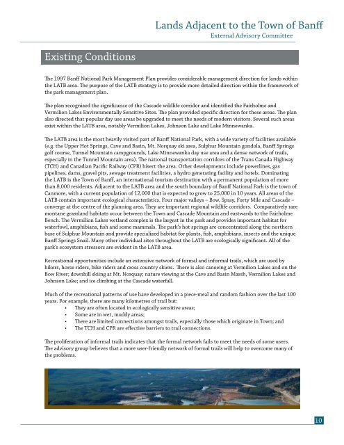
The LATB area is <strong>the</strong> most heavily visited part <strong>of</strong> <strong>Banff</strong> National Park, with a wide variety <strong>of</strong> facilities available<br />
(e.g. <strong>the</strong> Upper Hot Springs, Cave and Basin, Mt. Norquay ski area, Sulphur Mountain gondola, <strong>Banff</strong> Springs<br />
golf course, Tunnel Mountain campgrounds, Lake Minnewanka day use area and a dense network <strong>of</strong> trails,<br />
especially in <strong>the</strong> Tunnel Mountain area). The national transportation corridors <strong>of</strong> <strong>the</strong> Trans Canada Highway<br />
(TCH) and Canadian Pacific Railway (CPR) bisect <strong>the</strong> area. O<strong>the</strong>r developments include powerlines, gas<br />
pipelines, dams, gravel pits, sewage treatment facilities, a hydro generating facility and hotels. Dominating<br />
<strong>the</strong> LATB is <strong>the</strong> <strong>Town</strong> <strong>of</strong> <strong>Banff</strong>, an international <strong>to</strong>urism destination with a permanent population <strong>of</strong> more<br />
than 8,000 residents. <strong>Adjacent</strong> <strong>to</strong> <strong>the</strong> LATB area and <strong>the</strong> south boundary <strong>of</strong> <strong>Banff</strong> National Park is <strong>the</strong> <strong>to</strong>wn <strong>of</strong><br />
Canmore, with a current population <strong>of</strong> 12,000 that is expected <strong>to</strong> grow <strong>to</strong> 25,000 in 10 years. All areas <strong>of</strong> <strong>the</strong><br />
LATB contain important ecological characteristics. Four major valleys – Bow, Spray, Forty Mile and Cascade –<br />
converge at <strong>the</strong> centre <strong>of</strong> <strong>the</strong> planning area. They are important regional wildlife corridors. Comparatively rare<br />
montane grassland habitats occur between <strong>the</strong> <strong>Town</strong> and Cascade Mountain and eastwards <strong>to</strong> <strong>the</strong> Fairholme<br />
Bench. The Vermilion Lakes wetland complex is <strong>the</strong> largest in <strong>the</strong> park and provides important habitat for<br />
waterfowl, amphibians, fish and some mammals. The park’s hot springs are concentrated along <strong>the</strong> nor<strong>the</strong>rn<br />
base <strong>of</strong> Sulphur Mountain and provide specialized habitat for plants, fish, amphibians, insects and <strong>the</strong> unique<br />
<strong>Banff</strong> Springs Snail. Many o<strong>the</strong>r individual sites throughout <strong>the</strong> LATB are ecologically significant. All <strong>of</strong> <strong>the</strong><br />
park’s ecosystem stressors are evident in <strong>the</strong> LATB area.<br />
Recreational opportunities include an extensive network <strong>of</strong> formal and informal trails, which are used by<br />
hikers, horse riders, bike riders and cross country skiers. There is also canoeing at Vermilion Lakes and on <strong>the</strong><br />
Bow River; downhill skiing at Mt. Norquay; nature viewing at <strong>the</strong> Cave and Basin Marsh, Vermilion Lakes and<br />
Johnson Lake; and ice climbing at <strong>the</strong> Cascade waterfall.<br />
Much <strong>of</strong> <strong>the</strong> recreational patterns <strong>of</strong> use have developed in a piece-meal and random fashion over <strong>the</strong> last 100<br />
years. For example, <strong>the</strong>re are many kilometres <strong>of</strong> trail but:<br />
• They are <strong>of</strong>ten located in ecologically sensitive areas;<br />
• Some are in wet, muddy areas;<br />
• There are limited connections amongst trails, especially those which originate in <strong>Town</strong>; and<br />
• The TCH and CPR are effective barriers <strong>to</strong> trail connections.<br />
The proliferation <strong>of</strong> informal trails indicates that <strong>the</strong> formal network fails <strong>to</strong> meet <strong>the</strong> needs <strong>of</strong> some users.<br />
The advisory group believes that a more user-friendly network <strong>of</strong> formal trails will help <strong>to</strong> overcome many <strong>of</strong><br />
<strong>the</strong> problems.<br />
10