Native American influences on the forest composition of the ...
Native American influences on the forest composition of the ...
Native American influences on the forest composition of the ...
You also want an ePaper? Increase the reach of your titles
YUMPU automatically turns print PDFs into web optimized ePapers that Google loves.
1266<br />
<str<strong>on</strong>g>Native</str<strong>on</strong>g> <str<strong>on</strong>g>American</str<strong>on</strong>g> <str<strong>on</strong>g>influences</str<strong>on</strong>g> <strong>on</strong> <strong>the</strong> <strong>forest</strong><br />
compositi<strong>on</strong> <strong>of</strong> <strong>the</strong> Allegheny Plateau, northwest<br />
Pennsylvania<br />
Bryan A. Black, Charles M. Ruffner, and Marc D. Abrams<br />
Abstract: We integrate witness tree distributi<strong>on</strong>, <str<strong>on</strong>g>Native</str<strong>on</strong>g> <str<strong>on</strong>g>American</str<strong>on</strong>g> archaeological sites, and geological and topographic<br />
variables to investigate <strong>the</strong> relati<strong>on</strong>ships between <str<strong>on</strong>g>Native</str<strong>on</strong>g> <str<strong>on</strong>g>American</str<strong>on</strong>g> populati<strong>on</strong>s and pre-European settlement <strong>forest</strong> types<br />
<strong>on</strong> <strong>the</strong> Allegheny Plateau, northwest Pennsylvania. Detrended corresp<strong>on</strong>dence analysis <strong>of</strong> witness tree data separated<br />
<strong>the</strong> presettlement <strong>forest</strong>s into oak–hickory–chestnut and beech–hemlock–maple communities. Oak, hickory, and chestnut<br />
<strong>forest</strong>s were centered <strong>on</strong> <str<strong>on</strong>g>Native</str<strong>on</strong>g> <str<strong>on</strong>g>American</str<strong>on</strong>g> village sites. Using archaeological data, an index <strong>of</strong> <str<strong>on</strong>g>Native</str<strong>on</strong>g> <str<strong>on</strong>g>American</str<strong>on</strong>g> influence<br />
(NAI) was derived to reflect <strong>the</strong> intensity <strong>of</strong> <str<strong>on</strong>g>Native</str<strong>on</strong>g> <str<strong>on</strong>g>American</str<strong>on</strong>g> land use across <strong>the</strong> landscape. In a comparis<strong>on</strong><br />
am<strong>on</strong>g species, mean NAI value <strong>of</strong> oak, hickory, and chestnut trees was significantly higher than that <strong>of</strong> beech, maple,<br />
and hemlock. Logistic regressi<strong>on</strong> dem<strong>on</strong>strated that am<strong>on</strong>g geology type, landform, elevati<strong>on</strong>, aspect, slope, and NAI,<br />
NAI was by far <strong>the</strong> most significant predictor <strong>of</strong> oak, hickory, and chestnut distributi<strong>on</strong>. Although cause and effect <strong>of</strong><br />
this relati<strong>on</strong>ship cannot be tested, we suggest that l<strong>on</strong>g-term <str<strong>on</strong>g>Native</str<strong>on</strong>g> <str<strong>on</strong>g>American</str<strong>on</strong>g> activity selected for <strong>the</strong> disturbanceadapted<br />
oak, hickory, and chestnut. We c<strong>on</strong>tend that <str<strong>on</strong>g>Native</str<strong>on</strong>g> <str<strong>on</strong>g>American</str<strong>on</strong>g> agriculture, burning, and resource extracti<strong>on</strong><br />
could have c<strong>on</strong>verted maple–beech–hemlock to oak–hickory–chestnut, or at least reinforced <strong>the</strong> dominance <strong>of</strong> this <strong>forest</strong><br />
type.<br />
Résumé : Les auteurs <strong>on</strong>t intégré la distributi<strong>on</strong> des arbres témoins, les sites archéologiques autocht<strong>on</strong>es et les variables<br />
géologiques et topographiques pour étudier les relati<strong>on</strong>s entre les populati<strong>on</strong>s autocht<strong>on</strong>es et les types de forêt qui<br />
existaient avant la col<strong>on</strong>isati<strong>on</strong> par les européens sur le plateau de l’Allegheny, dans le nord-ouest de la Pennsylvanie.<br />
L’analyse des corresp<strong>on</strong>dances redressée des d<strong>on</strong>nées sur les arbres témoins a divisé les forêts présentes avant la col<strong>on</strong>isati<strong>on</strong><br />
en associati<strong>on</strong>s de chêne – caryer – châtaignier et de hêtre – pruche – érable. Les forêts de chêne, de caryer et<br />
de châtaignier étaient c<strong>on</strong>centrées dans les sites occupés par des villages autocht<strong>on</strong>es. À l’aide de d<strong>on</strong>nées archéologiques,<br />
ils <strong>on</strong>t dérivé un indice d’influence autocht<strong>on</strong>e (IA) pour refléter l’intensité de l’utilisati<strong>on</strong> du territoire par les<br />
autocht<strong>on</strong>es partout dans le paysage. Dans une comparais<strong>on</strong> entre les espèces, la valeur moyenne de IA du chêne, du<br />
caryer et du châtaignier était significativement plus élevée que celle du hêtre, de l’érable et de la pruche. Parmi les types<br />
géologiques, la forme de relief, l’altitude, l’orientati<strong>on</strong>, la pente et IA, la régressi<strong>on</strong> logistique a dém<strong>on</strong>tré que IA<br />
était de loin la variable prédictive la plus significative pour le chêne, le caryer et le châtaignier. Bien qu’<strong>on</strong> ne puisse<br />
pas tester le lien de causalité de cette relati<strong>on</strong>, ils suggérent que l’activité à l<strong>on</strong>g terme des autocht<strong>on</strong>es a favorisé le<br />
chêne, le caryer et le châtaignier qui s<strong>on</strong>t adaptés aux perturbati<strong>on</strong>s. Ils prétendent que l’agriculture autocht<strong>on</strong>e, le brûlage<br />
et l’extracti<strong>on</strong> des ressources pourraient avoir entraîné la c<strong>on</strong>versi<strong>on</strong> des forêts d’érable – hêtre – pruche en forêts<br />
de chêne – caryer – châtaignier, ou à tout le moins accentué la dominance de ce type de forêt.<br />
[Traduit par la Rédacti<strong>on</strong>] Black et al. 1275<br />
Introducti<strong>on</strong><br />
Despite c<strong>on</strong>siderable study over <strong>the</strong> past 50 years, <strong>the</strong><br />
extent and degree <strong>of</strong> <str<strong>on</strong>g>Native</str<strong>on</strong>g> <str<strong>on</strong>g>American</str<strong>on</strong>g> influence <strong>on</strong> pre-<br />
European settlement <strong>forest</strong> remains a c<strong>on</strong>troversial subject<br />
Received 29 April 2005. Accepted 19 January 2006.<br />
Published <strong>on</strong> <strong>the</strong> NRC Research Press Web site at http://<br />
cjfr.nrc.ca <strong>on</strong> 29 April 2006.<br />
B.A. Black, 1,2 C.M. Ruffner, 3 and M.D. Abrams. 203<br />
Forest Resources Laboratory, 4 Fergus<strong>on</strong> Building, School <strong>of</strong><br />
Forest Resources, Pennsylvania State University, University<br />
Park, PA 16802, USA.<br />
1 Corresp<strong>on</strong>ding author (e-mail: bryan.black@oreg<strong>on</strong>state.edu).<br />
2 Present address: Hatfield Marine Science Center, 2030<br />
Marine Science Drive, Newport, OR 97365, USA.<br />
3 Present address: Sou<strong>the</strong>rn Illinois University, Department <strong>of</strong><br />
Forestry, Mailcode 4411, Carb<strong>on</strong>dale, IL 62901, USA.<br />
am<strong>on</strong>g <strong>forest</strong> historians, cultural ecologists, and anthropologists.<br />
Estimates <strong>of</strong> <str<strong>on</strong>g>Native</str<strong>on</strong>g> <str<strong>on</strong>g>American</str<strong>on</strong>g> impacts <strong>on</strong> <strong>forest</strong>s range<br />
from broad landscape-level alterati<strong>on</strong>s in compositi<strong>on</strong> and<br />
structure (Day 1953; Pyne 1983; Delcourt 1987; Hammett<br />
1992) to localized effects that did not extend far bey<strong>on</strong>d major<br />
populati<strong>on</strong> centers (Russell 1983; Krech 1999). Previous<br />
attempts to elucidate native <str<strong>on</strong>g>influences</str<strong>on</strong>g> <strong>on</strong> vegetati<strong>on</strong> have<br />
utilized a variety <strong>of</strong> data sources, yet <strong>the</strong> most comm<strong>on</strong>ly relied<br />
up<strong>on</strong> are anecdotal accounts <strong>of</strong> early travelers and settlers.<br />
According to many <strong>of</strong> <strong>the</strong>se qualitative descripti<strong>on</strong>s<br />
at <strong>the</strong> time <strong>of</strong> first European settlement, natives regularly<br />
burned <strong>the</strong> woods to drive game, improve visibility, facilitate<br />
travel, and provide browse for deer and cattle (Day<br />
1953). However, <strong>the</strong> possibility <strong>of</strong> biases in many <strong>of</strong> <strong>the</strong>se<br />
accounts has called <strong>the</strong>ir validity into questi<strong>on</strong> (Forman and<br />
Russell 1983; Russell 1983). In a more quantitative approach,<br />
a number <strong>of</strong> paleoecological analyses <strong>of</strong> native sites<br />
have revealed c<strong>on</strong>comitant variati<strong>on</strong>s in vegetati<strong>on</strong> and Na-<br />
Can. J. For. Res. 36: 1266–1275 (2006) doi:10.1139/X06-027 © 2006 NRC Canada
Black et al. 1267<br />
tive <str<strong>on</strong>g>American</str<strong>on</strong>g> populati<strong>on</strong>s over time (Chapman et al. 1982;<br />
Patters<strong>on</strong> and Sassman 1988; Clark and Royall 1995;<br />
Delcourt et al. 1998). On a shorter yet higher resoluti<strong>on</strong> temporal<br />
scale, dendrochr<strong>on</strong>ological studies <strong>of</strong> fire scars and<br />
tree cores have proven useful for relating disturbance regimes<br />
at native sites with archaeological data (Batek et al.<br />
1999; Ruffner and Abrams 2002). Indeed, both quantitative<br />
methodologies have yielded valuable insight into native disturbances<br />
and <strong>the</strong>ir impacts <strong>on</strong> vegetati<strong>on</strong> over l<strong>on</strong>g periods<br />
<strong>of</strong> time. Yet palynological studies are largely restricted to areas<br />
adjacent to a catchment site, while dendrochr<strong>on</strong>ological<br />
studies are restricted to old-growth patches that predate European<br />
settlement. C<strong>on</strong>sequently, a weakness <strong>of</strong> <strong>the</strong>se methodologies<br />
is that <strong>the</strong>y can <strong>on</strong>ly be applied at very specific<br />
sites and are not well suited to characterizing native <str<strong>on</strong>g>influences</str<strong>on</strong>g><br />
at broad spatial scales (Batek et al. 1999).<br />
In c<strong>on</strong>trast to pollen or dendrochr<strong>on</strong>ology, original land<br />
surveys c<strong>on</strong>tain <strong>the</strong> data necessary to describe <strong>the</strong> effects <strong>of</strong><br />
<str<strong>on</strong>g>Native</str<strong>on</strong>g> <str<strong>on</strong>g>American</str<strong>on</strong>g> populati<strong>on</strong>s <strong>on</strong> <strong>the</strong> landscape level. During<br />
<strong>the</strong> period <strong>of</strong> early European settlement in <strong>the</strong> eastern United<br />
States, land surveyors marked and recorded witness (warrant,<br />
bearing, and (or) corner) trees to identify property corners<br />
and boundaries (Lutz 1930; Spurr 1951; Bourdo 1956).<br />
Throughout <strong>the</strong> eastern and midwestern United States <strong>the</strong>se<br />
witness trees have been compiled from surveyors’ notes to<br />
rec<strong>on</strong>struct <strong>forest</strong> compositi<strong>on</strong> and structure (Lutz 1930;<br />
Bourdo 1956; Marks and Gardescu 1992; Black and Abrams<br />
2001). In many studies, rec<strong>on</strong>structed patterns <strong>of</strong> vegetati<strong>on</strong><br />
have been attributed to edaphic c<strong>on</strong>diti<strong>on</strong>s such as topography,<br />
soils, slope class, or drainage classes (Gord<strong>on</strong> 1940).<br />
Yet o<strong>the</strong>r more recent studies have taken a more integrative<br />
approach and recognized <strong>the</strong> potential influence <strong>of</strong> native<br />
populati<strong>on</strong>s. In documenting pre-European vegetati<strong>on</strong> <strong>of</strong><br />
central New York State, Marks and Gardescu (1992) identified<br />
old <str<strong>on</strong>g>Native</str<strong>on</strong>g> <str<strong>on</strong>g>American</str<strong>on</strong>g> clearings and reported oak–<br />
hickory–pine growing in areas previously inhabited by peoples<br />
<strong>of</strong> <strong>the</strong> Iroquois C<strong>on</strong>federacy. In western New York, <strong>on</strong><br />
lands surveyed for <strong>the</strong> Holland Land Company (including<br />
Gord<strong>on</strong>’s (1940) area), Seischab (1990) reported that most<br />
oak communities occurred in sou<strong>the</strong>rn porti<strong>on</strong>s <strong>of</strong> <strong>the</strong> study<br />
area al<strong>on</strong>g <strong>the</strong> Allegheny River and its tributaries, dominating<br />
a landscape formerly inhabited by Seneca people <strong>of</strong> <strong>the</strong><br />
Iroquois C<strong>on</strong>federacy. Whitney and DeCant (2003) suggested<br />
that Iroquois may be associated with oak–chestnut<br />
<strong>forest</strong>s in <strong>the</strong>ir witness tree study across northwestern Pennsylvania,<br />
including <strong>the</strong> Allegheny Plateau. Overall, an increasing<br />
number <strong>of</strong> witness tree studies indicate that <str<strong>on</strong>g>Native</str<strong>on</strong>g><br />
<str<strong>on</strong>g>American</str<strong>on</strong>g>s had at least some associati<strong>on</strong> with <strong>forest</strong> compositi<strong>on</strong>,<br />
though <strong>the</strong> degree <strong>of</strong> <strong>the</strong> relati<strong>on</strong>ship is not quantified.<br />
In this study, we attempt to more directly link <str<strong>on</strong>g>Native</str<strong>on</strong>g><br />
<str<strong>on</strong>g>American</str<strong>on</strong>g>s with <strong>forest</strong> compositi<strong>on</strong> <strong>on</strong> <strong>the</strong> Allegheny Plateau<br />
<strong>of</strong> northwestern Pennsylvania. Detailed archaeological records<br />
dem<strong>on</strong>strate that <str<strong>on</strong>g>Native</str<strong>on</strong>g> peoples have almost c<strong>on</strong>tinuously<br />
occupied <strong>the</strong> Allegheny River regi<strong>on</strong> for <strong>the</strong> past<br />
10 000 years (USDA Forest Service Cultural Resources archives,<br />
Warren, Pennsylvania). Also, <strong>the</strong> study area c<strong>on</strong>tains<br />
a relatively high c<strong>on</strong>centrati<strong>on</strong> <strong>of</strong> witness trees, including<br />
dominant species <str<strong>on</strong>g>American</str<strong>on</strong>g> beech (Fagus grandifolia Ehrh.)<br />
(30%) and eastern hemlock (Tsuga canadensis L.) (27%),<br />
with sugar maple (Acer saccharum Marsh.), birch (Betula<br />
spp.), white pine (Pinus strobus L.), and chestnut (Castanea<br />
dentata (Marsh.) Borkh.) as subordinates (Lutz 1930; Whitney<br />
1990). Such a <strong>forest</strong> type is well suited for studying <strong>the</strong><br />
effects <strong>of</strong> altered disturbance regimes. Historically, <strong>the</strong> hemlock<br />
– nor<strong>the</strong>rn hardwood <strong>forest</strong>s <strong>of</strong> <strong>the</strong> Allegheny Plateau<br />
were characterized by a very low disturbance frequency, with<br />
disturbances being almost exclusively windstorms (Whitney<br />
1990). Any increases in anthropogenic disturbance, especially<br />
fire, could have a dramatic impact <strong>on</strong> <strong>forest</strong> compositi<strong>on</strong>, with<br />
expected decreases in sugar maple and hemlock and increases<br />
in oak (Quercus spp.), hickory (Carya spp.), and chestnut.<br />
Thus, <strong>the</strong> Allegheny Plateau provides a unique combinati<strong>on</strong><br />
<strong>of</strong> a disturbance-sensitive <strong>forest</strong> type and l<strong>on</strong>g-term <str<strong>on</strong>g>Native</str<strong>on</strong>g><br />
<str<strong>on</strong>g>American</str<strong>on</strong>g> occupati<strong>on</strong> in which to evaluate <strong>the</strong> relati<strong>on</strong>ships<br />
between indigenous peoples and <strong>the</strong>ir envir<strong>on</strong>ment. Our objectives<br />
for this study were to (i) use known Iroquois village<br />
sites, travel corridors, and archaeological data to derive a<br />
spatially explicit index <strong>of</strong> <str<strong>on</strong>g>Native</str<strong>on</strong>g> <str<strong>on</strong>g>American</str<strong>on</strong>g> habitati<strong>on</strong> <strong>on</strong><br />
<strong>the</strong> landscape, (ii) assess <strong>the</strong> ability <strong>of</strong> this index <strong>of</strong> <str<strong>on</strong>g>Native</str<strong>on</strong>g><br />
<str<strong>on</strong>g>American</str<strong>on</strong>g> habitati<strong>on</strong> to predict <strong>the</strong> distributi<strong>on</strong> <strong>of</strong> oak, hickory,<br />
and chestnut in comparis<strong>on</strong> to various topographic and<br />
edaphic variables, and (iii) discuss <strong>the</strong> possibility that <str<strong>on</strong>g>Native</str<strong>on</strong>g><br />
<str<strong>on</strong>g>American</str<strong>on</strong>g> activities at least in part influenced vegetati<strong>on</strong> patterns.<br />
Materials and methods<br />
Study area<br />
The study area in northwestern Pennsylvania represents<br />
much <strong>of</strong> <strong>the</strong> unglaciated Allegheny High Plateau and is characterized<br />
by broad flat-topped ridges deeply dissected by dendritic<br />
drainages (Fenneman 1938; Cuff et al. 1989) (Fig. 1).<br />
Soils <strong>of</strong> <strong>the</strong> High Plateau are fairly homogeneous Inceptisols<br />
formed in residuum and colluvium from Mississippian- and<br />
Pennsylvanian-aged sandst<strong>on</strong>es and shales (Cerutti 1985;<br />
Ciolkosz et al. 1989). Hazlet<strong>on</strong>–Cookport soils occur <strong>on</strong> plateau<br />
uplands, while Hazlet<strong>on</strong>–Gilpin–Ernest soils dominate<br />
sideslopes. Both are characterized as deep, well drained to<br />
moderately well drained, sloping to moderately steep soils<br />
formed from acidic sandst<strong>on</strong>e and shale. Alluvial floodplains<br />
and glacial outwash terraces comprise deep, very poorly<br />
drained Wayland–Chenango–Braceville soils derived from<br />
acid sandst<strong>on</strong>e and shale (Cerutti 1985).<br />
The climate <strong>of</strong> <strong>the</strong> regi<strong>on</strong> is cool and humid. Temperature<br />
and frost-free periods vary across <strong>the</strong> Plateau with elevati<strong>on</strong>,<br />
which rises from 540 m at <strong>the</strong> top <strong>of</strong> <strong>the</strong> Allegheny River<br />
Gorge in <strong>the</strong> west, to 620 m near Sheffield, and <strong>the</strong>n decreases<br />
again to 430 m towards <strong>the</strong> headwaters <strong>of</strong> <strong>the</strong> Clari<strong>on</strong><br />
River, a major tributary <strong>of</strong> <strong>the</strong> Allegheny River. Average<br />
temperatures range from 20 °C in <strong>the</strong> summer to –2 °C in<br />
<strong>the</strong> winter. Total annual precipitati<strong>on</strong> is 109 cm, with 61 cm<br />
falling during <strong>the</strong> growing seas<strong>on</strong> between April and September<br />
(Cerutti 1985).<br />
Historical c<strong>on</strong>text<br />
Throughout <strong>the</strong> Holocene, <strong>the</strong> Allegheny River watershed<br />
served as a major transportati<strong>on</strong>, trade, and communicati<strong>on</strong><br />
artery for Archaic (8500–1000 BC) and Woodland<br />
(1000 BC – AD 1600) cultures. The Late Woodland (AD<br />
1000–1600) Allegheny Valley Iroquois and <strong>the</strong> Historic (AD<br />
1600–1800) Seneca Iroquois occupied base camps <strong>on</strong> river<br />
terraces surrounded by large catchment areas from which<br />
© 2006 NRC Canada
1268 Can. J. For. Res. Vol. 36, 2006<br />
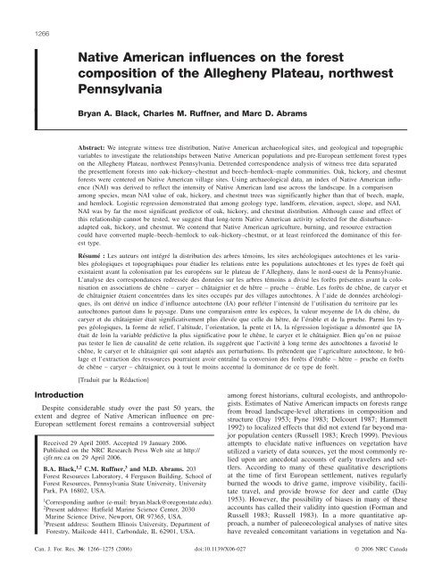
Fig. 1. Topography <strong>of</strong> <strong>the</strong> study area and its locati<strong>on</strong> within Pennsylvania. <str<strong>on</strong>g>Native</str<strong>on</strong>g> <str<strong>on</strong>g>American</str<strong>on</strong>g> village sites and major travel corridors are<br />
shown, as well as <strong>the</strong> locati<strong>on</strong> <strong>of</strong> each witness tree used in <strong>the</strong> study.<br />
raw materials were procured at ancillary sites (Flannery<br />
1976; Quinn and Adovasio 1996; Ruffner 1999). These<br />
native groups were semisedentary horticulturists practicing<br />
swidden agriculture, whereby <strong>forest</strong>s were cleared and<br />
burned to create open areas in which sunflower (Helianthus<br />
annuus), maize (Zeas mays), squash (Curcubita pepo), and<br />
beans (Phaseolus vulgaris) were cultivated (Parker 1968;<br />
Sykes 1980; Snow 1994). By AD 1500, settlements were<br />
large, palisaded villages with l<strong>on</strong>ghouses and garden plots<br />
capable <strong>of</strong> supporting up to 250–300 people (Snow 1994;<br />
Quinn and Adovasio 1996). Based <strong>on</strong> archaeological rec<strong>on</strong>structi<strong>on</strong>s,<br />
<strong>the</strong> prehistoric landscape resembled a mosaic pattern<br />
<strong>of</strong> (i) active croplands near palisaded settlements,<br />
(ii) aband<strong>on</strong>ed clearings with early-successi<strong>on</strong>al taxa, and<br />
(iii) open-<strong>forest</strong> stands dominated by fire-adapted species<br />
such as oak and hickory (Kent et al. 1981; Snow 1994;<br />
Quinn and Adovasio 1996).<br />
The Historic period witnessed <strong>the</strong> greatest populati<strong>on</strong><br />
surges <strong>of</strong> <str<strong>on</strong>g>Native</str<strong>on</strong>g> peoples beginning with <strong>the</strong> expansi<strong>on</strong> <strong>of</strong> <strong>the</strong><br />
Seneca Iroquois out <strong>of</strong> <strong>the</strong>ir Genessee Valley homeland into<br />
<strong>the</strong> upper Allegheny River drainage (Snow 1994). They established<br />
numerous villages al<strong>on</strong>g <strong>the</strong> Allegheny River including<br />
Buckalo<strong>on</strong>s, C<strong>on</strong>ewango, and Tidioute (Kent et al.<br />
1981). Then between 1700 and 1780, <strong>the</strong>se sites (and o<strong>the</strong>rs)<br />
apparently supported a large populati<strong>on</strong> <strong>of</strong> emigrant natives<br />
pushed westward by European pressure in eastern Pennsylvania<br />
and were c<strong>on</strong>tinually inhabited through <strong>the</strong> French and<br />
Indian War and <strong>the</strong> <str<strong>on</strong>g>American</str<strong>on</strong>g> Revoluti<strong>on</strong> (McC<strong>on</strong>nell 1992).<br />
© 2006 NRC Canada
Black et al. 1269<br />
Table 1. <str<strong>on</strong>g>Native</str<strong>on</strong>g> <str<strong>on</strong>g>American</str<strong>on</strong>g> village sites used for catchment area analysis.<br />
Village site Occupati<strong>on</strong> period Size (ha) References<br />
Buckalo<strong>on</strong>s Early Archaic – C<strong>on</strong>tact 125 D<strong>on</strong>ehoo 1928; Kent et al.1981; Quinn and Adovasio 1996<br />
C<strong>on</strong>ewango Early Archaic – C<strong>on</strong>tact 140 Schenck 1887; D<strong>on</strong>ehoo 1928<br />
Tidioute Early Archaic – Historic 40 USDA Forest Service Cultural Resources archives<br />
Note: See text for selecti<strong>on</strong> criteria. Reported village size based <strong>on</strong> estimates from Pennsylvania archaeological site surveys archived<br />
at Pennsylvania Historical and Museum Commissi<strong>on</strong>, Harrisburg, Pennsylvania.<br />
During <strong>the</strong> latter c<strong>on</strong>flict, <strong>the</strong> Seneca supported <strong>the</strong> British,<br />
and in 1779 a punitive expediti<strong>on</strong> under Col<strong>on</strong>el Brodhead<br />
was dispatched to <strong>the</strong> Seneca villages <strong>on</strong> <strong>the</strong> upper Allegheny<br />
River. Brodhead recorded in his journal that his army<br />
destroyed Seneca villages at Cornplanter, C<strong>on</strong>ewango, and<br />
Buckalo<strong>on</strong>s. He estimated that over 500 acres (202 ha) <strong>of</strong><br />
cropland were burned al<strong>on</strong>g with 150 l<strong>on</strong>ghouses and corn<br />
stores (D<strong>on</strong>ehoo 1928). The native village at Buckalo<strong>on</strong>s<br />
was never rebuilt, and European settlement <strong>of</strong> <strong>the</strong> Allegheny<br />
River area began after <strong>the</strong> purchase <strong>of</strong> northwestern Pennsylvania<br />
in 1789.<br />
Methods<br />
Forest c<strong>on</strong>diti<strong>on</strong>s were characterized by tallying witness<br />
trees from original warrant maps (1790–1820) that represent<br />
a tract <strong>of</strong> land as surveyed at <strong>the</strong> time <strong>of</strong> European settlement<br />
(Munger 1991). This secti<strong>on</strong> <strong>of</strong> Pennsylvania was surveyed<br />
using a rectangular scheme similar to that specified by<br />
<strong>the</strong> Northwest Ordinance <strong>of</strong> 1785. Although it was not <strong>the</strong><br />
General Land Office (GLO) township and range system utilized<br />
in <strong>the</strong> Midwest and western parts <strong>of</strong> <strong>the</strong> United States<br />
(Bourdo 1956), deputy surveyors were required to use a rectangular<br />
system to facilitate disposal <strong>of</strong> unseated lands after<br />
<strong>the</strong> Last Purchase <strong>of</strong> tribal lands in 1784 (Munger 1991).<br />
The density <strong>of</strong> witness trees (trees per unit area) varied<br />
across <strong>the</strong> study area, but <strong>the</strong>se irregularities did not corresp<strong>on</strong>d<br />
with underlying topographic or geological features<br />
and should not influence <strong>the</strong> interpretati<strong>on</strong> <strong>of</strong> <strong>the</strong>se witness<br />
tree data (Ruffner 1999; Black and Abrams 2001).<br />
Witness trees (n = 1611) were obtained from original warrants<br />
and c<strong>on</strong>nected drafts in <strong>the</strong> Pennsylvania State Archives.<br />
Many <strong>of</strong> <strong>the</strong>se trees have been included in past<br />
studies <strong>of</strong> pre-European settlement <strong>forest</strong> compositi<strong>on</strong> (Lutz<br />
1930; Whitney 1990), but we also added a large number <strong>of</strong><br />
trees al<strong>on</strong>g <strong>the</strong> Allegheny River that had not been previously<br />
analyzed. We transcribed all trees <strong>on</strong>to USGS 7.5 min topographic<br />
quadrangles and digitized <strong>the</strong>m using ArcView 3.2a<br />
(ESRI, Redlands, California). Locati<strong>on</strong>s <strong>of</strong> three major Iroquois<br />
village sites (Table 1) were also digitized as well as<br />
major travel routes (D<strong>on</strong>ehoo 1928; Wallace 1965; Kent et<br />
al. 1981). We <strong>the</strong>n summarized community structure by c<strong>on</strong>ducting<br />
detrended corresp<strong>on</strong>dence analysis (DCA) <strong>on</strong> <strong>the</strong><br />
witness tree data. First we superimposed a6km×6kmgrid<br />
over <strong>the</strong> study area using ArcGIS 9.2 and Hawth Tools extensi<strong>on</strong><br />
(http://www.spatialecology.com/htools/tooldesc.php), which subdivided<br />
<strong>the</strong> regi<strong>on</strong> into a total <strong>of</strong> 130 grid cells. We <strong>the</strong>n tallied<br />
all witness trees within each cell and entered <strong>the</strong> data<br />
into CANOCO 4 (Microcomputer Power, Ithaca, New York)<br />
for analysis. Species scores were plotted for <strong>the</strong> first two<br />
axes, and cell scores were imported into ArcGIS to examine<br />
spatial gradients.<br />
To roughly quantify <strong>the</strong> intensity <strong>of</strong> <str<strong>on</strong>g>Native</str<strong>on</strong>g> <str<strong>on</strong>g>American</str<strong>on</strong>g> influence<br />
in <strong>the</strong> regi<strong>on</strong>, we developed a <str<strong>on</strong>g>Native</str<strong>on</strong>g> <str<strong>on</strong>g>American</str<strong>on</strong>g> index<br />
(NAI) from 0 to 100 based <strong>on</strong> known village sites and<br />
travel routes. This should represent <strong>the</strong> porti<strong>on</strong> <strong>of</strong> <strong>the</strong> study<br />
area subjected to <strong>the</strong> most intense agricultural activity and<br />
<strong>forest</strong> exploitati<strong>on</strong>. Archaeological evidence suggests that<br />
<str<strong>on</strong>g>Native</str<strong>on</strong>g> fields most likely occurred within 1 km <strong>of</strong> <strong>the</strong> village<br />
site and that <strong>the</strong> heaviest fuelwood collecti<strong>on</strong> and burning<br />
for berry producti<strong>on</strong> and defense was c<strong>on</strong>ducted within 4–<br />
5 km <strong>of</strong> <strong>the</strong> village (Williams 1989). Foraging and small<br />
game hunting were probably <strong>the</strong> primary land uses from approximately<br />
6 to 8 km from a village. A final c<strong>on</strong>siderati<strong>on</strong><br />
was that a pers<strong>on</strong> carrying a load can typically travel no<br />
more than 6–10 km a day (Flannery 1976; Roper 1979; Williams<br />
1989). To reflect <strong>the</strong>se land uses and <strong>the</strong> fact that <str<strong>on</strong>g>Native</str<strong>on</strong>g><br />
<str<strong>on</strong>g>American</str<strong>on</strong>g>s would have minimized energy expenditures<br />
necessary to procure resources, <strong>the</strong> values <strong>of</strong> NAI decline<br />
with increasing distance from <strong>the</strong> villages. Thus, <strong>the</strong> highest<br />
NAI value <strong>of</strong> 100 was assigned to all regi<strong>on</strong>s within 5 km <strong>of</strong><br />
major village sites. All regi<strong>on</strong>s between 5 and 7 km from a<br />
village were assigned values <strong>of</strong> 75, and regi<strong>on</strong>s between<br />
7 and 9 km were assigned values <strong>of</strong> 50. NAI values were<br />
halved every 2 km increment bey<strong>on</strong>d 9 km to reflect what<br />
would have been diminishing activity with increasing distance.<br />
In additi<strong>on</strong> to villages, proximity to travel routes was<br />
also included in <strong>the</strong> final NAI calculati<strong>on</strong>. Though <strong>the</strong>se<br />
travel routes would have experienced ephemeral and less intense<br />
land uses than village sites, <str<strong>on</strong>g>Native</str<strong>on</strong>g> <str<strong>on</strong>g>American</str<strong>on</strong>g>s would<br />
have still procured <strong>forest</strong> resources and intenti<strong>on</strong>ally or inadvertently<br />
increased fire frequency by <strong>the</strong>ir presence. Thus,<br />
regi<strong>on</strong>s within 500 m <strong>of</strong> a major travel route were assigned a<br />
value <strong>of</strong> 50, and <strong>the</strong> index value was halved with every additi<strong>on</strong>al<br />
1 km increment in distance. The final NAI was computed<br />
by adding <strong>the</strong> village and travel route values. Travel<br />
route values bey<strong>on</strong>d 9 km <strong>of</strong> a village were capped at a<br />
value <strong>of</strong> 50.<br />
We also divided <strong>the</strong> study area into a total <strong>of</strong> four mutually<br />
exclusive landforms: north sideslope, south sideslope,<br />
hilltop–plateau, and stream valley – floodplain. Landforms<br />
were identified by analyzing 30 m digital elevati<strong>on</strong> models<br />
(USGS EROS), a Warren and Forest County geological map,<br />
and a hydrography layer (Pennsylvania Spatial Data Access,<br />
http://www.pasda.psu.edu/). The first step in delineating<br />
landforms was to define stream valleys and floodplains. To<br />
generate this coverage, streams were buffered to 150 m <strong>on</strong><br />
each side using ArcInfo 8.02. Given <strong>the</strong> deeply dissected topography<br />
<strong>of</strong> <strong>the</strong> regi<strong>on</strong>, 150 m included sites immediately<br />
adjacent to streams as well as <strong>the</strong> surrounding cove slopes.<br />
Alluvial soils were combined with <strong>the</strong> buffered stream layer,<br />
and in some cases <strong>the</strong> floodplains were extended al<strong>on</strong>g <strong>the</strong><br />
Allegheny River valleys where slope was less than 1%.<br />
Sideslopes were all sites not included in <strong>the</strong> stream valley –<br />
© 2006 NRC Canada
1270 Can. J. For. Res. Vol. 36, 2006<br />
Fig. 2. Species scores for <strong>the</strong> first two axes <strong>of</strong> detrended corresp<strong>on</strong>dence analysis (DCA) <strong>of</strong> <strong>the</strong> witness tree data. Witness trees were<br />
talliedwithin6km×6kmgrid cells across <strong>the</strong> study area, and each grid cell was used as a sample in <strong>the</strong> analysis. Species separate<br />
into an oak–hickory–chestnut <strong>forest</strong> type (bold) and a beech–hemlock–maple <strong>forest</strong> type.<br />
3.0<br />
2.5<br />
2.0<br />
red oak<br />
hickory<br />
ash<br />
ir<strong>on</strong>wood<br />
sugar maple<br />
cherry<br />
birch<br />
DCA axis 2<br />
1.5<br />
1.0<br />
0.5<br />
black oak<br />
white oak<br />
chestnut<br />
pine<br />
maple<br />
water beech<br />
beech<br />
0<br />
chestnut oak<br />
hemlock<br />
-0.5<br />
cucumber<br />
-1.0<br />
-1.0 -0.5 0 0.5 1.0 1.5 2.0 2.5 3.0 3.5 4.0<br />
DCA axis 1<br />
floodplain coverage where slope was greater than 10%. All<br />
o<strong>the</strong>r sites where slope was less than 10% and not already<br />
classified as stream valley – floodplain were designated hilltop–plateau.<br />
The NAI, slope, aspect, parent material, and landform<br />
were recorded for each witness tree. Average NAI and a<br />
95% c<strong>on</strong>fidence interval were calculated for each witness<br />
tree species with a sample size greater than 10. Walnut (n =<br />
8) was also included because this species has been reported<br />
as associated with o<strong>the</strong>r <str<strong>on</strong>g>Native</str<strong>on</strong>g> <str<strong>on</strong>g>American</str<strong>on</strong>g> sites. Witness tree<br />
compositi<strong>on</strong> was <strong>the</strong>n tallied in regi<strong>on</strong>s with a high NAI<br />
(>10) and low NAI (
Black et al. 1271<br />
Fig. 4. Mean <str<strong>on</strong>g>Native</str<strong>on</strong>g> <str<strong>on</strong>g>American</str<strong>on</strong>g> index values and 95% c<strong>on</strong>fidence intervals for species with sample sizes greater than 10, with <strong>the</strong> excepti<strong>on</strong><br />
<strong>of</strong> walnut, which has a sample size <strong>of</strong> 8.<br />
opposed to 6 km grid cells caused minimal changes to <strong>the</strong><br />
outcome <strong>of</strong> <strong>the</strong> DCA (data not shown). When <strong>the</strong> mean values<br />
<strong>of</strong> NAI were compared am<strong>on</strong>g species, oak, hickory, and<br />
chestnut scored am<strong>on</strong>g <strong>the</strong> highest with walnut, yielding <strong>the</strong><br />
highest mean value <strong>of</strong> nearly 80 (Fig. 4). In c<strong>on</strong>trast, beech,<br />
birch, hemlock, and maple scored am<strong>on</strong>g <strong>the</strong> lowest, with<br />
95% c<strong>on</strong>fidence intervals that fell well outside those species<br />
present in <strong>the</strong> oak–hickory–chestnut <strong>forest</strong> type (Fig. 4).<br />
Variance in NAI value was high for cherry, water beech, cucumber,<br />
and red oak, each <strong>of</strong> which had a sample size <strong>of</strong><br />
fewer than 15 trees (Fig. 4).<br />
In a comparis<strong>on</strong> between regi<strong>on</strong>s <strong>of</strong> low (10) <str<strong>on</strong>g>Native</str<strong>on</strong>g> <str<strong>on</strong>g>American</str<strong>on</strong>g> activity, beech, hemlock, and maple<br />
dominated areas <strong>of</strong> low <str<strong>on</strong>g>Native</str<strong>on</strong>g> <str<strong>on</strong>g>American</str<strong>on</strong>g> activity, while oak,<br />
beech, hemlock, chestnut, pine, and maple dominated regi<strong>on</strong>s<br />
<strong>of</strong> high <str<strong>on</strong>g>Native</str<strong>on</strong>g> <str<strong>on</strong>g>American</str<strong>on</strong>g> activity (Table 2). Combined,<br />
oak hickory, and chestnut composed 1.4% <strong>of</strong> <strong>the</strong> low <str<strong>on</strong>g>Native</str<strong>on</strong>g><br />
<str<strong>on</strong>g>American</str<strong>on</strong>g> activity z<strong>on</strong>e and 34.3% <strong>of</strong> <strong>the</strong> high <str<strong>on</strong>g>Native</str<strong>on</strong>g> <str<strong>on</strong>g>American</str<strong>on</strong>g><br />
activity z<strong>on</strong>e. An NAI threshold <strong>of</strong> 10 provided a c<strong>on</strong>servative<br />
divisi<strong>on</strong> between z<strong>on</strong>es <strong>of</strong> high and low <str<strong>on</strong>g>Native</str<strong>on</strong>g><br />
<str<strong>on</strong>g>American</str<strong>on</strong>g> influence and divided <strong>the</strong> total number <strong>of</strong> trees<br />
into two groups <strong>of</strong> comparable size (Table 2). Increasing <strong>the</strong><br />
NAI threshold to 50 yielded similar results with a combined<br />
oak, hickory, and chestnut relative density <strong>of</strong> 38.8% and<br />
8.9% for <strong>the</strong> high and low regi<strong>on</strong>s, respectively.<br />
In a comparis<strong>on</strong> between regi<strong>on</strong>s <strong>of</strong> low (10) <str<strong>on</strong>g>Native</str<strong>on</strong>g> <str<strong>on</strong>g>American</str<strong>on</strong>g> influence, <strong>the</strong> low-influence regi<strong>on</strong><br />
had a higher mean elevati<strong>on</strong> by approximately 50 m (Table<br />
3). Also, average slope and <strong>the</strong> standard deviati<strong>on</strong> <strong>of</strong><br />
elevati<strong>on</strong> (an index <strong>of</strong> topographic roughness) were significantly<br />
lower in areas <strong>of</strong> low influence (Table 3). This suggested<br />
that although <strong>the</strong> regi<strong>on</strong> <strong>of</strong> low influence was higher<br />
in elevati<strong>on</strong>, topography was less variable than in areas <strong>of</strong><br />
high influence. With respect to landform, valleys occurred<br />
with approximately <strong>the</strong> same frequency in both regi<strong>on</strong>s (Table<br />
3). However, plateaus were more abundant in regi<strong>on</strong>s <strong>of</strong><br />
low activity, while sideslopes were less abundant (Table 3).<br />
This was c<strong>on</strong>sistent with our finding <strong>of</strong> a steeper average<br />
slope and higher standard deviati<strong>on</strong> <strong>of</strong> elevati<strong>on</strong> in <strong>the</strong> regi<strong>on</strong>s<br />
<strong>of</strong> high <str<strong>on</strong>g>Native</str<strong>on</strong>g> <str<strong>on</strong>g>American</str<strong>on</strong>g> influence. Geologically,<br />
<strong>the</strong>re were also some dissimilarities between <strong>the</strong> two regi<strong>on</strong>s.<br />
The Pottsville group was much more comm<strong>on</strong> in <strong>the</strong><br />
regi<strong>on</strong>s <strong>of</strong> low <str<strong>on</strong>g>Native</str<strong>on</strong>g> <str<strong>on</strong>g>American</str<strong>on</strong>g> influence because this<br />
group was associated with <strong>the</strong> eastern porti<strong>on</strong> <strong>of</strong> <strong>the</strong> study<br />
area (Table 3). Despite some differences between <strong>the</strong> regi<strong>on</strong>s<br />
<strong>of</strong> high and low <str<strong>on</strong>g>Native</str<strong>on</strong>g> <str<strong>on</strong>g>American</str<strong>on</strong>g> influence, a logistic<br />
regressi<strong>on</strong> showed that NAI was <strong>the</strong> most significant predictor<br />
<strong>of</strong> oak–hickory–chestnut. Landform and geology were<br />
also significant, but <strong>the</strong> Wald χ 2 statistic value for NAI was<br />
more than twice that <strong>of</strong> ei<strong>the</strong>r <strong>of</strong> <strong>the</strong>se o<strong>the</strong>r two variables<br />
(Table 4).<br />
Discussi<strong>on</strong><br />
Previous studies have defined catchment z<strong>on</strong>es as circular<br />
regi<strong>on</strong>s within specific radii (i.e., 5 and 7 km) <strong>of</strong> village<br />
sites (Vita-Finzi and Higgs 1970; Flannery 1976; Ruffner<br />
1999; Black and Abrams 2001). In our revised approach,<br />
catchment z<strong>on</strong>es may assume any c<strong>on</strong>figurati<strong>on</strong>, providing a<br />
more detailed estimate <strong>of</strong> <str<strong>on</strong>g>Native</str<strong>on</strong>g> <str<strong>on</strong>g>American</str<strong>on</strong>g> influence across<br />
<strong>the</strong> landscape. The results <strong>of</strong> this analysis <strong>on</strong> <strong>the</strong> Allegheny<br />
Plateau dem<strong>on</strong>strate a close corresp<strong>on</strong>dence between oak–<br />
hickory–chestnut <strong>forest</strong>s and sites <strong>of</strong> prol<strong>on</strong>ged <str<strong>on</strong>g>Native</str<strong>on</strong>g><br />
<str<strong>on</strong>g>American</str<strong>on</strong>g> occupati<strong>on</strong>. Indeed, our estimate <strong>of</strong> <str<strong>on</strong>g>Native</str<strong>on</strong>g> <str<strong>on</strong>g>American</str<strong>on</strong>g><br />
occupati<strong>on</strong> appears to be <strong>the</strong> best predictor <strong>of</strong> oak, hickory,<br />
and chestnut in comparis<strong>on</strong> with a number <strong>of</strong> topographic<br />
and edaphic variables. Yet despite this corresp<strong>on</strong>dence, a<br />
challenging problem is establishing cause and effect rela-<br />
© 2006 NRC Canada
1272 Can. J. For. Res. Vol. 36, 2006<br />
Table 2. Witness tree species translati<strong>on</strong>s to comm<strong>on</strong> names, and relative densities <strong>of</strong> witness tree species<br />
in high (>10 <str<strong>on</strong>g>Native</str<strong>on</strong>g> <str<strong>on</strong>g>American</str<strong>on</strong>g> index (NAI)) and low (
Black et al. 1273<br />
Table 3. A comparis<strong>on</strong> <strong>of</strong> topographic and edaphic characteristics<br />
in regi<strong>on</strong>s <strong>of</strong> high (>10 <str<strong>on</strong>g>Native</str<strong>on</strong>g> <str<strong>on</strong>g>American</str<strong>on</strong>g> index (NAI)) and<br />
low (
1274 Can. J. For. Res. Vol. 36, 2006<br />
ness tree rec<strong>on</strong>structi<strong>on</strong> immediately west <strong>of</strong> our study area,<br />
Whitney and DeCant (2003) speculate that <str<strong>on</strong>g>Native</str<strong>on</strong>g> <str<strong>on</strong>g>American</str<strong>on</strong>g><br />
activity may be in part resp<strong>on</strong>sible for oak and chestnut <strong>forest</strong>s.<br />
A dendroecological analysis <strong>of</strong> a 426-year-old white<br />
oak <strong>forest</strong> located approximately 1 km from <strong>the</strong> Buckalo<strong>on</strong>s<br />
village site indicates that disturbance frequency declined following<br />
European settlement (Ruffner and Abrams 2002).<br />
During <strong>the</strong> Late Woodland (1600–1700) period <strong>of</strong> <strong>the</strong> white<br />
oak chr<strong>on</strong>ology, <strong>the</strong> disturbance-free interval (DFI) lasted<br />
26.2 ± 4.0 years, which decreased during <strong>the</strong> Historic period<br />
(1700–1800) to 11.0 ± 0.7 years and increased again to<br />
28.5 ± 2.8 years following European settlement. The significantly<br />
higher frequency <strong>of</strong> disturbance during <strong>the</strong> Late<br />
Woodland period, and especially <strong>the</strong> Historic period, implies<br />
that <str<strong>on</strong>g>Native</str<strong>on</strong>g> <str<strong>on</strong>g>American</str<strong>on</strong>g>s were an important source <strong>of</strong> disturbance<br />
in this <strong>forest</strong> (Ruffner and Abrams 2002).<br />
Pollen analyses also suggest that <str<strong>on</strong>g>Native</str<strong>on</strong>g> <str<strong>on</strong>g>American</str<strong>on</strong>g>s altered<br />
<strong>forest</strong> compositi<strong>on</strong>, c<strong>on</strong>sistent with <strong>the</strong> results <strong>of</strong> this<br />
witness tree study. Throughout <strong>the</strong> eastern deciduous biome,<br />
paleoecological studies have attributed floral and faunal<br />
changes from late-successi<strong>on</strong>al to early-successi<strong>on</strong>al species<br />
to anthropogenic disturbance and resource manipulati<strong>on</strong><br />
(Adovasio et al. 1985; Delcourt et al. 1986, 1998; Patters<strong>on</strong><br />
and Sassaman 1988). In sou<strong>the</strong>rn Ontario a period <strong>of</strong> Iroquois<br />
occupati<strong>on</strong> and agricultural clearing apparently caused<br />
a transiti<strong>on</strong> from nor<strong>the</strong>rn hardwood to white pine – oak <strong>forest</strong>s<br />
(Clark and Royall 1995). More locally, a distinct increase<br />
in Quercus occurred in northwestern Pennsylvania<br />
<strong>forest</strong>s approximately 2100–1700 BC, roughly c<strong>on</strong>current<br />
with <strong>the</strong> Late Archaic – Woodland cultural expansi<strong>on</strong> around<br />
1500–1000 BC (Walker and Hartman 1960). Also, preliminary<br />
comparis<strong>on</strong> <strong>of</strong> a 6500-year pollen core from J<strong>on</strong>es Run,<br />
a site just east <strong>of</strong> <strong>the</strong> high <str<strong>on</strong>g>Native</str<strong>on</strong>g> <str<strong>on</strong>g>American</str<strong>on</strong>g> influence area,<br />
with that <strong>of</strong> a much more distant pollen core (8500 years)<br />
from <strong>the</strong> eastern part <strong>of</strong> <strong>the</strong> study area indicates differences<br />
in disturbance regime (C.M. Ruffner, unpublished data).<br />
Both cores show c<strong>on</strong>tinuous dominance <strong>of</strong> nor<strong>the</strong>rn hardwood<br />
– hemlock (Fagus grandifolia, Betula spp., Pinus<br />
strobus, and Tsuga canadensis), but <strong>the</strong> J<strong>on</strong>es Run pollen<br />
core c<strong>on</strong>tains four times as much charcoal. J<strong>on</strong>es Run is located<br />
in a protected mesic cove dominated by mesophytic<br />
species such as beech, sugar maple, and hemlock. This positi<strong>on</strong><br />
<strong>on</strong> <strong>the</strong> landscape would protect species typical <strong>of</strong> <strong>the</strong><br />
nor<strong>the</strong>rn hardwood <strong>forest</strong> type, explaining its dominance in<br />
<strong>the</strong> pollen core. Yet J<strong>on</strong>es Run is <strong>on</strong>ly 2 km downwind <strong>of</strong><br />
sites with NAI values >10 and would be positi<strong>on</strong>ed to capture<br />
high charcoal output from <strong>the</strong> Allegheny River valley.<br />
In c<strong>on</strong>clusi<strong>on</strong>, catchment analysis dem<strong>on</strong>strates a str<strong>on</strong>g<br />
associati<strong>on</strong> between regi<strong>on</strong>s <strong>of</strong> <str<strong>on</strong>g>Native</str<strong>on</strong>g> <str<strong>on</strong>g>American</str<strong>on</strong>g> occupati<strong>on</strong><br />
and oak, hickory, and chestnut <strong>forest</strong> distributi<strong>on</strong> <strong>on</strong> <strong>the</strong> Allegheny<br />
Plateau <strong>of</strong> northwest Pennsylvania. Given <strong>the</strong> wide<br />
distributi<strong>on</strong> <strong>of</strong> witness tree data, future catchment analyses<br />
could help clarify <strong>the</strong> extent and character <strong>of</strong> <str<strong>on</strong>g>Native</str<strong>on</strong>g> <str<strong>on</strong>g>American</str<strong>on</strong>g><br />
influence throughout <strong>the</strong> eastern and midwestern United<br />
States and even allow for comparis<strong>on</strong>s <strong>of</strong> <str<strong>on</strong>g>Native</str<strong>on</strong>g> <str<strong>on</strong>g>American</str<strong>on</strong>g><br />
influence across diverse <strong>forest</strong> types, physiographic regi<strong>on</strong>s,<br />
and <str<strong>on</strong>g>Native</str<strong>on</strong>g> <str<strong>on</strong>g>American</str<strong>on</strong>g> cultures. Wherever possible, witness<br />
tree analysis should be combined with palynology and<br />
dendrochr<strong>on</strong>ology techniques. The deep time perspectives <strong>of</strong><br />
palynology and dendrochr<strong>on</strong>ology would complement <strong>the</strong><br />
landscape-level <strong>forest</strong> snapshots captured by witness tree<br />
analyses and yield <strong>the</strong> most robust estimates <strong>of</strong> <str<strong>on</strong>g>Native</str<strong>on</strong>g><br />
<str<strong>on</strong>g>American</str<strong>on</strong>g> <str<strong>on</strong>g>influences</str<strong>on</strong>g> <strong>on</strong> <strong>forest</strong> compositi<strong>on</strong>.<br />
Acknowledgments<br />
The authors wish to thank several people for c<strong>on</strong>tributi<strong>on</strong>s<br />
to this study: J. Baker for his comments <strong>on</strong> an earlier draft<br />
<strong>of</strong> this manuscript; J.M. Adovasio for his many c<strong>on</strong>versati<strong>on</strong>s<br />
and unpublished data <strong>on</strong> Buckalo<strong>on</strong>s; J. McLaughlin<br />
for his c<strong>on</strong>tinued support and liais<strong>on</strong> with <strong>the</strong> Forest Service<br />
Archives; and T.A. Morgan for help transcribing <strong>the</strong> many<br />
witness trees used in this study.<br />
References<br />
Abrams, M.D. 1992. Fire and <strong>the</strong> development <strong>of</strong> oak <strong>forest</strong>s. Bioscience,<br />
42: 346–353.<br />
Adovasio, J.M., Carlisle, R.C., Cushman, K.A., D<strong>on</strong>ahue, J.,<br />
Guilday, J.E., Johns<strong>on</strong>, W.C., Lord, K., Parmalee, P.W.,<br />
Stuckenrath, R., and Wiegman, P.W. 1985. Paleoenvir<strong>on</strong>mental<br />
Rec<strong>on</strong>structi<strong>on</strong> at Meadowcr<strong>of</strong>t Rockshelter, Washingt<strong>on</strong><br />
County, PA. In Envir<strong>on</strong>mental extincti<strong>on</strong>s: man in late glacial<br />
North America. Edited by J.I. Mead and D.J. Meltzer. Peopling<br />
<strong>of</strong> <strong>the</strong> Americas Edited Volume Series. Center for <strong>the</strong> Study <strong>of</strong><br />
Early Man, Or<strong>on</strong>o, Maine. pp. 73–110.<br />
Batek, M.J., Rebertus, A.J., Schroeder, W.A., Haithcoat, T.L.,<br />
Compas, E., and Guyette, R.P. 1999. Rec<strong>on</strong>structi<strong>on</strong> <strong>of</strong> early<br />
nineteenth-century vegetati<strong>on</strong> and fire regimes in <strong>the</strong> Missouri<br />
Ozarks. J. Biogeogr. 26: 397–412.<br />
Black, B.A., and Abrams, M.D. 2001. Influences <strong>of</strong> <str<strong>on</strong>g>Native</str<strong>on</strong>g> <str<strong>on</strong>g>American</str<strong>on</strong>g>s<br />
and surveyor biases <strong>on</strong> metes and bounds witness-tree distributi<strong>on</strong>.<br />
Ecology, 82: 2574–2586.<br />
Bourdo, E.A., Jr. 1956. A review <strong>of</strong> <strong>the</strong> General Land Office survey<br />
and <strong>of</strong> its use in quantitative studies <strong>of</strong> former <strong>forest</strong>s. Ecology,<br />
37(4): 754–768.<br />
Brose, P.T., and Van Lear, D.H. 1998. Resp<strong>on</strong>ses <strong>of</strong> hardwood<br />
advance regenerati<strong>on</strong> to seas<strong>on</strong>al prescribed fires in oakdominated<br />
shelterwood stands. Can. J. For. Res. 28: 331–339.<br />
Brose, P., Schuler, T., Van Lear, D., and Berst, J. 2001. Bringing<br />
fire back: <strong>the</strong> changing regimes <strong>of</strong> <strong>the</strong> Appalachian mixed-oak<br />
<strong>forest</strong>s. J. For. 99: 30–35.<br />
Burges, G. 1965. A journal <strong>of</strong> a surveying trip into western Pennsylvania<br />
under Andrew Ellicott in <strong>the</strong> year 1795: when <strong>the</strong><br />
towns <strong>of</strong> Erie, Warren, Franklin, and Waterford were laid out. J.<br />
Cumming Publishers, Mount Pleasant, Mich.<br />
Caldwell, J.R. 1958. Trend and traditi<strong>on</strong> in <strong>the</strong> prehistory <strong>of</strong> <strong>the</strong><br />
eastern United States. Am. Anthropol. Assoc. Mem. 88.<br />
Cerutti, J.R. 1985. Soil survey <strong>of</strong> Warren and Forest Counties,<br />
Pennsylvania. USDA Soil C<strong>on</strong>servati<strong>on</strong> Service, Washingt<strong>on</strong>,<br />
D.C.<br />
Chapman, J., Delcourt, P.A., Cridlebaugh, P.A., Shea, A.B., and<br />
Delcourt, H.R. 1982. Man–land interacti<strong>on</strong>: 10,000 years <strong>of</strong><br />
<str<strong>on</strong>g>American</str<strong>on</strong>g> Indian impact <strong>on</strong> native ecosystems in <strong>the</strong> lower Little<br />
Tennessee River Valley, eastern Tennessee. SE Archaeol. 1(2):<br />
115–121.<br />
Ciolkosz, E.J., Waltman, W.J., Simps<strong>on</strong>, T.W., and Dobos, R.R.<br />
1989. Distributi<strong>on</strong> and genesis <strong>of</strong> soils <strong>of</strong> <strong>the</strong> nor<strong>the</strong>astern<br />
United States. Geomorphology, 2: 285–302.<br />
Clark, J.S., and Royall, P.D. 1995. Transformati<strong>on</strong> <strong>of</strong> a nor<strong>the</strong>rn<br />
hardwood <strong>forest</strong> by aboriginal (Iroquois) fire: charcoal evidence<br />
from Crawford Lake, Ontario, Canada. Holocene, 5: 1–9.<br />
© 2006 NRC Canada
Black et al. 1275<br />
Cuff, D.J., Young, W.J., Muller, E.K., Zelinsky, W., and Abler, R.F.<br />
1989. The Atlas <strong>of</strong> Pennsylvania. Temple University Press, Philadelphia.<br />
Day, G.M. 1953. The Indian as an ecological factor. Ecology, 34:<br />
329–346.<br />
Delcourt, H.R. 1987. The impact <strong>of</strong> prehistoric agriculture and<br />
land occupati<strong>on</strong> <strong>on</strong> natural vegetati<strong>on</strong>. Trends Ecol. Evol. 2(2):<br />
39–44.<br />
Delcourt, P.A., Delcourt, H.R., Cridlebaugh, P.A., and Chapman J.<br />
1986. Holocene ethnobotanical and paleoecological record <strong>of</strong><br />
human impact <strong>on</strong> vegetati<strong>on</strong> in <strong>the</strong> Little Tennessee River Valley.<br />
Quat. Res. 2: 330–349.<br />
Delcourt, P.A., Delcourt, H.R., Is<strong>on</strong>, C.R., Sharp, W.E., and<br />
Gremilli<strong>on</strong>, K.J. 1998. Prehistoric human use <strong>of</strong> fire, <strong>the</strong> eastern<br />
agricultural complex, and Appalachian oak–chestnut <strong>forest</strong>s:<br />
Paleoecology <strong>of</strong> Cliff Palace P<strong>on</strong>d, Kentucky. Am. Antiq. 63:<br />
263–278.<br />
D<strong>on</strong>ehoo, G.P. 1928. A history <strong>of</strong> <strong>the</strong> Indian villages and place<br />
names in Pennsylvania. The Telegraph Press, Harrisburg, Penn.<br />
Ellis, F. 1879. A history <strong>of</strong> Cattaraugus County, NY. L.H. Everts<br />
Publishing, Philadelphia.<br />
Fenneman, N.M. 1938. Physiography <strong>of</strong> <strong>the</strong> Eastern United States.<br />
McGraw-Hill, New York.<br />
Flannery, K.V. 1976. The village and its catchment area. In The<br />
Early Mesoamerican village. Edited by K.V. Flannery. Academic<br />
Press, New York. pp. 91–128.<br />
Forman, R.T.T., and Russell, E.W.B. 1983. Evaluati<strong>on</strong> <strong>of</strong> historical<br />
data in ecology. Bull. Ecol. Soc. Am. 64: 5–7.<br />
Gord<strong>on</strong>, R.B. 1940. The primeval <strong>forest</strong> types <strong>of</strong> southwestern<br />
New York. N.Y. State Mus. Bull. 321: 3–102.<br />
Hammett, J.E. 1992. The shapes <strong>of</strong> adaptati<strong>on</strong>: historical ecology<br />
<strong>of</strong> anthropogenic landscapes in <strong>the</strong> sou<strong>the</strong>astern United States.<br />
Landsc. Ecol. 7(2): 121–135.<br />
Kent, B.C., Rice, J., and Ota, K. 1981. A map <strong>of</strong> 18th century Indian<br />
towns in Pennsylvania. Pa. Archaeol. 51(4): 1–18.<br />
Krech, S., III. 1999. The ecological Indian: myth and history. W.W.<br />
Nort<strong>on</strong> & Co., New York.<br />
Lorimer, C.G. 1985. The role <strong>of</strong> fire in <strong>the</strong> perpetuati<strong>on</strong> <strong>of</strong> oak <strong>forest</strong>s.<br />
In Challenges in oak management and utilizati<strong>on</strong>. Edited<br />
by J.E. Johns<strong>on</strong>. Cooperative Extensi<strong>on</strong> Service, University <strong>of</strong><br />
Wisc<strong>on</strong>sin-Madis<strong>on</strong>, Madis<strong>on</strong>, Wis. pp. 8–25.<br />
Lutz, H.J. 1930. Original <strong>forest</strong> compositi<strong>on</strong> in north-western<br />
Pennsylvania as indicated by early land survey notes. J. For. 28:<br />
1098–1103.<br />
Marks, P.L., and Gardescu, S. 1992. Vegetati<strong>on</strong> <strong>of</strong> <strong>the</strong> central Finger<br />
Lakes regi<strong>on</strong> <strong>of</strong> New York in <strong>the</strong> 1790s. In Late eighteenth<br />
century vegetati<strong>on</strong> <strong>of</strong> central and western New York State <strong>on</strong> <strong>the</strong><br />
basis <strong>of</strong> original land survey records. Edited by P.L. Marks, S.<br />
Gardescu, and F.K. Seischab. N.Y. State Mus. Bull. 484.<br />
Maxwell, H. 1910. The use and abuse <strong>of</strong> <strong>forest</strong>s by Virginia Indians.<br />
William and Mary Quarterly, 19: 73–103.<br />
McC<strong>on</strong>nell, M.N. 1992. A country between: <strong>the</strong> Upper Ohio Valley<br />
and its peoples, 1724–1774. University <strong>of</strong> Nebraska Press, Lincoln,<br />
Nebr.<br />
Mellars, P. 1976. Fire ecology, animal populati<strong>on</strong>s and man: a<br />
study <strong>of</strong> some ecological relati<strong>on</strong>ships in prehistory. Proc.<br />
Prehist. Soc. 42: 15–45.<br />
Munger, D.B. 1991. Pennsylvania land records: A history and<br />
guide for research. Scholarly Resources, Wilmingt<strong>on</strong>, Del.<br />
Muns<strong>on</strong>, P.J. 1986. Hickory silviculture: a subsistence revoluti<strong>on</strong> in<br />
<strong>the</strong> prehistory <strong>of</strong> eastern North America. In Emergent horticultural<br />
ec<strong>on</strong>omies <strong>of</strong> eastern woodlands. Edited by W.F. Keenan.<br />
Sou<strong>the</strong>rn Illinois University, Carb<strong>on</strong>dale, Ill. pp. 1–20.<br />
Parker, A.C. 1968. Parker <strong>on</strong> <strong>the</strong> Iroquois. Edited by W.N. Fent<strong>on</strong>.<br />
Syracuse University Press Syracuse, N.Y.<br />
Patters<strong>on</strong>, W.A., III, and Sassaman, K.E. 1988. Indian fires in <strong>the</strong><br />
prehistory <strong>of</strong> New England. In Holocene human ecology n<br />
nor<strong>the</strong>astern North America. Edited by G.P. Nicholas. Plenum<br />
Publishing, New York. pp. 107–135.<br />
Pyne, S.J. 1983. Indian fires. Nat. Hist. 2: 6–11.<br />
Quinn, A.G., and Adovasio, J.M. 1996. Test excavati<strong>on</strong>s at<br />
36WA132, Allegheny Nati<strong>on</strong>al Forest. Mercyhurst Archaeological<br />
Institute, Erie, Penn.<br />
Roper, D.C. 1979. The method and <strong>the</strong>ory <strong>of</strong> site catchment analysis:<br />
a review. In Advances in archaeological method and <strong>the</strong>ory<br />
2. Edited by M.B. Schiffer. Academic Press, Tucs<strong>on</strong>, Ariz.<br />
pp. 119-140.<br />
Ruffner, C.M. 1999. A regi<strong>on</strong>al and catchment analysis <strong>of</strong> <str<strong>on</strong>g>Native</str<strong>on</strong>g><br />
<str<strong>on</strong>g>American</str<strong>on</strong>g> <str<strong>on</strong>g>influences</str<strong>on</strong>g> <strong>on</strong> pre-European settlement <strong>forest</strong>s <strong>of</strong> <strong>the</strong><br />
Allegheny Plateau. Ph.D. dissertati<strong>on</strong>, The Pennsylvania State<br />
University, University Park, Penn.<br />
Ruffner, C.M., and Abrams, M.D. 2002. Dendrochr<strong>on</strong>ological investigati<strong>on</strong><br />
<strong>of</strong> disturbance history for a <str<strong>on</strong>g>Native</str<strong>on</strong>g> <str<strong>on</strong>g>American</str<strong>on</strong>g> site in<br />
northwestern Pennsylvania. J. Torrey Bot. Soc. 129: 251–260.<br />
Russell, E.W.B. 1983. Indian-set fires in <strong>the</strong> <strong>forest</strong>s <strong>of</strong> <strong>the</strong> nor<strong>the</strong>astern<br />
United States. Ecology, 64: 78–88.<br />
Schenck, J.S. 1887. History <strong>of</strong> Warren County, Pennsylvania. D.<br />
Mas<strong>on</strong> & Co., Syracuse, N.Y.<br />
Seischab, F.K. 1990. Presettlement <strong>forest</strong>s <strong>of</strong> <strong>the</strong> Phelps and<br />
Gorham Purchase in western New York. Bull. Torrey Bot. Club<br />
117: 27–38.<br />
Snow, D.R. 1994. The Iroquois. Blackwell Publishing, Cambridge,<br />
Mass.<br />
Spurr, S.H. 1951. George Washingt<strong>on</strong>, surveyor and ecological observer.<br />
Ecology, 32: 544–549.<br />
Sykes, C.M. 1980. Swidden horticulture and Iroquoian settlement.<br />
Archaeol. East. N. Am. 8: 45–52.<br />
Vita-Finzi, C., and Higgs, E.S. 1970. Prehistoric ec<strong>on</strong>omy <strong>of</strong> <strong>the</strong><br />
Mount Carmel area <strong>of</strong> Palestine: Site catchment analysis. Proc.<br />
Prehist. Soc. 36: 1–37.<br />
Walker, P.C., and Hartman, R.T. 1960. The <strong>forest</strong> sequence <strong>of</strong> <strong>the</strong><br />
Hartstown Bog area in western Pennsylvania. Ecology, 41: 461–<br />
474.<br />
Wallace, P.A.W. 1965. Indian Paths <strong>of</strong> Pennsylvania. Pennsylvania<br />
Historical and Museum Commissi<strong>on</strong>, Harrisburg, Penn.<br />
Whitney, G.G. 1990. The history and status <strong>of</strong> <strong>the</strong> hemlockhardwood<br />
<strong>forest</strong>s <strong>of</strong> <strong>the</strong> Allegheny Plateau. J. Ecol. 78: 443–<br />
458.<br />
Whitney, G.G. 1994. From coastal wilderness to fruited plain.<br />
Cambridge University Press, Cambridge, UK.<br />
Whitney, G.G., and DeCant, J.P. 2003. Physical and historical determinants<br />
<strong>of</strong> <strong>the</strong> pre- and post-settlement <strong>forest</strong>s <strong>of</strong> northwestern<br />
Pennsylvania. Can. J. For. Res. 33: 1683–1697.<br />
Williams, M. 1989. <str<strong>on</strong>g>American</str<strong>on</strong>g>s and <strong>the</strong>ir <strong>forest</strong>s: a historical geography.<br />
Cambridge University Press, Cambridge, Mass.<br />
Wyk<strong>of</strong>f, M.W. 1991. Black walnut <strong>on</strong> Iroquoian landscapes. Nor<strong>the</strong>ast.<br />
Indian Q. 4: 4–17.<br />
© 2006 NRC Canada


