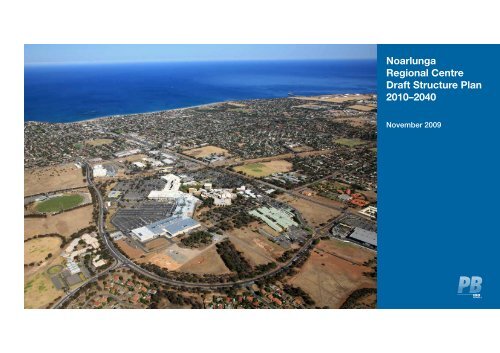
Noarlunga Regional Centre Draft Structure Plan 2010–2040
Noarlunga Regional Centre Draft Structure Plan 2010–2040
Noarlunga Regional Centre Draft Structure Plan 2010–2040

You also want an ePaper? Increase the reach of your titles
YUMPU automatically turns print PDFs into web optimized ePapers that Google loves.
<strong>Noarlunga</strong><br />
<strong>Regional</strong> <strong>Centre</strong><br />
<strong>Draft</strong> <strong>Structure</strong> <strong>Plan</strong><br />
<strong>2010–2040</strong><br />
November 2009
© Parsons Brinckerhoff Australia Pty Limited (PB) [2009].<br />
Copyright in the drawings, information and data recorded in<br />
this document (the information) is the property of PB. This<br />
document and the information are solely for the use of the<br />
authorised recipient and this document may not be used,<br />
copied or reproduced in whole or part for any purpose<br />
other than that for which it was supplied by PB. PB makes<br />
no representation, undertakes no duty and accepts no<br />
responsibility to any third party who may use or rely upon this<br />
document or the information.<br />
Author:________________________________________________<br />
Signed:________________________________________________<br />
Reviewer:______________________________________________<br />
Signed:________________________________________________<br />
Approved by:___________________________________________<br />
Signed:________________________________________________<br />
Date:__________________________________________________<br />
Distribution:____________________________________________
Table of Contents<br />
Foreword<br />
ii<br />
Introduction 1<br />
Study area 3<br />
Vision 6<br />
Objectives 11<br />
Transit oriented development 12<br />
Principles and strategies 13<br />
Moving forward 31<br />
Appendices 40<br />
Appendix A — Background 41<br />
Appendix B — Bibliography 53<br />
<strong>Noarlunga</strong> <strong>Regional</strong> <strong>Centre</strong> | i
Foreword<br />
Transforming <strong>Noarlunga</strong> <strong>Regional</strong> <strong>Centre</strong> into a fully-functional transit-oriented<br />
development (TOD) is a shared goal of the South Australian government and<br />
the City of Onkaparinga. <strong>Noarlunga</strong> <strong>Centre</strong>, as outlined in this plan, will be a<br />
vibrant, accessible and resilient regional centre where at least 10,000 people live<br />
and work.<br />
<strong>Noarlunga</strong> <strong>Centre</strong> is one of 13 TODs defined in the 30 Year <strong>Plan</strong> for Greater<br />
Adelaide and it’s development over the next 20 – 30 years requires new thinking,<br />
strong leadership, cooperative governance and key partnerships.<br />
The centre’s existing strong employment base and the current rail electrification<br />
and extension are important building blocks and provide considerable<br />
momentum. A dynamic program of place-making, involving the private and<br />
public sectors, will be a critical factor in attracting people into the centre.<br />
While there are a number of elements of the plan which will challenge current<br />
thinking on how suburban Adelaide regional centres look and operate, it is<br />
important to place the vision in a 20 to 30 year time context which will evolve and<br />
become less challenging as the TOD matures.<br />
The process also included consultation with key local landowners and service<br />
providers within the centre.<br />
In 2010 the project control group will work on the development of an<br />
implementation plan and appropriate governance arrangements, and more<br />
detailed precinct planning around the station and around the land owned by the<br />
Office of Recreation and Sport will commence.<br />
Your comments on the draft structure plan are welcomed and should to be<br />
received by Monday 21 December 2009. Electronic copies are available from all<br />
of the above agencies’ websites and from the front counter of Council offices.<br />
Your comments should be addressed and mailed to:<br />
Project Manager<br />
<strong>Noarlunga</strong> <strong>Regional</strong> <strong>Centre</strong> <strong>Draft</strong> <strong>Structure</strong> <strong>Plan</strong><br />
c/o City of Onkaparinga<br />
PO BOX 1<br />
NOARLUNGA SA 5168<br />
Equally, it is important to note that the plan expresses aspirations for new<br />
and modified infrastructure that should not be construed as committed or<br />
funded proposals. Further steps including precinct plans and business-case<br />
development will further explore desired outcomes.<br />
The structure plan outlines a vision for the <strong>Noarlunga</strong> TOD, identifies its<br />
organising elements and outlines a potential staging of development. The plan<br />
incorporates learnings and experience from interstate and international locations<br />
that demonstrate the key elements for success for <strong>Noarlunga</strong> <strong>Regional</strong> <strong>Centre</strong>.<br />
The vision expressed in this structure plan has been developed by internationallyrecognised<br />
planning and urban design consultancy, Parsons Brinckerhoff (PB),<br />
overseen by a multi-agency project control group with the following members:<br />
• City of Onkaparinga<br />
• Department of Transport, Energy and Infrastructure<br />
• Department of Families and Communities (Housing SA)<br />
• Department of <strong>Plan</strong>ning and Local Government<br />
• Land Management Corporation.
Introduction<br />
Intent<br />
The City of Onkaparinga wishes to create a vibrant, accessible and resilient<br />
<strong>Noarlunga</strong> <strong>Regional</strong> <strong>Centre</strong>. The <strong>Centre</strong> will use transit oriented development<br />
(TOD) principles to achieve this transformation and capitalize on its outstanding<br />
location to promote sustainable population growth. This structure plan provides a<br />
high level strategy for bringing this idea to life over the next 30 years.<br />
The importance of the <strong>Noarlunga</strong> <strong>Regional</strong> <strong>Centre</strong> as a city and regional centre<br />
is highlighted in the City of Onkaparinga Community <strong>Plan</strong> 2028 which proposes<br />
that the <strong>Centre</strong> be “further developed to provide an enlivened regional centre<br />
with at least 10,000 people living and working in the locality, focused around<br />
the train station”. The Community <strong>Plan</strong> also outlines the importance of infill<br />
to augment greenfield development and create a more accessible, lively and<br />
resilient urban form.<br />
Southern Adelaide is a diverse and vibrant region which is home to a quarter<br />
of metropolitan Adelaide’s population, contributes significantly to the economy<br />
of the State and contains significant features of the area’s natural and cultural<br />
heritage. Growing prosperity and opportunity is vital to achieving a better quality<br />
of life for the community over the next 30 years.<br />
The City of Onkaparinga’s role as the focal point of the Southern Adelaide region<br />
is expected to increase with the electrification and extension of the <strong>Noarlunga</strong><br />
rail line and to Seaford, and then potentially longer-term to Aldinga. Development<br />
of the <strong>Centre</strong> using TOD principles will result in more choice in where people live<br />
and work, how they travel and how they undertake our daily activities.<br />
The City of Onkaparinga has led the plan preparation on behalf of the <strong>Noarlunga</strong><br />
Project Control Group (PCG). The PCG includes: the Department of <strong>Plan</strong>ning<br />
and Local Government; Housing SA; Department for Transport, Energy and<br />
Infrastructure; and Land Management Corporation.<br />
The plan discounts the philosophy that current trends, patterns and perceptions<br />
determine the future. It is forward thinking looking beyond current prevailing<br />
property market dynamics in greater Adelaide. Change happens and this<br />
vision intends to guide change for the better. The plan and this philosophy are<br />
supported by the State Government’s TOD strategy and underpinned by sound<br />
TOD planning principles.<br />
Key elements of the structure plan<br />
This structure plan is a high level spatial outline of the preferred vision,<br />
objectives, principles and strategies for the <strong>Noarlunga</strong> <strong>Regional</strong> <strong>Centre</strong>. It is<br />
intended to foster further discussion and interest in the future revitalisation of<br />
the <strong>Centre</strong>. The plan is graphically presented to guide more detailed design and<br />
planning exercises.<br />
The document explains the benefits of TOD, and the key principles and<br />
strategies for attaining such. A background summary of existing conditions and<br />
supporting policies and strategies is also presented.<br />
Aerial view of <strong>Noarlunga</strong> looking south<br />
The plan outlines steps for moving towards adoption of the structure plan by<br />
the City of Onkaparinga and subsequent translation into more detailed precinct<br />
plans. The plan also suggests steps to deliver innovative and achievable<br />
development outcomes on the ground. This includes measures for community<br />
consultation and governance to advance the plan. It includes an action plan to<br />
identify potential short-term development priorities that will trigger development<br />
and investment from key stakeholders, while outlining longer-term planning<br />
options, investment and infrastructure requirements to deliver the preferred<br />
model for the <strong>Centre</strong>.<br />
<strong>Noarlunga</strong> <strong>Regional</strong> <strong>Centre</strong> | 1
Image: Onkaparinga, South Australia<br />
Image: Onkaparinga, South Australia<br />
Image: Onkaparinga, South Australia<br />
Image: Onkaparinga, South Australia<br />
2 | <strong>Noarlunga</strong> <strong>Regional</strong> <strong>Centre</strong>
Study area<br />
Figure 1: <strong>Regional</strong> location<br />
<strong>Regional</strong> context<br />
<strong>Noarlunga</strong> <strong>Regional</strong> <strong>Centre</strong> is located about 30 km to the south of the Adelaide<br />
CBD and is the southernmost of five <strong>Regional</strong> Activity <strong>Centre</strong>s in metropolitan<br />
Adelaide. It is the key focus for business and government services serving<br />
the outer southern metropolitan region as well as towns and rural areas in the<br />
Fleurieu Peninsula.<br />
<strong>Regional</strong> services located at <strong>Noarlunga</strong> include the <strong>Noarlunga</strong> Health <strong>Centre</strong> and<br />
Hospital, <strong>Centre</strong>link office, correctional services facility and TAFE. The <strong>Centre</strong> is<br />
also the primary retail hub for the outer southern region and shopping is centred<br />
on the Colonnades Shopping <strong>Centre</strong> (Centro Colonnades) owned by the Centro<br />
Properties Group.<br />
<strong>Noarlunga</strong> is a major public transport interchange, connecting commuter rail and<br />
bus services. It is presently the final destination on the Adelaide to <strong>Noarlunga</strong><br />
rail line. Its role as a regional commuter destination is expected to grow with the<br />
extension of the rail line to Seaford.<br />
The <strong>Centre</strong> is well-connected to other parts of Adelaide via the Southern<br />
Expressway and Main South Road.<br />
Main South Road<br />
Adelaide City <strong>Centre</strong><br />
Beach Road<br />
<strong>Noarlunga</strong> Rail Line<br />
N<br />
0 2 4 6 8km<br />
Southern Expressway<br />
<strong>Noarlunga</strong> <strong>Regional</strong> <strong>Centre</strong><br />
<strong>Noarlunga</strong> <strong>Regional</strong> <strong>Centre</strong> | 3
City of Onkaparinga<br />
Figure 2: City location<br />
<strong>Noarlunga</strong> <strong>Regional</strong> <strong>Centre</strong> is strategically located to serve the business,<br />
administrative and leisure needs of Onkaparinga’s diverse communities located<br />
along the coast, the southern Adelaide Hills region and in the wine‐growing area<br />
of McLaren Vale.<br />
Hallett Cove Station<br />
Trott<br />
Park<br />
Happy<br />
Valley<br />
As the primary and largest activity centre within the city, <strong>Noarlunga</strong> is the focus<br />
for local government offices and council-wide community services including<br />
the <strong>Noarlunga</strong> Library, Australian Technical College, Cardijn College and South<br />
Adelaide Football Club oval and offices.<br />
SOUTH AUSTRALIA<br />
Reynella<br />
Reynella<br />
East<br />
<strong>Noarlunga</strong> is a focus for regional and local bus services and serves as<br />
an important park-and-ride destination for commuters travelling into<br />
central Adelaide.<br />
Lonsdale<br />
Lonsdale Station<br />
Woodcroft<br />
The City of Onkaparinga is expected to grow by 58,000–63,000 residents<br />
bringing the total population to about 208,000–213,000 by 2050. As part<br />
of its future growth strategy, the city is looking to accommodate much of<br />
this additional growth through infill development in activity centres such<br />
as <strong>Noarlunga</strong>.<br />
O'Sullivan<br />
Beach<br />
Christie<br />
Downs<br />
Morphett<br />
Vale<br />
By 2010, about 60% of the city’s residents will leave the area daily for work.<br />
Currently about 4,000 people work in <strong>Noarlunga</strong> <strong>Centre</strong> and the city is hoping<br />
that its revitalisation will encourage more residents to find employment within the<br />
city itself.<br />
Christies<br />
Beach<br />
Christie Downs Station<br />
<strong>Noarlunga</strong> Interchange<br />
Port<br />
<strong>Noarlunga</strong><br />
Beach Road<br />
Hackham<br />
West<br />
Main South Road<br />
Onkaparinga<br />
Hills<br />
<strong>Noarlunga</strong><br />
Downs<br />
Huntfield<br />
Heights<br />
Hackham<br />
<strong>Noarlunga</strong><br />
South<br />
Seaford<br />
Meadows<br />
Seaford<br />
Old<br />
<strong>Noarlunga</strong><br />
McLaren<br />
Vale<br />
<strong>Noarlunga</strong> Rail Line<br />
N<br />
0 1 2 3 4km<br />
Seaford<br />
Heights<br />
Southern Expressway<br />
4 | <strong>Noarlunga</strong> <strong>Regional</strong> <strong>Centre</strong>
Neighbourhood context<br />
<strong>Noarlunga</strong> is a key educational, recreational and civic hub for the local area with<br />
the Hopgood Theatre, Christies Beach High School and the City of Onkaparinga<br />
Recreational <strong>Centre</strong>.<br />
Figure 3: Land tenure/tenant<br />
10 min walk<br />
The Colonnades serves both local and regional communities and occupies about<br />
58,000 square metres of retail floor space.<br />
The majority of the land around the Colonnades is owned by state and local<br />
government agencies such as the Department of Health, Office of Recreation<br />
and Sport, the Department of Education and Community Services, Housing SA,<br />
and the City of Onkaparinga.<br />
4<br />
5 min walk<br />
Christie<br />
Downs<br />
7<br />
9<br />
Morphett<br />
Vale<br />
Population in the local area is projected to grow at a similar rate as the rest of the<br />
city with an expected doubling of the aged population between now and 2025.<br />
Single parents and childless couples make up more than 50% of households in<br />
the local area.<br />
Christies<br />
Beach<br />
23 21<br />
5<br />
22<br />
Beach Road<br />
10<br />
The proportion of lower-income households in the local area is greater than the<br />
council average and there are more long-term public housing tenants residing<br />
here than in any other southern Housing SA areas.<br />
1<br />
City of Onkaparinga<br />
Goldsmith Drive<br />
8<br />
13<br />
12<br />
11<br />
2 4<br />
South Australian<br />
Housing Trust<br />
Dyson Road<br />
Port<br />
<strong>Noarlunga</strong><br />
6<br />
20<br />
Goldsmith Drive<br />
19<br />
3<br />
1 2<br />
18<br />
5 min walk<br />
Lovelock Drive<br />
Burgess Drive<br />
10 min walk<br />
17<br />
16<br />
14<br />
15<br />
Honeypot Road<br />
5 Marcellin College<br />
6 Minister for<br />
Correctional Services<br />
7 Christies Beach High<br />
School<br />
8 TransAdelaide<br />
9 St Basil’s Church and<br />
Hostel<br />
10 <strong>Noarlunga</strong> Health<br />
Village<br />
11 <strong>Noarlunga</strong> Hospital<br />
12 TAFE SA<br />
13 City of Onkaparinga<br />
14 Centro Properties Ltd<br />
15 Cardijn College<br />
16 Minister for Recreation<br />
and Sport<br />
17 South Adelaide<br />
Football Club<br />
18 Minister for Transport<br />
19 22 Private (other)<br />
23 Police Station<br />
N<br />
0 150 300<br />
metres<br />
Image: City of Onkaparinga<br />
<strong>Noarlunga</strong> <strong>Regional</strong> <strong>Centre</strong> | 5
Vision<br />
Figure 4: Key elements of vision<br />
10 min walk<br />
By 2028, the <strong>Noarlunga</strong> <strong>Regional</strong> <strong>Centre</strong> will be transformed into the centrepiece<br />
of the City of Onkaparinga and southern Fleurieu Peninsula.<br />
The <strong>Centre</strong> will be thriving as the commercial and community heart of the<br />
city and region. It will become a place where 10,000 people choose to live<br />
and work — a place that is accessible, vibrant and resilient. The vision for this<br />
transformation is presented below.<br />
The key elements of the <strong>Noarlunga</strong> <strong>Centre</strong> Vision are illustrated in Figure 4<br />
15<br />
5 min walk<br />
9<br />
Christie<br />
Downs<br />
16<br />
Morphett<br />
Vale<br />
Christies<br />
Beach<br />
Marcellin<br />
College<br />
2<br />
Christies Beach<br />
High School<br />
4<br />
Beach Road<br />
13<br />
11<br />
8<br />
3<br />
Goldsmith Drive<br />
3<br />
Dyson Road<br />
Goldsmith Drive<br />
12<br />
6<br />
5<br />
1<br />
Burgess Drive<br />
5 7<br />
10<br />
11<br />
1<br />
2<br />
3<br />
4<br />
5<br />
Station upgrade<br />
Greenbridge (on air rights)<br />
Main Street<br />
Beach Road duplication<br />
Station plazas<br />
6<br />
Station area precinct<br />
Port<br />
<strong>Noarlunga</strong><br />
14<br />
5 min walk<br />
Lovelock Drive<br />
South<br />
Adelaide<br />
Football<br />
Oval<br />
16<br />
Cardijn<br />
Oval<br />
Cardijn<br />
College<br />
Honeypot Road<br />
7<br />
8<br />
9<br />
10<br />
11<br />
12<br />
13<br />
Council offices relocation<br />
to station<br />
Christies Beach link<br />
Christie Downs link<br />
Colonades transition precinct<br />
Government services/medical/<br />
TAFE transition precint<br />
Big box transition precinct<br />
Park & Ride transition precinct<br />
14<br />
Rail extension<br />
10 min walk<br />
15<br />
16<br />
Knowledge corridor<br />
Sports hub network<br />
N<br />
0 150 300<br />
metres<br />
6 | <strong>Noarlunga</strong> <strong>Regional</strong> <strong>Centre</strong>
New uses and street pattern<br />
Figure 5: General future land use patterns<br />
By introducing a traditional grid street pattern and a range of new uses, <strong>Noarlunga</strong><br />
can become a more accessible, vibrant and resilient centre. Using the grid<br />
street framework, the general patterns and mixes of uses are shown in Figure 5.<br />
There will be a high degree of flexibility of uses within precincts and buildings. The<br />
boundaries between districts are not fixed. As a result, there may be some blending<br />
of uses from one land use district to another. The key is to use the urban design<br />
guidelines to provide strong transitions between differing uses.<br />
The merits of the grid street system are described on page 16. The location of<br />
new streets is indicative and will be refined based on future precinct planning.<br />
However, when considering future land use proposals in light of this plan, a key<br />
guiding principle will be to ensure that whatever is done in the short term does<br />
not preclude the long term vision.<br />
Retail mixed use<br />
Ground floor retail with residential, or indoor recreation, hotel, education,<br />
commercial or service uses on upper floors<br />
Christies<br />
Beach<br />
10 min walk<br />
5 min walk<br />
Marcellin<br />
College<br />
Christie<br />
Downs<br />
Christies Beach<br />
High School<br />
Beach Road<br />
Morphett<br />
Vale<br />
Medical mixed use<br />
Dyson Road<br />
Port<br />
<strong>Noarlunga</strong><br />
Goldsmith Drive<br />
5 min walk<br />
Lovelock Drive<br />
10 min walk<br />
Honeypot Road<br />
Goldsmith Drive<br />
Primarily health-related uses including supporting commercial (e.g. laboratories)<br />
retail (e.g. pharmacy) or services (e.g. counselling)<br />
Station mixed use<br />
Rail and bus interchange, transit related services, indoor recreation, small retail/<br />
upper floor commercial uses, hotel<br />
Commercial mixed use<br />
Parcels fronting on station reserved for government services and commercial<br />
uses and remaining parcels for commercial uses, government services, hotel<br />
residential uses and indoor recreation<br />
Higher education and academics use<br />
Primarily education, research, commercial research applications and community<br />
facilities. Includes indoor recreation, incubaters, small retail and academic<br />
related housing<br />
Residential mixed use<br />
Range of residential uses including indoor recreation, small retail and commercial uses<br />
Residential<br />
Residential (less than 4 stories)<br />
Public plazas and open spaces<br />
Green streets, civic spaces,<br />
plazas, bike pths, active<br />
recreation fields, skate park<br />
and other outdoor spaces<br />
The vision is based on a<br />
phased transformation<br />
outlined on pages 32–35<br />
Burgess Drive<br />
South<br />
Adelaide<br />
Football<br />
Oval<br />
Cardijn<br />
Oval<br />
Cardijn<br />
College<br />
N<br />
Land Use Pattern<br />
Retail Mixed Use<br />
Medical Mixed Use<br />
Passive Recreation<br />
Active Recreation,<br />
Ovals and Fields<br />
Higher Education/<br />
Academic Mixed use<br />
Station/Commercial<br />
Mixed Use<br />
Residential Mixed use<br />
(50 dwelling units/ha<br />
or greater)<br />
Residential only<br />
(35 dwelling units/ha<br />
or greater)<br />
Rail station and<br />
Bus Interchange<br />
0 150 300<br />
metres<br />
<strong>Noarlunga</strong> <strong>Regional</strong> <strong>Centre</strong> | 7
Vibrant <strong>Noarlunga</strong><br />
Figure 6: Knowldege corridor<br />
Vibrant <strong>Noarlunga</strong> will boast a broad yet compatible mix of uses that encourages lively<br />
activity throughout the day and into the evening seven days a week. The core, or area<br />
within 5 minutes walk of the station, will embrace the pedestrian-intensive main street.<br />
Activities at the centre of the main street will include commercial and retail areas with<br />
upper floor residential uses. The ends will be anchored by health and educational<br />
precincts. Other parts of the <strong>Centre</strong> will transition gradually into primarily residential use.<br />
Residents in both the core and transition areas will enjoy the mix of uses in the core.<br />
The <strong>Centre</strong> will move away from being dominated by the indoor and car-based shopping<br />
of the Colonnades and stand‐alone retail uses. The first step will be to focus of shopping<br />
along the main street. The second will be the redevelopment of the shopping centre and<br />
other stand alone retail buildings along a grid street network.<br />
New commercial uses will be closely integrated with residential or other uses in the<br />
same buildings. The commercial spaces can help meet the anticipated growth of service<br />
providers in the region. While it is estimated there are approximately 4,000 jobs currently<br />
in the centre, the vision foresees a growing role for commercial space in the centre.<br />
Vibrancy will be reinforced by the housing choices available to residents. The 3,000 new<br />
homes will offer a range of well-designed medium to higher density housing options<br />
for families, couples and single people. Some parts of the <strong>Centre</strong> will comprise mainly<br />
housing while others areas will be dedicated to mixed use, but all will be well-integrated<br />
and contribute to the vitality of the whole. Housing will be diverse and imaginative and<br />
include a substantial proportion and range of energy efficient affordable, aged and special<br />
needs dwellings.<br />
The sharing of knowledge will be a constant contribution to the vitality of the <strong>Centre</strong>. The array<br />
of educational facilities which currently includes Cardijn College, the TAFE, Christies Beach<br />
High School and the Technical School will be completed with the construction of a university<br />
centre to the west of the railway. This ‘knowledge corridor’ will provide the opportunity for a<br />
diverse range of people to learn in a broad range of environments suited to their individual<br />
aspirations. Advancing the skills for meeting our changing environmental and economic<br />
conditions will be fostered. The knowledge circle will be reinforced as an interconnected,<br />
intergenerational community centre where extracurricular activities are abundant.<br />
The <strong>Centre</strong> will continue to serve the needs of the growing southern Adelaide region<br />
by offering a wide range of shopping, arts, entertainment, education, recreation, health<br />
cultural and community services. Equally diverse and imaginative open space and<br />
recreational facilities will be easily accessible by foot and the extensive vistas towards the<br />
coast and river estuary will be captured both from public spaces and individual dwellings.<br />
Major community facilities like the station, schools, leisure centres, civic arts centres<br />
and the library will be community hubs. They will be located where people can easily<br />
access them. In order to enhance vibrancy, they should operate with extended hours,<br />
but must be located in areas of high activity, where they can contribute to and benefit<br />
from increased casual surveillance. Ideally, they will be co-located with public plazas to<br />
heighten the civic role these hubs play and to activate the public spaces.<br />
The <strong>Centre</strong> will be welcoming and supportive of people from different parts of our<br />
community. It will offer opportunities for affordable and adaptable housing and have public<br />
spaces that are always accessible and cater to the young, aged and infirm. It will have a<br />
street network and public places that balances the needs of the motorist with those of<br />
the pedestrian and cyclist.<br />
Christies<br />
Beach<br />
Shared<br />
university<br />
centre<br />
Dyson Road<br />
Port<br />
<strong>Noarlunga</strong><br />
Internet<br />
study/lecture<br />
centre<br />
Goldsmith Drive<br />
Marcellin<br />
College<br />
10 min walk<br />
5 min walk<br />
Marcellin<br />
College<br />
Interchange<br />
and Station<br />
5 min walk<br />
Lovelock Drive<br />
Burgess Drive<br />
10 min walk<br />
South<br />
Adelaide<br />
Football<br />
Oval<br />
Christie<br />
Downs<br />
Christies<br />
Beach<br />
High School<br />
Christies Beach<br />
High School<br />
Cardijn<br />
Oval<br />
Cardijn<br />
College<br />
Cardijn<br />
College<br />
Honeypot Road<br />
Beach Road<br />
Nursing<br />
School<br />
Goldsmith Drive<br />
N<br />
TAFE<br />
New Uses<br />
Retail Mixed Use<br />
Medical Mixed Use<br />
Station Mixed Use<br />
Academic Mixed Use<br />
Commercial Mixed Use<br />
Residential Mixed Use<br />
Residential<br />
Public Plazas and<br />
Open Spaces<br />
Possible Future<br />
Rail Extension<br />
<strong>Structure</strong>d Park and Ride<br />
Rail and Bus Interchange<br />
0 150 300<br />
metres<br />
Morphett<br />
Vale<br />
8 | <strong>Noarlunga</strong> <strong>Regional</strong> <strong>Centre</strong>
Accessible <strong>Noarlunga</strong><br />
Accessible <strong>Noarlunga</strong> will be well-connected within itself as well as to the rest of<br />
greater Adelaide. The <strong>Centre</strong> will be characterised by high levels of connectivity<br />
to promote walking, cycling and transit use. Priority will be given to designs that<br />
make life better for those who choose not to, or cannot drive an automobile<br />
A seamless connection between the public transport interchange and all activities<br />
in the TOD will be developed. However, the transit station will be about more<br />
than getting on or off a bus or train. While it will provide an outstanding venue for<br />
accessing transit, the bus and train interchange will be integrated with a range of<br />
uses to create a destination in itself. With its creative design, overtime it will be both<br />
a landmark and an important hub within the bustling core of the <strong>Centre</strong>.<br />
Travel routes for all modes will be legible, linked by landscaped areas, and<br />
priority will be given to walking, cycling and transit routes. A comprehensive<br />
grid network of streets will serve as ‘living rooms’ for walkers and cyclists. They<br />
will be safe and visually compelling. Through the use of short block faces and a<br />
variety of street types, they will offer choice and be convenient and interesting for<br />
pedestrians, cyclists and transit users. The <strong>Centre</strong> and public spaces will be well<br />
signed and lively both day and night.<br />
A ‘main street’ framed by lively street frontages, including cafes, galleries, and<br />
libraries, sunlit but with shaded areas, will extend east-west within a 10 minute<br />
walk from the station.<br />
Parking will become less essential for many users and much less dominant in<br />
the landscape. Parking would be provided in multi-storey structures wrapped<br />
with buildings or in on-street spaces. Some neighbourhoods may even be free of<br />
any on-site parking in order to create more land area for push bike parking, food<br />
gardens and other amenities.<br />
The <strong>Noarlunga</strong> Station and Bus Interchange are key to the <strong>Centre</strong>’s accessibility.<br />
<strong>Noarlunga</strong> <strong>Regional</strong> <strong>Centre</strong> | 9
Resilient <strong>Noarlunga</strong><br />
Figure 7: Sports hub network<br />
Resilient <strong>Noarlunga</strong> will ensure that environmental, social and economic<br />
stewardship underpins the development and functioning of the <strong>Centre</strong>. It will<br />
promote resilience by following the basic tenet that ‘diversity is stability.’<br />
10 min walk<br />
The <strong>Centre</strong> will strive to be a low carbon environment by encouraging the use<br />
of public transport, walking and cycling, and facilitating the integration of energy<br />
and water efficiency into development and land uses. The natural environment<br />
and the region’s cultural heritage will continue to be important and will be<br />
integrated into the <strong>Centre</strong> through green streets, landscaped walking and cycling<br />
paths, and open spaces that are well-linked, well‐located and well-designed.<br />
The <strong>Centre</strong> will be highlighted by a green-bridge made up of a corridor of<br />
innovative buildings and streets built over the existing rail line. The bio‐bridge<br />
will feature living walls, green roofs and other green building and environmental<br />
technologies throughout. The uses within the bio-bridge will be powered by<br />
green utilities generated on site.<br />
Christies<br />
Beach<br />
5 min walk<br />
Marcellin<br />
College<br />
Christie<br />
Downs<br />
Christies Beach<br />
High School<br />
Beach Road<br />
Morphett<br />
Vale<br />
In addition to the green-bridge precinct at the core of the <strong>Centre</strong>, the natural<br />
environment will be showcased in the <strong>Centre</strong> as will the region’s cultural heritage<br />
through expressions of public art. Community gardens may provide locally<br />
grown food.<br />
Interchange<br />
and Station<br />
Goldsmith Drive<br />
The resilience of <strong>Noarlunga</strong> will also be strengthened by the creation of a<br />
sporting facility hub network. The network will include an efficiently used, well<br />
maintained array of playing fields and ovals, outdoor recreation courts and<br />
facilities and indoor recreation facilities. All of these will be well connected for<br />
active travel by walking and bicycling. The effect will be to improve physical and<br />
mental health as well as economic competitiveness.<br />
Dyson Road<br />
Burgess Drive<br />
The <strong>Centre</strong> will respond to the pressing issues of sustainability, show casing<br />
efficient use of land, materials, water and energy, and low consumption of<br />
resources both in its construction and operation. Water will be harvested and<br />
reused locally, renewable energy (especially wind and solar) will be harnessed,<br />
and waste will be minimised through reducing, reusing and recycling. As<br />
planning and design proceeds over the next 30 years, climate change adaptation<br />
measures and sustainability innovations will be advanced.<br />
In addition, the <strong>Centre</strong> will help to maintain a thriving economy by creating<br />
resilience in the face of economic downturn. This will be pursued by countering<br />
the recent loss of industry and further promoting tourism as well as increasing<br />
investment in the aging broadband and transport infrastructure. And lastly, the<br />
<strong>Centre</strong> will to increase the community connection and vitality by improving social<br />
infrastructure and services, engaging young and old alike, promoting healthier<br />
living to reduce stress on health services, and stopping the widening of the<br />
poverty and housing affordability gap.<br />
Port<br />
<strong>Noarlunga</strong><br />
Goldsmith Drive<br />
5 min walk<br />
Lovelock Drive<br />
10 min walk<br />
South<br />
Adelaide<br />
Football<br />
Oval<br />
Cardijn<br />
Oval<br />
Cardijn<br />
College<br />
Honeypot Road<br />
Indoor Facilities<br />
Sports Fields<br />
Courts and Small<br />
Area Facilities<br />
Cycling/Walking<br />
Conector<br />
N<br />
0 150 300<br />
metres<br />
10 | <strong>Noarlunga</strong> <strong>Regional</strong> <strong>Centre</strong>
Objectives<br />
The following broad objectives apply to the project.<br />
<strong>Regional</strong> centre<br />
• transform the <strong>Noarlunga</strong> <strong>Regional</strong> <strong>Centre</strong> to accommodate at least<br />
6,000 new residents (currently none) and adding to the 4,000 people<br />
currently working within the precinct according to the principles and<br />
strategies outlined in the following chapter<br />
• apply TOD principles and supporting strategies to support the transformation<br />
including the key premises that:<br />
• placemaking is paramount<br />
• mixing uses is essential<br />
• building designs matter and<br />
• moving people, not cars is the priority.<br />
• foster the redevelopment of the Colonnades and other big box retail as<br />
mixed use development<br />
• create a vibrant core area within a 400 m radius around and over the<br />
<strong>Noarlunga</strong> Train Station/rail line, comprising a complementary mix of office,<br />
retail, entertainment and residential spaces linked by a grid network of<br />
pedestrian-friendly streets<br />
• ensure land is used for its optimal purpose as part of the <strong>Centre</strong>, with<br />
negotiations with current owners reflecting this aim.<br />
Employment and economic development<br />
• expand the economic and employment role of the <strong>Noarlunga</strong> <strong>Centre</strong> through<br />
the development of further commercial and business opportunities against<br />
jobs and other economic targets (derived from published State, <strong>Regional</strong> and<br />
Council strategies and other data sources).<br />
Urban design, built form and community planning<br />
• provide for sufficient health, education and community services<br />
• encourage social interaction and defer crime through a high standard<br />
of urban design, using crime prevention through environmental design<br />
(CPTED) principles<br />
• strengthen the <strong>Centre</strong>’s sense of place, evident in building frontages/<br />
treatment, open space, roads and verges, pathways, landscaping<br />
and signage<br />
• require built form to be expressive and imaginative and engender vitality<br />
whilst being efficient and sparing in use or resources<br />
• establish high speed broadband throughout the <strong>Centre</strong>.<br />
Affordable housing<br />
• provide a minimum of 15% affordable housing, including at least 5% high<br />
needs housing, taking into account the needs of the wider area and including<br />
privately owned housing, rental housing, community housing, social housing<br />
and essential services housing.<br />
Culture, heritage, art<br />
• ensure the region’s heritage is evident through interpretive Aboriginal and<br />
non-Aboriginal features in the landscape, views and built form<br />
• develop stimulating public art throughout the <strong>Centre</strong>.<br />
Use of resources (water, energy, materials, waste)<br />
• develop stormwater management, ASR, water harvesting, on-site waste<br />
water treatment and reuse<br />
• minimise energy use (including embodied energy) and maximise use of<br />
renewable energy in design and use of buildings, the public realm and<br />
infrastructure provision<br />
• create an environment that inherently reduces consumption, minimises<br />
waste and encourages recycling and composting.<br />
Commercial investment opportunities and partnerships<br />
• encourage an acceptable financial return to current landowners and<br />
developers/private sector partners, using transparent processes<br />
• optimise development opportunities by assembling land packages with the<br />
<strong>Centre</strong> and environs to be offered to the private sector.<br />
The centre offers<br />
outstanding views<br />
to the hill, river<br />
and ocean.<br />
View south of Goldsmith Road, Onkaparinga, South Australia<br />
<strong>Noarlunga</strong> <strong>Regional</strong> <strong>Centre</strong> | 11
Transit oriented development<br />
The <strong>Structure</strong> <strong>Plan</strong> is based on Transit Oriented Development principles. TOD<br />
principles are a critical tool used to reduce urban sprawl and encourage use<br />
of alternatives to the automobile. As shown below, TOD projects can improve<br />
walking and transit ridership and bring a broad range of other benefits to the<br />
City of Onkaparinga. Successful TOD areas are designed based on the central<br />
theme of an outstanding walking and transit environment that encourages living,<br />
working and shopping in the same area. Potential benefits from TOD principles<br />
are listed below.<br />
A TOD area is generally focused on a 10 minute walking radius of the transit<br />
station with the highest intensity and mix of uses usually located within 5 minutes<br />
walk of the station. There is generally a significant drop-off in the number of<br />
residential passengers and employees who will walk to and from a station for<br />
longer than 10 minutes and 5 minutes respectively.<br />
Financial benefits<br />
Infill development can save government approximately $80,000 per block to<br />
provide power, water, sewerage, schools, hospitals and local government<br />
services compared to fringe development (CUSP PB 2008).<br />
Smaller dwelling areas (buildings, lot sizes or unit sizes) require proportionally<br />
less infrastructure per dwelling. For example, a dwelling on a 150 square metre<br />
allotment requires 75% less connecting pipe, wire, roads and footpaths as on a<br />
600 square metre allotment. This translates into lower building costs for unites<br />
up to 2–3 storeys and lower baee costs for all types of units<br />
People in urban developments drive less frequently and own fewer cars. This<br />
equals savings of $5,000 per year for each household. (CUSP PB 2008).<br />
Living in a TOD can also save energy costs to each household.<br />
Environmental benefits<br />
TOD residents are 5–6 times more likely to travel to work by public transport as<br />
suburban residents (TCRP 2004)<br />
Office workers located in TODs are 3.5 times more likely to commute by public<br />
transport than the average office worker (TCRP 2004).<br />
Living in compact housing styles (flats and townhouses) use 40% less water<br />
and 20% less energy than households of a similar size and income living in a<br />
detached house (Rickwood 2007)<br />
‘Other’ residential dwellings (as labelled by the Australian Bureau of Statistics<br />
(ABS) are 25–40% smaller than detached houses resulting in a proportional<br />
reduction in embedded energy in building materials.<br />
Constructing infill dwellings in compact formats will reduce the need for<br />
Greenfield development at the fringe. In order to provide equivalent of the 3,000<br />
additional dwelling units included in this structure plan, approximately 250<br />
hectares of fringe area would require rezoning and development.<br />
Living within or near a TOPD can reduce household CO 2 emissions from<br />
transport alone by over 3 tonnes per annum (TCRP 2004).<br />
Economic benefits<br />
An active, vibrant centre with a diversity of tenancy options attracts and<br />
incubates new businesses, and creates more local employment options (TCRP<br />
2004 and Grady 2006).<br />
A major local destination encourages money to be spent locally and provides<br />
local jobs (Grady 2006).<br />
Agricultural land that would otherwise have been developed for housing will be<br />
kept available for production.<br />
Social benefits<br />
Active, vibrant places reduce crime and increase perceptions of safety<br />
(TCRP 2004).<br />
Pedestrian activity increases chance encounters between neighbours and helps<br />
build a sense of community (Barton 2002).<br />
Easy and reliable access to services and employment by foot, or via public<br />
transport can significantly reduce the impact of rising fuel prices.<br />
Living in a pedestrian environment encourages incidental exercise improving<br />
health and wellbeing (Mees 2006).<br />
TOD is about creating<br />
places of lasting value<br />
that encourage walking<br />
and transit use.<br />
12 | <strong>Noarlunga</strong> <strong>Regional</strong> <strong>Centre</strong>
Principles and strategies<br />
Placemaking is paramount<br />
Creating a community of lasting value starts with the public realm. The building<br />
blocks of the public realm in a TOD-based <strong>Centre</strong> include the station, as well as<br />
a ‘green-bridge’, main street, livable streets, plazas, community hubs and open<br />
spaces. Each is located so that they support each other and the community,<br />
especially within the compact core (approximately 5 minutes waking distance<br />
from the station). The core is big enough to allow desirable commercial activity<br />
but compact enough to foster high intensity street activity.<br />
Station precinct<br />
The station precinct will include the rail station, bus interchange and<br />
park‐and‐ride facilities. The station precinct is the community’s gateway to the<br />
outside world, and equally, the world’s gateway to <strong>Noarlunga</strong>. It must be an<br />
attractive and functional part of <strong>Noarlunga</strong>. It must be well connected to other<br />
public transport modes and the surrounding community, accessible for all, safe<br />
and secure, easy to navigate, and a pleasant place to be.<br />
The station precinct will be about more than getting on or off the bus or train.<br />
It will be redeveloped as a service centre whereby a wide range of ancillary<br />
activities, such as adult education, fitness centres, business start-ups and<br />
cultural activities, will occur. The station precinct may also accommodate a<br />
hotel, reservation service, ticketing, e-business, or a pick-up centre for electronic<br />
purchasing. Additional potential uses include car rental, telephone service,<br />
insurance agency, travel agency, bank (ATM) and a convenience store.<br />
Properly treated, the station precinct will provide the initial impetus for<br />
development of the district surrounding the station. It will serve as the gateway<br />
and will become a significant civic statement. A well designed station area will<br />
give the community a ‘feel good’ atmosphere and a strong sense of identity.<br />
When integrated as the pedestrian anchor to the rest of the <strong>Centre</strong>, it will<br />
establish a direct and easily comprehended travel chain for arriving and departing<br />
passengers to and from the surrounding land uses.<br />
Design will be derived to create a civic landmark and will be based on pedestrian<br />
connections. The desired approach will be ‘development oriented transit’ (DOT)<br />
whereby placemkaking and pedestrian movement will be given highest profile.<br />
Design will not be derived solely by optimal transit operations.<br />
It is envisioned the station precinct will be fronted by a main street to its north.<br />
As a result, the perceived ‘front door’ of the station precinct will be at grade with<br />
the main street. The station precinct will take advantage of existing topography<br />
to use air rights over the platform and tracks for additional development. As the<br />
focal point of the <strong>Centre</strong>, a building of up to 10 storeys is envisaged. The station<br />
precinct will be combined with both commercial and ancillary uses to create the<br />
highest, most prominent building in the <strong>Centre</strong>.<br />
Stations should be<br />
‘feel good’ spaces.<br />
Image: Subiaco Station, Subiaco, Western Australia<br />
Image: Subiaco Station, Subiaco, Western Australia<br />
Stations help to<br />
create or anchor an<br />
important place.<br />
<strong>Noarlunga</strong> <strong>Regional</strong> <strong>Centre</strong> | 13
Green bridge<br />
The air rights over the rail line between north of Beach Road and south of<br />
Goldsmith Road will be developed as an innovative green-bridge of ‘iconic’<br />
spaces, streets and buildings. The green-bridge will serve as a spine extending<br />
north and south from the new station. It will link the east and west side of the<br />
compact core in the <strong>Centre</strong> with frequent above grade rail crossings to improve<br />
the permeability and vibrancy of the <strong>Centre</strong>. The green bridge will also position<br />
<strong>Noarlunga</strong> as a leader in moving minds about the roles of nature and design in<br />
the southern Fleurieu region.<br />
This spine will be a priority area for development of green buildings using<br />
and high quality public spaces. Green roof and green wall technology will be<br />
incorporated to reinforce the resiliency of the <strong>Centre</strong> to future energy and climate<br />
conditions. The green bridge will advance the ‘bushtop landscape’ concept and<br />
take advantage of existing expertise in the Department of <strong>Plan</strong>ning and Local<br />
Government. Energy will be produced from on-site renewable sources. Water<br />
sensitive urban design will be used to conserve and create unique streetscape<br />
and architectural features.<br />
By developing on air rights over the rail line, the value of the underlying real<br />
estate and its proximity to the station could be captured by Government. In turn,<br />
this revenue from sale or long-term lease of the air rights could be invested in the<br />
green bridge.<br />
Image: Vertical garden (green wall) at Quai Branly Museum, Paris, France<br />
(source: Green Roofs Australia)<br />
Image: Millennium Bridge, London, England<br />
Image: Seattle City Hall, Seattle, Washington, USA (source: Green Roofs Australia)<br />
14 | <strong>Noarlunga</strong> <strong>Regional</strong> <strong>Centre</strong>
Main street<br />
The main street is the community focal point; the core of the place. It provides<br />
the setting for the day-to-day life of the community. It must be made up of<br />
uses and buildings that support community life and enhance activity. It must<br />
be designed for the pedestrian and the cyclist, as well as for the car and onstreet<br />
public transport. It must be well connected with the station and other key<br />
components of the place.<br />
Main street can tell<br />
different stories as<br />
a pedestrian travels<br />
its length.<br />
An east-west main street will be developed parallel to Beach Road. The street<br />
will extend from Dyson Road to Goldsmith Road on the north side of the current<br />
Colonnades. The street will be built in stages starting with initial stage extending<br />
between the station to the TAFE. Further extensions will occur as properties<br />
are redeveloped.<br />
Ultimately, the hospital and a future university centre will act as magnets or book<br />
ends to attract pedestrian activity up and down the main street. The main street<br />
will become the primary public realm corridor in the <strong>Centre</strong>.<br />
Uses, such as cafes and shops, along the main street will be allowed to spill out<br />
onto the footpath. The effect will be the feel of an open air market.<br />
<strong>Noarlunga</strong> <strong>Regional</strong> <strong>Centre</strong> | 15
Livable streets<br />
Streets can be more than just a place for the movement and storage of private<br />
motor vehicles. Livable streets accommodate all modes of travel, but give priority<br />
to pedestrians. Livable streets also provide the urban design conditions and<br />
building designs conditions which make people willing to walk further, travel by<br />
bike or use transit. They also serve as ‘zippers’ to pull adjoining neighbourhoods<br />
together rather than act as ‘seams’ between them. Livable street design will<br />
apply to all existing and new streets in the TOD.<br />
Livable streets<br />
encourage people to<br />
willingly walk further<br />
and more often.<br />
The livable streets network will be based on the introduction of a grid pattern of<br />
streets which offer a number of benefits. Pedestrian have an easier and more<br />
direct link to other parts of surrounding neighborhoods and businesses. Grids<br />
also provide alternatives to obstacles such as busy intersections with high speed<br />
traffic and cul-de-sacs that hinder accessibility for all modes.<br />
Grids also enhance pedestrian and bicycle access to public transit. The lower<br />
speeds encouraged by the frequency of intersections decrease the severity<br />
of accidents occurring on streets within a grid plan. Grid street patterns are<br />
typically less expensive than curvilinear street patterns because fewer road miles<br />
are needed to serve the same population. Ultimately, a grid can be attained in<br />
<strong>Noarlunga</strong> <strong>Centre</strong>, but will require working with existing streets and infrastructure<br />
ina phased manner.<br />
Ideally, Beach Road, Dyson Road and Goldsmith Road will be improved<br />
to provide greater pedestrian connectivity and a higher quality pedestrian<br />
environment both along and across it. This is critical to bringing uses from<br />
neighbourhoods on opposite sides of each road together. At the same time, the<br />
function of these roads for arterial traffic should be considered. Ultimately, the<br />
aim is to create more livable streets within <strong>Noarlunga</strong> <strong>Centre</strong>.<br />
Image: Subiaco, Western Australia<br />
The four quadrants surrounding the intersection of Beach Road and the rail line<br />
will require two significant landscape treatment to reinforce the role of the station<br />
as the regional centre of activity. The bridge over the rail road will be given an<br />
architectural treatment to support this aim.<br />
Image: Pioneer Square, Seattle, Washington, USA<br />
Street tree planting will be extended along Goldsmith Road to extend the existing<br />
‘greenbelt’ west from Honeypot Road to Dyson Road.<br />
More frequent four way intersections will be provided along Beach, Goldsmith<br />
and Dyson Roads to provide all travellers with greater route choice. New streets<br />
perpendicular to these three roads will create a grid system that aligns with<br />
existing streets and serves established neighbourhoods. Connectivity with<br />
these neighbourhoods, such as Christies Beach and the Christie Downs urban<br />
regeneration area is highly desired.<br />
16 | <strong>Noarlunga</strong> <strong>Regional</strong> <strong>Centre</strong>
Plazas<br />
Plazas are key meeting places and community recreation spaces. They are<br />
equally important for organised community events as for idle people watching.<br />
They can be big or small. They must be located where people can access them,<br />
and be surrounded by streets and buildings that overlook them.<br />
In <strong>Noarlunga</strong>, social interaction in plazas will be supported by:<br />
• balancing active focal areas with quiet zones for rest and people‐watching<br />
• making open spaces visible with views across<br />
• generous areas for pedestrian circulation<br />
• providing seating area choices<br />
• taking advantage of solar orientation<br />
• considering the needs of all users, including children, the elderly and<br />
physically impaired<br />
• structuring the layout to create a range of rooms and experiences<br />
• activating spaces with programming and events<br />
• recognising natural pedestrian desire lines.<br />
Stations fronting of<br />
public plazas can be<br />
vibrant gateways to<br />
a neighbourhood.<br />
Buildings must define and shape outdoor spaces. Key considerations include:<br />
• providing enclosure<br />
• no ‘left over’ spaces — every space has a purpose<br />
• creating common ‘build to’ lines<br />
• buildings front, not back on to, the public realm.<br />
Additional design considerations include:<br />
• use of structured planting of suitable, preferably local native plant species<br />
• public lighting and feature lighting to primary paths.<br />
Early emphasis should be given to investigating options to open up Ramsey<br />
Place to the main street such as relocation of the Council offices and demolishing<br />
the existing office building. The office relocation would meet the need for a<br />
modern facility while providing a catalyst to redevelopment of facades facing<br />
the plaza.<br />
The Fruitvale ‘transit village’ is the transformation of the station’s former parking lots.<br />
Image: Fruitvale Village Station, Oakland, California, USA<br />
A major public plaza should be developed fronting on the east and west side of<br />
the station to heighten the role of the station as the central place of activity. The<br />
plazas should be integrated with the main street.<br />
Each precinct in the core area will have at least one major public plaza. No use<br />
should be more than a two minute walk from a plaza in the core.<br />
Opening up Ramsey Place to the main street can improve its vitality.<br />
Image: Ramsey Place, <strong>Noarlunga</strong> <strong>Centre</strong>, Onkaparinga, South Australia<br />
<strong>Noarlunga</strong> <strong>Regional</strong> <strong>Centre</strong> | 17
Open spaces<br />
Open spaces are the natural, recreational and scenic assets of the community.<br />
Open spaces come in all shapes and sizes. They can be green or hard surfaced<br />
as in a square. Together they must provide settings for activities such as playing<br />
engaging others, games, picnicking, exercising, viewing nature or simply getting<br />
a breath of fresh air.<br />
The city’s 12.5% open space requirement will be applied to residential land<br />
divisions. This can be met by provision of open space, payment of a prescribed<br />
payment to the open space fund dedicated to the <strong>Centre</strong>, or a combination of<br />
the two. Quality open spaces will be located within 200 metres of all dwellings.<br />
Open space in the study area will range in size and type. It will provide a blend of<br />
formal and informal spaces. However, plazas, enclosed squares and children’s<br />
play areas are preferred within the core area over active, outdoor recreation<br />
areas. Open space used for local food supply is anticipated in the core,<br />
responding to a variety of user groups’ needs.<br />
The open space concept includes the creation of a major sporting facility hub<br />
network. The network will encompass a variety of high quality, well maintained<br />
active sport facilities distributed throughout the entire TOD. The facilities will be<br />
well connected by the proposed walking and biking network to promote healthy<br />
lifestyles. The hub network concept places more facilities within walking distance<br />
of more users and allows each field to be lined with homes and businesses to<br />
increase security. The hub network will include fields at the schools, the South<br />
Australia Football Club and new municipal facilities.<br />
Indoor recreation facilities will be co-located in buildings rather than in<br />
stand‐alone facilities. Opportunities to integrate such recreation uses with<br />
parking structures will be explored.<br />
It is the policy of State Government to integrate and share public facilities,<br />
such as school playing fields, as much as possible. The <strong>Noarlunga</strong> TOD is an<br />
opportunity to attain this at locations such as Christies Beach High School and<br />
Cardign College. Shared use of currently restricted-access recreational facilities<br />
such as club and school ovals will be provided.<br />
All open spaces should have multiple points of pedestrian and cycling access.<br />
New active, outdoor recreation areas should be served by on-street parking<br />
rather than off-street parking facilities.<br />
Typically, the majority of public open space actually occurs in streets (road<br />
surface, foot path and verges). As a result, streets will be enhanced to function<br />
as being well planted and memorable.<br />
Other key strategies include:<br />
• providing for quality and diversity comprised of regional to local<br />
scale recreational facilities (indoor and outdoor) appropriate to<br />
future demographics<br />
• maximising north-facing areas for open space<br />
• providing focal points within open space<br />
• delineating clear pathways<br />
• ensuring physical and visual accessibility of open space through effective<br />
design and location in relation to all forms of development<br />
• retaining significant trees where desirable<br />
• revegetating degraded areas.<br />
Many eyes on the park<br />
improves the quality of<br />
the open space.<br />
18 | <strong>Noarlunga</strong> <strong>Regional</strong> <strong>Centre</strong>
Mixing uses and density is essential<br />
Mix by time of day<br />
The use mix, particularly around the station and the main street, must provide<br />
a moderate level of activity throughout the day and night to ensure passive<br />
surveillance keeps people safe. Uses that provide the best casual surveillance<br />
are shops and cafes, bars and restaurants. Overlooking from above street level<br />
is also important and a mix of commercial and residential uses ensures this is<br />
sustained during the day and throughout the evening.<br />
Office uses can<br />
be located above<br />
retail spaces.<br />
By providing a mix of uses around the station, people can be attracted to<br />
the station, and encouraged to use public transport. Similarly, people will<br />
be encouraged to use other shops and services while accessing the public<br />
transport if they are close together. This practice supports both local economic<br />
development and public transport use.<br />
Mixing ground floor retail with other uses along<br />
street fronts can make for more interesting and<br />
walkable neighbourhoods.<br />
Image: Subi Centro, Subiaco, Western Australia<br />
<strong>Noarlunga</strong> <strong>Regional</strong> <strong>Centre</strong> | 19
Distance from station<br />
The greatest concentration of employment uses must be provided nearest to the<br />
station. People travelling between transit and their place of employment will walk<br />
a shorter distance that those travelling between transit and their home. Retail<br />
uses are to be concentrated along the main street and its connecting streets.<br />
The highest density and<br />
greatest mix of uses<br />
should generally occur<br />
nearest to the station.<br />
Image: Subiaco, Western Australia<br />
20 | <strong>Noarlunga</strong> <strong>Regional</strong> <strong>Centre</strong>
Density<br />
Density is an important factor of TODs. More residents, workers and visitors<br />
mean more activity, and more prospective patrons and customers within walking<br />
distance of the transit station and retail core. These people are also easier to<br />
provide with community facilities and infrastructure. Density should be highest in<br />
the core especially near the station.<br />
Within the compact core, residential density will be not less than 50 dwellings<br />
per hectare gross. This may be achieved with 4–6 storey buildings if integrated<br />
with other ground floor uses. Other uses within the core area are expected to<br />
attain a 4–6 storey building height except as provided for development over the<br />
station itself.<br />
In the transition area between 5 and 10 minute walking distance from the station,<br />
pedestrian-oriented development consisting of 2 and 3 storey attached row<br />
cottages and terrace houses, as well as strategically placed 3 and 4 storey units<br />
will be developed. The minimum residential density in this area will be 35 dwelling<br />
units per hectare.<br />
The guiding premise for all development is to go up not out while respecting<br />
desirable building height-to-street width ratios. The anticipated yield in the core<br />
area is approximately 1,300 dwelling units. The transition area is forecast to grow<br />
from approximately 465 existing dwelling units to 1,720 dwelling units. Overall,<br />
this will result in more than 3,000 dwelling units in the <strong>Centre</strong>.<br />
Upper-floor residences<br />
above ground-floor retail<br />
are targeted for the<br />
proposed main street.<br />
<strong>Noarlunga</strong> <strong>Regional</strong> <strong>Centre</strong> | 21
Housing diversity<br />
Diversity in housing is a key feature of TODs, and of resilient communities. The<br />
housing needs of people change over time. It provides for a range of lifestyles<br />
and affordability, thereby attracting a broader mix of people to the <strong>Centre</strong>.<br />
A broad range of housing and architectural styles is encouraged. This includes<br />
apartment style living, shop-top housing, townhomes, mews dwellings, and<br />
small lot housing. Courtyard and villa housing will be inappropriate as the density<br />
is too low and the housing type is already widely available throughout the city<br />
and region. The aim is to provide alternative housing types which currently do<br />
not exist.<br />
A minimum of 15% affordable housing, including at least 5% high needs housing,<br />
is the ultimate goal for residential development in the study area.<br />
Images: Subiaco, Western Australia<br />
A broad range of housing<br />
choices can be offered in<br />
the same neighbourhood<br />
in a TOD.<br />
22 | <strong>Noarlunga</strong> <strong>Regional</strong> <strong>Centre</strong>
Apartments can be<br />
developed in a range of<br />
styles offering a variety<br />
of market prices.<br />
Image: Subiaco, Western Australia<br />
Image: Pearl District, Portland, Oregon, USA<br />
Image: Vancouver, British Columbia, Canada<br />
Image: Subi Centro, Subiaco, Western Australia<br />
<strong>Noarlunga</strong> <strong>Regional</strong> <strong>Centre</strong> | 23
Building design matters<br />
The design of buildings, and the interface and streets between them create the<br />
identity and quality of a place. A combination of good design, durable materials<br />
and a commitment to long-term maintenance will be critical to the success of the<br />
<strong>Noarlunga</strong> <strong>Centre</strong>.<br />
Building size and scale<br />
Building height, depth, width and corner treatments all impact compatibility,<br />
sustainability, legibility and neighbourhood contribution.<br />
Considerations include:<br />
• use of building height to signify the importance of the station area as the<br />
major focal point<br />
• use of medium-rise buildings throughout the core and adjacent block<br />
faces since they typically provide optimum urban form and enclosure<br />
for pedestrians<br />
• wrapping large buildings like parking garages with smaller ‘liner’ buildings<br />
• ‘stepping’ large building masses to blend with adjacent neighbours<br />
• focusing on the ground level most relevant to pedestrian experience to make<br />
it as active and interesting as possible<br />
• avoiding overly deep building dimensions as they reduce the opportunity for<br />
naturally lit and ventilated spaces<br />
• celebrating important corners with prominent architectural treatments.<br />
Setbacks and build-to lines<br />
Building forms should be related to the width and activity on the street that fronts<br />
them, so that a sense of enclosure is created. In turn, this will create street and<br />
public spaces that are human in scale and welcoming for a range of activities.<br />
Building heights should shade the footpaths on the north and west sides in hot<br />
weather, but allow sun exposure on the south side during cold weather.<br />
In the core area, buildings shall be built to the property line — defined as the<br />
back of foot path — with allowances made for shallow setbacks in each block<br />
face consistent with a uniform street frontage. Side setbacks will not be required<br />
in the core area in order to encourage continuous street walls.<br />
In the transition areas, maximum front and side setback limits will be defined<br />
depending on the housing style in individual precinct plans. However, the front<br />
setback should be as minimal as is feasible. Side setbacks can be incorporated<br />
to provide access to the rear of lots, minimize overshadowing, and preserving<br />
privacy of adjoining residences.<br />
Adaptable building form<br />
If consideration is given to the need for buildings to change use over time, then<br />
form becomes more important than function. For example:<br />
• Most uses are compatible side by side, especially with the advent of<br />
cleaner technologies.<br />
• Flexible building spaces allow for a variety of use and response to changing<br />
market conditions.<br />
• Buildings should be accessible to all — young or old, physically impaired<br />
or not.<br />
Built form will vary depending on the residential densities. In the higher density<br />
areas apartments 4–6 storeys in height are envisaged. For the balance of the<br />
residential area 2–4 storey development would be typical and nominated as the<br />
minimum building height in most locations.<br />
Orientation<br />
Main building entries shall be oriented toward the fronting street or immediately<br />
adjacent foot path. As streets are created, these streets shall have primary<br />
building entries related directly to them. Residences above retail shall have<br />
entries on the streets fronting the buildings. These measures will activate the<br />
street with people entering and leaving buildings and to make building entries<br />
easy to find and use.<br />
Image: Sankt Erik, Stockholm, Sweden<br />
New buildings should<br />
reinforce the foot path<br />
as a welcoming and<br />
invigorating place.<br />
24 | <strong>Noarlunga</strong> <strong>Regional</strong> <strong>Centre</strong>
Building appearance<br />
Going forward, architectural design will distinguish the <strong>Noarlunga</strong> from other<br />
development in the region through its timeless architecture, attention to detailing,<br />
human scale and relationship to the public spaces.<br />
The <strong>Centre</strong> will rely on ‘360 degree architecture’ to create a setting that is<br />
visually pleasing from all points of view. All sides of a building shall exhibit design<br />
continuity, with no unimproved sides being visible from public rights‐of-way.<br />
Building facades shall be environmentally responsible by adapting fenestration,<br />
shading and materials individually to respond to the environmental conditions of<br />
each facade’s orientation. Buildings shall minimize the negative impact of winter<br />
shade on public open spaces and foot paths.<br />
Awnings and canopies shall be an integral part of the architectural design within<br />
the core area. Awnings or canopies shall not be supported from the foot path.<br />
Façade<br />
Building facades shall be scaled and detailed to break down large facades of<br />
buildings into small units. A variety of small scale front designs shall predominate<br />
over a uniform series of longer front facades.<br />
Buildings will be designed to encourage passive and active interaction between<br />
occupants and passers-by. This will foster a sense of vibrancy and safety. No<br />
more than 30% of any individual building facade fronting a street (excepting rear<br />
lane ways) will be blank. Blank wall fences exceeding ‘human hip’ height will not<br />
be allowed. Porches, verandas and balconies will be provided at the fronts of<br />
all residences.<br />
All buildings, including dwellings, will meet corners with doors, windows and<br />
balconies to improve visual interest and pubic security.<br />
Balconies and front doors are required on all buildings facing parks and plazas.<br />
In the core area, front entry thresholds will be at the adjacent foot path level.<br />
Materials<br />
<strong>Regional</strong>ly-appropriate and compatible materials shall be used, carefully detailed<br />
and combined. The building materials shall establish a consistent and high level<br />
of quality that is durable and appropriate to pedestrian contact at the street level.<br />
Equipment<br />
All rooftop equipment and ground floor equipment, trash storage and utilities<br />
shall be screened from view from public rights-of-way.<br />
Pedestrian oriented<br />
architecture ‘greets’<br />
the foot path.<br />
<strong>Noarlunga</strong> <strong>Regional</strong> <strong>Centre</strong> | 25
Moving people is the priority<br />
The hierarchy of transportation in the <strong>Centre</strong> focuses on moving people. This<br />
hierarchy promotes movement of people firstly as pedestrians, secondly as<br />
cyclists, thirdly through public transport and lastly using private motor vehicles.<br />
This will:<br />
• connect all areas and feature of the <strong>Centre</strong>, including various government<br />
services, with a coherent movement network with associated effective<br />
signage radiating from the train station<br />
• reinforce a low-speed cycling and pedestrian-friendly road network<br />
throughout the <strong>Centre</strong><br />
• provide bus priority on roads with a primary route that serves the hospital<br />
(and potential GP Plus <strong>Centre</strong>), the TAFE, Council offices, retail, and<br />
train station<br />
• provide direct, safe, convenient, continuous and legible cycling and walking<br />
networks throughout the <strong>Centre</strong> radiating from the transit centre and into<br />
networks in the surrounding residential areas.<br />
Development will be designed such that it prioritises pedestrian and cycle<br />
movements to and from the street, within the site and within buildings. Front<br />
doors to buildings will be obvious and accessible. Cycle and pedestrian<br />
entrances will be equally if not more convenient than motor vehicle entrances.<br />
Pedestrian and cycle paths will take the most direct and convenient route<br />
between the building or site entrance and the storage facility or dwelling unit.<br />
People will be encouraged to use stairs and not escalators to access ground<br />
levels and entrances to buildings.<br />
Walking<br />
Walking is the most important mode and must be the priority within the entire<br />
<strong>Centre</strong>. At some point in every trip, we are all pedestrians and design should<br />
recognize such. Strong and identifiable pedestrian connections must be<br />
provided between the major community building blocks. The pedestrian access<br />
network, based predominantly on streets, must be fine grained (i.e. short block<br />
faces and mid-block laneways), particularly close to the station and within the<br />
compact core.<br />
The most attractive and animated spaces function such that building and<br />
adjacent open spaces function as one. Some considerations include:<br />
• active building frontages<br />
• articulation of facades to reflect human scale<br />
• views into and out of buildings<br />
• orienting the most active building functions prominently along the street edge<br />
• creating of facades that are attractive close up as well as further away.<br />
Short block faces of less than 125 metres and the use of mid-block laneways are<br />
critical to the pedestrian realm.<br />
Foot paths will be required on both sides of all streets (except laneway and<br />
shared streets).<br />
Lane widths and intersection radii will be as narrow and tight as feasible. Overall<br />
street widths, including parking, verges, foot paths, bikeways and medians, will<br />
be proportional to adjacent building heights so as to foster pedestrian comfort,<br />
enclosure and attractiveness.<br />
Creating value with<br />
pedestrian oriented<br />
architecture will attract<br />
more walking than only<br />
installing foot paths.<br />
26 | <strong>Noarlunga</strong> <strong>Regional</strong> <strong>Centre</strong>
Cycling<br />
Cycling is the second most important mode. Cycling routes must be marked and<br />
protected. They must connect with and where possible, improve the surrounding<br />
cycling network. Marked cycling routes do not have to directly connect with all<br />
key community building blocks, but access to these must be enabled through<br />
local street access.<br />
A new grid street system of traffic calmed streets will be created. The cycling grid<br />
will include dedicated bike lanes and off-street bikeways (parallel but segregated<br />
by planting strips from foot paths) to allow for the creation of a coordinated<br />
network. The grid network will be linked to the regional bike paths system.<br />
Traffic signal attenuation should be triggered by pedestrians and cyclist wheels.<br />
Cycle boxes should be located at all signalized intersections. New buildings in<br />
the core will be required to provide enclosed push bike storage and shower/<br />
changing facilities.<br />
Image: Subiaco, Western Australia<br />
Although this facility is shared<br />
with pedestrians, dedicated<br />
cycleways encourage timid<br />
riders to cycle more often.<br />
<strong>Noarlunga</strong> <strong>Regional</strong> <strong>Centre</strong> | 27
Transit<br />
Public transport must be a key aspect of the design and orientation of this<br />
community. The railway station must be a focal point. The connection of this<br />
facility with the bus interchange and other public transport modes must also be<br />
a priority.<br />
On-street services, particularly where they are high frequency high capacity<br />
services should have some priority over vehicular traffic at intersections.<br />
The plan vision provides for:<br />
• upgrading rail, bus, interchange, parking and transit station infrastructure<br />
commensurate with <strong>Noarlunga</strong>’s role as a regional centre<br />
• relocating the bus interchange to a main street adjacent bus plaza<br />
• creating upgraded waiting facilities for both train and bus services<br />
• more comprehensive bus coverage throughout the <strong>Regional</strong> <strong>Centre</strong> (taking<br />
advantage of new grid street layout)<br />
• the Park and Ride role of the station along the rail line to include a larger<br />
focus on walk and ride.<br />
This transition will be supported by the extension of the <strong>Noarlunga</strong> line to<br />
Seaford. The Seaford Meadows Station will provide additional Park n Ride<br />
capacity which will reduce demand at the <strong>Noarlunga</strong> Station. This will allow<br />
car parking to be maintained at current capacity rather than be expanded. In<br />
addition, the parking transition strategy looks to the incorporation of the Park<br />
n Ride facility in an wrapped, shared parking facility. Structural parking facilities<br />
could also be developed as part of the green bridge air rights spine.<br />
It is also anticipated that the electrification of the rail line will induce additional<br />
transit demand for commuting to and from the <strong>Centre</strong>. The frequency of service<br />
will be commensurate with the role of the station as an integral part of the<br />
<strong>Noarlunga</strong> <strong>Regional</strong> <strong>Centre</strong>.<br />
High quality stations<br />
can make transit<br />
more desireable.<br />
28 | <strong>Noarlunga</strong> <strong>Regional</strong> <strong>Centre</strong>
Vehicles<br />
Motor vehicles are a necessary component of modern life. They provide private<br />
transport for work and personal trips, they move goods, and they provide<br />
community and emergency services. Vehicle traffic must be provided for, but in<br />
the context of other priorities.<br />
New street standards will be developed to reduce road widths and curb radii.<br />
This will create additional land for new uses. Consideration will be given to single<br />
lane, flush mounted streets and lane-ways where traffic volumes are sufficiently<br />
low. Additionally, the creation of more environmentally resilient streets that use<br />
more eco-friendly materials will be explored.<br />
As planning proceeds, new street sections that transform high volume<br />
auto‐oriented streets, such as Beach Road, Dyson Road and Goldsmith Road,<br />
will be developed. The aim is to balance the need to move cars while improving<br />
the public realm supporting the higher intensity use and pedestrian orientation of<br />
the <strong>Centre</strong>.<br />
Image: Poundbury, Dorsett, England<br />
<strong>Noarlunga</strong> <strong>Regional</strong> <strong>Centre</strong> | 29
Parking<br />
Parking supply management is a significant TOD principle. Too much parking for<br />
residents, workers and visitors discourages public transport use. A small amount<br />
of short-stay parking will be needed to support retail activity. However car<br />
parking allocations for all uses must be carefully managed and minimised.<br />
The aim is to provide pedestrian access to all areas of the <strong>Centre</strong>, while<br />
minimizing vehicle/pedestrian conflicts and visual intrusion of parking into the<br />
public environment. Parking standards will be changed to establish a maximum<br />
rather than minimum amount. The parking standards will also establish a dwelling<br />
unit size for which no parking is required (e.g. studio apartments).<br />
Shared parking will be required to reduce the overall parking supply demand<br />
in the core. In the transition area, parking demand can be met with on‐street<br />
spaces and off-site, dedicated structures rather than on-site garages and<br />
driveways. If garages are provided on-site, they shall be accessed by<br />
rear laneways.<br />
Precinct plans will examine the viability of requiring parking to be sold separately<br />
from all residential units. This will improve the affordability of housing for those<br />
who choose not to own a car. Car ownership is generally significantly lower<br />
in TODs.<br />
Parking will not need to be located in the same building or block as the<br />
associated land uses. Ultimately, parking will be encouraged to be located in<br />
shared parking structures on the periphery of each precinct.<br />
<strong>Structure</strong>d parking will be wrapped with buildings to minimize visual impact on<br />
public streets and spaces. In the core station area, surface parking lots will be<br />
phased out. In this manner, they will serve as land banks until redeveloped with<br />
structures or open spaces.<br />
Vehicle access to parking will be avoided on high-traffic pedestrian frontages.<br />
Parking access shall be well identified for way-finding.<br />
Parking structure wrapped with liner buildings.<br />
Safety and security<br />
Safety and security are vital to the success of moving people in any urban<br />
environment. The creation of lively, urban areas which are easy to overlook and<br />
oversee have been demonstrated as the most effective measures for community<br />
safety and crime prevention.<br />
Safety consideration should include:<br />
• ensuring natural surveillance and human presence<br />
• providing safe routes that minimize conflict<br />
• designing in community ‘ownership’ of public spaces<br />
• creating physical security measures that are ornamental in their design<br />
• locating exits and entries to buildings in spots that can are visible and<br />
easily monitored.<br />
Rear laneway access for parking.<br />
Image: Subiaco, Western Australia<br />
30 | <strong>Noarlunga</strong> <strong>Regional</strong> <strong>Centre</strong>
Moving forward<br />
Preliminary costings*<br />
Based on the potential development of an additional 3,000 dwellings within<br />
<strong>Noarlunga</strong> <strong>Centre</strong>, the load on the existing infrastructure has been estimated<br />
and required infrastructure/augmentation upgrades calculated as shown in<br />
Table 1 below.<br />
Table 1: Infrastructure requirements<br />
Potable water<br />
Sewer<br />
Stormwater<br />
Electrical<br />
$0.5 m (main upgrades and plant<br />
capacity upgrade)<br />
$2.5 m (main upgrades and treatment<br />
plant capacity upgrade)<br />
Potential of $1 m to redevelop existing<br />
infrastructure<br />
$7 m<br />
In terms of the road network, detailed design is required to ensure that new<br />
intersections and access to arterial roads confirm with relevant requirements.<br />
As such it is difficult to budget for all necessary road related works. A street<br />
master plan will be developed to determine design details, costing and staging<br />
of implementation.<br />
An additional significant infrastructure cost will be incurred for the construction of<br />
a new bus and train interchange with a high quality waiting area. This cost can<br />
be forecast as part of future precinct planning.<br />
Development of land for new buildings and creation of public plazas and open<br />
spaces will also be incurred. The Council will incur costs for construction of<br />
new council offices and indoor recreation facilities as well as the demolition<br />
of the existing Council offices. This cost can be forecast as part of future<br />
precinct planning.<br />
Staging<br />
A staging plan for development of the <strong>Noarlunga</strong> <strong>Centre</strong> over the next 30<br />
years is recommended below and illustrated in Figures 6-8. In reality, the actual<br />
implementation staging can vary based on unforeseen opportunities. Critical<br />
actions are identified as a Year 1 Priority.<br />
General staging assumptions<br />
• The proposed Vision presents an aspirational framework of what the<br />
<strong>Noarlunga</strong> <strong>Regional</strong> <strong>Centre</strong> could become over the next 30 years and does<br />
not commit the key stakeholders to any policy or financial obligations until<br />
authorised by the appropriate approval bodies<br />
• The proposed stages and implementation strategies / actions identified for<br />
each stage are intended for use as a guide only and should not preclude<br />
the adoption of implementation actions which may arise opportunistically,<br />
so long as they are consistent with and do not prejudice other actions within<br />
that stage or subsequent stages.<br />
• The development outcomes envisaged in the proposed staging are<br />
aspirational and will be subject to the commercial, social and political realities<br />
prevailing at the time of their anticipated delivery.<br />
• While all data projections or cost estimates included in this structure plan are<br />
based on information provided at the time of its preparation, they constitute<br />
a provisional and aspirational guide only and should not be used as the basis<br />
for actual forward works budgeting or on - ground delivery.<br />
• It is envisaged that the structure plan process forms part of a larger planning<br />
process which could include the preparation of related strategies / programs,<br />
more detailed precinct planning and other statutory planning initiatives.<br />
* Connor Holmes, <strong>Draft</strong> <strong>Regional</strong> <strong>Centre</strong> and Environs <strong>Plan</strong>, 2008.<br />
<strong>Noarlunga</strong> <strong>Regional</strong> <strong>Centre</strong> | 31
STAGE ONE<br />
<strong>Plan</strong>ning<br />
1. Prepare and implement a Concept <strong>Plan</strong> for the Inner Station Precinct.<br />
The focus on the plan is to upgrade the appearance and functionality of<br />
the station and area immediately around it, including the park and ride, to<br />
accommodate the 2010–2012 rail line extension and electrification program<br />
while positioning these facilities for further integration with surrounding<br />
development in the future (Year 1 Priority).<br />
2. Commence planning and development of Main Street concept<br />
(Year 1 Priority).<br />
3. Prepare and implement precinct plan for Station Area, potential Green<br />
Bridge, potential rail crossings and adjoining properties to west of station.<br />
With regard to development over the station, prepare broad concepts to<br />
ensure that functionaltiy of the station is not compromised. Include planning<br />
for interim and permanent park-and-ride facilities. Development to follow in<br />
this stage (Year 1 Priority).<br />
4. Explore options, including the relocation of its offices, for Council to act as a<br />
catalyst in activating the station precinct.<br />
5. Develop Council active recreation and open space plan including indoor<br />
facilities. Develop concept for “sporting hub” prior to development of Office<br />
of Recreation and Sport land south of Goldsmith Road and land between<br />
Christie’s Beach High School and the rail line. (Year 1 Priority).<br />
6. Determine appropriate statutory planning approach and prepare appropriate<br />
statutory mechanisms (e.g., development plan amendment or a large area<br />
precinct plan) for overall study area (Year 1 Priority).<br />
7. Prepare and release expression of interest package for joint development of<br />
municipal and Housing Trust land west of station. Development to follow in<br />
this stage.<br />
8. Prepare and release expression of interest for development of station and<br />
develop business case for initial segment of the Green Bridge. Development<br />
to follow in this stage.<br />
9. Prepare and implement concept plan for south of Goldsmith Road.<br />
Development to follow in this stage (subject to planning in note 3 above).<br />
10. Prepare and implement concept plans for Centro properties north (including<br />
Main Street and retail mixed use on north side of Main Street) and south of<br />
Colonnades. Development to follow in this stage.<br />
Infrastructure<br />
1. Commence construction of station/interchange (Year 1 Priority).<br />
2. Initiate concept planning for Beach Road improvements. Construction timing<br />
to be determined in future planning (Year 1 Priority).<br />
3. Develop more explicit climate change adaption, sustainability and innovation<br />
measures as part of <strong>Plan</strong>ning and Infrastructure actions above.<br />
4. Relocate park and ride to structured shared parking facilities in area west of<br />
station (when available).<br />
5. Commence construction of core area rail crossings<br />
6. Design and construct utility upgrades.<br />
7. Develop public plazas east and west of station.<br />
8. Prepare new street standards to promote priority for pedestrians and<br />
improvement of pubic realm.<br />
9. Investigate feasibility of light rail connecting Christies Beach and <strong>Noarlunga</strong><br />
<strong>Centre</strong><br />
Overall<br />
1. Establish governance and funding mechanisms (Year 1 Priority).<br />
2. Develop and implement detailed community and stakeholder consultation<br />
strategy (Year 1 Priority).<br />
3. Evaluate Colonnades leasing program to determine potential<br />
street extensions.<br />
4. Revisit and refine <strong>Structure</strong> <strong>Plan</strong>.<br />
32 | <strong>Noarlunga</strong> <strong>Regional</strong> <strong>Centre</strong>
Figure 7: Stage 1 — Early 0–10 years<br />
10 min walk<br />
Christie<br />
Downs<br />
Morphett<br />
Vale<br />
5 min walk<br />
Christies<br />
Beach<br />
Marcellin<br />
College<br />
Christies Beach<br />
High School<br />
Beach Road<br />
Interchange<br />
and Station<br />
Goldsmith Drive<br />
Dyson Road<br />
Burgess Drive<br />
New Uses<br />
Retail Mixed Use<br />
Goldsmith Drive<br />
Medical Mixed Use<br />
Station Mixed Use<br />
Port<br />
<strong>Noarlunga</strong><br />
5 min walk<br />
Lovelock Drive<br />
South<br />
Adelaide<br />
Football<br />
Oval<br />
Cardijn<br />
Oval<br />
Cardijn<br />
College<br />
Honeypot Road<br />
Academic Mixed Use<br />
Commercial Mixed Use<br />
Residential Mixed Use<br />
Residential<br />
Public Plazas and<br />
Open Spaces<br />
Possible Future<br />
Rail Extension<br />
<strong>Structure</strong>d Park and Ride<br />
10 min walk<br />
Rail and Bus Interchange<br />
N<br />
0 150 300<br />
metres<br />
<strong>Noarlunga</strong> <strong>Regional</strong> <strong>Centre</strong> | 33
STAGE TWO<br />
1. Redevelop big box retail and medical precincts.<br />
2. Extend Green Bridge north and south.<br />
Figure 8: Stage 2 — Medium term 10–20 years<br />
10 min walk<br />
3. Redevelop southern oval at Christies Beach High School.<br />
4. Upgrade northern oval at Christies Beach High School.<br />
5. Develop street extension through Colonnades <strong>Centre</strong>.<br />
6. Develop street-facing retail mixed use along south side of Main Street<br />
(Colonnades <strong>Centre</strong> side of street.).<br />
7. Revisit and refine <strong>Structure</strong> <strong>Plan</strong>.<br />
Note; New bulky goods/big box retailing is allowable as long as the design<br />
principles contained herein are attained.<br />
Christies<br />
Beach<br />
5 min walk<br />
Marcellin<br />
College<br />
Christie<br />
Downs<br />
Christies Beach<br />
High School<br />
Beach Road<br />
Morphett<br />
Vale<br />
Interchange<br />
and Station<br />
Goldsmith Drive<br />
Dyson Road<br />
Burgess Drive<br />
New Uses<br />
Retail Mixed Use<br />
Goldsmith Drive<br />
Medical Mixed Use<br />
Station Mixed Use<br />
Port<br />
<strong>Noarlunga</strong><br />
5 min walk<br />
Lovelock Drive<br />
South<br />
Adelaide<br />
Football<br />
Oval<br />
Cardijn<br />
Oval<br />
Cardijn<br />
College<br />
Honeypot Road<br />
Academic Mixed Use<br />
Commercial Mixed Use<br />
Residential Mixed Use<br />
Residential<br />
Public Plazas and<br />
Open Spaces<br />
Possible Future<br />
Rail Extension<br />
<strong>Structure</strong>d Park and Ride<br />
10 min walk<br />
Rail and Bus Interchange<br />
N<br />
0 150 300<br />
metres<br />
34 | <strong>Noarlunga</strong> <strong>Regional</strong> <strong>Centre</strong>
STAGE THREE<br />
1. Redevelop remainder of Colonnades <strong>Centre</strong>.<br />
Figure 9: Stage 3 — Longer term 20–30 years<br />
10 min walk<br />
Christie<br />
Downs<br />
Morphett<br />
Vale<br />
5 min walk<br />
Christies<br />
Beach<br />
Marcellin<br />
College<br />
Christies Beach<br />
High School<br />
Beach Road<br />
Interchange<br />
and Station<br />
Goldsmith Drive<br />
Dyson Road<br />
Burgess Drive<br />
New Uses<br />
Retail Mixed Use<br />
Goldsmith Drive<br />
Medical Mixed Use<br />
Station Mixed Use<br />
Port<br />
<strong>Noarlunga</strong><br />
5 min walk<br />
Lovelock Drive<br />
South<br />
Adelaide<br />
Football<br />
Oval<br />
Cardijn<br />
Oval<br />
Cardijn<br />
College<br />
Honeypot Road<br />
Academic Mixed Use<br />
Commercial Mixed Use<br />
Residential Mixed Use<br />
Residential<br />
Public Plazas and<br />
Open Spaces<br />
Possible Future<br />
Rail Extension<br />
<strong>Structure</strong>d Park and Ride<br />
10 min walk<br />
Rail and Bus Interchange<br />
N<br />
0 150 300<br />
metres<br />
<strong>Noarlunga</strong> <strong>Regional</strong> <strong>Centre</strong> | 35
Community and Stakeholder Engagement<br />
The transformation of <strong>Noarlunga</strong> <strong>Centre</strong> will only be successful if there is strong<br />
support from key stakeholders and the local community.<br />
Aims:<br />
• Promote the benefits and increase community acceptance for the vision to<br />
revitalise <strong>Noarlunga</strong> <strong>Centre</strong>; its aims and objectives; and the implementation<br />
of the structure plan;<br />
• Monitor community perceptions and proactively manage and address<br />
competing views regarding perceived impacts and benefits of the project;<br />
• Gain support and build rapport with key stakeholders for the vision and<br />
structure plan in order to ensure ongoing, positive relationships;<br />
• Ensure stakeholders are well informed about the aims and scope of<br />
the project through the provision of accurate, accessible and timely<br />
information; and<br />
• Identify and manage risks early in the process.<br />
Approach:<br />
A comprehensive stakeholder engagement and communications plan will be<br />
developed and a communication working group formed. A strategic issues<br />
assessment workshop will be held at the beginning of the project to identify key<br />
deliverables, timeframes, protocols, roles and responsibilities.<br />
Key stakeholders should be engaged in ways that offer tangible benefits<br />
and incentives for their cooperation while providing certainty through nonnegotiables.<br />
Engagement with the local community should address issues that<br />
have significant and direct impact (whether positive or negative) on<br />
their interests.<br />
Potential issues of concern should be identified and managed early and in a<br />
proactive way (e.g. negative perceptions of higher-density housing and mixed<br />
use; inadequate infrastructure).<br />
While a number of activities have been identified below, the most powerful form<br />
of publicity is to make things happen on the ground and produce<br />
early successes. Preliminary engagement with key stakeholders has already<br />
occurred and further consultation with them and the wider community is<br />
envisaged as part of the approach.<br />
Target audiences and stakeholder groups:<br />
• Political (including ministers, cabinet, local MPs, Council)<br />
• Key Government agencies / landowners (GUCC, ORS, DFC, DECS, LMC,<br />
DPLG etc)<br />
• Key local service providers / landowners (health service / hospital, SAFC,<br />
TAFE, schools, Centro etc)<br />
• Development / property industry<br />
• Local community, businesses, interest groups etc<br />
Potential Issues:<br />
The consultation plan will identify potential opportunities and constraints and the<br />
strategies required to appropriately manage them.<br />
Potential opportunities include:<br />
• Increased support and ownership over the project, which is especially<br />
important for project delivery;<br />
• Greater alignment of forward planning process and future decisions with<br />
the specific priorities and needs of the community, including increased<br />
Council and stakeholders understanding of issues relevant to the local<br />
community; and<br />
• Improved awareness and understanding of the benefits of TOD principles<br />
more widely.<br />
Potential constraints include:<br />
• Impact of higher density housing and increased populations;<br />
• Political interests likely to emerge in the lead-up to a state election;<br />
• Inadequate infrastructure, including transport infrastructure;<br />
• Agreement / cooperation from Centro, especially given Cento’s recent $120<br />
m investment in Colonnades; and<br />
• Number of government agencies involved.<br />
Activities:<br />
Engagement should be undertaken on a regular and on-going basis through a<br />
variety of forums and media including:<br />
• Newsletter – either project specific or develop content for inclusion in existing<br />
newsletters<br />
• Fact sheets<br />
• Web content prepared / website developed<br />
• Community information (open) days, held at an easily accessible location and<br />
attended by technical experts to provide response to questions<br />
• Feedback surveys<br />
• Visualisations designed to assist in the provision of accurate information for<br />
the community engagement process<br />
• Static display in local library<br />
• Branding<br />
• Community workshops with ‘hands on’ components to encourage active<br />
participation<br />
• Media releases and liaison<br />
• Advertorials in local newspaper (Messenger)<br />
• 1800 info line and email address (e.g. noarlungatod@onkaparinga.sa.gov.au)<br />
• Projects designed to increased community participation, e.g. schools<br />
project, community planting days, community art workshops<br />
• 1-1 meetings with key stakeholders including local Council, government<br />
agencies, resident and business groups, interest groups<br />
36 | <strong>Noarlunga</strong> <strong>Regional</strong> <strong>Centre</strong>
Implementation<br />
Five key actions have been identified to ensure the implementation of the<br />
<strong>Noarlunga</strong> TOD:<br />
• adhering to the urban design principles and strategies included in this plan to<br />
ensure development is consistent with the vision for <strong>Noarlunga</strong> TOD<br />
• committing to the ‘Communication and Consultation Strategy’ to promote<br />
the benefits of TODs, identify and manage risks and gain support from the<br />
local community for the TOD vision<br />
• advancing and refining the design and development of precincts within the<br />
study area<br />
• establishing a partnership and associated institutional arrangements to<br />
oversee the development of <strong>Noarlunga</strong> TOD<br />
• undertaking the process to incorporate the structure plan for <strong>Noarlunga</strong> TOD<br />
into the City of Onkaparinga Development <strong>Plan</strong>.<br />
The last two actions are further discussed below.<br />
Partnerships<br />
A broad range of partnerships can be used to implement complex developments<br />
such as TODs. These can be partnerships between developers or other<br />
private entities and government, or they can be partnerships between different<br />
government agencies or between different levels of government, or both. The key<br />
to their success is that they are created early and that the aims and objectives,<br />
as well as the responsibilities of each party, are articulated and agreed up front.<br />
They can be of a commercial nature, or simply a commitment to act according to<br />
an agreed direction.<br />
There are a variety of mechanisms and models applied elsewhere around<br />
Australia that demonstrate different approaches regarding governance, enabling<br />
powers and activities with regard to <strong>Centre</strong> redevelopment and regeneration.<br />
The <strong>Noarlunga</strong> TOD will require significant governance and institutional<br />
frameworks to negotiate delivery across (and within) all project components,<br />
strategies and action.<br />
The partnership will be required to provide strong leadership and a unified and<br />
consistent approach to decisions and actions with respect to:<br />
• future development and the highest and best use of land (including potential<br />
private public partnerships)<br />
• land tenure and acquisition<br />
• land assembly<br />
• land use and activity distribution<br />
• investment in infrastructure and place capital<br />
• a commitment to fiscal and financial (both capital and recurrent) policies<br />
and tools<br />
• a commitment to legible, transparent and effective policies and guidelines<br />
• the establishment of effective institutional bodies and arrangements<br />
• strong and consistent advocacy for agreed directions and outcomes.<br />
The development of a TOD must be founded on sound real estate principles.<br />
The simple existence of a rail station and train service does not in itself create<br />
demand for new development. The project must be nurtured to create demand<br />
and a lead agency must take on that role and have the long-term vision to<br />
sustain the nurturing environment.<br />
For TOD projects to be successful, costs to developers must not exceed the<br />
prevailing market. Since TODs cost more overall, they require more front end<br />
investment and are more complex to manage. For example, land assembly<br />
and banking will need assistance and funding gaps will require subsidy. There<br />
also must be an incentive for property owners and developers to bring together<br />
their collective assets. These challenges require the active participation of the<br />
public sector.<br />
In addition, TODs create value over time and payback is longer than<br />
conventional development. Consequently, TODs need a genuine partnership<br />
between all tiers of government and the private sector to deal with the unique<br />
infrastructure and investment requirements of TODs. By acting in this role, the<br />
recommended partnership can offer the incentives needed to encourage private<br />
sector participation.<br />
Financing of TOD projects can also be more challenging for the private<br />
developer. Mixed use projects require creative financing that is difficult for many<br />
developers to obtain or justify the additional risk. For example, a critical mass<br />
of activity must often be built before the market is created for other parts of<br />
the TOD. The development of the station area, the green-bridge and the main<br />
street are such catalysts in the <strong>Noarlunga</strong> TOD. By partnering with experienced<br />
mixed use developers, the recommended institutional arrangement can avoid<br />
the piecemeal development of the study area while providing the confidence for<br />
private investment to occur.<br />
The <strong>Centre</strong> is more than the sum of its parts. It requires significant governance<br />
and institutional frameworks to negotiate the delivery across (and within) all<br />
project components, strategies and actions.<br />
In Australia, different governance mechanisms and models have been adopted<br />
to guide, manage and coordinate decision making, funding, land assembly, land<br />
uses and activity in centre redevelopment and regeneration.<br />
A blend of the following governance approaches are considered most applicable<br />
to the <strong>Centre</strong>:<br />
• Alliance partnership over the whole study area; and<br />
• Redevelopment Authority as a targeted pilot project for the core area.<br />
Each approach offers a range of potential advantages and limitations and Table<br />
2.0 below provides a brief description of the two approaches, their<br />
key features and examples of where they have been successfully applied<br />
in Australia.<br />
<strong>Noarlunga</strong> <strong>Regional</strong> <strong>Centre</strong> | 37
Table 2<br />
Partnership Models<br />
Description<br />
Key Features<br />
Authority <strong>Structure</strong> Funding Delivery Community Involvement<br />
Example<br />
Application to <strong>Noarlunga</strong><br />
<strong>Regional</strong> <strong>Centre</strong><br />
Alliance Partnership<br />
Redevelopment Authority<br />
(Pilot Project - Railway<br />
Precinct)<br />
Collaborative partnership<br />
between the State and<br />
Local Government,<br />
the private sector and<br />
community.<br />
The approach is based<br />
upon an intensive<br />
community engagement<br />
model and brings together<br />
the Alliance, Stakeholders<br />
and the community to<br />
facilitate and enable<br />
the implementation of a<br />
shared vision<br />
An institutional body<br />
established with<br />
enabling legislative<br />
powers with highly<br />
structured governance<br />
arrangements, Board<br />
oversight and a<br />
supporting organisational<br />
structure.<br />
• Contractual<br />
• Alliance agreement<br />
between State and<br />
Local Government<br />
(eg: memorandum of<br />
understanding)<br />
• Legislative<br />
• Established through<br />
a specific Act of<br />
Parliament which<br />
provides powers of<br />
acquisition, asset<br />
management, finance,<br />
development and<br />
disposal, to enhance<br />
delivery capacity<br />
• Leadership Team<br />
consisting of<br />
independent<br />
chair, state and<br />
local government,<br />
community and<br />
private sector<br />
representatives<br />
• Institutional body<br />
consisting of state<br />
and local government<br />
and private sector<br />
representatives;<br />
• Provide strategic<br />
framework for<br />
Government (all levels)<br />
and stakeholder<br />
commitment<br />
• No funding allocation<br />
of its own<br />
• Relies on existing<br />
delivery capacity in<br />
institutional partners<br />
to acquire, asset<br />
manage, invest and<br />
develop<br />
• Recurrent and capital<br />
funding, through<br />
Government seed<br />
funding, recurrent<br />
Treasury dispositions,<br />
and development of<br />
independent assets;<br />
• Investment capacity<br />
• Delivery capacity<br />
is primarily through<br />
strategic coordination<br />
– may have<br />
finite contractual<br />
timeframes<br />
• Provides a vehicle<br />
for consolidated<br />
assembly and<br />
ownership of land<br />
parcels<br />
• pacity to achieve<br />
short and medium<br />
term goals along the<br />
way;<br />
• Long term timeframes<br />
and ‘sunset’ clauses<br />
– often 40 – 60 years<br />
timeframes<br />
• Stakeholder<br />
Reference Groups to<br />
facilitate structured<br />
community<br />
involvement with<br />
regular meetings,<br />
comprising Alliance<br />
team members,<br />
Stakeholders and<br />
the Community that<br />
meet on topics,<br />
such as property,<br />
infrastructure,<br />
sustainability and<br />
education<br />
• Advocacy approach<br />
- communication and<br />
consultation strategy<br />
to generate consistent<br />
and positive coverage<br />
• Stirling City <strong>Centre</strong><br />
Alliance, Western<br />
Australia<br />
• Subiaco<br />
Redevelopment<br />
Authority (SRA),<br />
Western Australia<br />
• Responsible for<br />
guiding the delivery<br />
of the structure plan<br />
vision for the whole<br />
study area<br />
• This approach is<br />
considered to offer a<br />
robust engagement<br />
mechanism to<br />
establish collaboration<br />
and innovation<br />
of stakeholder /<br />
community ideas<br />
• Responsible for<br />
the delivery of key<br />
strategic initiatives<br />
within the TOD core<br />
area, especially<br />
the railway station<br />
precinct, as defined in<br />
this report<br />
• Institutional body<br />
that can drive,<br />
acquire and initiative<br />
redevelopment<br />
activities through a<br />
legislative framework<br />
38 | <strong>Noarlunga</strong> <strong>Regional</strong> <strong>Centre</strong>
<strong>Plan</strong>ning policy requirements<br />
Traditionally, statutory planning policies relating to an area have been included<br />
in the relevant Development <strong>Plan</strong> and have been subject to revision through a<br />
Development <strong>Plan</strong> Amendment (DPA). Although this can be a timely process,<br />
it can be initiated by Council at any point to implement a change in policy in<br />
line with the directions in the relevant <strong>Plan</strong>ning Strategy. A DPA can also be<br />
Minister led.<br />
However, on the back of the <strong>Plan</strong>ning Review (2008), the recently released <strong>Draft</strong><br />
30 Year <strong>Plan</strong> for Greater Adelaide, identifies a new implementation structure. This<br />
process may provide an alternative measure to implement the policy change<br />
set out in the <strong>Noarlunga</strong> <strong>Structure</strong> <strong>Plan</strong> and may involve the preparation of a<br />
Ministerial DPA and potentially precinct requirements.<br />
The <strong>Draft</strong> 30 Year <strong>Plan</strong> delivers two of the main recommendations in the State<br />
Government’s <strong>Plan</strong>ning Reforms (2008). The <strong>Plan</strong> proposes to use <strong>Structure</strong><br />
<strong>Plan</strong>s and Precinct Requirements to fast-track the rezoning of land for residential<br />
and commercial development. This process will give certainty to investors about<br />
the types of activities that are allowed in a location, creating potential drawcard<br />
for investment and job creation.<br />
The structure plan for the <strong>Centre</strong> should be supported by the establishment<br />
of appropriate planning policy that facilitates transit use, transit orientated<br />
development and integration of land use and transport. In particular, planning<br />
policies need to be established to preserve and promote redevelopment<br />
opportunities and constrain inappropriate uses.<br />
<strong>Noarlunga</strong> <strong>Regional</strong> <strong>Centre</strong> | 39
Appendices
Appendix A — Background<br />
Public realm quality<br />
The existing public realm at <strong>Noarlunga</strong> is of poor amenity, with limited points<br />
of interest. The majority of facilities operate individually, limiting any sense of a<br />
‘precinct’ and encouraging the area as a thoroughfare rather than a ‘place to be’.<br />
The public realm gives little indication of the identity of the <strong>Noarlunga</strong> community,<br />
and as a key entrance point, the rail station is unattractive, dated and without<br />
wider connection to the <strong>Centre</strong>.<br />
The current built form within the study area contributes to an inadequate<br />
public realm:<br />
• dated buildings<br />
• large setbacks<br />
• blank walls on facades<br />
• poor orientation facing public spaces<br />
• vacant and underused parcels of land.<br />
Accordingly, passive surveillance is limited, the current land use mix encourages<br />
no activity after hours and vandalism is prevalent.<br />
Centro Colonnades is in many respects the current activity ‘hub’, although most<br />
pedestrian movement has an internal orientation, away from Ramsey Place and<br />
other outdoor spaces. The success of Ramsey Place as a public plaza is further<br />
reduced by poor sightlines, lack of businesses fronting on the entire plaza, too<br />
strong a sense of enclosure due to development on all sides and limited activity<br />
outside of business hours.<br />
Image: Beach Road, Christies Beach, Onkaparinga, South Australia<br />
Lower Beach Road has<br />
a strong public realm<br />
that can be linked to<br />
the centre.<br />
<strong>Noarlunga</strong> <strong>Regional</strong> <strong>Centre</strong> | 41
Land use and tenure<br />
Current tenure arrangements are fragmented, with Centro remaining the largest<br />
landholder within the study area. Current government ownership includes:<br />
• South Australian Housing Trust<br />
• Minister for Recreation and Sport<br />
• Minister for Transport<br />
• TransAdelaide<br />
• Minister for Correctional Services<br />
• City of Onkaparinga.<br />
Reflective of its status as a regional centre, the study area contains a wide variety<br />
of land uses. The core area within 400 m of the railway station encompasses<br />
many opportunities for improving public realm and increasing density for office<br />
and retail development. The core area is characterised by the following:<br />
• <strong>Noarlunga</strong> Station, associated Park n Ride facilities and two<br />
transport interchanges<br />
• some of Centro Colonnades and bulky goods/retail buildings<br />
• some recreational facilities, including <strong>Noarlunga</strong> Swimming <strong>Centre</strong><br />
• extensive surface parking<br />
• a number of small, vacant land parcels.<br />
The transition area between 400 and 800 m of the railway station<br />
primarily incorporates:<br />
• large vacant land parcels<br />
• existing low density residential built form<br />
• Christies Beach High School, Cardijn College and associated sports grounds<br />
• existing TAFE and <strong>Noarlunga</strong> Health Services buildings<br />
• bulky/goods/retail buildings<br />
• <strong>Noarlunga</strong> Oval<br />
• rail corridor for future rail extension.<br />
The segregation of land uses reduces connectivity and activity, and superfluous<br />
amounts of surface car-parking space exist.<br />
42 | <strong>Noarlunga</strong> <strong>Regional</strong> <strong>Centre</strong>
Rail<br />
The <strong>Noarlunga</strong> <strong>Regional</strong> <strong>Centre</strong> is a major transportation interchange. It<br />
contains both rail and bus facilities together with designated commuter parking.<br />
The <strong>Noarlunga</strong> rail station is presently the final destination on the Adelaide to<br />
<strong>Noarlunga</strong> rail line.<br />
The existing rail service operates 7 days a week, and typically 18 hours a day.<br />
Frequency of services varies considerable with weekend service considerably<br />
less frequent than during the week. Weekday service provision is concentrated<br />
around the traditional early morning/late afternoon peak.<br />
Typically services operate at 15 minute intervals during peak times<br />
(7 am–10.30 am and 2 pm–4 pm). Outside of these times the intervals are<br />
between 30 and 45 minutes. Weekend and public holiday services operate at 30<br />
minute intervals between 6.30 am and 7 pm and then hourly until midnight.<br />
The journey from <strong>Noarlunga</strong> to Adelaide is schedule to take 50 minutes. A<br />
number of express services operate, including a full express service between<br />
<strong>Noarlunga</strong> <strong>Centre</strong> and Adelaide (around 33 minutes), a partial express train<br />
between Brighton and Adelaide (around 41 minutes) and a partial express service<br />
between Woodlands Park and Adelaide (around 45 minutes).<br />
Image: Existing station<br />
<strong>Noarlunga</strong> <strong>Regional</strong> <strong>Centre</strong> | 43
Bus network<br />
Figure 10: Existing circulation<br />
The study area contains two major bus interchange areas, including the provision<br />
of designated commuter parking. One interchange is located directly opposite<br />
the Council office, and the other is immediately adjacent to the railway station.<br />
10 min walk<br />
Buses operate on the following roadways:<br />
• Beach Road<br />
• Dyson Road<br />
• Goldsmith Drive<br />
Christie<br />
Downs<br />
Morphett<br />
Vale<br />
• Burgess Drive<br />
• David Witton Drive<br />
5 min walk<br />
• Hannah Road<br />
• Honeypot Road<br />
• Elizabeth Road<br />
Christies<br />
Beach<br />
Beach Road<br />
• Morton Road.<br />
Current bus networks have poor connectivity between surrounding residential<br />
land and the facilities and services within the <strong>Centre</strong>, and are limited to the<br />
existing road network. The buses mostly operate with a CBD focus.<br />
Goldsmith Drive<br />
Cycling and pedestrian network<br />
The <strong>Centre</strong> is severely disjointed with poor pedestrian and cycle connectivity.<br />
Very few paths are provided within the study area, and those that exist are largely<br />
unplanned as part of wider pedestrian/cycle connectivity, provided only on one<br />
side of the road, and are informal (including a lack of mobility/access planning).<br />
The location of existing buildings also inhibits direct connections.<br />
In addition, there is poor connectivity between the study areas and surrounding<br />
neighbourhoods, even which clearly defined pedestrian desire lines exist.<br />
Currently pedestrians use a number of tracks missing basic infrastructure (e.g.<br />
pavement, lighting), and travel along road verges.<br />
There are very limited cycling facilities and no cycling network within the study<br />
area. A bicycle path exists along the Southern Expressway to the east of the<br />
study areas as well as along Beach and Dyson Roads. Two cycle paths along<br />
Beach Road and Goldsmith Drive end abruptly.<br />
Dyson Road<br />
Port<br />
<strong>Noarlunga</strong><br />
Goldsmith Drive<br />
Lovelock Drive<br />
Burgess Drive<br />
5 min walk<br />
<strong>Noarlunga</strong><br />
<strong>Centre</strong><br />
Study area<br />
Existing interchange<br />
Bus route<br />
Bicycle path<br />
Honeypot Road<br />
It is evident that there are very limited cycling facilities within the study area.<br />
A bicycle path exists along the Southern Expressway to the east of the study<br />
area as well as along Beach and Dyson Roads. A path from south extends to<br />
Goldsmith Drive but then extends no further in terms of a dedicated path. Scope<br />
exists to formalise a connection to the railway station.<br />
Permeability<br />
Expansive areas of open space and vacant land exist between buildings. It is<br />
evident that the current pattern of building form within the <strong>Centre</strong> is haphazard,<br />
and that most building footprints are characterised by irregular shapes. Few<br />
buildings within the study area have a north orientation.<br />
10 min walk<br />
<strong>Noarlunga</strong><br />
Downs<br />
N<br />
Pedestrian path<br />
Existing rail<br />
Proposed rail<br />
Park and Ride<br />
0 150 300<br />
metres<br />
44 | <strong>Noarlunga</strong> <strong>Regional</strong> <strong>Centre</strong>
Roads and parking<br />
Figure 11: Traffic volumes<br />
From a vehicular travel perspective, the study area is served by major arterial<br />
roads located to the west (Dyson Road/Commercial Road) and east (Main South<br />
Road) which assist in connecting people from the surrounding suburbs to the<br />
<strong>Centre</strong>. In more recent years the Southern Expressway has provided further<br />
connections with direct access to the expressway from Beach Road.<br />
10<br />
Poor internal road connections exist and a number of roads do not connect<br />
limiting direct access within the study area. The Southern Expressway provides<br />
the local community with direct road connections to the north and south,<br />
however this increases the volume of vehicle traffic travelling along Beach Road.<br />
Average daily traffic volumes for arterial roads within the study area include:<br />
• Beach Road — 16,000–23,000 vehicles<br />
• Dyson Road — 14,000–21,000 vehicles<br />
• Goldsmith Drive –12,000 vehicles<br />
• Hannah Road — 6,300 vehicles<br />
Christies<br />
Beach<br />
5<br />
Beach Road<br />
vehicles<br />
Christie<br />
Downs<br />
Alexander<br />
Kelly Drive<br />
4,110 vehicles<br />
Beach Road<br />
Morphett<br />
Vale<br />
• Alexander Kelly Drive — 4,110 vehicles.<br />
Alexander Kelly Drive<br />
Currently, the study area exhibits a strong private vehicle focus (rather<br />
than pedestrian/cycling), this is further supported by disproportionate amounts<br />
of car parking facilities associated with Centro Colonnades and other retail/<br />
commercial buildings.<br />
Dyson Road<br />
Dyson Road<br />
vehicles<br />
Burgess Drive<br />
Hannah Road<br />
Hannah Road<br />
6,300 vehicles<br />
Goldsmith Drive<br />
Goldsmith Drive<br />
<strong>Noarlunga</strong><br />
<strong>Centre</strong><br />
Port<br />
<strong>Noarlunga</strong><br />
Goldsmith<br />
Drive<br />
12,000 vehicles<br />
Lovelock Drive<br />
5<br />
Honeypot Road<br />
<strong>Noarlunga</strong><br />
Downs<br />
10<br />
N<br />
0 150 300<br />
metres<br />
Image: Beach Road, <strong>Noarlunga</strong> <strong>Centre</strong>, Onkaparinga, South Australia<br />
<strong>Noarlunga</strong> <strong>Regional</strong> <strong>Centre</strong> | 45
There are no occurrences where adjacent buildings create a solid built form.<br />
Large amounts of public open space indicate any activity that occurs within the<br />
study area is dispersed and the area appears less vibrant.<br />
Figure 12: Permeability<br />
10 min walk<br />
The current pattern of building form and building footprint affects permeability<br />
when combined with a poor pedestrian and cycle network. Further, if<br />
development continues to occur haphazardly, permeability will continue to<br />
decline. The Centro building particularly reduces permeability because it is such<br />
a large footprint, and generally most buildings to the east of the railway station<br />
have larger footprints than those on the western side.<br />
Christie<br />
Downs<br />
Morphett<br />
Vale<br />
5 min walk<br />
Christies<br />
Beach<br />
Beach Road<br />
Alexander Kelly Drive<br />
Hannah Road<br />
Goldsmith Drive<br />
Dyson Road<br />
Burgess Drive<br />
Goldsmith Drive<br />
<strong>Noarlunga</strong><br />
<strong>Centre</strong><br />
Port<br />
<strong>Noarlunga</strong><br />
5 min walk<br />
Lovelock Drive<br />
Honeypot Road<br />
<strong>Noarlunga</strong><br />
Downs<br />
10 min walk<br />
N<br />
0 150 300<br />
metres<br />
46 | <strong>Noarlunga</strong> <strong>Regional</strong> <strong>Centre</strong>
Policy areas<br />
Under the existing zoning, the study area is largely comprised of the <strong>Regional</strong><br />
<strong>Centre</strong> (<strong>Noarlunga</strong>) Zone. This zone is intended as one of the major regional<br />
centres outside of the City of Adelaide, providing an extensive range of activities<br />
as well as functioning as the major transport interchange in the southern region.<br />
The zone is intended for a mixture of complementary land uses, with medium<br />
density housing within the core area.<br />
The study area comprises of a number of policy areas, including:<br />
• Retail/Commercial (Policy Area 103)<br />
• Entertainment/Recreation (Policy Area 104)<br />
• Core A rea Retail (Policy Area 105)<br />
• Human Services (Policy Area 106)<br />
• Office (Policy Area 107)<br />
• Mixed Use (Policy Area 108)<br />
• Transportation Corridor (Policy Area 109)<br />
• Fringe (Policy Area 111).<br />
Market considerations<br />
The mix of uses will be determined by real estate market conditions. It is<br />
anticipated in the short-term that the prevailing private market sectors will be<br />
retail and residential uses.<br />
The existing retail in the study area is estimated to exceed 70,000 square metres<br />
of leasable floor space. Of this, the majority (more than 66,000 square metres) is<br />
located in the Centro Colonnades. As the regional population continues to grow,<br />
the volume of retail that can be supported at the TOD will grow accordingly. In<br />
reality, the TOD has ample retail to attain its potential benefits of mixed uses.<br />
The primary need is to open up the retail to street fronts in the compact core.<br />
There will be need for some local retail to support residential development south<br />
of Goldsmith Road<br />
Residential demand in the study area is currently driven by the local residents or<br />
workers. Much of the available housing in the study area is community housing<br />
managed by the Housing Trust. There exists a significant need to grow the<br />
amount of housing within the study area. A larger residential catchment can<br />
be created if housing in the TOD offers choice, high amenity and the locational<br />
advantage of being proximate to high quality transit. Prospective residents from<br />
outside the local market will also be attracted to a higher density residential<br />
community due to convenience to shops, restaurants, entertainment and high<br />
quality public spaces.<br />
Commercial employment demand is currently forecast to be relatively low for the<br />
southern region. The prevailing commercial demand will be related to ancillary<br />
office uses that support the growing residential population in the TOD. The<br />
demand for commercial space can be enhanced by the creation of a high quality<br />
setting that is appealing as a ‘corporate address’. Investment in the station area<br />
and the creation of the green-bridge can help to attain this perception.<br />
<strong>Noarlunga</strong> <strong>Regional</strong> <strong>Centre</strong> | 47
Infrastructure assessment<br />
An assessment of current access to infrastructure and services was undertaken<br />
for each property in the city using the walking distance or drive time measures<br />
adopted by service providers or used as planning benchmarks. The mapping<br />
indicated that access was poorest for local shops, child care and primary<br />
schools and transport interchanges. (Note: data was not available for access to<br />
GPs). Access to local scale facilities fell well below the criteria with the proportion<br />
of households falling within the criteria being low, namely:<br />
• 34% for local shops<br />
• 16% for childcare and primary schools<br />
• 1.4% of transport interchange access.<br />
Dwellings<br />
More than 90% of the dwelling stock within the City of Onkaparinga is comprised<br />
of separate houses, compared with around 77% in the ASD. The study area and<br />
surrounds has a slightly more diverse housing stock than the LGA, with around<br />
7% flats, units and apartments and around 5% semi‐detached housing.<br />
The study area and surrounds has approximately the same average household<br />
size as the ASD (2.4 persons) and the ageing of the population, in addition to<br />
other social trends such as lower marriage and fertility rates, suggests that<br />
households are likely to be smaller in the future. It is suggested that the current<br />
housing stock in the area does not adequately cater for this trend. Further, the<br />
income profile of the study area and surrounds is relatively low, while separate<br />
houses are generally the most expensive housing type. It is considered that<br />
increased housing diversity in this are would be desirable in order to better match<br />
the area’s demographic and economic profile.<br />
Water supply/waster water services<br />
Preliminary investigations were undertaken to ascertain the effect of a further<br />
3,000 dwellings in terms of water supply and wastewater services.<br />
The water supply has ample capacity locally to supply this number of dwellings,<br />
assuming these will mostly be medium density with minimal or no garden<br />
component to supply. The area is within the EL96 water supply zone, and is<br />
supplied by a DN600 main in Beach Road, which in turn supplies a DN450 main<br />
in Burgess Drive and a DN450 main in Goldsmith Drive.<br />
Wastewater is generally served by DN225 mains in Blyth Street and Old<br />
Honeypot Road and DN300 main in an easement opposite Seaman Road. These<br />
mains have some spare capacity but collectively not enough to serve another<br />
3,000 dwellings. Approximately 1 km of additional gravity main (either DN225 or<br />
DN300 pipes) will be required to make up the anticipated shortfall.<br />
Water sensitive design<br />
The study area can incorporate water sensitive design principles such as;<br />
• household rainwater tanks<br />
• roadside swales (in certain areas)<br />
• vegetation buffers<br />
• detention/retention ponds and wetlands<br />
• bio-filtration systems.<br />
Broadband<br />
The Southern Adelaide Economic Development Board (SAEDB) has identified<br />
high speed Broadband as one of the top five issues needing attention to<br />
promote Southern Adelaide’s growth.<br />
The official SAEDB statement from their 2007 Strategic <strong>Plan</strong> ‘Think South - A<br />
New Economic Future’ is:<br />
“The Southern Adelaide region must have access to world-class<br />
broadband telecommunication infrastructure. Southern Adelaide has the<br />
worst Broadband blackspots of any metropolitan region in Australia, and<br />
a Broadband Development Strategy has already been prepared and is<br />
being pursued”<br />
Anecdotal information suggests the potential for new offices is linked to provision<br />
of high speed Broadband. A recently coordinated joint State and Federal<br />
Government funded initiative currently being delivered by Adam Internet WiMax,<br />
will provide a best practice solution in the short-term. It is using the latest worldclass<br />
iteration of technology (eg improving on past technologies like dial-up,<br />
ADSL, ADSL2, and 3G) being Wi-Fi. The AdamMax system is currently being<br />
installed in the City of Onkaparinga first and will be live by the end of the year.<br />
The rest of Adelaide will be enabled in 2010/11.<br />
There are opportunities being explored to link in with State Govt SABRE-Net<br />
education and health systems that run through our region. Also the new NBG<br />
Victor Harbor back-haul to Adelaide will likely pass through the region, potentially<br />
allowing a connection to <strong>Noarlunga</strong>.<br />
Renewable Energy<br />
Council has commenced a study to identify options and models to support the<br />
uptake of community owned renewable energy within the City of Onkaparinga.<br />
Another current project that may have implications for <strong>Noarlunga</strong> TOD is the<br />
development of an energy futures strategy for the City of Onkaparinga. The<br />
strategy will identify opportunities to support the uptake of renewables under the<br />
following strategic themes:<br />
• ‘Infrastructure & Assets’ will look at the regions electricity and gas<br />
infrastructure and the process under which capacity is assured<br />
• ‘Supply’ will discuss the region’s energy supplies including electricity<br />
generated and explore the aspirations for, and barriers to increased local<br />
generation<br />
• ‘Demand’ will look at current and future opportunities to manage energy<br />
demand and the impacts of ‘peak demand’ on electricity and gas<br />
infrastructure<br />
• ‘Economic Development & Employment’ considers the dual role of energy as<br />
both an ‘enabler’ of economic activity and the potential to be a job-creating<br />
industry in its own right<br />
ASR constraints<br />
ASR is a common practice for reclaiming stormwater, however to enable ASR in<br />
a commercial area there would be a requirement to treat the water to a quantified<br />
level before injection to the ground water table. To effectively do this, a wetland<br />
is required to this quality. The size of a wetland to effectively treat the stormwater<br />
for the commercial area in the scope would be 1–2% of the catchment, equating<br />
to approximately 3,000 square metres of land area.<br />
The most practical area to accommodate such a scheme is the southern portion<br />
of Goldsmith Road. Further detailed engineering investigations are required to<br />
confirm the suitability of this area for ASR.<br />
48 | <strong>Noarlunga</strong> <strong>Regional</strong> <strong>Centre</strong>
Strategic context*<br />
The <strong>Noarlunga</strong> <strong>Regional</strong> <strong>Centre</strong> can be regarded as an area of State significance,<br />
with repeated reference in a number of key state strategic documents. Below<br />
is a summary of these policies considered to be of particular significance to the<br />
<strong>Noarlunga</strong> <strong>Regional</strong> <strong>Centre</strong> and this project.<br />
South Australia’s Strategic <strong>Plan</strong><br />
South Australia’s Strategic <strong>Plan</strong> was released in 2004 and updated in 2007. The<br />
plan contains seven objectives to guide the development of the state over the<br />
medium-long-term.<br />
Specifically these objectives area:<br />
• growing prosperity<br />
• improving wellbeing<br />
• attaining sustainability<br />
• fostering creativity and innovation<br />
• building communities<br />
• expanding opportunity.<br />
Table 3: Relevant south Australian strategic plan targets<br />
SASP target<br />
Relevance to <strong>Noarlunga</strong> TOD<br />
11.1 Economic growth: Exceed the national economic growth rate by 2014. As a regional centre, future investment and development of the study area will<br />
generate economic growth.<br />
11.17 Strategic infrastructure: Match the national average in terms of investment<br />
in key economic and social infrastructure.<br />
11.19 Total population: increase South Australia’s population to 2 million by 2050,<br />
with an interim target of 1.64 million by 2014.<br />
13.5 Greenhouse gas emissions reduction: Achieve the Kyoto target by limiting<br />
the state’s greenhouse bas emissions by 60% (to 40% of 1990 levels) by<br />
2050.<br />
13.5 Use of public transport: Increase the use of public transport to 10% of<br />
metropolitan weekday passenger vehicle kilometres travelled by 2018.<br />
16.7 Affordable housing: Increase affordable home purchase and rental<br />
opportunities by 5 percentage points by 2014.<br />
In targeting the objective of additional resident and workforce population the<br />
project will require and justify further investment in social infrastructure.<br />
The study area provides significant opportunity to accommodate dwellings and<br />
therefore populations.<br />
Reducing the reliance of the use of motor vehicles and maximising public transport<br />
use through a TOD outcome will assist in the attainment of this target.<br />
A TOD should promote the use of public transport by intensifying a wide range of<br />
development within walking distance of the transport network.<br />
The provision of affordable housing is a key outcome sought for this project.<br />
The plan also contains 98 targets to measure progress in each of these seven<br />
areas. Table 3 contains a summary of how this project will help to achieve key<br />
relevant targets.<br />
* Connor Holmes, <strong>Draft</strong> <strong>Regional</strong> <strong>Centre</strong> and Environs <strong>Plan</strong>, 2008.<br />
<strong>Noarlunga</strong> <strong>Regional</strong> <strong>Centre</strong> | 49
<strong>Plan</strong>ning Strategy for Metropolitan Adelaide<br />
The <strong>Plan</strong>ning Strategy for Metropolitan Adelaide presents the South Australian<br />
Government’s policy for the physical development of the state over the next<br />
10 to 15 years and is guided by the principle of ecologically sustainable<br />
development (ESD). ESD is defined in the strategy as:<br />
One of the key functions of the <strong>Plan</strong>ning Strategy is the articulation and<br />
maintenance of an urban boundary to contain sprawl. The urban boundary was<br />
introduced in 2002 and amended in 2007.<br />
The following section contains key principles from the <strong>Plan</strong>ning Strategy which<br />
are considered relevant to this project.<br />
Activity centres<br />
The study area is designated as a regional activity centre. Policies pertinent to<br />
regional activity centres are provided in Table 5 and comparisons with <strong>Noarlunga</strong><br />
TOD are made.<br />
‘using, conserving and enhancing the community’s resources so that ecological<br />
processes, on which life depends, are maintained, and the total quality of life,<br />
now and in the future, can be increased (National Strategy for Ecologically<br />
Sustainable Development, 1992).<br />
Table 4: <strong>Plan</strong>ning Strategy land use and transport integration<br />
Policies<br />
1. Integrate transport and land use planning decisions to facilitate a safe,<br />
sustainable, efficient and effective transport network.<br />
Land use and transport integration<br />
The strategy advocates the maximization of land use and transport integration to<br />
deliver sustainable outcomes, support economic growth and reduce locational<br />
disadvantage in the outer suburbs. Table 4 provides a summary of relevant<br />
land use and transport integration policies as they relate to the <strong>Noarlunga</strong><br />
TOD project.<br />
Relevance to <strong>Noarlunga</strong> TOD<br />
Encourages better use of existing transport infrastructure and ensuring future<br />
transport infrastructure is incorporated in planning for urban and economic<br />
growth. The TOD will make better use of the existing rail and bus interchanges.<br />
Future rail line extension, station redevelopment to better integrate with residential<br />
and commercial development will also be investigated.<br />
2. Facilitate TOD around selected high-service public transport routes. This policy discusses locating higher-intensity uses within walking distance of<br />
transit stops and reducing car parking requirements in these areas to encourage<br />
public transport use. The development of a TOD would be consistent.<br />
3. Maximise accessibility to and use of the public transport system through greater<br />
integration with land use to reduce the need for private motorised travel.<br />
4. Encourage people to walk and cycle to destinations by providing suitable<br />
infrastructure and developing safe, attractive and convenient walking and<br />
cycling environments.<br />
This policy seeks higher residential densities around transit stations, encourages<br />
uses which generate large numbers of visitors and promotes public transport<br />
and pedestrian focussed design. A <strong>Noarlunga</strong> TOD would potentially achieve this<br />
policy.<br />
With appropriate <strong>Structure</strong> <strong>Plan</strong>ning and concept design, a <strong>Noarlunga</strong> TOD<br />
development can improve the connectivity and legibility of <strong>Noarlunga</strong> <strong>Centre</strong> and<br />
create safe and attractive pedestrian links throughout.<br />
9. Ensure integrated transport and land use supports quality of life outcomes. The public transport focus of the <strong>Noarlunga</strong> TOD will help improve access to<br />
services within <strong>Noarlunga</strong> <strong>Regional</strong> <strong>Centre</strong>. Concept plans will include high quality,<br />
accessible public open spaces.<br />
Table 5: <strong>Plan</strong>ning Strategy activity centre policies<br />
Policies<br />
2. Support a range of activity centres<br />
that are complementary and meet<br />
community needs.<br />
3. Encourage an appropriate mix<br />
of uses to create multifunctional<br />
activity centres.<br />
4. Actively encourage people to walk,<br />
cycle and use public transport to<br />
access activity centre.<br />
5. Improve the transit focus of activity<br />
centres through greater integration<br />
with public transport facilities.<br />
6. Balance the provision of private<br />
and commercial vehicle access and<br />
car-parking with the need to ensure<br />
walkable, attractive and efficient<br />
activity centres.<br />
7. Encourage attractive, functional<br />
and vibrant activity centres.<br />
Relevance to <strong>Noarlunga</strong> TOD<br />
A TOD at <strong>Noarlunga</strong> is seen to<br />
support the role of <strong>Noarlunga</strong> <strong>Centre</strong><br />
as a regional centre.<br />
<strong>Noarlunga</strong> <strong>Centre</strong> currently contains<br />
a mix of retail, civic, recreation,<br />
education and health uses.<br />
The introduction of residential<br />
development into <strong>Noarlunga</strong> <strong>Centre</strong><br />
and an increase in after hours activity<br />
in the area is required to further<br />
support the attainment of this policy.<br />
The concept options will seek to<br />
increase the pedestrian focus.<br />
Concept options will be devised<br />
to consider relocation of the<br />
bus interchange.<br />
Options such as deck car parking will<br />
be investigated as part of this design<br />
process in order to provide sufficient<br />
car parking without creating a ‘sea’ of<br />
parking.<br />
Urban design principles including<br />
CPTED will be applied to the concept<br />
designs to ensure high quality design<br />
outcomes.<br />
50 | <strong>Noarlunga</strong> <strong>Regional</strong> <strong>Centre</strong>
The draft <strong>Plan</strong> for Greater Adelaide<br />
The draft <strong>Plan</strong> outlines how the South Australian Government proposes to<br />
balance population and economic growth, with the need to preserve the<br />
environment and protect the heritage, history and character of Greater Adelaide.<br />
It promotes a new urban form and new governance arrangements for its delivery.<br />
The draft <strong>Plan</strong> is underpinned by twelve principles:<br />
1. A compact and efficient city<br />
2. Housing diversity and choice<br />
3. Accessibility<br />
4. A transit focused and connected city<br />
5. World class design and vibrancy<br />
6. Social inclusion and fairness<br />
7. Heritage and character<br />
8. A healthy and safe city<br />
9. Affordable living<br />
10. Economic growth and competitiveness<br />
11. Climate change resilience<br />
12. Environmental protection<br />
The key characteristics of the draft <strong>Plan</strong> relevant to delivering the desired<br />
urban form at <strong>Noarlunga</strong> will be:<br />
Concentrating new housing in Existing Areas – the draft <strong>Plan</strong> sets out a shift<br />
to locate a greater share of new housing in the existing areas of Greater<br />
Adelaide. This is to take advantage of existing infrastructure, revitalise urban<br />
areas, maintain village integrity and to provide critical mass to support<br />
infrastructure upgrades.<br />
Locating new housing and new jobs in transport corridors – the draft <strong>Plan</strong><br />
contains a detailed strategy to locate the bulk of new housing in established<br />
areas around the existing transport networks and transport corridors to create a<br />
transit connected city.<br />
Establishing New Transit Oriented Developments – new Transit Oriented<br />
Development will be the centre piece of the new urban form. Featuring medium<br />
to high residential housing, retail, employment, education, health, government<br />
and adjacent to transport interchanges. These locations can accommodate a<br />
significant amount of growth.<br />
Increasing densities around Stations and Transport Interchanges – the<br />
significant increase in densities will implement the desired new urban form. The<br />
increase in density will occur in established areas, particularly around shops,<br />
railway stations, bus interchanges and along the major transport corridors of<br />
Greater Adelaide.<br />
Placing an Emphasis on Good Design and Creating Unique Precincts –the quality<br />
of new housing design will be improved to blend with existing neighbourhoods.<br />
This will apply to commercial, industrial and retail precincts also.<br />
Creating Vibrant Mixed use Precincts – the new urban form will see a greater mix<br />
of uses located together which will promote walkable neighbourhoods and easy<br />
access to services.<br />
Revitalising Major Activity <strong>Centre</strong>s and The City of Adelaide –the role and<br />
importance of the city centre as the hub of the region will be reinforced.<br />
Revitalising centres to increase residential accommodation, diversity of cultural<br />
and retail activities and upgrade transport networks is core to the plan.<br />
Taking a new approach to greenfield development – new greenfield development<br />
will feature a greater mix of housing types and where possible be contiguous to<br />
transit corridors.<br />
Achieving a Diversity of Dwelling Types –a greater mix of dwelling types ranging<br />
from single detached dwellings to low rise attached accommodation such as<br />
townhouses and villas, will be provided catering for the change in population.<br />
Water and energy efficiency – Standards for water and energy efficiency will be<br />
improved in both individual buildings and new neighbourhoods.<br />
Greenways and a network of Open Spaces –major transit corridors will be<br />
characterised by connected open space featuring distinct green buffers to<br />
improve amenity, provide a noise buffer between residential accommodation and<br />
the transport thoroughfares and have a cooling effect.<br />
Achieving <strong>Plan</strong>ning Strategy principles at <strong>Noarlunga</strong>:<br />
The vision for <strong>Noarlunga</strong> accords with all of the above principles. The vision has<br />
been built on Transit Oriented Development principles and will deliver a revitalised<br />
regional centre, increased residential and provide a broad range of services.<br />
<strong>Noarlunga</strong> is identified in the draft <strong>Plan</strong> as a <strong>Regional</strong> Activity <strong>Centre</strong> and a higher<br />
order TOD. As a regional centre and higher order TOD, <strong>Noarlunga</strong> will provide<br />
a full range of retail, commercial, administrative, entertainment, recreation and<br />
community facilities. This achievement will be supported by direct Government /<br />
Council involvement and / or infrastructure.<br />
<strong>Noarlunga</strong> <strong>Regional</strong> <strong>Centre</strong> | 51
Housing <strong>Plan</strong> for South Australia<br />
The Housing <strong>Plan</strong> for South Australia was released in 2005 and seeks to achieve<br />
the following over a five to ten year timeframe:<br />
• make affordable housing available to more people<br />
• provide quality housing for those in greatest need in our community<br />
• renew and reinvigorate neighbourhoods.<br />
Targets and actions presented in the plan are framed within the following live<br />
key objectives:<br />
• affordable housing and strong communities<br />
• high need housing<br />
• housing and services for Aboriginal South Australians<br />
• strong management and service coordination<br />
• environmental sustainability.<br />
The housing plan has a strong social housing focus. While the <strong>Noarlunga</strong> TOD<br />
project is not expressly a social housing development, it does support the<br />
general intentions of the plan and, more specifically, the actions to link housing<br />
targets to planning and development policies contained in objective 1.3. Table 6<br />
provides a summary of how the <strong>Noarlunga</strong> TOD supports key actions articulated<br />
under this objective.<br />
City of Onkaparinga Community <strong>Plan</strong> 2028<br />
The City of Onkaparinga’s Community <strong>Plan</strong> 2028 establishes meaningful<br />
strategies to help create an environment where strong, vibrant communities<br />
can prosper. The Community <strong>Plan</strong> addresses issues such as climate change,<br />
economic renewal, an expanding and ageing population, access to water and<br />
energy, public transport, social services and utilities. The strategies that are<br />
particularly relevant to the revitalisation of the <strong>Centre</strong> include:<br />
• (1.1) The focus for new residential development will first be in areas that have<br />
services and infrastructure and will ensure efficient and sustainable use of<br />
available urban land.<br />
• (1.2) Population growth in the City and region is sustainable, collaboratively<br />
planned and managed, and township boundaries and rural land are<br />
protected.<br />
• (1.4) <strong>Noarlunga</strong> <strong>Centre</strong> is further developed to provide an enlivened regional<br />
centre with at least 10,000 people living and working in the locality, focused<br />
around the train station.<br />
• (1.5) A range of sustainable housing options is available that match our<br />
communities needs.<br />
• (1.6) Declining urban areas including older more established areas are<br />
regenerated.<br />
• (1.7) Quality well-used open space is a feature throughout the City.<br />
• (1.8) All forms of transport are integrated with current and future land use<br />
and provide social and economic opportunity for our communities.<br />
• (3.1) The City is a low emissions city that managers the impacts of climate<br />
change.<br />
• (4.2) Our City’s spaces are enlivened to promote social interaction and a<br />
sense of character and identity.<br />
• (4.4) The City is a dynamic place, attracting and stimulating young people<br />
who are shaping its development and character.<br />
Table 6: Housing plan policies<br />
1.3 <strong>Plan</strong>ning links <strong>Noarlunga</strong> TOD<br />
Expand the supply of affordable housing by implementing a target of 10%<br />
affordable and 5% high need housing in all significant new housing developments.<br />
Work with industry, local government and the community to achieve this target.<br />
Ensure development policies support a mix of housing densities, sizes and styles<br />
within each neighbourhood and target the development of higher density housing<br />
in strategic locations linked to activity centres and transport nodes.<br />
Identify and maximise under used and surplus government land holdings<br />
Ensure that the sequence of housing development is consistent with related<br />
infrastructure development, especially in the southern areas of Adelaide.<br />
One outcome of the project is likely to be the development of broad hectare land<br />
owned by Housing SA for residential purposes. Such development would be<br />
designed to accommodate affordable housing. Similarly affordable housing can<br />
potentially be delivered by other housing forms (i.e. apartments and/or mews<br />
housing) within other parts of the study area.<br />
This project seeks to provide the housing mix and strategic links sought by this<br />
objective. Current zoning policies will need to be amended to enable this to occur.<br />
The land subject to the investigations contained in this report are largely held in<br />
State Government ownership and currently under utilised.<br />
The <strong>Noarlunga</strong> TOD represents an infill development and seeks to maximize the<br />
use of existing infrastructure, in particular transport.<br />
52 | <strong>Noarlunga</strong> <strong>Regional</strong> <strong>Centre</strong>
Appendix B — Bibliography<br />
Australian Bureau of Statistics (2007), Census 2006.<br />
Barton, Hugh (2002) ‘Do Neighbourhoods Matter?’ in Hugh Barton (ed)<br />
Sustainable Communities: The Potential for Eco-Neighbourhoods, Earthscan<br />
Publications, London, pp 63-64.<br />
Connor Holmes, <strong>Draft</strong> <strong>Regional</strong> <strong>Centre</strong> and Environs <strong>Plan</strong>, 2008.<br />
Grady, S. and Leroy, G. (2006) ‘Making the Connection: Transit Oriented<br />
Development and Jobs’, Good Jobs First, USA.<br />
Mees, Paul (2000) ‘Transport and Healthy Cities’ in Health Promotion Journal of<br />
Australia, Volume 10, Number 3, pp 197-201.<br />
Rickwood, P. (2007) ‘Integrating Population, Land-use, Transport, Water<br />
and Energy-use Models to Improve the Sustainability of Urban Systems.’<br />
Presentation given at State of Australian Cities conference, Adelaide.<br />
Transit Cooperative Research Program (2004) Transit Oriented Development<br />
in the United States: Experiences, Challenges and Prospects. Transportation<br />
Research Board, Washington, DC pp 122-135.<br />
Trubka, R. Newman, P and Billsborough, D. (2008) Assessing the Costs of<br />
Alternative Development Paths in Australian Cities, Curtin University Policy<br />
Institute and Parson Brinckerhoff.<br />
<strong>Noarlunga</strong> <strong>Regional</strong> <strong>Centre</strong> | 53
54 | <strong>Noarlunga</strong> <strong>Regional</strong> <strong>Centre</strong>

![Advocacy Priorities [pdf] - Property Council of Australia](https://img.yumpu.com/25532049/1/184x260/advocacy-priorities-pdf-property-council-of-australia.jpg?quality=85)