Wyoming Framework Water Plan - Living Rivers Home Page
Wyoming Framework Water Plan - Living Rivers Home Page
Wyoming Framework Water Plan - Living Rivers Home Page

Create successful ePaper yourself
Turn your PDF publications into a flip-book with our unique Google optimized e-Paper software.
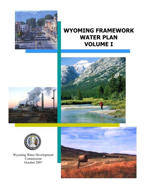
<strong>Wyoming</strong> <strong>Water</strong> Development<br />
Commission<br />
October 2007<br />
WYOMING FRAMEWORK<br />
WATER PLAN<br />
VOLUME I
This report was prepared by:<br />
WWC Engineering<br />
Hinckley Consulting<br />
Collins <strong>Plan</strong>ning Associates<br />
Greenwood Mapping, Inc.<br />
States West <strong>Water</strong> Resources Corporation
<strong>Wyoming</strong> <strong>Framework</strong> <strong>Water</strong> <strong>Plan</strong><br />
Volume I<br />
October 2007<br />
This report was prepared for:<br />
<strong>Wyoming</strong> <strong>Water</strong> Development Commission<br />
6920 Yellowtail Road<br />
Cheyenne, WY 82002<br />
This report was prepared by:<br />
WWC Engineering<br />
Hinckley Consulting<br />
Collins <strong>Plan</strong>ning Associates<br />
Greenwood Mapping, Inc.<br />
States West <strong>Water</strong> Resources Corporation
I, Murray T. Schroeder, a <strong>Wyoming</strong> registered Professional Engineer, certify that this<br />
<strong>Wyoming</strong> <strong>Framework</strong> <strong>Water</strong> <strong>Plan</strong>, Volume I report was prepared by me or under my<br />
direct supervision. (The original signature and stamp are available at the <strong>Water</strong><br />
Development Office.)<br />
I, Bern Hinckley, a <strong>Wyoming</strong> registered Professional Geologist, certify that this<br />
<strong>Wyoming</strong> <strong>Framework</strong> <strong>Water</strong> <strong>Plan</strong>, Volume I report was prepared by me or under my<br />
direct supervision. (The original signature and stamp are available at the <strong>Water</strong><br />
Development Office.)
TABLE OF CONTENTS<br />
1.0-INTRODUCTION………………………………………………………………………….1-1<br />
1.1 OVERVIEW…………………………………………………………………………….1-1<br />
1.2 NEED FOR BASIN PLANNING AND FRAMEWORK PLAN……………………....1-2<br />
1.3 BASIN PLANS…………………………………………………………………………1-3<br />
2.0-WEB TOOL………………………………………………………………………...………2-1<br />
2.1 SEARCHING…………………………………………………………………………...2-1<br />
2.2 DATABASE TABLES………………………………………………………………….2-1<br />
2.3 MAPS AND FIGURES…………………………………………………………………2-1<br />
3.0-SETTING…………………………………………………………………………………...3-1<br />
3.1 PHYSICAL SETTING………………………………………………………………….3-1<br />
3.1.1 Land Area and Ownership……………………………………………………...3-1<br />
3.1.2 Physiography…………………………………………………………………...3-3<br />
Topography…………………………………………………………………………....3-3<br />
Drainage System……………………………………………………………………...3-3<br />
3.1.3 Climate…………………………………………………………………………3-4<br />
3.2 SOCIOECONOMIC SETTING………………………………………………………...3-4<br />
3.2.1 Historic Populations Growth…………………………………………………...3-4<br />
3.2.2 Aging Populations……………………………………………………………...3-6<br />
3.2.3 Employment and Labor Force Participants…………………………………….3-7<br />
3.2.4 Key Economic and <strong>Water</strong> Use Sectors…………………………………………3-8<br />
Agriculture……………………………………………………………………………3-9<br />
Livestock……………………………………………………………………………..3-10<br />
Crops………………………………………………………………………………...3-10<br />
Industrial…………………………………………………………………………….3-10<br />
Municipal and Domestic…………………………………………………………….3-11<br />
Recreation, Travel and Tourism……………………………………………………..3-12<br />
Environmental……………………………………………………………………….3-12<br />
3.3 LEGAL AND INSTITUTIONAL SETTING…………………………………………3-12<br />
3.3.1 <strong>Wyoming</strong> <strong>Water</strong> Rights……………………………………………………….3-12<br />
3.3.2 Interstate Compacts, International Treaty, Court Decrees and Contracts and<br />
Agreements……………………………………………………………………3-14<br />
Amended Bear River Compact (1978)………………………………………………3-14<br />
Upper Division………………………………………………………………………3-14<br />
Central Division……………………………………………………………………..3-14<br />
Lower Division………………………………………………………………………3-15<br />
Belle Fourche River Compact (1943)…………………………………………….....3-15<br />
Colorado River Compacts (1922 and 1948)………………………………………...3-15<br />
Upper Niobrara River Compact (1962)……………………………………………..3-16<br />
Snake River Compact (1948)………………………………………………………...3-16<br />
Yellowstone River Compact (1950)………………………………………………….3-16<br />
International Treaty…………………………………………………………………3-17<br />
Court Decrees……………………………………………………………………….3-17<br />
North Platte River…………………………………………………………………...3-17<br />
Laramie River………………………………………………………………………..3-20<br />
Teton and South Leigh Creeks………………………………………………………3-21
Wind/Bighorn River Basin…………………………………………………………..3-21<br />
3.3.3 Contracts and Agreements……….……………………………………………3-22<br />
Green River Basin…………………………………………………………………...3-22<br />
Fontenelle Reservoir Contract………………………………………………………3-22<br />
High Savery Reservoir Contract…………………………………………………….3-23<br />
Platte River Basin……………………………………………………………………3-23<br />
Cooperative Agreement……………………………………………………………...3-23<br />
Platte River Recovery Implementation Program (PRRIP)…….……………………3-23<br />
Glendo Reservoir Contract………………………………………………………….3-24<br />
Snake/Salt River Basin………………………………………………………………3-24<br />
Wind/Bighorn River Basin…………………………………………………………..3-24<br />
3.3.4 <strong>Water</strong> Environmental Laws….………………………………………………..3-25<br />
Groundwater Quality………………………………………………………………..3-26<br />
Surface <strong>Water</strong> Quality……………………………………………………………….3-29<br />
3.3.5 Federal Environmental Laws………………………………………………….3-29<br />
Endangered Species Act……………………………………………………………..3-29<br />
National Environmental Laws……………………………………………………….3-30<br />
Clean <strong>Water</strong> Act……………………………………………………………………..3-30<br />
3.4 REFERENCES………………………………………………………………………...3-30<br />
4.0 RESOURCES…………………………………………………………………………..4-1<br />
4.1 INTRODUCTION………………………………………………………………………4-1<br />
4.2 GENERAL………………………………………………………………………………4-1<br />
4.3 SURFACE WATER RESOURCES…………………………………………………….4-2<br />
4.3.1 Quantity………………………………………………………………………...4-2<br />
4.3.2 <strong>Water</strong> Quality…………………………………………………………………..4-3<br />
4.4 GROUNDWATER RESOURCES……………………………………………………...4-4<br />
4.4.1 Groundwater Overview………………………………………………………...4-4<br />
4.4.2 Aquifer Classification…………………………………………………………..4-5<br />
Major Aquifers………………………………………………………………………..4-6<br />
Alluvial………………………………………………………………………………..4-6<br />
Sandstone……………………………………………………………………………..4-6<br />
Limestone……………………………………………………………………………..4-6<br />
Minor Aquifers………………………………………………………………………..4-7<br />
Marginal Aquifers…………………………………………………………………….4-7<br />
Major Aquitards………………………………………………………………………4-7<br />
Unclassified...................................................................................................................4-7<br />
Aquifer Location………………………………………………………………………4-8<br />
4.4.3 Historical Aquifer Performance………………………………………………..4-9<br />
4.4.4 Groundwater Quality…………………………………………………………..4-9<br />
4.4.5 Groundwater Associated with Energy Development…………………………4-10<br />
4.5 REFERENCES………………………………………………………………………...4-10<br />
5.0 USE……………………………………………………………………………………..5-1<br />
5.1 INTRODUCITON………………………………………………………………………5-1<br />
5.2 AGRICULTURAL WATER USE……………………………………………………...5-1<br />
5.2.1 Introduction…………………………………………………………………….5-1<br />
5.2.2 Agricultural <strong>Water</strong> Use Methodology………………………………………….5-1<br />
5.2.3 Irrigated Acreage……………………………………………………………….5-2<br />
5.2.4 Irrigated Crops………………………………………………………………….5-3<br />
5.2.5 Diversions………………………………………………………………………5-5
Surface <strong>Water</strong>…………………………………………………………………………5-5<br />
Groundwater………………………………………………………………………….5-7<br />
Theoretical Maximum Diversion Requirement.............................................................5-7<br />
5.2.6 Theoretical Irrigation <strong>Water</strong> Requirement……………………………………..5-8<br />
5.2.7 <strong>Water</strong> Supply-Limited Consumptive Use of Crops…………………………….5-8<br />
5.2.8 Livestock Consumptive Use…………………………………………………..5-10<br />
5.3 MUNICIPAL AND DOMESTIC WATER USE……………………………………...5-10<br />
5.3.1 Introduction…………………………………………………………………...5-10<br />
5.3.2 Current <strong>Water</strong> Use…………………………………………………………….5-11<br />
5.4 INDUSTRIAL WATER USE…………………………………………………………5-12<br />
5.4.1 Introduction…………………………………………………………………...5-12<br />
5.4.2 Current <strong>Water</strong> Use…………………………………………………………….5-13<br />
5.5 RECREATIONAL WATER USE……………………………………………………..5-15<br />
5.5.1 Introduction…………………………………………………………………...5-15<br />
5.5.2 Current <strong>Water</strong> Uses…………………………………………………………...5-15<br />
Fishing……………………………………………………………………………….5-15<br />
Boating………………………………………………………………………………5-16<br />
<strong>Water</strong>fowl Hunting…………………………………………………………………..5-17<br />
Skiing and Winter Sports…………………………………………………………….5-17<br />
Golfing……………………………………………………………………………….5-17<br />
<strong>Wyoming</strong> State Parks and Historical Sites…………………………………………..5-18<br />
Wind River Indian Reservation (WRIR)……………………………………………..5-18<br />
National Parks and Monuments……………………………………………………..5-18<br />
National Forests……………………………………………………………………..5-19<br />
Summary of Recreational Use……………………………………………………….5-19<br />
5.6 ENVIRONMENTAL WATER USE………………………………………………….5-19<br />
5.6.1 Introduction…………………………………………………………………...5-19<br />
5.6.2 Current <strong>Water</strong> Use…………………………………………………………….5-20<br />
Instream Flows………………………………………………………………………5-20<br />
Reservoir Minimum Pools…………………………………………………………...5-21<br />
Direct Wildlife Consumption………………………………………………………...5-21<br />
Threatened and Endangered Species………………………………………………..5-21<br />
Wetlands……………………………………………………………………………..5-22<br />
5.7 EVAPORATION………………………………………………………………………5-23<br />
5.8 REFERENCES………………………………………………………………………...5-23<br />
6.0 PROJECTIONS………………………………………………………………………..6-1<br />
6.1 FUTURE ECONOMIC AND DEMOGRAPHIC SCENARIOS……………………….6-1<br />
6.1.1 Overview of <strong>Plan</strong>ning Scenarios……………………………………………….6-1<br />
High Scenario…………………………………………………………………………6-1<br />
Mid Scenario………………………………………………………………………….6-1<br />
Low Scenario………………………………………………………………………….6-1<br />
6.2 AGRICULTURAL DEMAND PROJECTIONS……………………………………….6-1<br />
6.2.1 Introduction…………………………………………………………………….6-1<br />
High Scenario…………………………………………………………………………6-2<br />
Mid Scenario………………………………………………………………………….6-2<br />
Low Scenario………………………………………………………………………….6-3<br />
6.2.2 Future <strong>Water</strong> Needs and Demands……………………………………………..6-3<br />
6.2.3 Tribal Futures Agricultural Projects……………………………………………6-5<br />
Wind/Bighorn River Basin Task 3D Technical Memorandum, “Available Surface <strong>Water</strong><br />
Determination”……………………………………………………………………….6-5
6.2.4 Irrigable Lands………………………………………………………………….6-6<br />
6.3 MUNICIPAL AND DOMESTIC DEMAND PROJECTIONS………………………...6-8<br />
6.3.1 Introduction…………………………………………………………………….6-8<br />
6.3.2 Population Projections………………………………………………………….6-8<br />
Current and Projected Population Estimates………………………………………...6-8<br />
WDAI Population Projections………………………………………………………...6-9<br />
USCB Projections…………………………………………………………………….6-9<br />
Historic Growth Projections.......................................................................................6-10<br />
Economic Base Methodology…………………………………..................................6-10<br />
6.3.3 Municipal and Domestic Use Projections…………………………………….6-10<br />
6.4 INDUSTRIAL DEMAND PROJECTIONS…………………………………………..6-11<br />
6.4.1 Future Coal-fired and Natural Gas-fired Electric Power Production…………6-12<br />
High Scenario……………………………………………………………………….6-12<br />
Mid Scenario………………………………………………………………………...6-13<br />
Low Scenario………………………………………………………………………...6-15<br />
6.4.2 Coal, Uranium, and Miscellaneous Mining…………………………………...6-15<br />
Coal………………………………………………………………………………….6-15<br />
Uranium……………………………………………………………………………..6-16<br />
Miscellaneous Mining……………………………………………………………….6-16<br />
6.4.3 Oil Production and Refining…………………………………………………..6-16<br />
6.4.4 Coalbed Methane and Natural Gas Production……………………………….6-17<br />
6.4.5 Coal Conversion Facilities……………………………………………………6-18<br />
6.4.6 Soda Ash Production………………………………………………………….6-18<br />
High Scenario………………………………………………………………………..6-19<br />
Mid Scenario………………………………………………………………………...6-19<br />
Low Scenario………………………………………………………………………...6-20<br />
6.4.7 Miscellaneous Industry……………………………………………………….6-20<br />
6.4.8 Industrial Summary…………………………………………………………...6-21<br />
6.5 RECREATIONAL DEMAND PROJECTIONS………………………………………6-22<br />
6.5.1 Introduction…………………………………………………………………...6-22<br />
6.5.2 Future Recreation Demand……………………………………………………6-22<br />
6.5.3 Adequacy of Existing Resources……………………………………………...6-24<br />
6.6 ENVIRONMENTAL DEMAND PROJECTIONS……………………………………6-26<br />
6.6.1 Instream Flows………………………………………………………………..6-26<br />
6.6.2 Minimum Reservoir Pools…………………………………………………….6-26<br />
6.6.3 Minimum Releases and Reservoir Bypasses………………………………….6-27<br />
6.6.4 Wetlands and Wildlife Habitat………………………………………………..6-27<br />
6.6.5 Direct Wildlife Consumption…………………………………………………6-28<br />
6.7 SUMMARY OF FUTURE WATER DEMAND PROJECTIONS……………………6-28<br />
6.8 REFERENCES………………………………………………………………………...6-30<br />
7.0 AVAILABILITY………………………………………………………………………7-1<br />
7.1 SURFACE WATER…………………………………………………………………….7-1<br />
7.1.1 Introduction…………………………………………………………………….7-1<br />
7.1.2 Methodology……………………………………………………………………7-1<br />
7.1.3 Surface <strong>Water</strong> Model…………………………………………………………...7-2<br />
Model Overview………………………………………………………………………7-2<br />
Model Structure and Components…………………………………………………….7-3<br />
Stream Gage Data…………………………………………………………………….7-3<br />
Diversion Data………………………………………………………………………..7-3<br />
Reach Gain/Loss……………………………………………………………………...7-4
7.1.4 Supply Estimates……………………………………………………………….7-4<br />
7.1.5 Basin Supply Estimates………………………………………………………...7-6<br />
Bear River Basin……………………………………………………………………...7-6<br />
Green River Basin…………………………………………………………………….7-6<br />
Northeast <strong>Wyoming</strong> River Basin……………………………………………………...7-6<br />
Platte River Basin…………………………………………………………………….7-6<br />
Powder/Tongue River Basin…………………………………………………………..7-6<br />
Snake/Salt River Basins……………………………………………………………….7-7<br />
Wind/Bighorn River Basins…………………………………………………………...7-7<br />
7.1.6 Future Supply Estimates………………………………………………………..7-9<br />
7.2 GOUNDWATER………………………………………………………………………..7-9<br />
7.2.1 Background……………………………………………………………………..7-9<br />
7.2.2 Diversion Rates……………………………………………………………….7-10<br />
7.2.3 Groundwater in Storage……………………………………………………….7-10<br />
7.2.4 Groundwater Recharge………………………………………………………..7-12<br />
7.2.5 Groundwater Quality………………………………………………………….7-13<br />
7.2.6 Basin Summaries……………………………………………………………...7-14<br />
7.3 WATER CONSERVATION…………………………………………………………..7-15<br />
7.3.1 Introduction…………………………………………………………………...7-15<br />
7.3.2 Agricultural <strong>Water</strong> Conservation……………………………………………..7-16<br />
7.3.3 Industrial <strong>Water</strong> Conservation………………………………………………...7-17<br />
7.3.4 Municipal <strong>Water</strong> Conservation………………………………………………..7-17<br />
7.3.5 Recreational and Environmental <strong>Water</strong> Conservation………………………..7-17<br />
7.3.6 Conclusion…………………………………………………………………….7-18<br />
7.4 REFERENCES………………………………………………………………………...7-18<br />
8.0 OPPORTUNITIES…………………………………………………………………….8-1<br />
8.1 INTRODUCTION………………………………………………………………………8-1<br />
8.2 SCREENING CRITERIA FROM THE BASIN PLANS………………………………8-1<br />
8.2.1 Long List of Future <strong>Water</strong> Use Opportunities………………………………….8-1<br />
8.2.2 Short List of Future <strong>Water</strong> Use Opportunities…………………………………8-2<br />
<strong>Water</strong> Availability…………………………………………………………………….8-2<br />
Financial Feasibility………………………………………………………………….8-2<br />
Public Acceptance…………………………………………………………………….8-2<br />
Number of Sponsors/Beneficiaries/Participants……………………………………...8-2<br />
Legal/Institutional Concerns………………………………………………………….8-2<br />
Environmental/Recreational Benefits………………………………………………...8-2<br />
8.2.3 <strong>Framework</strong> Scoring Matrix…………………………………………………….8-2<br />
Monetary Factors……………………………………………………………………..8-3<br />
Non-Monetary Factors………………………………………………………………..8-3<br />
8.2.4 Agricultural Need………………………………………………………………8-3<br />
8.2.5 Potential Groundwater Development…………………………………………..8-4<br />
8.3 BEAR RIVER BASIN………………………………………………………………….8-4<br />
8.3.1 Physically Available Flows…………………………………………………….8-4<br />
8.3.2 Compact Limitations…………………………………………………………...8-4<br />
8.3.3 Agricultural Needs……………………………………………………………...8-5<br />
8.3.4 Long and Short Lists of Future <strong>Water</strong> Use Opportunities……………………..8-5<br />
8.3.5 Central Division Investigations………………………………………………..8-5<br />
8.3.6 Upper Division Investigations…………………………………………………8-5<br />
8.3.7 <strong>Framework</strong> Scoring Matrix……………………………………………………8-6<br />
8.3.8 Recommendations……………………………………………………………...8-6
Central Division………………………………………………………………………8-6<br />
Upper Division………………………………………………………………………..8-6<br />
8.3.9 Future Groundwater Development……………………………………………..8-8<br />
8.4 GREEN RIVER BASIN………………………………………………………………...8-8<br />
8.4.1 Physically Available Flows…………………………………………………….8-8<br />
8.4.2 Compact Limitations…………………………………………………………...8-8<br />
8.4.3 Agricultural Needs……………………………………………………………...8-8<br />
8.4.4 Long List of Future <strong>Water</strong> Use Opportunities………………………………….8-9<br />
8.4.5 Short List of Future <strong>Water</strong> Use Opportunities…………………………………8-9<br />
8.4.6 Supplemental Studies…………………………………………………………8-12<br />
Green River Ground <strong>Water</strong> Recharge and Alternative Storage, Level I Project……8-12<br />
Middle Pine Reservoir Rehabilitation Level II Study..................................................8-12<br />
Upper Green River Storage Study…………………………………………………...8-12<br />
Little Snake River Dams Level II Studies……………………………………………8-13<br />
8.4.7 <strong>Framework</strong> Scoring Matrix…………………………………………………...8-13<br />
8.4.8 Recommendations for Storage Opportunities………………………………...8-15<br />
Piney Creek Drainage and Tributaries……………………………………………...8-15<br />
Sand Hill Off-Channel Reservoir……………………………………………………8-15<br />
Middle Piney Reservoir Rehabilitation.......................................................................8-15<br />
East Fork o the New Fork Drainage (Church Off-Channel Reservoir)……………..8-15<br />
Hams Fork Drainage………………………………………………………………..8-15<br />
Viva Naughton Enlargement………………………………………………………...8-15<br />
Dempsey Basin Reservoir…………...………………………………………………8-15<br />
Cottonwood Creek-Drainage (Mickelson Creek Off-Channel Reservoir)…………..8-16<br />
Horse Creek Drainage (Horse Pasture Draw Off-Channel Reservoir)……………..8-16<br />
Beaver Creek Drainage (Cow Gulch Off-Channel Reservoir)……………………...8-16<br />
8.4.9 Future Groundwater Development……………………………………………8-16<br />
8.5 NORTHEAST WYOMING RIVER BASIN………………………………………….8-17<br />
8.5.1 Physically Available Flows…………………………………………………...8-17<br />
8.5.2 Compact Limitations………………………………………………………….8-17<br />
8.5.3 Agricultural Need……………………………………………………………..8-18<br />
8.5.4 Long List of Future <strong>Water</strong> Use Opportunities………………………………...8-19<br />
8.5.5 Short List of Future <strong>Water</strong> Use Opportunities………………………………..8-19<br />
8.5.6 Crook County Reservoir Studies……………………………………………...8-22<br />
Crook County Reservoirs and <strong>Water</strong> Management Study Level I…………………...8-22<br />
Crook County Reservoir Project-Level I…………………………………………….8-22<br />
Stockade Beaver Creek Reservoir-Level I…………………………………………...8-22<br />
Beaver Creek Dam and Reservoir-Level I…………………………………………..8-22<br />
Beaver Creek Dam and Reservoir Project…………………………………………..8-22<br />
8.5.7 <strong>Framework</strong> Scoring Matrix…………………………………………………...8-23<br />
8.5.8 Recommendations fro Future Storage Opportunities…………………………8-26<br />
Belle Fourche River Basin…………………………………………………………..8-26<br />
Upper or Lower Inyan Kara Reservoir Sites………………………………………..8-26<br />
Smaller Reservoirs…………………………………………………………………..8-26<br />
Beaver Creek Basin.....................................................................................................8-26<br />
Cheyenne River Basin……………………………………………………………….8-27<br />
8.5.9 Future Groundwater Development……………………………………………8-27<br />
8.5.10 Coal Bed Methane <strong>Water</strong>s…………………………………………………….8-27<br />
8.6 PLATTE RIVER BASIN……………………………………………………………...8-27<br />
8.6.1 Physically Available Flows…………………………………………………...8-27<br />
8.6.2 Institutional Limitations………………………………………………………8-27
8.6.3 Needs …………………………………………………………………………8-27<br />
8.6.4 Long List of Future <strong>Water</strong> Use Opportunities………………………………...8-29<br />
8.6.5 Revised Short List of Future <strong>Water</strong> Use Opportunities……………………….8-29<br />
8.6.6 Structural Future <strong>Water</strong> Use Opportunities…………………………………...8-30<br />
Coalbed Methane <strong>Water</strong>s……………………………………………………………8-30<br />
Groundwater Augmentation........................................................................................8-30<br />
Improving Agricultural Irrigation Systems and Control Efficiencies……………….8-30<br />
Modifications of Pathfinder Dam and Reservoir……………………………………8-31<br />
Regionalization of Public <strong>Water</strong> Supply Systems……………………………………8-31<br />
Reuse Alternatives…………………………………………………………………...8-31<br />
Snow Fences…………………………………………………………………………8-31<br />
Transbasin Diversions……………………………………………………………….8-31<br />
<strong>Water</strong> Diversions from <strong>Wyoming</strong>’s Green River Basin (WWDC)…………………...8-32<br />
Wind River Export Study-Level I (ECI, 2002)……………………………………...8-32<br />
Upper Laramie River RE-regulations Opportunities………………………………..8-32<br />
8.6.7 Non-Structural Future <strong>Water</strong> Use Opportunities……………………………...8-32<br />
Drought Response <strong>Plan</strong>ning…………………………………………………………8-32<br />
Enhanced Recreational Use of <strong>Water</strong> Reservoirs…………………………………...8-33<br />
Glendo Reservoir…………………………………………………………………….8-33<br />
Increasing Runoff From National Forests…………………………………………..8-33<br />
Multipurpose Flood Control Programs……………………………………………..8-33<br />
<strong>Water</strong> Banking……………………………………………………………………….8-33<br />
<strong>Water</strong> Conservation………………………………………………………………….8-33<br />
<strong>Water</strong> Exchanges…………………………………………………………………….8-33<br />
<strong>Water</strong> Right Transfers……………………………………………………………….8-34<br />
Weather Modification………………………………………………………………..8-34<br />
8.7 POWDER/TONGUE RIVER BASINS………………………………………………..8-34<br />
8.7.1 Physically Available Flow…………………………………………………….8-34<br />
8.7.2 Compact Limitations………………………………………………………….8-34<br />
8.7.3 Agricultural Needs…………………………………………………………….8-35<br />
8.7.4 Long List of Future <strong>Water</strong> Use Opportunities………………………………..8-36<br />
8.7.5 Short List of Future <strong>Water</strong> Use Opportunities………………………………..8-36<br />
8.7.6 Recommendations for Storage Opportunities………………………………...8-43<br />
Little Bighorn River Basin…………………………………………………………...8-43<br />
Tongue River Basin ....................................................................................................8-43<br />
Clear Creek Basin…………………………………………………………………...8-43<br />
Crazy Woman Creek Basin………………………………………………………….8-43<br />
Powder River Basin………………………………………………………………….8-44<br />
Little Powder River Basin…………………………………………………………...8-44<br />
8.7.7 Future Groundwater Development……………………………………………8-44<br />
8.7.8 Coal Bed Methane <strong>Water</strong>s…………………………………………………….8-44<br />
8.8 SNAKE/SALT RIVER BASIN………………………………………………………..8-44<br />
8.8.1 Physically Available Flows…………………………………………………...8-44<br />
8.8.2 Compact Limitations………………………………………………………….8-45<br />
8.8.3 Agricultural Needs…………………………………………………………….8-45<br />
8.8.4 Long List of Future Use Opportunities……………………………………….8-45<br />
8.8.5 Short Lists of Future <strong>Water</strong> Use Opportunities……………………………….8-45<br />
Agricultural Opportunities…………………………………………………………..8-48<br />
Domestic/Municipal Opportunities………………………………………………….8-48<br />
Environmental Opportunities………………………………………………………..8-48<br />
Recreational Opportunities………………………………………………………….8-48
Industrial Opportunities……………………………………………………………..8-48<br />
8.8.6 Recommendations for Opportunities………………………………………….8-48<br />
Salt River Sub-Basin………………………………………………………………...8-48<br />
Snake River Sub-Basin………………………………………………………………8-49<br />
8.8.7 Future Groundwater Development……………………………………………8-49<br />
8.9 WIND/BIGHORN RIVER BASINS…………………………………………………..8-50<br />
8.9.1 Physically Available Flows……………………………………..……………8-50<br />
8.9.2 Compact Limitations………………………………………………………….8-50<br />
8.9.3 Agricultural Needs……………………………………………………………8-50<br />
8.9.4 Long List of Future <strong>Water</strong> Use Opportunities………………………...……...8-51<br />
8.9.5 Short List of Future <strong>Water</strong> Use Opportunities………………………………..8-51<br />
8.9.6 Supplemental Storage Studies………………………………………………...8-55<br />
Upper Wind River Storage Project-Level I Study…………………………………...8-55<br />
Popo Agie River <strong>Water</strong>shed Study-Level I Study……………………………………8-55<br />
Crowheart Area/Dinwoody Canal System-Level I Study……………………………8-55<br />
Kirby Area <strong>Water</strong> Supply-Level I Study……………………………………………..8-55<br />
Cottonwood/Grass Creek <strong>Water</strong>shed Management <strong>Plan</strong>-Level I Study…………….8-56<br />
Owl Creek Master <strong>Plan</strong>……………………………………………………………...8-56<br />
Wind River Export Study-Level I…………………………………………………….8-56<br />
8.9.7 <strong>Framework</strong> Scoring Matrix…………………………………………………...8-56<br />
8.9.8 Recommendations for Storage Opportunities………………………………...8-58<br />
Upper Wind River ......................................................................................................8-58<br />
Little Wind River…………………………………………………………………….8-58<br />
Clarks Fork………………………………………………………………………….8-59<br />
Bighorn River………………………………………………………………………..8-59<br />
Greybull River.............................................................................................................8-59<br />
Shoshone River………………………………………………………………………8-59<br />
Owl Creek……………………………………………………………………………8-59<br />
8.9.9 Future Groundwater Development……………………………………………8-59<br />
8.10 REFERENCES………………………………………………………………………...8-60<br />
9.0 PROJECT FUNDING…………………………………………………………………9-1<br />
9.1 INTRODUCTIONS……………………………………………………………………..9-1<br />
9.2 FUNDING OF WATER DEVELOPMENT PROJECTS………………………………9-1<br />
9.2.1 Federal Programs……………………………………………………………….9-2<br />
U.S. Department of Agriculture Rural Development Programs……………………...9-2<br />
Natural Resources Conservation Service……………………………………………..9-2<br />
9.2.2 State Programs………………………………………………………………….9-2<br />
<strong>Wyoming</strong> <strong>Water</strong> Development Commission…………………………………………..9-2<br />
<strong>Wyoming</strong> Department of Environmental Quality……………………………………..9-3<br />
State Land and Investment Board…………………………………………………….9-3<br />
GLOSSARY…………………………………………………………………………………GA-1<br />
ACRONYM LIST……………………………………………………………………………GA-6
List of Tables<br />
Table 1-1 Basin <strong>Plan</strong> Summary…………………………………………………………….. 1-3<br />
Table 3-1 Landownership and Area………………………………………........................... 3-2<br />
Table 3-2 Population 1950 to 2000……………………………………………………........ 3-5<br />
Table 3-3 Basin Area Populations…………………………………………………………. .3-6<br />
Table 3-4 Age Cohorts by Percentage…………………………………………................... 3-6<br />
Table 3-5 2004 Population Characteristics………………………………………………… 3-8<br />
Table 3-6 Farm and Farm-Related Employment, 2002……………………………………. 3-9<br />
Table 3-7 Electric Power Generating Facilities…………………………………………... 3-11<br />
Table 3-8 WDEQ Groundwater Quality Standards………………………......................... 3-27<br />
Table 3-9 Drinking <strong>Water</strong> Standards……………………………………………………... 3-28<br />
Table 4-1 Total Annual Flow……………………………………………….......................... 4-2<br />
Table 4-2 Recommended Guidelines for TDS in Irrigation <strong>Water</strong>………………………… 4-4<br />
Table 5-1 Irrigated Acreage……………………………………………………................... 5-3<br />
Table 5-2 1973 Versus Current Active Crop Distribution…………………………………. 5-4<br />
Table 5-3 Estimated Average Annual Surface <strong>Water</strong> Diversions…………......................... 5-7<br />
Table 5-4 Estimated Average Annual Irrigation <strong>Water</strong> Requirement…………........……... 5-9<br />
Table 5-5 Estimated Average Annual <strong>Water</strong> Supply-Limited Consumptive Use<br />
(Depletions)……………………………………………………………………… 5-9<br />
Table 5-6 Municipal and Domestic Use…………………………………………….……. 5-11<br />
Table 5-7 Municipal and Domestic <strong>Water</strong> Depletions……………………........................ 5-12<br />
Table 5-8 Annual Industrial <strong>Water</strong> Use………………………………………………….. 5-14<br />
Table 5-9 Angler Days……………………………………………………......................... 5-16<br />
Table 5-10 Visitation to National Parks and National Monuments………......................... 5-19<br />
Table 6-1 Presently Irrigated Acreage and Projected Irrigation Development….................. 6-4<br />
Table 6-2 Current and Projected Irrigation Diversions…………………………………….. 6-4<br />
Table 6-3 Current and Projected Consumptive Irrigation Use……………………………... 6-5<br />
Table 6-4 Tribal Futures Projects…………………………………………………………... 6-6<br />
Table 6-5 Summary of Potentially Irrigable Lands Within the Wind/Bighorn Basin ……... 6-7<br />
Table 6-6 Livestock Consumptive Use…………………………………………………...... 6-8<br />
Table 6-7 Actual and Projected Populations……………………………………………. … 6-9<br />
Table 6-8 Projected Municipal and Domestic <strong>Water</strong> Use………………………………. .. 6-11<br />
Table 6-9 Projected Electrical Generation <strong>Water</strong> Needs………………………………... . 6-14<br />
Table 6-10 Total Industrial <strong>Water</strong> Demand Projections………………………………… . 6-22<br />
Table 6-11 Projected Annual Growth Rates: Population and Tourism………………… . 6-23<br />
Table 6-12 Current and Projected <strong>Water</strong>-Based Recreational Activity Days……………. 6-24<br />
Table 6-13 Current and Projected <strong>Water</strong> Consumption for Golf and Skiing…………….. 6-24<br />
Table 6-14 Projected Annual Total Consumptive <strong>Water</strong> Demands……………………… 6-29<br />
Table 6-15 Summary of Current and Projected Future <strong>Water</strong> Uses……………….…..………6-30<br />
Table 7-1 Average Annual Streamflow and Uses- Normal Condition……………………... 7-5<br />
Table 7-2 Available Flows…………………………………………………………………. 7-8<br />
Table 7-3 Average Annual Streamflow and Uses – Midlevel Development – Dry<br />
Condition……………………………………………………………………... 7-9<br />
Table 7-4 Groundwater Availability Summary…………………………………………... 7-14<br />
Table 7-5 Groundwater Permits Summary……………………………………………….. 7-15<br />
Table 8-1 Agricultural Needs, Bear River Basin…………………………………………... 8-5<br />
Table 8-2 <strong>Framework</strong> Scoring Matrix, Bear River Basin………………………………….. 8-7<br />
Table 8-3 <strong>Framework</strong> Section Scoring, Nonmonetary Factors, Bear River Basin………… 8-7<br />
Table 8-4 Agricultural Needs, Green River Basin Tributaries……………………………... 8-9
Table 8-5 Evaluated Short-List: Green River Basin…………………………………........ 8-10<br />
Table 8-6 <strong>Framework</strong> Scoring Matrix, Green River Basin……………………………….. 8-13<br />
Table 8-7 <strong>Framework</strong> Selection Scoring, Nonmonetary Factors, Green River Basin……. 8-14<br />
Table 8-8 Apportionment of Available Flow Per Belle Fourche River Compact………… 8-18<br />
Table 8-9 Agricultural Needs, Northeast <strong>Wyoming</strong> River Basin………………………… 8-18<br />
Table 8-10 Evaluated Short List: Belle Fourche River Basin……………………………. 8-20<br />
Table 8-11 Evaluated Short List: Cheyenne River Basin…………………………………8-21<br />
Table 8-12 <strong>Framework</strong> Scoring Matrix, Northeast <strong>Wyoming</strong> River Basin Storage<br />
Opportunities………………………………………………………………… 8-24<br />
Table 8-13 Secondary Selection Scoring, Nonmonetary Factors, Northeast <strong>Wyoming</strong><br />
River Basin Storage Opportunities…………………………………………… 8-13<br />
Table 8-14 Future Needs, Platte River Basin…………………………………………….. 8-28<br />
Table 8-15 Remaining Allocation of Available Flow per Yellowstone River Compact… 8-35<br />
Table 8-16 Agricultural Needs, Platte River Basin……………………………………….. 8-35<br />
Table 8-17 Evaluated Short List: Little Bighorn River Basin………………………….. ..8-37<br />
Table 8-18 Evaluated Short List: Tongue River Basin…………………………………... 8-38<br />
Table 8-19 Evaluated Short List: Clear Creek Basin……………………………………. .8-39<br />
Table 8-20 Evaluated Short List: Crazy Woman Creek Basin…………………………... 8-40<br />
Table 8-21 Evaluated Short List: Powder River Basin…………………………………... 8-41<br />
Table 8-22 Evaluated Short List: Little Powder River Basin……………………………. 8-42<br />
Table 8-23 Irrigated Acreage, Snake/Salt River Basin…………………………………… 8-45<br />
Table 8-24 Available Flows, Snake/Salt River Basin…………………………………….. 8-45<br />
Table 8-25 Evaluated Short List: Salt River Basin………………………………………. 8-46<br />
Table 8-26 Evaluated Short List: Snake River Basin……………………………………. 8-47<br />
Table 8-27 Agricultural Needs, Wind/Bighorn River Basin……………………………… 8-51<br />
Table 8-28 Short List of Future Projects, Wind/Bighorn River Basin……………………. 8-52<br />
Table 8-29 Evaluated Short List: Wind/Bighorn River Basin…………………………… 8-53<br />
Table 8-30 <strong>Framework</strong> Scoring Matrix, Wind/Bighorn River Basin…………………….. 8-57<br />
Table 8-31 <strong>Framework</strong> Selection Scoring, Nonmonetary Factors, Wind/Bighorn River<br />
Basin..…………………………………………………………………………8-57
List of Figures<br />
Figure 2-1 Snapshot of P-Tool…………………………………………………………….. 2-2<br />
Figure 3-1 <strong>Water</strong> Resource Regions………………………………………………………3-32<br />
Figure 3-2 River Basin <strong>Plan</strong>ning Area Map……………………………………………… 3-33<br />
Figure 3-3 Landownership by River Basin………………………………………………. 3-34<br />
Figure 3-4 Shaded Relief Map…………………………………………………………… 3-35<br />
Figure 3-5 Average Number of Frost-Free Days………………………………………… 3-36<br />
Figure 3-6 Average Seasonal Consumptive Irrigation Requirements for<br />
Grass (In Inches)………………………………………………………………3-37<br />
Figure 3-7 <strong>Wyoming</strong> River Basin Compacts and Decrees………………………………. 3-38<br />
Figure 4-1 Mean Annual Precipitation, 1071-2000……………………………………… 4-11<br />
Figure 4-2 Mean Annual Potential Evapotranspiration………………………….............. 4-12<br />
Figure 4-3 USGS Stream Flow Gage Locations…………………………………………. 4-13<br />
Figure 4-4 Average Annual Streamflow…………………………………………………. 4-14<br />
Figure 4-5a Monthly Streamflow Variation……………………………………………… 4-15<br />
Figure 4-5b Annual Streamflow Variation………………………………………………... 4-16<br />
Figure 4-6<br />
Figure 4-7<br />
2006 303(d) <strong>Water</strong>s with <strong>Water</strong> Quality Impairments………………..............4-17<br />
Potentiometric Surface of the Tensleep Aquifer in the Bighorn Basin,<br />
<strong>Wyoming</strong>……………………………………………………………………... 4-18<br />
Figure 4-8 Example: <strong>Wyoming</strong> Groundwater Hydrograph……………………………... 4-19<br />
Figure 4-9 <strong>Wyoming</strong> Hydrogeology Map………………………………………………... 4-20<br />
Figure 4-10 Active Wells………………………………………………………………….. 4-21<br />
Figure 4-11 Aquifer Sensitivity……………………………………………………............ 4-22<br />
Figure 4-12 Active CBM Wells……………………………………………………............ 4-23<br />
Figure 5-1 Irrigated Lands……………………………………………………………….. 5-24<br />
Figure 5-2 Active Irrigation Wells……………………………………………………….. 5-25<br />
Figure 5-3 Municipalities and Source of Supply………………………………………… 5-26<br />
Figure 5-4 Municipal Wells……………………………………………………………… 5-27<br />
Figure 5-5 Domestic Wells………………………………………………………………. 5-28<br />
Figure 5-6 Industrial and Miscellaneous Wells………………………………………….. 5-29<br />
Figure 5-7 Ski Areas and Golf Courses………………………………………………….. 5-30<br />
Figure 5-8 State Parks and Historic Sites………………………………………………… 5-31<br />
Figure 5-9 National Parks, Forests, and Monuments…………………………………….. 5-32<br />
Figure 5-10 Instream Flow Segments………………………………………………........... 5-33<br />
Figure 5-11 Selected Reservoirs Greater than 1000 ac-ft. …………………………........... 5-34<br />
Figure 6-1 Tribal Futures Projects and Irrigable Lands………………………………….. 6-31<br />
Figure 6-2 Permitted Coalbed Methane Wells as of December 31, 2004………….......... 6-32<br />
Figure 6-3 Coalbed Methane Wells & Production in the Powder River Coal Field.......... 6-33<br />
Figure 6-4 Coalbed Methane Gas & <strong>Water</strong> Production………………………………….. 6-34<br />
Figure 6-5 Projected Recoverable Coalbed Methane…………………………………….. 6-35<br />
Figure 7-1 Bear River Basin Available Flows…………………………………………… 7-19<br />
Figure 7-2 Green River Basin, Upper Green Available Flows……………………........... 7-20<br />
Figure 7-3 Green River Basin, Little Snake River Available Flows……………………... 7-21<br />
Figure 7-4 Northeast River Basin Available Flows……………………………………… 7-22<br />
Figure 7-5 Powder/Tongue River Basin Available Flows……………………………….. 7-23<br />
Figure 7-6 Snake/Salt River Basin Available Flows…………………………………….. 7-24<br />
Figure 7-7 Wind/Bighorn River Basin Available Flows…………………………………. 7-25<br />
Figure 7-8 Groundwater Control Areas………………………………………………….. 7-26<br />
Figure 8-1 Bear River Basin Potential Site……………………………………………….8-61
Figure 8-2 Green River Basin, Upper Green Potential Reservoir Sites………………….. 8-62<br />
Figure 8-3 Green River Basin, Little Snake River Potential Reservoir Sites……………. 8-63<br />
Figure 8-4 Northeast River Basin Potential Reservoir Sites………………………........... 8-64<br />
Figure 8-5 Powder River/Tongue River Basin Potential Reservoir Sites…………........... 8-65<br />
Figure 8-6 Snake/Salt River Basin Potential Reservoir Sites……………………………. 8-66<br />
Figure 8-7 Wind/Bighorn River Basin Potential Reservoir Sites…………………........... 8-67
1.0 INTRODUCTION<br />
1.1 OVERVIEW<br />
This <strong>Wyoming</strong> <strong>Framework</strong> <strong>Water</strong> <strong>Plan</strong> presents<br />
a statewide perspective on water resources, compiled<br />
from the results of a seven-basin planning process<br />
performed by the <strong>Wyoming</strong> <strong>Water</strong> Development<br />
Commission (WWDC). This <strong>Framework</strong> <strong>Water</strong> <strong>Plan</strong><br />
presents summary information on:<br />
! The Setting chapter presents basic physical<br />
information about <strong>Wyoming</strong>, current<br />
economic and social conditions, and an<br />
outline of the institutional constraints on<br />
water use.<br />
! The Resources chapter characterizes <strong>Wyoming</strong>’s total water supply, including information<br />
on where the resources are located and their quality.<br />
! The Use chapter quantifies how <strong>Wyoming</strong> is using its water resources in both the depleting<br />
and non-depleting water use sectors.<br />
! The Projections chapter provides estimates of the future water needs of the state, for the<br />
depleting and non-depleting water use sectors.<br />
! The Availability chapter presents estimates of the amounts and locations of unused water<br />
resources that are available to meet needs. Unused water resources are those that are<br />
physically and legally available over and above existing uses.<br />
! Finally, the Opportunities chapter summarizes information regarding opportunities for<br />
meeting the projected water needs of <strong>Wyoming</strong>. These opportunities may provide a starting<br />
point for existing and future water users seeking to address water supply deficits.<br />
In addition to presenting information on water resources of the state, this document covers two<br />
other important subjects:<br />
! A Web-based Presentation Tool is described in Chapter 2. This tool makes the results of<br />
this <strong>Framework</strong> <strong>Water</strong> <strong>Plan</strong> available online and provides a structure that will promote<br />
efficient future planning updates.<br />
! Project Funding is presented in Chapter 9. This chapter outlines opportunities for project<br />
proponents to obtain state and federal funding assistance.<br />
1-1
1.0 INTRODUCTION<br />
1.2 NEED FOR BASIN PLANNING AND FRAMEWORK PLAN<br />
The <strong>Wyoming</strong> water planning process is founded on the Prior Appropriation Doctrine and the<br />
understanding that the State of <strong>Wyoming</strong> should manage its water resources “for the benefit of the<br />
citizens of the state.” The WWDC was created by the 1979 <strong>Wyoming</strong> Legislature and is charged with<br />
responsibility for “...the planning, selection, financing, construction, acquisition, and operation of projects<br />
and facilities for the conservation, storage, distribution and use of water, necessary in the public interest<br />
to develop and preserve <strong>Wyoming</strong>'s water and related land resources.”<br />
The major planning goals of the <strong>Water</strong> Development Commission include:<br />
! Basinwide <strong>Plan</strong>s – These plans should be generated for<br />
each of the state’s major drainage basins. The plans’<br />
purpose is, in part, to quantify existing uses and to<br />
project future needs. The plans should also serve to<br />
identify and prioritize water development opportunities.<br />
The plans shall document the State’s plan to utilize its<br />
compact and decree allocations.<br />
! Project <strong>Plan</strong>ning – The program should assist <strong>Wyoming</strong><br />
municipalities, irrigation districts, and other public entities’ efforts to plan for the future.<br />
This assistance will typically come through the development of reconnaissance and<br />
feasibility-level studies, which serve to identify water supply requirements and prioritize<br />
water system improvements.<br />
! Federal Funding – Presently, there are federal programs which provide funding assistance<br />
for some types of water development projects. However, in order to access these funds,<br />
costly feasibility/environmental studies are often needed. The WWDC shall consider<br />
participating in these studies if a proposed project alleviates a water development,<br />
management, or rehabilitation problem, or allows the continued beneficial use of water. The<br />
amount of the WWDC’s financial participation shall be based on the proponent’s ability to<br />
pay.<br />
! Research – The program should continue its participation in research projects which serve to<br />
clarify economic, environmental, water development, and management issues.<br />
! Coordination – The WWDC should strive to keep informed on proposed state and federal<br />
rules and regulations that may affect water use, development, and management.<br />
The last statewide water planning process was completed in 1973 with the publication of the<br />
<strong>Wyoming</strong> <strong>Framework</strong> <strong>Water</strong> <strong>Plan</strong>. As with the current planning process, the process in the 1970s was<br />
performed on a basin-by-basin basis to capture the unique water situation and needs in each basin. Since<br />
1973, technological advances have been made in water resource planning, and political and regulatory<br />
conditions in water resource management have changed. Therefore, it was necessary that <strong>Wyoming</strong><br />
complete an updated statewide water planning report.<br />
1-2
1.0 INTRODUCTION<br />
1.3 BASIN PLANS<br />
Most information in this <strong>Framework</strong> <strong>Water</strong> <strong>Plan</strong> was collected and presented in the development<br />
of seven individual river basin plans. These basin plans were prepared by the WWDC and its consultants<br />
between 2001 and 2006 as shown in Table 1-1. The executive summary of these individual planning<br />
efforts is included in Volume II of this report.<br />
Table 1-1 Basin <strong>Plan</strong> Summary<br />
Basin <strong>Plan</strong> Consultant Date Completed<br />
Green River<br />
States West <strong>Water</strong> Resources Corporation<br />
Boyle Engineering, Inc.<br />
Purcell Consulting, P.C.<br />
February 2001<br />
<strong>Water</strong> Rights Services, L.L.C.<br />
Watts and Associates, Inc.<br />
Bear River<br />
Forsgren Associates Inc.<br />
Anderson Consulting Engineers, Inc.<br />
Leonard Rice Engineers, Inc.<br />
September 2001<br />
BBC Research & Consulting<br />
Northeast <strong>Wyoming</strong> <strong>Rivers</strong><br />
HKM Engineering Inc.<br />
Lord Consulting<br />
February 2002<br />
Watts and Associates, Inc.<br />
Powder/Tongue <strong>Rivers</strong><br />
HKM Engineering Inc.<br />
Lord Consulting<br />
February 2002<br />
Watts and Associates, Inc.<br />
Snake/Salt <strong>Rivers</strong><br />
Sunrise Engineering, Inc.<br />
Boyle Engineering, Inc.<br />
Hinckley Consulting<br />
BBC Consulting, Inc.<br />
June 2003<br />
Fassett Consulting<br />
Nelson Engineering, Inc.<br />
Rendezvous Engineering, Inc.<br />
Wind/Bighorn <strong>Rivers</strong><br />
BRS, Inc.<br />
MWH<br />
Lidstone and Associates<br />
Trihydro Corporation<br />
October 2003<br />
Donnell and Allred Inc.<br />
<strong>Water</strong> Rights Services, L.L.C.<br />
Platte River<br />
Trihydro Corporation<br />
Lidstone and Associates<br />
Harvey Economics<br />
May 2006<br />
<strong>Water</strong> Rights Services, L.L.C.<br />
1-3
2.0 WEB TOOL<br />
The <strong>Wyoming</strong> <strong>Water</strong> <strong>Framework</strong> <strong>Water</strong> <strong>Plan</strong> is available on the World Wide Web. A PDF<br />
version and GIS products can be downloaded at http://waterplan.state.wy.us/frameworkplan.html. An<br />
interactive Presentation Tool is available at http://waterplan.wrds.uwyo.edu/fwp/.<br />
Figure 2-1 shows an example page from the Presentation Tool. The Presentation Tool features:<br />
! Powerful Searching<br />
! Database Driven Tables<br />
! Downloadable Maps and Figures<br />
2.1 Searching<br />
Google searching is available on each page and defaults to search the <strong>Water</strong> <strong>Plan</strong> site only. After<br />
your first set of search results are presented, you will then have the option to search the entire web in<br />
addition to just the <strong>Water</strong> <strong>Plan</strong> site. Each search will return up to 8 results, with the option to select<br />
"More results" if there are more than 8 matches returned. When you select "More results", you will go<br />
into the main Google search site.<br />
2.2 Database Tables<br />
All of the data presented in tables represents values from the 2007 <strong>Framework</strong> <strong>Water</strong> <strong>Plan</strong>. Many<br />
of these tables will be updated over time. These tables have a hyperlink at the bottom: Click here to<br />
check for more recent data..<br />
This link will open the table in a new window. The values in the table will represent the most<br />
recent data available in the database. Where data exist that are more recent than the 2007 <strong>Framework</strong><br />
<strong>Water</strong> <strong>Plan</strong>, those data will be identified in red and the date and source of the data will be shown. The<br />
data shown in the tables in this document will always show the 2007 <strong>Framework</strong> <strong>Water</strong> <strong>Plan</strong> values.<br />
Only by clicking the hyperlink will updated values be displayed.<br />
2.3 Maps and Figures<br />
High resolution PDFs are available for all of the maps<br />
and figures. Viewing or printing the PDFs requires the Adobe<br />
Acrobat PDF viewer which is available for free download at<br />
www.adobe.com/products/acrobat/readstep2.html.<br />
Many of the PDF maps use layers, which can be turned<br />
on and off individually. This feature aids the visualization of the<br />
information being presented. The layered PDFs will have a<br />
"Layers" tab near the upper left side of the window. Layers may<br />
be turned on or off by clicking the eye icon left of the layer<br />
name. In the example to the right, the "Roads" layer is turned<br />
off, and is not now displayed on the map.<br />
The layer feature requires Adobe Acrobat version 6 or greater. Acrobat 4, and possibly earlier<br />
versions, will display the PDF, but without the ability to turn individual layers on and off.<br />
2-1
2.0 WEB TOOL<br />
Figure 2-1. Snapshot of P-Tool<br />
2-2
3.0 SETTING<br />
3.1 PHYSICAL SETTING<br />
<strong>Wyoming</strong>’s geographic location, human<br />
resources, physical characteristics, and natural<br />
resources make up the setting of the <strong>Wyoming</strong><br />
<strong>Framework</strong> <strong>Water</strong> <strong>Plan</strong>. <strong>Wyoming</strong> straddles the<br />
Continental Divide and provides the headwaters of<br />
four major river basins of the West: the Missouri, the<br />
Colorado, the Great Basin, and the Columbia. Figure<br />
3-1 shows <strong>Wyoming</strong>’s relationship to the West’s<br />
major river basins. The state contains 23 counties and<br />
encompasses 98,210 square miles, making it the ninth<br />
largest of the contiguous United States. Figure 3-2<br />
shows a map of the state including the river basin<br />
planning areas and the Continental Divide. <strong>Wyoming</strong>’s 493,782 people in 2000 rank the state fiftieth in<br />
population. Its abundant natural resources rank <strong>Wyoming</strong> high in the production of minerals and energy<br />
resources. Much of <strong>Wyoming</strong>’s heritage stems from its agricultural and livestock industry.<br />
Transportation, important in the settlement of the state, combined with the scenic beauty of open spaces,<br />
rugged mountains, forests, and national parks, enhances an important and growing tourist industry.<br />
3.1.1 Land Area and Ownership<br />
The land area within the boundaries of <strong>Wyoming</strong> is 62,854,000 acres, and the surface water area<br />
is 456,000 acres. Of the land acreage, about 48 percent is owned by the federal government, 43 percent is<br />
owned by private interests, 6 percent is owned by state and local government, and about 3 percent is<br />
owned by the Eastern Shoshone and Northern Arapaho Tribes. Table 3-1 summarizes the landownership<br />
on a statewide basis.<br />
3-1
3.0 SETTING<br />
Table 3-1 Landownership and Area<br />
Landowners Acres Square Miles<br />
UNITED STATES GOVERNMENT<br />
National Park Service 2,343,000 4,000<br />
Forest Service 9,233,000 14,000<br />
Fish and Wildlife Service 47,000 70<br />
Bureau of Land Management 17,470,000 27,000<br />
Bureau of Reclamation 955,000 1,000<br />
Total Federal 30,048,000 46,070<br />
WYOMING<br />
Land Commission 3,541,000 6,000<br />
Recreation Commission 8,000 10<br />
Game and Fish Department 165,000 260<br />
Total State 3,714,000 6,270<br />
LOCAL GOVERNMENT<br />
Counties 22,000 30<br />
Cities 48,000 80<br />
School Districts and Colleges 24,000 40<br />
Total Local Government 94,000 150<br />
OTHER<br />
Other Public Lands 1,987,000 3,000<br />
Surface <strong>Water</strong> 456,000 710<br />
Total Public 35,843,000 55,000<br />
Total Private 27,011,000 42,000<br />
TOTAL AREA 62,854,000 98,210<br />
Source: University of <strong>Wyoming</strong>, Department of Geography & Recreation<br />
Private<br />
Federal<br />
Surface <strong>Water</strong><br />
Other Public<br />
Lands<br />
State<br />
Local<br />
Government<br />
3-2
3.0 SETTING<br />
The 1973 <strong>Framework</strong> <strong>Water</strong> <strong>Plan</strong> reported that agricultural activities were using about 84 percent<br />
of <strong>Wyoming</strong>’s land area. Currently agricultural activities probably use slightly less than 84 percent of<br />
<strong>Wyoming</strong>’s land area due to municipal and industrial growth.<br />
The percentage of privately owned land versus publicly owned land diminishes westward across<br />
the state. Figure 3-3 shows the landownership by river basin planning area.<br />
3.1.2 Physiography<br />
Figure 3-4 shows the varied physiography of the state. Beginning near the center of <strong>Wyoming</strong>’s<br />
southern boundary, the Continental Divide extends through <strong>Wyoming</strong> in a northwesterly direction,<br />
separating the Missouri River drainage from the Columbia River and the Colorado River drainages. In<br />
southcentral <strong>Wyoming</strong>, the Continental Divide splits to encircle a closed drainage basin, the Great Divide<br />
Basin.<br />
Topography<br />
The mean elevation of <strong>Wyoming</strong> is about 6,700 feet, making the state the second highest in the<br />
United States (only Colorado has a higher mean elevation). The topographic elevations vary from a<br />
maximum of 13,804 feet above sea level at Gannett Peak in the Wind River Range to about 3,099 feet<br />
above sea level in northeastern <strong>Wyoming</strong> where the Belle Fourche River flows into South Dakota.<br />
<strong>Wyoming</strong>’s mountain ranges are generally oriented in a southeast to northwest trend. The Teton<br />
Range is probably <strong>Wyoming</strong>’s most spectacular mountain range in that it rises abruptly from the floor of<br />
Jackson Hole to elevations of 9,000 to over 13,500 feet above sea level. This is a rise from 3,000 feet to<br />
over 7,000 vertical feet.<br />
The topographic basins of the state contain a wide variety of geologic features including narrow<br />
terraces, plains, rolling hills, badlands, deserts, and uplifts with foothills and steep mountain slopes near<br />
most of the mountain ranges. Many areas of the state are dotted with sandstone buttes, hogbacks, and<br />
breaks.<br />
Drainage System<br />
Most of the streams that originate in the mountainous areas are perennial streams deriving their<br />
flow from snowmelt, rainfall runoff, and groundwater. The perennial streams provide most of the water<br />
yield in the state; however, there are numerous intermittent streams that originate in the lower elevations<br />
of the river basins.<br />
Most of the water flowing through the state originates within the state’s boundaries, with the<br />
following few exceptions. Colorado’s mountains contribute to <strong>Wyoming</strong>’s streamflow via the North<br />
Platte, Laramie, and Little Snake <strong>Rivers</strong>. Montana contributes streamflow in the Clarks Fork River. The<br />
headwaters of the Blacks Fork, Henrys Fork, and Bear River are in Utah.<br />
About 72 percent of the land area of <strong>Wyoming</strong> drains northward and eastward into the Missouri<br />
River system. Tributaries of the Colorado River drain about 17 percent of <strong>Wyoming</strong>. The Bear River<br />
meanders along the western border of <strong>Wyoming</strong> and ends in Great Salt Lake in the Great Basin. The<br />
Snake River starts in <strong>Wyoming</strong> and is tributary to the Columbia River. The Bear and Snake <strong>Rivers</strong> drain<br />
about 7 percent of the state’s land area. The remaining 4 percent is in the closed Great Divide Basin.<br />
3-3
3.0 SETTING<br />
3.1.3 Climate<br />
<strong>Wyoming</strong>’s climate is a product of its latitude, elevation,<br />
and topography. The state is in the latitude of the prevailing<br />
westerly winds with a dominance of maritime Pacific air. This<br />
air is modified by the several mountain ranges between<br />
<strong>Wyoming</strong> and the West Coast which cause low-level moisture to<br />
be precipitated before reaching the state. Moisture in the higher<br />
mountains ranges from 20 to over 40 inches per year, most of<br />
which falls as snow. The eastern plains areas of the state<br />
normally receive from 9 to 16 inches of precipitation annually,<br />
most of which occurs between April and July. The desertic basins in the western part of the state<br />
normally receive only 6 to 9 inches of precipitation annually.<br />
<strong>Wyoming</strong> has large seasonal and daily temperature ranges. Temperatures higher than 110° F and<br />
lower than -50° F have been recorded, and daily temperature changes of 40° F and more are not unusual.<br />
An important climate indicator is the growing season. For some crops, the growing season is the<br />
period between the last spring frost (occurrence of 32° F or lower) and the first fall frost. For forage<br />
crops, the growing season is the period when the mean daily temperature is above 40° F. The average 32°<br />
F freeze-free periods for <strong>Wyoming</strong> are shown on Figure 3-5. In areas with long growing seasons such as<br />
the lower North Platte River area, other parts of eastern <strong>Wyoming</strong>, and the lower Bighorn River area,<br />
high-value crops such as corn, sugar beets, and potatoes can be grown if irrigation water is available. In<br />
areas with shorter growing seasons, the predominant crops are forage crops, alfalfa, and small grains. In<br />
practically all areas of the state, irrigation is necessary for dependable crop production. The average<br />
seasonal consumptive irrigation requirement (water needs minus effective precipitation) for grass is<br />
shown in Figure 3-6.<br />
3.2 SOCIOECONOMIC SETTING<br />
3.2.1 Historic Population Growth<br />
Almost all demographic data are compiled on the basis of political units such as state, cities, and<br />
counties, and most of the economic data are reported on at the county, state, or national level.<br />
According to the 2000 U.S. census, the population of <strong>Wyoming</strong> was 493,782 people, an increase<br />
from 332,416 people in 1970. The 493,782 people resided in 193,608 households within <strong>Wyoming</strong>.<br />
Roughly 45 percent of the state population lived in the Platte River Basin.<br />
<strong>Wyoming</strong>’s population has been increasing fairly steadily over time. U.S. Census Bureau data<br />
show that <strong>Wyoming</strong>’s population has been increasing since the 1870 census through the 2000 census with<br />
one exception: during the 1980-1990 Energy Bust when state population actually dropped. Population<br />
has since rebounded and is once again on the rise. Table 3-2 shows the population trend of <strong>Wyoming</strong><br />
over the past 50 years. Individual counties have experienced some fairly dramatic changes in population<br />
over the past 50 years: e.g., Campbell County went from 4,839 persons in 1950 to 33,698 in 2000 while<br />
Niobrara County went from 4,701 persons in 1950 to 2,407 in 2000.<br />
3-4
3.0 SETTING<br />
Table 3-2 Population 1950 to 2000<br />
County 1950 1960 1970 1980 1990 2000<br />
Albany 19,055 21,290 26,431 29,062 30,797 32,014<br />
Big Horn 13,176 11,898 10,202 11,896 10,525 11,461<br />
Campbell 4,839 5,861 12,957 24,367 29,370 33,698<br />
Carbon 15,742 14,937 13,354 21,896 16,659 15,639<br />
Converse 5,933 6,366 5,938 14,069 11,128 12,052<br />
Crook 4,738 4,691 4,535 5,308 5,294 5,887<br />
Fremont 19,580 26,168 28,352 38,992 33,662 35,804<br />
Goshen 12,634 11,941 10,885 12,040 12,373 12,538<br />
Hot Springs 5,250 6,365 4,952 5,710 4,809 4,882<br />
Johnson 4,707 5,475 5,587 6,700 6,145 7,075<br />
Laramie 47,662 60,149 56,360 68,649 73,142 81,607<br />
Lincoln 9,023 9,018 8,640 12,177 12,625 14,573<br />
Natrona 31,437 49,623 51,264 71,856 61,226 66,533<br />
Niobrara 4,701 3,750 2,924 2,924 2,499 2,407<br />
Park 15,182 16,874 17,752 21,639 23,178 25,786<br />
Platte 7,925 7,195 6,486 11,975 8,145 8,807<br />
Sheridan 20,185 18,989 17,852 25,048 23,562 26,560<br />
Sublette 2,481 3,778 3,755 4,548 4,843 5,920<br />
Sweetwater 22,017 17,920 18,391 41,723 38,823 37,613<br />
Teton 2,593 3,062 4,823 9,355 11,172 18,251<br />
Unita 7,331 7,484 7,100 13,021 18,705 19,742<br />
Washakie 7,252 8,883 7,569 9,496 8,388 8,289<br />
Weston 6,733 7,929 6,307 7,106 6,518 6,644<br />
Yellowstone<br />
Park 353 420 See Note 1<br />
WYOMING 290,529 330,066 332,416 469,557 453,588 493,782<br />
1 Yellowstone Park is included in Teton and Park Counties<br />
Source: Equality State Almanac 2006 State of <strong>Wyoming</strong><br />
The 2000 census data were broken out into the river basin planning areas by the <strong>Wyoming</strong><br />
Department of Administration and Information (WDAI) Economic Research Division. Table 3-3 presents<br />
the population estimates for each of the river basin planning areas for 2000 and 2005. The 2005<br />
population estimates are based on U.S. Census Bureau estimates for the state of <strong>Wyoming</strong> and for each of<br />
the counties. Rapid changes in population are again evident; these changes are often associated with or<br />
tied to changes in the energy and minerals sectors.<br />
3-5
3.0 SETTING<br />
Table 3-3 Basin Area Populations<br />
River Basin 2000 Population 2005 Population<br />
Bear 14,550 14,530<br />
Green 54,760 56,229<br />
Northeast <strong>Wyoming</strong> 45,600 49,034<br />
Platte 227,330 232,976<br />
Powder/Tongue 38,420 40,069<br />
Snake/Salt 27,480 29,601<br />
Wind/Bighorn 86,050 86,854<br />
WYOMING TOTAL 1 494,190 509,293<br />
Source: <strong>Wyoming</strong> Department of Administration and Information, Economic<br />
Research Division<br />
1<br />
Individual basin numbers do not total to 493,782 the 2000 census population due<br />
to differences experienced in disaggregation and assignment of census block data<br />
to the river basin areas.<br />
3.2.2 Aging Population<br />
In 2000, there was a variation in age distributions for the counties in <strong>Wyoming</strong>. Albany,<br />
Campbell, Sweetwater, Teton, and Uinta Counties had a more youthful population. Goshen, Hot Springs,<br />
Johnson, and Niobrara Counties had an older population, with a greater percentage of residents over the<br />
age of 55. Table 3-4 provides a comparison of age cohorts by percentage for the U.S., <strong>Wyoming</strong>, and the<br />
counties.<br />
Table 3-4 Age Groups by Percentage<br />
Age Group<br />
Location 0 -19 20 - 34 35 - 54 55 - 64 65 & Older<br />
U.S. 29 21 29 9 12<br />
<strong>Wyoming</strong> 30 19 31 9 12<br />
Albany 26 35 24 7 8<br />
Big Horn 28 16 26 13 17<br />
Campbell 30 21 34 9 6<br />
Carbon 27 17 33 10 12<br />
Converse 31 16 33 9 11<br />
Crook 25 15 31 13 16<br />
Fremont 31 16 30 10 13<br />
Goshen 28 16 28 11 17<br />
Hot Springs 22 13 29 15 21<br />
Johnson 23 17 29 14 18<br />
Laramie 29 21 30 9 11<br />
Lincoln 29 18 30 11 12<br />
Natrona 30 19 31 9 13<br />
Niobrara 25 13 31 12 19<br />
Park 24 17 30 13 16<br />
Platte 28 14 31 12 17<br />
Sheridan 24 17 30 13 16<br />
Sublette 25 18 33 13 11<br />
Sweetwater 29 20 32 11 9<br />
Teton 20 25 35 12 8<br />
Uinta 32 19 32 10 7<br />
Washakie 27 14 30 13 17<br />
Weston 23 17 31 13 16<br />
Note: Some county percentages may not total to 100 percent due to rounding.<br />
3-6
3.0 SETTING<br />
During the 1990s, the population of <strong>Wyoming</strong>’s 24 to 44 age group declined about 12 percent<br />
while the 45 to 64 group increased by 39 percent (Foulke et al., 2000). This increasing proportion of<br />
older residents is likely due to three factors: the aging of the large baby boom generation as seen across<br />
the U.S., the in-migration of retirees seeking <strong>Wyoming</strong>’s low cost of living, and the out-migration of<br />
young people looking for employment opportunities.<br />
3.2.3 Employment and Labor Force Participation<br />
Population, labor force, employment, unemployment, and average wages are summarized in<br />
Table 3-5. This information is for 2004, the most recent data. The state’s unemployment rate was 3.9<br />
percent. The average wage was $31,210. In 1970, it was estimated that 11.7 percent of the population<br />
was below the poverty level; in 2000, 11.4 percent of the population was below the poverty level.<br />
The labor force participation rate is the percentage of residents in a given region over the age of<br />
16 who are employed or actively seeking work. In 2000, the labor participation rate for <strong>Wyoming</strong> was 70<br />
percent (Equality State Almanac, 2006).<br />
As of 2000, there were over 328,000 full-time or part-time jobs in <strong>Wyoming</strong>. From about 1970 to<br />
2000, statewide employment grew at an average rate of 2.5 percent annually. The Energy Bust is<br />
reflected in a drop in employment during the early 1980s.<br />
The proportion of <strong>Wyoming</strong> employment by economic sector compared to the nation provides<br />
insight into which sectors are most important to the regional economic base and which economic sectors<br />
lag behind national averages. The government sector makes up 20 percent of the employment in<br />
<strong>Wyoming</strong> compared to 14 percent nationally. The federal government controls a large portion of the land<br />
in the state as discussed in Section 3.1.1. State government, F.E. Warren Air Force Base, the University<br />
of <strong>Wyoming</strong>, and local government further contribute to large employment needs in the government<br />
sector (Equality State Almanac, 2006).<br />
Mining in <strong>Wyoming</strong> accounts for about 9 percent of all jobs compared to 0.5 percent nationally.<br />
The mining industry is a significant employer in all river basins with the exception of the Snake/Salt<br />
River Basin (Equality State Almanac, 2006).<br />
Production agriculture also plays a larger role in <strong>Wyoming</strong> than in the nation as a whole,<br />
contributing about 4.6 percent of statewide employment compared to 3.2 percent nationally. However,<br />
<strong>Wyoming</strong>’s manufacturing sector is smaller than the national average, accounting for only about 4<br />
percent of total state employment compared to 12 percent nationally (Equality State Almanac, 2006).<br />
3-7
3.0 SETTING<br />
Table 3-5 2004 Population Characteristics<br />
County Population Labor Force Employment Unemployment<br />
Unemployment<br />
Rate<br />
Average<br />
Annual<br />
Wages<br />
Albany 31,473 20,298 19,661 637 3.1 $26,224<br />
Big Horn 11,416 5,480 5,225 255 4.7 $28,756<br />
Campbell 36,721 22,455 21,755 700 3.1 $40,857<br />
Carbon 15,271 7,818 7,462 356 4.6 $27,106<br />
Converse 12,515 6,680 6,412 268 4.0 $31,188<br />
Crook 6,006 3,303 3,177 126 3.8 $26,596<br />
Fremont 36,310 18,204 17,263 941 5.2 $26,454<br />
Goshen 12,286 6,005 5,745 260 4.3 $23,017<br />
Hot Springs 4,598 2,416 2,322 94 3.9 $22,368<br />
Johnson 7,657 3,798 3,669 129 3.4 $24,054<br />
Laramie 85,296 42,699 40,764 1,935 4.5 $31,007<br />
Lincoln 15,626 8,213 7,893 320 3.9 $31,099<br />
Natrona 69,010 39,872 38,387 1,485 3.7 $32,284<br />
Niobrara 2,272 1,164 1,120 44 3.8 $21,749<br />
Park 26,516 14,897 14,290 607 4.1 $26,124<br />
Platte 8,666 4,207 3,993 214 5.1 $28,777<br />
Sheridan 27,163 15,441 14,844 597 3.9 $28,087<br />
Sublette 6,654 4,603 4,499 104 2.3 $31,891<br />
Sweetwater 37,758 21,846 21,087 759 3.5 $38,922<br />
Teton 18,964 13,972 13,516 456 3.3 $31,431<br />
Unita 19,772 10,906 10,464 442 4.1 $29,174<br />
Washakie 7,939 4,346 4,166 180 4.1 $28,301<br />
Weston 6,640 3,227 3,098 129 4.0 $25,446<br />
WYOMING 506,529 281,850 270,812 11,038 3.9 $31,210<br />
Source: Equality State Almanac 2006 State of <strong>Wyoming</strong><br />
3.2.4 Key Economic and <strong>Water</strong> Use Sectors<br />
Agriculture’s impact on the state’s land and water use is significant. Approximately 14 percent of<br />
the total employment in <strong>Wyoming</strong> is farm and farm-related employment. Table 3-6 shows the farm and<br />
farm-related employment. The energy and mineral sectors have historically added volatility to the<br />
economy, but they have also provided high-paying jobs and often require a large amount of water. While<br />
municipal water consumption is a small percentage of overall water used in the state, cities and towns<br />
have unique requirements that demand reliability. Travel, tourism, and recreation contribute to<br />
<strong>Wyoming</strong>’s economy, and water plays an important, but somewhat different, role in this sector.<br />
Environmental water use is notable and indirectly affects the economy. Finally, there is an ongoing effort<br />
to attract new business and manufacturing interests to the state, which in the long run may increase the<br />
economic base and create new demand for water supplies. The future of each of the water demand<br />
sectors is integral to economic, demographic, and water demand projections for <strong>Wyoming</strong>.<br />
3-8
3.0 SETTING<br />
Table 3-6 Farm and Farm-Related Employment, 2002<br />
Farm<br />
Total 1 Metro Nonmetro<br />
industries Employment % of total Employment % of total Employment % of total<br />
Farming:<br />
Farm<br />
production 12,397 3.66 1,381 1.35 11,016 4.64<br />
Farm<br />
proprietors 8,870 2.62 870 0.85 8,000 3.37<br />
Farm Wage &<br />
Salary Workers 3,527 1.04 511 0.50 3,016 1.27<br />
Closely related:<br />
Agricultural<br />
services 1,611 0.48 348 0.34 1,263 0.53<br />
Agricultural<br />
inputs<br />
industries 763 0.22 88 0.09 675 0.28<br />
Agricultural<br />
processing and<br />
marketing 1,191 0.35 49 0.05 1,142 0.48<br />
Peripherally related:<br />
Agricultural<br />
wholesale &<br />
retail trade 31,807 9.38 9,372 9.19 22,435 9.46<br />
Indirect<br />
agribusiness 506 0.15 3 0.00 503 0.21<br />
Total farm &<br />
farm-related<br />
employment 48,275 14.24 11,241 11.03 37,034 15.61<br />
All other<br />
employment 290,846 85.76 90,705 88.97 200,141 84.39<br />
Total<br />
employment 339,121 100.00 101,946 100.00 237,175 100.00<br />
1 Metro and nonmetro detail may not add to total because of some employment not classified by location.<br />
Metro and nonmetro estimates are based on the June 2003 metropolitan area definitions.<br />
Data are based on the 1997 North American Industry Classification System (NAICS).<br />
Source: Most industry estimates were developed from an enhanced file of the County Business Patterns, U.S. Bureau of the Census. Farm<br />
proprietors and farm wage and salary workers are from the Bureau of Economic Analysis, U.S. Department of Commerce.<br />
Agriculture<br />
<strong>Wyoming</strong>’s agriculture is dominated by livestock production: $798,800,000 in cash receipts came<br />
from livestock and related products in 2000 compared to cash receipts from crops of $160,600,000<br />
(Equality State Almanac, 2006). Much of agriculture’s water use is tied to production of forage and feed<br />
base for the livestock industry. Agriculture consumptively uses more water than any other economic<br />
sector. The river basin studies show total irrigated lands of about 2,070,406 acres while the 2002 Census<br />
of Agriculture, Farm and Ranch Irrigation Survey shows 1,541,688 acres. The 1997 Census of<br />
Agriculture reported 1,749,908 acres irrigated. The difference in census data may be due to the drought<br />
conditions, categories reported, non-responders, and idle lands not being reported.<br />
3-9
3.0 SETTING<br />
Livestock<br />
As of 2004, there were about 1,400,000 cattle and calves on <strong>Wyoming</strong> ranches. This is a decline<br />
from 2000 when there were about 1,580,000 head. This decline is primarily due to the severe drought<br />
that the state has been experiencing since 2000. Sheep numbers have been impacted similarly. Breeding<br />
sheep numbers declined from about 460,000 head in 2000 to about 340,000 head in 2004.<br />
Ranchers in <strong>Wyoming</strong> depend on forage to supplement the hay they feed their animals.<br />
Therefore, during drought, they cannot afford to raise as many cattle and sheep. Although hay and alfalfa<br />
are grown across the state, many areas of the state are net importers of hay. Much of this hay comes from<br />
the more intensely farmed areas of the state.<br />
Most of the grazing land in the eastern portion of the state is privately held minimizing reliance<br />
on public land for grazing. However, in the western portion of the state, public grazing land is very<br />
important. Therefore, federal grazing policy can significantly impact the livestock industry and the<br />
agriculture sector.<br />
Crops<br />
Cropping patterns and livestock production are closely related. Alfalfa and other hay account for<br />
over 75 percent of harvested cropland in <strong>Wyoming</strong>, and much of this hay is used to feed livestock. Other<br />
irrigated crops include corn, dry beans, sugar beets, barley, winter wheat, oats, and spring wheat. Most<br />
irrigation is by flood, but use of center pivot sprinklers is increasing in some areas. Surface water is the<br />
most common irrigation water source, though groundwater is increasingly prevalent.<br />
Industrial<br />
The chart below shows the employment and annual payroll in the industrial sector and related<br />
sectors in <strong>Wyoming</strong>. These sectors account for 28 percent of the total employment in the state but<br />
account for 41 percent of the payroll making industry a very important economic sector.<br />
Industry can be broken out into mining, utilities, construction, manufacturing, and transportation<br />
and warehousing. Crude oil and natural gas are produced in most counties throughout <strong>Wyoming</strong>;<br />
however, the production and employment vary. The top oil-producing county is Campbell followed by<br />
Park. The top natural gas- producing county is Sublette followed by Campbell.<br />
Coal mining is concentrated in five counties: Campbell, Carbon, Converse, Lincoln, and<br />
Sweetwater; in 2004, total coal production was 395,726,000 tons (Equality State Almanac, 2006). Other<br />
minerals produced in <strong>Wyoming</strong> include trona, bentonite, uranium, sand and gravel, stone, and other<br />
miscellaneous minerals.<br />
<strong>Wyoming</strong> has numerous electrical generating facilities that make up the utilities subsector.<br />
<strong>Water</strong>-using electrical generating facilities can be broken out into two groups, hydropower facilities and<br />
coal-fired plants. Table 3-7 provides the number of electric power generating facilities by river basin for<br />
<strong>Wyoming</strong>.<br />
3-10
3.0 SETTING<br />
2003 Industrial Employment and Annual Payroll<br />
Transportation and<br />
Warehousing<br />
6,835 employees<br />
earning<br />
$230,877,000<br />
Mining<br />
16,824 employees<br />
earning<br />
$917,049,000<br />
Manufacturing<br />
10,368 employees<br />
earning<br />
$416,483,000<br />
Construction<br />
14,445 employees<br />
earning<br />
$502,115,000<br />
Notes: Mining includes oil and gas.<br />
The data was sorted by number of employees per sector.<br />
Source: Equality State Almanac, 2006<br />
Utililties<br />
2,313 employees<br />
earning<br />
$142,785,000<br />
Table 3-7 Electric Power Generating Facilities<br />
River Basin Hydropower Coal-fired Subtotal<br />
Green 1 2 3<br />
Northeast <strong>Wyoming</strong> 4 4<br />
Platte 6 2 8<br />
Snake/Salt 1 1<br />
Wind/Bighorn 6 6<br />
TOTAL 14 8 22<br />
Municipal and Domestic<br />
Municipal and domestic water use is a relatively small but important part of overall water use.<br />
<strong>Wyoming</strong> has 99 incorporated municipalities of which 19 are “first class cities.” A first class city is<br />
defined by <strong>Wyoming</strong> State Statute 15-3-101 as a city that has a population of at least 4,000 and has made<br />
a public proclamation. According to the 1973 <strong>Wyoming</strong> <strong>Framework</strong> <strong>Water</strong> <strong>Plan</strong>, <strong>Wyoming</strong>’s population<br />
in 1970 was 332,416, with about 60.5 percent (approximately 201,111) of the population living in cities<br />
and towns and the remaining 39.5 percent (approximately 131,305) living on ranches, on farms, and in<br />
nonfarm areas outside urban area boundaries. Between 1970 and 2000, the population increased by 49<br />
percent (approximately 162,884 people) to 493,782. Census data for 2000 indicate that nearly 35 percent<br />
of the population resides in rural areas and the remaining 65 percent resides in urban areas (Equality State<br />
3-11
3.0 SETTING<br />
Almanac, 2006). This indicates that the urbanization trend noted in the 1973 <strong>Wyoming</strong> <strong>Framework</strong><br />
<strong>Water</strong> <strong>Plan</strong> is continuing.<br />
The vast increase in population means increased water needs and use in both rural and urban<br />
sectors. Jacobs and Brosz (2000) report that 80-85 percent of water consumption is for irrigated<br />
agriculture, yet there is an increasing water demand for municipal and industrial uses.<br />
Recreation, Travel, and Tourism<br />
<strong>Wyoming</strong>’s Northwest area, Wind/Bighorn River Basin, and Snake/Salt River Basin are<br />
nationally known recreation areas. The <strong>Wyoming</strong> State Parks and Recreation Areas are regionally<br />
significant recreation destinations. <strong>Water</strong> is rarely consumed in recreational use, the maintenance of golf<br />
courses being one exception. <strong>Water</strong> is an important aspect in recreation and tourism. <strong>Wyoming</strong> provides<br />
opportunities for boating, fishing, hunting, camping, golfing, and skiing. Much of this activity takes place<br />
on or near the rivers, streams, lakes, and reservoirs of <strong>Wyoming</strong>.<br />
Each river basin has major reservoirs that were constructed for flood control, irrigation, power<br />
generation, and/or municipal water supply and do not have recreation reserve pools. As a result,<br />
recreational use at the reservoirs peaks in July and then declines as water levels are drawn down to satisfy<br />
their permitted uses.<br />
Golfing is a growing portion of the recreation sector: e.g., the Platte River Basin has 19 golf<br />
courses, and the Snake/Salt River Basin has 5 golf courses. As population increases, demand for more<br />
courses will follow.<br />
Environmental<br />
For the purposes of water demand forecasting, environmental water use includes only water used<br />
in efforts to enhance environmental conditions, such as improving or maintaining fish and wildlife<br />
habitats. Much of the environmentally beneficial water use within the state is a by-product of other uses,<br />
such as reservoirs, and not from water rights specifically directed at environmental protection.<br />
<strong>Wyoming</strong>’s instream flow law is one exception and is designed to protect and enhance fisheries.<br />
Enhancement or creation of wetlands is an environmental use that may see more development in<br />
the future. State and federal funding sources exist to assist landowners in developing or enhancing<br />
wetlands.<br />
3.3 LEGAL AND INSTITUTIONAL SETTING<br />
The constraints or bounds that water users must operate within are defined by a mixture of state<br />
law, federal law, interstate agreements, and court decrees. Figure 3-7 depicts <strong>Wyoming</strong> river basin<br />
compacts and decrees.<br />
3.3.1 <strong>Wyoming</strong> <strong>Water</strong> Rights<br />
The <strong>Wyoming</strong> <strong>Water</strong> Development Commission (WWDC) has<br />
stated that <strong>Wyoming</strong> water law shall be respected in all aspects of the<br />
water planning process. <strong>Wyoming</strong> water law is the foundation upon<br />
which all water use, development, and protection are based. The water<br />
rights system in <strong>Wyoming</strong> is administered by the State Engineer's<br />
3-12
3.0 SETTING<br />
Office and State Board of Control, both constitutionally based administrative and quasi-judicial entities of<br />
state government.<br />
<strong>Wyoming</strong>'s water laws have evolved from the early establishment of legal principles that were<br />
later embodied in the state's constitution and a series of statutory laws written and adopted early in<br />
<strong>Wyoming</strong>'s history that have stood the test of time. One early water dispute that involved two territorial<br />
pioneers, William McCrea and Charles Moyer, is instructive regarding the history of water law in<br />
<strong>Wyoming</strong>. Moyer, whose name is associated with a now-famous spring in the coal-mining region north<br />
of Gillette, developed that spring for irrigation in 1890. Previously, McCrea developed an irrigation<br />
project along the Little Powder River downstream of, and partially supplied by, Moyer's spring. With<br />
Moyer's development, McCrea's ditch was short of water, and the resulting argument eventually reached<br />
the <strong>Wyoming</strong> Supreme Court. In one of its first rulings on water matters, the Court affirmed the "first in<br />
time, first in right" doctrine by siding with McCrea. Through this 1896 ruling, the Court recognized the<br />
concepts of the prior appropriation doctrine that Territorial Engineer Elwood Mead had been advocating<br />
in the days leading to statehood and the constitutional conventions.<br />
Mead, who became the first State Engineer, understood that water in an arid region must be<br />
administered in a predictable and equitable fashion, and the methods he fostered were to allow the earlier<br />
developer of water to establish the senior right for its continued use. The <strong>Wyoming</strong> State Constitution<br />
adopted this priority system of appropriation and established the position of State Engineer. Through the<br />
efforts of Mead, the Constitution also embodied the basis of appropriating water on the concept of<br />
"beneficial use" to avoid the potential for exaggerated amounts of water being tied up by early settlers and<br />
developers of water diversion systems. Mead was also at the forefront of affirming a strong, active,<br />
independent state role in all aspects of appropriating and administrating the waters of the state. He also<br />
developed the process for resolving water disputes. Rather than use a water court system as in the<br />
neighboring state of Colorado, <strong>Wyoming</strong> established the State Board of Control within its Constitution.<br />
In addition to its independent authority to review matters initially decided by the State Engineer, the<br />
Board of Control is the adjudicator of all water rights and the decision-maker of all requests for changes<br />
to water rights. The Constitution declares all water in the state to be the property of the State, subject to<br />
appropriation for beneficial use through the administrative permitting of water rights. <strong>Water</strong> rights are<br />
considered property rights that attach to the land or place of use. However, the law provides that the<br />
owner of these rights may change the location of use, or the type of use, by seeking approval from the<br />
Board of Control. The final decisions of the Board of Control are subject to judicial review. The Board<br />
of Control is made up of the State Engineer and the four <strong>Water</strong> Division Superintendents.<br />
Within this constitutional framework, the detailed statutory authority, procedures, and<br />
administration were further defined by legislation and periodic Court decisions. The State Engineer's role<br />
is defined in Title 9, Chapter 1, Article 9, along with the general authority to establish fees for certain<br />
services and some other minor activities of the agency.<br />
The majority of <strong>Wyoming</strong>'s water laws are now codified primarily in Title 41 of <strong>Wyoming</strong><br />
Statutes, entitled "<strong>Water</strong>." Under this title, there are 14 chapters that include the authority and activities<br />
of the <strong>Water</strong> Development Commission and the laws associated with irrigation, drainage, watershed<br />
improvement, water and sewer districts, interstate compacts, and the use of watercraft. Chapters 3 and 4<br />
contain the important laws relating to the appropriation, administration, and adjudication of water rights<br />
in <strong>Wyoming</strong>. These statutes relate to all waters of the state, whether they are from surface streams,<br />
springs, natural lakes, or underground waters.<br />
3-13
3.0 SETTING<br />
The key elements of <strong>Wyoming</strong>'s water laws were established in the Constitution and the early<br />
statutory laws before and near the turn of the century. From time to time, the legislature has modified the<br />
laws to address emerging new issues of the water users in the state. The laws addressing reservoirs were<br />
passed in the early 1900s; laws specific to groundwater sources were introduced in the 1940s and 1950s,<br />
with the last significant change adopted in 1969. Laws addressing instream flow water rights were<br />
codified in 1986. The basic framework of water right permitting actions and administration has remained<br />
the same, all the while allowing for flexibility in answering the needs of water users.<br />
This set of laws is a part of the principles upon which the <strong>Framework</strong> <strong>Water</strong> <strong>Plan</strong> is based.<br />
3.3.2 Interstate Compacts, International Treaty, Court Decrees, and Contracts and<br />
Agreements<br />
NOTE: Additional information on water rights, compacts, court decrees, international treaty, and<br />
interstate agreements is available online at http://seo.state.wy.us.<br />
Amended Bear River Compact (1978)<br />
This compact provides that in the administration of the Bear River among the States of Idaho,<br />
Utah, and <strong>Wyoming</strong>, the river shall be divided into three divisions. When a water emergency exists, water<br />
administration is handled as discussed below.<br />
Upper Division<br />
This division is the portion of the Bear River from its source in the Uinta Mountains to and<br />
including Pixley Dam. A water emergency shall be deemed to exist when the total divertible flow is less<br />
than 1,250 cubic feet per second (cfs). Divertible flow is allocated for diversion as follows:<br />
Upper Utah Section Diversions . . . . . . . . . . . . . . . . . . . . . . 0.6%<br />
Upper <strong>Wyoming</strong> Section Diversions . . . . . . . . . . . . . . . . . 49.3%<br />
Lower Utah Section Diversions . . . . . . . . . . . . . . . . . . . . . 40.5%<br />
Lower <strong>Wyoming</strong> Section Diversions . . . . . . . . . . . . . . . . . . 9.6%<br />
Central Division<br />
This division is the portion of the Bear River from Pixley Dam to and including Stewart Dam. A<br />
water emergency shall be deemed to exist when the total divertible flow is less than 870 cfs or the flow of<br />
Bear River at Border gaging station is less than 350 cfs, whichever occurs first. When such a condition<br />
exists, all divertible flow in this division shall be allocated such that the portion of the river between<br />
Pixley Dam and the point where the river crosses the <strong>Wyoming</strong>-Idaho line near Border shall be limited<br />
for the benefit of the State of Idaho, 43 percent of the divertible flow. The remaining 57 percent of the<br />
divertible flow shall be available for use in Idaho in the Central Division, but if any portion of such<br />
allocation is not used therein, it shall be available for use in Idaho in the Lower Division.<br />
3-14
3.0 SETTING<br />
Lower Division<br />
This division is the portion of the Bear River between Stewart Dam and the Great Salt Lake,<br />
including Bear Lake and its tributary drainage. The original compact grants to <strong>Wyoming</strong> and Utah the<br />
right for each to store, above Stewart Dam, an additional 17,750 acre-feet of Bear River water in any<br />
water year and to Idaho the right to store 1,000 acre-feet of water in Idaho or <strong>Wyoming</strong> on Thomas Fork<br />
for use in Idaho. In addition, the Amended Compact (1978) allocates further storage entitlements to Utah<br />
and <strong>Wyoming</strong> for 70,000 acre-feet of Bear River water, in any water year, above Stewart Dam to be<br />
divided equally and to Idaho an additional 4,500 acre-feet of Bear River water in any water year to be<br />
stored in Idaho or <strong>Wyoming</strong> for use in Idaho. <strong>Water</strong> rights granted on water appropriated under this last<br />
entitlement, including groundwater tributary to the Bear River, which is applied to beneficial use on or<br />
after January 1, 1976, shall not result in an annual increase in depletion of the flow of the Bear River and<br />
its tributaries above Stewart Dam of more than 28,000 acre-feet in excess of the depletion as of January 1,<br />
1976. Thirteen thousand acre-feet of the additional depletion above Stewart Dam are allocated to each of<br />
Utah and <strong>Wyoming</strong>, and 2,000 acre-feet are allocated to Idaho. Idaho, Utah, and <strong>Wyoming</strong> are also<br />
granted the right to store and use water above Stewart Dam that otherwise would be bypassed or released<br />
from Bear Lake at times when all other direct flow and storage rights are satisfied. <strong>Water</strong> availability and<br />
depletions are calculated and administered by procedures approved by the Bear River Commission.<br />
Belle Fourche River Compact (1943)<br />
The compact for the division of the waters of the Belle Fourche River between <strong>Wyoming</strong> and<br />
South Dakota was negotiated and ratified by the two states and the federal government in 1943. This<br />
compact recognizes all existing rights in <strong>Wyoming</strong>, as of the date of the compact, and permits the<br />
construction of stock water reservoirs not exceeding 20 acre-feet in capacity. As of the date of the<br />
compact, the unappropriated waters of the Belle Fourche River are allocated as follows: 10% to <strong>Wyoming</strong><br />
and 90% to South Dakota. Another provision states that, as of the date of the compact, no reservoir built<br />
exclusively to use the water allocated to <strong>Wyoming</strong> can exceed a capacity of 1,000 acre-feet.<br />
Colorado River Compacts (1922 and 1948).<br />
A compact between the Upper Colorado River Basin states (<strong>Wyoming</strong>, Colorado, New Mexico,<br />
and Utah) and the Lower Colorado River Basin states (Arizona, Nevada, and California) was negotiated<br />
in 1922. This compact allocated 7,500,000 acre-feet of consumptive use annually to the Upper Basin. It<br />
also provided that a minimum flow of 75,000,000 acre-feet in any consecutive 10-year period should be<br />
maintained at Lee Ferry, which is the point on the river dividing the Upper Basin from the Lower Basin.<br />
In addition, provision was made for future treaties with Mexico. As a result of this clause, the 1944<br />
Colorado, Tijuana, and Rio Grande Treaty indirectly influences the regulation of the Colorado River. In<br />
1948, a compact among the Upper Basin states was negotiated. It was ratified by all the states and the<br />
federal government in 1949. Arizona has a small area in the Upper Basin and therefore was included in<br />
the Upper Basin negotiations. This Upper Colorado River Basin Compact apportions the use allocated to<br />
the Upper Basin by the 1922 compact as follows: 50,000 acre-feet per annum to Arizona and of the<br />
remaining quantity 51.75 percent to Colorado, 11.25 percent to New Mexico, 23 percent to Utah, and 14<br />
percent to <strong>Wyoming</strong>. The 1948 compact divided the waters of Henry's Fork between <strong>Wyoming</strong> and Utah<br />
on a straight priority basis for existing development. <strong>Water</strong>s of the Little Snake River used under rights<br />
existing prior to this compact and diverted below the river’s confluence with Savery Creek are<br />
3-15
3.0 SETTING<br />
administered on a straight priority basis (irrespective of the state line). <strong>Water</strong> uses developed after the<br />
Compact’s signing are administered to equally share the available water supply.<br />
Upper Niobrara River Compact (1962)<br />
The compact dividing the waters of the Niobrara River between the States of Nebraska and<br />
<strong>Wyoming</strong> was negotiated by the two states in 1962 and approved by Congress in 1969. Stock water<br />
reservoirs in <strong>Wyoming</strong> not exceeding 20 acre-feet in capacity are not restricted except by <strong>Wyoming</strong> law,<br />
and no restrictions were placed on diversion or storage of water in <strong>Wyoming</strong>. The exception to this<br />
occurs on the main stem east of Range 62 West and on Van Tassel Creek south of Section 27, Township<br />
32 North, Range 60 West. In this area, direct diversions are regulated on an interstate priority basis with<br />
lands in Nebraska west of Range 55 West. Storage reservoirs with priority dates prior to August 1, 1957,<br />
may store water only during the period of October 1 to June 1, unless water is available after meeting<br />
direct flow appropriations in <strong>Wyoming</strong> and Nebraska west of Range 55 West. Storage reservoirs with<br />
priority dates after August 1, 1957, may store a maximum of 500 acre-feet in any water year from<br />
October 1 to May 1, unless water is available after meeting direct flow appropriations in <strong>Wyoming</strong> and<br />
Nebraska west of Range 55 West. Groundwater development was recognized to be a significant factor,<br />
and the compact provides for investigation of this resource and possible apportionment at a later date.<br />
Snake River Compact (1949)<br />
The compact dividing the waters of the Snake River and Salt River between the states of Idaho<br />
and <strong>Wyoming</strong> was negotiated by the two states in 1949 and ratified by them and the federal government<br />
in 1950. The compact recognizes, without restrictions, all existing rights in <strong>Wyoming</strong> as of the date of the<br />
compact. It permits <strong>Wyoming</strong> unlimited use for domestic and stock uses provided that stock water<br />
reservoirs shall not exceed 20 acre-feet in capacity. It permits <strong>Wyoming</strong> to divert (or store) for new<br />
developments, for supplemental or original supply, 4 percent of the <strong>Wyoming</strong>-Idaho state line flow of the<br />
Snake River.<br />
Yellowstone River Compact (1950)<br />
The Yellowstone River Compact dividing the waters of the tributaries (Clarks Fork, Big Horn,<br />
Tongue, and Powder) of the Yellowstone among the states of <strong>Wyoming</strong>, Montana, and North Dakota was<br />
negotiated in 1950 and ratified by the three states and the federal government in 1951. Existing rights as<br />
of January 1, 1950, maintain their status in accordance with the laws governing the acquisition and use of<br />
water under the doctrine of prior appropriation. In addition, existing and future domestic and stock water<br />
uses including stock water reservoirs up to a capacity of 20 acre-feet are exempted from provisions of the<br />
Compact. The unappropriated or unused total divertible flow of each tributary, after needs for<br />
supplemental supply for existing rights are met, is allocated to <strong>Wyoming</strong> and Montana as follows:<br />
Clarks Fork of the Yellowstone River:<br />
<strong>Wyoming</strong> . . . . . . . . . . . . . . 60%<br />
Montana . . . . . . . . . . . . . . . 40%<br />
Big Horn River (exclusive of Little Big Horn River):<br />
<strong>Wyoming</strong> . . . . . . . . . . . . . . 80%<br />
3-16
3.0 SETTING<br />
Montana . . . . . . . . . . . . . . . 20%<br />
Tongue River:<br />
<strong>Wyoming</strong> . . . . . . . . . . . . . . 40%<br />
Montana . . . . . . . . . . . . . . . 60%<br />
Powder River (including the Little Powder River):<br />
<strong>Wyoming</strong> . . . . . . . . . . . . . . 42%<br />
Montana . . . . . . . . . . . . . . . 58%<br />
International Treaty<br />
The Mexican <strong>Water</strong> Treaty between the United States and Mexico dated 1944 dividing the waters<br />
of the Colorado River, which flows from the United States into Mexico, also affects <strong>Wyoming</strong>. This<br />
treaty guaranteed to Mexico the delivery of 1,500,000 acre-feet of water per annum. Under the terms of<br />
the 1922 Colorado River Compact, the burden of supplying this water to Mexico during periods of short<br />
water supplies is equally borne by the Upper Basin, of which <strong>Wyoming</strong> is a part, and the Lower Basin.<br />
The Colorado River Basin Project Act (PL 90-537, Sec. 202) provides that the satisfaction of the<br />
requirements of the Mexican <strong>Water</strong> Treaty from the Colorado River constitutes a national obligation<br />
which shall be met by any augmentation project developed under the provisions of the Act.<br />
Court Decrees<br />
North Platte River<br />
During the mid-1930s, the state of Nebraska filed an action against the States of Colorado and<br />
<strong>Wyoming</strong> in the Supreme Court of the United States over the flows of the North Platte River. In 1945, the<br />
Court handed down a decree equitably apportioning the waters of the North Platte among the states. The<br />
decree included the following provisions:<br />
(a) Exclusive of the Kendrick Project and Seminoe Reservoir, the State of <strong>Wyoming</strong> is enjoined<br />
from diverting water from the North Platte River above Guernsey Reservoir and from the North Platte<br />
River and its tributaries above Pathfinder Dam for the irrigation of more than a total 168,000 acres of land<br />
during irrigation season.<br />
(b) Exclusive of the Kendrick Project and Seminoe Reservoir, the State of <strong>Wyoming</strong> is enjoined<br />
from storing more than 18,000 acre-feet of water from the North Platte River and its tributaries above<br />
Pathfinder Reservoir for irrigation purposes during any one year.<br />
(c) The storage rights of Pathfinder, Guernsey, Seminoe, and Alcova Reservoirs are junior to<br />
1,165 cfs for the irrigation of land in Western Nebraska, and the State of <strong>Wyoming</strong> is enjoined from<br />
storing or permitting the storage of water in these reservoirs other than in accordance with the rule of<br />
priority.<br />
(d) The natural flow of the North Platte River in the section of the river between the Whalen<br />
Diversion Dam, downstream of the Tri-State Dam, or approximately the <strong>Wyoming</strong>-Nebraska state line,<br />
between May 1 and September 30 of each year is apportioned 25 percent to <strong>Wyoming</strong> and 75 percent to<br />
Nebraska.<br />
3-17
3.0 SETTING<br />
It also limits Colorado to the irrigation of 135,000 acres; the storage of 17,000-acre-feet of water<br />
in any one year; and the diversion of an average 6,000 acre-feet out of the North Platte River Basin<br />
annually.<br />
By stipulation agreed upon by the three States and approved by the Supreme Court of the United<br />
States, the decree was amended in 1953 as follows:<br />
Colorado was permitted to increase its irrigated acreage to 145,000 acres, and the States of<br />
<strong>Wyoming</strong> and Nebraska were permitted to store 40,000 acre-feet during any water year in Glendo<br />
Reservoir, with such storage, including holdover, never to exceed 100,000 acre-feet. The 40,000 acre-feet<br />
of storage during the year is divided 25,000 acre-feet to Nebraska and 15,000 acre-feet to <strong>Wyoming</strong>.<br />
Nebraska filed a lawsuit in the Supreme Court of the United States on October 6, 1986, alleging<br />
that <strong>Wyoming</strong> had violated certain aspects of the 1945 Decree. The U.S. Supreme Court approved the<br />
Final Settlement Stipulation and entered the Modified Decree on November 13, 2001. The Final<br />
Settlement Stipulation and the Modified Decree include the following provisions:<br />
(a) For the North Platte River and its tributaries, including water from hydrologically connected<br />
groundwater wells, upstream of Pathfinder Dam and between Pathfinder Dam and Guernsey Reservoir,<br />
<strong>Wyoming</strong> is enjoined from consuming more than the largest amount of water consumed for irrigation<br />
from such sources in any 10 consecutive year periods between 1952 and 1999, inclusive. Pursuant to the<br />
methodology approved by the parties, the largest amount of water during the 10-year period noted above<br />
is 1,280,000 acre-feet upstream of Pathfinder and 890,000 acre-feet between Pathfinder and Guernsey.<br />
(b) Exclusive of the Kendrick Project, for the North Platte River and its tributaries upstream of<br />
Guernsey Reservoir including water from hydrologically connected groundwater wells, <strong>Wyoming</strong> is<br />
enjoined from intentionally irrigating more than a total of 226,000 acres of land during any one irrigation<br />
season. Ten years following the settlement date, this provision will be replaced with two injunctions: one<br />
intentionally irrigated limitation for the area above Pathfinder and one for the area between Guernsey and<br />
Pathfinder. The total of the two shall not exceed 226,000 acres.<br />
(c) Exclusive of Wheatland Irrigation District, for the Laramie River and its tributaries including<br />
hydrologically connected groundwater wells downstream of Wheatland Irrigation District’s Tunnel No. 2,<br />
<strong>Wyoming</strong> is enjoined from intentionally irrigating more than a total of 39,000 acres of land during any<br />
one irrigation season.<br />
(d) In accordance with an April 20, 1993 U.S. Supreme Court opinion, Inland Lakes has the<br />
priority of December 6, 1904, and the United States has the right to accrue up to 46,000 acre-feet of water<br />
during the nonirrigation season months of October, November, and April for storage in the four Inland<br />
Lakes located in Nebraska.<br />
(e) As in the 1945 Decree, natural flow of the North Platte River in the section of the river<br />
between Whalen Diversion Dam and Tri-State Dam, between May 1 and September 30 of each year, is<br />
apportioned 25 percent to <strong>Wyoming</strong> and 75 percent to Nebraska.<br />
(f) Within the area bounded by Whalen Diversion Dam on the west, 300 feet south of the Fort<br />
Laramie Canal on the south, one mile north of the Interstate Canal on the north, and the <strong>Wyoming</strong>-<br />
Nebraska state line on the east, diversions between May 1 and September 30 for irrigation purposes from<br />
groundwater wells with water right priorities after October 8, 1945, shall be replaced, or the pumping<br />
shall be regulated to prevent such diversions.<br />
3-18
3.0 SETTING<br />
(g) Within the area bounded by Whalen Diversion Dam on the west, the Fort Laramie Canal on<br />
the south, the Interstate Canal on the north, and the <strong>Wyoming</strong>-Nebraska state line on the east, surface<br />
water diversions for irrigation purposes from the tributaries to the North Platte River shall be<br />
administered and accounted as diversions of natural flow in accordance with the equitable apportionment<br />
of natural flow, 25 percent to <strong>Wyoming</strong> and 75 percent to Nebraska in the section of the river between<br />
Guernsey and Tri-State Dam. For the depletions that occur when natural flow is insufficient to meet the<br />
demands of both <strong>Wyoming</strong> and Nebraska irrigators who divert from the North Platte River at or above<br />
Tri-State Dam, <strong>Wyoming</strong> must replace the depletion amount, or those irrigation rights not in priority to<br />
divert shall be regulated to prevent such diversions.<br />
(h) By stipulation of all three States and the United States in September 1997, <strong>Wyoming</strong> shall<br />
install measuring devices at no fewer than eight of the largest irrigation reservoirs storing water from the<br />
North Platte River and its tributaries upstream of Pathfinder Reservoir, to accurately measure the annually<br />
accrued irrigation storage in each reservoir. The storage limitation injunction from the 1945 Decree is<br />
unchanged in the 2001 Modified Decree: <strong>Wyoming</strong> is enjoined from storing or permitting the storage of<br />
more than 18,000 acre-feet of water for irrigation purposes upstream of Pathfinder Reservoir exclusive of<br />
Seminoe Reservoir during any one year.<br />
(i) By stipulation of Nebraska, <strong>Wyoming</strong>, and the United States in December 1998, referred to as<br />
the 1998 Allocation Stipulation, the parties jointly agreed to a method of allocating storage water during<br />
periods of shortage. The U.S. Bureau of Reclamation (USBR) shall follow procedures and guidelines<br />
when allocating storage water from Pathfinder and Guernsey Reservoirs and the Inland Lakes. During the<br />
first week in February, March, and April, the USBR shall advise the other parties when the current year is<br />
likely to be an “allocation year” if storage and forecasted water supplies are less than the approximate<br />
irrigation demand for the year of 1,100,000 acre-feet. With respect to water rights administration<br />
upstream of Pathfinder Reservoir before May 1, if the USBR advises that the current year is a likely<br />
allocation year, the Reclamation shall be deemed to have placed a priority call for Pathfinder Reservoir,<br />
excluding the Pathfinder Modification Project. With respect to water rights administration along the<br />
mainstem of the North Platte River and the tributaries between Pathfinder Dam and Guernsey Reservoir<br />
before May 1, if the USBR advises that the current year is a likely allocation year, then the USBR shall be<br />
deemed to have placed a priority call for Inland Lakes (April only), Guernsey Reservoir, and Glendo<br />
Reservoir storage rights. In both situations described above, the <strong>Wyoming</strong> State Engineer shall determine<br />
whether the calls are valid and warrant regulation upstream of the calling right. Any resulting<br />
administration will cease as of May 1, the first day of the irrigation season. Between May 1 and<br />
September 30 during an allocation year, <strong>Wyoming</strong> will limit the cumulative diversions for irrigation<br />
purposes from the mainstem of the North Platte River between Pathfinder Dam and Guernsey Reservoir<br />
to 6,600 acre-feet per two-week period.<br />
(j) By an amended stipulation of all three States and the United States in March 2001, the<br />
Pathfinder Modification Stipulation includes the following provisions:<br />
(i) The capacity of Pathfinder Reservoir may be increased by approximately 54,000 acre-feet to<br />
recapture original storage space lost to sediment.<br />
(ii) The recaptured space would store water under the existing 1904 storage right for Pathfinder<br />
Reservoir except that it could not place regulatory calls on existing upstream water rights other than the<br />
rights pertaining to Seminoe Reservoir.<br />
3-19
3.0 SETTING<br />
(iii) Approximately 34,000 acre-feet of the 54,000 acre-feet of recaptured space would be<br />
accounted for in an environmental account and operated for the benefit of endangered species and their<br />
habitat in central Nebraska.<br />
(iv) <strong>Wyoming</strong> has the exclusive right to contract with the USBR for the use of the remaining<br />
20,000 acre-feet of the recaptured capacity. The primary use of the 9,600 acre-feet of annual estimated<br />
firm yield from this “<strong>Wyoming</strong> Account” is to supplement <strong>Wyoming</strong> municipalities’ water right needs.<br />
The account’s other uses in prioritized order are: to serve as <strong>Wyoming</strong>’s source of replacement water<br />
required by the Modified Decree, to replace <strong>Wyoming</strong>’s excess depletions from existing water-related<br />
activities under the Platte River Recovery Implementation Program (PRRIP), or to be leased to a program<br />
for endangered species recovery.<br />
(k) The North Platte Decree Committee (NPDC) was created to assist in monitoring,<br />
administering, and implementing the Modified Decree and the Final Settlement Stipulation. The NPDC<br />
shall act in accordance with the NPDC Charter and may modify by unanimous agreement the<br />
administrative procedures attached as Exhibits 3 through 12 to the Charter.<br />
(l) The river carriage and reservoir loss calculations established in the 1945 Decree have been<br />
replaced with the procedures defined in Exhibit 9 to the NPDC Charter.<br />
(m) Upon occurrence of ‘negative natural flow at Orin’, as defined in Exhibit 7 of the NPDC<br />
Charter, the <strong>Wyoming</strong> State Engineer will administer water rights or take other action as necessary to<br />
eliminate the negative natural flow at Orin.<br />
(n) Within five years of the Court-approved settlement date, pursuant to <strong>Wyoming</strong> law, <strong>Wyoming</strong><br />
will adjudicate the following:<br />
(i) All unadjudicated groundwater permits for irrigation wells hydrologically connected to the<br />
North Platte River or its tributaries above Guernsey Reservoir and wells hydrologically connected to the<br />
Laramie River or its tributaries downstream of Wheatland Tunnel #2, exclusive of the Wheatland<br />
Irrigation District.<br />
(ii) All existing unadjudicated groundwater permits for irrigation wells within the area bounded<br />
by Whalen Diversion Dam on the west, 300 feet south of the Ft. Laramie Canal on the south, one mile<br />
north of the Interstate Canal on the north, and the <strong>Wyoming</strong>-Nebraska state line on the east.<br />
(iii) All unadjudicated surface water permits for irrigation purposes that divert from tributaries<br />
and drains that lie within the area bounded by Whalen Diversion Dam on the west, the Fort Laramie<br />
Canal on the south, the Interstate Canal on the north, and the <strong>Wyoming</strong>-Nebraska state line on the east.<br />
Laramie River<br />
In 1911, <strong>Wyoming</strong> started proceedings in the Supreme Court of the United States against<br />
Colorado to limit Colorado diversions from the Laramie River. In 1922, the Supreme Court handed down<br />
its decree, which allowed Colorado to annually divert 4,250 acre-feet for the meadow lands and 33,500<br />
acre-feet by transmountain diversion plus "the relatively small amount of water appropriated..." from the<br />
headwaters of Deadman Creek, through the Wilson Supply Ditch. In 1936, the Supreme Court stated that<br />
the record showed that the "relatively small amount of water" referred to actually amounted to 2,000 acrefeet<br />
of water per year. Therefore, the total annual diversion allowed Colorado was 39,750 acre-feet. In<br />
1939, <strong>Wyoming</strong> secured an order from the Supreme Court restraining Colorado from diverting more than<br />
3-20
3.0 SETTING<br />
the 39,750 acre-feet annually that the State had been allotted. The Supreme Court stated that this amount<br />
should be administered according to Colorado laws. By stipulation between Colorado and <strong>Wyoming</strong> in<br />
1957, the Supreme Court vacated all former decrees and decreed that only 19,875 acre-feet of water per<br />
year could be diverted from the Laramie River Basin and that 29,500 acre-feet per year could be diverted<br />
by the meadow land users for the irrigation of certain lands described by map in the decree.<br />
Teton and South Leigh Creeks<br />
Conflict between the water users on Teton and South Leigh Creeks in <strong>Wyoming</strong> and Idaho was<br />
settled by a decree of the United States District Court entered February 4, 1941, known as the “Roxana<br />
Decree”. This decree contains a stipulation that the <strong>Wyoming</strong> users may make unlimited diversions from<br />
Teton Creek and its tributaries until the flow diminishes to 170 cfs. After that, the <strong>Wyoming</strong> water users<br />
are limited to a diversion of 1 cfs for each 50 acres of land. When the flow further reduces to 90 cfs, the<br />
flow of Teton Creek and its tributaries is divided equally between the <strong>Wyoming</strong> and Idaho water users.<br />
The <strong>Wyoming</strong> appropriators are permitted unlimited diversions from South Leigh Creek until the natural<br />
flow of the creek diminishes to a total of 16 cubic feet per second, after which time the <strong>Wyoming</strong> users<br />
are permitted to divert one-half of the streamflow and the Idaho users are permitted to divert the balance.<br />
Wind/Bighorn River Basin<br />
The two million acre Wind River Indian Reservation, located in<br />
Fremont and Hot Springs Counties, is in the Wind/Bighorn River Basin<br />
(WBHB) watershed. The Wind River and many of its tributaries originate<br />
on or run through the Reservation, making it an important factor in the<br />
WBHB’s water management. In January 1977, the State of <strong>Wyoming</strong><br />
enacted <strong>Wyoming</strong> Statute, 1-37-106 authorizing the State to commence<br />
general stream adjudications. On January 24, 1977, the State filed a<br />
complaint in Washakie County District Court seeking adjudication of the<br />
Bighorn River system and all other sources. In 1979, the Court and the<br />
parties agreed to divide the case into three main phases, Phase I addressing the Indian Reserved <strong>Water</strong><br />
rights, Phase II covering all non-Indian federal water rights for the national forests and parks and other<br />
federally owned land, and Phase III covering all state rights evidenced by permits and certificates. During<br />
the adjudication and legal process, many important decisions were issued from the <strong>Wyoming</strong> Supreme<br />
Court and the United States Supreme Court. At the time of this writing, there exist Big Horn I through<br />
Big Horn VII court decisions. These major decisions cover awards for the Eastern Shoshone and Northern<br />
Arapahoe Tribes and Walton Awards to landowners whose land was derived from allottees lands<br />
ownership along with other significant decisions. There is also a multitude of district court decisions<br />
determining the adjudication of state water rights. Legal proceedings between the State of <strong>Wyoming</strong> and<br />
the Tribes awarded the right to use nearly 500,000 acre-feet of surface water annually on over 107,000<br />
acres from the Wind River system to the Eastern Shoshone and Northern Arapaho Tribes, although some<br />
tribal members hold water rights individually. The tribal water rights date to July 3, 1868, the date of the<br />
treaty between the United States and the Shoshone Tribe, and are the some of oldest water rights in the<br />
WBHB. Within this award, approximately 209,000 acre-feet for 53,760 acres for irrigation use is<br />
reserved for future agricultural developments on the Reservation. The Tribes sought to use the award as<br />
instream flow for environmental/recreational purposes but failed in court to be granted such changes as<br />
3-21
3.0 SETTING<br />
the award was for use in developing irrigation projects. At the present time, the Tribes have not<br />
beneficially used this water, and downstream users, whose rights are junior to those of the Tribes, are<br />
accustomed to having this water available. Working out a management regime that will satisfy all parties<br />
is a formidable task.<br />
The Reservation includes within its boundaries private lands not owned by the Tribes. The<br />
Reservation operates within a governmental context of tribal, federal, state, and local authority and<br />
activity. <strong>Water</strong> rights on the Reservation are managed under state law and the Wind River <strong>Water</strong> Code,<br />
jointly adopted in 1991 by the Tribes (Collins, August, 2000). A <strong>Water</strong> Resources Control Board is the<br />
Tribes’ “primary enforcement and management agency responsible for controlling water resources on the<br />
Reservation” (Wind River <strong>Water</strong> Code, 1991). The Big Horn River General Stream Adjudication and the<br />
tribal water rights have a distinct impact on future water planning in the WBHB.<br />
In addition to the tribal rights, under Phase II of the 1979 District Court case, the water rights<br />
were quantified for the United States on national park lands, in forests, and on lands of the Bureau of land<br />
Management and USBR. Several thousand rights were confirmed for use as public water reserves,<br />
instream flow, wells, reservoirs, stock reservoirs and stock driveways, firefighting uses, and discrete<br />
water uses along with other diminimus uses on federal land.<br />
Under Phase III of the case, state water rights adjudication through the District Court has resulted<br />
in reaching final disposition of over 4,000 surface water rights and over 15,000 groundwater rights.<br />
<strong>Water</strong> rights within the entire <strong>Water</strong> Division 3 have been affected by a series of court decisions through<br />
the general stream adjudication process, both on and off the reservation. The water rights within the Wind<br />
River Indian Reservation consist of state water rights, tribal water rights, and Walton Awards. Added to<br />
this complexity is the checkerboard ownership pattern resulting in an integrated level of multiple water<br />
rights on the same ditch system which cross-jurisdictional boundaries. <strong>Water</strong> planning efforts should<br />
always take a comprehensive view of all water rights as they integrate with each other regardless of how<br />
they were derived or awarded by the courts within this complex water system.<br />
3.3.3 Contracts and Agreements<br />
<strong>Wyoming</strong> has also entered into several agreements that limit or modify water use at specific<br />
locations. A few of the most noteworthy are listed below by river basin.<br />
Green River Basin<br />
Fontenelle Reservoir Contract<br />
<strong>Wyoming</strong> acquired the right to perpetually market 60,000 acre-feet of Fontenelle Reservoir<br />
storage from the USBR on two separate occasions. A 1958 Act of Congress authorized storage to meet<br />
anticipated future need for municipal and industrial purposes to be included in any reservoir project to be<br />
surveyed, planned, and constructed by the USBR – conditioned upon the willingness of state or local<br />
interests to pay for the cost of providing storage for the anticipated future demands. In 1959, the<br />
<strong>Wyoming</strong> legislature appropriated the funds and authorized the existing Natural Resource Board to enter<br />
into contract with the USBR for storage in an amount not to exceed 60,000 acre-feet. In 1974, <strong>Wyoming</strong><br />
entered into a second agreement with the USBR that authorized <strong>Wyoming</strong> to market an additional 60,000<br />
acre-feet of Fontenelle Reservoir storage water for municipal and industrial purposes. Therefore,<br />
<strong>Wyoming</strong> has a right to market 120,000 acre-feet of the 345,397 acre-feet total capacity of Fontenelle<br />
3-22
3.0 SETTING<br />
Reservoir once the proposed sale has been reviewed pursuant to the National Environmental Policy Act<br />
(NEPA) and approved by the WWDC.<br />
Four water sale contracts have been executed, but only one currently calls for the annual release<br />
of Fontenelle water. The three remaining contracts require remittance of a “readiness to serve fee,” which<br />
reserves an amount of water specified in the contract which may be released as requested by the<br />
contractor. If all four contracts called for their associated releases, the amount of water released would<br />
total 46,550 acre-feet. Therefore, depending on water availability, <strong>Wyoming</strong> has the right to market an<br />
additional 73,450 acre-feet of Fontenelle Reservoir water.<br />
High Savery Reservoir Contract<br />
Construction of the High Savery Reservoir was authorized by the <strong>Wyoming</strong> legislature to provide<br />
water for recreation, agriculture, municipal and domestic water supplies, environmental enhancement, and<br />
mitigation of the Cheyenne Stage I and Stage II transbasin diversion water supply projects. The<br />
permitted capacity of the reservoir is 22,433 acre-feet. A 5,724 acre-feet minimum pool requirement was<br />
stipulated in the Clean <strong>Water</strong> Act, Section 404 permit, issued by the U.S. Army Corps of Engineers<br />
(USCOE). The USCOE 404 Permit also mandated maintenance of a 12 cfs nonirrigation season flow in<br />
Savery Creek below the dam. If actual inflows are less than 12 cfs, the flows are required to match the<br />
actual reservoir inflows. Further, the State is to maintain a flow of 10 cfs from July 15 through<br />
September 15 below the dam regardless of reservoir inflows. The State has contracted with the Little<br />
Snake River Conservancy District (District) for the sale of water residing above the elevation of the<br />
minimum pool. The District is responsible for remarketing water pursuant to the beneficial purposes<br />
described by the enabling legislation. The primary purpose of the reservoir, however, is to provide firm,<br />
reliable late-season irrigation water, eight out of 10 years, to lands within the Little Snake River Basin.<br />
Platte River Basin<br />
Cooperative Agreement<br />
In 1997, the States of Colorado, <strong>Wyoming</strong>, and Nebraska and the U.S. Department of the Interior<br />
(DOI) signed the Cooperative Agreement for Platte River Research and Other Efforts Relating to<br />
Endangered Species Habitat Along the Central Platte River, Nebraska (Agreement). The Agreement<br />
addressed recovery of four species: the whooping crane, piping plover, least tern, and pallid sturgeon.<br />
The final environmental impact statement (EIS) and the biological opinion were distributed in May and<br />
June 2006. The Record of Decision was signed by the DOI Secretary Kempthorne on September 27,<br />
2006.<br />
Platte River Recovery Implementation Program (PRRIP)<br />
The federal/state basinwide PRRIP addresses recovery of the endangered species in the Central<br />
Platte River in Nebraska. The PRRIP agreement was signed by the Governors of Colorado, Nebraska,<br />
and <strong>Wyoming</strong> and the Secretary of Interior in late 2006. The PRRIP will remain in effect for the first<br />
increment, 13 years, unless terminated earlier by one of the signatory parties. The PRRIP which began on<br />
January 1, 2007 is estimated to cost $317 million, with the federal share being $157 million (2005<br />
dollars). <strong>Wyoming</strong>’s 2006 legislature approved $6 million in funding for the PRRIP and $8.5 million for<br />
the Pathfinder Modification Project, to recover 54,000 acre-feet of space in Pathfinder Reservoir. The<br />
Pathfinder Modification Project provides a municipal water supply, a water supply to help meet<br />
3-23
3.0 SETTING<br />
obligations of <strong>Wyoming</strong> under the Modified North Platte Decree, and enhancement of regulatory<br />
certainty under the federal Endangered Species Act (ESA).<br />
In the absence of the PRRIP, each water project or activity in the Platte River Basin having a<br />
federal nexus will be required to address and comply with federal ESA regulations individually, a process<br />
that could be costly and inefficient and would severely impact the states and their water users.<br />
Glendo Reservoir Contract<br />
The total storage capacity of the USBR’s Glendo Reservoir is 428,405 acre-feet, which includes<br />
the flood surcharge pool, a space to accommodate restoring the USBR’s winter releases from Pathfinder<br />
Reservoir, temporary storage of the Inland Lake ownership, the impoundment of water for the purpose of<br />
creating head for production of hydropower and a maximum, not-to-exceed, 100,000 acre-feet<br />
conservation pool. In 1996, the parties to the Nebraska v <strong>Wyoming</strong> lawsuit agreed to a stipulation that<br />
amended the “1953 Order to Provide for Use of Glendo Storage <strong>Water</strong>” (1953 Order), which was<br />
incorporated as an exhibit to the “Proposed Joint Settlement” that was approved by the U.S. Supreme<br />
Court in 2001. This amendment sustained the regime of the river by adhering to the original allocation of<br />
the conservation pool. <strong>Wyoming</strong> and Nebraska contractors are limited to releases of 40,000 acre-feet on<br />
an annual basis: 15,000 acre-feet to <strong>Wyoming</strong> and 25,000 acre-feet to Nebraska. Any storage not used<br />
may be carried over as long as the total conservation pool does not exceed 100,000 acre-feet. Of the<br />
15,000 acre-feet allocated to <strong>Wyoming</strong>, the USBR has long-term contracts for 4,400 acre-feet. Therefore,<br />
<strong>Wyoming</strong> may contract for an additional 10,600 acre-feet of water, whenever available, to maximize the<br />
beneficial use of <strong>Wyoming</strong>’s allocation of the conservation pool.<br />
The 1996 stipulation expanded the use of Glendo storage water in <strong>Wyoming</strong> by allowing use for<br />
any beneficial purpose whatsoever, rather than strictly limiting the use for irrigation purposes as<br />
mandated by the 1953 Order. Further, as stipulated in 1996, Glendo storage water can be exchanged by<br />
replacing 2 acre-feet for every acre-foot of natural flow withdrawn to support beneficial uses upstream of<br />
the reservoir. The State of <strong>Wyoming</strong> has written to the USBR seeking to enter into a long-term contract<br />
to purchase and remarket the remaining 10,600 acre-feet of <strong>Wyoming</strong>’s 15,000 acre-feet allocation to<br />
maximize beneficial use. In the short term, the State of <strong>Wyoming</strong> proposes to include <strong>Wyoming</strong>’s<br />
currently uncommitted 10,600 acre-feet of the state’s Glendo allocation to meet the replacement<br />
obligations as described in the Modified North Platte Decree.<br />
Snake/Salt River Basin<br />
The Palisades Reservoir Contract provides <strong>Wyoming</strong> with 33,000 acre-feet or 2.75 percent of the<br />
1,200,000 acre-feet of active storage space in Palisades Reservoir. <strong>Wyoming</strong> is entitled to the water<br />
accruing to this space in priority for a variety of purposes, including the Snake River Compact<br />
replacement storage space obligations, subcontracting the use of storage water to others, and maintaining<br />
instream flows and lake levels within <strong>Wyoming</strong> through exchange. <strong>Wyoming</strong> is treated, for the most<br />
part, like any other storage spaceholders in Palisades Reservoir under contract with the USBR, with the<br />
same general rights and obligations for the use, accounting, and administration of the storage space.<br />
Wind/Bighorn River Basin<br />
In a 1985 agreement with the United States of America, covering the Buffalo Bill Dam<br />
Modifications which raised the dam 25 feet and increased storage capacity, <strong>Wyoming</strong> acquired<br />
3-24
3.0 SETTING<br />
approximately 190,000 acre-feet of space from the 644,540 acre-feet total upsized capacity of Buffalo Bill<br />
Reservoir. <strong>Wyoming</strong> and the USBR provide winter releases, beginning in October and ending with the<br />
onset of the irrigation season, that range from a minimum of 100 cfs to a maximum of 350 cfs. During<br />
normal and wet cycles the majority of the winter releases come from the <strong>Wyoming</strong> account. A maximum<br />
winter release of 50 cfs accrues to the original reservoir before undertaking the Buffalo Bill Modifications<br />
project. The actual release is dependent upon reservoir inflows and the amount of carry-over storage<br />
remaining in <strong>Wyoming</strong>’s 190,000 acre-feet storage account. During periods of drought, the winter 100<br />
cfs releases equally debit the <strong>Wyoming</strong> account and the USBR’s original storage space, which was<br />
available before the Buffalo Bill Modifications project.<br />
After winter releases are considered, <strong>Wyoming</strong>’s Buffalo Bill Reservoir account yields 20,000<br />
acre-feet on a firm annual basis. Further, during normal and wet cycles, up to an additional 10,000 acrefeet<br />
of water, whenever available, may be marketed for irrigation, municipal, or industrial purposes.<br />
Before a water sale contract can be executed, the required NEPA review must be completed, and the<br />
potential sale must first be approved by the WWDC and the Governor. As of the date of printing this<br />
report, the State has not marketed any of its Buffalo Bill storage water.<br />
3.3.4 <strong>Water</strong> Environmental Laws<br />
The Environmental Quality Act was passed by the <strong>Wyoming</strong> Legislature in 1973. The purpose of<br />
the law was to address the concern that pollution “will imperil public health and welfare, create public<br />
and private nuisances, be harmful to wildlife, fish and aquatic life, and impair domestic, agricultural,<br />
industrial, recreational and other beneficial uses.” The act authorized the state “to prevent, reduce and<br />
eliminate pollution; to preserve, and enhance the water and reclaim the land of <strong>Wyoming</strong>; to plan<br />
development, use, reclamation, preservation and enhancement of the air, land, and water resources of the<br />
state; to preserve and exercise the primary responsibilities and rights of the state of <strong>Wyoming</strong>; to secure<br />
cooperation between agencies of the state, agencies of other states, interstate agencies, and the federal<br />
government in carrying out these objectives” (<strong>Wyoming</strong> Department of Environmental Quality Act,<br />
1973).<br />
The State of <strong>Wyoming</strong> has designated the <strong>Water</strong> Quality Division (WQD) of the <strong>Wyoming</strong><br />
Department of Environmental Quality (WDEQ) to oversee water quality and enforce the Environmental<br />
Quality Act. This is being done through a number of programs that have been set up to control various<br />
forms of potential pollution. Pollution can come from point and nonpoint sources and can affect surface<br />
water and groundwater.<br />
The WQD developed water quality standards which are documented in Chapter 1, <strong>Wyoming</strong><br />
<strong>Water</strong> Quality Rules and Regulations, and are available on the WQD website at<br />
http://soswy.state.wy.us/rules/search.htm. The surface water quality standards are divided based on four<br />
surface water classifications:<br />
! Class 1, Outstanding <strong>Water</strong>s: Class 1 waters are surface waters in which no further water<br />
quality degradation by point source discharges other than from dams will be allowed.<br />
Nonpoint sources of pollution shall be controlled through implementation of appropriate best<br />
management practices. <strong>Water</strong> quality and physical and biological integrity which existed on<br />
the water at the time of designation will be maintained and protected. The designation of<br />
Class 1 waters is reflective of water quality. This includes the following characteristics:<br />
3-25
3.0 SETTING<br />
aesthetically pleasing, scenic, recreational, ecological, agricultural, botanical, zoological,<br />
municipal, industrial, historical, geological, cultural, archaeological, fish and wildlife habitat,<br />
the presence of significant quantities of developable water, and other values of present and<br />
future benefit to the people.<br />
! Class 2, Fisheries and Drinking <strong>Water</strong>: Class 2 waters are waters, other than those<br />
designated as Class 1, that are known to support fish or drinking water supplies or where<br />
those uses are attainable. Class 2 waters may be perennial, intermittent or ephemeral and are<br />
protected for the uses indicated in each subcategory.<br />
! Class 3, Aquatic Life Other than Fish: Class 3 waters are waters, other than those<br />
designated as Class 1, that are intermittent, ephemeral, or isolated and because of natural<br />
habitat conditions, do not support have the potential to support fish populations or spawning;<br />
Class 3 includes certain perennial waters which lack the natural water quality to support fish<br />
(e.g., geothermal areas). Class 3 waters support invertebrates, amphibians, or other flora and<br />
fauna which inhabit waters of the state at some stage of their life cycles. Uses designated on<br />
Class 3 waters include aquatic life other than fish, recreation, wildlife, industry, agriculture,<br />
and scenic value. Generally, waters suitable for this classification have wetland<br />
characteristics, and such characteristics are a primary indicator used in identifying Class 3<br />
waters.<br />
! Class 4, Agriculture, Industry, Recreation and Wildlife: Class 4 waters are waters, other<br />
than those designated as Class 1, where it has been determined that aquatic life uses are not<br />
attainable. Uses designated on Class 4 waters include primary contact recreation, wildlife,<br />
industry, agriculture, and scenic value.<br />
Groundwater Quality<br />
The State of <strong>Wyoming</strong> has identified the following standards for different classes of groundwater<br />
(WDEQ, 2004):<br />
! Class I groundwater is defined as groundwater suitable for domestic use.<br />
! Class II groundwater is defined as groundwater suitable for agricultural use where soil<br />
conditions and other factors are adequate.<br />
! Class III groundwater is defined as groundwater suitable for stock use.<br />
! Class Special (A) groundwater is defined as groundwater suitable for fish and aquatic life.<br />
! Class IV groundwater is defined as groundwater suitable for industry.<br />
! Class V groundwater is defined as groundwater found closely associated with commercial<br />
deposits of hydrocarbons, or groundwater which is considered a geothermal resource.<br />
! Class VI groundwater is defined as groundwater that may be unusable or unsuitable for use.<br />
3-26
3.0 SETTING<br />
Table 3-8 includes additional information regarding the standards for Classes I, II, and III.<br />
Table 3-8 WDEQ Groundwater Quality Standards<br />
Constituent<br />
Class I<br />
(domestic)<br />
Class II<br />
(agricultural)<br />
mg/L<br />
Class III<br />
(livestock)<br />
Chloride 250 100 2,000<br />
Iron 0.3 5<br />
Sulfate 250 200 3,000<br />
TDS 500 2,000 5,000<br />
SAR 1 8<br />
1<br />
Sodium Adsorption Ratio (SAR) has been found to be important with respect to use of<br />
coalbed methane waters for irrigation.<br />
The U.S. Environmental Protection Agency (USEPA) regulates public drinking water supplies in<br />
<strong>Wyoming</strong> since the State has not assumed primacy for this Clean <strong>Water</strong> Act program. This program<br />
provides comprehensive regulation of both surface and groundwater supplies, including enforceable<br />
standards for organic and inorganic constituents, complex filtration and disinfection requirements for<br />
surface water or groundwater determined to be under the influence of surface water, and monitoring and<br />
reporting requirements to ensure compliance. Although these rules and regulations continue to evolve,<br />
groundwater is widely considered to be a more desirable source of drinking water if it is available, due to<br />
substantially less expensive compliance requirements. Table 3-9 provides a partial listing of the inorganic<br />
constituents for which the USEPA has promulgated Maximum Contaminant Levels (MCL). “Primary”<br />
standards are based on human health effects and are required to be met. “Secondary” standards are based<br />
on the aesthetics of drinking water and are advisory.<br />
3-27
3.0 SETTING<br />
Table 3-9 Drinking <strong>Water</strong> Standards<br />
MAJOR IONS (mg/L)<br />
USEPA Maximum<br />
Contaminent Level<br />
Constituent (unit) Primary Secondary<br />
Chloride 250<br />
Fluoride 4 2<br />
Nitrogen, Nitrate+Nitrite as N 10<br />
Nitrogen, Nitrite as N 1<br />
Sulfate 250<br />
NON-METALS (mg/L)<br />
Cyanide 0.2<br />
PHYSICAL PROPERTIES<br />
Color (color units) 15<br />
Corrosivity (unitless)<br />
non-corrosive<br />
Odor (threshold odor number) 3<br />
pH (standard units) 6.5 - 8.5<br />
Total Dissolved Solids (mg/L) 500<br />
Surfactants (methylene blue active substances) 0.5<br />
METALS - TOTAL (mg/L)<br />
Aluminum 0.05 - 0.2<br />
Antimony 0.006<br />
Arsenic 0.01<br />
Barium 2<br />
Beryllium 0.004<br />
Cadmium 0.005<br />
Chromium 0.1<br />
Copper 1.3 1<br />
Iron 0.3 0.3<br />
Lead 0.015<br />
Manganese 0.05<br />
Mercury 0.002<br />
Nickel 0.1<br />
Selenium 0.05<br />
Silver 0.1<br />
Thallium 0.002<br />
Uranium 0.03<br />
Zinc 5<br />
RADIONUCLIDES - TOTAL (pico Curies per liter)<br />
Gross Alpha 15<br />
Gross Beta 50<br />
Radium 226 + Radium 228 5<br />
3-28
3.0 SETTING<br />
Chapter 8 of the <strong>Wyoming</strong> <strong>Water</strong> Quality Rules and Regulations addresses groundwater quality<br />
standards and protection. These rules are enforced by the WDEQ (WDEQ, 2004). Chapter 8 describes<br />
various classifications that have been created for groundwater and outlines the rules for discharges to<br />
these waters. Additional information regarding groundwater quality can be found in the groundwater<br />
characterization portion of Chapter 4 of this <strong>Framework</strong> <strong>Water</strong> <strong>Plan</strong>.<br />
Surface <strong>Water</strong> Quality<br />
The Clean <strong>Water</strong> Act requires that a 305(b) report be created which covers statewide water<br />
quality, along with a 303(d) list, of impaired streams in the state. Impaired streams require the<br />
establishment of total maximum daily loads (TMDLs) for problem pollutants. A TMDL is the amount of<br />
a specific pollutant that a water body can receive and assimilate in a given time period and still meet<br />
water quality standards.<br />
The classification of a stream indicates what use is being or can be supported by that stream. In<br />
general, the water quality in <strong>Wyoming</strong> is good based upon the number of water bodies supporting their<br />
designated uses. <strong>Wyoming</strong>’s 305(b) State <strong>Water</strong> Quality Assessment Report produced by WDEQ<br />
includes 303(d) listings.<br />
3.3.5 Federal Environmental Laws<br />
Numerous federal legislative efforts have authorized the remediation and protection of water<br />
quality and the environment. These include the Clean <strong>Water</strong> Act, Pollution Prevention Act, Safe<br />
Drinking <strong>Water</strong> Act, Clean Air Act, NEPA, Solid Waste Disposal Act, Toxic Substance Control Act, and<br />
Federal Insecticide, Fungicide and Rodenticide Act. Most of the federal programs involved with water<br />
quality allow individual states to obtain primacy to administer the federal programs. The USEPA can<br />
step in if a state is not conducting the program to their satisfaction, even if the state has primacy.<br />
The following is a list of water development and management actions that can initiate or trigger<br />
federal environmental laws. A discussion of applicable federal legislation is presented following the list.<br />
! Issuance and renewal of special use and right-of-way permits on federal lands.<br />
! Contracting for storage water from federal reservoirs.<br />
! Discharge of dredged and/or fill material into waters of the United States, including rivers, streams,<br />
and wetlands.<br />
! Procurement and renewal of licenses from the Federal Energy Regulatory Commission (FERC) to<br />
produce hydropower.<br />
! Use of federal loan or grant funds to construct a new water project or rehabilitate an existing water<br />
project.<br />
Key applicable federal legislation includes the following acts:<br />
Endangered Species Act<br />
The Endangered Species Act of 1973 (ESA) requires the Secretary of Interior, through the U.S.<br />
Fish and Wildlife Service (USFWS), to determine whether wildlife and plant species are endangered or<br />
threatened based on the best available scientific information. The ESA constrains all federal agencies<br />
from taking any action that may jeopardize the continued existence of an endangered or threatened<br />
3-29
3.0 SETTING<br />
species. If a federal agency is considering an action that may jeopardize an endangered species, Section 7<br />
of the ESA requires that the agency must consult with the USFWS.<br />
National Environmental Policy Act<br />
The National Environmental Policy Act of 1969 (NEPA) requires that federal agencies consider<br />
all reasonable foreseeable environmental consequences of their proposed actions. A review of an action<br />
under NEPA can be in the form of a simple finding of no significant impact (FONSI), environmental<br />
assessment (EA), or an EIS and record of decision. Further, NEPA requires federal decision-makers to<br />
“study, develop, and describe appropriate alternatives to recommended courses of action in any proposal<br />
which involves unresolved conflicts concerning alternative uses of available resources” (42 USC 4321 et<br />
seq., Sec. 102(2)E). NEPA provides federal agencies the opportunity to determine which alternative,<br />
including no action, they feel best serves the applicant’s purpose and need. The alternative selected by<br />
the federal agency may differ from the one preferred by the applicant.<br />
Clean <strong>Water</strong> Act<br />
Section 404 of the Clean <strong>Water</strong> Act of 1972 prohibits discharging dredged or fill materials into<br />
waters of the United States without a permit from the USCOE. The waters of the United States include<br />
rivers and streams and, as of 1993, wetlands. USCOE policy requires applicants for 404 permits to avoid<br />
impacts to waters of the U.S. to the extent practicable, then minimize the remaining impacts, and finally<br />
take measures to mitigate unavoidable impacts. In addition to the alternative review required by NEPA,<br />
Section 404(b)(1) guidelines require an alternative review to define the least environmentally damaging<br />
practicable alternative.<br />
Section 401 of the Clean <strong>Water</strong> act provides that the State of <strong>Wyoming</strong> certify any federally<br />
licensed or permitted facility which may result in a discharge into the waters of the state. The 401<br />
certification provides a mechanism for <strong>Wyoming</strong> to amend, or perhaps veto, an action that the federal<br />
agency might otherwise permit. While the 401 certifications are required for several federal actions, most<br />
401 certifications relate to Section 404 Dredge and Fill Permits required from the USCOE.<br />
3.4 REFERENCES<br />
Collins, Gary. Office of the Tribal <strong>Water</strong> Engineer. 2000. Wind River Reservation Tour.<br />
August.<br />
(1969-1997).<br />
Economic Analysis Division. 2006. Equality State Almanac.<br />
Foulke, Coupal and Taylor. 2000. Trends in <strong>Wyoming</strong> Agriculture: Agriculture Employment<br />
Jacobs, James J., and Donald J. Brosz. 2000. <strong>Wyoming</strong>’s <strong>Water</strong> Resources. University of<br />
<strong>Wyoming</strong>, Agricultural Experiment Station. August.<br />
<strong>Water</strong> Resources Data System. 2004. <strong>Wyoming</strong> Climate Atlas, Average Number of Frost Free<br />
Days. http://www.wrds.uwyo.edu/wrds/wsc/climateatlas/title_page.html.<br />
<strong>Wyoming</strong> Department of Environmental Quality. 1973. Environmental Quality Act.<br />
3-30
3.0 SETTING<br />
<strong>Wyoming</strong> Department of Environmental Quality, <strong>Water</strong> Quality Division. 2004. <strong>Wyoming</strong> <strong>Water</strong><br />
Quality Rules and Regulations, Chapter 8.<br />
John Hopkins University, Applied Physics Laboratory. 1995. Shaded Relief Map of <strong>Wyoming</strong>.<br />
http://fermi.jhuapl.edu/states/maps1/wy.gif.<br />
3-31
WYOMING - Headwaters of the West!<br />
Streams flow from <strong>Wyoming</strong> in all<br />
directions to the major river systems<br />
of the United States.<br />
Major Drainage System<br />
Missouri River Basin<br />
Upper Colorado River Basin<br />
Pacific Northwest River Basins<br />
Great Basin<br />
Percent of <strong>Wyoming</strong><br />
72<br />
21<br />
5<br />
2<br />
PACIFIC<br />
NORTHWEST<br />
RIVER BASINS<br />
WYOMING<br />
MISSOURI<br />
RIVER BASIN<br />
GREAT BASIN<br />
UPPER<br />
COLORADO<br />
RIVER BASIN<br />
LOWER<br />
COLORADO<br />
RIVER BASIN<br />
3-32<br />
"<br />
Figure 3-1<br />
<strong>Water</strong> Resource Regions
FRANNIE<br />
RANCHESTER<br />
DEAVER COWLEY<br />
DAYTON<br />
LOVELL<br />
SHERIDAN<br />
BYRON<br />
POWELL<br />
SHERIDAN<br />
HULETT<br />
PARK<br />
BIG HORN<br />
CLEARMONT<br />
CROOK<br />
CODY<br />
GREYBULL<br />
BURLINGTON<br />
BASIN<br />
MANDERSON<br />
Powder/Tongue<br />
PINE HAVEN<br />
BUFFALO<br />
GILLETTE<br />
MOORCROFT<br />
CAMPBELL<br />
SUNDANCE<br />
MEETEETSE<br />
UPTON<br />
TETON<br />
Snake/Salt<br />
JACKSON<br />
Wind/Bighorn<br />
TEN SLEEP<br />
WORLAND<br />
JOHNSON<br />
WESTON<br />
WASHAKIE<br />
KIRBY<br />
WRIGHT<br />
KAYCEE<br />
HOT SPRINGS<br />
THERMOPOLIS<br />
DUBOIS<br />
Northeast<br />
NEWCASTLE<br />
FREMONT<br />
MIDWEST<br />
ALPINE<br />
PAVILLION<br />
SHOSHONI<br />
RIVERTON<br />
NIOBRARA<br />
CONVERSE<br />
THAYNE<br />
NATRONA<br />
HUDSON<br />
ROLLING HILLS<br />
PINEDALE<br />
LANDER<br />
GLENROCK<br />
MILLS CASPER<br />
MANVILLE<br />
LUSK<br />
AFTON<br />
SUBLETTE<br />
DOUGLAS<br />
LOST SPRINGS<br />
VAN TASSELL<br />
BIG PINEY<br />
GLENDO<br />
LINCOLN<br />
HARTVILLE<br />
LA BARGE<br />
GUERNSEY<br />
BAIROIL<br />
FORT LARAMIE<br />
COKEVILLE<br />
Green<br />
Great Divide<br />
Basin Platte<br />
HANNA<br />
MEDICINE BOW<br />
WHEATLAND<br />
PLATTE<br />
LINGLE<br />
GOSHEN<br />
TORRINGTON<br />
YODER<br />
Bear<br />
KEMMERER<br />
OPAL<br />
SUPERIOR<br />
GRANGER<br />
ROCK SPRINGS<br />
SWEETWATER<br />
GREEN RIVER<br />
RAWLINS SINCLAIR<br />
CHUGWATER<br />
ROCK RIVER<br />
ELK MOUNTAIN<br />
ALBANY<br />
LA GRANGE<br />
WAMSUTTER<br />
CARBON<br />
SARATOGA<br />
ALBIN<br />
LYMAN<br />
LARAMIE<br />
EVANSTON<br />
MOUNTAIN VIEW<br />
UINTA<br />
LARAMIE<br />
BURNS PINE BLUFFS<br />
ENCAMPMENT<br />
CHEYENNE<br />
BAGGS<br />
DIXON<br />
LEGEND<br />
River Basin <strong>Plan</strong>ning Area Continental Divide<br />
Note: The Great Divide Basin is a closed basin within the Green River Basin.<br />
"<br />
Figure 3-2<br />
River Basin <strong>Plan</strong>ning Area Map<br />
3-33
FRANNIE<br />
DEAVER COWLEY<br />
LOVELL<br />
BYRON<br />
POWELL<br />
PARK<br />
RANCHESTER<br />
DAYTON<br />
SHERIDAN SHERIDAN<br />
BIG HORN<br />
CLEARMONT<br />
CAMPBELL<br />
HULETT<br />
CROOK<br />
CODY<br />
GREYBULL<br />
BURLINGTON<br />
BASIN<br />
BUFFALO<br />
Powder/Tongue<br />
SUNDANCE<br />
PINE HAVEN<br />
Wind/Bighorn<br />
GILLETTE<br />
MOORCROFT<br />
MANDERSON<br />
UPTON<br />
TETON<br />
TEN SLEEP<br />
WORLAND<br />
JOHNSON<br />
WESTON<br />
WASHAKIE<br />
HOT SPRINGS<br />
KIRBY<br />
WRIGHT<br />
Northeast<br />
NEWCASTLE<br />
Snake/Salt<br />
JACKSON<br />
KAYCEE<br />
THERMOPOLIS<br />
DUBOIS<br />
MIDWEST<br />
FREMONT<br />
ALPINE<br />
PAVILLION<br />
SHOSHONI<br />
RIVERTON<br />
NIOBRARA<br />
CONVERSE<br />
THAYNE<br />
NATRONA<br />
ROLLING HILLS<br />
HUDSON<br />
PINEDALE<br />
GLENROCK<br />
LANDER<br />
MILLS CASPER<br />
MANVILLE<br />
SUBLETTE<br />
LUSK<br />
AFTON<br />
DOUGLAS<br />
LOST SPRINGS<br />
VAN TASSELL<br />
BIG PINEY<br />
GLENDO<br />
LINCOLN<br />
LA BARGE<br />
Green<br />
HARTVILLE<br />
GUERNSEY<br />
BAIROIL<br />
FORT LARAMIE<br />
COKEVILLE<br />
Bear<br />
MEDICINE BOW<br />
HANNA<br />
KEMMERER<br />
OPAL<br />
RAWLINS<br />
SUPERIOR<br />
SINCLAIR<br />
ROCK RIVER<br />
Platte<br />
PLATTE<br />
WHEATLAND<br />
CHUGWATER<br />
LINGLE<br />
GOSHEN TORRINGTON<br />
YODER<br />
CARBON ELK MOUNTAIN<br />
LA GRANGE<br />
WAMSUTTER<br />
ALBANY<br />
GRANGER<br />
ROCK SPRINGS<br />
GREEN RIVER<br />
SWEETWATER<br />
SARATOGA<br />
ALBIN<br />
LYMAN<br />
UINTA LARAMIE<br />
LARAMIE<br />
EVANSTON<br />
MOUNTAIN VIEW<br />
BURNS PINE BLUFFS<br />
ENCAMPMENT<br />
CHEYENNE<br />
BAGGS<br />
DIXON<br />
Private<br />
LEGEND<br />
State<br />
Federal<br />
"<br />
Figure 3-3<br />
Land Ownership by River Basin<br />
3-34
3-35
3-36
PARK<br />
Wind/Bighorn<br />
Snake/Salt<br />
CODY<br />
FRANNIE<br />
RANCHESTER<br />
DEAVER COWLEY<br />
DAYTON<br />
SHERIDAN<br />
20<br />
22<br />
MEETEETSE<br />
LOVELL<br />
BYRON<br />
POWELL<br />
BIG HORN<br />
GREYBULL<br />
BURLINGTON<br />
BASIN<br />
MANDERSON<br />
SHERIDAN<br />
TEN SLEEP<br />
JOHNSON<br />
WORLAND<br />
TETON<br />
CLEARMONT<br />
Powder/Tongue<br />
HULETT<br />
CROOK<br />
15<br />
25<br />
SUNDANCE<br />
PINE HAVEN<br />
BUFFALO<br />
GILLETTE<br />
MOORCROFT<br />
CAMPBELL<br />
UPTON<br />
15<br />
20<br />
WASHAKIE<br />
KIRBY<br />
WRIGHT<br />
KAYCEE<br />
HOT SPRINGS<br />
THERMOPOLIS<br />
Northeast<br />
NEWCASTLE<br />
WESTON<br />
15<br />
JACKSON<br />
DUBOIS<br />
FREMONT<br />
MIDWEST<br />
ALPINE<br />
PAVILLION<br />
SHOSHONI<br />
THAYNE<br />
PINEDALE<br />
AFTON<br />
SUBLETTE<br />
NIOBRARA<br />
RIVERTON<br />
CONVERSE<br />
NATRONA<br />
ROLLING HILLS<br />
HUDSON<br />
GLENROCK<br />
LANDER<br />
MILLS CASPER<br />
MANVILLE<br />
LUSK<br />
DOUGLAS<br />
LOST SPRINGS<br />
14<br />
VAN TASSELL<br />
20<br />
BIG PINEY<br />
GLENDO<br />
LINCOLN<br />
Bear<br />
COKEVILLE<br />
Green<br />
KEMMERER<br />
OPAL<br />
SUPERIOR<br />
GRANGER<br />
ROCK SPRINGS<br />
SWEETWATER<br />
GREEN RIVER<br />
LYMAN<br />
EVANSTON<br />
MOUNTAIN VIEW<br />
UINTA<br />
LA BARGE<br />
BAIROIL<br />
RAWLINS SINCLAIR<br />
WAMSUTTER<br />
CARBON<br />
SARATOGA<br />
ENCAMPMENT<br />
MEDICINE BOW<br />
HANNA<br />
ROCK RIVER<br />
ELK MOUNTAIN<br />
Platte<br />
HARTVILLE<br />
GUERNSEY<br />
PLATTE<br />
WHEATLAND<br />
CHUGWATER<br />
ALBANY<br />
LARAMIE<br />
LARAMIE<br />
CHEYENNE<br />
FORT LARAMIE<br />
LINGLE<br />
TORRINGTON<br />
GOSHEN<br />
YODER<br />
20<br />
17<br />
LA GRANGE<br />
ALBIN<br />
BURNS PINE BLUFFS<br />
18<br />
16<br />
17<br />
20<br />
18<br />
LEGEND<br />
Contour from 1973 <strong>Framework</strong> <strong>Water</strong> <strong>Plan</strong><br />
The values at individual Weather Bureau Stations are shown. The isolines are intended to show approximate<br />
values for the areas represented by W.B. stations. Mountainous areas are not represented on this map.<br />
BAGGS<br />
DIXON<br />
"<br />
Figure 3-6<br />
Average Seasonal Consumptive<br />
Irrigation Requirements for Grass (In Inches)<br />
3-37
3-38
4.0 RESOURCES<br />
4.1 INTRODUCTION<br />
This chapter presents the physical characteristics (quantity and quality) of <strong>Wyoming</strong>’s surface<br />
water and groundwater. Regarding water quantity, the intent of the chapter is to characterize <strong>Wyoming</strong>’s<br />
total hydrologically available water supply irrespective of existing uses, institutional constraints, and<br />
visions for how water resources might be put to future beneficial use. In other words, this chapter<br />
provides estimates for the volume of water <strong>Wyoming</strong> must draw upon to sustain itself and future<br />
generations.<br />
The results described herein pertain to physical availability, which is to be distinguished from<br />
legal or permitted availability. Physical availability is important in assessing the viability of any future<br />
project, and lack of physical availability of water is an obvious fatal flaw for any water development.<br />
4.2 GENERAL<br />
<strong>Wyoming</strong> is a headwaters state, and<br />
precipitation is the source of most water in the<br />
state. Figure 4-1 presents mean precipitation<br />
rates. Approximately 68 million acre-feet per<br />
year 1 of precipitation joins 1.5 million acrefeet<br />
of surface inflows to create the total water<br />
resource. The basic hydrologic cycle is<br />
depicted in the margin graphic for a typical<br />
<strong>Wyoming</strong> river basin. Most of the<br />
precipitation will evaporate from the surface<br />
or be taken up and transpired by local<br />
vegetation. Figure 4-2 presents mean rates of<br />
potential evapotranspiration. Precipitation<br />
and snowmelt in excess of immediate<br />
demands will either run off (feeding rivers,<br />
streams, and lakes) or infiltrate to become<br />
groundwater. Approximately 15 million acrefeet<br />
per year of water become either surface or<br />
Hydrologic Cycle<br />
groundwater and thus available for use. This<br />
estimate is made up of the water that flows into the state plus the precipitation that runs off as streamflow<br />
or infiltrates as groundwater. Groundwater recharge will eventually return to the surface. Surface water<br />
will eventually evaporate to the atmosphere, completing the cycle. These two elements of the total water<br />
resource, surface water and groundwater, are the subject of the present report.<br />
1 13.07 inches per year mean annual statewide precipitation rate (<strong>Wyoming</strong> Climate Atlas, 2004).<br />
4-1
4.0 RESOURCES<br />
4.3 SURFACE WATER RESOURCES<br />
4.3.1 Quantity<br />
The objective of this chapter is to present basin and statewide estimates<br />
of total physically available water supply resources. A coarse estimate of those<br />
volumes can be made by simply adding the quantity of surface water leaving the<br />
state to estimates of surface water depletions. The estimates of water leaving the<br />
state come directly from gaging station records shown on Figure 4-3. The<br />
estimates for surface water depletions come from data in Chapter 5. Table 4-1<br />
and Figure 4-4 present the estimated annual natural flows for the river basins.<br />
Table 4-1 shows the streamflow that occurs in each of the river basins. The table<br />
also shows the per-acre yield for each of the river basin planning areas. The<br />
northwest corner of the state has the largest yield per acre while the northeast<br />
corner of the state has the lowest yield per acre. Table 4-1 also shows the<br />
changes that occur due to hydrologic conditions, wet, normal, and dry.<br />
Approximately 17 million acre-feet run into <strong>Wyoming</strong> or are produced within the<br />
state under normal conditions.<br />
Table 4-1 Total Annual Flow 1,2,3<br />
GREAT BASIN<br />
River Basin<br />
Area<br />
Yield<br />
Ratio Based on<br />
Normal<br />
Conditions Wet Normal Dry<br />
acres 4 ac-ft/ac ac-ft ac-ft ac-ft<br />
Bear River 960,000 0.55 888,000 526,000 234,000<br />
COLORADO RIVER<br />
Green River 13,440,000 0.19 3,746,000 2,617,000 1,543,000<br />
MISSOURI RIVER<br />
Northeast <strong>Wyoming</strong> 5 7,680,000 0.03 407,000 240,500 138,000<br />
Powder/Tongue River 7,232,000 0.14 1,418,000 982,600 694,000<br />
Platte River 6 15,424,000 0.08 2,249,000 1,307,000 1,105,000<br />
Wind/Bighorn River 12,928,000 0.36 5,856,000 4,629,000 3,514,000<br />
Yellowstone River 7 1,792,000 1.76 3,623,000 3,150,000 2,374,000<br />
COLUMBIA RIVER<br />
Snake/Salt River 8 3,264,000 1.08 5,047,000 3,540,000 2,179,000<br />
Total 62,720,000 0.27 23,234,000 16,992,100 11,781,000<br />
1 Estimates are based on outflow plus depletions from the current river basin plans.<br />
2 Depletion estimates are from the current river basin plans.<br />
3 Depleted flows are based on outflow estimates from the current river basin plans.<br />
4<br />
Basin areas do not total to the actual state area due to rounding and exclusion of small drainages in Yellowstone Park.<br />
5<br />
Excludes the flows for the Little Missouri and Niobrara <strong>Rivers</strong>.<br />
6 The Platte River system is fully appropriated in that a water supply based on a water right with a current day priority cannot be expected to provide a reliable<br />
supply due to water rights administration. Estimates exclude the flows and depletions from the Horse Creek and South Platte Drainages.<br />
7 Drainage area is within Yellowstone National Park and includes estimates for the Madison, Gibbon, Firehole, and Gallatin <strong>Rivers</strong>.<br />
8<br />
Excludes the flows for the Henrys Fork and Teton <strong>Rivers</strong>.<br />
4-2
4.0 RESOURCES<br />
A major portion of the annual streamflows is made up of snowmelt runoff occurring during the<br />
months of April, May, June, and July. Variations in snowfall and other forms of precipitation from year<br />
to year affect average annual streamflows. Steamflow also varies considerably during the year. Figures 4-<br />
5a and 4-5b show the seasonal and annual variation in flow of 14 streamflow gages, two in each basin.<br />
These figures identify where water is available throughout the state. Three of the gages were selected to<br />
show specific points related to streamflow.<br />
Green River at the Warren Bridge gage was selected as it represents a stream with minimal<br />
diversion and storage above the gage. The flow estimates are averages based on a 30-year period from<br />
1970 to 2000. The average monthly flow of the Green River at Warren Bridge is 30,900 acre-feet.<br />
Average monthly flows range from less than 10,000 acre-feet during the winter to over 100,000 acre-feet<br />
in June. Figure 4-5b also shows the annual variation in flows at the Warren Bridge gage. Annual flows<br />
vary from about 200,000 acre-feet to over 500,000 acre-feet.<br />
Another gage that shows similar conditions is the North Platte River above Seminoe Reservoir.<br />
Figure 4-5a shows the average monthly flow of 74,400 acre-feet. Monthly flows vary from under 25,000<br />
acre-feet to over 250,000 acre-feet. Annual flow variation is from under 400,000 acre-feet per year to<br />
almost 1,600,000 acre-feet per year. These figures show the natural flow variation that is typical of<br />
<strong>Wyoming</strong> streams that are not controlled by large storage reservoirs or major diversions.<br />
The impacts of reservoir storage and subsequent water delivery can be seen in the flows of the<br />
North Platte River below Guernsey Reservoir. The average monthly flow is 106,800 acre-feet. Monthly<br />
average flows vary throughout the year from near zero in the winter months to over 300,000 acre-feet in<br />
July, the peak irrigation water delivery month. Annual average flow of the North Platte River below<br />
Guernsey Reservoir is 1,281,000 acre-feet per year. Average annual flow varies from about 750,000<br />
acre-feet to nearly 2,300,000 acre-feet per year. While flows here vary, the year-to-year variation is<br />
controlled due to the large amount of upstream storage.<br />
4.3.2 <strong>Water</strong> Quality<br />
<strong>Water</strong> quality refers to physical, chemical, radiological, biological and bacteriological properties.<br />
The concentration levels of various constituents dictates the uses and potential uses of a water body. In<br />
some cases, institutional constraints on water quality (Chapter 3) control the potential use of water.<br />
However, water quality also represents a basic, physical constraint on use. Table 4-2 summarizes the<br />
basic suitability of water for various uses. Quality of a water body can be impacted by natural<br />
environmental processes or by man-made actions. The success of a water development project is<br />
dependent upon the ability of the resource to meet the water quality needs of the proposed use(s), as well<br />
as the ability of the water development project to establish and maintain water quality. Where water use<br />
is sufficiently valuable, of course, desirable quality can be established and maintained by treatment.<br />
4-3
4.0 RESOURCES<br />
Table 4-2 Recommended Guidelines for TDS in Irrigation <strong>Water</strong><br />
Total Dissolved Solids<br />
(TDS) in mg/L<br />
Guideline / Effects<br />
4.0 RESOURCES<br />
Tensleep Sandstone aquifer of the Bighorn Basin 2 . Groundwater flow is from the basin margins toward<br />
the center and, ultimately, to the north, like the surface drainage.<br />
Figure 4-8 presents typical annual cycles of groundwater levels, in this example from a 110-foot<br />
deep well in an area of active irrigation. It reflects: 1) a pronounced drop in water level each spring, as<br />
irrigation pumping starts; 2) an initially rapid, then slower, recovery of water levels through the fall and<br />
winter as the aquifer is recharged from surrounding areas and the surface; and 3) overall multiyear<br />
fluctuations in the recovered water levels in response to varying irrigation management and climatic<br />
patterns.<br />
In areas away from the influence of irrigation withdrawals, groundwater levels commonly rise in<br />
response to spring precipitation and snowmelt, and fall to annual lows in midwinter due to the absence of<br />
recharge. In aquifers remote from surface influence, there may be little or no annual fluctuation, but<br />
groundwater levels may rise and fall in response to long-term climate cycles. Individual well<br />
hydrographs vary widely, as a function of local hydrogeologic and groundwater development conditions.<br />
4.4.2 Aquifer Classification<br />
Classification of a body of geologic material as an “aquifer” depends on how much water is<br />
needed for a specific user or purpose. A hydrogeologic formation capable of adequately supplying the<br />
modest water needs of a single rural residence may be entirely inadequate to meet the needs of a large<br />
agricultural operation.<br />
Figure 4-9 presents a hydrogeologic map of <strong>Wyoming</strong>. Approximately 210 individual geologic<br />
formations have been combined into six general groups based on the classifications and descriptions in<br />
the seven Basin <strong>Plan</strong>s 3 . The figure also presents a narrative summary, including reference to the<br />
individual formations 4 within each group.<br />
These classifications are highly generalized, because geologic materials are rarely entirely<br />
consistent over large areas. For example, the Madison Limestone (in the “Major Aquifer - Limestone”<br />
group) is famous for producing flowing wells of phenomenal productivity at certain <strong>Wyoming</strong> locations,<br />
but in the absence of fractures and solution features will produce very little. Conversely, the Cody Shale<br />
(in the “Major Aquitard” group) is universally understood to be a regional confining unit, but it can<br />
produce modest quantities of water from local sandstone beds. Regional changes in formation<br />
characteristics cause some formations to be classified differently in different basins.<br />
Thickness, yield, and groundwater quality data in Figure 4-9 are bracketed by data from the listed<br />
basins, so may span a wider range than in any one basin. Considerable additional detail on the<br />
characteristics and variations within each aquifer is generally available in the individual basin reports.<br />
The thickness ranges listed are for the formations themselves and do not reflect depths of<br />
occurrence. While most water wells in <strong>Wyoming</strong> are less than 200 feet deep, wells as deep as 6,000 feet<br />
have encountered useful supplies of good-quality groundwater.<br />
2 Figure 4-7 is from the Wind/Bighorn Basin <strong>Plan</strong>.<br />
3 The individual plans did not use consistent terminology or formation grouping. The designations used here are compiled/interpreted from the plans’<br />
mapping, tabular, and narrative information.<br />
4 To provide a consistent, statewide formation taxonomy, Figure 4-9 uses formation symbols from the standard, USGS “Geologic Map of <strong>Wyoming</strong>”<br />
(1985), which is available either in printed form from the <strong>Wyoming</strong> Geological Survey (www.wsgs.uwyo.edu/) or electronically from<br />
http://www.wygisc.uwyo.edu/24k/bedgeol.html.<br />
4-5
4.0 RESOURCES<br />
Major Aquifers<br />
Alluvial<br />
The most consistently productive aquifers in <strong>Wyoming</strong> are the alluvial sands and gravels<br />
associated with many of <strong>Wyoming</strong>’s streams and rivers. The most productive area is along the Snake<br />
River west of Jackson, where the aquifer does not contain much silt or clay and is over 2,000 feet thick.<br />
Elsewhere in the state, the alluvial aquifer rarely exceeds 100 feet in thickness, but, under favorable<br />
conditions, can produce well yields on the order of 500-1,000 gallons per minute (gpm).<br />
Alluvial deposits are unproductive where silt and clay are abundant. In some areas, although the<br />
alluvium is coarse-grained, it is relatively thin and sits above the groundwater table.<br />
Where the alluvial aquifer is associated with an active stream, either interception of groundwater<br />
headed for the stream or induced infiltration from the stream may provide most of the available<br />
groundwater; stream depletion rates may approach pumping rates over relatively short time periods.<br />
Where closely associated with surface streams, alluvial aquifer quality tends to be good due to the low<br />
salinity of water in the stream and the filtering effect of the aquifer.<br />
Sandstone<br />
These aquifers are consolidated rock formations, sandstones and conglomerates, that are<br />
commonly productive for groundwater. However, most of the deposits and formations in this group<br />
include zones of poor production, due, for example, to local clay content or lack of fractures.<br />
In the basin interiors, the sandstone aquifers tend to be widespread and horizontal or gently<br />
dipping. In some cases, individual sandstone beds are thick and widespread such as the Cloverly<br />
(Dakota) Sandstone. More commonly, however, groundwater production from these aquifers is a<br />
function of discontinuous sandstone layers and lenses, requiring penetration of a substantial number of<br />
individual beds to accumulate the desired amount of water. Examples include the Ogalalla (southeast),<br />
Wasatch (northeast), and Wind River (central) Formations. Particularly in the Powder River Basin, coal<br />
beds within these aquifers can provide substantial, widespread groundwater productivity.<br />
Adjacent to <strong>Wyoming</strong>’s mountain ranges, the older sandstone aquifers commonly dip into the<br />
basin and may provide useful water supplies for miles basinward of the outcrop areas shown in Figure 4-<br />
9. Examples include the Mesaverde, Cloverly, and Nugget Formations. The most productive formations<br />
of this group are the thick, Tertiary-age sandstones of westernmost <strong>Wyoming</strong>, where local faulting and<br />
fracturing are the key to productivity.<br />
Groundwater quality tends to decrease with depth. High fluoride levels have been encountered in<br />
the Lance and Fox Hills Formations.<br />
Limestone<br />
These aquifers are consolidated rock formations: limestones and dolomites. They are the primary<br />
aquifers of the older, Paleozoic-age geologic section. Examples include the Madison Limestone, the<br />
Casper Formation, and the Bighorn Dolomite. The most productive well in <strong>Wyoming</strong> is a flowing well in<br />
the Madison Formation north of Worland, producing over 10,000 gpm of drinking-quality water.<br />
Productivity at this location is a function of fracturing and solution features at the crest of the Paintrock<br />
Anticline.<br />
These are the most widespread <strong>Wyoming</strong> aquifers, present in all seven basins, but are generally<br />
too deeply buried to be useful away from the mountain fronts. The productivity of these aquifers is<br />
4-6
4.0 RESOURCES<br />
almost entirely dependent upon fractures and solution features, created by deformation and groundwater<br />
circulation, respectively, both of which processes are most well developed along the basin margins. More<br />
than with any other major aquifers, local conditions are the key to successful groundwater development.<br />
Minor Aquifers<br />
These formations are typically thinner, less extensive, and/or less productive than the “major”<br />
aquifer groups, but commonly provide useful groundwater supplies for local use. Productivity is largely a<br />
function of the thickness and texture of sandstone units, although fracture enhancement of permeability<br />
can make the difference between unacceptable and acceptable production rates. Modest yields (500 gpm) productivity around LaGrange and Pine Bluffs.<br />
Major Aquitards<br />
These formations are typically poorly productive of groundwater, and the groundwater is<br />
commonly of poor quality. These formations are mostly thick marine shales, commonly described with<br />
terms like “regional confining layer”. Because of their clay content, these rocks are less brittle than<br />
sandstone or granite so are generally less subject to fracture enhancement of permeability. Examples<br />
include the Pierre and Cody Shales.<br />
These are some of thickest and most widespread formations in <strong>Wyoming</strong>. Isolated zones produce<br />
small quantities of water at some locations-for example, the Muddy Sandstone member of the<br />
Thermopolis Formation. However, groundwater from these formations is generally scarce and of poor<br />
quality.<br />
The crystalline rocks (granite, gniess, metamorphics, etc.) which underlie all of <strong>Wyoming</strong> are<br />
included in this group because in the absence of fractures they are virtually impermeable. These rocks<br />
form the lower limit to groundwater circulation in most cases. Nonetheless, these rocks may develop<br />
useful fracture permeability due to stress changes near the surface or along faults. Where groundwater<br />
can be produced, it tends to be of good quality.<br />
Unclassified<br />
These are geologic materials of limited occurrence for which insufficient data are available to<br />
4-7
4.0 RESOURCES<br />
suggest an aquifer grouping.<br />
Aquifer Location<br />
Figure 4-9 shows<br />
where the indicated aquifer<br />
group is present at the<br />
surface. This is where the<br />
aquifer is shallowest and<br />
has the best quality, due to<br />
the proximity to recharge.<br />
As shown schematically to<br />
the right, formations that<br />
outcrop around the basin<br />
margins commonly dip<br />
beneath younger formations<br />
present in the basin centers.<br />
Thus, groundwater is<br />
Cross-Section of Aquifer Types<br />
commonly available from<br />
productive basin-margin aquifers for some miles basinward of the outcrops depicted on Figure 4-9, albeit<br />
at increasing depth.<br />
Where a productive aquifer is overlain by less permeable strata, artesian conditions are set up<br />
which may produce flowing wells where the less permeable strata are punctured. <strong>Wyoming</strong> examples<br />
include prolific flowing wells on the flanks of the Black Hills and Bighorn Mountains. While the basinbounding<br />
aquifers are generally present beneath the entire basin, their great depth, the absence of the<br />
basin-bounding fractures that enhance productivity, and the commonly deteriorated water quality make<br />
them poor development targets in the central basins.<br />
For all but the alluvial aquifers, geologic structure (folds and faults) is as important as rock type<br />
in providing useful supplies of groundwater. The map to the right shows the major geologic faults in<br />
<strong>Wyoming</strong>, which provide a generalized picture of where fracturing may be an important component of<br />
groundwater productivity. In the Thrust Belt of western <strong>Wyoming</strong> and bordering the major mountain<br />
ranges, large-scale faulting is a controlling factor in nearly any bedrock aquifer. Across most of eastern<br />
<strong>Wyoming</strong> and in the basin interiors, in contrast, large-scale fracturing is much less important, and the<br />
grain size and cementing of aquifer materials play the key role.<br />
Finally, in the carbonate aquifers (limestone and<br />
dolomite), the rocks themselves are slightly soluble, and<br />
groundwater circulation can increase the size and extent of<br />
fractures through dissolution. This is dramatically expressed in<br />
the creation of cave systems, but can vastly enhance<br />
groundwater production capacity at much finer scales. Faults,<br />
folds, and solution enhancement of permeability are most<br />
commonly associated with the basin margins, where<br />
deformation of the formations has accompanied mountain<br />
building.<br />
Faults<br />
4-8
4.0 RESOURCES<br />
In summary, optimum conditions for the development of groundwater reflect the conjunction of<br />
favorable formations, favorable permeability conditions within those formations – primarily coarsegrained<br />
zones and/or fractures, and recharge conditions that provide suitable groundwater quality.<br />
4.4.3 Historical Aquifer Performance<br />
Economically developable groundwater has been found across much of the <strong>Wyoming</strong> landscape.<br />
Figure 4-10 displays all water wells for which the permitted yield is greater than zero, excluding coalbed<br />
methane (CBM) wells (discussed below). Thinly populated areas of the map reflect either a lack of<br />
demand such as in the Red Desert or a lack of even small quantities of water from some of the “major<br />
aquitards” such as northwest of Casper. In some areas of <strong>Wyoming</strong>, useful groundwater is simply not<br />
present.<br />
Highlighted on Figure 4-10 are all wells with permit yields of 500 gpm or greater. The<br />
distribution is a function of aquifer performance. Most conspicuous is the coincidence with the alluvial<br />
aquifer, reflecting both the commonly favorable conditions of permeability, depth, and quality, and the<br />
concentration of agricultural and municipal demands in <strong>Wyoming</strong>’s stream valleys.<br />
4.4.4 Groundwater Quality<br />
Included on Figure 4-9 are general ranges of total dissolved solids (TDS) reported for the various<br />
formations. As with yield, the broad ranges of aquifer TDS result from widely varying conditions across<br />
basins. TDS is a generalized parameter of water quality, reflecting the total presence of dissolved<br />
minerals. For example, a TDS concentration of 500 mg/l is considered the limit of aesthetically<br />
acceptable human drinking water; 2,000 mg/l is a common maximum for irrigation water; and 5,000 mg/l<br />
is considered the limit for livestock use. Maximum groundwater TDS values of 200,000 mg/l have been<br />
reported from deep, oil field water wells.<br />
The alluvial aquifers primarily receive recharge from an overlying stream (or irrigation<br />
applications) and/or the surrounding geologic materials. Where the former dominates, groundwater<br />
quality is generally good. The aquifer sands and gravels tend to filter sediment and bacteria from the<br />
surface source to produce water that is clean and of low salinity. Where there is substantial inflow to the<br />
alluvial aquifer from bedrock, alluvial groundwater quality will reflect that of the surrounding formations.<br />
This water will commonly be higher in salinity than the surface water and may render the alluvial aquifer<br />
of limited value for many applications.<br />
Bedrock aquifers receive recharge through the infiltration of rainfall, snowmelt, and streamflow<br />
although discharge from groundwater to streams is more common than the other way around.<br />
Groundwater developed close to the areas of recharge may be of relatively high quality, regardless of the<br />
host formation. As water moves deeper, it generally becomes more mineralized. Near outcrops,<br />
groundwater is most commonly of a calcium bicarbonate type. Deeper, toward the basin centers, sodium<br />
commonly increases relative to calcium, and sulphate and chloride dominate over bicarbonate.<br />
In general, groundwater quality tends to be better in the more productive aquifers because of the<br />
more active groundwater circulation and less soluble minerals. While even the “major” aquifers of Figure<br />
4-9 may yield poor quality (particularly in deeper, central basin locations), they are more likely to provide<br />
acceptable quality than the “marginal” aquifers or aquitards. The latter group has notoriously poor<br />
quality, due to the coincident deposition of fine-grained materials (shale) and soluble minerals. An<br />
exception is the crystalline rocks (last entry of Figure 4-9) in which quality is generally good due to the<br />
4-9
4.0 RESOURCES<br />
very low solubilities of the constituent minerals.<br />
Where aquifers receive recharge from the surface, they are potentially subject to contamination.<br />
In 1998, the University of <strong>Wyoming</strong> completed a statewide study of groundwater contamination potential<br />
that assessed seven factors, including depth to groundwater and recharge rates, to produce 1:100,000 scale<br />
county-by-county maps. Figure 4-11 presents a statewide version of this mapping of “Aquifer<br />
Sensitivity”. Rankings are relatively-high, medium, and low and carry no specific units. The most<br />
sensitive lands are those where a contaminant at the surface such as a spill, overapplication of agricultural<br />
chemicals, or septic systems can most easily enter the aquifer. The alluvial aquifers are most sensitive.<br />
Least sensitive are bedrock aquifers where substantial thicknesses of low-permeability material lie above<br />
them.<br />
The Snake/Salt Basin <strong>Plan</strong> extended the vulnerability concept to rural septic systems, a common<br />
source of nitrate input to groundwater. The density of rural domestic wells was mapped, looking to a<br />
general, rule-of-thumb of 2 acres/lot (20 lots per quarter-quarter section) as the threshold beyond which<br />
septic system contamination may be of concern.<br />
4.4.5 Groundwater Associated with Energy Development<br />
For many decades, groundwater has been produced along with oil and gas from <strong>Wyoming</strong>’s<br />
relatively “wet” oilfields. For example, in the Wind/Bighorn Basin, annual production of 331 ac-ft of coproduced<br />
groundwater was estimated (WOGCC, 2000). This water has been discharged to the surface as<br />
a by-product of mineral production; used for oil field water flood; or, due to increasing environmental<br />
concerns, reinjected.<br />
Starting in the 1990s, the production of groundwater in association with mineral production has<br />
vastly increased through the development of CBM wells. Unlike the groundwater produced incidentally<br />
with oil and conventional gas production, groundwater production is the driving force in CBM.<br />
Groundwater production on the order of 5-15 gpm per well is used to lower groundwater pressure to bring<br />
dissolved and adsorbed methane into the well. The produced water is typically discharged to the surface,<br />
although water quality concerns are generating increasing consideration of reinjection. Figure 4-12<br />
presents State Engineer’s Office permitted CBM wells as of December, 2006. Obviously, the Powder<br />
River Basin has been the focus of activity to date. Development is far from complete in that basin and<br />
has recently been extending to other basins. Because CBM accompanies coal seams and coal seams are<br />
present in all <strong>Wyoming</strong> basins, there is potential for CBM development throughout the state. Permitting<br />
activity beyond the Powder River Basin is just beginning and is expected to grow considerably in the near<br />
future.<br />
<strong>Wyoming</strong> has limited potential for groundwater geothermal energy development. Various sites<br />
with low-grade geothermal resources have developed commercial applications through spa-type uses.<br />
The Snake/Salt Basin <strong>Plan</strong> discusses the potential for development of the higher-grade geothermal<br />
potential of far western <strong>Wyoming</strong>.<br />
4.5 REFERENCES<br />
Colorado Geological Society. 2003. Ground <strong>Water</strong> Atlas of Colorado.<br />
Curtis, Jan, and Grimes, Kate. 2004. <strong>Wyoming</strong> Climate Atlas.<br />
Love and Christiansen. 1985. Geologic Map of <strong>Wyoming</strong>.<br />
<strong>Wyoming</strong> Oil and Gas Conservation Commission. 2000. 2000 <strong>Wyoming</strong> Oil and Gas Statistics.<br />
4-10
4-11
4-12
#<br />
# # #<br />
#<br />
# #<br />
AFTON<br />
#<br />
#<br />
#<br />
ALPINE<br />
THAYNE<br />
#<br />
##<br />
#<br />
# #<br />
#<br />
#<br />
COKEVILLE<br />
#<br />
##<br />
#<br />
# # #<br />
#<br />
#<br />
# #<br />
# #<br />
JACKSON<br />
# # ##<br />
# #<br />
### #<br />
Snake/Salt<br />
LINCOLN<br />
TETON<br />
#<br />
#<br />
#<br />
# # #<br />
#<br />
# # #<br />
PINEDALE<br />
# # ### #<br />
# SUBLETTE # #<br />
#<br />
# # # #<br />
#<br />
#<br />
FRANNIE<br />
##<br />
# #<br />
# #<br />
###<br />
DEAVER COWLEY<br />
#<br />
LOVELL<br />
#<br />
#<br />
#<br />
#<br />
# BYRON<br />
# # POWELL<br />
PARK<br />
#<br />
# # # ##<br />
#<br />
# # ### BIG HORN<br />
CODY<br />
GREYBULL<br />
##<br />
#<br />
# # BURLINGTON<br />
# #<br />
BASIN<br />
# #<br />
Wind/Bighorn<br />
MANDERSON<br />
# #<br />
# ##<br />
##<br />
# # MEETEETSE<br />
# # # ## # WORLAND<br />
##<br />
#<br />
HOT SPRINGS #<br />
# # WASHAKIE<br />
#<br />
DUBOIS #<br />
#<br />
#<br />
# # #<br />
# #<br />
# # # #<br />
#<br />
MARBLETON<br />
BIG PINEY<br />
#<br />
# #<br />
#<br />
#<br />
#<br />
#<br />
#<br />
LA BARGE<br />
# #<br />
# #<br />
#<br />
# # #<br />
#<br />
#<br />
#<br />
#<br />
#<br />
#<br />
#<br />
# ##<br />
# ##### ##<br />
RIVERTON<br />
# # # # # #<br />
HUDSON<br />
##<br />
# # # # #<br />
PAVILLION # #<br />
#<br />
### # # FREMONT<br />
#<br />
# #<br />
#<br />
## ### # ## # # # #<br />
# #<br />
#<br />
#<br />
#<br />
#<br />
#<br />
#<br />
#<br />
###<br />
#<br />
# ## #<br />
# #<br />
#<br />
#<br />
#<br />
#<br />
#<br />
#<br />
#<br />
#<br />
#<br />
# #<br />
SHERIDAN<br />
SHERIDAN Powder/Tongue<br />
##<br />
CLEARMONT<br />
# #<br />
#<br />
# # #<br />
# #<br />
# #<br />
##<br />
#<br />
# BUFFALO<br />
# #<br />
#<br />
#<br />
#<br />
# #<br />
#<br />
#<br />
## ##<br />
##<br />
##<br />
# # #<br />
# # ##<br />
KEMMERER ##<br />
OPAL<br />
#<br />
RAWLINS SINCLAIR<br />
Green<br />
Bear<br />
CARBON<br />
WAMSUTTER<br />
# GRANGER<br />
#<br />
# #<br />
#<br />
#<br />
# #<br />
#<br />
#<br />
# # # ##<br />
ROCK SPRINGS<br />
SWEETWATER<br />
#<br />
# # ## GREEN RIVER<br />
#<br />
SARATOGA<br />
### #<br />
# # # #<br />
LYMAN<br />
UINTA<br />
EVANSTON<br />
MOUNTAIN # VIEW<br />
## #<br />
# # # # #<br />
ENCAMPMENT<br />
#<br />
#<br />
#<br />
##<br />
#<br />
# # #<br />
# #<br />
# #<br />
BAGGS<br />
# # DIXON<br />
# # # #<br />
# # # #<br />
# ###<br />
# #<br />
# #<br />
LEGEND #<br />
# # #<br />
#<br />
# USGS Streamflow Gage<br />
All active and inactive USGS gages are shown.<br />
LANDER<br />
KIRBY<br />
THERMOPOLIS<br />
SHOSHONI<br />
BAIROIL<br />
TEN SLEEP<br />
RANCHESTER<br />
DAYTON<br />
#<br />
#<br />
NATRONA<br />
#<br />
#<br />
JOHNSON<br />
KAYCEE<br />
# #<br />
# #<br />
#<br />
# # MILLS<br />
#<br />
HANNA<br />
##<br />
#<br />
#<br />
#<br />
# #<br />
#<br />
MIDWEST<br />
CASPER<br />
#<br />
#<br />
##<br />
# #<br />
# ELK MOUNTAIN<br />
"<br />
#<br />
#<br />
#<br />
#<br />
##<br />
#<br />
MEDICINE BOW<br />
#<br />
#<br />
##<br />
#<br />
# #<br />
#<br />
#<br />
#<br />
CAMPBELL<br />
#<br />
#<br />
# # CONVERSE<br />
# # # ## #<br />
# # #<br />
DOUGLAS<br />
ROLLING HILLS<br />
GLENROCK<br />
ROCK RIVER<br />
#<br />
## ##<br />
# #<br />
#<br />
# ## # ## PINE HAVEN<br />
#<br />
MOORCROFT<br />
#<br />
# ### UPTON<br />
# # GUERNSEY<br />
#<br />
# # ## # FORT<br />
#<br />
LARAMIE<br />
LINGLE<br />
PLATTE<br />
#<br />
#<br />
GOSHEN<br />
# # #<br />
TORRINGTON<br />
WHEATLAND<br />
#<br />
# #<br />
# ## # #<br />
YODER<br />
Platte<br />
#<br />
CHUGWATER<br />
#<br />
#<br />
LA<br />
#<br />
GRANGE<br />
# ###<br />
# #<br />
ALBIN<br />
#<br />
#<br />
LARAMIE<br />
LARAMIE # #<br />
ALBANY<br />
#<br />
GILLETTE<br />
#<br />
# ## #<br />
Northeast<br />
# # #<br />
#<br />
# # #<br />
#<br />
# #<br />
#<br />
LOST SPRINGS<br />
#<br />
GLENDO<br />
# # # # #<br />
## # #<br />
HULETT<br />
# # # #<br />
CROOK<br />
WESTON<br />
### #<br />
CHEYENNE<br />
SUNDANCE<br />
#<br />
#<br />
NEWCASTLE<br />
#<br />
# ##<br />
#<br />
# # # # NIOBRARA<br />
MANVILLE<br />
HARTVILLE<br />
LUSK<br />
BURNS<br />
#<br />
VAN TASSELL<br />
PINE BLUFFS<br />
Figure 4-3<br />
USGS Streamflow Gage Locations<br />
#<br />
###<br />
4-13
Tongue River<br />
Clarks Fork<br />
Belle Fourche River<br />
Clear Creek<br />
Shos hone River<br />
Yellowstone River<br />
Powder River<br />
Snake/Salt<br />
TETON<br />
PARK<br />
Wind/Bighorn<br />
FRANNIE<br />
LOVELL<br />
BYRON<br />
POWELL<br />
BIG HORN<br />
CODY<br />
GREYBULL<br />
BURLINGTON<br />
BASIN<br />
MANDERSON<br />
MEETEETSE<br />
WORLAND<br />
HOT SPRINGS<br />
COWLEY<br />
KIRBY<br />
THERMOPOLIS<br />
SHERIDAN<br />
SHERIDAN<br />
BUFFALO<br />
TEN SLEEP<br />
JOHNSON<br />
WASHAKIE<br />
CLEARMONT<br />
Powder/Tongue<br />
CAMPBELL<br />
GILLETTE<br />
Northeast<br />
PINE HAVEN<br />
CROOK<br />
SUNDANCE<br />
MOORCROFT<br />
UPTON<br />
WESTON<br />
NEWCASTLE<br />
Wind River<br />
Snak e River<br />
ALPINE<br />
JACKSON<br />
Platte River<br />
THAYNE<br />
PINEDALE<br />
SUBLETTE<br />
AFTON<br />
DUBOIS<br />
PAVILLION<br />
SHOSHONI<br />
FREMONT RIVERTON<br />
NATRONA<br />
HUDSON<br />
LANDER<br />
MIDWEST<br />
NIOBRARA<br />
ROLLING HILLS CONVERSE<br />
GLENROCK<br />
CASPER<br />
MANVILLE<br />
LUSK<br />
DOUGLAS<br />
LOST SPRINGS<br />
VAN TASSELL<br />
MARBLETON<br />
BIG PINEY<br />
GLENDO<br />
Sweetwater River<br />
Platte<br />
Medicine Bow River<br />
Green<br />
Green River<br />
Bear<br />
LINCOLN<br />
LA BARGE<br />
COKEVILLE<br />
GRANGER<br />
ROCK SPRINGS<br />
SWEETWATER<br />
GREEN RIVER<br />
LYMAN<br />
UINTA<br />
MOUNTAIN VIEW<br />
BAIROIL<br />
HANNA<br />
RAWLINS SINCLAIR<br />
ROCK RIVER<br />
CARBON ELK MOUNTAIN<br />
WAMSUTTER<br />
SARATOGA<br />
ENCAMPMENT<br />
PLATTE<br />
WHEATLAND<br />
CHUGWATER<br />
ALBANY<br />
LARAMIE<br />
LARAMIE<br />
CHEYENNE<br />
LINGLE<br />
GOSHEN TORRINGTON<br />
YODER<br />
LA GRANGE<br />
ALBIN<br />
Little Snake River<br />
Bear River<br />
EVANSTON<br />
KEMMERER<br />
OPAL<br />
HARTVILLE<br />
GUERNSEY<br />
FORT LARAMIE<br />
BURNS PINE BLUFFS<br />
LEGEND<br />
0.01 4 million ac-ft<br />
"<br />
Figure 4-4<br />
Average Annual Streamflow<br />
4-14
Wind River Below Boysen Reservoir<br />
Bighorn River at Kane<br />
Tongue River Near Dayton<br />
Powder River at Arvada<br />
350,000<br />
350,000<br />
350,000<br />
350,000<br />
300,000<br />
300,000<br />
300,000<br />
300,000<br />
Streamflow (ac-ft)<br />
250,000<br />
200,000<br />
150,000<br />
100,000<br />
50,000<br />
Average Monthly Flow<br />
=89,900 ac-ft<br />
Streamflow (ac-ft)<br />
250,000<br />
200,000<br />
150,000<br />
100,000<br />
50,000<br />
Average Monthly Flow<br />
=135,900 ac-ft<br />
Streamflow (ac-ft)<br />
250,000<br />
200,000<br />
150,000<br />
100,000<br />
50,000<br />
Average Monthly Flow<br />
=10,600 ac-ft<br />
Streamflow (ac-ft)<br />
250,000<br />
200,000<br />
150,000<br />
100,000<br />
50,000<br />
Average Monthly Flow<br />
=17,400 ac-ft<br />
0<br />
Jan Feb Mar Apr May Jun Jul Aug Sep Oct Nov Dec<br />
0<br />
Jan Feb Mar Apr May Jun Jul Aug Sep Oct Nov Dec<br />
0<br />
Jan Feb Mar Apr May Jun Jul Aug Sep Oct Nov Dec<br />
0<br />
Jan Feb Mar Apr May Jun Jul Aug Sep Oct Nov Dec<br />
Month<br />
Month<br />
Month<br />
Month<br />
Snake River Near Moran<br />
Belle Fourche River at <strong>Wyoming</strong>-South Dakota State Line<br />
350,000<br />
350,000<br />
Streamflow (ac-ft)<br />
300,000<br />
250,000<br />
200,000<br />
150,000<br />
100,000<br />
50,000<br />
0<br />
Average Monthly Flow<br />
=91,400 ac-ft<br />
Jan Feb Mar Apr May Jun Jul Aug Sep Oct Nov Dec<br />
Month<br />
Salt River Above Reservoir Near Etna<br />
TETON<br />
#<br />
PARK<br />
FRANNIE<br />
DEAVER COWLEY<br />
LOVELL<br />
BYRON<br />
POWELL<br />
Wind/Bighorn<br />
#<br />
BIG HORN<br />
CODY<br />
GREYBULL<br />
BURLINGTON<br />
MEETEETSE<br />
BASIN<br />
MANDERSON<br />
WORLAND<br />
TEN SLEEP<br />
#<br />
RANCHESTER<br />
DAYTON<br />
SHERIDAN<br />
SHERIDAN<br />
CLEARMONT<br />
WASHAKIE<br />
JOHNSON<br />
HOT SPRINGS<br />
KIRBY<br />
KAYCEE<br />
#<br />
Powder/Tongue<br />
CAMPBELL<br />
GILLETTE<br />
WRIGHT<br />
#<br />
PINE HAVEN<br />
MOORCROFT<br />
HULETT<br />
CROOK<br />
SUNDANCE<br />
Northeast<br />
#<br />
UPTON<br />
WESTON<br />
NEWCASTLE<br />
Streamflow (ac-ft)<br />
300,000<br />
250,000<br />
200,000<br />
150,000<br />
100,000<br />
50,000<br />
0<br />
Jan Feb Mar Apr May Jun Jul Aug Sep Oct Nov Dec<br />
Month<br />
Belle Fourche River Below Moorcroft<br />
Average Monthly Flow<br />
=6,100 ac-ft<br />
Streamflow (ac-ft)<br />
350,000<br />
300,000<br />
250,000<br />
200,000<br />
150,000<br />
100,000<br />
50,000<br />
Average Monthly Flow<br />
=50,400 ac-ft<br />
#<br />
ALPINE<br />
THAYNE<br />
Snake/Salt<br />
JACKSON<br />
#<br />
PINEDALE<br />
AFTON<br />
SUBLETTE<br />
DUBOIS<br />
THERMOPOLIS<br />
#<br />
PAVILLION<br />
SHOSHONI<br />
RIVERTON<br />
FREMONT<br />
HUDSON<br />
LANDER<br />
NATRONA<br />
MIDWEST<br />
MILLS CASPER<br />
ROLLING HILLS<br />
GLENROCK<br />
CONVERSE<br />
DOUGLAS<br />
NIOBRARA<br />
MANVILLE<br />
LOST SPRINGS<br />
LUSK<br />
VAN TASSELL<br />
3 X Streamflow (ac-ft)<br />
350,000<br />
300,000<br />
250,000<br />
200,000<br />
150,000<br />
100,000<br />
50,000<br />
Average Monthly Flow<br />
=1,500 ac-ft<br />
Streamflow (ac-ft)<br />
0<br />
350,000<br />
300,000<br />
250,000<br />
200,000<br />
150,000<br />
100,000<br />
50,000<br />
0<br />
Jan Feb Mar Apr May Jun Jul Aug Sep Oct Nov Dec<br />
Month<br />
Bear River Below Smiths Fork<br />
Jan Feb Mar Apr May Jun Jul Aug Sep Oct Nov Dec<br />
Month<br />
Average Monthly Flow<br />
=29,400 ac-ft<br />
#<br />
COKEVILLE<br />
BIG PINEY<br />
LINCOLN<br />
LA BARGE<br />
Bear<br />
#<br />
KEMMERER<br />
OPAL<br />
#<br />
GRANGER<br />
LYMAN<br />
UINTA<br />
EVANSTON<br />
MOUNTAIN VIEW<br />
GREEN RIVER<br />
Green<br />
SWEETWATER<br />
ROCK SPRINGS<br />
WAMSUTTER<br />
BAIROIL<br />
BAGGS DIXON<br />
#<br />
MEDICINE BOW<br />
HANNA<br />
Platte<br />
RAWLINS SINCLAIR<br />
ROCK RIVER<br />
CARBON ELK MOUNTAIN<br />
ALBANY<br />
SARATOGA<br />
LARAMIE<br />
ENCAMPMENT<br />
GLENDO<br />
#<br />
HARTVILLE<br />
GUERNSEY<br />
FORT LARAMIE<br />
LINGLE<br />
PLATTE<br />
TORRINGTON<br />
WHEATLAND<br />
GOSHEN<br />
YODER<br />
CHUGWATER<br />
LA GRANGE<br />
"<br />
ALBIN<br />
LARAMIE<br />
BURNS PINE BLUFFS<br />
CHEYENNE<br />
Streamflow (ac-ft)<br />
0<br />
350,000<br />
300,000<br />
250,000<br />
200,000<br />
150,000<br />
100,000<br />
50,000<br />
0<br />
Jan Feb Mar Apr May Jun Jul Aug Sep Oct Nov Dec<br />
Month<br />
North Platte River Below Guernsey<br />
Average Monthly Flow<br />
=106,800 ac-ft<br />
Jan Feb Mar Apr May Jun Jul Aug Sep Oct Nov Dec<br />
Month<br />
Bear River Near Utah-<strong>Wyoming</strong> State Line<br />
Green River Below Fontenelle Reservoir<br />
Green River at Warren Bridge<br />
North Platte River Above Seminoe<br />
Streamflow (ac-ft)<br />
350,000<br />
300,000<br />
250,000<br />
200,000<br />
150,000<br />
100,000<br />
50,000<br />
0<br />
Jan Feb Mar Apr May Jun Jul Aug Sep Oct Nov Dec<br />
Month<br />
Average Monthly Flow<br />
=12,200 ac-ft<br />
Streamflow (ac-ft)<br />
350,000<br />
300,000<br />
250,000<br />
200,000<br />
150,000<br />
100,000<br />
50,000<br />
0<br />
Jan Feb Mar Apr May Jun Jul Aug Sep Oct Nov Dec<br />
Month<br />
Average Monthly Flow<br />
=101,600 ac-ft<br />
Streamflow (ac-ft)<br />
350,000<br />
300,000<br />
250,000<br />
200,000<br />
150,000<br />
100,000<br />
50,000<br />
0<br />
Jan Feb Mar Apr May Jun Jul Aug Sep Oct Nov Dec<br />
Month<br />
Average Monthly Flow<br />
=30,900 ac-ft<br />
Streamflow (ac-ft)<br />
350,000<br />
300,000<br />
250,000<br />
200,000<br />
150,000<br />
100,000<br />
50,000<br />
0<br />
Jan Feb Mar Apr May Jun Jul Aug Sep Oct Nov Dec<br />
Month<br />
Average Monthly Flow<br />
=74,400 ac-ft<br />
LEGEND<br />
# USGS Streamflow Gage<br />
Figure 4-5a<br />
Monthly Streamflow Variation<br />
4-15
Wind River Below Boysen Reservoir<br />
Bighorn River at Kane<br />
Tongue River Near Dayton<br />
Powder River at Arvada<br />
2,500<br />
2,500<br />
2,500<br />
2,500<br />
2,000<br />
2,000<br />
Average Annual Flow<br />
=1,634,300 ac-ft<br />
2,000<br />
2,000<br />
Streamflow (1,000 ac-ft)<br />
1,500<br />
1,000<br />
500<br />
Snake River Near Moran<br />
0<br />
1970<br />
1972<br />
1974<br />
1976<br />
1978<br />
1980<br />
1982<br />
1984<br />
1986<br />
Year<br />
Average Annual Flow<br />
=1,082,000 ac-ft<br />
1988<br />
1990<br />
1992<br />
1994<br />
1996<br />
1998<br />
2000<br />
Streamflow (1,000 ac-ft)<br />
1,500<br />
1,000<br />
500<br />
0<br />
1970<br />
1972<br />
1974<br />
1976<br />
1978<br />
1980<br />
1982<br />
1984<br />
1986<br />
Year<br />
1988<br />
1990<br />
1992<br />
1994<br />
1996<br />
1998<br />
2000<br />
Streamflow (1,000 ac-ft)<br />
1,500<br />
1,000<br />
500<br />
0<br />
1970<br />
1972<br />
1974<br />
1976<br />
1978<br />
1980<br />
1982<br />
1984<br />
1986<br />
Year<br />
Average Annual Flow<br />
=127,100 ac-ft<br />
1988<br />
1990<br />
1992<br />
1994<br />
1996<br />
1998<br />
2000<br />
Streamflow (1,000 ac-ft)<br />
1,500<br />
1,000<br />
500<br />
0<br />
1970<br />
1972<br />
1974<br />
1976<br />
1978<br />
1980<br />
1982<br />
1984<br />
Average Annual Flow<br />
=208,900 ac-ft<br />
1986<br />
Year<br />
1988<br />
1990<br />
1992<br />
1994<br />
1996<br />
1998<br />
2000<br />
Belle Fourche River at <strong>Wyoming</strong>-South Dakota State Line<br />
2,500<br />
2,500<br />
Streamflow (1,000 ac-ft)<br />
2,000<br />
1,500<br />
1,000<br />
500<br />
0<br />
2,500<br />
2,000<br />
1970<br />
1972<br />
1974<br />
1976<br />
1978<br />
1980<br />
1982<br />
1984<br />
1986<br />
Year<br />
Average Annual Flow<br />
=1,094,900 ac-ft<br />
Salt River Above Reservoir Near Etna<br />
1988<br />
1990<br />
1992<br />
1994<br />
1996<br />
1998<br />
2000<br />
TETON<br />
#<br />
Snake/Salt<br />
JACKSON<br />
PARK<br />
DUBOIS<br />
FRANNIE<br />
DEAVER COWLEY<br />
LOVELL<br />
BYRON<br />
POWELL<br />
Wind/Bighorn<br />
#<br />
BIG HORN<br />
CODY<br />
GREYBULL<br />
BURLINGTON<br />
MEETEETSE<br />
#<br />
BASIN<br />
MANDERSON<br />
WORLAND<br />
TEN SLEEP<br />
#<br />
RANCHESTER<br />
DAYTON<br />
SHERIDAN<br />
SHERIDAN<br />
CLEARMONT<br />
WASHAKIE<br />
JOHNSON<br />
HOT SPRINGS<br />
KIRBY<br />
KAYCEE<br />
THERMOPOLIS<br />
#<br />
Powder/Tongue<br />
MIDWEST<br />
CAMPBELL<br />
GILLETTE<br />
WRIGHT<br />
#<br />
PINE HAVEN<br />
MOORCROFT<br />
HULETT<br />
CROOK<br />
SUNDANCE<br />
Northeast<br />
#<br />
UPTON<br />
WESTON<br />
NEWCASTLE<br />
Streamflow (1,000 ac-ft)<br />
2,000<br />
1,500<br />
1,000<br />
500<br />
0<br />
2,500<br />
2,000<br />
1970<br />
1972<br />
1974<br />
1976<br />
1978<br />
1980<br />
1982<br />
1984<br />
Average Annual Flow<br />
=72,800 ac-ft<br />
1986<br />
Year<br />
Belle Fourche River Below Moorcroft<br />
1988<br />
1990<br />
1992<br />
1994<br />
1996<br />
1998<br />
2000<br />
Streamflow (1,000 ac-ft)<br />
Streamflow (1,000 ac-ft)<br />
1,500<br />
1,000<br />
500<br />
0<br />
2,500<br />
2,000<br />
1,500<br />
1,000<br />
500<br />
0<br />
1970<br />
1972<br />
1970<br />
1972<br />
1974<br />
1974<br />
1976<br />
1978<br />
1980<br />
1982<br />
1984<br />
1986<br />
Year<br />
Bear River Below Smiths Fork<br />
1976<br />
1978<br />
1980<br />
1982<br />
1984<br />
Year<br />
Average Annual Flow<br />
=604,800 ac-ft<br />
1988<br />
1990<br />
1992<br />
1994<br />
1996<br />
1998<br />
2000<br />
Average Annual Flow<br />
=350,700 ac-ft<br />
1986<br />
1988<br />
1990<br />
1992<br />
1994<br />
1996<br />
2000<br />
Bear River Near Utah-<strong>Wyoming</strong> State Line<br />
#<br />
THAYNE<br />
#<br />
ALPINE<br />
Bear<br />
#<br />
#<br />
AFTON<br />
SUBLETTE<br />
BIG PINEY<br />
LINCOLN<br />
COKEVILLE<br />
KEMMERER<br />
OPAL<br />
LA BARGE<br />
#<br />
PAVILLION<br />
RIVERTON<br />
FREMONT<br />
HUDSON<br />
PINEDALE<br />
LANDER<br />
Green<br />
GRANGER<br />
SWEETWATER<br />
ROCK SPRINGS<br />
GREEN RIVER<br />
LYMAN<br />
UINTA<br />
EVANSTON<br />
MOUNTAIN VIEW<br />
Green River Below Fontenelle Reservoir<br />
SHOSHONI<br />
WAMSUTTER<br />
CONVERSE<br />
NATRONA<br />
ROLLING HILLS<br />
GLENROCK<br />
MILLS CASPER<br />
DOUGLAS<br />
BAIROIL<br />
#<br />
MEDICINE BOW<br />
HANNA<br />
Platte<br />
RAWLINS SINCLAIR<br />
ROCK RIVER<br />
CARBON ELK MOUNTAIN<br />
ALBANY<br />
SARATOGA<br />
LARAMIE<br />
ENCAMPMENT<br />
BAGGS DIXON<br />
Green River at Warren Bridge<br />
NIOBRARA<br />
MANVILLE<br />
LOST SPRINGS<br />
LUSK<br />
VAN TASSELL<br />
GLENDO<br />
#<br />
HARTVILLE<br />
GUERNSEY<br />
FORT LARAMIE<br />
LINGLE<br />
PLATTE<br />
TORRINGTON<br />
WHEATLAND<br />
GOSHEN<br />
YODER<br />
CHUGWATER<br />
LA GRANGE<br />
"<br />
ALBIN<br />
LARAMIE<br />
BURNS PINE BLUFFS<br />
CHEYENNE<br />
North Platte River Above Seminoe<br />
Streamflow (1,000 ac-ft)<br />
Streamflow (1,000 ac-ft)<br />
1,500<br />
1,000<br />
500<br />
0<br />
2,500<br />
2,000<br />
1,500<br />
1,000<br />
500<br />
0<br />
1976<br />
1970<br />
1978<br />
1972<br />
1980<br />
1974<br />
1982<br />
1986<br />
1991<br />
1993<br />
Year<br />
1995<br />
Average Annual Flow<br />
=19,800 ac-ft<br />
1997<br />
North Platte River Below Guernsey<br />
1976<br />
1978<br />
1980<br />
1982<br />
1984<br />
Year<br />
1986<br />
1988<br />
1999<br />
1990<br />
2001<br />
1992<br />
1994<br />
2003<br />
Average Annual Flow<br />
=1,281,100 ac-ft<br />
1996<br />
2005<br />
Streamflow (1,000 ac-ft)<br />
2,500<br />
2,000<br />
1,500<br />
1,000<br />
500<br />
0<br />
1970<br />
1972<br />
1974<br />
1976<br />
1978<br />
1980<br />
1982<br />
1984<br />
1986<br />
Year<br />
Average Annual Flow<br />
=146,400 ac-ft<br />
1988<br />
1990<br />
1992<br />
1994<br />
1996<br />
1998<br />
2000<br />
Streamflow (1,000 ac-ft)<br />
2,500<br />
2,000<br />
1,500<br />
1,000<br />
500<br />
0<br />
1970<br />
1972<br />
1974<br />
1976<br />
1978<br />
1980<br />
1982<br />
1984<br />
1986<br />
Year<br />
Average Annual Flow<br />
=1,218,600 ac-ft<br />
1988<br />
1990<br />
1992<br />
1994<br />
1996<br />
1998<br />
2000<br />
Streamflow (1,000 ac-ft)<br />
2,500<br />
2,000<br />
1,500<br />
1,000<br />
500<br />
0<br />
1970<br />
1972<br />
1974<br />
1976<br />
1978<br />
1980<br />
1982<br />
1984<br />
Year<br />
Average Annual Flow<br />
=370,300 ac-ft<br />
1986<br />
1988<br />
1990<br />
1992<br />
1996<br />
1998<br />
2000<br />
Streamflow (1,000 ac-ft)<br />
2,500<br />
2,000<br />
1,500<br />
1,000<br />
500<br />
0<br />
1970<br />
1972<br />
1974<br />
1976<br />
1978<br />
1980<br />
1982<br />
1984<br />
1986<br />
Year<br />
Average Annual Flow<br />
=893,400 ac-ft<br />
1988<br />
1990<br />
1992<br />
1994<br />
1996<br />
1998<br />
2000<br />
LEGEND<br />
# USGS Streamflow Gage<br />
Figure 4-5b<br />
Annual Streamflow Variation<br />
4-16
Bear<br />
6<br />
ALPINE<br />
THAYNE<br />
AFTON<br />
COKEVILLE<br />
EVANSTON<br />
TETON<br />
Snake/Salt<br />
JACKSON<br />
LINCOLN<br />
25<br />
KEMMERER<br />
OPAL<br />
24<br />
26 26<br />
LYMAN<br />
UINTA<br />
MOUNTAIN VIEW<br />
BIG PINEY<br />
LA BARGE<br />
SUBLETTE<br />
GRANGER<br />
PINEDALE<br />
PARK<br />
Wind/Bighorn<br />
DUBOIS<br />
GREEN RIVER<br />
22 22 23<br />
CODY<br />
HOT SPRINGS<br />
Green<br />
SUPERIOR<br />
SWEETWATER<br />
ROCK SPRINGS<br />
POWELL<br />
PAVILLION<br />
18 16<br />
17 19<br />
21<br />
7<br />
FRANNIE<br />
8<br />
BURLINGTON<br />
20<br />
10 10<br />
RIVERTON<br />
FREMONT<br />
HUDSON<br />
Source: <strong>Wyoming</strong>'s 2006 305(b) State <strong>Water</strong> Quality Assessment Report<br />
Fecal Coliform<br />
BIG HORN<br />
15<br />
12<br />
9<br />
MANDERSON<br />
KIRBY<br />
THERMOPOLIS<br />
SHOSHONI<br />
13<br />
11<br />
WAMSUTTER<br />
29<br />
LEGEND<br />
53 54 68<br />
66<br />
59<br />
67 55<br />
61 52 55 63<br />
SHERIDAN<br />
57 58<br />
62 51<br />
58<br />
CLEARMONT<br />
14<br />
47 48<br />
64 56 60<br />
46<br />
65<br />
40<br />
45<br />
WASHAKIE<br />
BAGGS<br />
TEN SLEEP<br />
BAIROIL<br />
DIXON<br />
RAWLINS<br />
28<br />
27<br />
SINCLAIR<br />
Selenium Sediment/Siltation Chloride<br />
BUFFALO<br />
Powder/Tongue<br />
JOHNSON<br />
42<br />
32<br />
37<br />
30<br />
35 34<br />
36 31<br />
41<br />
43 44<br />
NATRONA<br />
CARBON<br />
SARATOGA<br />
KAYCEE<br />
ENCAMPMENT<br />
HANNA<br />
CASPER<br />
ELK MOUNTAIN<br />
33<br />
MEDICINE BOW<br />
ROLLING HILLS<br />
GLENROCK<br />
ROCK RIVER<br />
CAMPBELL<br />
49<br />
5 4 4<br />
CONVERSE<br />
Platte<br />
ALBANY<br />
WRIGHT<br />
LARAMIE<br />
DOUGLAS<br />
Other (Phosphate, pH, Habitat,<br />
Metals, Oil, Ammonia, and Temp)<br />
3<br />
2<br />
1<br />
CROOK<br />
WESTON<br />
Northeast<br />
GLENDO<br />
PLATTE<br />
39<br />
38<br />
PINE HAVEN<br />
LOST SPRINGS<br />
WHEATLAND<br />
CHUGWATER<br />
CHEYENNE<br />
UPTON<br />
LARAMIE<br />
50<br />
HULETT<br />
SUNDANCE<br />
NIOBRARA<br />
MANVILLE<br />
LUSK<br />
HARTVILLE<br />
GUERNSEY<br />
FORT LARAMIE<br />
NEWCASTLE<br />
LINGLE<br />
TORRINGTON<br />
GOSHEN<br />
YODER<br />
BURNS<br />
VAN TASSELL<br />
LA GRANGE<br />
"<br />
ALBIN<br />
PINE BLUFFS<br />
Map<br />
Number Name Location<br />
1 BELLE FOURCHE RIVER Exceedences measured between Arch Ck and Hulett.<br />
2 BELLE FOURCHE RIVER From Keyhole Reservoir upstream an undetermined distance above Rush Ck.<br />
3 DONKEY CREEK From confluence with Belle Fourche R upstream to an undetermined distance above Antelope Butte Ck.<br />
4 GILLETTE FISHING LAKE Gillette Fishing Lake.<br />
4 GILLETTE FISHING LAKE Gillette Fishing Lake.<br />
5 STONEPILE CREEK From confluence with Donkey Creek upstream an undetermined distance.<br />
6 BEAR RIVER From Woodruff Narrows Reservoir up to Sulphur Creek.<br />
7 MIDDLE FORK POPO AGIE RIVER Undetermined distances upstream and downstream of City of Lander.<br />
8 OCEAN LAKE Ocean Lake.<br />
9 BIGHORN RIVER From Greybull R upstream to Nowood R.<br />
10 COTTONWOOD CREEK From Bighorn River up to Hamilton Dome Oil Field.<br />
10 COTTONWOOD CREEK From Bighorn River up to Hamilton Dome Oil Field.<br />
11 NOWOOD RIVER From confluence with Bighorn R upstream an undetermined distance.<br />
12 GREYBULL RIVER From confluence with Bighorn R upstream to the Sheets Flat bridge.<br />
13 BIGHORN RIVER From Greybull R downstream undetermined distance above Big Horn Lake.<br />
14 GRANITE CREEK From confluence with Shell Ck upstream approximately 4 miles to an undetermined point near Antelope Butte Ski Area.<br />
15 SHELL CREEK From confluence with Bighorn R upstream an undetermined distance.<br />
16 BIG WASH From confluence with Sage Ck upstream to Sidon Canal.<br />
17 BITTER CREEK From Shoshone R up an undetermined distance above Powell.<br />
18 POLECAT CREEK From confluence with Sage Ck upstream an undetermined distance.<br />
19 SAGE CREEK From confluence with Shoshone R upstream an undetermined distance above Big Wash.<br />
20 SHOSHONE RIVER From confluence with Bighorn Lake upstream an undetermined distance.<br />
21 WHISTLE CREEK From confluence with Shoshone R upstream an undetermined distance.<br />
22 BITTER CREEK From Green R up to Killpecker Ck.<br />
22 BITTER CREEK From Green R up to Killpecker Ck.<br />
23 KILLPECKER CREEK Near Rock Springs, tributary to Bitter Ck.<br />
24 BLACKS FK GREEN RIVER From confluence w/ Hams Fk upstream to an undetermined distance above Smiths Fork.<br />
25 HAMS FORK GREEN RIVER Exceedences measured at Diamondville.<br />
26 SMITHS FORK GREEN RIVER From confluence with Blacks Fork past Cottonwood Ck.<br />
26 SMITHS FORK GREEN RIVER From confluence with Blacks Fork an undetermined distance upstream.<br />
27 BATTLE CREEK WEST FORK From Battle Cr to Haggarty Ck.<br />
28 HAGGARTY CREEK From Ferris-Haggarty Mine to W. Fk. Battle Ck.<br />
28 HAGGARTY CREEK From Ferris-Haggarty Mine to W. Fk. Battle Ck.<br />
28 HAGGARTY CREEK From Ferris-Haggarty Mine to W. Fk. Battle Ck.<br />
29 CROOKS CREEK From SW NE S18 T28N R92W undetermined distance downstream.<br />
30 CASPER CREEK In Kendrick Reclamation Project below Casper Canal.<br />
31 GOOSE LAKE In Kendrick Reclamation Project.<br />
32 ILLCO POND S13 T35N R81W.<br />
33 NORTH PLATTE RIVER Exceedences measured at Casper. Impairment extends undetermined distance upstream and downstream.<br />
34 OREGON TRAIL DRAIN In Kendrick Reclamation Project.<br />
35 POISON SPIDER CREEK In and above Kendrick Reclamation Project.<br />
35 POISON SPRING CREEK In Kendrick Reclamation Project below Casper Canal.<br />
36 RASMUS LEE LAKE In Kendrick Reclamation Project.<br />
37 THIRTYTHREE MILE RESERVOIR On South Fork Casper Ck in Kendrick Reclamation Project.<br />
38 ROCK CREEK Above Town of Wheatland.<br />
39 WHEATLAND CREEK Impairment undetermined distance above and below Hwy 320.<br />
40 POWDER RIVER From S Fk Powder R downstream to the confluence with Crazy Woman Creek.<br />
41 POWDER RIVER From Salt Ck downstream to the confluence with Clear Creek.<br />
42 SOUTH FORK POWDER RIVER From confluence with Middle Fork upstream an undetermined distance above Willow Creek<br />
43 WILLOW CREEK From confluence with South Fork Powder R to an undetermined distance upstream.<br />
44 SALT CREEK From Powder R to an undetermined distance upstream.<br />
45 CRAZY WOMAN CREEK From Powder R to an undetermined distance upstream.<br />
46 DALTON DITCH Within and near Town of Story.<br />
47 NORTH PINEY CREEK Confluence with South Piney Creek upstream to an undetermined locationbelow SWNW S12, T53N, R84W.<br />
48 MIDDLE PRONG WILD HORSE CREEK Confluence with Wild Horse Creek upstream an undetermined distance.<br />
49 LITTLE POWDER RIVER <strong>Wyoming</strong>/Montana state line upstream an undetermined distance above Olmstead Creek<br />
50 CROW CREEK Impairment undetermined distance above and below Cheyenne.<br />
50 CROW CREEK Impairment undetermined distance above and below Cheyenne.<br />
51 BEAVER CREEK From Big Goose Ck to an undetermined distance upstream.<br />
52 BIG GOOSE CREEK From Sheridan to above Beckton.<br />
53 COLUMBUS CREEK From confluence with Tongue River an undetermined distance above Highway 14.<br />
54 FIVE MILE CREEK From confluence with Tongue River an undetermined distance above Ranchester.<br />
55 GOOSE CREEK From confluence of Big and Little Goose Creeks an undetermined distance downstream.<br />
55 GOOSE CREEK Within City of Sheridan.<br />
56 JACKSON CREEK From Little Goose Ck to an undetermined distance upstream.<br />
57 KRUSE CREEK From Little Goose Ck to an undetermined distance upstream.<br />
58 LITTLE GOOSE CREEK From Sheridan upstream to above Big Horn.<br />
58 LITTLE GOOSE CREEK Within City of Sheridan.<br />
59 LITTLE TONGUE RIVER From confluence with Tongue River an undetermined distance above Dayton.<br />
60 McCORMICK CREEK From Little Goose Ck to an undetermined distance upstream.<br />
61 NORTH TONGUE RIVER From confluence of Bull Creek upstream an undetermined distance above Hwy14A.<br />
62 PARK CREEK From Big Goose Ck to an undetermined distance upstream.<br />
63 PRAIRIE DOG CREEK Entire Prairie Dog Creek Drainage.<br />
63 PRAIRIE DOG CREEK From Tongue R to an undetermined distance upstream.<br />
64 RAPID CREEK From Big Goose Ck to an undetermined distance upstream.<br />
65 SACKET CREEK From Little Goose Ck to an undetermined distance upstream.<br />
66 SMITH CREEK From confluence with Tongue River an undetermined distance above Dayton.<br />
67 SOLDIER CREEK From Goose Ck to an undetermined distance upstream.<br />
68 TONGUE RIVER From Goose Ck downstream.<br />
Figure 4-6<br />
2006 303(d) <strong>Water</strong>s With <strong>Water</strong> Quality Impairments<br />
4-17
4-18
Groundwater Levels<br />
USGS SW of Carpenter, 410111104223102<br />
10<br />
20<br />
30<br />
40<br />
<strong>Water</strong> Level<br />
(ft below land surface)<br />
50<br />
60<br />
1973 1975 1977 1979 1981 1983 1985 1987 1989 1991 1993 1995 1997 1999 2001 2003 2005<br />
Year<br />
Note: Gap indicates missing record. Source: USGS 2007 <strong>Water</strong> Resources Data - <strong>Wyoming</strong><br />
Figure 4-8<br />
Example: Groundwater Hydrograph<br />
4-19
Thickness, ft TDS, mg/L<br />
BE<br />
GR<br />
NE<br />
PL<br />
PT<br />
SS<br />
WB<br />
100<br />
200<br />
300<br />
500<br />
1,300<br />
2,500<br />
3,000<br />
>5,000<br />
5<br />
10<br />
15<br />
20<br />
100<br />
250<br />
1,000<br />
>1,000<br />
100<br />
300<br />
500<br />
1,000<br />
3,000<br />
>4,000<br />
Alluvium Qa, Qt sand, gravel, silt, clay ● ● ● ● ● ●<br />
Ogallala Tmu sandstone, siltstone, gravel ●<br />
Teewinot and Salt Lake Tte, Tsl tuff, limestone, claystone ●<br />
Arikaree, North Park, Splitrock Tmo, Tm, Tmu sandstone (tuffaceous) ●●<br />
Bridger, Battle Springs, Fowkes Tb, Tbs, Tf sandstone, conglomerate ●●<br />
Wasatch, Wind River Tw, Twdr, Twk, Twm, Twmo siltstone, sandstone, shale ● ● ●<br />
Fort Union - various members Tfu, Tfl, Tflt, Tftr sandstone, siltstone, coal ● Lance Kl sandstone, siltstone Fox Hills Kfh, Kfl, Kfb sandstone, shale ● ●<br />
Mesaverde and related rocks Kmv, Kav, Kal, Ke, Kr, Kbl sandstone, shale, coal ●●<br />
Cloverly/Dakota KJ, KJs, Kg sandstone, siltstone ● ● ● ●<br />
Nugget J TR n sandstone ● ● ●<br />
Casper, Tensleep, Minnelusa, Hartville<br />
PPc, PPcf, PPh, PPm, PM,<br />
PPM<br />
Madison, Bighorn<br />
Mm, MD, MDO, MDe, MDg,<br />
MO, OЄ, Ob, Pzr<br />
sandstone & limestone, shale ● ● ● ● ● ● ●<br />
limestone, dolomite ● ● ● ● ● ● ●<br />
Flathead Єr sandstone Non-alluvial Deposits Ql, Qg, QTg, Qls, Qs landslide debris, glacial deposits ● ● ● ● ● ●<br />
Arikaree Tmo, Tmu sandstone (tuffaceous) ●<br />
Willwood Twl sandstone, siltstone, mudstone Ft Union Tfu sandstone, claystone, coal ● ●<br />
Evanston Tke conglomerate, sandstone ●●<br />
Lance, Fox Hills Kl, Klm sandstone, shale, siltstone ● ●<br />
Medicine Bow Kmb sandstone, shale Mesaverde Kmv sandstone, shale Frontier Kf, Kft sandstone and shale ● ● ● ● Cloverly (Dakota), Morrison KJ, K , KJs, KJg sandstone, shale ● ●<br />
Sundance, Nugget and related rocks Js, Jsg, J TR , J TR n sandstone, siltstone, gypsum ● ● ●<br />
Twin Creek and Thaynes J TR nd, Jst limestone, shale ● ● ●<br />
Spearfish TR Ps shale, siltstone Phospohoria, Minnekahta Pp, Pmo, MzPz limestone, siltstone, sandstone ● ● ● ● ●<br />
Bighorn, Flathead DO, Єr dolomite, limestone, shale, sandstone ●<br />
Gallatin, Gros Ventre, Flathead Єr limestone, sandstone, shale ●●<br />
Quaternary Deposits Qg, Qls, Qs, Qu sand, gravel, silt, boulders ●<br />
Volcanic rocks<br />
Formations<br />
Qb, Qr, Thr, Ti, Tii, Tcv, Tts,<br />
Twi, Ttl, Tt, Ts, Ttp, Twp,<br />
Taw, Tv<br />
lava flows, mudflows, ash, tuff, breccia ●●<br />
Camp Davis, Colter, Hoback Tcd, Tc, Th conglomerate, mudstone ●<br />
White River Twr, Twru, Twrb, Twrc siltstone, claystone ● ●<br />
Wagon Bed, Crandall Twb, Teml, Tcr, TKu sandstone, siltstone, mudstone ●<br />
Hanna Tha shale, sandstone, coal Ferris TKf sandstone, shale, conglomerate ●<br />
Sohare, Harebell Kso, Ksb, Kha, Kb sandstone, shale, siltstone Aspen, Bear River Ka, Kbr, Kg shale, sandstone, siltstone ●<br />
Sundance Js, Jsg shale ●<br />
TR c, J TR gc, J TR gn, TR cd, TR Pcg,<br />
Chugwater and related rocks<br />
TRPg<br />
siltstone, sandstone, gypsum ●<br />
Woodside and Dinwoody J TR ad, TR cd siltstone, shale ● ● ●<br />
Amsden PPMa, PPM shale Indian Meadows Tim claystone ●<br />
Meetsetse and Lewis Km, Kle, Kml siltstone, claystone, shale ● ● ● ●<br />
shale ● ● ● ● ● ● ●<br />
Cody, Pierre, Steele, Niobrara, Baxter, Carlisle<br />
Kc, Kp, Ks, Kn, Knc, Kcl,<br />
Kgb, Kgbm, Kh, Kba<br />
Thermopolis, Mowry, Aspen<br />
Kmt, KJk, Kmr, Kgb, Kgbm,<br />
Kns, Ka, Kbr<br />
Chugwater, Goose Egg TR c, TR cd, TR Ps, TR Pcg, TR Pg siltstone, sandstone, gypsum ●●<br />
shale ● ● ● ● ● ●<br />
Precambrian rocks granite, gneiss, schist ● ● ● ● ● ● ●<br />
1 Map symbols for the Geologic Map of <strong>Wyoming</strong> (Love and Christiansen, 1985)<br />
2 BE - Bear; GR - Green; NE - Northeast <strong>Wyoming</strong>; PL - Platte; PT - Powder/Tongue; SS - Snake/Salt; WB - Wind/Bighorn<br />
Basins of Occurrence 2 Yields, gpm<br />
Standard Map Symbols 1 Dominant Lithology<br />
LEGEND<br />
Major Aquifer - Alluvial Major Aquifer - Sandstone Major Aquifer - Limestone<br />
Unclassified<br />
Minor Aquifer<br />
Marginal Aquifer Major Aquitard<br />
Frannie<br />
Cowley<br />
Deaver<br />
Byron<br />
Dayton Ranchester<br />
Sheridan<br />
Lovell<br />
Powell<br />
Hulett<br />
Cody<br />
Greybull<br />
Clearmont<br />
Burlington<br />
Basin<br />
Buffalo<br />
Pine Haven<br />
Moorcroft<br />
Meeteetse Manderson<br />
Gillette<br />
Upton<br />
Worland<br />
Ten Sleep<br />
"<br />
Sundance<br />
Newcastle<br />
Alpine<br />
Thayne<br />
Afton<br />
Kirby<br />
Dubois<br />
Thermopolis<br />
Jackson<br />
Pavillion<br />
Hudson<br />
Shoshoni<br />
Riverton<br />
Kaycee<br />
Wright<br />
Edgerton<br />
Midwest<br />
Rolling Hills<br />
Pinedale<br />
Mills<br />
Glenrock<br />
Lander<br />
Douglas<br />
Casper<br />
Marbleton<br />
Big Piney<br />
La Barge<br />
Evansville<br />
Guernsey<br />
Lusk<br />
Van Tassell<br />
Bairoil<br />
Cokeville<br />
Wheatland<br />
Lingle<br />
Torrington<br />
Yoder<br />
Hanna<br />
Kemmerer Diamondville<br />
Superior<br />
Medicine Bow<br />
Opal<br />
Rawlins Sinclair<br />
Chugwater La Grange<br />
Granger<br />
Rock Springs<br />
Wamsutter<br />
Elk Mountain<br />
Rock River<br />
Saratoga<br />
Green River<br />
Evanston<br />
Lyman<br />
Laramie<br />
Albin<br />
Mountain View<br />
<strong>Rivers</strong>ide<br />
Burns Pine Bluffs<br />
Encampment<br />
Dixon<br />
Cheyenne<br />
Baggs<br />
Glendo<br />
Manville<br />
Lost Springs<br />
Fort Laramie<br />
Hartville<br />
Figure 4-9<br />
Hydrogeology Map<br />
4-20
FRANNIE<br />
RANCHESTER<br />
DEAVER COWLEY<br />
DAYTON<br />
LOVELL<br />
SHERIDAN<br />
BYRON<br />
POWELL<br />
SHERIDAN<br />
HULETT<br />
PARK<br />
CLEARMONT<br />
BIG HORN<br />
CROOK<br />
CODY<br />
CAMPBELL<br />
GREYBULL<br />
BURLINGTON<br />
BASIN<br />
BUFFALO<br />
Powder/Tongue<br />
SUNDANCE<br />
PINE HAVEN<br />
Wind/Bighorn<br />
GILLETTE<br />
MOORCROFT<br />
MANDERSON<br />
UPTON<br />
WORLAND<br />
TEN SLEEP<br />
JOHNSON<br />
TETON<br />
HOT SPRINGS<br />
WASHAKIE<br />
KIRBY<br />
WRIGHT<br />
KAYCEE<br />
Snake/Salt<br />
JACKSON<br />
THERMOPOLIS<br />
DUBOIS<br />
Northeast<br />
WESTON<br />
NEWCASTLE<br />
MIDWEST<br />
ALPINE<br />
PAVILLION<br />
SHOSHONI<br />
RIVERTON<br />
NIOBRARA<br />
CONVERSE<br />
THAYNE<br />
FREMONT<br />
NATRONA<br />
ROLLING HILLS<br />
HUDSON<br />
PINEDALE<br />
GLENROCK<br />
LANDER<br />
MILLS CASPER<br />
MANVILLE<br />
SUBLETTE<br />
LUSK<br />
AFTON<br />
DOUGLAS<br />
LOST SPRINGS<br />
VAN TASSELL<br />
BIG PINEY<br />
GLENDO<br />
LINCOLN<br />
HARTVILLE<br />
LA BARGE<br />
GUERNSEY<br />
BAIROIL<br />
FORT LARAMIE<br />
COKEVILLE<br />
Bear<br />
Green<br />
MEDICINE BOW<br />
HANNA<br />
KEMMERER<br />
OPAL<br />
RAWLINS<br />
SUPERIOR<br />
SINCLAIR<br />
ROCK RIVER<br />
Platte<br />
PLATTE<br />
WHEATLAND<br />
CHUGWATER<br />
LINGLE<br />
TORRINGTON<br />
GOSHEN<br />
YODER<br />
CARBON ELK MOUNTAIN<br />
LA GRANGE<br />
WAMSUTTER<br />
ALBANY<br />
GRANGER<br />
SWEETWATER<br />
ROCK SPRINGS<br />
GREEN RIVER<br />
SARATOGA<br />
ALBIN<br />
LYMAN<br />
UINTA LARAMIE<br />
LARAMIE<br />
EVANSTON<br />
MOUNTAIN VIEW<br />
BURNS PINE BLUFFS<br />
ENCAMPMENT<br />
CHEYENNE<br />
BAGGS<br />
DIXON<br />
LEGEND<br />
Active Well Active Well, > 500 gpm<br />
Source: <strong>Wyoming</strong> State Engineer's Office GIS files compiled June 2006<br />
"<br />
Figure 4-10<br />
Active Wells<br />
4-21
4-22
FRANNIE<br />
LOVELL<br />
BYRON<br />
POWELL<br />
PARK<br />
Wind/Bighorn<br />
DEAVER COWLEY<br />
RANCHESTER<br />
SHERIDAN<br />
SHERIDAN<br />
HULETT<br />
CLEARMONT<br />
BIG HORN<br />
CAMPBELL<br />
CROOK<br />
CODY<br />
GREYBULL<br />
BURLINGTON<br />
SUNDANCE<br />
BASIN<br />
PINE HAVEN<br />
BUFFALO<br />
GILLETTE<br />
MOORCROFT<br />
MANDERSON<br />
MEETEETSE<br />
UPTON<br />
WORLAND<br />
TEN SLEEP<br />
TETON<br />
HOT SPRINGS<br />
WASHAKIE<br />
KIRBY<br />
Snake/Salt<br />
JACKSON<br />
WESTON<br />
NEWCASTLE<br />
JOHNSON<br />
WRIGHT<br />
KAYCEE<br />
THERMOPOLIS<br />
DUBOIS<br />
Powder/Tongue<br />
Northeast<br />
ALPINE<br />
PAVILLION<br />
SHOSHONI<br />
RIVERTON<br />
NIOBRARA<br />
CONVERSE<br />
THAYNE<br />
FREMONT<br />
NATRONA<br />
ROLLING HILLS<br />
HUDSON<br />
PINEDALE<br />
GLENROCK<br />
LANDER<br />
MILLS CASPER<br />
MANVILLE<br />
SUBLETTE<br />
LUSK<br />
AFTON<br />
DOUGLAS<br />
LOST SPRINGS<br />
VAN TASSELL<br />
BIG PINEY<br />
GLENDO<br />
LINCOLN<br />
HARTVILLE<br />
LA BARGE<br />
GUERNSEY<br />
BAIROIL<br />
FORT LARAMIE<br />
PLATTE<br />
COKEVILLE<br />
WHEATLAND<br />
Bear<br />
KEMMERER<br />
OPAL<br />
Green<br />
GRANGER<br />
SWEETWATER<br />
ROCK SPRINGS<br />
MEDICINE BOW<br />
HANNA<br />
RAWLINS SINCLAIR<br />
ROCK RIVER<br />
CARBON ELK MOUNTAIN<br />
WAMSUTTER<br />
Platte<br />
LINGLE<br />
TORRINGTON<br />
GOSHEN<br />
YODER<br />
CHUGWATER<br />
LA GRANGE<br />
ALBANY<br />
GREEN RIVER<br />
SARATOGA<br />
ALBIN<br />
LYMAN<br />
UINTA LARAMIE<br />
LARAMIE<br />
EVANSTON<br />
MOUNTAIN VIEW<br />
BURNS PINE BLUFFS<br />
ENCAMPMENT<br />
CHEYENNE<br />
BAGGS<br />
DIXON<br />
LEGEND<br />
CBM Well<br />
Source: <strong>Wyoming</strong> State Engineer''s Office GIS files compiled June 2006.<br />
"<br />
Figure 4-12<br />
Active CBM Wells<br />
4-23
5.0 USE<br />
5.1 INTRODUCTION<br />
This chapter presents an inventory of water use and existing water development projects in<br />
<strong>Wyoming</strong>. The purpose of this chapter is to provide the necessary understanding of the location, source,<br />
and quantity of water use. This existing water use profile is the basis for the subsequent sections in the<br />
report. State water use was determined for the following water use sectors, which combined define the<br />
total water consumed or lost due to human influence in the state:<br />
! Agricultural use<br />
! Municipal and domestic use<br />
! Industrial use<br />
! Recreational use<br />
! Environmental use<br />
! Evaporation<br />
5.2 AGRICULTURAL WATER USE<br />
5.2.1 Introduction<br />
This section discusses agricultural water use in each of the seven basins in <strong>Wyoming</strong>.<br />
Agricultural water use, specifically crop consumptive use through irrigation, accounts for the vast<br />
majority of water consumption (depletions) in <strong>Wyoming</strong>.<br />
5.2.2 Agricultural <strong>Water</strong> Use Methodology<br />
In general, the steps listed below were followed (directly or indirectly) in the seven basin plans to<br />
estimate the agricultural consumptive use (depletion) of water (CU). More details on certain aspects of<br />
these steps are discussed in subsequent sections.<br />
! Determine irrigated acreage (5.2.3).<br />
! Identify and document information for key diversion structures, including crop types,<br />
irrigation practices, and general operations (5.2.4).<br />
! Determine supply source for irrigated acreage (5.2.5).<br />
! Calculate potential crop consumptive use (evapotranspiration) and irrigation water<br />
requirements, and determine effective precipitation (5.2.6).<br />
! Calculate water supply: limited, or actual, crop consumptive use or depletion (5.2.7).<br />
! Estimate livestock consumptive use (5.2.8).<br />
5-15-
5.0 USE<br />
Several of the above-mentioned terms have been broadly used in other studies. The definitions<br />
used in each of the basin plans are generally consistent; are consistent with Evapotranspiration and<br />
Irrigation <strong>Water</strong> Requirements (ASCE, 1990); and are stated as follows:<br />
! Evapotranspiration: The total amount of water that would be used for crop growth if there<br />
was an ample water supply; also called potential consumptive use.<br />
! Effective Precipitation: The portion of precipitation that is available to meet the<br />
evapotranspiration requirements of the crop.<br />
! Irrigation <strong>Water</strong> Requirement: The amount of water exclusive of precipitation that is<br />
required from surface or groundwater diversions to fully meet crop consumptive use.<br />
Calculated as evapotranspiration less effective precipitation. Also called consumptive<br />
irrigation requirement (CIR).<br />
! Supply-Limited Consumptive Use: The amount of water actually used by the crop, limited<br />
by water availability. Also called depletion.<br />
The seven basin plans vary in their terminology regarding crop irrigation requirement,<br />
consumptive irrigation requirement, and irrigation water requirement, although the meanings are the<br />
same. For this report, we use “irrigation water requirement”, which is consistent with ASCE Manual No.<br />
70 (ASCE, 1990).<br />
5.2.3 Irrigated Acreage<br />
The majority of the appropriated water in the state’s seven river<br />
basins has been appropriated for irrigation. Therefore, an estimate of the<br />
amount of water used for irrigation is central in the development of a<br />
comprehensive state water use inventory. The first step in estimating<br />
irrigation water consumption is to estimate irrigated acreage. Figure 5-1<br />
shows irrigated lands by river basin in <strong>Wyoming</strong>.<br />
Table 5-1 shows that 1,947,100 acres of <strong>Wyoming</strong> land are<br />
irrigated and provides a comparison to the irrigated acreage by basin<br />
determined in the 1973 <strong>Framework</strong> <strong>Plan</strong>. Generally, the current figure includes groundwater, maninduced<br />
subirrigation, idle lands, and man-made riparian acres, as described in the different basin plans.<br />
The total figure does not include Tribal Futures Projects (52,667 acres) in the Wind/Bighorn Basin<br />
awarded to the Wind River Indian Reservation. However, the Tribal Futures Projects lands have an 1868<br />
priority and play an important role in determining potential water use in that basin (see discussion in<br />
Chapter 6).<br />
5-25-
5.0 USE<br />
Table 5-1 Irrigated Acreage<br />
River Basin<br />
Current Irrigated Lands 2<br />
Surface<br />
1973 Total Total<br />
<strong>Water</strong> Groundwater<br />
acres<br />
Bear 59,000 64,000 --- ---<br />
Green 3 332,000 331,100 330,980 120<br />
Northeast <strong>Wyoming</strong> 3 161,000 77,600 59,600 18,000<br />
Platte 553,000 613,000 --- ---<br />
Powder/Tongue 3 See Note 1 161,400 161,180 220<br />
Snake/Salt 94,000 99,000 --- ---<br />
Wind/Bighorn 4 539,000 601,000 --- ---<br />
Total 1,738,000 1,961,000 --- ---<br />
1<br />
In the 1973 <strong>Framework</strong> <strong>Plan</strong>, Powder/Tongue Basin is included in Northeast <strong>Wyoming</strong> Basin. Also, the 1973 Wind/Bighorn<br />
Basin included the Little Bighorn subbasin, but the Little Bighorn is in the 2002 Powder/Tongue Basin.<br />
2 Current irrigated acreage listed for primary source of supply. Idle lands identified in the Northeast <strong>Wyoming</strong> and<br />
Powder/Tongue basins are not included.<br />
3 Only Green, Northeast, and Powder/Tongue River Basin <strong>Plan</strong>s distinguished between surface water and groundwater<br />
irrigated acreage.<br />
4 Current Wind/Bighorn figure is modeled irrigated acreage for full-supply scenario and does not include Popo Agie Basin or<br />
Tribal Futures Projects.<br />
The nearly 2 million total irrigated acres are approximately 225,000 acres more than was<br />
estimated in 1973, a 13 percent increase. The increase came from the Northeast <strong>Wyoming</strong>, Platte,<br />
Powder/Tongue, and Wind/Bighorn River Basins, which, combined, accounted for approximately<br />
217,000 acres of the total increase.<br />
The large increase in irrigated acreage over the past 30 years may be due to one or more reasons,<br />
including 1) new permitted, surface water irrigated acreage (likely to be a small percentage); 2) an<br />
increase in already permitted, surface water irrigated acreage (some lands with permitted surface water<br />
rights have not been irrigated but still have valid water rights and may be irrigated); 3) a substantial<br />
increase in groundwater irrigated acreage (new lands that were irrigated with groundwater which were<br />
previously not irrigable by surface water sources); and 4) inconsistent accounting of irrigated acreage<br />
between the 1973 <strong>Framework</strong> <strong>Plan</strong> and the recent basin plans (a different accounting of recently irrigated,<br />
idle, subirrigated, etc. lands).<br />
5.2.4 Irrigated Crops<br />
Another essential part of estimating the amount of water used for irrigation is the irrigated crop<br />
distribution. Crop evapotranspiration (ET), irrigation water requirements (IWR), and irrigation methods<br />
can vary by crop type. An accurate assessment of crop distribution is important in the modeling of<br />
consumptive uses and in valuing the agricultural sector dependent on those crops.<br />
Various combinations of data sources and methodologies were used to obtain the best estimates<br />
of crop distribution within each basin: interviews with local water users and administrators (such as<br />
extension agency); producer reports (irrigation district data); stereo aerial photography, U.S. Department<br />
of Agriculture (USDA) agencies (Service Center, Natural Resources Conservation Service [NRCS],<br />
5-35-
5.0 USE<br />
National Agricultural Statistics Service [NASS], and Census of Agriculture); and field verification.<br />
Consistency of data sources or methodology is not essential when estimating irrigated crop types, but it is<br />
important to have the best available data. See individual basin plans for more details.<br />
Table 5-2 shows a summation of the current estimated active crop distribution percentage and<br />
irrigated acreage. Alfalfa, hay, and pasture are the most abundant crops in the state, accounting for<br />
approximately 1,528,000 acres or 79 percent of all the crops in the state. Row crops make up about 12<br />
percent, while small grains account for nearly 10 percent of the active crops grown in the state. Although<br />
they are not accounted for in the individual basin plans, NASS provides statistics on “Field and Misc<br />
Crops” grown in <strong>Wyoming</strong>. Between 2000 and 2006, there were between 1,400 and 1,700 acres (an<br />
insignificant amount) of these crops grown. NASS does not include names of specific crops, but this<br />
category may include crops such as sorghum, sunflowers, Christmas trees, pumpkins, and other<br />
vegetables.<br />
Table 5-2 1973 Versus Current Active Crop Distribution<br />
River Basin<br />
Active<br />
Irrigated<br />
Lands<br />
Grass/<br />
Pasture 1 Alfalfa Corn<br />
Bear 64,000 59,000 5,000<br />
acres 3<br />
Sugar<br />
Beets<br />
Beans<br />
Small<br />
Grains 2<br />
Green 4 331,100 298,000 31,000 100 2,000<br />
Northeast <strong>Wyoming</strong> 5 77,600 53,000 21,000 600 3,000<br />
Platte 613,000 368,000 137,000 43,000 21,000 19,000 25,000<br />
Powder/Tongue 5 161,400 49,000 93,000 6,000 13,400<br />
Snake/Salt 5 99,000 46,000 37,000 16,000<br />
Wind/Bighorn 601,000 70,000 261,000 33,000 78,000 34,000 125,000<br />
Current Total 1,947,100 943,000 585,000 82,700 99,000 53,000 184,400<br />
1973 <strong>Framework</strong> 6 1,622,000 964,000 369,000 59,000 63,000 33,000 125,000<br />
1<br />
Grass/Pasture category includes any kind of grass or hay (wild, native, tame, other; excluding alfalfa), mountain meadow, and pasture.<br />
2<br />
Small Grains category contains winter wheat, spring wheat, barley, and oats.<br />
3<br />
Above crops aggregated for comparisons; all current basin plans did not distinguish based on identical crop types.<br />
4<br />
Green River Basin <strong>Plan</strong> reported irrigated crop acreage for some of the subbasins; percent distribution for most; corn and grains acreage taken from<br />
subbasins for which they were reported; other subbasins reported no corn or grain; basin distribution was estimated.<br />
5<br />
Only Northeast <strong>Wyoming</strong>, Powder/Tongue, and Snake/Salt Basin <strong>Plan</strong>s reported irrigated crop acreage; other acreages calculated from crop<br />
distribution percentages from individual basin plans.<br />
6<br />
1973 <strong>Framework</strong> <strong>Plan</strong> included potatoes and other categories.<br />
Table 5-2 shows that the Bear River basin grows forage crops exclusively and the Green River<br />
basin grows forage crops nearly exclusively (99.4 percent). Northeast <strong>Wyoming</strong>, Powder/Tongue, and<br />
Snake/Salt River Basins grow 95, 88, and 84 percent forage crops, respectively, with some corn and/or<br />
small grains.<br />
In the Platte River Basin, 82 percent of all crops are forage crops. The bulk of that is grown<br />
upstream of Guernsey Reservoir (located on the North Platte River), along the Sweetwater River, above<br />
Pathfinder Reservoir, and in the Upper Laramie subbasin. Downstream of Guernsey Reservoir, in the<br />
Lingle and Torrington area, and in the Wheatland area, is where most of the row crops of corn, sugar<br />
5-45-
5.0 USE<br />
beets, and beans are grown. Row crops make up about 13 percent of the crop distribution in the basin. In<br />
the Wind/Bighorn River Basin, forage crops account for about 55 percent and small grains about 21<br />
percent of the crops grown in the basin. Row crops make up a significant portion (24 percent) of the crop<br />
distribution in this basin, and are found mostly in the Cody/Powell, Worland, Thermopolis, and<br />
Riverton/Lander valleys.<br />
Table 5-2 compares the statewide irrigated crop distribution from the 1973 <strong>Framework</strong> <strong>Plan</strong> to<br />
that from the current seven basin plans. All irrigated crop types reported in the current basin plans show<br />
increases in irrigated acreage and percent of crop distribution with the exception of grass/pasture. It<br />
appears that there has been a shift away from grass/pasture to more alfalfa, row crops, and small grains,<br />
which may be due, in large part, to the substantial increase in groundwater irrigation over the last 30<br />
years. However, fluctuations in statewide crop distribution occur annually (even if on a small scale) and<br />
over many years, and from the snapshot data available in the basin plans, one cannot automatically detect<br />
trends in statewide crop distribution. Furthermore, changes in crop distribution, and thus any trends, tend<br />
to occur in the valleys where there are more options for various crops, such as row crops, not in the higher<br />
elevation areas where only forage crops can be grown. Crop distribution changes occur for various<br />
reasons, including 1) water supply, 2) commodity prices and expenditures, and 3) labor costs and/or<br />
intensity. Due to climatic and geographic conditions, and <strong>Wyoming</strong>’s livestock production, forage crops<br />
will almost certainly continue to be the most extensive crops grown in the state in the future.<br />
5.2.5 Diversions<br />
Surface <strong>Water</strong><br />
Diversion records throughout the state of <strong>Wyoming</strong> are sparse. In none of the basins is every<br />
diversion continuously recorded. In order to quantify irrigation depletions, each stream segment or<br />
tributary where irrigation occurs would have continuous records of diversions and streamflow for a period<br />
of 10 or 20 years (including dry, low streamflow and wet, high streamflow years); local weather stations<br />
to accurately measure precipitation; and lysimeter (consumptive use) data obtained contemporaneously<br />
with the streamflow and diversion records. For obvious economic and practical reasons, such is not the<br />
case in <strong>Wyoming</strong>.<br />
Estimates are necessarily made from incomplete records and sometimes inconsistent data. It is<br />
not uncommon in various basins to find only a small percentage of diversions with well-maintained<br />
measuring devices and/or prolonged periods of records. For instance, the Green River Basin <strong>Plan</strong><br />
reported, “less than ten percent of the irrigation canals in the basin had diversion records of sufficient<br />
duration and detail to be of value in this analysis”. The Northeast <strong>Wyoming</strong> River Basin <strong>Plan</strong> stated,<br />
“Unfortunately, there is very little available data on historical diversions in the Northeast <strong>Wyoming</strong> River<br />
Basins planning area. Diversion records are available only for the Murray Ditch on Redwater Creek and<br />
much of this irrigation is located in South Dakota, outside the limits of this planning study.” The<br />
Northeast Basin <strong>Plan</strong> used the relationships between theoretical and actual water use based on diversion<br />
records from the neighboring Powder/Tongue River Basin <strong>Plan</strong>.<br />
On the other hand, the Bear River Basin <strong>Plan</strong> reported, “The Bear River Basin, because it<br />
encompasses parts of three states and is governed by an interstate river commission, has excellent data<br />
records. Records of streamflow and diversions are well maintained and extensive.” For the Bear River<br />
Basin, complete daily diversion records in <strong>Wyoming</strong> were obtained for the 36 key ditch systems from the<br />
Compact Engineer-Manager for 1971 through 1999.<br />
5-55-
5.0 USE<br />
Lack of diversion data is indicative of the relative lack of regulation of diversions. Examples of<br />
diversion issues that required consideration in the individual basin plans include:<br />
! An inadequate percentage of the irrigation canals in the basin had diversion records of<br />
sufficient duration and detail to be of value in the analysis.<br />
! Interviews regarding irrigation operations were very instructive and valuable. However,<br />
based on responses from districts and individual irrigators, a minority of the basin’s irrigated<br />
acres were represented in this effort.<br />
! Diversion records can be misleading. Some canals provide very detailed and extensive<br />
historical diversion records and show virtually uninterrupted flow throughout recent irrigation<br />
seasons. Basing irrigation supply characteristics on the records of these ditches would<br />
significantly overestimate diversions (and hence IWR) in a whole basin because they do not<br />
represent other headgates that routinely run out of water by early July. In addition, although<br />
measuring devices show flow at all times, records may not show when turnouts are closed for<br />
haying resulting in at least part of that water returning to the river. Therefore, subjective<br />
interpretation was required when reviewing the records to estimate when water diverted is<br />
actually applied to crops.<br />
! Diversion records can also show widely varying operation that appears independent of “wet”<br />
and “dry” years. For instance, average diversions through a canal are higher in a generally<br />
“dry” year than in a “wet” year. In other words, one cannot always tell by diversion records<br />
whether a particular year was considered “wet”, “dry”, or “normal.”<br />
! Reservoir releases exist but are difficult to quantify. Many reservoirs permitted for irrigation<br />
are not monitored regularly for content or releases. The effect of many reservoirs, if paper<br />
evidence is sought, is in the diversion records of headgates downstream, where irrigation can<br />
occur longer with the reservoir than without. Of course, this requires that the headgate<br />
records be kept as well.<br />
From the foregoing, assumptions were necessary regarding primarily the number of days<br />
diversions were in use. These assumptions, however, were made with the input of irrigators and State<br />
Engineer’s Office (SEO) personnel for those ditches with which they were familiar. Table 5-3 shows<br />
basinwide, estimated, average, annual, historical diversions for each basin. Based on the acre-foot/acre<br />
calculations, the Wind/Bighorn River Basin enjoys the most ample water supply.<br />
5-65-
5.0 USE<br />
River Basin<br />
Table 5-3 Estimated Average Annual Irrigation Surface <strong>Water</strong> Diversions<br />
Wet Normal Dry<br />
Historical Diversions<br />
Overall<br />
Average 1<br />
Surface<br />
Irrigated<br />
Overall<br />
Unit<br />
Average<br />
Theoretical Diversions<br />
Unit<br />
Maximum Maximum<br />
Diversions Diversions<br />
ac-ft acres ac-ft/ac ac-ft ac-ft/ac<br />
Bear 2 295,000 64,000 4.61 303,000 4.74<br />
Green 2,3 1,011,000 330,000 3.06 1,394,000 4.22<br />
Northeast <strong>Wyoming</strong> 5 153,000 152,000 152,000 152,000 64,000 2.38 258,000 4.03<br />
Platte 4 1,553,000 612,000 2.54 1,860,000 3.04<br />
Powder/Tongue 5 397,000 349,000 388,000 349,000 161,000 2.17 594,000 3.69<br />
Snake/Salt 2 363,000 99,000 3.67 448,000 4.52<br />
Wind/Bighorn 5 3,028,000 3,148,000 2,324,000 3,166,000 600,000 5.28 3,278,000 5.46<br />
Total 6,889,000 1,930,000 3.57 8,135,000 4.21<br />
1<br />
Overall average in the long-term average for the period of record, and is not the average of the Wet, Normal, and Dry columns.<br />
2<br />
The Bear, Green, Platte, and Snake/Salt River Basin <strong>Plan</strong>s did not provide normal, dry, and wet year scenarios for diversions.<br />
3<br />
Green River Basin diversion data were not developed due to lack of data; data here are estimated by dividing the annual<br />
consumptive use (depletion) of irrigation water by the estimated overall irrigation efficiency. Green River Basin irrigation efficiency<br />
(39.7%) was not reported but calculated as the average of the other six basins, which were calculated by dividing the annual<br />
consumptive use by the estimated historical diversions.<br />
4<br />
Platte River Basin diversions and irrigated acres represent total values, as basin plan did not distinguish between surface water<br />
and groundwater.<br />
5<br />
Only Northeast, Powder/Tongue and Wind/Bighorn River Basin <strong>Plan</strong>s calculated theoretical maximum diversions. Other basin<br />
theoretical maximum diversions are estimated by dividing the total irrigation water requirement by the estimated overall irrigation<br />
efficiency.<br />
Groundwater<br />
Only the Bear River Basin <strong>Plan</strong> attempted to estimate groundwater diversions (pumping). Thus,<br />
groundwater diversions by basin are not reported here. However, Figure 5-2 is provided to show the<br />
nearly 3,000 active irrigation wells in the state.<br />
Theoretical Maximum Diversion Requirement<br />
Theoretical irrigation water requirement (IWR) of crops advises irrigators on the approximate<br />
amount of irrigation water to fully meet crop needs and is, therefore, useful in determining the diversion<br />
demand necessary to meet that requirement. Not all of the water diverted for irrigation goes to meeting<br />
the IWR; in fact, the IWR oftentimes represents only a minority of the total diversion amount. A<br />
significant portion of the diverted flow is lost to seepage from the main conveyance ditch, lateral ditches,<br />
field ditches, headgate leakage, evaporative losses from sprinklers, ditch tailwater waste, field<br />
wastewater, and deep percolation past the crop root zone. The proportion of water ultimately consumed<br />
by the crop compared to the total volume of water diverted from the stream is referred to as the overall<br />
efficiency (some refer to this as the “consumptive use fraction”). Using estimated overall irrigation<br />
efficiency, one can calculate the theoretical maximum diversion requirement from the theoretical IWR.<br />
Irrigation efficiency typically varies throughout the irrigation season but decreases as the amount<br />
of water applied relative to the crop water requirement increases (Cuenca, 1989). For example, overall<br />
efficiency would typically be at a minimum during the early irrigation season when water supply from the<br />
snowmelt runoff is abundant but crop water requirements are minimal. Conversely, overall efficiency<br />
5-75-
5.0 USE<br />
would typically be at a maximum during the summer months (July and August) when water supply is<br />
limited, soil moisture is depleted, and crop water requirements are at a maximum.<br />
Table 5-3 shows the estimated theoretical maximum diversion requirements by basin. The<br />
theoretical maximum diversion requirement is not the same in wet, normal, and dry hydrologic years and<br />
is based on the wetter or drier climatic conditions in a basin. The ideal conditions for maximum IWR are<br />
a high, or above average, snowfall/snowmelt producing high streamflow conditions coupled with dry, or<br />
below average, precipitation during the growing season. Statewide, average historical diversions are<br />
approximately 85 percent of theoretical maximum diversion requirements.<br />
5.2.6 Theoretical Irrigation <strong>Water</strong> Requirement<br />
In the semiarid West, an adequate crop is difficult, if not<br />
impossible, to produce by precipitation alone. Application of<br />
irrigation water is required to supplement the effective precipitation<br />
supply. This section summarizes the theoretical irrigation water<br />
requirement of crops as reported in each of the seven basins. The<br />
water intake of a crop (consumptive use) depends on crop stage,<br />
water availability, and climate factors such as temperature,<br />
humidity, solar radiation, and wind speed.<br />
From ET, the irrigation water requirement is estimated by subtracting effective precipitation. As<br />
stated above, the IWR of crops informs irrigators how much irrigation water is needed at the field and is<br />
useful in determining the amount of water needed from surface water or groundwater sources to meet that<br />
IWR. Table 5-4 shows the estimated IWR by basin.<br />
As crops and climate (mainly precipitation) vary across the state, so does the IWR. Alfalfa,<br />
pasture, and grass hay require the most water and thus have the highest IWRs in a given area, while small<br />
grains and beans use much less water and have a smaller IWR. Figure 3-6 shows the average seasonal<br />
IWR for grass across the state and gives the reader a sense of how IWR changes across the state.<br />
5.2.7 <strong>Water</strong> Supply-Limited Consumptive Use of Crops<br />
The IWR represents an estimate of what crops would use given a full water supply, but crops are<br />
often grown with less than a full supply. <strong>Water</strong> availability, timing, canal capacity, efficiency, and labor<br />
intensity/costs are some reasons crops receive less than a full supply. Crop yield is often a good indicator<br />
of whether a crop is well-watered or not. Table 5-5 shows the current total water supply-limited<br />
consumptive use (the amount of water actually consumed by crops) by basin and provides a comparison<br />
to the consumptive use estimated in the 1973 <strong>Framework</strong> <strong>Plan</strong>. Comparison to Table 5-4 shows that,<br />
statewide, CU is approximately 84 percent of IWR.<br />
Current total irrigation water consumption is approximately 2.5 million acre-feet, up nearly 0.2<br />
million acre-feet from that in 1973, but one cannot automatically assume an upward trend has developed<br />
in the data from these two time periods. <strong>Water</strong> consumption fluctuates annually with water availability,<br />
irrigated acreage, crop types, climate, etc. It comes as no surprise that the largest consumptive use of<br />
water in the state is irrigated crop land, and it will continue to be in the foreseeable future.<br />
5-85-
5.0 USE<br />
Table 5-4 Estimated Average Annual Irrigation <strong>Water</strong> Requirement<br />
River Basin<br />
Total IWR<br />
Active<br />
Total IWR<br />
Unit IWR<br />
Irrigated<br />
Lands Unit IWR Wet Normal Dry Wet Normal Dry<br />
ac-ft acres ac-ft/ac ac-ft ac-ft/ac<br />
Bear 1 97,000 64,000 1.52<br />
Green 553,000 331,000 1.67 465,000 553,000 576,000 1.41 1.67 1.74<br />
Northeast 103,000 77,000 1.33 95,000 103,000 126,000 1.23 1.34 1.64<br />
Platte 2 658,000 612,000 1.08<br />
Powder/Tongue 238,000 161,000 1.47 217,000 238,000 289,000 1.35 1.48 1.80<br />
Snake/Salt 126,000 99,000 1.27 122,000 126,000 132,000 1.23 1.27 1.33<br />
Wind/Bighorn 1 1,165,000 600,000 1.94<br />
Total 2,940,000 1,944,000 1.47 3<br />
1<br />
Bear and Wind/Bighorn River Basin <strong>Plan</strong>s did not calculate normal, dry, and wet year scenarios but overall averages.<br />
2<br />
Platte methodology does not afford calculation of irrigation water requirement; values estimated by applying average CU:IWR ratio from other basins.<br />
3 Average unit IWR.<br />
Table 5-5 Estimated Average Annual Irrigation <strong>Water</strong> Supply-Limited Consumptive Use (Depletions)<br />
River Basin<br />
1973 Total<br />
CU<br />
Current<br />
Total CU<br />
Active<br />
Total CU<br />
Irrigated<br />
Lands Unit CU Wet Normal Dry<br />
ac-ft ac-ft acres ac-ft/ac ac-ft<br />
Bear 2 65,000 94,000 64,000 1.47<br />
Green 243,000 401,000 331,000 1.21 432,000 401,000 375,000<br />
Northeast 160,000 86,000 77,000 1.12 88,000 86,000 76,000<br />
Platte 2 686,000 550,000 612,000 0.90 527,000 566,000 515,000<br />
Powder/Tongue See Note 1 184,000 161,000 1.14 194,000 184,000 178,000<br />
Snake/Salt 84,000 102,000 99,000 1.03 105,000 102,000 94,000<br />
Wind/Bighorn 2,3 1,041,000 1,039,000 600,000 1.73<br />
Total 2,279,000 2,456,000 1,944,000 1.23 4<br />
1 In 1973 <strong>Framework</strong> <strong>Plan</strong>, Powder/Tongue Basin is included in Northeast <strong>Wyoming</strong> Basin. Also, the 1973 Wind/Bighorn Basin included the Little Bighorn<br />
subbasin, but the Little Bighorn is in the 2002 Powder/Tongue Basin.<br />
2 Bear, Platte, and Wind/Bighorn values are overall averages, Bear and Wind/Bighorn Basin <strong>Plan</strong>s did not provide normal, dry, and wet year scenarios for<br />
consumptive use estimates. Current total CU for other basins taken from "normal" year averages.<br />
3 Wind/Bighorn River Basin <strong>Plan</strong> provided full-supply consumptive irrigation requirement but not supply-limited consumptive use. Table value was estimated by<br />
multiplying historical diversions by overall efficiency and does not include Tribal Futures projects or Popo Agie basin.<br />
4 Average unit CU.<br />
5-95-
5.0 USE<br />
5.2.8 Livestock Consumptive Use<br />
Livestock consumption estimates are based on ten gallons of water per cow per day and four<br />
gallons of water per sheep per day. The pie chart below shows the estimated average annual livestock<br />
water consumption by basin.<br />
5.3 MUNICIPAL AND DOMESTIC WATER USE<br />
Livestock Consumptive Use (ac-ft)<br />
Wind/Bighorn<br />
3,100<br />
Bear<br />
500<br />
Green<br />
3,200<br />
Snake/Salt<br />
500<br />
Powder/Tongue<br />
2,700<br />
Northeast <strong>Wyoming</strong><br />
2,900<br />
Platte<br />
6,300<br />
5.3.1 Introduction<br />
Municipal water uses are those uses satisfied by a public water supply system. Municipal water<br />
use is a relatively small but important part of <strong>Wyoming</strong>’s water use. Figure 5-3 shows the municipalities<br />
in <strong>Wyoming</strong> by river basin planning area and by primary source of supply. Municipal needs are served<br />
by surface water, groundwater, and combinations thereof.<br />
Primarily, information was obtained from the various municipalities through direct<br />
communication or from various years of the WWDC’s “<strong>Water</strong> System Survey Report”. Other sources<br />
included the WDEQ and various water supply reports for the areas. The detailed information compiled<br />
for each entity in each of the river basin planning areas is presented in the Municipal Use Technical<br />
Memorandum for that river basin planning area.<br />
The river basin plans compared the existing use and the demand imposed on the municipal<br />
system to the capacity of that system. Most of the municipal systems in <strong>Wyoming</strong> have adequate capacity<br />
to meet existing needs. There are, however, a number of entities with system capacities close to or less<br />
5-105-
5.0 USE<br />
than existing demands. Additional information on demand versus system capacity is contained in each of<br />
the river basin planning area reports.<br />
Domestic water uses are those uses which are satisfied by individual wells and small water<br />
systems. The principal users of nonmunicipal domestic water supplies are rural homes, subdivisions,<br />
small trailer courts, commercial establishments, parks, campgrounds, rural schools, domestic uses at coal<br />
mines, and other small water uses that are not supplied from a central public water system. These uses<br />
are almost exclusively supplied from groundwater. A notable exception is limited irrigation of lawns and<br />
gardens from available surface water sources.<br />
5.3.2 Current <strong>Water</strong> Use<br />
Table 5-6 shows the current municipal and domestic water use for the state by individual river<br />
basins in gallons of use per day. The water use is split between surface water and groundwater. Large<br />
portions of the Platte River Basin population were reported as being served by conjunctive use systems<br />
(use of both surface water and groundwater). Platte River cities with conjunctive use systems include Bar<br />
Nunn, Casper, Cheyenne, Douglas, Laramie, and Rawlins. Table 5-7 presents the annual municipal and<br />
domestic use for each of the river basin planning areas. Figures in this table are shown in acre-feet used<br />
per year. In the Platte River Basin <strong>Plan</strong>, conjunctive use was estimated and reported. Figure 5-4 shows<br />
municipal wells while Figure 5-5 shows domestic wells in the state.<br />
Table 5-6 Municipal and Domestic Use<br />
Surface <strong>Water</strong><br />
Groundwater<br />
River Basin Demand Factor 1 Municipal Domestic Municipal Domestic<br />
gpcpd<br />
gpd<br />
Bear River 2 198 2,056,700 897,000<br />
Green River 3 133 18,682,000 ! 0 646,000 2,598,000<br />
Northeast <strong>Wyoming</strong> 204 ! 0 ! 0 6,957,000 2,540,000<br />
Platte River 4 197 5,981,000 15,891,000<br />
Powder/Tongue River 270 6,446,000 ! 0 91,000 2,135,000<br />
Snake/Salt River 223 ! 0 ! 0 5,875,140 2,241,000<br />
Wind/Bighorn River 207 8,300,000 1,157,000 3,904,000 5,314,000<br />
1 Demand factors are based on average use in the basin, which are reported as gallons per capita per day (gpcpd). Use is calculated in gallons per<br />
day (gpd).<br />
2<br />
Combined the data for municipal and domestic uses. Number is from percentage of total water use.<br />
3<br />
Surface water data are"depletions" instead of "uses" like the other basins. Also includes 12.9 mgd for City of Cheyenne, which may or may not be<br />
the same as 13 mgd in the Platte Basin total.<br />
4<br />
Includes 13 mgd for City of Cheyenne, which may be duplicated in Green River Basin. Also the only basin plan to report conjunctive uses.<br />
5-115-
5.0 USE<br />
Table 5-7 Municipal and Domestic <strong>Water</strong> Depletions<br />
River Basin<br />
Depletions<br />
Surface <strong>Water</strong> Groundwater Total<br />
ac-ft per year<br />
Bear River 2,300 1,000 3,300<br />
Green River 1 21,800 2,800 24,600<br />
Northeast <strong>Wyoming</strong> 0 10,100 10,100<br />
Platte River 2 6,700 17,800 24,500<br />
Powder/Tongue<br />
River 7,200 2,500 9,700<br />
Snake/Salt River 0 9,100 9,100<br />
Wind/Bighorn River 10,600 10,300 20,900<br />
Total 48,600 53,600 102,200<br />
1 Municipal depletions in the Green River Basin include 14,400 ac-ft that is diverted into the Platte River Basin for Cheyenne.<br />
2 Platte River Basin municipal use had large amounts of conjunctive use that were not separated into surface water and groundwater. The<br />
conjunctive use was split into surface water and groundwater based on information found in the tech memos.<br />
To estimate current or present use, water demand factors were determined for each river basin<br />
planning area. These demand factors are expressed in gallons of use per capita per day. Table 5-6 shows<br />
the average per capita daily use for each of the river basin planning areas. Individual systems will very<br />
likely exhibit different per capita use; however, the demand factors do indicate per capita use for the<br />
municipal sector across the river basin planning area.<br />
As much of rural domestic water use is not measured, domestic water use factors were estimated<br />
based on the judgment of the individual river basin planning team. For additional information and<br />
detailed discussion, the reader should consult the specific river basin plan and its associated technical<br />
memorandum.<br />
5.4 INDUSTRIAL WATER USE<br />
5.4.1 Introduction<br />
An important water-using sector in <strong>Wyoming</strong> is the industrial sector. This sector includes electric<br />
power generation, coal mining, conventional oil and gas production, uranium mining, trona mining and<br />
soda ash production, bentonite mining, gypsum mining, and coalbed methane (CBM) production.<br />
Information was obtained during the individual river basin studies through direct communication<br />
with the various industries, the Coalbed Methane Coordination Coalition (CBMCC), <strong>Wyoming</strong> Oil & Gas<br />
Conservation Commission (OGCC), U.S. Bureau of Land Management (BLM), and SEO. Across the<br />
State some industries did not have records of their water use. Therefore, some estimates had to be<br />
gleaned from anecdotal information. These were often “rule of thumb” numbers used by industry. In<br />
other cases, SEO industrial water right permits were used to estimate water use. For example,<br />
groundwater use in the Wind/Bighorn River Basin was estimated to be 76,533 acre-feet. This number<br />
may be inflated as water rights and permitted amounts were used rather than actual use. This approach<br />
would not account for inactive or shut-in wells that are no longer in use. The methods employed in the<br />
seven river basins are described in more detail in the technical memoranda for the various study areas.<br />
5-125-
5.0 USE<br />
The amount of industrial water use varies from almost none in some river basin planning areas<br />
such as in the Snake/Salt River Basin to fairly large amounts of water being used such as in the Platte<br />
River Basin. Current use by the industrial sector is described in this section.<br />
5.4.2 Current <strong>Water</strong> Use<br />
Coal-fired electric power generation plants are currently located in three of the seven river basin<br />
planning areas: the Northeast <strong>Wyoming</strong> River Basin , Green River Basin, and Platte River Basin.<br />
Four coal-fired electric power plants are now operating in Northeast <strong>Wyoming</strong>. Three of the<br />
plants, Neal Simpson #1, Neal Simpson #2, and Wyodak #1, are near the Wyodak Mine seven miles east<br />
of Gillette. All three of these plants use air rather than water for cooling steam produced during electric<br />
power generation. As a result, their water consumption is significantly lower than the more conventional<br />
water-cooled electric power plants. The only water-cooled electric generating facility in Northeast<br />
<strong>Wyoming</strong> is the Osage Station, located near Osage in Weston County. Total annual consumptive water<br />
use for power production at these plants is approximately 1,200 acre-feet.<br />
Two coal-fired electric power plants are located in the Green River Basin: the Jim Bridger Power<br />
<strong>Plan</strong>t near Point of Rocks in Sweetwater County and the Naughton Power <strong>Plan</strong>t south of Kemmerer in<br />
Lincoln County. The Naughton <strong>Plan</strong>t has a production capacity of 710 megawatts (MW) and<br />
consumptively uses approximately 13,500 acre-feet of water annually from the Hams Fork River. The Jim<br />
Bridger <strong>Plan</strong>t has a production capacity of 2,000 MW and consumptively uses approximately 34,300 acrefeet<br />
of water annually from the Green River. Much of the power from the Naughton <strong>Plan</strong>t is exported via<br />
transmission lines to Utah, while much of the power from the Jim Bridger <strong>Plan</strong>t is exported to PacifiCorp<br />
customers in the Pacific Northwest.<br />
In the Platte River Basin, the Laramie River Station in Platte County is operated by Basin Electric<br />
Power Cooperative and has a generating capacity of 1,670 MW. This plant uses about 23,250 acre-feet of<br />
water annually. The Dave Johnston Power <strong>Plan</strong>t located in Converse County is owned and operated by<br />
Rocky Mountain Power and has a generating capacity of 817 MW. This plant uses about 8,600 acre-feet<br />
of water annually.<br />
For surface water, the Green River Basin leads in industrial water use with an estimated 66,280<br />
acre-feet. The Northeast <strong>Wyoming</strong> River Basin, Powder/Tongue River Basin, and Platte River Basin also<br />
use fairly large quantities of groundwater for industrial purposes. Table 5-8 shows the estimated present<br />
use of surface water and groundwater for industrial purposes. Some of the river basin plans did not<br />
estimate use for the minor sectors such as aggregate mining, concrete production, manufacturing, road<br />
and bridge construction, and miscellaneous industrial use. Many of these minor uses exist in all of the<br />
river basin planning areas; however, the Platte River Basin plan had the most all inclusive list of<br />
industrial use. Due to the differences in methods used in the seven river basin planning area studies, the<br />
totals shown in Table 5-8 may not accurately reflect industrial use.<br />
Figure 5-6 shows the locations of industrial and miscellaneous wells. Miscellaneous use is a<br />
beneficial use category used by the SEO to categorize small yield wells where there is no defined major<br />
use. Total current industrial surface water use for <strong>Wyoming</strong> is estimated to be 124,490 acre-feet per year.<br />
Total current industrial groundwater use is estimated to be 246,130 acre-feet per year.<br />
More extensive discussion of the individual river basin industrial water uses can be found in the<br />
individual river basin plans and associated technical memoranda.<br />
5-135-
5.0 USE<br />
Table 5-8 Annual Industrial <strong>Water</strong> Use<br />
River Basin<br />
Coal-Fired<br />
Electric Power<br />
Conventional<br />
Oil and Gas<br />
Mining and<br />
Mine Trona Mining/<br />
Reclamation 1 Soda Ash<br />
Methane 4 Manufacturing Misc 2 Concrete 2 Construction 2 TOTAL<br />
Aggregate, Road and<br />
Coal Bed<br />
Cement, Bridge<br />
Surface <strong>Water</strong> Use (ac-ft)<br />
Bear 0 300 0 0 0 300<br />
Green 47,800 17,900 560 66,260<br />
Northeast 0 0<br />
Platte 31,900 2,700 450 0 4,600 580 2,000 42,230<br />
Powder/Tongue 0 0<br />
Snake/Salt 0 0 0 0<br />
Wind/Bighorn 0 0 0 15,700 15,700<br />
Total Surface <strong>Water</strong> 79,700 3,000 450 17,900 0 16,260 4,600 580 2,000 124,490<br />
Groundwater Use (ac-ft)<br />
Bear 0 90 0 0 90<br />
Green 0 1,600 0 0 1,600<br />
Northeast 1,200 10,400 2,700 0 35,600 49,900<br />
Platte 0 17,600 17,500 0 0 9,300 11,200 0 55,600<br />
Powder/Tongue 0 38,000 0 24,300 62,300<br />
Snake/Salt 0 0 0 0 0 140 140<br />
Wind/Bighorn 3 0 73,800 2,700 0 0 0 76,500<br />
Total Groundwater 1,200 141,490 22,900 0 59,900 140 9,300 11,200 246,130<br />
1 Green River Basin coal mining water use is included in power generation.<br />
2 Estimates for these sectors were made only for the Platte River Basin.<br />
3 Wind/Bighorn Basin conventional oil and gas use is water righted use.<br />
Note: Blank spaces for water use in a particular basin indicate no estimate was made, not that there was no use.5-24<br />
5-<br />
5-14
5.0 USE<br />
5.5 RECREATIONAL WATER USE<br />
5.5.1 Introduction<br />
Recreational uses of water are important and generally nonconsumptive. Uses include boating,<br />
fishing, swimming, and waterfowl hunting among others. While consumption of water is usually not<br />
involved, the existence of a sufficient water supply for a quality experience is important. The quality and<br />
quantity of good recreational opportunities are highly dependent on water quality and quantity.<br />
Recreation, including tourism, is one of <strong>Wyoming</strong>’s major industries. Hunters and anglers alone spent<br />
$700,588,360 in the state in the year 2000.<br />
Data for this section of the report were obtained for the seven basin plans from the regulatory<br />
agencies assigned the task of managing recreation in basin waterways. Those agencies include the<br />
<strong>Wyoming</strong> Game and Fish Department (WGFD), <strong>Wyoming</strong> Department of State Parks and Cultural<br />
Resources, USFWS, BLM, and USBR.<br />
5.5.2 Current <strong>Water</strong> Use<br />
Tourism and recreational use consist of two sectors,<br />
resident use and nonresident (tourism) use. Due to a lack of<br />
water-based recreational opportunities, some areas of <strong>Wyoming</strong><br />
are not tourist destinations. The northwest portion of the state,<br />
on the other hand, is a popular recreation destination and<br />
experiences large visitation. This area includes the Snake/Salt<br />
River Basin, part of the Green River Basin, and part of the<br />
Wind/Bighorn River Basin.<br />
The following sections describe the major types of<br />
recreation in the State that require water:<br />
! Fishing<br />
! Boating<br />
! <strong>Water</strong>fowl hunting<br />
! Skiing and winter sports<br />
! Golfing<br />
Fishing<br />
Fishing is a major water-based recreational activity pursued in the state. It is the most popular<br />
water-based recreational activity for residents in many areas of the state. As with boating, fishing is a<br />
nonconsumptive use of water, and in most cases is dependent on water devoted to other uses such as<br />
irrigation or municipal. A notable exception to this dependency is the instream flow water right program<br />
administered by the State of <strong>Wyoming</strong>. Instream flows are discussed later in this chapter.<br />
The State of <strong>Wyoming</strong> classifies trout streams under the five designations listed below:<br />
! Class 1 – Premium trout waters – fisheries of national importance<br />
! Class 2 – Very good trout waters – fisheries of statewide importance<br />
! Class 3 – Important trout waters – fisheries of regional importance<br />
5-155-
5.0 USE<br />
! Class 4 – Low production trout waters – fisheries frequently of local importance, but<br />
generally incapable of sustaining substantial fishing pressure<br />
! Class 5 – Very low production waters – often incapable of sustaining a trout fishery<br />
The WGFD estimates the number of annual activity days of angling and waterfowl hunting in the<br />
state. Still water fishing on lakes and reservoirs accounts for the largest percentage of fishing activity<br />
days annually. Most of this fishing activity occurs at lowland reservoirs. In some parts of the state, still<br />
water fishing on alpine lakes and reservoirs contributes to the total still water fishing.<br />
Stream fishing in <strong>Wyoming</strong> accounts for a large number of activity days annually in some river<br />
basin planning areas, such as in the Green River Basin where it was estimated 300,000 angler activity<br />
days annually are experienced. Stream fishing opportunities are limited in other river basin planning<br />
areas. Northeast <strong>Wyoming</strong> is a good example of a river basin with limited stream fishing opportunities,<br />
although there are some good streams, such as Sand Creek, which arise in the Black Hills.<br />
Table 5-9 illustrates the angler days for the state by basin. The days are split between stream and<br />
still water fishing.<br />
Table 5-9 Angler Days<br />
Angler Days<br />
River Basin Stream Still <strong>Water</strong><br />
Bear River 9,400 7,400<br />
Green River 256,300 485,600<br />
Northeast <strong>Wyoming</strong> 13,400 38,300<br />
Platte River 1 385,400<br />
Powder/Tongue River 140,200 131,700<br />
Snake/Salt River 1 116,000<br />
Wind/Bighorn River 2 51,300<br />
Total 1,635,000<br />
1<br />
No data were presented to separate stream angler days from still water angler days.<br />
2<br />
The data are the number of fishing licenses sold in the five counties of the basin.<br />
Boating<br />
Many of the streams and lakes in <strong>Wyoming</strong> support boating activities, including whitewater,<br />
scenic, fishing, and water-skiing. Power boating, rafting, canoeing, and sailing are all popular waterbased<br />
activities among <strong>Wyoming</strong> residents. Boating is a nonconsumptive use because it depends on<br />
waters being maintained for other purposes.<br />
Little quantitative data exist on the numbers of watercraft using the streams and lakes and<br />
whether numbers approach or exceed the carrying capacity of the water body used. The USBR’s default<br />
figure of one boat per 10 surface acres of water is used to estimate capacities elsewhere, but until use<br />
numbers are generated in the state to support this estimate, that guideline cannot be used.<br />
5-165-
5.0 USE<br />
A quality boating experience requires a water level (in lakes) or flow rate (in rivers) sufficient to<br />
support the reason for boating, whether it be fishing, water-skiing, or some other sport. In this context,<br />
future water development projects should be evaluated for their effect on such levels.<br />
<strong>Water</strong>fowl Hunting<br />
<strong>Water</strong>fowl hunting is another popular activity among <strong>Wyoming</strong> residents. The harvest of<br />
migratory waterfowl is a recreational pursuit affected by the presence or absence of water. Wetlands and<br />
open water are needed for breeding, nesting, rearing, feeding, and isolation from land-based predators. In<br />
the state of <strong>Wyoming</strong>, waterfowl hunting is pursued where sufficient local or migratory populations are<br />
available.<br />
Harvest objectives have not been used since 1993. In effect, the desired harvest is a prospective<br />
number using past hunter success, population effects, and regulations in concert with current-year<br />
populations.<br />
With current duck populations and hunting pressure, it appears there is a sufficient resource to<br />
provide a quality duck hunting experience now and in the near future, with the existing water resources of<br />
the State. Goose hunting seasons and bag limits are set under guidelines from the USFWS, although<br />
states have more flexibility in setting bag and possession limits. Like duck populations, goose<br />
populations are strong and increasing. With approval from the USFWS, states can set special seasons to<br />
allow depredation harvest from growing local flocks. With current goose populations, it appears there is a<br />
sufficient resource to provide a quality goose hunting experience now and in the near future, with the<br />
existing water resources of the state.<br />
Skiing and Winter Sports<br />
Downhill skiing is another recreational water consumer. The major consumption is through<br />
evaporation during the snowmaking process. It has been estimated that snowmaking is about 20 percent<br />
consumptive. Snowmaking is practiced at many of the ski areas, particularly the larger ones. While<br />
downhill skiing is a consumptive user, the water use is a minor one.<br />
The major ski areas in the state are located in the Snake/Salt River Basin. They include Snow<br />
King Resort, Grand Targhee Resort, and Jackson Hole Mountain Resort. Ski areas of local and regional<br />
importance exist in all of the river basin planning areas except Northeast <strong>Wyoming</strong>. Most of the ski areas<br />
have incorporated snowmaking facilities into their resorts. Figure 5-7 shows the ski areas of <strong>Wyoming</strong>.<br />
Other winter sports in the state include cross-country skiing, snowshoeing, and snowmobiling.<br />
These activities are prevalent across <strong>Wyoming</strong>.<br />
Golfing<br />
Golfing and golf courses are scattered across all the river<br />
basin planning areas. In the Platte River Basin, there are 19 golf<br />
courses with nearly 300 holes covering about 2,000 acres. There are<br />
five courses in the Snake/Salt River Basin with three new ones<br />
planned for Teton County and one new course planned for Lincoln<br />
County. These are just a portion of the total number of courses in<br />
the state.<br />
5-175-
5.0 USE<br />
Figure 5-7 shows the location of many of the golf courses in the state, and the website<br />
http://www.thegolfcourses.net indicates there are 34 municipalities with at least one course listed plus the<br />
course at Warren Air Force Base.<br />
The major water use is for irrigation of the greens and fairways. This use is often included in<br />
municipal use similar to park and cemetery use. While golfing is a consumptive user, the water use is a<br />
minor one.<br />
<strong>Wyoming</strong> State Parks and Historical Sites<br />
<strong>Wyoming</strong> is home to several state parks and historic sites which<br />
offer many recreational water activities for visitors. Figure 5-8 shows<br />
the location of the various parks and historic sites administered by the<br />
State Parks Division.<br />
The 1997 <strong>Wyoming</strong> State Parks and Historic Sites Visitor<br />
Survey, compiled by the University of <strong>Wyoming</strong>, Survey Research<br />
Center, provides additional information. About 86 percent of all<br />
visitation (to all parks and historic sites) occurs in the months of June,<br />
July, and August, with attendance in each of those months almost equal. Slightly over half the visitors are<br />
first-time visitors. Approximately one in four visitors is traveling with a boat or canoe, indicating some<br />
water-based recreation is intended, either at that location or elsewhere on that particular trip.<br />
Approximately 58 percent of the visitors are from out of state.<br />
Wind River Indian Reservation<br />
The Wind River Indian Reservation (WRIR) is home of the Eastern Shoshone and Northern<br />
Arapaho Tribes. Natural resources on the WRIR are in general jointly owned by the two Tribes.<br />
(Additional information on the tribal lands is provided in Chapter 3, Section 3.3.2.)<br />
Within the WRIR are more than 200 lakes and over 1,000 miles of streams. Fishing on the WRIR<br />
requires a tribal license. The Tribes reported selling 2,472 permits in 1998 and 3,577 in 1999. About 60<br />
percent of these sales were to nonresidents (University of <strong>Wyoming</strong>, Cooperative Extension Service,<br />
1999). There is significant potential for further development of recreational opportunities, including<br />
water-based activities, in the WRIR.<br />
National Parks and Monuments<br />
There are two national parks in <strong>Wyoming</strong>, Grand Teton National Park and Yellowstone National<br />
Park. Grand Teton National Park is located entirely within the Snake/Salt River Basin. Yellowstone<br />
National Park is split between the Snake/Salt River Basin and the Wind/Bighorn River Basin. Both of<br />
these parks have extensive recreational water activities.<br />
Visitors to Yellowstone National Park provide a significant portion of the tourism in northwest<br />
<strong>Wyoming</strong>. From 1996 through 2005, recreational visitors to Yellowstone National Park averaged nearly<br />
three million people per year (Table 5-10). The East Entrance, west of Cody, averaged fewer than<br />
400,000 per year during the 1992-1998 period (Yellowstone National Park, Visitation Statistics). The<br />
South Entrance, reached through Fremont and Teton Counties (as well as from the west and south),<br />
averaged more than 800,000 per year during the same period. These numbers suggest that fairly large<br />
5-185-
5.0 USE<br />
numbers of people bound for Yellowstone Park pass through the Wind/Bighorn River Basin and<br />
Snake/Salt River Basin each year.<br />
There are also two national monuments in the State: Devil’s Tower and Fossil Butte National<br />
Monument. Devil’s Tower was the first national monument to be declared and is located in the Northeast<br />
<strong>Wyoming</strong> River Basin. Fossil Butte has some of the world’s best preserved fossils, including fish, plants,<br />
insects, reptiles, birds and mammals. Fossil Butte is located in the Bear River Basin.<br />
Figure 5-9 shows the location of the national parks and monuments.<br />
Table 5 -10 Visitation to National Parks and National Monuments<br />
Park or Monument Visitation 2005 Average Visitation 1996 to 2005<br />
Yellowstone NP 2,836,000 2,945,000<br />
Grand Teton NP 2,463,000 2,575,000<br />
Devils Tower NM 370,000 394,000<br />
Fossil Butte NM 18,000 21,000<br />
Total 5,687,000 5,935,000<br />
Source: National Park Service Annual Visitation Reports - 2006<br />
National Forests<br />
<strong>Wyoming</strong> is also home to eight national forests and one national grassland. The national forests<br />
are: Ashley, Bighorn, Black Hills, Bridger-Teton, Medicine Bow, Shoshone, Targhee, and Wasatch. The<br />
national grassland is Thunder Basin. Figure 5-9 shows the national forests and national grassland in<br />
<strong>Wyoming</strong>.<br />
Summary of Recreational Use<br />
In general, the recreational uses of water around the state are nonconsumptive. These uses do,<br />
however, require an adequate supply of water. Golf course irrigation is an exception to the<br />
nonconsumptive claim. However, this use was not accounted for in most of the river basin plans.<br />
5.6 ENVIRONMENTAL WATER USE<br />
5.6.1 Introduction<br />
Previous studies conducted by the WWDC, SEO, and Game and Fish Department have estimated<br />
the amount of water designated for or consumed by various environmental uses. These include, but are<br />
not necessarily limited to, instream flow water rights permitted by the <strong>Wyoming</strong> State Engineer,<br />
minimum reservoir pools, instream flow bypasses designated to enhance fisheries and wildlife habitat,<br />
wetlands, direct wildlife consumption, evaporation from conservation pools, and maintenance of riparian<br />
areas.<br />
5-195-
5.0 USE<br />
5.6.2 Current <strong>Water</strong> Use<br />
Environmental water uses are generally considered nonconsumptive and therefore do not have a<br />
specific use assigned to them. The following environmental factors need to be considered when<br />
discussing water use.<br />
Instream Flows<br />
In 1986, the State of <strong>Wyoming</strong> enacted legislation defining “instream flow” as a beneficial use of<br />
water and stipulated how instream flow water rights would be filed, evaluated, granted or denied, and<br />
ultimately regulated (<strong>Wyoming</strong> Statutes at Section 41-3-1001 to 1014). The law allows for instream flow<br />
water rights to be filed and granted on unappropriated water originating as natural flow or from storage in<br />
existing or new reservoirs. For natural flow sources, the flow amount is defined as the minimum needed<br />
to “maintain or improve existing fisheries”. The language relating to stored water is slightly different,<br />
defining the minimum needed to “establish or maintain new or existing fisheries”. Instream flow is<br />
generally considered a nonconsumptive beneficial use.<br />
The WGFD first selects the stream segment on which to file for a right. This is done using<br />
biological reports, knowledge of the fisheries, and stream flow models, along with determination of how<br />
much flow will be required. The WWDC then applies for the appropriation. The WWDC must also<br />
conduct a hydrologic study to determine whether the instream flow can be provided from the<br />
unappropriated natural flow of the stream or whether storage water from an existing or new reservoir will<br />
be needed for part or all of the instream use. The WWDC study is then supplied to the State Engineer for<br />
his consideration.<br />
After receiving reports from the WGFD and WWDC, the State Engineer may conduct his own<br />
evaluation of the proposed appropriations for instream use. Before granting or denying a permit for<br />
instream flow in the specified stream segment, the State Engineer must conduct a public hearing and<br />
consider all available reports and information. In the past, public involvement has ranged from very little<br />
to quite significant. Following the public input period, the State Engineer decides whether or not to<br />
approve, approve with modifications, or reject the application. If granted, an instream flow permit can<br />
contain a condition for review of continuation of the permit at a future time. Also, the WWDC is named<br />
as holder of the permit.<br />
The instream flow appropriation goes into effect the date the State Engineer approves the permit.<br />
The water right cannot be adjudicated by the Board of Control for three years thereafter. An instream<br />
water right has a priority date as of the date the application was received and recorded by the SEO, and all<br />
senior priority water rights must be recognized in administration of the stream.<br />
Only municipalities can condemn an instream flow right. However, within one mile of the state<br />
border, the water for an instream flow right is still open to appropriation. This allows for additional<br />
utilization of water prior to the flow leaving the state. Existing water rights cannot be condemned for<br />
instream flow; however, they can be gifted to the State for instream use. This has not yet happened.<br />
Regulation of water rights on a stream must be called for by the WGFD with the request proceeding<br />
through the WWDC. Instream flow rights do not ensure ingress and egress rights to the stream for public<br />
use; however, the WGFD has tried to ensure that the segments with instream rights have public access as<br />
well. Also, these rights cannot be issued if they will limit <strong>Wyoming</strong>’s use of water with respect to<br />
interstate compacts.<br />
5-205-
5.0 USE<br />
The first filings in <strong>Wyoming</strong> for instream flow rights were for protection of various species of<br />
cutthroat trout. There are currently 100 instream flow applications filed with the State, with 66 having<br />
been permitted as of December 2006. Instream flow filings for rivers and streams in the state are shown<br />
in Figure 5-10.<br />
Reservoir Minimum Pools<br />
Several reservoirs in the state have storage permitted for a variety of environmental uses. These<br />
uses, as they appear on the water rights, include fish or fish and wildlife. Recreational uses defined on<br />
permits can be considered environmental to the extent that water in storage for recreational purposes, and<br />
not released for other consumptive or nonconsumptive uses, can be beneficial, in an environmental sense,<br />
for fish habitat and wildlife consumption. Reservoirs with permitted capacity for stock water similarly<br />
serve a dual environmental function.<br />
"Conservation storage" describes all of the storage capacity allocated for beneficial purposes and<br />
is usually divided into active and inactive areas or pools. "Active storage" or “Active conservation pool”<br />
refers to the reservoir space that can actually be used to store water for beneficial purposes. Each<br />
reservoir has an allocation for an active conservation pool, which holds reservoir inflow for such uses as<br />
irrigation, power, municipal and industrial, fish and wildlife, navigation, recreation, and water quality.<br />
Inactive storage refers to water beneath the lowest outlet structures where water cannot be released by<br />
gravity and to areas expected to fill up with sediments. This storage is often needed to increase the<br />
efficiency of hydroelectric power production.<br />
Direct Wildlife Consumption<br />
There are no current estimates of consumptive water use by wildlife for six of the river basin<br />
planning areas. An estimate developed for the Green River Basin puts consumptive use by big game and<br />
wild horses at about 500 acre-feet of water annually. It was assumed in the Powder/Tongue River Basin<br />
and in the Northeast <strong>Wyoming</strong> River Basin studies that a similar figure would be roughly correct for<br />
those basins. If all river basin planning areas are assumed to be similar to the Green River Basin, use<br />
would be about 3,500 acre-feet annually. This level of consumptive use is relatively small and is not<br />
expected to change significantly over the planning horizon.<br />
Threatened and Endangered Species<br />
The presence of threatened or endangered species of plants and animals, or of species that might<br />
be considered for such listing, can make water management and development more complex. A number<br />
of species in <strong>Wyoming</strong> are so listed by the U.S. Fish and Wildlife Service. Section 2(c)(2) of the<br />
Endangered Species Act requires state and local agencies to cooperate with federal agencies in issues<br />
involving such species. Particularly in cases in which federal land is involved, such cooperation means<br />
conducting wildlife and plant studies of the targeted area. Some examples of animal species include the<br />
grizzly bear, whooping crane, Kendall Warm Springs dace, bald eagle, black-footed ferret, lynx, Preble’s<br />
meadow mouse, pike minnow (squawfish), razorback sucker, <strong>Wyoming</strong> toad, and gray wolf. Some listed<br />
plant species are Colorado butterfly plant, blowout penstemon, Ute ladies’ tress, and desert yellowhead.<br />
There are also other species that have been proposed for addition to the threatened list, and a long list of<br />
candidates (258 species) for endangered or threatened status.<br />
5-215-
5.0 USE<br />
In regard to threatened and endangered species, however, the USFWS states that “while it is<br />
prudent to take candidate taxa into account during environmental planning, neither the substantive nor<br />
procedural provisions of the Act apply to a taxon that is designated as a candidate.” Nonetheless, as a<br />
practical matter, the presence or possible presence of threatened, endangered, proposed, or candidate<br />
species in locales that could be affected by water projects must be considered by developers. Wildlife and<br />
plant (and cultural) studies are routinely done early on in most projects, particularly if public lands are<br />
involved.<br />
Wetlands<br />
The National Wetlands Inventory (NWI) of the USFWS<br />
produces information on the characteristics, extent, and status of<br />
the nation’s wetlands and deepwater habitats. Wetlands are lands<br />
transitional between terrestrial and aquatic systems where the<br />
water table is usually at or near the surface or the land is covered<br />
by shallow water. For purposes of this classification, wetlands<br />
must have one or more of the following three attributes:<br />
! At least periodically, the land supports predominantly<br />
hydrophytes.<br />
! The substrate is predominantly undrained hydric soil.<br />
! The substrate is nonsoil and is saturated with water or covered by shallow water at some time<br />
during the growing season of each year.<br />
The wetland classification system is hierarchical, with wetlands and deepwater habitats divided<br />
among five major systems at the broadest level. The five systems are as follows.<br />
! Marine<br />
o Open ocean and associated coastline<br />
! Estuarine<br />
o Salt marshes and brackish tidal water<br />
! Riverine<br />
o <strong>Rivers</strong>, creeks, and streams<br />
! Lacustrine<br />
o Lakes and deep ponds<br />
! Palustrine<br />
o Shallow ponds, marshes, swamps, sloughs<br />
Systems are further subdivided into subsystems which reflect hydrologic conditions. Below the<br />
subsystem is the class which describes the appearance of the wetland in terms of vegetation or substrate.<br />
Each class is further subdivided into subclasses; vegetated subclasses are described in terms of life form<br />
and substrate subclasses in terms of composition. The classification system also includes modifiers to<br />
describe hydrology (water regime), soils, water chemistry (pH, salinity), and special modifiers relating to<br />
5-225-
5.0 USE<br />
human activities (e.g., impounded, partly drained). The three major wetland systems mapped within the<br />
Snake/Salt River Basin are Riverine, Lacustrine, and Palustrine.<br />
Wetlands in the state provide food, shelter, and breeding habitat for waterfowl and other wildlife.<br />
Wetlands may also improve water quality by contributing to the removal of nutrients, sediment, and other<br />
impurities in water, in turn protecting rivers and lakes. Also, wetlands can help control erosion and<br />
flooding during high water events.<br />
5.7 EVAPORATION<br />
Evaporative loss from reservoirs is a loss or use that is not typically thought of as a consumptive<br />
use. The increased surface area of a reservoir provides an ideal condition for evaporation to take place.<br />
A similar situation occurs for natural lakes and streams. The seven river basin planning area studies<br />
addressed evaporative loss in varying ways. From the reports and technical memoranda, estimates of<br />
evaporative loss were compiled. For the average or normal condition, it was estimated that reservoir<br />
evaporative loss amounts to about 586,000 acre-feet per year for the state. A more detailed discussion<br />
and breakdown by basin is provided in Chapter 7, Table 7-1. Figure 5–11 shows the locations of selected<br />
reservoirs over 1,000 acre-feet in capacity.<br />
5.8 REFERENCES<br />
American Society of Civil Engineers (ASCE). 1990. Evapotranspiration and Irrigation <strong>Water</strong><br />
Requirement. ASCE Manuals and Reports on Engineering Practice No. 70.<br />
Cuenca, Richard H. 1989. Irrigation System Design – An Engineering Approach. Prentice-Hall,<br />
Inc. Englewood Cliffs, New Jersey.<br />
University of <strong>Wyoming</strong>, Cooperative Extension Service, College of Agriculture. 1999. Resident<br />
Outdoor Recreation for Fremont County, WY. July.<br />
University of <strong>Wyoming</strong>, Survey Research Center. 1997. <strong>Wyoming</strong> State Parks and Historic Sites<br />
Survey.<br />
Yellowstone National Park, Visitation Statistics.<br />
http://www.nps.gov/yell/parkmgmt/historicstats.htm<br />
5-235-
FRANNIE<br />
RANCHESTER<br />
DEAVER COWLEY<br />
DAYTON<br />
LOVELL<br />
SHERIDAN<br />
BYRON<br />
POWELL<br />
SHERIDAN<br />
HULETT<br />
PARK<br />
CLEARMONT<br />
BIG HORN<br />
CROOK<br />
CODY<br />
CAMPBELL<br />
GREYBULL<br />
BURLINGTON<br />
BASIN<br />
BUFFALO<br />
Powder/Tongue<br />
SUNDANCE<br />
PINE HAVEN<br />
Wind/Bighorn<br />
GILLETTE<br />
MOORCROFT<br />
MANDERSON<br />
UPTON<br />
WORLAND<br />
TEN SLEEP<br />
JOHNSON<br />
TETON<br />
HOT SPRINGS<br />
WASHAKIE<br />
KIRBY<br />
WRIGHT<br />
KAYCEE<br />
Snake/Salt<br />
JACKSON<br />
THERMOPOLIS<br />
DUBOIS<br />
Northeast<br />
WESTON<br />
NEWCASTLE<br />
MIDWEST<br />
ALPINE<br />
PAVILLION<br />
SHOSHONI<br />
RIVERTON<br />
NIOBRARA<br />
CONVERSE<br />
THAYNE<br />
FREMONT<br />
NATRONA<br />
ROLLING HILLS<br />
HUDSON<br />
PINEDALE<br />
GLENROCK<br />
LANDER<br />
MILLS CASPER<br />
MANVILLE<br />
SUBLETTE<br />
LUSK<br />
AFTON<br />
DOUGLAS<br />
LOST SPRINGS<br />
VAN TASSELL<br />
BIG PINEY<br />
GLENDO<br />
LINCOLN<br />
HARTVILLE<br />
LA BARGE<br />
GUERNSEY<br />
BAIROIL<br />
FORT LARAMIE<br />
COKEVILLE<br />
Bear<br />
Green<br />
MEDICINE BOW<br />
HANNA<br />
KEMMERER<br />
OPAL<br />
RAWLINS<br />
SUPERIOR<br />
SINCLAIR<br />
ROCK RIVER<br />
Platte<br />
PLATTE<br />
WHEATLAND<br />
CHUGWATER<br />
LINGLE<br />
TORRINGTON<br />
GOSHEN<br />
YODER<br />
CARBON ELK MOUNTAIN<br />
LA GRANGE<br />
WAMSUTTER<br />
ALBANY<br />
GRANGER<br />
SWEETWATER<br />
ROCK SPRINGS<br />
GREEN RIVER<br />
SARATOGA<br />
ALBIN<br />
LYMAN<br />
UINTA LARAMIE<br />
LARAMIE<br />
EVANSTON<br />
MOUNTAIN VIEW<br />
BURNS PINE BLUFFS<br />
ENCAMPMENT<br />
CHEYENNE<br />
BAGGS<br />
DIXON<br />
LEGEND<br />
Irrigated Lands<br />
"<br />
Figure 5-1<br />
Irrigated Lands<br />
5-24
FRANNIE<br />
RANCHESTER<br />
DEAVER COWLEY<br />
DAYTON<br />
LOVELL<br />
SHERIDAN<br />
BYRON<br />
POWELL<br />
SHERIDAN<br />
HULETT<br />
PARK<br />
CLEARMONT<br />
BIG HORN<br />
CROOK<br />
CODY<br />
CAMPBELL<br />
GREYBULL<br />
BURLINGTON<br />
BASIN<br />
BUFFALO<br />
Powder/Tongue<br />
SUNDANCE<br />
PINE HAVEN<br />
MANDERSON<br />
GILLETTE<br />
MOORCROFT<br />
Wind/Bighorn<br />
MEETEETSE<br />
UPTON<br />
TEN SLEEP<br />
JOHNSON<br />
WORLAND<br />
TETON<br />
Snake/Salt<br />
HOT SPRINGS<br />
WASHAKIE<br />
KIRBY<br />
WRIGHT<br />
KAYCEE<br />
Northeast<br />
WESTON<br />
NEWCASTLE<br />
THERMOPOLIS<br />
JACKSON<br />
DUBOIS<br />
MIDWEST<br />
ALPINE<br />
PAVILLION<br />
SHOSHONI<br />
RIVERTON<br />
NIOBRARA<br />
CONVERSE<br />
THAYNE<br />
FREMONT<br />
NATRONA<br />
ROLLING HILLS<br />
HUDSON<br />
PINEDALE<br />
GLENROCK<br />
LANDER<br />
MILLS CASPER<br />
MANVILLE<br />
SUBLETTE<br />
LUSK<br />
AFTON<br />
DOUGLAS<br />
LOST SPRINGS<br />
VAN TASSELL<br />
BIG PINEY<br />
GLENDO<br />
LINCOLN<br />
HARTVILLE<br />
LA BARGE<br />
GUERNSEY<br />
BAIROIL<br />
FORT LARAMIE<br />
COKEVILLE<br />
Bear<br />
Green<br />
MEDICINE BOW<br />
HANNA<br />
KEMMERER<br />
OPAL<br />
RAWLINS<br />
SUPERIOR<br />
SINCLAIR<br />
ROCK RIVER<br />
Platte<br />
PLATTE<br />
WHEATLAND<br />
CHUGWATER<br />
LINGLE<br />
TORRINGTON<br />
GOSHEN<br />
YODER<br />
CARBON ELK MOUNTAIN<br />
LA GRANGE<br />
WAMSUTTER<br />
ALBANY<br />
GRANGER<br />
SWEETWATER<br />
ROCK SPRINGS<br />
GREEN RIVER<br />
SARATOGA<br />
ALBIN<br />
LYMAN<br />
UINTA LARAMIE<br />
LARAMIE<br />
EVANSTON<br />
MOUNTAIN VIEW<br />
BURNS PINE BLUFFS<br />
ENCAMPMENT<br />
CHEYENNE<br />
BAGGS<br />
DIXON<br />
LEGEND<br />
Active Irrigation Well<br />
Source: <strong>Wyoming</strong> State Engineer's Office GIS files compiled June 2006<br />
"<br />
Figure 5-2<br />
Active Irrigation Wells<br />
5-25
FRANNIE<br />
PARK<br />
CODY<br />
Wind/Bighorn<br />
DEAVER<br />
POWELL<br />
COWLEY<br />
RANCHESTER<br />
LOVELL DAYTON<br />
SHERIDAN<br />
SHERIDAN<br />
BYRON<br />
CLEARMONT<br />
GREYBULL<br />
BURLINGTON<br />
BIG HORN<br />
BASIN<br />
MANDERSON<br />
MEETEETSE<br />
Powder/Tongue<br />
BUFFALO<br />
HULETT<br />
CAMPBELL<br />
CROOK<br />
SUNDANCE<br />
PINE HAVEN<br />
GILLETTE MOORCROFT<br />
UPTON<br />
TETON<br />
Snake/Salt<br />
JACKSON<br />
HOT SPRINGS<br />
DUBOIS<br />
WORLAND<br />
JOHNSON<br />
WESTON<br />
TEN SLEEP<br />
NEWCASTLE<br />
KIRBY WASHAKIE<br />
WRIGHT<br />
KAYCEE<br />
EAST THERMOPOLIS<br />
THERMOPOLIS<br />
MIDWEST EDGERTON<br />
Northeast<br />
STAR VALLEY RANCH<br />
ALPINE<br />
THAYNE<br />
AFTON<br />
LINCOLN<br />
SUBLETTE<br />
MARBLETON<br />
BIG PINEY<br />
PINEDALE<br />
FREMONT<br />
RIVERTON<br />
PAVILLION<br />
HUDSON<br />
LANDER<br />
SHOSHONI<br />
NATRONA<br />
BAR NUNN<br />
MILLS<br />
CONVERSE<br />
ROLLING HILLS<br />
EVANSVILLE<br />
GLENROCK<br />
CASPER<br />
DOUGLAS<br />
GLENDO<br />
NIOBRARA<br />
MANVILLE<br />
LUSK<br />
VAN TASSELL<br />
COKEVILLE<br />
Bear<br />
BEAR RIVER<br />
KEMMERER<br />
OPAL<br />
DIAMONDVILLE<br />
GRANGER<br />
UINTA<br />
EVANSTON<br />
LYMAN<br />
LA BARGE<br />
MOUNTAIN VIEW<br />
GREEN RIVER<br />
Green<br />
SUPERIOR<br />
ROCK SPRINGS<br />
SWEETWATER<br />
BAIROIL<br />
WAMSUTTER<br />
RAWLINS<br />
HANNA<br />
CARBON<br />
SARATOGA<br />
ENCAMPMENT<br />
RIVERSIDE<br />
MEDICINE BOW<br />
ELK MOUNTAIN<br />
ROCK RIVER<br />
Platte<br />
ALBANY<br />
LARAMIE<br />
PLATTE<br />
WHEATLAND<br />
GUERNSEY<br />
FORT<br />
LARAMIE<br />
CHUGWATER<br />
LARAMIE<br />
CHEYENNE<br />
LINGLE<br />
TORRINGTON<br />
GOSHEN<br />
YODER<br />
LA GRANGE<br />
BURNS<br />
ALBIN<br />
BAGGS<br />
DIXON<br />
PINE BLUFFS<br />
"<br />
Underlined text denotes first class cities. WS 15-3-101 defines a first class city as having at least 4,000 inhabitants and having made a public proclamation.<br />
LEGEND<br />
Groundwater Surface <strong>Water</strong> Combination<br />
Figure 5-3<br />
Municipalities and Source of Supply<br />
5-26
FRANNIE<br />
RANCHESTER<br />
DEAVER COWLEY<br />
PARK<br />
LOVELL<br />
DAYTON<br />
SHERIDAN<br />
BYRON<br />
SHERIDAN<br />
POWELL<br />
CLEARMONT<br />
HULETT<br />
BIG HORN<br />
CROOK<br />
CODY<br />
CAMPBELL<br />
GREYBULL<br />
BURLINGTON<br />
SUNDANCE<br />
BASIN<br />
Powder/Tongue<br />
PINE HAVEN<br />
Wind/Bighorn<br />
MANDERSON<br />
WORLAND<br />
BUFFALO<br />
MOORCROFT<br />
GILLETTE<br />
UPTON<br />
JOHNSON<br />
TEN SLEEP<br />
TETON<br />
Snake/Salt<br />
HOT SPRINGS<br />
WASHAKIE<br />
KIRBY<br />
KAYCEE<br />
WRIGHT<br />
Northeast<br />
WESTON NEWCASTLE<br />
THERMOPOLIS<br />
DUBOIS<br />
JACKSON<br />
EDGERTON<br />
MIDWEST<br />
SHOSHONI<br />
ALPINE<br />
PAVILLION<br />
RIVERTON<br />
NIOBRARA<br />
CONVERSE<br />
THAYNE<br />
FREMONT<br />
NATRONA<br />
ROLLING HILLS<br />
HUDSON<br />
EVANSVILLE<br />
PINEDALE<br />
LANDER<br />
MILLS<br />
MANVILLE LUSK<br />
GLENROCK<br />
CASPER<br />
AFTON<br />
SUBLETTE<br />
DOUGLAS LOST SPRINGS<br />
VAN TASSELL<br />
MARBLETON<br />
BIG PINEY<br />
GLENDO<br />
LINCOLN<br />
HARTVILLE<br />
LA BARGE<br />
GUERNSEY<br />
BAIROIL<br />
FORT LARAMIE LINGLE<br />
PLATTE<br />
COKEVILLE<br />
GOSHEN<br />
Bear<br />
Green<br />
HANNA<br />
MEDICINE BOW<br />
Platte<br />
WHEATLAND<br />
TORRINGTON<br />
YODER<br />
DIAMONDVILLE<br />
CHUGWATER<br />
KEMMERER<br />
RAWLINS SINCLAIR<br />
OPAL<br />
ROCK RIVER<br />
SUPERIOR<br />
ELK MOUNTAIN<br />
LA GRANGE<br />
CARBON<br />
ALBANY<br />
SWEETWATER<br />
WAMSUTTER<br />
GRANGER<br />
ROCK SPRINGS<br />
GREEN RIVER<br />
SARATOGA<br />
ALBIN<br />
UINTA LARAMIE<br />
LYMAN<br />
LARAMIE<br />
BURNS PINE BLUFFS<br />
EVANSTON<br />
MOUNTAIN VIEW<br />
ENCAMPMENT<br />
RIVERSIDE<br />
CHEYENNE<br />
BAGGS<br />
DIXON<br />
LEGEND<br />
Municipal Well<br />
Source: <strong>Wyoming</strong> State Engineer's Office GIS files compiled June 2006. All wells with municipal use in the water right were included.<br />
"<br />
Figure 5-4<br />
Municipal Wells<br />
5-27
FRANNIE<br />
Wind/Bighorn<br />
RANCHESTER<br />
DEAVER COWLEY<br />
DAYTON<br />
LOVELL<br />
SHERIDAN<br />
BYRON<br />
POWELL<br />
SHERIDAN<br />
HULETT<br />
PARK<br />
CLEARMONT<br />
BIG HORN<br />
CROOK<br />
CODY<br />
CAMPBELL<br />
GREYBULL<br />
BURLINGTON<br />
BASIN<br />
BUFFALO<br />
Powder/Tongue<br />
SUNDANCE<br />
PINE HAVEN<br />
MANDERSON<br />
GILLETTE<br />
MOORCROFT<br />
Snake/Salt<br />
MEETEETSE<br />
UPTON<br />
TEN SLEEP<br />
JOHNSON<br />
WORLAND<br />
TETON<br />
HOT SPRINGS<br />
WASHAKIE<br />
KIRBY<br />
WRIGHT<br />
KAYCEE<br />
Northeast<br />
WESTON<br />
NEWCASTLE<br />
THERMOPOLIS<br />
JACKSON<br />
DUBOIS<br />
MIDWEST<br />
ALPINE<br />
PAVILLION<br />
SHOSHONI<br />
RIVERTON<br />
NIOBRARA<br />
CONVERSE<br />
THAYNE<br />
FREMONT<br />
NATRONA<br />
ROLLING HILLS<br />
HUDSON<br />
PINEDALE<br />
GLENROCK<br />
LANDER<br />
MILLS CASPER<br />
MANVILLE<br />
SUBLETTE<br />
LUSK<br />
AFTON<br />
DOUGLAS<br />
LOST SPRINGS<br />
VAN TASSELL<br />
BIG PINEY<br />
GLENDO<br />
LINCOLN<br />
HARTVILLE<br />
LA BARGE<br />
GUERNSEY<br />
BAIROIL<br />
FORT LARAMIE<br />
COKEVILLE<br />
Bear<br />
Green<br />
MEDICINE BOW<br />
HANNA<br />
KEMMERER<br />
OPAL<br />
RAWLINS<br />
SUPERIOR<br />
SINCLAIR<br />
ROCK RIVER<br />
Platte<br />
PLATTE<br />
WHEATLAND<br />
CHUGWATER<br />
LINGLE<br />
TORRINGTON<br />
GOSHEN<br />
YODER<br />
CARBON ELK MOUNTAIN<br />
LA GRANGE<br />
WAMSUTTER<br />
ALBANY<br />
GRANGER<br />
SWEETWATER<br />
ROCK SPRINGS<br />
GREEN RIVER<br />
SARATOGA<br />
ALBIN<br />
LYMAN<br />
UINTA LARAMIE<br />
LARAMIE<br />
EVANSTON<br />
MOUNTAIN VIEW<br />
BURNS PINE BLUFFS<br />
ENCAMPMENT<br />
CHEYENNE<br />
BAGGS<br />
DIXON<br />
LEGEND<br />
!( Domestic Well<br />
Source: <strong>Wyoming</strong> State Engineer's Office GIS files compiled June 2006. All wells with either domestic or stock uses are shown.<br />
"<br />
Figure 5-5<br />
Domestic Wells<br />
5-28
FRANNIE<br />
Wind/Bighorn<br />
RANCHESTER<br />
DEAVER COWLEY<br />
DAYTON<br />
LOVELL<br />
SHERIDAN<br />
BYRON<br />
POWELL<br />
SHERIDAN<br />
HULETT<br />
PARK<br />
CLEARMONT<br />
BIG HORN<br />
CROOK<br />
CODY<br />
CAMPBELL<br />
GREYBULL<br />
BURLINGTON<br />
BASIN<br />
BUFFALO<br />
Powder/Tongue<br />
SUNDANCE<br />
PINE HAVEN<br />
MANDERSON<br />
GILLETTE<br />
MOORCROFT<br />
Snake/Salt<br />
MEETEETSE<br />
UPTON<br />
TEN SLEEP<br />
JOHNSON<br />
WORLAND<br />
TETON<br />
HOT SPRINGS<br />
WASHAKIE<br />
KIRBY<br />
WRIGHT<br />
KAYCEE<br />
Northeast<br />
WESTON<br />
NEWCASTLE<br />
THERMOPOLIS<br />
JACKSON<br />
DUBOIS<br />
MIDWEST<br />
ALPINE<br />
PAVILLION<br />
SHOSHONI<br />
RIVERTON<br />
NIOBRARA<br />
CONVERSE<br />
THAYNE<br />
FREMONT<br />
NATRONA<br />
ROLLING HILLS<br />
HUDSON<br />
PINEDALE<br />
GLENROCK<br />
LANDER<br />
MILLS CASPER<br />
MANVILLE<br />
SUBLETTE<br />
LUSK<br />
AFTON<br />
DOUGLAS<br />
LOST SPRINGS<br />
VAN TASSELL<br />
BIG PINEY<br />
GLENDO<br />
LINCOLN<br />
HARTVILLE<br />
LA BARGE<br />
GUERNSEY<br />
BAIROIL<br />
FORT LARAMIE<br />
COKEVILLE<br />
Green<br />
MEDICINE BOW<br />
HANNA<br />
Platte<br />
PLATTE<br />
WHEATLAND<br />
LINGLE<br />
TORRINGTON<br />
GOSHEN<br />
YODER<br />
Bear<br />
KEMMERER<br />
OPAL<br />
SUPERIOR<br />
GRANGER<br />
SWEETWATER<br />
ROCK SPRINGS<br />
RAWLINS SINCLAIR<br />
CHUGWATER<br />
ROCK RIVER<br />
CARBON ELK MOUNTAIN<br />
LA GRANGE<br />
WAMSUTTER<br />
ALBANY<br />
GREEN RIVER<br />
SARATOGA<br />
ALBIN<br />
LYMAN<br />
UINTA LARAMIE<br />
LARAMIE<br />
EVANSTON<br />
MOUNTAIN VIEW<br />
BURNS PINE BLUFFS<br />
ENCAMPMENT<br />
CHEYENNE<br />
BAGGS<br />
DIXON<br />
LEGEND<br />
Industrial Well Miscellaneous Well<br />
Source: SEO GIS files compiled June 2006. All wells with industrial and miscellaneous use in the water right were included.<br />
"<br />
Figure 5-6<br />
Industrial and Miscellaneous Wells<br />
5-29
")<br />
")<br />
TETON<br />
Snake/Salt<br />
")<br />
PARK<br />
")<br />
")<br />
Wind/Bighorn<br />
Grand Targhee<br />
Wood River- Meteeste<br />
Jackson Hole Resort<br />
JACKSON<br />
Snow King<br />
Pahashka Tepee area<br />
Sleeping Giant<br />
Togwotee Pass<br />
DUBOIS<br />
CODY<br />
")<br />
POWELL<br />
FRANNIE<br />
DEAVER<br />
BYRON<br />
")<br />
COWLEY<br />
LOVELL<br />
BURLINGTON<br />
HOT SPRINGS KIRBY<br />
")<br />
THERMOPOLIS<br />
Sibley Lake<br />
Antelope Butte<br />
GREYBULL<br />
")<br />
BASIN<br />
BIG HORN<br />
MANDERSON<br />
")<br />
")<br />
Bighorn Mountain Resort<br />
WORLAND<br />
RANCHESTER<br />
DAYTON<br />
Willow Park<br />
")<br />
")<br />
")<br />
SHERIDAN<br />
SHERIDAN<br />
CLEARMONT<br />
")<br />
BUFFALO<br />
Pole Creek<br />
Powder/Tongue<br />
") ")<br />
JOHNSON<br />
CAMPBELL<br />
")<br />
")<br />
CROOK<br />
WASHAKIE<br />
WESTON<br />
KAYCEE<br />
MIDWEST<br />
GILLETTE<br />
WRIGHT<br />
MOORCROFT<br />
PINE HAVEN<br />
")<br />
HULETT<br />
") ")<br />
Northeast<br />
Bear Lodge<br />
UPTON<br />
SUNDANCE<br />
Beaver Creek<br />
")<br />
NEWCASTLE<br />
Alpine to Afton trails system<br />
")<br />
ALPINE<br />
") ")<br />
")<br />
")<br />
THAYNE<br />
")<br />
AFTON<br />
White Pine Lodge<br />
")<br />
PINEDALE<br />
SUBLETTE<br />
PAVILLION<br />
SHOSHONI<br />
FREMONT<br />
")<br />
LANDER<br />
") ")<br />
NATRONA<br />
HUDSON<br />
Afton to Alpine trails system<br />
Sinks Canyon area<br />
Hogadon<br />
RIVERTON<br />
")<br />
MILLS<br />
")")<br />
CASPER<br />
")<br />
ROLLING HILLS<br />
GLENROCK<br />
Casper Mountain<br />
NIOBRARA<br />
CONVERSE<br />
") ")<br />
DOUGLAS<br />
LOST SPRINGS<br />
MANVILLE<br />
")<br />
LUSK<br />
VAN TASSELL<br />
BIG PINEY<br />
GLENDO<br />
COKEVILLE<br />
Bear<br />
LINCOLN<br />
LA BARGE<br />
Pine Creek<br />
")<br />
KEMMERER<br />
Green<br />
OPAL<br />
SUPERIOR<br />
South end of Wind <strong>Rivers</strong><br />
BAIROIL<br />
CARBON<br />
MEDICINE BOW<br />
HANNA<br />
RAWLINS<br />
")<br />
SINCLAIR<br />
ROCK RIVER<br />
Platte<br />
PLATTE<br />
")<br />
WHEATLAND<br />
HARTVILLE<br />
")<br />
GUERNSEY<br />
FORT LARAMIE<br />
LINGLE<br />
GOSHEN<br />
YODER<br />
CHUGWATER<br />
") ")<br />
TORRINGTON<br />
")<br />
EVANSTON<br />
GRANGER<br />
UINTA<br />
LYMAN<br />
MOUNTAIN VIEW<br />
Uintas north face<br />
")<br />
GREEN RIVER<br />
")<br />
ROCK SPRINGS<br />
ELK MOUNTAIN<br />
LA GRANGE<br />
WAMSUTTER<br />
SWEETWATER<br />
ALBANY<br />
BAGGS DIXON<br />
")<br />
SARATOGA<br />
ENCAMPMENT<br />
Libby Creek<br />
Snowy Range<br />
Little Laramie<br />
Sierra Madre/Encampment<br />
")<br />
")<br />
LARAMIE<br />
Happy Jack<br />
")<br />
")<br />
")<br />
CHEYENNE<br />
ALBIN<br />
LARAMIE<br />
BURNS PINE BLUFFS<br />
LEGEND<br />
Downhill Ski Area Cross Country Ski Area Golf Course<br />
Source: <strong>Wyoming</strong> Geographic Information Science Center<br />
Figure 5-7<br />
Ski Areas and Golf Courses<br />
5-30
Wind/Bighorn<br />
PARK<br />
!<br />
Buffalo Bill<br />
Medicine Lodge<br />
"<br />
"<br />
POWELL<br />
SHERIDAN<br />
CAMPBELL<br />
BIG HORN<br />
CLEARMONT<br />
CODY<br />
GREYBULL<br />
BURLINGTON<br />
BASIN<br />
MEETEETSE<br />
FRANNIE<br />
Legend Rock<br />
Connor Battlefield<br />
DEAVER COWLEY<br />
DAYTON<br />
LOVELL<br />
BYRON<br />
SHERIDAN<br />
"<br />
"<br />
BUFFALO<br />
Trail End<br />
Fort Phil Kearny<br />
Powder/Tongue<br />
GILLETTE<br />
MANDERSON<br />
!<br />
MOORCROFT<br />
HULETT<br />
CROOK<br />
SUNDANCE<br />
Keyhole<br />
UPTON<br />
TEN SLEEP<br />
WORLAND<br />
TETON<br />
JOHNSON<br />
Snake/Salt<br />
JACKSON<br />
HOT SPRINGS<br />
DUBOIS<br />
KIRBY<br />
!<br />
THERMOPOLIS<br />
Hot Springs<br />
WASHAKIE<br />
WESTON NEWCASTLE<br />
WRIGHT<br />
KAYCEE<br />
Northeast<br />
MIDWEST<br />
FREMONT<br />
ALPINE<br />
PAVILLION<br />
SHOSHONI<br />
THAYNE<br />
PINEDALE<br />
AFTON<br />
SUBLETTE<br />
MARBLETON<br />
BIG PINEY<br />
LINCOLN<br />
!<br />
"<br />
RIVERTON<br />
HUDSON<br />
Sinks Canyon<br />
!<br />
South Pass City<br />
Boysen<br />
"<br />
NIOBRARA<br />
CONVERSE<br />
NATRONA<br />
ROLLING HILLS<br />
!<br />
Edness Kimball Wilkins CASPER<br />
Independence Rock<br />
GLENROCK<br />
"<br />
DOUGLAS<br />
Fort Fetterman<br />
<strong>Wyoming</strong> Pioneer Museum<br />
MANVILLE<br />
LOST SPRINGS<br />
!<br />
GLENDO<br />
Glendo<br />
LUSK<br />
!<br />
Guernsey<br />
VAN TASSELL<br />
LA BARGE<br />
COKEVILLE<br />
Bear<br />
Names Hill<br />
!<br />
Green<br />
KEMMERER<br />
OPAL<br />
RAWLINS<br />
SUPERIOR<br />
WAMSUTTER<br />
GRANGER<br />
SWEETWATER<br />
ROCK SPRINGS<br />
BAIROIL<br />
SINCLAIR<br />
"<br />
Seminoe<br />
MEDICINE BOW<br />
HANNA<br />
Fort Fred Steele<br />
PLATTE<br />
WHEATLAND<br />
Platte ! "<br />
HARTVILLE<br />
GUERNSEY<br />
CHUGWATER<br />
ROCK RIVER<br />
CARBON ELK MOUNTAIN<br />
LA GRANGE<br />
ALBANY<br />
"<br />
Fort Laramie<br />
FORT LARAMIE<br />
Oregon Trail Ruts<br />
"<br />
LINGLE<br />
GOSHEN TORRINGTON<br />
YODER<br />
Register Cliff<br />
Bear River<br />
!<br />
EVANSTON<br />
"<br />
Piedmont Kilns<br />
Fort Bridger<br />
GREEN RIVER<br />
SARATOGA<br />
Platte River Crossing<br />
<strong>Wyoming</strong> Territorial Prison<br />
LYMAN<br />
UINTA LARAMIE<br />
MOUNTAIN VIEW<br />
ENCAMPMENT<br />
BAGGS DIXON<br />
Ames Monument<br />
Curt Gowdy<br />
!<br />
CHEYENNE<br />
Hawk Springs<br />
BURNS PINE BLUFFS<br />
Historic Governors' Mansion<br />
LEGEND<br />
" Historical Site !<br />
State Park<br />
Source: <strong>Wyoming</strong> Geographic Information Science Center and <strong>Wyoming</strong> State Parks and Historic Sites<br />
"<br />
Figure 5-8<br />
State Parks and Historic Sites<br />
5-31
Snake/Salt<br />
Wind/Bighorn<br />
Bear<br />
#<br />
Green<br />
#<br />
Black Hills<br />
National Forest<br />
Big Horn National Forest<br />
Yellowstone<br />
National<br />
Park<br />
Grand Teton<br />
National Park<br />
Bridger/Teton<br />
National Forest<br />
Northeast<br />
Thunder Basin<br />
National Grassland<br />
Me dic ine Bow Nationa l Fore st<br />
Shoshone<br />
National<br />
Forest<br />
PARK<br />
CODY<br />
Big Horn<br />
Canyon National<br />
Recreation Area<br />
BURLINGTON<br />
GREYBULL<br />
BIG HORN<br />
BASIN<br />
TETON<br />
HOT SPRINGS<br />
Targhee National Forest<br />
ALPINE<br />
JACKSON<br />
DUBOIS<br />
Wind River<br />
Indian Reservation<br />
KIRBY<br />
THERMOPOLIS<br />
SHOSHONI<br />
MANDERSON<br />
WORLAND<br />
RIVERTON<br />
THAYNE<br />
HUDSON<br />
PINEDALE<br />
LANDER<br />
SUBLETTE<br />
FREMONT<br />
AFTON<br />
MARBLETON<br />
BIG PINEY<br />
LINCOLN<br />
LA BARGE<br />
COKEVILLE<br />
Fossil Butte<br />
National Monument<br />
KEMMERER<br />
OPAL<br />
SUPERIOR<br />
EVANSTON<br />
UINTA<br />
LYMAN<br />
Wasatch<br />
National<br />
Forest<br />
GRANGER<br />
GREEN RIVER<br />
Ashley<br />
National<br />
Forest<br />
SWEETWATER<br />
ROCK SPRINGS<br />
Flaming Gorge<br />
National Recreation Area<br />
WAMSUTTER<br />
LEGEND<br />
# National Monument<br />
RANCHESTER<br />
DAYTON<br />
SHERIDAN<br />
SHERIDAN<br />
BUFFALO<br />
CLEARMONT<br />
Powder/Tongue<br />
GILLETTE<br />
CROOK<br />
Devil's Tower<br />
National Monument<br />
MOORCROFT<br />
UPTON<br />
TEN SLEEP<br />
JOHNSON<br />
CAMPBELL<br />
WASHAKIE<br />
NEWCASTLE<br />
WESTON<br />
WRIGHT<br />
KAYCEE<br />
MIDWEST<br />
NIOBRARA<br />
NATRONA<br />
MILLS CASPER<br />
ROLLING HILLS<br />
GLENROCK<br />
CONVERSE<br />
MANVILLE<br />
LUSK<br />
DOUGLAS<br />
LOST SPRINGS<br />
VAN TASSELL<br />
GLENDO<br />
HARTVILLE<br />
BAIROIL<br />
CARBON<br />
HANNA<br />
RAWLINS SINCLAIR<br />
SARATOGA<br />
ENCAMPMENT<br />
ELK MOUNTAIN<br />
MEDICINE BOW<br />
ROCK RIVER<br />
Platte<br />
GUERNSEY<br />
PLATTE<br />
WHEATLAND<br />
CHUGWATER<br />
FORT LARAMIE<br />
LINGLE<br />
GOSHEN TORRINGTON<br />
YODER<br />
LA GRANGE<br />
ALBANY<br />
LARAMIE<br />
LARAMIE<br />
BURNS<br />
CHEYENNE<br />
ALBIN<br />
PINE BLUFFS<br />
BAGGS<br />
DIXON<br />
"<br />
Figure 5-9<br />
National Parks, Forests, and Monuments<br />
5-32
1<br />
Basin Map Number Stream Basin Map Number Stream<br />
1 Poker Hollow Creek 1 Fish Creek No. 1<br />
2 North Fork Smiths Fork River Snake/Salt River<br />
2 Fish Creek No. 2<br />
3 <strong>Water</strong> Canyon Creek 3 Greys River<br />
4 Little White Creek 4 Salt River<br />
5 Giraffe Creek 1 Green River<br />
6 Salt Creek 2 North Cottonwood Creek<br />
7 Huff Creek 3 South Cottonwood or Lander Creek<br />
8 Coal Creek 4 West Fork New Fork River<br />
Bear River<br />
9 Smiths Fork 5 North Piney Creek<br />
10 Porcupine Creek 6 Middle Piney Creek<br />
11 Coantag Creek 7 Fish Creek<br />
12 Hobble Creek 8 South Piney Creek<br />
13 Trespass Creek 9 LaBarge Creek<br />
14 Lander Creek 10 Rabbit Creek<br />
15 Raymond Creek 11 Ham's Fork<br />
16 Coal Creek 12 Gilbert Creek IF Seg. No. 1<br />
17 Packstring Creek 13 Little Gilbert Creek IF Seg. No. 1<br />
Northeast <strong>Wyoming</strong> 1 Redwater Creek 14 East Fork Smith's Fork Creek<br />
Platte River<br />
Wind/Bighorn River<br />
1 Deer Creek 15 Sage Creek IF Seg. No. 1<br />
2 Wagonhound Creek 16 Trout Creek IF Seg. No. 1<br />
3 Camp Creek 17 Red Creek IF Seg. No. 1<br />
4 Nugget Gulch Branch Green River<br />
18 Dirtyman Fork Seg. No. 1<br />
5 Horse Creek 19 Deep Creek Seg. No. 1<br />
6 Beaver Creek 20 Douglas Creek Seg. No. 1<br />
7 Lake Creek 21 Big Sandstone Creek Seg. No. 1<br />
8 Laramie River 22 Mill Creek Seg. No. 1<br />
9 Douglas Creek 23 North Fork Big Sandstone Creek Seg. No. 1<br />
10 North Platte River 24 Roaring Fork L. Snake River Seg. No. 1<br />
11 South Fork of the Grand Encampment River 25 West Fork North Fork Little Snake River<br />
12 Sweetwater River 26 North Fork Little Snake River<br />
13 Rock Creek 27 Solomon Creek<br />
1 Clarks Fork River 28 Deadman Creek<br />
2 Shoshone River No. 1 29 Harrison Creek<br />
3 Shell Creek No. 1 30 Ted Creek<br />
4 Shell Creek No. 2 31 Third Creek<br />
5 Medicine Lodge No. 1 32 Rose Creek<br />
6 Tensleep Creek 33 Granite Gulch/Green Timber<br />
7 Little Popo Agie 34 Pine Creek No. 1 - from Fremont Lake<br />
8 Big Wind River 35 Pine Creek No. 1<br />
9 Currant Creek 1 Little Bighorn River<br />
10 Pickett Creek No. 1 2 Dry Fork<br />
11 Pickett Creek No. 2 Powder/Tongue River<br />
3 Tongue River<br />
12 Francs Fork No. 1 4 Clear Creek No. 1<br />
13 Jack Creek No. 1 5 Clear Creek No. 2<br />
14 West Timber Creek No. 1 6 Middle Fork Powder River<br />
15 Piney Creek No. 1<br />
16 Greybull River No. 1<br />
17 N.F. Pickett Creek No. 1<br />
18 Middle Fork Wood River<br />
19 Wood River above Middle Fork<br />
20 Wood River below Middle Fork<br />
21 South Fork of Wood River<br />
22 Dick Creek<br />
23 Marquette Creek<br />
24 Trout Creek<br />
FRANNIE<br />
DEAVER COWLEY<br />
LOVELL<br />
BYRON<br />
POWELL<br />
1<br />
2<br />
3<br />
RANCHESTER<br />
DAYTON<br />
SHERIDAN<br />
SHERIDAN<br />
HULETT<br />
1<br />
2<br />
TETON<br />
Snake/Salt<br />
JACKSON<br />
PARK<br />
9<br />
DUBOIS<br />
8<br />
24<br />
17<br />
10 11<br />
23<br />
16 13 15 14<br />
12 22<br />
19 20<br />
18 21<br />
2<br />
CODY<br />
Wind/Bighorn<br />
MEETEETSE<br />
BURLINGTON<br />
HOT SPRINGS<br />
BIG HORN<br />
KIRBY<br />
THERMOPOLIS<br />
GREYBULL<br />
BASIN<br />
MANDERSON<br />
WORLAND<br />
3<br />
WASHAKIE<br />
4<br />
5<br />
TEN SLEEP<br />
6<br />
6<br />
4<br />
5<br />
Powder/Tongue<br />
BUFFALO<br />
KAYCEE<br />
CLEARMONT<br />
JOHNSON<br />
MIDWEST<br />
CAMPBELL<br />
GILLETTE<br />
WRIGHT<br />
MOORCROFT<br />
PINE HAVEN<br />
Northeast<br />
CROOK<br />
UPTON<br />
WESTON<br />
SUNDANCE<br />
1<br />
NEWCASTLE<br />
ALPINE<br />
4<br />
3<br />
1<br />
PAVILLION<br />
SHOSHONI<br />
FREMONT<br />
CONVERSE<br />
NIOBRARA<br />
RIVERTON<br />
5<br />
17<br />
6<br />
4<br />
3<br />
7 8<br />
15 16<br />
Bear<br />
THAYNE<br />
AFTON<br />
COKEVILLE<br />
EVANSTON<br />
2<br />
9<br />
1<br />
14<br />
13<br />
12<br />
11<br />
10<br />
11<br />
5<br />
6<br />
7<br />
8<br />
9<br />
12<br />
2<br />
LINCOLN<br />
KEMMERER<br />
3 4<br />
LYMAN<br />
UINTA<br />
MOUNTAIN VIEW<br />
13<br />
OPAL<br />
BIG PINEY<br />
LA BARGE<br />
PINEDALE<br />
GRANGER<br />
LEGEND<br />
Instream Flow Segment<br />
34 35<br />
SUBLETTE<br />
GREEN RIVER<br />
14 15<br />
16<br />
Green<br />
SWEETWATER<br />
ROCK SPRINGS<br />
17<br />
LANDER<br />
HUDSON<br />
7<br />
12<br />
WAMSUTTER<br />
BAIROIL<br />
BAGGS DIXON<br />
RAWLINS<br />
18<br />
19<br />
22<br />
SINCLAIR<br />
21<br />
24<br />
25<br />
CARBON<br />
20<br />
23<br />
10<br />
27<br />
26<br />
NATRONA<br />
SARATOGA<br />
28<br />
29<br />
33<br />
30<br />
31<br />
32<br />
HANNA<br />
RIVERSIDE<br />
ENCAMPMENT<br />
MILLS<br />
ELK MOUNTAIN<br />
"<br />
CASPER<br />
10<br />
MEDICINE BOW<br />
2<br />
9<br />
13<br />
6<br />
7<br />
1<br />
5 4 3<br />
ROLLING HILLS<br />
8<br />
GLENROCK<br />
ROCK RIVER<br />
Platte<br />
ALBANY<br />
LARAMIE<br />
DOUGLAS<br />
LOST SPRINGS<br />
GLENDO<br />
PLATTE<br />
WHEATLAND<br />
GUERNSEY<br />
CHUGWATER<br />
CHEYENNE<br />
MANVILLE<br />
HARTVILLE<br />
LARAMIE<br />
LUSK<br />
FORT LARAMIE<br />
LINGLE<br />
GOSHEN<br />
BURNS<br />
VAN TASSELL<br />
TORRINGTON<br />
YODER<br />
LA GRANGE<br />
ALBIN<br />
PINE BLUFFS<br />
Figure 5-10<br />
Instream Flow Segments<br />
1<br />
5-33
Jackson Lake<br />
TETON<br />
Snake/Salt<br />
Jackson<br />
Palisades<br />
Reservoir<br />
Grassy Lake<br />
Reservoir<br />
PARK<br />
Newton Reservoir<br />
Wind/Bighorn<br />
Dubois<br />
New Fork<br />
Lakes<br />
Buffalo Bill<br />
Reservoir<br />
Lake Creek<br />
Reservoir<br />
Anchor Reservoir<br />
Luce Reservoir<br />
Cody<br />
Lily Pond<br />
Powell<br />
Frannie<br />
Bighorn Lake<br />
Byron<br />
Pilot Butte<br />
Reservoir<br />
Pavillion<br />
BIG HORN<br />
Adelaide Reservoir<br />
Worland<br />
Kirby<br />
HOT SPRINGS<br />
Sawmill Reservoir<br />
Twin Lakes<br />
Burlington<br />
Shell Creek Reservoir<br />
Wiley Lake<br />
Basin<br />
Kearney Lake<br />
Jones Reservoir<br />
Manderson<br />
Cloud Peak<br />
Reservoir<br />
Thermopolis<br />
WASHAKIE<br />
Boysen Reservoir<br />
Willow Park<br />
Reservoir<br />
Dome Lake<br />
Sheridan<br />
JOHNSON<br />
SHERIDAN<br />
Big Goose Park Reservoir<br />
Bighorn Reservoir<br />
Buffalo<br />
Lake DeSmet<br />
Kaycee<br />
Healy Reservoir<br />
Tie Hack Reservoir<br />
Muddy Guard<br />
No. 2 Reservoir<br />
Dull Knife Reservoir<br />
Powder/Tongue<br />
Midwest<br />
CAMPBELL<br />
Gillette<br />
Wright<br />
Northeast<br />
Hulet<br />
CROOK<br />
Keyhole Reservoir<br />
Pine Haven<br />
Moorcroft<br />
Gillette Lake<br />
Betty No. 1<br />
Reservoir<br />
Tract 37<br />
Reservoir<br />
Upton<br />
WESTON<br />
Klodt<br />
Reservoir<br />
Spencer<br />
Reservoir<br />
Sundance<br />
Newcastle<br />
Thayne<br />
Cokeville<br />
Bear<br />
Afton<br />
LINCOLN<br />
Kemmerer<br />
Fremont Lake<br />
South<br />
Boulder Lake<br />
Middle Piney<br />
Reservoir<br />
La Barge<br />
SUBLETTE<br />
Kemmerer Reservoir<br />
Woodruff Narrows Reservoir<br />
Pinedale<br />
Christina Lake<br />
Big Sandy Reservoir<br />
Bull Lake<br />
Reservoir<br />
Shoshone Reservoir<br />
Green<br />
Superior<br />
SWEETWATER<br />
Rock Springs<br />
Lander<br />
Riverton<br />
FREMONT<br />
Frye Lake<br />
Louis Lake<br />
Eden Reservoir East<br />
Wamsutter<br />
Bairoil<br />
Rawlins<br />
Sinclair<br />
NATRONA<br />
Mills<br />
Casper<br />
Gray Reef Reservoir<br />
Alcova Reservoir<br />
Pathfinder Reservoir<br />
Kortes Reservoir<br />
Seminoe Reservoir<br />
Medicine Bow<br />
Wheatland Reservoir No 3<br />
CARBON<br />
Elk Mountain<br />
Rolling Hills<br />
Glenrock<br />
Rock River<br />
Platte<br />
ALBANY<br />
CONVERSE<br />
Douglas<br />
Lost Springs<br />
Glendo<br />
PLATTE<br />
Hartville<br />
Wheatland<br />
NIOBRARA<br />
Manville<br />
Glendo Reservoir<br />
Lusk<br />
Guernsey Ft. Laramie<br />
Wheatland Reservoir No 2<br />
Torrington<br />
GOSHEN<br />
Yoder<br />
Van Tassell<br />
Guernsey Reservoir<br />
Grayrocks Reservoir<br />
La Grange<br />
Evanston<br />
Lyman<br />
Mountain View<br />
UINTA<br />
Austin Reservoir<br />
Green River<br />
Saratoga<br />
Laramie<br />
Flaming Gorge Reservoir<br />
Encampment<br />
Sulphur Creek Reservoir<br />
Lake Hattie<br />
Albin<br />
LARAMIE<br />
Cheyenne<br />
Burns Pine Bluffs<br />
LEGEND<br />
Meeks Cabin Reservoir<br />
Reservoir<br />
Baggs Dixon<br />
"<br />
Figure 5-11<br />
Selected Reservoirs Greater Than 1,000 ac-ft<br />
5-34
6.0 PROJECTIONS<br />
This chapter presents future water demand projections for the state for three growth scenarios<br />
(high, mid, and low). Demographic and economic information is developed and relationships with water<br />
use are established for the various economic sectors within the state. The economic and demographic<br />
data are applied to develop water demand projections for the three growth scenarios.<br />
6.1 FUTURE ECONOMIC AND DEMOGRAPHIC SCENARIOS<br />
6.1.1 Overview of <strong>Plan</strong>ning Scenarios<br />
Three alternative planning scenarios were developed for the seven<br />
river basin studies. This development employed various forecasting<br />
approaches that incorporated insights on overall regional growth patterns<br />
from local planning officials and industry representatives. An overview of<br />
each of these scenarios is provided below. More specific details about the<br />
assumptions for the key economic sectors in each river basin and the local<br />
insights on regional growth are provided in the technical memoranda<br />
associated with each of the individual river basin studies.<br />
High Scenario<br />
In the simplest terms, the High Scenario incorporates an estimation of the most growth in each of<br />
the key sectors and in the region that could potentially occur over the forecast horizon.<br />
Mid Scenario<br />
The Mid Scenario represents the assumed most realistic level of growth likely to occur in each of<br />
the key sectors and in the region over the planning horizon. Although the actual economic growth<br />
experienced in the basin may vary somewhat from this projection, the assumed activity levels represent<br />
the rate of growth most likely to be experienced in the river basins and in the state. As such, this scenario<br />
may be the most useful for water planning purposes.<br />
Low Scenario<br />
The Low Scenario embodies the estimated lowest simultaneous growth (or largest contraction)<br />
reasonably likely to occur in each of the key sectors and in the region over the planning horizon.<br />
6.2 AGRICULTURAL DEMAND PROJECTIONS<br />
6.2.1 Introduction<br />
As discussed in Chapter 3, agriculture in <strong>Wyoming</strong> is dominated by livestock production and this<br />
holds true in all of the seven river basins. Much of the irrigated acreage in <strong>Wyoming</strong> is devoted to the<br />
production of forage in the form of alfalfa hay, other hay, feed grains, and irrigated pasture.<br />
The factors that will most likely have the largest potential impact on the economic prospects for<br />
state agriculture are the demand for and price of beef. Sales of beef cattle and calves have comprised<br />
6-16.1gfhgf
6.0 PROJECTIONS<br />
slightly over 75 percent of total agricultural cash receipts for the period 2000 to 2004 (Equality State<br />
Almanac, 2006). Other potential factors that may significantly impact agriculture include changes in<br />
public land grazing policies, second home and subdivision development, the aging of the ranching<br />
population, and management of cattle range with stockwater supplies. The following are summary<br />
descriptions about prospects for agriculture in <strong>Wyoming</strong> over the planning horizon under each of the<br />
planning scenarios.<br />
High Scenario<br />
The High Scenario for livestock production reflects what are<br />
considered to be the most optimistic stocking assumptions given production<br />
of feed from irrigated lands and public rangelands and strong demand and<br />
prices for beef, wool, and lamb. Other positive influences on agriculture in<br />
the High Scenario might be slower urban development and land subdivision<br />
or consolidation of ranches; investment in stockwater developments to<br />
increase range productivity; steady prices of inputs like fertilizer; and fewer<br />
cattle from outside areas grazing in the state as state cattle inventories<br />
increase. Sheep inventories would remain constant or decline slightly while<br />
cattle numbers would remain steady or increase, potentially to historic highs<br />
with exception of the Snake/Salt River Basin where all scenarios indicate declines in all livestock<br />
numbers.<br />
Under the High Scenario, irrigated acreage will increase from current levels or remain constant in<br />
all river basins. Increases may be driven by increased production of hay for export as well as to support<br />
the increased livestock. The Wind/Bighorn River Basin will experience the most increase in irrigated<br />
acreage as the Tribal Futures Projects are brought on line and other projects in the basin are developed.<br />
Mid Scenario<br />
The Mid Scenario for livestock production reflects the most realistic stocking assumptions for<br />
lands in <strong>Wyoming</strong>, given production of feed from irrigated lands and arid rangelands. This scenario also<br />
assumes steady demand and prices for beef, wool, and lamb. Mid Scenario assumptions for agriculture in<br />
<strong>Wyoming</strong> are moderate urban development and land subdivision or consolidation of ranches; steady<br />
investment in stockwater developments to increase range productivity; and stable prices for inputs like<br />
fertilizer. Across the state, livestock numbers would remain fairly stable. Some river basins will likely<br />
experience continued declines in sheep numbers, or numbers will remain stable as is anticipated in the<br />
Platte River Basin. Most of the river basins will experience steady to slight increases in cattle numbers;<br />
however, the Snake/Salt River Basin is expected to experience declines in both sheep and cattle over the<br />
planning horizon. In the Snake/Salt River Basin, horse numbers make up a larger percentage of total<br />
livestock than in any other basin. Horse numbers are expected to continue to grow in the Snake/Salt<br />
River Basin as the area continues to be a major recreation area with a high demand for recreation horses.<br />
Under the Mid Scenario, irrigated acreage in most of the river basins will remain relatively<br />
constant through the planning horizon. It is expected that most irrigated acreage will remain in<br />
production but that some acreage will be lost as a result of ranch sales to large corporations or to<br />
developers in the areas around Cheyenne, Laramie, and Casper and in the Teton and Lincoln County area.<br />
Ranchers will make up some of these losses by bringing additional acreage under irrigation. In the<br />
6-26.1gfhgf
6.0 PROJECTIONS<br />
Wind/Bighorn River Basin, some fairly significant increase may be expected with the development of<br />
some of the Tribal Futures Projects.<br />
Low Scenario<br />
The Low Scenario for livestock production reflects what are considered to be the most pessimistic<br />
stocking assumptions for the state given production of feed from irrigated lands and arid rangelands. This<br />
scenario also assumes weak demand and prices for beef, wool, and lamb. Other negative influences on<br />
agriculture assumed under the Low Scenario are faster urban development and land subdivision or<br />
consolidation of ranches; no investment in stockwater developments to increase range productivity; rising<br />
prices of inputs like fertilizer; and large numbers of outside cattle. Sheep inventories will continue to fall<br />
and cattle numbers will remain steady or decline, potentially to historic lows.<br />
Under the Low Scenario, irrigated acreage will remain constant or decrease from current levels.<br />
The statistics on livestock numbers and irrigated acreage suggest that when economic conditions<br />
deteriorate in the river basin areas, ranchers respond primarily with changes in livestock herds and not as<br />
much with changes in irrigated acreage patterns. Under the Low Scenario, the crop mix is anticipated to<br />
remain unchanged with the highest percent of irrigated acreage planted in alfalfa, other hays, and pasture.<br />
6.2.2 Future <strong>Water</strong> Needs and Demands<br />
Needs and demands for irrigation water must be<br />
differentiated. A need for additional irrigation water is an<br />
identifiable current or future use that would enhance the economic<br />
well-being of the irrigator and/or the economy of the region as a<br />
whole. Demands are distinguished from needs by the fact that they<br />
are measured in relationship to price. To give a simple example, an<br />
irrigator may need additional irrigation water in a dry year to grow<br />
enough hay to provide winter feed for his cattle. However, if<br />
additional water costs $500 per acre-foot, the irrigator’s demand for additional water would probably be<br />
zero because it would be more cost-effective to either buy additional forage from other producers or<br />
reduce the size of his herd.<br />
In analyzing municipal and industrial water uses, needs and demands are often viewed<br />
interchangeably. The cost of water is usually a relatively minor part of the costs involved in developing<br />
water intensive manufacturing facilities such as electric power plants. As a result, it can be assumed that<br />
industrial users will demand the water that they need to expand production over a reasonable range of<br />
prices. Similarly, municipal needs are usually assumed to be essential and thus will be translated into<br />
demands over a reasonable price range. That convention was used for projecting municipal and industrial<br />
demands. Irrigated agriculture, however, is an industry in which producers are very sensitive to the price<br />
of water, and their demands for water can change dramatically as a function of price.<br />
To determine the level of need and demand for irrigation water, all irrigated lands in the seven<br />
river basins were mapped as part of the river basin planning efforts. Table 6-1 shows the current level of<br />
irrigation in each of the river basins and also shows the projected increase in irrigated acreage for each<br />
basin.<br />
6-36.1gfhgf
6.0 PROJECTIONS<br />
Table 6-1 Presently Irrigated Acreage and Projected Irrigation Development<br />
30 Year Projections<br />
River Basin Current High Scenario Mid Scenario Low Scenario<br />
acres<br />
Bear 64,000 69,000 61,000<br />
Green 330,000 330,000<br />
Northeast 87,000 87,000<br />
Platte 612,000 649,000 612,000 602,000<br />
Powder/Tongue 170,000 170,000<br />
Snake/Salt 99,000 103,000 87,000 76,000<br />
Wind/Bighorn 1 600,000 810,000 670,000 600,000<br />
Note: Blanks indicate that no data was developed for this scenario.<br />
1 Current Wind/Bighorn figure is modeled irrigated acreage for full-supply scenario and does not include Popo Agie Basin<br />
or Tribal Futures projects.<br />
Irrigation in <strong>Wyoming</strong> requires large volumes of water, and is the largest single water use in<br />
<strong>Wyoming</strong>. Irrigation requirements are expressed in terms of diversion requirements and consumptive<br />
irrigation requirements (CIR). Table 6-2 presents the irrigation diversion requirement for each river<br />
basin. Diversion data presented are based on the normal year. Dry year and wet year information is<br />
contained in the individual river basin plans.<br />
Table 6-2 Current and Projected Irrigation Diversions<br />
River Basin<br />
Current<br />
30 Year Projections<br />
Diversions High Scenario Mid Scenario Low Scenario<br />
ac-ft<br />
Bear 1 295,000 312,000 277,000<br />
Green 2<br />
Northeast 152,000 258,000 194,000 152,000<br />
Platte 1,553,000 1,640,000 1,553,000 1,522,000<br />
Powder/Tongue 381,000 594,000 465,000 381,000<br />
Snake/Salt 363,000 382,000 319,000 285,000<br />
Wind/Bighorn 3,278,000 4,070,000 3,549,000 3,278,000<br />
1<br />
A Mid Scenario was not developed in this plan.<br />
2<br />
Diversion data were developed for only those ditches that had measured flow data and are not presented due to the<br />
incomplete nature of the data.<br />
6-46.1gfhgf
6.0 PROJECTIONS<br />
The CIR or use for each river basin is displayed in Table 6-3.<br />
Table 6-3 Current and Projected Consumptive Irrigation Use<br />
30 Year Projections<br />
River Basin Current Use High Scenario Mid Scenario Low Scenario<br />
ac-ft<br />
Bear 1 95,000 100,000 95,000 89,000<br />
Green 401,000 438,000 423,000 408,000<br />
Northeast 86,000 94,000 91,000 86,000<br />
Platte 663,000 700,000 661,000 650,000<br />
Powder/Tongue 184,000 205,000 194,000 184,000<br />
Snake/Salt 122,000 128,000 107,000 95,000<br />
Wind/Bighorn 1,165,000 1,576,000 1,306,000 1,165,000<br />
1<br />
A Mid Scenario was not developed in this plan. Current use was used in place of the Mid Scenario.<br />
Tables 6-2 and 6-3 present the volumes of water that will be required in each river basin to<br />
provide for the irrigation water needs and demand to satisfy the CIR and the diversion requirement.<br />
6.2.3 Tribal Futures Agricultural Projects<br />
The Wind/Bighorn River Basin shows the greatest potential for new irrigation development. The<br />
tribal awards for future development commonly known as the “Futures Projects” encompass a fairly large<br />
acreage and have an associated senior irrigation diversion right.<br />
As part of the Bighorn Decree (Roncolio, 1982), the Eastern Shoshone and Northern Arapaho<br />
Tribes were awarded Federal Reserved <strong>Water</strong> Rights for not only lands with existing irrigation, but also<br />
lands that could be economically irrigated as determined through a Potentially Irrigable Acres (PIA)<br />
study. PIA studies have become the benchmark for quantification of Federal Reserved <strong>Water</strong> Rights<br />
throughout the western United States. A PIA study is a compilation of agronomy, engineering, and<br />
economic analysis that identifies currently undeveloped land that could feasibly be irrigated. The results<br />
of this PIA study were the conceptual development of five projects encompassing approximately 54,000<br />
acres on the Wind River Reservation. The projects, conceptual land area, and awarded diversion<br />
requirement are shown in Table 6-4. Figure 6-1 shows the location of the Futures Projects.<br />
6-56.1gfhgf
6.0 PROJECTIONS<br />
Table 6-4 Tribal Futures Projects<br />
Awarded (Roncolio, 1982)<br />
Diversion<br />
Land Area Requirement<br />
Land Area<br />
Modeled<br />
Diversion<br />
Requirement<br />
Futures Project acres ac-ft ac-ft/ac acres ac-ft ac-ft/ac<br />
North Crowheart 38,800 147,800 3.8 40,800 155,100 3.8<br />
South Crowheart 4,700 20,100 4.3 5,000 19,700 3.9<br />
Arapahoe 3,800 16,700 4.4 3,800 16,700 4.4<br />
Riverton East 3,800 17,500 4.6 4,000 15,100 3.7<br />
Big Horn Flats 2,700 7,200 2.7 2,800 7,800 2.8<br />
Total 53,800 209,300 3.9 1 56,400 214,400 3.8 1<br />
1 Average Diversion Requirement.<br />
Tribal Futures Projects were included in water supply modeling runs to determine their general<br />
effect on streamflows and other diversions within the WBHB. The data included in the model for the<br />
Futures Projects were developed the same as the other diversion data for the model. An overall efficiency<br />
of 55 percent was utilized for those projects, where conveyance was proposed through open ditches, while<br />
an overall efficiency of 62 percent was used for conveyance through pipelines. Both of these efficiencies<br />
assume improved onfarm applications, such as gated pipe and/or sprinklers as developed in previous<br />
studies for Riverton East (Nelson Engineering, 2001) and the Soil Conservation Service (SCS, 1992).<br />
As shown in Table 6-4, there are slight differences between the awarded and modeled acreages<br />
and diversion requirements for the Futures Projects. The information for the Wind/Bighorn River Basin<br />
plan was developed using the most current reasonable data for climate, crop water requirements, and<br />
anticipated efficiencies for the Projects, thus accounting for the differences in developed values. The<br />
information presented in the Wind/Bighorn River Basin plan regarding Futures Projects is in no way<br />
intended to imply or suggest proposed changes to the decree.<br />
The effects of Tribal Futures Projects on flows within the Wind/Bighorn River Basin and on other<br />
diversions within the basin are more fully described in the Wind/Bighorn River Basin technical<br />
memorandum, “Available Surface <strong>Water</strong> Determination”. A brief description of each potential Futures<br />
Project within the Wind/Bighorn River Basin is contained in the basin plan. The Arapahoe Irrigation<br />
Project is discussed in the WWDC’s Popo Agie <strong>Water</strong>shed Study (Anderson Consulting Engineers,<br />
2003).<br />
6.2.4 Irrigable Lands<br />
All of the new irrigation projects identified in the river basin planning area studies are in the<br />
WBHB planning area. New irrigation identified in the other river basin planning areas, is primarily<br />
individual development and on a much smaller scale than in the WBHB.<br />
In addition to Tribal Futures Projects, there are other potential agricultural development projects<br />
within the WBHB that have been discussed over the years. Table 6-5 presents the potentially irrigable<br />
areas. The potentially irrigable areas are also shown on Figure 6-1. The annual CIR and diversion<br />
requirements shown in the table were developed similar to existing irrigated lands.<br />
6-66.1gfhgf
6.0 PROJECTIONS<br />
Table 6-5 Summary of Potentially Irrigable Lands Within the Wind/Bighorn Basin<br />
Irrigable Annual CIR<br />
Annual Div. Req.<br />
Area Total Unit Total Unit<br />
Basin Name Subbasin acres ac-ft ac-ft/ac ac-ft ac-ft/ac<br />
Bighorn, Polecat Clarks Fork,<br />
Clarks Fork Bench 1 Shoshone 19,200 38,400 2.0 72,960 3.8<br />
North Cody 1 Shoshone 500 850 1.7 1,600 3.2<br />
South Cody 1 Shoshone 2,000 3,400 1.7 6,400 3.2<br />
West Big Horn Lake,<br />
Greybull 1 Greybull 1,000 2,200 2.2 4,300 4.3<br />
Westside 1 Upper Bighorn 11,700 23,400 2.0 45,630 3.9<br />
Bighorn YU Bench 1 Greybull 17,300 29,410 1.7 57,090 3.3<br />
Arapahoe<br />
Little Wind,<br />
Popo Agie 3,800 7,980 2.1 14,820 3.9<br />
Bighorn Flats<br />
Little Wind,<br />
Upper Wind 2,700 4,590 1.7 8,640 3.2<br />
North<br />
Crowheart<br />
Lower Wind,<br />
Upper Wind 38,800 85,360 2.2 162,960 4.2<br />
Riverton<br />
East<br />
Little Wind,<br />
Upper Wind 3,800 7,980 2.1 15,960 4.2<br />
Wind<br />
Sand Mesa 1 Lower Wind 1,700 4,250 2.5 8,330 4.9<br />
South Little Wind,<br />
Crowheart Upper Wind 4,700 9,400 2.0 18,330 3.9<br />
Total (Tribal Futures Projects) 53,800 115,310 2.1 2 220,710 4.1 3<br />
Total (Non-Tribal Futures Projects) 53,400 101,910 1.9 2 196,310 3.7 3<br />
Total 107,200 217,220 2.0 2 417,020 3.9 3<br />
Note: Project names based on general location within WBHB because they are not associated with other previously identified projects.<br />
1<br />
Projects not associated with Tribal Futures.<br />
2 Average Annual CIR.<br />
3<br />
Average Annual Div. Req.<br />
The largest non-Futures Projects irrigable land groups are the Westside Irrigation Project in the<br />
Upper Bighorn River subbasin, lands on the YU Bench in the Greybull River subbasin, and lands on the<br />
Polecat Bench in the Shoshone and Clarks Forks subbasins. More information is contained in the river<br />
basin plan.<br />
Another water use by the agriculture sector is livestock water. While this use is relatively small,<br />
it is closely associated with irrigated agriculture and the production of forage for livestock. Table 6-6<br />
presents estimates of livestock water usage for the three scenarios.<br />
6-76.1gfhgf
6.0 PROJECTIONS<br />
Table 6-6 Livestock Consumptive Use<br />
River Basin<br />
Current<br />
30-Year Projections<br />
High<br />
Scenario Mid Scenario Low Scenario<br />
ac-ft<br />
Bear 530 610 540 490<br />
Green 1 3,200<br />
Northeast 1 2,900<br />
Platte 6,300 7,600 6,600 5,200<br />
Powder/Tongue 1 2,700<br />
Snake/Salt 470 410 340 210<br />
Wind/Bighorn 1 3,100<br />
1<br />
Current use for these river basin planning areas was estimated based on information in the technical memoranda for<br />
each basin area. Projections for these areas were not prepared as part of the river basin plans for the areas.<br />
6.3 MUNICIPAL AND DOMESTIC DEMAND PROJECTIONS<br />
6.3.1 Introduction<br />
Municipal and domestic use projections were created by combining current use rates with<br />
population projections for each river basin planning area. Current municipal and domestic consumption<br />
or use is described in Chapter 5.<br />
6.3.2 Population Projections<br />
This section presents population projections for the communities and rural areas of the planning<br />
region for the time period from 2000 through 2030 for low, moderate, and high growth planning<br />
scenarios. The projections also provide a basis for assessing water-based recreational resource needs.<br />
Current and Projected Population Estimates<br />
The first step in developing population projections is to estimate current population. Population<br />
estimates for cities and towns were taken from the results of the 2000 census or recent estimates. Because<br />
the geographical boundaries of the river basin planning areas do not adhere to county lines, it was<br />
necessary to adjust the county population estimates from the 2000 census to reflect only the proportion of<br />
each county that lies within each river basin planning area boundary. (Chapter 3 provides more detailed<br />
information.)<br />
The geographical distribution of the current population by county by river basin planning area is<br />
described in the individual river basin plans. The individual river basin plans used or referred to one or<br />
more of the following three population projection methods in developing the individual river basin plan<br />
projections:<br />
! <strong>Wyoming</strong> Department of Administration and Information (WDAI) projections<br />
! U.S. Census Bureau (USCB) projections<br />
! Historical growth projections<br />
6-86.1gfhgf
6.0 PROJECTIONS<br />
These three methods were used to generate population forecasts through the year 2030 for<br />
communities and rural areas. The WDAI extended forecasts generally resulted in the smallest population<br />
projections, followed by the USCB projections and the historical growth projections in that order.<br />
Table 6-7 shows the 30-year projected populations of the seven river basins for the high, mid and<br />
low scenarios.<br />
Table 6-7 Actual and Projected Populations<br />
River Basin<br />
30-Year Projections<br />
Population 1 High Scenario Mid Scenario Low Scenario<br />
number of people<br />
Bear 14,550 29,400 21,500 15,100<br />
Green 54,760 91,400 75,000 62,500<br />
Northeast 45,600 75,900 60,700 55,600<br />
Platte 227,330 402,000 343,000 322,000<br />
Powder/Tongue 38,420 52,400 49,100 45,000<br />
Snake/Salt 27,480 75,100 46,700 29,300<br />
Wind/Bighorn 86,050 114,400 94,600 90,400<br />
Total 494,190 840,600 690,600 619,900<br />
1<br />
Individual basin numbers do not total to 493,782, the 2000 census population, due to differences experienced in<br />
disaggregation and assignment of census block data to the river basin areas.<br />
Source: <strong>Wyoming</strong> Department of Administration and Information, Economic Analysis Division. Profile of General Housing<br />
Characteristics by County and Place, 2000. Census Tracts from 2000 Census of Population and Housing, Census 2000,<br />
U.S. Census Bureau.<br />
WDAI Population Projections<br />
The Economic Analysis Division of the WDAI produces population forecasts for <strong>Wyoming</strong><br />
counties, cities, and towns.<br />
The Economic Analysis Division forecasts population only 10 or fewer years into the future<br />
because of the uncertainties associated with such projections. A reasonable set of low growth rate<br />
population projections can be derived by computing the WDAI’s average annual population growth rates<br />
for the river basin planning area by using the most recent forecasts and extending those growth rates<br />
through the planning horizon.<br />
USCB Projections<br />
The USCB periodically produces population forecasts for each of the 50 states using a cohort<br />
survival approach, which is based on births and deaths. USCB forecasts for <strong>Wyoming</strong> are contained in<br />
two sets of population projections, the Series A and Series B forecasts.<br />
Both series of projections indicate moderate future population growth for <strong>Wyoming</strong> based upon<br />
migration patterns in the mid-1990s. During that period, there was a moderate influx of new residents<br />
into some parts of <strong>Wyoming</strong> from elsewhere in the country. The USCB projections are based upon the<br />
assumption that this moderate rate of net in-migration will continue into the future.<br />
6-96.1gfhgf
6.0 PROJECTIONS<br />
Historical Growth Projections<br />
A third set of population projections was developed from an analysis of historical population<br />
growth. The state experienced rapid population growth during the 30-year period from 1970 through<br />
2000. A reasonable set of high growth population projections can be developed by assuming that the<br />
absolute population growth that occurred during that period will occur during the next 30 years.<br />
Economic Base Methodology<br />
The economic and demographic projection approach employs an established technique in<br />
regional economics known as “economic base analysis”. The economic base approach is a “bottom-up”<br />
method that focuses directly on specific activities that are likely to drive economic and demographic<br />
changes in the future, while at the same time being less data-intensive than econometric modeling<br />
approaches.<br />
A modified version of the economic base forecasting approach was used in some of the river<br />
basin plans. A more detailed discussion of the population projection technique used in each river basin<br />
plan is included in the final river basin plans and the associated technical memorandum.<br />
6.3.3 Municipal and Domestic Use Projections<br />
Current per capita use rates for municipal water consumption are presented in Chapter 5. These<br />
rates were applied to population projections for incorporated cities and towns in the planning area to<br />
estimate future municipal use. For purposes of projecting future use, small, unincorporated areas were<br />
included in the domestic demand projections. A more detailed discussion, of both municipal and<br />
domestic use, is contained in the seven river basin plans.<br />
Table 6-8 shows the projected municipal and domestic water use for the High, Mid, and Low<br />
Scenarios.<br />
6-106.1gfhgf
6.0 PROJECTIONS<br />
Table 6-8 Projected Municipal and Domestic <strong>Water</strong> Use<br />
River Basin<br />
High<br />
Scenario<br />
30-Year Projections<br />
Mid<br />
Scenario<br />
Surface <strong>Water</strong> (ac-ft)<br />
Low<br />
Scenario<br />
Bear 4,700 3,400 2,400<br />
Green 24,500 22,500 21,000<br />
Northeast 0 0 0<br />
Platte 33,500 28,400 26,600<br />
Powder/Tongue 10,000 9,300 8,600<br />
Snake/Salt 0 0 0<br />
Wind/Bighorn 18,000 14,900 14,200<br />
Total 90,700 78,500 72,800<br />
Groundwater (ac-ft)<br />
Bear 1,500 1,100 900<br />
Green 3,700 3,500 3,000<br />
Northeast 15,900 12,700 11,600<br />
Platte 11,200 9,500 8,900<br />
Powder/Tongue 3,300 3,200 2,800<br />
Snake/Salt 18,600 11,500 7,200<br />
Wind/Bighorn 8,500 7,000 6,700<br />
Total 62,700 48,500 41,100<br />
Note: None of the municipal or rural domestic water systems in the Northeast <strong>Wyoming</strong> River Basin<br />
or in the Snake/Salt River Basin use surface water.<br />
Source: River basin plans and associated technical memoranda.<br />
Under the Mid Scenario, it is projected that in 30 years the state will require about 64,000 acrefeet<br />
of surface water to satisfy the municipal and domestic water demands. The largest basin in terms of<br />
municipal and domestic water demand is the Platte River Basin, and it will annually need to supply over<br />
28,000 acre-feet of consumptive use.<br />
Municipal and domestic groundwater use for the state under the Mid Scenario will require about<br />
48,500 acre-feet to satisfy the projected municipal and domestic water demand. The largest basin in<br />
terms of municipal and domestic consumptive groundwater demand is the Northeast <strong>Wyoming</strong> River<br />
Basin with a Mid Scenario demand of about 12,700 acre-feet annually in 30 years.<br />
As can be seen from Table 6-8, the state will need to supply a considerably larger amount of both<br />
surface water and groundwater under the High Scenario to satisfy municipal and domestic needs and<br />
demands over the 30-year planning horizon.<br />
6.4 INDUSTRIAL DEMAND PROJECTIONS<br />
Current industrial water uses are described in Chapter 5. This section presents projections of<br />
industrial water needs for the 30-year planning period. These projections provide a basis for gauging the<br />
adequacy of current water supplies in the individual river basin planning areas and the state to meet<br />
potential future needs. Projections were developed for high, mid, and low level growth scenarios.<br />
6-116.1gfhgf
6.0 PROJECTIONS<br />
6.4.1 Future Coal-fired and Natural Gas-fired Electric Power Production<br />
Several companies have announced plans to build additional<br />
generating capacity in the Northeast <strong>Wyoming</strong> River Basin, and those<br />
plans are in various stages of implementation. The plans for plants involve<br />
dry cooling towers and limited usage of groundwater for process purposes.<br />
<strong>Water</strong> requirements for dry-cooled plants are less than for plants with wet<br />
cooling towers which are in use at other locations, including the Dave<br />
Johnston Power <strong>Plan</strong>t in Converse County, Laramie River Station in Platte<br />
County, Naughton Power <strong>Plan</strong>t in Lincoln County, and Jim Bridger Power<br />
<strong>Plan</strong>t in Sweetwater County. While wet-cooled plants are more efficient and less costly to run than drycooled<br />
plants, their water requirements are much larger. Given the fact that there is relatively little<br />
surface water available in proximity to the coal resources of Northeast <strong>Wyoming</strong>, it appears likely that<br />
dry cooling will remain the technology of choice in Northeast <strong>Wyoming</strong> for power production for the<br />
foreseeable future.<br />
In the Green River Basin, the expansion would be wet-cooled plants supplied by surface water<br />
from the Green River.<br />
The most agressive development in the Platte River Basin would include the addition of natural<br />
gas-fired generation capacity and coal conversion. This additional capacity would be two wet-cooled<br />
plants.<br />
In the Powder/Tongue River Basin, additional generating capacity would be wet-cooled and<br />
likely associated with Lake DeSmet Reservoir where substantial volumes of water are available.<br />
The Wind/Bighorn River Basin is the remaining basin where coal or natural gas-fired generation<br />
capacity might be built. The development of two coal-fired power plants and two natural gas-fired power<br />
plants would be wet-cooled.<br />
The Bear River Basin and the Snake/Salt River Basin will not likely see any development of coalfired<br />
or natural gas-fired electrical power generation during the planning period.<br />
Projections of future water needs for electric power generation are described below for high,<br />
moderate, and low growth scenarios. The Northeast <strong>Wyoming</strong> projections are based upon the assumption<br />
that dry cooling and limited groundwater pumping for process water will continue to be the predominant<br />
technology employed. An added assumption for the High and Mid Scenarios is that the transmission<br />
bottleneck out of <strong>Wyoming</strong> will be eliminated and thus encourage the construction of additional electrical<br />
generating capacity.<br />
High Scenario<br />
In the Green River Basin, the High Scenario assumes that in addition to a 1,000 MW expansion<br />
of the Jim Bridger Power <strong>Plan</strong>t, a new 3,000 MW coal-fired generating facility will be built in the vicinity<br />
of coal deposits near Creston Junction, using water piped from the Green River. This will require an<br />
additional 68,700 acre-feet of cooling water.<br />
The High Scenario for electric power production in Northeast <strong>Wyoming</strong> assumes that 2,390 MW<br />
of planned capacity addition will take place, and that an additional 1,200 MW of capacity not yet<br />
announced will be added to help meet the nation’s growing energy needs. This additional capacity may<br />
require the adoption of new emissions control technology to meet air quality standards or the relaxation of<br />
those standards to allow increased production, neither of which is assured. Nevertheless, the addition of<br />
3,590 MW of generating capacity constitutes a reasonable High Scenario forecast for Northeast<br />
6-126.1gfhgf
6.0 PROJECTIONS<br />
<strong>Wyoming</strong>. Under all scenarios the 33 MW Osage Power <strong>Plan</strong>t is assumed to be retired. Total generating<br />
capacity for the High Scenario in Northeast <strong>Wyoming</strong> is 4,020 MW, and total water requirements would<br />
be about 10,100 acre-feet annually. Using wet cooling technology for the new capacity would bring total<br />
water requirements to slightly over 70,000 acre-feet annually.<br />
The Platte River Basin High Scenario assumes the development of 1,000 MW of natural gas-fired<br />
generation capacity plus 500 MW of coal-based generation capacity. The 500 MW of generation capacity<br />
are associated with a coal conversion plant that will produce about nine million barrels of diesel fuel per<br />
day. The natural gas-fired power plant will require about 10,000 acre-feet of water annually. The coal<br />
conversion plant will require about 15,000 acre-feet per year.<br />
In the Powder/Tongue River Basin the High Scenario assumes the development of 2,000 MW of<br />
coal-fired generation capacity in the area of Lake DeSmet Reservoir. With the relatively cheap and<br />
already developed water in Lake DeSmet, it is likely that a 2,000 MW plant will be built during the<br />
planning period. This plant will be wet-cooled and will require about 34,000 acre-feet of water annually.<br />
The High Scenario for the Wind/Bighorn River Basin assumes that there will be two 200 MW<br />
coal-fired power generating plants built in the basin and that there will be two 500 MW natural gas-fired<br />
power plants built in the basin during the planning period. The two coal-fired plants would require 8,000<br />
acre-feet of water while the two natural gas-fired plants would require 10,000 acre-feet of water annually.<br />
The Bear River Basin and the Snake/Salt River Basin are not projected to have any coal-fired or<br />
natural gas fired electrical power generation development during the 30-year planning period.<br />
Future electric power generation water use projections for the High Scenario are presented in<br />
Table 6-9.<br />
Mid Scenario<br />
The moderate growth scenario is based upon the reasonably foreseeable possibility that cogeneration<br />
facilities will not be developed at a rate sufficient to meet regional power needs over the next<br />
30 years.<br />
In the Green River Basin, the logical location for a moderate expansion of generating capacity is<br />
the Jim Bridger Power <strong>Plan</strong>t near Point of Rocks, east of Rock Springs. The facility was originally<br />
designed for up to six 500 MW coal-fired generating units, although only four such units have been<br />
installed. The existing units are among the most cost-efficient in the Rocky Mountain Power generating<br />
system, and an expansion to six coal-fired units at Jim Bridger would be a logical step to increase regional<br />
power production in a cost-effective manner. The moderate growth scenario for electric power<br />
production in the basin projects a 50 percent increase in water requirements for the Jim Bridger Power<br />
<strong>Plan</strong>t over the next 30 years, with water requirements at the Naughton facility remaining constant at<br />
current levels. Total water use for the moderate growth scenario is projected to grow from a current rate<br />
of 47,800 acre-feet annually to approximately 65,000 acre-feet in 30 years.<br />
The moderate growth scenario for electric power production in Northeast <strong>Wyoming</strong> River Basin<br />
assumes that the permitting and financial uncertainties surrounding future expansion will be resolved over<br />
the next 30 years and that all currently planned capacity additions will be online by then. In that case,<br />
2,390 MW of additional generating capacity would be in place by the year 2030, bringing the total to<br />
2,820 MW. If dry cooling technology is used, total water requirements would be about 6,900 acre-feet<br />
annually. If wet cooling technology is used for new generating units, total water requirements would rise<br />
to about 41,100 acre-feet annually.<br />
6-136.1gfhgf
6.0 PROJECTIONS<br />
Table 6-9 Projected Electrical Generation <strong>Water</strong> Needs<br />
30-Year Projections<br />
River Basin<br />
Type of<br />
Generation<br />
Existing<br />
Generation<br />
Capacity<br />
Additional Projected Generation<br />
Capacity<br />
High<br />
Scenario<br />
Mid<br />
Scenario<br />
Low<br />
Scenario<br />
Cooling <strong>Water</strong><br />
Total Use - Surface <strong>Water</strong><br />
High<br />
Scenario<br />
Mid<br />
Scenario<br />
Low<br />
Scenario<br />
High<br />
Scenario<br />
Cooling <strong>Water</strong><br />
Total Use - Groundwater<br />
Mid<br />
Scenario<br />
MW 1 MW 1 ac-ft ac-ft<br />
Bear None 0 0 0 0 0 0 0 0 0 0<br />
Green Coal 2,700 4,000 1,000 0 116,500 65,000 47,800 0 0 0<br />
Northeast 2 Coal 500 3,600 2,400 1,200 0 0 0 10,100 6,900 3,700<br />
Platte<br />
Low<br />
Scenario<br />
Coal 2,500 500 0 0 15,000 31,900 31,900 0 0 0<br />
Natural Gas 0 1,000 1,000 0 10,000 10,000 0 0 0 0<br />
Powder/Tongue Coal 0 2,000 1,000 0 34,000 17,000 0 0 0 0<br />
Snake/Salt None 0 0 0 0 0 0 0 0 0 0<br />
Wind/Bighorn<br />
Coal 0 400 200 0 8,000 4,000 0 0 0 0<br />
Natural Gas 0 1,000 500 0 10,000 5,000 0 0 0 0<br />
Total 5,700 12,500 6,100 1,200 193,500 132,900 79,700 10,100 6,900 3,700<br />
MW = megawatts<br />
1<br />
2 The 33MW Osage Power <strong>Plan</strong>t is assumed to be retired<br />
6-14<br />
6-14
6.0 PROJECTIONS<br />
The Platte River Basin Mid Scenario assumes that a 1,000 MW natural gas-fired power plant is<br />
constructed in the 30-year planning period. This plant would require 10,000 acre-feet of cooling water.<br />
In the Powder/Tongue River Basin for the Mid Scenario, it is assumed that a 1,000 MW coalfired<br />
power plant is constructed near Lake DeSmet Reservoir. The annual water need for this plant is<br />
17,000 acre-feet.<br />
The Mid Scenario for the Wind/Bighorn River Basin assumes that there will be a 200 MW coalfired<br />
power generating plant built in the basin and that there will be a 500 MW natural gas-fired power<br />
plant built in the basin during the planning period. The coal fired plant would require 4,000 acre-feet of<br />
water while the natural gas-fired plant would require 5,000 acre-feet of water annually.<br />
Future electric power generation water use projections for the Mid Scenario are presented in<br />
Table 6-9.<br />
Low Scenario<br />
In the Green River Basin, the Low Scenario for future power<br />
generation projects current levels of water consumption for power generation<br />
to remain constant over the next thirty years (approximately 47,800 acre-feet<br />
annually).<br />
The Low Scenario is based upon the assumption that additional power<br />
needs in the western U.S. over the next 30 years will be met by the<br />
construction of new generating facilities outside of the basin, possibly cogeneration<br />
facilities developed in conjunction with industrial plants in other<br />
states.<br />
The Low Scenario for Northeast <strong>Wyoming</strong> future electric power production assumes that only 50<br />
percent of the 2,390 MW of announced new capacity will eventually be built. That additional capacity<br />
would bring total generating capacity in the planning area to 1,625 MW during the 30-year planning<br />
period. If dry cooling technology is used, total annual water use for power generation would rise to about<br />
3,700 acre-feet annually. Almost all of this water would be supplied by ground water wells. If low cost<br />
surface water or CBM water were available in sufficient quantities to make wet cooling technology<br />
practical for the new plants, water consumption would rise to about 20,800 acre-feet annually.<br />
The Low Scenarios for the Platte River, Powder/Tongue River, and Wind/Bighorn River Basins<br />
assume that no new-coal fired or natural gas-fired power generation capacity is developed.<br />
Future electric power generation water use projections for the Low Scenario are presented in<br />
Table 6-9.<br />
6.4.2 Coal, Uranium, and Miscellaneous Mining<br />
Coal<br />
<strong>Wyoming</strong> is the number one coal-producing state with the bulk of <strong>Wyoming</strong>’s coal being mined<br />
in the Northeast <strong>Wyoming</strong> River Basin planning area. Northeast <strong>Wyoming</strong> has enormous resources of<br />
low-sulfur, low-BTU coal that can be mined from the surface due to relatively shallow overburden.<br />
During the year 2000, there were 14 active mines in the planning area with a total annual production of<br />
322.7 million tons.<br />
These coal mines use water primarily for dust abatement and reclamation, with lesser amounts<br />
used for equipment wash-down and typical sanitary purposes. The primary sources of water for most<br />
6-156-15
6.0 PROJECTIONS<br />
mines are dewatering wells drilled into the coal seam ahead of advancing pit operations and sump wells to<br />
remove water from the pit. A few mines are extracting dry coal, however, and have drilled groundwater<br />
wells away from the coal seam to meet their needs.<br />
In the Green River Basin, coal is produced primarily to supply the two coal-fired electric<br />
generation plants. During the year 2000, there were two active mines in the planning area with a total<br />
annual production of almost 13.7 million tons. Coal mining water uses in the Green River Basin are very<br />
similar to the uses in the Northeast <strong>Wyoming</strong> River basin.<br />
In the Platte River Basin, there were two active coal mines at the start of the planning period,<br />
however, one is in the process of closing and going into reclamation. In 2000 these two mines produced<br />
about 2 million tons of coal.<br />
The remaining river basin with coal-producing potential is the<br />
Powder/Tongue River Basin. This basin presently has no active producing<br />
mines.<br />
Future water use by the coal industry is expected to increase slightly for<br />
two reasons. First, the pits at some mines are expanding away from the coal<br />
processing facilities onsite, thus requiring longer hauls and more water use for<br />
dust suppression. Second, some mines anticipate expanding production in the<br />
future if coal prices remain firm at current levels or increase. Nevertheless, most<br />
mines will continue to meet their operational water needs from dewatering wells<br />
and sumps on site. These activities are not expected to affect either surface water<br />
resources or other groundwater users.<br />
Uranium<br />
Uranium has been mined in several of the river basin planning areas. The only active uranium<br />
mines are in the Platte River Basin. It is projected in the High Scenario that Jackpot Mine above<br />
Pathfinder Reservoir will reopen and an in situ mine will open in the Gas Hills area of the Wind/Bighorn<br />
River Basin. The Kennecott Uranium Company is not anticipated to reopen its mine in the Great Divide<br />
Basin of the Green River Basin planning area.<br />
Miscellaneous Mining<br />
Other minerals that are mined in <strong>Wyoming</strong> are bentonite, gypsum, aggregates, sand, and gravel.<br />
Active bentonite and gypsum mining is primarily located in the Wind/Bighorn River Basin. Small<br />
mining operations, extracting aggregate, sand, and gravel, are widely scattered across the state and use<br />
varying but small amounts of water.<br />
6.4.3 Oil Production and Refining<br />
All but three of the counties in <strong>Wyoming</strong> have active crude oil production. In 2000 <strong>Wyoming</strong><br />
produced 60,607,000 barrels of crude oil. Production dropped to 51,651,000 barrels in 2004 (Equality<br />
State Almanac, 2006). This is consistent with the long-term trend of declining oil production in<br />
<strong>Wyoming</strong>. In addition to the actual extraction of the oil, the state also has oil refining capabilities. The<br />
bulk of the refineries are located in the Platte River Basin.<br />
<strong>Water</strong> use in this sector varies across the state but typically is relatively minor. <strong>Water</strong> is often<br />
produced as a by-product of oil extraction. This water is reinjected, used for enhanced oil recovery, or<br />
6-166-16
6.0 PROJECTIONS<br />
discharged. The companies also drill water wells to provide water for enhanced recovery of oil. Actual<br />
water withdrawals are not monitored so the actual amount of water used or discharged by the industry is<br />
difficult to determine. Approaches to estimating water use for oil production and refining in the seven<br />
river basin areas differ considerably. Detailed information on the approach used and results are contained<br />
in the individual river basin plans and associated technical memoranda.<br />
6.4.4 Coalbed Methane and Natural Gas Production<br />
Natural gas and coalbed methane (CBM) development use little water in exploration and<br />
production. CBM usually produces water during the methane extraction process.<br />
CBM production has become widespread in the Northeast <strong>Wyoming</strong> River Basin and the<br />
Powder/Tongue River Basin over the past few years and is expected to increase in the future. CBM<br />
development is not a consumptive user of water resources but produces groundwater as a by-product of<br />
gas production. The process involves pumping water from coal seams to relieve pressure on methane gas<br />
so that it can be captured at the surface. The availability and disposal of CBM process water present both<br />
problems and opportunities in the formulation of a water plan. Figure 6-2 shows the locations of CBM<br />
wells and development areas.<br />
In the Northeast <strong>Wyoming</strong> River Basin <strong>Plan</strong>, projected CBM water production for Northeast<br />
<strong>Wyoming</strong> was expected to reach a peak of about 55,000 acre-feet annually by the year 2004. Production<br />
was expected to remain at that level for about five years and then drop off to less than 2,000 acre-feet<br />
annually by the year 2019.<br />
In the Powder/Tongue River Basins <strong>Plan</strong>, projected water production for Powder/Tongue River<br />
Basin CBM wells was expected to reach a peak of about 190,000 acre-feet annually by the year 2005.<br />
Production was expected to remain at that level for about five years, and then drop off to less than 25,000<br />
acre-feet annually by the year 2019. More recent studies by the <strong>Wyoming</strong> State Geological Survey<br />
(Trihydro, 2005) reduced previously published estimates for CBM production through 2010. Figure 6-3<br />
shows the historical and projected numbers of producing<br />
wells and production from that report. Figure 6-4 shows<br />
the cumulative production of both water and gas from<br />
CBM development. Significant volumes of water have<br />
been produced by this industry. Figure 6-5 shows the<br />
CBM production regions and the volumes of water and<br />
CBM that have been produced.<br />
If the dramatic projected drop-off in CBM<br />
production water occurs as indicated in the Northeast<br />
<strong>Wyoming</strong> River Basin and the Powder/Tongue River<br />
Basin, it poses problems for the potential use of CBM<br />
production water for industrial purposes such as electric power generation. Most large industrial facilities<br />
have design lives of 35 to 50 years or longer, while the projections show that large amounts of CBM<br />
water will be available for only a relatively short period.<br />
At least one power company has expressed an interest in using CBM water for cooling purposes<br />
in Northeast <strong>Wyoming</strong>. There are several potential problems with implementing such a proposal,<br />
however. One problem is the life expectancy of the resource as mentioned above. Also, the CBM<br />
industry is composed of a large number of companies. Organizing those individuals and companies and<br />
6-176-17
6.0 PROJECTIONS<br />
providing the infrastructure needed to transport a consistent volume of water to a site for cooling purposes<br />
could prove to be a daunting challenge. Nevertheless, the potential use of CBM water for industrial<br />
purposes remains an interesting possibility.<br />
The Green River and the Wind/Bighorn River Basins are just entering the CBM production arena.<br />
The Bureau of Land Management (BLM) has projected that employment in this sector in the Great Divide<br />
Basin of the Green River Basin could approach 3,300 jobs during the planning period.<br />
Natural gas is produced in all but three counties in <strong>Wyoming</strong>. Natural gas production is reported<br />
in thousands of MCF (MCF is thousand cubic feet). In 2000, <strong>Wyoming</strong> produced 1,454,793 thousand<br />
MCF of natural gas. Natural gas production increased to 1,927,837 thousand MCF in 2004 (Equality<br />
State Almanac). Experts anticipate that natural gas production across the state will continue to increase as<br />
it has over the past 20 years. However, some of the minor natural gas producing counties will see<br />
declines in production over the 30-year planning period.<br />
6.4.5 Coal Conversion Facilities<br />
Several companies have studied the possibility of building coal conversion facilities in Campbell<br />
County over the past 20 years. There appear to be two rationales for such facilities. One rationale is the<br />
fact that coal contains a high percentage of water by weight, meaning that eliminating or reducing the<br />
water content of coal prior to shipment could result in substantial savings in transportation costs to out-of<br />
-state utilities and other users. The second rationale is that the vast coal reserves of the region could be<br />
used to produce synthetic versions of fuels such as gasoline if petroleum prices were to increase or<br />
government programs were in place to stimulate domestic energy production.<br />
Since 1980, three coal conversion facilities have been planned for Northeast <strong>Wyoming</strong> and have<br />
been issued construction permits by the <strong>Wyoming</strong> Industrial Siting Administration, although none have<br />
been built to date. The Platte River Basin also has potential for a coal conversion plant.<br />
For the low growth scenario, it was assumed that the market forces that have prevented the<br />
construction of such facilities in the past would continue throughout the 30-year planning period.<br />
For the moderate growth scenario, it was assumed that two such facilities would become<br />
operational in the Northeast <strong>Wyoming</strong> River Basin, one to convert coal to solid fuels and one to convert<br />
coal to liquid fuels. The water requirements of the two plants are 2,200 acre-feet annually. This demand<br />
would probably be met from groundwater sources.<br />
The high growth scenario assumes that in addition to the coal conversion facilities described<br />
above, one coal-to-gasoline plant will become operational in Northeast <strong>Wyoming</strong> over the next 30 years.<br />
This plant would have an annual consumptive water use requirement of approximately 5,000 acre-feet,<br />
bringing total Northeast <strong>Wyoming</strong> water use for the high growth scenario to 7,200 acre-feet annually.<br />
This requirement would most likely be met from groundwater sources. In the Platte River Basin, a coalto-diesel<br />
fuel plant would be constructed over the next 30 years. The plant would also generate electrical<br />
power. Annual water consumption would be 15,000 acre-feet (as shown in Table 6-9).<br />
6.4.6 Soda Ash Production<br />
Soda ash is produced only in the Green River Basin planning area. One of the major uses of soda<br />
ash is in the production of glass. The Green River Basin is the site of five industrial facilities that convert<br />
trona to soda ash. As a group, these five facilities produced approximately 11.7 million tons of soda ash<br />
in 1999 and consumptively used about 17,900 acre-feet of water from the Green River. Not all of this<br />
6-186-18
6.0 PROJECTIONS<br />
water is used in soda ash production or related work; some soda ash facilities use cooling water for onsite<br />
electric power generation and sell their excess power. Total industry water usage in 1999 for all purposes<br />
was estimated at about 18,100 acre-feet annually.<br />
Future growth in soda ash production in the Green River Basin will be largely dependent upon<br />
foreign export markets. U.S. consumption has been relatively flat in recent years and is expected to grow<br />
by only 1.0 to 1.5 percent annually for the foreseeable future. This relatively low growth rate is<br />
attributable to the fact the U.S. market is relatively mature in terms of per capita consumption of soda ash<br />
products.<br />
Foreign demand for soda ash, especially in developing countries, is expected to increase at a more<br />
rapid rate than in the U.S. over the next 30 years. As disposable income rises in developing countries,<br />
consumption of beverages in glass containers is expected to become commonplace. The increased use of<br />
glass containers in foreign markets is expected to translate into increased demand for U.S. soda ash<br />
because the U.S. has the world’s largest deposits of trona and is the lowest-cost producer of soda ash.<br />
Other factors that affect future U.S. soda ash production include trade barriers that many<br />
countries have established to protect their domestic soda ash industries. Over the next 30 years, there is<br />
the potential for lowering trade barriers and opening up new markets for U.S. soda ash. Soda ash exports<br />
from the Green River Basin may also receive a boost from future cost savings in the production (using<br />
solution mining) and transportation of soda ash.<br />
Three scenarios for future water needs for the Green River Basin’s soda ash industry are<br />
described below.<br />
High Scenario<br />
The high growth scenario for soda ash production in the Green River Basin, projects increasing<br />
efficiencies in production and transportation through solution mining and competition in rail<br />
transportation of the finished product. If trade barriers to U.S. exports of soda ash are gradually lowered<br />
or eliminated over the next 30 years, <strong>Wyoming</strong> producers could be expected to benefit enormously<br />
because they have a competitive advantage with respect to production costs that few other suppliers can<br />
equal. The high growth scenario for <strong>Wyoming</strong> producers is based upon the assumption that they could<br />
reasonably capture one-third of the total world market of 53.8 million tons by the year 2030.<br />
If domestic production grows at 1.25 percent annually and that exports grow to one-third of<br />
foreign consumption by the year 2030, total estimated soda ash production in the Green River Basin<br />
would be 28.1 million tons in 30 years. If 50 percent of the increased production comes from solution<br />
mining (750 gallons per ton) and 50 percent from conventional processes (450 gallons per ton), the<br />
increase in annual water requirements for the industry by the year 2030 would be 30,200 acre-feet. Total<br />
water requirements for the industry would be 48,300 acre-feet annually, an increase of 167 percent over<br />
current levels.<br />
Mid Scenario<br />
The moderate growth scenario projects no significant changes in the structure of domestic or<br />
international markets for soda ash over the next 30 years. This scenario projects the possibility that<br />
producers will be able to achieve an additional competitive advantage in the export marketplace through<br />
reductions in rail transportation costs and the implementation of solution mining for a portion of their<br />
future production.<br />
6-196-19
6.0 PROJECTIONS<br />
<strong>Wyoming</strong> producers could reasonably expect to increase their share of foreign market penetration<br />
from 20 to 25 percent, meaning that total foreign sales would approach 13.5 million tons annually by the<br />
year 2030. If domestic sales continue to grow at the projected rate of 1.25 percent per year, total soda ash<br />
production would be 23.8 million tons by the year 2030, an increase of 12.1 million tons over current<br />
levels.<br />
For purposes of estimating water requirements for this scenario, it was assumed that 50 percent of<br />
future production increases would come from solution mining and that solution mining techniques would<br />
require 750 gallons of water per ton of soda ash production. Based upon these assumptions, the<br />
consumptive use of water by soda ash industry in the Green River Basin would grow by 22,300 acre-feet<br />
annually by the year 2030 to a total of 40,400 acre-feet. This figure represents a 123 percent increase<br />
over current water consumption levels.<br />
Low Scenario<br />
The low growth scenario for future soda ash production projects no significant changes in the<br />
structure of domestic or international markets for soda ash over the 30 year planning period, and no<br />
significant changes in production and transportation costs for <strong>Wyoming</strong> producers. Under these<br />
conditions, Green River Basin producers would be expected to maintain their current shares of both<br />
domestic and international markets, and their production would be expected to grow proportionally to<br />
growth in consumption. The overall future growth rate for soda ash production in the basin is projected to<br />
be 1.75 percent annually for the low growth scenario.<br />
Based upon industry interviews, the overall average consumptive use rate for current production<br />
in the Green River Basin is approximately 450 gallons of water per ton of soda ash production. This<br />
figure was used to project future water requirements for the industry for the low growth scenario.<br />
At a 1.75 percent annual growth rate, soda ash production in the Green River Basin will grow<br />
from 11.7 million tons in 1999 to 20.0 million tons by the year 2030. The production increase of 8.3<br />
million tons annually will require approximately 11,500 acre-feet of water. That increase would bring<br />
total consumptive use up to 29,600 acre-feet by the year 2030, an increase of 64 percent over current<br />
levels.<br />
6.4.7 Miscellaneous Industry<br />
Miscellaneous industrial use is generally an unverifiable use throughout <strong>Wyoming</strong>. Most of this<br />
use is assumed to remain constant over the 30-year planning period. Miscellaneous use includes sugar<br />
refineries, hydroelectric and wind generation plants, chemical plants, fertilizer plants, and new industry.<br />
There are three sugar refineries in <strong>Wyoming</strong>, one in the Platte River Basin and two in the<br />
Wind/Bighorn River Basin. Based on interviews in the Platte River Basin, the High Scenario assumes a<br />
10 percent increase in production and water use. The Low Scenario assumes a 10 percent decline in<br />
production and water use. In the Mid Scenario, it is assumed that production and water use will remain<br />
constant over the planning period.<br />
In the Wind/Bighorn River Basin, it is anticipated that the two sugar refineries, located in<br />
Worland and Lovell will continue to operate at current levels for all three scenarios.<br />
Hydroelectric power generation is a nonconsumptive use but does provide employment and a<br />
resource to the economy of the state. The U.S. Bureau of Reclamation (USBR) operates plants at 13<br />
sites; six are located in the Platte River Basin, six in the Wind/Bighorn River Basin, and one in the Green<br />
6-206-20
6.0 PROJECTIONS<br />
River Basin. Several small private hydroelectric plants are located throughout the state. In addition to the<br />
hydroelectric plants, there are two wind farms generating electricity from wind power. One is located in<br />
the Bear River Basin, and one is located in the Platte River Basin.<br />
Chemical plants in <strong>Wyoming</strong> are not large and do not consume large amounts of water.<br />
Examples of chemical plants include the <strong>Wyoming</strong> Ethanol plant in Torrington and the Dyno Nobel<br />
ammonium nitrate plant near Cheyenne. Similar assumptions were made for future operation of these<br />
plants. In the High Scenario, a 10 percent increase in production and water use would occur; in the Low<br />
Scenario, a 10 percent decrease in production and water use would occur; and in the Mid Scenario, they<br />
would hold steady.<br />
FS Industries operates a fertilizer plant in Rock Springs and is supplied water by the Joint Powers<br />
<strong>Water</strong> Board. This industry presently consumes about 560 acre-feet annually. In the High Scenario, it is<br />
anticipated that this use could go to 1,500 acre-feet annually. In the Mid Scenario, use would increase to<br />
1,000 acre-feet annually. In the Low Scenario, use would remain steady at present levels.<br />
6.4.8 Industrial Summary<br />
Industrial water use projections for <strong>Wyoming</strong> described<br />
above focus on existing industries and their future water needs. The<br />
potential for new industries to locate in the state to take advantage of<br />
available water resources also merits discussion. According to the<br />
U.S. Census Bureau (USCB), four industry groups account for over<br />
95 percent of all of the industrial water used in this country each<br />
year. These industries are electric power producers, chemical and<br />
allied products manufacturers, primary metals producers, and paper and allied products manufacturers.<br />
Electric power producers alone consume over 80 percent of all industrial water used in this country each<br />
year. The other three industry groups account for roughly 14 percent of all industrial water use.<br />
<strong>Wyoming</strong> is already well represented with respect to electric power production and chemical<br />
manufacturers (the soda ash, phosphate, and ammonium nitrate industries fall into this group). It appears<br />
likely that any new water-intensive industrial developments over the next 30 years will fall into the<br />
electric power generation and/or chemical products categories. The other two intensive water use<br />
industries, primary metals and paper producers, tend to locate near the source of their largest process<br />
inputs -- metals and wood, respectively.<br />
The possibility remains that new industrial water uses not discussed in this report will develop<br />
over the next 30 years; however, the nature and extent of such developments is not foreseeable at this<br />
time, and water requirements for such developments are not included in these projections.<br />
Table 6-10 shows the projected industrial demands over the 30-year planning period. It can be<br />
easily seen that industrial use varies greatly across the state. It should also be noted that some small<br />
unquantified mining use has not been included in all basin projections due to lack of data and small<br />
volume of use. In the Wind/Bighorn River Basin water rights were used to estimate and project use. This<br />
likely overstates actual consumptive use somewhat in that basin.<br />
6-216-21
6.0 PROJECTIONS<br />
Table 6-10 Total Industrial <strong>Water</strong> Demand Projections<br />
River Basin<br />
30-Year Projections<br />
High Scenario Mid Scenario Low Scenario<br />
ac-ft<br />
Bear 500 0 0<br />
Green 166,300 106,400 78,000<br />
Northeast 1 17,300 9,100 3,700<br />
Platte 115,800 92,500 75,300<br />
Powder/Tongue 35,000 17,000 0<br />
Snake/Salt 50 48 24<br />
Wind/Bighorn 115,000 106,000 92,000<br />
Total 449,950 331,048 249,024<br />
1 In Northeast <strong>Wyoming</strong>, industrial water use is assumed to use dry cooling technology. If wet<br />
cooling is used, then demands would increase to 77,200 for the High Scenario; 20,800 for the<br />
Low Scenario; and 43,300 for the Mid Scenario.<br />
6.5 RECREATIONAL DEMAND PROJECTIONS<br />
6.5.1 Introduction<br />
The tourism and recreation sector is important throughout the state and contributes to sales,<br />
income, and employment in two of the state’s large economic sectors--retail trade and services. As<br />
tourism and recreation contribute to providing jobs and income for the state, the effects on economic and<br />
population projections are captured in the municipal and rural domestic projections. More importantly,<br />
tourism and recreation create notable consumptive and nonconsumptive demands on water in <strong>Wyoming</strong><br />
for golfing, alpine skiing, angling, boating, swimming, waterskiing, and enjoying amenities such as<br />
creeks, rivers, lakes, reservoirs, and the scenery and habitats that accompany them.<br />
It was assumed that local, state, and federal agencies will continue to develop and maintain<br />
recreational amenities across the state to take advantage of water resources. No new reservoirs or other<br />
large water-based recreational facilities were identified in the river basin plans. However, water-based<br />
recreation activities were noted to be on the rise in some sectors in some river basins. Examples are<br />
guided angling and river floating. While travel, tourism, and recreation are important to the economy of<br />
the state and the individual river basin planning areas, some river basin planning areas lack large<br />
destination tourist attraction.<br />
6.5.2 Future Recreational Demand<br />
Future demands for recreational water resources in <strong>Wyoming</strong> depend upon numerous factors,<br />
including population growth, tourism growth, and participation rates in various water-based recreational<br />
activities. Future participation rates depend upon changes in preferences over time as well as the<br />
availability of water resources and the amount of congestion encountered at recreational sites. Changes in<br />
future recreational preferences are hard to predict, so the projections described in this section are based<br />
upon the assumption that participation rates remain constant over the planning period. This assumption<br />
means that projected recreational demands are proportional to growth in population and tourism in the<br />
respective basins.<br />
6-226-22
6.0 PROJECTIONS<br />
Projections of population growth are summarized in Table 6-11 in terms of average annual<br />
growth rates for the high, low, and mid growth planning scenarios. Table 6-11 also projects tourism<br />
growth over the planning period for the three scenarios. The other information needed to project future<br />
recreation demand is a breakdown of recreational activity between residents and nonresidents. No precise<br />
estimates exist, but based upon what information is available and the judgment of professionals in the<br />
WGFD, it was assumed that 80 percent of future hunting and fishing activity would be by <strong>Wyoming</strong><br />
residents and 20 percent by nonresidents.<br />
Table 6-11 Projected Annual Growth Rates: Population and Tourism<br />
River Basin<br />
Average Annual Population Growth<br />
Rates - Percentage<br />
High<br />
Scenario<br />
Mid<br />
Scenario<br />
30-Year Projections<br />
Low<br />
Scenario<br />
Bear 2.31 1.25 0.05<br />
Average Annual Tourism Growth<br />
Rates - Percentage<br />
High<br />
Scenario<br />
Mid<br />
Scenario<br />
Low<br />
Scenario<br />
Green 1.35 0.68 0.08 3 2 1<br />
Northeast 1.51 0.75 0.52 3 2 1<br />
Platte 1.92 1.38 1.17<br />
Powder/Tongue 1.04 0.82 0.53 3 2 1<br />
Snake/Salt 3.41 1.78 0.21<br />
Wind/Bighorn 0.91 0.32 0.00 3 2 1<br />
Note: Tourism and recreation growth rates were not estimated for the Bear River Basin, the Platte River Basin, and the<br />
Snake/Salt River Basin.<br />
This information was used to project future water-based recreational activity days for four river<br />
basin planning areas over the 30-year planning period. Those projections are given in Table 6-12. The<br />
demand for still water fishing in the planning areas is projected to expand significantly over the next three<br />
decades. Similar increases are projected for stream fishing demands. The demand for waterfowl hunting<br />
is also expected to increase, but at a lesser growth rate than for fishing.<br />
6-236-23
6.0 PROJECTIONS<br />
Table 6-12 Current and Projected <strong>Water</strong>-Based Recreational Activity Days<br />
River Basin 1<br />
Green<br />
Northeast<br />
Powder/Tongue<br />
30-Year Projections<br />
Activity Current High Scenario Mid Scenario Low Scenario<br />
number of days<br />
Still water fishing 485,000 868,800 685,300 547,000<br />
Stream fishing 281,700 531,400 414,500 326,900<br />
<strong>Water</strong>fowl<br />
hunting 10,600 17,600 14,100 11,500<br />
Still water fishing 50,000 93,000 72,000 62,000<br />
Stream fishing 15,000 28,000 22,000 19,000<br />
<strong>Water</strong>fowl<br />
hunting 3,000 5,000 4,000 3,500<br />
Still water fishing 132,000 208,000 183,000 159,000<br />
Stream fishing 140,000 221,000 194,000 169,000<br />
<strong>Water</strong>fowl<br />
hunting 2,000 2,700 2,500 2,300<br />
Fishing 2 488,000 722,000 577,000 488,000<br />
Wind/Bighorn<br />
<strong>Water</strong>fowl<br />
hunting 28,500 79,000 61,500 28,500<br />
1 <strong>Water</strong>-based recreational activity days were not developed and projected for the Bear River Basin, the Platte River Basin, and the Snake/Salt River<br />
Basin.<br />
2<br />
Fishing in the Wind/Bighorn River Basin was not broken out into still water fishing and stream fishing.<br />
In the Platte River Basin and in the Snake/Salt River Basin, projections of water consumption<br />
were prepared for golf course irrigation and snowmaking for alpine skiing. These projections are shown<br />
in Table 6-13. This effort was not conducted for the remaining river basin planning areas.<br />
Table 6-13 Current and Projected <strong>Water</strong> Consumption for Golf and Skiing<br />
River Basin<br />
Activity<br />
Current<br />
High<br />
Scenario<br />
30-Year Projections<br />
Mid<br />
Scenario<br />
Low<br />
Scenario<br />
Golf Course Irrigation 4,400 6,300 5,000 4,400<br />
Platte Alpine Skiing Snowmaking 10 10 10 10<br />
Golf Course Irrigation 880 1,440 1,240 880<br />
Snake/Salt Alpine Skiing Snowmaking 60 140 100 60<br />
ac-ft<br />
Total 5,350 7,890 6,350 5,350<br />
6.5.3 Adequacy of Existing Resources<br />
The WGFD in the past has estimated the supply of water resources available to meet the demands<br />
of fishermen in various regions of the state. These supply estimates were expressed in terms of fishermen<br />
days, and reflect the amount of pressure the WGFD believed that publicly accessible fisheries could<br />
6-246-24
6.0 PROJECTIONS<br />
withstand without significant deterioration. Although these estimates have not been updated in the past<br />
decade, they serve as one benchmark for judging the capacity of fisheries in the planning area to meet<br />
projected future demands. Unfortunately, the WGFD did not estimate fishery supplies separately for each<br />
river basin planning area. The Powder/Tongue, Little Missouri, Belle Fourche, Cheyenne, and Niobrara<br />
River Basins were grouped together as were the Green and Bear River Basins. Nevertheless, it is useful to<br />
review these supply estimates as background for assessing resource adequacy.<br />
According to the WGFD, the Powder/Tongue and Northeast <strong>Wyoming</strong> planning areas combined<br />
provide an annual supply of 405,000 activity days of fishing opportunities. With the exception of<br />
Keyhole Reservoir, almost all of this supply is located in the Powder/Tongue River Basin. When this<br />
figure is contrasted with a current utilization rate of 272,000 activity days in the Powder/Tongue Basin, it<br />
is apparent that there is no current overall shortage of angling opportunities. Individual waters may<br />
experience overcrowding at times, however, because they are easily accessible.<br />
The projections of future demands for fishing<br />
opportunities in the Powder/Tongue Basins (Table 6-12)<br />
range from 328,000 to 429,000 activity days annually over<br />
the planning period, depending upon the growth scenario<br />
used. These scenarios indicate that fishing pressure<br />
demands may approach the supply of resources available in<br />
the two river basin planning areas over the next 30 years.<br />
The implications of this conclusion are limited by the fact<br />
that there is a relatively fixed supply of streams in the area<br />
that are suitable for maintaining recreational fisheries. One<br />
inference that can be drawn is that future activities that would denigrate existing recreational stream<br />
fisheries could have significant negative recreational effects, while activities that enhance fisheries habitat<br />
could have significant positive effects.<br />
According to the WGFD, the Green River Basin and the Bear River Basin combined provide an<br />
annual supply of 1,122,800 activity days of lake and reservoir fishing opportunities. Almost all of this<br />
supply is located in the Green River Basin. When contrasted with current utilization rates of about<br />
485,000 activity days of use annually, it is apparent that there is no current shortage of still water angling<br />
opportunities in the Green River Basin. This observation is consistent with the fact that the region is<br />
endowed with numerous lake and reservoir fisheries ranging from small alpine lakes in the higher<br />
elevations of the Bridger-Teton National Forest to Flaming Gorge and Fontenelle Reservoirs in the lower<br />
part of the basin.<br />
Projections of future demands for still water fishing opportunities in the Green River Basin (Table<br />
6-12), range from 547,000 to 870,000 activity days annually over the planning period, depending upon<br />
the growth scenario used. None of these projections approach the estimated supply of over 1.1 million<br />
angling days, meaning that the supply of lake and reservoir fishery resources in the basin should be<br />
adequate to meet projected needs for the foreseeable future. Another inference that can be drawn from<br />
these projections is that private landowners who control access to good-quality stream fisheries in the<br />
basin own a valuable asset and may be able to derive income in the coming decades by allowing access to<br />
those fisheries, either through private leases, leases to public agencies such as the WGFD, or daily access<br />
fees.<br />
6-256-25
6.0 PROJECTIONS<br />
The other water-based recreational pursuit for which demand projections were developed is<br />
waterfowl hunting. Those projections indicate that demand is expected to rise from the current level. The<br />
WGFD has not estimated the supply of waterfowl hunting opportunities in the basins, partially because<br />
populations are migratory and hunting seasons and bag limits are established in accordance with<br />
guidelines established by the U.S. Fish and Wildlife Service (USFWS).<br />
6.6 ENVIRONMENTAL DEMAND PROJECTIONS<br />
Current environmental uses of water in <strong>Wyoming</strong> are described in Chapter 5. Those uses include:<br />
! Instream flows and reservoir bypasses<br />
! Minimum reservoir pools<br />
! Maintenance of wetlands, riparian habitat, and other wildlife habitat<br />
Environmental water requirements are not necessarily related to changes in population or tourism.<br />
Instead, environmental water requirements are at least partially a function of human desires concerning<br />
the type of environment in which people want to live. These desires are expressed in many ways,<br />
including environmental programs and regulations promulgated by elected representatives at the state and<br />
federal levels. Thus, future environmental water requirements will be determined, at least partially, by<br />
existing and new legislation dealing with environmental issues at the state and federal levels, and how<br />
that legislation is implemented by federal and state agencies.<br />
Future water requirements for instream flows depend largely upon how <strong>Wyoming</strong>’s instream flow<br />
legislation is implemented over the 30-year planning period. Projecting the outcome of this process<br />
quantitatively would be difficult and is perhaps unnecessary because instream flows and other<br />
environmental water uses are largely nonconsumptive. Instream flow designations can conflict with<br />
potential new out-of-stream uses at specific locations, however, a topic that is discussed below.<br />
6.6.1 Instream Flows<br />
<strong>Wyoming</strong>’s instream flow statutes recognize the economic fact that water resources have value in<br />
nonconsumptive uses such as instream flows. Such flows not only contribute to aesthetic character and<br />
biological diversity of the river basin planning areas; they also support recreational fisheries that are<br />
important to river basin residents and to the river basin and state economies.<br />
The WGFD has a goal of maintaining and enhancing existing fisheries through the statutory<br />
designation of instream flow segments and other management strategies. Through 2006, a total of 100<br />
instream flow applications have been filed with the SEO. The WWDC has completed 83 instream flow<br />
feasibility studies. The extent to which current filings and future instream flow requests may conflict<br />
with potential storage developments for supplemental irrigation water is unknown, but the potential for<br />
conflicts does exist. These conflicts would have to be resolved on a case-by-case basis, weighing the<br />
potential benefits to the state of instream water uses versus out-of stream consumptive in- state water<br />
uses.<br />
6.6.2 Minimum Reservoir Pools<br />
Another environmental water use is the provision of minimum reservoir pools for fish and<br />
wildlife purposes. Six reservoirs in the Powder/Tongue River Basin have minimum pools listed in their<br />
6-266-26
6.0 PROJECTIONS<br />
permitting documents: Park, Dull Knife, Willow Park, Kearney, Cloud Peak, and Tie Hack. Five<br />
reservoirs in the Green River Basin have similar permit conditions: Big Sandy, Boulder, Flaming Gorge,<br />
Fontenelle, and High Savery. In the Wind/Bighorn River Basin, the USBR has five reservoirs that have<br />
conservation pools that include fishery and wildlife uses as well as water quality and recreation: Bighorn<br />
Lake, Boysen Reservoir, Buffalo Bill Reservoir, Bull Lake Reservoir and Pilot Butte Reservoir. The<br />
USBR also operates Jackson Lake to provide a minimum pool for fisheries and other uses. The USBR<br />
also operates seven dams in the Platte River Basin. Given the current federal regulatory environment and<br />
public desires to maintain and enhance recreational fisheries in the Platte Basin, it is likely that any<br />
additional storage developed in the future will have a portion of its storage devoted to fish and wildlife<br />
purposes.<br />
6.6.3 Minimum Releases and Reservoir Bypasses<br />
Another tool for maintaining fisheries habitat in the river basin planning areas is the provision of<br />
minimum flow bypasses at reservoir sites or minimum releases from storage. The seven river basin<br />
reports indicate that currently there are three reservoirs in the Powder/Tongue River Basin that have<br />
minimum flow bypasses, four in the Green River Basin, one in the Snake/Salt River Basin, three in the<br />
Wind/Bighorn River Basin, and five in the Platte River Basin. The development of additional reservoir<br />
storage in the future would likely bring about requests by the WGFD and others for such minimum flow<br />
bypass requirements. As discussed elsewhere, the likelihood of additional storage being developed in the<br />
planning area will be greatly influenced by future trends in cattle and forage prices and state funding<br />
mechanisms available to irrigators in need of supplemental water.<br />
The USBR is aware of the WGFD’s desire to have a 280 cfs minimum flow just below Jackson<br />
Lake Dam. The USBR strives to meet or exceed this amount with its winter releases. A meeting is held<br />
each fall among the USBR, the SEO, and the WGFD to determine the winter release schedule for Jackson<br />
Lake Dam.<br />
6.6.4 Wetlands and Wildlife Habitat<br />
Another important environmental use of water in<br />
the river basin planning areas is the provision of habitat for<br />
wildlife. Wildlife habitat exists in wetland and riparian<br />
areas on public and private lands throughout the state,<br />
some of it occurring naturally and some of it as a result of<br />
human activity. A tabulation of wetlands wildlife habitat<br />
areas in the planning areas has been undertaken as a part of<br />
the geographical information system developed for this<br />
study. A description of the information in this database is<br />
contained in separate technical memoranda.<br />
Three federal programs, the Conservation Reserve Program (CRP), the Wetlands Reserve<br />
Program (WRP), and the Wildlife Habitat Incentives Program (WHIP) encourage the development of<br />
wildlife habitat on private lands. The CRP is administered by the Farm Service Agency of the U.S.<br />
Department of Agriculture (USDA) and provides incentive payments for various conservation practices<br />
that will enhance wildlife habitat, as well as improve water quality and reduce erosion. The WRP is<br />
administered by the Natural Resources Conservation Service (NRCS) of the USDA. It is a voluntary<br />
6-276-27
6.0 PROJECTIONS<br />
program that provides financial and technical assistance to private landowners to reestablish wetlands on<br />
their property. The WHIP is also administered by the NRCS, and it provides technical and financial<br />
assistance to private landowners interested in improving wildlife habitat on their property. None of these<br />
programs result in significant amounts of consumptive water use. As a result, no projections of future<br />
water needs for such programs were developed as a part of this water plan.<br />
In the Bear River Basin, a fairly large area has been designated as the Cokeville Meadows<br />
National Wildlife Refuge. If fully developed as recommended by the USFWS, the refuge would cover<br />
about 26,657 acres. This area contains significant wetland areas and areas that are presently hay<br />
meadows. Full implementation of the refuge could impact irrigated agriculture and irrigation<br />
consumptive use. This was considered in the agriculture demand projections above.<br />
6.6.5 Direct Wildlife Consumption<br />
As stated in Chapter 5, if all river basin planning areas are assumed to be the same as the Green<br />
River Basin, use would be about 3,500 acre-feet annually. This level of consumptive use is projected to<br />
remain relatively small and unchanged over the planning period.<br />
6.7 SUMMARY OF FUTURE WATER DEMAND PROJECTIONS<br />
Table 6-14 presents the projected demands for the four major water-using sectors in <strong>Wyoming</strong> for<br />
each scenario, high, mid, and low. Recreational consumptive water use projections were not prepared in<br />
the Bear River, Green River, Northeast <strong>Wyoming</strong>, Powder/Tongue, or Wind/Bighorn River Basin<br />
planning areas.<br />
6-286-28
6.0 PROJECTIONS<br />
Table 6-14 Projected Annual Total Consumptive <strong>Water</strong> Demands<br />
Type of Use<br />
Agriculture Municipal & Domestic Industrial Recreational<br />
30 Year Projections 30 Year Projections 30 Year Projections 30 Year Projections<br />
Low<br />
Scenario<br />
Mid<br />
Scenario<br />
High<br />
Scenario<br />
Low<br />
Scenario<br />
Mid<br />
Scenario<br />
High<br />
Scenario<br />
Low<br />
Scenario<br />
Mid<br />
Scenario<br />
High<br />
Scenario<br />
Low<br />
Scenario<br />
Mid<br />
Scenario<br />
High<br />
Scenario<br />
River Basin<br />
ac-ft ac-ft ac-ft ac-ft<br />
Bear 1 100,000 94,500 88,900 6,200 4,500 4,700 500 0 0<br />
Green 438,000 423,000 408,000 13,700 11,500 9,700 166,300 106,400 78,000<br />
Northeast 75,700 72,800 69,500 15,900 12,700 11,600 17,300 9,100 3,700<br />
Platte 700,000 661,000 650,000 44,600 37,800 35,400 115,800 92,500 75,300 6,300 5,000 4,400<br />
Powder/Tongue 205,000 194,400 183,800 13,300 12,400 11,400 35,000 17,000 0<br />
Snake/Salt 128,100 107,100 94,900 18,600 11,500 7,200 50 48 24 1,600 1,300 950<br />
Wind/Bighorn 2 1,576,400 1,305,700 1,165,500 26,500 21,900 21,000 115,000 106,000 92,000<br />
Total 3,223,200 2,858,500 2,660,600 138,800 112,400 101,000 449,900 331,000 249,000 7,900 6,300 5,400<br />
In the Bear River Basin study, a Mid Scenario was not completed for agriculture. In this table the Mid Scenario is estimated based on the current uses.<br />
1<br />
2 Wind/Bighorn River Basin Industrial use and projections are based on water rights rather than actual consumption. This tends to over state oil and gas industry use as well as other uses.<br />
6-29<br />
6-29
6.0 PROJECTIONS<br />
Table 6-15 presents the current and projected future water demands for each of the seven river<br />
basin planning areas and a total for the state for all sectors. These projections are presented by future<br />
scenario. The table presents both surface water and groundwater demands (demands presented in Table<br />
6-15 may be compared to legally available flows as shown in Table 7–2).<br />
River Basin<br />
Table 6-15 Summary of Current and Projected Future <strong>Water</strong> Uses<br />
<strong>Water</strong><br />
30-Year Projections 1<br />
Source Current Use 1 High Scenario Mid Scenario Low Scenario<br />
Bear 2 99,300 108,900 103,200 100,100<br />
Green 609,500 766,700 681,500 630,900<br />
Northeast 92,500 99,200 96,300 93,000<br />
Surface<br />
Platte <strong>Water</strong><br />
780,700 962,000 898,200 883,200<br />
Powder/Tongue 207,600 267,200 237,300 209,300<br />
Snake/Salt 194,200 202,200 179,300 168,100<br />
Wind/Bighorn 3<br />
1,329,200 3,053,800 1,501,100 1,318,400<br />
Total Surface <strong>Water</strong> 3,313,000 5,460,000 3,696,900 3,403,000<br />
Bear 2 3,000 3,600 2,600<br />
Green 800 1,100 1,100 900<br />
Northeast 30,500 56,300 44,100 35,200<br />
Platte Groundwater 124,400 126,100 118,500 100,900<br />
Powder/Tongue 2,500 3,300 3,200 2,800<br />
Snake/Salt 6,800 18,700 11,700 7,400<br />
Wind/Bighorn 3<br />
6,400 8,500 7,000 6,700<br />
Total Groundwater 174,400 217,600 185,600 156,500<br />
1 Includes reservoir evaporation as a use.<br />
ac-ft<br />
2<br />
In the Bear River Basin study, a Mid Scenario was not completed for agriculture. Includes agriculture estimate.<br />
3<br />
Wind/Bighorn River Basin industrial use and projections are based on water rights rather than actual consumption. This tends to over state oil and gas industry use<br />
as well as other uses.<br />
6.8 REFERENCES<br />
Anderson Consulting Engineers. 2003. Popo Agie <strong>Water</strong>shed <strong>Plan</strong>. Prepared for<br />
<strong>Wyoming</strong> <strong>Water</strong> Development Commission.<br />
Economic Analysis Division. 2006. Equality State Almanac.<br />
Nelson Engineering. 2001. Riverton East Irrigation Project, Level II Feasibility Study.<br />
Prepared for the <strong>Wyoming</strong> <strong>Water</strong> Development Commission.<br />
Roncolio, Teno. 1982. Report Concerning Reserved <strong>Water</strong> Right Claims By and On<br />
Behalf of the Tribes of the Wind River Indian Reservation, <strong>Wyoming</strong>. Civil Case No. 4993,<br />
District Court of the Fifth Judicial District, State of <strong>Wyoming</strong>. December 15.<br />
Trihydro Corporation. 2005. Platte River Basin <strong>Plan</strong> Final Report. De Bruin Interview.<br />
Soil Conservation Service (SCS) 1992. Interim Irrigation On-Farm Report for Wind<br />
River Basin <strong>Water</strong> Supply Study (DRAFT).<br />
Trihydro Corporation. 2005. Platte River Basin <strong>Plan</strong> Final Report. De Bruin Interview.<br />
6-30-6-
Powell<br />
Polecat Bench<br />
Byron<br />
Lovell<br />
North Cody<br />
BIG HORN<br />
PARK<br />
Cody<br />
South Cody<br />
Greybull<br />
West Greybull<br />
Burlington<br />
YU Bench<br />
Basin<br />
Manderson<br />
Meeteetse<br />
Westside<br />
Worland<br />
WASHAKIE<br />
HOT SPRINGS<br />
Kirby<br />
Thermopolis<br />
Sand Mesa<br />
Pavillion<br />
Shoshoni<br />
Riverton<br />
FREMONT<br />
Hudson<br />
Lander<br />
LEGEND<br />
Wind River Indian<br />
Irrigable Lands<br />
Tribal Futures<br />
Reservation Boundary Projects<br />
Note: A dot denotes the general location of irrigable lands.<br />
6-31<br />
"<br />
Figure 6-1<br />
Tribal Futures Projects<br />
and Irrigable Lands
6-32
6-33
6-34
6-35
7.0 AVAILABILITY<br />
uses.<br />
This chapter presents estimates of the availability of surface water and groundwater for future<br />
7.1 SURFACE WATER<br />
7.1.1 Introduction<br />
The following subsections describe the analysis of existing surface water data, creation of<br />
spreadsheet-based surface water models, and use of the models’ output to estimate water availability. The<br />
modeled results described herein denote physical availability over and above existing uses, which is to be<br />
distinguished from legal or permitted availability. As projects are proposed in the future, surface water<br />
physical availability will be reduced due to environmental and administrative requirements. However,<br />
physical availability is the important first step in assessing the viability of any future project. Lack of<br />
physical availability of water for a project is an obvious fatal flaw for any water development.<br />
7.1.2 Methodology<br />
The physical availability of surface water was determined through the construction and use of<br />
spreadsheet simulation models that calculate water availability based on the physical amount of water<br />
present at a specific node or location less historical diversions, compact requirements, and minimum<br />
flows. The determination of available surface water is broken down into the following seven<br />
components:<br />
! Compilation of historic streamflow records.<br />
! Study period selection.<br />
! Data extension.<br />
! Estimating natural flow at ungaged model nodes.<br />
! Determining streamflows during wet, normal, and dry years.<br />
! Spreadsheet model development and calibration.<br />
! Determination of physically present surface water.<br />
The Guidelines for Development of Basin <strong>Plan</strong>s (WWDC, 2001) recommends that for the<br />
purposes of the river basin planning process, a hydrologic analysis be conducted for three periods using<br />
average dry year conditions, average normal year conditions, and average wet year conditions. Therefore,<br />
each hydrologic region in a basinwide model has three associated spreadsheet models representing those<br />
three hydrologic conditions. The gaged flows used in the spreadsheet model are developed by averaging<br />
recorded monthly streamflows for groups of years falling into those three hydrologic categories during a<br />
consistent period of record.<br />
To determine the study period, historic streamflow records were analyzed for each basin. In the<br />
selection process, major events that would have affected streamflow were considered. These events were<br />
7-1
7.0 AVAILABILITY<br />
minimized to the extent possible, but it is impossible to find a period in which there were no significant<br />
events. Each of the river basin planning areas had a slightly different study period. The study periods<br />
used are shown below.<br />
Bear 1971-1998<br />
Green 1971-1998<br />
Northeast <strong>Wyoming</strong> 1970-1999<br />
Platte 1972-2001<br />
Powder/Tongue 1970-1999<br />
Snake/Salt 1971-2001<br />
Wind/Bighorn 1973-2001<br />
The periods selected from 1970 through 2001 contain<br />
extended periods of dry years including some of the driest years of<br />
record as well as periods of normal and wet hydrologic conditions<br />
throughout the river basin planning areas. These study periods also<br />
have the greatest abundance of recorded streamflow data and ditch<br />
diversion data and therefore require less data synthesis. A study period<br />
from the 1970 through 2001 time frame was therefore selected<br />
independently for each river basin planning area as appropriate for<br />
purposes of water availability modeling for the individual river basin<br />
plan.<br />
A more detailed discussion and supporting documentation for the selection of the individual study<br />
periods and the modeling are provided in the “Surface <strong>Water</strong> Hydrology” technical memoranda for each of<br />
the river basin planning areas.<br />
7.1.3 Surface <strong>Water</strong> Model<br />
The WWDC has undertaken river basin planning efforts throughout <strong>Wyoming</strong>. The purpose of<br />
the statewide planning process is to provide decision-makers with current, defensible data to allow them<br />
to manage water resources for the benefit of all the state's citizens. Spreadsheet models were developed to<br />
determine average monthly streamflow in the basin during wet, normal, and dry years. The purpose of<br />
these models was to validate existing basin uses, assist in determining the timing and location of<br />
water physically available for future development, and help to assess impacts of future water supply<br />
alternatives.<br />
The WWDC specified that the river basin models be consistent and use software available to the<br />
average citizen. Accordingly, Excel was selected as the software to support the spreadsheet modeling<br />
effort. The spreadsheet model developed for the Bear River, the first basin plan undertaken, became a<br />
template for subsequent river basin modeling, and new features were added as unique circumstances were<br />
encountered in the basins.<br />
Model Overview<br />
For six modeled river basin planning areas and subbasins, three models were developed,<br />
reflecting each of three hydrologic conditions: dry, normal, and wet year water supply. The Platte River<br />
Basin planning area was not modeled as information was available from litigation and negotiation. The<br />
7-2
7.0 AVAILABILITY<br />
spreadsheets each represent one calendar year of flows, on a monthly time step. The modelers relied on<br />
historical gage data to identify the hydrologic conditions for each year in the study period.<br />
A detailed description of the modeling effort for each of the six modeled river basin planning<br />
areas is contained in the hydrology technical memorandum for each of those basin planning areas.<br />
Model Structure and Components<br />
Each of the subbasin models is a workbook consisting of numerous individual pages<br />
(worksheets). Each worksheet is a component of the model and completes a specific task required for<br />
execution of the model. There are five basic types of worksheets:<br />
! Navigation Worksheets: are Graphical User Interfaces (GUIs) containing buttons used to<br />
move within the workbook.<br />
! Input Worksheets: are raw data entry worksheets (USGS gage data or headwater inflow<br />
data, diversion data, etc.).<br />
! Computation Worksheets: compute various components of the model (gains/losses).<br />
! Reach/Node Worksheets: calculate the water budget node by node.<br />
! Results Worksheets: tabulate and present the model output.<br />
Each river basin planning area was delineated into river or stream reaches and nodes. The choice<br />
of nodes must consider the objectives of the study and the available data. It also must contain all the<br />
water resource features that govern the operation of the basin.<br />
Stream Gage Data<br />
Monthly stream gage data were obtained from the <strong>Wyoming</strong> <strong>Water</strong> Resources Data System<br />
(WRDS) and the USGS for each of the stream gages used in the model. Linear regression techniques were<br />
used to estimate missing values for the many gages that had incomplete records. The Mixed Station<br />
Model developed by the USGS was used to perform the regression and data filling. Once the gages were<br />
filled in for the study period, monthly values for dry, normal, and wet conditions were averaged from the<br />
dry, normal, or wet years of the study period. The dry, normal, and wet years were determined on a<br />
subbasin level from indicator gages in each subbasin. The model uses estimated flow at ungaged<br />
headwater nodes as if they were gages.<br />
Additional information on stream gage data and data extension is contained in the hydrology<br />
technical memorandum for each of the six modeled river basin planning areas.<br />
Diversion Data<br />
Surface water diversions are primarily for agricultural use. If actual diversion data existed for a<br />
modeled stream, that information was used in the modeling effort. However, because actual diversion<br />
records were unavailable in some basins, estimates of diversions were made, or the model simulated the<br />
depletion based on the consumptive portion of the diversion being taken from the stream. In river basin<br />
planning areas where this technique was used, the model treats this quantity as if it was the diverted<br />
amount and it is referred to as "diversion data," although it is a depletion quantity.<br />
Data on the diversion data sheet are used to calculate ungaged reach gains and losses, and in some<br />
cases, inflow at ungaged headwater nodes. They are also used as the diversion demand in the<br />
Reach/Node worksheets.<br />
7-3
7.0 AVAILABILITY<br />
Reach Gain/Loss<br />
The models simulate major diversions and features of the basins, but minor water features such as<br />
small tributaries lacking historical records and diversions for small permitted acreages are not explicitly<br />
included. Some features are aggregated and modeled, while the effects of many others are lumped<br />
together using a modeling construct called "ungaged reach gains and losses." These ungaged gains and<br />
losses account for all water in the water budget that is not explicitly named.<br />
7.1.4 Supply Estimates<br />
An output worksheet in each spreadsheet model summarizes<br />
monthly flow at the downstream end of each reach and provides the<br />
basis of this analysis. In general, simulated flow at the reach<br />
terminus indicates how much water is physically present, but it may<br />
not fully reflect flow that is available for future appropriation. This<br />
apparently "available flow" may already be appropriated to a<br />
downstream user, may be allocated downstream to satisfy compact<br />
or decree obligations, may be satisfying an instream flow right, or<br />
may result from reservoir storage water being delivered to specific points of diversion downstream. In<br />
short, it is important to acknowledge these existing demands when determining developable flow.<br />
To determine how much of the physical supply is actually developable for future uses, physical<br />
supply at a reach terminus must be reduced to provide for the following circumstances:<br />
! assumed approval of pending instream flow right applications.<br />
! deliveries of storage water.<br />
The flow that is physically present and could be developed for future uses at each point is defined<br />
as the minimum of the physical supply value, adjusted to take into account the above-listed instream<br />
demands, and the adjusted physically present flow at all downstream reaches. In other words, if<br />
adjusted physical supply at the node is the limiting value, then all that water can be removed from the<br />
stream without impacting either instream demand at this location, or downstream appropriators. Thus,<br />
water available for future appropriation must be defined first at the most downstream point, with upstream<br />
availability calculated in stream order. These calculations were made on a monthly basis, and annual<br />
availability was computed as the sum of monthly available water. Calculating annual availability in this<br />
way can yield a different value than applying the same logic to annual flows for each reach. The<br />
summation of monthly values is more accurate, reflecting constraints of downstream use on a monthly<br />
basis.<br />
The physically available supply adjusted for downstream demands and delivery of storage water<br />
is further subject to compact limitations. The limitation is on basinwide annual use, based on total annual<br />
flow at the state line. In some parts of the basin, the compact may be more limiting than the amount of<br />
water unappropriated within <strong>Wyoming</strong>. Furthermore, availability across the entire basin, once the<br />
compact is considered, may be less than the combined available supplies as defined by the spreadsheet<br />
analysis.<br />
As virgin flow estimates were not prepared in the seven river basin plans, a comparison of present<br />
flows to current levels of depletion was made. Table 7-1 shows the flows that were estimated for the<br />
7-4
7.0 AVAILABILITY<br />
average or normal hydrologic condition. These flow estimates were reduced by the current depletions<br />
estimated in the seven river basin planning area plans. In the 1973 <strong>Framework</strong> <strong>Water</strong> <strong>Plan</strong>, depleted<br />
streamflow leaving <strong>Wyoming</strong> was estimated at 14,740,200 acre-feet. From Table 7-1, it can be seen that<br />
the depleted streamflow leaving <strong>Wyoming</strong> has diminished somewhat. The reduction in streamflow<br />
leaving the state can be attributed to increased consumptive use and possibly a drier study period. Direct<br />
comparison of the 1973 <strong>Framework</strong> <strong>Water</strong> <strong>Plan</strong> hydrology to the 1970 to 2001 hydrology was not done in<br />
the individual river basin plans.<br />
Table 7-1 Average Annual Streamflow and Uses - Normal Condition<br />
Basin<br />
GREAT BASIN<br />
Depletions of Streamflow to <strong>Wyoming</strong><br />
State Line<br />
Depleted<br />
Outflow -<br />
Municipal,<br />
Streamflow<br />
Natural<br />
Domestic,<br />
Reservoir<br />
Leaving<br />
Conditions 1 Irrigation 2 & Stock 2 Industrial 2 Evaporation 2 Total 2 <strong>Wyoming</strong> 3<br />
ac-ft<br />
<strong>Wyoming</strong>'s<br />
Remaining<br />
Share<br />
Under<br />
Compact<br />
Bear River 526,000 92,300 1,400 300 5,300 99,300 426,700 187,800<br />
COLORADO RIVER<br />
Green River 4 2,616,500 401,000 20,900 66,300 121,300 609,500 2,007,000 221,300<br />
MISSOURI RIVER<br />
Northeast<br />
<strong>Wyoming</strong> 5 240,500 69,000 0 0 23,500 92,500 148,000 9,800<br />
Platte River 6 1,307,400 477,300 19,300 70,300 213,800 780,700 526,700 0<br />
Powder/Tongue<br />
River 982,600 184,000 12,300 0 11,300 207,600 775,000 248,100<br />
Wind/Bighorn<br />
River 4,628,600 1,165,500 9,300 15,700 138,700 1,329,200 3,299,400 2,491,500<br />
Yellowstone<br />
River 7 3,149,600 3,149,600 0<br />
COLUMBIA RIVER<br />
Snake/Salt River 8 3,540,000 122,000 0 0 72,200 194,200 3,345,800 155,000<br />
Total 16,991,200 2,511,100 63,200 152,600 586,100 3,313,000 13,678,200 3,313,500<br />
1 Estimates are based on outflow plus depletions from the current river basin plans.<br />
2 Depletion estimates are from the current river basin plans.<br />
3 Depleted flows are based on outflow estimates from the current river basin plans.<br />
4<br />
Depletions for municipal, domestic, and stock include 14,400 acre-feet diverted to the N. Platte for City of Cheyenne use.<br />
5 Excludes the flows for the Little Missouri and Niobrara <strong>Rivers</strong>.<br />
6 The Platte River system is fully appropriated in that a water supply that is based on a water right with a current-day priority cannot be expected to provide a<br />
reliable supply due to water rights administation. Estimates exclude the flows and depletions from the Horse Creek and South Platte drainages.<br />
7 Drainage area is within Yellowstone National Park and includes estimates for the Madison, Gibbon, Firehole, and Gallatin <strong>Rivers</strong>.<br />
8<br />
Excludes the flows for the Henrys Fork and Teton <strong>Rivers</strong>.<br />
The methodology used in the basin studies to evaluate <strong>Wyoming</strong>’s remaining share under the<br />
interstate compacts and decrees was coordinated through the <strong>Wyoming</strong> State Engineer’s Office (SEO)<br />
and relies heavily on previous work performed by others on behalf of the State. A more detailed<br />
evaluation was beyond the scope of the river basin planning effort. The methodology employed provides<br />
estimates of <strong>Wyoming</strong>’s allocation under each of the three hydrologic conditions (wet, normal, and dry<br />
years). With the exception of the Platte River Basin, the basin planning efforts determined the three<br />
7-5
7.0 AVAILABILITY<br />
hydrologic conditions. A detailed description of this work is contained in the hydrology technical<br />
memoranda associated with the individual plans.<br />
7.1.5 Basin Supply Estimates<br />
The following subsections contain basin planning area presentations of the physically available<br />
flows and legally available flows. Physically available flows were determined for all of the river basin<br />
planning areas except the Platte River. Legally available flows were not estimated for all of the river<br />
basin planning areas, therefore, Figures 7-1 through 7-7 present physically available flow. The planning<br />
area flows for all of the basins except the Platte River Basin are shown in Table 7-2. The flow estimates<br />
were prepared for three hydrologic conditions: wet, normal, and dry. More detailed discussions of<br />
hydrology for each of these six basins are contained in the basin plan final reports and technical<br />
memoranda.<br />
Bear River Basin<br />
The Bear River Basin planning area flows are shown in Table 7–2. The physically available<br />
flows and legally available flows were prepared for three hydrologic conditions, wet, normal, and dry.<br />
Physically available flows and the location of the estimated flows are presented on Figure 7-1.<br />
Green River Basin<br />
Table 7-2 indicates that there is significant physically available flow in the Green and Little<br />
Snake <strong>Rivers</strong>. Figure 7-2 shows the locations where flows were determined to physically exist for the<br />
Green River. Figure 7-3 shows the flows and their locations for the Little Snake River. During the Green<br />
River Basin study, estimates of legally available flow were not prepared.<br />
Northeast <strong>Wyoming</strong> River Basins<br />
Physically available flow estimates and the location of the flow estimates are displayed on Figure<br />
7-4. Table 7-2 indicates that there is very limited legally available surface water in the Northeast<br />
<strong>Wyoming</strong> River Basin planning area. During the Northeast <strong>Wyoming</strong> study, estimates for legally<br />
available flows were prepared for only the Belle Fourche River and Redwater Creek. No flow estimates<br />
were prepared for the Little Missouri River and Niobrara River.<br />
Platte River Basin<br />
Flow estimates were not made for the Platte River Basin during the river basin planning effort.<br />
Hydrologic information was provided through the Nebraska v <strong>Wyoming</strong> lawsuit. In the framework<br />
planning effort, North Platte River flows were estimated for the three hydrologic conditions, wet, normal,<br />
and dry, based on USGS gaged flow data. The Platte River system is fully appropriated. In the Platte<br />
River system, there is very limited legally available surface water in the planning area under normal<br />
conditions. A water supply based on a current-day water right filing would be in priority and able to be<br />
utilized only during extremely wet hydrologic conditions due to water rights administration and therefore<br />
would be of little value.<br />
Powder/Tongue River Basin<br />
Physically available flow estimates and the location of the estimated flows are displayed on<br />
Figure 7-5. Table 7-2 indicates that there is considerable legally available flow in the Powder River and<br />
7-6
7.0 AVAILABILITY<br />
Tongue River. During the Powder/Tongue <strong>Rivers</strong> Basin study, estimates of the legally available flows in<br />
the Little Powder River and the Little Bighorn River were not made. Legally available flows may exist in<br />
those drainages.<br />
Snake/Salt Rives Basin<br />
Physically available flow estimates and the location of the estimated flows are shown on Figure<br />
7-6. During the Snake/Salt <strong>Rivers</strong> Basin study, no estimates of flows were made for the Teton and<br />
Henrys Fork <strong>Rivers</strong>. Physically available flows and legally available flows may exist in those drainages.<br />
Wind/Bighorn River Basin<br />
Flow estimates were prepared for the three hydrologic conditions, wet, normal and dry. The<br />
physically available flow estimates and the location of the estimated flows are presented on Figure 7-7.<br />
Table 7-2 shows that the Wind/Bighorn and Clarks Fork <strong>Rivers</strong> are among the most hydrologically<br />
prolific rivers in <strong>Wyoming</strong>. During the Wind/Bighorn River Basin study, model runs were made for<br />
conditions with the Tribal Futures Projects developed as well as without the development of the Tribal<br />
Futures Projects. These two scenarios do not affect the legally available flows as there is a decreed<br />
amount of water associated with the Tribal Futures Projects. In Table 7-2, the legally available flows<br />
shown for the Upper Wind, Little Wind, and Lower Wind <strong>Rivers</strong> include the Tribal Futures decreed water<br />
right. A more detailed discussion of this situation is contained in the Wind/Bighorn River Basin <strong>Plan</strong><br />
final report and the associated technical memorandum.<br />
7-7
7.0 AVAILABILITY<br />
Table 7-2 Available Flows<br />
Hydrologic Condition<br />
Wet Normal Dry<br />
Physically<br />
Available Flow<br />
Legally<br />
Available Flow<br />
Physically<br />
Available Flow<br />
Legally<br />
Available Flow<br />
Physically<br />
Available Flow<br />
Legally<br />
Available Flow<br />
Basin<br />
ac-ft per year<br />
Bear River<br />
Upper Division 360,000 325,000 176,000 142,000 37,000 27,000<br />
Central Division 786,000 508,000 427,000 188,000 132,000 0<br />
Green River<br />
Henrys Fork 125,000 NA 60,000 NA 23,000 NA<br />
Lower Blacks Fork 422,000 NA 229,000 NA 101,000 NA<br />
Lower Hams Fork 186,000 NA 95,000 NA 48,000 NA<br />
Upper Blacks Fork 247,000 NA 136,000 NA 54,000 NA<br />
Upper Little Snake River 311,000 NA 211,000 NA 111,000 NA<br />
Lower Little Snake River 665,000 NA 449,000 NA 189,000 NA<br />
Lower Green River 1,924,000 NA 1,269,000 NA 620,000 NA<br />
Above Fontenelle Reservoir 1,659,000 NA 1,073,000 NA 496,000 NA<br />
Upper Green River 701,000 NA 464,000 NA 251,000 NA<br />
New Fork River 776,000 NA 573,000 NA 301,000 NA<br />
Horn Creek 93,000 NA 57,000 NA 24,000 NA<br />
Cottonwood Creek 97,000 NA 50,000 NA 15,000 NA<br />
West Fork New Fork 183,000 NA 122,000 NA 57,000 NA<br />
Pole Creek 404,000 NA 282,000 NA 146,000 NA<br />
East Fork New Fork 211,000 NA 119,000 NA 56,000 NA<br />
Piney Creek 76,000 NA 42,000 NA 18,000 NA<br />
Northeast <strong>Wyoming</strong><br />
Upper Belle Fourche 14,000 NA 4,000 NA 200 NA<br />
Middle Belle Fourche 9,000 NA 3,500 NA 400 NA<br />
Lower Belle Fourche 151,000 15,600 71,000 7,400 13,000 1,100<br />
Redwater Creek 34,000 3,300 26,000 2,400 17,000 1,400<br />
Upper Beaver Creek 11,000 NA 9,000 NA 5,000 NA<br />
Middle Beaver Creek 17,000 NA 14,000 NA 9,000 NA<br />
Lower Beaver Creek 30,000 NA 20,000 NA 14,000 NA<br />
Northern Tribs to Cheyenne River 58,000 NA 13,000 NA 2,000 NA<br />
Southern Tribs to Cheyenne River 45,000 NA 18,000 NA 3,000 NA<br />
Lower Cheyenne River 103,000 NA 31,000 NA 5,000 NA<br />
Little Missouri River NA NA NA NA NA NA<br />
Niobrara River NA NA NA NA NA NA<br />
Powder/Tongue River<br />
Little Bighorn 152,000 NA 113,000 NA 81,000 NA<br />
Tongue River 473,000 163,000 326,000 90,000 218,000 40,000<br />
Upper Clear Creek 213,000 NA 124,000 NA 80,000 NA<br />
Lower Clear Creek (Powder River) 547,000 211,500 324,000 131,000 194,000 74,300<br />
Upper Crazy Woman Creek 49,000 NA 22,000 NA 6,000 NA<br />
Lower Crazy Woman Creek 61,000 NA 31,000 NA 16,000 NA<br />
Upper Powder River 230,000 NA 153,000 NA 91,000 NA<br />
South Fork Powder River 44,000 NA 27,000 NA 13,000 NA<br />
Lower Powder River 328,000 NA 195,000 NA 111,000 NA<br />
Little Powder River 48,000 NA 12,000 NA 3,000 NA<br />
Snake/Salt River<br />
Salt River 694,000 31,000 458,000 22,000 216,000 12,000<br />
Snake River 4,159,000 165,000 2,888,000 116,000 1,769,000 69,000<br />
Teton River NA NA NA NA NA NA<br />
Henrys Fork NA NA NA NA NA NA<br />
Wind/Bighorn River<br />
Clarks Fork 1,144,000 686,000 740,000 444,000 499,000 299,000<br />
Upper Wind River 1 471,000 355,000 250,000 150,000 75,000 70,000<br />
Little Wind River 1 137,000 137,000 88,000 88,000 27,000 27,000<br />
Lower Wind River 1 987,000 878,000 749,000 684,000 332,000 293,000<br />
Upper Bighorn River 1,695,000 NA 1,303,000 NA 871,000 NA<br />
Owl Creek 48,000 NA 28,000 NA 9,000 NA<br />
Nowood River 425,000 NA 296,000 NA 249,000 NA<br />
Lower Bighorn River 1,912,000 NA 1,568,000 NA 920,000 NA<br />
Greybull River NA NA 108,000 NA 48,000 NA<br />
Shoshone River 1,082,000 NA 748,000 NA 472,000 NA<br />
Bull Lake Creek 162,000 112,000 108,000 71,000 14,000 14,000<br />
Dinwoody Creek 64,000 57,000 40,000 37,000 6,000 6,000<br />
Middle Fork Popo Agie River 166,000 166,000 108,000 108,000 61,000 61,000<br />
North Fork Little Wind River 95,000 95,000 63,000 63,000 12,000 12,000<br />
Shell Creek 57,000 NA 47,000 NA 19,000 NA<br />
Note: NA - Information was not presented in the individual basin plans.<br />
1 Legally available flows include the development of the Tribal Futures Projects.<br />
7-8
7.0 AVAILABILITY<br />
7.1.6 Future Supply Estimates<br />
The most conservative estimate of water availability is the dry hydrologic condition depleted by<br />
the projected uses discussed in Chapter 6. In the river basin plans, the most likely projection scenario is<br />
the moderate or Mid Scenario. Table 7-3 shows the flow estimates resulting from the mid-level<br />
depletions and the dry hydrologic condition.<br />
Table 7-3 Average Annual Streamflow and Uses - Mid-Level Development - Dry Condition<br />
Future Depletions of Streamflow to <strong>Wyoming</strong><br />
Basin<br />
GREAT BASIN<br />
State Line<br />
Depleted<br />
Outflow -<br />
Municipal,<br />
Streamflow<br />
Natural<br />
Domestic,<br />
Reservoir<br />
Leaving<br />
Conditions 1 Irrigation 2 & Stock 2 Industrial 2 Evaporation 2 Total 2 <strong>Wyoming</strong> 3<br />
ac-ft<br />
<strong>Wyoming</strong>'s<br />
Remaining<br />
Share<br />
Under<br />
Compact<br />
Bear River 235,200 94,500 3,400 0 5,300 103,200 132,000 0<br />
COLORADO RIVER<br />
Green River 4 1,614,500 423,000 30,800 106,400 121,300 681,500 933,000 150,200<br />
MISSOURI RIVER<br />
Northeast <strong>Wyoming</strong> 5 145,300 72,800 0 0 23,500 96,300 49,000 2,500<br />
Platte River 6 1,110,800 484,600 27,100 61,300 213,800 786,800 324,000 0<br />
Powder/Tongue<br />
River 733,300 194,000 15,000 17,000 11,300 237,300 496,000 248,100<br />
Wind/Bighorn River 3,686,100 1,305,700 18,000 38,700 138,700 1,501,100 2,185,000 1,648,000<br />
Yellowstone River 7 2,374,000 2,374,000 0<br />
COLUMBIA RIVER<br />
Snake/Salt River 8 2,164,300 107,100 0 0 72,200 179,300 1,985,000 90,000<br />
Total 12,063,500 2,681,700 94,300 223,400 586,100 3,585,500 8,478,000 2,138,800<br />
1 Estimates are based on outflow plus depletions from the current river basin plans.<br />
2 Depletion estimates are from the current river basin plans.<br />
3 Depleted flows are based on outflow estimates from the current river basin plans.<br />
4<br />
Depletions for municipal, domestic, and stock include 22,700 acre-feet per year diverted to the N. Platte for<br />
City of Cheyenne use.<br />
5 Excludes the flows for the Little Missouri and Niobrara <strong>Rivers</strong>.<br />
6 The Platte River system is fully appropriated in that a water supply that is based on a water right with a current day priority cannot be expected to provide a<br />
reliable supply due to water rights administation. Estimates exclude the flows and depletions from the Horse Creek and South Platte drainages.<br />
7 Drainage area is within Yellowstone National Park and includes estimates for the Madison, Gibbon, Firehole, and Gallatin <strong>Rivers</strong>.<br />
8<br />
Excludes the flows for the Henrys Fork and Teton <strong>Rivers</strong>.<br />
Under the dry hydrologic condition, in the Bear River Basin, Northeast <strong>Wyoming</strong> River Basin,<br />
and the Platte River Basin, there is little if any legally available surface water.<br />
7.2 GROUNDWATER<br />
7.2.1 Background<br />
The availability of groundwater is a function of the physical characteristics of the aquifer at the<br />
location of interest (see Chapter 4) and the value of the intended use. For example, an industrial use may<br />
be able to afford to drill deep wells, sustain large drawdowns, and treat groundwater of undesirable<br />
7-9
7.0 AVAILABILITY<br />
quality, whereas an irrigation use may be economical only where wells are shallow, production is high,<br />
and quality is adequate without treatment. Virtually any of the “major” aquifers described in Chapter 4<br />
could provide useful groundwater supplies, given sufficient development value. The “minor” and<br />
“marginal” aquifers could provide modest supplies of good-quality groundwater at many locations.<br />
Successful groundwater development in the “major aquicludes” group will be dependent upon locally<br />
favorable conditions and minimal quantity and quality demands.<br />
Development of groundwater in sufficient quantities and of sufficient quality to meet specific<br />
project goals will require site-specific hydrogeologic analyses. None of the aquifers discussed in Chapter<br />
4 are universally productive; none are entirely free of water quality concerns. While the generalizations<br />
of this report can provide guidance on the location and potential of various aquifers, local evaluation<br />
programs are essential to development success.<br />
The relationship between the groundwater and surface water portions of the overall water<br />
resource depends upon the location, depth, rate, volume, and use of the groundwater withdrawn, all in the<br />
context of the local and regional hydrogeologic environment. When a well is initially pumped,<br />
groundwater is removed from storage to create a cone of depression. That cone will grow deeper and<br />
broader as pumping continues until a balance is established between pumping from the aquifer and inflow<br />
to the aquifer from 1) adjacent water-bearing rocks and/or 2) surface water sources. The latter may<br />
include stream infiltration induced by pumping, interception of groundwater flow that would otherwise<br />
continue towards discharge at the surface, or production of groundwater that would otherwise be taken up<br />
and transpired by plants (a capture process known as “ET salvage”).<br />
7.2.2 Diversion Rates<br />
In general, groundwater diversion rates of less than 5 gpm are widely, although not universally,<br />
available throughout <strong>Wyoming</strong>. Diversion rates in the 5 to 50 gpm range are likely obtainable from most<br />
of the areas of “major aquifers” shown on Figure 4-9. Diversion rates in excess of 50 gpm may require<br />
favorable local conditions of permeability. Rates on the order of 1,000 gpm are only routinely available<br />
from certain areas of productive alluvium (e.g., the Snake River plain) and from well-recharged and<br />
fractured occurrences of the major bedrock limestone aquifers. These assessments apply to instantaneous<br />
diversion rates, however, and may or may not represent the conditions necessary to sustain those rates<br />
over extended periods, when subject to the cumulative impacts of multiple wells, or when stream<br />
depletion is an issue.<br />
7.2.3 Groundwater in Storage<br />
The depth to the groundwater table is rarely more than a few hundred feet. Beneath that, water is<br />
stored in the pore space of the rocks to a depth where porosity falls effectively to zero, e.g., in the<br />
crystalline rocks known as “basement”. In <strong>Wyoming</strong>’s deepest basins, sedimentary rocks – sandstone,<br />
shale, limestone, etc. – extend to depths of 30,000 feet. Thus, there is a vast amount of groundwater in<br />
storage, although much of it is too expensive to develop – due to unfavorable permeability, depth, or<br />
quality – to represent a useful resource. Not surprisingly, calculations of the total volume of groundwater<br />
in storage generate impressively large values. For example, the 1973 <strong>Framework</strong> <strong>Water</strong> <strong>Plan</strong> estimated<br />
total bedrock-aquifer storage for the state of 3.1 billion acre-feet 1 .<br />
1 Based on estimates that 10 percent of the total volume of sediments in each basin is “aquifer material” and 5 percent of that material is groundwater.<br />
7-10
7.0 AVAILABILITY<br />
Calculations of groundwater storage in alluvial aquifers are somewhat more meaningful, as much<br />
of this water is reasonably assessable. The 1973 <strong>Framework</strong> <strong>Plan</strong> estimated alluvial aquifer storage for<br />
the state at 10.2 million acre-feet. Neither this nor the estimate of bedrock groundwater storage has been<br />
updated.<br />
Groundwater in storage can be viewed as 1) a surface reservoir, from which water can be<br />
extracted repeatedly as it is subsequently refilled, or 2) a groundwater “mine”, from which water can be<br />
extracted one time. The alluvial aquifer is most akin to a surface reservoir. It is filled either by<br />
streamflow infiltration or groundwater recharge that would otherwise proceed into the stream. Use of<br />
aquifer storage reduces streamflow, and that reduction continues until the reservoir is refilled. Where<br />
quantities of water in excess of contemporaneous streamflow are needed seasonally, the groundwater<br />
reservoir can be exercised to better align demands with supply by “evening out” surpluses and deficits.<br />
This process happens naturally across many of <strong>Wyoming</strong>’s irrigated lands, as large springtime diversions<br />
generate return flows that sustain late-season streamflows.<br />
Similarly, artificial aquifer storage and recovery (ASR) projects can be developed to deliberately<br />
recharge and draft groundwater reservoirs. Permitting requirements and land-use conflicts can be<br />
substantially less for groundwater reservoir projects than for surface reservoirs, evaporation losses are<br />
less, and water-treatment issues may be avoided. Although such projects are currently uncommon in<br />
<strong>Wyoming</strong>, there have been several studies of ASR in the Cheyenne area, and Laramie is currently<br />
investigating ASR as a technique for banking excess groundwater for later use.<br />
More like a groundwater “mine” are aquifers for which surface connection is measured on the<br />
scale of decades or centuries. While this groundwater, too, will ultimately be replaced from surface<br />
sources, that replacement may be so diffuse and over such a long time period that it is effectively a<br />
nonrenewable resource. For example, a study of the Splitrock Aquifer south of the Sweetwater River<br />
currently being completed by the WWDC concludes that 200,000 acre-feet of groundwater can be<br />
removed over a 40-year period without meeting the Modified North Platte Decree criteria for<br />
“hydrological connection” 2 .<br />
At present, no statewide criteria have been promulgated for assessment of the interaction of<br />
groundwater with surface water 3 , nor have estimates been developed of groundwater storage volumes<br />
available under “not connected” status. In general, the deeper and more distant from surface water<br />
features the groundwater is, the less is the likelihood of significant surface water connection.<br />
The removal of groundwater from storage is indicated by a lowering of the groundwater table (or,<br />
in the case of a confined aquifer, by a decrease in pressure). Bedrock aquifers are generally deeper and<br />
more distant from streams than are alluvial aquifers and are more likely to experience groundwater level<br />
declines before production rates and recharge rates come into balance. Short-term fluctuations in<br />
groundwater levels may reflect seasonal variations in recharge and discharge, multi-season climate cycles,<br />
or deliberate drafting and recovery management. Long-term changes in groundwater levels indicate a<br />
deficit (or, in some cases, a surplus) of recharge relative to production. As groundwater-levels decline,<br />
users of the aquifer may experience difficulty in obtaining historical quantities of groundwater, and<br />
conflicts may develop.<br />
Reports of groundwater level declines and conflicts are concentrated in the Platte and Powder<br />
2 The Modified North Platte Decree was negotiated to define “hydrological connection” as a stream depletion volume of 28 percent or more of the volume<br />
pumped over 40 years.<br />
3 In other states, criteria of 10 percent in 50 years, 1 percent in 100 years, etc. are used to regulate aquifer stream interactions.<br />
7-11
7.0 AVAILABILITY<br />
River Basins. The Platte is home to all three of <strong>Wyoming</strong>’s Groundwater Control Areas – Prairie Center,<br />
Platte County, and Laramie County – each precipitated by declining groundwater levels. See Figure 7-8.<br />
It has also been the basin of groundwater interference complaints/investigations near Saratoga, Bates<br />
Creek, Glenrock, Horseshoe Creek, Cottonwood Creek, Hawk Springs, and Laramie.<br />
In the Powder River Basin, concerns with groundwater level declines are centered on the coalbed<br />
methane (CBM) industry. CBM production is inherently in conflict with groundwater levels as it depends<br />
on substantial drawdown to release the methane gas from the coal seams. For the same reason, CBM<br />
development cannot occur where permeabilities are high, so it is an industry focused on areas where<br />
groundwater supplies are not abundant to begin with. Short-term drawdowns in the Wasatch aquifer are<br />
projected by the BLM EIS to be 500-800 feet over much of the basin. Recovered water levels following<br />
CBM exhaustion are projected to remain 30 feet below original levels.<br />
As CBM production spreads to other basins, it will target coal seams in the “sandstone” aquifers<br />
shown on Figure 4-9. Impacts to existing groundwater users in these areas remain to be seen. Because<br />
the coal seams are generally deeper than in the Powder River Basin, conflicts with existing users are<br />
likely to be less.<br />
No significant areas of groundwater decline are reported for the Bear, Snake/Salt, or Green River<br />
Basins. In the Wind/Bighorn Basin, groundwater levels have dropped as a result of municipal and<br />
irrigation withdrawals in the Riverton and Hyattville areas, respectively.<br />
7.2.4 Groundwater Recharge<br />
A common approach to estimating the quantity of groundwater available for continuous<br />
development, as opposed to one-time extraction, is to estimate groundwater recharge. If no more water is<br />
taken from the groundwater reservoir than flows into the reservoir, no long-term decline will occur. Total<br />
groundwater recharge was estimated in several of the basin plans:<br />
! 2 million ac-ft/yr for the Platte River Basin, based on recharge equal to 10 percent of<br />
precipitation.<br />
! 50,000 ac-ft/yr for the Green River Basin, based on recharge equal to 10 percent of precipitation,<br />
but only for those areas where precipitation exceeds potential evapotranspiration.<br />
! 1 million ac-ft/yr for the Snake/Salt River Basin, based on detailed estimates of recharge rates<br />
from the University of <strong>Wyoming</strong> groundwater vulnerability study (<strong>Wyoming</strong> <strong>Water</strong> Resources<br />
Center, 1998).<br />
! 14,000 ac-ft/yr for the Bear River Basin, based on recharge equal to 2 percent of precipitation.<br />
There is little consensus on detailed estimation of groundwater recharge rates, which are a<br />
complex function of the seasonal timing, duration, intensity, and type of precipitation; the infiltration<br />
characteristics of the soil; the hydraulic properties of the uppermost geologic materials; and the manner in<br />
which groundwater recharge moves within and between aquifers. Groundwater recharge is the source of<br />
“base flow” to streams. While matching groundwater consumption to recharge would prevent widespread<br />
groundwater level declines, it would also lead to dry streambeds for much of the year.<br />
Where groundwater is closely connected with surface water, as in much of the alluvial aquifers,<br />
the locations and long-term availability of groundwater are effectively the same as for surface water.<br />
There may still be good reasons to develop groundwater. A municipality, for example, may choose to<br />
divert groundwater rather than the same quantity surface water, despite a depletive connection, to capture<br />
7-12
7.0 AVAILABILITY<br />
the substantial benefits of more stable chemistry, much reduced treatment requirements, higher winter<br />
temperatures, etc. Similarly, a decision on development of additional water supplies as groundwater or<br />
surface water may depend on the availability of project funding, which may vary by water source. Where<br />
surface flows are adequate to meet demands on average, but may be seasonally inadequate or may be<br />
compromised by short-term drought cycles, use of the alluvial groundwater reservoir may be useful to<br />
modulate variations in the availability of surface water resources over time.<br />
The most abundant supply of undeveloped alluvial groundwater appears to be in the Snake/Salt<br />
Basin, particularly in the Snake River Aquifer in Teton County. Given the abundance of available surface<br />
water in that basin, conflicts with surface water are not expected to be a major constraint on groundwater<br />
development. In the Platte Basin, in contrast, surface water connection is addressed by the Modified<br />
North Platte Decree and the recently finalized Platte River Recovery Implementation Program (PRRIP),<br />
and presents a major limitation on future development. Maps have been developed of those portions of<br />
the Platte River Basin that, upon initial investigation, appear to produce depletions less than the<br />
“hydrologically connected’ criteria. In areas more closely associated with stream depletions, major<br />
additional development of groundwater in the Platte Basin is likely to come primarily through trade or<br />
replacement arrangements with respect to surface water.<br />
In summary, the above approaches to estimate the amount of groundwater in storage and the total<br />
recharge to groundwater provide upper bounds on the possible supplies of mineable groundwater and<br />
sustainable groundwater production, respectively. As a practical matter, however, the available<br />
groundwater supply is substantially less.<br />
7.2.5 Groundwater Quality<br />
Most water uses have some sensitivity to water quality. Thus,<br />
groundwater availability also will be a function of how the quality from a<br />
particular aquifer and location aligns with the needs of a particular use.<br />
As explained in Chapter 4, natural groundwater quality is generally best<br />
closest to outcrop and deteriorates the longer groundwater has been in<br />
contact with aquifer minerals. This effect is weakest in the “major<br />
aquifers” of Figure 4-9 and strongest in the “minor” and “marginal”<br />
aquifers.<br />
For the most part, <strong>Wyoming</strong> has been relatively free of<br />
widespread human impacts to groundwater quality. Beyond conflicts<br />
associated with relatively high concentrations of nitrates in water supply<br />
wells around Torrington, generally understood to result from application<br />
of crop fertilizer, groundwater contamination issues in <strong>Wyoming</strong> have<br />
largely been confined to local incidents of spills and leaks. These<br />
incidents have compromised the availability of groundwater in local areas<br />
but rarely have had widespread effects.<br />
As discussed in Chapter 4, certain <strong>Wyoming</strong> aquifers are more susceptible to contamination than<br />
others. The alluvial aquifers are generally the most productive, but due to their relatively high<br />
permeabilities, exposure at the surface, and location along developed stream corridors, they are more<br />
subject to water quality impacts from surface uses.<br />
7-13
7.0 AVAILABILITY<br />
7.2.6 Basin Summaries<br />
Table 7-4 summarizes the general groundwater availability conclusions of the individual river<br />
basin plans. Only the “major” aquifers are addressed in Table 7-4.<br />
Table 7-4 Groundwater Availability Summary<br />
Bear River Basin<br />
Alluvial Aquifers<br />
Aquifer (Group)<br />
Snake/Salt River Basin<br />
Alluvial Aquifers<br />
Aquifer (Group)<br />
Local development potential, with surface water depletion<br />
Other Aquifers<br />
Highly localized potential for high yields and quality, depending on<br />
local geologic conditions; stream depletion concerns may apply<br />
Green River Basin<br />
Alluvial Aquifers<br />
Local development potential, with surface water depletion<br />
Major Aquifers - Sandstones<br />
Coalbed methane production may provide groundwater<br />
Northeast <strong>Wyoming</strong> and Powder River Basin<br />
Madison Formation (Major Aquifers - Limestone)<br />
Total recharge estimated at 75,000 ac-ft/yr<br />
Potential well yields up to >1,000 gpm<br />
Accessible depths around Black Hills<br />
<strong>Water</strong> quality likely deterioriates with depth<br />
Lance/Fox Hills (Major Aquifers - Sandstones)<br />
Low to moderate yields<br />
Potential high-fluoride issues<br />
Fort Union / Wasatch Formations (Major Aquifers - Sandstones)<br />
Coalbed methane groundwater production provides use<br />
opportunities and water level impacts<br />
Alluvial Aquifers<br />
Local development potential, with surface water depletion<br />
Platte River Basin<br />
Alluvial Aquifers<br />
Development potential only with recognition of surface depletion<br />
Ogalalla and Arikaree Formations (Major Aquifers - Sandstones)<br />
Additional development potential in South Platte drainage, subject<br />
to Control Area limitations<br />
North Platte development potential mainly in areas deemed "not<br />
hydrologically connected"<br />
Casper Formation (Major Aquifers - Limestone)<br />
Production highly dependent on local geologic conditions<br />
Accessible depths along north and east slopes of Laramie Range<br />
North Platte development potential mainly in areas deemed "not<br />
hydrologically connected"<br />
Yields up to 1,000 gpm potentially available, with surface water<br />
depletion<br />
Highest availability along Snake River<br />
Potential quality concerns with proliferation of septic systems<br />
Salt Lake Formation (Major Aquifers - Sandstones)<br />
High-yield wells highly dependent upon local geologic conditions<br />
Other Aquifers<br />
Highly localized potential for high yields and quality, depending on<br />
local geologic conditions<br />
Wind/Bighorn River Basin<br />
Alluvial Aquifers<br />
Well yields 10 - 500 gpm<br />
Surface water depletion issues<br />
Wind River Formation (Major Aquifers - Sandstones)<br />
Already heavily developed in some areas<br />
Potential for high-capacity wells elsewhere<br />
Groundwater quality variations may constrain use<br />
Madison Formation (Major Aquifers - Limestone)<br />
Potential for >1,000 gpm flowing wells<br />
Production highly dependent on local geologic conditions<br />
Accessible depths along west slope of Bighorn Mountains,<br />
northeast slopes of Wind River Mountains<br />
Flathead Formation (mapped with Major Aquifers - Limestone)<br />
Yield potential for >1000 gpm flowing wells highly dependent upon<br />
local geologic conditions<br />
Accessible depths along west slope of Bighorn Mountains<br />
In general, groundwater availability is greatest for the alluvial aquifers of the state, with the<br />
understanding that connections with surface water will have to be addressed. The “major aquifers -<br />
7-14
7.0 AVAILABILITY<br />
limestone” group has potential for development of high-yield, perhaps flowing, wells adjacent to most<br />
<strong>Wyoming</strong> mountain ranges, but these aquifers are highly dependent upon local geologic conditions to<br />
produce favorable conditions.<br />
Table 7-5 shows SEO groundwater permits by type of use by river basin for the state. In addition,<br />
the table shows the 10-year growth rates of permit applications.<br />
Table 7-5 Groundwater Permits Summary<br />
Irrigation<br />
Rural Drinking<br />
<strong>Water</strong> Municipal Industrial CBM<br />
River Basin<br />
Total<br />
Permits<br />
10-Yr<br />
Growth<br />
Total<br />
Permits<br />
10-Yr<br />
Growth<br />
Total<br />
Permits<br />
10-Yr<br />
Growth<br />
Total<br />
Permits<br />
10-Yr<br />
Growth<br />
Total<br />
Permits<br />
10-Yr<br />
Growth<br />
Bear 59 4.0% 1,037 2.6% 8 4.8% 18 0.0% 0 0.0%<br />
Green 90 2.3% 7,193 3.9% 34 1.6% 262 1.9% 798 53.5%<br />
Northeast 289 0.9% 9,779 2.4% 109 2.9% 558 2.6% 9,446 45.3%<br />
Platte 2,022 1.1% 29,320 2.8% 278 0.9% 362 1.8% 81<br />
Powder/Tongue 177 2.5% 9,829 3.6% 15 1.4% 282 1.4% 22,490 81.8%<br />
Snake/Salt 86 2.7% 4,919 4.5% 23 2.5% 10 1.1% 0 0.0%<br />
Wind/Bighorn 238 4.3% 16,132 2.5% 98 1.3% 314 0.4% 16<br />
Total 2,961 1.5% 78,209 3.0% 565 1.5% 1,806 1.7% 32,831 60.3%<br />
Note: All wells with zero yields excluded; wells with "unknown" yields or no yield data included.<br />
A more detailed discussion of the groundwater situation in the individual river basin planning<br />
areas is contained in the individual river basin plans and associated technical memoranda.<br />
7.3 WATER CONSERVATION<br />
7.3.1 Introduction<br />
In general, the state has adequate water to serve the needs of its river basin residents. For the<br />
most part, water shortages are seasonal, and their effects can be magnified by drought conditions. <strong>Water</strong><br />
conservation is any beneficial reduction in water losses, waste, or use.<br />
Agricultural water consumption is the major water use sector in <strong>Wyoming</strong>. The Irrigation<br />
Association, an international organization that was started in 1949 and states that it is dedicated to<br />
“promoting water and soil conservation through proper water management,” takes the following positions<br />
regarding long-range water conservation planning:<br />
! Measure all water use.<br />
! Price water so as to recognize its finite nature, provide financial incentives to users who<br />
conserve water, and provide financial penalties to users who waste water.<br />
! Hold all water users responsible for protecting the quality of the water that they use.<br />
! Create financial systems to reward users of efficient irrigation systems.<br />
! Create national education programs regarding the “absolute necessity of supporting<br />
regulatory policies which reward conservation and efficient water use”.<br />
! Support water reclamation and reuse initiatives, particularly for irrigation, but also for<br />
municipal, industrial, and other water uses sectors.<br />
7-15
7.0 AVAILABILITY<br />
! Increase support for developing new water sources, including new conveyance and storage<br />
systems and incorporating into development plans appropriate environmental concerns.<br />
! Maintain water conservation planning as an ongoing program.<br />
! Promote policies which allow for the lease, sale, or transfer of “established water rights”<br />
and/or the lease, sale, and transfer of water without jeopardizing established water rights,<br />
whenever possible. (Irrigation Association, 2005)<br />
<strong>Water</strong> conservation in <strong>Wyoming</strong> involves all uses including agriculture, municipalities, industry,<br />
recreation, and environmental concerns. In the past, water conservation efforts were mainly focused on<br />
improving efficiency of agricultural water use. As communities within the state have grown and changed,<br />
there is a growing interest in flat water activities and streamflow-related recreation. <strong>Water</strong> conservation<br />
has different meaning at different times of the year and to different water users. Given <strong>Wyoming</strong>’s<br />
climate and topography, storage of spring runoff must be included in consideration of water conservation<br />
for any water use sector (Tyrrell, 2004). The following is a discussion of water conservation activities<br />
and opportunities.<br />
7.3.2 Agricultural <strong>Water</strong> Conservation<br />
The largest water savings by quantity are generally<br />
realized by conservation in the agricultural sector, as it<br />
represents the largest use of water in the state. For this<br />
reason, much of the focus of water conservation is on<br />
irrigation practices. In order to determine what future<br />
conservation efforts will be effective, an inventory of<br />
existing facilities is necessary. Major items of interest in<br />
this inventory include conveyance facilities and irrigation<br />
methods.<br />
A significant portion of water diverted for irrigation<br />
can be lost during conveyance to the field through seepage, deep percolation, phreatophytes, evaporation,<br />
and so forth. <strong>Water</strong> is typically diverted from the river or stream into a canal or ditch, which is generally<br />
of earth construction and unlined. The soils in many of the river basin valleys are predominantly gravelly<br />
loams as they were formed on the alluvium of the many rivers, streams, and washes that are present in the<br />
valleys. <strong>Water</strong> will quickly percolate through these granular soils. No extensive studies have evaluated<br />
ditch conveyance losses across the state.<br />
The USBR and WWDC have worked on joint funded projects where the open canal and lateral<br />
system has been replaced with an enclosed gravity pressurized sprinkler system. The Sand Mesa project<br />
on the Midvale Irrigation District is an example.<br />
Membrane liners have been used with good results on some of the large USBR canals around the<br />
state. Research has indicated that application of polyacrylamide (PAM) to the canal bottom and sides will<br />
reduce seepage losses and increase transmission efficiencies.<br />
Irrigation methods also present an opportunity for water conservation. In <strong>Wyoming</strong>, historically<br />
flood irrigation was the most popular method used and still is very popular in spite of its low efficiency.<br />
Efficiency of flood irrigation has improved through the use of gated pipe and surge valves. Use of this<br />
technology has reduced water loss to seepage in laterals and to deep percolation that is not available to the<br />
crops.<br />
7-16
7.0 AVAILABILITY<br />
Since the early 1970s many areas in <strong>Wyoming</strong> have converted to sprinkler irrigation. Utilization<br />
of hand lines or wheel lines has been replaced by use of center pivot systems. Sprinkler design and<br />
efficiency have also increased over time with the use of low energy consuming or low pressure<br />
application systems. For the most part, the conversion from flood to sprinkler irrigation has had a<br />
positive effect, as crop yields have increased considerably. Also, more acres of cropland can be irrigated<br />
late in the summer when there is less water available. However, some positive aspects of flood irrigation<br />
have been reduced with the conversion to sprinkler irrigation, such as groundwater recharge, reduction of<br />
peak runoff, and enhanced late season flow due to late season irrigation return flows.<br />
7.3.3 Industrial <strong>Water</strong> Conservation<br />
Industrial water use is very important as industry employs a significant percent of the state’s work<br />
force and generates a large portion of the state’s payroll. Conservation by industry differs by industrial<br />
sector.<br />
In the case of cooling water, a means of conserving water is dry cooling. As with many of the<br />
other conservation measures, dry cooling comes at a cost both in construction and efficiency. In some<br />
sectors, reuse of water may be a conservation measure.<br />
The other major industrial water use category is for process water. Conservation in an industrial<br />
process may be tied to major redesign of the particular industrial or manufacturing process. These<br />
changes are industrial sector-specific as well as individual plant-specific.<br />
7.3.4 Municipal <strong>Water</strong> Conservation<br />
Municipal water use is a significant use of water in the state following agricultural and industrial<br />
water use. <strong>Water</strong> conservation measures have been implemented by some of the municipalities in<br />
<strong>Wyoming</strong>; however, it has not been a major focus in all areas of the state.<br />
Conservation measures generally consist of individual customer meters that track actual water<br />
use. Meters can also help determine if there are major losses in the distribution system through leaks.<br />
Many municipalities meter their public water systems, but some systems do not and have little or no<br />
incentive to conserve water. The expense of installing meters can be seen as prohibitive, and is unpopular<br />
politically. Also, some systems encourage water use during the winter months to prevent frozen pipes.<br />
Some systems are requiring meters on new hookups and considering phasing in metering for the existing<br />
population.<br />
7.3.5 Recreational and Environmental <strong>Water</strong> Conservation<br />
A growing amount of water use in the state is related to recreational and environmental uses.<br />
While these are generally nonconsumptive uses, water is still key to many of these activities. Various<br />
wetland and riparian enhancement projects have been conducted throughout the state over the years.<br />
While these projects do not necessarily conserve water, they do conserve or enhance habitat for fish,<br />
waterfowl, and other animals. <strong>Water</strong> utilized for wetlands may also be considered conservation of bird or<br />
fish habitat, although more water is used than if the wetland was not maintained. Also, the USBR has<br />
agreed to maintenance flows at some USBR dams in order to provide sufficient flow for fish during the<br />
winter months or other periods of aquatic concern.<br />
<strong>Water</strong> storage can serve an important role in meeting these water needs by providing increased<br />
management of the available water supply for these uses. Storage can also serve to conserve water by<br />
meeting the needs of the resource while holding over surplus water for later use.<br />
7-17
7.0 AVAILABILITY<br />
Fencing to keep cattle off of a stream bank can help reduce erosion, improve water quality, and<br />
maintain habitat. In these circumstances, an off-stream location for stock watering must be developed.<br />
7.3.6 Conclusion<br />
In order for conservation methods to be successfully implemented, there must often be an<br />
incentive or benefit for those involved. This incentive may be in various forms, such as increased crop<br />
yields, improved fishing, reduced costs, and so forth.<br />
Reduction of conveyance losses and improvement of irrigation efficiency do not necessarily<br />
equate to less water used. In areas of deficit, conservation measures may result in the conserved water<br />
being applied to additional acres or providing a full supply of water throughout the season without a<br />
decrease in the water diverted. However, this improvement in efficiency will likely result in an increase<br />
in the crop quality and yield.<br />
Prior to implementation of conservation improvements, the situation should be studied to see how<br />
conservation is addressing the issue and to make sure that the program will have the intended result.<br />
Under the prior appropriation doctrine, water left in the stream is available to other users, and<br />
there is presently no mechanism whereby a diverter can capitalize on investment in conserving measures<br />
where the saving remains in the stream for use by other interests.<br />
<strong>Water</strong> saved or water yield from conservation was not estimated in the river basin planning area<br />
studies. The amount of saved water or water yield, from conservation measures, is site-specific, and as<br />
was noted above, conservation measures may actually result in more water use rather than less.<br />
7.4 REFERENCES<br />
Irrigation Association, The. 2005. Drought: A Handbook for Prevention and Action.<br />
http://www.irrigation.org.<br />
Tyrrell, P., <strong>Wyoming</strong> State Engineer. 2004. <strong>Water</strong> Conservation and <strong>Wyoming</strong> Law:<br />
What Are Our Current Constraints? In Proceedings of the <strong>Wyoming</strong> <strong>Water</strong> Association 2004<br />
Annual Educational Seminar and Meeting. October 27-29, 2004. Casper, WY.<br />
<strong>Wyoming</strong> <strong>Water</strong> Development Commission. 2001. Guidelines for Development of Basin<br />
<strong>Plan</strong>s.<br />
<strong>Wyoming</strong> <strong>Water</strong> Resources Center. University of <strong>Wyoming</strong>. 1998. <strong>Wyoming</strong><br />
Groundwater Vulnerability Assessment Handbook.<br />
7-18
THAYNE<br />
Note: The Physically Available Flow estimates are for a specific<br />
location and are not additive with other availability estimates.<br />
In other words, if a project were constructed that depleted<br />
water at a given location, availability at this and other<br />
locations in the basin would be reduced.<br />
PINEDALE<br />
AFTON<br />
Central<br />
Division<br />
SUBLETTE<br />
ID A H O<br />
Dry: 132K<br />
Normal: 427K<br />
Wet: 786K<br />
#*<br />
Thomas Fork<br />
Bear River<br />
Smiths Fork<br />
Smiths Fork<br />
LINCOLN<br />
LA BARGE<br />
COKEVILLE<br />
Dry: 37K<br />
Normal: 176K<br />
Wet: 360K<br />
#*<br />
Bear River<br />
Twin Creek<br />
KEMMERER<br />
OPAL<br />
Dry: 80K<br />
Normal: 190K<br />
Wet: 370K<br />
GRANGER<br />
SWEETWATER<br />
#*<br />
GREEN RIVER<br />
Bear River<br />
Yellow Creek<br />
EVANSTON<br />
Upper<br />
Division<br />
UINTA<br />
LYMAN<br />
MOUNTAIN VIEW<br />
#*<br />
Dry: 77K<br />
Normal: 168K<br />
Wet: 315K<br />
U T A H<br />
#<br />
Dry: 0K<br />
Normal: 50K<br />
Wet: 100K<br />
LEGEND<br />
Available Flow Marker<br />
Physically Available Flow,<br />
thousand ac-ft<br />
7-19<br />
"<br />
Figure 7-1<br />
Bear River Basin<br />
Physically Available Flows
I D A H O<br />
JACKSON<br />
Note: The Physically Available Flow<br />
estimates are for TETON a specific location<br />
and are not additive with other<br />
availability estimates. In other<br />
words, if a project were constructed<br />
that depleted water at a given location,<br />
ALPINE<br />
availability at this and other locations<br />
in the basin would be reduced.<br />
#*<br />
Dry: 219K<br />
Normal: 355K<br />
Wet: 494K<br />
PAVILLION<br />
THAYNE<br />
SUBLETTE<br />
PINEDALE<br />
Dry: 134K<br />
Normal: 260K<br />
Wet: 360K<br />
FREMONT<br />
LANDER<br />
HUDSON<br />
AFTON<br />
Cottonwood Creek<br />
#* #*<br />
Dry: 146K<br />
Normal: 282K<br />
Wet: 404K<br />
Dry: 251K<br />
Normal: 464K<br />
Wet: 701K<br />
#*<br />
Dry: 56K<br />
Normal: 119K<br />
Wet: 211K<br />
LINCOLN<br />
La Barge Creek<br />
BIG PINEY<br />
LA BARGE<br />
Dry: 496K<br />
Normal: 1,073K<br />
Wet: 1,659K<br />
#* #*<br />
#*<br />
Dry: 301K<br />
Normal: 573K<br />
Wet: 776K<br />
Dry: 57K<br />
Normal: 122K<br />
Wet: 183K<br />
Little Sandy Creek<br />
Pacific Creek<br />
COKEVILLE<br />
Fontenelle Creek<br />
Slate Creek<br />
Shute Creek<br />
Shute Creek<br />
KEMMERER<br />
OPAL<br />
Dry: 48K<br />
Normal: 95K<br />
Wet: 186K<br />
SUPERIOR<br />
SWEETWATER<br />
EVANSTON<br />
UINTA<br />
Muddy Creek<br />
Albert Creek<br />
Dry: 11K<br />
Normal: 18K<br />
Wet: 33K<br />
Dry: 23K<br />
Normal: 52K<br />
Wet: 102K<br />
#*#*<br />
Smiths Fork<br />
UTA H<br />
Muddy Creek<br />
LYMAN<br />
#*<br />
#*<br />
Dry: 18K<br />
Normal: 33K<br />
Wet: 56K<br />
Dry Muddy Creek<br />
MOUNTAIN VIEW<br />
#* #*<br />
Dry: 13K<br />
Normal: 59K<br />
Wet: 59K<br />
#*<br />
#*<br />
#*<br />
Dry: 54K<br />
Normal: 136K<br />
Wet: 247K<br />
Dry: 28K<br />
Normal: 59K<br />
Wet: 116K<br />
GRANGER<br />
Dry: 10K<br />
Normal: 51K<br />
Wet: 51K<br />
Dry: 101K<br />
Normal: 229K<br />
Wet: 422K<br />
Big Dry Creek<br />
Dry: 10K<br />
Normal: 32K<br />
Wet: 32K<br />
#*<br />
Dry: 620K<br />
Normal: 1,269K<br />
Wet: 1,924K<br />
#*<br />
Green River<br />
GREEN RIVER<br />
Dry: 23K<br />
Normal: 60K<br />
Wet: 123K<br />
#*<br />
ROCK SPRINGS<br />
Vermillion Creek<br />
COLORA DO<br />
Shell Creek<br />
#<br />
Dry: 0K<br />
Normal: 50K<br />
Wet: 100K<br />
LEGEND<br />
Available Flow Marker<br />
Physically Available Flow,<br />
thousand ac-ft<br />
7-20<br />
"<br />
Figure 7-2<br />
Green River Basin, Upper Green<br />
Physically Available Flows
Note: The Physically Available Flow<br />
estimates are for a specific location<br />
and are not additive with other<br />
availability estimates. In other<br />
words, if a project were constructed<br />
that depleted water at a given location,<br />
availability at this and other locations<br />
in the basin would be reduced.<br />
BAIROIL<br />
SWEETWATER<br />
RAWLINS SINCLAIR<br />
HANNA<br />
WAMSUTTER<br />
CARBON<br />
ELK MOUNTAIN<br />
Dry: 32K<br />
Normal: 69K<br />
Wet: 94K<br />
ENCAMPMENT<br />
Mu dd y Cr<br />
Dry: 189K<br />
Normal: 449K<br />
Wet: 665K<br />
Little Sn a<br />
e River<br />
Dry: 41K<br />
Normal: 89K<br />
Wet: 121K<br />
Savery Cr<br />
Battle C<br />
r<br />
N. F or k Little Snake River<br />
k<br />
Dry: 149K<br />
Normal: 338K<br />
Wet: 486K<br />
Dry: 30K<br />
Normal: 66K<br />
Wet: 89K<br />
Dry: 111K<br />
Normal: 211K<br />
Wet: 311K<br />
C O L O R A D O<br />
#<br />
Dry: 0K<br />
Normal: 50K<br />
Wet: 100K<br />
LEGEND<br />
Available Flow Marker<br />
Physically Available Flow,<br />
thousand ac-ft<br />
"<br />
7-21<br />
Figure 7-3<br />
Green River Basin, Little Snake River<br />
Physically Available Flows
Dry: 0K<br />
Normal: 50K<br />
Wet: 100K<br />
#<br />
CAMPBELL<br />
Mud Spring Creek<br />
Upper Antelope Creek<br />
GILLETTE<br />
Cheyenne River<br />
WRIGHT<br />
Cabollo Creek<br />
Hay Creek<br />
Dry Fork Cheyenne River<br />
Note: The Physically Available Flow<br />
estimates are for a specific CONVERSE location<br />
and are not additive with other<br />
availability ROLLING estimates. HILLS In other<br />
words, if GLENROCK a project were constructed<br />
that depleted water at a given location,<br />
availability at this and other locations DOUGLAS<br />
in the basin would be reduced.<br />
LEGEND<br />
Available Flow Marker<br />
Physically Available Flow,<br />
thousand ac-ft<br />
North Fork Little Missouri River<br />
Prairie Creek<br />
Dry: 0K<br />
Normal: 4K<br />
Wet: 14K<br />
Black Thunder Creek<br />
#* #* #* #*<br />
Dry: 0K<br />
Normal: 3K<br />
Wet: 5K<br />
Dry: 1K<br />
Normal: 13K<br />
Wet: 22K<br />
Dry: 0K<br />
Normal: 4K<br />
Wet: 9K<br />
MOORCROFT<br />
Buffalo Creek<br />
Walker Creek<br />
Wind Creek<br />
Dry: 1K<br />
Normal: 3K<br />
Wet: 21K<br />
#*<br />
Lightning Creek<br />
Twentymile Creek<br />
LOST SPRINGS<br />
7-22<br />
M O N T A N A<br />
Little Missouri River<br />
Arch Creek<br />
#*<br />
Belle Fourche River<br />
Inyan Kara Creek<br />
Lodgepole Creek<br />
Upper Lance Creek<br />
#*<br />
CROOK<br />
WESTON<br />
"<br />
Dry: 1K<br />
Normal: 10K<br />
Wet: 15K<br />
UPTON<br />
Dry: 4K<br />
Normal: 36K<br />
Wet: 69K<br />
HULETT<br />
MANVILLE<br />
Upper Belle Fourche River<br />
Upper Beaver Creek<br />
#*<br />
Lower Redwater Creek<br />
SUNDANCE<br />
Oil Creek<br />
Cheyenne River<br />
#*<br />
#*<br />
Lower Lance Creek<br />
Niobrara River<br />
Dry: 4K<br />
Normal: 7K<br />
Wet: 9K<br />
#*<br />
Old Woman Creek<br />
Sand Creek<br />
#*<br />
#*<br />
#* #*#*#*<br />
Upper Redwater Creek<br />
Lower Beaver Creek<br />
Dry: 9K<br />
Normal: 14K<br />
Wet: 17K<br />
Dry: 2K<br />
Normal: 13K<br />
Wet: 58K<br />
NIOBRARA<br />
LUSK<br />
Dry: 3K<br />
Normal: 14K<br />
Wet: 36K<br />
#*<br />
#*<br />
Bergreen Creek<br />
#*<br />
Dry: 5K<br />
Normal: 9K<br />
Wet: 11K<br />
#*<br />
Cheyenne River<br />
Niobrara River<br />
Dry: 1K<br />
Normal: 2K<br />
Wet: 4K<br />
Dry: 4K<br />
Normal: 4K<br />
Wet: 6K<br />
Dry: 4K<br />
Normal: 5K<br />
Wet: 8K<br />
#*<br />
Dry: 3K<br />
Normal: 18K<br />
Wet: 45K<br />
Van Tassel Creek<br />
Dry: 13K<br />
Normal: 71K<br />
Wet: 151K<br />
Dry: 17K<br />
Normal: 26K<br />
Wet: 34K<br />
Dry: 1K<br />
Normal: 6K<br />
Wet: 11K<br />
Dry: 1K<br />
Normal: 1K<br />
Wet: 1K<br />
N E B R A S K A<br />
S O U T H D A K O T A<br />
Dry: 14K<br />
Normal: 20K<br />
Wet: 30K<br />
Dry: 5K<br />
Normal: 31K<br />
Wet: 103K<br />
VAN TASSELL<br />
Figure 7-4<br />
Northeast River Basin<br />
Physically Available Flows
Note: The Physically Available Flow<br />
estimates are for a specific location<br />
and are not additive with other<br />
availability estimates. In other<br />
words, if a project were constructed<br />
that depleted water at a given location,<br />
availability at this and other locations<br />
in the basin would be reduced.<br />
MANDERSON<br />
WORLAND<br />
Upper Little Bighorn River<br />
BIG HORN<br />
#* #*<br />
WASHAKIE<br />
HOT<br />
SPRINGS<br />
Dry: 9K<br />
Normal: 12K<br />
Wet: 16K<br />
Dry: 81K<br />
Normal: 113K<br />
Wet: 152K<br />
TEN SLEEP<br />
Dry: 107K<br />
Normal: 156K<br />
Wet: 216K<br />
Dry: 83K<br />
Normal: 135K<br />
Wet: 215K<br />
j<br />
Tongue River<br />
DAYTON<br />
Dry: 34K<br />
Normal: 59K<br />
Wet: 101K<br />
#*<br />
#*#*<br />
Big Goose Creek<br />
Dry: 218K<br />
Normal: 326K<br />
Wet: 473K<br />
SHERIDAN<br />
#*#*<br />
Dry: 39K<br />
Normal: 66K<br />
Wet: 108K<br />
Dry: 26K<br />
Normal: 44K<br />
Wet: 87K<br />
Dry: 7K<br />
Normal: 15K<br />
Wet: 33K<br />
#*#*<br />
Dry: 2K<br />
Normal: 9K<br />
Wet: 22K<br />
Powder<br />
Dry: 18K<br />
Normal: 27K<br />
Wet: 34K<br />
Praire Dog Creek<br />
Dry: 24K<br />
Normal: 43K<br />
Wet: 69K<br />
Piney Creek<br />
#*<br />
Rock Creek<br />
#*#* #*<br />
Badger Creek<br />
#*<br />
#* #*#*<br />
Upper Clear Creek<br />
Dry: 3K<br />
Normal: 13K<br />
Wet: 32K<br />
Dry: 19K<br />
Normal: 30K<br />
Wet: 39K<br />
Dry: 23K<br />
Normal: 32K<br />
Wet: 40K<br />
Dry: 16K<br />
Normal: 31K<br />
Wet: 60K<br />
Dry: 2K<br />
Normal: 7K<br />
Wet: 16K<br />
-<br />
#* #*<br />
#*<br />
#* #*<br />
North Fork Powder River<br />
Powder River<br />
Dry: 41K<br />
Normal: 58K<br />
Wet: 102K<br />
Dry: 28K<br />
Normal: 41K<br />
Wet: 48K<br />
Murphy Creek<br />
SHERIDAN<br />
#*<br />
Clear<br />
#*<br />
#*<br />
Dry: 28K<br />
Normal: 54K<br />
Wet: 103K<br />
Upper Crazy Women Creek<br />
JOHNSON<br />
KAYCEE<br />
MO N T A N A<br />
CLEARMONT<br />
Dry: 24K<br />
Normal: 48K<br />
Wet: 100K<br />
Lower Clear Creek<br />
#*<br />
Lower Salt Creek<br />
Powder River<br />
Powder River<br />
#*<br />
#*<br />
Lower Crazy Women Creek<br />
Dry: 6K<br />
Normal: 22K<br />
Wet: 49K<br />
Dry: 8K<br />
Normal: 13K<br />
Wet: 19K<br />
Dry: 13K<br />
Normal: 27K<br />
Wet: 44K<br />
Dry: 80K<br />
Normal: 124K<br />
Wet: 213K<br />
Dry: 74K<br />
Normal: 120K<br />
Wet: 209K<br />
North Fork Powder River<br />
#*<br />
#*<br />
Fortification Creek<br />
Dry: 16K<br />
Normal: 31K<br />
Wet: 61K<br />
Willow Creek<br />
Dry Fork Powder River<br />
Dry: 91K<br />
Normal: 153K<br />
Wet: 230K<br />
#*<br />
Spotted Horse Creek<br />
Dry: 111K<br />
Normal: 195K<br />
Wet: 328K<br />
Pumpkin Creek<br />
Wild Horse Creek<br />
Dead Horse Creek<br />
Dry: 194K<br />
Normal: 324K<br />
Wet: 547K<br />
Dry: 113K<br />
Normal: 200K<br />
Wet: 334K<br />
Dry: 3K<br />
Normal: 12K<br />
Wet: 48K<br />
Wildcat Creek<br />
Little Powder River<br />
Dry: 2K<br />
Normal: 10K<br />
Wet: 40K<br />
Dry Creek<br />
GILLETTE<br />
#*<br />
#*<br />
CAMPBELL<br />
WRIGHT<br />
Dry: 3K<br />
Normal: 12K<br />
Wet: 48K<br />
Spring Creek<br />
#*<br />
Cottonwood Creek<br />
Indian Creek<br />
MIDWEST<br />
Castle Creek<br />
Upper Salt Creek<br />
#<br />
Dry: 0K<br />
Normal: 50K<br />
Wet: 100K<br />
FREMONT<br />
LEGEND<br />
Available Flow Marker<br />
Wallace Creek<br />
Physically Available Flow,<br />
thousand ac-ft<br />
NATRONA<br />
7-23<br />
CASPER<br />
"<br />
ROLLING HILLS<br />
CONVERSE<br />
Figure 7-5<br />
Powder/Tongue River Basin<br />
Physically Available Flows
M O N T A N A<br />
Note: The Physically Available Flow<br />
estimates are for a specific location<br />
and are not additive with other<br />
availability estimates. In other<br />
words, if a project were constructed<br />
that depleted water at a given location,<br />
availability at this and other locations<br />
in the basin would PARK be reduced.<br />
Upper Falls River<br />
Snake River<br />
Snake River<br />
TETON<br />
Snake River<br />
Buffalo Fork<br />
Dry: 1,007K<br />
Normal: 1,750K<br />
Wet: 2,583K<br />
Dry: 223K<br />
Normal: 338K<br />
Wet: 466K<br />
JACKSON<br />
DUBOIS<br />
FREMONT<br />
I D A H O<br />
ALPINE<br />
Dry: 216K<br />
Normal: 458K<br />
Wet: 694K<br />
Greys River<br />
Lower Hoback River<br />
Dry: 1,769K<br />
Normal: 2,888K<br />
Wet: 4,159K<br />
Upper Hoback River<br />
Lower Salt River<br />
Dry: 210K<br />
Normal: 415K<br />
Wet: 605K<br />
PINEDALE<br />
Upper Salt River<br />
Salt River<br />
AFTON<br />
Dry: 25K<br />
Normal: 44K<br />
Wet: 72K<br />
LINCOLN<br />
MARBLETON<br />
BIG PINEY<br />
SUBLETTE<br />
#<br />
Dry: 0K<br />
Normal: 50K<br />
Wet: 100K<br />
LEGEND<br />
Available Flow Marker<br />
Physically Available Flow,<br />
thousand ac-ft<br />
7-24<br />
"<br />
Figure 7-6<br />
Snake/Salt River Basin<br />
Physically Available Flows
Clarks Fork Yellowstone River-Bear Creek<br />
MONT A N A<br />
Note: The Physically Available Flow<br />
estimates are for a specific location<br />
and are not additive with other<br />
availability estimates. In other<br />
words, if a project were constructed<br />
that depleted water at a given location,<br />
availability at this and other locations<br />
in the basin would be reduced.<br />
Clarks Fork Yellowstone River<br />
Lamar River<br />
Upper Lamar River<br />
Crandall Creek<br />
Upper North Fork Shoshone River<br />
Yellowstone River-Mountain Creek<br />
Yellowstone River<br />
Thorofare Creek<br />
PARK<br />
Sunlight Creek<br />
Middle North Fork Shoshone Fork<br />
Upper South Fork Shoshone River<br />
Warm Spring Creek<br />
#*<br />
Clarks Fork Yellowstone River-Bennett Creek<br />
Lower North Fork Shoshone River<br />
Middle South Fork Shoshone River<br />
Clarks Fork Yellowstone River<br />
Lower South Fork Shoshone River<br />
Dry: 499K<br />
Normal: 740K<br />
Wet: 1,144K<br />
CODY<br />
Wood River<br />
Shoshone River<br />
Upper Greybull River<br />
MEETEETSE<br />
North Fork Dry Creek<br />
Middle Greybull Creek<br />
North Fork Owl Creek<br />
FRANNIE<br />
DEAVER<br />
Gooseberry Creek<br />
HOT SPRINGS<br />
Dry Creek<br />
Dry: 472K<br />
Normal: 748K<br />
Wet: 1,082K<br />
BURLINGTON<br />
#*<br />
Dry: 48K<br />
Normal: 108K<br />
Wet: 97K<br />
Dry: 9K<br />
Normal: 28K<br />
Wet: 48K<br />
#*<br />
Bighorn River<br />
#*<br />
#*<br />
#*<br />
Lower Greybull River<br />
Cottonwood Creek<br />
BIG HORN<br />
Little Dry Creek<br />
Porcupine Creek<br />
Lower Shell Creek<br />
Bighorn River<br />
#*<br />
Lower Fifteenmile Creek<br />
THERMOPOLIS<br />
Dry: 920K<br />
Normal: 1,568K<br />
Wet: 1,912K<br />
GREYBULL<br />
KIRBY<br />
BASIN<br />
Nowater Creek<br />
Upper Shell Creek<br />
Nowood River-Sand Creek<br />
MANDERSON<br />
Kirby Cr<br />
WORLAND<br />
#*<br />
Paint Rock Creek<br />
East Fork Nowater Creek<br />
Dry: 871K<br />
Normal: 1,303K<br />
Wet: 1,695K<br />
Dry: 19K<br />
Normal: 47K<br />
Wet: 57K<br />
Nowood River<br />
WASHAKIE<br />
SHERIDAN<br />
Dry: 249K<br />
Normal: 296K<br />
Wet: 425K<br />
Tensleep Creek<br />
TEN SLEEP<br />
Buffalo Creek<br />
RANCHESTER<br />
DAYTON<br />
Deep Creek<br />
JOHNSON<br />
Spring Creek<br />
East Fork Wind River<br />
DUBOIS<br />
Torrey Creek<br />
Dry: 6K<br />
Normal: 40K<br />
Wet: 64K<br />
Wind River<br />
PINEDALE<br />
SUBLETTE<br />
Sand Draw<br />
#*<br />
Dry: 14K<br />
Normal: 108K<br />
Wet: 162K<br />
#*<br />
Bull Lake Creek<br />
Crow Creek<br />
#*<br />
Dry: 27K<br />
Normal: 88K<br />
Wet: 137K<br />
Dry: 12K<br />
Normal: 63K<br />
Wet: 95K<br />
Dry: 75K<br />
Normal: 250K<br />
Wet: 471K<br />
#*<br />
Popo Agie River<br />
PAVILLION<br />
LANDER<br />
Fivemile Creek<br />
FREMONT<br />
#*<br />
HUDSON<br />
#*<br />
RIVERTON<br />
Lower Badwater Creek<br />
#*<br />
Dry: 68K<br />
Normal: 108K<br />
Wet: 168K<br />
SHOSHONI<br />
Dry: 332K<br />
Normal: 749K<br />
Wet: 987K<br />
Poison Creek<br />
Upper Poison Creek<br />
Upper Badwater Creek<br />
NATRONA<br />
Little Popo Agie River<br />
#<br />
Dry: 0K<br />
Normal: 50K<br />
Wet: 100K<br />
LEGEND<br />
Available Flow Marker<br />
Physically Available Flow,<br />
thousand ac-ft<br />
7-25<br />
"<br />
Figure 7-7<br />
Wind/Bighorn River Basin<br />
Physically Available Flows
FRANNIE<br />
DEAVER COWLEY<br />
LOVELL<br />
BYRON<br />
POWELL<br />
PARK<br />
BIG HORN<br />
CODY<br />
BURLINGTON<br />
GREYBULL<br />
BASIN<br />
Wind/Bighorn<br />
MANDERSON<br />
WORLAND<br />
TETON<br />
HOT SPRINGS<br />
KIRBY<br />
Snake/Salt<br />
DUBOIS<br />
THERMOPOLIS<br />
JACKSON<br />
ALPINE<br />
PAVILLION<br />
SHOSHONI<br />
RIVERTON<br />
THAYNE<br />
FREMONT<br />
PINEDALE<br />
LANDER<br />
HUDSON<br />
AFTON<br />
SUBLETTE<br />
BIG PINEY<br />
LINCOLN<br />
LA BARGE<br />
COKEVILLE<br />
Bear<br />
Green<br />
KEMMERER<br />
OPAL<br />
SUPERIOR<br />
WAMSUTTER<br />
GRANGER<br />
SWEETWATER<br />
ROCK SPRINGS<br />
GREEN RIVER<br />
UINTA<br />
EVANSTON<br />
LYMAN<br />
MOUNTAIN VIEW<br />
Laramie<br />
County<br />
LEGEND<br />
Platte<br />
County<br />
Prairie<br />
Center<br />
RANCHESTER<br />
DAYTON<br />
SHERIDAN<br />
SHERIDAN<br />
HULETT<br />
CLEARMONT<br />
BUFFALO<br />
Powder/Tongue<br />
CROOK<br />
CAMPBELL<br />
GILLETTE<br />
MOORCROFT<br />
SUNDANCE<br />
PINE HAVEN<br />
UPTON<br />
TEN SLEEP<br />
JOHNSON<br />
WASHAKIE<br />
WRIGHT<br />
KAYCEE<br />
Northeast<br />
WESTON<br />
NEWCASTLE<br />
MIDWEST<br />
NIOBRARA<br />
NATRONA<br />
ROLLING HILLS<br />
CONVERSE<br />
GLENROCK<br />
MILLS CASPER<br />
MANVILLE<br />
LUSK<br />
DOUGLAS LOST SPRINGS<br />
VAN TASSELL<br />
GLENDO<br />
PLATTE<br />
HARTVILLE<br />
GUERNSEY<br />
BAIROIL<br />
FORT LARAMIE<br />
LINGLE<br />
MEDICINE BOW<br />
HANNA<br />
Platte<br />
TORRINGTON<br />
WHEATLAND<br />
GOSHEN<br />
YODER<br />
RAWLINS SINCLAIR<br />
CHUGWATER<br />
ROCK RIVER<br />
CARBON ELK MOUNTAIN<br />
LA GRANGE<br />
ALBANY<br />
SARATOGA<br />
ALBIN<br />
LARAMIE<br />
BURNS PINE BLUFFS<br />
ENCAMPMENT<br />
LARAMIE CHEYENNE<br />
BAGGS<br />
DIXON<br />
"<br />
Figure 7-8<br />
Groundwater Control Areas<br />
7-26
8.0 OPPORTUNITIES<br />
8.1 INTRODUCTION<br />
Previous chapters of this report quantify water resources available<br />
for development and use and identify present and future water needs in the<br />
basins. The list of water use opportunities presented in this chapter is<br />
intended to be used by potential project sponsors and other organizations that<br />
need to develop a water supply to satisfy their specific needs.<br />
Opportunities, for the most part, came from basic project planning.<br />
The opportunities were placed on a list and information on each opportunity<br />
was entered into a matrix for each of the river basin planning areas. The<br />
matrix allowed evaluation of a specific opportunity relative to similar or<br />
related opportunities. The methodology evaluates opportunities as to<br />
whether they are desirable, functional, and capable of receiving the support<br />
required for development.<br />
The procedure used to complete this task consists of the following steps:<br />
1. Use screening criteria developed in the basin plans to evaluate future water use opportunities.<br />
2. Use a long-list of future water use opportunities developed in the basin plans.<br />
3. Use a short-list of future water use opportunities developed in the basin plans.<br />
4. Evaluate the opportunities on the short list.<br />
5. Develop a <strong>Framework</strong> Scoring Matrix of advanced opportunities, specifically for the<br />
<strong>Framework</strong> <strong>Water</strong> <strong>Plan</strong>, where appropriate.<br />
8.2 SCREENING CRITERIA FROM THE BASIN PLANS<br />
The process of screening water use opportunities was conducted in a progressive manner in six of<br />
the seven basin plans. This process had not been performed for the Bear River Basin. The screening<br />
process was developed in the following manner unless noted in the individual basin discussions.<br />
8.2.1 Long List of Future <strong>Water</strong> Use Opportunities<br />
During preparation of the six basin plans (Bear River Basin excluded), long lists of future water<br />
use opportunities were initially prepared using information from published reports available for the<br />
planning area. The level of information and data available for the projects identified through the literature<br />
review varied from very sketchy to completed conceptual designs. Comments and suggestions received<br />
from members of the Basin Advisory Group (BAG) contributed to the development of the final version of<br />
the long list.<br />
8-1
8.0 OPPORTUNITIES<br />
8.2.2 Short List of Future <strong>Water</strong> Use Opportunities<br />
Generally, the next step in each basin was to prepare a ranked short list of opportunities. In this<br />
step, six criteria were evaluated to present an overall picture of the favorability of a project or<br />
opportunity. These criteria were evaluated using a matrix approach and those matrices have been<br />
included as various tables in this chapter. It should be noted that each basin used slightly different<br />
scoring methods. Therefore, the matrix scoring cannot be compared across basins. The following<br />
sections summarize the evaluation criteria.<br />
<strong>Water</strong> Availability<br />
This criterion reflects the general ability of a project to function given likely bypasses for prior<br />
rights and environmental uses. It is not a reflection of the relative size of a project.<br />
Financial Feasibility<br />
This criterion reflects the effects of the combination of technical feasibility (high or low<br />
construction cost) and economic use to which the water would be put (e.g., irrigation of native meadow<br />
versus cultivation of alfalfa or row crops). The intent of this ranking is to indicate the likely ability to<br />
afford the project or meet <strong>Wyoming</strong> <strong>Water</strong> Development Commission (WWDC) or other funding source<br />
criteria. A low number represents a project with a cost so high that it would be difficult to finance,<br />
whereas a high number represents a project that should more easily meet funding and repayment<br />
requirements.<br />
Public Acceptance<br />
This criterion reflects the extent to which a project will encounter or create public controversy<br />
(low number) versus a project that would likely engender broad public support (high number). For<br />
example, on-stream storage in environmentally sensitive areas would be very controversial, while offchannel<br />
storage in less sensitive areas would more likely be supported.<br />
Number of Sponsors/Beneficiaries/Participants<br />
Under this criterion, all other things being equal, a project serving a larger segment of the<br />
population would rank higher (higher number) than one serving only a few people (lower number).<br />
Legal/Institutional Concerns<br />
This criterion reflects the perceived relative ease (high number) or difficulty (low number) with<br />
which a project could be authorized and permitted under existing state and federal law.<br />
Environmental/Recreational Benefits<br />
This criterion reflects the net effect of positive environmental and recreational aspects of a project<br />
as offset, to the extent it can be determined, by potential negative impacts on these attributes.<br />
8.2.3 <strong>Framework</strong> Scoring Matrix<br />
A <strong>Framework</strong> Scoring Matrix was developed specifically for this <strong>Framework</strong> <strong>Water</strong> <strong>Plan</strong> to allow<br />
comparison of potential projects that had come into play since publication of the basin plans (Green,<br />
8-2
8.0 OPPORTUNITIES<br />
Northeast, Wind/Bighorn) and to evaluate opportunities in the Bear River that had not been previously<br />
ranked. This scoring matrix includes both monetary and non-monetary factors.<br />
Monetary Factors<br />
! Size – reservoir size in acre-feet.<br />
! Irrigated Acreage – presently irrigated acreage.<br />
! 2007 Total Project Costs – project costs updated to 2007.<br />
! Unit Cost – project costs divided by project size.<br />
! Sponsor’s Cost – cost per irrigated acre per year assuming WWDC financing (two-thirds<br />
grant, one-third loan at 4 percent for 20 years).<br />
! Comments<br />
Non-monetary Factors<br />
! Need – project need based on shortages.<br />
! <strong>Water</strong> Availability – availability of water.<br />
! Project Ability to Meet Need – project location and size relative to needs.<br />
! Multiple Use Potential – potential for recreation, flood control, water quality improvement,<br />
etc.<br />
! Geotechnical Feasibility – preliminary geotechnical evaluation.<br />
! Land Ownership – preliminary evaluation of landownership issues.<br />
! Cultural Resources – preliminary evaluation of impacts.<br />
! Environmental Impacts –preliminary evaluation of impacts on wetlands, riparian habitat,<br />
wildlife, etc.<br />
! Ability to Permit – comparative evaluation of potential for successful project permitting.<br />
! Cost – relative evaluation of project costs versus project benefits.<br />
! Total – total of non-monetary factor scores.<br />
Each of the non-monetary factors was assigned a weighted value that reflects the importance of<br />
that factor to project feasibility, and each potential project was assigned a score from 0 to 10 for each<br />
factor.<br />
8.2.4 Agricultural Needs<br />
Chapter 6 outlines the projected future water needs for the seven river basin planning areas in the<br />
state. Agriculture is the major water user in the state and exhibits the bulk of the seasonal shortage needs<br />
across the state.<br />
The estimates of existing agricultural need used in the <strong>Framework</strong> Scoring Matrix were based<br />
upon full supply requirements. Full supply requirements were determined by applying the irrigation<br />
water requirement to the actual irrigated acreage. The water requirement derived from this calculation<br />
was compared to the historical diversions during dry years. The difference between the full supply<br />
requirement minus the historical diversion is the estimated shortage.<br />
The results of the agricultural water use estimates were used as inputs to the water availability<br />
models prepared for the planning effort as discussed in Chapter 7. The modeling was used to determine<br />
the availability of excess flows for future development and also as a means of determining where there<br />
8-3
8.0 OPPORTUNITIES<br />
are needs for supplemental water supplies under existing conditions. The need for these supplemental<br />
supplies should be consistent with irrigators’ perceptions of those needs. The diversion records during<br />
non-supply-limited conditions (wet years) were used in the planning area as a measure of the level of<br />
supply that irrigators have settled on, under existing conditions, as a balance between maximizing crop<br />
yields and conserving limited resources. This is defined here as the “full supply diversion requirement”.<br />
The difference between the full supply diversion requirement and the dry year diversions was used to<br />
estimate need.<br />
8.2.5 Potential Groundwater Development<br />
Although there have been considerable hydrogeological investigations in the state, there have<br />
been few regional assessments of the annual recharge, storage, and sustained yield capability of the major<br />
aquifer systems in the state. Figure 4-9 shows the various aquifers and the basins where those aquifers<br />
occur. Groundwater development potential of the various aquifer systems is discussed in the groundwater<br />
section of Chapter 7.<br />
8.3 BEAR RIVER BASIN<br />
Future water use opportunities for the Bear River Basin are<br />
addressed in this section.<br />
8.3.1 Physically Available Flows<br />
The physically available flows at locations within the basin are<br />
provided in Table 7-2 and shown on Figure 7-1 in Chapter 7. The flows<br />
are indicated for dry, normal, and wet years in acre-feet per year. The<br />
available flows indicate that many of the tributaries have quite low flows in<br />
dry years, which usually results in potential for shortages.<br />
8.3.2 Compact Limitations<br />
The Bear River Compact of 1978 controls the split of water on the Bear River between <strong>Wyoming</strong>,<br />
Idaho, and Utah. The compact limitations are discussed in detail in Chapter 3. The legally available<br />
flows for the Upper and Central Divisions are summarized in Table 7-2 in Chapter 7. Compact<br />
provisions severely limit the available flow during dry years, particularly in the Central Basin.<br />
8.3.3 Agricultural Needs<br />
Almost every area of the Bear River Basin planning area can be considered water-short during<br />
dry years. The needs identified in the Basin <strong>Plan</strong> involved existing agricultural needs. Consequently, the<br />
opportunities are primarily focused on meeting those needs. The projected diversions and consumptive<br />
use for high, mid, and low planning scenarios are presented in Tables 6-2 and 6-3 in Chapter 6. Table 8-1<br />
indicates estimates of existing agricultural needs for the subbasins. The irrigated acres within those<br />
subbasins are also indicated.<br />
8-4
8.0 OPPORTUNITIES<br />
Table 8-1 Agricultural Needs, Bear River Basin<br />
Irrigated Lands<br />
Needs for Dry<br />
Hydrologic<br />
Condition<br />
Subbasin acres ac-ft per year<br />
Upper Division 40,400 11,000<br />
Central Division 23,500 12,000<br />
8.3.4 Long and Short Lists of Future <strong>Water</strong> Use Opportunities<br />
No specific long or short lists were developed for the Basin <strong>Plan</strong>.<br />
8.3.5 Central Division Investigations<br />
The Central Division of the Bear River extends from Pixley Dam to Stewart Dam in Idaho. Past<br />
investigations for storage have been confined to Smiths Fork Creek. The most recent study, Cokeville<br />
Reservoir Level I Study (Sunrise Engineers, Inc., 2004), analyzed six sites on the Smiths Fork: the Lower<br />
Teichert/Bagley site, Upper Teichert/Bagley site, Smiths Fork site, Ashby site, Ferney Glade site, and<br />
Tres Pass site. The alternatives were sized to meet irrigation shortages and varied in capacity depending<br />
upon the locations of the drainage. The six alternatives were evaluated for various criteria. Based on the<br />
evaluation, the Upper Teichert/Bagley site and the Smiths Fork site were advanced to preliminary design,<br />
cost estimate, and economic analyses.<br />
These two sites, shown on Figure 8-1, were on-channel sites with significant environmental<br />
impacts, primarily to wetlands. The projects had no designated recreation pools, so potential multiple use<br />
was limited.<br />
The potential for off-channel reservoirs to lessen environmental impacts was considered in the<br />
2004 study, but no sites were pursued. A potential site on Muddy Creek could store significant amounts<br />
of water. The reservoir would be supplied from a seven-mile canal from the Smiths Fork. The site has<br />
minimal wetland and aquatic resources. Most site-specific data are unavailable. The site has been<br />
included in the secondary selection screening with data gaps indicated.<br />
8.3.6 Upper Division Investigations<br />
The Upper Division of the Bear River extends downstream to Pixley Dam. The shortages are<br />
located such that storage would be most effectively located in the upper reaches, primarily in Utah. A<br />
study was conducted in 1983 by Forsgren-Perkins Engineering for the WWDC. This study identified the<br />
West Fork Reservoir site as the most suitable for supplemental irrigation storage.<br />
The West Fork Reservoir site was advanced to Level III-Phase I of Final Design by 1985. The<br />
site was investigated extensively, including geotechnical investigations, preliminary design, and<br />
development of cost estimates. The reservoir was sized at 12,000 acre-feet and was a single-purpose<br />
reservoir to be used for supplemental irrigation storage. The site is located approximately five miles into<br />
Utah.<br />
The project did not advance to construction due to sponsor financial and legal concerns. The cost<br />
estimates of the project were updated to 2007 costs using United States Bureau of Reclamation (USBR)<br />
cost indices. The project has favorable financial potential. The project lacks some information.<br />
8-5
8.0 OPPORTUNITIES<br />
The West Fork project has the best potential for storage development in the Upper Division.<br />
Missing data, primarily information on the ability to permit, should be acquired in order to advance the<br />
project. The potential for a multipurpose project should be investigated which could affect reservoir<br />
sizing. The project cost estimate should be updated and expanded to address the multipurpose concept.<br />
8.3.7 <strong>Framework</strong> Scoring Matrix<br />
To more fully evaluate the previously studied alternatives, a <strong>Framework</strong> Scoring Matrix was<br />
developed. The projects included in the matrix are the Upper Teichert/Bagley site, Smiths Fork site,<br />
Muddy Creek off-channel site from the Smiths Fork, and West Fork site. As shown on Tables 8-2 and 8-<br />
3, the matrix indicates the shortages of information or information gaps.<br />
8.3.8 Recommendations<br />
The following recommendations could result in storage projects to alleviate shortages in the Bear<br />
River Basin if sufficient interest is indicated by the BAG.<br />
Central Division<br />
Perform preliminary investigations and preliminary designs for a multipurpose storage project on<br />
the Muddy Creek site. Develop the information needed for the secondary selection scoring matrix<br />
including cost estimates and economics. The Muddy Creek Reservoir site has many data gaps but has the<br />
best potential for development. A Level I study would be needed to determine project feasibility.<br />
Upper Division<br />
Update the work previously performed on the West Fork site. Develop additional information to<br />
fill in data gaps indicated in the framework scoring matrix. This site was previously shown to have very<br />
economical cost per acre-foot of storage. A Level II study would be needed to determine project<br />
feasibility. A multipurpose storage project should be investigated.<br />
8-6
8.0 OPPORTUNITIES<br />
Table 8-2 <strong>Framework</strong> Scoring Matrix, Bear River Basin<br />
Storage<br />
Irrigated<br />
Lands<br />
Project<br />
Yield<br />
2007<br />
Project<br />
Cost<br />
Storage<br />
Cost<br />
Sponsor<br />
Cost per<br />
Acre*<br />
Sponsor<br />
Cost per<br />
Acre-<br />
Foot*<br />
Project ac-ft acres<br />
ac-ft per<br />
year $M $ per ac-ft $ per acre $ per ac-ft Comments<br />
Smiths Fork Res 17,000 20,411 5,260 53.9 3,171 65 251<br />
Smiths Fork site. 125 acres wetlands<br />
impacted.<br />
Upper Teichert Bagley Res 14,000 20,411 4,233 47.5 3,393 57 275<br />
Smiths Fork site. 141 acres wetlands<br />
impacted.<br />
Muddy Creek Res 20,000 20,411 NA NA NA NA NA<br />
Smiths Fork off-channel site. Sevenmile<br />
canal required.<br />
West Fork Res 12,000 18,700 NA 24.0 2,000 NA NA Located in Utah. 1985 updated costs.<br />
* Assumed WWDC Standard Funding Package of two-thirds grant and one-third loan at four percent interest rate.<br />
Table 8-3 <strong>Framework</strong> Selection Scoring, Nonmonetary Factors, Bear River Basin<br />
Project Need<br />
<strong>Water</strong><br />
Availability<br />
Ability to<br />
Meet<br />
Need<br />
Multiple<br />
Use<br />
Potential<br />
Geotech<br />
Feasibility<br />
Land<br />
Ownership<br />
Cultural<br />
Resources<br />
Environ.<br />
Impacts<br />
Ability to<br />
Permit Cost<br />
Weight: 20 10 10 10 10 10 10 20 20 20 Total<br />
Smiths<br />
Fork Res 10 10 10 2 8 6 10 2 4 4 860<br />
Upper<br />
Teichert<br />
Bagley<br />
Res 10 10 9 2 8 6 10 2 4 4 850<br />
Muddy<br />
Creek Res 10 9 9 8 NA NA NA 8 8 4 NA<br />
West Fork<br />
Res 10 10 10 NA 8 8 NA NA NA 9 NA<br />
8-7<br />
8-7
8.0 OPPORTUNITIES<br />
8.3.9 Future Groundwater Development<br />
Current groundwater withdrawal estimates indicate that, on average, less than 3,000 acre-feet per<br />
year of groundwater is currently used in the Bear River Basin. The majority of this use is from the<br />
alluvial aquifer. Future development of this aquifer could provide additional water to meet increased<br />
demands; however, there are limitations and restrictions to additional depletions outlined in the Bear<br />
River Compact. These restrictions consider withdrawals from the alluvial aquifer similar to river<br />
withdrawals.<br />
It is estimated that additional development in the bedrock aquifers up to 14,000 acre-feet per year<br />
would be sustainable. Well development in the bedrock aquifers needs to be studied in greater detail to<br />
determine the impact on Bear River flows and the extent to which compact restrictions may apply.<br />
The current and projected groundwater use in the Bear River Basin is summarized in Table 6-15<br />
in Chapter 6. The projections were developed for Low, Mid, and High Scenarios. The municipal and<br />
domestic groundwater projections are summarized in Table 6-8.<br />
8.4 GREEN RIVER BASIN<br />
Future water use opportunities in the Green River Basin are addressed in this section.<br />
8.4.1 Physically Available Flows<br />
The physically available flows for the subbasins of the Green River are summarized in Table 7-2<br />
and shown on Figures 7-2 and 7-3 in Chapter 7. The available flows were developed for dry, normal, and<br />
wet hydrologic conditions. The available flows in the main stem of the Green River and in the major<br />
tributaries are relatively high even in dry years. The flows on some of the smaller tributaries indicate<br />
potential needs due to the relatively low flows in dry years.<br />
8.4.2 Compact Limitations<br />
<strong>Wyoming</strong>’s ability to develop and consumptively use water in the Green River Basin is primarily<br />
constrained by the two interstate Compacts, the Colorado River Compact and the Upper Colorado River<br />
Basin Compact. The compact limitations are discussed in detail in Chapter 3.<br />
8.4.3 Agricultural Needs<br />
Needs within the Green River Basin primarily occur on the<br />
tributaries. The needs identified in the Basin <strong>Plan</strong> involved<br />
existing agricultural shortages. Consequently, the opportunities<br />
are primarily focused on meeting those needs. The projected<br />
diversions and consumptive use for high, mid, and low planning<br />
scenarios are presented in Tables 6-2 and 6-3 in Chapter 6.<br />
Table 8-4 indicates estimates of existing agricultural needs<br />
for the subbasins. The irrigated acres within those subbasins are<br />
also indicated.<br />
8-8
8.0 OPPORTUNITIES<br />
Table 8-4 Agricultural Needs, Green River Basin<br />
Tributaries<br />
Irrigated Lands<br />
Needs for Dry<br />
Hyrdrologic<br />
Condition<br />
Subbasin acres ac-ft per year<br />
Cottonwood Creek 23,810 13,500<br />
Willow Creek 12,150<br />
25,595<br />
West Fork New Fork<br />
7,200<br />
East Fork New Fork 5,497 4,200<br />
Piney Creek 38,691 18,700<br />
Hams Fork 10,287 2,700<br />
Horse Creek 17,372 3,900<br />
Beaver Creek 9,660 3,900<br />
8.4.4 Long List of Future <strong>Water</strong> Use Opportunities<br />
The long list of opportunities developed in the Basin <strong>Plan</strong> for the Green River Basin included a<br />
total of 75 projects. Essentially all of the projects on the list were storage projects.<br />
8.4.5 Short List of Future <strong>Water</strong> Use Opportunities<br />
The long list was evaluated by the BAG to develop the short list of opportunities to consider. The<br />
short list was developed in the Basin <strong>Plan</strong> according to the following ordered set of priorities:<br />
! Rehabilitation projects that preserve existing uses and economic dependencies.<br />
! Projects that rectify existing demands/needs/shortages.<br />
! Projects that meet projected future demands/needs/shortages.<br />
! Transbasin diversions of water that enhance in-state uses.<br />
The short list of future water use opportunities is shown in Table 8-5 and on Figures 8-2 and 8-3.<br />
8-9
8.0 OPPORTUNITIES<br />
Table 8-5 Evaluated Short List: Green River Basin<br />
Est. Yield,<br />
Capacity, or<br />
Depletion 1<br />
Project Type 3 ac-ft<br />
<strong>Water</strong><br />
Availability<br />
Financial<br />
Feasibility<br />
8-10<br />
Public<br />
Acceptance<br />
Project Evaluation Criteria 2<br />
No. of Sponsors/<br />
Beneficiaries<br />
Legal/<br />
Institutional<br />
Environmental/<br />
Recreation<br />
Benefits<br />
Type 1 3 9 3 9 5 5<br />
Eden Reservoir Rehabilitation 6,300 c 6 9 9 8 8 2 248<br />
Misc. Canal Rehab (Conservation) unk 9 7 8 6 6 2 208<br />
Middle Piney Reservoir 4,201 c 8 5 5 5 3 4 164<br />
Sixty Seven Enlargement (off ch) 5,600 c 5 5 6 4 6 2 154<br />
Grieve Reservoir 4,860 y 4 4 6 4 6 4 152<br />
Type 2 8 5 8 6 10 3<br />
Upper Green River<br />
Green River Supplemental Supply 22,000 d 7 6 6 8 5 2 238<br />
Sand Hill (off ch) 14,100 c 5 6 7 6 6 3 231<br />
Fontenelle Creek Narrows 2,500 c 6 5 6 4 6 5 220<br />
McNinch Wash (off ch) 5,600 c 5 5 7 4 6 3 214<br />
Snider Basin 4,300 c 6 6 5 5 5 5 213<br />
South Cottonwood 6,000 c 6 5 5 5 5 5 208<br />
Groundwater Development unk 2 2 9 2 9 2 206<br />
North Piney Creek 5,600 c 6 2 5 5 5 5 193<br />
LaBarge Meadows 4,800 c 5 3 5 4 5 5 184<br />
Warren Bridge 33,400 c 8 5 2 8 1 4 175<br />
Fish Creek 1,400 c 3 5 5 2 5 4 163<br />
Green River Lakes Enl.
8.0 OPPORTUNITIES<br />
Table 8-5 Evaluated Short List: Green River Basin<br />
Est. Yield,<br />
Capacity, or<br />
Depletion 1<br />
Project Type 3 ac-ft<br />
<strong>Water</strong><br />
Availability<br />
Financial<br />
Feasibility<br />
Public<br />
Acceptance<br />
Project Evaluation Criteria 2<br />
No. of Sponsors/<br />
Beneficiaries<br />
Legal/<br />
Institutional<br />
Environmental/<br />
Recreation<br />
Benefits<br />
Groundwater Development unk 2 2 9 2 9 2 206<br />
Storage Project unk 5 4 7 3 5 4 196<br />
TOTAL<br />
SCORE<br />
Type 3 8 5 8 6 10 3<br />
Green Below Fontenelle<br />
Groundwater Development unk 2 2 9 2 9 2 206<br />
Eden Project Improvements (USBR) 10,000 d 6 5 6 6 2 2 183<br />
Seedskadee Project (USBR) 86,000 d 9 3 4 5 1 2 165<br />
Upper Green River<br />
Green River Supplemental Supply 22,000 d 6 6 6 8 5 2 230<br />
Groundwater Development unk 2 2 9 2 9 2 206<br />
East Side Project 32,000 d 6 5 4 4 3 3 168<br />
Kendall (Upper Kendall) >100,000 c 9 5 1 8 0 4 165<br />
Lower Kendall >100,000 c 9 5 1 8 0 4 165<br />
New Fork Narrows >100,000 c 9 4 1 5 0 4 142<br />
Blacks Fork /Hams Fork <strong>Rivers</strong><br />
Viva Naughton Enlargement 36,000 c 7 5 6 5 5 6 227<br />
Stateline Enlargement unk 6 5 6 7 4 5 218<br />
Meek's Cabin Enlargement unk 5 5 6 7 4 5 210<br />
Groundwater Development unk 2 2 9 2 9 2 206<br />
Little Snake River<br />
Groundwater Development unk 2 2 9 2 9 2 206<br />
Lower Willow Creek 2,700 y 5 5 5 5 4 5 190<br />
Upper Willow Creek (CO) 1,500 y 4 5 5 4 4 5 176<br />
Dolan Mesa Canal 2,700 d 5 3 5 3 4 4 165<br />
Savery-Pot Hook Project (USBR) 5,000 y 6 4 4 6 1 5 161<br />
Type 4 3 5 10 6 9 5<br />
Green Below Fontenelle<br />
Plains Reservoir (off ch) 100,000 c 9 4 0 7 0 3 104<br />
New Fork Narrows >100,000 c 9 3 0 5 0 3 87<br />
1 y = yield, c = capacity, d = depletion, unk = unknown<br />
Each criterion has a different weighting for each type of project; 10 is most important, 1 is least important. Weighting factors are shown in bold.<br />
Under each project, the criteria are individually scored; 10 means largely favorable, 0 is unfavorable.<br />
Total scores are the additive result of multiplying each project criteria weighting by the associated project type criteria score.<br />
2<br />
Type 1: Rehabilitation projects that preserve existing uses<br />
Type 2: Projects that rectify existing shortages<br />
Type 3: Projects that meet projected future demands<br />
Type 4: Projects that enhance uses in other <strong>Wyoming</strong> basins<br />
3<br />
8-11<br />
8-11
8.0 OPPORTUNITIES<br />
8.4.6 Supplemental Studies<br />
Reservoir studies have been commissioned by the WWDC to supplement the information<br />
contained in the Basin <strong>Plan</strong>. These studies are summarized below.<br />
Green River Ground <strong>Water</strong> Recharge and Alternative Storage, Level I Project<br />
This study, performed by States West <strong>Water</strong> Resources Corporation (SWWRC, 2001)<br />
investigated the potential for groundwater recharge and potential storage sites in the Green River Basin.<br />
The study evaluated needs within the basin, which have been summarized earlier in this report. Screening<br />
of the short list projects resulted in seven storage projects being investigated in detail. These sites<br />
included the following projects, which are shown on Figure 8-2.<br />
! Sand Hill Reservoir<br />
! McNinch Reservoir<br />
! East Fork River Reservoir<br />
! East Fork Gorge Reservoir<br />
! Church Reservoir<br />
! Viva Naughton Enlargement<br />
! Dempsey Basin Reservoir<br />
Agricultural shortages within the Green River Basin are confined to the tributaries. The SWWRC<br />
(SWWRC, 2001) report identified projects to address shortages in the East Fork of the New Fork, Hams<br />
Fork, and the Piney Creek tributaries. The results of the secondary screening process indicate that<br />
agriculture probably cannot afford the projects as single-purpose reservoirs. The potential for developing<br />
these projects for multiple use should be considered. The Hams Fork projects, including the Viva<br />
Naughton Enlargement and Dempsey Basin off-channel storage project, are currently being studied as<br />
multipurpose projects.<br />
Middle Piney Reservoir Rehabilitation-Level II Study<br />
This study was commissioned by the WWDC in 2006. The objective of the study is to determine<br />
the rehabilitation improvements necessary to utilize approximately 4,200 acre-feet of existing storage.<br />
Dam safety issues presently preclude use of the storage.<br />
Upper Green River Storage Study<br />
This study was conducted by Kleinfelder, Inc. in 2007 to evaluate shortages and potential need in<br />
the Upper Green River Basin. The study evaluated the following potential reservoirs as shown on Figures<br />
8-2 and 8-3.<br />
! Lower Willow Creek Reservoir (Little Snake River Basin)<br />
! Mickelson Creek Reservoir<br />
! Horse Pasture Draw Reservoir<br />
! Cow Gulch Reservoir<br />
8-12
8.0 OPPORTUNITIES<br />
Little Snake River Dams-Level II Study<br />
This study was conducted by Gannett Fleming in 2003 for the WWDC. Three potential storage<br />
sites were investigated: the Upper Willow Creek Dam and Reservoir, Upper Cottonwood Creek<br />
Reservoir, and Grieve Reservoir Rehabilitation. The study included subsurface investigations at the<br />
Upper Willow Creek site.<br />
8.4.7 <strong>Framework</strong> Scoring Matrix<br />
The sites investigated in the supplemental studies were evaluated utilizing the <strong>Framework</strong><br />
Scoring Matrix developed for this <strong>Plan</strong>. The results are shown in Tables 8-6 and 8-7.<br />
Table 8-6 <strong>Framework</strong> Scoring Matrix, Green River Basin<br />
Storage<br />
Irrigated<br />
Lands<br />
Project<br />
Yield<br />
2007<br />
Project<br />
Cost<br />
Storage<br />
Cost<br />
Sponsor<br />
Cost per<br />
Acre*<br />
Sponsor<br />
Cost per<br />
Acre-Foot*<br />
Project ac-ft acres<br />
ac-ft per<br />
year $M $ per ac-ft $ per acre $ per ac-ft Comments<br />
Middle Piney<br />
Rehab 4,200 NA NA NA NA NA NA Piney Creek drainage.<br />
Horse Pasture<br />
Draw Res 5,710 15,151 5,152 20.6 3,608 33 98<br />
Sand Hill Res 14,500 10,000 14,100 32.8 2,262 80 57<br />
Church Res 10,000 5,497 4,200 20.5 2,050 91 120<br />
Dempsey Basin<br />
Res 24,000 10,287 10,700 NA NA NA NA<br />
Grieve Reservoir<br />
Rehabilitation 400 NA 300 0.5 1,250 NA 41<br />
Viva Naughton Enl 24,000 10,287 10,700 NA NA NA NA<br />
North Horse Creek<br />
drainage off-channel site.<br />
Piney Creek drainage<br />
off-channel site would<br />
require 3-mile canal.<br />
East Fork drainage offchannel<br />
site would<br />
require 2-mile canal;<br />
water supply concerns.<br />
Off-channel site; Hams<br />
Fork drainage; critical<br />
cultural impacts.<br />
Little Snake drainage,<br />
off-channel.<br />
Hams Fork drainage;<br />
critical cultural impacts;<br />
large wetland impacts;<br />
multipurpose reservoir.<br />
Mickelson Creek<br />
Res 7,300 19,183 5,835 31.9 4,370 41 133<br />
Cow Gulch Res 13,330 11,583 2,793 19.5 1,463 41 170<br />
McNinch Res 4,600 6,000 5,600 28.6 6,217 117 125<br />
South Cottonwood Creek<br />
drainage off-channel site.<br />
Beaver Creek drainage<br />
off-channel site.<br />
Piney Creek drainage<br />
off-channel site would<br />
require 6-mile canal.<br />
Lower Willow<br />
Creek Res 23,190 10,011 5,943 45.1 1,945 110 185 Willow Creek drainage.<br />
East Fork Gorge<br />
Res 1,900 5,497 1,900 30.7 16,158 137 395 New Fork drainage.<br />
East Fork River<br />
Res 1,700 5,497 1,700 19.1 11,235 85 275 New Fork drainage.<br />
Upper Willow<br />
Creek 10,000 NA 4,570 22.5 2,250 NA 121<br />
Little Snake drainage<br />
located in Colorado.<br />
Upper Cottonwood<br />
Creek 1,000 NA NA 7.2 7,200 NA NA Little Snake drainage.<br />
* Assumed WWDC Standard Funding Package of two-thirds grant and one-third loan at four percent interest rate.<br />
8-13
8.0 OPPORTUNITIES<br />
Table 8-7 <strong>Framework</strong> Selection Scoring, Nonmonetary Factors, Green River Basin<br />
Project Need<br />
<strong>Water</strong><br />
Availability<br />
Ability to<br />
Meet Need<br />
Multiple<br />
Use<br />
Potential<br />
Geotech<br />
Feasibility<br />
Land<br />
Ownership<br />
Cultural<br />
Resources<br />
Environ.<br />
Impacts<br />
Ability to<br />
Permit Cost<br />
Weight: 20 10 10 10 10 10 10 20 20 20 Total<br />
Middle Piney<br />
Reservoir<br />
Rehabilitation 10 10 10 10 8 10 8 8 10 10 1,320<br />
Horse Pasture<br />
Draw Res 10 8 8 4 6 5 8 8 8 6 1,030<br />
Sand Hill Off-<br />
Channel Res 10 10 8 4 6 7 6 9 9 7 1,110<br />
Church-New Fork<br />
Reservoir 10 4 10 4 6 9 8 8 9 8 1,110<br />
Dempsey Basin-<br />
Hams Fork<br />
Reservoir 10 8 10 6 NA 5 NA NA NA NA NA<br />
Grieve Reservoir<br />
Rehabilitation 8 10 8 2 8 6 NA NA NA 8 NA<br />
Viva Naughton-<br />
Hams Fork<br />
Enlargement 10 8 10 8 8 10 NA NA NA NA NA<br />
Mickelson Creek<br />
Res 10 6 5 4 6 7 8 8 8 5 980<br />
Cow Gulch Res 10 6 8 4 6 7 6 6 6 5 910<br />
McNinch Wash<br />
Off-Channel Res 4 10 4 4 6 7 5 8 8 5 860<br />
Lower Willow<br />
Creek Res 10 8 4 4 6 8 8 4 4 4 820<br />
East Fork Gorge-<br />
New Fork<br />
Reservoir 10 10 4 4 5 8 8 6 2 1 770<br />
East Fork New<br />
Fork Reservoir 10 10 4 4 5 7 8 5 2 2 760<br />
Upper Willow<br />
Creek 8 8 8 8 8 5 NA NA NA 7 NA<br />
Upper Cottonwood<br />
Creek 4 NA NA NA 6 NA NA NA NA 2 NA<br />
8-14<br />
8-14
8.0 OPPORTUNITIES<br />
8.4.8 Recommendations for Storage Opportunities<br />
Piney Creek Drainage and Tributaries<br />
Two projects that could meet most of the needs on the drainage have been identified in the<br />
<strong>Framework</strong> Scoring Matrix as the best alternatives.<br />
Sand Hill Off-Channel Reservoir<br />
This site is off-channel and would be supplied by a three-mile canal from Middle Piney and South<br />
Piney Creeks. The proposed storage was 14,500 acre-feet as a single-purpose reservoir for agriculture.<br />
This potential storage project had the third highest matrix score in the basin and relatively low cost per<br />
acre-foot of storage. A Level II study would be needed to determine the feasibility of this project. The<br />
potential for a multipurpose reservoir should be investigated.<br />
Middle Piney Reservoir Rehabilitation<br />
This rehabilitation project would allow storage of 4,200 acre-feet. This project had the highest<br />
score in the basin and will have a very low cost per acre-foot of storage. The Level II study currently in<br />
progress will develop the information necessary to determine project feasibility.<br />
East Fork of the New Fork Drainage (Church Off-Channel Reservoir)<br />
One project, the Church Reservoir off-channel site, has been identified as the best alternative to<br />
meet the needs on this drainage. This site would be supplied by a canal from tributaries of the East Fork<br />
River and could store a maximum of 10,000 acre-feet. This site is an alternate to the other two East Fork<br />
sites. This potential storage project had a high matrix score in the basin and reasonable costs per acrefoot<br />
of storage. This reservoir would need to be advanced with a Level II study. Geotechnical concerns<br />
and water supply concerns need to be addressed to determine project feasibility.<br />
Hams Fork Drainage<br />
Two projects are currently being investigated to meet the shortages on the Hams Fork. The Viva<br />
Naughton Reservoir Enlargement and the Dempsey Basin off-channel reservoir would meet needs of the<br />
irrigators, municipalities, and Naughton Power <strong>Plan</strong>t. The current study will determine the best<br />
alternative to meet the needs. Cultural issues have been encountered at both sites. This project will be<br />
advanced with a Level II study in 2007 to determine the preferred alternative and project feasibility. The<br />
two sites were similar in scoring and cost, and either project would meet the needs of the drainage.<br />
Viva Naughton Enlargement<br />
This existing reservoir is located on the Hams Fork. A potential enlargement of 24,180 acre-feet<br />
has been proposed for agricultural, municipal, and industrial uses.<br />
Dempsey Basin Reservoir<br />
This site is an off-channel alternative to Viva Naughton and would be supplied by a canal from<br />
the Hams Fork upstream of Viva Naughton. A size of 24,180 acre-feet was proposed.<br />
8-15
8.0 OPPORTUNITIES<br />
Cottonwood Creek Drainage (Mickelson Creek Off-Channel Reservoir)<br />
One project, the Mickelson Creek Reservoir, has been identified as the best alternative to meet<br />
the needs in this drainage.<br />
This potential storage project is off-channel and would require an approximately one-mile<br />
diversion canal from South Cottonwood Creek. The proposed storage capacity was 7,300 acre-feet. This<br />
project, although mid-range in scoring and cost, is the best alternative in the drainage. A Level II study<br />
would be needed to determine the feasibility of this project. The potential for a multipurpose reservoir<br />
should be investigated.<br />
Horse Creek Drainage (Horse Pasture Draw Off-Channel Reservoir)<br />
One project, the Horse Pasture Draw Reservoir, has been<br />
identified as the best alternative to meet the needs in this drainage.<br />
This potential storage project is off-channel and would require an<br />
approximately one-mile diversion canal from North Horse Creek. The<br />
proposed storage capacity was 5,710 acre-feet. This project is in the<br />
mid range in scoring and costs but is the best alternative in the<br />
drainage. A Level II study would be needed to determine the<br />
feasibility of this project. The potential for a multipurpose reservoir<br />
should be investigated.<br />
Beaver Creek Drainage (Cow Gulch Off-Channel Reservoir)<br />
One project, the Cow Gulch Reservoir, has been identified as the best alternative to meet the<br />
needs in this drainage. This potential storage project is off-channel and would require an approximate<br />
four and one-half mile canal to divert water from Middle Beaver Creek and South Beaver Creek. The<br />
proposed storage capacity was 13,330 acre-feet. This site was not highly rated but is the best alternative<br />
identified in the drainage. A Level II study would be needed to determine the feasibility of this project.<br />
The potential for a multipurpose reservoir should be investigated.<br />
8.4.9 Future Groundwater Development<br />
There is virtually no information on the overall groundwater basin water budget, such that major<br />
inflow and outflow components may be quantified. Accordingly, it is difficult to evaluate the Green River<br />
Basin’s safe, long-term yield for purposes of defining future groundwater development potential.<br />
The basin has a total area of about 20,000 square miles (12.8 million acres). However, there are<br />
large areas of the basin in which potential evapotranspiration (ET) significantly exceeds average rainfall.<br />
For purposes of this analysis, it is assumed that recharge is effectively zero in areas where ET<br />
significantly exceeds rainfall. In the remaining parts of the Basin, mainly the mountain and foothills areas,<br />
rainfall exceeds potential (ET). These areas have been mapped and are estimated to have an area of<br />
approximately 925,000 acres. The average “surplus” rainfall (where annual rainfall exceeds annual ET) is<br />
assumed to be about 6 inches. It is also assumed that approximately 10 percent of the surplus rainfall<br />
recharges the groundwater system. This approach yields an estimate of about 50,000 acre-feet per year of<br />
groundwater recharge, which is considered to be an approximation of basin groundwater yield. These<br />
estimates neglect the potential for interbasin movement of groundwater. They also neglect the large<br />
8-16
8.0 OPPORTUNITIES<br />
quantity of groundwater in storage that could potentially be developed without experiencing significant<br />
basinwide impacts.<br />
By comparison, the USGS (Martin, 1996; Glover, et al; 1998) estimates approximately 100,000<br />
acre-feet per year of groundwater recharge by precipitation to the Tertiary-age rocks. For planning<br />
purposes, it is concluded that basin yield is on the order of between 50,000 and 100,000 acre-feet per<br />
year.<br />
Currently, there is no evidence to suggest overdevelopment of the principal aquifer systems. It<br />
could be concluded that there is significant potential for additional development of these aquifer systems,<br />
with little risk of depleting this resource. However, the lack of overdevelopment actually means there is a<br />
smaller chance that aquifer storage and retrieval techniques will be successful.<br />
There are many factors that may affect future development and availability of groundwater<br />
resources. In the case of the Quaternary-age alluvial aquifers, any future development of groundwater<br />
resources may be expected to have a direct and near-immediate impact on the adjacent rivers and streams<br />
within the alluvial system. Another factor is the potential development of groundwater associated with the<br />
coal bed methane (CBM) extraction industry.<br />
The current and projected groundwater use in the Green River Basin is summarized in Table 6-15<br />
in Chapter 6. The projections were developed for Low, Mid, and High Scenarios. The municipal and<br />
domestic groundwater projections are summarized in Table 6-8.<br />
8.5 NORTHEAST WYOMING RIVER BASIN<br />
Future water use opportunities for the Northeast <strong>Wyoming</strong> River Basin are addressed in this<br />
section.<br />
8.5.1 Physically Available Flows<br />
The physically available flows at locations within the subbasins of Northeast <strong>Wyoming</strong> are<br />
shown in Figure 7-4 and are summarized in Table 7-2 of Chapter 7. The available flows are indicated for<br />
dry, normal, and wet hydrologic conditions. As indicated by the figure and table, the estimated available<br />
flows are significantly lower in dry years than wet years in the Cheyenne River and Belle Fourche River<br />
subbasins. Available flows in the Redwater Creek and Beaver Creek subbasins vary to a much lesser<br />
degree from dry years to wet years. The needs in a basin are usually associated with low available flows<br />
in dry years.<br />
8.5.2 Compact Limitations<br />
Three interstate compacts have been negotiated by the States of <strong>Wyoming</strong>, Montana, North<br />
Dakota, and South Dakota for divisions of the waters of the Little Missouri River, Belle Fourche River,<br />
and Cheyenne River. Of these three compacts, only the Belle Fourche River Compact has been formally<br />
accepted by all interests. The provisions of this are discussed in Chapter 3 of this report. <strong>Wyoming</strong>’s<br />
apportionment of the Belle Fourche River under the three hydrologic conditions (wet, normal, and dry<br />
years) is summarized in Table 8-8.<br />
8-17
8.0 OPPORTUNITIES<br />
Table 8-8 Apportionment of Available Flow Per Belle Fourche River<br />
Compact<br />
Hydrologic<br />
Condition<br />
Average Annual Apportionment<br />
Belle Fourche<br />
River Redwater Creek Total<br />
ac-ft<br />
Wet Years 15,600 3,300 18,900<br />
Normal Years 7,400 2,400 9,800<br />
Dry Years 1,100 1,400 2,500<br />
8.5.3 Agricultural Need<br />
Almost every area of the Northeast <strong>Wyoming</strong> River Basin planning area can be considered watershort<br />
during dry years. The needs identified in the Basin <strong>Plan</strong> involved existing agricultural shortages.<br />
Consequently, the opportunities are primarily focused on meeting those needs. The projected diversions<br />
and consumptive use for high, mid, and low planning scenarios are presented in Tables 6-2 and 6-3 in<br />
Chapter 6.<br />
Table 8-9 includes estimates of existing agricultural needs in dry years and the irrigated acres for<br />
the subbasins.<br />
Table 8-9 Agricultural Needs, Northeast <strong>Wyoming</strong> River Basin<br />
Irrigated Lands<br />
Needs for Dry<br />
Hydrologic<br />
Condition<br />
Subbasin acres ac-ft per year<br />
Upper Belle Fourche 3,312 8,500<br />
Middle Belle Fourche 9,011 19,600<br />
Lower Belle Fourche 5,584 13,600<br />
Redwater Creek 2,213 1,400<br />
Upper Beaver Creek 669 1,200<br />
Middle Beaver Creek 6,000 11,200<br />
Lower Beaver Creek 3,561 6,800<br />
Northern Tribs to Cheyenne River 7,958 22,100<br />
Southern Tribs to Cheyenne River 12,736 37,200<br />
Lower Cheyenne River 2,602 6,900<br />
Little Missouri River 9,799 31,200<br />
Niobrara River 847 1,300<br />
8-18
8.0 OPPORTUNITIES<br />
8.5.4 Long List of Future <strong>Water</strong> Use Opportunities<br />
The long list of future water use opportunities compiled in the Basin <strong>Plan</strong> comprised 14 projects.<br />
The opportunities were identified in the Belle Fourche River Basin and the Cheyenne River Basin. No<br />
opportunities were identified in the Little Missouri River Basin or the Niobrara River Basin. This list was<br />
reviewed by the BAG to produce the short list of water use opportunities.<br />
8.5.5 Short List of Future <strong>Water</strong> Use Opportunities<br />
Short lists of potential projects were developed in the Basin <strong>Plan</strong> for the Belle Fourche and<br />
Cheyenne River subbasins as shown in Tables 8-10 and 8-11. The short lists included four types of<br />
projects:<br />
! Type 1: Rehabilitation projects that preserve existing uses.<br />
! Type 2: Projects that rectify existing shortages consistent with the hierarchy of preferred uses<br />
established by the <strong>Wyoming</strong> statutes.<br />
! Type 3: Projects that meet projected future demands consistent with the hierarchy of<br />
preferred uses established by the <strong>Wyoming</strong> statutes.<br />
! Type 4: Projects that enhance uses in other <strong>Wyoming</strong> basins through trans-basin diversions.<br />
The storage projects included in the short list are shown on Figure 8-4. No specific storage<br />
projects were identified in the Niobrara River, Little Missouri River, or the main stem of the Cheyenne<br />
River.<br />
8-19
8.0 OPPORTUNITIES<br />
Table 8-10 Evaluated Short List: Belle Fourche River Basin<br />
Est. Yield,<br />
Capacity,<br />
or<br />
Depletion 1<br />
Project Type 3 ac-ft<br />
<strong>Water</strong><br />
Availability<br />
Financial<br />
Feasibility<br />
Project Evaluation Criteria 2<br />
Public<br />
Acceptance<br />
No. of<br />
Sponsors/<br />
Beneficiaries<br />
Legal/<br />
Institutional<br />
Environmental/<br />
Recreation<br />
Benefits<br />
TOTAL<br />
SCORE<br />
Type 1 (None)<br />
Type 2 6 7 4 5 7 6<br />
Inyan Kara Creek Reservoir 1,000 c 7 6 8 5 8 5 227<br />
Enl. Driskill No. 1 Reservoir 2,800 c 7 8 6 5 5 7 224<br />
Miller Creek Reservoir 1,000 c 6 6 8 5 8 5 221<br />
Lytle Creek Reservoir 1,000 c 6 6 8 5 8 5 221<br />
Blacktail Creek Reservoir 1,000 c 6 6 8 5 8 5 221<br />
Beaver Creek Reservoir 1,000 c 6 6 8 5 8 5 221<br />
<strong>Living</strong>ston Creek Reservoir 955 c 5 6 8 5 8 5 215<br />
Type 3 6 8 4 5 5 6<br />
CBM Aquifer Storage and<br />
Retrieval unk 7 6 7 7 4 7 215<br />
Groundwater Development unk 6 5 8 4 7 5 193<br />
Trans-basin Diversions to<br />
Gillette unk 8 4 7 6 3 5 183<br />
Type 4 (None)<br />
1 y = yield, c = capacity, d = depletion, unk = unknown<br />
Each criterion has a different weighting for each type of project; 10 is most important, 1 is least important. Weighting factors are shown in bold.<br />
2<br />
Under each project, the criteria are individually scored; 10 means largely favorable, 0 is unfavorable.<br />
Total scores are the additive result of multiplying each project criteria weighting by the associated project type criteria score.<br />
Type 1: Rehabilitation projects that preserve existing uses<br />
3<br />
Type 2: Projects that rectify existing shortages<br />
Type 3: Projects that meet projected future demands<br />
Type 4: Projects that enhance uses in other <strong>Wyoming</strong> basins<br />
8-20<br />
8-20
8.0 OPPORTUNITIES<br />
Table 8-11 Evaluated Short List: Cheyenne River Basin<br />
Est. Yield,<br />
Capacity,<br />
or<br />
Depletion 1<br />
Project Type 3 ac-ft<br />
<strong>Water</strong><br />
Availability<br />
Financial<br />
Feasibility<br />
Project Evaluation Criteria 2<br />
Public<br />
Acceptance<br />
No. of<br />
Sponsors/<br />
Beneficiaries<br />
Legal/<br />
Institutional<br />
Environmental/<br />
Recreation<br />
Benefits<br />
TOTAL<br />
SCORE<br />
Type 1 (None)<br />
Type 2 7 8 5 6 4 5<br />
Beaver Creek Reservoir (north) 7,775 c 7 4 7 5 7 7 209<br />
Stockade Beaver Creek Reservoir 6,100 c 7 3 5 5 5 5 173<br />
Type 3 7 8 7 7 5 6<br />
Beaver Creek Reservoir (south) 15,000 y 6 5 6 5 6 8 237<br />
Groundwater Development unk 5 6 5 5 7 5 218<br />
Type 4 (None)<br />
1 y = yield, c = capacity, d = depletion, unk = unknown<br />
Each criterion has a different weighting for each type of project; 10 is most important, 1 is least important. Weighting factors are shown in bold.<br />
2<br />
Under each project, the criteria are individually scored; 10 means largely favorable, 0 is unfavorable.<br />
Total scores are the additive result of multiplying each project criteria weighting by the associated project type criteria score.<br />
Type 1: Rehabilitation projects that preserve existing uses<br />
3<br />
Type 2: Projects that rectify existing shortages<br />
Type 3: Projects that meet projected future demands<br />
Type 4: Projects that enhance uses in other <strong>Wyoming</strong> basins<br />
8-21<br />
8-21
8.0 OPPORTUNITIES<br />
8.5.6 Supplemental Studies<br />
Reservoir studies have been commissioned by the WWDC to supplement those contained in the<br />
basin plan. These studies are summarized below.<br />
Crook County Reservoirs and <strong>Water</strong> Management Study-Level I<br />
The WWDC commissioned a study entitled “Crook County Reservoirs and <strong>Water</strong> Management<br />
Study-Level I” (SEH, Inc., 2006). This study investigated potential reservoir projects located in Crook<br />
County in the Belle Fourche River and Redwater Creek subbasins. The study included the short list<br />
projects plus a site in the Redwater Creek subbasin. The sites investigated included the following, which<br />
are shown in Figure 8-4.<br />
! Blacktail Creek Reservoir<br />
! Oak Creek Reservoir<br />
! Pine Creek Reservoir<br />
! Miller Creek Reservoir<br />
! Lower Inyan Kara Creek Reservoir<br />
! Upper Inyan Kara Creek Reservoir<br />
! Redwater Creek Reservoir<br />
The study developed technical information, environmental data, and estimated costs of the<br />
reservoir sites.<br />
Crook County Reservoir Project-Level I<br />
The Lytle Creek Reservoir site was investigated in a separate study entitled “Crook County<br />
Reservoir Project – Level I,” (ESA Consultants, 2006). This study investigated both technical and<br />
monetary effects and benefits for the site.<br />
Stockade Beaver Creek Reservoir-Level I<br />
This study, by Bearlodge Ltd, Inc. in 1986, evaluated recreation reservoir sites on Stockade<br />
Beaver Creek. The preferred storage site was located high in the drainage, would contain 520 acre-feet<br />
for recreational purposes, and is shown on Figure 8 -4.<br />
Beaver Creek Dam and Reservoir-Level I<br />
This study, by Bearlodge Ltd, Inc. in 1989, investigated recreation reservoir sites on Beaver<br />
Creek. Two alternative sites, the Upper and Lower Beaver Creek Reservoir sites, as shown on Figure 8-4,<br />
were identified and investigated with storage volumes of 8,000 acre-feet and 5,026 acre-feet, respectively.<br />
The potential reservoir sites were for recreational purposes.<br />
Beaver Creek Dam and Reservoir Project<br />
This study, by Bearlodge Ltd, Inc. in 1991, investigated the Upper Beaver Creek reservoir site<br />
identified as the preferred site in the 1989 study, as shown on Figure 8-4. Geotechnical drilling and<br />
exploration were performed on the site. Preliminary design and cost estimates were developed. The<br />
potential reservoir site was for recreational purposes.<br />
8-22
8.0 OPPORTUNITIES<br />
8.5.7 <strong>Framework</strong> Scoring Matrix<br />
The short list storage sites previously investigated in the Belle Fourche River, Redwater Creek,<br />
and Beaver Creek subbasins were comparatively analyzed using the <strong>Framework</strong> Scoring Matrix<br />
developed for the <strong>Framework</strong> <strong>Plan</strong>. The information is presented in Tables 8-12 and 8-13. The<br />
information developed in the Basin <strong>Plan</strong> and the specific reservoir studies was used for the matrix<br />
scoring. The reservoir projects have been arranged with the highest scoring projects listed first. The<br />
recommendations for storage opportunities were based on this information.<br />
8-23
8.0 OPPORTUNITIES<br />
Table 8-12 <strong>Framework</strong> Scoring Matrix, Northeast <strong>Wyoming</strong> River Basin Storage Opportunities<br />
Storage<br />
Irrigated<br />
Lands Project Yield<br />
2007<br />
Project<br />
Cost<br />
Storage<br />
Cost<br />
Sponsor<br />
Cost per<br />
Acre*<br />
Sponsor<br />
Cost per<br />
Acre-Foot<br />
Project ac-ft acres ac-ft per year $M $ per ac-ft $ per acre $ per ac-ft Comments<br />
Lower Beaver Creek Res 5,000 3,561 NA 10.5 2,100 72 NA<br />
Beaver Creek site; studied<br />
as recreational reservoir<br />
Blacktail Creek Res 2,800 3,970 NA 17.1 6,107 106 NA Belle Fourche tributary<br />
Lower Inyan Kara Res 12,600 5,650 NA 29.3 2,325 127 NA Belle Fourche tributary<br />
Upper Inyan Kara Res 6,400 5,650 NA 13.3 2,078 51 NA Belle Fourche tributary<br />
Lytle Creek Res 2,800 5,130 NA 19.5 6,964 93 NA Belle Fourche tributary<br />
Miller Creek Res 500 5,650 NA 5.0 10,000 245 NA Belle Fourche tributary<br />
Redwater Creek Res 16,800 13,860 NA 31.8 1,893 56 NA Redwater Creek<br />
Oak Creek Res 3,100 571 NA 10.8 3,484 463 NA Belle Fourche tributary<br />
Stockade-Beaver Res 520 NA NA 5.0 9,615 NA NA<br />
Beaver Creek tributary;<br />
studied as recreational<br />
reservoir<br />
Pine Creek Res 1,900 1,420 NA 7.5 3,947 97 NA Belle Fourche tributary<br />
8-24<br />
8-24
8.0 OPPORTUNITIES<br />
Table 8-13 <strong>Framework</strong> Selection Scoring, Nonmonetary Factors, Northeast <strong>Wyoming</strong> River Basin Storage Opportunities<br />
Project Need<br />
<strong>Water</strong><br />
Availability<br />
Ability to<br />
Meet<br />
Need<br />
Multiple<br />
Use<br />
Potential<br />
Geotech<br />
Feasibility<br />
Land<br />
Ownership<br />
Cultural<br />
Resources<br />
Environ.<br />
Impacts<br />
Ability to<br />
Permit Cost<br />
Weight 20 10 10 10 10 10 10 20 20 20 Total<br />
Lower Beaver<br />
Creek Res 10 8 8 8 8 5 5 9 8 9 1,140<br />
Blacktail Creek<br />
Res (Belle<br />
Fourche) 8 8 8 10 6 10 10 6 8 4 1,040<br />
Lower Inyan Kara<br />
Res (Belle<br />
Fourche) 10 10 8 8 4 7 6 6 6 7 1,010<br />
Upper Inyan Kara<br />
Res (Belle<br />
Fourche) 10 10 8 8 4 8 2 6 5 8 980<br />
Lytle Creek Res<br />
(Belle Fourche) 8 8 8 10 8 8 2 6 6 4 920<br />
Miller Creek Res<br />
(Belle Fourche) 8 6 6 8 5 8 6 8 6 4 910<br />
Redwater Creek<br />
Res 10 10 4 8 4 2 4 3 4 8 820<br />
Oak Creek Res<br />
(Belle Fourche) 4 8 2 8 6 6 10 4 5 5 760<br />
Stockade-Beaver<br />
Res 10 4 4 4 8 5 5 4 6 2 740<br />
Pine Creek Res<br />
(Belle Fourche) 6 6 4 8 4 8 4 2 2 5 640<br />
8-25<br />
8-25
8.0 OPPORTUNITIES<br />
8.5.8 Recommendations for Future Storage Opportunities<br />
The storage opportunities in the Northeast <strong>Wyoming</strong> River Basin were developed in the<br />
<strong>Framework</strong> Scoring Matrix. The opportunities and recommendations for advancement are discussed for<br />
each subbasin. The storage sites are shown on Figure 8-4.<br />
Belle Fourche River Basin<br />
The projects that would be most beneficial to the basin would be<br />
multiple-use projects. Potential uses could include irrigation, recreation,<br />
fishery improvements, Keyhole Reservoir level improvements, flood<br />
control, and water quality improvement.<br />
The following reservoir sites are the best opportunities for<br />
advancement for further study based on the <strong>Framework</strong> Scoring Matrix.<br />
Upper or Lower Inyan Kara Reservoir Sites<br />
The Upper and Lower Inyan Kara Reservoir sites were rated highly in the Belle Fourche River<br />
basin and had the lowest costs of development per acre-foot of storage. The Upper site could store a<br />
maximum of 6,400 acre-feet while the Lower site could store a maximum of 12,600 acre-feet. Reservoir<br />
yield was not developed for the sites. The compact limitations on the storage size (1,000 acre-feet) would<br />
have to be addressed. A multipurpose reservoir could benefit all of the uses indicated above. Issues of<br />
concern with these sites include reservoir yield, geotechnical feasibility, cultural and environmental<br />
issues, and compact considerations. A Level II study would need to be performed to determine project<br />
feasibility.<br />
Smaller Reservoirs<br />
The Blacktail Creek, Lytle Creek, Oak Creek, and Pine Creek Reservoir sites could be suitable<br />
for smaller multipurpose reservoirs. If the 1,000 acre-feet compact limitation is a limiting factor, several<br />
smaller reservoirs could be considered. The Blacktail Creek and Lytle Creek Reservoir sites were rated<br />
highly in the <strong>Framework</strong> Scoring Matrix, but the storage costs per acre-foot were relatively high. The<br />
Oak Creek and Pine Creek Reservoir sites were rated low in the <strong>Framework</strong> Scoring Matrix, but the<br />
storage costs per acre-foot were lower. Reservoir yields were not developed for the sites. Level II studies<br />
of the sites would be needed to determine reservoir feasibility. The Lytle Creek Reservoir alternative,<br />
which was studied in a separate Level I study, indicated considerable additional monetary benefits of<br />
multiple use.<br />
Beaver Creek Basin<br />
The Lower Beaver Creek Reservoir would be the project that could meet the most needs in the<br />
subbasin. This reservoir site was the highest rated project in the entire basin. The storage cost per acrefoot<br />
was one of the lowest in the basin for a 5,000 acre-foot reservoir. Issues of concern include reservoir<br />
yield, geotechnical feasibility, and environmental issues. Irrigation shortages, water quality benefits,<br />
flood control, and recreation benefits could be realized with the project. A Level II study would be<br />
needed to determine project feasibility.<br />
8-26
8.0 OPPORTUNITIES<br />
Cheyenne River Basin<br />
The Cheyenne River Basin was identified as having substantial irrigation needs, particularly on<br />
the northern and southern tributaries. No opportunities on the short list would meet these needs. If<br />
sufficient interest in the basin is indicated, a Level I study of potential storage sites could be initiated to<br />
determine if feasible projects could meet the shortages.<br />
8.5.9 Future Groundwater Development<br />
The current and projected groundwater use in the Northeast <strong>Wyoming</strong> River Basin is summarized<br />
in Table 6-15 in Chapter 6. The projections were developed for Low, Mid, and High Scenarios. The<br />
municipal and domestic groundwater projections are summarized in Table 6-8.<br />
8.5.10 Coalbed Methane <strong>Water</strong>s<br />
Substantial CBM development is occurring in Northeast <strong>Wyoming</strong>, particularly in the Belle<br />
Fourche subbasin. In view of the needs in this basin and others, the beneficial use of CBM discharge<br />
water should be considered. The subject of CBM waters is discussed in more detail in Chapter 6.<br />
8.6 PLATTE RIVER BASIN<br />
Future water use opportunities for the Platte River Basin are addressed in this section.<br />
8.6.1 Physically Available Flows<br />
The surface water resources of the Platte River Basin are fully appropriated in that new water<br />
rights with current-day priorities could not be expected to be reliable in average or dry years due to the<br />
potential that they would be regulated through water rights administration to protect supplies with more<br />
senior priority dates.<br />
8.6.2 Institutional Limitations<br />
<strong>Wyoming</strong> water law, the North Platte Decree, and the Platte River Recovery Implementation<br />
Program (PRRIP) limit future water development opportunities. Therefore, it is unlikely that there will be<br />
new projects that cause major new depletions to the system. The list of opportunities provided below is<br />
based on this premise.<br />
8.6.3 Needs<br />
Existing agricultural needs were not quantified in the basin plan. However, the current and<br />
projected water demands for the agricultural, municipal, domestic, industrial, and recreational economic<br />
sectors were estimated. The information for the High, Mid, and Low Scenarios is presented in Chapter 6.<br />
The projected future needs for all economic sectors, based on the Low, Mid, and High Scenarios,<br />
are summarized in Table 8-14. The table indicates the potential range of needs in the basin.<br />
8-27
8.0 OPPORTUNITIES<br />
Table 8-14 Platte River Basin Future Needs -All Sectors<br />
Total Annual Demand<br />
Current 2005 Demands 2035 Demands Needs<br />
Normal Max Normal Max Normal Max<br />
Diversions CU Diversions CU Diversions CU Diversions CU Diversions CU Diversions CU<br />
Demand<br />
Scenario ac-ft per year<br />
High 1,721,000 801,700 2,399,100 1,081,800 1,864,400 874,700 2,601,200 1,181,800 143,400 73,000 202,100 100,000<br />
Mid 1,721,000 801,700 2,399,100 1,081,800 1,737,400 802,700 2,427,500 1,090,200 16,400 1,000 28,400 8,400<br />
Low 1,720,900 801,500 2,399,100 1,081,800 1,681,900 770,500 2,362,100 1,053,700 -39,000 -31,000 -37,000 -28,100<br />
8-28<br />
8-28
8.0 OPPORTUNITIES<br />
8.6.4 Long List of Future <strong>Water</strong> Use Opportunities<br />
The long list of future water use opportunities compiled in the Basin <strong>Plan</strong> comprised 21<br />
categories of projects. This list was reviewed by the BAG to produce the short list of water use<br />
opportunities.<br />
8.6.5 Revised Short List of Future <strong>Water</strong> Use Opportunities<br />
The short list of opportunities developed in the Basin <strong>Plan</strong> was divided into structural and<br />
nonstructural opportunities. The short lists are in alphabetical order, and not in order of preference or<br />
importance.<br />
Structural future water use opportunities include:<br />
! CBM.<br />
! Groundwater augmentation – non-hydrologically connected to North Platte River surface<br />
water.<br />
! Improving agricultural irrigation system efficiencies.<br />
! Modification of Pathfinder Dam and Reservoir.<br />
! Regionalization of public water supply systems.<br />
! Reuse alternatives--stormwater capture, storage, treatment, and management; irrigation with<br />
treated municipal wastewater; gray water irrigation; and municipal irrigation using untreated<br />
water.<br />
! Snow fences.<br />
! Transbasin diversions.<br />
! Upper Laramie River reregulation reservoir opportunities.<br />
Nonstructural future water use opportunities include:<br />
! Drought response planning.<br />
! Enhancing recreational use of water reservoirs.<br />
! Glendo Reservoir--use of uncontracted water in <strong>Wyoming</strong>’s allocation to Glendo Reservoir<br />
storage.<br />
! Increasing runoff from national forests based on modified U.S. Forest Service (USFS)<br />
policies and practices.<br />
! Multipurpose flood control programs.<br />
! Projects for which the maximum WWDC contribution is 50 percent of all project costs or<br />
$25,000, whichever is less.<br />
! Projects that provide multiple benefits and have total estimated costs of not more than<br />
$100,000.<br />
! Utilization of WWDC’s small water project program.<br />
! <strong>Water</strong> banking.<br />
! <strong>Water</strong> conservation.<br />
! <strong>Water</strong> exchanges.<br />
! <strong>Water</strong> right transfers.<br />
! Weather modification.<br />
8-29
8.0 OPPORTUNITIES<br />
8.6.6 Structural Future <strong>Water</strong> Use Opportunities<br />
Coalbed Methane <strong>Water</strong>s<br />
The development of CBM is discussed in Chapter 6. Minimal development has occurred in the<br />
North Platte River Basin. The largest development has occurred in the Powder River Basin. The<br />
potential importation of CBM groundwaters to the North Platte Basin should be studied. However, the<br />
reliability of the supply of CBM groundwaters may affect the feasibility of this alternate.<br />
Groundwater Augmentation<br />
Depending upon the type of groundwater use and desired quality and quantity, the aquifer<br />
systems have potential for future development in the South Platte subbasin. The future development<br />
potential within the South Platte subbasin is summarized below:<br />
! The Quaternary Aquifer System has historically yielded large quantities of groundwater to wells<br />
in the South Platte subbasin, but its development potential is limited due to its areal extent,<br />
existing development, and Laramie County Control Area limitations.<br />
! The Late Tertiary Aquifer System has been developed for irrigation, domestic, industrial,<br />
municipal, and stock supplies in the subbasin, and despite its current level of use, appears to have<br />
future development potential for additional supplies, dependent upon existing users and<br />
determinations by Laramie County Control Area management.<br />
! The Late Paleozoic Aquifer System has been identified as a potential source for future<br />
groundwater development in the South Platte subbasin. Development of this aquifer system<br />
would require a site-specific hydrogeologic investigation prior to well drilling to assess<br />
development potential.<br />
Areas of potential development of groundwater in the North Platte River Basin were identified in<br />
the “North Platte River Groundwater Assessment Study” initiated by the WWDC in 2002. This study<br />
identified 10 potential well sites to produce significant amounts of groundwater. High costs of<br />
development would probably limit the users to municipalities or industry. The WWDC funds<br />
development of groundwater at the request of sponsors.<br />
The current and projected groundwater use in the Platte River Basin is summarized in Table 6-15<br />
in Chapter 6. The projections were developed for Low, Mid, and High Scenarios. The municipal and<br />
domestic groundwater projections are summarized in Table 6-8.<br />
Because of the relatively high water-demands of this most populous basin in the state, the Platte<br />
has been the subject of several large-scale studies of potential groundwater development. Specific<br />
exploration sites have been identified for the Casper Aquifer and related formations along both flanks of<br />
the Laramie Range, around the Hartville Uplift (near Guernsey), and along the Seminoe/Shirley<br />
Mountains. Exploration sites have also been identified for the North Park and Ogalalla Aquifers near<br />
Saratoga and Cheyenne, respectively.<br />
Improving Agricultural Irrigation Systems and Control Efficiencies<br />
The implementation of conservation measures to more efficiently use water offers the best<br />
potential for agriculture to address shortages in the basin. The measures that have been investigated<br />
include seepage controls, reregulation reservoirs, automated or remote controls, and evaporation<br />
8-30
8.0 OPPORTUNITIES<br />
reduction. Conservation projects have been encouraged and funded by the WWDC. The improvements<br />
can include both structural and operational measures. This concept should be continued and encouraged.<br />
Modification of Pathfinder Dam and Reservoir<br />
This project has the purpose of replacing 54,000 acre-feet of storage in Pathfinder Reservoir lost<br />
to sediment by increasing the height of the existing emergency spillway by 2.4 feet. The increased<br />
storage capacity would be separated into an Environmental Account and a <strong>Wyoming</strong> Account. <strong>Water</strong><br />
accruing to the Environmental Account would be <strong>Wyoming</strong>’s contribution to the PRRIP on behalf of its<br />
water users in the Platte River Basin. <strong>Water</strong> accruing to the <strong>Wyoming</strong> Account would be used as a<br />
supplemental municipal water supply and as replacement water to meet <strong>Wyoming</strong>’s obligation for the<br />
pumping of wells in Goshen County as per the modified North Platte Decree.<br />
The proposed project is currently being pursued by the State of <strong>Wyoming</strong>.<br />
Regionalization of Public <strong>Water</strong> Supply Systems<br />
The regionalization of public water supply systems has been encouraged by the State of<br />
<strong>Wyoming</strong>, and several projects have been funded by the WWDC. The systems optimize the availability<br />
of potable water and improve public health safety.<br />
Reuse Alternatives<br />
Municipalities have been investigating and implementing reuse of wastewater primarily for<br />
irrigation purposes. This practice can reduce demands on water treatment systems and reduce need for<br />
additional supply. <strong>Water</strong> right issues must be addressed for these systems because most wastewater flows<br />
cannot be reused. The WWDC has been supporting and funding projects for reuse.<br />
Snow Fences<br />
The use of snow fences to trap blowing snow for the purpose of increasing runoff is being<br />
investigated as a water resource management tool. The high percentage of blowing snow which<br />
sublimates makes this application potentially valuable. Research is ongoing by the Rocky Mountain<br />
Research Station, Laramie Forest Sciences Laboratory.<br />
Transbasin Diversions<br />
Transbasin diversions involve water transfers from water-rich basins to water-short basins. Two<br />
alternatives have been investigated for importation of water to the North Platte River Basin. The basins<br />
from which water might be transferred typically strongly oppose such transfers. <strong>Wyoming</strong> Statutes<br />
require mitigation for the basin from which water is taken. In addition, transbasin diversions should not<br />
occur unless all feasible water options have been exhausted in the basin that is to receive the water. As<br />
there are some other existing options in the North Platte River Basin, it would be premature to pursue<br />
transbasin alternatives. In addition, the existing demand presently does not warrant the very large<br />
investment that would be required to permit, construct, operate, and mitigate a transbasin diversion<br />
project. However, the following studies have been completed for transbasin diversion projects:<br />
8-31
8.0 OPPORTUNITIES<br />
<strong>Water</strong> Diversions from <strong>Wyoming</strong>’s Green River Basin (WWDC)<br />
The WWDC staff performed a feasibility study of a transbasin diversion from the Green River<br />
Basin to the North Platte River Basin. The yield of the project was to be 50,000 acre-feet per year.<br />
Alternative diversion locations and routes from the Upper, Middle, and Lower Green River Basin were<br />
analyzed. The alternatives that were determined to be the most promising were:<br />
! Middle Basin<br />
o Fontenelle to Sweetwater<br />
o Fontenelle to Seminoe<br />
! Lower Basin<br />
o Green River to Seminoe<br />
o Green River to Platte River<br />
o Flaming Gorge to Seminoe<br />
o Flaming Gorge to Platte River<br />
Project costs and costs of delivered water have not been completed. However, the total project<br />
costs will likely approach one billion dollars.<br />
Wind River Export Study – Level I (ECI, 2002)<br />
The purpose of the study was to assess the potential of exporting water from the Wind River Basin<br />
into adjacent basins to benefit the Wind River Indian Tribes. The tribal water rights have been estimated<br />
to yield approximately 36,000 acre-feet in dry years. The study investigated delivery of water to the<br />
North Platte River via the Sweetwater River.<br />
Several issues need to be recognized. The conveyance of the water to potential users could involve<br />
substantial conveyance losses. Another aspect to consider is that the imported water could be used to<br />
extinction which could increase the effective yield of the system. Another consideration is that the Wind<br />
River Basin has substantial shortages and additional storage for the basin is being studied.<br />
Upper Laramie River Reregulation Opportunities<br />
The Laramie River is currently fully appropriated. Studies have identified storage sites within the<br />
Upper Laramie Basin. However, the primary value of the sites would be to reduce evaporation in existing<br />
reservoirs and help manage existing water more effectively. The reservoir alternatives have been found to<br />
be of marginal economic benefit because of high costs.<br />
8.6.7 Nonstructural Future <strong>Water</strong> Use Opportunities<br />
Drought Response <strong>Plan</strong>ning<br />
The current <strong>Wyoming</strong> Drought <strong>Plan</strong> (revised January, 2003), contains a response plan. This plan<br />
was developed on the basis of information and similar plans from other states and agencies. The role of<br />
drought assessment and response as defined in the <strong>Wyoming</strong> Drought <strong>Plan</strong> is “to be proactive and to<br />
assist existing state, federal and local agencies to carry out their designated missions for assisting drought<br />
affected customer groups.” (Micheli and Ostermann, 2003)<br />
8-32
8.0 OPPORTUNITIES<br />
Drought response planning may be undertaken by individual farmers and ranchers as well as by<br />
governmental agencies. <strong>Plan</strong>ning by individuals may “focus on things that the manager can do to reduce<br />
risk (uncertain consequences) associated with climatic variability.” (Thurow and Taylor, 1999)<br />
For example, operators could consider transferring their most senior water rights to their most<br />
productive lands in order to receive the most benefit from a short water supply. The transfers would have<br />
to be approved by the <strong>Wyoming</strong> Board of Control and there are costs associated with the preparation of<br />
the necessary petitions; however, such transfers could prove valuable during a drought.<br />
Enhanced Recreational Use of <strong>Water</strong> Reservoirs<br />
Recreational use of water resources comprises a significant portion of Basin tourism.<br />
Enhancement of recreational use could interfere with agricultural and municipal uses.<br />
Glendo Reservoir<br />
<strong>Wyoming</strong> is allocated 15,000 acre-feet of Glendo storage water. Approximately 4,400 acre-feet<br />
are under a long-term contract with the USBR. Presently, the remaining 10,600 acre-feet are typically<br />
marketed by the USBR through temporary use agreements. The WWDC is considering purchasing the<br />
10,600 acre-feet to make it more readily available for priority purposes in <strong>Wyoming</strong>.<br />
Increasing Runoff from National Forests<br />
This concept would involve intensive and selective forest harvest to enhance water runoff. The<br />
management of the National Forests for maximization of runoff is a very controversial issue. The actual<br />
increase in runoff due to intensive forest harvest is also not clearly documented.<br />
Multipurpose Flood Control Programs<br />
The concept of this opportunity is to develop multipurpose projects which include flood control.<br />
The concept of development of new storage projects on the North Platte system is greatly complicated by<br />
the lack of water availability.<br />
<strong>Water</strong> Banking<br />
<strong>Water</strong> banking is an institutionalized process designed to facilitate transfer of developed water to<br />
new uses. <strong>Wyoming</strong> has the least active water market of all prior-appropriation states. Other states have<br />
found the concept to be an important water management tool. The State of <strong>Wyoming</strong> should investigate<br />
the concept to determine potential benefits to the state.<br />
<strong>Water</strong> Conservation<br />
This concept relates to all water use opportunities. Previous discussion in Chapter 7 emphasized<br />
agricultural conservation and municipal conservation. Conservation of water in all areas of usage will<br />
help stretch the available supplies. All water users should practice conservation.<br />
<strong>Water</strong> Exchanges<br />
<strong>Water</strong> exchanges can be implemented through temporary use agreements approved by the State<br />
Engineer’s Office (SEO). These temporary use agreements provide the opportunity for dry year leasing<br />
whereby a municipality or industry could pay an irrigator not to produce a crop during a dry year and<br />
8-33
8.0 OPPORTUNITIES<br />
transfer the historic consumptive use to meet their demands through a temporary use agreement.<br />
Presently, temporary use agreements have a term of only two years. While the agreements are renewable,<br />
the water should be placed back on the land at least once in every five-year period.<br />
<strong>Water</strong> Right Transfers<br />
<strong>Water</strong> right transfers have typically involved transferring agricultural water rights to municipal or<br />
industrial uses. However, transfers can occur between all types of uses. Only the historic consumptive<br />
use resulting from the implementation of the water right can be transferred to other uses. Transfers must<br />
be approved by the <strong>Wyoming</strong> Board of Control. The transfers are not financially supported by the<br />
WWDC.<br />
Weather Modification<br />
The WWDC has sponsored a pilot project for five years to study the effects of cloud seeding.<br />
The results of the study should identify the benefits of the program. If the results confirm the predicted<br />
increase in snowfall, the weather modification program could be a large benefit to the North Platte River<br />
Basin.<br />
8.7 POWDER/TONGUE RIVER BASIN<br />
Future water use opportunities for the Powder/Tongue River Basin<br />
are addressed in this section.<br />
8.7.1 Physically Available Flows<br />
The physically available flows are summarized in Table 7-2 and<br />
shown on Figure 7-5 in Chapter 7. The flows are estimated for dry, normal,<br />
and wet hydrologic conditions. The lower portions of the Tongue River and<br />
Powder River Basin have substantial available flows in dry years. The upper<br />
portions of the Basins typically have dry year available flows substantially<br />
lower than wet year flows.<br />
8.7.2 Compact Limitations<br />
The Yellowstone River Compact of 1950 governs the allocation of the waters in the Powder<br />
River and Tongue River between the states of Montana and <strong>Wyoming</strong>. The compact restrictions are<br />
discussed in detail in Chapter 3. The unappropriated or unused total divertible flow of the Tongue River,<br />
Powder River, and Little Powder River, after needs for supplemental supply for existing rights are met, is<br />
allocated to <strong>Wyoming</strong> and Montana as follows:<br />
! Tongue River: 40 percent to <strong>Wyoming</strong>, 60 percent to Montana<br />
! Powder River and Little Powder River: 42 percent to <strong>Wyoming</strong>, 58 percent to Montana<br />
To represent the wide range of possible interpretations, two estimates were made of <strong>Wyoming</strong>’s<br />
remaining allocation of Tongue River water per the Yellowstone River Compact (a conservative estimate<br />
and a liberal estimate) as summarized in Table 8-15.<br />
8-34
8.0 OPPORTUNITIES<br />
Table 8-15 Remaining Allocation of Available Flow per<br />
Yellowstone River Compact<br />
Hydrologic<br />
Condition<br />
Tongue River Basin<br />
Conservative<br />
Estimate<br />
Liberal<br />
Estimate<br />
ac-ft<br />
Powder River<br />
Basin<br />
Wet Years 163,000 189,000 211,500<br />
Normal Years 90,000 117,000 131,100<br />
Dry Years 40,000 67,000 74,300<br />
8.7.3 Agricultural Needs<br />
Almost every tributary area of the Powder/Tongue Basin planning area can be considered watershort<br />
during dry years. The needs identified in the Basin <strong>Plan</strong> involved existing agricultural shortages.<br />
Consequently, the opportunities are primarily focused on meeting those needs. The projected diversions<br />
and consumptive use for high, mid, and low planning scenarios are presented in Tables 6-2 and 6-3 in<br />
Chapter 6.<br />
Table 8-16 indicates estimates of existing agricultural needs for the subbasins in dry years. The<br />
irrigated acres within those subbasins are also indicated.<br />
Table 8-16 Agricultural Needs, Powder/Tongue River Basin<br />
Irrigated Lands<br />
Needs for Dry<br />
Hydrologic<br />
Condition<br />
Subbasin acres ac-ft per year<br />
Little Bighorn 1,781 3,100<br />
Tongue River 62,760 113,600<br />
Upper Clear Creek 39,176 78,400<br />
Lower Clear Creek (Powder River) 7,174 14,700<br />
Upper Crazy Woman Creek 12,324 15,200<br />
Lower Crazy Woman Creek 1,418 4,000<br />
Upper Powder River 18,107 39,900<br />
South Fork Powder River 2,103 4,000<br />
Lower Powder River 6,440 21,100<br />
Little Powder River 9,873 27,600<br />
8-35
8.0 OPPORTUNITIES<br />
8.7.4 Long List of Future <strong>Water</strong> Use Opportunities<br />
The long list of water use opportunities compiled in the Basin <strong>Plan</strong> comprised 54 projects.<br />
Opportunities were identified in all five of the sub-basins. This list was reviewed by the BAG to produce<br />
the short list of water use opportunities.<br />
8.7.5 Short List of Future <strong>Water</strong> Use Opportunities<br />
The long list was evaluated, and the short lists for each subbasin were developed in the Basin<br />
<strong>Plan</strong> as shown in Tables 8-17 through 8-22. The short lists were broken down into the following four<br />
types:<br />
! Type 1: Rehabilitation projects that preserve existing uses.<br />
! Type 2: Projects that rectify existing shortages consistent with the hierarchy of preferred uses<br />
established by the <strong>Wyoming</strong> statutes.<br />
! Type 3: Projects that meet projected future demands consistent with the hierarchy of<br />
preferred uses established by the <strong>Wyoming</strong> statutes.<br />
! Type 4: Projects that enhance uses in other <strong>Wyoming</strong> basins through trans-basin diversions.<br />
The storage projects included in the short list are shown on Figure 8-5.<br />
8-36
8.0 OPPORTUNITIES<br />
Table 8-17 Evaluated Short List: Little Bighorn River Basin<br />
Est. Yield,<br />
Capacity,<br />
or<br />
Depletion 1<br />
Project Type 3 ac-ft<br />
<strong>Water</strong><br />
Availability<br />
Financial<br />
Feasibility<br />
Project Evaluation Criteria 2<br />
Public<br />
Acceptance<br />
No. of<br />
Sponsors/<br />
Beneficiaries<br />
Legal/<br />
Institutional<br />
Environmental/<br />
Recreation<br />
Benefits<br />
TOTAL<br />
SCORE<br />
Type 1 (None)<br />
Type 2 (None)<br />
Type 3 6 5 6 5 8 6<br />
BEPC Sunrise Project 82,110 c 6 7 7 5 5 6 214<br />
Little Bighorn River Export System 29,600 y 8 7 6 7 3 5 208<br />
Groundwater Development unk 5 6 8 4 7 4 208<br />
Half Ounce Reservoir 10,000 y 8 6 4 5 5 3 185<br />
Twin Creek Reservoir 38,588 c 8 6 4 4 4 4 178<br />
Fuller No. 1 Reservoir 22,829 c 4 3 5 4 5 5 159<br />
Fuller No. 2 Reservoir 1,549 c 4 3 5 4 5 4 153<br />
Type 4 (None)<br />
1 y = yield, c = capacity, d = depletion, unk = unknown<br />
Each criterion has a different weighting for each type of project; 10 is most important, 1 is least important. Weighting factors are shown in bold.<br />
2<br />
Under each project, the criteria are individually scored; 10 means largely favorable, 0 is unfavorable.<br />
Total scores are the additive result of multiplying each project criteria weighting by the associated project type criteria score.<br />
Type 1: Rehabilitation projects that preserve existing uses<br />
3<br />
Type 2: Projects that rectify existing shortages<br />
Type 3: Projects that meet projected future demands<br />
Type 4: Projects that enhance uses in other <strong>Wyoming</strong> basins<br />
8-37<br />
8-37
8.0 OPPORTUNITIES<br />
Table 8-18 Evaluated Short List: Tongue River Basin<br />
Est. Yield,<br />
Capacity,<br />
or<br />
Depletion 1<br />
Project Type 3 ac-ft<br />
<strong>Water</strong><br />
Availability<br />
Financial<br />
Feasibility<br />
Project Evaluation Criteria 2<br />
Public<br />
Acceptance<br />
No. of<br />
Sponsors/<br />
Beneficiaries<br />
Legal/<br />
Institutional<br />
Environmental/<br />
Recreation<br />
Benefits<br />
TOTAL<br />
SCORE<br />
Type 1<br />
Misc. Canal Rehab (Conservation) unk Not ranked, only one project of this type<br />
Type 2<br />
Sheridan Canal System 68,500 y Not ranked, only one project of this type<br />
Type 3 6 8 6 7 6 6<br />
Upper State Line Reservoir 75,000 y 8 6 7 7 6 7 265<br />
Lower State Line Reservoir 88,000 y 8 6 7 7 6 7 265<br />
Jones Draw Reservoir 2,500 y 5 5 8 8 7 4 240<br />
West Fork Reservoir 2,500 y 5 5 8 8 7 4 240<br />
Prairie Dog Reservoir 20,000 y 6 4 7 4 6 6 210<br />
Rockwood Reservoir 93,000 y 7 7 4 5 3 5 205<br />
Groundwater Development unk 4 4 9 4 6 4 198<br />
North Fork Reservoir 21,600 y 7 5 5 4 3 5 188<br />
South Fork Reservoir 13,200 y 7 5 5 4 3 5 188<br />
Shutts Flats Reservoir 7,600 y 7 4 5 4 3 5 180<br />
Type 4 (None)<br />
1 y = yield, c = capacity, d = depletion, unk = unknown<br />
Each criterion has a different weighting for each type of project; 10 is most important, 1 is least important. Weighting factors are shown in bold.<br />
2<br />
Under each project, the criteria are individually scored; 10 means largely favorable, 0 is unfavorable.<br />
Total scores are the additive result of multiplying each project criteria weighting by the associated project type criteria score.<br />
Type 1: Rehabilitation projects that preserve existing uses<br />
3<br />
Type 2: Projects that rectify existing shortages<br />
Type 3: Projects that meet projected future demands<br />
Type 4: Projects that enhance uses in other <strong>Wyoming</strong> basins<br />
8-38<br />
8-38
8.0 OPPORTUNITIES<br />
Table 8-19 Evaluated Short List: Clear Creek Basin<br />
Type 1 (None)<br />
Type 2 (None)<br />
Est. Yield,<br />
Capacity,<br />
or<br />
Depletion 1<br />
Project Type 3 ac-ft<br />
<strong>Water</strong><br />
Availability<br />
Financial<br />
Feasibility<br />
Project Evaluation Criteria 2<br />
Public<br />
Acceptance<br />
No. of<br />
Sponsors/<br />
Beneficiaries<br />
Legal/<br />
Institutional<br />
Environmental/<br />
Recreation<br />
Benefits<br />
Type 3 6 8 6 7 6 6<br />
Lake DeSmet Enlargements 239,243 c 8 9 7 5 7 4 263<br />
Lower Clear Creek Reservoir 30,300 y 8 5 6 6 6 7 244<br />
B.C.L. Company Reservoir 29,300 c 7 5 6 6 6 7 238<br />
Tex Ellis Reservoir 17,100 y 7 4 7 6 7 6 236<br />
Tie Hack Reservoir Enlargement 7,500 c 4 5 7 8 4 7 228<br />
Groundwater Development unk 4 3 7 3 6 5 177<br />
Little Sour Dough Reservoir 1,642 c 4 3 4 3 3 4 135<br />
Camp Comfort Reservoir 11,640 c 4 3 4 3 3 4 135<br />
South Rock Creek Reservoir 13,300 c 4 3 4 3 3 4 135<br />
Triangle Park Reservoir 3,000 c 4 3 4 3 3 4 135<br />
Canyon Reservoir 5,000 c 4 3 4 3 3 4 135<br />
South Clear Creek Reservoir 5,000 c 4 3 4 3 3 4 135<br />
Lynx Park Reservoir 10,700 c 4 3 4 3 3 4 135<br />
Sour Dough Creek Reservoir 4,500 c 4 3 4 3 3 4 135<br />
Type 4 (None)<br />
1 y = yield, c = capacity, d = depletion, unk = unknown<br />
TOTAL<br />
SCORE<br />
Each criterion has a different weighting for each type of project; 10 is most important, 1 is least important. Weighting factors are shown in bold.<br />
2<br />
Under each project, the criteria are individually scored; 10 means largely favorable, 0 is unfavorable.<br />
Total scores are the additive result of multiplying each project criteria weighting by the associated project type criteria score.<br />
Type 1: Rehabilitation projects that preserve existing uses<br />
3<br />
Type 2: Projects that rectify existing shortages<br />
Type 3: Projects that meet projected future demands<br />
Type 4: Projects that enhance uses in other <strong>Wyoming</strong> basins<br />
8-39<br />
8-39
8.0 OPPORTUNITIES<br />
Table 8-20 Evaluated Short List: Crazy Woman Creek Basin<br />
Est. Yield,<br />
Capacity,<br />
or<br />
Depletion 1<br />
Project Type 3 ac-ft<br />
<strong>Water</strong><br />
Availability<br />
Financial<br />
Feasibility<br />
Project Evaluation Criteria 2<br />
Public<br />
Acceptance<br />
No. of<br />
Sponsors/<br />
Beneficiaries<br />
Legal/<br />
Institutional<br />
Environmental/<br />
Recreation<br />
Benefits<br />
TOTAL<br />
SCORE<br />
Type 1 (None)<br />
Type 2 6 7 5 6 4 3<br />
Hazelton <strong>Water</strong>shed Site "B" 3,000 acres 5 7 5 7 4 4 174<br />
Doyle Creek Reservoir 3,000 acres 5 7 5 7 4 4 174<br />
Hazelton <strong>Water</strong>shed Site "A" 1,580 acres 7 5 6 5 3 3 158<br />
Type 3 6 8 5 6 5 6<br />
Crazy Woman Reservoir 10,500 y 7 6 6 6 5 5 211<br />
Lower Crazy Woman Reservoir 67,200 y 7 4 6 7 4 6 202<br />
North Fork Crazy Woman Reservoir 2,759 c 6 5 5 4 6 4 179<br />
Enl. Negro Creek Reservoir 13,900 c 7 5 5 5 3 4 176<br />
Groundwater Development unk 4 3 7 3 6 5 161<br />
Type 4 (None)<br />
1 y = yield, c = capacity, d = depletion, unk = unknown<br />
Each criterion has a different weighting for each type of project; 10 is most important, 1 is least important. Weighting factors are shown in bold.<br />
2<br />
Under each project, the criteria are individually scored; 10 means largely favorable, 0 is unfavorable.<br />
Total scores are the additive result of multiplying each project criteria weighting by the associated project type criteria score.<br />
Type 1: Rehabilitation projects that preserve existing uses<br />
3<br />
Type 2: Projects that rectify existing shortages<br />
Type 3: Projects that meet projected future demands<br />
Type 4: Projects that enhance uses in other <strong>Wyoming</strong> basins<br />
8-40<br />
8-40
8.0 OPPORTUNITIES<br />
Table 8-21 Evaluated Short List: Powder River Basin<br />
Type 1 (None)<br />
Est. Yield,<br />
Capacity,<br />
or<br />
Depletion 1<br />
Project Type 3 ac-ft<br />
<strong>Water</strong><br />
Availability<br />
Financial<br />
Feasibility<br />
Project Evaluation Criteria 2<br />
Public<br />
Acceptance<br />
No. of<br />
Sponsors/<br />
Beneficiaries<br />
Legal/<br />
Institutional<br />
Environmental/<br />
Recreation<br />
Benefits<br />
Type 2 6 7 5 6 4 3<br />
Morgareidge No. 7 Reservoir 4,600 acres 5 6 5 7 4 4 167<br />
Red Fork Powder River Reservoir unk 4 4 5 6 4 4 141<br />
Type 3 6 8 5 6 5 6<br />
Moorhead Reservoir 35,000 y 8 7 7 6 5 6 236<br />
Buffalo Creek Reservoir unk 8 3 7 6 7 6 214<br />
Pumpkin Reservoir 60,000 y 6 6 6 6 6 5 210<br />
Clarks Fork Exchange 99,700 c 8 6 6 5 3 6 207<br />
Bass Industrial Reservoir 123,380 c 6 6 6 5 5 5 199<br />
Arvada Reservoir 35,000 y 6 6 6 5 5 5 199<br />
Middle Fork Powder River Reservoir 27,000 y 5 5 5 6 7 5 196<br />
Fence Creek Reservoir 106,700 c 7 4 7 5 6 4 193<br />
Fortification Creek Reservoir 63,300 y 5 4 7 6 6 4 187<br />
Gibbs Reservoir 10,800 y 6 5 6 4 5 5 185<br />
Groundwater Development unk 3 3 7 3 6 5 155<br />
Type 4 (None)<br />
TOTAL<br />
SCORE<br />
1 y = yield, c = capacity, d = depletion, unk = unknown<br />
Each criterion has a different weighting for each type of project; 10 is most important, 1 is least important. Weighting factors are shown in bold.<br />
2<br />
Under each project, the criteria are individually scored; 10 means largely favorable, 0 is unfavorable.<br />
Total scores are the additive result of multiplying each project criteria weighting by the associated project type criteria score.<br />
Type 1: Rehabilitation projects that preserve existing uses<br />
3<br />
Type 2: Projects that rectify existing shortages<br />
Type 3: Projects that meet projected future demands<br />
Type 4: Projects that enhance uses in other <strong>Wyoming</strong> basins<br />
8-41<br />
8-41
8.0 OPPORTUNITIES<br />
Table 8-22 Evaluated Short List: Little Powder River Basin<br />
Est. Yield,<br />
Capacity,<br />
or<br />
Depletion 1<br />
Project Type 3 ac-ft<br />
<strong>Water</strong><br />
Availability<br />
Financial<br />
Feasibility<br />
Project Evaluation Criteria 2<br />
Public<br />
Acceptance<br />
No. of<br />
Sponsors/<br />
Beneficiaries<br />
Legal/<br />
Institutional<br />
Environmental/<br />
Recreation<br />
Benefits<br />
TOTAL<br />
SCORE<br />
Type 1 (None)<br />
Type 2 (None)<br />
Type 3 6 8 4 5 4 6<br />
Coal Mine Reclamation Reservoirs unk 5 7 8 6 6 8 220<br />
Groundwater Development unk 6 5 7 4 7 5 182<br />
Type 4 (None)<br />
1 y = yield, c = capacity, d = depletion, unk = unknown<br />
Each criterion has a different weighting for each type of project; 10 is most important, 1 is least important. Weighting factors are shown in bold.<br />
2<br />
Under each project, the criteria are individually scored; 10 means largely favorable, 0 is unfavorable.<br />
Total scores are the additive result of multiplying each project criteria weighting by the associated project type criteria score.<br />
Type 1: Rehabilitation projects that preserve existing uses<br />
3<br />
Type 2: Projects that rectify existing shortages<br />
Type 3: Projects that meet projected future demands<br />
Type 4: Projects that enhance uses in other <strong>Wyoming</strong> basins<br />
8-42<br />
8-42
8.0 OPPORTUNITIES<br />
8.7.6 Recommendations for Storage Opportunities<br />
The opportunities for future water use in the Powder/Tongue River Basin were primarily storage<br />
reservoirs as shown in Figure 8-5. The opportunities and recommendations for advancement are<br />
discussed for each subbasin.<br />
Little Bighorn River Basin<br />
The needs in this subbasin, which are not very great, occur in the Pass Creek subdrainage. The<br />
short-listed storage site for this drainage, Twin Creek Reservoir, is located below most of the irrigated<br />
lands near the state line. This storage site had a relatively low score on the short list.<br />
Tongue River Basin<br />
The indicated needs, which are very significant, occur in the middle portions of Tongue River,<br />
Goose Creek, and Prairie Dog Creek, and their tributaries. The short-listed storage sites higher in the<br />
drainages are primarily located in the Bighorn National Forest. These sites include North Fork, Shutts<br />
Flats, South Fork, Rockwood, and West Fork Reservoirs. These reservoir sites were the lowest ranked<br />
sites on the short list.<br />
Three of the reservoir sites (Upper State Line, Lower State Line, and Prairie Dog) are located<br />
near the state line. The ability of these lower reservoirs to meet the identified needs has not been<br />
evaluated. The location of the reservoirs would require exchanges to serve the irrigated lands.<br />
The storage projects on the short list were identified in the “Tongue River-Level I Report”<br />
produced for the WWDC in 1985. This study was of a very preliminary nature and has numerous data<br />
gaps. To address the needs in the Tongue River subbasin, a Level I study to review the short-listed<br />
projects and additional projects would be needed. The demand on several existing reservoirs in the<br />
National Forest is dropping due to the development of subdivisions. <strong>Water</strong> marketing is going on and<br />
will likely continue.<br />
Clear Creek Basin<br />
The needs in the Clear Creek Basin, which are very significant, occur primarily in the upper basin<br />
portion above Lake DeSmet. Short-listed sites in the upper basin are located primarily in the National<br />
Forest. Sour Dough Creek Reservoir, Lynx Park Reservoir, South Clear Creek Reservoir, Canyon<br />
Reservoir, Triangle Park Reservoir, South Rock Creek Reservoir, Camp Comfort Reservoir, Little Sour<br />
Dough Reservoir, and Tie Hack Reservoir Enlargement are all located on Bighorn National Forest lands.<br />
Of the sites, only the Tie Hack Reservoir Enlargement had a reasonably good score. All these sites have<br />
questionable water supply due to the overappropriated condition of the basin.<br />
If sufficient interest is present in this drainage, a Level I study should be pursued to evaluate the<br />
potential sites. Alternative sites outside of the forest lands including off-channel sites should be<br />
considered.<br />
Crazy Woman Creek Basin<br />
The needs were identified primarily in the upper portions of Crazy Woman Creek. To be<br />
effective, storage would need to be located relatively high on the upper tributaries of the North Fork,<br />
Middle Fork, and the South Fork. Three short-listed sites are located in these areas: Doyle Creek<br />
8-43
8.0 OPPORTUNITIES<br />
Reservoir, North Fork Crazy Woman Reservoir, and Negro Creek Reservoir Enlargement. These three<br />
reservoir sites did not score very well on the short list evaluation.<br />
If sufficient interest is present in this drainage, a Level I study should be pursued to evaluate the<br />
potential sites. Off-channel sites should also be investigated.<br />
Powder River Basin<br />
The needs were identified primarily in the upper portions of the<br />
Powder River Basin. Storage would be most effectively located in the North<br />
Fork, Middle Fork, and the South Fork of the Powder River. Four sites were<br />
short-listed that are located in this area: Morgareidge No. 7 Reservoir, Buffalo<br />
Creek Reservoir, Middle Fork Powder River Reservoir, and Red Fork Powder<br />
River Reservoir. The highest rated reservoir site was the Buffalo Creek<br />
Reservoir of unknown size. The Middle Fork of the Powder River site has<br />
been extensively studied and is a technically feasible reservoir site. However,<br />
opposition to the project has stymied development. The Morgareidge No. 7<br />
Reservoir on Beaver Creek was not rated very high, nor was the Red Fork Powder River Reservoir.<br />
If sufficient interest is present in this drainage, a Level I study should be pursued to evaluate the<br />
potential sites. Off-channel sites should also be considered.<br />
Little Powder River Basin<br />
No specific projects were identified.<br />
8.7.7 Future Groundwater Development<br />
The aquifer system descriptions provided in Section 8.2.5, Potential Groundwater Development,<br />
apply to the Powder/Tongue River Basin. The current and projected groundwater use in the<br />
Powder/Tongue River Basin is summarized in Table 6-15 in Chapter 6. The projections were developed<br />
for Low, Mid, and High Scenarios. The municipal and domestic groundwater projections are summarized<br />
in Table 6-8.<br />
8.7.8 Coalbed Methane <strong>Water</strong>s<br />
The Powder River Basin has experienced rapid growth of CBM development. To date, the<br />
development has not occurred in the areas of identified need. However, the potential for beneficial use of<br />
CBM discharge waters should be considered. The subject of CBM water is discussed in more detail in<br />
Chapter 6.<br />
8.8 SNAKE/SALT RIVER BASIN<br />
Future water use opportunities for the Snake/Salt River Basin are addressed in this section.<br />
8.8.1 Physically Available Flows<br />
The physically available flows are shown at significant locations within the Snake and Salt <strong>Rivers</strong><br />
on Figure 7-6 in Chapter 7. The irrigated acreages are summarized in Table 8-23. As indicated in Table<br />
8-24, the Snake/Salt River Basin has very significant physically available flows, which are not legally<br />
available.<br />
8-44
8.0 OPPORTUNITIES<br />
Table 8-23 Irrigated Acreage, Snake/Salt River Basin<br />
Irrigated Lands<br />
Subbasin<br />
acres<br />
Salt River 65,584<br />
Snake River 33,487<br />
Table 8-24 Available Flows, Snake/Salt River Basin<br />
Subbasin<br />
Salt River<br />
Snake<br />
River<br />
Hydrologic<br />
Condition<br />
Physically<br />
Available<br />
Flow<br />
ac-ft per year<br />
Legally<br />
Available<br />
Flow<br />
Dry 216,000 12,000<br />
Normal 458,000 22,000<br />
Wet 694,000 31,000<br />
Dry 1,769,000 69,000<br />
Normal 2,888,000 116,000<br />
Wet 4,159,000 165,000<br />
8.8.2 Compact Limitations<br />
The Snake River Compact of 1949 limits <strong>Wyoming</strong> to diversions of 4 percent of the <strong>Wyoming</strong>-<br />
Idaho state line flows as discussed in detail in Chapter 3. The compact limits the legally available flow to<br />
the estimated quantities shown in Table 8-24. This severely limits the amount of flow that <strong>Wyoming</strong> can<br />
develop.<br />
8.8.3 Agricultural Needs<br />
No existing needs were quantified in the Snake/Salt River Basin<br />
<strong>Plan</strong>. However, there are indications of late season irrigation shortages,<br />
particularly in the Salt River Basin tributaries. The projected diversions<br />
and consumptive use for high, mid, and low planning scenarios are<br />
presented in Tables 6-2 and 6-3 in Chapter 6.<br />
8.8.4 Long List of Future Use Opportunities<br />
The long list of future water use opportunities compiled in the Basin <strong>Plan</strong> comprised 50 projects.<br />
The opportunities were identified in the Snake River Basin and the Salt River Basin. This list was<br />
reviewed by the BAG to produce the short list of water use opportunities.<br />
8.8.5 Short Lists of Future <strong>Water</strong> Use Opportunities<br />
The short lists were produced for the Salt River and Snake River subbasins as shown in Figure 8-<br />
6 and Tables 8-25 and 8-26. The short lists include opportunities in agriculture, domestic/municipal,<br />
environmental, recreational, and industrial projects.<br />
8-45
8.0 OPPORTUNITIES<br />
Table 8-25 Evaluated Short List: Salt River Basin<br />
Project Evaluation Criteria<br />
Project Type<br />
<strong>Water</strong><br />
Availability<br />
Financial<br />
Feasibility<br />
Public<br />
Acceptance<br />
No. of<br />
Sponsors/<br />
Beneficiaries<br />
Legal/<br />
Institutional<br />
Environmental/<br />
Recreation<br />
Benefits<br />
Agricultural<br />
Cottonwood Lake Enl. 8 6.5 7.5 7.5 5.5 6 41<br />
Strawberry Reservoir Enl. 8 7 6.5 5.5 5.5 6.5 39<br />
Swift Creek Reservoir Enl. & Rehab. 8 5.5 7 6.5 5 6.5 38.5<br />
Route Runoff/Groundwater Augmentation 9 6 7 4.5 7.5 4.5 38.5<br />
Dry Creek Reservoir 8 5 6 6 3.5 5 33.5<br />
Salt River Reservoir (headwaters) 8 5.5 5.5 6.5 3.5 4 33<br />
Willow Creek Reservoir 8 6 5.5 5.5 3.5 4 32.5<br />
Crow Creek Reservoir 8 5.5 5 5 3.5 4 31<br />
Green Canyon Reservoir 8 5.5 5.5 4 3.5 3.5 30<br />
Stump Creek Reservoir 8 5.5 5 4 3.5 4 30<br />
Cedar Creek Reservoir 8 5 5 4 3.5 3.5 29<br />
Stewart Creek Reservoir 8 5 5 4 3.5 3.5 29<br />
Domestic/Municipal<br />
Additional Community <strong>Water</strong> Sources 8.5 8 8 7.5 7.5 5 44.5<br />
Meter Community <strong>Water</strong> Systems 8.5 6 5.5 6.5 8.5 4 39<br />
Environmental<br />
Alpine Wetlands (Greys River Area) 7.5 7 6.5 5 7 4 37<br />
Riparian River Banks Rehab. 7.5 4.5 5 4 7 4.5 32.5<br />
Additional Wetlands 7 5.5 6.5 4 5 4 32<br />
River Morphology Rehab. 7.5 4 5 4 6 4.5 31<br />
Recreational<br />
Salt River above Narrows Reservoir 8.5 6 6.5 5.5 4.5 7.5 38.5<br />
Cloud Seeding Operations 8 4.5 3.5 3.5 6 6.5 32<br />
Industrial<br />
Promote <strong>Water</strong> Bottling Opportunities 9 8 8 6 7 4 42<br />
Facilities on Existing Irrigation Systems 7.5 6 8 6 5.5 4.5 37.5<br />
Low Head/Open Channel Hydro Projects 7 4.5 6 4.5 4 4 30<br />
The total score is the sum of the individual scores. No weighting factors were used.<br />
TOTAL<br />
SCORE 1<br />
1<br />
8-46<br />
8-46
8.0 OPPORTUNITIES<br />
Table 8-26 Evaluated Short List: Snake River Basin<br />
Project Evaluation Criteria<br />
Agricultural<br />
Project Type<br />
<strong>Water</strong><br />
Availability<br />
Financial<br />
Feasibility<br />
Public<br />
Acceptance<br />
No. of<br />
Sponsors/<br />
Beneficiaries<br />
Legal/<br />
Institutional<br />
Environmental/<br />
Recreation<br />
Benefits<br />
Spring Gulch Irrigation System Sprinkler 8 5 5 4 5 3 30<br />
South Park Irrigation System Sprinkler 8 5 5 2 5 3 28<br />
Cottonwood Creek Reservoir (Gros Ventre) 5 2 2 3 2 6 20<br />
Domestic/Municipal<br />
Additional Community <strong>Water</strong> Sources 8 8 8 8 8 8 48<br />
Fire Protection Wells in Outlying Areas 8 8 8 8 8 6 46<br />
Improve Winter Flood Control in Jackson 7 8 6 9 8 7 45<br />
Meter Community <strong>Water</strong> Systems 8 5 5 8 8 5 39<br />
Environmental<br />
Improve <strong>Water</strong> Quality of Surface Runoff from<br />
Developed Areas 8 7 8 7 8 5 43<br />
Riparian River Banks Rehab. 8 6 7 7 6 6 40<br />
Additional Wetlands 8 7 8 6 5 5 39<br />
Transfer Grand Teton National Park <strong>Water</strong> Rights<br />
to Instream Flow 8 7 6 7 4 6 38<br />
Increase Flows in West Bank Spring Creeks 7 5 6 6 4 6 34<br />
River Morphology Rehab. 8 2 2 4 2 6 24<br />
Recreational<br />
Snowmaking Operations 8 8 6 8 8 6 44<br />
Make Aesthetic Ponds a Beneficial Use by SEO 8 6 6 6 5 6 37<br />
Cloud Seeding Operations 2 4 3 2 2 7 20<br />
Industrial<br />
Promote <strong>Water</strong> Bottling Opportunities 9 8 8 7 6 2 40<br />
The total score is the sum of the individual scores. No weighting factors were used.<br />
TOTAL<br />
SCORE 1<br />
1<br />
8-47<br />
8-47
8.0 OPPORTUNITIES<br />
Agricultural Opportunities<br />
The short list for the Salt River subbasin includes 11 storage<br />
projects which are primarily located on tributaries of the Salt River. Of<br />
these sites, seven are located on the Bridger-Teton National Forest. The<br />
WWDC currently has a Level I study being conducted for the<br />
Cottonwood Lake Enlargement. As indicated previously, the shortages<br />
or needs for the alternative sites were not specifically quantified. The<br />
available water supply for the affected tributaries was quantified.<br />
In the Snake River subbasin, conversion of flood irrigation to sprinkler systems has normally<br />
been funded by other state agencies. Cottonwood Creek Reservoir on the Gros Ventre was the only shortlisted<br />
storage site.<br />
Domestic/Municipal Opportunities<br />
Development of additional water sources for municipal needs can be studied and funded by the<br />
WWDC. These WWDC studies are normally on an individual community request basis. The State of<br />
<strong>Wyoming</strong> has storage water available in Palisades Reservoir for potential development. Metering of<br />
community water systems is normally funded by other state agencies. Flood control, is normally a<br />
secondary benefit of storage projects as proposed for the Jackson area of the Snake River subbasin.<br />
Environmental Opportunities<br />
The potential environmental opportunities on the short list for the Salt River subbasin included<br />
improvement of wetlands, riparian areas, and stream stability. The WWDC has been funding watershed<br />
management plans which consider these opportunities as well as other opportunities. Most of the<br />
environmental opportunities on the short list for the Snake River subbasin would fall within a watershed<br />
management plan.<br />
Recreational Opportunities<br />
Recreational opportunities are normally incorporated into multipurpose storage projects as<br />
previously discussed. WWDC-funded projects can incorporate recreational opportunities.<br />
Industrial Opportunities<br />
The State of <strong>Wyoming</strong> has storage water available in Palisades Reservoir for potential<br />
development. Industrial opportunities are normally supported by the local entities.<br />
8.8.6 Recommendations for Opportunities<br />
If sufficient interest is indicated in the basins by the BAG, the following recommendations could<br />
advance the short list projects.<br />
Salt River Subbasin<br />
A basinwide study of supplemental irrigation needs and the best projects to meet those needs<br />
would be the most efficient way to advance the opportunities. The potential multiuse projects that most<br />
effectively benefit the basin could be determined. Projects that benefit irrigation, municipal needs,<br />
recreation, and environment would have the best potential for implementation.<br />
8-48
8.0 OPPORTUNITIES<br />
A Level I study of potential multipurpose storage projects in this subbasin would be needed to<br />
advance potential projects. The information needed to advance project opportunities would include need,<br />
water availability, ability to meet needs, multiuse potential, geotechnical feasibility, landownership issues,<br />
cultural resource impacts, environmental impacts, ability to permit, estimated costs, and economics.<br />
<strong>Water</strong>shed management opportunities could be incorporated in potential projects.<br />
Snake River Subbasin<br />
<strong>Water</strong>shed management plans would be the most beneficial opportunity in this subbasin. These<br />
plans could incorporate the more diverse opportunities in this basin.<br />
8.8.7 Future Groundwater Development<br />
As a practical matter, the availability of groundwater is a local and project-specific function of<br />
competing users, water quality needs, economics, and legal constraints. Nonetheless, a few general<br />
conclusions can be made:<br />
! The availability of groundwater across the Snake River alluvial deposits is physically limited<br />
only by the flow of the Snake River itself (3 million acre-ft per year). Aquifer permeability is<br />
sufficient, in most areas, to support production rates on the order of 1,000 gpm from<br />
individual wells. It is unlikely that groundwater development from this aquifer will impact<br />
surface flows sufficiently to trigger concerns about the volume of the combined water<br />
resource over any reasonable planning horizon. "Local water supplies are, in most cases,<br />
readily available through groundwater development. While each water supply system<br />
presents unique hydrogeologic and engineering concerns, the need for long-distance<br />
conveyance of water from areas of supply to areas of use is relatively unlikely" (Jorgensen et<br />
al., 1999). A more likely constraint on groundwater development in this area is the<br />
incremental deterioration of groundwater quality that accompanies the establishment of<br />
increasing domestic, municipal, commercial, and other uses.<br />
! In Star Valley, the alluvial aquifer is much less thick than along the Snake River and is above<br />
the groundwater table in many areas. Successful well development across the valley floor has<br />
been primarily based on the highly variable Salt Lake Formation. Development experience<br />
with this formation demonstrates that high-volume wells are possible, but that careful, sitespecific<br />
exploration is necessary and that groundwater of adequate quantity and quality may<br />
not be available at all sites.<br />
! Springs issuing from bedrock units on the east side of Star Valley have been extensively<br />
developed and, with adequate safeguards with respect to water quality, can be expected to<br />
continue.<br />
! Bedrock aquifers in upland areas provide a full spectrum of groundwater development<br />
potential, from low permeability and low quality to highly productive aquifers with good<br />
water quality. Due to the complexities of the study area bedrock geology, these conditions<br />
are quite site-specific and can change dramatically over short distances. Detailed, sitespecific<br />
evaluations and exploratory drilling should be anticipated in areas where<br />
groundwater is anticipated from these units.<br />
8-49
8.0 OPPORTUNITIES<br />
The current and projected groundwater use in the Snake/Salt River Basin is summarized in<br />
Table 6-15 in Chapter 6. The projections were developed for Low, Mid, and High Scenarios.<br />
The municipal and domestic groundwater projections are summarized in Table 6-8.<br />
8.9 WIND/BIGHORN RIVER BASIN<br />
Future water use opportunities for the Wind/Bighorn River Basin are addressed in this section.<br />
8.9.1 Physically Available Flows<br />
The physically available flows are summarized in Table 7-2 and shown on Figure 7-7 in Chapter<br />
7. The flows are estimated for dry, normal, and wet hydrologic conditions. The information indicates<br />
that the Upper Wind River and its tributaries, including the Little Wind River and Owl Creek, have very<br />
low dry year available flows in comparison to wet years. The needs in a basin usually are associated with<br />
the low available flows in dry years.<br />
8.9.2 Compact Limitations<br />
Within the Wind River, Clarks Fork, and Bighorn Basins, surface water usage and flow are<br />
regulated by the Yellowstone River Compact of 1950, the general adjudication of all rights to use water in<br />
the Bighorn River system, and the State of <strong>Wyoming</strong> in the District Court, Fifth Judicial District, Civil<br />
Case No. 4993. The compact limitations are discussed in detail in Chapter 3. The unappropriated waters<br />
in the tributaries, after meeting existing water rights (1950) and supplemental supply for existing rights,<br />
as measured at gages near the confluence, are allocated as follows:<br />
! Bighorn: 80 percent <strong>Wyoming</strong>, 20 percent Montana<br />
! Clarks Fork: 60 percent <strong>Wyoming</strong>, 40 percent Montana<br />
The compact’s effects on available flows are shown in Table 7-2 in Chapter 7.<br />
8.9.3 Agricultural Needs<br />
Significant areas of the Wind/Bighorn River Basin planning area can be considered water-short<br />
during dry years. The needs identified in the Basin <strong>Plan</strong> involved existing agricultural needs.<br />
Consequently, the opportunities are primarily focused on meeting those needs. The projected diversions<br />
and consumptive use for high, mid, and low planning scenarios are presented in Tables 6-2 and 6-3 in<br />
Chapter 6.<br />
Table 8-27 indicates estimates of existing agricultural shortages for the subbasins. The irrigated<br />
acres within those subbasins are also indicated.<br />
8-50
8.0 OPPORTUNITIES<br />
Table 8-27 Agricultural Needs, Wind/Bighorn River Basin<br />
Irrigated Lands<br />
Needs for Dry<br />
Hydrologic<br />
Condition<br />
Subbasin acres ac-ft per year<br />
Clarks Fork 18,299 30,000<br />
Upper Wind River 138,863 193,000<br />
Little Wind River 45,536 98,000<br />
Lower Wind River 12,919 21,000<br />
Upper Bighorn River 63,150 12,000<br />
Owl Creek 17,839 40,000<br />
Nowood River 21,725 7,000<br />
Lower Bighorn River 25,862 27,000<br />
Greybull River 98,046 29,000<br />
Shoshone River 158,187 29,000<br />
Bull Creek NA 193,000<br />
Dinwoody Creek NA 193,000<br />
Middle Fork Popo Agie River NA 22,000<br />
North Fork Little Wind River NA NA<br />
Shell Creek NA 1,000<br />
8.9.4 Long List of Future <strong>Water</strong> Use Opportunities<br />
The long list of future water use opportunities compiled in the Basin <strong>Plan</strong> comprised<br />
approximately 300 projects. This list was reviewed by the BAG to produce the short list of water use<br />
opportunities.<br />
8.9.5 Short List of Future <strong>Water</strong> Use Opportunities<br />
The short list of future water opportunities is summarized in Table 8-28. The ratings of the<br />
projects are summarized in Table 8-29.<br />
8-51
8.0 OPPORTUNITIES<br />
Table 8-28 Short List of Future Projects, Wind/Bighorn River Basin<br />
Project Type Name Description Location<br />
MUNICIPAL<br />
Paleozoic Well Field<br />
Paleozoic Well Field<br />
Construct Deep Aquifer Supply<br />
Construct Deep Aquifer Supply<br />
Regionalization:<br />
Lander/Hudson/Riverton<br />
Regionalization: Wind River<br />
Reservation<br />
New Source Paleozoic Well Field Construct Deep Aquifer Supply Regionalization: Hot Springs County<br />
Bighorn Regional Joint<br />
Powers Board<br />
Storage Tanks/Redundant<br />
Transmission<br />
Distribution/Storage<br />
HotSprings/Washakie County<br />
Opportunities Tensleep/Hyattville Storage Tanks/Transmission Washakie County<br />
Conjunctive Use<br />
Aquifer Storage and<br />
Retrieval Alluvial Aquifer Augmentation Upper Wind River/Riverton Area<br />
<strong>Water</strong> Management<br />
<strong>Water</strong> Conservation<br />
AGRICULTURAL<br />
New Source<br />
Ground <strong>Water</strong> Control<br />
District<br />
Ground <strong>Water</strong> Control<br />
District<br />
Leak Detection<br />
Administration of Future<br />
Development<br />
Administration of Future<br />
Development<br />
Municipal Survey and Repair of<br />
Leaks<br />
Riverton Area<br />
Paintrock Anticline and Hyattville<br />
Basinwide<br />
Reuse of Grey <strong>Water</strong><br />
Nonpotable <strong>Water</strong> Irrigation of Parks/Cemeteries Basinwide<br />
None<br />
Bull Lake Enlargement Reservoir Enlargement Big Wind River<br />
Dinwoody Lake Enlargement Reservoir Enlargement Big Wind River<br />
Steamboat New Reservoir Big Wind River<br />
Ray Lake Reservoir Enlargement Little Wind River<br />
Little Popo Agie Off-Channel<br />
Site 5 New Reservoir Little Popo Agie<br />
Pumpkin Draw New Reservoir Owl Creek<br />
Neff Park (Popo Agie Study) New Reservoir Popo Agie<br />
Lake Creek New Reservoir Clarks Fork<br />
Storage Opportunities Moraine Creek No. 1 New Reservoir Shell Creek<br />
Popo Agie Master <strong>Plan</strong><br />
Ditch Headgate and Diversion<br />
Improvements<br />
Popo Agie Basin<br />
Distribution Kirby Creek <strong>Water</strong>shed Stock Reservoirs Kirby Creek Basin<br />
Riverton East Construct New Diversions/Ditches Wind River Basin<br />
New Lands Westside Construct New Diversions/Ditches Bighorn Basin<br />
<strong>Water</strong> Conservation<br />
Basin Transfer<br />
ENVIRONMENTAL<br />
CULTURAL/RELIGIOUS<br />
Midvale/LeClair<br />
Riverton Valley<br />
Wind River Irrigation Project<br />
Ditch Linings/Conveyance<br />
Improvements<br />
Ditch Linings/Conveyance<br />
Improvements<br />
Ditch Linings/Conveyance<br />
Improvements<br />
Wind River Basin<br />
Wind River Basin<br />
Wind River Basin<br />
Clarks Fork to Greybull<br />
Drainage Storage and Pipeline Clarks Fork to Bighorn Basin<br />
Instream Flows Admin Minimum Flows Wind and Bighorn Basin<br />
Minimum Reservoir Pools Admin Reservoir Releases Wind and Bighorn Basin<br />
<strong>Water</strong>shed/Habitat Improv. <strong>Water</strong> Quality Impaired Streams Bighorn Basin<br />
<strong>Water</strong> Use by Tribes Coordinated Reservoir Releases Wind and Bighorn Basin<br />
8-52
8.0 OPPORTUNITIES<br />
Table 8-29 Evaluated Short List: Wind/Bighorn River Basin<br />
Project Type Need<br />
<strong>Water</strong><br />
Availability<br />
Financial<br />
Feasibility<br />
Project Evaluation Criteria<br />
Public<br />
Acceptance<br />
No. of<br />
Sponsors/<br />
Beneficiaries<br />
Legal/<br />
Institutional<br />
Environmental/<br />
Recreation<br />
Benefits<br />
Weighting 8 7 7 6 6 5 7<br />
Municipal<br />
Groundwater Development<br />
TOTAL<br />
SCORE <strong>Framework</strong><br />
(AVG) 1 Total Score 2<br />
Madison Aquifer (Lander) 6 7 6 7 10 5 5 6.6 301<br />
Madison Aquifer (Southern Bighorn Basin) 5 7 8 8 10 7 5 7.1 323<br />
Distribution/Storage Opportunities<br />
Big Horn Regional Joint Powers Board 4 7 8 8 10 7 5 7.0 315<br />
Town of Tensleep Regionalization 8 8 6 5 6 7 5 6.4 298<br />
Conjunctive Use<br />
Recharge of Alluvial System Along Upper Wind River 7 8 5 5 4 4 7 5.7 270<br />
<strong>Water</strong> Conservation<br />
Leak Detection Program 7 8 5 5 5 9 5 6.3 287<br />
Reclaimed <strong>Water</strong> for Irrigation 6 7 3 4 5 5 5 5.0 232<br />
Agricultural<br />
New Source (none)<br />
Storage Opportunities<br />
Bull Lake Dam Enlargement - 48,000 AF (Bighorn) 5 7.3 10 3 10 3 6 6.3 296<br />
Dinwoody Lake Enlargement - 82,580 AF (Bighorn) 5.5 4.3 9.7 3 10 3 6 6.0 277<br />
Steamboat - 36,000 AF (Bighorn) 5 8.5 9.9 3 10 3 6 6.5 304<br />
Wind River East Fork No. 1 - 103,000 AF 5.9 1.9 9.2 3 10 3 6 5.6 260<br />
Little Wind River North Fork No. 3 9.1 4.7 8.4 3 0 3 6 4.9 240<br />
Ray Lake Enlargement - 41,650 AF (Little Wind) 9.1 2.1 8.4 5 10 6 7 6.8 315<br />
Moraine Creek No. 1 - 1,150 AF (Shell Cr) 5 10 8.4 5 0 6 7 5.9 278<br />
Pumpkin Draw - 2,000 AF (Owl Cr) 5 10 8.4 5 4.7 6 7 6.6 306<br />
Lake Creek - 5,100 AF (Clarks Fork) 0 5.3 8.4 5 0 6 7 4.5 205<br />
Distribution<br />
Popo Agie River Master <strong>Plan</strong> 7 5 8 7 7 6 7 6.7 310<br />
Kirby Creek Master <strong>Plan</strong> 7 5 5 7 5 7 8 6.3 289<br />
New Lands<br />
Westside Irrigation Project 8 6 6 7 9 5 5 6.6 304<br />
Riverton East 8 5 6 7 9 5 5 6.4 297<br />
<strong>Water</strong> Conservation<br />
Line Ditches to Reduce Seepage Loss 8 8 5 8 5 5 4 6.1 286<br />
8-53
8.0 OPPORTUNITIES<br />
Table 8-29 Evaluated Short List: Wind/Bighorn River Basin<br />
Project Type Need<br />
<strong>Water</strong><br />
Availability<br />
Financial<br />
Feasibility<br />
Project Evaluation Criteria<br />
Public<br />
Acceptance<br />
No. of<br />
Sponsors/<br />
Beneficiaries<br />
Legal/<br />
Institutional<br />
Environmental/<br />
Recreation<br />
Benefits<br />
TOTAL<br />
SCORE <strong>Framework</strong><br />
(AVG) 1 Total Score 2<br />
Change from Open Ditch to Pipeline 8 8 5 8 5 5 4 6.1 286<br />
Midvale Irrigation District 8 8 7 8 6 5 4 6.6 306<br />
LeClair Laterals 8 8 7 8 6 5 4 6.6 306<br />
Riverton Valley Crossings 8 8 6 8 6 5 4 6.4 299<br />
More Efficient Irrigation Systems 8 8 5 8 5 5 4 6.1 286<br />
Low Head Sprinklers 8 8 5 8 5 5 4 6.1 286<br />
Basin Transfer<br />
Clarks Fork to Shoshone River Pipeline 2 10 4 5 6 6 5 5.4 245<br />
Wood River to Gooseberry Cr Storage in Sunshine<br />
Reservoir and Pipeline 5 6 4 5 6 6 5 5.3 241<br />
Wood River to Cottonwood/Grass Cr Storage in<br />
Sunshine Reservoir and Pipeline 5 6 4 5 6 6 5 5.3 241<br />
Environmental<br />
Environmental/Recreation<br />
Instream or Minimum Flows 7 3 8 7 10 7 8 7.1 326<br />
Minimum Reservoir Pool 7 3 8 7 10 7 8 7.1 326<br />
River Restoration/Habitat Improvement 6 9 6 7 4 7 7 6.6 303<br />
Cultural/Religious<br />
Cultural/Religious Management<br />
1<br />
2<br />
Coordinated Releases for Cultural Purposes 8 8 7 6 6 8 7 7.1 330<br />
Coordinated Releases for Religious Purposes 8 8 7 6 6 8 7 7.1 330<br />
This score is the average of the individual scores.<br />
This value is the sum of individual scores multiplied by the weighting factors. This is unique to the <strong>Framework</strong> <strong>Water</strong> <strong>Plan</strong> and was calculated to create a more uniform scoring system among the basins.<br />
8-54
8.0 OPPORTUNITIES<br />
8.9.6 Supplemental Studies<br />
Other studies have been conducted within the Wind/Bighorn River Basin. Brief summaries of<br />
these studies follow.<br />
Upper Wind River Storage Project – Level I Study<br />
The purpose of this study (SEH, Inc., 2001) was to evaluate alternate sites for additional and/or<br />
new storage. The study was confined to the Upper Wind River. Approximately 150 storage sites were<br />
evaluated and rated. Five sites were advanced to conceptual design: Bull Lake Enlargement, Little Wind<br />
River North Fork No. 3, Dinwoody Lake Enlargement, Wind River East Fork No. 1, and Steamboat. The<br />
information from this study was the primary resource in developing the framework scoring matrix.<br />
Popo Agie River <strong>Water</strong>shed Study – Level I Study<br />
This purpose of this study (Anderson Consulting<br />
Engineers, Inc., 2003) was to evaluate and describe the Popo Agie<br />
River watershed and develop a watershed management plan. One<br />
of the tasks was to identify and preliminarily investigate potential<br />
storage sites. Eighteen sites were identified and investigated. One<br />
site, Neff Park on Sawmill Creek, a tributary of Middle Popo Agie<br />
River, was placed on the short list. This site would have a capacity<br />
of 6,440 acre-feet.<br />
Crowheart Area/Dinwoody Canal System – Level I Study<br />
The purpose of this study (Nelson Engineering, 2005) was<br />
to evaluate the Dinwoody Canal system and investigate the<br />
feasibility of the enlargement of Dinwoody Lake. The Dinwoody Lake Enlargement portion of the study<br />
involved boring one exploratory hole to a depth of 90 feet. The boring confirmed the existence of glacial<br />
till to a very significant depth in the foundation. A conceptual cost estimate was developed for a reservoir<br />
enlargement to store an additional 39,300 acre-feet.<br />
Kirby Area <strong>Water</strong> Supply – Level I Study<br />
The purpose of this study (Anderson Consulting Engineers, Inc., 2005) was to evaluate the<br />
potential to divert, store, and put to beneficial use winter releases from Boysen Reservoir. Sixteen<br />
reservoir sites were initially identified for evaluation and screening. Three sites were identified and<br />
studied further. These were the Freeman Draw Reservoir on the Bighorn River with a 100,000 acre-foot<br />
capacity; the Fifteenmile Creek Reservoir with a 98,000 acre-foot capacity; and the Nowater Creek<br />
Reservoir with a 104,000 acre-foot capacity. The sites on Fifteenmile Creek and Nowater Creek would<br />
require supply from the Bighorn River.<br />
The study determined and confirmed that there are no shortages on the Bighorn River below the<br />
reservoir sites. Shortages below Boysen Reservoir are on the tributaries which could not be served by<br />
these reservoirs.<br />
8-55
8.0 OPPORTUNITIES<br />
Cottonwood/Grass Creek <strong>Water</strong>shed Management <strong>Plan</strong> – Level I Study<br />
This study, currently under development, has the purpose to assess, describe, and inventory the<br />
watershed and then to develop a management and rehabilitation plan for the watershed. One of the tasks<br />
in the study is to assess water storage needs and potential alternative reservoir sites to meet the needs.<br />
Owl Creek Master <strong>Plan</strong><br />
The purpose of this study (SEH, Inc., 2005) was to assess, describe, and inventory the watershed<br />
and then to develop a management and rehabilitation plan for the watershed. One of the tasks was to<br />
identify and evaluate reservoir sites. Five reservoir sites were identified as having the best potential to<br />
meet shortages within the basin. These five sites were recommended for future study. A study is<br />
currently in progress to analyze the alternative storage sites in detail.<br />
Wind River Export Study – Level I<br />
The purpose of this study (ECI, 2002) was to assess the potential of exporting water from the<br />
Wind River Basin into adjacent basins to benefit the Wind River Indian Tribes. The study identified the<br />
best potential for sale of the water to be the Colorado Front Range. The system investigated would<br />
deliver 54,300 acre-feet per year to potential customers. The study also investigated delivery of water to<br />
the North Platte River via the Sweetwater River. The compact issues concerning transbasin exportation<br />
would have to be considered.<br />
Ray Lake Enlargement – Level II Study<br />
The purpose of this study (Gannett Fleming, 2005) was to assess the safety of dams issues with<br />
the existing structure and evaluate the potential to enlarge the reservoir to provide water to areas of<br />
existing shortage within the Little Wind River drainage. The rehabilitation of the existing dam to meet<br />
safety of dams criteria was feasible as was enlargement of the reservoir. However, enlargement may<br />
require realignment of the dam. The project is pending action by the sponsors.<br />
8.9.7 <strong>Framework</strong> Scoring Matrix<br />
The short list reservoir sites investigated in the referenced studies were evaluated utilizing the<br />
<strong>Framework</strong> Scoring Matrix developed for the <strong>Framework</strong> <strong>Plan</strong>. The results are shown in Tables 8-30 and<br />
8-31. The information developed in the Basin <strong>Plan</strong> and the specific reservoir studies was utilized for the<br />
matrix scoring. The reservoir projects have been arranged with the highest scoring projects listed first.<br />
The recommendations for storage opportunities were based on this information.<br />
8-56
8.0 OPPORTUNITIES<br />
Table 8-30 <strong>Framework</strong> Scoring Matrix, Wind/Bighorn River Basin<br />
Storage<br />
Irrigated<br />
Lands<br />
Project ac-ft acres<br />
Project<br />
Yield<br />
2007<br />
Project<br />
Cost<br />
Storage<br />
Cost<br />
Sponsor<br />
Cost per<br />
Acre*<br />
Sponsor<br />
Cost per<br />
Acre-Foot*<br />
ac-ft per<br />
year $M $ per ac-ft $ per acre $ per ac-ft Comments<br />
Steamboat Off-Channel Reservoir 44,800 138,863 40,000 56.7 1,266 10 35 Tribal lands; estimated yield<br />
Bull Lake Enlargement 48,300 138,863 30,000 42.7 884 8 35 Tribal and USBR lands; estimated yield<br />
Ray Lake Enlargement 27,000 13,691 11,000 53.5 1,981 96 119<br />
Dinwoody Lake Enlargement 39,300 138,863 25,000 40.4 1,028 7 40 Estimated yield<br />
Tribal lands; resevoir includes 10,000 AF<br />
recreation pool; supply limitations<br />
North Fork Little Wind River No. 3<br />
Reservoir 38,600 45,536 25,000 88.3 2,288 48 87 Tribal lands; estimated yield<br />
Wind River East Fork No. 1 Reservoir 70,600 NA 12,000 94.4 1,338 NA 193 Tribal lands; estimated yield<br />
Neff Park - Sawmill Creek 6,440 NA 4,000 13.5 2,096 NA 83<br />
Middle Popo Agie drainage; located on<br />
USFS lands; estimated yield<br />
* Assumed WWDC Standard Funding Package of two-thirds grant and one-third loan at four percent interest rate.<br />
Table 8-31 <strong>Framework</strong> Selection Scoring, Non-Monetary Factors, Wind/Bighorn River Basin<br />
Project Need<br />
<strong>Water</strong><br />
Availability<br />
Ability to<br />
Meet Need<br />
Multiple Use<br />
Potential<br />
Geotech<br />
Feasibility<br />
Land<br />
Ownership<br />
Cultural<br />
Resources<br />
Environ.<br />
Impacts<br />
Ability to<br />
Permit Cost<br />
Weight: 20 10 10 10 10 10 10 20 20 20 Total<br />
Steamboat Off-<br />
Channel Reservoir 10 10 10 6 8 6 6 10 9 8 1,200<br />
Bull Lake<br />
Enlargement 10 8 10 6 8 4 4 8 9 8 1,100<br />
Ray Lake<br />
Enlargement 10 5 8 8 8 4 8 8 10 4 1,050<br />
Dinwoody Lake<br />
Enlargement 10 8 10 6 6 4 0 8 8 8 1,020<br />
North Fork Little<br />
Wind River No. 3<br />
Reservoir 10 7 8 6 6 6 5 8 8 4 980<br />
Wind River East<br />
Fork No. 1<br />
Reservoir 10 5 10 6 7 0 5 4 2 2 690<br />
Neff Park - Sawmill<br />
Creek 10 6 4 10 NA 2 NA NA NA 4 NA<br />
8-57<br />
8-57
8.0 OPPORTUNITIES<br />
8.9.8 Recommendations for Storage Opportunities<br />
The reservoir storage opportunities for the Wind/Bighorn River Basin are summarized by<br />
subbasin below and the sites are shown on Figure 8-7.<br />
Upper Wind River<br />
The Upper Wind River has significant needs under most hydrologic conditions. The projects<br />
identified as having the most potential for alleviating these needs include:<br />
! Steamboat Off-Channel Reservoir: An approximately 55-foot high dam would impound<br />
approximately 45,000 acre-feet with an estimated annual yield of 40,000 acre-feet. The<br />
reservoir would be supplied with a nine-mile canal from the Wind River.<br />
! Bull Lake Enlargement: Bull Lake is an existing USBR reservoir. Raising the dam 22 feet<br />
would increase storage by 48,300 acre-feet with an estimated average annual yield of 30,000<br />
acre-feet.<br />
! Dinwoody Lake Enlargement: Dinwoody Lake is an existing reservoir. Raising the dam 90<br />
feet would increase storage by 39,300 acre-feet with an estimated average annual yield of<br />
25,000 acre-feet.<br />
The Steamboat Off-Channel Reservoir was the highest rated storage project with a relatively low<br />
cost per acre-foot of storage. The Bull Lake Enlargement was the second highest rated project with the<br />
lowest cost per acre-foot of storage. The Dinwoody Lake Enlargement was the fourth highest rated<br />
project with the second lowest cost per acre-foot of storage.<br />
To advance these projects, a Level II study would be needed to determine feasibility. No single<br />
project would yield adequate water to meet the previously identified needs in the Upper Wind River<br />
Basin. Consequently, a Level II study should include all three potential projects to determine the best<br />
solution for the basin.<br />
Little Wind River<br />
The Little Wind River has significant identified needs. The projects identified as having the most<br />
potential for alleviating the needs are:<br />
! Ray Lake Enlargement: The Ray Lake Enlargement was investigated with a Level II study in<br />
2005. An enlargement of 27,000 acre-feet would have an estimated annual yield of 11,000<br />
acre-feet. The existing Ray Lake is an off-channel reservoir.<br />
! North Fork Little Wind River No. 3 Reservoir: This proposed reservoir would have a storage<br />
capacity of 38,600 acre-feet with an estimated annual yield of 25,000 acre-feet.<br />
The Ray Lake Enlargement was the higher rated project in the Little Wind River Basin with the<br />
lower cost per acre-foot of storage. This project is well advanced for design and construction. The North<br />
Fork Little Wind No. 3 Reservoir was the next highest rated project. The North Fork Little Wind No. 3<br />
Reservoir project would need to be advanced to a Level II study to determine feasibility. The Ray Lake<br />
Enlargement project will not meet all of the needs in the Little Wind River Basin.<br />
8-58
8.0 OPPORTUNITIES<br />
Clarks Fork<br />
The Clarks Fork has identified needs. The only project identified in the short list, the Lake Creek<br />
Reservoir Project, would store 5,100 acre-feet. To advance this project, a Level I study would be needed.<br />
Bighorn River<br />
The Bighorn River has minimal needs. Storage water is available from Boysen Reservoir. The<br />
Kirby Area <strong>Water</strong> Supply Level I study identified three alternative reservoir sites for analysis, conceptual<br />
designs, and cost estimates. This study confirmed the lack of needs below Boysen Reservoir. No storage<br />
sites for the Bighorn River were on the short list.<br />
Greybull River<br />
The Greybull River has relatively small shortages. The construction of the Greybull Valley<br />
Project, which included the Roach Gulch Reservoir has alleviated most of the shortages. No storage sites<br />
for the Greybull River were included on the short list.<br />
Shoshone River<br />
The Shoshone River has relatively small needs. No storage sites for the Shoshone River were<br />
included on the short list. The State of <strong>Wyoming</strong> owns water in the Buffalo Bill Enlargement, which is<br />
presently enhancing recreation benefits, and water is available for sale for future municipal and industrial<br />
demands.<br />
Owl Creek<br />
The Owl Creek drainage has significant identified needs. A Level I study, “Master <strong>Plan</strong> for Owl<br />
Creek Basin” (SEH, Inc., 2005), identified five alternative sites that showed promise for meeting the<br />
needs. In 2006, a Level II project was commissioned to investigate the alternate storage opportunities.<br />
8.9.9 Future Groundwater Development<br />
While numerous hydrogeological investigations<br />
have been conducted in the planning area, there have been<br />
few, if any, regional assessments of the annual recharge,<br />
storage, and sustained yield capability of the major aquifers.<br />
General conclusions regarding the groundwater development<br />
potential of several of the major aquifers are summarized<br />
below.<br />
! Subaquifers in the Quaternary Aquifer may have local development potential. Depending<br />
upon local hydrogeologic conditions, individual well yields may typically range from 10 to<br />
500 gpm. <strong>Water</strong> quality and susceptibility to surface water sources of contamination must be<br />
addressed.<br />
! The Wind River Aquifer is already heavily developed within the Wind River Basin, but<br />
opportunities for additional groundwater development and installation of high-capacity wells<br />
may be possible in areas not currently developed. Local water quality conditions may<br />
constrain development in the planning area.<br />
8-59
8.0 OPPORTUNITIES<br />
! The Madison Aquifer likely has the most development potential for high-yield wells. Yields<br />
of up to 14,000 gpm have been encountered historically under flowing artesian conditions.<br />
However, declines in local hydraulic head and large variations in the fracture and karst<br />
permeability of this system will necessitate site-specific investigations to be conducted prior<br />
to drilling. Drilling depths and water quality will also constrain development at specific<br />
locations within the planning area.<br />
! The Flathead Sandstone is another viable high-yielding aquifer in areas where the formation<br />
can be drilled at reasonable depths. This aquifer generally has large artesian pressures, and it<br />
has produced large artesian flows of up to 3,000 gpm. As with the Madison Aquifer, drilling<br />
depths and water quality will constrain development at many locations throughout the basin.<br />
The current and projected groundwater use in the Wind/Bighorn River Basin is summarized in<br />
Table 6-15 in Chapter 6. The projections were developed for Low, Mid, and High Scenarios. The<br />
municipal and domestic groundwater projections are summarized in Table 6-8.<br />
8.10 REFERENCES<br />
Gannett Fleming, Inc. 2005. Ray Lake Enlargement, Level II Final Report.<br />
Sunrise Engineers, Inc. 2004. Cokeville Reservoir Level I Study.<br />
States West <strong>Water</strong> Resources Corporation. 2001. Green River Ground <strong>Water</strong> Recharge and<br />
Alternative Storage, Level I Project.<br />
Kleinfelder, Inc. 2007. Upper Green River Storage Study.<br />
States West <strong>Water</strong> Resources Corporation. 2001. Green River Ground <strong>Water</strong> Recharge and<br />
Alternative Storage – Level I Project.<br />
Glover, K.C., Naftz, D.L., and Martin, L.J. 1998. Geohydrology of Tertiary Rocks in the Upper<br />
Colorado River Basin, Colorado, Utah, and <strong>Wyoming</strong>, excluding the San Juan Basin.<br />
Martin, L.J. 1996. Geohydrology of Tertiary Rocks in the Green River Structural Basin in<br />
<strong>Wyoming</strong>, Utah, and Colorado.<br />
SEH, Inc. 2006. Crook County Reservoirs and <strong>Water</strong> Management Study – Level I.<br />
ESA Consultants. 2006. Crook County Reservoir Project – Level I.<br />
ECI. 2002. Wind River Export Study – Level I.<br />
Micheli, R. and Ostermann, T. 2003. <strong>Wyoming</strong> Drought <strong>Plan</strong>.<br />
Thurow, T.S., and Taylor, C.A. 1999. Viewpoint – The Role of Drought in Range Management.<br />
Jorgensen Engineering and Land Surveying. 1999. Teton County <strong>Water</strong> Supply Master <strong>Plan</strong>,<br />
Level I.<br />
SEH, Inc. 2001. Upper Wind River Storage Project – Level I Study.<br />
Anderson Consulting Engineers, Inc. 2003. Popo Agie River <strong>Water</strong>shed Study – Level I Study.<br />
Nelson Engineering. 2005. Crowheart Area/Dinwoody Canal System – Level I Study.<br />
Anderson Consulting Engineers, Inc. 2005. Kirby Area <strong>Water</strong> Supply – Level I Study.<br />
SEH, Inc. 2005. Owl Creek Master <strong>Plan</strong>.<br />
ECI. 2002. Wind River Export Study – Level I.<br />
8-60
Smiths Fork<br />
THAYNE<br />
PINEDALE<br />
AFTON<br />
ID A H O<br />
Thomas Fork<br />
#<br />
#<br />
#<br />
Muddy<br />
Creek<br />
COKEVILLE<br />
Smiths Fork<br />
Smiths<br />
Fork<br />
Smiths Fork Upper<br />
Teichert-Bagley<br />
LINCOLN<br />
LA BARGE<br />
SUBLETTE<br />
Bear River<br />
Twin Creek<br />
KEMMERER<br />
OPAL<br />
SWEETWATER<br />
GRANGER<br />
GREEN RIVER<br />
EVANSTON<br />
Yellow Creek<br />
UINTA<br />
LYMAN<br />
MOUNTAIN VIEW<br />
LEGEND<br />
# U T A H<br />
West<br />
Fork<br />
Irrigated Lands<br />
#* Future <strong>Water</strong> Use Opportunity Sites<br />
8-61<br />
"<br />
Figure 8-1<br />
Bear River Basin<br />
Potential Reservoir Sites
JACKSON<br />
TETON<br />
ALPINE<br />
PAVILLION<br />
RIVERTON<br />
THAYNE<br />
Cow Gulch Res<br />
Horse Pasture Draw Res<br />
SUBLETTE<br />
PINEDALE<br />
Pole Creek<br />
Boulder Creek<br />
FREMONT<br />
LANDER<br />
HUDSON<br />
AFTON<br />
Mickelson Creek Res<br />
East Fork River Res<br />
Middle Piney Rehab McNinch Res<br />
BIG PINEY<br />
LINCOLN<br />
Sand Hill Res<br />
Alkali Creek<br />
Church Res<br />
East Fork Gorge Res<br />
La Barge Creek<br />
Eighteenmile Canyon<br />
LA BARGE<br />
Little Sandy Creek<br />
Pacific Creek<br />
COKEVILLE<br />
Fontenelle Creek<br />
Buckhorn Canyon<br />
Dempsey Basin Res<br />
Viva Naughton Enl<br />
Shute Creek<br />
Green River<br />
Lower Hams Fork<br />
KEMMERER<br />
Lower Hams Fork<br />
OPAL<br />
SUPERIOR<br />
SWEETWATER<br />
Green River<br />
UINTA<br />
Little Muddy Creek<br />
Albert Creek<br />
Muddy Creek<br />
Smiths Fork<br />
Muddy Creek<br />
Dry Muddy Creek<br />
Cottonwood Creek<br />
Upper Blacks Fork<br />
LYMAN<br />
Big Dry Creek<br />
GRANGER<br />
Big Dry Creek<br />
Green River<br />
Lower Blacks Fork<br />
Green River<br />
GREEN RIVER<br />
ROCK SPRINGS<br />
Lower Salt Wells Creek<br />
UTA H<br />
LEGEND<br />
Irrigated Lands<br />
Lower Henrys Fork<br />
#* Future <strong>Water</strong> Use Opportunity Sites<br />
8-62<br />
"<br />
Vermillion Creek<br />
COLORA DO<br />
Shell Creek<br />
Figure 8-2<br />
Green River Basin, Upper Green<br />
Potential Reservoir Sites
BAIROIL<br />
CARBON<br />
SWEETWATER<br />
RAWLINS SINCLAIR<br />
WAMSUTTER<br />
Mud dy Cr<br />
Cottonwood Creek Res<br />
Little S<br />
C O L O R A D O<br />
n<br />
ake River<br />
Save ry Cr<br />
Lower Willow Creek<br />
r<br />
Battle C<br />
Grieve Res<br />
N. Fork Little Snake River<br />
Upper Willow Creek<br />
LEGEND<br />
Irrigated Lands<br />
#* Future <strong>Water</strong> Use Opportunity Sites<br />
"<br />
8-63<br />
Figure 8-3<br />
Green River Basin, Little Snake River<br />
Potential Reservoir Sites
Cheyenne River<br />
M O N T A N A<br />
Little Missouri River<br />
Kilpatrick Cr<br />
CAMPBELL<br />
GILLETTE<br />
Wind Cr<br />
#<br />
#<br />
Arch Cr<br />
#<br />
B<br />
#<br />
Belle Fourche River<br />
Inyan Kara Cr<br />
lacktail Cr<br />
Lytle Creek Res<br />
Miller Creek Res<br />
Lower Inyan Kara Creek Res<br />
MOORCROFT<br />
Blacktail Creek Res<br />
PINE HAVEN<br />
CROOK<br />
#<br />
Miller Cr<br />
SUNDANCE<br />
#<br />
Redwater Cr<br />
Pine Creek Res<br />
#<br />
#<br />
Redwater Creek Res<br />
Sand Cr<br />
Upper Inyan Kara Creek Res<br />
Oak Creek Res<br />
S O U T H D A K O T A<br />
Buffalo Cr<br />
Caballo Cr<br />
UPTON<br />
#<br />
Stockade Beaver Creek Res<br />
Skull Cr<br />
Belle Fourche River<br />
WESTON<br />
Oil Cr<br />
Stockade Beaver Cr<br />
Beaver Cr<br />
Black<br />
WRIGHT<br />
South Beaver Cr<br />
Little Thunder Cr<br />
tail Cr<br />
Lodgepole Cr<br />
Black Thunder Cr<br />
#<br />
Lower Beaver Creek Res<br />
Antelope Cr<br />
Dry Fork Cheyenne River<br />
Cow Cr<br />
Lightning Cr<br />
Lance Cr<br />
Old Woman C r<br />
ROLLING HILLS<br />
GLENROCK<br />
LEGEND<br />
CONVERSE<br />
DOUGLAS<br />
Irrigated Lands<br />
#* Future <strong>Water</strong> Use Opportunity Sites<br />
r<br />
Walke r C<br />
Twentymile Cr<br />
LOST SPRINGS<br />
8-64<br />
NIOBRARA<br />
MANVILLE<br />
LUSK<br />
"<br />
Quinn Cr<br />
Niobrara River<br />
N E B R A S K A<br />
VAN TASSELL<br />
Figure 8-4<br />
Northeast River Basin<br />
Potential Reservoir Sites
BEPC Sunrise Project<br />
M O N T A N A<br />
Moorhead Reservoir<br />
#<br />
Fuller No. 1 Reservoir<br />
(Twin Creek Reservoir) Lower State Line Reservoir<br />
#<br />
# # #<br />
## Upper State Line Reservoir<br />
Fence Creek Reservoir<br />
Fuller No. 2 Reservoir<br />
#<br />
# Prairie Dog Reservoir<br />
RANCHESTER<br />
Lower Clear Creek Reservoir<br />
Little Bighorn River Export<br />
Little Bighorn River Export<br />
Sheridan Canal System<br />
#<br />
Tex Ellis Reservoir<br />
# Half Ounce Reservoir<br />
#<br />
#<br />
# #<br />
#<br />
SHERIDAN<br />
B.C.L. Company Reservoir<br />
Rockwood Reservoir<br />
##<br />
Bass Industrial Reservoir<br />
North Fork Reservoir<br />
#<br />
Arvada Reservoir<br />
South Fork Reservoir<br />
Jones Draw Reservoir<br />
Gibbs Reservoir<br />
#<br />
Shutts Flats Reservoir<br />
West Fork Reservoir<br />
CLEARMONT<br />
Lower Crazy Woman Creek Reservoir<br />
Lake DeSmet<br />
and Enlargements<br />
#<br />
#<br />
Fortification Creek Reservoir<br />
GREYBULL<br />
BASIN<br />
MANDERSON<br />
WORLAND<br />
BIG HORN<br />
South Rock Creek Reservoir<br />
Triangle Park Reservoir<br />
South Clear Creek Reservoir<br />
WASHAKIE<br />
Tongue River<br />
Big G oose Cr<br />
Little Goose Cr<br />
#<br />
Canyon Reservoir<br />
Lynx Park Reservoir<br />
Hazelton <strong>Water</strong>shed Site "B"<br />
###<br />
#<br />
# # #<br />
Dutch Cr<br />
Piney Cr<br />
Bo xelder Cr<br />
Camp Comfort Reservoir<br />
#<br />
Clear Cr<br />
BUFFALO Enlarged Negro Creek Reservoir<br />
#<br />
Tie Hack Reservoir Enlargement<br />
Sour Dough Creek Reservoir<br />
Little Sour Dough Reservoir<br />
#<br />
North Fork Crazy Woman Reservoir<br />
Crazy W oman Cr<br />
Hazelton <strong>Water</strong>shed Site "A"<br />
#<br />
Doyle Creek<br />
JOHNSON<br />
Clear Cr<br />
Crazy Woman Cr<br />
Pow der River<br />
Powder River<br />
Dead Horse Cr<br />
Wild Horse Cr<br />
Crazy Woman Reservoir<br />
Pumpkin Reservoir<br />
r<br />
Wildcat C<br />
GILLETTE<br />
Little Powder River<br />
CAMPBELL<br />
C o<br />
t tonwood Cr<br />
KIRBY<br />
Red Fork Powder River Reservoir<br />
HOT<br />
SPRINGS<br />
#<br />
#<br />
#<br />
Middle Fork Powd er River<br />
Buffalo Creek Reservoir<br />
South Fork Powder River<br />
Salt Cr<br />
Dry Fork Powder RIver<br />
Middle Fork Powder River Reservoir<br />
WRIGHT<br />
Morgareidge No. 7 Reservoir<br />
#<br />
MIDWEST<br />
Castle Cr<br />
SHOSHONI<br />
Teapot Cr<br />
Sa<br />
lt C r<br />
FREMONT<br />
LEGEND<br />
Irrigated Lands<br />
South Fork Powder River<br />
Wallace Cr<br />
NATRONA<br />
#* Future <strong>Water</strong> Use Opportunity Sites<br />
8-65<br />
CASPER<br />
"<br />
ROLLING HILLS<br />
CONVERSE<br />
Figure 8-5<br />
Powder/Tongue River Basin<br />
Potential Reservoir Sites
Lamar River<br />
M O N T A N A<br />
PARK<br />
Snake River<br />
TETON<br />
Transfer GTNP <strong>Water</strong> Rights to Instream Flow<br />
Gros Ventr e River<br />
Increase Flows in West Bank Spring Creeks<br />
Improve Winter Flood<br />
Control in Jackson<br />
Snak<br />
e River<br />
Spring Gulch Irrigation System Sprinkler<br />
South Park Irrigation System Sprinkler<br />
Cottonwood Creek Res (Gros Ventre)<br />
FREMONT<br />
I D A H O<br />
Ho back R<br />
iver<br />
THAYNE<br />
Alpine Wetlands (Greys River Area)<br />
Stewart Creek Res<br />
Green Canyon Res<br />
Cedar Creek Res<br />
Greys River<br />
Swift Creek Res<br />
Enl & Rehab<br />
Crow Creek Res<br />
Salt River<br />
AFTON<br />
Strawberry Res Enl<br />
Willow Creek Res<br />
Stump Creek Res<br />
Dry Creek Res<br />
Cottonwood Lake Enl<br />
Salt River Res (headwaters)<br />
MARBLETON<br />
BIG PINEY<br />
PINEDALE<br />
SUBLETTE<br />
LEGEND<br />
Irrigated Lands<br />
#* Future <strong>Water</strong> Use Opportunity Sites<br />
8-66<br />
"<br />
Figure 8-6<br />
Snake/Salt River Basin<br />
Potential Reservoir Sites
MO N T A N A<br />
Crandall Cr<br />
Sunlight Cr<br />
Clark s F ork Y ellowstone River<br />
POWELL<br />
Shoshone River<br />
FRANNIE<br />
DEAVER COWLEY<br />
LOVELL<br />
BYRON<br />
SHERIDAN<br />
RANCHESTER<br />
DAYTON<br />
PARK<br />
North Fork S<br />
South Fork Shoshone River<br />
hoshone River<br />
Greybull River<br />
CODY<br />
MEETEETSE<br />
Dr y Cr<br />
BURLINGTON<br />
Greybull River<br />
Shell Cr<br />
GREYBULL<br />
BASIN<br />
Bighorn Rive r<br />
MANDERSON<br />
BIG HORN<br />
Paint Ro<br />
ck Cr<br />
Nowood River<br />
JOHNSON<br />
Wood River<br />
Gooseberry Cr<br />
Fifteenmile Cr<br />
WORLAND<br />
Tensle ep Cr<br />
TEN SLEEP<br />
HOT SPRINGS<br />
Cottonwood Cr<br />
KIRBY<br />
WASHAKIE<br />
Buffa<br />
lo Cr<br />
Otter Cr<br />
Kirby Cr<br />
Du N oir Cr<br />
DUBOIS<br />
No rth Fork W<br />
ind River<br />
#<br />
East Fork Wind River<br />
#<br />
Dinwo ody Cr<br />
Wind River East Fork No. 1<br />
#<br />
Dinwoody Lake Enl<br />
Bull Lake Cr<br />
#<br />
#<br />
Bull Lake Enl<br />
Steamboat Off-Channel Res<br />
Wind River<br />
PAVILLION<br />
Fivemile Cr<br />
Owl Cr<br />
Muddy Cr<br />
FREMONT<br />
THERMOPOLIS<br />
Wind River<br />
Buffalo Cr<br />
SHOSHONI<br />
Badwater Cr<br />
Poison Cr<br />
Bridger Cr<br />
Alkali Cr<br />
Deep C<br />
NATRONA<br />
r<br />
PINEDALE<br />
SUBLETTE<br />
North Fork Little Wind River No. 3 Res<br />
#<br />
#<br />
Ray Lake Enl<br />
Popo Ag<br />
ie River<br />
#<br />
Little Wind River<br />
LANDER<br />
Neff Park Res<br />
HUDSON<br />
Little Popo Agie River<br />
RIVERTON<br />
Beaver Cr<br />
C onant Cr<br />
LEGEND<br />
Irrigated Lands<br />
#* Future <strong>Water</strong> Use Opportunity Sites<br />
8-67<br />
"<br />
Figure 8-7<br />
Wind/Bighorn River Basin<br />
Potential Reservoir Sites
9.0 PROJECT FUNDING<br />
9.1 INTRODUCTION<br />
Previous chapters of this report quantify water resources available for development and<br />
use. The report also identifies present and future water needs in the basins and identifies future<br />
water use opportunities that could be used to satisfy the identified water demand. In Chapter 8,<br />
development costs of the identified opportunities were presented as well as annual user costs.<br />
Chapter 9 addresses various funding options that project sponsors might choose to pursue.<br />
9.2 FUNDING OF WATER DEVELOPMENT PROJECTS<br />
<strong>Water</strong> development projects are funded from federal, state,<br />
and private sources. Historically, federal funding has been<br />
responsible for the bulk of the large water development projects in the<br />
western U.S. Several examples of this are large reservoirs located in<br />
<strong>Wyoming</strong>. Many of these reservoirs were associated with large<br />
irrigation development. Federal funding for water development<br />
projects has become increasingly difficult to secure. Competition<br />
from other needs for limited federal money has been a major reason<br />
large federally financed projects have been on the decline.<br />
However, programs exist within federal agencies for smaller<br />
and more environmental projects. These types of projects might<br />
include habitat development, wetlands, or water quality.<br />
The State of <strong>Wyoming</strong> has the <strong>Water</strong> Development Program<br />
that is administered by the <strong>Wyoming</strong> <strong>Water</strong> Development<br />
Commission (WWDC) and is subdivided into three programs. Each program has its own financial<br />
account. Account Number 1 is the New Development Account that funds projects that develop new water<br />
or develops a new use for a developed but unused supply. Account Number 2 is the Rehabilitation<br />
Account and deals with rehabilitation and improvement of existing projects. Account Number 3 is the<br />
Storage and Reservoir Development Account. This account is used to fund new dam and reservoir<br />
development.<br />
The State also has the State Clean <strong>Water</strong> Revolving Fund and the State Drinking <strong>Water</strong><br />
Revolving Fund. These two funds are administered by the <strong>Wyoming</strong> Department of Environmental<br />
Quality (WDEQ), <strong>Water</strong> Quality Division (WQD). The Clean <strong>Water</strong> Revolving Fund deals with effluent<br />
and the Drinking <strong>Water</strong> Revolving Fund funds municipal systems. These two funds are not large<br />
contributors to developing new water but have resulted in significant infrastructure improvements.<br />
The following sections explain some of the more common funding options that are available to<br />
water developers.<br />
9-1
9.0 PROJECT FUNDING<br />
9.2.1 Federal Programs<br />
U.S. Department of Agriculture Rural Development Programs<br />
The U.S. Department of Agriculture (USDA) has its state offices in Casper. The USDA Rural<br />
Development Program administers several grant and loan programs for rural water projects, including:<br />
! <strong>Water</strong> and waste disposal direct and guaranteed loans for water and waste disposal systems in<br />
rural areas and small towns.<br />
! <strong>Water</strong> and waste disposal grants covering up to 75 percent of the costs of eligible rural water<br />
and waste disposal projects.<br />
The State through the <strong>Water</strong> Development Program has partnered with USDA, Rural<br />
Development, to jointly fund development of small community water supply systems throughout the<br />
state.<br />
Additional information regarding the USDA and its programs in <strong>Wyoming</strong> is available at<br />
http://www.rurdev.usda.gov/wy.<br />
Natural Resources Conservation Service<br />
The Natural Resources Conservation Service (NRCS), formerly the Soil Conservation Service<br />
(SCS) of the USDA, administers a wide variety of programs that provide funding for water-related<br />
projects, including but not limited to the:<br />
! Wildlife Habitat Incentives Program (WHIP) to improve wildlife and fish habitat on private<br />
lands.<br />
! Wetlands Reserve Program to protect, restore, and enhance wetlands on private lands.<br />
! <strong>Water</strong>shed Program to protect and restore watershed from damage caused by erosion and<br />
flooding and to conserve and develop water resources on a watershed basis.<br />
Information regarding the NRCS and the various funding and assistance programs that the agency<br />
administers is available at http://www.nrcs.usda.gov/programs.<br />
9.2.2 State Programs<br />
<strong>Wyoming</strong> <strong>Water</strong> Development Commission<br />
The WWDC, including a 10-member board and a professional staff, administers state funding of<br />
water development programs. The WWDC administers:<br />
! New development program, which focuses on development of unused and/or unappropriated<br />
water.<br />
! Rehabilitation program, which focuses on improving existing water systems.<br />
! New dam and reservoir program, which focuses on developing storage reservoirs to capture<br />
excess streamflows so they can be put to beneficial use during late summer when water is<br />
short.<br />
<strong>Water</strong> resource planning programs, of which this <strong>Framework</strong> <strong>Water</strong> <strong>Plan</strong> is a component, use<br />
funding from the new development account, the rehabilitation account, or the dam and reservoir account.<br />
9-2
9.0 PROJECT FUNDING<br />
Projects begin with an application from a project sponsor. Applications are due by August 15 of<br />
each year and must include a $1,000 filing fee. The WWDC provides funding for a variety of water<br />
projects based on following prioritized categories:<br />
! Multipurpose programs.<br />
! <strong>Water</strong> storage projects.<br />
! New water supply projects.<br />
! New supply (conveyance) system projects.<br />
! Hydropower projects.<br />
! Purchase of existing storage projects.<br />
! <strong>Water</strong>shed improvement projects.<br />
! Recreation projects.<br />
! Drinking <strong>Water</strong> State Revolving Fund projects.<br />
The WWDC provides a detailed description of application procedures, eligibility criteria, and<br />
related information for use by entities wishing to apply for WWDC water project funding. Detailed<br />
information regarding WWDC funding of <strong>Wyoming</strong> <strong>Water</strong> Development Program projects may be found<br />
at http://wwdc.state.wy.us/opcrit.<br />
<strong>Wyoming</strong> Department of Environmental Quality<br />
Several types of funding programs are available from the WDEQ, including:<br />
! 205j Funds, named for Section 205j of the Federal Clean <strong>Water</strong> Act, to establish water quality<br />
monitoring programs when existing water quality data are inadequate to assess local water<br />
quality conditions. Information is available at http://deq.state.wy.us/wqd/watershed.<br />
! 319 Funds, named for Section 319 of the Federal Clean <strong>Water</strong> Act, to implement new nonpoint<br />
source pollution water quality improvement projects or to evaluate the effectiveness of<br />
ongoing projects. Information is available at http://deq.state.wy.us/wqd/watershed.<br />
! State revolving funds for drinking water and clean water projects. The Drinking <strong>Water</strong> State<br />
Revolving Fund is for drinking water systems, including source, treatment plant, storage tank,<br />
and transmission and distribution line projects. The Clean <strong>Water</strong> State Revolving Fund is for<br />
sanitary sewer treatment and collection, storm water control, landfill water pollution control,<br />
and other water pollution control projects. Information regarding the funds is available at<br />
http://deq.state.wy.us/wqd/www/srf/index.asp<br />
! Abandoned Mine Land Program’s (AML) mission is to eliminate safety hazards and repair<br />
environmental damage from past mining activities, and to assist communities impacted by<br />
mining. Impact assistance can include development of public facilities. Information<br />
regarding AML’s funding program is available at http://deq.state.wy.us/aml.<br />
State Land and Investment Board<br />
The State Land and Investment Board (SLIB) administers both loan and grant programs that can<br />
be used for project development and rehabilitation, including:<br />
9-3
9.0 PROJECT FUNDING<br />
! Mineral Royalty Grant Program, to alleviate an emergency situation which poses a direct and<br />
immediate threat to health, safety, or welfare or to comply with federal or state mandate or to<br />
provide an essential public service.<br />
! Joint Powers Act Loan Program, to provide loans for planning, construction, acquisition,<br />
improvement, emergency repair, acquisition of land, refinancing of existing debt, and<br />
operation of revenue generating public facilities.<br />
! Impact Mitigation Grants and County Block Grants for Capital Projects, to provide grants for<br />
capital projects under provisions of Chapter 24 Emergency Rules and Regulations State Loan<br />
and Investment Board based on county-wide consensus lists and funding availability for the<br />
benefit of the citizens of the state. Information regarding this program is available at<br />
http://slf-web.state.wy.us/grants/revgrantupdate.aspx<br />
In addition, the SLIB provides the financial oversight and management of the State Revolving<br />
Fund programs. These State Revolving Fund programs are jointly managed by WWDC, WDEQ, and<br />
SLIB. More information on SLIB funding programs is available at http://slf-web.state.wy.us/grants.aspx.<br />
<strong>Wyoming</strong> Game and Fish Department<br />
The <strong>Wyoming</strong> Game and Fish Department administers a trust fund to preserve and restore<br />
wildlife habitat and open spaces. The income from the trust fund is used to supply grants to nonprofit and<br />
government groups for specific projects. Information regarding the fund is available at<br />
http://gf.state.wy.us.<br />
9-4
GLOSSARY<br />
acre-foot<br />
aquifer<br />
aquitard<br />
artesian condition<br />
coal bed methane use<br />
community public water supply<br />
system<br />
confined conditions or confined<br />
aquifer<br />
conjunctive use<br />
A unit of measurement for water equal to a volume of water<br />
covering a surface area of one acre to a depth of one foot (equal<br />
to about 326,000 gallons).<br />
A body of earth material saturated with groundwater that can<br />
yield usable quantities of groundwater for human uses; a zone of<br />
freely extractable groundwater in sediment or rock.<br />
A body of earth material (sediment or rock) of intrinsically low<br />
hydraulic conductivity (low permeability) which prevents<br />
significant flow of groundwater, either upward or downward; an<br />
aquitard is less permeable than an aquifer.<br />
When the groundwater level rises above the top of the aquifer in<br />
a well (or borehole, fracture, etc.) due to the presence of a lowpermeability<br />
layer of earth and/or rock above the aquifer.<br />
<strong>Water</strong> produced in the production of coal bed methane gas via<br />
wells; wells used for the production of coal bed methane require<br />
a permit from the <strong>Wyoming</strong> Oil and Gas Conservation<br />
Commission.<br />
A U.S. Environmental Protection Agency (USEPA)<br />
designation for a public water supply system that provides water<br />
year-round for at least 15 service connections or at least 25<br />
residents, such as the public water supply system for an<br />
incorporated municipality.<br />
Groundwater occurring in a condition such that a lowpermeability<br />
zone is present above the water-bearing<br />
zone; when the overlying low-permeability zone is penetrated,<br />
the groundwater level rises to the potentiometric surface (equal<br />
pressure level) of the water-bearing zone.<br />
The coordinated use of surface water and groundwater resources.<br />
GA-1
cubic feet per second (cfs)<br />
domestic water use (residential<br />
water use)<br />
drainage area<br />
fully appropriated stream<br />
geohydrology<br />
groundwater<br />
groundwater recharge<br />
groundwater surface<br />
groundwater table<br />
The rate of water flow representing a volume of one cubic foot<br />
of water passing a given point in one second; is equivalent to<br />
flow rates of 7.48 gallons per second, 448.8 gallons per minute,<br />
or 0.02832 cubic meter per second.<br />
Use of water from a single source in three single family<br />
dwellings or less, including noncommercial watering of<br />
lawns and gardens totaling one acre or less in area.<br />
The surface area around a stream as typically plotted and<br />
measured on a horizontal plane (on a map) that has a single<br />
surface water runoff and/or streamflow discharge point.<br />
A body of surface water to which the entire allocation of a state’s<br />
water rights has been distributed among existing water users.<br />
An engineering field concerning the study of subsurface fluid<br />
hydrology.<br />
<strong>Water</strong> that flows or seeps downward and saturates soil or rock,<br />
supplying springs and wells; the upper level or surface of the<br />
saturated zone is called the water table; water stored<br />
underground in rock crevices and in the pores of geologic<br />
materials that make up the earth's crust; that part of the<br />
subsurface water which is in the zone of saturation; phreatic<br />
water; water found beneath the ground surface in porous rock<br />
strata and soils, as in a spring; generally, all subsurface water, as<br />
distinct from surface water; specifically that part of the<br />
subsurface water in the saturated zone where the water is under<br />
pressure greater than atmospheric pressure.<br />
The flow to groundwater storage of precipitation, infiltration<br />
from streams, and other aboveground sources of water.<br />
The uppermost surface of groundwater as representative of the<br />
uppermost aquifer when under either unconfined or confined<br />
conditions and when the water level is allowed to reach a static<br />
level.<br />
The upper boundary or surface of groundwater where water<br />
pressure is equal to atmospheric pressure, i.e., the stationary<br />
water level in a borehole.<br />
GA-2
head<br />
hydrogeology<br />
hydrology<br />
industrial use<br />
instream bypass<br />
instream flow<br />
irrigation season<br />
irrigation use<br />
karst<br />
leaky conditions or leaky aquifer<br />
miscellaneous use<br />
Differential pressure causing flow in a fluid system, usually<br />
expressed in terms of the height of a liquid column.<br />
The study of water and interrelated geologic materials and<br />
processes.<br />
The study of water.<br />
One type of <strong>Wyoming</strong> State Engineer’s Office (SEO) “beneficial<br />
use” of water; permitted long-term use of water for the<br />
manufacture of a product or production of oil/gas or other<br />
minerals, including oil field water flood operations, power plant<br />
water supplies, etc.<br />
Federal regulations requiring minimum streamflow rates<br />
immediately below specific water facilities located on U.S.<br />
Forest Service land.<br />
A <strong>Wyoming</strong> water right that is owned by the State and that<br />
guarantees a minimum rate(s) of flow along specified stream<br />
segments.<br />
The months of April through September, inclusive.<br />
One type of <strong>Wyoming</strong> State Engineer’s Office (SEO) “beneficial<br />
use” of water; permitted watering of commercially grown crops,<br />
including large scale watering of golf courses, cemeteries,<br />
recreation areas, etc.<br />
An area of irregular limestone in which erosion has produced<br />
fissures, sinkholes, underground streams, and caverns.<br />
A subsurface condition such that groundwater passes through or<br />
"leaks" through low-permeability zones adjacent to an aquifer,<br />
thus recharging groundwater in the receiving aquifer.<br />
One type of <strong>Wyoming</strong> State Engineer’s Office (SEO) “beneficial<br />
use” of water; any permitted use of water not defined under<br />
another SEO beneficial use definition such as stock water,<br />
pipelines, subdivisions, mine dewatering, mineral/oil exploration<br />
drilling, potable supplies, etc.; includes water use by<br />
subdivisions, mobile home parks, service stations, campgrounds,<br />
churches, schools, temporary drilling activities, etc.<br />
GA-3
municipal use<br />
non-point source pollution<br />
phreatophyte<br />
point source pollution<br />
public water supply system<br />
recharge<br />
recharge area<br />
stock watering use<br />
surface water<br />
One type of <strong>Wyoming</strong> State Engineer’s Office (SEO) “beneficial<br />
use” of water; permitted use of water in and by the citizens of<br />
incorporated towns and cities.<br />
A contributing factor to water pollution that cannot be traced to a<br />
specific spot; man-made or man-induced alteration of the<br />
chemical, physical, biological, or radiological integrity of water,<br />
originating from any source other than a point source; pollution<br />
which comes from diffuse sources such as urban and agricultural<br />
runoff, including storm water runoff containing excess farm and<br />
lawn nutrients that move through the soil into the groundwater or<br />
enter local surface water.<br />
A deep-rooted plant that obtains water from a permanent<br />
groundwater supply.<br />
Any discernible, confined, or discrete conveyance from which<br />
pollutants are or may be discharged, including, but not limited<br />
to, any pipe, ditch, channel, tunnel, conduit, well, container,<br />
rolling stock, concentrated animal feeding operation, vessel, or<br />
other floating craft; a stationary location or fixed facility from<br />
which pollutants are discharged or emitted into groundwater or<br />
surface water.<br />
A U.S. Environmental Protection Agency (USEPA) designation<br />
for a water supply system that provides potable water for at least<br />
15 service connections or 25 people per day for a minimum of 60<br />
days per year.<br />
<strong>Water</strong> flow into an area, aquifer, or well, typically from a surface<br />
water source to groundwater in an aquifer.<br />
The land area(s) over which recharge of an aquifer, typically by<br />
infiltration of surface water, occurs.<br />
One type of <strong>Wyoming</strong> State Engineer’s Office (SEO) “beneficial<br />
use” of water; permitted water appropriation including normal<br />
livestock use at up to four tanks and within one mile of the well<br />
or spring source of water supply.<br />
<strong>Water</strong> on the surface of the earth; an open body of water, such as<br />
a river, stream, or lake.<br />
GA-4
till<br />
transmissivity<br />
unconfined condition<br />
waste (irrigation)<br />
water level<br />
water table<br />
water year<br />
Glacial drift consisting of an unassorted mixture of clay, sand,<br />
gravel, and boulders.<br />
The rate of groundwater flow in an aquifer in gallons per minute<br />
of flow through a one foot wide vertical section of the entire<br />
aquifer thickness under a hydraulic gradient of one foot.<br />
Groundwater present in an aquifer without an overlying lowpermeability<br />
bed or upward water pressure.<br />
<strong>Water</strong> which is diverted from a river in a canal or ditch for<br />
irrigation use but which, because of conveyance system<br />
limitations, is not diverted from the canal or ditch to irrigate land<br />
and is discharged to a drain or stream via wasteways along the<br />
irrigation canal.<br />
The water surface elevation or stage of the free surface of a body<br />
of water above or below any datum or the surface of standing<br />
water in a well, usually indicative of the position of the<br />
groundwater surface (the "water table") or other potentiometric<br />
groundwater surface.<br />
An archaic term from the 1800s that is now superseded in<br />
modern technical use by the term "groundwater surface;" use of<br />
the term "water table" should be discontinued in technical<br />
documents.<br />
October 1 - September 30 (e.g., <strong>Water</strong> Year 2005 begins October<br />
1, 2004, and ends September 30, 2005).<br />
GA-5
ACRONYM LIST<br />
AF or AC-FT<br />
ASCE<br />
ASR<br />
BAG<br />
BCF<br />
BLM<br />
BTU<br />
CBM<br />
CBMCC<br />
cfs<br />
CIR<br />
CRP<br />
CU<br />
CU w<br />
DOI<br />
EA<br />
EIS<br />
ET<br />
ESA<br />
FERC<br />
FONSI<br />
ft<br />
gal<br />
gpcpd<br />
gpd<br />
gpm<br />
GUI<br />
GW<br />
IWR<br />
MCF<br />
MCL<br />
MW<br />
NASS<br />
NEPA<br />
NPDC<br />
NPDES<br />
NRCS<br />
NWI<br />
Acre-feet<br />
American Society of Civil Engineers<br />
Artificial aquifer Storage and Recovery<br />
Basin Advisory Group<br />
Billion cubic feet<br />
U.S. Bureau of Land Management<br />
British Thermal Unit<br />
Coal bed methane<br />
Coal Bed Methane Coordination Coalition<br />
Cubic feet per second<br />
Consumptive Irrigation Requirement<br />
Conservation Reserve Program<br />
Consumptive Use<br />
Consumptive use of irrigation water, usually in units of inches per acre per<br />
month<br />
United States Department of the Interior<br />
Environmental Assessment<br />
Environmental Impact Statement<br />
Evapotranspiration<br />
Endangered Species Act<br />
Federal Energy Regulatory Commission<br />
Finding of No Significant Impact<br />
Feet<br />
Gallons<br />
Gallons per capita per day<br />
Gallons per day<br />
gallons per minute<br />
Graphical User Interface<br />
Ground water<br />
Irrigation <strong>Water</strong> Requirements<br />
Million cubic feet<br />
Maximum contaminant level<br />
Megawatts<br />
National Agricultural Statistics Service<br />
National Environmental Policy Act<br />
North Platte Decree Committee<br />
National Pollutant Discharge Elimination System<br />
Natural Resources Conservation Service<br />
National Wetlands Inventory<br />
GA-6
OGCC<br />
PAM<br />
PIA<br />
PRRIP<br />
PRSB<br />
SCS<br />
SEO<br />
SLIP<br />
SMP<br />
SW<br />
SWWRC<br />
TDS<br />
TMDL<br />
USBR<br />
USCB<br />
USCOE<br />
USDA<br />
USEPA<br />
USFS<br />
USFWS<br />
USGS<br />
WBHB<br />
WDAI<br />
WDEQ<br />
WGF<br />
WHIP<br />
WQD<br />
WRDS<br />
WRIR<br />
WRP<br />
Oil and Gas Conservation Commission (State of <strong>Wyoming</strong>)<br />
Polyacrylamide<br />
Potential Irrigable Acres<br />
Platte River Recovery and Implementation Program<br />
Powder River Structural Basin<br />
Spill Conservation Service<br />
<strong>Wyoming</strong> State Engineer’s Office<br />
State Land and Investment Board<br />
State Management <strong>Plan</strong> (State of <strong>Wyoming</strong>)<br />
Surface water<br />
States West <strong>Water</strong> Resources Corporation<br />
Total dissolved solids (in units of milligrams per liter, mg/L)<br />
Total minimum daily load (of pollutants in a water body)<br />
U.S. Bureau of Reclamation<br />
U.S. Census Bureau<br />
U.S. Army Corps of Engineers<br />
U.S. Department of Agriculture<br />
U.S. Environmental Protection Agency<br />
U.S. Forest Service<br />
U.S. Fish and Wildlife Service<br />
U.S. Geological Survey<br />
Wind/Big Horn River Basin<br />
<strong>Wyoming</strong> Department of Administration and Information<br />
<strong>Wyoming</strong> Department of Environmental Quality<br />
<strong>Wyoming</strong> Game and Fish Department<br />
Wildlife Habitat and Incentives Program<br />
<strong>Wyoming</strong> Dept. of Environmental Quality, <strong>Water</strong> Quality Division<br />
<strong>Water</strong> Resource Data System<br />
Wind River Indian Reservation<br />
Wetlands Reserve Program<br />
GA-7
INDEX<br />
Agricultural, 3-1, 3-3, 3-9, 3-21, 3-25, 3-26, 3-27, 3-30, 4-<br />
5, 4-9, 4-10, 5-1, 5-3, 5-4, 6-2, 6-5, 6-6, 7-3, 7-15, 7-16,<br />
7-17, 8-3, 8-4, 8-5, 8-8, 8-9, 8-12, 8-15, 8-18, 8-27, 8-<br />
29, 8-30, 8-33, 8-34, 8-35, 8-45, 8-46, 8-47, 8-48, 8-50,<br />
8-51, 8-53<br />
Agricultural Need, 8-3, 8-4, 8-5, 8-8, 8-9, 8-18, 8-27, 8-35,<br />
8-45, 8-50, 8-51<br />
Agricultural <strong>Water</strong> Conservation, 7-16<br />
Agricultural <strong>Water</strong> Use, 5-1, 7-16, 8-3<br />
Agriculture, 3-7, 3-8, 3-9, 3-10, 3-12, 3-23, 3-26, 3-30, 5-3,<br />
5-23, 6-1, 6-2, 6-3, 6-7, 6-27, 6-28, 6-29, 6-30, 7-16, 8-<br />
3, 8-12, 8-15, 8-30, 8-45, 9-2<br />
Alluvial, 4-6, 4-8, 4-9, 4-10, 7-11, 7-12, 7-13, 7-14, 8-8, 8-<br />
17, 8-49, 8-52, 8-53<br />
Angler Days, 5-16<br />
Annual Flow, 4-3, 7-4<br />
Annual Streamflow, 4-3<br />
Aquifer, 4-5, 4-6, 4-7, 4-8, 4-9, 4-10, 7-9, 7-10, 7-11, 7-12,<br />
7-13, 7-14, 8-4, 8-8, 8-17, 8-20, 8-30, 8-44, 8-49, 8-52,<br />
8-53, 8-59, 8-60<br />
Aquifer Classification, 4-5<br />
Aquifer Sensitivity, 4-10<br />
Area, 3-1, 3-2, 3-3, 3-4, 3-6, 3-9, 3-11, 3-12, 3-15, 3-16, 3-<br />
18, 3-19, 3-20, 4-2, 4-4, 4-5, 4-6, 5-4, 5-5, 5-8, 5-10, 5-<br />
12, 5-13, 5-15, 5-21, 5-23, 6-2, 6-6, 6-7, 6-8, 6-10, 6-13,<br />
6-15, 6-16, 6-18, 6-25, 6-27, 6-28, 7-2, 7-5, 7-6, 7-9, 7-<br />
11, 7-14, 8-1, 8-4, 8-16, 8-18, 8-30, 8-35, 8-44, 8-46, 8-<br />
48, 8-49, 8-50, 8-52, 8-55, 8-59, 8-60<br />
availability, 4-1, 6-17, 6-22, 7-1, 7-4, 7-9, 7-12, 7-13, 7-14,<br />
8-3, 8-17, 8-31, 8-49, 9-4<br />
Availability, 1-1<br />
Available Flow, 7-4, 7-6, 7-7, 7-8, 8-4, 8-8, 8-17, 8-18, 8-<br />
34, 8-35, 8-44, 8-45, 8-50<br />
Average Annual Streamflow, 4-3, 7-5, 7-9<br />
Basin Compact, 3-12, 3-15<br />
Basin <strong>Plan</strong>, 1-1, 1-3, 3-5, 4-2, 4-4, 4-5, 4-10, 5-1, 5-2, 5-3,<br />
5-4, 5-5, 5-6, 5-7, 5-9, 5-10, 5-11, 5-12, 5-13, 5-15, 5-<br />
16, 5-19, 5-21, 6-3, 6-4, 6-6, 6-7, 6-8, 6-10, 6-11, 6-15,<br />
6-16, 6-17, 6-18, 6-22, 6-28, 6-30, 7-1, 7-2, 7-3, 7-4, 7-<br />
5, 7-6, 7-7, 7-8, 7-9, 7-12, 7-14, 7-15, 7-18, 8-1, 8-2, 8-<br />
4, 8-5, 8-8, 8-9, 8-12, 8-18, 8-19, 8-22, 8-23, 8-27, 8-29,<br />
8-35, 8-36, 8-45, 8-50, 8-51, 8-56<br />
Basin <strong>Plan</strong> Summary, 1-3<br />
Bear River, 1-3, 3-3, 3-14, 3-15, 4-2, 4-4, 5-4, 5-5, 5-7, 5-<br />
11, 5-12, 5-16, 5-19, 6-12, 6-13, 6-21, 6-23, 6-24, 6-25,<br />
6-28, 6-29, 6-30, 7-2, 7-5, 7-6, 7-8, 7-9, 7-12, 7-14, 8-1,<br />
8-3, 8-4, 8-5, 8-6, 8-7, 8-8<br />
Bear River Compact, 3-14, 8-4, 8-8<br />
Belle Fourche River Compact, 3-15, 8-17, 8-18<br />
Boating, 5-15, 5-16<br />
Buffalo Bill Dam, 3-24<br />
Bull Lake Enlargement, 8-52, 8-55, 8-57, 8-58<br />
Bureau of Land Management, 3-2, 5-12, 6-18<br />
Census Data, 3-5, 3-9, 3-11<br />
Chemical <strong>Plan</strong>t, 6-20, 6-21<br />
Chloride, 3-27, 3-28, 4-9<br />
Clean <strong>Water</strong> Act, 3-23, 3-27, 3-29, 3-30, 9-3<br />
Climate, 3-4, 3-30, 4-1, 4-5, 4-10, 5-8, 6-6, 7-11, 7-16<br />
Coal, 3-10, 3-11, 3-13, 4-6, 4-7, 4-10, 5-11, 5-12, 5-13, 6-<br />
12, 6-13, 6-14, 6-15, 6-16, 6-17, 6-18, 7-12, 8-17, 8-42<br />
Coal Mining, 3-10, 5-12, 6-16<br />
Coalbed Methane, 3-27, 4-9, 5-12, 6-17, 7-12, 7-14, 8-27,<br />
8-30, 8-44<br />
Colorado River Basin, 3-15, 3-17, 8-8, 8-60<br />
Colorado River Compact, 3-15, 3-17, 8-8<br />
Compact, 1-2, 3-14, 3-15, 3-16, 5-5, 7-1, 7-4, 7-5, 7-9, 8-4,<br />
8-8, 8-17, 8-26, 8-34, 8-45, 8-50, 8-56<br />
Conservation, 1-2, 3-24, 4-10, 5-3, 5-12, 5-19, 5-21, 6-6, 6-<br />
27, 6-30, 7-15, 7-16, 7-17, 7-18, 8-10, 8-30, 8-33, 8-38,<br />
9-2<br />
Construction, 1-2, 3-10, 3-15, 3-23, 5-13, 6-12, 6-15, 6-18,<br />
7-1, 7-16, 7-17, 8-2, 8-5, 8-58, 8-59, 9-4<br />
Consumptive Use, 3-15, 5-1, 5-2, 5-3, 5-5, 5-7, 5-8, 5-9, 5-<br />
10, 5-17, 5-18, 5-21, 5-23, 6-8, 6-11, 6-17, 6-20, 6-21,<br />
6-28, 7-5, 8-4, 8-8, 8-18, 8-34, 8-35, 8-45, 8-50<br />
Consumptive <strong>Water</strong> Demand, 6-29<br />
Continental Divide, 3-1, 3-3<br />
Contracts and Agreements, 3-14, 3-22<br />
County, 3-1, 3-2, 3-4, 3-5, 3-6, 3-8, 3-9, 3-10, 3-21, 4-10,<br />
5-13, 5-16, 5-17, 5-18, 5-23, 6-2, 6-8, 6-9, 6-12, 6-16, 6-<br />
18, 7-12, 7-13, 8-22, 8-30, 8-31, 8-52, 8-60, 9-4<br />
Court Decree, 3-12, 3-14, 3-17<br />
Crop, 3-4, 5-1, 5-2, 5-3, 5-4, 5-5, 5-7, 5-8, 6-3, 6-6, 7-13, 7-<br />
17, 7-18, 8-4, 8-33<br />
Crop Type, 5-1, 5-3, 5-4, 5-5, 5-8<br />
Crude Oil, 3-10, 6-16<br />
Current <strong>Water</strong> Use, 5-11, 5-13, 5-15, 5-20<br />
Direct Wildlife Consumption, 5-19, 5-21, 6-28<br />
Diversion, 3-13, 3-14, 3-16, 3-17, 3-18, 3-19, 3-20, 3-21, 4-<br />
3, 5-1, 5-5, 5-6, 5-7, 5-8, 6-4, 6-5, 6-6, 7-2, 7-3, 7-4, 7-<br />
10, 8-3, 8-4, 8-16, 8-31, 8-32, 8-52<br />
Diversion Record, 5-5, 5-6, 7-3, 8-4<br />
Domestic, 3-11, 3-16, 3-23, 3-25, 3-26, 3-27, 4-7, 4-10, 5-<br />
11, 5-12, 6-8, 6-10, 6-11, 6-18, 6-19, 6-20, 6-22, 6-29,<br />
7-5, 7-9, 8-8, 8-17, 8-27, 8-30, 8-44, 8-45, 8-46, 8-47, 8-<br />
48, 8-49, 8-50, 8-60<br />
Domestic <strong>Water</strong> Use, 3-11, 5-11, 5-12, 6-10, 6-11<br />
Domestic Well, 4-10, 5-11<br />
Drainage System, 3-3<br />
Drinking <strong>Water</strong> Standard, 3-28<br />
Drought Response <strong>Plan</strong>ning, 8-29, 8-32, 8-33<br />
Economic and <strong>Water</strong> Use Sectors, 3-8<br />
Economic Base Methodology, 6-10<br />
Economics, 1-3, 6-10, 8-6, 8-49<br />
Effective Precipitation, 3-4, 5-1, 5-2, 5-8<br />
Electric Power Generating Facilities, 3-10, 3-11<br />
Electric Power Generation, 5-12, 5-13, 6-12, 6-13, 6-15, 6-<br />
17, 6-19, 6-21<br />
Employment, 3-7, 3-8, 3-9, 3-10, 3-30, 6-18, 6-20, 6-22<br />
Employment and Labor Force Participation, 3-7<br />
Endangered Species Act, 3-24, 3-29, 5-21<br />
Environmental, 1-2, 3-8, 3-12, 3-20, 3-21, 3-23, 3-25, 3-30,<br />
4-3, 4-4, 4-10, 5-1, 5-19, 5-20, 5-21, 6-26, 6-27, 7-1, 7-<br />
16, 7-17, 8-2, 8-3, 8-5, 8-10, 8-20, 8-21, 8-22, 8-26, 8-<br />
31, 8-37, 8-38, 8-39, 8-40, 8-41, 8-42, 8-45, 8-46, 8-47,<br />
8-48, 8-49, 8-53, 8-54, 9-1, 9-3<br />
Environmental Quality Act, 3-25, 3-30, 4-4
Environmental Use, 3-12, 5-1, 5-19, 5-21, 6-26, 6-27, 7-17,<br />
8-2<br />
Environmental <strong>Water</strong> Use, 3-8, 3-12, 5-20, 6-26<br />
Environmental/Recreational Benefits, 8-2<br />
Evapotranspiration, 4-1, 5-1, 5-2, 5-3, 5-23, 7-12, 8-16<br />
Federal Environmental Laws, 3-29<br />
Federal Funding, 1-2<br />
Federal Land, 3-22, 3-29, 5-21<br />
Federal Law, 3-12, 8-2<br />
Federal Program, 1-2, 3-29, 6-27, 9-2<br />
Financial Feasibility, 8-2, 8-10, 8-20, 8-21, 8-37, 8-38, 8-<br />
39, 8-40, 8-41, 8-42, 8-46, 8-47, 8-53<br />
Fishing, 3-12, 5-15, 5-16, 5-17, 5-18, 6-23, 6-24, 6-25, 7-18<br />
Flow, 3-3, 3-14, 3-15, 3-16, 3-17, 3-18, 3-19, 3-20, 3-21, 3-<br />
23, 3-24, 4-3, 4-4, 5-6, 5-7, 5-17, 5-19, 5-20, 5-21, 6-4,<br />
6-26, 6-27, 7-1, 7-3, 7-4, 7-6, 7-7, 7-9, 7-10, 7-12, 7-17,<br />
8-34, 8-45, 8-49, 8-50<br />
Fontenelle Reservoir, 3-22, 3-23, 6-25, 7-8<br />
Forage Crops, 3-4, 5-4, 5-5<br />
Forest Service, 3-2, 8-29<br />
<strong>Framework</strong> Scoring Matrix, 8-1, 8-2, 8-3, 8-6, 8-7, 8-13, 8-<br />
15, 8-23, 8-24, 8-26, 8-56, 8-57<br />
Frost-Free Days, 3-30<br />
Future Needs, 1-2, 3-22, 6-11, 8-27, 8-28<br />
Future <strong>Water</strong> Use Opportunities, 8-1, 8-4, 8-5, 8-8, 8-9, 8-<br />
17, 8-19, 8-27, 8-29, 8-30, 8-32, 8-34, 8-36, 8-44, 8-45,<br />
8-50, 8-51, 9-1<br />
Glendo Reservoir, 3-18, 3-19, 3-24, 8-29, 8-33<br />
Golf Course, 3-12, 5-17, 5-18, 5-19, 6-24<br />
Golfing, 3-12, 5-15, 5-17, 5-18, 6-22<br />
Great Basin, 3-1, 3-3<br />
Green River, 1-3, 3-22, 4-2, 4-3, 5-4, 5-5, 5-7, 5-11, 5-12,<br />
5-13, 5-15, 5-16, 5-21, 6-12, 6-13, 6-15, 6-16, 6-18, 6-<br />
19, 6-20, 6-21, 6-25, 6-27, 6-28, 7-5, 7-6, 7-8, 7-9, 7-12,<br />
7-14, 8-8, 8-9, 8-10, 8-11, 8-12, 8-13, 8-14, 8-16, 8-17,<br />
8-32, 8-60<br />
groundwater, 7-10<br />
Groundwater, 3-3, 3-10, 3-14, 3-15, 3-16, 3-18, 3-20, 3-22,<br />
3-25, 3-26, 3-27, 3-29, 4-1, 4-4, 4-5, 4-6, 4-7, 4-8, 4-9,<br />
4-10, 5-2, 5-3, 5-5, 5-7, 5-8, 5-10, 5-11, 5-12, 5-13, 6-<br />
11, 6-12, 6-14, 6-16, 6-17, 6-18, 6-30, 7-1, 7-9, 7-10, 7-<br />
11, 7-12, 7-13, 7-14, 7-15, 7-17, 7-18, 8-4, 8-8, 8-10, 8-<br />
11, 8-12, 8-16, 8-17, 8-20, 8-21, 8-27, 8-29, 8-30, 8-37,<br />
8-38, 8-39, 8-40, 8-41, 8-42, 8-44, 8-46, 8-49, 8-50, 8-<br />
53, 8-59, 8-60<br />
Groundwater Associated with Energy Development, 4-10<br />
Groundwater Availability, 7-13, 7-14<br />
Groundwater Control Area, 7-12<br />
Groundwater Development, 3-16, 4-5, 4-7, 7-10, 7-13, 8-4,<br />
8-8, 8-10, 8-11, 8-16, 8-20, 8-21, 8-27, 8-30, 8-37, 8-38,<br />
8-39, 8-40, 8-41, 8-42, 8-44, 8-49, 8-53, 8-59<br />
Groundwater Diversion Rate, 7-10<br />
Groundwater Permit, 3-20, 7-15<br />
Groundwater Quality, 3-26, 3-27, 3-29, 4-5, 4-6, 4-7, 4-9,<br />
7-13, 7-14, 8-49<br />
Groundwater Recharge, 4-1, 7-11, 7-12, 7-17, 8-12, 8-16,<br />
8-17<br />
Groundwater Resource, 4-4, 8-17<br />
High Savery, 3-23, 6-27<br />
Historic Population Growth, 3-4<br />
Historic Site, 5-18, 5-23<br />
Historical Aquifer Performance, 4-9<br />
Hydroelectric <strong>Plan</strong>t, 6-21<br />
Hydrologic Cycle, 4-1, 4-4<br />
Impaired Stream, 3-29, 4-4, 8-52<br />
Increasing Runoff from National Forests, 8-29, 8-33<br />
Industrial, 3-3, 3-10, 3-12, 3-22, 3-25, 3-26, 5-1, 5-12, 5-<br />
13, 5-21, 6-3, 6-11, 6-15, 6-17, 6-18, 6-20, 6-21, 6-22,<br />
6-29, 6-30, 7-9, 7-15, 7-17, 8-15, 8-27, 8-30, 8-34, 8-41,<br />
8-45, 8-46, 8-47, 8-48, 8-59<br />
Industrial Use, 3-12, 5-1, 5-13, 6-3, 6-20, 6-21, 6-29, 6-30,<br />
7-9, 8-15, 8-34<br />
Industrial <strong>Water</strong> Conservation, 7-17<br />
Industrial <strong>Water</strong> Demand Projections, 6-22<br />
Industrial <strong>Water</strong> Use, 5-13, 6-3, 6-11, 6-21, 6-22, 7-17<br />
Industry, 3-1, 3-7, 3-9, 3-10, 3-26, 5-12, 6-1, 6-3, 6-16, 6-<br />
17, 6-19, 6-20, 6-21, 6-29, 6-30, 7-12, 7-16, 7-17, 8-17,<br />
8-30, 8-33<br />
Instream Flow, 3-12, 3-14, 3-21, 3-22, 3-24, 5-15, 5-19, 5-<br />
20, 5-21, 6-26, 7-4, 8-47, 8-52<br />
International Treaty, 3-14, 3-17<br />
Interstate Compact, 3-13, 3-14, 5-20, 7-5, 8-17<br />
Irrigable Land, 6-6, 6-7<br />
Irrigated, 3-9, 3-10, 3-12, 3-18, 5-1, 5-2, 5-3, 5-4, 5-5, 5-6,<br />
5-7, 5-8, 5-9, 6-1, 6-2, 6-3, 6-4, 6-5, 6-6, 6-7, 6-28, 7-<br />
11, 7-17, 8-3, 8-4, 8-5, 8-7, 8-8, 8-9, 8-13, 8-18, 8-24, 8-<br />
35, 8-43, 8-44, 8-45, 8-50, 8-51, 8-57<br />
Irrigated Acreage, 3-18, 5-1, 5-2, 5-3, 5-4, 5-5, 5-8, 6-1, 6-<br />
2, 6-3, 6-4, 8-3, 8-44, 8-45<br />
Irrigated Crop, 3-10, 5-3, 5-4, 5-5, 5-8<br />
Irrigated Crop Distribution, 5-3, 5-5<br />
Irrigated Land, 3-9, 5-2, 5-3, 5-4, 5-9, 6-2, 6-3, 6-6, 7-11,<br />
8-5, 8-7, 8-9, 8-13, 8-18, 8-24, 8-35, 8-43, 8-45, 8-51, 8-<br />
57<br />
Irrigation, 1-2, 3-4, 3-9, 3-10, 3-12, 3-13, 3-17, 3-18, 3-19,<br />
3-20, 3-21, 3-23, 3-24, 3-25, 3-27, 4-3, 4-4, 4-5, 4-9, 5-<br />
1, 5-2, 5-3, 5-5, 5-6, 5-7, 5-8, 5-9, 5-11, 5-15, 5-18, 5-<br />
19, 5-21, 5-23, 6-2, 6-3, 6-4, 6-5, 6-6, 6-7, 6-24, 6-26, 6-<br />
28, 6-30, 7-10, 7-12, 7-15, 7-16, 7-17, 7-18, 8-2, 8-3, 8-<br />
5, 8-26, 8-27, 8-29, 8-30, 8-31, 8-45, 8-46, 8-47, 8-48,<br />
8-52, 8-53, 8-54, 9-1<br />
Irrigation <strong>Water</strong> Requirement, 5-1, 5-2, 5-3, 5-7, 5-8, 5-9,<br />
5-23, 8-3<br />
Irrigation Well, 3-20, 5-7<br />
Kirby Area <strong>Water</strong> Supply, 8-55, 8-59, 8-60<br />
Labor Force, 3-7, 3-8<br />
Land Area, 3-1, 3-3, 6-5, 6-6<br />
Land Commission, 3-2<br />
Land Ownership, 3-1, 3-2, 3-3, 8-3, 8-7, 8-14, 8-25, 8-49,<br />
8-57<br />
Legal/Institutional Concern, 8-2<br />
Legally Available Flow, 6-30, 7-6, 7-7, 7-8, 8-4, 8-45<br />
Limestone, 4-5, 4-6, 4-8, 7-10, 7-14, 7-15<br />
Livestock, 3-1, 3-9, 3-10, 3-27, 4-9, 5-1, 5-5, 5-10, 6-1, 6-<br />
2, 6-3, 6-7, 6-8<br />
Livestock Industry, 3-1, 3-9, 3-10<br />
Livestock Production, 3-9, 3-10, 5-5, 6-1, 6-2, 6-3<br />
Major Aquifer, 4-5, 4-6, 4-7, 7-10, 7-13, 7-14, 8-4, 8-59<br />
Major Aquitard, 4-5, 4-7, 4-9<br />
Marginal Aquifer, 4-7<br />
Mineral Sector, 3-8<br />
Minimum Releases and Reservoir Bypasses, 6-27<br />
Mining, 3-7, 3-10, 3-13, 5-12, 5-13, 6-15, 6-16, 6-19, 6-20,<br />
6-21, 9-3
Minor Aquifer, 4-7<br />
Missouri River Basin, 8-19<br />
Model, 6-6, 7-1, 7-2, 7-3, 7-7<br />
Modeling, 5-3, 6-6, 6-10, 7-2, 7-3, 7-4, 8-3<br />
Multipurpose Flood Control Programs, 8-29, 8-33<br />
Municipal, 3-3, 3-8, 3-11, 3-12, 3-22, 3-23, 3-25, 3-26, 4-9,<br />
5-1, 5-10, 5-11, 5-12, 5-15, 5-18, 5-21, 6-3, 6-8, 6-10, 6-<br />
11, 6-22, 6-29, 7-5, 7-9, 7-12, 7-15, 7-17, 8-8, 8-15, 8-<br />
17, 8-27, 8-29, 8-30, 8-31, 8-33, 8-34, 8-44, 8-45, 8-46,<br />
8-47, 8-48, 8-49, 8-50, 8-52, 8-53, 8-59, 8-60, 9-1<br />
Municipal and Domestic Use, 5-1, 5-11, 6-8, 6-10<br />
Municipal and Domestic Use Projection, 6-8, 6-10<br />
Municipal <strong>Water</strong> Conservation, 7-17<br />
Municipal <strong>Water</strong> Use, 5-10, 7-17<br />
Municipal Well, 5-11<br />
Municipality, 1-2, 3-11, 3-20, 5-10, 5-18, 5-20, 7-12, 7-16,<br />
7-17, 8-15, 8-30, 8-31, 8-33<br />
National Environmental Policy Act, 3-23, 3-30<br />
National Forest, 3-21, 5-19, 6-25, 8-33, 8-43, 8-48<br />
National Monument, 5-19<br />
National Park, 3-1, 3-2, 3-22, 4-2, 5-18, 5-19, 5-23, 7-5, 7-<br />
9, 8-47<br />
National Park Service, 3-2, 5-19<br />
National Wetlands Inventory, 5-22<br />
Natural Gas, 3-10, 6-12, 6-13, 6-14, 6-15, 6-17, 6-18<br />
Natural Gas Production, 6-17, 6-18<br />
Northeast <strong>Wyoming</strong> River, 5-5, 5-13, 5-19, 5-21, 6-11,<br />
6-12, 6-13, 6-15, 6-16, 6-17, 6-18, 7-6, 7-9, 8-17, 8-18,<br />
8-24, 8-25, 8-26, 8-27<br />
Northeast <strong>Wyoming</strong> <strong>Rivers</strong>, 1-3<br />
oil, 3-10, 4-9, 4-10, 5-12, 6-16, 6-29, 6-30<br />
Oil, 4-10, 5-12, 6-16<br />
Palisades Reservoir Contract, 3-24<br />
Physical Availability, 4-1, 7-1<br />
Physically Available Flow, 7-6, 7-7, 7-8, 8-4, 8-8, 8-17, 8-<br />
27, 8-34, 8-44, 8-45, 8-50<br />
Physiography, 3-3<br />
Platte River, 1-3, 3-4, 3-12, 3-17, 3-18, 3-19, 3-20, 3-23, 3-<br />
24, 4-2, 4-3, 5-4, 5-7, 5-11, 5-12, 5-13, 5-16, 5-17, 6-2,<br />
6-11, 6-12, 6-13, 6-15, 6-16, 6-18, 6-20, 6-23, 6-24, 6-<br />
27, 6-30, 7-2, 7-5, 7-6, 7-9, 7-12, 7-13, 7-14, 8-27, 8-28,<br />
8-29, 8-30, 8-31, 8-32, 8-34, 8-56<br />
Platte River Recovery Implementation Program, 3-20, 3-<br />
23, 7-13, 8-27<br />
Population, 3-1, 3-4, 3-5, 3-6, 3-7, 3-8, 3-11, 3-12, 5-11, 5-<br />
17, 6-2, 6-8, 6-9, 6-10, 6-22, 6-23, 6-26, 7-17, 8-2<br />
Population Characteristics, 3-8<br />
Population Estimate, 3-5, 6-8<br />
Population Projection, 6-8, 6-9, 6-10, 6-22<br />
Potential Groundwater Development, 8-4, 8-30, 8-44<br />
Potential Reservoir Site, 8-22<br />
Power Production, 5-13, 5-21, 6-12, 6-13, 6-15, 6-21<br />
Precipitation, 3-4, 4-1, 4-3, 4-5, 5-2, 5-5, 5-8, 7-12, 8-17<br />
Presentation Tool, 1-1, 2-1<br />
Project Funding, 1-1, 7-13, 9-3<br />
Project <strong>Plan</strong>ning, 1-2, 8-1<br />
Projected Annual Growth Rate, 6-23<br />
Projected Population, 6-8, 6-9<br />
Projection, 6-1, 6-10, 7-9<br />
Reach Gain/Loss, 7-4<br />
Recharge, 4-4, 4-5, 4-8, 4-9, 4-10, 7-11, 7-12, 7-13, 7-14,<br />
8-4, 8-12, 8-16, 8-53, 8-59, 8-60<br />
Recommendations for Opportunities, 8-48<br />
Recommendations for Storage Opportunities, 8-15, 8-23, 8-<br />
43, 8-56, 8-58<br />
Recreation, 3-2, 3-8, 3-12, 3-23, 3-26, 5-15, 5-18, 5-21, 5-<br />
23, 6-2, 6-22, 6-23, 6-27, 7-16, 8-3, 8-5, 8-10, 8-20, 8-<br />
21, 8-22, 8-26, 8-37, 8-38, 8-39, 8-40, 8-41, 8-42, 8-46,<br />
8-47, 8-48, 8-53, 8-54, 8-57, 8-59, 9-3<br />
Recreational, 3-12, 3-21, 3-25, 3-26, 5-1, 5-15, 5-17, 5-18,<br />
5-19, 5-21, 6-8, 6-22, 6-23, 6-24, 6-25, 6-26, 6-27, 6-28,<br />
6-29, 7-17, 8-2, 8-22, 8-24, 8-27, 8-29, 8-33, 8-45, 8-46,<br />
8-47, 8-48<br />
Recreational and Environmental <strong>Water</strong> Conservation, 7-17<br />
Recreational Demand, 6-22<br />
Regionalization of Public <strong>Water</strong> Supply Systems, 8-29, 8-<br />
31<br />
Reservoir, 3-15, 3-17, 3-18, 3-19, 3-20, 3-22, 3-23, 3-24, 3-<br />
25, 4-3, 5-4, 5-6, 5-19, 5-20, 5-21, 5-23, 6-12, 6-13, 6-<br />
15, 6-16, 6-25, 6-26, 6-27, 6-30, 7-4, 7-5, 7-9, 7-11, 7-<br />
12, 7-13, 8-3, 8-5, 8-6, 8-10, 8-11, 8-12, 8-13, 8-14, 8-<br />
15, 8-16, 8-20, 8-21, 8-22, 8-23, 8-24, 8-26, 8-29, 8-31,<br />
8-32, 8-37, 8-38, 8-39, 8-40, 8-41, 8-43, 8-44, 8-46, 8-<br />
47, 8-48, 8-52, 8-54, 8-55, 8-56, 8-57, 8-58, 8-59, 8-60,<br />
9-1, 9-2<br />
Resource, 1-2, 3-16, 3-22, 3-26, 4-1, 4-3, 4-4, 5-17, 6-8, 6-<br />
17, 6-20, 6-25, 7-3, 7-10, 7-11, 7-17, 8-17, 8-31, 8-49,<br />
8-55, 9-2<br />
Reuse, 7-15, 7-17, 8-29, 8-31, 8-52<br />
Reuse Alternative, 8-29, 8-31<br />
River Basin <strong>Plan</strong>ning Area, 3-1, 3-3, 3-5, 4-2, 5-10, 5-11,<br />
5-12, 5-13, 5-16, 5-17, 5-21, 5-23, 6-6, 6-8, 6-9, 6-11, 6-<br />
16, 6-22, 6-23, 6-24, 6-25, 6-26, 6-27, 6-28, 6-30, 7-2,<br />
7-3, 7-5, 7-6, 7-15, 7-18, 8-1, 8-3<br />
Roxana Decree, 3-21<br />
Runoff, 3-3, 4-3, 4-4, 5-7, 7-16, 7-17, 8-31, 8-33, 8-46, 8-<br />
47<br />
Scoring Matrix, 8-3, 8-6, 8-26, 8-55<br />
Screening Criteria, 8-1<br />
Seasonal Consumptive Irrigation, 3-4<br />
Selenium, 3-28<br />
Setting, 1-1, 3-1, 5-17<br />
Short List, 8-1, 8-2, 8-5, 8-9, 8-10, 8-12, 8-19, 8-20, 8-21,<br />
8-22, 8-23, 8-27, 8-29, 8-36, 8-37, 8-38, 8-39, 8-40, 8-<br />
41, 8-42, 8-43, 8-44, 8-45, 8-46, 8-47, 8-48, 8-51, 8-52,<br />
8-53, 8-55, 8-56, 8-59<br />
Short List of Future <strong>Water</strong> Use Opportunities, 8-2, 8-9, 8-<br />
19, 8-29, 8-36, 8-51<br />
Ski Area, 5-17<br />
Skiing and Winter Sports, 5-15, 5-17<br />
Snake River Compact, 3-16, 3-24, 8-45<br />
Snake/Salt River, 1-3, 3-7, 3-12, 3-24, 4-2, 5-4, 5-7, 5-11,<br />
5-12, 5-13, 5-15, 5-16, 5-17, 5-18, 5-19, 5-23, 6-2, 6-11,<br />
6-12, 6-13, 6-23, 6-24, 6-27, 7-5, 7-7, 7-8, 7-9, 7-12, 7-<br />
14, 8-44, 8-45, 8-50<br />
Snow Fence, 8-29, 8-31<br />
Soda Ash, 5-12, 6-18, 6-19, 6-20, 6-21<br />
Source of Supply, 5-3, 5-10<br />
Spreadsheet Models, 7-1, 7-2, 7-4<br />
State Land and Investment Board, 9-3<br />
State Park, 3-12, 5-15, 5-18, 5-23<br />
State Program, 9-2<br />
State <strong>Water</strong> Quality Assessment Report, 3-29
Storage, 1-2, 3-15, 3-16, 3-17, 3-18, 3-19, 3-22, 3-24, 3-25,<br />
3-29, 4-3, 5-20, 5-21, 6-26, 6-27, 7-4, 7-10, 7-11, 7-13,<br />
7-16, 7-17, 8-2, 8-4, 8-5, 8-6, 8-7, 8-9, 8-11, 8-12, 8-13,<br />
8-15, 8-16, 8-17, 8-19, 8-20, 8-22, 8-23, 8-24, 8-25, 8-<br />
26, 8-27, 8-29, 8-31, 8-32, 8-33, 8-36, 8-43, 8-44, 8-48,<br />
8-49, 8-52, 8-53, 8-54, 8-55, 8-56, 8-57, 8-58, 8-59, 8-<br />
60, 9-1, 9-2, 9-3<br />
Storage Opportunities, 8-24, 8-25, 8-26, 8-52, 8-53, 8-58,<br />
8-59<br />
Stream Gage Data, 7-3<br />
Streamflow Gage, 4-3<br />
Study Period, 7-1, 7-2, 7-3, 7-5<br />
Supplemental Studies, 8-12, 8-13, 8-22, 8-55<br />
Supply Estimate, 6-24, 7-4, 7-6, 7-9<br />
Surface <strong>Water</strong>, 3-1, 3-2, 3-10, 3-19, 3-20, 3-21, 3-22, 3-25,<br />
3-27, 3-29, 4-1, 4-2, 4-4, 4-9, 5-3, 5-5, 5-7, 5-8, 5-10, 5-<br />
11, 5-12, 5-13, 6-6, 6-11, 6-12, 6-14, 6-15, 6-16, 6-30,<br />
7-1, 7-2, 7-3, 7-6, 7-9, 7-10, 7-11, 7-12, 7-13, 7-14, 8-<br />
27, 8-29, 8-50, 8-59<br />
Surface <strong>Water</strong> Classification, 3-25<br />
Surface <strong>Water</strong> Model, 7-1, 7-2<br />
Surface <strong>Water</strong> Quality, 3-25, 3-29, 4-4<br />
Surface <strong>Water</strong> Resources, 6-16, 7-13, 8-27<br />
Theoretical Irrigation <strong>Water</strong> Requirement, 5-7, 5-8<br />
Theoretical Maximum Diversion Requirement, 5-7, 5-8<br />
Threatened and Endangered Species, 5-21<br />
Topography, 3-3, 3-4, 7-16<br />
Total Maximum Daily Loads, 3-29<br />
Total <strong>Water</strong> Supply, 1-1, 5-8<br />
Tourism, 3-8, 3-12, 5-15, 5-18, 6-22, 6-23, 6-26, 8-33<br />
Transbasin Diversions, 3-23, 8-9, 8-29, 8-31, 8-32<br />
Transportation, 3-1, 3-10, 6-18, 6-19, 6-20<br />
Travel, 3-8, 3-12, 6-22<br />
Tribal Futures, 5-2, 5-3, 5-9, 6-2, 6-3, 6-4, 6-5, 6-6, 6-7, 7-<br />
7, 7-8<br />
U.S. Environmental Protection Agency, 3-27<br />
Unemployment, 3-7, 3-8<br />
Upper Niobrara River Compact, 3-16<br />
Uranium, 3-10, 3-28, 5-12, 6-15, 6-16<br />
Use, 1-1, 1-2, 2-1, 3-3, 3-10, 3-12, 3-13, 3-14, 3-15, 3-16,<br />
3-20, 3-21, 3-22, 3-24, 3-25, 3-26, 3-27, 3-29, 4-1, 4-3,<br />
4-4, 4-5, 4-7, 4-9, 5-1, 5-2, 5-6, 5-7, 5-8, 5-10, 5-11, 5-<br />
12, 5-13, 5-15, 5-16, 5-18, 5-19, 5-20, 5-21, 5-23, 6-3,<br />
6-5, 6-7, 6-8, 6-10, 6-11, 6-12, 6-14, 6-15, 6-16, 6-17, 6-<br />
18, 6-19, 6-20, 6-21, 6-22, 6-25, 6-28, 6-29, 6-30, 7-1,<br />
7-2, 7-3, 7-4, 7-5, 7-9, 7-10, 7-11, 7-13, 7-14, 7-15, 7-<br />
16, 7-17, 7-18, 8-1, 8-2, 8-3, 8-5, 8-7, 8-8, 8-12, 8-14, 8-<br />
17, 8-25, 8-26, 8-27, 8-29, 8-30, 8-31, 8-33, 8-36, 8-44,<br />
8-45, 8-47, 8-49, 8-50, 8-52, 8-53, 8-55, 8-57, 8-60, 9-1,<br />
9-2, 9-3<br />
Utilities, 3-10, 6-18<br />
Warehousing, 3-10<br />
<strong>Water</strong> Availability, 3-15, 3-23, 5-2, 5-8, 7-1, 7-2, 7-9, 8-2,<br />
8-3, 8-7, 8-10, 8-14, 8-20, 8-21, 8-25, 8-33, 8-37, 8-38,<br />
8-39, 8-40, 8-41, 8-42, 8-46, 8-47, 8-49, 8-53, 8-57<br />
<strong>Water</strong> Banking, 8-29, 8-33<br />
<strong>Water</strong> Conservation, 7-15, 7-16, 7-17, 7-18, 8-29, 8-33, 8-<br />
52, 8-53<br />
<strong>Water</strong> Environmental Laws, 3-25<br />
<strong>Water</strong> Exchanges, 8-29, 8-33<br />
<strong>Water</strong> Needs and Demands, 6-3, 6-5<br />
<strong>Water</strong> Quality, 3-25, 3-26, 3-29, 3-31, 4-3, 4-4, 4-8, 4-9, 4-<br />
10, 5-15, 5-21, 5-23, 6-27, 7-10, 7-13, 7-14, 7-18, 8-3,<br />
8-26, 8-47, 8-49, 8-52, 8-59, 8-60, 9-1, 9-3<br />
<strong>Water</strong> Quantity, 4-1<br />
<strong>Water</strong> Right Transfer, 8-29, 8-34<br />
<strong>Water</strong> Rights, 1-3, 3-12, 3-13, 3-14, 3-15, 3-18, 3-19, 3-20,<br />
3-21, 3-22, 4-2, 5-3, 5-12, 5-15, 5-19, 5-20, 5-21, 6-5, 6-<br />
21, 6-29, 6-30, 7-5, 7-6, 7-7, 7-9, 7-16, 8-27, 8-29, 8-31,<br />
8-32, 8-33, 8-34, 8-47, 8-50<br />
<strong>Water</strong> Use, 1-1, 1-2, 3-8, 3-9, 3-11, 3-12, 3-14, 3-16, 3-21,<br />
3-22, 3-24, 4-3, 5-1, 5-2, 5-3, 5-5, 5-10, 5-11, 5-12, 5-<br />
13, 5-17, 5-18, 5-20, 5-21, 6-1, 6-4, 6-7, 6-13, 6-15, 6-<br />
16, 6-18, 6-20, 6-21, 6-26, 6-28, 6-30, 7-13, 7-15, 7-16,<br />
7-17, 7-18, 8-1, 8-3, 8-19, 8-29, 8-31, 8-33, 8-36, 8-43,<br />
8-45, 8-51, 8-52<br />
<strong>Water</strong> Use Opportunities, 8-1, 8-19, 8-29, 8-33, 8-36, 8-45,<br />
8-51<br />
<strong>Water</strong>fowl Hunting, 5-15, 5-16, 5-17, 6-23, 6-24, 6-26<br />
Weather Modification, 8-29, 8-34<br />
Well, 4-3, 4-5, 4-6, 4-7, 4-10, 5-5, 5-6, 5-8, 5-18, 5-20, 6-2,<br />
6-3, 6-21, 6-22, 6-27, 6-29, 6-30, 7-2, 7-7, 7-10, 7-14, 7-<br />
17, 8-8, 8-30, 8-33, 8-44, 8-48, 8-49, 8-52, 8-58, 8-59,<br />
9-1<br />
Wetlands, 3-26, 5-22, 6-27, 6-28, 7-17, 8-5, 8-13<br />
Wetlands and Wildlife Habitat, 6-27<br />
Wildlife, 3-2, 3-12, 3-25, 3-26, 3-29, 5-19, 5-21, 5-22, 5-<br />
23, 6-26, 6-27, 6-28, 8-3, 9-2, 9-4<br />
Wind Generation <strong>Plan</strong>t, 6-20<br />
Wind River Indian Reservation, 3-21, 3-22, 5-2, 5-18, 6-30<br />
Wind/Bighorn <strong>Rivers</strong>, 1-3, 3-12, 3-21, 3-24, 4-2, 5-3, 5-5,<br />
5-6, 5-7, 5-9, 5-11, 5-12, 5-15, 5-16, 5-18, 5-19, 6-2, 6-<br />
3, 6-5, 6-6, 6-12, 6-13, 6-15, 6-16, 6-18, 6-20, 6-21, 6-<br />
24, 6-27, 6-28, 6-29, 6-30, 7-5, 7-7, 7-8, 7-9, 7-14, 8-50,<br />
8-51, 8-52, 8-53, 8-55, 8-57, 8-58, 8-60<br />
<strong>Wyoming</strong> Department of Environmental Quality, 3-25, 3-<br />
30, 3-31, 4-4, 9-1, 9-3<br />
<strong>Wyoming</strong> <strong>Water</strong> Development Commission, 1-1, 3-12, 6-<br />
30, 7-18, 8-2, 9-1, 9-2<br />
<strong>Wyoming</strong> <strong>Water</strong> Law, 3-12, 8-27<br />
Yellowstone River Compact, 3-16, 8-34, 8-35, 8-50
<strong>Wyoming</strong> <strong>Water</strong> Development<br />
Commission<br />
October 2007<br />
WYOMING FRAMEWORK<br />
WATER PLAN<br />
VOLUME II<br />
PLANNING<br />
RECOMMENDATIONS
This report was prepared by:<br />
Consulting Team<br />
WWC Engineering<br />
Hinckley Consulting<br />
Collins <strong>Plan</strong>ning Associates<br />
Greenwood Mapping, Inc.<br />
States West <strong>Water</strong> Resources Corporation<br />
State Agencies<br />
<strong>Water</strong> Development Office<br />
State Engineer’s Office<br />
Game & Fish Department
<strong>Wyoming</strong> <strong>Framework</strong> <strong>Water</strong> <strong>Plan</strong><br />
Volume II <strong>Plan</strong>ning<br />
Recommendations<br />
October 2007<br />
This report was prepared for:<br />
<strong>Wyoming</strong> <strong>Water</strong> Development Commission<br />
6920 Yellowtail Road<br />
Cheyenne, WY 82002<br />
This report was prepared by:<br />
Consulting Team<br />
WWC Engineering<br />
Hinckley Consulting<br />
Collins <strong>Plan</strong>ning Associates<br />
Greenwood Mapping, Inc.<br />
States West <strong>Water</strong> Resources Corporation<br />
State Agencies<br />
<strong>Water</strong> Development Office<br />
State Engineer’s Office<br />
Game & Fish Department
I, Murray T. Schroeder, a <strong>Wyoming</strong> registered Professional Engineer, certify that this<br />
<strong>Wyoming</strong> <strong>Framework</strong> <strong>Water</strong> <strong>Plan</strong>, Volume II report was prepared by me or under my<br />
direct supervision. (The original signature and stamp are available at the <strong>Water</strong><br />
Development Office.)<br />
I, Bern Hinckley, a <strong>Wyoming</strong> registered Professional Geologist, certify that this<br />
<strong>Wyoming</strong> <strong>Framework</strong> <strong>Water</strong> <strong>Plan</strong>, Volume II report was prepared by me or under my<br />
direct supervision. (The original signature and stamp are available at the <strong>Water</strong><br />
Development Office.)
TABLE OF CONTENTS<br />
1.0 INTRODUCTION ......................................................................................................................1-1<br />
2.0 INFORMATION AND DATA...................................................................................................2-1<br />
2.1 BASIN ISSUES........................................................................................................................2-1<br />
2.2 WESTERN STATES SURVEY...............................................................................................2-1<br />
2.3 SURVEY OF AGENCY PERSONNEL AND WATER MANAGERS ..................................2-4<br />
2.3.1 Audience ..........................................................................................................................2-5<br />
2.3.2 Overall Purpose of the <strong>Framework</strong> <strong>Plan</strong>..........................................................................2-5<br />
2.3.3 Groundwater Data............................................................................................................2-5<br />
2.3.4 Other Critical Issues.........................................................................................................2-5<br />
2.3.5 Public Involvement ..........................................................................................................2-6<br />
2.3.6 New Uses for Unused <strong>Water</strong>............................................................................................2-6<br />
2.3.7 Presentation......................................................................................................................2-6<br />
2.4 E-MAIL SURVEY ...................................................................................................................2-6<br />
2.5 AGENCY LEADER MEETING..............................................................................................2-7<br />
3.0 RECOMMENDATIONS FOR FUTURE PLAN STRUCTURE AND CONTENT .............3-1<br />
3.1 STRUCTURE AND GENERAL SCOPE ................................................................................3-1<br />
3.2 PLANNING METHODS .........................................................................................................3-3<br />
3.3 BASIN PLAN ORDER ............................................................................................................3-4<br />
4.0 AGENCY PLANNING RECOMMENDATIONS ...................................................................4-1<br />
4.1 WATER DEVELOPMENT OFFICE DIRECTOR STATEMENTS.......................................4-1<br />
<strong>Framework</strong> <strong>Water</strong> <strong>Plan</strong>.................................................................................................................4-1<br />
Storage Projects............................................................................................................................4-1<br />
New Development Program..........................................................................................................4-2<br />
Rehabilitation Program ................................................................................................................4-2<br />
Transbasin Diversion Projects .....................................................................................................4-2<br />
Drought.........................................................................................................................................4-2<br />
4.2 STATE ENGINEER’S OFFICE ..............................................................................................4-3<br />
Surface <strong>Water</strong> ...............................................................................................................................4-4<br />
Transbasin Diversions ..................................................................................................................4-5<br />
Groundwater.................................................................................................................................4-5<br />
Board of Control/Field Administration.........................................................................................4-6<br />
Interstate Streams .........................................................................................................................4-6<br />
Conclusion ....................................................................................................................................4-7<br />
4.3 WYOMING GAME AND FISH DEPARTMENT ..................................................................4-7<br />
4.4 BASIN ADVISORY GROUPS................................................................................................4-8<br />
Bear River Basin...........................................................................................................................4-8<br />
Green River Basin.........................................................................................................................4-8<br />
Northeast River Basin ...................................................................................................................4-8<br />
Platte River Basin .........................................................................................................................4-9<br />
Powder/Tongue River Basin .........................................................................................................4-9<br />
Snake/Salt River Basin..................................................................................................................4-9<br />
Wind/Bighorn River Basin ..........................................................................................................4-10<br />
Statewide Recommendations Developed through the <strong>Plan</strong>ning Process....................................4-10<br />
5.0 SUMMARY OF ISSUES AND RECOMMENDATIONS FOR FUTURE RIVER BASIN<br />
PLANNING ..............................................................................................................................................5-1<br />
5.1 BASIN BASED RECOMMENDATIONS…………………………………………………..5-2
LIST OF TABLES<br />
Table 1<br />
Summary of Ideas, Issues, and Recommendations from the Facilitated Agency Leader<br />
Meeting.............................................................................................................................2-8<br />
LIST OF FIGURES<br />
Figure 1<br />
Conceptual <strong>Plan</strong>ning Process……………………………………………………………2-2<br />
APPENDICES<br />
A. EXECUTIVE SUMMARIES AND BAG ISSUES LISTS<br />
Bear River Basin<br />
Green River Basin<br />
Northeast River Basin<br />
Platte River Basin<br />
Powder/Tongue River Basin<br />
Snake/Salt River Basin<br />
Wind/Bighorn River Basin<br />
B. WESTERN STATES SURVEY<br />
C. FUTURE BASIN PLAN ORDER<br />
D. PUBLIC COMMENTS
1.0 INTRODUCTION<br />
1.0 INTRODUCTION<br />
The <strong>Wyoming</strong> <strong>Framework</strong> <strong>Water</strong> <strong>Plan</strong> has two<br />
objectives. The first objective is to provide basic data and<br />
information regarding <strong>Wyoming</strong>’s water resources. Volume<br />
I of the <strong>Framework</strong> <strong>Water</strong> <strong>Plan</strong> addresses that objective by<br />
presenting a statewide perspective on the distribution of<br />
water, water quality, present water uses, and projected water<br />
uses. The second objective, and the subject of Volume II of<br />
the <strong>Framework</strong> <strong>Water</strong> <strong>Plan</strong>, is to provide future water<br />
resource planning direction to the State of <strong>Wyoming</strong>.<br />
Preparation of the <strong>Framework</strong> <strong>Water</strong> <strong>Plan</strong> Volume I<br />
relied heavily on the assembly of data and information<br />
prepared during seven basin planning efforts between 2000 and 2006. Volume II offers planning and<br />
management direction that is the result of synthesizing a body of ideas from the following sources:<br />
! Ideas, opinions, and issues collected from water users through the Basin Advisory Group<br />
(BAG) meeting process.<br />
! Results of a three-tiered planning survey, which included an e-mail survey, conversations<br />
with water managers, and a facilitated agency leaders meeting.<br />
! Results of a survey on the planning processes of several other western states.<br />
! Observations on the existing planning process noted by the consulting team during the<br />
assembly of Volume I.<br />
! Ideas and opinions of state agency staff that were tasked with providing input and direction to<br />
this project (<strong>Wyoming</strong> <strong>Water</strong> Development Commission [WWDC], State Engineer’s Office<br />
[SEO], and <strong>Water</strong> Resources Data System [WRDS]).<br />
Chapter 2 of this Volume II report summarizes the information, data, planning ideas, and<br />
suggestions obtained from the BAG process and the three-tiered planning survey performed by the<br />
consulting team. Chapter 3 presents recommendations for the structure and content of future basin and<br />
framework plans. These recommendations are the result of the consulting team’s observations during the<br />
assembly of Volume I. Chapter 4 offers recommendations focused more on the general planning and<br />
management direction that various state agencies have provided. Chapter 5 provides a summary of issues<br />
and recommendations for future river basin planning.<br />
1-1
2.0 INFORMATION AND DATA<br />
2.0 INFORMATION AND DATA<br />
2.1 BASIN ISSUES<br />
During the summer of 2006, BAG meetings were held in each of the seven basins to present<br />
progress on the <strong>Framework</strong> <strong>Water</strong> <strong>Plan</strong> project. In addition, the meeting forum was used to interact with<br />
the BAG about the Issues List each BAG had compiled during preparation of the individual basin plans.<br />
These lists were updated at the 2006 summer BAG meetings. Copies of these lists are presented in<br />
Appendix A, along with the executive summaries of the basin planning reports for each basin.<br />
During these meetings, the <strong>Framework</strong> team interacted with the BAGs in an attempt to better<br />
understand the basin-specific issues and to promote discussion about how the planning process could be<br />
advanced from an issues discussion to the development of goals and solutions.<br />
Figure 1 is a schematic depicting how water planning and project construction are currently<br />
assisted by the WWDC. The primary responsibility for basin planning is the State’s, and the focus of<br />
basin planning is on data. Also shown in Figure 1 is the concept that problem definition, alternative<br />
evaluation, and follow-through are the responsibility of individual project or program sponsors, the<br />
ultimate water users.<br />
2.2 WESTERN STATES SURVEY<br />
As part of the <strong>Framework</strong> planning project, the consulting team<br />
performed a survey of several western states’ water planning programs.<br />
The goal of the survey was to understand the planning approaches and<br />
ideas used in other states. The survey was directed at a wide spectrum<br />
of water planning programs, from simple to complex and minimally<br />
funded to highly funded. The survey included phone conversations with<br />
planning staff and website reviews for Colorado, Idaho, Montana,<br />
Kansas, Texas, Nebraska, and Utah. With the exception of Kansas and<br />
Texas, all these states share borders and have common drainages with<br />
<strong>Wyoming</strong>. The Western States Survey is included in its entirety in<br />
Appendix B.<br />
2-1
K:\WWDC\2006-053 <strong>Framework</strong>\Reports\<strong>Plan</strong>ning report_draft\Specific recs_wwc_failed attempt\cadd\PLANNING FLOWCHART.dwg, 2, 5/22/2007 8:49:55 AM
2.0 INFORMATION AND DATA<br />
As expected, states all have their unique philosophies and approaches to water planning. Also,<br />
some states appear to be more active and effective than others. Based on the examination of planning<br />
ideas and methods from the seven other western states, the consulting team formulated several water<br />
planning principles for the <strong>Wyoming</strong> <strong>Water</strong> <strong>Plan</strong>ning program. Many of these principles are already<br />
being followed, and therefore, this listing is not a critique of <strong>Wyoming</strong>’s existing process.<br />
1. Complete Projects. Continue following through on development projects and planning goals.<br />
Maintain a clear process that allows projects and planning initiatives to be proposed,<br />
evaluated, and completed.<br />
2. Set Goals and Objectives. The planning process should establish goals and objectives to<br />
guide water-related decisions. Goals should be lofty and yet achievable. For example, one<br />
statewide planning goal might be to ensure that the water legally allocated to <strong>Wyoming</strong> under<br />
interstate compacts and court decrees is not usurped by downstream states that develop uses<br />
for this water before <strong>Wyoming</strong> does. An objective would be to perform incremental steps to<br />
achieve these goals. Objectives might be to first quantify these allocations (this requires data<br />
on quantity, quality, and use of water resources), then prepare specific plans to develop the<br />
water and obtain the necessary permits and designs, even if the actual projects are not<br />
constructed until some unknown future date. This would put downstream states on notice<br />
that this water is not available for their use just because <strong>Wyoming</strong>’s needs are not immediate.<br />
3. Pursue a Broad Approach. Pursue a broad approach to water resource planning that includes<br />
evaluating the appropriateness of conservation and resource management techniques in<br />
addition to project development.<br />
4. Create Local Results. Focus on solving problems and addressing issues that are important to<br />
the local residents, which may include referring an issue to another state agency. Place value<br />
on citizens seeing local results of water resource planning.<br />
5. Maintain a Long-term Perspective. Involving local committees in solving their immediate<br />
problems through construction of water supply projects can provide tangible short-term<br />
results. However, a comprehensive long-term vision is needed to assure that <strong>Wyoming</strong>’s<br />
water resources are being developed and used wisely in the best interests of the residents of<br />
the state.<br />
6. Remain Flexible. <strong>Water</strong> planning must be flexible in order to accommodate changing<br />
priorities to meet new and unanticipated needs and opportunities while keeping the long-term<br />
goals in view.<br />
7. Pursue Meaningful <strong>Plan</strong>ning. Avoid preparing basin plans for the sake of planning. Update<br />
these plans as needed but do not become a slave to a standard cycle of updates when they<br />
may not be needed. Instead, include the study and planning of issues that transcend basin<br />
boundaries to ensure all important topics are covered.<br />
2-3
2.0 INFORMATION AND DATA<br />
8. Evolve the <strong>Plan</strong>ning Process Rather Than Simply Repeating It. Move past the first stage of<br />
planning in which data are collected and issues are identified. A deeper level of<br />
understanding issues comes from preparing to implement plans. Develop strategic plans to<br />
follow through on the results of planning, which may require more detailed information.<br />
9. Coordinate the Players. Coordination and communication among program personnel are<br />
critical and some type of structure is needed for this to occur. Convene on a regular basis the<br />
decision-makers of all agencies that are involved in water resources.<br />
10. Involve the Local Citizens in Meaningful Ways. Establish balanced and representative local<br />
groups to provide input into water resource planning. Helping these local groups craft and<br />
recommend solutions to local issues sustains local participation. When the solutions and<br />
implementation strategies come from the local level, a message is sent to the legislature that<br />
the water planning program is solving problems and addressing issues.<br />
11. Establish a Report Card. A method of measuring progress on achieving long-term goals<br />
should be prepared as part of the water planning program. It should focus on two things: the<br />
amount of positive influence that was brought to bear on issues and problems, and the level of<br />
knowledge and understanding of water issues among the legislature and general public.<br />
Detailed documentation for the Western States Survey is included as Appendix B. <strong>Wyoming</strong><br />
water planning may benefit from periodic reviews of the planning efforts of other states, particularly those<br />
that share use of waters through interstate compacts and court decrees.<br />
2.3 SURVEY OF AGENCY PERSONNEL AND WATER MANAGERS<br />
As part of the <strong>Framework</strong> planning project,<br />
the consulting team conducted interviews with water<br />
managers and state and federal personnel. The<br />
interviews were performed on the phone and based<br />
in part on a standard list of questions. The objective<br />
of the survey was to obtain input on how the<br />
<strong>Framework</strong> and basin planning processes can be<br />
made most useful to agencies and stakeholders.<br />
Detailed results of the survey are included in a<br />
separate project technical memorandum. A summary of the “Response Highlights” from the survey work<br />
is provided below along with the consulting team’s recommendations.<br />
2-4
2.0 INFORMATION AND DATA<br />
2.3.1 Audience<br />
The survey documented that there is a wide range of expectations when it comes to the intended<br />
audience for the <strong>Framework</strong> <strong>Plan</strong>, from “everyone” to “legislative”. Audience identification is an action<br />
that can help focus the purpose and content of documents such as those prepared during the <strong>Framework</strong><br />
and basin planning processes.<br />
Recommendation: The State should consider defining who the singular audience is or prioritizing<br />
multiple audiences when initiating future basin planning and <strong>Framework</strong> planning documents. If<br />
consultants are hired to assist with planning, then the audience definition might be included in the<br />
contract scope of work. The utility and focus of the planning documents and other products may be<br />
enhanced if they are directed at a clearly defined audience or priority if multiple audiences are considered.<br />
2.3.2 Overall Purpose of the <strong>Framework</strong> <strong>Plan</strong><br />
Interviewees suggested that the <strong>Framework</strong> <strong>Plan</strong> serve a dual purpose in providing data unique to<br />
the water planning program and references or links to other data sources and information of other<br />
agencies and groups.<br />
Recommendation: The State should embrace the concept of authoritative data sources and avoid<br />
assembling static data that are already maintained and made available by other agencies. An example of a<br />
WWDC authoritative data set would be the estimates of current and future water supply needs by water<br />
use sector. An example of data that WWDC should rely on others to maintain includes gaging station data<br />
for surface water resources.<br />
2.3.3 Groundwater Data<br />
The most frequently identified shortcoming of existing information and plans pertained to<br />
information on groundwater.<br />
Recommendation: The State should place a greater emphasis on developing or assembling (or facilitating<br />
the work by others) useful groundwater information, and perhaps the next round of basin plans should<br />
approach the groundwater data issue on a statewide basis.<br />
2.3.4 Other Critical Issues<br />
The survey collected opinions on several issues that appeared controversial or critical. These<br />
issues included ones such as the conflicts between instream and out-of-stream uses, coal bed methane<br />
(CBM) gas development and the associated water discharges, and challenges between agricultural uses<br />
and municipal uses.<br />
Recommendation: As policy-makers resolve these critical issues, further water planning should<br />
incorporate the results of current policy direction.<br />
2-5
2.0 INFORMATION AND DATA<br />
2.3.5 Public Involvement<br />
The survey collected a wide range of responses related to the public involvement process (BAG<br />
program), administered by the WWDC.<br />
Recommendation: The State should perform a critical review of the BAG process, including the goals,<br />
formation, and maintenance of these groups. The review should strive to define a process that adopts new<br />
ideas that show promise for maintaining BAG viability and effectiveness.<br />
2.3.6 New Uses for Unused <strong>Water</strong><br />
The consensus among the interview sample<br />
was that planning should focus on identifying where<br />
and in what quantity water is available for new uses,<br />
and that specific opportunities for using water would<br />
likely change over time as dictated by economic<br />
forces.<br />
Recommendation: In basin water planning and<br />
<strong>Framework</strong> plans of the future, the State should<br />
consider investing more work in the development of<br />
water availability estimates, (like how much groundwater is available) before investing in a refinement of<br />
the process for identifying and ranking water use opportunities (Chapter 8). Evaluating opportunities at<br />
the reconnaissance level in basin planning is legitimate; however, refined investigations of opportunities<br />
are best performed when the demand for refined evaluation comes from an actual project sponsor.<br />
2.3.7 Presentation<br />
Survey results confirmed that there is a significant demand for the availability of real-time data<br />
and planning information, and that the need for paper planning documents continues to decline in relative<br />
importance.<br />
Recommendation: The State should fund the efforts needed to maintain a water planning program that<br />
delivers data and information in technologically advanced ways. The State should continue to explore<br />
ways in which relevant data sources from other agencies can be made available through the water<br />
planning program website.<br />
2.4 E-MAIL SURVEY<br />
An e-mail survey was performed in October, 2006, in which questions were asked regarding the<br />
future direction of the <strong>Framework</strong> <strong>Water</strong> <strong>Plan</strong>. The distribution list included 1,020 e-mail accounts,<br />
primarily those identified through BAG participation. Fifteen replies were received. The content of the<br />
replies covered a wide range of subjects, including many that had been identified in other forums.<br />
However, there were very few common subjects mentioned in the responses, making it difficult to<br />
identify a widespread or general response useful for planning purposes. The complete survey responses<br />
are included in the working papers of this project.<br />
2-6
2.0 INFORMATION AND DATA<br />
The poor response to the e-mail questionnaire (1.5 percent response rate) indicates that e-mail<br />
should not be used as a mode of generating interest in or input on water planning. In fact, a<br />
recommendation of this current study is to abandon the use of e-mail for obtaining information and use it<br />
only as a means of providing meeting or other notification to future BAG membership.<br />
2.5 AGENCY LEADER MEETING<br />
On October 18, 2006, a facilitated agency leader<br />
meeting was held in Cheyenne led by a panel representing<br />
the WWDC, SEO, <strong>Wyoming</strong> Department of Environmental<br />
Quality (WDEQ), <strong>Wyoming</strong> Game and Fish Department<br />
(WGFD), and <strong>Wyoming</strong> Business Council. The purpose of<br />
the meeting was to gather ideas from the panel and the<br />
public audience regarding what the <strong>Framework</strong> <strong>Plan</strong>ning<br />
Recommendations report should attempt to address. Table 1<br />
presents a summary of the ideas and subjects recorded at this<br />
meeting.<br />
2-7
2.0 INFORMATION AND DATA<br />
Table 1<br />
SUMMARY OF IDEAS, ISSUES, AND RECOMMENDATIONS<br />
FROM THE<br />
FACILITATED AGENCY LEADER MEETING<br />
OCTOBER 18, 2006<br />
IDEAS AND ISSUES THE<br />
FRAMEWORK WATER<br />
PLAN SHOULD INCLUDE<br />
The <strong>Plan</strong> should express a<br />
statewide view. Where are the<br />
water resources, and where is<br />
water needed?<br />
The <strong>Plan</strong> should look at ways to<br />
address shortages (conservation,<br />
storage, transbasin diversions)<br />
The <strong>Plan</strong> should express<br />
<strong>Wyoming</strong>’s intent to develop its<br />
water resources.<br />
The <strong>Plan</strong> should define the<br />
questions that must be answered<br />
for <strong>Wyoming</strong> to protect,<br />
conserve, and develop its water<br />
resources.<br />
There should be a web-based<br />
GIS and database tool developed<br />
for future planning and data<br />
dissemination as part of the<br />
<strong>Framework</strong> <strong>Plan</strong>.<br />
RECOMMENDATIONS ON THE<br />
GENERAL PLANNING<br />
DIRECTION THE STATE MIGHT<br />
OFFER<br />
The State should gather data statewide<br />
on water availability and use.<br />
Through the planning process, the<br />
State should identify where stream<br />
gages are necessary.<br />
The State should evaluate and assess<br />
its groundwater resources.<br />
The State should continue to better<br />
define the interconnection between<br />
surface water and groundwater<br />
The State should continue developing<br />
and rehabilitating water infrastructure<br />
within the state, (municipal and<br />
agricultural).<br />
The State, through the planning<br />
process, should identify areas where<br />
water infrastructure rehabilitation is<br />
needed.<br />
The State should identify areas where<br />
conservation helps <strong>Wyoming</strong> make<br />
more effective use of its water.<br />
The State should continue and improve<br />
its statewide planning process.<br />
RECOMMENDATIONS ON THE<br />
STRUCTURE AND CONTENT OF<br />
FUTURE PLANS<br />
Other agencies such as the Game and<br />
Fish Department, and the Department<br />
of Environmental Quality, <strong>Water</strong><br />
Quality Division (DEQ/WQD) should<br />
be included in water planning. Other<br />
agencies should be involved in<br />
reviewing the river basin plans to<br />
allow a broader view.<br />
Future planning efforts should try to<br />
look at all potential data sources.<br />
Future planning efforts should address<br />
climate variability and extended<br />
drought. Future river basin plans<br />
should identify sustainable water<br />
supplies.<br />
There should be a strong outreach and<br />
education program developed for river<br />
basin planning.<br />
An outreach program should be<br />
targeted to improve and continue BAG<br />
participation.<br />
Future river basin plans should help<br />
local policy-makers and BAGs set<br />
goals for water development.<br />
The river basin planning process<br />
should consider other local planning<br />
processes such as wellhead protection<br />
plans, source water protection plans,<br />
and watershed plans.<br />
Future river basin plans should be<br />
web-based and present data and maps<br />
for easy use.<br />
The digital river basin plans should<br />
incorporate or link to other agencies’<br />
databases.<br />
2-8
3.0 RECOMMENDATIONS FOR FUTURE PLAN STRUCTURE AND CONTENT<br />
3.0 RECOMMENDATIONS FOR FUTURE PLAN<br />
STRUCTURE AND CONTENT<br />
During the preparation of the <strong>Framework</strong> <strong>Water</strong> <strong>Plan</strong>, the consulting team and state staff noted<br />
improvements that could be made in preparing future updates to the basin planning and <strong>Framework</strong><br />
products. This chapter outlines those recommendations.<br />
3.1 STRUCTURE AND GENERAL SCOPE<br />
The next round of basin plans and next <strong>Framework</strong> <strong>Plan</strong> should have the same organization as the<br />
2007 <strong>Framework</strong> <strong>Plan</strong>, and address the following general scope:<br />
1.0 Introduction - Introduce the purpose and scope of the plan.<br />
2.0 Presentation Tool - Outline the use of the web-based presentation tool. The presentation<br />
tool should be a <strong>Framework</strong> product only and not a product of individual basin plans. The<br />
basin efforts will simply be providing updated data for the tool database. Therefore, the<br />
narrative that is written in the 2007 <strong>Framework</strong> <strong>Plan</strong> should be able to be updated and used<br />
as Chapter 2 of the seven basin plan updates.<br />
3.0 Setting - Summarize the following:<br />
! Current economic and social conditions, including population, employment<br />
statistics, and other similar data.<br />
! The institutional constraints on water use (water rights, compacts, permitting,<br />
etc.).<br />
! Basic physical information about the basin, including topography, temperature,<br />
rainfall, etc.<br />
4.0 Resources – Include the following:<br />
! Provide estimate(s) of the hydrologically sustainable water supply in terms of<br />
surface water and groundwater, with a graphical presentation of where those<br />
resources are located. The goal is to characterize the resource without regard to<br />
how it is currently being used. However, the estimates must also identify the<br />
obligations the State has to downstream states.<br />
! Evaluate the effects of climate change or climate variation on water resources.<br />
There is evidence that climate variability is more pronounced than what can be<br />
deduced from a study of climate records. Evaluate the need to modify hydrologic<br />
procedures for estimating water supply availability. If needed, define new<br />
methods that provide estimates of supplies with a high degree of reliability.<br />
3-1
3.0 RECOMMENDATIONS FOR FUTURE PLAN STRUCTURE AND CONTENT<br />
5.0 Current Use - Provide estimates of:<br />
! How the water resource presented in Chapter 4 is being depleted.<br />
o Agriculture.<br />
o Municipal and Domestic.<br />
o Industry.<br />
o Miscellaneous (wildlife, phreatophytes, etc.).<br />
! Evaporation abstractions from the entire water resource. These should be<br />
assigned to each water use sector associated with the depletion. As an example,<br />
evaporation from a municipal water supply reservoir should be assigned to that<br />
municipality. In addition, evaporation from reservoirs constructed in <strong>Wyoming</strong><br />
to provide water supplies for downstream states should be assigned to<br />
downstream states’ allocations under the respective interstate compact(s) or court<br />
decree(s).<br />
! How much is being depleted in acre-feet per month, and total annual depletion<br />
during wet, normal, and dry years.<br />
! How much is being diverted in acre-feet per month, and total annual diversions<br />
during wet, normal, and dry years.<br />
! The timing of the water depletions and diversions by month during wet, normal,<br />
and dry years.<br />
! How water resources are being used in other ways that do not deplete the supply,<br />
but limit or restrict use by other sectors, including:<br />
o Recreation.<br />
o Instream flows.<br />
o Wetlands.<br />
6.0 Future Needs - What are the projected water needs of the water-depleting sectors and the<br />
non-depleting sectors? These needs should be defined in terms of amount (volume and/or<br />
rate as appropriate), timing, location, and quality.<br />
7.0 Availability - Where, when, and in what amounts is there water supply that is in excess of<br />
that required to meet present uses and legal obligations including existing water rights and<br />
interstate compacts?<br />
8.0 Opportunities - Where and in what configuration are the opportunities for meeting<br />
projected needs that meet screening criteria? Apply the “best criteria” from the previous<br />
seven plans.<br />
9.0 Strategies – Include strategies for how to achieve the goals arrived at during the planning<br />
process.<br />
3-2
3.0 RECOMMENDATIONS FOR FUTURE PLAN STRUCTURE AND CONTENT<br />
3.2 PLANNING METHODS<br />
As part of this <strong>Framework</strong> project, the consulting team prepared several technical memoranda<br />
that presented suggested methods and improvements for the State’s water resources planning program.<br />
Following is a brief sample of widely ranging ideas.<br />
! Generally, the next round of basin updates should be done using consistent and technically<br />
sound approaches in all basins to provide comparable and complete information statewide.<br />
! The tables and figures in Volume I of<br />
this <strong>Framework</strong> <strong>Plan</strong> form an outline<br />
for the data that should be collected,<br />
compiled, and presented in the next<br />
round of basin planning. Future basin<br />
plan updates and <strong>Framework</strong> updates<br />
should provide information so that<br />
these tables and figures can be<br />
completely and easily constructed.<br />
This work should be closely<br />
coordinated with the web-based<br />
presentation tool data requirements,<br />
which are outlined in a project technical memoranda.<br />
! Prior to the next round of basin plan updates, the State should use a better economic<br />
forecasting methodology that takes into account how tourism would impact water needs for<br />
the future, both directly and indirectly.<br />
! The State should consider abandoning simple water supply models as they were prepared in<br />
the last round of basin plans in favor of other models (WIRSOS or STATEMOD) that<br />
explicitly account for water rights.<br />
! Future basin and statewide water planning might investigate how water use and water needs<br />
are changing on a regional scale. The State of <strong>Wyoming</strong> should have a clear sense of how<br />
water use sectors are changing in states that share water with <strong>Wyoming</strong>.<br />
! Performing basin plan updates to capture recent changes in conditions that are short-term in<br />
nature is not wise or realistic. Social, political, and economic conditions are constantly<br />
influencing water use, needs, and opportunities. Updates should be considered if a reasonable<br />
argument can be made that the high or low population forecasts do not capture actual<br />
conditions.<br />
! The <strong>Framework</strong> <strong>Plan</strong> and basin plans were originally conceived as a dynamic process that<br />
would be updated periodically. Updating every aspect of a basin plan (with its present<br />
content) at frequent intervals is not needed or cost-effective. Typically, only a few items will<br />
change. As an example, agricultural water use has changed little since the 1973 <strong>Framework</strong><br />
<strong>Plan</strong>; however, population/municipal need has changed dramatically.<br />
3-3
3.0 RECOMMENDATIONS FOR FUTURE PLAN STRUCTURE AND CONTENT<br />
A number of more specific recommendations for improving the planning process and products<br />
are reported in the form of project technical memoranda. State agency water planning staff, and other<br />
interested parties, should consult the following memoranda for more planning suggestions:<br />
o Skeleton Review Material for <strong>Framework</strong> <strong>Water</strong> <strong>Plan</strong>, WWC Engineering, April<br />
28, 2006.<br />
o GIS Technical Memorandum, Greenwood Mapping, Inc., April 16, 2007.<br />
o Vol. II – Future <strong>Wyoming</strong> <strong>Water</strong> <strong>Plan</strong>ning Technical Memorandum, Hinckley<br />
Consulting, April 18, 2007.<br />
o Presentation Tool Technical Memorandum, Greenwood Mapping, Inc.,<br />
November 22, 2006.<br />
o Recommendations and Ideas for Content and Structure of Future Basin <strong>Plan</strong>s,<br />
WWC Engineering, April 20, 2007.<br />
3.3 BASIN PLAN ORDER<br />
As part of the <strong>Framework</strong> planning process, the consulting team evaluated the order in which<br />
future basin plans should be performed. Appendix C contains information related to this work. The<br />
evaluation used a matrix approach that considered five factors, including:<br />
! Completion date of last basin plan. The older the plan, the more deserving it was of an<br />
update.<br />
! Forecasted population increase. Basins with large projected population increases received<br />
more consideration.<br />
! Relative number of identified BAG issues. Basins with large issues lists received more<br />
weight.<br />
! Components of plan that need to be updated or improved. This factor is needed to address<br />
deficiencies in the current plans.<br />
! Relative number of compact issues. More weight was given to basins that appeared to have<br />
more critical downstream state compact issues.<br />
In addition to the forecasted population increase, the evaluation compared the 2000 census<br />
population and estimated 2005 population for each basin to the projected range of populations reported in<br />
each plan. This comparison was done graphically, and the results are included in Appendix C. As the<br />
graphs in Appendix C show, all of the basin planning efforts have actual population estimates that match<br />
up reasonably well with projected populations, with perhaps the exception of the Green River Basin.<br />
The matrix evaluation combined with an interpretation of the population plots provides a basis for<br />
recommending the following basin plan ordering for the next planning round:<br />
! Green<br />
! Powder/Tongue<br />
! Northeast<br />
! Wind/Bighorn<br />
! Salt/Snake<br />
3-4
3.0 RECOMMENDATIONS FOR FUTURE PLAN STRUCTURE AND CONTENT<br />
! Bear<br />
! Platte<br />
One factor was not considered in the evaluation of future basin plan order: political interest.<br />
Irrespective of actual planning need, some basins have more active and determined water planning and<br />
water issues stakeholders. While this factor is difficult to assign value to, it is very real and should not be<br />
ignored in determining which basins receive planning support prior to others, if at all. The success of<br />
planning and the projects that arise from planning is largely driven by this consideration.<br />
3-5
4.0 AGENCY PLANNING RECOMMENDATIONS<br />
4.0 AGENCY PLANNING RECOMMENDATIONS<br />
This chapter presents several specific planning goals, activities, and recommendations that<br />
several state agencies have committed to performing.<br />
4.1 WATER DEVELOPMENT OFFICE<br />
<strong>Framework</strong> <strong>Water</strong> <strong>Plan</strong><br />
The <strong>Framework</strong> <strong>Water</strong> <strong>Plan</strong> serves to revisit the work performed over the past eight years on the<br />
seven river basin plans for the following major purposes:<br />
1. Provide a statewide perspective of the status of <strong>Wyoming</strong>’s water resources.<br />
2. Define improvements to our planning efforts that can be used as the seven basin plans are<br />
updated.<br />
3. Identify water development opportunities to promote interest from potential project<br />
sponsors.<br />
Storage Projects<br />
The <strong>Wyoming</strong> <strong>Water</strong> Development Program (the<br />
Program) must remain committed to the construction of<br />
reservoirs. Increased federal requirements have made the<br />
construction of large dams on mainstem rivers very costly<br />
and, absent federal reform to these requirements, virtually<br />
infeasible. Therefore, the Program should concentrate on<br />
smaller reservoirs on tributaries or off-channel reservoirs<br />
where any environmental consequences can be effectively<br />
mitigated and managed. In addition, enlargements of<br />
existing reservoirs should be considered.<br />
Reservoir projects are more feasible if the Program<br />
works with project sponsors who are willing to commit political and financial capital towards the<br />
construction, operation, and maintenance of the project. In these situations, the Program should fund the<br />
permitting and design costs and provide construction funding commensurate with any water supply<br />
benefits it may retain for environmental purposes or future marketing. The sponsor should be able to<br />
retire a portion of the construction costs through a loan from the Program. The amount of the loan would<br />
be based on ability to pay for the benefits that the sponsor will realize. The sponsor should be responsible<br />
for operation and maintenance of the dam and appurtenances. The <strong>Wyoming</strong> <strong>Water</strong> Development<br />
Commission (WWDC) and the Legislature’s Select <strong>Water</strong> Committee may need to revisit existing criteria<br />
and statutes relating to the appropriate grant/loan mix for sponsors of storage projects. One of the goals<br />
of this <strong>Framework</strong> <strong>Plan</strong> is to attract project sponsors who may be willing to develop a partnership with the<br />
Program to pursue a storage project.<br />
4-1
4.0 AGENCY PLANNING RECOMMENDATIONS<br />
In addition, developing partnerships with industries to construct new storage should be pursued.<br />
The Program’s role in such partnerships would be to assist in the permitting of the project and invest in a<br />
portion of the storage for purposes of supplemental municipal and irrigation supplies.<br />
Much of the permitted capacity in existing reservoirs is eroding due to the accumulation of<br />
sediment. Given the value of storage to the state and the fact that many dams fill only in wet years,<br />
perhaps the State’s one-fill rule should be revisited to allow dam owners to ensure that the total permitted<br />
capacity is either used or stored.<br />
New Development Program<br />
<strong>Wyoming</strong> statutes provide guidance regarding the priorities for projects to be funded under the<br />
New Development Program. The statutes advise that the New Development Program should emphasize<br />
the development of unappropriated flow. The recent increases in demand on the Program and increased<br />
construction costs have caused the WWDC to begin discussions regarding the prioritization of projects<br />
when funds are limited. When funds are limited, projects that address public health and safety issues<br />
should be a priority.<br />
Historically, the Program has promoted the regional approach to solving municipal and domestic<br />
water supply problems. This approach serves to reduce costs and promote efficiency and should continue<br />
in the future.<br />
Rehabilitation Program<br />
Funding for the Rehabilitation Program is also being stressed by increased demands and<br />
construction costs. Interest in the Program is evidence that the state’s water infrastructure is aging. When<br />
funds are limited, projects that address health and safety issues, as well as projects in immediate need of<br />
repair and replacement, should be priorities.<br />
Transbasin Diversion Projects<br />
Anytime water planners discuss the long-range future, the issue of transbasin diversions arises.<br />
Such discussions tend to predispose what the future may bring in terms of the highest and best use of the<br />
water for the benefit of the State of <strong>Wyoming</strong>. We simply do not presently have the foresight to suggest<br />
that the water may be better utilized in one particular water basin than another. Some basic tenets need to<br />
be established to guide such discussions. First, there should be assurance that the water basin that would<br />
receive the water has effectively developed and is using the supplies available in-basin before transbasin<br />
diversions should be considered. In the event a transbasin diversion project is pursued, any resulting<br />
impacts to the basin providing the water must be mitigated.<br />
Drought<br />
The prior appropriation doctrine mandated by <strong>Wyoming</strong> water law serves as a very good tool to<br />
manage drought as it determines who gets water when the supply is limited. It is not practical to expect<br />
the Program or any other state or federal program to hold <strong>Wyoming</strong> water users harmless from priority<br />
water rights administration in a drought like we are presently experiencing. <strong>Water</strong> users must continue to<br />
look at their own operations in order to mitigate the impacts of drought. Some examples:<br />
4-2
4.0 AGENCY PLANNING RECOMMENDATIONS<br />
1. Irrigators may want to ensure that their most senior water rights are on their most productive<br />
lands. This would assist in achieving the maximum benefits from a limited water supply.<br />
Moving the senior water rights will require approval of the <strong>Wyoming</strong> Board of Control, and<br />
there are some costs associated with the preparation of the necessary petitions. However,<br />
these costs may be good investments and should be considered on a case-by-case basis.<br />
2. It is incumbent on municipalities and purveyors of domestic water to ensure that their citizens<br />
have enough water for the public’s health and safety. Many <strong>Wyoming</strong> communities have<br />
programs that place restrictions on the watering of lawns and gardens during periods of<br />
limited supplies. These restrictions serve to reduce the demand on available storage water or<br />
groundwater supplies. However, municipalities relying solely on direct flow diversions gain<br />
little from such water restrictions. These communities need to pursue supplemental supplies<br />
or obtain water from senior water rights through temporary use agreements in times of<br />
drought when their direct flow water rights may be subject to regulation.<br />
3. Most industrial water users have developed water supply portfolios that are capable of<br />
providing water during drought conditions. Due to their considerable investment and<br />
responsibility to ensure delivery of their products, industries make very conservative<br />
estimates regarding drought in establishing their water supplies. However, during extreme,<br />
short-term events, the industries will likely turn to temporary use agreements with water users<br />
with very senior water rights to meet their needs.<br />
4.2 STATE ENGINEER’S OFFICE<br />
<strong>Water</strong> management in the West and in <strong>Wyoming</strong> has seen, and likely will continue to see,<br />
change. The water planning process is an important tool in identifying what potential changes the state<br />
faces and how we can position ourselves to best meet those challenges. As <strong>Wyoming</strong> has developed its<br />
water resources more slowly than some of our neighboring states, we have the opportunity to see how<br />
those states have responded to increasing demand on their water supplies, and hopefully learn from their<br />
experiences. In other areas, such as energy development, <strong>Wyoming</strong> has creatively responded to the<br />
increasing demands of water permitting and administration where other models to follow did not exist.<br />
The extent of impacts from climate change on water management are difficult to gauge at this time, but if<br />
the current trend of reduced snowpacks, earlier snowmelt, and lower runoff amounts continues, this<br />
agency must be ready to address the impacts of those changes. In many ways, the prior appropriation<br />
system is well positioned to handle these changes.<br />
The water planning process documents <strong>Wyoming</strong>’s intent to put to use the allocations that have<br />
been made to the state through interstate compacts and decrees. <strong>Wyoming</strong> relies on this water to meet<br />
<strong>Wyoming</strong>’s future needs, irrespective of downstream states’ earlier development and continuing increases<br />
in water demands. While those states continue to put water to use, the river basin compacts and decrees<br />
provide certainty that water will be available for <strong>Wyoming</strong> citizens to meet our future water development<br />
needs.<br />
The following comments regarding the importance of water planning on future water use in<br />
<strong>Wyoming</strong> are structured to correspond with the water management roles of each division of the State<br />
4-3
4.0 AGENCY PLANNING RECOMMENDATIONS<br />
Engineer’s Office (SEO):<br />
interstate streams.<br />
surface water, groundwater, Board of Control/field administration, and<br />
Surface <strong>Water</strong><br />
<strong>Wyoming</strong>’s earliest pioneers recognized the importance of a dependable water supply as they<br />
settled the state. The vast majority of early priority water rights in <strong>Wyoming</strong> are direct flow surface water<br />
rights for irrigation. The property right that is conferred with an adjudicated water right makes these early<br />
water rights a very valuable commodity. As the state’s economy diversifies over the planning horizon of<br />
this study, it is likely the municipalities and industries that require a consistent, dependable water supply<br />
will look to these senior agricultural water rights for transfer. While permanent transfers are possible<br />
under existing water law, and qualifying temporary changes of use are allowed for up to two years, more<br />
flexibility in the ability to transfer water rights on a temporary basis may be sought by water users.<br />
Concepts such as rotational land fallowing and dry year leasing have been used in other states to keep<br />
agricultural water rights tied to the land but give the water right holder the flexibility to make contractual<br />
arrangements with others in need of a dependable water supply during times of drought. These<br />
arrangements keep the land in the agricultural land base, which is good for county governments and local<br />
economies. It also provides water to those entities in need of water only in the years when their other<br />
water supplies are insufficient without permanently severing the water rights from the land. It is<br />
conceivable that these types of arrangements will be explored in <strong>Wyoming</strong> over the next few decades,<br />
especially in water-short areas such as the North Platte River Basin.<br />
<strong>Water</strong> conservation is often touted as an easy approach to stretch water supplies. Conservation of<br />
water cannot be forced, however, and creating financial or other incentives to encourage reduced water<br />
consumption is typically required. <strong>Water</strong> conservation activities can also be complementary in addressing<br />
concerns with aging infrastructure. <strong>Wyoming</strong> irrigation districts which have storage or delivery contracts<br />
with the U.S. Bureau of Reclamation (USBR) are all required to have water conservation plans in place.<br />
Over a hundred years of use has taken its toll; physical wear and time have deteriorated many of<br />
<strong>Wyoming</strong>’s major water storage and delivery projects, leading to reduced water delivery efficiencies.<br />
Further, as federal dollars continue to dwindle, funding to replace or repair these projects will likely come<br />
from a combination of sources, not just the federal government. Future water plans should address the<br />
physical condition and continued functionality of aging water projects in each of the basins and estimate<br />
the rehabilitation needs and costs. With this information, funding packages can be investigated, whether<br />
the funding is from federal, state, or private sources.<br />
<strong>Wyoming</strong> enacted its instream flow law in 1986. The law requires that this type of water right<br />
application be filed by the WWDC, and to date, 100 of these types of applications have been filed. The<br />
law does not allow for a private water right holder to retain its water right and change the existing use to<br />
instream flow. The law currently requires that the right be turned over to the State if the use is for<br />
instream flow. The trend of <strong>Wyoming</strong> agricultural land being purchased by out-of-state owners is likely<br />
to continue. Some of these landowners are interested in the fishery and environmental attributes of<br />
surface water resources on their properties. The ability to have more flexibility in the use of their surface<br />
water rights will likely be desired, and it is possible that changes to the instream flow statute and<br />
temporary change statutes could occur to accommodate these needs. Since 2002, at least 12 bills<br />
addressing the concepts of temporary in-channel uses or other flexibilities in our temporary use law have<br />
been introduced in the <strong>Wyoming</strong> Legislature, but none have passed. Basin plans have recognized the<br />
4-4
4.0 AGENCY PLANNING RECOMMENDATIONS<br />
value of water for these purposes, and future plans can provide a forum for the public to provide input on<br />
whether increased flexibility is desired by water right holders for these uses of water.<br />
Transbasin Diversions<br />
The movement of water from areas of relative surplus to areas of need is woven through the water<br />
development history of the West, including <strong>Wyoming</strong>. It is an issue that can pit users in adjacent river<br />
basins against one another in a provincial manner, or it can be a positive solution for the basin in need<br />
while providing additional development in the basin of surplus via mitigation, all in the effort to better the<br />
lot of the state as a whole. Transbasin movement of water is expensive, time-consuming, and fraught<br />
with political and social debates.<br />
However, it should never be taken out of the portfolio of options for water managers, and the<br />
state itself, when it comes to solving water shortage problems. <strong>Wyoming</strong> will continue to see pressures<br />
regarding transboundary movement of water and needs to respond to those pressures with creativity and<br />
realism. As we move forward in time, with finite water resources and growing demands in parts of our<br />
own state where the water supplies are fully appropriated, it is a water management alternative that will<br />
be pursued more and more. Future water plans need to address the topic of transbasin diversions and the<br />
ability of this type of project to meet water shortages elsewhere in the state.<br />
Groundwater<br />
Coal bed methane (CBM) development in the state has greatly increased the workload of the<br />
Groundwater Division of the SEO. The extraction of CBM in other parts of the state is likely to expand<br />
over the next few years.<br />
During times of drought, groundwater resources are often developed to supplement dwindling<br />
surface supplies. As more groundwater development occurs in the state, more calls for interference<br />
investigations are likely to be received. Determining the impact of development of groundwater<br />
resources on surface water supplies or other groundwater uses can be difficult and time-consuming.<br />
The first river basin plans were generally cursory in their groundwater evaluations. This has been<br />
recognized in the Green River Basin, and plans are under way to inventory the groundwater information<br />
for that basin. As groundwater work is completed, the water planning process should bear in mind the<br />
regulatory impacts such development will have. Accordingly, the basin plan should gather data helpful<br />
to the regulatory functions of the SEO (such as for evaluating interference claims) as well as for<br />
improving specific knowledge of the state’s groundwater resources.<br />
Technology now exists for drilling and developing very deep groundwater wells, but energy costs<br />
to produce these water supplies may be cost prohibitive depending upon the need for and use of the water.<br />
Some western states are investigating the use of the treatment of shallower, brackish groundwater<br />
supplies to determine if treatment costs could be less than the pumping costs of bringing higher quality,<br />
but deeper, water to the surface for use. The applicability of substituting treated water supplies in<br />
<strong>Wyoming</strong> is not known at this time, but those involved with river basin plan updates should remain<br />
cognizant of this work, and its applicability in <strong>Wyoming</strong> could be investigated further as part of future<br />
water plans.<br />
4-5
4.0 AGENCY PLANNING RECOMMENDATIONS<br />
Board of Control/Field Administration<br />
The Board of Control (BOC) is charged with adjudicating water rights in the state, as well as the<br />
review and granting of other changes to adjudicated water rights. The BOC consists of the four <strong>Water</strong><br />
Division Superintendents and the State Engineer. Whereas some surrounding states utilize a court system<br />
for these activities, <strong>Wyoming</strong>’s system provides for those with the most water knowledge and background<br />
to make these decisions. In <strong>Wyoming</strong>, an individual water right is typically reviewed only when some<br />
type of change is being contemplated for that right, or when a field observation necessitates a change. As<br />
a result, many of the permits of record in this office were originally issued years ago, many prior to 1900,<br />
and have not been reviewed or updated since that time. For this reason, there are many paper water rights<br />
that may not have been exercised for many years, if ever. As we look towards ways to become more<br />
efficient in our water rights recording and administration, information from future water plans describing<br />
water use under valid permits and adjudicated water rights will be very useful in protecting those uses,<br />
especially against downstream claims.<br />
One difficulty encountered during the first round of river basin plans was accurately estimating<br />
the amount of water consumptively used by irrigation relative to the amount of water diverted. The<br />
difficulty stems from not having sufficient data for diversions, water use, and return flow calculations,<br />
which in themselves are cumbersome and highly data-intensive. As technology becomes more<br />
sophisticated, the use of remote sensing products to assess water use will become more common, and the<br />
use of remotely gathered data would greatly improve the accuracy of consumptive use estimates at a<br />
significant cost savings.<br />
Similarly, the SEO’s internal database of water rights is being updated and will be much more<br />
accurate in the future. Other western states’ planning programs compare their water rights database<br />
information with actual water use. <strong>Wyoming</strong> will likely not take this step in the next round of basin plans,<br />
but <strong>Wyoming</strong> should not discount its eventual use and utility. Our ability to better understand all water<br />
rights and uses in all basins will be the best way for <strong>Wyoming</strong> to protect our allocated water.<br />
With recent drought conditions increasing the workload of our water regulation field staff,<br />
technology for more accurate streamflow and diversion amounts will be critical in stretching those field<br />
resources. New methods of water measurement are being developed that decrease the time required at<br />
each measurement site. The SEO is also investing in additional real-time gaging capabilities such that<br />
water availability numbers can be pulled from the computer at the start of the day without a long drive to<br />
visit the gage site. As future water plans are developed, the opportunity exists to assess to what extent<br />
crucial water administration information is being obtained in timely and cost-effective ways. The<br />
“external review” associated with this aspect of water planning provides many opportunities to evaluate<br />
the sufficiency of the current gaging station network and make recommendations for improvement.<br />
Interstate Streams<br />
Products and summaries from the basin water plans and <strong>Framework</strong> document are immensely<br />
valuable to help document <strong>Wyoming</strong>’s water use and compliance with interstate compacts and decrees.<br />
Likewise, other products developed for compact compliance are of value to the water planning process.<br />
An example is SEO’s efforts to estimate consumptive uses in the Green River Basin. Information<br />
gathered by the SEO for this program will fit well in the next update of the Green River Basin <strong>Plan</strong>. One<br />
outcome of the settlement with Nebraska resulting in the North Platte River Modified Decree was the<br />
imposition of significant additional reporting requirements on <strong>Wyoming</strong>’s use of water. It is foreseeable<br />
4-6
4.0 AGENCY PLANNING RECOMMENDATIONS<br />
that more basin agreements in the West will require detailed evidence of water use by their member<br />
states.<br />
<strong>Water</strong> requirements for environmental restoration and endangered species recovery are placing<br />
additional demands on already thin water supplies. <strong>Wyoming</strong> currently participates in three basin-scale<br />
recovery programs, the Upper Colorado Endangered Fish Recovery Program, the Platte River Recovery<br />
Implementation Program, and the Missouri River Recovery Implementation Program. An important<br />
objective of each of these programs is to provide Endangered Species Act (ESA) compliance for the<br />
continued operation of existing water storage, diversion, and use projects and facilities. Maintaining the<br />
ability to develop future water supplies and still meet ESA obligations is an important goal of <strong>Wyoming</strong>’s<br />
participation in these programs. This assurance is also of value to the <strong>Water</strong> <strong>Plan</strong>ning program providing<br />
a better estimate of the amounts of water available for future use with some certainty that ESA<br />
requirements are met.<br />
As water use has increased across the western United States, it has become imperative that<br />
existing water supplies be stretched as much as possible. For example, the states of the Colorado River<br />
Basin are jointly exploring the feasibility of augmenting supplies through such means as weather<br />
modification, water conservation, water reuse, and desalination. In future <strong>Wyoming</strong> water planning<br />
efforts, water reuse and augmentation should be investigated to determine the types and locations most<br />
appropriate and practical for a particular basin.<br />
Conclusion<br />
Irrigated agricultural land continues to be the largest consumptive use of water in <strong>Wyoming</strong>. It is<br />
unlikely that this will change dramatically over the next 30 years, but mechanisms to increase the<br />
flexibility of how those water rights may be utilized by the individual water rights holder will likely be<br />
examined and perhaps expanded. <strong>Wyoming</strong> will continue to develop its water supplies more slowly than<br />
our downstream neighbors, but documenting our water use and estimating future water demands in each<br />
river basin are both critical and fundamental to <strong>Wyoming</strong> being able to maintain our ability to develop<br />
our remaining water allocations into the future.<br />
4.3 WYOMING GAME AND FISH DEPARTMENT<br />
Following is a summary of the recommendations made by the WGFD regarding future planning.<br />
! Incorporate resource data from agencies into<br />
a spatial database system to facilitate<br />
dynamic water planning and decision<br />
support. Link to agency databases for<br />
access to current information.<br />
! Incorporate aquatic and terrestrial wildlife<br />
resource data and habitat priorities from the<br />
WGFD.<br />
! Include provisions for state agency<br />
participation. Define clear and consistent<br />
roles and procedures for agency<br />
involvement up front.<br />
4-7
4.0 AGENCY PLANNING RECOMMENDATIONS<br />
! Recognize that while water development and use provide benefits for people, there are<br />
environmental tradeoffs relative to the health of natural aquatic ecosystems and their<br />
associated benefits.<br />
o Develop approaches to incorporate aquatic system values into water planning.<br />
o Avoid major adverse impacts, minimize other impacts, and restore functions of<br />
previously impaired systems.<br />
! Recognize changing demographics in the areas of societal values and future needs.<br />
! Recognize the growing importance of nonconsumptive values.<br />
! Facilitate equal participation opportunity for all interests. Avoid exclusionary processes and<br />
environments.<br />
! Recognize and promote appropriate water conservation.<br />
! Consider effects of climate change in water planning.<br />
4.4 BASIN ADVISORY GROUPS<br />
Bear River Basin<br />
! Participation in the Bear River Regional <strong>Water</strong> Quality Task Force should be continued to<br />
protect <strong>Wyoming</strong>’s water resources.<br />
! <strong>Plan</strong>ning for future growth should be encouraged to properly manage and allocate<br />
<strong>Wyoming</strong>’s water resources.<br />
! Methods to meet agricultural water needs should be evaluated.<br />
! Strategies to meet the increasing municipal and domestic water demands should be evaluated.<br />
! Groundwater resources of the Bear River Basin should be described and evaluated.<br />
Green River Basin<br />
! <strong>Water</strong> storage opportunities should be identified and pursued to improve the reliability of the<br />
irrigation water supply on the tributaries of the Upper Green River Basin.<br />
! Accurate data on water supply and use in the Green River Basin should be obtained.<br />
! Salt loading to the Green River and its tributaries should continue to be reduced.<br />
! <strong>Plan</strong>ning for future growth should be encouraged to properly manage and allocate<br />
<strong>Wyoming</strong>’s water resources.<br />
! <strong>Plan</strong>s for future industrial and municipal water needs within the basin should be developed.<br />
! Groundwater resources of the Green River Basin should be described and evaluated.<br />
Northeast River Basin<br />
! Proper land management and use should be promoted to protect and preserve water quality.<br />
! Careful control and management of coal bed methane (CBM) discharge water should be<br />
encouraged to reduce the impacts to land and water.<br />
! Groundwater resources of the Northeast Basin should be described and evaluated.<br />
! Ways for municipalities to meet their future water demands should be evaluated.<br />
4-8
4.0 AGENCY PLANNING RECOMMENDATIONS<br />
Platte River Basin<br />
! <strong>Water</strong> supplies to meet future needs within the<br />
basin should be identified.<br />
! <strong>Water</strong> resources of the Platte River Basin should<br />
be managed to maximize <strong>Wyoming</strong>’s use of its<br />
share of the river.<br />
! Groundwater resources of the basin should be<br />
described and evaluated.<br />
! Groundwater usage in the basin should be<br />
managed to prevent aquifer mining.<br />
! Non-tributary groundwater development in the<br />
basin should be supported.<br />
! Proper land management and use should be<br />
promoted to protect water quality.<br />
! Regional water systems should be supported.<br />
! <strong>Water</strong> storage capacity in the basin should be<br />
increased, including completion of the<br />
Pathfinder Modification Project<br />
Powder/Tongue River Basin<br />
! Groundwater resources of the Powder/Tongue River Basin should be described and<br />
evaluated.<br />
! Groundwater recharge areas should be identified and protected to preserve existing<br />
groundwater quality.<br />
! Groundwater quality data collection should be improved to monitor impacts.<br />
! Careful control of CBM discharge water should be encouraged to reduce the impacts to land<br />
and water resources.<br />
! Existing water supply infrastructure should be maintained and improved to allow local water<br />
systems to meet the demands of population growth.<br />
! Municipalities should be assisted in development of appropriate water supplies to meet<br />
existing and future demands.<br />
! Proper land management and use should be promoted to protect water quality.<br />
Snake/Salt River Basin<br />
! Existing water supply infrastructure should be maintained and improved to allow local water<br />
systems to meet the demands of population growth.<br />
! Projections of future water needs should be made to ensure that sufficient water is available<br />
to meet the anticipated demands.<br />
! Regional water systems should be promoted.<br />
! Groundwater resources of the basin should be described and evaluated.<br />
! Groundwater quality should be monitored to ensure that there is no degradation.<br />
! Proper land management and use should be promoted to protect water quality.<br />
! <strong>Water</strong> conservation should be promoted within the basin.<br />
4-9
4.0 AGENCY PLANNING RECOMMENDATIONS<br />
Wind/Bighorn River Basin<br />
! Projections of future agricultural and municipal water system needs should be made and<br />
compared to current and future water availability.<br />
! Groundwater resources of the basin should be described and evaluated.<br />
! Current groundwater supplies should be studied to determine safe yield and to prevent<br />
groundwater mining.<br />
! Existing agricultural and municipal water supply infrastructure should be maintained.<br />
! Potential for water conservation in agricultural and municipal water uses should be evaluated.<br />
Statewide Recommendations Developed through the <strong>Plan</strong>ning Process<br />
! Municipal and agricultural water infrastructure deferred maintenance needs should be<br />
quantified.<br />
! Long-term climate variability should be considered in river basin planning.<br />
! <strong>Water</strong>shed planning should be used as a tool in water resource planning and project<br />
development.<br />
! Rehabilitation and improvement of municipal and agricultural water supply infrastructure<br />
should be a priority for assistance.<br />
! Regionalization of municipal and domestic water supplies should be supported to best<br />
manage water resources and protect water supplies.<br />
! The river basin planning process should be continued to assist in development, protection,<br />
and conservation of <strong>Wyoming</strong>’s water resources.<br />
! The process of describing and evaluating the groundwater resources of the state should be<br />
initiated.<br />
! Collection of surface water data regarding flows and uses should be encouraged to allow<br />
accurate modeling of the river basins.<br />
! Potential new stream gage locations should be identified though the state water planning<br />
process.<br />
! Interconnection between surface water and groundwater should be better defined in the<br />
various river basins.<br />
! Areas where conservation would help <strong>Wyoming</strong> make more effective use of its water should<br />
be identified.<br />
! Irrigation districts and municipalities should be encouraged to inventory and improve their<br />
infrastructure and to conduct master planning.<br />
4-10
5.0 SUMMARY OF ISSUES AND RECOMMENDATIONS FOR FUTURE RIVER BASIN PLANNING<br />
5.0 SUMMARY OF ISSUES AND RECOMMENDATIONS FOR<br />
FUTURE RIVER BASIN PLANNING<br />
River basin planning is an important function of the <strong>Wyoming</strong> <strong>Water</strong> Development Commission<br />
(WWDC) and the State. The purpose of the river basin plans is to define what the state’s water resources<br />
are, how they are being used, and where water is available for development. The plans also project water<br />
demands in the future by evaluating population and economic growth. The planning process is designed<br />
to be dynamic, allowing updates, changes, and adjustments to be made through time. This continuing<br />
planning process implies an evolution and refinement of the plans and process. Preparation of this<br />
<strong>Framework</strong> <strong>Water</strong> <strong>Plan</strong>, Volume II has allowed a review of the initial plans and the planning process.<br />
From the information gathered for this volume, through discussions and inquiries, the following issues<br />
and recommendations have been developed. These issues and recommendations will help guide the first<br />
generation of plan updates and the continuing planning process.<br />
The outreach plans developed during the original river basin planning process should be<br />
continued and improved. The plans should address how best to provide information to the public and<br />
how to involve the public in the planning process. The outreach plans should review the Basin Advisory<br />
Group (BAG) process. The review should strive to adopt new ideas for maintaining the BAGs diversity,<br />
viability and effectiveness.<br />
River basin planning data and information should be presented, as much as possible, in electronic<br />
formats. <strong>Plan</strong>s, studies, and data should be presented through an Internet-based system that allows ease of<br />
access and the ability to link to related sites and data sets. This might include an internet based<br />
Geographic Information System (GIS)/database tool for data and information dissemination.<br />
As part of river basin planning, coordination with local, state, and federal agencies should be<br />
promoted, and agency involvement with BAGs should be encouraged. River basin plans should<br />
incorporate data from a variety of agencies. These data should be integrated into the plans’ digital<br />
products through the use of links to other agency databases. Where appropriate these data should be<br />
incorporated directly into the plans.<br />
River basin planning should consider transitioning from spreadsheet water supply models to more<br />
sophisticated models that allow for more accurate consideration of water availability, uses, storage, and<br />
conservation. Many river basin scale models require large data sets to accurately predict water supplies.<br />
River basin planning will need to consider how best to collect and incorporate such data to allow more<br />
accurate identification of where and in what quantity water is available for use.<br />
River basin planning efforts should incorporate a longer water supply period of record in all<br />
modeling efforts to capture long drought periods and climate variability. River basin plans should use<br />
these data to more accurately project water availability, uses, and needs. Additionally, the plans should<br />
estimate the water available for development under the various compacts and decrees for wet, dry, and<br />
average hydrologic conditions. These efforts should be completed regardless of the model type selected.<br />
Data collection will be needed to support the modeling effort to allow model accuracy.<br />
Future river basin planning efforts and plan updates should focus on problems within the first<br />
plans or areas of substantial change within the basin, and not simply repeat the entire planning process.<br />
Updating every aspect of a basin plan at frequent intervals is not needed or cost-effective. Also<br />
5-1
5.0 SUMMARY OF ISSUES AND RECOMMENDATIONS FOR FUTURE RIVER BASIN PLANNING<br />
performing basin plan updates to capture changes in conditions that will be short-term in nature is not<br />
wise or efficient.<br />
The first round of river basin plan updates should focus on defining and evaluating groundwater<br />
resources within basins. Areas of groundwater and surface water interaction should be defined if<br />
possible. Updates should describe the system improvement and maintenance needs of agriculture and<br />
municipalities within the basins. This could be completed by evaluating current <strong>Water</strong> Development<br />
Office planning studies and projects. <strong>Plan</strong> updates should help develop better socioeconomic forecasting<br />
methodologies to account for tourism, recreation, and other nonconsumptive water values and needs.<br />
Data developed through updates should be incorporated into a web-based tool developed through the<br />
<strong>Framework</strong> water planning process.<br />
5.1 Basin Based Recommendations<br />
Based on our review and understanding of the basin Issues Lists the following general<br />
recommendations are offered for basin and statewide planning:<br />
Northeast River Basins<br />
! Promote proper land management and use to protect and preserve water quality.<br />
! Encourage careful control and management of coal bed natural gas (CBNG) discharge water to<br />
reduce the impacts to land and water.<br />
! Evaluate and describe groundwater resources of the northeast basins.<br />
! Evaluate ways for municipalities to meet their future water demands.<br />
Bear River Basin<br />
! Continue participation in Bear River Regional <strong>Water</strong> Quality Task Force to protect <strong>Wyoming</strong>’s<br />
<strong>Water</strong> Resources.<br />
! Assist in planning for future growth to properly manage and allocate <strong>Wyoming</strong>’s water resources.<br />
! Continue to work on ways to meet agricultural water needs.<br />
! Evaluate ways to meet the increasing municipal and domestic water demands.<br />
! Evaluate and describe groundwater resources of the Bear River Basin.<br />
Green River Basin<br />
! Identify and pursue water storage opportunities to improve the reliability of the irrigation water<br />
supply on the tributaries of the Upper Green River Basin.<br />
! Obtain accurate data on the water supply and use in the Green River Basin<br />
! Continue to reduce salt loading to the Green River and its tributaries<br />
! Assist in planning for future growth to properly manage and allocate <strong>Wyoming</strong>’s water resources.<br />
! <strong>Plan</strong> for future industrial and municipal water needs within the basin.<br />
! Evaluate and describe the groundwater resources of the Green River Basin.<br />
Powder/Tongue River Basins<br />
! Evaluate and describe groundwater resources of the Powder/ Tongue River Basins.<br />
5-2
5.0 SUMMARY OF ISSUES AND RECOMMENDATIONS FOR FUTURE RIVER BASIN PLANNING<br />
! Identify and protect groundwater recharge areas to preserve existing groundwater quality.<br />
! Improve groundwater quality data collection to monitor impacts.<br />
! Encourage careful control of CBNG discharge water to reduce the impacts to land and water<br />
resources.<br />
! Maintain and improve existing water supply infrastructure to allow local water systems to meet<br />
the demands of population growth.<br />
! Help municipalities to develop appropriate water supplies to meet existing and future demands.<br />
! Promote proper land management and use to protect water quality.<br />
Snake/Salt River Basins<br />
! Maintain and improve existing water supply infrastructure to allow local water systems to meet<br />
the demands of population growth.<br />
! Project future water needs to ensure sufficient water is available to meet the anticipated demands.<br />
! Promote Regional water systems.<br />
! Evaluate and describe groundwater resources of the basins.<br />
! Monitor groundwater quality to ensure that there is no degradation.<br />
! Promote proper land management and use to protect water quality.<br />
! Work to promote water conservation within the basins.<br />
! Continue to support Irrigated Agriculture in the Snake / Salt Basin<br />
Wind/Bighorn River Basins<br />
! Project future agricultural and municipal water system needs and compare to current and future<br />
water availability.<br />
! Evaluate and describe groundwater resources of the basins.<br />
! Study current groundwater supplies to determine safe yield and prevent groundwater mining<br />
! Maintain existing agricultural and municipal water supply infrastructure.<br />
! Evaluate the potential for conservation in agricultural and municipal water uses.<br />
Platte River Basin<br />
! Identify water supplies to meet future needs within the basin.<br />
! Manage the water resources of the Platte River Basin to maximize <strong>Wyoming</strong>’s use of its share of<br />
the river.<br />
! Evaluate and describe groundwater resources of the basin.<br />
! Manage groundwater usage to prevent aquifer mining.<br />
! Support non-tributary groundwater development in the basin.<br />
! Promote proper land management and use to protect water quality.<br />
! Promote Regional <strong>Water</strong> Systems.<br />
! Increase water storage capacity in the basin with the completion of the Pathfinder Modification<br />
Project<br />
State Wide Recommendations<br />
! Quantify municipal and agricultural water infrastructure deferred maintenance needs.<br />
! Consider long-term climate variability in river basin planning.<br />
5-3
5.0 SUMMARY OF ISSUES AND RECOMMENDATIONS FOR FUTURE RIVER BASIN PLANNING<br />
! Use watershed planning as a tool in water resource planning and project development.<br />
! Assist with rehabilitation and improvement of municipal and agricultural water supply<br />
infrastructure.<br />
! Support regionalization of municipal and domestic water supplies to best manage water resources<br />
and protect water supplies.<br />
! Continue the river basin planning process to assist in development, protection and conservation of<br />
<strong>Wyoming</strong>’s water resources.<br />
! Initiate the process of describing and evaluating the groundwater resources of the state.<br />
! Encourage collection of surface water data regarding flows and uses to allow accurate modeling<br />
of the river basins.<br />
5-4
Appendix A<br />
EXECUTIVE SUMMARIES AND BAG ISSUES LISTS
BEAR RIVER BASIN
Bear River Basin <strong>Water</strong> <strong>Plan</strong><br />
Executive Summary<br />
September, 2001<br />
Prepared for the<br />
<strong>Wyoming</strong> <strong>Water</strong><br />
Development Commission<br />
L eo n a r d Ric e En g in eer s, In c .
Basin <strong>Plan</strong>ning Process<br />
<strong>Wyoming</strong> is undertaking pro-active statewide basin planning activities to represent changing<br />
conditions since the planning efforts in the late 1960s and early 1970's resulted in the publication<br />
of the <strong>Wyoming</strong> <strong>Framework</strong> <strong>Water</strong> <strong>Plan</strong>. The <strong>Framework</strong> <strong>Water</strong> <strong>Plan</strong> consisted of summaries of<br />
current water conditions and planning projections for six of the seven major river basins in<br />
<strong>Wyoming</strong>; the Bear River basin was not included in the <strong>Framework</strong> <strong>Plan</strong>. Due to technology<br />
constraints in the early 1970's, the data, mapping, and analyses tools used in developing the<br />
<strong>Framework</strong> <strong>Plan</strong> could not be easily updated to reflect changing conditions or new data.<br />
The 1996 legislature directed the <strong>Wyoming</strong> <strong>Water</strong> Development Commission (WWDC) and the<br />
State Engineer's Office (SEO) to prepare a recommendation for updating the 1973 <strong>Framework</strong><br />
<strong>Water</strong> <strong>Plan</strong>. The recommendation concluded that the planning process should accomplish the<br />
following three main objectives:<br />
1. Develop basin plans with the participation of local interest groups.<br />
2. Provide decision makers with current, defensible data to allow them to manage water<br />
resources for the benefit of all the state's citizens. Provide access to the progress, data, and<br />
results of the basin plans in a variety of formats for use by state agencies and <strong>Wyoming</strong><br />
citizens, including access via the Internet.<br />
3. Develop basin plans, using contemporary water resources data and tools, that quantify<br />
existing surface and ground water uses and identify potential future uses.<br />
This Bear River Basin <strong>Water</strong> <strong>Plan</strong> Report, summarized in this document, is one of the results of<br />
the application of these objectives to the Bear River Basin. The Bear River Basin <strong>Water</strong> <strong>Plan</strong><br />
and supporting documents, data, and models are available from the <strong>Wyoming</strong> State <strong>Water</strong> <strong>Plan</strong><br />
Web Site (http://waterplan.state.wy.us/), or directly from the WWDC.<br />
Background<br />
The Bear River headwaters are in the Uinta Mountains in Utah. The Bear River enters <strong>Wyoming</strong><br />
flowing north through Evanston and into Woodruff Narrows Reservoir. Just downstream of<br />
Woodruff Narrows it flows into Utah and then re-enters <strong>Wyoming</strong> south of Cokeville. The flow<br />
is increased greatly by the Smith’s Fork River before it enters Idaho, flowing west near the town<br />
of Border. As shown in Figure 1, the Bear River then heads north through Idaho, loops back<br />
south, re-enters Utah, and discharges into the Great Salt Lake. The flow in the Bear River is<br />
allocated between <strong>Wyoming</strong>, Utah, and Idaho based on diversions and storage defined in the<br />
Bear River Compact. Agriculture accounts for the largest water use in the <strong>Wyoming</strong> portion of<br />
the basin. Surface and ground water are used to irrigate over 60,000 acres of crop land.<br />
Bear Executive Summary 1 of 12 September 2001
Figure 1<br />
Bear River Basin<br />
Bear Executive Summary 2 of 12 September 2001
The Bear River Compact divides the Bear River Basin into three main divisions. Two of these<br />
divisions are partially within <strong>Wyoming</strong>. The Upper Division includes portions of <strong>Wyoming</strong> and<br />
Utah that are upstream of Pixley Dam, located in <strong>Wyoming</strong> south of the town of Cokeville. The<br />
Central Division includes portions of <strong>Wyoming</strong> and Idaho between Pixley Dam and Stewart<br />
Dam in Idaho. Much of the information provided in this document is organized by these<br />
divisions.<br />
Approach<br />
The Bear River Basin planning effort met the following four major objectives, which are each<br />
summarized in separate subsequent sections:<br />
Results<br />
The Basin <strong>Water</strong> Use Profile task determined and quantified the current surface and<br />
ground water uses within the basin (Section 3).<br />
The Basin <strong>Water</strong> Quality Profile task determined the current surface and ground water<br />
quality within the basin (Section 4).<br />
The Available <strong>Water</strong> Determination task identified surface and ground water available<br />
for future basin water development (Section 5).<br />
The Demand Projections and Future <strong>Water</strong> Use Opportunities task identified likely<br />
uses, quantities, and opportunities to meet future water demands in the basin. (Section 6)<br />
Basin <strong>Water</strong> Use Profile<br />
The total basin water consumed in <strong>Wyoming</strong> due to human influence include the following<br />
categories:<br />
!<br />
!<br />
!<br />
Agriculture. Agricultural use includes both surface water diverted or ground water<br />
pumped for use in irrigating crops, and water used by cattle and sheep. There are 40,400<br />
and 23,500 irrigated acres in the Upper and Central Divisions of <strong>Wyoming</strong> respectively.<br />
In the Upper Division, approximately 99 percent of the irrigated acreage is meadow<br />
grass. Only about 1 percent is planted in alfalfa. In the Central Division, about 86<br />
percent is meadow grass, with the remaining planted in alfalfa and small grains.<br />
Municipal and Domestic. Municipal and domestic use includes surface water diverted or<br />
ground water pumped for distribution by the City of Evanston and the Town of<br />
Cokeville. In addition, it includes domestic ground water use by individual households<br />
not connected to public water systems.<br />
Industrial. Industrial use includes commercial or industrial water use by entities not<br />
connected to public water systems.<br />
Bear Executive Summary 3 of 12 September 2001
!<br />
!<br />
!<br />
Environmental. Environmental use includes water used to create and maintain wetlands<br />
and wildlife habitat, water used to maintain minimum fishery pools in reservoirs, and<br />
water designated to maintain minimum flows for fisheries in streams.<br />
Recreational. Recreational use includes water used to maintain minimum recreation<br />
pools in reservoirs and water designated to maintain minimum flows in streams for<br />
boating or aesthetic purposes.<br />
Reservoir Evaporation. Reservoir evaporation is a water “loss” that would not occur in<br />
the absence of reservoirs, therefore is considered a consumptive use of water due to the<br />
influence of humans.<br />
The current total basin consumptive use in <strong>Wyoming</strong> is approximately 102,000 acre-feet per<br />
year. Figure 1 shows the total basin consumptive use by type. It should be noted that although<br />
water is diverted to Cokeville Meadows National Wildlife Refuge (environmental use), it is used<br />
to irrigate crops historically grown in the area. Therefore, that consumptive use is included in<br />
the agricultural category. <strong>Water</strong> is used for recreational purposes in the basin both to maintain<br />
minimum reservoir pools and to maintain minimum streamflows. However, this use is nonconsumptive.<br />
1,540 acre-feet<br />
(1.5%)<br />
Figure 1<br />
Annual Basin Consumptive Use by<br />
Industrial Use<br />
400 acre-feet<br />
Reservoir<br />
(0.4%)<br />
Evaporation<br />
5,280 acre-feet<br />
(5.2%)<br />
Municipal and Domestic Use<br />
Environmental Use<br />
negligible<br />
Recreational Use<br />
negligible<br />
Agricultural Use<br />
94,583 acre-feet<br />
(92.9%)<br />
Bear Executive Summary 4 of 12 September 2001
Figure 2 shows the average annual basin consumptive use by supply source.<br />
Figure 2<br />
Annual Basin Consumptive Use by<br />
Ground <strong>Water</strong><br />
2,530 acre-feet<br />
Surface <strong>Water</strong><br />
99,273 acre-feet<br />
Basin <strong>Water</strong> Quality Profile<br />
Surface <strong>Water</strong><br />
Total Dissolved Solids (TDS) is a measure of the total amount of dissolved salts in water.<br />
Although TDS does not provide the entire picture on water quality, it is easily measured and is,<br />
therefore, frequently used as an indicator of overall water quality. The following summarizes the<br />
surface water quality analysis for the Bear River Basin:<br />
!<br />
!<br />
!<br />
!<br />
The primary use of water in this basin is for agricultural purposes, and when the data<br />
available for Total Dissolved Solids (TDS) and other parameters are compared to<br />
standards set for agricultural use, concentrations are consistently below the water quality<br />
limits.<br />
With the exception of Twin Creek, all the gages have TDS concentrations consistently<br />
below the TDS standards set for drinking water limits.<br />
Concentrations of TDS vary with flow. During low flow seasons, such as late summer<br />
months and non-irrigation seasons, the concentration of TDS increases, likely because a<br />
larger percent of the flow is agricultural and municipal return flows. During high flow<br />
seasons, such as late spring and early summer months, TDS concentrations decrease.<br />
Throughout the study period for the USGS water quality gages, no significant increase<br />
has been seen in TDS concentrations.<br />
Bear Executive Summary 5 of 12 September 2001
Ground <strong>Water</strong><br />
Unlike continuous surface water quality gages, ground water quality measurements in the Bear<br />
River Basin have generally not been taken at the same location over time. Therefore, it is<br />
difficult to make assessments regarding trends in ground water quality. However, general<br />
conclusions can be made regarding the ground water quality of the aquifer that is tributary to the<br />
Bear River as follows:<br />
!<br />
!<br />
!<br />
Ground water quality is generally good, but may exceed domestic standards in the area of<br />
the basin around Twin Creek<br />
Ground water quality usually meets agricultural and livestock standards<br />
Ground water quality is generally better in the southern (upstream) portion of the basin<br />
Available <strong>Water</strong> Determination<br />
Surface <strong>Water</strong><br />
Surface water availability varies with hydrology and location in the basin. Spreadsheet Models<br />
were developed to represent historic dry, normal, and wet year hydrology in the basin. Current<br />
water use and Bear River Compact limitations were superimposed on the hydrology to estimate<br />
surface water availability in the basin. Figure 3 shows the total available monthly flow in the<br />
Upper Division for dry, normal, and wet hydrologic years.<br />
160,000<br />
Figure 3<br />
Upper Division Available Monthly Streamflow during Dry, Normal, and<br />
Wet Hydrologic Years<br />
140,000<br />
120,000<br />
Available Flow (acre-feet)<br />
100,000<br />
80,000<br />
60,000<br />
40,000<br />
20,000<br />
0<br />
Jan Feb Mar Apr May Jun Jul Aug Sep Oct Nov Dec<br />
Dry Normal Wet<br />
Bear Executive Summary 6 of 12 September 2001
The following summarizes the Upper Division available flows:<br />
!<br />
!<br />
!<br />
!<br />
!<br />
During a dry year, water for diversion and future permanent use in the Upper Division is<br />
available only during the non-irrigation season. This total amount is approximately<br />
27,000 acre-feet per year.<br />
Approximately 142,000 acre-feet per year of water is available during normal hydrologic<br />
conditions. About 60 percent of this flow is available during the high runoff months of<br />
May and June.<br />
Approximately 325,000 acre-feet per year of water is available during a wet hydrologic<br />
year, with over 60 percent of the flow available during May and June.<br />
For all three hydrologic conditions, the available flows during the non-irrigation season<br />
are limited to the Bear River mainstem between the confluence with Sulphur Creek and<br />
Pixley Dam (includes portions of Utah).<br />
For all three hydrologic conditions, the available flows during the irrigation season are<br />
limited to the Bear River mainstem between Evanston and Woodruff Narrows Reservoir.<br />
Figure 4 shows the total available monthly flow in the Central Division for dry, normal, and wet<br />
hydrologic years.<br />
250,000<br />
Figure 4<br />
Central Division Available Monthly Streamflow during Dry, Normal,<br />
and Wet Hydrologic Years<br />
200,000<br />
Available Flow (acre-feet)<br />
150,000<br />
100,000<br />
50,000<br />
0<br />
Jan Feb Mar Apr May Jun Jul Aug Sep Oct Nov Dec<br />
Dry Normal Wet<br />
Bear Executive Summary 7 of 12 September 2001
The following summarizes the Central Division available flows:<br />
!<br />
!<br />
!<br />
!<br />
During a dry year, there is no additional water available for development in the Central<br />
Division.<br />
Approximately 190,000 acre-feet per year of water is available during normal hydrologic<br />
conditions. This water is only available from March through July, with the majority<br />
available during the high run-off months of May and June. Much of this flow originates<br />
from "spills" over Pixley Dam, and may not be available if future Upper Division<br />
allocations under the compact are completely consumed.<br />
Approximately 500,000 acre-feet per year of water is available during a wet hydrologic<br />
year, with over 60 percent of the flow available during May and June. Again, much of<br />
this flow originates from "spills" over Pixley Dam, and may not be available if future<br />
Upper Division allocations under the compact are completely consumed.<br />
For normal and wet hydrologic conditions, there is available flow during the nonirrigation<br />
season on both Smith’s Fork and the Bear River mainstem.<br />
Ground <strong>Water</strong><br />
Current ground water withdrawal estimates indicate that, on average, less than 3,000 acre-feet<br />
per year of ground water is currently used in the Bear River Basin. The majority of this use is<br />
from the Alluvial Aquifer, defined as the aquifer within the Bear River alluvium. Future<br />
development of this aquifer could provide additional water to meet increased demands, however<br />
there are limitations and restrictions to additional depletions outlined in the Bear River Compact.<br />
These restrictions consider withdrawals from the Alluvial Aquifer to be similar to river<br />
withdrawals.<br />
It is estimated that additional development of up to 14,000 acre-feet per year in the Bedrock<br />
Aquifers, defined as aquifers outside the Bear River alluvium, would be sustainable. Well<br />
development in the Bedrock Aquifers needs to be studied in greater detail to determine the<br />
impact on Bear River flows and the extent to which compact restrictions may apply.<br />
Demand Projections<br />
Demand projections were developed for two scenarios using an economic based approach. The<br />
planning horizon was 30 years, therefore growth was estimated through the year 2030. The High<br />
Case Scenario incorporates the most growth in key economic sectors that is reasonably likely to<br />
occur over the forecast horizon. This scenario incorporates the aggressive assumption that each<br />
of the key sectors will achieve its highest likely growth at the same time, providing an upper<br />
bound for water planning purposes. The Low Case Scenario incorporates the lowest growth<br />
reasonably likely to occur in key economic sectors. This provides the lower bound for planning<br />
purposes.<br />
Bear Executive Summary 8 of 12 September 2001
High Case Scenario<br />
Total basin water diversion requirements are projected to increase by about seven percent from<br />
year 2000 to year 2030 under the High Case Scenario. Under normal hydrologic conditions, this<br />
amounts to about 21,400 acre-feet; under dry hydrologic year conditions the increase would be<br />
about 29,000 acre-feet. The following summarizes uses for the High Case Scenario:<br />
!<br />
!<br />
!<br />
!<br />
!<br />
!<br />
Total agricultural water demand grows slightly over the planning period, whether<br />
measured in terms of diversions or consumptive use. Despite a lack of growth in the<br />
sector, agriculture continues to comprise the vast majority of total water demand under<br />
the High Case Scenario; agriculture is responsible for 97 percent of total water diverted<br />
and 94 percent of total consumptive use in the year 2030.<br />
Municipal water demand almost doubles over the 30-year planning period, however, it<br />
remains a relatively small sector, accounting for only 2.6 percent of total water<br />
diversions, and 4.8 percent of total consumptive use within the Basin.<br />
<strong>Water</strong> demand is projected to more than double in all municipal sectors in Evanston,<br />
however, water demand in Cokeville remains almost constant over the planning period.<br />
This is because the projected population growth of Cokeville is offset by the assumption<br />
that per capita water demand will decline sharply due to the implementation of usage<br />
based water rates in the town during the planning period.<br />
Rural domestic water demand is projected to almost double over the next 30 years, due in<br />
large part to the projected population growth around the Evanston area.<br />
<strong>Water</strong> demand within the industrial sector is not projected to change substantially over<br />
the projection period.<br />
Changes in overall water demand over the 30-year planning period are relatively small<br />
because of the continued domination of the agricultural sector.<br />
Low Case Scenario<br />
Total water diversion requirements under the low economic forecasting scenario are projected to<br />
be slightly lower in 2030 than they were in 2000. The following summarizes uses for the Low<br />
Case Scenario:<br />
!<br />
Total water demand in the agricultural sector declines over the projection period by about<br />
6 percent. The decline in livestock water demand directly reflects the impacts of a<br />
change in BLM grazing policy and the implementation of the Cokeville Meadows<br />
Wildlife Refuge.<br />
Bear Executive Summary 9 of 12 September 2001
!<br />
!<br />
!<br />
!<br />
The environmental sector line item included in the low scenario specifically refers to the<br />
wetland water requirements within the Cokeville Meadows Wildlife Refuge. If the<br />
refuge is fully implemented, water impoundments will likely be made in order to<br />
augment existing waterfowl habitat area.<br />
In the municipal sector, the modest decline in both diversions and consumptive use is the<br />
direct result of two factors: constant population levels and the anticipated implementation<br />
of a usage based water rates system in Cokeville.<br />
The most significant change under the low scenario was the complete elimination of any<br />
industrial water demand within the Basin. This result is reflective of the assumed<br />
extraction of all remaining recoverable natural gas reserves within the Basin during the<br />
30-year projection period.<br />
Changes in overall water demand over the 30-year time horizon are relatively small<br />
because of the continued domination of the agricultural sector.<br />
TABLE 1<br />
Bear River Basin – <strong>Wyoming</strong><br />
Current and Projected Annual <strong>Water</strong> Diversion Demand<br />
(Acre Feet)<br />
Current 2030 Low Scenario 2030 High Scenario<br />
Demand Type<br />
Normal<br />
Demand Year<br />
High Demand<br />
Year<br />
Normal<br />
Demand Year<br />
High Demand<br />
Year<br />
Normal<br />
Demand Year<br />
High Demand<br />
Year<br />
Agriculture 295,196 419,713 277,627 394,736 312,188 443,850<br />
Municipal 4,446 5,030 4,342 4,938 8,364 9,550<br />
Rural Domestic 500 500 504 504 959 959<br />
Industrial 459 680 - - 494 731<br />
Environmental - - 15,305 21,434 - -<br />
TOTALS 300,601 425,923 297,778 421,614 322,005 455,091<br />
Future <strong>Water</strong> Use Opportunities<br />
Economic Development Opportunities<br />
<strong>Wyoming</strong>’s approach to basin planning includes the identification and prioritization of future<br />
water use opportunities. This process involved extensive interviews with representatives from<br />
government, larger industrial entities, agriculture, energy, and tourism. These interviews and<br />
Bear Executive Summary 10 of 12 September 2001
investigations did not result in the identification of any specific economic plans or opportunities<br />
beyond the growth scenarios presented herein. No listing of future opportunities, therefore, is<br />
included as part of this Bear River Basin <strong>Plan</strong>. As opportunity(s) are identified in the future, the<br />
spreadsheet modeling software created as part of the planning effort will we a valuable tool in<br />
ascertaining the feasibility and/or impacts of individual projects.<br />
Conservation Opportunities<br />
The state of <strong>Wyoming</strong> is supportive of water conservation as an environmentally responsible<br />
policy. In many cases, water conservation offers a direct economic benefit to water users. In the<br />
case of municipalities, for example, reduced water consumption translates into reduced treatment<br />
and operational costs. In the case of irrigation, one would expect agricultural users to benefit<br />
through increased overall water availability due to conservation measures. However, in the Bear<br />
River Basin, this is not necessarily the case. Current land application practices in the Upper<br />
Division almost exclusively involve flood irrigation. As a result of this practice, the Bear River<br />
is recharged, with up to 50% of the return flows re-entering the streams later in the irrigation<br />
season when divertible flows would normally be much less. This in-ground storage actually<br />
benefits water users late in the irrigation season. Irrigation conservation may be more<br />
economically attractive in the Central Division where <strong>Water</strong> Emergency conditions typically<br />
occur earlier in the season.<br />
Storage Opportunities<br />
Projected future water supply demands will require supplemental water from storage or from<br />
ground water, since there is essentially no available water for diversion during dry years.<br />
There were essentially 8 dry years in the 28 year historical study period. This represents<br />
approximately 3 out of every 10 years in which there are no additional divertible flows in excess<br />
of current water rights. There are virtually no available flows in either division during dry year<br />
periods, in any months. To guarantee a firm yield beyond existing allocations during these dry<br />
year periods, additional storage reservoirs would be required.<br />
Based on the normal year hydrology, the best development plan would be the construction of<br />
storage up to the yield available during these years - 150,000 and 190,000 acre-feet in either the<br />
Upper or Central Divisions respectively. There would be the need to carry over some storage to<br />
guard against dry year yields (zero) and to take into account losses from the reservoir(s). The<br />
firm yield, therefore, would be on the order of 75,000 acre-feet in the Upper Division and 95,000<br />
acre-feet in the Central Division. The State of <strong>Wyoming</strong> has a remaining allocation of<br />
approximately 4318 acre-feet of compact storage rights under the original 1958 Bear River<br />
Compact. Additional storage development in excess of 4318 acre-feet would be subordinate to<br />
the requirement that storage cannot take place in the Upper or Central Division when the water<br />
surface elevation of Bear Lake drops below 5911 feet.<br />
There have been several previous studies directed toward the feasibility and capacity of various<br />
reservoir sites within the Bear River Basin. The potential for future reservoir construction was<br />
Bear Executive Summary 11 of 12 September 2001
presented to the Basin Advisory Group (BAG) on several occasions for discussion. The<br />
consensus of the BAG was to not pursue or list storage as an option at this time. This feeling<br />
was, in part, due to economic concerns (cost vs. benefit) and environmental permitting concerns.<br />
None-the-less, storage is a viable option in the future as the need and/or economic desirability of<br />
storage changes.<br />
Near the completion of the planning study, water users from the Cokeville area approached the<br />
<strong>Wyoming</strong> <strong>Water</strong> Development Commission to initiate discussions relative to developing storage<br />
on the Smith’s Fork. The Smith’s Fork appears to have excellent storage potential from a<br />
hydrologic standpoint. There is a permit pending for the Ferney Glade Reservoir site on the<br />
Smith’s Fork, which was filed in 1960 for 5201 acre-feet. A larger reservoir would likely<br />
require the partnership and participation of downstream states.<br />
Continued <strong>Plan</strong>ning Process<br />
<strong>Wyoming</strong>’s <strong>Water</strong> <strong>Plan</strong>ning Process is not intended to provide a directive for the implementation<br />
of future water development, but rather to provide the basic information needed to address water<br />
issues that arise in the future. One of the most important products of the planning process is the<br />
collection, storage in a useable format, and understanding of basic water resource and water use<br />
data in the Bear River Basin.<br />
The Bear River Basin planning effort has created an informed group of citizens interested in<br />
water issues. The members of the basin advisory group have chosen to continue to meet three<br />
times a year to discuss water issues. The Bear River Basin <strong>Water</strong> <strong>Plan</strong> Report will provide the<br />
framework for discussions and planning efforts related to current water use, projected water use,<br />
compact issues, and other regulatory issues in the Basin.<br />
Previous <strong>Wyoming</strong> water planning documents provided useful snapshots in time, but were often<br />
outdated within a few years. The advance of computer and Internet technology will help assure<br />
that the Statewide <strong>Water</strong> <strong>Plan</strong>ning Process will remain current and accessible to the citizens of<br />
<strong>Wyoming</strong>. The WWDC intends to update each basin water plan approximately every five years.<br />
Bear Executive Summary 12 of 12 September 2001
1 of 2<br />
Issues identified in the Bear River Basin<br />
Category<br />
Issues<br />
<strong>Water</strong> Allocation - Bear River Compact Administration<br />
- Storage<br />
- Smith's Fork<br />
- Compact Allocation<br />
- Town of Bear River<br />
- Measuring device installation - info available on Web<br />
- Conveyance loss study (UW <strong>Water</strong> Research Program)<br />
- USCOE Flood Study<br />
- Groundwater - only compact with groundwater specifically in allocations<br />
- WWDC Small <strong>Water</strong> Projects<br />
- Spring development with NRCS in Cokeville<br />
<strong>Water</strong> Quality - Joint 3 State <strong>Water</strong> Quality Committee affiliated with Bear River Commission<br />
- <strong>Water</strong> Quality Task Force - Bear Lake Regional Commission staffs this<br />
- responsible for reviewing stateline standards for compatibility<br />
- Upper Bear River <strong>Water</strong>shed <strong>Plan</strong> (in lieu of TMDL)<br />
- DEQ 319 Projects<br />
- Bridger Creek, Thomas Fork<br />
- AML Phosphate Mine<br />
Future Demands and Growth - Town of Bear River<br />
- Cokeville spring developments<br />
- Smith's Fork (storage)<br />
- Wildlife Refuge land acquisition<br />
- Woodruff Narrows Reservoir deliveries<br />
- Compact tie to elevation of Bear Lake<br />
- Downstream growth pressures on Bear River (Washakie Reservoir in Utah)<br />
Habitat, Wildlife and Fisheries - Instream flow applications<br />
- Bonneville cutthroat trout petitioned<br />
- habitat improvements<br />
- upgrading measuring devices<br />
- Smith's Fork Reservoir project<br />
- Wildlife Refuge<br />
- Evanston river restoration<br />
- Upper Bear River <strong>Water</strong>shed plan
2 of 2<br />
Issues identified in the Bear River Basin<br />
Economics - Town of Bear River<br />
- WWDC Level I Study - Smith's Fork<br />
- Wind generation - Evanston diversifying<br />
- Wildlife Refuge development and related tourism impacts<br />
- WWDC Small <strong>Water</strong> Project program<br />
NOTE: Per the meeting held 11-7-2005, the wording in blue are some of the issues that the BAG decided they wanted to have taken forward to the<br />
<strong>Framework</strong> consultant
GREEN RIVER BASIN
Executive Summary<br />
Green River Basin <strong>Water</strong> <strong>Plan</strong><br />
February, 2001<br />
Prepared for:<br />
<strong>Wyoming</strong> <strong>Water</strong> Development Commission<br />
Basin <strong>Plan</strong>ning Program<br />
States West <strong>Water</strong> Resources Corporation
Executive Summary, Green River Basin <strong>Water</strong> <strong>Plan</strong><br />
Project Scope<br />
The Green River Basin <strong>Water</strong> <strong>Plan</strong>ning Process document is second of two River Basin<br />
<strong>Plan</strong>s compiled under initial efforts of the <strong>Wyoming</strong> <strong>Water</strong> Development Commission,<br />
and authorized by the <strong>Wyoming</strong> Legislature in 1999. The plan for the Bear River Basin<br />
is the first. Subsequent years will see plans developed for the northeast part of the State<br />
(Little Bighorn, Tongue, Powder, Little Missouri, Belle Fourche, Cheyenne, and Niobrara<br />
<strong>Rivers</strong>), Big Horn/Wind, Snake/Salt, and Platte River Basins. It is the express desire of<br />
the program to revisit and update the basin planning documents every five years.<br />
This planning document presents current and proposed (estimated) future uses of water in<br />
<strong>Wyoming</strong>’s Green River Basin. Uses to be inventoried include agricultural, municipal,<br />
industrial, environmental, and recreation. Surface and groundwater uses are both<br />
described as is overall water quality. Given current uses, the availability of surface and<br />
ground water to meet estimated future requirements is analyzed. To lay the groundwork<br />
for future water development, a review of the current institutional and legal framework<br />
facing such projects is presented. Finally, thoughts are given to guide implementation of<br />
the water planning process.<br />
The Final Report is designed to present findings in enough detail to explain the overall<br />
plan without deluging the reader in technical minutiae. Separate Technical Memoranda<br />
provide technical details, methods, and selected references.<br />
Basin Description<br />
The Green River Basin consists of lands in <strong>Wyoming</strong>, Colorado, and Utah that drain to<br />
the Green River, the largest tributary of the Colorado River. The <strong>Wyoming</strong> portion of the<br />
Basin comprises nearly 25,000 square miles in Sweetwater, Sublette, Carbon, Lincoln,<br />
Uinta, and small areas in Fremont and Teton counties. For purposes of this plan, the<br />
Great Divide Basin is included, though this region does not contribute any run-off to the<br />
Green River.<br />
Climate throughout the Basin varies, but generally follows the pattern of a high desert<br />
region. Precipitation data are available for about a dozen Weather Service stations in the<br />
Basin for the past 30 years. Various climatological factors combine to create a relatively<br />
short growing season throughout the Basin.<br />
In addition to Flaming Gorge Reservoir, major water bodies include the Green River<br />
Lakes, New Fork Lake, Willow Lake, Fremont Lake, Halfmoon Lake, Burnt Lake,<br />
Boulder Lake, Big Sandy Reservoir, Eden Valley Reservoir, Fontenelle Reservoir, and<br />
numerous high mountain lakes in the Wind River Range in the central and eastern part of<br />
the Basin. In the western part of the Basin are Viva Naughton and Kemmerer No. 1<br />
1 of 11
Executive Summary, Green River Basin <strong>Water</strong> <strong>Plan</strong><br />
Reservoirs. To the south, Meeks Cabin and Stateline Reservoirs serve various <strong>Wyoming</strong><br />
users, although Stateline is located entirely in Utah.<br />
Major tributaries to the Green River include the New Fork, East Fork, and Big and Little<br />
Sandy <strong>Rivers</strong> in the northeast; the Little Snake River in the southeast; the Hams Fork,<br />
Blacks Fork and Henrys Fork of the Green in the southwest; and the Piney, LaBarge,<br />
Fontenelle, Cottonwood and Horse Creeks (among others) in the north and west.<br />
Colorado River Management<br />
The Green River of <strong>Wyoming</strong> is the major tributary to the Colorado River, one of the<br />
most physically controlled and institutionally managed rivers in the world. It drains the<br />
largest river basin in the United States save the Mississippi. Prone to flooding and<br />
needed for irrigation, the river came under the control of several major dams in the 20 th<br />
century. Management of these structures, of the water in the river, and the distribution of<br />
the water for various needs has resulted in a regulatory and legal framework now known<br />
as the “Law of the River.”<br />
Of the several documents which comprise the Law, <strong>Wyoming</strong>’s ability to develop and<br />
consumptively use water in the Green River Basin primarily is constrained by the two<br />
interstate Compacts, the Colorado River Compact of 1922, and the Upper Colorado<br />
River Basin Compact of 1948.<br />
The States of the Upper Basin (Colorado, Utah, New Mexico, and <strong>Wyoming</strong>) allowed<br />
development to begin by establishing a division of the water through the Upper Colorado<br />
River Basin Compact, which followed the format of and was subject to the provisions of<br />
the original Colorado River Compact. This Compact among the upper basin states<br />
apportioned 50,000 acre-feet of consumptive use to Arizona (which contains a small<br />
amount of area tributary to the Colorado above the Compact point at Lee Ferry) and to<br />
the remaining states the following percentages of the total quantity available for use each<br />
year in the upper basin as provided by the 1922 Compact (after deduction of Arizona’s<br />
share):<br />
! Colorado = 51.75 percent;<br />
! Utah = 23.00 percent;<br />
! New Mexico = 11.25 percent;<br />
! <strong>Wyoming</strong> = 14.00 percent.<br />
Using these percentages and best-case assumptions, the probable long-term available<br />
water supply for <strong>Wyoming</strong> from the Green River and its tributaries is 833,000 acre-feet<br />
per year.<br />
<strong>Page</strong> 2 of 11
Executive Summary, Green River Basin <strong>Water</strong> <strong>Plan</strong><br />
<strong>Water</strong> Storage<br />
The Basin contains approximately 212,000 acre-feet of storage primarily devoted to<br />
supplemental irrigation supply. Some irrigated areas are well served by one or several<br />
reservoirs above them while others are devoid of storage of any size. The following chart<br />
depicts the relative availability of storage for irrigation in the sub-basins:<br />
Relative Storage Availability for Agricultural Uses<br />
(Derived as Acre-feet of Storage per Acre of Irrigated Land)<br />
Upper Green<br />
Little Snake<br />
New Fork<br />
Henrys Fork<br />
Blacks Fork<br />
Hams Fork<br />
Big Sandy<br />
Current <strong>Water</strong> Use Summary<br />
The major water uses are summarized in the following chart:<br />
Summary of Current <strong>Water</strong> Uses<br />
Environmental Use<br />
0.3%<br />
Municipal<br />
1%<br />
City of Cheyenne<br />
2%<br />
Evaporation –<br />
In State<br />
5%<br />
Evaporation –<br />
Main Stem<br />
14%<br />
Industrial<br />
11%<br />
Total Use =<br />
611,700<br />
Acre-feet per Year<br />
Agricultural<br />
67%<br />
<strong>Page</strong> 3 of 11
Executive Summary, Green River Basin <strong>Water</strong> <strong>Plan</strong><br />
Agricultural Use<br />
The Green River Basin of <strong>Wyoming</strong> is primarily a producer of forage for livestock. By<br />
far the most common use of irrigation is in the growth of grass hay for harvest and<br />
pasture. Alfalfa is grown in areas where the growing season and water supplies allow.<br />
Small grains and cash crops are very limited in extent.<br />
<strong>Water</strong> supply and growing season are the factors most often given for the predominance<br />
of grasses under irrigation. In this sense, irrigated agriculture is tied very closely to the<br />
livestock industry because the only viable use for the hay is as forage. Typically the<br />
forage is used by the producers’ herds although some is disposed through local sale or<br />
export from the Basin.<br />
The depletion of water by irrigation is estimated, in general terms, using available water<br />
supply, the consumptive demand of the crops irrigated and the number of irrigated acres<br />
in the Basin. These depletions, or “consumptive use” estimates are useful for evaluating<br />
the overall use of water in the Basin relative to Compact allotments, the location of use<br />
relative to water supplies, and the relative amounts of the varying uses when growth is<br />
considered.<br />
Municipal and Domestic Use<br />
Nine municipalities in the Basin obtain their primary water supply from surface water<br />
while six municipalities use groundwater supplies. Domestic use is typically provided by<br />
ground water and is on the order of 1,900 to 3,900 acre-feet per year in the Green River<br />
Basin.<br />
Industrial Use<br />
Power plants including the Jim Bridger and Naughton Power <strong>Plan</strong>ts are the largest<br />
industrial water users in the Basin. Soda Ash Production is the second largest. Industrial<br />
groundwater use, largely a by-product of the petroleum or coal extraction process, is a<br />
small percentage of overall industrial water use.<br />
Recreational Use<br />
Recreational uses, generally non-consumptive uses, include boating, fishing, waterfowl<br />
hunting, and maintenance of wild and scenic rivers. In addition, information regarding<br />
visitation to the Fort Bridger Historic Site indicates that one in four visitors intend some<br />
water-based recreation at that location or elsewhere during their trip.<br />
<strong>Page</strong> 4 of 11
Executive Summary, Green River Basin <strong>Water</strong> <strong>Plan</strong><br />
Environmental Use<br />
Environmental Uses are also typically non-consumptive and include instream flows and<br />
reservoir bypasses, minimum reservoir pools and channel maintenance flows,<br />
maintenance of wetlands, riparian habitat, and other wildlife habitat, and direct wildlife<br />
consumption.<br />
Evaporation<br />
Evaporation from reservoirs constructed by man is a consumptive use associated with the<br />
beneficial use of water for other purposes and is counted as part of <strong>Wyoming</strong>’s allocation<br />
under the Upper Colorado River Basin Compact.<br />
Available Surface <strong>Water</strong><br />
For each Green River sub-basin, three models were developed, reflecting each of three<br />
hydrologic conditions: dry, normal, and wet year water supply. Streamflow, consumptive<br />
use, diversions, irrigation return flow patterns, and reservoir conditions are the basic<br />
input data to the model. Model output includes a comparison of historical and estimated<br />
diversions, and streamflow at specific model nodes in the Green River Basin for each of<br />
the dry, normal, and wet hydrologic conditions.<br />
The results denote physical availability over and above existing uses, which is to be<br />
distinguished from legal or permitted availability; the models do not explicitly account<br />
for water rights, appropriations, or Compact allocations, nor is the model operated based<br />
on these legal constraints. Physical availability of water is the important first step in<br />
assessing the viability of any future water development project.<br />
The tabulations show annual available supply at the bottom of the system for each basin<br />
as follows:<br />
Annual Available Supply (acre-feet per year)<br />
Basin Dry Condition Normal Condition Wet Condition<br />
Little Snake 189,000 449,000 665,000<br />
Henrys Fork 23,000 60,000 125,000<br />
Blacks Fork 101,000 229,000 422,000<br />
Green River 620,000 1,269,000 1,924,000<br />
Input to the models can be modified in order to estimate impacts associated with various<br />
water projects.<br />
<strong>Page</strong> 5 of 11
Executive Summary, Green River Basin <strong>Water</strong> <strong>Plan</strong><br />
Available Ground <strong>Water</strong><br />
Groundwater resources of the Basin are largely undeveloped at this time. Consequently,<br />
sparse information is available to evaluate groundwater characteristics and development<br />
prospects in the Basin.<br />
Ground water is principally used for drinking water supplies and industrial use. The<br />
majority of the supplies are developed from Quaternary and Tertiary aquifers. Current<br />
groundwater use within the Greater Green River Basin is estimated at 5,300 to 7,200<br />
acre-feet per year<br />
The majority of the study area is underlain by rocks that are host to several important<br />
aquifers, including the Frontier aquifer (western part of the Basin), the Mesaverde<br />
aquifer, and the Tertiary aquifer system.<br />
Various estimates of groundwater recharge by precipitation derive a potential basin<br />
groundwater yield between 50,000 and 100,000 acre-feet per year. Thus, there is no<br />
evidence to suggest over-development of the principal aquifer systems. It may be<br />
concluded that there is significant potential for additional development of these aquifer<br />
systems, with little risk of depleting this resource.<br />
There are many factors that may affect future development and availability of<br />
groundwater resources. In the case of alluvial aquifers, any future development of<br />
groundwater resources may be expected to have a direct and near-immediate impact on<br />
the adjacent rivers and streams within the alluvial system. The quality of water extracted<br />
as a by-product of potential coal bed methane (CBM) development in the Basin is<br />
reported to be significantly worse than in the Powder River Basin. Limitations imposed<br />
by Interstate Compact on the quality of water discharged to the Green River may require<br />
that the co-produced water be treated or reinjected. The impacts of the added costs of<br />
treatment or reinjection are unclear, but may render some CBM projects uneconomical.<br />
At this time, it appears unlikely that the level of development of CBM resources in the<br />
Greater Green River Basin will match the levels of development anticipated in the<br />
Powder River Basin given current market and environmental conditions.<br />
Demand Projections Summary<br />
For assessing the need for water into the future, this plan has developed estimates of<br />
water demand for each major use category out to year 2030. A summary of all projected<br />
uses is provided in the following table. Values are acre-feet per year:<br />
<strong>Page</strong> 6 of 11
Executive Summary, Green River Basin <strong>Water</strong> <strong>Plan</strong><br />
Type of<br />
Surface <strong>Water</strong><br />
Use<br />
Current<br />
Projected Growth Scenario<br />
(Normal Year)<br />
Use Low Moderate High<br />
Municipal 6,500 6,600 8,100 10,100<br />
City of Cheyenne 14,400 22,700 22,700 22,700<br />
Industrial 66,500 78,000 106,400 166,300<br />
Agricultural 401,000 408,000 423,000 438,000<br />
Evaporation (in-State) 32,800 32,800 32,800 32,800<br />
Recreation<br />
non-consumptive<br />
Environmental 2,000 10,000 17,000 24,000<br />
Total 523,200 558,100 610,000 693,900<br />
Percent of Compact<br />
Allocation<br />
Main-Stem<br />
Evaporation Charge<br />
(Full Development)<br />
63% 67% 73% 83%<br />
88,500 72,800 72,800 72,800<br />
Grand Total 611,700 630,900 682,800 766,700<br />
Percent of Compact<br />
73% 76% 82% 92%<br />
Allocation<br />
(assumed allocation = 833,000 acre-feet per year)<br />
Agricultural Use Projections<br />
Future demands for additional irrigation water in the Green River Basin are largely<br />
dependent upon factors that might either increase the returns that Basin irrigators receive<br />
from irrigation or reduce the cost to them of developing new storage. Possibilities for<br />
increasing economic returns to irrigated agriculture in the Basin include diversifying<br />
cropping patterns into higher valued crops, the possibility that hay prices may rise to the<br />
point that it would be profitable to export hay from the Basin to other domestic markets,<br />
the possibility that cattle prices may rise significantly over the next 30 years, and an<br />
increase in the amount of financial assistance available to producers for reservoir<br />
construction from State and federal agencies.<br />
The types of hay expected to be in high demand in the future are alfalfa for dairies and<br />
Timothy hay for horses. If future market prices for these crops stabilize at levels of well<br />
over $100 per ton, it may become practical for Green River Basin producers to develop<br />
additional storage and expand production of these crops for export markets.<br />
Municipal/Domestic Use Projections<br />
Three methods of producing population forecasts were evaluated. The Division of<br />
Economic Analysis of the <strong>Wyoming</strong> Department of Administration and Information<br />
produces population forecasts based upon time series data from which growth rates are<br />
<strong>Page</strong> 7 of 11
Executive Summary, Green River Basin <strong>Water</strong> <strong>Plan</strong><br />
derived from variables such as population, sales tax collections, and school enrollments.<br />
Second, the United States Census Bureau periodically produces population forecasts<br />
using mortality rates, fertility rates, and migration patterns. A third set of population<br />
projections assumes that the area would experience a total population increase during the<br />
period from 2000 to 2030 that is of the same magnitude that occurred during the 30-year<br />
period from 1960 to 1990.<br />
Projections were made using high, moderate, and low growth scenarios. Current<br />
municipal and domestic water consumption rates were applied to population projections<br />
to estimate a potential increase of future municipal and domestic use of 40 to 60 percent.<br />
Industrial Use Projections<br />
The largest industrial water uses in the Basin involve electric power generation and soda<br />
ash production. Future water needs for electric power production in the Basin will be<br />
largely determined by how electric utilities in the Basin and elsewhere in the west<br />
respond to growing demands and various actions and proposals to deregulate the<br />
industry. Scenarios for possible industry responses to deregulation are not easily<br />
developed. Similarly, future growth prospects for the soda ash industry are largely<br />
dictated by the ability of <strong>Wyoming</strong> producers to capture an increasing share of the<br />
international market in the face of volatile international economic conditions and the<br />
protective tariffs imposed by some foreign countries.<br />
Under a low growth scenario, surface water requirements for large industrial water users<br />
may increase by as little as 17 percent. A moderate growth scenario projects a reasonably<br />
foreseeable increase of 68 percent, while a high growth scenario projects an increase of<br />
150 percent.<br />
Recreation Use Projections<br />
According to the <strong>Wyoming</strong> Game and Fish Department, the Green River could provide<br />
an annual supply of nearly 1,122,800 activity days of lake and reservoir fishing<br />
opportunities. When contrasted with the current rate of about 485,000 activity days of<br />
use annually, there is presently no apparent shortage of still water angling opportunities<br />
in the Basin.<br />
A different conclusion applies to the Basin’s stream fisheries. In 1988, the <strong>Wyoming</strong><br />
Game and Fish Department estimated a total supply of about 411,000 angler days of<br />
stream fishing opportunities available in the Basin, but only about 213,000 angler days of<br />
this supply were in areas where public access was guaranteed. That figure contrasts with<br />
a current estimated annual use of about 300,000 angler days of activity, and projected<br />
demands in the range of 327,000 to 566,000 angler days of activity by the year 2030.<br />
These estimates indicate that the Basin’s stream fisheries are already at capacity, and will<br />
come under increasing pressure in the future as its population increases and tourism<br />
related fishing pressure grows.<br />
<strong>Page</strong> 8 of 11
Executive Summary, Green River Basin <strong>Water</strong> <strong>Plan</strong><br />
Environmental Use Projections<br />
Environmental water requirements are not necessarily related to changes in population or<br />
tourism in the Basin. Instead, environmental water requirements are at least partially a<br />
function of human desires concerning the type of environment in which people want to<br />
live. These desires are expressed through environmental programs and regulations<br />
promulgated by elected representatives at the state and federal levels. Thus, future<br />
environmental water requirements in the Green River Basin will be determined, at least<br />
partially, by existing and new legislation dealing with environmental issues at the state<br />
and federal levels, and how that legislation is implemented by federal and state agencies.<br />
<strong>Wyoming</strong>’s instream flow statutes recognize such non-consumptive flows not only<br />
contribute to aesthetic character and biological diversity of the Basin, they also support<br />
recreational fisheries that are important to Basin residents and to the Basin’s economy.<br />
Five reservoirs in the Basin have “fish” or “fish and wildlife” uses listed in their<br />
permitting documents: Big Sandy, Boulder, Flaming Gorge, Fontenelle, and High<br />
Savery. Given the current federal regulatory environment and the desires of the public to<br />
maintain and enhance recreational fisheries in the Basin, it is likely that any additional<br />
storage developed in the future will have a provision of minimum reservoir pools for fish<br />
and wildlife purposes.<br />
<strong>Water</strong> Development Needs and Opportunities<br />
Considering consumptive uses of water, only the agriculture sector experiences current<br />
shortages. Predictably, these shortages are in areas not already served by storage to any<br />
significant extent. Unfortunately, the main reason these shortages exist is that agriculture<br />
is the economic sector least able to afford the high cost of storage construction. This is<br />
especially true for those operators focused upon raising forage instead of cash crops, to<br />
provide late season supplemental supplies.<br />
Therefore, the general direction taken for recommending future use opportunities focused<br />
largely on providing supplemental irrigation supplies. Multiple use opportunities were<br />
also considered because the effects of the various projects on environmental and<br />
recreational values (including funding) are very important and can result in otherwise<br />
similar projects being viewed quite differently.<br />
Nine previously completed planning studies, new project ideas suggested by Basin<br />
Advisory Group (BAG) members, and an initial screening of clearly unfeasible or<br />
unlikely candidates provided over 45 projects to review for potential application to<br />
current and future needs. Groundwater development and conservation opportunities,<br />
such as conversion to sprinkler irrigation or canal rehabilitation, were also evaluated on a<br />
regional (sub-basin) basis.<br />
Based upon comments received during BAG meetings, review of previously published<br />
criteria and questionnaire results, and the Scope of Services, a procedure for screening<br />
opportunities for future water use was developed. The procedure included a prioritization<br />
<strong>Page</strong> 9 of 11
Executive Summary, Green River Basin <strong>Water</strong> <strong>Plan</strong><br />
based on need, and evaluative criteria based on favorability. Projects were initially<br />
prioritized according to the following schedule:<br />
Priority<br />
Description<br />
1 Rehabilitation projects that preserve existing uses and economic<br />
dependencies.<br />
2 Projects that rectify existing demands/needs/shortages.<br />
3 Projects that meet projected future demands/needs/shortages<br />
4 Trans-basin diversions of water that enhance in-state uses.<br />
Six criteria under each of these priorities aim to present an overall picture of the<br />
favorability of a project. These include factors ranking water availability, financial<br />
feasibility, public acceptance, number of sponsors/beneficiaries/participants,<br />
legal/institutional constraints, and environmental/recreational benefits.<br />
The Green River Basin <strong>Plan</strong> provides detailed strategies for coping with institutional and<br />
financial constraints on water project development.<br />
Future <strong>Water</strong> <strong>Plan</strong> Directives<br />
This document is intended to be used as a reference for citizens of the State of <strong>Wyoming</strong><br />
and agency personnel to understand the current state of water use and development in<br />
<strong>Wyoming</strong>’s Greater Green River Basin. It will be available to legislators as background<br />
material when evaluating future water development funding decisions. It can be referred<br />
to for assistance in establishing purpose and need for future water development project<br />
work. Agency personnel will, upon critical review and with experience from its use, find<br />
areas to be more closely evaluated in subsequent updates.<br />
The <strong>Wyoming</strong> <strong>Water</strong> Development Commission, the state revolving fund for water<br />
treatment facilities, federal assistance through the USDA Rural Development Program<br />
and various conservation programs (e.g. the Conservation Reserve Program and Wildlife<br />
Habitat Incentives Program) all provide water development assistance for municipalities,<br />
irrigation districts, and individuals to perform necessary and valuable work that they<br />
otherwise could not afford. Because water development in the form of water treatment<br />
improvements and environmental enhancements are desirable goals, these programs are<br />
vital to the overall quality of life in the Basin.<br />
<strong>Water</strong> development has become difficult and costly. However, if a project proponent has<br />
a need for water, patience, and financial resources, the federal permitting process can be<br />
successfully completed. <strong>Wyoming</strong> must maintain its resolve to develop its water<br />
resources to meet the needs of its citizens.<br />
<strong>Page</strong> 10 of 11
Executive Summary, Green River Basin <strong>Water</strong> <strong>Plan</strong><br />
The publication of the Green River Basin <strong>Plan</strong> should foster discussion among water<br />
users and state officials relative to water development in the Green River Basin in<br />
<strong>Wyoming</strong>. The plan concludes that <strong>Wyoming</strong> has water to develop in the Basin. The<br />
water can be used for future municipal and industrial growth. There are existing<br />
agricultural water demands that could be met with the water.<br />
As long as <strong>Wyoming</strong> has water to develop in the Green River Basin, there will be debate<br />
regarding the sale or lease of water to downstream interests. Storage water or other<br />
supplies that can be delivered on demand may offer revenue potential for the State.<br />
The Green River Basin <strong>Plan</strong> is an important step towards identifying and achieving<br />
<strong>Wyoming</strong> goals in the Green River Basin. It is important to update and maintain the<br />
Green River Basin <strong>Plan</strong> or it will simply be a glimpse of the status of the water use at the<br />
end of the twentieth century. In order to improve on the plan, additional data will be<br />
necessary, and the understanding of existing water use must be maintained or improved.<br />
<strong>Page</strong> 11 of 11
Issues identified in the Green River Basin<br />
1 of 3<br />
Issues<br />
Current Status<br />
Agriculture Additional Storage - Church Reservoir Study<br />
- Upper Green Study<br />
- BLM Stock reservoirs (small water projects)<br />
- Viva Naughton Level II Phase I and II Studies<br />
- Middle Piney Reservoir New Project application<br />
- Eden Valley Pipeline Level III Project<br />
- Boulter Reservoir Level II<br />
- Weather Modification Study<br />
- <strong>Water</strong> Value Study<br />
- Green River Groundwater Recharge and Alternate Storage Study<br />
- High Savery Reservoir<br />
- Salinity Control Project<br />
Groundwater - Green River Groundwater Recharge and Alternate Storage Study<br />
- WWDC Small <strong>Water</strong> Projects<br />
- Sweetwater Conservation District - 14 wells and 1 pipeline<br />
- Little Snake River Conservation District - 8 spring developments and 2 solar platforms<br />
- Wamsutter well<br />
Economic Development - <strong>Water</strong> Value Study<br />
- Upper Green Joint Powers Board<br />
Downstream claims/ Instate - Colorado River Compact Administration Report (Mike Purcell)<br />
Compacts and Decrees - 3 public meetings<br />
- SEO budget request for Colorado River Coordinator position<br />
Downstream - Upper Colorado Compact Commission<br />
- 7 States discussion<br />
- California quantification<br />
- Lake Powell/Lake Meade storage equity<br />
- Additional supply needs for city of Las Vegas<br />
- Quantification of supply under Compact<br />
<strong>Water</strong> Quality Instate - Big Sandy - pipeline<br />
- WWDC Small <strong>Water</strong> Projects<br />
- Sweetwater Conservation District - 14 wells and 1 pipeline<br />
- Little Snake River Conservation District - 8 spring developments and 2 solar platforms<br />
- SEO Atlantic Rim <strong>Water</strong> Management Study (2006 Legislation)<br />
- 205 (j) projects<br />
Basin-wide - Salinity Control Forum<br />
- Ft. Bridger area salinity review
Issues identified in the Green River Basin<br />
2 of 3<br />
<strong>Water</strong> Quality (cont.) - 303 (d) (DEQ)<br />
- Fremont Lake monitoring (municipal supply for Pinedale) in conjunction w/Lakeside Lodge Expansion EA<br />
- CBNG development<br />
Municipal/Domestic - Baggs<br />
- Wamsutter<br />
- Bridger Valley<br />
- Green River/Rock Springs Master <strong>Plan</strong><br />
- Metering requirements<br />
<strong>Water</strong> Conservation/Re-use - Green River Supply Canal Level II and Level III projects<br />
- Little Snake System<br />
- Eden/Farson (Big Sandy Salinity Project)<br />
- Eden/Farson pipeline<br />
- Green River/Rock Springs - water re-use on parks and golf courses<br />
- Municipal metering requirements<br />
- CBNG development (water discharge, storage, reinjection)<br />
Non-consumptive/aesthetic uses - Pinedale desire for instream flow through town<br />
- <strong>Water</strong> <strong>Plan</strong> - listing of instream flow applications<br />
- High Savery Reservoir - fish pool<br />
- Maintaining overall watershed/environmental health (wetlands)<br />
- CBNG development<br />
<strong>Water</strong> Development - (revisit entire list)<br />
- Fontenelle water sales<br />
- quantification of remaining compact allocation<br />
- BORs management of water in Fontenelle<br />
Federal Involvement/Regulations - High Savery - fish pool - Colorado River cutthroat<br />
Lawsuits - Endangered Fish Recovery Program<br />
- Yampa Programmatic Environmental Impact Statement (EIS)<br />
- Energy development (leasing of Federal lands/minerals rights)<br />
- Marketing of water out of Fontenelle (Bureau of Reclamation)<br />
- CBNG development<br />
Recreation - Green River water park<br />
- Storage<br />
- Flaming Gorge<br />
- Viva Naughton<br />
- Fontenelle<br />
- High Savery
Issues identified in the Green River Basin<br />
3 of 3<br />
Recreation (cont.) - BLM stock reservoirs (Old Steve Adams #5)<br />
- Purchase of ag lands for "non-traditional" uses<br />
- other recreational uses on reservoirs and streams in basin (fishing, floating, bird watching, etc.)<br />
Industry/Minerals/Manufacturing - Trona<br />
- Jim Bridger<br />
- Kemmerer need for reliable water supply<br />
- Coalbed Natural Gas (CBNG), Oil and Gas development (Jonah)<br />
- oil shale development<br />
- Simplot phosphates<br />
- synthetic-based fuel from coal (coal liquefaction)<br />
- enlargement of Jim Bridger plant (possible enl. of Naughton and others)<br />
- Gov's proposed energy corridor (water needs)<br />
- reinjection of produced water below 7500' (Pinedale Anticline and Jonah field)<br />
Drought Mitigation/Flood Control - Dry year leasing<br />
- Temporary water right transfers<br />
- Drought updates from State Climatologist<br />
- Winter snowpack augmentation<br />
- Bureau of Reclamation operation plans<br />
<strong>Water</strong> Rights - Pinedale - Instream flow through town<br />
- Transbasin diversions<br />
- Subdivision administration<br />
- SEO - increased penalty to those taking water without permit<br />
- Ongoing Compact work<br />
- Mapping project (SEO) and consumptive use analysis (CO River Compact Administration Project)<br />
- increased measuring devices and accuracy in diversions<br />
Implementation - Upper Green River Joint Powers Board<br />
- <strong>Water</strong> Value Study<br />
- revisit list concerning projects and studies that have been completed<br />
- Groundwater in <strong>Water</strong> <strong>Plan</strong> updates<br />
NOTE: Revisions to list were made per comments and suggestions from BAG members at meeting held on 11-8-2005
NORTHEAST RIVER BASIN
Northeast <strong>Wyoming</strong> River Basins <strong>Plan</strong><br />
Executive Summary<br />
Prepared for:<br />
<strong>Wyoming</strong> <strong>Water</strong> Development Commission<br />
Basin <strong>Plan</strong>ning Program<br />
Prepared by:<br />
HKM Engineering Inc.<br />
Lord Consulting<br />
Watts and Associates<br />
February 2002<br />
<strong>Page</strong> 1 of 11
Northeast <strong>Wyoming</strong> River Basins <strong>Plan</strong><br />
Executive Summary<br />
Prepared for:<br />
<strong>Wyoming</strong> <strong>Water</strong> Development Commission<br />
Basin <strong>Plan</strong>ning Program<br />
Prepared by:<br />
HKM Engineering Inc.<br />
Lord Consulting<br />
Watts and Associates<br />
February 2002<br />
<strong>Page</strong> 2 of 11
Executive Summary<br />
Northeast <strong>Wyoming</strong> River Basins <strong>Plan</strong><br />
Project Scope<br />
The Northeast <strong>Wyoming</strong> River Basins <strong>Plan</strong> document is one of four River Basin <strong>Plan</strong>s thus far<br />
completed by the <strong>Wyoming</strong> <strong>Water</strong> Development Commission as authorized by the <strong>Wyoming</strong><br />
Legislature in 1999. The plans for the Bear River Basin and Green River Basin were completed<br />
in 2001, and the plan for the Powder/Tongue River Basin is being completed concurrently with<br />
the Northeast <strong>Wyoming</strong> River Basins <strong>Plan</strong>. The Wind/Big Horn River Basin and the Snake/Salt<br />
River Basin plans were initiated in 2002 and the plan for the North Platte River will commence<br />
in the near future. It is the express desire of the program to revisit and update the basin planning<br />
documents every five years.<br />
This planning document presents current and projected future uses of water in <strong>Wyoming</strong>’s<br />
Northeast <strong>Wyoming</strong> River Basins. Uses inventoried and analyzed in this plan include<br />
agricultural, municipal, industrial, environmental, and recreational. Surface and ground water<br />
uses are both described, as is overall water quality. Given current uses, the availability of<br />
surface water and ground water to meet estimated future requirements is analyzed. The current<br />
institutional and legal framework of water development and management is presented.<br />
The primary products of this planning study are technical memoranda prepared for the large<br />
number of topics addressed in the plan. These memoranda provide detailed descriptions of the<br />
data collected, source references, analyses performed, tools developed, and the results of each<br />
investigation required to fully explore the water resources within the planning area. The intent of<br />
this Executive Summary, and the associated Final Report, is to describe the planning study in<br />
sufficient detail for the reader to gain a general understanding of the investigations that were<br />
performed and the results of those investigations. For detailed information on a specific topic the<br />
reader is directed to the technical memorandum prepared for that topic.<br />
Basin Description<br />
The study area of the Northeast <strong>Wyoming</strong> River Basins <strong>Plan</strong> includes the drainages of the Little<br />
Missouri River, Belle Fourche River, Cheyenne River, and Niobrara River. These river basins<br />
encompass all or part of Campbell, Crook, Weston, Converse, and Niobrara counties as well as<br />
minor parts of Natrona and Goshen counties in northeast <strong>Wyoming</strong>. The planning area is shown<br />
on Figure 1.<br />
Climate throughout the Basin varies, but generally follows the pattern of a high desert region.<br />
Annual precipitation in the range of 13 to 15 inches is the norm for the majority of the planning<br />
area.<br />
1 of 12
Northeast <strong>Wyoming</strong> River Basins <strong>Plan</strong> – Executive Summary<br />
2 of 12
Northeast <strong>Wyoming</strong> River Basins <strong>Plan</strong> – Executive Summary<br />
The major rivers and streams in the study area include the following:<br />
! Little Missouri River Basin – Little Missouri River<br />
! Belle Fourche River Basin – Belle Fourche River, Redwater Creek, Beaver Creek,<br />
Blacktail Creek, Lytle Creek, Miller Creek, Inyan Kara Creek, Donkey Creek, and Arch<br />
Creek<br />
! Cheyenne River Basin – Cheyenne River, Antelope Creek, Lightning Creek, Lance<br />
Creek, Beaver Creek, and Stockade Beaver Creek<br />
! Niobrara River Basin – Niobrara River<br />
The largest storage facility developed in the Northeast <strong>Wyoming</strong> <strong>Plan</strong>ning area is Keyhole<br />
Reservoir on the Belle Fourche River. Other reservoirs having significant capacity include<br />
Gillette Reservoir on Donkey Creek, Betty No. 1 Reservoir on Antelope Creek, Spencer<br />
Reservoir on Stockade Beaver Creek, Klodt Reservoir on Mush Creek, and Tract 37 Reservoir<br />
on the North Fork of the Little Missouri River.<br />
<strong>Water</strong> Law and Interstate Compacts<br />
The <strong>Wyoming</strong> constitution establishes water in the state to be the property of the state.<br />
Consequently, all development and management of water resources in <strong>Wyoming</strong> is governed by<br />
the water laws embodied in the Constitution and Statutes. These water laws are recognized as<br />
inviolate in the river basin planning program.<br />
Interstate compacts controling the development and use of water in the study area include the<br />
Belle Fourche River Compact of 1943 and the Upper Niobrara River Compact of 1962.<br />
Compacts have also been developed for the Cheyenne River and the Little Missouri River, but<br />
these agreements have yet to be fully ratified.<br />
The Belle Fourche River Compact of 1943 divides the water between <strong>Wyoming</strong> and South<br />
Dakota. The compact recognizes all rights in <strong>Wyoming</strong> existing as of the date of the compact,<br />
and permits <strong>Wyoming</strong> unlimited use for stock water reservoirs not exceeding twenty acre-feet in<br />
capacity. <strong>Wyoming</strong> is allowed to deplete the flow of the Belle Fourche River under the<br />
conditions existing as of the date of the Compact by an additional 10%. No reservoir constructed<br />
subsequent to the date of the compact solely to utilize the water allocated to <strong>Wyoming</strong> shall have<br />
a capacity greater than 1,000 acre-feet.<br />
The Upper Niobrara River Compact of 1962 between <strong>Wyoming</strong> and Nebraska provides that<br />
stock water reservoirs not larger than twenty acre-feet capacity in <strong>Wyoming</strong> shall not be<br />
restricted. No restrictions are placed on diversion or storage of water in <strong>Wyoming</strong> except on the<br />
main stem of the Niobrara River east of Range 62 West and on Van Tassel Creek south of<br />
Section 27, Township 32 North, Range 60 West. In this area direct diversions are regulated on<br />
an interstate priority basis with lands in Nebraska west of Range 55 West, and storage reservoirs<br />
with priority dates prior to August 1, 1957, may store water only during the period of October 1<br />
to June 1, while storage reservoirs with priority dates after August 1, 1957, may store a<br />
maximum of 500 acre-feet in any water year with dates of storage limited to the period of<br />
3 of 12
Northeast <strong>Wyoming</strong> River Basins <strong>Plan</strong> – Executive Summary<br />
October 1 to May 1. Ground water development is recognized to be a significant factor and the<br />
compact provides for investigation of this resource and possible apportionment at a later date.<br />
Agricultural <strong>Water</strong> Use<br />
Irrigated agriculture in the planning area is primarily associated with forage production for the<br />
livestock industry. Ranchers depend on irrigated cropland to provide winter feed and summer<br />
grazing for their stock. Alfalfa, grass hay, and pasture grass are the dominant crops grown in the<br />
planning area. Lesser amounts of small grains and corn are also produced. In total, 77,350 acres<br />
of land are actively irrigated in the planning area. Of this total, 13,036 acres are served from<br />
ground water and the remainder is served from surface water supplies.<br />
The depletion of water by irrigation is primarily dependent on the number of acres irrigated, the<br />
crop water demands, and the amount of water available to meet these demands. Surface water<br />
depletions for wet, normal, and dry years total 71,000 acre-feet, 69,000 acre-feet, and 65,000<br />
acre-feet respectively. Ground water depletions for wet, normal, and dry years total 17,000 acrefeet,<br />
17,000 acre-feet, and 11,000 acre-feet respectively.<br />
Municipal and Domestic <strong>Water</strong> Use<br />
There are thirty-three public water supply entities in the planning area, consisting of incorporated<br />
municipalities, districts, and privately owned water systems. These entities consume<br />
approximately 9,100 acre-feet of ground water per year. Domestic use is also satisfied by<br />
ground water and is on the order of 2,100 to 3,600 acre-feet per year.<br />
Industrial <strong>Water</strong> Use<br />
Industrial water use in the Northeast <strong>Wyoming</strong> River Basins consists of conventional oil and gas<br />
production, coalbed methane development, electric power generation, coal mining, and oil<br />
refining. These uses deplete approximately 50,700 acre-feet of ground water per year.<br />
Recreational <strong>Water</strong> Use<br />
Recreational uses associated with the water resources of the Northeast <strong>Wyoming</strong> River Basins<br />
include boating, fishing, and waterfowl hunting. Although these uses are generally nonconsumptive,<br />
water-based recreation is enhanced through minimum flow releases from<br />
reservoirs, minimum pool levels maintained in reservoirs, and instream flow water rights<br />
established on streams. Keyhole Reservoir, the largest standing water recreation attraction in the<br />
Northeast <strong>Wyoming</strong> River Basins, supports skiing, fishing, swimming, boating, and camping.<br />
Environmental <strong>Water</strong> Use<br />
Environmental uses of water in the Northeast <strong>Wyoming</strong> River Basins are largely nonconsumptive.<br />
Environmental use topics addressed in this planning study include water<br />
administration (minimum flow releases, minimum pool maintenance, and instream flow water<br />
rights), environmental concerns associated with water produced by coal bed methane<br />
4 of 12
Northeast <strong>Wyoming</strong> River Basins <strong>Plan</strong> – Executive Summary<br />
development, and wetland mapping. Concerns expressed by environmental organizations are<br />
also presented in the basin plan.<br />
Reservoir Evaporation<br />
The majority of water use from storage reservoirs within the Northeast <strong>Wyoming</strong> River Basins is<br />
for irrigation. Evaporation from these storage reservoirs constitutes another consumptive use of<br />
water within the planning area. Evaporation from the 6 key storage facilities (generally larger<br />
than 1,000 acre-feet) totals 14,400 acre-feet annually.<br />
Evaporation from stock ponds is considered to be a relatively minor contributor to total water<br />
consumption in most river basins in the State. However, given the relative scarcity of surface<br />
water in the planning area, together with the large number of stock ponds that exist, the<br />
accumulative evaporation loss from these ponds is relatively significant. The total annual<br />
evaporation loss from stock ponds is 6,300 acre-feet from 16,600 stock ponds.<br />
Current <strong>Water</strong> Use Summary<br />
The current water uses in the planning area are summarized as follows:<br />
<strong>Water</strong> Use<br />
Surface<br />
<strong>Water</strong><br />
Dry Normal Wet<br />
Ground<br />
<strong>Water</strong><br />
Surface<br />
<strong>Water</strong><br />
(AF/Year)<br />
Ground<br />
<strong>Water</strong><br />
Surface<br />
<strong>Water</strong><br />
Ground<br />
<strong>Water</strong><br />
Agricultural 65,000 11,000 69,000 17,000 71,000 17,000<br />
Municipal --- 9,100 --- 9,100 --- 9,100<br />
Domestic --- 3,600 --- 3,600 --- 3,600<br />
Industrial<br />
Recreation<br />
Environmental<br />
Evaporation<br />
Oil & Gas 1 --- 46,000 --- 46,000 --- 46,000<br />
Other 2 --- 4,700 --- 4,700 --- 4,700<br />
Key<br />
Reservoirs<br />
Non-consumptive<br />
Non-consumptive<br />
14,000 --- 14,000 --- 14,000 ---<br />
Stock Ponds 6,300 --- 6,300 --- 6,300 ---<br />
TOTAL 85,300 74,400 89,300 80,400 91,300 80,400<br />
Notes: 1. Includes conventional oil and gas and CBM production water.<br />
2. Includes electricity generation, coal mining, and oil refining.<br />
5 of 12
Northeast <strong>Wyoming</strong> River Basins <strong>Plan</strong> – Executive Summary<br />
Available Surface <strong>Water</strong><br />
The determination of available surface water was broken down into the following seven tasks for<br />
this study:<br />
1. Compilation of Historic Streamflow Records<br />
2. Selection of an appropriate Study Period<br />
3. Extension of Records to represent the entire study period<br />
4. Estimating Natural Flow at Ungaged Model Nodes<br />
5. Determining Streamflows during Wet, Normal, and Dry years<br />
6. Development and Calibration of Spreadsheet Models<br />
7. Determination of Available Surface <strong>Water</strong><br />
Records from 34 USGS and SEO streamflow gages were compiled and then extended where<br />
records were missing, to provide estimates of streamflow for each month, of each year during the<br />
1970 to 1999 study period. These recorded and estimated streamflows were used to determine<br />
the amount of streamflow at additional ungaged locations needed for the water availability<br />
models. The annual streamflows were ranked and the years were divided into three hydrologic<br />
conditions (dry years, normal years, and wet years). The average flows for each of these three<br />
conditions are primary inputs to the models.<br />
<strong>Water</strong> availability spreadsheet models were developed for the following four sub-basins within<br />
the Northeast <strong>Wyoming</strong> River Basins planning area:<br />
! Belle Fourche River sub-basin<br />
! Redwater Creek sub-basin<br />
! Beaver Creek sub-basin<br />
! Cheyenne River sub-basin<br />
Three models were developed for each sub-basin to represent each of the three hydrologic<br />
conditions. The models each represent one calendar year of flows, on a monthly time step.<br />
Streamflow, estimated actual diversions, full supply diversions, irrigation returns, and reservoir<br />
storage conditions are the basic input data to the models. For all of these data, average values<br />
drawn from the dry, normal, or wet years of the study period were computed for use in the<br />
spreadsheets.<br />
The models do not explicitly account for water rights nor are the models operated based on these<br />
legal constraints. Further, the models do not associate supplemental reservoir releases to the<br />
specific water users. However, by calibrating the models to historical streamflows at gaged<br />
locations, the models can be used to generally represent existing operations. Model inputs can<br />
then be modified to estimate the impacts associated with potential future water projects.<br />
6 of 12
Northeast <strong>Wyoming</strong> River Basins <strong>Plan</strong> – Executive Summary<br />
The total annual flow, physically available in excess of current <strong>Wyoming</strong> water demands, is<br />
summarized as follows:<br />
Hydrologic Condition<br />
Subbasin Wet Years Normal Years Dry Years<br />
Redwater Creek 34,000 26,000 17,000<br />
Beaver Creek 30,000 20,000 14,000<br />
Cheyenne River 103,000 31,000 5,000<br />
Belle Fourche River 151,000 71,000 13,000<br />
The Belle Fourche Compact of 1943 allocates 10% of the unappropriated waters, as of the date<br />
of the compact, in the Belle Fourche River to the State of <strong>Wyoming</strong>, with the remaining 90%<br />
being allocated to South Dakota.<br />
<strong>Wyoming</strong>’s apportionment of the Belle Fourche River under the three hydrologic conditions<br />
(wet, normal, and dry years) is summarized as follows:<br />
Average Annual Apportionment (AF)<br />
Hydrologic Condition<br />
Belle Fourche Redwater<br />
River<br />
Creek<br />
Total<br />
Wet Years 15,600 3,300 18,900<br />
Normal Years 7,400 2,400 9,800<br />
Dry Years 1,100 1,400 2,500<br />
Available Ground <strong>Water</strong><br />
The objectives of this element of the study were as follows:<br />
1. Inventory and catalog the <strong>Wyoming</strong> State Engineer's Office (SEO) ground water permit<br />
database for various categories of ground water uses in the planning area, and incorporate the<br />
information into GIS data themes.<br />
2. Inventory and document existing published data on ground water studies and ground water<br />
planning documents for the planning area.<br />
3. Summarize existing information on aquifers with regards to location, storage, yield and<br />
development potential within the planning area.<br />
4. Summarize the potential effects that ground water development might have on the ground<br />
water and surface water systems in the basins within the planning area.<br />
5. Characterize coalbed methane development and its short and long-term effects on ground<br />
water and surface water supplies within the river basins of the planning area.<br />
7 of 12
Northeast <strong>Wyoming</strong> River Basins <strong>Plan</strong> – Executive Summary<br />
The information developed through this study provides a starting point for site specific ground<br />
water investigations.<br />
The significance of ground water in the planning area is demonstrated by the 15,793 active ground<br />
water permits (as of December 31, 2000) within the planning area. Because of the dynamic nature of<br />
coalbed methane (CBM) development, the inventory of permitted CBM wells was updated to reflect<br />
data as of December 31, 2001. The number of permits for each use category are summarized below:<br />
! 308 Permitted active agricultural wells with production rates greater than 49 gpm<br />
! 76 Permitted active municipal wells with production rates greater than 49 gpm<br />
! 608 Permitted active industrial and miscellaneous wells with production rates greater<br />
than 49 gpm<br />
! 2,760 Active permitted domestic wells<br />
! 6,756 Active permitted stock wells<br />
! 5,285 Permitted coalbed methane wells (6,657 by December 31,2001)<br />
The six major aquifer systems within the planning area are (oldest to youngest): 1) Madison<br />
Aquifer System; 2) Dakota Aquifer System; 3) Fox Hills/Lance Aquifer System; 4) Fort<br />
Union/Wasatch Aquifer System; 5) Tertiary Aquifer System; and 6) Quaternary Alluvial Aquifer<br />
System.<br />
General conclusions regarding ground water development potential of four of these five major<br />
aquifer systems are summarized below:<br />
! The Madison Aquifer System may have the most development potential for high yield<br />
wells on a sustained basis. Drilling depths and water quality may constrain development<br />
at specific locations within the planning area.<br />
! The Fox Hills/Lance Aquifer System may have local potential for development of wells<br />
with low to moderate yields. The possible high fluoride content in water from this<br />
system might influence the desirability of use for a municipal/public supply without<br />
provision for treatment or special management.<br />
! The Fort Union/Wasatch Aquifer System is utilized for most uses in the planning area.<br />
The Wyodak-Anderson coal and hydraulically interconnected aquifers of the Aquifer<br />
System will be heavily impacted by ground water withdrawals in and near coalbed<br />
methane development. The water co-produced with coalbed methane may provide an<br />
opportunity for utilization, depending on location, quality and nature of potential use.<br />
! Aquifers in the Quaternary Alluvial Aquifer System may have local development<br />
potential if induced infiltration of surface water can be tolerated.<br />
Out of total of 15,793 active ground water permits inventoried in December 31, 2000 for the<br />
Basin <strong>Plan</strong>, 10,508 of the permits were for WWDC categories other than coalbed methane<br />
development (agricultural, municipal, industrial, domestic and stock). Possible impacts of further<br />
development for these uses could include:<br />
8 of 12
Northeast <strong>Wyoming</strong> River Basins <strong>Plan</strong> – Executive Summary<br />
! Depletion of surface water that is interconnected with aquifer systems. The principal<br />
aquifer systems of concern with respect to this impact include the Madison and the<br />
Quaternary Alluvial Aquifer Systems.<br />
! Interference problems between wells and / or aquifer depletion problems related to<br />
domestic and stock well densities.<br />
! Aquifer depletion where aquifers are used for secondary oil and gas recovery operations.<br />
! <strong>Water</strong> quality impacts due to oil and gas drilling and recovery operations and leakage<br />
through inadequate or failed plugging of production wells.<br />
A total of 6,657 permitted coalbed methane wells (December 31, 2001) were identified. Possible<br />
impacts of coalbed methane development include:<br />
! The dewatering of aquifers and the lowering of water levels and yields in production<br />
wells located in the vicinity of coalbed methane development.<br />
! Methane seepage into wells and structures in the proximity of coalbed methane<br />
development that could pose a health and safety hazard to residents.<br />
! Increased infiltration of water from coalbed methane production into shallow alluvial<br />
ground water systems that could aggravate subsurface structure problems.<br />
! Increased infiltration of water from coalbed methane production into shallow ground<br />
water systems that could impact the quality and use of ground water from shallow<br />
systems.<br />
! Impacts to surface coal mining operations.<br />
Possible surface water related impacts that have been identified could include:<br />
! Change in drainage characteristics from ephemeral to perennial. This could result in an<br />
increase in the erosion potential and sedimentation problems in receiving drainages.<br />
! Increased flooding potential in receiving drainages. Higher flows could also impede<br />
landowner access associated with their operations.<br />
! Alteration of the chemical characteristics of receiving surface waters due to coalbed<br />
methane generated water. This could include a change due to increased salinity and<br />
sodium content that could impact irrigation practices and the utilization of surface water<br />
for irrigation.<br />
Irrigation Use Projections<br />
To assess future water needs in the Northeast <strong>Wyoming</strong> River Basins, projections of future water<br />
demands were developed for major water use categories through the year 2030. The projected<br />
consumptive water use was determined for low, moderate, and high growth scenarios.<br />
9 of 12
Northeast <strong>Wyoming</strong> River Basins <strong>Plan</strong> – Executive Summary<br />
Future irrigation water use depends upon factors such as crop and livestock prices, the cost of<br />
developing new water storage and delivery systems, and compact limitations. The low growth<br />
scenario projects no significant changes in those factors, and thus no future increase in surface<br />
irrigation water use. The moderate and high growth scenarios project moderate increases in<br />
surface irrigation water use based upon projected increases in crop and livestock prices and the<br />
possibility of increased state assistance for developing new irrigation water supplies.<br />
Consumptive use of surface water could rise from a current level of 69,500 acre-feet annually to<br />
as much as 75,700 acre-feet by the year 2030. Groundwater irrigation depletions, which currently<br />
total 16,900 acre-feet of water annually, could rise to as much as 20,800 acre-feet by that date.<br />
Municipal and Domestic Use Projections<br />
Municipal and domestic water needs in Northeast <strong>Wyoming</strong> are satistified by groundwater.<br />
Future demands for municipal and domestic water are closely tied to the future population levels<br />
in the planning area. Three population-forecasting methods were used to develop low, moderate,<br />
and high growth population projections for communities and rural areas through the year 2030.<br />
Based upon these projections, municipal and domestic water use is expected to grow from a<br />
current level of 12,700 acre-feet annually to 14,600 acre-feet annually by 2030 for the low<br />
growth scenario. For the moderate and high growth scenarios, the increases are to 16,100 and<br />
18,200 acre-feet respectively. The high growth scenario projection corresponds to a 43 percent<br />
increase in water use over the planning horizon.<br />
Industrial Use Projections<br />
There are no large industrial users of surface water in the planning area. Industries such as<br />
electric power production, oil and gas development, and mining use all make use of<br />
groundwater. Industrial usage of groundwater is expected to increase significantly in the future<br />
with the construction of additional coal-fired electric generating facilities, as well as coalconversion<br />
facilities designed to produce synthetic fuels and/or increase the heat content of coal.<br />
For the low growth scenario, such developments are expected to increase the industrial use of<br />
groundwater from a current level of 900 acre-feet annually to 3,700 acre-feet by 2030. For the<br />
moderate and high growth scenarios, industrial water demand is expected to increase to between<br />
9,100 and 17,300 acre-feet annually by 2030.<br />
Recreation Use Projections<br />
Fishing is the predominant water-based recreational activity in Northeast <strong>Wyoming</strong>, and angers<br />
currently engage in approximately 65,000 activity days of fishing each year. Projections<br />
developed for this study indicate fishing demand is expected to increase to between 81,000 and<br />
121,000 activity days annually by the year 2030. Northeast <strong>Wyoming</strong> has limited stream fishery<br />
resources and only one large reservoir, Keyhole, to supply recreational opportunities. These<br />
limited resources will come under increasing pressure in the future as recreational demand<br />
increases as a result of population growth and increases in tourism.<br />
10 of 12
Northeast <strong>Wyoming</strong> River Basins <strong>Plan</strong> – Executive Summary<br />
Environmental Use Projections<br />
Environmental water requirements are not directly related to changes in population or tourism,<br />
but instead reflect human desires concerning the type of environment in which people want to<br />
live. These desires are reflected in environmental programs and regulations promulgated by<br />
elected representatives at the local, state and federal levels. Examples include <strong>Wyoming</strong>’s<br />
instream flow statues and minimum reservoir pools dedicated to fish and wildlife enhancement.<br />
While generally non-consumptive, environmental needs can conflict with consumptive water<br />
demands in some situations. Northeast <strong>Wyoming</strong> has only limited water resources to meet both<br />
consumptive and non-consumptive water demands.<br />
Compact Considerations<br />
<strong>Wyoming</strong>’s use of surface waters from the Belle Fourche River is subject to limitation by<br />
interstate compact. This limitation constrains <strong>Wyoming</strong>’s ability to develop additional surface<br />
water resources to meet future needs in Northeast <strong>Wyoming</strong>.<br />
Demand Projections Summary<br />
The projected consumptive use of surface water and ground water, for the low, moderate, and<br />
high growth scenarios in the following two tables.<br />
Summary of Current and Projected Surface <strong>Water</strong> and Ground <strong>Water</strong> Uses<br />
Use<br />
Surface<br />
<strong>Water</strong><br />
Projected Use by Growth Scenario<br />
(Acre-feet/Yr.)<br />
Current Low Moderate High<br />
Ground<br />
<strong>Water</strong><br />
Surface<br />
<strong>Water</strong><br />
Ground<br />
<strong>Water</strong><br />
Surface<br />
<strong>Water</strong><br />
Ground<br />
<strong>Water</strong><br />
Surface<br />
<strong>Water</strong><br />
Ground<br />
<strong>Water</strong><br />
Municipal/Domestic 0 12,700 0 14,600 0 16,100 0 18,200<br />
Industrial 1 negligible 900 negligible 3,700 negligible 9,100 negligible 17,300<br />
Irrigation 69,500 16,900 69,500 16,900 72,800 18,900 75,700 20,800<br />
Evaporation 23,500 23,500 23,500 23,500<br />
Recreational<br />
Environmental<br />
(non-consumptive)<br />
(not estimated)<br />
Total 93,000 30,500 93,000 35,200 96,300 44,100 99,200 56,300<br />
Note 1: Excludes oil, gas, and mining uses.<br />
11 of 12
Northeast <strong>Wyoming</strong> River Basins <strong>Plan</strong> – Executive Summary<br />
Future <strong>Water</strong> Use Opportunities<br />
This river basin plan quantifies water resources available for development and use and identifies<br />
current and projected future water needs in the Northeast <strong>Wyoming</strong> River Basins. The<br />
concluding task of this study is to identify future water use opportunities that can be<br />
implemented to satisfy the water demands in the Little Missouri River, Belle Fourche River,<br />
Cheyenne River, and Niobrara River Basins in <strong>Wyoming</strong>. The list of potential water use<br />
opportunities provided is intended to assist individuals and organizations in finding ways to meet<br />
their specific needs.<br />
To further assist the users of this list in identifying potential opportunities to satisfy their<br />
demands, a methodology is presented that can be employed to evaluate a specific opportunity on<br />
the list relative to similar and related opportunities. The suggested methodology evaluates<br />
opportunities according to the likelihood they are desirable, functional, and capable of receiving<br />
the support required for development. By using the list of future water use opportunities and<br />
employing the evaluation methodology, individuals and organizations will have “a place to start”<br />
in their investigation.<br />
The procedure used to complete this task consisted of four steps:<br />
1. Develop screening criteria to evaluate future water use opportunities – the six screening<br />
criteria are: 1) water availability; 2) financial feasibility; 3) number of sponsors,<br />
beneficiaries, and participants; 4) public acceptance; 5) legal and institutional concerns; and,<br />
6) environmental and recreational benefits.<br />
2. Develop a long-list of future water use opportunities – this list was compiled from published<br />
reports and information provided by the members of the Basin Advisory Group (BAG).<br />
3. Develop a short-list of opportunities – projects and opportunities on the long-list were<br />
screened to eliminate projects considered to have little likelihood of development.<br />
4. Evaluate the opportunities on the short-list – the projects advancing to the short-list were<br />
categorized by location and type, then evaluated using the criteria developed in Step 1 of the<br />
process.<br />
Legal and institutional constraints that need to be addressed in water management and<br />
development were identified and described in the planning study.<br />
The success of a water development project is also dependent on the ability of the source to meet<br />
the water quality needs of the proposed uses. In addition, the project itself must protect existing<br />
and potential uses of waters of the State. As a part of this river basin planning process a<br />
description of the water quality character of the Northeast <strong>Wyoming</strong> River Basins was<br />
developed. The plan also describes contemporary water quality programs initiated to protect and<br />
enhance the quality of surface water in the planning area. Finally, the primary issues related to<br />
the quality of water in the planning area are detailed in industrial, agricultural, and municipal<br />
categories.<br />
12 of 12
Issues identified in the Northeast Basin<br />
1 of 2<br />
Category Issues Activities/Projects<br />
Related Lands - Noxious weeds<br />
- Streambank erosion<br />
- Private land rights<br />
Funding - Funding for implementation<br />
- Private, state, federal - Who?<br />
<strong>Water</strong> Development - Agriculture Crook Co. Reservoir Study<br />
- Recreation<br />
- Municipal<br />
<strong>Water</strong> Rights - <strong>Water</strong> quantity (adjudicated rights vs. normal streamflow)<br />
- Current use, adjudicated and historical<br />
- Private property water rights<br />
- State law water rights<br />
- Protecting existing water rights<br />
- Compact issues - Belle Fourche River<br />
- Keep "<strong>Wyoming</strong>" water in <strong>Wyoming</strong><br />
Underground <strong>Water</strong> - Industrial Gillette Groundwater<br />
- Urban Pine Haven, Canyon, Sunset, Moorcroft, Wright<br />
- Agricultural<br />
Regulatory - Clean <strong>Water</strong> Act, water quality, TMDLs<br />
- Wetlands<br />
- Endangered species<br />
- Groundwater permitting process<br />
- Forest management, or lack thereof, effecting water quality<br />
- Governmental taking of water and/or land<br />
- Corps of Engineers<br />
- EPA<br />
- BOR<br />
- BLM<br />
- Source point pollution problems<br />
- WY DEQ<br />
- Stream classification<br />
- Conflicting government goals with private owners caught in the middle
Issues identified in the Northeast Basin<br />
Category Issues Activities/Projects<br />
2 of 2<br />
Quality - Sewer discharge<br />
- Non-point source pollution<br />
- Streambank erosion<br />
- Underground irrigation wells<br />
- Maintaining water quality for present and future uses<br />
- <strong>Water</strong> quality of each stream/river should be determined by a<br />
statistically proven testing method<br />
- Coalbed methane water impact down river - quantity and quality<br />
- Timber, mining, oil and gas<br />
Uses - Develop for maximum recreational use<br />
- Boating and fishing<br />
- <strong>Water</strong> resources uses<br />
- Coalbed methane water impact down river - quantity and quality<br />
- Fisheries<br />
- Swimming<br />
- Wildlife<br />
- Timber, mining, oil and gas<br />
- Flood control<br />
Quantity - Wasting water discharging without beneficial use<br />
- <strong>Water</strong> quantity (adjudicated rights vs. normal streamflow)<br />
- Instream flow<br />
- Underground irrigation wells<br />
- Draft on aquifers, all uses<br />
- Coalbed methane water impact down river - quantity and quality<br />
- Timber, mining, oil and gas<br />
- Flood control<br />
Economic Development - Roads, new and existing<br />
- Subdivisions<br />
- Industrial<br />
Conservation - Surface water<br />
- Groundwater<br />
- Recycling<br />
- Research<br />
NOTE: Revisions were made to this list per comments from BAG members at meeting held 12-8-2005
PLATTE RIVER BASIN
TABLE OF CONTENTS<br />
E X E C U T I V E S U M M A R Y , P L A T T E R I V E R B A S I N W A T E R P L A N . . . . . . . . . . . . . . . . . . . . . . . . . . . . . . . . . . . . . . . 1<br />
Project Scope...................................................................................................................................................................1<br />
Basin description .............................................................................................................................................................2<br />
Platte River <strong>Water</strong> Management......................................................................................................................................3<br />
Platte River Basin <strong>Plan</strong> <strong>Water</strong> Atlas Educational Tool ...................................................................................................4<br />
Agricultural <strong>Water</strong> Use....................................................................................................................................................5<br />
Federal Irrigation Projects in <strong>Wyoming</strong>’s Platte River Basin .........................................................................................5<br />
Municipal and Domestic <strong>Water</strong> Use................................................................................................................................5<br />
Industrial <strong>Water</strong> Use........................................................................................................................................................6<br />
Recreational <strong>Water</strong> Use...................................................................................................................................................6<br />
Environmental water use .................................................................................................................................................7<br />
<strong>Water</strong> Use From Storage .................................................................................................................................................7<br />
Current <strong>Water</strong> Use Summary ..........................................................................................................................................7<br />
Available Surface <strong>Water</strong>..................................................................................................................................................8<br />
Available Groundwater ...................................................................................................................................................8<br />
Demand Projections Summary ........................................................................................................................................9<br />
Projected Annual <strong>Water</strong> Demands – High Scenerio........................................................................................................10<br />
Projected Annual <strong>Water</strong> Demands – Low Scenario ........................................................................................................11<br />
Projected Annual <strong>Water</strong> Demands – Mid Scenario .........................................................................................................12<br />
Future <strong>Water</strong> Use Opportunities......................................................................................................................................13<br />
Future <strong>Water</strong> <strong>Plan</strong> Directives ..........................................................................................................................................14
E X E C U T I V E S U M M A R Y<br />
E X ECUTIVE SUMMARY:<br />
P L A T T E RIVER BASIN WATER PLAN<br />
P R O J E C T S C O P E<br />
The Platte River Basin <strong>Plan</strong> is the seventh and last<br />
of a series of <strong>Wyoming</strong> river basin plans prepared<br />
for the <strong>Wyoming</strong> <strong>Water</strong> Development Commission<br />
(WWDC). <strong>Wyoming</strong> previously completed water<br />
plans for the Bear River Basin, Green River Basin,<br />
Northeast <strong>Wyoming</strong> River Basin, Powder/Tongue<br />
River Basin, Snake/Salt River Basin, and<br />
Wind/Bighorn River Basin.<br />
The <strong>Wyoming</strong> State Engineer’s Office (SEO) and<br />
the <strong>Wyoming</strong> <strong>Water</strong> <strong>Plan</strong>ning Program completed<br />
The <strong>Wyoming</strong> <strong>Framework</strong> <strong>Water</strong> <strong>Plan</strong> in 1973.<br />
The intent of the 1973 document was to provide a<br />
“basis upon which to launch further water resource<br />
planning.” (<strong>Wyoming</strong> State Engineer’s Office,<br />
1973) This document addressed water issues in all <strong>Wyoming</strong> river basins. In 1996, the <strong>Wyoming</strong> Legislature directed<br />
the WWDC and the SEO to prepare recommendations for updating the 1973 <strong>Framework</strong> <strong>Water</strong> <strong>Plan</strong>. After reviewing<br />
the agencies’ recommendations, the 1999 <strong>Wyoming</strong> Legislature authorized completion of the Bear River and Green<br />
River Basin <strong>Plan</strong>s and has subsequently authorized completion of the other basin plans listed above, including this<br />
Platte River Basin <strong>Plan</strong>.<br />
The <strong>Wyoming</strong> basin planning process is founded on the Prior Appropriation Doctrine and the understanding that the<br />
State of <strong>Wyoming</strong> should manage its water resources “for the benefit of the citizens of the state.” (<strong>Wyoming</strong> <strong>Water</strong><br />
Development Commission, 2002) Major goals of the basin planning process include:<br />
" Providing accurate, timely <strong>Wyoming</strong> water information, both to state officials and to the general public<br />
" Maintaining an inventory of water uses<br />
" Assisting <strong>Wyoming</strong> government officials in developing effective state water policies<br />
" Protecting future water demands<br />
" Keeping <strong>Wyoming</strong>’s water planning process comparable to those of other western states<br />
" Protecting <strong>Wyoming</strong>’s water resources from downstream competitors<br />
-1-
P L A T T E R I V E R B A S I N P R O J E C T<br />
The Platte River Basin <strong>Plan</strong> consists of the following components:<br />
" Technical memoranda containing detailed assessments of specific Platte River Basin water data<br />
" A Geographical Information System (GIS) map-based database containing Platte River Basin water resource<br />
information that has been generated for and during this project<br />
" A “<strong>Water</strong> Atlas” web-based educational tool that is intended to provide key Platte River Basin <strong>Plan</strong> information to<br />
the public in a readily-accessible fashion<br />
" A Platte River Basin <strong>Plan</strong> Report, which contains a summary of information from the other three components of<br />
the project<br />
B A S I N D E S C R I P T I O N<br />
The Platte River Basin encompasses nearly one-quarter of the land area of <strong>Wyoming</strong> and comprises the southeast<br />
portion of the state. All of Albany, Laramie, and Platte Counties and portions of Carbon, Converse, Fremont, Goshen,<br />
Natrona, Niobrara, Sublette, and Sweetwater Counties are located within the Basin.<br />
The Platte River Basin is part of the Missouri-Mississippi River Basin. The headwaters of the North Platte originate<br />
with streams east of the Continental Divide located in the mountains surrounding North Park in Colorado and the Sierra<br />
Madre and Snowy Range mountains of southern <strong>Wyoming</strong>. The river flows northerly through central <strong>Wyoming</strong> and<br />
east on to Nebraska, gathering an average annual run-off of 1.4 million acre-feet. In central Nebraska, the North and<br />
South Platte rivers join to form the Platte River flowing eastward to the Missouri River south of Omaha, Nebraska.<br />
The North Platte River drainage in <strong>Wyoming</strong> was divided into the seven subbasins for the purposes of basin planning:<br />
" Above Pathfinder Reservoir<br />
" Pathfinder Reservoir to Guernsey Reservoir<br />
" Guernsey Reservoir to State Line<br />
" Horse Creek<br />
" Lower Laramie<br />
" Upper Laramie<br />
" South Platte<br />
Although portions of the drainages for both the North and South Platte <strong>Rivers</strong> exist in <strong>Wyoming</strong>, only the North Platte<br />
River flows through the state. The South Platte River drainage in <strong>Wyoming</strong> consists of headwater streams that drain<br />
into Colorado and Nebraska. The Laramie River is a major tributary of the North Platte River, which headwaters in<br />
Colorado.<br />
The topography of the Platte River Basin includes valleys, high plains, hills, and mountains with elevations up to<br />
12,013 feet above mean sea level at Medicine Bow Peak of the Medicine Bow Mountains. The lowest point of<br />
elevation in the Platte River Basin in <strong>Wyoming</strong> is 4,025 feet above mean sea level and is located on the North Platte<br />
River where the river crosses the <strong>Wyoming</strong>-Nebraska State Line.<br />
- 2 -
E X E C U T I V E S U M M A R Y<br />
Precipitation and streamflows throughout the Platte River Basin follow topography and geomorphology. A large<br />
portion of the Basin within <strong>Wyoming</strong> receives an average of 8-12 inches of precipitation annually. Downstream<br />
portions of the Basin typically receive an average of 12-16 inches of precipitation annually. The heaviest precipitation<br />
in the Basin falls over the mountain ranges. Precipitation increases with elevation and can exceed 60 inches a year at<br />
the highest points in the Basin.<br />
P L A T T E R I V E R W A T E R M A N A G E M E N T<br />
The Territory of <strong>Wyoming</strong> was created on July 25, 1868 and shortly thereafter, the first water laws for <strong>Wyoming</strong> were<br />
drafted. The early laws set the foundation of water law as it exists today by establishing the ideas of priority of<br />
appropriation and stewardship of water resources. In 1890, <strong>Wyoming</strong> was divided into four water divisions, with<br />
Division One containing the Platte River Basin. The Carey Act was passed in 1894 to promote reclaiming lands in each<br />
of the western states for irrigation and settlement. This prompted investment in water development projects, including<br />
the construction of Wheatland No. 1 (1897) and Wheatland No. 2 (1898) Reservoirs on the Laramie River by the<br />
<strong>Wyoming</strong> Development Company. Reservoir construction continued through the early 1900’s throughout Division<br />
One and the rest of <strong>Wyoming</strong>.<br />
The construction of several large reservoirs by the Bureau of Reclamation along the North Platte River in <strong>Wyoming</strong><br />
during the first half of the 20th century has had a significant effect on the use and distribution of water in the Basin.<br />
Pathfinder, Seminoe, Kortes, Alcova, Glendo, and Guernsey Reservoir provide storage supplies for federal irrigation<br />
projects serving over 226,000 acres, as well as hydropower generation. Along the Laramie River, major reservoirs<br />
include Wheatland No. 2, Wheatland No. 3, and Grayrocks. All of these reservoirs store water for irrigation.<br />
Irrigation is the largest use of water in the Platte Basin. The apportionment of water between the States of <strong>Wyoming</strong>,<br />
Colorado, and Nebraska for irrigation use has historically been disputed between the three states. The first interstate<br />
lawsuit regarding the apportionment of water was filed by <strong>Wyoming</strong> in 1911 against the State of Colorado and its use<br />
of water from the Big Laramie River. Eleven years later, the Supreme Court ruled that priority of appropriation would<br />
be used to apportion waters across state lines since both states recognized that doctrine individually.<br />
With the drought of the 1930’s, Nebraska filed a lawsuit against <strong>Wyoming</strong> in 1934 claiming that priority water rights in<br />
Nebraska were not being honored due to diversions in <strong>Wyoming</strong> for junior rights. In its 1945 decree, the Supreme<br />
Court upheld rights in Nebraska and set limitations on appropriations of North Platte water in <strong>Wyoming</strong>.<br />
Subsequently, Nebraska filed a lawsuit reopening the decree in 1986 that resulted in establishment of the Modified<br />
North Platte Decree in 2001.<br />
In 1997, the States of Colorado, <strong>Wyoming</strong>, and Nebraska and the U.S. Department of the Interior (DOI) signed the<br />
Cooperative Agreement for Platte River Research and Other Efforts Relating to Endangered Species Habitat Along the<br />
Central Platte River, Nebraska (Cooperative Agreement). The purpose of the Cooperative Agreement is to implement<br />
certain aspects of the U.S. Fish and Wildlife Service’s (USFWS) recovery plans for target species (whooping crane,<br />
piping plover, interior least tern, and the pallid sturgeon) that relate to the habitats of these species. This agreement<br />
- 3 -
P L A T T E R I V E R B A S I N P R O J E C T<br />
stipulates the development of a Basin-wide program, the Platte River Recovery Implementation Program (PRRIP), to<br />
be implemented following evaluation of the Proposed Alternative and a range of reasonable alternatives in compliance<br />
with the National Environmental Policy Act (NEPA) and the Endangered Species Act (ESA).<br />
The Cooperative Agreement led to the creation of a Governance Committee composed of member representatives from<br />
the three signatory states, the federal government, environmental groups, and Basin water users. The Governance<br />
Committee was charged with developing details of the first 13-year long increment of the PRRIP. Without the PRRIP,<br />
each significant water project or activity with a federal nexus in the Platte River Basin would be required to address and<br />
comply with federal Endangered Species Act (ESA) regulations individually, a process that could be costly and<br />
inefficient and would severely impact the feasibility of any such projects. The Cooperative Agreement is intended to<br />
provide an “efficient, effective, and equitable way to create improvements in the habitat” of the four Platte River target<br />
species while allowing numerous existing and some proposed Platte River water projects and activities to continue and<br />
to meet the requirements of the ESA.<br />
The Governance Committee prepared and submitted a draft PRRIP to the DOI for review under NEPA and for use in<br />
preparing a Draft Environmental Impact Statement (DEIS). When submitted, the components of the draft PRRIP were<br />
at various stages of development and completion. Following NEPA review, the DOI will issue a Record of Decision.<br />
Following issuance of the Record of Decision, the governors of <strong>Wyoming</strong>, Nebraska, and Colorado and the U.S.<br />
Secretary of the Interior may enter into a PRRIP, which is anticipated to occur in 2006.<br />
The U.S. Bureau of Reclamation (USBR) and the USFWS have jointly prepared a DEIS for the first 13-year increment<br />
of the Governance Committee’s PRRIP. The DEIS assesses the environmental consequences of the PRRIP as required<br />
by NEPA. USBR and USFWS released the DEIS for public comment in January 2004. The DEIS is the precursor to<br />
an Environmental Impact Statement (EIS) that is required by NEPA.<br />
P L A T T E R I V E R B A S I N P L A N W A T E R A T L A S E D U C A T I O N A L T O O L<br />
An online educational tool called the Platte River Basin <strong>Water</strong> Atlas was also developed as part of this study. The<br />
<strong>Water</strong> Atlas is intended to serve as an information resource accessible to the general public via the internet that broadly<br />
educates the public about the water resources of <strong>Wyoming</strong>’s Platte River Basin. The <strong>Water</strong> Atlas is an ideal way to<br />
begin exploring for information presented in the Basin <strong>Plan</strong>. Access to the <strong>Water</strong> Atlas is available through the <strong>Water</strong><br />
<strong>Plan</strong> website at http://waterplan.state.wy.us.<br />
-4-
E X E C U T I V E S U M M A R Y<br />
A G R I C U L T U R A L W A T E R U S E<br />
Almost half of <strong>Wyoming</strong>’s irrigated acres lie<br />
within the Platte River Basin, and nearly half<br />
of the state’s livestock are raised in the Basin.<br />
Agricultural operations are the single largest<br />
consumer of water in <strong>Wyoming</strong>’s Platte River<br />
Basin.<br />
F E D E R A L I R R I G A T I O N P R O J E C T S I N<br />
W Y O M I N G ’ S P L A T T E R I V E R B A S I N<br />
The federal government constructed many<br />
dams, diversions, canals, and related facilities during the twentieth century on and near the North Platte River in<br />
<strong>Wyoming</strong>. These structures include the largest reservoirs in <strong>Wyoming</strong>’s Platte River Basin and play a major role in<br />
controlling and utilizing Basin surface water resources. These structures are located in the Above Pathfinder and<br />
Pathfinder to Guernsey subbasins of <strong>Wyoming</strong>’s Platte River Basin. Dams and reservoirs were constructed as<br />
components of large federal irrigation projects, including, in chronological order:<br />
" The North Platte Project<br />
! Created Pathfinder and Guernsey Reservoirs<br />
! Developed 2,000 miles of irrigation canals, laterals, and drains<br />
! Fully supplies irrigation water for 226,000 acres<br />
" The Kendrick Project<br />
! Major components are Seminoe Dam and Reservoir, Seminoe Powerplant, Alcova Dam and Reservoir, Alcova<br />
Powerplant, and the Casper Canal<br />
! Supplies irrigation water to 24,000 acres<br />
" The Kortes Unit of the Pick-Sloan Missouri River Basin Project<br />
! Includes Kortes Dam, Reservoir, and Powerplant<br />
" The Glendo Unit of the Pick-Sloan Missouri River Basin Project<br />
! Includes Glendo Dam and Reservoir, Glendo Powerplant, Gray Reef Dam and Reservoir, and Fremont Canyon<br />
Power <strong>Plan</strong>t<br />
These federal facilities are administered by the U.S. Bureau of Reclamation (USBR) and are intended primarily to<br />
provide storage of irrigation water and subsequent generation of electrical power as the irrigation water is released.<br />
M U N I C I P A L A N D D O M E S T I C W A T E R U S E<br />
The overall domestic and municipal water use in the Platte River Basin of <strong>Wyoming</strong> were estimated as part of the<br />
Basin <strong>Plan</strong>. Estimates were prepared independently of <strong>Wyoming</strong>’s Depletions <strong>Plan</strong> (WDP) and followed a different<br />
methodology than what is being considered for the proposed Platte River Recovery Implementation Program. Specific<br />
criteria were established to identify municipal verses domestic use.<br />
-5-
P L A T T E R I V E R B A S I N P R O J E C T<br />
According to the Environmental Protection Agency (EPA), there are currently 54 active municipal and community<br />
public water systems within <strong>Wyoming</strong>’s Platte River Basin. A total of 195,107 people within the Platte River Basin are<br />
served by these community systems. This population utilizes a combination of surface water and groundwater and<br />
demands an average of 41.0 million gallons per day (mgd), or roughly 210 gallons per capita per day (gpcpd), and a<br />
peak daily amount of 110.8 mgd. Based on WWDC (2002) data, it appears that the majority of the municipal and<br />
community public water systems in the Platte River Basin have sufficient water to meet current and future needs.<br />
Based on rural domestic and non-community public water system usage, the average total domestic water usage for the<br />
Platte River Basin is estimated to range from 8.29 mgd to 15.36 mgd. Assuming a rural domestic population of 47,138<br />
and an average demand of 150 to 300 gallons per capita per day (gpcpd), estimated rural domestic groundwater use<br />
ranges from 7.07 mgd to 14.14 mgd. For the 16,270 people in the subbasin who use the 79 non-community public<br />
water systems, estimated domestic water usage is 1.22 mgd based on assumed usage of 75 gpcpd.<br />
I N D U S T R I A L W A T E R U S E<br />
Basin industry has developed at a fairly slow pace except during boom periods. Industries that consumed the most<br />
water in the Platte River Basin between 1981 and 2000 were the oil, coal, and uranium exploration and extraction<br />
industries. Power generation facilities, aggregate and cement production plants, an ammonium-nitrate production<br />
plant, a sugar beet processing facility, and an ethanol production plant have also been significant users of groundwater<br />
and surface water supplies in the Platte River Basin. Total permitted industrial use of water in the <strong>Wyoming</strong> Platte<br />
River Basin is comprised of approximately 75 percent groundwater and 25 percent surface water.<br />
R E C R E A T I O N A L W A T E R U S E<br />
<strong>Water</strong> has many uses in an arid state such as <strong>Wyoming</strong>, and one of the most important and valued to the culture of<br />
<strong>Wyoming</strong> is recreational use. While water projects were originally developed to provide an adequate water supply for<br />
irrigation projects, to control flooding, and to generate hydroelectric power, the use and importance of these waters for<br />
recreation continue to grow. There are several types of recreation in the Platte River Basin that are directly contingent<br />
upon a stable water resource. These include, but are not limited to, boating, fishing, waterfowl hunting, swimming,<br />
camping, skiing, snowmobiling, and golfing. With the exception of irrigation on the Basin’s nineteen golf courses,<br />
these recreational uses are generally non-consumptive in nature yet rely upon a consistent water source, whether it is a<br />
running stream or a standing water body.<br />
- 6 -
E X E C U T I V E S U M M A R Y<br />
E N V I R O N M E N T A L W A T E R U S E<br />
Environmental water use within the Platte River Basin includes maintenance of minimum stream flow rates and<br />
reservoir water levels to protect new and existing fisheries and wildlife habitat. Instream flow filings, instream<br />
bypasses, and minimum reservoir releases are three tools used by state and federal agencies to produce and protect<br />
fisheries habitat in the Platte River Basin that has been impacted by historical low flow conditions. Due to the nonconsumptive<br />
nature of environmental water uses, water consumption attributed to environmental use is minimal and is<br />
due primarily to evaporative loss.<br />
W A T E R U S E F R O M S T O R A G E<br />
Reservoirs in the Platte River Basin are owned and operated by a variety of entities, including the USBR,<br />
municipalities, irrigation districts, and private individuals. Information regarding reservoirs with permitted capacities<br />
greater than 50 acre-feet are compiled in the <strong>Plan</strong>.<br />
The federal reservoirs on North Platte River in <strong>Wyoming</strong> are a key water supply component to federal irrigation<br />
projects located downstream. Federal reservoirs, in order of occurrence on the North Platte River in <strong>Wyoming</strong> from<br />
upstream to downstream, are:<br />
" Seminoe Reservoir<br />
" Kortes Reservoir<br />
" Pathfinder Reservoir<br />
" Alcova Reservoir<br />
" Gray Reef Reservoir<br />
" Glendo Reservoir<br />
" Guernsey Reservoir<br />
Total storage capacity of these federal reservoirs is in excess of 3 million acre-feet. Benefits from stored water in these<br />
federal reservoirs include water supplies for irrigation and power generation, as well as recreation and flood control.<br />
In addition to descriptions of the federal reservoirs, the <strong>Plan</strong> provides information on reservoirs that have capacities<br />
over1,000 acre-feet, or that serve as a significant water supply within the River Basin.<br />
C U R R E N T W A T E R U S E S U M M A R Y<br />
As shown in the chart below, agriculture is obviously the most significant water use in the Basin. The industrial sector<br />
also uses a comparitively large amount of water. This sector, which includes energy and minerals, has historically<br />
added volatility to the Basin economy but has also provided high-paying jobs. While municipal water consumption is a<br />
small percentage of the overall water used in the Basin, cities and towns have unique requirements that demand<br />
reliability. Travel, tourism, and recreation contribute to the Basin economy, and water plays an important, but<br />
somewhat different, role in this sector. Environmental water use is not quantified as it is typically non-consumptive<br />
and relates to recreational use.<br />
-7-
P L A T T E R I V E R B A S I N P R O J E C T<br />
The current water uses within the Basin are summarized as follows:<br />
Recreational<br />
1%<br />
Municipal /<br />
Domestic<br />
3%<br />
Industrial<br />
13%<br />
Agricultural<br />
83%<br />
A V A I L A B L E S U R F A C E W A T E R<br />
A determination of the available water resources is a significant component to <strong>Wyoming</strong>’s river basin planning.<br />
Available surface water has been estimated in other river basins by the development of simple computer models that<br />
consider both hydrologic conditions and existing appropriations of the resource that constrain water availability.<br />
Because the surface water resources of the Platte River Basin are widely acknowledged to be fully appropriated, the<br />
scope for this component of the Platte River Basin <strong>Plan</strong> was modified, relative to the other river basin plans, to simply<br />
characterize the resource. Accordingly, the surface water resources were determined by collection of stream gage data<br />
and a study of the historic flow conditions across the Basin.<br />
A V A I L A B L E G R O U N D W A T E R<br />
In many ways, <strong>Wyoming</strong>’s Platte River Basin presents one of the most complicated groundwater regions in <strong>Wyoming</strong><br />
for a variety of political, geologic, and hydrogeologic reasons. While groundwater has always been an important water<br />
source for municipal, agricultural, and other uses in the planning area, its importance and administrative complexity<br />
have increased in recent years.<br />
The North Platte River has been assessed as fully appropriated for some time, and several court decisions and interstate<br />
agreements have recognized that hydrologically connected groundwater wells were impacting river flows. Both the<br />
Modified North Platte Decree and Cooperative Agreement may affect the use and development of groundwater<br />
resources within the Platte River Basin. An important criterion for assessing groundwater supplies is whether the<br />
groundwater supply is hydrologically connected with tributary surface waters in the Basin.<br />
The <strong>Plan</strong> inventories published information on the groundwater resources within the Basin and catalogs the State<br />
Engineer’s groundwater permit database for the categories of existing groundwater uses. The information is presented<br />
-8-
E X E C U T I V E S U M M A R Y<br />
in the form of project Geographic Information System (GIS) data layers for each subbasin, including:<br />
" Permitted active municipal, domestic, industrial, agricultural, recreational, and environmental wells with permitted<br />
production rates of 50 gallons per minute or greater<br />
" Coal bed natural gas (methane) wells (where applicable)<br />
The origins and status of the three basin groundwater control areas, including the Prairie Center Control Area, the<br />
Laramie County Control Area, and the Platte County Control Area are also presented in the <strong>Plan</strong>. Other objectives of<br />
this <strong>Plan</strong> included:<br />
" Characterizing the aquifers of the planning area with regard to location, storage, and yield based on existing<br />
information<br />
" Summarizing the potential for additional groundwater development and aquifer storage, and any potential impacts<br />
of such development to the groundwater and surface water systems in the Basin<br />
" Characterizing coal bed natural gas (methane) development and its short- and long-term effects on groundwater<br />
and surface water supplies within subbasins of the Platte River Basin<br />
" Summarizing groundwater interference issues<br />
Groundwater resouces are organized based on aquifer systems in the Basin, which are described by the geologic age of<br />
the rock formations that form the aquifers. Groundwater quality in aquifers is variable and dependent upon a variety of<br />
factors including, distance from the recharge area, aquifer transmissivity and storage, groundwater flow rates, aquifer<br />
rock type, dissolution of soluble salts within the aquifer matrix, and leakage of poor quality water into the aquifer from<br />
adjacent units. Generally, the best quality groundwater is present at locations closest to the geologic outcrop areas for<br />
the aquifer systems.<br />
D E M A N D P R O J E C T I O N S S U M M A R Y<br />
Information was developed to establish a baseline for projecting long-term economic and demographic activity, and<br />
projecting future water demand. <strong>Water</strong> demands, both in terms of diversions and consumptive use were developed<br />
under three scenarios: High, Low, and Mid economic growth. The economic and demographic data were applied to<br />
develop water demand projections for the three growth scenarios. In the simplest terms, the High Scenario incorporates<br />
an estimation of the most growth in each of the key sectors and in the region that could potentially occur over the<br />
forecast horizon. The Low Scenario embodies the estimated lowest simultaneous growth (or largest contraction)<br />
reasonably likely to occur in each of the key sectors and in the region over the planning horizon. The Mid Scenario<br />
represents the assumed most realistic level of growth likely to occur in each of the key sectors and in the region over<br />
the planning horizon.<br />
- 9 -
P L A T T E R I V E R B A S I N P R O J E C T<br />
The following table shows a summary of future water demands for each these growth scenarios categorized by use.<br />
Summary of current and projected water uses (af/yr)<br />
Current<br />
Diversions<br />
Projected Use by Growth Scenario (acre-feet/yr)<br />
Diversions<br />
Consumptive Use<br />
Current<br />
Consumptive<br />
Use Low Mid High Low Mid High<br />
Agricultural 1,559,300 668,300 1,527,200 1,559,600 1,647,600 655,200 667,600 707,600<br />
Municipal/Domestic 49,100 24,500 71,000 75,600 89,000 35,400 37,800 44,600<br />
Industrial 104,200 104,200 75,290 92,450 115,760 75,290 92,450 115,760<br />
Recreational 8,440 4,410 8,440 9,740 12,240 4,410 5,010 6,310<br />
Total 1,721,040 801,410 1,681,930 1,737,390 1,864,600 770,300 802,860 874,270<br />
Surface water 1,528,000 677,000 1,511,100 1,546,900 1,661,400 669,400 684,400 748,200<br />
Groundwater 193,040 124,410 170,830 190,490 203,200 100,900 118,460 126,070<br />
Among the economic sectors, the largest projected changes in water demand occur in the municipal and rural domestic<br />
sector, though total municipal water demand remains small relative to water demand in the agricultural sector. While<br />
the agricultural sector experiences one of the smallest percentage changes over the projection period, the relative<br />
magnitude of this sector’s water demand allows it to drive much of the projected annual and monthly water use<br />
patterns. Although industrial water use declines except under the High Scenario, the sector’s diminutive size implies a<br />
minimal overall impact on water demand in the Basin under any scenario. The recreational sector is also small and<br />
exhibits only moderate changes in demand under the three scenarios. Demand in the environmental sector was defined<br />
to include water used in enhancing environmental resources such as fish and wildlife habitat. Scenarios were defined<br />
for this sector through assessment of the likelihood of future activity in the Basin; the approval or denial of instream<br />
flow water rights largely drives future water demand in this sector by scenario.<br />
P R O J E C T E D A N N U A L W A T E R D E M A N D S – H I G H S C E N E R I O<br />
Under the assumption of a normal demand year, total Basin water diversion requirements are projected to increase by<br />
about 8 percent from year 2005 to year 2035 under the High Scenario, an increase of 144,000 acre-feet. In a high<br />
demand year, the increase is projected to be around 8 percent, or 202,000 acre-feet.<br />
Under the High Scenario, total agricultural water demand grows moderately over the projection period. Agriculture<br />
continues to comprise the vast majority of total water demand under the High Scenario; agriculture accounts for 88<br />
percent of total water diverted and roughly 81 percent of total consumptive use in normal demand year 2035.<br />
Consumptive use is only 43 percent of total diversions for irrigated agricultural production within the Basin, reflecting<br />
low efficiencies and reuse of return flows. The vast majority of agricultural water demand remains in irrigated crop<br />
production, with less than one percent of total projected agricultural diversions and consumptive use going to direct<br />
livestock sustenance.<br />
- 1 0 -
E X E C U T I V E S U M M A R Y<br />
Under the High Scenario, municipal water demand in the Basin increases by 80 percent over the 30-year projection<br />
period. Municipal water demand will remain a relatively small sector, accounting for only five percent of total water<br />
diversions and five percent of total consumptive use in a normal demand year 2035.<br />
<strong>Water</strong> demand within the industrial sector increases by about 11 percent over the projection period under the High<br />
Scenario, both consumptive use and diversions. Industrial water demands are likely to continue to be a minor element<br />
within the Basin, accounting for 13 percent of total consumptive use and six percent of total diversions under the High<br />
Scenario in a normal year 2035.<br />
Consumptively used water demand in the recreational sector increases under the High Scenario. While water use for<br />
snowmaking will remain constant, water used for golf course irrigation is projected to increase by roughly 45 percent<br />
over the projection period. Overall, recreational water consumption is expected to remain quite small, accounting for<br />
less than one percent of Basin water demand.<br />
The share of aggregate water demand met by groundwater resources versus surface water within the Basin remains<br />
relatively constant over the projection period under the High Scenario. Almost 90 percent of water needs will continue<br />
to come from surface water.<br />
P R O J E C T E D A N N U A L W A T E R D E M A N D S – L O W S C E N A R I O<br />
Total water diversion requirements under the Low Scenario in a normal demand year are projected to decline by two<br />
percent from 2005 to 2035; high demand year diversion requirements are projected to drop by two percent over the<br />
same period. Consumptive use is expected to drop slightly more under the Low Scenario, by four percent in a normal<br />
demand year and by three percent in a high demand year.<br />
Under the Low Scenario, total agricultural water demand declines slightly over the projection period – just two percent<br />
when measured in terms of diversions or consumptive use. Agriculture continues to comprise the vast majority of total<br />
water demand under the Low Scenario; agriculture is responsible for 91 percent of total water diverted and roughly 85<br />
percent of total consumptive use in a normal demand year 2035. Consumptive use is only 43 percent of total diversions<br />
for irrigated agricultural production within the Basin, reflecting low efficiencies and reuse of return flows. The vast<br />
majority of agricultural water demand remains in irrigated crop production, with less than one percent of total projected<br />
agricultural diversions and consumptive use going to direct livestock sustenance.<br />
In the municipal sector, the 45 percent increase in both diversions and consumptive use is the direct result of the<br />
projected increases in Basin population levels, but it remains a small portion of overall Basin water demands.<br />
Under the Low Scenario, nearly one-third of industrial water demand wanes by 2035 as the oil production sector<br />
declines and as mines close. This sector will represent an even smaller portion of overall water demands.<br />
-11-
P L A T T E R I V E R B A S I N P R O J E C T<br />
<strong>Water</strong> demand in the recreational sector remains constant under the Low Scenario as no ski area expansions or golf<br />
course developments are assumed to occur during the projection period. Overall, this sector is expected to remain<br />
relatively small, accounting for less than one percent of water demand, both diversions and consumptive use.<br />
Under the Low Scenario, the share of total groundwater diversions and consumptive use is expected to decrease<br />
slightly, by roughly one to two percent. This change is due primarily to large losses in industrial groundwater use<br />
expected under the Low Scenario.<br />
P R O J E C T E D A N N U A L W A T E R D E M A N D S – M I D S C E N A R I O<br />
Assuming a normal demand year, total Basin water diversions and consumptive use are projected to increase by about<br />
one percent from year 2005 to year 2035 under the Mid Scenario. In a high demand year, diversions and consumptive<br />
use are also expected to increase by around one percent over the planning horizon. The projected difference in<br />
aggregate diversions and aggregate consumptive use under normal water demand conditions amounts to roughly 16,000<br />
acre-feet and 1,500 acre-feet, respectively.<br />
Under the Mid Scenario, total agricultural water demand declines very slightly over the projection period, measured in<br />
terms of diversions or consumptive use. Agriculture continues to comprise the vast majority of total water demand<br />
under the Mid Scenario; agriculture is responsible for 90 percent of total water diverted and roughly 83 percent of total<br />
consumptive use in a normal demand year 2035. Consumptive use is only 43 percent of total diversions for irrigated<br />
agricultural production within the Basin, reflecting low efficiencies and reuse of return flows. The vast majority of<br />
agricultural water demand remains in irrigated crop production, with less than one percent of total projected<br />
agricultural diversions and consumptive use going to direct livestock sustenance.<br />
Under the Mid Scenario, while municipal water demand increases by 54 percent over the 30-year projection period, it<br />
remains a relatively small sector, accounting for only four percent of total water diversions and five percent of total<br />
consumptive use within the Basin in a normal demand year 2035.<br />
Under the Mid Scenario, both water diversions and consumptive use in the Basin industrial sector are projected to<br />
decline 11 percent from current levels. Industrial water use will become an even smaller portion of overall Basin water<br />
demand, dropping to just five percent of diversions and 12 percent of consumptive use in a normal demand year 2035.<br />
<strong>Water</strong> demand in the recreational sector grows moderately under the Mid Scenario as two new golf courses begin<br />
operation in 2005; snowmaking water demands remain constant. Despite this increase in recreation diversions and<br />
consumptive use of 15 percent, this sector remains quite small overall, accounting for less one percent of Basin water<br />
demand, both diversions and consumptive use.<br />
Under the Mid Scenario, the share of total diversions and consumptive use from groundwater sources is projected to<br />
decrease slightly as large industrial groundwater uses wane over the projection period.<br />
- 1 2 -
E X E C U T I V E S U M M A R Y<br />
F U T U R E W A T E R U S E O P P O R T U N I T I E S<br />
Future development and use of water in <strong>Wyoming</strong>’s Platte River Basin may be limited or otherwise impacted by a<br />
variety of factors, including water availability, funding, public involvement, court decrees, Platte River Recovery<br />
Implementation Program (PRRIP), water quality, and regulatory issues.<br />
The future water use opportunities that were evaluated are categorized as being either structural or non-structural.<br />
Structural future water use opportunities are those that include, but are not limited to, new storage reservoirs,<br />
conveyance system upgrades, water distribution enhancements, groundwater development, aquifer storage and recovery<br />
projects, in-basin water transfer components, and transbasin diversions. Non-structural future water use opportunities<br />
are those that include, but are not limited to, local and Basin-wide conservation and management, modified reservoir<br />
operations, municipal water conservation, improved agricultural water use efficiencies, water right transfers and<br />
exchanges, water banking, and conjunctive use options.<br />
Potential future Platte River Basin water use opportunities may be assessed on the basis of a variety of considerations.<br />
The following factors were considered during BAG discussions regarding further water use opportunities:<br />
" Pertinent water use sectors<br />
" <strong>Water</strong> availability<br />
" Technical factors<br />
" Economic factors<br />
" Environmental factors<br />
" Legal and institutional factors<br />
" Public acceptance<br />
" <strong>Water</strong> quality<br />
" Ability to satisfy multiple demands<br />
Following receipt of comments from the WWDC and stakeholders, the final list of future Platte River Basin water use<br />
opportunities, was organized on the basis of structural and non-structural water use opportunities.<br />
Structural future water use opportunities include:<br />
" Groundwater augmentation – non-hydrologically connected to North Platte River surface water<br />
" Upper Laramie River storage opportunities<br />
" Transbasin diversions<br />
" Snow fence<br />
" Stormwater capture, storage, treatment, and management; irrigation with treated municipal wastewater; grey water<br />
irrigation; and municipal irrigation using untreated water<br />
" Modification of Pathfinder Dam and Reservoir<br />
" Coal bed natural gas (methane)<br />
" Regionalization of public water supply systems<br />
- 1 3 -
P L A T T E R I V E R B A S I N P R O J E C T<br />
" Co-production of electricity and hydrogen from existing hydropower facilities<br />
" Improving agricultural irrigation system efficiencies<br />
Non-structural future water use opportunities include:<br />
" Drought response planning<br />
" Weather modification<br />
" <strong>Water</strong> conservation<br />
" <strong>Water</strong> right transfers<br />
" Enhancing recreational use of water resources<br />
" Increasing runoff from national forests based on modified U.S. Forest Service policies and practices<br />
" <strong>Water</strong> exchange/banking<br />
" Multi-purpose flood control programs<br />
" Utilization of WWDC’s small water project program<br />
F U T U R E W A T E R P L A N D I R E C T I V E S<br />
The <strong>Plan</strong> and <strong>Water</strong> Atlas are intended to be used as references for <strong>Wyoming</strong> citizens and State agencies to understand<br />
the present uses of water and potential for future development of the resources within the Basin. It will be important to<br />
update the <strong>Plan</strong> over time in order to maintain a current base of information on the water resources in Platte River<br />
Basin.<br />
-14-
<strong>Page</strong> 1 of 4<br />
Issues identified in the Platte River Basin<br />
Category Issues Activities/Projects<br />
Regulatory issues (was previously<br />
Federal Involvement; Downstream<br />
Claims; <strong>Water</strong> Rights)<br />
Impacts on the Upper Platte due to Pathfinder/Inland Lakes issues<br />
Endangered Species Act (ESA) issues<br />
Additional costs associated with federal involvement<br />
Additional restrictions on use related to federal programs<br />
<strong>Wyoming</strong> water first used in <strong>Wyoming</strong><br />
Change of use from irrigation to ESA/municipal use<br />
Sale of water rights to other users or entities (consequences of law)<br />
<strong>Water</strong> quantity to satisfy all users<br />
Leasing or sale of water rights (law)<br />
Potential challenges to prior appropriation doctrine<br />
Property rights<br />
Effects of modified North Platte Decree<br />
Effects of Pathfinder modifications<br />
Irrigation return flow considerations<br />
<strong>Water</strong> Development Inter-basin water transfers for agricultural, municipal, domestic use Weather Modification<br />
Forest management for forest yield<br />
Management of water resources (are we doing everything we can?)<br />
Poor geography for dam sites<br />
Funding projects - rural vs. urban<br />
Industrial growth (lack of water resources)<br />
Economic opportunities of water storage projects, jobs, hydroelectric power, construction,<br />
maintenance, etc<br />
Modified North Platte Decree availability of water<br />
<strong>Water</strong> quality<br />
Endangered Species Act (ESA) issues<br />
Importance of irrigation to maximize agricultural production<br />
Irrigation return flow considerations<br />
Industrial/Manufacturing/Minerals Extraction - adequate rights (priority and quantity) for future<br />
industrial expansion, new venture opportunities; conservation incentives<br />
State Regulatory<br />
Conversion of agricultural lands to other uses<br />
Modified North Platte River decree effects on water rights<br />
1904 call effect on acreage that can be irrigated<br />
Irrigation return flow considerations
<strong>Page</strong> 2 of 4<br />
Issues identified in the Platte River Basin<br />
Category Issues Activities/Projects<br />
State Regulatory (cont.)<br />
Regulations regarding water quality<br />
Disaster and Emergency Response Contingency - should emergency uses (i.e. fighting forest<br />
fires) take priority over ESA, prioirty decree, etc.?<br />
Industrial/Manufacturing/Minerals Extraction - adequate rights (priority and quantity) for future<br />
industrial expansion, new venture opportunities; conservation incentives<br />
Ability to store direct-flow rights later/longer irrigation by more conservative irrigation practices<br />
Contamination through industrial, agriculture or municipal discharge<br />
State regulations on water quality<br />
Natural impairment - stream classification based on water quality<br />
Federal Regulatory<br />
Consumptive Use<br />
Irrigation return flow considerations<br />
Regulations regarding water quality<br />
Disaster and Emergency Response Contingency - should emergency uses (i.e. fighting forest<br />
fires) take priority over ESA, prioirty decree, etc.?<br />
Recreation - low priority; effects of prolonged droughtwater availability for recreational<br />
purposes; federal facilities impact water designated for other uses<br />
Achieve full storage capacity as per North Platte Decree<br />
Clean <strong>Water</strong> Act (CWA) renewal impacts<br />
Contamination through industrial, agriculture or municipal discharge<br />
Federal regulations on water quality<br />
Natural impairment - stream classification based on water quality<br />
Importance of irrigation to maximize agricultural production<br />
Irrigation return flow considerations<br />
Prior appropriation doctrine property issues<br />
Effects of prolonged drought<br />
Irrigation distribution systems inefficiency<br />
Enhanced education regarding natural flow<br />
Continue silt run by dredging or other means<br />
Geological constraints<br />
Surface/groundwater interactions<br />
Aquifer contamination<br />
<strong>Water</strong> quality<br />
Saratoga, <strong>Rivers</strong>ide/Encampment, Cheyenne GW Exploration<br />
(Belvoir), Splitrock, Douglas, Glenrock, Pine Bluffs, Albin
<strong>Page</strong> 3 of 4<br />
Issues identified in the Platte River Basin<br />
Category Issues Activities/Projects<br />
Consumptive Use (cont.)<br />
Non-consumptive use<br />
Aquifer depletions, over-appropriation<br />
Effects of prolonged drought<br />
Industrial/Manufacturing/Minerals Extraction - adequate rights (priority and quantity) for future<br />
industrial expansion, new venture opportunities; conservation incentives<br />
Municipal/Domestic<br />
Lack of planning (rural subdivisions)<br />
<strong>Water</strong> quality regulations<br />
Surface water/groundwater<br />
Restrictions on use<br />
<strong>Water</strong> storage regulations<br />
Growth<br />
Return flow<br />
Metered systems<br />
Regionalization<br />
Conservation water rates<br />
Prolonged droughtwater availability<br />
Limit landscape water use for new construction<br />
<strong>Water</strong> conservation and reuse - cause and effect<br />
Irrigation return flow considerations<br />
Recreation - low priority; effects of prolonged droughtwater availability for recreational<br />
purposes; federal facilities impact water designated for other uses<br />
In-bank storage to enhance stream flow<br />
Use <strong>Wyoming</strong> water in <strong>Wyoming</strong><br />
Change laws to allow alternate instream uses<br />
<strong>Wyoming</strong> Game & Fish Dept. instream filings use of Public Trust Doctrine<br />
<strong>Water</strong> origin when demand exceeds supply<br />
Effects of prolonged drought - which water use is affected first?<br />
<strong>Water</strong> conservation and reuse - cause and effect<br />
Laramie, Casper Master <strong>Plan</strong>, Rawlins raw water storage
<strong>Page</strong> 4 of 4<br />
Priorities for Platte River Basin<br />
Need for increasing water supplies in the<br />
Platte River Basin--use <strong>Wyoming</strong>'s water in<br />
<strong>Wyoming</strong>; Transbasin diversions; water<br />
conservation; maximize water quantity;<br />
groundwater resources<br />
Increasing storage capacity in the basin<br />
Regulatory climate conducive to increasing<br />
storage and water utilization in the Platte<br />
Basin<br />
<strong>Plan</strong>ning for economic and population growth<br />
water needs<br />
Where's water going to come from for future growth (municipal, industrial)<br />
question raised about transfer of direct flow rights to storage<br />
Endangered Species demands for water (ESA)<br />
Front Range growth encrouching to <strong>Wyoming</strong><br />
Assuring that water quality is adequate for<br />
uses anticipated for the basin in the future
POWDER/TONGUE RIVER BASIN
Powder/Tongue River Basin <strong>Plan</strong><br />
Executive Summary<br />
Prepared for:<br />
<strong>Wyoming</strong> <strong>Water</strong> Development Commission<br />
Basin <strong>Plan</strong>ning Program<br />
Prepared by:<br />
HKM Engineering Inc.<br />
Lord Consulting<br />
Watts and Associates<br />
February 2002
Executive Summary<br />
Powder/Tongue River Basin <strong>Plan</strong><br />
Project Scope<br />
The Powder/Tongue River Basin <strong>Plan</strong> document is one of four River Basin <strong>Plan</strong>s thus far<br />
completed by the <strong>Wyoming</strong> <strong>Water</strong> Development Commission as authorized by the <strong>Wyoming</strong><br />
Legislature in 1999. The plans for the Bear River Basin and Green River Basin were completed<br />
in 2001, and the plan for the Northeast <strong>Wyoming</strong> River Basins is being completed concurrently<br />
with the Powder/Tongue River Basin <strong>Plan</strong>. The Wind/Big Horn River Basin and the Snake/Salt<br />
River Basin plans were initiated in 2002 and the plan for the North Platte River will commence<br />
in the near future. It is the express desire of the program to revisit and update the basin planning<br />
documents every five years.<br />
This planning document presents current and projected future uses of water in <strong>Wyoming</strong>’s<br />
Powder/Tongue River Basin. Uses inventoried and analyzed in this plan include agricultural,<br />
municipal, industrial, environmental, and recreational. Surface and ground water uses are both<br />
described as is overall water quality. Given current uses, the availability of surface water and<br />
ground water to meet estimated future requirements is analyzed. The current institutional and<br />
legal framework of water development and management is presented.<br />
The primary products of this planning study are technical memoranda prepared for the large<br />
number of topics addressed in the plan. These memoranda provide detailed descriptions of the<br />
data collected, source references, analyses performed, tools developed, and the results of each<br />
investigation required to fully explore the water resources within the planning area. The intent of<br />
this Executive Summary, and the associated Final Report, is to describe the planning study in<br />
sufficient detail for the reader to gain a general understanding of the investigations that were<br />
performed and the results of those investigations. For detailed information on a specific topic the<br />
reader is directed to the technical memorandum prepared for that topic.<br />
Basin Description<br />
The study area of the Powder/Tongue River Basin <strong>Plan</strong> includes the drainages of the Little<br />
Bighorn River, Tongue River, Powder River, and Little Powder River. These river basins<br />
encompass all or part of Sheridan, Johnson, Campbell, Natrona, and Converse counties as well as<br />
a small part of Washakie county in north central <strong>Wyoming</strong>. The planning area is shown on<br />
Figure 1.<br />
Climate throughout the Basin varies, but generally follows the pattern of a high desert region.<br />
Annual precipitation in the range of 13 to 15 inches is the norm for the majority of the planning<br />
area.<br />
1 of 12
Powder/Tongue River Basin <strong>Plan</strong> – Executive Summary<br />
2 of 12
Powder/Tongue River Basin <strong>Plan</strong> – Executive Summary<br />
The major rivers and streams in the study area include the following:<br />
! Little Bighorn River Basin – Little Bighorn River, Elkhorn Creek, Red Canyon Creek,<br />
and East Pass Creek<br />
! Tongue River Basin – Goose Creek, Big Goose Creek, Little Goose Creek, Prairie Dog<br />
Creek, and Tongue River.<br />
! Powder River Basin – Powder River, Little Powder River, Clear Creek, Piney Creek, and<br />
Crazy Woman Creek<br />
There have been a number of reservoirs developed in the Powder/Tongue River Basin to enhance<br />
the water supply in the study area. The major storage facilities include:<br />
! Tongue River Basin – Twin Lakes, Big Goose Park Reservoir, Cross Creek Reservoir,<br />
Big Horn Reservoir, Dome Lake, and Sawmill Reservoir<br />
! Powder River Basin – Lake DeSmet, Healy Reservoir, Kearney Lake, Willow Park<br />
Reservoir, Cloud Peak Reservoir, and Tie Hack Reservoir, in the Clear Creek watershed,<br />
Muddy Guard No. 2 Reservoir in the Crazy Woman Creek drainage, and Dull Knife<br />
Reservoir on the North Fork of the Powder River.<br />
<strong>Water</strong> Law and the Yellowstone River Compact<br />
The <strong>Wyoming</strong> constitution establishes water in the state to be the property of the state.<br />
Consequently, all development and management of water resources in <strong>Wyoming</strong> is governed by<br />
the water laws embodied in the Constitution and Statutes. These water laws are recognized as<br />
inviolate in the river basin planning program.<br />
The Yellowstone River Compact of 1950 controls the development and use of water from the<br />
Tongue River, Powder River, and Little Powder River. This compact divides the unappropriated<br />
flow of the Tongue River, Powder River, and Little Powder River, after needs for supplemental<br />
supply for existing rights are met, as follows:<br />
! Tongue River: 40% to <strong>Wyoming</strong>, 60% to Montana<br />
! Powder River and Little Powder River: 42% to <strong>Wyoming</strong>, 58% to Montana<br />
Article X of the Compact stipulates that no water shall be diverted from the Yellowstone River<br />
Basin without the unanimous consent of the three signatory states, <strong>Wyoming</strong>, Montana, and<br />
North Dakota.<br />
Agricultural <strong>Water</strong> Use<br />
Irrigated agriculture in the planning area is primarily associated with forage production for the<br />
livestock industry. Ranchers depend on irrigated cropland to provide winter feed and summer<br />
grazing for their stock. Alfalfa, grass hay, and pasture grass are the dominant crops grown in the<br />
planning area. Lesser amounts of small grains and corn are also produced. In total, 161,360<br />
acres of land are actively irrigated in the planning area and the vast majority of these lands are<br />
irrigated with surface water.<br />
3 of 12
Powder/Tongue River Basin <strong>Plan</strong> – Executive Summary<br />
The depletion of water by irrigation is primarily dependent on the number of acres irrigated, the<br />
crop water demands, and the amount of water available to meet these demands. Depletions for<br />
wet, normal, and dry years total 194,000 acre-feet, 184,000 acre-feet, and 178,000 acre-feet<br />
respectively.<br />
Municipal and Domestic <strong>Water</strong> Use<br />
There are twenty public water supply entities in the planning area, consisting of incorporated<br />
municipalities, districts, and privately owned water systems. Two of the communities obtain<br />
water from sources outside the study area. Four of the entities obtain their primary water supply<br />
from surface water and consume approximately 2,700 acre-feet per year. The remaining sixteen<br />
entities use approximately 500 acre-feet per year of ground water. Domestic use is satisfied by<br />
ground water and is on the order of 2,400 to 4,400 acre-feet per year.<br />
Industrial <strong>Water</strong> Use<br />
Conventional oil and gas production and coalbed methane development constitute the industrial<br />
water use in the Powder/Tongue River Basin. The estimated depletion of ground water for these<br />
uses is approximately 68,000 acre-feet per year. No water is currently being used in the study<br />
area for electric power generation or coal mining. Lake DeSmet has been developed as a surface<br />
water supply for future electric power generation, but this source has yet to be utilized.<br />
Recreational <strong>Water</strong> Use<br />
Recreational uses associated with the water resources of the Powder/Tongue River Basin include<br />
boating, fishing, and waterfowl hunting. Although these uses are generally non-consumptive,<br />
water-based recreation is enhanced through minimum flow releases from reservoirs, minimum<br />
pool levels maintained in reservoirs, and instream flow water rights established on streams. Lake<br />
DeSmet, the largest standing water recreation attraction in the Powder/Tongue River Basin,<br />
supports skiing, fishing, swimming, boating, and camping.<br />
Environmental <strong>Water</strong> Use<br />
Environmental uses of water in the Powder/Tongue River Basin are largely non-consumptive.<br />
Environmental use topics addressed in this planning study include water administration<br />
(minimum flow releases, minimum pool maintenance, and instream flow water rights),<br />
environmental concerns associated with water produced by coal bed methane development, and<br />
wetland mapping. Concerns expressed by environmental organizations are also presented in the<br />
basin plan.<br />
4 of 12
Powder/Tongue River Basin <strong>Plan</strong> – Executive Summary<br />
Reservoir Evaporation<br />
The majority of water use from storage reservoirs within the Powder/Tongue River Basin is for<br />
irrigation. Evaporation from these storage reservoirs constitutes another consumptive use of<br />
water within the planning area. Evaporation from the 14 key storage facilities (generally larger<br />
than 1,000 acre-feet) totals 11,300 acre-feet annually.<br />
Current <strong>Water</strong> Use Summary<br />
The current water uses in the planning area are summarized as follows:<br />
<strong>Water</strong> Use<br />
Surface<br />
<strong>Water</strong><br />
Dry Year Normal Year Wet Year<br />
(AF/Year)<br />
Ground Surface Ground Surface<br />
<strong>Water</strong> <strong>Water</strong> <strong>Water</strong> <strong>Water</strong><br />
Ground<br />
<strong>Water</strong><br />
Agricultural 178,000 200 184,000 200 194,000 300<br />
Municipal 2,700 500 2,700 500 2,700 500<br />
Domestic --- 4,400 --- 4,400 --- 4,400<br />
Industrial 1 --- 68,000 --- 68,000 --- 68,000<br />
Recreation<br />
Non-consumptive<br />
Environmental<br />
Non-consumptive<br />
Evaporation 11,300 11,300 11,300<br />
TOTAL 192,000 73,100 198,000 73,100 208,000 73,200<br />
Note 1: Includes conventional oil and gas production water and CBM production water.<br />
Available Surface <strong>Water</strong><br />
The determination of available surface water was broken down into the following seven tasks for<br />
this study:<br />
8. Compilation of Historic Streamflow Records<br />
9. Selection of an appropriate Study Period<br />
10. Extension of Records to represent the entire study period<br />
11. Estimating Natural Flow at Ungaged Model Nodes<br />
12. Determining Streamflows during Wet, Normal, and Dry years<br />
13. Development and Calibration of Spreadsheet Models<br />
14. Determination of Available Surface <strong>Water</strong><br />
Records from 114 USGS and SEO streamflow gages were compiled and then extended where<br />
records were missing, to provide estimates of streamflow for each month, of each year during the<br />
1970 to 1999 study period. These recorded and estimated streamflows were used together with<br />
regression equations developed by the USGS to determine the amount of streamflow at<br />
additional ungaged locations needed for the water availability models. The annual streamflows<br />
5 of 12
Powder/Tongue River Basin <strong>Plan</strong> – Executive Summary<br />
were ranked and the years were divided into three hydrologic conditions (dry years, normal<br />
years, and wet years). The average flows for each of these three conditions are primary inputs to<br />
the models.<br />
<strong>Water</strong> availability spreadsheet models were developed for the following six sub-basins within the<br />
Powder/Tongue River Basin planning area:<br />
! Little Bighorn River sub-basin<br />
! Tongue River sub-basin<br />
! Clear Creek sub-basin<br />
! Crazy Woman Creek sub-basin<br />
! Powder River sub-basin<br />
! Little Powder River sub-basin<br />
Three models were developed for each sub-basin to represent each of the three hydrologic<br />
conditions. The models each represent one calendar year of flows, on a monthly time step.<br />
Streamflow, estimated actual diversions, full supply diversions, irrigation returns, and reservoir<br />
storage conditions are the basic input data to the models. For all of these data, average values<br />
drawn from the dry, normal, or wet years of the study period were computed for use in the<br />
spreadsheets.<br />
The models do not explicitly account for water rights nor are the models operated based on these<br />
legal constraints. Further, the models do not associate supplemental reservoir releases to the<br />
specific water users. However, by calibrating the models to historical streamflows at gaged<br />
locations, the models can be used to generally represent existing operations. Model inputs can<br />
then be modified to estimate the impacts associated with potential future water projects.<br />
The total annual flow, physically available in excess of current <strong>Wyoming</strong> water demands, is<br />
summarized as follows:<br />
Hydrologic Condition<br />
Subbasin Wet Years Normal Years Dry Years<br />
Little Bighorn River 152,000 113,000 81,000<br />
Tongue River 473,000 326,000 218,000<br />
Clear Creek 213,000 124,000 80,000<br />
Crazy Woman Creek 69,000 32,000 16,000<br />
Powder River 547,000 324,000 194,000<br />
Little Powder River 48,000 12,000 3,000<br />
The Yellowstone River Compact of 1950 governs the allocation of the waters in the Powder<br />
River and Tongue River between the States of Montana and <strong>Wyoming</strong>.<br />
The methodology used in the current study to evaluate water availability under the Yellowstone<br />
River Compact was coordinated through the <strong>Wyoming</strong> State Engineer’s Office and relies heavily<br />
on previous work performed by each of the two States. <strong>Wyoming</strong>’s estimated compact<br />
allocation under each of the three hydrologic conditions is summarized as follows.<br />
6 of 12
Powder/Tongue River Basin <strong>Plan</strong> – Executive Summary<br />
Tongue River Basin<br />
Hydrologic Condition<br />
Conservative Liberal Estimate Powder River<br />
Estimate<br />
Basin<br />
Wet Years 163,000 189,000 211,500<br />
Normal Years 90,000 117,000 131,100<br />
Dry Years 40,000 67,000 74,300<br />
Available Ground <strong>Water</strong><br />
The objectives of this element of the study were as follows:<br />
1. Inventory and catalog the <strong>Wyoming</strong> State Engineer's Office (SEO) ground water permit<br />
database for various categories of ground water uses in the planning area, and incorporate the<br />
information into GIS data themes.<br />
2. Inventory and document existing published data on ground water studies and ground water<br />
planning documents for the planning area.<br />
3. Summarize existing information on aquifers with regards to location, storage, yield and<br />
development potential within the planning area.<br />
4. Summarize the potential effects that ground water development might have on the ground<br />
water and surface water systems in the basins within the planning area.<br />
5. Characterize coalbed methane development and its short and long-term effects on ground<br />
water and surface water supplies within the river basins of the planning area.<br />
The information developed through this study provides a starting point for site specific ground<br />
water investigations.<br />
The significance of ground water in the planning area is demonstrated by the 16,432 active<br />
ground water permits (as of December 31, 2000) within the planning area. Because of the<br />
dynamic nature of coalbed methane (CBM) development, the inventory of permitted CBM wells<br />
was updated to reflect data as of December 31, 2001. The number of permits for each use<br />
category are summarized below:<br />
! 111 Permitted active agricultural wells with production rates greater than 49 gpm<br />
! 8 Permitted active municipal wells with production rates greater than 49 gpm<br />
! 301 Permitted active industrial and miscellaneous wells with production rates greater<br />
than 49 gpm<br />
! 4,646 Active permitted domestic wells<br />
! 4,546 Active permitted stock wells<br />
! 6,820 Permitted coalbed methane wells (9393 by December 31,2001)<br />
7 of 12
Powder/Tongue River Basin <strong>Plan</strong> – Executive Summary<br />
The five major aquifer systems within the planning area are (oldest to youngest): 1) Madison<br />
Aquifer System; 2) Dakota Aquifer System; 3) Fox Hills/Lance Aquifer System; 4) Fort<br />
Union/Wasatch Aquifer System; and 5) Quaternary Alluvial Aquifer System.<br />
General conclusions regarding ground water development potential of four of these five major<br />
aquifer systems are summarized below:<br />
! The Madison Aquifer System may have the most development potential for high yield<br />
wells on a sustained basis. Drilling depths and water quality may constrain development<br />
at specific locations within the planning area.<br />
! The Fox Hills/Lance Aquifer System may have local potential for development of wells<br />
with low to moderate yields. The possible high fluoride content in water from this<br />
system might influence the desirability of use for a municipal/public supply without<br />
provision for treatment or special management.<br />
! The Fort Union/Wasatch Aquifer System is utilized for most uses in the planning area.<br />
The Wyodak-Anderson coal and hydraulically interconnected aquifers of the Aquifer<br />
System will be heavily impacted by ground water withdrawals in and near coalbed<br />
methane development. The water co-produced with coalbed methane may provide an<br />
opportunity for utilization, depending on location, quality and nature of potential use.<br />
! Aquifers in the Quaternary Alluvial Aquifer System may have local development<br />
potential if induced infiltration of surface water can be tolerated.<br />
Out of a total of 16,432 active ground water permits inventoried as of December 31, 2000, 9,612<br />
of the permits were for WWDC categories other than coalbed methane development<br />
(agricultural, municipal, industrial, domestic and stock). Possible impacts of further development<br />
for these uses could include:<br />
! Depletion of surface water that is interconnected with aquifer systems. The principal<br />
aquifer systems of concern with respect to this impact include the Madison and the<br />
Quaternary Alluvial Aquifer Systems.<br />
! Interference problems between wells and / or aquifer depletion problems related to<br />
domestic and stock well densities.<br />
! Aquifer depletion where aquifers are used for secondary oil and gas recovery operations.<br />
! <strong>Water</strong> quality impacts due to oil and gas drilling and recovery operations and leakage<br />
through inadequate or failed plugging of production wells.<br />
A total of 9,393 permitted coalbed methane wells (December 31, 2001) were identified. Possible<br />
impacts of coalbed methane development include:<br />
! The dewatering of aquifers and the lowering of water levels and yields in production<br />
wells located in the vicinity of coalbed methane development.<br />
! Methane seepage into wells and structures in the proximity of coalbed methane<br />
development that could pose a health and safety hazard to residents.<br />
8 of 12
Powder/Tongue River Basin <strong>Plan</strong> – Executive Summary<br />
! Increased infiltration of water from coalbed methane production into shallow alluvial<br />
ground water systems that could aggravate subsurface structure problems.<br />
! Increased infiltration of water from coalbed methane production into shallow ground<br />
water systems that could impact the quality and use of ground water from shallow<br />
systems.<br />
! Impacts to surface coal mining operations.<br />
Possible surface water related impacts that have been identified could include:<br />
! Change in drainage characteristics from ephemeral to perennial. This could result in an<br />
increase in the erosion potential and sedimentation problems in receiving drainages.<br />
! Increased flooding potential in receiving drainages. Higher flows could also impede<br />
landowner access associated with their operations.<br />
! Alteration of the chemical characteristics of receiving surface waters due to coalbed<br />
methane generated water. This could include a change due to increased salinity and<br />
sodium content that could impact irrigation practices and the utilization of surface water<br />
for irrigation.<br />
Irrigation Use Projections<br />
To assess future water needs in the Powder/Tongue River Basin, projections of water demands<br />
were developed for major water use categories through the year 2030. Surface water uses were<br />
projected for low, moderate, and high growth scenarios.<br />
Future demands for irrigation water are largely dependent upon factors such as crop and<br />
livestock prices and the cost of developing new water storage and delivery systems. The low<br />
growth scenario projects no changes in those factors relative to current conditions, and thus no<br />
increase in irrigation water use. The moderate and high growth scenarios project moderate<br />
increases in irrigation water use based upon projected increases in crop and livestock prices and<br />
the possibility of increased state assistance in developing new irrigation water supplies. For the<br />
moderate growth scenario, consumptive irrigation water use rises from a current level of 184,000<br />
acre-feet annually to 194,000 acre-feet annually by the year 2030, an increase of six percent. For<br />
the high growth scenario, consumptive use rises to 205,000 acre-feet annually by 2030.<br />
Municipal and Domestic Use Projections<br />
The larger municipalities in the Powder/Tongue River Basin rely upon surface water sources to<br />
meet their needs. Their future municipal water demands are closely tied to future population<br />
levels in the planning area. Three population-forecasting methods were used to develop low,<br />
moderate, and high growth population projections for communities in the Powder/Tongue River<br />
Basin through the year 2030. Based upon these projections, municipal surface water use is<br />
expected to grow from a current level of 2,700 acre-feet annually to 3,200 acre-feet annually by<br />
2030 for the low growth scenario. For the moderate and high growth scenarios, the increases are<br />
9 of 12
Powder/Tongue River Basin <strong>Plan</strong> – Executive Summary<br />
to 3,500 and 3,800 acre-feet respectively. Domestic water needs in the Powder/Tongue River<br />
Basin are typically satisfied by groundwater. Projections developed for this plan Indicate that<br />
domestic water use is expected to increase from a current level of about 4,800 acre-feet annually<br />
to between 5,500 and 6,400 acre-feet by the year 2030.<br />
Industrial Use Projections<br />
There are no large industrial users of surface water in the planning area. Industries such as oil<br />
and gas development and mining all make use of relatively small amounts of groundwater. That<br />
situation could change in the future with the construction of coal-fired electric generating<br />
facilities and coal-conversion facilities designed to increase the heat content of coal. For the low<br />
growth scenario, no such developments are projected to take place. For the moderate and high<br />
growth scenarios, however, industrial surface water demand is expected to grow to between<br />
17,000 and 35,000 acre-feet annually by 2030.<br />
Recreation Use Projections<br />
Fishing is the predominant water-based recreational activity in the planning area, and angers<br />
currently engage in approximately 272,000 activity days of fishing each year. Projections<br />
developed for this plan indicate fishing demand is expected to increase to between about 330,000<br />
and 430,000 activity days annually by the year 2030. The Powder/Tongue River Basin is well<br />
endowed with both stream and stillwater fisheries, which are generally adequate to meet current<br />
demands. These resources will come under increasing pressure as recreational demand increases<br />
as a result of population growth and increases in tourism.<br />
Environmental Use Projections<br />
Environmental water requirements are not directly related to changes in population or tourism,<br />
but instead reflect human desires concerning the type of environment in which people want to<br />
live. These desires are reflected in environmental programs and regulations promulgated by<br />
elected representatives at the local, state and federal levels. Examples include <strong>Wyoming</strong>’s<br />
instream flow statues and minimum reservoir pools dedicated to fish and wildlife enhancement.<br />
While generally non-consumptive, environmental needs can conflict with consumptive water<br />
uses in some situations. No significant conflicts between environmental and consumptive water<br />
uses are projected for the Powder/Tongue River Basin.<br />
Compact Considerations<br />
<strong>Wyoming</strong>’s use of surface waters from the Powder and Tongue <strong>Rivers</strong> is subject to limitation by<br />
interstate compact. Projected surface water demands were contrasted with estimates of<br />
<strong>Wyoming</strong>’s remaining allocations of water in the Powder and Tongue River sub-basins. No<br />
potential conflicts were identified.<br />
10 of 12
Powder/Tongue River Basin <strong>Plan</strong> – Executive Summary<br />
Demand Projections Summary<br />
The projected surface water uses are summarized in the following table for the low, moderate,<br />
and high growth scenarios.<br />
Summary of Current and Projected Surface <strong>Water</strong> Uses<br />
Projected Use by Growth Scenario<br />
(Acre-feet/Yr.)<br />
Use Current Low Moderate High<br />
Municipal 2,700 3,200 3,500 3,800<br />
Industrial (included in municipal) (included in municipal) 17,000 35,000<br />
Irrigation 184,000 184,000 194,000 205,000<br />
Evaporation 11,300 11,300 11,300 11,300<br />
Recreational<br />
Environmental<br />
(non-consumptive)<br />
(not estimated)<br />
Total 198,000 198,500 225,800 255,100<br />
Future <strong>Water</strong> Use Opportunities<br />
This river basin plan quantifies water resources available for development and use and identifies<br />
current and projected future water needs in the Powder/Tongue River Basin. The concluding<br />
task of this study is to identify future water use opportunities that can be implemented to satisfy<br />
the water demands in the Little Big Horn River, Tongue River, and Powder River Basins in<br />
<strong>Wyoming</strong>. The list of potential water use opportunities provided is intended to assist individuals<br />
and organizations in finding ways to meet their specific needs.<br />
To further assist the users of this list in identifying potential opportunities to satisfy their<br />
demands, a methodology is presented that can be employed to evaluate a specific opportunity on<br />
the list relative to similar and related opportunities. The suggested methodology evaluates<br />
opportunities according to the likelihood they are desirable, functional, and capable of receiving<br />
the support required for development. By using the list of future water use opportunities and<br />
employing the evaluation methodology, individuals and organizations will have “a place to start”<br />
in their investigation.<br />
The procedure used to complete this task consisted of four steps:<br />
5. Develop screening criteria to evaluate future water use opportunities – the six screening<br />
criteria are: 1) water availability; 2) financial feasibility; 3) number of sponsors,<br />
beneficiaries, and participants; 4) public acceptance; 5) legal and institutional concerns; and,<br />
6) environmental and recreational benefits.<br />
11 of 12
Powder/Tongue River Basin <strong>Plan</strong> – Executive Summary<br />
6. Develop a long-list of future water use opportunities – this list was compiled from published<br />
reports and information provided by the members of the Basin Advisory Group (BAG).<br />
7. Develop a short-list of opportunities – projects and opportunities on the long-list were<br />
screened to eliminate projects considered to have little likelihood of development.<br />
8. Evaluate the opportunities on the short-list – the projects advancing to the short-list were<br />
categorized by location and type, then evaluated using the criteria developed in Step 1 of the<br />
process.<br />
Legal and institutional constraints that need to be addressed in water management and<br />
development were identified and described in the planning study.<br />
The success of a water development project is also dependent on the ability of the source to meet<br />
the water quality needs of the proposed uses. In addition, the project itself must protect existing<br />
and potential uses of waters of the State. As a part of this river basin planning process a<br />
description of the water quality character of the Powder/Tongue River Basin was developed.<br />
The plan also describes contemporary water quality programs initiated to protect and enhance the<br />
quality of surface water in the planning area. Finally, the primary issues related to the quality of<br />
water in the planning area are detailed in industrial, agricultural, and municipal categories.<br />
12 of 12
1 of 5<br />
Issues identified in the Powder/Tongue River Basin<br />
Category Issues Activities/Projects<br />
<strong>Water</strong> Quality - Stream classification (DEQ & G&F)<br />
- Baseline data collection - groundwater and surface water<br />
- TMDL<br />
- NPDES permitting<br />
- Erosion sediment disposition<br />
- CBM discharge<br />
- Aquifer commingling<br />
- Agricultural feeding operations and confined agricultural<br />
feeding operations (AFO/CAFO)<br />
- Land use impacts<br />
- Aquifer classification<br />
- Storm water discharge<br />
- Best management practices (BMPs)<br />
- Irrigation return flows<br />
- <strong>Water</strong> temperature<br />
- Transbasin diversions<br />
- Herbicide/pesticide use and runoff (golf course)<br />
- Well classification<br />
- Irrigation practices<br />
- Sodium adsorption ratio (SAR)<br />
- Leach fields impact/subsurface discharges<br />
<strong>Water</strong> Rights - Preservation of existing rights prior to compacts<br />
- Compact issues<br />
- Transbasin and tributary diversions<br />
- Change of use/change of point of diversion issues<br />
- Federal takeover threats<br />
- Instream flows - fisheries, esthetics, recreation<br />
- Minimum pools in reservoirs for recreation/fish<br />
- State water law<br />
- Prior appropriation doctrine<br />
- Permitting process<br />
- Permitted uses Additional reservoir inspectors (SEO)<br />
- Ditch right vs. water right<br />
- Cumulative impacts from CBM water discharge<br />
- <strong>Water</strong> reserves for future uses<br />
- Low flows impacting fish and aquatic environment<br />
- Unused water rights<br />
- Abandoned water rights
2 of 5<br />
Issues identified in the Powder/Tongue River Basin<br />
Category Issues Activities/Projects<br />
Future Use Projections - Recreation/tourism<br />
- Aesthetic/Visual use<br />
- Changing land use<br />
- Energy use<br />
- Technology<br />
- Industry<br />
- Economics<br />
- Agriculture<br />
- Pressure on infrastructure<br />
Regulatory - Wetlands<br />
- Instream flow requirements<br />
- Source water protection<br />
- Wellhead protection<br />
- Emotional paranoia<br />
- EPA trying to take over State's primacy<br />
- Issues for new dam permitting<br />
- Clean <strong>Water</strong> Act<br />
- Endangered Species Act<br />
- National Environmental Policy Act (NEPA)<br />
- Permitted vs. non-permitted flow diversion<br />
- EPA, DEQ, state, county, federal, other<br />
- State and federal laws effecting use and development<br />
- Safety of dams<br />
- Corps, Game and Fish, US Fish and Wildlife, BIA - tribes<br />
Public Education - Walls of <strong>Water</strong><br />
- Value and economic cost of water<br />
- Conservation<br />
- Help for ditch organizations<br />
- <strong>Water</strong> law<br />
- Understanding Clean <strong>Water</strong> Action plan<br />
- Meeting<br />
- College<br />
- Schools<br />
- COE (Corps of Engineers) permitting<br />
- Economic benefits of CBM<br />
- Radio/TV<br />
- Coal seam depressurization
3 of 5<br />
Issues identified in the Powder/Tongue River Basin<br />
Category Issues Activities/Projects<br />
Public Education (cont.) - Regulatory agency statute development<br />
- Public regulatory contribution<br />
- Fact vs. fiction<br />
- NEPA process public input<br />
- Funding<br />
- Aquifer storage and retrieval (ASR) programs<br />
<strong>Water</strong> Development - Rehab of existing conveyance systems (old ditches) Middle Fork <strong>Water</strong>shed Study<br />
highest and best use priorities<br />
- Municipal SAWS JPB, Lake DeSmet, Dayton, Ranchester,<br />
Prairie Dog <strong>Water</strong>shed Study, Three Horses <strong>Water</strong>shed Study<br />
- Agriculture<br />
- Pipeline distribution stock water systems<br />
- extreme difficulty in getting dams permitted<br />
- Improved irrigation efficiency<br />
- Minimum flows and flushing flows<br />
below dams (present ones and future development)<br />
- Fish loss to diversion ditches<br />
- <strong>Plan</strong>, plan, plan<br />
- Privatized public use systems<br />
- Pre-compact projects<br />
- New technologies and new uses<br />
- Funding<br />
Related Land Issues - Noxious weeds<br />
- Streamback erosion<br />
- Best management practices in riparian areas<br />
- Wellhead protection<br />
- <strong>Water</strong>shed management for water yield<br />
- Land ownership patterns<br />
- Restoration/reclamation/rehabilitation<br />
- Recreational overgrazing<br />
<strong>Water</strong> Quantity - Recharge area protection<br />
- Baseline data collection - groundwater and surface water<br />
- <strong>Water</strong> quantity and occurrence<br />
- Interbasin transfers and flows<br />
- Recharge areas defined recharges<br />
- Reinjection programs
4 of 5<br />
Issues identified in the Powder/Tongue River Basin<br />
Category Issues Activities/Projects<br />
<strong>Water</strong> Quantity (cont.) - Reinjection to aquifers<br />
- <strong>Plan</strong>ning for water quantity decreases following peak<br />
development (resting the resource)<br />
- Reservoir projects<br />
- Conveyance losses<br />
- Contract reservoir rights, how they fit, what is<br />
their future, how dependable<br />
- Fish need water too<br />
- Precipitation Drought of Record (early 2000)<br />
- Drip irrigation<br />
- Conservation pools and flows<br />
- Promoting opportunity for innovation, non-invasive<br />
water management<br />
- Preservation of watersheds<br />
Conservation - Groundwater<br />
- Surface water<br />
- CBM water management<br />
- Improved management practices<br />
- Re-use<br />
- Wild and scenic designations<br />
- Improved irrigation practices<br />
- Non-subsidized use (pay for what you use)<br />
- Permaculture practices<br />
- Protecting scenic watersheds, private cooperative<br />
projects as opposed to government<br />
- Managing (conserving) consumptive use<br />
- Rehabilitation projects (irrigation)<br />
- Preservation of watersheds<br />
Funding - Private land rights<br />
- Funding for water development opportunities<br />
- Private funding<br />
- Industry contribution<br />
- Rehab of existing conveyance systems (old ditches)<br />
- WWDC<br />
- Partnerships with Feds<br />
- <strong>Water</strong>shed groups (defined users)<br />
- More funding for watershed protection (State)
5 of 5<br />
Issues identified in the Powder/Tongue River Basin<br />
Category Issues Activities/Projects<br />
Funding (cont.) - Legislature<br />
- More Federal funding<br />
- Single species groups (Ducks Unlimited)<br />
- <strong>Water</strong> futures<br />
- Private systems providing water for payment<br />
- Interstate water sales and leasing<br />
- The Nature Conservancy (TNC)<br />
- Cost/benefit analyses<br />
- Trout Unlimited<br />
- Wildlife and conservation organizations<br />
NOTE: Revisions were made to this list per comments from BAG members at meeting held 12-7-2005
SNAKE/SALT RIVER BASIN
SNAKE /SALT RIVER BASIN PLAN<br />
EXECUTIVE SUMMARY<br />
WYOMING WATER BASIN PLANNING PROGRAM<br />
WYOMING WATER DEVELOPMENT COMMISSION<br />
June, 2003<br />
Prepared By:<br />
SUNRISE ENGINEERING,INC.<br />
Afton, WY 83110<br />
In Cooperation with:<br />
Boyle Engineering, Inc.<br />
BBC Consulting, Inc.<br />
Lakewood, CO 80228 Denver, CO 80209<br />
Hinckley Consulting<br />
Fassett Consulting<br />
Laramie, WY 82070 Cheyenne, WY 82003<br />
Rendezvous Engineering<br />
Nelson Engineering<br />
Jackson, WY 83001 Jackson, WY 83001
Executive Summary<br />
INTRODUCTION<br />
The 2001 <strong>Wyoming</strong> Legislature authorized the <strong>Wyoming</strong> <strong>Water</strong> Development Commission<br />
(WWDC) to complete the Snake/Salt River Basin portion of the State <strong>Water</strong> <strong>Plan</strong>. According to<br />
the WWDC, the river basin planning process has the following goals:<br />
• Provide accurate, contemporary water information to enable state and local decision<br />
makers to manage water resources efficiently.<br />
• Maintain an inventory of water data for use by various state agencies.<br />
• Assist the Legislature and the Governor in developing effective state water policies to<br />
protect <strong>Wyoming</strong>'s water and promote responsible development.<br />
• Give <strong>Wyoming</strong> citizens access to the water information they need to deal with water<br />
issues at the grassroots level.<br />
• Project future water demands so the state can prepare for the effects of growth.<br />
• Bring <strong>Wyoming</strong>'s water planning program up to par with other Western states.<br />
• Provide the state with information to assist in responding to the mandates of federal<br />
legislation and regulation.<br />
• Protect <strong>Wyoming</strong>'s water resources from downstream competitors.<br />
Numerous technical memoranda were created as the background to the final report. All topics<br />
discussed in this report are covered in detail in the technical memoranda. These documents, as<br />
well as other <strong>Wyoming</strong> river basin plans, can be found electronically on the <strong>Wyoming</strong> State <strong>Water</strong><br />
<strong>Plan</strong> homepage at http://waterplan.state.wy.us/.<br />
The initial Snake/Salt River Basin Advisory Group meeting was held May 15, 2001 in Jackson.<br />
At that time the Basin Advisory Group (BAG) was formed, consisting of over 30 citizens from<br />
throughout the basin. The members represent a variety of interests, such as agriculture, industry,<br />
environmental, government and recreation. Their knowledge and input was invaluable to the creation<br />
of this basin plan and their efforts are much appreciated.<br />
BASIN DESCRIPTION<br />
The Snake River Basin is part of the Columbia River drainage that flows to the Pacific Ocean.<br />
The Snake/Salt River basin in <strong>Wyoming</strong> is a portion of the headwaters of the Snake River, and<br />
contains all of the Snake Headwaters, Gros Ventre, Greys, and Hoback sub-basins, as well as portions<br />
of the Salt, Palisades, Teton, Lower Henry's, and Upper Henry's sub-basins. The <strong>Wyoming</strong><br />
portion of the Snake/Salt River basin covers approximately 5,100 square miles. A map of the<br />
Snake/Salt River basin planning area can be found in Figure 1. The Snake River is one of the<br />
major rivers of the West, flowing from <strong>Wyoming</strong> across Idaho before converging with the<br />
Columbia River in Washington. The basin covers all of Teton County and portions of Lincoln,<br />
Sublette, and Fremont Counties. The basin includes all of Grand Teton National Park, as well as<br />
a portion of Yellowstone National Park.<br />
Snake/ Salt River Basin <strong>Plan</strong><br />
<strong>Page</strong> 1
Executive Summary<br />
Climate in the basin can be quite variable due to the range of elevation that is present. Of the<br />
locations with recorded data, the average annual precipitation ranges from approximately 17 inches<br />
in Jackson to over 28 inches at the Snake River site near Flagg Ranch. Examples of precipitation<br />
at other populated areas include over 18 inches at Afton, nearly 24 inches at Alta, and over<br />
20 inches at Boundurant. Mountainous areas typically have much higher average annual precipitation,<br />
with some areas at over 60 inches at the Tetons. The majority of the precipitation falls<br />
in the winter as snowfall, which then melts and flows as runoff during the spring and summer<br />
months.<br />
The high elevation of the mountain valleys in the basin results in a fairly short growing season<br />
capable of supporting only native hay, alfalfa, and small grains. The average growing seasons are<br />
139 days and 144 days for Jackson and Afton respectively. Also, the relative lack of precipitation<br />
during the summer results in a need for crop irrigation in order to maximize crop production.<br />
The main water features in the Snake/Salt River basin are the rivers themselves. The Snake River<br />
is the largest in the basin, and its sizeable tributaries include the Buffalo Fork, Gros Ventre, and<br />
Hoback <strong>Rivers</strong>. The Salt and<br />
Greys <strong>Rivers</strong> are also tributary to<br />
the Snake, and join the main river<br />
at Palisades Reservoir.<br />
Numerous streams feed each of<br />
these rivers on their journey<br />
through the basin.<br />
There are many natural lakes in<br />
the basin, which include<br />
Shoshone, Heart, and Lewis<br />
Lakes in Yellowstone National<br />
Park. There are many sizeable<br />
lakes in Grand Teton National<br />
Park, including Jackson, Jenny,<br />
Leigh, Two Ocean, and Emma<br />
Matilda Lakes. Many smaller lakes are located throughout the basin, generally on Forest Service<br />
lands.<br />
THE SNAKE RIVER COMPACT & ROXANNA DECREE<br />
Use of water in the state is subject to <strong>Wyoming</strong> water laws as well as interstate compacts and<br />
court decrees. These documents govern how water is diverted and used, particularly in times of<br />
low supply. The Snake River Compact, negotiated by the representatives of both Idaho and<br />
<strong>Wyoming</strong> with participation of a representative of the United States, was signed on October 10,<br />
1949. The compact divided the waters of the Snake and Salt River watersheds between the states<br />
Snake/ Salt River Basin <strong>Plan</strong><br />
<strong>Page</strong> 2
Executive Summary<br />
of Idaho and <strong>Wyoming</strong>. The compact recognizes, without restriction, all existing water rights in<br />
<strong>Wyoming</strong> and Idaho established prior to July 1, 1949. It permits <strong>Wyoming</strong> unlimited use of water<br />
for domestic and stock watering purposes, providing stock water reservoirs shall not exceed 20<br />
acre-feet in capacity. The compact allocates to <strong>Wyoming</strong>, for all future uses, the right to divert<br />
or store 4% of the <strong>Wyoming</strong>-Idaho state line flow of the Snake River. Idaho is entitled to the<br />
remaining 96% of the flow. The use of<br />
water is limited to diversions or storage<br />
within the Snake River drainage basin<br />
unless both states agree otherwise. The<br />
compact also provides preference for<br />
domestic, stock and irrigation use of the<br />
water over storage for the generation of<br />
power.<br />
The Roxanna Decree is a shorthand name<br />
for a 1941 United States District Court decision<br />
resolving an interstate dispute between<br />
water users in <strong>Wyoming</strong> and Idaho diverting<br />
from Teton Creek and South Leigh<br />
Creek. This decree adopted a stipulation of agreement entered into by the water user parties located<br />
within <strong>Wyoming</strong> and Idaho, dated March 20, 1940.<br />
PALISADES RESERVOIR COMPACT<br />
The Palisades Reservoir contract provides <strong>Wyoming</strong> with 33,000 acre-feet (AF) or 2.75% of the<br />
1,200,000 AF of active storage space in Palisades Reservoir. <strong>Wyoming</strong> is entitled to the water<br />
accruing to this space in priority for a variety of purposes, including the compact replacement<br />
storage space obligations, subcontracting the use of storage water to others and to maintain<br />
instream flows and lake levels within <strong>Wyoming</strong>, through an exchange. <strong>Wyoming</strong> is contractually<br />
treated for the most part like any other storage spaceholder in Palisades Reservoir under contract<br />
with the Bureau, with the same general rights and obligations for the use, accounting, and<br />
administration of the storage space.<br />
AGRICULTURAL WATER USE<br />
Agricultural water uses consume more water than any other use in the Snake/Salt River basin.<br />
Agricultural uses mainly consist of irrigation of crops by either flood or sprinkler irrigation. The<br />
vast majority of irrigation water is diverted from surface water sources, although there are small<br />
areas served by ground water sources.<br />
The types of crops grown in the Snake/Salt River basin are greatly influenced by climate. Typical<br />
farmland in the basin is located in the high mountain valleys where there is low to moderate pre-<br />
Snake/ Salt River Basin <strong>Plan</strong><br />
<strong>Page</strong> 3
Executive Summary<br />
cipitation. These valleys have relatively short growing seasons and long winters with significant<br />
accumulations of snow. Hard frosts have been observed in every month of the year. Because of<br />
these conditions typical crops consist of alfalfa, small grains (mainly barley with some oats), and<br />
native hay and grass. In addition to these crops, the portion of the study area that is in the Teton<br />
River sub-basin also produces a small amount of potatoes.<br />
MUNICIPAL AND DOMESTIC WATER USE<br />
The four municipalities and 46 other public water systems in the basin obtain their water supply<br />
from ground water wells or springs. There are no entities in the basin that obtain water from surface<br />
water sources. For the remaining population that obtains domestic water from other sources<br />
such as individual wells, ground water is also used exclusively.<br />
INDUSTRIAL WATER USE<br />
The use of water for industrial purposes is very limited in the Snake/Salt River Basin. Typical<br />
industries from other parts of <strong>Wyoming</strong> such as coal mines, trona mines, and natural gas and oil<br />
wells are not found in the basin, and the communities in the basin are relatively small and do not<br />
have large industrial facilities. The facilities that do exist are generally related to food processing<br />
and production, with most of the use having its roots in the dairy industry. <strong>Water</strong> for industrial<br />
use is mainly supplied through or in conjunction with municipal water systems.<br />
RECREATIONAL WATER USE<br />
Recreation is generally considered a non-consumptive use of water. There is a significant amount<br />
of recreational activity within the<br />
Snake/Salt River basin. People travel<br />
from around the world in order to boat,<br />
fish, ski, camp, and hike in this part of<br />
<strong>Wyoming</strong>. Tourism has a major impact<br />
on the economies of the communities in<br />
the basin, with much of the tourism<br />
being linked to Grand Teton and<br />
Yellowstone National Parks. Many of<br />
the draws of these parks are water related,<br />
with the most notable water features<br />
within the basin being Jackson Lake<br />
and the Snake River. The Snake River<br />
is also a major draw throughout the<br />
Jackson Hole area as well as through<br />
the Snake River Canyon toward Alpine,<br />
sometimes referred to as the Grand<br />
Snake/ Salt River Basin <strong>Plan</strong><br />
<strong>Page</strong> 4
Executive Summary<br />
Canyon of the Snake River. Thousands visit the river each year for rafting, kayaking, fishing, and<br />
other activities. In addition to the Snake River and Jackson Lake, there are numerous rivers,<br />
streams, and lakes throughout the basin that are used for recreation. Other activities that utilize<br />
or require water in some form include waterfowl hunting and winter sports such as skiing.<br />
ENVIRONMENTAL WATER USE<br />
<strong>Water</strong> features such as rivers, streams, and lakes are an integral part of the landscape and environment<br />
in the Snake/Salt River basin. Among the various uses of water studied as part of the<br />
basin plan, this report also looks at the use of water for environmental purposes. Many of these<br />
uses are controlled by man to maintain or improve existing conditions, while others, such as wetlands,<br />
may occur naturally and are subject to management by various means. Environmental uses<br />
and topics covered in the basin plan include maintenance flows, wetlands mapping and projects,<br />
Snake River restoration, cutthroat trout management, big game habitat, downstream salmon<br />
recovery efforts, instream flow water rights, and water quality.<br />
MAJOR RESERVOIRS<br />
All of the major reservoir facilities in the Snake/Salt River basin are owned and managed by the<br />
U.S. Bureau of Reclamation for irrigation and hydropower production in Idaho. Jackson Lake<br />
Dam and Grassy Lake Dam are managed as part of the Minidoka Project, which provides irrigation<br />
water for over 1 million acres of farmland in Idaho. Palisades Dam, part of the Palisades<br />
Project, is also managed in conjunction with the Minidoka Project.<br />
AVAILABLE SURFACE WATER<br />
Surface water availability in the Snake and Salt River basins is a matter of physical supply, availability<br />
with respect to others' uses, and basinwide compact limits. In both the Salt and Snake<br />
basins, a new appropriation in a tributary basin will be limited by local supply, and without storage,<br />
may be severely limited in some months of the year. On the other hand, overall water supply<br />
in the basin greatly exceeds current use. On the main stems of both rivers, and in the larger tributaries<br />
of the Snake, the compact is more limiting than physical supply relative to existing<br />
demand. There are locations and months in which the entire annual compact allowance could be<br />
diverted within one month. Thus the supply available to any given proposed use varies greatly<br />
across the basin, and could be impacted by concurrent development of the compact allowance<br />
elsewhere in the basin. Table 1 summarizes surface water availability.<br />
AVAILABLE GROUND WATER<br />
Ground water is a relatively abundant resource in the Snake/Salt River basin. Subsurface materials<br />
are saturated with water from the water table, a relatively short distance below land surface<br />
Snake/ Salt River Basin <strong>Plan</strong><br />
<strong>Page</strong> 5
Executive Summary<br />
in most areas, to the depth at which there is no significant porosity to contain ground water, e.g.<br />
the crystalline basement rocks underlying the entire Snake/Salt River basin and forming the visible<br />
core of the highest mountains. The volume of pore space in this material represents the volume<br />
of ground water and is likely on the order of 100's of millions of acre-ft. Much of this water<br />
is of unusable quality (e.g. due to great depth) or is contained in formations from which ground<br />
water cannot be extracted at useful rates (e.g. thick shale units), so the useable ground water<br />
resource is vastly smaller than the total ground water in storage.<br />
Considering only the alluvial aquifer (covering approximately 400 mi 2 ) in the Snake/Salt River<br />
basin, and assuming an average saturated thickness of 200 feet and an effective porosity of 20%,<br />
a volume of 10 million acre-ft of useful ground water in storage is calculated. Were ground water<br />
a static, nonrenewable resource, like coal, this volume might approximate the developable<br />
resource.<br />
Ground water is a very dynamic resource, particularly ground water of high quality occurring at<br />
depths feasible for development. Data suggest an average annual recharge rate of approximately<br />
4 inches = 1 million ac-ft/yr spread across the 4700 mi 2 of the Snake/Salt River basin. The base<br />
flows of the Salt and Greys <strong>Rivers</strong> (i.e. the streamflow that is sustained by ground water input<br />
through the period of the year without significant precipitation input) suggest average ground<br />
water output of 250 and 350 ac-ft/mi 2 /yr, respectively. (The Snake River basin below Jackson<br />
Lake is not considered due to the impact of reservoir modulation on base flows.) Applying a value<br />
of 300 ac-ft/mi 2 /yr to the entire basin suggests a total ground water output of 1.5 million ac-ft/yr,<br />
roughly comparable to the recharge-based estimate. Of course, development and consumption of<br />
this "available" ground water would leave the streams of the Snake/Salt River basin dry through<br />
much of the year.<br />
A more detailed, ground water-model based mass balance for the alluvial aquifer between Jackson<br />
Lake and Hoback Junction was developed by San Juan and Kolm (1996). They estimated total<br />
recharge of approximately 50,000 acre-ft per year, with 25,000 acre-ft per year of ground water<br />
discharge through evapotranspiration and 25,000 acre-ft per year of discharge to streams.<br />
In any case, the inescapable requirements of mass balance mean that additional ground water consumption<br />
causes either a decrease in ground water storage (declining ground water level/pressure),<br />
a decrease in consumption elsewhere in the hydrologic system, or depletion of surface<br />
water. There is little indication of widespread reductions in ground water levels in the study area<br />
(although long-term data are sparse).<br />
WATER DEMAND PROJECTIONS<br />
<strong>Water</strong> demand projections were developed utilizing an economics based approach. Using a planning<br />
period of 30 years, the various aspects of water use were projected for high, mid, and low<br />
Snake/ Salt River Basin <strong>Plan</strong><br />
<strong>Page</strong> 6
Sub-basin Gage flow Depletions<br />
DRY YEAR<br />
Table 1<br />
Summary of Compact Limits to Surface <strong>Water</strong> Development<br />
(values in acre-feet)<br />
Post-compact<br />
fraction<br />
Post-compact<br />
depletions<br />
!Storage for<br />
Idaho use<br />
Subject to Compact<br />
allocation<br />
Snake 2,420,790 41,607 0.1300 5,409 -277,000 2,149,199<br />
Salt 376,250 54,547 0.0400 2,182 0 378,432<br />
Greys 288,336 0 N/a 0 0 288,336<br />
Total subject to allocation: 2,815,967<br />
Allowable diversions (4%): 112,639<br />
Current post-compact diversions (depletion x 3): 22,772<br />
Remaining allowance: 89,866<br />
NORMAL YEAR<br />
Snake 3,303,870 37,789 0.13 4,913 0 3,308,783<br />
Salt 618,154 58,502 0.04 2,340 0 620,494<br />
Greys 478,225 0 N/a 0 0 478,225<br />
Total subject to allocation:: 4,407,501<br />
Allowable diversions (4%): 176,300<br />
Current post-compact diversions (depletion x 3): 21,758<br />
Remaining allowance 154,542<br />
WET YEAR<br />
Snake 4,547,986 37,664 0.13 4,896 0 4,552,882<br />
Salt 854,495 61,015 0.04 2,441 0 856,936<br />
Greys 671,481 0 N/a 0 0 671,481<br />
Total subject to allocation: 6,081,299<br />
Allowable diversions (4%): 243,252<br />
Current post-compact diversions (depletion x 3): 22,011<br />
Remaining allowance: 221,241
Executive Summary<br />
growth scenarios. The high scenario incorporates the most growth in each of the key sectors that<br />
could potentially occur over the forecast horizon. The low scenario embodies the lowest growth<br />
(or largest contraction) reasonably likely to occur. The mid scenario represents the most realistic<br />
level of growth likely to occur. Following discussion of the various projections, Table 2 provides<br />
a summary of projected water use.<br />
AGRICULTURAL USE PROJECTIONS<br />
Regarding agricultural water use, the high scenario projects a slight increase mainly due to a<br />
slight increase in irrigated lands. The low scenario projects a significant decrease as agricultural<br />
lands are converted to residential use. The mid scenario projects a 13 percent decline in irrigated<br />
lands and a slight decline in the dairy industry, thus resulting in a slight decrease in agricultural<br />
water use.<br />
MUNICIPAL/DOMESTIC USE PROJECTIONS<br />
The job market and economy in the Snake/Salt River basin are mainly driven by tourism.<br />
Therefore growth projections<br />
regarding municipal and domestic<br />
water use are tied to projections<br />
in tourism activity. The<br />
high scenario projects growth in<br />
tourism during summer, winter,<br />
and shoulder seasons, which in<br />
turn results in an increase in both<br />
seasonal and year round residents.<br />
As a result, the population<br />
roughly triples during the planning<br />
period. The low scenario<br />
projects virtually no growth due<br />
to a prolonged economic downturn,<br />
thus resulting in only a small population increase. The mid scenario projects modest growth<br />
in tourism, resulting in a projected population of nearly double that of today.<br />
INDUSTRIAL USE PROJECTIONS<br />
Due to the relatively small amount of industry in the basin, projections of future use have very<br />
little impact on overall future water use projections. The high scenario assumes a very slight<br />
increase in use, while the low scenario utilizes a decrease in industrial activity. The mid scenario<br />
assumes that current industrial use levels remain relatively unchanged throughout the planning<br />
period.<br />
Snake/ Salt River Basin <strong>Plan</strong><br />
<strong>Page</strong> 8
Executive Summary<br />
RECREATIONAL USE PROJECTIONS<br />
Recreational water use in the basin is very significant, although a majority of this use is considered<br />
non-consumptive. <strong>Water</strong> that is consumed for recreational activities is mainly a result of golf<br />
course irrigation in the summer and snowmaking in the winter. The high scenario assumes four<br />
additional golf courses in the basin as well as an expansion of snowmaking facilities. The low<br />
scenario maintains current levels throughout the planning period. The mid scenario considers two<br />
new golf courses and modest snowmaking expansion.<br />
ENVIRONMENTAL USE PROJECTIONS<br />
This study restricted the definition of environmental uses to include only those associated with<br />
efforts aimed at restoring, maintaining, or improving the environmental services provided by the<br />
water resources. This resulted in two main categories consisting of instream flows (through maintenance<br />
flows or water rights) and wetland projects. The high scenario assumes that all planned<br />
instream flows and wetland projects are completed, resulting in an increase of nearly 400%. The<br />
low scenario includes a reduction in maintenance flows, and thus an overall reduction in use. The<br />
mid scenario sees an approval of some instream flow rights, as well as half of the proposed wetland<br />
projects. This results in an increase of approximately 300%. It must be noted that instream<br />
flows represent a significant use of water, and the flow rates assumed for this report could change<br />
drastically in the future. As a result, the projected uses presented in the report cover a very broad<br />
range. Also, while the water required for environmental uses must be available at the project location,<br />
this water can be used for other purposes downstream. This, in essence, makes these uses<br />
non-consumptive, and so they are not included with the other projected water uses.<br />
TABLE 2. SUMMARY OF CURRENT AND PROJECTED WATER USE<br />
Use Current Use 2032 Projected Use (Acre-Feet/Yr)<br />
Low Mid High<br />
Agricultural 122,427 95,101 107,446 128,529<br />
Municipal 6,581 7,240 11,543 18,558<br />
Industrial 48 24 48 49<br />
Recreational 945 945 1335 1576<br />
Total 130,001 103,310 120,372 148,712<br />
FUTURE WATER USE OPPORTUNITIES<br />
The long list of future water use opportunities was created with input from the Snake/Salt River<br />
Basin Advisory Group. Any and all input was welcome, and a wide variety of issues was discussed<br />
while adding items to the list, including past studies. The long list ended up with projects<br />
for uses such as irrigation, hydropower, wetlands, water storage, recreation, and others.<br />
Snake/ Salt River Basin <strong>Plan</strong><br />
<strong>Page</strong> 9
Executive Summary<br />
Following the creation of the long list the resulting list was reviewed in order to reduce the list to<br />
a collection of potential water use projects. Some items on the long list, while they may be worthy<br />
of further discussion in other circles, did not warrant further investigation as part of this basin<br />
plan. Also, projects that appeared to have a low probability of support or feasibility were<br />
dropped.<br />
The short list of future water use opportunities consists of the remaining projects from the long<br />
list. The short list projects were then reviewed by the basin planning team and evaluated based<br />
on the short list criteria.<br />
A list of criteria used to evaluate the short list was created as part of this basin plan. Similar criteria<br />
have been used on all of the previous basin plans, although some changes were made to better<br />
fit the situation in the Snake/Salt River basin. For example, political acceptance was looked<br />
at in addition to public acceptance, and environmental constraints were reviewed due to the large<br />
amount of federal land and the constraints placed on those lands through environmental laws.<br />
Also, a criteria regarding multiple use was added.<br />
The following criteria were used to evaluate the short list of future water use opportunities. Each<br />
item was scored on a scale of 1 to 10, with 1 being not feasible and 10 being very feasible.<br />
• <strong>Water</strong> Availability<br />
• Financial Feasibility<br />
• Public & Political Acceptability<br />
• Available Users/Sponsors<br />
• Legal & Environmental Constraints<br />
• Multiple Use Feasibilit y<br />
Evaluation of each project on the short list using the above described criteria resulted in a final<br />
number or score. Also, the Short List was broken into sub-basins, as issues that can effect the<br />
evaluation of a project in the Snake River basin will be different than those in the Salt River basin.<br />
Legal and institutional constraints, such as federal environmental laws, federal land issues,<br />
<strong>Wyoming</strong> environmental quality laws, <strong>Wyoming</strong> water law, interstate compacts, and court<br />
decrees were also reviewed for their impact on future development in the Snake/Salt River basin.<br />
In the last decade the Snake/Salt River basin has experienced significant population growth. It is<br />
reasonable to expect this pattern to continue. This growth combined with the availability of water<br />
results in opportunities for the citizens in the basin to more fully utilize these water resources in<br />
the future.<br />
Snake/ Salt River Basin <strong>Plan</strong><br />
<strong>Page</strong> 10
1 of 2<br />
Issues identified in the Snake/Salt River Basin<br />
Issues<br />
Current Status<br />
<strong>Water</strong> Quality - Flat Creek <strong>Water</strong>shed Enhancement Project<br />
- Fish Creek Groundwater Study<br />
- Monitoring program - Teton Co. Conservation District<br />
- DEQ Subdivision reviews<br />
- NPS long term water quality monitoring program (start in Spring of 2007)<br />
- Teton Co. and/or Teton Co. Conservation Dist. <strong>Water</strong>shed plan (???)<br />
- BTNF water quality projects<br />
Environmental Concerns - Alpine Wetlands Project<br />
- Snake River Resource Management <strong>Plan</strong> - BLM<br />
- Jackson Lake Dam operations<br />
- Upper Snake River Restoration Project<br />
- Instream flows - channel maintenance and other environmental issues<br />
Recreation - Snake River Fund<br />
- Wild and Scenic Campaign<br />
- Jackson Lake Dam operations<br />
- <strong>Water</strong> as a visual resource<br />
- Fishing and other water recreation (uses and impacts)<br />
- White water rafting<br />
Agriculture - Canal Modernization/North Canal Project (Stephen Smith, Aqua Engineering, Inc.)<br />
- Incentives for more efficient irrigation systems (conservation)<br />
- Traditional uses of agricultural land moving to untraditional uses<br />
Other Uses/Consumptive - Jackson Lake Hydroelectric Project (Dr. Vince Lamarra, Ecosystems Research, Inc.) - still an ongoing issue??<br />
- Alpine Master <strong>Plan</strong><br />
<strong>Water</strong> Law/Compacts<br />
Growth - Growth in Teton County, Idaho<br />
- Growth impacts in basin (increase in need for water and wastewater systems)<br />
- Economic Development in the Basin (is there water available?)
2 of 2<br />
Issues identified in the Snake/Salt River Basin<br />
Fisheries - Protect instream flows<br />
- Fisheries Management of the Snake and Salt River Basins (Tracy Stephens)<br />
- Studies of Snake River Cutthroat Trout in the Salt River (Travis Sanderson)<br />
- Inventory from Palisades Dam to headwaters of Snake (species identification, habitat identification, etc.)<br />
- Mark Novak - Utah State University<br />
- Temporary change in use to instream flow<br />
- illegal fish introductions<br />
- petition for listing of the Yellowstone cutthroat trout<br />
Wastewater - Wastewater treatment and reuse<br />
Other - Snake River Operations<br />
- Drought and related issues<br />
- <strong>Water</strong> 2025<br />
- WYDOT issues in the basin (avalanche threats)<br />
- Weather Modification Feasibility Study<br />
- overlapping authorities, jurisdictions and permitting authorities on Snake River (executed MOA)<br />
NOTE: Issues listed in blue are those that were added per the BAG at the meeting held 11-9-2005
WIND/BIGHORN RIVER
WIND/BIGHORN RIVER<br />
BASIN PLAN<br />
EXECUTIVE SUMMARY<br />
Land Ownership<br />
1:24,000-scale<br />
PREPARED FOR THE:<br />
<strong>Wyoming</strong> <strong>Water</strong> Development Commission<br />
BY:<br />
BRS, Inc.<br />
IN ASSOCIATION WITH:<br />
MHW, Lidstone and Associates, TriHydro Corporation<br />
Donnell and Allred Inc., <strong>Water</strong> Rights Services LLC<br />
October 2003
Acknowledgements<br />
The BRS team would like to acknowledge the assistance of several individuals, groups and agencies that<br />
contributed to the Wind/Big Horn Basin planning process.<br />
The Wind/Big Horn River Basin Advisory Group<br />
The <strong>Wyoming</strong> <strong>Water</strong> Development Office River <strong>Plan</strong>ning Staff<br />
The <strong>Wyoming</strong> Resources Data System<br />
The <strong>Wyoming</strong> State Engineer’s Office<br />
The <strong>Wyoming</strong> Department of Environmental Quality<br />
The <strong>Wyoming</strong> State Geological Survey<br />
The University of <strong>Wyoming</strong> Spatial Data and Visualization Center<br />
The <strong>Wyoming</strong> Game and Fish Department<br />
The Wind River Indian Reservation<br />
The <strong>Wyoming</strong> Department of State Parks and Cultural Resources<br />
The U.S. Department of the Interior, Bureau of Land Management<br />
The U.S. Department of the Interior, Geological Survey<br />
The U.S. Department of the Interior, Bureau of Reclamation<br />
As well as those who gave presentations to the Wind/Big Horn Basin Advisory Group.<br />
Barry Lawrence, <strong>Wyoming</strong> <strong>Water</strong> Development Commission<br />
Greg Kerr, University of <strong>Wyoming</strong><br />
Dave Taylor, <strong>Wyoming</strong> State Parks<br />
Dave Wilson, <strong>Wyoming</strong> State Parks<br />
Todd Stevenson, <strong>Wyoming</strong> State Parks<br />
John Lawson, U.S. Bureau of Reclamation<br />
John Barnes, State Engineer’s Office<br />
Steve Yekel, <strong>Wyoming</strong> Game and Fish<br />
Robin Gray, <strong>Wyoming</strong> Resources Data System<br />
Roger Bower, <strong>Wyoming</strong> Business Council<br />
Bob Baker, Mayor of the Town of Dubois<br />
Chuck Harnish, Department of Environmental Quality<br />
Reg Phillips, Dubois/Crowheart Conservation District<br />
Jan Curtis, <strong>Wyoming</strong> State Climatologist<br />
Myron Brooks, U.S. Geological Survey<br />
Ron Vore, <strong>Wyoming</strong> <strong>Water</strong> Development Commission<br />
Phil Ogle, <strong>Wyoming</strong> <strong>Water</strong> Development Commission<br />
Jeri Trebelcock, Popo Agie Conservation District<br />
Joe Deromendi, <strong>Wyoming</strong> Game and Fish Department<br />
Lee Craig, Park County Executive Director, FSA/USDA<br />
Dr. Alan Gray, University of <strong>Wyoming</strong> Extension and Research Center<br />
Bryant Startin, Shoshone Irrigation District<br />
Grant Stumbough, <strong>Wyoming</strong> Department of Agriculture<br />
Sue Lowry, State Engineer’s Office<br />
Gary Collins, Tribal <strong>Water</strong> Engineer<br />
Loren Smith, State Engineer’s Office<br />
Steve Gray, University of <strong>Wyoming</strong><br />
Dave Peterson, U.S. Geological Survey<br />
Ed Conning, Beartooth Paddlers
EXECUTIVE SUMMARY<br />
Authorization<br />
The Wind/Bighorn Basin (WBHB) <strong>Plan</strong> is one of a series of River Basin <strong>Plan</strong>s prepared, or<br />
currently being prepared, for the <strong>Wyoming</strong> <strong>Water</strong> Development Commission (WWDC). The<br />
2001 <strong>Wyoming</strong> Legislature authorized the <strong>Water</strong> Development Commission to complete this<br />
specific basin plan as part of the overall State <strong>Water</strong> <strong>Plan</strong>. The study area is shown on the front<br />
cover. River Basin <strong>Plan</strong>s have been completed for the Bear River Basin, Green River Basin, the<br />
Northeast <strong>Wyoming</strong> River Basins and the Powder/Tongue River Basins. The Snake/Salt River<br />
Basin <strong>Plan</strong> is being completed contemporaneously with the WBHB <strong>Plan</strong>. The Platte River Basin<br />
planning process is scheduled to begin in 2003 and is the final of the basin plans. It is the intent<br />
of the WWDC that the information presented in the plan documents will be reviewed and<br />
updated every five years to reflect changes and new concerns.<br />
Project Scope<br />
The WBHB includes the Wind River, Clarks Fork of the Yellowstone and Bighorn River Basins<br />
and focuses on major water uses including agricultural, municipal, domestic, industrial,<br />
environmental and recreational, and water use from storage. Figure 1 shows the area included in<br />
the basin plan. The basin plan documents current water uses, surface and ground water<br />
availability, and projects future uses and/or demands for water based on various planning<br />
scenarios. In addition, institutional and legal constraints governing water development and<br />
management were reviewed and are summarized within this report. Based on this information,<br />
potential water development projects were identified. Subsequent to the initial scope of work, a<br />
review of power generation opportunities in the WBHB area was requested by the WWDC,<br />
including both hydropower and fossil fuel power generation.<br />
Basin Description<br />
The Wind/Bighorn Basin planning area includes all of Big Horn, Park, and Hot Springs Counties,<br />
about 95% of Washakie County, approximately 85% of Fremont County, roughly 10% of Teton<br />
County, and the over 2 million acres of the Wind River Indian Reservation. Also included, are<br />
small, relatively undeveloped portions of northwestern Natrona and western Johnson Counties.<br />
Approximately 80% of Yellowstone National Park is included in the planning area. Regionally,<br />
the planning area lies within the Missouri River drainage system and covers an area of<br />
approximately 20,500 square miles of federal, state, and privately owned land in central and<br />
northwestern <strong>Wyoming</strong>. Only 30% of the land within the planning area is privately controlled.<br />
Elevations in the planning area are variable because the Wind River and Bighorn Basins are<br />
bordered by high alpine mountain ranges. Elevations range from roughly 3,500 feet above sea<br />
level, where the Bighorn River crosses the State line into Montana in Big Horn County, to 13,804<br />
feet at the summit of Gannett Peak in Fremont County. The climate varies primarily as a<br />
function of elevation, and ranges from semi-arid continental in the WBHB interiors to humid-<br />
Executive Summary - 1
alpine in the bordering mountain ranges. Annual precipitation varies from 6 to 8 inches in the<br />
WBHB interiors, up to 60 to 70 inches along the peaks of the bordering mountain ranges. Most<br />
of the planning area receives the majority of its precipitation during the winter as snowfall, but<br />
the interiors primarily receive precipitation from occasional spring and summer thunderstorms.<br />
Unique water-related environmental features of the WBHB include the glaciers of the Wind<br />
River mountain range, a section of the Clarks Fork of the Yellowstone is designated as a “Wild<br />
and Scenic” river, Sink’s Canyon, the Thermopolis Hot Springs, and the numerous natural<br />
wonders of Yellowstone Park.<br />
Basin Advisory Group Meetings (BAG)<br />
Basin Advisory Group (BAG) meetings were held every other month between May 2001 and<br />
April 2003. The meetings were structured to inform the BAG and the public of issues within the<br />
WBHB and to solicit input in the basin planning process. The BAG, comprised of a broad range<br />
of interests including various local governments, The Wind River Indian Reservation, water<br />
conservation districts and representatives from agricultural, industrial, recreational,<br />
environmental and economic interests, provided their opinions on water planning issues,<br />
planning products, and assisted in the planning process. More information on the BAG meetings<br />
can be found on the web at (http://waterplan.state.wy.us,) including the meeting records, the<br />
reference notebook, and select presentations.<br />
Compacts and Decrees<br />
Within the Wind River, Clarks Fork and Bighorn Basins, surface water usage and flow is<br />
regulated by the Yellowstone River Compact of 1950 and the GENERAL ADJUDICATION OF<br />
ALL RIGHTS TO USE WATER IN THE BIG HORN RIVER SYSTEM.<br />
The Yellowstone Compact allocates unappropriated waters (surface), after meeting existing<br />
water rights (1950) and supplemental supply for existing rights, as follows:<br />
Wind River/Big Horn<br />
Clarks Fork<br />
80% <strong>Wyoming</strong>, 20% Montana<br />
60% <strong>Wyoming</strong>, 40% Montana<br />
The Big Horn General Adjudication awarded the Shoshone and Arapaho tribes of the Wind River<br />
Indian Reservation (WRIR) the right to 500,000 acre feet of surface water annually with a<br />
priority date of 1868. Within this allocation some 209,000 acre feet is reserved for future project<br />
development. For ground water rights, there are no WRIR reserve water rights.<br />
Land Ownership<br />
As depicted on the cover, the WBHB includes the 1.5 million acres in the WRIR and some 14.1<br />
million acres of land, the majority of which is publicly owned. Public lands consist of 600,000<br />
Executive Summary -3
acres of state land and 8.9 million acres of federal land, dominantly BLM and U.S. Forest<br />
Service.<br />
Current <strong>Water</strong> Use<br />
Figure 2 provides and overview of water use in the WBHB (from 2000 statistics). <strong>Water</strong> use is<br />
dominated by Agricultural use, which in turn is dominated by crop irrigation, as compared to<br />
grazing and other agricultural activities.<br />
Figure 2 Overview of <strong>Water</strong> Use<br />
2% 10% Irrigation<br />
6%<br />
Industrial<br />
Municipal/Domestic<br />
82%<br />
Use From Storage<br />
Agricultural<br />
The <strong>Wyoming</strong> State Engineer’s Office (SEO) records for <strong>Water</strong> Division No. III show some<br />
450,000 acres of land historically irrigated in the WBHB. Of this total, approximately 344,000<br />
acres are reported as irrigated by the U.S. Department of Agriculture (USDA). Irrigated lands<br />
mapping, completed as part of this study, found some 560,000 acres of irrigated or potentially<br />
irrigated lands, based on 1999 aerial color infrared mapping. <strong>Water</strong> rights attribution associated<br />
with the irrigated lands mapping indicated about 600,000 acres with water rights at the time of<br />
the investigation. Finally, the proposed tribal futures projects could add approximately 53,000<br />
Executive Summary -4
acres. Given these variations, surface water use and availability was modeled to consider<br />
Historical Diversions (~450,000 acres irrigated), Full Supply (~600,000 acres irrigated), and Full<br />
Supply with Futures (~653,000 acres irrigated). Crop Irrigation Requirements (CIR) were<br />
determined based on crop type and climatic location within the WBHB. Typical crops include:<br />
alfalfa, beans, corn, other hay crops, spring grains, sugar beets, and other minor crops. Based on<br />
the CIR evaluation, the Full Supply consumptive use was estimated to be 1,165,000 acre feet per<br />
year (approximately 1.94 acre feet per acre per year). Figure 3 depicts the Irrigated Lands in the<br />
WBHB.<br />
Executive Summary -5
Municipal and Domestic<br />
According to the U.S. Environmental Protection Agency (EPA), there are currently 58 active<br />
municipal and non-municipal community public water systems in the Wind/Big Horn Basin.<br />
These systems are capable of storing more than 36.7 million gallons of water obtained from<br />
rivers, streams, wells, reservoirs, and lakes to serve more than 59,000 people, or roughly 87% of<br />
the WBHB's population. The average daily municipal water use for the Wind/Bighorn Basin is<br />
approximately 12.2 million gallons per day (MGD), or roughly 207 gallons per day per person.<br />
Surface water is utilized to supply 68% of the average water use, with the remainder from ground<br />
water sources.<br />
Based on rural domestic and non-municipal public water system usage, total domestic water<br />
usage for the planning area has been estimated to range from 6.5 to 10.4 MGD. Almost 83% of<br />
rural domestic water supplies are derived from wells located in Fremont and Park Counties. For<br />
the 34,287 people who use the 115 non-municipal public water systems, domestic water usage is<br />
estimated at 2.57 MGD. Both ground and surface water supplies are utilized to meet daily<br />
domestic demand. Within the WBHB, roughly 26% of the domestic use is supplied by surface<br />
water sources, while 74% is supplied by ground water.<br />
Industrial and Mining<br />
Most industrial water users in the WBHB are comparatively small companies, with relatively low<br />
water needs. In most cases, these companies draw their water from municipal systems, or from<br />
their own wells. In many cases, the water used from wells for industrial purposes is not suited<br />
for other uses, due to poor water quality. In summary, the permitted water rights for mining and<br />
industrial uses in the WBHB total 92,241 acre feet/year or 82.4 MGD.<br />
Environmental and Recreational<br />
Environmental and recreational uses are for the most part non-consumptive uses. Environmental<br />
and recreational uses are very important in the WBHB, with respect to socioeconomic impacts<br />
and general contribution to <strong>Wyoming</strong>’s quality of life. In <strong>Wyoming</strong>, instream flow water rights<br />
are currently the only specific water right for environmental purposes. The <strong>Wyoming</strong> Board of<br />
Control has interpreted the use of instream flows for fisheries protection only. In the WBHB,<br />
there is a total of 280,520 acre feet instream flow requirement permitted in portions of the Clarks<br />
Fork of the Yellowstone, Tensleep Creek, Big Wind River, and Shell Creek. Applications for<br />
another 277,716 acre feet are pending in portions of the Little Popo Agie, Medicine Lodge, and<br />
Shoshone rivers. Other environmental uses include reservoir conservation pools, wetland and<br />
riparian areas, and direct wildlife consumption.<br />
<strong>Water</strong> Use from Storage<br />
Within the WBHB there are 33 reservoirs with capacity is excess of 500 acre feet. The total<br />
reservoir storage capacity is approximately 3 million acre feet. The estimated annual net<br />
Executive Summary -7
evaporative loss for these reservoirs is 138,711 acre feet. A complete table of reservoirs can be<br />
found in the Wind/Bighorn Final Report, chapter 2, page 44.<br />
Conservation<br />
Irrigation is the largest single use of water in the WBHB and irrigation methods vary in<br />
efficiency, with sprinkler irrigation generally considered most efficient, followed by gated pipe<br />
and lined ditches. Cost sharing programs for conservation purposes are available from several<br />
governmental agencies. The WWDC has sponsored and continues to sponsor projects with water<br />
conservation as a major component.<br />
Municipal/domestic water conservation measures are limited in <strong>Wyoming</strong>. Of the 188 systems<br />
reporting to the WWDC in 2002, only 29 report having tiered rates as a water conservation<br />
measure, 24 have ordinances prohibiting the wasting of water, 2 report providing subsidies for<br />
efficiency, and 25 entities have some other form of water conservation measures in place.<br />
Surface <strong>Water</strong> Availability<br />
An important part of the river basin planning process is to estimate water availability within the<br />
river basins for future development and use. The availability of surface water was determined<br />
through the construction and use of a spreadsheet simulation model that calculates water<br />
availability based on the amount of streamflow less historical diversions, compact requirements<br />
and minimum flows.<br />
Previous reports have indicated that some 1,600,000 acre feet of surface water in the<br />
Wind/Bighorn Basin and some 424,000 acre feet of surface water in the Clarks Fork Basin is<br />
unappropriated. The findings of this investigation substantially support these published figures,<br />
as shown in Table 1. However, despite this apparent surplus, many areas within these basins<br />
chronically experience water shortages.<br />
Table 1 Calculation of <strong>Wyoming</strong> Portion of Unallocated Flow<br />
Clarks Fork of the Yellowstone Bighorn River<br />
Dry Normal Wet Dry Normal Wet<br />
Year Year Year Year Year Year<br />
Gaged Flow (ac-ft) 491,713 733,406 1,137,418 1,911,049 2,778,269 3,591,471<br />
Adjusted Flow (ac-ft) 498,664 740,007 1,144,083 1,686,523 2,559,384 3,382,968<br />
<strong>Wyoming</strong> Portion of Unallocated 299,199 444,004 686,450 1,349,218 2,047,507 2,706,375<br />
Flow (ac-ft)<br />
<strong>Wyoming</strong> Portion of Unallocated N/A N/A N/A 1,099,218 1,797,507 2,456,375<br />
Flow (ac-ft) minus Futures Projects<br />
Notes:<br />
(1) Based on 1973 – 2001 data.<br />
Executive Summary -8
Table 2 presents a summary of the shortages within each sub-basin model for the Full Supply<br />
condition (approximately 600,000 irrigated acres). Shortages are more severe in the Wind River<br />
Basin than in the other basins, with the exception of the Owl Creek Basin, especially in dry years.<br />
Shortages occur on the mainstem of the Wind River and Little Wind River, and in most<br />
tributaries. The Owl Creek Basin experiences shortages during all hydrologic conditions and at<br />
nearly every diversion point. In the remaining portion of the Bighorn Basin, shortages are<br />
primarily on smaller tributaries. There are very few shortages on the mainstems of the Bighorn,<br />
Shoshone, Nowood and Shell Creek. There are significant shortages on the mainstem Greybull<br />
River, especially without the influence of the recently completed Greybull Valley Reservoir. It is<br />
expected that this reservoir will alleviate most shortages in normal and wet years, with some<br />
remaining shortages in dry years.<br />
Table 2 Summary of Modeled Diversion Shortages – Full Supply<br />
Full Supply<br />
Diversion Shortages (ac-ft)<br />
Shortages (percent)<br />
Basin<br />
(ac-ft) Dry Normal Wet Dry Normal Wet<br />
Clarks Fork 106,293 30,402 18,786 11,645 29% 18% 11%<br />
Yellowstone 0 0 0 0 0% 0% 0%<br />
Sub-Total 106,293 30,402 18,786 11,645 29% 18% 11%<br />
Upper Wind 933,909 192,930 54,067 43,948 21% 6% 5%<br />
Little Wind 344,734 97,916 38,741 29,206 28% 11% 8%<br />
Lower Wind 80,635 20,537 15,839 11,634 25% 20% 14%<br />
Sub-Total 1,359,278 311,384 108,648 84,788 23% 8% 6%<br />
Upper Bighorn 329,300 12,220 7,499 5,450 4% 2% 2%<br />
Owl Creek 116,769 39,790 24,919 19,590 34% 21% 17%<br />
Nowood 117,327 7,482 5,273 3,362 6% 4% 3%<br />
Lower Bighorn 170,209 26,747 11,169 6,943 16% 7% 4%<br />
Greybull 505,395 172,142 47,001 29,905 34% 9% 6%<br />
Shoshone 829,711 29,097 18,348 9,801 4% 2% 1%<br />
Sub-Total 2,068,711 287,478 114,210 75,050 14% 6% 4%<br />
Total 3,534,282 629,263 241,644 171,483 18% 7% 5%<br />
Notes:<br />
(1) Shortages are for historical Full Supply Conditions without Futures projects.<br />
(2) The modeled shortages do not include releases from Greybull Valley Reservoir.<br />
Similarly, the Tribal Futures Projects were modeled with a Full Supply diversion requirement of<br />
approximately 198,000 acre feet for those projects proposed within the Wind and Little Wind<br />
Basins. The Futures Projects would increase shortages within the Wind River Basin, not<br />
including the Popo Agie, by approximately 205,000 acre feet in dry years, 70,000 in average<br />
years and 39,000 in wet years. The dry year value actually exceeds the diversion requirement<br />
Executive Summary -9
ecause return flows for the North Crowheart Project accrue to the river at locations where they<br />
cannot be re-diverted by downstream entities. Figure 4 depicts the Tribal Futures Projects and<br />
the Irrigable lands in the WBHB.<br />
Downstream of Boysen Reservoir, the model does not show any impacts. This is because<br />
Boysen Reservoir acts as a “buffer” between the Wind and Bighorn Basins. More storage within<br />
the reservoir can be used to meet downstream demands. The model shows, however, as time<br />
progresses, there may be more difficulty in filling Boysen Reservoir if all of the proposed Futures<br />
Projects are on-line. A more detailed carry-over storage analysis is required to analyze the full<br />
affects of Futures Projects on storage in Boysen Reservoir.<br />
Executive Summary -10
Ground <strong>Water</strong> Availability<br />
Within the limits of the planning area, ground water is the primary source of water for many<br />
uses. While the Madison and Wind River Aquifers represent the most utilized sources of<br />
municipal supply, 13 aquifers have been identified as important water sources for different<br />
reasons throughout the WBHB. Potential areas for future ground water development<br />
(highlighted in green) are shown on figure 5. Based on recorded declines in water levels and<br />
wellhead pressures in these areas near Hyattville and Riverton, the <strong>Wyoming</strong> State Engineers<br />
Office may want to further investigate these areas and talk with local residents regarding the<br />
necessity of establishing control areas at these locations.<br />
Future <strong>Water</strong> Use<br />
Table 3 provides a summary of projected future water use in 2030 for the WBHB. Subsequent<br />
sections describe the general basis of this projection.<br />
Table 3 Summary of Wind/Big Horn Basin <strong>Water</strong> Use Forecasts<br />
Type of surface <strong>Water</strong> Current Use Projected Growth Scenario<br />
Use<br />
(Normal Year) Low Moderate High<br />
Municipal and Domestic 20,600 20,600 21,900 26,500<br />
Industrial 92,200 92,200 115,000 135,000<br />
Agricultural 1,165,000 1,165,000 1,305,000 1,576,000<br />
Evaporation (in-State) 140,000 140,000 140,000 140,000<br />
Recreation<br />
Non-Consumptive<br />
Environmental<br />
Non-Consumptive<br />
Total 1,417,800 1,417,800 1,581,900 1,877,500<br />
For purposes of the Wind/Bighorn Basin plan, three scenarios have been developed to simulate<br />
potential future development within the WBHB planning area. Future agricultural development<br />
was based on the irrigable lands and the proposed Tribal Futures projects. Future municipal and<br />
domestic water demand is directly related to population projections. Industrial growth in most<br />
sectors has remained flat or declined. Growth projections are based on the attraction of fossil<br />
fuel power generation to the WBHB area to meet projected increased power demand for local<br />
consumption. Although environmental and recreational demands on water availability are<br />
expected to increase these are generally non-consumptive uses and do not impact the demand<br />
projection. Similarly no change in water use from storage is currently projected.<br />
Executive Summary -12
Identified <strong>Water</strong> Development Projects<br />
Over 200 water development projects were identified, addressing existing and future water<br />
shortages in the WBHB. Table 4 presents the “short list” of projects developed through the basin<br />
planning process. The “short list” was developed through a scoring and ranking process based on<br />
engineering, environmental, social and institutional factors. The list is not intended to be<br />
inclusive or exclusive, but rather a representation of the broad scope of potential water<br />
development projects in the WBHB.<br />
Executive Summary -13
Figure 5<br />
Potential Areas for Future<br />
Ground <strong>Water</strong> Development<br />
October 2003
Table ES-4 Short-List of <strong>Water</strong> Development Projects<br />
Category Name of Project Description of Project Location of Project<br />
I. MUNICIPAL<br />
Type of Project:<br />
New Source<br />
Type of Project:<br />
Distribution/<br />
Storage Opportunities<br />
Type of Project:<br />
Conjunctive Use<br />
Type of Project:<br />
<strong>Water</strong> Management<br />
Type of Project:<br />
<strong>Water</strong> Conservation<br />
II. AGRICULTURAL<br />
Paleozoic Well Field<br />
Construct Deep Aquifer Supply<br />
Executive Summary -15<br />
Regionalization: Lander/<br />
Hudson/Riverton<br />
Paleozoic Well Field Construct Deep Aquifer Supply Regionalization: W.R. Reservation<br />
Regionalization: Hot Springs<br />
Paleozoic Well Field Construct Deep Aquifer Supply County<br />
Bighorn Regional<br />
Joint Powers Board Storage Tanks/Transmission HotSprings/Washakie County<br />
Tensleep/Hyattville<br />
Storage Tanks/ Transmission Washakie County<br />
Aquifer Storage<br />
and Retrieval Alluvial Aquifer Augmentation Upper Wind River/Riverton Area<br />
Ground <strong>Water</strong><br />
Administration of Future<br />
Control District<br />
Development<br />
Riverton Area<br />
Ground <strong>Water</strong><br />
Administration of Future<br />
Control District<br />
Development<br />
Paintrock Anticline and Hyattville<br />
Municipal Survey and Repair of<br />
Leak Detection<br />
Leaks<br />
Basin-wide<br />
Reuse of Grey <strong>Water</strong><br />
Non Potable <strong>Water</strong> Irrigation of Parks/Cemetaries Basin-wide<br />
Type of Project: New Source<br />
N one<br />
Type of Project: Bull Lake Dam<br />
Storage Opportunities Enlargement Reservoir Enlargement Big Wind River<br />
Dinwoody<br />
Lake<br />
Enlargement Reservoir Enlargem ent Big Wind River<br />
Type of Project:<br />
Distribution<br />
Steamboat New Reservoir<br />
Big Wind River<br />
Ray Lake<br />
Reservoir Enlargement Little Wind River<br />
Little Popo Agie-<br />
Off Channel Site 5 New Reservoir<br />
Little Popo Agie<br />
Pumpkin Draw New Reservoir Owl Creek<br />
Neff Park (Popo<br />
Agie<br />
Study) New Reservoir Popo Agie<br />
Lake Creek New Reservoir Clarks Fork<br />
Moraine Creek No. 1 New Reservoir Shell Creek<br />
Ditch Headgate and<br />
Popo Agie Master <strong>Plan</strong> Diversion Improvements Popo Agie Basin<br />
Kirby Creek <strong>Water</strong>shed Stock Reservoirs Kirby Creek Basin<br />
Type of Project: New Lands Riverton East Construct New Diversions/Ditches Wind River Basin<br />
Type of Project:<br />
<strong>Water</strong> Conservation<br />
Type of Project:<br />
Basin Transfer<br />
Westside Construct New Diversions/Ditch es Big Horn Basin<br />
Midvale/LeClair<br />
Ditch Linings/<br />
Riverton Valley<br />
Conveyance Improvements Wind River Basin<br />
Wind River<br />
Ditch Linings/<br />
Irrigation Project Conveyance Improvements Wind River Basin<br />
Clarks Fork to<br />
Greybull Drainage Storage and Pipeline Clarks Fork to Big Horn Basin<br />
III. ENVIRONMENTAL Instream Flows Admin Minimum Flows Wind and Big Horn Basin<br />
Minimum Reservoir Pools<br />
Admin Reservoir Releases<br />
Wind and Big Horn Basin<br />
<strong>Water</strong>shed/Habitat Improv. <strong>Water</strong> Quality Impaired Streams Big Horn Basin<br />
IV. CULTURAL and<br />
RELIGIOUS <strong>Water</strong> Use by Tribes Coordinated Reservoir Releases Wind and Big Horn Basin
Power Study<br />
The Wind/Bighorn River Basin Power Study was conducted to analyze the potential for both<br />
hydropower and fossil fuel facilities within the WBHB. Several potential projects were analyzed<br />
to determine the technical feasibility of the project and the economics of project development.<br />
The gas turbine power plants were determined to be the most attractive option for new power<br />
generation within the WBHB. However, if any reservoir were to be further evaluated for water<br />
supply purposes, these evaluations should include a technical and economic analysis of the<br />
potential for power generation. For development of any of the proposed projects, a sponsoring<br />
group or agency would need to be identified and formed. More information on these projects can<br />
be found in the Wind/Bighorn River Basin Power Study.<br />
Summary<br />
This document is intended to provide a useful compilation of water related data for the Wind<br />
River, Bighorn, and Clarks Fork River Basins. The GIS and other electronic format components<br />
of the project are intended to allow this database to grow as new data becomes available. It is<br />
hoped that the completion of this river basin plan will foster discussion among potential water<br />
users and state officials relative to water development in the WBHB. The data presented in the<br />
basin report clearly shows that substantial water resources are available in the WBHB for<br />
development, but that the distribution and availability of the water resources in the WBHB<br />
relative to point of use is highly variable. Without future water projects, which address the<br />
development, storage, and distribution of <strong>Wyoming</strong>’s water resources in the WBHB, chronic<br />
water shortages in specific localities will continue.<br />
References and Additional Information<br />
A substantial portion of information collected and developed as part of this project was<br />
developed as a Geographical Information System (GIS) product, which will be managed by<br />
<strong>Water</strong> Resources Data System (WRDS). GIS products include, but are not limited to: irrigated<br />
lands mapping and water right attribution; topography; climate; geology; hydrologic features and<br />
boundaries; and various man-made features such points of diversion, storage, and distribution. In<br />
addition, a surface water model for the entire WBHB was developed as a spreadsheet model in<br />
the format requested by the WWDC Finally, detailed technical data and descriptions of each<br />
component of the basin plan are provided in the Wind/Bighorn River Basin <strong>Plan</strong> Final Report<br />
and associated Technical Memoranda prepared for this project.<br />
The Final Report and associated Technical Memoranda are available through the WRDS,<br />
(www.wrds. uwyo.edu), in either .PDF format or HTML format. A printed version is available<br />
for checkout through the WRDS library.<br />
Executive Summary -16
<strong>Page</strong> 1 of 1<br />
Issues identified in the Wind/Bighorn Basin<br />
Categories<br />
<strong>Water</strong> Development/Economic<br />
Current uses/Future uses<br />
Recreation<br />
Groundwater<br />
Agriculture<br />
Tribal issues<br />
<strong>Water</strong> Storage/Hyropower<br />
Municipal/domestic<br />
CBNG discharge water<br />
Current economic impact of all sectors<br />
Tribal issues<br />
Unappropriated water<br />
Yellowstone River Compact issues<br />
Discharge of CBNG water<br />
Instream flow/non-consumptive uses<br />
Marketing Buffalo Bill <strong>Water</strong><br />
Land use planning<br />
Tribal issues<br />
<strong>Water</strong> Storage<br />
Fishing and water sports<br />
Tourism<br />
Tribal issues<br />
Maintaining and developing<br />
Industrial use<br />
Tribal issues<br />
Maintenance and improved efficiency/conservation<br />
<strong>Water</strong> Storage<br />
Unappropriated water<br />
NOTE: Revisions were made to this list per comments from BAG members at meeting held 12-6-2005
Appendix B<br />
WESTERN STATES SURVEY
EXECUTIVE SUMMARY OF<br />
WESTERN STATES SURVEY<br />
<strong>Framework</strong> <strong>Water</strong> <strong>Plan</strong><br />
October, 2006<br />
Submitted to:<br />
<strong>Wyoming</strong> <strong>Water</strong> Development Commission<br />
Cheyenne, WY 82002<br />
7 4 0 E A S T P E A R L A V E N U E , P o s t O f f I c e B o x 7 4 4 1 , J a c k s o n , W Y 8 3 0 0 2<br />
P H O N E : ( 3 0 7 ) 6 9 0 – 4 4 3 6 F A X : ( 3 0 7 ) 7 3 4 – 1 0 2 9<br />
C O L L I N S P L A N N I N G @ O N E W E S T . N E T<br />
1
GENERAL POINTS AND SUGGESTED IDEAS BY STATE AND<br />
SUGGESTED PRINCIPLES TO GUIDE WATER RESOURCE PLANNING<br />
Colorado<br />
1. Two recent legislative acts initiated water planning.<br />
2. 2003 Legislation produced a state-wide supply and demand assessment prepared<br />
by the state.<br />
3. 2005 Legislation produced local basin committees and a statewide committee to<br />
prepare basin-wide assessments and to establish a forum for negotiations and<br />
dispute settlement.<br />
4. Both efforts relied heavily on local basin “round tables” for a bottom-up<br />
approach.<br />
5. The first set of round tables that participated in the state-wide assessment was<br />
selected by the state and contained a uniform level of expertise.<br />
6. The second set of round tables consists of representatives of various stakeholder<br />
groups listed in the legislation and have an uneven level of expertise.<br />
7. The state focuses on providing reliable data and stresses basin level planning by<br />
local “round tables.”<br />
8. The state also administers loan and grant programs for water development<br />
projects.<br />
Nugget: More hand selection of the members of the local committees would produce<br />
more uniform expertise and lead to more productive committees.<br />
Idaho<br />
1. Legislation in 1988 initiated water planning and placed a priority on identifying<br />
and protecting streams with special natural resource value.<br />
2. There is a state-wide water plan consisting of goals/objectives and 39 basin plans.<br />
3. However, only 10 basin plans have been completed in the 18 years since the<br />
program began.<br />
4. These plans are prepared by agency staff. In addition to an insufficient staffing<br />
level, competing demands for the staff time diverts attention away from<br />
completing the basin plans.<br />
5. The basin plans follow a very detailed outline that is established by the state.<br />
6. Local basin committees are formed to participate in the basin planning but the<br />
process is very much driven by the state agency.<br />
7. The state administers several loan and small grant programs.<br />
Nugget: The basin plans identify streams with high natural resource values and<br />
recommends them for protection.<br />
Nugget: The state-wide water plan outlines goals and objectives that guide planning and<br />
decisions.<br />
2
Nugget: The state administers a <strong>Water</strong> Bank in which water users can temporarily rent<br />
their unneeded water rights to another user, until such time as they need them.<br />
Montana<br />
1. Montana has been struggling for 40 years to find the right planning process.<br />
2. In the 1960’s the state focused on project planning but eventually concluded it<br />
lacked coordination among the various projects and participants.<br />
3. In the 1970’s, they shifted to basin planning but later concluded it lacked political<br />
will for implementation.<br />
4. In 1987, new legislation enacted an elaborate planning process modeled after<br />
Kansas that included numerous committees and a continuous planning program.<br />
5. In the 1990’s, the process shifted again to 50 local committees that focus on<br />
problem solving.<br />
6. The state’s role with these local committees is determined by each committee and<br />
usually is minimal.<br />
7. No uniform structure or scoping – public involvement program exists across the<br />
local groups as each group is responsible for identifying its purpose and<br />
advancing its own initiatives.<br />
Nugget: Place a high value on the need for citizens to see local results from the planning<br />
process.<br />
Kansas<br />
1. Kansas has been involved in water resource planning since 1917 and has become<br />
a model.<br />
2. A state water plan provides general information, addresses several key issues and<br />
contains the 12 basin plans.<br />
3. While this plan is maintained, it and the basin plans are updated as necessary and<br />
the state undertakes numerous studies and reports on a variety of other issues.<br />
4. 1987 legislation revamped the planning process and placed much higher<br />
emphasis on conservation and management of the water resource.<br />
5. Further changes in the last couple of years have focused on establishing priorities<br />
and implementation.<br />
6. Local planning committees were asked to identify their priorities.<br />
7. A sub-cabinet was formed consisting of the heads of seven state agencies that<br />
have water-related responsibilities. The sub-cabinet is responsible for creating<br />
strategic implementation plans to act on the priorities.<br />
Nugget: Setting priorities and establishing implementation plans is the current focus.<br />
Nugget: Coordination is needed among all agencies and organizations, both during<br />
planning and implementation.<br />
Nugget: How the local groups are engaged determines the success or failure of the<br />
planning program. They must see results from their efforts.<br />
3
Texas<br />
1. Texas has been involved in water resource planning since 1961 and also has<br />
become a model. A dozen states have adopted water planning programs modeled<br />
after Texas.<br />
2. Regional water plans are adopted and updated every 5 years. After the<br />
completion of each cycle of regional plans, they are incorporated into a state-wide<br />
water plan that is prepared by the state agency.<br />
3. About 50% of the state water plan is a compilation of regional plans and about<br />
50% of the plan is a discussion of state-wide issues and other topics.<br />
4. <strong>Plan</strong>ning regions are established based on basin boundaries, ground water aquifer<br />
locations, population concentrations and development patterns, and other factors.<br />
5. Regional plans are prepared by local committees but follow very detailed<br />
guidelines established by the state agency. The state provides planning funds to<br />
these committees to hire consultants. The state also provides staff support.<br />
6. The state water plan by law must recommend policies to the Legislature.<br />
7. The state administers several loan and grant programs and focuses on a diverse<br />
water portfolio.<br />
Nugget: Establish a standard by which to evaluate the effectiveness of the planning<br />
program. For example, evaluate the planning program by the level of positive<br />
influence it has on implementation and by the improved level of knowledge of<br />
water issues among the Legislature and public.<br />
Nugget: The state cannot finance or fund a project that is not consistent with the regional<br />
plan.<br />
Nugget: The state has a program in which they fund the additional capacity of faculties<br />
that is in excess of a community’s current need, and the community pays back<br />
the funding in the future when the capacity is needed.<br />
Nebraska<br />
1. 2002 legislation initiated water planning in Nebraska and charged a state<br />
committee with evaluating existing laws, inequities among users and transfers.<br />
2. Current efforts focus on identifying basins that are fully or over appropriated.<br />
3. The state is spending significant time and money studying the relationship<br />
between ground and surface water.<br />
4. Wells were permitted for many years with little information or concern about their<br />
cumulative impact. Eventually, the delayed impact the wells had on the water<br />
resource caused significant problems.<br />
5. Local Natural Resource Districts play a central role in evaluating local basins and<br />
implementing plans and regulations that result from the evaluations.<br />
6. Several basins or sub-basins are fully or over appropriated and the state and local<br />
Natural Resource Districts are enforcing plans to reduce water rights or prohibit<br />
any new rights.<br />
4
Nugget: Get all of the physical information on the water resource that can be obtained,<br />
including studying the relationship between ground and surface water.<br />
Utah<br />
1. There is a state-wide water plan that is prepared before the individual basin plans<br />
are prepared. Basin plans are update as needed based on population growth, a<br />
new development project, or some other factor that has caused significant change<br />
in a basin.<br />
2. The state water plan addresses up to 19 various water related issues, in addition<br />
to containing the individual basin plans.<br />
3. The state has adopted the goal of reducing by 25% by 2050 the per capita<br />
municipal and industrial water consumption. They are ahead of schedule.<br />
4. The state is developing a detailed water related land use inventory in which they<br />
will conduct a windshield survey of the entire state within five years.<br />
5. The state also is studying for quality control the water use surveys submitted by<br />
water users, with the goal of developing more detailed understanding of<br />
consumption.<br />
Nugget: Develop ground-verified water related land use mapping and detailed water user<br />
surveys.<br />
Nugget: All water users with more than 500 connections are required to have a state<br />
approved conservation plan.<br />
Nugget: Establish criteria for determining the timing of basin plan updates.<br />
WESTERN STATES SURVEY SUMMARY<br />
The following list of principles summarizes many key points from the Western States<br />
Survey. Many of these principles already are incorporated in the <strong>Wyoming</strong> <strong>Water</strong> Basin<br />
<strong>Plan</strong>ning Program.<br />
1. Follow Through on Projects. Continue following through on development<br />
projects and planning goals. Maintain a clear process that allows projects and<br />
planning initiatives to be proposed, evaluated and completed.<br />
2. Set Goals and Objectives. The state water plan should establish state-wide goals<br />
and objectives to guide water related decisions.<br />
3. Pursue a Broad Approach. Pursue a broad approach to water resource planning<br />
that includes evaluating the appropriateness of conservation and resource<br />
management techniques in addition to development projects.<br />
4. Create Local Results. Focus on solving problems and addressing issues that are<br />
important to the local residents, which may include referring an issue to another<br />
5
state agency. Place value on citizens seeing local results of water resource<br />
planning.<br />
5. Maintain a Long Term Perspective. While involving local committees and<br />
focusing on their problems can provide tangible local results, some type of<br />
construct is needed to provide focus and priorities. A comprehensive long term<br />
perspective is needed to avoid simply jumping from one individual problem to<br />
another.<br />
6. Remain Flexible. While priorities are important, they must be balanced with<br />
flexibility that allows important issues to be addressed despite them not matching<br />
the priorities. When the focus deviates from the priorities, it occurs deliberately<br />
and in a measured way, thereby maintaining a context.<br />
7. Pursue Meaningful <strong>Plan</strong>ning. Avoid preparing basin plans for the sake of<br />
planning. Update these plans as needed but do not become a slave to a standard<br />
cycle of updates when they may not be needed. Instead, include the study and<br />
planning of issues that transcend basin boundaries to ensure all important topics<br />
are covered.<br />
8. Evolve the <strong>Plan</strong>ning Process Rather Than Simply Repeat It. Move past the<br />
first stage of planning in which data are collected and issues are identified. A<br />
deeper level of understanding issues comes from preparing responses to them.<br />
Develop strategic plans to follow through on the results of planning, which may<br />
require more detailed information.<br />
9. Coordinate the Players. Coordination and communication among program<br />
personnel is critical and some type of structure is needed to ensure it occurs.<br />
Convene on a regular basis the decision-makers of all agencies that are involved<br />
in water resources.<br />
10. Involve the Local Citizens in Meaningful Ways. Establish balanced and<br />
representative local groups to provide input into water resource planning.<br />
Helping these local groups craft and recommend solutions to local issues sustains<br />
local participation. When the solutions and development strategies come from the<br />
local level, a message is sent to the Legislature that the water planning program is<br />
solving problems and addressing issues.<br />
11. Establish a Report Card. A report card should be prepared on the water<br />
planning program. Perhaps it should focus on two things: the amount of positive<br />
influence brought to bear on issues and problems; and, the level of knowledge and<br />
understanding of water issues among the Legislature and general public.<br />
6
GENERAL CONCLUSIONS AND OBSERVATIONS<br />
<strong>Wyoming</strong> should feel good about the stage of the state’s water resource planning in the<br />
state. The western states survey reveals that <strong>Wyoming</strong> is clearly ahead of four of our<br />
neighboring states and at least equal with the fifth. Two additional states, Kansas and<br />
Texas, were included in the survey because they have been used by other states as<br />
models.<br />
<strong>Wyoming</strong> has solid basin plans completed for all seven major basins that provide a sound<br />
foundation for proceeding. The <strong>Framework</strong> <strong>Plan</strong> currently being prepared is both a<br />
conclusion of these basin plans and a new beginning for the next stage of planning.<br />
Before simply launching into updates of these basin plans, we should pause and think<br />
about the focus for the next stage of planning. While Kansas is a national role model,<br />
they also reinvented themselves in recent years, maintaining a high quality of work but<br />
shifting the focus of their attention.<br />
Should we begin updating the basin plans or strike out on a different path in our next<br />
stage of planning? Perhaps we should update basin plans on an as-needed basis and<br />
reserve funds and time for an additional scope of work. Basin plans could be updated<br />
when changes occur that call for a new plan, or they can be supplemented in targeted<br />
ways to fill data gaps. But the wholesale repeat of the basin plans may be unnecessary<br />
until conditions in the basins call for it. This selective approach to updating basin plans<br />
would allow resources to be devoted to studying issues that transcend basin boundaries or<br />
are state-wide concerns. Perhaps we should establish a goal for the next stage of water<br />
resource planning to maintain a set of current basin plans as well as develop data on a<br />
broader array of issues that have state-wide or regional significance.<br />
7
Appendix C<br />
FUTURE BASIN PLAN ORDER
Weighting Factor<br />
3 2 2 3 -2<br />
Completion Date of<br />
Last Basin <strong>Plan</strong><br />
Forcasted Population<br />
Increase<br />
Number of BAG Issues<br />
Components of the<br />
<strong>Plan</strong> That Need<br />
Correcting or Updating<br />
Compact Issues and<br />
Lawsuits<br />
Basin Priority Selection Criteria<br />
Value<br />
7 oldest > 5,000 most most most<br />
6 > 4,000<br />
5 > 3,500<br />
4 > 3,000<br />
3 > 2,000<br />
2 > 1,000<br />
1 newest < 1,000 least least least<br />
Basin<br />
Green 7 5 6 5 4 50<br />
Powder/Tongue 5 4 7 5 7 38<br />
Northeast <strong>Wyoming</strong> 5 7 2 1 1 34<br />
Wind/Bighorn 2 2 1 7 3 27<br />
Snake/Salt 3 5 3 1 1 26<br />
Bear 6 1 2 1 4 19<br />
Platte 1 7 5 1 7 16<br />
Total<br />
Score<br />
C-1<br />
90% Draft
Green River Basin Population<br />
100000<br />
90000<br />
80000<br />
70000<br />
60000<br />
50000<br />
1995 2000 2005 2010 2015 2020 2025 2030 2035<br />
Year<br />
Low<br />
Mid<br />
High<br />
2000 Census and 2005 Census Bureau Estimate<br />
Platte River Basin Population<br />
450000<br />
400000<br />
350000<br />
300000<br />
250000<br />
200000<br />
1995 2000 2005 2010 2015 2020 2025 2030 2035 2040<br />
Year<br />
Low<br />
Mid<br />
High<br />
2000 Census and 2005 Census Bureau Estimate<br />
Population<br />
Population<br />
Bear River Basin Population<br />
35000<br />
30000<br />
25000<br />
20000<br />
15000<br />
10000<br />
Northeast <strong>Wyoming</strong> River Basin Population<br />
80000<br />
70000<br />
60000<br />
50000<br />
40000<br />
Population<br />
Population<br />
1995 2000 2005 2010 2015 2020 2025 2030 2035<br />
Year<br />
Low<br />
Mid<br />
High<br />
2000 Census and 2005 Census Bureau Estimate<br />
30000<br />
1995 2000 2005 2010 2015 2020 2025 2030 2035<br />
Year<br />
Low<br />
Mid<br />
High<br />
2000 Census and 2005 Census Bureau Estimate<br />
Basin <strong>Plan</strong>ning Study Population Projections and Estimates Provided by Census.<br />
C-2<br />
90% Draft
Snake/Salt River Basin Population<br />
80000<br />
70000<br />
60000<br />
50000<br />
40000<br />
30000<br />
20000<br />
10000<br />
0<br />
1995 2000 2005 2010 2015 2020 2025 2030 2035<br />
Year<br />
Low<br />
Mid<br />
High<br />
2000 Census and 2005 Census Bureau Estimate<br />
Population<br />
Powder/Tongue River Basin Population<br />
55000<br />
50000<br />
45000<br />
40000<br />
35000<br />
30000<br />
25000<br />
20000<br />
1995 2000 2005 2010 2015 2020 2025 2030 2035<br />
Year<br />
Wind/Bighorn River Basin Population<br />
96000<br />
94000<br />
92000<br />
90000<br />
88000<br />
86000<br />
84000<br />
1995 2000 2005 2010 2015 2020 2025 2030 2035<br />
Population<br />
Population<br />
Low<br />
Mid<br />
High<br />
2000 Census and 2005 Census Bureau Estimate<br />
Year<br />
Low<br />
Mid<br />
High<br />
2000 Census and 2005 Census Bureau Estimate<br />
Basin <strong>Plan</strong>ning Study Population Projections and Estimates Provided by Census.<br />
C-3<br />
90% Draft
Appendix D<br />
PUBLIC COMMENTS
Public Comments on the <strong>Wyoming</strong> <strong>Framework</strong> <strong>Water</strong> <strong>Plan</strong> 90%<br />
Comment Author Action Taken<br />
Praise Jack E Clusses No action was required.<br />
Climate change addition Steve Gray A new paragraph was added.<br />
Enlarging scope of Volume II John Joyce A recommendation was included in Volume II.<br />
Request for groundwater plan in the Platte Basin Liberty Blain A recommendation was included in Volume II.<br />
Shoshone Irrigation Project details<br />
Klodette Stroh<br />
None required, this level of detail wasn't presented for any of<br />
the irrigation projects in the state.<br />
Angler Days<br />
George Simonton A recommendation was included in Volume II.<br />
D-1
D-2
D-3
D-4
D-5
D-6
D-7
D-8
D-9
D-10
D-11