Chittern PC - Objection, item 7 PDF 147 KB - Meetings, agendas ...
Chittern PC - Objection, item 7 PDF 147 KB - Meetings, agendas ...
Chittern PC - Objection, item 7 PDF 147 KB - Meetings, agendas ...

Create successful ePaper yourself
Turn your PDF publications into a flip-book with our unique Google optimized e-Paper software.
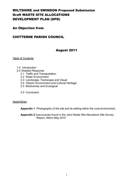
WILTSHIRE and SWINDON Proposed Submission<br />
Draft WASTE SITE ALLOCATIONS<br />
DEVELOPMENT PLAN (DPD)<br />
An <strong>Objection</strong> from<br />
CHITTERNE PARISH COUNCIL<br />
August 2011<br />
Table of Contents<br />
1.0 Introduction<br />
2.0 Detailed Response<br />
2.1 Traffic and Transportation<br />
2.2 Water Environment<br />
2.3 Landscape, Townscape and Visual<br />
2.4 Historic Environment and Cultural Heritage<br />
2.5 Biodiversity and Ecological<br />
3.0 Conclusion<br />
Appendices<br />
Appendix 1 Photographs of the site and its setting within the rural environment.<br />
Appendix 2 Inaccuracies found in the Joint Waste Site Allocations Site Survey<br />
Report, Atkins May 2010<br />
1
1.0 Introduction: This objection to the inclusion in the Wiltshire and Swindon Proposed<br />
Submission Draft Waste Site Allocations Development Plan of the <strong>Chittern</strong>e Waste<br />
Management Facility is drafted by <strong>Chittern</strong>e Parish Council, following consultation with the<br />
villagers of <strong>Chittern</strong>e. The relevant minute reference concerning the position of <strong>Chittern</strong>e<br />
Parish Council on any further development of the <strong>Chittern</strong>e Waste Management Facility<br />
site is as follows - 300/54, meeting held on 11 th July 2011.<br />
1.1 <strong>Chittern</strong>e Parish Council's objections to the Waste Local Plan are outlined in this<br />
report and are founded, in the main, on evidence in reports commissioned by Wiltshire<br />
Council itself in pursuance of the development plans, which clearly demonstrate the<br />
unique unsuitability of <strong>Chittern</strong>e as a site for local household waste transfer, processing<br />
and/or disposal. This evidence has either been overlooked, ignored or misrepresented in<br />
the current development plan. Several <strong>Chittern</strong>e residents have addressed specific<br />
aspects of the proposal in separate submissions to the Planning Inspector, these<br />
responses should be considered in conjunction with these Parish Council observations. I<br />
refer particularly to the submissions of D. Robinson, A. Hutchinson and J Smedley.<br />
1.2 Concern that the proposals presented in the present report are unsound, since<br />
they are based on flawed evidence, or ignore evidence which casts doubt on the issues of<br />
traffic safety, landscape and visual amenity, bio - and geo-diversity, historic environment<br />
and cultural heritage, human health and amenity and the water environment. Further, we<br />
shall draw attention to inaccuracies within the data presented, which, while they do not, in<br />
themselves, invalidate the proposals, do cast significant doubts on the integrity of the<br />
process followed thus far.<br />
1.3 The landfill site at some point has been renamed the the '<strong>Chittern</strong>e Waste<br />
Management Facility’ – this is misleading and implies that a great deal more waste<br />
processes are/could, being/be carried out at the site, see quote below. The site is in fact<br />
only an inert landfill site as it is an agricultural improvement scheme to make farming of a<br />
steep sided valley safer (letter from Planning Inspectorate ref:<br />
T/APP/F3925/A/90/160383/P6 07 March 1991).<br />
The site under question is not currently part of the ‘waste management facility’. It is a<br />
large greenfield site (grade 3 agricultural) adjacent to the landfill.<br />
A example of how the site has been misrepresented appears as 4.18 p 21 ‘The allocation<br />
at <strong>Chittern</strong>e, whilst removed from any concentrations of population represents a<br />
suitable opportunity to maximise the efficient use of an existing and long term<br />
resource and waste management facility…………’ It should again be pointed out that,<br />
..’ the existing and long term resource’ is in fact an agricultural improvement scheme,<br />
that is using chalk, sub-soil and top-soil to fill in a valley to improve farm safety.<br />
2
2.0 DETAILED RESPONSE<br />
2.1 Traffic and Transportation<br />
2.1.1 <strong>Chittern</strong>e Residents and the Parish Council have for over ten years been<br />
deeply concerned by the level of heavy traffic and the speed at which vehicles travel<br />
through the village. The village has a number of horses and riders that have to use<br />
the roads through the village to access the bridleways on the Plain. There are many<br />
children and young people who catch buses to the local schools and there is a large<br />
proportion of Senior Citizens, who use the Plain for exercise and dog-walking. The<br />
current weight and speed of traffic is intolerable and is eroding the quality of life for<br />
those living in <strong>Chittern</strong>e. The Police and Highways Authority have done little to<br />
address this issue, despite frequent representations by the Parish Council, the local,<br />
councillor, M.P., individuals and groups living in the village. Access to the <strong>Chittern</strong>e<br />
inert Landfill site from the East is through the village and access from the West is<br />
from the A36. The junction at Knook Camp is a notorious Black Spot with a<br />
frightening accident rate 1 .<br />
2.1.2 the Atkins Joint Waste Site Allocations Site Survey Report, May 2010<br />
commissioned by Wiltshire Council states:'The village of <strong>Chittern</strong>e is subject to<br />
an 18T weight restriction, meaning that all vehicles should only route via the<br />
A36 to access the site' (Joint Waste Site Allocations Site Survey Report, Atkins 2010 Appendix<br />
B p.646) this is the baseline for selecting the site for further development.<br />
This is not enforceable according to Wiltshire police. The potential impact on the<br />
village of <strong>Chittern</strong>e as a result of increased lorry traffic, if the proposed development<br />
goes ahead, is totally unacceptable. The village is used as a rat run throughout the<br />
day and experiences a high volume of heavy and speeding traffic of all<br />
descriptions 2 .<br />
2.1.3 There is no footway along the narrowest (approx 19') length of the B390.<br />
‘There is a 18T environmental weight restriction in the village of <strong>Chittern</strong>e, as<br />
well as on-street parking and narrow road widths (often less than 6 meters).<br />
Joint Waste Site Allocations Site Survey Report, Atkins 2010 Appendix B p.644). This is<br />
extremely hazardous for pedestrians, cyclists, horseriders etc. Many residential<br />
properties have their access directly onto the B390 where there is limited visibility.<br />
2.1.4 Villagers of <strong>Chittern</strong>e are reluctant to walk down the road to access the Imber<br />
Range Path (which uses the B390 to the west end of the village) due to the speed<br />
of vehicles that use the road as a cut through to avoid congestion on the A303.<br />
Vehicles that exceed the 18T weight restriction use the B390, at speed, to access<br />
the inert landfill site at the <strong>Chittern</strong>e Waste Management Facility. If the proposed<br />
development at Valley Farm goes ahead the traffic levels will potentially increase by<br />
a huge percentage as illiustrated in the Joint Waste Site Allocations Site Survey<br />
Report, Atkins May 2010 table B.4.9.6.1 P.643 - making use of the road even more<br />
dangerous to villagers 3 .<br />
2.1.5 There is the major issue of community severance with many properties lying<br />
to the south of the B390, with village amenities including the recreation ground,<br />
three school bus stops, pub, church, footpaths and byways, located to the north of<br />
the road.<br />
3
2.1.6 Overweight vehicles not only use the B390 to access the site but also use<br />
the undesignated road running through the village to the north, which links to the<br />
A360 north west of Tilshead. This is a very narrow road, densely populated and<br />
with a single width carriageway through the village of <strong>Chittern</strong>e at Townsend. If the<br />
proposed site development goes ahead then the effects on this area of <strong>Chittern</strong>e<br />
village must be taken into account, not just the B390 4 .<br />
Footnotes to Section 2.<br />
1/2 The stretch of road from the lower entrance to Valley Farm through to Knook has also been the<br />
location of a number of traffic accidents over the last ten years, despite recent road improvements.<br />
<strong>Chittern</strong>e Parish Council has made a Freedom of Information request for statistics covering these<br />
accidents as well as statistics relating to the speeding offences recorded during a recent campaign of<br />
speed and vehicle weight monitoring through the 30mph limit in <strong>Chittern</strong>e village.<br />
3<br />
At peak times during a Community Speed Watch check, traffic volumes exceeded more than 500<br />
per hour. Any increase on these levels, given the inadequacy of the carriageway and the absence of<br />
pavements at key points, would render normal life in this part of the village almost impossible and<br />
extremely hazardous.<br />
4 Many of the dwellings located in the narrowest part of the road open directly on to the carriageway.<br />
Most are at least 100 years old, built on chalk with inadequate foundations to withstand damage from<br />
an increased level of heavy traffic.<br />
2. 2 Water Environment<br />
2.2.1 'The proposed development site is located on a major aquifer of high<br />
vulnerability. It is pointed out in the Atkins report that ‘Given that the site lies on a<br />
principal aquifer and is close in proximity to a SPZ 1 for a public water supply<br />
source a high level of engineering containment will be required at this site to<br />
safeguard the groundwater environment.’ (p. 32 Wiltshire and Swindon Proposed<br />
Submission Draft Waste Site Allocations Development Plan Document)<br />
2.2.2 The data and potential risks to the water environment directly relating to<br />
<strong>Chittern</strong>e Village are alarming. (Table B.4.9.7.1 <strong>Chittern</strong>e Waste Management Facility Water<br />
Environment Joint Waste Site Allocations Site Survey Report, Atkins 2010 Appendix B).<br />
Contamination of drinking water supply is stated as a potential risk if the proposed<br />
uses of the site are pursued. This is totally unacceptable.<br />
‘The risk of impact on the <strong>Chittern</strong>e Brook flow as a result of increases in<br />
areas of hardstanding and runoff volumes during construction and operation.’<br />
2.2.3 There are many houses in <strong>Chittern</strong>e Village located very close to <strong>Chittern</strong>e<br />
Brook. Any processes that could result in the increase in flood risk to these homes<br />
is unacceptable. All potential uses as identified in the Wiltshire and Swindon<br />
Proposed Submission Draft Waste Site Allocation Development Plan Document<br />
would increase the risk of flooding of homes in <strong>Chittern</strong>e 1 .<br />
2.2.4 It is quite incredible that despite all the findings of the Atkins Report the<br />
summary of site findings relating to <strong>Chittern</strong>e concludes that… ‘Few/no significant<br />
issues identified’. This is interesting when one compares the Summary and Site<br />
Findings for Warminster Business Park, which states: ‘Several potentially<br />
significant issues identified..’ This is despite the fact that the <strong>Chittern</strong>e site is<br />
underlain by a primary aquifer.<br />
The risk of contamination of drinking water has been identified, the risk of<br />
flooding along <strong>Chittern</strong>e Brook has been identified 2 .<br />
4
The Warminster Business Park site in fact has less significant issues that the<br />
<strong>Chittern</strong>e site but this has been ignored in the summing up of data in the Atkins<br />
report. The report is therefore unsound in its use of data to inform any subsequent<br />
decision making process.<br />
Footnote to section 2.2<br />
1 The <strong>Chittern</strong>e Brook is a winterbourne,rising in late autumn and often running until early spring.<br />
Many of the springs feeding it rise from beneath dwellings in Townsend, often causing flooding<br />
affecting those dwellings, rendering septic tanks inoperable and in severe cases, flooding the road.<br />
Any increase in flows from the proposed site will result in back-ups which could seriously inundate<br />
the lower stories of several houses. Any discharge to the brook during the dry summer months will<br />
not be diluted and will therefore have a disproportionate impact.<br />
2 A more detailed critique on the impact of the proposed development on the water environment, bio<br />
and geo-diversity of <strong>Chittern</strong>e and its immediate surroundings is contained within the separate<br />
submission to the proposal by Amanda Hutchinson of St Mary's Lodge, <strong>Chittern</strong>e Aug 3 2011.<br />
2.3 Landscape, Townscape and Visual<br />
2.3.1 ‘The site is not allocated within the adopted West Wiltshire District Local Plan<br />
and the emerging Wiltshire Core Strategy does not proposes (sic) any designation<br />
in the area of the site.’ (Atkins – Joint Waste Site Allocations Site Survey Report Appendix B<br />
B.4.9.3 p.640)<br />
2.3.2 'The site is not local to any other settlements which makes it an unsuitable<br />
site for ‘local recycling’.' There is little recognition of the closeness of the village of<br />
<strong>Chittern</strong>e to the proposed site 1 . The photographs contained within the Atkins report<br />
only show the proposed greenfield site from the location of the inert landfill. This<br />
does not indicate the scale of the site within the landscape nor the truly rural nature<br />
of the site or its placement within the surrounding rolling downland. The Atkins<br />
photographs seem to be being used to display the site in the most unflattering way<br />
ignoring the landscape setting completely, this is unacceptable and unhelpful. (See<br />
photos attached as appendix 3 for a more accurate view of the site within its<br />
landscape setting.) The proposed site is a large (15ha) GREENFIELD site, currently<br />
under pasture and is grade 3 agricultural land. The site is set in an area of open<br />
rolling chalk downland and is highly visible from the B390 from west and east.<br />
(Appendix 1)<br />
2.3.3 The site has only become a ‘waste site’ as a result of the planning permission<br />
for an agricultural improvement scheme. It is currently used solely as a landfill site<br />
for the disposal of chalk and topsoil to inform the filling of the valley to 'make<br />
farming safer' (Reference required)<br />
How can it follow that an agricultural improvement scheme can be used to promote<br />
the development and building of an industrial waste processing plant in such an<br />
open and beautiful landscape? The current agricultural improvement scheme will<br />
not have any long term visual impact as once the site is closed the land will be<br />
remodelled and grassed to fit in with the surrounding contours of the landscape.<br />
This will not be the case if the proposed uses of the site are given the go ahead.<br />
The processes of Materials Recovery/Waste Transfer, Local recycling, Composting<br />
and Waste Treatment will all need building and structures to contain the processes.<br />
This will have a major visual impact on the surrounding countryside. ‘Potential for<br />
landscape and visual impacts on the surrounding area due to the highly<br />
visible site location’ (Wiltshire and Swindon Proposed Submission Draft Waste Site Allocations<br />
Development Plan Document p. 32)<br />
5
2.3.4 ‘This is a c.15 hectare Greenfield site in an open, rural location that is<br />
designated as a Special Landscape Area. Its use for waste facilities would therefore<br />
contribute to the erosion of the countryside.’ (Joint Waste Site Allocations Site Survey<br />
Report Atkins, 2010 Appendix B table B.4.9.1 P.632)<br />
The landscape quality and condition of site is described as HIGH by Atkins.<br />
2.3.5 The site is described in the Wiltshire Landscape Character Assessment<br />
(Wiltshire County Council) as:<br />
Landscape Type: High Chalk Plain<br />
Landscape Character Area: Salisbury Plain East<br />
Key characteristics relevant to the site:<br />
Very large scale and open, exposed landscape<br />
Rolling plateau land form with panoramic views over the surrounding lowlands<br />
creating a sense of elevation<br />
2.3.6 It is stated that ‘ The overall management strategy is to conserve the open<br />
and isolated character of the plain along with the vast area of calcareous grass land<br />
and sites of historic interest’. (Joint Waste Site Allocations Site Survey Report, Atkins 2010<br />
Appendix B table B.4.9.3 P.639).<br />
The further development of the <strong>Chittern</strong>e Waste Management Facility is in<br />
conflict with this statement.<br />
2.4 Historic Environment and Cultural Heritage<br />
2.4.1 The proposed site is located within the proximity to a number of<br />
designations these include a number of scheduled ancient monuments in the area.<br />
The site is located in the vicinity Cranborne Chase AONB and the Salisbury Plain<br />
SPA, SAC and SSSI. The site is located within a South West strategic nature area<br />
and designated a Special Landscape Area (SLA). (Joint Waste Site Allocations Site Survey<br />
Report, Atkins 2010 Appendix Bt table B.4.9.1 P.632)<br />
2.4.2 The Greenfield site that is proposed for development of waste management<br />
facilities contains an ‘extensive and undated field system which is likely to be<br />
associated with elements of the surrounding prehistoric to Roman period<br />
landscape.’ (Joint Waste Site Allocations Site Survey Report, Atkins 2010 Appendix B table<br />
B.4.9.2 P.633)<br />
It is highly likely that this field system is connected to the surrounding scheduled<br />
ancient monuments and forms part of the wider archaeological landscape. As such<br />
the field systems should be viewed as an integral part of the historic landscape, not<br />
isolated features.<br />
‘ The overall management strategy is to conserve the open and isolated<br />
character of the plain along with the vast area of calcareous grass land and<br />
sites of historic interest’. (Joint Waste Site Allocations Site Survey Report Atkins, 2010<br />
Appendix B table B.4.9.3 P.639).<br />
‘Improvements to the <strong>Chittern</strong>e Waste Management Facility would involve and<br />
have the potential to impact on the heritage resourse of the site and<br />
surrounding area.’ (Joint Waste Site Allocations Site Survey Report Atkins 2010 Appendix<br />
B p.633).<br />
6
2.5 Bio-diversity and Other Ecological Impacts<br />
2.5.1 In an appraisal of the Valley Farm Waste Management Facility conducted by<br />
Wiltshire Council in October 2009, it was stated that: 'The Salisbury Plain SPA is<br />
approximately 1.3 km north of the site and a key interest feature of the site is the<br />
Stone Curlew. The HRA assessment identifies that significant adverse impacts for<br />
this species are most likely to arise from disturbance, noise and light in proximity to<br />
nesting and feeding sites.... Some protected species have also been recorded in<br />
proximity to the site' (These include a large badger population, sand lizards and<br />
several rare species of butterflies and moths).<br />
2.5.2 The same report goes on to state that: 'Site is Greenfield and there are a<br />
number of priority habitats within 2.5 km of the site. Ecological survey required' and:<br />
'Site is identified as an area of potential Chalk Downland in the Southwest Nature<br />
map. Development of this area would lead to loss of part of this designation'.<br />
2.5.3 Given that it is widely believed that calcareous wild chalk downlands are<br />
disappearing at a faster rate than the Amazon rain forest, it is scarcely credible<br />
that the Wiltshire Council can seriously consider putting at risk such a fragile<br />
part of our environmental and cultural heritage, when other, suitable sites<br />
with less potential for serious damage exist within a relatively short distance.<br />
3.0 Conclusion<br />
3.1 In summary, drawing from the evidence gathered and presented by Wiltshire<br />
Council, or by their expert consultants commissioned to examine the feasibility and<br />
advisability of including the Greenfield site at <strong>Chittern</strong>e in a list of locations suitable<br />
for the development of, Local Waste Recycling, Materials Recovery Facility, Waste<br />
Transfer Station, Waste Treatment and Composting, <strong>Chittern</strong>e Parish Council<br />
submit that;<br />
Agricultural Improvement Scheme - The <strong>Chittern</strong>e Waste Management<br />
Facility is an agricultural improvement scheme. Inert chalk and topsoil are<br />
being used to fill in a valley in order to reduce the steep sides to make farming<br />
safer. It should not be assumed that the adjacent Greenfield site is therefore<br />
suitable for other waste management processes. The name of the site is<br />
misleading and predisposes the site for additional uses for which it is highly<br />
unsuitable.<br />
Transport and Traffic. The existing access roads are inadequate and<br />
dangerous to village road users under the present circumstances. Any<br />
development which increases the traffic through the village will only exacerbate<br />
the situation.<br />
Water environment. The risk of contamination of drinking water has been<br />
identified, the risk of flooding along <strong>Chittern</strong>e Brook has been identified.<br />
Landscape, Townscape and Visual Amenity. ‘This is a Greenfield site in an<br />
open, rural location that is designated as a Special Landscape Area. Its use for<br />
waste facilities would therefore contribute to the erosion of the countryside.’<br />
(Atkins – Joint Waste Site Allocations Site Survey Report Appendix B table B.4.9.1 P.632).<br />
7
Historic Environment and Cultural Heritage. Major archaeological and<br />
historic sites identified by the Wiltshire Council and other national authorities<br />
surround the site. The site forms an associated link between two scheduled<br />
ancient monuments. Any damage to this will result in a loss to the<br />
archaeological landscape as a whole.<br />
Bio-diversity and Other Ecological Impacts. What is known is that a<br />
number of rare and valuable flora and fauna rely on the unspoiled nature of<br />
this unique part of Salisbury Plain. The effect on these species and their<br />
habitat of the proposed development is unknown, but likely to be adverse.<br />
Misuse of Information. Despite all the major issues associated with the site<br />
that are highlighted in the Atkins report, Wiltshire Council in its summary (p.32<br />
Wiltshire and Swindon Proposed Submission Draft Waste Site Allocations Development Plan<br />
‘No cumulative effects identified at the plan-<br />
Document.) conclude that;<br />
making stage.’<br />
The 'Consultation' process.<br />
Finally, we wish to protest strongly at the wholly inadequate process and<br />
quality of consultation followed by the Wiltshire Council. While we fully<br />
acknowledge the importance of developing a County-wide Waste<br />
Management strategy, we are unable to find any record of consultation with<br />
<strong>Chittern</strong>e Parish Council on the development of the current proposal since<br />
2003. We have checked with a number of other Parish Councils affected by<br />
the plans and find they have a similar experience. While recognising Wiltshire<br />
Council's role in the development of a strategy, they must also recognise and<br />
respond to the role of Parish Councils in protecting the interests of their<br />
communities.<br />
Taking into account all the above, <strong>Chittern</strong>e Parish Council have clearly demonstrated that;<br />
The proposed development of a Local Recycling Centre, Inert Waste/Transfer,<br />
Treatment, Materials Recovery Facility, Waste Transfer Station and Composting is<br />
entirely unsuitable for a Greenfield site in a highly visible rural location. Accessed<br />
by unsuitable roads with major concerns being raised relating to landscape effect,<br />
traffic, water safety and flooding and urge that the site be removed from any further<br />
consideration for the development of any additional waste management processes<br />
and as such, the site must be deselected from the Wiltshire and Swindon Draft<br />
Waste Site Allocations Development Plan Document (DPD).<br />
‘<br />
8
Appendix 3<br />
Inaccuracies in Joint Site Survey Report Appendix B, Atkins May 2010<br />
Inconsistencies of Location of the <strong>Chittern</strong>e Site:<br />
p.61 ‘The site is located 1.5 km East of <strong>Chittern</strong>e village’.<br />
p.632 B4.9.1’……1km west of the village of <strong>Chittern</strong>e’.<br />
p.633 ‘The site lies c. 2km to the west of the <strong>Chittern</strong>e Conservation Area’.<br />
p.639 ‘Greenfield site located to the south west of the village of <strong>Chittern</strong>e on the<br />
B390…………’<br />
p. 639 B4.9.5 ‘The site is located north of the B390 and approx 6km east of<br />
<strong>Chittern</strong>e Village.’<br />
p.644 ‘…….over 2km from the nearest settlement (<strong>Chittern</strong>e).<br />
9

![E100819FUL_AD[1] , item 187. PDF 106 KB - Wiltshire Council](https://img.yumpu.com/25825409/1/184x260/e100819ful-ad1-item-187-pdf-106-kb-wiltshire-council.jpg?quality=85)