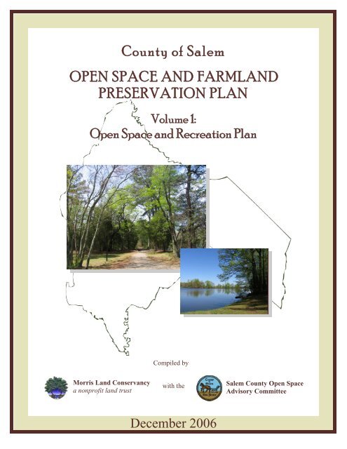
Open Space and Recreation Plan - Salem County
Open Space and Recreation Plan - Salem County
Open Space and Recreation Plan - Salem County

Create successful ePaper yourself
Turn your PDF publications into a flip-book with our unique Google optimized e-Paper software.
<strong>County</strong> of <strong>Salem</strong><br />
OPEN SPACE AND FARMLAND<br />
PRESERVATION PLAN<br />
Volume 1:<br />
<strong>Open</strong> <strong>Space</strong> <strong>and</strong> <strong>Recreation</strong> <strong>Plan</strong><br />
Compiled by<br />
Morris L<strong>and</strong> Conservancy<br />
a nonprofit l<strong>and</strong> trust<br />
with the<br />
<strong>Salem</strong> <strong>County</strong> <strong>Open</strong> <strong>Space</strong><br />
Advisory Committee<br />
December 2006
OPEN SPACE AND<br />
RECREATION PLAN<br />
for<br />
<strong>County</strong> of <strong>Salem</strong><br />
“The Garden Spot of the Garden State”<br />
Compiled by<br />
Morris L<strong>and</strong> Conservancy<br />
a nonprofit l<strong>and</strong> trust<br />
with the<br />
<strong>Salem</strong> <strong>County</strong> <strong>Open</strong> <strong>Space</strong><br />
Advisory Committee<br />
December 2006
<strong>County</strong> of <strong>Salem</strong><br />
<strong>Open</strong> <strong>Space</strong> <strong>and</strong> Farml<strong>and</strong> Preservation <strong>Plan</strong><br />
VOLUME 1:<br />
<strong>Open</strong> <strong>Space</strong> <strong>and</strong> <strong>Recreation</strong> <strong>Plan</strong><br />
Produced by:<br />
Morris L<strong>and</strong> Conservancy’s<br />
Partners for Greener Communities Team:<br />
“Partnering with Communities to Preserve Natural Treasures”<br />
David Epstein, President<br />
Barbara Heskins Davis, PP, AICP,<br />
Vice President of Programs<br />
Tanya Nolte, Mapping Director<br />
Tricia Aspinwall, L<strong>and</strong> Preservation Specialist<br />
Holly Szoke, Communications Manager<br />
Elizabeth Naskret, <strong>Plan</strong>ning Intern<br />
Andrew Szwak, <strong>Plan</strong>ning Intern<br />
Julie Gause, Intern Rachel Jackson, Intern<br />
David Gordon, Intern Michael Tongring, Intern<br />
Jessica Hartline, Intern<br />
In partnership with:<br />
Laura Szwak, Project Consultant<br />
Director, Statewide Greenways<br />
New Jersey Conservation Foundation<br />
For further information please contact:<br />
Morris L<strong>and</strong> Conservancy<br />
19 Boonton Avenue<br />
Boonton, NJ 07005<br />
(973) 541-1010<br />
Fax: (973) 541-1131<br />
www.morrisl<strong>and</strong>conservancy.org<br />
<strong>Salem</strong> <strong>County</strong><br />
<strong>Open</strong> <strong>Space</strong> Advisory Committee<br />
51 Cheney Road, Suite 3<br />
Woodstown, NJ 08098<br />
(856) 769-3708<br />
Fax: (856) 769-3391<br />
www.salemcountynj.gov<br />
Copyright © 2006<br />
All rights reserved<br />
Including the right of reproduction in whole or in part in any form without prior consent.<br />
December 2006
<strong>County</strong> of <strong>Salem</strong><br />
Board of Chosen Freeholders<br />
Lee R. Ware, Director<br />
Bruce Bobbitt, Deputy Director<br />
Chuck Sullivan<br />
Beth Timberman<br />
David Lindenmuth<br />
R. Benjamin Simmermon, Jr.<br />
Susan Bestwick<br />
Acknowledgements<br />
Morris L<strong>and</strong> Conservancy wishes to acknowledge the following individuals <strong>and</strong><br />
organizations for their help in providing information, guidance, <strong>and</strong> materials for the<br />
<strong>County</strong> of <strong>Salem</strong> <strong>Open</strong> <strong>Space</strong> <strong>and</strong> <strong>Recreation</strong> <strong>Plan</strong>. Their contributions have been<br />
instrumental in the creation of the <strong>Plan</strong>.<br />
<strong>Salem</strong> <strong>County</strong> <strong>Open</strong> <strong>Space</strong> Advisory Committee:<br />
Paul Codella, Chairperson<br />
Allen Williams, Vice Chairperson<br />
Andrew Buzby<br />
Ron Howard<br />
Christine L. Seeney<br />
Mark Smith<br />
William Stoms<br />
James G. Waddington<br />
Mark Wilson<br />
Beth Timberman, Freeholder Liaison<br />
Kris Alex<strong>and</strong>er, Program Administrator<br />
<strong>Salem</strong> <strong>County</strong> Agriculture Development Board<br />
Earl Gage, Administrator/Clerk to the Board, <strong>Salem</strong> <strong>County</strong><br />
Ronald Rukenstein, <strong>Plan</strong>ner, <strong>Salem</strong> <strong>County</strong><br />
Tax Data <strong>and</strong> GIS parcel mapping:<br />
Linda D. Stewart, Tax Administrator, <strong>Salem</strong> <strong>County</strong><br />
Don Smith, Civil Solutions, A Division of ARH<br />
George White, White Environmental Services<br />
Maria Abbamont, Ron Rukenstein <strong>and</strong> Associates
Municipal Mayors <strong>and</strong> Clerks:<br />
Alloway Township:<br />
Joseph G. Fedora, Mayor<br />
Mary Lou Rutherford, Clerk<br />
Carneys Point Township:<br />
Elmer Borough:<br />
Elsinboro Township:<br />
Lower Alloways Creek Township:<br />
Mannington Township:<br />
Oldmans Township:<br />
Penns Grove Borough:<br />
Pennsville Township:<br />
Pilesgrove Township:<br />
Pittsgrove Township:<br />
Quinton Township:<br />
<strong>Salem</strong> City:<br />
Upper Pittsgrove Township:<br />
Woodstown Borough:<br />
John M. Lake, III, Mayor<br />
Janina Patrus, Clerk<br />
Herbert D. Stiles, Jr., Mayor<br />
Beverly S. Richards, Clerk<br />
John J. Elk, Mayor<br />
Betty Jean C. Eby, Clerk<br />
Wallace Bradway, Mayor<br />
Lisa M. Montagna, Acting Clerk<br />
Donald C. Asay, Mayor<br />
Mary D. Hancock, Clerk<br />
Harry Moore, Mayor<br />
V. Susan Miller, Clerk<br />
John Washington, Mayor<br />
Sharon Williams, Clerk<br />
Richard Barnhart, Mayor<br />
Cynthia Dalessio, Clerk<br />
Ernest A. Bickford, Mayor<br />
Maureen R. Abdill, Clerk/Registrar<br />
Peter I. Vörös, Mayor<br />
Deborah Turner-Fox, Administrator<br />
Constance S. Garton, Clerk<br />
Jim Kates, Mayor<br />
Marty R. Uzdanovics, Clerk<br />
Earl R. Gage, Mayor<br />
Barbara Wright, Clerk/Administrator<br />
Jack R. Cimprich, Mayor<br />
Alan W. Newk, Clerk/Registrar<br />
Richard Pfeffer, Mayor<br />
Jeanette M. Gerlack, Clerk
This <strong>Plan</strong> is the product of a joint initiative between the <strong>Salem</strong> <strong>County</strong> Agriculture<br />
Development Board <strong>and</strong> the <strong>Salem</strong> <strong>County</strong> <strong>Open</strong> <strong>Space</strong> Advisory Committee. The <strong>Open</strong><br />
<strong>Space</strong> <strong>and</strong> <strong>Recreation</strong> <strong>Plan</strong> is complementary to the companion document, Volume 2:<br />
Farml<strong>and</strong> Preservation <strong>Plan</strong> for the <strong>County</strong> of <strong>Salem</strong>. This <strong>Plan</strong> is based in part upon<br />
data contained in the <strong>Salem</strong> <strong>County</strong> Natural Resources Inventory (2006) <strong>and</strong> the <strong>Salem</strong><br />
<strong>County</strong> Cultural Resources Inventory (2006), along with considerable public input from<br />
local farml<strong>and</strong> owners, residents, municipal, county <strong>and</strong> state officials, nonprofit<br />
organizations <strong>and</strong> state <strong>and</strong> federal l<strong>and</strong> management agencies with an interest in<br />
preserving <strong>Salem</strong> <strong>County</strong>’s rural character <strong>and</strong> beautiful natural resources as a viable part<br />
of the economy.<br />
Financial assistance for this report was provided through the Smart Future Grant<br />
Program administered by the Office of Smart Growth, Department of Community Affairs.
Table of Contents<br />
Page<br />
I. Executive Summary...………………………………………….……………...1<br />
II.<br />
III.<br />
IV.<br />
The L<strong>and</strong>scape of <strong>Salem</strong> <strong>County</strong> …………………………………..……........5<br />
Natural Resources...………..………………………………….……..……......6<br />
Agricultural Resources ……………………………….…………..…….…...25<br />
Cultural <strong>and</strong> Historic Resources……………………..………..…………......29<br />
Built Resources …………………………………………………………….35<br />
<strong>Recreation</strong> Resources …………..……………………………………………41<br />
Municipal Profiles – <strong>Recreation</strong> <strong>and</strong> Conservation …………...…………….61<br />
History of <strong>Salem</strong> <strong>County</strong>’s <strong>Open</strong> <strong>Space</strong> Program …………………………...63<br />
V. Inventory of Outdoor Resources in <strong>Salem</strong> <strong>County</strong> ………………………….67<br />
VI.<br />
VII.<br />
VIII.<br />
IX.<br />
<strong>Plan</strong>ning Consistency <strong>and</strong> Public Outreach …………………………………73<br />
a. Consistency with Local, <strong>County</strong> <strong>and</strong> State <strong>Plan</strong>s …..……………………73<br />
b. Public Hearings ………………………………………………………….77<br />
c. <strong>Salem</strong> <strong>County</strong> <strong>Open</strong> <strong>Space</strong> <strong>and</strong> Farml<strong>and</strong> Preservation Survey Results...85<br />
Goals of <strong>Open</strong> <strong>Space</strong> Preservation in <strong>Salem</strong> <strong>County</strong> ………………………..89<br />
The Need for <strong>Open</strong> <strong>Space</strong> Preservation in <strong>Salem</strong> <strong>County</strong> …………………..91<br />
L<strong>and</strong> Preservation Systems in <strong>Salem</strong> <strong>County</strong> ……………………………...109<br />
X. L<strong>and</strong> Preservation Recommendations ……………………………………...127<br />
XI.<br />
XII.<br />
XIII.<br />
Action Program …………………………………………………………….135<br />
Preservation Partners, Tools, <strong>and</strong> Funding Sources for L<strong>and</strong> Conservation.141<br />
Partners in Preservation of <strong>Salem</strong> <strong>County</strong> <strong>Open</strong> <strong>Space</strong> ………………..141<br />
<strong>Open</strong> <strong>Space</strong> Preservation Tools for <strong>Salem</strong> <strong>County</strong> …………………….170<br />
Funding Sources for <strong>Open</strong> <strong>Space</strong> Preservation in <strong>Salem</strong> <strong>County</strong> ……...177<br />
Literature Cited …………………………………………………………….183<br />
XIV. Fact Sheets<br />
XV.<br />
Maps<br />
a. Natural Features: Water Resources & Natural Heritage Priority Sites<br />
b. Natural Features: Forest & Wetl<strong>and</strong>s<br />
c. <strong>Open</strong> <strong>Space</strong><br />
d. Greenway<br />
e. Farml<strong>and</strong> Project Areas<br />
<strong>Salem</strong> <strong>County</strong> <strong>Open</strong> <strong>Space</strong> <strong>and</strong> <strong>Recreation</strong> <strong>Plan</strong> – December 2006
XVI. Appendices<br />
a. Public Meetings: Advertisements <strong>and</strong> Summaries<br />
Meetings 1 <strong>and</strong> 2: March 21 <strong>and</strong> 22, 2006 – Vision Meetings<br />
a. Notice<br />
b. Press Release<br />
c. Agenda<br />
d. Meeting Notes<br />
Meeting 3: April 26, 2006 – Farml<strong>and</strong><br />
a. Press Release<br />
b. Agenda<br />
c. Meeting Notes<br />
Meeting 4: May 24, 2006 – Non Profit Organizations & Park Managers<br />
a. Invitation<br />
b. Agenda<br />
c. Meeting Notes<br />
Meeting 5: June 29, 2006 – Municipal Officials<br />
a. Invitation<br />
b. Agenda<br />
c. Meeting Notes<br />
Meeting 6: November 29, 2006 – Public Meeting on Draft <strong>Plan</strong><br />
a. Notice<br />
b. Press Release<br />
c. Agenda<br />
d. H<strong>and</strong>outs<br />
e. Meeting Notes<br />
b. Resolution <strong>and</strong> Referendum Establishing Dedicated Tax<br />
c. 2006 Referendum<br />
<strong>Salem</strong> <strong>County</strong> <strong>Open</strong> <strong>Space</strong> <strong>and</strong> <strong>Recreation</strong> <strong>Plan</strong> – December 2006
EXECUTIVE SUMMARY<br />
Located at the southwestern tip of New Jersey <strong>and</strong> part of the beautiful Delaware<br />
Bayshore, <strong>Salem</strong> <strong>County</strong> is home to rich agricultural l<strong>and</strong>, historic downtown<br />
communities, rare wildlife habitats, <strong>and</strong> a myriad of recreational <strong>and</strong> cultural amenities.<br />
This past May, <strong>Salem</strong> <strong>County</strong> celebrated its 20,000 th acre of preserved farml<strong>and</strong>. The<br />
<strong>County</strong> is at a crossroads in its l<strong>and</strong> preservation program - l<strong>and</strong> is escalating in value,<br />
<strong>and</strong> while owners are willing to preserve their family’s legacy, the funds available for<br />
conservation are becoming increasingly limited.<br />
<strong>Salem</strong> <strong>County</strong> has established an <strong>Open</strong> <strong>Space</strong> Advisory Committee to work with the<br />
<strong>County</strong> Agriculture Development Board (CADB) to meet these needs, to protect the<br />
beauty of the l<strong>and</strong>scape, <strong>and</strong> to protect the l<strong>and</strong>s that are critical to the agrarian economy.<br />
The committee <strong>and</strong> board aim to identify, prioritize <strong>and</strong> protect l<strong>and</strong>s of agricultural,<br />
cultural, environmental, recreational, <strong>and</strong> scenic value to the <strong>County</strong>. The Board of<br />
Chosen Freeholders has bonded the dedicated fund in order to quickly meet the needs of<br />
the <strong>County</strong>’s preservation program before the l<strong>and</strong> is lost. This funding is limited in its<br />
scope <strong>and</strong> capacity to protect l<strong>and</strong>. The <strong>County</strong> has completed this <strong>Open</strong> <strong>Space</strong> <strong>and</strong><br />
Farml<strong>and</strong> Preservation <strong>Plan</strong> to identify where the needs for conservation are <strong>and</strong> propose<br />
a balanced system of preservation to meet both the open space <strong>and</strong> agricultural<br />
preservation goals.<br />
<strong>Salem</strong> <strong>County</strong> is 338 square miles in size. Beautiful natural areas abound from<br />
Mannington <strong>and</strong> Supawna Meadows in the west to the Maurice River in the east. Dense<br />
forested l<strong>and</strong> surrounds the <strong>County</strong> <strong>and</strong> provides critical buffers to residential<br />
neighborhoods <strong>and</strong> wildlife habitat. <strong>Salem</strong> <strong>County</strong> is the headwaters for six regional<br />
river systems: the <strong>Salem</strong> River, Alloways Creek, Maurice River, Oldmans Creek, Stow<br />
Creek <strong>and</strong> the Cohansey River. It also sits above one of the most productive ground<br />
water aquifers – the Potomac-Raritan-Magothy <strong>and</strong> Cohansey Aquifer systems. All the<br />
surface water in <strong>Salem</strong> <strong>County</strong> drains to the Delaware River <strong>and</strong> Delaware Bay, <strong>and</strong><br />
many of the <strong>County</strong>’s rivers are tidal in their downstream stretches due to the influence of<br />
the Delaware Bay.<br />
Water usage is one of the key limiting factors to both residential development <strong>and</strong><br />
agricultural production. The tug between the two l<strong>and</strong> uses <strong>and</strong> competition for limited<br />
resources has yielded a crisis among municipal officials <strong>and</strong> residents. How does one<br />
balance growth <strong>and</strong> also sustain a successful agrarian economy upon which the economy<br />
is based? To further fuel this, according to the Soil Conservation Service, 43% of the<br />
<strong>County</strong>’s soils are Class 1 soils, those which exhibit the fewest limitations on their use,<br />
<strong>Salem</strong> <strong>County</strong> <strong>Open</strong> <strong>Space</strong> <strong>and</strong> <strong>Recreation</strong> <strong>Plan</strong> – December 2006 1
<strong>and</strong> can thus most easily support residential <strong>and</strong> commercial development. In many<br />
instances, these same soils are the productive agricultural soils upon which the <strong>County</strong>’s<br />
farmers rely to sustain their businesses. As farms are converted to other l<strong>and</strong> uses, the<br />
continuity <strong>and</strong> integrity of the agricultural industry are interrupted <strong>and</strong> irreparably<br />
harmed. This <strong>Plan</strong> offers a vision for prioritizing l<strong>and</strong> conservation based upon soil<br />
productivity, agricultural integrity, water quality, <strong>and</strong> cultural preservation.<br />
In the course of developing this <strong>Plan</strong>, the <strong>County</strong> hosted six public meetings <strong>and</strong><br />
distributed a survey to residents asking for input on the goals for open space <strong>and</strong><br />
farml<strong>and</strong> preservation. More than 160 people attended the public meetings, <strong>and</strong> nearly<br />
two hundred residents completed the open space questionnaire. Based upon these<br />
meetings <strong>and</strong> discussions with the <strong>Salem</strong> <strong>County</strong> <strong>Open</strong> <strong>Space</strong> Advisory Committee, the<br />
following goals form the basis of the <strong>Open</strong> <strong>Space</strong> <strong>and</strong> <strong>Recreation</strong> <strong>Plan</strong>:<br />
• Preserve Farming <strong>and</strong> the Farmer in <strong>Salem</strong> <strong>County</strong><br />
• Protect the <strong>County</strong>’s Water Resources.<br />
• Retain Natural Forested L<strong>and</strong> <strong>and</strong> the Habitat that it secures.<br />
• Treasure the Garden <strong>County</strong>’s Agricultural Heritage.<br />
• Protect the Special Natural Resource Areas that are unique to <strong>Salem</strong> <strong>County</strong>.<br />
• Create Partnerships <strong>and</strong> Obtain Additional Grant Funding to Leverage Local<br />
Preservation Funds.<br />
• Connect People with the Outdoors, Agriculture, <strong>and</strong> Natural Areas.<br />
• Build upon Existing Public <strong>and</strong> Private Preserved L<strong>and</strong>s to Create Greenways <strong>and</strong><br />
Prevent Fragmentation of Habitat <strong>and</strong> Agricultural Resources.<br />
• Improve Quality of Life for the next generation through Retention of Farms <strong>and</strong><br />
Natural L<strong>and</strong>s for <strong>Recreation</strong> <strong>and</strong> Conservation.<br />
The <strong>Open</strong> <strong>Space</strong> <strong>and</strong> Farml<strong>and</strong> Preservation <strong>Plan</strong> will offer an interconnected system of<br />
open space <strong>and</strong> farml<strong>and</strong> preservation for the county. These preservation corridors are a<br />
system based upon: “blueways”, to protect surface <strong>and</strong> ground water; “greenways”, as<br />
linear corridors preserving the rich forests, stream buffers, <strong>and</strong> wildlife habitats; <strong>and</strong><br />
“brownways”, to ensure conservation of agricultural fields <strong>and</strong> pastures.<br />
Greenways offer an interconnected system of open space to protect the thick forests<br />
(typical of eastern <strong>Salem</strong> <strong>County</strong>), unique wildlife habitat habitats (<strong>Salem</strong> <strong>County</strong> is<br />
home to 18 Natural Heritage Priority Sites), <strong>and</strong> bring people to the outdoors through a<br />
system of neighborhood parks, recreational areas <strong>and</strong> trails. The <strong>Open</strong> <strong>Space</strong> <strong>and</strong><br />
Farml<strong>and</strong> Preservation <strong>Plan</strong> offers a vision of four greenways to preserve critical natural<br />
resources <strong>and</strong> recreational areas:<br />
• Pedricktown Marsh: The marshl<strong>and</strong>s of Oldmans Creek in Pedricktown <strong>and</strong> Oldmans<br />
Township provide excellent wildlife habitat for birds <strong>and</strong> fish, <strong>and</strong> have been<br />
<strong>Salem</strong> <strong>County</strong> <strong>Open</strong> <strong>Space</strong> <strong>and</strong> <strong>Recreation</strong> <strong>Plan</strong> – December 2006 2
identified as a Natural Heritage Priority area by the N.J. Department of<br />
Environmental Protection’s Office of Natural L<strong>and</strong>s Management.<br />
• Swedes Run Greenway: Nestled between the Mannington Meadows <strong>and</strong> the<br />
Riddleton Natural Heritage Priority (NHP) sites, this forested wetl<strong>and</strong>s provides a<br />
critical buffer to Mannington Meadows <strong>and</strong> is located in Mannington, Pilesgrove <strong>and</strong><br />
Alloway Townships.<br />
• Burden Hill Greenway: Bordered by Stow Creek <strong>and</strong> the Delaware Bayshore, this<br />
large forested area is at risk of being lost to residential development. This 15,000<br />
acre forest includes over 1,750 acres of l<strong>and</strong> preserved by the New Jersey<br />
Conservation Foundation <strong>and</strong> New Jersey Green Acres (as part of its efforts to protect<br />
l<strong>and</strong> adjacent to Thundergut <strong>and</strong> Stow Creek Wildlife Management Areas). The<br />
Burden Hill Forest is located in Lower Alloways Creek, Quinton, <strong>and</strong> Alloway<br />
Townships.<br />
• Green Branch Forest: Located in Pittsgrove Township, this densely forested area<br />
includes Parvin State Park, Union Lake Wildlife Management Area <strong>and</strong> the Willow<br />
Grove Tract owned by The Nature Conservancy.<br />
Criss-crossed by streams <strong>and</strong> bordered almost entirely by water, <strong>Salem</strong> <strong>County</strong>’s farms<br />
<strong>and</strong> communities grow along its rivers <strong>and</strong> shores. Water provides the “lifeblood” of the<br />
<strong>County</strong>’s economy <strong>and</strong> development. Both ground water <strong>and</strong> surface water are utilized<br />
for drinking, <strong>and</strong> many farmers rely on surface water bodies for irrigation when the<br />
weather is dry. Many residents utilize the various lakes <strong>and</strong> streams for recreational<br />
fishing, boating <strong>and</strong> kayaking. The blueways identified within this <strong>Plan</strong> highlight the<br />
critical connection <strong>Salem</strong> <strong>County</strong> residents <strong>and</strong> farmers share with their water courses:<br />
• Stow Creek Blueway: Forming <strong>Salem</strong> <strong>County</strong>’s southern border with Cumberl<strong>and</strong><br />
<strong>County</strong>, Stow Creek flows from Alloway into Quinton <strong>and</strong> Lower Alloways Creek<br />
Townships. Its currents are largely influenced by the tides <strong>and</strong> its northernmost<br />
reaches are heavily forested.<br />
• Bayshore Blueway: Home to a vibrant population of fish <strong>and</strong> migratory birds, the<br />
Delaware Bayshore includes the Mad Horse Creek Wildlife Management Area <strong>and</strong><br />
the Strathems Neck <strong>and</strong> Mad Horse Creek NHP site. In <strong>Salem</strong> <strong>County</strong> this blueway<br />
is located in Lower Alloways Creek <strong>and</strong> Quinton Townships.<br />
• Riverview Blueway: Hugging the shore of the Delaware River in Lower Alloways<br />
Creek, Pennsville, Carneys Point, Penns Grove <strong>and</strong> Oldmans, the Riverview Blueway<br />
highlights the value <strong>and</strong> importance of the Delaware River to <strong>Salem</strong> <strong>County</strong>’s history<br />
<strong>and</strong> recreation.<br />
• Oldmans Creek Blueway: The 20 miles of Oldmans Creek serve as the <strong>County</strong>’s<br />
northern border with Gloucester <strong>County</strong> <strong>and</strong> include tidal marshl<strong>and</strong>s <strong>and</strong> a rural<br />
l<strong>and</strong>scape.<br />
• Maurice River Blueway: Designated as a “Scenic <strong>and</strong> <strong>Recreation</strong>al River” by the<br />
National Park Service within the Wild <strong>and</strong> Scenic Rivers Program, this pristine<br />
waterway runs the length of the <strong>County</strong>’s eastern border in Pittsgrove Township.<br />
<strong>Salem</strong> <strong>County</strong> <strong>Open</strong> <strong>Space</strong> <strong>and</strong> <strong>Recreation</strong> <strong>Plan</strong> – December 2006 3
• Alloways Creek Blueway: This blueway runs from Alloway into Quinton, Lower<br />
Alloways Creek, Elsinboro <strong>and</strong> then into the Delaware River north of Artificial<br />
Isl<strong>and</strong>. Below Alloway Lake, the river is tidal where broad meadow estuaries <strong>and</strong><br />
tidal wetl<strong>and</strong>s stretch across the river.<br />
• <strong>Salem</strong> River Blueway: The <strong>Salem</strong> River runs for 32 miles across northern <strong>Salem</strong><br />
<strong>County</strong> from Upper Pittsgrove Township into Pilesgrove, Woodstown, Mannington,<br />
Carneys Point, Pennsville, <strong>Salem</strong> <strong>and</strong> Elsinboro. <strong>Salem</strong> River drains roughly 114<br />
square miles, <strong>and</strong> the most prominent l<strong>and</strong> use within its watershed is tilled farml<strong>and</strong>.<br />
• Muddy Run Blueway: With a watershed that covers more than 15,000 acres of l<strong>and</strong> in<br />
Upper Pittsgrove, Elmer <strong>and</strong> Pittsgrove, Muddy Run serves as the headwaters of the<br />
Maurice River.<br />
There are three agricultural “brown” belts that shape the <strong>County</strong>. These areas span:<br />
• Cohansey - Pole Tavern - Pine Tavern: Covering a large expanse of prime farml<strong>and</strong><br />
soil <strong>and</strong> level, tillable terrain, this area connects preserved farml<strong>and</strong> in Cumberl<strong>and</strong><br />
<strong>County</strong> through <strong>Salem</strong> <strong>County</strong> into Gloucester <strong>County</strong>, <strong>and</strong> includes portions of<br />
Quinton, Alloway, Pittsgrove <strong>and</strong> Upper Pittsgrove Townships.<br />
• Maskells Mill - Hagersville - Mannington Meadows: Characterized by prime<br />
farml<strong>and</strong> soils, this region is not heavily forested <strong>and</strong> runs from the Mad Horse Creek<br />
Wildlife Management Area in Lower Alloways Creek Township north through<br />
Quinton into Mannington Township <strong>and</strong> Mannington Meadows.<br />
• Algonkin Lake - Seven Stars - Mannington Meadows: Linking the two agricultural<br />
belts is the Algonkin Lake – Seven Stars – Mannington Meadows farming area in<br />
Mannington <strong>and</strong> Pilesgrove Townships protecting prime farml<strong>and</strong> soils <strong>and</strong><br />
contiguous productive farml<strong>and</strong>.<br />
A planned system of open space <strong>and</strong> farml<strong>and</strong> preservation will not only protect the<br />
<strong>County</strong>’s agricultural heritage, it will also offer an opportunity for the <strong>County</strong> to exp<strong>and</strong><br />
its tourism initiatives, attracting visitors <strong>and</strong> day-trippers to explore the <strong>County</strong>’s natural,<br />
recreational <strong>and</strong> historic treasures, dine in its historic inns <strong>and</strong> local taverns, <strong>and</strong> enjoy the<br />
countryside. The National Park Service highlights <strong>Salem</strong> <strong>County</strong> as part of its Coastal<br />
Heritage Trail initiative, <strong>and</strong> The New Jersey Audubon Society promotes the entire<br />
Delaware Bayshore in its recently published “New Jersey Birding & Wildlife Trails:<br />
Delaware Bayshore.”<br />
Protecting the agricultural integrity of the l<strong>and</strong>scape will protect the farmer <strong>and</strong> the<br />
economic backbone on which the <strong>County</strong> is based. Channeling growth into the <strong>County</strong>’s<br />
Smart Growth Corridor <strong>and</strong> areas with existing infrastructure will provide a balance<br />
between development, economic revitalization, <strong>and</strong> conservation. Providing areas for<br />
people to recreate <strong>and</strong> enjoy the scenic beauty of <strong>Salem</strong> <strong>County</strong> will enhance the <strong>County</strong><br />
as a destination for visitors <strong>and</strong> businesses. Protection of the water supply will address<br />
the concerns of farmers with residents dependent upon an underground water resource<br />
that is becoming increasingly threatened by saltwater intrusion. <strong>Salem</strong> <strong>County</strong> is meeting<br />
these concerns <strong>and</strong> offering a vision of l<strong>and</strong> conservation that will address the needs for<br />
preservation balanced with opportunities for growth.<br />
<strong>Salem</strong> <strong>County</strong> <strong>Open</strong> <strong>Space</strong> <strong>and</strong> <strong>Recreation</strong> <strong>Plan</strong> – December 2006 4
THE LANDSCAPE OF SALEM COUNTY<br />
A rare balance exists in <strong>Salem</strong> <strong>County</strong>. In the sensitive headwater regions of the <strong>Salem</strong><br />
River <strong>and</strong> Alloways Creek, a flourishing agricultural industry <strong>and</strong> bustling regional<br />
centers thrive in harmony with nature. In Woodstown Borough, the past is seamlessly<br />
interwoven with the present as homes from the 1700’s encircle the historic commercial<br />
district. Work <strong>and</strong> play share a common space in Pilesgrove Township at the Cowtown<br />
Rodeo where tourists watch bulls battle with cowboys from all over the country. These<br />
distinctive qualities, which seem incompatible, live together in the harmonious region<br />
that is <strong>Salem</strong> <strong>County</strong>.<br />
<strong>Salem</strong> <strong>County</strong> is fortunate to have a variety of resources that make this poise possible.<br />
The natural environment of <strong>Salem</strong> <strong>County</strong> offers the essentials, such as clean air <strong>and</strong><br />
water, but also provides an aesthetically pleasing setting in which to live. The <strong>County</strong>’s<br />
rich soils <strong>and</strong> level topography afford it the most productive agricultural l<strong>and</strong> in the<br />
State. The history <strong>and</strong> culture of southern New Jersey are alive <strong>and</strong> well in <strong>Salem</strong><br />
<strong>County</strong>, where it is common to find l<strong>and</strong>scapes, cities, <strong>and</strong> structures that date back to the<br />
17 th <strong>and</strong> 18 th centuries. The recreational opportunities in <strong>Salem</strong> <strong>County</strong> range from<br />
hunting, fishing, hiking, <strong>and</strong> boating in its many Wildlife Management Areas, to playing<br />
ball in community parks <strong>and</strong> playgrounds. The <strong>County</strong>’s built infrastructure includes<br />
commercial, residential, <strong>and</strong> industrial l<strong>and</strong> uses that support the local economy. This<br />
<strong>Open</strong> <strong>Space</strong> <strong>and</strong> <strong>Recreation</strong> <strong>Plan</strong> will explore these various resources in order to establish<br />
a complementary system of open spaces that will best serve the residents of <strong>Salem</strong><br />
<strong>County</strong>.<br />
<strong>Salem</strong> <strong>County</strong> <strong>Open</strong> <strong>Space</strong> <strong>and</strong> <strong>Recreation</strong> <strong>Plan</strong> – December 2006 5
Natural Resources of <strong>Salem</strong> <strong>County</strong><br />
“The l<strong>and</strong>scape of the New Jersey Shore of the Delaware Bay- - its farms, fields, towns <strong>and</strong> villages,<br />
forests, salt marshes, <strong>and</strong> shorelines - - has a subtle <strong>and</strong> quiet beauty. It is not gr<strong>and</strong> in scale like the Great<br />
Smoky Mountains or the Gr<strong>and</strong> Canyon. Rather, this region’s beauty lies in the small-scale, almost<br />
intimate, relationship between man <strong>and</strong> the natural environment <strong>and</strong> the ways in which communities have<br />
been shaped by this interaction.”<br />
-- National Park Service Reconnaissance Study: New Jersey Shore of the Delaware Bay 1<br />
The natural areas <strong>and</strong> resources in <strong>Salem</strong> <strong>County</strong> provide the foundation for a hospitable<br />
<strong>and</strong> comfortable environment. Water is available in great abundance as much of the<br />
<strong>County</strong> rests atop the nation’s most productive aquifer, the Kirkwood-Cohansey. <strong>Salem</strong><br />
<strong>County</strong> also contains the State’s most fertile agricultural soils, <strong>and</strong> enjoys a variety of<br />
recreational opportunities on its many lakes <strong>and</strong> streams. The <strong>County</strong>’s natural areas also<br />
provide an appealing backdrop against which local residents live their lives. Forests,<br />
farm fields, <strong>and</strong> wetl<strong>and</strong>s still predominate in <strong>Salem</strong> <strong>County</strong>, <strong>and</strong> coalesce to create an<br />
aesthetically appealing atmosphere that is present nowhere else in the State.<br />
<strong>Salem</strong> <strong>County</strong> comprises the southwest corner of New Jersey. It is bounded by the<br />
Delaware River <strong>and</strong> Bay to the west <strong>and</strong> the Maurice River to the east. Oldmans Creek<br />
forms much of <strong>Salem</strong> <strong>County</strong>’s northern border, while Stow Creek runs along a portion<br />
of its southern divide.<br />
<strong>Salem</strong> <strong>County</strong> covers an area of 338 square miles <strong>and</strong> boasts a population of less than<br />
65,000 - the lowest population <strong>and</strong> density per square mile of all New Jersey counties.<br />
The New Jersey Department of Environmental Protection’s 1995/97 l<strong>and</strong> use data shows<br />
<strong>Salem</strong> <strong>County</strong> to be a largely rural area with 38% of its l<strong>and</strong> devoted to tilled farml<strong>and</strong><br />
<strong>and</strong> agricultural uses. The <strong>County</strong> is also very wet, with 30% of its l<strong>and</strong> covered by<br />
wetl<strong>and</strong>s <strong>and</strong> 5% of its l<strong>and</strong> composed of open waters. Forests (17%) <strong>and</strong> urban areas<br />
(10%) comprise the remainder of <strong>Salem</strong> <strong>County</strong>.<br />
The Delaware River Bayshore, which includes <strong>Salem</strong> <strong>County</strong>, has received national <strong>and</strong><br />
international recognition citing its unique <strong>and</strong> critical role in providing <strong>and</strong> protecting<br />
wildlife habitat. Designations include the following:<br />
• The Bayshore is the site of the second largest concentration of migrating shorebirds in<br />
North America.<br />
• The Ramsar Treaty Convention on Wetl<strong>and</strong>s of International Importance recognized<br />
the Delaware Bayshore.<br />
• The U.S. Environmental Protection Agency nominated the Delaware Bay in its<br />
National Estuary Program.<br />
<strong>Salem</strong> <strong>County</strong> <strong>Open</strong> <strong>Space</strong> <strong>and</strong> <strong>Recreation</strong> <strong>Plan</strong> – December 2006 6
• The Bayshore was designated by the Nature Conservancy as a site in its Last Great<br />
Places Program.<br />
• The region was nominated to the Western Hemisphere Shorebird Reserve Network.<br />
• The World Wildlife Fund, International Association of Wildlife Agencies, <strong>and</strong> the<br />
governors of Delaware <strong>and</strong> New Jersey named the Delaware Bay as a shorebird<br />
reserve <strong>and</strong> part of the Western Hemisphere Shorebird Reserve Network.<br />
• The Sierra Club has assigned the area with an “America’s Great Outdoors”<br />
designation. (National Park Service Reconnaissance Study)<br />
Geology<br />
Atlantic Coastal Plain<br />
<strong>Salem</strong> <strong>County</strong> is located in the Atlantic Coastal Plain<br />
Physiographic Province, one of the four major<br />
geological regions in New Jersey. The Atlantic<br />
Coastal Plain is the largest of these provinces,<br />
encompassing an area of 4,667 square miles, or<br />
approximately 60% of the State. It includes all of<br />
southern New Jersey south of a low-lying valley<br />
between Trenton <strong>and</strong> the Raritan Bay. This valley<br />
marks the basin of an ancient Ice Age river that<br />
carried glacial runoff <strong>and</strong> drained Glacial Lake<br />
Passaic. (USGS website, “Atlantic Coastal Plain”) 2<br />
The Atlantic Coastal Plain is generally flat with s<strong>and</strong>y<br />
soils that form productive but shallow aquifers. It<br />
was formed by the continual advance <strong>and</strong> retreat of<br />
the Atlantic Ocean over geological time that<br />
deposited multiple layers of s<strong>and</strong>y sediments along<br />
the shifting coastline. The vegetation in the Atlantic<br />
Coastal Plain, therefore, is tolerant to nutrient-poor,<br />
s<strong>and</strong>y soils. The Province is well-known for its<br />
thriving forest communities including “pine barrens”,<br />
which are dominated by various species of pine trees.<br />
(USGS website, “Atlantic Coastal Plain”)<br />
The Physiographic Provinces of NJ<br />
Source: Sebold, K. & Leach, S.<br />
Historic Themes <strong>and</strong> Resources within<br />
the New Jersey Coastal Heritage Trail<br />
Route. National Park Service;<br />
Washington D.C.: 1991.<br />
The Atlantic Coastal Plain is subdivided into the Inner Coastal Plain <strong>and</strong> the Outer<br />
Coastal Plain. The border between the Inner <strong>and</strong> Outer Coastal Plains runs southwesterly<br />
from S<strong>and</strong>y Hook through Woodstown to <strong>Salem</strong> City, putting <strong>Salem</strong> <strong>County</strong> within both<br />
regions. The Outer Coastal Plain is made up entirely of unconsolidated, marine<br />
sediments underlain by the Cohansey Aquifer. The Inner Coastal Plain is a mixture of<br />
marine sediments <strong>and</strong> eroded materials from the Appalachian <strong>and</strong> Catskill Mountains that<br />
have been deposited by the Delaware River. (DVRPC website, “Watersheds of Camden<br />
<strong>County</strong>: Natural <strong>and</strong> Human History”) 3<br />
<strong>Salem</strong> <strong>County</strong> <strong>Open</strong> <strong>Space</strong> <strong>and</strong> <strong>Recreation</strong> <strong>Plan</strong> – December 2006 7
Geography<br />
The geography of <strong>Salem</strong> <strong>County</strong> is typical of the Coastal Plain Province. Its topography<br />
is level with only gradual changes in elevation observed throughout the <strong>County</strong>.<br />
Elevation ranges from areas at sea level along the Delaware Bayshore to 160 feet above<br />
sea level in Upper Pittsgrove Township in the northeastern portion of the <strong>County</strong>.<br />
The highest elevations in <strong>Salem</strong> <strong>County</strong> serve as the headwaters for six regional river<br />
systems: the <strong>Salem</strong> River, Alloways Creek, Maurice River, Oldmans Creek, Stow Creek,<br />
<strong>and</strong> the Cohansey River. The <strong>County</strong>’s level l<strong>and</strong>scape allows these rivers to wind <strong>and</strong><br />
bend over broad floodplains on their paths to the Delaware River. These rivers are<br />
commonly associated with wetl<strong>and</strong> areas, such as Mannington <strong>and</strong> Supawna Meadows,<br />
which occupy 30% of the <strong>County</strong>. (see Natural Features Map)<br />
Tidal marshes are another common feature of <strong>Salem</strong> <strong>County</strong>. The lower stretches of the<br />
Delaware River are heavily influenced by the tides in the Atlantic Ocean, which cause<br />
large areas of l<strong>and</strong> adjacent to the River to flood twice daily. The southwestern areas of<br />
the <strong>County</strong> are predominately marshl<strong>and</strong>s. Further north, tidal marshes are found in the<br />
western sections of the <strong>County</strong> at the mouths of river systems including the <strong>Salem</strong> River<br />
<strong>and</strong> Oldmans Creek. (<strong>Salem</strong> <strong>County</strong> Natural Resources Inventory) 4<br />
Agricultural l<strong>and</strong> uses keep a large part of the <strong>County</strong> cleared of tall, woody vegetation.<br />
This offers visibility over large continuous areas <strong>and</strong> expansive agricultural viewsheds<br />
can be enjoyed in many parts of <strong>Salem</strong> <strong>County</strong>. Agricultural areas predominate in a<br />
horseshoe shaped swath of l<strong>and</strong> starting in Lower Alloways Creek Township <strong>and</strong> running<br />
north through western Quinton, Mannington <strong>and</strong> Pilesgrove Townships before turning<br />
south through Upper Pittsgrove, western Pittsgrove, <strong>and</strong> eastern Alloway Townships.<br />
Where agricultural areas have not been maintained, former farm fields have undergone<br />
ecological succession into natural forest communities. These areas are spread throughout<br />
the <strong>County</strong>, but concentrations exist in Pittsgrove Township <strong>and</strong> eastern Quinton <strong>and</strong><br />
Alloway Townships. (see Natural Features Map)<br />
Soils<br />
Soils are extremely important to <strong>Salem</strong> <strong>County</strong>. The agricultural activities that are<br />
supported by local soils have been responsible for shaping the history, economy, <strong>and</strong><br />
lifestyles of the <strong>County</strong>’s residents for over three hundred years. <strong>Salem</strong> <strong>County</strong> has<br />
developed a deep connection with its soils that comes from recognizing their importance<br />
to the <strong>County</strong>’s identity <strong>and</strong> economic well-being. Maintaining the productivity <strong>and</strong><br />
integrity of local soils is essential to sustaining agricultural trade <strong>and</strong> industry.<br />
<strong>Salem</strong> <strong>County</strong> has been able to work efficiently with its soils to support a thriving<br />
agricultural economy. Surface vegetation has been cleared <strong>and</strong> fields have been drained<br />
in order to maximize the <strong>County</strong>’s tillable acreage. Unfortunately, much of this success<br />
has caused problems that were unforeseen at the time <strong>and</strong> are now beginning to manifest.<br />
Removing surface vegetation has exacerbated erosion <strong>and</strong> caused streams to fill with<br />
sediment that would be better served on the fields from which it came. Large areas of<br />
<strong>Salem</strong> <strong>County</strong> <strong>Open</strong> <strong>Space</strong> <strong>and</strong> <strong>Recreation</strong> <strong>Plan</strong> – December 2006 8
hydric, wetl<strong>and</strong> soils that were previously drained <strong>and</strong> plowed are susceptible to flooding.<br />
Historically, field tiles were buried beneath the ground to direct water from these areas<br />
into nearby drainage canals, but now they pose an encumbrance <strong>and</strong> a potential hazard to<br />
any other use of the l<strong>and</strong>. Specifically, disruption of field tiles through residential<br />
development subjects seemingly “dry” buildable l<strong>and</strong> to flooding <strong>and</strong> elevated water<br />
tables that reflect the more wetl<strong>and</strong> character of the l<strong>and</strong> before it was drained. <strong>Salem</strong><br />
<strong>County</strong>’s residents <strong>and</strong> farmers must address these issues in order to ensure the<br />
sustainability of agriculture into the future.<br />
There are nearly one hundred different soil types in <strong>Salem</strong> <strong>County</strong> that are grouped into<br />
nine soil associations. These associations are determined by a number of factors<br />
including the l<strong>and</strong>scapes in which they are found, local topography, <strong>and</strong> the proportional<br />
concentrations of different soils. The soil associations in <strong>Salem</strong> <strong>County</strong> are:<br />
1. Tidal Marsh-Made L<strong>and</strong>s 6. Galestown-Sassafras-Berryl<strong>and</strong><br />
2. Mattapex-Othello-Woodstown 7. Sassafras-Woodstown-Fallsington<br />
3. Mattapex-Matapeake 8. Keyport-Elkton<br />
4. Sassafras-Evesboro-Downer 9. Chillum-Othello-Mattapex<br />
5. Aura-Sassafras-Downer<br />
(<strong>Salem</strong> <strong>County</strong> Natural Resources Inventory)<br />
In general, silty soils cover the western half of the <strong>County</strong> while s<strong>and</strong>y soils cover the<br />
eastern half. Some loamy soils can be found in central portions of the <strong>County</strong> near<br />
Alloway, but they account for only a small percentage of total soil coverage. Minor soils,<br />
including heavy <strong>and</strong> clayish soils, can be found throughout the <strong>County</strong> in both regular<br />
<strong>and</strong> r<strong>and</strong>om dispersal patterns. Soils can also be classified by their capacity to support<br />
urban <strong>and</strong> agricultural uses. According to the Soil Conservation Service, 95,660 acres (or<br />
approximately 43% of the <strong>County</strong>) are Class 1 soils, which exhibit the fewest limitations<br />
on their use. (<strong>Salem</strong> <strong>County</strong> Natural Resources Inventory) A more complete description<br />
of <strong>Salem</strong> <strong>County</strong>’s soils can be found in the “Agricultural Resources” section of this<br />
<strong>Plan</strong>.<br />
<strong>Salem</strong> <strong>County</strong> <strong>Open</strong> <strong>Space</strong> <strong>and</strong> <strong>Recreation</strong> <strong>Plan</strong> – December 2006 9
Surface Water Resources<br />
Surface waters are an<br />
important feature of <strong>Salem</strong><br />
<strong>County</strong>’s rich natural<br />
l<strong>and</strong>scape. The various river<br />
systems that crisscross the<br />
low-lying <strong>County</strong> support its<br />
exceptionally fertile farml<strong>and</strong>s,<br />
while <strong>Salem</strong> <strong>County</strong>’s lakes<br />
provide both a source for<br />
drinking water <strong>and</strong> recreation<br />
for its residents. A diversity of<br />
wildlife species inhabits the<br />
<strong>County</strong>’s watershed l<strong>and</strong>s <strong>and</strong><br />
are supported by its vast <strong>and</strong><br />
unique ecosystems. Threatened<br />
<strong>and</strong> endangered species<br />
of birds <strong>and</strong> fish are able to<br />
utilize these waters <strong>and</strong> their<br />
surrounding natural areas,<br />
enriching the region’s<br />
biodiversity.<br />
<strong>Salem</strong> <strong>County</strong>’s surface waters<br />
also provide the backdrop on<br />
which the <strong>County</strong>’s history <strong>and</strong><br />
development took place. From<br />
industrial development in the<br />
“river” towns to the<br />
agricultural communities in its<br />
interior, the <strong>County</strong>’s lakes <strong>and</strong><br />
rivers have served as focal<br />
points for the <strong>County</strong>’s growth<br />
<strong>and</strong> maturation. In short, they<br />
are invaluable pieces of <strong>Salem</strong><br />
<strong>County</strong>’s history, economy, <strong>and</strong> natural beauty.<br />
Surface Water Designations in <strong>Salem</strong> <strong>County</strong><br />
River C1 Area SE1<br />
Alloways Creek none Yes<br />
Baldridge Creek within Supawna Meadows NWR Yes<br />
Bucks Ditch within Mad Horse Creek WMA Yes<br />
Cat Gut within Mad Horse Creek WMA Yes<br />
Cherry Tree Creek within Mad Horse Creek WMA Yes<br />
Cohansey River none Yes<br />
Delaware River Zone 6- South of Liston Point, DE *<br />
(near Hope Creek in LAC Twp.)<br />
Devils Gut within Mad Horse Creek WMA Yes<br />
Mad Horse Creek within Mad Horse Creek WMA Yes<br />
Malapatis Creek within Mad Horse Creek WMA Yes<br />
Maurice River within Union Lake WMA No<br />
Muddy Creek within Mad Horse Creek WMA Yes<br />
Muddy Run Elmer Lake WMA, Parvin State No<br />
Park, & Union Lake WMA<br />
Oldmans Creek within Harrisonville WMA Yes<br />
Parvin Lake within Parvin State Park No<br />
<strong>Salem</strong> River none Yes<br />
Shore Ditch within Mad Horse Creek WMA Yes<br />
Stow Creek within Mad Horse Creek WMA Yes<br />
Thundergust<br />
Brook within Parvin State Park No<br />
Thundergust Lake within Parvin State Park No<br />
Upper Deep Creek within Mad Horse Creek WMA Yes<br />
* - separate designations determined by the<br />
Delaware River Basin Commission<br />
Source: N.J.A.C. 7:9B- “Surface Water Quality St<strong>and</strong>ards”<br />
Many of the surface water bodies in <strong>Salem</strong> <strong>County</strong> have been given special designations<br />
by the New Jersey Department of Environmental Protection (N.J. DEP) <strong>and</strong> the National<br />
Park Service (NPS). The NJDEP has determined that Category One streams are worthy<br />
of protection for their “color, clarity, scenic setting or other aesthetic value, exceptional<br />
ecological significance, recreational significance, water supply significance or fisheries<br />
resources.” This designation merits special regulations on new development within 300<br />
feet of classified water bodies <strong>and</strong> their tributaries. The Category One water bodies in<br />
<strong>Salem</strong> <strong>County</strong> are listed above.<br />
<strong>Salem</strong> <strong>County</strong> <strong>Open</strong> <strong>Space</strong> <strong>and</strong> <strong>Recreation</strong> <strong>Plan</strong> – December 2006 10
Several of these water bodies are also classified SE1 as “saline waters of estuaries.” The<br />
designated uses of these waters are “shellfish harvesting,” “migration <strong>and</strong> propagation of<br />
the natural <strong>and</strong> established biota,” <strong>and</strong> “primary contact recreation,” which includes<br />
swimming. This is the most stringent of saline water designations <strong>and</strong> requires lower<br />
bacterial counts, less turbidity, <strong>and</strong> higher levels of dissolved oxygen than in other saline<br />
waters. (N.J.A.C. 7:9B- “Surface Water Quality St<strong>and</strong>ards”) 5<br />
In addition, the Maurice River is classified by the National Park Service as a “Scenic<br />
<strong>Recreation</strong>al River” within the Wild <strong>and</strong> Scenic Rivers program, for its condition as an<br />
“unusually pristine Atlantic Coastal River with national <strong>and</strong> internationally important<br />
resources.” This designation precludes any impoundments or other changes to the River<br />
that will detract from its existing character. (National Park Service -“Maurice River”) 6<br />
Delaware River <strong>and</strong> Bay<br />
The Delaware is one of the Northeast’s<br />
principal river systems. It flows 375<br />
miles from its headwaters region in the<br />
Catskill Mountains through the<br />
Delaware Water Gap <strong>and</strong> between the<br />
states of Pennsylvania, Delaware, <strong>and</strong><br />
New Jersey to the Delaware Bay <strong>and</strong><br />
Atlantic Ocean. The Delaware is the<br />
only major river on the east coast that<br />
remains unencumbered by dams or other<br />
obstructions.<br />
The Delaware forms the entire western<br />
boundary of <strong>Salem</strong> <strong>County</strong> <strong>and</strong> the State<br />
Delaware Memorial Bridge<br />
of New Jersey. The official border with<br />
Delaware begins at the river’s high tide line on the New Jersey side. The river is more<br />
than 2,000 feet wide at the Delaware Memorial Bridge in Pennsville, <strong>and</strong> widens as it<br />
empties into the Delaware Bay to the south. The Delaware serves as a shipping canal that<br />
connects the port cities of Wilmington, Delaware, Philadelphia, Pennsylvania, <strong>and</strong><br />
Trenton, New Jersey to the Atlantic Ocean. It is also frequented by recreational boaters<br />
<strong>and</strong> fisherman.<br />
All the surface water in <strong>Salem</strong> <strong>County</strong> drains to the Delaware River <strong>and</strong> Bay. Many of<br />
the surface waters in the western areas of the <strong>County</strong> flow directly into the River while in<br />
the eastern areas, surface waters join subwatersheds before entering the Delaware. The<br />
tides of the Atlantic Ocean influence the entire length of the Delaware River in <strong>Salem</strong><br />
<strong>County</strong>. Many of the <strong>County</strong>’s rivers are tidal themselves in their downstream stretches.<br />
The wildlife along the Delaware Bayshore in <strong>Salem</strong> <strong>County</strong> is remarkably vibrant <strong>and</strong><br />
diverse. Every May, horseshoe crabs nest in the muddy wetl<strong>and</strong> soils along the banks of<br />
the Delaware providing migrating birds with a reliable rest area where they can stop <strong>and</strong><br />
<strong>Salem</strong> <strong>County</strong> <strong>Open</strong> <strong>Space</strong> <strong>and</strong> <strong>Recreation</strong> <strong>Plan</strong> – December 2006 11
feed upon the crab eggs. Unfortunately, the Delaware has also served as a depository for<br />
toxic chemicals <strong>and</strong> a source of cooling water for power plants. It has also been the<br />
victim of several serious oil spills. These anthropogenic influences continue to have an<br />
impact on the water quality in the Delaware River <strong>and</strong> Bay, <strong>and</strong> may have serious effects<br />
on the area’s wildlife. (Delaware Riverkeeper Network -“Delaware River Fact Sheet”) 7<br />
<strong>Salem</strong> River<br />
The <strong>Salem</strong> River runs for a total of 32<br />
miles across northern <strong>Salem</strong> <strong>County</strong> from<br />
Upper Pittsgrove Township to the<br />
intersection of I-295 <strong>and</strong> the New Jersey<br />
Turnpike at Deepwater in Carneys Point<br />
Township. It then turns south through<br />
Mannington Meadows to <strong>Salem</strong> City <strong>and</strong><br />
into the Delaware River. It drains roughly<br />
114 square miles (73,000 acres) of the<br />
<strong>County</strong> including areas in Upper<br />
Pittsgrove, Pilesgrove, Oldmans, Carneys<br />
Point, Mannington, Pennsville, Alloway,<br />
<strong>Salem</strong> River at Carson's L<strong>and</strong>ing<br />
Quinton, <strong>and</strong> Elsinboro Townships as well<br />
as Woodstown Borough <strong>and</strong> <strong>Salem</strong> City.<br />
(N.J. DEP Division of Watershed Management) 8 The most prominent l<strong>and</strong> use in this<br />
watershed is tilled farml<strong>and</strong> (43%) with the remainder split between tidal <strong>and</strong> freshwater<br />
marshes (34%), urban areas (13%), forests (9%), <strong>and</strong> pasture l<strong>and</strong>s (~4%). (<strong>Salem</strong> <strong>County</strong><br />
Greenkeeper -“The <strong>Salem</strong> River Watershed”) 9<br />
Major tributaries of the <strong>Salem</strong> River in <strong>Salem</strong> <strong>County</strong> include Mannington Creek, Game<br />
Creek, Majors Run, <strong>and</strong> Fenwick Creek. In addition, there are a number of lakes that<br />
impound the <strong>Salem</strong> River including Memorial Lake in Woodstown, East Lake <strong>and</strong> Avis<br />
Mill Pond in Pilesgrove, <strong>and</strong> Slabtown Lake, Daretown Lake, <strong>and</strong> the <strong>Salem</strong> River<br />
Reservoir in Upper Pittsgrove.<br />
Mannington Meadows is an approximately 20,000 acre expanse of tidal, brackish water<br />
just north of <strong>Salem</strong> City through which the <strong>Salem</strong> River flows. The New Jersey Audubon<br />
Society has designated the Meadows as one of four Important Bird Areas in the <strong>County</strong>,<br />
<strong>and</strong> this area is widely recognized as prime wildlife habitat. (New Jersey Audubon Society<br />
-“Important Bird Areas”) 10<br />
Many of the water bodies that are associated with the <strong>Salem</strong> River suffer some degree of<br />
impairment. Both Majors Run <strong>and</strong> the upper <strong>Salem</strong> River are impaired by excessive<br />
fecal coliform levels. Fecal coliform levels indicate the concentration of potentially<br />
harmful pathogens living in the water. Majors Run must achieve a 98% reduction in<br />
fecal coliform levels to meet its total maximum daily load (TMDL) while the upper<br />
reaches of the <strong>Salem</strong> River must obtain an 84% reduction. (N.J.DEP, “TMDL Report for<br />
Fecal Coliform to address 27 streams in the Lower Delaware Water Region”) 11<br />
<strong>Salem</strong> <strong>County</strong> <strong>Open</strong> <strong>Space</strong> <strong>and</strong> <strong>Recreation</strong> <strong>Plan</strong> – December 2006 12
The headwaters <strong>and</strong> tributaries of the <strong>Salem</strong> River have been designated as priority water<br />
bodies by the New Jersey Department of Environmental Protection. In order to achieve<br />
the necessary pollutant reductions mentioned above, the NJDEP has funded a Watershed<br />
Restoration <strong>Plan</strong> for the upper <strong>Salem</strong> River Watershed that seeks to reduce phosphorous<br />
<strong>and</strong> fecal coliform loading throughout the watershed. Phase 1 of this Restoration <strong>Plan</strong><br />
identifies animal waste, agricultural runoff, <strong>and</strong> leaking on-site wastewater treatment<br />
systems as likely contributors to the excessive levels of phosphorous <strong>and</strong> coliform<br />
observed in the <strong>Salem</strong> River. It also noted poor bank stability along much of the River’s<br />
upper reaches caused both by natural forces <strong>and</strong> anthropogenic activities like agriculture<br />
<strong>and</strong> development. (Rutgers Cooperative Research & Extension of <strong>Salem</strong> <strong>County</strong>-<br />
“Watershed Restoration <strong>Plan</strong> for the Upper <strong>Salem</strong> River Watershed”) 12<br />
Alloways Creek<br />
Alloways Creek flows 24 miles from its<br />
headwaters in Upper Pittsgrove <strong>and</strong><br />
Pilesgrove Townships in a south-westerly<br />
direction through Alloway, Quinton,<br />
Lower Alloways, <strong>and</strong> Elsinboro<br />
Townships. It drains approximately 75<br />
square miles (48,000 acres) of predominately<br />
agricultural l<strong>and</strong> in southern<br />
<strong>Salem</strong> <strong>County</strong> before emptying into the<br />
Delaware River north of Artificial Isl<strong>and</strong>.<br />
Approximately 85% of the l<strong>and</strong> in the<br />
Alloways Creek watershed is agricultural.<br />
Alloways Creek in Quinton Township<br />
Alloways Creek has a number of<br />
significant tributaries including Abbotts<br />
Meadow, Cool Run, Carlisle Run, Deep Run, Cedar Brook, <strong>and</strong> Lower Alloways Creek.<br />
It is also impounded a number of times, most notably at Alloway Lake, Elkinton Mill<br />
Pond, <strong>and</strong> Laurel Lake. Laurel Lake is a principal source of <strong>Salem</strong> City’s municipal<br />
drinking water. (Delaware Riverkeeper Network -“Alloways Creek Fact Sheet”) 13<br />
Alloways Creek is divided into two distinct segments by Alloway Lake, the largest<br />
surface water body in <strong>Salem</strong> <strong>County</strong>. The upstream segment is a riverine ecosystem that<br />
flows through a sharply defined channel <strong>and</strong> is abutted by forested wetl<strong>and</strong>s. Below<br />
Alloway Lake, the Creek becomes tidal where meadow estuaries, tidal wetl<strong>and</strong>s, <strong>and</strong> a<br />
broader stream channel define its southern stretches. (Delaware Riverkeeper Network-<br />
“Alloways Creek Fact Sheet”)<br />
The Delaware Riverkeeper Network regularly monitors chemical <strong>and</strong> biological<br />
conditions on Alloways Creek in Quinton Township at its intersection with Route 49.<br />
Chemical conditions are generally characterized as “acceptable to support some levels of<br />
wildlife.” Numerous threatened <strong>and</strong> endangered species have been observed at or near<br />
the monitoring site including Coopers Hawk, Northern Harrier, Great Blue Heron,<br />
<strong>Salem</strong> <strong>County</strong> <strong>Open</strong> <strong>Space</strong> <strong>and</strong> <strong>Recreation</strong> <strong>Plan</strong> – December 2006 13
Osprey, Bald Eagle, North American River Otter, <strong>and</strong> Swamp Pink. (Delaware<br />
Riverkeeper Network -“Alloways Creek Fact Sheet”)<br />
The Riverkeeper Network has also identified potential <strong>and</strong> existing environmental threats<br />
to Alloways Creek. Among these are loss of freshwater wetl<strong>and</strong>s, deforestation of<br />
headwaters, lack of adequate wastewater facilities in the watershed, <strong>and</strong> the use of the<br />
River for cooling water. Other observed instances of stream degradation included illegal<br />
dumping of hazardous <strong>and</strong> non-hazardous materials, erosion from construction activities,<br />
filling of wetl<strong>and</strong>s, <strong>and</strong> streambed encroachment. (Delaware Riverkeeper Network-<br />
“Alloways Creek Fact Sheet”) The United States Environmental Protection Agency<br />
(USEPA) has also identified a low priority pathogenic impairment within the Alloways<br />
Creek estuary. No remediation efforts have been planned to date. (U.S. Environmental<br />
Protection Agency- “Listed Water Information - Alloways Creek Estuary”) 14<br />
Maurice River<br />
The Maurice River <strong>and</strong> its tributary, Scotl<strong>and</strong><br />
Run, comprise the eastern border of <strong>Salem</strong><br />
<strong>County</strong>. From its headwaters in Gloucester<br />
<strong>and</strong> <strong>Salem</strong> Counties, the Maurice flows 35<br />
miles south through Cumberl<strong>and</strong> <strong>County</strong> to the<br />
Delaware Bay. It drains over 386 square miles<br />
of l<strong>and</strong> including roughly 70.5 square miles<br />
(45,138 acres) in <strong>Salem</strong> <strong>County</strong>. Its major<br />
tributaries that flow through <strong>Salem</strong> <strong>County</strong><br />
include Muddy Run, Still Run, <strong>and</strong> Scotl<strong>and</strong><br />
Run.<br />
Maurice River in Pittsgrove Township<br />
The main branch of the Maurice River is<br />
impounded at Willow Grove Lake in<br />
Pittstown, while Muddy Run is impounded at Elmer Lake, Palatine Lake, Centerton<br />
Pond, Parvin Lake, <strong>and</strong> Rainbow Lake before entering the river’s main branch.<br />
(Pittsgrove Township <strong>Open</strong> <strong>Space</strong> & <strong>Recreation</strong> <strong>Plan</strong>) 15 L<strong>and</strong> use in the headwaters area<br />
of the Maurice watershed is 48% forested, 27% agricultural, <strong>and</strong> 25% developed or<br />
barren (as designated by the N.J. DEP 1995/97 L<strong>and</strong> Use/L<strong>and</strong> Cover data).<br />
The Maurice River was designated as a National Wild <strong>and</strong> Scenic River in 1994 for its<br />
significance as a haven for endangered wildlife <strong>and</strong> connectivity to important natural<br />
areas including the Delaware Bay <strong>and</strong> Pinel<strong>and</strong>s National Reserve. Among the wildlife<br />
species that flourish in <strong>and</strong> along the Maurice are the globally imperiled joint vetch<br />
(plant), shortnose sturgeon (fish), <strong>and</strong> striped bass (fish). Its abundant natural resources<br />
make it a vital link in the Atlantic Flyway, the path by which numerous species of fish<br />
<strong>and</strong> birds migrate every year. The Maurice River serves as the western border of the<br />
Pinel<strong>and</strong>s region, <strong>and</strong> drains much of its pristine forests. The Pinel<strong>and</strong>s National Reserve<br />
l<strong>and</strong>s begin across the Maurice from <strong>Salem</strong> <strong>County</strong>. (U.S. National Park Service -<br />
“Maurice River”) 16<br />
<strong>Salem</strong> <strong>County</strong> <strong>Open</strong> <strong>Space</strong> <strong>and</strong> <strong>Recreation</strong> <strong>Plan</strong> – December 2006 14
The eastern boundary of <strong>Salem</strong> <strong>County</strong> adjacent to the Maurice River <strong>and</strong> Scotl<strong>and</strong> Run<br />
is almost entirely preserved. These areas are within either the Willow Grove Lake<br />
Preserve or the Union Lake Wildlife Management Area, owned <strong>and</strong> managed by The<br />
Nature Conservancy <strong>and</strong> the N.J. DEP, respectively. Muddy Run traverses a primarily<br />
agricultural l<strong>and</strong>scape broken only by l<strong>and</strong>s associated with the Elmer Lake Wildlife<br />
Management Area <strong>and</strong> Parvin State Park.<br />
Despite its heavily forested watershed, high natural resource value, <strong>and</strong> preserved<br />
riparian areas, the Maurice River is severely impaired in <strong>Salem</strong> <strong>County</strong>. Excessive<br />
concentrations of heavy metals including lead, arsenic, <strong>and</strong> mercury have been observed<br />
just downstream of its confluence with Muddy Run. (U.S. EPA - “List of Impaired<br />
Waters: Maurice River”) 17 Similarly high levels of bacterial coliform, which indicate the<br />
concentration of pathogens in the water, have been observed upstream at Norma in<br />
Pittsgrove Township. Bacterial coliform levels must be reduced by 67% in order to meet<br />
its maximum daily load as required by the N.J. DEP. Possible sources of these pathogens<br />
include pet waste <strong>and</strong> effluent from nearby horse farms <strong>and</strong> animal processing plants.<br />
(N.J. DEP, “TMDL Report for Fecal Coliform to address 27 streams in the Lower<br />
Delaware Water Region”)<br />
Oldmans Creek<br />
The 20 miles of Oldmans Creek serve as<br />
<strong>Salem</strong> <strong>County</strong>’s northwestern border with<br />
Gloucester <strong>County</strong>. It begins as a<br />
collecting stream for a number of small<br />
tributaries in Upper Pittsgrove <strong>and</strong><br />
Pilesgrove Townships before winding<br />
northwesterly past Oldmans Township,<br />
through tidal marsh l<strong>and</strong>s, <strong>and</strong> into the<br />
Delaware River. The Creek passes<br />
through a primarily rural l<strong>and</strong>scape with<br />
53% of its watershed devoted to<br />
agricultural uses, 19% forests, 14% urban<br />
areas, 13% wetl<strong>and</strong>s, <strong>and</strong> 1% barren l<strong>and</strong>s Oldmans Creek in Pedricktown Marsh<br />
<strong>and</strong> other surface waters. Approximately<br />
21 square miles in <strong>Salem</strong> <strong>County</strong> are<br />
drained via Oldmans Creek. (N.J. DEP, “TMDL Report for Fecal Coliform to address 27<br />
streams in the Lower Delaware Water Region”)<br />
The marshl<strong>and</strong>s associated with Oldmans Creek near Pedricktown in Oldmans Township<br />
provide excellent wildlife habitat, especially for birds <strong>and</strong> fish. The New Jersey<br />
Audubon Society has also designated this area an “Important Bird Area” with a variety of<br />
bird species such as blue herons, red-winged blackbirds, <strong>and</strong> indigo buntings commonly<br />
sighted there. (New Jersey Audubon Society -“Important Bird Areas”; South Jersey L<strong>and</strong><br />
& Water Trust - “Oldmans Creek Watershed”) 18<br />
<strong>Salem</strong> <strong>County</strong> <strong>Open</strong> <strong>Space</strong> <strong>and</strong> <strong>Recreation</strong> <strong>Plan</strong> – December 2006 15
Oldmans Creek is also threatened by high levels of bacterial coliform <strong>and</strong> phosphorous.<br />
Concentrations must be reduced by 95% <strong>and</strong> 30%, respectively. The principal source of<br />
these pollutants is most likely the various agricultural l<strong>and</strong> uses that predominate in the<br />
watershed. While both impairments are considered to be “high priority,” phosphorous is<br />
often the limiting reagent in aquatic ecosystems that prevents extensive algae blooms.<br />
Reducing its presently excessive levels in Oldmans Creek is particularly important to the<br />
continued vitality of the Creek’s fish <strong>and</strong> bird populations. (N.J.DEP, “TMDL Report for<br />
Phosphorous to address 5 stream segments in the Lower Delaware Water Region) 19<br />
Stow Creek<br />
Stow Creek forms <strong>Salem</strong> <strong>County</strong>’s southeastern border with Cumberl<strong>and</strong> <strong>County</strong>. It<br />
flows southwesterly from its headwaters in Alloway <strong>and</strong> Quinton Townships to Lower<br />
Alloways Creek Township <strong>and</strong> into the Delaware Bay draining nearly 30 square miles of<br />
the <strong>County</strong>. Its southernmost stretches are within the marsh l<strong>and</strong>s associated with the<br />
Mad Horse Creek Wildlife Management Area <strong>and</strong> are largely influenced by the tides. Its<br />
northernmost reaches draw from a heavily forested <strong>and</strong> partially agricultural l<strong>and</strong>scape. It<br />
abuts l<strong>and</strong> in Cumberl<strong>and</strong> <strong>County</strong> that is part of Stow Creek State Park.<br />
Mad Horse Creek<br />
Mad Horse Creek falls entirely within Lower Alloways Creek Township in the<br />
southernmost reaches of the <strong>County</strong>. It drains much of the southern <strong>and</strong> eastern areas of<br />
the Township <strong>and</strong> flows into the Delaware Bay. It is the primary waterbody within the<br />
Mad Horse Creek Wildlife Management Area, which contains a diverse array of species<br />
including birds, fish, <strong>and</strong> crabs. The water quality in this stream supports these species in<br />
the Wildlife Management Area downstream, <strong>and</strong> is integral to their continued survival.<br />
Cohansey River<br />
<strong>Salem</strong> <strong>County</strong> contains the headwaters of the Cohansey River - a 33.8 mile-stream that<br />
flows south from Upper Pittsgrove <strong>and</strong> Alloway Townships through Bostwick Lake <strong>and</strong><br />
Cumberl<strong>and</strong> <strong>County</strong> <strong>and</strong> into the Delaware Bay. The Cohansey drains 8 square miles of<br />
<strong>Salem</strong> <strong>County</strong>. However, these upper watershed l<strong>and</strong>s are considered a high priority area<br />
for pollution reduction by the New Jersey Department of Environmental Protection. The<br />
N.J. DEP is undertaking a Watershed Restoration <strong>Plan</strong> for the upper Cohansey River that<br />
aims to achieve the significant reductions in fecal coliform (66%), phosphorous (51%),<br />
<strong>and</strong> lead that have been recommended by the N.J. DEP. (“TMDL Report for Fecal<br />
Coliform to address 27 stream segments in the Lower Delaware Water Region,” “TMDL<br />
Report for Phosphorous to address 5 stream segments in the Lower Delaware Water<br />
Region”)<br />
<strong>Salem</strong> <strong>County</strong> <strong>Open</strong> <strong>Space</strong> <strong>and</strong> <strong>Recreation</strong> <strong>Plan</strong> – December 2006 16
Ground Water Resources<br />
Most of the <strong>County</strong>’s drinking water comes from below the ground surface.<br />
Groundwater comprises 79% of the municipally-provided water <strong>and</strong> 100% of the water<br />
pumped through private systems. The <strong>County</strong>’s agricultural industry relies upon ground<br />
water for irrigation. Groundwater also feeds the many lakes <strong>and</strong> streams in <strong>Salem</strong><br />
<strong>County</strong> <strong>and</strong> supports the wildlife that lives in or drinks from these water bodies.<br />
Groundwater resources must be maintained at sufficient levels in order to ensure their<br />
continued high quality <strong>and</strong> availability. Saltwater intrusion is a growing concern in<br />
<strong>Salem</strong> <strong>County</strong>. Saltwater intrusion occurs when an aquifer system is depleted <strong>and</strong> a<br />
neighboring body of salt water fills in the vacated space. Instead of fresh water for<br />
drinking <strong>and</strong> irrigation, the aquifer now begins to yield salt water. This situation is<br />
exacerbated by increased withdrawals from the aquifer, covering more l<strong>and</strong> above the<br />
aquifer with impervious surfaces, <strong>and</strong> using chemical applications on farm fields, lawns,<br />
<strong>and</strong> streets.<br />
Kirkwood-Cohansey Aquifer<br />
A major groundwater aquifer in <strong>Salem</strong> <strong>County</strong> is the Kirkwood-Cohansey Aquifer. It<br />
underlies the entire eastern portion of the <strong>County</strong>, starting from a line roughly between<br />
<strong>Salem</strong> City <strong>and</strong> Woodstown, <strong>and</strong> encompasses a total of 2,350 square miles of southern<br />
New Jersey including the Pinel<strong>and</strong>s National Reserve. The s<strong>and</strong>y substrate of the<br />
Kirkwood-Cohansey Aquifer is well-drained, allowing for a large amount of water to be<br />
recharged through it over a wide surface area. The Kirkwood-Cohansey is an extremely<br />
productive aquifer, <strong>and</strong> at an estimated 17 trillion-gallon capacity, it is the largest<br />
underground aquifer in the United States. (<strong>Salem</strong> <strong>County</strong> Natural Resources Inventory)<br />
Unfortunately, the same features that make the Kirkwood-Cohansey such a productive<br />
aquifer also make it susceptible to widespread contamination. The s<strong>and</strong>y, porous soils<br />
that overlay the Kirkwood-Cohansey allow most liquids to penetrate into the aquifer from<br />
almost any point above it. This includes materials from illegal dumping, leaking septic<br />
systems, <strong>and</strong> agricultural products. The impacts on the region’s drinking water supply<br />
are intimately affected by these activities, as is the health of the neighboring Pinel<strong>and</strong>s<br />
ecosystem.<br />
Potomac-Raritan-Magothy Aquifer<br />
The Potomac-Raritan-Magothy (PRM) Aquifer is the most heavily used source of<br />
drinking water in southern New Jersey. It draws from the Raritan-Magothy geological<br />
formation- a wedge of alternating clay, silt, s<strong>and</strong>, <strong>and</strong> gravel layers that thickens <strong>and</strong><br />
deepens eastward. The tip of this wedge lies along the western shoreline of the Delaware<br />
River <strong>and</strong> becomes progressively submerged under more recently deposited geological<br />
sediments. 20 The PRM Aquifer is confined except at its outcrop area, which has its<br />
southern reaches in <strong>Salem</strong> <strong>County</strong>. From the tip of the wedge along the Delaware River<br />
in Pennsville Township, the outcrop zone runs northwesterly <strong>and</strong> exp<strong>and</strong>s as it enters<br />
<strong>Salem</strong> <strong>County</strong> <strong>Open</strong> <strong>Space</strong> <strong>and</strong> <strong>Recreation</strong> <strong>Plan</strong> – December 2006 17
Carneys Point <strong>and</strong> Oldmans Townships to a width of approximately three miles at<br />
Oldmans Creek. (United States Geological Survey) 21<br />
The Potomac-Raritan-Magothy Aquifer is the major source of water for western <strong>Salem</strong><br />
<strong>County</strong>. There are at least 35 wells in the <strong>County</strong> within two miles of the Delaware River<br />
that are permitted to pump 100,000 gallons or more per day from this aquifer. Many<br />
smaller, private wells tap the PRM Aquifer as well. (United States Geological Survey)<br />
The PRM Aquifer faces a significant threat from saltwater intrusion. The PRM Aquifer<br />
is pumped at a rate of 235 million gallons per day, <strong>and</strong> recharge rates are currently not<br />
sufficient to replace this. As a result, salt water from the Delaware River <strong>and</strong> Bay are<br />
moving into the previously fresh water aquifer. Impervious surfaces along the developed<br />
Delaware River waterfront in <strong>Salem</strong> <strong>County</strong> are aggravating this problem by causing<br />
precipitation to flow directly into storm sewers <strong>and</strong> surface water bodies instead of the<br />
soil <strong>and</strong> underlying aquifer. (<strong>Salem</strong> <strong>County</strong> Natural Resources Inventory, <strong>Salem</strong> <strong>County</strong><br />
Smart Growth <strong>Plan</strong> 22 )<br />
Minor Aquifers<br />
Three more aquifers - the Mount Laurel <strong>and</strong> Wenonah, the Vincetown, <strong>and</strong> the Kirkwood<br />
Aquifers- serve as potable water sources in <strong>Salem</strong> <strong>County</strong>. These aquifers lie between<br />
the Kirkwood-Cohansey Aquifer in the east <strong>and</strong> the Potomac-Raritan-Magothy in the<br />
west. They have limited potential to support additional capacity, <strong>and</strong> presently support<br />
domestic <strong>and</strong> agricultural uses. It should be noted that these aquifers are utilized as a<br />
source of potable drinking water, <strong>and</strong> that saltwater intrusion may occur if withdrawals<br />
become excessive. (<strong>Salem</strong> <strong>County</strong> Natural Resources Inventory)<br />
<strong>Salem</strong> <strong>County</strong> <strong>Open</strong> <strong>Space</strong> <strong>and</strong> <strong>Recreation</strong> <strong>Plan</strong> – December 2006 18
Wildlife Habitat<br />
There are four general types of wildlife habitat in <strong>Salem</strong> <strong>County</strong>: open l<strong>and</strong>s, woodl<strong>and</strong>s,<br />
aquatic areas, <strong>and</strong> wetl<strong>and</strong>s. These areas are distinguished from one another by their<br />
soils, vegetative surface cover, <strong>and</strong> biotic communities. Consequently, each habitat<br />
warrants separate consideration for preservation <strong>and</strong> management techniques.<br />
<strong>Open</strong> L<strong>and</strong><br />
<strong>Open</strong> l<strong>and</strong> habitats are dry, upl<strong>and</strong> areas such as farml<strong>and</strong>s <strong>and</strong> grassl<strong>and</strong>s that have been<br />
cleared of tall, woody vegetation. <strong>Open</strong> l<strong>and</strong> areas are unsuitable for many plant <strong>and</strong><br />
animal species because they are much more vulnerable to damage from the sun <strong>and</strong> wind<br />
than they would be in a heavily vegetated l<strong>and</strong>scape. Even so, open l<strong>and</strong> habitats are<br />
often very fruitful. <strong>Salem</strong> <strong>County</strong>’s open l<strong>and</strong>s provide areas that sustain the State’s most<br />
viable <strong>and</strong> productive agriculture. <strong>Open</strong> l<strong>and</strong>s that have been ab<strong>and</strong>oned for consecutive<br />
years often undergo ecological succession into grassl<strong>and</strong>s or shrub-scrub habitats. The<br />
grasses <strong>and</strong> shrubs that dominate these areas are capable of supporting a variety of<br />
species including game birds such as pheasants <strong>and</strong> quails, small mammals including<br />
field mice <strong>and</strong> rabbits, <strong>and</strong> larger mammals such as foxes <strong>and</strong> deer. (<strong>Salem</strong> <strong>County</strong><br />
Natural Resources Inventory) Grassl<strong>and</strong>s are also home to some of the most threatened<br />
bird species in New Jersey. The New Jersey DEP L<strong>and</strong>scape Project has identified a<br />
swath of potential grassl<strong>and</strong> habitat that runs from the northern shores of Mannington<br />
Meadows through western Pilesgrove Township. (N.J. Audubon Society, “<strong>Salem</strong> <strong>County</strong><br />
L<strong>and</strong>scape Project- Map”) 23 Two shrub-scrub habitat areas have also been identified in<br />
<strong>Salem</strong> <strong>County</strong> - south of East Lake in Pilesgrove <strong>and</strong> the eastern reaches of Mannington<br />
Meadows in Mannington. (N.J. Audubon Society, “Important Bird Areas Habitat<br />
Analysis- <strong>Salem</strong> <strong>County</strong> Map”) 24<br />
Woodl<strong>and</strong>s<br />
The woodl<strong>and</strong> areas in <strong>Salem</strong> <strong>County</strong> are particularly important habitats as they are<br />
capable of supporting a wide variety of plant <strong>and</strong> animal species. The various types of<br />
vegetation that take root in woodl<strong>and</strong> areas are largely dependent upon various factors<br />
including soil type, moisture, <strong>and</strong> topography. The s<strong>and</strong>y <strong>and</strong> drier areas in the eastern<br />
<strong>and</strong> south-central parts of <strong>Salem</strong> <strong>County</strong> are dominated by pine, oak, chestnut, <strong>and</strong><br />
hickory trees while mixed hardwoods are more prevalent in the western portion of the<br />
county. Wetl<strong>and</strong> forests such as those found along stream corridors <strong>and</strong> in low-lying<br />
swampy areas support more water-tolerant species such as the nationally endangered<br />
Atlantic white cedar, red maple, blackgum, <strong>and</strong> sweetbay magnolia. The understory of<br />
these forested areas offers cover <strong>and</strong> food for smaller species. Ferns, rushes, mosses,<br />
sedges, <strong>and</strong> wild garlic are found on the forest floor while shrubs such as blueberry,<br />
laurel, huckleberry, sweet pepperbush, arrowwood, leatherleaf honeysuckle, <strong>and</strong> swamp<br />
azalea are also common. (<strong>Salem</strong> <strong>County</strong> Natural Resources Inventory) Forested habitat<br />
areas in <strong>Salem</strong> <strong>County</strong> are concentrated in eastern Pittsgrove Township <strong>and</strong> the southcentral<br />
area of the <strong>County</strong> between Woodstown <strong>and</strong> Maskell’s Mill. (NJ Audubon<br />
Society, “Important Bird Areas Habitat Analysis- <strong>Salem</strong> <strong>County</strong> Map”)<br />
<strong>Salem</strong> <strong>County</strong> <strong>Open</strong> <strong>Space</strong> <strong>and</strong> <strong>Recreation</strong> <strong>Plan</strong> – December 2006 19
Poor management <strong>and</strong> deforestation for agriculture <strong>and</strong> development have degraded<br />
many of the <strong>County</strong>’s woodl<strong>and</strong>s. The forested l<strong>and</strong>s that remain are often hampered by<br />
sporadic flooding episodes brought about by stormwater runoff from impervious surfaces<br />
such as roads, buildings, <strong>and</strong> turf grass. Species such as the Atlantic White Cedar are<br />
particularly sensitive to the amount of water above <strong>and</strong> beneath the forest floor. These<br />
areas require more than simply the preservation of their immediate environs; they need<br />
careful management of the l<strong>and</strong>s <strong>and</strong> waters within the entire region.<br />
Aquatic Areas <strong>and</strong> Wetl<strong>and</strong>s<br />
<strong>Salem</strong> <strong>County</strong> lies at a major ecological intersection where the l<strong>and</strong> meets the sea <strong>and</strong> salt<br />
water from the Atlantic mixes with freshwater from the Delaware. The result is a vast<br />
expanse of tidal wetl<strong>and</strong>s that runs along the <strong>County</strong>’s southwestern shore. Areas like<br />
these are called estuaries, <strong>and</strong> are among the most biologically productive <strong>and</strong> diverse<br />
natural areas in the United States. Aquatic species, like bass <strong>and</strong> horseshoe crabs, are<br />
common in <strong>Salem</strong> <strong>County</strong>’s shallow waters as are amphibians <strong>and</strong> insects. Bird species,<br />
such as bald eagles <strong>and</strong> ospreys, feed on these aquatic creatures. Small mammals,<br />
including red foxes <strong>and</strong> muskrats, are also supported by the estuaries in <strong>Salem</strong> <strong>County</strong>.<br />
(PSEG Estuary Enhancement Program, “Enriching Nature”) 25 The vegetation in<br />
wetl<strong>and</strong> areas is critically important to the wildlife that inhabits them. Native species<br />
such as Salt Marsh Cord Grass (Spartina alterniflora) <strong>and</strong> Salt Meadow Hay (Spartina<br />
patens) have been displaced by the invasive Phragmites reed in many parts of the<br />
Delaware Estuary. Efforts to revert the estuary vegetation back into native species are<br />
underway <strong>and</strong> promise to reestablish the natural local ecology. (PSEG Estuary<br />
Enhancement Program, “Tour Guide 2005-2006”) 26 Over 3000 acres in Elsinboro <strong>and</strong><br />
Lower Alloways Creek Townships have been protected through the Estuary<br />
Enhancement Program.<br />
Inl<strong>and</strong> waterways <strong>and</strong> wetl<strong>and</strong> habitats must also be protected by limiting the agricultural<br />
effluent that enters them <strong>and</strong> maintaining buffer zones along their banks. Runoff from<br />
farm fields <strong>and</strong> other agricultural activities change the natural chemistry of surface waters<br />
<strong>and</strong> distort the biological processes <strong>and</strong> species populations that evolved there.<br />
Vegetated buffer zones soak up these chemicals <strong>and</strong> shade surface waters, thereby<br />
lowering the temperature <strong>and</strong> chemical impact on these areas. This, in turn, controls<br />
algae blooms that absorb the dissolved oxygen relied upon by other aquatic organisms.<br />
Threatened <strong>and</strong> Endangered Species<br />
<strong>Salem</strong> <strong>County</strong>’s fields, forests, <strong>and</strong> wetl<strong>and</strong>s play host to a number of unique <strong>and</strong><br />
imperiled wildlife species. While many of these species are ubiquitous throughout the<br />
<strong>County</strong>, there are specific areas within it that offer particularly suitable habitat for<br />
threatened <strong>and</strong> endangered wildlife.<br />
Natural Heritage Priority Sites<br />
The Natural Heritage Database (maintained by the N.J. DEP’s Office of L<strong>and</strong><br />
Management’s N.J. Natural Heritage Program) is a continuously maintained <strong>and</strong> updated<br />
<strong>Salem</strong> <strong>County</strong> <strong>Open</strong> <strong>Space</strong> <strong>and</strong> <strong>Recreation</strong> <strong>Plan</strong> – December 2006 20
inventory which is used to identify Natural Heritage Priority sites. In New Jersey, 389<br />
Natural Heritage Priority Sites have been mapped, representing “…some of the best<br />
remaining habitat for rare species <strong>and</strong> exemplary natural communities in the state”. (N.J.<br />
DEP, “Atlas of Natural Heritage Priority Sites”) 27 This information is intended for use<br />
by planners, developers, conservation organizations <strong>and</strong> government agencies to make<br />
informed l<strong>and</strong> use decisions. L<strong>and</strong> within the Natural Heritage Priority Sites is not<br />
permanently preserved, although several Priority Sites do occur within existing federal,<br />
state, <strong>and</strong> local parkl<strong>and</strong>.<br />
There are a total of 18 Natural Heritage Priority Sites scattered throughout <strong>Salem</strong> <strong>County</strong><br />
in 11 of its 15 towns ranging from a B3 to B5 designation. The diversity ranks, their<br />
definitions, <strong>and</strong> numbers in <strong>Salem</strong> <strong>County</strong> are listed in the table below.<br />
Biodiversity<br />
Rank<br />
Definition of Rank<br />
Number in<br />
<strong>Salem</strong><br />
<strong>County</strong><br />
B1 Outst<strong>and</strong>ing significant, the last of the least in the world 0<br />
B2 Very high significance, most outst<strong>and</strong>ing occurrence of 0<br />
something<br />
B3 High significance, viable occurrence of globally<br />
6<br />
imperiled community<br />
B4 Moderate significance, viable occurrence of globally rare 9<br />
community<br />
B5 Of general biodiversity interest 3<br />
Total 18<br />
The following table is a breakdown of the 18 Natural Heritage Priority Sites in <strong>Salem</strong><br />
<strong>County</strong> including the municipalities that encompass them, their biodiversity ranking, <strong>and</strong><br />
the threatened <strong>and</strong> endangered species that are found within them.<br />
<strong>Salem</strong> <strong>County</strong> <strong>Open</strong> <strong>Space</strong> <strong>and</strong> <strong>Recreation</strong> <strong>Plan</strong> – December 2006 21
NHP Site Name Municipality Rank Endangered/Threatened Species<br />
Pedricktown Marsh Oldmans Twp B5 Pied-Billed Grebe (SE)<br />
Sharptown Pilesgrove Twp B4 Bobolink (SE), Grasshopper sparrow (SE),<br />
Savannah sparrow (SE), Upl<strong>and</strong> s<strong>and</strong>piper<br />
(SE), Vesper sparrow (SE)<br />
<strong>Salem</strong> River<br />
Floodplain<br />
Pilesgrove Twp B4 Bobolink (SE), Grasshopper sparrow (SE),<br />
Savannah sparrow (SE), Upl<strong>and</strong> s<strong>and</strong>piper<br />
(SE), Vesper sparrow (SE)<br />
Nichomus Run Pilesgrove Twp B4 Bog Turtle (FT&E)<br />
Majors Run Pilesgrove Twp;<br />
Mannington<br />
Twp<br />
B5<br />
Mannington<br />
Meadows Macrosite<br />
Mannington<br />
Twp; Pennsville<br />
Twp<br />
B4<br />
Bald Eagle Nest Buffer, Bobolink, Herptile<br />
Priority Species, Vesper Sparrow (FT&E)<br />
Bald Eagle Nest Buffer, Bobolink, Herptile<br />
Priority Species, Vesper Sparrow, Bald Eagle<br />
Foraging (FT&E)<br />
Pigs Eye Pennsville Twp B4 Bronze Copper (SE), Bald Eagle Foraging,<br />
Herptile Priority Species (SE)<br />
Riddleton Alloway Twp B3 Suitable Habitat<br />
Deep Run<br />
Roadstown Road<br />
Powerline Site<br />
Stathems Neck <strong>and</strong><br />
Mad Horse Creek<br />
Mannington Marsh<br />
Alloway Twp;<br />
Quinton Twp<br />
Lower Alloways<br />
Creek Twp;<br />
Quinton Twp<br />
Lower Alloways<br />
Creek Twp;<br />
Greenwich<br />
Twp*; Stow<br />
Creek Twp*<br />
Mannington<br />
Twp<br />
B3<br />
B3<br />
B4<br />
B4<br />
Bald Eagle Foraging<br />
Redheaded woodpecker (FT&E), Bird<br />
Priority Species, Bald Eagle Nest Buffer,<br />
Herptile Priority Species (FT&E)<br />
Bald Eagle Nest Buffer, Herptile Priority<br />
Species, Northern Harrier, Osprey, Bald<br />
Eagle Foraging (FT&E)<br />
Bald Eagle Foraging, Bald Eagle Nest Buffer,<br />
Bobolink, vesper sparrow, Herptile priority<br />
species (ST)<br />
Bald Eagle Foraging, Barred Owl (SE), Bird<br />
Parvin Lake Pittsgrove Twp; B3<br />
Deerfield Twp* Priority Species, Herptile Priority<br />
Culliers Run Mannington B4 Bald Eagle Nest Buffer, Bobolink, Vesper<br />
Twp<br />
Sparrow (FT&E)<br />
Franks Cabin Site Alloway Twp B3 Bald Eagle Nest Buffer (FT&E)<br />
Telegraph Road Bog Alloway Twp; B3 Red-headed wood pecker (ST), Bald Eagle<br />
Quinton Twp<br />
Nest Buffer (FT&E)<br />
Coxhat Pond Alloway Twp; B4 Red-headed wood pecker (ST), Bald Eagle<br />
Quinton Twp<br />
Nest buffer (FT&E)<br />
Pecks Corner Alloway Twp; B5<br />
Quinton Twp<br />
Red-headed wood pecker (ST), Bald Eagle<br />
Nest Buffer (FT&E), Bird Priority & Herptile<br />
Priority Species<br />
(ST) = State Threatened; (SE) = State Endangered; (FT) = Federally Threatened;<br />
(FE) = Federally Endangered *- Cumberl<strong>and</strong> <strong>County</strong> municipalities<br />
<strong>Salem</strong> <strong>County</strong> <strong>Open</strong> <strong>Space</strong> <strong>and</strong> <strong>Recreation</strong> <strong>Plan</strong> – December 2006 22
1 National Park Service. “Reconnaissance Study: New Jersey Shore of the Delaware Bay.” May<br />
2001.<br />
2 USGS. “Atlantic Coastal Plain.” http://3dparks.wr.usgs.gov/nyc/coastalplain/coastalplain.htm.<br />
Accessed August 24, 2006.<br />
3 Delaware Valley Regional <strong>Plan</strong>ning Commission. “The Watersheds of Camden <strong>County</strong>: Natural<br />
<strong>and</strong> Human History.” Accessed July 2006.<br />
http://www.dvrpc.org/planning/environmental/water/watershed/03023/d.pdf.<br />
4 <strong>Salem</strong> <strong>County</strong> <strong>Plan</strong>ning Board. “Natural Resources Inventory.” January 24, 2006.<br />
5 New Jersey Department of Environmental Protection. “N.J.A.C. 7:9B- Surface Water Quality<br />
St<strong>and</strong>ards.” May 2003.<br />
6 National Park Service. “Maurice River.” http://www.nps.gov/rivers/wsr-maurice.html.<br />
Accessed August 30, 2006.<br />
7 Delaware Riverkeeper Network. “Delaware River Factsheet.”<br />
www.delawareriverkeeper.org/factsheets/delaware.html. Accessed July 20, 2006.<br />
8 New Jersey Department of Environmental Protection, Division of Watershed Management.<br />
“Watershed Management Area 17: Maurice, <strong>Salem</strong>, Cohansey.”<br />
http://www.state.nj.us/dep//watershedmgt/wma17_info.htm . Accessed July 13, 2006.<br />
9 <strong>Salem</strong> <strong>County</strong> Greenkeepers. “The <strong>Salem</strong> River Watershed.”<br />
http://deathstar.rutgers.edu/projects/gps/web_page/dlee/greenksalem.html. Accessed July 2006.<br />
10 New Jersey Audubon Society. “NJ Important Bird Areas.”<br />
https://www.njaudubon.org/Conservation/IBBA/images/AcceptedIBA_New_100.pdf.<br />
Accessed July 19, 2006.<br />
11 New Jersey Department of Environmental Protection. “Total Maximum Daily Loads (TMDL’s)<br />
for fecal coli form to address 3 streams in the Lower Delaware Water Region.” Approved<br />
September 15, 2005.<br />
12 Rutgers Cooperative Research & Extension of <strong>Salem</strong> <strong>County</strong>. “Watershed Restoration <strong>Plan</strong> for<br />
the Upper <strong>Salem</strong> River Watershed”.<br />
http://www.water.rutgers.edu/Projects/Upper<strong>Salem</strong>/Upper<strong>Salem</strong>.htm. Accessed July 13, 2006.<br />
13 Delaware Riverkeeper. “Fact Sheet- Alloways Creek.”<br />
http://delawareriverkeeper.org/factsheets/alloway_creek.html. Accessed June 8, 2006.<br />
14 United States Environmental Protection Agency. “Listed Water Information- Alloways Creek<br />
Estuary.” http://oaspub.epa.gov/tmdl/enviro.control?p_list_id=NJ_17-<br />
0002_ALLOWAY_CREEK_ESTUARY&p_cycle=2002. Accessed July 19, 2006.<br />
15 Township of Pittsgrove Environmental Commission. <strong>Open</strong> <strong>Space</strong> & <strong>Recreation</strong> <strong>Plan</strong> for the<br />
Township of Pittsgrove. January 2005. p.7.<br />
<strong>Salem</strong> <strong>County</strong> <strong>Open</strong> <strong>Space</strong> <strong>and</strong> <strong>Recreation</strong> <strong>Plan</strong> – December 2006 23
16 GORP. “Maurice River & Its Tributaries.”<br />
http://gorp.away.com/gorp/resource/us_river/nj_mauri.htm. Accessed July 19, 2006.; <strong>and</strong><br />
National Park Service. “Maurice River.” http://www.nps.gov/nero/rivers/maurice.htm.<br />
Accessed July 19, 2006.<br />
17 United States Environmental Protection Agency. “List of Impaired Waters- Maurice River.”<br />
http://oaspub.epa.gov/tmdl/waters_list.control?huc=02040206&wbname=MAURICE%20RIVER<br />
&wbtype=STREAM%2FCREEK%2FRIVER. Accessed July 20, 2006.<br />
18 South Jersey L<strong>and</strong> & Water Trust. “Oldmans Creek Watershed.”<br />
http://www.sjwatersheds.org/watershedorgs/oldmans.htm. Accessed July 20, 2006.<br />
19 New Jersey Department of Environmental Protection (NJDEP). “Total Maximum Daily Loads<br />
for Phosphorus to Address 5 Stream Segments in the Lower Delaware Water Region.”<br />
August 31, 2005.<br />
20 United States Environmental Protection Agency. “New Jersey Coastal Plain Aquifer.”<br />
http://www.epa.gov/Region2/water/aquifer/coast/coastpln.htm#I9. Accessed July 25, 2006.<br />
21 United States Geological Survey. “Vulnerability of Production Wells in the Potomac-Raritan-<br />
Magothy Aquifer System to Saltwater Intrusion from the Delaware River in Camden, Gloucester,<br />
<strong>and</strong> <strong>Salem</strong> Counties, New Jersey.”<br />
http://pubs.usgs.gov/sir/2004/5096/NJsir2004-5096_report.pdf. Accessed July 26, 2006.<br />
22 <strong>Salem</strong> <strong>County</strong> Board of Chosen Freeholders. “Smart Growth <strong>Plan</strong>: Delaware River <strong>and</strong><br />
I-295/NJ Turnpike <strong>Plan</strong>ned Growth Corridor <strong>Salem</strong> <strong>County</strong>, New Jersey.” January 21, 2004.<br />
23 New Jersey Audubon Society. “<strong>Salem</strong> <strong>County</strong> L<strong>and</strong>scape Project (Map).”<br />
24 New Jersey Audubon Society. “Important Bird Areas Program Habitat Analysis- <strong>Salem</strong> <strong>County</strong><br />
(Map).”<br />
25 Public Service Electric & Gas Co. Estuary Enhancement Program. “Enriching Nature”.<br />
26 Public Service Electric & Gas Co. Estuary Enhancement Program. “Tour Guide 2005-2006.”<br />
27 New Jersey Department of Environmental Protection. “Atlas of Natural Heritage Priority<br />
Sites.” 1999.<br />
<strong>Salem</strong> <strong>County</strong> <strong>Open</strong> <strong>Space</strong> <strong>and</strong> <strong>Recreation</strong> <strong>Plan</strong> – December 2006 24
Agricultural Resources<br />
<strong>Salem</strong> <strong>County</strong>’s official web site describes the <strong>County</strong> as “The Garden Spot of the<br />
Garden State.” Possessing a rich agricultural history, the <strong>County</strong> has maintained its early<br />
l<strong>and</strong> use patterns into the present time. The original settlements were located in the<br />
western edge of the <strong>County</strong> where a network of rivers, streams, <strong>and</strong> creeks feed into the<br />
Delaware River. The western edge of the <strong>County</strong>, along the Delaware River Corridor, is<br />
still the area with the greatest population density today. Only 10% of the <strong>County</strong>’s l<strong>and</strong><br />
has been developed for residential, commercial, or industrial use, <strong>and</strong> the remaining 90%<br />
of the <strong>County</strong> is dedicated to either farml<strong>and</strong> or natural or undeveloped uses such as tidal<br />
<strong>and</strong> freshwater wetl<strong>and</strong>s, lakes, ponds, <strong>and</strong> forests. It is this agricultural <strong>and</strong> open space<br />
setting that distinguishes <strong>Salem</strong> <strong>County</strong> from other counties in the state.<br />
In 2002, <strong>Salem</strong> <strong>County</strong>’s vast farml<strong>and</strong>s produced $72,522,000 in farm products<br />
(National Agricultural Census of 2002) 1 . This placed the <strong>County</strong> fifth in New Jersey for<br />
value of farm products produced. The 2005 U.S. Department of Agriculture statistics<br />
show that <strong>Salem</strong> <strong>County</strong> was first in the state in wheat, barley, sweet corn <strong>and</strong> potato<br />
production. The <strong>County</strong>’s 2005 corn production of 2,145,000 bushels was 28% of the<br />
state’s total production. <strong>Salem</strong> <strong>County</strong>’s farms average 139 acres in size <strong>and</strong> occupy<br />
nearly half the l<strong>and</strong> in the <strong>County</strong> (38% as seen from the N.J. DEP L<strong>and</strong> Use/L<strong>and</strong> Cover<br />
data) 2 . These statistics point out both the scale of the <strong>County</strong>’s agricultural business <strong>and</strong><br />
its significant contribution to New Jersey’s reputation as the Garden State.<br />
<strong>Salem</strong> <strong>County</strong>’s soil is extremely well suited to farming with the major soil type being<br />
prime agricultural soil. An interpretation of the existing soils as identified in the <strong>Salem</strong><br />
<strong>County</strong> Soil Survey shows the percentages of agricultural soil types in the county are as<br />
follows:<br />
Prime Farml<strong>and</strong> Soils 39%<br />
Soils of Statewide Importance 20%<br />
Farml<strong>and</strong> Soils of Unique Importance 15%<br />
Farml<strong>and</strong> Soils of Local Importance 2%<br />
The <strong>Salem</strong> <strong>County</strong> Agriculture Development Board (CADB) specifically excludes the<br />
developing I-295 Corridor from the <strong>County</strong>’s 188 square mile Agriculture Development<br />
Area (ADA), <strong>and</strong> these areas do not show up as prime farml<strong>and</strong>s in the Office of State<br />
<strong>Plan</strong>ning database. (<strong>Salem</strong> <strong>County</strong> Smart Growth <strong>Plan</strong>) 3 The ADA is a designation by<br />
the <strong>Salem</strong> CADB citing l<strong>and</strong> that has potential for long-term agricultural viability <strong>and</strong><br />
part of the criteria used is the presence of farml<strong>and</strong> soils.<br />
<strong>Salem</strong> <strong>County</strong> <strong>Open</strong> <strong>Space</strong> <strong>and</strong> <strong>Recreation</strong> <strong>Plan</strong> – December 2006 25
More than 10% of the State’s farml<strong>and</strong> is located in <strong>Salem</strong> <strong>County</strong>. The National<br />
Agricultural Census of 2002 reported a continued gradual growth in farming activity in<br />
<strong>Salem</strong> <strong>County</strong> from 1997 to 2002. The number of total farms was up 5% from 716 in<br />
1997 to 753 in 2002. Total l<strong>and</strong> in farm production increased 4% from 92,840 acres to<br />
96,238 acres; while the average farm size decreased from 130 acres to 128 acres. Eighty<br />
percent (80.25%) of the farml<strong>and</strong> is cropl<strong>and</strong>, 10.38% is woodl<strong>and</strong> <strong>and</strong> 9.38% other uses.<br />
The market value of production was $68,492,000 in 1997 <strong>and</strong> $75,520,000 in 2002, an<br />
increase of 6%. In 2002 crop sales accounted for $55,799,000 of the total, <strong>and</strong> livestock<br />
sales accounted for $16,723,000 of the total.<br />
In 2002 the top crop (in acres planted) was soybeans at 18,240 acres; followed by 14,555<br />
acres in vegetables. Corn for grain accounted for an additional 14,374 acres. The<br />
remaining crops were forage at 11,388 acres <strong>and</strong> wheat for grain at 7,339 acres. An<br />
additional 16,168 acres were used for nursery, greenhouse, floriculture <strong>and</strong> sod<br />
operations. Livestock <strong>and</strong> poultry operations accounted for 16,723 acres. (National<br />
Agricultural Census of 2002)<br />
The United States Forest Service sponsors the Forest Stewardship Program. This<br />
program, when fully funded, offers l<strong>and</strong>owners cost-share initiatives to allow the<br />
l<strong>and</strong>owners to fully follow the guidelines in their woodl<strong>and</strong> management plans. These<br />
plans recognize <strong>and</strong> manage the wetl<strong>and</strong>s, wildlife, aesthetics, soil <strong>and</strong> water in addition<br />
to the woodl<strong>and</strong>s on the property. In New Jersey, the state farml<strong>and</strong> tax program <strong>and</strong> the<br />
U.S. Forest Service program have merged to allow one planning document for the<br />
l<strong>and</strong>owner where the stewardship plan meets the state tax code <strong>and</strong> eliminates conflicts<br />
between the two. Increasing enrollment of l<strong>and</strong>owners in this merged state-federal<br />
program will ensure increased protection of the natural resources for an extended period;<br />
the minimum is a ten-year management plan.<br />
In <strong>Salem</strong> <strong>County</strong> there are 6,987 acres of farml<strong>and</strong> enrolled in the U.S. Forest Service<br />
Forest Stewardship program. (Personal Communication, Bill Zipse) 4 The number of<br />
applicants to the stewardship program is 136. Over the past year, the number of farms in<br />
the southern region of New Jersey (which includes <strong>Salem</strong> <strong>County</strong>) under the stewardship<br />
program has increased. However, farms applying to the stewardship program have been<br />
getting smaller <strong>and</strong> more fragmented than previous applicants. The rise in the number of<br />
farms <strong>and</strong> the small drop in acreage may be attributed to the development pressure facing<br />
the entire region.<br />
The 1995/1997 aerial surveys show 38% of the <strong>County</strong>’s l<strong>and</strong> as tilled agricultural l<strong>and</strong>.<br />
(N.J. DEP L<strong>and</strong> Use/L<strong>and</strong> Cover) However, further study by the National Agricultural<br />
Census of 2002, found that 44.5% of <strong>Salem</strong> <strong>County</strong>’s l<strong>and</strong> is under active farml<strong>and</strong><br />
cultivation. As discussed in the Inventory section of this <strong>Plan</strong>, there are 130,835 acres of<br />
farm tax-assessed property in <strong>Salem</strong> <strong>County</strong>. <strong>Salem</strong> <strong>County</strong> encompasses a total of 338<br />
square miles, or 216,320 acres. Thus 60% of <strong>Salem</strong> <strong>County</strong> is assessed as farml<strong>and</strong><br />
property (which includes cropl<strong>and</strong>, woodl<strong>and</strong>s, <strong>and</strong> any wetl<strong>and</strong>s or streams located on<br />
farml<strong>and</strong> assessed properties).<br />
<strong>Salem</strong> <strong>County</strong> <strong>Open</strong> <strong>Space</strong> <strong>and</strong> <strong>Recreation</strong> <strong>Plan</strong> – December 2006 26
Farm viability will be dependent upon maintaining existing markets <strong>and</strong> identifying <strong>and</strong><br />
exp<strong>and</strong>ing upon new markets. The New Jersey Department of Agriculture has specified<br />
the identification <strong>and</strong> posting of new markets as a specific strategy in its 2006 Economic<br />
Development Strategies report. This effort is a necessary outgrowth of the report’s<br />
finding that due to the State’s high l<strong>and</strong> values, property taxes, <strong>and</strong> labor rates,<br />
production costs in New Jersey are higher than in most other areas. With commodity<br />
prices based on national production costs, yields <strong>and</strong> dem<strong>and</strong>, it is less profitable to<br />
produce commodity items in New Jersey than elsewhere. (N.J. DOA 2006 Economic<br />
Development Strategies) 5<br />
As labor costs rise, farmers are increasingly open to exp<strong>and</strong>ing mechanization of tasks<br />
previously performed by labor. Increased mechanization appears to be a major factor in<br />
the National Agricultural Statistical Service finding that in 2004 U.S. farm production<br />
expenditures costs rose 24.3% due to tractors <strong>and</strong> self-propelled farm machinery (U.S.<br />
DOA Newsroom release) 6<br />
As discussed in their 2006 Economic Development Strategies report, the N.J. Department<br />
of Agriculture’s efforts to support organic crop production, increase farm income<br />
diversification, establish an ethanol plant, commercially produce edible soybeans, <strong>and</strong><br />
educate growers about agri-tourism opportunities will continue. These initiatives are also<br />
fully supported by the <strong>Salem</strong> <strong>County</strong> Agriculture Development Board.<br />
<strong>Salem</strong> <strong>County</strong>’s rich soil has made agriculture the primary l<strong>and</strong> use activity since the<br />
<strong>County</strong>’s founding by John Fenwick in 1675. Given the excellent soil, long growing<br />
season, location along the Delaware River across from Wilmington, Delaware <strong>and</strong><br />
situated approximately 30 miles from Philadelphia <strong>and</strong> within a few hours of the markets<br />
in the metropolitan New York area, there are compelling reasons for the predominant<br />
l<strong>and</strong> use of <strong>Salem</strong> <strong>County</strong> to have remained agricultural.<br />
Sustaining <strong>and</strong> encouraging the expansion of existing agricultural operations in <strong>Salem</strong><br />
<strong>County</strong> is the focus of <strong>Salem</strong> <strong>County</strong>’s farml<strong>and</strong> preservation program. The <strong>County</strong><br />
reached a milestone in 2006 with the preservation of its 20,000 th acre of farml<strong>and</strong> making<br />
<strong>Salem</strong> <strong>County</strong> number two in farml<strong>and</strong> acreage preserved in New Jersey.<br />
Perhaps the strongest indicator of agricultural viability in <strong>Salem</strong> <strong>County</strong> is the support the<br />
<strong>County</strong> residents show for farming <strong>and</strong> the rural lifestyle that is associated with<br />
agriculture. In 2006 the <strong>County</strong> conducted a survey assessing resident’s attitudes<br />
towards open space <strong>and</strong> farml<strong>and</strong> preservation. While the total number of respondents<br />
was not large enough to claim statistical validity, there was a clear indication of citizen<br />
support for agriculture. The respondents were asked to rank various statements in order<br />
of priority. “Preservation of farml<strong>and</strong> <strong>and</strong> open space to preserve the rural quality of life<br />
in the <strong>County</strong>” was ranked highest by the most respondents. The second highest was<br />
“Preservation of farml<strong>and</strong> to preserve tillable l<strong>and</strong> <strong>and</strong> prime agricultural soils.” (See the<br />
Survey section of this <strong>Plan</strong> for a summary of the survey <strong>and</strong> results.)<br />
<strong>Salem</strong> <strong>County</strong> <strong>Open</strong> <strong>Space</strong> <strong>and</strong> <strong>Recreation</strong> <strong>Plan</strong> – December 2006 27
Agriculture is a major component of <strong>Salem</strong> <strong>County</strong>’s economic health <strong>and</strong> social fabric.<br />
While over time the economy of the <strong>County</strong> has grown to encompass other industries,<br />
farming has remained the cornerstone upon which the <strong>County</strong> developed. <strong>Salem</strong><br />
<strong>County</strong>’s l<strong>and</strong> preservation activities are directed at preserving this sector of the economy<br />
<strong>and</strong> continuing to maintain the <strong>County</strong>’s agricultural l<strong>and</strong>scape <strong>and</strong> farming lifestyle. The<br />
agricultural trends apparent in <strong>Salem</strong> <strong>County</strong> are similar to those evident throughout the<br />
State, but the <strong>County</strong>’s aggressive farml<strong>and</strong> preservation efforts <strong>and</strong> supporting<br />
government agencies offer <strong>Salem</strong> <strong>County</strong>’s farmers a solid support structure upon which<br />
to base an optimistic view for the <strong>County</strong>’s farming future.<br />
1 United States Department of Agriculture: National Agricultural Statistic Service, 2002<br />
Census of Agriculture. Accessed June 2006.<br />
http://www.nass.usda.gov/census/census02/volume1/nj/st34_1_004_005.pdf.<br />
2 New Jersey Department of Environmental Protection. L<strong>and</strong> Use/L<strong>and</strong> Cover. 1995-1997.<br />
Accessed July 2006.<br />
3 <strong>Salem</strong> <strong>County</strong> Board of Chosen Freeholders. “Smart Growth <strong>Plan</strong>: Delaware River <strong>and</strong><br />
I-295/NJ Turnpike <strong>Plan</strong>ned Growth Corridor <strong>Salem</strong> <strong>County</strong>, New Jersey.” January 21, 2004.<br />
4 Personal Communication, Bill Zipse, N.J. Forest Service, July 10, 2006<br />
5 New Jersey Department of Agriculture. 2006 Economic Development Strategies<br />
http://www.nj.gov/agriculture/conventions/2006/06ecostrat.pdf. Accessed June 2006.<br />
6 United States Department of Agriculture, National Agricultural Statistic Service.<br />
USDA Newsroom. Released July 28, 2005<br />
http://www.nass.usda.gov/Newsroom/2005/07_28_2005_b.asp. Accessed June 2006.<br />
<strong>Salem</strong> <strong>County</strong> <strong>Open</strong> <strong>Space</strong> <strong>and</strong> <strong>Recreation</strong> <strong>Plan</strong> – December 2006 28
Cultural <strong>and</strong> Historic Resources of <strong>Salem</strong> <strong>County</strong><br />
"So that if there be any terrestrial Canaan, 'tis surely here where the l<strong>and</strong> floweth with milk <strong>and</strong> honey.”<br />
- John Fenwick (1675)<br />
<strong>Salem</strong> <strong>County</strong> is a place where history <strong>and</strong> culture are intimately associated with the<br />
natural environment. A strong tradition of agricultural production <strong>and</strong> a rural, country<br />
lifestyle have thrived upon the fertile soils in the east. Meanwhile, urban living has been<br />
the mainstay among the swampy, industrial “river towns” in the west. In both areas, the<br />
lives <strong>and</strong> cultures of local residents have evolved in conjunction with the natural<br />
resources available to them.<br />
Despite their differences, both regions of the <strong>County</strong> share an environment that evokes<br />
the past at every turn. Farmhouses in Mannington <strong>and</strong> homes in <strong>Salem</strong> City date back to<br />
pre-Revolutionary War times. Likewise, both regions share a common backdrop of<br />
sweeping fields, forests, <strong>and</strong> meadows that are reminiscent of an earlier age. The<br />
combination of historic structures <strong>and</strong> historic l<strong>and</strong>scapes creates a unique <strong>and</strong> vivid<br />
ambiance that residents <strong>and</strong> visitors to the <strong>County</strong> cannot fail to appreciate.<br />
European Colonization<br />
At the time of European colonization, <strong>Salem</strong> <strong>County</strong> was occupied by three Native<br />
American tribes of Lenni Lenape who congregated on the banks of the “Shanaigah”, now<br />
known as the Delaware River. The first Europeans to settle in the region were the Finns<br />
<strong>and</strong> Swedes who established Wilmington, Delaware, in 1638 <strong>and</strong> began looking for high<br />
quality agricultural l<strong>and</strong> across the river. Fort Elfsborg was constructed in Elsinboro<br />
during the 1640’s to protect their exp<strong>and</strong>ing interests, <strong>and</strong> remained the most significant<br />
military presence in the <strong>County</strong> for much of its early history.<br />
(<strong>Salem</strong> <strong>County</strong> Cultural Resources Inventory) 1<br />
The Sc<strong>and</strong>inavian settlers obtained additional l<strong>and</strong> around Pennsville in 1665 after<br />
making a number of trades with Chief Obisquahassit of the Lenni Lenape. They<br />
proceeded to establish agricultural homesteads in this area, many of which still st<strong>and</strong><br />
today.<br />
(Pennsville Township Historical Society, “Area History”) 2<br />
English Quakers began arriving in 1675. Led by John Fenwick, they settled at the<br />
confluence of the <strong>Salem</strong> <strong>and</strong> Delaware Rivers on the site of present-day <strong>Salem</strong> City.<br />
<strong>Salem</strong> <strong>County</strong>, named after the Hebrew word for peace (Shalom), was established in<br />
1681 <strong>and</strong> encompassed l<strong>and</strong>s that now comprise both <strong>Salem</strong> <strong>and</strong> Cumberl<strong>and</strong> Counties as<br />
<strong>Salem</strong> <strong>County</strong> <strong>Open</strong> <strong>Space</strong> <strong>and</strong> <strong>Recreation</strong> <strong>Plan</strong> – December 2006 29
well as parts of Gloucester, Cape May, <strong>and</strong> Atlantic Counties. Fenwick later negotiated a<br />
treaty with the Lenape beneath the <strong>Salem</strong> Oak tree <strong>and</strong> acquired the area around Penns<br />
Grove <strong>and</strong> Carneys Point. Fenwick’s ownership of “West Jersey” was short-lived,<br />
however, <strong>and</strong> his worsening financial affairs forced him to sell his holdings to William<br />
Penn in 1682. (<strong>Salem</strong> <strong>County</strong> Cultural Resources Inventory)<br />
Agricultural Beginnings<br />
<strong>Salem</strong> <strong>County</strong>’s early colonists were soon joined by flocks of English immigrants<br />
searching for religious freedom <strong>and</strong> new beginnings. Agricultural farmsteads radiated<br />
out from the settlement at <strong>Salem</strong> City in every direction. Native forests were felled <strong>and</strong><br />
replaced with farml<strong>and</strong>, which spawned a successful agricultural industry. Lumber mills<br />
also flourished along the <strong>County</strong>’s numerous streams by h<strong>and</strong>ling the timber being<br />
removed from the <strong>County</strong>’s interior. Hancock’s Bridge was constructed over Alloway<br />
Creek in 1708 to link the growing towns of <strong>Salem</strong> <strong>and</strong> Greenwich in Cumberl<strong>and</strong><br />
<strong>County</strong>. Small communities were also established in places like Alloway, Daretown, <strong>and</strong><br />
Woodstown during the 1700’s, <strong>and</strong> the network of settled l<strong>and</strong>s continued to grow.<br />
(N.J. DEP Division of Parks <strong>and</strong> Forestry, “Hancock House”) 3<br />
Agricultural production continued to bolster the local economy through the Revolution<br />
<strong>and</strong> into the nineteenth century. Historical accounts tell of numerous skirmishes at<br />
Quinton’s Bridge <strong>and</strong> the Hancock House between the local militia <strong>and</strong> British troops<br />
over access to the <strong>County</strong>’s fertile fields. (N.J. DEP Division of Parks <strong>and</strong> Forestry,<br />
“Hancock House”) The tomato was later introduced as a viable crop in the 1820’s <strong>and</strong><br />
grew to be one of the <strong>County</strong>’s major products. The canning <strong>and</strong> processing of the<br />
tomato crops became a major industry in Southern New Jersey, <strong>and</strong> occupied 30 factories<br />
in the <strong>County</strong> by the turn of the twentieth century. (<strong>Salem</strong> <strong>County</strong> Cultural Resources<br />
Inventory) Agriculture <strong>and</strong> agricultural products remain the most important piece of<br />
<strong>Salem</strong> <strong>County</strong>’s economy.<br />
Economic Expansion<br />
In addition to the agricultural products flowing from southern New Jersey, <strong>Salem</strong> <strong>County</strong><br />
began producing a variety of other goods as well. The region’s s<strong>and</strong>y soils grew to<br />
support a thriving glassmaking industry. The Wistarburg Glassworks, founded near<br />
Alloway in 1738, was the first commercially successful glassworks in the country <strong>and</strong><br />
grew to be the largest such operation in the colonies. The glassmaking industry<br />
continued to exp<strong>and</strong> through the nineteenth century with the establishment of the <strong>Salem</strong><br />
Glass Works (1862) <strong>and</strong> Gayner Glass (1874). Many of these plants were consolidated<br />
during the Great Depression of the 1930’s, but a few still operate as subsidiaries of the<br />
Anchor Glass Container Company. (<strong>Salem</strong> <strong>County</strong> Cultural Resources Inventory)<br />
The <strong>County</strong>’s location on the Delaware Bayshore has made it attractive to maritime<br />
industries as well. <strong>Salem</strong> City provided an early hub for the processing <strong>and</strong><br />
transportation of seafood including oysters, fish, <strong>and</strong> crabs. Many seafood preservation<br />
<strong>Salem</strong> <strong>County</strong> <strong>Open</strong> <strong>Space</strong> <strong>and</strong> <strong>Recreation</strong> <strong>Plan</strong> – December 2006 30
techniques were pioneered in area plants. Ship building, iron making, <strong>and</strong> milling were<br />
other industries in the <strong>County</strong> that prospered due to its proximity to the Delaware Bay.<br />
<strong>Salem</strong> <strong>County</strong>’s industries were connected to Philadelphia by the West Jersey Railroad in<br />
1883, making its agricultural <strong>and</strong> industrial goods more accessible to the Pennsylvania<br />
markets. (Borough of Woodstown, “<strong>Open</strong> <strong>Space</strong> <strong>and</strong> <strong>Recreation</strong> <strong>Plan</strong>”) 4 This made the<br />
<strong>County</strong> increasingly more attractive for industrial <strong>and</strong> commercial growth. The most<br />
significant investment was made by the DuPont Chemical Company when it established<br />
the Carneys Point Smokeless Powder Facility in 1892. The site eventually housed an<br />
entire complex devoted to chemical manufacturing. At its peak during World War I, the<br />
Carneys Point Facility employed 25,000 workers <strong>and</strong> one-quarter of the households in<br />
<strong>Salem</strong> <strong>County</strong>. (Dupont Company, “Carneys Point: 1892”) 5<br />
Historic Resources<br />
There are forty-three sites, twenty buildings, <strong>and</strong> four historic districts listed on either the<br />
State or National Register of Historic Places in <strong>Salem</strong> <strong>County</strong>. (U.S. National Park<br />
Service, “Reconnaissance Study: New Jersey Shore of the Delaware Bay”) 6 While only<br />
a few of them are mentioned here, a complete list is available from the N.J. DEP Historic<br />
Preservation Office <strong>and</strong> in the <strong>Salem</strong> <strong>County</strong> Cultural Resources Inventory.<br />
Unlike natural resources that are well documented by the State of New Jersey, historic<br />
resources do not have the same level of detailed documentation. The majority of historic<br />
resources in <strong>Salem</strong> <strong>County</strong> have not been evaluated to determine what structures might<br />
be eligible for the State or National Register. <strong>Salem</strong> <strong>and</strong> Gloucester Counties are part of<br />
a prototype project by the New Jersey Historic Preservation Office to develop a system<br />
for evaluating <strong>and</strong> mapping historic resources with GIS data. (Ron Magill, <strong>Salem</strong> Old<br />
House Foundation, N.J. Advisor, National Trust for Historic Preservation)<br />
<strong>Salem</strong> <strong>County</strong> contains a remarkable number of surviving historic buildings from the 17 th<br />
through 20 th centuries that include agricultural, commercial, <strong>and</strong> residential structures.<br />
Most unique are those houses described as patterned-brick, constructed primarily by<br />
Quakers of English descent. These structures were built with a varying number of<br />
specially glazed bricks that appear light blue in color <strong>and</strong> contrast sharply with the<br />
traditional red bricks. The vitrification of brick is caused by extreme heat during firing<br />
which causes a blue-green glaze on the ends of the brick. These “glazed” bricks, when<br />
selectively placed, were used to form the designs for which these structures are noted,<br />
including geometric patterns as well as a display of the initials of the builders <strong>and</strong> the<br />
dates of construction. At this writing there are 25 recognized structures that were built<br />
using vitrified brick on the exterior to incorporate this high level of decoration.<br />
One of the more distinctive structures of this era is the 1722 Abel <strong>and</strong> Mary Nicholson<br />
House, the only Federally recognized National Historic L<strong>and</strong>mark in all of <strong>Salem</strong> or<br />
Cumberl<strong>and</strong> Counties. The Nicholson House with both a diamond pattern <strong>and</strong> date of<br />
construction, is said to be the most original, intact patterned-brick house to survive in the<br />
Delaware Valley <strong>and</strong> possibly in the United States. The National Historic L<strong>and</strong>mark<br />
<strong>Salem</strong> <strong>County</strong> <strong>Open</strong> <strong>Space</strong> <strong>and</strong> <strong>Recreation</strong> <strong>Plan</strong> – December 2006 31
designation is given to only about 2% of structures on the National Register <strong>and</strong> is<br />
considered to be equivalent to that of a national park. (Ron Magill, <strong>Salem</strong> Old House<br />
Foundation, N.J. Advisor, National Trust for Historic Preservation)<br />
Another, more accessible example of this form of architecture, is the Hancock House<br />
State Historic Site in Lower Alloways Creek<br />
Township (right). This example has a<br />
herringbone design in the west gable façade along<br />
with the date of construction, 1734, <strong>and</strong> initials of<br />
the original owners (William <strong>and</strong> Sarah Hancock).<br />
This house is otherwise famous as the site of a<br />
1778 Revolutionary War massacre of <strong>Salem</strong><br />
<strong>County</strong> militia men.<br />
<strong>Salem</strong> <strong>County</strong> also contains a number of<br />
l<strong>and</strong>marks with military significance. Finns Point<br />
National Cemetery in Pennsville is the burial<br />
place for more than 2,000 Confederate prisoners<br />
<strong>and</strong> a dozen Union guards who died while at Fort<br />
Delaware on Pea Patch Isl<strong>and</strong> in the Delaware<br />
River. Adjoining Finns Point is Fort Mott State<br />
Park - a fortification that was constructed in 1896<br />
to defend the mouth of the Delaware during the<br />
Spanish-American War. Fort Mott still contains<br />
its original embankments <strong>and</strong> gun turrets, which are open for public viewings. (<strong>Salem</strong><br />
<strong>County</strong> Cultural Resources Inventory) 7<br />
Historic districts generally contain a group of buildings, structures, or objects that display<br />
a common historical theme. Some historic districts are comprised of old buildings that<br />
have simply retained their architectural integrity over time. Others contain structures that<br />
express a unique architectural style, such as patterned bricks, that are historically<br />
significant. Still others exude intangible characteristics that have invaluable importance<br />
to an area. The four historic districts that are so designated in <strong>Salem</strong> <strong>County</strong> include the<br />
Broadway Historic District, the Fort Mott <strong>and</strong> Finns Point National Cemetery District, the<br />
Hedge-Carpenter-Thompson Historic District, <strong>and</strong> the Market Street Historic District.<br />
The following chart provides details about each.<br />
<strong>Salem</strong> <strong>County</strong> <strong>Open</strong> <strong>Space</strong> <strong>and</strong> <strong>Recreation</strong> <strong>Plan</strong> – December 2006 32
<strong>Salem</strong> <strong>County</strong> Historic Districts<br />
Name Broadway Historic<br />
District<br />
Location<br />
Acres/<br />
Structures<br />
Historic<br />
Significance<br />
Style of<br />
Architecture<br />
Period of<br />
Significance<br />
Historic<br />
Function<br />
<strong>Salem</strong> City<br />
Broadway between<br />
Front & Yorke Sts.<br />
750 acres,<br />
199 buildings<br />
Original <strong>County</strong><br />
Center<br />
Federal,<br />
Greek Revival,<br />
Other<br />
Fort Mott & Finns<br />
Point National<br />
Cemetery District<br />
Pennsville<br />
Fort Mott Rd.<br />
1150 acres,<br />
12 buildings,<br />
6 structures,<br />
2 objects<br />
Cemetery for Civil<br />
War prisoners,<br />
Remnants of<br />
historic fort<br />
Greek Revival<br />
Hedge-Carpenter-<br />
Thompson<br />
Historic District<br />
<strong>Salem</strong> City, within<br />
Hedge, Thompson,<br />
& South 3 rd Streets<br />
& the Oak St. Alley<br />
250 acres,<br />
165 buildings<br />
Residential<br />
Neighborhood<br />
abutting historic<br />
City center,<br />
Revitalized to<br />
resemble old style<br />
Late 19 th <strong>and</strong> Early<br />
20 th Century<br />
American,<br />
Late Victorian<br />
Market Street<br />
Historic District<br />
<strong>Salem</strong> City, both sides<br />
of Market St. from<br />
Broadway to Fenwick<br />
Creek<br />
770 acres,<br />
43 buildings<br />
Intersects with<br />
Broadway to form<br />
historic center<br />
of <strong>Salem</strong> City<br />
Federal,<br />
Georgian,<br />
Mid 19 th Century<br />
Revival<br />
1650-1949 1850-1899 1825-1949 1700-1899<br />
Commerce/Trade,<br />
Domestic,<br />
Government<br />
Commerce/Trade,<br />
Domestic, Govt.<br />
Defense, Funerary Domestic Commerce/Trade,<br />
Domestic,<br />
Government<br />
Funerary,<br />
Domestic, Domestic<br />
L<strong>and</strong>scape Vacant<br />
Current<br />
Function<br />
( National Register of Historic Places, “New Jersey – <strong>Salem</strong> <strong>County</strong> – Historic Districts”) 8<br />
<strong>Salem</strong> <strong>County</strong> <strong>Open</strong> <strong>Space</strong> <strong>and</strong> <strong>Recreation</strong> <strong>Plan</strong> – December 2006 33
1 <strong>Salem</strong> <strong>County</strong> <strong>Plan</strong>ning Board. “Cultural Resources Inventory”. January 24, 2006.<br />
2 Pennsville Township Historical Society. “Area History.” www.pvhistorical.njcool.net .<br />
Accessed August 23, 2006.<br />
3 New Jersey Department of Environmental Protection, Division of Parks <strong>and</strong> Forestry. “Hancock<br />
House.” www.state.nj.us/dep/parks<strong>and</strong>forests/historic/hancockhouse/hancockhouse-index.htm.<br />
Accessed August 23, 2006.<br />
4 Borough of Woodstown. “<strong>Open</strong> <strong>Space</strong> <strong>and</strong> <strong>Recreation</strong> <strong>Plan</strong> for the Borough of Woodstown.”<br />
2006.<br />
5 Dupont Co. “Carneys Point: 1892.” http://heritage.dupont.com/. Accessed August 23, 2006.<br />
6 National Park Service. “Reconnaissance Study: New Jersey Shore of the Delaware Bay.” May<br />
2001.<br />
7 “Hancock House”. Photo. AboutNewJersey.com.<br />
http://www.aboutnewjersey.com/History/RevolutionaryWar/HancockHouse.php.<br />
Accessed December 4, 2006.<br />
8 National Register of Historic Places, “New Jersey – <strong>Salem</strong> <strong>County</strong> – Historic Districts”<br />
www.nationalregisterofhistoricplaces.com/nj/salem/state.html. Accessed August 23, 2006.<br />
<strong>Salem</strong> <strong>County</strong> <strong>Open</strong> <strong>Space</strong> <strong>and</strong> <strong>Recreation</strong> <strong>Plan</strong> – December 2006 34
Built Resources in <strong>Salem</strong> <strong>County</strong><br />
Residential <strong>and</strong> commercial centers provide resources <strong>and</strong> income for the community.<br />
These centers establish the neighborhoods upon which infrastructure is laid. Future<br />
development stems from population centers, transportation routes, <strong>and</strong> employment<br />
opportunities. A planned system of open space preservation will complement the<br />
existing built areas of the <strong>County</strong> by linking recreational resources, communities, <strong>and</strong><br />
transportation corridors. Establishing a strategically organized network of preserved<br />
spaces will provide direction to future growth while retaining the rural <strong>and</strong> picturesque<br />
identity of <strong>Salem</strong> <strong>County</strong>.<br />
Population<br />
The first Census data available (1930), recorded a total population of 36,834 individuals<br />
in <strong>Salem</strong> <strong>County</strong>. From 1930 until 1960, <strong>Salem</strong> <strong>County</strong> increased steadily in population<br />
at an average rate of around 17% over each ten year period. From 1960 onward <strong>Salem</strong><br />
<strong>County</strong> grew at a very slow rate <strong>and</strong> from 1990 to 2000 <strong>Salem</strong> <strong>County</strong> was the only<br />
county in the State of New Jersey to lose population.<br />
The 2000 Census reported a population of 64,285 individuals in <strong>Salem</strong> <strong>County</strong>. This<br />
represents a 1.5% decrease in population since the 1990 census with a loss of 1009<br />
residents. In the same ten year period the State experienced a 1.6 percent growth rate as a<br />
whole. Somerset <strong>County</strong> grew at the greatest rate (nearly 24%), while <strong>Salem</strong> <strong>County</strong><br />
decreased in population <strong>and</strong> remained the county with the lowest population. <strong>Salem</strong><br />
<strong>County</strong> is the least dense county in the State with approximately 190 individuals per<br />
square mile as compared to the State average of 1,134.4 persons per square mile.<br />
Among the 15 municipalities in <strong>Salem</strong> <strong>County</strong>, Pennsville is the most populous with<br />
13,194 individuals. Between 1990 <strong>and</strong> 2000 five towns in the <strong>County</strong> increased in<br />
population (Oldmans Township by 115, Quinton by 275, Upper Pittsgrove by 328,<br />
Pilesgrove by 673, <strong>and</strong> Pittgrove by 772 individuals); all the rest decreased. <strong>Salem</strong> City<br />
experienced the largest decrease in population with a loss of 1026 residents between 1990<br />
<strong>and</strong> 2000. Elsinboro Township still remains the municipality with the lowest population<br />
with just over 1000 residents. Pennsville Township <strong>and</strong> Pittsgrove Township<br />
experienced the most total growth from 1930 to present day. (U.S. Census Bureau) 1<br />
<strong>Salem</strong> <strong>County</strong> <strong>Open</strong> <strong>Space</strong> <strong>and</strong> <strong>Recreation</strong> <strong>Plan</strong> – December 2006 35
Housing<br />
There are 78 housing units per square mile in <strong>Salem</strong> <strong>County</strong>. According to the 2000<br />
census, the <strong>County</strong> contained 26,493 housing units with a 73% ownership rate. The<br />
ownership rate of housing units in <strong>Salem</strong> <strong>County</strong> was 7.4% higher than the average for<br />
New Jersey. Close to 17.6% of these housing units were in multi-unit structures, <strong>and</strong> the<br />
median value of owner occupied housing units was $105,200 (verses $170,800<br />
statewide).<br />
A large number of residents (67.2%) have lived in the same home for more than five<br />
years. There are 24,295 households in the <strong>County</strong>, <strong>and</strong> the average household size is 2.6<br />
persons. The mean travel time to work for commuters living in <strong>Salem</strong> <strong>County</strong> is 24.6<br />
minutes as compared with a 30 minute average for New Jersey. (U.S. Census Bureau)<br />
Pittsgrove <strong>and</strong> Pilesgrove are the fastest growing municipalities in <strong>Salem</strong> <strong>County</strong>.<br />
Together they created 120 residential lots in 2000. From 1990-2000, only 1,464 new<br />
privately owned residential units were constructed in <strong>Salem</strong> <strong>County</strong> (the least of any<br />
county in New Jersey). 55 percent of all housing units are located outside of the Smart<br />
Growth Corridor.<br />
Most homeowners rely on oil or gas fuel to heat their homes. Over 74 percent of the<br />
housing units in the county utilize fossil fuel. More than 11 percent of the <strong>County</strong><br />
depends on electricity for heat, with the remaining few units utilizing wood or propane.<br />
Only 17 housing units in <strong>Salem</strong> <strong>County</strong> utilize solar energy as an alternative source of<br />
energy, 9 of which are in Pennsville (<strong>Salem</strong> <strong>County</strong> Smart Growth <strong>Plan</strong>) 2 .<br />
There are a significant number of older homes in <strong>Salem</strong> <strong>County</strong>, especially in the Smart<br />
Growth Corridor. The majority of homes in this area were built before 1980. Older<br />
homes are assets from a historic preservation perspective, but can be detrimental to<br />
human health because of a potential for exposure to higher amounts of lead. Listing<br />
buildings in historic districts may bring attention to appropriate treatments that protect<br />
not only the health <strong>and</strong> safety of persons but the character-defining features of historic<br />
buildings. (Janet L. Sheridan, University of Delaware, Center for Historic Architecture<br />
<strong>and</strong> Design)<br />
Education<br />
There are 15 school districts, 18 elementary schools, five middle schools, six high<br />
schools, <strong>and</strong> one college in <strong>Salem</strong> <strong>County</strong>. The <strong>County</strong>’s two largest school districts are<br />
the Penns Grove-Carneys Point District serving 2,314 students, <strong>and</strong> the Pennsville School<br />
District which serves 2,249 students. Around 53 percent of all persons aged 18 or older<br />
in <strong>Salem</strong> <strong>County</strong> had a high school or college diploma, (10 points lower than the New<br />
Jersey average of 63%). 37% of Penns Grove residents have a high school diploma (or<br />
higher), in contrast to 57% in Pennsville. (U.S. Census Bureau)<br />
<strong>Salem</strong> <strong>County</strong> <strong>Open</strong> <strong>Space</strong> <strong>and</strong> <strong>Recreation</strong> <strong>Plan</strong> – December 2006 36
The <strong>Salem</strong> Community College offers 14 degree programs <strong>and</strong> 11 certificate programs to<br />
over 600 full time <strong>and</strong> 750 part time students. The College has seen much success in its<br />
first 30 years, with increased credit hours <strong>and</strong> student enrollment. The institution not<br />
only provides higher education, it is also partnering with local school districts <strong>and</strong><br />
businesses in the community to promote an educated workforce <strong>and</strong> improve the<br />
economic vitality of the region.<br />
Many of the school buildings in the county serve as community center areas where<br />
recreational l<strong>and</strong> is located. These athletic fields provide a place for students <strong>and</strong> other<br />
members of the community to exercise, relax, <strong>and</strong> socialize. Meeting, voting, <strong>and</strong> other<br />
community activities are usually centered around local schools.<br />
Sewer Service<br />
Five municipalities in <strong>Salem</strong> <strong>County</strong> have access to public sewer facilities including<br />
<strong>Salem</strong> City, Penns Grove, Pennsville, Carneys Point, <strong>and</strong> Woodstown. Carneys Point<br />
<strong>and</strong> Pennsville are capable of meeting an increase in dem<strong>and</strong> however, this capacity is<br />
insufficient to meet the projected development needs of the Smart Growth Corridor<br />
encompassing Oldmans, Penns Grove, <strong>and</strong> Pilesgrove. A feasibility study funded by the<br />
Regional Efficiency Development Incentive Program (REDI) suggested the most costeffective<br />
long-term solution is a shared service arrangement for regional wastewater. In<br />
the past few years <strong>Salem</strong> City, Alloway Township, <strong>and</strong> Quinton Township contracted for<br />
a sewerage line to be constructed to connect to the <strong>Salem</strong> Wastewater Treatment <strong>Plan</strong>t.<br />
This new line would add 127,600 gallons of sewerage capacity per day to both Quinton<br />
<strong>and</strong> Alloway Townships. The Alloway/Quinton Sewer Service Extension from <strong>Salem</strong><br />
City will be put out to bid shortly. DuPont <strong>and</strong> PSEG maintain their own private water<br />
<strong>and</strong> sewer facilities located in the towns of Carneys Point <strong>and</strong> Lower Alloways Creek.<br />
The remainder of the <strong>County</strong> has individual onsite septic <strong>and</strong> well water. (<strong>Salem</strong> <strong>County</strong><br />
Natural Resources Inventory) 3<br />
Drinking Water Supply<br />
Most of the <strong>County</strong> drinking water is provided through well access to two major aquifers,<br />
the Potomac-Raritan-Magothy in the west, <strong>and</strong> the Cohansey in the east. There are at<br />
least 35 wells in the <strong>County</strong> within two miles of the Delaware River that are permitted to<br />
pump 100,000 gallons or more per day from the Potomac-Raritan-Magothy. This aquifer<br />
is pumped at a higher rate then recharge can replace it, which is causing significant threat<br />
of saltwater intrusion. The Cohansey, the largest underground aquifer in the United<br />
States, underlies the entire eastern part of the <strong>County</strong>. This aquifer is extremely<br />
productive but is also extremely susceptible to widespread contamination.<br />
Four municipalities in the <strong>County</strong> (<strong>Salem</strong> City, Pennsville, Woodstown, <strong>and</strong> Elmer)<br />
support municipal water systems. A private company based in Mullica Hill, Penns Grove<br />
Water Supply Company, provides public water for seventy percent of the residents in<br />
Penns Grove, Oldmans <strong>and</strong> Carneys Point. The remaining 30 percent of the population in<br />
these municipalities use private wells for water supply. The total withdrawal of fresh<br />
<strong>Salem</strong> <strong>County</strong> <strong>Open</strong> <strong>Space</strong> <strong>and</strong> <strong>Recreation</strong> <strong>Plan</strong> – December 2006 37
water for public supply in <strong>Salem</strong> <strong>County</strong> is 4.42 million gallons per day (79% from<br />
ground water <strong>and</strong> 21% from surface sources). To provide additional storage capacity,<br />
state <strong>and</strong> federal funding has been secured by Carneys Point Township to construct an<br />
elevated water storage tank <strong>and</strong> water line extending public water to the Commercial<br />
Interchange <strong>and</strong> Business Park Zones. This new infrastructure will add capacity for<br />
development within the smart growth corridor. (<strong>Salem</strong> <strong>County</strong> Smart Growth <strong>Plan</strong>)<br />
Commercial <strong>and</strong> Industrial Development<br />
<strong>Salem</strong> <strong>County</strong>, by <strong>and</strong> large, has maintained its traditional industries <strong>and</strong> l<strong>and</strong> use<br />
patterns. The original settlements were made in the western end of the <strong>County</strong> around a<br />
network of stream <strong>and</strong> creek tributaries of the Delaware River. Early industry was<br />
supported by timber <strong>and</strong> agriculture causing lumber <strong>and</strong> grain mills to sprout up along the<br />
waterway shores. Despite <strong>Salem</strong> <strong>County</strong>’s close proximity to urban <strong>and</strong> regional centers<br />
only ten percent of the <strong>County</strong>’s l<strong>and</strong> has been developed for residential, commercial, or<br />
industrial use. Farml<strong>and</strong> <strong>and</strong> natural areas make up the remaining 90 percent. (<strong>Salem</strong><br />
<strong>County</strong> Natural Resources Inventory)<br />
While agriculture is the foundation of the eastern <strong>and</strong> central portions of the <strong>County</strong>,<br />
western <strong>Salem</strong> <strong>County</strong> remains the center to industry <strong>and</strong> major employers. DuPont has<br />
been the backbone of industry in the area for over 100 years; at its peak in 1917 DuPont<br />
employed 25,000 people. Dupont Chamber Works was the largest chemical plant in the<br />
world in the 1960s. Since that time manufacturing industry has been on the decline.<br />
Global competition <strong>and</strong> increased environmental regulations have caused DuPont to<br />
downsize <strong>and</strong> relocate operations. (<strong>Salem</strong> <strong>County</strong> Natural Resources Inventory)<br />
PSEG owns a large amount of l<strong>and</strong> in the southwestern portion of the <strong>County</strong>. A nuclear<br />
power plant can be seen on the horizon in much of Lower Alloways Creek <strong>and</strong> Elsinboro<br />
Townships which provides power <strong>and</strong> jobs for the area. The <strong>Salem</strong> <strong>and</strong> Hope Creek<br />
Generating Station represent the second largest nuclear generating facilities in the United<br />
States.<br />
In addition to industrial activity, PSEG also runs an Estuary Enhancement Program to<br />
help restore <strong>and</strong> preserve wetl<strong>and</strong> areas in both New Jersey <strong>and</strong> Delaware. The Estuary<br />
Enhancement Program is the largest tidal wetl<strong>and</strong> restoration project in the world. It has<br />
resulted in the protection of over 3,000 acres in Elsinboro <strong>and</strong> Lower Alloways Creek<br />
Townships through permanent conservation easements. As part of the Program, public<br />
access facilities have been constructed including boat ramps, elevated boardwalks,<br />
observation platforms, <strong>and</strong> nature trails. These public access facilities are destinations on<br />
the National Park Service Coastal Heritage Trail. (Philip Correll, National Park Service)<br />
Recently <strong>Salem</strong> <strong>County</strong> has experienced significant developments along major highway<br />
interchanges in the Smart Growth Corridor. A redevelopment planning process has been<br />
initiated in Carneys Point Township surrounding Interchange 1 on the New Jersey<br />
Turnpike <strong>and</strong> Interchange 2 on I-295. A similar process has been started in Pennsville<br />
Township surrounding Interchange 1, I-295. The Delaware River & Bay Authority<br />
<strong>Salem</strong> <strong>County</strong> <strong>Open</strong> <strong>Space</strong> <strong>and</strong> <strong>Recreation</strong> <strong>Plan</strong> – December 2006 38
opened a Business Centre on a 70 acre business park in Carneys Point Township. The<br />
state of the art office building is designed to accommodate multiple tenants, including<br />
Atlantic City Electric. Another large development in the area is a 143-acre business park<br />
in Oldmans Township called the Gateway Business Park that is expected to create 3,150<br />
new jobs. (<strong>Salem</strong> <strong>County</strong> Smart Growth <strong>Plan</strong>) The area along these major interchanges is<br />
desirable for shipping <strong>and</strong> transportation based industries. In the past few years McLane<br />
Company has opened a 215,000 square foot food distribution center, <strong>and</strong> similar<br />
development seems likely.<br />
Transportation<br />
By L<strong>and</strong><br />
<strong>Salem</strong> <strong>County</strong> offers a unique combination of charming rural communities <strong>and</strong><br />
accessibility to the conveniences of urban living. The Smart Growth Corridor along<br />
<strong>Salem</strong> <strong>County</strong>’s northwestern sections is centered around Interstate 295, the New Jersey<br />
Turnpike, <strong>and</strong> Route 130. The entrance to the Delaware Memorial Bridge, located in<br />
Carney’s Point, links the <strong>County</strong> to Interstate 95; Wilmington, Delaware; <strong>and</strong><br />
Philadelphia Pennsylvania; as well as Interstate 295 <strong>and</strong> the New Jersey Turnpike.<br />
Destinations to the east, such as Atlantic City <strong>and</strong> the New Jersey Garden State Parkway<br />
are accessible by Route 40. However it is on two-lane roads such as Route 40, Route<br />
130, <strong>and</strong> New Jersey 49, that most of the traffic problem areas are located. Where these<br />
high volume regional roads intersect or pass through areas of higher population, traffic<br />
problems arise. Most of these problems are the result of outdated roadways that were<br />
designed for lower traffic volumes.<br />
There are no active rail lines in <strong>Salem</strong> <strong>County</strong> that provide passenger service even though<br />
there are 3 active freight lines. The closest passenger rail station is in Wilmington which<br />
is at least a 15 minute drive by bus or car. Mass transit is limited to bus transportation in<br />
the area. New Jersey Transit provides 6 routes along major roadways for individuals<br />
commuting to Camden, Philadelphia, <strong>and</strong> Wilmington. For more information on the<br />
routes these buses make please refer to the Smart Growth <strong>Plan</strong> or the New Jersey Transit<br />
web page. Transportation service for seniors <strong>and</strong> people with disabilities is provided in<br />
14 of the 15 municipalities. (<strong>Salem</strong> <strong>County</strong> Smart Growth <strong>Plan</strong>)<br />
By Air<br />
The closest air cargo <strong>and</strong> passenger flights are available at New Castle <strong>County</strong> Airport in<br />
Delaware <strong>and</strong> the Philadelphia International Airport. The Spitfire Aerodrome, located<br />
adjacent to I-295, provides the only public airport facility in <strong>Salem</strong> <strong>County</strong>, with 20<br />
aircraft.<br />
<strong>Salem</strong> <strong>County</strong> <strong>Open</strong> <strong>Space</strong> <strong>and</strong> <strong>Recreation</strong> <strong>Plan</strong> – December 2006 39
By Water<br />
The Delaware River <strong>and</strong> Bay Authority (DRBA) operates the Three Forts Ferry between<br />
Fort Mott State Park, Delaware City, <strong>and</strong> Fort Delaware on Pea Patch Isl<strong>and</strong>. The ferry<br />
runs on a seasonal basis from the spring to the fall <strong>and</strong> is primarily for tourists.<br />
<strong>Salem</strong> City has two port terminals capable of accommodating cargo freighters. <strong>Salem</strong><br />
City is located in a Foreign Trade Zone which offers the potential for increased economic<br />
activity.<br />
Future Growth<br />
Sound infrastructure is necessary to implement <strong>Salem</strong> <strong>County</strong>’s Smart Growth <strong>Plan</strong>. In<br />
the next few years it will be important for the <strong>County</strong> to remain economically competitive<br />
with surrounding areas. The availability of sewer <strong>and</strong> water is limited <strong>and</strong> strategic<br />
planning must be implemented as growth occurs. One advantage the growth corridor<br />
possesses is the availability of fiber optic cable that is installed along the length of the<br />
New Jersey Turnpike <strong>and</strong> Delaware Memorial Bridge. (<strong>Salem</strong> <strong>County</strong> Smart Growth<br />
<strong>Plan</strong>)<br />
Redevelopment within the Smart Growth Corridor (Penns Grove, Pennsville, Oldmans,<br />
<strong>and</strong> Carneys Point) of the <strong>County</strong> will help meet both economic development <strong>and</strong><br />
environmental goals. An inter-municipality approach is needed for redevelopment<br />
projects. Identifying brownfields <strong>and</strong> contaminated sites will be important for<br />
remediation <strong>and</strong> future development. Financial incentives provided through state<br />
agencies should be created to encourage redevelopment in the Smart Growth Corridor, in<br />
order to discourage sprawl. <strong>Salem</strong> <strong>County</strong> has many assets that need to be protected,<br />
such as farml<strong>and</strong> <strong>and</strong> rich wildlife habitat. There are opportunities within <strong>Salem</strong> <strong>County</strong><br />
for redevelopment, such as Camp Pedricktown property in Oldmans Township, as well as<br />
sections of urban areas in need of revitalization. Redevelopment <strong>and</strong> revitalization of<br />
already built areas will reduce the intrusion of sprawl on prime farml<strong>and</strong>.<br />
1 U.S. Census Bureau website Fact Sheet data from 2005 American Community Survey.<br />
http://factfinder.census.gov Accessed August 2006.<br />
2 <strong>Salem</strong> <strong>County</strong> Board of Chosen Freeholders. “Smart Growth <strong>Plan</strong>: Delaware River <strong>and</strong><br />
I-295/N.J. Turnpike <strong>Plan</strong>ned Growth Corridor <strong>Salem</strong> <strong>County</strong>, New Jersey.”<br />
January 21, 2004.<br />
3 <strong>Salem</strong> <strong>County</strong> <strong>Plan</strong>ning Board. “Natural Resources Inventory.” January 24, 2006.<br />
<strong>Salem</strong> <strong>County</strong> <strong>Open</strong> <strong>Space</strong> <strong>and</strong> <strong>Recreation</strong> <strong>Plan</strong> – December 2006 40
<strong>Recreation</strong> Resources of <strong>Salem</strong> <strong>County</strong><br />
<strong>Recreation</strong>: “Physical activity through casual or organized participation often requiring physical effort or<br />
skill, for the purpose of enjoyment, expressing or improving physical fitness or mental well-being, forming<br />
social relationships, or obtaining results in competition at all levels.” (A Definition of <strong>Recreation</strong>) 1<br />
<strong>Salem</strong> <strong>County</strong> is home to an abundance of farml<strong>and</strong>, Bayshore wetl<strong>and</strong>s <strong>and</strong> tidal<br />
marshes, <strong>and</strong> unique forest habitat. These l<strong>and</strong>scapes offer recreational opportunities that<br />
are distinct from other regions of New Jersey. A wealth of preserved natural areas offer a<br />
diversity of outdoor recreational amenities such as bird watching, boating, fishing, <strong>and</strong><br />
hunting. Scenic roads that run through rural, country settings present opportunities for<br />
bicycle routes <strong>and</strong> trails. There are also a variety of municipal athletic facilities,<br />
numerous golf courses, the <strong>County</strong> Fair Grounds, Cowtown Rodeo <strong>and</strong> the Appel Farms<br />
Arts <strong>and</strong> Music Center, which provide an array of activities for residents <strong>and</strong> visitors.<br />
Parkl<strong>and</strong> – Facility Based <strong>Recreation</strong><br />
Facility based recreation requires capital improvements for fields, gyms, courts, courses<br />
<strong>and</strong> other amenities needed to participate in recreational activity. A wide variety of<br />
public <strong>and</strong> private recreation facilities can be found in <strong>Salem</strong> <strong>County</strong>. Neighborhood<br />
parks, athletic fields, golf courses, camp sites, horseback riding facilities <strong>and</strong> trails, <strong>and</strong><br />
swimming are just a few of the <strong>County</strong>’s recreational offerings. Cowtown Rodeo, <strong>Salem</strong><br />
<strong>County</strong> Fair Grounds, <strong>and</strong> Appel Farms are unique local assets that attract visitors <strong>and</strong><br />
provide recreation <strong>and</strong> entertainment for residents. A recreational profile for each<br />
municipality in <strong>Salem</strong> <strong>County</strong> has been developed that details municipal park <strong>and</strong><br />
recreational facilities available in each town. These recreation tables can be found in the<br />
municipal profile section. Parks <strong>and</strong> neighborhood playgrounds such as the ones pictured<br />
below are where local children learn <strong>and</strong> play, <strong>and</strong> adults relax <strong>and</strong> socialize.<br />
Elmer Park CP Rec Park Playground Cowtown Rodeo<br />
<strong>Salem</strong> <strong>County</strong> <strong>Open</strong> <strong>Space</strong> <strong>and</strong> <strong>Recreation</strong> <strong>Plan</strong> – December 2006 41
Parks<br />
Neighborhood parks provide members of the community with places to exercise, play,<br />
<strong>and</strong> socialize. Small playgrounds are located throughout the <strong>County</strong>, at least 38 in all,<br />
including a fully accessible playground, A Place for Sami, in Carneys Point. Urban parks<br />
such as Barber Avenue Park in Penns Grove contain playground <strong>and</strong> exercise equipment,<br />
multipurpose fields, <strong>and</strong> picnic tables for local residents. Mini parks, such as in Elmer<br />
Borough, offer places to sit, read or meet with friends. These areas are small lots in<br />
urban environments that provide seating, <strong>and</strong> sometimes a memorial, with paved<br />
walkways <strong>and</strong> l<strong>and</strong>scaped vegetation. Larger family parks such as Riverview Beach Park<br />
in Pennsville, <strong>and</strong> Memorial Lake in Woodstown, incorporate many different recreation<br />
elements <strong>and</strong> serve as community l<strong>and</strong>marks.<br />
<strong>Salem</strong> <strong>County</strong> owns <strong>and</strong> operates two park facilities. Camp Crockett in Pilesgrove<br />
Township contains play areas, picnic tables, <strong>and</strong> a large lake. The <strong>County</strong> also maintains<br />
a soccer <strong>and</strong> baseball/softball complex in Oldmans Township.<br />
<strong>Salem</strong> <strong>County</strong> has a number of other parks that are not permanently preserved, <strong>and</strong><br />
remain open to development in the future. Parks become permanently preserved when<br />
they are placed on a <strong>Recreation</strong> <strong>and</strong> <strong>Open</strong> <strong>Space</strong> Inventory (ROSI) that is filed with the<br />
State Green Acres Program. A complete inventory of <strong>Salem</strong> <strong>County</strong>’s parks can be<br />
found at the end of this section in a chart titled, Parks <strong>and</strong> <strong>Recreation</strong> Areas - <strong>Salem</strong><br />
<strong>County</strong>. The following table is a condensed summary of this Master List.<br />
<strong>Salem</strong> <strong>County</strong> <strong>Recreation</strong> Summary Table<br />
Municipal L<strong>and</strong><br />
Category<br />
# of Facilities<br />
Park 32<br />
School 29<br />
Playground 38<br />
<strong>County</strong> L<strong>and</strong> Park 3<br />
State L<strong>and</strong><br />
Park 2<br />
Wildlife Management Area 11<br />
Federal L<strong>and</strong> National Wildlife Refuge 1<br />
Athletic Fields<br />
Municipalities <strong>and</strong> school districts in <strong>Salem</strong> <strong>County</strong> provide access to athletic programs,<br />
fields, gyms, courts, <strong>and</strong> other facilities. There are over 162 athletic fields in the <strong>County</strong>.<br />
At least 87 of these fields are baseball/softball fields <strong>and</strong> range from well-kept complexes<br />
to overgrown sites in need of remediation <strong>and</strong> repair. Approximately 49 soccer fields are<br />
spread across <strong>Salem</strong> <strong>County</strong> on various municipal school <strong>and</strong> parkl<strong>and</strong>s, with fields<br />
located on the <strong>County</strong>’s facility in Oldmans Township. In general most of the 37<br />
municipal owned tennis courts in the <strong>County</strong> are in need of some repair <strong>and</strong> resurfacing.<br />
<strong>Salem</strong> <strong>County</strong> <strong>Open</strong> <strong>Space</strong> <strong>and</strong> <strong>Recreation</strong> <strong>Plan</strong> – December 2006 42
Thirty-five basketball courts exist in <strong>Salem</strong> <strong>County</strong>; almost one-third of these are located<br />
in <strong>Salem</strong> City. Many schools have multi purpose fields that are used for field hockey,<br />
lacrosse, <strong>and</strong> football. A complete list of athletic fields in each municipality can be found<br />
in the municipal recreation profile section. A <strong>County</strong> wide summary chart of these<br />
statistics can been found below.<br />
Lack of funding for both open space acquisition <strong>and</strong> facility upkeep is the biggest barrier<br />
to recreation programs throughout the <strong>County</strong> according to responses from recreation<br />
questionnaires. Expansion of existing facilities is needed to accommodate increasing<br />
participation in baseball, softball, basketball, <strong>and</strong> soccer. Although there are some<br />
facilities that are h<strong>and</strong>icapped accessible, most of the municipalities in <strong>Salem</strong> <strong>County</strong> do<br />
not sufficiently meet the needs of disabled individuals.<br />
<strong>Salem</strong> <strong>County</strong> <strong>Recreation</strong> Facilities Summary<br />
Table<br />
Golf<br />
Type<br />
# of Facilities<br />
Baseball 46<br />
Softball 42<br />
Soccer 49<br />
Multipurpose 26<br />
Playground 38<br />
Basketball 35<br />
Tennis 37<br />
Volleyball 1<br />
“If you watch a game it’s fun. If you play it, it’s recreation. If you work at it, it’s golf.”<br />
Bob Hope<br />
There are seven golf courses in <strong>Salem</strong> <strong>County</strong>. Four of these courses are public <strong>and</strong> three<br />
are private clubs. There are a total of 81 holes of golf open to the public, <strong>and</strong> 36 holes<br />
that are privately maintained. The following chart provides the name, address, phone<br />
number, <strong>and</strong> facility summary of each golf location in <strong>Salem</strong> <strong>County</strong>.<br />
Golf Course Holes Access Address Phone<br />
Holly Hills Golf Club 18 Public Friesburg Road, Alloway, NJ 08001 609.935.2412<br />
Sakima Country Club 9 Private 383 Shell Rd. Route 130, Carneys Pt., NJ 08069 609.299.0201<br />
Centerton Golf Club 18 Public 540 Almond Road, Centerton, NJ 08318 609.358.2220<br />
Wild Oaks Country Club 27 Public 75 Wild Oaks Drive, <strong>Salem</strong>, NJ 08079 609.935.0705<br />
Town <strong>and</strong> Country Golf<br />
Links 18 Public 197 East Ave, Woodstown NJ 08098 856.769.8333<br />
Running Deer Golf Club 18 Private 1111 Parvin Mill Road, Pittsgrove, NJ 08318 856.358.2000<br />
Country Club of <strong>Salem</strong> 9 Private 1 Country Club Lane, <strong>Salem</strong>, NJ 08079 609.935.1603<br />
<strong>Salem</strong> <strong>County</strong> <strong>Open</strong> <strong>Space</strong> <strong>and</strong> <strong>Recreation</strong> <strong>Plan</strong> – December 2006 43
Camping<br />
<strong>Salem</strong> <strong>County</strong> has over a dozen campgrounds. Camping facilities can be found at Parvin<br />
State Park <strong>and</strong> Camp Crockett <strong>County</strong> Park. There is also a number of privately operated<br />
campgrounds throughout the <strong>County</strong>. A complete list of camping facilities in <strong>and</strong> around<br />
<strong>Salem</strong> <strong>County</strong> can be found below.<br />
Name of Campground<br />
Bostwick Lake<br />
Boy Scouts of America Camp<br />
Boy Scouts of America Camp<br />
Camp Crockett<br />
Camp Edge<br />
Camp Roosevelt<br />
Four Seasons Camp Grounds<br />
Holly Green Camping Grounds<br />
Meadow View Acres<br />
Campground<br />
Old Cedar Campground<br />
Oldmans Creek Campground<br />
Parvin State Park<br />
Ranch Hope INC<br />
Yogi Bear at Tall Pines Resort<br />
Location<br />
Bridgeton<br />
Upper Pittsgrove Township<br />
Alloway Township<br />
Pilesgrove Township<br />
Alloway Township<br />
Alloway Township<br />
Woodstown<br />
Monroeville<br />
Lower Alloways Creek Township<br />
Monroeville<br />
Monroeville<br />
Pittsgrove Township<br />
Alloway Township<br />
Elmer<br />
Additional <strong>Recreation</strong> Facilities <strong>and</strong> Tourism Amenities<br />
Appel Farm - Appel Farm Arts <strong>and</strong> Music Center is a nonprofit arts <strong>and</strong> music center<br />
located on 176 acres in Elmer. Appel Farm was founded in 1960 as a private summer<br />
arts camp for children <strong>and</strong> now provides creative opportunities for more than 52,000<br />
children <strong>and</strong> adults each year. (<strong>Salem</strong> <strong>County</strong> Cultural Resource Inventory) 2<br />
Archery - An archery range called Obissquasoit Bowman is located in Alloway<br />
Township. This facility offers archery instruction <strong>and</strong> ranges.<br />
Cowtown Rodeo - Cowtown is located in Pilesgrove Township. The rodeo operates from<br />
May to September <strong>and</strong> has been in operation for over 90 years under the ownership <strong>and</strong><br />
management of the Harris family. It is a professional stop on a professional circuit for<br />
hundreds of cowboys <strong>and</strong> cowgirls from across the Country. The Cowtown Rodeo is one<br />
of three weekly rodeos sanctioned by the PRCA (the others are Mesquite, Texas <strong>and</strong><br />
Steamboat Springs, Colorado). Cowtown is also well known in South Jersey for the<br />
Farmers Market that is open every Saturday <strong>and</strong> Tuesday. (Cowtown Rodeo Web Page) 3<br />
<strong>County</strong> Fair Grounds - The <strong>Salem</strong> <strong>County</strong> Fair is held annually during the second week<br />
of August on <strong>Salem</strong> <strong>County</strong> Fair Co-op owned grounds in Pilesgrove Township. Other<br />
events such as craft fairs, horse shows, <strong>and</strong> festivals are held on the site throughout the<br />
year. The Fair Association is a private organization dedicated to the promotion of<br />
<strong>Salem</strong> <strong>County</strong> <strong>Open</strong> <strong>Space</strong> <strong>and</strong> <strong>Recreation</strong> <strong>Plan</strong> – December 2006 44
agriculture in <strong>Salem</strong> <strong>County</strong>. Various organizations including the <strong>Salem</strong> <strong>County</strong> Board<br />
of Agriculture, Grange, 4-H, Future Farmers of America, the New Jersey Wool Sheep<br />
Breeders Association, <strong>and</strong> the Holstein Association are members of the Fair Association.<br />
(<strong>Salem</strong> <strong>County</strong> Fair Web Page) 4<br />
Health Centers - A number of health clubs can be found across the area. The YMCA is<br />
the primary site for indoor recreation providing service to more than 400 Carneys Point<br />
Township, Woodstown Borough, <strong>and</strong> Pilesgrove Township residents each day. (<strong>Salem</strong><br />
<strong>County</strong> Cultural Resource Inventory)<br />
Horseback Riding - Farms of all kinds comprise <strong>Salem</strong> <strong>County</strong>’s l<strong>and</strong>scape. Stables <strong>and</strong><br />
horse farms in the <strong>County</strong> provide access to equestrian amenities. There are a number of<br />
places to train <strong>and</strong> take lessons, such as Country Haven, Killdeer Farm <strong>and</strong> Longwait<br />
Farms in Pilesgrove, <strong>and</strong> Liberty Bell Farm <strong>and</strong> High Spirits Farm in Elmer.<br />
Sportsmen’s Clubs - There are several Sportsmen’s clubs located in the <strong>County</strong> including<br />
United Sportsmen’s Association of North America (USANA), located in Pittsgrove<br />
Township. USANA is comprised of over 300 acres. There is a diverse array of shooting<br />
facilities including paintball, target ranges, <strong>and</strong> prime hunting ground, as well as other<br />
recreational facilities such as basketball, volleyball, softball, <strong>and</strong> exercise rooms.<br />
Sportsman Club, located in Carneys Point, also has a variety of recreational activities<br />
such as lake swimming, <strong>and</strong> fishing. Other hunting clubs exist in the <strong>County</strong> that utilize<br />
resources on both privately <strong>and</strong> publicly owned l<strong>and</strong>.<br />
Swimming - <strong>Salem</strong> <strong>County</strong> contains several swim clubs including Swim2bfit in <strong>Salem</strong>, as<br />
well as Elmer Swim Club, Chestnut Run Pool in Woodstown, <strong>and</strong> Splash <strong>and</strong> Swim<br />
Center in Pennsville. The lake at Parvin State Park in Pittsgrove has sections open to<br />
swimmers as well.<br />
Resource-Based <strong>Recreation</strong><br />
"<strong>Recreation</strong>'s purpose is not to kill time, but to make life, not to keep a person occupied, but to keep them<br />
5<br />
refreshed; not to offer an escape from life, but to provide a discovery of life."<br />
-Author Unknown<br />
<strong>Open</strong> space <strong>and</strong> natural areas provide opportunities for residents <strong>and</strong> visitors to<br />
experience, enjoy, <strong>and</strong> learn about the diverse l<strong>and</strong>scape of <strong>Salem</strong> <strong>County</strong>. Depending<br />
upon the health of l<strong>and</strong> <strong>and</strong> water resources, resource-based recreation can provide a<br />
large array of activities with minimal capital improvement cost. In <strong>Salem</strong> <strong>County</strong>, a<br />
wealth of preserved natural areas offers a diversity of outdoor recreational amenities such<br />
as bird watching, boating, fishing, <strong>and</strong> hunting. Scenic country roads cut through<br />
beautiful farml<strong>and</strong> <strong>and</strong> present opportunities for bike routes <strong>and</strong> connective trails.<br />
<strong>Salem</strong> <strong>County</strong> is made up of a unique l<strong>and</strong>scape of historic downtowns, open farml<strong>and</strong>,<br />
<strong>and</strong> Delaware Bayshore habitat. The <strong>County</strong> shares its 35-mile border along the<br />
Delaware River/Bay with New Castle, Delaware. This coastal region provides critical<br />
habitat for many migrating species in the Western Hemisphere. The shoreline is made up<br />
<strong>Salem</strong> <strong>County</strong> <strong>Open</strong> <strong>Space</strong> <strong>and</strong> <strong>Recreation</strong> <strong>Plan</strong> – December 2006 45
of tidal <strong>and</strong> freshwater marshl<strong>and</strong> habitats, which support different types of recreational<br />
<strong>and</strong> economic activities than can be found in other coastal communities in New Jersey.<br />
“Shore” activities in <strong>Salem</strong> <strong>County</strong> reveal this difference with birding, boating, camping,<br />
fishing, <strong>and</strong> hiking being the most popular forms of recreation enjoyed there. (<strong>Salem</strong><br />
<strong>County</strong> Natural Resources Inventory) 6<br />
There are several protected areas within <strong>Salem</strong> <strong>County</strong> including Supawna Meadows<br />
National Wildlife Refuge (NWR), Fort Mott <strong>and</strong> Parvin State Parks, 11 Wildlife<br />
Management Areas (WMA’s) <strong>and</strong> Camp Crockett <strong>County</strong> Park. These resources offer<br />
everything from deer hunting <strong>and</strong> crabbing to cross country skiing <strong>and</strong> picnicking. The<br />
chart on the following page illustrates what activities can be found at each resource-based<br />
recreation site in <strong>Salem</strong> <strong>County</strong>.<br />
Nonprofit organizations <strong>and</strong> private companies have acquired tracts of l<strong>and</strong> in the <strong>County</strong><br />
for preservation <strong>and</strong> restoration. Burden Hill Preserve (Natural L<strong>and</strong>s Trust) in Quinton<br />
Township is a relatively unfragmented Oak-Pine forest. Trails are located in the preserve<br />
but public use is limited because of ecological <strong>and</strong> donor restrictions. The Nature<br />
Conservancy’s Willow Grove Lake Preserve is located in Pittsgrove along the Maurice<br />
River. Public access is limited due to lack of roadway connection. PSEG Nuclear, LLC<br />
is working on wetl<strong>and</strong> restoration projects in Elsinboro <strong>and</strong> Lower Alloways Creek<br />
Township. The public has access to hunting, fishing, crabbing, <strong>and</strong> other wildlife<br />
activities on this privately owned property, as well as boardwalks, observation platforms,<br />
a birding blind, <strong>and</strong> nature trails.<br />
Resource-Based <strong>Recreation</strong> Sites<br />
Supawna Meadows National Wildlife Refuge<br />
Supawna Meadows National Wildlife Refuge is located along the Delaware River north<br />
of the <strong>Salem</strong> River. The refuge encompasses approximately 2,800 acres within a 4,600<br />
acre approved acquisition boundary. (Supawna Meadows GIS Mapping Data) 7 Brackish<br />
tidal marshes make up nearly 80 percent of the refuge where waterfowl feed <strong>and</strong> rest<br />
during migrations. (New Jersey Audubon) 8 The Delaware Bayshore estuary is recognized<br />
as a wetl<strong>and</strong> of international importance <strong>and</strong> an international shorebird reserve. This area<br />
provides opportunities to walk, canoe, <strong>and</strong> observe birds <strong>and</strong> other wildlife. Supawna also<br />
provides fishing <strong>and</strong> hunting <strong>and</strong> opportunities.<br />
In Pennsville Township, the United States Army Corps of Engineers (U.S. ACE)<br />
manages the Killcohook Coordination Area (otherwise known as the Killcohook<br />
Contained Disposal Facility). Initially acquired by the federal government in 1934 as the<br />
Killcohook Migratory Bird Refuge, this site had previously been under the supervision of<br />
the U.S. Fish <strong>and</strong> Wildlife Service (U.S. FWS) as a National Wildlife Refuge for<br />
migratory birds. Due to the extensive dredge spoils on this site, the oversight of this<br />
property was transferred from the l<strong>and</strong> management agency to the U.S ACE. The area<br />
encompasses 1,440 acres of dredge spoil, water, <strong>and</strong> marshl<strong>and</strong>s that are attractive to<br />
birds. (Killcohook Press Release) 9<br />
<strong>Salem</strong> <strong>County</strong> <strong>Open</strong> <strong>Space</strong> <strong>and</strong> <strong>Recreation</strong> <strong>Plan</strong> – December 2006 46
Fort Mott State Park<br />
Fort Mott was built as part of the federal government’s late 19 th century plan to defend<br />
the Delaware River <strong>and</strong> the approach to Philadelphia. Visitors can tour the remnants of<br />
the Endicott-era fortification, <strong>and</strong> visit the Delsea Region Welcome Center of the New<br />
Jersey Coastal Heritage Trail. A walking tour of the fort is provided as well as<br />
interpretive programming. Finn’s Point Interpretive Trail runs from the end of the<br />
walking tour through a bit of forest to Finns Point National Cemetery.<br />
Parvin State Park<br />
Parvin State Park in Pittsgrove Township includes 1,137 acres of lakes, forest, natural<br />
areas <strong>and</strong> campsites. A lifeguard staffed swimming beach as well as a canoe rental<br />
facility is located at Parvin Grove, on Parvin Lake. Four hundred acres of the park have<br />
been designated as a natural area where motorized vehicles <strong>and</strong> bicycles are not<br />
permitted. There are 15 miles of hiking trails throughout the area. Fishing is excellent in<br />
the park’s lake <strong>and</strong> Muddy Run. Bass, pickerel, catfish, yellow perch <strong>and</strong> sunfish are<br />
among the fish species most often caught in the park. (N.J.DEP Guide to Parvin State<br />
Park) 10 There are a variety of overnight facilities for visitors to Parvin State Park as well.<br />
Cabins are available along the west shore of Thundergust Lake, while tent <strong>and</strong> trailer<br />
sites are located at Jaggers Point Campground along the south shore of Parvin Lake.<br />
State Wildlife Management Areas (WMA’s)<br />
There are 118 Wildlife Management Areas (WMA’s) encompassing more than 276,000<br />
acres in New Jersey. (New Jersey Division of Fish <strong>and</strong> Wildlife) 11 Eleven WMA’s are<br />
located in <strong>Salem</strong> <strong>County</strong> occupying over 20,000 acres of l<strong>and</strong>. They vary in appearance<br />
<strong>and</strong> size from the 91.12 acre Rainbow Lake WMA in Pittsgrove, to the 9,345 acre Mad<br />
Horse Creek WMA located in Lower Alloways Creek. These areas are managed as<br />
habitats for game species. The chart found on the following page titled, <strong>Salem</strong> <strong>County</strong><br />
Resource Based <strong>Recreation</strong> Facilities, lists in detail the activities found at each Wildlife<br />
Management Area in <strong>Salem</strong> <strong>County</strong>.<br />
Types of Resource-Based <strong>Recreation</strong><br />
Hunting<br />
There are no State Parks in the <strong>County</strong> that allow hunting. However, hunting is allowed<br />
in the <strong>County</strong>’s 11 WMA’s, on the PSEG’s EEP Alloways Creek Watershed Wetl<strong>and</strong><br />
Restoration Site, <strong>and</strong> on privately owned hunting preserves. New Jersey requires a<br />
hunting license for all hunters. For those who have never had a hunting or trapping<br />
license, a hunter education course is required in order to purchase a license. Students age<br />
10 -15 years old are issued a free youth license upon completion of the course. Youth<br />
ages 10-13 must be accompanied by a licensed adult age 21 or older in order to hunt in<br />
New Jersey.(N.J. DEP Web Site, Fishing <strong>and</strong> Hunting) 12 The Resource Based <strong>Recreation</strong><br />
Facilities Chart previously mentioned illustrates where deer hunting, small game hunting,<br />
turkey hunting, <strong>and</strong> water fowl hunting are allowed on public l<strong>and</strong>s in <strong>Salem</strong> <strong>County</strong>.<br />
<strong>Salem</strong> <strong>County</strong> <strong>Open</strong> <strong>Space</strong> <strong>and</strong> <strong>Recreation</strong> <strong>Plan</strong> – December 2006 47
<strong>Salem</strong> <strong>County</strong><br />
Resource Based<br />
<strong>Recreation</strong><br />
Facilities<br />
Deer Hunting<br />
Small Game Hunting<br />
Wildlife Activities Water Activities Trail Use Facilities<br />
Turkey Hunting<br />
Waterfowl Hunting<br />
Fishing<br />
Crabbing<br />
Bird Watching<br />
Boat Ramp<br />
Car Top Launch<br />
Motor Boats<br />
Name of Facility<br />
Federal<br />
Supawna Meadows NWR x x x x x x x x x x x<br />
State<br />
Fort Mott State Park x x x x x x x x x x x<br />
Parvin State Park x x x x x x x x x x x x x x x x x<br />
Abbotts Meadow WMA x x x x x x<br />
D.O.D. Ponds WMA x x x x x x<br />
Elmer Lake WMA x x x x x x x x<br />
Featherbed Lane WMA x<br />
Harrisonville Lake WMA x x x<br />
Mad Horse Creek WMA x x x x x x x x x x<br />
Maskells Mill Pond WMA x x x x x x x x x<br />
Rainbow Lake WMA<br />
<strong>Salem</strong> River WMA x x x x x x x x x x<br />
Thundergut Pond WMA x x x x x x x x x x<br />
Union Lake WMA x x x x x x x x x x x x x<br />
<strong>County</strong><br />
Camp Crocket x x x x x x<br />
Private<br />
PSEG – Alloway Creek x x x x x x x x x x x<br />
Mannington Meadows<br />
Canoeing / Kayaking<br />
Swimming/ Bathhouse<br />
Bicycling<br />
Horseback Riding<br />
Hiking<br />
Cross Country Skiing<br />
Visitors Center<br />
Interpretive Program<br />
Picnic Area<br />
Playground<br />
Restrooms<br />
Observation Tower<br />
Historic Interest<br />
Camp Sites<br />
Partially Accessible<br />
<strong>Salem</strong> <strong>County</strong> <strong>Open</strong> <strong>Space</strong> <strong>and</strong> <strong>Recreation</strong> <strong>Plan</strong> – December 2006 48
There are many private hunting <strong>and</strong> sporting clubs in <strong>Salem</strong> <strong>County</strong>. A sampling of these<br />
includes:<br />
Property<br />
M & M Hunting Preserve (Jendel Corp.)<br />
Game Creek Hunting Preserve<br />
Obissquasoit Bowmen<br />
<strong>Salem</strong> <strong>County</strong> Sportsmens Club<br />
Quinton Sportsmen<br />
Buckshorn Sportsmens Club<br />
Mannington Hunting Club<br />
Cedar Oaks Hunting Club<br />
United Sportsmens Association of N.A.<br />
<strong>Salem</strong> Boating Club<br />
Woodmere Lake Association<br />
Silver Lake Preserve<br />
<strong>Salem</strong> <strong>County</strong> Beagle Club<br />
Delsea Beagle Club<br />
Municipality<br />
Pennsville<br />
Pilesgrove<br />
Alloway<br />
Carneys Point<br />
Quinton<br />
Lower Alloways Creek<br />
Pennsville<br />
Alloway<br />
Pittsgrove<br />
Pennsville<br />
Quinton<br />
Lower Alloways Creek<br />
Pilesgrove<br />
Pittsgrove<br />
Fishing<br />
The State requires that a fishing license be worn by all persons age 16 or older fishing in<br />
freshwater in New Jersey, including privately owned lakes <strong>and</strong> waters. Trout Stamps are<br />
also required when fishing trout stocked waters. The New Jersey Department of Fish <strong>and</strong><br />
Wildlife estimates that there are 786 acres of publicly <strong>and</strong> privately owned ponds <strong>and</strong><br />
lakes that are open to anglers in <strong>Salem</strong> <strong>County</strong>. (N.J. DEP “Ponds <strong>Open</strong> to Anglers) 13<br />
The Division developed a list of waters designed to “assist fishermen in finding a place to<br />
fish.” They describe the list as not 100% complete, <strong>and</strong> acknowledge that conditions<br />
change constantly. The list includes only “those waters where a good population of<br />
desirable species of worthwhile size exist, <strong>and</strong> where public access is assured” (N.J. DEP<br />
“Ponds <strong>Open</strong> to Anglers”). Please see the Table entitled <strong>Salem</strong> <strong>County</strong> Ponds <strong>and</strong> Lakes<br />
<strong>Open</strong> to Anglers on the following page. There are four locations in <strong>Salem</strong> <strong>County</strong> to<br />
access trout waters, a table with locations <strong>and</strong> directions can be found below. The<br />
Muddy Run in Parvin State Park is also open to anglers <strong>and</strong> is a great location for bass,<br />
pickerel, catfish, yellow perch <strong>and</strong> sunfish. There are two facilities in <strong>Salem</strong> <strong>County</strong> that<br />
provide accessible fishing sites for people with disabilities, access information can be<br />
found on the NJDEP website. A list of private licensing agents for fishing <strong>and</strong> hunting in<br />
<strong>Salem</strong> <strong>County</strong> can be found below.<br />
<strong>Salem</strong> <strong>County</strong> Licensing Agents for Fishing <strong>and</strong> Hunting<br />
Agent Location Phone<br />
Bradway’s Farm Market Quinton 856 935 5698<br />
North American Archery Monroeville 856 358 8180<br />
Sam’s Super Service Elmer 856 358 3488<br />
Shag’s Bait & Tackle Pennsville 856 935 2826<br />
Shute’s Gun Shop Quinton 856 935 8734<br />
Wal-mart Pennsville 609 935 8200<br />
<strong>Salem</strong> <strong>County</strong> <strong>Open</strong> <strong>Space</strong> <strong>and</strong> <strong>Recreation</strong> <strong>Plan</strong> – December 2006 49
<strong>Salem</strong> <strong>County</strong> Ponds <strong>and</strong> Lakes <strong>Open</strong> to Anglers<br />
Legend Fishing Quality<br />
Ownership Angler Facilities 1 - Very Good<br />
F - Federal Y - Yes 2 - Good<br />
S - State N - No 3 - Fair<br />
C - <strong>County</strong> E - Electric outboards only 4 - Poor or None<br />
M - Municipal L - Limited to 10 hp max 5 - Trout available only during stocking season<br />
P - Private U - Unlimited horsepower 6 - Trout available during entire legal fishing season<br />
Water<br />
Nearest Town<br />
Owner<br />
Acres<br />
Shore Fishing<br />
Car Top Launch<br />
Boat Ramp<br />
Boat Livery<br />
Outboard Allowed<br />
Swimming Area<br />
Picnicking<br />
Cabins/Campsites<br />
Striped Bass Hybrid<br />
Trout<br />
Largemouth Bass<br />
Smallmouth Bass<br />
Pickerel<br />
Catfish<br />
Channel Catfish<br />
Yellow Perch<br />
Musky/No. Pike<br />
Carp<br />
Crappie<br />
Sunfish<br />
Walleye<br />
Avis Millpond Richmantown P 25 Y N N N N N N N 4 4 2 4 3 3 3 2 4 3 2 2 4<br />
Daretown Lake Pole Tavern M 16 Y Y N N N N Y N 4 4 2 4 3 2 4 3 4 2 2 1 4<br />
DOD Lake Penns Grove S 120 Y Y Y N E N N N 4 4 1 4 2 1 4 2 4 2 3 1 4<br />
Elkington Millpond Alloway P 30 Y Y Y N E N N N 4 4 2 4 2 2 3 2 4 1 1 2 4<br />
Elmer Lake Elmer S 45 Y Y Y N E N N N 4 4 2 4 2 2 4 1 4 1 2 1 4<br />
Harrisonville Lake Harrisonville S 30 Y Y N N E N N N 4 5 1 4 2 2 3 2 4 1 3 1 4<br />
Laurel Lake Quinton P 21 Y Y N N E N N N 4 4 2 4 3 3 3 2 4 2 2 2 4<br />
Maskells Mills Lake Canton S 33 Y N N N E Y Y N 4 4 2 4 2 2 4 2 4 2 2 1 4<br />
Parvin Lake Centerton S 95 Y Y Y Y E Y Y Y 4 4 2 4 2 1 4 2 4 2 3 1 4<br />
Rainbow Lake Pittsgrove S/P 77 Y Y Y N E N N N 4 4 1 4 3 3 4 1 4 2 2 1 4<br />
Riverview Beach Pond Pennsville M 5 Y Y N N N N Y N 4 4 2 4 3 2 4 3 4 1 2 2 4<br />
<strong>Salem</strong> Canal Carneys Point P 250 N Y Y N Y N N N 4 4 1 4 3 1 2 3 4 1 1 1 4<br />
Schadlers S<strong>and</strong> Wash Penns Grove P 5 Y N N N N N N N 4 5 3 4 4 3 4 4 4 4 2 1 4<br />
Thundergust Lake Centerton S 14 Y Y N Y E N Y Y 4 4 2 4 4 2 4 3 4 4 2 1 4<br />
Woodstown Memorial Lake Woodstown M 20 Y Y N N N N Y N 2 4 2 4 3 1 1 3 4 1 2 1 4<br />
Approx. acres accessible to anglers 786 Source: NJDEP Website<br />
<strong>Salem</strong> <strong>County</strong> <strong>Open</strong> <strong>Space</strong> <strong>and</strong> <strong>Recreation</strong> <strong>Plan</strong> – December 2006 50
Fishing Access Locations on Trout Waters 14<br />
<strong>County</strong> Name Township Location Directions<br />
<strong>Salem</strong>/Gloucester Harrisonville Lake South Harrison Harrisonville Lake<br />
Rt. 45 to Harrisonville Rd. (South Harrison)<br />
Make right on Main St. Make right on<br />
Eldridges Hill Rd. Make left on Lake Street.<br />
<strong>Salem</strong><br />
Riverview Beach<br />
Pond<br />
Pennsville<br />
Riverview Beach<br />
Pond<br />
Rt. 130 to Rt. 49, lake is off Rt. 49 - good<br />
parking available<br />
<strong>Salem</strong><br />
Schadler’s S<strong>and</strong><br />
Wash Pond<br />
Penns Grove<br />
Schadler’s S<strong>and</strong><br />
Wash Pond<br />
Rt. 40 W., bear right onto Rt. 48, go 1.8 miles<br />
to left on Game Creek Rd. lake is on left -<br />
parking along road.<br />
<strong>Salem</strong>/ Cumberl<strong>and</strong> Maurice River Pittsgrove<br />
Eppinger Rd.<br />
Beach<br />
Rt. 55 exit 32 to L<strong>and</strong>is Ave. (W) to Gershal<br />
Ave. (N) to Eppinger Rd. (E) to end.<br />
Boating<br />
<strong>Salem</strong> <strong>County</strong>’s location on the Delaware Bayshore, <strong>and</strong> its abundance of natural<br />
wetl<strong>and</strong>s <strong>and</strong> marshes, make the area prime for boating. Small boats can venture through<br />
some of the <strong>County</strong>’s wetl<strong>and</strong>s <strong>and</strong> rivers, where fishing <strong>and</strong> wildlife watching provide a<br />
diversion from everyday life. PSEG has a public boat launch built in Elsinboro<br />
Township on the <strong>Salem</strong> River. The chart below details other locations in <strong>Salem</strong> <strong>County</strong><br />
with boating access.<br />
<strong>Salem</strong> <strong>County</strong> Boating Information<br />
Legend<br />
Facilities<br />
Y - Yes N - No E- Electric outboards only<br />
Car<br />
Top Boat<br />
Outboard<br />
Nearest Town Acres Launch Ramp Allowed<br />
Daretown Lake Pole Tavern 16 Y N N<br />
DOD Lake Penns Grove 120 Y Y E<br />
Elkington Mill Pond Alloway 30 Y Y E<br />
Elmer Lake Elmer 45 Y N N<br />
Harrisonville Lake Harrisonville 30 Y N E<br />
Laurel Lake Quinton 21 Y N E<br />
Maskells Mills Lake Canton 33 N N E<br />
Parvin Lake Centerton 95 Y N E<br />
Rainbow Lake Pittsgrove 77 Y Y E<br />
Riverview Beach Pond Pennsville 5 Y N N<br />
<strong>Salem</strong> Canal Carneys Point 250 Y Y Y<br />
Thundergust Lake Centerton 14 Y N E<br />
Woodstown Memorial<br />
lake Woodstown 20 Y N N<br />
Source: NJDEP Website<br />
<strong>Salem</strong> <strong>County</strong> <strong>Open</strong> <strong>Space</strong> <strong>and</strong> <strong>Recreation</strong> <strong>Plan</strong> – December 2006 51
Birding/ Wildlife Watching<br />
New Jersey is one of only seven states in which wildlife watchers outspend hunters <strong>and</strong><br />
anglers. In total, New Jersey wildlife watchers, hunters <strong>and</strong> anglers contribute $2.2<br />
billion to the State’s economy. (N.J. DEP Web Site) <strong>Salem</strong> <strong>County</strong> is one of the last<br />
areas in the State with plentiful wide open spaces. It is also a great place for birding due<br />
to its location along the Delaware Bay estuary. <strong>Salem</strong> <strong>County</strong> is interesting to explore<br />
during every season. In winter, beautifully plumaged wood ducks <strong>and</strong> snow geese are<br />
abundant. In spring, migratory birds such as Warblers <strong>and</strong> Orchard Orioles visit the<br />
<strong>County</strong>’s woodl<strong>and</strong>s. Summer brings wading birds such as Great <strong>and</strong> Snowy Egrets,<br />
Great Blue Herons <strong>and</strong> the Glossy Ibis. In the fall, raptors soar on thermals while fox,<br />
muskrats, <strong>and</strong> raccoons can be seen on the edge of marshes. (New Jersey Audubon) The<br />
New Jersey Audubon’s “New Jersey Birding & Wildlife Trails” series on the Delaware<br />
Bayshore is an excellent resource for birding <strong>and</strong> wildlife activities <strong>and</strong> information in<br />
<strong>Salem</strong> <strong>County</strong>. PSEG manages over 3000 acres open to birding <strong>and</strong> wildlife watching in<br />
Elsinboro <strong>and</strong> Lower Alloways Creek Townships at its Alloways Creek Watershed<br />
Wetl<strong>and</strong> Restoration Site. Facilities include nature trails, interpretive wayside exhibits,<br />
observation platforms, <strong>and</strong> elevated boardwalks.<br />
Providing Connections<br />
<strong>Salem</strong> <strong>County</strong> has a range of interesting assets from beautiful <strong>and</strong> scenic Wildlife<br />
Management Areas to Cowtown Rodeo to historic architecture <strong>and</strong> charming small<br />
towns. Preserving scenic viewsheds is important in order to maintain the rural feel of the<br />
area. These viewsheds should be linked to one another with trails <strong>and</strong> scenic byways that<br />
will serve as connections between points of interest. Tourism viability will improve if<br />
destinations are interconnected with one another <strong>and</strong> easily accessible. Development of a<br />
<strong>County</strong> wide trail system would not only provide potential tourism revenue but also<br />
establish greenways for wildlife habitat <strong>and</strong> ground water recharge. Trails can be found<br />
at Supawna Meadows, Parvin State Park, Fort Mott State Park, Burden Hill Preserve, <strong>and</strong><br />
the Alloways Creek Watershed Wetl<strong>and</strong> Restoration Site managed by PSEG.<br />
The New Jersey Coastal Heritage Trail Route<br />
The Coastal Heritage Trail is a project run by the National Park Service. The Trail was<br />
established by Congress in 1988 to promote appreciation, underst<strong>and</strong>ing, <strong>and</strong> enjoyment<br />
of the cultural <strong>and</strong> natural sites found along the coastal areas of New Jersey. (New Jersey<br />
Audubon) <strong>Salem</strong> <strong>County</strong> is part of the Delsea Region of the Trail. The Delsea Region<br />
features bird watching areas, wetl<strong>and</strong> <strong>and</strong> wildlife preserves, parks, marinas, <strong>and</strong><br />
American Revolution <strong>and</strong> Civil War sites. The Regional Welcome Center is located at<br />
Fort Mott State Park.<br />
Scenic Drives<br />
The New Jersey Audubon Society created <strong>and</strong> published the New Jersey Birding <strong>and</strong><br />
Wildlife Trails book, including 9 driving tours in New Jersey’s Delaware Bayshore<br />
region. Two of these driving trails are located in <strong>Salem</strong> <strong>County</strong>. (New Jersey Audubon)<br />
<strong>Salem</strong> <strong>County</strong> <strong>Open</strong> <strong>Space</strong> <strong>and</strong> <strong>Recreation</strong> <strong>Plan</strong> – December 2006 52
Trail # 1<br />
1. Fort Mott State Park/ Finn’s Point Lighthouse, Pennsville<br />
2. Riverview Beach Park, Pennsville<br />
3. Pennsville Historical Society – Church L<strong>and</strong>ing Farmhouse museum, Pennsville<br />
4. Memorial Lake, Woodstown<br />
5. Camp Crockett <strong>County</strong> Park, Pilesgrove<br />
6. Daretown Lake, Upper Pittsgrove<br />
7. Elmer Lake Wildlife Management Area, Elmer<br />
8. Parvin State Park, Pittsgrove<br />
Trail # 2<br />
1. Supawna Meadows National Wildlife Refuge<br />
2. Pointers – Sharptown Road, Bridge at Nimrod Road<br />
3. <strong>Salem</strong> River Wildlife Management Area<br />
4. Elsinboro Neck, Elsinboro<br />
5. Alloway Creek Watershed Wetl<strong>and</strong> Restoration Site, Elsinboro <strong>and</strong> Lower Alloways Creek<br />
6. Abbotts Meadow Wildlife Management Area, Elsinboro<br />
7. Stow Creek Bald Eagle Nest Viewing Platform, Canton<br />
8. Stowneck Road to Mad Horse Creek Wildlife Management Area, Lower Alloways Creek<br />
9. Maskell’s Mill Wildlife Management Area, Lower Alloways Creek<br />
10. Mill Pond Road, Lower Alloways Creek<br />
Bicycling Trails/Routes<br />
<strong>Salem</strong> <strong>County</strong>’s rural roads create a system of bicycle routes. The <strong>Salem</strong> <strong>County</strong><br />
<strong>Plan</strong>ning Board prepared a Bicycle Route Improvement Guide in July 2001, <strong>and</strong> in 2002<br />
the N.J. Department of Transportation (NJDOT) allocated funding in the State<br />
Transportation Improvement Program for regional bicycle improvement projects within<br />
<strong>Salem</strong> <strong>County</strong> (<strong>Salem</strong> <strong>County</strong> Cultural Resource Inventory). A bicycle route exists<br />
around the Borough of Woodstown <strong>and</strong> Pilesgrove Township. The Route runs through<br />
Woodstown Borough <strong>and</strong> connects with the Marlton <strong>Recreation</strong> area via Marlton Road,<br />
<strong>and</strong> Seven Stars Intersection via Kings Highway.<br />
Various bicycle clubs <strong>and</strong> travel guides have also identified interesting <strong>and</strong> scenic rides in<br />
the <strong>County</strong> <strong>and</strong> region. A travel guide called Short Bicycle Rides – New Jersey mentions<br />
a circular route that links <strong>Salem</strong> City, Hancock House, <strong>and</strong> rural areas in Cumberl<strong>and</strong><br />
<strong>County</strong>. Another guide Coasting Along recommends a route in the eastern part of the<br />
<strong>County</strong> connecting to the Parvin State Park bike trails, <strong>and</strong> another route linking Fort<br />
Mott State Park, <strong>Salem</strong> City, Oakwood Beach, <strong>and</strong> Hancocks Bridge. (<strong>Salem</strong> <strong>County</strong><br />
Bicycle Improvement Guide) 15 The development of cohesive bike routes across the<br />
<strong>County</strong>’s scenic byways would attract bikers to the area <strong>and</strong> provide a great recreation<br />
opportunity that can connect all the best <strong>Salem</strong> <strong>County</strong> has to offer locals <strong>and</strong> visitors<br />
alike. NJDOT is working with the National Park Service on preliminary planning for a<br />
proposed Delsea Scenic Byway that would pass through <strong>Salem</strong> <strong>County</strong> on its way<br />
between the Delaware Memorial Bridge <strong>and</strong> the Cape May – Lewes, Delaware ferry<br />
terminal in Cape May <strong>County</strong>.<br />
<strong>Salem</strong> <strong>County</strong> <strong>Open</strong> <strong>Space</strong> <strong>and</strong> <strong>Recreation</strong> <strong>Plan</strong> – December 2006 53
Benefits of <strong>Recreation</strong><br />
“Give about two hours every day, to exercise; for health must not be sacrificed to learning. A strong body<br />
makes the mind strong.” —Thomas Jefferson, 1785<br />
<strong>Open</strong> space visionaries, such as Frederick Law Olmsted, did not view parks as amenities,<br />
but as necessities; places that provide recreation, inspiration <strong>and</strong> relief from every day<br />
stresses in society. (Why America Needs More City Parks <strong>and</strong> <strong>Open</strong> <strong>Space</strong>) 16 Voters<br />
throughout the country, including those in <strong>Salem</strong> <strong>County</strong>, have repeatedly shown their<br />
willingness to raise their own taxes to pay for new or improved parks, passing 75% of the<br />
conservation related ballot questions nationwide. As farml<strong>and</strong> <strong>and</strong> forests become<br />
threatened by sprawl, the <strong>County</strong>’s agricultural, recreational, natural <strong>and</strong> cultural<br />
resources need increased protection. Their preservation will offer the following benefits:<br />
improved health, enhanced quality of life, higher l<strong>and</strong> <strong>and</strong> home values, <strong>and</strong> increased<br />
tourism opportunities <strong>and</strong> revenue for <strong>Salem</strong> <strong>County</strong>’s retailers. (Why America Needs<br />
More City Parks <strong>and</strong> <strong>Open</strong> <strong>Space</strong>)<br />
Health<br />
Providing recreational opportunities is one of the most important ways in which<br />
government can contribute to the health <strong>and</strong> welfare of its citizens. Small neighborhood<br />
parks <strong>and</strong> large open spaces improve physical <strong>and</strong> psychological health, <strong>and</strong> strengthen<br />
communities. Citizens who have better access to open space, visit parks more frequently,<br />
<strong>and</strong> engage in physical recreation activities make fewer visits to their doctors. (The<br />
National <strong>Recreation</strong> & Park Association) 17<br />
Small children develop muscle strength, coordination, language skills, <strong>and</strong> reasoning<br />
abilities through playing. (Why America Needs More City Parks <strong>and</strong> <strong>Open</strong> <strong>Space</strong>)<br />
Providing recreation, especially for children, has become an important tool to combat the<br />
obesity epidemic facing our country. Despite the known benefits of physical activity,<br />
sedentary lifestyles combined with unhealthy American diets have lead to an obesity<br />
epidemic across the United States. Only 25 percent of American adults engage in the<br />
recommended levels of physical activity, <strong>and</strong> 29 percent engage in no leisure-time<br />
physical activity, according to the Centers for Disease Control <strong>and</strong> Prevention. Studies<br />
have shown that individuals who have easy access to parks or recreation facilities are<br />
25.6 percent more likely to exercise on three or more days per week. (Why America<br />
Needs More City Parks <strong>and</strong> <strong>Open</strong> <strong>Space</strong>)<br />
Real Estate Value<br />
Numerous studies have demonstrated a clear correlation between increased real estate<br />
values <strong>and</strong> preserved parkl<strong>and</strong>. “The real estate market consistently demonstrates that<br />
many people are willing to pay a larger amount for a property located close to parks <strong>and</strong><br />
open space areas than for a home that does not offer this amenity.” (Why America Needs<br />
More City Parks <strong>and</strong> <strong>Open</strong> <strong>Space</strong>) Growing evidence points to similar benefits on<br />
commercial property values. Increased property values attract new businesses that can<br />
help boost the economy <strong>and</strong> reduce unemployment. When choosing business sites,<br />
<strong>Salem</strong> <strong>County</strong> <strong>Open</strong> <strong>Space</strong> <strong>and</strong> <strong>Recreation</strong> <strong>Plan</strong> – December 2006 54
employers consider the quality of life provided by an area’s parks <strong>and</strong> recreation<br />
amenities. (Why America Needs More City Parks <strong>and</strong> <strong>Open</strong> <strong>Space</strong>)<br />
Quality of Life<br />
The overall quality of life in a community can be improved through the preservation of<br />
recreational l<strong>and</strong>. Towns <strong>and</strong> neighborhoods with abundant park <strong>and</strong> recreation resources<br />
are more attractive places to live <strong>and</strong> work. Neighborhood parks in urban areas provide a<br />
variety of environmental benefits, such as reducing air <strong>and</strong> water pollution, as well as<br />
offering a more cost effective solution to storm water <strong>and</strong> runoff management. Town<br />
parks also produce social benefits for the community by reducing crime, strengthening<br />
neighborhood involvement, <strong>and</strong> offering a setting for social interaction. Parks not only<br />
serve as community l<strong>and</strong>marks, but as prime marketing tools for attracting tourists,<br />
events, <strong>and</strong> businesses. (Why America Needs More City Parks <strong>and</strong> <strong>Open</strong> <strong>Space</strong>)<br />
Tourism Revenue<br />
The <strong>County</strong> has pursued opportunities to increase tourism revenue on the basis of its<br />
natural <strong>and</strong> historic resources. <strong>Salem</strong> <strong>County</strong> receives the lowest amount of annual<br />
tourism dollars among New Jersey counties. The area does not experience the seasonal<br />
tourism that is found in places like Cape May <strong>and</strong> other summer shore destinations. The<br />
most popular Delaware Bayshore recreation activities include fishing, boating, nature<br />
walks, <strong>and</strong> camping. (<strong>Salem</strong> <strong>County</strong> Natural Resource Inventory) Attracting tourism to<br />
the county in the form of day trips has been discussed by the <strong>Open</strong> <strong>Space</strong> Advisory<br />
Committee as a goal for <strong>Salem</strong> <strong>County</strong>. Below are examples of the <strong>County</strong>’s resources<br />
related to recreation <strong>and</strong> tourism.<br />
<strong>Salem</strong> <strong>County</strong> <strong>Recreation</strong>al Tourism Assets<br />
The New Jersey Coastal Heritage Trail, managed by the National Park Service through <strong>Salem</strong> <strong>County</strong>. The<br />
Delsea Region of the Trail has a welcome center at Fort Mott State Park. Fort Mott has historic interest,<br />
Scenic overlooks, <strong>and</strong> access to the Three Forts ferry boat service that connects Fort Mott, Fort Delaware,<br />
<strong>and</strong> Fort DuPont in Delaware.<br />
<strong>Salem</strong> <strong>County</strong> is a great location to bird/wildlife watch. Mannington Meadows, PSEG Alloway Creek, <strong>and</strong><br />
<strong>Salem</strong> River Area are known for their abundance of bird species. Supawna Meadows NWR as well as the<br />
<strong>County</strong>'s 11 Wildlife Managements Areas, <strong>and</strong> Parvin State Park collectively provide hiking <strong>and</strong> bicyle trails,<br />
hunting <strong>and</strong> fishing, boating, canoeing, kayaking, <strong>and</strong> camping to visitors of the area. The New Jersey<br />
Audubon Society's New Jersey Birding & Wildlife Trails (Delaware Bayshore) guide is a wonderful<br />
reference for finding hidden spots perfect for day trips to view wildlife.<br />
Scenic byways provide opportunities for driving tours <strong>and</strong> bicycle routes. Country roads throughout the<br />
county<br />
Cowtown Rodeo attracts spectators <strong>and</strong> cowboys from all over the country. It is the only professional Rodeo<br />
in New Jersey.<br />
Historic town centers <strong>and</strong> unique architecture such as pattern brick houses can be seen throughout the <strong>County</strong><br />
of <strong>Salem</strong>. Towns such as <strong>Salem</strong> City, Woodstown, <strong>and</strong> Elmer offer places to shop <strong>and</strong> historic inns to dine.<br />
Attached is a comprehensive list of the Parks <strong>and</strong> <strong>Recreation</strong> Areas in <strong>Salem</strong> <strong>County</strong>.<br />
<strong>Salem</strong> <strong>County</strong> <strong>Open</strong> <strong>Space</strong> <strong>and</strong> <strong>Recreation</strong> <strong>Plan</strong> – December 2006 55
Parks <strong>and</strong> <strong>Recreation</strong> Areas - <strong>Salem</strong> <strong>County</strong><br />
Property Name Municipality Managing Partner<br />
Federal L<strong>and</strong><br />
State L<strong>and</strong><br />
New Jersey Coastal Heritage Trail National Park Service<br />
Supawna Meadows National Wildlife Refuge U.S. Fish <strong>and</strong> Wildlife Service<br />
Killcohook Coordination Area U.S. Army Corps of Engineers<br />
State Parks<br />
Fort Mott State Park Pennsville Twp. NJDEP Division of Parks <strong>and</strong> Forestry<br />
Parvin State Park Pittsgrove Twp. N.J. Division of Parks <strong>and</strong> Forestry, State Park Service<br />
Wildlife Management Areas<br />
<strong>Salem</strong> River WMA Carneys Point, Mannington, & Pilegrove Twps. NJDEP Division of Fish, Game, & Wildlife<br />
Abbotts Meadow WMA Elsinboro Township NJDEP Division of Fish, Game, & Wildlife<br />
D.O.D. Ponds WMA Oldmans <strong>and</strong> Carneys Point Townships NJDEP Division of Fish, Game, & Wildlife<br />
Elmer Lake WMA Elmer <strong>and</strong> Pittsgrove NJDEP Division of Fish, Game, & Wildlife<br />
Featherbed Lane WMA Pilesgrove Township NJDEP Division of Fish, Game, & Wildlife<br />
Mad Horse Creek WMA Lower Alloways Creek Township NJDEP Division of Fish, Game, & Wildlife<br />
Maskells Mill Pond WMA LAC <strong>and</strong> Quinton Townships NJDEP Division of Fish, Game, & Wildlife<br />
Rainbow Lake WMA Pittsgrove Township NJDEP Division of Fish, Game, & Wildlife<br />
Thundergut Pond WMA Alloway Township NJDEP Division of Fish, Game, & Wildlife<br />
Harrisonville Lake WMA Gloucester <strong>and</strong> <strong>Salem</strong> Counties - Pilesgrove NJDEP Division of Fish, Game, & Wildlife<br />
Union Lake WMA Cumberl<strong>and</strong> <strong>and</strong> <strong>Salem</strong> Counties - Pittsgrove NJDEP Division of Fish, Game, & Wildlife<br />
Game Branch Preserve Carneys Point <strong>and</strong> Oldmans Township NJ Natural L<strong>and</strong>s Trust<br />
<strong>County</strong> Park L<strong>and</strong><br />
Camp Crocket <strong>County</strong> Park Pilesgrove Township<br />
<strong>Salem</strong> <strong>County</strong> <strong>Recreation</strong> Area Oldmans Township<br />
Fenwick Grove Park Mannington Township<br />
<strong>Salem</strong> <strong>County</strong> <strong>Open</strong> <strong>Space</strong> <strong>and</strong> <strong>Recreation</strong> <strong>Plan</strong> – December 2006 56
Preserved (ROSI) Property Name Municipality Managing Partner<br />
Municipal Park L<strong>and</strong><br />
Bostwick Lake Alloway Township<br />
* Dunn’s Park Carneys Point Township<br />
* <strong>Recreation</strong> Center Carneys Point Township<br />
* Fireman's Park Carneys Point Township<br />
* CP <strong>Recreation</strong> Park Carneys Point Township<br />
Elmer Park Elmer Borough<br />
Municipal Complex Lower Alloways Creek Township<br />
* Fenwicks Grove Mannington Township<br />
Alan Jones Park Oldmans Township<br />
* <strong>Recreation</strong> Area Oldmans Township<br />
* Barber Ave. Park Penns Grove Borough<br />
* Memorial Park Penns Grove Borough<br />
* River Walk Penns Grove Borough<br />
* Fort Sumpter Playground Pennsville Township<br />
* Woodside Playground Pennsville Township<br />
* Lenape Playground Pennsville Township<br />
* Riviera Playground Pennsville Township<br />
* Riviera Drive Pennsville Township<br />
* Riverview Beach Pennsville Township<br />
* Parks <strong>and</strong> <strong>Recreation</strong> Department Pennsville Township<br />
* Tuff Road Complex Pennsville Township<br />
* Eaton Road Playground Pennsville Township<br />
* Wingate Drive Soccer Fields Pennsville Township<br />
* Deepwater Playground Pennsville Township<br />
* Valley Park Playground Pennsville Township<br />
* Lighthouse Road Baseball Field Pennsville Township<br />
* Franklin Playground Pennsville Township<br />
* Garrison Park Pilesgrove Township<br />
* Marlton <strong>Recreation</strong> Area Pilesgrove Township<br />
<strong>Salem</strong> <strong>County</strong> <strong>Open</strong> <strong>Space</strong> <strong>and</strong> <strong>Recreation</strong> <strong>Plan</strong> – December 2006 57
Preserved (ROSI) Property Name Municipality Managing Partner<br />
Municipal Park L<strong>and</strong><br />
Unity Park Pittsgrove Township<br />
* Deer Pen Park Pittsgrove Township<br />
* Green Branch Park Pittsgrove Township<br />
City Park <strong>Salem</strong> City<br />
Stadium <strong>Salem</strong> City<br />
Community Center <strong>Salem</strong> City<br />
Martin Luther King Park <strong>Salem</strong> City<br />
Veterans Park <strong>Salem</strong> City<br />
Bike Path Upper Pittsgrove Township<br />
Bike Path Upper Pittsgrove Township<br />
Bike Path Upper Pittsgrove Township<br />
Public Park Upper Pittsgrove Township<br />
Dickeson-Montaigne Woodstown Borough<br />
Memorial Lake Woodstown Borough<br />
Lake Woodstown Borough<br />
Park Woodstown Borough<br />
Private <strong>Recreation</strong> L<strong>and</strong>s<br />
Little League Field Pennsville Twp. Atlantic City Electric<br />
Nonprofit<br />
Mannington Meadows Mannington Township NJ DEP <strong>and</strong> private l<strong>and</strong>owners<br />
Burden Hill Forest Preserve Quinton Twp. Natural L<strong>and</strong>s Trust<br />
Willow Grove Lake Pittsgrove Twp. The Nature Conservancy<br />
Burden Hill Forest Preserve Lower Alloway <strong>and</strong> Quinton Twps. New Jersey Conservation Foundation<br />
Conservation L<strong>and</strong>s Pennsville Twp. The Conservation Fund<br />
Public Utility - Conservation L<strong>and</strong>s<br />
Alloway Creek Watershed Wetl<strong>and</strong><br />
Restoration Site Elsinboro & Lower Alloways Twps. Public Service Enterprise Group<br />
<strong>Salem</strong> <strong>County</strong> <strong>Open</strong> <strong>Space</strong> <strong>and</strong> <strong>Recreation</strong> <strong>Plan</strong> – December 2006 58
1 Queensl<strong>and</strong> Government. “Definition of <strong>Recreation</strong>”<br />
www.sportrec.qld.gov.au/general/benefits_of_physical_activity.cfm. Accessed August 2006<br />
2 <strong>Salem</strong> <strong>County</strong> <strong>Plan</strong>ning Board. “Cultural Resources Inventory”. January 24, 2006.<br />
3 Cowtown Rodeo web page, under “History.” http://www.cowtownrodeo.com/<br />
Accessed August, 2006.<br />
4 <strong>Salem</strong> <strong>County</strong> Fair web page. http://salemcountyfair.com/history.html Accessed Sept, 2006.<br />
5 <strong>Recreation</strong> Therapy Quotes. http://www.recreationtherapy.com/trquotes.htm<br />
Accessed August 2006.<br />
6 <strong>Salem</strong> <strong>County</strong> <strong>Plan</strong>ning Board. “Natural Resources Inventory.” January 24, 2006.<br />
7 Supawna Meadows GIS mapping brochure. Produced by the National Parks Service<br />
8 New Jersey Audubon’s “New Jersey Birding & Wildlife Trails” series on the Delaware<br />
Bayshore.<br />
9 U.S. Department of Agriculture Office of Information Press Service.<br />
Washington D.C. February 16,1934. Killcohook Bird Refuge Established by President.<br />
10 Parvin State Park , New Jersey Division of Parks <strong>and</strong> Forestry State Parks Service. New Jersey<br />
Department of Environmental Protection flier guide.<br />
11 New Jersey Division of Fish <strong>and</strong> Wildlife. “Hunting in New Jersey”:<br />
http://www.state.nj.us/dep/fgw/hunting.htm Accessed August 2006<br />
12 New Jersey Department of Environmental Protection website, under fishing licensing.<br />
http://www.state.nj.us/dep/fgw Accessed August, 2006.<br />
13 New Jersey Department of Environmental Protection website, “List of New Jersey Ponds,<br />
Lakes <strong>and</strong> Reservoirs <strong>Open</strong> to Public Angling.” http://www.state.nj.us/dep. Accessed August<br />
2006.<br />
15 Bicycle Route Improvement Guide for <strong>Salem</strong> <strong>County</strong>, July 2001. (page 8)<br />
16 Sherer, Paul. Why America Needs More City Parks <strong>and</strong> <strong>Open</strong> <strong>Space</strong>. www.tpl.org<br />
17 Godbey, G., Roy, M., Payne, L. L., & Orsega-Smith, E. (1998). Final Report on the Health <strong>and</strong><br />
Park Use Study, The National <strong>Recreation</strong> & Park Association.<br />
<strong>Salem</strong> <strong>County</strong> <strong>Open</strong> <strong>Space</strong> <strong>and</strong> <strong>Recreation</strong> <strong>Plan</strong> – December 2006 59
- This page left intentionally blank -<br />
<strong>Salem</strong> <strong>County</strong> <strong>Open</strong> <strong>Space</strong> <strong>and</strong> <strong>Recreation</strong> <strong>Plan</strong> – December 2006 60
<strong>Salem</strong> <strong>County</strong> Municipal Profiles<br />
The municipalities of <strong>Salem</strong> <strong>County</strong> are extraordinary in their diversity. The <strong>County</strong> is<br />
home to both commercial <strong>and</strong> residential centers but also boasts some of the most rural<br />
municipalities in New Jersey, which themselves are centers of agriculture. With respect<br />
to their natural features, municipalities along the Delaware River, or “river towns”,<br />
contain tidal wetl<strong>and</strong>s that harbor a vast array of marine <strong>and</strong> avian wildlife species, while<br />
the s<strong>and</strong>y soils of the <strong>County</strong>’s eastern towns support unique forest habitats. Many towns<br />
have an abundance of recreational facilities, while others have very few.<br />
Consequently, the goals for open space <strong>and</strong> farml<strong>and</strong> preservation expressed by <strong>Salem</strong><br />
<strong>County</strong>’s municipalities themselves are very diverse. <strong>Open</strong> space <strong>and</strong> farml<strong>and</strong> planning<br />
in <strong>Salem</strong> <strong>County</strong> must respect the differences between its municipalities in order to<br />
effectively help them all achieve their respective goals <strong>and</strong> visions. To aid in this effort,<br />
a detailed profile of every <strong>Salem</strong> <strong>County</strong> municipality has been included in this <strong>Plan</strong>.<br />
The profiles consist of general demographic information on each municipality, a<br />
summary of their respective open space programs <strong>and</strong> goals, <strong>and</strong> graphical l<strong>and</strong> use data.<br />
The demographics provided include l<strong>and</strong> area, population information, <strong>and</strong> projections of<br />
future population compiled by the South Jersey Transportation <strong>Plan</strong>ning Organization<br />
(SJTPO). Information about the municipality’s open space <strong>and</strong> farml<strong>and</strong> preservation<br />
program is provided as well. To date, five towns – Alloway, Pilesgrove, Pittsgrove,<br />
Upper Pittsgrove <strong>and</strong> Woodstown, have established open space <strong>and</strong> farml<strong>and</strong><br />
preservation programs. In November, Mannington <strong>and</strong> Carney’s Point passed ballot<br />
questions to establish municipal open space <strong>and</strong> farml<strong>and</strong> preservation trust funds.<br />
The profiles outline the municipalities’ identified planning goals in reference to open<br />
space <strong>and</strong> l<strong>and</strong> use. These goals were determined through the State Development <strong>and</strong><br />
Redevelopment <strong>Plan</strong> cross-acceptance process in 2004, municipal master plan documents<br />
<strong>and</strong> input from the communities themselves.<br />
The right side of the profiles contains graphical information about each municipality.<br />
There is a map outlining the municipality’s location within the <strong>County</strong> as well as the<br />
<strong>County</strong>’s location within the State of New Jersey. Beneath this is a pie chart breakdown<br />
of the l<strong>and</strong> uses in each municipality as determined by the 1995/1997 N.J. DEP L<strong>and</strong> Use<br />
Database. Finally, a photograph of a park, farm, or natural area that characterizes the<br />
municipality is included with each profile.<br />
<strong>Salem</strong> <strong>County</strong> <strong>Open</strong> <strong>Space</strong> <strong>and</strong> <strong>Recreation</strong> <strong>Plan</strong> – December 2006 61
MUNICIPAL PROFILE<br />
Alloway Township<br />
Area: 33.17 square miles; 21,229 acres<br />
Regional Location<br />
Population (2000): 2,774<br />
83.6 persons per square mile<br />
Population Projections:<br />
Year 2005 2010 2015 2020 2025<br />
Population 2,774 2,774 2,775 2,776 2,777<br />
(Projections from SJTPO, 2003)<br />
Municipal L<strong>and</strong> Preservation Information:<br />
Alloway Township maintains an <strong>Open</strong> <strong>Space</strong> &<br />
Farml<strong>and</strong> Preservation Trust Fund, which provides money<br />
for the purchase of farml<strong>and</strong> development rights <strong>and</strong><br />
fee-simple property acquisitions.<br />
Municipal <strong>Open</strong> <strong>Space</strong> & Farml<strong>and</strong> Preservation Tax:<br />
$0.01/$100 assessed value<br />
Trust Fund Balance (as of June 2006): $18,766.24<br />
Preserved <strong>Open</strong> <strong>Space</strong> (acreage): 1,284<br />
(6.0% of Township)<br />
Source: Wikipedia Encyclopedia<br />
L<strong>and</strong> Use<br />
Wetl<strong>and</strong>s<br />
Agriculture<br />
20%<br />
41%<br />
Water<br />
1%<br />
Urban<br />
8%<br />
<strong>Open</strong> <strong>Space</strong> & Farml<strong>and</strong> Preservation Priorities:<br />
(as identified by 2006 <strong>Open</strong> <strong>Space</strong> Surveys)<br />
1. Protection of the <strong>County</strong>’s rural quality of life<br />
2. Preservation of tillable l<strong>and</strong> <strong>and</strong> prime soils<br />
3. Preservation of forested l<strong>and</strong>s<br />
Forest<br />
29%<br />
Barren<br />
1%<br />
Source: 1995 DEP L<strong>and</strong> Use Database<br />
Alloway Township<br />
<strong>Recreation</strong> Complex<br />
Municipal L<strong>and</strong> Use <strong>Plan</strong>ning Summary <strong>and</strong> Goals:<br />
(as identified by the 2004 Cross Acceptance Report)<br />
• PA 4A (Rural)<br />
• Designate Alloway Village as a town center<br />
• Develop strategic plans to preserve rural character,<br />
open space <strong>and</strong> agriculture<br />
• Attract agriculture-based, light industry<br />
<strong>Salem</strong> <strong>County</strong> <strong>Open</strong> <strong>Space</strong> <strong>and</strong> Farml<strong>and</strong> Preservation <strong>Plan</strong> M-1
Municipal <strong>Recreation</strong> Facilities Inventory<br />
Preserved*<br />
Alloway Township<br />
Park or<br />
School<br />
Fields<br />
Play<br />
ground<br />
Courts<br />
BB SB SOC other BSKT TENN VBALL<br />
Community<br />
Center<br />
Skate Park<br />
Walking Path<br />
Beach/ Pool<br />
Gazebo/ Pavilion<br />
Picnic Tables/<br />
Benches<br />
Dog Park<br />
Outdoor Track<br />
other<br />
Alloway Twp. Elementary School School 1 1 1<br />
Bostwick Lake Park passive<br />
Elkinton Road Park Park 2 1 10<br />
*Listed on Receation & <strong>Open</strong> <strong>Space</strong> Inventory (ROSI)<br />
<strong>Recreation</strong> Trends<br />
Baseball <strong>and</strong> Softball program enrollment are increasing.<br />
Exp<strong>and</strong>ing existing facilities as well as providing a walking track, <strong>and</strong> toddler activities are priorities.<br />
Other <strong>Recreation</strong> L<strong>and</strong> Located in Alloway Township<br />
Name<br />
Owner<br />
Type<br />
Thundergut Pond<br />
NJDEP<br />
Wildlife Management Area<br />
Bostwick Lake<br />
Alloway Township Passive<br />
Burden Hill Forest Preserve Natural L<strong>and</strong>s Trust <strong>Open</strong> <strong>Space</strong><br />
Holly Hills Golf Course Privately Owned Public Golf<br />
Ranch Hope Inc Privately Owned Campground<br />
Camp Edge NJDEP Campground <strong>and</strong> Park<br />
Camp Roosevelt Privately Owned Campground<br />
Cedar Oaks Hunting Club Privately Owned Woodl<strong>and</strong> <strong>Plan</strong><br />
T/P Campground Privately Owned Campground<br />
<strong>Salem</strong> <strong>County</strong> <strong>Open</strong> <strong>Space</strong> <strong>and</strong> Farml<strong>and</strong> Preservation <strong>Plan</strong>—December 2006 M-1
MUNICIPAL PROFILE<br />
Carneys Point Township<br />
Area: 17.75 square miles; 11,360 acres<br />
Regional Location<br />
Population (2000): 7,684<br />
433 persons per square mile<br />
Population Projections:<br />
Year 2005 2010 2015 2020 2025<br />
Population 7,660 7,601 7,478 7,398 7,377<br />
(Projections from SJTPO, 2003)<br />
Municipal L<strong>and</strong> Preservation Information:<br />
In December of 2005, the Sassi property became the<br />
first farm in Carneys Point to be preserved.<br />
Source: Wikipedia Encyclopedia<br />
<strong>Open</strong> <strong>Space</strong> & Farml<strong>and</strong> Preservation Trust Fund: Voters<br />
approved the establishment of a four cent dedicated<br />
tax for l<strong>and</strong> preservation in the November 2006<br />
referendum.<br />
Preserved <strong>Open</strong> <strong>Space</strong> (acreage): 455 (4.0% of the<br />
Township)<br />
Wetl<strong>and</strong>s<br />
12%<br />
Water<br />
3%<br />
L<strong>and</strong> Use<br />
Agriculture<br />
22%<br />
Forest<br />
2%<br />
<strong>Open</strong> <strong>Space</strong> & Farml<strong>and</strong> Preservation Priorities:<br />
(derived from the 2004 Cross Acceptance Report)<br />
1. Channel development into redevelopment areas<br />
2. Protect naturally sensitive <strong>and</strong> agricultural l<strong>and</strong>s<br />
3. Preserve the Delaware River waterway<br />
Urban<br />
61%<br />
Source:1995 DEP L<strong>and</strong> Use database<br />
CP <strong>Recreation</strong> Park<br />
Municipal L<strong>and</strong> Use <strong>Plan</strong>ning Summary <strong>and</strong> Goals:<br />
(as identified by the 2004 Cross Acceptance Report)<br />
• The Township has l<strong>and</strong> in all five <strong>Plan</strong>ning Areas<br />
• Encourage new development within the 2,500-acre<br />
redevelopment district<br />
• Create a viable town center<br />
• Establish pedestrian linkages between the town<br />
center, recreation facilities, <strong>and</strong> natural areas<br />
<strong>Salem</strong> <strong>County</strong> <strong>Open</strong> <strong>Space</strong> <strong>and</strong> Farml<strong>and</strong> Preservation <strong>Plan</strong> M-2
Municipal <strong>Recreation</strong> Facilities Inventory<br />
Preserved*<br />
Carneys Point<br />
Township<br />
Park or<br />
School<br />
Fields<br />
Play<br />
ground<br />
Courts<br />
BB SB SOC other BSKT TENN VBALL<br />
Community<br />
Center<br />
Skate Park<br />
Walking Path<br />
Beach/ Pool<br />
Gazebo/ Pavilion<br />
Picnic Tables/<br />
Benches<br />
Dog Park<br />
Outdoor Track<br />
other<br />
Field Street Elementary School 1<br />
Lafayette-Pershing Elementary School 1<br />
Penns Grove High School School 2 1 1 1 1 5 1 football<br />
* Dunn's Park Park 1 1 1 8<br />
* CP <strong>Recreation</strong> Park Park 4 2 1 1 1 1 1 5 hockey rink<br />
YMCA - 1 1 1 multi-purpose<br />
* Midget Football Park<br />
* Fireman's Park Park<br />
*Listed on <strong>Recreation</strong> & <strong>Open</strong> <strong>Space</strong> Inventory (ROSI)<br />
Comments<br />
All of the recreation programs combined serve 1000+ individuals.<br />
A h<strong>and</strong>icap accessible playground is available for disabled youth.<br />
Indoor facilities, <strong>and</strong> hiring additional maintenance personnel are priorities.<br />
Other <strong>Recreation</strong> L<strong>and</strong> Located in Carneys Point Township<br />
Name Owner Type<br />
<strong>Salem</strong> River WMA NJDEP Wildlife Management Area<br />
D.O.D. Ponds WMA NJDEP Wildlife Management Area<br />
NJ NLT<br />
<strong>Open</strong> <strong>Space</strong><br />
Sportsman Club Private Swim/ Fishing Club<br />
Sakima Country Club Private Golf Course<br />
<strong>Salem</strong> <strong>County</strong> YMCA Private <strong>County</strong> YMCA<br />
<strong>Salem</strong> <strong>County</strong> <strong>Open</strong> <strong>Space</strong> <strong>and</strong> Farml<strong>and</strong> Preservation <strong>Plan</strong>—December 2006 M-2
MUNICIPAL PROFILE<br />
Elmer Borough<br />
“The Small Town With The Big Welcome”<br />
Area: 0.88 square miles; 563 acres<br />
Regional Location<br />
Population (2000): 1,384<br />
1,573 persons per sq. mile<br />
Population Projections:<br />
Year 2005 2010 2015 2020 2025<br />
Population 1,381 1,369 1,347 1,333 1,329<br />
(Projections from SJTPO, 2003)<br />
Municipal L<strong>and</strong> Preservation Information:<br />
Elmer does not have a municipal open space or farml<strong>and</strong><br />
preservation program. The Borough is entirely<br />
developed except for a narrow stream conservation<br />
area.<br />
<strong>Open</strong> <strong>Space</strong> <strong>and</strong> Farml<strong>and</strong> Preservation Trust Fund:<br />
none established<br />
Preserved <strong>Open</strong> <strong>Space</strong> (acreage) : 18 (3.2% of Borough)<br />
Municipal L<strong>and</strong> Use <strong>Plan</strong>ning Summary <strong>and</strong> Goals:<br />
(as identified in the 2004 Cross Acceptance Report)<br />
• PA 4B (Rural/Environmentally-Sensitive)<br />
• Town Center designation– 1997<br />
• Install wastewater facilities that are appropriate for<br />
a designated town center<br />
Source: Wikipedia Encyclopedia<br />
L<strong>and</strong> Use<br />
Wetl<strong>and</strong>s<br />
12%<br />
Agriculture<br />
22%<br />
Water<br />
3%<br />
Forest<br />
2%<br />
Urban<br />
61%<br />
Source: 1995 DEP L<strong>and</strong> Use database<br />
Elmer Mini Park<br />
<strong>Salem</strong> <strong>County</strong> <strong>Open</strong> <strong>Space</strong> <strong>and</strong> Farml<strong>and</strong> Preservation <strong>Plan</strong> M-3
Municipal <strong>Recreation</strong> Facilities Inventory<br />
Preserved*<br />
Elmer Borough<br />
Park or<br />
School<br />
Fields<br />
Play<br />
ground<br />
Courts<br />
BB SB SOC other BSKT TENN VBALL<br />
Community<br />
Center<br />
Skate Park<br />
Walking Path<br />
Beach/ Pool<br />
Gazebo/ Pavilion<br />
Picnic Tables/<br />
Benches<br />
Dog Park<br />
Outdoor Track<br />
other<br />
Elmer Elementary school 1 1<br />
Elmer Park park 4 1 1 5 batting cage<br />
Mini Park (State <strong>and</strong> Main Street) park 1 4<br />
Toddler Playground (Boro Hall) park 1<br />
*Listed on <strong>Recreation</strong> & <strong>Open</strong> <strong>Space</strong> Inventory (ROSI)<br />
<strong>Recreation</strong> Trends<br />
Softball <strong>and</strong> Little League programs are decreasing in participation.<br />
The most critical needs are designated bicycle paths, <strong>and</strong> walking trails.<br />
Other <strong>Recreation</strong> L<strong>and</strong> Located in Elmer Borough<br />
Name Owner Type<br />
Elmer Lake WMA NJDEP Wildlife Management Area<br />
<strong>Salem</strong> <strong>County</strong> <strong>Open</strong> <strong>Space</strong> <strong>and</strong> Farml<strong>and</strong> Preservation <strong>Plan</strong>—December 2006 M-3
MUNICIPAL PROFILE<br />
Elsinboro Township<br />
Area: 13.33 square miles; 8,531 acres<br />
Regional Location<br />
Population (2000): 1,092<br />
81.9 persons per square mile<br />
Population Projections:<br />
Year 2005 2010 2015 2020 2025<br />
Population 1,092 1,092 1,092 1,092 1,092<br />
(Projections from SJTPO, 2003)<br />
Municipal L<strong>and</strong> Preservation Information:<br />
Elsinboro does not have a municipal open space or<br />
farml<strong>and</strong> preservation program.<br />
<strong>Open</strong> <strong>Space</strong> <strong>and</strong> Farml<strong>and</strong> Preservation Tax:<br />
None established<br />
Preserved <strong>Open</strong> <strong>Space</strong> (acreage): 3289<br />
(38.6% of Township)<br />
Municipal L<strong>and</strong> Use <strong>Plan</strong>ning Summary <strong>and</strong> Goals:<br />
(as identified by the 2004 Cross Acceptance Report)<br />
• PA 4A (Rural) & PA 5 (Environmentally-Sensitive)<br />
• Elsinboro is entirely within the CAFRA jurisdiction<br />
• Establish a wastewater system to service communities<br />
on the Delaware waterfront<br />
Source: Wikipedia Encyclopedia<br />
L<strong>and</strong> Use<br />
Wetl<strong>and</strong>s<br />
62%<br />
Agriculture<br />
21% Forest<br />
1%<br />
Urban<br />
6%<br />
Water<br />
10%<br />
(Data from 1995 DEP L<strong>and</strong> Use database)<br />
View of Abbotts Meadow<br />
WMA across Alloways Creek<br />
<strong>Salem</strong> <strong>County</strong> <strong>Open</strong> <strong>Space</strong> <strong>and</strong> Farml<strong>and</strong> Preservation <strong>Plan</strong> M-4
Municipal <strong>Recreation</strong> Facilities Inventory<br />
Preserved*<br />
Elsinboro Township<br />
Park or<br />
School<br />
Fields<br />
Play<br />
ground<br />
Courts<br />
BB SB SOC other BSKT TENN VBALL<br />
Community<br />
Center<br />
Skate Park<br />
Walking Path<br />
Beach/ Pool<br />
Gazebo/ Pavilion<br />
Picnic Tables/<br />
Benches<br />
Dog Park<br />
Outdoor Track<br />
other<br />
Elsinboro Elementary School 1 1 1 1<br />
*Listed on <strong>Recreation</strong> & <strong>Open</strong> <strong>Space</strong> Inventory (ROSI)<br />
Comments<br />
No comments received.<br />
Other <strong>Recreation</strong> L<strong>and</strong> Located in Elsinboro<br />
Name Owner Type<br />
Abbotts Meadow WMA NJDEP Wildlife Management Area<br />
Alloway Creek Watershed Wetl<strong>and</strong> PSEG Wetl<strong>and</strong> Restoration<br />
Restoration Project Site<br />
Country Club of <strong>Salem</strong> Privately Owned Golf<br />
VFW Post VFW Playground Equipment<br />
<strong>Salem</strong> <strong>County</strong> <strong>Open</strong> <strong>Space</strong> <strong>and</strong> Farml<strong>and</strong> Preservation <strong>Plan</strong>- December 2006 M-4
Lower Alloways Creek Township<br />
MUNICIPAL PROFILE<br />
Area: 47.8 square miles; 30,602 acres<br />
Regional Location<br />
Population (2000): 1,851<br />
38.7 persons per square mile<br />
Population Projections:<br />
Year 2005 2010 2015 2020 2025<br />
Population 1,851 1,851 1,852 1,852 1,853<br />
(Projections from SJTPO, 2003)<br />
Municipal L<strong>and</strong> Preservation Information:<br />
Lower Alloways Creek has not established an open<br />
space or farml<strong>and</strong> preservation program.<br />
Source: Wikipedia Encyclopedia<br />
<strong>Open</strong> <strong>Space</strong> <strong>and</strong> Farml<strong>and</strong> Preservation Tax Rate:<br />
none established<br />
Preserved <strong>Open</strong> <strong>Space</strong> (acreage): 10,172<br />
(33.2% of Township)<br />
<strong>Open</strong> <strong>Space</strong> & Farml<strong>and</strong> Preservation Priorities:<br />
(derived from 2004 Cross Acceptance Report)<br />
1. Preserve agricultural l<strong>and</strong>s<br />
2. Limit restrictions that would hinder agriculture<br />
3. Identify the Township’s C-1 streams<br />
Municipal L<strong>and</strong> Use <strong>Plan</strong>ning Summary <strong>and</strong> Goals:<br />
(as identified by the 2004 Cross Acceptance Report)<br />
• PA 4A (Rural) & PA 5 (Environmentally-Sensitive)<br />
• Entirely within CAFRA jurisdiction<br />
• Encourage programs that fund the preservation<br />
<strong>and</strong> protection of environmentally-sensitive l<strong>and</strong>s<br />
L<strong>and</strong> Use<br />
Agriculture<br />
15%<br />
Forest<br />
8%<br />
Urban<br />
4%<br />
W etl<strong>and</strong>s<br />
Water<br />
65%<br />
8%<br />
(Data from 1995 DEP L<strong>and</strong> Use database)<br />
Hancock House Historic Site<br />
<strong>Salem</strong> <strong>County</strong> <strong>Open</strong> <strong>Space</strong> <strong>and</strong> Farml<strong>and</strong> Preservation <strong>Plan</strong> M-5
Municipal <strong>Recreation</strong> Facilities Inventory<br />
Preserved**<br />
Lower Alloways Creek<br />
Township<br />
Park or<br />
School<br />
Fields<br />
Play<br />
ground<br />
Courts<br />
BB SB SOC other BSKT TENN VBALL<br />
Community<br />
Center<br />
Skate Park<br />
Walking Path<br />
Beach/ Pool<br />
Gazebo/ Pavilion<br />
Picnic Tables/<br />
Benches<br />
Dog Park<br />
Outdoor Track<br />
other<br />
<strong>Recreation</strong> Fields (Municipal Building) park 2 2 2 3* 2 4<br />
Elementary School school 2* 4 1 1 5+<br />
* park facility under utilized <strong>and</strong> falling into disrepair<br />
Comments<br />
**Listed on <strong>Recreation</strong> & <strong>Open</strong> <strong>Space</strong> Inventory (ROSI)<br />
Lower Alloways Creek does not have a recreation program but softball/ baseball leagues, soccer, football, etc. use municipal fields.<br />
The Township maintains a Senior Citizen Complex.<br />
Other <strong>Recreation</strong> L<strong>and</strong> Located in Lower Alloways Creek<br />
Name Owner Type<br />
Mad Horse Creek WMA NJDEP Wildlife Management Area<br />
Maskills Mill Pond WMA NJDEP Wildlife Management Area<br />
Wavemaker Privately Owned Pool<br />
Buckshorn Sportsman Club Privately Owned Hunting Club<br />
*Includes a small portion of the PSEG Alloway Creek Watershed Wetl<strong>and</strong><br />
Restoration Site (see Elsinboro Twp.)<br />
<strong>Salem</strong> <strong>County</strong> <strong>Open</strong> <strong>Space</strong> <strong>and</strong> Farml<strong>and</strong> Preservation <strong>Plan</strong>—December 2006 M-5
MUNICIPAL PROFILE<br />
Mannington Township<br />
“The Heart of <strong>Salem</strong> <strong>County</strong>”<br />
Area: 38.4 square miles; 24,589 acres<br />
Regional Location<br />
Population (2000): 1,559<br />
40.6 persons per square mile<br />
Population Projections:<br />
Year 2005 2010 2015 2020 2025<br />
Population 1,556 1,542 1,517 1,501 1,497<br />
(Projections from SJTPO, 2003)<br />
Municipal L<strong>and</strong> Preservation Information:<br />
Mannington has a farml<strong>and</strong> preservation program<br />
that receives an annual allotment from the general<br />
tax fund. Residents voted in favor of increasing the<br />
two cent tax to four cents on the November 2006<br />
referendum.<br />
<strong>Open</strong> <strong>Space</strong> Annual Allotment:<br />
approx. $5,000 budgeted annually<br />
2006 Balance: $44,821<br />
Preserved <strong>Open</strong> <strong>Space</strong> (acreage): 1486<br />
(6.0% of Township)<br />
<strong>Open</strong> <strong>Space</strong> & Farml<strong>and</strong> Preservation Priorities:<br />
(as identified by <strong>Open</strong> <strong>Space</strong> Surveys)<br />
1. Preservation of tillable l<strong>and</strong> <strong>and</strong> prime soils<br />
2. Preservation to maintain a rural quality of life<br />
3. Protection of groundwater <strong>and</strong> drinking water<br />
Source: Wikipedia Encyclopedia<br />
L<strong>and</strong> Use<br />
W etl<strong>and</strong>s<br />
18%<br />
Agriculture<br />
Water<br />
56%<br />
13%<br />
Urban<br />
4%<br />
Forest<br />
9%<br />
(Data from 1995 DEP L<strong>and</strong> Use database)<br />
Seabrook Farm<br />
Municipal L<strong>and</strong> Use <strong>Plan</strong>ning Summary <strong>and</strong> Goals:<br />
(as identified by the 2004 Cross Acceptance Report)<br />
• PA 4A (Rural) & PA 5 (Environmentally-Sensitive)<br />
• Maintain agricultural production<br />
• Preservation that utilizes easements are preferred<br />
to fee simple acquisition<br />
<strong>Salem</strong> <strong>County</strong> <strong>Open</strong> <strong>Space</strong> <strong>and</strong> Farml<strong>and</strong> Preservation <strong>Plan</strong> M-6
Municipal <strong>Recreation</strong> Facilities Inventory<br />
Preserved**<br />
Mannington Township<br />
Park or<br />
School<br />
Fields<br />
Play<br />
ground<br />
Courts<br />
BB SB SOC other BSKT TENN VBALL<br />
Community<br />
Center<br />
Skate Park<br />
Walking Path<br />
Beach/ Pool<br />
Gazebo/ Pavilion<br />
Picnic Tables/<br />
Benches<br />
Dog Park<br />
Outdoor Track<br />
other<br />
Mannington Elementary school 1 2 1 2<br />
** Fenwicks <strong>Recreation</strong> Area(Green Acres) park 1* 2*<br />
<strong>Salem</strong> <strong>County</strong> Vo-tech school 2 1 1<br />
* Park facility under utilized <strong>and</strong> alling into disrepair<br />
Comments<br />
**Listed on <strong>Recreation</strong> & <strong>Open</strong> <strong>Space</strong> Inventory (ROSI)<br />
Soccer <strong>and</strong> Basketball programs serve aproximately 100 individuals.<br />
Mannington is in need of a gym for basketball.<br />
Other <strong>Recreation</strong> L<strong>and</strong> Located in Mannington Township<br />
Name Owner Type<br />
Mannington Meadows Multiple, Private Tidal Marsh<br />
<strong>Salem</strong> River WMA NJDEP Wildlife Management Area<br />
* Fenwick Grove Park <strong>County</strong> of <strong>Salem</strong> Park<br />
Mannington Swim Club Privately Owned Pool<br />
Mannington Mills Baseball Field Privately Owned Field<br />
Back Country Six Hunting Club Privately Owned Hunting Club<br />
<strong>Salem</strong> <strong>County</strong> <strong>Open</strong> <strong>Space</strong> <strong>and</strong> Farml<strong>and</strong> Preservation <strong>Plan</strong>—December 2006 M-6
MUNICIPAL PROFILE<br />
Oldmans Township<br />
“Small in Number, Mighty in Spirit”<br />
Area: 20.3 square miles; 12,992 acres<br />
Regional Location<br />
Population (2000): 1,798<br />
88.6 persons per square mile<br />
Population Projections:<br />
Year 2005 2010 2015 2020 2025<br />
Population 1,816 1,895 2,039 2,133 2,158<br />
(Projections from SJTPO, 2003)<br />
Municipal L<strong>and</strong> Preservation Information:<br />
Oldmans Township has not established an open space<br />
or farml<strong>and</strong> preservation program.<br />
Source: Wikipedia Encyclopedia<br />
<strong>Open</strong> <strong>Space</strong> <strong>and</strong> Farml<strong>and</strong> Preservation Tax Rate: none<br />
established<br />
Preserved <strong>Open</strong> <strong>Space</strong> (acreage): 498<br />
(3.8% of Township)<br />
Wetl<strong>and</strong>s<br />
41%<br />
L<strong>and</strong> Use<br />
Agriculture<br />
36%<br />
<strong>Open</strong> <strong>Space</strong> & Farml<strong>and</strong> Preservation Priorities:<br />
(derived from 2004 Cross Acceptance Report)<br />
1. Channel development into existing centers<br />
2. Protect agricultural <strong>and</strong> open space areas<br />
3. Acquire environmentally-sensitive l<strong>and</strong>s<br />
Municipal L<strong>and</strong> Use <strong>Plan</strong>ning Summary <strong>and</strong> Goals:<br />
(as identified by the 2004 Cross Acceptance Report)<br />
• PA2 (Suburban), PA4A (Rural), & 4B (Rural/ES)<br />
• Development is desirable within the nodes of<br />
Pedricktown <strong>and</strong> the I-295 interchange<br />
• Centers need infrastructure improvements<br />
Barren<br />
2%<br />
Water<br />
Urban Forest<br />
3%<br />
9% 9%<br />
(Data from 1995 DEP L<strong>and</strong> Use database)<br />
Oldmans Creek<br />
<strong>Salem</strong> <strong>County</strong> <strong>Open</strong> <strong>Space</strong> <strong>and</strong> Farml<strong>and</strong> Preservation <strong>Plan</strong> M-7
Municipal <strong>Recreation</strong> Facilities Inventory<br />
Preserved*<br />
Oldmans Township<br />
Park or<br />
School<br />
Fields<br />
Play<br />
ground<br />
Courts<br />
BB SB SOC other BSKT TENN VBALL<br />
Community<br />
Center<br />
Skate Park<br />
Walking Path<br />
Beach/ Pool<br />
Gazebo/ Pavilion<br />
Picnic Tables/<br />
Benches<br />
Dog Park<br />
Outdoor Track<br />
other<br />
Alan Jones Park park 2<br />
* <strong>Salem</strong> <strong>County</strong> <strong>Recreation</strong> Area** park 2 4<br />
Oldmans Township School school 1 1 2 5<br />
**Soccer <strong>and</strong> Baseball area is <strong>County</strong> owned l<strong>and</strong> that is used by Oldmans Township.<br />
Comments<br />
*Listed on <strong>Recreation</strong> & <strong>Open</strong> <strong>Space</strong> Inventory (ROSI)<br />
Ab<strong>and</strong>oned Sievers-S<strong>and</strong>berg US Army Reserve Center has tennis, basketball, <strong>and</strong> softball facilities that are currently in disrepair.<br />
Other <strong>Recreation</strong> L<strong>and</strong> Located in Oldmans Township<br />
Name Owner Type<br />
D.O.D. Ponds WMA NJDEP Wildlife Management Area<br />
<strong>Salem</strong> <strong>County</strong> <strong>Recreation</strong> Center <strong>Salem</strong> <strong>County</strong> Rec Center<br />
<strong>Salem</strong> <strong>County</strong> <strong>Recreation</strong> Site** <strong>Salem</strong> <strong>County</strong> <strong>Recreation</strong><br />
New Jersey Natural L<strong>and</strong>s Trust NJ NLT <strong>Open</strong> <strong>Space</strong><br />
Jumbo Rod <strong>and</strong> Gun Club Privately Owned Gun Club<br />
<strong>Salem</strong> <strong>County</strong> <strong>Open</strong> <strong>Space</strong> <strong>and</strong> Farml<strong>and</strong> Preservation <strong>Plan</strong>—December 2006 M-7
MUNICIPAL PROFILE<br />
Penns Grove Borough<br />
“Pride in Progress”<br />
Area: 0.93 square miles; 595 acres<br />
Regional Location<br />
Population (2000): 4,886<br />
5,254 persons per square mile<br />
Population Projections:<br />
Year 2005 2010 2015 2020 2025<br />
Population 4,876 4,833 4,755 4,705 4,691<br />
(Projections from SJTPO, 2003)<br />
Municipal L<strong>and</strong> Preservation Information:<br />
Penns Grove does not have an established open<br />
space or farml<strong>and</strong> preservation program. The Borough<br />
is composed almost entirely of developed l<strong>and</strong>.<br />
<strong>Open</strong> <strong>Space</strong> <strong>and</strong> Farml<strong>and</strong> Preservation Tax Rate:<br />
none established<br />
Preserved <strong>Open</strong> <strong>Space</strong> (acreage): 4<br />
(0.08% of the Borough)<br />
Source: Wikipedia Encyclopedia<br />
L<strong>and</strong> Use<br />
Wetl<strong>and</strong>s Forest<br />
2% 4%<br />
<strong>Open</strong> <strong>Space</strong> & Farml<strong>and</strong> Preservation Priorities:<br />
(derived from 2004 Cross Acceptance Report)<br />
1. Use open space to reinforce community identity<br />
2. Exp<strong>and</strong> recreation system through redevelopment<br />
3. Link recreation facilities with pedestrian/bike paths<br />
Municipal L<strong>and</strong> Use <strong>Plan</strong>ning Summary <strong>and</strong> Goals:<br />
(as identified by the 2004 Cross Acceptance Report)<br />
• Metropolitan <strong>Plan</strong>ning Area (PA 1)<br />
• Riverwalk project is important for revitalization<br />
• Streetscape improvements are also important for<br />
redevelopment<br />
Urban<br />
94%<br />
(Data from 1995 DEP L<strong>and</strong> Use database)<br />
Memorial Park<br />
<strong>Salem</strong> <strong>County</strong> <strong>Open</strong> <strong>Space</strong> <strong>and</strong> Farml<strong>and</strong> Preservation <strong>Plan</strong> M-8
Municipal <strong>Recreation</strong> Facilities Inventory<br />
Preserved**<br />
Penns Grove Borough<br />
Park or<br />
School<br />
Fields<br />
Play<br />
ground<br />
Courts<br />
BB SB SOC other BSKT TENN VBALL<br />
Community<br />
Center<br />
Skate Park<br />
Walking Path<br />
Beach/ Pool<br />
Gazebo/ Pavilion<br />
Picnic Tables/<br />
Benches<br />
Dog Park<br />
Outdoor Track<br />
other<br />
Paul W. Carleton Elementary school 1* 1 2<br />
Penns Grove Middle School school 2 1 1 1 football<br />
** Barber Avenue Park park 1 1 1 1 2 exercise<br />
** Memorial Park park 2<br />
** River Walk park construction<br />
*park facility under utilized <strong>and</strong> falling into disrepair<br />
Comments<br />
**Listed on <strong>Recreation</strong> & <strong>Open</strong> <strong>Space</strong> Inventory (ROSI)<br />
Memorial Park has opportunities for expansion.<br />
Construction has begun on River Walk Park along the river front, funded by Green Acres.<br />
Other <strong>Recreation</strong> L<strong>and</strong> Located in Penns Grove Borough<br />
none<br />
<strong>Salem</strong> <strong>County</strong> <strong>Open</strong> <strong>Space</strong> <strong>and</strong> Farml<strong>and</strong> Preservation <strong>Plan</strong>—December 2006 M-8
MUNICIPAL PROFILE<br />
Pennsville Township<br />
“Agriculture, Industry, Prosperity”<br />
Area: 24.18 square miles; 15,475 acres<br />
Regional Location<br />
Population (2000): 13,194<br />
575.7 persons per square mile<br />
Population Projections:<br />
Year 2005 2010 2015 2020 2025<br />
Population 13,168 13,051 12,840 12,703 12,666<br />
(Projections from SJTPO, 2003)<br />
Municipal L<strong>and</strong> Preservation Information:<br />
Pennsville does not have an established open space<br />
or farml<strong>and</strong> preservation program, but the Township<br />
manages many parcels for recreation.<br />
<strong>Open</strong> <strong>Space</strong> <strong>and</strong> Farml<strong>and</strong> Preservation Tax Rate:<br />
none established<br />
Preserved <strong>Open</strong> <strong>Space</strong> (acreage): 3609<br />
(23.3% of Township)<br />
Source: Wikipedia Encyclopedia<br />
L<strong>and</strong> Use<br />
Agriculture<br />
Barren<br />
12%<br />
1%<br />
Forest<br />
Wetl<strong>and</strong>s<br />
8%<br />
45%<br />
<strong>Open</strong> <strong>Space</strong> & Farml<strong>and</strong> Preservation Priorities:<br />
(as identified by 2006 <strong>Open</strong> <strong>Space</strong> Surveys)<br />
1. Protection of groundwater <strong>and</strong> drinking water<br />
2. Preservation of forested l<strong>and</strong>s<br />
T-3. Preservation of tillable l<strong>and</strong> <strong>and</strong> prime soils<br />
T-3. Protection of l<strong>and</strong> for wildlife <strong>and</strong> plant habitats<br />
Municipal L<strong>and</strong> Use <strong>Plan</strong>ning Summary <strong>and</strong> Goals:<br />
(derived from the 2004 Cross Acceptance Report)<br />
• PA 1(Metropolitan), PA 4B (Rural/ES), & PA 5 (ES)<br />
• Pennsville has a large acreage of environmentallysensitive<br />
l<strong>and</strong> within the CAFRA jurisdiction<br />
• Exp<strong>and</strong> PA 1 to incorporate all sewered areas<br />
• Cluster new development into “developmentready”<br />
zones where sewer capacity is available<br />
Urban<br />
22%<br />
Water<br />
12%<br />
(Data from 1995 DEP L<strong>and</strong> Use database)<br />
Riverview Park<br />
<strong>Salem</strong> <strong>County</strong> <strong>Open</strong> <strong>Space</strong> <strong>and</strong> Farml<strong>and</strong> Preservation <strong>Plan</strong> M-9
Preserved**<br />
Municipal <strong>Recreation</strong> Facilities Inventory<br />
Pennsville Township<br />
Park or<br />
School<br />
Fields<br />
BB SB SOC other BSKT TENN VBALL<br />
* Riverview Beach park 2<br />
1 1 2 1 1 2 30+<br />
Little League Field park 4 3<br />
Tuff Road Complex park 1 1 1 football<br />
Soccer Fields park 3<br />
exercise,<br />
frisbee golf<br />
Baseball Field park 1<br />
1 6+ bleachers<br />
* Franklin Playground park 1 1 multi-purpose<br />
Central Park Elementary school 2 1 1 2** multi-purpose<br />
Penn Beach Elementary school 1 1 1 1 multi-purpose<br />
Pennsville Middle School school 1 2 2 1 multi-purpose<br />
Pennsville Memorial High School school 1 1 2 4 1 tennis wall<br />
Valley Park Elementary school 2 1 multi-purpose<br />
Senior Community Center 1<br />
Paterson Ave Play Ground park 1 1<br />
* Lenape Playground park 1 1<br />
* Deepwater Playground park 1 1<br />
* Eaton Road Playground park 1<br />
* Lighthouse Triangle park 1**<br />
* Riviera Playground park 1<br />
Play<br />
ground<br />
Courts<br />
** park facility underutilized <strong>and</strong> falling into disrepair<br />
<strong>Recreation</strong> Trends<br />
* Listed on <strong>Recreation</strong> & <strong>Open</strong> <strong>Space</strong> Inventory (ROSI)<br />
Enrollment in youth Basketball <strong>and</strong> Tennis is increasing.<br />
Buildings <strong>and</strong> Park grounds are in good condition, tennis courts at the school need resurfacing.<br />
Other <strong>Recreation</strong> L<strong>and</strong> Located in Pennsville<br />
Name Owner Type<br />
New Jersey Coastal Heritage Tra National Parks Service Delsea Region Welcome Cente<br />
Supawna Meadows National Wildlife Refug Fish <strong>and</strong> Wildlife Service National Wildlife Refuge<br />
Fort Mott State Park NJDEP State Park<br />
Little League Field Atlantic City Electric Active Rec<br />
Mannington Hunt Club Privately Owned Hunting Club<br />
<strong>Salem</strong> Boating Club Privately Owned Boat Club<br />
Community<br />
Center<br />
Skate Park<br />
Walking Path<br />
Beach/ Pool<br />
Gazebo/ Pavilion<br />
Picnic Tables/<br />
Benches<br />
Dog Park<br />
Outdoor Track<br />
other<br />
<strong>Salem</strong> <strong>County</strong> <strong>Open</strong> <strong>Space</strong> <strong>and</strong> Farml<strong>and</strong> Preservation <strong>Plan</strong>—December 2006 M-9
MUNICIPAL PROFILE<br />
Pilesgrove Township<br />
Area: 35.0 square miles; 22,415 acres<br />
Regional Location<br />
Population (2000): 3,923<br />
112 persons per square mile<br />
Population Projections:<br />
Year 2005 2010 2015 2020 2025<br />
Population 3,983 4,246 4,726 5,037 5,121<br />
(Projections from SJTPO, 2003)<br />
Municipal L<strong>and</strong> Preservation Information:<br />
Pilesgrove has an active open space <strong>and</strong> farml<strong>and</strong><br />
preservation program. The Township has worked to<br />
preserve over 2,500 acres of farml<strong>and</strong> <strong>and</strong> 768 acres<br />
of open space/parkl<strong>and</strong>.<br />
<strong>Open</strong> <strong>Space</strong> <strong>and</strong> Farml<strong>and</strong> Preservation Tax Rate:<br />
$0.03/$100 assessed value<br />
Trust Fund Balance as of June 2006: $153,750<br />
Preserved <strong>Open</strong> <strong>Space</strong> (acreage): 767<br />
(3.4% of Township)<br />
<strong>Open</strong> <strong>Space</strong> & Farml<strong>and</strong> Preservation Priorities:<br />
(as identified by <strong>Open</strong> <strong>Space</strong> Surveys)<br />
1. Protection of the <strong>County</strong>’s rural quality of life<br />
2. Preservation of tillable l<strong>and</strong> <strong>and</strong> prime soils<br />
3. Protection of groundwater <strong>and</strong> drinking water<br />
Source: Wikipedia Encyclopedia<br />
L<strong>and</strong> Use<br />
Wetl<strong>and</strong>s<br />
Water 10%<br />
1%<br />
Urban<br />
10%<br />
Forest<br />
11%<br />
Agriculture<br />
68%<br />
(Data from 1995 DEP L<strong>and</strong> Use database)<br />
Cowtown Rodeo<br />
Municipal L<strong>and</strong> Use <strong>Plan</strong>ning Summary <strong>and</strong> Goals:<br />
(derived from 2004 Cross Acceptance Report)<br />
• PA 4A (Rural), & PA 4B (Rural/Env.-Sensitive)<br />
• Extend the Woodstown center into Pilesgrove<br />
• Cluster new development into the affordable housing<br />
<strong>and</strong> redevelopment zone<br />
<strong>Salem</strong> <strong>County</strong> <strong>Open</strong> <strong>Space</strong> <strong>and</strong> Farml<strong>and</strong> Preservation <strong>Plan</strong> M-10
Municipal <strong>Recreation</strong> Facilities Inventory<br />
Preserved*<br />
Pilesgrove Township<br />
Park or<br />
School<br />
Fields<br />
Play<br />
ground<br />
Courts<br />
BB SB SOC other BSKT TENN VBALL<br />
Community<br />
Center<br />
Skate Park<br />
Walking Path<br />
Beach/ Pool<br />
Gazebo/ Pavilion<br />
Picnic Tables/<br />
Benches<br />
Dog Park<br />
Outdoor Track<br />
other<br />
* Marlton <strong>Recreation</strong> Area park 4 2 4 2 2 1 2 4<br />
* Garrison Park park<br />
*Listed on <strong>Recreation</strong> & <strong>Open</strong> <strong>Space</strong> Inventory (ROSI)<br />
<strong>Recreation</strong> Trends<br />
Soccer <strong>and</strong> Little League are the largest programs <strong>and</strong> they are continuing to increase.<br />
Outside fund raising is needed to sustain facilities, disabled individuals need to be accommodated.<br />
Other <strong>Recreation</strong> L<strong>and</strong> Located in Pilesgrove<br />
Name Owner Type<br />
Featherbed Lane WMA NJDEP Wildlife Management Area<br />
Camp Crockett <strong>County</strong> Park <strong>Salem</strong> <strong>County</strong> <strong>County</strong> Park<br />
<strong>Salem</strong> River Area WMA NJDEP Wildlife Management Area<br />
Town <strong>and</strong> Country Golf Links Privately Owned Public Golf<br />
Cowtown Rodeo Privately Owned Rodeo<br />
<strong>Salem</strong> <strong>County</strong> Fair Ground <strong>Salem</strong> <strong>County</strong> Fair CO-OP Fair Ground<br />
Bike path on <strong>County</strong> roads through the Township<br />
<strong>Salem</strong> <strong>County</strong> <strong>Open</strong> <strong>Space</strong> <strong>and</strong> Farml<strong>and</strong> Preservation <strong>Plan</strong>—December 2006 M-10
MUNICIPAL PROFILE<br />
Pittsgrove Township<br />
“Old Values, New Ideas: Working Together For All”<br />
Area: 45.9 square miles; 29,395 acres<br />
Regional Location<br />
Population: 8,893<br />
194 persons per square mile<br />
Population Projections:<br />
Year 2005 2010 2015 2020 2025<br />
Population 8,982 9,373 10,085 10,547 10,672<br />
(Projections from SJTPO, 2003)<br />
Municipal L<strong>and</strong> Preservation Information:<br />
Pittsgrove has an active open space <strong>and</strong> farml<strong>and</strong><br />
preservation program. The Township Committee<br />
adopted an <strong>Open</strong> <strong>Space</strong> & <strong>Recreation</strong> <strong>Plan</strong> in 2005.<br />
<strong>Open</strong> <strong>Space</strong> <strong>and</strong> Farml<strong>and</strong> Preservation Tax Rate:<br />
$0.03/$100 assessed value<br />
Trust Fund Balance (as of June 2006): $230,844<br />
Preserved <strong>Open</strong> <strong>Space</strong> (acreage): 4794<br />
(16.3% of Township)<br />
<strong>Open</strong> <strong>Space</strong> & Farml<strong>and</strong> <strong>Plan</strong>ning Priorities:<br />
(identified in the Pittsgrove <strong>Open</strong> <strong>Space</strong> & Rec. <strong>Plan</strong>)<br />
1. Preservation of forested upl<strong>and</strong> areas<br />
2. Protection of prime farml<strong>and</strong> <strong>and</strong> farml<strong>and</strong> soils<br />
3. Preservation of stream corridors <strong>and</strong> surface waters<br />
4. Protection of viewscapes <strong>and</strong> scenic corridors<br />
(Source: Wikipedia Encyclopedia)<br />
L<strong>and</strong> Use<br />
Wetl<strong>and</strong>s<br />
19% Agriculture<br />
30%<br />
Water<br />
2%<br />
Urban<br />
12%<br />
Forest<br />
37%<br />
(Data from 1995 DEP L<strong>and</strong> Use database)<br />
Parvin State Park<br />
Municipal L<strong>and</strong> Use <strong>Plan</strong>ning Summary <strong>and</strong> Goals:<br />
(as identified in 2004 Cross Acceptance Report)<br />
• PA 4B (Rural/ES) with some areas PA 5 (ES)<br />
• Preservation of natural environs is a high priority<br />
• Development should be focused on L<strong>and</strong>is Ave.<br />
<strong>Salem</strong> <strong>County</strong> <strong>Open</strong> <strong>Space</strong> <strong>and</strong> Farml<strong>and</strong> Preservation <strong>Plan</strong> M-11
Municipal <strong>Recreation</strong> Facilities Inventory<br />
Preserved*<br />
Pittsgrove Township<br />
Park or<br />
School<br />
Fields<br />
Play<br />
ground<br />
Courts<br />
BB SB SOC other BSKT TENN VBALL<br />
Community<br />
Center<br />
Skate Park<br />
Walking Path<br />
Beach/ Pool<br />
Gazebo/ Pavilion<br />
Picnic Tables/<br />
Benches<br />
Dog Park<br />
Outdoor Track<br />
other<br />
* Deer Pen Park Park 1 1 x fish pond<br />
exercise,<br />
football, stage<br />
* Green Branch Park Park 3 13 2 1 2 1 2 1 1<br />
Pittsgrove Twp. Middle School<br />
School<br />
Olivet Elementary School<br />
School<br />
Norma Elementary School School 1 2 x<br />
Arthur P. Schalick High School School 3 3 3 2 6<br />
Unity Park Park construction<br />
*Listed on <strong>Recreation</strong> & <strong>Open</strong> <strong>Space</strong> Inventory (ROSI)<br />
<strong>Recreation</strong> Trends<br />
The two most common needs expressed by recreation program organizers are for a field management plan <strong>and</strong> additional fields.<br />
The frequent use of athletic fields at Green Branch Park places a great deal of pressure on the facilities.<br />
Other <strong>Recreation</strong> L<strong>and</strong> Located in Pittsgrove<br />
Name Owner Type<br />
Parvin State Park NJDEP State Park<br />
Elmer Lake WMA NJDEP Wildlife Management Area<br />
Rainbow Lake WMA NJDEP Wildlife Management Area<br />
Union Lake WMA NJDEP Wildlife Management Area<br />
Willow Grove Lake Nature Conservancy <strong>Open</strong> <strong>Space</strong><br />
Centerton Country Club NJDEP Public Golf<br />
Running Deer Golf Club Privately Owned Golf<br />
United Sport's Association of North<br />
America<br />
Firing Range <strong>and</strong><br />
Paintball Fields<br />
<strong>Salem</strong> <strong>County</strong> <strong>Open</strong> <strong>Space</strong> <strong>and</strong> Farml<strong>and</strong> Preservation <strong>Plan</strong>—December 2006 M-11
MUNICIPAL PROFILE<br />
Quinton Township<br />
Area: 24.55 square miles; 15,709 acres<br />
Regional Location<br />
Population (2000): 2,786<br />
1,573 persons per sq. mile<br />
Population Projections:<br />
Year 2005 2010 2015 2020 2025<br />
Population 2,814 2,936 3,159 3,304 3,343<br />
(Projections from SJTPO, 2003)<br />
Municipal L<strong>and</strong> Preservation Information:<br />
Quinton does not have an open space or farml<strong>and</strong><br />
preservation program.<br />
Source: Wikipedia Encyclopedia<br />
<strong>Open</strong> <strong>Space</strong> <strong>and</strong> Farml<strong>and</strong> Preservation Tax Rate:<br />
none established<br />
Preserved <strong>Open</strong> <strong>Space</strong> (acreage): 1899<br />
Wetl<strong>and</strong>s<br />
26%<br />
L<strong>and</strong> Use<br />
Agriculture<br />
28%<br />
(12.1% of Township)<br />
Municipal L<strong>and</strong> Use <strong>Plan</strong>ning Summary <strong>and</strong> Goals:<br />
• PA 4A (Rural)<br />
• Designate Quinton as a village center<br />
• Cluster new ratables within this proposed center<br />
• Preserve the Township’s rural <strong>and</strong> natural environs<br />
Water<br />
Barren<br />
2%<br />
1%<br />
Urban<br />
9%<br />
Forest<br />
34%<br />
(Data from 1995 DEP L<strong>and</strong> Use database)<br />
Alloways Creek<br />
<strong>Salem</strong> <strong>County</strong> <strong>Open</strong> <strong>Space</strong> <strong>and</strong> Farml<strong>and</strong> Preservation <strong>Plan</strong> M-12
Municipal <strong>Recreation</strong> Facilities Inventory<br />
Preserved*<br />
Quinton Township<br />
Park or<br />
School<br />
Fields<br />
Play<br />
ground<br />
Courts<br />
BB SB SOC other BSKT TENN VBALL<br />
Community<br />
Center<br />
Skate Park<br />
Walking Path<br />
Beach/ Pool<br />
Gazebo/ Pavilion<br />
Picnic Tables/<br />
Benches<br />
Dog Park<br />
Outdoor Track<br />
other<br />
Quinton Township Elementary school 1 1 1 1<br />
15 acres township owned 1<br />
*Listed on <strong>Recreation</strong> & <strong>Open</strong> <strong>Space</strong> Inventory (ROSI)<br />
Comments<br />
Soccer <strong>and</strong> Baseball school based programs are increasing.<br />
Senior <strong>and</strong> disabled individuals need recreation opportunities.<br />
Other <strong>Recreation</strong> L<strong>and</strong> Located in Quinton<br />
Name Owner Type<br />
Maskills Mill Pond WMA NJDEP Wildlife Management Area<br />
Wild Oaks Country Club Privately Owned Public Golf<br />
Burden Hill Preserve NLT Wildlife Preserve<br />
Del Blue Range Club Privately Owned Gun Club<br />
<strong>Salem</strong> <strong>County</strong> <strong>Open</strong> <strong>Space</strong> <strong>and</strong> Farml<strong>and</strong> Preservation <strong>Plan</strong>—December 2006 M-12
MUNICIPAL PROFILE<br />
<strong>Salem</strong> City<br />
Area: 2.8 square miles; 1,792 acres<br />
Regional Location<br />
Population (2000): 5,857<br />
2,092 persons per sq. mile<br />
Population Projections:<br />
Year 2005 2010 2015 2020 2025<br />
Population 5,845 5,794 5,700 5,639 5,623<br />
(Projections from SJTPO, 2003)<br />
Municipal L<strong>and</strong> Preservation Information:<br />
<strong>Salem</strong> City does not have an open space or farml<strong>and</strong><br />
preservation program. The City is largely urban with<br />
some farml<strong>and</strong> parcels <strong>and</strong> wetl<strong>and</strong> areas.<br />
<strong>Open</strong> <strong>Space</strong> <strong>and</strong> Farml<strong>and</strong> Preservation Tax Rate: none<br />
established<br />
Preserved <strong>Open</strong> <strong>Space</strong> (acreage): 0.3<br />
(
Municipal <strong>Recreation</strong> Facilities Inventory<br />
Preserved*<br />
<strong>Salem</strong> City<br />
Park or<br />
School<br />
Fields<br />
Play<br />
ground<br />
Courts<br />
BB SB SOC other BSKT TENN VBALL<br />
Community<br />
Center<br />
Skate Park<br />
Walking Path<br />
Beach/ Pool<br />
Gazebo/ Pavilion<br />
Picnic Tables/<br />
Benches<br />
Dog Park<br />
Outdoor Track<br />
other<br />
City Park<br />
park<br />
Stadium park 2 1<br />
Martin Luther King Park park b<strong>and</strong><br />
Veterans Park park monuments<br />
John Fenwick Elementary school 1 1<br />
<strong>Salem</strong> High School school 2 2 2 4 4 1 fitness trail<br />
<strong>Salem</strong> Middle School school 1 2<br />
Swimming Pool 4 2<br />
<strong>Salem</strong> City Little League park 2<br />
4 - Neighborhood Playgrounds<br />
*Listed on <strong>Recreation</strong> & <strong>Open</strong> <strong>Space</strong> Inventory (ROSI)<br />
<strong>Recreation</strong> Trends<br />
Summer Swimming <strong>and</strong> Midget Oak Football are the most popular programs with increasing enrollment.<br />
Swimming <strong>and</strong> host programs are offered for disable individuals.<br />
Facilities need some improvements, limited space makes it hard to exp<strong>and</strong> programs.<br />
Other <strong>Recreation</strong> L<strong>and</strong> Located in <strong>Salem</strong> City<br />
Name Owner Type<br />
John B. Cambell Community Center Privately Owned Community Center<br />
<strong>Salem</strong> <strong>County</strong> <strong>Open</strong> <strong>Space</strong> <strong>and</strong> Farml<strong>and</strong> Preservation <strong>Plan</strong>—December 2006 M-13
MUNICIPAL PROFILE<br />
Upper Pittsgrove Township<br />
Area: 40.5 square miles; 25,894 acres<br />
Regional Location<br />
Population (2000): 3,468<br />
85.7 persons per sq. mile<br />
Population Projections:<br />
Year 2005 2010 2015 2020 2025<br />
Population 3,503 3,655 3,933 4,113 4,162<br />
(Projections from SJTPO, 2003)<br />
Municipal L<strong>and</strong> Preservation Information:<br />
Upper Pittsgrove has a dedicated tax <strong>and</strong> trust fund<br />
for open space <strong>and</strong> farml<strong>and</strong> preservation. The<br />
Township is a leader in farml<strong>and</strong> preservation with<br />
more than 6,000 acres preserved.<br />
<strong>Open</strong> <strong>Space</strong> <strong>and</strong> Farml<strong>and</strong> Preservation Tax Rate:<br />
$0.02/$100 assessed value<br />
Trust Fund Balance (as of June 2006): $200,000<br />
Preserved <strong>Open</strong> <strong>Space</strong> (acreage): 47 (0.2% of Twp.)<br />
<strong>Open</strong> <strong>Space</strong> & Farml<strong>and</strong> <strong>Plan</strong>ning Priorities<br />
(as Identified in <strong>Open</strong> <strong>Space</strong> Surveys)<br />
1. Preservation of tillable l<strong>and</strong> <strong>and</strong> prime soils<br />
2. Protection of groundwater <strong>and</strong> drinking water<br />
3. Preservation of l<strong>and</strong> to protect a rural quality of life<br />
Wetl<strong>and</strong>s<br />
20%<br />
Urban<br />
7%<br />
Forest<br />
10%<br />
Source: Wikipedia Encyclopedia<br />
L<strong>and</strong> Use<br />
Agriculture<br />
63%<br />
(Data from 1995 DEP L<strong>and</strong> Use database)<br />
Upper Pittsgrove Park<br />
Municipal L<strong>and</strong> Use <strong>Plan</strong>ning Summary <strong>and</strong> Goals:<br />
• PA 4B (Rural/ES) <strong>and</strong> PA 5 (Env. Sensitive)<br />
• Farml<strong>and</strong> preservation is important to ensure the<br />
Township’s l<strong>and</strong> use vision<br />
• Daretown <strong>and</strong> Monroeville are proposed centers<br />
<strong>Salem</strong> <strong>County</strong> <strong>Open</strong> <strong>Space</strong> <strong>and</strong> Farml<strong>and</strong> Preservation <strong>Plan</strong> M-14
Municipal <strong>Recreation</strong> Facilities Inventory<br />
Preserved*<br />
Upper Pittsgrove<br />
Township<br />
Park or<br />
School<br />
Fields<br />
Play<br />
ground<br />
Courts<br />
BB SB SOC other BSKT TENN VBALL<br />
Community<br />
Center<br />
Skate Park<br />
Walking Path<br />
Beach/ Pool<br />
Gazebo/ Pavilion<br />
Picnic Tables/<br />
Benches<br />
Dog Park<br />
Outdoor Track<br />
other<br />
Bike Path<br />
park<br />
Daretown Lake park 1<br />
Upper Pittsgrove Elementary school 1 2 2 1 2<br />
*Listed on <strong>Recreation</strong> & <strong>Open</strong> <strong>Space</strong> Inventory (ROSI)<br />
Comments<br />
No Comments Received.<br />
Other <strong>Recreation</strong> L<strong>and</strong> in Upper Pittsgrove<br />
Name Owner Type<br />
Harrisonville Lake WMA NJDEP Wildlife Management Area<br />
Old Cedar Camp Privately Owned Camp Ground<br />
Boyscout of America Camp Privately Owned Camp Ground<br />
Oldmans Creek Camp Privately Owned Camp Ground<br />
<strong>Salem</strong> <strong>County</strong> <strong>Open</strong> <strong>Space</strong> <strong>and</strong> Farml<strong>and</strong> Preservation <strong>Plan</strong>—December 2006 M-14
MUNICIPAL PROFILE<br />
Woodstown Borough<br />
Area: 1.62 square miles; 1,036 acres<br />
Regional Location<br />
Population (2000): 3,136<br />
1,936 persons per sq. mile<br />
Population Projections:<br />
Year 2005 2010 2015 2020 2025<br />
Population 3,136 3,136 3,137 3,137 3,139<br />
(Projections from SJTPO, 2003)<br />
Municipal L<strong>and</strong> Preservation Information:<br />
Woodstown Borough has recently established an open<br />
space program. The new <strong>Open</strong> <strong>Space</strong> Advisory Committee<br />
is in the process of adopting an <strong>Open</strong> <strong>Space</strong> &<br />
<strong>Recreation</strong> <strong>Plan</strong>.<br />
<strong>Open</strong> <strong>Space</strong> Preservation Tax Rate:<br />
$0.01/$100 assessed value (starting 2007)<br />
Municipally Preserved Acres: 50 (4.8% of Borough)<br />
Preserved <strong>Open</strong> <strong>Space</strong>: 0 (0% of Borough)<br />
<strong>Open</strong> <strong>Space</strong> & Farml<strong>and</strong> <strong>Plan</strong>ning Priorities:<br />
(identified by the Borough <strong>Open</strong> <strong>Space</strong> Committee)<br />
1. Improve surface water quality, esp. in <strong>Salem</strong> River<br />
2. Preserve groundwater recharge areas<br />
3. Exp<strong>and</strong> the Borough’s park system<br />
Municipal L<strong>and</strong> Use <strong>Plan</strong>ning Summary <strong>and</strong> Goals:<br />
• PA 4A (Rural)<br />
• Regional Center designation– 1993<br />
• Maintain <strong>and</strong> enhance scenic, rural character<br />
• Preserve <strong>and</strong> enhance historical resources<br />
• Multimodal circulation via walking, biking paths<br />
Source: Wikipedia Encyclopedia<br />
L<strong>and</strong> Use<br />
Wetl<strong>and</strong>s<br />
Water<br />
Agriculture<br />
9%<br />
2%<br />
26%<br />
Forest<br />
4%<br />
Urban<br />
59%<br />
(Data from 1995 DEP L<strong>and</strong> Use database)<br />
Main Street<br />
<strong>Salem</strong> <strong>County</strong> <strong>Open</strong> <strong>Space</strong> <strong>and</strong> Farml<strong>and</strong> Preservation <strong>Plan</strong> M-15
Municipal <strong>Recreation</strong> Facilities Inventory<br />
Preserved*<br />
Woodstown Borough<br />
Park or<br />
School<br />
Fields<br />
Play<br />
ground<br />
Courts<br />
BB SB SOC other BSKT TENN VBALL<br />
Community<br />
Center<br />
Skate Park<br />
Walking Path<br />
Beach/ Pool<br />
Gazebo/ Pavilion<br />
Picnic Tables/<br />
Benches<br />
Dog Park<br />
Outdoor Track<br />
other<br />
Dickseson - Montaigne<br />
park<br />
Memorial Lake park x boat launch<br />
Mary S. Shoemaker Elementary school<br />
Woodstown H.S.<br />
school 4 2 2 1 5 1<br />
Woodstown Middle School<br />
school<br />
*Listed on <strong>Recreation</strong> & <strong>Open</strong> <strong>Space</strong> Inventory (ROSI)<br />
Comments<br />
Expansion of the borough's park system would create new active <strong>and</strong> passive recreational opportunities.<br />
Additional walking paths <strong>and</strong> bike trails would provide safe multimodal circualtion through the area.<br />
Other <strong>Recreation</strong> L<strong>and</strong> Located in Woodstown<br />
Name Owner Type<br />
Chestnut Run Pool Association Privately Owned Pool<br />
football, field<br />
hockey<br />
<strong>Salem</strong> <strong>County</strong> <strong>Open</strong> <strong>Space</strong> <strong>and</strong> Farml<strong>and</strong> Preservation <strong>Plan</strong>—December 2006 M-15
- This page left intentionally blank -<br />
<strong>Salem</strong> <strong>County</strong> <strong>Open</strong> <strong>Space</strong> <strong>and</strong> <strong>Recreation</strong> <strong>Plan</strong> – December 2006 62
HISTORY OF SALEM COUNTY’S OPEN<br />
SPACE PROGRAM<br />
“<strong>Salem</strong> <strong>County</strong> is the garden spot of the garden state,” said Freeholder Beth Timberman. “Residents of<br />
<strong>Salem</strong> <strong>County</strong> take pride in their farml<strong>and</strong> <strong>and</strong> most families who have farms do not want to sell their farms<br />
for the simple fact that they want to pass their farms down through the generations. We are proud of our<br />
farml<strong>and</strong> <strong>and</strong> look forward to many more successful years of farming in <strong>Salem</strong> <strong>County</strong>.”<br />
--August 17, 2006 <strong>Salem</strong> <strong>County</strong> Press Release<br />
Agricultural L<strong>and</strong> Preservation Program<br />
<strong>Salem</strong> <strong>County</strong>’s role as an agricultural mainstay for the state of New Jersey has been<br />
threatened since the early 1990’s by rising developmental pressure spreading from nearby<br />
counties. Farml<strong>and</strong> preservation efforts began in December 1990 when the <strong>Salem</strong><br />
<strong>County</strong> Board of Freeholders approved a one million dollar bond issuance for farml<strong>and</strong><br />
preservation. The money went towards paying the 20 percent local match required by the<br />
State’s easement purchase program for agricultural l<strong>and</strong>s leading to the permanent<br />
preservation of 1,762 acres of farml<strong>and</strong>. Also in December 1990, the Board created the<br />
Agricultural L<strong>and</strong>s Preservation Program to be financed through the <strong>Salem</strong> <strong>County</strong><br />
Improvement Authority. This program resolved to fund up to $500,000 of farml<strong>and</strong><br />
easement purchases each year. By 2003, the State’s farml<strong>and</strong> preservation program had<br />
invested $13.8 million in <strong>Salem</strong> <strong>County</strong> farml<strong>and</strong> easement purchases due to $4.7 million<br />
committed to preservation by the <strong>County</strong>. Since the program’s inception in 1990,<br />
approximately 157 l<strong>and</strong> owners have decided to participate in the farml<strong>and</strong> preservation<br />
program.<br />
In November 2002, voters approved two cents to be dedicated towards farml<strong>and</strong><br />
preservation. Starting in 2003 the <strong>County</strong> allocated the approximate equivalent of two<br />
cents, or $681,000 from the general capital fund, for preservation rather than overburden<br />
taxpayers. Then in 2004 the <strong>County</strong> allocated the approximate equivalent of two cents, or<br />
$700,000 from the 2004 adopted budget, for preservation. However, in August 2004<br />
increased development pressure necessitated the adoption of a new $9 million bond<br />
ordinance by the Board of Freeholders. Money from this bond was designated towards<br />
preserving open space <strong>and</strong> farml<strong>and</strong>.<br />
In 2005 the funding for this ordinance occurred when the Board of Chosen Freeholders<br />
adopted a resolution for a bond sale to fund the ordinance adopted in August 2004. Also<br />
in 2005, the two cent dedicated tax was collected from taxpayers for the first time for<br />
farml<strong>and</strong> <strong>and</strong> open space preservation projects. The tax is kept in a separate bank account<br />
<strong>and</strong> is used for payment on the principal <strong>and</strong> interest of the debt resulting from the bond<br />
<strong>Salem</strong> <strong>County</strong> <strong>Open</strong> <strong>Space</strong> <strong>and</strong> <strong>Recreation</strong> <strong>Plan</strong> – December 2006 63
sale. The <strong>County</strong> bonded for $9 million for the purchase <strong>and</strong> preservation of farml<strong>and</strong> in<br />
<strong>Salem</strong> <strong>County</strong>. The bond is to be paid out over 20 years <strong>and</strong> as of October 2006, the<br />
<strong>County</strong> had bonded $7,590,890.58.<br />
As of 2006, this Farml<strong>and</strong> <strong>and</strong> <strong>Open</strong> <strong>Space</strong> Tax has accrued over $800,000 annually for<br />
preservation in the <strong>County</strong>. The funding helped further invigorate farml<strong>and</strong> preservation<br />
leading to a milestone in 2006 as <strong>Salem</strong> <strong>County</strong> preserved its 20,000 th acre of farml<strong>and</strong>.<br />
2006 Referendum<br />
The Board of Chosen Freeholders placed a question on the November 2006 ballot asking<br />
voters to approve an increase of two cents for the dedicated tax which funds the l<strong>and</strong><br />
preservation program in <strong>Salem</strong> <strong>County</strong>. Specifically, the question on the ballot asked<br />
residents if the 2002 approved two cent tax should be increased to four cents. The voters<br />
did not support the referendum <strong>and</strong> the question failed (53.5% no, 46.5% yes). At the<br />
November 29 th public meeting on the <strong>Open</strong> <strong>Space</strong> <strong>and</strong> Farml<strong>and</strong> Preservation <strong>Plan</strong>,<br />
Freeholder Director Lee Ware confirmed the Freeholders commitment to open space <strong>and</strong><br />
farml<strong>and</strong> preservation <strong>and</strong> pledged continued support for l<strong>and</strong> conservation in <strong>Salem</strong><br />
<strong>County</strong>.<br />
Purchase of Development Rights<br />
The Purchase of Development Rights (PDR) is the major component of the current <strong>Salem</strong><br />
<strong>County</strong> farml<strong>and</strong> preservation program. The <strong>Salem</strong> CADB utilizes the criteria <strong>and</strong><br />
program guidelines adopted by the SADC as the basis in making its recommendations.<br />
These criteria include the requirements that a farm qualifies for farml<strong>and</strong> assessment <strong>and</strong><br />
that the farm is located in an Agricultural Development Area. Farms are then ranked on<br />
the basis of their size, soil quality, percent of tillable acres, a boundaries <strong>and</strong> buffers<br />
criterion to protect the integrity of the individual application <strong>and</strong>/or project area, <strong>and</strong> the<br />
density of preserved farms (<strong>and</strong> farms within the 8-year program) within one-half mile.<br />
In addition to these criteria, the CADB also considers local commitment, zoning, the<br />
absence of growth leading infrastructure, consistency with municipal plans, active<br />
participation in the Agricultural Retention <strong>and</strong> Development Program, <strong>and</strong>/or the<br />
adoption of a Right-To-Farm ordinance <strong>and</strong> other ordinances that support agriculture.<br />
With the sale of the development rights, the l<strong>and</strong> is deed restricted <strong>and</strong> non-agricultural<br />
uses are prohibited. The deed restriction runs in perpetuity with the l<strong>and</strong>.<br />
<strong>Open</strong> <strong>Space</strong> Advisory Committee<br />
On December 15, 2004, the <strong>Salem</strong> <strong>County</strong> Board of Freeholders unanimously approved<br />
Resolution #2004-479 establishing the <strong>Salem</strong> <strong>County</strong> <strong>Open</strong> <strong>Space</strong> Advisory Committee.<br />
The Committee includes the Chairman of the <strong>County</strong> Agriculture Development Board<br />
<strong>and</strong> a liaison to the Board of Chosen Freeholders. Representation includes communities<br />
from throughout <strong>Salem</strong> <strong>County</strong>, from Carneys Point to Pittsgrove Township. The <strong>County</strong><br />
<strong>Plan</strong>ner <strong>and</strong> <strong>County</strong> Administrator are also members of the Committee.<br />
Municipal Programs<br />
<strong>Salem</strong> <strong>County</strong> <strong>Open</strong> <strong>Space</strong> <strong>and</strong> <strong>Recreation</strong> <strong>Plan</strong> – December 2006 64
Five communities in <strong>Salem</strong> <strong>County</strong> have established dedicated trust funds for the<br />
purchase <strong>and</strong> preservation of l<strong>and</strong>s for farml<strong>and</strong> <strong>and</strong>/or open space preservation. These<br />
include Alloway, Pilesgrove, Pittsgrove, Upper Pittsgrove Townships, <strong>and</strong> Woodstown<br />
Borough. Three of these communities have also completed <strong>Open</strong> <strong>Space</strong> <strong>and</strong> <strong>Recreation</strong><br />
<strong>Plan</strong>s (Pilesgrove, Pittsgrove <strong>and</strong> Woodstown). Pilesgrove <strong>and</strong> Pittsgrove are also<br />
enrolled in the N.J. Green Acres <strong>Plan</strong>ning Incentive Grant program for open space<br />
preservation, Pittsgrove for two years, Pilesgrove received funding in 2006 for the first<br />
time. Both of these townships have also applied to <strong>and</strong> received funding from the SADC<br />
for Farml<strong>and</strong> <strong>Plan</strong>ning Incentive Grants. Pilesgrove has two farml<strong>and</strong> projects areas, <strong>and</strong><br />
Pittsgrove has identified one project area. This year Pilesgrove applied to the CADB for<br />
funding to complete several farml<strong>and</strong> acquisitions within their project areas.<br />
In November, Mannington Township <strong>and</strong> Carneys Point Township both passed ballot<br />
questions approving the establishment of local trust funds for open space <strong>and</strong> farml<strong>and</strong><br />
preservation. In Mannington voters approved (by 61.4%) a two cent property tax<br />
increase for preservation of open space <strong>and</strong> farml<strong>and</strong>. Voters in Carneys Point approved<br />
a two cent tax for open space <strong>and</strong> farml<strong>and</strong> by 53%.<br />
Mannington Township has received grant funding for a pilot project to study <strong>and</strong><br />
establish a Transfer of Development Rights (TDR) program in their community. They<br />
have completed a Farml<strong>and</strong> Preservation <strong>Plan</strong> <strong>and</strong> are actively moving forward to study<br />
<strong>and</strong> implement a TDR program to preserve <strong>and</strong> protect sensitive <strong>and</strong> unique agricultural<br />
l<strong>and</strong> in their community, targeting growth towards existing infrastructure <strong>and</strong> established<br />
community centers.<br />
<strong>Salem</strong> <strong>County</strong> <strong>Open</strong> <strong>Space</strong> <strong>and</strong> <strong>Recreation</strong> <strong>Plan</strong> – December 2006 65
- This page left intentionally blank-<br />
<strong>Salem</strong> <strong>County</strong> <strong>Open</strong> <strong>Space</strong> <strong>and</strong> <strong>Recreation</strong> <strong>Plan</strong> – December 2006 66
INVENTORY OF OUTDOOR RESOURCES IN<br />
SALEM COUNTY<br />
This section of the <strong>Open</strong> <strong>Space</strong> <strong>and</strong> <strong>Recreation</strong> <strong>Plan</strong> inventories the open space l<strong>and</strong>s<br />
within the county. The accompanying <strong>Open</strong> <strong>Space</strong> Map details the location of these<br />
properties <strong>and</strong> has been developed using the Geographic Information System software<br />
ArcView 3.2.<br />
The <strong>Open</strong> <strong>Space</strong> Map <strong>and</strong> this Inventory section are based on tax data supplied by the<br />
<strong>County</strong> Tax Administrator. All acreages cited are drawn directly from the tax data <strong>and</strong><br />
lots are identified according to ownership <strong>and</strong>/or tax class. Preserved l<strong>and</strong>s are<br />
determined as follows:<br />
• L<strong>and</strong> is listed as preserved if it is owned by a Federal or State park or recreation<br />
agency <strong>and</strong>/or if it is mapped by such an agency as being part of a park or wildlife<br />
management area.<br />
• <strong>County</strong> <strong>and</strong> municipal owned l<strong>and</strong>s are considered preserved if they are listed on<br />
a <strong>Recreation</strong> <strong>and</strong> <strong>Open</strong> <strong>Space</strong> Inventory (ROSI) supplied by the New Jersey<br />
Department of Environmental Protection, Green Acres Program. Note: There are<br />
inconsistencies between the tax data <strong>and</strong> the information provided by N.J. DEP<br />
Green Acres for ROSI properties in <strong>Salem</strong> <strong>County</strong>. The acreages listed for<br />
municipal preserved open space should be considered approximate <strong>and</strong> need to<br />
be confirmed by the local municipalities in partnership with N.J. DEP Green<br />
Acres.<br />
• All l<strong>and</strong>s held by non-profit l<strong>and</strong> trusts dedicated to preserving l<strong>and</strong> in perpetuity<br />
are listed as preserved.<br />
• Information about preserved farml<strong>and</strong> <strong>and</strong> farml<strong>and</strong> pending preservation was<br />
supplied by the SADC, by Kris Alex<strong>and</strong>er, Administrator of the <strong>County</strong><br />
Agriculture Development Board <strong>and</strong> by Upper Pittsgrove Township.<br />
In addition, there are some instances where a lot is assessed with multiple tax classes.<br />
These lots are identified on the map as having more than one tax class, since they may<br />
have a specific value for open space preservation. In order to achieve an accurate<br />
accounting of acreage according to tax class, the acreage of these lots is split <strong>and</strong> counted<br />
according to its tax class rather than as a total lot acreage. For example, where a lot<br />
totaling 10 acres is shown as being 5 acres vacant <strong>and</strong> 5 acres farm assessed; 5 acres is<br />
counted in the vacant section <strong>and</strong> 5 acres in the farm assessed section.<br />
<strong>Salem</strong> <strong>County</strong> <strong>Open</strong> <strong>Space</strong> <strong>and</strong> <strong>Recreation</strong> <strong>Plan</strong> – December 2006 67
Preserved L<strong>and</strong> in <strong>Salem</strong> <strong>County</strong><br />
Preserved <strong>Open</strong> <strong>Space</strong><br />
There is a total of 28,322 acres, or 13% of the <strong>County</strong>, held as preserved open space.<br />
These l<strong>and</strong>s are owned by federal, state, county <strong>and</strong> municipal entities as well as nonprofit<br />
l<strong>and</strong> trusts. In addition, a deed of conservation restriction (DCR) is held by the<br />
State on PSEG l<strong>and</strong>s as part of PSEG's Estuary Enhancement Program.<br />
Large open space areas in <strong>Salem</strong> <strong>County</strong> include Mad Horse Creek Wildlife Management<br />
Area in Lower Alloways Creek; Maskells Mills Pond Wildlife Management Area in<br />
Quinton <strong>and</strong> Lower Alloways Creek; the Alloway Creek Watershed Wetl<strong>and</strong> Restoration<br />
Site (PSEG DCR l<strong>and</strong>s) in Lower Alloways Creek <strong>and</strong> Elsinboro; Supawna Meadows<br />
National Wildlife Refuge in Pennsville <strong>and</strong> <strong>Salem</strong> River Wildlife Management Area in<br />
Carneys Point, Mannington, Pennsville <strong>and</strong> Pilesgrove.<br />
PRESERVED OPEN SPACE<br />
Owner Class Acres % of <strong>County</strong><br />
Federal 15C 3,500 2%<br />
State 1, 4A, 15C 18,260 8%<br />
New Jersey Natural L<strong>and</strong>s Trust 15F 394
Other L<strong>and</strong> in <strong>Salem</strong> <strong>County</strong> (not preserved)<br />
Farm Assessed Property<br />
More than half of <strong>Salem</strong> <strong>County</strong> l<strong>and</strong> is assessed as farml<strong>and</strong>. There are 130,835 acres<br />
(or 60% of the <strong>County</strong>) under farml<strong>and</strong> assessment. This includes all properties classed<br />
3A <strong>and</strong> 3B which may include farml<strong>and</strong> that has a residence. It also includes all<br />
preserved farml<strong>and</strong> <strong>and</strong> those farms pending preservation.<br />
FARM ASSESSED PROPERTY<br />
Type Class Acres % of <strong>County</strong><br />
Farm Assessed Property - Not preserved 2, 3A, 3B 108,347 50%<br />
Preserved Farml<strong>and</strong> 2, 3A, 3B, 15C 21,287 10%<br />
Farml<strong>and</strong> Pending Preservation 2, 3A, 3B 1,201
Other Tax Exempt Property<br />
Private l<strong>and</strong>owners own 1,856 acres of tax exempt property. This includes private<br />
education facilities, church <strong>and</strong> charitable property, cemeteries <strong>and</strong> graveyards, <strong>and</strong> other<br />
tax exempt property such as l<strong>and</strong>s owned by redevelopment agencies.<br />
OTHER TAX EXEMPT PROPERTY<br />
Type Class Acres % of <strong>County</strong><br />
Other School Property 15B 30
Summary of Preserved L<strong>and</strong> in <strong>Salem</strong> <strong>County</strong><br />
<strong>Salem</strong> <strong>County</strong> encompasses a total of 338 square miles or 216,320 acres. Of this total,<br />
50,810 acres, or 23% of the total l<strong>and</strong> area in <strong>Salem</strong> <strong>County</strong>, are currently preserved<br />
through the following methods:<br />
PRESERVED OPEN SPACE<br />
Owner Class Acres % of <strong>County</strong><br />
Federal 15C 3,500 2%<br />
State 1, 4A, 15C 18,260 8%<br />
New Jersey Natural L<strong>and</strong>s Trust 1, 2, 4A, 15F 394
Summary of Potential <strong>Open</strong> <strong>Space</strong> L<strong>and</strong>s<br />
The Summary of Potential <strong>Open</strong> <strong>Space</strong> L<strong>and</strong>s is a list of property in the <strong>County</strong> that<br />
should be considered when planning for open space preservation. This list is broad scale<br />
<strong>and</strong> comprehensive <strong>and</strong> therefore may include l<strong>and</strong>s that are not traditionally thought of<br />
as potential “open space.” This listing may also include l<strong>and</strong>s that have structures on<br />
them.<br />
In order to increase the amount of preserved l<strong>and</strong> within the <strong>County</strong>, the <strong>Open</strong> <strong>Space</strong> <strong>and</strong><br />
<strong>Recreation</strong> <strong>Plan</strong> recommends that diverse inventory of l<strong>and</strong>s be utilized to prioritize<br />
properties for acquisition. This inventory includes:<br />
Property Type<br />
Acreage<br />
Farm Assessed Property (less l<strong>and</strong> already preserved or pending) 108,347<br />
Public Tax Exempt Property 7,676<br />
Other Tax Exempt Property 1,856<br />
Vacant Property 15,873<br />
Residential Property* 8,988<br />
Commercial Property* 3,805<br />
Industrial Property* 3,398<br />
Total: 149,943<br />
* These properties may have structures on them.<br />
<strong>Salem</strong> <strong>County</strong> <strong>Open</strong> <strong>Space</strong> <strong>and</strong> <strong>Recreation</strong> <strong>Plan</strong> – December 2006 72
<strong>Plan</strong>ning Consistency <strong>and</strong> Public Outreach<br />
“A government can be no better than the public opinion which sustains it.”<br />
- -Franklin Delano Roosevelt<br />
Consistency with Local, <strong>County</strong> <strong>and</strong> State <strong>Plan</strong>s<br />
Municipal <strong>Plan</strong>s<br />
The Agricultural L<strong>and</strong> Preservation Program, as implemented in <strong>Salem</strong> <strong>County</strong>, is<br />
consistent with <strong>and</strong> assists in the implementation of municipal planning goals. Many<br />
municipalities have identified the goal of preserving farml<strong>and</strong>, of maintaining rural<br />
qualities, <strong>and</strong> of directing growth to areas where residential development <strong>and</strong> commercial<br />
development have already occurred, in their Master <strong>Plan</strong>s. <strong>Open</strong> space <strong>and</strong> farml<strong>and</strong><br />
preservation can assist municipalities in obtaining these goals. In addition, the <strong>Salem</strong><br />
<strong>County</strong> Agriculture Development Area map was developed with input from <strong>and</strong><br />
consistency with municipal Master <strong>Plan</strong>s <strong>and</strong> zoning.<br />
Municipalities also play a significant role in the preservation of farming as an industry.<br />
Municipalities, through zoning powers, can allow agriculture as a permitted use, can<br />
require buffers between agriculture <strong>and</strong> other uses to minimize conflict, <strong>and</strong> can enact<br />
<strong>and</strong> enforce right-to-farm laws creating an atmosphere that is favorable to agriculture.<br />
Their potential contribution to the viability of agriculture is significant. This contribution<br />
ensures that the business of agriculture can be maintained. Down zoning, or reducing the<br />
potential for development, reduces the value of the l<strong>and</strong> <strong>and</strong> can reduce the value of the<br />
l<strong>and</strong>owner’s investment <strong>and</strong> the incentive for entering into the farml<strong>and</strong> preservation<br />
program.<br />
As part of the development of the <strong>Salem</strong> <strong>County</strong> <strong>Open</strong> <strong>Space</strong> <strong>and</strong> Farml<strong>and</strong> Preservation<br />
<strong>Plan</strong>, surveys were distributed in March 2006 to all the municipal staff, committees,<br />
governing body members <strong>and</strong> residents. Of those received, a clear majority supported the<br />
preservation of farml<strong>and</strong> <strong>and</strong> tillable soil as the number one reason to preserve l<strong>and</strong> in<br />
<strong>Salem</strong> <strong>County</strong>. Also, in June 2006 mayors <strong>and</strong> officials from 12 of the 15 towns in<br />
<strong>Salem</strong> <strong>County</strong> attended a public meeting on the <strong>Plan</strong> to discuss the <strong>County</strong>’s preservation<br />
programs <strong>and</strong> initiatives. Support for the <strong>County</strong>’s farml<strong>and</strong> program was expressed <strong>and</strong><br />
ideas were presented to exp<strong>and</strong> existing funding sources <strong>and</strong> regional projects.<br />
<strong>Salem</strong> <strong>County</strong> <strong>Open</strong> <strong>Space</strong> <strong>and</strong> <strong>Recreation</strong> <strong>Plan</strong> - December 2006 73
<strong>County</strong> <strong>Plan</strong>s<br />
The 2004 <strong>County</strong> Smart Growth <strong>Plan</strong> established strategic goals to promote smart growth<br />
within the planned growth corridor (Delaware River <strong>and</strong> I-295/N.J. Turnpike). While the<br />
<strong>Plan</strong> focused its attention on the Corridor, it was set in the overall context of the entire<br />
<strong>County</strong>.<br />
Since 1996, leaders from <strong>Salem</strong> <strong>County</strong> <strong>and</strong> its municipalities have engaged in an<br />
extensive outreach process aimed at charting a course for <strong>Salem</strong> <strong>County</strong>. These leaders<br />
have participated in economic development conferences <strong>and</strong> have collaborated with<br />
business groups, citizens, <strong>and</strong> other interested parties. The consensus of these efforts is<br />
that future growth should be directed to the developed areas of the <strong>County</strong>, where it is<br />
supported by existing infrastructure <strong>and</strong> major roadways, <strong>and</strong> should be managed to<br />
embrace the traditional agricultural nature of the <strong>County</strong>.<br />
This vision is consistently represented throughout the <strong>County</strong> Master <strong>Plan</strong>. The Growth<br />
Management Element of the <strong>County</strong> Master <strong>Plan</strong> encourages concentrating development<br />
within developed areas, preserving open space, <strong>and</strong> maintaining the <strong>County</strong>’s rural<br />
character <strong>and</strong> the community character of rural towns <strong>and</strong> villages. The Agriculture<br />
Development Board specifically excludes the I-295 corridor from the <strong>County</strong>’s 188<br />
square mile Agriculture Development Area, <strong>and</strong> these areas do not appear as prime<br />
farml<strong>and</strong>s in the Office of State <strong>Plan</strong>ning database. The <strong>County</strong>’s Economic<br />
Development <strong>Plan</strong> details the need to enhance <strong>and</strong> sustain rural environments, encourage<br />
agribusiness <strong>and</strong> tourism, <strong>and</strong> direct future development efforts to those areas most suited<br />
to or capable of growth.<br />
The <strong>Salem</strong> <strong>County</strong> Smart Growth <strong>Plan</strong> was completed in 2004 <strong>and</strong> was the first<br />
comprehensive planning effort in the <strong>County</strong> since 1970, the year of the last <strong>Salem</strong><br />
<strong>County</strong> Comprehensive <strong>Plan</strong>. This <strong>Plan</strong> provides an update to the <strong>County</strong> profile,<br />
reviews issues <strong>and</strong> assets, <strong>and</strong> identifies goals, objectives <strong>and</strong> next steps for <strong>Salem</strong><br />
<strong>County</strong> to promote growth along the Delaware River <strong>and</strong> I-295/N.J. Turnpike Corridor.<br />
The preservation of agriculture <strong>and</strong> natural resources is one of the identified goals of the<br />
2004 Smart Growth <strong>Plan</strong>.<br />
Preserving farml<strong>and</strong> <strong>and</strong> open space complements the <strong>County</strong>’s Smart Growth initiative<br />
<strong>and</strong> <strong>Plan</strong>. The <strong>Open</strong> <strong>Space</strong> <strong>and</strong> <strong>Recreation</strong> <strong>Plan</strong> is part of the <strong>County</strong>’s <strong>Open</strong> <strong>Space</strong> <strong>and</strong><br />
Farml<strong>and</strong> Preservation <strong>Plan</strong> <strong>and</strong> is integral to helping to provide the direction <strong>and</strong> goals<br />
of the <strong>County</strong>’s preservation program.<br />
As detailed in the 2004 Smart Growth <strong>Plan</strong>, the goal of the <strong>County</strong> is to:<br />
• Identify, Protect, Preserve <strong>and</strong> Enhance <strong>Salem</strong> <strong>County</strong>’s incredibly diverse<br />
environmental resources.<br />
Several of the objectives of this goal are to:<br />
• Inventory environmentally sensitive resources<br />
• Protect environmental resources from sprawl <strong>and</strong> related threats.<br />
<strong>Salem</strong> <strong>County</strong> <strong>Open</strong> <strong>Space</strong> <strong>and</strong> <strong>Recreation</strong> <strong>Plan</strong> - December 2006 74
• Preserve natural resources through l<strong>and</strong> regulation, acquisition, <strong>and</strong> other<br />
conservation efforts.<br />
• Consistent with best practices of environmental resource management,<br />
promote accessibility <strong>and</strong> passive <strong>and</strong> active participation by the public.<br />
This will be accomplished, in part, through the:<br />
• Work with State agencies, municipal leaders, <strong>and</strong> environmental groups in the<br />
development <strong>and</strong> implementation of plans <strong>and</strong> strategies to protect the<br />
<strong>County</strong>’s environmental resources, emphasizing the need for <strong>County</strong>wide<br />
watershed planning.<br />
• Work with the <strong>County</strong>’s municipalities to include environmental protection<br />
plans <strong>and</strong> strategies in their master plans <strong>and</strong> ordinances, <strong>and</strong> in their<br />
development review process.<br />
• Provide training workshops for municipalities to protect wildlife resources<br />
through development ordinances that provide buffer areas <strong>and</strong> incorporate<br />
clustering <strong>and</strong> conservation subdivision design techniques in the site<br />
plan/subdivision review process.<br />
• Promote the use of clustering subdivision techniques, which allow residential<br />
lots to be smaller than generally permitted by municipal zoning.<br />
• Promote the placement of residential units in a subdivision to preserve rural<br />
character <strong>and</strong> natural areas.<br />
• Establish <strong>Salem</strong> <strong>County</strong> Wellhead Protection Areas <strong>and</strong> require appropriate<br />
buffers to prevent contamination of groundwater resources.<br />
• Support efforts by the <strong>Salem</strong> CADB to identify prime soils, farml<strong>and</strong> targeted<br />
for preservation, <strong>and</strong> to create <strong>and</strong>/or distribute model Right to Farm<br />
Ordinances <strong>and</strong> related agriculture zoning that protects farming activity.<br />
• In cooperation with the <strong>Salem</strong> CADB, state, <strong>and</strong> other environmental<br />
agencies, determine <strong>and</strong> delineate area to be protected through l<strong>and</strong> easement<br />
programs. Work with appropriate organizations in the development of<br />
strategies/options for obtaining <strong>and</strong> preserving the designated areas.<br />
• Develop a target vision for a percentage of l<strong>and</strong> to be preserved as open space<br />
<strong>and</strong> for recreational use.<br />
• Cooperate with appropriate agencies in identifying natural resource areas that<br />
would be compatible with public accessibility, emphasizing access to the<br />
Delaware River.<br />
• Develop multi-use trails along the buffer of stream corridors such as Game<br />
Creek in Carneys Point.<br />
• Stream buffers can be incorporated in municipal Master <strong>Plan</strong>s or Greenway<br />
<strong>Plan</strong> <strong>and</strong> also meet recreational needs such as hiking, boating <strong>and</strong> fishing.<br />
• The creation <strong>and</strong> enforcement of stream corridor buffers may also be<br />
accomplished through restrictive covenants or deed restrictions.(<strong>Salem</strong> <strong>County</strong><br />
Smart Growth <strong>Plan</strong>, January 2004)<br />
All of these goals are consistent with this report. Efforts to accomplish these goals will<br />
complement the efforts of the <strong>Salem</strong> <strong>Open</strong> <strong>Space</strong> Advisory Committee <strong>and</strong> <strong>County</strong><br />
Agriculture Development Board in preserving open space <strong>and</strong> farml<strong>and</strong>.<br />
<strong>Salem</strong> <strong>County</strong> <strong>Open</strong> <strong>Space</strong> <strong>and</strong> <strong>Recreation</strong> <strong>Plan</strong> - December 2006 75
The State Development <strong>and</strong> Redevelopment <strong>Plan</strong><br />
The goals of the open space <strong>and</strong> farml<strong>and</strong> preservation program are also consistent with<br />
the State Development <strong>and</strong> Redevelopment <strong>Plan</strong>. Farml<strong>and</strong> in <strong>Salem</strong> <strong>County</strong> occurs in<br />
areas mapped by the State Development <strong>and</strong> Redevelopment <strong>Plan</strong> as a Rural <strong>Plan</strong>ning<br />
Area, a Rural Environmentally Sensitive <strong>Plan</strong>ning Area or an Environmentally Sensitive<br />
<strong>Plan</strong>ning Area by the State <strong>Plan</strong>. The goals of the State <strong>Plan</strong> for these areas support the<br />
preservation of the l<strong>and</strong> <strong>and</strong> maintaining <strong>and</strong> improving the viability of the agricultural<br />
industry.<br />
The goal of the Rural <strong>Plan</strong>ning Area for agriculture is to: “Guide development to ensure<br />
the viability of agriculture <strong>and</strong> the retention of farml<strong>and</strong> in agricultural areas. Encourage<br />
farml<strong>and</strong> retention <strong>and</strong> minimize conflicts between agricultural practices <strong>and</strong> the location<br />
of Centers. Ensure the availability of adequate water resources <strong>and</strong> large, contiguous<br />
tracts of l<strong>and</strong> with minimal l<strong>and</strong>-use conflicts. Actively promote more intensive, newcrop<br />
agricultural enterprises <strong>and</strong> meet the needs of the agricultural industry for intensive<br />
packaging, processing, value-added operations, marketing, exporting <strong>and</strong> other shipping<br />
through development <strong>and</strong> redevelopment.”<br />
The goals for agriculture in Rural Environmentally Sensitive <strong>Plan</strong>ning Areas <strong>and</strong><br />
Environmentally Sensitive <strong>Plan</strong>ning Areas also include: “guiding development away<br />
from agriculture, minimizing conflict between agriculture <strong>and</strong> Centers, ensuring adequate<br />
water supply, protecting large tracts of l<strong>and</strong>, <strong>and</strong> promoting more intensive, new-crop<br />
agriculture.” Attention in these planning areas, is also given to promoting “agricultural<br />
practices that prevent or minimize conflicts with the sensitive environmental resources.”<br />
The <strong>Salem</strong> <strong>County</strong> Growth Management <strong>Plan</strong> represents a commitment to hold the<br />
eastern most limit of Fringe <strong>Plan</strong>ning Area to the boundary line agreed upon by the<br />
<strong>County</strong> <strong>and</strong> State <strong>Plan</strong>ning Commission. <strong>Salem</strong> <strong>County</strong> leads the State in preserved<br />
farml<strong>and</strong> <strong>and</strong> open space. Approximately 300 square miles or 88 percent of the <strong>County</strong><br />
falls in the environs outside the regional planning area <strong>and</strong> the designated centers in<br />
<strong>Salem</strong> City, Alloway, Woodstown, <strong>and</strong> Elmer. The environs encompass <strong>Plan</strong>ning Areas<br />
4A, 4B, <strong>and</strong> 5 (Rural) under the State <strong>Plan</strong>.<br />
The intent of the Rural (PA 4A) <strong>and</strong> Rural/Environmentally Sensitive <strong>Plan</strong>ning Areas<br />
(PA 4B) is to maintain the environs as large contiguous areas of farml<strong>and</strong> <strong>and</strong> other<br />
l<strong>and</strong>s, revitalize cities <strong>and</strong> towns, accommodate growth in Centers, promote a viable<br />
agricultural industry, protect the character of existing, stable communities, <strong>and</strong> confine<br />
programmed sewers <strong>and</strong> public water services to Centers. In addition to these objectives,<br />
the intention of the Environmentally Sensitive <strong>Plan</strong>ning Area (PA5B) is to protect<br />
environmental resources through the protection of large contiguous areas of l<strong>and</strong>. All of<br />
these objectives are consistent with the goals of the <strong>Salem</strong> <strong>County</strong> <strong>Open</strong> <strong>Space</strong> <strong>and</strong><br />
<strong>Recreation</strong> <strong>Plan</strong>.<br />
<strong>Salem</strong> <strong>County</strong> <strong>Open</strong> <strong>Space</strong> <strong>and</strong> <strong>Recreation</strong> <strong>Plan</strong> - December 2006 76
Public Hearings<br />
The <strong>Salem</strong> <strong>County</strong> <strong>Open</strong> <strong>Space</strong> Advisory Committee (OSAC) <strong>and</strong> CADB held a series of<br />
public meetings in order to solicit input concerning open space, natural resource<br />
protection, <strong>and</strong> farml<strong>and</strong> preservation. These meetings are an important part of the<br />
planning process <strong>and</strong> offer a forum in which citizens can voice their opinions <strong>and</strong> offer<br />
recommendations about local priorities that might otherwise be overlooked. Each<br />
meeting targeted a different group of individuals <strong>and</strong> organizations that play significant<br />
roles in the planning <strong>and</strong> conservation of the <strong>County</strong>’s open space <strong>and</strong> farml<strong>and</strong> areas.<br />
Among these groups were the general public, farmers, park managers, non-profit groups,<br />
<strong>and</strong> municipal officials.<br />
Public Hearing #1- Vision Meeting (General Public), East - March 21, 2006<br />
The first public meeting was held in the Elmer Grange in Elmer. Approximately 55<br />
individuals attended <strong>and</strong> participated including representatives from the OSAC <strong>and</strong> Board<br />
of Chosen Freeholders. Freeholder Timberman <strong>and</strong> Chairman Codella presented opening<br />
remarks <strong>and</strong> were followed by Barbara Heskins Davis of the Morris L<strong>and</strong> Conservancy<br />
who discussed the planning process <strong>and</strong> the plan’s development. Tricia Aspinwall, also<br />
from Morris L<strong>and</strong> Conservancy, described the Draft <strong>Open</strong> <strong>Space</strong> Map <strong>and</strong> <strong>Open</strong> <strong>Space</strong><br />
Survey. This was followed by a period of facilitated public comment. Public comments<br />
were organized around six topics that were allotted ten minutes each. These included:<br />
• Natural Resource Protection<br />
• <strong>Recreation</strong>: Active <strong>and</strong> Passive<br />
• Stewardship of Existing <strong>Open</strong> <strong>Space</strong>s<br />
• Historic Preservation<br />
• Farml<strong>and</strong> Preservation<br />
• Other items of <strong>Open</strong> <strong>Space</strong> interest.<br />
Comments were recorded on large easel paper <strong>and</strong> spread throughout the room. At the<br />
end of the meeting, the participants were given stickers to place next to the comments<br />
that they supported most strongly. A summary of the public comments <strong>and</strong> the sticker<br />
voting that followed is provided below.<br />
General comments <strong>and</strong> issues that were identified at this meeting include:<br />
Create ATV Park (To Keep them off Farm / Public L<strong>and</strong>s)<br />
Prevent Pollution from Point <strong>and</strong> Non-Point Sources<br />
Supawna Meadows-NWR<br />
Increase Non-Profit Participation<br />
Management of Public L<strong>and</strong>s<br />
Overgrown Public Access Points to Natural Areas<br />
Issue of Tax Ratables-Easements vs. Fee Simple<br />
<strong>County</strong> Sheriff to Use Offenders to Maintain L<strong>and</strong><br />
Educate Farmers on Available Programs<br />
Ambiance / Bucolic Setting<br />
<strong>Salem</strong> <strong>County</strong> <strong>Open</strong> <strong>Space</strong> <strong>and</strong> <strong>Recreation</strong> <strong>Plan</strong> - December 2006 77
At the conclusion of the meeting, participants were asked to vote on those issues of<br />
greatest significance or importance to <strong>Salem</strong> <strong>County</strong>:<br />
Stickers Comment<br />
19% 21 Problem: Funding (State, <strong>County</strong> <strong>and</strong> Local)<br />
14% 16 Protect the Farmer<br />
12% 13 Exp<strong>and</strong> Contiguous Farm Belts<br />
7% 8 Accelerate <strong>Plan</strong> Development<br />
7% 8 Historic Facilities <strong>and</strong> Artifacts (Field Tiles)<br />
6% 7 Protection of Water, Waterways <strong>and</strong> Wells<br />
5% 6 Tributaries to Delaware River-particularly <strong>Salem</strong> River <strong>and</strong> its lakes<br />
4% 4 Trails (Hiking, Biking, Equestrian) <strong>and</strong> Passive <strong>Recreation</strong><br />
4% 4 Protect <strong>and</strong> Promote Farming<br />
3% 3 Access to Lakes, Waterfronts <strong>and</strong> Rivers<br />
3% 3 Bald Eagle / Bog Turtle Habitat<br />
3% 3 Scenic Byway Along Route 40<br />
3% 3<br />
Right of First Refusal on Prime Farml<strong>and</strong>-<strong>County</strong> funding to purchase<br />
right<br />
3% 3 Work with Municipalities to Update Ordinances to Reflect <strong>Open</strong><br />
<strong>Space</strong> Preservation<br />
2% 2 Contiguous Natural Areas <strong>and</strong> Scenic Byways<br />
2% 2 Ecotourism<br />
1% 1 Mannington Meadow<br />
1% 1 Swamp Pink (Endangered plant)<br />
1% 1 Problem: Growth of Towns vs. Protection of Unique Natural Resources<br />
1% 1 Increase Number of Towns with Local Trust Funds<br />
1% 1 Exp<strong>and</strong> Existing Project Areas<br />
1% 1 Hunting / Fishing Improvements<br />
1% 1 Quality of Life<br />
100% 113<br />
The most pressing concern to those that attended this meeting was the inadequacy of<br />
current funding for preservation efforts. The dem<strong>and</strong> to preserve farms is much greater<br />
than the <strong>County</strong>’s ability to preserve them financially. Combined with rising<br />
development pressures, the inadequacy of preservation funding seriously jeopardizes the<br />
<strong>County</strong>’s remaining unpreserved farml<strong>and</strong>.<br />
In general, the most well-received comments cited the need to protect the existing<br />
agricultural l<strong>and</strong> <strong>and</strong> infrastructure. In part, this means forwarding initiatives that<br />
preserve the l<strong>and</strong> including:<br />
• preservation of contiguous belts of agricultural l<strong>and</strong><br />
• protecting the water resources that irrigate this l<strong>and</strong>, <strong>and</strong><br />
• making the process of preserving farms less cumbersome.<br />
This also includes supporting farmers <strong>and</strong> agricultural businesses financially. Full<br />
meeting notes, including the meeting’s announcement <strong>and</strong> agenda, are included in the<br />
Appendix.<br />
<strong>Salem</strong> <strong>County</strong> <strong>Open</strong> <strong>Space</strong> <strong>and</strong> <strong>Recreation</strong> <strong>Plan</strong> - December 2006 78
Public Hearing #2- Vision Meeting (General Public), West - March 22, 2006<br />
The second public meeting was held at the <strong>Salem</strong> <strong>County</strong> Community College in Carneys<br />
Point. Twenty three individuals participated including representatives from the OSAC<br />
<strong>and</strong> Board of Chosen Freeholders. Beth Timberman <strong>and</strong> Paul Codella presented opening<br />
remarks. They were followed by Barbara Heskins Davis <strong>and</strong> Tricia Aspinwall from the<br />
Morris L<strong>and</strong> Conservancy who explained the <strong>County</strong>’s planning process, the Draft <strong>Open</strong><br />
<strong>Space</strong> Map, <strong>and</strong> <strong>Open</strong> <strong>Space</strong> Surveys. The public was then asked to provide comments.<br />
Public comments were organized around six topics that were allotted ten minutes each:<br />
Natural Resource Protection<br />
Historic Preservation<br />
<strong>Recreation</strong>: Active <strong>and</strong> Passive<br />
Farml<strong>and</strong> Preservation<br />
Stewardship of Existing <strong>Open</strong> <strong>Space</strong>s Other items of <strong>Open</strong> <strong>Space</strong> interest<br />
Comments were recorded on large easel paper <strong>and</strong> spread throughout the room. At the<br />
end of the meeting, the participants were given stickers to place next to the comments<br />
that they supported most strongly. A summary of the public comments <strong>and</strong> the sticker<br />
voting that followed is provided below.<br />
Issues identified at this meeting include:<br />
Access to Public Waters<br />
Promote Continuity of Preserved L<strong>and</strong>s (<strong>Open</strong> <strong>Space</strong> <strong>and</strong> Farml<strong>and</strong>)<br />
Re-Institute Rail Line to Support Agricultural Product Transport<br />
Protect S<strong>and</strong>y Shoals<br />
Supawna Meadows-NWR<br />
Study TDR Program on <strong>County</strong> Level to Keep <strong>Open</strong> <strong>Space</strong> Perspective<br />
Promote Growth Centers<br />
Motorized Boating on Delaware River Only- Restrict in Sensitive Areas on<br />
River<br />
Rails to Trails - Glassboro to <strong>Salem</strong> City<br />
Road Safety / Limit ATV Use<br />
Removal of Invasive Species<br />
Adopt a Road / Park Programs for Clean Up <strong>and</strong> Maintenance<br />
Quality of Life<br />
History (National, Local, Structures, Heritage)<br />
Educational Outreach Programs<br />
The goal of protecting the <strong>County</strong>’s agricultural industry by “preserving the farmer” was<br />
paramount at this meeting. “Preserving the farmer” refers to financial initiatives aimed at<br />
making the business of farming a viable venture. Issues of wildlife habitat preservation,<br />
stewardship, <strong>and</strong> the development of passive recreation (trails) were voiced as well. Full<br />
meeting notes, including the meeting invitation <strong>and</strong> agenda, are included in the Appendix.<br />
A summary of the issues, <strong>and</strong> the “sticker” count for each are shown on the following<br />
page.<br />
<strong>Salem</strong> <strong>County</strong> <strong>Open</strong> <strong>Space</strong> <strong>and</strong> <strong>Recreation</strong> <strong>Plan</strong> - December 2006 79
% Stickers Comment<br />
26% 14 Preserve the Farmer<br />
11% 6 Trails (Hiking, Biking, Equestrian) <strong>and</strong> Passive <strong>Recreation</strong><br />
11% 6 Exp<strong>and</strong> <strong>and</strong> Protect Forested Areas<br />
9% 5 Unique Farml<strong>and</strong> Products <strong>and</strong> Attributes<br />
8% 4 Encompass <strong>Salem</strong>/Cumberl<strong>and</strong>/Gloucester as Priority Area<br />
(Like Pinel<strong>and</strong>s <strong>and</strong> Highl<strong>and</strong>s)<br />
6% 3 Protect <strong>and</strong> Promote Farming<br />
6% 3 Protection of Water, Waterways <strong>and</strong> Wells<br />
4% 2 Woodl<strong>and</strong> Management to Ensure Healthy Ecosystems<br />
4% 2 Wildlife Habitat<br />
4% 2 Promote Volunteer Programs to do Stewardship Activities<br />
2% 1 Restoration of Converted Wetl<strong>and</strong>s<br />
2% 1 Identify <strong>and</strong> Protect Vernal Pools<br />
2% 1 <strong>Open</strong> <strong>Space</strong><br />
2% 1 <strong>Recreation</strong> Center(Baseball, Basketball etc.)/Bike Trails to Access<br />
2% 1 Partner with Farmers on Stewardship<br />
2% 1 Encourage Partnership Between Farm Assessment Fee & Stewardship<br />
100% 53<br />
Public Hearing #3- Farml<strong>and</strong>/Farmers- April 26, 2006<br />
The <strong>Salem</strong> <strong>County</strong> <strong>Open</strong> <strong>Space</strong> Advisory Committee <strong>and</strong> the <strong>Salem</strong> <strong>County</strong> Agriculture<br />
Development Board (CADB) invited farmers, municipal agriculture board members, <strong>and</strong><br />
state <strong>and</strong> federal farming organizations <strong>and</strong> agencies to this public meeting. Specifically,<br />
they sought information about current l<strong>and</strong> use trends, planning <strong>and</strong> zoning issues, rightto-farm,<br />
<strong>and</strong> the effectiveness of the farml<strong>and</strong> preservation program with the goals of<br />
improving existing programs <strong>and</strong> meeting the preservation needs of local communities<br />
<strong>and</strong> farmers. Roughly seventy individuals from throughout the <strong>County</strong> attended the<br />
meeting. Several questions were posed to those in attendance. They included:<br />
• In what direction should the Program be headed?<br />
• How can the Farml<strong>and</strong> program continue to protect farml<strong>and</strong> in the <strong>County</strong>?<br />
• What has worked well for the <strong>County</strong>?<br />
• In what ways is the Farml<strong>and</strong> Preservation Program helping to address the needs<br />
of farmers <strong>and</strong> agriculture generally?<br />
• Is the Farml<strong>and</strong> Preservation Program assisting municipalities <strong>and</strong> helping to<br />
coordinate community goals of preserving agricultural l<strong>and</strong>?<br />
• How can this involvement be increased?<br />
• What are strengths of the Right to Farm ordinances <strong>and</strong> how may they be used?<br />
• How do you recommend farml<strong>and</strong> easements be monitored?<br />
• What solutions do you recommend to address these issues?<br />
Overall, water usage, quality, <strong>and</strong> allocation caused the most concern of those present at<br />
the meeting. L<strong>and</strong>owners support the farml<strong>and</strong> preservation program <strong>and</strong> want to see the<br />
program continue to grow in <strong>Salem</strong> <strong>County</strong>. Innovative markets, transfer of development<br />
rights <strong>and</strong> agriculture enterprise zones are seen as opportunities to exp<strong>and</strong> existing<br />
<strong>Salem</strong> <strong>County</strong> <strong>Open</strong> <strong>Space</strong> <strong>and</strong> <strong>Recreation</strong> <strong>Plan</strong> - December 2006 80
preservation initiatives <strong>and</strong> ensure that livelihoods are protected in the <strong>County</strong>. Meeting<br />
notes, including the invitation <strong>and</strong> agenda, are included in the Appendix.<br />
Respondents were asked to rank the issues of greatest importance to them in <strong>Salem</strong><br />
<strong>County</strong>. The table below summarizes their responses.<br />
Votes<br />
Statements<br />
14% 17 Preserve Watersheds / Water Quality<br />
13% 16 Farmers Deserve Priority for Water / L<strong>and</strong> Use<br />
11% 13 Preserve Class 1 & 2 Farml<strong>and</strong> Soils<br />
9% 11 Fear of Future Restrictions<br />
9% 11 Funding<br />
8% 10 Protect the Farmer / Agricultural Businesses<br />
5% 6 Continue Existing Programs through Bonds<br />
4% 5 Farml<strong>and</strong> is a More Positive Ratable than <strong>Open</strong> <strong>Space</strong><br />
4% 5 Preserve Contiguous Agricultural L<strong>and</strong><br />
3% 4 Offer Adequate Values for L<strong>and</strong><br />
3% 4 Win Farml<strong>and</strong> Preservation Race<br />
3% 3 Keep Farms Active<br />
2% 2 Ensure Access to Water on Preserved Farms<br />
2% 2 Create Agricultural Enterprise Zones<br />
2% 2 Employ Transfer of Development Rights (TDR)<br />
2% 2 Preserve Farml<strong>and</strong> at Risk for Development<br />
2% 2 Concerns about Public Access on Private Farml<strong>and</strong><br />
1% 1 Conflict between Farmers <strong>and</strong> non-Farmers<br />
1% 1 Educate Government Officials<br />
1% 1 Provide Information on New Markets<br />
1% 1 Protect Farmers' Health<br />
100% 119<br />
Other issues that were discussed at this meeting included:<br />
Availability <strong>and</strong> Affordability of L<strong>and</strong> Base for farming<br />
Conservation Funding For Farmers Being Eliminated<br />
Cooperation between <strong>County</strong> <strong>and</strong> State Programs<br />
Development Pressure<br />
Diversify Farming Activities<br />
Existing Programs Being Reduced to Support New Markets<br />
Keep Buffers between Agricultural <strong>and</strong> other L<strong>and</strong> Uses in Place<br />
Non-Agricultural Businesses being run on Preserved Farms<br />
North Jersey Buying Preserved Farms, Driving Prices Up<br />
<strong>Plan</strong>ning for Agricultural Preservation<br />
Preservation Reduces Equity<br />
Review the Selection Process for Farms to be Preserved<br />
<strong>Salem</strong> <strong>County</strong> <strong>Open</strong> <strong>Space</strong> <strong>and</strong> <strong>Recreation</strong> <strong>Plan</strong> - December 2006 81
Public Hearing #4- Park Managers/Non-profit Groups- May 24, 2006<br />
This meeting was specifically focused on people who work at the grassroots level <strong>and</strong><br />
within <strong>Salem</strong> <strong>County</strong>’s parks <strong>and</strong> natural areas to promote sound environmental <strong>and</strong><br />
natural resource planning. Approximately 25 individuals from organizations across the<br />
region attended as did various members of the OSAC <strong>and</strong> Board of Chosen Freeholders.<br />
Among the organizations represented include:<br />
o New Jersey Audubon Society<br />
o American Littoral Society<br />
o <strong>Salem</strong> <strong>County</strong> Watershed Task Force<br />
o Mannington Preservation Citizen’s Committee<br />
o New Jersey Conservation Foundation<br />
o South Jersey L<strong>and</strong> & Water Trust<br />
o Supawna Meadows National Wildlife Refuge<br />
o Friends of Parvin State Park<br />
o Concerned Pilesgrove Residents<br />
o National Park Service- NJ Coastal Heritage Trail Route<br />
o Parvin State Park Appreciation Committee<br />
o New Jersey Historic Trust<br />
o Preservation <strong>Salem</strong><br />
o Association of New Jersey Environmental Commissions<br />
Morris L<strong>and</strong> Conservancy opened the meeting by describing the project <strong>and</strong> explaining<br />
the Draft <strong>Open</strong> <strong>Space</strong> Map. Attendees were then invited to introduce themselves,<br />
identify their goals for open space preservation in the <strong>County</strong>, <strong>and</strong> talk about the barriers<br />
to preservation they had encountered as well as any potential solutions to these problems.<br />
The goals identified by these individuals as priorities for open space preservation efforts<br />
in <strong>Salem</strong> <strong>County</strong> corresponded to the topics listed below:<br />
‣ Wildlife Habitats<br />
‣ Riparian Corridors<br />
‣ Coastal (Bayshore) Areas<br />
‣ Exp<strong>and</strong>ing Existing Parks <strong>and</strong> Natural Areas<br />
‣ Agricultural Soils<br />
‣ Cultural <strong>and</strong> Historic Resources<br />
Among the problems to open space preservation that were identified include:<br />
Funding<br />
Rising L<strong>and</strong> Values<br />
Lack of Innovative Funding Mechanisms<br />
Local Aversion to Raising Taxes<br />
Zoning that is Inconsistent with Municipalities’ Visions<br />
Communication among Interest Groups<br />
Solutions to these problems included:<br />
Transfer of Development Rights<br />
Establishing a <strong>County</strong> “Green Table”<br />
<strong>Salem</strong> <strong>County</strong> <strong>Open</strong> <strong>Space</strong> <strong>and</strong> <strong>Recreation</strong> <strong>Plan</strong> - December 2006 82
Increase <strong>County</strong>-level Management<br />
Impact <strong>and</strong> Rollback Fees<br />
A full version of the notes from this meeting is included in the Appendix.<br />
Public Hearing #5- Municipal Officials- May 29, 2006<br />
The meeting on May 29 th focused on the input from municipal officials <strong>and</strong> local board<br />
members. It was attended by twenty two individuals representing twelve of the <strong>County</strong>’s<br />
fifteen municipalities. Numerous members of the OSAC <strong>and</strong> Board of Chosen<br />
Freeholders were also present. Representatives were invited to introduce themselves <strong>and</strong><br />
respond to the following questions:<br />
• What do you <strong>and</strong> your communities feel can be done to further your towns’<br />
preservation plans?<br />
• What unique recreational areas <strong>and</strong> facilities do your communities have or would<br />
like to pursue?<br />
• What are the scenic vistas, agricultural features, <strong>and</strong> l<strong>and</strong>marks that are important<br />
to your communities’ identities <strong>and</strong> the most worthy of preservation?<br />
• What natural features in <strong>Salem</strong> <strong>County</strong> are unique <strong>and</strong> the most worthy of<br />
preservation?<br />
The municipal representatives cited the following concerns:<br />
Development Pressure - There are large parcels of undeveloped l<strong>and</strong>, including<br />
farml<strong>and</strong>, throughout the <strong>County</strong> that are threatened by development. The types<br />
of developments planned for these sites are contrary to municipalities’ visions.<br />
Towns do not have the tools or resources to prevent development from taking<br />
place.<br />
Funding - The biggest obstacle to preventing undesirable development is a lack<br />
of funding for preservation <strong>and</strong> other efforts. Towns need financial assistance<br />
from federal, State, <strong>and</strong> <strong>County</strong> governments as well as private sources to keep<br />
their community assets from being lost.<br />
Smart Growth - Implementation of the Smart Growth principles outlined in the<br />
<strong>County</strong>’s Smart Growth <strong>Plan</strong> is important, but has not yet been accomplished.<br />
Transfer of development rights on both the local <strong>and</strong> county levels is desirable,<br />
but no funding has become available to do the necessary studies <strong>and</strong> planning to<br />
establish it. Likewise, the necessary infrastructure improvements must be made<br />
in urban areas to create a sufficient receiving area. Funding must also be made<br />
available for Smart Growth development such as the Riverwalk project in Penns<br />
Grove <strong>and</strong> remediation of the dredge spoils in Oldmans Township. Finally,<br />
conservation ordinances (such as the one recently enacted by Woodstown) would<br />
be helpful, but have not yet been instituted <strong>County</strong>-wide.<br />
Maintaining Equity - Downzoning has been used by some municipalities to<br />
reduce development opportunities. Unfortunately, this reduces l<strong>and</strong>owner equity,<br />
<strong>and</strong> is therefore politically unpopular. Municipalities would greatly benefit from<br />
ideas about how to reduce the development potential within their borders without<br />
significantly reducing l<strong>and</strong> values.<br />
<strong>Salem</strong> <strong>County</strong> <strong>Open</strong> <strong>Space</strong> <strong>and</strong> <strong>Recreation</strong> <strong>Plan</strong> - December 2006 83
The municipal representatives also offered suggestions for <strong>County</strong>-level initiatives, many<br />
of which are described below. Full meeting notes are included in the Appendix.<br />
Increase the Farml<strong>and</strong> <strong>and</strong> <strong>Open</strong> <strong>Space</strong> Tax- This will provide more funding<br />
than is currently available for these efforts.<br />
State-wide Designation- Partner with the State to have the region designated as a<br />
special priority area for protection. This might lead to the creation of a new<br />
funding source for farml<strong>and</strong> <strong>and</strong> open space preservation.<br />
Combat Saltwater Intrusion- This has become a <strong>County</strong>-wide problem that is<br />
most easily addressed at the regional level instead of the municipal level.<br />
Preserve Critical L<strong>and</strong>s under Development Pressure- Development pressure<br />
is often the most intense on upl<strong>and</strong> forests <strong>and</strong> productive agricultural areas- the<br />
places that are most important to retain in their current states.<br />
Conduct a Comprehensive Delaware Riverfront Evaluation- Investors will be<br />
more attracted to the <strong>County</strong>’s Smart Growth Corridor along the River if they<br />
have access to a report outlining the economic opportunities <strong>and</strong> risks that exist.<br />
Work with the State’s Office of Smart Growth (OSG) - OSG is already active<br />
in <strong>Salem</strong> <strong>County</strong>, <strong>and</strong> is willing to work with the <strong>County</strong> to promote mixed-use,<br />
community development projects.<br />
Public Hearing #6 – (General Public) – November 29, 2006<br />
Comments on the Draft <strong>Open</strong> <strong>Space</strong> <strong>and</strong> Farml<strong>and</strong> Preservation <strong>Plan</strong><br />
The <strong>Open</strong> <strong>Space</strong> Advisory Committee <strong>and</strong> the <strong>County</strong> Agricultural Development Board<br />
hosted a general meeting on Wednesday, November 29, 2006 to receive comments on the<br />
<strong>Open</strong> <strong>Space</strong> <strong>and</strong> Farml<strong>and</strong> Preservation <strong>Plan</strong>. The agenda, h<strong>and</strong>outs, <strong>and</strong> minutes of this<br />
meeting appear in the Appendix. Over 60 individuals attended, including representatives<br />
of Morris L<strong>and</strong> Conservancy, the <strong>Salem</strong> <strong>County</strong> <strong>Open</strong> <strong>Space</strong> Advisory Committee, <strong>Salem</strong><br />
<strong>County</strong> Agriculture Development Board, <strong>Salem</strong> <strong>County</strong> Board of Chosen Freeholders,<br />
the State Agriculture Development Committee, <strong>and</strong> New Jersey Green Acres.<br />
Following an introduction by Freeholder Director Lee Ware, Morris L<strong>and</strong> Conservancy<br />
introduced the state representatives in attendance <strong>and</strong> reviewed the <strong>Open</strong> <strong>Space</strong> <strong>and</strong><br />
Farml<strong>and</strong> Preservation <strong>Plan</strong> <strong>and</strong> Maps. <strong>Salem</strong> <strong>County</strong> officials collaboratively fielded<br />
questions <strong>and</strong> comments from the public. Individuals were limited to two questions.<br />
Public questions included the following:<br />
• The use <strong>and</strong> purpose of the plan<br />
• The progress of existing applications<br />
• Concern about project areas <strong>and</strong> the criteria used to determine those areas<br />
• Municipal access to the planning documents<br />
• Future commitment to preservation after the November 2006 referendum<br />
At the conclusion of the meeting Director Ware reiterated the <strong>County</strong>’s commitment to<br />
farml<strong>and</strong> preservation. Freeholder Timberman thanked those in attendance <strong>and</strong> offered<br />
closing remarks.<br />
<strong>Salem</strong> <strong>County</strong> <strong>Open</strong> <strong>Space</strong> <strong>and</strong> <strong>Recreation</strong> <strong>Plan</strong> - December 2006 84
<strong>Salem</strong> <strong>County</strong> <strong>Open</strong> <strong>Space</strong> <strong>and</strong> Farml<strong>and</strong> Preservation Survey<br />
Results<br />
The <strong>Salem</strong> <strong>County</strong> <strong>Open</strong> <strong>Space</strong> <strong>and</strong> Farml<strong>and</strong> Preservation Survey was administered in<br />
order to gather <strong>and</strong> organize the opinions of <strong>Salem</strong> <strong>County</strong>’s residents concerning local<br />
efforts to preserve open space <strong>and</strong> farml<strong>and</strong>. It required survey-takers to prioritize<br />
potential uses of preservation resources, offer their opinions about the existing<br />
preservation tax, <strong>and</strong> provide additional written feedback.<br />
The survey was widely circulated throughout the <strong>County</strong>. It was posted on the <strong>Salem</strong><br />
<strong>County</strong> website between March <strong>and</strong> June of 2006. The <strong>County</strong> also issued a press release<br />
on April 19, 2006, advertising the survey <strong>and</strong> encouraging residents to fill it out.<br />
Hardcopies of the survey were distributed to municipal clerks <strong>and</strong> members of the<br />
<strong>County</strong>’s local governments including mayors, town councils, planning boards, <strong>and</strong><br />
environmental commissions.<br />
The first survey question asked survey-takers to rank fourteen open space <strong>and</strong> farml<strong>and</strong><br />
preservation priorities in order of importance to them. A space was provided on the last<br />
line so that survey-takers could integrate their own priorities into the ranking scheme.<br />
The second survey item was a multiple-choice question that asked if the survey-taker<br />
would support an increase in the <strong>County</strong> <strong>Open</strong> <strong>Space</strong> <strong>and</strong> Farml<strong>and</strong> Preservation Tax<br />
($0.02/$100 assessed value). If so, the choices of raising the Tax to $0.03 or raising it to<br />
more than $0.03 were provided. The third survey item allowed survey-takers to write any<br />
additional comments they cared to provide.<br />
One hundred <strong>and</strong> sixty three surveys were completed <strong>and</strong> returned to the <strong>County</strong>. Of<br />
these, one hundred <strong>and</strong> twenty two completed the first question correctly while the<br />
remainder failed to place the different priorities in rank order. The 122 correct surveys<br />
indicated that the protection of agriculture <strong>and</strong> the rural environment in which it thrives is<br />
the most important priority in the <strong>County</strong> (see summary table on next page). Protecting<br />
ground water resources, vital for the well-being of agriculture, was among the top<br />
priorities as well. Preservation of natural areas (forests, wildlife habitat, <strong>and</strong> surface<br />
waters) was the next highest concern. Historic preservation was next, followed by<br />
resource-based recreation, smart growth (concentrating development, maintaining<br />
greenways <strong>and</strong> trails, <strong>and</strong> preserving scenic vistas), creating a <strong>County</strong> park system, <strong>and</strong><br />
active recreation.<br />
The chart below summarizes the responses to Question Two. Responses from all 163<br />
surveys were incorporated in this analysis. Over two-thirds of respondents would support<br />
an increase in the <strong>County</strong>’s existing <strong>Open</strong> <strong>Space</strong> <strong>and</strong> Farml<strong>and</strong> Preservation Tax. 32%<br />
would support an increase to $0.03 while 38% would support an increase to more than<br />
$0.03. 22% of survey-takers would not support an increase, <strong>and</strong> 10% did not answer<br />
Question Two.<br />
Many respondents elected to offer some written comments on the lines provided. A<br />
sample of these comments is included beneath the summary table on the following pages.<br />
<strong>Salem</strong> <strong>County</strong> <strong>Open</strong> <strong>Space</strong> <strong>and</strong> <strong>Recreation</strong> <strong>Plan</strong> - December 2006 85
<strong>Salem</strong> <strong>County</strong> <strong>Open</strong> <strong>Space</strong> & Farml<strong>and</strong> Preservation Survey Results<br />
<strong>Open</strong> <strong>Space</strong> Initiative Survey<br />
Question: Would you change the dedicated <strong>Open</strong> <strong>Space</strong> & Farml<strong>and</strong> Preservation Tax?<br />
(The tax is currently set at $0.02 per $100 assessed value.)<br />
No change: 37 (23%)<br />
Raise to $0.03: 51 (31%)<br />
Raise above $0.03: 60 (37%)<br />
No answer: 15 (9%)<br />
Comments:<br />
“We are the Garden <strong>County</strong> of the Garden State.” “Keep this <strong>County</strong> green.”<br />
“The soil in <strong>Salem</strong> <strong>County</strong> grows the best.” “Keep it real, keep it rural.”<br />
“Who wants to live in a parking lot like Washington Twp. or parts of central & north Jersey?”<br />
“In this day <strong>and</strong> age, I feel that without preservation, our way of life (<strong>and</strong> quality) will diminish.”<br />
“One McMansion right after another- what a pity!”<br />
“I believe that God created this privileged planet <strong>and</strong> made us to be good stewards of Creation.”<br />
“The rural nature of <strong>Salem</strong> <strong>County</strong> is what makes it rich.”<br />
“We have to stop behaving as though we have no impact on ecological balance.”<br />
“I support limited development if it is well planned <strong>and</strong> focused into well defined areas.”<br />
“Farming <strong>and</strong> housing development do not mix well.”<br />
“The farml<strong>and</strong> of <strong>Salem</strong>, Cumberl<strong>and</strong>, & Gloucester Counties should be protected by the State. Ex: Highl<strong>and</strong>s &<br />
Pinel<strong>and</strong>s.”<br />
Average<br />
Rank<br />
(1-15)<br />
Preservation of l<strong>and</strong> for active recreation areas (such as playing fields <strong>and</strong> playgrounds). 14<br />
Preservation of l<strong>and</strong> for the creation of a <strong>County</strong> Park System. 13<br />
Preservation of l<strong>and</strong> to protect the Delaware River Bayshore habitat. 7<br />
Preservation of l<strong>and</strong> for resource-based recreation (hiking, hunting, <strong>and</strong> fishing). 9<br />
Preservation of scenic vistas (overlooks, scenic byways). 12<br />
Preservation of l<strong>and</strong> to create greenways to link recreation areas, trail corridors, natural areas<br />
<strong>and</strong> local neighborhoods. 11<br />
Preservation of forested l<strong>and</strong>s. 4<br />
Preservation of farml<strong>and</strong> to preserve tillable l<strong>and</strong> <strong>and</strong> prime agricultural soils. 2<br />
Preservation of farml<strong>and</strong> <strong>and</strong> open space to preserve the rural quality of life in the <strong>County</strong>. 1<br />
Preservation of l<strong>and</strong> with historical value. 8<br />
Preservation of l<strong>and</strong> for protection of, or access to, surface water (streams, lakes, wetl<strong>and</strong>s). 6<br />
Preservation of l<strong>and</strong> for the protection of ground water, including drinking water resources. 3<br />
Preservation of l<strong>and</strong> to promote the <strong>County</strong>’s Smart Growth Initiative. 10<br />
Preservation of l<strong>and</strong> for wildlife <strong>and</strong> plant habitats. 5<br />
Other: __various_____________________________<br />
<strong>Salem</strong> <strong>County</strong> <strong>Open</strong> <strong>Space</strong> <strong>and</strong> <strong>Recreation</strong> <strong>Plan</strong> - December 2006 86
Sample Survey Form<br />
<strong>Salem</strong> <strong>County</strong> is developing an <strong>Open</strong> <strong>Space</strong> <strong>and</strong> Farml<strong>and</strong> Preservation <strong>Plan</strong> to identify <strong>and</strong><br />
prioritize the steps our <strong>County</strong> will be taking to preserve open space, protect our natural resources,<br />
<strong>and</strong> maintain agricultural l<strong>and</strong>. As a part of this <strong>Plan</strong>, the <strong>County</strong> requests your input to help set<br />
priorities for open space <strong>and</strong> farml<strong>and</strong> preservation. Please provide your name <strong>and</strong> municipality<br />
after completing the survey below <strong>and</strong> return it before April 14, 2006 to: <strong>Salem</strong> <strong>County</strong><br />
Agriculture Development Board 51 Cheney Road, Suite 3, Woodstown, NJ 08098<br />
FAX: (856) 769-3391<br />
Using each number only once, rank the following initiatives from 1 to 15, with 1<br />
being the highest priority <strong>and</strong> 15 being the lowest.<br />
<strong>Open</strong> <strong>Space</strong> Initiative Survey<br />
Rank<br />
(1-15)<br />
Preservation of l<strong>and</strong> for active recreation areas (such as playing fields <strong>and</strong> playgrounds).<br />
Preservation of l<strong>and</strong> for the creation of a <strong>County</strong> Park System.<br />
Preservation of l<strong>and</strong> to protect the Delaware River Bayshore habitat.<br />
Preservation of l<strong>and</strong> for resource-based recreation (hiking, hunting, <strong>and</strong> fishing).<br />
Preservation of scenic vistas (overlooks, scenic byways).<br />
Preservation of l<strong>and</strong> to create greenways to link recreation areas, trail corridors, natural areas<br />
<strong>and</strong> local neighborhoods.<br />
Preservation of forested l<strong>and</strong>s.<br />
Preservation of farml<strong>and</strong> to preserve tillable l<strong>and</strong> <strong>and</strong> prime agricultural soils.<br />
Preservation of farml<strong>and</strong> <strong>and</strong> open space to preserve the rural quality of life in the <strong>County</strong>.<br />
Preservation of l<strong>and</strong> with historical value.<br />
Preservation of l<strong>and</strong> for protection of, or access to, surface water (streams, lakes, wetl<strong>and</strong>s).<br />
Preservation of l<strong>and</strong> for the protection of ground water, including drinking water resources.<br />
Preservation of l<strong>and</strong> to promote the <strong>County</strong>’s Smart Growth Initiative.<br />
Preservation of l<strong>and</strong> for wildlife <strong>and</strong> plant habitats.<br />
Other: _______________________________<br />
<strong>Salem</strong> <strong>County</strong> <strong>Open</strong> <strong>Space</strong> <strong>and</strong> <strong>Recreation</strong> <strong>Plan</strong> - December 2006 87
The current <strong>County</strong> Dedicated Tax is set at two cents.<br />
Would you support an increase in the Dedicated Tax from 2 cents to 3 cents? Yes ____ No _<br />
Would you support an increase in the Dedicated Tax above 3 cents? Yes No____<br />
YOUR OPINIONS are important to us. Please give us your thoughts on open space <strong>and</strong> farml<strong>and</strong><br />
preservation in the <strong>County</strong>:<br />
Name:<br />
Municipality:<br />
I am (circle all that apply):<br />
<strong>County</strong> <strong>Open</strong> <strong>Space</strong> Committee Member<br />
<strong>County</strong> Environmental Commission Member<br />
<strong>County</strong> Freeholder<br />
<strong>County</strong> <strong>Plan</strong>ning Board Member<br />
Municipal OSC Member<br />
Municipal EC Member<br />
Municipal Council Member<br />
Municipal PB Member<br />
Thank you for completing this survey. We encourage you to attend our <strong>County</strong> <strong>Open</strong> <strong>Space</strong> <strong>and</strong><br />
Agriculture Development Committee meetings, which are held at 6:00 p.m. <strong>and</strong> 7:30 p.m., respectively, on<br />
the fourth Wednesday of each month at the <strong>Salem</strong> <strong>County</strong> Agriculture Complex, Ware Building, 51 Cheney<br />
Road in Woodstown.<br />
We will be hosting public meetings on March 21 st at the Elmer Grange <strong>and</strong> March 22 nd at the <strong>Salem</strong><br />
Community College Davidow Hall on the <strong>Open</strong> <strong>Space</strong> <strong>and</strong> Farml<strong>and</strong> Preservation <strong>Plan</strong>. Please join us at<br />
that time to discuss the <strong>Plan</strong> <strong>and</strong> our goals for l<strong>and</strong> conservation in <strong>Salem</strong> <strong>County</strong>.<br />
Paul Codella, Chairman, <strong>Salem</strong> <strong>County</strong> <strong>Open</strong> <strong>Space</strong> Committee<br />
Andy Buzby, Chairman, <strong>Salem</strong> <strong>County</strong> Agriculture Development Board<br />
<strong>Salem</strong> <strong>County</strong> <strong>Open</strong> <strong>Space</strong> <strong>and</strong> <strong>Recreation</strong> <strong>Plan</strong> - December 2006 88
GOALS OF OPEN SPACE PRESERVATION<br />
IN SALEM COUNTY<br />
Preservation of open space must be planned just as any municipal or county<br />
infrastructure. The development of an <strong>Open</strong> <strong>Space</strong> <strong>and</strong> <strong>Recreation</strong> <strong>Plan</strong>, <strong>and</strong> the<br />
<strong>County</strong>’s commitment to implement the <strong>Plan</strong>, are essential for effective implementation<br />
of a comprehensive strategy, which will maintain the quality of life that residents enjoy<br />
<strong>and</strong> will protect agricultural <strong>and</strong> natural resources.<br />
The goals <strong>and</strong> objectives of the <strong>Open</strong> <strong>Space</strong> <strong>and</strong> <strong>Recreation</strong> <strong>Plan</strong> for <strong>Salem</strong> <strong>County</strong> are<br />
drawn from the <strong>Salem</strong> <strong>County</strong> Smart Growth <strong>Plan</strong>, the <strong>Salem</strong> <strong>County</strong> Natural <strong>and</strong><br />
Cultural Resource Inventories, regional planning <strong>and</strong> watershed documents, the<br />
accompanying Farml<strong>and</strong> Preservation <strong>Plan</strong> <strong>and</strong> extensive discussions with the <strong>Salem</strong><br />
<strong>Open</strong> <strong>Space</strong> Advisory Committee, <strong>County</strong> Agriculture Development Board, <strong>and</strong> Board of<br />
Chosen Freeholders. In addition, a survey asking residents to prioritize l<strong>and</strong> preservation<br />
goals <strong>and</strong> initiatives was distributed as part of this <strong>Plan</strong> <strong>and</strong> incorporated into this<br />
document. Six public meetings were held throughout <strong>Salem</strong> <strong>County</strong> offering residents an<br />
additional opportunity to guide the future of the <strong>County</strong>’s l<strong>and</strong> preservation program. In<br />
addition, the goals are consistent with the New Jersey State Development <strong>and</strong><br />
Redevelopment <strong>Plan</strong> to ensure that <strong>Salem</strong> <strong>County</strong>’s system of open space aligns with <strong>and</strong><br />
complements its development guidelines <strong>and</strong> open space recommendations.<br />
The following goals <strong>and</strong> policies will guide the recommendations of the <strong>Open</strong> <strong>Space</strong> <strong>and</strong><br />
<strong>Recreation</strong> <strong>Plan</strong>:<br />
• Preserve Farming <strong>and</strong> the Farmer in <strong>Salem</strong> <strong>County</strong>. Promote viable farming<br />
activities <strong>and</strong> incentives <strong>County</strong>-wide to sustain the farming industry. Retain the<br />
highest quality soils <strong>and</strong> the most productive ground. Encourage a new generation of<br />
<strong>Salem</strong> <strong>County</strong> farmers to stay <strong>and</strong> work the l<strong>and</strong> within the <strong>County</strong>.<br />
• Protect the <strong>County</strong>’s water resources. Water is the lifeblood of the <strong>County</strong>,<br />
bringing the first settlers over three hundred years ago, protecting the health of<br />
residents, providing recreation <strong>and</strong> habitat, <strong>and</strong> hydrating the ground that produces<br />
local crops. Protect drinking water <strong>and</strong> aquifer recharge areas from contaminants <strong>and</strong><br />
salt water intrusion. Provide public access points for recreation on the <strong>County</strong>’s<br />
waters. Retain unique habitats including the estuary, headwater regions, freshwater<br />
wetl<strong>and</strong>s, salt marshes, <strong>and</strong> vernal pools. Ensure continued availability <strong>and</strong> allocation<br />
of water for the agricultural industry.<br />
<strong>Salem</strong> <strong>County</strong> <strong>Open</strong> <strong>Space</strong> <strong>and</strong> <strong>Recreation</strong> <strong>Plan</strong> – December 2006 89
• Retain natural forested l<strong>and</strong> <strong>and</strong> the habitat that it secures. <strong>Salem</strong> <strong>County</strong>’s<br />
forested l<strong>and</strong>scapes provide a uniquely vibrant <strong>and</strong> healthy ecosystem, including<br />
critical habitat for threatened <strong>and</strong> endangered species. The <strong>County</strong> is also<br />
characterized by contiguous swaths of old growth forests. Retain these features<br />
through open space preservation, forest stewardship enrollment, <strong>and</strong> woodl<strong>and</strong><br />
management programs.<br />
• Treasure the Garden <strong>County</strong>’s Agricultural Heritage. Save the elements of the<br />
pastoral l<strong>and</strong>scape of rural <strong>Salem</strong> <strong>County</strong> including historic barns, silos, farmhouses,<br />
patterned-brick houses, field tiles, <strong>and</strong> machinery. Promote farm education through<br />
the establishment of a living history farm.<br />
• Protect the special natural resource areas that are unique to <strong>Salem</strong> <strong>County</strong>.<br />
These areas include the Delaware Bayshore, Delaware Estuary, Supawna Meadows,<br />
Fort Mott, Mannington Meadows, Burden Hill Preserve, Parvin State Park, Willow<br />
Grove Lake Preserve, the <strong>Salem</strong> River Watershed, <strong>and</strong> all Wildlife Management<br />
Areas. Promote ecotourism, where appropriate.<br />
• Create Partnerships <strong>and</strong> Obtain Additional Grant Funding to leverage local<br />
preservation funds. This includes using the <strong>Open</strong> <strong>Space</strong> <strong>and</strong> Farml<strong>and</strong> Preservation<br />
<strong>Plan</strong> to apply for state preservation funds, specifically from Green Acres <strong>and</strong> the State<br />
Agriculture Development Committee. Other grants, funding sources, <strong>and</strong> partners are<br />
available to further leverage dollars; see Preservation Partners section of the <strong>Plan</strong>.<br />
• Connect People with the Outdoors, Agriculture, <strong>and</strong> Natural Areas. Implement<br />
multiple-use trail systems that connect parks with neighborhoods <strong>and</strong> town centers,<br />
including rail trails, for bicycling, equestrian activities, <strong>and</strong> hiking.<br />
• Build upon Existing Public <strong>and</strong> Private Preserved L<strong>and</strong>s to Create Greenways<br />
<strong>and</strong> Prevent Fragmentation of Habitat <strong>and</strong> Agricultural Resources. <strong>Salem</strong><br />
<strong>County</strong> has over 20,000 acres of permanently preserved farml<strong>and</strong> <strong>and</strong> 25,000 acres of<br />
open space preserved by State, Federal, <strong>and</strong> Nonprofit agencies. The <strong>County</strong>’s<br />
unique natural, cultural, <strong>and</strong> agricultural resources span well beyond these preserved<br />
l<strong>and</strong>s; targeting acquisitions that link to preserved l<strong>and</strong> will provide permanent<br />
contiguous green space.<br />
• Improve Quality of Life for the next generation through retention of Farms <strong>and</strong><br />
Natural L<strong>and</strong>s for recreation <strong>and</strong> conservation.<br />
<strong>Salem</strong> <strong>County</strong> <strong>Open</strong> <strong>Space</strong> <strong>and</strong> <strong>Recreation</strong> <strong>Plan</strong> – December 2006 90
THE NEED FOR OPEN SPACE<br />
PRESERVATION IN SALEM COUNTY<br />
*"We are the Garden <strong>County</strong> of the Garden State.”<br />
Sprawl Threatens Farml<strong>and</strong> <strong>and</strong> <strong>Salem</strong> <strong>County</strong>’s Rich Natural<br />
Resources<br />
"One McMansion right after another- what a pity!”<br />
“Preserve pressured farms.”<br />
“Suburban sprawl is not my vision for <strong>Salem</strong> <strong>County</strong>.”<br />
<strong>Salem</strong> <strong>County</strong>’s largest single l<strong>and</strong> use is agriculture with nearly 40% of the county’s<br />
l<strong>and</strong> in agricultural use. Ten percent (10%) of the <strong>County</strong> is developed for residential,<br />
commercial, or industrial use. Nearly half (43%) of the <strong>County</strong>’s population reside in a<br />
corridor along the Delaware River <strong>and</strong> in <strong>Salem</strong> City (Natural Resources Inventory, p.<br />
31). With development concentrated in the western part of the <strong>County</strong>, <strong>and</strong> farml<strong>and</strong> <strong>and</strong><br />
vast natural resource l<strong>and</strong>s making up the interior <strong>and</strong> edges of the <strong>County</strong>, respectfully,<br />
the threat of sprawl seems remote.<br />
In reality, some areas of <strong>Salem</strong> <strong>County</strong> are experiencing severe development pressures.<br />
Mannington Township has received residential <strong>and</strong> mixed-use development proposals<br />
that will cover over 2,500 acres. If these developments occur, the population of<br />
Mannington will double. Alloway Township is also experiencing a boom in residential<br />
growth with its farml<strong>and</strong> converting to residential use. Alloway Township has one-acre<br />
residential zoning <strong>and</strong> as a result is experiencing a building boom with 150 single family<br />
homes approved in 2005. Township leaders have considered downzoning but are<br />
reluctant to impact equity for existing l<strong>and</strong>owners. Local leaders need information <strong>and</strong><br />
strategies on how to offset l<strong>and</strong>owner equity loss yet manage growth. Growth areas in<br />
<strong>Salem</strong> <strong>County</strong> are also occurring along the Gloucester border <strong>and</strong> along the developed<br />
section of the Delaware River coastline in the western part of the county. Roadways are<br />
attracting ribbon development.<br />
*All quotes, unless otherwise attributed, in this section come from comments submitted on the <strong>Salem</strong><br />
<strong>County</strong> <strong>Open</strong> <strong>Space</strong> <strong>and</strong> Farml<strong>and</strong> Preservation Survey administered during 2006. For a description of<br />
the survey process, please see the “<strong>Plan</strong>ning Consistency <strong>and</strong> Public Outreach” section of this <strong>Plan</strong>.<br />
<strong>Salem</strong> <strong>County</strong> <strong>Open</strong> <strong>Space</strong> <strong>and</strong> <strong>Recreation</strong> <strong>Plan</strong> – December 2006 91
<strong>Salem</strong> <strong>County</strong>’s population has not yet grown in numbers, but population growth is not a<br />
good indicator of l<strong>and</strong> use. The overall population in New Jersey grew slightly according<br />
to the 2000 Census yet developed l<strong>and</strong> grew by 43%. In addition, the population of<br />
permanent residents in <strong>Salem</strong> <strong>County</strong> is rapidly changing. New residents are commuters<br />
from Delaware <strong>and</strong> points north. Commuters dem<strong>and</strong> quick, accessible transportation to<br />
work destinations. They dem<strong>and</strong> high quality municipal services, including educational<br />
services. They expect a variety of other businesses, such as day care, drive through<br />
banks, fast foods, <strong>and</strong> laundry, to name a few.<br />
<strong>Salem</strong> <strong>County</strong> also has a combination of features that are attractive to people seeking<br />
homes as they retire from full-time employment as well as families seeking affordable<br />
housing <strong>and</strong> lifestyles. These trends are driving l<strong>and</strong> development throughout New<br />
Jersey. Key ingredients include walkable communities, less congestion, easy access to<br />
major transportation thoroughfares <strong>and</strong> health facilities, lower cost of living expenses,<br />
<strong>and</strong> plentiful scenic <strong>and</strong> outdoor recreation opportunities. These are also the features<br />
negatively impacted by sprawl development. The challenge is to prepare for the<br />
impending dem<strong>and</strong> for residential development so that these assets are retained <strong>and</strong><br />
economic benefits maximized in the <strong>County</strong>.<br />
Steady Loss of Farml<strong>and</strong> Will Change <strong>Salem</strong> <strong>County</strong>’s<br />
Way of Life<br />
"Agriculture is the backbone of our county.”<br />
"Farming <strong>and</strong> housing developments do not mix well."<br />
Farming is a major component of <strong>Salem</strong> <strong>County</strong>’s economic health. According to the<br />
2002 Census of Agriculture conducted by the U.S. Department of Agriculture, over half<br />
of the farmers in <strong>Salem</strong> <strong>County</strong> list farming as their primary occupation. Businesses that<br />
support farming operations in the surrounding region are vital to the <strong>County</strong>’s economy.<br />
The nature of these businesses will change if surrounding l<strong>and</strong> use converts to residential<br />
use. In contrast, many farmers in other parts of New Jersey must travel to another state to<br />
service a tractor or get adequate supplies to support the farm’s operations. The additional<br />
expense to the farmer to find <strong>and</strong> replace nearby services may make the difference<br />
between a profitable operation <strong>and</strong> one that is not.<br />
<strong>Salem</strong> <strong>County</strong> has contiguous l<strong>and</strong>s where agriculture is the dominant l<strong>and</strong> use. The<br />
“Strategic Targeting Project” report produced by the New Jersey State Agriculture<br />
Committee in March 2003 indicates that all of <strong>Salem</strong> <strong>County</strong>’s l<strong>and</strong>, with the exception<br />
of urban areas, is “High-Quality Farml<strong>and</strong>” threatened with “High Development”<br />
potential. (p. 3) This rating represents the most alarming ranking presented in the report.<br />
The challenge is to avoid fragmenting these farmbelts with interspersed housing or<br />
incompatible commercial establishments. Farmbelts promote productive farming, both<br />
agriculturally <strong>and</strong> economically. Fragmented development threatens the long-term<br />
sustainability of a healthy agricultural l<strong>and</strong> use base.<br />
<strong>Salem</strong> <strong>County</strong> <strong>Open</strong> <strong>Space</strong> <strong>and</strong> <strong>Recreation</strong> <strong>Plan</strong> – December 2006 92
<strong>Salem</strong> <strong>County</strong> has enrolled 21,287 acres in the farml<strong>and</strong> preservation program (with an<br />
additional 1,201 acres pending this year), representing about 16% of the farml<strong>and</strong><br />
assessed l<strong>and</strong>s in <strong>Salem</strong> <strong>County</strong> in 2006. The Garden State Greenways, a project of the<br />
New Jersey Conservation Foundation, Green Acres, <strong>and</strong> Rutgers University, identified<br />
unfragmented l<strong>and</strong>s that contain prime soils for agriculture. According to the database, a<br />
total of 7,670 acres of core prime agricultural or grassl<strong>and</strong> remain in <strong>Salem</strong> <strong>County</strong>. The<br />
need is to connect these properties. Accelerating the <strong>County</strong>’s legacy of success in<br />
farml<strong>and</strong> preservation will create farmbelts that will protect the quantity of l<strong>and</strong> needed<br />
for agriculture production <strong>and</strong> consolidate services to protect the farmers.<br />
The <strong>Salem</strong> <strong>County</strong> Agricultural L<strong>and</strong> Preservation Program relies on participants willing<br />
to enter the program. Farmers in <strong>Salem</strong> <strong>County</strong> have articulated a number of concerns<br />
that prevent them from considering preservation as an option for their l<strong>and</strong> as opposed to<br />
development. Some of these concerns expressed throughout the planning process have<br />
included the following:<br />
• Slow pace of the farml<strong>and</strong> preservation program in approving appraisals<br />
• Restrictions in the farml<strong>and</strong> preservation program, such as impervious surface<br />
limits, management practice controls, <strong>and</strong> inflexibility that prevents farml<strong>and</strong><br />
owners to adapt to changes in the agricultural industry.<br />
• L<strong>and</strong>owner liability, if forced to allow public access on trails or to water<br />
bodies.<br />
• Ability to engage in secondary businesses <strong>and</strong> the compatibility of these<br />
enterprises with the state’s Farml<strong>and</strong> Preservation program<br />
• Downzoning <strong>and</strong> potential loss of equity<br />
• State initiatives, such as the Highl<strong>and</strong>s <strong>and</strong> Pinel<strong>and</strong>s, that limit future l<strong>and</strong><br />
use <strong>and</strong> impact l<strong>and</strong>owner equity.<br />
• Local officials who lack underst<strong>and</strong>ing about the provisions of the right to<br />
farm ordinances. One example cited was variances in farm buffer zones that<br />
resulted in adjacent development negatively impacting farm operations.<br />
Development pressures <strong>and</strong> reluctance of l<strong>and</strong>owners to enroll in the farml<strong>and</strong><br />
preservation program hasten the conversion of farml<strong>and</strong> to residential <strong>and</strong> commercial<br />
uses. Strategies to counteract these trends are needed.<br />
Preserved Farml<strong>and</strong> Needs Farmers to Maintain Agricultural<br />
Integrity<br />
“Keep development from destroying rural way of life--keep farmers in business”<br />
“L<strong>and</strong> can’t be a museum <strong>and</strong> the farmer can’t be a museum piece.”<br />
Preserving l<strong>and</strong> ensures an adequate l<strong>and</strong> base for agriculture into the future <strong>and</strong> is a key<br />
factor in keeping farms a part of New Jersey’s economy <strong>and</strong> l<strong>and</strong>scape. However,<br />
farml<strong>and</strong> preservation does not preserve future agriculture in New Jersey if people do not<br />
choose farming as a career. Farming as a feasible, profitable livelihood must also be<br />
preserved. Farmers need to make a living wage that includes keeping product sales<br />
<strong>Salem</strong> <strong>County</strong> <strong>Open</strong> <strong>Space</strong> <strong>and</strong> <strong>Recreation</strong> <strong>Plan</strong> – December 2006 93
higher than production costs. Costs to transport products, buy new equipment <strong>and</strong><br />
service machines, generate local markets for locally grown products <strong>and</strong> others are issues<br />
beyond an open space plan but impact ability of farmers to remain in business. Rising<br />
transportation costs create a ripple effect that makes the cost of any business more<br />
expensive. Preserving the l<strong>and</strong> is not enough to preserve farming in New Jersey.<br />
However, l<strong>and</strong> preservation activity must target those l<strong>and</strong>s from which people can earn<br />
an economic return.<br />
There is a great need to retain farming as a career <strong>and</strong> to show that farming can produce<br />
enough income to support families <strong>and</strong> individuals. As expressed in some of the public<br />
forums, many of the farmers in <strong>Salem</strong> <strong>County</strong>, as well as the rest of New Jersey, are<br />
older, aged 50 years or more. Attracting young people to the farming profession<br />
continues to challenge the agricultural community. Creating <strong>and</strong> identifying incentives to<br />
attract people to a career of farming the l<strong>and</strong> are essential for the future viability of<br />
farming.<br />
Farml<strong>and</strong> owners need to share successful technologies <strong>and</strong> strategies. One example is<br />
assistance with the promotion <strong>and</strong> production of “value-added” products that help<br />
farmers add to their “bottom line.” An example shared at a public session was the market<br />
for “waste” tomatoes, those tomatoes of a quality not reaching a st<strong>and</strong>ard for human<br />
consumption. A farm doubled its yearly income by finding <strong>and</strong> serving a market that<br />
could use this product. Ways to improve the profits made from farming as a business are<br />
important to share <strong>and</strong> highlight.<br />
Farmers need a service network that includes clusters of businesses, assistance with<br />
marketing <strong>and</strong> producing value-added products, <strong>and</strong> sharing successful applications of<br />
“best agricultural practices.” “Best agricultural practices” promote agricultural activities<br />
that protect the environment <strong>and</strong> are economically feasible for the farmer. Adopting<br />
“best agricultural practices” will allow farmers to preserve the integrity of soil <strong>and</strong> water<br />
resources yet not at the expense of realizing profit on their efforts. These practices will<br />
also sustain farming in New Jersey.<br />
Competing Dem<strong>and</strong>s for Water Impact Economic Prosperity<br />
of <strong>Salem</strong> <strong>County</strong><br />
“Preserve l<strong>and</strong> for the production of clean air <strong>and</strong> water”<br />
“Preserve l<strong>and</strong> as insurance for quality drinking water.<br />
Life <strong>and</strong> livelihoods in <strong>Salem</strong> <strong>County</strong> depend on an adequate, clean, accessible supply of<br />
water. Water irrigates crops <strong>and</strong> fields, fueling an agricultural industry that accounts for<br />
many jobs in <strong>Salem</strong> <strong>County</strong>. Waterways <strong>and</strong> surface water bodies are a source of fun <strong>and</strong><br />
recreation. Salt marshes <strong>and</strong> estuaries are rich habitats that attract a variety of plants <strong>and</strong><br />
animals many enjoy for sport <strong>and</strong> viewing. The waterways introduced human inhabitants<br />
into the region who cultivated roots that grew into communities. Water continues to<br />
allow human habitation by supplying household spigots for washing, bathing, drinking<br />
<strong>Salem</strong> <strong>County</strong> <strong>Open</strong> <strong>Space</strong> <strong>and</strong> <strong>Recreation</strong> <strong>Plan</strong> – December 2006 94
<strong>and</strong> cooking. Conflicts associated with water use <strong>and</strong> accessibility by the many interests<br />
who need water for their health <strong>and</strong> economic survival are increasing.<br />
<strong>Salem</strong> <strong>County</strong> has encountered problems with water supply for drinking, agricultural use<br />
<strong>and</strong> recreation. Fresh water is a finite resource <strong>and</strong> is supplied by underground reservoirs<br />
or aquifers <strong>and</strong> above ground water bodies, including streams, rivers, lakes, ponds <strong>and</strong><br />
wetl<strong>and</strong>s. Both agriculture <strong>and</strong> development require access to freshwater. Fresh, as<br />
opposed to saline, water for irrigation <strong>and</strong> household water use primarily originates from<br />
groundwater aquifers. Development on aquifer recharge sites prevents rainwater from<br />
seeping into the soil to replenish these underground pools. When storm water runoff<br />
drains directly into streams from impervious surfaces, the valuable fresh water flows<br />
directly from the streams to the Delaware River <strong>and</strong> into the Atlantic Ocean. Vegetated<br />
l<strong>and</strong>s slow the flow of rainwater into streams <strong>and</strong> absorb water into the ground. During<br />
the water’s journey through the ground, soil, s<strong>and</strong> <strong>and</strong> rocks scrub many contaminants<br />
from water before it enters groundwater reserves. Key aquifer recharge sites need to<br />
remain undeveloped to protect freshwater quality <strong>and</strong> quantity.<br />
Salinity is creeping into drinking water supplies. Saline water cannot be used to irrigate<br />
most crops or serve as drinking water for pasture animals or humans. Keeping fresh<br />
water from potential sources that may introduce salt is important to agricultural producers<br />
as well as water purveyors. Over-pumping an underground aquifer allows saltwater<br />
intrusion into reservoirs of freshwater. Elmer Borough has municipal wells drilled to a<br />
depth of 500 feet, yet the salt count has continued to increase in the well. One survey<br />
respondent recommended that water allocations should determine where growth should<br />
be permitted. However, planning boards in New Jersey cannot deny development<br />
applications based on water availability.<br />
Some farmers irrigate their crops with water pumped from surface water bodies. In some<br />
cases, this practice impacts recreation use of affected water bodies <strong>and</strong> disrupts habitat.<br />
Access to water is also critical. Comments received through the public workshops<br />
revealed the agricultural community’s concern about two particular actions taken by the<br />
New Jersey Department of Environmental Protection (N.J. DEP) that affect <strong>Salem</strong><br />
<strong>County</strong>. Proposed new rules change the procedures for granting water allocation permits.<br />
The new rules are requesting that agricultural producers submit more information <strong>and</strong><br />
more definitively describe their water use which is expected to increase the costs of these<br />
water allocation permits for agricultural products. At the public comment sessions<br />
farmers testified that they were shouldering an unfair percentage of the fee increase <strong>and</strong><br />
that developers were not paying their fair share. Also, the N.J. DEP has designated<br />
<strong>Salem</strong> <strong>County</strong> an emergency drinking water supply source for the state in its state Water<br />
Supply <strong>Plan</strong>. According to the plan, <strong>Salem</strong> <strong>County</strong> is an emergency drinking water<br />
supply source for the western metropolitan areas during drought conditions. If water is<br />
piped out of the county, farmers are concerned that there will not be enough water to<br />
maintain their farms, jeopardizing their livelihood.<br />
<strong>Salem</strong> <strong>County</strong> <strong>Open</strong> <strong>Space</strong> <strong>and</strong> <strong>Recreation</strong> <strong>Plan</strong> – December 2006 95
As described in the Natural Resources section of this <strong>Plan</strong>, water quality of streams <strong>and</strong><br />
rivers are impacted by pollutants from agricultural runoff, industrial operations, illegal<br />
dumping, cooling of power generating facilities, lack of adequate wastewater facilities,<br />
<strong>and</strong> others. The rivers drain into lakes <strong>and</strong> ponds that support recreation <strong>and</strong> wildlife<br />
habitat. Strategies, including l<strong>and</strong> preservation, to protect the water quality of streams are<br />
needed.<br />
Pure, plentiful, <strong>and</strong> accessible drinking water is an essential ingredient for supporting<br />
life—domestic <strong>and</strong> wild. Water is critical to the success of an agricultural operation.<br />
Any rising costs associated with essential irrigation of crops will impact the profit<br />
farmers realize for one growing season <strong>and</strong> the investment they need to make for the next<br />
season. Salt tainting freshwater supplies is of concern to municipalities that need to<br />
supply residents with reliable, safe drinking water. As <strong>Salem</strong> <strong>County</strong> continues to<br />
encourage industrial <strong>and</strong> residential growth along the Delaware River coast, reliable<br />
access to fresh water will be a critical concern of potential investors. Quality <strong>and</strong><br />
quantity of fresh water naturally delimit growth. L<strong>and</strong> preservation is one way to invest<br />
in a consistent flow of fresh water, <strong>and</strong> prosperity, to <strong>Salem</strong> <strong>County</strong> residents <strong>and</strong><br />
growers.<br />
Fragmentation Disrupts <strong>Salem</strong> <strong>County</strong>’s Forests<br />
"<strong>Salem</strong> <strong>County</strong> is the last 'open space' area of the state. It is vital to retain its rural nature.”<br />
Just as fragmentation impacts the integrity of agricultural l<strong>and</strong>s, development <strong>and</strong><br />
infrastructure intrusions interrupt the continuity of forested l<strong>and</strong>s, disrupting the<br />
ecological <strong>and</strong> scenic values of these greenways. Contiguous forests also provide a more<br />
diverse habitat. Some species thrive in core forest regions, others along the forest edges.<br />
Migrating warblers use <strong>Salem</strong> <strong>County</strong>’s’s forests as stopovers on their biannual<br />
intercontinental flights <strong>and</strong> rely on dense forests for survival. Roads <strong>and</strong> other<br />
development allow predators to infiltrate thick forests, endangering fragile species, <strong>and</strong><br />
decreasing the variety of plants <strong>and</strong> animals within a particular area.<br />
The primary forest belts in <strong>Salem</strong> <strong>County</strong> are located along the eastern neck of the<br />
<strong>County</strong> in Pittsgrove Township <strong>and</strong> in the Burden Hill region. The forests in Pittsgrove<br />
hug the agricultural regions of the Township. Contiguous woodl<strong>and</strong>s, primarily wetl<strong>and</strong><br />
forests, are also found along most of the major waterways within the <strong>County</strong>—Oldmans<br />
Creek, Maurice River, <strong>Salem</strong> River, Muddy Run <strong>and</strong> Alloways Creek.<br />
Burden Hill is a particularly unique forested region that juts into the heart of the <strong>County</strong>.<br />
The Burden Hill forest consists of more than 15,000 acres of contiguous forested l<strong>and</strong><br />
that is centered in Alloway, Quinton <strong>and</strong> Lower Alloways Creek Townships <strong>and</strong> exp<strong>and</strong>s<br />
outward along stream corridors <strong>and</strong> smaller hubs of forest in Stow Creek, Greenwich <strong>and</strong><br />
Hopewell Townships in Cumberl<strong>and</strong> <strong>County</strong>. A unique mix of Delaware Valley <strong>and</strong> Pine<br />
Barrens flora <strong>and</strong> fauna, the core forests include extensive wetl<strong>and</strong>s, which are important<br />
for aquifer recharge <strong>and</strong> water quality. Waters emanating from Burden Hill feed the<br />
pristine Alloways <strong>and</strong> Stow Creeks, <strong>and</strong> clusters of vernal ponds housing rare wetl<strong>and</strong><br />
dependent plant <strong>and</strong> animal species can be found in the forest's northern reaches.<br />
<strong>Salem</strong> <strong>County</strong> <strong>Open</strong> <strong>Space</strong> <strong>and</strong> <strong>Recreation</strong> <strong>Plan</strong> – December 2006 96
Outlying forest corridors <strong>and</strong> patches in the southern portion of the habitat serve to buffer<br />
the tributaries of the Cohansey River <strong>and</strong> the large wetl<strong>and</strong>s complexes leading to the<br />
Delaware River <strong>and</strong> Bay. Burden Hill forest also hosts numerous colonies of globally<br />
endangered swamp pink, the statewide endangered Allegheny chinquapin, numerous<br />
American chestnuts, as well as several threatened <strong>and</strong> endangered orchids. Its large<br />
contiguous forest canopy provides year-round critical songbird habitat <strong>and</strong> is one of the<br />
last remaining large forest complexes providing South Jersey’s only intact forest habitat.<br />
Old growth forests are one of <strong>Salem</strong> <strong>County</strong>’s unique natural resources <strong>and</strong> an<br />
endangered l<strong>and</strong>scape in New Jersey. <strong>Salem</strong> <strong>County</strong> may have one of New Jersey’s last<br />
remnant st<strong>and</strong>s. Connected forest l<strong>and</strong>s are important resources for <strong>Salem</strong> <strong>County</strong> <strong>and</strong><br />
need to be protected for their environmental <strong>and</strong> scenic values.<br />
Historic L<strong>and</strong>marks Retain the Rural Charm of <strong>Salem</strong><br />
<strong>County</strong>’s Countryside<br />
“The entire fabric of <strong>Salem</strong> <strong>County</strong> is dependent on its rural nature”<br />
"In this day <strong>and</strong> age, I feel that without preservation, our way of life (<strong>and</strong> quality) will diminish."<br />
Preserving the fields <strong>and</strong> forests represents only part of protecting the charm <strong>and</strong> rural<br />
character of <strong>Salem</strong>’s l<strong>and</strong>scapes. People have left their footprints through the structures<br />
<strong>and</strong> devices they have constructed over the years. These imprints connect current<br />
residents with the past, offering a sense of belonging <strong>and</strong> underst<strong>and</strong>ing about how <strong>and</strong><br />
why <strong>Salem</strong> <strong>County</strong> was settled. The dairy barns no longer used for milking cows dot the<br />
l<strong>and</strong>scape <strong>and</strong> are physical reminders of an industry that once thrived in the region.<br />
Silos, farmhouses, patterned brick houses, <strong>and</strong> field tiles are reminders of how early<br />
settlers of <strong>Salem</strong> <strong>County</strong> carved their niche <strong>and</strong> made their unique way of living. These<br />
structures are monuments that a connection between people <strong>and</strong> the l<strong>and</strong> has always been<br />
a part of the history of <strong>Salem</strong> <strong>County</strong>. Preserving the agricultural heritage is important to<br />
the people of the <strong>County</strong>, as expressed in the public outreach sessions.<br />
Historic sites are inventoried in <strong>Salem</strong> <strong>County</strong>’s Cultural Resources Inventory completed<br />
in 2005. Some of the historic sites highlighted through the public participation process<br />
for the open space plan included:<br />
• Historic district of Sharptown<br />
• Route 40 corridor<br />
• Field tiles<br />
• Patterned brick homes along Alloways Creek<br />
• Breeched dike in Elsinboro<br />
• Mills<br />
• Trapping history<br />
• Lighthouse<br />
• Barns<br />
• Farmer’s way of life (living history farms)<br />
• Native American artifacts<br />
<strong>Salem</strong> <strong>County</strong> <strong>Open</strong> <strong>Space</strong> <strong>and</strong> <strong>Recreation</strong> <strong>Plan</strong> – December 2006 97
• Maritime boat building industry, floating cabins<br />
• Hancock House <strong>and</strong> bridge crossing in Lower Alloway Creek<br />
• Pea Patch Isl<strong>and</strong> Civil War site<br />
• <strong>County</strong> glass history<br />
Unique “living history” sites, such as the Cowtown Rodeo in Pilesgrove, are endangered.<br />
An article in the New York Times (by Steve Strunsky, published August 6, 2006)<br />
describes the pressure on Cowtown, indicative of the pressures on <strong>Salem</strong> <strong>County</strong>’s rural<br />
lifestyle: “But these days, broncos <strong>and</strong> bulls have to share a shrinking swath of grazing<br />
l<strong>and</strong> with Capes <strong>and</strong> nouveau colonials in the southwestern corner of rural <strong>Salem</strong><br />
<strong>County</strong>, NJ, which is rapidly becoming a bedroom community for Wilmington,<br />
Delaware,…Philadephia… <strong>and</strong> even Atlantic City.” The article quotes the owner as<br />
receiving attractive offers for his property on a weekly basis.<br />
In more developed areas, the retention of historic homes, buildings <strong>and</strong> other sites define<br />
a community’s character. Strategies <strong>and</strong> resources to maintain significant buildings,<br />
structures or features need to be incorporated into targeted community development <strong>and</strong><br />
redevelopment initiatives. When shifting growth from one area of the <strong>County</strong> to another,<br />
care must be taken to retain the historic character of communities receiving more<br />
development as well as the communities sending development to other areas.<br />
Similar to specific sites, historic <strong>and</strong> scenic l<strong>and</strong>scapes are also impacted by the<br />
homogenization of sprawl. Scenic areas are at risk because they attract <strong>and</strong> share<br />
“common ground” with development. People want to live in attractive environments.<br />
Development <strong>and</strong> sprawl will negatively impact natural <strong>and</strong> agricultural areas if not<br />
proactively planned <strong>and</strong> encouraged into areas that can accommodate the impacts of<br />
growth. There is a critical lack of resources <strong>and</strong> infrastructure to preserve historic <strong>and</strong><br />
cultural l<strong>and</strong>s <strong>and</strong> sites in <strong>Salem</strong> <strong>County</strong>.<br />
The changing nature of the agricultural industry also impacts scenery. Farming as an<br />
economically viable industry will keep farmers, farml<strong>and</strong> <strong>and</strong> accompanying structures a<br />
part of the l<strong>and</strong>scape of <strong>Salem</strong> <strong>County</strong>. Structures are sentinels to a changing way of<br />
life. Dairy barns make way for shrimp hatchery tanks or silos for feed corn. Cost<br />
effective ways to encourage l<strong>and</strong>owners to retain historic structures <strong>and</strong> learn how they<br />
can become economic assets to the farm should be shared.<br />
State <strong>and</strong> regional initiatives, such as infrastructure development, need to conform to<br />
<strong>Salem</strong> <strong>County</strong>’s planning initiatives to safeguard the rural character of <strong>Salem</strong> <strong>County</strong>.<br />
Infrastructure promotes growth, <strong>and</strong> the <strong>County</strong> needs to ensure that the growth can be<br />
accommodated without impacting the achievement of other <strong>County</strong> goals.<br />
<strong>Open</strong> space <strong>and</strong> farml<strong>and</strong> preservation can preserve the settings that complement these<br />
structures, thus protecting their integrity. Strategies to preserve sites as well as scenic,<br />
cultural l<strong>and</strong>scapes need to be devised, financial resources found, <strong>and</strong> l<strong>and</strong>owners<br />
motivated to maintain these special places.<br />
<strong>Salem</strong> <strong>County</strong> <strong>Open</strong> <strong>Space</strong> <strong>and</strong> <strong>Recreation</strong> <strong>Plan</strong> – December 2006 98
Abundance of Preserved L<strong>and</strong>s Challenges Community<br />
Development<br />
"I support limited development if it is well planned <strong>and</strong> focused into well defined areas."<br />
“Towns should have greenbelts to separate them from other towns.”<br />
<strong>Salem</strong> <strong>County</strong> is rich in natural areas. Nearly one-quarter (23%) of <strong>Salem</strong> <strong>County</strong><br />
consists of preserved l<strong>and</strong>, including 21,287 acres of farml<strong>and</strong> <strong>and</strong> 28,295 acres of open<br />
space that will remain a permanent part of the <strong>County</strong>’s l<strong>and</strong>scape. According to the N.J.<br />
DEP l<strong>and</strong> use/l<strong>and</strong> cover data, about 10% of the <strong>County</strong> is developed. Most of these<br />
developed acres <strong>and</strong> 43% of <strong>Salem</strong> <strong>County</strong>’s population reside within the corridor along<br />
the Delaware coastline defined by Interstate 295 <strong>and</strong> the New Jersey Turnpike. The<br />
<strong>County</strong>’s Smart Growth <strong>Plan</strong> identified this region as the area where new growth <strong>and</strong><br />
redevelopment should be channeled.<br />
Although preserved l<strong>and</strong>s are important because of their natural contributions to New<br />
Jersey’s overall environment, they limit where <strong>and</strong> how much communities can grow.<br />
Achieving a balance between l<strong>and</strong> preserved <strong>and</strong> appropriate community development is<br />
a challenge faced by <strong>Salem</strong> <strong>County</strong>.<br />
Preserved farml<strong>and</strong> is a no net loss of tax revenue for communities. L<strong>and</strong>s purchased in<br />
fee by state <strong>and</strong> nonprofit organizations do not contribute property taxes to the local<br />
municipalities. However, these l<strong>and</strong>s are eligible for Payments in Lieu of Taxes (PILOT)<br />
from the State’s Green Acres Program. The size of the payments depends on the amount<br />
of preserved l<strong>and</strong> within the community. Maximizing how open space pays is a key<br />
element in retaining community value for these l<strong>and</strong>s.<br />
Natural l<strong>and</strong>s are community assets. As working l<strong>and</strong>scapes, they provide fundamental<br />
quality of life features that will continue to attract people to live <strong>and</strong> work in the county.<br />
The contrasting variety of l<strong>and</strong>scapes—farml<strong>and</strong>s, grassl<strong>and</strong>s, marshes, <strong>and</strong> forests—<br />
creates a diversity of scenic places. Well managed, these l<strong>and</strong>s provide basic human<br />
health services—clean air, clean water <strong>and</strong> locally grown food. They provide nearby<br />
playgrounds for a wide diversity of resource-based recreation—hunting, fishing, snow<br />
sports, boating, hiking, wildlife watching, <strong>and</strong> many others. Farms result in products that<br />
feed <strong>and</strong> clothe people. Grassl<strong>and</strong>, freshwater wetl<strong>and</strong>s <strong>and</strong> forests are recharging<br />
groundwater resources <strong>and</strong> providing habitats for a wider variety of species—species that<br />
someday may become part of a cure for cancer or relieve other human conditions. These<br />
l<strong>and</strong>s provide environmental services for free—services upon which residents rely for<br />
health, safety <strong>and</strong> general livability. They also can be attractions that will support a<br />
tourism industry, providing an economy to help l<strong>and</strong>owners <strong>and</strong> municipalities prosper.<br />
Helping communities realize the maximum benefit from their rich natural heritage is a<br />
reason to preserve these areas into the future.<br />
<strong>Salem</strong> <strong>County</strong> <strong>Open</strong> <strong>Space</strong> <strong>and</strong> <strong>Recreation</strong> <strong>Plan</strong> – December 2006 99
<strong>Salem</strong> <strong>County</strong>: Home to Unique Natural Features<br />
“We have an obligation to be responsible <strong>and</strong> conserve green spaces.”<br />
"The preservation of l<strong>and</strong> is so important for the future of our children"<br />
“Nothing like a Jersey tomato—the soil in <strong>Salem</strong> <strong>County</strong> grows the best!”<br />
<strong>Salem</strong> <strong>County</strong> is rich not only in the amount of natural areas in the l<strong>and</strong>scape but in the<br />
superlative nature of these features. The Cohansey Aquifer is the largest in the State <strong>and</strong><br />
reportedly one of the largest in the country. <strong>Salem</strong> <strong>County</strong> may have one of New<br />
Jersey’s oldest st<strong>and</strong>s of trees. The saltwater estuaries in <strong>Salem</strong> <strong>County</strong> are features not<br />
found throughout the New Jersey l<strong>and</strong>scape. Bald eagles forage <strong>and</strong> nest along the<br />
waterways that flow to the Delaware River. Burden Hill is a contiguous forest that<br />
contains a mix of northern <strong>and</strong> southern forest species as well as rare plants <strong>and</strong> animals.<br />
Headwaters for seven rivers in <strong>Salem</strong> <strong>County</strong> are located in Upper Pittsgrove Township.<br />
During the public participation process, participants were asked to identify those natural<br />
resources that need protection in <strong>Salem</strong> <strong>County</strong>. Some of these resources are unique for<br />
<strong>Salem</strong> <strong>County</strong>. Others are common to the rest of New Jersey, yet are important to<br />
preserve because they are basic to supporting life. The resources identified as needing<br />
protection include:<br />
• Headwaters of the <strong>Salem</strong> River, Maurice River, <strong>and</strong> Oldmans Creek<br />
• Upl<strong>and</strong>s adjacent to waterways<br />
• Muddy Run<br />
• Contiguous forest l<strong>and</strong>s<br />
• Threatened <strong>and</strong> endangered species habitat, such as bog turtle habitat <strong>and</strong> bald eagle<br />
foraging corridors<br />
• Recharge areas<br />
• Alloway Lake <strong>and</strong> Alloways Creeks<br />
• Mannington Meadows<br />
• Tributaries to the Delaware River in Upper Pittsgrove<br />
• Contiguous farml<strong>and</strong><br />
• Swamp pink in Alloway Township<br />
• Supawna Meadows <strong>and</strong> associated wetl<strong>and</strong>s<br />
L<strong>and</strong> preservation efforts can help <strong>Salem</strong> <strong>County</strong> <strong>and</strong> its communities protect <strong>and</strong><br />
maintain unique natural resources.<br />
Unique L<strong>and</strong>scapes Deserve First-Class Stewardship<br />
"We have to stop behaving as though we have no impact on ecological balance."<br />
The Delaware Bayshore region is a distinctive l<strong>and</strong>scape made up of an exceptional array<br />
of natural treasures. These treasures include the grassl<strong>and</strong>s of Mannington Meadows, the<br />
dunes of Burden Hill, the marshes of the Delaware Estuary, the wetl<strong>and</strong>s complex of<br />
<strong>Salem</strong> <strong>County</strong> <strong>Open</strong> <strong>Space</strong> <strong>and</strong> <strong>Recreation</strong> <strong>Plan</strong> – December 2006 100
Supawna Meadows, the forests of Parvin State Park, the great Delaware River tributaries,<br />
such as the <strong>Salem</strong> River <strong>and</strong> Oldmans Creek, <strong>and</strong> their associated wetl<strong>and</strong>s <strong>and</strong> many<br />
others. Many of these areas are preserved. Others need boundaries exp<strong>and</strong>ed. For<br />
example, the Supawna Meadows National Wildlife Refuge consists of 2,200 acres<br />
preserved, but its acquisition boundary is 4,500 acres. Many project areas lie across<br />
multiple political boundaries <strong>and</strong> rely on partnerships for continued protection. As an<br />
example, Mannington Meadows is vulnerable in that it has a single outlet into the<br />
Delaware River located in another township. Ecological viability <strong>and</strong> health of these<br />
resources into the future will rely on partners with mutual l<strong>and</strong> preservation goals.<br />
<strong>Open</strong> space acquisition will help to complete these outdoor systems. Sufficient funding<br />
<strong>and</strong> expertise to guide preservation efforts need to continue. Partnerships that include the<br />
county, state, municipalities, <strong>and</strong> nonprofit conservation organizations must be initiated<br />
<strong>and</strong> maintained.<br />
Taking care of l<strong>and</strong> already preserved to protect resource values is called stewardship.<br />
One strategy to steward l<strong>and</strong> is to connect resources through farmbelts or greenways.<br />
Greenways are linear natural corridors of l<strong>and</strong>. The value of connecting farml<strong>and</strong><br />
protects soils as well as farming operations. Greenways allow animal <strong>and</strong> plant<br />
migration. This migration discourages inbreeding, producing healthier flora <strong>and</strong> fauna.<br />
Hikers <strong>and</strong> other trail users can also benefit from these corridors.<br />
Many farmers engage in l<strong>and</strong> stewardship as a profession since their income depends on<br />
the productivity of soil, whether used for pasture or cultivating crops. However, open<br />
space or natural l<strong>and</strong>s require active management to retain their environmental values.<br />
There are many definitions <strong>and</strong> ideas about what stewardship of public l<strong>and</strong>s entails.<br />
Stewardship may include:<br />
• Provision of facilities, such as campsites, restrooms, <strong>and</strong> trails, to accommodate<br />
public use <strong>and</strong> enjoyment of an area.<br />
• Maintenance of the health of natural resources, such as invasive species removal <strong>and</strong><br />
adoption of other environmental enhancement practices.<br />
• General park maintenance, such as emptying trashcans <strong>and</strong> cleaning facilities.<br />
• Education of the public about the environment <strong>and</strong> the consequences of their actions,<br />
to encourage people to adopt environmentally friendly practices.<br />
• General management of a natural area by taking steps to prevent or correct harmful<br />
intrusions.<br />
According to public comments made through the planning process, stewardship of public<br />
l<strong>and</strong>s owned by the State of New Jersey in <strong>Salem</strong> <strong>County</strong> is inadequate. There is a $240<br />
million backlog of improvements needed for New Jersey State Parks. Some problems<br />
were highlighted in the public outreach sessions. Access areas to popular birdwatching<br />
sites are overgrown, for example, in the <strong>Salem</strong> River Wildlife Management Area in<br />
Mannington. Off-road motorized vehicle use in inappropriate areas is a statewide<br />
problem that results in costly remediation. The proliferation of invasive <strong>and</strong> non-native<br />
species is a statewide problem, <strong>and</strong> <strong>Salem</strong> <strong>County</strong> is not immune. The remediation<br />
<strong>Salem</strong> <strong>County</strong> <strong>Open</strong> <strong>Space</strong> <strong>and</strong> <strong>Recreation</strong> <strong>Plan</strong> – December 2006 101
undertaken by PSEG on marshl<strong>and</strong>s to remove the common reed or Phragmites in<br />
marshl<strong>and</strong>s around their nuclear facility in Lower Alloways Creek <strong>and</strong> Elsinboro<br />
Townships is an example of an extensive stewardship effort. These invasive species have<br />
changed ecosystems by disturbing tidal flow, creating a monoculture that impacts species<br />
diversity. Eradication of some of these species, Phragmites as an example, requires<br />
persistent, long-term commitments.<br />
The New Jersey Division of Fish <strong>and</strong> Wildlife reports that more than 2.8 million people,<br />
both residents <strong>and</strong> visitors, participate in wildlife-related recreation in New Jersey each<br />
year. This activity generates $4.1 billion in revenue <strong>and</strong> creates more than 33,000 jobs.<br />
Partnerships with state resource managers are essential to maximize the economic <strong>and</strong><br />
environmental benefits that <strong>Salem</strong> <strong>County</strong> can expect to receive from large, public<br />
l<strong>and</strong>holdings of natural preserves.<br />
The federal government owns l<strong>and</strong> in <strong>Salem</strong> <strong>County</strong> that could become recreational<br />
assets. For example, the Corps of Engineers owns 1.8 miles of Delaware River<br />
waterfront, but the shoreline is in need of remediation <strong>and</strong> improvements to be attractive<br />
for public use. These improvements are planned, but little progress has been made.<br />
Partnerships with federal l<strong>and</strong> managers are needed to make these l<strong>and</strong>s outdoor assets<br />
for <strong>Salem</strong> <strong>County</strong>.<br />
Balancing limited funds among acquisition, visitor facility development <strong>and</strong> general<br />
maintenance is challenging. When l<strong>and</strong> is acquired, an assessment of the stewardship<br />
<strong>and</strong> public use facility costs <strong>and</strong> responsibilities for that l<strong>and</strong> needs to be undertaken.<br />
This assessment will help management partners prepare to address stewardship<br />
responsibilities <strong>and</strong> protect the environmental integrity of the l<strong>and</strong> into the future.<br />
Funding for L<strong>and</strong> Preservation in <strong>Salem</strong> <strong>County</strong> is Insufficient<br />
"The rural nature of <strong>Salem</strong> <strong>County</strong> is what makes it rich."<br />
“Want rural way of life preserved”<br />
<strong>Salem</strong> <strong>County</strong> is the last frontier in New Jersey for retaining <strong>and</strong> preserving farml<strong>and</strong> <strong>and</strong><br />
large swaths of forests. However, economically <strong>and</strong> philosophically, preserving the<br />
“Garden Spot of the Garden State” should make <strong>Salem</strong> <strong>County</strong> a “hotbed” of l<strong>and</strong><br />
conservation. L<strong>and</strong> prices are rising dramatically but are lower than in many other New<br />
Jersey counties. Also, preserved farml<strong>and</strong> in <strong>Salem</strong> <strong>County</strong> perpetuates New Jersey’s<br />
“Garden State” image <strong>and</strong> supplies the state with vegetables, fruit, dairy, beef <strong>and</strong> other<br />
products. Some have stated that preserving food supply is the ultimate expression of<br />
homel<strong>and</strong> security.<br />
However, the wave of sprawl from the north <strong>and</strong> from Philadelphia <strong>and</strong> Wilmington<br />
metropolitan areas continues in some communities, <strong>and</strong> the need for greater financial<br />
resources to stem this tide has arrived. In 2005, only five municipalities (Pilesgrove,<br />
Alloway, Upper Pittsgrove, <strong>and</strong> Pittsgrove Townships; Woodstown Borough) of <strong>Salem</strong><br />
<strong>County</strong>’s fifteen collected taxes dedicated to preserving l<strong>and</strong>. Together, these towns<br />
raised just over $268,000 in 2005 for this purpose. In 2005 <strong>Salem</strong> <strong>County</strong> raised about<br />
<strong>Salem</strong> <strong>County</strong> <strong>Open</strong> <strong>Space</strong> <strong>and</strong> <strong>Recreation</strong> <strong>Plan</strong> – December 2006 102
$807,000 to preserve farml<strong>and</strong> <strong>and</strong> open space in the county. According to SADC<br />
statistics, development rights in <strong>Salem</strong> <strong>County</strong> in 2006 are selling at an average of $7,274<br />
per acre, up 18% from 2005. In just two years, the average cost per acre has increased by<br />
a whopping 73%. If the same amount of funds is raised in 2007, <strong>and</strong> l<strong>and</strong> prices increase<br />
by a modest 10%, the <strong>County</strong> could preserve about 135 farml<strong>and</strong> acres on its own.<br />
Leveraged with SADC funds that contribute about 60% to farml<strong>and</strong> acquisitions, another<br />
200 acres can be saved. Bonding significantly increases the amount of funds available to<br />
preserve farms immediately.<br />
Value fluctuates dependent on buildable l<strong>and</strong>, location, access to transportation routes<br />
<strong>and</strong> other characteristics of the property. However, using general figures, it shows that<br />
the <strong>County</strong> cannot preserve large corridors of farml<strong>and</strong> on its own. Attracting funding<br />
partners to assist with farml<strong>and</strong> preservation, open space purchases, community<br />
recreation, historic preservation <strong>and</strong> other goals will be essential. Many towns in New<br />
Jersey have leveraged over two-thirds of the purchase price of a property from state,<br />
nonprofits <strong>and</strong> private sources. To do so, the existence of a dedicated source is often<br />
prerequisite. <strong>Salem</strong> <strong>County</strong>’s financial l<strong>and</strong> preservation infrastructure is relatively new,<br />
but growing steadily.<br />
<strong>Salem</strong> <strong>County</strong> can take full advantage of other funding sources <strong>and</strong> has begun that<br />
process with the development of an open space <strong>and</strong> recreation plan <strong>and</strong> a farml<strong>and</strong><br />
preservation plan. These plans are required to gain access to special state funding for<br />
l<strong>and</strong> preservation <strong>and</strong> to take full advantage of preservation funding. Nonprofit l<strong>and</strong><br />
conservation organizations <strong>and</strong> private foundations also supply funds for l<strong>and</strong> acquisition<br />
<strong>and</strong> partner on projects that meet their objectives.<br />
Funding is a key component for l<strong>and</strong> preservation but it is not the only need. Expertise<br />
on how to apply funds effectively, attract funding partners, <strong>and</strong> engage <strong>and</strong> work with<br />
l<strong>and</strong>owners are skills that are lacking in many municipal governments. Local<br />
governments are generally well equipped in the process of developing property, but not<br />
necessarily knowledgeable or experienced in the art of preserving l<strong>and</strong>. This<br />
characteristic is common in many New Jersey municipalities.<br />
L<strong>and</strong> values are sharply rising in <strong>Salem</strong> <strong>County</strong>. For the farml<strong>and</strong> preservation program<br />
to be successful in <strong>Salem</strong> <strong>County</strong>, public allocation of dollars for this program must<br />
continue to be available. Many farmers have expressed interest in enrolling their l<strong>and</strong>s<br />
into the program. Many others have already applied. The amount of applications has<br />
traditionally been higher than the amount of funds available. L<strong>and</strong> preservation must<br />
keep pace with rising l<strong>and</strong> prices <strong>and</strong> interest of farml<strong>and</strong> owners.<br />
<strong>Salem</strong> <strong>County</strong> <strong>Open</strong> <strong>Space</strong> <strong>and</strong> <strong>Recreation</strong> <strong>Plan</strong> – December 2006 103
Connect Visitors to <strong>Salem</strong> <strong>County</strong>’s Outdoor Attractions<br />
“With New Jersey farmers facing rising costs <strong>and</strong> stagnant commodity prices, agri-tourism offers an<br />
important opportunity to generate additional farm income <strong>and</strong> keep farms economically viable.”<br />
N.J. DOA 2006 Economic Development Strategies<br />
<strong>Salem</strong> <strong>County</strong> has ideal features <strong>and</strong> a rich setting to cultivate a successful tourism<br />
industry. Yet, <strong>Salem</strong> <strong>County</strong> receives a smaller amount of state tourism support dollars<br />
than any other county in New Jersey, even though the county is a gateway into the state.<br />
Most of the state’s tourism dollars go to marketing <strong>and</strong> promoting the Jersey Shore.<br />
Tapping into the potential shore tourism may increase <strong>Salem</strong> <strong>County</strong>’s share.<br />
Communities can take full economic advantage of nearby large natural <strong>and</strong> agricultural<br />
areas by attracting people to the <strong>County</strong> for outdoor recreation. However, connecting<br />
visitors to <strong>Salem</strong> <strong>County</strong>’s outdoor resources will require a concerted strategy. The<br />
strategy will include enticing people on their shore vacation to explore the Garden<br />
<strong>County</strong>’s attractions. It will also include attracting people off the Turnpike to visit a<br />
<strong>Salem</strong> <strong>County</strong> historic site or try a scenic drive. The strategy must also include provision<br />
of an infrastructure to support destination tourism to the region. The “Delaware<br />
Bayshore” needs to promote its identity as a place where people visit some of the best of<br />
New Jersey’s nature <strong>and</strong> l<strong>and</strong> <strong>and</strong> water-based industries.<br />
The tourism industry in <strong>Salem</strong> <strong>County</strong> consists of agri-tourism, heritage tourism <strong>and</strong> ecotourism.<br />
Opportunities for visitors to “pick-your-own vegetables” or observe the<br />
packaging <strong>and</strong> production of soybeans, as an example, are the elements of agri-tourism,<br />
an industry that offers many farmers additional income. Agri-tourism connects visitors<br />
with agricultural production <strong>and</strong> products <strong>and</strong> includes roadside farm markets; fully<br />
engaging shows, such as the rodeo at “Cowtown;” experiences where people sample a<br />
part of the agricultural life, such as picking fruit, riding horses or learning how tomatoes<br />
get from the fields to supermarkets.<br />
People who travel to enjoy <strong>and</strong> learn about the history, culture, <strong>and</strong> heritage of a place are<br />
engaging in heritage tourism. Heritage tourism connects visitors with places <strong>and</strong> helps<br />
them underst<strong>and</strong> how human settlement <strong>and</strong> actions shaped a place. Long-distance trails,<br />
scenic byways, auto tours, <strong>and</strong> walking tours that link historic sites through a story are<br />
quite popular. Walking tours of communities, such as <strong>Salem</strong> City, highlight historic<br />
features. The ferry that links Forts Delaware <strong>and</strong> Mott enhance the experience for<br />
visitors.<br />
Eco-tourism connects visitors with outdoor places. Canoe trips on waterways that offer<br />
bird watching or fishing are eco-tourism activities. Providing bike trails along ab<strong>and</strong>oned<br />
railroads offer outdoor exercise <strong>and</strong> a different mode of travel. Boat trips that take<br />
visitors from the Atlantic Ocean to the Delaware River with a stop for lunch or shopping<br />
in Pennsville are examples of packaging a “trip” to <strong>Salem</strong> <strong>County</strong>. Eco-tourism trips<br />
generally involve outdoor recreation <strong>and</strong> exploration of a natural area. Elements of ecotourism<br />
typically include educating visitors about how environmental functions work <strong>and</strong><br />
minimizing human impact on nature.<br />
<strong>Salem</strong> <strong>County</strong> <strong>Open</strong> <strong>Space</strong> <strong>and</strong> <strong>Recreation</strong> <strong>Plan</strong> – December 2006 104
Visitors do not typically pursue one activity per trip. A family may bike on a trail to visit<br />
a historic site, buy lunch from a farm market, <strong>and</strong> picnic in a park. These trips pay off. A<br />
2004 U.S. Fish <strong>and</strong> Wildlife study found that visitors to federal wildlife refuges generated<br />
$1.37 billion for regional economies, <strong>and</strong> recreational spending on these trips resulted in<br />
$150.7 million in tax revenue for local, county, state <strong>and</strong> federal governments.<br />
(www.fws.gov/refuges/policyMakers/pdf/BankingOnNature_2004_finalt.pdf) Inns <strong>and</strong><br />
other accommodations allow travelers to stay longer to explore <strong>Salem</strong> <strong>County</strong>. The<br />
variety of businesses to support tourist pursuits—bike rental shops near bike trails; tour<br />
operators near birdwatching sites, bait shops near fishing sites—is as diverse as the<br />
recreation activities pursued. A system of support businesses must also include lodgings,<br />
eating establishments, gas stations, supply shops, <strong>and</strong> equipment rental stations.<br />
An infrastructure of information, facilities <strong>and</strong> programs is also necessary to promote<br />
tourism. Ways to inform people about what to stay <strong>and</strong> see in <strong>Salem</strong> <strong>County</strong> must utilize<br />
multiple media forms. Signage to destinations, convenient, accessible packaging <strong>and</strong><br />
marketing of experiences are necessary to attract visitors. Once a tourist reaches a<br />
destination, signage <strong>and</strong> facilities guide appropriate use. Facilities, such as trails,<br />
bathrooms, boat docks, navigable roads, invite the visitor to spend time in the area <strong>and</strong><br />
explore. Facilities that accommodate less physically able individuals will increase<br />
visitation of the area.<br />
An issue shared by residents <strong>and</strong> visitors is the lack of knowledge about where to find<br />
areas that match their particular recreation interests. Some of the larger areas are well<br />
known by residents but may not be well known to potential visitors. The l<strong>and</strong>s managed<br />
by the State may not accommodate a wide variety of uses. Some recreation activities in<br />
inappropriate places can harm environmental resources. Hikers straying off established<br />
trails may inadvertently damage an endangered plant st<strong>and</strong>. Public l<strong>and</strong> managers<br />
typically route trails to avoid sensitive resources. Harvesting certain plants on public<br />
l<strong>and</strong>s may upset the ecological balance in some areas, but also rid an area of plants that<br />
others enjoy. Off-road vehicles scare wildlife, depleting scarce energy of migrating<br />
wildlife. These vehicles may crush sensitive plants <strong>and</strong> animals or create ruts that<br />
become impenetrable barriers for lower-lying species. However, designated areas for this<br />
recreational activity serve to meet a public recreation dem<strong>and</strong>. Public education about<br />
recreation impacts on sensitive l<strong>and</strong>s is a continuous need.<br />
During the public outreach activities, participants identified needed recreation facilities:<br />
more hunting areas, an area for people to drive all-terrain vehicles, scenic train ride<br />
through the <strong>County</strong>, eagle watching stations, more designated fishing spots, <strong>and</strong> more<br />
boating facilities for motorized <strong>and</strong> non-motorized use.<br />
L<strong>and</strong> preservation efforts can enhance tourism opportunities in <strong>Salem</strong> <strong>County</strong> <strong>and</strong><br />
connect visitors with natural, agricultural <strong>and</strong> historic resources.<br />
<strong>Salem</strong> <strong>County</strong> <strong>Open</strong> <strong>Space</strong> <strong>and</strong> <strong>Recreation</strong> <strong>Plan</strong> – December 2006 105
<strong>Recreation</strong> for Residents is Part of a Community’s<br />
Infrastructure<br />
<strong>Salem</strong> <strong>County</strong>’s unique natural resources attract people to the outdoors—either for sport,<br />
recreation or labor. Large natural areas harbor sanctuaries that are meccas for abundant<br />
hunting <strong>and</strong> fishing opportunities.<br />
One of the challenges is to provide adequate recreation for residents. Community<br />
recreation areas offer places for people to unwind, play with their children, <strong>and</strong> talk <strong>and</strong><br />
enjoy being with friends. <strong>Space</strong>s to play, whether they are soccer fields or nature trails,<br />
are important elements of a healthy community. Trails connect residents with the unique<br />
natural features found in the community as well as throughout the county. Since there are<br />
large natural areas or hubs near these communities, trails or bike paths that lead people<br />
out of town to these areas would limit automobile use <strong>and</strong> allow an alternative form of<br />
access to these sites. They also invite people to move <strong>and</strong> be active, providing an<br />
opportunity for exercise.<br />
Nearby parks are especially appropriate in more densely developed areas <strong>and</strong><br />
communities, such as Penns Grove Borough, <strong>Salem</strong> City <strong>and</strong> Woodstown. Most of the<br />
communities in <strong>Salem</strong> <strong>County</strong> have at least one park (see Municipal Profiles section of<br />
this <strong>Plan</strong>). Trails or sidewalks that connect these natural areas promote access <strong>and</strong><br />
exercise.<br />
Some recreation areas offer facilities, such as ballfields, courts <strong>and</strong> tracks, to<br />
accommodate specific activities. Others allow access to natural areas, such as the<br />
Delaware River shoreline or a boardwalk through a tidal estuary. The activities that take<br />
place in these parks rely on the health of the natural resource, not on particular facilities.<br />
Facilities such as trails, boardwalks, piers <strong>and</strong> other access aids may make the<br />
recreational experience more enjoyable. Fish are more plentiful in clean water, resulting<br />
in a more satisfying fishing experience. Picnicking under trees with pleasant, shaded<br />
views is more rewarding. Hiking through the woods allows a different form of<br />
entertainment, such as nature observation or birdwatching.<br />
The bulk of <strong>Salem</strong> <strong>County</strong>’s population lives along the Delaware River coast which is<br />
industrialized. Developing parks <strong>and</strong> walkways along the Delaware River will connect<br />
residents to one of the <strong>County</strong>’s—<strong>and</strong> country’s—most significant natural features.<br />
There are few available public access points along the mighty Delaware in <strong>Salem</strong> <strong>County</strong>.<br />
Seeking opportunities to redevelop areas along the coastline to accommodate some public<br />
recreational access may fuel economic development in the rest of the community. An<br />
example is the Corps of Engineers site (Pedricktown) along the Delaware River or the<br />
municipal pier in Oldmans Township that has fallen into disrepair. There have been<br />
proposals that some of this l<strong>and</strong> be developed into ballfields. Literally turning park<br />
benches to face the river will increase public attention to, concern for <strong>and</strong> pride in the<br />
health of this great resource. The Delaware River is New Jersey’s western border <strong>and</strong> has<br />
guided the state’s growth <strong>and</strong> prosperity from south to north. It is also a source of<br />
power—from ideas to electricity.<br />
<strong>Salem</strong> <strong>County</strong> <strong>Open</strong> <strong>Space</strong> <strong>and</strong> <strong>Recreation</strong> <strong>Plan</strong> – December 2006 106
Access to water for recreation improves the quality of life. For example, Alloway<br />
Township is preserving l<strong>and</strong> around Alloway Lake to exp<strong>and</strong> the recreational value of the<br />
lake. Woodstown has created a conservation zone along the river limiting the density of<br />
housing that can be built.<br />
The need for more recreation facilities did not register as a high priority on the survey<br />
<strong>and</strong> other input obtained as part of the planning process for the <strong>Salem</strong> <strong>County</strong> <strong>Plan</strong>.<br />
Therefore, it is assumed that adequate community recreation opportunities may exist for<br />
residents. However, opportunities to provide parks close to population centers should be<br />
identified. Urban areas need basic quality of life features, such as parks <strong>and</strong> trails that<br />
connect neighborhoods to natural areas. Some of the input for the open space <strong>and</strong><br />
recreation plan indicated a need to target funding to develop parks in economically<br />
depressed areas. In those communities that are experiencing rapid residential<br />
development, new residents will dem<strong>and</strong> adequate recreation facilities to accommodate<br />
their leisure needs.<br />
L<strong>and</strong> preservation connects residents with the natural <strong>and</strong> agricultural resources of <strong>Salem</strong><br />
<strong>County</strong>. Concerted efforts to make connection should be considered in every l<strong>and</strong><br />
preservation project.<br />
<strong>Salem</strong> <strong>County</strong> <strong>Open</strong> <strong>Space</strong> <strong>and</strong> <strong>Recreation</strong> <strong>Plan</strong> – December 2006 107
- This page left intentionally blank -<br />
<strong>Salem</strong> <strong>County</strong> <strong>Open</strong> <strong>Space</strong> <strong>and</strong> <strong>Recreation</strong> <strong>Plan</strong> – December 2006 108
LAND PRESERVATION SYSTEMS<br />
IN SALEM COUNTY<br />
Preserved natural <strong>and</strong> agricultural l<strong>and</strong>s create an infrastructure as vital to human<br />
settlement <strong>and</strong> health as transportation, electricity, sewer service <strong>and</strong> drinking water. The<br />
“green infrastructure” ensures clean air, clean water, diverse plant <strong>and</strong> animal habitat as<br />
well as abundant, fertile soil into the future. The key to a healthy environment <strong>and</strong><br />
sustainable natural resources is making connections:<br />
• Connecting preserved l<strong>and</strong>s to retain unfragmented swaths of l<strong>and</strong>s that contain prime<br />
soils, forests, marshes, wetl<strong>and</strong>s, <strong>and</strong><br />
• Connecting people with the outdoors to encourage knowledge, appreciation, caring<br />
<strong>and</strong> growth of an ethic of respect for the environment <strong>and</strong> the l<strong>and</strong>.<br />
The connection balances economic development goals with environmental health. For<br />
<strong>Salem</strong> <strong>County</strong>, a preserved l<strong>and</strong> system that consists of farm (brown) belts, greenways<br />
<strong>and</strong> blueways will ensure a healthy environment for the future.<br />
L<strong>and</strong> Preservation Priorities for <strong>Salem</strong> <strong>County</strong>:<br />
A Vision of Smart Conservation<br />
A system of preserved l<strong>and</strong> consists of hubs of natural resources <strong>and</strong> connectors. Hubs<br />
represent non-fragmented l<strong>and</strong>s—wetl<strong>and</strong>s, forests, fertile soils, marshes, grassl<strong>and</strong>s, <strong>and</strong><br />
diverse plant <strong>and</strong> animal habitat—that provide New Jersey with clean water, clean air, a<br />
plentiful food supply, scenic areas <strong>and</strong> recreation. Connectors keep these hubs from<br />
becoming isl<strong>and</strong>s of nature <strong>and</strong> offer non-motorized access for people to link with these<br />
hubs of nature. Smart conservation will include preserving l<strong>and</strong> to accomplish all of the<br />
following systems.<br />
Brownbelts are:<br />
Agricultural fields <strong>and</strong> pastures preserved as contiguous corridors protect rich<br />
prime agricultural soil <strong>and</strong> sustain productivity for farming into the future.<br />
Greenways as linear corridors include<br />
Farml<strong>and</strong> Buffers: Strips of natural vegetation provide buffers to adjacent nonagricultural<br />
uses, such as residences, industrial complexes <strong>and</strong> roads that protect<br />
farming operations.<br />
<strong>Salem</strong> <strong>County</strong> <strong>Open</strong> <strong>Space</strong> <strong>and</strong> <strong>Recreation</strong> <strong>Plan</strong> – December 2006 109
Waterway Buffers: Riparian buffers of natural vegetation protect water quality<br />
<strong>and</strong> quantity.<br />
Trails: Trails connect people to natural areas <strong>and</strong> the scenic countryside<br />
providing recreation <strong>and</strong> physical fitness for residents as well as attractions for<br />
visitors.<br />
Wildlife corridors: Naturally vegetated corridors provide safe passages for<br />
wildlife traveling among natural areas that propagate healthier species.<br />
Greenways as natural resource hubs include:<br />
Community parks: These hubs of nature in populated areas accommodate active<br />
sports <strong>and</strong> places for people to enjoy the outdoors.<br />
Wildlife management areas & larger parks: Many of these areas already exist in<br />
<strong>Salem</strong> <strong>County</strong>. Some of these places need to be enlarged to protect an ecosystem<br />
over time. Adding protected l<strong>and</strong> to already existing preserved l<strong>and</strong> prevents<br />
harmful fragmentation <strong>and</strong> protects a wider variety of habitats.<br />
Blueways include:<br />
Surface water streams <strong>and</strong> bodies: Water courses are recreation resources<br />
providing canoeing, kayaking, <strong>and</strong> other boating as well as fishing. They also<br />
supply water for irrigation <strong>and</strong> drinking.<br />
Groundwater: Protection of groundwater supplies is advanced when critical<br />
recharge areas remain undeveloped.<br />
Put Development in its Place. Proactively Shape Growth.<br />
Adopt Smart Conservation <strong>and</strong> Smart Growth Practices<br />
“When it comes to conserving resources, farml<strong>and</strong> <strong>and</strong> parks – we can’t buy our way out of sprawl. The<br />
term ‘Smart Conservation’ refers to a tested approach that offers towns a way to step out of the race for<br />
open space <strong>and</strong> gain firmer control over their future.”<br />
“Smart Conservation for Towns,” New Jersey Future newsletter, Issue 7, September 2004 (p.1)<br />
Smart conservation is an element of smart growth. <strong>Salem</strong> <strong>County</strong> has just begun to<br />
experience sprawl development that much of the rest of New Jersey has already<br />
confronted. Economic <strong>and</strong> social impacts of sprawl are well documented. Lessons<br />
learned from other counties <strong>and</strong> towns can be adapted <strong>and</strong> improved to work in <strong>Salem</strong><br />
<strong>County</strong>. Municipalities using their planning <strong>and</strong> zoning powers control l<strong>and</strong> use<br />
decisions in New Jersey. <strong>Salem</strong> <strong>County</strong> has the opportunity to take a leadership role to<br />
assist the fifteen municipalities in adopting smart conservation <strong>and</strong> smart growth<br />
practices. The forces of sprawl are powerful <strong>and</strong> difficult for local officials to face alone.<br />
A successful, collaborative countywide approach to preserving l<strong>and</strong> through “smart<br />
conservation” will benefit all municipalities in the county. There are tools that the county<br />
can adopt that will help municipalities. There are also tools that are used at the municipal<br />
level that complement <strong>and</strong> enhance a county program.<br />
<strong>Salem</strong> <strong>County</strong> <strong>Open</strong> <strong>Space</strong> <strong>and</strong> <strong>Recreation</strong> <strong>Plan</strong> – December 2006 110
<strong>County</strong> Tool- Transfer of Development Rights<br />
A “transfer of development rights” (TDR) program can be instituted countywide.<br />
Modeled after Burlington <strong>County</strong>’s program, a TDR system can provide incentives for<br />
developers to build in certain areas of the county, called “receiving areas.” These areas<br />
will have the infrastructure already in place to accommodate additional growth.<br />
Developers who own l<strong>and</strong>s with special natural resources, such as prime soils or large<br />
forest tracts, will have the opportunity to transfer the development rights from these<br />
areas, called “sending areas,” to more appropriate “receiving areas.” A TDR program<br />
works to benefit all parties. Developers have lower construction costs because they are<br />
clustering the structures, lowering costs for road <strong>and</strong> other infrastructure construction.<br />
The development application process can also be streamlined, a cost-savings for builders.<br />
Municipalities in receiving areas maximize their infrastructure use. Municipalities in<br />
sending areas retain natural resources. The county achieves its l<strong>and</strong> preservation goals.<br />
Residents are healthier because development is denser creating more opportunities to<br />
leave cars at home. The county also can generate income for more l<strong>and</strong> preservation by<br />
encouraging developers to participate. A successful TDR program will be voluntary <strong>and</strong><br />
include incentives that will attract participation.<br />
The public participation process for the open space plan demonstrated that <strong>Salem</strong> <strong>County</strong><br />
would benefit from a county-wide growth pattern. Some towns wanted to grow, such as<br />
<strong>Salem</strong> City; others, such as Quinton, wanted to stay rural. Mannington Township<br />
indicated that working farms made up the town, <strong>and</strong> a community “center” was not part<br />
of the town’s vision. <strong>Salem</strong> <strong>County</strong>’s Smart Growth <strong>Plan</strong> designates the<br />
turnpike/interstate corridor in the northwest as the growth zone. To encourage<br />
redevelopment in this area, the county must provide incentives for growth in this zone<br />
<strong>and</strong> not in the interior farmbelts.<br />
New Jersey’s Municipal L<strong>and</strong> Use Law allows municipalities to transfer development<br />
rights. Pittsgrove Township has examined l<strong>and</strong> use in the township <strong>and</strong> has designated<br />
about 3000 acres of farml<strong>and</strong> to retain in an agricultural preservation zone <strong>and</strong> 720 acres<br />
as a redevelopment zone. The township has created incentives to attract participation, but<br />
there are stipulations for applying TDR on the local level. For example, a l<strong>and</strong>owner can<br />
transfer development from one property to another if he or she owns both properties<br />
within the municipality. If a countywide program were instituted, the opportunities to<br />
exp<strong>and</strong> sending <strong>and</strong> receiving areas would be more plentiful.<br />
A countywide TDR program would help the county shift development from farml<strong>and</strong>s to<br />
redevelopment zones, such as the Delaware River shoreline. Revitalizing the shoreline of<br />
one of America’s great rivers can be an economic boon for the county. <strong>Plan</strong>s that include<br />
mixed use development centered around public access <strong>and</strong> open spaces focus the public’s<br />
attention back to the river. Philadelphia, Camden <strong>and</strong> Trenton have all benefited from<br />
redevelopment along the Delaware. Adapting these successful big city visions to the<br />
more urban areas of <strong>Salem</strong> <strong>County</strong> will stimulate growth <strong>and</strong> business investment.<br />
<strong>Salem</strong> <strong>County</strong> <strong>Open</strong> <strong>Space</strong> <strong>and</strong> <strong>Recreation</strong> <strong>Plan</strong> – December 2006 111
Municipal Tools<br />
Municipalities have available zoning <strong>and</strong> planning tools to shape growth in their towns.<br />
For example, towns can downzone or decrease the number <strong>and</strong> size of potential<br />
development for a property. A common use of downzoning is decreasing the number of<br />
houses permitted on a property by increasing the minimum lot size in subdivision<br />
proposals. Coupled with an option to cluster the buildings, the development proposal<br />
may yield an intact area of open space on the property without any buildings. As<br />
discussed earlier, some towns are reluctant to downzone because of the potential impact<br />
on l<strong>and</strong>owner’s equity. Pittsgrove Township adopted large lot zoning where the<br />
minimum lot size is three acres with m<strong>and</strong>atory clustering in agricultural <strong>and</strong> rural<br />
residential zones. The price of lots in Pittsgrove Township is rising which may offset the<br />
value potentially lost by decreasing the number of lots allowed on a property. Towns<br />
with one-acre residential zoning have become more attractive to builders. Again, a<br />
countywide plan that is voluntary for communities to “opt into” may avoid these issues.<br />
Municipalities can enact a series of environmentally friendly ordinances that protect<br />
natural resources on l<strong>and</strong> proposed for development. The Association for New Jersey<br />
Environmental Commissions (ANJEC) has suggested that towns adopt a series of<br />
ordinances that would ensure environmental quality. The ordinances that are most<br />
applicable in <strong>Salem</strong> <strong>County</strong> are listed in the accompanying fact sheet located in the back<br />
of this document. These include stream buffers, conservation easements on wetl<strong>and</strong>s,<br />
<strong>and</strong> others. Two <strong>Salem</strong> <strong>County</strong> municipalities have adopted right-to-farm ordinances to<br />
protect the farmers’ rights to pursue agricultural work.<br />
The legal infrastructure for preserving agricultural <strong>and</strong> environmental resources is one<br />
aspect of smart conservation. The people who interpret the rules must also underst<strong>and</strong><br />
the provisions <strong>and</strong> rationales behind these rules. <strong>Plan</strong>ning boards consist of volunteers<br />
appointed by the governing body. These boards review <strong>and</strong> have the authority to approve<br />
development proposals that take place in their town. In the public outreach sessions,<br />
participants indicated that planning boards lack training on how to administer right to<br />
farm ordinances. Many of these volunteers have not received any training about how to<br />
protect agricultural <strong>and</strong> environmental resources from the impacts of development. The<br />
importance of retaining buffers between agricultural <strong>and</strong> non-agricultural uses was<br />
specifically mentioned. Training to encourage planning <strong>and</strong> l<strong>and</strong> use board members to<br />
be “smarter” about l<strong>and</strong> protection actions will create a cadre of citizens to meet the<br />
county’s smart growth goals. The county can take the lead in providing this training.<br />
Some towns in <strong>Salem</strong> <strong>County</strong> have created “conservation zones” in their master plans<br />
that limit or prohibit building. Many conservation zones include wetl<strong>and</strong>s <strong>and</strong> other<br />
resources that cannot be developed. Exp<strong>and</strong>ing the use of conservation <strong>and</strong> agricultural<br />
zoning <strong>and</strong> valuing l<strong>and</strong> for “highest <strong>and</strong> best use” based on that zoning can be<br />
encouraged by the county. Successful examples should be highlighted <strong>and</strong> shared.<br />
<strong>Salem</strong> <strong>County</strong> <strong>Open</strong> <strong>Space</strong> <strong>and</strong> <strong>Recreation</strong> <strong>Plan</strong> – December 2006 112
Preserve Farmbelts for Working L<strong>and</strong>scapes<br />
The rapid loss of farml<strong>and</strong> is changing <strong>Salem</strong> <strong>County</strong>’s countryside. The <strong>County</strong> has<br />
ensured that working farm l<strong>and</strong>scapes will remain a part of <strong>Salem</strong> <strong>County</strong> by enrolling<br />
over 21,000 acres in the farml<strong>and</strong> preservation program. The <strong>County</strong> has made great<br />
progress <strong>and</strong>, with this accomplishment, has protected 16% of the farml<strong>and</strong> in the county.<br />
In particular, the <strong>Salem</strong> <strong>County</strong> Agriculture Development Board (CADB) has worked to<br />
preserve prime agricultural soils in the <strong>County</strong>, ensuring that future farmers will have<br />
good soils with which to work. However, there are gaps in these farm fields, gaps that<br />
could be filled with development. Through the planning process, farmers shared that<br />
conflicts between farmers <strong>and</strong> suburban neighbors often trigger farmers’ departures to<br />
plant in more hospitable states.<br />
To fill the gaps <strong>and</strong> build on the progress made by the county farml<strong>and</strong> preservation<br />
activity, the <strong>County</strong> needs to continue to collect <strong>and</strong> increase the dedicated tax for<br />
Farml<strong>and</strong> <strong>and</strong> <strong>Open</strong> <strong>Space</strong> Preservation. The trust funds are needed as incentive for<br />
farmers to enter the program <strong>and</strong> to attract other funds. As recommended in the State<br />
Agriculture Development Committee (SADC)’s “Strategic Targeting Project” report, the<br />
State of New Jersey could recognize the county as an important agricultural region <strong>and</strong><br />
accelerate preservation efforts by increasing funds <strong>and</strong> working in partnership with the<br />
county.<br />
The most effective way to encourage l<strong>and</strong>owners to consider farml<strong>and</strong> preservation<br />
options is with individual outreach <strong>and</strong> consultation. State, county <strong>and</strong> nonprofit partners<br />
can reach out to l<strong>and</strong>owners, meet with them individually, <strong>and</strong> explain how the program<br />
may work for their specific circumstances. The New Jersey Audubon Society has<br />
dedicated a person to work with farmers in Warren <strong>and</strong> Sussex Counties with great<br />
success. L<strong>and</strong>owners are not as aware of or comfortable with l<strong>and</strong> conservation options<br />
for their properties as they are with outright sales. A team of knowledgeable tax<br />
attorneys <strong>and</strong> financial advisors well-versed in the economics of l<strong>and</strong> conservation can<br />
work with l<strong>and</strong>owners <strong>and</strong> show that many of their financial goals can be met through<br />
preservation. This one-on-one approach is time-consuming, but it has proven effective.<br />
<strong>Salem</strong> <strong>County</strong> can assemble a team to reach out to l<strong>and</strong>owners immediately.<br />
The <strong>County</strong> may also request that l<strong>and</strong>owners voluntarily notify the <strong>County</strong> Agriculture<br />
Development Board (CADB) when they want to sell their property, especially those<br />
l<strong>and</strong>owners in key prime soil hubs. This voluntary right of first refusal allows the state or<br />
county to make an offer on the property. Also, l<strong>and</strong>owners may be encouraged to offer<br />
the property to the adjacent farm owner, who may want to exp<strong>and</strong> his or her operation.<br />
As discussed earlier, some farml<strong>and</strong> owners are reluctant to place their l<strong>and</strong> under<br />
farml<strong>and</strong> preservation. The CADB needs to highlight success stories <strong>and</strong> show how the<br />
program has worked for other l<strong>and</strong>owners. The SADC has also proposed changes in its<br />
program that specifically address some of the l<strong>and</strong>owners’ concerns. Another suggestion<br />
is to work with the SADC to continue to fund the 8-year program. This program allows<br />
farmers who have not decided to permanently retire the development rights on their farm<br />
<strong>Salem</strong> <strong>County</strong> <strong>Open</strong> <strong>Space</strong> <strong>and</strong> <strong>Recreation</strong> <strong>Plan</strong> – December 2006 113
to try the program for a period of eight years. The SADC has significantly reduced<br />
funding for this program. <strong>Salem</strong> <strong>County</strong> l<strong>and</strong>owners also suggested that the period of<br />
time for a l<strong>and</strong>owner to pay rollback taxes be extended for more than three years. The<br />
extension will produce a financial disincentive for farmers to convert their properties<br />
from farml<strong>and</strong> use. Farmers claim that this provision works for people who make their<br />
living in agriculture. Investors who take advantage of the farml<strong>and</strong> assessment tax rates<br />
with no intention of keeping the l<strong>and</strong> in farm production pay for the privilege of reduced<br />
taxes. The proceeds could then be applied to preserve additional farml<strong>and</strong>.<br />
Preserving l<strong>and</strong>s with prime soils in <strong>Salem</strong> <strong>County</strong> will protect food <strong>and</strong> agricultural<br />
production for the State of New Jersey. Clustering farms <strong>and</strong> protecting rich soils into<br />
the future will ensure that New Jersey will have a diverse economy that includes<br />
agriculture <strong>and</strong> a reliable food supply for residents into the future.<br />
Keep Farms Cultivated. Keep Farmers in Business.<br />
“Growing up on a family farm <strong>and</strong> participating in agricultural programs for young people, such as the<br />
National FFA Organization or the 4-H youth educational programs, are important sources of training for<br />
those interested in pursuing agriculture as a career. However, modern farming requires increasingly<br />
complex scientific, business, <strong>and</strong> financial decisions, so postsecondary education in agriculture is<br />
important even for people who were raised on farms.”<br />
From Bureau of Labor Statistics, U.S. Department of Labor, Occupational Outlook H<strong>and</strong>book, 2006-07<br />
Edition, Farmers, Ranchers, <strong>and</strong> Agricultural Managers , on the Internet at http://www.bls.gov/oco<br />
(accessed September 21, 2006).<br />
Preserving an adequate l<strong>and</strong> base for farming will ensure scenic but not necessarily<br />
working agricultural l<strong>and</strong>scapes. A complete analysis of the business of farming in<br />
<strong>Salem</strong> <strong>County</strong> is beyond the scope of the open space plan. The issue is discussed in the<br />
<strong>Salem</strong> <strong>County</strong> Farml<strong>and</strong> Preservation <strong>Plan</strong>.<br />
Several activities in <strong>Salem</strong> <strong>County</strong> are designed to keep farmers in New Jersey. The Tri-<br />
<strong>County</strong> Agriculture Retention Partnership (TARP) is a unique partnership of farmers,<br />
government officials <strong>and</strong> academic leaders initiated by the New Jersey Conservation<br />
Foundation, a statewide, nonprofit l<strong>and</strong> conservation organization. Representatives from<br />
Gloucester <strong>and</strong> Cumberl<strong>and</strong> Counties join <strong>Salem</strong> <strong>County</strong> leaders as members of TARP.<br />
Several farmers in the group claim that farmers are the original environmentalists who<br />
have a strong connection to the l<strong>and</strong> <strong>and</strong> serve as protective stewards of the soil.<br />
Together, the group examines <strong>and</strong> suggests constructive strategies to address problems<br />
facing agriculture—development pressures, marketplace economics, <strong>and</strong> government<br />
regulation.<br />
One of the strategies under evaluation by TARP is Agricultural Enterprise Districts,<br />
comparable to Urban Enterprise Zones. These zones typically provide an economic <strong>and</strong><br />
regulatory environment compatible with achieving particular objectives, in this case,<br />
economic viability of farming. The table below includes the possible benefits of an<br />
Agricultural Enterprise District, as outlined in a 1991 study prepared for the Cumberl<strong>and</strong><br />
<strong>County</strong> Agriculture Development Board. Many of these benefits directly address<br />
<strong>Salem</strong> <strong>County</strong> <strong>Open</strong> <strong>Space</strong> <strong>and</strong> <strong>Recreation</strong> <strong>Plan</strong> – December 2006 114
farmers’ concerns listed in the needs section, such as stabilized zoning or various tax<br />
relief measures.<br />
Since the development value has already been removed, preserved farms may be more<br />
attractive <strong>and</strong> affordable for young people <strong>and</strong> families. The opportunity to purchase a<br />
house with more l<strong>and</strong> may encourage more young people to consider farming as a career.<br />
Promoting the availability of these farml<strong>and</strong>s to graduates of colleges with agricultural<br />
curriculums may be a worthwhile activity.<br />
Programs that help increase the diversity of farmers will also introduce a greater number<br />
of people to the agricultural business. The Farm Bureau’s workshop series on “Women<br />
in Farming” is an example of such a program.<br />
POTENTIAL BENEFITS OF AGRICULTURAL ENTERPRISE DISTRICT<br />
• Tax deductions/relief<br />
• Automatic farml<strong>and</strong> assessment<br />
• Regulatory relief<br />
renewal<br />
• Access to capital<br />
• Reduced assessment rate on farm<br />
• Stabilized zoning<br />
assets<br />
• Access to emergency cash<br />
• Cash awards for capital<br />
• Enhanced right-to-farm provisions<br />
improvements<br />
• Priority access to water allocations • Real Estate/inheritance/transfer tax<br />
• Minimum wage offsets/relief<br />
protection<br />
• School tax relief<br />
• No capital gains on sale of<br />
• Seasonal housing assistance<br />
development rights<br />
• Affordable housing (COAH) relief • Education benefits to farmers<br />
• Inclusion on NJ Health <strong>Plan</strong><br />
• Educational benefits to farm workers<br />
• Inclusion in NJ Pension <strong>Plan</strong><br />
• Protection from eminent domain<br />
• Business planning assistance<br />
Blueways Preserve Water Quality <strong>and</strong> Quantity<br />
A system of blueways will protect fresh water supplies. Competing dem<strong>and</strong>s for<br />
freshwater impact growth <strong>and</strong> development of the residential business <strong>and</strong> farming<br />
industries in <strong>Salem</strong> <strong>County</strong>. A “blueway” system consists of water—streams, ponds,<br />
lakes, rivers—<strong>and</strong> l<strong>and</strong>s complementing water resources. Fresh <strong>and</strong> saltwater wetl<strong>and</strong>s<br />
are also part of a blueway system <strong>and</strong> serve as valuable habitats <strong>and</strong> scenic attractions.<br />
Blueways as linear corridors follow the river <strong>and</strong> stream banks. They are vegetated<br />
buffers that filter contaminants <strong>and</strong> slow water runoff before entering a stream’s flow.<br />
L<strong>and</strong>s serving as groundwater recharge areas are also part of the blueway system. The<br />
l<strong>and</strong>s that filter the water fastest into the underground supplies coincide with farml<strong>and</strong><br />
<strong>and</strong> forest hubs. Recognition by farmers that they are stewards of <strong>Salem</strong> <strong>County</strong>’s<br />
drinking water <strong>and</strong> assisting them to apply water conservation <strong>and</strong> quality methods will<br />
help keep contaminants out of the aquifers. <strong>Salem</strong> <strong>County</strong>’s l<strong>and</strong> preservation goal is to<br />
surround each waterway with a buffer of natural vegetation. To reward those l<strong>and</strong>owners<br />
who enroll their l<strong>and</strong>s in the farml<strong>and</strong> preservation program <strong>and</strong> implement Best<br />
<strong>Salem</strong> <strong>County</strong> <strong>Open</strong> <strong>Space</strong> <strong>and</strong> <strong>Recreation</strong> <strong>Plan</strong> – December 2006 115
Management Practices, making their l<strong>and</strong>’s aquifer recharge areas into perpetuity, the<br />
<strong>County</strong> could consider allowing them priority access to water for irrigation or other farm<br />
use.<br />
Overpumping aquifers resulting in salt-water intrusion will not sustain fresh water<br />
supplies. Evaluating approaches to base development decisions on water access <strong>and</strong><br />
allocation may better align resource capacity with development plans. Also, developers<br />
must be held to similar st<strong>and</strong>ards that impact natural resources as farmers. For example,<br />
developers that plant water-consumptive grass or l<strong>and</strong>scaping should be required to file<br />
for water diversion permits like the farmers.<br />
Another strategy is to make a concerted effort to work with state officials to recognize the<br />
importance of water for the agricultural industry in the county. A recommendation is for<br />
the state to limit or cap water withdrawal for emergency purposes.<br />
The Natural Resource Conservation Service has a “river friendly” program that awards<br />
certificates to farmers who manage their farms to protect <strong>and</strong> enhance water resources.<br />
According to the NRCS newsletter Farm <strong>and</strong> Field (Fall 2006, p. 1), “River friendly<br />
farms reduce soil erosion so sediment does not enter waterways, reduce fertilizer to<br />
minimum amounts needed to prevent leaching into water, provide essential vegetative<br />
habitat along water bodies to help protect aquatic organisms, apply pesticide <strong>and</strong> other<br />
control methods at appropriate times based on crop need, <strong>and</strong> irrigate crops only when<br />
necessary to help conserve water.”<br />
Continuing <strong>and</strong> accelerating participation in the farml<strong>and</strong> preservation program will help<br />
replenish aquifers.<br />
Greenbelts Preserve Forest Habitat<br />
L<strong>and</strong> preserved in green belts or linear corridors protects the integrity of forests in <strong>Salem</strong><br />
<strong>County</strong>. This practice protects core forests. Many of these corridors are intact because<br />
belts of forested wetl<strong>and</strong>s extend along most streams. Since many of these forests are<br />
considered “forested wetl<strong>and</strong>s,” they are usually protected from development. In<br />
development applications, the towns may want to ensure a corridor along waterways by<br />
requiring that a conservation easement be placed along the stream banks.<br />
The Burden Hill forest is a unique resource <strong>and</strong> represents an opportunity to preserve a<br />
swath of forest in the middle of <strong>Salem</strong> <strong>County</strong>’s farm-belt. Home to many species that<br />
are threatened <strong>and</strong> endangered in the state of New Jersey, Burden Hill still has a mix of<br />
upl<strong>and</strong> <strong>and</strong> wetl<strong>and</strong> forests with core forest areas intact. Other than farml<strong>and</strong> regions,<br />
forest greenbelts represent <strong>Salem</strong> <strong>County</strong>’s most significant open space areas, <strong>and</strong> they<br />
are where open space funding should be targeted. Encouraging local ordinances <strong>and</strong><br />
acquiring l<strong>and</strong>s that fill gaps in forested areas will prevent fragmentation <strong>and</strong> will protect<br />
the forest’s integrity into the future.<br />
<strong>Salem</strong> <strong>County</strong> <strong>Open</strong> <strong>Space</strong> <strong>and</strong> <strong>Recreation</strong> <strong>Plan</strong> – December 2006 116
To further check fragmentation in this region, <strong>Salem</strong> <strong>County</strong> could encourage l<strong>and</strong>owners<br />
to sell development rights on these l<strong>and</strong>s, comparable to the farml<strong>and</strong> preservation<br />
program. The <strong>County</strong> should encourage Green Acres to acquire conservation easements<br />
adjacent to state l<strong>and</strong>s <strong>and</strong> encourage the SADC to adopt a woodl<strong>and</strong>s preservation<br />
program. This practice keeps the l<strong>and</strong> on the tax rolls yet ensures that forests remain a<br />
part of <strong>Salem</strong> <strong>County</strong>’s l<strong>and</strong>scape.<br />
Treasure the Garden <strong>County</strong>’s Agricultural Heritage<br />
<strong>Salem</strong> <strong>County</strong> enjoys scenic views, historic l<strong>and</strong>marks, <strong>and</strong> unique experiences.<br />
According to the input received during the plan development process, there is no system<br />
for preserving these features that represent <strong>Salem</strong> <strong>County</strong>’s heritage on the <strong>County</strong> level.<br />
Two municipalities, <strong>Salem</strong> City <strong>and</strong> Woodstown have established local historic<br />
preservation programs. To preserve <strong>Salem</strong> <strong>County</strong>’s heritage, financial, civic, <strong>and</strong> citizen<br />
commitment is needed. An infrastructure to address historic preservation requires the<br />
following in each <strong>Salem</strong> <strong>County</strong> community:<br />
• Historic preservation element of the master plan. The element should include the<br />
inventory of historic resources available from the N.J. Historic Preservation Office<br />
<strong>and</strong> the recently completed <strong>Salem</strong> <strong>County</strong> Cultural Resource Inventory. The <strong>County</strong><br />
can then disseminate this information to the local municipalities.<br />
• Ordinances that protect historic properties <strong>and</strong> review the potential impact to them in<br />
development <strong>and</strong> redevelopment applications.<br />
• Historic preservation commission of volunteers appointed by the governing body to<br />
give advice about how the historic preservation element is interpreted, keep the<br />
inventory current, <strong>and</strong> monitor historic easements.<br />
The <strong>County</strong> can decide to purchase scenic l<strong>and</strong>scapes with its l<strong>and</strong> preservation funding.<br />
Identification of eligible l<strong>and</strong>scapes is challenging. However, a method to identify such<br />
areas could emulate the natural resources greenways model. A greenbelt corridor, or<br />
scenic road route, such as Featherbed or Kings Highways, is identified. L<strong>and</strong>s along<br />
these routes become eligible for preservation funding. A potential funding partner for<br />
preserving scenic roadways is the New Jersey Department of Transportation (N.J.DOT).<br />
In Warren <strong>County</strong>, the N.J.DOT led a study <strong>and</strong> proposed preservation strategies along<br />
State Route 57, another area where farms are rapidly converting to houses. The National<br />
Park Service is working with the N.J.DOT to study the feasibility of a scenic byway<br />
along the Bayshore south of Route 49. Scenic corridors may also be a county acquisition<br />
priority. Recruitment of additional funding partners will stretch county dollars.<br />
Another way to protect historic features is to provide incentives to l<strong>and</strong>owners for<br />
keeping <strong>and</strong> enhancing these features. L<strong>and</strong>owners with historic or scenic easements on<br />
their properties may become eligible for property tax relief, as an example. Those<br />
l<strong>and</strong>owners who donate easements on historic properties often realize federal income tax<br />
relief. Assistance to l<strong>and</strong>owners on how to maintain <strong>and</strong> enhance historic properties<br />
would be helpful to those who want to be good stewards. Incentives for private<br />
l<strong>and</strong>owners to find <strong>and</strong> share artifacts with appropriate museum or historic preservation<br />
<strong>Salem</strong> <strong>County</strong> <strong>Open</strong> <strong>Space</strong> <strong>and</strong> <strong>Recreation</strong> <strong>Plan</strong> – December 2006 117
officials are needed. Currently, l<strong>and</strong>owners may hide these artifacts to avoid limitations<br />
on future uses of their property.<br />
Agricultural l<strong>and</strong>owners already enjoy the lowest tax rate in New Jersey. To preserve<br />
agricultural structures on farml<strong>and</strong>, l<strong>and</strong>owners must be able to use these structures in<br />
value added ventures. For example, a l<strong>and</strong>owner may want to adapt an unused dairy barn<br />
for a craft shop, restaurant or office building. Uses that are not related to the farm<br />
operation are prohibited in the farml<strong>and</strong> preservation program. Coordination with SADC<br />
to ease this constraint is recommended.<br />
A TDR program can also impact historic structures. Historic preservation in those areas<br />
designated to receive development must be considered, if not required. Blending historic<br />
preservation within urban <strong>and</strong> suburban settings retains the historic character of the<br />
county.<br />
Healthy Communities Balance Preserved L<strong>and</strong> with<br />
Development<br />
The communities of <strong>Salem</strong> <strong>County</strong> need to take full advantage of the financial <strong>and</strong><br />
community benefits that a rich outdoor heritage affords. Each community needs to<br />
continue to receive PILOT funding. This funding may not be available after 2009 with<br />
the expiration of the Garden State Preservation Trust. <strong>Salem</strong> <strong>County</strong> needs to ensure that<br />
the state payments to municipalities continue to contribute toward municipal expenses.<br />
Each town should be encouraged to make an accounting of its natural resources <strong>and</strong><br />
employ techniques to protect special resources in the community. Three towns<br />
(Pilesgrove, Pittsgrove <strong>and</strong> Woodstown) have a natural resources inventory. As a result,<br />
Woodstown Borough adopted conservation zoning along the <strong>Salem</strong> River to protect bald<br />
eagle foraging habitat. This provision may not only keep bald eagles a part of the town,<br />
but also will attract visitors. Visitors will spend money in the community to view these<br />
rare, spectacular creatures. Hotel taxes can be a funding source for municipal open space<br />
<strong>and</strong> farml<strong>and</strong> trusts.<br />
Redevelopment along the Delaware River will provide opportunities for Penns Grove,<br />
Pennsville, <strong>and</strong> Oldmans to encourage public green spaces <strong>and</strong> preservation amenities.<br />
Public outdoor spaces complement new development. These areas also connect people to<br />
the Delaware River.<br />
Each community should highlight its natural treasures <strong>and</strong> offer ways to connect residents<br />
to parks <strong>and</strong> enhance the public’s enjoyment of the outdoors. A natural area within a ten<br />
minute walk or bike ride of every home is a goal that every community may want to<br />
adopt. Trails that traverse the town for residents to use for non-motorized transportation<br />
or exercise are amenities of a vital community.<br />
<strong>Salem</strong> <strong>County</strong> <strong>Open</strong> <strong>Space</strong> <strong>and</strong> <strong>Recreation</strong> <strong>Plan</strong> – December 2006 118
Each community has to employ techniques to protect contiguous l<strong>and</strong> <strong>and</strong> prevent<br />
fragmentation of natural resources. Maintaining a balance between appropriate<br />
development <strong>and</strong> preserved l<strong>and</strong> will result in healthy communities.<br />
Celebrate <strong>Salem</strong> <strong>County</strong>‘s Unique Nature<br />
Many of <strong>Salem</strong> <strong>County</strong>’s unique natural resources traverse multiple towns, such as<br />
Burden Hill forests <strong>and</strong> Mannington Meadows. Some natural areas define political<br />
boundaries. The <strong>Salem</strong> River separates Mannington from Carneys Point. Oldmans<br />
Creek is the border between <strong>Salem</strong> <strong>and</strong> Gloucester Counties. Regional resource<br />
protection requires regional solutions <strong>and</strong> partnerships among political entities.<br />
Collaboration to protect connected belts of agricultural <strong>and</strong> environmental resources is<br />
occurring in some areas. For example, Woodstown <strong>and</strong> Pilesgrove share an<br />
environmental commission. Multi-jurisdictional projects will also attract greater funding<br />
<strong>and</strong> partners. A TDR program will force municipalities to work together to designate<br />
growth areas as well as areas of unique nature that must be preserved. Retention of<br />
connected b<strong>and</strong>s of soils, wetl<strong>and</strong>s, grassl<strong>and</strong>s, <strong>and</strong> forests are vital to the financial <strong>and</strong><br />
environmental health of the county. Partnerships among municipalities on resource<br />
protection projects will result in the protection of <strong>Salem</strong> <strong>County</strong>’s unique areas.<br />
Commit to Preserving Environmental Excellence<br />
Management <strong>and</strong> stewardship of preserved l<strong>and</strong>s are extremely important to protect the<br />
long-term sustainability of natural resources. <strong>Salem</strong> <strong>County</strong> needs to work with the<br />
l<strong>and</strong>owners to ensure that public l<strong>and</strong>s are adequately managed. Friends groups <strong>and</strong><br />
recreation user groups, such as trail clubs or sportsmen associations, can be recruited to<br />
take care of facilities or “adopt” an acre or trail. People who live nearby or use an area<br />
repeatedly are motivated to keep these areas useable <strong>and</strong> attractive. Overgrown blinds<br />
prevent hunters from enjoying their experience. New facilities, such as birdwatching<br />
platforms, invite people to participate in new activities <strong>and</strong> enhance enjoyment of an area.<br />
Invasive species are one of the most pervasive threats to large natural areas throughout<br />
New Jersey. Friends groups or specialized teams have been recruited to physically<br />
remove these problem plants <strong>and</strong> animals. In other counties, people who need<br />
community service activities have participated in l<strong>and</strong> stewardship activities. The <strong>County</strong><br />
should reach out to the state to help address stewardship <strong>and</strong> maintenance problems.<br />
Protection of agricultural, natural, <strong>and</strong> historic assets of a community is accomplished<br />
when people become involved in government. Only one-third (5) of <strong>Salem</strong> <strong>County</strong><br />
municipalities have an environmental commission (Quinton, Mannington, Pittsgrove,<br />
Woodstown/Pilesgrove). An environmental commission serves an advisory role to the<br />
planning board <strong>and</strong> governing body about development proposals <strong>and</strong> environmental<br />
conditions in the community. An open space committee is often a subcommittee of the<br />
environmental commission <strong>and</strong> typically makes recommendations to the governing body<br />
<strong>Salem</strong> <strong>County</strong> <strong>Open</strong> <strong>Space</strong> <strong>and</strong> <strong>Recreation</strong> <strong>Plan</strong> – December 2006 119
concerning the expenditures of an open space trust. Historic commissions perform the<br />
same function for preserving the historic features <strong>and</strong> integrity of communities.<br />
The farming communities in <strong>Salem</strong> <strong>County</strong> also have Agricultural Advisory Boards who<br />
counsel the governing body concerning violations <strong>and</strong> implementation of right-to-farm<br />
provisions. <strong>Salem</strong> <strong>County</strong> has a countywide <strong>Open</strong> <strong>Space</strong> Advisory Committee <strong>and</strong> a<br />
<strong>County</strong> Agriculture Development Board. These groups help preserve county assets.<br />
Boost Funding to Speed L<strong>and</strong> Preservation Efforts<br />
<strong>Salem</strong> <strong>County</strong> has committed to preserving farml<strong>and</strong> since the early 1990s. Residents<br />
approved establishment of a county tax in 2002 that began collecting funds dedicated to<br />
farml<strong>and</strong> <strong>and</strong> open space preservation purposes.<br />
The <strong>County</strong> can encourage communities to establish their own trusts, especially in those<br />
towns where development pressures are strongest. Less than a third of <strong>Salem</strong> <strong>County</strong><br />
towns have established a trust fund. As of 2005, about one in three New Jersey<br />
communities have instituted a trust. Communities need to be shown that these trusts<br />
complement efforts of the county <strong>and</strong> can target specific needs of the community.<br />
Public Law 1989 (N.J.S.A. 40:12-16) created the municipal authority to collect these taxes<br />
<strong>and</strong> enables municipalities to utilize these funds for a variety of purposes, including:<br />
acquisition of farml<strong>and</strong> <strong>and</strong> open space, recreation facility development, historic<br />
preservation, <strong>and</strong> maintenance of recreation <strong>and</strong> conservation l<strong>and</strong>s <strong>and</strong> debt service for<br />
these purposes. The more developed towns along the river can use trust proceeds to<br />
purchase access points to the river as well as construct recreation facilities. More rural<br />
towns may want to dedicate trust funds to farml<strong>and</strong> preservation. Those towns with state<br />
properties may dedicate trust receipts to maintenance <strong>and</strong> development of recreation<br />
facilities on state properties.<br />
Dedicated trusts <strong>and</strong> development of community open space <strong>and</strong> farml<strong>and</strong> preservation<br />
plans will also attract additional state funding. The county will submit the open space<br />
plan to the State’s Green Acres Program <strong>and</strong> become eligible for the <strong>Plan</strong>ning Incentive<br />
Grant program. This program will supply up to 50% of the acquisition costs of a<br />
property purchased for recreation <strong>and</strong> conservation use. The county will submit the<br />
Farml<strong>and</strong> Preservation <strong>Plan</strong> completed in 2006 to the SADC <strong>and</strong> become eligible to<br />
receive up to 60% state funding toward acquisition of development rights on farml<strong>and</strong><br />
properties.<br />
Each community can also apply for state funding to achieve their own preservation goals.<br />
To become eligible for the most flexible state grants, a community must complete an<br />
open space <strong>and</strong> farml<strong>and</strong> preservation plan <strong>and</strong> establish an open space tax. These efforts<br />
maximize the amount of state funding available for the county. Compiling these plans<br />
will also help each community define its preservation goals <strong>and</strong> accomplish them. In its<br />
plan, Pilesgrove set a goal of preserving 5,000 acres with the institution of a three-cent<br />
tax for the preservation trust fund. Pilesgrove has preserved 2,300 acres with an<br />
<strong>Salem</strong> <strong>County</strong> <strong>Open</strong> <strong>Space</strong> <strong>and</strong> <strong>Recreation</strong> <strong>Plan</strong> – December 2006 120
additional 700 acres in process. The <strong>County</strong> could take a leadership role in educating<br />
municipal officials about the benefits of local l<strong>and</strong> preservation trusts.<br />
Most trust funds in New Jersey are funded through the collection of property tax.<br />
However, the Green Acres Program allows communities to fund their trust from other<br />
sources, as long as the amount generated each year is equivalent to a one cent property<br />
tax assessment that must be consistent for at least ten years. Examples of potential<br />
funding sources include cell tower leasing revenue, hotel tax assessments, <strong>and</strong> others.<br />
Therefore, using the hotel tax assessment as an example, communities can generate<br />
income for their trust funds from the tourism industry which they use to maintain <strong>and</strong><br />
enhance more tourist facilities or preserve the scenic countryside that draw more tourists.<br />
More of these revenue-enhancing opportunities need to be explored. A goal of creating a<br />
l<strong>and</strong> preservation trust in every <strong>Salem</strong> <strong>County</strong> community, crafted to meet the taxpayers’<br />
needs in that community, would complement <strong>County</strong> efforts.<br />
<strong>Salem</strong> <strong>County</strong> should also work with state legislators to assess the feasibility of assigning<br />
impact fees on development. These fees would cover the infrastructure needs of<br />
accommodating new residents. It will take state enabling legislation to allow these fees,<br />
but they may help check the wave of sprawl that is engulfing some of the fast growing<br />
communities of <strong>Salem</strong> <strong>County</strong>. In addition, extension of the time for l<strong>and</strong>owners to pay<br />
rollback taxes to up to 10 years would also produce more revenue for farml<strong>and</strong><br />
preservation. Revenue generated from impact <strong>and</strong> rollback fees could fuel county <strong>and</strong><br />
local preservation trusts, relieving the property tax burden on property owners.<br />
Rally Partnerships to Accelerate Action<br />
Partnerships with various entities will help meet <strong>Salem</strong> <strong>County</strong>’s l<strong>and</strong> preservation goals.<br />
Partnerships with state, regional entities, adjacent counties, municipalities, nonprofit<br />
organizations, <strong>and</strong> private organizations will attract more funding, expertise, <strong>and</strong><br />
attention to <strong>Salem</strong> <strong>County</strong> projects. Specific examples are listed here. The list is meant<br />
to be illustrative, not comprehensive. In the partnership section of the plan, other<br />
potential partners are listed with their specific preservation priorities, activities <strong>and</strong><br />
interests in <strong>Salem</strong> <strong>County</strong>. <strong>Salem</strong> <strong>County</strong> needs to share its l<strong>and</strong> preservation priorities<br />
with partners to widen the number of groups <strong>and</strong> individuals working toward similar<br />
goals.<br />
State Partners<br />
State Agriculture Development Committee: To perpetuate the state’s image as the<br />
“Garden State,” <strong>Salem</strong> <strong>County</strong> may petition the State Agriculture Development<br />
Committee (SADC) to designate the prime soil hubs a special state region to receive<br />
preferential funding for farml<strong>and</strong> preservation.<br />
New Jersey Department of Transportation: To reduce ribbon development along<br />
roadways, <strong>Salem</strong> <strong>County</strong> can work with the N.J. Department of Transportation<br />
(N.J.DOT) to create scenic byways. This partnership may result in l<strong>and</strong> acquisitions to<br />
<strong>Salem</strong> <strong>County</strong> <strong>Open</strong> <strong>Space</strong> <strong>and</strong> <strong>Recreation</strong> <strong>Plan</strong> – December 2006 121
protect the viewsheds along these routes. <strong>Salem</strong> <strong>County</strong> can request that N.J.DOT<br />
replicate aspects of the Route 57 project underway in Warren <strong>County</strong>.<br />
State Green Acres Program: Some of the l<strong>and</strong>s owned by the state have inholdings or<br />
gaps, such as the <strong>Salem</strong> River Wildlife Management Area. <strong>Salem</strong> <strong>County</strong> can encourage<br />
the state to work with l<strong>and</strong>owners to fill these gaps.<br />
New Jersey Commerce, Economic Growth <strong>and</strong> Tourism Commission: The <strong>County</strong> is a<br />
gateway to the State <strong>and</strong> should benefit from travelers. The State can provide expertise<br />
<strong>and</strong> funding to promote attractions in <strong>Salem</strong> <strong>County</strong> to encourage people to visit. The<br />
State can also offer assistance in promoting the Delaware Bayshore as a region with a<br />
unique identity <strong>and</strong> to entice shore visitors to visit the county on day trips. The Office of<br />
Travel <strong>and</strong> Tourism is located within the Commission. This Office has six Regional<br />
Tourism Council, <strong>Salem</strong> <strong>County</strong> falls within the Delaware River regional Tourism<br />
Council.<br />
Office of Smart Growth: This office within the Department of Community Affairs has a<br />
number of grants to create facilities that would enhance <strong>Salem</strong> <strong>County</strong>’s outdoor<br />
resources. For example, grants can be used to rehabilitate the municipal pier in Oldmans<br />
Township. The office also encourages overall planning to prevent sprawl <strong>and</strong> promote<br />
environmentally friendly development practices.<br />
Other Government <strong>and</strong> Private Partners<br />
Health Providers: Many health providers appalled by the statistics concerning obesity in<br />
children are searching for strategies to combat this trend. Trails <strong>and</strong> parks offer safe<br />
places for people to exercise, especially in more populated communities. Access to an<br />
outdoor place to play <strong>and</strong> exercise within a short walk or bike ride from home is a goal<br />
that will achieve recreation <strong>and</strong> health benefits.<br />
Federal l<strong>and</strong>owners: The Army Corps of Engineers owns property along the Delaware<br />
River that could be redeveloped into more attractive, pleasurable public spaces. Taking<br />
advantage of the surplus federal property program, the <strong>County</strong> may obtain some of this<br />
l<strong>and</strong> for recreational use. The federal government also needs to accelerate activities to<br />
clean up contaminated l<strong>and</strong>s <strong>and</strong> water.<br />
<strong>County</strong> <strong>and</strong> Municipal <strong>Plan</strong>ning Officials: <strong>County</strong> planning officials <strong>and</strong> offices can<br />
assist in drafting municipal ordinances to complement preservation activities by<br />
protecting sensitive environmental resources.<br />
<strong>County</strong> <strong>and</strong> Municipal Economic Development Officials: <strong>County</strong> <strong>and</strong> municipal<br />
economic development officials can promote tourism-related businesses as well as those<br />
businesses that support the agricultural production industry.<br />
Nonprofit Organizations: Nonprofit conservation organizations are eligible for separate<br />
funding from the state Green Acres <strong>and</strong> Farml<strong>and</strong> Preservation Programs. If <strong>Salem</strong><br />
<strong>County</strong> shares its priorities with these organizations, common preservation goals may be<br />
<strong>Salem</strong> <strong>County</strong> <strong>Open</strong> <strong>Space</strong> <strong>and</strong> <strong>Recreation</strong> <strong>Plan</strong> – December 2006 122
found, <strong>and</strong> nonprofits may commit some of their funding to accomplishing a mutually<br />
beneficial project. These organizations also have the expertise to work with l<strong>and</strong>owners<br />
to encourage them to consider conservation options for their l<strong>and</strong>. L<strong>and</strong> preservation<br />
programs are based on willing sellers. L<strong>and</strong>owners need to underst<strong>and</strong> fully that<br />
conservation may be the right option for their family. Nonprofit organizations can also<br />
work with municipal officials to help them establish <strong>and</strong> effectively use a l<strong>and</strong><br />
preservation trust. Some nonprofits focus on specific resources that may be historic in<br />
nature. Others work in a particular watershed. A list of nonprofit l<strong>and</strong> trusts that work in<br />
<strong>Salem</strong> <strong>County</strong> <strong>and</strong> their preservation priorities is compiled with this plan.<br />
Green Table: <strong>Salem</strong> <strong>County</strong> may want to consider establishing a “green table” or<br />
discussion group that convenes regularly to share preservation priorities, strategies <strong>and</strong><br />
goals. Modeled after entities developed in other New Jersey counties, the green table can<br />
bring in experts to discuss techniques, policies, <strong>and</strong> funding for furthering preservation<br />
work in <strong>Salem</strong> <strong>County</strong>. The green table should include representatives from every<br />
municipality, applicable county departments, nonprofit conservancies, public l<strong>and</strong><br />
managers, state acquisition agencies, <strong>and</strong> others. These groups also promote regional<br />
projects that cross municipal boundaries. Strategies that have been successful in other<br />
communities will be shared. The South Jersey L<strong>and</strong> <strong>and</strong> Water Trust has been<br />
promoting this idea. In addition, there is a new coalition of nonprofit organizations called<br />
the South Jersey Bayshore Coalition that is beginning to function in this manner.<br />
Celebrate <strong>and</strong> Share <strong>Salem</strong> <strong>County</strong>’s Outdoor Attractions<br />
“New Jersey ranks sixth among the top ten states in the nation for generating economic impacts based on<br />
wildlife watching!…If outdoor recreation were an industry in New Jersey, it would be a Fortune 500<br />
company.”<br />
“Nature Tourism <strong>and</strong> the Economy” by Laurie Pettigrew, in ANJEC Report, Spring 2006, p.8<br />
Trips that invite tourists to the Bayshore via blueways, bikeways, scenic byways, <strong>and</strong><br />
greenways will bring economic benefits to the county. A 1993 study showed that the<br />
Bayshore had the characteristics of a National Heritage Area. The county needs to<br />
enhance the identity of the Bayshore so that it is as familiar to New Jerseyans as the<br />
Highl<strong>and</strong>s <strong>and</strong> the Pinel<strong>and</strong>s.<br />
Linear corridors used for tourism will protect environmental <strong>and</strong> agriculture resources<br />
<strong>and</strong> invite people outdoors. All linear corridors need to be explored for tourism<br />
potential. For example, there is a railroad in <strong>Salem</strong> <strong>County</strong> with a port in Swedesboro.<br />
The port is owned by the county, <strong>and</strong> its development for recreational transportation<br />
should be explored. <strong>County</strong>-wide trails for equestrians, bike riders <strong>and</strong> hikers that link<br />
with Gloucester <strong>County</strong> <strong>and</strong> Cumberl<strong>and</strong> <strong>County</strong> will increase enjoyment of <strong>Salem</strong><br />
<strong>County</strong>’s countryside. Improving ports for pleasure boats at <strong>Salem</strong> City <strong>and</strong> along the<br />
Delaware will allow waterway experiences for fishing, hunting, wildlife viewing <strong>and</strong><br />
general water recreation.<br />
Communities can also develop their own trails. <strong>Salem</strong> City has a historic walking trail<br />
guiding visitors past historic l<strong>and</strong>marks. Woodstown <strong>and</strong> Pilesgrove are establishing a<br />
<strong>Salem</strong> <strong>County</strong> <strong>Open</strong> <strong>Space</strong> <strong>and</strong> <strong>Recreation</strong> <strong>Plan</strong> – December 2006 123
walking trail that takes residents through their communities. Trails that lead to municipal<br />
<strong>and</strong> state parks provide alternative access to these sites <strong>and</strong> promote outdoor exercise.<br />
Greenways or naturally vegetated linear corridors connect parks, such as Burden Hill<br />
with Parvin State Park. These greenways are travel corridors for recreationists as well as<br />
wildlife. Scenic paths along special resources, such as the Delaware River shoreline,<br />
connect people to these outdoor resources.<br />
Other facilities are needed to make these “wild” places comfortable for the public.<br />
Parking areas, restrooms <strong>and</strong> other necessary amenities will invite visitors <strong>and</strong> will<br />
protect the environment of the area.<br />
Encouraging other entities to “package” <strong>and</strong> promote the Delaware Bayshore has already<br />
begun. The New Jersey Audubon Society has created a trail <strong>and</strong> wildlife viewing guide<br />
that identifies sites within the Delaware Bayshore. More groups should be encouraged<br />
to bring people to the Bayshore. PSEG has restored tidal wetl<strong>and</strong>s in Lower Alloways<br />
Creek <strong>and</strong> Elsinboro Townships <strong>and</strong> has provided public access facilities—trails <strong>and</strong><br />
view st<strong>and</strong>s—for people to witness what they have done.<br />
<strong>Salem</strong> <strong>County</strong> has unique outdoor resources that people enjoy visiting. Creating facilities<br />
that invite these visits <strong>and</strong> informing people how to find them are essential for a thriving<br />
tourism industry.<br />
Greenways Connect Residents with <strong>Salem</strong> <strong>County</strong>’s Outdoors<br />
Community recreation ranked fairly low on the survey used in the open space planning<br />
process. However, people need places to play, <strong>and</strong> planning for parks <strong>and</strong> play spaces is<br />
important to sustain viable communities. To complement the preservation of natural<br />
resource hubs in <strong>Salem</strong> <strong>County</strong>, connectors that link people to these areas can be created.<br />
A system of trails will invite people outdoors to explore the rich environment enjoyed in<br />
<strong>Salem</strong> <strong>County</strong>. One measure of success in providing community recreation is access to a<br />
park, trail or natural area within a ten-minute walk or bike ride of people’s homes. Trails<br />
will be part of a community’s assets that promote healthful activities by residents. Trails<br />
are also attractions for visitors.<br />
A trails network will accommodate a variety of trail users. Separate trails for equestrians,<br />
cross-country skiers, all terrain vehicles, bicycle riders, joggers, hikers <strong>and</strong> others will<br />
avoid conflicts. Wheeled vehicles spook horses. Hikers <strong>and</strong> bicyclists travel at various<br />
speeds. The trails cut by motorized vehicles make for uneven paths that are not<br />
comfortable for hikers <strong>and</strong> walkers. A goal would be to have the natural areas of the<br />
county connected through a series of trails. An ideal goal would be to have a separate<br />
trail to accommodate each type of activity.<br />
Ab<strong>and</strong>oned railroad rights-of-way are especially conducive for bike trails. Several<br />
communities are using these corridors to create trails. Linking rail corridors across the<br />
county <strong>and</strong> into adjacent counties is a first step in developing a cross-county trail. <strong>Salem</strong><br />
<strong>County</strong> also has many rural, country roads that are not heavily used by motorized traffic.<br />
<strong>Salem</strong> <strong>County</strong> <strong>Open</strong> <strong>Space</strong> <strong>and</strong> <strong>Recreation</strong> <strong>Plan</strong> – December 2006 124
These backroads, if mapped <strong>and</strong> signed, also could be part of a bike or motorized trails<br />
network. A network of trails becomes an environmental <strong>and</strong> recreational asset for the<br />
county.<br />
To complement a trails network, community parks with sports facilities for team play <strong>and</strong><br />
leisure pursuits should be available to residents. These parks are also places where<br />
residents gather to celebrate special events. They promote community pride <strong>and</strong> interest.<br />
Every community should have a goal to have at least one community park where families<br />
<strong>and</strong> friends meet to play, exercise <strong>and</strong> socialize.<br />
<strong>Salem</strong> <strong>County</strong> <strong>Open</strong> <strong>Space</strong> <strong>and</strong> <strong>Recreation</strong> <strong>Plan</strong> – December 2006 125
- This page left intentionally blank-<br />
<strong>Salem</strong> <strong>County</strong> <strong>Open</strong> <strong>Space</strong> <strong>and</strong> <strong>Recreation</strong> <strong>Plan</strong> – December 2006 126
LAND PRESERVATION<br />
RECOMMENDATIONS<br />
The L<strong>and</strong> Preservation Recommendations define project areas that may be appropriate<br />
for l<strong>and</strong> acquisition in <strong>Salem</strong> <strong>County</strong>. Project areas are developed based on resident<br />
participation at public meetings, discussions with <strong>County</strong> staff, boards, <strong>and</strong> committees,<br />
<strong>and</strong> coordination with other preservation agencies working in <strong>Salem</strong> <strong>County</strong>. In addition,<br />
Garden State Greenways, a statewide system of interconnected natural l<strong>and</strong>s, was used as<br />
well in identifying greenways <strong>and</strong> unfragmented natural resource hubs in <strong>Salem</strong> <strong>County</strong>.<br />
These project areas are visually depicted on the Greenway Map found in the Maps<br />
section of this <strong>Plan</strong>.<br />
Greenways<br />
Burden Hill Greenway<br />
Burden Hill Greenway has been identified on the Greenway Map for its forests, wetl<strong>and</strong>s,<br />
<strong>and</strong> habitat for migrating birds. The waters of Burden Hill feed tributaries of Stow Creek<br />
<strong>and</strong> Alloways Creek. This is the largest area of contiguous forest <strong>and</strong> forested wetl<strong>and</strong>s<br />
remaining in <strong>Salem</strong> <strong>County</strong>. Old growth forest areas can also be found here. Potential<br />
partners for preservation in this Greenway include New Jersey Conservation Foundation,<br />
New Jersey Audubon Society, <strong>and</strong> New Jersey Green Acres.<br />
The boundary of Burden Hill Greenway follows the boundary of the <strong>County</strong> Agriculture<br />
Development Area (ADA) starting in Quinton Township, north to Alloway Township,<br />
west <strong>and</strong> then south back through Quinton <strong>and</strong> Lower Alloways Creek Townships, to the<br />
<strong>County</strong> boundary at Stow Creek, <strong>and</strong> east along the Creek to the starting point. This area<br />
is shaded green on the Greenway Map. It was developed utilizing public input from<br />
residents at public hearings, discussions with <strong>County</strong> advisory committee <strong>and</strong> boards, <strong>and</strong><br />
coordination with other preservation agencies working in this project area.<br />
Swedes Run Greenway<br />
Swedes Run Greenway has been identified on the Greenway Map for its forested<br />
wetl<strong>and</strong>s <strong>and</strong> headwaters to regional streams. This largely natural area provides critical<br />
habitat for plant <strong>and</strong> wildlife species that thrive in forested l<strong>and</strong>scapes. The waters of the<br />
Swedes Run Greenway feed tributaries of the <strong>Salem</strong> River, Alloways Creek, <strong>and</strong><br />
Mannington Meadows. Potential partners for preservation in this Greenway include New<br />
<strong>Salem</strong> <strong>County</strong> <strong>Open</strong> <strong>Space</strong> <strong>and</strong> <strong>Recreation</strong> <strong>Plan</strong> – December 2006 127
Jersey Conservation Foundation, New Jersey Audubon Society, <strong>and</strong> New Jersey Green<br />
Acres.<br />
The boundary of Swedes Run Greenway was developed to surround the area of dense<br />
forest <strong>and</strong> wetl<strong>and</strong>s located at the point where Pilesgrove, Mannington, <strong>and</strong> Alloway<br />
Townships meet. This area is shaded green on the Greenway Map. It was developed<br />
utilizing public input from residents at public hearings, discussions with <strong>County</strong> advisory<br />
committee <strong>and</strong> boards, <strong>and</strong> coordination with other preservation agencies working in this<br />
project area.<br />
Pedricktown Marsh Greenway<br />
Pedricktown Marsh Greenway was identified on the Greenway Map as a contiguous area<br />
of wetl<strong>and</strong>s <strong>and</strong> waterways. These areas provide flood storage in severe storms. They<br />
also are important habitat <strong>and</strong> breeding grounds for fish <strong>and</strong> bird species, particularly the<br />
birds that migrate along Atlantic Flyway. The waters of the Pedricktown Marsh<br />
Greenway flow directly into the Delaware River <strong>and</strong> also flow into tributaries of<br />
Oldmans Creek <strong>and</strong> the <strong>Salem</strong> River. Potential partners for preservation in this<br />
Greenway include South Jersey L<strong>and</strong> <strong>and</strong> Water Trust, American Littoral Society, <strong>and</strong><br />
New Jersey Green Acres.<br />
The boundaries of the Pedricktown Marsh Greenway were developed to surround an area<br />
of contiguous wetl<strong>and</strong>s spanning Oldmans <strong>and</strong> Carneys Point Townships, from Interstate<br />
295 to the Delaware River. This area is shaded green on the Greenway Map. It was<br />
developed utilizing public input from residents at public hearings, discussions with<br />
<strong>County</strong> advisory committee <strong>and</strong> boards, local municipalities, <strong>and</strong> coordination with other<br />
preservation agencies working in this project area.<br />
Green Branch Forest Greenway<br />
Green Branch Forest Greenway was identified on the Greenway Map for its contiguous<br />
forest buffering the major waterways in eastern <strong>Salem</strong> <strong>County</strong>. Eastern <strong>Salem</strong> <strong>County</strong>,<br />
particularly Pittsgrove Township, is known for its dense forest with healthy understory<br />
supporting many diverse plant, animal, <strong>and</strong> bird species. Waters of the Green Branch<br />
Forest Greenway include <strong>and</strong> feed Maurice River, Muddy Run, <strong>and</strong> their tributaries.<br />
Potential partners for preservation in this Greenway include The Nature Conservancy <strong>and</strong><br />
New Jersey Green Acres, as the State <strong>and</strong> Conservancy are the major l<strong>and</strong>holders <strong>and</strong><br />
managers in this corner of the <strong>County</strong>. A partnership with neighboring Cumberl<strong>and</strong><br />
<strong>County</strong> could be developed to exp<strong>and</strong> the project area across municipal borders.<br />
The boundaries of the Green Branch Forest Greenway were developed to surround the<br />
areas of contiguous forest in eastern <strong>Salem</strong> <strong>County</strong>. This area is located entirely in<br />
Pittsgrove Township <strong>and</strong> the forests within tend to follow the Maurice River, Muddy<br />
Run, <strong>and</strong> several larger tributaries. This area is shaded green on the Greenway Map. It<br />
was developed utilizing public input from residents at public hearings, discussions with<br />
<strong>County</strong> advisory committee <strong>and</strong> boards, local <strong>Open</strong> <strong>Space</strong> planning efforts, <strong>and</strong><br />
coordination with other preservation agencies working in this project area.<br />
<strong>Salem</strong> <strong>County</strong> <strong>Open</strong> <strong>Space</strong> <strong>and</strong> <strong>Recreation</strong> <strong>Plan</strong> – December 2006 128
Blueways<br />
<strong>Salem</strong> River Blueway (including Mannington Meadows)<br />
The <strong>Salem</strong> River Blueway was identified on the Greenway Map as one of the most<br />
significant water features of the <strong>County</strong>. The waters of the <strong>Salem</strong> River provide surface<br />
drinking water resources <strong>and</strong> also feed the underground aquifers of the Potomac-Raritan-<br />
Magothy system. The <strong>Salem</strong> River provides essential resources for the many agricultural<br />
activities in the watershed. The river itself <strong>and</strong> the adjacent riparian corridor provide<br />
recreation for residents <strong>and</strong> habitat for fish, birds, <strong>and</strong> other wildlife. The <strong>Salem</strong> River<br />
Blueway also includes Mannington Meadows, an ecologically significant wetl<strong>and</strong>s<br />
system supporting a wide <strong>and</strong> rich diversity of fish <strong>and</strong> avian species, including their<br />
feeding <strong>and</strong> breeding grounds. Waters of the <strong>Salem</strong> River flow through Upper Pittsgrove<br />
Township, Pilesgrove Township, Woodstown Borough, Mannington Township,<br />
Pennsville Township, <strong>Salem</strong> City <strong>and</strong> Elsinboro Township to eventually empty into the<br />
Delaware River. Potential partners for preservation in this Blueway include South Jersey<br />
L<strong>and</strong> <strong>and</strong> Water Trust, American Littoral Society, New Jersey Audubon Society, <strong>and</strong><br />
New Jersey Green Acres.<br />
The boundaries of the <strong>Salem</strong> River Blueway were developed to include the <strong>Salem</strong> River,<br />
several of its tributaries, Mannington Meadows, <strong>and</strong> surrounding riparian areas. The<br />
<strong>Salem</strong> River Blueway connects the headwaters of the <strong>Salem</strong> River with eastern <strong>Salem</strong><br />
<strong>County</strong> headwaters including Muddy Run. Preservation of natural areas <strong>and</strong> their<br />
surrounding waterways will protect the health <strong>and</strong> integrity of the waters <strong>and</strong> ground<br />
water sources that they feed. This area is shaded in blue on the Greenway Map. It was<br />
developed utilizing public input from residents at public hearings, discussions with<br />
<strong>County</strong> advisory committee <strong>and</strong> boards, the local municipalities <strong>and</strong> coordination with<br />
other preservation agencies working in this project area.<br />
Alloway Creek Blueway<br />
Alloway Creek Blueway was identified on the Greenway Map to buffer the waters of the<br />
creek <strong>and</strong> its tributaries. Waters within the Alloway Creek Blueway are a resource for<br />
surrounding agricultural l<strong>and</strong>s <strong>and</strong> feed the groundwater of the Potomac-Raritan-<br />
Magothy aquifer system. Alloways Creek flows from Alloway Township through<br />
Quinton, Elsinboro, <strong>and</strong> Lower Alloways Creek Townships to eventually drain to the<br />
Delaware Bay. Waters feed the salt marshes of the Delaware Bayshore, a vast breeding<br />
ground for marine life, including shellfish <strong>and</strong> crustaceans, <strong>and</strong> feeding grounds for a<br />
variety of avian species, particularly those migrating along the Atlantic Flyway.<br />
Potential partners for preservation in this Blueway include American Littoral Society,<br />
New Jersey Audubon Society, PSEG, <strong>and</strong> New Jersey Green Acres.<br />
The boundaries of Alloway Creek Blueway were developed to include Alloway Creek,<br />
several of its tributaries, <strong>and</strong> surrounding riparian areas. Preservation of natural areas<br />
surrounding waterways will protect the health <strong>and</strong> integrity of the waters <strong>and</strong> ground<br />
water sources that they feed. This area is shaded in blue on the Greenway Map. It was<br />
developed utilizing public input from residents at public hearings, discussions with<br />
<strong>Salem</strong> <strong>County</strong> <strong>Open</strong> <strong>Space</strong> <strong>and</strong> <strong>Recreation</strong> <strong>Plan</strong> – December 2006 129
<strong>County</strong> advisory committee <strong>and</strong> boards, <strong>and</strong> coordinating with other preservation<br />
agencies working in this project area.<br />
Bayshore Blueway<br />
The Bayshore Blueway was identified on the Greenway Map for its thous<strong>and</strong>s of acres of<br />
contiguous salt marsh along the Delaware Bay. The Bayshore Blueway encompasses the<br />
marshes of Lower Alloways Creek <strong>and</strong> Elsinboro Townships. Waters of the salt marsh in<br />
the Bayshore Blueway are an extensive breeding area for marine life, including shellfish<br />
<strong>and</strong> crustaceans, <strong>and</strong> feeding grounds for a variety of avian species, particularly those<br />
migrating along the Atlantic Flyway. Waters in the marsh flow from Stow Creek <strong>and</strong><br />
Alloways Creek. Potential partners for preservation in this Blueway include American<br />
Littoral Society, New Jersey Audubon Society, PSEG, <strong>and</strong> New Jersey Green Acres.<br />
The boundaries of the Bayshore Blueway cover the salt marsh from Alloways Creek<br />
southeast along the Delaware Bay to Stow Creek. There is some natural overlap with the<br />
adjacent Blueways of Alloways Creek <strong>and</strong> Stow Creek. Preservation of natural areas<br />
surrounding waterways will protect the health <strong>and</strong> integrity of the waters <strong>and</strong> ground<br />
water sources that they feed. This area is shaded in blue on the Greenway Map. It was<br />
developed utilizing public input from residents at public hearings, discussions with<br />
<strong>County</strong> advisory committee <strong>and</strong> boards, <strong>and</strong> coordination with other preservation<br />
agencies working in this project area.<br />
Stow Creek Blueway<br />
Stow Creek Blueway was identified on the Greenway Map to buffer the waters of Stow<br />
Creek. Waters of the Stow Creek Blueway provide water resources to residents <strong>and</strong><br />
farmers; riparian areas also provide recreation <strong>and</strong> wildlife habitat. Stow Creek flows<br />
from Quinton Township through Lower Alloways Creek Township to the Delaware Bay.<br />
Waters feed the salt marshes of the Delaware Bayshore, a vast breeding ground for<br />
marine life, including shellfish <strong>and</strong> crustaceans, <strong>and</strong> feeding grounds for a variety of<br />
avian species, particularly those migrating along the Atlantic Flyway. Potential partners<br />
for preservation in this Blueway include Cumberl<strong>and</strong> <strong>County</strong>, New Jersey Conservation<br />
Foundation, American Littoral Society, New Jersey Audubon Society, New Jersey Green<br />
Acres, <strong>and</strong> the New Jersey Division of Parks <strong>and</strong> Forestry that is responsible for<br />
managing Stow Creek State Park in neighboring Cumberl<strong>and</strong> <strong>County</strong>.<br />
The boundaries of the Stow Creek Blueway follow Stow Creek <strong>and</strong> minor tributaries in<br />
Quinton <strong>and</strong> Lower Alloways Creek Townships along the border with Cumberl<strong>and</strong><br />
<strong>County</strong> to its outlet in the Delaware Bay. There is some natural overlap with the dune<br />
forests of Burden Hill Greenway <strong>and</strong> the salt marshes of the Bayshore Blueway.<br />
Preservation of natural areas surrounding waterways will protect the health <strong>and</strong> integrity<br />
of the waters <strong>and</strong> ground water sources that they feed. This area is shaded in blue on the<br />
Greenway Map. It was developed utilizing public input from residents at public hearings,<br />
discussions with <strong>County</strong> advisory committee <strong>and</strong> boards, <strong>and</strong> coordination with other<br />
preservation agencies working in this project area.<br />
<strong>Salem</strong> <strong>County</strong> <strong>Open</strong> <strong>Space</strong> <strong>and</strong> <strong>Recreation</strong> <strong>Plan</strong> – December 2006 130
Oldmans Creek Blueway<br />
Oldmans Creek Blueway was identified on the Greenway Map to buffer the waters of<br />
Oldmans Creek. Waters within the Oldmans Creek Blueway are a resource for<br />
surrounding agricultural l<strong>and</strong>s <strong>and</strong> feed the groundwater of the Potomac-Raritan-<br />
Magothy aquifer system. Waters of Oldmans Creek Blueway provide water resources to<br />
residents <strong>and</strong> farmers; riparian areas also provide recreation <strong>and</strong> wildlife habitat.<br />
Oldmans Creek flows through Upper Pittsgrove, Pilesgrove, <strong>and</strong> Oldmans Townships to<br />
empty into the Delaware River. Potential partners for preservation in this Blueway<br />
include Gloucester <strong>County</strong>, South Jersey L<strong>and</strong> <strong>and</strong> Water Trust, <strong>and</strong> New Jersey Green<br />
Acres.<br />
The boundaries of the Oldmans Creek Blueway follow Oldmans Creek <strong>and</strong> minor<br />
tributaries along the <strong>County</strong> boundary with Gloucester <strong>County</strong>. The Oldmans Creek<br />
Blueway connects the headwaters of Oldmans Creek with eastern <strong>Salem</strong> <strong>County</strong><br />
headwaters, including Muddy Run. Preservation of natural areas surrounding waterways<br />
will protect the health <strong>and</strong> integrity of the waters <strong>and</strong> groundwater sources that they feed.<br />
This area is shaded in blue on the Greenway Map. It was developed utilizing public input<br />
from residents at public hearings, discussions with <strong>County</strong> advisory committee <strong>and</strong><br />
boards, <strong>and</strong> coordination with other preservation agencies working in this project area.<br />
Maurice River Blueway<br />
The Maurice River Blueway was identified on the Greenway Map as the major waterway<br />
of eastern <strong>Salem</strong> <strong>County</strong>. The Maurice River in <strong>Salem</strong> <strong>County</strong> is located entirely in<br />
Pittsgrove Township forming the border with Vinel<strong>and</strong> in Cumberl<strong>and</strong> <strong>County</strong>. Eastern<br />
<strong>Salem</strong> <strong>County</strong>, particularly Pittsgrove Township, is known for its pristine waterways<br />
surrounded by dense forests supporting many diverse plant, animal, <strong>and</strong> bird species.<br />
Waters within the Maurice River Blueway are a resource for surrounding agricultural<br />
l<strong>and</strong>s <strong>and</strong> feed the groundwater of the Cohansey aquifer system. Waters of the Maurice<br />
flow through the forests of Pittsgrove Township through Cumberl<strong>and</strong> <strong>County</strong> to the<br />
Delaware Bay. Potential partners for preservation in this Blueway include Cumberl<strong>and</strong><br />
<strong>County</strong>, The Nature Conservancy, local municipalities, New Jersey Green Acres, <strong>and</strong> the<br />
National Park Service.<br />
The boundaries of the Maurice River Blueway follow the Maurice River <strong>and</strong> its major<br />
tributaries, with the exception of the Muddy Run which is included within the Muddy<br />
Run Blueway, discussed below. There is some natural overlap with the Green Branch<br />
Forest Greenway surrounding the river. The preservation of the surrounding natural,<br />
forested areas by The Nature Conservancy <strong>and</strong> the N.J. DEP Division of Fish <strong>and</strong><br />
Wildlife helps to protect the health <strong>and</strong> integrity of the waters <strong>and</strong> groundwater sources<br />
within this blueway. This area is shaded in blue on the Greenway Map. It was developed<br />
utilizing public input from residents at public hearings, discussions with <strong>County</strong> advisory<br />
committee <strong>and</strong> boards, <strong>and</strong> coordination with other preservation agencies working in this<br />
project area.<br />
<strong>Salem</strong> <strong>County</strong> <strong>Open</strong> <strong>Space</strong> <strong>and</strong> <strong>Recreation</strong> <strong>Plan</strong> – December 2006 131
Muddy Run Blueway<br />
The Muddy Run Blueway was identified on the Greenway Map as a major tributary to<br />
the Maurice River <strong>and</strong> is one of the most significant waterways in eastern <strong>Salem</strong> <strong>County</strong>.<br />
The Muddy Run is located in Pittsgrove Township near the border with Cumberl<strong>and</strong><br />
<strong>County</strong>. Eastern <strong>Salem</strong> <strong>County</strong> is home to pristine waterways surrounded by dense<br />
forests supporting many diverse plant, animal, <strong>and</strong> bird species. Waters within the<br />
Muddy Run Blueway are a resource for surrounding agricultural l<strong>and</strong>s <strong>and</strong> feed the<br />
groundwater of the Cohansey aquifer system. The Muddy Run flows through Pittsgrove<br />
Township <strong>and</strong> joins with the Maurice River as it flows into Union Lake in Cumberl<strong>and</strong><br />
<strong>County</strong>. A potential partner for preservation in this Blueway includes New Jersey Green<br />
Acres, who is exp<strong>and</strong>ing holdings near several Wildlife Management Areas <strong>and</strong> Parvin<br />
State Park.<br />
The boundaries of the Muddy Run Blueway follow the Muddy Run <strong>and</strong> its major<br />
tributaries. There is some natural overlap with the Green Branch Forest Greenway<br />
surrounding the river. The Muddy Run Blueway connects the headwaters of Muddy Run<br />
with western <strong>Salem</strong> <strong>County</strong> headwaters, including the <strong>Salem</strong> River. Preservation of<br />
natural areas surrounding waterways will protect the health <strong>and</strong> integrity of the waters<br />
<strong>and</strong> groundwater sources that they feed. This area is shaded in blue on the Greenway<br />
Map. It was developed utilizing public input from residents at public hearings,<br />
discussions with <strong>County</strong> advisory committee <strong>and</strong> boards, <strong>and</strong> coordination with other<br />
preservation agencies working in this project area.<br />
Riverview Blueway<br />
The Riverview Blueway in <strong>Salem</strong> <strong>County</strong> is located along the Delaware River <strong>and</strong><br />
includes the “river” towns located along the <strong>County</strong>’s western border. The Delaware<br />
River is the major water resource in <strong>Salem</strong> <strong>County</strong>, <strong>and</strong> the Riverview Blueway includes<br />
communities that are generally urban places where there is limited access to the river.<br />
The Blueway identifies areas where access to the river could be provided in the future for<br />
recreation in the form of riverside walking paths, passive parks for fishing, reading or<br />
perhaps boating. Opportunities exist for large <strong>and</strong> small scale multiple-use<br />
redevelopment projects along the Delaware River. The Blueway includes portions of<br />
Elsinboro Township, <strong>Salem</strong> City, Pennsville Township, Carneys Point Township, Penns<br />
Grove, <strong>and</strong> Oldmans Township.<br />
The boundaries of the Riverview Blueway were developed as a buffer to the urban<br />
Delaware River in Elsinboro Township, <strong>Salem</strong> City, Pennsville Township, Carneys Point<br />
Township, Penns Grove, <strong>and</strong> Oldmans Township. Preservation of natural areas or<br />
creation of parkl<strong>and</strong> surrounding waterways will connect people to the resource <strong>and</strong> help<br />
to protect the health <strong>and</strong> integrity of the waters. This area is shaded in blue on the<br />
Greenway Map. It was developed utilizing public input from residents at public hearings,<br />
discussions with <strong>County</strong> advisory committee <strong>and</strong> boards, <strong>and</strong> coordination with other<br />
preservation agencies working in this project area.<br />
<strong>Salem</strong> <strong>County</strong> <strong>Open</strong> <strong>Space</strong> <strong>and</strong> <strong>Recreation</strong> <strong>Plan</strong> – December 2006 132
Brownbelts:<br />
(for more information see Volume 2: Farml<strong>and</strong> Preservation <strong>Plan</strong>)<br />
Pine Tavern - Pole Tavern - Cohansey Agricultural Project Area<br />
The Pine Tavern - Pole Tavern - Cohansey Brownbelt extends from Cumberl<strong>and</strong> <strong>County</strong><br />
through <strong>Salem</strong> <strong>County</strong> into Gloucester <strong>County</strong> <strong>and</strong> includes portions of Quinton,<br />
Alloway, Pittsgrove <strong>and</strong> Upper Pittsgrove Townships. This l<strong>and</strong> includes prime farml<strong>and</strong><br />
soils, little forest cover, <strong>and</strong> a level, tillable terrain. There is a high concentration of<br />
preserved farms <strong>and</strong> strong local commitment to farml<strong>and</strong> preservation. This project area<br />
links <strong>Salem</strong> <strong>County</strong> with a large number of preserved farms in Upper Deerfield,<br />
Hopewell <strong>and</strong> Deerfield Townships in Cumberl<strong>and</strong> <strong>County</strong> <strong>and</strong> priority farms in South<br />
Harrison, Elk <strong>and</strong> Harrison Townships in Gloucester <strong>County</strong>. The Brownbelt has some<br />
natural overlap with the <strong>Salem</strong> River <strong>and</strong> Oldmans Creek Blueways. This project area is<br />
shaded in brown on the Greenway Map.<br />
Algonkin Lake - Seven Stars - Mannington Meadows Agricultural Project Area<br />
The Algonkin Lake - Seven Stars - Mannington Meadows Brownbelt is centered in the<br />
mid-section of the <strong>County</strong> <strong>and</strong> incorporates portions of Mannington <strong>and</strong> Pilesgrove<br />
Townships. This project area includes one of the three municipal <strong>Plan</strong>ning Incentive<br />
Grant (PIG) project areas in Pilesgrove Township. This brownbelt includes a large<br />
concentration of prime farml<strong>and</strong> soils <strong>and</strong> farml<strong>and</strong> soils of statewide importance.<br />
Mannington Township has completed a Farml<strong>and</strong> Preservation <strong>Plan</strong>, which has proposed<br />
that <strong>Salem</strong> <strong>County</strong> exp<strong>and</strong> their ADA to include farml<strong>and</strong> west of Route 540 in the<br />
Township. The Brownbelt has some natural overlap with the <strong>Salem</strong> River, Oldmans<br />
Creek, <strong>and</strong> Muddy Run Blueways. This project area is shaded in brown on the Greenway<br />
Map.<br />
Mannington Meadows - Hagerville - Maskells Mill Agricultural Project Area<br />
The Mannington Meadows - Hagerville - Maskells Mill Brownbelt extends from Mad<br />
Horse Creek Wildlife Management Area in Lower Alloways Creek Township north<br />
through Quinton into Mannington Township <strong>and</strong> borders Mannington Meadows. This<br />
area is characterized by prime farml<strong>and</strong> soils <strong>and</strong> is not heavily forested. Exp<strong>and</strong>ing<br />
farml<strong>and</strong> preservation efforts in this section of the <strong>County</strong> will build upon existing<br />
farml<strong>and</strong> preservation belts in all three communities. The Brownbelt has some natural<br />
overlap with the Alloway Creek <strong>and</strong> Stow Creek Blueways. This project area is shaded<br />
in brown on the Greenway Map.<br />
For all of these greenways, blueways <strong>and</strong> brownbelts there exists opportunities for<br />
“hybrid” projects utilizing both open space <strong>and</strong> farml<strong>and</strong> preservation funds. In many<br />
instances a site offers both agricultural value <strong>and</strong> natural resource value. Pooling funds<br />
will leverage existing resources <strong>and</strong> maximize the capacity of <strong>Salem</strong> <strong>County</strong> to preserve<br />
<strong>and</strong> protect l<strong>and</strong>s of natural, scenic, <strong>and</strong> agricultural importance.<br />
<strong>Salem</strong> <strong>County</strong> <strong>Open</strong> <strong>Space</strong> <strong>and</strong> <strong>Recreation</strong> <strong>Plan</strong> – December 2006 133
-This page left intentionally blank-<br />
<strong>Salem</strong> <strong>County</strong> <strong>Open</strong> <strong>Space</strong> <strong>and</strong> <strong>Recreation</strong> <strong>Plan</strong> – December 2006 134
ACTION PROGRAM<br />
The open space <strong>and</strong> farml<strong>and</strong> planning process identified a list of goals <strong>and</strong> issues<br />
concerning open space <strong>and</strong> farml<strong>and</strong> preservation in <strong>Salem</strong> <strong>County</strong>. The Action Program<br />
is a list of steps the <strong>County</strong> of <strong>Salem</strong> can undertake to begin to achieve these goals <strong>and</strong><br />
address the issues. The following recommendations for action have been gathered<br />
through the planning process from participants in the public meetings, interviews,<br />
surveys, <strong>and</strong> research reports. Some of these steps are more immediate. Others will<br />
require preparation <strong>and</strong> planning in order to implement.<br />
First Year<br />
• Adopt the <strong>Open</strong> <strong>Space</strong> <strong>and</strong> <strong>Recreation</strong> <strong>Plan</strong> as an element of the Master <strong>Plan</strong> of<br />
the <strong>County</strong> of <strong>Salem</strong>.<br />
• Apply to the N.J. Green Acres <strong>Plan</strong>ning Incentive Grant program for funding<br />
based upon the <strong>Open</strong> <strong>Space</strong> <strong>and</strong> <strong>Recreation</strong> <strong>Plan</strong>.<br />
• Begin a regional Transfer of Development Rights (TDR) study to investigate the<br />
establishment of a TDR program in <strong>Salem</strong> <strong>County</strong>. A TDR program will promote<br />
growth where infrastructure exists <strong>and</strong> ensure conservation of important<br />
agricultural, watershed <strong>and</strong> historic l<strong>and</strong>s.<br />
• Update the <strong>Recreation</strong> <strong>and</strong> <strong>Open</strong> <strong>Space</strong> Inventory (ROSI) for the <strong>County</strong><br />
including all county l<strong>and</strong>s held for recreation <strong>and</strong> conservation purposes.<br />
• Review the inventory of <strong>County</strong>-owned vacant l<strong>and</strong>s <strong>and</strong> consider adding them to<br />
the ROSI.<br />
• Draft an application form <strong>and</strong> develop a process for municipalities <strong>and</strong> non-profit<br />
organizations to apply to <strong>Salem</strong> <strong>County</strong> for open space funding. Limit this<br />
funding to l<strong>and</strong> conservation only.<br />
• Implement <strong>Salem</strong> <strong>County</strong>’s <strong>Open</strong> <strong>Space</strong> Application program. Accept<br />
applications, review <strong>and</strong> recommend properties for county funding within the first<br />
year. Applications should be awarded funding within a one year period.<br />
<strong>Salem</strong> <strong>County</strong> <strong>Open</strong> <strong>Space</strong> <strong>and</strong> <strong>Recreation</strong> <strong>Plan</strong> – December 2006 135
• Bring the <strong>County</strong>’s open space program “on the road” – Establish a traveling<br />
workshop to present the <strong>Salem</strong> <strong>County</strong> <strong>Open</strong> <strong>Space</strong> Program to municipalities<br />
throughout the <strong>County</strong> to encourage applications <strong>and</strong> answer questions.<br />
• Consider establishing a <strong>Salem</strong> <strong>County</strong> direct acquisition program to purchase <strong>and</strong><br />
preserve properties of significance to <strong>Salem</strong> <strong>County</strong>.<br />
• Meet with the N.J. Department of Environmental Protection (N.J. DEP) Division<br />
of Parks <strong>and</strong> Forestry <strong>and</strong> Division of Fish <strong>and</strong> Wildlife to discuss the<br />
preservation of properties within <strong>and</strong> adjacent to existing state holdings in the<br />
<strong>County</strong>.<br />
• Meet with representatives of the U.S. Fish <strong>and</strong> Wildlife Service <strong>and</strong> National Park<br />
Service to discuss preservation of properties within <strong>and</strong> adjacent to existing<br />
federal holdings in the <strong>County</strong>.<br />
• Send a county representative to the meetings of the Tri-<strong>County</strong> Agricultural<br />
Program (TARP).<br />
• Develop materials <strong>and</strong> other information resources that educate local residents on<br />
the benefits of placing agricultural, conservation or historic easements on their<br />
property.<br />
• Establish a <strong>Salem</strong> <strong>County</strong> “Green Table” to meet semi-annually. This informal<br />
group would be comprised of federal, state, county, local <strong>and</strong> nonprofit officials<br />
to discuss l<strong>and</strong> conservation <strong>and</strong> stewardship issues of importance to <strong>Salem</strong><br />
<strong>County</strong>.<br />
• Encourage municipalities to establish local <strong>Open</strong> <strong>Space</strong> Trusts by sharing<br />
information about the value of these dedicated funding sources <strong>and</strong> sharing the<br />
experiences of the three municipalities that already have Trusts established.<br />
• Provide every municipality with a copy of the <strong>Salem</strong> <strong>County</strong> <strong>Open</strong> <strong>Space</strong> <strong>and</strong><br />
<strong>Recreation</strong> <strong>Plan</strong>. The <strong>Plan</strong> lists resources, potential partners <strong>and</strong> successful<br />
techniques for open space preservation.<br />
• Begin discussions about incorporating historic preservation planning <strong>and</strong><br />
expertise into the county comprehensive planning process in order to provide a<br />
system for implementing best practices of preserving the cultural resources that<br />
are a high priority to county residents.<br />
• Begin discussions about incorporating historic preservation planning <strong>and</strong><br />
expertise into the <strong>County</strong> comprehensive planning process to provide a system for<br />
preserving the <strong>County</strong>’s cultural resources.<br />
<strong>Salem</strong> <strong>County</strong> <strong>Open</strong> <strong>Space</strong> <strong>and</strong> <strong>Recreation</strong> <strong>Plan</strong> – December 2006 136
Within Three Years<br />
• Leverage county open space application awards by matching these awards with<br />
the <strong>County</strong>’s N.J. Green Acres <strong>Plan</strong>ning Incentive Grant funds.<br />
• Continue to review <strong>and</strong> prioritize the properties highlighted in the <strong>Open</strong> <strong>Space</strong><br />
<strong>and</strong> <strong>Recreation</strong> <strong>Plan</strong>. Visit the properties <strong>and</strong> develop partnerships with the state,<br />
federal <strong>and</strong> local non-profit organizations to ensure their preservation.<br />
• Update the <strong>County</strong>’s <strong>Open</strong> <strong>Space</strong> <strong>and</strong> Farml<strong>and</strong> Preservation <strong>Plan</strong> to include<br />
additional Farml<strong>and</strong> project areas to establish <strong>Salem</strong> <strong>County</strong> <strong>Plan</strong>ning Incentive<br />
Grant(s) for farml<strong>and</strong> preservation with the SADC.<br />
• Identify potential sites for new recreational facilities in <strong>Salem</strong> <strong>County</strong>. Acquire<br />
parcel(s) in <strong>Salem</strong> <strong>County</strong> for recreational use.<br />
• Meet with the federal agencies Department of Defense <strong>and</strong> U.S. Army Corps of<br />
Engineers to establish a remediation <strong>and</strong> restoration plan for the dredge spoils<br />
areas along the Delaware River. Establish a recreation center at Camp<br />
Pedricktown in Oldmans Township.<br />
• Hold a l<strong>and</strong>owner outreach meeting to identify <strong>and</strong> educate potential sellers of<br />
significant l<strong>and</strong>s for open space or farml<strong>and</strong> preservation.<br />
• Identify, acquire, or otherwise protect, l<strong>and</strong> in areas of the <strong>County</strong> that are<br />
important to the recharge <strong>and</strong> protection of <strong>Salem</strong> <strong>County</strong>’s ground water supply.<br />
• Develop information materials that describe the benefits of open space<br />
preservation to municipalities, including financial benefits.<br />
• Develop information <strong>and</strong> materials related to Transfer of Development Rights<br />
program for open space <strong>and</strong> farml<strong>and</strong> preservation. Provide these materials for<br />
use by the local municipalities.<br />
• Work with local communities to enact, or enhance existing, critical areas<br />
ordinances to protect, at a minimum, floodplains <strong>and</strong> wetl<strong>and</strong>s, stream corridors<br />
(especially for <strong>Salem</strong> <strong>County</strong>’s category one <strong>and</strong> trout production streams), steep<br />
slopes, well-head protection areas <strong>and</strong> groundwater recharge areas. This should<br />
be done in concert with the <strong>County</strong> <strong>Plan</strong>ning Board.<br />
• Work with communities in neighboring counties to coordinate <strong>and</strong> enhance the<br />
above ordinances.<br />
• Meet with <strong>Salem</strong> <strong>County</strong> Agriculture Development Committee to coordinate<br />
common acquisition <strong>and</strong> preservation goals.<br />
<strong>Salem</strong> <strong>County</strong> <strong>Open</strong> <strong>Space</strong> <strong>and</strong> <strong>Recreation</strong> <strong>Plan</strong> – December 2006 137
• Consider developing a Trails <strong>Plan</strong> to effectively outline target trail corridors.<br />
• Meet with adjacent counties <strong>and</strong> towns to discuss open space objectives <strong>and</strong><br />
regional programs <strong>and</strong> goals.<br />
• Working with the local Soil Conservation Service, offer information <strong>and</strong><br />
resources to local farml<strong>and</strong> owners regarding soil conservation techniques <strong>and</strong><br />
alternatives to protect the prime farml<strong>and</strong> soils located within the <strong>County</strong>.<br />
• Match appropriate funding partners with county l<strong>and</strong> preservation priorities <strong>and</strong><br />
apply for these funding sources. Share with municipalities these funding sources<br />
<strong>and</strong> provide information to the municipalities so that they can follow up with<br />
appropriate funding sources to meet their l<strong>and</strong> acquisition needs. When reviewing<br />
county grant applications, match projects, where possible, to other funding<br />
sources <strong>and</strong> work with communities to provide guidance <strong>and</strong> information about<br />
how to leverage their funding.<br />
• Encourage cooperation among municipalities, non-profit organizations <strong>and</strong> l<strong>and</strong><br />
managers to address regional conservation needs.<br />
• Facilitate <strong>and</strong> encourage regional meetings among municipalities that build on the<br />
process of the open space <strong>and</strong> smart growth planning efforts. These meetings<br />
could result in shared services <strong>and</strong> joint open space projects.<br />
• To facilitate tourism, work with public park managers to identify the recreation<br />
activity <strong>and</strong> visitors profile of the traveling public in <strong>Salem</strong> <strong>County</strong>. A consistent<br />
monitoring of activity participation may be a partnership effort that benefits<br />
community recreation providers <strong>and</strong> tourism providers as well as public park<br />
managers.<br />
• Review the <strong>Open</strong> <strong>Space</strong> <strong>and</strong> <strong>Recreation</strong> <strong>Plan</strong> yearly to update the properties <strong>and</strong><br />
information, <strong>and</strong> submit the update to Green Acres.<br />
Within Five Years<br />
• Establish a Transfer of Development Rights program to preserve agricultural <strong>and</strong><br />
open space in <strong>Salem</strong> <strong>County</strong>.<br />
• Conduct a workshop with local l<strong>and</strong>owners explaining the benefits of the Forest<br />
Stewardship Program; distribute informational materials on the program <strong>and</strong><br />
resources l<strong>and</strong>owners can contact to enroll into the program.<br />
• Discuss preservation priorities <strong>and</strong> other work being done by nonprofits active in<br />
the area to form partnerships, including The Nature Conservancy, New Jersey<br />
Conservation Foundation <strong>and</strong> the New Jersey Audubon Society.<br />
<strong>Salem</strong> <strong>County</strong> <strong>Open</strong> <strong>Space</strong> <strong>and</strong> <strong>Recreation</strong> <strong>Plan</strong> – December 2006 138
• Maintain ongoing discussion with N.J. Green Acres, State Agriculture<br />
Development Committee, National Park Service, <strong>and</strong> United States Fish <strong>and</strong><br />
Wildlife Service to coordinate common acquisition <strong>and</strong> preservation goals.<br />
• Explore options to supplement or augment the funds placed in a dedicated trust<br />
for l<strong>and</strong> conservation beyond tax dollars. These funds may include tourism<br />
revenues, user fees or other sources.<br />
• Reach out to owners of nonprofit camps (such as the Boy Scouts) to discuss the<br />
feasibility of placing conservation easements on their properties.<br />
• Develop effective strategies <strong>and</strong> information that promote tourism. Work with<br />
public park managers to ensure degradation of natural resources does not occur<br />
through overuse.<br />
• Educate community leaders about the financial benefits of open space<br />
preservation.<br />
• Designate additional historic sites <strong>and</strong> districts on the State <strong>and</strong> National Register<br />
of Historic Places.<br />
Ongoing<br />
• Continue to work with <strong>and</strong> communicate with federal <strong>and</strong> state officials to ensure<br />
adequate funding, for stewardship <strong>and</strong> l<strong>and</strong> acquisition, for federal <strong>and</strong> state<br />
public l<strong>and</strong>s.<br />
• Continue to hold grant rounds for the <strong>County</strong> Trust to promote open space<br />
preservation at the municipal level.<br />
• Support initiatives that create opportunities for towns to raise revenue from<br />
preserved open space l<strong>and</strong>s.<br />
• Continue to support initiatives that promote tourism.<br />
• When the <strong>County</strong> is approved for the Green Acres <strong>Plan</strong>ning Incentive Program,<br />
apply every year to replenish the <strong>County</strong>’s account for grant awards.<br />
<strong>Salem</strong> <strong>County</strong> <strong>Open</strong> <strong>Space</strong> <strong>and</strong> <strong>Recreation</strong> <strong>Plan</strong> – December 2006 139
- This page left intentionally blank-<br />
<strong>Salem</strong> <strong>County</strong> <strong>Open</strong> <strong>Space</strong> <strong>and</strong> <strong>Recreation</strong> <strong>Plan</strong> – December 2006 140
PRESERVATION PARTNERS, TOOLS<br />
AND FUNDING SOURCES FOR<br />
LAND CONSERVATION<br />
The following three sections provide a guide for resources available to <strong>Salem</strong> <strong>County</strong> to<br />
accomplish its open space program goals. These sections detail information on possible<br />
preservation partners, most commonly used techniques in preserving l<strong>and</strong>, <strong>and</strong> potential<br />
sources of funding for open space <strong>and</strong> recreation.<br />
Partners in Preservation of <strong>Salem</strong> <strong>County</strong> <strong>Open</strong><br />
<strong>Space</strong><br />
Each government agency or non-profit organization that manages l<strong>and</strong>, or represents a<br />
partnership opportunity for funding, preservation or l<strong>and</strong> stewardship <strong>and</strong> management in<br />
<strong>Salem</strong> <strong>County</strong> is presented. The information in this section will help <strong>Salem</strong> <strong>County</strong><br />
enlist partners to help achieve the goals of the <strong>Open</strong> <strong>Space</strong> <strong>and</strong> <strong>Recreation</strong> <strong>Plan</strong>.<br />
Federal Partners<br />
United States Army Corp of Engineers (U.S. ACE)<br />
Comprised of approximately 34,600 civilian <strong>and</strong> 650 military workers, the U.S. ACE<br />
provides engineering services to the United States including environmental protection<br />
service. Personnel include geologists, hydrologists <strong>and</strong> natural resource managers. As of<br />
March 2002, the U.S. ACE works by a set of environmental principles ensuring that<br />
conservation, environmental preservation <strong>and</strong> restoration are all considered when<br />
conducting business. The U.S. ACE maintains a significant portion of l<strong>and</strong> in <strong>Salem</strong><br />
<strong>County</strong> by the Delaware River including the Killcohook Coordination Area in Pennsville<br />
Township.<br />
Contact info: The Wanamaker Building / Contact: Ed Voigt / 100 Penn Square<br />
East / Philadelphia, PA 19107-3390 / Phone: (215) 656-6515 / Fax: (215) 656-<br />
6820 / Email: Edward.C.Voigt@usace.army.mil / www.usace.army.mil<br />
<strong>Salem</strong> <strong>County</strong> <strong>Open</strong> <strong>Space</strong> <strong>and</strong> <strong>Recreation</strong> <strong>Plan</strong> – December 2006 141
United States Department of Agriculture (USDA)<br />
National Resource Conservation Service (NRCS)<br />
Founded in 1935 as the Soil Conservation Service, the NRCS provides “technical<br />
<strong>and</strong> financial assistance to help agricultural producers <strong>and</strong> others care for the<br />
l<strong>and</strong>.” The NRCS places priority on l<strong>and</strong> conservation including watershed<br />
restoration <strong>and</strong> preservation. A nationwide web of conservation districts helps the<br />
NRCS work directly with farmers to create a sustainable system of agriculture.<br />
The Natural Resource Conservation Service spearheads the Conservation Security<br />
Program, which pays farmers for using ecologically sustainable farming methods.<br />
The Maurice Cohansey Watershed received Conservation Security Program<br />
funding in 2005.<br />
Contact: New Jersey Office, National Resource Conservation Service /<br />
Assistant State Conservationist for Programs: Janice Reid / 220 Davidson<br />
Ave. 4th Floor / Somerset, NJ 08873 / Phone: (732) 537-6040 / Fax: (732)<br />
537-6095 / Email: Janice.Reid@nj.usda.gov / www.nrcs.usda.gov<br />
Second Contact: Woodstown Office, National Resource Conservation<br />
Service / Mona Peterson, District Conservationist / 51 Cheney Road /<br />
Suite 2 / Woodstown, NJ 08098 / Phone: (856) 769-1126 / Fax: (856) 769-<br />
0718 / www.nj.nrcs.usda.gov<br />
United States Department of the Interior<br />
Fish <strong>and</strong> Wildlife Service<br />
The Fish <strong>and</strong> Wildlife Service operates the 2,880-acre Supawna Meadows<br />
National Wildlife Refuge (NWR) in Pennsville Township. The total area<br />
approved for inclusion into Supawna Meadows NWR is nearly 5,000 acres. The<br />
United States Fish <strong>and</strong> Wildlife Service will acquire more l<strong>and</strong> within the<br />
approved district as funding becomes available.<br />
Contact: Refuge Manager: Howard Schlegel / 24 Kimbles Beach Road /<br />
Cape May Court House, NJ 08210 / Phone: (609) 463-0994 / Fax: (609)<br />
463-1667 / Email: howard_schlegel@fws.gov /<br />
www.fws.gov/northeast/nj/spm.htm<br />
Partners for Fish <strong>and</strong> Wildlife<br />
Established in New Jersey in 1991, Partners for Fish <strong>and</strong> Wildlife works with a<br />
wide variety of partners to conserve, protect, <strong>and</strong> enhance fish, wildlife, <strong>and</strong> their<br />
habitats. This program offers technical <strong>and</strong> financial assistance to private<br />
l<strong>and</strong>owners in order to help them restore wetl<strong>and</strong>s <strong>and</strong> other sensitive habitats on<br />
their l<strong>and</strong>.<br />
<strong>Salem</strong> <strong>County</strong> <strong>Open</strong> <strong>Space</strong> <strong>and</strong> <strong>Recreation</strong> <strong>Plan</strong> – December 2006 142
Contact: Eric Schrading / Partners for Fish <strong>and</strong> Wildlife Program /<br />
Federal US Fish <strong>and</strong> Wildlife Service / NJ Field Office / 927 N. Main St. /<br />
Building D / Pleasantville, NJ 08232 / Phone: (609) 646-9310 / Fax: (609)<br />
646-1456 / Email: Eric_Schrading@fws.org / www.partners.fws.gov<br />
Farming for Wildlife <strong>and</strong> Profit<br />
This program works with agricultural producers, the Natural Resource<br />
Conservation Service, <strong>and</strong> the State of New Jersey with the goal of keeping farms<br />
both economically <strong>and</strong> biologically productive.<br />
Contact: Eric Schrading, Private L<strong>and</strong>s Coordinator / Partners for Fish<br />
<strong>and</strong> Wildlife / U.S. Fish <strong>and</strong> Wildlife Service / New Jersey Field Office /<br />
927 North Main St. Building D / Pleasantville, N.J. 08232 / Phone: (609)<br />
646-9310 ext. 46 /<br />
www.fws.gov/northeast/partners/bottomfr.html<br />
National Park Service<br />
The Department of the Interior works through the National Park Service to<br />
operate the New Jersey Coastal Heritage Trail Route, which was established in<br />
1988 "to provide for public appreciation, education, underst<strong>and</strong>ing, <strong>and</strong><br />
enjoyment" of significant natural <strong>and</strong> cultural sites associated with New Jersey’s<br />
coastal areas.<br />
Contact: Department of the Interior / National Park Service / Regional<br />
Director- Northeast Region / U.S. Custom House / 200 Chestnut Street /<br />
Philadelphia, PA 19106 / Phone: (215) 597-7013 / www.nps.gov<br />
Second Contact: New Jersey Coastal Heritage Trail Route / Philip G.<br />
Correll, Trail Manager / 389 Fortescue Road / P.O. Box 568 / Newport, NJ<br />
08345 / Phone: (856) 447-0103 / Fax: (856) 477-0108 / www.nps.gov/neje<br />
The NPS can provide technical assistance to State <strong>and</strong> local governments<br />
involved in conservation projects for rivers, trails, natural areas, <strong>and</strong> cultural<br />
resources. Partnerships may be established for the purposes of recognition <strong>and</strong><br />
coordination with the NPS for special resources <strong>and</strong> programs that are not<br />
necessarily of national significance. Congressional recognition of Natural<br />
Heritage areas <strong>and</strong> corridors create opportunities for the National Park Service to<br />
assist state <strong>and</strong> local initiatives to preserve resources without the need to create a<br />
new unit of the National Park System.<br />
Contact: Division of Park <strong>Plan</strong>ning <strong>and</strong> Special Studies / National Park<br />
Service – 2510 / U.S. Department of the Interior / 1849 C Street N.W. /<br />
Washington, DC 20240 / Phone: (202) 208-6843 / www.nps.gov<br />
The NPS manages <strong>and</strong> participates in several programs that offer assistance for<br />
areas that are not National Park Service units. State <strong>and</strong> local governments may<br />
apply for grants to support historic preservation <strong>and</strong> acquisition or development of<br />
recreational facilities when funds are available. Inquiries about specific sites or<br />
<strong>Salem</strong> <strong>County</strong> <strong>Open</strong> <strong>Space</strong> <strong>and</strong> <strong>Recreation</strong> <strong>Plan</strong> – December 2006 143
proposals should be directed to the appropriate National Park Service regional<br />
office:<br />
Contact: Northeast Region / National Park Service / 200 Chestnut St.,<br />
Fifth floor / Philadelphia, PA 19106/ Phone: (215) 597-7013<br />
National Center for <strong>Recreation</strong> <strong>and</strong> Conservation (NCRC)<br />
This department of the NPS administers a number of programs set up to work<br />
with local governments to create <strong>and</strong> enhance their parks, revitalize nearby rivers,<br />
preserve valuable open spaces, <strong>and</strong> develop trail <strong>and</strong> greenway networks. Some<br />
of these programs provide project funding. All of them offer NPS professionals<br />
to serve as partners to local groups. (National Park Service Website, <strong>Recreation</strong> <strong>and</strong><br />
Conservation) 1<br />
Contact: National Center for <strong>Recreation</strong> <strong>and</strong> Conservation / National Park<br />
Service / 1849 C Street, N.W. / Org. Code 2220 / Washington, D.C.<br />
20240 / Phone 202-354-6900 / Fax 202-371-5179 / www.nps.gov/ncrc/<br />
Rivers, Trails & Conservation Assistance Program (RTCA)<br />
Under this program, assistance in building partnerships, assessing resources,<br />
developing concept plans, engaging the public, <strong>and</strong> identifying potential sources<br />
of funding is provided. This program provides technical, rather than financial<br />
assistance. Assistance is for one year <strong>and</strong> may be renewed for one year if<br />
warranted. (National Park Service Website, Assistance Program) 2<br />
Contact: River, Trails & Conservation Assistance / National Park Service,<br />
Northeast Region / 200 Chestnut Street, Third Floor / Philadelphia, PA<br />
19106 / phone (215) 597-6482 / Fax (215) 597-0932<br />
www.nps.gov/ncrc/programs/rtca/contactus/regions/northeast.html<br />
Wild <strong>and</strong> Scenic Rivers<br />
The Wild <strong>and</strong> Scenic Rivers Interagency Coordinating Council was set up “to<br />
improve interagency coordination in administering the Wild <strong>and</strong> Scenic Rivers<br />
Act. The Council addresses a broad range of issues, including management<br />
concerns on rivers presently in the national system, potential additions listed on<br />
the Nationwide Rivers Inventory, <strong>and</strong> state designations. The Council also<br />
provides technical assistance to other governments <strong>and</strong> non-profit organizations.”<br />
(National Park Service Website, WSR Council) 3 The Maurice River is<br />
designated as a Scenic <strong>and</strong> <strong>Recreation</strong>al River under the Wild <strong>and</strong> Scenic River<br />
Program.<br />
Contact: daniel_haas@fws.gov /<br />
www.nps.gov/rivers/wildriverscouncil.html<br />
The Water Resources <strong>Plan</strong>ning Program<br />
This program offers several products to assist park units with their water resource<br />
planning needs, including: Water Resources Scoping Reports <strong>and</strong> Water<br />
Resources Management <strong>Plan</strong>s. Funding <strong>and</strong> technical assistance are provided by<br />
<strong>Salem</strong> <strong>County</strong> <strong>Open</strong> <strong>Space</strong> <strong>and</strong> <strong>Recreation</strong> <strong>Plan</strong> – December 2006 144
NPS Water Resources Division. “Typically, these plans pave the way for<br />
cooperative efforts between the NPS <strong>and</strong> other stakeholders including federal<br />
state, <strong>and</strong> local agencies. During development of these documents, emphasis is<br />
placed on multi-agency participation <strong>and</strong> review. In this way the NPS attempts to<br />
produce local <strong>and</strong> regional endorsement of NPS’s management direction for<br />
addressing water resource issues.” (National Park Service Website, Water Resource<br />
<strong>Plan</strong>ning) 4 When a plan is completed, the Water Resources Program develops a<br />
summary to be used in assisting the public to better underst<strong>and</strong> the primary<br />
resource issues that the park is attempting to address.<br />
Contact: David Vana-Miller, <strong>Plan</strong>ning Program Leader / Phone: (303)<br />
969-2813 / david_vana-miller@nps.gov /<br />
www.nature.nps.gov/water/planning/<br />
United States Environmental Protection Agency (EPA)<br />
Since its creation in 1970, the EPA has sought to protect human health <strong>and</strong> the<br />
environment. It has accomplished this through a range of programs as well as<br />
information gathering <strong>and</strong> dispersal. Their records offer many vital pieces of information<br />
about <strong>Salem</strong> <strong>County</strong> including air quality data <strong>and</strong> water quality reports on surface waters<br />
such as the <strong>Salem</strong> River, Rainbow Lakes, Parvin River, Memorial Lake, <strong>and</strong> Woodstown<br />
Memorial Lake.<br />
Contact: Environmental Protection Agency / Ariel Rios Building 1200<br />
Pennsylvania Avenue / N.W. Washington, DC 20460 / Phone: (202) 272-0167 /<br />
www.epa.gov<br />
Delaware Estuary Program<br />
Through technical support <strong>and</strong> local government education, the EPA’s Delaware<br />
Estuary Program promotes sustainable development around the Delaware. This<br />
Program works to link greenways, reduce storm water runoff <strong>and</strong> redevelop<br />
previously developed areas. By providing technical assistance to <strong>Salem</strong> <strong>County</strong>,<br />
this program may help the <strong>County</strong> reach its open space <strong>and</strong> farml<strong>and</strong> preservation<br />
goals.<br />
Contact: Environmental Protection Agency / Partnership for the<br />
Delaware Estuary / Kathy Klein, Director / 400 W 9th Street / Suite 100 /<br />
Wilmington, DE 19801-1555 / Phone:(302) 655-4990 ext. 16 / Email:<br />
kklein@delawareestuary.org /<br />
www.epa.gov/owow/estuaries/programs/de.htm<br />
<strong>Salem</strong> <strong>County</strong> <strong>Open</strong> <strong>Space</strong> <strong>and</strong> <strong>Recreation</strong> <strong>Plan</strong> – December 2006 145
State Agencies<br />
New Jersey Department of Agriculture<br />
The mission statement of the Department of Agriculture is to provide leadership on food,<br />
agriculture, natural resources, <strong>and</strong> related issues based on sound public policy, the best<br />
available science, <strong>and</strong> efficient management. The Farml<strong>and</strong> Preservation Program has<br />
preserved over 160 farms in <strong>Salem</strong> <strong>County</strong>.<br />
Contact: Chief of Operations: Louis A. Bruni / John Fitch Plaza / P.O. Box 330 /<br />
Trenton, NJ 08625-0330 / Phone: (609) 292-6931 / Email:<br />
louis.bruni@ag.state.nj.us / www.state.nj.us/agricultural/<br />
State Agriculture Development Committee (SADC)<br />
Through coordination with the <strong>County</strong> Agriculture Development Boards, local<br />
governments <strong>and</strong> non-profit organizations, the State Agriculture Development<br />
Committee administers the State Farml<strong>and</strong> Preservation Program. The Farml<strong>and</strong><br />
Preservation Program includes the purchase of agricultural easements, the<br />
purchase in fee simple of entire farml<strong>and</strong> properties (to be auctioned off with an<br />
agricultural easement), <strong>and</strong> the acceptance of donations of agricultural easements.<br />
The SADC also has a <strong>Plan</strong>ning Incentive Grant program (P.I.G.). The P.I.G.<br />
program requires municipalities to adopt a farml<strong>and</strong> preservation element of their<br />
municipal master plan, establish a local farml<strong>and</strong> preservation committee, enact a<br />
local open-space preservation tax <strong>and</strong> enact a right-to-farm ordinance.<br />
Contact: New Jersey State Agriculture Development Committee / Susan<br />
E. Craft, Executive Director / John Fitch Plaza / PO Box 330 / Trenton, NJ<br />
08625-0330 / Phone: (609) 984-2504 / Fax: (609) 633-2004 / Email:<br />
sadc@ag.state.nj.us / www.state.nj.us/agriculture/sadc/sadc.htm/<br />
New Jersey Department of Community Affairs<br />
New Jersey Historic Trust<br />
As the only non-profit historic preservation organization in New Jersey created by<br />
State law, the Trust works to meet New Jersey’s historic preservation needs<br />
through a series of grants <strong>and</strong> loans. The Garden State Preservation Trust,<br />
approved by voters in 1998, supplies a majority of the assets used by the Trust.<br />
Funds from the New Jersey Historic Trust may be utilized by <strong>Salem</strong> <strong>County</strong> for<br />
the preservation of historic sites throughout the <strong>County</strong>.<br />
Contact: New Jersey Historic Trust / Department of Community Affairs / P.O.<br />
Box 457 / Trenton, NJ 08625-0212 / Phone: (609) 984-0473 / Fax: (609) 984-<br />
7590 / Email: njht@dca.state.nj.us / www.state.nj.us/dca/njht<br />
<strong>Salem</strong> <strong>County</strong> <strong>Open</strong> <strong>Space</strong> <strong>and</strong> <strong>Recreation</strong> <strong>Plan</strong> – December 2006 146
New Jersey Department of Environmental Protection (N.J.DEP)<br />
Division of Fish <strong>and</strong> Wildlife<br />
The mission of the N.J. DEP Division of Fish <strong>and</strong> Wildlife is to protect <strong>and</strong><br />
manage the State’s fish <strong>and</strong> wildlife in order to maximize their long-term<br />
biological, recreational, <strong>and</strong> economic values for all citizens in New Jersey. The<br />
goals of the agency include maintaining the State’s rich variety of fish <strong>and</strong><br />
wildlife species at stable <strong>and</strong> healthy levels <strong>and</strong> to protect <strong>and</strong> enhance the many<br />
habitats on which they depend. Their second goal is to educate the citizens of<br />
New Jersey about the value of fish <strong>and</strong> wildlife <strong>and</strong> to foster a positive coexistence<br />
between humans <strong>and</strong> wildlife. The final goal of the agency is to<br />
maximize recreational <strong>and</strong> commercial use of New Jersey’s fish <strong>and</strong> wildlife for<br />
both present <strong>and</strong> future generations.<br />
Contact: N.J. Division of Fish <strong>and</strong> Wildlife / Laurie Pettigrew / P.O. Box<br />
400 / Trenton, NJ 08625-0400 / Phone: (609) 292-1052 / Email:<br />
laurie.pettigrew@dep.state.nj.us / www.state.nj.us/dep/fgw<br />
New Jersey’s Division of Fish <strong>and</strong> Wildlife offers a wide array of l<strong>and</strong><br />
management services <strong>and</strong> expertise, scientific species data <strong>and</strong> stewardship<br />
partnering opportunities.<br />
Teaming with Wildlife Coalition<br />
This organization, a coalition of more than 3,000 groups, recognizes the need to<br />
take action to prevent species from becoming endangered <strong>and</strong> to promote an<br />
increase in wildlife funding to state fish <strong>and</strong> wildlife agencies.<br />
Contact: New Jersey Teaming with Wildlife State Coalition / Martin J.<br />
McHugh, Director / New Jersey Division of Fish <strong>and</strong> Wildlife / P.O. Box<br />
400 / Trenton, N.J. 08625-0400 / Phone: (609) 292-0891<br />
Second contact: Pola Galie, Development Associate / Conserve Wildlife<br />
Foundation of New Jersey / P.O. Box 400 / Trenton, NJ 08625-0400 /<br />
Phone: (609) 984-6012 / Fax: (609) 984-1414 / Email:<br />
Pola.Galie@dep.state.nj.us / www.teaming.com/<br />
Office of Environmental Review<br />
This office reviews development locations with the goal of protecting critical<br />
habitat for endangered or other species. It provides input into legislation <strong>and</strong><br />
regulations with the potential to impact fish <strong>and</strong> wildlife resources. They also<br />
coordinate data <strong>and</strong> resource evaluation from all of the Division’s bureaus <strong>and</strong><br />
programs as well as state <strong>and</strong> federal permitting agencies, in an attempt to<br />
positively influence the way development projects are designed in New Jersey.<br />
(N.J. Division of Fish & Wildlife, Office of Environmental Review) 5<br />
Contact: Andy Didun (609) 984-2413<br />
<strong>Salem</strong> <strong>County</strong> <strong>Open</strong> <strong>Space</strong> <strong>and</strong> <strong>Recreation</strong> <strong>Plan</strong> – December 2006 147
Office of Fish <strong>and</strong> Wildlife Health <strong>and</strong> Forensics<br />
This office “conducts investigations <strong>and</strong> research on diseases of captive <strong>and</strong> freeranging<br />
fish <strong>and</strong> wildlife. It also performs tests <strong>and</strong> analyses of biological<br />
samples for law enforcement cases.” (N.J. Division of Fish & Wildlife, Office of<br />
Fish <strong>and</strong> Wildlife Health <strong>and</strong> Forensics ) 6<br />
Contact: Doug Roscoe (908) 735-6398 /<br />
www.state.nj.us/dep/fgw/owhfhome.htm<br />
Bureau of L<strong>and</strong> Management<br />
Activities within this Bureau are focused on managing l<strong>and</strong> in the state’s Wildlife<br />
Management Area system. These areas are managed for diversity of species<br />
through forest <strong>and</strong> field manipulation <strong>and</strong> habitat improvement. The Bureau is<br />
also responsible for public access, stocking fish <strong>and</strong> game birds <strong>and</strong> maintenance<br />
of facilities.<br />
Contact: (973) 383-0918 / www.state.nj.us/dep/fgw/blmhome.htm<br />
Bureau of Wildlife Management<br />
Responsibilities of this Bureau include development <strong>and</strong> maintenance of wildlife<br />
resources <strong>and</strong> habitats. They administer a variety of scientifically oriented<br />
management <strong>and</strong> research programs to benefit wildlife related recreation<br />
opportunities in the state. “One of the bureau’s many challenges is balancing<br />
people’s use of the l<strong>and</strong> with wildlife needs. As development continues <strong>and</strong><br />
habitat is lost, this becomes an increasingly complex <strong>and</strong> formidable task.” (N.J.<br />
Division of Fish & Wildlife, Bureau of Wildlife Management ) 7<br />
Contact: Southern Region Office, (609)259-7955<br />
Bureau of Information <strong>and</strong> Education<br />
The activities of this office encompass four categories: Education, Information,<br />
<strong>Recreation</strong> <strong>and</strong> Volunteers. They coordinate volunteers throughout the state, <strong>and</strong><br />
h<strong>and</strong>le a number of public education programs on a range of topics including New<br />
Jersey’s Bear Population, Becoming an Outdoors-Woman, <strong>and</strong> Hunter Education.<br />
They provide education programs to train teachers in wildlife based curriculum<br />
<strong>and</strong> also administer several hunting <strong>and</strong> fishing based recreation programs. (N.J.<br />
Division of Fish & Wildlife, Bureau of Information <strong>and</strong> Education) 8<br />
Contact: Wildlife Education (609) 292-9450<br />
Hunter Education (877) 2-HUNT-NJ<br />
Bureau of Freshwater Fisheries<br />
Protection <strong>and</strong> management of freshwater fisheries resources are the<br />
responsibility of this Bureau. They stock over two million trout, bass, walleye,<br />
sunfish, catfish <strong>and</strong> other species each year. Management <strong>Plan</strong>s for specific<br />
<strong>Salem</strong> <strong>County</strong> <strong>Open</strong> <strong>Space</strong> <strong>and</strong> <strong>Recreation</strong> <strong>Plan</strong> – December 2006 148
waters have been developed to make the best use of available habitat <strong>and</strong> provide<br />
recreational use <strong>and</strong> biodiversity <strong>and</strong> optimize the resource. (N.J. Division of Fish &<br />
Wildlife, Bureau of Freshwater Fisheries) 9<br />
Contact: Pat Hamilton, Regional Biologist, Region I / Phone: (908) 236-<br />
2118 / www.state.nj.us/dep/fgw/bfwfhome.htm<br />
Bureau of Law Enforcement<br />
Under the auspices of this bureau Conservation Officers patrol the state <strong>and</strong> its<br />
waters. These officers educate <strong>and</strong> redirect the actions of visitors to ensure<br />
compliance with division policies <strong>and</strong> Fish <strong>and</strong> Game Code. The Hooked On<br />
Fishing, Not Drugs program is run by Conservation Officers <strong>and</strong> Deputy<br />
Conservation Officers. The Bureau also operates a Special Investigation Unit to<br />
investigate the commercialization of wildlife resources. (N.J. Division of Fish &<br />
Wildlife, Bureau of Law Enforcement ) 10<br />
Contact: Southern Region Office / DEP Environmental Hotline: (877)<br />
WARNDEP (927-6337) 24-hour toll-free number for reporting<br />
environmental complaints, abuses, spills, emergencies.<br />
www.state.nj.us/dep/fgw/lawhome.htm<br />
Licensed N.J. Wildlife Rehabilitators<br />
NJDF&W licenses those qualified to possess <strong>and</strong>/or provide rehabilitation to<br />
injured or orphaned wildlife.<br />
Contact: www.state.nj.us/dep/fgw/rehabber_info.htm<br />
Wildlife Conservation Corps<br />
Through this program, persons interested in volunteering can participate in<br />
various fish <strong>and</strong> wildlife activities such as waterfowl b<strong>and</strong>ing, bird nest surveys,<br />
deer check station assistance, fishing instruction, <strong>and</strong> hunter education.<br />
Volunteers must be 18 years or older. (N.J. Division of Fish & Wildlife, Wildlife<br />
Conservation Corps) 11<br />
Contact: N.J. DEP Division of Fish <strong>and</strong> Wildlife / P.O. Box 400 /<br />
Trenton, N.J. 08625-0400 / Phone: (609) 633-3616 / Fax: (609) 984-1414<br />
/ www.state.nj.us/dep/fgw/wcchome.htm<br />
Division of Parks <strong>and</strong> Forestry<br />
The N.J. DEP Division of Parks <strong>and</strong> Forestry manages 39 parks, 11 forests, <strong>and</strong> 3<br />
recreational areas within the state of New Jersey. In <strong>Salem</strong> <strong>County</strong>, there are two<br />
state parks: Parvin State Park in Pittsgrove <strong>and</strong> Fort Mott State Park, including the<br />
Hancock House, in Pennsville that are protected <strong>and</strong> managed through this<br />
agency.<br />
<strong>Salem</strong> <strong>County</strong> <strong>Open</strong> <strong>Space</strong> <strong>and</strong> <strong>Recreation</strong> <strong>Plan</strong> – December 2006 149
Contact: New Jersey Division of Parks <strong>and</strong> Forestry / P.O. Box 404 /<br />
Trenton, NJ 08625-0412 / Phone: (800) 843-6420 / Second Phone<br />
Number: (609) 984-0370 / www.nj.gov/dep/parks<strong>and</strong>forests/index.html<br />
The State L<strong>and</strong>s Management Program is responsible for maintaining biologically<br />
diverse ecosystems, <strong>and</strong> sustaining threatened <strong>and</strong> endangered plant <strong>and</strong> animal<br />
species. At the same time they are responsible for recreational opportunities,<br />
wood products for Division use <strong>and</strong> local industries, <strong>and</strong> the protection of<br />
historical, aesthetic <strong>and</strong> cultural values of the forest. They administer the<br />
following programs:<br />
• The Commercial Firewood program is “designed to accomplish desired forestry<br />
work <strong>and</strong> to exchange firewood for cutting rights on Division l<strong>and</strong>.”<br />
• The Homeowner Firewood Program – Homeowners may apply for a permit to cut<br />
one cord of firewood over a two-day period for a fee of approximately $20.<br />
• Private L<strong>and</strong>s Management Program- “The Private L<strong>and</strong>s Management Program<br />
fosters <strong>and</strong> ensures wise stewardship <strong>and</strong> management on 1.54 million acres of<br />
forest l<strong>and</strong>s owned by 88,700 private l<strong>and</strong>owners <strong>and</strong> the retention of these l<strong>and</strong>s<br />
in contiguous <strong>and</strong> productive forests. This program administers the stewardship,<br />
rural forestry assistance, woodl<strong>and</strong> assessment, wetl<strong>and</strong>s <strong>and</strong> consultant forester<br />
projects of the Forest Service.” (N.J. Division of Parks <strong>and</strong> Forestry, Firewood<br />
Program ) 12<br />
• Volunteers in Parks (V.I.P.) Program- Promotes effective partnerships between<br />
volunteers <strong>and</strong> park staff in education, maintenance, trails, gardening, <strong>and</strong> crafts.<br />
They also act as campground hosts.(N.J. Division of Parks <strong>and</strong> Forestry, V.I.P.<br />
Volunteers in Parks Program ) 13<br />
• New Jersey’s Big Tree Program- This program identifies <strong>and</strong> catalogues the<br />
largest individual trees in the state according to species. Only trees that are native<br />
to New Jersey or ones that have become naturalized (capable of reproducing<br />
under N.J. climatic conditions) are considered for inclusion. Nominations may<br />
be made by anyone, <strong>and</strong> are confirmed by a representative of the New Jersey<br />
Forest Service. Measurements <strong>and</strong> photos are taken, <strong>and</strong> the condition of the tree<br />
is recorded. Download a tree nomination form at<br />
www.state.nj.us/dep/forestry/community/big98.html<br />
Contact: For all of the programs listed above: NJFS Southern Regional<br />
Office / 5555 Atlantic Avenue / Mays L<strong>and</strong>ing, NJ 08330 / Phone:<br />
(609)625-1124 / Fax: (609) 625-6643 / Email: njfs.south@comcast.net<br />
New Jersey Historic Preservation Office<br />
Located within the Division of Parks <strong>and</strong> Forestry, Department of Environmental<br />
Protection, the New Jersey Historic Preservation Office maintains the State’s<br />
historic preservation records <strong>and</strong> lists of State <strong>and</strong> National register of historic<br />
places <strong>and</strong> l<strong>and</strong>marks.<br />
<strong>Salem</strong> <strong>County</strong> <strong>Open</strong> <strong>Space</strong> <strong>and</strong> <strong>Recreation</strong> <strong>Plan</strong> – December 2006 150
Contact: New Jersey Historic Preservation Office / P.O. Box 404<br />
Trenton, New Jersey 08625-0404 / Phone: (609) 292-2023 /<br />
Fax: 609-984-0578 / www.state.nj.us/dep/hpo<br />
New Jersey Natural L<strong>and</strong>s Trust<br />
The New Jersey Natural L<strong>and</strong>s Trust was created in 1968 by the Legislature as an<br />
independent agency with the mission to preserve l<strong>and</strong> in its natural state for<br />
enjoyment by the public <strong>and</strong> to protect natural diversity through the acquisition of<br />
open space. The Trust acquires open space primarily by donations of l<strong>and</strong> <strong>and</strong><br />
easements. The Trust manages its properties to conserve endangered species<br />
habitat, rare natural features, <strong>and</strong> significant ecosystems. The New Jersey Natural<br />
L<strong>and</strong>s Trust would seriously consider any <strong>and</strong> all offers for either ownership <strong>and</strong><br />
or management of l<strong>and</strong>, particularly any l<strong>and</strong>s adjacent to existing preserves. The<br />
N.J. NLT also sponsors a Volunteer Stewardship Program, in which citizens are<br />
encouraged to volunteer to monitor state owned natural preserves. (N.J. Natural<br />
L<strong>and</strong>s, Volunteer Stewardship Program) 14<br />
Contact: New Jersey Natural L<strong>and</strong>s Trust / N.J. DEP / 22 Clinton<br />
Avenue, P.O. Box 404 / Trenton, N.J. 08625-0404 / Phone (609) 292-<br />
3661 / Phone (609) 984-1339 / Fax (609) 984-1427 / Email:<br />
NatL<strong>and</strong>s@dep.state.nj.us/ www.njparks<strong>and</strong>forests.org/natural/trust.html<br />
Green Acres Program<br />
Created in 1961, the New Jersey Green Acres Program provides funding for open<br />
space, farml<strong>and</strong>, historic, <strong>and</strong> recreational protection. The Program’s goal is to<br />
achieve “a system of interconnected open spaces, whose protection will preserve<br />
<strong>and</strong> enhance New Jersey’s natural environment.” Green Acres acquires l<strong>and</strong><br />
through the DEP for preservation as well as provides grants <strong>and</strong> loans to local<br />
governments <strong>and</strong> nonprofit conservancies for the acquisition of open space.<br />
<strong>Plan</strong>ning Incentive Grant funding from Green Acres is available to local<br />
governments that have an open space tax <strong>and</strong> an open space <strong>and</strong> recreation plan.<br />
Contact: New Jersey Green Acres Program / Curt Gellerman / P.O. Box<br />
412 / Trenton, New Jersey 08625-0412 / Phone: (609) 984-0546 / Email:<br />
Curt.Gellerman@dep.state.nj.us / www.state.nj.us/dep/greenacres<br />
Division of Watershed Management<br />
To address water pollution <strong>and</strong> supply, the N.J. Division of Watershed<br />
Management administers a variety of programs meant to protect <strong>and</strong> conserve<br />
watersheds. The Division also provides grants for watershed management as well<br />
as information on grants outside of the Division. New Jersey has twenty<br />
Watershed Management Areas of which <strong>Salem</strong> <strong>County</strong> belongs to number 17. An<br />
Upper <strong>Salem</strong> River watershed management plan is under development.<br />
<strong>Salem</strong> <strong>County</strong> <strong>Open</strong> <strong>Space</strong> <strong>and</strong> <strong>Recreation</strong> <strong>Plan</strong> – December 2006 151
Contact: New Jersey Division of Watershed Management / Contact:<br />
Mike Haberl<strong>and</strong> / WMA 17 Area Manager / Phone: (609) 633-7714 /<br />
Email: Mike.Haberl<strong>and</strong>@dep.state.nj.us /<br />
www.state.nj.us/dep/watershedmgt/<br />
Watershed Ambassador Program “The New Jersey Ambassadors Program is a<br />
community-oriented AmeriCorps environmental program coordinated by the New<br />
Jersey Department of Environmental Protection <strong>and</strong> is designed to raise<br />
awareness about watersheds in New Jersey. Through this program, AmeriCorps<br />
members are placed in watershed management areas across the state to serve the<br />
educational water-related interests of their local communities. The program<br />
invited all ages of citizens to improve the quality of New Jersey’s waterways <strong>and</strong><br />
water quality.” The Watershed Ambassadors monitor the rivers through River<br />
Assessment Teams <strong>and</strong> Biological Assessment teams described above.<br />
Contact: www.state.nj.us/dep/watershedmgt/ambassadors_index.htm<br />
Volunteer Monitoring Program This is a program within DEP’s Division of<br />
Watershed Management in which volunteer teams monitor New Jerseys’<br />
waterways through visual assessment techniques, mapping or macro-invertebrate<br />
surveys. The data the teams collect is made available to other organizations <strong>and</strong><br />
is used by the DEP when prioritizing watershed restoration projects.<br />
Contact: www.state.nj.us/dep/watershedmgt<br />
New Jersey Forest Stewardship Program<br />
The Forest Stewardship Program (FSP) is a federally funded forest management<br />
program designed by the U.S. Forest Service <strong>and</strong> National Association of State<br />
Foresters. The program is intended to encourage management of private forest<br />
l<strong>and</strong> for non-commodity benefits such as wildlife, recreation, aesthetics <strong>and</strong> water<br />
quality as well as traditional commodities like timber <strong>and</strong> wood products. <strong>Salem</strong><br />
<strong>County</strong> has over 6,900 acres of farml<strong>and</strong> in Stewardship.<br />
Contact: The Forest Stewardship Program / Contact: James S. Barresi /<br />
New Jersey Forest Service / P.O. Box 404 / Trenton, NJ / 08625-0404 /<br />
Phone: (609) 292-2531 / Fax: (609) 984-0378 / Email:<br />
jbarresi@dep.state.nj.us /<br />
www.state.nj.us/dep/parks<strong>and</strong>forests/forest/stw_inc_prog.html<br />
New Jersey Department of the State<br />
Historical Commission<br />
The Historical Commission was established in 1967 in order to help preserve New<br />
Jersey’s historical record. The Commission accomplishes this through the grants<br />
they make available. Some of these grants may be used for conservation<br />
purposes. <strong>Salem</strong> <strong>County</strong> may look into such grants for preservation of historical<br />
sites under threat of conversion.<br />
<strong>Salem</strong> <strong>County</strong> <strong>Open</strong> <strong>Space</strong> <strong>and</strong> <strong>Recreation</strong> <strong>Plan</strong> – December 2006 152
Contact: The New Jersey Historical Commission / Dr. Marc Mappen,<br />
Executive Director / NJ Department of State / P.O. Box 305 / Trenton, NJ<br />
08625-0305 / Phone:(609) 292-6062/ Fax:(609) 633-8168/ Email:<br />
marc.mappen@sos.state.nj.us / www.newjerseyhistory.org<br />
New Jersey Department of Transportation (N.J. DOT)<br />
The N.J. DOT, in addition to maintaining state roadways, also works on applying the<br />
ideals of smart growth. Currently, the Department helps regions in New Jersey through<br />
the “Transit Village Initiative”. This initiative works with the Office of Smart Growth to<br />
focus development in <strong>and</strong> around preexisting transit areas <strong>and</strong> keep development away<br />
from areas without these systems, especially rural areas.<br />
Contact: Department of Transportation / Kris Kolluri, Commissioner / P.O. Box<br />
600 / Trenton, NJ 08625 / www.state.nj.us/transportation<br />
New Jersey Economic Development Authority (EDA)<br />
The New Jersey Economic Development Authority is an independent, self-supporting<br />
State entity dedicated to building vibrant <strong>and</strong> diverse communities by 1) financing<br />
businesses <strong>and</strong> nonprofits, 2) offering real estate development <strong>and</strong> technical services, 3)<br />
supporting entrepreneurial development, <strong>and</strong> 4) financing quality public schools. It seeks<br />
to strengthen <strong>and</strong> broaden the State's economic base through business expansion <strong>and</strong><br />
attraction, job creation <strong>and</strong> retention, <strong>and</strong> the revitalization of underutilized properties.<br />
Contact: New Jersey Economic Development Authority (NJEDA) / Caren S.<br />
Franzini, Chief Executive Officer / P.O. Box 990 / Trenton, NJ 08625 / Phone:<br />
(609) 292-1800 / Email: njeda@njeda.com / www.njeda.com<br />
Rutgers University: N.J. Agricultural Experiment Station Cooperative Research <strong>and</strong><br />
Extension of <strong>Salem</strong> <strong>County</strong><br />
The Rutgers Cooperative Extension of <strong>Salem</strong> <strong>County</strong> provides the <strong>County</strong> with soil<br />
testing services <strong>and</strong> gives technical assistance <strong>and</strong> funding to farml<strong>and</strong> owners. The co-op<br />
provides valuable agricultural information to keep farml<strong>and</strong> viable.<br />
Contact: Rutgers Cooperative Extension of <strong>Salem</strong> <strong>County</strong> / David L. Lee,<br />
<strong>County</strong> Extension Head / 51 Cheney Rd. Suite 1 / Woodstown, NJ 08098 / Phone:<br />
(856) 769-0090 / Fax: (856) 769-1439 / dlee@rcre.rutgers.edu /<br />
http://salem.rutgers.edu<br />
<strong>Salem</strong> <strong>County</strong> <strong>Open</strong> <strong>Space</strong> <strong>and</strong> <strong>Recreation</strong> <strong>Plan</strong> – December 2006 153
Regional Agencies<br />
Delaware River Basin Commission (DRBC)<br />
In 1961, New Jersey, New York, Pennsylvania, Delaware <strong>and</strong> the Federal Government<br />
signed concurrent legislation to create the DRBC. The Commission allows the parties to<br />
work together in order to protect the vital waters of the Delaware for future generations.<br />
Efforts to improve watershed management, to improve water quality, <strong>and</strong> decrease the<br />
pollutants in <strong>and</strong> around the Delaware River may affect <strong>Salem</strong> <strong>County</strong>.<br />
Contact: Delaware River Basin Commission / Executive Director: Carol R.<br />
Collier / 25 State Police Drive / P.O. Box 7360 / West Trenton, NJ 08628-0360 /<br />
Phone: (609) 883-9500 ext. 200/ Fax: (609) 883-9522 / Email:<br />
carol.collier@drbc.state.nj.us / http://www.state.nj.us/drbc/drbc.htm<br />
Delaware Valley Regional <strong>Plan</strong>ning Commission (DVRPC)<br />
Working with governing bodies in both Pennsylvania <strong>and</strong> New Jersey, the DVRPC<br />
provides advising services <strong>and</strong> planning in order to assist in the orderly <strong>and</strong><br />
environmentally friendly growth of the Delaware Valley region. The issues that<br />
representatives attempt to address have the potential to affect growth in <strong>Salem</strong> <strong>County</strong>.<br />
Currently, the program does not serve <strong>Salem</strong> <strong>County</strong>.<br />
Contact: DVRPC / Contacts: Patti Elkis <strong>and</strong> Sue McCarthy / The ACP Building<br />
/ 190 N. Independence Mall West, 8th Floor / Philadelphia, PA 19106 / Phone:<br />
(215) 238-2838 / Fax: (215) 592-9125 / Email: pelkis@dvrpc.org /<br />
http://www.dvrpc.org/<br />
Partnership for the Delaware Estuary, Inc.<br />
The mission of the Partnership for the Delaware Estuary is to lead collaborative <strong>and</strong><br />
creative efforts to protect <strong>and</strong> enhance the Delaware Estuary, <strong>and</strong> its tributaries, for<br />
current <strong>and</strong> future generations. The partnership provides grants for estuary improvement.<br />
Once its own organization, in 2004 the Partnership merged with the Delaware Estuary<br />
Program. Now the two programs work together as a single organization<br />
Contact: Please see contact information for Delaware Estuary Program under<br />
United States Environmental Protection Agency programs.<br />
Southern New Jersey Development Council (SNJDC)<br />
The SNJDC was established in 1951 to promote economic development in the southern<br />
eight counties of New Jersey. Membership includes leaders from both the public <strong>and</strong><br />
private fields. The SNJDC hosts informative meetings <strong>and</strong> events to bring people<br />
together to share information <strong>and</strong> network. As of 2006, <strong>Salem</strong> <strong>County</strong> has 7 economic<br />
development areas located within its borders.<br />
<strong>Salem</strong> <strong>County</strong> <strong>Open</strong> <strong>Space</strong> <strong>and</strong> <strong>Recreation</strong> <strong>Plan</strong> – December 2006 154
Contact: Southern New Jersey Development Council / Augusta Professional<br />
Center / 854 S. White Horse Pike / Suite 3 / Hammonton, NJ 08037 / Phone:<br />
(609) 561-3223 / Fax: (609) 561-2765 / coordinator@sjrcd.org / www.snjdc.org<br />
The Delaware River <strong>and</strong> Bay Authority (DRBA)<br />
The Delaware River <strong>and</strong> Bay Authority is a bi-state agency that operates the<br />
transportation options between New Jersey <strong>and</strong> Delaware including the Delaware<br />
Memorial Bridge. Resources are also used in providing economic development for the<br />
southern counties of New Jersey including <strong>Salem</strong> <strong>County</strong>. In 1998, the DRBA initiated<br />
an economic development project at the <strong>Salem</strong> <strong>County</strong> Business Center in Carneys Point.<br />
The DRBA operates the Three Forts Ferry that travels between Fort Mott State Park <strong>and</strong><br />
Fort Delaware <strong>and</strong> Fort DuPont.<br />
Contact: Delaware River <strong>and</strong> Bay Authority / Jim Salmon, Public Information<br />
Officer /P.O. Box 71 / New Castle, DE 19720 / Phone: (302) 571-6409 / Email:<br />
jim.salmon@drba.net / www.drba.net<br />
<strong>County</strong> Agencies <strong>and</strong> Organizations<br />
Cumberl<strong>and</strong>-<strong>Salem</strong> Conservation District<br />
An independent political subdivision of the State Government, the Cumberl<strong>and</strong>-<strong>Salem</strong><br />
Conservation District draws support from public <strong>and</strong> private sources in order to assist in<br />
conservation issues. The Conservation District helps farmers implement Best<br />
Management Practices (BMPs) for concerns such as soil erosion <strong>and</strong> pollution control.<br />
Eligible l<strong>and</strong>owners may receive technical assistance <strong>and</strong> cost-sharing grants to<br />
implement proper conservation st<strong>and</strong>ards.<br />
Contact: Cumberl<strong>and</strong>-<strong>Salem</strong> Conservation District / District Manager Garry<br />
Timberman / 1516 Route 77 / P.O. Box 68 / Deerfield, NJ 08313 / Phone: (856)<br />
421-2422 / Fax: (856) 451-1358 / http://cumberl<strong>and</strong>-soil.deeweb.com/index.dws<br />
<strong>Salem</strong> <strong>County</strong> Agriculture Development Board (CADB)<br />
The <strong>Salem</strong> CADB is an integral part of farml<strong>and</strong> preservation in <strong>Salem</strong> <strong>County</strong>.<br />
L<strong>and</strong>owners with farm assessed l<strong>and</strong> interested in farml<strong>and</strong> preservation go through the<br />
<strong>Salem</strong> CADB which reviews <strong>and</strong> approves applications for l<strong>and</strong> easement purchases.<br />
Approved applications are then forwarded to the State Agriculture Development<br />
Committee for final funding approval. The <strong>Salem</strong> CADB works with the community to<br />
preserve farml<strong>and</strong> in the <strong>County</strong>.<br />
Contact: <strong>Salem</strong> <strong>County</strong> Agricultural Development Board / Program<br />
Administrator: Kris Alex<strong>and</strong>er / 51 Cheney Road, Suite 3 / Woodstown, New<br />
Jersey 08098 / Phone:(856)769-3708 / Fax: (856) 769-3391 /<br />
www.salemco.org/commissions/agriculturedevelboard.html<br />
<strong>Salem</strong> <strong>County</strong> <strong>Open</strong> <strong>Space</strong> <strong>and</strong> <strong>Recreation</strong> <strong>Plan</strong> – December 2006 155
<strong>Salem</strong> <strong>County</strong> Board of Agriculture<br />
The <strong>Salem</strong> <strong>County</strong> Board of Agriculture oversees the agricultural dealings within the<br />
<strong>County</strong> <strong>and</strong> h<strong>and</strong>les all issues concerning agriculture. They also work closely with the<br />
Rutgers Cooperative Extension of <strong>Salem</strong> <strong>County</strong>.<br />
Contact: <strong>Salem</strong> <strong>County</strong> Board of Agriculture / President: Brian Porch / 51<br />
Cheney Road, Suite 1 / Woodstown, NJ 08098 / Phone: (856) 769-0090 / Fax:<br />
(856) 769-1439 / www.salemco.org/commissions/agricultureboard.html<br />
<strong>Salem</strong> <strong>County</strong> Chamber of Commerce<br />
Organized in 1943, the <strong>Salem</strong> <strong>County</strong> Chamber of Commerce provides services to assist<br />
businesses in <strong>Salem</strong> <strong>County</strong>. With 380 members that range from large corporations to<br />
small businesses, the organization has the ability to promote commercial, industrial <strong>and</strong><br />
agricultural growth.<br />
Contact: <strong>Salem</strong> <strong>County</strong> Chamber Of Commerce / 91A South Virginia Avenue /<br />
Carneys Point, NJ 08069 / Phone: (856) 299-6699 / Email:<br />
info@salemnjchamber.com<br />
<strong>Salem</strong> <strong>County</strong> Department of Economic Development<br />
Contact: <strong>Salem</strong> <strong>County</strong> Department of Economic Development / James G.<br />
Waddington: Director / 98 Market Street / <strong>Salem</strong>, NJ 08079 / Phone: (856) 339-<br />
8615 / Fax: (856) 935-8596 /<br />
www.salemco.org/departments/economicdevel/index.html<br />
<strong>Salem</strong> <strong>County</strong> Greenkeepers<br />
Comprised of member organizations including the <strong>Salem</strong> <strong>County</strong> Agriculture<br />
Development Board, the <strong>Salem</strong> <strong>County</strong> Greenkeepers is dedicated to keeping the <strong>Salem</strong><br />
River Watershed free of non-point source pollution. The Greenkeepers has initiated the<br />
<strong>Salem</strong> <strong>County</strong> watershed protection initiative <strong>and</strong> educates citizens about watershed<br />
friendly practices.<br />
Contact: <strong>Salem</strong> <strong>County</strong> Greenkeepers / http://salem.rutgers.edu/greenkeepers<br />
<strong>Salem</strong> <strong>County</strong> Historical Society<br />
The <strong>Salem</strong> <strong>County</strong> Historical Society, founded in 1884, is housed in four interconnected<br />
historic residences. In accordance with its mission to document <strong>and</strong> preserve <strong>Salem</strong><br />
<strong>County</strong>’s heritage, the Historical Society provides exhibits, publications <strong>and</strong> field trips<br />
for the benefit of the public’s knowledge. The <strong>Salem</strong> <strong>County</strong> Historical Society relies on<br />
donations from community members for both funding <strong>and</strong> the items of historical value it<br />
displays.<br />
<strong>Salem</strong> <strong>County</strong> <strong>Open</strong> <strong>Space</strong> <strong>and</strong> <strong>Recreation</strong> <strong>Plan</strong> – December 2006 156
Contact: <strong>Salem</strong> <strong>County</strong> Historical Society / 79-83 Market St / <strong>Salem</strong>, NJ 08079 /<br />
Phone: (856)935-5004 / Email: info@salemcountyhistoricalsociety.com /<br />
http://salemcountyhistoricalsociety.com/index.htm<br />
<strong>Salem</strong> <strong>County</strong> Watershed Task Force<br />
Formed in 1995 as the only all-volunteer water monitoring group in <strong>Salem</strong> <strong>County</strong>, the<br />
<strong>Salem</strong> <strong>County</strong> Watershed Task Force monitors the health of <strong>Salem</strong> <strong>County</strong> Watersheds<br />
while providing environmental education to the public. One of the Task Force’s mission<br />
goals is to assist in local <strong>and</strong> regional planning to preserve the watersheds in <strong>Salem</strong><br />
<strong>County</strong>. The Task Force also serves as a clearinghouse for <strong>Salem</strong> <strong>County</strong> Watershed<br />
information.<br />
Contact: <strong>Salem</strong> <strong>County</strong> Watershed Task Force / Nancy L. Merritt, Chair / P.O.<br />
Box 503 / Woodstown, NJ 08098 / Phone: (856) 769-1524 / Email:<br />
watershedgal@netzero.com / www.scwtf.org<br />
Tri-county Agriculture Retention Partnership (TARP)<br />
Run by the New Jersey Conservation Foundation, the Tri-county Agriculture Retention<br />
Partnership was launched to better underst<strong>and</strong> the issues facing farmers in Cumberl<strong>and</strong>,<br />
Gloucester <strong>and</strong> <strong>Salem</strong> Counties by bringing together a group of influential farmers,<br />
government officials <strong>and</strong> academic leaders. The partnership recognizes that farming <strong>and</strong><br />
conservation do not have to be two separate entities.<br />
Contact: New Jersey Conservation Foundation / Greg Romano, Assistant<br />
Director / 170 Longview Road / Far Hills, NJ 07931 / Phone: (908) 234-1225 /<br />
Fax: (908) 234-1189 Email: greg@njconservation.org / www.njconservation.org<br />
Local Organizations<br />
Alloway Concerned Residents for the Environment (ACRE)<br />
Contact: Alloway Concerned Residents for the Environment / Contact: Michelle<br />
Lamb / 269 Alloway-Freisburg Road / P.O. Box 337 / Alloway, NJ 08001<br />
Appreciation Committee of Parvin State Park (Pittsgrove)<br />
This organization was originally founded in 1981 to celebrate Parvin State Park's 50th<br />
anniversary. An officially recognized friends organization, the Committee supports the<br />
State Park through promoting public awareness, maintaining the facilities <strong>and</strong> preserving<br />
the Park's historical record. The group helps maintain trails <strong>and</strong> holds various public<br />
events promoting the park.<br />
Contact: Robert Zuest (President/CEO) / 720 Almond Road / Pittsgrove, NJ<br />
08318 / Phone: (856) 358-5370 / Fax: (856) 692-6202 / E-mail:<br />
Pres@FriendsofParvin.org / www.friendsofparvin.org/index.htm<br />
<strong>Salem</strong> <strong>County</strong> <strong>Open</strong> <strong>Space</strong> <strong>and</strong> <strong>Recreation</strong> <strong>Plan</strong> – December 2006 157
Boy Scouts of America, Southern New Jersey Council<br />
The mission of the Boy Scouts of America is to prepare young people to make ethical <strong>and</strong><br />
moral choices over their lifetimes by instilling in them the values of the Scout Oath <strong>and</strong><br />
Law. This council owns the Roosevelt Scout Reservation in Elmer, New Jersey. The<br />
reservation sits upon approximately 125 acres of l<strong>and</strong> in Alloway Township. The Boy<br />
Scouts own a total of 150 acres of l<strong>and</strong> in <strong>Salem</strong> <strong>County</strong>.<br />
Contact: Boy Scouts of America / Contact: Henry Ludwigsen (President) / 4468<br />
South Main Road / Millville, NJ 08332 / Phone: (856) 327-1700 /<br />
snjc@bsamail.org / www.snjscouting.org<br />
Citizens United to Protect the Maurice River <strong>and</strong> its Tributaries, Inc (CU)<br />
A volunteer, non-profit, organization, CU is involved in a wide array of projects aimed at<br />
resource <strong>and</strong> watershed protection in <strong>and</strong> around the Maurice River. With over 430<br />
members from diverse backgrounds, the group works with environmental organizations,<br />
l<strong>and</strong> trusts <strong>and</strong> governmental agencies in an effort to protect <strong>and</strong> enhance natural<br />
resources. The organization has participated in numerous conservation <strong>and</strong> education<br />
initiatives.<br />
Contact: Citizens United / Jane Morton Galetto, President / P.O. Box 474 /<br />
Millville, NJ 08332 / Email: forrivers@aol.com / www.cumauriceriver.org<br />
Concerned Pilesgrove Residents (CPR)<br />
Growing developmental pressures in Pilesgrove Township in <strong>Salem</strong> <strong>County</strong> brought<br />
together a group of citizens who wish to preserve the rural character of Pilesgrove <strong>and</strong> the<br />
surrounding <strong>County</strong>. The group focuses on farml<strong>and</strong> <strong>and</strong> historic preservation, water<br />
concerns, affordable housing <strong>and</strong> sewage treatment.<br />
Contact: Phone: (856) 769-8806 / Email: cpr2002@mindspring.com/<br />
www.cprpilesgrove.org<br />
Girl Scouts for South Jersey Pines<br />
The Girl Scouts for South Jersey Pines serves over 13,000 girls in the southern six<br />
counties in New Jersey including <strong>Salem</strong> <strong>County</strong>. While the Girl Scouts do not own or<br />
operate camping facilities in <strong>Salem</strong> <strong>County</strong>, a large component of their program involves<br />
environmental education <strong>and</strong> conservation initiatives.<br />
Contact: Girl Scouts of South Jersey Pines / 2944 Victoria Avenue / Newfield,<br />
NJ 08344 /Phone: (856) 697-3900 / Fax: (856) 697-2119 / www.gssjp.org/<br />
<strong>Salem</strong> <strong>County</strong> <strong>Open</strong> <strong>Space</strong> <strong>and</strong> <strong>Recreation</strong> <strong>Plan</strong> – December 2006 158
Mannington Preservation Citizen Committee (MPCC)<br />
The MPCC consists of citizens who wish to preserve the rural character <strong>and</strong><br />
environmental sensitive areas of Mannington Township. The Committee's goals include<br />
the protection of the agricultural industry, smart development initiatives, <strong>and</strong> open space<br />
acquisition. In order to achieve its goals, the MPCC employs the services of consultants<br />
<strong>and</strong> l<strong>and</strong> use attorneys.<br />
Contact: Mannington Preservation Citizen Committee / Bill Hancock / 130<br />
Harris Road <strong>Salem</strong>, NJ 08079 / Phone: (856) 878-1935 / Fax: (856) 878-1992 /<br />
Email: info@manningtonpreservation.org / http://manningtonpreservation.org<br />
Pilesgrove Association for Preservation of Agriculture (P.A.P.A)<br />
Concerned about encroaching development pressure, members of P.A.P.A seek to stem<br />
suburban development in order to preserve the traditional rural character of Pilesgrove.<br />
In addition to preserving character, the group is concerned that increased septic systems<br />
from more developments in compilation with historic field tile drainage systems have the<br />
potential to greatly contaminate surface water. The group supports the conservation of as<br />
much open space as possible.<br />
Contact: Phyllis Savllen / Phone: (856) 769-1886 / Email:<br />
Ladyhawk1886@comcast.net<br />
Pilesgrove/ Woodstown Joint Environmental Commission (WPJEC)<br />
The WPJEC is an advocate for sound environmental measures <strong>and</strong> natural resource<br />
protection in the community. It researches issues, reviews <strong>and</strong> reports on development<br />
plans <strong>and</strong> develops public education programs. In 2005, the WPJEC completed a<br />
comprehensive Environmental Resources Inventory. Nearly two years in the making, the<br />
document details the natural resources <strong>and</strong> environmental conditions within Woodstown<br />
<strong>and</strong> Pilesgrove.<br />
Contact: Borough of Woodstown / 25 West Avenue / P.O. Box 286 /<br />
Woodstown, NJ 08098 / Phone: (856) 769-2200<br />
Second Contact: Township of Pilesgrove / 1180 US Route 40 / Pilesgrove, NJ<br />
08098 / Phone: (856) 769-1275 / www.historicwoodstown.org/JEC/<br />
Pittsgrove Residents in Defense of our Environment (P.R.I.D.E.)<br />
The primary purpose of P.R.I.D.E. is to preserve the rural character, legacy <strong>and</strong> natural<br />
resources of Pittsgrove Township <strong>and</strong> its surrounding areas.<br />
Contact: Christine Sweeney / Email: PittsgrovePride@yahoo.com<br />
<strong>Salem</strong> <strong>County</strong> <strong>Open</strong> <strong>Space</strong> <strong>and</strong> <strong>Recreation</strong> <strong>Plan</strong> – December 2006 159
Save Our L<strong>and</strong><br />
Save Our L<strong>and</strong> was founded in 1988 as a grassroots effort to educate the public about the<br />
need to preserve farml<strong>and</strong> <strong>and</strong> to advocate for the preservation of farml<strong>and</strong> in <strong>Salem</strong><br />
<strong>County</strong>. The formation of the organization was in response to a developer’s proposal to<br />
develop what now constitutes preserved l<strong>and</strong>s within the Featherbed Lane bird sanctuary.<br />
Several members of Save Our L<strong>and</strong> worked for four days at The <strong>Salem</strong> <strong>County</strong> Fair in<br />
1988 to secure the petition signatures of nearly 1,000 voters who wanted <strong>Salem</strong> <strong>County</strong><br />
to participate in the state’s farml<strong>and</strong> preservation program. The freeholders subsequently<br />
voted to bond for the county match. Save Our L<strong>and</strong> was instrumental in the formation of<br />
Concerned Pilesgrove Residents <strong>and</strong> The Woodstown-Pilesgrove Joint Environmental<br />
Commission.<br />
Contact: Save Our L<strong>and</strong> / Spokesperson: Dr. William K. Stoms, Jr. / 126<br />
Featherbed Lane / Pilesgrove, NJ 08098 / Email: southjerseykid@snip.net<br />
Public Utility<br />
Public Service Enterprise Group (PSEG) - a subsidiary of PSEG<br />
Formed in 1902, PSE&G, a subsidiary of PSEG (Public Service Enterprise Group), is the<br />
largest publicly traded utilities company in New Jersey with almost $11 billion in<br />
revenue in 2004. Besides providing energy to customers, this company runs programs<br />
that focus on driving waste out of businesses as well as improving the overall<br />
environment. PSE&G maintains the following right-of-way tracts in the <strong>County</strong> of<br />
<strong>Salem</strong>; Abbotts Meadow, D.O.D. Ponds, Elmer Lake, Featherbed Lane, Maskells Mill<br />
Pond North <strong>and</strong> South, Rainbow Lake, <strong>Salem</strong> River, <strong>and</strong> Thundergut Pond. PSEG<br />
Nuclear L.L.C.’s Estuary Enhancement Program has a restoration site adjacent to<br />
Alloways Creek. The restoration area covers 2,820 acres <strong>and</strong> has assisted in removing<br />
non-native plant species <strong>and</strong> enhancing public access to the Watershed.<br />
Contact: Public Service Electric & Gas / Contact: Michael Tuosto / 80 Park<br />
Plaza, T-10C+ / P.O. Box 570 / Newark NJ, 07102 / Phone: (856) 339-1004 /<br />
www.pseg.com/environment<br />
Non-Profit Organizations<br />
American Forest Foundation<br />
The American Forest Foundation has two main goals: to ensure that America’s family<br />
owned forests continue to provide clean water, fertile soil, quality recreation, homes for<br />
wildlife, <strong>and</strong> wood for products-not just for this generation, but for all that will follow,<br />
<strong>and</strong> to help young people learn the skills they will need to become responsible<br />
environmental decision makers.”<br />
<strong>Salem</strong> <strong>County</strong> <strong>Open</strong> <strong>Space</strong> <strong>and</strong> <strong>Recreation</strong> <strong>Plan</strong> – December 2006 160
Stewardship partnering opportunities:<br />
• Shared Streams – A Habitat Conservation program that links members of the<br />
American Tree Farm System with conservation groups <strong>and</strong> public agencies to<br />
improve <strong>and</strong> restore fish habitat on family forestl<strong>and</strong>s. The program raises the<br />
awareness of forest l<strong>and</strong>owners through outreach <strong>and</strong> education, which helps lead<br />
to the preservation of habitat for fish <strong>and</strong> riparian-habitat-dependent wildlife<br />
species.<br />
• Forested Flyways – This program links members of the American Tree Farm<br />
System with conservation groups to improve <strong>and</strong> restore wildlife habitat on<br />
family forestl<strong>and</strong>s. “By connecting forest owners with existing technical <strong>and</strong><br />
financial assistance programs, Forested Flyways improves wildlife habitat <strong>and</strong><br />
water quality, while encouraging l<strong>and</strong>owners to sustainably manage their forest<br />
l<strong>and</strong> <strong>and</strong> develop strategies to resist the increasing pressures from urban sprawl<br />
<strong>and</strong> development.”<br />
Contact: American Forest Foundation / 1111 19 th Street, N.W. / Suite 780 /<br />
Washington, DC 20036 / Phone: (202) 463-2462 / Fax: (202) 463-2461 / Email:<br />
info@forestfoundation.org<br />
American Littoral Society<br />
The American Littoral Society's over 5,000 members work together to restore coastal<br />
habitats <strong>and</strong> teach concerned citizens how to become stewards of the l<strong>and</strong>.<br />
Headquartered in S<strong>and</strong>y Hook, NJ, the Society also has a Mid-Atlantic chapter that<br />
focuses on l<strong>and</strong>-use regulation in the New Jersey, Pennsylvania <strong>and</strong> Delaware areas.<br />
Contact: American Littoral Society / Conservation Programs <strong>and</strong> Issues: Matt<br />
Blake / 4 West Commerce Street / Bridgeton, NJ 08302 / Phone: (856)-455-2174 /<br />
Email: matt@littoralsociety.org / www.littoralsociety.org<br />
Association of New Jersey Environmental Commission (ANJEC)<br />
ANJEC protects New Jersey's natural resources by promoting public interest in<br />
conservation, restoration <strong>and</strong> sustainable development while also assisting environmental<br />
commissions, open space committees <strong>and</strong> non-profit organizations in information<br />
gathering <strong>and</strong> planning. ANJEC’s services to local officials include publications, courses,<br />
a comprehensive website, <strong>and</strong> a resource center focusing on topics such as open space<br />
preservation, smart growth <strong>and</strong> water resource protection. The Association coordinates<br />
the South Jersey Bayshore Coalition, which advocates resource protection in the<br />
Bayshore region, including <strong>Salem</strong> <strong>County</strong>.<br />
Contact: ANJEC / Executive Director: S<strong>and</strong>y Batty / P.O. Box 157 / Mendham,<br />
NJ 07945 / Phone: (973) 539-7547 / Fax: ( 973) 539-7713 / Email:<br />
sbatty@anjec.org / www.anjec.org<br />
Second Contact: Project Director: Dominick “Jim” Sassi / 144 N. Pennsville-<br />
Auburn Road / Carneys Point, NJ 08069 / Phone: (856) 299-4085 / Email:<br />
sassifam@comcast.net<br />
<strong>Salem</strong> <strong>County</strong> <strong>Open</strong> <strong>Space</strong> <strong>and</strong> <strong>Recreation</strong> <strong>Plan</strong> – December 2006 161
South Jersey Bayshore Coalition<br />
The Coalition is working to raise awareness <strong>and</strong> to protect the region’s natural <strong>and</strong><br />
cultural resources. It is primarily a coalition of natural resource <strong>and</strong> historic preservation<br />
organizations in Gloucester, <strong>Salem</strong>, Cumberl<strong>and</strong> <strong>and</strong> Cape May counties. This<br />
organization is coordinated through ANJEC <strong>and</strong> is working on projects including a buildout<br />
analysis for Millville, NJ; a resource inventory for the region; <strong>and</strong> an effort to obtain<br />
National Heritage Area designation for the Bayshore region.<br />
Contact: ANJEC / P.O. Box 157 / Mendham, NJ 07945 / Phone: (973)539-7547<br />
Email: info@anjec.org / www.sjbayshore.org<br />
Second Contact: Jody Carrara / ANJEC Project Director / P.O. Box 396 /<br />
Leesburg, NJ 08327 / Phone: (856)785-0243<br />
Email: jodyanjec@aol.com / www.sjbayshore.org<br />
Delaware Riverkeeper Network (DRN)<br />
As an affiliate of the American Littoral Society, the Delaware Riverkeeper Network has<br />
since 1988 worked to conserve the Delaware River area through enforcement of<br />
environmental laws, strengthening of community involvement <strong>and</strong> organization of<br />
restoration <strong>and</strong> conservation projects. The Network has worked with <strong>Salem</strong> <strong>County</strong> in<br />
the past through the prevention of unnecessary fish kills at the <strong>Salem</strong> Nuclear Generating<br />
Station. In <strong>Salem</strong> <strong>County</strong>, the DRN supports the preservation of l<strong>and</strong> for the protection<br />
of water resources.<br />
Contact: Delaware River Keeper / Special Projects Director: Tracy Carluccio /<br />
P.O. Box 326 / Washington Crossing, PA 18977-0326 / Phone: (215) 369-1188 /<br />
Fax: (215) 369-1181 / Email: tracy@delawareriverkeeper.org /<br />
www.delawareriverkeeper.org<br />
Equestrian L<strong>and</strong> Conservation Resource (ELCR)<br />
This organization dedicates itself to the preservation <strong>and</strong> maintenance of open space for<br />
the continuing availability of equestrian trails. Through consultation <strong>and</strong> outreach the<br />
ELCR strives to get l<strong>and</strong> conservation <strong>and</strong> equestrian organizations to work together<br />
towards common goals. In addition to these services, the ELCR runs the Trail Trotters<br />
program which organizes trail stewardship activities as well as collects data on<br />
stewardship volunteer initiatives.<br />
Contact: Equestrian L<strong>and</strong> Conservation Resource / Executive Director: K<strong>and</strong>ee<br />
Haertel / 126B North Main St / P.O. Box 423 / Elizabeth, IL 61028-0423 / Phone:<br />
(815) 858-3501 / Fax: (815) 858-3508 / Email: info@elcr.org / www.elcr.org<br />
<strong>Salem</strong> <strong>County</strong> <strong>Open</strong> <strong>Space</strong> <strong>and</strong> <strong>Recreation</strong> <strong>Plan</strong> – December 2006 162
Morris L<strong>and</strong> Conservancy<br />
Founded in 1981, Morris L<strong>and</strong> Conservancy is a non-profit, member-supported<br />
organization dedicated to preserving <strong>and</strong> permanently protecting open space l<strong>and</strong>s in<br />
New Jersey. The Conservancy worked with <strong>Salem</strong> <strong>County</strong> to complete its <strong>Open</strong> <strong>Space</strong><br />
<strong>and</strong> Farml<strong>and</strong> Preservation <strong>Plan</strong> <strong>and</strong> assisted Pittsgrove Township in the production of its<br />
<strong>Open</strong> <strong>Space</strong> <strong>and</strong> <strong>Recreation</strong> <strong>Plan</strong>, which was adopted in 2005.<br />
Contact: Morris L<strong>and</strong> Conservancy / 19 Boonton Avenue / Boonton, NJ 07005 /<br />
Phone: (973) 541-1010 / Fax: (973) 541-1131 / Email:<br />
info@morrisl<strong>and</strong>conservancy.org / www.morrisl<strong>and</strong>conservancy.org<br />
National Environmental Trust<br />
This nonprofit organization works to inform citizens about environmental problems<br />
affecting them by working with individual states to localize the impacts of national<br />
environmental problems.<br />
Contact: National Environmental Trust / 1200 18th Street, N.W. Fifth Floor /<br />
Washington D.C., 20036 / Phone: (202) 887-8800 / Fax: (202) 887-8877 /<br />
Email: cdelany@net.org / www.net.org<br />
Natural L<strong>and</strong>s Trust<br />
The Natural L<strong>and</strong>s Trust is a non-profit conservation group working to protect the natural<br />
assets of the Delaware Valley with the goal of creating an interconnected system of open<br />
space through acquisition, planning, <strong>and</strong> l<strong>and</strong> management. Natural L<strong>and</strong>s Trust is<br />
focused on the entire Delaware Valley <strong>and</strong> protects l<strong>and</strong> of both natural <strong>and</strong> cultural<br />
value. The Natural L<strong>and</strong>s Trust owns l<strong>and</strong> within the Burden Hill Forest Preserve in<br />
<strong>Salem</strong> <strong>County</strong>.<br />
Contact: Natural L<strong>and</strong>s Trust / Hildacy Farm Preserve / 1031 Palmers Mill<br />
Road, Media, PA 19063 / Phone: 610-353-5587 / Fax: 610-353-0517 Email:<br />
info@natl<strong>and</strong>s.org / www.natl<strong>and</strong>s.org /<br />
New Jersey Agricultural Society<br />
Established in 1781, the New Jersey Agricultural Society is the oldest organization of its<br />
type in the Nation. With a goal to preserve <strong>and</strong> enhance agriculture throughout the State,<br />
the Society provides programs meant to inform farmers <strong>and</strong> the public about better<br />
agricultural practices, preservation <strong>and</strong> leadership. <strong>Salem</strong> <strong>County</strong> may benefit from the<br />
organization's farmer leadership education programs as well as its dedication to farml<strong>and</strong><br />
preservation.<br />
Contact: New Jersey Agricultural Society / David W. Boone, President / P.O.<br />
Box 331 / Trenton, NJ 08625 / Phone: (609) 394-7766 / Fax: (609) 292-3978 /<br />
Email: agaelli@ag.state.nj.us / www.njagsociety.org/index.htm<br />
<strong>Salem</strong> <strong>County</strong> <strong>Open</strong> <strong>Space</strong> <strong>and</strong> <strong>Recreation</strong> <strong>Plan</strong> – December 2006 163
New Jersey Audubon Society<br />
Founded in 1897 <strong>and</strong> one of the oldest Audubon societies in the nation, the New Jersey<br />
Audubon Society provides programs <strong>and</strong> information to protect threatened or endangered<br />
plants <strong>and</strong> animals throughout the State. The Society also acquires, establishes <strong>and</strong><br />
maintains wildlife sanctuaries. In <strong>Salem</strong> <strong>County</strong>, the New Jersey Audubon Society<br />
completed a Wildlife <strong>and</strong> Birding Trails guide book.<br />
Contact: New Jersey Audubon Society / Cape May Bird Observatory / Center<br />
for Research <strong>and</strong> Education / IBBA Conservation <strong>Plan</strong>ner/Restoration Ecologist:<br />
Elizabeth Ciuzio / 600 Route 47 North / Cape May Court House, NJ 08210 /<br />
Phone: (609) 861-0700 / Fax: (609) 861-1651 / Email:<br />
elizabeth.ciuzio@njaudubon.org / www.njaudubon.org<br />
New Jersey Conservation Foundation<br />
The New Jersey Conservation Foundation began in 1960 when it successfully preserved<br />
1,400 acres of l<strong>and</strong> forming the Great Swamp National Wildlife Refuge. Since then, the<br />
Foundation has protected through acquisition <strong>and</strong> stewardship tens of thous<strong>and</strong>s of acres<br />
of l<strong>and</strong> in New Jersey. In <strong>Salem</strong> <strong>County</strong>, the New Jersey Conservation Foundation has<br />
preserved l<strong>and</strong> around Burden Hill as well as other parts of the <strong>County</strong>. The Foundation<br />
still seeks to protect open space throughout <strong>Salem</strong> <strong>County</strong> especially through their Tri-<br />
<strong>County</strong> Farm Belt initiative.<br />
Contact: New Jersey Conservation Foundation / Executive Director: Michele<br />
Byers / Bamboo Brook / 170 Longview Road / Far Hills, NJ 07931 / Phone: (908)<br />
234-1225<br />
Local Contact: Janet Eisenhauer / Email: janet@njconservation.org /<br />
www.njconservation.org<br />
New Jersey Council for the Humanities (NJCH)<br />
This organization seeks to support <strong>and</strong> promote projects that will foster cultural<br />
underst<strong>and</strong>ing. Established in 1973, the NJCH is a non-profit organization that offers<br />
grants for programs that examine the human experience in subjects such as history <strong>and</strong><br />
architecture.<br />
Contact: New Jersey Council for the Humanities / 28 West Street, 6 th Floor /<br />
Trenton, NJ 08608 / Phone: (609) 695-4838 / Fax: (609) 695-4929 / E-mail:<br />
njch@njch.org / www.njch.org<br />
New Jersey Rails Trails<br />
This non-profit organization is dedicated to the conversion of ab<strong>and</strong>oned railroad<br />
corridors into trails that may be utilized for the benefit of New Jersey residents. The<br />
organization works with communities throughout New Jersey to look for ab<strong>and</strong>oned rails<br />
that may be preserved through open space.<br />
<strong>Salem</strong> <strong>County</strong> <strong>Open</strong> <strong>Space</strong> <strong>and</strong> <strong>Recreation</strong> <strong>Plan</strong> – December 2006 164
Contact: New Jersey Rails Trails / Chairman Brian Schmult / P.O. Box 84 /<br />
Pluckermin, NJ 07978 / Email: bts@sgeo.com<br />
Outdoor Club of South Jersey<br />
Dedicated to increasing the public’s appreciation towards the environment, the Outdoor<br />
Club of South Jersey provides outdoor recreational activities including skiing, hiking <strong>and</strong><br />
biking. The Club has a commitment towards the wise use <strong>and</strong> preservation of open space<br />
around South Jersey.<br />
Contact: Outdoor Club of South Jersey / President: Dennis McKane / P.O. Box<br />
455 / Cherry Hill, NJ 08003-0455 / Email: president@ocsj.org / www.ocsj.org<br />
Preservation New Jersey<br />
Since 1978, the mission of Preservation New Jersey has been to sustain <strong>and</strong> enhance the<br />
vitality of the State's communities through historic preservation. The organization<br />
reaches its goals through awareness building, advocating for sound public policy <strong>and</strong><br />
disseminating relevant historic information. Every year Preservation New Jersey<br />
supplies a list of the top ten most endangered historic areas in New Jersey.<br />
Contact: Preservation New Jersey / 30 S. Warren Street Trenton, NJ 08608 /<br />
Phone: (609) 392-6409 / Fax: (609) 392-6418 / Email: info@preservationnj.org /<br />
www.preservationnj.org<br />
Preservation <strong>Salem</strong> Inc. (PSI)<br />
As a non-profit organization, PSI's mission is to preserve the architectural heritage of<br />
<strong>Salem</strong> <strong>County</strong>. The organization helps restore <strong>and</strong> rehabilitate historic structures as well<br />
as educates residents about historic sites around the <strong>County</strong>. Guidance for local planners<br />
to better preserve community character is also provided by PSI.<br />
Contact: Preservation <strong>Salem</strong> Inc. / Jean Jack President / P.O. Box 693 / <strong>Salem</strong>,<br />
NJ 08079 / info@preservationsalem.org / www.preservationsalem.org<br />
Rails to Trails Conservancy<br />
This national conservation organization founded in 1986 has been successful in<br />
converting ab<strong>and</strong>oned railroad beds into trails. Rails to Trails advocates re-using old<br />
railroad beds for recreation <strong>and</strong> transportation. These trails can be beneficial to both<br />
smart growth <strong>and</strong> conservation efforts.<br />
Contact: Rails to Trails Conservancy / Regional Director: Tom Sexton / 2133<br />
Market Street Suite 222 / Camp Hill, PA 17011 / Phone: (717) 238-1717 / Email:<br />
tom@railtrails.org / www.railstrails.org<br />
<strong>Salem</strong> <strong>County</strong> <strong>Open</strong> <strong>Space</strong> <strong>and</strong> <strong>Recreation</strong> <strong>Plan</strong> – December 2006 165
South Jersey L<strong>and</strong> <strong>and</strong> Water Trust (SJLWT)<br />
A result of the merger between the South Jersey L<strong>and</strong> Trust <strong>and</strong> Federation of Gloucester<br />
<strong>County</strong> Watersheds, the SJLWT has a mission to protect <strong>and</strong> preserve southern New<br />
Jersey’s l<strong>and</strong> <strong>and</strong> water resources. The Trust accomplishes this through l<strong>and</strong> acquisition,<br />
public education, the promotion of scientific research <strong>and</strong> advocacy. <strong>Salem</strong> <strong>County</strong> may<br />
benefit from SJLWT l<strong>and</strong> acquisition <strong>and</strong> planning services.<br />
Contact: South Jersey L<strong>and</strong> <strong>and</strong> Water Trust / Program Manager: Christine<br />
Nolan / P.O. Box 233 / Glassboro, NJ 08028 / Phone: (856) 881-2269 /<br />
Email: sjwatersheds@verizon.net / www.sjwatersheds.org<br />
South Jersey Resource Conservation <strong>and</strong> Development Council, Inc. (SJRCD)<br />
In order to assist in South Jersey conservation projects, the SJRCD provides ecosystem<br />
based management technology to areas in South Jersey. Each soil conservation district<br />
<strong>and</strong> county in South Jersey has a representative on the Council. Goals for the SJRCD<br />
include providing clean water for South Jersey, maintaining agriculture as an integral part<br />
of the area <strong>and</strong> promoting the coexistence of wildlife <strong>and</strong> communities.<br />
Contact: South Jersey RC&D Council Inc. / Peggy D. McNeill, Chair / 854<br />
South White Horse Pike / Suite 3 / Hammonton, NJ 08037 / Phone: (609) 561-<br />
3223 / Email: coordinator@sjrcd.org / www.sjrcd.org/<br />
South Jersey Tourism Corporation<br />
South Jersey Tourism Corporation is working to promote tourism initiatives in Mercer,<br />
Burlington, Camden, Gloucester, <strong>and</strong> <strong>Salem</strong> Counties.<br />
Contact: South Jersey Tourism Corporation / One Port Center / 2 Riverside<br />
Drive, Suite 102 / Camden, NJ 08103 / Phone: (856)757-9400 /<br />
Fax: (856)757-4188 / Email: info@visitsouthjersey.com<br />
www.visitsouthjersey.com<br />
The Nature Conservancy<br />
The mission of the Nature Conservancy is to protect plants <strong>and</strong> animals by protecting<br />
their habitats. With a unique approach to preserving l<strong>and</strong> called "Conservation by<br />
Design", the Conservancy since 1951 has preserved 117 million acres of l<strong>and</strong>. In <strong>Salem</strong><br />
<strong>County</strong>, the Conservancy has protected over 1,144 acres of l<strong>and</strong>.<br />
Contact: Delaware Bayshores Program Office / Delaware Bayshores Center /<br />
Office Administrator: Heather Austin / 2350 Route 47 / Delmont, NJ 08314 /<br />
Phone: (609) 861-0600 / Fax: (609) 861-4420 / Email: haustin@tnc.org /<br />
www.nature.org<br />
<strong>Salem</strong> <strong>County</strong> <strong>Open</strong> <strong>Space</strong> <strong>and</strong> <strong>Recreation</strong> <strong>Plan</strong> – December 2006 166
The Trust for Public L<strong>and</strong><br />
The mission of this national non-profit group is to conserve l<strong>and</strong> for people to enjoy now<br />
<strong>and</strong> in future generations. Since its creation, the organization has preserved more than 2<br />
million acres of l<strong>and</strong>. The TPL provides funds for l<strong>and</strong> conservation, assists with l<strong>and</strong><br />
negotiations <strong>and</strong> shares knowledge of l<strong>and</strong> preservation with local communities.<br />
Contact: Terrence Nolan / South Jersey Field Office / Trust for Public L<strong>and</strong> /<br />
P.O. Box 2654 / Southampton, NJ 08088 / Phone: (609) 859-9651 / Fax: (609)<br />
859-1498 / Email: terrence.nolan@tpl.org / www.tpl.org<br />
William Penn Foundation<br />
The William Penn Foundation provides funds to promote sustainable watershed assets<br />
<strong>and</strong> sustainable regional development. Tax-exempt organizations <strong>and</strong> public charities<br />
may apply for funds up to 10% above the total project budget’s direct cost. Projects must<br />
benefit the Delaware River Watershed, the New Jersey Pinel<strong>and</strong>s, <strong>and</strong> Barnegat Bay.<br />
Contact: Geraldine Wang, Director / William Penn Foundation / Two Logan Square /<br />
11 th floor / 100 N. 18 th St. / Philadelphia, PA 19103 / Phone (215) 988-1830 / Fax (215)<br />
988-1823 / Email: moreinfo@williampennfoundation.org /<br />
www.williampennfoundation.org/info-url_nocat3569/info-url_nocat.htm<br />
<strong>Salem</strong> <strong>County</strong> <strong>Open</strong> <strong>Space</strong> <strong>and</strong> <strong>Recreation</strong> <strong>Plan</strong> – December 2006 167
Park Managers<br />
Supawna Meadows<br />
Howard Schlegel, Refuge Manager<br />
24 Kimbles Beach Road<br />
Cape May Court House, NJ 08210-2078<br />
Phone: (609) 463-0994<br />
Fax: (609) 463-1667<br />
Email: howard_schlegel@fws.gov<br />
National Park Service<br />
Regional Director, Northeast Region<br />
U.S. Custom House<br />
200 Chestnut Street<br />
Philadelphia, PA 19106<br />
Phone: (215) 597-7013<br />
N.J. Coastal Heritage Trail Route<br />
Philip Correll, Trail Manager<br />
P.O. Box 568<br />
Newport, NJ 08345<br />
Phone: (856) 447-0103<br />
Fax: (856) 447-0108<br />
Email: phil_correll@nps.gov<br />
Parvin State Park<br />
Dean Cramer, Superintendent<br />
701 Almond Road<br />
Pittsgrove, NJ 08318-3928<br />
Phone: (856) 358-8616<br />
Fax: (856) 358-3105<br />
Wildlife Management Areas of <strong>Salem</strong> <strong>County</strong><br />
Lee Widjeskog<br />
8747 Ferry Road<br />
Millville, NJ 08332<br />
Phone: (609) 785-0455<br />
Email: LTWidjeskog@aol.com<br />
Camp Crockett <strong>County</strong> Park<br />
Jeff Ridgway<br />
Avis Mill Road<br />
Pilesgrove, NJ 08098<br />
Phone: (856) 935-7510 ext. 8223<br />
Fax: (856) 935-7913<br />
Fort Mott State Park<br />
Vince Bonica, Superintendent<br />
454 Fort Mott Road<br />
Pennsville, NJ 08070<br />
Phone: (856) 935-3218<br />
Fax: (856) 935-7818<br />
Email: FtMottRIS@comcast.net<br />
Bostwick Lake Commissioner<br />
Donald Scheese<br />
49 South Greenwich Street,<br />
Box 425, Alloway, NJ 08001<br />
Phone: (856) 455-3462<br />
Fax: (856) 935-2993<br />
<strong>Salem</strong> <strong>County</strong> <strong>Open</strong> <strong>Space</strong> <strong>and</strong> <strong>Recreation</strong> <strong>Plan</strong> – December 2006 168
1 National Park Service “National Center for <strong>Recreation</strong> <strong>and</strong> Conservation”<br />
http://www.nps.gov/ncrc/story2.html. Accessed May - June 2003.<br />
2 National Park Service “Rivers, Trails <strong>and</strong> Conservation Assistance Program / Who we are”.<br />
http://www.nps.gov/rtca. Accessed May - June 2003.<br />
3 National Park Service “National Wild & Scenic Rivers / WSR Council”.<br />
http://nps.gov/rivers/wildrivercouncil.htm. Accessed May - June 2003.<br />
4 National Park Service “Water Resource <strong>Plan</strong>ning”. http://www.nature.nps.gov/wrd/wrdplan.html.<br />
Accessed May - June 2003.<br />
5 New Jersey Division of Fish & Wildlife “Office of Environmental Review”.<br />
http://www.state.nj.us/dep/fgw/enrvhome.htm. Accessed May - June 2003.<br />
6<br />
New Jersey Division of Fish & Wildlife “Office of Fish <strong>and</strong> Wildlife Health <strong>and</strong> Forensics”.<br />
http://www.state.nj.us/dep/fgw/owhfhome.htm. Accessed May -June 2003.<br />
7 New Jersey Division of Fish & Wildlife “Bureau of Wildlife Management”.<br />
http://www.state.nj.us/dep/fgw/bwmhome.htm. Accessed May - June 2003.<br />
8 New Jersey Division of Fish & Wildlife “Bureau of Information <strong>and</strong> Education”.<br />
http://www.state.nj.us/dep/fgw/biehome.htm. Accessed May - June 2003.<br />
9 New Jersey Division of Fish & Wildlife “Bureau of Freshwater Fisheries”.<br />
http://www.state.nj.us/dep/fgw/bfwfhome.htm. Accessed May - June 2003.<br />
10 New Jersey Division of Fish & Wildlife “Bureau of Law Enforcement”.<br />
http://www.state.nj.us/dep/fgw/lawhome.htm. Accessed May - June 2003.<br />
11 New Jersey Division of Fish & Wildlife “Wildlife Conservation Corps”.<br />
http://www.state.nj.us/dep/fgw/wcchome.htm. Accessed May - June 2003.<br />
12 New Jersey Division of Parks <strong>and</strong> Forestry “Firewood Program”.<br />
http://www.state.nj.us/dep/parks<strong>and</strong>forests/forest/njfs_firewood_prog.html.<br />
Accessed May - June 2003.<br />
13 New Jersey Division of Parks <strong>and</strong> Forestry “V.I.P. Volunteers in Parks Program”.<br />
http://www.state.nj.us/dep/seeds/vip.html. Accessed May - June 2003.<br />
14 N.J. Natural L<strong>and</strong>s “Volunteer Stewardship Program”. http://www.state.nj.us/dep/seeds/natlt.htm.<br />
Accessed May - June 2003.<br />
<strong>Salem</strong> <strong>County</strong> <strong>Open</strong> <strong>Space</strong> <strong>and</strong> <strong>Recreation</strong> <strong>Plan</strong> – December 2006 169
<strong>Open</strong> <strong>Space</strong> Preservation Tools for <strong>Salem</strong> <strong>County</strong><br />
“In the end, our society will be defined not only by what we create but by what we refuse to destroy.”<br />
John C. Sawhill, former President <strong>and</strong> CEO of The Nature Conservancy<br />
Preserved open space retains value in a community. A planned, balanced approach to<br />
community development results in healthier communities in the long-term. <strong>Open</strong> space<br />
preservation tools include knowledge of why preserving open space is important <strong>and</strong> how<br />
to proceed.<br />
Strategies to Preserve <strong>Open</strong> <strong>Space</strong> L<strong>and</strong><br />
Taxpayers alone cannot preserve the character <strong>and</strong> quality of <strong>Salem</strong> <strong>County</strong> <strong>and</strong> its<br />
resources. Funding will always be an issue. L<strong>and</strong> values will continue to rise. The<br />
pressure to develop l<strong>and</strong> as well as to preserve it will grow as the county grows. <strong>County</strong><br />
government is seeking a future for <strong>Salem</strong> <strong>County</strong> that is economically sound, <strong>and</strong> yet<br />
protective of the natural assets <strong>and</strong> rural, agricultural character of the region. Funding for<br />
l<strong>and</strong> acquisition is an important component, but it will not be enough.<br />
An Integrated Approach<br />
A comprehensive program that pursues open space preservation by integrating regulatory<br />
changes with partnerships <strong>and</strong> l<strong>and</strong> acquisitions will maximize resources <strong>and</strong> allow<br />
municipalities in the county to “grow smart.”<br />
The large amount of undeveloped l<strong>and</strong> <strong>and</strong> farml<strong>and</strong> that still exists in <strong>Salem</strong> <strong>County</strong><br />
provides a unique planning opportunity that is no longer available to many New Jersey<br />
counties <strong>and</strong> communities. It is critical that county <strong>and</strong> community leaders begin a<br />
comprehensive planning effort with the goal of enhancing funding <strong>and</strong> planning for open<br />
space preservation.<br />
<strong>County</strong> government is already leading the planning effort by developing the <strong>Open</strong> <strong>Space</strong><br />
<strong>and</strong> Farml<strong>and</strong> Preservation <strong>Plan</strong>. In New Jersey however, “home rule” is the guiding<br />
principle. The desired objectives cannot be achieved unless detailed planning is pursued<br />
on the municipal level. The county should consider the need to play a major role in<br />
educating, facilitating <strong>and</strong> encouraging community planning efforts.<br />
Smart conservation is a consequence of the smart growth movement in the state. Key<br />
components of smart conservation are: (New Jersey Smart Growth Gateway) 1<br />
• Strategic planning to protect green infrastructure<br />
<strong>Salem</strong> <strong>County</strong> <strong>Open</strong> <strong>Space</strong> <strong>and</strong> <strong>Recreation</strong> <strong>Plan</strong> – December 2006 170
• Targeting l<strong>and</strong> acquisitions to priority areas<br />
• Coordination of planning, zoning, spending<br />
• A plan that complements <strong>and</strong> works with an affordable housing plan<br />
• A nexus between state <strong>and</strong> local actions<br />
• A balance between the public interest <strong>and</strong> that of property owners<br />
There are a number of new <strong>and</strong> important zoning techniques which may be particularly<br />
relevant for communities in <strong>Salem</strong> <strong>County</strong>.<br />
• Agricultural Zoning Districts – In the East Amwell Decision the Court upheld an<br />
ordinance by a farming community in Hunterdon <strong>County</strong> which established an<br />
agricultural zoning district. The District permits three principle types of<br />
development:<br />
o Conventional development on 10 acre lots (1 unit / 10 acres).<br />
o Lot averaging – no more than 1 unit per ten gross acres allowed, however<br />
if utilized, permits lots as small as 1.5 acres; to promote agricultural<br />
retention <strong>and</strong> resource conservation (1 unit / 10 acres).<br />
o “<strong>Open</strong> L<strong>and</strong>s” subdivision – receives a 50% density bonus for clustering<br />
new development <strong>and</strong> retains most of the productive farml<strong>and</strong> in one or<br />
more farm lots (1.5 unit / 10 acres).<br />
The Court rejected the claim that the Township was required to plan <strong>and</strong> absorb regional<br />
growth from surrounding communities, <strong>and</strong> found that the Township’s “far sighted<br />
proactive planning to preserve farml<strong>and</strong> is not inconsistent with Mt. Laurel or its Council<br />
on Affordable Housing (COAH) obligation. The Court held that if a municipality has<br />
achieved Substantive Certification from COAH, it is free to reduce density. Further, the<br />
court found that the Township’s economic expert proved that values per acre increased<br />
after the zoning change, demonstrated from actual sales of vacant farml<strong>and</strong>, <strong>and</strong> that<br />
independent analysis of appraisal values demonstrated a possible diminution of not more<br />
than 10%.” (Howard D. Cohen ) 2<br />
The attorney for East Amwell, Howard D. Cohen, Esq., developed a document entitled<br />
Recipe for <strong>Plan</strong>ning <strong>and</strong> Defense of Resource Management Zoning. This document<br />
stresses preparation of an adequate record; compliance with several important court<br />
decisions, state statutes <strong>and</strong> affordable housing regulations; <strong>and</strong> public participation in the<br />
planning <strong>and</strong> zoning process as important ingredients to success. (Recipe for <strong>Plan</strong>ning<br />
<strong>and</strong> Defense of Resource Management Zoning ) 3<br />
A tremendous amount of planning went into this successful effort. The <strong>County</strong> can be a<br />
catalyst for sharing these innovative strategies with <strong>Salem</strong> <strong>County</strong> communities.<br />
• Transfer of Development Rights (TDR’s) - Chesterfield is a small agricultural<br />
community in Burlington <strong>County</strong>. This township spent over 10 years planning a<br />
Transfer of Development Rights program that will direct all future growth to a<br />
designated “receiving area.” (New Jersey Smart Growth Gateway) According to<br />
Smart Growth Gateway, this community’s vision has allowed it to “make<br />
regulatory changes, garner state grants, make strategic infrastructure investments,<br />
<strong>Salem</strong> <strong>County</strong> <strong>Open</strong> <strong>Space</strong> <strong>and</strong> <strong>Recreation</strong> <strong>Plan</strong> – December 2006 171
<strong>and</strong> attract private participation.” The State <strong>Plan</strong>ning Commission awarded<br />
Center Designation to the township’s planned village, <strong>and</strong> the town received a<br />
Smart Growth <strong>Plan</strong>ning Grant to develop a concept <strong>and</strong> architectural design<br />
st<strong>and</strong>ards.<br />
Another community, Plainsboro Township in Middlesex <strong>County</strong>, actually employs<br />
aspects of both the Agricultural District Zoning <strong>and</strong> Transfer of Development Rights<br />
techniques. This community’s farml<strong>and</strong> zone limits development to 6-acre lots with a<br />
clustering provision that grants higher densities in exchange for preservation of 75% of<br />
the tract. More recently, they adopted an Internal Zone Clustering Ordinance which<br />
permits density transfer between non-contiguous properties if 75% of the area is<br />
dedicated as <strong>Open</strong> <strong>Space</strong>. (New Jersey Smart Growth Gateway)<br />
<strong>Plan</strong>ning Tool for <strong>Salem</strong> <strong>County</strong><br />
New Jersey Conservation Foundation (NJCF), in partnership with the New Jersey<br />
Department of Environmental Protection (NJDEP) Green Acres Program <strong>and</strong> the Walton<br />
Center for Remote Sensing <strong>and</strong> Spatial Analysis of Rutgers University, has created<br />
Garden State Greenways, a map-based vision for a statewide system of parks, natural<br />
areas, farml<strong>and</strong> <strong>and</strong> historic sites, linked together by greenways <strong>and</strong> trails. This ‘green<br />
infrastructure’ can help to mitigate the impacts of sprawl <strong>and</strong> maintain quality of life in<br />
New Jersey by protecting the state’s water supplies <strong>and</strong> native plant <strong>and</strong> animal<br />
populations, providing close-to-home outdoor recreation opportunities, enhancing<br />
community <strong>and</strong> neighborhood character, <strong>and</strong> preserving farml<strong>and</strong>, historic sites <strong>and</strong><br />
l<strong>and</strong>scapes. The Garden State Greenways identifies New Jersey’s remaining natural <strong>and</strong><br />
agricultural treasures.<br />
Accompanying Garden State Greenways maps is a set of Geographic Information System<br />
(GIS) data <strong>and</strong> planning tools to help inform <strong>and</strong> coordinate preservation planning at all<br />
levels; state, county, municipal. Maps <strong>and</strong> data are available via the internet at<br />
http://www.gardenstategreenways.org.<br />
Acquisition Options for <strong>Salem</strong> <strong>County</strong><br />
Direct Acquisition<br />
Usually, the most expensive way to preserve property is direct acquisition through fee<br />
simple. The title to the property changes h<strong>and</strong>s from one owner to another. A<br />
disadvantage to this approach is the need to have the full purchase price available at the<br />
closing. Government agencies may not be able to raise the funds in time before an owner<br />
decides to sell the property to another buyer.<br />
The <strong>County</strong> may want to develop educational materials that target large property owners<br />
to describe various financial approaches to preserving l<strong>and</strong>. For example, some owners<br />
may want to work out an arrangement where they sell blocks of their l<strong>and</strong> over time to a<br />
township or some other preservation partner. Other l<strong>and</strong>owners may sell their l<strong>and</strong> at a<br />
bargain sale to receive deductions for a charitable contribution on federal income tax.<br />
<strong>Salem</strong> <strong>County</strong> <strong>Open</strong> <strong>Space</strong> <strong>and</strong> <strong>Recreation</strong> <strong>Plan</strong> – December 2006 172
Donations of property may also be considered charitable contributions. Leasing<br />
arrangements with the owner allows a municipality to purchase the property <strong>and</strong> lease it<br />
back to the owner. This arrangement works when the property is not needed for<br />
immediate public use. Owners who want to remain on their property can sell a life estate.<br />
All of these techniques accomplish the public goal of retaining large properties without<br />
the prohibitive expenses of direct acquisition.<br />
Nonprofit l<strong>and</strong> trusts can help inform property owners of preservation options.<br />
Less Direct Acquisition: Easements<br />
Another effective tool for preserving l<strong>and</strong> is an easement. An easement grants an entity<br />
the right to use another’s property for a specific purpose. There are many kinds of<br />
easements designed for many purposes:<br />
• trail easements--the right to traverse a specific path through a property<br />
• scenic easements--the right to maintain a view <strong>and</strong> ensure that view is maintained<br />
• conservation easement—purchases the development rights to a property to<br />
preserve a conservation purpose associated with the site.<br />
• agricultural easement—the right to ensure that agricultural uses of the l<strong>and</strong> take<br />
precedence.<br />
The advantages of easements include the lower costs to the buyer to acquire a particular<br />
use on a piece of property. Conservation easements generally cost from 70% to 80% of<br />
the fair market value of the l<strong>and</strong>, if the l<strong>and</strong> has development value. Trail easements may<br />
be used appropriately to create greenways along <strong>and</strong> around water bodies.<br />
Another advantage of easements is that the l<strong>and</strong> remains in private ownership. The<br />
municipality will still collect property taxes from the owner. However, the amount <strong>and</strong><br />
type of easement right that is sold will lessen the owner’s tax liability.<br />
Written into the deed, an easement will be associated with a tract of l<strong>and</strong> despite an<br />
ownership change. Public access is not necessarily a condition for an easement.<br />
Easements can provide a conservation solution for the municipality <strong>and</strong> the private<br />
l<strong>and</strong>owner. They represent a flexible tool that can be written to satisfy public uses as well<br />
as private l<strong>and</strong>owners’ needs.<br />
Bonding<br />
Local governments can issue bonds to borrow money to pay for acquisitions. The funds<br />
from an <strong>Open</strong> <strong>Space</strong> Trust could be used for the 5% down payment to issue the bonds as<br />
well as the debt service over time. If a town or county has an open space trust, the amount<br />
to be bonded for open space acquisition is deducted from the gross debt of the local<br />
government entity.<br />
<strong>Salem</strong> <strong>County</strong> <strong>Open</strong> <strong>Space</strong> <strong>and</strong> <strong>Recreation</strong> <strong>Plan</strong> – December 2006 173
Installment Purchases<br />
For large purchases of l<strong>and</strong>, the local government may work out an arrangement with a<br />
l<strong>and</strong>owner that allows an incremental purchase over time. The property owner receives<br />
the purchase price over time as well as interest on the unpaid, negotiated balance. Funds<br />
from an <strong>Open</strong> <strong>Space</strong> Trust can be committed for this payment. This arrangement may<br />
result in tax benefits for the seller, <strong>and</strong> the county or municipality is not obligated to pay<br />
the full price of the l<strong>and</strong> in one payment.<br />
Lease-Back Agreement<br />
If the l<strong>and</strong> is not needed for immediate use, a municipality can purchase a piece of<br />
property <strong>and</strong> lease it back to the owner or another entity for use. Partial reimbursement<br />
of the purchase price can be repaid through rental fees, <strong>and</strong> maintenance costs are<br />
reduced. A variation of this technique is the use of life estate rights. The local<br />
government entity would purchase a piece of property <strong>and</strong> allow the seller to continue to<br />
live on the property for a specified amount of time or until death. This technique is most<br />
useful when the local government identifies an important tract <strong>and</strong> wants to ensure its<br />
availability in the future. The l<strong>and</strong>owner may realize estate tax advantages through these<br />
methods.<br />
Donation/Bargain Sale<br />
Selling l<strong>and</strong> to a nonprofit organization or to a municipality will provide tax advantages<br />
to the owner. L<strong>and</strong>owners who own property that has escalated in value may reduce their<br />
capital gains liabilities through donating the property or selling it at a bargain sale or less<br />
than the appraised value. Estate taxes may also be reduced with proper planning.<br />
Conservation easements are effective tools for estate planning. Public agencies may want<br />
to discuss l<strong>and</strong> priorities with a nonprofit l<strong>and</strong> trust. The l<strong>and</strong> trust can contact owners to<br />
discuss general tax advantages to donations <strong>and</strong> bargain sales. This is a cost effective<br />
method of obtaining open space.<br />
Long-term Lease<br />
A municipality may be able to negotiate a long-term lease with a l<strong>and</strong>owner unwilling to<br />
transfer complete ownership. This method may be a useful option for trail easements or<br />
athletic fields. The town will have to weigh the cost advantages of long-term rental<br />
payments to outright acquisition costs.<br />
Eminent Domain<br />
Local governments have the right to condemn <strong>and</strong> acquire privately owned property for a<br />
public purpose. This technique should be considered only when negotiation options have<br />
been exhausted. The cost of the property is likely to be considerably higher than a<br />
negotiated price because of increased legal fees <strong>and</strong> the court determination of the l<strong>and</strong><br />
value.<br />
<strong>Salem</strong> <strong>County</strong> <strong>Open</strong> <strong>Space</strong> <strong>and</strong> <strong>Recreation</strong> <strong>Plan</strong> – December 2006 174
1 New Jersey Smart Growth Gateway, Smart Growth Solutions, Case Studies <strong>and</strong> Ordinances,<br />
www.smartgrowthgateway.org/local_open_case.shtml, Accessed January – June 2003.<br />
2 Personal communication, Howard D. Cohen, Esq., Parker, McCay & Crisuolo, July 2003.<br />
3 Recipe for <strong>Plan</strong>ning <strong>and</strong> Defense of Resource Management Zoning, Howard D. Cohen, 2002.<br />
<strong>Salem</strong> <strong>County</strong> <strong>Open</strong> <strong>Space</strong> <strong>and</strong> <strong>Recreation</strong> <strong>Plan</strong> – December 2006 175
- This page left intentionally blank -<br />
<strong>Salem</strong> <strong>County</strong> <strong>Open</strong> <strong>Space</strong> <strong>and</strong> <strong>Recreation</strong> <strong>Plan</strong> – December 2006 176
FUNDING SOURCES FOR OPEN SPACE PRESERVATION IN SALEM COUNTY<br />
Grant Title Grant Source Grant Description Eligible Applicants Evaluation Factors Amount Funded Contact Additional Comments<br />
North American<br />
Wetl<strong>and</strong>s<br />
Conservation Act<br />
(NAWCA) St<strong>and</strong>ard<br />
Grants<br />
United States Fish<br />
<strong>and</strong> Wildlife<br />
Service (USFWS)<br />
Administered under the USFWS Division of Bird<br />
Habitat Conservation. St<strong>and</strong>ard grant<br />
proposal consists of 4-year plan of action<br />
supported by NAWCA grant <strong>and</strong> partner<br />
funds to conserve wetl<strong>and</strong>s <strong>and</strong> wetl<strong>and</strong>sdependent<br />
fish <strong>and</strong> wildlife through<br />
acquisition (including easements <strong>and</strong> l<strong>and</strong><br />
title donations), restoration <strong>and</strong>/or<br />
enhancement.<br />
Organizations <strong>and</strong> individuals<br />
who have developed<br />
partnerships to carry out<br />
wetl<strong>and</strong>s conservation<br />
projects in the U.S., Canada,<br />
<strong>and</strong> Mexico for the benefit of<br />
wetl<strong>and</strong>s-associated<br />
migratory birds <strong>and</strong> other<br />
wildlife.<br />
NAWCA Grant breaks into two<br />
separate categories: st<strong>and</strong>ard<br />
grant <strong>and</strong> small grant<br />
programs. Small grants<br />
administered up to $75,000.<br />
St<strong>and</strong>ard grant has higher<br />
funding cap ($1,000,000), <strong>and</strong><br />
is used for larger projects.<br />
Division of Bird Habitat Conservation<br />
Phone: (703) 358-1784<br />
Email: dbhc@fws.gov<br />
www.fws.gov/birdhabitat/Grants/NAWCA/in<br />
dex.shtm<br />
Match must be non-Federal <strong>and</strong><br />
at least equal the grant request<br />
(referred to as a 1:1 match).<br />
Match is eligible up to two years<br />
prior to the year the proposal is<br />
submitted <strong>and</strong> grant <strong>and</strong> match<br />
funds are eligible after the<br />
proposal is submitted <strong>and</strong> through<br />
the project period.<br />
Cooperative United States Fish<br />
Endangered Species <strong>and</strong> Wildlife<br />
Conservation Fund: Service (USFWS)<br />
Conservation Grants<br />
This program administers competitive grants State agencies with a<br />
<strong>and</strong> provides other assistance to individuals cooperative agreement with<br />
<strong>and</strong> groups active in local, private, <strong>and</strong> the Secretary of the Interior.<br />
voluntary conservation efforts that benefit<br />
federally listed, proposed, or c<strong>and</strong>idate<br />
species, or other at-risk-species. Assistance<br />
provided from this grant is meant for habitat<br />
protection, restoration <strong>and</strong> acquisition as well<br />
as education <strong>and</strong> research.<br />
Funds allocated based on<br />
recommendations from the Director<br />
or Regional Director of the FWS.<br />
Deadlines for application are<br />
variable <strong>and</strong> decisions regarding<br />
funding may be appealed. Funds<br />
must be used within two fiscal<br />
years. A partnership with state l<strong>and</strong><br />
managers will assist in the successful<br />
application of this grant.<br />
The U.S. Fish <strong>and</strong> Wildlife<br />
Service provides funds<br />
ranging from $500-$10,000,000<br />
(up to 75% of program costs)<br />
to assist in the protection of<br />
endangered or threatened<br />
species.<br />
U.S. Fish <strong>and</strong> Wildlife Service / Division of<br />
Consultation, Habitat Conservation <strong>Plan</strong>ning,<br />
Recovery <strong>and</strong> State Grants / 4401 N. Fairfax<br />
Dr., Room 420 / Arlington, VA 22203<br />
www.fws.gov/endangered/grants/<br />
section6/index.html<br />
Or, for the northeast region: Chief, Division of<br />
Endangered Species, U.S. Fish <strong>and</strong> Wildlife<br />
Service 300 Westgate Center Drive, Hadley,<br />
MA 01035-9589 Phone: (413) 253-8628<br />
www.fws.gov/northeast/Endangered/<br />
Grants to states <strong>and</strong> territories must<br />
include minimum contribution by<br />
the project's non-Federal partners.<br />
These contributions can be in-kind,<br />
through staff time or use of non-<br />
Federal equipment, or financial<br />
assistance. Match requirement<br />
25% of estimated project cost; or<br />
10% when two or more states or<br />
territories implement a joint project.<br />
Cooperative United States Fish<br />
Endangered Species <strong>and</strong> Wildlife<br />
Conservation Fund: Service (USFWS)<br />
Habitat<br />
Conservation<br />
<strong>Plan</strong>ning<br />
Administers competitive grants <strong>and</strong> provides<br />
assistance to individuals <strong>and</strong> groups active in<br />
local, private, <strong>and</strong> voluntary conservation<br />
efforts that benefit federally listed, proposed,<br />
or c<strong>and</strong>idate species, or other at-risk-species.<br />
Provides assistance for development of<br />
Habitat Conservation <strong>Plan</strong>s (HCPs),<strong>and</strong> is<br />
necessary to receive money from the HCP<br />
L<strong>and</strong> Acquisition Grant.<br />
State agencies with a<br />
cooperative agreement with<br />
the Secretary of the Interior.<br />
States may receive between same as above<br />
$500-$10,000,000, up to 75% of<br />
program costs. Funds are<br />
allocated based on<br />
recommendations from the<br />
Director or Regional Director<br />
of the Fish <strong>and</strong> Wildlife Service.<br />
same as above<br />
Cooperative United States Fish<br />
Endangered Species <strong>and</strong> Wildlife<br />
Conservation Fund: Service (USFWS)<br />
Habitat<br />
Conservation<br />
<strong>Plan</strong>ning L<strong>and</strong><br />
Acquistion Grants<br />
Administers competitive grants <strong>and</strong> provides State agencies with a<br />
other assistance to individuals <strong>and</strong> groups cooperative agreement with<br />
active in local, private, <strong>and</strong> voluntary the Secretary of the Interior.<br />
conservation efforts that benefit federally<br />
listed, proposed, or c<strong>and</strong>idate species, or<br />
other at-risk-species. Supplies funds to acquire<br />
l<strong>and</strong> associated with approved Habitat<br />
Conservation <strong>Plan</strong>s.<br />
Funds between $500 <strong>and</strong> same as above<br />
$10,000,000 are allocated<br />
based on recommendations<br />
from the Director or Regional<br />
Director of the Fish <strong>and</strong> Wildlife<br />
Service.<br />
same as above<br />
Cooperative United States Fish<br />
Endangered Species <strong>and</strong> Wildlife<br />
Conservation Fund: Service (USFWS)<br />
Recovery L<strong>and</strong><br />
Acquisition Grants<br />
Administers competitive grants <strong>and</strong> provides State agencies with a<br />
other assistance to individuals <strong>and</strong> groups cooperative agreement with<br />
active in local, private, <strong>and</strong> voluntary the Secretary of the Interior.<br />
conservation efforts that benefit federally<br />
listed, proposed, or c<strong>and</strong>idate species, or<br />
other at-risk-species. Provides funds for<br />
acquisition of long-term habitat protection for<br />
endangered <strong>and</strong> threatened species in<br />
support of approved Recovery <strong>Plan</strong>s.<br />
Ranges between $500 <strong>and</strong> same as above<br />
$10,000,000. Funds are<br />
allocated based on<br />
recommendations from the<br />
Director or Regional Director<br />
of the Fish <strong>and</strong> Wildlife Service.<br />
same as above<br />
<strong>Salem</strong> <strong>County</strong> <strong>Open</strong> <strong>Space</strong> <strong>and</strong> <strong>Recreation</strong> <strong>Plan</strong>- December 2006 177
FUNDING SOURCES FOR OPEN SPACE PRESERVATION IN SALEM COUNTY<br />
Grant Title Grant Source Grant Description Eligible Applicants Evaluation Factors Amount Funded Contact Additional Comments<br />
National Resources<br />
Protection<br />
Assessment Fund<br />
United States<br />
Environmental<br />
Protection<br />
Agency (EPA)<br />
The Natural Resource Trustees have the<br />
authority to assess <strong>and</strong> restore natural<br />
resources damaged by hazardous substance<br />
release. A primary responsibility of the Trustees<br />
is to assess “the extent of injury to a natural<br />
resource <strong>and</strong> determine appropriate ways of<br />
restoring <strong>and</strong> compensating for that injury.”<br />
The owner of a property that<br />
has natural resource damage<br />
is eligible to receive funds for<br />
the cost of revitalization.<br />
Through the Natural Resource<br />
Damage Assessment (NRDA)<br />
process, the government sues the<br />
potentially responsible party for<br />
natural resource damages under<br />
CERCLA. The NRDA receives<br />
rebuttal presumption status, <strong>and</strong><br />
the potentially responsible party has<br />
the burden to disprove what the<br />
NRDA shows.<br />
Recovered funds from cases Contact: Larry Zaragosa / US EPA OSRTI /<br />
of natural resource damage Ariel Rios Building / Mailstop (5202G) / 1200<br />
are used to restore the injured Pennsylvania Ave, N.W. / Washington, D.C.<br />
piece of environment. The 20460 / (703) 603-8867 /<br />
amount of funding varies http://www.epa.gov/superfund/<br />
depending on the degree of programs/nrd/index.htm<br />
damage <strong>and</strong> cost of the<br />
project.<br />
The Environmental Protection<br />
Agency (EPA), while not a Trustee<br />
in the matter, does provide<br />
assistance throughout the process.<br />
<strong>Salem</strong> <strong>County</strong> has use for such<br />
measures in environmentally<br />
degraded areas in <strong>and</strong> around<br />
the Delaware River.<br />
Natural Resources<br />
Conservation<br />
Service (NRCS):<br />
Wetl<strong>and</strong>s Reserve<br />
Program (WRP)<br />
United States<br />
Department of<br />
Agriculture<br />
(USDA)<br />
L<strong>and</strong>owners can receive payments for<br />
restoring <strong>and</strong> protecting wetl<strong>and</strong>s on their<br />
property. Provides technical <strong>and</strong> financial<br />
assistance to address wetl<strong>and</strong>, wildlife<br />
habitat, soil, water, <strong>and</strong> related natural<br />
resource concerns on private l<strong>and</strong>s.<br />
Private, tribal, state, county or<br />
other non-federal public l<strong>and</strong><br />
owners.<br />
Tony Puga, Phone: (202) 720-1067<br />
Email: tony.puga@wdc.usda.gov<br />
www.nrcs.usda.gov/programs/wrp<br />
NRCS: Wildlife<br />
Habitat Incentives<br />
Program (WHIP)<br />
United States<br />
Department of<br />
Agriculture<br />
(USDA)<br />
This program provides matching grants to<br />
l<strong>and</strong>owners to install conservation practices<br />
in the watershed that will enhance habitat on<br />
agricultural l<strong>and</strong>s.<br />
Private, tribal, state <strong>and</strong> local<br />
government l<strong>and</strong> on a limited<br />
basis <strong>and</strong> federal l<strong>and</strong> where<br />
the primary benefit is on<br />
private or tribal l<strong>and</strong>.<br />
Each state will establish a ranking<br />
criteria to enable the State<br />
Conservationist to prioritize<br />
proposals. Priority is to projects that<br />
protect habitat or species of<br />
national or regional significance.<br />
Albert Cerna, Phone: (202) 720-9358<br />
Email: albert.cerna@wdc.usda.gov<br />
www.nrcs.usda.gov/programs/wrp<br />
NRCS: Grassl<strong>and</strong><br />
Reserve Program<br />
(GRP)<br />
United States<br />
Department of<br />
Agriculture<br />
(USDA)<br />
Provides funding to restore <strong>and</strong> protect<br />
private grassl<strong>and</strong>s, pasturel<strong>and</strong>s, <strong>and</strong> certain<br />
other l<strong>and</strong>s while maintaining the areas in<br />
grass. Applications are filed for an easement<br />
or rental agreement with NRCS or FSA.<br />
L<strong>and</strong>owners <strong>and</strong> operators<br />
Each state will establish ranking<br />
criteria that prioritizes enrollment of<br />
working grassl<strong>and</strong>s. Ranking criteria<br />
will consider threats to conversion,<br />
including cropping, invasive<br />
species, urban development, <strong>and</strong><br />
other activites that threaten plant<br />
<strong>and</strong> animal diversity on grazing<br />
l<strong>and</strong>s.<br />
NRCS Program: Floyd Wood, Phone: (202) 720-L<strong>and</strong>owners may apply for for<br />
0242<br />
easements. L<strong>and</strong>owners <strong>and</strong><br />
Email: floyd.wood@wdc.usda.gov<br />
operators may participate on<br />
FSA Program: Jim Williams, Phone: (202) 720- rental <strong>and</strong> restoration agreements.<br />
9562<br />
Operators may participate on<br />
Email: jim.williams@wdc.usda.gov<br />
rental agreements when they<br />
www.nrcs.usda.gov/programs/grp<br />
provide evidence that they will<br />
have control of property for length<br />
of the agreement <strong>and</strong> have<br />
l<strong>and</strong>owner concurrence.<br />
NRCS: Matching<br />
Grants Program<br />
United States<br />
Department of<br />
Agriculture<br />
(USDA)<br />
"This program provides funding to municipal Municipal <strong>and</strong> county<br />
<strong>and</strong> county environmental commissions <strong>and</strong> environmental commissions<br />
soil conservation districts for projects <strong>and</strong> soil conservation districts.<br />
documenting environmental resources,<br />
preparing resource protection strategies, <strong>and</strong><br />
preparing <strong>and</strong> disseminating environmental<br />
education materials."<br />
The deadline for the grant is<br />
December 1 annually.<br />
Annual grants range from<br />
$1000-$2500 <strong>and</strong> must be<br />
matched dollar for dollar by<br />
the receiving municipality or<br />
county.<br />
NRCS / NJ State Office / 220 Davidson Ave.,<br />
4th floor / Somerset, NJ 08873-4115 Phone:<br />
(732) 537-6040 / Fax: (732) 537-6095<br />
www.nj.nrcs.usda.gov/programs/<br />
index.html<br />
Many environmental commissions<br />
have used this grant to develop<br />
brochures <strong>and</strong> others have used<br />
the money in order to develop<br />
school curricula or other projects.<br />
Forest Legacy<br />
Program<br />
United States<br />
Department of<br />
Agriculture<br />
(USDA)- Forest<br />
Service<br />
Supports efforts to protect privately owned,<br />
environmentally sensitive forest l<strong>and</strong>s. FLP<br />
helps states develop <strong>and</strong> carry out forest<br />
conservation plans <strong>and</strong> encourages <strong>and</strong><br />
supports acquisition of conservation<br />
easements, which restrict development, <strong>and</strong><br />
require sustainable forestry practices.<br />
Private forest l<strong>and</strong>owners<br />
Private forest l<strong>and</strong>owners are Up to 75% of project costs, Contact: USDA Forest Service / 1400<br />
required to prepare a multiple with 25% or more coming from Independence Avenue S.W. / Washington,<br />
resource management plan as part private, state, or local sources. DC 20250-0003 / Phone: (202) 205-8333<br />
of the conservation easement<br />
acquisition.<br />
http://www.fs.fed.us/spf/coop/programs/<br />
loa/aboutflp.shtml<br />
<strong>Salem</strong> <strong>County</strong> <strong>Open</strong> <strong>Space</strong> <strong>and</strong> <strong>Recreation</strong> <strong>Plan</strong>- December 2006 178
FUNDING SOURCES FOR OPEN SPACE PRESERVATION IN SALEM COUNTY<br />
Grant Title Grant Source Grant Description Eligible Applicants Evaluation Factors Amount Funded Contact Additional Comments<br />
Coastal <strong>and</strong><br />
Estuarine L<strong>and</strong><br />
Conservation<br />
Program (CELCP)<br />
National<br />
Oceanic <strong>and</strong><br />
Atmospheric<br />
Administration<br />
(NOAA)<br />
The CELCP Program provides matching<br />
funding to state agencies <strong>and</strong> local<br />
governments for the purchase of significant<br />
coastal <strong>and</strong> estuarine l<strong>and</strong>s or conservation<br />
easements on such l<strong>and</strong>s from willing sellers.<br />
This grant applies only to<br />
coastal states with coastal<br />
management plans or<br />
national estuarine research<br />
reserve approved under the<br />
Coastal Zone Management<br />
Act.<br />
L<strong>and</strong>s must be held under public<br />
ownership, be appropriate for<br />
resource protection <strong>and</strong> provide<br />
benefit to the public. Applications<br />
are reviewed on the state <strong>and</strong><br />
national level. Approved<br />
applicants support State <strong>and</strong><br />
National Coastal <strong>and</strong> Estuarine<br />
L<strong>and</strong> guidelines.<br />
Projects may receive up to $3<br />
million in funds. Recipients of<br />
this grant must match the<br />
federal funds with equal nonfederal<br />
monies.<br />
Contact: Elisabeth Morgan / NOAA Office of<br />
Ocean <strong>and</strong> Coastal Resource Management<br />
/ 1305 East-West Highway (N/ORM3) Station<br />
11205 / Silver Spring, MD 20910 / Phone: (301)<br />
713-3155 x166 / Email:<br />
Elisabeth.Morgan@noaa.gov /<br />
http://coastalmanagement.noaa.gov/<br />
l<strong>and</strong>/welcome.html<br />
For FY2007, the Delaware Bayshore<br />
area in New Jersey received $2<br />
million in funding.<br />
Federal L<strong>and</strong>s to<br />
Parks<br />
United States<br />
Department of<br />
the Interior-<br />
National Park<br />
Service<br />
NPS’s Federal L<strong>and</strong>s to Parks Program helps State <strong>and</strong> local agencies.<br />
communities create new parks <strong>and</strong><br />
recreation areas by transferring surplus<br />
Federal l<strong>and</strong> to state <strong>and</strong> local governments.<br />
This program helps ensure public access to<br />
properties <strong>and</strong> stewardship of the properties’<br />
natural, cultural <strong>and</strong> recreational resources.<br />
When l<strong>and</strong> becomes available for<br />
reuse, the Federal L<strong>and</strong>s to Parks<br />
staff reviews the property <strong>and</strong><br />
forwards the information to the<br />
appropriate local agencies. After<br />
being notified, the State or local<br />
agency applies for the property<br />
through the National Park Service<br />
regional office.<br />
If the office approves the<br />
application, the Program<br />
requests the l<strong>and</strong> from the<br />
federal agency (usually the<br />
Department of Defense) <strong>and</strong>,<br />
if successful, deeds the l<strong>and</strong> to<br />
the applicant at no cost.<br />
Contact: Elyse LaForest / National Park<br />
Service / 15 State Street / Boston, MA 02109 /<br />
Phone: (617) 223-5190 / Fax: (617) 223-5164 /<br />
Email: nps_flpnorth@nps.gov /<br />
http://www.nps.gov/ncrc/programs/flp/<br />
index.htm<br />
Successful applicants show an<br />
ability to maintain the l<strong>and</strong> once<br />
acquired <strong>and</strong> reveal the l<strong>and</strong>’s<br />
suitability for public recreational<br />
use. <strong>Salem</strong> <strong>County</strong> may utilize such<br />
a program with Department of<br />
Defense holdings located in the<br />
<strong>County</strong>.<br />
L<strong>and</strong> <strong>and</strong> Water<br />
Conservation Fund<br />
United States<br />
Department of<br />
the Interior -<br />
National Park<br />
Service<br />
Provides matching grants to states <strong>and</strong> local<br />
governments for acquisition <strong>and</strong><br />
development of public outdoor recreation<br />
areas <strong>and</strong> facilities.<br />
State <strong>and</strong> local governments. Must support purpose of LCWF;<br />
relate to statewide outdoor<br />
recreation plan; match grant<br />
award; provide recreation uses<br />
better administered by a public<br />
agency than a private enterprise;<br />
provide for operation <strong>and</strong><br />
management of the proposed<br />
project area. (All applications must<br />
address specific priorities listed in its<br />
state's action plan.)<br />
All states receive individual<br />
allocations of grant funds<br />
based on a national formula.<br />
Applicants must be able to<br />
match funding amount.<br />
Though administered by the<br />
NPS, money for grants is<br />
appropriated annually by<br />
Congress.<br />
N.J. Green Acres Program<br />
Dept. of Environmental Protection<br />
Trenton, NJ 08625-0412<br />
Phone: (609) 984-0570<br />
http://www.nps.gov/ncrc/programs/lwcf/<br />
index.htm<br />
Over 37,000 grants to states <strong>and</strong><br />
localities have been approved<br />
under the LWCF grants program for<br />
acquisition, development <strong>and</strong><br />
planning of outdoor recreation<br />
opportunities in the United States.<br />
For an application to be<br />
approved, it must first be<br />
accepted by the state, <strong>and</strong> then<br />
forwarded to the NPS for further<br />
review.<br />
National Park<br />
Foundation<br />
Programs <strong>and</strong><br />
Grants<br />
National Park<br />
Foundation<br />
The National Park Foundation grants over $31 The National Park Service <strong>and</strong><br />
million annually in cash, services or in-kind its partners.<br />
donations to the National Park Service <strong>and</strong> its<br />
partners. Their grant program areas of focus<br />
are: Volunteerism, Education, Visitor<br />
Experience, <strong>and</strong> Community Engagement.<br />
The NPF accepts grant proposals in<br />
two ways: In response to ‘Requests<br />
For Proposals’ (RFPs) <strong>and</strong> by<br />
invitation. “Grant-seekers not<br />
responding to RFPs may send brief<br />
letters of inquiry outlining their<br />
funding needs. If funding needs fall<br />
within NPF program areas, NPF may<br />
invite them to submit a full proposal.<br />
Grants range from small startup<br />
funds to larger, multi-year<br />
projects.<br />
The National Park Foundation / 11 Dupont<br />
Circle NW, Suite 600 / Washington, DC 20036<br />
/ Phone: (202) 238-4200 / Fax: (202) 234-3103 /<br />
Email: ask-npf@nationalparks.org/<br />
http://www.nationalparks.org/AboutUs/<br />
AboutUs-ProgramsGrants.shtml<br />
Most funds are restricted, meaning<br />
the donor has directed the<br />
Foundation to spend it for a<br />
specifc purpose or program, or<br />
unrestricted. Currently, the NPF<br />
does not have unrestricted funds<br />
available, but remains committed<br />
to raising unrestricted funds to<br />
resume the Foundation's<br />
unrestricted grantmaking.<br />
<strong>Salem</strong> <strong>County</strong> <strong>Open</strong> <strong>Space</strong> <strong>and</strong> <strong>Recreation</strong> <strong>Plan</strong>- December 2006 179
FUNDING SOURCES FOR OPEN SPACE PRESERVATION IN SALEM COUNTY<br />
Grant Title Grant Source Grant Description Eligible Applicants Evaluation Factors Amount Funded Contact Additional Comments<br />
Transportation <strong>and</strong><br />
Community <strong>and</strong><br />
System Preservation<br />
Pilot Program<br />
US Department of<br />
Transportation -<br />
Federal Highway<br />
Administration<br />
Provides funding <strong>and</strong> planning assistance for<br />
research <strong>and</strong> grants to explore the<br />
integration of transportation with community<br />
preservation <strong>and</strong> environmental activities,<br />
<strong>and</strong> to identify private sector-based<br />
initiatives. Grants awarded for activities that<br />
achieve this integration, meet the purposes of<br />
the program, <strong>and</strong> are innovative.<br />
States, metropolitan planning<br />
organizations, local<br />
governments, <strong>and</strong> tribal<br />
governments.<br />
Grant proposals should address<br />
how proposed activities will meet<br />
the following: improve the<br />
efficiency of the transportation<br />
system, reduce the impacts of<br />
transportation on the environment,<br />
reduce the need for costly future<br />
public infrastructure, ensure<br />
efficient access to jobs, services<br />
<strong>and</strong> centersof trade, <strong>and</strong><br />
encourage private sector<br />
development patterns.<br />
$61.25 million authorized each<br />
year for FY's 2006-2009. TCSP<br />
share is 80%, or subject to<br />
sliding scale rate. Funding<br />
levels vary based on<br />
Congress' annual<br />
appropriations. Although<br />
activities are eligible for full<br />
federal funding, applicants<br />
are encouraged to<br />
demonstrate commitment of<br />
non-Federal resources.<br />
Kenneth Petty<br />
TCSP Program Manager / Office of <strong>Plan</strong>ning<br />
Phone: (202) 366-6654<br />
Fax: (202) 493-2198<br />
Email: kenneth.petty@fhwa.dot.gov<br />
http://www.fhwa.dot.gov/tcsp/<br />
pi_tcsp.htm<br />
Every proposal receiving planning<br />
<strong>and</strong> implementation grant funds<br />
must annually report the status of<br />
the project <strong>and</strong> the degree to<br />
which the project is achieving<br />
stated goals <strong>and</strong> objectives.<br />
National Scenic<br />
Byways Program<br />
US Department of<br />
Transportation<br />
(DOT) - Federal<br />
Highway<br />
Administration<br />
(FHA)<br />
The National Scenic Byways Program (NSB) is<br />
authorized under the Transportation Equity<br />
Act for the 21 st Century. This program has as<br />
its mission statement, “to provide resources to<br />
the byway community in creating a unique<br />
travel experience <strong>and</strong> enhanced local<br />
quality of life through efforts to preserve,<br />
protect, interpret, <strong>and</strong> promote the intrinsic<br />
qualities of designated byways.”<br />
This grant provides funds for<br />
the protection <strong>and</strong><br />
maintenance of American<br />
roadways deemed important<br />
based on historic, natural,<br />
scenic, archeological, cultural<br />
or recreational properties. To<br />
be eligible, a roadway must<br />
first be designated by the<br />
State as a State scenic<br />
byway.<br />
Include: project benefits in terms of Funding varies per year <strong>and</strong><br />
NSB intrinsic qualities, projects depends on the project.<br />
consistent with a Corridor<br />
Management <strong>Plan</strong>, state's history of<br />
greater progress towards<br />
completion of prior projects,<br />
completeness of application (esp.<br />
"Practices" section), commitment of<br />
other funds, <strong>and</strong> project agreement<br />
assured by the State Coordinator.<br />
Contact: Cindy Bloom-Cronin, State<br />
Coordinator / New Jersey DOT- L<strong>and</strong>scape<br />
<strong>and</strong> Urban Design / 1035 Parkway Avenue /<br />
P.O. Box 600 / Trenton, NJ 08625 / Phone:<br />
(609) 530-5676 / Fax: (609) 530-5526 /<br />
Email: cindy.bloom-cronin@dot.state.nj.us<br />
http://www.bywaysonline.org/<br />
Application is submitted to State<br />
DOT which forwards it to FHA.<br />
Transportation Equity<br />
Act (TEA-21) -<br />
Transportation<br />
Enhancement Fund<br />
New Jersey<br />
Department of<br />
Transportation<br />
(DOT)<br />
Provides monies for projects that are<br />
designed to foster more livable communties,<br />
enhance the travel experience, <strong>and</strong> support<br />
new transportation investment partnerships.<br />
The Program focuses on transportation<br />
projects that will preserve <strong>and</strong> protect<br />
environmental <strong>and</strong> cultural resources, <strong>and</strong><br />
help to promote alternative modes of<br />
transportation.<br />
Any municipal or county<br />
government, nonprofit<br />
organization, or State agency.<br />
Transportation related; readiness for<br />
construction/implementation;<br />
maintenance commitment;<br />
supplemental funds; user impact;<br />
regional or community benefits;<br />
element of a larger plan;<br />
timing/urgency; economic/tourism<br />
benefit; value as a cultural/historic<br />
resource; community support.<br />
Fund does not require a<br />
match, but beneficial. Over<br />
$200 billion to improve<br />
Nation's transportation<br />
infrastructure. No st<strong>and</strong>ard<br />
maximum, but project must be<br />
worth at least $250,000. In<br />
combination with funds from<br />
other sources must cover 100%<br />
of project cost.<br />
Joe Jagniatkowski / Roxbury Corporate<br />
Center / 200 Stierli Court / Mount Arlington, NJ<br />
07856<br />
Phone: (973) 770-5070x5068<br />
http://www.fhwa.dot.gov/tea21/<br />
index.htm<br />
All selected projects must receive<br />
Federal authorization for<br />
construction within two years of<br />
announcement. Bicycle<br />
Transportation <strong>and</strong> Pedestrian<br />
Walkways Program, Surface<br />
Transportation Program, <strong>and</strong><br />
Congestion Mitigation <strong>and</strong> Air<br />
Quality Program are all available<br />
through this fund. Applications due<br />
April 10.<br />
Green Acres Local<br />
Government<br />
Assistance - L<strong>and</strong><br />
Acquisition <strong>and</strong> Park<br />
Development<br />
New Jersey<br />
Department of<br />
Environmental<br />
Protection<br />
Assists in acquisition of open space for Municipalities, counties, <strong>and</strong><br />
recreation <strong>and</strong> conservation purposes, <strong>and</strong> nonprofit organizations.<br />
development of outdoor recreation facilities.<br />
Projects might include purchase of natural<br />
areas, historic sites, conservation areas, water<br />
bodies, <strong>and</strong> open space for active or passive<br />
recreation purposes. Funding also available<br />
for projects that result in increased public use<br />
of outdoor recreation areas. Facilities that<br />
provide boating, fishing, swimming, outdoor<br />
games <strong>and</strong> sports, biking, picnicking,<br />
camping, or nature interpretation may be<br />
funded.<br />
Addresses specific local open<br />
space <strong>and</strong> recreation facility<br />
needs; the amount of public input<br />
<strong>and</strong> support during the planning<br />
process; consistency of the<br />
proposal with existing state <strong>and</strong><br />
local planning objectives; project<br />
quality; clear precise project<br />
narrative.<br />
Program funding comes from<br />
the Garden State Preservation<br />
Trust, supplemented by<br />
varying awards from federal<br />
programs such as the L<strong>and</strong><br />
<strong>and</strong> Water Conservation<br />
Fund.<br />
Green Acres Program / P.O. Box 412 / 501<br />
East State Street, 1st Floor / Trenton, NJ 08625-<br />
0412<br />
Phone: (609) 984-0570 / Fax: (609) 984-0608<br />
www.state.nj.us/dep/greenacres/<br />
index.html<br />
Local government must own the<br />
l<strong>and</strong> or have 25 year irrevocable<br />
lease or use agreement (which<br />
must be approved by Green Acres<br />
in advance, if possible). Proposals<br />
must reflect established needs as<br />
identified in New Jersey’s 2003<br />
Statewide Comprehensive<br />
Outdoor <strong>Recreation</strong> <strong>Plan</strong>.<br />
Applications accepted throughout<br />
the year in different funding<br />
rounds, typically Feb. 15 <strong>and</strong> Aug.<br />
15.<br />
<strong>Salem</strong> <strong>County</strong> <strong>Open</strong> <strong>Space</strong> <strong>and</strong> <strong>Recreation</strong> <strong>Plan</strong>- December 2006 180
FUNDING SOURCES FOR OPEN SPACE PRESERVATION IN SALEM COUNTY<br />
Grant Title Grant Source Grant Description Eligible Applicants Evaluation Factors Amount Funded Contact Additional Comments<br />
Smart Growth<br />
<strong>Plan</strong>ning Assistance<br />
Grants Program<br />
Association of<br />
New Jersey<br />
Environmental<br />
Commissions<br />
(ANJEC)<br />
The Smart Growth Progam provides grants to<br />
help municipalities with the process of<br />
comprehensive planning to create livable<br />
<strong>and</strong> environmentally sustainable<br />
communities. Examples of suitable projects<br />
include: natural resource inventories (NRI);<br />
open space plans <strong>and</strong> preservation<br />
programs; master plan conservation<br />
elements; brownfields or revitalization plans<br />
that include new open space;<br />
bicycle/pedestrian network plans; critical<br />
areas protection ordinances; regional plans<br />
to protect common resources ( greenways,<br />
etc.); <strong>and</strong> other local l<strong>and</strong> use planning.<br />
Municipalities that have a<br />
functioning environmental<br />
commission, established by<br />
an ordinance.<br />
Projects must include involvement<br />
of environmental commission in<br />
both planning <strong>and</strong> execution<br />
phases, <strong>and</strong> promote balanced<br />
l<strong>and</strong> use. Proposals must include<br />
specific activities for public<br />
participation <strong>and</strong> public outreach<br />
such as press releases, articles,<br />
surveys, public meetings <strong>and</strong><br />
exhibits. Products of project must<br />
work towards protecting natural<br />
resources <strong>and</strong> towards goal of the<br />
State <strong>Plan</strong>.<br />
Over the past three years, the Kerry Miller, Association of NJ Environmental<br />
program contributed more Comissions<br />
than $500,000 toward 46 local Phone: (973) 539-7547 Fax: (973) 539-7713<br />
planning projects involving 45 Email: kmiller@anjec.org<br />
municipalities. ANJEC will www.anjec.org<br />
award 1-to-1 matching<br />
reimbursement grants of up to<br />
$20,000. A municipality may<br />
provide up to 50% of its match<br />
through in-kind services, such<br />
as professional staff, elected<br />
officials, administrative staff,<br />
etc.<br />
Grantee municipalities have one<br />
year to complete their projects,<br />
<strong>and</strong> must submit quarterly progress<br />
reports to ANJEC.To obtain<br />
reimbursement, a town will need to<br />
complete all project tasks, provide<br />
a copy of the finished grant<br />
product to ANJEC, <strong>and</strong> submit a<br />
final report that summarizes the<br />
project <strong>and</strong> documents<br />
expenditure of all funds. Typically,<br />
application deadline is April 1.<br />
National<br />
<strong>Recreation</strong>al Trails<br />
Program<br />
New Jersey<br />
Department of<br />
Environmental<br />
Protection,<br />
Division of Parks<br />
<strong>and</strong> Forestry<br />
Provides funds for maintenance <strong>and</strong> Public agencies at the<br />
restoration of existing trails; development <strong>and</strong> federal, state, county, <strong>and</strong><br />
rehabilitation of trailside <strong>and</strong> trailhead municipal level, nonprofit<br />
facilities <strong>and</strong> trail linkages for trails (e.g., organizations, <strong>and</strong> Friends of<br />
parking, signage, shelters, sanitary facilities); a Park group.<br />
purchase <strong>and</strong> lease of trail construction <strong>and</strong><br />
maintenance equipment; <strong>and</strong> construction of<br />
new trails in existing parks or in new right of<br />
way.<br />
Trail is in the NJ Trails <strong>Plan</strong>. Proposal<br />
is innovative <strong>and</strong> tries to include:<br />
longer trails, trails that connect<br />
population or recreational centers,<br />
disabled access, multi-uses,<br />
restoration, partnerships, erosion<br />
control, enhancement of natural<br />
features, compatibility with<br />
l<strong>and</strong>scape, <strong>and</strong> scenic location.<br />
Maximum grant award of<br />
$25,000 for non-motorized<br />
projects. Projects are funded<br />
on an 80% federal share <strong>and</strong><br />
20% matching share basis.<br />
Matching share can be inkind.<br />
Larry Miller, NJDEP / Office of Natural L<strong>and</strong>s<br />
Management /<br />
Phone: (609) 984-1339<br />
Email: larry.miller@dep.state.nj.us<br />
Projects must begin within two<br />
years of approval date. Grantees<br />
have three years after award<br />
notification to complete projects.<br />
Applications due December 15;<br />
notifications sent following July-<br />
August. In 2004, approximately<br />
$528,033 was granted to<br />
recreational trails projects.<br />
Green Communities<br />
Challenge Grant<br />
New Jersey<br />
Department of<br />
Environmental<br />
Protection,<br />
Division of Parks<br />
<strong>and</strong> Forestry<br />
Money from this grant is meant to assist either<br />
municipal or county governments in<br />
developing a Community Forest<br />
Management <strong>Plan</strong>. This management plan<br />
helps in maintaining New Jersey forests.<br />
Municipal <strong>and</strong> county<br />
governments.<br />
Applicants must meet the minimum Grants are available up to<br />
criteria <strong>and</strong> contribute funding $60,000.<br />
equal or greater than half the grant<br />
amount. Grant beneficiaries from<br />
eligible applicants will be decided<br />
r<strong>and</strong>omly.<br />
Contact: Mike D’Errico / Supervising Forester<br />
/ NJDEP-Division of Parks <strong>and</strong> Forestry /<br />
Community Forestry Program / P.O. Box 404 /<br />
Trenton, NJ 08625 / Phone: (609) 292-0404 /<br />
Email: michael.d’errico@dep.state.nj.us /<br />
www.nj.gov/dep/grant<strong>and</strong>loanprograms/<br />
nhr_gccg.htm<br />
Community<br />
Stewardship<br />
Incentive Program<br />
Grant<br />
New Jersey<br />
Department of<br />
Environmental<br />
Protection,<br />
Division of Parks<br />
<strong>and</strong> Forestry<br />
Assists local governments in implementing<br />
goals outlined by a developed Community<br />
Forest Management <strong>Plan</strong>.<br />
Eligible applicants include<br />
municipalities or counties that<br />
have an approved<br />
Community Forest<br />
Management <strong>Plan</strong> <strong>and</strong> two<br />
Core-trained individuals.<br />
Must address one of the CSIP<br />
practices in the management plan.<br />
Meet community needs as well as<br />
grant program goals. Community<br />
support <strong>and</strong> mayor's signature<br />
required.<br />
The maximum request is<br />
$6,000; however, funding may<br />
not exceed 75% of the<br />
project’s cost.<br />
Contact: Mike D’Errico / NJDEP-Division of<br />
Parks <strong>and</strong> Forestry / Community Forestry<br />
Program / P.O. Box 404 / Trenton, NJ 08625 /<br />
Phone: (609) 292-0404 /<br />
Email: michael.d’errico@dep.state.nj.us /<br />
www.nj.gov/dep/grant<strong>and</strong>loanprograms/<br />
nhr_csip.htm<br />
<strong>Salem</strong> <strong>County</strong> <strong>Open</strong> <strong>Space</strong> <strong>and</strong> <strong>Recreation</strong> <strong>Plan</strong>- December 2006 181
FUNDING SOURCES FOR OPEN SPACE PRESERVATION IN SALEM COUNTY<br />
Grant Title Grant Source Grant Description Eligible Applicants Evaluation Factors Amount Funded Contact Additional Comments<br />
State Agriculture<br />
Development<br />
Committee (SADC)-<br />
<strong>Plan</strong>ning Incentive<br />
Grant (PIG)<br />
New Jersey SADC Provides funds to protect large contiguous<br />
blocks of farml<strong>and</strong> identified in a plan. This<br />
program allows a municipality or county to<br />
define a project area <strong>and</strong> negotiate with<br />
farml<strong>and</strong> owners within that region.<br />
Municipal <strong>and</strong> <strong>County</strong> Establish agricultural advisory<br />
Governments are eligible. To committee, complete Farml<strong>and</strong><br />
participate, the farml<strong>and</strong> must Preservation <strong>Plan</strong> as part of Master<br />
qualify for farml<strong>and</strong><br />
<strong>Plan</strong>, list characteristics of farms in<br />
assessment <strong>and</strong> be located in project area, estimate costs <strong>and</strong><br />
an Agricultural Development develop plan for purchasing<br />
Area, as defined or<br />
development easements on farms,<br />
established by the CADB. show local commitment, <strong>and</strong><br />
support agricultural industry in long<br />
term.<br />
Contact: Susan Craft, Executive Director / <strong>County</strong> application must include<br />
State Agriculture Development Committee / similar items, but CADB serves as<br />
John Fitch Plaza / P.O. Box 330 / Trenton, NJ advisory committee. <strong>County</strong> must<br />
08625-0330 / Phone: (609) 984-2504 Fax: (609) notify all municipalities in which the<br />
633-2004<br />
project area is located. Also<br />
http://www.state.nj.us/agriculture/sadc/ include discussion of efforts to<br />
pigprogram.htm<br />
preserve agricultural l<strong>and</strong>s in the<br />
project area which face an<br />
imminent conversion to nonagricultural<br />
uses.<br />
New Jersey<br />
Environmental<br />
Infrastructure<br />
Financing Program<br />
(EIFP)<br />
Partnership The EIFP provides no-interest <strong>and</strong> low interest<br />
between New loans to acquire open space with a<br />
Jersey<br />
demonstrable water quality benefit.<br />
Environmental<br />
Infrastructure Trust<br />
<strong>and</strong> Green Acres<br />
In order to be eligible for EIFP<br />
funding a municipality must<br />
be enrolled in Green Acres’<br />
<strong>Plan</strong>ning Incentive program.<br />
Interested municipalities must<br />
submit a commitment letter <strong>and</strong><br />
planning documents by October 1<br />
of each year.<br />
No-interest <strong>and</strong> low interest<br />
loans (2%) payable over 20<br />
years. EIFP will fund up to<br />
certified value of the project<br />
or a court-determined amount<br />
through the condemnation<br />
process.<br />
Contact: New Jersey Environmental<br />
Pre-planning meetings can be set<br />
Infrastructure Trust / P.O. Box 440 / Trenton, NJ up with EIFP l<strong>and</strong> acquisition staff<br />
08625 / Phone: (609) 219-8600 / Fax: (609) 219- prior to the submittal of an<br />
8620 /<br />
application.<br />
Email: information@njeit.org /<br />
http://www.njeit.org/smartgrowth.htm<br />
New Jersey Historic<br />
Trust (NJHT)<br />
Garden State<br />
Historic<br />
Preservation Trust<br />
Fund <strong>and</strong> the<br />
New Jersey<br />
Legislature<br />
Funds are awarded for acquiring, preserving,<br />
rehabilitating, or restoring historic properties<br />
or resources.<br />
Non-profit organizations <strong>and</strong><br />
minicipalities<br />
Significance, threat, organizational<br />
capacity<br />
Funds vary from $5,000 to<br />
more than $750,000 in<br />
matching funds.<br />
New Jersey Historic Trust P.O. Box 457 506-<br />
508 East State St., Trenton, NJ 08625 Phone:<br />
(609) 356-8856<br />
Email: njht@dca.state.nj.us /<br />
http:www.njht.org/dca/njht/about<br />
Funds must be approved by<br />
Garden State Preservation Trust<br />
<strong>and</strong> New Jersey Legislature before<br />
the funds are released. Historically,<br />
NJHT receives $6 million annual<br />
allocation. Three other funding<br />
programs are available with the<br />
NJ Historic Trust.<br />
Kodak American<br />
Greenways Awards<br />
Program<br />
Eastman Kodak<br />
Company, The<br />
Conservation<br />
Fund, <strong>and</strong> the<br />
National<br />
Geographic<br />
Society<br />
Provides small grants for planning <strong>and</strong> design<br />
of greenways in communities. Grants may be<br />
used for: mapping, ecological assessments,<br />
surveying, conferences, <strong>and</strong> design activities;<br />
developing brochures, interpretative displays,<br />
audio-visual productions or public opinion<br />
surveys; hiring consultants, incorporating l<strong>and</strong><br />
trusts, building a foot bridge, or planning a<br />
bike path. Grants can be used for expenses<br />
needed to complete a greenway project<br />
including planning, technical assistance,<br />
legal <strong>and</strong> other costs. Grants may not be<br />
used for academic research, general<br />
institutional support, lobbying, or political<br />
activities.<br />
Awards will primarily go to<br />
local, regional, or statewide<br />
nonprofit organizations. Public<br />
agencies may also apply,<br />
however, community<br />
organizations will receive<br />
preference.<br />
Projects are selected according to<br />
the following criteria: importance of<br />
the project to local greenway<br />
development efforts; demonstrated<br />
community support for the project;<br />
extent to which the grant will result<br />
in matching funds or other support<br />
from public or private sources;<br />
likelihood of tangible results;<br />
capacity of the organization to<br />
complete the project.<br />
The maximum grant is $2,500.<br />
However, most grants range<br />
from $500 to $1,500.<br />
American Greenways Program Coordinator<br />
1655 Fort Myer Drive Suite 1300<br />
Arlington, Virginia 22209-2156<br />
Phone: (703) 525-6300<br />
Fax: (703) 525-4610<br />
greenways@conservationfund.org<br />
http://www.conservationfund.org/?article=21<br />
06<br />
Applications will only be accepted<br />
online. Materials complementing<br />
the online application must be sent<br />
through the mail in one packet.<br />
Online applications <strong>and</strong> related<br />
hard copy materials must be<br />
received byJune 1. Applications or<br />
supplementary materials received<br />
after June 1, will not be<br />
considered. A postmark from June<br />
1 will not be sufficient.<br />
<strong>Salem</strong> <strong>County</strong> <strong>Open</strong> <strong>Space</strong> <strong>and</strong> <strong>Recreation</strong> <strong>Plan</strong>- December 2006 182
Literature Cited<br />
Bicycle Route Improvement Guide for <strong>Salem</strong> <strong>County</strong>, July 2001.<br />
Borough of Woodstown. “<strong>Open</strong> <strong>Space</strong> <strong>and</strong> <strong>Recreation</strong> <strong>Plan</strong> for the Borough of<br />
Woodstown.” 2006.<br />
Cowtown Rodeo web page, under “History.” http://www.cowtownrodeo.com/<br />
Accessed August, 2006.<br />
Delaware Riverkeeper. “Fact Sheet- Alloways Creek.”<br />
http://delawareriverkeeper.org/factsheets/alloway_creek.html. Accessed June 8,<br />
2006.<br />
Delaware Riverkeeper Network. “Delaware River Factsheet.”<br />
www.delawareriverkeeper.org/factsheets/delaware.html. Accessed July 20, 2006.<br />
Delaware Valley Regional <strong>Plan</strong>ning Commission. “The Watersheds of Camden <strong>County</strong>:<br />
Natural <strong>and</strong> Human History.” Accessed July 2006.<br />
http://www.dvrpc.org/planning/environmental/water/watershed/03023/d.pdf.<br />
Dupont Co. “Carneys Point: 1892.” http://heritage.dupont.com/. Accessed August 23,<br />
2006.<br />
Godbey, G., Roy, M., Payne, L. L., & Orsega-Smith, E. (1998). Final Report on the<br />
Health <strong>and</strong> Park Use Study, The National <strong>Recreation</strong> & Park Association.<br />
GORP. “Maurice River & Its Tributaries.”<br />
http://gorp.away.com/gorp/resource/us_river/nj_mauri.htm.<br />
Accessed July 19, 2006.<br />
National Park Service. “Maurice River.” http://www.nps.gov/nero/rivers/maurice.htm.<br />
Accessed July 19, 2006.<br />
National Park Service. “Maurice River.” http://www.nps.gov/rivers/wsr-maurice.html .<br />
Accessed August 30, 2006.<br />
National Park Service. “National Center for <strong>Recreation</strong> <strong>and</strong> Conservation”<br />
http://www.nps.gov/ncrc/story2.html. Accessed May - June 2003.<br />
National Park Service “National Wild & Scenic Rivers / WSR Council”.<br />
http://nps.gov/rivers/wildrivercouncil.htm. Accessed May - June 2003.<br />
National Park Service. “Reconnaissance Study: New Jersey Shore of the Delaware Bay.”<br />
May 2001.<br />
<strong>Salem</strong> <strong>County</strong> <strong>Open</strong> <strong>Space</strong> <strong>and</strong> <strong>Recreation</strong> <strong>Plan</strong> – December 2006 183
National Parks Service. “Rivers, Trails <strong>and</strong> Conservation Assistance Program / Who we<br />
are”. http://www.nps.gov/rtca. Accessed May - June 2003.<br />
National Park Service “Water Resource <strong>Plan</strong>ning”.<br />
http://www1.nature.nps.gov/wrd/wrdplan.html. Accessed May - June 2003.<br />
National Register of Historic Places, “New Jersey – <strong>Salem</strong> <strong>County</strong> – Historic Districts”<br />
www.nationalregisterofhistoricplaces.com/nj/salem/state.html.<br />
Accessed August 23, 2006<br />
New Jersey Audubon Society. “NJ Important Bird Areas.”<br />
https://www.njaudubon.org/Conservation/IBBA/images/AcceptedIBA_New_100.<br />
pdf. Accessed July 19, 2006.<br />
New Jersey Audubon Society. “Important Bird Areas Program Habitat Analysis- <strong>Salem</strong><br />
<strong>County</strong> (Map).”<br />
New Jersey Audubon Society. “New Jersey Birding & Wildlife Trails” series on the<br />
Delaware Bayshore.<br />
New Jersey Audubon Society. “<strong>Salem</strong> <strong>County</strong> L<strong>and</strong>scape Project (Map).”<br />
New Jersey Department of Agriculture. 2006 Economic Development Strategies<br />
http://www.nj.gov/agriculture/conventions/2006/06ecostrat.pdf.<br />
Accessed June 2006.<br />
New Jersey Department of Environmental Protection. “Atlas of Natural Heritage Priority<br />
Sites.” 1999.<br />
New Jersey Department of Environmental Protection, Division of Parks <strong>and</strong> Forestry.<br />
“Hancock House.” Accessed August 23, 2006.<br />
www.state.nj.us/dep/parks<strong>and</strong>forests/historic/hancockhouse/hancockhouseindex.htm<br />
.<br />
New Jersey Department of Environmental Protection, Division of Watershed<br />
Management. “Watershed Management Area 17: Maurice, <strong>Salem</strong>, Cohansey.”<br />
http://www.state.nj.us/dep//watershedmgt/wma17_info.htm.<br />
Accessed July 13, 2006.<br />
New Jersey Department of Environmental Protection. L<strong>and</strong> Use/L<strong>and</strong> Cover. 1995-1997.<br />
Accessed July 2006.<br />
New Jersey Department of Environmental Protection. “N.J.A.C. 7:9B- Surface Water<br />
Quality St<strong>and</strong>ards.” May 2003.<br />
<strong>Salem</strong> <strong>County</strong> <strong>Open</strong> <strong>Space</strong> <strong>and</strong> <strong>Recreation</strong> <strong>Plan</strong> – December 2006 184
New Jersey Department of Environmental Protection. “Total Maximum Daily Loads<br />
(TMDL’s) for fecal coli form to address 3 streams in the Lower Delaware Water<br />
Region.” Approved September 15, 2005.<br />
New Jersey Department of Environmental Protection. “Total Maximum Daily Loads for<br />
Phosphorus to Address 5 Stream Segments in the Lower Delaware Water<br />
Region.” August 31, 2005.<br />
New Jersey Department of Environmental Protection. “List of New Jersey Ponds, Lakes<br />
<strong>and</strong> Reservoirs <strong>Open</strong> to Public Angling.” http://www.state.nj.us/dep.<br />
Accessed August 2006.<br />
New Jersey Department of Environmental Protection. “Fishing Licensing”<br />
http://www.state.nj.us/dep/fgw Accessed August, 2006.<br />
New Jersey Division of Fish & Wildlife. “Bureau of Freshwater Fisheries”.<br />
http://www.state.nj.us/dep/fgw/bfwfhome.htm. Accessed May - June 2003.<br />
New Jersey Division of Fish & Wildlife. “Bureau of Information <strong>and</strong> Education”.<br />
http://www.state.nj.us/dep/fgw/biehome.htm. Accessed May - June 2003.<br />
New Jersey Division of Fish & Wildlife. “Bureau of Law Enforcement”.<br />
http://www.state.nj.us/dep/fgw/lawhome.htm. Accessed May - June 2003.<br />
New Jersey Division of Fish & Wildlife. “Bureau of Wildlife Management”.<br />
http://www.state.nj.us/dep/fgw/bwmhome.htm. Accessed May - June 2003.<br />
New Jersey Division of Fish & Wildlife. “Hunting in New Jersey”.<br />
http://www.state.nj.us/dep/fgw/hunting.htm Accessed August 2006<br />
New Jersey Division of Fish & Wildlife. “Office of Environmental Review”.<br />
http://www.state.nj.us/dep/fgw/enrvhome.htm. Accessed May - June 2003.<br />
New Jersey Division of Fish & Wildlife. “Office of Fish <strong>and</strong> Wildlife Health <strong>and</strong><br />
Forensics”. http://www.state.nj.us/dep/fgw/owhfhome.htm. Accessed May -June<br />
2003.<br />
New Jersey Division of Fish & Wildlife. “Wildlife Conservation Corps”.<br />
http://www.state.nj.us/dep/fgw/wcchome.htm. Accessed May - June 2003.<br />
New Jersey Division of Parks <strong>and</strong> Forestry. “Firewood Program”.<br />
http://www.state.nj.us/dep/parks<strong>and</strong>forests/forest/njfs_firewood_prog.html.<br />
Accessed May - June 2003.<br />
New Jersey Division of Parks <strong>and</strong> Forestry. “V.I.P. Volunteers in Parks Program”.<br />
http://www.state.nj.us/dep/seeds/vip.html. Accessed May - June 2003.<br />
<strong>Salem</strong> <strong>County</strong> <strong>Open</strong> <strong>Space</strong> <strong>and</strong> <strong>Recreation</strong> <strong>Plan</strong> – December 2006 185
New Jersey Natural L<strong>and</strong>s. “Volunteer Stewardship Program”.<br />
http://www.state.nj.us/dep/seeds/natlt.htm. Accessed May - June 2003.<br />
New Jersey Smart Growth Gateway, Smart Growth Solutions, Case Studies <strong>and</strong><br />
Ordinances, www.smartgrowthgateway.org/local_open_case.shtml, Accessed<br />
January – June 2003.<br />
Parvin State Park , New Jersey Division of Parks <strong>and</strong> Forestry State Parks Service. New<br />
Jersey Department of Environmental Protection flier guide.<br />
Pennsville Township Historical Society. “Area History.” www.pvhistorical.njcool.net .<br />
Accessed August 23, 2006.<br />
Public Service Electric & Gas Co. Estuary Enhancement Program. “Enriching Nature”.<br />
Public Service Electric & Gas Co. Estuary Enhancement Program. “Tour Guide 2005-<br />
2006.”<br />
Queensl<strong>and</strong> Government. “Definition of <strong>Recreation</strong>” Accessed August 2006<br />
www.sportrec.qld.gov.au/general/benefits_of_physical_activity.cfm<br />
Recipe for <strong>Plan</strong>ning <strong>and</strong> Defense of Resource Management Zoning, Howard D. Cohen,<br />
2002.<br />
<strong>Recreation</strong> Therapy Quotes. http://www.recreationtherapy.com/trquotes.htm<br />
Accessed August 2006.<br />
Rutgers Cooperative Research & Extension of <strong>Salem</strong> <strong>County</strong>. “Watershed Restoration<br />
<strong>Plan</strong> for the Upper <strong>Salem</strong> River Watershed”. Accessed July 13, 2006.<br />
http://www.water.rutgers.edu/Projects/Upper<strong>Salem</strong>/Upper<strong>Salem</strong>.htm .<br />
<strong>Salem</strong> <strong>County</strong> Board of Chosen Freeholders. “Smart Growth <strong>Plan</strong>: Delaware River <strong>and</strong><br />
I-295/NJ Turnpike <strong>Plan</strong>ned Growth Corridor <strong>Salem</strong> <strong>County</strong>, New Jersey.”<br />
January 21, 2004.<br />
<strong>Salem</strong> <strong>County</strong> Greenkeepers. “The <strong>Salem</strong> River Watershed.” Accessed July 2006.<br />
http://deathstar.rutgers.edu/projects/gps/web_page/dlee/greenksalem.html.<br />
<strong>Salem</strong> <strong>County</strong> <strong>Plan</strong>ning Board. “Cultural Resources Inventory”. January 24, 2006.<br />
<strong>Salem</strong> <strong>County</strong> <strong>Plan</strong>ning Board. “Natural Resources Inventory.” January 24, 2006.<br />
Sebold, K. & Leach, S. “Historic Themes <strong>and</strong> Resources within the New Jersey Coastal<br />
Heritage Trail Route”. National Park Service; Washington D.C. 1991.<br />
Sherer, Paul. Why America Needs More City Parks <strong>and</strong> <strong>Open</strong> <strong>Space</strong>. www.tpl.org<br />
<strong>Salem</strong> <strong>County</strong> <strong>Open</strong> <strong>Space</strong> <strong>and</strong> <strong>Recreation</strong> <strong>Plan</strong> – December 2006 186
South Jersey L<strong>and</strong> & Water Trust. “Oldmans Creek Watershed.”<br />
http://www.sjwatersheds.org/watershedorgs/oldmans.htm.<br />
Accessed July 20, 2006.<br />
Supawna Meadows GIS mapping brochure. Produced by the National Parks Service<br />
Township of Pittsgrove Environmental Commission. <strong>Open</strong> <strong>Space</strong> & <strong>Recreation</strong> <strong>Plan</strong> for<br />
the Township of Pittsgrove. January 2005.<br />
U.S. Census Bureau website Fact Sheet data from 2005 American Community Survey.<br />
http://factfinder.census.gov Accessed August 2006.<br />
United States Department of Agriculture: National Agricultural Statistic Service, 2002<br />
Census of Agriculture. Accessed June 2006.<br />
http://www.nass.usda.gov/census/census02/volume1/nj/st34_1_004_005.pdf.<br />
United States Department of Agriculture, National Agricultural Statistic Service.<br />
USDA Newsroom. Released July 28, 2005. Accessed June 2006.<br />
http://www.nass.usda.gov/Newsroom/2005/07_28_2005_b.asp.<br />
United States Department of Agriculture, Office of Information Press Service.<br />
Washington D.C. February 16, 1934. Killcohook Bird Refuge Established by<br />
President.<br />
United States Environmental Protection Agency. “List of Impaired Waters- Maurice<br />
River.”http://oaspub.epa.gov/tmdl/waters_list.control?huc=02040206&wbname=<br />
MAURICE%2 0RIVER&wbtype=STREAM%2FCREEK%2FRIVER. Accessed<br />
July 20, 2006.<br />
United States Environmental Protection Agency. “Listed Water Information- Alloways<br />
Creek Estuary.” http://oaspub.epa.gov/tmdl/enviro.control?p_list_id=NJ_17-<br />
0002_ALLOWAY_CREEK_ESTUARY&p_cycle=2002. Accessed July 19, 2006.<br />
United States Environmental Protection Agency. “New Jersey Coastal Plain Aquifer.”<br />
http://www.epa.gov/Region2/water/aquifer/coast/coastpln.htm#I9.<br />
Accessed July 25, 2006.<br />
United States Geological Survey. “Vulnerability of Production Wells in the Potomac<br />
Raritan-Magothy Aquifer System to Saltwater Intrusion from the Delaware River<br />
in Camden, Gloucester, <strong>and</strong> <strong>Salem</strong> Counties, New Jersey.” Accessed July 26,<br />
2006.http://pubs.usgs.gov/sir/2004/5096/NJsir2004-5096_report.pdf.<br />
USGS. “Atlantic Coastal Plain.”<br />
http://3dparks.wr.usgs.gov/nyc/coastalplain/coastalplain.htm.<br />
Accessed August 24, 2006.<br />
<strong>Salem</strong> <strong>County</strong> <strong>Open</strong> <strong>Space</strong> <strong>and</strong> <strong>Recreation</strong> <strong>Plan</strong> – December 2006 187
Personal Communication:<br />
Richard A. Alaimo Association of Engineers, Christopher Warren, July 20, 2006.<br />
<strong>Plan</strong>ner for Pilesgrove Township.<br />
Philip G. Correll, National Park Service, December 5, 2006.<br />
Janet Sheridan, Center for Historic Architecture <strong>and</strong> Design, University of Delaware,<br />
December 5, 2006.<br />
Zipse, Bill. N.J. Forest Service, July 10, 2006.<br />
<strong>Salem</strong> <strong>County</strong> <strong>Open</strong> <strong>Space</strong> <strong>and</strong> <strong>Recreation</strong> <strong>Plan</strong> – December 2006 188
FACT SHEETS
Garden State Greenways In <strong>Salem</strong> <strong>County</strong><br />
The product, Garden State Greenways, is ready for conservation advocates, regional <strong>and</strong> local planners, government funding<br />
agencies, community leaders, <strong>and</strong> others to put it into action.<br />
The Garden State Greenways is a vision for a statewide system of interconnected natural l<strong>and</strong>s, or greenways, in New Jersey.<br />
The project defines greenways as “hubs” <strong>and</strong> “connectors.”<br />
• Hubs represent non-fragmented natural areas remaining in New Jersey’s l<strong>and</strong>scape. These natural resources—wetl<strong>and</strong>s,<br />
forests, fertile soils, grassl<strong>and</strong>s, beaches <strong>and</strong> diverse plant <strong>and</strong> animal habitat—provide New Jersey residents with clean water,<br />
clean air, a healthy food supply, scenic areas <strong>and</strong> recreation. These resources maintain a healthy environment for people to<br />
live in New Jersey.<br />
• Connectors link the hubs. One goal of the Garden State Greenways is to have an outdoor area within a ten-minute walk or<br />
bike ride from people’s homes. Garden State Greenways connect people to the outdoors, physically, by inviting exploration of<br />
New Jersey’s nature, <strong>and</strong> intellectually by showing people how nature is working to keep our home state healthy <strong>and</strong> safe. On<br />
the Garden State Greenways maps, the connectors are suggestions for linking open spaces, to serve as a guide for local<br />
decision-making <strong>and</strong> planning.<br />
The following table summarizes GSG information about <strong>Salem</strong> <strong>County</strong>.<br />
Resource Type Acres Total Acres Preserved Acres Not Preserved<br />
Agriculture/Grassl<strong>and</strong> Hubs 56,499 13,335 43,164<br />
Upl<strong>and</strong> Forests 23,847 5,747 18,100<br />
Emergent Wetl<strong>and</strong>s (Marshes) 20,695 11,233 9,462<br />
Forested Wetl<strong>and</strong>s 19,350 4,743 14,607<br />
Beach/Dune 2 2 0<br />
Total 120,393 35,060 85,333<br />
% of Total <strong>County</strong> L<strong>and</strong> Area 54% 16% 38%<br />
(222,544 acres)<br />
% of Total Resource Hubs 29% 71%<br />
(120,393 acres)<br />
Over one quarter (29%) of <strong>Salem</strong> <strong>County</strong>’s agricultural <strong>and</strong> natural resource hubs are already preserved. If, <strong>Salem</strong> <strong>County</strong> focused<br />
l<strong>and</strong> preservation efforts to preserve the remaining hubs to create contiguous farmbelts <strong>and</strong> greenways, a total of 85,333 acres would<br />
be in the target area.<br />
The Garden State Greenways is a partnership project produced by the New Jersey Conservation Foundation, State Green Acres<br />
Program, <strong>and</strong> Rutgers University, Center for Remote Sensing <strong>and</strong> Spatial Analysis.<br />
<strong>Salem</strong> <strong>County</strong> <strong>Open</strong> <strong>Space</strong> <strong>and</strong> <strong>Recreation</strong> <strong>Plan</strong> – December 2006 Fact Sheet #1
CAMDEN rs<br />
£¤ 73<br />
130 rs 42<br />
<strong>Salem</strong> <strong>County</strong>, New Jersey<br />
Garden State Greenways<br />
§¨¦ 295<br />
£¤<br />
rs 322<br />
48 Agriculture/Grassl<strong>and</strong><br />
GLOUCESTER rs 77<br />
Emergent Wetl<strong>and</strong><br />
Forested Wetl<strong>and</strong><br />
rs 45 rs 55<br />
Upl<strong>and</strong> Forest<br />
Beach/Dune<br />
£¤ 40<br />
rs 47<br />
Connectors<br />
rs rs 45 77<br />
rs rs 49 47<br />
rs 54<br />
£¤ 40<br />
ATLANTIC<br />
rs 77 rs 56<br />
rs 56<br />
Other L<strong>and</strong> Cover<br />
CUMBERLAND<br />
rs 49<br />
NJTPK<br />
NJTPK<br />
rs 45<br />
rs 47<br />
rs 41<br />
Garden State Greenways<br />
Connecting People <strong>and</strong> Places.<br />
Protecting People <strong>and</strong> Water.<br />
Preserved <strong>Open</strong> <strong>Space</strong><br />
Preserved Farml<strong>and</strong><br />
Developed 2000<br />
Municipality Boundaries<br />
<strong>County</strong> Boundaries<br />
ACE<br />
Interstate Highways<br />
Toll Road<br />
US Routes<br />
State Roads<br />
Local Roads
OPEN SPACE PAYS<br />
The Garden State Preservation Trust (GSPT) Act enacted on June 30, 1999, provides payments to municipalities with state <strong>and</strong> taxexempt<br />
nonprofit conservation <strong>and</strong> recreation l<strong>and</strong>s. The payments are made so that “…municipalities may not suffer a loss of taxes”<br />
from state or nonprofit organization acquisition <strong>and</strong> ownership of these l<strong>and</strong>s. Green Acres administers the program. The GSPT<br />
established a sliding scale based on the percentage of a municipality’s total l<strong>and</strong> area representing preserved l<strong>and</strong>s. The Payment in<br />
Lieu of Taxes (PILOT) sliding scale is as follows:<br />
Municipalities with total l<strong>and</strong> area in state <strong>and</strong> nonprofit permanently<br />
preserved conservation <strong>and</strong> recreation l<strong>and</strong> of<br />
less than 20% of<br />
Receive<br />
<strong>Salem</strong> <strong>County</strong> <strong>Open</strong> <strong>Space</strong> <strong>and</strong> <strong>Recreation</strong> <strong>Plan</strong> – December 2006 Fact Sheet #2<br />
$2 per<br />
acres<br />
20% up to 40% $5 per<br />
acre<br />
40% up to 60% $10 per<br />
acre<br />
60% or more $20 per<br />
acre<br />
The GSPT will expire on June 30, 2009. If not renewed, these payments will cease.<br />
PILOT payments are given to ten municipalities in <strong>Salem</strong> <strong>County</strong> for a total of $127,794. The allocation of PILOT payments in<br />
<strong>Salem</strong> <strong>County</strong> are listed below.<br />
Municipality Acres of <strong>Open</strong> <strong>Space</strong> Payments<br />
ALLOWAY TWP 1,288.92 $17,809.36<br />
CARNEYS POINT TWP 130.21 $4,193.47<br />
ELSINBORO TWP 927.88 $7,833.41<br />
LOWER ALLOWAYS CREEK TWP 10,181.47 $54,032.30<br />
MANNINGTON TWP 1,484.41 $4,410.18<br />
OLDMANS TWP 308.00 $616.00<br />
PENNSVILLE TWP 137.91 $275.82<br />
PILESGROVE TWP 515.85 $6,502.98<br />
PITTSGROVE TWP 4,575.92 $17,872.52<br />
QUINTON TWP 1,411.98 $14,248.19<br />
Total for SALEM COUNTY 20,962.55 $127,794.23<br />
Reference: Chart from the Green Acres Program, September 2006.<br />
For more information about PILOT, consult the following website: http://www.state.nj.us/dep/greenacres/pilot.htm
PRESERVED LANDS PAY MORE<br />
A sampling of examples that illustrate the economic benefits of preserved l<strong>and</strong>s to a community.<br />
Preserved l<strong>and</strong> attracts investment.<br />
Corporate CEOs say quality of life for employees is the third-most important factor in locating a<br />
business, behind only access to domestic markets <strong>and</strong> availability of skilled labor.<br />
(The Economic Benefits of Parks <strong>and</strong> <strong>Recreation</strong>, published by Trust for Public L<strong>and</strong>, 1999, p. 13)<br />
Preserved l<strong>and</strong> protects the economic health of communities.<br />
“Since the 1980s, studies have increasingly shown that for every $1.00 collected in taxes,<br />
residential development costs their host communities between $1.04 <strong>and</strong> $1.67 in services – <strong>and</strong><br />
these costs continue forever, generally increasing over time. For example, today a development<br />
of 25 new homes, each paying $7,000 a year in taxes would bring in $175,000 additional<br />
revenue to the town. This $175,000 may cost the town nearly $300,000 in additional<br />
infrastructure costs, leaving a deficit of $125,000. The result is an increase, rather than a<br />
decrease in property taxes for everyone in the town. Taxes must go up to cover the deficit<br />
created by the increased costs of supporting the development’s infrastructure burden.”<br />
(“The Economics of <strong>Open</strong> <strong>Space</strong>” in Our Environment, AIM Community News, West Milford, August 29, 2001)<br />
“Bond ratings are measures of the financial community’s faith in the ability of a government to<br />
meet its obligations <strong>and</strong> manage its debts. Favorable ratings save governments money by<br />
enabling them to raise money for capital improvements at relatively low costs. The poorer the<br />
bond rating, the higher the interest the government has to pay to attract investors <strong>and</strong> the greater<br />
the chance that potential investors will place their money elsewhere. Bond ratings are<br />
beginning to reflect the fact that unlimited or mismanaged growth can threaten a community’s<br />
fiscal health while l<strong>and</strong> conservation <strong>and</strong> sound planning can help sustain it.<br />
(“The Economic Benefits of L<strong>and</strong> Conservation” by Holly Thomas, Dutchess <strong>County</strong> <strong>Plan</strong>ning Department,<br />
February 1991)<br />
“The role of parks, open space <strong>and</strong> quality of life in attracting residents, businesses <strong>and</strong><br />
economic activity to communities is apparent in revivals or redevelopment of more developed<br />
areas. The riverfront locations that once drew factories to the city now make its economic<br />
contribution by attracting tourists <strong>and</strong> new residents. As the nation moves toward a mixed<br />
economy based on services, light industry, consumer goods <strong>and</strong> new technologies, businesses<br />
<strong>and</strong> their employees are no longer tied to traditional industrial centers. Today businesses are<br />
free to shop for an appealing location, <strong>and</strong> they clearly prefer communities with a high quality<br />
of life, including an abundance of open space, nearby recreation <strong>and</strong> pedestrian friendly<br />
neighborhoods.”<br />
(The Economic Benefits of Parks <strong>and</strong> <strong>Recreation</strong>, published by Trust for Public L<strong>and</strong>, 1999,<br />
p. 14)<br />
<strong>Salem</strong> <strong>County</strong> <strong>Open</strong> <strong>Space</strong> <strong>and</strong> <strong>Recreation</strong> <strong>Plan</strong> – December 2006 Fact Sheet #3 –Page 1
Preserved l<strong>and</strong> boosts tourism revenues.<br />
“Across the nation, parks, protected rivers, scenic l<strong>and</strong>s, wildlife habitat <strong>and</strong> recreational open space<br />
help support a $502 billion tourism industry.”<br />
(The Economic Benefits of Parks <strong>and</strong> <strong>Recreation</strong>, published by Trust for Public L<strong>and</strong>, 1999, p. 23)<br />
Preserved l<strong>and</strong> protects Americans food supply.<br />
“If agriculture is going to be a vital part of a community or valley or region, then it’s vitally<br />
important that a critical mass of farml<strong>and</strong> be permanently protected.” Ralph Grossi, President,<br />
American Farml<strong>and</strong> Trust<br />
“L<strong>and</strong>s under the most imminent threat of development produce 79% of the nation’s fruit, 69% of<br />
its vegetables, 52% of its dairy products, 28% of its meat <strong>and</strong> 27% of its grain. The American<br />
Farml<strong>and</strong> Trust estimates that if present trends continue, by 2050 farmers <strong>and</strong> ranchers could be<br />
required to produce food for 50% more Americans on 13% less l<strong>and</strong>, <strong>and</strong> that the nation might<br />
eventually become a net food importer.”<br />
(The Economic Benefits of Parks <strong>and</strong> <strong>Recreation</strong>, published by Trust for Public L<strong>and</strong>, 1999, p. 31)<br />
Preserved l<strong>and</strong> performs valuable economic services.<br />
“<strong>Open</strong> l<strong>and</strong> provides the space for nature to perform life-sustaining services that otherwise would<br />
have to be provided technologically at great expense: degradation of organic wastes, filtration of<br />
pollutants from soil <strong>and</strong> water, buffering of air pollutants, moderation of climatic change,<br />
conservation of soil <strong>and</strong> water, provision of medicines, pigments, <strong>and</strong> spices, preservation of<br />
genetic diversity, <strong>and</strong> pollination of food crops <strong>and</strong> other plants.”<br />
(The Economic Benefits of Parks <strong>and</strong> <strong>Recreation</strong>, published by Trust for Public L<strong>and</strong>, 1999, p. 42)<br />
“Forested open space <strong>and</strong> wetl<strong>and</strong>s are particularly valuable. Trees control erosion, help clean the<br />
air of pollutants, mitigate global warming by absorbing carbon dioxide <strong>and</strong> other greenhouse<br />
gasses, <strong>and</strong> help shelter <strong>and</strong> cool homes….Wetl<strong>and</strong>s serve as wildlife habitat, absorb storm <strong>and</strong><br />
flood water, <strong>and</strong> reduce pollutant <strong>and</strong> sediment loads in watershed runoff. These are all services<br />
society would have to pay for otherwise. Natural open space provides these service s for free; in its<br />
absence, society must pay for them.”<br />
(The Economic Benefits of Parks <strong>and</strong> <strong>Recreation</strong>, published by Trust for Public L<strong>and</strong>, 1999, p. 42)<br />
Preserved l<strong>and</strong> increases adjacent property value.<br />
“The real estate market consistently demonstrates that many people are willing to pay a larger<br />
amount for property located close to parks <strong>and</strong> open space areas than for a home that does not offer<br />
this amenity. The higher value of these residences means that their owners pay higher property<br />
taxes. In effect, this represents a ‘capitalization’ of park l<strong>and</strong> into increased property values of<br />
proximate l<strong>and</strong> owners. This process of capitalization is termed the ‘proximate principle.’ It means<br />
that in some instances if the incremental amount of taxes paid by each property which is attributable<br />
to the presence of a nearby park is aggregated, it will be sufficient to pay the annual debt charges<br />
required to retire the bonds used to acquire <strong>and</strong> develop the park. In these circumstances, the park<br />
is obtained at no long-term cost to the jurisdiction.”<br />
(The Proximate Principle,” by John Crompton, published by the National <strong>Recreation</strong> <strong>and</strong> Park Association, 2004, p.1)<br />
<strong>Salem</strong> <strong>County</strong> <strong>Open</strong> <strong>Space</strong> <strong>and</strong> <strong>Recreation</strong> <strong>Plan</strong> – December 2006 Fact Sheet #3 –Page 2
INCENTIVES TO ENCOURAGE PRIVATE LANDOWNERS<br />
TO PRESERVE NATURAL AND AGRICULTURAL<br />
RESOURCES<br />
Several of the incentives listed below are beyond the scope of what counties can control.<br />
Some rely on state legislative changes. However, they are suggestions that have been made in<br />
various planning forums.<br />
• Enhance the farml<strong>and</strong> assessment program by potentially forgiving all property taxes of<br />
farml<strong>and</strong> owners, instead of a reduced rate.<br />
• Exp<strong>and</strong> the farml<strong>and</strong> assessment program to include forest l<strong>and</strong>s. The program would reward<br />
l<strong>and</strong>owners for keeping their l<strong>and</strong>s in woodl<strong>and</strong>s, having a woodl<strong>and</strong> management plan to<br />
ensure the health of the woodl<strong>and</strong>, but consumptive or economic use of the timber would not<br />
be a requirement for obtaining program incentives.<br />
• Explore options for enhanced income tax credits or deductions for l<strong>and</strong>owners who manage<br />
their l<strong>and</strong> in critical areas to accomplish natural <strong>and</strong> agricultural resource protection.<br />
• Design a program where the state pays a qualified l<strong>and</strong>owner’s full property tax liability in<br />
exchange over time for equity in the property. Eventually the state will own a conservation<br />
easement on the property. Perhaps at that time, the l<strong>and</strong>owner would assume the tax liability,<br />
but on property that has its development rights removed <strong>and</strong> resultant value significantly<br />
decreased. This approach is called Current Use Assessment.<br />
• Create a program where the state funds agricultural improvements or enhancements in<br />
exchange for equity in the property.<br />
• Develop a mechanism for providing long-term payment plans, such as installment purchase<br />
agreements.<br />
• Encourage agricultural cooperatives or community farming options, where appropriate.<br />
<strong>Salem</strong> <strong>County</strong> <strong>Open</strong> <strong>Space</strong> <strong>and</strong> <strong>Recreation</strong> <strong>Plan</strong> – December 2006 Fact Sheet #4
INSTALLMENT PURCHASE AGREEMENTS: A LAND<br />
PRESERVATION FUNDING OPTION<br />
“An installment purchase agreement (IPA) is an innovative payment plan that spreads out payments so that<br />
l<strong>and</strong>owners receive semi-annual, tax-exempt interest over a term of years (typically 20 to 30). The<br />
principal is due at the end of the contract term. L<strong>and</strong>owners also can sell or “securitize” IPA contracts at<br />
any point to realize the outst<strong>and</strong>ing principal. The IPA was first used in Maryl<strong>and</strong> when lump-sum<br />
payments were no longer a competitive option for farmers due, in part, to dramatic increases in l<strong>and</strong> prices.<br />
HOW IT WORKS:<br />
The day before settlement, the jurisdiction sets the rate for the interest paid to the IPA holder. The rate is<br />
typically pegged to the current return on U.S. Treasury bonds. However, counties <strong>and</strong> local governments<br />
can set a minimum interest rate, or “floor,” to provide participating farmers with additional security.<br />
Jurisdictions can purchase zero-coupon bonds to cover the final balloon payments. “Zeroes” do not<br />
generate regular interest income. Instead, they yield a lump sum when the bond matures. Because zero<br />
coupon bonds cost a fraction of their face value, the public entity leverages available funds. “Zeroes” with<br />
a face value equal to the purchase price are usually purchased the day before settlement. At settlement, the<br />
l<strong>and</strong>owner grants the jurisdiction a permanent agricultural conservation easement in exchange for an IPA.<br />
Then the jurisdiction begins making tax-exempt interest payments twice a year. The balance of the<br />
purchase price is paid to l<strong>and</strong>owners at the end of the agreement. The l<strong>and</strong>owner may sell or “securitize”<br />
the IPA on the municipal bond market to recover the outst<strong>and</strong>ing principal before the end of the<br />
agreement.<br />
BENEFITS:<br />
• L<strong>and</strong>owners may defer capital gains taxes until they receive the principal for the purchase price. This keeps<br />
a larger proportion of the proceeds “working” or earning interest.· The semi-annual interest paid on the<br />
outst<strong>and</strong>ing balance of the purchase price is exempt from federal, state <strong>and</strong> local income taxes <strong>and</strong> can<br />
provide a supplementary income stream. · L<strong>and</strong>owners can liquidate their IPA prior to the end of the<br />
agreement.<br />
• The package of financial <strong>and</strong> tax benefits offered to l<strong>and</strong>owners could enable them to net more than they<br />
could through a traditional cash sale. These benefits may encourage l<strong>and</strong>owners to accept less than the<br />
appraised value for their easements.<br />
• IPAs stretch public funds. By deferring principal payments, public entities can buy more easements while<br />
l<strong>and</strong> is available <strong>and</strong> relatively affordable. Also, by purchasing “zeroes” jurisdictions spend a fraction of<br />
the negotiated purchase price at closing <strong>and</strong> leverage available funds.<br />
DRAWBACKS:<br />
• IPAs require a dedicated funding source to cover the interest payments.<br />
• An IPA program may take up to six months to develop.<br />
• Bond counsel, a paying agent <strong>and</strong> a financial advisor will have to assist in each settlement. The estimated<br />
cost of each transaction including fees <strong>and</strong> charges by rating agencies ranges from $5,000 to $20,000.<br />
These costs can be higher—on a percentage basis—than the costs to issue bonds for a cash-purchase<br />
program.<br />
• Because IPAs are backed by the full faith <strong>and</strong> credit of the jurisdiction, each agreement may require the<br />
same approval process as general obligation bonds.”<br />
Reference: Fact Sheet: Installment Purchase Agreements, produced by the American Farml<strong>and</strong> Trust, September<br />
1999. www.farml<strong>and</strong>info.org<br />
<strong>Salem</strong> <strong>County</strong> <strong>Open</strong> <strong>Space</strong> <strong>and</strong> <strong>Recreation</strong> <strong>Plan</strong> – December 2006 Fact Sheet #5
Community-Supported Agriculture<br />
“Community-supported agriculture (CSA) is a relatively new model of food production,<br />
sales <strong>and</strong> distribution aimed at both increasing the quality of food <strong>and</strong> the quality of care given<br />
the l<strong>and</strong>, plants <strong>and</strong> animals – while substantially reducing potential food losses <strong>and</strong> financial<br />
risks for the producers. It is also a method for small-scale commercial farmers <strong>and</strong> gardeners<br />
to have a successful, small-scale closed market.”<br />
The core design includes developing a group of consumers willing to fund a whole season’s<br />
budget in order to get quality foods. Individuals, families or groups do not pay for a specified<br />
amount of produce, but rather support the budget of the whole farm <strong>and</strong> receive weekly what<br />
is seasonally ripe. This approach eliminates the marketing risks <strong>and</strong> costs for the producer<br />
<strong>and</strong> an enormous amount of time <strong>and</strong> often manpower. It allows producers to focus on quality<br />
care of soils, crops, animals, co-workers—<strong>and</strong> on serving the customers. Loss is minimized<br />
since the producers know in advance how much to grow <strong>and</strong> who is buying individual<br />
products.<br />
In subscription farming, also referred to as crop-sharing, farmers set weekly prices for their<br />
products but are responsible for marketing costs <strong>and</strong> other farm production costs. There is an<br />
important distinction between the producers (farmers, gardeners, etc.) selling shares in the<br />
upcoming season's harvest <strong>and</strong> selling a weekly subscription that includes a certain amount of<br />
products. In both cases, participants pay a pre-agreed amount <strong>and</strong> in return receive a weekly<br />
harvest.<br />
Typically, CSA farms are small, independent, labor-intensive, family farms. By providing a<br />
guaranteed market through prepaid annual sales, consumers essentially help finance farming<br />
operations. Vegetables <strong>and</strong> fruit are the most common CSA crops. Advantages of the close<br />
proximity of consumer <strong>and</strong> producer include increased freshness of the products <strong>and</strong> reduced<br />
pollution due to reduced transportation to markets.<br />
Author Steven McFadden estimates that there are at least 1,700 CSA farms in North America.<br />
Many of these farms have been organized throughout North America, mainly in the Northeast,<br />
the Pacific coast, the Upper-Midwest, <strong>and</strong> Canada.<br />
Reference: Excerpts from http://en.wikipedia.org/wiki/Community-supported_agriculture<br />
<strong>Salem</strong> <strong>County</strong> <strong>Open</strong> <strong>Space</strong> <strong>and</strong> <strong>Recreation</strong> <strong>Plan</strong> – December 2006 Fact Sheet #6
<strong>Salem</strong> <strong>County</strong> Rail Trails<br />
Ab<strong>and</strong>oned railroad corridors may be used to establish a trail network. There are eighteen miles<br />
of unused rail corridors in the county, according to the Garden State Greenways program.<br />
Bridgeton Secondary is the largest segment of rail-bed in <strong>Salem</strong> <strong>County</strong>. The town of Elmer<br />
owns the portion of the rail corridor within its boundaries, <strong>and</strong> also maintains a park adjacent to<br />
the rail right of way.<br />
Below is a list of existing rail corridors in <strong>Salem</strong> <strong>County</strong>.<br />
Name<br />
Length (miles) Town/Township<br />
Bridgeton Secondary 8.2 Upper Pittsgrove, Elmer, Pittsgrove<br />
Elmer Branch 3.6 Alloway, Pilesgrove<br />
Oldman's Point Branch 2.2 Oldman's<br />
Unidentified 2.2 Alloway, Quinton<br />
Carney's Point Yard 1.4 Carney's Point<br />
Penn's Grove Branch 0.2 Penn's Grove<br />
Unidentified 0.2 <strong>Salem</strong> City<br />
<strong>Salem</strong> <strong>County</strong> <strong>Open</strong> <strong>Space</strong> <strong>and</strong> <strong>Recreation</strong> <strong>Plan</strong> – December 2006 Fact Sheet #7
TRANSFER OF DEVELOPMENT RIGHTS<br />
”Transfer of Development Rights (TDR) is a market-based technique that encourages the voluntary transfer of<br />
growth from places where a community would like to see less development (called sending areas) to places where a<br />
community would like to see more development (called receiving areas). In this process, development pays for<br />
preservation.”<br />
“Putting Growth In Its Place With Transfer of Development Rights” by Rick Pruetz,<br />
http://www.plannersweb.com/wfiles/w370.html<br />
According to the American Farml<strong>and</strong> Trust, TDR is most suitable in places where large blocks of l<strong>and</strong><br />
remain in farm use. A program is also most effective in communities facing strong development pressures.<br />
The jurisdiction of a TDR program must include regions with sufficient infrastructure to accept more<br />
growth. Residents in the targeted growth region must be willing to accept higher density development.<br />
Zoning for a particular l<strong>and</strong> use in a community, such as farml<strong>and</strong>, may impact l<strong>and</strong>owners’ equity in their<br />
property. Unlike zoning, TDR programs are permanent <strong>and</strong> compensate l<strong>and</strong>owners for lost property<br />
value based on market rates.<br />
“With TDR, a community motivates sending site owners to record permanent deed restrictions on their<br />
property, forever ensuring that the l<strong>and</strong> will only be used for approved activities such as farming,<br />
conservation, or passive recreation. When these deed-restrictions are recorded, transferable development<br />
rights, or TDRs, are created. Sending site owners are compensated for their reduced development potential<br />
by being able to sell their TDRs to the developers of receiving sites.<br />
In the receiving areas, a TDR-based zoning code offers developers a choice. Developers who decide not to<br />
buy TDRs are allowed less development on the receiving sites. But developers who purchase TDRs are<br />
allowed extra development, or bonus density. When a program is well designed, the extra revenues from<br />
higher-density projects make it more profitable for developers to use the TDR option despite the extra cost<br />
of having to buy the development rights.<br />
When a community creates the components needed for a TDR market, everybody wins. Sending site<br />
owners are compensated for permanently preserving their properties. Receiving site developers enjoy<br />
greater returns even though they have to buy TDRs. And communities achieve their l<strong>and</strong> use goals using<br />
private sector money rather than tax dollars.” (“Putting Growth In Its Place With Transfer of Development<br />
Rights” by Rick Pruetz, http://www.plannersweb.com/wfiles/w370.html)<br />
BENEFITS of a TDR Program:<br />
• L<strong>and</strong> is kept in private ownership <strong>and</strong> is preserved in perpetuity.<br />
• Participation in a TDR is voluntary.<br />
• TDR is a tool to shape growth <strong>and</strong> plan for it.<br />
• L<strong>and</strong>owners retain the equity in their l<strong>and</strong> without developing it.<br />
• Private funds accomplish farml<strong>and</strong> preservation.<br />
ISSUES with a TDR Program<br />
• TDR programs are technically complicated <strong>and</strong> initially time <strong>and</strong> staff intensive.<br />
• Extensive public education campaign is necessary.<br />
• The pace of preservation will mirror market activity. If the real estate market slows, fewer credits will be<br />
sold, <strong>and</strong> less l<strong>and</strong> preserved.<br />
Reference: Transfer of Development Rights FactSheet, produced by the American Farml<strong>and</strong> Trust, January 2001,<br />
www.farml<strong>and</strong>info.org<br />
<strong>Salem</strong> <strong>County</strong> <strong>Open</strong> <strong>Space</strong> <strong>and</strong> <strong>Recreation</strong> <strong>Plan</strong> – December 2006 Fact Sheet #8
Zoning Ordinances to Help Preserve <strong>Open</strong> L<strong>and</strong> <strong>and</strong> Critical Areas<br />
From the Association of New Jersey Environmental Commissions<br />
Carrying capacity zoning: Based on the ability of an area to accommodate growth <strong>and</strong> development<br />
within the limits defined by existing infrastructure <strong>and</strong> natural resource capabilities, this approach requires<br />
a comprehensive environmental inventory for implementation. Determining carrying capacity can be a<br />
difficult process, subject to differing opinions. For example the need for sewage disposal can limit the<br />
l<strong>and</strong>’s carrying capacity. If a residential subdivision can connect with a sewage treatment plant, the plant’s<br />
capacity will dictate the number of new homes possible. If homes must rely on septic systems, a nitrate<br />
dilution model will determine the number of septics an area can h<strong>and</strong>le.<br />
Cluster zoning: By maintaining the regular zoning’s ratio of housing units to acreage <strong>and</strong> permitting<br />
clustered development through undersized lots, this technique allows for open space preservation. A<br />
<strong>Plan</strong>ned Unit Development provision in the MLUL (N.J.S.A. 40:55D-39b-c) allows clustering for a large,<br />
mixed-use development. Flexibility in siting allows preservation of open space areas within a<br />
development site <strong>and</strong> reduces construction <strong>and</strong> infrastructure costs. Without comprehensive planning,<br />
cluster ordinances result in small pieces of unlinked preserved open space, with no connection to an open<br />
space system. They may also increase processing time for development approval.<br />
Floor area ratio: Setting a st<strong>and</strong>ard for the ratio of total floor area to the area of the lot adds some<br />
flexibility to zoning regulations while still controlling the intensity of development. It also can be applied<br />
directly to the building design <strong>and</strong> adapted to many architectural designs.<br />
Large lot zoning: Large minimum lot sizes can help maintain low densities <strong>and</strong> protect water resources,<br />
particularly in rural areas. However, since zoning is subject to change, large lots are not effective for<br />
permanent preservation. Large lots generally increase real estate values <strong>and</strong> infrastructure costs <strong>and</strong> foster<br />
sprawl.<br />
Lot size averaging: The density remains the same overall but lot sizes can vary. This improves planning<br />
for critical areas <strong>and</strong> keeps l<strong>and</strong> in private ownership.<br />
Overlay zone: An overlay zone is a mapped zone that imposes a set of requirements in addition to those<br />
of the underlying zoning district. Municipalities use overlay zones when a special public interest such as a<br />
stream corridor, aquifer, ridge or steep slope does not coincide with the underlying zone boundaries. In the<br />
overlay zone, the l<strong>and</strong> is simultaneously in two zones <strong>and</strong> may be developed only under the conditions <strong>and</strong><br />
requirements of both zones. The overlay zone is part of the municipal zoning ordinance. Because the<br />
overlay zones are site specific, they add an opportunity to implement site specific public policies,<br />
especially with environmental protection.<br />
Performance zoning: A list of permitted impacts (based on natural resource data <strong>and</strong> design guidelines)<br />
as opposed to permitted uses define these zones <strong>and</strong> direct development to appropriate places based on a<br />
comprehensive, environmentally based plan. However, environmental impacts may be hard to measure <strong>and</strong><br />
criteria hard to establish. The plan can be expensive to prepare.<br />
Special zoning district: With development restrictions to protect agriculture, natural <strong>and</strong> historic areas,<br />
scenic views <strong>and</strong> neighborhood character, an ordinance establishing a special district should be specific<br />
enough to avoid varying interpretations.”<br />
Reference: http://www.anjec.org/pdfs/SG_Ordinances<br />
<strong>Salem</strong> <strong>County</strong> <strong>Open</strong> <strong>Space</strong> <strong>and</strong> <strong>Recreation</strong> <strong>Plan</strong> – December 2006 Fact Sheet #9
Smart Growth Kit<br />
The elements of a “smart growth kit,” according to the Association of New Jersey<br />
Environmental Commissions, are listed below. These actions will prepare a municipality to<br />
shape its growth in the face of impending sprawl development.<br />
Vision Statement: During the master planning process, a community goes through a<br />
collaborative process to create a vision for how the community will develop into the future.<br />
Key elements of a visioning process is identification of important or unique resources that need<br />
to be preserved, costs <strong>and</strong> benefits of development, character <strong>and</strong> design of structures <strong>and</strong><br />
features within the community, aesthetic designs <strong>and</strong> traffic <strong>and</strong> parking. The vision is created<br />
through input from public surveys, focus groups, <strong>and</strong> special meetings.<br />
Environmental Resource Inventory (ERI) or Natural Resource Inventory (NRI): “The<br />
inventory is a compilation of text <strong>and</strong> visual information about the natural resource<br />
characteristics <strong>and</strong> environmental features of an area. An ERI has text, maps, tables, figures<br />
<strong>and</strong> graphics that describe <strong>and</strong> compare information on the natural <strong>and</strong> environmental<br />
characteristics <strong>and</strong> features of an area. The basic ERI information covers climate, geology,<br />
geography/topography, soils, hydrology, vegetation, wildlife <strong>and</strong> habitat, critical areas <strong>and</strong> l<strong>and</strong><br />
use. It is important to include a characterization of local relationships to regional resources such<br />
as open space, watersheds, surface <strong>and</strong> groundwater, <strong>and</strong> wetl<strong>and</strong>s. A more comprehensive ERI<br />
might also include information on historic <strong>and</strong> cultural factors, scenic areas, air quality,<br />
transportation, noise <strong>and</strong> contaminated sites. In addition to text <strong>and</strong> maps, the ERI should<br />
include a bibliography of source materials.” (citation from ANJEC website)<br />
Build-Out <strong>and</strong> Capacity Analysis: “A build-out analysis is what the community will look like<br />
if built to the capacity allowed in current zoning. This technique is also useful to apply in a<br />
particular area of the municipality, such as a highway corridor. Once the build-out is<br />
completed, planners use capacity analysis to assess whether existing resources are sufficient to<br />
serve the potential new development. Capacity analysis addresses sufficiency of water supply,<br />
nonpoint source pollution affect on local streams <strong>and</strong> lakes, adequacy of existing roads to<br />
h<strong>and</strong>le the increased traffic. A build-out analysis <strong>and</strong> capacity analysis are useful tools in<br />
designing a transfer of development rights program.” (citation from ANJEC website)<br />
<strong>Plan</strong>ning for Affordable Housing: “The Fair Housing Act created the Council on Affordable<br />
Housing (COAH) to set “fair share” numbers (units of low <strong>and</strong> moderate income, pricecontrolled<br />
housing) for each municipality, <strong>and</strong> administer a program to certify municipalities as<br />
having met their obligation to plan <strong>and</strong> provide for that number of fair share units. A<br />
municipality must plan to fulfill its obligation <strong>and</strong> avoid large numbers of residential units that<br />
will tax municipal services <strong>and</strong> infrastructure. Techniques are available for meeting COAH<br />
obligations to include rehabilitation of existing subst<strong>and</strong>ard housing; creation of shared senior<br />
housing; group homes, conversion of unneeded buildings into residential units, regional<br />
contribution agreements, creation of assisted living residences; <strong>and</strong> others.” (citation from ANJEC<br />
website)<br />
<strong>Salem</strong> <strong>County</strong> <strong>Open</strong> <strong>Space</strong> <strong>and</strong> <strong>Recreation</strong> <strong>Plan</strong> – December 2006 Fact Sheet #10 – Page 1
<strong>Open</strong> <strong>Space</strong> <strong>Plan</strong>: An open space plan will identify how the remaining vacant l<strong>and</strong>s provide<br />
an infrastructure for health, conservation <strong>and</strong> recreation for the community. The plan will also<br />
provide a strategy that balances open space preservation with economic development needs of<br />
the community.<br />
Master <strong>Plan</strong>: “The master plan describes the town’s current <strong>and</strong> proposed patterns of l<strong>and</strong><br />
use in text, maps <strong>and</strong> diagrams. The master plan should articulate the community’s vision of<br />
what it ultimately wants to be, socially, economically <strong>and</strong> physically. It can be a vehicle for<br />
protecting natural resources. The master plan should identify the environmentally critical<br />
areas <strong>and</strong> those that should be preserved <strong>and</strong> explain why these l<strong>and</strong>s are important. It should<br />
also identify suitable areas for growth where development will have little or no impact on<br />
environmentally critical areas.” (citation from ANJEC website)<br />
Ordinances: “Elected local officials have the responsibility of developing <strong>and</strong> enforcing a<br />
code of behavior to protect the public interest in natural resources in their community.<br />
Because all the l<strong>and</strong> needed to insure clean air, clean water, <strong>and</strong> open space for future<br />
generations cannot be bought, ordinances, especially those that regulate the use of l<strong>and</strong>, are<br />
natural preservation tools <strong>and</strong> key to the protection of local quality of life.” (citation from<br />
ANJEC website) A list of resource protection ordinances can be found in an accompanying fact<br />
sheet.<br />
Reference: http://www.anjec.org/html/smartgrowth.htm<br />
<strong>Salem</strong> <strong>County</strong> <strong>Open</strong> <strong>Space</strong> <strong>and</strong> <strong>Recreation</strong> <strong>Plan</strong> – December 2006 Fact Sheet #10 – Page 2
MAPS
APPENDICES
<strong>County</strong> of <strong>Salem</strong><br />
<strong>Open</strong> <strong>Space</strong> & Farml<strong>and</strong> Preservation <strong>Plan</strong><br />
Public Hearing: A Vision for <strong>Open</strong> <strong>Space</strong> in <strong>Salem</strong> <strong>County</strong><br />
Elmer Grange<br />
535 Daretown Road<br />
Elmer, NJ<br />
Tuesday, March 21, 2006<br />
7:00 pm<br />
Hosted by <strong>Salem</strong> <strong>County</strong> Board of Chosen Freeholders, <strong>and</strong><br />
the <strong>Salem</strong> <strong>County</strong> <strong>Open</strong> <strong>Space</strong> Advisory Committee<br />
AGENDA<br />
7:00 Flag Salute<br />
Welcome – <strong>Salem</strong> <strong>County</strong> Freeholder Beth Timberman<br />
Introductions – Paul Codella, <strong>Open</strong> <strong>Space</strong> Advisory Committee<br />
7:30 Forum on <strong>Open</strong> <strong>Space</strong> <strong>and</strong> <strong>Recreation</strong> <strong>Plan</strong> Goals <strong>and</strong> Objectives<br />
Facilitated by Morris L<strong>and</strong> Conservancy:<br />
Barbara Heskins Davis, PP, AICP, Director of Municipal Programs<br />
Tricia L. Aspinwall, L<strong>and</strong> Preservation Specialist<br />
• Presentation of draft <strong>Open</strong> <strong>Space</strong> Map<br />
• Public Comment & Participation<br />
Subject Areas for Discussion (10 minutes each):<br />
- Natural Resource Protection<br />
- <strong>Recreation</strong>: Active, Passive<br />
- Stewardship of Existing <strong>Open</strong> <strong>Space</strong><br />
- Historic Preservation<br />
- Farml<strong>and</strong> Preservation<br />
- Other items of <strong>Open</strong> <strong>Space</strong> interest<br />
9:00 Conclusion - Attendees asked to prioritize goals.<br />
Meeting adjourned
PUBLIC MEETING # 1 – VISION MEETING<br />
7:00 P.M. – MARCH 21, 2006<br />
ELMER GRANGE<br />
MEETING NOTES<br />
45 attendees including the Today’s Sunbeam<br />
OSAC members-Al Williams, Paul Codella, Ron Rukenstein,<br />
<strong>Open</strong>ing Remarks by Freeholder Beth Timberman<br />
• Close to preserving 20,000 acres of farml<strong>and</strong><br />
• 2 nd in state after Burlington <strong>County</strong><br />
• Farml<strong>and</strong> Preservation-“ Not just a <strong>Salem</strong> <strong>County</strong> issue. It is a State issue”<br />
• “Agricultural stronghold for generations to come”<br />
Welcome by Paul Codella, Chair of OSPC<br />
• Look beyond farml<strong>and</strong>… forests, waterways…things we hold dear.<br />
Discussion of the planning process, plan development by Barbara Davis of Morris L<strong>and</strong> Conservancy<br />
Discussion by Tricia Aspinwall, Morris L<strong>and</strong> Conservancy on the Mapping for <strong>Salem</strong> <strong>County</strong> & Survey<br />
Public Input <strong>and</strong> Participation:<br />
• Colors of mapping needs to be more differentiating (beige for residential vs. light tan for farm<br />
assessed are not different apart)<br />
• Need for the Dept of Health to be a partner in this as well<br />
• Give MLC a copy of the Audubon society trail guide<br />
• Goals for <strong>Open</strong> <strong>Space</strong> <strong>and</strong> Farml<strong>and</strong> Preservation:<br />
NATURAL RESOURCE PROTECTION<br />
• Nancy Meritt-Pilesgrove-<strong>Salem</strong> <strong>County</strong> Watershed Task Force-thanks to the FH board for<br />
taking this bold step <strong>and</strong> hiring MLC-sorry to hear that we are losing our county plannerheadwaters<br />
of the <strong>Salem</strong> River, Maurice River in Pittsgrove <strong>and</strong> Elmer-focus on waterways<br />
<strong>and</strong> upl<strong>and</strong>s adjacent to waterways<br />
• John Ober-Pilesgrove Twp-headwaters for Oldmans Creek, natural resource inventory for<br />
Pilesgrove Twp. & Woodstown<br />
• Herb Wegner-Pittsgrove Township-Muddy Run<br />
• Bob Morse-Pittsgrove-contiguous forested areas, upl<strong>and</strong> waterways, threatened <strong>and</strong><br />
endangered species<br />
• Beth Timberman-Freeholder, Pilesgrove-many wooded areas of Pittsgrove <strong>and</strong> Quinton<br />
• Herb Wegner-Pittsgrove-interesting seminar on drinking water regarding saltwater intrusion is<br />
a key concern (recharge areas);well is the source of drinking water, recharge areas.<br />
• NRI’s exist for Pilesgrove Twp. & Woodstown Borough.<br />
• Les Sutton, Alloway Twp-Alloway Lake <strong>and</strong> Alloway Creeks<br />
• Mori Keiger-Mannington Twp. Mannington Preservation Citizen P-Mannington Meadows<br />
• Emerson Eisley-Upper Pittsgrove-of the 7 major tributaries 6 are in Upper Pitt (slabtown,<br />
memorial, etc.) ID point <strong>and</strong> non point source pollution sources<br />
<strong>Salem</strong> <strong>County</strong> – Public Meeting #1 – Elmer Grange – March 21, 2006 1
• Cheryl Reardon-Pilesgrove-contiguous l<strong>and</strong> in agriculture district, bald eage& bog turtle habitat<br />
linkages-link wildlife corridors<br />
• Nancy Meritt-Will this plan be married with county master plan along with green acres project<br />
areas in the state & in the county?<br />
• Mr. Weivting-Swamp pink in Alloway crossing Cobbs Mill Road with lots of building in the area,<br />
posting signs, 150’ set back <strong>and</strong> build out plan does not align with preservation of this species<br />
<strong>and</strong> habitat<br />
• Supawnna Meadows National Refuge <strong>and</strong> wetl<strong>and</strong>s are pristine in the county<br />
• Difficult for the pressures on the diamonds in the rough to get builders to build in the areas we<br />
want to see growth <strong>and</strong> not in the pristine areas. Recognize unique parcels in plans<br />
WHAT CAN THE COUNTY PROVIDE FOR RECREATION?<br />
• Beth Timberman-Public access to habitats, rivers,<br />
• Bob Morse-wider roads for bike paths <strong>and</strong> trails-located anywhere<br />
• Emerson Eisley-make use of ab<strong>and</strong>oned railroad beds for recreation not ATV’s or snow<br />
mobiles adjoining property owners<br />
• John Ober-Pilesgrove comprehensive bike <strong>and</strong> recreation plan<br />
• Emerson Eisley-Upper Pittsgrove-horses for tails for horseback riding<br />
• Bob Morse-Pittsgrove-more public hunting areas<br />
• Walt Kern-more recreation areas for ATV park to keep them off public l<strong>and</strong>s<br />
• Cheryl Reardon-build on migrating birds flyways for eco tourism, bring visitors into the county,<br />
spend money <strong>and</strong> then go home (David Werner for C&H Commission, historical sites,<br />
education link, NJ Audubon,<br />
• Eco tourism focus-business will benefit from those traveling through <strong>Salem</strong> <strong>County</strong> to the<br />
shore communities, advertise more when the people come here to our sites <strong>and</strong> for small<br />
businesses to connect business community with eco tourism attractions, align the business<br />
promotions <strong>and</strong> the goods they sell to mesh with eco tourism<br />
• Scenic Train Rides through <strong>County</strong> – Beth Timberman<br />
• Herb Wegner-agri tourism, Christmas Tree, more pick your own, corn mazes, pumpkin picking,<br />
anything to help the farmers, road side st<strong>and</strong>s, farm markets,<br />
• Morie Keiger-tap into equine industry-rodeo, horse farm,<br />
• Weiting-Eagle Watching stations promotions <strong>and</strong> (Audubon)<br />
• Andy Buzby-Fishing <strong>and</strong> Boating (non-motor), Delaware River promotion for motoring<br />
• Emerson Eisely-more swimmable lakes-Elmer <strong>and</strong> Camp Crockett<br />
• Active <strong>Recreation</strong>? No input<br />
• Steve Budner (State Agriculture Development Committee)-signage for entry <strong>and</strong> exit points<br />
<strong>and</strong> parking for public access to river, streams, rivers, etc.<br />
STEWARDSHIP:<br />
• What are the issues with caring for the public open space-access, trash, maintenance, birding<br />
platforms, invasive species, access to birdwatching sites overgrown (ex. WMA in Mannington)<br />
• Jack Cimperich-question of tax ratables, property off tax rolls makes it more viable for<br />
preservation easements as opposed to taking it off the tax rolls totally <strong>and</strong> then layering on the<br />
costs of maintenance, fire protection<br />
<strong>Salem</strong> <strong>County</strong> – Public Meeting #1 – Elmer Grange – March 21, 2006 2
• Bill Higgins-county sheriff could use non violent prisoners in the community for maintenance<br />
<strong>and</strong> care of our facilities, no cost to the county-we do not have a slack program in <strong>Salem</strong><br />
<strong>County</strong> only,<br />
• Morie Keiger-more aggressive approach to get information out to farmers as they are busy <strong>and</strong><br />
don’t have time to seek out the information, financial planners need to go to them <strong>and</strong> not wait<br />
to be asked-be pro-active with these programs <strong>and</strong> outreach-push the programs out to those<br />
who preservation <strong>and</strong> conservation is targeted towards, seek out an estate & tax planner for<br />
preservation of l<strong>and</strong>s, tentative date is set for a seminar<br />
• Steve offered a payment in lieu of taxes program though green acres<br />
HISTORIC PRESERVATION:<br />
• Lighthouse<br />
• Barns<br />
• Culture, farm, farmer “way of life”<br />
• Museum for artifacts/ machinery-Alms house<br />
• Sharptown village<br />
• Mannington<br />
• Native American Artifacts found in farml<strong>and</strong>s & study<br />
• NJDEP survey of our historic areas through cultural heritage resource areas (follow up)<br />
• Maritime history-boat building areas have been lost, floating cabins<br />
• Hancock’s house <strong>and</strong> crossing in LAC<br />
• Pea Patch Isl<strong>and</strong>-civil war site-access only through DE access from Fort Mott<br />
• Field tiles<br />
• <strong>County</strong> glass history<br />
• Scenic vistas <strong>and</strong> byways<br />
• Pattern end brick housing<br />
• National Park Service study of farms <strong>and</strong> barns<br />
• Historic progress for volunteers-fire, police,<br />
FARMLAND PRESERVATION PLAN:<br />
• Options on farml<strong>and</strong>-timing of the plan is too late, funded thru 900 acres <strong>and</strong> possibly 400<br />
acres, before the end of the year monies will be expended-state funding is not stable <strong>and</strong><br />
county funds are limited<br />
• <strong>Plan</strong>ning Incentive Grants for FLP <strong>and</strong> OSP, Project Specific Grants for FLP <strong>and</strong> OSPtargeting<br />
municipal <strong>and</strong> county accounts that have not spent money that they have on the<br />
books for last 2 years to re-appropriate funds where the money is needed most-challenge will<br />
really be next year –pressure will emerge to bond monies for reauthorization for natural historic<br />
preservation trust funds-must have an open space plan if you have an open space tax<br />
(required by law)<br />
• <strong>County</strong> planning office will complement municipal ordinances with some assistance to put in<br />
protective measures to compliment the preservation efforts<br />
• Maximize county funding from the state-project areas-<br />
• Focus on prime soils that we cannot recreate once they are lost<br />
<strong>Salem</strong> <strong>County</strong> – Public Meeting #1 – Elmer Grange – March 21, 2006 3
• Finish farml<strong>and</strong> plan component first <strong>and</strong> spend the money this year at the expense of the<br />
open space plan-get more non profits on board this year to get more money in the pot<br />
• Contiguous agricultural areas should be a priority<br />
• Focus on local <strong>and</strong> municipal funding to complement county <strong>and</strong> state funding sources-it<br />
stretches the money <strong>and</strong> makes it go further<br />
• Preserved farm <strong>and</strong> county or state to have the right of first refusal on option to buy adjacent<br />
l<strong>and</strong>s to further protect the value of the l<strong>and</strong>s<br />
• What are we doing to protect <strong>and</strong> preserve the farmer <strong>and</strong> farming business?(revaluation a<br />
problem)<br />
• Sharon Pettitt-Pilesgrove-support <strong>and</strong> development tri-county ag retention partnership looking<br />
for support on initiatives that they are proposing<br />
• Use county funds to purchase the right of first refusal<br />
• <strong>County</strong> economic development office attract <strong>and</strong> seek out agriculture friendly businesses<br />
WHY DO YOU LIVE IN SALEM COUNTY, WHAT BROUGHT YOU HERE AND WHAT MAKES YOU<br />
STAY?<br />
• No reason to leave<br />
• Quality of life<br />
• Tranquil<br />
• Low traffic lights<br />
• Cows<br />
• Low population density<br />
• Cowtown<br />
• Wildlife<br />
• Less pollution<br />
• Peaceful <strong>and</strong> safe<br />
• Lower taxes<br />
• Rural setting<br />
• Work opportunity<br />
• Good place to raise children-schools, neighbors, play, values<br />
• Location <strong>and</strong> proximity to shore, mountains, cities<br />
• Cheap housing<br />
• Stars at night, listen to the owls, dark at night-no lights<br />
• Family history<br />
• Flocks of snow geese<br />
• Sensory stimulation-sights, sounds, vistas<br />
<strong>Salem</strong> <strong>County</strong> – Public Meeting #1 – Elmer Grange – March 21, 2006 4
<strong>County</strong> of <strong>Salem</strong><br />
<strong>Open</strong> <strong>Space</strong> & Farml<strong>and</strong> Preservation <strong>Plan</strong><br />
Public Hearing: A Vision for <strong>Open</strong> <strong>Space</strong> in <strong>Salem</strong> <strong>County</strong><br />
<strong>Salem</strong> <strong>County</strong> Community College<br />
Davidow Hall<br />
Carney’s Point, NJ<br />
Wednesday, March 22, 2006<br />
7:00 pm<br />
Hosted by <strong>Salem</strong> <strong>County</strong> Board of Chosen Freeholders, <strong>and</strong><br />
the <strong>Salem</strong> <strong>County</strong> <strong>Open</strong> <strong>Space</strong> Advisory Committee<br />
AGENDA<br />
7:00 Flag Salute<br />
Welcome – <strong>Salem</strong> <strong>County</strong> Freeholder Beth Timberman<br />
Introductions – Paul Codella, <strong>Open</strong> <strong>Space</strong> Advisory Committee<br />
7:30 Forum on <strong>Open</strong> <strong>Space</strong> <strong>and</strong> <strong>Recreation</strong> <strong>Plan</strong> Goals <strong>and</strong> Objectives<br />
Facilitated by Morris L<strong>and</strong> Conservancy:<br />
Barbara Heskins Davis, PP, AICP, Director of Municipal Programs<br />
Tricia L. Aspinwall, L<strong>and</strong> Preservation Specialist<br />
• Presentation of draft <strong>Open</strong> <strong>Space</strong> Map<br />
• Public Comment & Participation<br />
Subject Areas for Discussion (10 minutes each):<br />
- Natural Resource Protection<br />
- <strong>Recreation</strong>: Active, Passive<br />
- Stewardship of Existing <strong>Open</strong> <strong>Space</strong><br />
- Historic Preservation<br />
- Farml<strong>and</strong> Preservation<br />
- Other items of <strong>Open</strong> <strong>Space</strong> interest<br />
9:00 Conclusion - Attendees asked to prioritize goals.<br />
Meeting adjourned
PUBLIC MEETING # 2 – VISION MEETING<br />
7:00 P.M. – MARCH 22, 2006<br />
SALEM COUNTY COMMUNITY COLLEGE<br />
MEETING NOTES<br />
~25 attendees (see the sign in sheets) including the following OSAC members: Al Williams, Paul<br />
Codella, Ron Rukenstein, Christine Seeney, Ron Howard, Mark Smith, Kris Alex<strong>and</strong>er<br />
Interesting to note that attendance <strong>and</strong> participation in this meeting was lighter here in the Western<br />
part of the <strong>County</strong> where the municipalities are more populated. Many of these areas are not<br />
experiencing development pressures, in fact they welcome it, but they are less inclined to speak up<br />
about preservation needs <strong>and</strong> wants. More education is needed in these areas to make the<br />
connection <strong>and</strong> share the view of the entire county-Pennsville, Mannington, Pilesgrove, Woodstown<br />
were represented at this meeting.<br />
<strong>Open</strong>ing Remarks by Freeholder Beth Timberman<br />
Welcome by Paul Codella, Chair of OSPC<br />
• Discussion of the planning process <strong>and</strong> plan development by Barbara Davis of the Morris L<strong>and</strong><br />
Conservancy (including public meetings <strong>and</strong> survey)<br />
• Discussion by Tricia Aspinwall, Morris L<strong>and</strong> Conservancy on the Mapping for <strong>Salem</strong> <strong>County</strong><br />
• Colors of mapping needs to be more differentiating (beige for residential vs. light tan for farm<br />
assessed are not different enough)<br />
• Need for the Dept of Health-environmental division to be a partner in this also so we can<br />
protect drinking water, etc.<br />
• Give MLC a copy of the Audubon Society migratory bird trail guide<br />
Public Input <strong>and</strong> Participation:<br />
Goals for <strong>Open</strong> <strong>Space</strong> <strong>and</strong> Farml<strong>and</strong> Preservation<br />
NATURAL RESOURCE PROTECTION:<br />
• Jim Sassey, Carney’s Point-Most of the infrastructure exists along the western part as are<br />
most of the county’s water resources <strong>and</strong> Delaware River-how will this be balanced<br />
• Bill Hancock-Mannington Twp.-add <strong>Salem</strong> River <strong>and</strong> all other rivers to the priority plan<br />
• Ernie Bickford-Piles grove Township-aquifer recharge areas are critical, Mount Laurel aquifer<br />
must be protected<br />
• Beth Timberman-Freeholder-keep the wooded areas wooded <strong>and</strong> not clear cut or cut for<br />
development-1000 acres of woods is needed for a natural wildlife habitat <strong>and</strong> system or else it<br />
is stressed<br />
• Bill Hancock – add to forested areas. What can we do to enhance forested l<strong>and</strong>s <strong>and</strong> return<br />
former farmed or clear cut l<strong>and</strong>s as forested l<strong>and</strong>s<br />
• Wildlife habitats<br />
• Bill Hancock Consideration for restoration of wetl<strong>and</strong>s that have been converted<br />
<strong>Salem</strong> <strong>County</strong> <strong>Open</strong> <strong>Space</strong> <strong>and</strong> Farml<strong>and</strong> Preservation <strong>Plan</strong> – Public Hearing #2 – Vision Meeting 1
• Jim Sassy On going program to identify <strong>and</strong> preserve vernal pools/ponds-Pilesgrove <strong>and</strong><br />
Woodstown Borough as well as Pittsgrove have identified these already areas-primary<br />
importance to amphibian life not fish since they don’t hold water year round-developers use<br />
these low lying l<strong>and</strong>s to create retention basins <strong>and</strong> thus destroying the value of these l<strong>and</strong>sdevelopers<br />
usually address digging up of filed tiles, but not the destruction of vernal ponds<br />
• Ron Rukenstein-Delaware River is a resource as well as drainage <strong>and</strong> catch basins through<br />
these communities is important due to the relatively flat l<strong>and</strong><br />
• Don Kirkhoffer-Insure there is enough water (quality <strong>and</strong> quantity) available for resourcescollision<br />
course for farming, commercial <strong>and</strong> residential uses<br />
• S<strong>and</strong>y shoals by Carney’s point for protection of fish spawning areas <strong>and</strong> blue heron habitat<br />
WHAT CAN THE COUNTY DO TO PROVIDE FOR MORE RECREATION FACILITIES FOR OUR<br />
RESIDENTS?<br />
• Christine Seeney-Pittsgrove-there is no place to ride horses in <strong>Salem</strong> <strong>County</strong>-equestrian<br />
events <strong>and</strong> facilities are here in Cowtown or <strong>Salem</strong> <strong>County</strong> farms, but there are no horse trailsrecreational<br />
• Growing horse farms in the county, but make the trails multi-use (human powered, not<br />
motorized) bike, hike, horses, etc. must consider surface <strong>and</strong> the potential collision of horse<br />
<strong>and</strong> the bike-dual path trails<br />
• Beth Timberman, Freeholder we want more public access to river <strong>and</strong> lakes for boating,<br />
fishing, swimming, crabbing-motorized boating restricted to the DE river<br />
• Increase underst<strong>and</strong>ing the fact that recreation <strong>and</strong> open space can be linked to create a<br />
greater good for riverfront communities <strong>and</strong> for more participation in this process-educational<br />
opportunity<br />
• With so many developments <strong>and</strong> kids in the western part of the community there needs to be<br />
more structured recreational centers that are safely accessed by bike trails for the kids-put this<br />
burden on the developers to create the supportive recreational infrastructure that we want<br />
• More work is needed to educated <strong>and</strong> get consensus on the value of trails to the communityincreases<br />
property values-people who own l<strong>and</strong> along trails are not on board-farmers have<br />
valid concerns<br />
• Eco-tourism increased resource potential is here in <strong>Salem</strong> <strong>County</strong> starting with bird migratory<br />
flyways, 52 businesses are now listed in the business directory for the pocket guide for free;<br />
Audubon Society has identified certain areas of interest (important bird areas) that should be<br />
exp<strong>and</strong>ed upon <strong>and</strong> included in our plans<br />
• TDR program development starting in Mannington Township is difficult to keep within the<br />
municipal boundaries-the real opportunity to do it on a broader scale to insure our vision of the<br />
future in our Smart Growth plan is achieved-don’t just think in municipal boundaries mindsetthink<br />
on a county wide scale-sending <strong>and</strong> receiving areas created to move financial incentives<br />
in both places-Ron Rukenstein has done a build out plan which is not in alignment with the<br />
vision for the county-piecemeal, checkerboard development in areas targeted for preservation,<br />
analysis identified as growth centers in each municipality <strong>and</strong> what can be done to re-direct<br />
growth in the county, pull all of the pieces of the puzzle together to form a unified front<br />
• What assets/tools do the communities have to create this effort? Market issues, aging<br />
infrastructures, permitting, water allocation, regulation are all barriers to the aging town<br />
centers; action must be taken to stimulate the interest in the growth areas-built it <strong>and</strong> they will<br />
come-<strong>Salem</strong> has the right opportunity before the sprawl hits us-pilot us for NJ to do a county<br />
<strong>Salem</strong> <strong>County</strong> <strong>Open</strong> <strong>Space</strong> <strong>and</strong> Farml<strong>and</strong> Preservation <strong>Plan</strong> – Public Hearing #2 – Vision Meeting 2
wide TDR-successful has generated a great amount of money for sending districts-transfer<br />
profit to the sending districts to subsidize the improvements. Need more investment dollars<br />
where infrastructure is already in place. Must make profitable for receiving district.<br />
• Use what is there on existing roads (130, 540, etc.) by increasing safety, parking, signage for<br />
bike trails <strong>and</strong> car travelers to pull over for bird watching <strong>and</strong> hiking<br />
STEWARDSHIP (taking care of the l<strong>and</strong>):<br />
• Wooded areas need active forest management <strong>and</strong> leave them in a pristine state is essential<br />
for historic value trees <strong>and</strong> tree st<strong>and</strong>s<br />
• Logging in southern NJ has increased, old growth forests must be protected <strong>and</strong> be protected<br />
<strong>and</strong> left alone-is this an opportunity for a shade tree commission to be more effective on a<br />
county wide basis-ordinances must be put in place(route 551)<br />
• ATV users <strong>and</strong> road safety- crop damage<br />
• Fragmities in wetl<strong>and</strong> areas-invasive species<br />
• Volunteer program to be started to get people to help<br />
• National Wildlife refuge program-advocacy-grant funds-enhancement projects<br />
• Use our youth <strong>and</strong> community service hours to get the youth involved in our community <strong>and</strong><br />
get the “friends of..” groups started early in the preservation plan <strong>and</strong> progress, commercial<br />
sponsors, Partners of Parks-volunteers<br />
• Adopt a Road clean up exists in the Utility Authority <strong>and</strong> could be exp<strong>and</strong>ed upon for adopt an<br />
open space program<br />
• Good stewards are here already on the ground-farmers pay fee for farml<strong>and</strong> assessment nowtownship<br />
should waive the annual tax or farmers should be compensated to maintain open<br />
space<br />
HISTORIC PRESERVATION:<br />
• Houses surrounded by large open parcels, farmhouses, barns, silos<br />
• Unique architecture of <strong>Salem</strong> City<br />
• Attract a photographic journalist to capture in documents what we have today?<br />
• Historic homes built close to the river <strong>and</strong> waterways-on large tracts of l<strong>and</strong> not preserved<br />
FARMLAND PRESERVATION PLAN:<br />
• What else can we do to preserve the farmer <strong>and</strong> the farming way of life here in the <strong>County</strong>?<br />
• Contiguous properties are needed, water, farms, forested need to make a complete picture<br />
<strong>and</strong> not spotty l<strong>and</strong>s<br />
• The farml<strong>and</strong>s of <strong>Salem</strong> <strong>County</strong> should be considered as valuable as other priority areas in the<br />
state of NJ other priority areas like pinel<strong>and</strong> <strong>and</strong> highl<strong>and</strong> areas-value of soils should be a key<br />
criteria & reason to preserve this l<strong>and</strong> (visually, economically, policy)<br />
• Why are our farms unique? Location, location, location-northeast corridor, specialty niche<br />
markets, close to the consumer, Jersey Fresh br<strong>and</strong>ing in our region, we need a marketing<br />
link, regional specialty opportunity, “taste the difference” farm markets, s<strong>and</strong>y soils, diversity of<br />
soils (s<strong>and</strong>, heavy, etc.), farmers that care<br />
• Tri-<strong>County</strong> Agriculture Retention Corp. is assisting in the preservation of the farm<br />
• This is not just a <strong>Salem</strong> <strong>County</strong> priority but a state wide priority-how do we elevate this to a<br />
state level?<br />
<strong>Salem</strong> <strong>County</strong> <strong>Open</strong> <strong>Space</strong> <strong>and</strong> Farml<strong>and</strong> Preservation <strong>Plan</strong> – Public Hearing #2 – Vision Meeting 3
• Preserve the water in the highl<strong>and</strong>s <strong>and</strong> now preserve the food to eat with the water.<br />
• Let’s be sure we can be a self sustaining area of the north east corridor for security, health,<br />
economic stability, commerce<br />
• Farml<strong>and</strong> must be utilized to sustain the local ethanol plant development<br />
• If you had a state wide area how do you deal with the growth areas? Exclusion zones must be<br />
provided for to permit expansion of the targeted growth areas<br />
• Pinel<strong>and</strong>s <strong>and</strong> highl<strong>and</strong>s preservation areas are very well known <strong>and</strong> protected in NJ-let’s<br />
make <strong>Salem</strong> <strong>County</strong> a main hub of agriculture preservation protection area in <strong>Salem</strong> <strong>County</strong>,<br />
Cumberl<strong>and</strong> & Gloucester <strong>County</strong>-make sure we have some garden left in the garden state<br />
• <strong>Open</strong> space must be built into the planning process with municipalities so all future needs are<br />
met-master plan component. There needs to be more unity in zoning ordinances throughout<br />
the county<br />
• Continuity of our farm vistas-driving views-route 40 between Woodstown <strong>and</strong> Elmer is most<br />
heavily traveled route in the summer to the shore that is enjoyed by many, what can we do to<br />
preserve this <strong>and</strong> get a broader appreciation from the public who don’t live here in <strong>Salem</strong><br />
<strong>County</strong>?<br />
• Preserving the agricultural businesses-<strong>and</strong> promote the businesses that support the farmer<br />
<strong>and</strong> re-activate the support structure<br />
WHY DO YOU LIVE IN SALEM COUNTY, WHAT BROUGHT YOU HERE AND WHAT MAKES YOU<br />
STAY?<br />
• <strong>Open</strong> space-changed jobs 3 times in 37 years so I could stay here<br />
• Born <strong>and</strong> raised here, moved away to Virginia <strong>and</strong> came back, no traffic –close to Wilmington<br />
& Phila <strong>and</strong> live in a community without a traffic light<br />
• Close to Washington, DC, Atlantic City, Phila, NY-centrally located in NE corridor<br />
• Wildlife <strong>and</strong> livestock-Eagles, Hawks, cattle in the field in the morning<br />
• Good safe place to raise children <strong>and</strong> walk safely without fearing for you life<br />
• Sights <strong>and</strong> sounds-listening to the sounds of wild turkey, spring peepers, whippoorwills<br />
• Because I grew up here, my parents, my gr<strong>and</strong>parents-generational roots <strong>and</strong> strong family<br />
ties to the l<strong>and</strong>s<br />
<strong>Salem</strong> <strong>County</strong> <strong>Open</strong> <strong>Space</strong> <strong>and</strong> Farml<strong>and</strong> Preservation <strong>Plan</strong> – Public Hearing #2 – Vision Meeting 4
<strong>County</strong> of <strong>Salem</strong><br />
<strong>Open</strong> <strong>Space</strong> & Farml<strong>and</strong> Preservation <strong>Plan</strong><br />
Public Hearing:<br />
A Vision for Farml<strong>and</strong> Preservation in <strong>Salem</strong> <strong>County</strong><br />
Ware Building<br />
51 Cheney Road<br />
Woodstown, NJ<br />
Wednesday, April 26, 2006<br />
7:00 pm<br />
Hosted by <strong>Salem</strong> <strong>County</strong> Board of Chosen Freeholders, <strong>and</strong><br />
the <strong>Salem</strong> <strong>County</strong> Agriculture Development Board<br />
AGENDA<br />
7:00 Flag Salute<br />
Welcome <strong>and</strong> Introductions – Andy Buzby, <strong>Salem</strong> <strong>County</strong><br />
Agricultural Development Board<br />
7:10 The <strong>Open</strong> <strong>Space</strong> <strong>and</strong> Farml<strong>and</strong> Preservation <strong>Plan</strong>:<br />
What is it <strong>and</strong> why is <strong>Salem</strong> <strong>County</strong> doing it?<br />
Barbara Heskins Davis, Morris L<strong>and</strong> Conservancy<br />
7:30 The Farml<strong>and</strong> Preservation Program in <strong>Salem</strong> <strong>County</strong>:<br />
A Conversation<br />
Barbara Heskins Davis, Morris L<strong>and</strong> Conservancy<br />
Victoria Maroldi, Morris L<strong>and</strong> Conservancy<br />
8:45 Concluding Remarks<br />
Andy Buzby, <strong>County</strong> Agricultural Development Board
PUBLIC MEETING #3<br />
FARMLAND PRESERVATION<br />
7:00 P.M.-April 26, 2006<br />
Ware Building<br />
MEETING NOTES<br />
(Note: This meeting followed the SADC presentation on the State’s Direct Easement <strong>Plan</strong> <strong>and</strong> Status<br />
of the NJ GSPT)<br />
~ 100 attendees including members of the open space advisory committee <strong>and</strong> the county agriculture<br />
development board<br />
Barbara Davis introduced by Andy Buzby<br />
Framework of the goals of the <strong>Plan</strong>ning Process <strong>and</strong> goals of this evening’s sessions.<br />
What Issues Are the Most Critical for <strong>Salem</strong> <strong>County</strong>?<br />
Question: In what direction should the FLP be headed? Where should the county focus it’s efforts?<br />
• Mannington Twp-class 1&2 farml<strong>and</strong> in <strong>Salem</strong> <strong>County</strong><br />
• Pilesgrove-contiguous agricultural l<strong>and</strong>s<br />
• L<strong>and</strong> that is under development pressures<br />
• Watersheds <strong>and</strong> adjacent l<strong>and</strong>s<br />
Question: Issues for the FLP program:<br />
• Adequate <strong>and</strong> regular communications with the applicants (big issue)<br />
• Response time is too long at state <strong>and</strong> county level-months <strong>and</strong> years go by before applicants<br />
hear about their applicants<br />
• Not enough funding<br />
• Appraisal values (take the lowest, not keeping pace with development pressures)<br />
• Appraisals are two years old <strong>and</strong> paying the farmer on old numbers 2-4 years before you get<br />
paid for preservation<br />
• When farmer preserves the farml<strong>and</strong> then equity line is reduced-where is the incentive for the<br />
farmer to continue to farm<br />
• Selection of farms]<br />
• Access to water <strong>and</strong> those priorities for the farmer-preserved farms need to be given first<br />
access to water when it is short to encourage more preservation<br />
• Comparison to value of the dollar spent-FLP preserve the ground <strong>and</strong> continue to collect taxes<br />
at FL assessed values, but with <strong>Open</strong> <strong>Space</strong> is a good idea, but becomes a non-ratable<br />
(assumption) <strong>and</strong> asks for dollars in services-utilities, policing, equipment-return on investment<br />
• Clarifying the payment in lieu of taxes-declines over time (12 years) when a non-profit<br />
assumes the l<strong>and</strong> for preservation<br />
• Cooperation between town, county <strong>and</strong> state (is essential on projects)<br />
<strong>Salem</strong> <strong>County</strong>- Public Meeting #3 – Ware Building – April 26, 2006 1
• Fear of present or future restrictions on preserved l<strong>and</strong>-impervious cover <strong>and</strong> accepted<br />
management practices (IMP)-changes in the agricultural industry <strong>and</strong> anticipating those<br />
changes<br />
• Much of the l<strong>and</strong> on the map is farml<strong>and</strong> assessed, but the farmers are out numbered 1000:1<br />
therefore too many people have an opinion as to what to tell the farmers what to do with their<br />
ground-conflict between farmer <strong>and</strong> non-farmer<br />
• Ratio to farml<strong>and</strong> questions on the survey compared to other open space questions is few to<br />
many<br />
• From Elmer Grange meeting-a need identified was public access to water <strong>and</strong> other public<br />
l<strong>and</strong>s-as a farmer <strong>and</strong> l<strong>and</strong> owner they have concerns over liability <strong>and</strong> public access to their<br />
l<strong>and</strong>s<br />
• Protect the farmer-secondary businesses are needed <strong>and</strong> attract new farmers to <strong>Salem</strong><br />
<strong>County</strong>-protect agriculture <strong>and</strong> agricultural business<br />
• Exp<strong>and</strong> on protecting the agricultural industry to take it to the next step to improve the plight of<br />
the farmer-a healthy industry is essential to the protections of the l<strong>and</strong>-look at agriculture<br />
enterprise zones which are more valuable to the industry today<br />
Question: What do you see as the future of farml<strong>and</strong> in <strong>Salem</strong> <strong>County</strong>? What kind of l<strong>and</strong> do you<br />
see? What kind of future do you want for the kids?<br />
• Keep farms active for the next generation<br />
• Seven generations of farmers were present in the room<br />
• Envision diverse farming in the <strong>County</strong><br />
• L<strong>and</strong> base-availability (getting higher prices) <strong>and</strong> less affordable<br />
• Agriculture support industries<br />
• North Jersey farmers are getting high dollar values up north-selling out up there <strong>and</strong> then<br />
bringing the money down here to drive up values of our l<strong>and</strong> here as they migrate south to buy<br />
our l<strong>and</strong><br />
• Farmers from outside <strong>Salem</strong> <strong>County</strong> <strong>and</strong> south jersey area coming in to buy specifically<br />
preserved farms<br />
• increasing the re-sale value of preserved farms <strong>and</strong> therefore decreasing affordability of the<br />
l<strong>and</strong> acquisition property<br />
• equity is increasing in l<strong>and</strong>s that are preserved<br />
• young farmer-programs to help us change from what we used to do to what we need to doemerging<br />
markets, keep operations viable (network, marketing)-is there awareness <strong>and</strong><br />
outreach to the Rutgers Agriculture Agent-county <strong>and</strong> state<br />
• <strong>County</strong> <strong>and</strong> State programs are being reduced/not available which support the business of<br />
farming-want to see help <strong>and</strong> assistance increased<br />
• What are the innovative markets out there for farmers to explore<br />
• Better marketing or information on marketing –trends on emerging needs-NJ Farm Bureau <strong>and</strong><br />
Rutgers Extension are outlets for this information (do they target information)<br />
• Fear of being down zoned<br />
• Fear of being state initiatives/targeted like the pinel<strong>and</strong>s <strong>and</strong> highl<strong>and</strong>s preservation areas<br />
<strong>Salem</strong> <strong>County</strong>- Public Meeting #3 – Ware Building – April 26, 2006 2
• What if the State designated <strong>Salem</strong> <strong>County</strong> as a special agricultural zone to protect agriculture<br />
just as much as the highl<strong>and</strong>s <strong>and</strong> pinel<strong>and</strong>s-problem is equity taken out of the ground when<br />
these programs are created-no re-imbursement-“Greenl<strong>and</strong>s” area<br />
• Equity of re-sale value on behalf of the public good<br />
• Farmer’s need equity to finance the business for the next growing season-raw ground<br />
Question: What are you seeing as apprised values in the county?<br />
• Values are increasing along northern end of Gloucester <strong>County</strong> border 35% per year<br />
• Values should not be disparagingly different between buffer areas <strong>and</strong> interior areas-look<br />
ahead not behind 5 years<br />
• Give what the l<strong>and</strong> is worth in five years-not based on today’s zoning <strong>and</strong> values, but<br />
tomorrow’s worth<br />
• Advise is to have l<strong>and</strong> owner do their own appraisal using a local firm from the state approved<br />
list<br />
• Look at the value of the l<strong>and</strong> vs. development costs for the future if it were developed<br />
• Development pressures-terrible (too much, daily, etc.)<br />
• Gloucester county, Cumberl<strong>and</strong> county fringe-DE <strong>and</strong> some on the interior-builders are coming<br />
from DE & Bucks <strong>County</strong><br />
• Commuter residents are coming into the area<br />
Question: Has the farml<strong>and</strong> program worked well in <strong>Salem</strong> <strong>County</strong>?<br />
• Always behind the eight ball-not enough funding, not enough time with the developer-even<br />
when you do everything right you are caught between giving the farmer a fair price for the l<strong>and</strong><br />
• Is this a failure of the system-not something that you can do solely on the <strong>County</strong> level-needs<br />
to be fixed, program not met to compete with developers, but the farmer is smack in the middle<br />
of the<br />
• If this program can’t do it lets find a new one that will work with us<br />
• Interest is here for TDR program to lift tax burden<br />
• Program which is not currently funded –conservation program for preserved farm $75,000 per<br />
year cap-program is drying up-this program can help us preserve water <strong>and</strong> shows the farmer<br />
that the state wants funding here-elimination of the program is a message that the state does<br />
not want the farmers in the state-eight year program funding is in jeopardy-what can be done<br />
to save the program-people need to talk to their legislators <strong>and</strong> farm bureaus the state SADC<br />
wants the program-advocate for it<br />
• State identified <strong>Salem</strong> <strong>County</strong> as a disaster area for water –too much rainfall, but not enough<br />
to allocate for the farmer’s needs <strong>and</strong> public good-where is the state on this issue <strong>and</strong> why<br />
don’t they step in? Local planning board’s can’t deny the developers <strong>and</strong> home builders based<br />
on water quality <strong>and</strong> availability concerns<br />
• Priorities at the state-keep people working, homes <strong>and</strong> farmers<br />
• Isn’t water the most critical issue to deal with<br />
• Most critical that the county <strong>and</strong> the state bond as much possible now to keep taxes lower <strong>and</strong><br />
it is worth it to preserve the l<strong>and</strong> now<br />
• Side bar on the renewal of the 2007 ballot question effort to renew the state wide garden state<br />
preservation trust fund-county needs to be thinking now about what cycle of funding we want<br />
to explore<br />
<strong>Salem</strong> <strong>County</strong>- Public Meeting #3 – Ware Building – April 26, 2006 3
Question: What conflicts exist on the right to farm issues?<br />
• Townships need to leave the buffers in place with no variances!!!! Enforce the buffer ordinance<br />
to existing farm is protected from development adjacent<br />
• People need to be involved in the local township efforts <strong>and</strong> community planning-give the<br />
officials help <strong>and</strong> speak your voice<br />
• It doesn’t matter how much ground you have you all have one vote on election day<br />
• All zoning <strong>and</strong> planning officials must have to be trained-they give lip service <strong>and</strong> do not<br />
support true meaning of the right to farm<br />
Question: How do you monitor preserved farm issues? What issues do we have or expect to have on<br />
this matter?<br />
• Right now there are not many issues, but the number is growing <strong>and</strong> the issue will emerge<br />
• Non-agricultural business on preserve l<strong>and</strong>-proper planning for exception areas <strong>and</strong> clear<br />
advise to l<strong>and</strong> owners what his right are <strong>and</strong> what restriction exist<br />
• Farmers should be given a priority <strong>and</strong> first rights to what is already ours <strong>and</strong> here (water) why<br />
succumb to those that want to come into change what we do <strong>and</strong> what we are.<br />
• Farmers have water diversion permits annually, but developers do not need to report it for<br />
fancy grass vs. the agriculture business<br />
• <strong>County</strong> or some entity needs to send the local zoning officer annually the preserved l<strong>and</strong>s <strong>and</strong><br />
what is on the list-map not block <strong>and</strong> lot-info changes quickly-(can we put this on the web <strong>and</strong><br />
use GIS system to give them real time data) getting accurate information is very difficultwhose<br />
list is most accurate <strong>and</strong> validated-state is not also asking for info electronically so they<br />
can get their GIS system for preservation programs in use-give the local guys easy access to<br />
the most accurate information that we have<br />
• Local zoning officials <strong>and</strong> planning boards need to ask for developers information electronically<br />
so we can put it on the GIS as well<br />
• Too long a timeframe to take to get to closing<br />
Homework Assignment:<br />
Sticker assignment<br />
(red goes on the map) to mark the area/farm that you want priority areas set for farml<strong>and</strong> priorities<br />
(green goes on the list) mark the issues you want highlighted <strong>and</strong> focused on<br />
<strong>Salem</strong> <strong>County</strong>- Public Meeting #3 – Ware Building – April 26, 2006 4
<strong>Salem</strong> <strong>County</strong> <strong>Open</strong> <strong>Space</strong> Committee<br />
Invites<br />
L<strong>and</strong> Preservation Organizations<br />
And Park Managers<br />
To Provide Input <strong>and</strong> Direction for the<br />
<strong>Salem</strong> <strong>County</strong> <strong>Open</strong> <strong>Space</strong> <strong>and</strong> Farml<strong>and</strong> Preservation <strong>Plan</strong><br />
Wednesday, May 24, 2006<br />
3:00 pm<br />
Meeting Room<br />
Ware Building, 51 Cheney Road, Woodstown<br />
Agenda<br />
• Goals of project <strong>and</strong> meeting<br />
• Review of the <strong>Salem</strong> <strong>County</strong> <strong>Open</strong> <strong>Space</strong> <strong>and</strong> Farml<strong>and</strong> Map<br />
• Identification of Priority Areas <strong>and</strong> L<strong>and</strong> Acquisition Goals<br />
• Issues impacting <strong>Salem</strong> <strong>County</strong>’s <strong>Open</strong> <strong>Space</strong> Initiative<br />
• Vision for <strong>Salem</strong> <strong>County</strong><br />
Meeting Facilitated by Morris L<strong>and</strong> Conservancy
PUBLIC MEETING # 4: NON PROFIT ORGANIZATION & PARK MANAGERS<br />
[OPENING]<br />
May 24, 2006<br />
Ware Building, 51 Cheney Road,<br />
Woodstown, NJ 08098<br />
MEETING NOTES<br />
-Introduction of attendees<br />
-Barbara Heskins Davis (MLC): Description of Morris L<strong>and</strong> Conservancy<br />
-Tricia Aspinwall (MLC): Explanation of maps & l<strong>and</strong> classifications<br />
-Goals of the meeting outlined as…<br />
1) identifying the open space <strong>and</strong> farml<strong>and</strong> preservation issues facing <strong>Salem</strong><br />
<strong>County</strong><br />
2) locating groups’ project areas on the draft open space map<br />
-It was decided that every member of the audience would be allowed to speak<br />
briefly about their project areas, concerns, <strong>and</strong> future goals.<br />
[ORGANIZATIONS]<br />
New Jersey Audubon Society<br />
Elizabeth Ciuzio, Preservation <strong>Plan</strong>ner<br />
-Areas that protect quality habitat should be a priority.<br />
-These important areas in <strong>Salem</strong> are hard to identify.<br />
-One way they are identifying these areas is to use popular tourism (bird<br />
watching) spots as a guide.<br />
- So far, important areas include Oldmans Creek, Mannington Meadows, Mad<br />
Horse WMA, & Supawna WMA<br />
-Audubon needs people to collect data on habitats <strong>and</strong> identify quality areas.<br />
-The 1 st priority (for data collection) should be public l<strong>and</strong>s.<br />
-Audubon is also doing habitat incentive modeling of grassl<strong>and</strong>s to find what<br />
areas are best for birds.<br />
American Littoral Society<br />
Matt Blake, Conservation Coordinator<br />
-Presented a map of sensitive Environmental Areas <strong>and</strong> Endangered Species<br />
habitat based on DEP L<strong>and</strong>scape data.<br />
-Coastal resources, <strong>and</strong> therefore all areas within the CAFRA zone, are a priority<br />
area.<br />
-Riparian corridors are also important <strong>and</strong> should be preserved where possible.<br />
-Habitat areas are not considered by the State <strong>Plan</strong>, which sites higher density<br />
areas on “ground zero” for T/E species habitat.<br />
-The Littoral Society likes the idea of farms bordering habitat regions, but feels<br />
that the <strong>County</strong> overlooks habitat for T/E species because they are entirely<br />
focused on farml<strong>and</strong>.<br />
<strong>Salem</strong> <strong>County</strong> – Public Meeting #4 – Ware Building – May 24, 2006 1
-Also concerned about sprawl development occurring on the most suitable<br />
habitats (like upl<strong>and</strong> stream corridors) <strong>and</strong> scenic areas that tend to make the<br />
most attractive sites for developers.<br />
<strong>Salem</strong> <strong>County</strong> Watershed Task Force<br />
Nancy Merritt, Chairwoman<br />
Why are the water ways not on the maps?<br />
(BHD: A water layer would cover much of the <strong>County</strong> <strong>and</strong> eliminate the property<br />
lines. A map like this will be included in the final <strong>Plan</strong>, however.)<br />
-Focus on open space <strong>and</strong> greenway preservation along the <strong>Salem</strong> River <strong>and</strong> in<br />
other stream corridors.<br />
-Use these stream corridors as a guide to preservation l<strong>and</strong> - “follow the<br />
watersheds”.<br />
-Preserve <strong>and</strong> build upon existing open space areas, especially in the eastern<br />
part of the <strong>County</strong>.<br />
Mannington Preservation Citizen’s Committee<br />
Mori Kiger, Representative<br />
-Focus area is Mannington Twp. - “The Heart of <strong>Salem</strong> <strong>County</strong>”<br />
-Their part of the county is made up of prime farml<strong>and</strong> with vistas.<br />
-The Seabrook <strong>and</strong> Wright farms are particularly good c<strong>and</strong>idates for<br />
preservation<br />
(Seabrook already being preserved)<br />
-They don’t have a town center <strong>and</strong> they don’t want one!<br />
-A <strong>County</strong>-wide program gives farml<strong>and</strong> preservation in Mannington a chance.<br />
-The MPCC wants to see the communities get more involved in l<strong>and</strong><br />
preservation.<br />
-Excited to see so many different organizations in one room.<br />
New Jersey Conservation Foundation<br />
Janet Eisenhower, Project Director<br />
-Displayed a project areas map.<br />
-Burden Hill (Alloway, Quinton, Lower Alloways Creek) is a 15,000-acre area of<br />
contiguous forested canopy. Recent studies have shown that it is a totally<br />
unique habitat that contains a mixture of both northern <strong>and</strong> southern forest<br />
species.<br />
-Rare species of plants <strong>and</strong> animal can be found there (i.e. swamp pink).<br />
-NJCF has protected about 2,000 acres so far, <strong>and</strong> is continuing to work with NJ<br />
Natural L<strong>and</strong>s Trust <strong>and</strong> Green Acres to exp<strong>and</strong> it into Cumberl<strong>and</strong> <strong>County</strong>.<br />
-NJCF is making itself available to work in partnerships to exp<strong>and</strong> existing<br />
preserves <strong>and</strong> river corridors along the Delaware River.<br />
-They have also partnered with Pilesgrove Twp. on Farml<strong>and</strong> Preservation.<br />
(Bill Stoms: The 20-year Vision Statement for Pilesgrove was revised to match<br />
the Garden State Greenways map.)<br />
<strong>Salem</strong> <strong>County</strong> – Public Meeting #4 – Ware Building – May 24, 2006 2
South Jersey L<strong>and</strong> & Water Trust<br />
Janet Eisenhower, Project Director<br />
-Oldmans Creek watershed is a priority area.<br />
-The Oldmans & Raccoon Creek Agricultural Development Area has been<br />
exp<strong>and</strong>ed into Carney’s Point, where SJLWT expedited the first farml<strong>and</strong><br />
preservation in the township. Areas within are eligible to receive a 50% Green<br />
Acres grant.<br />
-The headwaters for 7 of the rivers in <strong>Salem</strong> <strong>County</strong> are located in Upper<br />
Pittsgrove Twp.<br />
-Agricultural soils are a resource that should be considered.<br />
Supawna Meadows National Wildlife Refuge<br />
Virginia Rettig, Refuge Operations Specialist<br />
-The NWR currently owns 2,200 acres within a 4,500 acre acquisition boundary<br />
-80% is brackish marsh <strong>and</strong> the remaining area is made up of forest <strong>and</strong><br />
grassl<strong>and</strong>s.<br />
-(Question: How does the Refuge acquire l<strong>and</strong>?)<br />
-Generally they deal with willing property owners.<br />
-They send letters to l<strong>and</strong> owners, but most of the time the l<strong>and</strong> owners call<br />
them.<br />
-The acquisition of l<strong>and</strong> for the Refuge is a 1.5 – 2 year process.<br />
-The NWR also enters into partnerships with private <strong>and</strong> non-profit organizations<br />
that may have more flexibility in the l<strong>and</strong> acquisition / deed restriction process.<br />
-Funding is the NWR’s biggest boundary to l<strong>and</strong> acquisition.<br />
-Sources of funding for the refuge are L<strong>and</strong> <strong>and</strong> Water Conservation Funding,<br />
Personal Donations, Migratory Bird Funding, <strong>and</strong> Federal settlements from<br />
environmental spills through match grants.<br />
-Congressional representation is very important in acquiring funds.<br />
-Not much has changed during the last ten years, but two properties of roughly<br />
100 acres are in the works.<br />
Friends of Parvin State Park<br />
Herb Wegner, Representative<br />
-Priority is work on acquisition around the park- Centerton Golf Course.<br />
-Half of the l<strong>and</strong> assessed as Farml<strong>and</strong> in Pittsgrove Township is actually<br />
forested l<strong>and</strong>.<br />
-Farmers apply for Forest Woodl<strong>and</strong> Management programs to get farml<strong>and</strong><br />
assessments; areas that don’t receive Woodl<strong>and</strong> Management <strong>Plan</strong> designation<br />
show up as vacant.<br />
-L<strong>and</strong> that is showing up vacant is often completely forested <strong>and</strong> catches the eye<br />
of developers.<br />
-There is only enough funding to preserve 10% of the area’s open space.<br />
Concerned Pilesgrove Residents (CPR)<br />
Cheryl Reardon, Representative<br />
-CPR is concerned with the preservation of contiguous farml<strong>and</strong> <strong>and</strong> bird<br />
sanctuaries.<br />
<strong>Salem</strong> <strong>County</strong> – Public Meeting #4 – Ware Building – May 24, 2006 3
-Priorities include preservation of the historic district- Sharptown- <strong>and</strong> Rte. 40<br />
corridor.<br />
-Another area of concern is the <strong>Salem</strong> Creek where Oldmans/Carney’s Point<br />
meets Pilesgrove.<br />
-The Kelly farm along Kings Hwy. is a targeted parcel.<br />
-They feel that development should be kept condensed.<br />
-The Township is currently working on an <strong>Open</strong> <strong>Space</strong> <strong>Plan</strong> <strong>and</strong> an <strong>Open</strong> <strong>Space</strong><br />
PIG.<br />
-Mapping of field tiles is a big issue- is there any way to do this?<br />
National Parks Service- NJ Coastal Heritage Trail<br />
Philip Correll, Trail Manager<br />
-Cultural <strong>and</strong> historic resources complement the natural resources, but are not<br />
documented nearly as well by the State Historic Preservation Office.<br />
-Alloway’s Creek has patterned brick homes that could be a National Historic<br />
L<strong>and</strong>mark District- they are one of the best examples of this type of architecture<br />
in the country.<br />
-A study done in 1993 determined that the Bayshore is eligible to be a National<br />
Heritage Area.<br />
-NPS is working with DOT to create a scenic byway along the Bayshore south of<br />
Rt. 49.<br />
-PSE&G wetl<strong>and</strong> restoration areas (over 1/3 of Elsinboro Twp.) are required to<br />
have public access facilities. Maybe these areas should be complemented in<br />
some way.<br />
-Complement historic, culturally significant areas (like Hancock’s Bridge in LAC)<br />
by l<strong>and</strong> acquisitions.<br />
-Bolstering development in town centers is favorable, but we should be<br />
conscientious of plans that detract from towns’ historic character or historic<br />
districts.<br />
-The National Historic L<strong>and</strong>mark Abel <strong>and</strong> Mary Nicholson House (1722) in<br />
Elsinboro are threatened by a breeched dike. It is the only NHL in <strong>Salem</strong><br />
<strong>County</strong>. NHL’s are considered equivalent in significance to national parks.<br />
-Farml<strong>and</strong> <strong>and</strong> open space preservation are important, but we must also be<br />
aware of protecting the historic resources on preserved open space <strong>and</strong> farmed<br />
l<strong>and</strong>s.<br />
Parvin State Park Appreciation Committee<br />
Robert Zuest, President<br />
-Park acquisition is coming at the expense of park maintenance.<br />
-There is a $240 million backlog of improvements to NJ State Parks that should<br />
be addressed.<br />
-Cutbacks to park budgets are causing them to close 2 days per week.<br />
-We must work together rather than against each other to secure the necessary<br />
funding.<br />
-The county should focus on better stewardship on the l<strong>and</strong> it already has before<br />
blindly acquiring more that will need to be tended.<br />
<strong>Salem</strong> <strong>County</strong> – Public Meeting #4 – Ware Building – May 24, 2006 4
New Jersey Historic Trust<br />
Glenn Ceponis, Principal Historic Preservation Specialist<br />
-Funded through 2010.<br />
-Historic resources on farm sites might be able to help preserve l<strong>and</strong> in the<br />
county.<br />
-Funding is geared toward non-profits <strong>and</strong> county programs.<br />
-Historic easements can be used on structures, property, <strong>and</strong> surrounding l<strong>and</strong><br />
as well.<br />
-Currently, there is no provision in <strong>Salem</strong> <strong>County</strong> for historic preservation.<br />
-Could a historic component be included along with farml<strong>and</strong> preservation?<br />
-(Beth Timberman: Could Historic Trust help preserve barns?)<br />
-They need to be on the State Register.<br />
-There are matching grants for historic preservation <strong>and</strong> planning.<br />
-Acquisition projects receive low-interest loans.<br />
Question: Could field tiles be designated on the historic register to help get<br />
funding to map them?<br />
Answer: Not sure.<br />
Preservation <strong>Salem</strong><br />
Jean Jack, President<br />
-The history of <strong>Salem</strong> is important.<br />
-<strong>Salem</strong> has mills, farms, trapping history, pattern brick homes, scenic views, etc.<br />
If these areas are closed in by development, they loose their integrity.<br />
-Keep heritage intact.<br />
Association of New Jersey Environmental Commissions (ANJEC)<br />
Jim Sassi, Project Director- Delaware Bayshore<br />
-The <strong>County</strong> is a big target for development, especially on its northern <strong>and</strong><br />
eastern borders.<br />
-ANJEC supports smart growth planning funded by Gerald G. Dodge Foundation.<br />
They provide grants for NRI’s <strong>and</strong> <strong>Open</strong> <strong>Space</strong> <strong>Plan</strong>s.<br />
-ANJEC is currently funding a trails plan with a 50% matching program.<br />
-ANJEC also holds community workshops on greenways, trails, <strong>and</strong> other related<br />
topics.<br />
-Established Environmental Commissions in <strong>Salem</strong> <strong>County</strong> include Quinton,<br />
Mannington, Pittsgrove, <strong>and</strong> Woodstown/Pilesgrove.<br />
[ISSUES FACING SALEM COUNTY]<br />
Don Kirchoffer (NJCF):<br />
-<strong>Salem</strong> <strong>County</strong>’s residents want funding but are not willing to pay the taxes to<br />
support these funds.<br />
-We must think beyond the present more so than we are currently.<br />
Janet Eisenhauer (NJCF):<br />
-<strong>Plan</strong>ning is important.<br />
-Raising l<strong>and</strong> values are an issue.<br />
<strong>Salem</strong> <strong>County</strong> – Public Meeting #4 – Ware Building – May 24, 2006 5
-Intelligent smart growth plans such as TDR should be used<br />
Cheryl Reardon (CPR):<br />
-Water supply is an issue<br />
-Municipal zoning should not invite development<br />
Nancy Merrit (SJLWT):<br />
-Get groups together<br />
BHD (MLC):<br />
Morris <strong>County</strong> has a “Green Table” that gathers open space advocates to<br />
discuss county-wide issues. This may be appropriate in <strong>Salem</strong> <strong>County</strong> as well.<br />
Jim Sassi (ANJEC):<br />
-We shouldn’t be afraid of taxes.<br />
-If voters know what they are getting into, we should go for it<br />
Jim Waddington (<strong>Salem</strong> <strong>County</strong> <strong>Open</strong> <strong>Space</strong> Committee):<br />
-Keep value of the l<strong>and</strong> high, don’t sell out for less.<br />
-Kings Highway (Route 40) between Burlington <strong>and</strong> <strong>Salem</strong> should be considered<br />
as a scenic byway.<br />
Matt Blake (Littoral Society):<br />
-Seek State money.<br />
-Ground water resource supplies can be sustained.<br />
Mori Kiger (MPCC):<br />
-Set fees per acre.<br />
Jim Sassi (ANJEC):<br />
-Extend Rollback fees.<br />
[CLOSING COMMENTS]<br />
Beth Timberman, <strong>Salem</strong> <strong>County</strong> Freeholder<br />
-<strong>Plan</strong>ning for transportation, town centers, <strong>and</strong> agriculture are important in <strong>Salem</strong><br />
Cty.<br />
-Clustering development with TDR on a <strong>County</strong>-wide scale would be a great<br />
solution for the preservation of the <strong>County</strong>’s unique l<strong>and</strong>scape- “the <strong>County</strong> is<br />
ripe for TDR”.<br />
-Focus should be placed on repopulating the town centers where the facilities<br />
<strong>and</strong> transportation infrastructure is located.<br />
-Water is also a concern because we have limited rights <strong>and</strong> control over its<br />
allocation.<br />
-<strong>Salem</strong> <strong>County</strong> is ranked #21 (last) in the state for tourism dollars despite being<br />
the “welcome mat to New Jersey.”<br />
<strong>Salem</strong> <strong>County</strong> – Public Meeting #4 – Ware Building – May 24, 2006 6
-<strong>Plan</strong>ning efforts should thus be focused on promoting tourism in the forms of<br />
day trips <strong>and</strong> ecotourism.<br />
[SUMMARY OF ISSUES]<br />
Money<br />
Historic Resources<br />
Fear of Raising Taxes- need innovative financing to stretch available funds<br />
<strong>Plan</strong>ning<br />
L<strong>and</strong> Values- historically low, but suddenly increasing <strong>and</strong> catching local govts.<br />
unaware<br />
Water Supply- groundwater capacity<br />
Zoning is inappropriate for desired vision<br />
Viability of Agriculture Industry<br />
[SUMMARY OF SOLUTIONS]<br />
Transfer of Development Rights<br />
<strong>County</strong> Green Table<br />
<strong>County</strong>-level Management<br />
Impact <strong>and</strong> rollback fees<br />
<strong>Salem</strong> <strong>County</strong> – Public Meeting #4 – Ware Building – May 24, 2006 7
- this page left intentionally blank -<br />
<strong>Salem</strong> <strong>County</strong> – Public Meeting #4 – Ware Building – May 24, 2006 8
<strong>Salem</strong> <strong>County</strong> <strong>Open</strong> <strong>Space</strong> Committee <strong>and</strong><br />
<strong>County</strong> Agricultural Development Board<br />
Invite<br />
Local Municipal Leaders<br />
To Provide Input <strong>and</strong> Direction for the<br />
<strong>Salem</strong> <strong>County</strong> <strong>Open</strong> <strong>Space</strong> <strong>and</strong> Farml<strong>and</strong> Preservation <strong>Plan</strong><br />
Thursday, June 29, 2006<br />
8:00 am<br />
Rushes Restaurant<br />
Town & Country Golf Links<br />
197 East Avenue (Route 40), Woodstown<br />
(856) 769-2222<br />
*Continental Breakfast will be served*<br />
Agenda<br />
• Goals of project <strong>and</strong> meeting<br />
• Review of the <strong>Salem</strong> <strong>County</strong> <strong>Open</strong> <strong>Space</strong> <strong>and</strong> Farml<strong>and</strong> Map<br />
• Identification of Priority Areas <strong>and</strong> L<strong>and</strong> Acquisition Goals<br />
• Issues impacting <strong>Salem</strong> <strong>County</strong>’s <strong>Open</strong> <strong>Space</strong> Initiative<br />
• Vision for <strong>Salem</strong> <strong>County</strong><br />
Meeting Facilitated by Morris L<strong>and</strong> Conservancy
PUBLIC MEETING #5- MUNICIPAL OFFICIALS<br />
8:00 A.M.-June 29, 2006<br />
The Rushes Restaurant<br />
Woodstown, NJ<br />
MEETING NOTES<br />
22 attendees including members of the <strong>Open</strong> <strong>Space</strong> Advisory Committee<br />
12 out of 15 <strong>Salem</strong> <strong>County</strong> municipalities represented<br />
(Lower Alloways Creek, Penns Grove, & Pennsville not in attendance)<br />
Lee Ware, Freeholder Director, Welcome<br />
Beth Timberman, Freeholder, Introduction<br />
Barbara Davis, Morris L<strong>and</strong> Conservancy- Facilitator<br />
• Draft <strong>Open</strong> <strong>Space</strong> Map <strong>and</strong> Natural Features Map Reviewed<br />
• OSP & FLP Survey Discussed<br />
• Homework Assignment-Draft Municipal Profile <strong>and</strong> <strong>Recreation</strong> Sheet Distributed<br />
• Municipal Representatives Were Asked the Following Questions:<br />
Question: What do you <strong>and</strong> your communities feel should be done to further your towns’ preservation<br />
plans?<br />
Question: What unique recreational areas <strong>and</strong> facilities do your communities have or would like to<br />
pursue?<br />
Question: What are the scenic vistas, agricultural features, <strong>and</strong> l<strong>and</strong>marks that are important to your<br />
communities’ identities <strong>and</strong> the most worthy of preservation?<br />
Question: What natural features in <strong>Salem</strong> <strong>County</strong> are unique <strong>and</strong> the most worthy of preservation?<br />
Carney’s Point Township<br />
• Established a redevelopment area that encompasses ~2,000 acres<br />
o 700 acres of this redevelopment area are targeted for preservation, recreation, <strong>and</strong><br />
trails<br />
o Audubon Society is consulting<br />
• Achieve balance between being a center for regional growth <strong>and</strong> a rural residential community<br />
• <strong>County</strong> should promote its smart growth plan by funding efforts that target growth along I-295<br />
corridor<br />
Oldmans Township<br />
• Pursuing industrial <strong>and</strong> residential development along I-295 corridor<br />
• Clustering development to preserve open spaces<br />
• <strong>County</strong> should work with the Army Corp of Engineers to obtain access to the Delaware<br />
Riverfront in Oldmans<br />
<strong>Salem</strong> <strong>County</strong> – Public Meeting #5 – The Rushes Restaurant – June 29, 2006 1
o Army DOD base is partly leased to the SCC for recreational facilities but is not<br />
maintained<br />
o Part of this property is being transferred to Oldmans Township<br />
o Is the county looking to have more recreational areas, <strong>and</strong>, if so, could they restore this<br />
l<strong>and</strong>?<br />
o Army Corp is not interested in cleaning up the dredge spoils<br />
o Large underground spung exists on the site<br />
• River banks <strong>and</strong> the municipal pier are in a sad state of affairs<br />
o Have asked Office of Smart Growth for assistance<br />
Pittsgrove Township<br />
• Large-lot zoning has helped Township avert development pressures<br />
o Adjacent towns have one acre zoning, which is more attractive to developers<br />
o Pittsgrove has 3 acre zoning <strong>and</strong> m<strong>and</strong>atory clustering in Ag <strong>and</strong> Rural Residential<br />
areas<br />
• Ribbon development (along roads) remains a problem<br />
• Starting conservation design program that shifts density from 1.5 acre to ¾ acre with much<br />
more dedicated to open space<br />
• Employing a “miniature TDR program” within the community<br />
• <strong>Plan</strong>ning Incentive Grant Area (3,000) acres with 1,000 acres of farms within it<br />
o Hoping to put together another PIG area for south-eastern areas of Township<br />
encompassing smaller parcels not big enough to be of interest to the <strong>County</strong> or State<br />
• Looking to exp<strong>and</strong> existing redevelopment zone around L<strong>and</strong>is Avenue (125 acres) to 720<br />
acres<br />
o Helps balance the need for ratables with preservation of environs<br />
• We have been persistent in our planning <strong>and</strong> redevelopment efforts<br />
o Were told that we couldn’t do it, but we have been successful<br />
• Looking to create greenways between preserved farms & waterways<br />
• Yellow on the map represents a problem piece of property<br />
o They are usually forested l<strong>and</strong>s that developers want to clear cut <strong>and</strong> build on<br />
o Pushing to get these into woodl<strong>and</strong> assessment<br />
o Developers are sitting <strong>and</strong> waiting to develop these sites, which makes them good<br />
targets for preservation<br />
Quinton Township<br />
• Quinton is a small community that wants to stay rural<br />
• The Township is working diligently to preserve natural <strong>and</strong> agricultural areas<br />
o Lots of l<strong>and</strong> has already been preserved, <strong>and</strong> more opportunities exist<br />
o Burden Hill is of particular importance- Alleghany Chiquen Pens <strong>and</strong> other natural<br />
features of the site are very unique<br />
Pilesgrove Township<br />
• Pilesgrove’s location next to Woolrich Township (in Gloucester <strong>County</strong>) subjects the Township<br />
to development pressure that is spilling over<br />
o L<strong>and</strong>s under development pressure should be given priority for preservation <strong>and</strong> not just<br />
those with prime agricultural value<br />
<strong>Salem</strong> <strong>County</strong> – Public Meeting #5 – The Rushes Restaurant – June 29, 2006 2
• Pilesgrove’ location is also important from a natural resources perspective<br />
o The Township is s<strong>and</strong>wiched between two rivers (Oldmans Creek <strong>and</strong> <strong>Salem</strong> River with<br />
their associated wetl<strong>and</strong>s)<br />
o Want to preserve these places for their natural resource potential, such as the Bald<br />
Eagle foraging area in <strong>and</strong> around East Lake<br />
• We need money from any source<br />
o Already generate $80,000 per year through a $0.03 tax<br />
o Need more to pay the legal fees that are accumulated when sued by developers<br />
o Time <strong>and</strong> money is needed to preserve our way of life!<br />
• Township committee has set a goal of preserving 5,000 acres (currently at 2,300 with 700<br />
more in the works)<br />
• Cowtown is unique <strong>and</strong> a c<strong>and</strong>idate for preservation<br />
o L<strong>and</strong> owner has been cooperative<br />
• Down-zoning to 2 acres in ag retention (ADA) zone<br />
o Need access to materials that accurately document the equity effects of down-zoning<br />
o (Morris L<strong>and</strong> Conservancy has purchased two day camps <strong>and</strong> leases them back to<br />
business owner to operate but maintains l<strong>and</strong> for permanent preservation)<br />
<strong>Salem</strong> City<br />
• We want to be urban<br />
o Will be a commercial receiving area for TDR<br />
• Remaining agricultural area (130 acres) is a c<strong>and</strong>idate for mixed use development<br />
• Have a beautiful waterfront that we would like to see developed with mixed use area if, or<br />
when, industrial uses move elsewhere<br />
• Mudd Digger Ditch –Grieves Parkway is Stewart Estate <strong>and</strong> we want to see recreational areas<br />
exp<strong>and</strong>ed there<br />
• City has enough sewer <strong>and</strong> water to increase density, population<br />
• Restore historic structures as part of new mixed use projects<br />
o Use Bloomfield community as a model <strong>and</strong> look for other ideas that blend historic areas<br />
with suburban <strong>and</strong> urban areas<br />
Elsinboro Township<br />
• Corps of Engineers study showed 9,500 feet (1.8 miles) of Riverfront were in need of beach<br />
replenishment <strong>and</strong> shore line improvements<br />
o No progress has been made towards making these improvements<br />
• The Township has less than 550 homes (last year’s building boom added new 6 houses)<br />
• No industry<br />
• 80% wetl<strong>and</strong>s or water<br />
• Trying to keep it rural, not looking for more development<br />
• Only recreation area is at the school<br />
• Still working on Master plan<br />
• Some farms are preserved while some more are in the pipeline<br />
• Looking to extend sewer <strong>and</strong> water from <strong>Salem</strong> City to existing riverfront residences<br />
• PSEG estuary is in Elsinboro Township<br />
<strong>Salem</strong> <strong>County</strong> – Public Meeting #5 – The Rushes Restaurant – June 29, 2006 3
Alloway Township<br />
• Alloway is a rural community, but residential growth is booming (150 new approved building<br />
sites-single homes),<br />
o These new units are being built on former farml<strong>and</strong><br />
• Currently have one acre zoning to the delight of developers<br />
o Would like to down-zone, but equity loss is a big problem<br />
o We would benefit from a study on the equity implications of down-zoning<br />
• Alloway Lake is important<br />
o We are spending $3-4 million to build a new dam on the Lake<br />
• Working with Quinton <strong>and</strong> <strong>Salem</strong> City to connect to the existing sewer <strong>and</strong> water systems<br />
• Looking to make a redevelopment zone in the Village of Alloway<br />
o Senior citizen developments are being targeted<br />
• Farml<strong>and</strong> preservation is also important<br />
o “We have a lot, but we need much more”<br />
• 7 acre property adjacent to Alloway Lake being pursued as a recreation area with State money<br />
Woodstown Borough<br />
• Joint Environmental Commission (Pilesgrove) completed an ERI in 2005, accepted as part of<br />
master plan<br />
• Shortfall of active recreation, but have project areas we are working on<br />
• Our re-zoning study recommended conservation zoning on 135 acres abutting the <strong>Salem</strong> River<br />
o This area is Bald Eagle foraging habitat<br />
o Would like to make water quality improvements to comply with the <strong>Salem</strong> River TMDL’s<br />
(Total Maximum Daily Loads)<br />
o The whole Borough is within a Conservation overlay zone that has a “no degradation”<br />
clause<br />
o 8 acre zoning with clustering option proposed, but is on hold due to COAH obligation<br />
• Finishing open space <strong>and</strong> recreation plan- final draft expected in July<br />
o Emphasis on protecting unique natural resources<br />
o A historic preservation district is outlined in the <strong>Open</strong> <strong>Space</strong> <strong>Plan</strong><br />
• Most of the Borough’s recreation areas are owned <strong>and</strong> managed jointly with Pilesgrove- 65<br />
acre Marlton Park<br />
• Agriculture is limited within Woodstown (only 20% of l<strong>and</strong> area), but protecting the ag economy<br />
<strong>and</strong> services that are not on the l<strong>and</strong> is important to the Borough’s local economy<br />
• Voters approved open space tax last year <strong>and</strong> it includes option to spend money on the<br />
historic features<br />
o $0.005 cents of the approved $0.02 cent tax has been implemented<br />
• Would like to see the <strong>Salem</strong> River WMA exp<strong>and</strong> to encompass more undeveloped areas<br />
Mannington Township<br />
• “The Heart of <strong>Salem</strong> <strong>County</strong>”<br />
• Have a diversity of l<strong>and</strong> uses- industry, agriculture, open space, etc.<br />
• Major employers are the <strong>Salem</strong> Hospital <strong>and</strong> Mannington Mills<br />
• Agriculture in Mannington is mostly on family farms<br />
<strong>Salem</strong> <strong>County</strong> – Public Meeting #5 – The Rushes Restaurant – June 29, 2006 4
• The Township used to be run like a small business, but now growth has required the services<br />
of engineers, planners, etc.<br />
• Historically, Mannington has experienced a declining population<br />
• Now, $200,000 is being spent planning for what will be development that is headed our way<br />
o 550 current units will grow to 5,000 after build-out<br />
• Looking at TDR to help<br />
• Zoning: 1.4 acres in agricultural area, 5 in conservation zones<br />
• 2,000 contiguous acres under a single ownership is currently being marketed for development<br />
• Not enough money to preserve all that is necessary<br />
• Mannington Meadows is unique <strong>and</strong> worthy of preservation<br />
o Its only flush point is under Penn’s Neck Bridge.<br />
Upper Pittsgrove Township<br />
• Our quality of life is great because we have lots of open space <strong>and</strong> farml<strong>and</strong>, low taxes <strong>and</strong> no<br />
pollution<br />
o However, these things may be gone in 20 years<br />
o We need to work together to protect the l<strong>and</strong> we have left<br />
• Ensure that we have enough funding to do what we need to do now<br />
o Push hard to increase taxes for preservation efforts<br />
• Township changed zoning to 3 acres in 1990<br />
o We need this to make clustering <strong>and</strong> TDR’s work<br />
o Does not hurt equity, especially considering the increases in l<strong>and</strong> values that have<br />
taken place since most l<strong>and</strong>owner acquired their properties<br />
o Would benefit from a defensible study that concludes this<br />
o Lots are selling for $150,000 (per real estate survey)<br />
o Only 7 new homes in last 2 years- remarkable given the Township’s location between<br />
Gloucester <strong>County</strong>, Pilesgrove, <strong>and</strong> Pittsgrove<br />
• Water is <strong>and</strong> will continue to be a significant planning issue<br />
o Farms recycle water into the environment<br />
o <strong>Open</strong> space allows for groundwater recharge <strong>and</strong> protects water quality<br />
o Homes, however, create a net loss of water<br />
• You need to have a critical mass of farml<strong>and</strong> in order to keep the farming business viable<br />
• Thank you to the Freeholders for their support on preservation programs <strong>and</strong> good luck with<br />
the plan development<br />
Elmer Borough<br />
• Almost built out- only one farm left<br />
• We have wells that are 500 feet deep, but the salt count continues to increase in the municipal<br />
well<br />
• Undergoing master plan review <strong>and</strong> expect many changes as a result<br />
Suggestions for <strong>County</strong>-level Initiatives:<br />
Herb W.: Increase county tax to 5 cents-voters will agree with this <strong>and</strong> it<br />
<strong>Salem</strong> <strong>County</strong> – Public Meeting #5 – The Rushes Restaurant – June 29, 2006 5
will be money well spent.<br />
Work with the state to give us special consideration such as a designation for<br />
farml<strong>and</strong> preservation.<br />
Jack C.: The argument that open space/farml<strong>and</strong> is a positive ratable<br />
must be advanced.<br />
Salt water intrusion into drinking water supplies is becoming a problem <strong>County</strong>-wide.<br />
Frank R.: There should be a stronger effort to protect upl<strong>and</strong> forest areas,<br />
because these are the most attractive for developers.<br />
We should also maintain them as habitat for wildlife.<br />
The equestrian industry shares an interest in open space preservation; it needs lots of<br />
open space to conduct business.<br />
Mack L.: Eastern Oldmans Township & Carney’s Point Twp don’t show up<br />
as priority areas for farml<strong>and</strong> preservation, but they are appropriate for open space<br />
preservation.<br />
Start targeting areas of open space for funding in addition to farml<strong>and</strong> at the <strong>County</strong><br />
level.<br />
The success of the smart growth plan will bring ratables <strong>and</strong> increase funding without<br />
increasing taxes. The <strong>County</strong> should work actively to implement it.<br />
Look at the county as a whole not just individual municipalities<br />
Jim W.: Do a Delaware Riverfront Evaluation, threat/risk analysis from<br />
a development perspective.<br />
Redevelopment potential is high for riverfront areas, but is needed throughout the<br />
<strong>County</strong>.<br />
Jim R.: The Office of Smart Growth is offering guidance <strong>and</strong> financial support for mixed use,<br />
community development projects.<br />
Currently working with Alloway <strong>and</strong> Quinton Townships.<br />
Closing Comments <strong>and</strong> Thanks from Freeholders:<br />
Lee Ware, Beth Timberman, <strong>and</strong> Charles Sullivan<br />
<strong>Salem</strong> <strong>County</strong> – Public Meeting #5 – The Rushes Restaurant – June 29, 2006 6
<strong>Salem</strong> <strong>County</strong> <strong>Open</strong> <strong>Space</strong> Advisory Committee <strong>and</strong><br />
<strong>County</strong> Agricultural Development Board<br />
Invite the Public<br />
To Provide Comment on the<br />
Draft <strong>Salem</strong> <strong>County</strong> <strong>Open</strong> <strong>Space</strong> <strong>and</strong> Farml<strong>and</strong> Preservation <strong>Plan</strong><br />
Wednesday, November 29, 2006<br />
7:00 pm<br />
Ware Building, 51 Cheney Road, Woodstown<br />
Agenda<br />
• Goals of Preservation <strong>Plan</strong> <strong>and</strong> Public Meeting<br />
• Overview of the <strong>Salem</strong> <strong>County</strong> <strong>Open</strong> <strong>Space</strong> <strong>and</strong> Farml<strong>and</strong> <strong>Plan</strong> <strong>and</strong> Maps<br />
• Identification of Priority Areas <strong>and</strong> L<strong>and</strong> Preservation Goals<br />
• Issues impacting <strong>Salem</strong> <strong>County</strong>’s <strong>Open</strong> <strong>Space</strong> <strong>and</strong> Farml<strong>and</strong> Initiative<br />
• Public Comment on Draft <strong>Plan</strong> <strong>and</strong> Maps<br />
Hosted by:<br />
Paul Codella, Chair, <strong>Salem</strong> <strong>County</strong> <strong>Open</strong> <strong>Space</strong> Advisory Committee<br />
Andy Buzby, Chair, <strong>Salem</strong> <strong>County</strong> Agriculture Development Board<br />
Freeholder Liaisons:<br />
Beth Timberman, <strong>Salem</strong> <strong>County</strong> <strong>Open</strong> <strong>Space</strong> Advisory Committee<br />
Lee Ware, <strong>Salem</strong> <strong>County</strong> Agriculture Development Board<br />
State Representatives:<br />
Tim Brill, State Agriculture Development Committee<br />
Curt Gellerman, New Jersey Green Acres<br />
Meeting Facilitated by Morris L<strong>and</strong> Conservancy
<strong>County</strong> of <strong>Salem</strong> – <strong>Open</strong> <strong>Space</strong> <strong>and</strong> <strong>Recreation</strong> <strong>Plan</strong><br />
Goals of the <strong>Open</strong> <strong>Space</strong> <strong>and</strong> <strong>Recreation</strong> <strong>Plan</strong>:<br />
• Preserve Farming <strong>and</strong> the Farmer in <strong>Salem</strong> <strong>County</strong><br />
• Protect the <strong>County</strong>’s water resources<br />
• Retain natural forested l<strong>and</strong> <strong>and</strong> the habitat that it secures<br />
• Treasure the Garden <strong>County</strong>’s Agricultural Heritage<br />
• Protect the special natural resource areas that are unique to <strong>Salem</strong> <strong>County</strong>.<br />
• Create Partnerships <strong>and</strong> Obtain Additional Grant Funding to leverage local<br />
preservation funds<br />
• Connect People with the Outdoors, Agriculture, <strong>and</strong> Natural Areas<br />
• Build upon Existing Public <strong>and</strong> Private Preserved L<strong>and</strong>s to Create Greenways <strong>and</strong><br />
Prevent Fragmentation of Habitat <strong>and</strong> Agricultural Resources<br />
• Improve Quality of Life for the next generation through retention of Farms <strong>and</strong><br />
Natural L<strong>and</strong>s for recreation <strong>and</strong> conservation.<br />
L<strong>and</strong> Preservation Recommendations:<br />
Greenways:<br />
• Burden Hill Greenway<br />
• Swedes Run Greenway<br />
• Pedricktown Marsh Greenway<br />
• Green Branch Forest Greenway<br />
Blueways:<br />
• <strong>Salem</strong> River Blueway (including Mannington Meadows)<br />
• Alloways Creek Blueway<br />
• Bayshore Blueway<br />
• Stow Creek Blueway<br />
• Oldmans Creek Blueway<br />
• Maurice River Blueway<br />
• Muddy Run Blueway<br />
• Riverview Blueway<br />
Brownbelts:<br />
• Pine Tavern -Pole Tavern-Cohansey Agricultural Project Area<br />
• Algonkin Lake-Seven Stars-Mannington Meadows Agricultural Project Area<br />
• Mannington Meadows-Hagerville-Maskells Mill Agricultural Project Area
Summary of Preserved L<strong>and</strong> in <strong>Salem</strong> <strong>County</strong><br />
<strong>Salem</strong> <strong>County</strong> encompasses a total of 338 square miles or 216,320 acres. Of this total,<br />
50,783 acres, or 23% of the total l<strong>and</strong> area in <strong>Salem</strong> <strong>County</strong>, are currently preserved<br />
through the following methods:<br />
PRESERVED OPEN SPACE<br />
Owner Class Acres % of <strong>County</strong><br />
Federal 15C 3,500 2%<br />
State 1, 4A, 15C 18,260 8%<br />
<strong>County</strong> 1, 15C 74
<strong>County</strong> of <strong>Salem</strong> – Farml<strong>and</strong> Preservation <strong>Plan</strong><br />
<strong>Salem</strong> <strong>County</strong> Agriculture Development Board:<br />
MISSION:<br />
To protect quality farml<strong>and</strong> <strong>and</strong> support the local agricultural economy.<br />
GOALS: • Preservation of viable productive farml<strong>and</strong> <strong>and</strong> its resources<br />
• Retention of the <strong>County</strong>’s farms <strong>and</strong> farmers that provide an<br />
economic base for the <strong>County</strong><br />
• Preservation of the agricultural heritage, livelihood, <strong>and</strong> lifestyle<br />
that contribute to the high quality of life, for present <strong>and</strong> future<br />
generations<br />
• Support the agricultural infrastructure to enable young farmers to<br />
stay in <strong>Salem</strong> <strong>County</strong>, as well as purchase <strong>and</strong> farm additional<br />
farml<strong>and</strong><br />
FAST<br />
FACTS:<br />
• Of the 338 square miles (216,320 acres) of l<strong>and</strong> in <strong>Salem</strong> <strong>County</strong>,<br />
more than 60% is farml<strong>and</strong> assessed (130,835 acres)<br />
• Of that farml<strong>and</strong>, 16% is preserved (21,287 acres), <strong>and</strong> an<br />
additional 1,201 acres are pending approval; totaling 22,488 acres<br />
• The Census of Agriculture estimates 96,238 acres of productive<br />
farml<strong>and</strong> in <strong>Salem</strong> <strong>County</strong><br />
• 73,750 acres of farml<strong>and</strong> remain unprotected<br />
PROGRAM<br />
GOALS:<br />
• 13,000 acres in five years<br />
• 26,000 acres in ten years<br />
PROJECT<br />
AREAS:<br />
• Cohansey–Pole Tavern–Pine Tavern Agricultural Project Area<br />
• Mannington Meadows–Seven Stars–Algonkin Lake Project Area<br />
• Maskells Mill-Hagerville-Mannington Meadows Project Area<br />
Any farm located within the <strong>Salem</strong> <strong>County</strong> ADA is eligible for<br />
preservation, regardless of whether it is located within an identified<br />
project area.
<strong>County</strong> of <strong>Salem</strong><br />
OPEN SPACE AND FARMLAND<br />
PRESERVATION PLAN<br />
Comment Card – November 29, 2006 Public Hearing<br />
Name: ________________________________________________________<br />
Municipality: ___________________________________________________<br />
Farml<strong>and</strong> Owner? _____ Yes<br />
_____ No<br />
Do you represent or belong to a local organization in <strong>Salem</strong> <strong>County</strong>? __Yes __No<br />
If so, the name of the Organization: ___________________________________<br />
_____________________________________________________________<br />
_____________________________________________________________<br />
Your comments on the Draft <strong>Salem</strong> <strong>County</strong> <strong>Open</strong> <strong>Space</strong> <strong>and</strong> Farml<strong>and</strong> Preservation<br />
<strong>Plan</strong>: _________________________________________________________<br />
_____________________________________________________________<br />
_____________________________________________________________<br />
_____________________________________________________________<br />
_____________________________________________________________<br />
_____________________________________________________________<br />
_____________________________________________________________<br />
_____________________________________________________________<br />
Thank you!<br />
<strong>Salem</strong> <strong>County</strong> <strong>Open</strong> <strong>Space</strong> Advisory Committee<br />
<strong>Salem</strong> <strong>County</strong> Agriculture Development Board<br />
Ware Building, 51 Cheney Road, Woodstown, NJ 08098
IN RE: SALEM COUNTY OPEN SPACE <strong>and</strong> FARMLAND PRESERVATION PLAN<br />
November 29, 2006<br />
<strong>Open</strong> <strong>Space</strong> Advisory Committee meeting, taken in the Ware Building, 51 Cheney Road,<br />
Woodstown, New Jersey, before LISA F. PENROD, Certified Shorth<strong>and</strong> Reporter <strong>and</strong><br />
Notary Public of the State of New Jersey, on the above date, commencing at 7:10 p.m.,<br />
there being present:<br />
BEFORE:<br />
Barbara Davis, Morris L<strong>and</strong> Conservancy<br />
SALEM COUNTY OPEN SPACE ADVISORY COMMITTEE<br />
Paul Codella, Chair, Beth Timberman, Freeholder Liaison<br />
SALEM COUNTY AGRICULTURE DEVELOPMENT BOARD<br />
Andy Buzby, Chair, Lee Ware, Freeholder Liaison<br />
DEGNAN & BATEMAN CERTIFIED SHORTHAND REPORTERS<br />
(856) - 547 - 2565<br />
MR. WARE: Good evening. It's been a great day today. We had a bridge dedication in<br />
<strong>Salem</strong> <strong>and</strong> Veterans <strong>Salem</strong> <strong>County</strong> Memorial Bridge <strong>and</strong> now we're here tonight. So<br />
many people worked so hard to make this project come to fruition. On behalf of the<br />
Board of Chosen Freeholders, I would like to welcome each of you to the sixth <strong>and</strong> final<br />
meeting. Is this the final one?<br />
MS. DAVIS: Yes.<br />
MR. WARE: To discuss the Farml<strong>and</strong> <strong>and</strong> <strong>Open</strong> <strong>Space</strong> Preservation <strong>Plan</strong> that are being<br />
assembled by Morris L<strong>and</strong> Conservancy.The Board of Chosen Freeholders contracted<br />
with Morris L<strong>and</strong> Conservancy to develop these plans because we know that growth <strong>and</strong><br />
preservation are important topics for the residents of <strong>Salem</strong> <strong>County</strong> <strong>and</strong> we wanted to<br />
have plans developed that would help God's future preservation efforts to ensure that we<br />
are in lock step with the will of the residents of this fine county. The plans that will be<br />
discussed this evening will identify areas appropriate for preservation <strong>and</strong> will guide<br />
future investment within the county.<br />
The Morris L<strong>and</strong> Conservancy has worked with the <strong>Salem</strong> <strong>County</strong> Agriculture<br />
Development Board <strong>and</strong> the <strong>Salem</strong> <strong>County</strong> <strong>Open</strong> <strong>Space</strong> Advisory Committee throughout<br />
the planning process. Local government officials, including developmental boards,<br />
historical commissions <strong>and</strong> environmental organizations, also participate in interviews<br />
<strong>and</strong> surveys to assess preservation needs. Most importantly, we have made a great effort<br />
to make sure that anyone from the public could voice their opinions <strong>and</strong> we thank you for<br />
making your voice heard through attending public meetings or filling out a survey. This<br />
process has gone on for quite some time <strong>and</strong> it is exciting that we are getting ready to<br />
wrap it up <strong>and</strong> get this plan on the books.<br />
<strong>Salem</strong> <strong>County</strong> Public Hearing #6 – Comments on Draft <strong>Plan</strong> 1
I would like to thank Morris L<strong>and</strong> Conservancy for their dedication, excitement for this<br />
project. You have been excitable. Additionally, I want to extend our thanks to Andy<br />
Buzby, Chair of the <strong>Salem</strong> <strong>County</strong> Agriculture Development Board, <strong>and</strong> Paul Codella,<br />
Chair of the <strong>Open</strong> <strong>Space</strong> Advisory Committee, <strong>and</strong> the many fine citizens that has served<br />
with them. Let's hear it for these guys. They worked very hard.<br />
(Audience applauds.)<br />
MR. WARE: These people are great <strong>and</strong> their dedication to <strong>Salem</strong> <strong>County</strong> is without<br />
measure <strong>and</strong> we're truly appreciative of their service. Last but not least, <strong>and</strong> I bug her<br />
just about every day, I want to thank Chris Alex<strong>and</strong>er for assisting these committees on a<br />
daily basis <strong>and</strong> entirely advocate for these issue <strong>and</strong> presents a tremendous work ethic.<br />
Chris, let's hear it for Chris.<br />
(Audience applauds.)<br />
MR WARE: I also want to thank the representatives from Green Acres for attending this<br />
evening. I also want to recognize my fellow freeholders who are with us this evening;<br />
Freeholder Beth Timberman, Deputy Director Bruce Bobbitt, Freeholder Dave<br />
Lindenmuth <strong>and</strong> Freeholder Elect Jeff Hoagan. Barbara, you have given us our goals,<br />
you have given us our vision. You have worked very hard <strong>and</strong> we're all very proud of<br />
you. I'm going to turn this over to Miss Barbara Davis.<br />
MS. DAVIS: Thank you, Lee. Okay. It's my job tonight to give you the rules of the<br />
evening because I'm good at this stuff so you have to follow my rules, <strong>and</strong> I'm also going<br />
to give you an overview of the plan. I first want to welcome Curt Gellerman from New<br />
Jersey Green Acres, Tim Brill <strong>and</strong> Steve Brunner from the State Agriculture<br />
Development Committee. These gentlemen drove down from Trenton to be with us<br />
tonight. They are resources for you <strong>and</strong> they're here to answer questions if they come up<br />
tonight <strong>and</strong> to meet with you afterwards if you have any questions for them. They're<br />
terrific people, bother them, ask them questions. They'll really be able to help you. The<br />
structure for the meeting tonight is that we're going to briefly go over the <strong>Open</strong> <strong>Space</strong> <strong>and</strong><br />
Farml<strong>and</strong> Preservation <strong>Plan</strong>, talk about the maps that surround the room <strong>and</strong> then hear<br />
from you. The bulk of the evening tonight is to listen to you, your comments on the draft<br />
plan. We have a stenographer here who's recording all of the questions <strong>and</strong> that will be<br />
incorporated into the <strong>Open</strong> <strong>Space</strong> <strong>and</strong> Farml<strong>and</strong> Preservation <strong>Plan</strong>. I do want to go over<br />
some of the paperwork. God forbid an environmentalist doesn't have paperwork.<br />
Okay. The first thing is I have a sign-in sheet. Curt, can I h<strong>and</strong> this to you? Okay.<br />
Everyone needs to sign in. There's sign-in sheets in the back. Chris, if you could pass<br />
one around as well. If you haven't signed in, please do so. I'm not going to be contacting<br />
you; no solicitation. It's to show the SADC <strong>and</strong> New Jersey Green Acres that we had a<br />
nice turnout, which you did, <strong>and</strong> I really thank you for taking the time to come out this<br />
evening.<br />
<strong>Salem</strong> <strong>County</strong> Public Hearing #6 – Comments on Draft <strong>Plan</strong> 2
The second thing that we have in the back -- <strong>and</strong> I want to introduce Mike Tongran from<br />
the Morris L<strong>and</strong> Conservancy. Mike, if you could raise your h<strong>and</strong>. We have comment<br />
sheets. If you don't have time tonight or you're not comfortable speaking in public,<br />
please take a comment sheet, fill it out <strong>and</strong> send it back to Chris here in the Ware<br />
Building so the <strong>County</strong> <strong>Open</strong> <strong>Space</strong> Committee <strong>and</strong> the <strong>County</strong> Agriculture Development<br />
Committee can hear your questions <strong>and</strong> concerns on the <strong>Open</strong> <strong>Space</strong> <strong>and</strong> Farml<strong>and</strong><br />
Preservation <strong>Plan</strong>. So they look like this. They're white sheets. The yellow sheet is the<br />
agenda for tonight so you can see what it is that we're covering. We have the names of<br />
the people who are here up at the panel. I'm next to Paul who's chair of the <strong>County</strong> <strong>Open</strong><br />
<strong>Space</strong> Committee. Next to him is Andy Buzby, Chair of the <strong>Salem</strong> <strong>County</strong> Agriculture<br />
Development Board. We have Beth Timberman, the freeholder liaison to the <strong>Open</strong> <strong>Space</strong><br />
Committee, <strong>and</strong> Lee Ware who's the freeholder liaison to the <strong>County</strong> Ag Development<br />
Board. These people know what's going on. They're your contacts. Ask them questions.<br />
They're experts on these plans. It also talks about who's here from the state so you have<br />
their names.<br />
On the back is a short description of why the county undertook an <strong>Open</strong> <strong>Space</strong> <strong>and</strong><br />
Farml<strong>and</strong> Preservation <strong>Plan</strong>. It has a time line with the public meetings that were held,<br />
the survey sheets <strong>and</strong> when all the products were delivered <strong>and</strong> when the final plan will<br />
be delivered. It has my information from the Morris L<strong>and</strong> Conservancy <strong>and</strong> contact<br />
information for the Ag Development Committee <strong>and</strong> the <strong>Open</strong> <strong>Space</strong> Committee.<br />
The two sheets that are blue <strong>and</strong> green, does anybody not have these sheets? Because<br />
Mike can pass them around. Are you guys okay? Okay. These are my cheat sheets<br />
because I can't remember anything. The first one is the blue sheet on the <strong>Open</strong> <strong>Space</strong> <strong>and</strong><br />
<strong>Recreation</strong> <strong>Plan</strong>. The second one is on the Farml<strong>and</strong> Preservation <strong>Plan</strong>.<br />
I do want to explain to you, what <strong>Salem</strong> <strong>County</strong> did, in my opinion, was extremely<br />
innovative. The <strong>Salem</strong> <strong>County</strong> hired the Morris L<strong>and</strong> Conservancy to write one<br />
document, an <strong>Open</strong> <strong>Space</strong> <strong>and</strong> Farml<strong>and</strong> Preservation <strong>Plan</strong>. A priority of the planning<br />
process was to incorporate the visions for farml<strong>and</strong> protection <strong>and</strong> open space protection<br />
in a consistent <strong>and</strong> overall manner for <strong>Salem</strong> <strong>County</strong>.<br />
What we have done is written this document in two volumes. They are in the back on the<br />
table <strong>and</strong> they are also outside on the table. They also appear on your web site.<br />
The first one, Volume One, is your <strong>Open</strong> <strong>Space</strong> -- sorry -- is your <strong>Open</strong> <strong>Space</strong> <strong>and</strong><br />
<strong>Recreation</strong> <strong>Plan</strong>. The second one, Volume Two, is your Farml<strong>and</strong> Preservation <strong>Plan</strong>.<br />
The reason they came out in two volumes is because the two agencies have slightly<br />
different regulations for the documents <strong>and</strong> we wanted to make sure your plans were<br />
complete <strong>and</strong> would be accepted by New Jersey Green Acres <strong>and</strong> the State Agriculture<br />
Development Committee for funding.<br />
These plans were a bottoms-up approach. We had significant public input into the <strong>Open</strong><br />
<strong>Space</strong> <strong>and</strong> Farml<strong>and</strong> Preservation <strong>Plan</strong>. The poster by the door, please take a look at it<br />
when you leave, documents all of the public input. There's a photograph from each public<br />
<strong>Salem</strong> <strong>County</strong> Public Hearing #6 – Comments on Draft <strong>Plan</strong> 3
meeting. There's a photograph from the tours. We toured the county every time we came<br />
out, <strong>and</strong> it's a beautiful county; it really is, <strong>and</strong> you know this better than I do.<br />
We also attended the legislative tour in August <strong>and</strong> there's a photograph of the tours <strong>and</strong><br />
there's a photograph of the survey form <strong>and</strong> the invitation. This was a document that<br />
reached hundreds of people before anything was written down on paper, as it should be.<br />
This is your farml<strong>and</strong> plan. This is your open space plan.<br />
The <strong>Open</strong> <strong>Space</strong> <strong>and</strong> <strong>Recreation</strong> <strong>Plan</strong> includes a documentation of the available l<strong>and</strong> for<br />
preservation <strong>and</strong> the amount of preserved l<strong>and</strong> in <strong>Salem</strong> <strong>County</strong>. I want you to hold your<br />
breath for a minute <strong>and</strong> just listen to these numbers. <strong>Salem</strong> <strong>County</strong> encompasses a total<br />
of 338 square miles or 216,320 acres; okay? Of this total, 50,783 acres or 23 percent of<br />
the total l<strong>and</strong> area in <strong>Salem</strong> <strong>County</strong> is currently preserved. That's a very impressive<br />
number. It's preserved through federal ownership, state, county, municipal, nonprofit<br />
ownership, <strong>and</strong> PSE&G has an estuary enhancement program that protects nearly 3,000<br />
acres.<br />
In terms of preserved farml<strong>and</strong>, you have 21,287 acres of preserved farml<strong>and</strong> which<br />
represents 10 percent of the county. You have 1,201 acres of farml<strong>and</strong> pending<br />
preservation, for a total of 22,488 acres. And this appears on the back of your blue sheet<br />
so it gives you a breakdown of what's permanently protected.<br />
Based on the public input upon review of your master plan, we came up with a series of<br />
goals for open space preservation in <strong>Salem</strong> <strong>County</strong>. The first <strong>and</strong> foremost was to<br />
preserve farming <strong>and</strong> the farmer in <strong>Salem</strong> <strong>County</strong>. The second was to preserve the<br />
county's water resources.<br />
This is truly a link between your open space <strong>and</strong> your farml<strong>and</strong> program was the<br />
protection of your water resources. Every public meeting, every survey, this ranked<br />
extraordinarily high, was the protection of your water.<br />
To retain the natural forest l<strong>and</strong> <strong>and</strong> the habitat that it secures. You are very fortunate to<br />
have vast forest of beautiful, richly forested l<strong>and</strong> in <strong>Salem</strong> <strong>County</strong> <strong>and</strong> a priority clearly<br />
came to protect those forested resources.<br />
You wanted to treasure the Garden <strong>County</strong>'s agricultural heritage, your buildings, barns,<br />
brick pattern houses, field tiles, all came up as priorities for conservation. Protect the<br />
special natural resource areas that are unique to <strong>Salem</strong> <strong>County</strong>. No one else has a<br />
Mannington Meadows. No one else has a Delaware Bay shore like you do.<br />
You want to create partnerships <strong>and</strong> obtain additional grant funding to leverage local<br />
preservation funds. You want, need, have to do this; okay? For every dollar you spend<br />
in preserving l<strong>and</strong>, you want to bring dollars for or five to one back into <strong>Salem</strong> <strong>County</strong> to<br />
help preserve that l<strong>and</strong>. These plans go extraordinary way to making that a reality.<br />
<strong>Salem</strong> <strong>County</strong> Public Hearing #6 – Comments on Draft <strong>Plan</strong> 4
You want to connect people with the outdoors, agriculture <strong>and</strong> natural areas. You want<br />
to build upon existing public <strong>and</strong> private preserved l<strong>and</strong>s to create greenways <strong>and</strong> prevent<br />
fragmentation of habitat <strong>and</strong> agricultural resources, <strong>and</strong> you want to improve the quality<br />
of life for the next generation, which is a truly commendable goal.<br />
Now, I want to go over the maps relating to the <strong>Open</strong> <strong>Space</strong> <strong>and</strong> <strong>Recreation</strong> <strong>Plan</strong>. The<br />
open space map is to my left, your right. The open space map is a parcel base map.<br />
Again, you're extremely fortunate in <strong>Salem</strong> <strong>County</strong> that your county has undertaken the<br />
effort to digitize all of your block <strong>and</strong> lots in <strong>Salem</strong> <strong>County</strong>. Makes it much easier to<br />
undertake any planning process when you have this level of detail <strong>and</strong> accuracy.<br />
It may look like it was easy to put together. I'll tell you it wasn't finalized until a couple<br />
weeks ago. Things change every moment. It's a big county.<br />
The brown is farml<strong>and</strong>, anything that's assessed as farml<strong>and</strong>. So I want you to think<br />
about that. This includes farm assessed property, barns, houses that are on farm assessed.<br />
It includes wetl<strong>and</strong>s <strong>and</strong> waters that are on farms; includes forests that are on farms. So<br />
this is a big number. Of the 338 square miles or the 216,320 acres, more than 60 percent<br />
of <strong>Salem</strong> <strong>County</strong> is farml<strong>and</strong> assessed or 130,835 acres; okay?<br />
The dotted ones -- can you guys see the speckled brown? I know in the back it's hard.<br />
There's another map in the back that just is the farml<strong>and</strong> map. You see there's the brown<br />
<strong>and</strong> then there's the speckled? The speckled is preserved farms. The map in the back I<br />
think has a purple color; is that correct? And those are the pending farms; is that right as<br />
well? I'm remembering everything correctly? Okay.<br />
This -- even -- I'm telling you this now, even if you look at that map <strong>and</strong> you tell me that<br />
your farm is pending for the purposes of the plan as it st<strong>and</strong>s now, this is the map that's<br />
going to go in. The county can update it as time goes on. This was very difficult to pull<br />
this information together. There was a lot of different information sources.<br />
The numbers that we have in the plan now, Chris can defend, I can defend. We went<br />
through the SADC, fabulous resource, to get those numbers together. So we're pretty<br />
confident that we did it right. So I'm keeping my fingers crossed that everyone says,<br />
fabulous, Barbara.<br />
This map up here, anything in green, any shade of green is permanently protected in<br />
terms of open space. The different shades of green, I know it's almost impossible to see<br />
from the back, just indicates a different level of ownership.<br />
The yellow is undeveloped l<strong>and</strong> <strong>and</strong> then the purple is municipal. But big picture, brown<br />
is farml<strong>and</strong>, green is open space, yellow is undeveloped l<strong>and</strong>. The gray is U.S.<br />
government l<strong>and</strong>, the Army property that's along the shore of the Delaware River.<br />
<strong>Salem</strong> <strong>County</strong> Public Hearing #6 – Comments on Draft <strong>Plan</strong> 5
Based upon the goals that were identified in the <strong>Open</strong> <strong>Space</strong> <strong>Plan</strong>, based upon your<br />
natural features, we have our natural features map. Sorry it's a little wrinkly. This is our<br />
working map so you can see we really worked it.<br />
Is Nancy here, Nancy Merit? See, there's water on that map.<br />
Okay. This map is really the – <strong>and</strong> Nancy's been hawking me, as she should. This is<br />
really the basis of some of the environmental features in <strong>Salem</strong> <strong>County</strong>. The green is the<br />
forested l<strong>and</strong> cover. Anything in blue is water, whether it be wetl<strong>and</strong>s or surface water.<br />
It's a very comprehensive map.<br />
Your county feeds into the Delaware River. You've got the Maurice River, the <strong>Salem</strong><br />
River. This is a hugely rich county in terms of its water resources <strong>and</strong> any preservation<br />
effort has to take into account where your water is <strong>and</strong> where it goes.<br />
The brown underneath that map, can you all see that? That's your soils layer. I didn't<br />
include a separate soils map, but I just wanted to give you an idea, the deep brown are<br />
your prime agricultural soils. The peachy color <strong>and</strong> the orange color, which again, if<br />
you're in the back, I'm really sorry, almost impossible to see, those are your soils of<br />
statewide significance <strong>and</strong> local significance.<br />
<strong>Salem</strong> <strong>County</strong> has a very rich soil base. It's why your agricultural l<strong>and</strong> is so productive.<br />
This map gives you an idea of the natural features in <strong>Salem</strong> <strong>County</strong> <strong>and</strong> it's the basis of<br />
both your farml<strong>and</strong>, project area map <strong>and</strong> your greenway map.<br />
To my left is the greenway map that's included in your <strong>Open</strong> <strong>Space</strong> <strong>Plan</strong>. The greenway<br />
map includes a system of three projects; your greenways, blueways <strong>and</strong> brownbelts. The<br />
greenways are really based on your forested areas, both upl<strong>and</strong> <strong>and</strong> forested wetl<strong>and</strong>s.<br />
Your brownbelt we're going to go over in a minute; those are your agricultural project<br />
areas, <strong>and</strong> the blueways are your river corridors <strong>and</strong> your bay shore area.<br />
Every municipality in <strong>Salem</strong> <strong>County</strong> has a project area in it. Every municipality in <strong>Salem</strong><br />
<strong>County</strong> has either a natural feature or an agriculture feature of such significance that it's<br />
been identified by your <strong>County</strong> <strong>Open</strong> <strong>Space</strong> Advisory Committee <strong>and</strong> your <strong>County</strong><br />
Agriculture Development Board as a priority for conservation <strong>and</strong> it's been identified on<br />
your greenway map.<br />
Now, the Farml<strong>and</strong> Preservation <strong>Plan</strong>, the first thing that's asked is what is the mission<br />
<strong>and</strong> vision of the <strong>County</strong> Ag Development Board, <strong>and</strong> I think it's important enough to just<br />
read, The vision of the Agriculture Development Board is to protect quality farml<strong>and</strong> <strong>and</strong><br />
support the local agricultural economy. Very succinct <strong>and</strong> absolutely accurate. And how<br />
they want to do this is to preserve viable productive farml<strong>and</strong> <strong>and</strong> its resources to retain<br />
the county's farms <strong>and</strong> farmers that provide an economic base for the county, to preserve<br />
its agricultural heritage, livelihood <strong>and</strong> lifestyle, <strong>and</strong> to support the infrastructure that<br />
enables young farmers to stay in <strong>Salem</strong> <strong>County</strong> as well as purchase <strong>and</strong> farm additional<br />
farml<strong>and</strong>, a huge priority for the <strong>County</strong> Ag Development Board.<br />
<strong>Salem</strong> <strong>County</strong> Public Hearing #6 – Comments on Draft <strong>Plan</strong> 6
The goals of the <strong>County</strong> Farml<strong>and</strong> Program are to preserve an additional 13,000 acres in<br />
five years <strong>and</strong> to preserve an additional 26,000 acres in 10 years.<br />
As part of the Farml<strong>and</strong> Preservation <strong>Plan</strong>, the <strong>County</strong> Ag Development Board has<br />
developed what it calls a farml<strong>and</strong> project areas map, <strong>and</strong> that is to my right <strong>and</strong> your left.<br />
Now, if you look on this map, it's regional in nature. The yellow – I know it's hard to see.<br />
Sorry. I keep saying that. Come up <strong>and</strong> talk to me after. The yellow in the southern part<br />
of the county is -- that's Gloucester <strong>County</strong>, right? Is Gloucester <strong>County</strong>, <strong>and</strong> that's its<br />
priority farml<strong>and</strong> areas. Cumberl<strong>and</strong>. I knew I messed that up. I'm so embarrassed.<br />
Sorry. Okay, it's Cumberl<strong>and</strong> <strong>County</strong> as farml<strong>and</strong> preservation areas. We included<br />
Cumberl<strong>and</strong> <strong>County</strong> because it's digital. Gloucester <strong>County</strong> is not digital. It's north of<br />
<strong>Salem</strong> <strong>County</strong>, but in the plan itself, the map for Gloucester <strong>County</strong> has been scanned in<br />
<strong>and</strong> there's a discussion of continuity in terms of regional resources for farml<strong>and</strong><br />
preservation.<br />
The green on your farml<strong>and</strong> project areas map is preserved open space. The State<br />
Agriculture Development Committee wants the <strong>County</strong> Ag Board to be aware of<br />
preserved open space <strong>and</strong> to preserve l<strong>and</strong> that is consistent with the preserved open<br />
space that surrounds it.<br />
The brown, the light brown is farml<strong>and</strong> <strong>and</strong> then on this map it also shows a preserved<br />
farml<strong>and</strong> as speckled.<br />
Now, the yellow line on the map --Beth, can you st<strong>and</strong> up <strong>and</strong> show them the yellow<br />
line?<br />
MS. TIMBERMAN: You mean the dark yellow line?<br />
MS. DAVIS: Yes.<br />
That is your agriculture development area line. This is something that's been adopted by<br />
the <strong>Salem</strong> <strong>County</strong> Ag Development Board <strong>and</strong> it's the boundaries in <strong>Salem</strong> <strong>County</strong> for<br />
farml<strong>and</strong> preservation.<br />
I want to read this line that appears your green sheet <strong>and</strong> appears on your map <strong>and</strong><br />
appears in your Farml<strong>and</strong> Preservation <strong>Plan</strong>, <strong>and</strong> it's really important. Any farm located<br />
within the <strong>Salem</strong> <strong>County</strong> ADA, the Agriculture Development Area, is eligible for<br />
preservation, regardless of whether it is located within an identified project area.<br />
Now, let's get to the identified project area. The <strong>Salem</strong> <strong>County</strong> Ag Development Board<br />
has developed -- has identified three project areas of county importance for preservation.<br />
The three are identified geographically as the Cohansey-Pole Tavern-Pine Tavern<br />
Agricultural Project Area, the Mannington Meadows-Seven Stars-Algonkin Lake Project<br />
Area, <strong>and</strong> the Maskells Mill-Hagerville-Mannington Meadows Project Area. It forms a U<br />
shape in the center of the county.<br />
<strong>Salem</strong> <strong>County</strong> Public Hearing #6 – Comments on Draft <strong>Plan</strong> 7
If you look at the natural features map, the natural features map, the dark brown are the<br />
prime soils so you can see that the project areas are consistent with the best soils in <strong>Salem</strong><br />
<strong>County</strong>. In addition, if you look at the natural features map, the project area map also<br />
follows the areas that are not completely wet <strong>and</strong> aren't forested. So again, the county is<br />
looking at preserving some of the most productive farml<strong>and</strong> in the county.<br />
Again, this does not preclude their participation in any farm outside of the project areas.<br />
It just highlights some of the most important in <strong>Salem</strong> <strong>County</strong>.<br />
The pink outlined areas, there's one in Pittsgrove <strong>and</strong> three in Pilesgrove, these are the<br />
municipal planning incentive grant project areas. Again, it's a great program by the State<br />
Agriculture Development Committee, something that I would encourage <strong>Salem</strong> <strong>County</strong><br />
to apply to as a county. The planning incentive grant areas are areas in which the local<br />
municipality has decided have the greatest farml<strong>and</strong> importance for their town. So if you<br />
think about the project areas that the county has identified, these are municipal project<br />
areas. They identify areas with the willingness of sellers <strong>and</strong> the local municipality<br />
promises to commit their own funds to help purchase the farms in those project areas <strong>and</strong><br />
they asked the county to help support those farms in those project areas <strong>and</strong> then apply to<br />
the state. It receives enhanced funding <strong>and</strong> approval from the state because of the local<br />
<strong>and</strong> county commitment to purchase those farms. Those farms are priority areas for the<br />
county as well in the planning incentive grant areas because the county has already<br />
preapproved them as priority areas. So even if they don't appear, such as Pittsgrove,<br />
within a project area for the county, it is a priority area for the county 'cause the Ag<br />
Board has already approved it as a project area.<br />
Also if municipality comes in <strong>and</strong> they want to have a new project area, they can apply to<br />
the county as they've always done for the county support. So it's a good matching<br />
program <strong>and</strong> enhances municipal, county <strong>and</strong> state funds.<br />
Okay. The <strong>Open</strong> <strong>Space</strong> <strong>and</strong> Farml<strong>and</strong> Program in <strong>Salem</strong> <strong>County</strong> is a willing seller<br />
program. The county -- this is a county document <strong>and</strong> does not preclude local divisions.<br />
So on a municipal level, move forward, move ahead, but work with the county to make<br />
sure that you can match your funds together.<br />
We found several issues in our planning work this year that impact your open space <strong>and</strong><br />
farml<strong>and</strong> initiatives. Funding is an issue in <strong>Salem</strong> <strong>County</strong>, <strong>and</strong> I'm going to tell that's not<br />
unique. Funding is tight across the State of New Jersey. Water usage is an issue in<br />
<strong>Salem</strong> <strong>County</strong>. Concern about water quality came up. Agriculture, viability <strong>and</strong><br />
continuity came up as a high priority in <strong>Salem</strong> <strong>County</strong>. Connectivity, the <strong>Salem</strong> <strong>County</strong><br />
Ag Board <strong>and</strong> <strong>Open</strong> <strong>Space</strong> Committee want to see these l<strong>and</strong>s connect to one another.<br />
The concept of bringing in partners for funding was important. Historical preservation,<br />
historic buildings. The rural heritage <strong>and</strong> character of your county is unique <strong>and</strong> that<br />
came up as important in <strong>Salem</strong> <strong>County</strong>.<br />
<strong>Salem</strong> <strong>County</strong> Public Hearing #6 – Comments on Draft <strong>Plan</strong> 8
Interestingly enough, active recreation did not come up as an important ope space issue in<br />
<strong>Salem</strong> <strong>County</strong>. That came in on the surveys toward the end of the list. It's not to say it's<br />
not important, but it didn't come up as a high priority, but trails did. Not as a high<br />
priority, but higher than active recreation. Natural resource protection came up as<br />
important, along with the view sheds.<br />
So at this point I've talked quite a bit. I've tried to keep to my time frame, <strong>and</strong> we're<br />
going to open it up for public comment, <strong>and</strong> the way we're going to try to do this is just in<br />
terms of time <strong>and</strong> being able to hear from everyone, we'd like to -- I'm going to facilitate<br />
the forum. I have Beth, Lee, Paul <strong>and</strong> Andy here to answer questions so we're all<br />
available to answer questions for you. I'd like to limit it to two questions per person with<br />
a five-minute time limit, again, to give everybody the opportunity to ask questions, <strong>and</strong><br />
I'd like to limit it that if you've asked a question, that you allow someone else to ask<br />
before you go ahead <strong>and</strong> repeat your question.<br />
Is everybody comfortable with that kind of structure for the forum tonight? Okay.<br />
Excellent.<br />
All right. With that said, I'm going to turn it over to you. We're happy to answer<br />
questions.<br />
Nancy, if you could identify yourself, that would be great.<br />
MS. MERIT: Nancy Merit. Good evening. I just wanted to thank the state. Curt, I've<br />
never met you. Thanks so much for coming out <strong>and</strong> I also want to thank you for that big<br />
huge white sign on Route 40 in Pilesgrove Township. We love seeing that there. Thanks<br />
for putting it up.<br />
Could you maybe explain what this plan is going to be used for? I mean, it's great to<br />
have a plan but I think a lot of people are a little in the dark. So what use is it going to be<br />
put to? Can you talk to the purpose behind it, what the uses could be?<br />
MS. DAVIS: Lee said I could answer that.<br />
Okay. The use of the plan, the first step for this -- <strong>and</strong> if I don't answer it well, just stop<br />
me <strong>and</strong> make sure I answer it well.<br />
The use of the plan, the purpose for the <strong>Open</strong> <strong>Space</strong> <strong>and</strong> Farml<strong>and</strong> Preservation <strong>Plan</strong> is to<br />
first identify what's here in <strong>Salem</strong> <strong>County</strong> <strong>and</strong> it might seem like a very simple thing to<br />
do, but it's a big tall order. How much l<strong>and</strong> do you have? How much of it's preserved?<br />
How much is out there as being potential for being preserved? What do you have? And<br />
that's part of, if you look on your fact sheet for the farml<strong>and</strong> plan, your farml<strong>and</strong><br />
assessment is 130,000 acres.<br />
The Census of Agriculture records what's productive farml<strong>and</strong> <strong>and</strong> they record 96,238<br />
acres. If you subtract the amount of preserved l<strong>and</strong>, which is 22,488, you have 73,750<br />
<strong>Salem</strong> <strong>County</strong> Public Hearing #6 – Comments on Draft <strong>Plan</strong> 9
acres of unprotected, productive farml<strong>and</strong> in <strong>Salem</strong> <strong>County</strong>, <strong>and</strong> it came up very clear<br />
that it was a priority to protect your farml<strong>and</strong>.<br />
So that's the first thing is to identify very clearly how much is preserved <strong>and</strong> what's left to<br />
be protected <strong>and</strong> what is important for protection in <strong>Salem</strong> <strong>County</strong> both from farml<strong>and</strong><br />
<strong>and</strong> from open space. That's why the public meetings were held <strong>and</strong> that's why the<br />
surveys were distributed <strong>and</strong> recorded.<br />
I'm a very detail oriented person <strong>and</strong> I'm going to tell you the first thing that <strong>Salem</strong><br />
<strong>County</strong> should do is submit both plans to the New Jersey Green Acres <strong>and</strong> to the State<br />
Agriculture Development Committee for their review <strong>and</strong> approval for funding on the<br />
state level for l<strong>and</strong> acquisition in <strong>Salem</strong> <strong>County</strong>. You want to be able to leverage your<br />
local dollars.<br />
These plans clearly demonstrate where the l<strong>and</strong> is that needs protection <strong>and</strong> why it needs<br />
protection. You need to be able to document why a piece of property is so important to<br />
you as a county government, <strong>and</strong> these plans do that. Both the State Ag Development<br />
Committee <strong>and</strong> the New Jersey Green Acres have enhanced funding levels for counties<br />
<strong>and</strong> towns that have approved <strong>Open</strong> <strong>Space</strong> <strong>and</strong> <strong>Recreation</strong> <strong>Plan</strong>s <strong>and</strong> approved Farml<strong>and</strong><br />
Preservation <strong>Plan</strong>s. That's one of the reasons that the document was divided into two<br />
volumes, so that they would be a little bit easier to review by the two different boards.<br />
Yes, sir.<br />
MR. OBER: My name is John Ober.<br />
Has the CADB made a determination that they're going to support the planning grants<br />
that now exist in the county? Is there a document yet?<br />
MR. BUZBY: Yeah. The planning – the planning incentive plans as they were written,<br />
we do support them, John.<br />
MR. OBER: Okay. I heard you say that, but is there a document?<br />
MR. BUZBY: I thought that -- well, as I thought that the freeholders originally approved<br />
the plan incentive grants? That goes back two years ago.<br />
MR. OBER: Okay. So for example, in Pilesgrove, I'm aware of that one. The one we<br />
submitted is approved by the CADB?<br />
MR. BUZBY: The planning incentive grant, you're talking about the -- your grant as it<br />
was written originally?<br />
MR. OBER: Yeah. In other words, areas shown on the map, there's three in Pilesgrove<br />
Township.<br />
<strong>Salem</strong> <strong>County</strong> Public Hearing #6 – Comments on Draft <strong>Plan</strong> 10
MR. BUZBY: Oh, do we support -- yes.<br />
MR. OBER: Okay. Okay. And also, I do notice that the two eastern districts in<br />
Pilesgrove are not in your -- in the county plan, but you're saying because<br />
they're in a municipal plan --<br />
MR. BUZBY: That's right. That's right.<br />
MR. OBER: Okay. Thanks a lot. By the way, you do have 1,200 some acres pending.<br />
We have over that in Pilesgrove pending now, in excess of 1,200. So did you include the<br />
ones that we have pending?<br />
MS. DAVIS: I included what Chris <strong>and</strong> Tim gave me as pending. So that's -- those were<br />
the numbers I had. Take a look at the Farml<strong>and</strong> <strong>Plan</strong> <strong>and</strong> E-mail me.<br />
MR. OBER: Okay. I'll have Chris -- because there are other agencies that have those<br />
farms under option beside us.<br />
MS. DAVIS: Thank you.<br />
MR. WAGNER: Herb Wagner, Pittsgrove.<br />
I have a follow-up question to the one that John just asked regarding planning incentive<br />
grant areas <strong>and</strong> the possibility of some future planning incentive grant areas. As you can<br />
see, the planning incentive grant area in Pittsgrove Township really is an area that took<br />
into account a thous<strong>and</strong> acres of adjacent farms that were pretty much – all that was left<br />
in that area when you look at the fact that we do have a lot of greenway areas <strong>and</strong> water<br />
areas, <strong>and</strong> I'm going to ask you to focus your attention on that map over there to the righth<strong>and</strong><br />
side <strong>and</strong> you can see where the planning incentive grant areas sit <strong>and</strong> you can see<br />
why that planning incentive grant area couldn't have been any bigger than what it was<br />
pretty much, because it pretty much takes into account all of the farml<strong>and</strong> that is outside<br />
the greenway area.<br />
Now, what I'm getting at, if you look at that map carefully <strong>and</strong> you drop your eyes down<br />
a few inches, you'll see another big white area. If you look at the other map back over<br />
here, you'll see that that's mostly farml<strong>and</strong>.<br />
I have said in my status reports to the SADC of which I've given a copy of to the <strong>Salem</strong><br />
<strong>County</strong> Ag Development Board that's been my plan ever since I started this. As a matter<br />
of fact, I have maps that show the area down there as impossible planning incentive grant<br />
area for Pittsgrove Township, <strong>and</strong> if you're curious what area I'm talking about, that's the<br />
one that's at the bottom of that map over there. It's practically that whole area. I have<br />
about 12 farms there <strong>and</strong> I have about seven farms that have applied for preservation in<br />
that area <strong>and</strong> they were all turned down by either the state or the county for various<br />
reasons, mostly because they were small, but there are some that are 70, 80 acres, <strong>and</strong> of<br />
<strong>Salem</strong> <strong>County</strong> Public Hearing #6 – Comments on Draft <strong>Plan</strong> 11
course, that includes a 200-acre farm that has been preserved by Joe Parvy. So we have a<br />
lot of farms in that area.<br />
It's been my intent to submit a plan incentive grant for that area. I brought it to the<br />
attention of the township committee last night <strong>and</strong> they certainly were in agreement with<br />
that, but the question was, well, does the plan mean that <strong>Salem</strong> <strong>County</strong> has? Does it<br />
mean that if we do apply for planning incentive grant area in that particular<br />
area, whether it's going to be ignored because it doesn't fall in the project area, <strong>and</strong> so<br />
that's kind of a follow-up to John's question <strong>and</strong> I kind of went -- <strong>and</strong> this is one step<br />
further. I'd like to hear what your answer is about that.<br />
MR. BUZBY: Okay. And I anticipated this from Pittsgrove Township. I don't mean that<br />
to be smart <strong>and</strong> I see good reason.<br />
We were asked to pair down --originally when we were asked, our project area or our --<br />
we were ready to paint everything within our ADA brown, <strong>and</strong> we did an overlay of our<br />
soils maps. We looked at our current project areas. We gave <strong>and</strong> took from each<br />
municipality, I feel, to be as fair as we could.<br />
Right now, I don't see why that would be an issue with starting another planning<br />
incentive grant in the lower part of your township.<br />
MR. WAGNER: That's the only question I have. I'm not asking you to extend the<br />
project area. I underst<strong>and</strong> your rationale. We agree to disagree.<br />
MR. BUZBY: Well, I don't – the planning incentive grant is about the municipality<br />
being able to critique the preservation of project areas. So yeah, I wouldn't see that that<br />
would be a problem in the future.<br />
MR. WAGNER: Okay. That's really my only question.<br />
MR. BUZBY: Thank you.<br />
MS. DAVIS: Yes, sir.<br />
MR. YANIS: My name is Jim Yanis. I live in Alloway Township. I have a question<br />
concerning the applications that are permitted <strong>and</strong> I would really like to have a printout or<br />
some definite answer as to where an individual l<strong>and</strong> owner st<strong>and</strong>s concerning an<br />
application that has been denied <strong>and</strong> then should they apply again or where does that<br />
application st<strong>and</strong> in the applications that are submitted in the future?<br />
MR. BUZBY: You're not alone, Jim. I don't know if you're talking about your own<br />
personal situation.<br />
MR. YANIS: I am talking about my personal. I'm sure there are other l<strong>and</strong> owners --<br />
<strong>Salem</strong> <strong>County</strong> Public Hearing #6 – Comments on Draft <strong>Plan</strong> 12
MR. BUZBY: Yeah.<br />
MR. YANIS: -- that have a --<br />
MR. BUZBY: I know there is. You need not reapply. We have your application. We<br />
have a lot of applications. We have more applications <strong>and</strong> some very good applications<br />
right now that we don't have the funding for them right now. A lot of them are in project<br />
areas. A lot of them are too small to make it in the first tier of the direct easement round<br />
<strong>and</strong> we haven't had -- last spring we did not have a county round, <strong>and</strong> you're -- <strong>and</strong> we're<br />
getting more <strong>and</strong> more applications all the time, which I'm happy to have the quality of<br />
them. It's better than it's ever been, <strong>and</strong> the easement values are better than they've ever<br />
been <strong>and</strong> the funding is short as it's been.<br />
MR. YANIS: In other words, you're saying that a l<strong>and</strong> owner, myself particularly, I<br />
could leave this meeting assured that my applications are --<br />
MR. BUZBY: We didn't throw it in the trash. Yeah. We've still got your application.<br />
MR. YANIS: Or whether I should reapply with a new program? I applied in the<br />
springtime <strong>and</strong> I finally -- this is very sarcastic, but at the original meeting in May, I felt<br />
that the meeting I was at was assured that the applications had to be in by June <strong>and</strong> then<br />
in September you would receive an answer as to whether you were approved for direct<br />
easement or not from Trenton, <strong>and</strong> it took me four telephone calls to Trenton to finally<br />
get a letter in October that I was not approved.<br />
So I'd like to rest assured that I can leave this meeting <strong>and</strong> know that my application will<br />
remain in the pipeline, I don't have to apply again, new programs <strong>and</strong> so forth <strong>and</strong> so on.<br />
MR. BUZBY: Yeah. That's --<br />
MR. YANIS: Is that true?<br />
MR. BUZBY: Yeah.<br />
MR. YANIS: Thank you.<br />
MS. DAVIS: Tim, I don't mean to put you on the spot, but do you want to address that as<br />
well?<br />
MR. BRILL: Yeah. I guess I need to say for those of you who are familiar with the<br />
state's funding situation right now, we're in the last real application year of funding under<br />
the original Garden State Preservation Trust Act, funding plan, <strong>and</strong> that's a double-edged<br />
sword. It's good thing, but we need to document the dem<strong>and</strong> for future funding, <strong>and</strong> we<br />
did go through a rather difficult process in Trenton this spring <strong>and</strong> summer to sort<br />
through the many quality applications that we had in Trenton here to determine what our<br />
funding would allow us to undertake here.<br />
<strong>Salem</strong> <strong>County</strong> Public Hearing #6 – Comments on Draft <strong>Plan</strong> 13
If some of the farms that we selected as priority farms are not successful for whatever<br />
reason, it may be possible for us to continue to reach down the priority list into some of<br />
those farms that did not quite score high enough under our criteria. So don't give up hope<br />
<strong>and</strong> we're certainly in the early stages of the process to document the need for future<br />
funding <strong>and</strong> we anticipate some type of public question on the ballot next November, so<br />
it's really critically important that we really document the dem<strong>and</strong> for all the programs<br />
<strong>and</strong> I guess Curt can kind of echo much of that sentiment as well. So don't give up hope<br />
here.<br />
MR. YANIS: Well, to address it again, in the letter that I finally got from Trenton, there<br />
was no mention that I was still in consideration -- still being considered, so with another<br />
phone call to Trenton <strong>and</strong> I was assured verbally that I would remain in the pipeline.<br />
I think the point I'm making is that there should be some way of addressing an applicant<br />
signed, sealed <strong>and</strong> delivered that they can sleep well at night realizing that they're still in<br />
the pipeline.<br />
MR. BRILL: That's a good point, <strong>and</strong> yeah, I apologize for not making sure that that<br />
information wasn't as clear as possible. We've tried to match up farms with the best<br />
program option. We know it's confusing sometimes for l<strong>and</strong> owners to kind of decide,<br />
well, does it make sense to even try to compete statewide, for instance? And usually we<br />
can kind of help guide applications. But circumstances change on our end as well, as<br />
many people in the room can attest here, but thanks for hanging in there <strong>and</strong> hopefully,<br />
like I say, worsecase, with future funding, we can really exp<strong>and</strong> our commitment to<br />
<strong>Salem</strong> <strong>County</strong> here.<br />
MS. DAVIS: Thank you, Tim. Thank you, Mr. Yanis.<br />
I would -- that's why I'm recommending so strongly to -- how many freeholders do I have<br />
here tonight? Four? Here's my recommendation. I'm not going to mince words. Submit<br />
the plans to the state, both plans, even if the state has no funding this year. Get yourself<br />
in the pipeline so that you're good <strong>and</strong> ready <strong>and</strong> there when the state does have funding.<br />
Give the opportunity for the state to see how important preservation is to <strong>Salem</strong> <strong>County</strong>.<br />
You have an excellent set of documents here. They're thorough, they're detailed <strong>and</strong> they<br />
clearly show why l<strong>and</strong> is so important to protect in <strong>Salem</strong> <strong>County</strong>, on a wide basis.<br />
Submit them to the state for their review.<br />
Okay. Next question. I know I saw a couple questions. Could you just introduce<br />
yourself.<br />
MS. LUCAS: Barb Lucas. I live in Pilesgrove on Route 40, between Woodstown <strong>and</strong><br />
Upper Pittsgrove line, <strong>and</strong> I see that line straight down there with that brown. Is that<br />
Upper Pittsgrove line? Is that why you put that there or how did you come with a straight<br />
line like that?<br />
<strong>Salem</strong> <strong>County</strong> Public Hearing #6 – Comments on Draft <strong>Plan</strong> 14
There's a lot of ground that's preserved between Woodstown <strong>and</strong> Upper Pittsgrove in that.<br />
I don't know if it's light brown or dark brown.<br />
MR. BUZBY: We followed your soil maps. What's your main concern?<br />
MS. LUCAS: I don't underst<strong>and</strong> why we have brown down the line here <strong>and</strong> not brown<br />
from Woodstown to Upper Pittsgrove, down Route 40.<br />
MR. BUZBY: You wanted to be in the dark brown area?<br />
MS. LUCAS: Well, I just didn't know why.<br />
MR. BUZBY: Okay.<br />
MS. LUCAS: Because there's a straight line. Is that Upper Pittsgrove line?<br />
MR. BUZBY: No. This basically is, though.<br />
MS. LUCAS: It looks like it to me. Because there's ground between Woodstown <strong>and</strong> on<br />
down Route 40 up to Upper Pittsgrove.<br />
MR. BUZBY: I'll reiterate what I said earlier. When we were first asked to do this, we<br />
put everything in the ADA in the dark brown <strong>and</strong> then we were asked to go back <strong>and</strong><br />
prioritize. So it was a give <strong>and</strong> take. It was an overlay of the soils maps, our project<br />
areas <strong>and</strong> everybody had to give <strong>and</strong> take a little bit here. But just because you're not in<br />
the dark brown area doesn't mean you're not eligible for farml<strong>and</strong> preservation.<br />
MS. LUCAS: Well, then, what is the dark brown area good for, then?<br />
MR. BUZBY: That's our priority areas.<br />
MS. LUCAS: I thought, like, if you had 100 acres or more that you were going to be a<br />
priority, if it's tough soils. But all you got a letter from the state that says you're a priority<br />
farm but we don't have any funding for you, go the<br />
county or go to the pig grant, <strong>and</strong> the pig grant says, we don't have any money for you,<br />
go to the county, <strong>and</strong> the county says, we don't have any money for you, go to the state.<br />
So --<br />
MR. BUZBY: What's your question, Marge? What's your question?<br />
MS. LUCAS: What's this map going to do?<br />
MR. BUZBY: I'm sorry?<br />
MS. LUCAS: What's this map do? I don't underst<strong>and</strong> what it does.<br />
<strong>Salem</strong> <strong>County</strong> Public Hearing #6 – Comments on Draft <strong>Plan</strong> 15
MR. BUZBY: It's meant to prioritize our preservation areas.<br />
MS. LUCAS: So if I'm not in the brown, it's not good.<br />
MS. MERIT: Does all the money go to the dark brown first? No? For sure, no?<br />
Because that is a concern. Okay.<br />
MS. LUCAS: I don't underst<strong>and</strong> what we're doing a map for if it means nothing.<br />
MS. DAVIS: Good questions, all good questions. I'm going to make sure I answer them<br />
<strong>and</strong> I don't forget any.<br />
The dark brown U shape is the county's priority for preservation. The state has enhanced<br />
funding if you identify project areas for preservation. That's all it means is that they're<br />
eligible for enhanced funding from the State of New<br />
Jersey for those farms.<br />
The ADA line is in criteria for farms that can apply to the county for funding. So any<br />
farm is eligible to be preserved in <strong>Salem</strong> <strong>County</strong> for funding. Your concern about lack of<br />
funding, state <strong>and</strong> county, is absolutely real, <strong>and</strong> there's no other way to put it, <strong>and</strong> what<br />
I'm going to ask you, <strong>and</strong> you can poo-poo me <strong>and</strong> that's okay, is that you hold on tight.<br />
The state is working to have a question on the ballot in 2007 to renew the Garden State<br />
Preservation Trust.<br />
The <strong>Salem</strong> <strong>County</strong> freeholders are looking for innovative ways to ensure that funding<br />
continues into <strong>Salem</strong> <strong>County</strong>. I would ask that if it's important to you, <strong>and</strong> I trust that it<br />
is, to preserve your farm, to hang in there; keep the discussions going. Meet with Andy<br />
<strong>and</strong> the <strong>Salem</strong> <strong>County</strong> Agriculture Development Board <strong>and</strong> let him know how important<br />
it is to you. Write to the state, write to the county. Write to your neighbors <strong>and</strong> let them<br />
know how important it is that <strong>Salem</strong> <strong>County</strong>'s l<strong>and</strong> be preserved. Let people know.<br />
Educate the public as to why l<strong>and</strong> conservation is important in <strong>Salem</strong> <strong>County</strong>, <strong>and</strong> get the<br />
funding renewed.<br />
Okay. Yes, sir.<br />
MR. EISENHOWER: Steve Eisenhower, Natural L<strong>and</strong> Trust, <strong>and</strong> I hadn't heard --<br />
maybe – I came in late <strong>and</strong> maybe this was addressed, but I'll just speak on behalf of the<br />
other open space issues in case anybody's interested in those. You know, we were<br />
involved with preserving l<strong>and</strong> for either the easements or through, you know, outright<br />
purchase <strong>and</strong> making it part of what we have in preserved forest l<strong>and</strong> primarily <strong>and</strong> also<br />
open l<strong>and</strong>, follow up on this a little bit. Did you address this already? Just on the other<br />
avenues, these are things that are available. Has this been addressed yet or not?<br />
MS. DAVIS: Well, we discussed it briefly, but if you can discuss it quickly, I'm happy to<br />
include it.<br />
<strong>Salem</strong> <strong>County</strong> Public Hearing #6 – Comments on Draft <strong>Plan</strong> 16
MR. EISENHOWER: Three minutes.<br />
MS. DAVIS: Two <strong>and</strong>-a-half.<br />
MR. EISENHOWER: You have the state. You have the federal areas, which obviously<br />
are the refuge. You have the wildlife management areas. So if you own property<br />
adjacent to that, that's another avenue that's open to you. It doesn't have to go through the<br />
farml<strong>and</strong> program. There's another program which is the Green Acres program focused<br />
on the non-farml<strong>and</strong> areas <strong>and</strong> that's what we're involved in protecting.<br />
You have about seven acres. We call it the Burden Hill Forest Preserve, <strong>and</strong> then also<br />
New Jersey Conservation Foundation also has, I guess, about six or 700 acres too. So it's<br />
just another way of preserving l<strong>and</strong>, <strong>and</strong> sometimes we have some properties which are<br />
part farml<strong>and</strong> that we can preserve, too, <strong>and</strong> Curt is also involved with that with the<br />
Wildlife Management areas <strong>and</strong> also the state parks <strong>and</strong> the federal l<strong>and</strong>s.<br />
That's pretty much it. I just want to make that point.<br />
MS. DAVIS: Thank you, Steve.<br />
Steve makes an excellent point <strong>and</strong> one of which is the meeting prior to this with the<br />
<strong>County</strong> <strong>Open</strong> <strong>Space</strong> Committee, we discussed in length the SADC <strong>and</strong> Green Acres, if<br />
you don't mind me speaking for you for a moment. They're really promoting what they<br />
consider hybrid projects, cooperative projects. If you have a parcel that's both wooded<br />
<strong>and</strong> tilled farm, there's an opportunity to combine funding sources <strong>and</strong> the protect l<strong>and</strong> for<br />
both its open space value <strong>and</strong> its agricultural value. <strong>Open</strong> space acquisition does include<br />
a public access pump on it. So that needs to be part of the decision process. Again,<br />
through the county or municipal open space programs, that's traditionally understood that<br />
there's a public access component <strong>and</strong> Green Acres has a public access component.<br />
Agriculture do not. So if your l<strong>and</strong> is conducive to that, there are ways to be innovative<br />
no how you protect your l<strong>and</strong>. Nonprofit organizations are an excellent resource for you<br />
if you're looking to protect your l<strong>and</strong>, is a nonprofit l<strong>and</strong> trust, <strong>and</strong> we work with<br />
hundreds of l<strong>and</strong> owners to protect their property throughout the northern part of the<br />
state. New Jersey Natural L<strong>and</strong> Trust is excellent. New Jersey Conservation Foundation<br />
<strong>and</strong> Nature Conservancy, wonderful resources for you here in <strong>Salem</strong> <strong>County</strong>.<br />
Are there others questions? Ready.<br />
Yes, ma'am.<br />
MS. DUNNE: My name's Loretta Dunne. I have been a volunteer for about six or seven<br />
years with Fish <strong>and</strong> Wildlife monitoring an eagle's nest in Mannington marsh area. My<br />
underst<strong>and</strong>ing is that -- I sent you an E-mail recently. My underst<strong>and</strong>ing is that there's a<br />
potential for a very large farm in that area, Seabrooks property might be developed. So<br />
my question is how does this project -- you know, all of this mapping <strong>and</strong> everything go<br />
<strong>Salem</strong> <strong>County</strong> Public Hearing #6 – Comments on Draft <strong>Plan</strong> 17
into changing zoning perhaps in the county or how's -- is it being used somehow in that<br />
way to protect things when people can't sell or when their neighbors want to make big --<br />
you know, sell for big housing markets?<br />
MS. DAVIS: Earl, I'm going to answer this. If I say something wrong, stop me. Earl's<br />
ready. He's your county administrator.<br />
Okay. The <strong>Open</strong> <strong>Space</strong> <strong>and</strong> Farml<strong>and</strong> Preservation <strong>Plan</strong> is not a regulatory document.<br />
The maps that you see here are vision documents; okay. The greenway map shows a<br />
vision for preserved l<strong>and</strong> in <strong>Salem</strong> <strong>County</strong>. The farml<strong>and</strong> project area shows a vision for<br />
farml<strong>and</strong> preservation in <strong>Salem</strong> <strong>County</strong>. It does not dictate zoning. It does not -- the plan<br />
doesn't include recommendations for zoning.<br />
What the plan does is that it's to be adopted as an element of your county's master plan. It<br />
includes information on each <strong>and</strong> every municipality in <strong>Salem</strong> <strong>County</strong>. It's consistent<br />
with each <strong>and</strong> every municipality's existing zoning <strong>and</strong> preservation goals, <strong>and</strong> you can<br />
look in the plan <strong>and</strong> there's a page on every single town in <strong>Salem</strong> <strong>County</strong>, what their<br />
preservation goals are, what their recreation areas are <strong>and</strong> the amount of l<strong>and</strong> that they<br />
protected <strong>and</strong> what they're documented as priority areas.<br />
You can use these plans in your planning process to help you in your master planning<br />
process for zoning in that sense. So the planning board would then take a document like,<br />
look how the county has identified their l<strong>and</strong> <strong>and</strong> use it as another tool in their toolbox for<br />
helping to design appropriate zoning for particular areas in their municipal.<br />
Earl, do you want to add anything to that or does that cover it?<br />
MR. GAGE: No. Just the DEP also has an overlay of protected areas which they rank on<br />
a scale of one to five which would help in the protection of that area, the wetl<strong>and</strong>s.<br />
MS. DAVIS: Right. In the <strong>Open</strong> <strong>Space</strong> <strong>and</strong> <strong>Recreation</strong> <strong>Plan</strong>, <strong>and</strong> I want to make sure --<br />
there's two copies here for everyone to see. There's one in the table on the back <strong>and</strong><br />
there's one in the table right outside <strong>and</strong> these are mine up here, but we included several<br />
maps in the plan, <strong>and</strong> I'm just going to -- sorry. I guess this is distracting for you, but the<br />
first map in the plan refers to what Earl was talking to, <strong>and</strong> it's the natural features map<br />
that includes the natural heritage priority sites. These are sites of significant threatened<br />
<strong>and</strong> endangered species habitat in <strong>Salem</strong> <strong>County</strong>, of which there are many. The second<br />
natural features map in the <strong>Open</strong> <strong>Space</strong> <strong>Plan</strong> includes forested <strong>and</strong> wetl<strong>and</strong> areas in <strong>Salem</strong><br />
<strong>County</strong>. It's a subset of the natural features map that's shown. To reduce this map to an<br />
11-by-17 size makes it illegible. So we actually divided it into two separate maps, <strong>and</strong><br />
again, these county documents are meant to be tools for the county <strong>and</strong> they're meant to<br />
be tools for you as a municipality; <strong>and</strong> I just want to, if you'll allow me, the <strong>Open</strong> <strong>Space</strong><br />
<strong>and</strong> <strong>Recreation</strong> <strong>Plan</strong> includes what we call fact boxes, fact sheets. They're excellent tools<br />
for you to bring to the public to explain what open space is. It talks about containment in<br />
lieu of taxes program. It talks about Garden State Greenways, which has been developed<br />
by the New Jersey Conservation Foundation. It talks about what community supported<br />
<strong>Salem</strong> <strong>County</strong> Public Hearing #6 – Comments on Draft <strong>Plan</strong> 18
agriculture is. It talks about how open space pays, how preserving l<strong>and</strong> canactually help<br />
your ratables in your community.<br />
These are excellent resources for you <strong>and</strong> that's really the job of the county is to provide<br />
resources to you as residents <strong>and</strong> representatives of your municipalities to share with each<br />
other. This is an excellent tool. Look at it <strong>and</strong> take information from it for your own<br />
municipal use or your private use. It's on the county's web site, <strong>and</strong> once the plan is<br />
finalized at the end of December, the final plan will be there as well.<br />
Are there other questions on the <strong>Open</strong> <strong>Space</strong> <strong>Plan</strong>? Yes, sir.<br />
MR. ACEY: Barbara, I'd just like to thank you again. I think you've done a tremendous<br />
job, <strong>and</strong> thank the freeholders for their efforts.<br />
I'm Don Acey from Mannington Township. I was wondering if the two volume set after<br />
the final draft is done could be made available to each municipality to have on site at<br />
their municipality, city hall, whatever, so if someone wanted to come in <strong>and</strong> actually look<br />
at it <strong>and</strong> don't have access to a computer, most of us do or don't, depends on where you<br />
are <strong>and</strong> what you're doing, but they might want to be able to access that, if that's possible.<br />
MS. DAVIS: Earl is nodding his head very strongly. We've been contracted to print 100<br />
copies of the plans so there'll be more than enough available, <strong>and</strong> Earl is nodding that he<br />
will make sure that each of the municipalities receive a copy of the plan. It's also on a<br />
CD.<br />
I'm recommending that you, you know, if you get into your municipality, ask the county<br />
to provide it on CD as well for ease <strong>and</strong> distribution. It's very expensive to print. It's a<br />
great document but a lot of color pictures.<br />
MR. ACEY: I wanted to thank you again. You do an excellent job at the meetings.<br />
Thank you.<br />
MS. DAVIS: Thank you very much.<br />
Other questions on the plan.<br />
MS. RIM: Cheryl Rim, Pilesgrove Township. Again, thank you, <strong>and</strong> I would also like to<br />
thank you on behalf of the public because the public really did turn out for this <strong>and</strong> I<br />
think it shows how passionate <strong>Salem</strong> <strong>County</strong> residents are.<br />
I guess I have two questions. The first is before this plan is submitted to the state <strong>and</strong> for<br />
the filing, will there be an opportunity, maybe for you to meet the individual township<br />
planning boards just in case there's any areas that they would like to see tweaked or, you<br />
know, concerns or whatever that they may have? That's the first question.<br />
<strong>Salem</strong> <strong>County</strong> Public Hearing #6 – Comments on Draft <strong>Plan</strong> 19
And the second is, now that with this last election that our additional funding did not<br />
pass, I'm concerned about how our -- I mean, I<br />
underst<strong>and</strong> leveraging funds with outside organizations <strong>and</strong> that that can be successful,<br />
but can you give us any insight into how this will really work <strong>and</strong> how maybe we can<br />
move forward should we possibly put this on the ballot again? How can we do a better<br />
job at educating the public in the future? Other areas that may have gone through<br />
something similar to be dealing with such an industrious plan in a time of hardship at a<br />
local level <strong>and</strong> at the state level.<br />
MR. WARE: Thank you, Cheryl. Two years ago we bonded for $9 million. This is a<br />
catch 22. The good thing is our farmers' numbers, I know what I got years ago <strong>and</strong> I<br />
know some other farmers got ten the years ago, but the numbers have gotten up there,<br />
$10,000 an acre, 12,000 or 15 <strong>and</strong> higher. That's the good news. The bad news is that $9<br />
million is eaten up. That's -- Chris Alex<strong>and</strong>er will allude to.<br />
The vote spoke in the last election loud <strong>and</strong> clear. I knew there was going to be a<br />
saturation point sooner or later with Carneys Point with two cents <strong>and</strong> Mannington with<br />
two cents <strong>and</strong> the state's going to come back with -- I don't know what they're going to<br />
come back with next year. The governor's down by 2,000 votes which was surprising but<br />
we will listen to the voters.<br />
This freeholder board, <strong>and</strong> I think everyone agrees, when the numbers come in, without<br />
talking to the treasurer today, if the ratables come in like I hope they do with everything,<br />
we will do something creative <strong>and</strong> we will have a line item that's going to be the<br />
equivalent of two cents with no burden to the taxpayers.<br />
It is important, we are all here tonight because we want to maintain our rural character in<br />
<strong>Salem</strong> <strong>County</strong>. Right now, the state's broke <strong>and</strong> we're broke, <strong>and</strong> we will do everything<br />
we can to keep this program going because we live in <strong>Salem</strong> <strong>County</strong>, we love <strong>Salem</strong><br />
<strong>County</strong> for a reason.<br />
Did I answer that question?<br />
MS. RIM: You answered it.<br />
MR. WARE: Thank you.<br />
MS. RIM: Will there be an opportunity with individual planning boards?<br />
MR. CORDELLA: Yeah. Part of our goals <strong>and</strong> objectives that came out of this plan is to<br />
go to the people <strong>and</strong> really educate them as to what we've learned over the last 14 months<br />
in this process. Up until now we've had six weeks where you came out <strong>and</strong> told us how<br />
you felt, but you are the people that care <strong>and</strong> have some knowledge <strong>and</strong> some stake in it.<br />
There's a whole lot of voters out there, as we found out on November 7th, that really<br />
need to underst<strong>and</strong> why it's important for us. So the next time around that it's on the<br />
ballot, we will have gone out to schools, we will go out to townships, we will have -- I<br />
<strong>Salem</strong> <strong>County</strong> Public Hearing #6 – Comments on Draft <strong>Plan</strong> 20
forget what it's termed in our goals. It's like a road show, so to speak, where we go out<br />
<strong>and</strong> we promote <strong>and</strong> we show slides <strong>and</strong> we will educate people why this is important,<br />
<strong>and</strong> personally, I don't think we'll have the same result next time.<br />
MS. DAVIS: Yes, sir.<br />
MS. LUCAS: Ms. Lucas. I live in Pilesgrove, <strong>and</strong> really concern that we had to isolate<br />
ourself to the dark brown area <strong>and</strong> I'm just concerned about if somebody's in the other<br />
area, do they have to wait all the way to the end of the list before they be considered or is<br />
money going to be -- make a difference how it's going to be considered?<br />
MR. BUZBY: I don't think we're going to build houses on the rest of the county. You<br />
are assuming that anywheres it isn't dark brown that we're just -- it's not a project area.<br />
MS. LUCAS: Well, you said prioritize. That means after everybody else is set, the rest of<br />
them will follow in. That's what I understood it as.<br />
MR. BUZBY: Well, I'll tell you, this is the first --<br />
MS. LUCAS: I know it's hard for you.<br />
MR. BUZBY: Wait a minute. Just listen a minute, Woody.<br />
This is the first plan like this I've ever been involved with, <strong>and</strong> as I said earlier in the --<br />
we were asked to prioritize our areas. Now, what the difference is going to be, if you<br />
take a farm that you know that will rank well with the SADC, because it's outside the<br />
area or inside the area, maybe Tim Brill could tell me what the difference would be.<br />
What the difference in the score is it going to have to be to fail or pass?<br />
MR. BRILL: I mean, it's not that clear to us even. It's all relative in terms of -- yeah, I<br />
didn't bring my crystal ball with me tonight.<br />
MR. BUZBY: That's all right. That's what I'm dealing with.<br />
MR. BRILL: We will do our level best to help steer l<strong>and</strong> owners to what we believe to<br />
be the best program option <strong>and</strong> we are in a time frame in the short run where we clearly<br />
don't have enough resources to be everything to everybody anymore at today's prices.<br />
Having said that, again, we're committed to making the case or helping to make the case<br />
for future funding. I think your plan identifies the first priority area, but there are clearly<br />
other farms outside of these areas that we also would like to see preserved, <strong>and</strong> we will<br />
work with municipalities <strong>and</strong> the county to help find the resources <strong>and</strong> the programs<br />
ultimately to try to get all the farms in as best we can. There are other tools involving the<br />
transfer development rights <strong>and</strong> we're engaged with a number of municipalities, including<br />
Mannington right now, on a pilot program I hear that we think could pay some dividends.<br />
But again, it's still early in the process of sorting that kind of opportunity out as part of<br />
<strong>Salem</strong> <strong>County</strong> Public Hearing #6 – Comments on Draft <strong>Plan</strong> 21
the mix of program options here. So we look forward to working with the interested l<strong>and</strong><br />
owners who come forward here, but it's real important that we keep everybody on the<br />
bus, so to speak, in the next 12-month time frame.<br />
MR. BUZBY: I don't know how well --<br />
MS. LUCAS: Make it all brown, then.<br />
MS. TIMBERMAN: I would like to ask him a question. Being as a few more townships<br />
have put on the ballot <strong>and</strong> passed for funding for pig grants, should we keep encouraging<br />
that? We hope that the state's going to come up with more money. But I mean, we're in<br />
probably the most rural county <strong>and</strong> the most agricultural county in the state. So I think if<br />
there's going to be a future for farming <strong>and</strong> certainly a future for the SADC, we are the<br />
future <strong>and</strong> the state needs to be paying attention to what we're doing. So I want to keep<br />
encouraging townships to put their money in <strong>and</strong> hopefully you'll notice that <strong>and</strong> put<br />
some money down here for – you know, to encourage them to do that.<br />
MR. BRILL: Yeah, absolutely, I would encourage you to do that. Having said that, the<br />
SADC, at their September meeting, did make the decision not to open up another round<br />
of planning incentive grant opportunities for new municipalities. We are having trouble<br />
funding the previously approved planning incentive grant project areas in the short-term<br />
period. With a next round of funding we anticipate the ability to take on new project<br />
areas, <strong>and</strong> in the meantime, we encourage municipalities to move ahead in adopting<br />
master plan elements for farml<strong>and</strong> preservation, establishing adversary committees to<br />
your planning boards <strong>and</strong> do the setup work that will put you in the head of the list for<br />
future program funding as well. But in the absence of that, again, we are looking at other<br />
options with respect to transferring development rights, looking at working with other<br />
partners in the nonprofit sector as well as the Green Acres program to try to work out<br />
other options to be considered would include installment plans.<br />
We met with your Ag Development Board this summer with a leading expert on the<br />
financing options that would help to stretch funds over a longer term period <strong>and</strong> allow us<br />
to preserve more farms sooner. So those are some of the options we're exploring, <strong>and</strong><br />
keep pushing us is all I can say, at the state level. We'll do our level best.<br />
I mean, the last funding gap in <strong>Salem</strong> <strong>County</strong> we tried to fill as much as we could with<br />
the state direct easement program, but again, we are limited under the Highl<strong>and</strong>s Act to<br />
spending a certain cap amount of funding in each of the counties that we work in. <strong>Salem</strong><br />
<strong>County</strong> gets a pretty significant share of the pie, but unfortunately, as you've put it, with<br />
the increasing l<strong>and</strong> values, it doesn't go as far as it used to. But we'll continue to make the<br />
case, don't worry.<br />
MS. DAVIS: Mr. Ober, I'm going to wait one second because there are other people that<br />
have a question. Is that okay?<br />
Yes, ma'am.<br />
<strong>Salem</strong> <strong>County</strong> Public Hearing #6 – Comments on Draft <strong>Plan</strong> 22
MS. BOYCE: I'm Trisha Boyce. I'm with the Pilesgrove Advisory Committee as well as<br />
the Woodstown Joint Environmental Commission.<br />
WJEC recently committed an environmental resource inventory which is what -- similar<br />
to what you've accomplished here so I know what a great amount of work this was <strong>and</strong> I<br />
commend the freeholder board <strong>and</strong> the county for getting that all together.<br />
Looking at your farml<strong>and</strong> preservation plan, 13,000 acres in five years, that's pretty<br />
aggressive <strong>and</strong> I think it's great <strong>and</strong> I hope you can accomplish it, but what criteria, other<br />
than prime soils, were used to identify the project areas on your map?<br />
And then my second question would be what happens a year from now with this plan?<br />
Where does it go? What accountability is there?<br />
MR. BUZBY: Well, our preservation action, this is a voluntary program. So I mean, if<br />
somebody doesn't apply, we can't twist their arm. This is just a plan.<br />
As far as our future, the lack of funding is a big issue right now, <strong>and</strong> hopefully we can<br />
overcome that. We've had issues before. This is a critical time. The easement values<br />
have went up. The <strong>Salem</strong> <strong>County</strong> has based more development pressure, probably more<br />
than any of us ever thought it would see in the past five years, <strong>and</strong> it looks like the<br />
housing market's on the -- slowing down a little bit, but I don't think we can back off. So<br />
I mean, we're going to do the best we can with what we have, <strong>and</strong> with the cooperation of<br />
the freeholders, I'm optimist we can try to meet our present goals, but it is going to be a<br />
challenge.<br />
And the -- go ahead.<br />
MS. BOYCE: Was development pressure one of the criteria for placing a farm in that<br />
project area? Am I asking specifically, what other --<br />
MR. BUZBY: The brown area, yes, yes.<br />
MS. BOYCE: What other criteria, in addition to prime soils, development pressure?<br />
MR. BUZBY: Yeah, project areas, existing project areas in <strong>Salem</strong> <strong>County</strong> to meet the --<br />
it's not hard to have soils worthy of preserving. I've said this, this is the third or fourth<br />
time tonight. We wanted to color the whole county with, everything within the ADA<br />
brown, <strong>and</strong> believe me, there's some parts outside the ADA feel worthy of working in at<br />
this point.<br />
Did I answer your questions?<br />
MS. BOYCE: I'm still not hearing what else besides --<br />
<strong>Salem</strong> <strong>County</strong> Public Hearing #6 – Comments on Draft <strong>Plan</strong> 23
MR. BUZBY: What other criteria?<br />
MS. BOYCE: What other criteria, besides prime soils? Something else makes a farm<br />
unique that's going to put it in that project area versus keeping it outside besides just soil.<br />
MR. BUZBY: I'll be honest with you, Trish, I can step out of that dark brown <strong>and</strong> find<br />
just as good a reason to preserve farms, because if you look, these lines intersect project<br />
areas, you know. We were asked, <strong>and</strong> I think tonight it's being made way too big an issue<br />
of this dark brown, okay.<br />
MS. BOYCE: That's what I'm trying toget clarification on.<br />
MR. BUZBY: This is a blanket thing. If you start taking this apart, I can find you places<br />
that you can't farm within this dark brown area <strong>and</strong> I can find you some of the best soils<br />
in the county outside of that brown area, you know. But this was our plan to try to<br />
prioritize the preservation areas, <strong>and</strong> what exactly it's going to end up meaning, if Tim<br />
Brill couldn't explain that to me tonight, I don't think I can explain it to you.<br />
MS. DAVIS: I'm also going to take a stab at that question, try to give you some<br />
specifics, because I'm going to encourage you all to read your farml<strong>and</strong> preservation plan,<br />
download it from the web site. Farml<strong>and</strong> Preservation <strong>Plan</strong> explains these project areas.<br />
First thing I want to read to you --okay with this, Andy?<br />
The first thing I want to read to you, when the <strong>County</strong> Ag Board developed its goals for<br />
13,000 acres, was it recognized the following public policies: The board recognizes<br />
farml<strong>and</strong> isirreplaceable natural resource, that <strong>Salem</strong> <strong>County</strong> agriculture provides a local<br />
source of food <strong>and</strong> fiber. Agriculture make a significant contribution to the economy <strong>and</strong><br />
many groups are working together to ensure sustained contribution based on agriculture<br />
viability. Farming, due to a lower dem<strong>and</strong> for municipal services, makes a positive fiscal<br />
contribution even with farml<strong>and</strong> assessment. Agricultural, agricultural l<strong>and</strong> is important<br />
in maintaining the county's cultural heritage <strong>and</strong> quality of life. Agricultural l<strong>and</strong>s<br />
maintain the open rural l<strong>and</strong>scape <strong>and</strong> provides environmental benefits associated with<br />
the open l<strong>and</strong>. Farml<strong>and</strong> preservation staff is necessary to educate residents <strong>and</strong> farmers,<br />
process preservation applications <strong>and</strong> assess -- <strong>and</strong> access additional gr<strong>and</strong> funding <strong>and</strong> in<br />
many cases agricultural l<strong>and</strong> is the most vulnerable to development <strong>and</strong> it may not<br />
continue to be here if we don't move quickly.<br />
So that's really the basis for establishing the project, you know, the importance of the<br />
ADA <strong>and</strong> for establishing the project areas. Each one of the project areas includes<br />
important <strong>and</strong> significant components for farml<strong>and</strong> preservation. It's the culmination of<br />
those components on a large scale that defines the project area as developed by the<br />
<strong>County</strong> Ag Development Board.<br />
Okay. Can we have another question on the plan?<br />
<strong>Salem</strong> <strong>County</strong> Public Hearing #6 – Comments on Draft <strong>Plan</strong> 24
MS. BOYCE: What are those components? I'm still not hearing them.<br />
MS. DAVIS: Okay. So you're really keen on --<br />
MS. BOYCE: I'm asking for the specifics.<br />
MS. DAVIS: We turn the page, all right, <strong>and</strong> we're going to answer this <strong>and</strong> then we're<br />
going to move on to other questions, is that it looked at -- I'm going to just read from<br />
here, prime farml<strong>and</strong> soils, lack of forest cover, level tillable terrain, high concentration<br />
of preserved farms, strong local commitment to farml<strong>and</strong> preservation, linking <strong>Salem</strong><br />
<strong>County</strong> with preserved farms in neighboring counties, Gloucester <strong>and</strong> Cumberl<strong>and</strong><br />
<strong>County</strong>, incorporating -- let's see. I'm just reading this quick. Municipal planning<br />
incentive grant project areas where local commitment has been made <strong>and</strong> matching funds<br />
from the state, high priority farml<strong>and</strong> in neighboring counties, development pressure,<br />
development pressure on the farms, concentration of prime farml<strong>and</strong> soils <strong>and</strong> soils of<br />
statewide importance, municipalities that have completed farml<strong>and</strong> preservation plans,<br />
<strong>and</strong> I'll just keep going here real quick. Let's see. And that -- those are some of the<br />
comments that are made in the plan, a lack of wetl<strong>and</strong>s <strong>and</strong> marshl<strong>and</strong>s. So those were<br />
some of the criteria.<br />
Again, I would strongly encourage you to read the documentation in the Farml<strong>and</strong><br />
Preservation <strong>Plan</strong> that supports the development of these maps.<br />
I know there was a question by a woman right here. Yes.<br />
MS. WILSON: My name is Wilson from Mannington. I have two things. Do you think<br />
that, especially the man from the state, that a letter writing campaign to our<br />
representatives would help?<br />
MR. BRILL: It certainly can't hurt.<br />
MS. DAVIS: I'm going to say yes.<br />
MS. WILSON: I really think it would definitely know where we're -- I mean, we're here<br />
discussing it, we're all very much in favor of it <strong>and</strong> very, you know, emotional almost<br />
about it, but I don't think that that young man from up in the peak of New Jersey has any<br />
idea what we're talking about, <strong>and</strong> he really doesn't give two hoots, <strong>and</strong> the guy from<br />
Passaic <strong>and</strong> Elizabeth, <strong>and</strong> you know, they don't really care. They've got all their<br />
chemical plants that -- supporting them. Why should they care about us?<br />
MS. DAVIS: I'm going to tell you, like I said, the Morris L<strong>and</strong> Conservancy, the Morris<br />
L<strong>and</strong> Conservancy is part of a consortium of environmental groups that are working with<br />
the state to put a ballot request on the November ballot to renew Garden State Trust. We<br />
feel as an organization that one of the largest hurdles putting that ballot on is having a<br />
legislature approve that ballot question.<br />
<strong>Salem</strong> <strong>County</strong> Public Hearing #6 – Comments on Draft <strong>Plan</strong> 25
So I absolutely agree that contacting your representatives is extraordinarily important in<br />
having them underst<strong>and</strong> the passion, I think that word was used here, of <strong>Salem</strong> <strong>County</strong><br />
for preserving farml<strong>and</strong> with the failure of your bond referendum, you need to truly show<br />
that that was a one-time issue <strong>and</strong> that you really need the funding from the state in order<br />
to preserve your l<strong>and</strong> in <strong>Salem</strong> <strong>County</strong>, <strong>and</strong> I'm going to tell you, I work throughout the<br />
northern part of the state <strong>and</strong> your concerns are very valid, but I also have many<br />
municipal officials up in the northern part of the state who are extraordinarily committed<br />
to seeing the programs be funded again. The l<strong>and</strong>'s not going away.<br />
MS. WILSON: So the other -- I grew up -- I happen to grow up in Kennett Square <strong>and</strong><br />
there was a gentleman named Mr. DuPont <strong>and</strong> he has Longwood Gardens. So I'm<br />
directing this toward the Seabrook Estate people. He developed the DuPont Gardens we<br />
all cherish today <strong>and</strong> go <strong>and</strong> see. They are expensive due to people camping in the woods<br />
<strong>and</strong> leaving a mess. So now it's expensive. But he took that l<strong>and</strong>, made it into a<br />
wonderful reservation area as opposed to leaving it go <strong>and</strong> having it developed as if we<br />
would see it all around Longwood Gardens. That's why Longwood Gardens is what it is.<br />
I challenge the Seabrooks to do the same, <strong>and</strong> I don't think they will.<br />
MS. DAVIS: I have further comments on the <strong>Open</strong> <strong>Space</strong> <strong>and</strong> Farml<strong>and</strong> Preservation<br />
<strong>Plan</strong>.<br />
Mr. Ober.<br />
MR. OBER: I just wanted to commend the board for making that brown area. I don't<br />
necessarily agree with it, maybe I do, maybe I don't. Our planning board's going to<br />
review this tomorrow evening in a two-hour session set aside for it. But the point is, you<br />
have to take the area, perhaps it should be less, because continuous farml<strong>and</strong> is important.<br />
If you buy a piece here <strong>and</strong> a piece there <strong>and</strong> a piece here, you don't do as good a job as if<br />
you concentrate. We concentrated our area down to areas <strong>and</strong> we have the same<br />
problem. We said, why don't we make the whole thing a pig. But you can't do that<br />
because you don't have the funds to do it so you gotta center it down, so maybe the brown<br />
should be less <strong>and</strong> there should be more direction to purchasing that.<br />
The other thing I wanted to mention what he just brought up. What I heard earlier,<br />
maybe wrong, maybe I heard wrong, that the brown area <strong>and</strong> the pig areas almost are the<br />
same priority? So those two southern or eastern pig areas in Pilesgrove Township have<br />
the same priority as the brown areas? Did I underst<strong>and</strong> that right?<br />
MS. DAVIS: Since the county has committed to the municipal pig areas, they are high<br />
priority for preservation.<br />
Okay. Question on the <strong>Open</strong> <strong>Space</strong> <strong>Plan</strong>. Just one second.<br />
Yes, ma'am.<br />
MS. SHERIDAN: Your plans have action plans --<br />
<strong>Salem</strong> <strong>County</strong> Public Hearing #6 – Comments on Draft <strong>Plan</strong> 26
MS. DAVIS: Can I have your name?<br />
MS. SHERIDAN: I'm Janet Sheridan from <strong>Salem</strong>.<br />
You have action plans at the back of your plans with one-year <strong>and</strong> three-year, five-year<br />
tasks. Who's responsible for implementing all that?<br />
MS. DAVIS: <strong>County</strong> <strong>Open</strong> <strong>Space</strong> Committee <strong>and</strong> the <strong>County</strong> Ag Development Board.<br />
Those are the boards that these plans were prepared for <strong>and</strong> that's who the action plans<br />
are designed for. I'm glad you read the plan. Okay. Made my night.<br />
Okay. Nancy.<br />
MS. MERIT: The Garden State Preservation Trust, we don't know if it's going to be on<br />
the ballot this coming November? Truly we don't?<br />
MR. WARE: It will be.<br />
MS. MERIT: Okay. Are we confident about that? I'm going to tell you something.<br />
Cheryl was at the same meeting with me last April with Corzine <strong>and</strong> the room was formal<br />
but very informal. The guy was loose. He was dressed like he was doing his garden <strong>and</strong><br />
he said politically he didn't think he could get it on the ballot till 20 2009, so if there is<br />
an opportunity that we could do this this coming November, so we're all on the same<br />
page here.<br />
MR. WARE: Nancy, we moved the economic forum at the college? Did I ask him a<br />
point blank question?<br />
MS. MERIT: He didn't exactly answer.<br />
MR. WARE: He said it will be on the ballot <strong>and</strong> I assure you it will be.<br />
Tim, I think you agree? 99 percent.<br />
MR. BRILL: Nothing's guaranteed in Trenton these days, but it's a very high probability.<br />
MS. MERIT: The fact that our recent ballot question for the county tax didn't pass, is<br />
that really that big of a deal for outsiders? I consider you an outsider. You're up north<br />
<strong>and</strong> you see that. Do you read it <strong>and</strong> go "help?" So you really think we have --<br />
MS. DAVIS: I only truly read it because I love <strong>Salem</strong> <strong>County</strong>.<br />
MS. MERIT: Nobody's been fighting harder in the past couple years than folks in this<br />
room. There are a lot of reasons locally why it didn't pass that I won't get into because<br />
that's not what tonight is for, so if the state is going to take that as an indication that that<br />
<strong>Salem</strong> <strong>County</strong> Public Hearing #6 – Comments on Draft <strong>Plan</strong> 27
is representative of what us folks feel down here, we're going to have to do something to<br />
overcome that? Do you think that's the case?<br />
MS. DAVIS: What I'm going to say is I don't work for the state <strong>and</strong> I'm not the state is<br />
that education is really important, <strong>and</strong> the comment made about a letter writing campaign<br />
<strong>and</strong> contacting your legislatures can only help. And that's my point. Anything that you<br />
can do to help ensure the ballot question is on this November. It's important. Get out<br />
there. Apathy, you know, won't make it happen.<br />
MS. MERIT: Just real quick <strong>and</strong> this is something for the county. The preservation<br />
programs through the nonprofits, through the non-state entities, could we have a onestop-shop<br />
for folks? Link it on the county web site that you could just give a link to<br />
every -- to Steve's organization, to the Audubon Society, New Jersey Conservations<br />
Foundation, the Nature Conservancy, have a section on there, because, you know what,<br />
nobody has less time than the farmers to do this. I barely have time <strong>and</strong> I'm not out<br />
tilling the l<strong>and</strong> every day.<br />
Can we make it as easy as possible so that if the state isn't working for them, they have<br />
one place they can go to find out what other options are? The nonprofits I know bust<br />
their butts to do these public meetings, but they got the whole state to cover. So can we<br />
as a county put it on our site, do something?<br />
MS. TIMBERMAN: Yeah, I think we can do that.<br />
MS. DAVIS: In your <strong>Open</strong> <strong>Space</strong> <strong>and</strong> <strong>Recreation</strong> <strong>Plan</strong> <strong>and</strong> your Farml<strong>and</strong> Preservation<br />
<strong>Plan</strong>, there's a section called "Partners," <strong>and</strong> it's a very detailed list of every single<br />
organization that has a conservation interest in <strong>Salem</strong> <strong>County</strong>. It includes the name of the<br />
organization, its mission statement, its reason of being interested in <strong>Salem</strong> <strong>County</strong>, its<br />
address, contact name, E-mail, web site, phone number. Very, very comprehensive.<br />
Your <strong>Open</strong> <strong>Space</strong> <strong>and</strong> <strong>Recreation</strong> <strong>Plan</strong> also includes a funding chart. It's an Excel data<br />
table that goes through every single funding source for conservation, what its evaluation<br />
criteria are, what its deadlines are, who the contact person is <strong>and</strong> the funding available at<br />
the time of this plan. This plan is an excellent resource for you to use. So these are<br />
st<strong>and</strong>alone sections of the plan that you can take out <strong>and</strong> look at.<br />
Other questions on the plan? Yes, sir.<br />
AUDIENCE: I'm (inaudible). I'm a resident <strong>and</strong> work for the National Park Service.<br />
First a question is that how do we submit comments <strong>and</strong> corrections on the plan <strong>and</strong> what<br />
is the deadline for any comments to be received? And secondly, just a comment I'd like to<br />
make about the, you know, the time line we have in terms of addressing these issues. I<br />
attended a regional planning conference that was held up in New Brunswick at the end of<br />
September <strong>and</strong> there was a person who did a presentation about New Jersey <strong>and</strong> the<br />
prospect of development in the state <strong>and</strong> he showed, again, based on current zoning <strong>and</strong><br />
<strong>Salem</strong> <strong>County</strong> Public Hearing #6 – Comments on Draft <strong>Plan</strong> 28
mapping what could happen, <strong>and</strong> basically by 2030 or so the only open space left was in<br />
portions of <strong>Salem</strong> <strong>County</strong> <strong>and</strong> portions of Cumberl<strong>and</strong> <strong>County</strong>; by 2050 that's gone also<br />
unless we change the way we address these issues <strong>and</strong> take, you know, a really active <strong>and</strong><br />
strong hold in addressing how we protect open space <strong>and</strong> farml<strong>and</strong>.<br />
MS. DAVIS: Okay. The final <strong>Open</strong> <strong>Space</strong> <strong>and</strong> Farml<strong>and</strong> Preservation <strong>Plan</strong> will be<br />
delivered to <strong>Salem</strong> <strong>County</strong> freeholders on December 20th with keeping to this a very<br />
strict time line, in order to submit it to the state in case they really change their mind <strong>and</strong><br />
they really want <strong>Salem</strong> <strong>County</strong> to meet their member <strong>and</strong> January deadlines for funding, I<br />
always hope, so the final plan is going to be completed December 20th.<br />
In order to have any comments or corrections included in this plan, I need it within the<br />
next five days; okay. The meeting tonight is being recorded <strong>and</strong> will be included, the<br />
transcript, in the plan. In the back I have a comment card. All of these comment cards<br />
will be collected by Chris Alex<strong>and</strong>er <strong>and</strong> shared with the committee. So if you're<br />
concerned that your comments on the plan won't be included in the final document,<br />
please complete the comment card <strong>and</strong> send it in so the <strong>County</strong> <strong>Open</strong> <strong>Space</strong> Committee<br />
<strong>and</strong> the <strong>County</strong> Agriculture Development Board can study them <strong>and</strong> include them in their<br />
decision-making as they go to implement these plans.<br />
These plans are meant to be dynamic documents. They should be -- <strong>and</strong> is part of the<br />
action program, that they should be updated annually. The SADC is, with their new<br />
rules, is going to require annual updates to the Farml<strong>and</strong> Preservation <strong>Plan</strong>. So there are<br />
continual opportunities for improving the plan.<br />
Let the <strong>County</strong> Ag Board <strong>and</strong> let the <strong>County</strong> <strong>Open</strong> <strong>Space</strong> Committee do its job with what<br />
it has. Keep working on them through the following year <strong>and</strong> if it needs to be updated, it<br />
will be updated in a year.<br />
MS. TIMBERMAN: And I just want to say thank you to Barbara Davis <strong>and</strong> the Morris<br />
L<strong>and</strong> Conservancy for coming all the way down from Morris <strong>County</strong> to little old <strong>Salem</strong><br />
<strong>County</strong>. When we chose them back in, I think it was January, December or January, we<br />
asked her to do several public meetings <strong>and</strong> you did six public meetings <strong>and</strong> came down<br />
for many county tours. We got vans <strong>and</strong> took you all around <strong>Salem</strong> <strong>County</strong>, <strong>and</strong> Barbara,<br />
you were a trooper. You went around on the farms <strong>and</strong> all over the place with us <strong>and</strong> I<br />
think you fell in love with <strong>Salem</strong> <strong>County</strong>, <strong>and</strong> we really appreciate all the work that<br />
you've done. I think you know <strong>Salem</strong> <strong>County</strong> better than most of us do.<br />
(Audience applauds.)<br />
MS. TIMBERMAN: We really appreciate it <strong>and</strong> we really thank you because we could<br />
not have done this without you <strong>and</strong> Morris L<strong>and</strong> Conservancy. So thank you very much,<br />
<strong>and</strong> I think this is your last public meeting. We will probably have you back for one of<br />
the freeholders' meetings, but thank you very much, <strong>and</strong> hopefully we'll make you proud<br />
<strong>and</strong> we will keep our plan up-to-date. I know you'll be checking on it on the web site so<br />
<strong>Salem</strong> <strong>County</strong> Public Hearing #6 – Comments on Draft <strong>Plan</strong> 29
we do have to keep it up-to-date. We'll keep maps up-to-date <strong>and</strong> hopefully we'll<br />
continue to get funding <strong>and</strong> keep <strong>Salem</strong> <strong>County</strong> green, rural <strong>and</strong> beautiful. Thank you<br />
very much.<br />
(Audience applauds.)<br />
MS. DAVIS: Okay. With that said, the meeting is closed. I'm here. Paul, Andy, Lee<br />
<strong>and</strong> Beth are here. Ask us questions. Thank you so much.<br />
CERTIFICATE<br />
I, LISA PENROD, a Certified Shorth<strong>and</strong> Reporter <strong>and</strong> Notary Public of the State of New<br />
Jersey, do hereby certify the foregoing to be a true <strong>and</strong> accurate transcript of my original<br />
stenographic notes taken at the time <strong>and</strong> place hereinbefore set forth.<br />
________________________<br />
LISA PENROD, CSR#XIO1753<br />
NOTARY PUBLIC #207531B<br />
Dated: December 6, 2006<br />
<strong>Salem</strong> <strong>County</strong> Public Hearing #6 – Comments on Draft <strong>Plan</strong> 30
11-7-2006 <strong>Salem</strong> <strong>County</strong> Public Question<br />
COUNTY-WIDE PUBLIC QUESTION<br />
FARMLAND PRESERVATION OPEN SPACE TRUST FUND LEVY AMENDMENT<br />
Shall the <strong>Salem</strong> <strong>County</strong> Board of Chosen Freeholders adopt an ordinance to amend its Farml<strong>and</strong><br />
Preservation <strong>Open</strong> <strong>Space</strong> Trust Fund to provide for an “<strong>Open</strong> <strong>Space</strong>/Farml<strong>and</strong> Preservation Trust<br />
Fund,” which shall be funded through the collection of a dedicated local property tax in an amount<br />
not to exceed $0.04, per $100.00 of assessed value?<br />
INTERPRETIVE STATEMENT<br />
If this question is approved by the voters, the <strong>County</strong> of <strong>Salem</strong> may increase the annual <strong>Open</strong><br />
<strong>Space</strong>/Farml<strong>and</strong> Preservation Trust Fund levy to not more than $0.04, per $100.00 of assessed<br />
valuation.<br />
Currently, the <strong>County</strong> of <strong>Salem</strong> may impose an annual levy of not more than $0.02, per $100.00<br />
of assessed valuation. If this question is approved, the annual levy that the <strong>County</strong> may impose<br />
will be $0.04, per $100.00 of assessed valuation. This means that during 2007, <strong>and</strong> during<br />
subsequent years, a house assessed at $200,000.00 may pay up to $80.00 per year in property<br />
taxes for <strong>Open</strong> <strong>Space</strong>/Farml<strong>and</strong> Acquisition, an increase of $40.00 over the current levy.<br />
YES<br />
NO<br />
8-23-06 hds, <strong>Salem</strong> <strong>County</strong> Clerk’s Office