City of Satellite Beach - LaRue Planning & Management
City of Satellite Beach - LaRue Planning & Management
City of Satellite Beach - LaRue Planning & Management

Create successful ePaper yourself
Turn your PDF publications into a flip-book with our unique Google optimized e-Paper software.
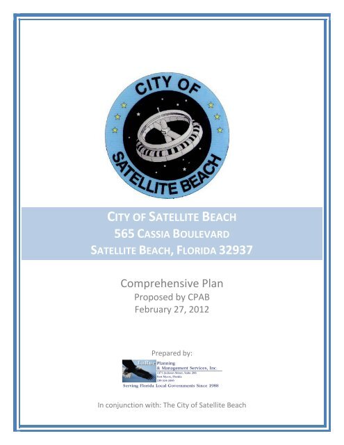
CITY OF SATELLITE BEACH<br />
565 CASSIA BOULEVARD<br />
SATELLITE BEACH, FLORIDA 32937<br />
Comprehensive Plan<br />
Proposed by CPAB<br />
February 27, 2012<br />
Prepared by:<br />
In conjunction with: The <strong>City</strong> <strong>of</strong> <strong>Satellite</strong> <strong>Beach</strong>
CITY OF SATELLITE BEACH<br />
COMPREHENSIVE PLAN<br />
GOALS, OBJECTIVES AND POLICIES<br />
Proposed by CPAB<br />
February 27, 2012
CITY OF SATELLITE BEACH<br />
COMPREHENSIVE PLAN<br />
ADOPTED MARCH 31, 1998: RESOLUTION 681; ORDINANCE 716<br />
Amended September 23, 1998: Ordinance 735<br />
Amended February 17, 1999: Resolution 706<br />
Amended May 19, 1999: Ordinance 754<br />
Amended September 1, 1999: Ordinance 748<br />
Amended October 20, 1999: Ordinance 759<br />
Amended September 16, 1999: Ordinance 761<br />
Amended December 6, 2000: Ordinance 794<br />
Amended September 5, 2001: Ordinance 815<br />
Amended October 3, 2001: Resolution 745<br />
Amended March 6, 2002: Ordinance 825<br />
Amended June 26, 2002: Ordinance 831<br />
Amended October 15, 2003: Ordinance 863<br />
Amended November 19, 2003: Ordinance 812<br />
Amended October 18, 2006: Ordinances 926, 934<br />
Amended August 6, 2008: Ordinance 989<br />
Amended November 6, 2008: Ordinance 998<br />
Amended April 1, 2009: Ordinance 979<br />
Amended December 2, 2009: Ordinance 1016<br />
Proposed: February 2012<br />
ii
CITY OF SATELLITE BEACH<br />
COMPREHENSIVE PLAN<br />
TABLE OF CONTENTS<br />
Goals, Objectives and Policies<br />
Future Land Use Element .............................................................................1-1<br />
Figure 1 Future Land Use Map ..........................................................1-8<br />
Figure 1-1 Future Land Use Designations ............................................1-9<br />
Figure 1-2 Hurricane Storm Surge........................................................1-11<br />
Figure 1-3 FEMA Flood Zones .............................................................1-13<br />
Figure 1-4 Water Bodies, Wetlands and <strong>Beach</strong>es ................................1-14<br />
Figure 1-5 Soil Associations .................................................................1-15<br />
Transportation Element ................................................................................2-1<br />
Figure 2-1 Future Roadway Characteristics .........................................2-5<br />
Figure 2-2 Future Roadway LOS ..........................................................2-6<br />
Figure 2-3 Future Public Transit Routes, Stops, Transit Generators<br />
and Attractors ..........................................................................2-7<br />
Figure 2-4. Future Local and Regional Evacuation Routes ..................2-8<br />
Figure 2-5 Future Bicycle and Pedestrian Paths ..................................2-9<br />
Housing Element ..........................................................................................3-1<br />
Infrastructure Element ..................................................................................4-1<br />
Coastal <strong>Management</strong>/Conservation Element ...............................................5-1<br />
Recreation and Open Space Element ..........................................................6-1<br />
Intergovernmental Coordination Element .....................................................7-1<br />
Capital Improvements Element .....................................................................8-1<br />
5 Year Schedule <strong>of</strong> Capital Improvements ...........................................8-6<br />
Community Appearance Element .................................................................9-1<br />
Proposed: February 2012<br />
iii
FUTURE LAND USE ELEMENT<br />
GOALS, OBJECTIVES, AND POLICIES<br />
GOAL 1<br />
Recognizing that the <strong>City</strong> is 9892% built out, the <strong>City</strong> will promote a pattern <strong>of</strong> land use that fosters<br />
a healthy and attractive physical environment, avoids blighting influences, preserves and enhances a<br />
residential atmosphere and natural resources, and provides reasonable public safety and security from<br />
hazardous conditions.<br />
Objective 1.1<br />
Development and redevelopment within the <strong>City</strong> will be permitted only when consistent with<br />
established standards with respect to topography, soil & flooding conditions, protection <strong>of</strong> natural<br />
and historic/archaeological resources, availability <strong>of</strong> public facilities, and hurricane evacuation plans.<br />
Policy 1.1.1- Land Development Regulations shall prohibit development which results in either a<br />
reduction <strong>of</strong> services below Level <strong>of</strong> Service standards for public facilities and services or an<br />
increase in density or intensity <strong>of</strong> use in excess <strong>of</strong> the maximum density or intensity allowable within<br />
theestablished for any Future Land Use Category in which the development is located, as set forth in<br />
this Comprehensive Plan.<br />
Policy 1.1.2 - The <strong>City</strong> shall continue to monitor zoning regulations pertaining to land east <strong>of</strong> the<br />
Coastal Construction Control Line (CCCL) and enact regulations to achieve a balance <strong>of</strong> economic<br />
feasibility potential adverse environmental conditions, and with environmental concerns, including<br />
limitation <strong>of</strong> development in the Coastal High Hazard Area (CHHA) consistent with the character <strong>of</strong><br />
the <strong>City</strong>.<br />
Policy 1.1.3 - The <strong>City</strong> will review development permit applications in accordance with the Land<br />
Development Regulations for requirements <strong>of</strong> drainage and stormwater management, open space and<br />
on-site traffic flow considering required vehicle parking.<br />
Policy 1.1.4 - The <strong>City</strong> will maintain the predominant land use character as a low density, single<br />
family residential community. Approved permit applications for renovation and new development<br />
will not exceed the development density standards as defined for the Comprehensive Plan as follows:<br />
RESIDENTIAL<br />
Residential Low 1 density, one dwelling unit per acre.<br />
Residential Low Density, 4 dwellings units per acre<br />
Residential Low-A Density, 1 to 6 dwelling units per acre.<br />
Residential Medium Density, 10 dwelling units per acre<br />
Residential High Density, 11 dwelling units per acre<br />
Residential High-A Density, 22 dwelling units per acre.<br />
(RL-1)<br />
(RL)<br />
(RLA)<br />
(RMD)<br />
(RHD)<br />
(RHA)<br />
Hotel/Motel use is allowed in Residential High Density at no greater than 22 dwelling units per acre<br />
and in Residential High-A Density at no greater than 44 dwelling units per acre.<br />
Note: The parcel described as Brevard County Tax Parcel ID # 26-37-35-00-00003.2-0000.00 shall be designated as<br />
Residential High A (with 108 units) and this classification shall be limited exclusively to this parcel.<br />
Future Land Use Element<br />
Goals, Objectives and Policies 1-1
COMMERCIAL AND SERVICES (C) – Intended to provide a wide range <strong>of</strong> commercial use<br />
including transient lodging facilities, which term includes hotels, motels, and bed and breakfast<br />
establishments, serving the general population <strong>of</strong> the <strong>City</strong>. This designation recognizes but is not<br />
specifically limited to, properties that have been developed, have received development approval or<br />
have been zoned for commercial use prior to the adoption <strong>of</strong> the plan. Commercial development<br />
shall not exceed a floor area ratio (FAR) <strong>of</strong> 0.75 and the The maximum impervious surface for a<br />
development within this category shall not exceed 670% <strong>of</strong> the site.<br />
EDUCATIONAL AND OTHER PUBLIC FACILITIES – Intended to recognize existing locations<br />
<strong>of</strong>, and provide sites for public and semi-public uses such as institutional or government buildings,<br />
schools, libraries, and post <strong>of</strong>fices.<br />
<strong>City</strong> Hall<br />
Emergency Services<br />
Library<br />
Schools<br />
Post Office<br />
(CH)<br />
(E)<br />
(L)<br />
(S)<br />
(PO)<br />
CONSERVATION USE (CU) – Intended for uplands, wetlands, beaches, water bodies, and<br />
undeveloped lands containing species listed on the endangered species list that are owned and used<br />
for long-range conservation purposes. This category includes public lands required to be used for<br />
conservation purposes by some form <strong>of</strong> legal mechanism such as a statutory requirement, funding, or<br />
grant conditions. Lands designated as Conservation use shall not be developed at a FAR greater than<br />
0.10 or have an impervious surface ratio greater than 0.15.<br />
CHURCH/SYNAGOGUE (CH) – Intended to recognize existing locations <strong>of</strong>, and provide sites for<br />
houses <strong>of</strong> worship.<br />
PARKS/OPEN SPACE (P) – Intended to recognize and accommodate existing public recreational<br />
facilities and open space areas.<br />
LIGHT INDUSTRIAL (LI) – Intended to primarily accommodate light industrial, warehousing and<br />
<strong>of</strong>fice uses. Appropriate uses include light industrial and warehousing; and shall not exceed a<br />
maximum FAR <strong>of</strong> 1.0.<br />
GENERAL MIXED USE (GMU) – The development, in a compact urban form, including residential<br />
and one or more different but compatible uses, such as but not limited to: <strong>of</strong>fice, industrial and<br />
technological, retail, commercial, public, entertainment, or recreation. These uses may be combined<br />
within the same building or may be grouped together in cohesive neighboring buildings with limited<br />
separation, unified form and strong pedestrian interconnections to create a seamless appearance.<br />
UTILITY (U)<br />
WATER DEPENDENT USES (<strong>Beach</strong> Access) (WD)<br />
Future Land Use Element<br />
Goals, Objectives and Policies 1-2
WATER RELATED USES (WR)<br />
TOWN CENTER MIXED USE (CM) – Intended to provide means for property owners, as a<br />
conditional use, to include up to 200 residential living units above commercial units, where such<br />
residential use is clearly and permanently secondary to primary commercial use. As such, residential<br />
space within an enclosed building shall not exceed the commercial space within a building on the<br />
same parcel (i.e. residential space must not exceed 50% <strong>of</strong> the total enclosed space).:<br />
A. Each CM site shall not exceed five dwelling units per acre (5 du/ac); and<br />
B. Residential space under air shall not exceed the commercial space under air on the same<br />
parcel (i.e., residential space must not exceed 50% <strong>of</strong> the total space); and<br />
C. CM development shall not exceed a floor area ratio <strong>of</strong> 1.00 on any given parcel.<br />
Policy 1.1.5 - Pursuant to Chapter 163.3177(5)(a), Florida Statutes, Brevard County Public Schools<br />
shall be an allowable use in, or immediately adjacent to, non-residential, institutional, commercial,<br />
and industrial land use categories to meet projected needs for schools. This shall be consistent with<br />
the protection <strong>of</strong> natural resources and availability <strong>of</strong> public facilities.<br />
Policy 1.1.6 - Reserved<br />
The <strong>City</strong> will correlate coastal area population densities with the hurricane evacuation plans <strong>of</strong> local,<br />
State, and Federal <strong>of</strong>fices <strong>of</strong> emergency management.<br />
Policy 1.1.7 - The <strong>City</strong> will review its Future Land Use Map at least every three (3) years, to ensure it<br />
provides the total density, density distribution, and land use distribution desired to preserve and<br />
enhance the <strong>City</strong>’s residential character.<br />
Policy 1.1.8 - The <strong>City</strong> shall enforce provisions within its Land Development Regulations to<br />
encourage mixed-density redevelopment, increasing public access to open space, in any district<br />
where a density exceeding four (4) dwelling units per acre is allowed.<br />
Policy 1.1.9 – Application <strong>of</strong> Density and Future Land Use Category Boundaries:<br />
A. Density applicable to the various Future Land Use Categories is gross density and is the<br />
maximum allowable number <strong>of</strong> dwelling units per acre <strong>of</strong> land, including rights-<strong>of</strong>-way,<br />
located landward <strong>of</strong> the mean high water line.<br />
B. The boundaries between different Future Land Use Categories on the Future Land Use<br />
Map shall be considered as following parcel boundaries or centerlines <strong>of</strong> the adjacent<br />
rights-<strong>of</strong>-way unless otherwise specifically noted.<br />
C. The Future Land Use Map is intended only for general planning purposes and should not<br />
be used for determining the development potential <strong>of</strong> individual parcels <strong>of</strong> land.<br />
D. Development densities and intensities for individual parcels <strong>of</strong> land shall be calculated<br />
using only the land associated with the individual owner and excludes public rights-<strong>of</strong>-<br />
Future Land Use Element<br />
Goals, Objectives and Policies 1-3
way.<br />
Policy 1.1.10 - All development proposals must conform to the Conservation Element Goals,<br />
Objectives, and Policies, before such proposals can be considered to be consistent with the Future<br />
Land Use Map and prior to issuance <strong>of</strong> any development approvals.<br />
Policy 1.1.11 - The <strong>City</strong> shall encourage the use <strong>of</strong> renewable energy resources in all new<br />
construction.<br />
Policy 1.1.12 - The <strong>City</strong> shall, on an ongoing basis, work with Brevard County and the Space Coast<br />
Transportation <strong>Planning</strong> Organization (SCTPO) and assist in establishing policies and standards<br />
which promote housing in close proximity to employment opportunities and transit services.<br />
Objective 1.2<br />
Existing development will be protected from adverse effects <strong>of</strong> vehicular traffic, post disaster<br />
redevelopment, conditions leading to blight, and changes in land use which adversely impact the<br />
livability or use <strong>of</strong> property in the <strong>City</strong>.<br />
Policy 1.2.1 - The <strong>City</strong> will continue to minimize or eliminate conditions which would adversely<br />
affect land use categories, adjacent land uses, signage, identified hazards, and areas subject to<br />
periodic flooding. This will be done as required by revisions <strong>of</strong> the <strong>City</strong>’s Land Development<br />
Regulations.<br />
Policy 1.2.2 - The <strong>City</strong> will enforce provisions within its Land Development Regulations,<br />
requirements to identify and mitigate adverse impacts <strong>of</strong> property modifications, infill development,<br />
and redevelopment on the livability or use <strong>of</strong> property in the <strong>City</strong> (e.g., blocking natural drainage<br />
channels).<br />
Policy 1.2.3 - The <strong>City</strong> shallmay create an incentive plan to encourage property owners to reduce or<br />
eliminate conditions <strong>of</strong> blight and will develop a plan if a blighted area is identified and code<br />
enforcement efforts and incentive programs have been ineffective.<br />
Policy 1.2.4 - The <strong>City</strong> will continue to prohibit marinas, car sales, boat sales, mobile home parks,<br />
and other similar businesses, unless pre-existing as a non-conforming use. Any such existing nonconforming<br />
use that ceases for any reason shall thereafter be prohibited. The <strong>City</strong> will place limits<br />
on the appearance <strong>of</strong> car repair establishments.<br />
Policy 1.2.5 - The <strong>City</strong> will continue to limit the number, size, and location <strong>of</strong> signs in the <strong>City</strong>.<br />
Policy 1.2.6 - The <strong>City</strong> will encourage well-appointed, well-maintained, well-landscaped commercial<br />
and multi-family properties in the <strong>City</strong>.<br />
Policy 1.2.7 - The <strong>City</strong> will continue to improve vehicle traffic control, and pedestrian and bicycle<br />
safety throughout the <strong>City</strong>.<br />
Policy 1.2.8 - The <strong>City</strong> will improve the scenic views along the arterial roadways traversing the <strong>City</strong>.<br />
Future Land Use Element<br />
Goals, Objectives and Policies 1-4
Policy 1.2.9 a - Post-disaster redevelopment shall be governed by all applicable codes, city charter<br />
provisions and standards, in regards to setbacks, <strong>of</strong>f-street parking, and landscaping; and shall<br />
decrease future public and private vulnerability to future storms by complying with applicable state<br />
and county construction regulations.<br />
Policy 1.2.9 b – Land use changes from non-residential to residential districts may be authorized only<br />
if they do not add dwelling units at a density greater than 7 units per acre, provided, however that<br />
zoning changes from non-residential to residential may not be approved unless the subject site’s<br />
Future Land Use Map category is, or is simultaneously amended to, an appropriate Residential<br />
category. In addition, amendments to the Future Land Use Map from non-residential to residential<br />
categories shall be limited to those amendments that can demonstrate by data and analysis that there<br />
will be no significant increase in the projected number <strong>of</strong> permanent dwellings allowed by the <strong>City</strong>’s<br />
Future Land Use Map, as adopted in 1998, and by data and analysis demonstrating the hurricane<br />
evacuation times and conditions will be maintained or will remain satisfactory as a result <strong>of</strong> the<br />
amendment.<br />
Policy 1.2.10 - The <strong>City</strong> shall continue to pursue Grant funding and other funding sources as a tool to<br />
address the redevelopment and renewal <strong>of</strong> economically underutilized or blighted areas.<br />
Policy 1.2.11 - The <strong>City</strong> shall discourage increases in residential densities and increases <strong>of</strong><br />
commercial intensities around water bodies to preserve and protect the bodies <strong>of</strong> water, and<br />
enhancement <strong>of</strong> housing property values, and their contributions toward the quality <strong>of</strong> life in <strong>Satellite</strong><br />
<strong>Beach</strong>.<br />
Policy 1.2.12 - The <strong>City</strong> shall promote and pursue cooperation and participation <strong>of</strong> developers and<br />
other entities in funding their share <strong>of</strong> the cost for the delivery <strong>of</strong> transit services.<br />
Objective 1.3<br />
Recognizing that the <strong>City</strong> is 9892% built-out, the <strong>City</strong> will assure availability <strong>of</strong> land to meet the<br />
needs <strong>of</strong> utility companies when these needs have been made known to <strong>City</strong> and legal means are<br />
available to meet them.<br />
Policy 1.3.1 - The <strong>City</strong> will evaluate the cumulative impacts <strong>of</strong> vacating utility easements to ensure<br />
that suitable access is available to meet future utility needs.<br />
Policy 1.3.2 - The <strong>City</strong> shall coordinate and cooperate with utility and other service providers to<br />
ensure the maintenance or improvement <strong>of</strong> public facilities to meet the <strong>City</strong>’s needs, concurrently<br />
with the impacts <strong>of</strong> development.<br />
Objective 1.4<br />
The <strong>City</strong> will identify historical or archaeologically significant sites using established criteria and<br />
assist in acquiring available funding and applying preservation techniques.<br />
Policy 1.4.1- The <strong>City</strong> shall enforce provisions within its Land Development Regulations to identify<br />
and report to appropriate agencies any sites <strong>of</strong> archaeological or historical significance.<br />
Policy 1.4.2 - The <strong>City</strong> will pursue appropriate cooperative ventures with private and public<br />
Future Land Use Element<br />
Goals, Objectives and Policies 1-5
entities to preserve historic or archaeological sites in the <strong>City</strong>.<br />
Objective 1.5<br />
The <strong>City</strong> will monitor and evaluate existing development conditions to identify trends and conditions<br />
leading to blight and will amend the Land Development Regulations to encourage redevelopment<br />
and renewal <strong>of</strong> identified blighted areas, in order to maintain the <strong>City</strong>’s residential character.<br />
Policy 1.5.1- The <strong>City</strong> will encourage the use <strong>of</strong> innovative Land Development Regulations, which<br />
may include strategies for reuse, redevelopment or mixed development. The <strong>City</strong> will revise the Land<br />
Development Regulations when innovative reuse or redevelopment concepts can help further the<br />
<strong>City</strong>’s goals and objectives.<br />
Policy 1.5.2 - The <strong>City</strong> will consider mixed land use development techniques for new development<br />
and, especially, for renewal or redevelopment.<br />
Policy 1.5.3 - Given that the <strong>City</strong> is 9892% built-out and has adopted a 7-unit per acre cap when land<br />
is rezoned for residential use, the <strong>City</strong> will direct commercial development and non-single-family<br />
residential development to the Community Redevelopment District identified in Ordinance 836 and<br />
incorporated by reference into the Comprehensive Plan.<br />
Objective 1.6<br />
Recognizing that the <strong>City</strong> is 9892% built-out, and has waterways containing approximately 180,000±<br />
cubic yards <strong>of</strong> sediment, the <strong>City</strong> will coordinate with appropriate government agencies to ensure the<br />
availability <strong>of</strong> sites for processing and disposal <strong>of</strong> dredge spoils.<br />
Policy 1.6.1- The <strong>City</strong> will coordinate with Federal, State, regional, and local governments when<br />
necessary to select appropriate spoil sites for sediments from the <strong>City</strong>’s waterways which further<br />
natural resource protection <strong>of</strong> the Indian River Lagoon, and meet reasonable cost and transportation<br />
requirements.<br />
Policy 1.6.2 - If a spoil deposit site is located within the <strong>City</strong>, and conflicts develop, the <strong>City</strong> shall<br />
utilize the Coastal Resource Interagency <strong>Management</strong> Committee’s dispute resolution process.<br />
Objective 1.7<br />
Reserved<br />
The <strong>City</strong> shall coordinate future land uses by encouraging the elimination or reduction <strong>of</strong> uses that<br />
are inconsistent with any interagency hazard mitigation report(s) and respond within six (6) months<br />
<strong>of</strong> receipt <strong>of</strong> such report(s), that the <strong>City</strong> considers relevant/appropriate.<br />
Policy 1.7.1 - The <strong>City</strong> shall encourage the elimination or reduction <strong>of</strong> uses, through the<br />
Comprehensive Plan amendment process and implementation <strong>of</strong> the Land Development Regulations<br />
that are identified in an appropriate interagency hazard mitigation report.<br />
Objective 1.8<br />
The <strong>City</strong> shall coordinate with any appropriate resource planning and management plan prepared<br />
pursuant to Chapter 380, F.S. that may impact <strong>City</strong> services.<br />
Future Land Use Element<br />
Goals, Objectives and Policies 1-6
Policy 1.8.1 - The <strong>City</strong> shall continue to coordinate with all local, regional, and State agencies in<br />
reviewing all resource and management planning, pursuant to Chapter 380, F.S.<br />
Objective - 1.9<br />
<strong>Satellite</strong> <strong>Beach</strong> shall encourage preservation <strong>of</strong> unique aspects <strong>of</strong> the natural environment by<br />
recognizing Transfer <strong>of</strong> Development Rights (TDRs) which will permit more intense activity in areas<br />
deemed suitable for development.<br />
Policy 1.9.1 - Transfer <strong>of</strong> development rights (TDRs) may be obtained through a “Binding<br />
Development Agreement” to direct residential development to areas which are deemed suitable for<br />
growth with the intent <strong>of</strong> furthering <strong>City</strong> goals to preservation <strong>of</strong> natural environment. TDRs may be<br />
transferred: (1) to an approved <strong>of</strong>fsite location which is designated a receiving district; or (2)<br />
internally within a project from an approved sending district. In either circumstance, the utilization <strong>of</strong><br />
TDRs must adhere to the following minimum criteria compatibility with surrounding development<br />
patterns within the receiving areas.:<br />
A. Compatibility with surrounding development patterns within receiving areas shall be<br />
ensured.<br />
B. TDRs shall be considered only if the land from which the rights are transferred<br />
provides open/park space along and abutting the Atlantic Ocean.<br />
Policy 1.9.2 - The following land use designations may be considered receiving districts for Transfer<br />
<strong>of</strong> Development Rights:<br />
‣ Residential High Density and/or Town Center Mixed UseResidential High<br />
Density (A)<br />
Policy 1.9.3 - The followingAny land use designations may be considered as a sending districts for<br />
Transfer <strong>of</strong> Development Rights if so designated by <strong>City</strong> Council:<br />
‣ Residential High Density<br />
Policy 1.9.4 – Land use changes from commercial to residential will not be authorized unless the loss<br />
<strong>of</strong> commercial land is <strong>of</strong>fset by at least a 1:1 ratio <strong>of</strong> other land changed to commercial use.<br />
Objective 1.10<br />
The <strong>City</strong> shall preserve and rehabilitate its commercial district to provide residents access to<br />
necessary and appropriate services and products that enhance the livability <strong>of</strong> the <strong>City</strong> without<br />
compromising its residential character.<br />
Policy 1.10.1 - The <strong>City</strong> will encourage businesses which primarily serve the needs <strong>of</strong> the residents<br />
<strong>of</strong> <strong>Satellite</strong> <strong>Beach</strong>.<br />
Future Land Use Element<br />
Goals, Objectives and Policies 1-7
FUTURE LAND USE MAP SERIES<br />
, 2019<br />
Future Land Use Element<br />
Goals, Objectives and Policies 1-8
Figure 1-1 – Adjacent Land Use Map<br />
Future Land Use Element<br />
Goals, Objectives and Policies 1-9
Figure 1-2 Coastal High Hazard Area (CHHA)<br />
Future Land Use Element<br />
Goals, Objectives and Policies 1-10
Figure 1-2 Hurricane Storm Surge<br />
Future Land Use Element<br />
Goals, Objectives and Policies 1-11
Figure 1-3 – Flood Prone Areas<br />
Future Land Use Element<br />
Goals, Objectives and Policies 1-12
Figure 1-3 FEMA Flood Zones<br />
Future Land Use Element<br />
Goals, Objectives and Policies 1-13
Figure 1-4 – Water Bodies, Wetlands and <strong>Beach</strong>es<br />
Future Land Use Element<br />
Goals, Objectives and Policies 1-14
Figure 1-5 – Soils Associations<br />
Future Land Use Element<br />
Goals, Objectives and Policies 1-15
TRANSPORTATION ELEMENT<br />
GOALS, OBJECTIVES AND POLICIES<br />
The following Goals, Objectives and Policies <strong>of</strong> the Transportation Element establish the long-term<br />
end toward which transportation programs and activities are ultimately directed.<br />
GOAL 1<br />
A transportation system, including traffic circulation and a public transit system, that ensures safe<br />
and efficient movement <strong>of</strong> people and goods based upon major trip generators, safe public facilities<br />
and the special needs <strong>of</strong> the transportation disadvantaged, at reasonable cost and minimum detriment<br />
to the environment.<br />
Objective 1.1<br />
The <strong>City</strong> will cooperate with Brevard County and the Florida Department <strong>of</strong> Transportation to<br />
provide a safe, convenient and energy-efficient transportation system and mitigate existing and future<br />
roadway deficiencies based on standards established in this plan through a continuous roadway<br />
improvement program. Such a program will be sufficiently effective to maintain an accident rate at<br />
or below the State-wide average for similar communities and limit, to the extent feasible and<br />
practical, reductions in the stated Level <strong>of</strong> Service (LOS) standards.<br />
Policy 1.1.1 - The <strong>City</strong> will continue to provide yearly inputs to the Space Coast Transportation<br />
<strong>Planning</strong> Organization’s (TPO) Transportation Improvement Program (TIP).<br />
Policy 1.1.2 - The <strong>City</strong> will annually review the Florida Department <strong>of</strong> Transportation’s (FDOT)<br />
accident summaries and school zone related accident data, discuss problems with appropriate<br />
entities, and establish necessary remedial plans to reduce accidents.<br />
Policy 1.1.3 - The <strong>City</strong> will conduct or request the Florida Department <strong>of</strong> Transportation (FDOT) to<br />
conduct a review every five years to assure meeting the standards <strong>of</strong> the Manual on Uniform Traffic<br />
Control Devices (MUTCD). The <strong>City</strong> shall initiate corrective recommendations to the TPO, on which<br />
it sits as a Technical Advisory member, after review with the <strong>City</strong> Council.<br />
Policy 1.1.4 - The <strong>City</strong> will utilize the Building and Zoning Department to monitor requests for<br />
access points and driveway changes which are associated with new development, for safety and<br />
compatibility with the existing and future roadway network based on Land Development<br />
Regulations.<br />
Policy 1.1.5 - The <strong>City</strong>’s Building and Zoning Department will review on-site parking facilities in<br />
conjunction with plan review and permitting to assure safe and efficient movements as well as<br />
adequate sight distance to provide safe entry and exit based upon provisions in the Land<br />
Development Regulations.<br />
Policy 1.1.6 - The <strong>City</strong> establishes Level <strong>of</strong> Service “C” for arterial and collector roads in the peak<br />
traffic hour.<br />
Transportation Element<br />
Goals, Objectives and Policies 2-1
Policy 1.1.7- The <strong>City</strong> will continue the transportation demand management program to modify peak<br />
hour travel demand. If the LOS standard established in Policy 1.1.6 is breached, based upon traffic<br />
counts, ordinances will be enacted by the <strong>City</strong> to mitigate the flow <strong>of</strong> traffic. Nnotification will be<br />
given to the TPO and FDOT, and the use <strong>of</strong> public bus transportation will be promoted and<br />
encouraged.<br />
Policy 1.1.8 - The <strong>City</strong> will continue to improve street directional signage by making it visually<br />
larger, more visible, and having better reflective qualities.<br />
Objective 1.2<br />
The issuance <strong>of</strong> development permits shall be subject to thoroughfare right-<strong>of</strong>-way protection<br />
provisions within the <strong>City</strong>’s Land Development Regulations to assure that present and future rights<strong>of</strong>-way<br />
are protected from building encroachment.<br />
Policy 1.2.1 - The <strong>City</strong> will review setback distances for right-<strong>of</strong>-way requirements for all new<br />
development and redevelopment to assure compliance with the Land Development Regulations.<br />
Policy 1.2.2 -The <strong>City</strong>’s Building and Zoning Department will continue to enforce, through the<br />
permit process, the Land Development Regulations aimed at controlling existing and future<br />
development’s impact on rights-<strong>of</strong>-way.<br />
Objective 1.3<br />
The <strong>City</strong> will continue to expand and improve infrastructure supporting alternatives to transportation<br />
by automobile.<br />
Policy 1.3.1 - The <strong>City</strong> shall maintain ongoing coordination with Brevard County, the Space Coast<br />
Transportation <strong>Planning</strong> Organization, and FDOT to provide bicycle and pedestrian facilities within<br />
the transportation system.<br />
Policy 1.3.2 - The <strong>City</strong> will annually develop and forward recommendations prioritizing bicycle and<br />
pedestrian-related transportation improvements, intended to enhance safety and eliminate existing<br />
facility deficiencies, to the TPO for consideration <strong>of</strong> inclusion <strong>of</strong> such improvements in the TIP.<br />
Policy 1.3.3 - The <strong>City</strong> will continue to provide for additional bike paths and sidewalks where<br />
needed. The need for sidewalks and bike paths will be based on the Bicycle/Pedestrian Path Plan.<br />
The Bicycle/Pedestrian Path Plan may be amended periodically, and it will be used as a guide for<br />
future development <strong>of</strong> paths throughout the <strong>City</strong>.<br />
Policy 1.3.4 – The <strong>City</strong> will implement and improve upon, as resources permit, the recommendations<br />
<strong>of</strong> the Citizens’ Ad Hoc Bicycle/Pedestrian Committee for development <strong>of</strong> a network <strong>of</strong> recreation<br />
trails connecting the significant destinations in the <strong>City</strong> and passing within 500 feet <strong>of</strong> 90% <strong>of</strong> the<br />
residences within the <strong>City</strong>.<br />
Objective 1.4<br />
The <strong>City</strong> will establish means <strong>of</strong> coordination on transportation-related issues, including addressing<br />
the needs <strong>of</strong> the transportation disadvantaged and special needs, with the FDOT, the East Central<br />
Florida Regional <strong>Planning</strong> Council, Brevard County, the TPO, the Department <strong>of</strong> Community Affairs<br />
Transportation Element<br />
Goals, Objectives and Policies 2-2
State Land <strong>Planning</strong> Agency, Space Coast Area Transit System (SCAT) and other private or public<br />
transportation-related agencies.<br />
Policy 1.4.1 - On an ongoing basis, the <strong>City</strong> shall continue to appoint a representative to the TPO<br />
Technical Advisory Committee and to utilize the South <strong>Beach</strong>es Coalition to provide input and raise<br />
transportation-related issues to the TPO.<br />
Policy 1.4.2 - At least every three years, the <strong>City</strong> will interface with the Space Coast Area Transit<br />
(SCAT) personnel and the Brevard County Commission to inform them <strong>of</strong> <strong>Satellite</strong> <strong>Beach</strong>’s specific<br />
transportation needs.<br />
Objective 1.5<br />
The <strong>City</strong> will establish formal mechanisms to monitor the coordination <strong>of</strong> the transportation system<br />
with the Future Land Use Map and ensure that existing and proposed population densities, housing<br />
and employment patterns, and land uses are consistent with the transportation modes and services<br />
proposed.<br />
Policy 1.5.1 - The <strong>City</strong>’s <strong>Planning</strong> and Zoning Board will conduct site plan reviews <strong>of</strong> permit<br />
requests, as submitted, based on the requirements <strong>of</strong> the Land Development Regulations in order to<br />
ensure consistency between land use and transportation goals, objectives and policies and adopted<br />
land use plans.<br />
Policy 1.5.2 - Reserved.<br />
Policy 1.5.3 - The <strong>City</strong> shall designate the <strong>Planning</strong> and Zoning Advisory Board to review the impact<br />
<strong>of</strong> permit requests on public transit and to encourage land uses that promote public transportation<br />
within designated public transportation corridors.<br />
Objective 1.6 - Reserved<br />
The <strong>City</strong> will provide periodic inputs to the Space Coast Area Transit (SCAT) Agency, other mass<br />
transit service providers and related agencies to address efficiency issues and integrate an<br />
economically-feasible multi-modal system based on existing and proposed major trip generators, safe<br />
public facilities, land uses, and the special needs <strong>of</strong> the transportation disadvantaged.<br />
Policy 1.6.1 - The <strong>City</strong> will request the SCAT to survey area residents on ridership requirements<br />
every five years and report results to the <strong>City</strong>.<br />
Policy 1.6.2 - Every five years, the <strong>City</strong> will coordinate with SCAT, FDOT, TPO task forces, and<br />
other agencies to identify the existence <strong>of</strong> major trip generators and provide recommendations related<br />
to terminal locations, route structuring, scheduling, bus bay locations, and optimizing facilities<br />
within <strong>Satellite</strong> <strong>Beach</strong>.<br />
Policy 1.6.3 - Reserved.<br />
Policy 1.6.4 - The <strong>City</strong> will every five years audit numerical indicators against which mobility goals<br />
<strong>of</strong> the community (such as modal split, annual trips per capita, automobile occupancy rate, etc.) can<br />
be measured.<br />
Transportation Element<br />
Goals, Objectives and Policies 2-3
Objective 1.7<br />
TGiven that the <strong>City</strong>’s evacuation routes are state roads, the <strong>City</strong> will provide safe and adequate<br />
evacuation capabilities by cooperating and coordinating with county, regional, and state agencies to<br />
facilitate movement over state roads A1A, SR513 (South Patrick Drive), and SR404 (Pineda<br />
Causeway).studying and making improvements related to improving flooding conditions <strong>of</strong> the<br />
primary evacuation routes and movement across the Pineda Causeway during a Category 3, 4 or 5<br />
Hurricane. These recommendations will be periodically reviewed and updated.<br />
Policy 1.7.1 - The <strong>City</strong> will continue to interface with the TPO, FDOT and the East Central Florida<br />
Regional <strong>Planning</strong> Council (ECFRPC) to request pre-landfall elevation studies relating to potential<br />
storm conditions. These studies shall include both flooding <strong>of</strong> arterial and collector roadways as well<br />
as the ability <strong>of</strong> the Pineda Causeway to provide the safe and efficient flow <strong>of</strong> traffic during storm<br />
evacuation. These studies will be periodically re-evaluated and updated.<br />
Policy 1.7.2 - The <strong>City</strong> shall cooperate with state, regional and county agencies to maintain or reduce<br />
hurricane evacuation times and work with Brevard County to find additional suitable hurricane<br />
shelter space on the mainland.<br />
Policy 1.7.3 – In order to strengthen the <strong>City</strong>’s disaster mitigation efforts, the <strong>City</strong>’s post disaster<br />
program will be reviewed annually in order to assure consistency with federal policies for<br />
establishing formal mitigation implementation programs.<br />
Policy 1.7.4 – The <strong>City</strong> <strong>of</strong> <strong>Satellite</strong> <strong>Beach</strong> departments having emergency/disaster responsibilities<br />
shall educate, train, and equip their personnel to perform the actions found within the Emergency<br />
Support Function (ESF) schedule and within each department’s/agency’s Policy, Procedure, and<br />
Instruction (PPI)s. Furthermore, a report on the readiness <strong>of</strong> the <strong>City</strong> <strong>of</strong> <strong>Satellite</strong> <strong>Beach</strong> to implement<br />
the Comprehensive Emergency <strong>Management</strong> Plan (CEMP) shall be prepared annually regarding<br />
departmental emergency responsibilities and tasks. Also, the <strong>City</strong> shall investigate ways to inform<br />
the public about emergency readiness.<br />
Transportation Element<br />
Goals, Objectives and Policies 2-4
Figure 2-1 – Future Roadway Characteristics<br />
Transportation Element<br />
Goals, Objectives and Policies 2-5
Figure 2-2 – Future Roadway LOS<br />
Transportation Element<br />
Goals, Objectives and Policies 2-6
Figure 2-3 – Future Public Transit Routes, Stops, Transit Generators and Attractors<br />
Transportation Element<br />
Goals, Objectives and Policies 2-7
Figure 2-4 – Future Local and Regional Evacuation Routes<br />
Transportation Element<br />
Goals, Objectives and Policies 2-8
Figure 2-5 – Future Bicycle and Pedestrian Paths<br />
Transportation Element<br />
Goals, Objectives and Policies 2-9
HOUSING ELEMENT<br />
GOALS, OBJECTIVES, AND POLICIES<br />
GOAL 1<br />
Housing and residential neighborhood environments providing safe and healthful living conditions<br />
for present and future residents <strong>of</strong> the <strong>City</strong>.<br />
Objective 1.1<br />
The <strong>City</strong> will provide effective, ongoing, proactive enforcement <strong>of</strong> the <strong>City</strong>’s Land Development<br />
Regulations and the Standard Housing Code and Standard Unsafe Building Abatement Code (as<br />
adopted by the <strong>City</strong> Council). to assure that at least 95% <strong>of</strong> all residential structures are in full<br />
compliance with the codes at any one time.<br />
Policy 1.1.1 - The <strong>City</strong> will continue to inform all residential property owners <strong>of</strong> the important<br />
aspects <strong>of</strong> the codes referenced in Objective 1.1.<br />
Objective 1.2<br />
The <strong>City</strong> will develop/implement programs to conserve, rehabilitate, and, if necessary, demolish<br />
substandard housing, while simultaneously making provisions to identify and preserve all historically<br />
significant resources.<br />
Policy 1.2.1 - The <strong>City</strong> will continue to implement programs/regulations, as appropriate, aimed at the<br />
identification and improvement <strong>of</strong> historically significant resources.<br />
Policy 1.2.2 - The <strong>City</strong> will implement its housing standards provisions in the Land Development<br />
Regulations to control residential housing decay.<br />
Objective 1.3<br />
The present residential character will be maintained and enhanced by the <strong>City</strong> through housing<br />
policies, programs and regulations in order to foster community pride, prevent blighting influences,<br />
and assure compatibility in land use relationships and residential density patterns.<br />
Policy 1.3.1 - The <strong>City</strong> will undertake a comprehensive review <strong>of</strong> relevant <strong>City</strong> Ordinances at least<br />
once every ten (10) years to consider the adequacy <strong>of</strong> regulations regarding permitting and siting <strong>of</strong><br />
buildings and accessory uses, screening at common property lines, required site improvements, site<br />
plan review standards to determine their adequacy in achieving Objective 1.3.<br />
Policy 1.3.11.3.2 - Regularly scheduled services and maintenance <strong>of</strong> public facilities by the <strong>City</strong> shall<br />
be sufficient to provide for healthy housing and neighborhood environments and to prevent property<br />
damage, public safety problems, or other undesirable conditions.<br />
Policy 1.3.21.3.3 - The <strong>City</strong> shall discourage increases in residential densities and increases <strong>of</strong><br />
commercial intensities around water bodies to preserve and protect the bodies <strong>of</strong> water, and<br />
enhancement <strong>of</strong> housing property values, and their contributions toward the quality <strong>of</strong> life in <strong>Satellite</strong><br />
<strong>Beach</strong>.<br />
Housing Element<br />
Goals, Objectives and Policies 3-1
Objective 1.4<br />
The <strong>City</strong> will develop policies and programs for the provision <strong>of</strong> affordable housing and adequate<br />
very-low-income, low-income and moderate-income sites for current and future residents and<br />
households with special needs. These policies and programs shall be based on the Department <strong>of</strong><br />
Community Affairs’ Affordable Housing Needs Assessment.<br />
Policy 1.4.1 - The <strong>City</strong> will continue to utilize assessment information provided by the Department<br />
<strong>of</strong> Community Affairs to determine its affordable housing needs; review and renew Interlocal<br />
agreements with adjacent jurisdictions which provide affordable housing; or consider modifications<br />
to the land use map which include high density planning and zoning for affordable housing, and<br />
streamline the permitting process for affordable housing.<br />
Policy 1.4.2 - The <strong>City</strong> will cooperate with other government agencies including Brevard County and<br />
private organizations to meet the demonstrated needs for housing, especially special population<br />
groups to include establishing criteria guiding the location <strong>of</strong> housing for very-low income, lowincome<br />
and moderate income households.<br />
Policy 1.4.3 - The <strong>City</strong> shall continue to utilize non-discriminatory standards and criteria consistent<br />
with Chapter 419, F.S. as a guide in locating group homes and foster care facilities as well as<br />
housing for population groups having special needs so as to meet demonstrated needs with<br />
appropriate locations and housing types.<br />
Policy 1.4.4 - The <strong>City</strong> will continue to determine the availability <strong>of</strong> subsidy programs and grants to<br />
aid in providing affordable housing to meet special needs.<br />
Policy 1.4.5 - The <strong>City</strong> shall explore available programs in Brevard County and through the Florida<br />
Department <strong>of</strong> Community Affairs and other state agencies to mitigate any affordable and workforce<br />
housing shortage.<br />
Policy 1.4.6 - The <strong>City</strong> shall address the identified affordable and workforce housing deficits through<br />
the implementation <strong>of</strong> short term programs, by December 2012 and long-term programs by<br />
December 2017. Such long term programs shall include exploration <strong>of</strong> an interlocal agreement or<br />
other cooperative mechanism with Brevard County Department <strong>of</strong> Housing and Human Services to<br />
develop a regional solution for the <strong>City</strong>’s affordable housing deficits.<br />
Policy 1.4.7 - The <strong>City</strong> will make available to residents and individuals employed in the <strong>City</strong>, access<br />
to information pertaining to Countywide programs to aid in job training, day-care facilities, English<br />
language courses and high school equivalency (GED) which are currently provided by the following<br />
agencies:<br />
• Department <strong>of</strong> Children and Families<br />
• Brevard County Department <strong>of</strong> Housing and Human Services<br />
• Brevard County Public Schools<br />
Policy 1.4.8 - The <strong>City</strong> shall coordinate with Brevard County to create regional funding opportunities<br />
for GAP housing.<br />
Housing Element<br />
Goals, Objectives and Policies 3-2
Policy 1.4.9 - The <strong>City</strong> will continue its prohibition on mobile homes within the <strong>City</strong>.<br />
Policy 1.4.10 - The <strong>City</strong> shall, on an ongoing basis, work with Brevard County and the Space Coast<br />
Transportation <strong>Planning</strong> Organization (SCTPO) and assist in establishing policies and standards<br />
which promote housing in close proximity to employment opportunities and transit services.<br />
Objective 1.5<br />
The <strong>City</strong> shall support the principle that persons and businesses displaced by government agencies<br />
engaged in development or redevelopment projects shall be provided uniform treatment through the<br />
provision <strong>of</strong> relocation housing consistent with Florida Statute 421.55.<br />
Policy 1.5.1 - The <strong>City</strong> will enforce provisions within its Land Development Regulations which<br />
require governmental agencies engaged in development or redevelopment projects in the <strong>City</strong><br />
provide, or provide access to, relocation housing and other assets to replace those lost by displaced<br />
people and businesses.<br />
Objective 1.6<br />
The <strong>City</strong> will enforce the standards within its Land Development Regulations for aggregate capacity<br />
<strong>of</strong> group homes and foster care facilities, which are licensed or funded by the Florida Department <strong>of</strong><br />
Children and Families (DCF).<br />
Policy 1.6.1 - The <strong>City</strong> will permit group homes and foster care facilities in residential districts zoned<br />
RM-2 and as permitted-by-right or conditional uses in other residential zoning districts.<br />
Objective 1.7 - The <strong>City</strong> will develop policies and programs to enhance the life/safety <strong>of</strong> occupied<br />
structures in the <strong>City</strong>, including single-family and duplex units.<br />
Policy 1.7.1 - The <strong>City</strong> will encourage installation <strong>of</strong> automatic fire suppression sprinkler systems in<br />
single-family homes to reduce the severity <strong>of</strong> residential fire losses to property and lives in the <strong>City</strong>.<br />
Policy 1.7.2 - The <strong>City</strong> will promote “hardening” <strong>of</strong> commercial and residential structures against<br />
wind and water damage caused by tropical storms and hurricanes to reduce losses.<br />
Objective 1.8 - The <strong>City</strong> will encourage green building standards through implementation <strong>of</strong> the<br />
following policies:<br />
Policy 1.8.1 - The <strong>City</strong> shall encourage the use <strong>of</strong> renewable energy resources in all new<br />
construction.<br />
Policy 1.8.2 - The <strong>City</strong> shall not prohibit the placement <strong>of</strong> solar panels.<br />
Policy 1.8.3 - The <strong>City</strong> shall, by 2015, determine a threshold and criteria for requiring encourage<br />
large scale development that meets Leadership in Energy and Environmental Design (LEED), or Low<br />
Impact Development (LID) or similar energy sustainability certification standards./certification in<br />
development and redevelopment projects.<br />
Housing Element<br />
Goals, Objectives and Policies 3-3
INFRASTRUCTURE ELEMENT<br />
GOALS OBJECTIVES & POLICIES<br />
GOAL 1<br />
Systems <strong>of</strong> public facilities and services provided to the <strong>City</strong> <strong>of</strong> <strong>Satellite</strong> <strong>Beach</strong>, in accordance with<br />
Interlocal agreements with non-<strong>City</strong> entities and by the <strong>City</strong>, as appropriate, in a manner which is<br />
sufficient to meet existing and future needs, assures healthful and safe living conditions, and is<br />
economically efficient as well as environmentally sound.<br />
Objective 1.1<br />
The <strong>City</strong> has taken actions needed to correct existing deficiencies in public facilities, and will<br />
continue to assure that they have adequate capacity to serve existing, new development, and<br />
redevelopment while meeting Level <strong>of</strong> Service standards without exceeding facilities’ design or<br />
operating capacities, and in a manner which is cost-effective, technologically and environmentally<br />
sound, and maximizes use <strong>of</strong> existing facilities.<br />
Policy 1.1.1 - Improvements or modifications to service systems, and the determination <strong>of</strong> facility<br />
capacity to meet demand generated by development and redevelopment, will meet or be better than<br />
the following Level <strong>of</strong> Service standards intended to protect health, safety, and property.<br />
Facility<br />
Sanitary Sewer Facilities:<br />
Level <strong>of</strong> Service Standard<br />
Generation Rate:<br />
*200 gallons per residential unit per day (residential)<br />
200 gallons per equivalent residential unit per day (nonresidential)<br />
* 9 million gallons per day peak flow.<br />
Waste Water Treatment:<br />
Solid Waste Facilities:<br />
South <strong>Beach</strong>es Waste Water Treatment Plant<br />
Capacity, 9 million gallons per day, <strong>of</strong> which 6 million is used<br />
Available expansion is 3 million gallons per day<br />
Generation Rate:<br />
8.32* pounds per capita per day<br />
A minimum <strong>of</strong> 30% <strong>of</strong> the solid waste to be recycled or<br />
resource recovered.<br />
A minimum <strong>of</strong> 12 years capacity remaining for Central<br />
Brevard Landfill facilities.<br />
Drainage Facilities: 5-year design storm; 6.6 -inch rainfall with twenty-four (24)<br />
hour concentration.<br />
Infrastructure Element<br />
Goals, Objectives and Policies 4-1
Potable Water Facilities:<br />
Consumption Rate:<br />
Less than or equal to 110 gallon per capita per day (gpcpd) for<br />
residential<br />
Less than or equal to 110 gallon per capita per day (gpcpd) for nonresidential<br />
Storage, flow, and pressure sufficient to meet National Fire Protection<br />
Association, Insurance Services Office, and local water flow<br />
capability standards.<br />
Melbourne Water System<br />
26.5 mgd current capacity, <strong>of</strong> which a maximum <strong>of</strong> 17.9 mgd is used<br />
and an average demand <strong>of</strong> 15.5 MGD is used.<br />
12.5 mgd current storage capacity.<br />
50 psi minimum main pressure.<br />
Available expansion is 7.0 mgd.<br />
* Based on Brevard County’s Updated Comprehensive Plan<br />
Policy 1.1.2 - Reserved<br />
The <strong>City</strong> will continue to monitor and insure that all concurrency requirements are met prior to the<br />
issuance <strong>of</strong> building permits.<br />
Policy 1.1.3 - The <strong>City</strong> will continue to monitor the condition <strong>of</strong> facilities <strong>of</strong> other service providers<br />
give inputs to them for establishing priorities for correcting existing or projected deficiencies,<br />
replacing facilities, and providing for future facility improvements and expansions.<br />
Policy 1.1.4 - The <strong>City</strong> will cooperate with non-<strong>City</strong> service providers in meeting service area needs<br />
and will support projects which achieve established water quality standards, sound environmental<br />
practices, and Level <strong>of</strong> Service standards in a manner which is cost-effective and technologically<br />
sound.<br />
Policy 1.1.5 - <strong>City</strong> representatives will remain knowledgeable about current service issues and retain<br />
their active role in established intergovernmental agencies as a means <strong>of</strong> addressing services<br />
provided to <strong>City</strong> residents.<br />
Sanitary Sewer<br />
Policy 1.1.6 - The <strong>City</strong> will continue to cooperate with Brevard County and monitor their progress<br />
toward reducing groundwater infiltration to not more than 10% <strong>of</strong> total flow.<br />
Policy 1.1.6.1 - The post-disaster redevelopment thresholds are enforced through the development<br />
review process. Protection <strong>of</strong> the sanitary sewer facilities and lift stations is addressed by the<br />
appropriate entity.<br />
Infrastructure Element<br />
Goals, Objectives and Policies 4-2
Potable Water<br />
Policy 1.1.7 - The <strong>City</strong> will obtain access to information used by the <strong>City</strong> <strong>of</strong> Melbourne for water<br />
source planning to determine whether dead ending and small service mains adversely impact Level<br />
<strong>of</strong> Service standards for potable water.<br />
Policy 1.1.8 - The <strong>City</strong> will continue to participate with the Brevard Water Supply Board and the<br />
SJRWMD in devising and completing the District’s water supply plan.<br />
Solid Waste<br />
Policy 1.1.9 - The <strong>City</strong> will continue to support Brevard County, the solid waste disposal service<br />
provider, in development <strong>of</strong> a cost-effective regional solid waste disposal and point-<strong>of</strong>-collection<br />
recycling system aimed at reducing the waste stream entering the County landfill.<br />
Policy 1.1.10 - The <strong>City</strong> supports improvements to the county-wide hazardous waste management<br />
program and will cooperate with other local governments in preparing and implementing such<br />
programs to ensure that the County and local governments conform with all applicable Federal and<br />
State statutes.<br />
Policy 1.1.11 - The <strong>City</strong> will continue to work with the <strong>City</strong> <strong>of</strong> Melbourne, Brevard County, the<br />
Brevard Water Supply Board, the St. Johns River Water <strong>Management</strong> District, and the Florida<br />
Department <strong>of</strong> Environmental Protection to develop a comprehensive, unified water quality<br />
management program for potable water, sanitary sewer, stormwater run<strong>of</strong>f, surface water body, and<br />
aquifer resources.<br />
Electric<br />
Policy 1.1.12 - The <strong>City</strong> will, as resources and opportunity allow, relocate overhead utility lines<br />
underground to minimize service outages; electrocution hazards; and post-storm recovery time,<br />
effort, and debris resulting from high winds; and to improve the aesthetics <strong>of</strong> the <strong>City</strong>’s streetscapes.<br />
Electric<br />
Policy 1.1.13 - The <strong>City</strong> will, as resources and opportunity allow, provide emergency power at its<br />
critical facilities to support post-storm recovery and continuity <strong>of</strong> government after major storm<br />
events.<br />
Objective 1.2<br />
The <strong>City</strong> will continue its program <strong>of</strong> phased improvements to its storm drainage system over a 20 -<br />
year period, which began in FY 1997-1998, that will provide for the public health and safety, prevent<br />
property damage, protect natural drainage features and functions <strong>of</strong> natural groundwater recharge, in<br />
order to achieve adopted Level <strong>of</strong> Service standards.<br />
Policy 1.2.1 - The <strong>City</strong> will implement the comprehensive stormwater management plan. The <strong>City</strong>’s<br />
priorities will be established on a drainage basin basis and will be aimed at correcting the worst<br />
problems initially, followed by lesser problems as technical and financial means are available.<br />
Infrastructure Element<br />
Goals, Objectives and Policies 4-3
Policy 1.2.2 - The <strong>City</strong> will continue to use the <strong>City</strong> newsletter and other available media to conduct<br />
a program <strong>of</strong> public education concerning <strong>City</strong> policies and codes so as to reduce careless actions<br />
which further diminish the effectiveness <strong>of</strong> the <strong>City</strong>’s drainage system.<br />
Policy 1.2.3 - The <strong>City</strong> will monitor conditions on a regular basis and incorporate into its stormwater<br />
management master plan a means to review codes and monitor conditions on a regular, recurring<br />
basis to determine ways to reduce stormwater run<strong>of</strong>f, provide alternatives to costly system<br />
improvements, reduce hazardous waste entering the drainage system, and explore innovative<br />
stormwater management techniques.<br />
Policy 1.2.4 - The <strong>City</strong> will cooperate with County, regional, and State agencies to implement an<br />
acceptable State-funded engineering solution for handling the stormwater run<strong>of</strong>f from SR A1A and<br />
the land lying immediately east there<strong>of</strong> and support SR A1A improvements which meet or exceed<br />
<strong>City</strong> level <strong>of</strong> service standards.<br />
Policy 1.2.5 - The <strong>City</strong> will continue to coordinate and cooperate with the Florida Department <strong>of</strong><br />
Environmental Protection (FDEP), the St. Johns River Water <strong>Management</strong> District (SJRWMD), and<br />
the Indian River Lagoon National Estuary Program (IRL-NEP) to meet goals, objectives, and policies<br />
pertaining to stormwater management; and take appropriate, feasible, and affordable action to meet<br />
FDEP non-point source discharge standards and water quality standards. contained in Chapter 63-<br />
302 (Surface Water Standards) <strong>of</strong> the Florida Administrative Code and established by the SJRWMD.<br />
Additionally, the <strong>City</strong> will consider stormwater pollution loading reduction goals recommended by<br />
the IRL-NEP, and the SJRWMD when available.<br />
Policy 1.2.6 - The <strong>City</strong> will continue a sampling, testing, and analysis program for the purpose <strong>of</strong><br />
determining the physical-chemical characteristics <strong>of</strong> its stormwater discharges and their influence on<br />
water quality in the Banana River. The findings <strong>of</strong> the monitoring program will aid in determining<br />
and prioritizing system actions, as necessary, to maintain acceptable receiving water quality. The<br />
results will be incorporated into the stormwater management plan.<br />
Policy 1.2.7 - The <strong>City</strong> will, as resources and opportunity allow, undertake improvement projects to<br />
reduce flooding during heavy rainfalls, to improve the quality <strong>of</strong> water discharged into the Banana<br />
River, and to eliminate discharges onto the ocean beach.<br />
Policy 1.2.8 - The <strong>City</strong> will periodically update and incorporate the Storm Water Master Plan and<br />
related plans developed by the <strong>City</strong> Engineer into the Comprehensive Plan, and will use it as a guide<br />
for future implementation <strong>of</strong> storm water management projects in the <strong>City</strong>.<br />
Objective 1.3<br />
The <strong>City</strong> will continually monitor the rates <strong>of</strong> water, solid waste disposal, and stormwater drainage<br />
and, to the extent resources permit, undertake programs to maintain <strong>City</strong>-wide average use rates<br />
below system- or County-wide averages.<br />
Policy 1.3.1 - The <strong>City</strong> will continue to receive information from service providers to compare <strong>City</strong>wide<br />
statistics against system-wide and County-wide averages., and implement programs to maintain<br />
use rates below average. As a minimum, the statistics will be compiled and reported to residents in<br />
Infrastructure Element<br />
Goals, Objectives and Policies 4-4
the <strong>City</strong> newsletter to encourage conservation efforts and to <strong>City</strong> Council and cited during annual<br />
Level <strong>of</strong> Service workshops to encourage conservation efforts.<br />
Policy 1.3.2 - The <strong>City</strong> will use public informational programs to encourage use <strong>of</strong> water-conserving<br />
fixtures and practices in cooperation with the <strong>City</strong> <strong>of</strong> Melbourne’s Water System Advisory Board,<br />
the Brevard Water Supply Board, the St. Johns River Water <strong>Management</strong> District, and surrounding<br />
communities.<br />
Policy 1.3.3 - The <strong>City</strong> shall continue to enforce its emergency water conservation ordinance when<br />
emergency conditions exist.<br />
Policy 1.3.4 - The <strong>City</strong> will continue to monitor opportunities for the construction <strong>of</strong> a reclaimed<br />
water distribution system for use in landscape irrigation and water-to-air heat exchange. The purpose<br />
is to reduce the impact <strong>of</strong> wells on the aquifers underlying the <strong>City</strong> and provide high-quality<br />
landscape irrigation water in the face <strong>of</strong> increasing salinity in the groundwater.<br />
Policy 1.3.5 - The <strong>City</strong> shall issue no development orders or development permits without first<br />
consulting with the <strong>City</strong> <strong>of</strong> Melbourne (the <strong>City</strong>’s potable water service provider) to determine<br />
whether adequate water supplies to serve the development will be available no later than the<br />
anticipated date <strong>of</strong> issuance by the <strong>City</strong> <strong>of</strong> a certificate <strong>of</strong> occupancy or its functional equivalent. The<br />
<strong>City</strong> will also ensure that adequate sewage capacity, water supplies and facilities are available and in<br />
place prior to issuing a certificate <strong>of</strong> occupancy or its functional equivalent.<br />
Policy 1.3.6 - The <strong>City</strong> shall review, maintain, enhance as needed, and renew the existing franchise<br />
agreements for potable water with the <strong>City</strong> <strong>of</strong> Melbourne when they expire on March 10, 2030.<br />
Policy 1.3.7 - The <strong>City</strong> will promote water conservation through the enforcement <strong>of</strong> the adopted<br />
Florida Building Code which requires such items as low-volume commodes, water flow restrictions<br />
for showers and spigots and similar devices in all new construction and renovations, and will comply<br />
with the appropriate water management district water use restrictions.<br />
Policy 1.3.8 - Recognizing that the <strong>City</strong> is located in an area that the SJRWMD identifies as a<br />
“priority water resource caution area”, the <strong>City</strong> shall strive to maintain a per capita usage <strong>of</strong> potable<br />
water at or below 110 gallon per capita per day (gpcpd) and will continue to work together with the<br />
<strong>City</strong> <strong>of</strong> Melbourne and the SJRWMD to reduce demand within the <strong>City</strong> for potable water.<br />
Policy 1.3.9 -The <strong>City</strong> will continue to cooperate with the St. John’s River Water <strong>Management</strong><br />
District (SJRWMD) in its efforts to restrict the unnecessary consumption <strong>of</strong> potable water,<br />
particularly as it relates to irrigation, lawn watering, and car washing during periods <strong>of</strong> drought,<br />
supply reduction, and other emergencies.<br />
Policy 1.3.10 -The <strong>City</strong> will continue to cooperate with the SJRWMD in enforcement <strong>of</strong> the<br />
SJRWMD’s lawn and landscape irrigation rules.<br />
Policy 1.3.11 - The <strong>City</strong> shall adopt an Ordinance which requires the use <strong>of</strong> water-efficient<br />
landscaping in all new development and redevelopment, and require functioning rain-sensor devices<br />
Infrastructure Element<br />
Goals, Objectives and Policies 4-5
on all automatic irrigation systems on both new and existing systems.<br />
Policy 1.3.111.3.12 - The <strong>City</strong> shall inform residents and businesses <strong>of</strong>, and shall encourage their<br />
participation in, the <strong>City</strong> <strong>of</strong> Melbourne’s water conservation programs such as the toilet replacements<br />
rebate program.<br />
Policy 1.3.121.3.13 - The <strong>City</strong> shall coordinate local water conservation education efforts with the<br />
appropriate agency.SJRWMD, the <strong>City</strong> <strong>of</strong> Melbourne, and the Brevard County School Board.<br />
Policy 1.3.14 - The <strong>City</strong> will promote and encourage the use <strong>of</strong> low impact development techniques<br />
(such as the Florida Water Star℠ program, which is a point based, new home certification program<br />
for water-efficient developments, similar to the Federal Energy Star program).<br />
Policy 1.3.141.3.15 - The <strong>City</strong> will maintain a water supply facilities work plan that is coordinated<br />
with SJRWMD’s District Water Supply Plan and the <strong>City</strong> <strong>of</strong> Melbourne by updating its own work<br />
plan within 18 months <strong>of</strong> an update to SJRWMD’s District Water Supply Plan that affect the <strong>City</strong>.<br />
Policy 1.3.16 - The <strong>City</strong> shall develop a water audit program for all <strong>City</strong> facilities, including<br />
irrigation by the end <strong>of</strong> 2012. The <strong>City</strong> shall also consider developing a water audit program,<br />
including irrigation systems, for the public.<br />
Policy 1.3.17 - The <strong>City</strong> shall prepare informational brochures on proper irrigation operating<br />
instructions for the public by the end <strong>of</strong> 2012. These brochures will be made available at <strong>City</strong> Hall.<br />
Policy 1.3.18 - The <strong>City</strong> shall develop a leak detection and repair program for all <strong>City</strong> facilities by<br />
the end <strong>of</strong> 2012. It shall also inform and encourage its businesses and residents to adopt such a<br />
program for their own individual properties.<br />
Infrastructure Element<br />
Goals, Objectives and Policies 4-6
COASTAL MANAGEMENT/CONSERVATION ELEMENT<br />
GOALS, OBJECTIVES, AND POLICIES<br />
GOAL 1<br />
Enhancement <strong>of</strong> the <strong>City</strong>’s natural character by protecting, conserving, and maintaining natural<br />
resources while safeguarding human life, property, and public expenditures from the effects <strong>of</strong><br />
natural processes in the Coastal High Hazard Area (CHHA). The <strong>City</strong> <strong>of</strong> <strong>Satellite</strong> <strong>Beach</strong> designates<br />
the Coastal High Hazard Area as “the area defined by the SLOSH model to be inundated from a<br />
Category 1 Hurricane”.<br />
Objective 1.1<br />
The <strong>City</strong> will continue to limit man-induced dune and beach damage, and expand restoration efforts<br />
while concurrently maintaining or improving public access to the beach consistent with public needs.<br />
Policy 1.1.1 - At a minimum, the <strong>City</strong> shall employ the following means <strong>of</strong> achieving this objective:<br />
A. New regulations and penalties for violations<br />
B. Community education<br />
C. Cooperative ventures with property owners or other appropriate means for the<br />
purpose <strong>of</strong> implementation<br />
D. Capital expenditures for resource management<br />
Policy 1.1.2 - The <strong>City</strong> will maintain and replace as necessary: dune cross-overs at all beach public<br />
access points in accordance with dune protection design standards, barrier vegetation adjacent to<br />
cross-overs to eliminate pedestrian traffic around the structure, transportation or parking facilities for<br />
beach and shoreline access, and appropriate warnings to violators at areas subject to repeated<br />
improper access.<br />
Policy 1.1.3 - The <strong>City</strong> will maintain and enforce code provisions, especially the Dune Regulation<br />
Ordinance, establishing the Ocean Bluff Protection Area, so as to effectively prohibit construction <strong>of</strong><br />
buildings and related building activity in this area.<br />
Policy 1.1.4 - As resources allow, the <strong>City</strong> will add sufficient capability to the Code Enforcement<br />
Office to achieve Objective 1.1.<br />
Policy 1.1.5 - The <strong>City</strong> will allow new armoring <strong>of</strong> oceanfront property as permitted by the State’s<br />
Coastal Construction Control Line (CCCL) Program, only in limited circumstances and controlled<br />
conditions, to provide property owners an opportunity to protect oceanfront primary structures while<br />
requiring owners <strong>of</strong> armoring to minimize the adverse impact on the beach and dune system.<br />
Policy 1.1.6 - The <strong>City</strong> will prohibit construction <strong>of</strong> below-grade structures (e.g., retaining walls,<br />
unused or unnecessary foundations, etc.) or installation or disposal <strong>of</strong> material (e.g., rip-rap, rocks,<br />
etc.) east <strong>of</strong> the current Coastal Construction Control Line (the eastern edge <strong>of</strong> the State Road right<strong>of</strong>-way),<br />
which could serve as coastal armoring other than that allowed by Coastal<br />
<strong>Management</strong>/Conservation Policy 1.1.5.<br />
Coastal <strong>Management</strong>-Conservation Element<br />
Goals, Objectives and Policies 5-1
Policy 1.1.7 - The <strong>City</strong> will, as resources and opportunity allow, purchase oceanfront land to preserve<br />
the beach, avoid future storm losses, increase its inventory <strong>of</strong> oceanfront public open space, and<br />
improve public access to the ocean beach and the view from State Road A1A.<br />
Objective 1.2<br />
The <strong>City</strong> will cooperate with other local governments and public agencies to achieve and maintain<br />
for the <strong>Satellite</strong> <strong>Beach</strong> population an adequate clearance time following issuance <strong>of</strong> an evacuation<br />
order, including necessary roadway capacity improvements.<br />
Policy 1.2.1 - The <strong>City</strong> will cooperate with Patrick Air Force Base, Brevard County Emergency<br />
<strong>Management</strong> and other local governments within evacuation Zone 6 in monitoring, on an annual<br />
basis, traffic conditions, land use intensities, population growth, and other conditions with<br />
appropriate actions as required to prevent evacuation problems.<br />
Policy 1.2.2 - The <strong>City</strong> will maintain its ongoing program <strong>of</strong> citizen education regarding emergency<br />
preparedness emphasizing evacuation constraints posed by limitations <strong>of</strong> the Pineda Causeway and<br />
the importance <strong>of</strong> prompt evacuation in the early hours <strong>of</strong> the evacuation period.<br />
Policy 1.2.3 - The <strong>City</strong> will continue to cooperate with Brevard County Emergency <strong>Management</strong> to<br />
evacuate persons having transportation and other disabilities.<br />
Objective 1.3<br />
In order to direct development and population concentrations away from the Coastal High Hazard<br />
area, The <strong>City</strong> will continue to prevent limit use <strong>of</strong> public funds and discourage use <strong>of</strong> funds by other<br />
levels <strong>of</strong> government as financial assistance forthat subsidize new, private development or<br />
redevelopment in the Coastal High Hazard Area. that result in increased densities or intensities.<br />
Policy 1.3.1 - No public infrastructure or public buildings will be constructed east <strong>of</strong> the Coastal<br />
Construction Control Line (CCCL), with the exception <strong>of</strong> minor structures. Such structures are<br />
customarily provided to support recreation and open space activities, pedestrian access facilities (in<br />
accordance with dune protection design standards), and infrastructure and roadway improvements<br />
within already developed public rights-<strong>of</strong> way as required to meet minimum level <strong>of</strong> service<br />
standards.<br />
Policy 1.3.2 - The <strong>City</strong> shall coordinate with service providers to replace and mitigate damaged<br />
infrastructure, as appropriate within the Coastal High Hazard Area and other parts <strong>of</strong> the Adaptation<br />
Action Area consistent with other policies <strong>of</strong> the Comprehensive Plan. (Refer to Policy 1.12A.2 in<br />
which the Adaptation Area is established).<br />
Policy 1.3.3 - When one or more <strong>of</strong> a threatened or endangered species are found on a development<br />
site, development activities which may cause them either direct or indirect harm shall not be allowed<br />
until a management plan which minimizes adverse effects <strong>of</strong> the project on the species has been<br />
prepared by the developer and approved by the <strong>City</strong>.<br />
Objective 1.4A<br />
The <strong>City</strong> will strive to minimize the potential for future damage to structures within the Coastal<br />
High-Hazard Area and other parts <strong>of</strong> the Adaptation Action Area by having adoptedmaintaining a<br />
Coastal <strong>Management</strong>-Conservation Element<br />
Goals, Objectives and Policies 5-2
post-disaster redevelopment plan aimed at reducing or eliminating the exposure <strong>of</strong> human life and<br />
rebuilt public and private property to subsequent natural hazards.<br />
Policy 1.4A.1 - Reserved.<br />
Policy 1.4A.2 - The <strong>City</strong> requires that any non-residential structure, including those abandoned,<br />
sustaining damage in excess <strong>of</strong> 67% <strong>of</strong> its assessed value due to storm conditions or erosion, be<br />
demolished or reconstructed in accordance with all <strong>City</strong> ordinances applicable to new construction.<br />
Policy 1.4A.3 - The ordinance implementing Policy 1.4A.2 shall address the protection <strong>of</strong> remaining<br />
structures from adverse impacts due to such demolition or reconstruction.<br />
Policy 1.4A.4 - The <strong>City</strong> has participated in the development <strong>of</strong> the County’s Emergency<br />
<strong>Management</strong> Plan. Subsequently, the <strong>City</strong> has adopted its own version tailored to the <strong>City</strong>’s needs.<br />
The plan prioritizes post-disaster clean-up activities, establishes procedures for securing disaster<br />
relief funding, regulates location and type <strong>of</strong> reconstruction <strong>of</strong> damaged structures, and establishes<br />
legal authority <strong>of</strong> implementation. The <strong>City</strong> will re-evaluate and update the plan periodically, as<br />
needed.<br />
Policy 1.4A.5 - The post-disaster redevelopment plan shall identify criteria for areas needing post<br />
disaster reconstruction and determine standards to be met in redevelopment areas <strong>of</strong> concern (e.g.,<br />
land use, intensity setbacks, and structural requirements). The <strong>City</strong> will re-evaluate and update these<br />
criteria periodically.<br />
Objective 1.4B<br />
Disaster mitigation efforts include activities that will prevent or reduce the impact <strong>of</strong><br />
emergency/disaster results on people, property and environment. Efforts include building codes, land<br />
use planning, training and education, structural and non-structural safety measures. Federal policies<br />
require a formal mitigation program implementation plan any time an area is subject <strong>of</strong> a Presidential<br />
Disaster Declaration and federal disaster monies are received. This program requires:<br />
• Working knowledge <strong>of</strong> related federal regulations, guidelines, reports.<br />
• Significant follow through for the duration <strong>of</strong> the recovery phase.<br />
• Ability to implement this plan during emergencies.<br />
• Ability to effectively manage the system during the response and recovery phases.<br />
Policy 1.4B.1 – the <strong>City</strong> will support mitigation activities to eliminate or reduce disaster damages<br />
and to coordinate recovery efforts with long term development and hazard mitigation plans <strong>of</strong> the<br />
<strong>City</strong>. This is done a number <strong>of</strong> ways, including, but not limited to, the land use planning process and<br />
the enforcement <strong>of</strong> existing codes, enhancement <strong>of</strong> codes, and mitigation requirements in the permit<br />
process.<br />
1. <strong>Satellite</strong> <strong>Beach</strong> Departments/Agencies are encouraged to support mitigation efforts that<br />
fall within their respective missions. The <strong>City</strong> has a system <strong>of</strong> Boards and Committees<br />
that have the ability to effectively address many mitigation issues.<br />
2. It is the policy <strong>of</strong> <strong>Satellite</strong> <strong>Beach</strong> that city agencies will enforce all public safety mandates<br />
<strong>of</strong> the <strong>Satellite</strong> <strong>Beach</strong> <strong>City</strong> Code to include land use management and building codes, and<br />
Coastal <strong>Management</strong>-Conservation Element<br />
Goals, Objectives and Policies 5-3
ecommend to the Mayor legislation required to improve the emergency readiness <strong>of</strong> the<br />
community.<br />
Policy 1.4B.2 - When the President makes a Disaster Declaration, the Disaster Relief Act <strong>of</strong> 1974,<br />
Section 408, as amended, sets forth certain conditions for receiving any federal disaster loans or<br />
grants, specifically that mitigation measures will be taken to prevent such damages from reoccurring.<br />
The ability <strong>of</strong> <strong>Satellite</strong> <strong>Beach</strong> to comply with these requirements will depend on manpower<br />
requirements and funding availability.<br />
Policy 1.4B.3- The <strong>City</strong> will use the Presidential Disaster Declarations to highlight geographic and<br />
subject areas (infrastructure, human services, mitigation) that need further addressing.<br />
Objective 1.4C<br />
The <strong>City</strong> <strong>of</strong> <strong>Satellite</strong> <strong>Beach</strong> will maintain a Comprehensive Emergency <strong>Management</strong> Plan (CEMP).<br />
contains departmental emergency responsibilities and tasks, which translate to actions found within<br />
the Emergency Support Function (ESF) schedule and within each department’s/agency’s Policy,<br />
Procedure, and Instruction (PPI)s. <strong>Satellite</strong> <strong>Beach</strong> departments having emergency/disaster<br />
responsibilities will need to educate, train, and equip their personnel to insure that planned<br />
responsibilities become reality. Further, emergency preparedness education programs for the general<br />
public will reduce disaster demands. An informed general public will also be more self reliant.<br />
Policy 1.4C.1 - Each department will budget for adequate training on such topics as necessary to ensure<br />
that they and their personnel are prepared to carry out their stated responsibilities and tasks.<br />
Policy 1.4C.2 - The Emergency <strong>Management</strong> Director (<strong>City</strong> Fire Chief) will coordinate involvement<br />
<strong>of</strong> the <strong>Satellite</strong> <strong>Beach</strong> administration, department heads, and key staff in annual and situational drills,<br />
table top or functional exercise to test the Comprehensive Emergency <strong>Management</strong> Plan (CEMP),<br />
and the city’s capability to respond to emergencies.<br />
Policy 1.4C.3 - The coastal high hazard areasCHHA includes areas that have experienced severe<br />
damage or are scientifically predicted to experience damage from storm surge, waves and erosion.<br />
The <strong>City</strong> shall direct population concentrationsencourage density increases away from known or<br />
predicted coastal high hazard areas consistent with the goals, objectives and policies <strong>of</strong> the Future<br />
Land Use Element in the <strong>Satellite</strong> <strong>Beach</strong> Comprehensive Plan. This policy is not intended to prohibit<br />
or discourage maintenance or replacement <strong>of</strong> existing development within the CHHA.<br />
Objective 1.5<br />
The <strong>City</strong> will continue to cooperate with the Indian River Lagoon National Estuary Program, Florida<br />
Department <strong>of</strong> Environmental Protection, St. Johns River Water <strong>Management</strong> District, Brevard<br />
County, and other communities to achieve the goals, objectives, and policies <strong>of</strong> the Indian River<br />
Lagoon Comprehensive Conservation and <strong>Management</strong> Plan to further protect, conserve, and<br />
enhance wetlands, marine resources, estuarine, surface water and groundwater quality, watersheds,<br />
wildlife habitat, natural areas, and open space for outdoor recreation to the extent fiscal resources<br />
permit.<br />
Policy 1.5.1 - The <strong>City</strong> shall consider stormwater discharge standards recommended by the Indian<br />
River Lagoon National Estuary Program, when available, and meet the Florida Department <strong>of</strong><br />
Environmental Protection’s water quality standards. Additionally, the <strong>City</strong> will continue to<br />
Coastal <strong>Management</strong>-Conservation Element<br />
Goals, Objectives and Policies 5-4
cooperate with these and other agencies to include the St. Johns River Water <strong>Management</strong> District in<br />
an effort to conserve, use, and protect waters that flow into estuarine or oceanic waters.<br />
Policy 1.5.2 - The <strong>City</strong> will continue to support the permitting requirements and guidelines <strong>of</strong><br />
County, State, and Federal agencies applicable to dock and seawall construction, channel and canal<br />
dredging, filling <strong>of</strong> wetlands, and mangrove alteration. The <strong>City</strong> will exercise diligence in informing<br />
<strong>City</strong> property owners <strong>of</strong> the need to observe all such requirements and guidelines, and the need to<br />
obtain required permits.<br />
Policy 1.5.3 - No marina shall be located within the <strong>City</strong>.<br />
Policy 1.5.4 -The <strong>City</strong> will continue to work with other government agencies (including the Indian<br />
River Lagoon Natural Estuary Program and the St Johns River Water <strong>Management</strong> District) and<br />
private parties to preserve and enhance wetlands, surface water and groundwater quality, wildlife<br />
habitat, marine resources, beach and dune systems, the Indian River Lagoon, natural areas, and open<br />
space for outdoor recreation.<br />
Policy 1.5.5 - The <strong>City</strong> shall continue to effectively administer its water conservation and floodplain<br />
management regulations and implement watershed and shoreline protection ordinances.<br />
Policy 1.5.6 - The <strong>City</strong> will work jointly with the County, the St. Johns River Water <strong>Management</strong><br />
District, the Florida Department <strong>of</strong> Environmental Protection, and the Florida Inland Navigation<br />
District to clear the <strong>City</strong>'s waterways <strong>of</strong> fine-grained organic-rich sediments ("muck").<br />
Policy 1.5.7 - The <strong>City</strong> will adopt measures to require proper management <strong>of</strong> residential water wells.<br />
Policy 1.5.8 - The <strong>City</strong> will continue to work with the St Johns River Water <strong>Management</strong> District to<br />
develop and update an Integrated Water Resources <strong>Management</strong> Plan to be incorporated by reference<br />
into the Comprehensive Plan and used to guide future implementation <strong>of</strong> water management projects<br />
in the <strong>City</strong>.<br />
Policy 1.5.9 – The <strong>City</strong> will direct all future land uses that are incompatible with the protection and<br />
conservation <strong>of</strong> wetlands and wetland functions, away from wetlands.<br />
Objective 1.6<br />
The <strong>City</strong> will continue to protect, preserve, enhance, and establish areas <strong>of</strong> fisheries, wildlife, and<br />
wildlife and marine habitat on public property within the <strong>City</strong>, and encourage private landowners to<br />
do likewise.<br />
Policy 1.6.1 - The <strong>City</strong> will prohibit planting species within the <strong>City</strong> listed in Chapter 5B-57 <strong>of</strong> the<br />
Department <strong>of</strong> Agriculture and Consumer Services Division <strong>of</strong> Plant Industry. Additionally, listed<br />
exotic species shall be removed during new construction or redevelopment and owners <strong>of</strong> developed<br />
properties shall be encouraged to replace listed species with appropriate native plants having salt,<br />
drought, and cold tolerance characteristics to achieve landscaping purposes.<br />
Policy 1.6.2 - Recognizing the scarcity <strong>of</strong> biologically significant native habitat remaining on<br />
private property within the <strong>City</strong> and that no known unique vegetative communities are shared with<br />
Coastal <strong>Management</strong>-Conservation Element<br />
Goals, Objectives and Policies 5-5
adjacent jurisdictions, the <strong>City</strong> will encourage private property owners to use plant species<br />
characteristic <strong>of</strong> local natural habitats in their landscapes.<br />
Policy 1.6.3 - The <strong>City</strong> will protect from development and inappropriate alteration Nnatural<br />
reservations identified in the Recreation and Open Space Element and lands which are determined by<br />
the <strong>City</strong> to be appropriate for preservation or conservation <strong>of</strong> the natural functions <strong>of</strong> existing soils,<br />
fisheries, wildlife habitats, rivers, floodplains, beaches, shores, wetlands, and marine habitats. will be<br />
periodically re-evaluated and have mostly been identified in this Comprehensive Plan, the Land<br />
Development Regulations, and <strong>City</strong> Ordinance. Said regulations will ensure their protection from<br />
development or inappropriate alteration.<br />
Policy 1.6.4 - The <strong>City</strong> will review its Land Development Regulations to ensure that there exists a<br />
designation for environmentally sensitive lands based on locally determined criteria that are<br />
consistent with the Goals, Objectives and Polices <strong>of</strong> this Element.<br />
Policy 1.6.5 - The <strong>City</strong> will ensure that it has the ability to manage hazardous wastes in a manner that<br />
protects natural resources and human health and safety.<br />
Policy 1.6.6 - The <strong>City</strong> contains no significant wildlife habitat on privately-owned parcels <strong>of</strong> land<br />
between A1A and the Grand Canal. The <strong>City</strong> shall require an assessment <strong>of</strong> the potential effects on<br />
threatened and endangered species, and species <strong>of</strong> special concern be conducted on all proposed<br />
developments outside this area which may possess critical habitats for such species as determined by<br />
appropriate permitting agencies. If threatened and endangered species, species <strong>of</strong> special concern, or<br />
critical habitats are identified, these resources will then be protected by designating such areas with<br />
appropriate land uses such as conservation or passive recreation.<br />
Policy 1.6.7 - The <strong>City</strong> will enforce provisions within its Land Development Regulations to ensure<br />
that they adequately protect threatened and endangered species, and species <strong>of</strong> special concern.<br />
Policy 1.6.8 - In accordance with best management practices, the <strong>City</strong> will pursue programs to<br />
manage the native vegetative communities, listed animal species and their habitats, beach and<br />
shoreline ecosystems, surface and ground water, aquatic vegetation, and natural hydrology found on<br />
public property within the <strong>City</strong>.<br />
Policy 1.6.9 - The <strong>City</strong>, alone or with others, will use public land acquisition and conservation<br />
easements as financially feasible to achieve the following:<br />
• protect property values and human health and safety.<br />
• protect native vegetative communities, listed animal species and their habitats, beach<br />
and shoreline ecosystems, surface and ground water, aquatic vegetation, and natural<br />
hydrology from adverse impacts caused by human activities.<br />
• permit the <strong>City</strong> to restore and enhance the above-mentioned environmental resources<br />
which are already degraded.<br />
Policy 1.6.10 - The <strong>City</strong> will pursue appropriate cooperative ventures with private and public entities<br />
to provide refuges for endemic, rare, threatened, or endangered plants and animals; species <strong>of</strong> special<br />
Coastal <strong>Management</strong>-Conservation Element<br />
Goals, Objectives and Policies 5-6
concern; and rare or imperiled vegetative communities.<br />
Policy 1.6.11 - The <strong>City</strong> will implement stormwater best management practices to divert run<strong>of</strong>f from<br />
surface water bodies or decrease the velocity <strong>of</strong> run<strong>of</strong>f for purposes <strong>of</strong> improving the condition <strong>of</strong> the<br />
Indian River Lagoon and the Atlantic Ocean and to restore the natural recharge <strong>of</strong> the underlying<br />
surficial aquifer.<br />
Policy 1.6.12 - In accordance with the following and similar recovery plans, the <strong>City</strong> will undertake<br />
efforts on its own as feasible and work with appropriate government agencies, other communities,<br />
and private organizations to achieve the goals for listed animal and plant species which are present<br />
within or adjacent to the <strong>City</strong> or for which appropriate habitat can be created in the <strong>City</strong>.<br />
• Recovery Plan for U.S. Population <strong>of</strong> Atlantic Green Turtle (Chelonia mydas), U.S.<br />
Fish and Wildlife Service, Southeast Region, and National Marine Fisheries Service,<br />
1991.<br />
• Recovery Plan for U.S. Population <strong>of</strong> Loggerhead Turtle (Caretta caretta), U.S. Fish<br />
and Wildlife Service, Southeast Region, and National Marine Fisheries Service,<br />
1991.<br />
• Recovery Plan for Leatherback Turtles (Dermochelys coriacea) in the U.S.<br />
Caribbean, Atlantic, and Gulf <strong>of</strong> Mexico, U.S. Fish and Wildlife Service, Southeast<br />
Region, and National Marine Fisheries Service, 1990.<br />
• Recovery Plan for the Hawksbill Turtle (Eretmochelys imbricata) in the U.S.<br />
Caribbean, Atlantic, and Gulf <strong>of</strong> Mexico, U.S. Fish and Wildlife Service, Southeast<br />
Region, and National Marine Fisheries Service, 1993.<br />
• Land Protection Plan for Archie Carr National Wildlife Refuge, Brevard and Indian<br />
River Counties, U.S. Fish and Wildlife Service, 1990.<br />
• Recovery Plan for Anastasia Island <strong>Beach</strong> Mouse and Southeastern <strong>Beach</strong> Mouse,<br />
U.S. Fish and Wildlife Service, Southeast Region, 1993.<br />
• Recovery Plan for Atlantic Salt Marsh Snake (Nerodia clarkii taeniata), U.S. Fish<br />
and Wildlife Service, Southeast Region, 1993.<br />
• Florida Manatee Recovery Plan, U.S. Fish and Wildlife Service, Southeast Region,<br />
1996.<br />
• Eastern Indigo Snake Recovery Plan, U.S. Fish and Wildlife Service, 1982.<br />
• Florida Scrub Jay Recovery Plan, U.S. Fish and Wildlife Service, 1990.<br />
• Piping Plover (Charadrius melodus) Atlantic Coast Population Revised Recovery<br />
Plan, U.S. Fish and Wildlife Service, Northeast Region, 1996.<br />
• Wood Stork Recovery Plan, U.S. Fish and Wildlife Service, Southeast Region, 1997.<br />
• Southeastern States Bald Eagle Recovery Plan, U.S. Fish and Wildlife Service,<br />
Southeast Region, 1989.<br />
• Recovery Plan, Nineteen Florida Scrub and High Pineland Plant Species, U.S. Fish<br />
and Wildlife Service, Southeast Region, 1996.<br />
Coastal <strong>Management</strong>-Conservation Element<br />
Goals, Objectives and Policies 5-7
Policy 1.6.13 - The <strong>City</strong> shall continue to remove invasive exotic vegetation from <strong>City</strong>-owned<br />
property and will require removal <strong>of</strong> such vegetation from private property during development or<br />
redevelopment.<br />
Policy 1.6.14 - The <strong>City</strong>, as resources and opportunity allow, shall continue to restore and enhance<br />
natural hydrology and natural vegetation, vegetative communities, and wildlife habitat on <strong>City</strong>owned<br />
property, and will encourage such actions on private property.<br />
Policy 1.6.15 - The <strong>City</strong> will promote the use <strong>of</strong> Florida-friendly landscaping principles and native<br />
vegetation in government, commercial, and residential landscapes to reduce the impacts <strong>of</strong> exotic<br />
plant species, irrigation, and chemical use on the environment and to provide more sustainable highquality<br />
landscaping in the <strong>City</strong>.<br />
Policy 1.6.16 - The <strong>City</strong> establishes two environmentally sensitive zones: The ocean bluff protection<br />
zone (in that area east <strong>of</strong> a line 50 feet west <strong>of</strong> the ocean bluff line) and the estuarine shoreline<br />
protection zone (in that area extending from where estuarine waters are five feet deep at mean low<br />
tide to either the mean high water line or the inland boundary <strong>of</strong> any conservation easement,<br />
whichever is further inland). These zones will be afforded special protection in the <strong>City</strong>’s Land<br />
Development Regulations.<br />
Policy 1.6.17 - The <strong>City</strong> will developmaintain a rapid-response hazardous materials containment<br />
capability to protect residents and ground- and surface-waters from contamination.<br />
Policy 1.6.18 - The <strong>City</strong> will prohibit installation <strong>of</strong> septic systems in the <strong>City</strong> and has established<br />
conditions under which existing septic systems must be removed from use.<br />
Objective 1.7<br />
The <strong>City</strong> shall, through the Shoreline Protection Ordinance, enforce provisions giving priority<br />
consideration to water-dependent shoreline land uses and site development improvements which<br />
meet the following criteria:<br />
1. Prevent adverse environmental impacts<br />
2. Maintain or exceed standards in this plan for public access<br />
3. Avoid shoreline hardening structures<br />
4. Enhance estuarine water quality<br />
Policy 1.7.1 - Zoning regulations, development review procedures, and the Shoreline Protection<br />
Ordinance <strong>of</strong> the <strong>City</strong> will be administered in a manner which will protect areas along shorelines that<br />
function in a natural condition and increase public access opportunities.<br />
Policy 1.7.2 - The <strong>City</strong> will protect designated conservation areas associated with the <strong>City</strong>’s ocean<br />
and lagoon shorelines.<br />
Policy 1.7.3 - The <strong>City</strong> will encourage expedited federal funding from the U.S. Army Corps <strong>of</strong><br />
Engineers (USACE) to conduct maintenance beach nourishment <strong>of</strong> the federal shore protection<br />
projects.<br />
Coastal <strong>Management</strong>-Conservation Element<br />
Goals, Objectives and Policies 5-8
Policy 1.7.4 - The <strong>City</strong> will seek Federal Emergency <strong>Management</strong> Agency (FEMA) assistance to<br />
repair non-federal beach nourishment and dune restoration projects.<br />
Policy 1.7.5 - The <strong>City</strong> will allow natural recovery <strong>of</strong> the beach and dune system consisting <strong>of</strong> dune<br />
restoration and re-vegetation, with supplemental beach fill as needed, in areas where significant<br />
upland development is vulnerable to the threat <strong>of</strong> storm damage. The <strong>City</strong> will also Aallow natural<br />
recovery in undeveloped areas, as appropriate.<br />
Policy 1.7.6 - The <strong>City</strong> will allow removal from the beach and dune system <strong>of</strong> miscellaneous stormgenerated<br />
debris, such as construction debris and derelict sand-fill geo-textile armoring structures.<br />
Policy 1.7.7 - The <strong>City</strong> will support further sand search studies to locate sufficient upland and<br />
<strong>of</strong>fshore sand resources to replenish storm-eroded beaches.<br />
Policy 1.7.8 - The <strong>City</strong> will conduct post-storm coastal monitoring to assess beach erosion impacts<br />
and to assess beach recovery progress and any additional recovery needs.<br />
Policy 1.7.9 - The <strong>City</strong> will provide beach management technical support to assist in coordination<br />
with other local governments for hazard mitigation/beach management planning, removal <strong>of</strong> storm<br />
related debris on beaches, and restoration <strong>of</strong> public dune walkovers.<br />
Policy 1.7.10 - If full scale beach renourishment is not feasible on all or part <strong>of</strong> the <strong>City</strong>'s ocean<br />
shoreline, the <strong>City</strong> will seek to have funds equal to what would have been spent made available for<br />
purchase <strong>of</strong> at-risk oceanfront properties.<br />
Objective 1.8<br />
Recognizing that <strong>Satellite</strong> <strong>Beach</strong> is entirely within the Coastal <strong>Planning</strong> Area, the <strong>City</strong> establishes<br />
Level <strong>of</strong> Service standards, service areas, and phasing <strong>of</strong> improvements as set forth in the Traffic<br />
Circulation Element, Recreation and Open Space Element, and Infrastructure Elements.<br />
Policy 1.8.1 - The <strong>City</strong>, while having service delivery responsibility only for drainage, and<br />
groundwater aquifer recharge, and recreation and open space facilities, in accordance with specified<br />
Level <strong>of</strong> Service standards, will cooperate with non-<strong>City</strong> service providers so as to assure resource<br />
protection, safe evacuation, and orderly phasing in accordance with proposed development or<br />
redevelopment set forth in the Future Land Use Map.<br />
Objective 1.9<br />
Air quality within <strong>Satellite</strong> <strong>Beach</strong> shall be maintained to meet or exceed the minimum air quality<br />
standards as adopted by the Florida Department <strong>of</strong> Environmental Protection.<br />
Policy 1.9.1 - The <strong>City</strong> shall encourage alternative forms <strong>of</strong> transportation to reduce airborne<br />
pollutants by:<br />
1. Utilizing bicycle paths and pedestrian walkways to interconnect the city’s parks, shopping,<br />
work and residential areas: and<br />
2. Promoting public transit ridership and bicycle/pedestrian use <strong>of</strong> the <strong>City</strong>’s and walkways by<br />
distributing schedules and maps <strong>of</strong> these systems’ availability.<br />
Coastal <strong>Management</strong>-Conservation Element<br />
Goals, Objectives and Policies 5-9
Policy 1.9.2 - The <strong>City</strong> will, as resources and opportunity allow, utilize urban forestry<br />
grantsencourage planting <strong>of</strong> trees to decrease the amount <strong>of</strong> rainfall which is discharged to the<br />
Banana River, reduce solar heat loading on buildings, reduce low level wind speeds impacting<br />
structures, and improve the aesthetics <strong>of</strong> its streetscapes.<br />
Objective 1.10<br />
The <strong>City</strong> shall conserve, protect, and make appropriate use <strong>of</strong> soils, minerals, and native vegetative<br />
communities within the <strong>City</strong>.<br />
Policy 1.10.1 - Recognizing that the <strong>City</strong> is 9892% built-out and does not have any areas <strong>of</strong> known<br />
commercially valuable mineral deposits, the <strong>City</strong> will review its Land Development Regulations to<br />
determine the <strong>City</strong>’s ability to conserve, appropriately use, and protect areas suitable for extraction <strong>of</strong><br />
minerals in the event they are discovered.<br />
Objective 1.11<br />
The <strong>City</strong> shall provide incorporate into its Land Development Regulations provisions for protection,<br />
preservation, and sensitive reuse <strong>of</strong> historic resources.<br />
Policy 1.11.1 - Recognizing that the vast majority <strong>of</strong> structures were built after 1954, the <strong>City</strong> is<br />
9892% built-out, and that there are no identified historic resources in the <strong>City</strong>, the <strong>City</strong> will provide<br />
for protection, preservation, and sensitive reuse <strong>of</strong> historic resources, should any be identified.<br />
Objective 1.12A<br />
Development and redevelopment within the <strong>City</strong> will be permitted only when consistent with sound<br />
planning practices that will protect life and property from the effects <strong>of</strong> coastal erosion, flooding, sea<br />
level rise, or damage to environmental systems.<br />
Policy 1.12A.1 – The <strong>City</strong> <strong>of</strong> <strong>Satellite</strong> <strong>Beach</strong> designates the Coastal High Hazard Area as “the area<br />
defined by the SLOSH model to be inundated from a Category 1 Hurricane”.<br />
Policy 1.12A.2 – The <strong>City</strong> <strong>of</strong> <strong>Satellite</strong> <strong>Beach</strong> designates the Adaption Action Area (AAA) as that<br />
area which includes the CHHA and other areas <strong>of</strong> the <strong>City</strong> as may be identified by the <strong>City</strong> Council<br />
in the future as being subject to coastal erosion, flooding, sea level rise, or damage to environmental<br />
systems.<br />
Objective 1.12B<br />
The <strong>City</strong> will permit no increase in residential density in the Coastal High Hazard Area.<br />
Policy 1.12.1 - Reserved.<br />
Policy 1.12.2 - Reserved.<br />
Policy 1.12B.11.12.3 - The <strong>City</strong> will review its zoning ordinances and zoning and land use maps at<br />
least once every three years to determine and implement possible ways to reduce the number <strong>of</strong><br />
dwelling units that may be built within the <strong>City</strong>.<br />
Policy 1.12B.21.12.4 - The <strong>City</strong>, alone or with others, will acquire public land as financially feasible<br />
Coastal <strong>Management</strong>-Conservation Element<br />
Goals, Objectives and Policies 5-10
to achieve the following:<br />
• help rectify land use conflicts associated with antiquated subdivisions or vested land<br />
uses;<br />
• limit development east <strong>of</strong> the Coastal Construction Control Line;<br />
• reduce the density and intensity <strong>of</strong> development within the Coastal High Hazard<br />
Area;<br />
• protect and preserve natural areas, open spaces, natural communities, and listed<br />
animal species habitat;<br />
• improve recreational opportunities and access to natural and open areas within the<br />
<strong>City</strong>.<br />
Policy 1.12B.31.12.5 - The <strong>City</strong> will ensure that any stormwater management, aquifer recharge, and<br />
water reuse policies and projects are consistent with the Goals <strong>of</strong> the SJRWMD’s Indian River<br />
Lagoon Basin program, including its Comprehensive Conservation <strong>Management</strong> Plan, to restore and<br />
protect the Indian River Lagoon through the enhancement <strong>of</strong> water quality and natural systems in the<br />
basin.<br />
Policy 1.12B.41.12.6 - The <strong>City</strong> will ensure that any new regulation to protect water resources is<br />
consistent with SJRWMD’s environmental resource permitting and consumptive permitting use<br />
permitting rules.<br />
Policy 1.12.7- The <strong>City</strong> will promote and encourage the use <strong>of</strong> low impact development techniques<br />
(such as the Florida Water Star℠ program, which is a point based, new home certification program<br />
for water-efficient developments, similar to the Federal Energy Star program).<br />
Coastal <strong>Management</strong>-Conservation Element<br />
Goals, Objectives and Policies 5-11
RECREATION AND OPEN SPACE ELEMENT<br />
GOALS, OBJECTIVES, AND POLICIES<br />
The provision <strong>of</strong> recreation and open space for the citizens <strong>of</strong> <strong>Satellite</strong> <strong>Beach</strong> shall be in accordance<br />
with the following goals, objectives, and policies:<br />
GOAL 1<br />
Sufficient parks, recreation facilities, and open space areas to provide the citizens <strong>of</strong> <strong>Satellite</strong> <strong>Beach</strong><br />
with a wide variety <strong>of</strong> leisure time activities in order that the <strong>City</strong> continues to be an attractive<br />
community in which to live.<br />
Objective 1.1<br />
The <strong>City</strong> will continue to provide, within its financial and budgetary capacity, its residents recreation<br />
and open space facilities which meet residents’ expectations.or exceed Level <strong>of</strong> Service standards.<br />
Policy 1.1.1 - The <strong>City</strong> will continue to use a system <strong>of</strong> user fees to support recreation programs.<br />
Policy 1.1.2 - The <strong>City</strong> will continue to encourage volunteerism and participant involvement in<br />
planning and operating recreation programs and in the construction <strong>of</strong> support facilities so as to<br />
supplement available <strong>City</strong> resources.<br />
Policy 1.1.3 - Every two years, tThe <strong>City</strong> will continue to cooperatereview, in cooperation with the<br />
County and adjacent communities, regarding inter-community sharing <strong>of</strong> recreation and open-space<br />
facilities.<br />
Policy 1.1.4 - The <strong>City</strong> adopts Level <strong>of</strong> Service standards for recreation and open space as set forth in<br />
the data and analysis <strong>of</strong> this Element.<br />
Policy 1.1.5 - Within one (1) year <strong>of</strong> adoption <strong>of</strong> the County Comprehensive Plan’s EAR-Based Plan<br />
Amendments, the <strong>City</strong> will review the Level <strong>of</strong> Service standards adopted by the County and<br />
surrounding communities to ensure orderly planning and programming by the <strong>City</strong>.<br />
Policy 1.1.41.1.6 - Acquisition <strong>of</strong> recreation/open space facilities by the <strong>City</strong> will be prioritized in<br />
accordance with expressed desires <strong>of</strong> the community and in response to availability <strong>of</strong> grant funds<br />
and other incentive programs.<br />
Policy 1.1.7 - The <strong>City</strong> will support efforts <strong>of</strong> other jurisdictions and <strong>of</strong>fer cooperation to achieve<br />
Level <strong>of</strong> Service standards for regional recreation and open space facilities as set forth in this<br />
Element. <strong>Planning</strong> <strong>of</strong> boat launching facilities on a regional basis shall be given a high priority.<br />
Policy 1.1.8 - To the extent finances and implementation time allow, the <strong>City</strong> will provide/improve<br />
recreation facilities to meet Level <strong>of</strong> Service standards within two years <strong>of</strong> the year for which a<br />
deficiency is first identified.<br />
Recreation and Open Space Element<br />
Goals, Objectives and Policies 6-1
Policy 1.1.51.1.9 - The Recreation Advisory Board shall continue to assess the need for and potential<br />
location <strong>of</strong> additional open space, beach and shore access, and recreation facilities. The assessment<br />
should take into consideration community interests, availability <strong>of</strong> public and private facilities, fiscal<br />
capabilities <strong>of</strong> the <strong>City</strong>, and potential development partners.<br />
Policy 1.1.61.1.10 - The <strong>City</strong> will continue to use the Recreation Board to assess the need for, and<br />
assist in implementation <strong>of</strong>, additional open space and recreation facilities/programs.<br />
Policy 1.1.11 - The <strong>City</strong> will continue to involve the Recreation Board, interested residents, <strong>City</strong> staff<br />
and the <strong>City</strong> Council in the planning and development <strong>of</strong> the <strong>Satellite</strong> <strong>Beach</strong> Sports and Recreation<br />
Park.<br />
Policy 1.1.71.1.12 - Upon approval by the <strong>City</strong> Council, the Recreation Board's proposed recreation<br />
and open space improvements each year shall constitute the annual revision <strong>of</strong> the Capital<br />
Improvements Schedule for the Recreation and Open Space Element <strong>of</strong> this Comprehensive Plan.<br />
Policy 1.1.13 - The <strong>City</strong> will develop an outdoor recreation and open space plan describing the longterm<br />
vision for development <strong>of</strong> facilities and estimated cost <strong>of</strong> implementation.<br />
Objective 1.2<br />
The <strong>City</strong> will continue to require within its development regulations the provision <strong>of</strong> open space as a<br />
condition <strong>of</strong> land development by limiting the percentage <strong>of</strong> land that may be covered by structures<br />
and impervious surfaces, by requiring setbacks, and by relating structural bulk to land area so as to<br />
prevent overcrowding and provide for adequate light and air circulation.<br />
Policy 1.2.1 - ReservedThe <strong>City</strong> will continue to require within its development regulations the<br />
provision <strong>of</strong> open space as a condition <strong>of</strong> land development by limiting the percentage <strong>of</strong> land that<br />
may be covered by structures and impervious surfaces, by requiring setbacks, and by relating<br />
structural bulk to land area.<br />
Objective 1.3<br />
To the extent fiscally feasible, the <strong>City</strong> will continue to pursue environmentally sound and affordable<br />
means <strong>of</strong> providing convenient access to open space, parks, and recreation facilities in the <strong>City</strong>.<br />
Policy 1.3.1 - Samsons Island Nature Park will be retained by the <strong>City</strong> as a pastoral open-space area<br />
with fiscally feasible improvements, including increased access via the Banana River.<br />
Policy 1.3.2 - To the extent fiscally and environmentally feasible, the <strong>City</strong> will continue to maintain<br />
existing Atlantic Ocean and Banana River accesses and improve access facilities.<br />
Policy 1.3.3 - The <strong>City</strong> will implement, to the extent fiscally practicable in cooperation with, private,<br />
County, State and Federal partners, efforts to develop an oceanfront “greenway” so as to preserve<br />
and improve public access to, and views <strong>of</strong>, the beaches and ocean.<br />
Policy 1.3.4 - The <strong>City</strong> will implement and improve upon, as resources permit, the recommendations<br />
<strong>of</strong> the Citizen's Ad Hoc Bicycle/Pedestrian Committee for development <strong>of</strong> a network <strong>of</strong> recreational<br />
trails connecting the significant destinations in the <strong>City</strong> and passing within 500 feet <strong>of</strong> 90% <strong>of</strong> the<br />
residences within the <strong>City</strong>.<br />
Recreation and Open Space Element<br />
Goals, Objectives and Policies 6-2
Policy 1.3.5 - The <strong>City</strong> will, as resources and opportunity allow, improve public parking and access<br />
to water bodies and beaches.<br />
Policy 1.3.6 - The <strong>City</strong> will, as resources and opportunity allow, create new or improved greenways<br />
and recreational trails in the <strong>City</strong>. As a first step, the <strong>City</strong> will prepare a greenways and recreational<br />
trails plan to be incorporated by reference into the Comprehensive Plan prior to or during the next<br />
EAR-based amendment cycle.<br />
Policy 1.3.7 - The <strong>City</strong> will, as resources and opportunity allow, continue to use public acquisition<br />
and actively seek opportunities to develop a linear recreation/conservation corridor <strong>of</strong> public open<br />
space along its oceanfront shoreline.<br />
Policy 1.3.8 - The <strong>City</strong> will coordinate with Florida Communities Trust, the St. Johns River Water<br />
<strong>Management</strong> District, Brevard County, and non-pr<strong>of</strong>it organizations to acquire natural areas and<br />
open space for outdoor recreation.<br />
Recreation and Open Space Element<br />
Goals, Objectives and Policies 6-3
INTERGOVERNMENTAL COORDINATION ELEMENT<br />
GOALS, OBJECTIVES, AND POLICIES<br />
GOAL 1<br />
Efficient, effective, and timely sharing <strong>of</strong> information; systematic and coordinated development<br />
review and permitting processes; cooperation between and among various governmental levels and<br />
agencies on a continuing basis, so as to ensure equitable and reasonable sharing <strong>of</strong> authority,<br />
responsibility, and resources; and proportional representation for the <strong>City</strong> <strong>of</strong> <strong>Satellite</strong> <strong>Beach</strong> on<br />
planning and funding boards and committees.<br />
Objective 1.1<br />
As a means <strong>of</strong> assuring consistency <strong>of</strong> its Comprehensive Plan with other relevant governments,<br />
agencies, and entities, the <strong>City</strong> will forward a copy <strong>of</strong> its plan and all amendments to those<br />
government agencies as required by state law to each <strong>of</strong> the following for timely comment prior to<br />
adoption <strong>of</strong> the amendments.update: Brevard County School Board, nearby communities, special<br />
service districts, Patrick Air Force Base, the East Central Florida Regional <strong>Planning</strong> Council, and the<br />
State <strong>of</strong> Florida.<br />
Policy 1.1.1 - The <strong>City</strong> will continue to encourage, and participate in, regular meetings <strong>of</strong> the South<br />
<strong>Beach</strong>es Coalition. These meetings shall be for the purpose <strong>of</strong> joint planning on issues <strong>of</strong> common<br />
interest and shall include the participation <strong>of</strong> relevant service-providing agencies as appropriate.<br />
Policy 1.1.2 - The <strong>City</strong> will actively participate on all established local, regional, and state<br />
intergovernmental boards and committees where the <strong>City</strong> is authorized to do so and will appoint a<br />
representative(s) who shall report to the <strong>City</strong> Council following each meeting.<br />
Policy 1.1.3 - For the purpose <strong>of</strong> meeting or exceeding water quality and protection standards<br />
developed by the Department <strong>of</strong> Environmental Protection, the <strong>City</strong> will continue to participate with<br />
all pertinent governmental jurisdictions in programs aimed at coordinating management <strong>of</strong> multijurisdictional<br />
waters. Additionally, the <strong>City</strong> will, upon notification <strong>of</strong> the standards set by the Indian<br />
River Lagoon - National Estuary Program (IRL-NEP), compare the <strong>City</strong>’s stormwater water quality<br />
and protection standards to those <strong>of</strong> IRL-NEP and report the standards and comparison in a <strong>City</strong><br />
newsletter.<br />
Objective 1.2<br />
The <strong>City</strong> Council has adopted an intergovernmental coordination program which specifies the<br />
processes and mechanisms for the <strong>City</strong>’s relationship with other local, county, regional and state<br />
governments and with service-providing entities. Included in this plan are the frequency <strong>of</strong> contact,<br />
participants, mutual report procedures, and other relevant matters for each area requiring<br />
coordination, which the <strong>City</strong> shall adhere to.<br />
Intergovernmental Coordination Element<br />
Goals, Objectives and Policies 7-1
Policy 1.2.1 - The <strong>City</strong> supports development <strong>of</strong> improved coordination with the following entities<br />
for the purposes indicated:<br />
1. Governmental entities within hurricane evacuation Zone 6: evacuation route capacity<br />
shortfalls.<br />
2. Local governments in coastal area: post-disaster redevelopment strategy formulation.<br />
3. Local governments in coastal area: beach and regional park planning.<br />
4. Local governments in South <strong>Beach</strong>es Area: population growth monitoring.<br />
5. Local governments and County: groundwater infiltration in wastewater collection system.<br />
6. Local governments within the Indian River Lagoon: more effective coordination <strong>of</strong> Indian<br />
River Lagoon - Natural Estuary Program efforts with local government activities.<br />
7. FDOT: drainage facilities and corridor improvements, SR A1A.<br />
8. Space Coast TPO or other special entity: Level <strong>of</strong> Service monitoring and timely, equitable<br />
planning <strong>of</strong> improvements and submission <strong>of</strong> annual TIP.<br />
9. School Board, County FDOT: traffic conditions in and around all school areas.<br />
10. School Board: School Resource <strong>of</strong>ficers<br />
11. School Board: School Concurrency.<br />
12. Local governments and the County: Comprehensive Plan land use compatibility.<br />
13. Local governments and the County: Development projects that may have significant local<br />
or regional impact.<br />
14. Local governments and the County: Coastal management concerns.<br />
15. Space Coast League <strong>of</strong> Cities: Intergovernmental and legislative actions.<br />
16. <strong>City</strong> <strong>of</strong> Melbourne Utilities: Potable water Level <strong>of</strong> Service monitoring and timely, equitable<br />
planning <strong>of</strong> improvements, as needed.<br />
17. ECFRPC: hurricane evacuation.<br />
18. Brevard County: emergency management.<br />
19. <strong>City</strong> <strong>of</strong> Cocoa: potable water service<br />
20. <strong>City</strong> <strong>of</strong> Cocoa <strong>Beach</strong>: Pelican Coast PUD sanitary sewer.<br />
Policy 1.2.2 - The <strong>City</strong> will utilize the East Central Florida Regional <strong>Planning</strong> Council as the<br />
appropriate entity for informal mediation <strong>of</strong> unresolved disagreements between local governments or<br />
other governmental and quasi-governmental agencies concerning Level <strong>of</strong> Service standards,<br />
annexation issues, land development compatibility and development that may have significant local<br />
or regional impact.<br />
Policy 1.2.3 - The <strong>City</strong> shall issue no development orders or development permits without first<br />
consulting with the <strong>City</strong> <strong>of</strong> Melbourne (the <strong>City</strong>’s potable water service provider) to determine<br />
whether adequate water supplies to serve the development will be available no later than the<br />
anticipated date <strong>of</strong> issuance by the <strong>City</strong> <strong>of</strong> a certificate <strong>of</strong> occupancy or its functional equivalent. The<br />
<strong>City</strong> will also ensure that adequate water supplies and facilities are available and in place prior to<br />
issuing a certificate <strong>of</strong> occupancy or its functional equivalent.<br />
Policy 1.2.4 - The <strong>City</strong> will maintain a water supply facilities work plan that is coordinated with<br />
SJRWMD’s District Water Supply Plan and the <strong>City</strong> <strong>of</strong> Melbourne by updating its own work plan<br />
within 18 months <strong>of</strong> an update to SJRWMD’s District Water Supply Plan that affects the <strong>City</strong>.<br />
Intergovernmental Coordination Element<br />
Goals, Objectives and Policies 7-2
Policy 1.2.5 -The <strong>City</strong> will participate in the development <strong>of</strong> updates to SJRWMD’s Water Supply<br />
assessment and District Water Supply Plan and in other water supply development related initiatives<br />
facilities by the SJRWMD that affects the <strong>City</strong>.<br />
Objective 1.3<br />
The <strong>City</strong> will coordinate, at least annually, with state, regional or local entities having operational<br />
and maintenance responsibilities <strong>of</strong> public facilities within the <strong>City</strong> to ensure meeting the established<br />
Level <strong>of</strong> Service standards.<br />
Policy 1.3.1 - The <strong>City</strong> will advise adjacent local governments <strong>of</strong> proposed development activities<br />
which might reasonably be expected to affect public facility service standards and will review such<br />
projects from the standpoint <strong>of</strong> conformity with the <strong>City</strong>’s plan and the plans <strong>of</strong> adjacent local<br />
government entities.<br />
Policy 1.3.2 - The <strong>City</strong> will review all proposed annexations from the standpoint <strong>of</strong> potential effects<br />
on compatibility and provision <strong>of</strong> services and make reasonable efforts to mitigate any adverse<br />
effects.<br />
Policy 1.3.3 - The <strong>City</strong> shall continue coordination with the Brevard County School District and<br />
Brevard County and municipalities through the School Concurrency Interlocal Agreement. that<br />
ensures the public school facilities level <strong>of</strong> service to meet concurrency is maintained. The <strong>City</strong> shall<br />
continue to be responsive to any legislative changes regarding school facility development and<br />
coordination with Brevard County and its agencies.<br />
Objective 1.4<br />
The <strong>City</strong> will coordinate with federal, state, regional and adjacent local governments having spoil<br />
disposal maintenance responsibilities and with the selection <strong>of</strong> appropriate spoil sites.<br />
Policy 1.4.1 - The <strong>City</strong> shall coordinate with the Florida Inland Navigation District, the County,<br />
adjacent coastal communities and the public in identifying appropriate spoil disposal sites.<br />
Policy 1.4.2 - In the event a spoil disposal site is proposed to be located within the <strong>City</strong>, the <strong>City</strong><br />
shall utilize the Coastal Resources Interagency <strong>Management</strong> Committee’s dispute resolution process.<br />
Intergovernmental Coordination Element<br />
Goals, Objectives and Policies 7-3
CAPITAL IMPROVEMENTS ELEMENT<br />
GOALS, OBJECTIVES AND POLICIES<br />
GOAL 1<br />
Provision <strong>of</strong> public facilities which are the responsibility <strong>of</strong> the <strong>City</strong>, so as to enable the <strong>City</strong> to: (1)<br />
accommodate the needs <strong>of</strong> present and future populations in a timely and cost-effective manner; (2)<br />
maximize use <strong>of</strong> existing facilities; and (3) maintain or enhance the <strong>City</strong>’s services, physical<br />
environment, and fiscal integrity in both the short term (5 year) and long term (10 year) planning<br />
periods.<br />
Objective 1.1<br />
The <strong>City</strong> will annually update the schedule <strong>of</strong> improvements contained in the Capital Improvements<br />
Element required to correct deficiencies, accommodate growth, and replace obsolete facilities.<br />
Policy 1.1.1 - The <strong>City</strong> Manager will have the ongoing responsibility for preparing the annual capital<br />
improvements budget separate from the <strong>City</strong>’s operating budget and updating the schedule <strong>of</strong><br />
improvements in the Capital Improvements Element (including an updated five-year schedule) in<br />
accordance with the requirements <strong>of</strong> Chapter 163, F.S.<br />
Policy 1.1.2 - Capital improvements determined to be necessary to implement the goals, objectives,<br />
and policies <strong>of</strong> this Comprehensive Plan shall be given priority. During the annual update <strong>of</strong> the<br />
element, such improvements with costs exceeding $2550,000 and with a life expectancy greater than<br />
five years shall be included in the schedule.<br />
Policy 1.1.3 - The <strong>City</strong> shall, as appropriate, request the Space Coast TPO to give the highest priority<br />
for traffic facility improvements in accordance with the severity <strong>of</strong> service level deficiency and the<br />
highest volume-to-capacity ratio.<br />
Policy 1.1.4 - After annually prioritizing the need for drainage improvements, the <strong>City</strong> shall fund, to<br />
the extent that funding is available, those conditions with the greatest Level <strong>of</strong> Service deficiencies,<br />
the greatest hazardous street flooding, and the highest negative impacts on the Indian River Lagoon.<br />
Policy 1.1.5 - The <strong>City</strong> shall annually prioritize funding for recreation and open space land<br />
acquisition and development to eliminate service deficiencies before expenditures are undertaken for<br />
other capital recreation and open space items.<br />
Policy 1.1.51.1.6 - The <strong>City</strong> will provide funding for capital improvements in a manner which<br />
eliminates public hazards, reduces capacity deficits, addresses locational needs based on growth<br />
patterns, accommodates new development and redevelopment facility demands, is financially<br />
feasible given funding sources available to the <strong>City</strong>, considers the <strong>City</strong> budget, and is consistent with<br />
plans <strong>of</strong> adjacent municipalities, Brevard County, state agencies and the St. Johns River Water<br />
<strong>Management</strong> District.<br />
Policy 1.1.61.1.7 - The <strong>City</strong> shall revise the Capital Improvements Element to include an accurate<br />
and up-to-date schedule <strong>of</strong> sidewalk and bike path capital improvements, if any.<br />
Capital Improvements Element<br />
Goals, Objectives and Policies 8-1
Policy 1.1.71.1.8 - Replacement and renewal <strong>of</strong> facilities by the <strong>City</strong> shall be in accordance with<br />
accepted practice, be considered <strong>of</strong> equal importance to placement <strong>of</strong> new facilities with regard to<br />
correcting Level <strong>of</strong> Service deficiencies and public health and safety problems, be consistent with<br />
applicable Federal and State regulations and permitting procedures, and shall not encourage<br />
development East <strong>of</strong> the Coastal Construction Control Line.<br />
Policy 1.1.81.1.9 - The <strong>City</strong> <strong>of</strong> <strong>Satellite</strong> <strong>Beach</strong> will adopt and/or revise its 5-Year Capital<br />
Improvements Schedule consistent with State law. and Rule 9J-5 requirements.<br />
Objective 1.2<br />
The <strong>City</strong> will issue development orders and permits only to the extent that Level <strong>of</strong> Service standards<br />
for facilities required by state law and set forth in this element are fully met. and service is provided<br />
concurrent with the impacts <strong>of</strong> development.<br />
Policy 1.2.1 - The updated Level <strong>of</strong> Service standards for sewer, water, drainage, and solid waste set<br />
forth in this Comprehensive Plan are adopted as are the basis for issuing development orders and<br />
permits by the <strong>City</strong> <strong>of</strong> <strong>Satellite</strong> <strong>Beach</strong>.<br />
Policy 1.2.2 - The <strong>City</strong> shall monitor and ensure adherence to the adopted Level <strong>of</strong> Service standards<br />
for all facilities and services required by state law and set forth in this Element. The test for<br />
concurrency shall be applied at the time <strong>of</strong> site plan approval for non-residential and multi-family<br />
development, and at the time <strong>of</strong> building permit application for single-family residential development.<br />
Policy 1.2.3 - The <strong>City</strong> will track Levels <strong>of</strong> Service impacts and shall not exceed its ability to fund or<br />
provide public facilities for development or redevelopment.<br />
Policy 1.2.4 - The <strong>City</strong> will review and update its Concurrency <strong>Management</strong> System methodology as<br />
necessary. Such updates will be aimed at assuring that the pertinent regulations are in place to ensure<br />
improvements to public facilities to preserve or enhance Levels <strong>of</strong> Service are made concurrent with<br />
development or redevelopment impacts.<br />
Policy 1.2.5 - Recognizing that the <strong>City</strong> is 98% built-out, and has no substantial facilities<br />
deficiencies, the <strong>City</strong>’s Concurrency <strong>Management</strong> System methodology will ensure that public<br />
facilities are available for development orders which were issued prior to the adoption <strong>of</strong> the <strong>City</strong>’s<br />
Comprehensive Plan.<br />
Policy 1.2.41.2.6 - The <strong>City</strong> will maintain a water supply facilities work plan that is coordinated with<br />
SJRWMD’s District Water Supply Plan and the <strong>City</strong> <strong>of</strong> Melbourne by updating its own work plan<br />
within 18 months <strong>of</strong> an update to SJRWMD’s District Water Supply Plan that affect the <strong>City</strong>.<br />
Capital Improvements Element<br />
Goals, Objectives and Policies 8-2
Policy 1.2.51.2.7 - The <strong>City</strong> <strong>of</strong> <strong>Satellite</strong> <strong>Beach</strong> recognizes that it relies upon the <strong>City</strong> <strong>of</strong> Melbourne<br />
for the provision <strong>of</strong> potable water for its residents, businesses and visitors, and as such the <strong>City</strong> is<br />
within the SJRWMD’s jurisdiction and that the continued supply <strong>of</strong> potable water will be dependent<br />
upon all local governments striving to maintain demand for potable water at sustainable levels. As<br />
such, the <strong>City</strong> will:<br />
A. Continue to maintain relationships with the SJRWMD and the <strong>City</strong> <strong>of</strong> Melbourne to<br />
maintain or reduce potable water consumption through education, conservation, and<br />
participation in ongoing programs <strong>of</strong> the region, county and city including<br />
coordinating local conservation education efforts with the SJRWMD and the <strong>City</strong> <strong>of</strong><br />
Melbourne programs.<br />
B. Require landscaping in all new development or redevelopment to use water-efficient<br />
landscaping and require functioning rain-sensor devices on all automatic irrigation<br />
systems on both new and existing systems.<br />
C. Recognizing that the <strong>City</strong> is located in an area that the SJRWMD identifies as a<br />
“priority water resource caution area”, the <strong>City</strong> shall maintain community per capita<br />
usage <strong>of</strong> potable water at or below 110 gallon per capita per day (gpcpd) and will<br />
continue to work together with the <strong>City</strong> <strong>of</strong> Melbourne and the SJRWMD to reduce<br />
demand within the <strong>City</strong> for potable water.<br />
D. The <strong>City</strong> shall inform residents and businesses <strong>of</strong>, and shall encourage their<br />
participation in, the <strong>City</strong> <strong>of</strong> Melbourne’s water conservation programs such as the<br />
toilet replacement rebate program.<br />
Policy 1.2.61.2.8 - The <strong>City</strong> <strong>of</strong> <strong>Satellite</strong> <strong>Beach</strong> recognizes that the <strong>City</strong> <strong>of</strong> Melbourne provides their<br />
potable water and although no capital improvement projects are necessary within the <strong>City</strong> <strong>of</strong> <strong>Satellite</strong><br />
<strong>Beach</strong>, or for which the <strong>City</strong> <strong>of</strong> <strong>Satellite</strong> <strong>Beach</strong> will be financially responsible in connection with<br />
supply <strong>of</strong> potable water to the <strong>City</strong> and its businesses and residents, the <strong>City</strong> <strong>of</strong> <strong>Satellite</strong> <strong>Beach</strong> will<br />
support and coordinate with the <strong>City</strong> <strong>of</strong> Melbourne, as necessary, to assist in the implementation <strong>of</strong><br />
the following Capital Improvements projects needed to maintain the system.for the years 2010-2015.<br />
Objective 1.3<br />
The <strong>City</strong> shall prohibit public expenditures that subsidize land development andor redevelopment<br />
east <strong>of</strong> the 1981 Coastal Construction Control Line (CCCL) established by the State and limit public<br />
expenditures that increase densities or intensities subsidize land development or redevelopment in<br />
the Coastal High Hazard Area, other than improvements otherwise required to implement the<br />
objectives and policies identified in the Coastal <strong>Management</strong> Element. This objective is not intended<br />
to prohibit or limit public expenditures for maintenance, improvement, replacement <strong>of</strong> existing<br />
infrastructure located within or serving development located within the above areas.<br />
Policy 1.3.1 - The <strong>City</strong> will make improvements or assist others in making improvements appropriate<br />
and necessary to protect and renourish dunes and beach areas, maintain or replace public facilities,<br />
and provide improved recreational opportunities east <strong>of</strong> the Coastal Construction Control Line<br />
(CCCL). These improvements shall specifically exclude improvements that subsidize or otherwise<br />
Capital Improvements Element<br />
Goals, Objectives and Policies 8-3
encourage additional development.<br />
Objective 1.4<br />
The <strong>City</strong> shall manage its debt so as to retire any debt service in a timely manner. This is expected to<br />
preserve the <strong>City</strong>’s ability to meet future capital improvements needs associated with an aging<br />
infrastructure and continued development and redevelopment in the <strong>City</strong>. The development <strong>of</strong> the<br />
Capital Improvement Schedule will be coordinated with future land use.<br />
Policy 1.4.1 - The <strong>City</strong>’s annual budgeting process will reflect expressed public opinions;<br />
Comprehensive Plan provisions; recommendations contained in the <strong>City</strong>’s Capital Assets <strong>Planning</strong><br />
Committee’s Report; and consistency with plans <strong>of</strong> regional service agencies, water management<br />
districts, and other entities with whom coordination <strong>of</strong> facility planning is appropriate. It will<br />
contain current as well as long-term implications <strong>of</strong> capital project expenditures.<br />
Policy 1.4.2 - The <strong>City</strong>’s total annual debt service in relation to annual revenues, should the <strong>City</strong><br />
choose to incur debt for provision <strong>of</strong> public facilities, shall not exceed five percent (5%) <strong>of</strong> assessed<br />
valuation <strong>of</strong> the taxable property within the <strong>City</strong>, as determined by the most recent assessment. Any<br />
incurred annual debt service shall first be approved by voter referendum.<br />
Objective 1.5<br />
In order to maintain adopted Levels <strong>of</strong> Service, future development and redevelopment will bear the<br />
same proportionate cost <strong>of</strong> facilities improvement as existing development.<br />
Policy 1.5.1 - The <strong>City</strong> will periodically review its pertinent Land Development Regulations. To the<br />
greatest extent possible (considering that only 2% <strong>of</strong> the area within the <strong>City</strong> remains to be<br />
developed), this review shall be for the purpose <strong>of</strong> insuring that the cost <strong>of</strong> facilities improvements<br />
related to new development and redevelopment is proportionate.<br />
Policy 1.5.2 - As part <strong>of</strong> its Capital Improvements Plan development process, the <strong>City</strong> shall utilize the<br />
following level <strong>of</strong> service standards for public schools to evaluate the need for public school facility<br />
improvements. Percentage values correspond to recommended student capacity.<br />
TIERED LEVEL OF SERVICE - SCHOOL YEAR<br />
Facility Type 2007-08 2008-09 2009- 10 2010-11 2011-12<br />
Elementary 127% 130% 115% 105% 100%<br />
Middle Schools 122% 120% 100% 100% 100%<br />
Jr./Senior High 133% 135% 110% 105% 100%<br />
High Schools 139% 130% 115% 100% 100%<br />
Source: Brevard County School District 2007-2008 Work Plan<br />
Policy 1.5.3 - The <strong>City</strong> <strong>of</strong> <strong>Satellite</strong> <strong>Beach</strong> hereby adopts the Brevard County Public Schools Schedule<br />
<strong>of</strong> Capital Improvements for FY 2010/11 – 2014/15 and shall include the School District’s annual<br />
update as set forth in Objective 4 and Policy 4.1 <strong>of</strong> the <strong>City</strong>’s Public School Facilities Element.<br />
Capital Improvements Element<br />
Goals, Objectives and Policies 8-4
Policy 1.5.4 - Beginning with an effective date <strong>of</strong> 2008 and no later than December 1 <strong>of</strong> each year,<br />
the <strong>City</strong> <strong>of</strong> <strong>Satellite</strong> <strong>Beach</strong> shall adopt as part <strong>of</strong> its Capital Improvements Element the Brevard<br />
County School District five year work program approved in September <strong>of</strong> each year as part <strong>of</strong> the<br />
School District budget, including planned facilities and funding sources to ensure a financially<br />
feasible Capital Improvements program and to ensure the Level <strong>of</strong> Service Standards will be<br />
achieved by the end <strong>of</strong> the five-year period.<br />
Capital Improvements Element<br />
Goals, Objectives and Policies 8-5
<strong>City</strong> <strong>of</strong> <strong>Satellite</strong> <strong>Beach</strong><br />
5-Year Schedule <strong>of</strong> Capital Improvements<br />
Project Description Funding Source 2011-12 2012-13 2013-14 2014-15 2015-16<br />
Transportation<br />
S Patrick Dr Landscaping CRA/FDOT 179,500<br />
A1A Corridor Improvements<br />
CRA<br />
TPO-FDOT(TE)Grant<br />
A1A Streetscape/Master Arm Signal CRA/FDOT/Private 175,000<br />
567,485<br />
1,134,967<br />
Drainage<br />
DEP #319 Grant-Cassia Phase III<br />
DEP #319 Grant-Lori Lane/Glenwood Trunkline<br />
Stormwater Utility Fund<br />
Sec. 319 Grant<br />
TMDL Grant<br />
Stormwater Utility Fund<br />
Sec. 319 Grant<br />
TMDL Grant<br />
1,500,000<br />
864,570<br />
Recreation and Open Space<br />
Gemini Park FRDAP Grant 50,000<br />
Sports & Rec Park, Phase VI FRDAP Grant 50,000<br />
Source: <strong>City</strong> <strong>of</strong> <strong>Satellite</strong> <strong>Beach</strong><br />
Capital Improvements Element<br />
Goals, Objectives and Policies 8-6
Brevard County Public Schools<br />
Summary <strong>of</strong> Revenue/Expenditures Available (for new construction and remodeling projects only)<br />
2010-11 2011-12 2012-13 2013-14 2014-15 5-year Total<br />
Total Revenues $9,840,747 $6,132,986 $5,884,839 $11,059,694 $18,426,435 $51,344,701<br />
Total Project<br />
$0 $0 $0 $5,000,000 $0 $5,000,000<br />
Costs<br />
Remaining Funds $9,840,747 $6,132,986 $5,884,839 $6,059,694 $18,426,435 $46,344,701<br />
Source: Brevard County School District 2010-11 Work Plan<br />
Project<br />
Description<br />
10 Classroom<br />
Addition<br />
10 Classroom<br />
Addition<br />
Capacity Project Schedules<br />
A schedule <strong>of</strong> capital outlay projects necessary to ensure the availability <strong>of</strong> satisfactory classrooms<br />
for the projected student enrollment in K-12 programs.<br />
Location 2010/11 2011/12 2012/13 2013/14 2014/15 Total Funded<br />
Ralph M.<br />
Williams Jr.<br />
Elementary<br />
Suntree<br />
Elementary<br />
Planned<br />
Cost:<br />
$0 $0 $0 $2,500,000 $0 $2,500,000<br />
Student Stations: 0 0 0 200 0 200<br />
Total Classrooms: 0 0 0 10 0 10<br />
Gross Sq. Ft.: 0 0 0 12,000 0 12,000<br />
Planned<br />
Cost:<br />
$0 $0 $0 $2,500,000 $0 $2,500,000<br />
Student Stations: 0 0 0 200 0 200<br />
Total Classrooms: 0 0 0 10 0 10<br />
Gross Sq. Ft.: 0 0 0 12,000 0 12,000<br />
Planned Cost: $0 $0 $0 $5,000,000 $0 $5,000,000<br />
Student Stations: 0 0 0 400 0 400<br />
Total Classrooms: 0 0 0 20 0 20<br />
Gross Sq. Ft.: 0 0 0 24,000 0 24,000<br />
Source: Brevard County School District 2010/11 Work Plan<br />
Yes<br />
Yes<br />
Capital Improvements Element<br />
Goals, Objectives and Policies 8-7
COMMUNITY APPEARANCE ELEMENT<br />
GOALS, OBJECTIVES AND POLICIES<br />
GOAL 1<br />
A <strong>City</strong> whose appearance and residential character are enhanced through the cooperative efforts <strong>of</strong><br />
citizens, citizen groups and a responsive <strong>City</strong> government.<br />
Objective 1.1<br />
A schedule shall be established to provide for an annual assessment <strong>of</strong> the exterior condition and<br />
appearance <strong>of</strong> <strong>City</strong>-owned facilities. As part <strong>of</strong> the Level <strong>of</strong> Service Review, the <strong>City</strong> shall submit a<br />
written report to the <strong>City</strong> Council each year including recommendations for corrective action by the<br />
<strong>City</strong> in response to the assessment.<br />
Policy 1.1.1 - In addition to routine maintenance, the <strong>City</strong>, each year, shall include funds in its<br />
operational and capital budgets for beautification. It will encourage joint public and private funding<br />
and implementation <strong>of</strong> projects directed toward improving the <strong>City</strong>’s appearance.<br />
Objective 1.2<br />
The <strong>City</strong> shall continue to implement planning and development guidelines for right-<strong>of</strong>-way<br />
appearance improvements and adjacent property development for the South Patrick Drive and SR<br />
A1A corridors.<br />
Policy 1.2.1 - The <strong>City</strong> will endeavor to influence the Florida Department <strong>of</strong> Transportation (FDOT)<br />
to keep future FDOT projects compatible with the <strong>City</strong>’s unique development characteristics and<br />
future land use plans.<br />
Objective 1.3<br />
The <strong>City</strong> shall require that a committee review its Land Development Regulations at least every ten<br />
(10) years beginning in 2015, for provisions addressing signage, strengthening provisions for<br />
buffering between incompatible/nonconforming land uses, and examining the code requirements for<br />
commercial site renovations.<br />
Policy 1.3.1 - The <strong>City</strong> shall enforce special guidelines to protect the <strong>City</strong> from the blighting<br />
influences <strong>of</strong> deteriorating commercial properties. Such guidelines will be aimed at commercial<br />
development and redevelopment along South Patrick Drive and SR A1A. Such development and<br />
redevelopment will not be permitted to occur in a manner which has adverse effects on nearby noncommercial<br />
properties, the traffic-carrying capacity, public safety requirements, and aesthetic<br />
character <strong>of</strong> the <strong>City</strong>.<br />
Policy 1.3.2 - To the extent necessary, the <strong>City</strong> will, enforce provisions within its Land Development<br />
Regulations which require the replacement <strong>of</strong> damaged, dead or dying trees and shrubbery for a<br />
period <strong>of</strong> one (1) year following issuance <strong>of</strong> the certificate <strong>of</strong> occupancy.<br />
Policy 1.3.3 - Reserved<br />
Community Appearance Element<br />
Goals, Objectives and Policies 9-1
Policy 1.3.4 - The <strong>City</strong> will continue to implement Land Development Regulations related to signage<br />
to balance the needs <strong>of</strong> the <strong>City</strong>'s business community with the <strong>City</strong>'s desire for improved community<br />
appearance.<br />
Objective 1.4<br />
To reduce the negative impact <strong>of</strong> blight and obsolescence in <strong>Satellite</strong> <strong>Beach</strong>, the <strong>City</strong> shall become<br />
proactive in its efforts to enforce code requirements.<br />
Policy 1.4.1 - The <strong>City</strong>’s Code Enforcement staffing shall focus on pro-active identification and<br />
notification <strong>of</strong> code violations.<br />
Policy 1.4.2 - The <strong>City</strong> shall implement the façade and landscape grant program by December 2010<br />
to advise property owners <strong>of</strong> deteriorating conditions, which, if uncorrected, will be cited for code<br />
violations.<br />
Objective 1.5<br />
The <strong>City</strong> shall promote use <strong>of</strong> readily readable signs within the <strong>City</strong>.<br />
Policy 1.5.1 - The <strong>City</strong> will provide highly readable street identification signs at each intersection.<br />
Objective 1.6<br />
The <strong>City</strong> will reduce visual clutter associated with the number, size, location, and design <strong>of</strong> signs.<br />
Policy 1.6.1 - The <strong>City</strong> will continue to limit the number, size, and location <strong>of</strong> signs in the <strong>City</strong>.<br />
Policy 1.6.2 - The <strong>City</strong> will permit monument signs as the only form <strong>of</strong> freestanding sign.<br />
Policy 1.6.3 - The <strong>City</strong> will prohibit all <strong>of</strong>f-premises signs.<br />
Objective 1.7<br />
The <strong>City</strong> will promote pleasing streetscapes and scenic views in the <strong>City</strong>.<br />
Policy 1.7.1 - The <strong>City</strong> will encourage well-appointed, well-maintained, well-landscaped commercial<br />
and multi-family properties in the <strong>City</strong>.<br />
Policy 1.7.2 - The <strong>City</strong> will retain in its Land Development Regulations provisions that promote a<br />
low skyline and open appearance adjacent to its rights-<strong>of</strong>-way.<br />
Policy 1.7.3 - The <strong>City</strong> will develop unifying design concepts for its beach access points.<br />
Policy 1.7.4 – Reserved.<br />
Policy 1.7.5 - The <strong>City</strong> will allow a mix <strong>of</strong> architectural appearance in its neighborhoods.<br />
Policy 1.7.6 - As opportunity and resources permit, the <strong>City</strong> will provide architectural street lighting<br />
at each intersection.<br />
Community Appearance Element<br />
Goals, Objectives and Policies 9-2
PUBLIC SCHOOL FACILITIES ELEMENT<br />
GOAL, OBJECTIVES, AND POLICIES<br />
GOAL<br />
To provide a public school system that <strong>of</strong>fers a high quality educational environment, provide<br />
accessibility for all <strong>of</strong> its students, and ensure adequate school capacity to accommodate<br />
enrollment demand within a financially feasible school district’s five-year capital facilities work<br />
program.<br />
Objective 1<br />
Maintain adequate school facilities in the <strong>City</strong> <strong>of</strong> <strong>Satellite</strong> <strong>Beach</strong>’s Schools by adopting a<br />
concurrency management system to address the need for correction <strong>of</strong> school facility deficiencies<br />
through a tiered level <strong>of</strong> service for the short and long-term planning periods.<br />
Policy 1.1 - The <strong>City</strong> <strong>of</strong> <strong>Satellite</strong> <strong>Beach</strong> hereby adopts the following tiered Level <strong>of</strong> Service<br />
(LOS) standards for public schools, based upon permanent FISH capacity, which shall address<br />
the correction <strong>of</strong> existing school facility deficiencies. The tiered LOS will terminate upon<br />
achieving 100% LOS for all schools <strong>of</strong> the same type.<br />
Facility Type 2007-08 2008-09 2009- 10 2010-11 2011-12<br />
Elementary 127% 130% 115% 105% 100%<br />
Middle Schools 122% 120% 100% 100% 100%<br />
Jr./Senior High 133% 135% 110% 105% 100%<br />
High Schools 139% 130% 115% 100% 100%<br />
Source: Brevard County School District 2007-2008 Work Plan<br />
Policy 1.2 - The <strong>City</strong> hereby adopts the School Board's current public school attendance<br />
boundaries, as the Concurrency Service Areas (CSA).<br />
Policy 1.3 - Concurrency shall be measured and applied using a geographic area known as a<br />
Concurrency Service Area (CSA) which shall coincide with the school attendance boundaries, as<br />
adopted by the School District. Either the <strong>City</strong> <strong>of</strong> <strong>Satellite</strong> <strong>Beach</strong> or the School District may<br />
propose a change to the CSA boundaries. The following procedures shall be used for modifying<br />
a CSA map:<br />
A. The School District will transmit a proposed CSA map modification with data<br />
and analysis to support the change to the Cities, the County, and the Capital<br />
Outlay Committee (COC). Any proposed change to a CSA shall require a<br />
demonstration by the School District that the change complies with the public<br />
school LOS standard and that utilization <strong>of</strong> school capacity is maximized to the<br />
greatest extent possible.<br />
B. Any proposed change to a CSA shall address transportation costs, court<br />
approved desegregation plans, if applicable, and other relevant factors.<br />
Public School Facilities Element<br />
Goals, Objectives and Policies 10-1
C. The <strong>City</strong> and the COC will review the proposed modification <strong>of</strong> the CSA and<br />
send their comments to the School District within 45 days <strong>of</strong> receipt <strong>of</strong> the<br />
proposed change.<br />
D. The modification <strong>of</strong> a CSA shall be effective upon adoption by the School<br />
Board.<br />
Policy 1.4 - The Parties shall observe the following process for changes in the use <strong>of</strong> schools:<br />
A. At such time as the School District determines that a school change is needed<br />
considering the appropriate use <strong>of</strong> the school and utilization requirements, the<br />
School District shall transmit the proposed school change in use and data and<br />
analysis to support the changes to the Capital Outlay Committee and the Staff<br />
Working Group.<br />
B. The Capital Outlay Committee and the Staff Working Group shall review the<br />
proposed changes to the school use and send their comments to the School<br />
District within forty-five (45) days <strong>of</strong> receipt.<br />
C. The change in school use shall become effective upon final approval by the<br />
School Board.<br />
Objective 2<br />
The <strong>City</strong> shall ensure that a school concurrency evaluation be performed by the Brevard County<br />
School District to review projected residential development in order to accommodate new<br />
students at the adopted level <strong>of</strong> service for adequate school facility capacity.<br />
Policy 2.1 - The <strong>City</strong> shall not approve any non-exempt residential development application for a<br />
new residential preliminary plat, site plan or functional equivalent until the School District<br />
School has issued a School Capacity Availability Determination Letter (SCADL) verifying<br />
available capacity.<br />
Policy 2.2 - The <strong>City</strong> shall consider the following criteria to exempt residential uses from the<br />
requirements <strong>of</strong> school concurrency:<br />
Criteria:<br />
A. Single-family lots <strong>of</strong> record, existing at the time the school concurrency plan<br />
amendments becomes effective.<br />
B. Any new residential development that has a preliminary plat or site plan<br />
approval or the functional equivalent for a site specific development order<br />
prior to the commencement date <strong>of</strong> the School Concurrency Program.<br />
C. Any amendment to a previously approved residential development that does<br />
not increase the number <strong>of</strong> dwelling units or change the type <strong>of</strong> dwelling units<br />
Public School Facilities Element<br />
Goals, Objectives and Policies 10-2
(single-family to multi-family, etc.).<br />
D. Age restricted communities with no permanent residents under the age <strong>of</strong> 18.<br />
Exemption <strong>of</strong> an age restricted community will be subject to a restrictive<br />
covenant limiting the age <strong>of</strong> permanent residents to 18 years and older.<br />
Policy 2.3 - The <strong>City</strong>, through its Land Development Regulations, and in conjunction with the<br />
School District, shall establish a school concurrency review process for all residential projects<br />
that are not exempt under Policy 2.2.<br />
The minimum process requirements are described below:<br />
A. A residential development application including a School Impact Analysis<br />
(SIA) is submitted to the <strong>City</strong> for review.<br />
B. The <strong>City</strong> determines application is complete for processing and transmits the<br />
SIA to the School District for review.<br />
C. The School District reviews application for available capacity and issues a<br />
School Capacity Availability Determination Letter (SCADL) to the <strong>City</strong>:<br />
1. If capacity is available within the affected CSA, the School District shall<br />
issue a SCADL verifying available capacity.<br />
2. If capacity is not available within the affected CSA, contiguous CSAs are<br />
reviewed for available capacity.<br />
3. If capacity is available in the contiguous CSAs, the School District shall<br />
issue a SCADL verifying available capacity in the adjacent CSAs.<br />
4. If capacity is not available in the contiguous CSAs, the School District<br />
shall issue a SCADL indicating the development is not in compliance with<br />
the adopted LOS and <strong>of</strong>fers the developer a 90-day negotiation period for<br />
mitigation.<br />
Policy 2.4 - The <strong>City</strong> <strong>of</strong> <strong>Satellite</strong> <strong>Beach</strong>, in conjunction with the School District, shall review<br />
developer proposed applications for proportionate share mitigation projects to add the school<br />
capacity necessary to satisfy the impacts <strong>of</strong> a proposed residential development. Mitigation<br />
options may include, but are not limited to:<br />
A. Contribution <strong>of</strong> land or payment for land acquisition in conjunction with<br />
the provision <strong>of</strong> additional school capacity; or<br />
B. Mitigation banking based on the construction <strong>of</strong> a public school facility<br />
in exchange for the right to sell capacity credits; or<br />
C. Donation <strong>of</strong> buildings for use as a primary or alternative learning<br />
facility; or<br />
Public School Facilities Element<br />
Goals, Objectives and Policies 10-3
D. Renovation <strong>of</strong> existing buildings for use as learning facilities; or<br />
E. Construction or expansion <strong>of</strong> permanent student stations or core<br />
capacity; or<br />
F. Construction <strong>of</strong> a public school facility in advance <strong>of</strong> the time set forth<br />
in the School District’s Five-Year Capital Facilities Work Program.<br />
Policy 2.5 - For mitigation measures in Policy 2.4 (A) thru (F) above, the estimated cost to<br />
construct the mitigating improvement will reflect the estimated future construction costs at the<br />
time <strong>of</strong> the anticipated construction.<br />
A. Improvements contributed by the developer shall receive school impact<br />
fee credit.<br />
B. The cost difference between the developer’s mitigation costs and the<br />
impact fee credit, if greater, shall be the responsibility <strong>of</strong> the developer.<br />
Policy 2.6 - The <strong>City</strong> and the School District shall provide a 90-day negotiation period to allow<br />
for the review and negotiation <strong>of</strong> proportionate share mitigation <strong>of</strong>fers proposed by a developer.<br />
Criteria:<br />
A. If mitigation is approved, the <strong>City</strong> and the School District enter into an<br />
enforceable binding agreement with the developer and the improvement(s)<br />
will be included in the School District’s annually adopted Five-Year<br />
Capital Facilities Work Program and reflected in the next update to the<br />
Capital Improvements Element.<br />
B. If mitigation is denied, the <strong>City</strong> must deny application based upon no<br />
available school capacity.<br />
C. The <strong>City</strong> shall not issue any permits for a residential development until<br />
receiving confirmation <strong>of</strong> available school capacity in the form <strong>of</strong> a<br />
SCADL from the School District.<br />
Policy 2.7 - The <strong>City</strong> <strong>of</strong> <strong>Satellite</strong> <strong>Beach</strong> shall, upon acceptance <strong>of</strong> a mitigation option identified<br />
in Policy 2.4, enter into an enforceable binding agreement with the School District and the<br />
developer.<br />
Policy 2.8 - The <strong>City</strong> shall notify the School District when an approved residential development<br />
has paid impact fees and when the development order for the residential development expires.<br />
Objective 3<br />
Beginning with an effective date <strong>of</strong> 2008, all new public schools built within the <strong>City</strong> <strong>of</strong> <strong>Satellite</strong><br />
<strong>Beach</strong> will be coordinated with the School District to be consistent with the <strong>City</strong>’s Future Land<br />
Use Map designation to ensure facilities are proximate to appropriate existing and future land uses,<br />
Public School Facilities Element<br />
Goals, Objectives and Policies 10-4
serve as community focal points, are co-located with other appropriate public facilities, and will<br />
have needed supporting infrastructure.<br />
Policy 3.1 - The <strong>City</strong>, in conjunction with the School District, shall jointly determine the need<br />
for, and timing <strong>of</strong>, on-site and <strong>of</strong>f-site improvements necessary to support a new school.<br />
Policy 3.2 - The <strong>City</strong> shall enter into an agreement with the School Board identifying the timing,<br />
location, and the party or parties responsible for the planning, constructing, operating, and<br />
maintaining <strong>of</strong>f-site improvements necessary to support a new school or school improvement to<br />
ensure that the necessary infrastructure is in place prior to or concurrent with construction.<br />
Policy 3.3 - The <strong>City</strong> shall encourage the location <strong>of</strong> schools near residential areas by:<br />
A. Assisting the School District in the identification <strong>of</strong> funding and/or<br />
construction opportunities (including developer participation or the <strong>City</strong>’s<br />
capital budget expenditures) for sidewalks, traffic signals, access, water,<br />
sewer, drainage and other infrastructure improvements.<br />
B. Reviewing and providing comments on all new school sites including the<br />
compatibility and integration <strong>of</strong> new schools with surrounding land uses.<br />
C. Allowing schools within all residential land use categories.<br />
Policy 3.4 - The <strong>City</strong>, in conjunction with the School District, shall seek opportunities to colocate<br />
schools with public facilities, such as parks, libraries, and community centers, as the need<br />
for these facilities is identified.<br />
Policy 3.5 - The <strong>City</strong>, in conjunction with the School District, hereby designates the Capital<br />
Outlay Committee (COC) as the monitoring group for coordinated planning and school<br />
concurrency in Brevard County.<br />
Policy 3.6 - The <strong>City</strong> shall adopt school concurrency provisions into its Land Development<br />
Regulations (LDR) to implement school concurrency concurrent with the effective date <strong>of</strong> the<br />
Public School facilities Element and the associated School Concurrency Amendments. Prior to<br />
the adoption <strong>of</strong> the Land Development Regulations, the <strong>City</strong> shall implement school concurrency<br />
upon the effective date <strong>of</strong> the Plan Amendments.<br />
Policy 3.7 - The <strong>City</strong> <strong>of</strong> <strong>Satellite</strong> <strong>Beach</strong>, in conjunction with the School District and the<br />
municipalities within the County, shall identify issues relating to public school emergency<br />
preparedness, such as:<br />
A. The determination <strong>of</strong> evacuation zones, evacuation routes, and shelter<br />
locations.<br />
B. The design and use <strong>of</strong> public schools as emergency shelters.<br />
C. The designation <strong>of</strong> sites other than public schools as long-term shelters, to<br />
allow schools to resume normal operations following emergency events.<br />
Public School Facilities Element<br />
Goals, Objectives and Policies 10-5
Objective 4<br />
Beginning with an effective date <strong>of</strong> 2008 and prior to December 1 st <strong>of</strong> each year thereafter, the<br />
<strong>City</strong> <strong>of</strong> <strong>Satellite</strong> <strong>Beach</strong> will adopt as part <strong>of</strong> its Capital Improvements Element, the Brevard<br />
County School District Five Year Work Program approved by the School Board May 13, 2008,<br />
as part <strong>of</strong> the School District budget, including planned facilities and funding sources to ensure a<br />
financially feasible Capital Improvements program and to ensure the level <strong>of</strong> service standards<br />
will be achieved by the end <strong>of</strong> the five year period.<br />
Policy 4.1 - The <strong>City</strong> shall annually update the Capital Improvements Element to incorporate the<br />
Brevard County School District’s annually adopted Five-Year Capital Facilities Work Program’s<br />
“Summary <strong>of</strong> Capital Improvements Program” and “Summary <strong>of</strong> Estimated Revenue” Tables<br />
which shall identify school facility capacity projects which are necessary to address existing<br />
deficiencies and meet future needs and demonstrate the School District can maintain the adopted<br />
LOS standard for the five-year planning period supported by data and analysis demonstrating<br />
financial feasibility.<br />
Policy 4.2 - The <strong>City</strong> shall annually coordinate review <strong>of</strong> school enrollment projections. in<br />
conjunction with the School District and other local governments through the Capital Outlay<br />
Committee (COC), and provide an annual update <strong>of</strong> the process, including the Public School<br />
Facilities Element and maintain a public school facilities map series which are coordinated with<br />
the <strong>City</strong>’s Future Land Use Map or Map Series, including the planned general location <strong>of</strong> schools<br />
and ancillary facilities for the five-year planning period and the long-range planning period. The<br />
Map Series shall include:<br />
A. Existing Public School Facilities Map - type and location <strong>of</strong> ancillary<br />
plants<br />
B. Five-Year <strong>Planning</strong> Period Map - generally planned public school facilities<br />
and ancillary plants<br />
Policy 4.3 - The <strong>City</strong>, in conjunction with the School District, shall coordinate the long range<br />
Public School Facilities Map with its Comprehensive Plan and Future Land Use Map. The Map<br />
shall be included in the Map Series provided in Policy 4.2.<br />
A. The Long Range <strong>Planning</strong> Period Map - generally planned areas <strong>of</strong> future<br />
public school facility needs<br />
Public School Facilities Element<br />
Goals, Objectives and Policies 10-6
APPENDIX A<br />
Brevard County Schools District Map Series<br />
Public School Facilities Element<br />
Goals, Objectives and Policies 10-7
Public School Facilities Element<br />
Goals, Objectives and Policies 10-8
Public School Facilities Element<br />
Goals, Objectives and Policies 10-9
Public School Facilities Element<br />
Goals, Objectives and Policies 10-10
Public School Facilities Element<br />
Goals, Objectives and Policies 10-11