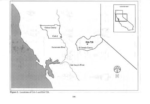
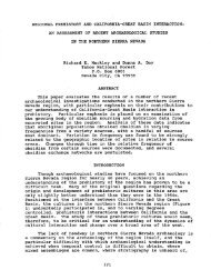
LOCATION MAP Col-l Sacramento River '" ~ [M Figure 2. Locations <strong>of</strong> Col-1 and Eld-728. 146
one. Jackson and Schulz (1975) have described these in general tenns as "medium to small stone <strong>projectile</strong> points characterized by trianguloid blades, contracting or parallel stems, pronounced shoulders with angle <strong>of</strong> less (usually considerably less) than 75 degrees, and with base pr<strong>of</strong>iles (the proximal border <strong>of</strong> the blade from shoulder to shoulder exclusive <strong>of</strong> the stem) concave or indented." Recently, however, the type Gunther has become a catch-all <strong>for</strong> smaIl- to medium-sized triangular late period <strong>projectile</strong> points from northern Cali<strong>for</strong>nia. It is not difficult to fmd in the literature points classified as Gunther which deviate substantially from the type originally described. Gunther <strong>series</strong> <strong>projectile</strong> points range throughout the northern Central Valley from Sacramento and Calaveras Counties in the south to Modoc and Siskiyou Counties in the North. They are restricted in the west by the coastal ranges but have been found in Humboldt, Mendocino, and Sonoma counties. Jackson and Schulz (1975) published a distribution index <strong>of</strong> Gunther points. It is widely accepted that the Gunther <strong>series</strong> <strong>projectile</strong> points belong to the Late period although the date <strong>of</strong> their first appearance remains uncertain. The Gunther points at the Miller Site were found in association with artifacts diagnostic <strong>of</strong> the post-AD. 1300 period. Baumh<strong>of</strong>f(1985) has proposed a beginning date <strong>for</strong> the type at AD. 600. Jobson (1991) is in agreement here, claiming the contracting stem variant dates to post AD. 600, and after AD. 1300 temporally overlaps with the expanding stem variant. In the Sacramento Canyon north <strong>of</strong> the valley, Basgall and Hildebrandt (1989) have radiocarbon and dendrochronological dates on material in association with Gunther Series points at AD. 770, 1767, and 1665. This type is also seems to appear after AD. 1100 at New Melones Reservoir, near the southern end <strong>of</strong> its range (Moratto 1984). The Miller Mound The Miller Site (COL-I) is located 17 miles north <strong>of</strong> Knights Landing on the west bank <strong>of</strong> the Sacramento River in southern Colusa County. Heizer (1936) excavated the site and described it as "one <strong>of</strong>the largest undisturbed mounds in the North Central Sacramento Valley." The site measures 350 feet from north to south, 300 feet from east to west and is elevated roughly nine feet above the surrounding valley terrain. With the deepest deposit approximately three feet lower than the valley floor, the total depth <strong>of</strong> the site is roughly 12 feet. The mound is circular in shape with steep sloping sides and a somewhat level top surface. Heizer concluded the mound to be a late River Patwin site with historic components. The <strong>projectile</strong> points used in this <strong>analysis</strong> came from additional excavations conducted by the University <strong>of</strong> Cali<strong>for</strong>nia at Davis in the summers <strong>of</strong> 1962-63. A complete <strong>analysis</strong> and report <strong>of</strong> the Miller Mound Site is currently being prepared by Henry Schulz at the University <strong>of</strong> Cali<strong>for</strong>nia at Davis. Sly Park Sites Sly Park is a flat surface located on a tributary to the Cosumnes River at around 3,500 feet in elevation in the central Sierras (Figure 2). It was historically a wet meadow and is now covered by Jenkinson Lake, a facility <strong>of</strong>the Bureau <strong>of</strong> Reclamation's Central Valley Project, and a source <strong>of</strong> water supply <strong>for</strong> El Dorado County. The shores <strong>of</strong> Jenkinson Lake are home to two large prehistoric sites, called the Picnic Ground Site and Arrowhead Campground Site. These sites are located less than one mile apart, and both are on well-drained flanks <strong>of</strong> the Sly Park meadow with a southern aspect (Figure 3). Arrowhead Campground Site (ELD-263) covers approximately 34,000 square meters and may contain 300 or more bedrock mortar cups. The Picnic Ground Site (ELD-728) contains more than 100 bedrock mortars and is approximately 31,000 square meters in size. Both sites have produced temporal artifacts clearly indicating occupation over a span <strong>of</strong> at least 4,000 years. A wide-stemmed point recovered at the Picnic Ground site probably indicates an earlier occupation. 147