Healthy Trails Guidebook - County of Santa Clara
Healthy Trails Guidebook - County of Santa Clara
Healthy Trails Guidebook - County of Santa Clara

You also want an ePaper? Increase the reach of your titles
YUMPU automatically turns print PDFs into web optimized ePapers that Google loves.
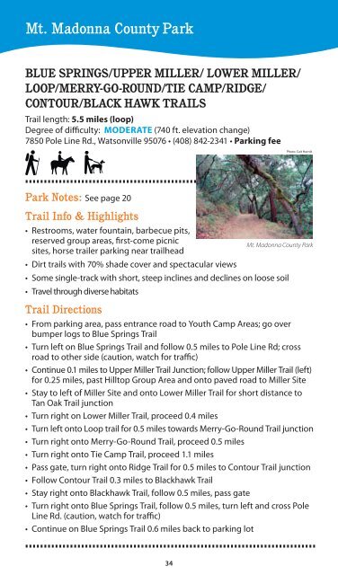
Mt. Madonna <strong>County</strong> Park<br />
Blue Springs/Upper Miller/ Lower Miller/<br />
Loop/Merry-Go-Round/Tie Camp/Ridge/<br />
Contour/Black Hawk <strong>Trails</strong><br />
Trail length: 5.5 miles (loop)<br />
Degree <strong>of</strong> difficulty: Moderate (740 ft. elevation change)<br />
7850 Pole Line Rd., Watsonville 95076 • (408) 842-2341 • Parking fee<br />
Photo: Cait Hutnik<br />
Park Notes: See page 20<br />
Trail Info & Highlights<br />
• Restrooms, water fountain, barbecue pits,<br />
reserved group areas, first-come picnic<br />
sites, horse trailer parking near trailhead<br />
Mt. Madonna <strong>County</strong> Park<br />
• Dirt trails with 70% shade cover and spectacular views<br />
• Some single-track with short, steep inclines and declines on loose soil<br />
• Travel through diverse habitats<br />
Trail Directions<br />
• From parking area, pass entrance road to Youth Camp Areas; go over<br />
bumper logs to Blue Springs Trail<br />
• Turn left on Blue Springs Trail and follow 0.5 miles to Pole Line Rd; cross<br />
road to other side (caution, watch for traffic)<br />
• Continue 0.1 miles to Upper Miller Trail Junction; follow Upper Miller Trail (left)<br />
for 0.25 miles, past Hilltop Group Area and onto paved road to Miller Site<br />
• Stay to left <strong>of</strong> Miller Site and onto Lower Miller Trail for short distance to<br />
Tan Oak Trail junction<br />
• Turn right on Lower Miller Trail, proceed 0.4 miles<br />
• Turn left onto Loop trail for 0.5 miles towards Merry-Go-Round Trail junction<br />
• Turn right onto Merry-Go-Round Trail, proceed 0.5 miles<br />
• Turn right onto Tie Camp Trail, proceed 1.1 miles<br />
• Pass gate, turn right onto Ridge Trail for 0.5 miles to Contour Trail junction<br />
• Follow Contour Trail 0.3 miles to Blackhawk Trail<br />
• Stay right onto Blackhawk Trail, follow 0.5 miles, pass gate<br />
• Turn right onto Blue Springs Trail, follow 0.5 miles, turn left and cross Pole<br />
Line Rd. (caution, watch for traffic)<br />
• Continue on Blue Springs Trail 0.6 miles back to parking lot<br />
34