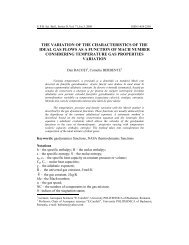
190 Bogdan Marcu, Iulian Iancu 3. The clogged volume determinati<strong>on</strong> The clogged volume determinati<strong>on</strong> for Zig<strong>on</strong>eni Lake is based <strong>on</strong> topobathymetric measurements. These measurements are performed every two years. The measuring techniques <strong>of</strong> water depth can be classified into: techniques using mechanical measuring equipment <strong>and</strong> techniques using electr<strong>on</strong>ic measuring equipment. The depth measurement techniques using mechanical equipment provide data with a very good precisi<strong>on</strong> when measuring small depths, about 10 – 15 m. Above these depth values the accuracy decrease significantly. Accuracy is very good for areas in which the water bottom c<strong>on</strong>sists <strong>of</strong> hard sediments, so that the used water gauges do not penetrate deeply these sediments. Accuracy is str<strong>on</strong>gly affected if the compositi<strong>on</strong> <strong>of</strong> deposited sediments <strong>on</strong> the bottom is low, test probes could penetrate them <strong>on</strong> distances which can vary from few centimeters to 2.1 meters, thus altering the real value <strong>of</strong> the measurement. The measurement methods which apply the depth measurement techniques using mechanical equipment are: sounding pole <strong>and</strong> sounding disk [3]. The depth measurement techniques using electr<strong>on</strong>ic equipment provide data with a very good precisi<strong>on</strong> without taking into account the size <strong>of</strong> the measured depth. Accuracy is very good no matter how the c<strong>on</strong>sistency <strong>of</strong> bottom deposited sediment is, due to the possibility <strong>of</strong> coupling with calculati<strong>on</strong> electr<strong>on</strong>ic equipment which can minimize all types <strong>of</strong> errors. The measurement methods which apply the depth measurement techniques using electr<strong>on</strong>ic equipment are: acoustic sounding method (echo sounding) <strong>and</strong> image processing method provided by the sensors installed <strong>on</strong> geostati<strong>on</strong>ary satellites (mapping water depths from space). For Zig<strong>on</strong>eni lake, until 2009, depth was measured using the sounding disk method, <strong>and</strong> since 2009 it has been used the echo sounding method (s<strong>on</strong>ar). Topo-bathymetric measurements are used for the live storage determinati<strong>on</strong>. The difference between this <strong>and</strong> the initial volume represents the clogged volume (Fig. 1, Table I). Table 1 The clogged volume determinati<strong>on</strong>[4] Lake volume Volume differences Clogged volume Year (m 3 ) (m 3 ) (m 3 ) 1978 13,300,000.000 0.000 0 1996 9,804,357.000 3,495,643.000 3,495,643.000 1999 9,392,544.000 411,813.000 3,907,456.000 2001 9,299,314.000 93,230.000 4,000,686.000 2003 9,053,711.000 245,603.000 4,246,289.000 2005 8,075,155.000 978,556.000 5,224,845.000 2007 7,732,067.000 343,088.000 5,567,933.000 2009 7,596,137.000 135,930.000 5,703,863.000 2011 7,418,436.980 177,700.020 5,881,563.020
Research <strong>on</strong> <strong>silting</strong> <strong>and</strong> de<strong>silting</strong> <strong>of</strong> <strong>reservoirs</strong> (artificial lakes) 191 Fig.1. The evoluti<strong>on</strong> <strong>of</strong> Zig<strong>on</strong>eni lake clogging. Comparatively, using bathymetric measurements, in Fig. 2 it is shown the evoluti<strong>on</strong> <strong>of</strong> clogging between 2009 <strong>and</strong> 2011 for two transversal pr<strong>of</strong>iles through the lake. 4. The clogging degree forecasting The calculati<strong>on</strong> model <strong>of</strong> <strong>silting</strong> forecast (determining the volume <strong>of</strong> the transported alluvial material in the lake) was performed using HEC-RAS computer program. HEC-RAS, developed by the U.S. Army Corps <strong>of</strong> Engineers, Hydrologic Engineering Center, is <strong>on</strong>e <strong>of</strong> the most known <strong>and</strong> used packages in the world, regarding the analysis <strong>of</strong> hydrographical systems[5]. Fig. 2. Pr<strong>of</strong>iles through Zig<strong>on</strong>eni lake to underline the phenomen<strong>on</strong> <strong>of</strong> clogging between 2009 <strong>and</strong> 2011.