Historical Archaeological Assessment - SMDA - NSW Government
Historical Archaeological Assessment - SMDA - NSW Government
Historical Archaeological Assessment - SMDA - NSW Government

You also want an ePaper? Increase the reach of your titles
YUMPU automatically turns print PDFs into web optimized ePapers that Google loves.
Sydney Metropolitan Development<br />
Authority (<strong>SMDA</strong>)<br />
24 July 2012<br />
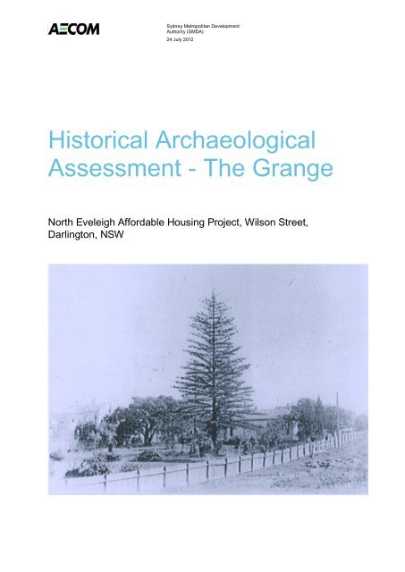
<strong>Historical</strong> <strong>Archaeological</strong><br />
<strong>Assessment</strong> - The Grange<br />
North Eveleigh Affordable Housing Project, Wilson Street,<br />
Darlington, <strong>NSW</strong>
AECOM<br />
<strong>Historical</strong> <strong>Archaeological</strong> <strong>Assessment</strong> - The Grange - North Eveleigh Affordable<br />
Housing Project, Wilson Street, Darlington, <strong>NSW</strong><br />
<strong>Historical</strong> <strong>Archaeological</strong> <strong>Assessment</strong> - The Grange<br />
North Eveleigh Affordable Housing Project, Wilson Street, Darlington, <strong>NSW</strong><br />
Prepared for<br />
Sydney Metropolitan Development Authority (<strong>SMDA</strong>)<br />
Prepared by<br />
AECOM Australia Pty Ltd<br />
Level 21, 420 George Street, Sydney <strong>NSW</strong> 2000, PO Box Q410, QVB Post Office <strong>NSW</strong> 1230, Australia<br />
T +61 2 8934 0000 F +61 2 8934 0001 www.aecom.com<br />
ABN 20 093 846 925<br />
24 July 2012<br />
60238089<br />
AECOM in Australia and New Zealand is certified to the latest version of ISO9001 and ISO14001.<br />
© AECOM Australia Pty Ltd (AECOM). All rights reserved.<br />
AECOM has prepared this document for the sole use of the Client and for a specific purpose, each as expressly stated in the document. No other<br />
party should rely on this document without the prior written consent of AECOM. AECOM undertakes no duty, nor accepts any responsibility, to any<br />
third party who may rely upon or use this document. This document has been prepared based on the Client’s description of its requirements and<br />
AECOM’s experience, having regard to assumptions that AECOM can reasonably be expected to make in accordance with sound professional<br />
principles. AECOM may also have relied upon information provided by the Client and other third parties to prepare this document, some of which<br />
may not have been verified. Subject to the above conditions, this document may be transmitted, reproduced or disseminated only in its entirety.<br />
24 July 2012
AECOM<br />
<strong>Historical</strong> <strong>Archaeological</strong> <strong>Assessment</strong> - The Grange - North Eveleigh Affordable<br />
Housing Project, Wilson Street, Darlington, <strong>NSW</strong><br />
Quality Information<br />
Document<br />
Ref<br />
<strong>Historical</strong> <strong>Archaeological</strong> <strong>Assessment</strong> - The Grange<br />
60238089<br />
g:\!env\team_iap\archaeology & heritage\proposals\eveleigh\aecom<br />
reporting\eveleigh_historical archaeological assessment_17july12.docx<br />
Date 24 July 2012<br />
Prepared by<br />
Reviewed by<br />
Dr Susan Lampard<br />
Luke Kirkwood<br />
Revision History<br />
Revision<br />
Revision<br />
Date<br />
Details<br />
Name/Position<br />
Authorised<br />
Signature<br />
1. 4 July 2012 Draft Susan Lampard<br />
Archaeologist<br />
2. 12 July 2012 Final Susan Lampard<br />
Archaeologist<br />
3. 17 July 2012 Revised Final Susan Lampard<br />
Archaeologist<br />
4. 24 July 2012 Amended Final Susan Lampard<br />
Archaeologist<br />
24 July 2012
AECOM<br />
<strong>Historical</strong> <strong>Archaeological</strong> <strong>Assessment</strong> - The Grange - North Eveleigh Affordable<br />
Housing Project, Wilson Street, Darlington, <strong>NSW</strong><br />
Table of Contents<br />
1.0 Introduction 1<br />
1.1 Project Team 1<br />
1.2 Limitations 2<br />
1.3 Project Description 2<br />
2.0 Statutory Controls 4<br />
2.1 Environment Protection and Biodiversity Conservation Act 1999 4<br />
2.2 Environmental Planning and <strong>Assessment</strong> Act 1979 4<br />
2.3 The Heritage Act 1977 5<br />
2.4 State Environmental Planning Policy (Major Development) 2005 5<br />
2.5 State Environmental Planning Policy (State and Regional Development) 2011 5<br />
2.6 State Environmental Planning Policy (Infrastructure) 2007 5<br />
2.7 State Environmental Planning Policy 55 - Remediation of Land 5<br />
2.8 South Sydney Local Environmental Plan (1998) 5<br />
3.0 Methodology 6<br />
3.1 Site Inspection Methodology 6<br />
3.2 Significance <strong>Assessment</strong> Criteria 6<br />
4.0 Desktop <strong>Assessment</strong> 8<br />
4.1 Introduction 8<br />
4.2 Heritage Inventories 8<br />
4.3 <strong>Archaeological</strong> Zoning Plan (AZP) 9<br />
5.0 <strong>Historical</strong> Context 11<br />
5.1 Early European Land Settlement and the Development of Newtown 11<br />
5.2 The Grange 12<br />
5.2.1 Physical Description and Architecture of The Grange 14<br />
5.3 Eveleigh Railway Workshops 17<br />
6.0 Site Inspection Results and Significance <strong>Assessment</strong> 19<br />
6.1 Site Description 19<br />
6.2 Cistern 20<br />
6.3 <strong>Archaeological</strong> Potential 21<br />
7.0 Significance <strong>Assessment</strong> 24<br />
7.1 Cistern 24<br />
7.1.1 <strong>Historical</strong> Context 24<br />
7.1.2 Significance <strong>Assessment</strong> 24<br />
7.1.3 Statement of Significance 24<br />
7.2 Structures 25<br />
7.2.1 <strong>Historical</strong> Context 25<br />
7.2.2 Significance <strong>Assessment</strong> 25<br />
7.2.3 Statement of Significance 25<br />
8.0 Impacts and Recommendations 26<br />
8.1 Introduction 26<br />
8.2 Impacts 26<br />
8.3 General 26<br />
Cistern 27<br />
9.0 Conclusion 29<br />
10.0 References 30<br />
Appendix A<br />
Sands Directory Listings<br />
Appendix B<br />
Rate <strong>Assessment</strong> Records<br />
A<br />
B<br />
24 July 2012
AECOM<br />
<strong>Historical</strong> <strong>Archaeological</strong> <strong>Assessment</strong> - The Grange - North Eveleigh Affordable<br />
Housing Project, Wilson Street, Darlington, <strong>NSW</strong><br />
List of Plates<br />
Plate 1<br />
The Grange, New Town, Sydney. By John Vine Hall. Dated July 1865. Held by Mitchell<br />
Library (PXA 4460) 15<br />
Plate 2<br />
The Grange. Date unknown. View north-north west. Held by the <strong>NSW</strong> Branch of the<br />
National Trust 16<br />
Plate 3<br />
Pre 1916 Spring Store with embankment brick wall evident at right of image. Wilson<br />
Street level is above the Spring Store roof. View west towards Iverys Lane. 19<br />
Plate 4 Pre 1967 Advertising Depot foundations. View north towards Wilson Street. 20<br />
Plate 5 Opening in roof of cistern. View north towards Wilson Street. 21<br />
Plate 6<br />
Eastern end of water cistern showing section of collapse. View west towards Wilson<br />
Street. 21<br />
List of Tables<br />
Table 1 Heritage Items Identified on Heritage Inventories 8<br />
Table 2 Sands Directory entries for The Grange between 1858 and 1909 A-1<br />
Table 3<br />
Owner, Occupier and description of The Grange from Newtown Rate <strong>Assessment</strong><br />
Records B-1<br />
List of Figures<br />
Figure 1 Proposed works 3<br />
Figure 2 Project Boundary indicating location of heritage items within the Project Boundary 10<br />
Figure 3<br />
Plan of The Grange, prepared on the conversion to Torrens Title, 1900 (Certificate of<br />
Title 1674-19, Primary Application 11531). Date of survey: 1 January 1900 13<br />
Figure 4<br />
Buildings indicated at the Eveleigh Railway Workshops site in 1916. From AHMS<br />
(2008:24) 18<br />
Figure 5 <strong>Archaeological</strong> potential of the North Eveleigh site 23<br />
Figure 6<br />
Cross-section in the vicinity of the cistern indicating the final land surface in relation to<br />
the existing land surface 28<br />
24 July 2012
AECOM<br />
<strong>Historical</strong> <strong>Archaeological</strong> <strong>Assessment</strong> - The Grange - North Eveleigh Affordable<br />
Housing Project, Wilson Street, Darlington, <strong>NSW</strong><br />
1<br />
1.0 Introduction<br />
AECOM Australia Pty Ltd (AECOM) was commissioned by the Sydney Metropolitan Development Authority<br />
(<strong>SMDA</strong>) to undertake an archaeological assessment of the North Eveleigh Affordable Housing Project site,<br />
located on Wilson Street, Darlington, <strong>NSW</strong> (the Project). <strong>SMDA</strong> is proposing to construct a road, associated<br />
services and undertake land remediation at the Project site, in advance of a mixed residential, commercial, retail<br />
and cultural development, which has concept approval (MP 08_0015) from the Department of Planning and<br />
Infrastructure (DP&I). The site is located within the Eveleigh Railway Workshops, listed on the State Heritage<br />
Register (SHR No. 01140).<br />
An Environmental <strong>Assessment</strong> was prepared in relation to the Concept Plan in January 2008. During public<br />
submissions, the potential for archaeological features associated with The Grange, a former house on the site,<br />
was identified, together with an extant cistern. The archaeological potential of the area and the extant cistern had<br />
not been identified in an <strong>Archaeological</strong> Zoning Plan (AZP) prepared by AHMS (2008). AHMS provided further<br />
advice regarding the cistern in a letter dated 25 August 2008, which recommended a suitably qualified<br />
archaeologist should inspect the site to identify and assess the significance and research potential of the remains.<br />
This report undertakes the inspection and assessment recommended by AHMS. It also addresses Condition 3 of<br />
the recommended Conditions of Consent issued by the <strong>NSW</strong> Heritage Council (10 May 2012), which states:<br />
“All affected areas identified as having archaeological potential are to be subject to professional archaeological<br />
monitoring and recording during the project works. A Research Design including an <strong>Archaeological</strong> Excavation<br />
Methodology must be prepared in accordance with Heritage Council guidelines for each site which is to be<br />
excavated. Those documents should be prepared for the approval of the Heritage Council of <strong>NSW</strong> or its<br />
Delegate…”<br />
As the archaeological resource related to The Grange is not well understood, AECOM is undertaking the Project<br />
in two stages:<br />
1. Stage 1 – <strong>Archaeological</strong> <strong>Assessment</strong>; and<br />
2. Stage 2 - Research Design and <strong>Archaeological</strong> Excavation Methodology, if required.<br />
This report comprises Stage 1 – <strong>Archaeological</strong> <strong>Assessment</strong> - of the Project. The purpose of this assessment is to<br />
satisfy the requirements of the AZP in relation to the previously unidentified archaeological potential of The<br />
Grange, and to determine the nature and extent of the potential archaeological resource. To achieve this, the<br />
scope of works completed by AECOM for this archaeological assessment included:<br />
<br />
<br />
<br />
<br />
Completion of a detailed history of The Grange, aided by the public submission to the REF relating to<br />
The Grange;<br />
A half day site inspection locating, recording and assessing the features identified in the public<br />
submission, as well assessing the archaeological potential of the Project site in light of subsequent land<br />
uses;<br />
<strong>Assessment</strong> of the significance of the potential archaeological deposits associated with The Grange Villa<br />
according to Heritage Branch guidelines Assessing Significance for <strong>Historical</strong> <strong>Archaeological</strong> Sites and<br />
‘Relics’ (<strong>NSW</strong> Heritage Branch, 2009);<br />
Preparation of an archaeological assessment report, including recommendations regarding the<br />
requirement for, and scope of, a Research Design and Methodology;<br />
1.1 Project Team<br />
The Project was managed by Robert Mason (Principal Engineer) and the assessment was carried out by Dr<br />
Susan Lampard (AECOM Archaeologist). Susan co-ordinated project logistics, conducted the heritage<br />
assessment, undertook fieldwork, and authored this report. Rochelle Coxon (AECOM archaeologist) assisted with<br />
the preparation of the report. Luke Kirkwood (AECOM Senior Archaeologist) provided technical and QA review.<br />
Tim Osborne (AECOM Designer) provided mapping and graphics support, and Jodie Glennan (AECOM IAP<br />
Team, Senior Team Secretary) provided administrative assistance.<br />
24 July 2012
AECOM<br />
<strong>Historical</strong> <strong>Archaeological</strong> <strong>Assessment</strong> - The Grange - North Eveleigh Affordable<br />
Housing Project, Wilson Street, Darlington, <strong>NSW</strong><br />
2<br />
1.2 Limitations<br />
Within this report predictions have been made regarding the probability of subsurface archaeological deposits<br />
occurring within the Project Site. These predictions are based on historical evidence, surface indications, and<br />
environmental context. It is, however, possible that archaeological materials may occur in areas without surface<br />
indications and in any environmental context.<br />
A summary of the statutory requirements regarding historic heritage is provided in Section 2.0. This is provided<br />
based on experience within the heritage system in New South Wales (<strong>NSW</strong>) and does not purport to be legal<br />
advice. It should be noted that legislation, regulations and guidelines change over time and users of this report<br />
should satisfy themselves that the statutory requirements have not changed since the report was written.<br />
1.3 Project Description<br />
A Concept Plan for the redevelopment of the North Eveleigh site has been approved by the Department of<br />
Planning and Infrastructure under Part 3A of the Environmental Planning and <strong>Assessment</strong> Act 1979. The Concept<br />
Plan (Application No. 08_0015, approved 16 December 2008) allows for the construction of commercial, retail and<br />
residential development. In the western part of the site, the subject of this archaeological assessment, the<br />
Concept Plan has set aside land for affordable housing. This assessment relates to a Review of Environmental<br />
Factors (REF) prepared to undertake initial works necessary to provide the infrastructure required to allow for the<br />
future development, including:<br />
<br />
<br />
<br />
<br />
<br />
<br />
the construction of a two way vehicle site entry in the location of the existing entry;<br />
the construction of a two way road parallel to Wilson Street, between the site entry and the Carriage<br />
Workshop building;<br />
associated car parking, footpaths and landscaping;<br />
telecommunications, electricity distribution, sewage works, stormwater management and gas and water<br />
reticulation works;<br />
demolition of the Timber Shed extension, to allow for the construction of the road and water; and<br />
remediation of land (as required) in the path of the infrastructure works and the land to be developed for<br />
affordable housing.<br />
The proposed works are depicted in Figure 1.<br />
The Concept Plan approved the demolition of the Timber Shed extension, Reclamation Shed and Air Raid Sheds.<br />
A Heritage Impact Statement (HIS) has been prepared by Weir Philips (2012) in relation to the demolition of these<br />
items and this archaeological assessment does not address this aspect of the Project.<br />
The development of the affordable housing will be subject to a separate application and approval process.<br />
24 July 2012
North Eveleigh Rail Yard Site<br />
Redfern Waterloo Authority<br />
October 2008 S10914<br />
Land Use Plan<br />
Central and Western Sites<br />
Scale 1:1250<br />
Legend<br />
Residential<br />
Office/ Retail<br />
Heritage - adaptive reuse<br />
Public Open Space
AECOM<br />
<strong>Historical</strong> <strong>Archaeological</strong> <strong>Assessment</strong> - The Grange - North Eveleigh Affordable<br />
Housing Project, Wilson Street, Darlington, <strong>NSW</strong><br />
4<br />
2.0 Statutory Controls<br />
A number of planning and legislative documents govern how heritage is managed in <strong>NSW</strong> and Australia. The<br />
following section provides an overview of the requirements under each as they apply to the Project.<br />
2.1 Environment Protection and Biodiversity Conservation Act 1999<br />
The Commonwealth Environment Protection and Biodiversity Conservation Act 1999 (EPBC Act) took effect on 16<br />
July 2000.<br />
Under Part 9 of the EPBC Act, any action that is likely to have a significant impact on a matter of National<br />
Environmental Significance (known as a controlled action under the Act), may only progress with approval of the<br />
Commonwealth Minister for the Department of Sustainability, Environment, Water, Population and Communities<br />
(SEWPaC). An action is defined as a project, development, undertaking, activity (or series of activities), or<br />
alteration. An action will also require approval if:<br />
<br />
It is undertaken on Commonwealth land and will have or is likely to have a significant impact on the<br />
environment on Commonwealth land; and,<br />
<br />
It is undertaken by the Commonwealth and will have or is likely to have a significant impact.<br />
The EPBC Act defines ‘environment’ as both natural and cultural environments and therefore includes Aboriginal<br />
and non-Aboriginal historic cultural heritage items. Under the Act protected heritage items are listed on the<br />
National Heritage List (items of significance to the nation) or the Commonwealth Heritage List (items belonging to<br />
the Commonwealth or its agencies). These two lists replaced the Register of the National Estate (RNE). The RNE<br />
has been suspended and is no longer a statutory list, however, it remains as an archive.<br />
The heritage registers mandated by the EPBC Act have been consulted and there are no items within the Project<br />
Boundary on these registers. In relation to heritage, the EPBC Act is not of further relevance to the Project site.<br />
2.2 Environmental Planning and <strong>Assessment</strong> Act 1979<br />
The Environmental Planning and <strong>Assessment</strong> Act 1979 (EP&A Act) allows for the preparation of planning<br />
instruments to direct development within <strong>NSW</strong>. The North Eveleigh site’s planning controls, including land use<br />
and heritage controls, are within Part 5, Schedule 3 of State Environmental Planning Policy (Major Development)<br />
2005 (Major Development SEPP).<br />
The EP&A Act and the EP&A Regulation provide the statutory planning context for environmental assessment<br />
and approval of the proposed works. Due to the application of the State Environmental Planning Policy<br />
(Infrastructure) 2007 (Infrastructure SEPP), the activity does not require development consent and is therefore to<br />
be assessed under Part 5 of the EP&A Act. As per Section 4(e) of the EP&A Act, <strong>SMDA</strong> is defined as a ‘public<br />
authority’ by virtue of its being a <strong>NSW</strong> <strong>Government</strong> agency under the Growth Centres (Development<br />
Corporations) Act 1974.<br />
As a determining authority, <strong>SMDA</strong> is required under section 111(1) of the EP&A Act to “take into account to the<br />
fullest extent possible all matters affecting or likely to affect the environment”. In order to ensure that likely<br />
environmental effects are considered, <strong>SMDA</strong> have prepared a REF.<br />
Under Part 5, the Heritage Branch (now within the Office of Environment and Heritage), does not have specific<br />
guidelines regarding heritage assessments. As such the following guidelines have been adopted for the Project as<br />
an indication of methods and principles required by the Heritage Branch, together with the International Council<br />
on Monuments and Sites (ICOMOS) Burra Charter (1999):<br />
<br />
Heritage Manual (<strong>NSW</strong> Heritage Office & <strong>NSW</strong> Department of Urban Affairs and Planning, 1996a);<br />
Assessing Heritage Significance (<strong>NSW</strong> Heritage Office, 2001);<br />
<br />
<br />
Heritage Curtilages (<strong>NSW</strong> Heritage Office & <strong>NSW</strong> Department of Urban Affairs and Planning, 1996b);<br />
Levels of Heritage Significance (<strong>NSW</strong> Heritage Office, 2008); and<br />
Assessing Significance for <strong>Historical</strong> <strong>Archaeological</strong> Sites and ‘Relics’ (<strong>NSW</strong> Heritage Branch, 2009).<br />
24 July 2012
AECOM<br />
<strong>Historical</strong> <strong>Archaeological</strong> <strong>Assessment</strong> - The Grange - North Eveleigh Affordable<br />
Housing Project, Wilson Street, Darlington, <strong>NSW</strong><br />
5<br />
2.3 The Heritage Act 1977<br />
The Heritage Act 1977 was enacted to conserve the environmental heritage of <strong>NSW</strong>. Under section 32, places,<br />
buildings, works, relics, moveable objects or precincts of heritage significance are protected by means of either<br />
Interim Heritage Orders (IHO) or by listing on the State Heritage Register (SHR). Items that are assessed as<br />
having State heritage significance can be listed on the SHR by the Minister on the recommendation of the<br />
Heritage Council.<br />
<strong>Archaeological</strong> relics (any relics that are buried) are protected by the provisions of section 139. Under this section<br />
it is illegal to disturb or excavate any land knowing or suspecting that the disturbance or excavation will or is likely<br />
to result in a relic being discovered, exposed, moved, damaged or destroyed. In such cases, an excavation permit<br />
under section 140 is required. Note that no formal listing is required for archaeological relics; they are<br />
automatically protected if they are of local significance or higher.<br />
Proposals to alter, damage, move or destroy places, buildings, works, relics, moveable objects or precincts<br />
protected by an IHO or listed on the SHR require an approval under section 60. Demolition of whole buildings will<br />
not normally be approved except under certain conditions (section 63). Some of the sites listed on the SHR or on<br />
LEPs may either be ‘relics’ or have relics associated with them. In such cases, a section 60 approval or an<br />
exemption is also required for any disturbance to relics associated with a listed item. The project area is within the<br />
SHR listed Eveleigh Railway Workshops (SHR No. 01140).<br />
Under Section 170 of the Heritage Act <strong>NSW</strong> government agencies are required to maintain a register of heritage<br />
assets. The register places obligations on the agencies, but not on non-government proponents, beyond their<br />
responsibility to assess the impact on surrounding heritage items. AECOM has searched s.170 registers to<br />
determine whether there are listed items within the Project area.<br />
2.4 State Environmental Planning Policy (Major Development) 2005<br />
The State Environmental Planning Policy (Major Development) 2005 (Major Development SEPP) identifies the<br />
site as forming a part of the ‘Redfern-Waterloo Authority Sites’ under Part 5 of Schedule 3. Under this listing, all<br />
other environmental planning instruments do not apply to the site except for other SEPPs.<br />
2.5 State Environmental Planning Policy (State and Regional<br />
Development) 2011<br />
Development that has a capital investment value of more than $10 million on the site is considered to be State<br />
Significant Development as the Redfern-Waterloo Site is identified in Schedule 2 of the State Environmental<br />
Planning Policy (State and Regional Development) 2011.<br />
2.6 State Environmental Planning Policy (Infrastructure) 2007<br />
With the exception of the remediation works, the proposed works can be carried out as Development without<br />
Consent under clauses contained within the State Environmental Planning Policy (Infrastructure) 2007.<br />
2.7 State Environmental Planning Policy 55 - Remediation of Land<br />
The remediation works do not require development consent in accordance with Clause 14 of the State<br />
Environmental Planning Policy 55 – Remediation of Land. It should be noted that the project area is not classified<br />
by an environmental planning instrument for conservation or heritage conservation.<br />
2.8 South Sydney Local Environmental Plan (1998)<br />
The South Sydney LEP 1998 controls development in relation to heritage items within the South Sydney area.<br />
Schedules 2, 2A and 2B of the LEP provides a list of identified heritage items, conservation areas and<br />
streetscapes, which has been examined to determine whether the items could potentially be directly impacted by<br />
the Project. No listed heritage items were identified in these schedules as being within the project area.<br />
City of Sydney has exhibited a Draft Sydney LEP (2011) to replace the multiple LEPs that cover the LGA. The<br />
heritage schedule was also consulted and no heritage items are identified within the project area.<br />
24 July 2012
AECOM<br />
<strong>Historical</strong> <strong>Archaeological</strong> <strong>Assessment</strong> - The Grange - North Eveleigh Affordable<br />
Housing Project, Wilson Street, Darlington, <strong>NSW</strong><br />
6<br />
3.0 Methodology<br />
A site inspection was undertaken by Dr Susan Lampard of AECOM on the 13 June 2012. The following sections<br />
describe the methodology used.<br />
Numerous attempts were made throughout a three week period to contact the authors of the public submission to<br />
ascertain if they held further information that may provide further insight into the archaeological potential of the<br />
site. No contact could be made.<br />
3.1 Site Inspection Methodology<br />
A site inspection was undertaken over a two hour period on the morning on 13 June 2012. Dr Susan Lampard<br />
was met on site by Kerrie Symonds (Planning and Urban Renewal) and Juliet Suich (Strategic and Heritage<br />
Planner) of Sydney Metropolitan Development Authority.<br />
The objective of the field survey was to assess the water cistern identified in the public submission and the<br />
likelihood that archaeological features and/or deposits associated with The Grange Villa remained within the site.<br />
To this end, the water cistern was inspected and photographs taken.<br />
To assess the likelihood of archaeological remnants relating to The Grange Villa being preserved onsite, a<br />
walkover of the remainder of the site was undertaken. To relocate the approximate location of The Grange, the<br />
Land Title Office survey plan of 15 January 1900 (CT Vol. 1674. Folio 19, No. 11531) was oriented using Wilson,<br />
Queen and Forbes Streets as markers. Photographs of general area were taken.<br />
3.2 Significance <strong>Assessment</strong> Criteria<br />
In order to understand how development will impact on a heritage item, it is essential to understand why an item is<br />
significant. An assessment of significance is undertaken to explain why a particular site is important and to enable<br />
the appropriate site management and curtilage to be determined. Cultural significance is defined in the Australia<br />
ICOMOS Charter for the conservation of places of cultural significance (the Burra Charter) as meaning "aesthetic,<br />
historic, scientific or social value for past, present or future generations" (Article 1.1). Cultural significance may be<br />
derived from a place’s fabric, association with a person or event, or for its research potential. The significance of a<br />
place is not fixed for all time, and what is of significance to us now may change as similar items are located, more<br />
historical research is undertaken and community tastes change.<br />
The process of linking this assessment with a site's historical context has been developed through the <strong>NSW</strong><br />
Heritage Management System and is outlined in the guideline Assessing Heritage Significance (2001), part of the<br />
<strong>NSW</strong> Heritage Manual (Heritage Branch 1996). The Assessing Heritage Significance guidelines establish seven<br />
evaluation criteria (which reflect four categories of significance and whether a place is rare or representative)<br />
under which a place can be evaluated in the context of State or local historical themes. Similarly, a heritage item<br />
can be significant at a local level (i.e. to the people living in the vicinity of the item), at a State level (i.e. to all<br />
people living within <strong>NSW</strong>) or be significant to the country as a whole and be of National or Commonwealth<br />
significance.<br />
In accordance with in the guideline Assessing Heritage Significance, an item will be considered to be of State or<br />
local heritage significance if it meets one or more of the following criteria:<br />
Criterion (a) – an item is important in the course, or pattern, of <strong>NSW</strong>’s cultural or natural history (or the cultural or<br />
natural history of the local area).<br />
The site must show evidence of significant human activity or maintains or shows the continuity of historical<br />
process or activity. An item is excluded if it has been so altered that it can no longer provide evidence of<br />
association.<br />
Criterion (b) – an item has strong or special association with the life or works of a person, or group of persons, of<br />
importance in <strong>NSW</strong>’s cultural or natural history (or the cultural or natural history of the local to area).<br />
The site must show evidence of significant human occupation. An item is excluded if it has been so altered that it<br />
can no longer provide evidence of association.<br />
Criterion (c) – an item is important in demonstrating aesthetic characteristics and/or a high degree of creative or<br />
technical achievement in <strong>NSW</strong> (or the local area).<br />
24 July 2012
AECOM<br />
<strong>Historical</strong> <strong>Archaeological</strong> <strong>Assessment</strong> - The Grange - North Eveleigh Affordable<br />
Housing Project, Wilson Street, Darlington, <strong>NSW</strong><br />
7<br />
An item can be excluded on the grounds that it has lost its design or technical integrity or its landmark qualities<br />
have been more than temporarily degraded.<br />
Criterion (d) – an item has strong or special association with a particular community or cultural group in <strong>NSW</strong> (or<br />
the local area) for social, cultural or spiritual reasons.<br />
This criterion does not cover importance for reasons of amenity or retention in preference to proposed alternative.<br />
Criterion (e) – an item has potential to yield information that will contribute to an understanding of <strong>NSW</strong>’s cultural<br />
or natural history (or the cultural or natural history of the local area). Significance under this criterion must have<br />
the potential to yield new or further substantial information.<br />
Guidelines for exclusion include the information would be irrelevant or only contains information available in other<br />
sources.<br />
Criterion (f) – an item possesses uncommon, rare or endangered aspects of <strong>NSW</strong>’s cultural or natural history<br />
(or the cultural or natural history of the local area). The site must show evidence of the element/function etc<br />
proposed to be rare.<br />
Criterion (g) – an item is important in demonstrating the principal characteristics of a class of <strong>NSW</strong>’s:<br />
<br />
<br />
cultural or natural places; or<br />
cultural or natural environments.<br />
An item is excluded under this criterion if it is a poor example or has lost the range of characteristics of a type.<br />
The Heritage Branch require the summation of the significance assessment into a succinct paragraph, known as a<br />
Statement of Significance. The Statement of Significance is the foundation for future management and impact<br />
assessment.<br />
24 July 2012
AECOM<br />
<strong>Historical</strong> <strong>Archaeological</strong> <strong>Assessment</strong> - The Grange - North Eveleigh Affordable<br />
Housing Project, Wilson Street, Darlington, <strong>NSW</strong><br />
8<br />
4.0 Desktop <strong>Assessment</strong><br />
4.1 Introduction<br />
Prior to undertaking the site inspection a number of secondary sources were consulted regarding the<br />
archaeological potential of the Project Boundary. These include:<br />
Heritage Inventories;<br />
<br />
<br />
North Eveleigh Railway Carriage Workshops <strong>Historical</strong> <strong>Archaeological</strong> Impact <strong>Assessment</strong>,<br />
<strong>Archaeological</strong> Zoning Plan and Impact Mitigation Strategy (AHMS, 2008); and<br />
Preferred Project AHIMS letter dated 25 August 2008 etc<br />
Conservation Management Plan (Otto Cserhalmi & Partners, 2002).<br />
4.2 Heritage Inventories<br />
As discussed in Section 2.0, Commonwealth, State and local governments maintain inventories of items of<br />
historical significance within each jurisdiction. The following section discusses listed heritage items within the<br />
Project Site and its immediate surrounds.<br />
AECOM undertook a search of relevant heritage inventories on 8 June 2012. The inventories searched were:<br />
<br />
<br />
<br />
<br />
<br />
<br />
<br />
<br />
World Heritage List;<br />
Commonwealth Heritage List;<br />
National Heritage List;<br />
Register of the National Estate<br />
State Heritage Register<br />
Section 170, Registers of relevant <strong>Government</strong> Agencies;<br />
Major Development SEPP 2005 and SEPP (State and Regional Development) 2011; and<br />
South Sydney LEP/ Draft City of Sydney LEP.<br />
Table 1 summarises the heritage resource as currently listed on statutory registers within the Project Boundary.<br />
Table 1<br />
Heritage Items Identified on Heritage Inventories<br />
Register<br />
World Heritage List<br />
Commonwealth Heritage List<br />
National Heritage List<br />
Register of the National Estate<br />
Items within the Project<br />
Boundary<br />
Nil<br />
Nil<br />
Nil<br />
Nil<br />
State Heritage Register 1<br />
Section 170 Registers<br />
South Sydney LEP 1998/Draft<br />
City of Sydney LEP<br />
Major Development SEPP<br />
Nil<br />
Nil<br />
Nil<br />
The entire Eveleigh Railway Workshop Complex is listed on the State Heritage Register (SHR No. 01140), the<br />
curtilage is indicated in Figure 2. The RailCorp Section 170 Register contains approximately 55 items, mainly<br />
moveable cultural heritage, however, all of these items are stored outside of the Project Boundary and are<br />
therefore not considered in this assessment.<br />
24 July 2012
AECOM<br />
<strong>Historical</strong> <strong>Archaeological</strong> <strong>Assessment</strong> - The Grange - North Eveleigh Affordable<br />
Housing Project, Wilson Street, Darlington, <strong>NSW</strong><br />
9<br />
4.3 <strong>Archaeological</strong> Zoning Plan (AZP)<br />
In 2008 <strong>Archaeological</strong> & Heritage Management Solutions (AHMS) prepared an <strong>Archaeological</strong> Impact<br />
<strong>Assessment</strong> and <strong>Archaeological</strong> Zoning Plan (AZP) for the Part 3A Concept Plan approval. The AZP outlined the<br />
evolution of the site based on historical maps and assessed the potential for evidence of previous structures to be<br />
retained beneath the existing structures and in the open space.<br />
The AZP concludes that the majority of buildings on the site were the first and only buildings constructed on a<br />
particular location. An analysis of the historical plans indicates that this is particularly true of the land within the<br />
western half of the Project Boundary, which was sparsely developed towards the end of the construction and use<br />
phase of the Railway yards.<br />
The AZP identified the western end of the site was developed at a later date – intensive development beginning in<br />
the eastern portion and moving west as the space was consumed. The area within the Project Boundary appears<br />
to have been vacant until around 1916 when a Spring Store, Store and General Store were constructed in the<br />
vicinity of the south eastern corner of the project area.<br />
Three buildings were constructed in the north western corner of the Project Boundary some time before 1967, but<br />
after 1942. The buildings included an Advertising Depot and two unidentified structures. The two unidentified<br />
structures were demolished prior to 1991. The Advertising Depot has now also been demolished. AHMS<br />
assessed the remnants associated with these three buildings as having no heritage significance (AHMS, 2008:43-<br />
44).<br />
The Plan does not identify Grange Villa, the cistern or make predictions regarding the probability of features or<br />
deposits surviving. It does, however, surmise that the topography prior to the development of the Railway Yard<br />
was substantially different to the present. It is likely that Wilson Street represents the historical ground level, which<br />
sloped gently to the south. The original ground surface is thought to have been truncated during the creation of<br />
the railway level. As discussed in Section 6.0, the railway level now varies between 1.5 and five metres below<br />
Wilson Street.<br />
The AZP was publicly exhibited as an appendix to the Concept Plan for the redevelopment of the North Eveleigh<br />
site. A public submission was received, which detailed some history of The Grange and identified the extant<br />
cistern. In response, AHMS provided additional advice in the form of a letter, dated 25 August 2008, which was<br />
included in the Concept Plan Preferred Project Report. AHMS recommended that a site inspection be undertaken<br />
and management measures developed. This report fulfils this recommendation.<br />
24 July 2012
WILSON LANE<br />
GOLDEN GROVE STREET<br />
FORBES LANE<br />
FORBES STREET<br />
QUEEN STREET<br />
WILSON STREET<br />
HOLDSWORTH STREET<br />
WILSON LANE<br />
IVERYS LANE<br />
AECOM \\ausyd1fp001\Projects\60238089_North_Eveleigh\4. Tech work area\4.8 GIS\02_Maps\G001_Overview_120704.mxd Updated 4/07/2012<br />
Site boundary<br />
Cistern<br />
Cadastre<br />
NORTH EVELEIGH<br />
Project boundary<br />
0 10 20 40<br />
m<br />
JUL 2012<br />
60238089<br />
Source: LPMA, 2011<br />
¯<br />
Fig. 2
AECOM<br />
<strong>Historical</strong> <strong>Archaeological</strong> <strong>Assessment</strong> - The Grange - North Eveleigh Affordable<br />
Housing Project, Wilson Street, Darlington, <strong>NSW</strong><br />
11<br />
5.0 <strong>Historical</strong> Context<br />
The historical context of an area is important in understanding the type and nature of sites likely to be present and<br />
their potential distribution/location. The following section provides a brief overview of the history of the local<br />
Newtown area, before focusing specifically on the properties of the ‘Grange Villa’ within the Project Site.<br />
5.1 Early European Land Settlement and the Development of Newtown<br />
The Municipality of Newtown was incorporated in the year 1862, comprising a total of 480 acres within the present<br />
electorate of Newtown. The name ‘Newtown’ is believed to have originated from John and Eliza Webster’s ‘New<br />
Town’ store which existed in the early 1800s (Cashman & Meader, 1990). This store was located on the site of<br />
what is now the Zanzibar Hotel, at 323 King Street Newtown. By 1892, Newtown had become Sydney’s most<br />
populous suburb (Sands Directory 1857-1904), however, even prior to this, the suburb had been a hive of activity<br />
in the colony, with considerable activity in the area since the earliest days of the settlement. The area which<br />
became the Municipality of Newtown comprised a number of land grants, most of which had been issued in the<br />
eighteenth century. In the years 1793-1794, the land which comprised what would become almost the entire<br />
Municipality of Newtown was granted to Lieutenant Thomas Rowley (Kingston Farm) and Superintendent<br />
Nicholas Devine (Burren or Burrin Farm). Seven other smaller lots (of approximately 20-30 acres) were also<br />
granted during this period to lower-ranking army personnel and emancipists. The current Study Area falls within<br />
the original grant of Nicholas Devine.<br />
The ‘Burren Farm’ land grant consisted of 120 acres. Devine had arrived in Sydney with the second fleet in 1790,<br />
and was the superintendent of convicts in the new colony (Murphy, 2009). Devine’s property continued to expand<br />
in the latter years of the eighteenth century, with additional grants made to him in 1794 and 1799. By 1800,<br />
Devine had cleared 68 acres of Burren Farm and he endeavored to cultivate wheat and maize on the property.<br />
The produce of his large garden, as well as an orchard and dairy on the property, augmented his income and he<br />
brought sheep and goats out from the Cape Town, South Africa (Ryan, 1979). Devine’s farm, like many other<br />
small farms in the area, was not, however, a success.<br />
In 1831-4, Following Devine’s death in 1830, his heir apparent, a convict servant whom Devine had signed over<br />
his land to named Bernard Rochford, subdivided and sold off ‘Burren Farm’. Large houses in pleasant, country<br />
surroundings were erected on the subdivide lots, including Lietrim (later The Pines Estate), Leichhardt Lodge, and<br />
the subject of this assessment, The Grange, to name but a few. The area which had once been ‘Burren Farm’<br />
quickly became established, with approximately 30 residences belonging to some very prominent citizens<br />
including the Lord Mayor of Sydney, the attorney general, Parliamentarians, the editor of The Sydney Morning<br />
Herald, and barristers and solicitors, a retired naval admiral and some importers and merchants, being erected on<br />
the land (Murphy, 2009).<br />
In the year 1852, an heir of Nicholas Devine, John Devine, contested the will between Nicholas Devine and<br />
Bernard Rochford on three grounds –that Nicholas Devine was of unsound mind at the time he signed over his<br />
land to Rochford, that the will was a forgery, and that as Rochford was a convict he could not buy, own, sell or<br />
inherit property. This, along with subsequent legal proceedings, became known as the ‘Newtown Ejectment<br />
Case’. John Devine lost the case, but was granted a retrial upon appeal, which took place in August and<br />
September 1857. This was at the time, Australia’s largest civil court case. John Devine also lost this case, but<br />
following the threat of another appeal, an undisclosed, but allegedly sizable, settlement was reached between<br />
John and the defendants - the land-holders of the subdivided properties which had once comprised Nicholas<br />
Devine’s property. It is thought that the defendants agreed to this settlement as they knew that should a third<br />
retrial take place, it would do so in a London courthouse, where their status in New South Wales would be less<br />
persuasive.<br />
By 1862, when the Municipality of Newtown was incorporated, the area had developed significantly, changing<br />
from a rural, farming area to a small but prosperous town. The township had become centered on an area in the<br />
vicinity of the current Study Area, generally situated between City Road, Wilson Street and Australia Street. In the<br />
year 1862 there were approximately 200 houses in Newtown, very few of which were more than one-story high,<br />
and most of which were quite small is size, making residences such as The Grange and the Pines quite<br />
remarkable in the local area. Wilson Street, on which The Grange property was located, was at the time an<br />
important primary thoroughfare into Newtown, along which were located many of the more sizeable residences in<br />
the area. These residences were home to, and had housed, some of the colony’s most notable figures, including<br />
Sir Saul Samuel (at The Grange), Henry Copeland, Dr Badham (first lecturer at the University of Sydney), Felix<br />
24 July 2012
AECOM<br />
<strong>Historical</strong> <strong>Archaeological</strong> <strong>Assessment</strong> - The Grange - North Eveleigh Affordable<br />
Housing Project, Wilson Street, Darlington, <strong>NSW</strong><br />
12<br />
Wilson (a notable local figure who resided at The Pines), Samuel Bennett of the “Evening News” in Willow Lodge,<br />
and many others (Chubb, 1912:117-121).<br />
5.2 The Grange<br />
The southern portion of the allotment on which The Grange was constructed was part of the grant to Nicholas<br />
Devine in 1794, discussed above. The plan created on the creation of a Torrens Title certificate (Certificate of Title<br />
1674-19) indicates the northern portion, being the frontage to Wilson Street, was a much later grant, given in 1843<br />
to David Chambers (see Figure 3). It seems more likely, however, given the evidence provided by the Parish<br />
maps, that Chambers probably purchased the land following the subdivision and sale of Devine’s estate. Although<br />
the Primary Application (no. 11531) to bring the property under the Torrens Title system states that Chambers<br />
was granted the land in 1843, he was in possession of the land prior to then. In 1840, David Chambers signed a<br />
lease agreement with William a’Beckett for the land and house at £197.12 per quarter. This was to increase by<br />
£7.18 on the issuing of a grant to Chambers over the land on which the house stood. This indicates that The<br />
Grange had been constructed prior to 1840. It remains unclear, however, whether it was constructed for David<br />
Chambers as a residence for himself or as speculative venture or by another. The lease gave a’Beckett the option<br />
to purchase the property, the price being fixed at £1823.10.5. a’Beckett took up the option in 1843, under several<br />
mortgages between then and when he sold the property in 1857 (Primary Application 11531).<br />
William and his wife Emily were in residence at The Grange in May 1840, as the newspaper of 2 May records in<br />
the ‘Births, Deaths and Marriages’ the birth of a son to the couple at the house on the previous day (Sydney<br />
Gazette and New South Wales Advertiser 2 May 1840:3b). A’Beckett remained at The Grange until at least June<br />
1841, when The Australian (3 June 1841:3c) records the death of Emily in the house at the age of 31.<br />
There is a gap in information regarding the occupancy of the house until July 1845, when The Sydney Morning<br />
Herald (30 July 1845:4a) announces the birth of a daughter to Mrs Robert Johnson of The Grange, Newtown. Mrs<br />
Robert Johnson had a son in 1849 (The Sydney Morning Herald 14 May 1849:3d). In November the paper<br />
records the birth of a still born daughter to Mrs John Thompson of The Grange (The Sydney Morning Herald 4<br />
November 1850:3e), indicating the Johnson’s had made way for the Thompson’s.<br />
The Thompson’s seem to have been in residence for little more than a year, as The Sydney Morning Herald of 16<br />
July 1851 announces the birth of a daughter to Mrs James Dawson of The Grange. The Dawson’s happiness was<br />
reasonably short-lived, their daughter, Eliza, died in November of 1852 (Empire 25 November 1852:2a). The<br />
couple remained at The Grange until 1856, when the Empire (8 January 1856:4d) advertises an auction of<br />
household furniture, a pianoforte, china, cut glass, platedware and saddelery at the House.<br />
In 1857 Felix Wilson, a prominent local and resident of the adjacent Pine Villa, purchased The Grange, apparently<br />
leasing it out. After Wilson’s death in 1865, the property was managed for a number of years by trustees, who<br />
continued to lease the premises.<br />
In May of that year the death of Mr A. Lyons 1 at the house of Louis and Saul Samuels (brothers) indicates the<br />
house was not vacant for long (The Sydney Morning Herald 8 May 1857:8c). Nor was it empty for long – Saul and<br />
his wife Henrietta Matilda had five children between 1858 and 1864 (The Sydney Morning Herald 4 October<br />
1858:1a; The Sydney Morning Herald 16 December 1859:1a; The Sydney Morning Herald 21 January 1861:7d;<br />
Empire 30 April 1862:1a; and The Sydney Morning Herald 31 May 1864:1a) Henrietta did not recover from the<br />
birth of her last child, a son, and she died at The Grange on 5 June 1864, aged only 26 (The Sydney Morning<br />
Herald 6 June 1864:1a). Saul Samuel held extensive pastoral property on the Macquarie River. He was the first<br />
Jew to become a magistrate (1846), <strong>NSW</strong> Member of Parliament (various years and seats in the Bathurst and<br />
Orange areas between 1854 and 1880) and Minister, becoming colonial treasurer in 1860 (Bergman, 1976).<br />
Samuel returned to England (having been born there in 1820) to take up the appointment of agent-general for<br />
<strong>NSW</strong>. He was knighted in 1882 and created a baronet in 1898 (Bergman, 1976).<br />
The occupation of The Grange becomes somewhat confused between 1865 and 1875. The Sands Directories<br />
(see Table 2) for various years are listed alphabetically by surname, rather than by street and it is therefore<br />
difficult to identify changing occupation patterns. For 1865, there is no listing that can be firmly attributed to The<br />
Grange. The Directory for 1866 lists Captain Elliot as occupying The Grange. The following year there is no entry<br />
that can be firmly tied to The Grange, as the name of the property was not always listed. In 1868 Saul Samuel is<br />
again listed as living in Wilson Street, although it is not clear if his residence was The Grange.<br />
1<br />
Louis (or Lewis) and Saul’s mother’s maiden name was Lyons, indicating the brothers were probably caring for their elderly<br />
uncle.<br />
24 July 2012
,ofpare or Lena comprise<br />
M7c1 a/So pare- or eY,4cfecea<br />
Parish: of Peters/ Lam<br />
. 1<br />
Ira I<br />
af •<br />
ii53 1<br />
in Dario Chambers grant' of lac. 31.-Nirre:<br />
hoyin& granr or t2Oac.re,4 Orel Oper<br />
COIL/Z.0 7<br />
TOWN '<br />
of au nberland<br />
0.1. Vol.1674 Fo!<br />
cc-0<br />
‘14-'<br />
FEET /NDHES<br />
METRES.<br />
-ss<br />
• v,<br />
C.<br />
0 0<br />
C.<br />
1 -<br />
5 51/4<br />
5 6<br />
5 83/4<br />
7 31/8<br />
12 -<br />
15<br />
20<br />
22<br />
26<br />
42<br />
183<br />
165<br />
/90<br />
479<br />
453<br />
10 1/2<br />
9<br />
1 1/4<br />
6<br />
AO RD P<br />
0.305<br />
1,657<br />
1.676<br />
1.695<br />
2.213<br />
3.658<br />
4,640<br />
6.096<br />
6.706<br />
0.801<br />
22.802<br />
55.956<br />
56,617<br />
57.944<br />
146.152<br />
147.216<br />
SON<br />
2- 2 6144<br />
AC RD P<br />
4 3 26<br />
57 -<br />
/20 -<br />
HA<br />
•<br />
1.966<br />
23.07<br />
48.56<br />
...".t!.2'.'""1241rtargralikataFf<br />
tfia '<br />
DECLARATION.<br />
4.....leff./..A•Arwe 4 S ar.0 7<br />
n.--401,14,14 vaer ek 1,7,4 A* .4= Aasky vAA.I.vcrriy Svr■YrY. Ash:, that<br />
kmatrier aurvorealto I. yr MI, ?Ica ere Nrltri ler Ur ar iAt rshl Art./114 Met rtc .aLl Pity<br />
nu! art.y, I ns, lera<br />
Yaer Slurarof e ■norrY1,44; dAd .rwts thir aylyrm<br />
m 4v,ryy, Rod ¼ eirest U1.14<br />
ny 4e-2 may ,md<br />
pm.sor I. Mr rtMli ,,or ./ IV Mpg J Ifop,wn .Voirrary, 40,44 4.. Art Or Ike were rircevat<br />
"r/ (1.4.7. a ..10.R11■11.1 tries eta .k 3, rsrletm DrimremevIr tr, 0yrrrament ei 1111. dovlh<br />
..fy masa,. Ei-d■rornyti fa 11.<br />
.4, lie /arils...MA .1 m.r.i.v o hrly1 Orcly<br />
Svair GO 1,,.1 in an fad,<br />
/ 7<br />
141 40- 7<br />
1<br />
A<br />
1<br />
AMENDMENTS AND/OR ADDITIONS MADE ON<br />
PLAN IN THE LAND TITLES OFFICE.<br />
irstfenvelt..}.MOrA14911:1=<br />
This negative is o photograph mode as a permanent<br />
record of a document in the custody of the<br />
00915tror Gencroi this day.<br />
12th February, 1487<br />
B:pas/ waqsAs AaTnErwa mou<br />
iO Tams/ rlay:a5d/ 522T 2IO2-8 L1P-T2:4ad/ NO'NO:g48/ z551-inr-4z:A021e a TE51900 8O:00O/ L62990211)08<br />
_
AECOM<br />
<strong>Historical</strong> <strong>Archaeological</strong> <strong>Assessment</strong> - The Grange - North Eveleigh Affordable<br />
Housing Project, Wilson Street, Darlington, <strong>NSW</strong><br />
14<br />
In the following two years, again, no definitive evidence is provided in the Directories regarding who, if anyone,<br />
was living in the house. In 1871 the Directory lists Thomas M’Culloch as resident of The Grange. No directory was<br />
produced in 1872 and in 1873 Andrew McCulloch is listed at The Grange. The directory for 1874 has not been<br />
digitised, but The Sydney Morning Herald records the marriage of Thomas M’Culloch, of The Grange, eldest son<br />
in 1874 (The Sydney Morning Herald 10 July 1874:6b).<br />
The lack of stability in occupancy rates may have resulted from the death of Felix Wilson on 24 September 1865<br />
(The Sydney Morning Herald 25 September 1865:1a). On his death, the property was administered by a series of<br />
trustees.<br />
From 1875 until 1884 John Little is consistently listed as the resident of The Grange in the Sands Directories. In<br />
the later years his occupation is listed as auctioneer. Rate assessment records, available online for the period<br />
1863 to 1892 (see Table 3 for a summary), confirm the Little family’s occupation between 1878 and 1883. Rate<br />
assessment records prior to 1878 cannot be conclusively tied to the property.<br />
Directories indicate that between 1892 and 1895 The Grange is occupied by William Coker. The Primary<br />
Application for the property indicates that William Coker became a trustee of the property in 1883. Sometime<br />
thereafter he appears to have married Felix Wilson’s widow, Mary Caroline Stewart Wilson, as they are listed,<br />
together with Mary’s five children, in the Primary Application in 1872 under the surname Coker. In 1896 and 1897<br />
The Grange is listed as being the residence of Mrs W. Coker, possibly indicating that William had passed away.<br />
In 1898 Sands Directories indicate the house may have been used as “The Maternity Home” of which Miss<br />
Rachel Hill was the matron. It is not possible, however, to definitively tie the listing to The Grange. In the following<br />
year there is no listing and then between 1900 and 1902 the property is listed as a private school run by Mrs M.<br />
Best. The connection between The Grange and Mrs Best’s school is confirmed by the announcement of the<br />
marriage of Mrs Best’s youngest daughter from The Grange in 1902 (The Sydney Morning Herald 25 January<br />
1902:1a). The Primary Application suggests that the property was purchased by Augusta Sophia Quigley in 1900,<br />
although it does not appear that she resided at The Grange.<br />
Between 1903 and 1905 the Sands Directories indicate the school was taken over by Miss E.C. Gray and seems<br />
to indicate she shared The Grange with William Webb and his wife, Eliza (nee Fowler). It is unclear if there is any<br />
connection between Miss Gray and the Webb’s. William and his wife seem to have wholly occupied The Grange<br />
from 1906 until 1908. In 1906 The Sydney Morning Herald reports on the golden wedding anniversary<br />
celebrations of the couple:<br />
A pleasant evening was spent on Friday evening, August 17, at The Grange, Wilson street. Newtown, in<br />
celebration of the golden wedding of Mr. and Mrs. William Webb. Many friends and relatives assembled,<br />
including children, grandchildren, and great-grandchildren. The house and grounds were tastefully decorated<br />
for the occasion, and presented a gay and animated scene. It may be interesting to note that Mrs. Webb<br />
appeared in the same wedding dress in which she became a bride 50 years ago. During the evening an<br />
adjournment was made for supper, at which the health of Mr. and Mrs. Webb was proposed and honoured.<br />
Mr. and Mrs. Webb were the recipients of many costly and valuable presents.<br />
(The Sydney Morning Herald 25 Aug 1906:11d)<br />
There are no further references to The Grange in the Sands Directories or The Sydney Morning Herald past 1908,<br />
indicating it was demolished in that year or soon after. This fits with the Certificate of Title (CT1674-19), which<br />
records the purchase of the land by the Minister for Public works in June of 1908. It seems likely that the house<br />
was demolished and the site leveled shortly thereafter.<br />
5.2.1 Physical Description and Architecture of The Grange<br />
The public submission suggested that The Grange may have been designed by John Verge, one of the earliest<br />
and the most important architect of the Greek Revival in Australia (1782-1861). This was based on the external<br />
visual similarity between an 1865 sketch of The Grange (Plate 1) and the one known photo held by the National<br />
Trust (Plate 2), and John Verge’s Rose Bay Cottage.<br />
There is no definitive evidence to suggest that The Grange was designed or built by John Verge. A search of John<br />
Verge’s surviving ledger was undertaken for the present assessment and it reveals no references to The Grange<br />
or any residence in the area which could possibly have been The Grange (Verge, 1962). The house does,<br />
however, share stylistic similarities with many of his works, as evidenced by surviving photographic and pictorial<br />
evidence of the property.<br />
24 July 2012
ES/tUS- --71-1-G•<br />
HALL, JOHN VINE<br />
The Grange New Town "Sydney" .,.1i...L1dred.<br />
Zi),KA 446 1- 1<br />
18 ■ ';5. Pencil & wash heig -htened with white.<br />
14 5 crn x 23. lcal.<br />
PXA4461.- f 3<br />
f3i,rned I I.V.Nalll at lowe.c left.<br />
Dated 'July, 1865 1—;:nd titled at lower centre.<br />
(In his: :31tetches of Sydney ..., f.3)<br />
,
AECOM<br />
<strong>Historical</strong> <strong>Archaeological</strong> <strong>Assessment</strong> - The Grange - North Eveleigh Affordable<br />
Housing Project, Wilson Street, Darlington, <strong>NSW</strong><br />
17<br />
From the available pictorial evidence it can be determined that The Grange, like other houses constructed in the<br />
Colonial Georgian style, was characterised by sophisticated symmetry, a simplicity of style, and a softness of<br />
scale (Verge, 1962). The house was a rectangular, symmetrical, one-storey structure, constructed from brick and<br />
stone. The photograph shows a centrally placed door flanked by a double set of windows. It is probable that it<br />
originally had a shingle roof, which was subsequently replaced by corrugated iron, as depicted in the undated<br />
photograph. Verandahs were also a common feature of Colonial Georgian houses, with some being ‘wraparound’,<br />
and others only across the front façade of the house. It appears that The Grange was probably<br />
constructed with a verandah, as indicated by the 1865 sketch, however, it had been removed, at least on the<br />
southern side, by the time the photograph was taken.<br />
The sketch and photograph seem to indicate that The Grange was oriented to the south, probably in order to<br />
address what originally would have been a bucolic landscape and to make the most of the natural fall of the land<br />
in that direction. The sketch hints that additional service structures may have been located along the Wilson<br />
Street frontage. This assessment is strengthened by the plan created upon the creation of the Torrens Title<br />
(Figure 3). The plan shows two conjoined structures placed on the property boundary. It also indicates that the<br />
property frontage was not resumed to widen Wilson Street, probably due to the existence of these structures. It is<br />
assumed that following the purchase of the property for railway purposes, and with the structures demolished, the<br />
land was resumed to remove the dog-leg from Wilson Street. Any archaeological deposits associated with the<br />
structures on the Wilson Street frontage are therefore likely to be under the footpath and possibly the road.<br />
5.3 Eveleigh Railway Workshops<br />
Although The Grange was demolished, probably in 1908 or 1909, development of the land for railway purposes<br />
was reasonably light and concentrated towards the railway lines to the south. Building 52 on Figure 4, a Chemical<br />
laboratory was constructed in c.1910. This was followed by an Oil store in c.1911, General store (now Clothing<br />
Store) in 1913 and Traverser No. 3 and store (possibly for benzene), both pre 1916. The northern portion of the<br />
former Grange property, where the house was sited, remained undeveloped. It was not until sometime between<br />
1942 and 1967 that an advertising depot and a small, unidentified building were constructed over where The<br />
Grange had once stood. It is likely, however, that works to level the area had been undertaken prior to this time.<br />
With the exception of the Clothing Store, the remainder of buildings constructed on the former Grange property<br />
have been demolished.<br />
24 July 2012
________________North Eveleigh Railway Workshops <strong>NSW</strong>: <strong>Archaeological</strong> Development Impact <strong>Assessment</strong> & Zoning Plan<br />
Figure 4.3: Buildings indicated on the site in 1916<br />
______________________________________________________________________________________________________<br />
<strong>Archaeological</strong> & Heritage Management Solutions PTY LTD: 349 Annandale Street, Annandale 2038 24
AECOM<br />
<strong>Historical</strong> <strong>Archaeological</strong> <strong>Assessment</strong> - The Grange - North Eveleigh Affordable<br />
Housing Project, Wilson Street, Darlington, <strong>NSW</strong><br />
19<br />
6.0 Site Inspection Results and Significance <strong>Assessment</strong><br />
6.1 Site Description<br />
The Project Area is bounded by Wilson Street in the north, Iverys Lane to the west, the train line between Redfern<br />
and Macdonaldtown to the south and Little Eveleigh Street to the east. The site is known as part Lot 4 and part<br />
Lot 5 of Deposited Plan 862514.<br />
Entry to the site is located at the western end of the site, where a gently sloping earthen ramp allows access from<br />
the Wilson Street level to the railway level. At the western end the difference between the Wilson Street and<br />
railway level is approximately 1.5 metres, however, this increases to the east, where the difference reaches<br />
approximately five metres. In the vicinity of the entrance, the embankment between Wilson Street and the site is<br />
formed by a makeshift retaining wall of rails and timber oddments. Approximately 75 m from the entrance, the<br />
retaining embankment wall becomes a formal brick wall behind the pre 1916 Spring Store (Plate 3). It is probable<br />
that this marks the boundary between the Railyard and the land formerly belonging to The Grange.<br />
Plate 3<br />
Pre 1916 Spring Store with embankment brick wall evident at right of image. Wilson Street level is above the Spring Store<br />
roof. View west towards Iverys Lane.<br />
Adjacent to the entrance is the foundations of the former pre 1967 Advertising Depot (Plate 4). A demountable<br />
office is situated on the north eastern corner of the foundation. The foundation is raised approximately 0.5 m<br />
above the railway level. The area is currently fenced. Based on consideration of the Torrens Title Plan (Figure 3),<br />
it is considered this is likely to have been the approximate former location of The Grange.<br />
24 July 2012
AECOM<br />
<strong>Historical</strong> <strong>Archaeological</strong> <strong>Assessment</strong> - The Grange - North Eveleigh Affordable<br />
Housing Project, Wilson Street, Darlington, <strong>NSW</strong><br />
20<br />
Plate 4<br />
Pre 1967 Advertising Depot foundations. View north towards Wilson Street.<br />
6.2 Cistern<br />
Located on the embankment between Wilson Street and the former Advertising Depot foundations, is the cistern<br />
identified in the public submission. The embankment at this point is densely vegetated and steep, making<br />
inspection of the cistern difficult. The southern portion of the cistern is exposed, following the slope, with the<br />
northern portion being buried within the embankment. It was therefore not possible to take exact measurements of<br />
the cistern. The cistern is constructed of double red brick and lined with fine-grained grey cement. No loose bricks<br />
were available to inspect for frogs (recess on the bed of a brick) or impressed names. The surfaces of the bricks<br />
that were exposed indicated they are not convict sandstock bricks and post-date the convict period and the initial<br />
construction of the house. It is likely that the bricks, and therefore the construction of the cistern, post-dates<br />
c.1860.<br />
The cistern is approximately 3.5 m in length (north-south) and 1.5 m wide (east-west) and has an arched brick<br />
roof. An opening of approximately 0.5 m square is located in the roof at the western end (Plate 5). The northern<br />
and southern faces of the opening have been created with dressed and pecked sandstone blocks. The eastern<br />
and western faces are of brick, like the remainder of the structure. At the eastern end, part of the roof and wall has<br />
collapsed into the cistern (Plate 6). Due to the unstable nature of the embankment and concerns regarding the<br />
stability of the cistern itself, it was not possible to determine how deep it is. Photos included in the public<br />
submission taken in 2007, when there was less debris inside the cistern, seem to indicate it is at least 1 m deep<br />
from the apex of the arched roof. It was not possible to identify the floor of the cistern or what material it was<br />
made of.<br />
24 July 2012
AECOM<br />
<strong>Historical</strong> <strong>Archaeological</strong> <strong>Assessment</strong> - The Grange - North Eveleigh Affordable<br />
Housing Project, Wilson Street, Darlington, <strong>NSW</strong><br />
21<br />
Plate 5<br />
Opening in roof of cistern. View north towards Wilson Street.<br />
Plate 6<br />
Eastern end of water cistern showing section of collapse. View west towards Wilson Street.<br />
6.3 <strong>Archaeological</strong> Potential<br />
It is considered unlikely that archaeological deposits, features or relics associated with The Grange house are<br />
extant. Images of The Grange indicate the house was constructed on a gentle slope. The slope has been cut and<br />
the site levelled and it is therefore highly likely that the house and associated features, were removed during<br />
these works. There is potential that remains of the structures formerly located on the Wilson Street frontage could<br />
be preserved under the footpath and/or road. There is also potential for archaeological deposits to be associated<br />
with the cistern as it would appear that this area has had only limited disturbance during its occupation by the<br />
Railway Yards.<br />
24 July 2012
AECOM<br />
<strong>Historical</strong> <strong>Archaeological</strong> <strong>Assessment</strong> - The Grange - North Eveleigh Affordable<br />
Housing Project, Wilson Street, Darlington, <strong>NSW</strong><br />
22<br />
The archaeological potential of the site has been divided into three categories, based upon the above<br />
assessment. The Railway Yard level is assessed as having limited to no archaeological potential. The<br />
embankment between Wilson Street and the Railway Yard is considered to have high potential to contain intact<br />
deposits, features or relics associated with The Grange. The footpath and possibly Wilson Street have moderate<br />
archaeological potential to contain features, deposits or relics associated with the structures formerly located<br />
along the Wilson Street frontage of The Grange. These archaeological zones are depicted in Figure 5.<br />
24 July 2012
WILSON LANE<br />
GOLDEN GROVE STREET<br />
FORBES LANE<br />
FORBES STREET<br />
QUEEN STREET<br />
WILSON STREET<br />
HOLDSWORTH STREET<br />
WILSON LANE<br />
IVERYS LANE<br />
AECOM \\ausyd1fp001\Projects\60238089_North_Eveleigh\4. Tech work area\4.8 GIS\02_Maps\G002_ ArchPotential_120704.mxd Updated 11/07/2012<br />
Site boundary<br />
Cadastre<br />
High archaeological potential<br />
Moderate archaeological potential<br />
Low archaeological potential<br />
NORTH EVELEIGH<br />
<strong>Archaeological</strong> potential<br />
0 10 20 40<br />
m<br />
JUL 2012<br />
60238089<br />
Source: LPMA, 2011<br />
¯<br />
Fig. 5
AECOM<br />
<strong>Historical</strong> <strong>Archaeological</strong> <strong>Assessment</strong> - The Grange - North Eveleigh Affordable<br />
Housing Project, Wilson Street, Darlington, <strong>NSW</strong><br />
24<br />
7.0 Significance <strong>Assessment</strong><br />
The significance assessment has been undertaken in two parts, one for the cistern and a second for the potential<br />
archaeological deposits relating to the structures formerly located along the Wilson Street frontage and now<br />
resumed under the footpath and possibly Wilson Street itself.<br />
7.1 Cistern<br />
7.1.1 <strong>Historical</strong> Context<br />
It is probable that the Cistern is associated with The Grange for a number of reasons. Firstly, the Cistern remains<br />
within a reasonably undisturbed section of the embankment and could therefore have escaped demolition during<br />
site levelling works. Secondly, there is no indication on plans from the Railway Yard period indicating the<br />
construction of facilities in this area.<br />
The bricks, due to their well-formed nature, and cement lining indicate that the cistern was not part of the original<br />
c.1830s construction of The Grange, but if associated was a later insertion.<br />
7.1.2 Significance <strong>Assessment</strong><br />
<strong>Historical</strong> significance<br />
SHR criteria (a)<br />
<strong>Historical</strong> association<br />
significance<br />
SHR criteria (b)<br />
Aesthetic significance<br />
SHR criteria (c)<br />
Social significance<br />
SHR criteria (d)<br />
Technical/Research<br />
significance<br />
SHR criteria (e)<br />
Rarity<br />
SHR criteria (f)<br />
Representativeness<br />
SHR criteria (g)<br />
APPLICATION OF CRITERIA<br />
The cistern is of historical significance at a local level as physical evidence of the<br />
changing use of the site. The cistern is likely to be associated with The Grange, which<br />
was constructed on the site prior to 1840 and demolished in 1908. During this time, The<br />
Grange was home to many prominent locals and was a well-known residence on Wilson<br />
Street.<br />
The cistern is of local associative significance as the last remaining piece of physical<br />
evidence relating to The Grange. The Grange was occupied by many prominent local<br />
families, including Felix Wilson and later his widow and her husband William Coker, and<br />
Lewis and Saul Samuels. Saul Samuels was a Member of Parliament, Colonial<br />
Treasurer and later Agent-General for the Colony in London, where he was knighted.<br />
The cistern does not meet this criterion as it does not demonstrate aesthetic<br />
characteristics or a high degree of creative or technical achievement.<br />
The cistern does not meet this criterion as it does not have strong or special<br />
associations with the community.<br />
The cistern is of local technical significance as the structure and potential associated<br />
archaeological deposits could yield information regarding the occupation of The<br />
Grange.<br />
The cistern does not meet this criterion as it is not rare.<br />
The cistern does not meet this criterion as it has lost some of the characteristics of its<br />
class.<br />
7.1.3 Statement of Significance<br />
The cistern is of significance at a local level for its contribution to the historical, associative and technical heritage<br />
of the Newtown area. The cistern is thought to be associated with The Grange, a pre-1840s house and one of the<br />
earliest in the area. The property is associated with Felix Wilson (ironmonger, and an inaugural Sydney City<br />
Councillor in 1842, and director of the Bank of <strong>NSW</strong>, 1843-50) and Sir Saul Samuels (Member of Parliament,<br />
Colonial Treasurer and later Agent-General of the Colony in London and knight). The cistern itself and<br />
archaeological deposits, that may be associated with it, have the potential to confirm the date of construction and<br />
the use of the cistern and general area during the occupation of The Grange.<br />
24 July 2012
AECOM<br />
<strong>Historical</strong> <strong>Archaeological</strong> <strong>Assessment</strong> - The Grange - North Eveleigh Affordable<br />
Housing Project, Wilson Street, Darlington, <strong>NSW</strong><br />
25<br />
7.2 Structures<br />
7.2.1 <strong>Historical</strong> Context<br />
The Certificate of Title Plan prepared in 1900 indicates that two conjoining structures relating to The Grange were<br />
extant on the Wilson Street frontage. Due to the existence of these structures, the land was not resumed when<br />
Wilson Street was widened. It would appear that following the purchase of The Grange for railway purposes in<br />
1908 that the structures were demolished and Wilson Street widened to remove the dog-leg. There remains<br />
potential for archaeological features, deposits and/or relics associated with these structures to remain in the<br />
embankment or under the footpath and possibly in the street.<br />
7.2.2 Significance <strong>Assessment</strong><br />
<strong>Historical</strong> significance<br />
SHR criteria (a)<br />
<strong>Historical</strong> association<br />
significance<br />
SHR criteria (b)<br />
Aesthetic significance<br />
SHR criteria (c)<br />
Social significance<br />
SHR criteria (d)<br />
Technical/Research<br />
significance<br />
SHR criteria (e)<br />
Rarity<br />
SHR criteria (f)<br />
Representativeness<br />
SHR criteria (g)<br />
APPLICATION OF CRITERIA<br />
The potential archaeological deposits, features and/or relics of the former structures are<br />
of historical significance at a local level as physical evidence of the changing use of the<br />
site. The cistern is likely to be associated with The Grange, which was constructed on<br />
the site prior to 1840 and demolished in 1908. During this time, The Grange was home<br />
to many prominent locals and was a well-known residence on Wilson Street.<br />
The potential archaeological deposits, features and/or relics of the former structures are<br />
of local associative significance as the last remaining piece of physical evidence relating<br />
to The Grange. The Grange was occupied by many prominent local families, including<br />
William a’Beckett, Felix Wilson and later his widow and her husband William Coker, and<br />
Lewis and Saul Samuels. Saul Samuels was a Member of Parliament, Colonial<br />
Treasurer and later Agent-General for the Colony in London, where he was knighted.<br />
The potential archaeological deposits do not meet this criterion as it does not<br />
demonstrate aesthetic characteristics or a high degree of creative or technical<br />
achievement.<br />
The potential archaeological deposits do not meet this criterion as it does not have<br />
strong or special associations with the community.<br />
The potential archaeological deposits, features and/or relics of the former structures are<br />
of local technical significance as they could yield information regarding the occupation<br />
of The Grange and the nature of the structures themselves.<br />
The potential archaeological deposits do not meet this criterion as it is not rare.<br />
The potential archaeological deposits do not meet this criterion as it has lost some of<br />
the characteristics of its class.<br />
7.2.3 Statement of Significance<br />
The potential archaeological deposits, features and/or relics of the former structures are of local historical,<br />
associative and technical significance. The archaeology of the former structures has the potential to yield<br />
information regarding their nature and associated artefacts could provide insight into life at The Grange.<br />
<strong>Historical</strong>ly, The Grange was a well-known house in the area and was inhabited by several locally and Colonially,<br />
prominent individuals, including William a’Beckett, Sir Saul Samuel and Felix Wilson.<br />
24 July 2012
AECOM<br />
<strong>Historical</strong> <strong>Archaeological</strong> <strong>Assessment</strong> - The Grange - North Eveleigh Affordable<br />
Housing Project, Wilson Street, Darlington, <strong>NSW</strong><br />
26<br />
8.0 Impacts and Recommendations<br />
8.1 Introduction<br />
It is considered unlikely that archaeological deposits, features or relics associated with The Grange house are<br />
extant within the Railway Yard section of the site. There remains potential within the embankment between Wilson<br />
Street and the railway level in association with the cistern. There is also potential for deposits, features and/or<br />
relics associated with the structures formerly located on the Wilson Street frontage of the property to be extant<br />
beneath the footpath and/or road.<br />
8.2 Impacts<br />
The proposed works on site have been outlined in Section 1.3 and are depicted in Figure 1. To stabilise the<br />
current embankment, between one and two metres of fill will be introduced and the resulting land surface<br />
landscaped to create a terraced pocket park. Based on the current land surface a cross-section has been<br />
produced at the location of the cistern. It indicates that the current land surface will not be disturbed within the<br />
embankment area (Figure 6).<br />
The proposal will see the construction of retaining walls and a set of stairs in fill placed on the embankment<br />
between Wilson Street and the Railway yard level, within the area identified has holding high archaeological<br />
potential (Figure 5). The area of high archaeological potential will therefore be protected and effectively preserved<br />
beneath the fill. It is therefore anticipated that the cistern will also be able to be retained within the embankment,<br />
underneath the fill.<br />
Trenches will be cut across the embankment fill to allow for the insertion of gas, water and telecommunications<br />
cables. It is not anticipated that service trenches will disturb the current land surface within the embankment and<br />
therefore, there is no anticipated impacts to the area of high archaeological potential. The service trenches, by<br />
necessity, will also cut the area identified as holding moderate archaeological potential for the structures along the<br />
frontage of The Grange. These trenches may possibly impact the potential archaeological deposits, relics and/or<br />
features relating to the structures along Wilson Street. However, the trenches will be less than 500 mm across<br />
and are likely to have minimal impact on the archaeology, should it be extant.<br />
There will be minimal excavation associated with the insertion of the proposed access road. No archaeological<br />
impacts are expected from these works.<br />
There is no archaeological potential within the existing Railway Yard level. No archaeological impacts are<br />
expected.<br />
8.3 General<br />
As impacts to areas of moderate archaeological potential have been identified, it is recommended that <strong>SMDA</strong><br />
apply for an exemption from Section 60 of the Heritage Act for that portion of the works within the SHR curtilage<br />
and, if required by the <strong>NSW</strong> Heritage Council, an exception from Section 139 of the Heritage Act to undertake the<br />
proposed works outside of the SHR curtilage. Conditions for exemptions to be granted under Section 60 and<br />
exceptions under Section 139 of the Heritage Act were gazetted in the <strong>Government</strong> Gazette by order of the<br />
Minister for Planning on 5 September 2008. An exemption or exception may be granted if one of the following is<br />
met:<br />
<br />
<br />
<br />
1A – An archaeological assessment, zoning plan or management plan has been prepared in accordance<br />
with Guidelines published by the Heritage Council of <strong>NSW</strong> which indicates that any relics in the land are<br />
unlikely to have State or local heritage significance; OR<br />
1B – the excavation or disturbance of land will have a minor impact on archaeological relics including the<br />
testing of land to verify the existence of relics without destroying or removing them; OR<br />
1C – a statement describing the proposed excavation demonstrates that evidence relating to the history<br />
or nature of the site, such as its level of disturbance, indicates that the site has little or no archaeological<br />
research potential.<br />
The impact assessment in Section 8.2 concludes that the proposed works are likely to have a minor impact (type<br />
1B) on the potential archaeological deposits located within Wilson Street and the footpath and no impact on the<br />
cistern and potential deposits in the embankment.<br />
24 July 2012
AECOM<br />
<strong>Historical</strong> <strong>Archaeological</strong> <strong>Assessment</strong> - The Grange - North Eveleigh Affordable<br />
Housing Project, Wilson Street, Darlington, <strong>NSW</strong><br />
27<br />
It is recommended that the excavation works in the footpath and Wilson Street be monitored, by a suitably<br />
qualified archaeologist who meets the Heritage Council’s Excavation Director Criteria, in order to determine<br />
whether archaeological relics are present in order to enable future management of the area. The recommended<br />
Conditions of Consent issued by the Heritage Council require a Research Design and <strong>Archaeological</strong> Excavation<br />
Methodology be prepared in advance of the monitoring works. It is recommended these documents be prepared<br />
and submitted to the Heritage Council.<br />
Cistern<br />
It is anticipated that the cistern will be able to remain within the embankment and the area filled to protect the<br />
item. The placement of the retaining walls and services will need to be reviewed to minimise impact on the cistern.<br />
The following recommendations are made regarding the cistern and its burial:<br />
<br />
<br />
<br />
<br />
<br />
<br />
<br />
Archival recording of cistern, following non-invasive vegetation clearance;<br />
Stabilisation of the structure to enable retention in situ and burial;<br />
Stabilisation works are to follow Burra Charter (Australia ICOMOS, 1999) principals and utilise the<br />
maintenance standards and materials recommended by the Heritage Branch, Office of Environment and<br />
Heritage, available at http://www.heritage.nsw.gov.au/03_index.htm#M-O<br />
Consider whether cistern needs to be filled prior to burial, if filled, material must be clean sand or similar<br />
with plaque containing the date of the works. A structural assessment may be required to inform this<br />
consideration;<br />
No heavy duty compaction equipment to be used within five metres that may damage the cistern;<br />
Once buried, no plantings of trees or shrubs within five metres of the cistern, no trees or shrubs with<br />
aggressive root systems to be planted within 10 metres of the cistern; and<br />
Site to be added to, and managed through, the Conservation Management Plan, <strong>Archaeological</strong> Zoning<br />
Plan and/or appropriate other heritage document for the Eveleigh Railway Yards.<br />
It is also proposed that this assessment be considered by the <strong>NSW</strong> Heritage Council as notification of<br />
identification of a relic, being the cistern and the potential associated archaeological relics, deposits and/or<br />
features, as required by Section 146 of the Heritage Act.<br />
24 July 2012
AECOM<br />
<strong>Historical</strong> <strong>Archaeological</strong> <strong>Assessment</strong> - The Grange - North Eveleigh Affordable<br />
Housing Project, Wilson Street, Darlington, <strong>NSW</strong><br />
29<br />
9.0 Conclusion<br />
The Sydney Metropolitan Development Authority intends to develop the North Eveleigh site for affordable<br />
housing. Initial works consisting of contamination remediation and the insertion of an access road and parking is<br />
subject to an REF. During public exhibition of the Concept Plan in 2008, a submission was received identifying an<br />
extant brick cistern in the embankment between Wilson Street and the Railway Yard level. The submission<br />
associated the cistern with the former house on the site, The Grange. The Heritage Council has recommended<br />
that all affected areas identified as having archaeological potential are to be subject to professional archaeological<br />
monitoring and recording during the project works. Prior to the development of a Research Design and<br />
Methodology it was necessary to determine the nature and significance of the cistern and potential associated<br />
deposits.<br />
Research undertaken for this assessment has identified that The Grange was constructed sometime prior to<br />
1840. It was the home of a number of prominent local and Colonial figures, including William a’Beckett, Sir Saul<br />
Samuel and possibly Felix Wilson. The property included a home, situated within the northern third of the site, and<br />
two conjoined structures located on the property boundary. These structures are now likely to be under the<br />
footpath and/or road due to the widening of Wilson Street. The Grange continued to be occupied until it was<br />
purchased by the Department of Public Works in 1908 to expand the Eveleigh Railway Yards and it was probably<br />
demolished shortly thereafter. The area fronting Wilson Street appears to have been sparsely used for railway<br />
purposes, with development largely confined to the southern portion of the site, near the railway lines.<br />
A site inspection, undertaken on 13 June 2012 identified the cistern and assessed the archaeological potential of<br />
the site. It was determined that, due to the levelling of the site following the demolition of The Grange, there was<br />
no archaeological potential for features, deposits or relics of the house itself to remain. The embankment formed<br />
during the levelling of the site contained a brick cistern, which is probably associated with The Grange. It would<br />
appear that there has been minimal disturbance of the embankment and there remains high potential for<br />
archaeological features, deposits and/or relics, beyond the cistern, to remain in this area. There is also moderate<br />
potential for features, deposits and/or relics associated with the structures along Wilson Street to remain in situ<br />
beneath the road and/or footpath. These features and the cistern have been assessed as being of local<br />
significance.<br />
The proposed works include the introduction of fill to the embankment area and the construction of retaining walls<br />
and a set of stairs in the fill between Wilson Street and the Railway yard level, above the area identified has<br />
holding high archaeological potential (Figure 5). Trenches will also be cut through the fill to allow for the insertion<br />
of gas, water and telecommunications cables. These trenches will also pass through the area identified as holding<br />
moderate archaeological potential for the structures along the frontage of The Grange. These works have the<br />
potential to impact on the expected archaeological resource in this area. The cistern will be able to be retained<br />
within the embankment, underneath the fill.<br />
It is therefore recommended that the excavation works to insert services, particularly in Wilson Street and the<br />
footpath, be monitored by a suitably qualified archaeologist. It is recommended this be undertaken through an<br />
exemption under Section 60 within the SHR listed portion and an exception under Section 139 for the area<br />
adjacent to the SHR listed area, if required by the <strong>NSW</strong> Heritage Council, as the impacts to the archaeology are<br />
anticipated to be minimal. Application for an exemption and/or exception requires the preparation of a brief<br />
methodology statement regarding the monitoring. It is recommended this be prepared and submitted, together<br />
with this report, to the Heritage Council for approval. It is also recommended that the cistern be buried and<br />
retained in situ.<br />
24 July 2012
AECOM<br />
<strong>Historical</strong> <strong>Archaeological</strong> <strong>Assessment</strong> - The Grange - North Eveleigh Affordable<br />
Housing Project, Wilson Street, Darlington, <strong>NSW</strong><br />
30<br />
10.0 References<br />
AHMS. (2008). North Eveleigh Railway Carriage Workshops, Redfern, <strong>NSW</strong>: <strong>Historical</strong> <strong>Archaeological</strong> Impact<br />
<strong>Assessment</strong>, <strong>Archaeological</strong> Zoning Plan and Impact Mitigation Strategy. Annandale, Sydney.<br />
Australia ICOMOS. (1999). The Burra Charter. Burwood, Victoria: Australia ICOMOS. Retrieved from<br />
http://australia.icomos.org/wp-content/uploads/BURRA_CHARTER.pdf<br />
Bergman, G. F. J. (1976). Samuel, Sir Saul (1829-1900). Australian Dictionary of Biography. National Centre of<br />
Biography, Australian National University. Retrieved from http://adb.anu.edu.au/biography/samuel-sir-saul-<br />
4534<br />
Cashman, R., & Meader, C. (1990). Marrickville, Rural outpost to inner city. Petersham: Hale and Iremonger Pty.<br />
Ltd.<br />
Chubb, W. (1912). Jubilee Souvenir of the Municipality of Newtown, 1862-1912. Sydney: Published by Authority<br />
of the Mayor and Aldermen of the Municipal Council of Newtown.<br />
Murphy, M. (2009). Newtown Ejectment Case. Newtown Project. Retrieved July 21, 2012, from<br />
http://www.sydneyarchives.info/essays-a-histories/25-newtown-ejectment-case<br />
<strong>NSW</strong> Heritage Branch. (2009). Assessing Significance for <strong>Historical</strong> <strong>Archaeological</strong> Sites and “ Relics .”<br />
Parramatta. Retrieved from http://www.heritage.nsw.gov.au/docs/Arch_Significance.pdf<br />
<strong>NSW</strong> Heritage Office. (2001). Assessing heritage significance. Parramatta. Retrieved from<br />
http://www.heritage.nsw.gov.au/docs/assessingheritagesignificance.pdf<br />
<strong>NSW</strong> Heritage Office. (2008). Levels of Heritage Significance (pp. 1-5). Parramatta: Heritage Office. Retrieved<br />
from http://www.heritage.nsw.gov.au/docs/levels_of_heritage_significance_2008.pdf<br />
<strong>NSW</strong> Heritage Office, & <strong>NSW</strong> Department of Urban Affairs and Planning. (1996a). <strong>NSW</strong> Heritage Manual.<br />
Parramatta: Heritage Office & Department of Urban Affairs & Planning. Retrieved from<br />
http://www.heritage.nsw.gov.au/03_index.htm#M-O<br />
<strong>NSW</strong> Heritage Office, & <strong>NSW</strong> Department of Urban Affairs and Planning. (1996b). Heritage Curtilages.<br />
Parramatta: Heritage Office & Department of Urban Affairs & Planning.<br />
Otto Cserhalmi & Partners. (2002). Eveleigh Carriageworks Conservation Management Plan.<br />
Ryan, M. (1979). Newtown Municipality 1862-1892: Subdivision, Land Use and Services. University of Sydney.<br />
Verge, W. G. (1962). John Verge, early Australian architect: his ledger and his clients. Sydney: Wentworth Books.<br />
Weir Phillips. (2012). Heritage Impact Statement: North Eveleigh Affordable Housing Project. Chippendale,<br />
Sydney, Australia.<br />
24 July 2012
AECOM<br />
<strong>Historical</strong> <strong>Archaeological</strong> <strong>Assessment</strong> - The Grange - North Eveleigh Affordable<br />
Housing Project, Wilson Street, Darlington, <strong>NSW</strong><br />
Appendix A<br />
Sands Directory Listings<br />
24 July 2012
AECOM<br />
<strong>Historical</strong> <strong>Archaeological</strong> <strong>Assessment</strong> - The Grange - North Eveleigh Affordable<br />
Housing Project, Wilson Street, Darlington, <strong>NSW</strong><br />
A-1<br />
Appendix A<br />
Sands Directory Listings<br />
Table 2 Sands Directory entries for The Grange between 1858 and 1909<br />
Year<br />
Occupier<br />
1858 Samuels, Louis (L. & S. Samuels), Grange, Newtown; Samuels, Saul (L. &<br />
S. Samuels), Grange, Newtown.<br />
1861 Samuels, Louis (L. & S. Samuels), Grange, Newtown; Samuels, Saul (L. &<br />
S. Samuels), Grange, Newtown.<br />
1862 No directory available<br />
1863 Samuels, Louis, Wilson-street;<br />
Samuels, Saul, Wilson-street<br />
1864 Samuels, Louis, Wilson-street;<br />
Samuels, Saul, Wilson-street<br />
1865 Alphabetical list<br />
1866 Elliott, Captain, The Grange, Wilson st<br />
1867 Alphabetical list<br />
1868 Samuel, Saul, J.P., M.L.A., Wilson st<br />
1869 Alphabetical list<br />
1870 Alphabetical list<br />
1871 M’Culloch, Thomas, The Grange<br />
1872 Directory not available<br />
1873 McCulloch, Andrew “The Grange”<br />
1874 Directory not available<br />
1875 Little, John, Wilson st<br />
1876 Little, John, Wilson st<br />
1877 Little, John (The Grange), Wilson st<br />
1878 No directory published<br />
1879 Little, J., auctioneer, The Grange<br />
1880 Little, John, The Grange<br />
1881 No directory published<br />
1882 Little, John, J.P., auctioneer, The Grange<br />
1883 Little, John, J.P.<br />
1884 Little, John, auctioneer, The Grange<br />
1885 Mulholland, John H., “The Grange”<br />
1886 Mulholland, John H., “The Grange”<br />
1887 No entry<br />
1888 No directory on line<br />
1889 Welch, G.C., Grazier and stock dealer<br />
1891 No entry<br />
1892 Coker, William, “The Grange”<br />
24 July 2012
AECOM<br />
<strong>Historical</strong> <strong>Archaeological</strong> <strong>Assessment</strong> - The Grange - North Eveleigh Affordable<br />
Housing Project, Wilson Street, Darlington, <strong>NSW</strong><br />
A-2<br />
Year<br />
Occupier<br />
1893 Coker, William, “The Grange”<br />
1894 Coker, William, “The Grange”<br />
1895 Coker, William, “The Grange”<br />
1896 Coker, Mrs. W., “The Grange”<br />
1897 Coker, Mrs. W., “The Grange”<br />
1898 The Maternity Home – Miss Rachel Hill, matron<br />
1899 No entry<br />
1900 Best, Mrs. M., private school<br />
1901 Best, Mrs. M., private school<br />
1902 Best, Mrs. M., private school<br />
1903 Gray, Miss E.C., private school;<br />
Webb, William<br />
1904 Gray, Miss E.C., private school;<br />
Webb, William<br />
1905 Gray, Miss E.C., private school;<br />
Webb, William<br />
1906 Webb, William<br />
1907 Webb, William<br />
1908 Webb, William<br />
1909 No listing<br />
Source: Sands Directories for Newtown available online at http://www.sydneyarchives.info/sands-directores<br />
24 July 2012
AECOM<br />
<strong>Historical</strong> <strong>Archaeological</strong> <strong>Assessment</strong> - The Grange - North Eveleigh Affordable<br />
Housing Project, Wilson Street, Darlington, <strong>NSW</strong><br />
Appendix B<br />
Rate <strong>Assessment</strong><br />
Records<br />
24 July 2012
AECOM<br />
<strong>Historical</strong> <strong>Archaeological</strong> <strong>Assessment</strong> - The Grange - North Eveleigh Affordable<br />
Housing Project, Wilson Street, Darlington, <strong>NSW</strong><br />
B-1<br />
Appendix B<br />
Table 3<br />
Rate <strong>Assessment</strong> Records<br />
Owner, Occupier and description of The Grange from Newtown Rate <strong>Assessment</strong> Records<br />
Year Occupier Owner Description Value Comment<br />
1863 No description of property recorded. Property occupied by L S Samuels (identified from Sands<br />
Directories) valued at £160<br />
1864 No description of property recorded. Property occupied by L S Samuels (identified from Sands<br />
Directories) valued at £160<br />
1865 No description of property recorded. Property occupied by L S Samuels (identified from Sands<br />
Directories) valued at £160<br />
1866-1877 Rate <strong>Assessment</strong> Books not digitised or missing<br />
1878 John Little J Hardy –<br />
trustee<br />
1879 John Little John Hardy –<br />
trustee late F<br />
Wilson’s Estate<br />
1880 John Little John Hardy –<br />
trustee Estate F<br />
Wilson<br />
The Grange 9<br />
rooms & out<br />
buildings<br />
House and<br />
Grounds<br />
1881 John Little John Little House and<br />
Grounds<br />
1882 John Little House and<br />
Grounds<br />
£115<br />
£115<br />
House and land £115<br />
£117<br />
£180<br />
1883 John Little JW Little House £180<br />
1884 John Mulholand John Hardy House and<br />
Grounds<br />
1885 On-line link miss directed<br />
1886 Jason Mulholland Proctor WC –<br />
agent<br />
House and<br />
Grounds<br />
1887 George Welsh Wilson Estate House and<br />
Grounds<br />
£135<br />
£135 The Grange<br />
£117 “The Grange”<br />
1888 George Welsh Wilson Estate House £19 Northside. “The Grange”<br />
1889-1890 <strong>Assessment</strong> books not digitised<br />
1891 William Coker William Coker House £117 “The Grange”<br />
1892 William Coker William Coker House and<br />
Grounds<br />
End of digitised records<br />
£117 “Grange”<br />
24 July 2012