Glenmount Wind Farm - South Ayrshire Council
Glenmount Wind Farm - South Ayrshire Council
Glenmount Wind Farm - South Ayrshire Council

You also want an ePaper? Increase the reach of your titles
YUMPU automatically turns print PDFs into web optimized ePapers that Google loves.
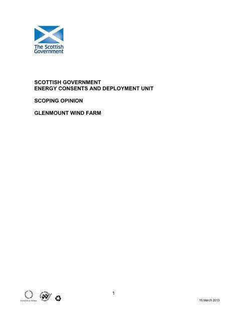
SCOTTISH GOVERNMENT<br />
ENERGY CONSENTS AND DEPLOYMENT UNIT<br />
SCOPING OPINION<br />
GLENMOUNT WIND FARM<br />
1<br />
15 March 2013
Contents<br />
1. Introduction<br />
2. Aim Of This Scoping Opinion<br />
3. Land Use Planning<br />
4. Natural Heritage<br />
5. General Issues<br />
5.1 Aviation<br />
5.2 Economic Benefit<br />
5.3 Local Planning Agreements<br />
6. Contents Of The Environmental Statement (ES)<br />
6.1 Format<br />
6.2 Non Technical Summary<br />
6.3 Site Selection And Alternatives<br />
6.4 Description Of The Development<br />
6.5 Track Construction<br />
6.6 Decommissioning<br />
6.7 Grid Connection Details<br />
7. Baseline Assessment And Mitigation<br />
7.1 Air And Climate Emissions<br />
7.2 Carbon Emissions<br />
7.3 Design, Landscape And The Built Environment<br />
7.4 Construction And Operation<br />
8. Ecology, Biodiversity And Nature Conservation<br />
8.1 Designated Sites<br />
8.2 Habitats<br />
8.3 Habitat Management<br />
8.4 Species: Plants And Animals<br />
Plants<br />
Birds<br />
Mammals<br />
Reptiles And Amphibians<br />
Fish And Other Freshwater Aquatic Species<br />
Terrestrial And Aquatic Invertebrates<br />
8.5 Archaeology And Cultural Heritage<br />
General Principles<br />
Baseline Information<br />
9. Water Environment<br />
9.1 Hydrology And Hydrogeology<br />
9.2 Geology And Soils<br />
9.3 Assessment Of Peat Slide Risk<br />
9.4 Forestry / Woodlands<br />
10. Other Material Issues<br />
2
10.1 Waste<br />
10.2 Telecommunications<br />
10.3 Noise<br />
10.4 Shadow Flicker<br />
10.5 Traffic Management<br />
10.6 Cumulative Impacts<br />
10.7 Other Planning Or Environmental Impact Issues Unique To<br />
The Application<br />
11. General ES Issues<br />
Annex 1<br />
11.1 Consultation<br />
11.2 Gaelic Language<br />
11.3 OS Mapping Records<br />
11.4 Difficulties In Compiling Additional Information<br />
11.5 Application And Environmental Statement<br />
11.6 Consent Timescale And Application Quality<br />
11.7 Judicial Review<br />
All Consultee comments relating specifically to <strong>Glenmount</strong> <strong>Wind</strong> <strong>Farm</strong><br />
3
THE ELECTRICITY WORKS (ENVIRONMENTAL IMPACT ASSESSMENT)<br />
(SCOTLAND) REGULATIONS 2000<br />
SCOPING OPINION FOR THE PROPOSED GLENMOUNT WIND FARM,<br />
SOUTH WEST OF DALMELLINGTON<br />
1. Introduction<br />
Any proposal to construct or operate a power generation scheme with a<br />
capacity in excess of 50 megawatts requires Scottish Ministers’ consent<br />
under Section 36 of the Electricity Act 1989.<br />
Schedule 9 of the Act places on the applicant a duty to “have regard to the<br />
desirability of preserving the natural beauty of the countryside, of conserving<br />
flora, fauna and geological and physiological features of special interest and<br />
of protecting sites, buildings and objects of architectural, historic or<br />
archaeological interest”. In addition, the applicant is required to give<br />
consideration to National Planning Framework 2, Scottish Planning Policy,<br />
Planning Advice Notes, the relevant planning authority’s Development Plans<br />
and any relevant supplementary guidance.<br />
Under the Electricity Works (Environmental Impact Assessment)<br />
(Scotland)(EIA) Regulations 2000, the Scottish Ministers are required to<br />
consider whether any proposal for a wind farm is likely to have a significant<br />
effect on the environment. In terms of these Regulations, we must consult the<br />
planning authority, Scottish Natural Heritage and the Scottish Environment<br />
Protection Agency and other relevant consultees.<br />
2. Aim Of This Scoping Opinion<br />
Scottish Ministers are obliged under the EIA regulations to respond to<br />
requests from applicants for a scoping opinion on outline design proposals.<br />
The purpose of this document is to provide advice and guidance to applicants<br />
which has been collated from expert consultees whom the Scottish<br />
Government has consulted. It should provide clear advice from consultees<br />
and enable applicants to address the issues they have identified and address<br />
these in the EIA process and the Environmental Statement associated with<br />
the application for Section 36 consent.<br />
3. Land Use Planning<br />
The Scottish Government’s planning policies are set out in the National<br />
Planning Framework, Scottish Planning Policy, Designing Places and<br />
Circulars.<br />
The National Planning Framework is the Scottish Government’s Strategy for<br />
Scotland’s long term spatial development.<br />
4
Scottish Planning Policy (SPP) is a statement of Scottish Government policy<br />
on land use planning and contains:<br />
<br />
<br />
<br />
<br />
<br />
The Scottish Government’s view of the purpose of planning,<br />
The core principles for the operation of the system and the objectives<br />
for key parts of the system,<br />
Statutory guidance on sustainable development and planning under<br />
Section 3E of the Planning etc. (Scotland) Act 2006,<br />
Concise subject planning policies, including the implications for<br />
development planning and development management, and<br />
The Scottish Government’s expectations of the intended outcomes of<br />
the planning system.<br />
Online renewables planning advice for onshore wind, preparing spatial<br />
frameworks and wind farm developments on peat land is available at<br />
http://www.scotland.gov.uk/Topics/Built-Environment/planning/National-<br />
Planning-Policy/themes/renewables, including advice on spatial planning,<br />
typical planning considerations, detailed siting matters and useful references.<br />
This is regularly updated to reflect emerging best practice.<br />
Other land use planning documents which may be relevant to this proposal<br />
can be found at http://www.scotland.gov.uk/Topics/Built-Environment/planning<br />
The ES should also include full reference to the relevant development plan.<br />
4. Natural Heritage<br />
Scottish Natural Heritage (SNH) has produced a service level statement (SLS)<br />
for renewable energy consultation. This statement provides information<br />
regarding the level of input that can be expected from SNH at various stages<br />
of the EIA process. Annex A of the SLS details a list of references, which<br />
should be fully considered as part of the EIA process. A copy of the SLS and<br />
other vital information can be found on the renewable energy section of their<br />
website – http://www.snh.org.uk.<br />
5. General Issues<br />
5.1 Aviation<br />
In the wake of recent consultation with the aviation organisations such as<br />
NATS, BAA, CAA, MOD etc, it is clear that large scale wind farm proposals<br />
can impact significantly on primary, secondary or weather radar stations and<br />
thus affect operational safety. Applicants are encouraged to engage with<br />
these organisations and airport operators at an early stage in the design<br />
process, to establish the potential impacts and agree acceptable technical<br />
solutions. Where actual or potential conflicts exist, it is important that a<br />
solution is identified and that the relevant consultee agrees to that solution<br />
being realised within a suitable timescale.<br />
5
A link to relevant aviation guidance is available at the following website link,<br />
however it should be note that this guidance is being reviewed;<br />
http://www.berr.gov.uk/files/file17828.pdf<br />
NATS En Route Plc (“NERL”) is responsible for the safe and expeditious<br />
movement in the en-route phase of flight for aircraft operating in controlled<br />
airspace in the UK. To undertake this responsibility NERL has a<br />
comprehensive infrastructure of radars, communication systems and<br />
navigational aids throughout the UK, all of which could be compromised by<br />
the establishment of a wind farm. In this respect NERL is responsible for<br />
safeguarding this infrastructure to ensure its integrity to provide the required<br />
services to Air Traffic Control (ATC). In order to discharge this responsibility<br />
NERL assess the potential impact of every wind farm development in the UK<br />
which have applied for planning approval.<br />
NERL offer services to assist in pre-planning for wind farm developments.<br />
Details of these services are available on<br />
http://www.bwea.com/aviation/nats.html or by contacting NERL directly on<br />
NATSSafeguarding@nats.co.uk or writing to:<br />
NERL Safeguarding – Mailbox 27<br />
NATS - CTC<br />
4000 Parkway<br />
Solent Business Park<br />
Whiteley<br />
Hampshire<br />
PO15 7FL<br />
NATS are unable to evaluate the proposal until the ground to blade tip height<br />
and OS Grid Reference for each individual wind turbine (eastings and<br />
northings) is received.<br />
The <strong>Wind</strong> Energy Team at the Defence Infrastructure Organisation (DIO)<br />
is the focal point for all wind farm proposals in the Ministry Of Defence (MOD).<br />
The team seeks to work with industry at the earliest stages of proposed<br />
development to minimise the impact on Defence, to ensure public safety is not<br />
compromised, and maximise the likelihood of planning success. Some of the<br />
main concerns the MOD have are interference with Air Defence Radar and Air<br />
Traffic Control Radar, plus the creation of obstacles in Low Flying Areas,<br />
which negate the usefulness of the training undertaken there. Aviation safety<br />
lighting should also be considered through consultation with the aviation<br />
authorities and the relevant planning authority.<br />
The pre-planning consultation form found at<br />
http://www.bwea.com/aviation/proforma.html should be completed and e-<br />
mailed to DIO at DIO-Safeguarding-<strong>Wind</strong>@mod.uk.<br />
Civil Aviation Authority Directorate of Airspace Policy (DAP) is the civil<br />
aviation regulatory focal point for all wind farm proposals. DAP seeks to work<br />
with industry at the earliest stages of proposed development to establish<br />
potential civil aviation issues associated with any particular wind turbine<br />
proposal. The best means by which to initiate the aviation related consultation<br />
6
process is via the completion and submission of an associated aviation<br />
pre-planning proforma in line with the process described within the<br />
DTI/BERR guidance document ‘<strong>Wind</strong> Energy and Aviation Interests – Interim<br />
Guidelines’. Generic CAA policy and guidance on wind turbines is set out<br />
within Civil Air Publication 764, available at<br />
http://www.caa.co.uk/docs/33/Cap764.pdf.<br />
Furthermore, applicants should demonstrate that a solution to potential<br />
aviation issues is either agreed or well advanced, prior to submission of the<br />
application.<br />
5.2 Economic Benefit<br />
The Government Economic Strategy (2011) establishes a new Strategic<br />
Priority – Transition to a Low Carbon Economy – to reflect the excellent<br />
opportunity we have to secure investment and jobs from this growing sector<br />
and ensure that the benefits of this transformational change are shared across<br />
the economy and our communities. The concept of economic benefit as a<br />
material consideration is explicitly confirmed in the SPP. Further details of the<br />
Government’s approach to realising its ambitions for renewables are set out in<br />
the “2020 Routemap for Renewable Energy in Scotland”, which highlights the<br />
manufacturing potential of the renewables sector and opportunities for<br />
communities to share in the rewards of our next energy revolution.<br />
The application should include relevant economic information connected with<br />
the project, including the potential number of jobs, and economic activity<br />
associated with the procurement, construction operation and<br />
decommissioning of the development.<br />
5.3 Local Planning Agreements<br />
There are two main tests in determining whether a consideration is material<br />
and relevant. These are:<br />
<br />
<br />
it should serve or be related to the purpose of planning – it should<br />
therefore relate to the development and use of land; and<br />
it should fairly and reasonably relate to the particular application.<br />
Only those issues that meet the above tests can be taken into account when<br />
considering applications. Where relevant, applicants should identify such<br />
issues in their application, including evidence to support compliance with<br />
these tests.<br />
6. Contents Of The Environmental Statement (ES)<br />
We recommend the contents of the ES should be structured as follows below:<br />
6.1 Format<br />
7
High resolution and low resolution PDF versions should be provided. A<br />
description of the methodology used in assessing all impacts should be<br />
included.<br />
It is considered good practice to set out within the ES the qualifications and<br />
experience of all those involved in collating, assessing or presenting technical<br />
Information.<br />
6.2 Non Technical Summary<br />
This should be written in simple non-technical terms to describe the various<br />
options for the proposed development and the mitigation measures against<br />
the potential adverse impacts which could result.<br />
6.3 Site Selection And Alternatives<br />
The applicant should set out the alternatives sites considered and the<br />
rationale and methods used to select the chosen site. The applicant should<br />
demonstrate that a fairly wide set of environmental and economic parameters<br />
have been used to narrow down choice of sites and how this choice takes<br />
account of the spatial framework set out in the SPP. Secondly, there should be<br />
a detailed examination on these parameters to minimise the impact of the<br />
proposal by sensitive design and layout.<br />
<strong>Wind</strong> potential and access to the grid are key to initial sieve-mapping<br />
exercises for site selection, but environmental constraints other than<br />
landscape character should also be included in this initial site selection<br />
process. For example, areas of deep peat, watercourse crossings, wetlands<br />
and locations of protected species would be other examples of additional<br />
environmental constraints to be considered both from the outset and in the<br />
detailed design and layout.<br />
Architecture+Design Scotland (A+DS) suggest that a planning and design<br />
strategy should first look at the proposed location and address whether this is<br />
a sensible location in relation to wind, access to the grid and to the character<br />
of the landscape.<br />
6.4 Description Of The Development<br />
The description of the proposed development in the Environmental Statement<br />
should comprise information on the site boundary, design layout, and scale of<br />
the development.<br />
Where it is required to assess environmental effects of the development (see<br />
EIA regulation 4 (1)(b), the Environmental Statement should include;<br />
(a) a description of the physical characteristics of the whole<br />
development and the land use requirements during the<br />
construction, operation, decommissioning and restoration phases;<br />
(b) a description of the main characteristics of the production<br />
processes and nature and quality of the materials used; and<br />
8
(c) an estimate by type and quantity of expected residues and<br />
emissions resulting from the operation of the proposed<br />
development.<br />
6.5 Track Construction<br />
The applicant should set out the alternative access routes considered and the<br />
rationale and methods used to select the chosen access routes. Applicants<br />
should set out the intended use of access routes i.e.: for transportation of<br />
turbine components, delivery of construction materials, every day operational<br />
use etc. Applicants should specify which access routes/ roads are temporary<br />
and which are required for the operational duration of the development.<br />
Considered design details will be required for all aspects of site work that<br />
might have an impact upon the environment, containing further preventative<br />
action and mitigation to limit impacts.<br />
The applicant should be aware of useful guidance on, among other things,<br />
minimising the impact from construction of the type of access roads used in<br />
wind farms. Such guidance can be found in “Forests and Water Guidelines”<br />
Fifth Edition (2011) which can be obtained from the Forestry Commission via<br />
http://www.forestry.gov.uk/forestry/infd-8bvgx9 and “Control of water pollution<br />
from linear construction projects” (CIRIA C648, 2006) which can be obtained<br />
from CIRIA. However, given that tracks in some cases will be located on peat<br />
and will carry very heavy loads, evidence will be necessary of additional<br />
consideration of specific measures required in similar schemes elsewhere to<br />
deliver best practice. Additional guidance is also available in ‘Constructed<br />
tracks in the Scottish Uplands’ (2006) published by SNH and available at<br />
http://www.snh.org.uk/pdfs/publications/heritagemanagement/constructedtrac<br />
ks.pdf<br />
6.6 Decommissioning<br />
The subsequent application and supporting environmental statement should<br />
include a programme of work complete with outline plans and specifications<br />
for the decommissioning and reinstatement of the site. Information should be<br />
provided on the anticipated working life of the development and after use site<br />
reinstatement.<br />
6.7 Grid Connection Details<br />
The impacts of constructing, installing and operating the following<br />
infrastructure components should be considered and assessed by applicants,<br />
if known;<br />
<br />
<br />
<br />
<br />
Substation.<br />
Cabling (Underground).<br />
Cabling (Overhead).<br />
Monitoring and control centre.<br />
9
7. Baseline Assessment And Mitigation<br />
Under each section below applicants are asked to consider:<br />
Aspects of the environment likely to be affected by the proposals.<br />
Environmental impacts of the proposals.<br />
Methods to offset adverse environmental effects.<br />
Effects of the phases of the development; Construction, Operation,<br />
Decommissioning and Restoration.<br />
This section should clearly set out a description of the environmental features<br />
of the proposed wind farm site, the likely impacts of the wind farm on these<br />
features, and the measures envisaged to prevent, mitigate and where<br />
possible remedy or offset any significant effects on the environment. It should<br />
incorporate details of the arrangements and the methodologies to be used in<br />
monitoring such potential impacts, including arrangements for parallel<br />
monitoring of control sites, timing and arrangements for reporting the<br />
monitoring results. It should be noted that there is a danger that these<br />
measures could themselves have secondary or indirect impacts on the<br />
environment.<br />
7.1 Air And Climate Emissions<br />
The Environmental Statement should fully describe the likely significant<br />
effects of the development on the environment, including direct effects and<br />
any indirect, secondary, cumulative, short, medium and long term, permanent<br />
and temporary e.g. construction related impacts, positive and negative effects<br />
of the development which result from:<br />
(a) the existence of the development.<br />
(b) the use of natural resources.<br />
(c) the emission of pollutants, the creation of nuisances and the<br />
elimination of waste.<br />
7.2 Carbon Emissions<br />
To assist Scottish Ministers in making a determination on the application,<br />
applicants must produce a statement of expected carbon savings over the<br />
lifetime of the wind farm. The statement should include an assessment of the<br />
carbon emissions associated with track preparation, foundations, steel, and<br />
transport; any carbon losses from tree felling (and offsetting from tree<br />
planting); and any carbon losses from loss or degradation of peaty soils.<br />
Reference can be made to the technical note “Calculating Potential Carbon<br />
Losses and Savings from <strong>Wind</strong> <strong>Farm</strong>s on Scottish Peatlands” (Scottish<br />
Government, 2011). The spreadsheet tool it refers to should be used for<br />
developments on peat but can also be used for sites that will be drained, are<br />
located on carbon rich soils or require a significant amount of deforestation.<br />
It is important to ensure that the carbon balance of renewable energy projects<br />
is not adversely affected by management of peat resource. There need to be<br />
measures in place to ensure that the development does not lead to significant<br />
10
drying or oxidation of peat through, for example, development of access<br />
tracks and other infrastructure, drainage channels, or “landscaping” of<br />
excavated peat. The basis for these measures should be set out within the<br />
ES, on which a detailed peat management scheme, required through planning<br />
condition, can subsequently be designed to ensure that the carbon balance<br />
benefits of the scheme are maximised.<br />
Applicants are required to submit full details of the potential carbon losses and<br />
savings of the wind farm, and demonstrate how the scheme has been<br />
designed to minimise the payback figure.<br />
The ES should include a dedicated chapter on carbon assessment which has<br />
printed copies of all worksheets along with an explanation of how the data<br />
entered is derived, referring to the relevant section of the ES as appropriate.<br />
An electronic version of the spreadsheet should be emailed to<br />
econsentsadmin@scotland.gsi.gov.uk and SEPA.<br />
References must be given to the data sources used as inputs to the tool and<br />
the rationale behind their use must be made clear, especially where sources<br />
outside the data presented elsewhere in the ES are used. Where assumptions<br />
or estimates have been made these should be explained and justified.<br />
Guidance on the above technical note, planning policy, site surveys and<br />
assessments for developments on peatland, re-use of peat and minimisation<br />
of waste, as well as the supporting research and spreadsheet tools are all<br />
available from the Scottish Government “<strong>Wind</strong> <strong>Farm</strong>s and Carbon” website at<br />
www.scotland.gov.uk/<strong>Wind</strong><strong>Farm</strong>sAndCarbon. Prior to submission of the<br />
application, applicants should make a final check that they have used the<br />
most up to date version of the tool. This will always be available from the link<br />
above.<br />
7.3 Design, Landscape And The Built Environment<br />
Scottish Ministers place particular importance on the layout design of wind<br />
farms and considers there is a need for a coherent, structured and quality<br />
driven approach to wind farm development. The appearance of wind farms is<br />
of particular interest and the need for a coherent design strategy to be<br />
considered at scoping stage and to be prepared before submission of the<br />
Environmental Statement. The strategy should explain the design principles<br />
behind the layout plan in a rational way that can be easily understood. The<br />
design strategy for the wind farm should be expressed through a design<br />
statement. The Design Statement should describe a clear strategy for meeting<br />
these objectives, a justification for the resulting layout and evidence that the<br />
design ideas have been tested against the objectives.<br />
<strong>Wind</strong> farms are prominent features in the landscape and hence a full<br />
assessment of the effects on landscape and visual amenity is important. The<br />
assessment methodology should follow the approach promoted by the<br />
Landscape Institute and Institute of Environmental Management and<br />
Assessment (‘Guidelines for Landscape and Visual Impact Assessment’,<br />
second edition, Spon 2002). General guidance on the range of issues to be<br />
considered in assessment of wind farms is set out, in the form of a scoping<br />
11
checklist, at Appendix 1 of ‘Hydroelectric schemes and the natural heritage<br />
(SNH 2010)<br />
As regards the portrayal of visual and landscape impacts within Environmental<br />
Statements, guidance has also been developed, jointly by SNH and the<br />
Scottish Renewables Forum, on ‘Visual Representation of <strong>Wind</strong> <strong>Farm</strong>s –<br />
Good Practice Guidance’ (SNH 2007), published at:<br />
http://www.snh.gov.uk/planning-and-development/renewable-energy/onshorewind.<br />
Visual information should be presented in a way which communicates as<br />
realistically as possible the actual visual impact of the proposal. The format of<br />
the images and the focal length of the lens will have to be taken into<br />
consideration.<br />
All visualisation images should be accompanied by a description of how to<br />
view the image so that it best replicates what will be seen if the proposal is<br />
constructed. This should include the required viewing distance between the<br />
eye and the image, and whether it is a single frame image or a composite<br />
panoramic image. If a composite image, it is desirable either to curve the<br />
edges of panoramic images so that peripheral parts of the image are viewed<br />
at the same intended viewing distance, or to 'pan' across the image with the<br />
eye remaining at the recommended viewing distance. This is not required for<br />
single frame images.<br />
The viewpoints from which the photographs are taken should be agreed with<br />
the planning authority and SNH. The horizontal field of view should be shown<br />
on a map so that the images can be used accurately on site.<br />
The ES should include a description of the landscape character of the area<br />
and how that character will be affected by the impact on any landscapes<br />
designated for their landscape or scenic value, including National Parks,<br />
National Scenic Areas, or local landscape designations such as Area of Great<br />
Landscape Value or Regional Scenic Area (the terminology is varied) and the<br />
impact on any area which is a recognised focus for recreational enjoyment of<br />
the countryside, eg a Regional Park or Country Park.<br />
7.4 Construction And Operation<br />
The ES should contain site-specific information on all aspects of site work that<br />
might have an impact upon the environment, containing further preventative<br />
action and mitigation to limit impacts. Elements should include: fuel transport<br />
and storage management; concrete production (including if batching plants<br />
are proposed and measures to prevent discharges to watercourses); stockpile<br />
storage; storage of weather sensitive materials at lay-down areas; haul routes<br />
and access roads (and if temporary or permanent); earthworks to provide<br />
landscaping; mechanical digging of new or existing drainage channels; vehicle<br />
access over watercourses; construction of watercourse crossings and digging<br />
of excavations (particularly regarding management of water ingress);<br />
temporary and long-term welfare arrangements for workers during<br />
construction ; maintenance of vehicles and plant; pollution control measures<br />
during turbine gearbox oil changes; bunding or roofing of transformer areas;<br />
12
use of oil-cooled power cables and related contingency measures; and<br />
dewatering of turbine base excavations. With regards to oil, it is imperative<br />
that there is a detailed contingency plan to deal with large oil spills that cannot<br />
be dealt with at a local level. The ES should identify if there are particularly<br />
sensitive receptors of pollution (e.g. salmonid rivers, rivers with freshwater<br />
pearl mussels etc.).<br />
Such information is necessary in order to assess the environmental impact of<br />
the proposals prior to determination and provide the basis for more detailed<br />
construction method statements which may be requested as planning<br />
conditions (it is recommended that the relevant Planning Authorities, SNH and<br />
SEPA are provided with the opportunity to view these method statements in<br />
draft form, prior to them being finalised should development take place).<br />
The applicant should be aware of information provided by SEPA that may be<br />
of use such as rainfall and hydrological data. The need to plan the works in<br />
order to avoid construction of roads, dewatering of pits and other potentially<br />
polluting activities during periods of high rainfall is important. The ES needs to<br />
demonstrate which periods of the year would be best practice for construction<br />
for the site, taking into account the need to avoid pollution risks and other<br />
environmental sensitivities affecting operational timing, such as fish spawning<br />
and bird nesting.<br />
The impact of the proposed development on public footpaths and rights of<br />
way should be clearly indicated. If any re-routing of paths under a Right of<br />
Way is required alternative routes should be highlighted for consideration.<br />
Further guidance can also be found within the Scottish Outdoor Access Code<br />
at http://www.outdooraccess-scotland.com.<br />
The ES should set out mechanisms to ensure that workers on site, including<br />
sub-contractors, are aware of environmental risks, and are well controlled in<br />
this context. The ES should state whether or not appropriately qualified<br />
environmental scientists or ecologists are to be used as Clerk of Works or in<br />
other roles during construction to provide specialist advice. Details of<br />
emergency procedures to be provided should be identified in the ES.<br />
The process whereby a method statement is consulted upon before<br />
commencement of work is satisfactory at many sites where sensitivities are<br />
non-critical. However for environmentally sensitive sites it is recommend that,<br />
following consultation, method statements be approved by the planning<br />
authority in consultation with SNH, prior to the commencement of construction<br />
work.<br />
Scottish Natural Heritage would normally only wish to comment on<br />
Construction Method Statements where there are relevant and significant<br />
natural heritage interests involved. Applicants should avoid submitting multiple<br />
versions of the Construction Method Statement to SNH.<br />
8. Ecology, Biodiversity And Nature Conservation<br />
13
Scottish Government suggests that all ecological survey methods<br />
conform to the best available standard methods for each habitat<br />
and species, and follow guidance published by SNH where this is<br />
available. Where standard methodologies do not exist, applicants<br />
should propose and agree an appropriate methodology with SNH<br />
specialist advisers. SG also requires that all ecological survey data<br />
collected during ES survey work should be made available by the<br />
applicant to SG and SNH, in a form which would enable them to<br />
make future analysis of the effects of wind farms if appropriate.<br />
8.1 Designated Sites<br />
The ES should address the likely impacts on the nature conservation interests<br />
of all the designated sites in the vicinity of the proposed development. It<br />
should provide proposals for any mitigation that is required to avoid these<br />
impacts or to reduce them to a level where they are not significant.<br />
Information on designated sites and the law protecting them can be found on<br />
the SNH website. Maps of the boundaries of all natural heritage designated<br />
sites and information on what they are designated for are also publicly<br />
available via SiteLink in the SNHi section of the SNH website<br />
http://www.snh.org.uk/snhi/. The applicant is referred to this resource to<br />
ensure that they have the correct information on designated sites within the<br />
locality that may be affected by the proposed development. The potential<br />
impact of the development proposals on other designated areas such as NSA,<br />
LSA, SSI or Regional/National Parks etc should be carefully and thoroughly<br />
considered and appropriate mitigation measures outlined in the ES. Early<br />
consultation and agreement with SNH, the relevant planning authority and<br />
other stakeholders is imperative in these circumstances.<br />
For developments with a potential to affect Natura sites, applicants must<br />
provide in the ES sufficient information to make clear how the tests in<br />
the Habitats Regulations will be met, as described in the June 2000<br />
Scottish Government guidance. The information in the ES should enable<br />
the assessments required by the legislation to be completed by the Scottish<br />
Government. Specific guidance on the Habitats and Birds Directive regarding<br />
the appropriate impact assessments and associated alternative solution and<br />
IROPI tests is available on the following website link<br />
http://www.scotland.gov.uk/library3/nature/habd-00.asp<br />
Within the Regulations, the first test is whether the proposal is necessary for<br />
the management of the site: this will not be the case for wind farm<br />
applications. The next step is to ask whether the proposal (alone or in<br />
combination with other proposals) is likely to have a significant effect on the<br />
site. If so, the Scottish Government as the Competent Authority under the<br />
Habitats Directive will draw up an ‘appropriate assessment’ as to the<br />
implications of the development for the site, in view of that site’s conservation<br />
objectives.<br />
The scoping report should aim to present sufficient information to enable a<br />
conclusion to be drawn on this test, i.e. as to whether there is likely to be a<br />
significant effect on the site. If that information is provided, SNH will be able to<br />
14
advise, when consulted upon the scoping request, whether an appropriate<br />
assessment will be necessary. In the event that detailed survey or analysis is<br />
required in order to reach a view, the survey and analysis should be regarded<br />
as information contributing to that assessment. Note that such information<br />
should be provided for the wind farm itself together with any ancillary works<br />
such as grid connections and vehicle tracks, and cumulatively in combination<br />
with any other wind farm consented or formally proposed in the vicinity.<br />
8.2 Habitats<br />
Surveys should be carried out at appropriate times or periods of the year by<br />
appropriately qualified and experienced personnel, and suitability of the timing<br />
needs to be considered within the ES.<br />
The ES should provide a comprehensive account of the habitats present on<br />
the proposed development site. It should identify rare and threatened habitats,<br />
and those protected by European or UK legislation, or identified in national or<br />
local Biodiversity Action Plans. Habitat enhancement and mitigation measures<br />
should be detailed, particularly in respect to blanket bog, in the contexts of<br />
both biodiversity conservation and the inherent risk of peat slide. Details of<br />
any habitat enhancement programme (such as native- tree planting, stock<br />
exclusion, etc) for the proposed wind farm site should be provided. It is<br />
expected that the ES will address whether or not the development could assist<br />
or impede delivery of elements of relevant Biodiversity Action Plans.<br />
Particular attention should be paid to the effects of the proposals on any<br />
priority habitats, as listed in Annex 1 of the EU Habitats Directive, on the site.<br />
SEPA emphasises that the ES should demonstrate that turbine locations have<br />
been determined on the basis of habitats on the site, especially with regard to<br />
any areas of deep peat and intact hydrological units of mire vegetation.<br />
Turbines therefore need to be located in the light of vegetation survey work.<br />
Similarly, the ES needs to demonstrate that roads have been located to<br />
minimise impact on vegetation communities, peat habitats and peat depth.<br />
Measures to avoid pH impact on peatland from use of cement/concrete (e.g.<br />
use of blinding cement on roadways, wash-out during construction, integrity of<br />
shuttering) should be set out.<br />
8.3 Habitat Management<br />
SNH and RSPB may wish to see a Habitat Management Plan for the area of<br />
the wind farm and any area managed in mitigation or compensation for the<br />
potential impacts of the wind farm. A commitment to maintain and/or enhance<br />
the biodiversity of the overall area is expected. Monitoring of any specific<br />
potential impacts of the development, and of the outcome of any habitat<br />
management measures, should form part of the ES proposals. Applicants may<br />
also want to consult other interested parties in preparation of the HMP<br />
information or relevant studies/surveys.<br />
The ES should also outline provisions made regarding public access, having<br />
regard for the requirements of the Land Reform (Scotland) Act 2003 and the<br />
Scottish Outdoor Access Code at http://www.outdooraccess-scotland.com,<br />
15
clarifying the extent of any access restrictions proposed, if any, during<br />
construction or operation, and indicating any new facilities for access to be<br />
provided on or off site.<br />
8.4 Species: Plants And Animals<br />
The ES needs to show that the applicants have taken account of the relevant<br />
wildlife legislation and guidance, for example but not limited to, <strong>Council</strong><br />
Directives on The Conservation of Natural Habitats and of Wild Flora and<br />
Fauna, and on Conservation of Wild Birds (commonly known as the Habitats<br />
and Birds Directives), the Wildlife & Countryside Act 1981, the Nature<br />
Conservation (Scotland) Act 2004, the Protection of Badgers Act 1992, the<br />
1994 Conservation Regulations, Scottish Government Interim Guidance on<br />
European Protected Species, Development Sites and the Planning System<br />
and the Scottish Biodiversity Strategy and associated Implementation Plans.<br />
In terms of the SG Interim Guidance, applicants must give serious<br />
consideration to/recognition of meeting the three fundamental tests set out in<br />
this Guidance. It may be worthwhile for applicants to give consideration<br />
to this immediately after the completion of the scoping exercise.<br />
It needs to be categorically established which species are present on the site,<br />
and where, before the application is considered for consent. The presence of<br />
legally protected species and habitats, for example bird species listed in<br />
Annex 1 of the EU Birds Directive, Schedules 5 (animals) and 8 (plants) of the<br />
Wildlife & Countryside Act 1981, (as amended in Scotland), must be included<br />
and considered as part of the application process, not as an issue which can<br />
be considered at a later stage. Any consent given without due consideration to<br />
these species may breach European Directives with the possibility of<br />
consequential delays or the project being halted by the EC. Likewise the<br />
presence of species on Schedules 5 (animals) and 8 (plants) of the Wildlife &<br />
Countryside Act 1981 should be considered where there is a potential need<br />
for a licence under Section 16 of that Act.<br />
Plants<br />
A baseline survey of the plants present on the site should be undertaken, and<br />
field and existing data on the location of plants should be used to determine<br />
the presence of any rare or threatened species of vascular and no-vascular<br />
plants and fungi.<br />
Birds<br />
The ES should provide an assessment of the impact of the wind farm on birds.<br />
The assessment should follow the available guidance on the SNH website at<br />
http://www.snh.gov.uk/planning-and-development/renewable-energy/onshorewind/.<br />
A baseline survey of the species and number of birds present on the<br />
site throughout the year should be undertaken. Particular attention should be<br />
paid to specially protected and/or vulnerable species. All ornithological survey<br />
work should conform to the SNH guidance at the above link..<br />
Survey work should include assessments of the flight lines of breeding birds<br />
and birds whose migrations or other seasonal distributions traverse or are in<br />
16
close proximity to the site. Collision risk analyses will be necessary for species<br />
which regularly pass through the site at any time of year. The analysis should<br />
follow the principles set out in the SNH guidance at the above link.<br />
In the interests of all stakeholders involved in the consultation exercise, the<br />
presence of protected species must be included and considered as part of the<br />
Section 36 application process. Submitting this information as an addendum<br />
at a later date will require further publicity and consultation which will delay the<br />
overall determination.<br />
An Annex of Environmentally Sensitive Information may be<br />
required to provide information on nest locations or other<br />
environmentally sensitive information related to specially protected<br />
species, the information should follow the principles set out in the<br />
SNH guidance “Environmental Statements and Annexes of<br />
Environmentally Sensitive Bird Information” (September 2009) at<br />
http://www.snh.gov.uk/docs/A285693.pdf. However, the annex<br />
should not include any information that is not confidential, or if it<br />
does this information should be contained elsewhere within the text<br />
of the environmental statement.<br />
Mammals<br />
A baseline survey of the species and number of mammals present on the site<br />
should be undertaken. Particular attention should be paid to specially<br />
protected and/or vulnerable species, especially European Protected<br />
Mammals. Consideration should also be given to indirect impacts on species<br />
outwith the site.<br />
Reptiles And Amphibians<br />
A baseline survey of the species and number of reptiles and amphibians<br />
present on the site should be undertaken. Particular attention should be paid<br />
to specially protected and/or vulnerable species, especially European<br />
Protected species, and those potentially affected by the development.<br />
Fish And Other Freshwater Aquatic Species<br />
Fish populations and other freshwater aquatic species can be impacted by<br />
subtle changes in water quality and quantity and changes in channel<br />
morphology that influence suitability of habitat and consequently performance<br />
and production. Further impacts can occur if issues of habitat continuity are<br />
not adequately considered when planning site drainage and river crossings. A<br />
baseline survey should be undertaken to demonstrate the species and<br />
abundance of fish present in the still and running water bodies on and around<br />
the site throughout the year. This should extend to watercourses which may<br />
be affected by run-off from the site during construction, operation or<br />
decommissioning.<br />
Particular attention should be paid to specially protected and/or vulnerable<br />
species, especially European Protected species, and those potentially<br />
17
affected by the development. However, fish and fisheries should be given due<br />
consideration regardless of conservation designation.<br />
Applicants should be aware that wind farm developments have considerable<br />
construction implications which should not be conducted without proper<br />
regard or understanding of their potential impacts on watercourses and water<br />
quality, and on fish and aquatic invertebrate populations.<br />
The applicant should ensure that the implications of changing water quality,<br />
quantity, channel morphology and habitat continuity are addressed specifically<br />
with reference to potential impacts on fish and that mitigation addresses these<br />
issues. Where this information is provided elsewhere in the document, it<br />
should be specifically highlighted.<br />
Where a development has the potential to impact on local fish populations the<br />
applicant will be asked to develop an integrated fish and water quality<br />
monitoring programme with baseline, development and post-development<br />
sampling. Details of any proposed monitoring should be detailed.<br />
Applicants are encouraged to submit fish information in a collective document<br />
or with the relevant cross references to other areas of the ES. (i.e. hydrology,<br />
hydro-geology, water quality and hydro-morphology)<br />
Terrestrial And Aquatic Invertebrates<br />
A baseline survey of invertebrates present on the site and in the water bodies<br />
and watercourses on and around the site throughout the year should be<br />
undertaken. This should be guided by existing information on the presence,<br />
distribution and abundance of notable invertebrates. Sampling of aquatic<br />
invertebrates should extend to watercourses which may be affected by run-off<br />
from the site during construction, operation or decommissioning. Particular<br />
attention should be paid to specially protected and/or vulnerable species,<br />
especially European Protected species, and those potentially affected by the<br />
development.<br />
8.5 Archaeology And Cultural Heritage<br />
General Principles<br />
The ES should address the predicted impacts on the historic environment and<br />
describe the mitigation proposed to avoid or reduce impacts to a level where<br />
they are not significant. Historic environment issues should be taken into<br />
consideration from the start of the site selection process and as part of the<br />
alternatives considered.<br />
National policy for the historic environment is set out in:<br />
Scottish Planning Policy Planning and the Historic Environment at:<br />
http://www.scotland.gov.uk/topics/builtenvironment/planning/National-planning-policy/themes/historic<br />
The Scottish Historic Environment Policy (SHEP) sets out Scottish<br />
Ministers strategic policies for the historic environment and can be<br />
found at:<br />
18
http://www.historic-scotland.gov.uk/index/heritage/policy/shep.htm<br />
Amongst other things, SPP paragraph 110–112, Historic Environment,<br />
stresses that scheduled monuments should be preserved in situ and within an<br />
appropriate setting and confirms that developments must be managed<br />
carefully to preserve listed buildings and their settings to retain and enhance<br />
any features of special architectural or historic interest which they possess.<br />
Consequently, both direct impacts on the resource itself and indirect impact<br />
on its setting must be addressed in any Environmental Impact Assessment<br />
(EIA) undertaken for this proposed development. Further information on<br />
setting can be found in the following document: Managing Change in the<br />
Historic Environment http://www.historic-scotland.gov.uk/managing-changeconsultation-setting.pdf.<br />
Historic Scotland recommend that the applicant engages a suitably qualified<br />
archaeological/historic environment consultants to advise on, and undertake<br />
the detailed assessment of impacts on the historic environment and advise on<br />
appropriate mitigation strategies.<br />
Baseline Information<br />
Information on the location of all archaeological/historic sites held in the<br />
National Monuments Record of Scotland, including the locations and, where<br />
appropriate, the extent of scheduled monuments, listed buildings and gardens<br />
and designed landscapes can be obtained from http://www.pastmap.org.uk.<br />
Data on scheduled monuments, listed buildings and properties in the care of<br />
Scottish Ministers can also be downloaded from Historic Scotland’s Spatial<br />
Data Warehouse at http://data.historic-scotland.gov.uk. For any further<br />
information on those data sets and for spatial information on gardens and<br />
designed landscapes and World Heritage Sites which are not currently<br />
included in Historic Scotland’s Spatial Data Warehouse please contact<br />
hsgimanager@scotland.gsi.gov.uk. Historic Scotland would also be happy to<br />
provide any further information on all such sites.<br />
9. Water Environment<br />
Applicants are strongly advised at an early stage to consult Scottish<br />
Environment Protection Agency (SEPA) as the regulatory body responsible for<br />
the implementation of the Controlled Activities (Scotland) Regulations 2005<br />
(CAR), to identify 1) if a CAR license is necessary and 2) clarify the extent of<br />
the information required by SEPA to fully assess any license application.<br />
Energy Consents will identify a requirement for flood prevention comments<br />
from SEPA.<br />
All applications (including those made prior to 1 April 2006) made to Scottish<br />
Ministers for consent under Section 36 of the Electricity Act 1989 to construct<br />
and operate a electricity generating scheme will require to comply with CAR .<br />
In this regard, we will be advised by SEPA concerning the requirements of<br />
these Regulations on the proposed development and will have regard to this<br />
19
advice in considering any consent under Section 36 of the Electricity Act<br />
1989.<br />
SEPA produces a series of Pollution Prevention Guidelines, several of which<br />
should be usefully utilised in preparation of an ES and during development.<br />
These include SEPA’s guidance note PPG6: Working at Construction and<br />
Demolition Sites, PPG5: Works in, near or liable to affect Watercourses,<br />
PPG2 Above ground storage tanks, and others, all of which are available on<br />
SEPA’s website at:<br />
http://www.sepa.org.uk/about_us/publications/guidance/ppgs.aspx<br />
SEPA would look to see specific principles contained within PPG notes to be<br />
incorporated within mitigation measures identified within the ES rather than<br />
general reference to adherence to the notes.<br />
Prevention and clean-up measures should also be considered for each of the<br />
following stages of the development;<br />
<br />
<br />
<br />
Construction.<br />
Operational.<br />
Decommissioning.<br />
Construction contractors are often unaware of the potential for impacts such<br />
as these but, when proper consultation with the local District Salmon Fishery<br />
Board (who have a statutory responsibility to protect salmon stocks) and<br />
Fishery Trust is encouraged at an early stage, many of these problems can be<br />
averted or overcome.<br />
<br />
<br />
<br />
<br />
<br />
<br />
<br />
Increases in silt and sediment loads resulting from construction works.<br />
Point source pollution incidents during construction.<br />
Obstruction to upstream and downstream migration both during and<br />
after construction.<br />
Disturbance of spawning beds during construction – timing of works is<br />
critical.<br />
Drainage issues.<br />
Alteration to hydrological regime and water quality<br />
Impacts on stream morphology<br />
The ES should identify location of and protective/mitigation measures in<br />
relation to all private water supplies within the catchments impacted by the<br />
scheme, including modifications to site design and layout.<br />
Applicants should also be aware of available CIRIA guidance on the control of<br />
water pollution from construction sites and environmental good practice<br />
(http://www.ciria.org). Design guidance is also available on river crossings and<br />
migratory fish (SE consultation paper, 2000) at<br />
http://www.scotland.gov.uk/consultations/transport/rcmf-00.asp.<br />
9.1 Hydrology And Hydrogeology<br />
20
The ES should contain detailed statements of the nature of the hydrology and<br />
hydrogeology of the site, and of the potential effects the development on<br />
these. Applicants should be aware that wind farm developments will have<br />
considerable construction implications and these should not be conducted<br />
without proper regard or understanding of the potential impacts on hydrology,<br />
water courses, water quality, water quantity and on aquatic flora and fauna.<br />
The assessment should include statements on the effects of the proposed<br />
development at all stages on;<br />
<br />
<br />
<br />
Hydrology<br />
Water Quality and quantity<br />
Flood Risk<br />
The high rainfall often experienced at proposed wind farm sites means that<br />
run-off, high flow in watercourses, and other hydrological and hydrogeological<br />
matters require proper consideration within the ES.<br />
Hydrological and hydrogeological issues should be addressed within the ES,<br />
and the following hydrological baseline information should be included.<br />
<br />
Long term average monthly rainfall figures.<br />
Where the project includes significant watercourse engineering works, then<br />
SEPA would expect the following information to be included within the ES for<br />
at least a typical watercourse within the development area:<br />
<br />
<br />
<br />
Flood flow statistics - the flows for the Mean Annual Flood, 1:100 and<br />
1:200 year return period.<br />
From a flow duration curve, the mean daily flow and Q95 flow.<br />
Methods used to calculate these must be identified; if non-standard<br />
methods are used, these should be described in detail with rationale for<br />
use.<br />
Impacts on watercourses, lochs, groundwater, other water features and<br />
sensitive receptors, such as water supplies, need to be assessed. Measures<br />
to prevent erosion, sedimentation or discolouration will be required, along with<br />
monitoring proposals and contingency plans.<br />
The applicant should refer to SEPA policy on groundwater which can be found<br />
at: http://www.sepa.org.uk/planning/groundwater.aspx which will assist in<br />
identifying potential risks. It should also be noted that 1:625000 groundwater<br />
vulnerability map of Scotland often referred to in Environmental Statements<br />
has been superseded by the digital groundwater vulnerability map of Scotland<br />
(2003) and the digital aquifer map of Scotland (2004) and it is the information<br />
used on these newer maps, available on request from SEPA, that should be<br />
used in any assessment.<br />
If culverting should be proposed, either in relation to new or upgraded tracks,<br />
then it should be noted that SEPA has a policy against unnecessary culverting<br />
21
of watercourses. Schemes should be designed to avoid by preference<br />
crossing watercourses, and to bridge watercourses which cannot be<br />
avoided. Culverting is the least desirable option.<br />
The ES must identify all water crossings and include a systematic table of<br />
watercourse crossings or channelising, with detailed justification for any such<br />
elements and design to minimise impact. The table should be accompanied<br />
by photography of each watercourse affected and include dimensions of the<br />
watercourse. It may be useful for the applicant to demonstrate choice of<br />
watercourse crossing by means of a decision tree, taking into account factors<br />
including catchment size (resultant flows), natural habitat and environmental<br />
concerns.<br />
Culverts are a frequent cause of local flooding, particularly if the design or<br />
maintenance is inadequate. The size of culverts needs to be large enough to<br />
cope with sustained heavy precipitation, and allow for the impact of climate<br />
change. This must be taken into account by applicants and planning<br />
authorities. SPP and PAN69 provide more information on this aspect.<br />
Measures to avoid erosion of the hillside associated with discharge from road<br />
culverting need to be set out in the ES.<br />
All culverts must be designed with full regard to natural habitat and<br />
environmental concerns. Where migratory fish may be present (such as trout,<br />
salmon or eels) the river crossing should be designed in accordance with the<br />
Scottish Government guidance on River Crossings and Migratory Fish. This<br />
guidance can be found on the Scottish Government website at:<br />
http://www.scotland.gov.uk/consultations/transport/rcmf-06.asp.<br />
Where the watercourse is used as a pathway by otters and other small<br />
mammals, the design of culverts will need to be modified to accommodate<br />
this.<br />
The need for, and information on, abstractions of water supplies for concrete<br />
works or other operations should also be identified in the ES.<br />
SEPA requests that evidence should also be provided to demonstrate that the<br />
proposals have been designed to minimise engineering works within the water<br />
environment, including crossing watercourses. Further to this, SEPA wishes to<br />
highlight the following Scottish National Policy, and legislative aims.<br />
Environment, including crossing watercourses. Further to this, SEPA wishes<br />
to highlight the following Scottish Planning Policy and legislative aims.<br />
Scottish Planning Policy (paragraph 130) states ‘Lochs, ponds, watercourses<br />
and wetlands also form valuable landscape features, recreational resources<br />
and wildlife habitats and should be protected and enhanced wherever<br />
possible both as part of developments and green networks.’<br />
In addition, where water abstraction is proposed, SEPA requests that the ES<br />
assesses whether a public or private source is to be utilised. If a private<br />
22
source is to be utilised, the following information should be included within the<br />
ES to determine the environmental acceptability of the proposals.<br />
<br />
<br />
<br />
<br />
<br />
<br />
<br />
<br />
Source i.e. ground water or surface water;<br />
Location i.e. grid ref and description of site;<br />
Volume i.e. quantity of water to be extracted;<br />
Timing of abstraction i.e. will there be a continuous abstraction?;<br />
Nature of abstraction i.e. sump or impoundment?;<br />
Proposed operating regime i.e. details of abstraction limits and hands<br />
off flow;<br />
Survey of existing water environment including any existing water<br />
features;<br />
Impacts of proposed abstraction upon the surrounding water<br />
environment.<br />
Although it is appreciated that many of the issues highlighted above will be<br />
scoped out during the EIA process they are important to consider. Equally, the<br />
applicant should be aware that the drilling activity does not fall under Water<br />
Environment (Controlled Activities) Regulations (CAR) and therefore would<br />
not require authorisation from SEPA as the proposal is within coastal waters.<br />
9.2 Geology And Soils<br />
The Environmental Statement should fully describe the likely significant<br />
effects of the development on the environment including direct effects and any<br />
indirect, secondary, cumulative, short, medium and long term, permanent and<br />
temporary e.g. construction related impacts, positive and negative effects of<br />
the development which result from:<br />
<br />
<br />
<br />
The existence of the development.<br />
The use of natural resources (including borrow pits, the need for which<br />
and impact of which, including dust, blasting and pollution of the water<br />
environment, should be appraised as part of the overall impact of the<br />
scheme)<br />
The emission of pollutants, the creation of nuisances and the<br />
elimination of waste.<br />
The ES should identify the intended source of any rock or fill material to be<br />
used for tracks or foundations, and should describe the environmental impacts<br />
associated with any new quarries or borrow pits or road or track cuttings.<br />
SEPA seeks in relation to substantial new development, that applicants<br />
demonstrate that the development includes construction practices to minimise<br />
the use of raw materials and maximise the use of secondary aggregates and<br />
recycled or renewable materials. Further information is available from<br />
AggRegain (http://www.aggregain.org.uk);<br />
Where borrow pits are proposed, the ES should include information regarding<br />
the location, size and nature of these borrow pits including information on the<br />
depth of the borrow pit floor and the borrow pit final reinstated profile.<br />
23
The impact of such facilities (including dust, blasting and impact on water)<br />
should be appraised as part of the overall impact of the scheme. Information<br />
should cover, in relation to water, at least the information set out within<br />
Planning Advice Note 50: Controlling the Environmental Effects of Surface<br />
Mineral Workings in relation to surface water (pages 24-25) and, where<br />
relevant, in relation to groundwater (pages 22-23). Information on the<br />
proposed depth of the excavation compared to the actual topography, the<br />
proposed restoration profile, proposed drainage and settlement traps, turf and<br />
overburden removal and storage for reinstatement should be submitted.<br />
9.3 Assessment Of Peat Slide Risk<br />
If the proposed development is to take place on peatland habitats, the<br />
Environmental Statement should incorporate a comprehensive peat slide risk<br />
assessment in accordance with the Scottish Government Best Practice Guide<br />
for Developers, published at:<br />
http://www.scotland.gov.uk/Publications/2006/12/21162303/0<br />
Particular attention should be paid to the risks of engineering instability<br />
relating to presence to peat on the site. Turbines locations should be identified<br />
in the light of survey work on peat depth and nature, and roads will need to be<br />
carefully aligned and designed with regard to peat habitats and depth. It is<br />
recommended that both engineers and ecologists are involved in the<br />
assessment and management of the risk of peat slide.<br />
The peat slide risk assessment should also address pollution risks to and<br />
environmental sensitivities of the water environment. It should include a<br />
detailed map of peat depth and evidence that the scheme minimises impact<br />
on areas of deep peat. The ES should include outline construction method<br />
statements or the site-specific principles on which such construction method<br />
statements would be based for engineering works in peat land areas,<br />
including access roads, turbine bases and hard standing areas, and these<br />
should include particular reference to drainage impacts, dewatering and<br />
disposal of excavated peat.<br />
9.4 Forestry / Woodlands<br />
Internationally there is now a strong presumption against deforestation (which<br />
accounts for 18% of the world’s greenhouse gas emissions). Reflecting this,<br />
Scottish Ministers have now approved a policy on Control of Woodland<br />
Removal published at http://www.forestry.gov.uk/forestry/infd-7hyhwe (refer<br />
Scottish Planning Policy paragraph 148) which seeks to protect the existing<br />
forest resource in Scotland, and supports woodland removal only where it<br />
would achieve significant and clearly defined additional public benefits. In<br />
some cases, including those associated with development, a proposal for<br />
compensatory planting may form part of this balance.<br />
The criteria for determining the acceptability of woodland removal and further<br />
information on the implementation of the policy is explained in the Control of<br />
Woodland Removal Policy. These should be taken into account when<br />
preparing the development plans for this wind farm proposal. The applicant<br />
should also be aware of the National Planning Framework 2 (published at<br />
24
http://www.scotland.gov.uk/Publications/2008/12/12093953/0) and specifically<br />
paragraph 93 which reiterates Scottish Government determination to<br />
decrease the loss of existing woodland and aspiration for further expansion.<br />
The ES should indicate proposed areas of woodland for felling to<br />
accommodate new turbines and other infrastructure such as roads. Details of<br />
the area to be cleared around those structures should also be provided, along<br />
with evidence to support the proposed scale and sequence of felling. The ES<br />
should also detail any trees or woodland areas likely to be indirectly affected<br />
by the proposed development (e.g. through changes in hydrology, loss of<br />
neighbouring plantation causing instability, etc) and provide full details of<br />
alternatives and/or protection and mitigation measures in the ES.<br />
The applicant should consider the wildlife implications of any tree felling in the<br />
relevant sections of the ES. The ES should also consider any impacts of<br />
forestry activities on the water environment, with particular attention paid to<br />
acidification and nutrient leaching. The applicant should make full use of the<br />
Forests and Water Guidelines in proposing forestry activity and mitigation<br />
procedures.<br />
If timber is to be disposed of on site, details of the methodology for this should<br />
be submitted. Areas of retained forestry or tree groups should be clearly<br />
indicated and methods for their protection during construction clearly<br />
described.<br />
If areas of woodland are to be temporarily removed but then replanted shortly<br />
afterwards (typically within 1-5 years) this should be indicated in the ES, and<br />
details of the replanting plan provided.<br />
Where there is a change in land use (e.g. to non-woodland habitats) the<br />
woodland should be described in sufficient detail (e.g. including details of the<br />
age of the trees; the species type and mix; the soil types; any particular<br />
natural heritage designations or protected species present in the woodland;<br />
and the landscape and historical environment context) to enable its intrinsic<br />
public benefit value to be assessed. This will facilitate decisions on whether<br />
woodland removal is acceptable and if so, whether compensatory planting will<br />
be required.<br />
The applicant should refer to guidance documents 1 issued by the Forestry<br />
Commission in relation to good forestry practice and associated<br />
environmental issues.<br />
In summary, the applicant should consider their response to the Control of<br />
Woodland Removal Policy, including the consequences of such removal on<br />
carbon sequestration and mitigating the potential effects of climate change.<br />
Forestry Commission Scotland can advise on all aspects of woodlands and<br />
forestry associated with developments and early consultation with them to<br />
1 The UK Forestry Standard and its suite of associated guidelines are available at:<br />
http://www.forestry.gov.uk/forestry/INFD-6J2JBS. Further guidance is available at:<br />
http://www.forestry.gov.uk/forestry/INFD-5XFLS7.<br />
25
clarify proposals and any particular restrictions or conditions on woodland<br />
removal that may apply to the area is recommended. Contact details of the<br />
nearest Forestry Commission Conservancy office can be accessed at:<br />
http://www.forestry.gov.uk or from fcscotland@forestry.gsi.gov.uk.<br />
Forest and woodland ecology<br />
The Scottish Forestry Strategy (SFS) (2006) and Scottish Biodiversity<br />
Strategy (both of which have Ministerial endorsement) and Nature<br />
Conservation (Scotland) Act 2004 should be essential documents that the<br />
applicant should be aware of.<br />
The SFS recognises the importance of native woodlands, especially those<br />
that are of ancient and semi-natural origin. It also incorporates targets for<br />
priority habitats and species, sets priorities for action in terms of improving the<br />
management of semi-natural woodlands, and extending and enhancing native<br />
woodlands by developing forest habitat networks (page 48).<br />
The SFS also recognises the potential for well designed productive forests to<br />
contribute environmental benefits through the restructuring process and future<br />
management systems, such as habitat and landscape value from increased<br />
open space (page 48).<br />
The SFS also identifies and promotes the importance of sustainable forest<br />
management as an essential contributor to the conservation of soils, the<br />
quality of water and air (page 44), and the general contribution that forests<br />
and woodlands can make to tackle climate change.<br />
The Scottish Biodiversity Strategy contains delivery of targets for priority<br />
habitats and species as key aims as well as enhanced management of whole<br />
landscapes for biodiversity, including reducing fragmentation of habitats. This<br />
strategy has been designated by Ministers under the terms of the Nature<br />
Conservation (Scotland) Act 2004, to confirm that all public bodies have a<br />
duty to further biodiversity where consistent with their functions, in ways which<br />
are guided by the strategy.<br />
This would suggest that the applicant should be obliged to carry out an<br />
assessment of the implications of the wind farm proposals on biodiversity.<br />
This should be in both general terms of effects on the biodiversity strategy<br />
aims, and specifically the impacts on priority habitats and species; i.e. those<br />
with national targets (HAPs and SAPs identified in the Biodiversity Action<br />
Plan).<br />
It would also suggest that the applicant should be obliged to carry out an<br />
assessment of the implications of the wind farm proposals on water, soil and<br />
air resources, and an appreciation of the potential consequences of the loss of<br />
woodland cover with regards climate change, specifically carbon<br />
sequestration.<br />
Consultation with the local Forestry Commission Scotland Conservancy<br />
should also be undertaken during the development of proposals for the<br />
26
planned restructuring and/or woodland removal to accommodate the wind<br />
farm proposals.<br />
Regards the FC Forest and Water Guidelines please note that this publication<br />
is now in its 4th Edition, published 2004.<br />
Landscape and visual assessment<br />
The UK Forestry Standard, FC Forest Landscape Guidelines and Lowland<br />
Design Guidelines, FC Forestry Practice Guide: Forest Design Planning – A<br />
Guide to Good Practice, The Scottish Forestry Strategy 2006 and SNH suite<br />
of Landscape Character Assessments should all be on the list of documents<br />
that the applicant should be aware of.<br />
The Scottish Forestry Strategy identifies that forests and woodlands contribute<br />
to Scotland’s diverse and attractive landscape. It promotes the benefits of well<br />
designed and managed woodlands that reflect local landscape character, and<br />
that their contribution to the wider landscape should help Scotland meet the<br />
undertakings of the European Landscape Convention (page 44).<br />
The Scoping Report should promote a full assessment by the applicant of all<br />
the landscape and visual issues. This should include a full description of the<br />
general landscape character within which the applicant proposes to introduce<br />
the wind farm, and a statement of the landscape and visual sensitivities that<br />
may be potentially affected by that development.<br />
It should also include an assessment of the cumulative landscape and visual<br />
impacts affecting the wind farm proposal, and identify relevant criteria that<br />
may have a bearing on that assessment.<br />
The UK Forestry Standard sets out the criteria and standards for the<br />
sustainable management of all forests and woodlands in the UK. Landscape<br />
is a specific Criteria for Sustainable Forest Management (page 18) and the<br />
two Forest Management Unit Indicators as evidence that landscape quality is<br />
enhanced are:<br />
<br />
<br />
Landscape principles of forest design are used;<br />
Cultural and historical character of countryside is taken into account<br />
when…making changes to existing woods.<br />
The first point refers to the FC Forest Landscape Guidelines and Lowland<br />
Design Guidelines (both extracted from the FC book The Design of Forest<br />
Landscapes (Oliver W.R. Lucas; pub. Oxford University Press 1991)).<br />
The second point on the appraisal of the landscape with regard to<br />
appreciating its local character is similarly covered in the aforementioned<br />
Guidelines and The Design of Forest Landscapes. Further, the Scottish<br />
Forestry Strategy specifically advocates the use of Scottish Natural Heritage’s<br />
suite of Landscape Character Assessments, which provide valuable<br />
descriptive information about the landscape of Scotland. The potential<br />
removal of the existing woodlands within the wind farm proposal area may<br />
27
create significant areas of open ground (that is, ground without woodland<br />
cover).<br />
The principles and process of restructuring an existing forest are described in<br />
the aforementioned FC Forestry Practice Guide: Forest Design Planning – A<br />
Guide to Good Practice. Not only should such a plan consider how best to<br />
clear fell the forest for the wind farm development, but also describe how the<br />
remaining woodland elements beyond the scheme boundary can be best<br />
integrated with the development site. Such integration could be achieved, for<br />
example, by the selective restocking of strategic areas within the wind farm<br />
site area.<br />
We would advise that when forest landscape design is being considered as<br />
part of the forest management associated with such a development, a<br />
chartered Landscape Architect with a comprehensive knowledge of forestry<br />
should be commissioned.<br />
Historic environment of forests and woodlands<br />
The applicant should recognise the wider aspects of the wind farm proposals<br />
on historic environment policies. In terms of forests and woodlands, besides<br />
the legacy of the past to be found within woodlands, the cultural heritage of<br />
ancient woodlands and veteran trees are particularly important. The value of<br />
the historic environment in woodlands is recognised in the UK Forestry<br />
Standard the Scottish Forestry Strategy (SFS) (page 45) and FCS Policy<br />
Statement Scotland’s Woodlands and the Historic Environment.<br />
The SFS not only identifies the duty to safeguard evidence of the historic<br />
environment but also encourages their active management, enhancement and<br />
interpretation. Reference should also be made to the FC Forests &<br />
Archaeology Guidelines.<br />
Management Plan<br />
With regards both ecological and landscape considerations for the site and<br />
immediate environs, we would advocate the preparation of a long-term<br />
management plan.<br />
This should be carried out in consultation with FCS, Local Authority, SNH,<br />
landowners and other interested parties. Essentially what is required is an<br />
integrated land-use and management plan that fosters optimising the<br />
ecological and landscape benefits of both the wind farm site and neighbouring<br />
land uses.<br />
10. Other Material Issues<br />
10.1 Waste<br />
Potential requirement for waste management licences or licensing exemptions<br />
in relation to waste disposed to or from borrow pits should be discussed at an<br />
28
early stage with SEPA as decisions on waste management are likely to affect<br />
site design and layout.<br />
The ES should identify all of the waste streams (such as peat and other<br />
materials excavated in relation to infrastructure) associated with the<br />
works. It should demonstrate a) how the development can include<br />
construction practices to minimise the use of raw materials and<br />
maximise the use of secondary aggregates and recycled or renewable<br />
materials and b) how waste material generated by the proposal is to be<br />
reduced and re-used or recycled where appropriate on site (for example<br />
in landscaping not resulting in excessive earth moulding and<br />
mounding).<br />
Further to the above advice, SEPA would like to highlight the use of site waste<br />
management plans which SEPA are now seeking on all large scale<br />
construction projects and which the applicant should consider during the<br />
formulation of the ES. In SEPA’s experience, waste management is becoming<br />
an increasing issue on large scale projects.<br />
Coherent consideration should be given to the handling, use, short term<br />
storage and final disposal of surplus material, including peat and soils, and to<br />
waste minimisation and management. Should it be proposed that peat should<br />
be used at depth to restore excavations such as borrow pits, the applicant<br />
would need to demonstrate that this could be done without the release of<br />
carbon through oxidisation, and without risk to people and the environment.<br />
Please note that waste peat or soil from excavations spread on this land<br />
would not necessarily be to ecological benefit; if excavated peat or soil is to be<br />
used in landscaping the site, then this should be included in the plans, and not<br />
dealt with in an ad-hoc fashion as it arises.<br />
SEPA therefore requests that the ES gives consideration to a full site specific<br />
Site Waste Management Plan (SWMP). The SWMP should detail the<br />
measures for managing and minimising waste produced during construction.<br />
Further information on the preparation of these plans can be obtained from<br />
the Zero Waste Scotland web site which may be found at<br />
http://www.zerowastescotland.org.uk/category/service/business-support.<br />
The SWMP should also include a soils balance carried out to demonstrate<br />
need for importation/export of materials including any backfill of excavations.<br />
Given experience on other sites, clarification is sought specifically on whether<br />
or not waste materials are to be imported. Clarification of the amount of<br />
surplus materials to be permanently deposited on mounds and scale of these<br />
mounds should also be included.<br />
SEPA encourages the recovery and reuse of controlled waste, provided that it<br />
is in accordance with the Waste Management Licensing Regulations 1994.<br />
The applicant should note the regulatory advice below. The applicant should<br />
note that SEPA has produced guidance to assist in the consideration as to<br />
whether any particular material is waste, which is available on SEPA’s website<br />
at http://www.sepa.org.uk/waste/waste_regulation/is_it_waste.aspx.<br />
10.2 Telecommunications<br />
29
British Telecom will offer advice in respect of EMC and related problems, BT<br />
point to point microwave links and satellite. Any information on the likely<br />
interference to BT’s current and presently planned radio networks should be<br />
enclosed.<br />
Ofcom only comment in respect of microwave fixed links and does not include<br />
broadcast transmissions or scanning telemetry links that may be affected by<br />
the proposals. Ofcom will have sent a copy of the scoping request to:<br />
CSS Spectrum Management Services Ltd. David Tripp 01458 273 789<br />
david.tripp@css.gb.com (for Scanning Telemetry)<br />
Joint Radio Company (JRC). David Priestley 020 7953 7015<br />
david.priestley@jrc.co.uk (for Scanning Telemetry)<br />
With regard to assessing the affects to TV reception, the BBC now have an<br />
online tool available on their website, at<br />
http://www.bbc.co.uk/reception/info/windfarm_tool.shtml. Ofcom will no longer<br />
be forwarding enquiries received to the BBC or carrying out assessments.<br />
Applicants are advised to access the online tool.<br />
Ofcom only comment in respect of fixed microwave links managed by Ofcom,<br />
in addition the applicant is obliged to do further checks of the proposals with<br />
the CAA, NATS, and the MOD. Further details may be obtained on the British<br />
<strong>Wind</strong> Energy Association (BWEA) website at http://www.bwea.com.<br />
10.3 Noise<br />
<strong>Wind</strong> farms have the potential to create noise through aerodynamic noise and<br />
mechanically generated noise. Noise predictions should be carried out to<br />
evaluate the likely impacts of airborne noise from the wind turbines and<br />
associated construction activities including noise from blasting or piling<br />
activities which may affect local residents, during construction, operational<br />
and decommissioning stages of the project. Advice should be sought from the<br />
relevant <strong>Council</strong> planning and/or environmental health departments in respect<br />
to the potential impacts on the local community.<br />
The applicant should be aware of the guidance produced by ETSU on behalf<br />
of the DTI titled “The Assessment and Rating of Noise from <strong>Wind</strong> <strong>Farm</strong>s”. This<br />
publication provides applicants with best practice noise monitoring and<br />
reporting techniques. Cumulative noise effects should also be considered in<br />
assessing the specific circumstances prevailing at the development site.<br />
Applicants may also want refer to PAN 1/2011 in this respect.<br />
10.4 Shadow Flicker<br />
Information on the impact of shadow flicker on the local community should be<br />
enclosed within the ES. Information on this can be found at:<br />
10.5 Traffic Management<br />
30
The Environmental Statement should provide information relating to the<br />
preferred route options for delivering the turbines etc. via the trunk road<br />
network. The Environmental Impact Assessment should also address access<br />
issues, particularly those impacting upon the trunk road network, in particular,<br />
potential stress points at junctions, approach roads, borrow pits, bridges, site<br />
compound and batching areas etc.<br />
Where potential environmental impacts have been fully investigated but found<br />
to be of little or no significance, it is sufficient to validate that part of the<br />
assessment by stating in the report:<br />
<br />
<br />
<br />
the work has been undertaken, e.g. transport assessment;<br />
what this has shown i.e. what impact if any has been identified, and<br />
why it is not significant.<br />
10.6 Cumulative Impacts<br />
Where a wind farm development might have cumulative impacts with other<br />
existing, approved or current wind farm applications, then the assessment of<br />
environmental impacts should include consideration of these cumulative<br />
effects. Visual or landscape cumulative effects may arise where more than<br />
one wind farm is visible from certain viewpoints, or along a journey by road or<br />
other route. Ecological cumulative effects may arise where more than one<br />
wind farm impacts upon a bird population, or on the hydrology of a wetland or<br />
peatland habitat.<br />
SPP introduces new requirements in relation to considering cumulative<br />
impacts through the development plan process. Where relevant, proposals<br />
should identify how they comply with development plans. We also refer to the<br />
SNH guidance note ‘Cumulative Effect of <strong>Wind</strong> <strong>Farm</strong>s’ (version 2 revised<br />
13.4.05) for further guidance. A cumulative assessment should include other<br />
existing wind farms in the vicinity of the proposal, any wind farms which have<br />
been consented but are still to be constructed, and any which are the subject<br />
of undetermined consent applications. Inclusion within a cumulative<br />
assessment of other proposed wind farms which have not yet reached<br />
application stage is not required, unless in exceptional circumstances we<br />
advise otherwise.<br />
http://www.snh.gov.uk/planning-and-development/renewable-energy/onshorewind/<br />
10.7 Other Planning Or Environmental Impact Issues Unique To The<br />
Application<br />
The ES should include information on any other potential impacts connected<br />
with the project.<br />
11. General ES Issues<br />
31
In the application for consent the applicant should confirm whether any<br />
proposals made within the Environmental Statement, eg for construction<br />
methods, mitigation, or decommissioning, form part of the application for<br />
consent.<br />
11.1 Consultation<br />
Applicants should be aware that the ES should be submitted in a user-friendly<br />
PDF format. Applicants are asked to issue ESs directly to all consultees. An<br />
up to date consultee list can be obtained from the Energy Consents and<br />
Deployment Unit. The Energy Consents and Deployment Unit also requires 1<br />
hard copy and 2 CDs.<br />
Where the applicant has provided Scottish Ministers with an environmental<br />
statement, the applicant must publish their proposals in accordance with part<br />
4 of the Environmental Impact Assessment (Scotland) Regulations 2000.<br />
Energy consents information and guidance, including the specific details of<br />
the adverts to be placed in the press can be obtained from the Energy<br />
Consents website; http://www.scotland.gov.uk/Topics/Business-<br />
Industry/Energy/Energy-Consents<br />
11.2 Gaelic Language<br />
Where Section 36 applications are located in areas where Gaelic is spoken,<br />
applicants are encouraged to adopt best practice by publicising the project<br />
details in both English and Gaelic (see also Energy consents website above).<br />
11.3 OS Mapping Records<br />
Applicants are requested at application stage to submit a detailed Ordinance<br />
Survey plan showing the site boundary and all turbines, anemometer masts,<br />
access tracks and supporting infrastructure in a format compatible with the<br />
Scottish Government's Spatial Data Management Environment (SDME), along<br />
with appropriate metadata. The SDME is based around Oracle RDBMS and<br />
ESRI ArcSDE and all incoming data should be supplied in ESRI shapefile<br />
format. The SDME also contains a metadata recording system based on the<br />
ISO template within ESRI ArcCatalog (agreed standard used by the Scottish<br />
Government), all metadata should be provided in this format.<br />
11.4 Difficulties In Compiling Additional Information<br />
Applicants are encouraged to outline their experiences or practical difficulties<br />
encountered when collating/recording additional information supporting the<br />
application. An explanation of any necessary information not included in the<br />
Environmental Statement should be provided, complete with an indication of<br />
when an addendum will be submitted.<br />
11.5 Application And Environmental Statement<br />
A checklist is enclosed with this report to help applicants fully consider and<br />
collate the relevant ES information to support their application. In advance of<br />
publicising the application, applicants should be aware this checklist will be<br />
32
used by government officials when considering acceptance of formal<br />
applications.<br />
11.6 Consent Timescale And Application Quality<br />
In December 2007, Scottish Ministers announced an aspirational target to<br />
process new Section 36 applications within a 9 month period, provided a<br />
Public Local Inquiry (PLI) is not held. This scoping opinion is specifically<br />
designed to improve the quality of advice provided to applicants and thus<br />
reduce the risk of additional information being requested and subject to further<br />
publicity and consultation cycles.<br />
Applicants are advised to consider all aspects of the scoping opinion when<br />
preparing a formal application, to reduce the need to submit information in<br />
support of the application. The consultee comments presented in the scoping<br />
opinion are designed to offer an opportunity to considered all material issues<br />
relating to the development proposals.<br />
In assessing the quality and suitability of applications, Government officials<br />
will use the enclosed checklist and scoping opinion to scrutinise the<br />
application. Applicants are encouraged to seek advice on the contents of ESs<br />
prior to applications being submitted, although this process does not involve a<br />
full analysis of the proposals. In the event of an application being void of<br />
essential information, officials reserve the right not to accept the application.<br />
Applicants are advised not to publicise applications in the local or national<br />
press, until their application has been checked and accepted by SG officials.<br />
Applicants are advised to refer to the Energy Consents website at<br />
http://www.scotland.gov.uk/Topics/Business-Industry/Energy/Energy-<br />
Consents<br />
11.7 Judicial Review<br />
All cases may be subject to judicial review. A judicial review statement should<br />
be made available to the public.<br />
33
Annex 1<br />
Consultee Comments relating specifically to <strong>Glenmount</strong> <strong>Wind</strong> <strong>Farm</strong><br />
Statutory Consultees<br />
1. <strong>South</strong> <strong>Ayrshire</strong> <strong>Council</strong><br />
2. East <strong>Ayrshire</strong> <strong>Council</strong><br />
3. SEPA<br />
4. SNH<br />
Scottish Government Internal Consultees<br />
5. Forestry Commission Scotland<br />
6. Historic Scotland<br />
7. Marine Scotland<br />
8. Transport Scotland<br />
Non Statutory External Consultees<br />
9. Association of Salmon Fishery Boards<br />
10. BT<br />
11. CAA Airspace<br />
12. The Crown Estate<br />
13. Defence Infrastructure Organisation<br />
14. Joint Radio Company<br />
15. Mountaineering <strong>Council</strong> of Scotland<br />
16. NATS<br />
17. OFCOM<br />
18. RSPB Scotland<br />
19. Scottish Water<br />
20. Visit Scotland<br />
21. John Muir Trust<br />
22. Scottish Wildlife Trust<br />
23. Scottish Rights of Way & Access (SCOTWAYS)<br />
24. Scottish Canoe Association<br />
25. BAA – Glasgow Airport<br />
26. Glasgow Prestwick Airport<br />
27. <strong>Ayrshire</strong> Bat Group<br />
28. <strong>Ayrshire</strong> Rivers Trust<br />
29. Dalmellington Community <strong>Council</strong><br />
30. British Horse Society<br />
31. West of Scotland Archaeology Service<br />
34
CONSULTEE COMMENTS<br />
1. SOUTH AYRSHIRE COUNCIL<br />
Below, I have set out the principle views and comments on the scoping<br />
report provided by SKM Ltd. The views and comments in this letter<br />
constitute <strong>South</strong> <strong>Ayrshire</strong> <strong>Council</strong>'s formal consultation response.<br />
Policy Constraints<br />
In developing the proposal and preparing the Environmental Statement,<br />
particular regard should be afforded to the various international and<br />
national guidance as detailed in section 2 of the 'Proposed <strong>Glenmount</strong><br />
<strong>Wind</strong> <strong>Farm</strong> Seoping Report'. Particular regard should also be given to<br />
the provisions of the relevant development plans, comprising the<br />
approved <strong>Ayrshire</strong> Joint Structure Plan (AJSP), the adopted <strong>South</strong><br />
<strong>Ayrshire</strong> Local Plan (SALP), the <strong>South</strong> <strong>Ayrshire</strong> Proposed Local<br />
Development Plan (SAPLDP) (now a material consideration), the East<br />
<strong>Ayrshire</strong> Local Development Plan and the adopted East <strong>Ayrshire</strong> Local<br />
Plan (EALP); Addendum to the <strong>Ayrshire</strong> Joint Structure Plan Technical<br />
Report TR03/ 2006: Guidance on the Location of <strong>Wind</strong>farms within<br />
<strong>Ayrshire</strong>; and other material planning policy considerations.<br />
Consideration of Alternatives<br />
Schedule 4, paragraph 2 of The Town and Country Planning<br />
Environmental Impact Assessment (Scotland) Regulations 2011 and<br />
Schedule 4, part II, paragraph 4 of the Electricity Works (environmental<br />
Impact Assessment (Scotland) Regulations 2000 require that all<br />
Environmental Statements should include information on the main<br />
alternatives studied and indicate the main reasons for choosing the<br />
selected option, with reference to the environmental effects.<br />
Consideration of alternatives will therefore be required in relation to<br />
turbine specification, site layout and other design considerations.<br />
Landscape Implications<br />
Full consideration should be given to the landscape implications upon<br />
the surrounding area, particularly given that the proposed development<br />
site is located within the locally designated scenic area and because of<br />
the size and number of turbines proposed. There are a number of<br />
sensitive receptors within the surrounding area which could be affected<br />
by the proposed development, details of which are provided in greater<br />
detail later in this consultation response.<br />
Regard should be had to the impact of the development on landscape<br />
character, as defined in the <strong>Ayrshire</strong> Landscape Character<br />
Assessment. The landscape and visual assessment should address all<br />
aspects of the proposal (access to the site and within the site, borrow<br />
bits, control / Transformer buildings, forestry / tree felling) as well as<br />
35
turbine locations and should be conducted in accordance with industry<br />
best practice.<br />
It is noted that all of these issues are covered within the Scoping<br />
Report prepared by SKM Enviros Ltd.<br />
Cumulative Impacts<br />
The cumulative impacts arising from windfarm developments are<br />
becoming increasingly important considerations in the assessment of<br />
such proposals, given the number of existing operational windfarms in<br />
the area, windfarms with permission and windfarm developments at<br />
application, scoping and pre-scoping stages. The relationship of the<br />
proposed <strong>Glenmount</strong> <strong>Wind</strong>farm proposal to operational and consented<br />
windfarms (in particular windfarms at Dersalloch, Sclenteuch and<br />
Hadyard Hill) should be assessed, together with other developments<br />
which are the subject of undetermined Section 36 or planning<br />
applications and, where possible, proposals at formal scoping stage.<br />
Particular account should be taken of the views of Scottish Natural<br />
Heritage, <strong>South</strong> <strong>Ayrshire</strong> <strong>Council</strong> and East <strong>Ayrshire</strong> <strong>Council</strong> on the<br />
cumulative landscape and visual impact of the <strong>Glenmount</strong> <strong>Wind</strong>farm<br />
proposal. It is important that any cumulative assessment should not<br />
only address inter visibility and the visibility of multiple windfarms from<br />
key viewpoints, but should also address the consequences of travelling<br />
through the landscape and sequential views.<br />
It is noted that the visual impact assessment will be carried out in line<br />
with the Guidelines for Landscape and Visual Impact Assessment<br />
(Landscape Institute and Institute of Environmental Management and<br />
Assessment, 2nd Edition 2002), and Cumulative Effects of <strong>Wind</strong> <strong>Farm</strong>s<br />
(SNH, 2005).<br />
It is noted that there is a recognition that the cumulative effects of the<br />
development extend beyond solely visual effects and that there is<br />
methodology for assessing the cumulative effects of the development<br />
on a range of receptors.<br />
Zones of Theoretical Visibility (ZTVs)<br />
It is desirable that individual and cumulative ZTVs be prepared early on<br />
in the assessment process. Representative viewpoints should be<br />
agreed in advance with <strong>South</strong> & East <strong>Ayrshire</strong> <strong>Council</strong>s and Scottish<br />
Natural Heritage. A minimum of 35km ZTV is recommended which<br />
should include a provisional list of views, with an indication of distance<br />
and the evaluation and justification for their inclusion or omission (e.g.<br />
sequential road view / fixed view from distant hill / key skyline views;<br />
views on approach to / impact on the landscape setting of settlements<br />
and built and cultural heritage features; locally important views /<br />
landmarks; views from rights of way / walking routes / Residents views<br />
/ popular recreation areas / water based e.g. coastal views etc).<br />
The initial list of fixed and sequential viewpoints, in relation to the<br />
assessment of individual and cumulative landscape and visual impacts,<br />
36
should be provided and agreed upon with SNH and both <strong>South</strong> and<br />
East <strong>Ayrshire</strong> <strong>Council</strong>s as part of the scoping exercise.<br />
These should be used to influence the site layout process, and the<br />
zone should include wind farm projects known to be at application or<br />
decision stage within 35km distance from the proposed development.<br />
Designing Principles<br />
The layout of the site should be designed so as to minimise the impact<br />
of the development upon key environmental features, significant views<br />
and sites designated for their ecological, historical, cultural or scenic<br />
Qualities, including gardens and designated landscapes. The principles<br />
to be adopted in the design process should be made explicit, and could<br />
take the form of a Design Statement as advocated in PAN 68.<br />
Protected Species<br />
Although the proposed site is not affected by any national or<br />
international natural conservation designations, the ES should include<br />
a survey and assessment of the short and long term impacts of the<br />
development upon species of flora and fauna, protected under EC<br />
Directive 92/43/EEC on the Conservation of Natural Habitats and of<br />
Wild Flora and Fauna (the "Habitats Directive") or the Wildlife and<br />
Countryside Act 1981. The ES should state the significance of the site<br />
for protected species, both in terms of the abundance and distributions<br />
of populations, frequency of use, and identification and significance of<br />
important sites.<br />
Part of the site is located within wildlife site number 59: Straiton Hills.<br />
This area is designated for being an extensive and highly rated area of<br />
diverse upland and wetland habitats. The <strong>Council</strong> expect the<br />
environmental statement to provide details of the survey work required<br />
in order to investigate the impacts upon this designation. Consultation<br />
with SNH will be or particular relevance in this regard.<br />
It is noted that an extended phase 1 habitat survey was carried out by<br />
an independent consultant in September 2010.<br />
Ornithology<br />
The ES should include a detailed ornithological assessment, which<br />
should address a range of likely target species: the presence on, or<br />
around, the site of hen harrier, golden eagle, short eared owl, barn owl,<br />
merlin, peregrine falcon, golden plover and black and red throated<br />
diver, all of which are listed on either Annex 1 of EU Birds Directive<br />
1979 or Schedule 1 of the Wildlife and Countryside Act 1981 (as<br />
amended). The ES should assess the likely impact of the construction<br />
and operational phases of the development on these species and their<br />
habitat.<br />
37
The proposed application site is located immediately adjacent to a<br />
RSPB Important Bird Area. The consultation comments of RSPB will<br />
therefore be of assistance in this regard.<br />
Ecological Assessment<br />
The ecological assessment of the proposals should include a<br />
vegetation survey to National Vegetation Classification level, an<br />
analysis of habitat loss and mitigation and enhancement measures in<br />
respect of identified adverse consequences for nature conservation<br />
interests. Designated habitats should be assessed in detail, including a<br />
full peat depth analysis and peat slide risk assessment, and the results<br />
used to inform the location of turbines, other structures, access tracks<br />
and the route of grid connections. Sites designated for their nature<br />
conservation importance, both within and around the application site,<br />
such as SSSls, will require special consideration. Details of these sites<br />
may be obtained from the relevant designating body, such as Scottish<br />
Natural Heritage, the Scottish Wildlife Trust or the Royal Society for the<br />
Protection of Birds. Mitigation measures should address opportunities<br />
for the restructuring of those areas of forestry which would be retained<br />
and planting or other measures on or off the site which could increase<br />
the habitat value of the site and surroundings.<br />
Short-term Impacts<br />
The consequence of construction works should be assessed and<br />
addressed by means of a method statement, environmental<br />
management plan, mitigation programme, reinstatement measures and<br />
monitoring regime. These techniques should deal with the timing of<br />
works in relation to ornithological interests, the long-term management<br />
of areas to be cleared of forestry and site restoration proposals<br />
following decommissioning. There will be a need to protect all<br />
watercourses, tributaries and river catchments. The effects of<br />
construction activities on water quality should be assessed, to avoid in<br />
particular, sedimentation and accidental spillages. This will apply to<br />
turbine base formation, access road construction and borrow pit<br />
extraction operations. Consideration should be given to the need for silt<br />
traps and possibly a settlement lagoon and, dependent on effluent<br />
quality, a discharge consent from SEPA may be required. Any private<br />
water supplies should be protected during and after construction. The<br />
development should maximise the use of secondary aggregates or<br />
recycled materials and the production of waste materials should be<br />
minimised.<br />
Built and Cultural Heritage Resources<br />
The ES should assess the direct and indirect impacts of the proposed<br />
development (individually and in association with other existing and<br />
proposed windfarms) upon heritage resources and their settings within<br />
the zone of visual influence of the development, including scheduled<br />
monuments, unscheduled archaeological sites, listed buildings,<br />
conservation areas and gardens and designated landscapes.<br />
38
The conservation village of Stration is located in close proximity to the<br />
proposed development site and particular regard should be given to the<br />
direct and indirect impacts of the proposed development upon this<br />
heritage resource.<br />
Tourism / Recreation and Public Access Resources<br />
The ES should address the consequences of the development for<br />
users of the countryside and its direct and indirect impacts on tourism<br />
and recreational interests and resources in the vicinity.<br />
Amenity Issues<br />
The consequences of the proposed windfarm for occupiers of the<br />
property within the vicinity of the development, as well as countryside<br />
users, should be assessed, in terms of impact on views from properties<br />
and access routes; nQise from the construction and operational phases<br />
of the development; dust from the construction phase of the<br />
development; noise, fumes and vibration from HGV traffic movements<br />
generated by the development; and shadow flicker. A noise<br />
assessment methodology should be submitted in respect of both the<br />
construction and operational phases of the development.<br />
Traffic and Transportation Issues<br />
The ES should assess the impact of the construction and operational<br />
phases of the proposed development on the public road network in<br />
terms of the effects of the additional vehicular traffic generated,<br />
particularly heavy good vehicles and abnormal loads comprising<br />
turbine components, on traffic management, road safety, road layout<br />
and road condition.<br />
Aviation<br />
The consequences of the proposal for military and civil aviation should<br />
be assessed, notably the impact of the wind turbines on operations<br />
within the MOD Low Flying Tactical Training Area 20T and upon airport<br />
approach and en-route air traffic control radar systems, including<br />
impact with other operational, consented and proposed windfarms. In<br />
this respect, further consultation with Defence Estates, the Civil<br />
Aviation Authority, National Air traffic Services and Glasgow Prestwick<br />
Airport will be essential.<br />
Telecommunications<br />
The impact of the proposed development on domestic television<br />
reception in the area and on any civil or military broadcast linkages<br />
traversing the site should be assessed and any necessary mitigation<br />
measures identified.<br />
39
2. EAST AYRSHIRE COUNCIL<br />
I refer to your consultation request from the <strong>Council</strong> in terms of<br />
Regulation (4) of the Electricity Works (Environmental Impact<br />
Assessment) (Scotland) Regulations 2000 on a scoping opinion<br />
required from Scottish Ministers in relation to the above mentioned<br />
windfarm.<br />
The purpose of this document is to provide advice and guidance to you<br />
which has been collated from consultees whom the Planning Authority<br />
has consulted and comments directly by the Planning Authority based<br />
on its knowledge of the site and the surrounding area. This enables the<br />
applicant to consider the issues they have identified and address these<br />
in the EIA process and the Environmental Statement associated with<br />
the Section 36 application.<br />
You should be aware that the consultation undertaken by the <strong>Council</strong><br />
was very selective as the onus, in this case, is on the Energy Consents<br />
and Deployment Unit to undertake statutory consultations and nonstatutory<br />
consultations. As part of the applicant's ongoing consultation<br />
and iterative design programme, consultation should be undertaken<br />
with other consultees as well as those consulted at this stage by the<br />
Planning Authority. I include at appendix 2 a list of further consultees<br />
that I would expect you to engage with as part of this process. Please<br />
be aware that any lack of inclusion on this list of a particular party or<br />
organisation in no way indicates that the Planning Authority considers<br />
that consultation would not be beneficial.<br />
The sections below highlight the comments of the Planning Authority<br />
on a number of matters. Much of this information will be the same or<br />
similar to that of other consultees.<br />
Non-Technical Summary<br />
This should be written in simple non~technical terms to describe the<br />
various options for the proposed development and the mitigation<br />
measures against the potential adverse impacts which could result.<br />
Land Use Planning/Policy<br />
Consideration and reference within the Environmental Statement<br />
should be made to the Development Plan which includes the approved<br />
<strong>Ayrshire</strong> Joint Structure Plan, the East <strong>Ayrshire</strong> Local Plan 2010 and<br />
the Addendum to the <strong>Ayrshire</strong> Joint Structure Plan Technical Report<br />
TR03/ 2006: Guidance on the Location of <strong>Wind</strong>farms within <strong>Ayrshire</strong>.<br />
Furthermore, the National Planning Framework, Scottish Planning<br />
Policy and other relevant planning documents including Planning<br />
Advice Notes, Circulars and Guidance and other material planning<br />
policy considerations should be addressed, The Main Issues Report of<br />
the emerging East <strong>Ayrshire</strong> Local Development Plan has been<br />
published and representations require to be submitted by January<br />
2013.<br />
40
Carbon emissions<br />
A statement of expected carbon savings over the lifetime of the wind<br />
farm should be included within the Environmental Assessment. The<br />
statement should include an assessment of the carbon emissions (and<br />
any savings) associated with all elements of the development.<br />
Consideration of peat resource should be undertaken in this regard<br />
also and relevant details and measures proposed within the ES that will<br />
help to form the basis of a detailed peat management scheme that<br />
would be required through planning condition.<br />
Design, landscape and Visual Impact<br />
The appearance of wind farms is of particular interest and the need for<br />
a coherent design strategy to be considered at scoping stage and to be<br />
prepared before submission of the Environmental Statement. The<br />
strategy should explain the design principles behind the layout plan in a<br />
rational way that can be easily understood.<br />
<strong>Wind</strong> farms are prominent features in the landscape and hence a full<br />
assessment of the effects on landscape and visual amenity is<br />
important, particularly given the proximity of settlements, rural<br />
properties, other visual receptors and the landscape designations of<br />
the area.<br />
The viewpoints from which the photographs are taken should be<br />
agreed with the Planning Authority and SNH. Best practice should be<br />
followed in the selection of viewpoint locations and in the preparation of<br />
the photomontage/panoramic images.<br />
In terms of any landscape and visual impact on communities or<br />
residential properties, the <strong>Council</strong> requests that a Residential Visual<br />
Assessment is provided for every property located within 2 kilometres<br />
of the wind farm. This assessment should include wirelines and<br />
photomontages of the proposal itself and cumulative wirelines and<br />
photomontages.<br />
Cumulative Impacts<br />
The cumulative impacts arising from wind farm developments are<br />
becoming increasingly important considerations in the assessment of<br />
such proposals, given the number of existing operational wind farms in<br />
the area, wind farms with permission and wind farm developments at<br />
application, scoping and pre-scoping stages. The relationship of the<br />
<strong>Glenmount</strong> Hill <strong>Wind</strong> <strong>Farm</strong> proposal to operational, consented,<br />
undetermined s36 and planning applications and scoping stage wind<br />
farms should be assessed.<br />
Particular account should be taken of the views of Scottish Natural<br />
Heritage and East <strong>Ayrshire</strong> <strong>Council</strong> on the cumulative landscape and<br />
visual impact of the <strong>Glenmount</strong> Hill wind farm proposal. It is important<br />
41
that any cumulative assessment should not only address inter visibility<br />
and the visibility of multiple windfarms from key viewpoints, but should<br />
also address the consequences of travelling through the landscape and<br />
sequential views.<br />
Zones of Theoretical Visibility (ZTVs)<br />
It is desirable that individual and cumulative ZTVs are prepared early<br />
on in the assessment process and in this respect a minimum of 35km<br />
ZTV is recommended which should include a provisronallist of views,<br />
with an indication of distance and the evaluation and justification for<br />
their inclusion or omission (e.g. sequential road view / fixed view from<br />
distant hill / key skyline views; views on approach to / impact on the<br />
landscape setting of settlements and built and cultural heritage<br />
features; locally important views / landmarks; views from rights of way /<br />
walking routes / residents views / popular recreation areas).<br />
These should be used to influence the site layout process, and the<br />
zone should include wind farm projects known to be at application or<br />
decision stage within 35km distance from the proposed development at<br />
<strong>Glenmount</strong> Hill.<br />
Designing Principles<br />
The layout of the site should be designed so as to minimise the impact<br />
of the development upon key environmental features, significant views<br />
and sites designated for their ecological, historical, cultural or scenic<br />
qualities, including gardens and designated landscapes. The principles<br />
to be adopted in the design process should be made explicit, and could<br />
take the form of a Design Statement as advocated in PAN 68.<br />
Protected Species<br />
The ES should include a survey and assessment of the short and long<br />
term impacts of the development upon species of flora and fauna,<br />
protected under EC Directive 92/43/EEC on the Conservation of<br />
Natural Habitats and of Wild Flora and Fauna (the "Habitats Directive")<br />
or the Wildlife and Countryside Act 1981. The ES should state the<br />
significance of the site for protected species, both in terms of the<br />
abundance and distributions of populations, frequency of use, and<br />
identification and significance of important sites.<br />
Ornithology<br />
The ES should include a detailed ornithological assessment, which<br />
should address a range of likely target species: the presence on, or<br />
around, the site of hen harrier, golden eagle, short eared owl, barn owl,<br />
merlin, peregrine falcon, golden plover and black and red throated<br />
diver, all of which are listed on either Annex 1 of EU Birds Directive<br />
1979 or Schedule 1 of the Wildlife and Countryside Act 1981 (as<br />
amended). The ES should assess the likely impact of the construction<br />
42
and operational phases of the development on these species and their<br />
habitat.<br />
Ecological Assessment<br />
The ecological assessment of the proposals should include a<br />
vegetation survey to National Vegetation Classification level, an<br />
analysis of habitat loss and mitigation and enhancement measures in<br />
respect of identified adverse consequences for nature conservation<br />
interests. Designated habitats should be assessed in detail, including a<br />
full peat depth analysis and peat slide risk assessment, and the results<br />
used to inform the location of turbines, other structures, access tracks<br />
and the route of grid connections. Sites designated for their nature<br />
conservation importance, both within and around the application site,<br />
such as SSSls, will require special consideration. The Ness Glen SSSI<br />
and the Loch Doon SSSI are of particular relevance. Mitigation<br />
measures should address opportunities for the restructuring of those<br />
areas of forestry which would be retained and planting or other<br />
measures on or off the site which could increase the habitat value of<br />
the site and surroundings.<br />
The ES should also state whether or not appropriately qualified<br />
environmental scientists or ecologists are to be used as Clerk of Works<br />
or in other roles during construction to provide specialist advice.<br />
The ES should provide a comprehensive account of the habitats<br />
present on the proposed development site. It should identify rare and<br />
threatened habitats, and those protected by European or UK<br />
legislation, or identified in national or local Biodiversity Action Plans.<br />
Habitat enhancement and mitigation measures should be detailed,<br />
particularly in respect to blanket bog, in the contexts of both biodiversity<br />
conservation and the inherent risk of peat slide. Details of any habitat<br />
enhancement programme for the proposed wind farm site should be<br />
provided.<br />
Short-term Impacts<br />
The consequence of construction works should be assessed and<br />
addressed by means of a method statement, environmental<br />
management plan, mitigation programme, reinstatement measures and<br />
monitoring regime. These techniques should deal with the timing of<br />
works in relation to ornithological interests, the long-term management<br />
of areas to be cleared of forestry and site restoration proposals<br />
following decommissioning. There will be a need to protect all<br />
watercourses, tributaries and river catchments. The effects of<br />
construction activities on water quality should be assessed, to avoid in<br />
particular, sedimentation and accidental spillages. This will apply to<br />
turbine base formation, access road construction and borrow pit<br />
extraction operations. Consideration should be given to the need for silt<br />
traps and possibly a settlement lagoon and, dependent on effluent<br />
quality, a discharge consent from SEPA may be required.<br />
43
Any private water supplies should be protected during and after<br />
construction. The development should maximise the use of secondary<br />
aggregates or recycled materials and the production of waste materials<br />
should be minimised.<br />
Built and Cultural Heritage Resources<br />
The ES should assess the direct and indirect impacts of the proposed<br />
development (individually and in association with other existing and<br />
proposed wind farms) upon heritage resources and their settings within<br />
the zone of visual influence of the development, including scheduled<br />
monuments such as Loch Doon Castle, unscheduled archaeological<br />
sites, listed buildings, conservation areas and gardens and designated<br />
landscapes such as Craigengillan.<br />
Tourism / Recreation and Public Access Resources<br />
The ES should address the consequences of the development for<br />
users of the countryside and its direct and indirect impacts on tourism<br />
and recreational interests and resources in the vicinity. Note should be<br />
made of the Core Path between Dalmellington and Loch Doon. If any<br />
re-routing of paths is required alternative routes should be highlighted<br />
for consideration. Strategies for long term public access to the site for<br />
recreational uses during its operational phase should be considered.<br />
Amenity Issues<br />
The consequences of the proposed wind farm for occupiers of<br />
properties within the vicinity of the development, as well as countryside<br />
users, should be assessed, in terms of impact on views from properties<br />
and access routes; noise from the construction and operational phases<br />
of the development; dust from the construction phase of the<br />
development; noise, fumes and vibration from HGV traffic movements<br />
generated by the development; and shadow flicker.<br />
Traffic and Transportation Issues<br />
The ES should assess the impact of the construction and operational<br />
phases of the proposed development on the public road network in<br />
terms of the effects of the additional vehicular traffic generated,<br />
particularly heavy good vehicles and abnormal loads comprising<br />
turbine components, on traffic management, road safety, road layout<br />
and road condition. It is recommended that early contact be made with<br />
the <strong>Council</strong>s Roads Division Officers to discuss these matters further.<br />
Appendix 1, attached, includes a copy of the <strong>Council</strong>s Roads Divisions<br />
initial comments on the scoping report, noting, however, that the<br />
applicant states at para 6.10.2 in their submitted EIA scoping report<br />
that "access studies, designed to identify the most appropriate route for<br />
delivery of abnormal loads, are currently ongoing."<br />
Communications<br />
44
The impact of the proposed development on domestic television, radio<br />
and mobile phone reception in the area and on any civil or military<br />
broadcast linkages traversing the site should be assessed and any<br />
necessary mitigation measures identified.<br />
Decommissioning<br />
The planning application and supporting environmental statement<br />
should include a programme of work complete with outline plans and<br />
specifications for the decommissioning and reinstatement of the site.<br />
Information should be provided on the anticipated working life of the<br />
development and after use site reinstatement.<br />
Noise<br />
In terms of potential noise impacts the applicant should conduct an<br />
appropriate noise assessment taking account of the requirements of<br />
ETSU, BS 4142 and the WHO guidelines and in this regard the <strong>Council</strong><br />
does not require to agree any background noise monitoring locations<br />
with the applicant. A noise assessment methodology should be<br />
submitted in respect of both the construction and operational phases of<br />
the development.<br />
Appendix 1<br />
Please find enclosed the Roads Service response to the above scoping<br />
request:-<br />
The Scoping Report does not specifically state what the proposed site<br />
access route to the windfarm will be. It advises that options are still<br />
being considered but may involve access via the A713, B741, U759<br />
Loch Doon Road and/or B7045 Newton Stewart Road.<br />
The sections of the following roads which fall within East <strong>Ayrshire</strong><br />
<strong>Council</strong> jurisdiction and may be affected by the proposals are as<br />
follows:<br />
Route A713<br />
From the East <strong>Ayrshire</strong> <strong>Council</strong> boundary with <strong>South</strong> <strong>Ayrshire</strong> <strong>Council</strong><br />
near Mosshill to the boundary with Dumfries and Galloway <strong>Council</strong> at<br />
Polnaskie Bridge.<br />
Within the above section of the A713 there are some 27 No. structures<br />
(bridges and culverts) over which abnormal vehicles and construction<br />
vehicles may require to cross. Two of these are bridges across a live<br />
mineral railway and they are owned and maintained by Network Rail<br />
who should be contacted with respect to any proposed abnormal load<br />
movement over them.<br />
The names of these bridges are:<br />
45
Rail Bridge No. 212/12 (Holehouse) and Rail Bridge No. 212/18 (Patna,<br />
Downieston)<br />
A713/30 Boneston Bridge at as 238606, 616244 (Approximately 4.5km<br />
from the A713/A77 junction) has previously been identified as being<br />
unsuitable for wind farm abnormal load traffic. Iberdrola and another<br />
wind farm developer are currently looking at an option to replace this<br />
bridge to facilitate their specific loads. Subject to their respective<br />
projects being approved it is anticipated that this bridge could be<br />
replaced within the next 12-18 months. If they do not replace it the<br />
onus may well fallon other wind farm developers to carry this out.<br />
A number of the bridges on the A713 have poor road alignment<br />
passing over them, both horizontally and vertically and may prove<br />
problematic for any abnormal load traffic. Swept path analysis/trial runs<br />
should be carried out to demonstrate suitability.<br />
The bridges that may be problematic in terms of road alignment are;<br />
A713/100 Buchans Bridge (horizontal alignment)<br />
A713/120 Kim Bridge (horizontal alignment; S-bend)<br />
A713/130 Mossdale Bridge (vertical alignment; hump backed)<br />
Route B741<br />
Straiton Road - from its junction with the A713 at Dalmellington to the<br />
boundary with <strong>South</strong> <strong>Ayrshire</strong> <strong>Council</strong>. Within the above section of the<br />
B741 there are some 6 No. structures (bridges and culverts) over which<br />
abnormal vehicles and construction vehicles may require to cross.<br />
B741/80 Doon Bridge (listed Cat B) has a 13T weight restriction, is very<br />
narrow and severely hump backed. The bridge is not suitable for any<br />
wind farm traffic and would require to be replaced if this section of the<br />
B8741 was to be utilised.<br />
The B741 between the A713 and Straiton is a narrow single track road<br />
of limited strength which, in its current state, is not considered suitable<br />
for any significant volume of construction traffic or abnormal loads<br />
associated with a wind farm development.<br />
Route U759<br />
U759 Loch Doon Road - from its junction with A713 to the end of the<br />
public road at the south end of Loch Doon. Within the above section of<br />
the U759 there are some 12 No. structures (bridges and culverts) over<br />
which abnormal vehicles and construction vehicles may require to<br />
cross.<br />
The route is a narrow single track road and is not considered suitable<br />
for any wind farm traffic. The Loch Doon Dam has an 18T weight<br />
restriction and is very narrow. The 20 span viaduct over the dam and<br />
several other structures on the U759 are owned and maintained by<br />
Scottish Power. Other structures are owned and maintained by EAC<br />
who also have responsibility for the public road that passes over all of<br />
the structures.<br />
46
The U759 from its junction with the A713 is a narrow single track road<br />
of limited strength which, in its current state, is not considered suitable<br />
for any significant volume of construction traffic or abnormal loads<br />
associated with a wind farm development.<br />
B7045 Newton Stewart Road - this road is entirely within the jurisdiction<br />
of <strong>South</strong> <strong>Ayrshire</strong> <strong>Council</strong> and Dumfries and Galloway <strong>Council</strong> who<br />
should be contacted for comments.<br />
All bridges and culverts on the proposed routes will have to be<br />
considered in relation to the specific abnormal load configurations that<br />
are ultimately proposed for the wind farm. This should also include for<br />
any mobile cranes and crane ballast vehicles, proposed for use on the<br />
wind farm project, and which fall within the abnormal load regulations.<br />
Such cranes often have more onerous axle load configurations than the<br />
abnormal load vehicles delivering the wind turbine components.<br />
Inspections will require to be undertaken by the applicant of all known<br />
structures, culverts and drains below the affected public road to confirm<br />
their ability to carry abnormal loads and construction traffic and to<br />
determine all necessary repairs prior to any works commencing.<br />
Some of the structures will possibly require additional analysis with<br />
respect to the specific abnormal load configurations proposed. EAC<br />
has limited resources available to carry out additional analysis work on<br />
any specific structures and if this is deemed necessary it would require<br />
to be carried out by the applicant, at their expense, to the satisfaction of<br />
the Roads Design Manager.<br />
Any strengthening works necessary as a result of this additional<br />
analysis work will require to be funded directly by the applicant. In<br />
addition any damage due to the applicant's construction traffic /<br />
abnormal loads will require to be repaired at the applicant's expense.<br />
Contact must be made with East <strong>Ayrshire</strong> <strong>Council</strong>, Roads Design<br />
Section based at The Johnnie Walker Bond, Kilmarnock (tel. 01563<br />
503164) regarding the suitability of any existing structures for proposed<br />
abnormal loads.<br />
Swept path analysis would be required at any junctions / structures<br />
affected along the proposed route and the EA should propose<br />
mitigating measures to address any road infrastructure improvements<br />
required to accommodate windfarm construction traffic taking account<br />
of the comments herein.<br />
The applicant should utilise as much as possible, on-site borrow pits for<br />
stone to be used in connection with the formation of internal tracks,<br />
foundations etc. and provide details in a transport statement of the<br />
traffic likely to be generated by this proposal taking account of other<br />
committed developments in the area and seek to reduce the impact of<br />
construction traffic on the surrounding communities.<br />
47
A Transport Management Plan will also be required to be developed by<br />
the applicant addressing construction traffic management issues in<br />
connection with the project.<br />
I look forward to receiving an Environmental Statement from the<br />
applicant addressing the matters raised above and developing the<br />
issues raised in section 6.10 Transportation and Access of the Scoping<br />
Report.<br />
Appendix 2<br />
Recommended further consultation:<br />
East <strong>Ayrshire</strong> <strong>Council</strong> Roads Division<br />
East <strong>Ayrshire</strong> <strong>Council</strong> Outdoor Access Officers<br />
Local Community <strong>Council</strong>s within a 10km radius of the application site.<br />
3. SEPA<br />
We would welcome meeting with the applicant at an early stage to<br />
discuss any of the issues raised in this letter.<br />
<strong>Wind</strong>farm developments can make a valuable contribution to achieving<br />
Scotland's renewable targets and help fulfil public sector duties under<br />
the Climate Change (Scotland) Act 2009. However, even small<br />
windfarms can potentially have an adverse environmental impact.<br />
While all of the issues below should be addressed in the Environmental<br />
Statement (ES), there may be opportunities for several of these to be<br />
scoped out of detailed consideration. The justification for this approach<br />
in relation to specific issues should be set out within the ES.<br />
Carbon balance<br />
Scottish Planning Policy (SPP) recognises that "the disturbance of<br />
some soils, particularly peat, may lead to the release of stored carbon,<br />
contributing to carbon emissions" (Paragraph 133). In line with SPP<br />
and government guidance, we recommend that the ES or planning<br />
submission contains a section systematically assessing carbon<br />
balance. This assessment should quantify the gains over the life of the<br />
project against the release of carbon dioxide during construction. It<br />
should include all elements of the proposal, including borrow pits,<br />
construction of roads/tracks and other infrastructure and loss of peat<br />
bog.<br />
Please refer to the Scottish Government guidance Calculating carbon<br />
savings from windfarms on Scottish peat lands - A New Approach,<br />
which provides a revised methodology for estimating the impacts of this<br />
type of development on carbon dynamics of peat lands. We will<br />
48
validate carbon balance assessments for Section 36 windfarm<br />
applications that use this revised version of the tool. In order to validate<br />
such assessments, all input data, assumptions and workings need to<br />
be provided within one dedicated sectionof the ES. In addition we will<br />
provide comment on drainage and waste management aspects of the<br />
peat management scheme to ensure that the carbon balance benefits<br />
of the scheme are maximised.<br />
Disruption to wetlands including peatlands<br />
If there are wetlands or peatland systems present, the ES or planning<br />
submission should demonstrate how the layout and design of the<br />
proposal, including any associated borrow pits, hard standing and<br />
roads, avoid impact on such areas.<br />
A Phase 1 habitat survey should be carried out for the whole site and<br />
the guidance A Functional Wetland Typology for Scotland should be<br />
used to help identify all wetland areas. National Vegetation<br />
Classification should be completed for any wetlands identified. Results<br />
of these findings should be submitted, including a map with all the<br />
proposed infrastructure overlain on the vegetation maps to clearly show<br />
which areas will be impacted and avoided.<br />
Groundwater dependent terrestrial ecosystems, which are types of<br />
wetland, are specifically protected under the Water Framework<br />
Directive. The results of the National Vegetation Classification survey<br />
and Appendix 2 (which is also applicable to other types of<br />
developments) of our Planning guidance on windfarm developments<br />
should be used to identify if wetlands are groundwater dependent<br />
terrestrial ecosystems.<br />
The route of roads, tracks or trenches within 100 m of groundwater<br />
dependent terrestrial ecosystems (identified in Appendix 2) should be<br />
reconsidered. Similarly, the locations of borrow pits or foundations<br />
within 250 m of such ecosystems should be reconsidered. If<br />
infrastructure cannot be relocated outwith the buffer zones of these<br />
ecosystems then the likely impact on them will require further<br />
assessment. This assessment should be carried out if these<br />
ecosystems occur within or outwith the site boundary so that the full<br />
impacts on the proposals are assessed. The results of this assessment<br />
and necessary mitigation measures should be included in the ES.<br />
For areas where avoidance is impossible, details of how impacts upon<br />
wetlands including peatlands are minimised and mitigated should be<br />
provided within the ES or planning submission. In particular impacts<br />
that should be considered include those from drainage, pollution and<br />
waste management. This should include preventative/mitigation<br />
measures to avoid significant drying or oxidation of peat through, for<br />
example, the construction of access tracks, dewatering, excavations,<br />
drainage channels, cable trenches, or the storage and reuse of<br />
excavated peat. Detailed information on waste management is required<br />
as detailed below. Any mitigation proposals should also be detailed<br />
49
within the Construction Environmental Management Document, as<br />
detailed below.<br />
Disturbance and re-use of excavated peat<br />
Where the proposed infrastructure will impact upon peatlands, a<br />
detailed map of peat depths (this must be to full depth) should be<br />
submitted. The peat depth survey should include details of the basic<br />
peatland characteristics.<br />
By adopting an approach of minimising disruption to peatland, the<br />
volume of excavated peat can be minimised and the commonly<br />
experienced difficulties in dealing with surplus peat reduced. The<br />
generation of surplus peat is a difficult area which needs to be<br />
addressed from the outset given the limited scope for re-use.<br />
The ES or planning submission should detail the likely volumes of<br />
surplus peat that will be generated, including quantification of<br />
catotelmic and acrotelmic peat, and the principles of how the surplus<br />
peat will be reused or disposed of.<br />
There are important waste management implications of measures to<br />
deal with surplus peat as set out within our Regulatory Position<br />
Statement - Developments on Peat. Landscaping with surplus peat (or<br />
soil) may not be of ecological benefit and consequently a waste<br />
management exemption may not apply. In addition we consider<br />
disposal of significant depth of peat as being landfilled waste, and this<br />
again may not be consentable under our regulatory regimes.<br />
Experience has shown that peat used as cover can suffer from<br />
significant drying and oxidation, and that peat redeposited at depth can<br />
lose structure and create a hazard when the stability of the material<br />
deteriorates. This creates a risk to people who may enter such areas or<br />
through the possibility of peat slide and we are aware that barbed-wire<br />
fencing has been erected around some sites in response to such risks.<br />
It is therefore essential that the scope for minimising the extraction of<br />
peat is explored and alternative options identified that minimise risk in<br />
terms of carbon release, human health and environmental impact.<br />
Early discussion of proposals with us is essential, and an overall<br />
approach of minimisation of peatland disruption should be adopted. If it<br />
is proposed to use some excavated peat within borrow pits or bunding<br />
then details of the proposals, including depth of peat and how the<br />
hydrology of the peat will be maintained, should be outlined in the ES<br />
or planning submission.<br />
Our Planning and Energy webpage provides links to current best<br />
practice guidance on peat survey, excavation and management.<br />
Forest removal and forest waste<br />
From the scoping report it does not appear that the proposed<br />
development would involve any removal of forest. However if any tree<br />
50
felling is proposed we would be especially interested in and are likely to<br />
have significant concerns relating to any proposals to fell to waste<br />
where the waste generated by the process will be managed by<br />
techniques such as chipping, mulching or spreading. This is because<br />
where material is classed as waste then appropriate waste<br />
management options require consideration and, where appropriate,<br />
adoption. In such cases we would wish the ES to include information<br />
which explains how the waste hierarchy has been applied in a way<br />
which delivers the best overall environmental outcome and if this is not<br />
demonstrated we are likely to be object to the application.<br />
Existing groundwater abstractions<br />
Roads, foundations and other construction works associated with large<br />
scale developments can disrupt groundwater flow and impact on<br />
groundwater abstractions. To address this risk a list of groundwater<br />
abstractions both within and outwith the site boundary, within a radius<br />
of i)100 m from roads, tracks and trenches and ii) 250 m from borrow<br />
pits and foundations) should be provided.<br />
If groundwater abstractions are identified within the 100 m radius of<br />
roads, tracks and trenches or 250 m radius from borrow pits and<br />
foundations, then either the applicant should ensure that the route or<br />
location of engineering operations avoid this buffer area or further<br />
information and investigations will be required to show that impacts on<br />
abstractions are acceptable. Further details can be found in Appendix 2<br />
(which is also applicable to other types of developments) of our<br />
Planning guidance on windfarm developments.<br />
Engineering activities in the water environment<br />
In order to meet the objectives of the Water Framework Directive of<br />
preventing any deterioration and improving the water environment,<br />
developments should be designed to avoid engineering activities in the<br />
water environment wherever possible. The water environment includes<br />
burns, rivers, lochs, wetlands, groundwater and reservoirs. We require<br />
it to be demonstrated that every effort has been made to leave the<br />
water environment in its natural state. Engineering activities such as<br />
culverts, bridges, watercourse diversions, bank modifications or dams<br />
should be avoided unless there is no practicable alternative. Paragraph<br />
211 of SPP deters unnecessary culverting. Where a watercourse<br />
crossing cannot be avoided, bridging solutions or bottomless or arched<br />
culverts which do not affect the bed and banks of the watercourse<br />
should be used. Further guidance on the design and implementation of<br />
crossings can be found in our Construction of River Crossings Good<br />
Practice Guide. Other best practice guidance is also available within<br />
the water engineering section of our website.<br />
If the engineering works proposed are likely to result in increased flood<br />
risk to people or property then a flood risk assessment should be<br />
submitted in support of the planning application and we should be<br />
consulted as detailed below.<br />
51
A site survey of existing water features and a map of the location of all<br />
proposed engineering activities in the water environment should be<br />
included in the ES or planning submission. A systematic table detailing<br />
the justification for the activity and how any adverse impact will be<br />
mitigated should also be included. The table should be accompanied<br />
by a photograph of each affected water body along with its dimensions.<br />
Justification for the location of any proposed activity is a key issue for<br />
us to assess at the planning stage.<br />
Where developments cover a large area, there will usually be<br />
opportunities to incorporate improvements in the water environment<br />
required by the Water Framework Directive within and/or immediately<br />
adjacent to the site either as part of mitigation measures for proposed<br />
works or as compensation for environmental impact. We encourage<br />
applicants to seek such opportunities to avoid or offset environmental<br />
impacts. Improvements which might be considered could include the<br />
removal of redundant weirs, the creation of buffer strips and provision<br />
of fencing along watercourses. Fencing off watercourses and creating<br />
buffer strips both helps reduce the risk of diffuse water pollution and<br />
affords protection to the riparian habitat.<br />
Water abstraction<br />
Where water abstraction is proposed we request that the ES, or<br />
planning submission, details if a public or private source will be used. If<br />
a private source is to be used the information below should be<br />
included. Whilst we regulate water abstractions under The Water<br />
Environment (Controlled Activities) (Scotland) Regulations 2011, the<br />
following information is required at the planning stage to advise on the<br />
acceptability of the abstraction at this location:<br />
<br />
<br />
<br />
<br />
<br />
<br />
<br />
<br />
Source e.g. ground water or surface water;<br />
Location e.g. grid reference and description of site;<br />
Volume e.g. quantity of water to be extracted;<br />
Timing of abstraction e.g. will there be a continuous abstraction;<br />
Nature of abstraction e.g. sump or impoundment;<br />
Proposed operating regime e.g. details of abstraction limits and<br />
hands off flow;<br />
Survey of existing water environment including any existing<br />
water features;<br />
Impacts of the proposed abstraction upon the surrounding water<br />
environment.<br />
If other development projects are present or proposed within the same<br />
water catchment then we advise that the applicant considers whether<br />
the cumulative impact upon the water environment needs to be<br />
assessed. The ES or planning submission should also contain a<br />
justification for the approach taken.<br />
Pollution prevention and environmental management<br />
52
One of our key interests in relation to major developments is pollution<br />
prevention measures during the periods of construction, operation,<br />
maintenance, demolition and restoration. The construction phase<br />
includes construction of access roads, borrow pits and any other site<br />
infrastructure.<br />
We advise that the applicant should, through the EIA process or<br />
planning submission, systematically identify all aspects of site work that<br />
might impact upon the environment, potential pollution risks associated<br />
with the proposals and identify the principles of preventative measures<br />
and mitigation. This will establish a robust environmental management<br />
process for the development. A draft Schedule of Mitigation should be<br />
produced as part of this process. This should cover all the<br />
environmental sensitivities, pollution prevention and mitigation<br />
measures identified to avoid or minimise environmental effects. Details<br />
of the specific issues that we expect to be addressed are available on<br />
the Pollution Prevention and Environmental Management section of our<br />
website.<br />
A Construction Environmental Management Document is a key<br />
management tool to implement the Schedule of Mitigation. We<br />
recommend that the principles of this document are set out in the ES<br />
outlining how the draft Schedule of Mitigation will be implemented.<br />
This document should form the basis of more detailed site specific<br />
Construction Environmental Management Plans which, along with<br />
detailed method statements, may be required by planning condition or,<br />
in certain cases, through environmental regulation. This approach<br />
provides a useful link between the principles of development which<br />
need to be outlined at the early stages of the project and the method<br />
statements which are usually produced following award of contract (just<br />
before development commences).<br />
We would refer you to best practice advice prepared by SNH, SEPA<br />
and the windfarm industry Good Practice During <strong>Wind</strong>farm<br />
Construction. Additionally, the Highland <strong>Council</strong> (in conjunction with<br />
industry and other key agencies) has developed a guidance note<br />
Construction Environmental Management Process for Large Scale<br />
Proiects.<br />
Borrow pits<br />
Detailed investigations in relation to the need for and impact of such<br />
facilities should be contained in the ES or planning submission. Where<br />
borrow pits are proposed, information should be provided regarding<br />
their location, size and nature. In particular, details of the proposed<br />
depth of the excavation compared to the actual topography and water<br />
table should be submitted. In addition details of the proposed<br />
restoration profile, proposed drainage and settlement traps, turf and<br />
overburden removal and storage for reinstatement should be<br />
submitted.<br />
53
The impact of such facilities (including dust, blasting and impact on<br />
water) should be appraised as part of the overall impact of the scheme.<br />
Information should cover, in relation to water; at least the information<br />
set out in Planning Advice Note PAN 50 Controlling the Environmental<br />
Effects of Surface Mineral Workings (Paragraph 53). In relation to<br />
groundwater, information (Paragraph 52 of PAN 50) only needs to be<br />
provided where there is an abstraction or groundwater dependent<br />
terrestrial ecosystem within 250m of the borrow pit. Additional<br />
information on groundwater is provided above.<br />
Air quality<br />
The local authority is the responsible authority for local air quality<br />
management under the Environment Act 1995 and therefore we<br />
recommend that Environmental Health within the local authority be<br />
consulted.<br />
They can advise on the need for this development proposal to be<br />
assessed alongside other developments that could contribute to an<br />
increase in road traffic. They can also advise on potential impacts such<br />
as exacerbation of local air pollution, noise and nuisance issues and<br />
cumulative impacts of all development in the local area. Further<br />
guidance regarding these issues is provided in NSCA guidance (2006)<br />
entitled Development Control: Planning for Air Quality.<br />
Flood risk<br />
The site should be assessed for flood risk from all sources in line with<br />
Scottish Planning Policy (Paragraphs 196-211). Our Indicative River &<br />
Coastal Flood Map (Scotland) is available to view online and further<br />
information and advice can be sought from your local authority<br />
technical or engineering services department and from our website.<br />
If a flood risk is identified then a Flood Risk Assessment should be<br />
carried out following the guidance set out in the Annex to the SEPA-<br />
Planning Authority flood risk protocol. Our Technical flood risk guidance<br />
for stakeholders outlines the information we require to be submitted as<br />
part of a Flood Risk Assessment, and methodologies that may be<br />
appropriate for hydrological and hydraulic modelling.<br />
Regulatory advice for the applicant<br />
Details of regulatory requirements and good practice advice for the<br />
applicant can be found on our website at:<br />
www.sepa.org.uk/planning.aspx<br />
If you are unable to find the advice you<br />
need for a specific regulatory matter, please contact a member of the<br />
operations team in your local SEPA office at:<br />
31 Miller Road<br />
Ayr<br />
54
KA 7 2AX<br />
Disclaimer<br />
This advice is given without prejudice to any decision made on<br />
elements of the proposal regulated by us, as such a decision may take<br />
into account factors not considered at the planning stage. We prefer all<br />
the technical information required for any SEPA consents to be<br />
submitted at the same time as the planning application. However, we<br />
consider it to be at the applicant's commercial risk if any significant<br />
changes required during the regulatory stage necessitate a further<br />
planning application and/or neighbour notification or advertising. We<br />
have relied on the accuracy and completeness of the information<br />
supplied to us in providing the above advice and can take no<br />
responsibility for incorrect data or interpretation, or omissions, in such<br />
information. If we have not referred to a particular issue in our<br />
response, it should not be assumed that there is no impact associated<br />
with that issue. If you did not specifically request advice on flood risk,<br />
then advice will not have been provided on this issue. Further<br />
information on our consultation arrangements generally can be found in<br />
How and when to consult SEPA, and on flood risk specifically in the<br />
SEPA-Planning Authority Protocol.<br />
4. SNH<br />
The <strong>Glenmount</strong> <strong>Wind</strong> <strong>Farm</strong> would be located near the Big Hill of<br />
<strong>Glenmount</strong>, approximately 6km south-west of Dalmellington, <strong>Ayrshire</strong><br />
(cross boundary between <strong>South</strong> <strong>Ayrshire</strong> and East <strong>Ayrshire</strong> <strong>Council</strong>s).<br />
The proposal is expected to comprise 26 turbines to a maximum of tip<br />
height of 130m, along with associated infrastructure, tracks and borrow<br />
pit.<br />
Key issues<br />
We support the development of renewable energy but we consider that<br />
a wind farm in this location could have significant adverse impacts on<br />
the landscape of the area, particularly in relation to wild land character<br />
and important recreational activities reliant on high quality landscape.<br />
The site is close to a Search Area for Wild Land (SAWL) centred on the<br />
Carrick and Galloway Hills. SAWLs identify the main areas of wild land<br />
in Scotland, and this is the only such area in context of the south<br />
Scotland mainland. Wild land is a rare and valued resource; its<br />
importance recognised in government policy. We consider that it will be<br />
very difficult to accommodate this proposal without adversely impacting<br />
wild land character and the special qualities of the SAWL.<br />
The site is also close to the Galloway Forest Park, an important<br />
recreational resource in the area, which is reliant on high quality<br />
landscape.<br />
55
These potential significant adverse impacts could lead to an<br />
objection from SNH. At this stage, given the sensitivities, we consider<br />
it would be very difficult to mitigate these impacts.<br />
Advice for this proposal<br />
This scoping response highlights our key areas of concern, which we<br />
consider should be scoped into any EIA for this wind farm proposal. In<br />
this response we address:<br />
<br />
<br />
<br />
<br />
<br />
<br />
<br />
<br />
<br />
<br />
Strategic Locational Guidance<br />
Nature conservation designations<br />
Landscape and visual assessment<br />
Ecology (excluding birds)<br />
Bird ecology<br />
Soil and water<br />
Recreation and access<br />
Grid connection and decommissioning<br />
Further advice<br />
Concluding remarks<br />
Our scoping advice is provided in Appendix B which is sub-divided<br />
according to the above headings. The EIA should address all aspects<br />
of the proposed development including, for example, temporary<br />
construction infrastructure, compounds and construction material<br />
stockpiles, main access and on-site tracks, borrow pits, water<br />
crossings, crane hardstandings, turning points and passing places<br />
associated with access tracks, meteorological mast, transformers,<br />
cabling, grid connection, control / metering / switching building and<br />
proposals for site restoration on decommissioning.<br />
Appendix A – SNH’s policy and guidance for wind farm<br />
development<br />
Relevant SNH guidance<br />
The renewables pages of our website are a useful source of<br />
information and they provide all our relevant policy and guidance in<br />
respect of onshore wind farm development. Go to<br />
www.snh.gov.uk/planning-and-development/renewableenergy/onshore-wind/<br />
in the first instance and from there you can<br />
navigate to the key guidance listed in Appendix A.<br />
The renewables pages of SNH’s website are a useful source of<br />
information: www.snh.gov.uk/planning-and-development/renewableenergy/onshore-wind/<br />
56
It is important that the most up to date published versions are used.<br />
Where survey methods or other work deviates from the published<br />
guidance, full explanation of why this is considered appropriate should<br />
be provided in the ES. The results of the surveys should be used to<br />
avoid or minimise impacts, thereby informing the iterative layout and<br />
design of the wind farm.<br />
The following policy and guidance for wind farm development is<br />
available from our website:<br />
Renewable Energy Service Level Statement (2011) – The Service<br />
Level Statement (SLS) has been prepared (and updated in May 2011)<br />
to clarify the stages at which SNH can be expected to input into the<br />
process of developing and consulting upon renewable energy<br />
proposals and the level of advice that we will offer at each stage. This<br />
statement is intended to guide the interaction between SNH,<br />
developers, and consent authorities in the process of developing a<br />
renewables project.<br />
In line with our SLS, where the impacts on the natural heritage warrant<br />
further input we are happy to provide further advice to the applicant<br />
prior to the submission of the ES. Annex A of the SLS provides wind<br />
energy developers with a list of standard information sources,<br />
expanding on that provided here.<br />
Strategic Locational Guidance for Onshore <strong>Wind</strong> <strong>Farm</strong>s (2009) –<br />
This policy guidance (currently being reviewed and updated) sets out a<br />
number of principles to guide the location of onshore wind farms so as<br />
to minimise their effects on the natural heritage. It provides SNH's<br />
broad overview of where there is likely to be greatest scope for wind<br />
farm development, and where there are the most significant<br />
constraints, in natural heritage terms.<br />
Assessing the Cumulative Impact of Onshore <strong>Wind</strong> Energy<br />
Developments (2012) – This guidance is particularly important to<br />
consider in situations where your proposal is in proximity to existing or<br />
consented wind farms, or those that are submitted as planning<br />
applications. It addresses cumulative landscape and visual impacts and<br />
also cumulative impacts in respect of birds.<br />
Survey Methods for Use in Assessing the Impacts of Onshore<br />
<strong>Wind</strong>farms on Bird Communities (2005, updated 2010) - This<br />
guidance sets out how to scope and plan your impact assessment in<br />
respect of bird interests. It also provides the survey methodologies to<br />
use dependent on the bird species potentially affected, as well as<br />
providing advice on the variety of potential effects. Note that other<br />
guidance in respect of bird interests is available on our website,<br />
including how to assess the significant of impacts, as well as how to<br />
undertake collision risk modelling.<br />
57
Visual Representation of <strong>Wind</strong>farms: Good Practice Guidance<br />
(2006) - This Good Practice Guidance focuses upon Visual Impact<br />
Assessment – the process by which the potential significant effects of a<br />
proposed development on the visual resource are methodically<br />
assessed. This is only one element of the overall Landscape and<br />
Visual Impact Assessment (LVIA), part of the wider process of EIA.<br />
Please note, that while the text is available on the website, hard copies<br />
of this guidance will need be purchased from SNH publications and<br />
should be referred to for the larger illustrations.<br />
Siting and Designing <strong>Wind</strong>farms in the Landscape (2009) - This<br />
provides siting and design guidance for wind farms including strategic<br />
siting and design considerations for wind farms in relation to the<br />
requirements of Scottish Planning Policy. It advises on how wind farms<br />
can be designed to best relate to their setting and minimise landscape<br />
and visual impacts. This guidance replaces our earlier publication –<br />
Guidelines on the Environmental Impacts of <strong>Wind</strong>farms and Small<br />
Scale Hydroelectric Schemes (2001).<br />
In addition, we would highlight Scottish Government renewables<br />
planning advice available at:<br />
http://www.scotland.gov.uk/Topics/Built-Environment/planning/National-<br />
Planning-Policy/themes/renewables<br />
Appendix B – SNH’s advice on other issues to be scoped into EIA<br />
Strategic Locational Guidance<br />
SNH’s “Strategic Locational Guidance” (SLG) is available from our<br />
website.<br />
The location of the proposed <strong>Glenmount</strong> <strong>Wind</strong> <strong>Farm</strong> proposal falls<br />
within Zone 2 – medium natural heritage sensitivity of the SLG. These<br />
are identified, at the broad scale, as areas with some sensitivities to<br />
wind farms. However, by careful choice of location within these areas<br />
there is often scope to accommodate development of an appropriate<br />
scale, siting and design (having regard to cumulative effects) in a way<br />
which is acceptable in natural heritage terms. The general approach<br />
taken to landscape sensitivity has been to include within Zone 3<br />
(greatest sensitivity) areas whose landscape is protected at national or<br />
international level.<br />
As discussed in our landscape and visual advice (section 3 below),<br />
despite it falling within Zone 2 of the SLG, we consider that this<br />
particular site presents significant challenges to scale, siting and design<br />
due to the high sensitivity of the location.<br />
Nature conservation designations<br />
Loch Doon Site of Special Scientific Interest (SSSI), located 120m east<br />
of the proposed site, supports the last ‘naturally occurring’ population of<br />
58
Arctic charr Salvelinus alpinus in south-west Scotland. In addition, the<br />
Loch Doon fish are now thought to be genetically distinct from other<br />
naturally occurring populations, the nearest of which are in Argyll and<br />
Cumbria.<br />
Ness Glen SSSI designated for its upland mixed ash woodland, and is<br />
located 50m north east of the proposed site.<br />
See information on these sites at: http://gateway.snh.gov.uk/sitelink/<br />
Both SSSIs have the potential to be indirectly adversely affected during<br />
the construction and operation of the proposed <strong>Glenmount</strong> <strong>Wind</strong> <strong>Farm</strong>.<br />
With a number of streams flowing from the proposed site into Loch<br />
Doon, it is particularly important that the potential impact of pollution<br />
and siltation on Loch Doon SSSI is fully considered. Robust information<br />
should be presented as part of the ES to demonstrate that suitable<br />
controls are in place, and this should be backed up by suitable pollution<br />
prevention plans and a Construction Environmental Management Plan<br />
(CEMP).<br />
Landscape and visual assessment<br />
Key issues – impacts on wild land character and recreational value<br />
We consider that a wind farm in this location could have significant<br />
adverse impacts on the landscape of the area, particularly in relation to<br />
wild land character and important recreational activities reliant on high<br />
quality landscape.<br />
The proposal sits mainly in a small unit of the Foothills Landscape<br />
Character Type (LCT) forming the northern part of an extensive upland<br />
tract which runs from Loch Doon southwards to the high hills of Merrick<br />
and the Rhinns of Kells. These hills are smooth, rounded but steepsided<br />
and provide a transition between the intimate pastoral valley<br />
landscape of the Doon Valley in the north and the dramatic, craggy<br />
mountainous scenery of the Merrick hills to the south. The complex<br />
landform and land cover, including the diverse pattern of lochs is more<br />
reminiscent of a typically ‘Highland’ landscape. This landscape is also<br />
very sparsely settled and, although it features some commercial<br />
forestry and impounded lochs, a distinct sense of seclusion and<br />
naturalness is associated with this highly scenic upland area.<br />
Consequently, we consider this landscape to be highly sensitive to<br />
wind farm development of any scale.<br />
A key sensitivity is in relation to wild land character. The proposal is<br />
approximately 6km from a Search Area for Wild Land (SAWL) centred<br />
on the Carrick Hills and Galloway Hills. This is a rare and important<br />
resource – SAWLs identify the main areas of wild land in Scotland, and<br />
this SAWL is the only such area in the whole of the south of mainland<br />
Scotland (the nearest SAWLs are North Arran and Jura located 60 and<br />
135 kilometres respectively from the summit of the Merrick). It is likely<br />
to be very difficult to accommodate large scale development without<br />
59
adversely affecting the wild land character of this area, and the special<br />
qualities of this SAWL.<br />
In addition, the large number of other wind farm proposals in the<br />
surrounding area means that the cumulative adverse impact on wild<br />
land and the special qualities of the SAWL would be of particular<br />
concern.<br />
Wild land has strong policy protection in Scottish Planning Policy (SPP)<br />
and in the National Planning Framework (NPF2). Our own policy<br />
statement on wild land on wild land sets out our views - see information<br />
on wild land on our web site at: http://www.snh.gov.uk/protectingscotlandsnature/looking-after-landscapes/landscape-policy-andguidance/wild-land/<br />
The recreational value of this area is also important. It is a traditional<br />
destination for picnickers, walkers, anglers, sailing and dark skies<br />
enthusiasts. The Forestry Commission is improving its facilities for<br />
cycling, walking and other activities in the nearby Galloway Forest Park<br />
and encourages visitors, describing it as ‘<strong>Ayrshire</strong>’s finest mountain<br />
scenery’. Such activities rely on a high quality landscape setting.<br />
These potential adverse impacts could lead to an objection from<br />
SNH. At this stage, given the sensitivities, we consider it would be very<br />
difficult to mitigate these impacts.<br />
This advice is given without prejudice to any consideration of the<br />
impacts of a fully detailed proposal should this be submitted as a formal<br />
application.<br />
Specific issues for the landscape and visual impact assessment LVIA<br />
to address<br />
We advise that specific issues to be addressed include:<br />
<br />
The potential for the scheme to impact on wild land character,<br />
including the special qualities of the Search Area for Wild Land<br />
(SAWL). The scope of the LVIA should include an assessment<br />
of the likely individual and cumulative impacts of the proposed<br />
development on the wild land character of the area.<br />
Consideration should be given to how the key characteristics<br />
and special qualities of the SAWL will be affected. More detail<br />
regarding SNH`s Wild Land policy together with a map<br />
illustrating the location and extent of the Search Areas for Wild<br />
Land can be found on our website:<br />
http://www.snh.gov.uk/protectingscotlands-nature/looking-afterlandscapes/landscape-policy-and-guidance/wild-land/wildlandpolicy/<br />
. We draw the developer’s attention to our guidance,<br />
Assessing the Impacts on Wild Land (interim guidance note), at<br />
http://www.snh.gov.uk/docs/B464997.pdf and recommend its<br />
use in this instance. This guidance is due to be updated<br />
imminently.<br />
60
The high recreational value of the area. The LVIA should include<br />
an assessment of potential impacts on the recreational amenity<br />
of visitors, including sailors, cyclists and hill walkers, dark skies<br />
enthusiasts, etc, cross referring to information in the socioeconomic<br />
section of the EIA as necessary.<br />
Historic/ cultural value of the landscape. With reference to<br />
historical and cultural landscapes, it should be noted that these<br />
can be an important part of the landscape character and<br />
experience, and key views. The EIA should take account of any<br />
impacts on important views from and to these landscapes and<br />
any impact on their character and setting.<br />
Visibility from the A713 Galloway Tourist Route.<br />
It being contrary to the exiting pattern for large wind farms (i.e.<br />
existing developments tend to be set back into the interior of<br />
these large hills, and have a strong association with forestry).<br />
The potential for the scheme to impact upon the setting of Loch<br />
Doon.<br />
The high sensitivity of the <strong>South</strong>ern Uplands landscape type to<br />
this size of development.<br />
The high sensitivity of the <strong>South</strong>ern Upland Way.<br />
The potential impacts on Cairnsmore of Carsphairn.<br />
The potential impacts on the East and <strong>South</strong> <strong>Ayrshire</strong> Sensitive<br />
Landscape Areas.<br />
Clearly these points are made at an early stage and with reference to<br />
the Zone of Theoretical Visibility (ZTV) and location plan only. It is the<br />
applicant’s responsibility to demonstrate how these constraints are<br />
addressed within the assessment and through the design of the wind<br />
farm if possible. Note that at this stage, given the sensitivities, both<br />
individually and cumulatively, and the strategic implications, we<br />
consider it would be very difficult to mitigate the key impacts.<br />
Associated infrastructure<br />
We recommend that the assessment includes full details of all other<br />
infrastructure, whether existing or proposed, permanent or temporary,<br />
including: external transformers, on-site cabling, grid connections, on<br />
site tracks, access routes, control building, substation, meteorological<br />
mast, fences, storage areas, construction compounds, hard standing,<br />
car parks, lighting, borrow pits, any forest, woodland or tree felling<br />
required. Access tracks and borrow pits should be included in relevant<br />
visualisations less than 10km from site. Should there be a need to<br />
61
install aviation obstruction lighting to some or all of the wind turbines,<br />
its visual impact at night will have to be assessed in the ES.<br />
Study Area<br />
A study area of 35km is appropriate for the LVIA for this proposal. Our<br />
guidance Assessing the Cumulative Impact of Onshore <strong>Wind</strong> Energy<br />
Developments (SNH March 2012) advises that a cumulative<br />
assessment should be based on a 30/60km study area.<br />
Viewpoints for Visual Impact Assessment<br />
We reserve our position on the initial choice of viewpoints until the<br />
production of detailed ZTVs at 1:100,000, and welcome the opportunity<br />
to contribute to further discussion on the selection of key viewpoints.<br />
The LVIA submitted as part of the EIA should present wirelines for all<br />
selected viewpoints and photomontages for all viewpoints that are<br />
within 15km of the proposed development site.<br />
We consider that any viewpoint with a view of the proposed wind farm<br />
+ another wind farm(s) should also be assessed as a cumulative<br />
viewpoint.<br />
Cumulative effects<br />
Consideration of cumulative effects will be an important aspect of the<br />
LVIA for this proposal. This proposal is located in close proximity to a<br />
number of other wind farm developments/ proposals, and sensitive<br />
receptors that experience a number of other wind farm development /<br />
proposals. See Appendix D of SNH’s guidance on the Cumulative<br />
Impact of Onshore <strong>Wind</strong> Energy Developments (SNH March 2012) for<br />
our recommended approach to considering likely cumulative effects<br />
upon landscape and upon views and visual amenity.<br />
The cumulative LVIA should consider the impact of the additional<br />
contribution of the proposed development to the baseline of other<br />
existing, consented and application stage wind farms. It should include,<br />
and specifically should distinguish between the following, as defined in<br />
the guidance:<br />
<br />
<br />
<br />
<br />
<br />
Cumulative landscape effects.<br />
Cumulative visual effects.<br />
Static combined effects.<br />
Static successive effects.<br />
Sequential effects - routes to be assessed should be selected<br />
and verified following consideration of the cumulative ZTVs.<br />
The cumulative landscape assessment should consider the impact of<br />
an additional wind farm scheme upon landscape character. The<br />
62
cumulative visual assessment should consider how various wind farm<br />
developments would be seen together from key viewpoints.<br />
It will be very important for the proposal to be planned and designed in<br />
the context of existing/ consented development. Every additional<br />
proposal within an area makes the overall pattern of wind farm<br />
development more complicated, and developers have an increasingly<br />
difficult task making a project 'fit' with other development. Our guidance<br />
Siting and Designing <strong>Wind</strong> farms in the Landscape (Version 1,<br />
December 2009) should be consulted and followed in this respect.<br />
Cumulative baseline schemes<br />
The relevant planning authorities should be contacted for a current list<br />
of all known wind farms that are in the public domain, which are within<br />
the cumulative study area (which may include authorities outside the<br />
East <strong>Ayrshire</strong> area) to prepare a cumulative base plan of other wind<br />
farm schemes. We can provide more detailed advice on the wind farms<br />
that it may be most important to consider in terms of their cumulative<br />
effects once an up-to-date and accurate cumulative base plan based<br />
on data collected from the relevant planning authorities is submitted.<br />
For reference, to help provide a national overview of wind farm<br />
development in Scotland, SNH produces a quarterly wind farm footprint<br />
map. Recent versions of the map are available from:<br />
www.snh.gov.uk/planning-and-development/renewableenergy/research-data-andtrends/trendsandstats/windfarm-footprintmaps/<br />
Please note that the wind farm footprint map provides a strategic<br />
national overview only; we endeavour to keep the map as up-to-date as<br />
possible but please be aware of the caveats detailed on our website.<br />
Cumulative viewpoints and ZTVs<br />
The choice of cumulative viewpoints for the illustration of these effects<br />
should be based upon the ZTV produced for the proposal in<br />
combination with other key wind farms.<br />
Please note that paired/ cumulative ZTVs should show for the whole<br />
study area (and ideally to the edge of the map sheet presented), as<br />
follows:<br />
(a) Theoretical visibility of wind farm A only;<br />
(b) Theoretical visibility of wind farm B only; and<br />
(c) Theoretical visibility of wind farm A plus wind farm B.<br />
These ZTVs should be coloured logically – e.g. blue (a), yellow (b) and<br />
green (c).<br />
Ecology (excluding birds)<br />
63
European Protected Species (bats and otter)<br />
Bats and otters may be present on site. These species are European<br />
Protected Species (EPS), listed on Annex IV of EC Directive<br />
92/43/EEC on the Conservation of Natural Habitats and of Wild Flora<br />
and Fauna (the ‘Habitats Directive’). This means that Regulations 39<br />
and 40 of the Habitats Regulations (as amended) apply.<br />
Our website contains information on the legal framework for protected<br />
species http://www.snh.gov.uk/protecting-scotlands-nature/protectedspecies/legal-framework/<br />
including EPS -<br />
http://www.snh.gov.uk/protecting-scotlands-nature/protectedspecies/legalframework/habitats-directive/euro/.<br />
We note that bat and otter surveys have been carried out across the<br />
majority of the area affected by the proposal. The applicant should<br />
check that these surveys cover all areas affected by the proposal, and<br />
please note our advice on the spatial scope of otter surveys for wind<br />
farms at http://www.snh.gov.uk/about-scotlands-nature/wildlife-andyou/otters/assessing/.<br />
We note that the Scoping Report suggests that following finalisation of<br />
the scheme layout, should any gaps in survey coverage be identified,<br />
update surveys will be undertaken in spring 2013 to provide coverage<br />
of additional areas.<br />
Our advice for survey of bats is set out in our guidance Bats and <strong>Wind</strong><br />
Turbines guidance, which can be found on our website -<br />
http://www.snh.gov.uk/planning-and-development/renewableenergy/onshore-wind/general-advice-and-information/<br />
This contains a link to the 2012 Bat Conservation Trust (BCT) survey<br />
guidance which should be followed. We note that following discussion<br />
with SNH the earlier 2010 survey was updated in 2012 to help address<br />
the requirements of the more recent guidance.<br />
Should evidence of potential impacts on otter or bats be found, then a<br />
draft species protection plan should be included as part of the ES. We<br />
would then provide further advice to you as part of the ES consultation.<br />
You are reminded that if the anticipated application is approved without<br />
consideration of this information, then the development could result in<br />
an offence under Regulation 39/43 of the Habitats Regulations 1994<br />
(as amended).<br />
Other protected species<br />
We note the other protected species surveys that have been carried<br />
out on the site, including for badger and water vole. Please note<br />
recently updated information on water voles on our website:<br />
http://www.snh.gov.uk/about-scotlands-nature/wildlife-and-you/watervoles/<br />
As discussed in relation to EPS, should evidence of potential impacts<br />
on legally protected species be found, then a draft species protection<br />
64
plan should be included as part of the ES. We would then provide<br />
further advice to you as part of the ES consultation.<br />
In relation to all species surveys, details of the surveyors,<br />
methodologies, results and proposed mitigation measures should be<br />
clearly presented in the ES. The surveys should take into account the<br />
disturbance and habitat loss/ modification that are likely to be caused<br />
by the proposed development, and present details of any proposed<br />
mitigation measures clearly in the ES. Where mitigation measures are<br />
proposed, details of how the applicant will monitor the effectiveness of<br />
these measures should also be included in the ES.<br />
We accept the rationale for scoping out targeted amphibian, red<br />
squirrel, pine marten surveys, lizard and invertebrate surveys, but<br />
please note our advice in relation to fisheries surveys (below).<br />
You are reminded that if the anticipated application is approved without<br />
consideration of the required information, then the development could<br />
result in an offence under the Wildlife & Countryside Act (1981, as<br />
amended in Scotland).<br />
Deer management<br />
Deer species may use the proposed development area. An<br />
assessment of how the proposed development would affect deer<br />
movements and use of the site (during construction and operation),<br />
plus a fit for purpose deer management plan should be included as part<br />
of the ES submission. Guidance on deer management is available via<br />
http://www.snh.gov.uk/land-and-sea/managingwildlife/managing-deer/<br />
and also from the Best Practice Guides website<br />
http://www.bestpracticeguides.org.uk/planning_dmps.aspx .<br />
Deer management plans should take into account the management of<br />
deer on neighbouring land to ensure that the objectives are<br />
complimentary.<br />
The key to these deer management plans for wind farms is that deer<br />
control continues within site area during the construction process,<br />
based on an understanding that deer stalking, when carried out<br />
properly, is of low concern to the health and safety of people involved -<br />
stalkers and construction staff.<br />
Terrestrial habitats (including peat)<br />
With regard to terrestrial habitats (including peat), our general advice is<br />
that the whole development site and an appropriate buffer (e.g. to allow<br />
for micro-siting) should be surveyed to Phase 1 standard. In addition to<br />
a Phase 1 survey, where habitats consistent with those on Annex 1 of<br />
the EC Habitats Directive together with UKBAP Priority Habitats are<br />
present, they should be mapped to NVC standard and accompanied by<br />
supporting quadrat information. There should also be an assessment of<br />
impacts on any rare and scarce associated species.<br />
Thorough peat probing should be carried out of the proposed locations<br />
of turbines, tracks and other infrastructure, and a peat slide risk<br />
65
assessment. (See further advice on this in section 6a below.) The<br />
survey results should be used to inform the design and layout process,<br />
so that the development avoids, where possible, fragile and priority<br />
habitats and other sensitive areas (e.g. blanket bog and deep peat).<br />
Where this is not possible, suitable restoration and/or compensation<br />
will require to be carried out, and draft details of how this will be done<br />
should be presented in the ES. (We have recently published advice on<br />
what to include and consider in Habitat Management Plans<br />
(http://www.snh.gov.uk/docs/B1159444.pdf ), which the applicant<br />
should refer to.<br />
As the access tracks are the elements that will result in the greatest<br />
land take, habitat fragmentation and, potentially hydrological disruption,<br />
it is important that the track construction methods are clearly described<br />
in the ES, the rationale for their type and location articulated and all<br />
direct and indirect impacts assessed.<br />
Bird ecology<br />
We agree with the Scoping Report that the main potentially significant<br />
ornithological effect is likely to be in relation to black grouse. We base<br />
our black grouse advice on the AMEC Technical Note 1, ‘A preliminary<br />
assessment of the potential impacts of the proposed <strong>Glenmount</strong> <strong>Wind</strong><br />
<strong>Farm</strong> on black grouse and requirements for mitigation’. The document<br />
covers black grouse observations made in 2009, 2010 and 2012, and<br />
from the results of this work it is clear that this is a significant site for<br />
black grouse within the context of the south of Scotland. Due to timing<br />
of some of the surveys it is not possible to obtain a clear understanding<br />
of the impacts of the proposed wind farm on this important site for black<br />
grouse. We can provide details of the issues we found with the survey<br />
work if required, but in summary our considered view is that although<br />
the 2012 surveys were more comprehensive than those of previous<br />
years, we are not confident that they present a clear picture of black<br />
grouse use of the whole site. We therefore advise that the following<br />
work should be carried out to allow a full assessment of the impacts on<br />
black grouse:<br />
<br />
<br />
<br />
<br />
A walk over survey to cover all of the wider survey area as<br />
shown on the report's Figure 1, following standard black grouse<br />
survey methodology;<br />
The survey should not concentrate on known leks but should be<br />
a fresh "cold search" over a period of several mornings,<br />
sufficient to cover the whole area;<br />
We recommend at least two such surveys, the first in late March<br />
and the second in late April or early May, at appropriate times of<br />
day and in appropriate weather conditions;<br />
The time of day that birds are seen and their activity should be<br />
recorded;<br />
66
All flights seen, including where from and where to, should be<br />
recorded;<br />
The final report should include all of the information gathered,<br />
with maps showing the locations and (complete) flight lines<br />
observed;<br />
The final report should include details of the surveyor's name(s),<br />
qualifications and ornithological experience;<br />
The final report should include a fresh assessment of the<br />
potential impacts of the proposal on the birds along with<br />
suggested mitigation measures.<br />
More generally, a scheme of ornithological surveys has been<br />
undertaken between 2009 and 2012 inclusive and is scheduled to<br />
continue into late spring 2013. Notwithstanding our advice on black<br />
grouse, this bird survey work is satisfactory, and we support the<br />
proposed further survey work in relation to the finalisation of the access<br />
route corridor.<br />
Full survey details including raw data, workings for calculations and<br />
flight maps with labelled flightlines referenced to a table of flight data,<br />
etc, should be presented in the ES. Information on direct and indirect<br />
impacts, along with details of any mitigation should be presented.<br />
Assessment of the cumulative impacts will be required. Please refer to<br />
our recent guidance on assessing cumulative impacts – at Appendix A.<br />
We have identified biogeographical zones within Scotland that can be<br />
used for such an assessment – Natural Heritage Zones (NHZs). These<br />
are also referred to as Natural Heritage Futures (NHFs). The proposal<br />
lies within NHZ number 19, Western <strong>South</strong>ern Uplands and Inner<br />
Solway. Information on this NHZ can be found on our website<br />
http://www.snh.gov.uk/aboutsnh/what-we-do/nhf/ where the original<br />
NHF prospectus (2002 document) can be downloaded,along with the<br />
2009 update to this. There are a growing number of wind farm<br />
proposals affecting this NHZ which increases the risk of an adverse<br />
effect on the favourable conservation status of certain species within<br />
the NHZ. This will therefore require careful assessment as part of the<br />
EIA process.<br />
5. FORESTRY COMMISSION SCOTLAND<br />
No response received.<br />
67
6. HISTORIC SCOTLAND<br />
Our comments here concentrate on our statutory remit at the national<br />
level for scheduled monuments and their setting, category A listed<br />
buildings and their setting, and battlefields and gardens and designed<br />
landscapes appearing in their respective Inventories. Comments on B<br />
and C listed buildings should be sought from the relevant planning<br />
authorities and you should seek comments on unscheduled<br />
archaeology from their archaeology service provider: West of Scotland<br />
Archaeology Service, Charing Cross Complex, 20 India Street,<br />
Glasgow G2 4PF; Tel: 0141 287 8330; e-<br />
mail:enquiries@wosas.glasgow.gov.uk.<br />
Our view on the principle of the proposal<br />
We understand that the proposed development comprises<br />
approximately 26 wind turbines at land at Big Hill of <strong>Glenmount</strong>, south<br />
west of Dalmellington, <strong>South</strong> <strong>Ayrshire</strong> / East <strong>Ayrshire</strong>. The proposed<br />
blade tip height is approximately 130m. Whilst there is not yet a turbine<br />
layout, the likely area of turbine development within the site boundary<br />
has been indicated. On the basis of the information provided, we<br />
consider that the proposed development has the potential for significant<br />
impacts on several heritage assets within our remit, and that it is<br />
possible that issues of national importance may be raised. In view of<br />
this, we would expect certain aspects of the proposal to be assessed<br />
and this particularly relates to the historic environment features listed<br />
below.<br />
Potential impacts to be considered<br />
We can confirm that there is one heritage asset within our remit within<br />
the site boundary: Knockdon, Enclosure 700m NE of (index 7491).<br />
Further comments specifically relating to the assessment of impacts on<br />
this scheduled monument are provided in an annex to this letter.<br />
On the basis of the information provided, we consider that there is<br />
potential for significant indirect (setting) impacts upon the heritage<br />
assets listed below; detailed comments on these are also provided in<br />
the attached annex:<br />
Scheduled Monuments<br />
• Loch Doon Castle (index 90203), which is a property in the care of<br />
Scottish Ministers<br />
• Loch Doon Castle, Original Site & Remains of, 570m NE of<br />
Craigmalloch (index 8619)<br />
• Dalnean Hill, farmstead and field system (Index 4390)<br />
• Donald's Isle, Loch Doon, settlement 750m SSW of Lamdoughty <strong>Farm</strong><br />
(Index 8616)<br />
• Lamford Burn,cairn 800m NE of Lamford Bridge (Index 1034)<br />
Category A Listed Buildings<br />
• Craigengillan (HB 18793)<br />
• Craigengillan, Stable Block (HB 18794)<br />
68
Gardens and Designed Landscapes<br />
• Craigengillan<br />
Assessment of potential impacts (including cumulative impacts) on the<br />
setting of these heritage assets, and any others which are likely to be<br />
subject to significant impacts, should be included in the scope of the<br />
Environmental Statement (ES). In view of the high concentration of<br />
existing, consented and proposed wind turbine developments in this<br />
area, it will be important to ensure that potential cumulative impacts are<br />
also considered. In all cases, where significant impacts (cumulative or<br />
otherwise) are predicted, the conclusions of the assessment should be<br />
supported by appropriate visualisations (e.g. wireframes and<br />
photomontages).<br />
In assessing the likely impact from the development on the setting of<br />
heritage features, the developer may wish to refer to the advice<br />
contained in our Managing Change in the Historic Environment<br />
guidance note on setting:<br />
http://www.historic- scotland.gov.uk/managingchange,<br />
and our online EIA advice:<br />
http://www.historicscotland.gov.uk/index/heritage/policy/environmentalassessment/eiafaqs<br />
Annex –<br />
<strong>Glenmount</strong> <strong>Wind</strong>farm: detailed comments on the assessment of<br />
potential impacts upon heritage assets within the statutory remit<br />
of Historic Scotland<br />
Knockdon, Enclosure 700m NE of (index 7491):<br />
This scheduled monument sits within the site boundary and<br />
immediately on the edge of the Indicative Turbine Development Area.<br />
Any works within the scheduled area will require Scheduled Monument<br />
Consent beforehand. Without wishing to prejudice any final decision it<br />
is unlikely that consent would be granted for works relating to such<br />
proposals. Care should therefore be taken to ensure any turbines,<br />
tracks or associated works are located outwith the scheduled area.<br />
The greatest concern, however, relates to the potential impacts upon<br />
the monument’s setting. Care should be taken to locate the turbines<br />
sufficiently distant from the monument to ensure its setting is not<br />
overwhelmed or dominated by the windfarm. We would therefore<br />
recommend that turbines are not located within the western third of the<br />
Indicative Turbine Development Area.<br />
Loch Doon Castle (index 90203), which is a property in the care of<br />
Scottish Ministers, and Loch Doon Castle, Original Site & Remains<br />
of, 570m NE of Craigmalloch (index 8619):<br />
Both scheduled monuments have a direct relationship with Loch Doon<br />
and the adjacent lochside. Both are commonly viewed from the south,<br />
69
along the loch, with the surrounding hillside forming a prominent<br />
backdrop. Views from Portmark, across the loch, are also important.<br />
Any forthcoming layout should ensure that turbines do not form a<br />
prominent feature in these views as this could significantly detract from<br />
the understanding and appreciation of these monuments and their<br />
settings.<br />
Craigengillan House (HB 18793) and Craigengillan Stables (HB<br />
18794):<br />
The proposals have the potential to have significant impacts on the<br />
setting of these A listed buildings. The house and stables are<br />
approached from a long drive from the north east and there is the<br />
potential for turbines on this site to be visible from views from the<br />
house. Any layout of the proposed turbines should take into account<br />
the impact on the setting of both these buildings. The ES should<br />
include photomontages/ wire frames to illustrate the impact of the<br />
proposals on these buildings.<br />
Craigengillan Inventory designed landscape:<br />
There may be sections of the entrance drive from the lodge in<br />
Dalmellington to the mansion house where there are long views south<br />
in the direction of the wind farm and the ES should include a<br />
photomontage or wireframe to show the impact of the proposal on<br />
these views. The location should be selected using the ZTV as a<br />
guide. We would also expect any ES to consider the cumulative impact<br />
of the development on the Craigengillan designed landscape when<br />
considered in relation to other proposed wind farms in the vicinity. For<br />
this purpose, a visualisation showing the view of Craigengillan House<br />
and its designed landscape from the minor road between Dalmellington<br />
to Loch Doon showing both the proposed Dersalloch and Big Hill of<br />
<strong>Glenmount</strong> wind farms should be included in the ES.<br />
7. MARINE SCOTLAND<br />
Marine Scotland Science Freshwater Laboratory (MSS-FL) provides<br />
scientific advice on migratory and freshwater fish in Scotland to allow<br />
the Scottish Government to protect and promote the development of<br />
sustainable fisheries. We are a Scottish Government internal consultee<br />
providing fisheries advice to the Energy Consents and Deployment Unit<br />
(ECDU).<br />
<strong>Wind</strong> farm and transmission line proposals which are considered under<br />
Section 36 and 37 of the Electricity Act may adversely affect water<br />
quality and fish populations through a number of mechanisms. These<br />
include: increased sediment transport and deposition; pollution<br />
incidents; altered hydrological pathways; removal or degradation of fish<br />
habitat, including spawning areas; reduction in food supply and<br />
obstruction to upstream and downstream migration of fish, all of which<br />
should be fully addressed in the Environmental Statement (ES).<br />
70
Atlantic salmon, trout (sea trout and brown trout) and European eel are<br />
of particular interest to MSS-FL. Fish and fisheries issues will also be of<br />
concern to the local District Salmon Fishery Boards (DSFBs), which<br />
have a statutory responsibility to protect salmon populations. As such<br />
this organisation should also be contacted at the outset of any<br />
development. In addition to the DSFBs, local Fisheries Trusts have<br />
information regarding local fish populations. The following web sites<br />
have lists of all DSFBs and Fisheries Trusts in Scotland:<br />
http://www.asfb.org.uk<br />
http://www.rafts.org.uk<br />
The developer should also note that fish and fisheries issues are also<br />
likely to be of concern to Scottish Natural Heritage (SNH) when species<br />
of conservation interest are involved (see http://www.snh.gov.uk/aboutscotlands-nature/species/fish/freshwater-fish/<br />
) and to the Scottish<br />
Environment Protection Agency (SEPA) due to their role in ensuring<br />
compliance with the requirements of the Water Framework Directive.<br />
Environmental Statement<br />
In preparation of the ES careful consideration should be given to the<br />
following activities which can have an impact on fisheries: turbine<br />
foundations, excavation of borrow pits, road construction/upgrading,<br />
cable laying, water abstraction and discharge.<br />
Water bodies and stream crossings<br />
It is recommended that construction avoids water bodies wherever<br />
possible. If construction is to be carried out near watercourses, a buffer<br />
zone of at least 50m should be established. Where river crossings are<br />
proposed the Scottish Executive guidance “River Crossings and<br />
Migratory Fish” (2000)<br />
http://www.scotland.gov.uk/Topics/marine/science/Publications/publicat<br />
ionslatest/rivercrossings should be consulted in addition to SEPA’s<br />
“Engineering in the Water Environment Good Practice Guide<br />
Construction of River Crossings”<br />
(http://www.sepa.org.uk/water/water_regulation/guidance/engineering.a<br />
spx).<br />
Peat stability<br />
Peat slides can have a direct impact on fisheries and peat disturbance<br />
can have indirect effects on water quality, therefore all construction<br />
should avoid areas of deep peat, where this is not possible appropriate<br />
mitigation measures should be put in place. Natural peat drainage<br />
channels should be preserved throughout the development; excavated<br />
material should not be stock piled in areas of unstable peat;<br />
concentrated water flows onto peat slopes should also be avoided.<br />
Abstraction and discharge of water<br />
SEPA, through The Water Framework Directive, regulates abstraction<br />
from and discharge of polluting matter to all wetlands, surface waters<br />
and groundwaters. (SEPA-The Water Environmental (Controlled<br />
71
Activities) (Scotland) Regulations 2005 A Practical Guide<br />
http://www.sepa.org.uk/water/water_regulation.aspx ). Where water<br />
abstraction is proposed, the developer should ensure that they comply<br />
with The Salmon (Fish Passes and Screens) (Scotland) Regulation<br />
1994 which states that screens, at the point of water abstraction,<br />
should serve to prevent the entry and injury of salmon.<br />
http://www.legislation.gov.uk/uksi/1994/2524/regulation/6/made<br />
Surface water run-off must be discharged in such a way to minimise<br />
the risk of pollution of the water environment.<br />
Pollution<br />
The Water Framework Directive requires any activity that is liable to<br />
cause water pollution to be authorised by SEPA. This includes point<br />
source pollution (eg sewage and trade effluent) and diffuse pollution<br />
(fuel, concrete spills, sediment discharge) all of which can be<br />
detrimental to the survival of fish see SEPA Pollution Prevention<br />
Guidelines http://www.netregs.gov.uk/netregs/links/107968.aspx<br />
Acidification<br />
Particular attention should be paid to acidification issues if they are<br />
known to be a problem in the area. Anthropogenic acidification of<br />
freshwaters is largely caused by the input of sulphur and nitrogen<br />
compounds, derived from the combustion of fossil fuels, exceeding the<br />
buffering capacity of the soils and underlying rocks through which the<br />
streams flow. Peat deposits and marine derived sulphates can also<br />
contribute to acidity. Salmonid fish are particularly sensitive to acid<br />
water, particularly due to the increased mobility of labile aluminium in<br />
acid conditions which is toxic to aquatic organisms.<br />
Forestry<br />
The developer should be aware of the potential impacts of tree felling<br />
on the aquatic environment including nutrient release, increased<br />
acidification risk, loss of habitat, impacts on hydrology, increased fine<br />
sediment transport and deposition, all of which can have a detrimental<br />
impact on fish populations and should therefore be addressed in the<br />
ES. “The Forest and Water Guidelines” should be consulted for further<br />
information http://www.forestry.gov.uk/forestry/INFD-88VGX9.<br />
Monitoring Programmes<br />
In order that MSS- FL can assess the potential impact of developments<br />
the developer should provide information on all species and abundance<br />
of fish within the development area. MSS- FL may not have local<br />
knowledge of the site and consequently the onus is on the developer to<br />
provide adequate information on which to base an assessment of risk.<br />
Where local salmonid and eel populations are present and the<br />
development has the potential to have an impact on the freshwater<br />
environment MSS FL requests that a baseline study be carried out at<br />
least one year prior to construction to assess all species and<br />
abundance of fish and water quality in standing and running waters<br />
likely to be affected by the proposed development. Particular attention<br />
72
should be paid to species of high economic and/or conservation value<br />
as outlined below:<br />
Atlantic salmon, sea lamprey, river lamprey and brook lamprey are<br />
listed under the European Habitat Directive. Atlantic salmon, trout<br />
(ancestral forms and sea trout), European eel, river lamprey, sea<br />
lamprey and Arctic charr are UK Biodiversity Action Plan (UKBAP)<br />
species-listed as priorities for conservation. European eel is also<br />
protected by EU regulation (EC No 1100/2007). The following links<br />
provide further information regarding the protection of fish species and<br />
water bodies in Scotland.<br />
http://www.jncc.gov.uk/ProtectedSites/SACselection/SAC_species.asp<br />
http://www.jncc.gov.uk/ProtectedSites/SACselection/SAC_list.asp?Cou<br />
ntry=S<br />
http://www.jncc.gov.uk/page-5164<br />
http://www.nasco.int/pdf/far_habitat/HabitatFAR_Scotland.pdf<br />
Although MSS-FL will be primarily concerned with species of fisheries<br />
interest (e.g. salmon, trout and eels), other consultees will have an<br />
interest in other species.<br />
Adherence to best available techniques is expected throughout the<br />
development. Site specific mitigation measures and/or enhancement<br />
programmes to protect and/or compensate freshwater habitats should<br />
always be included in the ES.<br />
Monitoring throughout the development phase should be carried out to<br />
identify impacts and allow remediation at the earliest opportunity for<br />
sites where there are thought to be risks to fish populations. The<br />
experimental design of the monitoring programme should focus on the<br />
risks presented by the development and be clearly justified. Methods of<br />
analysis, reporting mechanisms and links to site management should<br />
also be clearly identified. The following publication may be helpful in<br />
considering fish monitoring programmes:<br />
http://www.scotland.gov.uk/Uploads/Documents/SFRR_67.pdf<br />
Developers should ensure that all fish work complies with the Animal<br />
(Scientific Procedures) Act (1986) and Animal Health and Welfare<br />
(Scotland) Act (2006) where required.<br />
The combined effect on water quality and fisheries from all existing and<br />
proposed construction developments in the area should be addressed<br />
in the ES in addition to angling, as a recreation interest, and the impact<br />
that the proposed development may have on it.<br />
Where the development can be clearly demonstrated to be of low risk<br />
to fish populations the developer should still draw up site specific<br />
mitigation plans to minimise any impact to fish and their inhabiting<br />
waters. If the developer considers that there will be no significant<br />
impact from the development and as such no monitoring will be<br />
required this should be clearly presented in the ES with supporting data<br />
73
and information thereby enabling MSS-FL to finalise the decision on<br />
monitoring requirements. If this information is not provided, MSS-FL will<br />
have no information on which to base an assessment of risk and as<br />
such will recommend that the developer carry out a full monitoring<br />
survey of fish and water chemistry in addition to appropriate mitigation<br />
plans. Due to limited staff resources MSS-FL normally do not attend<br />
meetings held in relation to proposed developments.<br />
Summary<br />
• MSS-FL is an internal Scottish Government consultee providing<br />
scientific advice on fish and fisheries in Scotland to protect fish<br />
populations and promote sustainable fisheries.<br />
• Other organisations including DSFBs, Fishery Trusts, SNH and<br />
SEPA also have an interest in fish and fisheries issues.<br />
• Energy developments can impact fish populations through a<br />
wide range of mechanisms that need to be considered in the ES.<br />
• It is the responsibility of the developer to provide data on the<br />
distribution, species and abundance of fish within and around<br />
the development site to allow MSS-FL to assess levels of risk<br />
from the proposed development.<br />
• It is the responsibility of the developer to provide a clear and<br />
honest assessment of the risks posed to fish populations as a<br />
result of the proposed development.<br />
• If there is any reasonable doubt as to the potential impacts a<br />
monitoring plan should be put in place to assess impacts and<br />
allow remedial action at the earliest opportunity.<br />
• Monitoring plans should be clearly defined and justified and<br />
must tie into site management.<br />
Useful links<br />
Good practice during windfarm construction:<br />
http://www.snh.org.uk/pdfs/strategy/renewables/Good%20practice%20<br />
during%20windfarm%20construction.pdf<br />
SEPA water publications:<br />
http://www.sepa.org.uk/water/water_publications.aspx<br />
Peat Landslide Hazard and Risk Assessments: Best Practice Guide for<br />
proposed Electricity Generation Developments.<br />
http://www.scotland.gov.uk/Publications/2006/12/21162303/0<br />
SFCC electrofishing protocols:<br />
74
http://www.scotland.gov.uk/Topics/marine/science/sfcc/Protocols/Electr<br />
ofishingSurveys<br />
Construction of floating roads:<br />
http://www.roadex.org/uploads/publications/Seminars/Scotland/FCE:S<br />
NH%20Floating%20Roads%20on%20Peat%20report.pdf<br />
8. TRANSPORT SCOTLAND<br />
Overall there will be a minimal increase in traffic on the trunk road<br />
during the operation of the facility therefore the proposed development<br />
is not likely to have a significant impact on the operation of the trunk<br />
road network.<br />
However, it is likely that as many of the construction loads may be<br />
categorised as abnormal, authorisation from our management<br />
organisation Amey be required. It is advisable that they are consulted<br />
as to the feasibility of transportation of these items to site. Due to the<br />
frequency and number of these loads it is UK policy to restrict these<br />
movements via the nearest suitable port.<br />
9. ASSOCIATION OF SALMON FISHERY BOARDS<br />
The ASFB represents the network of 41 Scottish District Salmon<br />
Fishery Boards (DSFBs) including the River Tweed Commission<br />
(RTC), who have a statutory responsibility to protect and improve<br />
salmon and sea trout fisheries. We work very closely with the fishery<br />
trust network and their representative body, RAFTS, who provide a<br />
research, educational and monitoring role for all freshwater fish.<br />
ASFB & RAFTS act as a convenient central point for Scottish<br />
Government and developers to seek views on local developments.<br />
However, as we do not have the appropriate local knowledge, or the<br />
technical expertise to respond to specific projects, we are only able to<br />
provide a general response with regard to the potential risk of such<br />
developments to fish, their habitats and any dependent fisheries.<br />
Accordingly, our remit is confined mainly to alerting the relevant local<br />
DSFB/Trust to any proposal.<br />
The proposed development falls within the district of the Doon District<br />
Salmon Fishery Board, and the catchments relating to the <strong>Ayrshire</strong><br />
Fishery Trust. It is important that the proposals are conducted in full<br />
consultation with these organisations (see link to ASFB and RAFTS<br />
member DSFBs and Trusts below). We have also copied this response<br />
to these organisations.<br />
Due to the potential for such developments to impact on migratory fish<br />
species and the fisheries they support, ASFB and RAFTS have<br />
75
developed, in conjunction with Marine Scotland Science, advice for<br />
DSFBs and Trusts in dealing with planning applications. We would<br />
strongly recommend that these guidelines are fully considered<br />
throughout the planning, construction and monitoring phases of the<br />
proposed development.<br />
<br />
<br />
<br />
LINK TO ASFB/RAFTS ADVICE ON TERRESTRIAL WINDFARMS<br />
LINK TO DSFB CONTACT DETAILS<br />
LINK TO FISHERY TRUST CONTACT DETAILS<br />
10. BT<br />
No response received.<br />
11. CAA AIRSPACE<br />
Civil Aviation Authority Scoping Opinion for <strong>Wind</strong> Turbine Applications<br />
The CAA regularly gets asked by Planning Authorities and Developers<br />
for its opinion on the Screening or Scoping of <strong>Wind</strong> Turbine<br />
Applications under the Environmental Impact regulations. In all cases<br />
the advice is the same and in the past the CAA has also advised<br />
applicants specifically which aviation stakeholders to consult. With<br />
increasing pressure on limited resources within the CAA this<br />
customised service is no longer viable. The following guidance is<br />
provided to enable applicants to identify the appropriate elements to<br />
include within the aviation section of any environmental report and how<br />
Local Planning Authorities should assess the information. Only in<br />
cases where the CAA is statutorily consulted under the Electricity Act<br />
or the Planning Act will it provide a specific response to the application<br />
or scoping request.<br />
That said, if a Local Planning Authority (LPA) has specific questions<br />
relating to an application it is recommended that they contact the CAA<br />
using windfarms@caa.co.uk.<br />
Scoping Opinion<br />
When considering aviation effects, there are typically two aspects to<br />
consider; obstacles and electromagnetic impact including radar.<br />
Different aviation stake holders will be affected in different ways.<br />
Sometimes a developer or agent will claim that due to a development’s<br />
small size, aviation is not an issue. This is not necessarily the case;<br />
indeed to date no evidence has been supplied to substantiate these<br />
claims and, for example, there are a number of instances where small<br />
wind turbines are detected by radar. Research is being undertaken to<br />
76
identify whether there is a set of dimensions and materials that would<br />
have no substantial impact.<br />
Identifying Statutory Consultees<br />
Both NATS (which provides En Route Air Traffic Control) and the<br />
Ministry of Defence (MoD) are statutory consultees under the Town<br />
and Country Planning Act. The impact on their infrastructure should be<br />
assessed within the Environmental Impact Assessment. The MoD<br />
currently provide a free service although demand is high leading to the<br />
need to allow sufficient time to respond, although this should be well<br />
within the timescales of other consultation requirements such as<br />
ecological or noise surveys. NATS provide a number of paid-for<br />
services and free self-assessment tools details of which can be found<br />
on their website. Both of these organisations need to be consulted in<br />
all cases.<br />
There are also a number of officially safeguarded aerodromes which<br />
are defined in government circulars (listed at the end of this guidance).<br />
These may offer pre-planning services for which there may be a<br />
charge. Such aerodromes should have lodged safeguarding maps with<br />
LPA identifying the areas in which they need to be consulted. Due to<br />
the nature of their operations these areas may be in excess of 50km<br />
from the aerodrome.<br />
Local Planning Authorities and applicants must note that if an objection<br />
is raised by any of the above, and consent is granted there is a<br />
possibility that the decision will be subject to ‘call-in’ by the Secretary of<br />
State or Scottish Ministers.<br />
Identifying Non statutory Consultees<br />
In addition to officially safeguarded Aerodromes there are several<br />
hundred other aerodromes in the United Kingdom. These may be<br />
Licensed or Unlicensed by the CAA. Associated Aerodrome Licence<br />
Holders or operators may have registered safeguarding maps with their<br />
LPAs. To verify the presence of aerodromes known to the CAA in any<br />
particular area, it is recommended that an aeronautical chart is<br />
purchased and the site of the turbine checked to see if it falls within the<br />
range of an aerodrome using the distances recommended in CAP 764.<br />
It is also recommended that Emergency Service Helicopter Support<br />
Units are consulted as they may operate in the area of concern and be<br />
affected by the introduction of tall obstacles. For example Police<br />
helicopters are permitted to operate down to 75 feet and will routinely<br />
follow main roads and motorways during their operations. Both the<br />
Police and Air Ambulance may need to land anywhere and will also<br />
have specifically designated landing sites.<br />
Consideration of Electromagnetic Effects Including Radar and Radio<br />
Impacts<br />
77
Almost uniquely among land developments wind turbines can be<br />
interpreted as moving objects by Air Traffic Control Radar. This can<br />
lead to impacts such as increased workload for Air Traffic Controllers,<br />
misidentification of tracks or loss of a genuine aircraft track, any of<br />
which could have safety implications. It is for this reason that<br />
consultation with the statutory consultees is essential in determining<br />
whether there is an operational impact on the radar system and if so,<br />
whether a mitigation can be agreed.<br />
There may also be impacts upon other radio systems such as Air<br />
Ground Air communications and radio navigation beacons.<br />
Consideration of Obstacle Aspects<br />
As wind turbines are tall structures they can become obstacles to<br />
aviation. When in the vicinity of an aerodrome this will be assessed by<br />
the aerodrome itself. Away from an aerodrome the CAA will assess<br />
whether a wind turbine is an obstacle. The key blade tip heights to<br />
consider for developments away from an aerodrome are:<br />
• 91.4 metres as there is an international requirement for all<br />
obstacles of 300 feet or more in height to be marked on<br />
aeronautical charts and listed in the UK Aeronautical Information<br />
Publication. This assists pilots to safely plan their flights to take<br />
into consideration the locations of tall obstacles. The national<br />
database of aeronautical obstacles is maintained by the Defence<br />
Geographic Centre.<br />
• 150 metres at which the display of medium intensity aviation<br />
warning lights becomes mandatory as specified in Article 219 of<br />
the Air Navigation Order. There may also a requirement that the<br />
turbine is appropriately marked which would require the upper<br />
2/3 of the turbine to be painted white. NB. Like any structure a<br />
wind turbine less than 150m in height might need to be lit /<br />
marked if, by virtue of their location and nature, it is considered a<br />
significant navigational hazard. If asked for comment, it would<br />
be unlikely that the CAA would have any issues associated with<br />
an aviation stakeholder (eg a local aerodrome operator or<br />
airspace operator) request for lighting / marking of any structure<br />
that was considered to be a significant hazard to air navigation.<br />
There may be areas where the CAA will consider turbines of lower<br />
heights to be obstacles due to a combination of complex airspace with<br />
a low base and high terrain. Currently these areas of special<br />
consideration include the Manchester Low level Route and the Scottish<br />
Terminal Manoeuvring Area. Other areas may be included as wind<br />
turbines proliferate and the design of airspace changes.<br />
Useful Resources for Potential Applicants<br />
CAA <strong>Wind</strong> Energy web<br />
pages<br />
www.caa.co.uk/windfarms<br />
78
CAA Policy and<br />
guidelines on wind<br />
turbines<br />
Air Navigation Order<br />
List of Stockists of<br />
Aeronautical Charts<br />
Interim Guidelines for<br />
the wind industry.<br />
(Note: only the MoD is<br />
offering a pre planning<br />
service)<br />
DECC Renewable<br />
Energy Statistics project<br />
(for<br />
aviation<br />
safeguarding data)<br />
NATS Ltd Radar<br />
Coverage Maps<br />
ODPM Government<br />
Circular 1/2003<br />
Annex 3 (list of officially<br />
safeguarded<br />
aerodromes)<br />
Scottish Government<br />
Circular 2/2003<br />
Ministry of Defence<br />
safeguarding<br />
Environmental Impact<br />
Regulations<br />
DAP Policy: Lighting of<br />
En-Route Obstacles<br />
and Onshore <strong>Wind</strong><br />
Turbines<br />
www.caa.co.uk/docs/33/Cap764.pdf<br />
http://www.legislation.gov.uk/uksi/2009/3015/contents/made<br />
http://www.nats-uk.eadit.com/public/index.php%3Foption=com_content&task=blogcategory&id=23<br />
5&Itemid=355.html<br />
http://www.bwea.com/pdf/<strong>Wind</strong>-Energy-and-aviation-interim-guidelines.pdf<br />
https://restats.decc.gov.uk/cms/aviation-safeguarding-maps/<br />
http://www.nats.co.uk/just-for-you/windfarm-developers/<br />
http://www.dft.gov.uk/pgr/aviation/safety/safeguarding/safeguardingaerodro<br />
mestechni2988<br />
http://webarchive.nationalarchives.gov.uk/+/http://www.dft.gov.uk/pgr/aviatio<br />
n/safety/safeguarding/coll_safeguardingaerodromestechn/atedannex3todftci<br />
rcular12003.pdf<br />
http://www.scotland.gov.uk/Publications/2003/01/16204/17030<br />
http://www.mod.uk/DefenceInternet/MicroSite/DE/WhatWeDo/Operations/M<br />
odSafeguarding.htm<br />
http://www.legislation.gov.uk/uksi/1999/293/made<br />
http://www.caa.co.uk/application.aspx?catid=33&pagetype=65&appid=11&<br />
mode=detail&id=4494<br />
12. THE CROWN ESTATE<br />
We have no comments to make in regard to the proposed <strong>Glenmount</strong><br />
wind farm scoping report.<br />
13. DEFENCE INFRASTRUCTURE ORGANISATION<br />
I am writing to inform you that the MOD objects to the proposal. Our<br />
assessment has been carried out on the basis that there will be 23<br />
turbines, 130 metres in height from ground level to blade tip and<br />
located at the grid references below as stated in the planning<br />
application or provided by the developer:<br />
79
Turbine 100km Square letter Easting Northing<br />
1 NX 46490 98096<br />
2 NX 46196 98319<br />
3 NX 46597 98687<br />
4 NX 47058 98990<br />
5 NX 45917 98550<br />
6 NX 46313 98943<br />
7 NX 46765 99237<br />
8 NX 45748 98883<br />
9 NX 46432 99408<br />
10 NX 45465 99116<br />
11 NX 45971 99345<br />
12 NX 46655 99869<br />
13 NX 45204 99408<br />
14 NX 45671 99576<br />
15 NX 46200 99800<br />
16 NS 46492 00239<br />
17 NX 45458 99885<br />
18 NS 45917 00028<br />
19 NX 44876 99869<br />
20 NS 45265 00228<br />
21 NS 44600 00231<br />
22 NS 44320 00543<br />
23 NS 44253 01043<br />
Low Flying<br />
The turbines will be within low flying area TTA20T and will<br />
unacceptably affect military activities. Low flying areas are tactical<br />
training areas made available for military operational low flying training,<br />
within which military fast jets and Hercules aircraft may operate to as<br />
little as 30 metres separation from the ground and other obstacles.<br />
The proliferation of obstacles within this area is not only a safety<br />
hazard but also severely impacts on its utilisation for essential low<br />
flying training.<br />
If the developer is able to overcome the issues stated above, the MOD<br />
will request that all turbines be fitted with 25 candela omni-directional<br />
red lighting or infrared lighting with an optimised flash pattern of 60<br />
flashes per minute of 200ms to 500ms duration at the highest<br />
practicable point.<br />
MOD Safeguarding wishes to be consulted and notified about the<br />
progress of planning applications and submissions relating to this<br />
proposal to verify that it will not adversely affect defence interests.<br />
I hope this adequately explains our position on the matter. Further<br />
information about the effects of wind turbines on MOD interests can be<br />
obtained from the following website:<br />
MOD:<br />
http://www.mod.uk/DefenceInternet/MicroSite/DIO/WhatWeDo/Operatio<br />
ns/ModSafeguarding.htm<br />
80
14. JOINT RADIO COMPANY<br />
Name/Location: <strong>Glenmount</strong>, <strong>Ayrshire</strong><br />
Site Centre/Turbine at NGR/IGR: 246050 600050<br />
Development Radius: 4.5km<br />
Hub Height:90m Rotor Radius:50m<br />
This proposal cleared with respect to radio link infrastructure operated<br />
by:<br />
Scottish Power<br />
JRC analyses proposals for wind farms on behalf of the UK Fuel &<br />
Power Industry.This is to assess their potential to interfere with radio<br />
systems operated by utility companies in support of their regulatory<br />
operational requirements.<br />
In the case of this proposed wind energy development, JRC does not<br />
foresee any potential problems based on known interference scenarios<br />
and the data you have provided. However,if any details of the wind<br />
farm change, particularly the disposition or scale of any turbine(s), it will<br />
be necessary to re-evaluate the proposal.<br />
In making this judgement, JRC has used its best endeavours with the<br />
available data, although we recognise that there may be effects which<br />
are as yet unknown or inadequately predicted.JRC cannot therefore be<br />
held liable if subsequently problems arise that we have not predicted.<br />
It should be noted that this clearance pertains only to the date of its<br />
issue. As the use of the spectrum is dynamic, the use of the band is<br />
changing on an ongoing basis and consequently,developers are<br />
advised to seek re-coordination prior to considering any design<br />
changes.<br />
15. MOUNTAINEERING COUNCIL OF SCOTLAND<br />
I can confirm that we do not intend to make a formal response to the<br />
<strong>Glenmount</strong> application.<br />
16. NATS<br />
I attach some general guidance* from NATS regarding the potential<br />
impact upon our infrastructure and operations. Whether any potential<br />
81
impact might exist, can be ascertained through the use of our selfassessment<br />
maps or pre-planning service.<br />
Our advice is for applicants to familiarise themselves with the aviation<br />
aspects of wind farms and to include any evidence of assessments in<br />
their documentation. We would also advise them to engage with NATS<br />
should they anticipate any issues, at the earliest opportunity.<br />
<strong>Wind</strong> Turbine/<strong>Farm</strong> Scoping Opinion Requests and Pre-Planning<br />
Enquiries<br />
NATS have a policy of early engagement with developers, particularly<br />
in the area of wind turbines and wind farm developments. Since NATS<br />
is processing an unsustainable number of scoping opinion requests<br />
received from developers and Local Planning Authorities (LPAs), the<br />
decision has been made to provide some clarification on this matter.<br />
NATS have offered pre-planning services to developers since 2005,<br />
however, in 2010, it revised and launched its pre-planning consultancy<br />
service. This provides an early, yet formal indication to developers of<br />
the anticipated impact of their proposed development upon NATS’<br />
infrastructure. The service subsequently allows developers and<br />
applicants to engage in dialogue with NATS in order to identify and<br />
discuss any potential mitigation. This allows identified solutions to be<br />
discussed and potentially agreed, at an early stage, before the formal<br />
planning process.<br />
In order to promote a consistent nationwide approach, NATS has<br />
determined that all pre-planning enquiries and scoping opinion<br />
requests received from planning authorities or directly from applicants<br />
should be treated in the same manner. To this end we provide two<br />
options: our free self-assessment maps, and the chargeable preplanning<br />
application.<br />
As such we kindly request that developers and applicants use either of<br />
these tools to determine whether an impact on the NATS infrastructure<br />
is anticipated or not.<br />
If your request is for scoping, we advise you to use our self assessment<br />
maps to determine whether a planned application is likely to have an<br />
impact. Instructions for using our maps are included below. Should a<br />
planned application fall within an area of radar coverage or other<br />
safeguarded zone, our advice would be to undertake our pre-planning<br />
assessment in order to engage with us early. Should an application fall<br />
outside the radar or other safeguarded zone, it is unlikely that NATS<br />
would object during the planning process.<br />
Please note that NATS will continue to meet its statutory<br />
obligations and comment on all formal planning applications<br />
received by local planning authorities.<br />
Instructions for the use of NATS self assessment maps.<br />
82
To ascertain whether your development is likely to have an impact or<br />
not, you will need to use our self-assessment maps. You will also<br />
require a GIS/mapping package to plot your turbines (ARCGIS etc or<br />
GOOGLE “Forestry GIS” (fGIS) which is freeware). All turbine<br />
heights are tip heights.<br />
<br />
<br />
<br />
<br />
<br />
<br />
You should be able to visualise your turbine(s) position(s) on the<br />
GIS map. For most packages you can create a text file with the<br />
NGR Eastings and Northings, to plot the turbine position.<br />
Download our self assessment maps free from our website.<br />
Add the relevant map for the turbine height to the GIS map, i.e.<br />
the height equal to the turbine height, or just below it if the exact<br />
height is not listed. e.g. 60m map for a 60m turbine, 40m map<br />
for a 50m turbine, 80m map for a 90m turbine etc.<br />
You should now be able to see both the radar coverage map<br />
AND the turbine position.<br />
You can now determine whether your turbine is visible to radar.<br />
Ideally a radar will not cover the turbine’s position at all, or<br />
coverage will be at heights greater than the turbine height.<br />
For example, if you have a 60m turbine, ideally the radar will not<br />
cover that area at 60m. i.e. although there may be cover over<br />
that position at 100m and 80m, when selecting the 60m map,<br />
the cover is reduced leaving the turbine outside radar cover.<br />
Conversely if you have a 100m turbine, and the radar can see<br />
down to 100m over the turbine location, that turbine is visible to<br />
radar.<br />
By using the different maps, you should then be able to look at<br />
radar cover in different areas at different heights. This can be a<br />
useful tool for assessing a specific area and in some cases can<br />
be used to determine which positions are more likely to be an<br />
issue than others. It can also be used to determine a maximum<br />
acceptable turbine height.<br />
e.g a potential location is visible to radar at 120m and 100m but<br />
not 80m hence a 120m and a 100m turbine would be visible to<br />
radar (possible objection) whereas an 80m turbine would be<br />
acceptable.<br />
Once you’ve assessed your turbine location against primary radar<br />
cover, the same must be done for secondary radar (SSR), navigation<br />
aids and radio stations by downloading and adding the SSR, AGA and<br />
NAV maps. These have 15km/15nm circles representing safeguarded<br />
areas for these assets. When you have carried out your selfassessment,<br />
you will have determined whether your proposed<br />
turbine(s) falls in an SSR/NAV/AGA safeguarded or radar cover area:<br />
83
If the turbine is outside all these areas, it is unlikely that NATS would<br />
object as there should be no technical impact.<br />
If your proposed development is within a safeguarded or radar cover<br />
area, while this does not automatically mean an objection, it is<br />
recommended that you take out our pre-planning assessment whereby<br />
NATS undertakes further studies and provides you with a formal<br />
statement on the turbine’s impact.<br />
More generic information can be found on our website together with<br />
the details of our pre-planning assessment.<br />
*’Information Pack for <strong>Wind</strong> Turbine Applicants’ attached<br />
separately.<br />
17. OFCOM<br />
UK NGR NW 1899 75705 at search radius 500<br />
Links Company Contact Telephone Email<br />
0476477/2 Police<br />
Service Of<br />
Northern<br />
Ireland<br />
Radio<br />
Engineer<br />
2890901611 ICSTelecommsPlanning@psni.pnn.police.uk<br />
0818707/1 North<br />
West<br />
Electronics<br />
0796374/1 Eircom UK<br />
Limited<br />
Scott<br />
McClelland<br />
Mark<br />
Nixon<br />
2871351999 scott@nwewn.com<br />
02890001050/23150 mark.nixon@eircomni.co.uk<br />
These details are provided to Ofcom by Fixed Link operators at the<br />
time of their licence application and cannot verified by Ofcom for<br />
accuracy or currency and Ofcom makes no guarantees for the currency<br />
or accuracy of information or that they are error free. As such, Ofcom<br />
cannot accept liability for any inaccuracies or omissions in the data<br />
provided, or its currency however so arising. The information is<br />
provided without any representation or endorsement made and without<br />
warranty of any kind, whether express or implied, including but not<br />
limited to the implied warranties of satisfactory quality, fitness for a<br />
particular purpose, non-infringement, compatibility, security and<br />
accuracy.<br />
Our response to your co-ordination request is only in respect of<br />
microwave fixed links managed and assigned by Ofcom within the<br />
bands and frequency ranges specified in the table below. The analysis<br />
identifies all fixed links with either one link leg in the coordination range<br />
or those which intercept with the coordination range. The coordination<br />
range is a circle centred on your provided national grid reference. We<br />
add an additional 500 metres to the coordination range that you<br />
request. Therefore if you have specified 500 metres the coordination<br />
range will be 1km.<br />
84
If you should need further information regarding link deployments and<br />
their operation then you will need to contact the fixed link operator(s)<br />
identified in the table above directly.<br />
Additional coordination is also necessary with the band managers for<br />
the water, electricity and utilities industries which operate in the<br />
frequency ranges 457-458 MHz paired with 463-464 MHz band. You<br />
should contact both the following:<br />
• Atkins Ltd at windfarms@atkinsglobal.com<br />
• Joint Radio Company (JRC) at windfarms@jrc.co.uk.<br />
Additionally you can call Peter Swan directly on 020 7953 7142.<br />
For self coordinated links operating in the 64-66GHz, 71-76GHz and<br />
81-86GHz bands a list of current links can be found at:<br />
http://www.ofcom.org.uk/radiocomms/ifi/licensing/classes/fixed/<br />
Regarding assessment with respect to TV reception, the BBC has an<br />
online tool available on their website:<br />
http://www.bbc.co.uk/reception/info/windfarm_tool.shtml<br />
Ofcom do not forward enquiries to the BBC.<br />
Please note other organisations may require coordination with regard<br />
to your request. More information regarding windfarm planning is<br />
available on the British <strong>Wind</strong> Energy Association website<br />
www.bwea.com<br />
Table of assessed fixed links bands and frequency ranges<br />
Band (GHz) Frequency Range (MHz)<br />
1.4/1.5 1350 -1375<br />
1450 -1452<br />
1492 -1530<br />
1.6 1672 – 1690<br />
1.7 1764 – 1900<br />
2 1900 – 2690<br />
4 3600 – 4200<br />
6 5925 – 7110<br />
7.5 7425 – 7900<br />
11 10700 – 11700<br />
13 12750 – 13250<br />
14 14250 – 14620<br />
15 14650 – 15350<br />
18 17300 – 19700<br />
22 22000 – 23600<br />
25 24500 – 26500<br />
28 27500 – 29500<br />
38 37000 – 39500<br />
50 49200 – 50200<br />
85
55 55780 – 57000<br />
18. RSPB SCOTLAND<br />
This development is proposed to consist of up to 26 turbines on an<br />
area of grassland, heath and blanket bog on the edge of the Galloway<br />
Forest Park.<br />
The proposed development has potential to impact on a range of<br />
upland habitats and species. From the initial information available it is<br />
our view that the features of conservation interest most likely to be<br />
significantly affected are black grouse and blanket bog habitat but this<br />
will require further clarification as a result of the survey work carried out<br />
to inform the Environmental Impact Assessment (EIA). These impacts<br />
are potentially of concern to RSPB Scotland.<br />
We also have serious concerns about the cumulative loss of upland,<br />
open ground habitats in this area of Scotland as a result of existing and<br />
proposed development and commercial forestry. The significant loss of<br />
such habitats is of concern given declining populations of a range of<br />
upland bird species and the value that these habitats have in storing<br />
carbon and aiding mitigate and adapt to the effects of climate change.<br />
A meaningful assessment of the impact of this develop in the context of<br />
that wider cumulative impact must form part of the EIA.<br />
Ecology: Vegetation<br />
We welcome the fact that Phase 1 surveys and NVC surveys have<br />
been carried out over the majority of the site but we are disappointed<br />
that the Phase 1 survey did not cover the full site, including the area<br />
outwith the proposed turbine envelope. A habitat survey of this area<br />
will be required to inform proposals for habitat management and<br />
mitigation, particularly given the potential for impact on blanket mire.<br />
We therefore request that the Phase 1 survey be completed for the<br />
remainder of the site in 2013.<br />
We note that the site includes areas of M17 blanket mire and two<br />
Provisional Wildlife Sites (PWS). We would be particularly concerned<br />
by loss of these sites and of peat soils in general, both because of their<br />
habitat value and role as a carbon store. The development should be<br />
designed to avoid any areas of deep peat and minimise impacts to<br />
other peat soils. A peat depth survey will therefore be required to<br />
inform site design.<br />
Ecology: Ornithology<br />
All survey work undertaken to inform the Environmental Impact<br />
Assessment (EIA) must conform to the most recent SNH guidance on<br />
assessing the impacts of onshore windfarms. The scoping report<br />
indicates that an appropriate range of surveys have been carried out<br />
86
ut Figure 6.3.1 suggests that the survey area may not extend to the<br />
recommended distance from the proposed turbine area. It will certainly<br />
not include the recommended distance from the site boundary. The<br />
degree to which this is an issue of concern will depend on final turbine<br />
location.<br />
Further details such as the vantage point watch viewsheds and timing<br />
and duration of surveys are not provided so it is not possible to confirm<br />
that surveys fully comply with guidance. However, in summary, all<br />
surveys should be undertaken in accordance with the methods<br />
specified in Bird Monitoring Methods (Gilbert et al, 1998), and<br />
according to the latest SNH guidance.<br />
The <strong>South</strong> Strathclyde Raptor Study Group should be consulted to<br />
ensure the assessment takes account of the most recent breeding and<br />
wintering records.<br />
The site holds a significant black grouse lek within the south east of the<br />
site. Potential for disturbance or displacement of the lek is therefore a<br />
serious concern, as would be any loss of foraging or breeding habitat<br />
used by this species. The location of <strong>Glenmount</strong> on the edge of the<br />
Galloway Forest Park makes this an important site for this black grouse<br />
and we would be very concerned by impacts on this lek. A buffer of at<br />
least 500m between the lek and turbines should be maintained and any<br />
works occurring within 500m of the black grouse lek should be<br />
restricted so they do not occur within an hour of dawn between mid<br />
March and mid May, to prevent any disturbance to the lek during this<br />
critical period of the breeding season. Positive enhancement of habitat<br />
to benefit this species should be included within the scheme.<br />
Cumulative impacts<br />
We have serious concerns about the ongoing loss of open ground<br />
upland habitats in this area of Scotland with resulting negative impacts<br />
on the species that depend upon them, including breeding waders,<br />
black grouse and foraging raptors. Commercial forestry plantations<br />
have resulted in significant loss in the past and further expansion of<br />
forestry, opencast coal extraction and increasing numbers of windfarm<br />
applications all present a threat to such habitats in the future. There is<br />
a danger that consideration of individual applications fails to properly<br />
assess this issue.<br />
There is no indication that cumulative ornithological and habitat effects<br />
are to be considered in the ES and we request that this be included.<br />
Mitigation and Enhancment<br />
A detailed consideration of the use of mitigation measures will be<br />
required as part of the EIA. At this stage, prior to the assessment<br />
being complete, we foresee that there may be a need to mitigate<br />
impacts on blank grouse and blanket bog habitats. A Habitat<br />
Management Plan for the site will therefore be required, including<br />
specific measures for these features of conservation importance. And<br />
we would be happy to provide input to development of such a plan.<br />
87
We welcome the fact that the site boundary appears to contain<br />
significant areas without turbines as these have potential to be the<br />
focus for habitat management, depending on their suitability for specific<br />
measures. However, we note that off site mitigation may be required<br />
and request that this also be included within the ES.<br />
Both the <strong>South</strong> <strong>Ayrshire</strong> and East <strong>Ayrshire</strong> Local Plans and NPF2<br />
highlight the need to protect and enhance the natural environment.<br />
Development proposal such as this should therefore be able to<br />
demonstrate that they can not only avoid adverse impacts but result in<br />
net benefits.<br />
19. SCOTTISH WATER<br />
No response received.<br />
20. VISIT SCOTLAND<br />
Our response focuses on the crucial importance of tourism to<br />
Scotland’s local and national economy, and of the natural landscape for<br />
visitors.<br />
Background Information<br />
VisitScotland, as Scotland’s National Tourism Organisation, has a<br />
strategic role to develop Scottish tourism in order to get the maximum<br />
economic benefit for the country. It exists to support the development<br />
of the tourism industry in Scotland and to market Scotland as a quality<br />
destination.<br />
While VisitScotland understands and appreciates the importance of<br />
renewable energy, tourism is crucial to Scotland’s economic and<br />
cultural well-being. It sustains a great diversity of businesses<br />
throughout the country. According to a recent independent report by<br />
Deloitte, tourism generates £11 billion for the economy and employs<br />
over 200,000 - 9% of the Scottish workforce. Tourism provides jobs in<br />
the private sector and stimulates the regeneration of urban and rural<br />
areas.<br />
One of the Scottish Government and VisitScotland’s key ambitions is to<br />
grow tourism revenues and make Scotland one of the world’s foremost<br />
tourist destinations. This ambition is now common currency in both<br />
public and private sectors in Scotland, and the expectations of<br />
businesses on the ground have been raised as to how they might<br />
contribute to and benefit from such growth.<br />
Importance of scenery to tourism<br />
88
Scenery and the natural environment have become the two most<br />
important factors for visitors in recent years when choosing a holiday<br />
location.<br />
The importance of this element to tourism in Scotland cannot be<br />
underestimated. The character and visual amenity value of Scotland’s<br />
landscapes is a key driver of our tourism product: a large majority of<br />
visitors to Scotland come because of the landscape, scenery and the<br />
wider environment, which supports important visitor activities such as<br />
walking, cycling wildlife watching and visiting historic sites.<br />
The VisitScotland Visitor Experience Survey (2011/12) confirms the<br />
basis of this argument with its ranking of the key factors influencing<br />
visitors when choosing Scotland as a holiday location. In this study,<br />
over half of visitors rated scenery and the natural environment as the<br />
main reason for visiting Scotland Full details of the Visitor Experience<br />
Survey will be published on VisitScotland’s corporate website shortly.<br />
Taking tourism considerations into account<br />
We would suggest that full consideration is also given to the Scottish<br />
Government’s 2007 research on the impact of wind farms on tourism.<br />
In its report, you can find recommendations for planning authorities<br />
which could help to minimise any negative effects of wind farms on the<br />
tourism industry. The report also notes that planning consideration<br />
would be greatly assisted if the developers produced a Tourist Impact<br />
Statement as part of the Environmental Impact Analysis, and that<br />
planning authorities may wish to consider the following factors to<br />
ensure that any adverse local impacts on tourism are minimised:<br />
• The number of tourists travelling past en route elsewhere<br />
• The views from accommodation in the area<br />
• The relative scale of tourism impact i.e. local and national<br />
• The potential positives associated with the development<br />
• The views of tourist organisations, i.e. local tourist businesses or<br />
VisitScotland<br />
The full study can be found at<br />
www.scotland.gov.uk/Publications/2008/03/07113507/1<br />
Specific Concerns<br />
VisitScotland would urge consideration of the proximity between this<br />
proposed development and the site of the new Scottish Dark Sky<br />
Observatory - a major new investment in the area, which could<br />
potentially be affected by noise and flicker from the wind farm.<br />
The proposed development will be visible from quite a number of<br />
popular tourist vantage points, for example Cairnsmore of Carsphairn,<br />
<strong>Wind</strong>y Standard and the Galloway Forest Park. The importance of<br />
walking in the area, alongside fishing at Loch Doon, means that any<br />
89
development with the potential to be detrimental to its visual appeal<br />
should be considered carefully.<br />
Conclusion<br />
Given the aforementioned importance of Scottish tourism to the<br />
economy, and of Scotland’s landscape in attracting visitors to Scotland,<br />
VisitScotland would strongly recommend any potential detrimental<br />
impact of the proposed development on tourism - whether visually,<br />
environmentally and economically - be identified and considered in full.<br />
This includes when taking decisions over turbine height and number.<br />
VisitScotland would also urge consideration of the specific concerns<br />
raised above relating to the impact any perceived proliferation of<br />
developments may have on the local tourism industry, and therefore<br />
the local economy.<br />
21. JOHN MUIR TRUST<br />
No reponse received.<br />
22. SCOTTISH WILDLIFE TRUST<br />
No response received.<br />
23. SCOTTISH RIGHTS OF WAY & ACCESS (SCOTWAYS)<br />
The National Catalogue of Rights of Way shows that right of way<br />
SKC10/SCD110 is affected by the site boundary indicated on the<br />
applicant’s Figure 4.2. A map is enclosed with right of way<br />
SKC10/SCD110 highlighted in orange. As there is no definitive record<br />
of rights of way in Scotland, there may be other routes that meet the<br />
criteria to be rights of way but have not been recorded as they have not<br />
yet come to our notice.<br />
It may be of interest to note that our popular and recently republished<br />
book Scottish Hill Tracks describes a route on a similar line to the<br />
recorded right of way. I have marked an approximation of the<br />
alternative route in pink on the enclosed map.<br />
Additionally, the site boundary appears to lie in part along a route which<br />
follows the west side of Loch Doon. This route is promoted by the<br />
Heritage Paths project for its historic interest and has been highlighted<br />
in green on the enclosed map; it is also described in our Scottish Hill<br />
Tracks book.<br />
90
If required by the developer to inform the Environmental Impact<br />
Assessment, maps of a wider search area are available from the<br />
Society upon request.<br />
You will no doubt be aware there may now be general access rights<br />
over any property under the terms of the Land Reform (Scotland) Act<br />
2003. It appears that the applicant may have already consulted the<br />
Core Paths Plans, prepared by local authorities as part of their duties<br />
under this Act.<br />
As we understand that there is very little guidance regarding the siting<br />
of turbines in relation to established paths and rights of way, the<br />
following advice may be helpful:<br />
Extract from the Welsh Assembly Government’s Technical Advice<br />
Note on Renewable Energy (TAN 8) Proximity to Highways and<br />
Railways<br />
2.25 It is advisable to set back all wind turbines a minimum distance,<br />
equivalent to the height of the blade tip, from the edge of any public<br />
highway (road or other public right of way) or railway line.<br />
Once there are details available of a proposed turbine layout and<br />
of any access tracks, we would be grateful if these could be<br />
forwarded to the Society for our further comment.<br />
Neither the Society nor its individual officers carries professional<br />
indemnity insurance and in these circumstances any advice that we<br />
give, while given in good faith, is always given without recourse.<br />
91
24. SCOTTISH CANOE ASSOCIATION<br />
No response received.<br />
25. BAA – GLASGOW AIRPORT<br />
This proposal is located outwith Glasgow Airport radar consultation<br />
zone and so will not impact on our operation. We therefore have no<br />
comment to make on this proposal and need not be consulted further.<br />
26. GLASGOW PRESTWICK AIRPORT<br />
Unfortunately, Glasgow Prestwick Airport would have to lodge a<br />
safeguarding objection to this proposal.<br />
Our own initial analysis indicates that these turbines, at 130m to tip, will<br />
be visible to our primary surveillance radar and will generate unwanted<br />
returns (clutter).<br />
Due to the critical nature of the airspace under which this proposal is<br />
located, the clutter that would be generated would be unacceptable to<br />
our air traffic control.<br />
27. AYRSHIRE BAT GROUP<br />
No response received.<br />
28. AYRSHIRE RIVERS TRUST<br />
No response received.<br />
29. DALMELLINGTON COMMUNITY COUNCIL<br />
Dalmellington Community <strong>Council</strong> is extremely concerned about this<br />
proposed development and we are opposed to it.<br />
The site is immediately adjacent to the Galloway Forest Dark Sky Park.<br />
The proposed turbines would be mortally damaging to The Scottish<br />
Dark Sky Observatory, our greatest tourism asset.<br />
The adverse impact on the landscape cannot be overstated and the<br />
Development Plan emphasises the potential of Loch Doon.<br />
93
The proposal would be very damaging indeed to employment and the<br />
future of our community.<br />
30. BRITISH HORSE SOCIETY<br />
The BHS does not tend to object to renewable energy plans but we do<br />
try and ensure that equestrian needs are fully taken into consideration.<br />
We consulted with local BHS members on the <strong>Glenmount</strong> scheme and<br />
the area where the wind farm is proposed is an area very popular with<br />
horse riders, in fact it would be fair to say that this wind farm has<br />
produced the largest reaction of any of the plans we have put before<br />
our members. Many local and <strong>Ayrshire</strong> riders are very concerned that<br />
the construction and operation of a wind farm will adversely affect their<br />
precious and cherished off road riding in this area.<br />
There were particular concerns re the B class road to Loch Doon<br />
Castle. Riders from Craigengillan use this area frequently and there is<br />
a great deal of concern that an area of natural beauty, and amenity well<br />
used by horse riders and walkers is going to be changed drastically by<br />
this wind farm.<br />
The BHS therefore would like to ask RWE npower to continue to<br />
consult with local horse riders (we can help with this) and to pay special<br />
attention to our accompanying wind advice note and concerns re<br />
construction traffic. We are happy to help convene a meeting so that<br />
particular concerns could be addressed.<br />
*’Equestrian Information Sheet’; ‘Guidance for Drivers of Large<br />
Vehicles’ and ‘Scottish Advice Note’ attached separately.<br />
31. WEST OF SCOTLAND ARCHAEOLOGY SERVICE<br />
The methodology that will be employed in assessing the effect of the<br />
proposed wind farm on archaeology and cultural heritage is set out in<br />
section 6.1 of the scoping document. The introductory paragraph to<br />
this section states that the desk-based research and walkover survey<br />
of the proposed wind farm area have not yet taken place; however,<br />
subsequent sections identify statutorily designated sites both inside the<br />
application boundary and within 5km of it, suggesting that a certain<br />
amount of baseline data collection has already been completed.<br />
Section 6.1 also states that no consultation has been carried out to<br />
inform the scoping study, though it does indicate that Historic Scotland<br />
and WoSAS will be consulted as the project progresses. In relation to<br />
this, I would note that we were contacted in November of last year by<br />
Headland Archaeology Ltd, who requested a Historic Environment<br />
Record (HER) database extract covering a 5km search area around the<br />
proposed wind farm; again, this would suggest that the collection of<br />
baseline data has already commenced.<br />
94
Section 6.1.1 provides a list of policy and guidance documents that will<br />
be used to frame the assessment. While I would generally agree with<br />
this list, I would suggest that consideration should also be given to<br />
Planning Advice Note 2/2011: Planning and Archaeology (PAN2/2011).<br />
This is likely to be of particular relevance when assessing the indirect<br />
effect of the turbines on archaeological material, as paragraph 14 of<br />
PAN2/2011 states that ‘when determining a planning application, the<br />
desirability of preserving a monument (whether scheduled or not) and<br />
its setting is a material consideration’. This clearly indicates that<br />
consideration of the effect of the proposal on the setting of<br />
archaeological material should not be restricted solely to designated<br />
sites, but should also encompass undesignated features, particularly<br />
those where setting or visibility may have been an important factor in<br />
the selection of the position of the site in the landscape.<br />
Section 6.1.2 contains various tables identifying statutorily-designated<br />
sites both within the wind farm boundary and that lie less than 5km<br />
from it. I would agree that this information appears to be accurate,<br />
though I would note that these sites represent only a small proportion<br />
of the total archaeological resource present in this area. In particular, I<br />
would note that a number of unscheduled sites within the application<br />
boundary and in the immediate vicinity were identified as being of<br />
potentially national significance in the Non-Statutory Register. The<br />
NSR was compiled about 15 years ago, in response to PAN42, which<br />
said that Historic Scotland was undertaking a scheme with the<br />
assistance of the various <strong>Council</strong> archaeologists to create a nonstatutory<br />
register of sites that appeared to meet scheduling criteria and<br />
which should be considered for scheduling as opportunity arises. The<br />
old NPPG5 said that sites identified in the NSR as being potential<br />
candidates for scheduling should be treated in the planning system as<br />
if they were already scheduled. Obviously, NPPG5 has been<br />
superseded, and NSR sites are no longer mentioned in current<br />
planning or historic environment policies, but the NSR code does still<br />
give some indication of sites that may be of schedulable quality, and<br />
we would generally consider that features that were previously<br />
identified in this way should be considered to be of regional or greater<br />
importance in any assessment process. Again, this would be of<br />
particular relevance in relation to the statement made in PAN2/2011<br />
that the desirability of preserving the setting of archaeological material<br />
should not be restricted solely to sites that are already scheduled.<br />
Potential impacts resulting from construction of the proposed wind farm<br />
are set out in section 6.1.3. I would take issue with the opening<br />
paragraph of this section, which states that ‘the impacts may be direct,<br />
for instance where an archaeological deposit is removed or damaged<br />
during ground-breaking works, or indirect, for example where changes<br />
in hydrology may lead to waterlogged archaeological deposits<br />
becoming desiccated and degraded’. We would generally consider the<br />
desiccation of archaeological material as a consequence of<br />
hydrological change precipitated by construction activity to be a direct<br />
impact, in that the work would result in a distinct physical change to the<br />
95
state of the deposit, albeit one that may be remote from areas of<br />
ground disturbance. We would generally understand an indirect impact<br />
to be one that does not physically change the state of a site or its level<br />
of preservation, but which may result in an alteration to its setting.<br />
Section 6.1.4 sets out the methodology that will be adopted in the<br />
assessment process. The opening sentence of this section states that<br />
‘for the purposes of this assessment, cultural heritage assets will be<br />
defined as all relict manmade assets predating the earliest Ordnance<br />
Survey mapping in this area and selected sites of more recent date’. I<br />
would not necessarily accept this division, as it would obviously<br />
exclude material such as the Loch Doon aerial gunnery school, though<br />
I would anticipate that this particular site would be one of the<br />
identifiably 20th century features that would be given further<br />
consideration in the assessment, as the opening paragraph goes on to<br />
state that undesignated assets of special military, maritime or industrial<br />
interest will also be considered where appropriate. There is no<br />
indication as to who will be the judge of which sites merit further<br />
consideration, though I would reiterate my previous comments about<br />
features identified in the NSR as being of potentially schedulable<br />
quality. I would also be concerned that the assessment should not<br />
focus too closely on designated features to the exclusion of considering<br />
the effect of the wind farm on the wider historic environment.<br />
The scoping document proposes assessing the impact of the proposal<br />
in terms of three study areas, the inner corresponding to the<br />
development area itself, the middle being from the boundary of the<br />
development site out to a 5km buffer, and the outer being based on the<br />
zone of theoretical visibility. Within the inner study area, all heritage<br />
assets would be considered for operational and construction impacts,<br />
and I would agree with this proposal. The scoping report states that<br />
within the middle study area, all nationally important cultural heritage<br />
assets will be considered for operational impacts. This would appear to<br />
suggest that the study will only consider the effect of the wind farm on<br />
statutorily-designated features. I would therefore reiterate my previous<br />
comments that PAN2/2011 stresses the desirability of preserving the<br />
setting of all heritage assets, whether scheduled or not, and suggest<br />
that the assessment should also give consideration to the impact of the<br />
proposal on the setting of features identified as being of potentially<br />
regional or national significance, with a particular emphasis on those<br />
where visibility was likely to have been a component in selecting their<br />
position in the landscape.<br />
Section 6.1.4 also lists the range of data sources that will be consulted<br />
during the course of the desk-based element of the assessment. I<br />
would generally consider this list to be appropriate, though I would<br />
suggest that the assessment should also consider the availability of<br />
bibliographic sources, and in particular the Old and New Statistical<br />
Accounts, to determine whether they contain any relevant information.<br />
In terms of the scope of the walkover survey, section 6.1.4 states that<br />
this will be targeted on the turbine area and its associated infrastructure<br />
(including track, crane-pads, compounds etc) and borrow-pits. While I<br />
96
would agree that these are the areas likely to undergo the greatest<br />
direct impacts, I would recommend that the walkover should consider<br />
the application area as a whole, as to only focus on turbine sites and<br />
access routes could result in a misleading and incomplete picture of the<br />
archaeological baseline. This could in turn lead to an underestimation<br />
of the extent of the effect of the proposal on cultural heritage, as it<br />
would mean that previously-unrecorded sites within the application<br />
boundary would potentially not be identified or assessed.<br />
In terms of the mitigation measures proposed in section 6.1.5, I would<br />
agree that preservation in situ should be the preferred approach, as<br />
this accords with both National and Local policies on the treatment of<br />
archaeological material in the planning process, though I would stress<br />
that any such proposals would need to be credible over the life-span of<br />
the wind farm, covering impacts resulting from construction, operation<br />
and decommissioning. I would also agree that preservation by record<br />
is likely to represent an appropriate alternative where preservation in<br />
situ cannot be achieved.<br />
97
APPLICATION AND ENVIRONMENTAL STATEMENT CHECKLIST<br />
Enclosed<br />
1. Applicant cover letter and fee cheque □<br />
2. Copies of ES and associated OS maps □<br />
3. Copies of Non Technical Summary □<br />
4. Confidential Bird Annexes □<br />
5. Draft Adverts □<br />
6. E Data – CDs, PDFs and SHAPE files □<br />
--------------------------------------------------------------------------------<br />
Environmental Statement Enclosed ES Reference<br />
(Section & Page No.)<br />
7. Development Description □<br />
8. OS co-ordinates for site and turbine layout □<br />
9. Planning Policies, Guidance and Agreements □<br />
10. Natural Heritage □<br />
11. Economic Benefits □<br />
12. Site Selection and Alternatives □<br />
13. Construction and Operations (outline methods) □<br />
14. Decommissioning □<br />
15. Grid Connection details □<br />
16. Carbon Assessment (include spreadsheet) □<br />
17. Design, Landscape and Visual Amenity □<br />
18. Archaeology □<br />
19. Ecology, Biodiversity & Nature Conservation □<br />
20. Designated Sites □<br />
21. Habitat Management □<br />
22. Species, Plants and Animals □<br />
23. Water Environment - Hydrology □<br />
24. Geology - Peat survey data and risk register □<br />
25. Forestry □<br />
26. Waste □<br />
27. Aviation □<br />
28. Telecommunications □<br />
29. Noise □<br />
30. Shadow Flicker □<br />
31. Traffic Management □<br />
32. Cumulative Impacts □<br />
FORMAL SUBMISSION OF APPLICATION AND GATE-CHECKING<br />
Applicants should note that prior to any application being accepted by the<br />
Energy Consents and Deployment Unit it will pass through a gate-checking<br />
exercise in which the content of the final Environmental Statement will be<br />
checked against the above checklist and against the comments made by all<br />
consultees in the Scoping Opinion. Applicants should ensure that their final<br />
ES pays cognisance to the advice within this Scoping Opinion, and fully<br />
addresses all concerns raised.<br />
Applicants should not publicise applications in the local and national press<br />
until the application and the corresponding press notices have been checked<br />
and confirmed as acceptable by officials.<br />
98