Brochure: Floods the Awesome Power - Flood Safety - NOAA
Brochure: Floods the Awesome Power - Flood Safety - NOAA
Brochure: Floods the Awesome Power - Flood Safety - NOAA

Create successful ePaper yourself
Turn your PDF publications into a flip-book with our unique Google optimized e-Paper software.
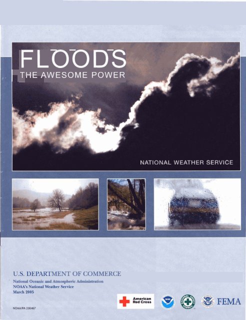
FLOODS<br />
)<br />
THE AWESOME POWER<br />
I<br />
NATIONAL WEATHER SERVICE<br />
MENT OF COMMERCE<br />
'<br />
National Oceanic and Atmospheric Adm%stmtion
*&odiag w w h a w here. Tm was trying<br />
to gel h. He driVm on <strong>the</strong> road w r <strong>the</strong><br />
stream every day. We kneu It had hem raining<br />
a lot, but it had h so dty, we were mtually<br />
happy doul <strong>the</strong> rain. Tm saw sow<br />
water on <strong>the</strong> rwd, but tkrmght it wn'6 thai<br />
akp. An$ a& all, ha was in h& huck, high<br />
up #<strong>the</strong> p n d . But ihn his truck s t a d<br />
t o e , and befm he knew it, his truck U(LS<br />
wushed downstwarn wilh him in it.<br />
Finiunaie&, his hisck got stuck on e m k or<br />
somethirig, and someone saw him and thww<br />
him a line. Tom got out okay. Bu6 we really<br />
leamedfiwpt this, not to drive in floods. "<br />
-Testimony of Marilyn and Tom<br />
(last name requested to be withheld)<br />
lM€RVlEWED BY THE AMWCAN RED CROSS<br />
ARER TROPICAL STORM ALLISON STRUCK<br />
TEXAS M JUNE 2001<br />
Why Should I Be Concerned About <strong>Flood</strong>ing?<br />
This preparedness guide explains flood-related hazards and suggests lifesaving<br />
actions you can take. With this information you can recognize a flood potential,<br />
develop a plan, and be ready when threatening wea<strong>the</strong>r approaches. Remember ...<br />
your safety is up to YOU!<br />
In <strong>the</strong> long term, floods kill more people in <strong>the</strong> United States than o<strong>the</strong>r types of<br />
severe wea<strong>the</strong>r. In recent years, only heat surpassed flood fatalities. <strong><strong>Flood</strong>s</strong> can<br />
roll boulders <strong>the</strong> size of cars, tear out trees, destroy buildings and bridges, and<br />
pose a significant threat to human lives.<br />
Online Resources<br />
Additional flash flood/flood-related safety information can be obtained at:<br />
American Red Cross<br />
http://www.redcross.org/<br />
U.S. Geological Survey<br />
http://www.usgs.gov/<br />
Federal Emergency Management Agency<br />
http://www.fema.gov/<br />
National Wea<strong>the</strong>r Service<br />
http://www.nws.noaa.gov/<br />
Once a river reaches flood stage, <strong>the</strong> flood severity categories used by <strong>the</strong> NWS<br />
include minor flooding, moderate flooding, and major flooding. Each category has<br />
a definition based on property damage and public threat.<br />
Graphical depiction of NSW b<br />
severity Categories.<br />
<strong>Flood</strong> Severity Category<br />
The NWS characterizes flood severity to more effectively communicate <strong>the</strong> impact<br />
of flooding. It uses <strong>the</strong> following categories:<br />
Minor <strong>Flood</strong>ing - minimal or Moderate <strong>Flood</strong>ing -some Major <strong>Flood</strong>ing - extensive<br />
no property damage, but inundation of structures and inundation of structures and<br />
possibly some public threat roads near streams. Some roads. Significant evacuation$<br />
or inconvenience. evacuations of people and/or of people andlor transfer of<br />
transfer of property to higher property to higher elevations.<br />
elevations.<br />
The impacts of floods vary locally. For each NWS river forecast location, flood<br />
stage associated with each of <strong>the</strong> NWS flood severity categories are established in<br />
cooperation with local public officials. Increasing river levels above flood stage<br />
constitute minor, moderate, and major flooding. Impacts vary from one river<br />
location to ano<strong>the</strong>r because a certain river stage (height) above flood stage in one<br />
location may have an entirely different impact than <strong>the</strong> same level above flood<br />
rrtann at ano<strong>the</strong>r locatinn
I<br />
BARRICADES ARE PUT UP KXI YOUR PROTECTION.<br />
TURN AROUND AND GO ANOTHER WAY!<br />
What Are Flash <strong><strong>Flood</strong>s</strong>?<br />
A flash flood is a rapid rise of water along a stream or low-lying urban area. Flash<br />
flood damage and most fatalities tend to occur in areas immediately adjacent to a<br />
stream or arroyo, due to a combination of heavy rain, dam break, levee failure, rapid<br />
snowmelt, and ice jams. Additionally, heavy rain falling on steep terrain can weaken<br />
soil and cause debris flow, damaging homes, roads, and property.<br />
Flash floods can be produced when slow moving or multiple thunderstorms occur<br />
over <strong>the</strong> same area. When storms move faster, flash flooding is less likely since<br />
<strong>the</strong> rain is distributed over a broader area.<br />
Flash <strong>Flood</strong> Risk in Your Car, Truck, or Sport Utility Vehicle (SUV)<br />
Almost half of all flash flood fatalities occur in vehicles. Contrary to popular belief,<br />
many people don't realize two feet of water on a bridge or highway can float most<br />
vehicles. If <strong>the</strong> water is moving rapidly, <strong>the</strong> car, truck, or SUV can be swept off <strong>the</strong><br />
bridge and into <strong>the</strong> creek.<br />
Water can erode <strong>the</strong> road bed, creating unsafe driving conditions. Underpasses can<br />
fill rapidly with water, while <strong>the</strong> adjacent roadway remains clear. Driving into a flooded<br />
underpass can quickly put you in five to six feet of water. Many flash floods occur<br />
at night when flooded roads are difficult to see.<br />
When you approach a flooded road, TURN AROUND, DON'T DROWN!<br />
\<br />
Forces on Vehicles From High Water<br />
The car wi" ' 2 carried when:<br />
Buoyancy Force<br />
VshkCo Weight I<br />
m
I<br />
----<br />
I IHEAWESUME POWER I<br />
A Photo: Harris County <strong>Flood</strong> Control District,<br />
Houston, Texas<br />
Major flooding from Tropical Storm Allison<br />
in Houston, Texas, June 2001.<br />
Densely populated areas have a high risk for flash floods. The construction of<br />
buildings, highways, driveways, and parking lots increases runoff by reducing<br />
<strong>the</strong> amount of rain absorbed by <strong>the</strong> ground. This runoff increases <strong>the</strong> flash flood<br />
potential. Sometimes, streams through cities and towns are routed underground<br />
into storm drains. During periods of heavy rainfall, storm drains may become<br />
overwhelmed and flood roads and buildings. Low spots, such as underpasses,<br />
underground parking garages, and basements can become death traps.<br />
Embankments, known as levees, are built along rivers and are used to prevent<br />
high water from flooding bordering land. In 1993, many levees failed along <strong>the</strong><br />
Mississippi River, resulting in devastating flesh floods.<br />
Dam failures have played a deadly role in <strong>the</strong> history of flash flooding. The<br />
United States has about 76,000 dams, and about 80 percent of those are of<br />
earthfill construction. Be aware of any dams upstream of your location. Ear<strong>the</strong>n<br />
dams are more easily compromised by heavy rainfall than are concrete structures.<br />
Water flowing over an ear<strong>the</strong>n dam can cause <strong>the</strong> dam to weaken or fail, sending<br />
a destructive wall of water downstream.<br />
Flash <strong>Flood</strong> Risk to Recreation (Camping, Hiking, Boating, Fishing)<br />
Many people enjoy hiking, fishing, or camping along streams and rivers. Listen to<br />
wea<strong>the</strong>r forecasts and keep away from streams if thunderstormar have happened<br />
or have been predicted upstream from where you are. A creek only 6 inches deep<br />
in mountainous areas can swell to a 10-foot deep raging river in less than an hour<br />
if a thunderstorm inundates <strong>the</strong> area with intense rainfall.<br />
When thunderstorms are in <strong>the</strong> area, stay alert for rapidly changing conditions.<br />
You may notice <strong>the</strong> stream start to rise quickly and become muddy. You may hear<br />
a roaring sound upstream that may be a flood wave moving rapidly toward you.<br />
Head immediately for higher ground. Don't be swept away by <strong>the</strong> rising water. Them<br />
am dangers associated with fast-moving water, but with common sense and some<br />
preparation, outdoor enthusiasts can enjoy a safe day along a stream or river.<br />
Source: National Wea<strong>the</strong>r Service h
4 Photo: Steve Allen Photography,<br />
Waitsfield, VT<br />
Road damage as a result of flash flooding.<br />
Where You Are Determines Your<br />
Flash <strong>Flood</strong>/<strong>Flood</strong> Risk<br />
Mountains and steep hills produce rapid runoff and quick stream response. Rocks<br />
and clay soils do not allow much water to infiltrate <strong>the</strong> ground. Steep narrow valleys<br />
generate rapid flowing waters that can rise quickly to a considerable depth. Saturated<br />
soil also can lead rapidly to flash flooding.<br />
. Very intense rainfall can produce flooding even on dry soil. In <strong>the</strong> West, most canyons<br />
and "small streams" are not easily recognizable as a source of danger. Canyons can<br />
be scoured with sudden walls of water 10-15 feet high (e.g., Antelope Canyon,<br />
Arizona, August 1997, 11 fatalities).<br />
Additionally, high risk locations include low water crossings, recent burn areas in<br />
mountains, and urban areas from pavement and roofs which concentrate rainfall<br />
runoff.
I THE AWESOME POWER<br />
I<br />
PERSISTENT THUNMR5TORMS OVER<br />
I<br />
THE SAME GKJGRAPHICAL AREA<br />
CAN LEAb TO RIVER FLOODIPJQ.<br />
What Are River <strong><strong>Flood</strong>s</strong>?<br />
A flood is <strong>the</strong> inundation of a normally dry area caused by an increased water level<br />
in an established watercourse. River flooding is often caused by:<br />
Excessive rain from tropical systems making landfall.<br />
Persistent thunderstorms over <strong>the</strong> same geographical area<br />
for extended periods of tlme.<br />
Comblned rainfall and snowmelt.<br />
Ice jam.<br />
?~-&*=,$FQ *~;>;..,,-<br />
P- z . -* ..-.<br />
b..<br />
.*,.h';&.. .<br />
..?-.,'::,.<br />
'$T>:<br />
' .,. - ., ..<br />
k,'<br />
J.'.,..<br />
:&,; 4<br />
Photo: Jim Rackwitz, St. Louis Post-Dispatch b<br />
River flooding due to excessive rain.<br />
Photo: Steve Allen Photography b<br />
River flooding due to ice jam.
Tropical Cyclones and <strong>the</strong>ir Remnants<br />
<strong><strong>Flood</strong>s</strong> are often produced by hunicanes, tropical storms, and tropical depressions. A<br />
tropical cyclone's worst impact may be <strong>the</strong> inland flooding associated with torrential<br />
rains.<br />
When <strong>the</strong>se storms move inland, <strong>the</strong>y are typically accompanied by very heavy rain.<br />
If <strong>the</strong> decaying storms move slowly over land, <strong>the</strong>y can produce rainfall amounts of<br />
20 to 40 inches over several days. Widespread flash flooding and river flooding can<br />
result from <strong>the</strong>se slow-moving storms.<br />
A hurricane also can produce a deadly storm surge that inundates coastal areas as<br />
it makes landfall. Storm surge is water pushed on shore by <strong>the</strong> force of <strong>the</strong> winds<br />
swirling around <strong>the</strong> storm. This advancing surge combines with <strong>the</strong> normal tides to<br />
create <strong>the</strong> hurricane storm tide, which can increase <strong>the</strong> average water level 15 feet<br />
or more.<br />
The worst natural disaster in <strong>the</strong> United States, in terms of loss of life, was caused<br />
by a storm surge and associated coastal flooding from <strong>the</strong> great Galveston, Texas,<br />
hurricane of 1900. At least 8,000 people lost <strong>the</strong>ir lives.<br />
A Deaths from hurricane coastal flooding<br />
have fallen dramatically in recent years,<br />
but ston surge remains a great threat.<br />
"50% of deaths associated with tropical cyclones are a<br />
result of inland flooding over <strong>the</strong> last 30 years."<br />
I<br />
-Ed Rappaport, National Hurricane Center<br />
I I<br />
Hunicane Agnes<br />
Tropical Storm Alberto<br />
122 deaths 33 deaths<br />
Hurricane Floyd<br />
Tropical Storm Allison<br />
56 deaths 44 deaths I I
, FI n-n:n.cs"'<br />
Stay Informed<br />
Listen to National Oceanic and Atmospheric Administration (<strong>NOAA</strong>) Wea<strong>the</strong>r<br />
Radio All Hazards, commercial radio, or television; or go to <strong>the</strong> lnternet for <strong>the</strong><br />
latest flash flood and flood watches, warnings, and wea<strong>the</strong>r advisories at:<br />
http://iwin.nws.noaa.gov/iwin/nationalwarnings.html<br />
For planning purposes, <strong>Flood</strong> Hazard Map information is only a click away<br />
by going to <strong>the</strong> Federal Emergency Management Agency web page at:<br />
http://www.fema.gov/mit/tsd<br />
The Advanced Hydrologic Prediction Service (AHPS)<br />
AHPS of <strong>the</strong> National Wea<strong>the</strong>r Service provides improved river and flood forecasting<br />
and water information. AHPS has a suite of graphical lnternet products to assist<br />
community leaders and emergency managers in making better life- and cost-savings<br />
decisions about evacuating people and moving property before a flood occurs.<br />
AHPS major <strong>the</strong>mes:<br />
Short-term through long-term forecasts (from minutes to months<br />
including probabilistic products for risk management decisions).<br />
Real-time flood forecast maps depicting a real extent of flooding.<br />
More timely and accurate flash flood warnings through <strong>the</strong> use of<br />
enhanced flash flood decision assistance tools.<br />
According to <strong>the</strong> National Hydrologic Warning Council report, "Use and Benefits<br />
of <strong>the</strong> National Wea<strong>the</strong>r Service River and <strong>Flood</strong> Forecasts," AHPS, once fully<br />
implemented throughout <strong>the</strong> United States, will provide more than $750 million<br />
in economic benefits each year.<br />
Additional AHPS information can be obtained at:<br />
http://vvww.nws.noaa.gov/om/water/Ahps.shtmI<br />
b Source: National Wea<strong>the</strong>r Service<br />
AHPS Wea<strong>the</strong>r Display
Use <strong>NOAA</strong> Wea<strong>the</strong>r Radio All Hazards!<br />
<strong>NOAA</strong> Wea<strong>the</strong>r Radio All Hazards is <strong>the</strong> best way to receive warnings from <strong>the</strong><br />
National Wea<strong>the</strong>r Service. <strong>NOAA</strong> Wea<strong>the</strong>r Radio All Hazards is a nationwide network<br />
of radio stations broadcasting continuous wea<strong>the</strong>r information direct from a nearby<br />
National Wea<strong>the</strong>r Service office.<br />
<strong>NOAA</strong> Wea<strong>the</strong>r Radio All Hazards broadcasts National Wea<strong>the</strong>r Service warnings,<br />
watches, forecasts, and o<strong>the</strong>r hazard information 24 hours a day. The average<br />
reception range is a 40-mile radius from <strong>the</strong> transmitter, depending on topography.<br />
Be aware of <strong>the</strong> potential for flooding before <strong>the</strong> heavy rainfall begins by listening<br />
to <strong>NOAA</strong> Wea<strong>the</strong>r Radio All Hazards.<br />
Purchase a <strong>NOAA</strong> Wea<strong>the</strong>r Radio All Hazards that has a battery back-up, a Specific<br />
Area Message Encoder (SAME) feature, which automatically alerts you when a<br />
Watch or Warning is issued for your county or parish, and one that can receive all<br />
seven <strong>NOAA</strong> Wea<strong>the</strong>r Radio frequencies.<br />
<strong>NOAA</strong> Wea<strong>the</strong>r Radio All Hazards can also broadcast post-event information for<br />
all types of hazards-both natural (earthquakes, hurricanes and volcanos) and<br />
environmental (chemical or oil spills).<br />
The <strong>NOAA</strong> Wea<strong>the</strong>r Radio All Hazards network has more than 650 transmitters,<br />
covering <strong>the</strong> 50 states, adjacent coastal waters, Puerto Rico, <strong>the</strong> U.S. Virgin<br />
Islands, and <strong>the</strong> U.S. Pacific Territories. <strong>NOAA</strong> Wea<strong>the</strong>r Radio requires a special<br />
radio receiver or scanner capable of receiving <strong>the</strong> signal. Broadcasts are found<br />
in <strong>the</strong> public service band at <strong>the</strong>se seven frequencies (MHz): 162.400, 162.425,<br />
162.450, 162.475, 162.500, 162.525, 162.550 (also known as channels 1 through<br />
<strong>NOAA</strong> Wea<strong>the</strong>r Radio All Hazards requires a special radio receiver or scanner<br />
capable of picking up <strong>the</strong> signal. These receivers can be purchased at retail<br />
electronic and sporting good stores.<br />
<strong>NOAA</strong> WEATHER RADIO BAWDS: CWANNa FRMUEMClES (MH?)
- w w m m<br />
NATIONAL WEATHER SE<br />
COMMUNICATION AND SAFETY SKILLS NECESSARY<br />
TO SAVE LIVES AND PROPERTY.<br />
MORE INFORMATION IS AVAILABLE AT<br />
WWW.NWS.<strong>NOAA</strong>.GOV/STORMREADY<br />
Community preparedness Plans<br />
After you have developed a personavfamily safety plan, find out about your community<br />
safety plan. Each community prone to a flash floodlflood should develop a safety<br />
plan. Local officials should have detailed information for your immediate area.<br />
Please listen and follow <strong>the</strong>ir recommendations before, during, and after a storm.<br />
The best way to prevent loss of life is to design and build communities where roads<br />
I remain usable and undamaged during floods, and where homes and businesses are<br />
TO HELP AMERICA PREPARE FOR THE RAVAGES<br />
protected. While this may not always be possible, it is a goal we hope every com-<br />
OF FLASH FLOODS AND FLOODS, THE NATIONAL<br />
munity strives to reach.<br />
WEATHER SERVICE HAS DESIGNED STORMREADY,<br />
TO ARM AMERICA'S COMMUNITIES WITH THE Protect yourself, your home, your family, and your financial future.<br />
National <strong>Flood</strong> Insurance Program<br />
One of <strong>the</strong> most important things you can do to protect your home and family before<br />
a flood is to purchase a flood insurance policy. You can obtain one through your<br />
insurance company or agent. Your agent can tell you whe<strong>the</strong>r <strong>the</strong> standard or preferred<br />
policy (for medium or low risk) is most appropriate for you. <strong>Flood</strong> insurance<br />
is backed by <strong>the</strong> National <strong>Flood</strong> lnsurance Program (NFIP), administered by <strong>the</strong><br />
- Federal Emergency Management Agency. Your homeowners insurance does not<br />
cover flood damage. Everyone has some flood risk and anyone in a participating<br />
community is eligible. Don't wait until a flood is coming to purchase your policy.<br />
It normally takes 30 days after purchase for a flood insurance policy to go into<br />
effect. For more information about <strong>the</strong> NFlP and flood insurance, contact your<br />
insurance company or call <strong>the</strong> NFlP at 800.427.4661.<br />
Check with your city or county government (start with <strong>the</strong> Building or Planning<br />
Office) to find out if you live in a participating community and what flood risk<br />
information is available where you live.<br />
What My Community Can Do<br />
Provide river and rainfall readings to emergency managers and <strong>the</strong><br />
National Wea<strong>the</strong>r Senfice.<br />
Establish early warning procedures.<br />
Create and operate a Local <strong>Flood</strong> Warning System to identify areas<br />
vulnerable to flooding.<br />
Produce and follow <strong>the</strong> flood emergemy plans.<br />
Contact your local emergency management agency or local National<br />
Wea<strong>the</strong>r Service office for fur<strong>the</strong>r information on Loal Rood Warning<br />
1 Systems, or visit:
NATIONAL WEATHER SEMCE FORECASEW<br />
RELY (34 A NETWORK OF ALNIOST 10,000<br />
f3lRWMOAQES TO MONITOR THE HEtGtiT OF<br />
RIVERS AND STREAMS ACROSS ME WllON<br />
Streamgage Data Saves Lives<br />
National Wea<strong>the</strong>r Service forecasters rely on a network of almost 10,000 streamgages<br />
to monitor <strong>the</strong> height of rivers and streams across <strong>the</strong> Nation. This information provides<br />
present river conditions and is <strong>the</strong> initial information needed to develop a river<br />
forecast. Most of <strong>the</strong> streamgages are maintained by <strong>the</strong> U.S. Geological Survey,<br />
<strong>the</strong> U.S. Army Corps of Engineers, and <strong>the</strong> Department of Agriculture. Some<br />
streamgages are read manually by dedicated volunteer observers. If you would<br />
like to volunteer as a cooperative observer, visit <strong>the</strong> web site at:<br />
http:Nwww.nws.noaa.gov/om/coop/become.htm<br />
Many communities nationwide have partnered with <strong>the</strong> National Wea<strong>the</strong>r Service<br />
and o<strong>the</strong>r federal agencies (e.g., U.S. Geological Survey and <strong>the</strong> U.S. Army Corps<br />
of Engineers) to implement dense networks of precipitation gages and streamgages<br />
to monitor and detect flooding in <strong>the</strong>ir community. These networks are often<br />
referred to as Local <strong>Flood</strong> Warning Systems.<br />
wzlc . ~ocal <strong>Flood</strong> Warning Sysrem<br />
--~!&es.collect<br />
$: rain and river data that is transmitted to NWS and Emergency Managers<br />
o like a seesaw. Tips<br />
.Mimhesofrain<br />
Sfig<br />
- - - - ....<br />
I.<br />
)as issued a flash flood
THE AWESOME POWER<br />
I<br />
What You Can Do Before <strong>the</strong> <strong>Flood</strong>.. .<br />
When you receive a <strong>Flood</strong> Watch:<br />
A Watch is issued when flooding is possible within <strong>the</strong> watch area. When a flood<br />
watch is issued, you should be aware of potential flood hazards. Everyone in a<br />
Watch area should be ready to respond and act quickly.<br />
Have an evacuation plan in place BEFORE flooding occurs. <strong>Flood</strong>ed roads may cut<br />
off your escape route. Head for higher ground before <strong>the</strong> water becomes too<br />
deep. Remember-just six inches of rapidly flowing water can knock you off your<br />
feet. For information on how or what to do if you are advised to evacuate, visit <strong>the</strong><br />
American Red Cross web page at: http://www.redcross.org/services/disaster/be<br />
~reparedlevacuat ion. html<br />
I<br />
in<br />
<strong>the</strong> National <strong>Flood</strong> lnsurance Program. Start with <strong>the</strong> Building or Planning<br />
. Department to review <strong>the</strong> <strong>Flood</strong> lnsurance Rate Maps, published by <strong>the</strong> Federal<br />
Emergency Management Agency.<br />
Develop an evacuation plan. Everyone in your family should know where to go it<br />
<strong>the</strong>y have to leave.<br />
Discuss flood plans with your family. Everyone should know what to do in case<br />
all family members are not toge<strong>the</strong>r. Discussing flood plans ahead of time helps<br />
reduce fear and anxiety and lets everyone know how to respond.<br />
Determine if <strong>the</strong> roads you normally travel to reach your home or job will be<br />
flooded during a storm. If so, look for alternative routes to use during flooding.<br />
Keep a <strong>NOAA</strong> Wea<strong>the</strong>r Radio All Hazards, a battery-powered portable radio, emergency<br />
cooking equipment, and flashlights in working order with extra batteries.<br />
Have a professional install check-valves in plumbing to prevent flood waters<br />
from backing up into <strong>the</strong> drains of your home.<br />
Keep your automobile fueled; if electric power is cut off, gas stations may not<br />
be able to operate pumps for days.<br />
Store drinking water in food-grade containers. Water service may be interrupted.<br />
Keep a stock of food requiring little cooking and no refrigeration; electric power<br />
may be interrupted.<br />
Keep first-aid supplies and prescription medicines on hand.
DURING A FLOOD WARNING,<br />
DON'T DMVE<br />
WHENEVER POSSIBLE!<br />
once every 1 00 years,<br />
MMH<br />
Flash floods mainly occur ir<br />
<strong>the</strong> eastern United States,<br />
MYrn<br />
Flash floods occur onl)<br />
along flowing streams,<br />
MYTH<br />
Flash floods occur mainly in <strong>the</strong><br />
late afternoon and evening.<br />
MYM<br />
Homeowners insurance<br />
policies cover flooding.<br />
The 100-year ftood is a cUmactic<br />
average; <strong>the</strong>m is a 1 % ckance<br />
that a 1100-year flood wiW occur<br />
in any given year.<br />
rrrr<br />
Flash floods occw'in dl 50 states,<br />
including Alaska and Hawaii.<br />
.-.<br />
Flash floods can occur in dry<br />
myos and uTb2VI mas *e<br />
n o m s m m .<br />
Many flash floods oecur at night.<br />
Unfortunately, many homeowners<br />
do not find out until it is too late that<br />
<strong>the</strong>ir policies do not cover flooding.<br />
Contact your insurance company<br />
or agent to buy flood insurance.<br />
-<br />
Larger vehicles, such as SWs<br />
and pickups, are safe to drive<br />
through flood waters<br />
You are still eligible to purchase<br />
flood insurance after your home,<br />
apartment, or business has been<br />
flooded, provided your community<br />
is participating in <strong>the</strong> National<br />
<strong>Flood</strong> Insurance Program.<br />
I<br />
..-<br />
Two feet of rushing water can cany<br />
away most vehicles including SUVs<br />
I<br />
and pickups.
I THE AWESOME POWER .<br />
DO NOT VISIT DISASTER AREAS<br />
FOLLOWING A ROD. YOUR PRESENCE<br />
MAY HAMPER URGENT EMERGENCY<br />
RESPONSE AND RESCUE OPERATIONS.<br />
/<br />
What You Can Do During <strong>the</strong> <strong>Flood</strong>.. .<br />
When you recehFe a Rood Wamkrg:<br />
'3<br />
Don't drive if you don't have to.<br />
3<br />
A Photo: Federal Emergency Management<br />
Agw<br />
If advised to evacuate, do so immediately! Families should use only one vehicle<br />
to avoid getting separated and reduce trafRc jams. Move to a safe area before<br />
access is cut off by flood water. Continue listening to <strong>NOAA</strong> Wea<strong>the</strong>r Radio All<br />
Hazards, radio or television for information concerning <strong>the</strong> flooding.<br />
Get out of areas subject to flooding. This includes dips, low spots, canyons,<br />
washes, etc. Do not attempt to cross flowing streams.<br />
Never try to walk, swim, drive, or play in flood water. You may not be able to see<br />
how fast <strong>the</strong> flood water is moving or see holes or submerged debris.<br />
Do not camp or park your vehicle along streams and washes, particularly during<br />
threatening conditions.<br />
Be especially cautious at night when it is harder to recognize flood dangers.<br />
Do not attempt to drive through a flooded road. The depth of water is not always<br />
obvious. The road bed may be washed out wlclsr <strong>the</strong> water, and you could be<br />
stranded or trapped.<br />
Do not drive around a barricade. Barricades an, Wm & yaur paMufb~7brm<br />
around and go ano<strong>the</strong>r way1<br />
If <strong>the</strong> vehicle stalls, leave it immediately and move to higher ground. Rapidly rising<br />
water may engulf <strong>the</strong> vehicle and its<br />
sweeping <strong>the</strong>m away. Vehicles<br />
can be swept away by as little as w=.<br />
Children should NEVER play around Mgh water, storm drains, viaducts, or<br />
arroyos. It is very easy to be swepta!my by fast-moving water.<br />
If you come upon a fEPwin&m where water is above your ankles, STOP! Turn<br />
around and go ana<strong>the</strong>r wqd to higher ground. If it is moving swiftly, even<br />
water six inches desp can knock you off your feet. Many people are swept away<br />
wading through Rood waters, multing in injury or death.<br />
What You Can Do After <strong>the</strong> <strong>Flood</strong>.. .<br />
Get necessary medical care at <strong>the</strong> nearest hospital. The American Red Cross can<br />
help by providing shelters, food, water, and first aid, as well as helping you meet<br />
your immediate disaster-caused needs.<br />
Do not visit disaster areas. Your presence might hamper rescue and o<strong>the</strong>r emergency<br />
operations.<br />
If <strong>the</strong> power is out, use flashlights, not candles.<br />
Use flashlights, not lanterns, torches, or matches, to examine buildings.<br />
Flammables may be inside.<br />
Report broken utility lines to appropriate authorities.<br />
Boil drinking water before using. Wells should be pumped out and <strong>the</strong> water<br />
tested for purii before drinking. If in doubt, call your local public health authority.<br />
If fresh or canned food has come in contact with flood waters, throw it out.<br />
Take steps to reduce your risk of future floods. Make sure to follow local building<br />
codes and ordinances when rebuilding, and use flood-resistant materials and<br />
techniques to protect yourself and your propertv from future flood damaae.
Do You Have a Family Disaster Plan?<br />
I<br />
THE AWESOME POWER<br />
Contact your local National Wea<strong>the</strong>r Service office, emergency Discuss <strong>the</strong> information you have ga<strong>the</strong>red. Pick two places to<br />
management office, and American Red Cross chapter. Find out meet: a spot outside your home for an emergency such as a<br />
what types of disasters could occur and what you should do. Learn fire, and a place away from your neighborhood in case you can't<br />
about your community's methods of warning people and evacua- return home. Choose an out-of-town family member or friend as<br />
tion plans. Ask your insurance agent about flood insurance. Find your family check-in contact for everyone to call if <strong>the</strong> family get<br />
out what you can do to protect your home from <strong>the</strong> effects of separated, and a backup out-of-neighborhood friend in case <strong>the</strong><br />
natural hazards that could occur where you live. Meet with your first one does not answer. Discuss what you would do and how<br />
II. lmplemenr your Plan<br />
Post emergency telephone numbers by phones and in address<br />
lists each person carries with <strong>the</strong>m. Include cell phone numbers<br />
of family and contact-points.<br />
Install safety features in your home, such as smoke alarms and<br />
fire extinguishers.<br />
Inspect your home for wtential hazards such as items that can<br />
move, fall, break, or catch fire, and correct <strong>the</strong>m.<br />
Teach children how and when to call 9-1 -1 or your local<br />
Emergency Medical Services number.<br />
Keep emergency supplies in your home sufficient for three<br />
days to a week, if your area has ever lost basic water, electrici<br />
and gas service for a week or longer. Assemble a disaster<br />
supplies kit with things you will need if you have to evacuate.<br />
Store <strong>the</strong>se supplies in sturdy, easy-to-carry containers such<br />
as backpacks or duffel bags.<br />
Make physical changes that will make your home less vulnerable;<br />
install check-valves and hurricane shutters; strap <strong>the</strong> hot water Keep important family in a and fireheater<br />
to wall studs.<br />
resistant container.<br />
Have your family learn basic safety skills such as CpWAutomated<br />
External Defibrillator (AED) and first aid; how to use a fire extin-<br />
Keep a smaller emergency kit with seasonal supplies, tools,<br />
and clo<strong>the</strong>s in <strong>the</strong> trunk Of your car.<br />
. Know how to operate a it turned on to receive calls in any eme<br />
1 Ill. Prepare a Disaster Supplies Kit to Include:<br />
Battery-powered <strong>NOAA</strong> Wea<strong>the</strong>r Radio All Hazards<br />
Portable radio<br />
Flashlight with extra batteries<br />
.* Extra set of car keys<br />
Cash and credit card<br />
Special items for infant, elderly, and disabled family members<br />
Local Sponsorships