Reef Status of Semporna Priority Conservation ... - WWF Malaysia
Reef Status of Semporna Priority Conservation ... - WWF Malaysia
Reef Status of Semporna Priority Conservation ... - WWF Malaysia
You also want an ePaper? Increase the reach of your titles
YUMPU automatically turns print PDFs into web optimized ePapers that Google loves.
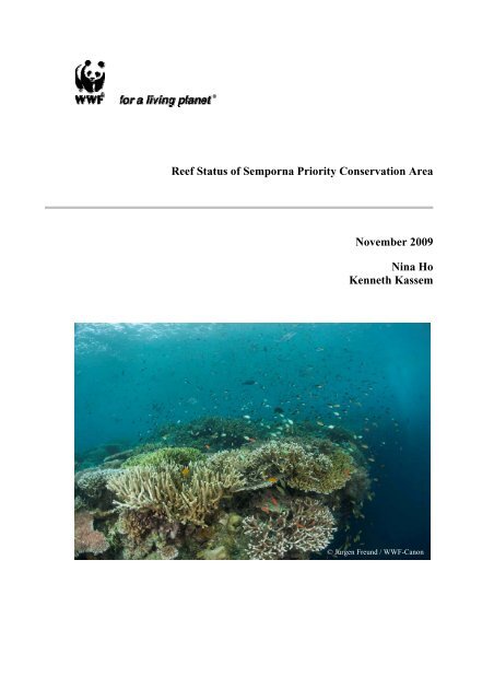
<strong>Reef</strong> <strong>Status</strong> <strong>of</strong> <strong>Semporna</strong> <strong>Priority</strong> <strong>Conservation</strong> Area<br />
November 2009<br />
Nina Ho<br />
Kenneth Kassem<br />
© Jurgen Freund / <strong>WWF</strong>-Canon
<strong>Reef</strong> <strong>Status</strong> <strong>of</strong> <strong>Semporna</strong> <strong>Priority</strong> <strong>Conservation</strong> Area<br />
Nina Ho<br />
Kenneth Kassem<br />
<strong>WWF</strong>-<strong>Malaysia</strong><br />
Report Produced Under Project MY0256<br />
Facilitating Collaborative Management <strong>of</strong> Coral <strong>Reef</strong>s and Adjacent Ecosystems with<br />
Tourism and Fisheries<br />
i
<strong>WWF</strong>-<strong>Malaysia</strong> (PN. No. 777/4)<br />
Sabah Office<br />
Suite 1-6-W11, 6 th Floor<br />
CPS Tower, Ctr. Point Complex<br />
No.1, Jalan Centre Point<br />
88800 Kota Kinabalu<br />
Sabah, <strong>Malaysia</strong><br />
Tel: +60 88 262 420 Fax: +60 88 242 531<br />
E-mail: contactus@wwf.org.my<br />
Copyright ©2009 <strong>WWF</strong>-<strong>Malaysia</strong>.<br />
All right reserved. No part <strong>of</strong> this publication may be reproduced,<br />
Stored in a retrieval system, or transmitted in any form or by any means,<br />
electronic, mechanical, photocopying, recording, or otherwise,<br />
without the prior permission <strong>of</strong> the copyright owner.<br />
The opinions <strong>of</strong> the authors articulated in this publication do not<br />
necessarily reflect those <strong>of</strong> <strong>WWF</strong>-<strong>Malaysia</strong>.<br />
First published 2009<br />
Design and layout by Nina Ho and Angela Lim<br />
Suggested citation:<br />
Ho, Nina & Kassem, Kenneth. (2009). <strong>Reef</strong> <strong>Status</strong> <strong>of</strong> <strong>Semporna</strong> <strong>Priority</strong> <strong>Conservation</strong> Area. Kota Kinabalu,<br />
<strong>Malaysia</strong>: <strong>WWF</strong>-<strong>Malaysia</strong>.<br />
Perpustakaan Negara <strong>Malaysia</strong> Cataloguing – in-Publication Data<br />
Ho, Nina Ann Jin.<br />
<strong>Reef</strong> <strong>Status</strong> <strong>of</strong> <strong>Semporna</strong> <strong>Priority</strong> <strong>Conservation</strong> Area. Kota Kinabalu / Nina Ho Ann Jin, Kenneth Ramsey<br />
Kassem.<br />
Bibliography: p.14<br />
ISBN 978-983-44945-6-8<br />
1. <strong>Reef</strong> ecology-<strong>Conservation</strong>-Sabah-<strong>Semporna</strong>. 2. <strong>Reef</strong> animals-<strong>Conservation</strong>-Sabah-<strong>Semporna</strong>. I. Kassem,<br />
Kenneth Ramsey.<br />
II. Title.<br />
577.789<br />
Printed in <strong>Malaysia</strong><br />
ii
Contents<br />
Acronyms……………………………………………………………………………...iv<br />
Acknowledgment……………………………………………………………………...iv<br />
Introduction..................................................................................................................1<br />
Geographic scope.......................................................................................................2<br />
Materials and Methods................................................................................................4<br />
Results ...........................................................................................................................6<br />
Substrate.....................................................................................................................9<br />
Southern reefs ........................................................................................................9<br />
Northern reefs ........................................................................................................9<br />
Invertebrates.............................................................................................................10<br />
Southern reefs ......................................................................................................10<br />
Northern reefs ......................................................................................................10<br />
Fish...........................................................................................................................11<br />
Southern reefs ......................................................................................................11<br />
Northern reefs ......................................................................................................11<br />
Discussion....................................................................................................................12<br />
Reference.....................................................................................................................14<br />
Appendix.....................................................................................................................15<br />
Appendix 1: Map <strong>of</strong> <strong>Semporna</strong> PCA Northern <strong>Reef</strong>s .............................................15<br />
Appendix 2: Map <strong>of</strong> <strong>Semporna</strong> PCA Southern <strong>Reef</strong>s .............................................16<br />
Appendix 3: Map <strong>of</strong> <strong>Semporna</strong> PCA Live Coral Cover Category ..........................17<br />
Appendix 4: <strong>Semporna</strong> PCA <strong>Reef</strong> <strong>Status</strong> Summary................................................18<br />
Appendix 5: Table <strong>of</strong> General Resource Use Category...........................................19<br />
Appendix 6: Table <strong>of</strong> Average Percentage and Category <strong>of</strong> Coral Cover ..............20<br />
Appendix 7: Chart <strong>of</strong> Percentage <strong>of</strong> Substrate Cover..............................................21<br />
Appendix 8: Table <strong>of</strong> Number and Density <strong>of</strong> Targeted Fish ................................22<br />
Appendix 9: Table <strong>of</strong> Number and Density <strong>of</strong> Targeted Invertebrates ...................23<br />
Appendix 10: Table <strong>of</strong> Human Impact Index in <strong>Semporna</strong> PCA ............................24<br />
iii
Acronyms<br />
GCRMN<br />
GPS<br />
ICRI<br />
PCA<br />
SCUBA<br />
SSME<br />
Global Coral <strong>Reef</strong> Monitoring Network<br />
Global Positioning System<br />
International Coral <strong>Reef</strong> Initiative<br />
<strong>Priority</strong> <strong>Conservation</strong> Area<br />
Self Contained Underwater Breathing Apparatus<br />
Sulu-Sulawesi Marine Ecoregion<br />
iv
Acknowledgement<br />
We thank our project donors from <strong>WWF</strong>-Netherlands, the Hupkes Family in Netherlands,<br />
and the Adessium Foundation. Thanks to <strong>Reef</strong> Check <strong>Malaysia</strong> for providing training to<br />
our stakeholders in <strong>Semporna</strong> PCA. Thanks to all <strong>Reef</strong> Check surveyors consisting <strong>of</strong><br />
pr<strong>of</strong>essional divemasters from local dive operators and volunteers (Bobby Joanes<br />
Basolius, Richard Usah, Hardy Habirah, Allister Lee, Ron Freddy, Glenn L, Ronny Bin<br />
Lobin, Jessica Mikiu Tiongsoh, Jennifer E. Missi, Andreas K. Stephen, Subuh Yunus @<br />
Stephen, Melvin Mijoh, Lorence J. Laisang, Julia Ng Su Chen, Yusran Maidin, Joseph<br />
Chung, Alex Canumay, Wendy E.Delacruz, Honarius Basil, SF Chong, Daniel Doughty,<br />
Japson Wong, Obata Kenichi) who participated in this survey. Thanks also to Angela<br />
Lim for patiently editing and formatting this report. We also thank Sikula Magupin for<br />
producing informative maps for this report.<br />
v
Introduction<br />
The <strong>Semporna</strong> district lies at the extreme southeast corner <strong>of</strong> the east <strong>Malaysia</strong>n state <strong>of</strong><br />
Sabah in the Sulawesi Sea. The district waters contain parts <strong>of</strong> the globally significant<br />
(for biodiversity) <strong>Semporna</strong> <strong>Priority</strong> <strong>Conservation</strong> Area (PCA) <strong>of</strong> the Sulu-Sulawesi<br />
Marine Ecoregion (SSME). This area lies well within the Coral Triangle and thus is<br />
within the richest areas in the world. <strong>Malaysia</strong>’s largest concentration <strong>of</strong> coral reefs is<br />
found here, along with large expanses <strong>of</strong> mangroves and seagrass beds. The area boasts a<br />
wide diversity <strong>of</strong> coral reef geomorphology, including a barrier reef formation, fringing<br />
reefs, patch reefs, a pre-atoll, and Sipadan Island, an oceanic seamount.<br />
There is one existing marine protected area in the district which covers 350 km 2 out <strong>of</strong><br />
the approximately 7680 km 2 <strong>of</strong> <strong>Semporna</strong> PCA. The Tun Sakaran Marine Park contains<br />
8 islands and is the first marine protected area in <strong>Malaysia</strong> to include local communities<br />
within its boundaries. Sipadan Island’s waters are proposed as a park and the intention to<br />
gazette was published in mid-2009.<br />
The status <strong>of</strong> the coral reefs in <strong>Semporna</strong> is largely unsurveyed and unreported to date,<br />
except for areas that have been surveyed by Sabah Parks, the University <strong>Malaysia</strong> Sabah,<br />
the Marine <strong>Conservation</strong> Society (UK), and <strong>WWF</strong>-<strong>Malaysia</strong>. These have been limited<br />
particularly to Sipadan Island and the Tun Sakaran Marine Park.<br />
Sipadan Island survey data in 1994 show that live hard coral cover at shallow reefs (5–10<br />
m) was high in all areas (up to 95%). Whereas the mid-depth slope (10–25 m) with the<br />
best coral growth cover was estimated between 25–50% (Wood 1994). The Tun Sakaran<br />
Marine Park had an average percentage <strong>of</strong> hard coral cover at the reef rim and upper<br />
slope from 11–30% in conclusion <strong>of</strong> survey and monitoring programmes over a 10-year<br />
period since 1998. (Wood et al. 2008)<br />
Coral reefs form the foundation <strong>of</strong> the economy in <strong>Semporna</strong> for local community<br />
fisheries and the tourism industry. <strong>Semporna</strong>’s fisheries products extracted from coral<br />
reef areas include collection <strong>of</strong> fish for the regional live reef fish trade and consumption<br />
in local seafood restaurants. The coral reefs <strong>of</strong> Sipadan and Mabul are increasingly<br />
popular international dive destinations, and interest in dive tourism is expanding<br />
throughout the district.<br />
The <strong>Semporna</strong> PCA was ranked as globally significant for its high biodiversity and rich<br />
mix <strong>of</strong> habitat types in a workshop <strong>of</strong> local and international experts in 2001<br />
(Stakeholders <strong>of</strong> SSME et al. 2003). It is a priority site for Marine Industry and Tourism<br />
Zone in the Government’s Sabah Development Corridor planning document (State<br />
Government <strong>of</strong> Sabah 2007). It was included on the “A” list for recommendation for<br />
nomination as a marine natural World Heritage Site (Hillary et al. 2002). As a high<br />
priority site within the SSME, it is also a high priority site in the Coral Triangle Initiative<br />
on Coral <strong>Reef</strong>s, Fisheries and Food Security.<br />
This report documents the first comprehensive survey <strong>of</strong> the status <strong>of</strong> coral reefs in<br />
<strong>Semporna</strong>. The results will be used as baseline data for the monitoring and management<br />
<strong>of</strong> natural marine resources in <strong>Semporna</strong> PCA.<br />
1
Geographic scope<br />
Between January 2008 and June 2009, surveys were carried out by <strong>WWF</strong>-<strong>Malaysia</strong><br />
<strong>Semporna</strong> PCA team, volunteers, and local dive operators. The total reef area <strong>of</strong><br />
<strong>Semporna</strong> PCA is approximately 7,680 km 2 . <strong>WWF</strong>-<strong>Malaysia</strong> surveyed 35 sites with 64<br />
transects during this period covering all reef types across the entire <strong>Semporna</strong> PCA.<br />
The surveys were conducted first on the Southern reefs which form the barrier reef<br />
extending from Roach <strong>Reef</strong> in the west to Ligitan <strong>Reef</strong> in the east. These include: Hands<br />
Rock, Darby Bank, Alert Patches, Second <strong>Reef</strong>, Roach <strong>Reef</strong>, Friedrich <strong>Reef</strong>, Horn <strong>Reef</strong>,<br />
Ezerhzog <strong>Reef</strong>, Yoshi Point, Mabul, Kapalai, Cust <strong>Reef</strong>, Ligitan, Denawan and Si Amil.<br />
(Appendix 1)<br />
The remaining reefs are grouped as the Northern reefs and include Batuara <strong>Reef</strong>, Bumbum,<br />
Pasalat <strong>Reef</strong>, Boheyan, Timba-timba, Mataking, Pulau Pandanan, Pom-pom,<br />
Timbun Mata and Batik. (Appendix 2)<br />
The reefs <strong>of</strong> the Tun Sakaran Marine Park and Sipadan Island were not surveyed under<br />
this project.<br />
2
Map 1: <strong>Semporna</strong> <strong>Priority</strong> <strong>Conservation</strong> Area<br />
3
Materials and Methods<br />
<strong>Reef</strong> Check monitoring protocols were employed for all monitoring activities. <strong>Reef</strong><br />
Check monitoring protocols are designed to assess baseline reef status and monitor the<br />
reef status periodically. The methods focus on the abundance <strong>of</strong> particular coral reef<br />
organisms (indicators) that best reflect the condition <strong>of</strong> the ecosystem and that are easily<br />
recognizable to the general public. This method is designed to be accessible to beginners<br />
and amateurs yet provides a regionally consistent data set which has biological<br />
significance. Global and regional indicators serve as specific measures <strong>of</strong> human impacts<br />
on coral reefs (Hodgson 2006). <strong>Reef</strong> Check, a partner <strong>of</strong> the International Coral <strong>Reef</strong><br />
Initiative (ICRI) and Global Coral <strong>Reef</strong> Monitoring Network (GCRMN), supplies data to<br />
<strong>Reef</strong> Base and GCRMN for status reports (Hodgson & Liebeler 2002).<br />
Surveys are conducted with at least 1 pair <strong>of</strong> divers doing a full <strong>Reef</strong> Check survey in one<br />
single site. However, 2 pairs <strong>of</strong> divers are preferred to complete a single <strong>Reef</strong> Check<br />
survey in 1 single dive; 1 pair <strong>of</strong> divers conduct the survey in shallow depth, another pair<br />
<strong>of</strong> divers will conduct the survey at a mid-water depth. Standard SCUBA equipment is<br />
utilised for all surveys. Additionally, <strong>WWF</strong>-<strong>Malaysia</strong> uses underwater slate, waterpro<strong>of</strong><br />
paper with printed data sheet, pencil, eraser, pointer, 100m fibreglass measuring tape,<br />
GARMIN GPS and <strong>Semporna</strong> Waters Marine Chart.<br />
At each site a description <strong>of</strong> environmental conditions and ratings <strong>of</strong> human impacts are<br />
collected along with fish indicators, invertebrate indicators and substrate. First, fish<br />
counts up to 5 m above a 20 m by 5 m belt along a 100 m transect are counted, after the<br />
laying <strong>of</strong> the transect. Next, invertebrates are counted over four 20 m x 5 m belts along<br />
the 100 m transect and human impacts are documented. Lastly, a measure <strong>of</strong> the<br />
percentage <strong>of</strong> the substrate cover along four 20 m sections <strong>of</strong> a 100 m transect is<br />
collected. All human impact classifications are based on the regional categories <strong>of</strong><br />
resource use and substrate. Human impact classifications include documenting evidence<br />
<strong>of</strong> blast fishing, boat and anchor damage, fishing gear, and other damages.<br />
Live coral cover is classified according to Table 1.<br />
Category Live Coral Cover (%) Coral Cover Conditions<br />
1 0 – 24.9 Poor<br />
2 25 – 49.9 Fair<br />
3 50 – 74.9 Good<br />
4 75 – 100 Excellent<br />
Table 1: Coral cover category with percentage and conditions.<br />
4
The surveys are usually done along two depth contours. Shallow surveys range from 2 –<br />
6 m depth below chart datum (lowest low tide) and mid-water surveys range from 6 – 12<br />
m depth. The transects are laid at a constant depth within these ranges (Hodgson 2006).<br />
(Figure 1)<br />
100 m<br />
1 2 3 4<br />
5 m<br />
20 m 5 m<br />
20 m 5 m<br />
20 m<br />
5 m<br />
20 m<br />
Figure 1: Diagram <strong>of</strong> a transect line. This 100 m line is divided into four 20 m segments with a 5<br />
m gap in between them to ensure sample independence.<br />
5
Results<br />
Based on the live coral cover category level (Table 1), 11 sites are in poor condition<br />
within 0–24.9% live coral cover, 17 sites are in fair condition with 25–49.9% live coral<br />
cover, 7 sites in good condition with 50–74.9% live coral cover, and none <strong>of</strong> the surveyed<br />
sites are in excellent condition (Chart 1). However, there have been known sites with live<br />
coral cover percentage <strong>of</strong> more than 95% in Sipadan (Wood 1994).<br />
Number <strong>of</strong> surveyed site<br />
18<br />
16<br />
14<br />
12<br />
10<br />
8<br />
6<br />
4<br />
2<br />
0<br />
0-24.9% 25-49.9% 50-74.9% 75-100%<br />
Live coral cover percentage<br />
Chart 1: Frequency <strong>of</strong> live coral cover percentage in <strong>Semporna</strong> PCA.<br />
On the overall coral reefs in <strong>Semporna</strong> PCA have an average <strong>of</strong> 35.66% live coral cover.<br />
Rubble is the second highest <strong>of</strong> substrate cover percentage with average <strong>of</strong> 21%, followed<br />
by rock (18%) and sand (14%) (Chart 2).<br />
Silt<br />
2%<br />
Other<br />
2%<br />
Sand<br />
14%<br />
Hard Coral<br />
25%<br />
Rubble<br />
21%<br />
S<strong>of</strong>t Coral<br />
10%<br />
Rock<br />
18% Sponge<br />
2%<br />
Recent Killed<br />
Coral<br />
1%<br />
Nutrient<br />
Indicator Algae<br />
5%<br />
Chart 2: Average substrate cover percentage <strong>of</strong> <strong>Semporna</strong> PCA surveyed sites.<br />
6
Very few invertebrate indicator species were observed during the surveys. The vast<br />
majority <strong>of</strong> observed invertebrates were Diadema sea urchins. (Chart 3)<br />
Crown-<strong>of</strong>-Thrown,<br />
0.25%<br />
Sea Cucumber,<br />
0.14%<br />
Collector Urchin,<br />
0.19%<br />
Pencil Urchin, 0.09%<br />
Giant Clam, 1.08%<br />
Triton, 0.19%<br />
Lobster, 0.16%<br />
Banded Coral<br />
Shrimp, 0.34%<br />
Diadema Urchins,<br />
97.56%<br />
Chart 3: Total frequency <strong>of</strong> invertebrate indicator species in all survey sites.<br />
Dominant indicator fish species observed on reefs were butterfly fish (Chaetodontidae)<br />
34%, snapper (Lutjanidae) 30%, parrotfish (Scaridae) 18% and sweetlips (Haemulidae)<br />
10%.<br />
Parrotfish, 18.31%<br />
Bumphead Parrotfish,<br />
2.59%<br />
Humphead Wrasse,<br />
0.00%<br />
Grouper, 3.71%<br />
Barramudi Cod, 0.04%<br />
Moray Eel, 0.69%<br />
Butterfly fish, 34.08%<br />
Snapper, 30.59%<br />
Sweetlips, 10.00%<br />
Chart 4: Total frequency <strong>of</strong> indicator fish in all survey sites.<br />
7
In general, <strong>Semporna</strong> coral reefs are highly impacted from blast fishing and boat or<br />
anchor damage in some <strong>of</strong> the surveyed sites. Other damages and fish nets are the second<br />
highest impact factors with medium impacts. Trash is the least impact factor to the reefs<br />
in <strong>Semporna</strong> compared to the other factors mentioned above. (Chart 5)<br />
Percentage (%)<br />
100<br />
90<br />
80<br />
70<br />
60<br />
50<br />
40<br />
30<br />
20<br />
10<br />
0<br />
Boat / Anchor Blast Other damage Fish net Trash<br />
Type <strong>of</strong> Human Impact<br />
None<br />
Less<br />
Medium<br />
High<br />
Chart 5: Percentage <strong>of</strong> Human Impact in <strong>Semporna</strong> PCA.<br />
8
Substrate<br />
Charts 6 and 7 show the live coral cover for hard and s<strong>of</strong>t corals on Southern and<br />
Northern reefs respectively. Southern reefs have more s<strong>of</strong>t coral cover than Northern<br />
reefs, but both regions have similar live hard coral cover.<br />
Southern reefs<br />
Mean percentage (%)<br />
70<br />
60<br />
50<br />
40<br />
30<br />
20<br />
10<br />
0<br />
Hard Coral<br />
S<strong>of</strong>t Coral<br />
Hand Rock<br />
Darby Bank<br />
A lert P atches 1<br />
A lert P atches 2<br />
A lert P atches 3<br />
Second <strong>Reef</strong><br />
Mid Rock, Roach <strong>Reef</strong><br />
Erzherzog <strong>Reef</strong><br />
Friedrich Heaven 1<br />
Yoshi Point 2<br />
Yoshi Point 1<br />
Paradise 2, Mabul<br />
Kapalai Rock, Kapalai<br />
Cust <strong>Reef</strong><br />
Ligitan 5<br />
Ligitan 4<br />
Ligitan 1<br />
Ligitan 2<br />
Ligitan 3<br />
Denawan 1<br />
Second Beach, Si Amil<br />
Third Beach, Si Amil<br />
Site Name<br />
Chart 6: Live coral cover percentage distribution by site <strong>of</strong> Southern islands in <strong>Semporna</strong> PCA.<br />
Northern reefs<br />
Mean p ercentag e (% )<br />
70<br />
60<br />
50<br />
40<br />
30<br />
20<br />
10<br />
0<br />
Hard Coral<br />
S<strong>of</strong>t Coral<br />
Palang-palang, Bum-bum<br />
Pasalat <strong>Reef</strong><br />
Baturua <strong>Reef</strong><br />
Macro Mania, Batuara<br />
<strong>Reef</strong><br />
Kulapuan<br />
Pygmy Point, Boheyan<br />
Jalan-jalan, T im ba-tim ba<br />
H o u s e R e e f, M a ta k in g<br />
Treasure Hunt, Pandanan<br />
Pom-pom 1<br />
Larapan<br />
Timbun-Mata<br />
Batik<br />
Site Name<br />
Chart 7: Live coral cover percentage distribution by site <strong>of</strong> Northern islands in <strong>Semporna</strong> PCA.<br />
9
Invertebrates<br />
Total invertebrate densities on Southern and Northern reefs are shown in Charts 8 and 9.<br />
The majority <strong>of</strong> invertebrate indicator species recorded were Diadema sea urchins on all<br />
reefs.<br />
Southern reefs<br />
Density <strong>of</strong> targeted invertebrate / m 2<br />
3<br />
2.5<br />
2<br />
1.5<br />
1<br />
0.5<br />
0<br />
Hand Rock<br />
Darby Bank<br />
Alert Patches 1<br />
Alert Patches 2<br />
Alert Patches 3<br />
Second <strong>Reef</strong><br />
Mid Rock, Roach <strong>Reef</strong><br />
Erzherzog <strong>Reef</strong><br />
Friedrich Heaven 1<br />
Yoshi Point 2<br />
Yoshi Point 1<br />
Paradise 2, Mabul<br />
Kapalai Rock, Kapalai<br />
Cust <strong>Reef</strong><br />
Ligitan 5<br />
Ligitan 4<br />
Ligitan 1<br />
Ligitan 2<br />
Ligitan 3<br />
Denawan 1<br />
Second Beach, Si Amil<br />
Third Beach, Si Amil<br />
Site<br />
Chart 8: Density <strong>of</strong> targeted invertebrate / m² <strong>of</strong> Southern islands in <strong>Semporna</strong> PCA<br />
Northern reefs<br />
3<br />
Density <strong>of</strong> targeted invertebrate / m 2<br />
2.5<br />
2<br />
1.5<br />
1<br />
0.5<br />
0<br />
Palang-palang<br />
Pasalat <strong>Reef</strong><br />
Baturua <strong>Reef</strong><br />
Macro Mania,<br />
Batuara <strong>Reef</strong><br />
Kulapuan<br />
Pygmy Point,<br />
Boheyan<br />
Jalan-jalan,<br />
Timba-timba<br />
House <strong>Reef</strong>,<br />
Mataking<br />
Treasure Hunt,<br />
Pandanan<br />
Pom-pom 1<br />
Larapan<br />
Timbun Mata<br />
Batik<br />
Site<br />
Chart 9: Density <strong>of</strong> targeted invertebrate / m² <strong>of</strong> Northern islands in <strong>Semporna</strong> PCA<br />
10
Fish<br />
Total fish densities along transects on Southern and Northern reefs are shown in charts 10<br />
and 11 respectively. Fish are dominated by butterfly fish and snappers. (Charts 10 and<br />
11)<br />
Southern reefs<br />
1<br />
0.9<br />
0.8<br />
0.7<br />
0.6<br />
0.5<br />
0.4<br />
0.3<br />
0.2<br />
0.1<br />
0<br />
Hand Rock<br />
Darby Bank<br />
A lert P atches 1<br />
A lert P atches 2<br />
A lert P atches 3<br />
Second <strong>Reef</strong><br />
Mid Rock, Roach <strong>Reef</strong><br />
Mid Rock, Roach <strong>Reef</strong><br />
Erzherzog <strong>Reef</strong><br />
Friedrich Heaven 1<br />
Yoshi Point 2<br />
Yoshi Point 1<br />
Paradise 2, Mabul<br />
Kapalai Rock, Kapalai<br />
Cust <strong>Reef</strong><br />
Ligitan 5<br />
Ligitan 4<br />
Ligitan 1<br />
Ligitan 2<br />
Ligitan 3<br />
Denawan 1<br />
Second Beach, Si Amil<br />
Density targeted fishes / m 2<br />
Third Beach, Si Amil<br />
Site<br />
Chart 10: Density <strong>of</strong> targeted fish / m² <strong>of</strong> Southern islands in <strong>Semporna</strong> PCA<br />
Northern reefs<br />
1<br />
Density targeted fishes / m 2<br />
0.9<br />
0.8<br />
0.7<br />
0.6<br />
0.5<br />
0.4<br />
0.3<br />
0.2<br />
0.1<br />
0<br />
Palangpalang<br />
Pasalat <strong>Reef</strong><br />
Baturua <strong>Reef</strong><br />
Macro<br />
Mania,<br />
Batuara <strong>Reef</strong><br />
Kulapuan<br />
Pygmy Point,<br />
Boheyan<br />
Jalan-jalan,<br />
Timba-timba<br />
House <strong>Reef</strong>,<br />
Mataking<br />
Treasure<br />
Hunt,<br />
Pandanan<br />
Pom-pom 1<br />
Larapan<br />
Timbun Mata<br />
Batik<br />
Site<br />
Chart 11: Density <strong>of</strong> targeted fish / m² <strong>of</strong> Northern reefs in <strong>Semporna</strong> PCA<br />
11
Discussion<br />
In general, the surveys indicate that most <strong>of</strong> the reefs are over-exploited and stressed by<br />
fishing activities. The reefs <strong>of</strong> the Southern and Northern islands have similar hard coral<br />
cover. There are no reefs with coral cover which falls in the excellent category, and the<br />
majority <strong>of</strong> surveyed reefs fall in the poor and fair categories with less than 50% hard<br />
coral cover. This can be partly attributed to potentially low natural coral cover or is<br />
indicative <strong>of</strong> human impacts on the reefs.<br />
Important observations from some <strong>of</strong> the indicator species merit special attention. There<br />
was no humphead wrasse (Cheilinus undulatus) observed during the surveys. The sole<br />
populations <strong>of</strong> humphead wrasse in <strong>Semporna</strong> are found on the reefs <strong>of</strong> Sipadan which<br />
are protected from fishing and destructive fishing practices by the presence <strong>of</strong> Sabah<br />
Parks and divers. Additionally, very few grouper (Serranidae) were observed during the<br />
surveys. These results indicate overfishing <strong>of</strong> these commercially and ecologically<br />
important species.<br />
During the invertebrate observations, it was found that 99% <strong>of</strong> all invertebrates were<br />
Diadema sea urchins. Diadema are also concentrated on some reefs and largely absent on<br />
others. This can indicate pressures on those reefs that promote Diadema populations or a<br />
lack <strong>of</strong> natural predators.<br />
Some areas in <strong>Semporna</strong> benefit from de facto local based management protection<br />
systems such as those enforced by dive resorts. The reefs around Mabul appear, from<br />
anecdotal evidence, to be recovering from years <strong>of</strong> blast fishing. The resorts on Mabul<br />
have been limiting bomb fishing for many years, and engaging in conservation and coral<br />
replanting activities. However, the anthropogenic pressure on the reefs has shifted from<br />
fishing activities to tourism activities which can lead to other stresses such as pollution<br />
and reef damage caused by negligent divers and snorkelers.<br />
Based on the comparison <strong>of</strong> recent and previous surveys, there appears to be some<br />
possible improvement in the condition <strong>of</strong> the reefs in some areas. For example, average<br />
coral cover in Ligitan Island was 18.7% before (Pilcher & Cabanban 2000), and the<br />
recent survey <strong>of</strong> Ligitan reefs showed that average coral cover has slight increased to<br />
20%. Likewise, average coral cover in Mabul Island increased from 15.8% (Pilcher &<br />
Cabanban 2000) to 17.6 % (Aw 2007). Besides this, Kapalai Island with its resort that<br />
started operating since February 1998 has significant improvement <strong>of</strong> coral cover from<br />
17.9% to 27% (Pilcher & Cabanban 2000). The improvement in condition <strong>of</strong> reefs can be<br />
expected in some areas due to the conservation efforts from the tourism sector. The<br />
conditions <strong>of</strong> reefs will further improve if more management efforts are implemented and<br />
existing regulations are better enforced.<br />
<strong>Semporna</strong> requires regular monitoring <strong>of</strong> all reef areas to inform management decisions.<br />
Monitoring should be done collaboratively with responsible management agencies, the<br />
tourism sector and local communities to follow the common vision for <strong>Semporna</strong> and to<br />
promote an interest in managing <strong>Semporna</strong>’s marine resources for sustainability. This<br />
first report provides a baseline for future monitoring and tracking <strong>of</strong> resource trends in<br />
the area.<br />
12
To enhance the conservation <strong>of</strong> coral reefs in <strong>Semporna</strong> PCA, <strong>WWF</strong>-<strong>Malaysia</strong>’s projects<br />
will emphasize a collaborative, multi-sectoral approach, including government agencies,<br />
dive and tour operators, enforcement agencies, academia, NGOs, and local communities<br />
to strengthen the monitoring, patrolling and enforcement <strong>of</strong> management on coral reefs.<br />
In addition, <strong>WWF</strong>-<strong>Malaysia</strong> will continue to cultivate and increase awareness about the<br />
importance <strong>of</strong> coral reefs for livelihoods among the general public, private sector,<br />
management agencies and tourists.<br />
13
References<br />
Aw, Soo Ling. (2007). Master’s Thesis: Ecological Impacts <strong>of</strong> Marine Ecotourism on<br />
Mabul Island, Sabah, <strong>Malaysia</strong>. University <strong>Malaysia</strong> Sabah.<br />
Burke, L., Selig, E. & Spalding M. (2002). <strong>Reef</strong>s at Risk in South East Asia. World<br />
Resources Institute. 72pp<br />
Hodgson, G., Hill, J., Kiene, W., L. Maun, , J. Mihaly, , J. Liebeler, , C. Shuman,<br />
& R. Torres, (2006). <strong>Reef</strong> Check Instruction Manual: A Guide to <strong>Reef</strong> Check Coral<br />
<strong>Reef</strong> Monitoring. <strong>Reef</strong> Check Foundation, Pacific Palisades, California, USA<br />
Hodgson, G. and Liebeler, J. (2002). The Global Coral <strong>Reef</strong> Crisis: Trends and<br />
Solutions. <strong>Reef</strong> Check Foundation. Retrieved September 5, 2009, from <strong>Reef</strong><br />
Check Foundation.<br />
http://www.reefcheck.org/about_RC_<strong>Reef</strong>/The_Global_Coral_<strong>Reef</strong>_Crisis_Trends<br />
and_Solutions.php<br />
Hillary, A., Kokkonen, M. & Max, L. (Eds.). (2002). Proceedings <strong>of</strong> the World Heritage<br />
Marine Biodiversity Workshop. UNESCO World Heritage Centre. Retrieved Oct<br />
27, 2009, from UNESCO World Heritage Centre.<br />
http://whc.unesco.org/documents/publi_wh_papers_04_en.pdf<br />
Goh, L., Milling, S., Eady, D., Batten, P. & Rogers, D. (1997). Mabul <strong>Reef</strong> Study: An<br />
Imperial College Underwater Club Expedition. The Royal Geographic Society.<br />
Pilcher, N. & Cabanban, A.S. (2000) The status <strong>of</strong> coral reefs in Eastern <strong>Malaysia</strong>. In<br />
<strong>Status</strong> <strong>of</strong> Coral <strong>Reef</strong>s <strong>of</strong> the World: 2000, ed. Wilkinson, C. Australian Institute <strong>of</strong><br />
Marine Science, Townsville.<br />
State Government <strong>of</strong> Sabah. (2007). Sabah Development Corridor Socio-economic<br />
Blueprint 2008–2025: Harnessing Unity in Diversity for Wealth Creation and<br />
Social Well-being. Chapter 7: Conserve and Protect the Environment for Future<br />
Generations.<br />
Stakeholders <strong>of</strong> the SSME, Technical Working Groups <strong>of</strong> Indonesia, <strong>Malaysia</strong> and the<br />
Philippines, and the <strong>WWF</strong>-SSME <strong>Conservation</strong> Programme Team. (2003).<br />
<strong>Conservation</strong> Plan for the Sulu-Sulawesi Marine Ecoregion.<br />
Wood, E., George, D., Dipper, F., Lane, D. & Wood, C. (1993). Pulau Sipadan: Meeting<br />
the Challenge <strong>of</strong> <strong>Conservation</strong>. <strong>WWF</strong> Project Number MYS 233/92. <strong>WWF</strong>-<br />
<strong>Malaysia</strong>.<br />
Wood, E. (Ed) (1994). Pulau Sipadan: <strong>Reef</strong> Life and Ecology. <strong>WWF</strong> Project Number<br />
MYS 233/92. <strong>WWF</strong>-<strong>Malaysia</strong>.<br />
Wood, E., Dipper, F., Angkaji, A., Brunt, H. & Mustapa, I. (2008). Ten years <strong>of</strong> survey<br />
and monitoring in the <strong>Semporna</strong> islands – What is it telling us? SIDP Symposium<br />
<strong>Status</strong> and Management <strong>of</strong> Coral <strong>Reef</strong>s in Sabah.<br />
14
Appendix<br />
Appendix 1: Map <strong>of</strong> <strong>Semporna</strong> PCA Northern <strong>Reef</strong>s<br />
15
Appendix 2: Map <strong>of</strong> <strong>Semporna</strong> PCA Southern <strong>Reef</strong>s<br />
16
Appendix 3: Map <strong>of</strong> <strong>Semporna</strong> PCA Live Coral Cover Category<br />
17
Appendix 4: <strong>Semporna</strong> PCA <strong>Reef</strong> <strong>Status</strong> Summary<br />
Site Name<br />
Latitude (degree)<br />
Latitude (minutes)<br />
Longitude (degree)<br />
Longitude (minutes)<br />
Live Coral cover<br />
Condition<br />
Human impact index<br />
Paradise 2, Mabul 4 14.956 118 37.889 Fair High<br />
Kapalai Rock, Kapalai 4 12.615 118 40.797 Fair High<br />
Mid Rock, Roach <strong>Reef</strong> 4 10.673 118 18.440 Poor Medium<br />
Hand Rock 4 8.455 118 10.792 Poor Less<br />
Yoshi Point 2 4 14.193 118 33.190 Fair High<br />
Ligitan 1 4 9.728 118 52.335 Poor Less<br />
Ligitan 2 4 9.298 118 53.923 Poor Less<br />
Ligitan 3 4 11.513 118 54.040 Poor Less<br />
Ligitan 4 4 11.038 118 51.773 Poor Less<br />
Ligitan 5 4 12.380 118 47.088 Poor Less<br />
Second Beach, Si Amil 4 18.801 118 52.574 Poor Less<br />
Treasure Hunt, Pandanan 4 34.750 118 55.222 Poor High<br />
Macro Mania, Batuara <strong>Reef</strong> 4 32.722 118 49.547 Fair None<br />
House <strong>Reef</strong>, Mataking 4 34.797 118 56.782 Poor High<br />
Pom-pom 1 4 35.515 118 51.678 Poor Medium<br />
Second <strong>Reef</strong> 4 10.533 118 17.973 Fair High<br />
Alert Patches 1 4 8.364 118 14.039 Fair Medium<br />
Alert Patches 3 4 9.808 118 16.511 Fair High<br />
Erzherzog <strong>Reef</strong> 4 14.278 118 23.219 Fair Medium<br />
Friedrich Heaven 1 4 14.363 118 26.011 Fair Medium<br />
Third Beach, Si Amil 4 18.965 118 52.508 Fair Medium<br />
Pygmy Point, Boheyan 4 28.405 118 56.762 Fair Medium<br />
Jalan-jalan, Timba-timba 4 32.960 118 55.750 Fair Medium<br />
Darby Bank 4 6.751 118 13.504 Good High<br />
Alert Patches 2 4 9.139 118 15.451 Good Medium<br />
Yoshi Point 1 4 15.307 118 32.028 Good High<br />
Pasalat <strong>Reef</strong> 4 30.851 118 43.580 Fair None<br />
Palang-palang, Bum-bum 4 26.684 118 45.309 Fair Less<br />
Denawan 1 4 18.025 118 50.440 Fair Less<br />
Cust <strong>Reef</strong> 4 17.226 118 43.520 Good Less<br />
Kulapuan 4 31.238 118 48.338 Fair Less<br />
Baturua <strong>Reef</strong> 4 31.263 118 48.287 Fair Less<br />
Larapan 4 33.599 118 36.900 Good Medium<br />
Timbun-Mata 4 43.242 118 27.984 Good Less<br />
Batik 4 43.242 118 27.984 Good Less<br />
Recreational activities area<br />
High fishing activities area<br />
Low fishing area<br />
Recreational activities & low fishing area<br />
18
Appendix 5: Table <strong>of</strong> General Resource Use Category in <strong>Semporna</strong> PCA<br />
Sites<br />
General Resource Use Category<br />
Fishing activity<br />
Recreational activity<br />
None Low Medium High None Low Medium High<br />
Hand Rock X X<br />
Darby Bank X X<br />
Alert Patches 1 X X<br />
Alert Patches 2 X X<br />
Alert Patches 3 X X<br />
Second <strong>Reef</strong> X X<br />
Mid Rock, Roach <strong>Reef</strong> X X<br />
Erzherzog <strong>Reef</strong> X X<br />
Friedrich Heaven 1 X X<br />
Yoshi Point 2 X X<br />
Yoshi Point 1 X X<br />
Paradise 2, Mabul X X<br />
Kapalai Rock, Kapalai X X<br />
Cust <strong>Reef</strong> X X<br />
Ligitan 5 X X<br />
Ligitan 4 X X<br />
Ligitan 1 X X<br />
Ligitan 2 X X<br />
Ligitan 3 X X<br />
Denawan 1 X X<br />
Second Beach, Si Amil X X<br />
Third Beach, Si Amil X X<br />
Palang-palang, Bum-bum X X<br />
Pasalat <strong>Reef</strong> X X<br />
Baturua <strong>Reef</strong> X X<br />
Macro Mania, Batuara <strong>Reef</strong> X X<br />
Kulapuan X X<br />
Pygmy Point, Boheyan X X<br />
Jalan-jalan, Timba-timba X X<br />
House <strong>Reef</strong>, Mataking X X<br />
Treasure Hunt, Pandanan X X<br />
Pom-pom 1 X X<br />
Larapan X X<br />
Timbun-Mata X X<br />
Batik X X<br />
Recreational activities area<br />
High fishing activities area<br />
Low fishing area<br />
Recreational activities & low fishing area<br />
19
Appendix 6: Table <strong>of</strong> Average Percentage and Category <strong>of</strong> Coral Cover in<br />
<strong>Semporna</strong> PCA<br />
Site Name<br />
Latitude (degree)<br />
Latitude (minutes)<br />
Longitude (degree)<br />
Longitude (minutes)<br />
Hard Coral (%)<br />
S<strong>of</strong>t Coral (%)<br />
Live coral cover (%)<br />
Category<br />
Hand Rock 4 8.455 118 10.792 15 0.625 15.625 1<br />
Darby Bank 4 6.751 118 13.504 23.75 46.25 70 3<br />
Alert Patches 1 4 8.364 118 14.039 45 1.875 46.875 2<br />
Alert Patches 2 4 9.139 118 15.451 55.625 2.5 58.125 3<br />
Alert Patches 3 4 9.808 118 16.511 37.5 11.875 49.375 2<br />
Second <strong>Reef</strong> 4 10.533 118 17.973 25.625 18.75 44.375 2<br />
Mid Rock, Roach <strong>Reef</strong> 4 10.673 118 18.440 18.75 5.625 24.375 1<br />
Erzherzog <strong>Reef</strong> 4 14.278 118 23.219 31.438 15.937 47.375 2<br />
Friedrich Heaven 1 4 14.363 118 26.011 35.305 14.375 49.68 2<br />
Yoshi Point 2 4 14.193 118 33.190 16.125 10.75 26.875 2<br />
Yoshi Point 1 4 15.307 118 32.028 31.875 21.25 53.125 3<br />
Paradise 2, Mabul 4 14.956 118 37.889 27.5 1.875 29.375 2<br />
Kapalai Rock, Kapalai 4 12.615 118 40.797 15.938 10.625 26.563 2<br />
Cust <strong>Reef</strong> 4 17.226 118 43.52 16.875 46.5625 63.4375 3<br />
Ligitan 5 4 12.380 118 47.088 18.438 1.875 20.313 1<br />
Ligitan 4 4 11.038 118 51.773 23.438 0.625 24.063 1<br />
Ligitan 1 4 9.728 118 52.335 15.625 7.187 22.812 1<br />
Ligitan 2 4 9.298 118 53.923 6.25 4.687 10.937 1<br />
Ligitan 3 4 11.513 118 54.040 9.688 10 19.688 1<br />
Denawan 1 4 18.025 118 50.44 32.5 11.25 43.75 2<br />
Second Beach, Si Amil 4 18.801 118 52.574 10.625 11.25 21.875 1<br />
Third Beach, Si Amil 4 18.965 118 52.508 19.375 18.75 38.125 2<br />
Palang-palang, Bum-bum 4 26.684 118 45.309 22.8125 6.875 29.6875 2<br />
Pasalat <strong>Reef</strong> 4 30.851 118 43.58 35 1.25 36.25 2<br />
Baturua <strong>Reef</strong> 4 31.263 118 48.287 30.625 6.25 36.875 2<br />
Macro Mania, Batuara <strong>Reef</strong> 4 32.722 118 49.547 13.438 14.687 28.125 2<br />
Kulapuan 4 31.238 118 48.338 33.125 1.25 34.375 2<br />
Pygmy Point, Boheyan 4 28.405 118 56.762 27.5 16.562 44.062 2<br />
Jalan-jalan, Timba-timba 4 32.960 118 55.750 38.75 3.437 42.187 2<br />
House <strong>Reef</strong>, Mataking 4 34.797 118 56.782 15.938 1.25 17.188 1<br />
Treasure Hunt, Pandanan 4 34.750 118 55.222 10.938 0.312 11.25 1<br />
Pom-pom 1 4 35.515 118 51.678 3.75 12.5 16.25 1<br />
Larapan 4 33.599 118 36.9 60 0.625 60.625 3<br />
Timbun-Mata 4 43.242 118 27.984 41.5625 18.125 59.6875 3<br />
Batik 4 43.242 118 27.984 60.9375 1.25 62.1875 3<br />
Recreational activities area<br />
High fishing activities area<br />
Low fishing area<br />
Recreational activities & low fishing area<br />
20
Appendix 7: Chart <strong>of</strong> Percentage <strong>of</strong> Substrate Cover in <strong>Semporna</strong> PCA<br />
Tim bun M ata (10m )<br />
Tim bun M ata (5m )<br />
Larapan (10m )<br />
Larapan (5m )<br />
Pom -pom 1 (10m )<br />
Pom -pom 1 (5m )<br />
Treasure Hunt, Pandanan (10m )<br />
Treasure Hunt, Pandanan (5m )<br />
House <strong>Reef</strong>, M ataking (10m )<br />
House <strong>Reef</strong>, M ataking (5m )<br />
Jalan-jalan, Tim ba-tim ba (10m )<br />
Jalan-jalan, Tim ba-tim ba (5m )<br />
Pygm y Point, Boheyan (10m )<br />
Pygm y Point, Boheyan (5m )<br />
Kulapuan (10m )<br />
Kulapuan (5m )<br />
M acro M ania, Batuara <strong>Reef</strong> (10m )<br />
M acro M ania, Batuara <strong>Reef</strong> (5m )<br />
Baturua <strong>Reef</strong> (10m )<br />
Baturua <strong>Reef</strong> (5m )<br />
Pasalat <strong>Reef</strong> (10m )<br />
Pasalat <strong>Reef</strong> (5m )<br />
Palang-palang (10m )<br />
Palang-palang (5m )<br />
Third Beach, Si Am il (10m )<br />
Third Beach, Si Am il (5m )<br />
Second Beach, Si Am il (10m )<br />
Second Beach, Si Am il (5m )<br />
Denawan 1 (10m )<br />
Denawan 1 (5m )<br />
Ligitan 3 (10m )<br />
Ligitan 3 (5m )<br />
Ligitan 2 (10m )<br />
Ligitan 2 (5m )<br />
Ligitan 1 (10m )<br />
Ligitan 1 (5m )<br />
Ligitan 4 (10m )<br />
Ligitan 4 (5m )<br />
Ligitan 5 (10m )<br />
Ligitan 5 (5m )<br />
Cust <strong>Reef</strong> (10m )<br />
Cust <strong>Reef</strong> (5m)<br />
Kapalai Rock, Kapalai (10m )<br />
Kapalai Rock, Kapalai (5m )<br />
Paradise 2, M abul (10m )<br />
Paradise 2, M abul (5m )<br />
Y os hi P oint 1 (8m )<br />
Y os hi P oint 1 (5m )<br />
Y os hi P oint 2 (11m )<br />
Y os hi P oint 2 (5m )<br />
Freidrich Heaven 1 (10m )<br />
Friedrich Heaven 1 (5m )<br />
Erzherzog <strong>Reef</strong> (10m )<br />
Erzherzog <strong>Reef</strong> (5m )<br />
M id Rock, Roach <strong>Reef</strong> (10m )<br />
M id Rock, Roach <strong>Reef</strong> (5m )<br />
Second <strong>Reef</strong> (5m )<br />
Alert Patches 3 (11m )<br />
Alert Patches 2 (15m )<br />
Alert Patches 1(15m )<br />
Darby Bank (12m )<br />
Hand Rock (5m )<br />
Site<br />
100%<br />
Hard Coral (%) S<strong>of</strong>t Coral (%) Recent Killed Coral (%) Nutrient Indicator Algae (% ) Sponge (%) Rock (%) Rubble (% ) Sand (%) Silt (% ) Other (%)<br />
80%<br />
60%<br />
40%<br />
20%<br />
0%<br />
Percentage<br />
21
Appendix 8: Table <strong>of</strong> Number and Density <strong>of</strong> Targeted Fishes in <strong>Semporna</strong> PCA<br />
Site Name<br />
Latitude (degree)<br />
Latitude (minutes)<br />
Longitude (degree)<br />
Longitude (minutes)<br />
Butterfly fish<br />
Sweetlips<br />
Snapper<br />
Barramudi Cod<br />
Grouper<br />
Humphead Wrasse<br />
Bumphead<br />
Parrotfish<br />
Parrotfish<br />
Moray Eel<br />
Total targeted fishes<br />
Density targeted fish<br />
/ m²<br />
Hand Rock 4 8.455 118 10.792 5 1 0 0 3 0 0 3 0 12 0.03<br />
Darby Bank 4 6.751 118 13.504 18 0 11 0 1 0 0 1 0 31 0.0775<br />
Alert Patches 1 4 8.364 118 14.039 33 0 8 0 2 0 0 11 0 54 0.135<br />
Alert Patches 2 4 9.139 118 15.451 41 0 146 0 1 0 0 17 0 205 0.5125<br />
Alert Patches 3 4 9.808 118 16.511 13 1 2 0 0 0 0 6 0 22 0.055<br />
Second <strong>Reef</strong> 4 10.533 118 17.973 16 3 6 0 6 0 2 5 0 38 0.095<br />
Mid Rock, Roach<br />
<strong>Reef</strong> 4 10.673 118 18.440 24 0 3 0 5 0 1 11 0 44 0.11<br />
Erzherzog <strong>Reef</strong> 4 14.278 118 23.219 18 1 7 0 2 0 0 3 0 31 0.0775<br />
Friedrich Heaven<br />
1 4 14.363 118 26.011 27 1 58 0 4 0 0 11 0 101 0.2525<br />
Yoshi Point 2 4 14.193 118 33.190 34 0 32 0 2 0 0 9 0 77 0.1925<br />
Yoshi Point 1 4 15.307 118 32.028 53 1 1 0 2 0 0 9 0 66 0.165<br />
Paradise 2, Mabul 4 14.956 118 37.889 34 3 284 0 2 0 0 21 0 344 0.86<br />
Kapalai Rock,<br />
Kapalai 4 12.615 118 40.797 66 3 17 0 7 0 0 8 0 101 0.2525<br />
Cust <strong>Reef</strong> 4 17.226 118 43.52 0 32 0 0 0 0 12 0 0 44 0.11<br />
Ligitan 5 4 12.380 118 47.088 30 0 6 0 4 0 0 0 1 41 0.1025<br />
Ligitan 4 4 11.038 118 51.773 59 2 16 0 5 0 0 22 0 104 0.26<br />
Ligitan 1 4 9.728 118 52.335 48 1 9 0 0 0 0 21 2 81 0.2025<br />
Ligitan 2 4 9.298 118 53.923 21 0 17 0 2 0 0 4 1 45 0.1125<br />
Ligitan 3 4 11.513 118 54.040 31 7 22 0 1 0 0 9 2 72 0.18<br />
Denawan 1 4 18.025 118 50.44 0 2 0 0 0 0 2 0 0 4 0.01<br />
Second Beach, Si<br />
Amil 4 18.801 118 52.574 19 1 0 0 0 0 0 15 3 38 0.095<br />
Third Beach, Si<br />
Amil 4 18.965 118 52.508 54 2 14 0 2 0 0 4 0 76 0.19<br />
Palang-palang 4 26.684 118 45.309 2 5 0 0 0 0 2 0 0 9 0.0225<br />
Pasalat <strong>Reef</strong> 4 30.851 118 43.58 0 6 0 0 0 0 4 0 0 10 0.025<br />
Baturua <strong>Reef</strong> 4 31.263 118 48.287 0 8 0 0 0 0 1 0 0 9 0.0225<br />
Macro Mania,<br />
Batuara <strong>Reef</strong> 4 32.722 118 49.547 9 2 3 0 0 0 0 11 0 25 0.0625<br />
Kulapuan 4 31.238 118 48.338 0 8 0 0 0 0 0 0 0 8 0.02<br />
Pygmy Point,<br />
Boheyan 4 28.405 118 56.762 16 3 17 0 5 0 0 110 1 152 0.38<br />
Jalan-jalan,<br />
Timba-timba 4 32.960 118 55.750 23 8 10 0 4 0 0 27 4 76 0.19<br />
House <strong>Reef</strong>,<br />
Mataking 4 34.797 118 56.782 23 7 11 0 12 0 1 29 2 85 0.2125<br />
Treasure Hunt,<br />
Pandanan 4 34.750 118 55.222 31 0 5 0 2 0 0 29 0 67 0.1675<br />
Pom-pom 1 4 35.515 118 51.678 27 0 5 0 5 0 0 28 0 65 0.1625<br />
Larapan 4 33.599 118 36.9 0 92 0 0 0 0 8 0 0 100 0.25<br />
Timbun Mata 4 43.242 118 27.984 2 20 0 0 0 0 9 0 0 31 0.0775<br />
Batik 4 28.074 118 35.47 1 12 0 1 0 0 18 0 0 32 0.08<br />
Recreational activities area<br />
High fishing activities area<br />
Low fishing area<br />
Recreational activities & low fishing area<br />
22
Appendix 9: Table <strong>of</strong> Number and Density <strong>of</strong> Targeted Invertebrate in <strong>Semporna</strong> PCA.<br />
Site Name<br />
Latitude (degree)<br />
Latitude (minutes)<br />
Longitude (degree)<br />
Longitude (minutes)<br />
Banded Coral Shrimp<br />
Diadema Urchins<br />
Pencil Urchin<br />
Collector Urchin<br />
Sea Cucumber<br />
Crown-<strong>of</strong>-Thrown<br />
Giant Clam<br />
Triton<br />
Lobster<br />
Total targeted<br />
invertebrate<br />
Density <strong>of</strong> targeted<br />
invertebrate / m²<br />
Hand Rock 4 8.455 118 10.792 0 18 0 1 0 0 0 1 2 22 0.055<br />
Darby Bank 4 6.751 118 13.504 0 0 0 0 0 0 0 0 0 0 0<br />
Alert Patches 1 4 8.364 118 14.039 0 0 0 0 0 0 0 0 0 0 0<br />
Alert Patches 2 4 9.139 118 15.451 0 0 0 0 0 0 0 0 0 0 0<br />
Alert Patches 3 4 9.808 118 16.511 0 0 0 0 0 0 0 0 0 0 0<br />
Second <strong>Reef</strong> 4 10.533 118 17.973 0 0 0 0 0 0 0 0 0 0 0<br />
Mid Rock,<br />
Roach <strong>Reef</strong> 4 10.673 118 18.44 0 0 0 0 0 1 1 0 0 2 0.005<br />
Erzherzog <strong>Reef</strong> 4 14.278 118 23.219 0 3 0 0 0 0 2 0 1 6 0.015<br />
Friedrich<br />
Heaven 1 4 14.363 118 26.011 0 63 0 0 0 0 0 0 63 0.1575<br />
Yoshi Point 2 4 14.193 118 33.19 0 15 0 0 0 0 0 0 0 15 0.0375<br />
Yoshi Point 1 4 15.307 118 32.028 0 0 0 1 0 0 0 0 0 1 0.0025<br />
Paradise 2,<br />
Mabul 4 14.956 118 37.889 0 423 1 0 0 0 5 0 0 429 1.0725<br />
Kapalai Rock,<br />
Kapalai 4 12.615 118 40.797 0 54 2 0 0 2 1 0 0 59 0.1475<br />
Cust <strong>Reef</strong> 4 17.226 118 43.52 2 19 0 7 0 0 2 0 0 30 0.075<br />
Ligitan 5 4 12.38 118 47.088 6 383 0 0 0 0 2 0 0 391 0.9775<br />
Ligitan 4 4 11.038 118 51.773 2 56 0 0 2 0 1 5 3 69 0.1725<br />
Ligitan 1 4 9.728 118 52.335 0 32 1 0 5 0 4 2 1 45 0.1125<br />
Ligitan 2 4 9.298 118 53.923 1 96 0 0 0 0 0 3 0 100 0.25<br />
Ligitan 3 4 11.513 118 54.04 2 71 0 0 0 0 0 0 0 73 0.1825<br />
Denawan 1 4 18.025 118 50.44 0 93 0 0 0 0 2 0 0 95 0.2375<br />
Second Beach,<br />
Si Amil 4 18.801 118 52.574 0 209 0 0 0 1 0 0 0 210 0.525<br />
Third Beach, Si<br />
Amil 4 18.965 118 52.508 0 204 0 0 0 2 0 0 0 206 0.515<br />
Palang-palang,<br />
Bum-bum 4 26.684 118 45.309 0 429 0 0 0 0 0 0 0 429 1.0725<br />
Pasalat <strong>Reef</strong> 4 30.851 118 43.58 0 1038 1 0 1 0 1 0 0 1041 2.6025<br />
Baturua <strong>Reef</strong> 4 31.263 118 48.287 0 962 0 0 0 0 0 0 0 962 2.405<br />
Macro Mania,<br />
Batuara <strong>Reef</strong> 4 32.722 118 49.547 1 717 0 0 0 2 8 0 1 729 1.8225<br />
Kulapuan 4 31.238 118 48.338 0 448 0 0 0 0 0 0 0 448 1.12<br />
Pygmy Point,<br />
Boheyan 4 28.405 118 56.762 1 3 0 0 0 0 10 0 0 14 0.035<br />
Jalan-jalan,<br />
Timba-timba 4 32.96 118 55.75 0 34 0 0 0 0 5 0 0 39 0.0975<br />
House <strong>Reef</strong>,<br />
Mataking 4 34.797 118 56.782 2 4 0 0 0 0 2 0 0 8 0.02<br />
Treasure Hunt,<br />
Pandanan 4 34.75 118 55.222 1 87 0 0 0 5 1 0 1 95 0.2375<br />
Pom-pom 1 4 35.515 118 51.678 0 7 0 0 0 1 3 0 0 11 0.0275<br />
Larapan 4 33.599 118 36.9 0 1 0 0 0 0 1 0 0 2 0.005<br />
Timbun-Mata 4 43.242 118 27.984 0 41 0 2 0 0 0 0 0 43 0.1075<br />
Batik 4 28.074 118 35.47 1 3 0 0 0 0 10 0 0 14 0.035<br />
Recreational activities area<br />
High fishing activities area<br />
Low fishing area<br />
Recreational activities & low fishing area<br />
23
Appendix 10: Table <strong>of</strong> Human Impact Index in <strong>Semporna</strong> PCA<br />
Site Name<br />
Latitude (degree)<br />
Latitude (minutes)<br />
Longitude (degree)<br />
Longitude (minutes)<br />
Boat / Anchor<br />
Blast<br />
Other Coral damage<br />
Fish nets<br />
Trash<br />
Total Index<br />
Human Impact Index<br />
Hand Rock 4 8.455 118 10.792 2.25 2 2 2 1.25 9.5 High<br />
Darby Bank 4 6.751 118 13.504 0 0 0 0.25 0 0.25 Less<br />
Alert Patches 1 4 8.364 118 14.039 0 0 0 0.25 0 0.25 Less<br />
Alert Patches 2 4 9.139 118 15.451 0 0 0.5 1.25 0 1.75 Less<br />
Alert Patches 3 4 9.808 118 16.511 0 1 1 0 0 2 Less<br />
Second <strong>Reef</strong> 4 10.533 118 17.973 0 0 0 1.5 0 1.5 Less<br />
Mid Rock, Roach <strong>Reef</strong> 4 10.673 118 18.440 0 0 2.375 0 0.125 2.5 Medium<br />
Erzherzog <strong>Reef</strong> 4 14.278 118 23.219 0 0 0 0.125 0 0.125 Less<br />
Friedrich Heaven 1 4 14.363 118 26.011 0 0.25 0 0.125 0.375 0.75 Less<br />
Yoshi Point 2 4 14.193 118 33.190 0 0 0 0 0 0 None<br />
Yoshi Point 1 4 15.307 118 32.028 0 2.25 1.125 0.125 0 3.5 High<br />
Paradise 2, Mabul 4 14.956 118 37.889 0.5 0 1.25 1.375 1.75 4.875 High<br />
Kapalai Rock, Kapalai 4 12.615 118 40.797 0.125 1.375 1.875 0.5 0.625 4.5 High<br />
Cust <strong>Reef</strong> 4 17.226 118 43.52 0.125 0.25 0 0 0.125 0.5 Less<br />
Ligitan 5 4 12.380 118 47.088 1 1.75 2.25 0.375 0.625 6 High<br />
Ligitan 4 4 11.038 118 51.773 0 1.5 1 0.25 0.125 2.875 Medium<br />
Ligitan 1 4 9.728 118 52.335 0 1.75 2.25 0.75 0 4.75 High<br />
Ligitan 2 4 9.298 118 53.923 0.625 0.5 1.5 0 0 2.625 Medium<br />
Ligitan 3 4 11.513 118 54.040 0.5 0.875 1.75 0.125 0.25 3.5 High<br />
Denawan 1 4 18.025 118 50.44 0.875 0.875 0 0 0.25 2 Less<br />
Second Beach, Si Amil 4 18.801 118 52.574 0.125 0 2 0 0.625 2.75 Medium<br />
Third Beach, Si Amil 4 18.965 118 52.508 0.125 0.625 1.25 0.375 0.625 3 Medium<br />
Palang-palang 4 26.684 118 45.309 0.25 0 0 0.375 0.75 1.375 Less<br />
Pasalat <strong>Reef</strong> 4 30.851 118 43.58 0 0 0 0 0 0 None<br />
Baturua <strong>Reef</strong> 4 31.263 118 48.287 0 0.875 0 0 0 0.875 Less<br />
Macro Mania, Batuara<br />
<strong>Reef</strong> 4 32.722 118 49.547 0 1.875 2 0.125 0.125 4.125 High<br />
Kulapuan 4 31.238 118 48.338 0 1.75 0 0 0 1.75 Less<br />
Pygmy Point, Boheyan 4 28.405 118 56.762 0 0.375 1.5 0.125 0 2 Medium<br />
Jalan-jalan, Timba-timba 4 32.960 118 55.750 0 0 1.875 0.125 0.25 2.25 Medium<br />
House <strong>Reef</strong>, Mataking 4 34.797 118 56.782 0 0 0.875 0.625 1.625 3.125 Medium<br />
Treasure Hunt, Pandanan 4 34.750 118 55.222 0 1.125 1.875 0.125 0 3.125 Medium<br />
Pom-pom 1 4 35.515 118 51.678 0 3 0.25 0.375 0.125 3.75 High<br />
Larapan 4 33.599 118 36.9 1 1.125 0.375 0.5 0.125 3.125 Medium<br />
Timbun Mata 4 43.242 118 27.984 0.25 0.75 0.5 0 0.25 1.75 Less<br />
Batik 4 28.074 118 35.47 0 0 0 0.125 0 0.125 Less<br />
Recreational activities area<br />
High fishing activities area<br />
Low fishing area<br />
Recreational activities & low fishing area<br />
24
<strong>WWF</strong>-<strong>Malaysia</strong>, the national conservation trust, is committed to safeguarding<br />
our country’s natural resources and unique wildlife for all <strong>Malaysia</strong>n. Since<br />
1972, <strong>WWF</strong>-<strong>Malaysia</strong> has worked on important conservation projects, from<br />
saving endangered species such as tigers and turtles, to protecting our highland<br />
forests, rivers and seas.<br />
<strong>WWF</strong>-<strong>Malaysia</strong> is able to leverage upon conservation expertise world wide as<br />
part <strong>of</strong> <strong>WWF</strong>, the global conservation organization that has almost 5 million<br />
supporters and activities in more than 90 countries.<br />
<strong>WWF</strong>’S Mission is to stop the degradation <strong>of</strong> the natural environment and to<br />
build a future in which humans live in harmony with nature by:<br />
- conserving the world’s biological diversity<br />
- ensuring that the use <strong>of</strong> renewable natural resources is sustainable<br />
- promoting the reduction <strong>of</strong> pollution and wasteful exploitation consumption<br />
<strong>WWF</strong>-<strong>Malaysia</strong><br />
Tabung Alam <strong>Malaysia</strong><br />
Suite 1-6-W11, 6 th Floor<br />
CPS Tower, Ctr. Point Complex<br />
No.1, Jalan Centre Point<br />
88800 Kota Kinabalu<br />
Sabah, <strong>Malaysia</strong><br />
Tel: +60 (88) 262 420<br />
Fax: +60 (88) 242 531<br />
Email: contactus@wwf.org.my<br />
Website: www.wwf.org.my<br />
Donations are tax-deductible under <strong>Malaysia</strong>n<br />
Law


