Professor Ian Cluckie - STFC
Professor Ian Cluckie - STFC
Professor Ian Cluckie - STFC
You also want an ePaper? Increase the reach of your titles
YUMPU automatically turns print PDFs into web optimized ePapers that Google loves.
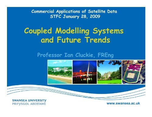
Commercial Applications of Satellite Data<br />
<strong>STFC</strong> January 28, 2009<br />
Coupled Modelling Systems<br />
and Future Trends<br />
<strong>Professor</strong> <strong>Ian</strong> <strong>Cluckie</strong>, FREng<br />
www.swansea.ac.uk
A General Scenario<br />
Coupled<br />
Ocean-Atmosphere<br />
Models<br />
Water Resources<br />
Applications<br />
Mesoscale<br />
Models<br />
P<br />
E<br />
Hydrologic/Routing<br />
Models<br />
Q s<br />
∆ S s<br />
Q g<br />
Sorooshian, HEPEX, 2004<br />
SVATs<br />
I g<br />
∆ S g<br />
www.swansea.ac.uk
Configuration for NWP<br />
• MM5 V3 comes with<br />
mature code to deal with<br />
mesoscale dynamics<br />
• Configured to run on<br />
PC/LINUX cluster to<br />
produce 5Km weather<br />
prediction over the UK<br />
domain.<br />
•Potential to conduct<br />
ensemble run with<br />
powerful HPC facility<br />
Domain 1<br />
Domain 2<br />
Domain 3<br />
Domain 4<br />
www.swansea.ac.uk
Why Grid-matching?<br />
Projection mismatch for<br />
two systems Areas<br />
covered are not the same<br />
MM5 Forecast<br />
Nimrod Forecast<br />
Nimrod Actuals<br />
www.swansea.ac.uk
Thames Tidal Barrier<br />
www.swansea.ac.uk
The Storm from Hell! > 1000yr<br />
www.swansea.ac.uk
54x54km<br />
18x18km<br />
6x6km<br />
2x2km<br />
www.swansea.ac.uk
Enhanced Ensemble Water Levels at Sheerness<br />
www.swansea.ac.uk
Mike 11 simulation close to high tide at the barrier<br />
www.swansea.ac.uk
Inundation Map for Extreme Event<br />
Source: FRMRC Co-location Workshop 2006<br />
www.swansea.ac.uk
Picture source: http://www.mailonsunday.co.uk<br />
Ensemble Prediction<br />
of Inundation Risk<br />
and Uncertainty Arising<br />
from Scour<br />
(EPIRUS)<br />
NERC FREE PROGRAM<br />
www.swansea.ac.uk
Tide, Surge & Wave Modelling Framework<br />
Meteorological<br />
Models<br />
Continental Model<br />
WAM<br />
[Grid size ~ 12km]<br />
Tide, Surge<br />
and Wave<br />
Models<br />
Regional Model<br />
POLCOMS<br />
[Grid size ~1.8km]<br />
Surf Zone<br />
Models<br />
Coastal Zone Model<br />
COAST2D<br />
[Grid size ~250m]<br />
www.swansea.ac.uk
Extreme Surges in the Southern North Sea:<br />
-The Events of 1953 -<br />
Could a larger surge<br />
occur at high water?<br />
Port<br />
HW<br />
HAT 2015<br />
1953 surge<br />
Total<br />
wrt ODN<br />
at local HW<br />
ODN<br />
Sheerness<br />
13.00<br />
3.41<br />
1.86<br />
5.27<br />
Woolwich<br />
14.00<br />
3.91<br />
1.86<br />
5.77<br />
Height of Thames Barrier is 6.9 m aODN<br />
Defra/EA, TE2100 Phase 2<br />
www.swansea.ac.uk
Local POL models for the Bristol Channel and Severn Estuary<br />
www.swansea.ac.uk
www.swansea.ac.uk
Tidal Current Modelling<br />
Source: Falconer, HRC, Cardiff<br />
Without Barrage With Barrage<br />
Mean Flood - Spring Tide<br />
www.swansea.ac.uk
Coastal Zone Model – COAST2D<br />
Regional<br />
Models<br />
COAST2D<br />
Hydrodynamic<br />
Module<br />
Morphological<br />
Module<br />
Waves<br />
Currents<br />
WPA Option<br />
IWP Option<br />
Wave Diffraction<br />
Wave Refraction<br />
Bottom Diffusion<br />
Wave Breaking<br />
Wave Reflection<br />
Transport<br />
Module<br />
Surf Zone<br />
Models<br />
www.swansea.ac.uk
www.swansea.ac.uk<br />
Wave Structure Interaction<br />
Source: Reeve, Plymouth<br />
NERC FREE
www.swansea.ac.uk
Joint with UNESCO<br />
www.swansea.ac.uk
www.swansea.ac.uk
www.swansea.ac.uk
Impervious Surface Area Mapping<br />
of the Chesapeake Bay Watershed<br />
100%<br />
80%<br />
60%<br />
Wilkes-Barre,PA<br />
40%<br />
20%<br />
Baltimore, MD<br />
0%<br />
%Impervious<br />
Richmond, VA<br />
Washington, DC<br />
Courtesy Mid-Atlantic RESAC
Côtière et Marine au Niveau de la Côte Occidentale Algerienne - Association de Recherche<br />
sur Le Climat et L’Environnement<br />
Botswana<br />
• Effects of land cover/ land use changes on water quality in artificial wetland in the<br />
Limpopo basin. A case study of Botswana (Gaborone, Bokaa, Shashi and Letsibogo<br />
Dams) - Botswana College of Agriculture<br />
Cameron<br />
• Eau, écosystèmes et développement dans les hautes terres d'Afrique centrale :<br />
exemple du Cameroun et du Burundi - Université de Dschang<br />
• Le lac Nyos, risques hydrogéologiques et modélisation prospective des catastrophes -<br />
Université de Yaoundé I<br />
Ethiopia<br />
• Coming to grips with land management and water harvesting in Geba catchment<br />
(Northern Ethiopia) through satellite imagery - Mekelle Universit<br />
Kenya<br />
• Planning of System Innovations in Watersheds: Spatial Mapping of Environmental and<br />
Hydrological Determinants in P angani and Thukela River Basins, Africa. - International<br />
Livestock Research Institute<br />
Ivory Coast<br />
• Etude hydrostructurale du rés eau sismique ivoirien par imagerie satellite: cas de la<br />
contribution de la télédétection et des Systèmes d'Information Géographiques (SIG) a la<br />
gestion intégrée du bassin du fleuve Bandama en Côte d'Ivoire - Station Géophysique de<br />
Lamto<br />
Madagascar<br />
• Suivi par satellite des risques naturels dans les îles de l'Océan Indien (cyclones et<br />
erosion) Université d'Antananarivo, Institut et Observatoire de Géophysique<br />
d'Antananarivo<br />
Morocco<br />
• Télédétection et Information Spatiale pour la Gestion intégrée des Ressources en Eau<br />
dans le bassin hydraulique de Souss-Massa (Agadir, Maroc) - Centre Royal de<br />
Télédétection Spatiale<br />
• Analyse, qualification et suivi des phénomènes géologiques et hydrogéologiques dans la<br />
zone des Doukkala-Abda et son l ittoral Atlantique: Apport de la té lédétection spatiale -<br />
Université Chauib Doukkali<br />
Namibia<br />
• Namibian Kuiseb and Omaruru Basin Management - Acquisition and Preparation of Base<br />
Data for Water Resource Management - Kuiseb Basin Management Committee<br />
• Application of Earth Observation [EO] data for Integrated Land and Water Management<br />
in the Cuvelai Basin in Namibia - Ministry of Agriculture, Water and Rural Development<br />
• Towards an operational tool to evaluate and mon itor ephemeral river basin<br />
management using remote sensing - Desert Research Foundation of Namibia<br />
Niger<br />
• Evaluation et suivi par télédétection des zones humides au Sahel – AGRHYMET<br />
• Utilisation des données satellites pour l'évaluation et la gestion intégrée des ressources<br />
en eau au Niger - Ministère de l’Hydraulique, de l’Environnement et de la Lutte Contre la<br />
Désertification<br />
www.swansea.ac.uk
UNESCO TIGER THEMES<br />
• Drought Assessment and Recovery<br />
• Coupling EO with NWP<br />
• Management of Wetlands<br />
• Water and Health<br />
• Flood Risk Management<br />
• Great African Watersheds<br />
• Water and Agriculture<br />
www.swansea.ac.uk
SW Floods<br />
October 2000<br />
FINAL COMMENTS<br />
I Hope<br />
You Enjoyed<br />
the Talk<br />
www.swansea.ac.uk


