Black Mesa Basalt - Oklahoma Geological Survey
Black Mesa Basalt - Oklahoma Geological Survey
Black Mesa Basalt - Oklahoma Geological Survey

Create successful ePaper yourself
Turn your PDF publications into a flip-book with our unique Google optimized e-Paper software.
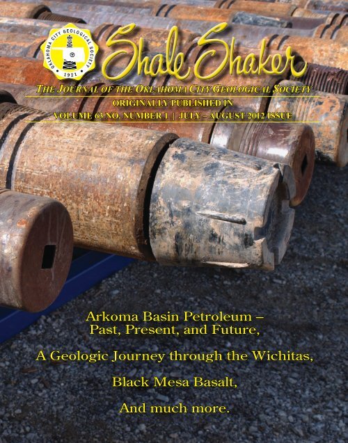
THE JOURNAL OF THE OKLAHOMA CITY GEOLOGICAL SOCIETY<br />
ORIGINALLY PUBLISHED IN<br />
VOLUME 63 NO. NUMBER 1 | JULY – AUGUST 2012 ISSUE<br />
Arkoma Basin Petroleum –<br />
Past, Present, and Future,<br />
A Geologic Journey through the Wichitas,<br />
<strong>Black</strong> <strong>Mesa</strong> <strong>Basalt</strong>,<br />
And much more.
My Favorite Outcrop<br />
by: Neil H. Suneson, <strong>Oklahoma</strong> <strong>Geological</strong> <strong>Survey</strong> | (405) 325-7315 | nsuneson@ou.edu<br />
<strong>Black</strong> <strong>Mesa</strong> <strong>Basalt</strong><br />
Introduction<br />
There are not a lot of volcanic rocks<br />
in <strong>Oklahoma</strong>. Probably the least known<br />
are the Colbert and Carlton Rhyolites<br />
(Cambrian) in the Arbuckle and Wichita<br />
Mountains, respectively; the Hatton Tuff<br />
and Mud Creek tuffs (Mississippian) in<br />
the Ouachita Mountains; and scattered<br />
volcanic ashes from Yellowstone and<br />
other Neogene calderas. Most likely the<br />
best known and undoubtedly the most<br />
visited is the basalt lava flow capping<br />
<strong>Black</strong> <strong>Mesa</strong> in the northwestern corner of<br />
Cimarron County. Much of the top of the<br />
mesa is within the <strong>Black</strong> <strong>Mesa</strong> Nature Preserve<br />
which is operated by the <strong>Oklahoma</strong><br />
Tourism and Recreation Department in<br />
conjunction with <strong>Black</strong> <strong>Mesa</strong> State Park;<br />
as such, it is accessible to the public and<br />
a 4.2-mile hiking trail (one-way) leads to<br />
the highest point in the state at an elevation<br />
of 4,973 feet above sea level.<br />
The popularity, yet remoteness of <strong>Black</strong><br />
<strong>Mesa</strong>, combined with some outstanding<br />
geology and the fascinating human (Native<br />
American and European) history of<br />
the area, make the <strong>Black</strong> <strong>Mesa</strong> basalt this<br />
issue’s “Favorite Outcrop.”<br />
Geologic Setting<br />
The oldest strata in northwestern Cimarron<br />
County (also known as Dry Cimarron<br />
Valley) are the dominantly Upper Triassic<br />
Sloan Canyon Formation and overlying<br />
Sheep Pen Sandstone (Lucas et al., 1987a)<br />
(Figure 1). Older Triassic strata (from older<br />
to younger, the Baldy Hill and Travesser<br />
Formations) are present just to the west in<br />
New Mexico (Baldwin and Muehlberger,<br />
1959). In <strong>Oklahoma</strong> and adjacent Colorado<br />
and New Mexico, about 200 copper<br />
mines and prospects were opened in the<br />
dominantly fluvial Sheep Pen Sandstone<br />
Page 24 | July ~ August 2012
Formation (Figure 1). The Morrison Formation<br />
is probably the most famous dinosaur-bone-bearing<br />
formation in the U.S.<br />
and the 17 quarries excavated by J.W.<br />
Stovall between 1935 and 1942 (Hunt and<br />
Lucas, 1987) is evidence that <strong>Oklahoma</strong><br />
contains its share. The Morrison is mostly<br />
a claystone with minor silty sandstones<br />
and limestones and was probably deposited<br />
as a series of floodplains, shallow<br />
channels, and lakes.<br />
The Lower Cretaceous Cheyenne Sandstone,<br />
Kiowa Shale, and Dakota Sandstone<br />
(oldest to youngest) unconformably<br />
overlie the Morrison (Figure 1). (This sequence<br />
was renamed the Lytle Sandstone,<br />
Glencairn Formation, and Dakota Group<br />
by Kues and Lucas (1987) to more closely<br />
match the nomenclature used in New<br />
Mexico and Colorado, rather than Kansas.)<br />
The conglomeratic sandstones of the<br />
Cheyenne are mostly fluvial; petrified logs<br />
as long as 85 feet and 2.5 feet in diameter<br />
were noted by Schoff (1943, p. 76), but<br />
the petrified wood has been over-collected<br />
and is difficult to find. The Kiowa is<br />
a poorly exposed, mostly relatively dark<br />
between 1884 and 1925, although little is<br />
known about total production (Fay, 1983).<br />
The lacustrine Sloan Canyon Formation<br />
contains abundant vertebrate fossils, in<br />
fact, Lucas et al. (1987a, p. 107) suggests<br />
it “is the most fossiliferous of the Triassic<br />
units in the Dry Cimarron Valley,” and one<br />
of the quarries is very near the trailhead to<br />
the top of <strong>Black</strong> <strong>Mesa</strong>.<br />
Unconformably overlying the Triassic<br />
strata are the Middle Jurassic Exeter<br />
Sandstone, a highly cross-stratified eolian<br />
deposit which, in turn, is unconformably<br />
overlain by the Upper Jurassic Morrison<br />
Figure 1. Stratigraphic column and correlation chart of Dry Cimarron Valley, New Mexico and<br />
<strong>Oklahoma</strong>.<br />
July ~ August 2012 | Page 25
My Favorite Outcrop<br />
<strong>Black</strong> <strong>Mesa</strong> <strong>Basalt</strong>, cont.<br />
Page 26 | July ~ August 2012
Figure 2. GoogleEarth image of <strong>Black</strong> <strong>Mesa</strong><br />
looking to the southwest. The mesa is capped<br />
by the <strong>Black</strong> <strong>Mesa</strong> basalt; the lower bench<br />
in the lower left is underlain by relatively<br />
resistant Dakota Sandstone. The conspicuous<br />
road in the lower right that ends at the creek<br />
leads from the paved road to the dinosaur<br />
footprints in the creek bottom. The <strong>Black</strong> <strong>Mesa</strong><br />
trailhead is located just to the left (south) of<br />
where the bridge crosses the creek upstream<br />
from the footprints.<br />
July ~ August 2012 | Page 27
My Favorite Outcrop<br />
<strong>Black</strong> <strong>Mesa</strong> <strong>Basalt</strong>, cont.<br />
Figure 3. GoogleEarth image of three-state area showing <strong>Mesa</strong> de Maya in Colorado and <strong>Black</strong> <strong>Mesa</strong> in New Mexico and <strong>Oklahoma</strong> (arrow). ^s mark<br />
vent areas for lava flows (Scott, 1968). Western white arrow points to where the <strong>Black</strong> <strong>Mesa</strong> flow crosses the Colorado – New Mexico state line. The<br />
eastern white arrow points to <strong>Black</strong> <strong>Mesa</strong> flow in <strong>Oklahoma</strong>. Note isolated lava flows north of <strong>Mesa</strong> de Maya in Las Animas County, Colorado.<br />
Page 28 | July ~ August 2012
Figure 4. Vesicles in <strong>Black</strong> <strong>Mesa</strong> basalt.<br />
Figure 5. View looking northeast at basalt exposed on southeast edge of <strong>Black</strong> <strong>Mesa</strong>.<br />
July ~ August 2012 | Page 29
My Favorite Outrcop<br />
<strong>Black</strong> <strong>Mesa</strong> <strong>Basalt</strong>, cont.<br />
Figure 6. Neogene volcanic fields along the Jemez Lineament (from http://sitemason.vanderbilt.edu/page/iyQ5lm, accessed May 8, 2012)<br />
marine shale containing marine invertebrates,<br />
especially the oyster Texigryphaea.<br />
The Dakota Group is typically divided<br />
into three parts, a fluvial sandstonedominated<br />
lower unit; a middle, more<br />
fine-grained unit that locally contains<br />
coal beds and probably was deposited in<br />
a delta-plain environment; and an upper,<br />
sandy unit that represents a return to a fluvial<br />
environment. Despite the very different<br />
environments the Lower Cretaceous<br />
units were deposited in and the erosional<br />
disconformities that separate them, they<br />
represent a relatively continuous record of<br />
sedimentation.<br />
The youngest Mesozoic formations in the<br />
Dry Cimarron Valley are the Upper Cretaceous<br />
Graneros Shale and Greenhorn<br />
Formation (Figure 1). The abundance of<br />
marine invertebrates fossils in and widespread<br />
nature of these units is evidence for<br />
a significant rise in sea level and, indeed,<br />
the Graneros marks the advance of the<br />
Western Interior Seaway through this part<br />
of the mid-continent.<br />
Most of the Upper Cretaceous through<br />
lower Miocene is missing in Cimarron<br />
County; most likely, during this time the<br />
area was at least slightly uplifted and<br />
undergoing erosion as a result of the<br />
Laramide orogeny (uplift of the Rocky<br />
Mountains) to the west. The Miocene-<br />
Pliocene Ogallala Formation unconformably<br />
overlies the Cretaceous (Figure 1) on<br />
<strong>Black</strong> <strong>Mesa</strong> but thickens greatly to the east<br />
where it forms the <strong>Oklahoma</strong> Panhandle’s<br />
(and most of the Great Plains states’) most<br />
important aquifer.<br />
<strong>Black</strong> <strong>Mesa</strong> <strong>Basalt</strong><br />
The most prominent physiographic feature<br />
in the Dry Cimarron Valley is <strong>Black</strong><br />
<strong>Mesa</strong> (Figure 2), which includes the highest<br />
point in <strong>Oklahoma</strong> at an elevation of<br />
4,973 feet. <strong>Black</strong> <strong>Mesa</strong> is continuous with<br />
<strong>Mesa</strong> de Maya in southern Las Animas<br />
County, Colorado, and the two mesas<br />
combined are almost 50 miles long (Figure<br />
3). <strong>Black</strong> <strong>Mesa</strong> is capped by a basalt<br />
lava flow that originated from one or<br />
more vents on <strong>Mesa</strong> de Maya; the closest,<br />
about 30 miles away, is described by<br />
Scott (1968) as “dikes and plugs of olivine<br />
basalt that form ridges and knobs.” This<br />
possible vent for the flow into <strong>Oklahoma</strong><br />
is about six miles east of Bar Seven L<br />
Buttes, which Rothrock (1925) suggested<br />
was the source of the <strong>Oklahoma</strong> flow.<br />
In <strong>Oklahoma</strong>, the basalt varies from about<br />
100 to 50 feet thick, probably as a result<br />
of having flowed over an irregular topography<br />
developed on the Ogallala. It varies<br />
from massive to highly vesicular (Figure<br />
4), and along the cliff face at the top of<br />
the mesa, the basalt is jointed and locally<br />
displays columnar joints (Figure 5). The<br />
obvious elongate nature of <strong>Mesa</strong> de Maya<br />
– <strong>Black</strong> <strong>Mesa</strong> is evidence that the basalt<br />
Page 30 | July ~ August 2012
flowed east-southeast from its source<br />
down a paleovalley.<br />
The basalt on <strong>Black</strong> <strong>Mesa</strong> is an alkali olivine<br />
basalt containing small olivine phenocrysts<br />
(largely altered to iddingsite) in<br />
a groundmass composed of plagioclase,<br />
augite, olivine, and magnetite (Schoff,<br />
1943; Baldwin and Muehlberger, 1959). A<br />
chemical analysis of the basalt is shown in<br />
Table I (from Rothrock, 1925). The basalt<br />
is Pliocene. Hager (1974) dated the basalt<br />
at 3.5 +/- 1.0 and 3.4 +/- 1.0 my old (K-<br />
Ar). More recently Stroud (1997) dated<br />
it at 5.05 +/- 0.02 and 5.10 +/- 0.3 my<br />
( 40 Ar/ 39 Ar). The age of the basalt is important<br />
for two reasons: 1) It enables an analysis<br />
of landscape evolution to be developed<br />
that can quantify how much erosion<br />
has occurred in the Dry Cimarron Valley<br />
area following its eruption, and 2) Where<br />
<strong>Black</strong> <strong>Mesa</strong> basalt clasts can be identified<br />
in the Ogallala to the east, the date establishes<br />
a maximum age of the Ogallala.<br />
Raton – Clayton Volcanic Field<br />
The <strong>Black</strong> <strong>Mesa</strong> basalt is part of the late<br />
Miocene to Holocene Raton-Clayton<br />
Table I. Chemical Analysis of <strong>Black</strong><br />
<strong>Mesa</strong> basalt<br />
Percent<br />
SiO 2<br />
50.96<br />
Al 2<br />
O 3<br />
17.54<br />
Fe 2<br />
O 3<br />
3.01<br />
FeO 7.46<br />
MgO 5.17<br />
CaO 9.18<br />
Na 2<br />
O 2.78<br />
K 2<br />
O 0.54<br />
H 2<br />
O 0.86<br />
TiO 2<br />
1.31<br />
P 2<br />
O 5<br />
0.54<br />
Cr 2<br />
O 3<br />
0.04<br />
MnO 0.15<br />
Total 99.54<br />
volcanic field, which occupies much of<br />
the northeastern corner of New Mexico<br />
(Stormer, 1972) and that includes the<br />
spectacular Capulin cinder cone and lava<br />
flows dated at 56,000 +/- 8,000 years<br />
ago ( 40 Ar /39 Ar)(Stroud, 1997). The <strong>Mesa</strong><br />
de Maya – <strong>Black</strong> <strong>Mesa</strong> lava flows are<br />
the northern part of the field and, except<br />
for some small flow remnants about four<br />
miles northeast of the eastern end of <strong>Black</strong><br />
<strong>Mesa</strong>, the <strong>Black</strong> <strong>Mesa</strong> flow is the easternmost<br />
Neogene lava flow in the U.S.<br />
The Raton-Clayton volcanic field is the<br />
northeasternmost volcanic field in a string<br />
of Neogene volcanic fields that extend in<br />
an east-northeast direction along the Jemez<br />
Lineament; these include (from southwest<br />
to northeast), the Red Hill (Springerville),<br />
Zuni-Bandera, Mt. Taylor, Jemez, Taos<br />
Plateau, Ocate, and Raton-Clayton volcanic<br />
fields (Figure 6). Magnani et al. (2005)<br />
(see also references cited therein) describe<br />
several features of the Jemez Lineament<br />
as follows:<br />
1. Volcanic rocks range in age from<br />
16.5 my to 1200 years BP.<br />
2. Volcanic rocks are dominantly basaltic<br />
with a few silicic volcanoes.<br />
3. There is no age progression of volcanism<br />
along the lineament.<br />
4. The lineament coincides with the<br />
southern edge of the Proterozoic<br />
Yavapai-Mazatzal crustal boundary<br />
in northern New Mexico.<br />
Lipman (1980) extends the Jemez Lineament<br />
even farther to the southwest to include<br />
the Sentinel (Gila Bend) and Pinacate<br />
volcanic fields. Thus, the volcanic<br />
rocks that erupted along the lineament,<br />
including the <strong>Black</strong> <strong>Mesa</strong> basalt of <strong>Oklahoma</strong>,<br />
utilized an ancient and deep flaw in<br />
the Earth’s lithosphere.<br />
Finally ……..<br />
A hike on the trail to the top of <strong>Black</strong><br />
<strong>Mesa</strong> to see the basalt flow is well worth<br />
the drive to <strong>Oklahoma</strong>’s Dry Cimarron<br />
Valley. However, there are many more<br />
sites to see and places to visit, including:<br />
1. The Santa Fe Trail Crossing, Cimarron<br />
Cutoff, used from about 1820 to<br />
1880.<br />
2. Lake Carl G. Etling in the state park,<br />
formed in 1959 and stocked with a<br />
variety of fish.<br />
3. Stovall dinosaur quarry no. 1.<br />
4. The Old Woman’s profile and Wedding<br />
Party in the lower sandstone<br />
member of the Dakota Sandstone.<br />
5. The Kenton Museum.<br />
6. Robbers Roost, headquarters of<br />
Capt. William Coe’s band of outlaws<br />
in the 1860s.<br />
7. Dinosaur tracks, probably of a large<br />
ornithopod (Lockley, 1986; Mulvaney<br />
and Mulvaney, 1988).<br />
8. The (two) Three-State Markers.<br />
Current marker is along the road; a<br />
second marker dated 1881 is located<br />
a couple hundred yards to the northeast.<br />
Acknowledgements<br />
Few geologists can visit northwestern Cimarron<br />
County and not be taken with the<br />
area’s geology. From the old copper mines<br />
in the Sheep Pen Sandstone (Upper Triassic),<br />
to the dinosaur bones in the Morrison<br />
Formation (Upper Jurassic), to the<br />
petrified logs in the Cheyenne Sandstone<br />
(Lower Cretaceous), to the basalt flow<br />
(Pliocene) on <strong>Black</strong> <strong>Mesa</strong>, the area is a<br />
geologists’ playground. And like most geologists,<br />
I have long been enamored with<br />
the area. But my interest was recently rekindled<br />
by Reggie Whitten with the Whitten-Newman<br />
Foundation of <strong>Oklahoma</strong><br />
City. The Foundation has purchased 700<br />
acres on the flanks and top of <strong>Black</strong> <strong>Mesa</strong><br />
with the goal of establishing a (for lack of<br />
a better “word”) field “–ology” camp.<br />
One of the goals of the Whitten-Newman<br />
Foundation is to interest young people in<br />
the field sciences – geology, paleontology,<br />
archaeology, biology, ecology, etc.,<br />
and what better place in <strong>Oklahoma</strong> to do it<br />
than at <strong>Black</strong> <strong>Mesa</strong>? Therefore, the foundation<br />
is working with scientists and other<br />
professionals from throughout <strong>Oklahoma</strong><br />
to establish a field camp and field science<br />
July ~ August 2012 | Page 31
My Favorite Outrcop<br />
<strong>Black</strong> <strong>Mesa</strong> <strong>Basalt</strong>, cont.<br />
program designed to interest and educate<br />
our young people in the “–ologies.”<br />
I would like to thank Barry Weaver, ConocoPhillips<br />
School of Geology and Geophysics,<br />
for showing me some current<br />
papers on the volcanics of northern New<br />
Mexico and for having critiqued an early<br />
version of this paper.<br />
References Cited<br />
Baldwin, B.; and Muehlberger, W.R., 1959, Geologic studies of<br />
Union County, New Mexico: New Mexico Bureau of Mines<br />
and Mineral Resources Bulletin 63, 171p.<br />
Fay, R.O., 1983, Copper deposits in Sheep Pen Sandstone (Triassic)<br />
in Cimarron County, <strong>Oklahoma</strong>, and adjacent parts of<br />
Colorado and New Mexico: <strong>Oklahoma</strong> <strong>Geological</strong> <strong>Survey</strong><br />
Circular 86, 24p.<br />
Hager, M.W., 1974, Late Pliocene and Pleistocene history of the<br />
Donnelly Ranch vertebrate site, southeastern Colorado: University<br />
of Wyoming Contributions to Geology Special Paper<br />
No. 2, 62p.<br />
Hunt, A.P.; and Lucas, S.G., 1987, J.W. Stovall and the Mesozoic<br />
of the Cimarron Valley, <strong>Oklahoma</strong> and New Mexico, in Lucas,<br />
S.G.; and Hunt, A.P., eds., Northeastern New Mexico:<br />
New Mexico <strong>Geological</strong> Society 38 th Annual Field Conference,<br />
September 24-26, 1987, p. 139-151.<br />
Kues, B.S.; and Lucas, S.G., 1987, Cretaceous stratigraphy and<br />
paleontology in the Dry Cimarron Valley, New Mexico, Colorado,<br />
and <strong>Oklahoma</strong>, in Lucas, S.G.; and Hunt, A.P., eds.,<br />
Northeastern New Mexico: New Mexico <strong>Geological</strong> Society<br />
38th Annual Field Conference, September 24-26, 1987, p.<br />
167-198.<br />
Lipman, P.W., 1980, Cenozoic volcanism in the western United<br />
States: implications for continental tectonics, in Continental<br />
Tectonics: National Academy of Sciences, Washington, D.C.,<br />
p. 161-174.<br />
Lockley, M.G., 1986, A guide to dinosaur tracksites of the Colorado<br />
Plateau and American southwest: University of Colorado<br />
at Denver, Geology Department Magazine, Special Issue 1,<br />
56p.<br />
Lucas, S.G.; Hunt, A.P.; and Hayden, S.N., 1987a, The Triassic<br />
system in the Dry Cimarron Valley, New Mexico, Colorado<br />
and <strong>Oklahoma</strong>, in Lucas, S.G.; and Hunt, A.P., eds., Northeastern<br />
New Mexico: New Mexico <strong>Geological</strong> Society 38th<br />
Annual Field Conference, September 24-26, 1987, p. 97-117.<br />
Lucas, S.G.; Hunt, A.P.; and Kues, B.S., 1987b, Stratigraphic nomenclature<br />
and correlation chart for northeastern New Mexico,<br />
in Lucas, S.G.; and Hunt, A.P., eds., Northeastern New<br />
Mexico: New Mexico <strong>Geological</strong> Society 38 th Annual Field<br />
Conference, September 24-26, 1987, p. 351-354.<br />
Magnani, M.B.; Levander, A.; Miller, K.C.; Eshete, T.; and Karlstrom,<br />
K.E., 2005, Seismic investigation of the Yavapai-<br />
Mazatzal transition zone and the Jemez Lineament in northeastern<br />
New Mexico, in Karlstrom, K.E.; and Keller, G.R.,<br />
eds., The Rocky Mountain region – an evolving lithosphere:<br />
tectonics, geochemistry and geophysics: American Geophysical<br />
Union Monograph 154, p. 227-238.<br />
Mulvaney, P.S.; and Mulvaney, J.O., 1988, Geology field trip,<br />
<strong>Black</strong> <strong>Mesa</strong> State Park, Cimarron County, <strong>Oklahoma</strong>: unpub.<br />
guidebook, <strong>Oklahoma</strong> Academy of Science fall field meeting,<br />
September 24, 1988, 26p.<br />
Rothrock, E.P., 1925, Geology of Cimarron County: <strong>Oklahoma</strong><br />
<strong>Geological</strong> <strong>Survey</strong> Bulletin 34, 110p.<br />
Schoff, S.L., 1943, Geology and ground water resources of Cimarron<br />
County, <strong>Oklahoma</strong>: <strong>Oklahoma</strong> <strong>Geological</strong> <strong>Survey</strong><br />
Bulletin 64, 317p.<br />
Scott, G.R., 1968, Geologic and structure contour map of the La<br />
Junta Quadrangle, Colorado and Kansas: U.S. <strong>Geological</strong><br />
<strong>Survey</strong> Miscellaneous Geologic Investigations Map I-560,<br />
scale 1:250,000.<br />
Stormer, J.C., Jr., 1972, Mineralogy and petrology of the Raton-<br />
Clayton volcanic field, northeastern New Mexico: <strong>Geological</strong><br />
Society of America Bulletin, v. 83, p. 3299-3322.<br />
Stroud, J.R., 1997, The geochronology of the Raton-Clayton volcanic<br />
field, with implications for volcanic history and landscape<br />
evolution: unpub. M.S. thesis, New Mexico Institute of<br />
Mining and Technology, Socorro, New Mexico, 51p.<br />
Page 32 | July ~ August 2012
Biographical Sketch<br />
Neil Suneson has worked for the <strong>Oklahoma</strong> <strong>Geological</strong> <strong>Survey</strong> since 1986, when he and some colleagues started mapping the<br />
frontal belt of the Ouachita Mountains and the southern part of the Arkoma Basin as part of the USGS-sponsored COGEOMAP<br />
and later STATEMAP programs. After working in the Ouachitas, he did some reconnaissance mapping in northwestern <strong>Oklahoma</strong><br />
and more detailed mapping in the <strong>Oklahoma</strong> City metro area.<br />
When the <strong>Survey</strong> became part of the Mewbourne College of Earth<br />
and Energy at OU, more of Neil’s time was devoted to teaching<br />
(including the School of Geology’s summer field camp outside of<br />
Cañon City, Colorado) and advising students on their theses. His<br />
interests range from the Late Tertiary geology of the <strong>Oklahoma</strong><br />
Panhandle to the Early Paleozoic geology of the Broken Bow uplift<br />
in southeastern <strong>Oklahoma</strong> and everything in between. He even<br />
likes (some) igneous rocks.<br />
Prior to working for the <strong>Survey</strong>, Neil was a petroleum development<br />
geologist with Chevron USA where he worked on the Lost Hills<br />
Oilfield. He also worked with Chevron Resources Company in geothermal<br />
exploration throughout the western U.S. All his college degrees<br />
are in geology. He received at B.A. from Amherst College in<br />
1972, an M.S. from Arizona State University in 1976, and a Ph.D.<br />
from the University of California – Santa Barbara in 1980. His dissertation,<br />
largely funded by the U.S. <strong>Geological</strong> <strong>Survey</strong>, was based<br />
on mapping in the highly extended terrane of west-central Arizona.<br />
Neil Suneson<br />
<strong>Oklahoma</strong> <strong>Geological</strong> <strong>Survey</strong><br />
Panhandle<br />
Oil and Gas Inc.<br />
5400 NORTH GRAND BOULEVARD, SUITE 300<br />
OKLAHOMA CITY OKLAHOMA 73112<br />
PHONE: 405.948.1560<br />
FAX: 405.948.2038<br />
July ~ August 2012 | Page 33
120 North Robinson, Suite 900 Center<br />
<strong>Oklahoma</strong> City, OK 73102