2007-2008 Annual Summary - Oklahoma Geological Survey ...
2007-2008 Annual Summary - Oklahoma Geological Survey ...
2007-2008 Annual Summary - Oklahoma Geological Survey ...

You also want an ePaper? Increase the reach of your titles
YUMPU automatically turns print PDFs into web optimized ePapers that Google loves.
<strong>Oklahoma</strong> <strong>Geological</strong> <strong>Survey</strong><br />
G. Randy Keller, Interim Director<br />
<strong>Oklahoma</strong> <strong>Geological</strong> <strong>Survey</strong><br />
<strong>Annual</strong> <strong>Summary</strong><br />
<strong>2007</strong>–<strong>2008</strong><br />
Updated for the OGS Centennial Celebration<br />
November 21, <strong>2008</strong><br />
Compiled by<br />
Connie Smith<br />
Mewbourne College of Earth and Energy<br />
The University of <strong>Oklahoma</strong><br />
The University of <strong>Oklahoma</strong> is an equal opportunity institution.<br />
This publication, printed by the <strong>Oklahoma</strong> <strong>Geological</strong> <strong>Survey</strong>, Norman, <strong>Oklahoma</strong>, is issued by the <strong>Oklahoma</strong> <strong>Geological</strong><br />
<strong>Survey</strong> as authorized by Title 70, <strong>Oklahoma</strong> Statutes 1981, Section 3310, and Title 74, <strong>Oklahoma</strong> Statutes 1981, Sections<br />
231—238. 250 copies have been prepared for distribution at a cost of $459 to the taxpayers of the State of <strong>Oklahoma</strong>.<br />
Copies have been deposited with the Publications Clearinghouse of the <strong>Oklahoma</strong> Department of Libraries.
<strong>Oklahoma</strong> <strong>Geological</strong> <strong>Survey</strong><br />
<strong>Annual</strong> <strong>Summary</strong><br />
<strong>2007</strong>–<strong>2008</strong><br />
(Updated November <strong>2008</strong>)<br />
The <strong>Oklahoma</strong> <strong>Geological</strong> <strong>Survey</strong> celebrated the Centennial of <strong>Oklahoma</strong>’s<br />
Statehood and the 100th anniversary of the <strong>Survey</strong>’s inclusion in the <strong>Oklahoma</strong><br />
Constitution in <strong>2007</strong>. Thus, even at <strong>Oklahoma</strong>’s inception, it was evident that<br />
natural resources would play an important role in the future of the new state. In<br />
<strong>2008</strong>, the <strong>Survey</strong> celebrates its actual 100 years of existence as a working agency.<br />
The <strong>Oklahoma</strong> <strong>Geological</strong> <strong>Survey</strong> is the only such agency mandated in the<br />
constitution of a new state. Its mission was, and is, to:<br />
Investigate the state’s land, water, mineral, and energy<br />
resources and disseminate the results of those investigations<br />
to promote the wise use of <strong>Oklahoma</strong>’s natural resources<br />
consistent with sound environmental practices.<br />
The year <strong>2007</strong> was a landmark for the OGS as Dr.<br />
Charles J. Mankin, director since 1967, retired on<br />
Oct. 31. During his 40 years at the helm, Dr. Mankin<br />
oversaw the growth and expansion of OGS programs,<br />
acquired the <strong>Oklahoma</strong> Geophysical Observatory at<br />
Leonard and the <strong>Oklahoma</strong> Petroleum Information<br />
Center in north Norman, and always kept in mind the<br />
mission of public service.<br />
Dr. G. Randy Keller<br />
The interim director of the <strong>Survey</strong> is Dr. G. Randy<br />
Keller, who holds the Edward Lamb McCollough Chair<br />
in Geology and Geophysics. Dr. Keller has taken an<br />
active interest in advancing the OGS and ensuring<br />
that its core activities continue and expand to reflect<br />
current needs and issues.
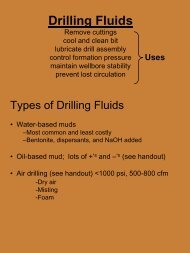
Fossil Fuels<br />
OGS oil and gas programs focus on<br />
basic studies, public service and<br />
outreach, and cooperative efforts with<br />
industry and academia. As always,<br />
there is great interest in providing<br />
key geologic expertise, tracking drilling<br />
activity, compiling well data, and<br />
providing help to individual property<br />
owners.<br />
<strong>Survey</strong> geologists responded to<br />
requests for assistance through<br />
e-mail, telephone conversations and<br />
sometimes, personal visits. While<br />
there were requests for information<br />
from business, government or<br />
academic sources, many questions<br />
came from individuals with mineral<br />
rights.<br />
Petroleum and Natural Gas<br />
Woodford Shale: An ongoing and<br />
important Woodford Shale study by<br />
geologist Richard D. Andrews involves<br />
field work, examining Woodford-Sycamore<br />
and Woodford-Hunton contacts<br />
and relating them to subsurface well<br />
logs. Frequently, surface formation<br />
boundaries are different than those<br />
interpreted in the subsurface using<br />
well logs. This work helps validate<br />
formation contacts bounding the<br />
Woodford Shale.<br />
Detailed gamma-ray and outcrop measurements<br />
were made across 430 ft of<br />
Woodford/Sycamore/Hunton strata,<br />
including respective formation boundaries.<br />
These measurements include all<br />
outcrops along the north and south<br />
flanks of the Wichita Mountains near<br />
I-35. Additionally, production trends<br />
and decline curves are being prepared<br />
to update information previously<br />
reported. This work was presented at<br />
the Gas Shale workshop in October.<br />
Andrews presented a number of<br />
talks and field trips on this subject<br />
during the year. He also helped teach<br />
Geology 4233, Subsurface Methods,<br />
with OGS geologists Dan T. Boyd and<br />
Neil H. Suneson.<br />
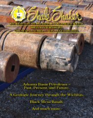
<strong>Oklahoma</strong> Oil Enhancement Project:<br />
The first part of Boyd’s study to<br />
determine “ideal” recovery factors for<br />
reservoirs by examining class, quality<br />
and drive mechanisms is finished<br />
and was published in the <strong>Oklahoma</strong><br />
City <strong>Geological</strong> Society Shale Shaker<br />
(Fig. 1), and <strong>Oklahoma</strong> Geology<br />
Notes, and is available on the Web.<br />
www.ogs.ou.edu/pdf/OKultoilop.pdf<br />
Boyd concludes that a great opportunity<br />
exists in <strong>Oklahoma</strong> to improve<br />
oil recovery from existing fields. His<br />
study found that greater access to<br />
well and production data could help<br />
operators take advantage of a huge,<br />
untapped potential in <strong>Oklahoma</strong>.<br />
His work continues as reservoir<br />
classes are being divided into subclasses,<br />
with each assigned target<br />
recovery factors. The project’s goal<br />
is to prompt industry interest in opportunities<br />
for more production and<br />
induce service companies to make<br />
early production data available.<br />
<strong>2007</strong> <strong>Oklahoma</strong> Drilling Activity:<br />
Boyd gathered data as it arrived<br />
through IHS Energy and completed<br />
the report as the third in a series. It<br />
was published in the Shale Shaker,<br />
then added to the OGS Web.<br />
2
Coal and Gas Shales<br />
Interest in unconventional gas in<br />
<strong>Oklahoma</strong> has increased greatly in<br />
recent years. Starting with seven<br />
wells to the Hartshorne coal in the<br />
Arkoma Basin in 1989, there are now<br />
5,301 records to date in the <strong>Oklahoma</strong><br />
Coalbed Methane completions<br />
database (Fig. 2). The annual peak<br />
was 653 wells in 2005. Part of the<br />
reduced number for <strong>2007</strong> reflects the<br />
lag in reporting completions to the<br />
<strong>Oklahoma</strong> Corporation Commission.<br />
The histogram (Fig. 3) shows an<br />
interest in gas shales in <strong>Oklahoma</strong> that<br />
began in 2004, following the success<br />
of the Barnett Shale in the Fort Worth<br />
Basin in Texas. The application of<br />
advanced completion techniques to<br />
shales in 2004 resulted in a total of<br />
434 Woodford wells and 58 Caney<br />
wells being drilled in 2004–<strong>2007</strong>. The<br />
peak to date occurred in <strong>2007</strong>, with<br />
265 Woodford gas shale completions.<br />
Figure 2. Coalbed methane well completions in <strong>Oklahoma</strong>, 1988–<strong>2007</strong>.<br />
Geologist Brian J. Cardott added 187<br />
records to his Gas Shales table that is<br />
an important feature of the OGS Web<br />
site. The table had 364 records at the<br />
end of <strong>2007</strong>, and Cardott continues to<br />
update the files using 1002A completion<br />
reports.<br />
Cardott posted a number of presentations,<br />
papers and updated maps on<br />
the Web, and organized the Woodford<br />
Gas Shale Conference and Field<br />
Trip, held in <strong>Oklahoma</strong> City on May<br />
23, <strong>2008</strong>. This workshop had 416<br />
registrants; another 100 people were<br />
turned away due to a lack of space.<br />
Cardott and Jane L. Weber, OGS<br />
database coordinator, also added<br />
coal chemistry data from an in-house<br />
open-file database to the analytical<br />
tables, and gas field, latitude, and<br />
longitude information to the coalbed<br />
methane table. See the OGS Web.<br />
www.ogs.ou.edu/oilgas.php<br />
Figure 3. Number of Caney and Woodford wells in <strong>Oklahoma</strong>, 1930–<strong>2007</strong>.<br />
3
Cardott continues to work with<br />
vitrinite reflectance analysis of coal<br />
samples for subsurface coal rank<br />
studies in the Arkoma Basin.<br />
Geophysical Studies<br />
Field Study of Micro-Earthquakes<br />
During Hydraulic Fracturing: The OGS<br />
is working with Sarkeys Energy Center<br />
to monitor hydraulic fracturing.<br />
This study involves using threecomponent<br />
receivers (geophones)<br />
down an adjacent borehole to<br />
locate the microearthquakes due to<br />
hydraulic fracturing in another well.<br />
The locations of the events as well<br />
as the magnitude and type of events<br />
are then used to estimate important<br />
reservoir properties (stress, pore<br />
pressure and fracture geometry).<br />
<strong>Oklahoma</strong> Geophysical Observatory:<br />
Jim Lawson, chief geophysicist at the<br />
OGS Geophysical Observatory near<br />
Leonard in northeastern <strong>Oklahoma</strong>,<br />
reported that the OGO recorded 29<br />
earthquakes in <strong>2007</strong>, with four of<br />
these being felt.<br />
The OGO also initiated installation of a<br />
new seismic network in the <strong>Oklahoma</strong><br />
City region.<br />
The Observatory hosted a number of<br />
visitors during the year, with seven<br />
school groups, four groups from<br />
industry, and various civic clubs and<br />
media representatives dropping by to<br />
tour and film the facility.<br />
In Memoriam<br />
James E. Lawson, OGS Chief Geophysicist<br />
Dec. 27, 1938–Aug. 4, <strong>2008</strong><br />
OGS Chief Geophysicist James E. Lawson tragically was killed Aug. 3 in a<br />
car wreck just outside of Bixby, Okla. near the <strong>Oklahoma</strong> <strong>Geological</strong> <strong>Survey</strong><br />
Geophysical Observatory at Leonard. Lawson, 69, had worked at the Observatory<br />
since 1970, before it was<br />
incorporated into the OGS in 1978.<br />
Jim lived on the grounds of the Observatory<br />
and often worked long hours<br />
at the facility. He was available day<br />
and night to the news media when<br />
an earthquake occurred. He was very<br />
involved with the Red Cross, and<br />
donated much of his spare time to<br />
testing and analyzing blood samples.<br />
When a group of Russian scientists<br />
came to monitor a Nevada Test Site<br />
blast in March of 1992, they were<br />
greeted by new road signs made just<br />
for their visit. One read “Observatory<br />
Lane” and the one leading to their<br />
compound was “Glasnost Road.” Jim<br />
had worked hard to see that he was<br />
familiar with all the treaty terms and<br />
conditions, and also went to great lengths to make sure his guests were<br />
comfortable and properly welcomed.<br />
Jim will be missed as a colleague and friend by the OGS staff.<br />
The photo above was taken at the Observatory in <strong>2007</strong>, and the photo below<br />
was from the 1990s when a base marker to study continental drift was<br />
installed at the Observatory.<br />
Some of the groups also take a side<br />
trip to the spectacular Pennsylvanian<br />
outcrops at nearby Lake Bixhoma to<br />
collect fossils.<br />
The OGO operates its own earthquake<br />
Web page off the OGS site and receives<br />
about 30,000 hits per month.<br />
Kenneth V. Luza, engineering geologist,<br />
continued to make numerous<br />
television appearances and take calls<br />
4
to answer questions about earthquakes.<br />
Luza, Lawson, and interim<br />
director Randy Keller all helped in the<br />
effort to supply answers to the media.<br />
Luza also worked with Lawson to<br />
produce the annual earthquake<br />
update for <strong>Oklahoma</strong> Geology Notes.<br />
Geologic Mapping<br />
STATEMAP: Thomas M. Stanley, OGS<br />
geologist, is in charge of the <strong>Oklahoma</strong><br />
<strong>Geological</strong> <strong>Survey</strong>’s STATEMAP<br />
program, which is a cooperative funding<br />
effort between the U.S. <strong>Geological</strong><br />
<strong>Survey</strong> and state geological surveys.<br />
The primary goal of the program is<br />
to develop a geologic framework in<br />
areas determined to be of important<br />
economic, social or scientific interest<br />
to the individual states.<br />
Mapping for <strong>2007</strong> in the STATEMAP<br />
program included two 7.5’ quads in<br />
the Tulsa Metro Area (the Broken<br />
Bow and Leonard quads) and one 1°<br />
sheet (the Enid quad). The two TMA<br />
quads are located southeast of the<br />
city of Tulsa and represent the second<br />
year of a multiyear project within the<br />
ongoing STATEMAP program in the<br />
Tulsa area.<br />
In this area, the focus of mapping is<br />
to aid urban planners and developers<br />
in their decision-making process on<br />
balancing land use issues among<br />
housing and road development needs,<br />
recreational needs and continued<br />
availability of unrenewable resources<br />
for mining. This primarily is done by<br />
first determining the distribution,<br />
geologic characteristics and structural<br />
tendencies of the local geology as<br />
well as that of specific limestone,<br />
sandstone, and mineable coal beds, all<br />
achieved by detailed mapping.<br />
Besides mapping the important<br />
resource rock in an area, detailed<br />
mapping allows for increased<br />
understanding of the extent of shale<br />
formations that contain a large<br />
amount of shrink-swell clays, or clays<br />
that can adversely affect building<br />
foundations.<br />
Reconnaissance mapping of the Enid<br />
1° sheet is completed, and finished<br />
field sheets have been digitized and<br />
published. The emphasis of the<br />
reconnaissance mapping part of<br />
STATEMAP is to complete and make<br />
available to the public small-scale geologic<br />
maps in areas that require modern,<br />
digital maps at 1:100,000 scale.<br />
These areas currently are covered by<br />
good to poor mapping, all of which<br />
need to be compiled, field checked,<br />
corrected, then digitized onto a single<br />
standardized topographic base. These<br />
smaller-scale geologic maps will be<br />
used in ongoing compilation of the<br />
new 1:500,000-scale geologic map of<br />
<strong>Oklahoma</strong>.<br />
In addition to the traditional mapping<br />
activities, the quadrangle maps<br />
are being added to the OGS Web site<br />
as soon as they are ready. Ten maps<br />
were added in <strong>2007</strong>, and 70 were<br />
online by the summer of <strong>2008</strong>.<br />
www.ogs.ou.edu/geolmapping.php<br />
Lake Bixhoma: Stanley also initiated a<br />
study of the geology surrounding Lake<br />
Bixhoma south of Tulsa. This project<br />
will inform the general public on local<br />
geology of interest, and will include<br />
descriptions of rocks, fossils and general<br />
geologic features exposed along<br />
the lake’s hiking trails. The study will<br />
result in an addition to the <strong>Survey</strong>’s<br />
popular Information Series.<br />
Industrial Minerals<br />
Streambed sediments and soils across<br />
<strong>Oklahoma</strong> were sampled in every<br />
quadrant and the panhandle. The<br />
420 samples weighed an estimated<br />
3,450 lbs and were gathered from<br />
Feb. 6 through May 2, <strong>2007</strong>, by geologist<br />
Stanley T. Krukowski, who logged<br />
10,304 miles in that period.<br />
The samples will be shipped in the<br />
summer of <strong>2008</strong> after they are properly<br />
air-dried. The project is a continuation<br />
of the OGS/USGS Geochemical<br />
Mapping project that began in 2006.<br />
Krukowski participated in the<br />
<strong>Oklahoma</strong> Regional Economic<br />
Development Partnership Conference<br />
in <strong>2007</strong>, where he joined the panel<br />
discussion “Value Added ED—How<br />
I Learned to Love Red Cedar” in<br />
which red cedar, biofuels, iodine, and<br />
geothermal energy resources were<br />
discussed.<br />
The OGS also was involved with<br />
the Department of Commerce and<br />
NRCS Resource Conservation and<br />
Development Site Location Assistance<br />
program for northwest <strong>Oklahoma</strong> in<br />
December <strong>2007</strong>.<br />
OPIC<br />
The <strong>Oklahoma</strong> Petroleum Information<br />
Center in north Norman contains:<br />
408,402 boxes of well cores and/or<br />
cuttings, well logs from some 400,000<br />
wells, and <strong>Oklahoma</strong> Corporation<br />
Commission Completion Reports<br />
(1002As) from the 1904 to the 1990s.<br />
OPIC offers core gamma scan, X-ray<br />
imaging, core slabbing and cutting,<br />
plugging, photography services and<br />
layout tables for viewing.<br />
Customers can have material shipped<br />
directly to them or view it at OPIC by<br />
appointment.<br />
The OPIC conference center will hold<br />
groups of up to 60, and has ample<br />
free parking available.<br />
Earth Science Education<br />
The OGS offers teacher workshops,<br />
field trips, special learning and<br />
lesson-plan sessions, and in-class<br />
visits as part of the special programs<br />
available to teachers. Geologist<br />
James R. Chaplin has an extensive<br />
list of programs geared to specific<br />
5
In Memoriam: Walter Esry<br />
Core Library Manager<br />
July 11, 1925–Nov. 3, <strong>2008</strong><br />
Walt Esry died of natural causes<br />
Nov. 3, <strong>2008</strong>, in Norman.<br />
Walt joined the <strong>Survey</strong> in 1982 as<br />
assistant Core Library manager,<br />
then became manager after Eldon<br />
Cox retired. Walt retired from the<br />
<strong>Survey</strong> in 2004. Before coming<br />
to Norman, he had a successful<br />
picture framing business in Dallas<br />
that later became a framing and<br />
museum-exhibit design company<br />
in New York.<br />
Longtime friend and OGS<br />
geologist Jock Campbell noted<br />
that Walt “ran the facility<br />
with savoire faire,” and even<br />
incorporated two cats into the<br />
Core Library family. Walt was<br />
instrumental in getting the library<br />
collection ready for the move to<br />
OPIC in 2002.<br />
He will be missed by many.<br />
age groups, and a special room at<br />
OPIC is set aside for teachers to come<br />
for hands-on sessions, then leave<br />
with specific lesson plans created by<br />
Chaplin. The activities are outlined on<br />
the OGS Web.<br />
www.ogs.ou.edu/chaplinteachered.<br />
php<br />
Geologists Suneson, Boyd and<br />
Andrews teamed up for the spring<br />
<strong>2008</strong> semester at OU to teach<br />
Geology 4233, Subsurface Methods<br />
in Petroleum Geology, for the<br />
ConocoPhillips School of Geology and<br />
Geophysics. Class information was<br />
available on the <strong>Survey</strong> Web site.<br />
OGS hosted a two-day field trip March<br />
8 and 9 for the Petroleum Engineering<br />
3003 class, and Boyd gave guest<br />
lectures for Petroleum Engineering<br />
4553 and 5613, discussing petroleum<br />
geology and subsurface methods.<br />
Engineering Geology<br />
Engineering geologist Kenneth V. Luza<br />
continues his studies in northeastern<br />
<strong>Oklahoma</strong> in the Tar Creek area of the<br />
old Picher Field in the Tri-State Mining<br />
District. Luza has studied the problems<br />
in this area since the 1980s, and<br />
his reports and personal assistance<br />
have been invaluable to various state<br />
and federal agencies working to solve<br />
problems faced by the residents.<br />
The environmental hazards in the area<br />
include the lead content of the chat<br />
piles, shaft collapse from old mines,<br />
and water contamination.<br />
Cartographic Section<br />
The OGS cartography department<br />
provides map production and graphic<br />
support for the <strong>Survey</strong>’s research<br />
projects, publications, open-file<br />
reports, presentations, promotional<br />
material and Web pages. Manager<br />
James H. Anderson and GIS specialist<br />
Russell Standridge work with a variety<br />
of graphic and GIS software packages<br />
to provide material in a variety of file<br />
formats and sizes.<br />
During this fiscal year, work was<br />
completed on several guidebooks,<br />
including western Arbuckle Mountains,<br />
Beavers Bend State Park, Quartz<br />
Mountains, southwestern Ozark Uplift,<br />
and Booch Sandstones in southeastern<br />
<strong>Oklahoma</strong>.<br />
Cartography also completed work on<br />
the major publication Circular 112A,<br />
Stratigraphic and Structural Evolution<br />
of the Ouachita Mountains, that was<br />
released in November <strong>2008</strong>.<br />
The cartographic section produces<br />
three to four geologic maps each year<br />
using data collected by the mapping<br />
team. The result is 1:24,000 and<br />
1:100,000 U.S. <strong>Geological</strong> <strong>Survey</strong><br />
quadrangle sheets for STATEMAP.<br />
Among the maps in production this<br />
fiscal year were the Enid 1:00,000<br />
quad sheet and the Broken Bow and<br />
Leonard 1:24,000 sheets. The maps<br />
as PDF files and data files are available<br />
for download on the Web.<br />
www.ogs.ou.edu/geolmapping.php<br />
6<br />
The <strong>Oklahoma</strong> Petroleum<br />
Information Center (right), also<br />
known as OPIC.
OGS Web<br />
The <strong>Survey</strong> began adding updated<br />
quadrangle maps to the Web in late<br />
<strong>2007</strong>, and had more than 70 maps<br />
available by late summer <strong>2008</strong>.<br />
Russell Standridge and Connie<br />
Smith, OGS information officer and<br />
webmaster, updated the pages<br />
making the data and maps easier to<br />
access.<br />
OGS publications are being added<br />
for free download and document<br />
archiving. Paul Smith, copy center<br />
supervisor, and Richard Murray, copy<br />
center operator, are scanning publications<br />
to PDF files on new equipment<br />
that was purchased in <strong>2008</strong>.<br />
By November of <strong>2008</strong>, there were<br />
45 Bulletins, two Circulars, 10 Guidebooks,<br />
three Information Series, 36<br />
Mineral Reports, one Open File, and<br />
two Special Publications online. More<br />
publications are added weekly.<br />
Updates are made regularly to the oil<br />
and gas and coalbed methane pages,<br />
and maps and other new features<br />
such as recent earthquake information<br />
appear almost daily.<br />
Meetings and Public Service<br />
All OGS staff are involved in public<br />
service. Questions, problems and<br />
an occasional rock are brought in by<br />
walk-in visitors, while phone calls and<br />
e-mails generate daily responses from<br />
staff to requests for information and<br />
assistance.<br />
Michelle J. Summers, technical project<br />
coordinator, along with Jane L. Weber,<br />
database coordinator, Sue B. Crites,<br />
Geology Notes editor, and Tammie<br />
K. Creel, administrative assistant,<br />
together plan and coordinate efforts<br />
to transfer technical information to<br />
industry. Many events and meetings<br />
involve as much as one-half of the<br />
<strong>Survey</strong> staff.<br />
•<br />
•<br />
•<br />
•<br />
•<br />
•<br />
•<br />
•<br />
•<br />
•<br />
•<br />
•<br />
•<br />
From January <strong>2007</strong> through October <strong>2008</strong>, the OGS<br />
sponsored the following technical events:<br />
Produced Water Issues and Casing Leak Prevention and Repair Workshop,<br />
co-sponsored with Petroleum Technology Transfer Council, Feb. 7, <strong>2007</strong>,<br />
Smackover, Ark.; 28 attendees<br />
Woodford Gas Shale Conference, May 23, <strong>2007</strong>, <strong>Oklahoma</strong> City; 426<br />
attendees<br />
Woodford Gas Shale Field Trips, May 22 and 24, <strong>2007</strong>, Ardmore, Okla.; 123<br />
attendees<br />
Gas Reservoir Evaluation With Limited Data Workshop, Aug. 8, <strong>2007</strong>,<br />
Norman, Okla.; 76 attendees<br />
Woodford Gas Shale Field Trip Chesapeake Energy, Oct. 3, <strong>2007</strong>, Ardmore,<br />
Okla.; 35 attendees<br />
Woodford Gas Shale Field Trip St. Mary Land and Exploration, Oct. 10, <strong>2007</strong>,<br />
Ardmore, Okla.; 23 attendees<br />
Mid Continent Granite Wash Conference, March 6, <strong>2008</strong>, Norman, Okla.;<br />
234 attendees<br />
44th Forum on the Geology of Industrial Minerals <strong>Annual</strong> Meeting, May<br />
11–16, <strong>2008</strong>, Midwest City, Okla.; 94 attendees<br />
44th Forum on the Geology of Industrial Minerals Nine Field Trips, May 11–<br />
16, <strong>2008</strong>, Midwest City, Okla.; 117 attendees<br />
Horizontal Drilling Workshop, June 18, <strong>2008</strong>, Norman, Okla.; 198 attendees<br />
<strong>Oklahoma</strong> Gas Shales Conference, Oct. 22, <strong>2008</strong>, Midwest City, Okla.; 327<br />
attendees<br />
<strong>Oklahoma</strong> Gas Shales Field Trips, Oct. 21 and 22, <strong>2008</strong>, Ardmore, Okla.; 85<br />
attendees<br />
The Real Deal Mid-Continent Prospect Expo, Oct. 29, <strong>2008</strong>, <strong>Oklahoma</strong> City;<br />
246 attendees<br />
Outreach Efforts:<br />
•<br />
•<br />
•<br />
•<br />
•<br />
•<br />
•<br />
•<br />
•<br />
•<br />
•<br />
<strong>Oklahoma</strong> Association for Environmental Education, Feb. 7, <strong>2007</strong>, Norman,<br />
Okla.; 105 attendees<br />
<strong>Oklahoma</strong> Aggregates Association Sixth <strong>Annual</strong> Meeting & Field Trip, Feb.<br />
20 and 21, <strong>2007</strong>, <strong>Oklahoma</strong> City; 270 attendees<br />
Mayo Demonstration School for Science & Technology, Tulsa, Okla.; 49<br />
students<br />
AAPG/OU Student Expo, March 15–17, <strong>2007</strong> Norman, Okla.; 300 attendees<br />
ScienceFest Okla., April 19, <strong>2007</strong>, <strong>Oklahoma</strong> City; approximately 700<br />
attendees<br />
<strong>2007</strong> <strong>Oklahoma</strong> Oil and Gas Trade Expo (Commission on Marginally Producing<br />
Oil and Gas Wells), Oct. 18, <strong>2007</strong>, <strong>Oklahoma</strong> City; 2,000 attendees<br />
<strong>2007</strong> <strong>Oklahoma</strong> Mineral and Gem Society, Nov. 3 and 4, <strong>2007</strong>, <strong>Oklahoma</strong><br />
City; 1,200 attendees<br />
<strong>Oklahoma</strong> Association for Environmental Education, February 7, <strong>2008</strong>,<br />
Broken Arrow, Okla.; 200 attendees<br />
<strong>Oklahoma</strong> Aggregates Association Seventh <strong>Annual</strong> Meeting and Field Trip,<br />
Feb. 12 and 13, <strong>2008</strong>, <strong>Oklahoma</strong> City; 290 attendees<br />
<strong>Oklahoma</strong> Aggregates Association “Aggregates Day at the Capitol,” Feb. 27,<br />
<strong>2008</strong>; 400 attendees<br />
GIS Day at the Capitol, March 12, <strong>2008</strong>, <strong>Oklahoma</strong> City; 250 attendees<br />
7
•<br />
•<br />
•<br />
•<br />
•<br />
•<br />
ScienceFest <strong>Oklahoma</strong>, April 17, <strong>2008</strong>, <strong>Oklahoma</strong> City; 400 attendees<br />
American Association of Petroleum Geologists <strong>Annual</strong> Meeting, April 20–23,<br />
<strong>2008</strong>, San Antonio, Texas; 7,530 attendees<br />
Earth Day at the <strong>Oklahoma</strong> Capitol—<strong>Oklahoma</strong> Section AIPG, April 22, <strong>2008</strong>,<br />
<strong>Oklahoma</strong> City; 500 attendees<br />
Water Appreciation Day at the Capitol, May 14, <strong>2008</strong>, <strong>Oklahoma</strong> City; 150<br />
attendees<br />
<strong>Geological</strong> Society of America, Oct. 5–9, <strong>2008</strong>, Houston; 9,922 attendees<br />
<strong>2008</strong> <strong>Oklahoma</strong> Oil and Gas Trade Expo, Oct. 16, <strong>2008</strong>, <strong>Oklahoma</strong> City; 2,500<br />
attendees<br />
Total Number Play Based Workshops: 85<br />
Total Number Field Trips: 38<br />
Total Number Conference & Workshops: 45<br />
Total Number Workshops OGS/MWC/AOGC: 192<br />
Total Number Conference/Workshops/Field Trips: 360<br />
OGS Conference/Workshops <strong>2008</strong> Attendees: 1,333<br />
OGS Field Trips <strong>2008</strong>: 11 (Attendees 202)<br />
Outreach Programs: 6 (<strong>2007</strong> attendees 4,099)<br />
Outreach Programs: 10 (<strong>2008</strong> attendees 22,142)<br />
Total Number Attendees 1995 through October <strong>2008</strong>: 16,756<br />
(OGS Conferences, Workshops and Field Trips)<br />
Participants at the OGS Gas Shales<br />
conference (above) at the Reed Center<br />
in MIdwest City, Okla., and field trip<br />
(right) held in October of <strong>2008</strong><br />
8
<strong>2007</strong>–<strong>2008</strong> OGS Publications<br />
<strong>2007</strong> Publications<br />
• <strong>Oklahoma</strong> Geology Notes, Vol. 66, No. 2, Summer 2006. March 8, <strong>2007</strong>.<br />
• <strong>Oklahoma</strong> Geology Notes, Vol. 66, No. 3, Fall 2006. July 27, <strong>2007</strong>.<br />
• <strong>Oklahoma</strong> Geology Notes, Vol. 66, No. 4, Winter 2006. Aug. 31, <strong>2007</strong>.<br />
• Bulletin 149. Trilobite Biostratigraphy and Correlation of the Kindblade Formation (Lower<br />
Ordovician) of Carter and Kiowa Counties, <strong>Oklahoma</strong>, by James Douglas Loch. September<br />
26, <strong>2007</strong>.<br />
<strong>2008</strong> Publications<br />
• <strong>Oklahoma</strong> Geology Notes, Vol. 67, No. 1, Spring <strong>2007</strong>. Jan. 9, <strong>2008</strong>.<br />
• <strong>Oklahoma</strong> Geology Notes, Vol. 67, Nos. 2–4, Summer, Fall, Winter <strong>2007</strong>. July 23, <strong>2008</strong>.<br />
• Educational Publication 9. Earth Sciences and Mineral Resources of <strong>Oklahoma</strong>. July 3,<br />
<strong>2008</strong>.<br />
• Information Series 12. <strong>Oklahoma</strong> Mineral Locality Index, by Arthur E. Smith, Jr., Robert O.<br />
Fay, and Joe Lobell. A reprint from Rocks and Minerals, Vol. 72, No. 4, July/August 1997.<br />
July 31, <strong>2008</strong>.<br />
• <strong>Oklahoma</strong> Geology Notes, Vol. 67, No. 2–4 (combined). July 23, <strong>2008</strong><br />
• Circular 112A. Stratigraphic and Structural Evolution of the Ouachita Mountains and<br />
Arkoma Basin, Southeastern <strong>Oklahoma</strong> and West-Central Arkansas: Applications to<br />
Petroleum Exploration. 2004 Field Symposium. The Arbenz-Misch/Oles Volume, Neil H.<br />
Suneson, editor. November <strong>2008</strong>.<br />
• Guidebook 35. Guidebook to the Booch Sandstones: Surface to Sub surface Correlations,<br />
by Neil H. Suneson and Dan T. Boyd. November <strong>2008</strong>.<br />
For more information, call 405/325-1299 or visit www.ogs.ou.edu/pubs.php<br />
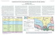
Educational Publication 9:<br />
A Comprehensive Look at <strong>Oklahoma</strong><br />
Earth Sciences and Mineral Resources for <strong>Oklahoma</strong><br />
offers readers a generalized overview of the state<br />
and its natural resources. It is edited by Kenneth S.<br />
Johnson and Kenneth V. Luza. Copies are available<br />
from OGS publication sales and the contents can be<br />
viewed on the OGS Web site.<br />
The oversized, 21-page publication contains text,<br />
maps, cross sections and illustrations that cover<br />
topography, geologic history, and the geomorphic<br />
provinces of <strong>Oklahoma</strong> as well as a general introduction,<br />
references and a glossary.<br />
EP-9 provides a broad look at minerals and oil and<br />
gas resources, all of economic value. Other sections<br />
cover climate, vegetation, soils, lakes, rivers,<br />
streams, groundwater and earthquakes.<br />
9
Landmark Ouachita Mountains Study<br />
Published in OGS Circular 112A<br />
It is fitting that in its Centennial year the <strong>Oklahoma</strong><br />
<strong>Geological</strong> <strong>Survey</strong> issued Circular 112A, Stratigraphic<br />
and Structural Evolution of the Ouachita Mountains and<br />
Arkoma Basin, Southeastern <strong>Oklahoma</strong> and West-Central<br />
Arkansas: Applications to Petroleum Exploration: 2004 Field<br />
Symposium, which contains J. Kaspar Arbenz’s landmark<br />
study of the complex Ouachita Mountains of <strong>Oklahoma</strong><br />
and Arkansas. Circular 112A combines older work by Peter<br />
Misch and Keith F. Oles with Arbenz’s extensive field studies<br />
and new data to present an innovative and more complete<br />
look at the Ouachitas.<br />
Along with the 86 pages of text and illustrations, Circular<br />
112A includes nine oversized maps and cross sections that<br />
are provided on paper and on CD ROM.<br />
Arbenz concludes in this study that large-scale horizontal<br />
displacement and local rotation of thrust sheets explain the<br />
surface and subsurface features observed on geologic maps<br />
and seismic data.<br />
In addition to Arbenz’s work, the paper by Misch and Oles is<br />
based on field work done in the 1950s for Union Oil Co.<br />
of California. This paper was the focal point for much<br />
controversy about the Ouachitas over the years, but<br />
its importance here lies in the historical perspective,<br />
insightful field observations, and detailed maps and<br />
cross sections.<br />
New Guidebook 35 Details 19 Stops<br />
For Booch Gas Play Field Trips<br />
The <strong>Survey</strong>’s latest guidebook is a companion to OGS Guidebook<br />
35: Guidebook to the Booch Sandstones: Surface to Subsurface<br />
Correlations. The book’s purpose is to locate, identify and describe<br />
the best Booch sandstone outcrops in the <strong>Oklahoma</strong> part of the<br />
Arkoma Basin.<br />
Authors Neil H. Suneson and Dan T. Boyd interpret the depositional<br />
environments of the strata and examine the outcrops based<br />
on lithologies, sedimentary structures, stratal disconformities<br />
and textural changes. They include gamma-ray profiles that<br />
approximate wireline gamma-ray logs in the subsurface. Parts<br />
of wireline logs from nearby wells show that, in some cases, the<br />
logs closely match, while at other times they differ greatly from<br />
the outcrop. The logs and outcrops are placed in the sequencestratigraphic<br />
framework established for the entire Booch interval.<br />
The Booch (pronounced Boke, like “coke”) is the informal subsurface<br />
term used by the oil and gas industry to identify certain<br />
sandstones in the Desmoinesian (Middle Pennsylvanian) McAlester<br />
Formation.<br />
10
OGS Staff List<br />
G. Randy Keller Interim Director grkeller@ou.edu 405/325-7968<br />
Geologists<br />
Richard D. Andrews Geologist IV rdandrews@ou.edu 405/325-3991<br />
Daniel T. Boyd Geologist IV dtboyd@ou.edu 405/325-8898<br />
Raymon L. Brown Geophysicist III raybrown@ou.edu 405/325-8954<br />
Brian J. Cardott Geologist IV bcardott@ou.edu 405/325-8065<br />
Julie Chang Geologist II jmchang@ou.edu 405/325-7055<br />
James R. Chaplin Geologist IV jchaplin@ou.edu 405/325-8071<br />
Stanley T. Krukowski Geologist IV skrukowski@ou.edu 405/325-8033<br />
Kenneth V. Luza Geologist IV kluza@ou.edu 405/325-8037<br />
Thomas M. Stanley Geologist IV tmstanley@ou.edu 405/325-7281<br />
Neil H. Suneson Geologist IV nsuneson@ou.edu 405/325-7315<br />
Technical and Outreach<br />
James H. Anderson Manager, Cartography jima@ou.edu 405/325-3035<br />
Sue Britton Crites Editor, <strong>Oklahoma</strong> Geology Notes scrites@ou.edu 405/325-8076<br />
Laurie A. Lollis Graphics Presentation Technician lollis@ou.edu 405/325-8035<br />
Richard G. Murray Copy Center Operator rmurray@ou.edu 405/325-8054<br />
Connie G. Smith Marketing, Public Relations Specialist III cgsmith@ou.edu 405/325-8021<br />
Paul E. Smith Supervisor, Copy Center pjsmith@ou.edu 405/325-8054<br />
Russell Standridge GIS Specialist gstan@ou.edu 405/325-8056<br />
Michelle J. Summers Technical Project Coordinator mjsummers@ou.edu 405/325-7313<br />
Jane L. Weber Database Coordinator jlweber@ou.edu 405/325-7331<br />
Administrative<br />
Betty D. Bellis Staff Assistant III bbellis-sge@ou.edu 405/325-3032<br />
Shanika Bivines Financial Administrator, Office Manager nika@ou.edu 405/325-8014<br />
Jennifer Veal Staff Assistant II jlveal@ou.edu 405/325-3031<br />
Janise L. Coleman Budget and Account Representative III jlcoleman@ou.edu 405/325-3033<br />
Tammie K. Creel-Williams Administrative Assistant I tcreel@ou.edu 405/325-3034<br />
<strong>Oklahoma</strong> Petroleum Information Center<br />
Charles R. Dyer III Equipment Operations Maintenance IV charles.r.dyer.III-1@ou.edu 405/325-1119<br />
Vyetta Jordan Lab Research Technician I jordan@ou.edu 405/325-1169<br />
Gene V. Kullmann Manager, OPIC kullmann@ou.edu 405/325-1279<br />
Sue M. Palmer Staff Assistant I spalmer@ou.edu 405/325-1243<br />
David O. Pennington Facilities Attendant II david.o.pennington-1@ou.edu 405/325-1299<br />
Tom Sanders Facilities Attendant II 405/325-1299<br />
Joyce A. Stiehler Shipping and Receiving Technician III stiehler@ou.edu 405/325-1211<br />
Geophysical Observatory<br />
Amie R. Gibson Research Specialist I amiegibson@okgeosurvey1.gov 918/366-415<br />
Jake Nance Research Specialist jake@okgeosurvey1.gov 918-366-4152<br />
11
<strong>Oklahoma</strong> <strong>Geological</strong> <strong>Survey</strong><br />
Main Office<br />
Sarkeys Energy Center<br />
100 E. Boyd, Room N-131<br />
Norman, Okla. 73019<br />
http://www.ogs.ou.edu<br />
ogs@ou.edu<br />
Phone: 405/325-3031 or 800/330-3996<br />
Fax: 405/325-7069<br />
<strong>Oklahoma</strong> Petroleum Information Center (OPIC)<br />
Publications Sales Office<br />
2020 Industrial Blvd.<br />
Norman, Okla. 73069<br />
Phone: 405/325-1299<br />
Fax 405/366-2882<br />
E-mail: ogssales@ou.edu<br />
Publications sales: www.ogs.ou.edu/pubs.php<br />
Office hours: 8 a.m. to 5 p.m. weekdays
Created by the <strong>Oklahoma</strong> Territorial Legislature in 1890, the University of <strong>Oklahoma</strong> is a doctoral degree-granting research<br />
university serving the educational, cultural, economic and health-care needs of the state, region and nation. The Norman<br />
campus serves as home to all of the university’s academic programs except health-related fields. Both the Norman and Health<br />
Sciences Center colleges offer programs at the Schusterman Center, the site of OU-Tulsa. The OU Health Sciences Center,<br />
which is located in <strong>Oklahoma</strong> City, is one of only four comprehensive academic health centers in the nation with seven<br />
professional colleges. OU enrolls more than 30,000 students, has more than 2,300 full-time faculty members, and has 20<br />
colleges offering 158 majors at the baccalaureate level, 166 majors at the master’s level, 81 majors at the doctoral level, 26<br />
majors at the doctoral professional level, and 24 graduate certificates. The university’s annual operating budget is $1.46 billion.<br />
The University of <strong>Oklahoma</strong> is an equal opportunity institution. (10/8/08)