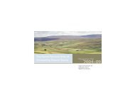
North Pennines - Sustainable Aggregates
North Pennines - Sustainable Aggregates
North Pennines - Sustainable Aggregates

Create successful ePaper yourself
Turn your PDF publications into a flip-book with our unique Google optimized e-Paper software.
Conservation issues<br />
Most of the exposures of metamorphic rocks are comparatively robust, though small exposures<br />
of contact rocks in long-abandoned igneous rock quarries may be at risk from destruction due to<br />
landfilling or landscaping works.<br />
Currently protected sites of Metamorphic rocks within the AONB<br />
SSSIs<br />
The following sites lie within the Upper Teesdale-Moorhouse National Nature Reserve and SSSI:<br />
Cronkley Pencil Mill, Upper Teesdale NY848 296<br />
Low Force and Wynch Bridge, Teesdale NY905 279<br />
Falcon Clints, Upper Teesdale NY820 281<br />
Cow Green Reservoir, Upper Teesdale NY815 294<br />
High Force, Upper Teesdale NY880 283<br />
RIGS<br />
Metamorphic rocks are not present within any of the RIGS sites designated within the Cumbrian<br />
portion of the AONB.<br />
Durham County Geological Sites<br />
The following Durham County Geological Sites include significant exposures of metamorphic<br />
rocks:<br />
Pencil Mill NY848 296<br />
Widdybank Fell NY820 290<br />
Other representative sites in the area<br />
Greengates Quarry, Lunedale NY933 234<br />
Scoberry Bridge – Wynch Bridge, Teesdale<br />
Selected references<br />
Dunham, 1990; Robinson, 1970; Stone et al, 2010.<br />
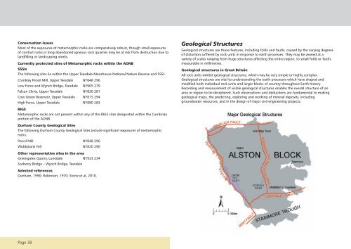
Geological Structures<br />
Geological structures are those features, including folds and faults, caused by the varying degrees<br />
of distortion suffered by rock units in response to earth processes. They may be viewed at a<br />
variety of scales ranging from huge structures affecting the entire region, to small folds or faults<br />
measurable in millimetres.<br />
Geological structures in Great Britain<br />
All rock units exhibit geological structures, which may be very simple or highly complex.<br />
Geological structures are vital to understanding the earth processes which have shaped and<br />
modified both individual rock units and larger blocks of country throughout Earth history.<br />
Recording and measurement of visible geological structures enables the overall structure of an<br />
area or region to be deciphered. Such observations and deductions are fundamental to making<br />
geological maps, the predicting, exploring and working of mineral deposits, including<br />
groundwater resources, and in the design of major civil engineering projects.<br />
Page 38