El Centro PF225 ESSR - CBP.gov
El Centro PF225 ESSR - CBP.gov
El Centro PF225 ESSR - CBP.gov

You also want an ePaper? Increase the reach of your titles
YUMPU automatically turns print PDFs into web optimized ePapers that Google loves.
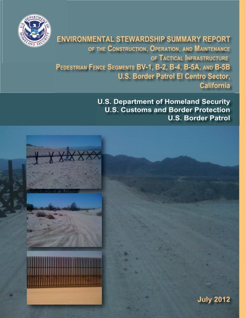
ENVIRONMENTAL STEWARDSHIP SUMMARY REPORT<br />
OF THE CONSTRUCTION, OPERATION, AND MAINTENANCE<br />
OF TACTICAL INFRASTRUCTURE<br />
PEDESTRIAN FENCE SEGMENTS BV-1, B-2, B-4, B-5A, AND B-5B<br />
U.S. Border Patrol <strong>El</strong> <strong>Centro</strong> Sector,<br />
California<br />
U.S. Department of Homeland Security<br />
U.S. Customs and Border Protection<br />
U.S. Border Patrol<br />
July 2012
ENVIRONMENTAL STEWARDSHIP SUMMARY REPORT<br />
OF THE CONSTRUCTION, OPERATION, AND MAINTENANCE<br />
OF TACTICAL INFRASTRUCTURE<br />
PEDESTRIAN FENCE SEGMENTS BV-1, B-2, B-4, B-5A, AND B-5B<br />
U.S. BORDER PATROL EL CENTRO SECTOR,<br />
CALIFORNIA<br />
July 2012<br />
Lead Agency:<br />
Point of Contact:<br />
Department of Homeland Security<br />
U.S. Customs & Border Protection<br />
Office of Finance, Asset Management<br />
1300 Pennsylvania Ave NW<br />
Washington, DC 20229<br />
Loren Flossman<br />
Director<br />
Border Patrol Facilities and Tactical Infrastructure<br />
Program Management Office<br />
Facilities Management & Engineering<br />
1301 Constitution Ave NW<br />
EPA West, Suite B-155<br />
Washington, DC 20229
EXECUTIVE SUMMARY<br />
U.S. Customs and Border Protection (<strong>CBP</strong>), Secure Border Initiative (SBI) built tactical<br />
infrastructure (TI) for the U.S. Border Patrol (USBP), <strong>El</strong> <strong>Centro</strong> Sector. USBP uses the term TI<br />
for the physical structures that facilitate enforcement activities; these items typically include<br />
roads, vehicle and pedestrian fences, lights, gates, and boat ramps. TI to be built under SBI’s<br />
Pedestrian Fence 225 (PF 225) Program within the <strong>El</strong> <strong>Centro</strong> Sector encompasses five segments<br />
designated as BV-1, B-2, B-4, B-5A, and B-5B. TI consisted of three segments of primary<br />
pedestrian fence, lighting, and access roads (B-2, B-4, and B-5A); one segment of primary<br />
pedestrian fence and access roads (B-5B); and one segment of primary vehicle fence and access<br />
roads (BV-1). The BV-1 segment (previously designated as B-1) was originally planned as a PF<br />
225 project, but was later changed to a vehicle fence (VF) project; however, this Environmental<br />
Stewardship Summary Report (<strong>ESSR</strong>) for the <strong>El</strong> <strong>Centro</strong> Sector PF 225 covers the BV-1 segment<br />
as well. All five segments are along the U.S./Mexico border near Calexico in Imperial County,<br />
California. A total of 44.6 miles of primary pedestrian and vehicle fence were originally planned<br />
to be built within these five segments; however, 44.97 miles were installed.<br />
The purpose of this report is to provide a comprehensive summary of the installation of TI and<br />
assess the final design and footprint of the TI. This <strong>ESSR</strong> compares the final completed action<br />
with the originally planned installation of TI, as proposed in the May 2008 Final Environmental<br />
Stewardship Plan for the Construction, Operation, and Maintenance of Tactical Infrastructure,<br />
U.S. Border Patrol <strong>El</strong> <strong>Centro</strong> Sector, California. BV-1, B-2, B-4, B-5A, and B-5B were built<br />
between July 2008 and February 2009.<br />
<strong>CBP</strong> provided an environmental monitor during construction activities, who documented<br />
adherence to best management practices (BMPs). Any deviations from the BMPs and required<br />
corrections were noted in weekly monitoring reports and on a BMP tracking spreadsheet. The<br />
most common BMP infractions in the <strong>El</strong> <strong>Centro</strong> Sector included off-road vehicle activity,<br />
parking in undesignated areas, and accessing infrastructures by utilizing non-designated roads.<br />
Most BMP infractions involving off-road driving activity and temporary disturbances outside the<br />
project corridor did not require revegetation efforts, because little to no native vegetation was<br />
removed during these events. The exception to this was an access road cleared through dense<br />
vegetation in B-4. At the close of construction activities, most BMP infractions had been<br />
resolved either directly or indirectly. Caps have not been installed on top of all bollards, but<br />
were reported by <strong>CBP</strong> to have been installed after the final surveys. No known impacts on<br />
federally listed species were documented as resulting from the infractions. Furthermore, no<br />
additional impacts on cultural resources were noted.<br />
After completion of the Environmental Stewardship Plan (ESP), changes were made to the<br />
alignment, design, or construction methods to facilitate construction, reduce costs or potential<br />
impacts, respond to stakeholder requests, or enhance the efficacy of the fence for enforcement<br />
purposes. These changes were reviewed and approved through <strong>CBP</strong> Headquarters, and<br />
documented in change request (CR) forms. This report also summarizes any significant<br />
modifications during construction that increased or reduced environmental impacts.<br />
ELC_<strong>PF225</strong>_<strong>ESSR</strong><br />
Final
ES-2<br />
This <strong>ESSR</strong> was prepared to document the impact areas, compared with the original ESPs and the<br />
changes identified in the CR forms, for the following reasons:<br />
1. To compare anticipated to actual impacts, so that a final new baseline is established<br />
for future maintenance and repair and any potential future actions.<br />
2. To document success of BMPs and any changes or improvements for the future.<br />
3. To document any changes to the planned location or type of the TI.<br />
<strong>CBP</strong> consultants surveyed the BV-1, B-2, B-4, B-5A, and B5-B sites to inspect the final project<br />
corridor and infrastructure footprints. The survey documented any significant differences<br />
between the planned and completed actions. When changes were noted, the surveyors checked<br />
the CR forms to see whether the changes had been recorded and approved. A total of nine CRs<br />
were approved for the segments; only three had the potential to cause environmental impacts.<br />
The post-construction surveys indicated that the permanent impacts on soils and vegetation<br />
decreased by 148 acres from the original estimate of approximately 474 acres in the ESP. The<br />
decrease was largely due to reducing the footprint width in the project corridor and access roads.<br />
The modifications and their impacts are summarized in Table ES-1 below.<br />
Table ES-1. Summary of Area Impacted by Construction Modifications<br />
Segment/Area<br />
ESP Predicted<br />
Impact<br />
(acres)<br />
Surveyed Impact<br />
(acres)<br />
Difference<br />
(acres)<br />
BV-1 Fence and Road 82 44 -38<br />
B-2 Fence and Road 17 4 -13<br />
B-4 Fence and Road 63 74 +11<br />
B-5A Fence and Road 140 94 -46<br />
B-5B Fence and Road 22 13 -9<br />
Total Fence Corridor Impacts 324 229 -95<br />
Access Roads 127* 83 -44<br />
Staging Areas 23* 14 -9<br />
Total Impacts 474 326 -148<br />
*Estimate based on length and width; the actual acreage impacted was not defined in ESP<br />
The ESP evaluated approximately 35 miles of new access road construction for the project with a<br />
total impact area of 127 acres. The post-construction survey confirmed that the total length of<br />
new access road built was 30.4 miles, with a total impact area of 83 acres. This is a decrease in<br />
access road footprint of 44 acres.<br />
The ESP assessed 44.6 miles of new fence, which the ESP anticipated would impact a total of<br />
324 acres of fence corridor. The post-construction survey confirmed that the footprint of the<br />
fence corridor affected only 229 acres total for all the segments, a decrease of 95 acres.<br />
ELC_<strong>PF225</strong>_<strong>ESSR</strong><br />
Final
ES-3<br />
The ESP examined the installation of five staging areas: three within the BV-1 segment<br />
encompassing 8 acres, a 1-acre site in the B-4 segment, and a 15-acre area within the B-5A<br />
segment. No staging areas were planned for segments B-2 and B-5B. The post-construction<br />
survey confirmed that 2.86 acres of staging area were used in B-5B and two additional staging<br />
areas were used in B-4. However, even with the additional staging areas, the total impact<br />
footprint of the staging areas decreased from 23 acres to 14 acres.<br />
ELC_<strong>PF225</strong>_<strong>ESSR</strong><br />
Final
TABLE OF CONTENTS<br />
EXECUTIVE SUMMARY .................................................................................................... ES-1<br />
1.0 INTRODUCTION, OUTREACH, AND METHODS ................................................1-1<br />
1.1 PUBLIC AND AGENCY OUTREACH .............................................................1-3<br />
1.2 Methods................................................................................................................1-3<br />
1.2.1 Environmental Monitoring Process .........................................................1-3<br />
1.2.2 Change Request Process ..........................................................................1-4<br />
1.2.3 Post-Construction Survey Methods ......................................................... 1-4<br />
2.0 DESCRIPTION OF THE PLANNED ACTION ........................................................2-1<br />
2.1 BV-1 Segment......................................................................................................2-1<br />
2.2 B-2 Segment......................................................................................................... 2-3<br />
2.3 B-4 Segment......................................................................................................... 2-3<br />
2.4 B-5A Segment......................................................................................................2-3<br />
2.5 B-5B Segment......................................................................................................2-3<br />
2.6 Monitoring ........................................................................................................... 2-3<br />
2.7 Change Request Forms ........................................................................................ 2-8<br />
2.8 Impact Quantities Anticipated in the Environmental Stewardship Plan.............. 2-8<br />
3.0 POST-CONSTRUCTION FINDINGS.........................................................................3-1<br />
3.1 Results of Road Measurements............................................................................ 3-1<br />
3.1.1 Access Roads ...........................................................................................3-1<br />
3.1.1.1 BV-1 Segment............................................................................. 3-1<br />
3.1.1.2 B-2 Segment................................................................................3-1<br />
3.1.1.3 B-4 Segment................................................................................3-1<br />
3.1.1.4 B-5A Segment............................................................................. 3-1<br />
3.1.1.5 B-5B Segment............................................................................. 3-7<br />
3.2 Fence and Access Roads...................................................................................... 3-7<br />
3.2.1 BV-1 Segment..........................................................................................3-7<br />
3.2.2 B-2 Segment............................................................................................. 3-7<br />
3.2.3 B-4 Segment............................................................................................. 3-7<br />
3.2.4 B-5A Segment..........................................................................................3-7<br />
3.2.5 B-5B Segment..........................................................................................3-8<br />
3.3 Staging Areas.......................................................................................................... 1<br />
3.3.1 BV-1 Segment..........................................................................................3-8<br />
3.3.2 B-2 Segment............................................................................................. 3-8<br />
3.3.3 B-4 Segment............................................................................................. 3-8<br />
3.3.4 B-5A Segment..........................................................................................3-8<br />
3.3.5 B-5B Segment..........................................................................................3-8<br />
3.4 Measured Impact Quantities ................................................................................ 3-9<br />
3.4.1 Soils..........................................................................................................3-9<br />
3.4.2 Vegetation................................................................................................3-9<br />
3.4.3 Cultural Resources................................................................................... 3-9<br />
3.4.4 Wetlands and Waters of the U.S.............................................................. 3-9<br />
ELC_<strong>PF225</strong>_<strong>ESSR</strong><br />
Final
ii<br />
4.0 DISCUSSION .................................................................................................................4-1<br />
4.1 Increased Project Footprint..................................................................................4-1<br />
4.2 Decreased Project Footprint................................................................................. 4-1<br />
4.3 Additional Issues.................................................................................................. 4-1<br />
LIST OF FIGURES<br />
Figure 1-1. Vicinity Map ........................................................................................................... 1-2<br />
Figure 2-1. BV-1 Location Map ................................................................................................ 2-2<br />
Figure 2-2. B-2 Location Map...................................................................................................2-4<br />
Figure 2-3. B-4 Location Map...................................................................................................2-5<br />
Figure 2-4. B-5A Location Map ................................................................................................ 2-6<br />
Figure 2-5. B-5B Location Map ................................................................................................ 2-7<br />
Figure 3-1. BV-1 Post-Construction Map .................................................................................3-2<br />
Figure 3-2. B-2 Post-Construction Map .................................................................................... 3-3<br />
Figure 3-3. B-4 Post-Construction Map .................................................................................... 3-4<br />
Figure 3-4. B-5A Post-Construction Map .................................................................................3-5<br />
Figure 3-5. B-5B Post-Construction Map..................................................................................3-6<br />
LIST OF TABLES<br />
Table ES-1. Summary of Area Impacted by Construction Modifications............................... ES-2<br />
Table 2-1. Summary of Approved Change Requests for All Segments...................................2-8<br />
Table 2-2. Anticipated Resource Impacts ................................................................................ 2-9<br />
Table 3-1. Total Area of Permanently Impacted Soils Resulting from the Installation of<br />
Tactical Infrastructure.............................................................................................3-9<br />
LIST OF PHOTOGRAPHS<br />
Photograph 3-1. VF-2 Fence....................................................................................................... 3-7<br />
Photograph 3-2. P-2 Fence Style ................................................................................................3-7<br />
Photograph 3-3. PV-4 Fence Type.............................................................................................. 3-8<br />
ELC_<strong>PF225</strong>_<strong>ESSR</strong><br />
Final
SECTION 1.0<br />
INTRODUCTION, OUTREACH, AND METHODS
1-1<br />
1.0 INTRODUCTION, OUTREACH, AND METHODS<br />
As part of an effort to document the installation of tactical infrastructure (TI) under the<br />
Pedestrian Fence 225 (PF 225) program, this Environmental Stewardship Summary Report<br />
(<strong>ESSR</strong>) presents a final assessment of the construction actions. It compares the final results of<br />
the construction project with the planned action proposed in the May 2008 Final Environmental<br />
Stewardship Plan for the Construction, Operation, and Maintenance of Tactical Infrastructure,<br />
U.S. Border Patrol <strong>El</strong> <strong>Centro</strong> Sector, California.<br />
A Biological Resources Plan (BRP) was prepared to identify the presence of sensitive biological<br />
resources, particularly federally protected species, and potential impacts on these resources. The<br />
BRP was provided to affected resource agencies and land managers for review and appended,<br />
where appropriate, to the Environmental Stewardship Plan (ESP). The ESP was published on the<br />
U.S. Custom and Border Protection (<strong>CBP</strong>) website, www.borderfenceplanning.com, which was<br />
subsequently changed to http://cbp.<strong>gov</strong>/xp/c<strong>gov</strong>/border_security/ti/ti_docs/sector/el_centro/.<br />
Information in this report was compiled from an environmental monitoring report, and approved<br />
modifications were made during construction and based on a post-construction survey of the<br />
project corridor. This <strong>ESSR</strong> compares anticipated impacts described and assessed by the ESP to<br />
actual impacts after construction occurring in five segments, designated as BV-1, B-2, B-4, B-<br />
5A, and B5-B (Figure 1-1). TI consisted of three segments of primary pedestrian fence, lighting,<br />
and access roads (B-2, B-4, and B-5A); one segment of primary pedestrian fence and access<br />
roads (B-5B); and one segment of primary vehicle fence (VF) and access roads (BV-1). The<br />
BV-1 segment (previously designated as B-1) was originally planned as a PF 225 project, but<br />
was later changed to a VF project; however, this <strong>ESSR</strong> for the <strong>El</strong> <strong>Centro</strong> Sector PF 225 covers<br />
BV-1 as well.<br />
Before installing TI, <strong>CBP</strong> performed an environmental review of the fencing projects and<br />
published the results in multiple ESPs, including mitigation and best management practices<br />
(BMP) developed to minimize adverse effects on the environment. These ESPs were drafted for<br />
each TI segment under the waiver. Some ESPs addressed specific TI segments, while others,<br />
such as the ESP for the <strong>El</strong> <strong>Centro</strong> Sector, addressed all of the PF 225 segments planned for the <strong>El</strong><br />
<strong>Centro</strong> Sector in a single document. Professional biologists and archaeologists conducted field<br />
surveys of all project corridors during the planning process before construction. The results of<br />
the surveys were provided to the affected resources agencies, such as the U.S. Fish and Wildlife<br />
Service [USFWS] and State Historic Preservation Office, for review and comment.<br />
Conservation measures and other BMPs identified in the ESP were made part of the request for<br />
proposals (RFP) issued to commercial construction contractors and were also incorporated into<br />
the contract upon award.<br />
This <strong>ESSR</strong> was prepared to document the impact areas, and compared with the original ESPs,<br />
and the changes were identified in the CR forms, for the following reasons:<br />
1. To compare anticipated to actual impacts, so that a final new baseline is established<br />
for future maintenance and repair and any potential future actions.<br />
ELC_<strong>PF225</strong>_<strong>ESSR</strong><br />
Final
·<br />
0<br />
California<br />
Imperial County<br />
2.5 5 7.5 10<br />
Miles<br />
October 2009<br />
1-2<br />
¬« 78 ¬« 78<br />
Brawley<br />
¬« 30 ¬« 34<br />
¬« ¬« 111 27<br />
Holtville<br />
<strong>El</strong> <strong>Centro</strong><br />
¬« 98<br />
§¨¦ 8 §¨¦ 8<br />
Calexico<br />
B-5B<br />
B-5A<br />
B-4<br />
BV-1<br />
B-2<br />
Figure 1-1: Vicinity Map
1-3<br />
2. To document success of BMPs and any changes or improvements for the future.<br />
3. To document any changes to the planned location or type of the TI.<br />
1.1 PUBLIC AND AGENCY OUTREACH<br />
Before developing the ESP, <strong>CBP</strong> prepared an environmental assessment (EA), mailed copies to<br />
interested parties, posted it on a public website, and announced a 30-day public review and<br />
comment period. A public open house was advertised and held at the Imperial Valley Expo in<br />
Imperial, California, on January 9, 2008. The open house was attended by four people.<br />
After the Secretary of Homeland Security waived compliance with certain environmental laws<br />
and requirements in April 2008, <strong>CBP</strong> reviewed, considered, and incorporated comments on the<br />
draft EA received from the public and other Federal, state, and local agencies, as appropriate,<br />
while preparing the ESP. Results of public and agency coordination efforts for the draft EA<br />
were addressed and incorporated into the ESP and posted for the public.<br />
In addition to the past public involvement and outreach program, <strong>CBP</strong> continued to coordinate<br />
with various Federal and state agencies while developing the ESP and during construction.<br />
Those agencies include but are not limited to the following:<br />
U.S. Section, International Boundary and Water Commission (USIBWC) - <strong>CBP</strong> coordinated<br />
with USIBWC to ensure that any construction along the international border did not adversely<br />
affect international boundary monuments or substantially impede floodwater conveyance within<br />
international drainages.<br />
U.S. Army Corps of Engineers (USACE), Los Angeles District - <strong>CBP</strong> coordinated all activities<br />
with USACE to identify potential jurisdictional Waters of the U.S. (WUS), including wetlands,<br />
and to develop measures to avoid, minimize, or compensate for losses to these resources.<br />
U.S. Fish and Wildlife Service (USFWS) - <strong>CBP</strong> coordinated with USFWS to identify listed<br />
species that could inhabit the project area, identify potential effects on listed species, and develop<br />
BMPs.<br />
U.S. Department of the Interior (DOI) - <strong>CBP</strong> coordinated with the U.S. Bureau of Land<br />
Management (BLM) and U.S. Bureau of Reclamation (Reclamation), since portions of the<br />
planned section were located within BLM’s Algodones Dunes Recreation Area and along<br />
Reclamation’s Salinity Canal.<br />
1.2 METHODS<br />
1.2.1 Environmental Monitoring Process<br />
<strong>CBP</strong> provided an environmental monitor during construction activity in areas where federally<br />
protected species were known or presumed to occur near the project corridor. Duties of the<br />
designated environmental monitor included documenting impacts beyond those described in the<br />
ESP, advising onsite construction managers regarding implementation of the BMPs and other<br />
environmental issues as they arise, and ensuring implementation of the appropriate BMPs.<br />
ELC_<strong>PF225</strong>_<strong>ESSR</strong><br />
Final
1-4<br />
Environmental monitors recorded observations daily and compiled weekly reports that they<br />
submitted to <strong>CBP</strong> and the USACE. Following completion of construction, a monitoring<br />
summary report was compiled.<br />
The designated environmental monitor was to notify the construction manager of any activities<br />
that could harm or harass a federally listed species or any other environmental issue that was<br />
identified. Upon such notification, the construction manager was to temporarily suspend<br />
activities in the vicinity of the federally listed species and notify the contracting officer, the<br />
Administrative contracting officer, and the contracting officer’s representative of the suspension<br />
so that the key USACE personnel could be notified and apprised of the situation for resolution.<br />
In addition, <strong>CBP</strong> notified the USFWS Carlsbad Field Office in the event that any federally listed<br />
species were directly impacted during construction activities. <strong>CBP</strong> maintained open<br />
coordination with USFWS during construction to discuss implementation and effectiveness of<br />
BMPs to avoid adverse impacts on federally listed species.<br />
1.2.2 Change Request Process<br />
During construction, <strong>CBP</strong> identified potential modifications that could improve the effectiveness<br />
of the TI; reduce construction cost, schedule, or environmental impacts; enhance long-term<br />
maintenance requirements; address stakeholder concerns; or reduce risk to U.S. Border Patrol<br />
(USBP) agents’ health and safety. These changes were reviewed and approved through <strong>CBP</strong><br />
Headquarters, and documented in change request (CR) forms. Each CR form described the<br />
proposed change or modification, justification of the change, anticipated effects to construction<br />
costs and schedule, and any other extenuating circumstances that would help to clarify the<br />
change. Each proposed change was carefully vetted across <strong>CBP</strong> to evaluate potential impacts<br />
before final <strong>CBP</strong> Headquarters approval.<br />
1.2.3 Post-Construction Survey Methods<br />
The objective of the post-construction survey was to locate, identify, photograph, and record the<br />
installation of the TI, including types of fence and width of access road and project corridor. In<br />
addition, the surveys recorded biological communities, wetlands, and other environmental<br />
conditions in and adjacent to the project corridor. Surveys also recorded any other observed<br />
unusual conditions (such as fence failure, significant erosion, hazardous waste, or construction<br />
debris).<br />
Before the field survey, <strong>CBP</strong> produced maps of the project corridor as described in the ESP. The<br />
ESP was reviewed for the description of location and type of fence to be installed, location and<br />
width of access and maintenance areas, and location and size of staging areas. Approved CR<br />
forms were also produced and used in the field to document approved changes. Surveyors<br />
examined the entire BV-1, B-2, B-4, B-5A, and B5-B project corridor and recorded the center<br />
line, length, and width of construction and access road alignments using a Trimble Global<br />
Positioning System (GPS). Surveyors took periodic GPS coordinates of the temporary and<br />
permanent construction footprint, especially when the corridor appeared to be expanded or<br />
reduced. They also recorded the perimeter of staging areas using GPS, as well as the start and<br />
stop coordinates for various fence types.<br />
ELC_<strong>PF225</strong>_<strong>ESSR</strong><br />
Final
SECTION 2.0<br />
DESCRIPTION OF THE PLANNED ACTION
2-1<br />
2.0 DESCRIPTION OF THE PLANNED ACTION<br />
The ESP addressed the construction, maintenance, and operation of a total of 44.6 miles of TI in<br />
the USBP <strong>El</strong> <strong>Centro</strong> Sector along the U.S./Mexico border in Imperial County, California,<br />
comprising five different segments designated as BV-1, B-2, B-4, B-5A, and B-5B. The project<br />
corridor for all segments is in Imperial County. The BV-1 segment begins west of Pinto and<br />
extends approximately 11.3 miles to the east to international border monument 225. The B-2<br />
segment begins near international border monument 225 and extends approximately 2.4 miles<br />
east. The B-4 segment begins just east of Calexico and extends east for approximately 8.6 miles.<br />
The B-5A segment begins where segment B-4 ends and extends approximately 19.3 miles east.<br />
The B-5B segment begins where segment B-5A ends and extends approximately 3.0 miles to the<br />
east to international border monument 210. Most of the B-5A and B-5B segments are within the<br />
Imperial (Algodones) Sand Dunes Recreation Area, which consists of public lands managed by<br />
the BLM. Specific descriptions regarding the TI are presented in the following paragraphs. It<br />
should be noted that the ESP did not provide quantifications of access roads or staging areas.<br />
However, <strong>CBP</strong>’s Facilities and Infrastructure Tracking Tool (FITT) Geographic Information<br />
System (GIS) data files included the location and footprint of these infrastructures. Therefore,<br />
the FITT was also used while preparing the <strong>ESSR</strong> to determine what was planned to be used or<br />
built.<br />
Maintenance will include removing any debris accumulated on the fence after rain to avoid<br />
potential future flooding. It is anticipated that the Normandy-style fence placed within the<br />
washes will sufficiently allow water and debris through during storms. Following storms, the<br />
washes will be patrolled for large debris, and the debris will be removed. Normandy-style fence<br />
was securely anchored to the bottom and sides of washes. Sand that builds up against the fence<br />
and brush near the fence will be removed, as needed. Brush removal could include mowing,<br />
removal of small trees, and application of U.S. Environmental Protection Agency (USEPA) and<br />
U.S. Department of Agriculture (USDA) approved herbicide, if needed. Any destruction or<br />
breaches of the fence will be repaired, as needed. Additionally, access roads will be maintained<br />
or potentially upgraded to ensure year-round access for fence maintenance. Access road<br />
maintenance activities could include the periodic grading or repairing of eroded areas.<br />
2.1 BV-1 SEGMENT<br />
The analysis presented in the ESP anticipated that the BV-1 TI would include approximately<br />
11.3 miles of primary vehicle fence and access roads within a 60-foot-wide corridor on the<br />
Roosevelt Reservation 1 (Figure 2-1). The ESP discussed the possibility of using Normandy type<br />
VF (VF-2) within this segment. Seven access roads were planned for this segment. The ESP<br />
identified three staging areas and anticipated that they would encompass approximately eight<br />
acres. The first two were along access roads, and the third was planned to be near the eastern<br />
terminus of the BV-1 segment.<br />
1 The Roosevelt Reservation is a 60-foot-wide corridor that parallels most of the southwestern land border. It was<br />
set aside in 1907 by President Roosevelt as a border enforcement zone. A 2006 Memorandum of Understanding<br />
(MOU) among <strong>CBP</strong> and the U.S. Departments of Agriculture and Interior stipulates that <strong>CBP</strong> operations and TI<br />
construction within the 60-foot Roosevelt Reservation are consistent with its purpose.<br />
ELC_<strong>PF225</strong>_<strong>ESSR</strong><br />
Final
2-2<br />
Project Corridor<br />
¬« 98<br />
¬« 98<br />
Coyote 2 Road<br />
United States<br />
#*<br />
227<br />
#*<br />
226<br />
#*<br />
225<br />
#*<br />
#*<br />
229<br />
#*<br />
228<br />
Mexico<br />
#*<br />
Border Monument<br />
Proposed Access Roads<br />
·<br />
0 0.25 0.5 0.75 1<br />
Miles<br />
Proposed Fence Corridor<br />
Proposed Staging Area<br />
Figure 2-1: BV-1 Location Map<br />
October 2009
2-3<br />
2.2 B-2 SEGMENT<br />
The B-2 project corridor is 2.4 miles long and is west of Calexico on lands managed by the BLM<br />
(Figure 2-2). The ESP stated that a primary pedestrian fence (PV-1) would be installed in this<br />
segment. It also stated that five access roads were planned and no staging areas would be within<br />
the B-2 project corridor.<br />
2.3 B-4 SEGMENT<br />
The B-4 project corridor is 8.6 miles long and is east of Calexico (Figure 2-3). The ESP stated<br />
that a primary pedestrian fence (PV-1) would be installed in this segment. Two access roads<br />
were planned, one near the eastern end of the corridor and one near the western end. The ESP<br />
stated that a 1-acre staging area would be on the west end of the segment corridor.<br />
2.4 B-5A SEGMENT<br />
The B-5A project corridor is approximately 19.3 miles long and is east of Calexico within the<br />
Imperial Sand Dunes Recreation Area (Figure 2-4). The ESP stated that a primary pedestrian<br />
fence (PV-1) would be installed in this segment. Three access roads were planned. The ESP<br />
stated that an approximately 15-acre staging area would be on the east end of the B-5A project<br />
corridor. The eastern terminus connects with segment B-5B.<br />
2.5 B-5B SEGMENT<br />
The B-5B project corridor is 3.0 miles long, begins at the eastern terminus of segment B-5A, and<br />
ends at monument 210. A portion of B-5B is within the Imperial Sand Dunes Recreation Area.<br />
The ESP stated that a primary pedestrian fence of special design for dune conditions (PV-4)<br />
would be installed in this segment. No access roads or staging areas were planned for this<br />
segment (Figure 2-5). The PV-4 design is a “floating” fence style designed specifically for dune<br />
areas. It facilitates maintenance by allowing fence sections to be lifted with a forklift and<br />
repositioned on the sand surface whenever sand accumulates along the fence.<br />
2.6 MONITORING<br />
Through the course of construction, unexpected field conditions required practical changes to the<br />
planned action during construction. In these situations, <strong>CBP</strong> conducted the appropriate field<br />
surveys to document the potential environmental impacts that these changes could cause. <strong>CBP</strong><br />
further coordinated with stakeholders to develop BMPs specific to changes required in the<br />
construction footprint.<br />
The most common BMP infractions in the <strong>El</strong> <strong>Centro</strong> Sector included off-road vehicle activity,<br />
parking in undesignated areas, and accessing infrastructures via non-designated roads. Most<br />
infractions related to off-road driving and temporary disturbances outside the project corridor,<br />
which did not require revegetation efforts because they removed little or no native vegetation.<br />
The exception was an access road cleared through dense vegetation in fence segment B-4. No<br />
known impacts on federally listed species were documented as a result of the infractions, and<br />
ELC_<strong>PF225</strong>_<strong>ESSR</strong><br />
Final
2-4<br />
Mandrapa Road<br />
Project Corridor<br />
Mount Signal Road<br />
United States<br />
#*<br />
224<br />
Mexico<br />
#*<br />
Border Monument<br />
Proposed Access Roads<br />
Proposed Fence Corridor<br />
·<br />
0 510 1,020 1,530 2,040<br />
Feet<br />
Figure 2-2: B-2 Location Map<br />
October 2009
2-5<br />
Project Corridor<br />
Verde School Road<br />
¬« 7<br />
Bonds Corner Road<br />
Keefer Road<br />
Anderholt Road<br />
¬« 98 217<br />
United States<br />
#*<br />
#*<br />
219<br />
#*<br />
218<br />
·<br />
0 0.25 0.5 0.75 1<br />
Miles<br />
Mexico<br />
#* Border Monument<br />
Proposed Access Roads<br />
Proposed Fence Corridor<br />
Proposed Staging Area<br />
Figure 2-3: B-4 Location Map<br />
October 2009
2-6<br />
#*<br />
#*<br />
216<br />
¬« 98 All American Canal<br />
#*<br />
United States<br />
215<br />
Mexico<br />
§¨¦ 8<br />
#*<br />
214<br />
#*<br />
213<br />
Project Corridor<br />
#*<br />
#*<br />
211<br />
212<br />
#* Border Monument<br />
Proposed Access Roads<br />
Proposed Fence Corridor<br />
Proposed Staging Area<br />
·<br />
0 0.75 1.5 2.25 3<br />
Miles<br />
Figure 2-4: B-5A Location Map<br />
October 2009
2-7<br />
Project Corridor<br />
Coachella Canal Road<br />
All American Canal<br />
§¨¦ 8<br />
Grays Wells Road<br />
United States<br />
#*<br />
210<br />
#*<br />
211<br />
Mexico<br />
#*<br />
Border Monument<br />
Proposed Fence Corridor<br />
·<br />
0 625 1,250 1,875 2,500<br />
Feet<br />
Figure 2-5: B-5B Location Map<br />
October 2009
2-8<br />
there were no predicted or actual impacts on threatened or endangered species or their habitat in<br />
the <strong>El</strong> <strong>Centro</strong> Sector.<br />
2.7 CHANGE REQUEST FORMS<br />
Nine CR forms were approved during construction. However, only three modifications had the<br />
potential to affect the construction footprint and, thus, cause changes in environmental impacts.<br />
Table 2-1 summarizes the project modifications determined to have the potential to change the<br />
environmental effects anticipated in the project ESP.<br />
Approval<br />
Date<br />
Table 2-1. Summary of Approved CRs for All Segments<br />
Summary<br />
Description<br />
Potential Environmental<br />
Impact<br />
Segments B-2 and B-4<br />
June 30,<br />
2008<br />
Segment B-5A<br />
July 23,<br />
2008<br />
Segment BV-1<br />
July 31,<br />
2008<br />
Project mileages have been refined. Based on the plan and<br />
profile sheets, the mileages have been calculated. Segment B-2<br />
changed from 8.59 to 8.65 miles. Segment B-4 changed from<br />
2.36 to 2.41 miles.<br />
Project mileages have been refined. The total mileage for B-5A<br />
was increased from 19.16 to 19.27 miles.<br />
Project mileages have been refined. Existing barriers in BV-1<br />
were planned to be replaced but were later determined to be<br />
sufficient. The total mileage for new vehicle fence was changed<br />
from 6.41 to 6.46 miles.<br />
Increases project footprint<br />
Increases project footprint<br />
Increases project footprint<br />
2.8 IMPACT QUANTITIES ANTICIPATED IN THE ENVIRONMENTAL<br />
STEWARDSHIP PLAN<br />
Table 2-2 identifies the pertinent resources that the ESP expected the project to affect. This table<br />
is not all-inclusive, as post-construction quantities for some resource impacts (air, noise,<br />
socioeconomic) could not be measured.<br />
ELC_<strong>PF225</strong>_<strong>ESSR</strong><br />
Final
2-9<br />
Resource<br />
Table 2-2. Anticipated Resource Impacts<br />
Impacts*<br />
Permanent Temporary Total Comment<br />
Soils 324 324<br />
Vegetation 17 17<br />
Cultural Resources<br />
11 sites; 4<br />
recently<br />
discovered<br />
resources<br />
11 sites<br />
Wetlands or Other WUS 8.5 8.5<br />
Wildlife Habitat 5.3 5.3<br />
Threatened and<br />
Endangered (T&E) Species<br />
* Unless otherwise noted, all quantifications are in acres.<br />
17 17<br />
Prime farmlands and farmland of<br />
statewide importance are present in<br />
the project area.<br />
5.3 acres of creosote bush are<br />
corridor-wide; 3.4 acres of desert<br />
wash vegetation are in segment<br />
BV-1; 8.3 acres of active sand dune<br />
communities are in segments B-4,<br />
B-5A, and B-5B.<br />
All the sites are within or adjacent<br />
to the Area of Potential Effect.<br />
Two previously unknown<br />
archaeological resources and two<br />
prehistoric isolates were discovered<br />
during surveys. None have been<br />
evaluated for National Register of<br />
Historic Places eligibility.<br />
Wetland sites are in segments BV-<br />
1, B-2 and B-4.<br />
Widening of border access roads<br />
will cause the loss of wildlife<br />
habitat.<br />
New boundary roads and access<br />
roads will cause the loss of 17 acres<br />
of habitat for T&E species.<br />
ELC_<strong>PF225</strong>_<strong>ESSR</strong><br />
Final
SECTION 3.0<br />
POST-CONSTRUCTION FINDINGS
3-1<br />
3.0 POST-CONSTRUCTION FINDINGS<br />
This section discusses the results of the post-construction surveys in both qualitative and<br />
quantitative terms, by construction activity. It also discusses approved CRs that necessitated any<br />
changes in the project as described in the ESP. During large construction projects, it is common<br />
for minor differences between field conditions and design drawings to require small<br />
modifications. These modifications can result in increases in the length of fence sections or the<br />
footprint of roads and staging areas. Changes such as these are expected under typical<br />
construction projects. A summary of the impacts on the pertinent resources, based on these postconstruction<br />
surveys, is presented at the end of this section. Figures 3-1 through 3-5 show the<br />
location of TI, post-construction, as well as staging areas and access roads used/built during<br />
construction.<br />
3.1 RESULTS OF ROAD MEASUREMENTS<br />
3.1.1 Access Roads<br />
No access road calculations were provided in the ESP; therefore, all lengths and acreages<br />
associated with the access roads are obtained from the FITT Geographic Information System<br />
(GIS) files.<br />
3.1.1.1 BV-1 Segment<br />
The ESP stated that the BV-1 project corridor would have seven access roads totaling 26.57<br />
miles. The anticipated impact from access roads was approximately 97 acres. Post-construction<br />
surveys recorded approximately 20.32 miles of new road built, totaling approximately 54.85<br />
acres. No CR was approved for this reduction.<br />
3.1.1.2 B-2 Segment<br />
The ESP stated that the B-2 project corridor would have five access roads, for a total of 4.15<br />
miles (15 acres). However, post-construction surveys recorded approximately 5.72 miles, with a<br />
total impact area of 15.79 acres. No CR was approved for the increase.<br />
3.1.1.3 B-4 Segment<br />
The ESP stated that the B-4 project corridor would have two access roads. These access roads<br />
were expected to total 1.38 miles, which would affect approximately 5 acres. However, postconstruction<br />
surveys recorded approximately 1.28 miles of access road, for a reduction of 0.1<br />
mile. The total impact area was 3.5 acres.<br />
3.1.1.4 B-5A Segment<br />
The ESP stated that the B-5A project corridor would have three access roads totaling 2.85 miles<br />
and impacting approximately 10.4 acres. Post-construction surveys recorded approximately 2.89<br />
miles of new road. However, the total area impacted by the access roads was only 8.2 acres, or<br />
2.2 acres less than expected.<br />
ELC_<strong>PF225</strong>_<strong>ESSR</strong><br />
Final
3-2<br />
Project Corridor<br />
¬« 98<br />
¬« 98<br />
Staging Area<br />
Coyote 2 Road<br />
United States<br />
Staging Area<br />
#*<br />
227<br />
Staging Area<br />
#*<br />
226<br />
Staging Area<br />
#*<br />
225<br />
#*<br />
#*<br />
#*<br />
228<br />
Mexico<br />
#*<br />
Border Monument<br />
Access Roads<br />
·<br />
0 0.25 0.5 0.75 1<br />
Miles<br />
Fence Corridor<br />
Staging Area<br />
Figure 3-1: BV-1 Post-Construction Map<br />
October 2009
#*<br />
3-3<br />
¬« 98 United States<br />
Project Corridor<br />
Mandrapa Road<br />
Mount Signal Road<br />
#* Border Monument<br />
#*<br />
224<br />
Mexico<br />
·<br />
Access Roads<br />
Fence Corridor<br />
0 750 1,500 2,250 3,000<br />
Feet<br />
Figure 3-2: B-2 Post-Construction Map<br />
October 2009
3-4<br />
Project Corridor<br />
Verde School Road<br />
¬« 7<br />
Bonds Corner Road<br />
Keefer Road<br />
Anderholt Road<br />
¬« 98<br />
Staging Area<br />
United States<br />
Staging Area<br />
#*<br />
219<br />
#*<br />
218<br />
#*<br />
217<br />
Mexico<br />
#* Border Monument<br />
Access Roads<br />
·<br />
0 0.25 0.5 0.75 1<br />
Miles<br />
Fence Corridor<br />
Staging Area<br />
Figure 3-3: B-4 Post-Construction Map<br />
October 2009
3-5<br />
Project Corridor<br />
§¨¦ 8<br />
#*<br />
#*<br />
216<br />
¬« 98 All American Canal<br />
#*<br />
215<br />
#*<br />
214<br />
#*<br />
213<br />
#*<br />
212<br />
#*<br />
211<br />
Staging Area<br />
Staging Area<br />
Mexico<br />
#* Border Monument<br />
Access Roads<br />
Fence Corridor<br />
·<br />
Staging Area<br />
0 0.75 1.5 2.25 3<br />
Miles<br />
Figure 3-4: B-5A Post-Construction Map<br />
October 2009
3-6<br />
Project Corridor<br />
Coachella Canal Road<br />
All American Canal<br />
§¨¦ 8<br />
Grays Wells Road<br />
#*<br />
210<br />
#*<br />
211<br />
#* Border Monument<br />
Access Roads<br />
Fence Corridor<br />
Staging Area<br />
·<br />
0 625 1,250 1,875 2,500<br />
Feet<br />
Figure 3-5: B-5B Post-Construction Map<br />
October 2009
3-7<br />
3.1.1.5 B-5B Segment<br />
No new access roads were proposed for the B-5B segment. Post-construction surveys recorded<br />
approximately 0.17 mile of new road, with a total impact area of 0.57 acre. No CR was<br />
approved for this increase.<br />
3.2 FENCE AND ACCESS ROADS<br />
3.2.1 BV-1 Segment<br />
A post-construction survey reported that the fence and<br />
adjacent access road footprint encompassed the 60-footwide<br />
Roosevelt Reservation, which was the planned<br />
footprint delineated in the ESP. The analysis in the ESP<br />
anticipated that 11.3 miles of primary vehicle fence (VF-<br />
2) would be installed in the BV-1 project corridor. The<br />
post-construction survey established that 12.98 miles of<br />
VF-2 fence were installed (Photograph 3-1), or<br />
approximately 1.7 miles more than the ESP expected. No<br />
CR was approved for this increase.<br />
Photograph 3-1. VF-2 Fence<br />
3.2.2 B-2 Segment<br />
The ESP stated that the B-2 segment would have approximately 2.4 miles of primary pedestrian<br />
fence (PV-1). A CR was approved to modify segment B-2 from 2.36 miles to 2.41 miles.<br />
However, no CR accounted for the change from PV-1 to the VF-2 observed during postconstruction<br />
surveys. These surveys concluded that 1.27 miles of VF-2 fence (see Photograph 3-<br />
1) was sporadically installed (see Figure 3-2), versus the 2.41 miles of planned PV-1. This<br />
means that a different type of fence than what was planned in the ESP was installed, as well as<br />
approximately 1.1 miles less of fence length.<br />
3.2.3 B-4 Segment<br />
The ESP stated that the B-4 segment would have 8.6 miles of PV-1. A CR was approved to<br />
modify segment B-4 from 8.59 miles to 8.65 miles. Because the eastern end of B-4 is in a playa,<br />
another CR was approved to install PV-4 floating fence through the playa area instead of PV-1<br />
fence, for a distance of approximately 3,000 feet. The post-construction survey confirmed that<br />
8.65 miles of PV-1 and PV-4 fence were installed.<br />
3.2.4 B-5A Segment<br />
The ESP stated that the B-5A segment would have 19.3<br />
miles of PV-1 installed, although a CR was approved to<br />
increase the amount from 19.16 to 19.27 miles. The fence<br />
type for B-5A was originally PV-1, but another CR was<br />
approved to change it to P-2 (Photograph 3-2), due to<br />
increased demand for this fence type for other PV-1<br />
segments. The post-construction survey confirmed that<br />
19.3 miles of PV-1 and P-2 fence were installed. Caps has<br />
not been installed on top of all bollards, as of the survey<br />
ELC_<strong>PF225</strong>_<strong>ESSR</strong><br />
Photograph 3-2. P-2 Fence Style<br />
Final
3-8<br />
conducted for this <strong>ESSR</strong>. However, <strong>CBP</strong> reported that the capping was completed by the end of<br />
construction.<br />
3.2.5 B-5B Segment<br />
The ESP stated that the B-5B segment would have three<br />
miles of PV-4, primary pedestrian fence of special design<br />
for dune conditions (Photograph 3-3). The postconstruction<br />
survey confirmed that 2.77 miles of fence<br />
were installed, approximately 0.23 mile less than planned<br />
in the ESP.<br />
3.3 STAGING AREAS<br />
PHOTOGRAPH 3-3. PV-4 FENCE TYPE<br />
No staging area calculations were provided in the ESP; therefore, all acreages associated with the<br />
staging areas are based upon FITT GIS files.<br />
3.3.1 BV-1 Segment<br />
The ESP stated that the BV-1 project corridor would have three staging areas. One was planned<br />
on the east end of the project corridor, and the other two were to be located along access roads.<br />
<strong>CBP</strong> post-construction surveys found that the staging areas had decreased in size from eight<br />
acres (identified by GIS data) to 1.2 acres.<br />
3.3.2 B-2 Segment<br />
The ESP proposed no staging areas for the B-2 segment, which the post-construction survey<br />
confirmed.<br />
3.3.3 B-4 Segment<br />
The ESP stated that the B-4 project corridor would have one staging area. Based upon GIS data,<br />
the staging area would be approximately one acre on the west end of the segment corridor.<br />
However, the post-construction survey found that three staging areas were used encompassing a<br />
total of 1.68 acres, an increase of 0.68 acre from the ESP. No CR was approved for this increase.<br />
3.3.4 B-5A Segment<br />
The ESP stated that the B-5A project corridor would have one staging area on its eastern end.<br />
According to GIS data, the staging area would encompass approximately 15 acres. The postconstruction<br />
survey found that a staging area was used but that it encompassed only eight acres,<br />
a decrease of seven acres.<br />
3.3.5 B-5B Segment<br />
The ESP stated that no staging areas were proposed for the B-5B segment. However, the postconstruction<br />
survey recorded 2.86 acres of staging area. No CR was approved for this increase.<br />
ELC_<strong>PF225</strong>_<strong>ESSR</strong><br />
Final
3-9<br />
3.4 MEASURED IMPACT QUANTITIES<br />
3.4.1 Soils<br />
The analysis in the ESP anticipated that the fence corridor would permanently remove 324 acres<br />
of soils from biological production and that the access roads and staging areas would remove an<br />
additional 150 acres, for a total of 474 acres. However, the permanent impacts on soils<br />
decreased by 148 acres from what was expected in the ESP, from 474 acres to 326 acres. Table<br />
3-1 summarizes the change in area of permanent impact from the ESP to the areas measured in<br />
the post-construction survey.<br />
Table 3-1. Total Area of Permanently Impacted Soils Resulting from the Installation of Tactical<br />
Infrastructure<br />
Segment/Area<br />
ESP Predicted<br />
Impact<br />
(acres)<br />
Surveyed Impact<br />
(acres)<br />
Difference<br />
(acres)<br />
BV-1 Fence and Road 82 44 -38<br />
B-2 Fence and Road 17 4 -13<br />
B-4 Fence and Road 63 74 +11<br />
B-5A Fence and Road 140 94 -46<br />
B-5B Fence and Road 22 13 -9<br />
Total Fence Corridor Impacts 324 229 -95<br />
Access Roads 127* 83 -44<br />
Staging Areas 23* 14 -9<br />
Total Impacts 474 326 -148<br />
*Estimate based on length and width; the actual acreage impacted was not defined in ESP<br />
3.4.2 Vegetation<br />
The fence and road construction in the BV-1, B-4, B-5A, and B-5B segments affected<br />
approximately 17 acres of habitat, including creosote bush, desert wash vegetation, and active<br />
sand dune communities. The ESP noted that roads and staging areas would be sited in<br />
previously disturbed areas, but did not specifically identify the vegetation types in the anticipated<br />
areas. Therefore, some vegetation might have been impacted by use of or improvements to<br />
access roads and staging areas. The monitoring reports did not identify any specific impacts<br />
other than the access road cut through dense vegetation as noted in Section 2.6.<br />
3.4.3 Cultural Resources<br />
No new cultural resources were found, and no additional impacts occurred.<br />
3.4.4 Wetlands and Waters of the U.S.<br />
The <strong>CBP</strong> survey team confirmed that the TI construction did not increase the footprint within the<br />
potentially jurisdictional wetland areas beyond what was originally planned (8.5 acres of wetland<br />
or other WUS). No other additional wetlands or WUS were identified where the project corridor<br />
was modified. Of the 8.5 acres considered potential jurisdictional wetlands, 0.8 acre was in BV-<br />
1, 1.08 acres were in B-2, and 6.62 acres were in B-4.<br />
ELC_<strong>PF225</strong>_<strong>ESSR</strong><br />
Final
SECTION 4.0<br />
DISCUSSION
4-1<br />
4.0 DISCUSSION<br />
4.1 INCREASED PROJECT FOOTPRINT<br />
According to the findings of the post-construction survey, no increases occurred in total project<br />
footprint.<br />
4.2 DECREASED PROJECT FOOTPRINT<br />
The permanent impacts on soils decreased by 148 acres, from an original estimate in the ESP of<br />
approximately 474 acres (324 acres of fence corridor and 150 acres of staging areas and access<br />
roads) to 326 acres determined by the post-construction survey. As Table 3-1 shows, the<br />
decrease was largely due to the reduction of the footprint width in the project corridor and the<br />
decrease in acres of the staging areas and access roads.<br />
Estimates based on the FITT and descriptions in the ESP indicated 35 miles of new access road<br />
construction for the project, with a total estimated impact area of 127 acres. However, the postconstruction<br />
survey found that the total length of new access road built was 30.4 miles, with a<br />
total impact area of 83 acres, a decrease in project footprint of 44 acres.<br />
The ESP expected 44.6 miles of new fence TI and a total of 324 acres of fence corridor impact<br />
area. The post-construction survey found that all segments of the fence corridor impacted only<br />
229 acres, a decrease in project footprint of 95 acres.<br />
The ESP anticipated the installation of five staging areas: three within the BV-1 segment<br />
encompassing 8 acres, a 1-acre site in B-4, and a 15-acre area in B-5A. No staging areas were<br />
planned for segments B-2 and B-5B. The post-construction survey found that 2.86 acres of<br />
staging area were used in B-5B, and two additional staging areas were used in segment B-4.<br />
However, even with these additions, the total staging area impacts decreased from 23 to 14 acres.<br />
Because the ESP did not specifically address staging areas and access road impacts, the postconstruction<br />
surveys could not confirm vegetation losses, if any.<br />
4.3 ADDITIONAL ISSUES<br />
The post-construction survey identified one additional issue that would require some<br />
consideration: the manner in which the floating fence is maintained. As discussed in section 2.5<br />
of this <strong>ESSR</strong>, the PV-4 fence was designed to be lifted using forklifts, and repositioned on the<br />
sand surface whenever sand accumulated along the fence. The post-construction survey team<br />
observed holes under the fence, which were reportedly caused by wind. These holes were<br />
backfilled with a front-end loader, using sand from within the 60-foot Roosevelt Reservation as<br />
borrow material. <strong>CBP</strong> is implementing a Comprehensive Tactical Infrastructure Maintenance<br />
and Repair (CTIMR) program to ensure the TI and related areas are maintained and repaired as<br />
needed.<br />
ELC_<strong>PF225</strong>_<strong>ESSR</strong><br />
Final