

Little Manatee River - Southwest Florida Water Management District
Little Manatee River - Southwest Florida Water Management District
Little Manatee River - Southwest Florida Water Management District

Create successful ePaper yourself
Turn your PDF publications into a flip-book with our unique Google optimized e-Paper software.
<strong>Little</strong> <strong>Manatee</strong> <strong>River</strong><br />
Comprehensive <strong>Water</strong>shed<br />
<strong>Management</strong> Plan<br />
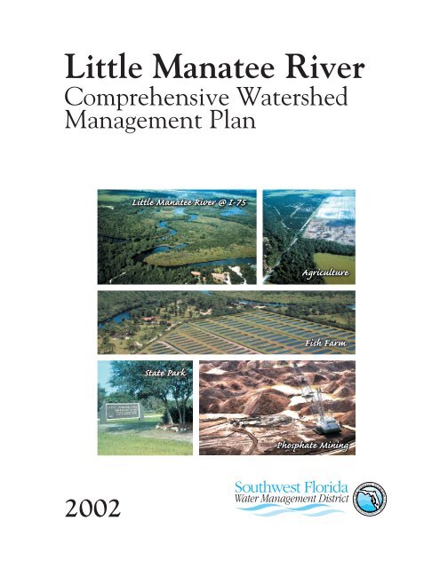
<strong>Little</strong> <strong>Manatee</strong> <strong>River</strong> @ I-75<br />
Agriculture<br />
State Park<br />
Fish Farm<br />
Phosphate Mining<br />
2002
LITTLE MANATEE RIVER<br />
COMPREHENSIVE WATERSHED<br />
MANAGEMENT PLAN<br />
June, 2002<br />
Prepared by:<br />
<strong>Southwest</strong> <strong>Florida</strong> <strong>Water</strong> <strong>Management</strong> <strong>District</strong><br />
2379 Broad Street<br />
Brooksville, <strong>Florida</strong> 34604<br />
The <strong>District</strong> does not discriminate upon the basis of any individual’s disability status. Anyone requiring<br />
reasonable accommodation under the ADA should contact the Planning<br />
Department at 352-796-7211 or 1-800-423-1476 (<strong>Florida</strong> only), extension 4400;<br />
TDD ONLY 1-800-231-6103 (<strong>Florida</strong> only); FAX 352-754-6749/SUNCOM 663-6749.
TABLE OF CONTENTS<br />
ACRONYMS<br />
EXECUTIVE SUMMARY<br />
ii<br />
v<br />
CHAPTER I. INTRODUCTION 1.1<br />
CHAPTER II. WATERSHED DESCRIPTION 2.1<br />
CHAPTER III. WATER SUPPLY 3.1<br />
CHAPTER IV. FLOOD PROTECTION 4.1<br />
CHAPTER V. WATER QUALITY 5.1<br />
CHAPTER VI. NATURAL SYSTEMS 6.1<br />
REFERENCES 7.1<br />
FIGURES<br />
Figure 1-1, <strong>Southwest</strong> <strong>Florida</strong> <strong>Water</strong> <strong>Management</strong> <strong>District</strong> CWM <strong>Water</strong>sheds 1.2<br />
Figure 1-2, Sustainability Through Science 1.4<br />
Figure 1-3, Fiscal Year 2000 Estimated <strong>Water</strong> Resources Funding by Activity and<br />
Funding Sources 1.5<br />
Figure 1-4, <strong>Little</strong> <strong>Manatee</strong> <strong>River</strong> CWM Estimated <strong>Water</strong> Resources Funding by<br />
Activity for Fiscal Year 2000 1.6<br />
Figure 3-1, Special Groundwater Use Areas Overlapping <strong>Little</strong> <strong>Manatee</strong> <strong>River</strong><br />
CWM Area 3.12<br />
Figure 5-1, Groundwater Quality Monitoring Wells 5.2<br />
TABLES<br />
Table 2.1, 1995 Land Use/Land Cover for the <strong>Little</strong> <strong>Manatee</strong> <strong>River</strong> <strong>Water</strong>shed 2.4<br />
Table 3.1, 1998 <strong>Water</strong> Withdrawals in the <strong>Little</strong> <strong>Manatee</strong> <strong>River</strong> <strong>Water</strong>shed 3.2<br />
Table 4.1, 1995 Urban Land Use (Existing) within FEMA 100 Year Flood Zone 4.10<br />
Table 5.1, <strong>Water</strong> Quality in Selected Surficial Aquifer Wells 5.3<br />
Table 5.2, <strong>Water</strong> Quality in Selected Intermediate Aquifer Wells 5.5<br />
Table 5.3, <strong>Water</strong> Quality in Selected Upper <strong>Florida</strong> Aquifer Wells 5.7<br />
LITTLE MANATEE RIVER CWM PLAN<br />
JUNE, 2002<br />
i
ACRONYMS<br />
ABM<br />
AGWQMP<br />
AMP<br />
AOR<br />
ASR<br />
BEBR<br />
BMP<br />
BOD<br />
CAPMAT<br />
CBAP<br />
CARL<br />
CCMP<br />
CFR<br />
CWM<br />
D-BUG<br />
DCA<br />
DIN<br />
DOAH<br />
DO<br />
DWMP<br />
EAC<br />
ELAPP<br />
ELMAC<br />
EPCHC<br />
ERP<br />
ETB<br />
F.A.C.<br />
FAVA<br />
FDEP<br />
FDOT<br />
FEMA<br />
FFWCC<br />
FIRM<br />
FNAI<br />
FP&L<br />
F.S.<br />
GIS<br />
GPD<br />
HR<br />
ICP<br />
IHN<br />
IWRM<br />
LOS<br />
Agency on Bay <strong>Management</strong><br />
Aquifer Groundwater Quality Monitoring Program<br />
Ambient Monitoring Program<br />
Area of Responsibility<br />
Aquifer Storage and Recovery<br />
Bureau of Economic and Business Research<br />
Best <strong>Management</strong> Practice<br />
Biochemical Oxygen Demand<br />
Cockroach Bay <strong>Management</strong> Advisory Team<br />
Cockroach Bay Aquatic Preserve<br />
Conservation and Recreation Lands<br />
Comprehensive Conservation and <strong>Management</strong> Plan<br />
Code of Federal Regulation<br />
Comprehensive <strong>Water</strong>shed <strong>Management</strong><br />
Database Users Group<br />
Department of Community Affairs<br />
Dissolved Inorganic Nitrogen<br />
Division of Administrative Hearings<br />
Dissolved Oxygen<br />
<strong>District</strong> <strong>Water</strong> <strong>Management</strong> Plan<br />
Environmental Action Committee<br />
Environmental Lands Acquisition and Protection Program<br />
Environmental Lands <strong>Management</strong> and Acquisition Committee<br />
Environmental Protection Commission of Hillsborough County<br />
Environmental Resource Permit<br />
Eastern Tampa Bay<br />
<strong>Florida</strong> Administrative Code<br />
<strong>Florida</strong> Aquifer Vulnerability Assessment<br />
<strong>Florida</strong> Department of Environmental Protection or Department<br />
<strong>Florida</strong> Department of Transportation<br />
Federal Emergency <strong>Management</strong> Agency<br />
<strong>Florida</strong> Fish and Wildlife Conservation Commission<br />
Flood Insurance Rate Map<br />
<strong>Florida</strong> Natural Areas Inventory<br />
<strong>Florida</strong> Power & Light<br />
<strong>Florida</strong> Statutes<br />
Geographic Information System<br />
Gallons Per Day<br />
Highlands Ridge<br />
Integrated Conservation Plan<br />
Integrated Habitat Network<br />
Integrated <strong>Water</strong> Resource Monitoring<br />
Level of Service<br />
LITTLE MANATEE RIVER CWM PLAN<br />
JUNE, 2002<br />
ii
LaMP Lake Monitoring Program<br />
MFL Minimum Flows and Levels<br />
mgd million gallons per day<br />
mg/L milligrams per liter<br />
MIA Most Impacted Area<br />
MSSW <strong>Management</strong> and Storage of Surface <strong>Water</strong>s<br />
MSW Municipal Solid Waste<br />
NEP National Estuary Program<br />
NGVD National Geodetic Vertical Datum<br />
NOAA National Oceanic and Atmospheric Administration<br />
NOX Nitrogen Oxides<br />
NPDES National Pollutant Discharge Elimination System<br />
NRCS Natural Resources Conservation Service<br />
NWSI New <strong>Water</strong> Sources Initiative<br />
OFW Outstanding <strong>Florida</strong> <strong>Water</strong><br />
PAH Polycyclic Aromatic Hydrocarbons<br />
PLRG Pollutant Load Reduction Goal<br />
PM<br />
Particulate Matter<br />
ppt<br />
parts per thousand<br />
PR/MRWSA Peace <strong>River</strong>/Manasota Regional <strong>Water</strong> Supply Authority<br />
P2000 Preservation 2000<br />
RAMP Regional Ambient Monitoring Program<br />
ROMP Regional Observation Monitoring Program<br />
RWSP Regional <strong>Water</strong> Supply Plan<br />
SOR Save Our <strong>River</strong>s<br />
STORET Storage and Retrieval<br />
SWFWMD <strong>Southwest</strong> <strong>Florida</strong> <strong>Water</strong> <strong>Management</strong> <strong>District</strong> or <strong>District</strong><br />
SWIM Surface <strong>Water</strong> Improvement and <strong>Management</strong><br />
SWUCA Southern <strong>Water</strong> Use Caution Area<br />
TBEP Tampa Bay Estuary Program<br />
TDS Total Dissolved Solids<br />
TMDL Total Maximum Daily Load<br />
TNC The Nature Conservancy<br />
TPL Trust for Public Lands<br />
TSI<br />
Trophic State Index<br />
TSS Total Suspended Solids<br />
g/L micrograms per liter<br />
UF<br />
University of <strong>Florida</strong><br />
USEPA US Environmental Protection Agency<br />
USFWS US Fish and Wildlife Service<br />
USGS US Geological Survey<br />
WCRWSA West Coast Regional <strong>Water</strong> Supply Authority<br />
WHPA Wellhead Protection Areas<br />
WQI <strong>Water</strong> Quality Index<br />
WQMP <strong>Water</strong> Quality Monitoring Program<br />
LITTLE MANATEE RIVER CWM PLAN<br />
JUNE, 2002<br />
iii
WQMN<br />
WRAP<br />
WRCA<br />
WUCA<br />
WWTP<br />
<strong>Water</strong> Quality Monitoring Network<br />
<strong>Water</strong> Resource Assessment Project<br />
<strong>Water</strong> Resource Caution Area<br />
<strong>Water</strong> Use Caution Area<br />
Wastewater Treatment Plant<br />
LITTLE MANATEE RIVER CWM PLAN<br />
JUNE, 2002<br />
iv
EXECUTIVE SUMMARY<br />
The <strong>Southwest</strong> <strong>Florida</strong> <strong>Water</strong> <strong>Management</strong> <strong>District</strong> (<strong>District</strong>) developed the Comprehensive<br />
<strong>Water</strong>shed <strong>Management</strong> (CWM) Program for water resource assessment and planning on a<br />
regional basis. The CWM Program was designed to allow for evaluation of the status of water<br />
resources, with special attention paid to the <strong>District</strong>’s primary Areas of Responsibility (AORs): 1)<br />
water supply, 2) flood protection, 3) water quality and 4) natural systems. This document<br />
represents the first plan for the <strong>Little</strong> <strong>Manatee</strong> <strong>River</strong> CWM effort.<br />
The <strong>Little</strong> <strong>Manatee</strong> <strong>River</strong> CWM area, covering approximately 175,928 acres, extends over<br />
Hillsborough and <strong>Manatee</strong> counties. The area is bordered by the Alafia <strong>River</strong> watershed to the<br />
north, Peace <strong>River</strong> watershed to the east, <strong>Manatee</strong> <strong>River</strong> watershed to the south and Tampa Bay to<br />
the west. Agriculture is the major land use activity in the watershed. Areas in the watershed’s<br />
western extent also include several small urban communities (e.g., Sun City, Sun City Center,<br />
Parrish, Ruskin, Palmetto) and an industrial area associated with Port <strong>Manatee</strong>. The eastern extent<br />
contains several areas that have been mined, experiencing mining or planned for the activity in the<br />
future.<br />
The <strong>Little</strong> <strong>Manatee</strong> <strong>River</strong> plan is a comprehensive resource management document. The general<br />
approach taken to develop this plan was to evaluate completed and ongoing resource assessments<br />
and existing and potential future activities within the area, and then identify resource issues and<br />
strategies and actions for addressing them. The plan uses a collaborative approach to resolving<br />
issues. That is, in most cases, more than one entity is usually identified as having a role or<br />
responsibility for addressing a particular problem.<br />
Summarized below are the Team’s major priorities by AOR:<br />
For <strong>Water</strong> Supply, there is a need to: 1) refine issues to be addressed, including development and<br />
implementation of a management program for the Southern <strong>Water</strong> Use Caution Area which<br />
provides natural resource protection while maximizing water supply; identify regulatory and nonregulatory<br />
alternatives for cooperative management; evaluate and modify minimum aquifer levels;<br />
form a work group of affected parties, 2) improve coordination between land and water planners,<br />
3) re-evaluate agriculture’s contribution to stream flow, 4) review regulations for phosphate mine<br />
reclamation to determine impact on stream flow characteristics and 5) establish minimum flows<br />
for river in the 2006-2015 time frame.<br />
For Flood Protection, there is a need to: 1) standardized hydrologic/hydraulic and flood protection<br />
data collection and management, 2) develop a GIS database of current floodplain information, 3)<br />
develop analysis protocol that contributes to the minimization of impacts beyond peak flows, 4)<br />
develop detailed modeling protocol for watershed analysis, 5) develop guidelines that consider the<br />
dual use of flood control ponds, statistical comparisons between design and actual constructed<br />
imperviousness, 6) develop impact-based solutions for watershed and 7) evaluate and enhance<br />
the surface water monitoring network.<br />
LITTLE MANATEE RIVER CWM PLAN<br />
JUNE, 2002<br />
v
For <strong>Water</strong> Quality, there is a need to: 1) re-examine water quality trends and dissolved oxygen<br />
concentrations and identify factors contributing to the conditions, 2) pursue the implementation of<br />
best management practices to reduce non-point source nutrient loading from agricultural lands, 3)<br />
study areas with high septic tank densities to determine if pollution problems exist, 4) perform<br />
water quality assessments in areas used for sludge disposal, 5) continue land acquisition activity,<br />
6) improve efficiency and coordination in water quality data collection, 7) determine regions of the<br />
watershed where significant quantities of irrigation water enter the river and 8) coordination<br />
among agencies and citizenry on water quality issues.<br />
For Natural Systems, there is a need to: 1)protect remaining natural systems through land<br />
acquisition and other land conservation methods, 2) conduct habitat enhancement, restoration<br />
and creation projects to restore lost and degraded habitats, 3) provide public access to natural<br />
areas compatible with ecosystem functions and wildlife requirements, 4) coordinate efforts of<br />
governments and environmental agencies and groups to educate the region’s citizenry, 5) manage<br />
encroachment of urban and agricultural development, 6) eliminate or reduce mining impacts to<br />
natural systems and 7) manage pollutant loading.<br />
Background information that led to the prioritization of these needs is found in chapters relating to<br />
the <strong>District</strong>’s AORs - water supply, flood protection, water quality, and natural systems. The<br />
desire of the individuals who helped to develop the <strong>Little</strong> <strong>Manatee</strong> <strong>River</strong> Comprehensive<br />
<strong>Water</strong>shed <strong>Management</strong> Plan is that this document would be modified and updated regularly, as<br />
required. It is hoped that most of the projects outlined within this text will be funded and<br />
completed through the combined efforts of the appropriate federal, state, regional and local<br />
governments.<br />
Many thanks are due to the members of the <strong>Little</strong> <strong>Manatee</strong> <strong>River</strong> CWM Team for their long hours<br />
spent on this project.<br />
Name<br />
Rand Baldwin<br />
Greg Blanchard<br />
Daniel Blood<br />
Rob Brown<br />
Malcolm Castor<br />
Shawn College<br />
Harry Downing<br />
Sid Flannery<br />
Brian Grady<br />
Dawn Hart<br />
Brandt Henningsen<br />
Lisa Henningsen<br />
Scott Hickerson<br />
Janet Hoffman<br />
Mike Kelley<br />
Ed Kouadio<br />
Colleen Kruk<br />
Gordon Leslie<br />
Will Miller<br />
LITTLE MANATEE RIVER CWM PLAN<br />
JUNE, 2002<br />
Affiliation<br />
<strong>Southwest</strong> <strong>Florida</strong> <strong>Water</strong> <strong>Management</strong> <strong>District</strong><br />
<strong>Manatee</strong> County<br />
Hillsborough County<br />
<strong>Manatee</strong> County<br />
<strong>Southwest</strong> <strong>Florida</strong> <strong>Water</strong> <strong>Management</strong> <strong>District</strong><br />
Hillsborough County City-County Plan. Comm.<br />
<strong>Southwest</strong> <strong>Florida</strong> <strong>Water</strong> <strong>Management</strong> <strong>District</strong><br />
<strong>Southwest</strong> <strong>Florida</strong> <strong>Water</strong> <strong>Management</strong> <strong>District</strong><br />
Hillsborough County<br />
Environ. Protection Comm. of Hillsborough Cty<br />
<strong>Southwest</strong> <strong>Florida</strong> <strong>Water</strong> <strong>Management</strong> <strong>District</strong><br />
<strong>Southwest</strong> <strong>Florida</strong> <strong>Water</strong> <strong>Management</strong> <strong>District</strong><br />
<strong>Southwest</strong> <strong>Florida</strong> <strong>Water</strong> <strong>Management</strong> <strong>District</strong><br />
<strong>Manatee</strong> County<br />
<strong>Southwest</strong> <strong>Florida</strong> <strong>Water</strong> <strong>Management</strong> <strong>District</strong><br />
<strong>Southwest</strong> <strong>Florida</strong> <strong>Water</strong> <strong>Management</strong> <strong>District</strong><br />
<strong>Southwest</strong> <strong>Florida</strong> <strong>Water</strong> <strong>Management</strong> <strong>District</strong><br />
Environ. Protection Comm. of Hillsborough Cty<br />
<strong>Southwest</strong> <strong>Florida</strong> <strong>Water</strong> <strong>Management</strong> <strong>District</strong><br />
vi
<strong>Little</strong> <strong>Manatee</strong> <strong>River</strong> CWM Team list continued:<br />
Name<br />
Steve Minnis<br />
Trisha Neasman<br />
John Rickerson<br />
Nancy Rubin<br />
John Walkinshaw<br />
Toni Edwards<br />
Andrea Grainger<br />
Deby Scerno<br />
Affiliation<br />
<strong>Southwest</strong> <strong>Florida</strong> <strong>Water</strong> <strong>Management</strong> <strong>District</strong><br />
<strong>Southwest</strong> <strong>Florida</strong> <strong>Water</strong> <strong>Management</strong> <strong>District</strong><br />
<strong>Southwest</strong> <strong>Florida</strong> <strong>Water</strong> <strong>Management</strong> <strong>District</strong><br />
Hillsborough County<br />
<strong>Southwest</strong> <strong>Florida</strong> <strong>Water</strong> <strong>Management</strong> <strong>District</strong><br />
Department of Environmental Protection<br />
Department of Environmental Protection<br />
Department of Environmental Protection<br />
LITTLE MANATEE RIVER CWM PLAN<br />
JUNE, 2002<br />
vii
CHAPTER I. INTRODUCTION<br />
1.1 Purpose of the Comprehensive <strong>Water</strong>shed <strong>Management</strong> Plan<br />
The purpose of the Comprehensive <strong>Water</strong>shed <strong>Management</strong> (CWM) plan is to coordinate various<br />
water resource related projects within the <strong>Little</strong> <strong>Manatee</strong> <strong>River</strong> <strong>Water</strong>shed. Potential projects<br />
include potable water supply assessment and development, hydrologic restoration in impacted<br />
areas, flood protection/storm water management, land acquisition and habitat restoration, water<br />
quality monitoring and assessment, floodplain mapping, potable water conservation and many<br />
others. Existing data and analysis and input from local governments and other stakeholders form<br />
the basis for identifying problem areas and priorities within the watershed, and for developing<br />
action and funding strategies to address identified problems and prevent future ones.<br />
The watershed management plan will be coordinated with the Alafia <strong>River</strong> and Manasota Basin<br />
Boards’ five-year plans. The purpose of this coordination is to further long-range planning within<br />
the <strong>Little</strong> <strong>Manatee</strong> <strong>River</strong> watershed, to improve internal communications among local<br />
governments, watershed stakeholders and the Boards and staff of the <strong>Southwest</strong> <strong>Florida</strong> <strong>Water</strong><br />
<strong>Management</strong> <strong>District</strong> (SWFWMD or <strong>District</strong>). This plan is intended to be an action plan with<br />
ongoing implementation of identified projects. The Plan is also intended to encourage local<br />
governments and other appropriate entities to participate in the <strong>District</strong>’s Cooperative Funding<br />
Program whereby the <strong>District</strong>’s Basin boards provide matching funds for projects consistent with<br />
the <strong>District</strong>’s water resource management goals.<br />
1.2 Comprehensive <strong>Water</strong>shed <strong>Management</strong><br />
The <strong>District</strong>'s CWM initiative has been established to improve the management of water and<br />
related natural resources within the <strong>District</strong>. This initiative integrates a wide variety of resource<br />
activities to employ a watershed approach to resource management. In FY 1994, the <strong>District</strong><br />
Governing Board made CWM a strategic initiative, and consequently directed staff and funding<br />
resources to the effort. Additionally, the various Basin boards have made watershed assessments<br />
a priority for future cooperative funding proposals and projects.<br />
The <strong>District</strong> is applying this CWM approach to 11 watersheds to protect and/or restore their water<br />
resource assets. These 11 watersheds reside in the sixteen counties that make up the <strong>District</strong>.<br />
Staff from a variety of disciplines and departments make up “watershed teams” that have been<br />
assigned to the watersheds (Figure 1-1). Local governments and other stakeholders within each<br />
watershed are also significant partners on these teams.<br />
The goals for the teams include:<br />
1. Collect, integrate and analyze the existing information pertinent to each watershed and<br />
create a data base for analytical purposes;<br />
LITTLE MANATEE RIVER CWM PLAN<br />
JUNE, 2002 1.1
Figure 1-1. <strong>Southwest</strong> <strong>Florida</strong> <strong>Water</strong> <strong>Management</strong> <strong>District</strong>, CWM <strong>Water</strong>sheds.<br />
LITTLE MANATEE RIVER CWM PLAN<br />
JUNE, 2002 1.2
2. Identify and prioritize existing and future water resource management issues relating to<br />
water supply, flood protection, water quality and natural systems (<strong>District</strong> Areas of<br />
Responsibility or “AORs”);<br />
3. Develop preventive or remedial management actions to address these resource<br />
management issues;<br />
4. Identify funding sources and partnerships to support action plan projects; and,<br />
5. Implement and monitor the effectiveness of selected actions and the overall process and<br />
recommend potential revisions.<br />
Each team has been charged with the development of a watershed management plan reflecting the<br />
results of this process. The CWM watershed plans are complex in scope, yet simple in intent and<br />
design. They analyze the wealth of information available in each area, identify issues and<br />
recommend actions to address these issues. The fundamental elements of the plans are the<br />
chapters that identify issues in each of the <strong>District</strong>’s four AORs. Specific and realistic actions to<br />
address each issue are presented within each AOR. Completed CWM plans become a part of the<br />
<strong>District</strong> <strong>Water</strong> <strong>Management</strong> Plan (DWMP) through incorporation by reference. These plans reflect<br />
a “snapshot-in-time” of the watershed and will be periodically updated.<br />
Coordination<br />
A significant element of the CWM initiative is the active involvement of the local government(s)<br />
with the <strong>District</strong> within a watershed. The <strong>District</strong> and local governments share the premise that<br />
resource management incorporates the desire for sustainability. Consequently, the need to revise<br />
their respective policies from time to time is on a parallel track. Scientific knowledge serves as the<br />
backbone to this process and allows us to achieve the desired watershed condition (Figure1-2).<br />
Local governments have the greatest influence over future growth through their comprehensive<br />
plans and associated land development regulations. Partnering with local governments is essential<br />
to the success of the CWM initiative. Each CWM team will have active participation by the local<br />
government(s) within their watershed. This will include involvement in issue identification,<br />
development of preventive or remedial strategies and coordinated implementation. Agencies<br />
which are, or will be, requested to participate in the CWM process include the <strong>Florida</strong> Department<br />
of Environmental Protection (FDEP), Department of Agriculture and Consumer Services, the<br />
<strong>Florida</strong> Fish and Wildlife Conservation Commission, regional planning councils, Army Corps of<br />
Engineers, National Estuary Programs where appropriate, citizen groups and others.<br />
In addition, the <strong>District</strong>’s Alafia <strong>River</strong> Basin Board and Hillsborough County jointly funded a<br />
land/water linkage project to enhance outreach, communication and education within the <strong>Little</strong><br />
<strong>Manatee</strong> <strong>River</strong> watershed. This project involved several months of facilitated work sessions with<br />
local stakeholders on issues and recommended management strategies for the <strong>Little</strong> <strong>Manatee</strong><br />
<strong>River</strong> watershed. A report entitled <strong>Little</strong> <strong>Manatee</strong> <strong>River</strong> <strong>Water</strong>shed Plan Land/<strong>Water</strong> Linkage<br />
Project-Staff Report, identifying specific strategies, action plans, projects and priorities for land and<br />
water management in the watershed, was completed as part of the effort.<br />
LITTLE MANATEE RIVER CWM PLAN<br />
JUNE, 2002 1.3
Figure 1-2. Sustainability Through Science.<br />
The land/water linkage report is a free-standing document, but is considered an important<br />
component of the watershed planning process for the <strong>Little</strong> <strong>Manatee</strong> <strong>River</strong> area.<br />
Recommendations contained in the report will be heavily relied on for project identification and<br />
development.<br />
The CWM initiative helps to ensure that comprehensive, coordinated analysis and decisionmaking<br />
take place. It fosters closer cooperation and partnership between the <strong>District</strong>, local<br />
governments and other stakeholders to help preserve and improve the quality of watersheds as<br />
growth and development take place in the future.<br />
Funding Commitments<br />
The <strong>District</strong>, in partnership with local, State and Federal governments, currently supports many<br />
significant water and related natural resource management projects and initiatives within each<br />
watershed. These efforts are currently contributing to effective management of water and related<br />
LITTLE MANATEE RIVER CWM PLAN<br />
JUNE, 2002 1.4
natural resources. Figure 1-3 summarizes the <strong>District</strong>’s current efforts for the eleven primary<br />
watersheds as of Fiscal Year 2000. This figure shows the types of projects and initiatives being<br />
funded, and the estimated sources of revenues. A total of approximately $896 million in water<br />
and related natural resource management projects, wholly or partially funded by the <strong>District</strong>, are<br />
currently underway within these watersheds. Of this amount, approximately $12 million are<br />
designated for <strong>Little</strong> <strong>Manatee</strong> <strong>River</strong> watershed projects (Figure 1-4). This does not include the any<br />
other resource management activities undertaken by local governments, FDEP and others.<br />
Implementation<br />
Each watershed management team has suggested specific and realistic actions and tasks.<br />
Recommendations considered <strong>District</strong> responsibilities will be prioritized by a <strong>District</strong> senior<br />
management team (Steering Committee). The Steering Committee is responsible for determining<br />
priorities, directing them to the appropriate staff and board(s), and allocating staff time and<br />
resources. A significant means of implementation for the <strong>District</strong> is through the Basin boards’<br />
cooperative funding programs. The recommendations from the CWM teams are incorporated into<br />
appropriate Basin board five-year plans, which are updated annually.<br />
As a result of the <strong>District</strong>’s actions, it is anticipated that local governments and others will<br />
prioritize and implement resource management strategies within their areas of responsibility. A<br />
formal partnership or Memorandum of Understanding between the <strong>District</strong> and participating<br />
parties may be considered for coordinated implementation of these CWM planning efforts. CWM<br />
teams will review the implementation of recommended actions on a regular basis. These teams<br />
will report on implementation status for the Annual Report on the <strong>District</strong> <strong>Water</strong> <strong>Management</strong><br />
Plan and provide a brief summary for each watershed. This information will be used within plans<br />
for the Basin Boards and in the <strong>District</strong>’s accountability and performance reporting.<br />
Figure 1-3. Fiscal Year 2000 Estimated <strong>Water</strong> Resources Funding by Activity and Funding Source.<br />
LITTLE MANATEE RIVER CWM PLAN<br />
JUNE, 2002 1.5
Figure 1-4. <strong>Little</strong> <strong>Manatee</strong> <strong>River</strong> CWM Estimated <strong>Water</strong> Resources Funding by Activity for Fiscal Year<br />
2000.<br />
Future of CWM - A <strong>Water</strong>shed-based Partnership Approach<br />
One of the most significant tools available to watershed teams is the <strong>District</strong>’s Geographic<br />
Information System (GIS). GIS is a database designed to efficiently store, retrieve, analyze and<br />
display mapped data. The ability to reference data by their location on the earth’s surface<br />
provides an effective means of integrating data from many diverse sources. The GIS currently<br />
allows staff to integrate data from ground and surface water models, the <strong>District</strong>’s regulatory and<br />
water management databases, and results from statistical analyses. This capability to integrate<br />
data from multiple sources allows staff to analyze previously undiscovered relationships between<br />
the data. For example, one might find a relationship between soil type, surface slope and<br />
vegetation cover that was not previously known. GIS also provides a means of integrating<br />
disparate data such as census information and Federal Emergency <strong>Management</strong> Agency (FEMA)<br />
flood maps, allowing, for example, the analysis of per capita income of individuals living within the<br />
100-year floodplain. The power of GIS lies in its ability to integrate numerical, statistical,<br />
engineering and spatial models and then dynamically depict and visually present scenarios. The<br />
GIS allows the CWM teams to analyze the best available information in such a way as to not only<br />
understand current conditions, but to also anticipate future conditions through scenario modeling.<br />
Utilizing the GIS as a tool in the comprehensive watershed management initiative represents an<br />
evolution in direction for the <strong>District</strong>, providing the opportunity to enhance coordinated action.<br />
This GIS-based analysis and planning has, to date, been applied only to a limited degree in<br />
LITTLE MANATEE RIVER CWM PLAN<br />
JUNE, 2002 1.6
selected watersheds. It is a major objective of the <strong>District</strong> that the use of GIS, in conjunction with<br />
other modeling tools, be expanded and enhanced in a collaborative fashion with local<br />
governments and other participants for all eleven watersheds. Future updates to this <strong>Little</strong><br />
<strong>Manatee</strong> <strong>River</strong> Comprehensive <strong>Water</strong>shed <strong>Management</strong> Plan will reflect progress made in the GISbased<br />
partnership approach.<br />
1.3 <strong>District</strong> Directives<br />
The state of <strong>Florida</strong> has a unique relationship with water. As a peninsula, the State is nearly<br />
surrounded by the sea and has 11,000 miles of coastline. Moreover, the quality of life in <strong>Florida</strong> is<br />
inseparably linked with its water resources. The majority of today's population and the trend of<br />
present growth patterns reflect coastal settlement, where freshwater is least abundant and natural<br />
systems such as estuaries and wetlands are most vulnerable. As a result, water management in<br />
the 2000s involves a challenge of sometimes conflicting priorities to provide adequate water<br />
supplies for human needs, appropriate flood protection, and sound management of water quality<br />
and natural systems. It is the State's five water management districts, and FDEP, that must meet<br />
this challenge and address the unique water resource issues of the various regions of our State.<br />
Federal, state, regional and local agencies responsible for land planning and development also<br />
have a significant role to play in protecting water-related resources. The DWMP provides a<br />
comprehensive guide to the <strong>District</strong> in carrying out all of its water resource management<br />
responsibilities, including water supply and protection of natural systems.<br />
The genesis of the DWMP is Chapter 373 of the <strong>Florida</strong> Statutes (F.S.). Specific intent for this<br />
planning is further delineated in State <strong>Water</strong> Policy (Chapter 62-40, <strong>Florida</strong> Administrative Code<br />
(F.A.C.)). The DWMP serves a number of purposes:<br />
<br />
<br />
<br />
<br />
<br />
To provide a road map for the SWFWMD in managing and protecting water and related<br />
natural resources. It is the stated desire of the Governing Board to accomplish long-range<br />
planning in the best interest of the resource;<br />
To enhance consistency and accountability among all five water management districts and<br />
FDEP through communication and coordination on common issues and responsibilities;<br />
To further the State Comprehensive Plan;<br />
To foster coordination among the many levels of government, and better public<br />
understanding of water management policies and decisions; and<br />
To provide a compendium of water resource information to assure sound management,<br />
including but not limited to a 20-year water supply needs and sources assessment, and<br />
identification and response to existing and potential areas where water resource problems<br />
have or will become critical.<br />
The DWMP is a component of the <strong>Florida</strong> <strong>Water</strong> Plan. All five districts and FDEP have worked<br />
closely together to achieve consistency among their plans. These plans reflect consensus on our<br />
four resource-based areas of responsibility (water supply, flood protection, water quality<br />
LITTLE MANATEE RIVER CWM PLAN<br />
JUNE, 2002 1.7
management and natural systems management) and the planning steps to be applied to each. In<br />
this way, the <strong>Florida</strong> <strong>Water</strong> Plan can accurately reflect regional differences, while communicating<br />
the basic policy direction for statewide water management.<br />
1.3.1 Mission Statement<br />
The CWM program, as with all <strong>District</strong> activities, must be consistent with the <strong>District</strong>'s mission.<br />
The Governing Board of the <strong>Southwest</strong> <strong>Florida</strong> <strong>Water</strong> <strong>Management</strong> <strong>District</strong> has adopted a formal<br />
Mission Statement, as follows:<br />
The mission of the <strong>Southwest</strong> <strong>Florida</strong> <strong>Water</strong> <strong>Management</strong> <strong>District</strong> is to manage water and<br />
related natural resources to ensure their continued availability while maximizing<br />
environmental, economic and recreational benefits. Central to the mission is maintaining<br />
the balance between the water needs of current and future users while protecting and<br />
maintaining water and related natural resources which provide the <strong>District</strong> with its existing<br />
and future water supply.<br />
The Governing Board of the <strong>District</strong> assumes its responsibilities as authorized in Chapter 373 and<br />
other chapters of the <strong>Florida</strong> Statutes by directing a wide-range of programs, initiatives, and<br />
actions. These include, but are not limited to, flood protection, water use, well construction and<br />
environmental resource permitting, water conservation, education, land acquisition, water<br />
resource and supply development and supportive data collection and analysis efforts. (SWFWMD,<br />
2000).<br />
1.3.2 Primary Areas of Responsibility and Goal Statements<br />
The <strong>District</strong>'s mission is divided into four primary Areas of Responsibility. Goals have been<br />
developed to establish the long-term direction of programs and activities that address water<br />
resource issues. The missions within these AORs and their respective goals are as follows:<br />
<strong>Water</strong> Quality:<br />
Flood Protection:<br />
Natural Systems:<br />
<strong>Water</strong> Supply:<br />
To protect water quality by preventing further degradation of the water<br />
resource and enhancing water quality where appropriate.<br />
To minimize the potential for damage from floods by protecting and<br />
restoring the natural water storage and conveyance functions of floodprone<br />
areas. The <strong>District</strong> shall give preference wherever possible to<br />
nonstructural surface water management methods.<br />
To protect, preserve and restore natural <strong>Florida</strong> ecosystems and to establish<br />
minimum water levels and flows necessary to maintain these natural<br />
systems.<br />
To ensure an adequate supply of the water resource for all reasonable and<br />
beneficial uses, now and in the future, while protecting and maintaining the<br />
water and related resources of the <strong>District</strong> (SWFWMD, 1995).<br />
LITTLE MANATEE RIVER CWM PLAN<br />
JUNE, 2002 1.8
These regional water management goals build a bridge between the divergent functions of the<br />
<strong>District</strong>, local, other regional, state and federal agencies. This bridge creates common ground for<br />
consistent, coordinated action in the best interest of <strong>Florida</strong> citizens. The predominant theme of<br />
this watershed management plan is the effective integration of land and water planning to achieve<br />
sound resource management and protection.<br />
The AORs have been agreed upon by all five water management districts and FDEP as<br />
representative of our collective water management agenda. This coordinated decision was a<br />
development step of the comprehensive, 20-year DWMP. The <strong>District</strong>’s DWMP identified the<br />
issues that led to the creation of the Comprehensive <strong>Water</strong>shed <strong>Management</strong> initiative.<br />
LITTLE MANATEE RIVER CWM PLAN<br />
JUNE, 2002 1.9
CHAPTER II. WATERSHED DESCRIPTION<br />
2.1 Location<br />
The <strong>Little</strong> <strong>Manatee</strong> <strong>River</strong> originates in a swampy area east of Fort Lonesome in southeastern<br />
Hillsborough County and flows generally westward for about 40 miles toward its discharge point<br />
into Tampa Bay near Ruskin. The river drains approximately 222 square miles of land. For the<br />
period 1940-1999, the river’s yearly mean discharge was 171 cfs at the U.S. 301 bridge (United<br />
States Geological Survey (USGS), 2000).<br />
The <strong>Little</strong> <strong>Manatee</strong> <strong>River</strong> watershed extends over the southern part of Hillsborough County and<br />
the northern portion of <strong>Manatee</strong> County (see Atlas map 1). The watershed is bordered by the<br />
Alafia <strong>River</strong> watershed to the north, the <strong>Manatee</strong> <strong>River</strong> watershed to the south and to the east by<br />
the Peace <strong>River</strong> watershed. The watershed incorporates the City of Palmetto and communities of<br />
Parrish, Ruskin, Sun City, Wimauma and Terra Ceia. Other features of interest include Lake<br />
Wimauma, Lake Parrish, the <strong>Little</strong> <strong>Manatee</strong> <strong>River</strong> State Recreation Area and the Cockroach Bay<br />
Aquatic Preserve.<br />
2.2 Climate<br />
West-central <strong>Florida</strong> has a humid subtropical climate. The mean normal yearly temperature for<br />
Hillsborough County is 72.2 o F, generally ranging from a normal maximum temperature of 91 o F in<br />
July and August, to a normal minimum temperature of 49 o F in January. Evapotranspiration for the<br />
area encompassing the <strong>Little</strong> <strong>Manatee</strong> <strong>River</strong> watershed is approximately 39 inches per year<br />
(SWFWMD, 1994). Greatest ET rates occur in May and June, and nearly 60 percent of the total<br />
yearly ET occurs during the period between May and October.<br />
There are nine <strong>District</strong> rainfall stations in the <strong>Little</strong> <strong>Manatee</strong> <strong>River</strong> watershed: two in the east, three<br />
in the center and four in the west. The annual average precipitation for the <strong>Little</strong> <strong>Manatee</strong> <strong>River</strong><br />
watershed rainfall stations was 33.94 inches for the year 2000 (SWFWMD <strong>Water</strong> <strong>Management</strong><br />
Database). For the period 1915-2000, the annual average rainfall for the watershed is 52.72<br />
inches. In a typical year, approximately 60 percent of the annual precipitation comes from<br />
convective thunderstorms during the four-month period between June through September.<br />
Periods of extremely heavy precipitation associated with the passage of tropical low pressure<br />
systems may occur during summer and early fall.<br />
2.3 Physiography<br />
The <strong>Little</strong> <strong>Manatee</strong> <strong>River</strong> watershed lies within three physiographic provinces; the Gulf Coastal<br />
Lowlands, DeSoto Plain and the Polk Upland (White, 1970). The lower portion of the watershed<br />
flows over the Gulf Coastal Lowlands province and DeSoto Plain, relatively flat plains extending<br />
eastward with a gentle slope upward to the border with the Polk Upland physiographic province.<br />
The western edge of the Polk Upland is defined by the presence of the first of several<br />
paleoshoreline scarps associated with the Pleistocene ice-age sea level fluctuations. This<br />
physiographic feature is known as the Pamlico Scarp or shoreline (Healy, 1975). Elevations in the<br />
Gulf Coast lowlands and DeSoto Plain range from sea level to 50 feet.<br />
LITTLE MANATEE RIVER CWM PLAN<br />
JUNE, 2002 2.1
The remainder of the <strong>Little</strong> <strong>Manatee</strong> <strong>River</strong> watershed is situated in the Polk Upland Province.<br />
Elevations in the extensive Polk Upland range up to between 100 and 130 feet. The watershed’s<br />
elevations, however, range between 25 and 75 feet. Eastward of the Pamlico Scarp the river's<br />
banks attain a narrower, steeper profile and some spots are bluff-like with 20-25 feet of relief from<br />
the river's water level. In the vicinity of Wimauma, the physiography adjacent to the river is<br />
composed of low sand hills which in some cases attain 75 feet in elevation. The Talbot and<br />
Penholoway paleoshorelines pass through this area in a north-south orientation, with identifying<br />
surface features having elevations of 25 to 42 and 42 to 75 feet, respectively.<br />
In the Polk Upland province, near the town of Fort Lonesome, the river travels over the clay-rich<br />
Bone Valley Member of the Peace <strong>River</strong> formation. This is the lithologic unit planned for extensive<br />
mining for phosphate minerals in the eastern part of the <strong>Little</strong> <strong>Manatee</strong> watershed. The river's<br />
banks in this region become less steep with many low relief floodplain or wetland areas<br />
surrounding the river. Much of this area will have its physiography and associated surface water<br />
drainage systems modified by future mining activity. Altered physiographic features in this region<br />
will include many water-filled, former mine pits and large, diked clay-settling areas of various<br />
rectilinear configurations as in the Alafia <strong>River</strong> watershed.<br />
Primary soil groups in the <strong>Little</strong> <strong>Manatee</strong> <strong>River</strong> watershed include the Myakka-Urban land-St.<br />
Augustine and Estero-Wulfer-Kesson groups in the coastal areas. These associations are nearly<br />
level, poorly drained black soils commonly found in swamps, tidal marshes and river floodplains.<br />
Inland from these areas, the prevalent soil types are the EauGallie-<strong>Florida</strong>na, Myakka-Basinger-<br />
Holopaw, Malabar-Wabasso-Bassinger, Myakka Immokalee-Pomello, Myakka Waveland Classic<br />
and Waveland-Pomello-Myakka associations. These groups include nearly level and poorly to<br />
moderately drained soils characteristic of flatwood areas (Soil Conservation Service, 1983 &<br />
1989).<br />
2.4 Hydrogeology<br />
The <strong>Little</strong> <strong>Manatee</strong> watershed is underlain by water-bearing limestones and dolomites of Eocene<br />
to Miocene age, covered by a 200-300 foot layer of unconsolidated sands and sandy clays of<br />
Pliocene, Pleistocene and Recent origin. The watershed lies within the southern groundwater<br />
basin, and contains three distinct aquifer systems: the surficial, intermediate and <strong>Florida</strong>n. The<br />
surficial aquifer is unconfined and is composed of variable amounts of clean quartz to clayey sand.<br />
At the base of the surficial aquifer, there may be phosphate grains and clays present that have<br />
been reworked from the underlying phosphate-bearing Bone Valley Member (Upchurch,1985).<br />
The underlying intermediate aquifer is made up of the permeable lithologies present in the<br />
Hawthorne Group including the lowermost limestone unit (Tampa Member). In the <strong>Little</strong><br />
<strong>Manatee</strong> <strong>River</strong> watershed, the intermediate aquifer serves as a locally important potable water<br />
source for domestic wells.<br />
The upper <strong>Florida</strong>n aquifer interval is the primary artesian aquifer throughout <strong>Florida</strong> and much of<br />
the southeastern United States. It includes all the limestone and dolomite layers of Eocene to<br />
Miocene age that lie below the upper confining layer that separates it from the overlying<br />
intermediate aquifer. The average thickness of the <strong>Florida</strong>n aquifer system is approximately 1100<br />
feet in the <strong>Little</strong> <strong>Manatee</strong> <strong>River</strong> watershed area (Wolansky and Thompson, 1987). The <strong>Florida</strong>n<br />
LITTLE MANATEE RIVER CWM PLAN<br />
JUNE, 2002 2.2
aquifer is the potable water source for most of the watershed. In the coastal areas, this aquifer<br />
contains high total dissolved solids making it less desirable for potable water and for some<br />
agricultural purposes.<br />
2.5 Land Use, Growth and Economy<br />
The <strong>Little</strong> <strong>Manatee</strong> river watershed is a relatively undeveloped watershed in comparison to others<br />
draining to Tampa Bay. Table 2.1 and Atlas maps 3 and 4 provide the distribution of generalized<br />
land uses and land cover for the watershed in 1995. As indicated by these sources, the majority<br />
(49.7 percent) of the land within the watershed is considered agricultural. This land use pattern<br />
predominates particularly in the central and eastern portions of the watershed. Agricultural<br />
activity commonly associated with the area includes citrus, dairy, row crops and aquaculture.<br />
The eastern half of the watershed is part of the phosphate district. In this area, the phosphate<br />
industry has large holdings either being mined or slated for the activity in the near future. Future<br />
mining areas are often placed in an agricultural use such as pasture lands until the activity occurs.<br />
The acreage for this activity is included in the urban and built category.<br />
In the watershed’s western quarter, near the coast, urban development is prevalent. This<br />
development pattern appears as a band running north-south. The band encompasses the<br />
communities of Ruskin, Sun City, Sun City Center and Palmetto. It also includes the Port <strong>Manatee</strong><br />
area, a port/industrial facility on <strong>Manatee</strong> County’s northern coastline. In terms of port activity,<br />
the facility is the fifth largest in the state of <strong>Florida</strong> (Bureau of Economic and Business Research<br />
(BEBR), 2001).<br />
Throughout the remainder of the watershed, large expanses of undeveloped swamps and uplands<br />
exist. These lands are the most prevalent along the riverine corridors, including the North and<br />
South Forks up to the headwater areas. In 1995, natural lands (i.e., upland forest and wetlands)<br />
made up 45,986 acres or 26 percent of the total watershed acreage.<br />
Between 1990 and 2000, the population of Hillsborough County increased by nearly 20 percent<br />
from 834,054 in 1990 to 998,948 in 2000. The population in <strong>Manatee</strong> County over the same<br />
period increased from 211,707 to 264,002, or by 25 percent (U.S. Census, 2001). These counties<br />
are expected to experience more moderate growth for the period 1999 to 2010. Projected growth<br />
rates are 16 percent for Hillsborough County and 19 percent for <strong>Manatee</strong> (BEBR, 2001).<br />
Services and retail trade have traditionally dominated the economy of the Tampa Bay area, which<br />
includes Hillsborough Pasco, Pinellas and <strong>Manatee</strong> counties. U.S. Labor Department statistics<br />
indicate that in 1980, approximately 52 percent of the workforce in the region was employed<br />
within services and retail trade. This percentage increased to 57 percent by 1996, with the largest<br />
percentage gains in the service industries (Tampa Bay Regional Planning Council, 1999).<br />
Government (10.67) had the second highest percentage of employment in the 1999 survey.<br />
Agriculture was the least represented employment category (1.47 percent) in the region. Overall,<br />
agriculture uses comprise 87,430 acres, or 49.7 percent of the total <strong>Little</strong> <strong>Manatee</strong> <strong>River</strong><br />
watershed area.<br />
LITTLE MANATEE RIVER CWM PLAN<br />
JUNE, 2002 2.3
Table 2.1 1995 Land Use/Land Cover for the <strong>Little</strong> <strong>Manatee</strong> <strong>River</strong> <strong>Water</strong>shed<br />
Land Use/Land Cover Total Acres Percent<br />
Urban and Built<br />
Agriculture<br />
Rangeland<br />
Upland Forests<br />
<strong>Water</strong><br />
Wetlands<br />
Barren Land<br />
Utilities<br />
21,031<br />
87,430<br />
13,341<br />
15,939<br />
5,055<br />
30,047<br />
98<br />
2,987<br />
12.0%<br />
49.7%<br />
7.6%<br />
9.1%<br />
2.9%<br />
17.1%<br />
0.1%<br />
1.7%<br />
TOTAL 175,928 100<br />
Source: SWFWMD Geographic Information System.<br />
2.6 Transportation<br />
Interstate Highway 75 (I-75), situated in the western half of the <strong>Little</strong> <strong>Manatee</strong> <strong>River</strong> watershed, is<br />
the major north-south corridor through <strong>Manatee</strong> and Hillsborough counties. Other major northsouth<br />
thoroughfares include U.S. Highways 301 and 41 and I-275. Major east-west highways in<br />
the watershed are State Highway 674, connecting U.S. 41 to State Road 37, and State Highway 62,<br />
connecting U.S. 301 to State Road 37.<br />
<strong>Manatee</strong> County provides public transportation in some of the urban areas within its boundaries.<br />
Rail service is provided by CSX Railroad. Port <strong>Manatee</strong> is a regional port facility in the watershed.<br />
A major gas pipeline is proposed for this area, and is expected to run from the port to the east,<br />
along the SR 62 corridor. The watershed contains no regional airport.<br />
LITTLE MANATEE RIVER CWM PLAN<br />
JUNE, 2002 2.4
CHAPTER III. WATER SUPPLY<br />
INTRODUCTION<br />
The assessment of available water supplies is closely linked to the predominant types of water use<br />
within a region. The <strong>Little</strong> <strong>Manatee</strong> <strong>River</strong> and adjacent coastal areas have been the site of<br />
extensive groundwater use in recent decades, primarily for agricultural supplies with lesser<br />
quantities for municipal and industrial supplies. Due to problems with saltwater encroachment in<br />
the groundwater system, special regulatory measures have been developed for the Southern<br />
<strong>Water</strong> Use Caution Area (SWUCA) which includes the <strong>Little</strong> <strong>Manatee</strong> <strong>River</strong> watershed and<br />
surrounding coastal areas. In contrast, surface water use in the watershed is very limited, being<br />
largely restricted to a permitted withdrawal from the river by <strong>Florida</strong> Power and Light Corporation<br />
(FP&L). Information on the distribution of ground and surface water-use in the <strong>Little</strong> <strong>Manatee</strong><br />
<strong>River</strong> watershed and adjacent coastal areas is presented in the following sections, along with<br />
discussion and recommended actions pertaining to water use and supply issues in the region.<br />
3.1 <strong>Water</strong> Use<br />
3.1.1 Groundwater Use<br />
The <strong>Little</strong> <strong>Manatee</strong> <strong>River</strong> watershed covers an area where there are many groundwater<br />
withdrawals from the <strong>Florida</strong>n and intermediate aquifers. Although no major public supply<br />
wellfields are permitted within the watershed, much of the agricultural, mining and industrial<br />
groundwater withdrawals in southern Hillsborough and northern <strong>Manatee</strong> counties are located<br />
within the <strong>Little</strong> <strong>Manatee</strong> <strong>River</strong> watershed. The major source of potable water supplies in the<br />
region is the South-Central Hillsborough Wellfield, which is located in the Alafia <strong>River</strong> watershed.<br />
This facility serves the County South-Central Hillsborough <strong>Water</strong> Demand Planning Area which<br />
includes the communities of Ruskin, Wimauma and Sun City Center. Potable water supplies for<br />
other citizens in the <strong>Little</strong> <strong>Manatee</strong> <strong>River</strong> watershed are provided by small domestic wells. (See<br />
Atlas map 13 for the distribution of public groundwater supply sources.)<br />
An estimated 49.7 million gallons per day (mgd) of ground water was withdrawn from the <strong>Little</strong><br />
<strong>Manatee</strong> <strong>River</strong> watershed in 1998. Table 3-1 summarizes 1998 withdrawals by source and use.<br />
The largest groundwater use category in the watershed is agriculture, which accounted for 84<br />
percent (41.9 mgd) of the total groundwater use. The second largest groundwater use is for<br />
recreation (golf courses), which accounted for 10 percent (5.1 mgd) of the 1998 water use. The<br />
combined mining/dewatering, commercial/industrial, and public supply categories totaled<br />
approximately 2.7 mgd during 1998. Atlas map 14 provides 1998 estimated daily average<br />
withdrawals.<br />
3.1.2 Surface <strong>Water</strong> Use<br />
Surface waters permitted for water supply include two small agricultural permits on tributaries to<br />
the <strong>Little</strong> <strong>Manatee</strong> <strong>River</strong> and a large permit agreement for withdrawals from the main stem of the<br />
river issued to <strong>Florida</strong> Power and Light Corporation. The permit agreement with FP&L, which was<br />
established in 1973, allows withdrawals from the river for power plant cooling water at their<br />
LITTLE MANATEE RIVER CWM PLAN<br />
JUNE, 2002 3.1
<strong>Manatee</strong> Electrical Power Generation Plant. The withdrawal schedule allows for diversions from<br />
the river of up to 40 percent of flow, but withdrawals have generally been very intermittent since<br />
the plant has been in operation. Between 1978 and 1994, withdrawals had averaged about 7.7<br />
mgd, or about 9 percent of the average flow of the river at that site. Rainfall can provide much of<br />
the needed cooling makeup water; river withdrawals for the power plant averaged 0.3 mgd during<br />
1998 (Table 3.1). The withdrawal schedule for the power plant under its existing operations<br />
should be reviewed to better protect the <strong>Little</strong> <strong>Manatee</strong> <strong>River</strong>.<br />
Table 3-1. 1998 <strong>Water</strong> Withdrawals in the <strong>Little</strong> <strong>Manatee</strong> <strong>River</strong> <strong>Water</strong>shed.<br />
Use Sector<br />
1998<br />
Groundwater<br />
Withdrawals<br />
(mgd)<br />
1998<br />
Surface <strong>Water</strong><br />
Withdrawals<br />
(mgd)<br />
1998<br />
Total<br />
Withdrawals<br />
(mgd)<br />
Percent<br />
of<br />
Total<br />
Agriculture (1) 41.0 0.9 41.9 84 %<br />
Commercial/<br />
Industrial<br />
Mining/<br />
Dewatering<br />
0.4 0.3 0.7 2 %<br />
1.0 0.2 1.2 2 %<br />
Public Supply 0.6 0.2 0.8 2 %<br />
Recreation 1.9 3.2 5.1 10 %<br />
Total 44.9 4.8 49.7 100 %<br />
Source: SWFWMD, 1999.<br />
3.1.3 Reclaimed <strong>Water</strong><br />
In addition to traditional ground and surface water sources, approximately 2.04 mgd of reclaimed<br />
water was used in 1996 (SWFWMD, 1997). Reclaimed water is water that has received at least<br />
secondary treatment and is reused after being treated at the Hillsborough south-county domestic<br />
wastewater treatment facility. Reclaimed water provides many benefits, most notably by<br />
providing an alternate source of water which offsets the demand for ground and surface-water<br />
sources. Uses for reclaimed water include urban and agricultural irrigation, industrial processes,<br />
and power plant cooling. Most reclaimed water in the <strong>Little</strong> <strong>Manatee</strong> <strong>River</strong> watershed is for<br />
recreation (golf courses).<br />
3.2 SOURCES OF WATER SUPPLY INFORMATION<br />
A number of technical reports and planning documents pertaining to hydrologic and water supply<br />
issues in the <strong>Little</strong> <strong>Manatee</strong> <strong>River</strong> watershed are summarized briefly below:<br />
LITTLE MANATEE RIVER CWM PLAN<br />
JUNE, 2002 3.2
3.2.1. <strong>District</strong> <strong>Water</strong> <strong>Management</strong> Plan<br />
The July 2000 <strong>District</strong> <strong>Water</strong> <strong>Management</strong> Plan represents the first five-year update of the<br />
<strong>Southwest</strong> <strong>Florida</strong> <strong>Water</strong> <strong>Management</strong> <strong>District</strong>’s “comprehensive plan.” This twenty-year<br />
document is consistent with the requirements of Section 373.036, <strong>Florida</strong> Statutes and Section 62-<br />
40.510, <strong>Florida</strong> Administrative Code, as well as the standard format devised by the five water<br />
management districts, the <strong>Florida</strong> Department of Environmental Protection and the Executive<br />
Office of the Governor.<br />
The primary purpose of the document is to serve as a comprehensive guide to the <strong>District</strong> in<br />
carrying out its water resource management responsibilities, including those for water supply,<br />
flood protection, water quality and natural systems. The CWM process is considered one of the<br />
many tools for implementation of this plan.<br />
3.2.2 Surface <strong>Water</strong> Studies Related to <strong>Water</strong> Supply<br />
The principal studies related to surface-water supplies have concerned the <strong>Florida</strong> Power and<br />
Light’s <strong>Manatee</strong> electrical power plant. The initial studies of the power plant siting and the<br />
feasibility of obtaining water from the <strong>Little</strong> <strong>Manatee</strong> <strong>River</strong> were conducted in the early and mid-<br />
1970s (Brown and Root, 1973; FP&L, 1979). The uses of the river by the power plant were<br />
extensively reexamined with regard to the proposed conversion to orimulsion fuel. These<br />
analyses were first presented in the site certification application (FP&L, 1995a). After the site<br />
certification was submitted, FP&L agreed with the <strong>Southwest</strong> <strong>Florida</strong> <strong>Water</strong> <strong>Management</strong> <strong>District</strong><br />
to re-evaluate the withdrawal schedule for the river so that it provided a greater degree of<br />
protection for the river. These studies (FP&L, 1995b) were submitted to the state of <strong>Florida</strong> in<br />
support of the public hearing associated with the site certification. The <strong>District</strong> staff report to the<br />
state also provides details on the development of the withdrawal schedule and the use of<br />
groundwater and reclaimed water for the power plant. However, since the use of orimulsion was<br />
not approved by the <strong>Florida</strong> Cabinet, the findings of these studies were not applied and the FP&L<br />
withdrawal schedule from the river remains as initially permitted in 1973.<br />
3.2.3 Groundwater Studies Related to <strong>Water</strong> Supply<br />
The SWFWMD contracted an assessment of the water resources and management<br />
recommendations in the Alafia and <strong>Little</strong> <strong>Manatee</strong> river basins (Dames and Moore, 1975). The<br />
SWFWMD has performed a regional water resource assessment project for the Eastern Tampa Bay<br />
area, which includes much of the <strong>Little</strong> <strong>Manatee</strong> <strong>River</strong> watershed (SWFWMD, 1992).<br />
Groundwater withdrawal drawdown effects on the surficial, intermediate, and <strong>Florida</strong>n aquifers<br />
within the <strong>Little</strong> <strong>Manatee</strong> <strong>River</strong> watershed were addressed in a computer model of the Brandon<br />
urban dispersed wellfield (SDI, Incorporated, 1998). The wellfield’s effects on Lithia Springs and<br />
the flow in the Alafia <strong>River</strong> were addressed during these evaluations.<br />
A hydrobiological study of the <strong>Little</strong> <strong>Manatee</strong> <strong>River</strong> conducted in the late 1980s found there was<br />
increasing baseflow in the main stem of the river and certain tributaries in the watershed (Flannery<br />
et al, 1991). The study concluded the source of this baseflow was excess irrigation water that is<br />
not used by the crops. These findings indicate there is a considerable amount of water savings<br />
LITTLE MANATEE RIVER CWM PLAN<br />
JUNE, 2002 3.3
that can be accomplished in the watershed through the use of more efficient agricultural water use<br />
practices.<br />
The Southern <strong>Water</strong> Use Caution Area Information Report provides a concise summary of the<br />
history, current conditions and future plans for the Southern <strong>Water</strong> Use Caution Area within the<br />
<strong>District</strong>. It describes the background leading to the designation of the area, management activities<br />
such as the SWUCA Rule and challenges to it, where the <strong>District</strong> is today in its planning and the<br />
approach to assuring water resource management and protection. The <strong>Little</strong> <strong>Manatee</strong> <strong>River</strong> CWM<br />
area lies entirely within the SWUCA. Parts of it are within the Most Impacted Area (MIA), an area<br />
in the SWUCA where no new <strong>Florida</strong>n aquifer withdrawals are allowed, as well.<br />
3.2.4 Hydrologic and <strong>Water</strong> Use Data Sources<br />
Local, regional, and state agencies compile data pertaining to ground and surface-water resources<br />
in the <strong>Little</strong> <strong>Manatee</strong> <strong>River</strong> watershed. The <strong>District</strong> has a comprehensive hydrologic conditions<br />
monitoring program. Conditions that are monitored include rainfall, evaporation, lake levels,<br />
groundwater levels, spring flow, water quality, and river discharge and stage elevation. Atlas map<br />
6 depicts hydrologic monitoring sites located within the <strong>Little</strong> <strong>Manatee</strong> <strong>River</strong> watershed.<br />
Hydrologic data are also collected by the <strong>District</strong> through regulatory permitting requirements.<br />
Public supply permittees and all permittees located in water use caution areas must report ground<br />
and surface water withdrawals where permitted withdrawals exceed 100,000 gallons per day (gpd)<br />
Annual Averages. Other water use permittees are required to report pumpage if permitted<br />
withdrawals are greater than 500,000 gpd Annual Averages. Selected water use permittees are<br />
also required to report water levels and water-quality data. The United States Geological Survey<br />
also maintains a data base of stage, flow, and water-quality measurements which include<br />
monitoring sites within the <strong>Little</strong> <strong>Manatee</strong> <strong>River</strong> watershed.<br />
3.3 OUTSTANDING PERMITTING ISSUES<br />
3.3.1 Surface <strong>Water</strong> Use<br />
The <strong>District</strong> has scheduled the establishment of minimum flows for the <strong>Little</strong> <strong>Manatee</strong> <strong>River</strong> in<br />
2006-2015. Minimum flows are defined as in <strong>Florida</strong> Statutes as “the limit at which further<br />
withdrawals would result in significant harm to the water resources or ecology of the area (F.S.<br />
373.042). The establishment of minimum flows will have a major effect on the availability of<br />
additional water supplies from the <strong>Little</strong> <strong>Manatee</strong> <strong>River</strong>.<br />
Another project that may affect surface water resources in the <strong>Little</strong> <strong>Manatee</strong> <strong>River</strong> basin is the<br />
Enhanced Surface <strong>Water</strong> Supply system that has been proposed by Tampa Bay <strong>Water</strong>. This plan,<br />
which will be compared to other alternative water supply sources, calls for waters from the Alafia<br />
<strong>River</strong>, the Hillsborough <strong>River</strong> and the Tampa Bypass Canal to be diverted to an offstream surface<br />
water reservoir in southern Hillsborough County.<br />
LITTLE MANATEE RIVER CWM PLAN<br />
JUNE, 2002 3.4
Finally, the expanded mining of phosphate in the eastern portions of the watershed by IMC-<br />
AGRICO will alter a significant portion of the <strong>Little</strong> <strong>Manatee</strong> <strong>River</strong> watershed. Issues related to<br />
phosphate mining are summarized in Section 6 of this chapter on water supply.<br />
3.3.2 The Southern <strong>Water</strong> Use Caution Area<br />
The outstanding groundwater issue is the Southern <strong>Water</strong> Use Caution Area. The SWUCA was<br />
declared a “water use caution area” in 1992 by the <strong>District</strong> Governing Board, encompassing an<br />
area of about 5,100 square miles covering the southern half of the <strong>District</strong>. <strong>Water</strong> resource<br />
concerns associated with the SWUCA involve the decline of lake levels along the Highlands Ridge<br />
and advancing coastal saltwater intrusion in the <strong>Florida</strong>n aquifer. A <strong>Water</strong> Use Caution Area<br />
(WUCA), also known as a <strong>Water</strong> Resource Caution Area (WRCA), is defined by State law as an<br />
area where water resources are, or are expected to, become critical within the next twenty years.<br />
A number of WRCAs exist throughout the State, including several in the <strong>Southwest</strong> <strong>Florida</strong> <strong>Water</strong><br />
<strong>Management</strong> <strong>District</strong>.<br />
3.3.2.1 SWUCA Background<br />
The mission of the <strong>District</strong> is to manage and protect water resources for human and<br />
environmental needs. This is accomplished through both regulatory and non-regulatory means,<br />
including but not limited to, water resource development, water use and environmental resource<br />
permitting, comprehensive hydrologic monitoring and long-range planning. During the mid to late<br />
1980s, long-term declines in hydrologic conditions were observed in three specific geographic<br />
regions of the <strong>District</strong>: Highlands Ridge, Northern Tampa Bay and Eastern Tampa Bay. More<br />
intensive data collection and analysis (i.e., a <strong>Water</strong> Resource Assessment Project, or WRAP) were<br />
initiated in each area to ascertain the probable causes of the declines and the modified or new<br />
resource management programs that might be needed.<br />
Each area was designated as a WUCA in 1989 and specific water use permitting rules were<br />
implemented for the Highlands Ridge (HR) and Eastern Tampa Bay (ETB) WUCAs in 1990. Major<br />
rule provisions emphasized water conservation and water use monitoring, including per capita<br />
goals for public suppliers, crop efficiency standards for agriculture and specific conservation plans<br />
for recreation, industrial and mining uses. Metering was also required for all uses greater than<br />
100,000 gallons per day.<br />
The decision to create the HR and ETB <strong>Water</strong> Use Caution Areas was subsequently validated by<br />
the district-wide Needs and Sources Report (1992). This report showed the greatest projected<br />
increase in water use by 2020 would be in the southern part of the <strong>District</strong>, where significant<br />
stress already existed on the <strong>Florida</strong>n aquifer. It also verified that current and anticipated<br />
demands would create water resource problems in the Highlands Ridge and Eastern Tampa Bay<br />
WUCAs that need to be addressed.<br />
The results of the Eastern Tampa Bay WRAP Report showed that groundwater resources of the ETB<br />
and HR <strong>Water</strong> Use Caution Areas are interdependent and must be addressed from a basin-wide or<br />
regional perspective. This led to the establishment of the Southern <strong>Water</strong> Use Caution Area in<br />
1992, encompassing the two existing WUCAs and the area between them. Specifically, the<br />
LITTLE MANATEE RIVER CWM PLAN<br />
JUNE, 2002 3.5
SWUCA encompasses an area of about 5,100 square miles and covers the southern half of the<br />
<strong>District</strong>, including all of <strong>Manatee</strong>, Sarasota, Hardee and DeSoto counties and portions of<br />
Hillsborough, Charlotte, Highlands and Polk counties.<br />
The water resource concerns associated with the SWUCA involve the decline of lake levels along<br />
the Highlands Ridge and advancing saltwater intrusion in coastal regions. Data show the<br />
potentiometric surface in the <strong>Florida</strong>n aquifer has declined significantly during the past 40 years.<br />
Information provided by USGS reveals seasonal declines as great as 50 feet in 1989. <strong>Water</strong> quality<br />
monitoring shows increasing trends for sulfates, total dissolved solids and chlorides across the<br />
coastal counties. Many lake levels in the Highlands Ridge area have also declined significantly, in<br />
some cases as much as 20 feet.<br />
3.3.2.2 1994 SWUCA Rule<br />
In 1993, the <strong>District</strong>, local representatives of agribusiness, public supply, industry, the<br />
environmental community and local and regional governments began work on a SWUCA<br />
management plan. Monthly meetings set the course for balancing water demand with the ability<br />
of the resource to meet that demand. A management plan was completed in April, 1994. This<br />
was followed by public meetings starting in June, 1994 in communities across the multi-county<br />
SWUCA to gather public comment on proposed water management rules which would implement<br />
the minimum aquifer level, the primary means through which groundwater sustainability was to<br />
be achieved.<br />
In considering where to set the minimum level, the <strong>District</strong>’s Governing Board assessed three<br />
options:<br />
Return the saltwater interface to a historical position closer to the coast;<br />
Significantly reduce the rate of landward saltwater intrusion; or<br />
Maintain the status quo.<br />
After a great deal of debate and consideration of a number of scientific, social and economic<br />
issues, the Board decided on option 2) and directed staff to prepare a rule to effect such a result.<br />
The objectives of the rule that followed were clearly delineated. The first was to preserve the<br />
freshwater resources of the <strong>Florida</strong>n aquifer and stabilize lake levels in Polk and Highlands<br />
counties. The second was to limit the impact of the proposed regulations on the region’s<br />
economy and existing users.<br />
The <strong>District</strong>’s approach to the SWUCA dilemma included:<br />
1) Using a minimum aquifer level to prevent the withdrawal of new quantities from the<br />
<strong>Florida</strong>n aquifer;<br />
2) Allowing new uses to obtain water through reallocation and development of alternative<br />
sources;<br />
3) Phasing additional conservation requirements to gradually reduce existing permitted<br />
quantities; and<br />
LITTLE MANATEE RIVER CWM PLAN<br />
JUNE, 2002 3.6
4) Providing incentives and funding for development and use of alternative sources.<br />
It is important to note there were two distinct steps taken to institute the minimum level.<br />
The first was to establish the proper minimum level through years of data collection and<br />
scientific analysis. The second was preparation of a plan to achieve this level by<br />
considering environmental, technical and socioeconomic aspects of the imposition of such<br />
a rule.<br />
An innovative and controversial aspect of the SWUCA Rule was reallocation, a mechanism<br />
intended to reduce impacts of the Rule on existing and future permittees. Since new quantities<br />
would not be permitted when the water level was below the minimum level, the rules provided<br />
for reallocation to move permitted water between users to less stressed areas as an alternative to<br />
the competing applications provisions in Chapter 373, <strong>Florida</strong> Statutes.<br />
The SWUCA Rule also included higher efficiency standards for users, a requirement for water<br />
conserving rate structures and groundwater withdrawal credit permits to encourage the use of<br />
alternative source water. Also significant, were water conserving credits for agriculture; the first<br />
time a water management district in <strong>Florida</strong> incorporated a conservation incentive into the<br />
permitting process.<br />
When the proposed rule was published for adoption in December 1994, the <strong>District</strong> received<br />
notice of 26 challenges to the rule. After a series of discussions and resulting rule clarification<br />
changes, most of the agribusiness challenges were withdrawn. The resulting hearing lasted a total<br />
of nine months, due in part to a challenge to the <strong>District</strong>’s entire water use permitting program<br />
along with the changes associated with the SWUCA.<br />
3.3.2.3 The Final Order<br />
In March 1997, the <strong>District</strong> received the administrative law judge’s Final Order on the challenges<br />
to the <strong>District</strong>’s Southern <strong>Water</strong> Use Caution Area rules. The Order also addressed the existing<br />
water use permitting rule challenges that were consolidated with the hearing on the proposed<br />
SWUCA rules.<br />
The Order, which took about one year for the judge to write, followed a hearing that was the<br />
longest in the Division of Administrative Hearings’s (DOAH) history. The administrative law judge<br />
found the following proposed rules valid:<br />
1) Minimum <strong>Florida</strong>n Aquifer Level. The judge upheld the science that was used to establish the<br />
level, and found that socioeconomic factors could be balanced with science in establishing the<br />
minimum level.<br />
2) Conservation Phase In. Existing permits are subject to being reduced, but gradually over a tenyear<br />
phase-in period. All permittees must achieve heightened water use efficiency through<br />
measures specific to use types.<br />
LITTLE MANATEE RIVER CWM PLAN<br />
JUNE, 2002 3.7
The administrative law judge found the following proposed rules invalid:<br />
1) Preferential Treatment of Existing Users. The proposed rules would have allowed the <strong>District</strong><br />
to treat renewal applications and permit applications for new quantities differently. The <strong>District</strong><br />
proposed to renew permits but deny new quantities when the potentiometric surface was below<br />
the established minimum. The judge found that applications for new quantities and renewal<br />
quantities must be treated the same under Chapter 373, F.S., unless such preference comes from<br />
the Legislature. Further, he found there is no vested right to a continuation of water use after<br />
expiration of a permit outside the competing use statute.<br />
2) Reallocation. The judge found that specific legislative authority is needed before the <strong>District</strong><br />
could authorize water users to determine the allocation of scarce water supplies.<br />
3) Reuse and Desalination Investigations and Determinations of Feasibility. The judge<br />
determined that the <strong>District</strong> does not have the authority to determine whether development by<br />
the applicant of a reuse or desalination system is economically, technically and environmentally<br />
feasible.<br />
With respect to reuse, the judge concluded that while Chapters 373 and 403, F.S., recognize reuse<br />
as a desirable goal, the decision whether to construct the necessary facilities was specifically left<br />
to the utilities, and not the <strong>District</strong>.<br />
As to desalination, the judge found authority for the <strong>District</strong> to investigate and implement<br />
desalination on its own but not to shift the responsibility for developing desalination to certain<br />
public supply applicants through the water use permitting process.<br />
4) Separate Permits for Wholesale Public Supply Customers. The proposed rules would have<br />
required wholesale public supply customers (i.e., a water utility without its own source of water<br />
that receives water from a permitted public supplier) to obtain a separate water use permit as a<br />
way of implementing conservation measures and other permitting conditions. The judge found<br />
the <strong>District</strong> does not have the legal authority to require an individual or entity receiving water from<br />
a permittee to obtain a separate permit.<br />
In summary, the <strong>District</strong>’s approach had evolved into a complex, integrated set of proposed rules<br />
designed to work in conjunction with each other to accomplish the SWUCA objectives. The<br />
deletion of certain key provisions had the effect of creating an ineffective, even counterproductive<br />
result. The <strong>District</strong>, like all those involved, had the option of appealing all or part of the ruling.<br />
3.3.2.4 Appeal of the Final Order<br />
In October 1997, the Governing Board moved to appeal three specific components of the ruling,<br />
and withdrew the minimum aquifer level. The three parts of the ruling to be appealed include the<br />
provisions to:<br />
1) require the investigation and, where feasible, implementation of reuse;<br />
2) require the investigation and, where feasible, implementation of desalination; and<br />
LITTLE MANATEE RIVER CWM PLAN<br />
JUNE, 2002 3.8
3) require wholesale public supply customers (i.e., a water utility without its own source of water<br />
that receives water from a permitted public supplier) to obtain a separate water use permit to<br />
implement conservation measures.<br />
The withdrawal of the minimum level, even though upheld by the judge, was the result of a part of<br />
the Rule that linked the intended level to the provisions for reallocation and treatment of renewals<br />
differently than new applications. This has been called the “three-legged stool,” and was an<br />
important part of gaining permittee support for the original rule. The failure of two of its “legs”<br />
resulted in the need to withdraw and reevaluate the minimum level in its present form. This<br />
temporary withdrawal of a minimum aquifer level does not negate the <strong>District</strong>’s ability to utilize<br />
the previously established water use permitting rules for the Eastern Tampa Bay, and Highlands<br />
Ridge WUCAs which remain in effect. In addition, a comprehensive reevaluation of the SWUCA<br />
management approach is well underway.<br />
As of September 2000, an appeal court has ruled in favor of the <strong>District</strong> on all 13 points on appeal<br />
in the historic SWUCA case. Among the findings, the court determined that:<br />
the <strong>District</strong> has the authority to require water use permit holders to investigate the feasibility of<br />
using reclaimed water as part of their water use requirements;<br />
the <strong>District</strong> has the authority to require water use permit holders to investigate the feasibility of<br />
using desalination where it is environmentally and technically feasible;<br />
the <strong>District</strong> has the authority to require water supply utilities to adopt "water conservation rate<br />
structures" which require heavy users to pay more for their water;<br />
the <strong>District</strong> has the authority to require a wholesale customer of a public supply permittee to<br />
obtain a permit so that the <strong>District</strong>'s per capita water use criteria can be enforced;<br />
the terms "unacceptable," "adverse" or "significant" are scientific determinations allowing for the<br />
use of professional judgment by <strong>District</strong> staff on a site-specific basis;<br />
the <strong>District</strong>'s criteria for issuing permits provide sufficient direction to determine acceptable<br />
mitigation for impacts to resources; and<br />
the <strong>District</strong> has the authority to require that all 14 of the <strong>District</strong>'s conditions for issuance be<br />
met before a permit is granted.<br />
3.3.2.5 The Future of SWUCA<br />
The conditions that resulted in the need for specialized water resource management in the<br />
SWUCA have not gone away. Saltwater intrusion persists and lowered lake levels remain. Seeing<br />
a window of opportunity created by changing circumstances, the Governing Board has determined<br />
there is a need to re-evaluate its management plan in light of recent court rulings. This<br />
opportunity is based on a number of factors:<br />
• significant portions of the SWUCA Rule were ruled invalid by an Administrative Law Judge;<br />
• a reduction in groundwater usage has occurred since the SWUCA process began, resulting<br />
in lower water use projections for the future;<br />
• aquifer levels have recovered in most areas to the minimum level proposed by the earlier<br />
plan; and<br />
LITTLE MANATEE RIVER CWM PLAN<br />
JUNE, 2002 3.9
• 1997 legislation on minimum flows and levels allows a “recovery strategy” when actual<br />
levels are below the minimum levels.<br />
The <strong>District</strong> took several actions during 1997 to initiate an effective reevaluation of conditions and<br />
management in the SWUCA. In May, a statewide SWUCA Discussion Group made up of water<br />
resource experts generally not involved with the previous efforts was convened to brainstorm<br />
alternative approaches to resolve the problems of the area. This was followed in June by two<br />
public workshops in Bartow and Bradenton to brief affected parties and the general public on the<br />
latest developments and to seek feedback. Then, in September came the formation of a staffbased<br />
SWUCA Team with a broad charge to revisit previous management efforts and try to build a<br />
consensus around a cooperative approach to maintaining sustainable water supplies.<br />
The SWUCA Team’s focus is on:<br />
• carefully refining the issues to be addressed, including the development and<br />
implementation of a resource management program which protects water and related<br />
natural resources while maximizing water supply;<br />
• identifying regulatory and non-regulatory alternatives for cooperative management;<br />
• evaluating and modifying the minimum aquifer level as needed;<br />
• forming a work group of affected parties to assure full involvement;<br />
• developing the prevention/recovery strategy for the area;<br />
• coordinating with other water districts, FDEP, the Department of Agriculture and<br />
Consumer Services and others; and<br />
• maintaining ongoing communication with the <strong>District</strong>’s Governing and Basin boards,<br />
advisory committees and other appropriate parties.<br />
As previously mentioned, during its 1997 session, the <strong>Florida</strong> Legislature amended the <strong>Water</strong><br />
Resources Act (s. 373.036, F.S.) to clarify the water management districts' responsibilities relating<br />
to water supply planning and water resource development. The legislation required the <strong>District</strong> to<br />
prepare a <strong>District</strong>-wide water supply assessment. This assessment functions similar to the<br />
previous Needs and Sources Report, in that it evaluates water demand projections to the year<br />
2020 and compares these demands to the availability of known water sources. In those areas<br />
where existing or reasonably-anticipated sources of water and conservation efforts will not be<br />
adequate to meet current or future water supply needs, a Regional <strong>Water</strong> Supply Plan (RWSP)<br />
must be prepared which further investigates water resource and supply development<br />
opportunities. The <strong>District</strong>-wide assessment was completed in 1998, and concluded that a RWSP<br />
had to be prepared for a ten-county region of the central and southern portions of the <strong>District</strong>,<br />
including all of the SWUCA.<br />
The <strong>District</strong> developed the RWSP in an open public process, in coordination and cooperation with<br />
local governments and utilities, regional water supply agencies, the agricultural community,<br />
business and industry representatives, environmental organizations and other affected and<br />
interested parties. This proved quite useful in identifying data gaps or other ways to improve the<br />
RWSP process and results. For example, estimation of future agricultural water needs has<br />
benefitted from the involvement of the <strong>District</strong>'s Agricultural Advisory Committee and specific<br />
LITTLE MANATEE RIVER CWM PLAN<br />
JUNE, 2002 3.10
trade organizations. In addition, the RWSP contains a five-year work program for the<br />
implementation of water resource development projects.<br />
The SWUCA management approach includes not only completion and implementation of the<br />
RWSP, but the establishment of MFLs and any accompanying recovery and prevention strategy.<br />
With respect to MFLs in the <strong>Little</strong> <strong>Manatee</strong> <strong>River</strong> watershed, minimum flows for the <strong>Little</strong> <strong>Manatee</strong><br />
<strong>River</strong> system are scheduled for adoption by December 2015. The <strong>District</strong> continues to monitor<br />
the effects of lowered groundwater levels throughout the region on movement of the<br />
freshwater/saltwater interface and declining lake levels. Minimum levels for the upper <strong>Florida</strong>n<br />
aquifer in the SWUCA are scheduled for adoption by December 2001, and for the intermediate<br />
aquifer by December 2005.<br />
Figure 3-1 depicts special water use designations with the <strong>Little</strong> <strong>Manatee</strong> <strong>River</strong> watershed.<br />
3.4 GOVERNMENTAL ACTIVITIES AND OTHER INITIATIVES<br />
The section below describes other governmental activities in the <strong>Little</strong> <strong>Manatee</strong> <strong>River</strong> <strong>Water</strong>shed<br />
that are related to water supply.<br />
3.4.1 <strong>Southwest</strong> <strong>Florida</strong> <strong>Water</strong> <strong>Management</strong> <strong>District</strong><br />
The <strong>District</strong> is conducting numerous activities which pertain to water supply in the Alafia <strong>River</strong><br />
watershed. One of these is to provide funding for the development of alternative water sources.<br />
The <strong>District</strong>'s New <strong>Water</strong> Source Initiative (NWSI) Program will fund up to 50 percent of the cost<br />
of alternative water sources which have regional water resource benefits. The Central<br />
Hillsborough Reuse System and seawater desalination initiatives in the Alafia <strong>River</strong> basin have<br />
received funding under NWSI. The <strong>District</strong> also provides funding for new water sources through<br />
the Cooperative Funding program and through Basin board initiatives, which are used for a<br />
broader scope of projects.<br />
In 1998, the <strong>District</strong>, Tampa Bay <strong>Water</strong>, and its member governments developed a Partnership<br />
Plan. Under the Partnership Plan, the <strong>District</strong> will provide $183 million in funds to Tampa Bay<br />
<strong>Water</strong> to assist in developing alternative water sources. These sources are needed to alleviate<br />
environmental impacts caused by existing groundwater withdrawals and to meet the future needs<br />
of the tri-county area. Sources identified in the Partnership Plan include reclaimed water, purified<br />
water, and seawater desalination. The Partnership Plan also calls for a reduction of 17 mgd in<br />
water use through demand management, with the <strong>District</strong> Basin boards providing $9 million a<br />
year through cooperative funding.<br />
The Alafia <strong>River</strong> and Manasota Basin Boards are helping to address water supply issues. The Alafia<br />
Board has teamed up with the other two Basin boards in Hillsborough County and local<br />
cooperators, for example, to assure implementation of the Tampa Bay Partnership Agreement.<br />
The Manasota Basin continues fund a substantial number of reclaimed water and agriculture<br />
conservation projects in the SWUCA and MIA in <strong>Manatee</strong> County.<br />
LITTLE MANATEE RIVER CWM PLAN<br />
JUNE, 2002 3.11
LITTLE MANATEE RIVER CWM PLAN<br />
JUNE, 2002 3.12
3.4.2 <strong>Florida</strong> Department of Environmental Protection <strong>Water</strong>body Classification<br />
The <strong>Little</strong> <strong>Manatee</strong> <strong>River</strong> below State Road 674 has been designated as an Outstanding <strong>Florida</strong><br />
<strong>Water</strong>. As such, special permitting criteria are used by the <strong>Florida</strong> Department of Environmental<br />
Protection for activities that might impact the water quality of the river. This section of the river<br />
below US Highway 301 is also designated as an aquatic preserve, which has implications for<br />
various types of activities on and along the river.<br />
3.4.3 Tampa Bay <strong>Water</strong> (formerly West Coast Regional <strong>Water</strong> Supply Authority)<br />
Tampa Bay <strong>Water</strong>’s mission is to provide members with reliable supplies of high-quality water to<br />
meet present and future needs in an environmentally and economically sound manner. Tampa<br />
Bay <strong>Water</strong> is a special state district created by interlocal agreement among member governments<br />
-- Hillsborough County, Pasco County, Pinellas County, St. Petersburg, New Port Richey and<br />
Tampa. The agency provides wholesale water to its member utilities, who in turn provide water to<br />
nearly two million people in the tri-county area. Tampa Bay <strong>Water</strong> was created in 1998, with<br />
assistance from the <strong>Florida</strong> Legislature and Governor, by restructuring the West Coast Regional<br />
<strong>Water</strong> Supply Authority.<br />
Tampa Bay <strong>Water</strong> provides an average of 176 million gallons of water. Currently, that water is<br />
produced from 12 regional groundwater facilities. Tampa Bay <strong>Water</strong> also owns and operates two<br />
water treatment facilities and one surface water augmentation facility. With a staff of 104, Tampa<br />
Bay <strong>Water</strong> is able to provide quality water at an affordable wholesale rate.<br />
Tampa Bay <strong>Water</strong> is committed to environmentally sustainable water supplies. By 2003, they will<br />
reduce groundwater production at 11 interconnected facilities in Pasco and northern Hillsborough<br />
counties from a current permitted level of 158 million gallons per day to 121 million gallons per<br />
day. By 2008, pumping from existing facilities will be further reduced from 121 million gallons<br />
per day to 90 million gallons per day. New water supplies must be developed to accommodate<br />
these pumping reductions while still meeting the members’ needs. To plan for new water<br />
supplies, Tampa Bay <strong>Water</strong> developed a Master <strong>Water</strong> Plan that combines new sources such as<br />
desalinated seawater and surface water with limited additional groundwater and aggressive<br />
conservation. These Master <strong>Water</strong> Plan projects will ensure adequate supplies for the Tampa Bay<br />
region through the year 2010 and beyond.<br />
3.4.3.1 Resource Development Plan<br />
As discussed previously, Tampa Bay <strong>Water</strong> has formulated a Resource Development Plan. The<br />
plan identifies the need for new water sources to meet the public supply demands of the<br />
tri-county region (WCRWSA, 1994). Potential sources cited in the plan include ground water,<br />
surface water, storm water, reclaimed water, brackish water and seawater desalination, and interregional<br />
sources.<br />
LITTLE MANATEE RIVER CWM PLAN<br />
JUNE, 2002 3.13
3.4.3.2 Tampa Bay <strong>Water</strong>’s Master <strong>Water</strong> Plan<br />
The Master <strong>Water</strong> Plan, as originally approved in December 1995, comprised the development of<br />
85 mgd of new supply and three pipeline inter-ties in two phases, further evaluation of three<br />
alternative water projects, and a conservation program to save 17 mgd over the 10-year<br />
development period. The Master <strong>Water</strong> Plan was subsequently revised by Board action in<br />
November 1998. The revised plan currently includes the following new supply projects in three<br />
categories, as may be subsequently modified by the Authority Board pursuant to the permitting<br />
procedures established in the inter-local agreement.<br />
<br />
Selected for Final Design (Stage B) and Construction<br />
Enhanced Surface <strong>Water</strong> System - Supply from Tampa Bypass Canal, Alafia <strong>River</strong> and<br />
Hillsborough <strong>River</strong> High <strong>Water</strong> with shared conveyance (South-Central Hillsborough Intertie),<br />
storage (Tampa Bay Regional Reservoir) and treatment (Tampa Bay Regional Surface<br />
<strong>Water</strong> Plant) facilities.<br />
Brandon Urban Dispersed Wells - Select redevelopment of groundwater supply in the<br />
Brandon area.<br />
Seawater Desalination - Privatized development of 25 mgd supply at Big Bend.<br />
Potential New Supply for Studies, Testing, and Preliminary Design (Stage A)<br />
Brackish <strong>Water</strong> Desalination - Continued evaluation of opportunities for development of<br />
brackish water supplies.<br />
Cone Ranch & Dispersed Wells - Project to develop long-planned available groundwater<br />
supply in Northeast Hillsborough County in conjunction with hydrologic restoration.<br />
Cypress Bridge II - Ongoing evaluation of operating and monitoring data for the Cypress<br />
Bridge Wellfield, which straddles Hillsborough and Pasco Counties, for potential 4 mgd<br />
increase in production above current permitted capacity through a new/additional permit<br />
on existing or expanded facilities.<br />
<br />
Developmental Alternatives (Concept Development and Preliminary Discussions)<br />
Seawater Desalination II - Consideration of development of additional supply utilizing<br />
seawater desalination.<br />
3.4.4 Peace <strong>River</strong>/Manasota Regional <strong>Water</strong> Supply Authority<br />
The Peace <strong>River</strong>/Manasota Regional <strong>Water</strong> Supply Authority (PR/MRWSA) has become increasingly<br />
important for future water supply planning and development in the region. The PR/MRWSA is<br />
made up of four-counties: <strong>Manatee</strong>, Sarasota, Charlotte and DeSoto. A major, ongoing initiative<br />
of the authority is the NWSI-funded Peace <strong>River</strong> Option, which involves expanding the treatment<br />
LITTLE MANATEE RIVER CWM PLAN<br />
JUNE, 2002 3.14
capacity of the Peace <strong>River</strong> facility from 12 mgd to 24 mgd, constructing 11 additional aquifer<br />
storage and recovery (ASR) wells and transmission lines to interconnect the major public water<br />
utilities in Charlotte, DeSoto and Sarasota counties. Although this project will not provide water<br />
to <strong>Manatee</strong> County, it will reduce Sarasota County’s reliance on the County for water supplies. In<br />
the future, PR/MRWSA is expected to continue to be instrumental in forging regional projects,<br />
such as the Peace <strong>River</strong> Option, for addressing long-term water needs.<br />
3.4.5 FDEP Ecosystem <strong>Management</strong> Initiative<br />
Ecosystem management as defined by the <strong>Florida</strong> Legislature in House Bill 2111 is:<br />
“a concept which includes coordinating the activities of state and other<br />
governmental planning, land management, environmental regulatory programs,<br />
and voluntary programs, together with the needs of the business community,<br />
private landowners, and the general public, as partners in a streamlined and<br />
effective partnership for the protection of <strong>Florida</strong>’s environment.”<br />
There are no ongoing or proposed ecosystem management initiatives in the <strong>Little</strong> <strong>Manatee</strong> <strong>River</strong><br />
watershed.<br />
3.4.6 Tampa Bay Surface <strong>Water</strong> Improvement and <strong>Management</strong> Plan<br />
In recognition of the need for additional emphasis on the restoration, protection and management<br />
of the surface water resources of the State, the <strong>Florida</strong> Legislature, through the Surface <strong>Water</strong><br />
Improvement and <strong>Management</strong> (SWIM) Act of 1987, directed the state's water management<br />
districts to "design and implement plans and programs for the improvement and management of<br />
surface water" (Section 373.451, F.S.). The SWIM legislation requires the water management<br />
districts to protect the ecological, aesthetic, recreational, and economic value of the state's surface<br />
water bodies, keeping in mind that water quality degradation is frequently caused by point and<br />
non-point source pollution, and that degraded water quality can cause both direct and indirect<br />
losses of habitats.<br />
In accordance with the law and strongly supported by the Tampa Bay Regional Planning Council’s<br />
Agency on Bay <strong>Management</strong> (ABM), the <strong>Southwest</strong> <strong>Florida</strong> <strong>Water</strong> <strong>Management</strong> <strong>District</strong> selected<br />
Tampa Bay as its top priority waterbody for the SWIM Program. A management plan was<br />
originally prepared and approved in 1988 based on The Future of Tampa Bay, a management plan<br />
generated from the 1985 Tampa Bay <strong>Management</strong> Study Commission. The SWIM Plan was<br />
revised in 1992, and is now under consideration for another update.<br />
The Tampa Bay SWIM program’s strategies for protection and restoration are based on ABM and<br />
Tampa Bay Estuary Program’s (TBEP) previous activities and the Comprehensive Conservation<br />
<strong>Management</strong> Plan (CCMP) for Tampa Bay. In fact, much of the supporting information for the<br />
SWIM plan was taken verbatim from The Future of Tampa Bay and the CCMP. In preparing the<br />
SWIM Plan, staff reviewed the goals, initiatives, and strategies for restoring and protecting Tampa<br />
Bay in the CCMP and then focused on activities identified for the <strong>District</strong> that can be<br />
accomplished within the legislative charge of SWIM.<br />
LITTLE MANATEE RIVER CWM PLAN<br />
JUNE, 2002 3.15
The <strong>District</strong> has many tools available to implement the legislative intent of the SWIM program,<br />
including but not limited to, integrated planning and coordination, regulatory authority, land<br />
acquisition programs and the SWIM program itself. Each of these areas provides opportunities to<br />
assist in the management of Tampa Bay, one of the prominent natural systems within the <strong>District</strong>.<br />
With adequate funding and implementation, the SWIM Plan for Tampa Bay will be one of the<br />
vehicles through which the <strong>District</strong> and the state of <strong>Florida</strong> contribute to ongoing efforts to restore<br />
and protect Tampa Bay.<br />
3.4.7 Tampa Bay Estuary Program<br />
The <strong>Little</strong> <strong>Manatee</strong> <strong>River</strong> drains into Tampa Bay, which is one of 22 estuaries in the United States<br />
that are a part of the National Estuary Program (NEP). The NEP was created under the Clean<br />
<strong>Water</strong> Act and is administered by the USEPA. The Tampa Bay Estuary Program (formerly Tampa<br />
Bay National Estuary Program) was established in 1991 to assist the community in developing a<br />
comprehensive plan to restore and protect Tampa Bay. The management committees are<br />
composed of private and public agencies and organizations. The document, "Charting the Course"<br />
management plan outlines the proposed action plans to address water and sediment quality, and<br />
natural systems issues in Tampa Bay and its watershed (TBEP 1996).<br />
LITTLE MANATEE RIVER CWM PLAN<br />
JUNE, 2002 3.16
3.5 ACTION PLAN: WATER SUPPLY<br />
ISSUE #1: WATER LEVEL DECLINES AND WATER QUALITY DEGRADATION ASSOCIATED<br />
WITH GROUNDWATER WITHDRAWALS<br />
BACKGROUND:<br />
The water resource concerns associated with the SWUCA involve the decline of lake levels along<br />
the Highlands Ridge and advancing saltwater intrusion in coastal regions. Data show the<br />
potentiometric surface in the <strong>Florida</strong>n aquifer has declined significantly during the past 40 years.<br />
Information provided by the USGS reveals seasonal declines as great as 50 feet in 1989. <strong>Water</strong><br />
quality monitoring shows increasing trends for sulfates, total dissolved solids and chlorides across<br />
the coastal counties. Many lake levels in the Highlands Ridge area have also declined significantly,<br />
in some cases as much as 20 feet.<br />
STRATEGY:<br />
Carefully refine the issues to be addressed, including the development and implementation of a<br />
resource management program which protects water and related natural resources while<br />
maximizing water supply; identify regulatory and non-regulatory alternatives for cooperative<br />
management; evaluate and modifying the minimum aquifer level as needed; form a work group of<br />
affected parties to assure full involvement; develop the prevention/recovery strategy for the area;<br />
coordinate with other water districts, FDEP, the Department of Agriculture and Consumer<br />
Services, and others; and maintain ongoing communication with the <strong>District</strong>’s Governing and<br />
Basin boards, advisory committees and other appropriate parties.<br />
ACTIONS:<br />
In the short term, the <strong>District</strong> will:<br />
1. Continue using existing water use permitting rules for the Eastern Tampa Bay and<br />
Highland Ridge WUCAs. <strong>District</strong>-wide rules will continue to be stringently applied in the<br />
balance of the SWUCA.<br />
2. Anticipate demand for groundwater will exceed the quantities available in at least portions<br />
of the SWUCA, and develop and adopt a “Competing Applications Rule.”<br />
3. Develop revised SWUCA Rule as part of an overall management strategy. This will include<br />
reestablishment of minimum levels, possible use of components from the original SWUCA<br />
Rule that were not challenged (e.g., water conserving credits for agriculture, ground water<br />
withdrawal credits for use of alternative sources, heightened efficiency standards for all<br />
users, etc.) and revisions to some of the SWUCA Rule language to accommodate<br />
suggestions of the Judge.<br />
4. Appeal three specific components of the SWUCA ruling (see earlier listing).<br />
5. Continue forward with water supply planning efforts such as the “Regional <strong>Water</strong> Supply<br />
Plan” for the SWUCA. Existing water resource development efforts will be enhanced<br />
pursuant to Chapter 97-160, Laws of <strong>Florida</strong>, so as to create effective partnerships with<br />
LITTLE MANATEE RIVER CWM PLAN<br />
JUNE, 2002 3.17
local governments, utilities, agriculture, the regional water supply authority and others to<br />
meet present and future water supply needs.<br />
6. Establish an outreach program to re-engage the affected and interested public. The<br />
primary objectives will be to inform and involve, disseminating information on water use<br />
trends, projected uses and resource management decisions, while gaining effective<br />
feedback such as assessment of revised and new rule proposals and input on the intent of<br />
comprehensive monitoring programs.<br />
This overall interim strategy is intended to allow water use permit renewals and some new<br />
permits in parts of the SWUCA. Most of the associated quantities are expected to be offset by<br />
reductions in permitted quantities due to heightened water use efficiency requirements,<br />
retirement of some permits and continuing cooperation of user groups in achieving water<br />
conservation (e.g., industrial process improvements, public supply per capita reductions and best<br />
management practices among agriculture and recreational users cited earlier in this report).<br />
In the longer term, the <strong>District</strong> will continue to use and refine the short term approaches,<br />
including:<br />
1. Implementation of the revised SWUCA Rule and associated minimum levels as part of an<br />
overall recovery strategy.<br />
2. Application of the Competing Applications Rule as needed.<br />
3. Improvement of the detailed monitoring system necessary to identify trends and<br />
understand the resource.<br />
4. A commitment to develop alternative water supply sources (e.g., reuse of storm water and<br />
wastewater, aquifer storage/recovery, sustainable use of surface water and water<br />
conservation).<br />
RESPONSIBLE PARTIES: SWFWMD, Tampa Bay <strong>Water</strong>, local governments and the <strong>Florida</strong><br />
Cooperative Extension Service.<br />
TENTATIVE SCHEDULE:<br />
1. Develop Competing Applications and SWUCA rules in 2003-2005.<br />
2. Implement rules by 2005.<br />
EXPECTED BENEFITS: Reduction of ground and surface water impacts in the SWUCA.<br />
The following are major <strong>District</strong> projects addressing this issue.<br />
Project: <strong>Water</strong> Supply & Resource Development Fund<br />
In 1997, the <strong>Florida</strong> Legislature amended the <strong>Water</strong> Resources Act to clarify the water<br />
management districts’ responsibilities relating to water supply planning and water resource<br />
LITTLE MANATEE RIVER CWM PLAN<br />
JUNE, 2002 3.18
development. Specifically, the water management districts were directed to complete a districtwide<br />
water supply assessment by July 1, 1998. Further, the districts were to develop regional<br />
water supply plans for regions where demands are expected to exceed available supplies by 2020.<br />
The SWFWMD regional water supply plan encompasses a ten-county area extending from Pasco<br />
County in the north to Charlotte County in the south. This region encompasses the northern<br />
Tampa Bay region and the Southern <strong>Water</strong> Use Caution Area. The reserves for water supply and<br />
resource development will be used to cooperatively fund future water supply and resource<br />
development projects to meet the needs identified in the regional water supply plan. Both the<br />
Alafia and Manasota Basin Boards have set aside funds for this initiative.<br />
Participants: Alafia and Manasota Basin Boards.<br />
Status: Ongoing.<br />
Project: <strong>Water</strong> Resource <strong>Water</strong> Supply Development -Surface <strong>Water</strong> and Stormwater.<br />
This is a <strong>District</strong> funded study to determine the feasibility and availability of surface water and<br />
stormwater to meet regional water supply needs to 2020 in the Southern Planning area. The<br />
project consists of evaluating potential surface water and stormwater supplies by analyzing yields<br />
from the major riverine systems in the planning area. A total of ten rivers were evaluated. A list of<br />
63 projects was initially developed, and subsequently narrowed to the most likely to proceed list<br />
of sixteen projects. The most likely projects were selected on their ability to provide significant<br />
quantities of water to meet regional needs.<br />
Participants: <strong>District</strong>.<br />
Status: Ongoing.<br />
Project: <strong>Manatee</strong> Agricultural Reuse Supply.<br />
This project would interconnect the three sub-regional treatment plants, construct an<br />
interconnected stormwater reuse facility and provide up to 12 mgd of reclaimed water primarily<br />
for agricultural use. The project will provide reclaimed water for irrigation of residential,<br />
recreational, and agricultural customers, thereby decreasing dependence on potable water. The<br />
total reclaimed water flow would be 20 mgd.<br />
Participants: Manasota Basin Board, <strong>District</strong>, <strong>Manatee</strong> County and Federal Grant.<br />
Status: Ongoing.<br />
Project: Lake Hancock Lake Level Modification.<br />
Historically, Lake Hancock fluctuated more than a foot higher than it has during the past several<br />
decades. This lowering was due to the dredging of the outfall canal in the early part of the last<br />
century. Such dredging was common throughout <strong>Florida</strong> to allow for further use of marginal<br />
lands. This project proposes to evaluate the impact of modifying or replacing the <strong>District</strong>’s outfall<br />
canal structure so that water levels can be maintained at historical levels of approximately 100.5<br />
feet National Geodetic Vertical Datum (NGVD).<br />
Participants: <strong>District</strong> and Peace <strong>River</strong>, Manasota and Alafia <strong>River</strong> Basin Boards.<br />
Status: Proposed.<br />
Project: Peace <strong>River</strong> Option.<br />
The Peace <strong>River</strong>/Manasota Regional <strong>Water</strong> Supply Authority owns and operates the Peace <strong>River</strong><br />
<strong>Water</strong> Treatment Facility on the Peace <strong>River</strong> in southern DeSoto County. Currently, water<br />
diverted from the river may be stored in a 625 million-gallon-capacity off-stream reservoir, or<br />
LITTLE MANATEE RIVER CWM PLAN<br />
JUNE, 2002 3.19
treated and either distributed to customers or stored in the 9 existing ASR wells. This project will<br />
expand the treatment capacity of the Peace <strong>River</strong> facility from 12 mgd to 24 mgd, construct 11<br />
additional ASR wells, and construct transmission lines to interconnect the major public water<br />
utilities in Charlotte, DeSoto, and Sarasota counties. The project is intended to meet projected<br />
future demands of Charlotte County, DeSoto County, the City of North Port, and other areas of<br />
Sarasota County served by Sarasota County Utilities, and will significantly improve rotational<br />
capacity.<br />
Participants: <strong>District</strong>, USEPA and Peace and Manasota Basin Boards.<br />
Status: Ongoing.<br />
LITTLE MANATEE RIVER CWM PLAN<br />
JUNE, 2002 3.20
ISSUE #2: IMPROVED COORDINATION OF LAND AND WATER USE PLANNING<br />
BACKGROUND:<br />
There is no clear linkage between the planning and implementation programs of the <strong>District</strong> and<br />
the land use planning decisions of local governments (SWFWMD, 1995). The <strong>District</strong> is the<br />
agency charged with primary responsibility for water management decisions within its region and<br />
is a centralized source for water related research and information. Local governments exercise<br />
primary authority over land use through long-range (20-year) local government comprehensive<br />
plans. Existing statutes relating to land and water planning and management create two separate<br />
tracks with minimal connection and no requirements for consistency between them. Integration<br />
between land and water use planning and management is essential to accomplishing objectives in<br />
both areas. This issue was the subject of the Governor’s Task Force on Land and <strong>Water</strong> Planning.<br />
STRATEGY:<br />
Work to have water supply as a consistency requirement for Local Government Comprehensive<br />
Plans. Improve coordination between land and water planners.<br />
ACTIONS:<br />
1. Use the <strong>District</strong>’s Regional <strong>Water</strong> Supply Plan as the source document for water supply<br />
availability. Develop a linkage mechanism between local governments.<br />
2. Increase <strong>District</strong> involvement with the regional planning council and local government<br />
planning departments. Develop an annual report summarizing the status of water supply,<br />
water resources, and new regulations for distribution to local land use planners and<br />
others. Develop memorandums of understanding between the <strong>District</strong> and local<br />
governments which provide that local governments will give advance notice to the <strong>District</strong><br />
when developments of regional impacts and large comprehensive plan amendments are<br />
proposed. Coordinate five-year planning documents, such as comprehensive plan updates<br />
and Basin plans, on the same time frame.<br />
RESPONSIBLE PARTIES: SWFWMD, Tampa Bay <strong>Water</strong>, <strong>Manatee</strong> County, Hillsborough County,<br />
<strong>Manatee</strong> County, City of Palmetto, Peace <strong>River</strong>/Manasota Regional <strong>Water</strong> Supply Authority,<br />
Hillsborough County City-County Planning Commission, Tampa Bay Regional Planning Council,<br />
Environmental Protection Commission of Hillsborough County.<br />
TENTATIVE SCHEDULE:<br />
1. Implement <strong>Little</strong> <strong>Manatee</strong> <strong>Water</strong>shed Plan Land/<strong>Water</strong> Linkage Plan 2002-2006.<br />
2. Coordinate the Regional <strong>Water</strong> Supply Plan with the upcoming updates of local<br />
government comprehensive plans.<br />
EXPECTED BENEFITS: Better coordination between land and water planning.<br />
LITTLE MANATEE RIVER CWM PLAN<br />
JUNE, 2002 3.21
The following are major <strong>District</strong> projects addressing this issue.<br />
Project: <strong>Little</strong> <strong>Manatee</strong> <strong>Water</strong>shed Plan Land/<strong>Water</strong> Linkage.<br />
The <strong>Little</strong> <strong>Manatee</strong> <strong>River</strong> Land/<strong>Water</strong> Linkage Project’s goal was to promote citizen and stakeholder<br />
outreach, communication and education. The project accomplished this through facilitate<br />
workshops with local citizens and stakeholders to identify preferences and priorities for <strong>District</strong><br />
and County planning and resource management initiatives. A report entitled “<strong>Little</strong> <strong>Manatee</strong> <strong>River</strong><br />
<strong>Water</strong>shed Plan Land/<strong>Water</strong> Linkage-Staff Report,” identifying specific strategies, projects and<br />
priorities for the <strong>District</strong>’s <strong>Little</strong> <strong>Manatee</strong> <strong>River</strong> Comprehensive <strong>Water</strong>shed <strong>Management</strong> Plan and<br />
the County’s growth management process, was completed as part of the project.<br />
Participants: Hillsborough County, Alafia <strong>River</strong> Basin Board.<br />
Status: Ongoing.<br />
LITTLE MANATEE RIVER CWM PLAN<br />
JUNE, 2002 3.22
ISSUE #3: AGRICULTURAL IRRIGATION FLOW TO STREAMS<br />
BACKGROUND:<br />
Previous studies have shown that some streams in the <strong>Little</strong> <strong>Manatee</strong> <strong>River</strong> basin receive flow<br />
from agricultural irrigation. Increased streamflow may result from: direct runoff of excess<br />
irrigation water, increased groundwater interflow resulting from supplementation of the surficial<br />
aquifer with irrigation waters, or increased runoff after rainfall events due to saturated soil<br />
conditions resulting from irrigation. Streamflow records in the <strong>Little</strong> <strong>Manatee</strong> <strong>River</strong> should be<br />
evaluated to determine if excess agricultural irrigation waters continue to supplement flows in the<br />
river and its tributaries. Periodic flow measurements should be done on ungauged tributaries (i.e.,<br />
Carlton Branch, South Fork) that have been previously studied. Flow measurements at all sites<br />
should be compared to water chemistry data to evaluate to what extent that deep ground waters<br />
from irrigation are entering the streams. In areas where flow supplementation is occurring, best<br />
management practices identified in the <strong>District</strong>’s agricultural exemption program should be<br />
implemented. For those agricultural operations which may be exempt, implementation of these<br />
programs should be encouraged.<br />
STRATEGY:<br />
Re-evaluate the extent that agricultural irrigation waters are flowing to streams in the <strong>Little</strong><br />
<strong>Manatee</strong> <strong>River</strong> watershed. If flow supplementation is occurring, identify problem areas and<br />
implement best management practices to minimize irrigation runoff.<br />
ACTIONS:<br />
1. A series of streamflow measurements should be made on tributaries and the main stem of<br />
the <strong>Little</strong> <strong>Manatee</strong> <strong>River</strong> in the dry season to determine if baseflow is being supplemented<br />
by agricultural irrigation water. <strong>Water</strong> chemistry measurements should also be made to<br />
determine if the mineral composition of the water is characteristic of surface or ground<br />
water.<br />
2. A geographic analysis should be done to identify sub-basins where land use may result in<br />
flow supplementation.<br />
3. In areas where flow supplementation is occurring, best management practices identified in<br />
the <strong>District</strong>’s agricultural exemption program should be implemented where applicable.<br />
Implementation of these programs should be encouraged for those agricultural operations<br />
which may be exempt.<br />
4. Opportunities for incorporation of BMPs into Land Development Code should be<br />
evaluated and implemented where appropriate.<br />
RESPONSIBLE PARTIES: SWFWMD, FDEP, Hillsborough County, <strong>Manatee</strong> County, Hillsborough<br />
County City-County Planning Commission, Tampa Bay Estuary Program.<br />
LITTLE MANATEE RIVER CWM PLAN<br />
JUNE, 2002 3.23
TENTATIVE SCHEDULE:<br />
1. Flow and water chemistry sampling during spring 2004.<br />
2. Geographic analysis winter-spring 2004.<br />
3. Identify sub-basins where flow supplementation in occurring in spring-summer 2005.<br />
4. Pursue programs of best-management practice implementation.<br />
EXPECTED BENEFITS: Conserve ground water resources, protect water quality and ecology of the<br />
<strong>Little</strong> <strong>Manatee</strong> <strong>River</strong>.<br />
LITTLE MANATEE RIVER CWM PLAN<br />
JUNE, 2002 3.24
ISSUE #4: REVIEW STREAMFLOW MANAGEMENT CRITERIA FOR PHOSPHATE MINING<br />
RECLAMATION PLANS<br />
BACKGROUND:<br />
Substantial areas in the eastern portions of the <strong>Little</strong> <strong>Manatee</strong> <strong>River</strong> watershed are being mined for<br />
phosphate ore. Existing state reclamation criteria emphasize maintenance of pre-mining flooding<br />
criteria, but make no mention of maintaining baseflow or average rates of runoff in the affected<br />
streams. The industry has used the net ecosystem benefit permitting process, in other<br />
watersheds, to improved methods and practices to minimize impacts to the resource. Also, the<br />
FDEP’s Bureau of Mine Reclamation is revising its streamflow criteria for reclamation standards.<br />
Although several mines in the <strong>Little</strong> <strong>Manatee</strong> <strong>River</strong> watershed have already gone through initial<br />
permitting, resource managers should interact with the phosphate industry to identify improved<br />
analyses that can be conducted to determine if streamflow will be significantly altered in the<br />
mined sub-basins. Using such analyses, reclamation plans should be designed so that the entire<br />
flow regime of the affected streams is altered as little as possible.<br />
STRATEGY:<br />
The sufficiency of existing regulations for phosphate mine reclamation should be reviewed to<br />
determine if they protect important streamflow characteristics such as baseflow and average basin<br />
runoff. If necessary, develop improved technical methods to evaluate the effect of mine<br />
reclamation on streamflow. Interact with FDEP Bureau of Mine Reclamation in the revision of<br />
streamflow criteria for mine reclamation. Reclamation plans should be designed so that historic<br />
flow regimes in tributary sub-basins are maintained to the greatest extent practical.<br />
ACTIONS:<br />
1. Interact with the phosphate industry to examine technical tools that can be used to<br />
evaluate the impact of phosphate mining and reclamation on streams in the <strong>Little</strong> <strong>Manatee</strong><br />
<strong>River</strong> basin. Determine if the industry is willing to pursue improved analyses to achieve a<br />
net ecosystem benefit that will exceed current state permitting criteria.<br />
2. Utilize improved hydrologic analyses to design reclamation plans that protect the entire<br />
flow regime of tributaries in sub-basins to be mined.<br />
3. Interact with FDEP Bureau of Mine Reclamation to revise existing regulation for phosphate<br />
mine reclamation concerning streamflow characteristics and develop evaluation methods,<br />
and changes to permitting criteria.<br />
RESPONSIBLE PARTIES: FDEP, phosphate industries, local governments.<br />
TENTATIVE SCHEDULE:<br />
1. Initiate meetings with phosphate industry in 2003.<br />
2. Interact with FDEP Bureau of Mine Reclamation to evaluate revisions to existing rules<br />
concerning streamflow criteria.<br />
3. Review reclamation plans as they are proposed by the mine schedule.<br />
LITTLE MANATEE RIVER CWM PLAN<br />
JUNE, 2002 3.25
EXPECTED BENEFITS: Protection of a flow regime of streams in the eastern portion of the <strong>Little</strong><br />
<strong>Manatee</strong> <strong>River</strong> basin.<br />
LITTLE MANATEE RIVER CWM PLAN<br />
JUNE, 2002 3.26
ISSUE #5: REVISE DIVERSION SCHEDULE FOR FLORIDA POWER AND LIGHT POWER PLANT<br />
BACKGROUND:<br />
The <strong>Florida</strong> Power and Light Corporation makes periodic withdrawals from the <strong>Little</strong> <strong>Manatee</strong><br />
<strong>River</strong> to provide make-up cooling water for their <strong>Manatee</strong> Power Generation Plant. In 1995, FP&L<br />
submitted a site certification application to convert the power plant fuel from oil to orimulsion, an<br />
emulsified bitumen product from Venezuela. As part of the site certification, the <strong>District</strong><br />
established a revised diversion schedule for the power plant that provided greater protection for<br />
the river. The revised schedule also required the use of reclaimed water and groundwater<br />
quantities previously permitted for other uses. The orimulsion conversion was not approved.<br />
However, the existing diversion schedule should be revised to provide a similar level of protection<br />
for the river.<br />
STRATEGY:<br />
Revise the diversion schedule for diversions from the <strong>Little</strong> <strong>Manatee</strong> <strong>River</strong> by the <strong>Florida</strong> Power<br />
and Light Power Plant to comply with agency recommendations. Evaluate alternative revisions of<br />
the diversion schedule.<br />
ACTIONS:<br />
Since Orimulsion conversion is not approved, begin negotiations with <strong>Florida</strong> Power and Light<br />
regarding alternative revisions of the diversion schedule for the <strong>Little</strong> <strong>Manatee</strong> <strong>River</strong>.<br />
RESPONSIBLE PARTIES: FP&L, SWFWMD<br />
TENTATIVE SCHEDULE: Revisit the diversion schedule as part of the determination of minimum<br />
flows for the <strong>Little</strong> <strong>Manatee</strong> <strong>River</strong>.<br />
EXPECTED BENEFITS: Ensure protection of a flow regime of <strong>Little</strong> <strong>Manatee</strong> <strong>River</strong> while allowing<br />
for increased electrical power generation.<br />
LITTLE MANATEE RIVER CWM PLAN<br />
JUNE, 2002 3.27
ISSUE #6: MINIMUM FLOWS FOR LITTLE MANATEE RIVER<br />
BACKGROUND:<br />
The <strong>District</strong> has scheduled to establish minimum flows for the <strong>Little</strong> <strong>Manatee</strong> <strong>River</strong> system, which<br />
can include springs, tributaries, lakes, wetlands and aquifers within the watershed, in the 2006-<br />
2015 time frame. The exact year for minimum flow determination will be determined as this time<br />
horizon grows closer. Minimum flows are defined in the <strong>Florida</strong> Administrative Code as “the limit<br />
at which further withdrawals would be significantly harmful to the water resources or ecology of<br />
the area.” In evaluating minimum flows, the <strong>District</strong> will evaluate the needs of natural systems<br />
associated with the <strong>Little</strong> <strong>Manatee</strong> <strong>River</strong>, and reductions in the flow regime of the river that will<br />
not cause significant harm to the resources of the river.<br />
STRATEGY:<br />
Adopt minimum flows for the <strong>Little</strong> <strong>Manatee</strong> <strong>River</strong> to establish limits to withdrawals that will not<br />
cause significant harm to the water resources or ecology of the area.<br />
ACTIONS:<br />
1. Collect and evaluate a hydrologic and ecological information necessary to establish<br />
minimum flows for the <strong>Little</strong> <strong>Manatee</strong> <strong>River</strong>.<br />
2. Adopt minimum flows for the <strong>Little</strong> <strong>Manatee</strong> <strong>River</strong>.<br />
RESPONSIBLE PARTIES: SWFWMD, Environmental Protection Commission of Hillsborough<br />
County (EPCHC), <strong>Manatee</strong> County.<br />
TENTATIVE SCHEDULE:<br />
1. Collect and evaluate hydrologic and ecological information necessary to establish<br />
minimum flows for the <strong>Little</strong> <strong>Manatee</strong> <strong>River</strong> sometime between 2006 and 2015.<br />
2. Adopt minimum flows for the <strong>Little</strong> <strong>Manatee</strong> <strong>River</strong> sometime between 2006 and 2015.<br />
EXPECTED BENEFITS: Protection of flow regime and natural resources of the <strong>Little</strong> <strong>Manatee</strong> <strong>River</strong>.<br />
LITTLE MANATEE RIVER CWM PLAN<br />
JUNE, 2002 3.28
CHAPTER IV. FLOOD PROTECTION<br />
INTRODUCTION<br />
The two most common causes of natural flooding are heavy-volume rainfall and tidal surges from<br />
tropical storms. A storm surge is the primary factor causing flooding along the <strong>Florida</strong> coast while<br />
heavy-volume rainfall can cause flooding almost anywhere. Storm surges are higher than normal<br />
tides created by onshore winds associated with hurricanes and other tropical storms. Surges over<br />
10-feet high can occur posing a significant threat to structures along the coast by inundation and<br />
wave action. On the other hand, heavy-volume rainfall occasionally generates runoff rates that<br />
exceed the transport capability of a stream resulting in severe over bank flooding. Areas subject to<br />
over bank flooding are considered floodplains. Floodplains are defined as low areas adjacent to<br />
streams, lakes, and oceans that are subject to flooding once every 100 years. The 100-year<br />
frequency is important in the definition of a floodplain because it is the standard used by the<br />
National Flood Insurance Program. However, “big” floods of more frequent return intervals (less<br />
than the 100-year) are still possible within a 100-year floodplain.<br />
People throughout history have settled next to waterways, because of the advantages they offer in<br />
transportation, commerce, energy, water supply, soil fertility, recreation, aesthetics and waste<br />
disposal. In spite of these benefits, the historic attraction to settle along rivers, streams, and<br />
coastal areas is not without consequences. Floods have caused a greater loss of life and property,<br />
and disrupted more families and communities in the United States than all other natural hazards<br />
combined. Floods in the United States have resulted in property damage in excess of $2.2 billion<br />
per year, and in the 1970s, flood-related deaths averaged 200 per year, with another 80,000<br />
people being forced from their homes per year (U.S. <strong>Water</strong> Resources Council, 1981).<br />
Until the 1970s, water resource planning methodology was dominated by the economic benefits<br />
they provided. The Flood Control Act of 1936 defined an acceptable federal flood control project<br />
as one that “the benefits, to whomever they may accrue, are in excess of the estimated costs.” As<br />
time progressed, this definition expanded to include the economic contributions to the national<br />
income. Thus, the main objective became the maximization of the combined net monetary<br />
benefits to all parties affected by a water resource project.<br />
In the 1970s, concerns with environmental quality and social welfare increased beyond just the<br />
consideration of the national economic benefits. As a result, a set of water resources planning<br />
procedures (<strong>Water</strong> Resources Council’s Principles and Standards) was adopted by presidential<br />
order in 1973 and revised in 1979. Two objectives now had to be met by a federal water resource<br />
project:<br />
1. National economic development: “Enhance national economic development by increasing<br />
the value of the Nation’s output of goods and services and improving national economic<br />
efficiency.”<br />
LITTLE MANATEE RIVER CWM PLAN<br />
JUNE, 2002 4.1
2. Environmental quality: “Enhance the quality of the environment by the management,<br />
conservation, preservation, creation, restoration, or improvement of the quality of certain<br />
natural and cultural resources and ecological systems.”<br />
With the addition of environmental quality objectives to those of flood control and economic<br />
benefits, state water policy has now adopted a holistic approach to surface water planning.<br />
Natural habitat preservation, water quality and water supply are also important factors to consider<br />
for flood control projects. A balance between these objectives is necessary when surface<br />
alterations are required to render an area suitable for human occupancy.<br />
Historically, enhanced drainage was the primary method used to reduce flood damage. For<br />
example, if an area was subject to high-volume rainfall flooding, a canal system was created or the<br />
existing drainage system enhanced to remove surface water at a faster rate. However, in view of<br />
the environmental aspects of flood control, this approach is no longer tenable.<br />
The primary focus of this section is to review previous studies that generally identify flood-prone<br />
areas. Distinction between developed and undeveloped flood-prone areas will be necessary<br />
because their mitigation approaches can be different. In undeveloped watersheds, floodplains and<br />
water levels can be identified, which will allow proper management of urbanization in flood-prone<br />
areas, while concurrently maximizing the environmental quality objectives. In developed<br />
watersheds, a more sophisticated approach may be necessary to relieve flooding and prevent<br />
exacerbation of the present problems. In these watersheds, land availability may limit flood relief<br />
and environmental objectives.<br />
Cooperation with local governments will be a key component of the flood protection process.<br />
Land use planning, stormwater planning, and funding are items that require consideration. Longterm<br />
planning and partnerships with various state and local governments will be necessary to<br />
meet the specified goals. It will be the responsibility of the CWM team to provide the direction<br />
and assistance that promote these goals.<br />
4.1 General Description of <strong>Water</strong>shed and Community<br />
The <strong>Little</strong> <strong>Manatee</strong> <strong>River</strong> is about 40 miles long, and drains an area of approximately 222 square<br />
miles in Hillsborough and <strong>Manatee</strong> counties. Headwaters of the <strong>Little</strong> <strong>Manatee</strong> <strong>River</strong> originate<br />
from a swamp region located in southeastern Hillsborough County from which the river flows<br />
westerly into Tampa Bay near Ruskin. This watershed is made up of twenty major drainage subbasins.<br />
The basins are depicted in Atlas map 2.<br />
The <strong>Little</strong> <strong>Manatee</strong> <strong>River</strong>’s principal tributaries are the North and South Forks which join<br />
approximately 22 miles above the river mouth. The North Fork is primarily located within<br />
Hillsborough County and conveys surface runoff from approximately 65 square miles. The South<br />
Fork is primarily located within <strong>Manatee</strong> County and conveys surface runoff from an area of<br />
approximately 40 square miles. In addition to these tributaries, Frog Creek is a major surface<br />
water feature in the southern half of the watershed. Frog Creek is entirely within <strong>Manatee</strong><br />
County, and extends from Parrish to Terra Ceia Bay.<br />
LITTLE MANATEE RIVER CWM PLAN<br />
JUNE, 2002 4.2
Land surface elevations near the headwaters of the <strong>Little</strong> <strong>Manatee</strong> <strong>River</strong> reach levels around 125'<br />
above mean sea level (NGVD). Immediately to the west, much of the drainage system crosses a<br />
small northern lobe of the DeSoto Plain, and the lower third of the watershed lies in the Gulf<br />
Coast Lowlands, where elevations range from seal level to 50' NGVD. The two principal<br />
tributaries of the river are narrow and well incised. The average channel slope for the northern<br />
tributary is 0.13% near the Fort Lonesome area. Near the United States Geological Survey (USGS)<br />
stream gauge at Highway 301, the channel slope of the river becomes gentler and minor tidal<br />
fluctuations are observed at the gauge during low flow periods. In its lower 10-mile reach, the<br />
river channel and floodplain become much wider. Tidal creeks, bayous, and mangrove-dominated<br />
islands become prevalent in this river section.<br />
Western portions of the watershed are characterized by floodplains that are nearly level to level<br />
and gently sloping, while higher, gently rolling areas characterize the central and eastern portions.<br />
Lake Wimauma, situated in the central portion of the watershed, and Carlton Lake, located in the<br />
eastern portion of the watershed, are the only natural occurring lakes within the <strong>Little</strong> <strong>Manatee</strong><br />
<strong>River</strong> watershed. Lake Parrish is a man-made reservoir constructed by <strong>Florida</strong> Power and Light<br />
Corporation for power plant cooling. The cooling-water reservoir is located in the south-central<br />
portion of the watershed about 1½ miles downstream of the confluence of the South Fork <strong>Little</strong><br />
<strong>Manatee</strong> <strong>River</strong>. <strong>Water</strong> is pumped from the <strong>Little</strong> <strong>Manatee</strong> <strong>River</strong> into the offstream reservoir which<br />
is an almost 4,000 acres in size. Besides the lakes and reservoir, numerous intermittent, shallow<br />
ponds occupy the watershed.<br />
The runoff potential for the <strong>Little</strong> <strong>Manatee</strong> <strong>River</strong> watershed is quite high since most of the soils are<br />
classified as poorly drained sandy soils with an organic pan that impedes vertical movement of<br />
water. About 90% of the soils have a B/D, C, or D hydrologic classification (see Atlas map 7).<br />
Most of the rainfall occurs during the wet season of June through September, which also<br />
corresponds to the hurricane season. A review of daily rainfall records from the National Weather<br />
Service Station at Bradenton was used to provide indications of potential flood situations in the<br />
<strong>Little</strong> <strong>Manatee</strong> <strong>River</strong> watershed. The period of record used in the analysis included years 1911-<br />
1987. Some years were eliminated from the record due to missing data. Rainfall cumulations<br />
greater than or equal to 8.0 inches over a 5-day period were used to identify rainfall conditions<br />
when flooding was possible within the watershed.<br />
The analysis showed that approximately 24 rainfall events occurred over the period meeting this<br />
criterion. Corresponding dates for these events were cross referenced to tropical storm and<br />
hurricane occurrences (National Oceanic and Atmospheric Administration, 1987). Over half of<br />
the events corresponded to cyclonic disturbances that passed within the vicinity of the <strong>Little</strong><br />
<strong>Manatee</strong> <strong>River</strong> watershed. In addition to flood situations due to large rainfalls, tidal surges in the<br />
coastal areas resulting from hurricanes and tropical storms pose a significant threat. High onshore<br />
winds can produce tides that can inundate low-lying areas along and well inland of the coast.<br />
Susceptibility is quite high since the <strong>Little</strong> <strong>Manatee</strong> <strong>River</strong> has a broad estuary.<br />
Protection of inhabitants and their structures from these flood damaging situations is the major<br />
focus of this section of the report. The population centers most susceptible to a flood situation<br />
are the cities of Ruskin and Palmetto, situated near the coast. The susceptibility is primarily from<br />
tidal surges resulting from hurricanes and other cyclonic disturbances. Other populated areas of<br />
LITTLE MANATEE RIVER CWM PLAN<br />
JUNE, 2002 4.3
interest are the Sun City, Sun City Center and Wimauma communities. Any flooding concerns in<br />
these areas would be the direct result of runoff and not tidal surges. Flood-prone areas within the<br />
watershed are depicted in Atlas map 7.<br />
Agriculture is the predominant land use within the watershed with row crops, pasture and citrus<br />
groves representing the major categories. Urban land uses predominate along the western<br />
portion of the watershed, near the coast. Commercial areas can be found along the Gulf coast<br />
and U.S. Highway 41 while industrial developments are generally located along the CSX Railroad<br />
line. Port <strong>Manatee</strong>, situated on <strong>Manatee</strong> County’s coast, is one of the watershed’s larger<br />
industrial areas.<br />
According to the 1995 Land Use and Land Cover for the <strong>Little</strong> <strong>Manatee</strong> <strong>River</strong> watershed, urban and<br />
built-up land uses occupy 15,939 acres or 12% of the total watershed area. A relatively small<br />
portion of this land use (i.e., 2,867 acres or 1.63%) is located within Federal Emergency<br />
<strong>Management</strong> Administration’s designated 100-year flood zone . These flood-prone areas are<br />
subject to local and tidal flood conditions. Atlas map 9 gives the distribution of urban areas within<br />
FEMA flood zones.<br />
Mining activities will begin to predominant in the eastern portion of the watershed in the near<br />
future. Approximately, eighty-thousand acres within the area have been permitted for mining.<br />
Flooding resulting from the mining operations is of minimal concern except in the event that an<br />
impoundment area is breached. Typically, runoff from mining areas is reduced due to the<br />
increase storage provided as a result of the extraction.<br />
4.2 Historic Floods of Record<br />
As previously mentioned, some of the cyclonic storms that passed within the vicinity of the <strong>Little</strong><br />
<strong>Manatee</strong> <strong>River</strong> watershed produced severe floods and structural damage. A brief summary of<br />
seven of those storms is presented (FEMA, 1989) to provide a historical perspective of the flood<br />
hazards and depths and to draw attention to the threats posed by the phenomena. Tidal surges<br />
caused most of the damage; however, others were the result of both surge and heavy rainfall.<br />
September 25, 1848<br />
This hurricane entered the western coast of <strong>Florida</strong> in the vicinity of Tampa Bay. A 14-foot<br />
estimated tidal surge occurred within this area. A second storm also occurred on the October 12<br />
that generated a 9-foot tidal surge.<br />
October 21-31, 1921<br />
This storm began in the Western Caribbean Sea and intercepted <strong>Florida</strong> north of the City of<br />
Tarpon Springs. Flooding conditions were protracted due to the slow movement of the storm.<br />
Anna Maria Key and Cortez were inundated with four to five feet of water. Tampa Bay recorded a<br />
maximum tide height of 9.6 feet. Substantial property damage and agricultural losses were<br />
sustained within Hillsborough and <strong>Manatee</strong> counties as a result of the tidal surge.<br />
LITTLE MANATEE RIVER CWM PLAN<br />
JUNE, 2002 4.4
September 11-22, 1926<br />
At the time, this was one of the most destructive storms of the century for <strong>Florida</strong>. It may only be<br />
surpassed by Hurricane Andrew (August, 1992) which resulted in property loss in the billions of<br />
dollars. The 1926 storm originated in the Atlantic Ocean, near the Cape Verde Islands, and<br />
approached the <strong>Florida</strong> coast on September 11. Waves caused erosion along the coast.<br />
Statewide the storm damage was estimated at $100 million.<br />
September 7, 1950<br />
This was a compact, but severe, hurricane that originated in the western Caribbean Sea, that<br />
passed northward over Aruba and the Gulf of Mexico, then moved north and parallel to the <strong>Florida</strong><br />
coastline. Surges were estimated between 6 and 8 feet along the central gulf coast. Much of Anna<br />
Maria Island was flooded. Wave action eroded the shoreline 15 to 20 feet in some areas and cut<br />
through the beach road on the island in several places.<br />
September 10-11, 1960<br />
Precipitation from Hurricane Donna averaged only 5 to 7 inches, but the previous 3-week rainfall<br />
of approximately 10 inches had saturated the ground, which exacerbated the flood situation. In<br />
addition, storm tides caused substantial damage to the Hillsborough and <strong>Manatee</strong> counties and<br />
coastal areas.<br />
June 19, 1972<br />
Hurricane Agnes formed on the northeastern tip of the Yucatan Peninsula and progressed<br />
westward. Although the center of the storm passed about 150 miles west of the <strong>Florida</strong> peninsula,<br />
it still produced a high, damaging tidal surge due to its massive size. Tides were approximately 3<br />
to 4 feet above normal in <strong>Manatee</strong> County. Tides in Hillsborough County were approximately 5.6<br />
feet high. The high tide in conjunction with wave action caused damage to homes, seawalls,<br />
revetments and roads. Damage in <strong>Manatee</strong> County was estimated at $2 million.<br />
December, 1997<br />
From the month of December 1997 through the month of March 1998, the El Niño phenomena<br />
created several cyclonic waves that produced 33-inches of rainfall in the <strong>Little</strong> <strong>Manatee</strong> <strong>River</strong><br />
watershed. Some of these rainfall events caused minor flood damage to residences in developed<br />
areas of the watershed.<br />
4.3 FLOOD HAZARD INFORMATION<br />
The July 15, 1992, Revised Flood Insurance Study performed by FEMA for <strong>Manatee</strong> County and<br />
the August 3, 1992, Revised Flood Insurance Study for Hillsborough County used information<br />
from unpublished and published flood studies to establish water surface profiles for the tributaries<br />
associated with the <strong>Little</strong> <strong>Manatee</strong> <strong>River</strong> watershed. Storm surge effects were also integrated into<br />
the water surface profiles provided. Establishment of coastal flood levels was performed using the<br />
LITTLE MANATEE RIVER CWM PLAN<br />
JUNE, 2002 4.5
FEMA standard coastal surge model. <strong>Water</strong> surface profiles for the 10-, 50-, 100-, and 500-year<br />
recurrence intervals were generated using the step backwater model, HEC-2. Peak-discharges<br />
along river reaches were developed from information provided by the United States Geological<br />
Survey gauge station data, and Dames and Moore (1975). After the water surface profiles were<br />
established for the rivers and tributaries, floodplain boundaries were added to the flood insurance<br />
rate maps to identify flood hazard areas.<br />
4.4 LAND USE AND STORMWATER RUNOFF REGULATION<br />
Prevention of flooding and other stormwater quantity problems historically has been through<br />
enactment of land use and stormwater runoff regulations. These regulatory responsibilities<br />
have been separated based on local, state, and federal jurisdictions. Local government has<br />
zoning authority, applies floodplain building ordinances in conjunction with the Federal Flood<br />
Insurance Program and specifies stormwater regulations related to their stormwater<br />
management infrastructure.<br />
State government, through the FDEP, regulates water quality and quantity. This authority has<br />
been delegated to some water management districts, including SWFWMD. Each water<br />
management district has its own variation of rules and thresholds of development size and density<br />
applicable to permitting exemptions.<br />
At the federal level, the Army Corp of Engineers has jurisdiction over most, if not all, navigable<br />
water ways and certain wetlands. Typically, the Corp regulates operations such as dredge and fill<br />
and the construction of dams and levees within “<strong>Water</strong>s of the U.S.,” which includes the <strong>Little</strong><br />
<strong>Manatee</strong> <strong>River</strong>. In addition, the U.S. Environmental Protection Agency regulates stormwater runoff<br />
through National Pollutant Discharge Elimination System (NPDES) requirements. IMC’s<br />
phosphate operation, situated in eastern portion of the watershed, is regulated by these<br />
requirements.<br />
4.4.1 <strong>District</strong> Regulations<br />
Chapters 40D-4, 40D-40, 40D-400 and 40D-6, F.A.C., provide the basis of water quantity control<br />
within the <strong>District</strong>. Much of the <strong>Little</strong> <strong>Manatee</strong> <strong>River</strong> watershed falls under the general<br />
requirements, which specify that the post development condition peak runoff rate shall not exceed<br />
the pre-development peak rate for a 25-year 24-hour duration design storm. In closed watersheds<br />
(i.e., those without a surface outfall up to and including the 100-year, 24-hour event), postdevelopment<br />
discharge volumes must not exceed pre-development discharge volumes for the<br />
100-year 24-hour event. However, most, if not all, of the basins within the <strong>Little</strong> <strong>Manatee</strong> <strong>River</strong><br />
watershed manifest a surface water outfall feature.<br />
Floodplain encroachment is also regulated by the <strong>District</strong>. Regulations require that<br />
compensating storage be provided for fill placed within the 100-year floodplain. Conveyance<br />
restrictions resulting from new facilities crossing the floodplain, such as roads, bridges, and<br />
pipelines are also required to have no adverse impacts to floodplain levels.<br />
LITTLE MANATEE RIVER CWM PLAN<br />
JUNE, 2002 4.6
4.4.2 Local Government Activities<br />
The <strong>Little</strong> <strong>Manatee</strong> <strong>River</strong> watershed is within the jurisdiction of two counties (Hillsborough and<br />
<strong>Manatee</strong>) which have standards governing the control of runoff generated from a site. Chapter<br />
nine of the <strong>Manatee</strong> County Comprehensive Plan (1998) contains information concerning<br />
stormwater quality and quantity guidelines for proposed developments. <strong>Manatee</strong> County<br />
stipulates that the primary surface water structures should provide a level of service capable of<br />
conveying runoff from a 25-year, 24-hour storm event. To achieve this goal, <strong>Manatee</strong> County has<br />
recently undertaken a project to identify the 25-year floodplains for 24 major sub basins located<br />
within the developing basins of the county. The ultimate goal is to maintain a natural floodway.<br />
Encroachments into these 25-year floodplains are to be limited so that the conveyance ways can<br />
be preserved. This is in addition to the <strong>District</strong>’s regulation which stipulates that no adverse<br />
impacts or reduction in storage within the 100-year floodplains can take place. Also, the<br />
comprehensive plan stipulates that conveyance structures within the development shall provide a<br />
level of service based on a 10-year critical duration storm. Critical durations for small basins are<br />
typically equal to the time of concentration of the basin. The plan also prescribes design<br />
considerations for the construction of retention/detention facilities. They are to be safe,<br />
aesthetically pleasing, and provide for wildlife habitat.<br />
Besides the guidelines provided in the <strong>Manatee</strong> County Comprehensive Plan, the <strong>Manatee</strong> County<br />
Public Works Department Engineering Division has developed a manual entitled, “Stormwater<br />
<strong>Management</strong> Design Manual,” dated December 11, 1990. The manual sets forth the guidelines<br />
and methodologies to be used for the design of water conveyance systems in more detail than the<br />
comprehensive plan. Basically, the 25-year, 24-hour storm design criteria should be followed<br />
unless the proposed system is located within a known flooding area or in a restrictive outfall<br />
setting. If these conditions exist, then the system design criteria are more stringent. Also, facility<br />
ownership and maintenance guidelines are provided within the manual.<br />
County-wide, Hillsborough County requires that post-development peak discharge rates for the<br />
25-year, 24-hour event does not exceed pre-development discharge rates for the 10-year, 24-hour<br />
event for new developments. This regulation applies to open watersheds, a watershed with an<br />
outfall. Hillsborough County’s open watershed regulations are more stringent than those<br />
enforced by the <strong>Manatee</strong> County and the <strong>District</strong>.<br />
City of Palmetto, the watershed’s only municipality, implements the <strong>District</strong>’s stormwater<br />
regulations. In regards to stormwater management planning, a stormwater facilities plan was<br />
completed for the City in 1998. This plan addresses the jurisdiction’s stormwater management<br />
needs for the next 5 years.<br />
In addition to stormwater regulations, each of the local governments regulates land use within<br />
their boundaries in accordance with a state-approved comprehensive plan. These plans specify<br />
the type and amount of development allowed in any given area. As a result, the plans influence<br />
the amount and extent of development that will be allowed within the floodplains.<br />
To participate in the National Flood Insurance Program, the FEMA specifies that participating<br />
local governments adopt floodplain management ordinances meeting FEMA’s specifications.<br />
LITTLE MANATEE RIVER CWM PLAN<br />
JUNE, 2002 4.7
The local government then acts as FEMA’s agent for floodplain information as it pertains to the<br />
flood insurance program. Where Flood Insurance Study information is lacking, FEMA specifies<br />
that local participators regulate floor slab levels based on the best available information. All<br />
local governments within the <strong>Little</strong> <strong>Manatee</strong> <strong>River</strong> watershed participate in these federal<br />
programs.<br />
4.5 LAND ACQUISITION PROGRAMS<br />
Several agencies have land-acquisition programs that operate within the <strong>Little</strong> <strong>Manatee</strong> <strong>River</strong><br />
watershed. These programs include the Department of Environmental Protection’s Conservation<br />
and Recreational Lands program, the <strong>District</strong>’s Save Our <strong>River</strong>s and <strong>Florida</strong> Forever (formerly<br />
Preservation 2000 (P2000)) program and Hillsborough County’s Environmental Lands Acquisition<br />
and Preservation Program. For example, riverine corridors have been purchased within the <strong>Little</strong><br />
<strong>Manatee</strong> <strong>River</strong> watershed for flood control, water quality and habitat protection.<br />
Typically, these programs emphasize preservation of natural systems and enhancement/<br />
preservation of water quality. However, a side benefit is often obtained since the lands purchased<br />
often include flood-prone wetland areas. Acquisition serves to prevent development in these<br />
natural flood storage areas. As a result, future drainage modifications or difficult management<br />
decisions concerning regulation of flood levels within these areas are avoided.<br />
4.6 OTHER GOVERNMENTAL ACTIVITIES<br />
<strong>Manatee</strong> and Hillsborough counties, and the SWFWMD have a system for tracking flood<br />
complaints. Identifying the location of the flooding helps direct future efforts toward flood relief<br />
projects and stormwater master planning. The <strong>District</strong> tracks and records flood complaints by<br />
section, township, and range. Complaints are physically assessed to determine if there is a<br />
violation of <strong>District</strong> rules and, if so, actions are taken to correct the situation. <strong>Manatee</strong> County<br />
logs in flood complaints by the person’s last name and street address. The <strong>Florida</strong> Department of<br />
Transportation (FDOT) keeps record of high water marks related to road design. Appraisals of the<br />
magnitude and duration of the flooding can be made to determine whether a cost-effective<br />
solution can be derived. Hillsborough County keeps a record of reports of yard, street and home<br />
flooding indexed by section, township and range. The record also includes actions taken or<br />
proposed in regard to the reported flooding.<br />
In addition, Hillsborough County has been working on a watershed management plan for the <strong>Little</strong><br />
<strong>Manatee</strong> <strong>River</strong> watershed. This plan will cover flood control, water quality, natural systems, and<br />
water supply issues related to stormwater management, and is expected to soon be completed.<br />
The initiative’s end product will be a series of alternatives for addressing flooding and water<br />
quality issues for consideration by local policy makers. These alternatives may include<br />
recommendations for such things as construction of projects, changes to regulations, and needed<br />
improvements to maintenance and monitoring programs.<br />
LITTLE MANATEE RIVER CWM PLAN<br />
JUNE, 2002 4.8
4.7 EMERGENCY MANAGEMENT<br />
Many agencies and organizations are involved in emergency management, such as the Federal<br />
Emergency <strong>Management</strong> Agency, state agencies, regional planning councils, county and city<br />
governments, and the Red Cross. Hurricanes, tornadoes and flooding situations usually require<br />
assistance from these agencies. Natural disasters require strategies such as evacuation planning<br />
and implementation of other mitigation measures. Services required in a natural disaster situation<br />
include the establishment of temporary housing, delivery of food and water, rescue operations,<br />
emergency medical services, flood control system operation, damage control and assessment,<br />
flood insurance compensation, delivery of federal aid, flood hazard mitigation, repair and/or<br />
replacement of public infrastructure and debris removal within streams and other waterways.<br />
Properly targeted building and land use codes and regulations can minimize these requirements.<br />
4.8 GENERAL FLOOD ISSUES<br />
Natural fluctuations of surface water elevations occur in the landscape of uplands and water<br />
features within the watershed. The watershed's response to these fluctuations played a role in<br />
shaping the natural systems, their characteristics, function, and interactions. Through time,<br />
conditions occur within the watershed in which the surface water elevations are higher than<br />
normal and water overflows onto areas of dry land. This flooding of dry land occurs as a response<br />
to the dynamics of the hydrologic cycle. The areas subject to flooding will be defined as floodprone<br />
areas for this discussion. The issue at hand is to understand the function of the flood-prone<br />
areas and to provide protection from damages when flood conditions occur within the watershed.<br />
The <strong>District</strong>'s water management goal for flood protection is, “To minimize the potential for<br />
damage from floods by protecting and restoring the natural water storage, and conveyance<br />
functions of the flood-prone areas. The <strong>District</strong> shall give preference wherever possible to nonstructural<br />
surface water management methods.”<br />
Review of existing studies, current SWFWMD activities, and discussions with county staff suggests<br />
only minor flooding conditions exist the <strong>Little</strong> <strong>Manatee</strong> <strong>River</strong> watershed. In general, it appears that<br />
the attenuation and conveyance capability are sufficient to meet the expected Level of Service<br />
(LOS) for flood control. The Level of Service is the watershed’s water level response to a storm<br />
event which is typically related to a specific return interval, in this case the 100-year. The Level of<br />
Service provided under the “natural setting” was properly defined which has for the most part<br />
prevented encroachment into the existing floodplain. Encroachments into the floodplain create a<br />
condition in which storage and/or conveyance capacity are diminished that can exacerbate a flood<br />
situation. These encroachments can result in increased flood levels upstream or downstream of<br />
the impacted area. In addition to encroachments, developments can increase the amount of<br />
discharge to an area through drainage system enhancement and increased impervious area.<br />
Increases in impervious areas are generated from the construction of impenetrable surfaces such<br />
as roadways, buildings, parking lots, etc.<br />
The following tables provide a summary of the estimated areas of existing urban uses within the<br />
FEMA 100-year designated flood hazard zones. Existing urban land uses within the FEMA flood<br />
zones are based on 1995 aerial photography for the <strong>Little</strong> <strong>Manatee</strong> <strong>River</strong> watershed. The existing<br />
urban area within the 100-year flood zone is approximately 2,867. For this reason, flooding and<br />
LITTLE MANATEE RIVER CWM PLAN<br />
JUNE, 2002 4.9
continued development within the floodplain is a concern. Nevertheless, Hillsborough and<br />
<strong>Manatee</strong> counties’ local regulations should ensure that finished floor elevations of new homes are<br />
above the designated flood elevation.<br />
Total area within the <strong>Little</strong> <strong>Manatee</strong> <strong>River</strong> watershed that is in the FEMA 100-year is about 20,603<br />
acres. The total area within flood zone ‘C’ (area of minimal flooding) is 116,272 acres. However,<br />
comparisons between wetland acreage and the amount of acreage designated as a FEMA floodprone<br />
area suggests that the level of detail in these areas is lacking. Acreage for wetland areas is<br />
significantly greater than the acreage of the flood zone areas which should automatically be<br />
included within the flood zones.<br />
Table 4.1 1995 Urban Land Use (Existing ) Within FEMA 100-Year Flood Zone<br />
Land Use Classification<br />
Acreage<br />
Residential 5 Units/Acre (759.66)<br />
Commercial and Services (240.11)<br />
Industrial (116.89)<br />
Extractive 557.94<br />
Institutional 41.20<br />
Recreational 87.05<br />
Open Land 233.35<br />
3,786.98 (2,867.24)<br />
Total:<br />
( ) represents only the acreage included in the urban classification.<br />
4.9 SOURCES FOR STORMWATER MANAGEMENT DATA<br />
Only a small number of flood studies have been performed within the <strong>Little</strong> <strong>Manatee</strong> <strong>River</strong><br />
watershed to develop flood levels and flood hazard maps. The purpose of this section is to<br />
identify those studies and provide a brief overview of their scopes.<br />
4.9.1 Reynolds, Smith and Hills, Architects-Engineers-Planners, Incorporated, “A Brief on <strong>Little</strong><br />
<strong>Manatee</strong> <strong>River</strong> 100-Year Floodplain for W-G Development Corporation,” October, 1972.<br />
A floodplain assessment was performed for W-G Development land holdings within the <strong>Little</strong><br />
<strong>Manatee</strong> <strong>River</strong> watershed. The property was bounded on the east by U.S. 301, on the north by<br />
the <strong>Little</strong> <strong>Manatee</strong> <strong>River</strong>, on the south by the Hillsborough-<strong>Manatee</strong> County line, and the west<br />
LITTLE MANATEE RIVER CWM PLAN<br />
JUNE, 2002 4.10
oundary was 4.5 miles west of U.S. 301 bridge that crosses the river. USGS stage and discharge<br />
records for the gaging station located just downstream of the U.S. 301 bridge were used to<br />
establish flood levels within the river. Flood levels for Tampa Bay were also included.<br />
4.9.2 Dames and Moore, Incorporated, “Hydrobiologic Assessment of the Alafia and <strong>Little</strong><br />
<strong>Manatee</strong> <strong>River</strong> Basins,” June, 1975.<br />
This study was performed to establish the baseline hydrobiologic conditions of the Alafia and <strong>Little</strong><br />
<strong>Manatee</strong> river watersheds. Existing baseline conditions for the ground and surface water systems<br />
were established along with biological considerations. Surface water dynamics of the <strong>Little</strong><br />
<strong>Manatee</strong> <strong>River</strong> were also investigated which included the determination of the mean annual, 10-,<br />
25-, 50-, and 100-year floodplains. The cross sectional information developed in this study was<br />
used by FEMA in establishing their base flood levels for the watershed. The primary focus of the<br />
study was water supply from ground and surface water sources.<br />
Flows and levels determined from this study were based on statistical analysis of historical flows<br />
at Wimauma and a steady-state water surface model. Flows for various return intervals were<br />
estimated using a Log-Pearson III distribution analysis of the maximum annual series developed<br />
from the Wimauma gaging station. These flows were then incorporated into the Army Corps of<br />
Engineers step-backwater model (HEC-2) to develop the water surface profiles for the river.<br />
4.9.3 Lake Level Studies, <strong>Southwest</strong> <strong>Florida</strong> <strong>Water</strong> <strong>Management</strong> <strong>District</strong><br />
In addition to flood studies of the <strong>Little</strong> <strong>Manatee</strong> <strong>River</strong> and its tributaries, analyses have also<br />
included flood level determinations for Lake Wimauma and Carlton Lake. Lake flood frequency<br />
elevations were developed in conjunction with the SWFWMD’s Lake Levels Program. This<br />
program establishes lake level guidelines for lakes within the <strong>District</strong>, including the 10-year flood<br />
warning level. Early in the program, staff was directed to work only on those lakes (usually 10<br />
acres or greater in size and not wholly owned by one owner) that have control structures, water<br />
use permits, or special problems. Levels for the two lakes in the <strong>Little</strong> <strong>Manatee</strong> <strong>River</strong> watershed<br />
have been adopted. The objective of the program is to maintain the water resource and<br />
environmental functions of the lakes.<br />
Lake Levels Program reports are published annually to update the list of all lakes having adopted<br />
levels. Another report, which includes all flood frequency elevations developed during the course<br />
of lake level studies, Flood-Stage Frequency Relationships for Selected Lakes (1992) is also<br />
published by the <strong>District</strong>. This report is updated approximately every five years.<br />
4.9.4 “The <strong>Manatee</strong> County Comprehensive Plan,” May 15, 1998.<br />
Chapter nine of the <strong>Manatee</strong> County Comprehensive Plan contains information concerning<br />
Stormwater Quantity and Quality. The plan dictates that the primary water surface structures<br />
must convey runoff from a 25-year 24-hour event. Drainage structures within developments must<br />
use a design standard of a 10-year critical duration. Construction of retention/detention facilities<br />
must increase the time of concentration of a watershed. They are to be safe and aesthetically<br />
pleasing.<br />
LITTLE MANATEE RIVER CWM PLAN<br />
JUNE, 2002 4.11
4.9.5 <strong>Manatee</strong> County Public Works Department Engineering Division, “Stormwater <strong>Management</strong><br />
Design Manual,” December 11, 1990.<br />
This manual provides the guidelines and methodologies to be employed for the design of water<br />
conveyance systems. Basically, the 25-year 24-hour storm design criteria must be followed unless<br />
the proposed system is located within a known flooding area or in a restrictive outfall situation. If<br />
these conditions prevail, then the system design is more stringent. <strong>Manatee</strong> guidelines are very<br />
similar to those imposed by the <strong>District</strong>. For designs located in the Evers and Lake <strong>Manatee</strong><br />
watersheds and along the coast, an additional 50% increase in water quality treatment is required.<br />
Internal drainage of a development is based on a 10-year return storm. The County has the<br />
provision that the road base has to be one-foot above the seasonal high water table. Facility<br />
ownership and maintenance guidelines are provided within the manual.<br />
4.9.6 Wanielista, M. P., “Evers Reservoir Hydrologic Study,” September 1989.<br />
The results of the study indicate that most of the streamflow is from baseflow and fast moving<br />
interflow. To address this, the study recommends that development within the Evers Reservoir<br />
watershed preserve characteristics of both water quantity and quality. In addition, there is<br />
indication of a slow moving groundwater flux. Base flow separation suggests that 80-90% of the<br />
stream flow comes from groundwater infiltrating into the tributaries and river. As a result, only<br />
10-20% of the annual streamflow is from direct runoff. In response to the findings, the study<br />
recommends that a stormwater plan return 90% of the runoff waters to the groundwater system.<br />
This conclusion could also be extrapolated to the <strong>Manatee</strong> <strong>River</strong> Basin. Design criteria were<br />
specified for the ponds to meet the overall objectives.<br />
4.9.7 USGS gauges - Flow Data<br />
02300100 “<strong>Little</strong> <strong>Manatee</strong> <strong>River</strong> Near Fort Lonesome,” latitude and longitude (27-42-16/82-11-53),<br />
drainage area 31.4 square miles (sq. mi.), initiated in 1963.<br />
02300500 “<strong>Little</strong> <strong>Manatee</strong> <strong>River</strong> Near Wimauma,” latitude and longitude (27-40-15/82-21-10),<br />
drainage area 149 sq. mi., initiated in 1939.<br />
LITTLE MANATEE RIVER CWM PLAN<br />
JUNE, 2002 4.12
4.10 ACTION PLAN: FLOOD PROTECTION<br />
It has become apparent that flood protection has become a complex process in that a holistic<br />
approach to water management is now being pursued from a state and federal level. Natural<br />
system preservation, water supply, water quality and flood protection considerations are being<br />
integrated in order to construct a comprehensive surface water management system. As a result,<br />
more information and sophisticated modeling are required to make good projections of flood<br />
levels based on rainfall probability. The purpose of the following sections is to identify issues<br />
associated with flood protection so that action plan strategies can be developed.<br />
ISSUE #1: DATA MANAGEMENT<br />
BACKGROUND:<br />
Data management includes the collection, maintenance, update/revision and retrieval of the<br />
information required to understand the systems that influence the water resources of a watershed.<br />
Data can be used in a variety of ways to produce information that defines the flood-prone areas.<br />
<strong>Water</strong>shed characteristics are constantly changing; therefore, data must be updated frequently to<br />
accurately represent the current state of the watershed.<br />
The ability of the <strong>District</strong>, private consultants, federal, state, or local governments to complete<br />
accurate flood-prone area analyses are dependent upon the quality of the data available.<br />
Limitations on the collection of quality data include the cost of data acquisition, physical<br />
constraints and lack of knowledge concerning data availability. Thus, a database standard should<br />
be developed so that a central repository of watershed information can be developed and<br />
updated.<br />
STRATEGY:<br />
Standardize hydrologic/hydraulic and flood protection data collection and management.<br />
ACTIONS:<br />
1. Develop a standardized data management system that provides the information required<br />
to define the flood-prone areas (hydrologic/hydraulic information and flood levels).<br />
2. Provide the requirements necessary, in an ARC/INFO based GIS format, to allow the<br />
transfer and formulation of input and output data from numerical models. This will<br />
support further data development for other predictive models (i.e., water quantity, water<br />
quality, ground water, natural systems). It will also provide access to the data and<br />
modeling results for surface water regulation within the watershed.<br />
3. Encourage the development of data transfer tools by the developers of stormwater<br />
management software. The goal is to have software with the capability to transfer the<br />
input data and output results to a universally acceptable standard or to translate the<br />
information to data formats used by other stormwater management software and GIS.<br />
LITTLE MANATEE RIVER CWM PLAN<br />
JUNE, 2002 4.13
4. Use of data management tools to update the database through the SWFWMD’s regulatory<br />
process by requiring permit (i.e., Environmental Resource Permit (ERP)) submittals to<br />
include data in widely accepted format and data standards.<br />
5. Perform aerial mapping with contour information (paper and digital formats) for areas in<br />
the watershed that have no such information or outdated information.<br />
6. Promote cooperative agreements to build data collection responsibilities based on need<br />
and the capabilities of the agency (FEMA, SWFWMD, counties, cities, private, etc.).<br />
RESPONSIBLE PARTIES: FEMA, SWFWMD, FDEP, local governments and modeling vendors.<br />
TENTATIVE SCHEDULE: Undetermined.<br />
EXPECTED BENEFITS: Increased access to flood data.<br />
The following are major <strong>District</strong> projects addressing this issue.<br />
Project: Hillsborough County & City of Tampa One Foot Contour Aerial Mapping.<br />
This project, which is part of the ongoing cooperative effort between the Board and Hillsborough<br />
County, serves as part of the Stormwater <strong>Management</strong> Program. The one foot contour mapping<br />
from aerial photography project will help to determine the effects of developments in the area on<br />
the natural drainage of the area. In addition, the 1929 Vertical Datum is being updated to<br />
NAVD88, changing elevations by approximately one foot. New survey marks will be set and new<br />
contours will assure accuracy. The measurable benefits include adding contours to the County’s<br />
contour map, updating the GIS System Base Map, warning citizenry of flooding dangers, assisting<br />
the <strong>District</strong> in floodplain identification and assisting Emergency Operations Centers in shelter<br />
locations for emergency planning.<br />
Participants: Hillsborough County, City of Tampa and the Alafia <strong>River</strong>, Hillsborough <strong>River</strong> and<br />
Northwest Hillsborough Basin Boards.<br />
Status: Ongoing.<br />
Project: Mapping and Geographic Information System.<br />
This initiative is to provide Geographic Information System, aerial photo interpretation and<br />
photogrammetric mapping services to <strong>District</strong> activities. GIS support includes the input,<br />
management, analysis and distribution of spatial data, the design and implementation of<br />
databases, software training and map production. Aerial photo interpretation includes land<br />
use/cover mapping in support of land acquisition, the Surface <strong>Water</strong> Improvement and<br />
<strong>Management</strong> program, engineering, planning and environmental studies. Photogrammetric<br />
support includes the mapping of one foot contours, collection of aerial photographs and satellite<br />
imagery and the production of digital orthophotography.<br />
Participants: <strong>District</strong> and all Basin Boards.<br />
Status: Ongoing.<br />
LITTLE MANATEE RIVER CWM PLAN<br />
JUNE, 2002 4.14
Project: Orthophoto and Land Use/Cover Mapping.<br />
In 1988 the <strong>District</strong> began its Geographic Information System (GIS) data collection effort. The<br />
foundation of this effort has been the collection of the following data layers: 1) Orthophotos.<br />
These computerized images created from color infrared aerial photographs. The photographs are<br />
taken by specialized cameras from aircraft flying at an altitude of 20,000 feet. The photographs<br />
are scanned and registered to a ground based mapping coordinate system, and can therefore be<br />
used in conjunction with standard surveying information and other GIS data. The location of<br />
features such as buildings can be measured to accuracies of approximately 20 feet on these<br />
orthophotos. 2) Land Use/Cover. Trained interpreters use the aerial photographs and<br />
orthophotos to map more than 30 different categories of land use/cover. Examples of these<br />
categories include pine forests, lakes, single family residential and row crops. The orthophotos<br />
and land use/cover layers serve as the base maps for most GIS layers.<br />
Participants: <strong>District</strong> and all Basin Boards.<br />
Status: Ongoing.<br />
Project: United States Geological Survey, Alafia <strong>River</strong> Basin Surface <strong>Water</strong> Flow, Level, and <strong>Water</strong><br />
Quality Data Collection.<br />
This initiative is to establish and maintain the Alafia <strong>River</strong> Basin’s surface water monitoring, and is<br />
jointly funded by the Alafia <strong>River</strong> Basin and the United States Geological Survey. It provides basic<br />
data collection to support assessing flood events, developing surface water management plans,<br />
facilitating habitat restoration projects, establishment and monitoring of minimum flows and<br />
levels, land acquisition and management and other critical water management activities. Surface<br />
water stage and/or discharge is measured at twelve sites. <strong>Water</strong> quality is monitored at five sites.<br />
In FY 02, three continuous surface water gauging stations will be added. In FY 03, recording<br />
instrumentation on the South Prong of the Alafia <strong>River</strong> will be upgraded to provide real-time data.<br />
Participants: Alafia <strong>River</strong> Basin Board.<br />
Status: Ongoing.<br />
Project: United States Geological Survey, Manasota Basin Surface <strong>Water</strong> Flow, Level, and <strong>Water</strong><br />
Quality Data Collection.<br />
This initiative is to establish and maintain the Manasota Basin’s surface water monitoring, and is<br />
jointly funded by the Manasota Basin and the United States Geological Survey. It provides basic<br />
data collection to support assessing flood events, developing surface water management plans,<br />
facilitating habitat restoration projects, establishment and monitoring of minimum flows and<br />
levels, land acquisition and management and other critical water management activities. Surface<br />
water stage and/or discharge is monitored at eleven sites. <strong>Water</strong> quality is monitored at five sites.<br />
In FY 02, seven continuous surface water gauging stations will be added. In FY 03, three tidal<br />
stage/water quality gauging stations will be added and two stage/discharge gauging stations will be<br />
added in the basin in support of establishment of minimum flows and levels.<br />
Participants: Manasota Basin Board.<br />
Status: Ongoing.<br />
LITTLE MANATEE RIVER CWM PLAN<br />
JUNE, 2002 4.15
ISSUE #2: COLLATING EXISTING WATERSHED INFORMATION<br />
BACKGROUND:<br />
Available flood information is held by many organizations and individuals. Consolidation of<br />
available material into a centralized flood information database, specific to the <strong>Little</strong> <strong>Manatee</strong> <strong>River</strong><br />
watershed would greatly improve the usefulness of the data. It would make the data readily<br />
accessible, permit rigorous quality control, facilitate updating the data, and would allow<br />
consistency in its application and use. Such a database could be implemented via the <strong>District</strong>’s<br />
GIS system. This would require coordination between various organizations, and use of<br />
standardized reporting methods.<br />
Although copies of most of the flood-prone area studies are readily available, their format requires<br />
interpretation of flood information at various cross-sections to determine flood-prone area<br />
boundaries projected in the studies. Delineation of flood-prone area boundaries on aerial maps,<br />
and possibly within GIS systems, would provide a useful tool for analyses of water quantity issues.<br />
In addition, associated hydrologic/hydraulic information should be processed and incorporated<br />
into the database.<br />
STRATEGY:<br />
Develop a GIS database of current floodplain information for the <strong>Little</strong> <strong>Manatee</strong> <strong>River</strong> <strong>Water</strong>shed.<br />
ACTIONS:<br />
1. Delineate boundaries of existing flood-prone area studies (on GIS from 1"=200' aerials).<br />
2. Identify the methods used, level of detail and goals of each study area.<br />
3. Identify areas that were not adequately studied in existing studies.<br />
4. Check the accuracy of completed studies with the actual physical conditions of the study<br />
area.<br />
5. Identify areas of flooding impacted by storm surge.<br />
RESPONSIBLE PARTIES: FEMA, SWFWMD, FDEP and local governments.<br />
TENTATIVE SCHEDULE: Undetermined.<br />
EXPECTED BENEFITS: Increased access to flood data.<br />
LITTLE MANATEE RIVER CWM PLAN<br />
JUNE, 2002 4.16
ISSUE #3: FLOOD-PRONE AREA ANALYSIS<br />
BACKGROUND:<br />
The methods used in flood-prone area analysis vary from statistical analysis of measured physical<br />
data of past conditions to the use of mathematical algorithms in computer programs (models).<br />
Models predict a simulated response of the watershed, based upon physical data and assumptions<br />
of the watershed characteristics. The amount and quality of data used for input determine the<br />
level of detail provided for the analysis. The goals of the analysis will establish the detail required<br />
to provide reasonable projections of the water surface elevations, conveyance, and floodplain area<br />
within the watershed. The modeling process requires verification of the data used in the<br />
computer program. The predicted results should be within the realm of physical possibilities and<br />
represent the physical conditions that would occur during a flood event. During the modeling<br />
process, additional data may be needed to accurately represent the response of the physical<br />
system. The simulation results should represent the response of the watershed to a particular<br />
rainfall event and hydrologic setting when sufficient detail is applied.<br />
STRATEGY:<br />
Standardize methods and level of detail required for flood-prone area analysis.<br />
ACTIONS:<br />
1. <strong>District</strong> standards should be established for the methods used to complete a flood-prone<br />
area study.<br />
2. <strong>District</strong> minimum standards should be established for the level of detail required in<br />
reporting the findings of a flood-prone area analysis. In addition, a standardized format<br />
(electronic and paper form) should be established for the reported findings (Issue #1).<br />
3. Standardize study and data collection methods should be made available to the cities and<br />
counties in the watershed for distribution to contractors when hiring outside consultants<br />
to perform flood and stormwater management studies.<br />
RESPONSIBLE PARTIES: FEMA, SWFWMD, FDEP, local governments and modeling vendors.<br />
TENTATIVE SCHEDULE: Undetermined.<br />
EXPECTED BENEFITS: Improved flood-prone area analysis.<br />
The following are major <strong>District</strong> projects addressing this issue.<br />
Project: Hillsborough County Surface <strong>Water</strong> Modeling Coordination.<br />
Hillsborough County has recently complete watershed models for seventeen basins within the<br />
county. These models are being used by the county as the best available data. Developers are<br />
also interested in fully utilizing the model. Prior to the full integration of these models into<br />
regulatory and other initiatives, the <strong>District</strong> needs to perform a review of these models. Funds<br />
budged for the effort will be used to hire consultants to facilitate this process.<br />
LITTLE MANATEE RIVER CWM PLAN<br />
JUNE, 2002 4.17
Participants: <strong>District</strong> and Alafia <strong>River</strong>, Hillsborough <strong>River</strong> and Northwest Hillsborough Basin<br />
Boards.<br />
Status: Proposed.<br />
LITTLE MANATEE RIVER CWM PLAN<br />
JUNE, 2002 4.18
ISSUE #4: INFRASTRUCTURE MANAGEMENT POLICIES, REGULATION, AND PROGRAMS<br />
BACKGROUND:<br />
Urban development in a pristine watershed changes its runoff characteristics. Increases in peak<br />
discharge rates and runoff volumes typically occur as a watershed is developed. To counter these<br />
effects, the SWFWMD, and Hillsborough and <strong>Manatee</strong> counties have dictated that the post<br />
development peak runoff rates can be no greater than the pre-development runoff rates. In the<br />
case of Hillsborough, the post 25-year peak discharge cannot be greater than the pre 10-year peak<br />
runoff. This is accomplished by creating attenuation basins that temporary store runoff excesses<br />
and regulate discharge from the site. However, total volumetric increases from a development<br />
site still occur. These regulatory policies potentially extend the post runoff hydrograph durations<br />
beyond the duration of the pre-existing hydrograph thus affecting tailwater and/or headwater<br />
conditions for adjacent tributary areas. If enough of these independent development sites exist, a<br />
cumulative impact of sufficient magnitude could be generated that increases flood levels. This is<br />
especially true if the time of concentration for the watershed is greater than 24 hours.<br />
Use of several different strategies can help address the problem of increased runoff volumes.<br />
Analysis of various duration rainfall events for a specific return period can identify which event<br />
results in the greatest amount of flooding. <strong>Florida</strong> Department of Transportation regulations<br />
require a similar analysis, known as the "critical event" analysis. In addition, modification of<br />
current regulations can require more or less detention for slower or quicker release of runoff to<br />
avoid peaks flows and stages in the receiving water. Use of storm water for irrigation purposes is<br />
potentially another method for reducing runoff volumes. If scaled properly, the volume available<br />
in stormwater holding ponds could also provide some flood protection.<br />
STRATEGY:<br />
Develop analysis protocol that contributes to the minimization of impacts beyond peak flows.<br />
ACTIONS:<br />
1. Require modeling that establishes tailwater conditions and the potential effects of the new<br />
stormwater system on upstream and downstream stages. Peak-discharge and timing<br />
analyses should be performed to minimize impacts on water levels in the receiving<br />
waterbody or stream.<br />
2. Permit applications should require "critical event" analysis.<br />
3. Promote projects that increase storage volume in flood-prone areas while maintain existing<br />
conveyance ways.<br />
4. Develop regional models that can evaluate cumulative impacts associated with land use<br />
changes within the watershed.<br />
RESPONSIBLE PARTIES: FEMA, SWFWMD, FDEP, local governments and developers.<br />
LITTLE MANATEE RIVER CWM PLAN<br />
JUNE, 2002 4.19
TENTATIVE SCHEDULE: Undetermined.<br />
EXPECTED BENEFITS: Minimized impacts due to peak flow situations.<br />
LITTLE MANATEE RIVER CWM PLAN<br />
JUNE, 2002 4.20
ISSUE #5: INACCURATE FLOOD LEVEL INFORMATION<br />
BACKGROUND:<br />
Inadequate regulations are created by a lack of information, lack of political support, or errors<br />
made in identifying flood-prone areas. Land alterations, which limit or destroy the function of the<br />
flood-prone areas, have been allowed because the areas were not properly illustrated on Flood<br />
Insurance Rate Maps (FIRM) administered by the Federal Emergency <strong>Management</strong> Agency.<br />
Storage of floodwaters occurs on most properties in <strong>Florida</strong>, especially where jurisdictional<br />
wetlands exist. Regulations, now enforced by the <strong>District</strong> and county governments, require that<br />
storage in these areas be included in the existing condition analysis (pre-development) of the site's<br />
runoff characteristics. Typically, the 100-year 24-hour storm event is evaluated to establish the<br />
existing condition floodplain for a site. Not all land use alterations are regulated, which provide a<br />
means whereby the function of the floodplain can be altered. These are typically low density,<br />
rural developments and some agricultural operations that do not require an Environment Resource<br />
Permit. Diversions, fill, and restrictions can be constructed within the floodplain that alter its<br />
function. Development of a sufficient infrastructure inventory and identification of the floodplains<br />
can help prevent this.<br />
Flood levels for the <strong>Little</strong> <strong>Manatee</strong> <strong>River</strong> watershed are based on a distributional analysis of flows<br />
and the step-backwater model HEC-2. A Log-Pearson III frequency analysis of existing gauge<br />
information was used to estimate peak discharges while a relational formula was used to calculate<br />
peak discharges based on contributing area. HEC-2 model was then used to predict the resultant<br />
water surface elevations along the conveyance ways. This approach to establishing flood levels is<br />
ballpark at best and therefore may tend to have large predictive errors. These predictions could<br />
result from undetermined hydraulic features of the basin, incomplete knowledge of the rainfall<br />
volumes and distributions, and varying antecedent moisture conditions.<br />
STRATEGY:<br />
<strong>Water</strong>shed analysis should be performed using detailed modeling protocol. This strategy will<br />
provide the development of the conveyance system inventory and proper identification of<br />
floodplains.<br />
ACTIONS:<br />
1. Development of regional models that provide an inventory of the flood-prone areas along<br />
with there associated infrastructure.<br />
2. Ensure that design regulations are enforced. A major component of the stormwater<br />
regulation is compensation for development in flood-prone areas. Efforts should be made<br />
to ensure that lands used for compensating storage are available when needed, i.e.,<br />
concurrent uses of the storage areas should not interfere with the designed flooding of the<br />
site.<br />
3. Conservative determinations of seasonal high groundwater elevations should be used<br />
when determining compensating storage for encroachments into the floodplain.<br />
LITTLE MANATEE RIVER CWM PLAN<br />
JUNE, 2002 4.21
4. During permitting, cumulative impacts should be considered so that compensation can be<br />
made for increases in runoff volume within the area. This action may require alteration of<br />
the 40D-4 regulations.<br />
5. Periodic inspection of stormwater management systems should be performed to ensure<br />
the integrity of impoundments, embankments and other hydraulic components of the<br />
surface water system.<br />
RESPONSIBLE PARTIES: FEMA, SWFWMD, FDEP, local governments and developers.<br />
TENTATIVE SCHEDULE: Undetermined.<br />
EXPECTED BENEFITS: Improved flood data.<br />
The following is a major <strong>District</strong> projects addressing this issue.<br />
Project: Hillsborough County Surface <strong>Water</strong> Modeling Coordination.<br />
Hillsborough County has recently complete watershed models for seventeen basins within the<br />
county. These models are being used by the county as the best available data. Developers are<br />
also interested in fully utilizing the model. Prior to the full integration of these models into<br />
regulatory and other initiatives, the <strong>District</strong> needs to perform a review of these models. Funds<br />
budged for the effort will be used to hire consultants to facilitate this process.<br />
Participants: <strong>District</strong> and Alafia <strong>River</strong>, Hillsborough <strong>River</strong> and Northwest Hillsborough Basin<br />
Boards.<br />
Status: Proposed.<br />
LITTLE MANATEE RIVER CWM PLAN<br />
JUNE, 2002 4.22
ISSUE #6: USE OF SURFACE WATER SYSTEMS FOR WATER SUPPLY AND FLOOD CONTROL<br />
BACKGROUND:<br />
<strong>Water</strong> supply is a critical concern in the <strong>Manatee</strong> County area. For example, the Evers Reservoir<br />
has been expanded to provide additional water for the City of Bradenton, while the county is<br />
looking at various options for expanding the <strong>Manatee</strong> Reservoir. As a result, policies were<br />
adopted in the 1998 revision to the <strong>Manatee</strong> County Comprehensive Plan that require the use of<br />
surface or other alternative water sources for non-potable demands such as lawn irrigation. This<br />
strategy was a recommendation in the Evers Reservoir Report (Wanielista, 1989) so that the runoff<br />
characteristics of the watershed would be maintained. Surface waters were to be pumped back<br />
up into the watershed to maintain the base and interflow characteristics of the watershed under<br />
developed conditions. This would provide a constant source of inflow to the Evers Reservoir. In<br />
order to maximize the use these sources, water levels are typically held higher in detention ponds,<br />
which could create a conflict with flood control. The current comprehensive plan requirements<br />
for alternative supply development apply county-wide and do not address these alterations to the<br />
surface water systems. Hillsborough County’s policies regarding reuse of surface water are<br />
unknown.<br />
STRATEGY:<br />
Develop guidelines that consider the dual use of flood control ponds.<br />
ACTIONS:<br />
1. Develop an inventory of detention ponds that are also being used as an alternative water<br />
supply source. Make comparisons regarding dual use systems within known flooding<br />
areas.<br />
2. Permitting guidelines should be developed for the design of dual use ponds in cooperation<br />
with Hillsborough and <strong>Manatee</strong> counties and municipalities within the watershed. <strong>Water</strong><br />
supply storage should be considered in conjunction with the storage necessary for flood<br />
control. In addition, consider increases in the antecedent moisture condition resulting<br />
from the reuse of surface water for irrigation.<br />
3. Periodic inspections of the surface water systems should be made to ensure that the<br />
hydraulic configurations have not been altered. Field observations have indicated that<br />
temporary blocks are sometimes used to maintain levels within the ponds for aesthetic<br />
purposes which could create a potential flood situation.<br />
RESPONSIBLE PARTIES: SWFWMD, FDEP, local governments and developers.<br />
TENTATIVE SCHEDULE: Undetermined.<br />
EXPECTED BENEFITS: Increase development and use of dual use flood ponds.<br />
LITTLE MANATEE RIVER CWM PLAN<br />
JUNE, 2002 4.23
ISSUE #7: PROPOSED DEVELOPMENT PLANS MAY BE DIFFERENT FROM ACTUAL<br />
CONSTRUCTION<br />
BACKGROUND:<br />
The level of service provided within a development is based upon projected land use alterations<br />
and densities. The major factor that effects the volume of runoff generated from a development is<br />
the amount of impervious area created. Design engineers make assumptions as to the square<br />
footage of the homes that will be built and the type of amenities that will be added such as decks,<br />
swimming pools, driveways, etc. Assumptions are also made as to whether the impervious areas<br />
are directly connected to the surface water management system or whether the runoff is allowed<br />
to pass over pervious areas such as lawns where a certain amount of the runoff will infiltrate.<br />
Under estimation of impervious area leads to under estimated runoff. For example, if the<br />
development is designed with an assumed residential lot with a 2,000 square foot impervious area<br />
and the actual constructed amount is 2,700 square feet, a significant increase in runoff volume will<br />
occur from that originally projected. As a result, the level of service for flood protection could be<br />
decreased.<br />
STRATEGY:<br />
Statistical comparisons should be made between the design percent imperviousness and the<br />
actual constructed imperviousness.<br />
ACTIONS:<br />
1. Random sampling of lots from existing developments should be made from field<br />
observations (tax assessor information) and FDOT aerial maps. Univariate statistics should<br />
be provided for the percent impervious and then compared to the original design<br />
estimates.<br />
2. If significant variations exist between the proposed and actual percent imperviousness,<br />
then the collected data can be used to develop new guidelines for design purposes.<br />
3. Multi-phased developments can also be checked for variations between proposed and<br />
constructed percent impervious areas. If initial phases of the development indicate<br />
significant variations from that originally proposed, modifications in the surface water<br />
system for subsequent phases could be pursued. It is possible that the modifications in<br />
the later phases can be used to offset impacts from the earlier phases.<br />
4. Pursue regulatory changes, if necessary, to refine stormwater pond permitting with study<br />
results.<br />
RESPONSIBLE PARTIES: SWFWMD, FDEP, local governments and developers.<br />
TENTATIVE SCHEDULE: Undetermined.<br />
EXPECTED BENEFITS: Increased accuracy of flood information.<br />
LITTLE MANATEE RIVER CWM PLAN<br />
JUNE, 2002 4.24
ISSUE #8: USE OF BASIN-SPECIFIC CRITERIA TO ADDRESS UNIQUE CIRCUMSTANCES<br />
BACKGROUND:<br />
Establishment of basin-specific criteria should aid in addressing unique conditions within the<br />
surface water system, thereby improving management decisions. For example, in the Braden<br />
<strong>River</strong> watershed, recommendations were made by Wanielista (1989) concerning the maintenance<br />
of the baseflow and interflow characteristics of the watershed. This aspect of the watershed was<br />
considered important regarding the long-term viability of the water supply reservoir. Basinspecific<br />
criteria can be expanded to address all aspects of the watershed (i.e., water supply, water<br />
quality, habitat restoration, etc.). Basin-specific criteria can also address unique circumstances for<br />
an area similar to that of Flatford Swamp. Also cooperative solutions can be devised which could<br />
eliminate the need for multiple layers of regulation.<br />
STRATEGY:<br />
Impact-based solutions should be developed for each basin to address a variety of watershed<br />
issues.<br />
ACTIONS:<br />
1. Require flood-prone area analysis for specific basins that are under development pressure.<br />
The analysis would identify existing runoff volumes and recommended LOS.<br />
2. Explore the possibility of modifying regulatory criteria to limit discharge volumes through<br />
enhanced infiltration. Enhanced infiltration areas would be used to offset increases in<br />
runoff due to increases in impervious areas.<br />
3. Encourage alternatives to impervious surfaces such as porous pavement. Benefits should<br />
be presented and incentives provided.<br />
RESPONSIBLE PARTIES: SWFWMD, FDEP and local governments.<br />
TENTATIVE SCHEDULE: Undetermined.<br />
EXPECTED BENEFITS: Implementation of basin-specific criteria to address unique circumstances.<br />
LITTLE MANATEE RIVER CWM PLAN<br />
JUNE, 2002 4.25
ISSUE #9: MEASUREMENT OF REGULATORY APPROACHES TO FLOOD CONTROL<br />
BACKGROUND:<br />
Effective permitting includes monitoring and data collection to detect whether or not regulations<br />
are achieving their intended results. Site inspection efforts should include determinations of<br />
whether or not floodplain encroachments are greater than permitted. With respect to data<br />
collection and analysis, there is a need for additional monitoring of surface water elevations to<br />
determine changes over time. Currently, water elevations are being monitored at only two sites.<br />
STRATEGY:<br />
Evaluate and enhance the existing surface water monitoring network to include monitoring of<br />
rainfall, water surface elevations and flows.<br />
ACTIONS:<br />
1. Evaluate the existing data collection network to determine its accuracy and reliability.<br />
2. Set up test watersheds to determine the effectiveness of regulatory management<br />
strategies.<br />
3. Perform periodic inventories to document land use changes within the watershed. The<br />
information should be developed on a GIS platform.<br />
RESPONSIBLE PARTIES: USGS, SWFWMD, FDEP and local governments.<br />
TENTATIVE SCHEDULE: Undetermined.<br />
EXPECTED BENEFITS: Increased availability and reliability of flood data.<br />
LITTLE MANATEE RIVER CWM PLAN<br />
JUNE, 2002 4.26
ISSUE #10: CONFLICTS WITH LAND USE PLANNING AND WATER MANAGEMENT<br />
BACKGROUND:<br />
Current land use regulations within Hillsborough and <strong>Manatee</strong> counties allow development to<br />
occur within the 100-year floodplain. Generally, finished floor slabs are constructed above the<br />
100-year flood level to prevent the incidence of structural flooding. Nevertheless, nuisance<br />
flooding of yards, septic systems and roadways still occur. Recent efforts have been made by<br />
<strong>Manatee</strong> County to provide more protection of the 100-year floodplains by restricting<br />
development within the 25-year floodplains to maintain primary conveyance ways. However, this<br />
has been limited to basins along the coast and within the <strong>Manatee</strong> <strong>River</strong> watershed area. Natural<br />
attenuation helps prevent the deterioration of estuaries by dampening the peak discharges that<br />
induce large salinity variations. Development within floodplains tends to decrease the amount of<br />
natural storage necessary for peak discharge attenuation. The reduction of natural storage occurs<br />
through the installation of fill within the floodplains, which in turn causes increases in flood levels.<br />
As more and more development occurs within a floodplain, political pressure is heightened to<br />
alleviate the flooding of yards, roadways, etc. Since most of the more elevated portions of the<br />
floodplain are now occupied by development, it becomes difficult to devise a mitigation plan that<br />
reduces flood levels while minimizing adverse water quality and environmental effects. As a<br />
result, remedies can involve a costly detention/diversion system. Purchase of homes is an option<br />
that is sometimes difficult to implement due to the high cost of the structures and the lack of<br />
willing sellers.<br />
The home rule authority of local governments within the watershed, and the local decisions about<br />
the use of land that derive from this authority, have important ramifications for water<br />
management. This is particularly true of flood-prone areas. Flooding problems occur where these<br />
natural areas are developed for residential or commercial use. A cooperative relationship is<br />
needed to link management of land and water resources to minimize flood damages and the loss<br />
of natural flood storage areas. Hillsborough and <strong>Manatee</strong> counties are actively involved in this<br />
process.<br />
STRATEGY:<br />
Better linkage between watershed management and land use planning.<br />
ACTIONS:<br />
1. Encourage local governments to established levels of service for current (present) and<br />
targeted (built-out) conditions for the watershed. Infrastructure capabilities for flood<br />
protection should be evaluated by methods developed by the Stormwater Level of Service<br />
(LOS) Conventions Committee.<br />
2. Assist local governments in using LOS criteria in their comprehensive plans to measure the<br />
watershed’s current flood management capacity. Within the next year, all <strong>Florida</strong><br />
jurisdictions must develop LOS criteria in their local mitigation strategy.<br />
LITTLE MANATEE RIVER CWM PLAN<br />
JUNE, 2002 4.27
3. Cooperate with FDOT and local governments on the design of roads. The roads should be<br />
designed to meet floodplain LOS. For those that do not meet the specified LOS, warning<br />
signs could be provided to alert drivers to flooding conditions.<br />
4. Support legislation that requires transfer deeds or other real estate documents to identify<br />
lands within a floodplain.<br />
5. Limitations should be imposed on flood insurance claims for repetitive flood damage to<br />
reduce premiums.<br />
6. Determine and establish appropriate setbacks from riparian systems for any structure, i.e.,<br />
landward of 100 year floodplain, or some distance from 10 year floodplain or wetland<br />
boundary. State agencies need to work with local governments to enforce setbacks.<br />
7. Lobby local governments to change land use plans to limit densities in floodplains. A<br />
question is raised regarding acceptable densities.<br />
8. Encourage nonstructural land uses (i.e., agricultural, recreational corridors) in floodplains<br />
that minimize alterations to the natural storage.<br />
9. Encourage conservation easements, green ways, efficient use of the required stormwater<br />
management storage, and placement of mitigation areas within existing flood-prone areas.<br />
10. Work with local governments to encourage clustering of developments outside the<br />
floodplain. Also local governments should encourage cluster developments inside the<br />
floodplain if no other lands are available outside the floodplain. This encourages less<br />
infrastructure, less impervious surface, and the preservation of natural vegetation.<br />
RESPONSIBLE PARTIES: FEMA, SWFWMD, FDEP and local governments.<br />
TENTATIVE SCHEDULE: Undetermined.<br />
EXPECTED BENEFITS: Reduced development within flood-prone areas.<br />
LITTLE MANATEE RIVER CWM PLAN<br />
JUNE, 2002 4.28
ISSUE #11: RAINFALL FREQUENCY AND DURATION ANALYSIS<br />
BACKGROUND:<br />
Flooding in Hillsborough and <strong>Manatee</strong> counties may result from rainfall volumes and durations in<br />
excess of the current design standards. <strong>Manatee</strong> County current standards use a 25-year, 24-hour<br />
storm volume of around 8.0 inches and a 100-year, 24-hour volume of around 10.0 inches for<br />
establishing peak discharges and peak elevations. To the south of <strong>Manatee</strong> County, in Sarasota<br />
County, the design storm has been increased from the 25-year pre- and post- to a 100-year preand<br />
post- for peak discharge predictions because of repetitive flooding in the county. Sarasota’s<br />
regulations are evidence that the current design standards in <strong>Manatee</strong> County for rainfall volumes<br />
and durations may not be sufficient to protect structures from flood damage.<br />
STRATEGY:<br />
Perform analyses of the rainfall stations located within the vicinity of the <strong>Little</strong> <strong>Manatee</strong> <strong>River</strong><br />
watershed.<br />
ACTIONS:<br />
1. Statistical analyses of rainfall stations within the area should be performed to determine<br />
intensities, durations, and return frequencies for large events.<br />
2. Rainfall events should be matched with periods of known flooding to better define the<br />
causal factors. Such factors include, at a minimum, spatial and temporal distributions of<br />
rainfall, initial flows, and initial water surface elevations.<br />
3. Once a causal relationship between rainfall and flooding conditions has been established,<br />
a revised rainfall distribution and volume should be developed that better suits the<br />
hydrologic setting of the watershed.<br />
RESPONSIBLE PARTIES: SWFWMD, FDEP and local governments.<br />
TENTATIVE SCHEDULE: Undetermined.<br />
EXPECTED BENEFITS: Increased accuracy of flood data. Reduced flooding.<br />
LITTLE MANATEE RIVER CWM PLAN<br />
JUNE, 2002 4.29
ISSUE #12: OWNERSHIP, RESPONSIBILITY, MAINTENANCE, AND OPERATION OF FLOOD<br />
MANAGEMENT SYSTEMS<br />
BACKGROUND:<br />
The existing system is a melange of natural and manmade systems. A major factor in ensuring<br />
that an acceptable level of service is provided is to keep channels and conveyance ways clear of<br />
sediment, debris, and excessive aquatic growth. Siltation of channels decreases the crosssectional<br />
flow area while debris and aquatic growth create resistance to flow. Erosion from<br />
agricultural areas is of particular concern due to the removal of stabilizing vegetation. Under<br />
these conditions, intense storm events can generate sufficient velocities to erode the soil surface,<br />
transporting huge volumes of sediment to receiving streams and water bodies. Construction<br />
projects can create the same situation. The <strong>District</strong>, drainage district and authorities, State, local<br />
governments and private entities are responsible for their operation and maintenance.<br />
STRATEGY:<br />
Determine ownership and responsibility for flood management systems.<br />
ACTIONS:<br />
1. Conduct a study to determine owners of various flood management systems.<br />
2. Determine who is responsible for the maintenance of the various flood management<br />
systems.<br />
3. Develop operation and maintenance plans for the flood management systems within the<br />
<strong>Little</strong> <strong>Manatee</strong> <strong>River</strong> watershed. This includes developing the strategies for maintaining<br />
and operating the systems, obtaining easements or ingress and egress agreements with<br />
property owners, and identifying the governments or other responsible parties to complete<br />
the work.<br />
RESPONSIBLE PARTIES: SWFWMD, FDEP, local governments, drainage authorities and districts.<br />
TENTATIVE SCHEDULE: Undetermined.<br />
EXPECTED BENEFITS: Improved maintenance and operation of flood systems.<br />
LITTLE MANATEE RIVER CWM PLAN<br />
JUNE, 2002 4.30
ISSUE #13: PLANNING AND IMPLEMENTING FUTURE FLOOD MANAGEMENT SYSTEMS<br />
BACKGROUND:<br />
Flood protection should be part of stormwater management planning efforts. Some flooding<br />
problems in developed areas can be addressed without expensive remedies. For example,<br />
periodic maintenance keeps existing ditches clean and existing detention facilities structurally<br />
sound. Acquisitions programs that protect floodplains from alteration can also help reduce future<br />
flood damage. Stormwater management master plans should address existing flooding problems<br />
by focusing on solutions that minimize environmental impacts and improve water quality and<br />
contribute to the water supply.<br />
STRATEGY:<br />
Planning for future flood protection efforts through multiple efforts.<br />
ACTIONS:<br />
1. Convince municipal and county governments that the entire watershed should be<br />
examined using a flood-prone area analysis.<br />
2. Encourage municipal and county governments to inventory existing drainage systems.<br />
3. Encourage county and municipal governments to set goals for flood protection based on a<br />
appropriate LOS policy. Current state regulations may be inadequate for the prevention of<br />
flooding conditions.<br />
4. Incorporate other planning elements in the Stormwater <strong>Management</strong> Plan method, i.e.,<br />
transportation, major developments with regional significance, greenway/wildlife corridors,<br />
recreation/parks, agricultural development, water supply, and environmental management.<br />
5. The <strong>District</strong>’s requirements for Stormwater <strong>Management</strong> Plans should develop a<br />
consistent framework for management throughout the watershed. A relative<br />
homogeneous hydrologic regime is exhibited throughout the <strong>Little</strong> <strong>Manatee</strong> <strong>River</strong><br />
watershed that renders this possible.<br />
6. Pursue special development codes for building construction in floodplains (i.e., No fill for<br />
house pads in floodplains, signage for depth of flooding etc.).<br />
RESPONSIBLE PARTIES: SWFWMD, FDEP, local governments and developers.<br />
TENTATIVE SCHEDULE: Undetermined.<br />
EXPECTED BENEFITS: Development of more environmentally friendly stormwater systems.<br />
LITTLE MANATEE RIVER CWM PLAN<br />
JUNE, 2002 4.31
ISSUE #14: FUNDING SOURCES FOR FLOOD MANAGEMENT PROGRAMS<br />
BACKGROUND:<br />
Funding mechanisms are available for surface water management systems at the federal, state,<br />
regional, county and city government levels. Cooperative funding programs are available that<br />
provide assistance on projects that meet predetermined expectations. Flood hazard mitigation<br />
and special projects fall into this category. Local governments fund stormwater projects through a<br />
variety of funding mechanisms. The primary mechanism has been through their capital<br />
improvement program for highway construction or a stormwater utility allocation program.<br />
However, a source that is typically overlooked in the watershed master planning process is private<br />
entities. Master plans typically address drainage system improvements without consideration of<br />
participation from the private sector that develop and use the system.<br />
New development or land alteration projects require stormwater management systems. These<br />
systems are under the jurisdiction of the municipal governments, but are not necessarily funded,<br />
owned, maintained, or operated by the municipality. As a result, major conveyance systems and<br />
storage areas are constructed by a variety of entities with minimal guidance as to their<br />
interconnect function with other infrastructure. Therefore, a well-directed master plan and<br />
funding program should help provide a coordinated stormwater system that meets the expected<br />
level of service. Versatility should be a key component of this effort.<br />
STRATEGY:<br />
Develop consistent source(s) of funding for the construction and maintenance of flood<br />
management systems.<br />
ACTIONS:<br />
1. Alternatives to general revenue sources should be considered for funding of stormwater<br />
projects.<br />
2. Encourage the establishment of stormwater management utility fees from the entities that<br />
are beneficiaries of the system.<br />
3. Encourage the establishment of special assessment districts.<br />
4. Encourage contributions to regional facilities that are based on a Stormwater <strong>Management</strong><br />
Master Plan.<br />
5. Develop an educational program to be implemented by the <strong>District</strong> for county and local<br />
governments that illustrate the available funding.<br />
6. Regional stormwater systems should be planned and funded as the upstream contributing<br />
areas develop or change.<br />
7. Encourage cooperative projects or piggyback scenarios where many agencies contribute to<br />
a project developed through a watershed wide study. Credits could be provided for<br />
developers, roadway improvements (FDOT, counties, cities) who tie into regional projects<br />
LITTLE MANATEE RIVER CWM PLAN<br />
JUNE, 2002 4.32
that provide efficient stormwater quality and quantity storage, wetland mitigation, and<br />
protection of the floodplain and its function. Provide mechanisms for maintenance and<br />
operation funding.<br />
8. The SWFWMD should participate in the Local Mitigation Strategy to prioritize projects and<br />
programs that prevent flooding are funded with disaster mitigation funds.<br />
RESPONSIBLE PARTIES: SWFWMD, FDEP, local governments and developers.<br />
TENTATIVE SCHEDULE: Undetermined.<br />
EXPECTED BENEFITS: Improved design of stormwater projects.<br />
LITTLE MANATEE RIVER CWM PLAN<br />
JUNE, 2002 4.33
ISSUE #15: FLOOD MANAGEMENT AWARENESS<br />
BACKGROUND:<br />
Public understanding of flood protection is necessary to build support for stormwater<br />
management projects or programs to protect the natural floodplain and its function. Many of the<br />
natural amenities provided in <strong>Florida</strong> are wetlands, lakes, rivers and estuaries. The public must be<br />
made aware of the water level fluctuation of these systems along with their biological functions,<br />
and why it is important to build the necessary infrastructure to protect them.<br />
STRATEGY:<br />
Develop public education programs that inform the citizens about floodplains and their<br />
importance in protecting residences from flooding and damage.<br />
ACTIONS:<br />
1. Educate public and elected officials that roadways and yards within developments are<br />
often designed to be frequently inundated during storm events.<br />
2. Educate the public on the hydrologic cycle and its interaction with the water resource and<br />
effects on water use.<br />
3. Educate public and elected officials that restricting development in the floodplain will<br />
result in significant monetary savings and enhance natural systems in the future.<br />
4. Clarify <strong>District</strong> flood protection responsibilities.<br />
5. Clarify the role of FEMA and their responsibilities and contribution to flood protection.<br />
6. Promote cooperation between the responsible jurisdictions on flood protection issues.<br />
7. Provide educational seminars to technical groups.<br />
RESPONSIBLE PARTIES: SWFWMD, FDEP, FEMA and local governments.<br />
TENTATIVE SCHEDULE: Undetermined<br />
EXPECTED BENEFITS: More informed public on flood protection issues.<br />
LITTLE MANATEE RIVER CWM PLAN<br />
JUNE, 2002 4.34
CHAPTER V. WATER QUALITY<br />
INTRODUCTION<br />
<strong>Water</strong> quality in both ground and surface waters in the area of the <strong>Little</strong> <strong>Manatee</strong> <strong>River</strong> watershed<br />
is characterized by distinct spatial gradients. The quality of surface waters differs markedly within<br />
the basin, and the groundwater quality varies with depth from the land surface and distance from<br />
Tampa Bay. In many areas the quality of both ground and surface waters have changed over time,<br />
due largely to increased groundwater use and associated land uses. This chapter summarizes the<br />
water quality characteristics of both ground and surface waters in the area extending from the<br />
<strong>Little</strong> <strong>Manatee</strong> <strong>River</strong> south to Terra Ceia Bay, describes special regulatory and management criteria<br />
that apply within the region, and discusses current management issues relevant to the water<br />
quality of these resources.<br />
5.1 GROUNDWATER QUALITY<br />
Groundwater quality is affected by the quality of the recharge waters, the porous media through<br />
which the water flows, and the duration of contact with the porous media (Brown, 1983). In the<br />
<strong>Little</strong> <strong>Manatee</strong> <strong>River</strong> watershed, groundwater quality may also be affected by mixing with seawater<br />
or mineralized waters from lower depths.<br />
5.1.1 Surficial Aquifer<br />
The surficial aquifer consists primarily of unconsolidated fine-grained sand deposits which vary in<br />
thickness from 0 to greater than 50 feet (Wolansky, 1979). In the <strong>Little</strong> <strong>Manatee</strong> <strong>River</strong> watershed,<br />
the surficial aquifer is used to a limited extent for residential irrigation and livestock watering.<br />
Generally, the quality of the water is good except in the tidally influenced areas along the coast<br />
(Brown, 1983). <strong>Water</strong> quality in the surficial aquifer is affected by precipitation, agricultural<br />
practices, septic systems, discharge from the <strong>Florida</strong>n aquifer, and the location of the<br />
freshwater/saltwater interface. Table 5-1 presents water-quality data for three surficial aquifer<br />
wells (wells 1, 2 and 3) located in or near the <strong>Little</strong> <strong>Manatee</strong> <strong>River</strong> watershed. Well 1 is closest<br />
coastal well with surficial aquifer water-quality data. Figure 5-1 gives locations for these wells.<br />
The ionic content, a measure of the quantity of materials dissolved in water, is high in the surficial<br />
aquifer along the coast of Hillsborough and <strong>Manatee</strong> counties. High total dissolved solids (TDS),<br />
chloride, and sulfate in the <strong>Little</strong> <strong>Manatee</strong> <strong>River</strong> watershed are due to mixing with seawater and<br />
the upward leakage of mineralized waters through fractures in the <strong>Florida</strong>n aquifer. Within five<br />
miles of the coast, TDS levels in the surficial aquifer generally range from 250 milligrams per liter<br />
(mg/L) to 500 mg/L (Aquifer Groundwater Quality Monitoring Program (AGWQMP), 1990) (<strong>Florida</strong><br />
Department of Environmental Protection’s drinking water standard for TDS is 500 mg/L.). As<br />
indicated in Table 5-1, an elevated TDS value of 486 mg/L was measured at well 1, located in<br />
southern coastal Hillsborough County. The high TDS and sulfate levels observed in this surficial<br />
well may be indicative of seawater intrusion. The infiltration of urban and agricultural runoff, may<br />
LITTLE MANATEE RIVER CWM PLAN<br />
JUNE, 2002 5.1
Figure 5-1 Groundwater Quality Monitoring Wells<br />
LITTLE MANATEE RIVER CWM PLAN<br />
JUNE, 2002 5.2
Table 5.1 <strong>Water</strong> Quality in Selected Surficial Aquifer Wells<br />
Physical Parameters Well 1 Well 2 Well 3 Potable Standard 4<br />
pH, laboratory 7.1 6.7 5.0 >6.5<br />
Temperature, C 24.0 25.0 27.5 n/s<br />
Specific Conductance,<br />
(µmhos/cm)<br />
Total Hardness (mg/L) as<br />
CaCO 3 )<br />
950.0 400.0 45.0 n/s<br />
369.0 206.0 3.0 n/s<br />
Major Ions (mg/L)<br />
Dissolved Solids (calculated) 1 486.0 294.0 51.0 500.0<br />
Bicarbonate 2 (mg/L as CaCO 3 ) 190.0 52.0 0.74 n/s<br />
Calcium 130.0 49.0 0.29 n/s<br />
Carbonate 2
also contribute to high TDS in the surficial aquifer. The location of the saltwater front in the <strong>Little</strong><br />
<strong>Manatee</strong> <strong>River</strong> migrates in response to tidal and streamflow fluctuations and can be found at<br />
significant distances inland (AGWQMP, 1990). In this portion of the <strong>Little</strong> <strong>Manatee</strong> <strong>River</strong><br />
watershed, the ionic content of the surficial aquifer is low, with TDS content generally less than<br />
300 mg/L (AGWQMP, 1990). <strong>Water</strong> from wells 2 and 3, located in the eastern portion of the<br />
watershed, exhibits TDS levels between 51 mg/L and 294 mg/L.<br />
Iron levels in the surficial aquifer may approach or exceed the drinking water standard of 0.3 mg/L.<br />
Elevated iron levels (well 1) result from the natural abundance of iron in sediments, organic<br />
material, and rainfall. High iron levels in surficial aquifer wells may also result from ironproducing<br />
bacteria.<br />
Nitrate levels are frequently higher in the surficial aquifer than in the upper <strong>Florida</strong>n aquifer.<br />
However, it was not possible to confirm this generalization for the <strong>Little</strong> <strong>Manatee</strong> <strong>River</strong> watershed<br />
due to the limited amount of surficial aquifer water quality data. Elevated nitrate levels in the<br />
surficial aquifer result from the application of nitrate fertilizers in agricultural areas and the<br />
presence of septic systems and leaking underground sewage pipes (AGWQMP, 1990). High<br />
nitrate levels may also be associated with cattle operations.<br />
5.1.2 Intermediate Aquifer<br />
The ionic content of water in the intermediate aquifer is generally higher than that of the surficial<br />
aquifer ground water. This is because groundwater residence times in the intermediate aquifer<br />
are longer than in the surficial aquifer. In addition, the clay, marl, limestone, and phosporite<br />
deposits that comprise the intermediate aquifer are more soluble and contribute ions to solution<br />
much more readily than the quartz-rich sediments of the surficial aquifer (SWFWMD, 1991).<br />
Intermediate ground water is potable throughout most of the area. Only the coastal well 1<br />
exceeds drinking water standards for sulfate and TDS in the watershed. Ionic concentrations<br />
steadily decrease inland from Tampa Bay and reach a minimum in the central watershed.<br />
Concentrations begin to increase in the southeastern part of the watershed. This can possibly be<br />
attributed to phosphate mining activities. Rutledge (1987) notes that contamination of deeper<br />
aquifers can be accelerated by breaching of the confining layer caused by mining or inter-aquifer<br />
connector wells.<br />
Table 5-2 presents water quality data for three surficial aquifer wells (wells 1,2 and 3) located in<br />
the <strong>Little</strong> <strong>Manatee</strong> <strong>River</strong> watershed. Well 1 is located is the closest coastal well with intermediate<br />
aquifer water-quality data. These wells are depicted in Figure 5-1.<br />
High total dissolved solids, chloride, and sulfate in the <strong>Little</strong> <strong>Manatee</strong> <strong>River</strong> watershed are due to<br />
mixing with seawater and the upward leakage of mineralized waters through fractures in the<br />
<strong>Florida</strong>n aquifer. Within five miles of the coast, TDS levels in the intermediate aquifer generally<br />
range from 250 mg/L to 600 mg/L (AGWQMP, 1990). As indicated in Table 5-2, an elevated TDS<br />
value of 658 mg/L was measured at well 1, located in southern coastal Hillsborough<br />
LITTLE MANATEE RIVER CWM PLAN<br />
JUNE, 2002 5.4
Table 5.2 <strong>Water</strong> Quality in Selected Intermediate Aquifer Wells<br />
Physical Parameters Well 1 Well 2 Well 3 Potable<br />
Standard 4<br />
pH, laboratory 7.9 7.6 8.2 >6.5<br />
Specific Conductance,<br />
(µmhos/cm)<br />
876.0 738.0 289.0 n/s<br />
Total Hardness (mg/L as CaCO 3 ) 414.0 268.0 131.0 n/s<br />
Major Ions (mg/L)<br />
Dissolved Solids (calculated) 1 658.0 217.0 156.0 500.00<br />
Bicarbonate 2 (mg/L as CaCO 3 ) 161.0 161.0 140.0 n/s<br />
Calcium 95.8 59.2 29.4 n/s<br />
Carbonate 2 0.007 0.004 0.014 n/s<br />
Chloride 17.9 18.9 2.27 250.00<br />
Fluoride 0.83 0.93 0.65 4.00<br />
Iron 0.48 0.056
in sediments, organic material, and rainfall. High iron levels in surficial aquifer wells may also<br />
result from iron-producing bacteria.<br />
5.1.3 Upper <strong>Florida</strong>n Aquifer<br />
Throughout the <strong>Little</strong> <strong>Manatee</strong> <strong>River</strong> watershed, the surficial aquifer is separated from the upper<br />
<strong>Florida</strong>n aquifer by the intermediate aquifer system‘s semi-confining units. The thickness of the<br />
semi-confining units average about 250 feet (SWFWMD, 1993). The semi-confining unit is as<br />
thick as 300 feet. The underlying upper <strong>Florida</strong>n aquifer is a continuous series of carbonate units<br />
consisting of limestone and dolomite. Due to contact with soluble limestone and evaporites,<br />
groundwater from the upper <strong>Florida</strong>n aquifer usually contains greater mineral content and<br />
hardness than groundwater in the surficial aquifer. <strong>Water</strong> quality will vary as a function of<br />
residence time in the aquifer, with longer residence times generally resulting in greater mineral<br />
content. Table 5-2 presents water quality data for three upper <strong>Florida</strong>n aquifer wells located in the<br />
<strong>Little</strong> <strong>Manatee</strong> <strong>River</strong> watershed. Figure 5-1 depicts locations for the groundwater wells conducting<br />
the monitoring.<br />
Groundwater from well 1, located in the coastal portion of the watershed exhibits high sulfate and<br />
TDS values (Table 5-3). Proximity to the coastal saltwater interface results in higher mineral and<br />
TDS concentrations. Wells 2 and 3 exhibit water quality characteristic of inland ground water.<br />
5.1.4 Areas Susceptible to Groundwater Contamination<br />
The US Environmental Protection Agency’s DRASTIC methodology has been applied to all five<br />
water management districts to identify areas susceptible to groundwater contamination. The<br />
DRASTIC methodology was developed to evaluate the groundwater pollution potential of any<br />
hydrogeologic setting, greater than 100 acres in size, with existing information (SWFWMD, 1988).<br />
The seven parameters used to evaluate the DRASTIC pollution potential are: (1) Depth to <strong>Water</strong>,<br />
(2) Net Recharge, (3) Aquifer Media, (4) Soil Media, (5) Topography, (6) Impact of the Vadose<br />
Zone, and (7) Hydraulic Conductivity. The end product of the DRASTIC methodology is a map<br />
depicting color-coded areas of groundwater pollution potential. Each area is assigned a pollution<br />
index which ranges from 23 (lowest pollution potential) to 230 (highest pollution potential). For a<br />
detailed discussion of the DRASTIC methodology, the reader is referred to U.S. Environmental<br />
Protection Agency/600/2-85/018, May 1985.<br />
The DRASTIC methodology was developed to be applied universally, and as such, may provide<br />
misleading results for certain hydrogeologic systems. Swancar and Hutchinson (1992) found that<br />
the DRASTIC indices do not agree with the results of groundwater chemistry analyses in the<br />
northern part of the SWFWMD. Within the <strong>Little</strong> <strong>Manatee</strong> <strong>River</strong> basin, the DRASTIC index<br />
generally shows the potential for contamination to the <strong>Florida</strong>n and intermediate aquifers to be<br />
very low, and a high potential for contamination to the surficial aquifer.<br />
The potential for groundwater contamination in wetland areas is a function of the level of<br />
connection between the wetland and underlying aquifers. In the <strong>Little</strong> <strong>Manatee</strong> <strong>River</strong> watershed,<br />
Lake Wimauma may be well-connected through sinkhole-related formations to the intermediate<br />
LITTLE MANATEE RIVER CWM PLAN<br />
JUNE, 2002 5.6
Table 5.3. <strong>Water</strong> Quality in Selected Upper <strong>Florida</strong>n Aquifer Wells<br />
Physical Parameters Well 1 Well 2 Well 3 Potable<br />
Standard 4<br />
pH, laboratory 7.4 8.0 8.1 >6.5<br />
Temperature, C 26.0 26.0 n/d n/s<br />
Specific Conductance,<br />
(µmhos/cm)<br />
1050.0 500.0 n/d n/s<br />
Total Hardness (mg/L as CaCO 3 ) 434.0 207.0 196.0 n/s<br />
Major Ions (mg/L)<br />
Dissolved Solids (calculated) 1 792.0 375.0 207.0 500.00<br />
Bicarbonate 2 (mg/L as CaCO 3 ) 126.0 130.0 165.0 n/s<br />
Calcium 92.8 50.1 46.6 n/s<br />
Carbonate 2
aquifer. Wetlands due to sinkholes are not known in the <strong>Little</strong> <strong>Manatee</strong> watershed. There is very<br />
little recharge in the area and most of the rainfall occurring in the area flows across the ground<br />
surface as runoff rather than recharging the aquifer.<br />
Although discharge areas and areas with little recharge have a lower groundwater contamination<br />
potential, any change in the head gradient can alter this susceptibility. Areas of large groundwater<br />
withdrawals, which were naturally discharge areas or had little recharge prior to pumpage, may<br />
become recharge areas due to lowered heads in the aquifers. This concept is referred to as<br />
induced recharge.<br />
The <strong>Little</strong> <strong>Manatee</strong> <strong>River</strong> watershed is an area of induced recharge due to intense agricultural<br />
pumping demands. Groundwater withdrawals from the upper <strong>Florida</strong>n aquifer have lowered the<br />
potentiometric surface and intermediate aquifer, creating an induced recharge area. When an<br />
aquifer changes from discharging to recharging conditions, the potential for groundwater<br />
contamination increases. The degree of groundwater contamination potential in areas of induced<br />
recharge depends on both hydrogeologic properties and the rate of groundwater withdrawal, and<br />
therefore can be variable over time.<br />
DRASTIC indices and other hydrogeologic indicators are measures of susceptibility to<br />
groundwater contamination and are independent of the presence of actual pollutant sources. A<br />
high pollution potential does not indicate that groundwater contamination will occur, only that<br />
contamination could occur if pollutant sources were present. Potential pollutant sources in the<br />
<strong>Little</strong> <strong>Manatee</strong> <strong>River</strong> watershed include landfills, borrow pits, mining activities, stormwater ponds,<br />
septic systems, and urban and agricultural runoff. Groundwater may also be contaminated<br />
through the inadvertent release or spill of industrial or agricultural chemicals or waste products. A<br />
detailed discussion of the potential for groundwater contamination from man-made byproducts in<br />
the Tampa Bay area is presented by SWFWMD (1995).<br />
5.2 SURFACE WATER QUALITY<br />
Surface water quality in the <strong>Little</strong> <strong>Manatee</strong> <strong>River</strong> and adjacent coastal waters (Cockroach and Terra<br />
Ceia bays) has received considerable study in recent years. Much of this attention has been due<br />
to the high natural resource value of these waterbodies. Estevez et al. (1991) suggested that the<br />
<strong>Little</strong> <strong>Manatee</strong> <strong>River</strong> was in the best hydrobiological condition of all the tributaries flowing to<br />
Tampa Bay. In fact, several years earlier, in 1982, approximately two-thirds of the <strong>Little</strong> <strong>Manatee</strong><br />
<strong>River</strong>’s channel was designated as an Outstanding <strong>Florida</strong> <strong>Water</strong> (OFW). The OFW designation<br />
extends from the Highway 674 bridge near Ft. Lonesome to the mouth of the river, including<br />
Hayes, Miller, and Bolster bayous which are joined to the tidal reaches of the river. The regulatory<br />
significance of the OFW designation is described in section 5.4.2 of this report.<br />
The Cockroach Bay Aquatic Preserve (CBAP) was established in 1976, initially consisting of<br />
submerged lands associated with Cockroach Bay and <strong>Little</strong> Cockroach Bay. These shallow bays<br />
are formed by a series of small, mangrove dominated islands and inlets that extend south from the<br />
mouth of the <strong>Little</strong> <strong>Manatee</strong> <strong>River</strong> along the eastern shore of Tampa Bay. In 1990, the boundaries<br />
of the Cockroach Bay Aquatic Preserve were extended upstream in the main channel of the <strong>Little</strong><br />
<strong>Manatee</strong> <strong>River</strong> to the US 301 bridge, located 15 miles above the river mouth. The Terra Ceia Bay<br />
LITTLE MANATEE RIVER CWM PLAN<br />
JUNE, 2002 5.8
Aquatic Preserve was formed in 1983 to include predominantly tidal waters of all tributaries,<br />
including Frog Creek/Terra Ceia <strong>River</strong>, McMullen Creek and the <strong>Little</strong> Redfish Creek.<br />
The water quality and ecological health of <strong>Little</strong> <strong>Manatee</strong> <strong>River</strong> and the Cockroach Bay and Terra<br />
Ceia aquatic preserves are closely related to the quantity and quality of freshwater inflow they<br />
receive from their watersheds. Although these waterbodies are currently in good ecological<br />
condition, the quality of freshwater inflows from the <strong>Little</strong> <strong>Manatee</strong> <strong>River</strong> has undergone<br />
significant changes in recent decades (Flannery et al., 1991). In addition, land uses in portions of<br />
the <strong>Little</strong> <strong>Manatee</strong> watershed are projected to change, as phosphate mining and urbanization are<br />
expected to increase within the basin.<br />
The water quality characteristics of the <strong>Little</strong> <strong>Manatee</strong> <strong>River</strong> and Cockroach Bay and Terra Ceia Bay<br />
aquatic preserves are summarized in the following sections. Historical trends are discussed along<br />
with recent data. Issues related to water quality in these water bodies are identified and strategies<br />
to address these issues are discussed.<br />
5.2.1 Freshwater<br />
<strong>Water</strong> quality in the freshwater reaches of the <strong>Little</strong> <strong>Manatee</strong> <strong>River</strong> has been examined by several<br />
investigators (Dames and Moore, 1975, Flannery et al. 1991; Dames and Moore, 1991; Lewis<br />
Environmental, 1998; PBSJ, 2001). For the most part, these assessments have focused on reaches<br />
of the river extending upstream from the long-term USGS streamflow gauging station at the <strong>Little</strong><br />
<strong>Manatee</strong> <strong>River</strong> near Wimauma, located at the US Highway 301 bridge. The first major study of the<br />
<strong>Little</strong> <strong>Manatee</strong> watershed was conducted by the Dames and Moore (1975) in a report prepared for<br />
the Alafia <strong>River</strong> Basin Board. This report provided a broad comprehensive assessment of both the<br />
Alafia and <strong>Little</strong> <strong>Manatee</strong> rivers’ basins including their hydrology, water quality and the ecological<br />
characteristics of both terrestrial and aquatic systems. However, much of the water quality<br />
discussion focused on the Alafia <strong>River</strong>, due to its more intensive land use and documented<br />
problems associated with industrial pollution.<br />
The <strong>District</strong> performed a watershed assessment of the <strong>Little</strong> <strong>Manatee</strong> <strong>River</strong> in the late 1980s that<br />
included extensive collection of streamflow and water quality data (Flannery et al. 1991; Dames<br />
and Moore 1991). <strong>Water</strong> quality data analyzed in that study were available from three sources:<br />
(1) long-term data at two sites available from the USGS; (2) data collected since the 1970s at four<br />
sites by the Environmental Protection Commission of Hillsborough County; (3) and seven<br />
freshwater sites monitored during 1988 and 1989 by the <strong>District</strong>. A large suite of parameters was<br />
analyzed by the <strong>District</strong>, including major ions (e.g., sulfate, chloride), suspended materials and<br />
nutrients. The study also assesses streamflow trends in the basin and relationships between<br />
streamflow rates and water quality characteristics.<br />
The <strong>District</strong> study found that water quality trends in the basin were closely related to agricultural<br />
land use. Significant increasing trends were observed for specific conductance, sulfate, pH,<br />
turbidity and nitrate-nitrite nitrogen at the long-term USGS station at Highway 301, a site that is<br />
also monitored by the EPCHC. Time-series plots showed that concentrations of these parameters<br />
began increasing in the late-1960s to mid-1970s. The trends in specific conductance and sulfate<br />
were attributed to the effects of increasing groundwater use in the basin. Groundwaters are more<br />
LITTLE MANATEE RIVER CWM PLAN<br />
JUNE, 2002 5.9
mineralized than surface waters in the <strong>Little</strong> <strong>Manatee</strong> watershed, and analyses of streamflow<br />
records indicated that streamflow in the basin is being supplemented by groundwaters that<br />
originated as agricultural withdrawals from wells (Flannery et al., 1991). <strong>Water</strong>s in excess of crop<br />
needs were enter the streams as direct runoff, or as groundwater interflow from the surficial<br />
aquifer. Supplementation of the surficial aquifer with irrigations waters can also result in saturated<br />
soil conditions and greater runoff after rainfall events. Mineralized water can also enter the upper<br />
reaches of the <strong>Little</strong> <strong>Manatee</strong> from the NPDES point source discharge from the Four Corners<br />
phosphate mine.<br />
Increasing trends for specific conductance, pH, turbidity and sulfate were also observed at the<br />
USGS <strong>Little</strong> <strong>Manatee</strong> <strong>River</strong> near Ft. Lonesome site (located at State Road 674), which is also<br />
monitored by the EPCHC. The rates of increase at the Ft. Lonesome site, however, were not<br />
nearly as pronounced as at the Highway 301 site, indicating that considerable enrichment of the<br />
river occurs between these two locations. In general, trend analyses and time-series plots<br />
indicated that since the 1970s the <strong>Little</strong> <strong>Manatee</strong> <strong>River</strong> has been changing from a stream with low<br />
nutrient and mineral concentrations to a stream that is more enriched in nutrients and major ions<br />
(Flannery et al. 1991, Dames and Moore, 1991).<br />
In addition to long-term trends, the <strong>District</strong> study included comparisons of synoptic data collected<br />
from seven sub-basins during 1988 and 1989. Patterns observed in the long-term trend analyses<br />
were supported by the sub-basin comparisons. Sub-basins with the most extensive agricultural<br />
land use tended to have concentrations of specific conductance, sulfate, particulate nutrients, and<br />
nitrate-nitrite nitrogen that were significantly greater than sub-basins with less intensive land use.<br />
The highest nitrate-nitrite and specific conductance values were observed in north-central portions<br />
of the watershed where agriculture is most extensive (Dug Creek, Carlton Branch, North Fork).<br />
<strong>Water</strong> quality in the headwaters of the river (above State Road 674) and the South Fork was the<br />
least impacted in the watershed. This corresponded to higher percentages of land in native land<br />
covers and pasture/range in these sub-basins instead of citrus and row crops. A point source<br />
discharge from the IMC-Agrico Four Corners mine discharges to the headwaters of the river, but<br />
this permitted discharge did not flow much during the <strong>District</strong> study due to slow activity at the<br />
mine. However, phosphate mining has increased in the <strong>Little</strong> <strong>Manatee</strong> <strong>River</strong> watershed since the<br />
<strong>District</strong> study was performed and is scheduled to increase significantly in the coming years.<br />
Records for flows and water quality measurements for this permitted discharge are available from<br />
the <strong>Florida</strong> Department of Environmental Protection office in Tampa.<br />
Streamflow was also measured at the sites monitored during the <strong>District</strong> study, thus allowing the<br />
calculation of nutrient fluxes from the respective sub-basins. Flux rates (kilograms per hectare per<br />
year) of dissolved inorganic nitrogen (DIN) differed by an order of magnitude between the least<br />
and most impacted sub-basins in the watershed. Flux rates for DIN differed by even greater<br />
amounts during the dry season when flows were supplemented with agricultural irrigation waters.<br />
For the most part, flux rates for phosphorus were relatively similar among the sub-basins<br />
reflecting the naturally high phosphorus concentrations that occur within the <strong>Little</strong> <strong>Manatee</strong> <strong>River</strong><br />
basin. However, phosphorus concentrations and flux rates were less in northwestern portions of<br />
the watershed drained by Dug and Cypress Creeks, due presumably to less phosphatic soils in<br />
those regions.<br />
LITTLE MANATEE RIVER CWM PLAN<br />
JUNE, 2002 5.10
A subsequent study by Lewis Environmental Services, Inc. (1998) revisited trends for many of the<br />
parameters that had been reported by the <strong>District</strong> (Flannery et al, 1991; Dames and Moore, 1991).<br />
The purpose of this latter study was to determine if water quality in the <strong>Little</strong> <strong>Manatee</strong> <strong>River</strong> was<br />
continuing to change, possibly causing a violation of state water quality standards in the reach of<br />
the river that is an Outstanding <strong>Florida</strong> <strong>Water</strong>. Data from the period 1981-1982 was used as a<br />
baseline to assess possible violations, since this was when the OFW status was first established.<br />
To assess trends since that time, the authors relied on data collected at four stations by the<br />
EPCHC. The one parameter that show a continued increasing trend was sulfate at Station 140,<br />
located on the main stem of the river just above the confluence with the South Fork. This was the<br />
same station (North Fork) where the previous <strong>District</strong> study found evidence of substantial<br />
agricultural runoff to the river (Flannery et al., 1991).<br />
Another assessment of water quality in the <strong>Little</strong> <strong>Manatee</strong> <strong>River</strong> and Cockroach Bay was presented<br />
in a Cockroach Bay Aquatic Preserve <strong>Management</strong> Plan published by Post Buckley Schuh &<br />
Jernigan (PBS&J)(1999). This extensive study was prepared for the Tampa Port Authority, the<br />
<strong>Southwest</strong> <strong>Florida</strong> <strong>Water</strong> <strong>Management</strong> <strong>District</strong>, and the Cockroach Bay Aquatic Preserve<br />
<strong>Management</strong> Advisory Team which serves as an advisory group to the Hillsborough County<br />
Commission. Because a portion of the <strong>Little</strong> <strong>Manatee</strong> <strong>River</strong> is within the Cockroach Bay Aquatic<br />
Preserve and freshwater flow from the watershed affects the ecology of the preserve, this study<br />
examined factors affecting water quality throughout the <strong>Little</strong> <strong>Manatee</strong> <strong>River</strong> and Cockroach Bay<br />
watersheds. The report described the distribution of septic tanks and point source discharges in<br />
the watersheds. Using a nutrient loading model described in Zarbock et al (1996), the report<br />
estimated loadings of total nitrogen (tons per year) from point and non-point sources in the subbasins<br />
identified by Flannery et al. (1991) plus Cockroach Bay. The PBS&J study found that nonpoint<br />
sources (stormwater runoff) contributed 85% of the total nitrogen load to these waterbodies.<br />
The PBS&J report found the highest loadings of total nitrogen originated in the North Fork subbasin<br />
of the <strong>Little</strong> <strong>Manatee</strong> <strong>River</strong> where agricultural land use is most extensive.<br />
The PBS&J report also identified water quality issues of concern and presented action plans to<br />
address these issues for both the <strong>Little</strong> <strong>Manatee</strong> <strong>River</strong> and Cockroach Bay watersheds.<br />
Recommended plans included the following actions: implement the Tampa Bay National Estuary<br />
Program’s (renamed Tampa Bay Estuary Program) Action Plans for water quality; enforce<br />
Outstanding <strong>Florida</strong> <strong>Water</strong> standards for the aquatic preserve; encourage best management plans<br />
for agricultural operations; encourage best management practices for industry; and encourage<br />
best management plans for residential and recreational activities.<br />
The most recent assessment of surface water quality in the <strong>Little</strong> <strong>Manatee</strong> <strong>River</strong> basin is presented<br />
in a draft <strong>Little</strong> <strong>Manatee</strong> <strong>River</strong> <strong>Water</strong>shed Plan prepared for Hillsborough County by PBS&J (2001).<br />
This report largely relies on data collected at five stations in the <strong>Little</strong> <strong>Manatee</strong> <strong>River</strong> and<br />
Cockroach Bay by the EPCHC. Three of these stations are freshwater. Time-series plots and trend<br />
analyses were performed on a number of water quality parameters including specific conductance,<br />
total suspended solids, BOD, dissolved oxygen, and total nitrogen and total phosphorus. The<br />
period of record analyzed for most of these stations ranged from the mid-1970s to 1998. The<br />
trends evaluated by PBS&J did not indicate increasing nutrient concentrations in the watershed, as<br />
declining trends were reported for total nitrogen, total phosphorus, and total suspended solids at<br />
various stations. It should be noted, however, that PBS&J did not evaluate trends for nitrate<br />
LITTLE MANATEE RIVER CWM PLAN<br />
JUNE, 2002 5.11
nitrogen, which can be a meaningful indicator of agricultural runoff and for which Flannery et al.<br />
(1992) reported enrichment in the <strong>Little</strong> <strong>Manatee</strong> <strong>River</strong> watershed. The study by PBS&J also did<br />
not evaluate data from the long-term USGS sites in the river, which covers a longer period of<br />
record. Nonetheless, the lack of significant increasing trends in the freshwater reaches of the river<br />
reported by PBS&J may indicate that water quality has not continued to degrade in recent years.<br />
However, any conclusions in this regard should be supported by further analyses that examine all<br />
available data for a wider array of variables, including nitrate-nitrite and selected major ions.<br />
Post Buckley also calculated <strong>Water</strong> Quality Index (WQI) values for freshwater sites within in the<br />
basin based on the formulae provided by the <strong>Florida</strong> Department of Environmental Protection.<br />
The WQI values are the arithmetic averages of indices calculated from six separate categories<br />
which correspond to percentile distributions of stream water quality values within the state. To<br />
correspond with the US Environmental Protection Agency’s National Profiles <strong>Water</strong> Quality Index,<br />
qualitative categories of good, fair, or poor are given to ranges of values of the WQI. The <strong>Florida</strong><br />
<strong>Water</strong> Quality Assessment 305(b) Report published by the FDEP (Hand et al. 1996) contains water<br />
quality data for <strong>Florida</strong> streams in terms of the WQI. <strong>Water</strong> quality in the <strong>Little</strong> <strong>Manatee</strong> <strong>River</strong><br />
basin is considered to range from fair to good. There are no severe water quality problems<br />
reported, but elevated nutrient and bacteria levels are attributed to runoff from agriculture (citrus<br />
and row crops) and rangelands in the upper river reaches, and agriculture, septic tanks, package<br />
wastewater treatment plants and fish farms in the downstream reaches. Encroaching residential<br />
development, agriculture and increased phosphate mining are cited as potential threats to water<br />
quality in the <strong>Little</strong> <strong>Manatee</strong> <strong>River</strong> in the future (Hand et al., 1996).<br />
5.2.2 Estuarine waters<br />
<strong>Water</strong> quality information for estuarine waters in the <strong>Little</strong> <strong>Manatee</strong> <strong>River</strong> and Cockroach Bay are<br />
largely limited to sites monitored by the EPCHC and data collected during the <strong>District</strong> watershed<br />
assessment in the late 1980s. The EPCHC monitors a suite of water quality parameters at a site<br />
near the US Highway 41 bridge on the <strong>Little</strong> <strong>Manatee</strong> <strong>River</strong> and a site approximately in the middle<br />
of Cockroach Bay. Yearly mean water quality values for these sites are regularly reported by the<br />
EPCHC (Boler, 1998). Also, a discussion of water quality at these sites including trend analyses<br />
and time-series plots is presented in the draft watershed management report prepared for<br />
Hillsborough County by PBS&J (2001).<br />
Information on the salinity regime of the <strong>Little</strong> <strong>Manatee</strong> <strong>River</strong> is also included in a USGS report by<br />
Fernandez (1985) and reports stemming from the <strong>District</strong>’s watershed assessment in the late<br />
1980s (Peebles and Flannery, 1991; Vargo et al., 1991). The location of the transition from fresh<br />
to brackish waters in the <strong>Little</strong> <strong>Manatee</strong> is dependent on the amount of streamflow in the river.<br />
The report by Fernandez (1985) includes a regression equation to predict the location of the<br />
upstream extent of brackish water as a function of freshwater inflows. The extent of brackish<br />
water was defined at the upstream location of waters greater that 0.5 parts per thousand (ppt)<br />
salinity. During the dry season, brackish waters can extend 10 to 11 miles upstream of the river<br />
mouth. Vargo et al. (1991) listed the locations of four surface water isohalines (0.5, 6, 12, and 18<br />
ppt) on 26 dates during 1988, a year with large variation in flows. Peebles and Flannery (1991)<br />
presented a plot of the location of these same isohalines in the river as a function of freshwater<br />
LITTLE MANATEE RIVER CWM PLAN<br />
JUNE, 2002 5.12
inflows. The response of these isohalines is curvilinear and very responsive to changes in flow<br />
below the median flow of the river.<br />
The only continuing long-term data for the estuarine reach of the <strong>Little</strong> <strong>Manatee</strong> <strong>River</strong> is at the<br />
EPCHC station at the US bridge, located about 2.7 miles upstream of the river mouth. Mean<br />
annual salinity values at the station in the <strong>Little</strong> <strong>Manatee</strong> <strong>River</strong> have ranged from about 6 to 14<br />
ppt., placing this location in the mesohaline zone of the river (PBS&J, 2001). Salinity on individual<br />
dates can vary considerably, however, as values between 0.5 and 28 ppt were recorded during the<br />
two-year <strong>District</strong> watershed assessment.<br />
Total nitrogen concentrations at the EPCHC station have averaged 1.1 mg/L, yielding a<br />
characterization of fair water quality (Paulic and Hand, 1998). Total nitrogen values of greater<br />
than 1.2 mg/L in estuarine waters is considered characteristics of poor water quality. For the<br />
period of 1983 through 1998, PBS&J reported a declining trend for total nitrogen at the EPCHC<br />
site. Total phosphorus concentrations also declined over the period of record. Chlorophyll a<br />
averaged 7.7 micrograms per liter (g/L) for the period of record, with mean annual values ranging<br />
from 5 to 11 g/L.<br />
These values are considered to represent fair to good water quality based on comparisons to other<br />
<strong>Florida</strong> estuaries (Paulic and Hand, 1998). However, studies conducted for the <strong>District</strong> watershed<br />
assessment showed that chlorophyll a values in the lower portions of the <strong>Little</strong> <strong>Manatee</strong> <strong>River</strong><br />
estuary were generally lower and more stable than concentrations further upstream (Flannery et<br />
al, 1991; Peebles and Flannery, 1991; Vargo et al, 1991). Mean chlorophyll a concentrations were<br />
20 g/L at the 0.5 ppt salinity zone, which had an average location of 6.8 miles upstream.<br />
Conversely, mean chlorophyll a concentrations at the 18 and 12 ppt isohalines, which were<br />
located nearer the mouth of the river, were about 5 and 10 g/L, respectively. Dissolved<br />
inorganic nitrogen, ortho-phosphorus, turbidity and dissolved organic carbon were also higher in<br />
the upstream reaches of the tidal river (Peebles and Flannery, 1991; Vargo et al., 1991). As a<br />
result, the single HCEPC station near US 41 does not represent the area of highest values for<br />
nutrients and trophic state variables in the tidal reaches of the <strong>Little</strong> <strong>Manatee</strong> <strong>River</strong>. Nonetheless,<br />
the stable and declining trends for nutrients and chlorophyll a at the HCEPC station are indicative<br />
that water quality in the tidal reaches of the <strong>Little</strong> <strong>Manatee</strong> <strong>River</strong> is not getting any worse, at least<br />
at that location.<br />
Dissolved oxygen (DO) concentrations are an important concern for water quality and the overall<br />
ecological health of rivers in the Tampa Bay region. Dissolved oxygen is critical for aquatic life and<br />
values less than 2 to 3 mg/L can be considered hypoxic or stressful to aquatic organisms. The<br />
state DO standard for instantaneous readings in estuarine waters is more conservative at 4 mg/L.<br />
In addition to the EPCHC station at US 41, DO is measured throughout the tidal <strong>Little</strong> <strong>Manatee</strong><br />
<strong>River</strong> during the late summer as part of the EPCHC’s yearly monitoring of benthic<br />
macroinvertebrate populations. Statistical summaries of DO concentrations in the <strong>Little</strong> <strong>Manatee</strong><br />
during 1996-1998 and 2000 are included in EPCHC reports by Grabe et al. (2000 and 2001a).<br />
These reports found that day time DO readings in the tidal reaches of the <strong>Little</strong> <strong>Manatee</strong> are above<br />
3 mg/L. Based on data from 1988-1989, Flannery et al. (1991) reported a gradient in summertime<br />
DO in the tidal reaches of the river, as DO averaged about 5.2 mg/L at stations near the mouth of<br />
the river but averaged between 3.4 and 4.2 mg/L at stations above river mile 4.<br />
LITTLE MANATEE RIVER CWM PLAN<br />
JUNE, 2002 5.13
Flannery et al. (1991) cautioned that their reported values were daytime readings and DO<br />
concentrations at night could be appreciably lower. These authors cautioned that increased<br />
nutrient loading in the <strong>Little</strong> <strong>Manatee</strong> watershed could act to reduce DO concentrations in the<br />
tidal river, particularly in its upper reaches. The results for DO in the <strong>Little</strong> <strong>Manatee</strong> are striking<br />
when compared to the Alafia <strong>River</strong> several miles to the north, where industrial pollution and<br />
increased nutrient loading have been pronounced. Similar summertime sampling conducted for<br />
the EPCHC benthic monitoring program found pronounced hypoxia in the Alafia, with numerous<br />
DO values well under 2 mg/L (Grabe et al., 2001b). The results from the Alafia are indicative of<br />
problems that can occur in tidal <strong>Florida</strong> rivers with experience excessive nutrient loading, and are<br />
a case example of why nutrient loads and DO concentrations in the <strong>Little</strong> <strong>Manatee</strong> <strong>River</strong> should be<br />
carefully managed.<br />
<strong>Water</strong> quality for the EPCHC station in Cockroach Bay is regularly reported by the Hillsborough<br />
County (Boler, 1998). Salinity at the EPCHC station is higher than in the <strong>Little</strong> <strong>Manatee</strong> <strong>River</strong>,<br />
reflecting Cockroach Bay’s small watershed area and limited freshwater inflows. Analyses of data<br />
from the EPCHC station in Cockroach Bay have been presented in two reports by PBS&J (1999,<br />
2001). The results concerning changes in water quality are mixed. The Cockroach Bay Aquatic<br />
Preserve <strong>Management</strong> Plan (PBS&J, 1999), concluded that concentrations of total phosphorus,<br />
dissolved inorganic nitrogen, and fecal coliform bacteria had declined over the period of record.<br />
The second report (PBS&J 2001), however, reported a significant increase in the Trophic State<br />
Index (TSI) value for Cockroach Bay, with most values ranging between 60 and 70 TSI units.<br />
These TSI values are comparatively high for other areas of Tampa Bay, indicative of poor water<br />
quality (Hand et al. 1996). However, the shallow and confined nature of Cockroach Bay probably<br />
contributes to these comparatively high TSI values.<br />
The EPCHC has developed a <strong>Water</strong> Quality Index specifically for Tampa Bay which can be applied<br />
to the Cockroach Bay site. Post Buckley (2001) calculated a WQI value of 55.8 for Cockroach Bay,<br />
which can be characterized as poor water quality. However, the WQI showed a significant<br />
increase over time, indicating improving water quality. Post Buckley (2001) also reported a<br />
decreasing trend in total phosphorus and increasing trend for dissolved oxygen, indicating<br />
improving water quality.<br />
<strong>Water</strong>s in and around Cockroach Bay are classified as Class II waters for shellfish harvesting.<br />
However, elevated fecal coliforms in the bay led to a temporary closure of shellfish harvesting by<br />
FDEP (Paulic and Hand, 1994). However, fecal coliform concentrations in Cockroach Bay appear<br />
to have declined over the period of record (PBS&J, 2001). Additionally, the National Oceanic and<br />
Atmospheric Administration Mussel Watch Program identified an increasing trend for lead in<br />
oyster tissue from Cockroach Bay (Paulic and Hand, 1994).<br />
<strong>Water</strong> Quality in Terra Ceia Bay is monitored by the <strong>Manatee</strong> County Environmental <strong>Management</strong><br />
Department. Three stations within the bay and two outside the mouth of the bay have been<br />
monitored on a quarterly basis since 1995. These data indicate the bay has generally good water<br />
quality with few occurrences of low dissolved oxygen concentrations. Sediment chemistry and<br />
benthic macroinvertebrate data have also been collected at 8 stations in Terra Ceia Bay since<br />
1993. Based on data from 1993 to 1997, approximate 10 % of the bay’s bottom habitat was<br />
LITTLE MANATEE RIVER CWM PLAN<br />
JUNE, 2002 5.14
considered degraded based on the indices used, while more than 70 % of the bottom habitat was<br />
considered healthy (Grabe, 1998).<br />
5.2.2.1 Piney Point Phosphates<br />
The water quality threat posed by the Piney Point Phosphates facility has received considerable<br />
attention in recent months. This facility, located near the coast, adjacent to Port <strong>Manatee</strong>, was<br />
shut down following the bankruptcy of Mulberry Phosphates. Consequently, the plant was no<br />
longer able to continue to operate the pumps of the Piney Point phosphogypsum stack system<br />
resulting in the accumulation of processed water. Discharged in sufficient quantities, this water<br />
could severely impact water resources in the area. The FDEP has been the lead agency on this<br />
issue. In addition, the Tampa Bay Regional Planning Council’s Agency on Bay <strong>Management</strong> has<br />
convened a Task Force to formulate short and long-term solutions for the situation.<br />
5.3 SOURCES OF WATER QUALITY DATA<br />
5.3.1 United States Geological Survey<br />
The United States Geological Survey collects, analyzes and reports water quality for two stations<br />
within the <strong>Little</strong> <strong>Manatee</strong> <strong>River</strong> watershed at road crossings on the main stem of the river (US<br />
Highway 301 and State Road 674). The data in many cases represent the best historical flow and<br />
water quality data available. However, the USGS has within the last few years greatly reduced its<br />
water quality monitoring program.<br />
5.3.2 <strong>Florida</strong> Department of Environmental Protection<br />
The FDEP’s Surface <strong>Water</strong> Assessment and Monitoring Program and Groundwater Quality<br />
Monitoring Program were merged in 1996 to create the Integrated <strong>Water</strong> Resources Monitoring<br />
(IWRM) Network. IWRM was developed to provide integrated, statewide information on the<br />
important chemical, physical, and pertinent biological characteristics of surface water,<br />
groundwater, and sediments and is designed to fulfill many monitoring, management and<br />
regulatory needs. The data generated will help evaluate the status and trends of surface and<br />
groundwater quality, meet FDEP 305(b) reporting requirements (which are used to rate the water<br />
quality of surface waters in <strong>Florida</strong>), and establish Total Maximum Daily Loads.<br />
IWRM employs a three-tiered approach to water quality monitoring. Each FDEP district is divided<br />
into four super-basins called Group A, Group B, Group C and Group D. Each group contains one<br />
or more hydrologic units. The <strong>Little</strong> <strong>Manatee</strong> <strong>River</strong> CWM area falls within Groups B and C of the<br />
<strong>Southwest</strong> <strong>District</strong>. Tier I monitoring in Groups B and C is conducted by the <strong>District</strong> under<br />
contract with FDEP.<br />
There are two aspects to Tier I monitoring: fixed station monitoring and status monitoring. The<br />
purpose of fixed station monitoring is to document temporal variability in specific locations within<br />
watersheds (trend monitoring). Fixed station monitoring began in October 1998 and is conducted<br />
monthly at 80 stations statewide; thirteen of which are located within <strong>District</strong> boundaries and are<br />
LITTLE MANATEE RIVER CWM PLAN<br />
JUNE, 2002 5.15
monitored by the <strong>District</strong>. One of these stations (<strong>Little</strong> <strong>Manatee</strong> <strong>River</strong> @ SR 301) is located in the<br />
CWM area.<br />
Status monitoring is conducted within groups on a five-year rotation (each group is monitored<br />
once in a four-year period, with the first group repeated in year five). Status monitoring in the<br />
<strong>Southwest</strong> <strong>District</strong> was completed in FY 2000 for Group B, and FY 2001 for Group C. This<br />
monitoring involved collecting samples at 180 randomly-selected stations within each group; 30<br />
stations each in the water resource classifications of low order streams (stream order 1-4), high<br />
order streams (stream order > 4) plus canals, small lakes (10 hectares or less), large lakes (> 10<br />
hectares), confined aquifers, and unconfined aquifers including springs. Data obtained through<br />
Tier I monitoring will be used in the development of 305(b) reports and to delineate areas of the<br />
state which need further and more intensive study.<br />
Tier II monitoring will address the same parameters and six categories of water resources as those<br />
of Tier I; however, it will focus upon specific waters requiring restoration, protection and/or TMDL<br />
development. Basin management plans and best management plans will be developed during the<br />
Tier II cycle. The monitoring efforts of Tier II will be conducted for the most part by FDEP, but<br />
other stakeholders will be brought into the process as well.<br />
Tier III is the regulatory stage of IWRM and involves monitoring of permitted activities and the<br />
effectiveness of BMPs. FDEP will determine how monitoring is to be conducted, but the actual<br />
monitoring effort will be the responsibility of the permittee and/or their contractors.<br />
5.3.3 Environmental Protection Commission of Hillsborough County<br />
The Environmental Protection Commission Hillsborough County maintains a monitoring program<br />
for the regular collection and analysis of water quality samples from lake and stream stations<br />
throughout Hillsborough County. Within the <strong>Little</strong> <strong>Manatee</strong> <strong>River</strong> and Cockroach Bay watersheds<br />
there are four monitoring stations (EPCHC, 1995).<br />
5.3.4 <strong>Manatee</strong> County Environmental Action Commission<br />
The <strong>Manatee</strong> County Environmental Action Commission, hereafter referred to as the EAC, is<br />
comprised of the same members as the Board of County Commissioners and is responsible for<br />
overseeing the operations of the local independent environmental agency. The EAC consists of an<br />
Administration Office and the three divisions of Air Quality, Natural Resources <strong>Management</strong> and<br />
<strong>Water</strong> Quality.<br />
The EAC Administration is charged with developing annual budgets, preparing deposits, reporting<br />
activities to the Commission, assisting other divisions by researching environmental issues and<br />
performing educational and community outreach on environmental issues.<br />
The Environmental <strong>Management</strong> Department implements the environmental policies of the<br />
<strong>Manatee</strong> County Comprehensive Plan and the environmental regulations of the <strong>Manatee</strong> County<br />
Land Development Code in unincorporated <strong>Manatee</strong> County. This Division has primary<br />
LITTLE MANATEE RIVER CWM PLAN<br />
JUNE, 2002 5.16
esponsibility for coordination of the County's beach restoration program, habitat restoration<br />
projects, and planning for environmental land acquisition and management.<br />
The Air Quality <strong>Management</strong> Division preserves and protects the air quality in both the<br />
unincorporated and incorporated portions of <strong>Manatee</strong> County through the administration of a<br />
state contract and enforcement of the <strong>Manatee</strong> County's Code of Environmental Regulation.<br />
The <strong>Water</strong> Quality <strong>Management</strong> Division protects, maintains and enhances the surface and<br />
groundwater quality in <strong>Manatee</strong> County. This mission is carried out through a variety of<br />
programs, water quality monitoring, conducting special studies, and monitoring compliance with<br />
mandates of the <strong>Manatee</strong> County Comprehensive Plan. The <strong>Water</strong> Quality Division administers<br />
various state contracts and programs. This Division also performs special studies on a one-time<br />
or continuous basis, such as monitoring for the Sarasota Bay and Tampa Bay National Estuary<br />
programs, water quality and quantity tracking and trend analysis in the county's two watersheds.<br />
5.3.5 <strong>Southwest</strong> <strong>Florida</strong> <strong>Water</strong> <strong>Management</strong> <strong>District</strong><br />
The <strong>Southwest</strong> <strong>Florida</strong> <strong>Water</strong> <strong>Management</strong> <strong>District</strong> collected water quality data at a number of<br />
sites in the <strong>Little</strong> <strong>Manatee</strong> <strong>River</strong> watershed as part of a basin-wide study during 1988 (Flannery et<br />
al. 1991; Dames and Moore, 1991). Those data are available from the water management<br />
<strong>District</strong>. Lake Wimauma is periodically sampled by the Ambient Monitoring Program (AMP) of the<br />
<strong>District</strong>, which collects water quality information on 300 lakes <strong>District</strong>-wide. Samples are<br />
collected from each lake on a three-year rotation (i.e., a group of 100 lakes is sampled in the<br />
summer and winter each year; a second group is sampled the following year, and so on, until the<br />
fourth year when the first group is sampled again). Samples are tested for a broad range of typical<br />
water quality parameters, including nutrients, chlorophyll, metals and cations.<br />
During the development of the CWM plans for the <strong>District</strong>, all eleven teams identified the need for<br />
a <strong>District</strong>-wide long-term water quality monitoring network (WQMN) and/or additional water<br />
quality monitoring sites within their watersheds. Based on this well documented need the CWM<br />
WQMN was developed. This network will ultimately include surface and groundwater monitoring<br />
sites; however, at present, only surface water sites are included. The CWM WQMN strategy<br />
includes field sampling activities, laboratory activities, quality assurance, some additional sites and<br />
a centralized water quality database. All the elements of the strategy are either in-place or being<br />
actively pursued.<br />
The primary goal of the CWM WQMN is to develop a reliable, temporally and spatially relevant<br />
ambient monitoring data collection, analysis and distribution system. Ambient water quality data<br />
are necessary to establish a long-term record of water quality and biological data for:<br />
1) early detection of water bodies with declining water quality trends, which may benefit<br />
from <strong>District</strong> or local government intervention;<br />
2) documentation of water quality improvements associated with the implementation of<br />
management strategies by the <strong>District</strong> or local governments;<br />
LITTLE MANATEE RIVER CWM PLAN<br />
JUNE, 2002 5.17
3) determination of the extent to which statutory water quality criteria or state/regional<br />
water quality targets are met or violated total maximum daily loads and pollutant load<br />
reduction goals;<br />
4) identification of water bodies that may ultimately be included in the SWIM Priority<br />
<strong>Water</strong>body List;<br />
5) calibration of water quality models and the development of loading databases that<br />
support event mean concentration calculations;<br />
6) establishing long-term databases for water bodies representative of identifiable<br />
geographical and ecological regions that can be used for comparative purposes in other<br />
water body studies; and<br />
7) establish a basis for effective response to citizen requests for water quality information.<br />
The CWM WQMN is designed to complement other monitoring efforts by local, state and federal<br />
agencies using data currently being collected by those entities and only sampling sites not being<br />
monitored by other agencies. The primary agency programs from which data will be derived are:<br />
the <strong>District</strong>, the USEPA, the USGS, FDEP, the Tampa Bay Estuary Program, local government<br />
members of the Regional Ambient Monitoring Program (RAMP) and <strong>Florida</strong> Lake Watch.<br />
The <strong>Little</strong> <strong>Manatee</strong> CWM team has been an active participant in the WQMN initiative. This<br />
includes participation in efforts to identify and prioritize surface water monitoring needs<br />
throughout the district. The monitoring sites recommended by the team for the <strong>Little</strong> <strong>Manatee</strong><br />
CWM area are listed below, in order of priority:<br />
Ranking<br />
Site Name<br />
1 So. Fork <strong>Little</strong> <strong>Manatee</strong> <strong>River</strong> at 579<br />
2 Marsh Branch in Ruskin at 15 th Street SE<br />
3 So. Fork <strong>Little</strong> <strong>Manatee</strong> R at Taylor Grade<br />
4 Cypress Creek at Kings Blvd.<br />
5 Carlton Branch at SR 674<br />
6 Howard Prairie Branch near Stanland Rd.<br />
7 Curiosity Creek at Valroy Rd.<br />
8 Dug Creek at Stafford Rd.<br />
9 Pierce Branch at SR 674<br />
10 Alderman Creek at Taylor Gill Rd.<br />
11 Gully Branch at Unnamed Rd. east of CR 579<br />
12 Unnamed Slough at Lightfoot Rd.<br />
13 So. Fork <strong>Little</strong> <strong>Manatee</strong> R at Bunker Hill Rd. (situated 1<br />
mile west of CR 39, off SR 62)<br />
14 <strong>Little</strong> <strong>Manatee</strong> R near Ft Lonesome<br />
15 Unnamed Creek at Flowers Rd.<br />
16 Wimauma Drain at Unnamed Rd. east of CR 579<br />
LITTLE MANATEE RIVER CWM PLAN<br />
JUNE, 2002 5.18
17 North Fork of <strong>Little</strong> <strong>Manatee</strong> <strong>River</strong><br />
18 <strong>Little</strong> <strong>Manatee</strong> R near Wimauma<br />
5.3.6 <strong>Florida</strong> Lakewatch Volunteer Monitoring Program<br />
<strong>Florida</strong> Lakewatch is a volunteer program developed by the University of <strong>Florida</strong> to monitor water<br />
quality in <strong>Florida</strong> lakes. <strong>Water</strong> quality samples are collected monthly on most program lakes, and<br />
samples are tested for concentrations of chlorophyll a, total phosphorus, and total nitrogen. In<br />
1993, the list of parameters was expanded for a large number of the participant lakes, to include<br />
pH, total alkalinity, specific conductance, color, chloride, iron, silica, sulfate, calcium, magnesium,<br />
sodium and potassium. Lakewatch is partially funded by the FDEP, and the data are provided to<br />
FDEP for use in water quality assessments. In Hillsborough County, there are 120 lakes currently<br />
in the program.<br />
5.3.7 Hillsborough County Lake Monitoring Program (LaMP)<br />
Hillsborough County, in cooperation with the SWFWMD and the University of <strong>Florida</strong> Lakewatch<br />
Program, has enlisted volunteers for a lake monitoring program for nearly 120 lakes county-wide,<br />
many of which are in the Hillsborough <strong>River</strong> watershed. The University of <strong>Florida</strong> Lakewatch<br />
program is a volunteer monitoring program, with active volunteers on some 600 lakes statewide.<br />
The program is supported in part by the <strong>Florida</strong> State Legislature through FDEP, and the data are<br />
available to water management agencies, as well as the public. In Hillsborough County,<br />
volunteers collect water samples and take measurements of water clarity monthly from their<br />
lakes. The samples are dropped off at designated drop-off points where they are picked up and<br />
taken to the University of <strong>Florida</strong> (UF) laboratory for analysis. At the UF laboratory, the samples<br />
are analyzed for nutrients and chlorophyll a. The University of <strong>Florida</strong> Lakewatch staff also<br />
provides training for volunteers in sample collection methods.<br />
5.3.8 Hillsborough County Stream-<strong>Water</strong>watch Program<br />
Stream-<strong>Water</strong>watch is a program initiated by Hillsborough County in 1998 to develop volunteer<br />
monitoring of streams and rivers in Hillsborough County. In addition to collecting water<br />
chemistry and biological samples, volunteers learn about principles of water management and<br />
become more involved in resolving local issues affecting their flowing waters. The pilot<br />
Stream-<strong>Water</strong>watch program was funded by the <strong>Florida</strong> Game and Freshwater Fish Commission<br />
(now the <strong>Florida</strong> Fish and Wildlife Conservation Commission); funding is now shared between<br />
Hillsborough County and the SWFWMD. As with the LaMP program, Stream-<strong>Water</strong>watch will<br />
provide water managers and citizens with water chemistry and biological data for better assessing<br />
stream conditions and identifying management issues.<br />
5.4 REGULATORY AUTHORITY AND SPECIAL REGULATIONS<br />
5.4.1 Surface <strong>Water</strong> Classifications<br />
All surface waters in the state have been classified according to present and future most beneficial<br />
uses (Chapter 62-302, F.A.C., Surface <strong>Water</strong> Quality). The chapter provides classification-specific<br />
LITTLE MANATEE RIVER CWM PLAN<br />
JUNE, 2002 5.19
water quality standards for physical and chemical parameters of surface waters. The <strong>Little</strong><br />
<strong>Manatee</strong> <strong>River</strong> over most of its length, and including all of its tributaries, is Class III waters.<br />
Class I<br />
Class II<br />
Class III<br />
Class IV<br />
Class V<br />
Potable water supplies<br />
Shellfish Propagation or Harvesting<br />
Recreation, Propagation, and maintenance of a<br />
healthy, well-balanced Population of Fish and Wildlife<br />
Agricultural <strong>Water</strong> Supplies<br />
Navigation, Utility, and Industrial Use<br />
5.4.2 Outstanding <strong>Florida</strong> <strong>Water</strong> Designation<br />
In addition to the above surface water classifications, the <strong>Little</strong> <strong>Manatee</strong> <strong>River</strong> from State Road 674<br />
to its mouth is designated as an Outstanding <strong>Florida</strong> <strong>Water</strong>. With the OFW designation, certain<br />
special regulations that affect OFWs become effective, including:<br />
<br />
<br />
<br />
62-640.770(4)(f), F.A.C., Domestic Wastewater Residuals ("the Sludge Rule") increases the<br />
setback distance for land application of sludge from 200 feet to 3000 feet, and requires<br />
that the setback area be vegetated.<br />
62-312.080(3), F.A.C. Standards for Issuance or Denial of a Permit, states that no permit<br />
shall be issued for dredging or filling which significantly degrades or is within an OFW.<br />
Responsibility for <strong>Management</strong> and Storage of Surface <strong>Water</strong>s (MSSW) (Chapter 373, F.S.),<br />
which provides for the permitting of stormwater pretreatment ponds, was delegated to the<br />
water management districts. The <strong>Southwest</strong> <strong>Florida</strong> <strong>Water</strong> <strong>Management</strong> <strong>District</strong>'s<br />
guidelines (Chapter 40D-4, F.A.C.) require that developments which discharge to OFWs<br />
provide treatment of a 50 percent greater volume of stormwater runoff than otherwise<br />
required.<br />
5.4.3 Cockroach Bay Aquatic Preserve<br />
The <strong>Little</strong> <strong>Manatee</strong> <strong>River</strong> downstream from Highway 301 and the submerged lands associated with<br />
Cockroach Bay and <strong>Little</strong> Cockroach Bay extending south from the mouth of the river are<br />
designated as part of the Cockroach Bay Aquatic Preserve. The Cockroach Bay Aquatic Preserve<br />
is managed by the <strong>Florida</strong> Department of Environmental Protection, in cooperation with<br />
Hillsborough County. The original management plan for CBAP was published by the <strong>Florida</strong><br />
Department of Natural Resources in 1987. Since that time, the boundaries of the CBAP have<br />
expanded into the <strong>Little</strong> <strong>Manatee</strong> <strong>River</strong> and public attention to the preserve has increased.<br />
Hillsborough County’s Comprehensive Plan recognizes Cockroach Bay as a unique resource<br />
management area. Several policies intended to afford protection to Cockroach Bay are included in<br />
the Comprehensive Plan, including the formation of the Cockroach Bay <strong>Management</strong> Advisory<br />
Team (CAPMAT), which was formed in 1993. In response to growing concerns regarding issues<br />
concerning the aquatic preserve, CAPMAT in cooperation with several local agencies sponsored an<br />
update of the management plan for the CBAP. That report (PBS&J, 1999) recommends action<br />
plans to address issues concerning the CBAP.<br />
LITTLE MANATEE RIVER CWM PLAN<br />
JUNE, 2002 5.20
5.4.4 Terra Ceia Bay Aquatic Preserve<br />
The Terra Ceia Bay Aquatic Preserve includes submerged and wetland areas within and adjacent to<br />
Terra Ceia Bay including tidal waters of all tributaries including Frog Creek/Terra Ceia <strong>River</strong>,<br />
McMullen Creek and <strong>Little</strong> Redfish Creek. All waters within the Aquatic Preserve are also<br />
designated as Outstanding <strong>Florida</strong> <strong>Water</strong>s.<br />
5.4.5 Domestic Wastewater Residuals<br />
Areas of the <strong>Little</strong> <strong>Manatee</strong> <strong>River</strong> watershed are used for the land spreading of domestic residuals<br />
(sludge). Residuals contain pollutants that have been removed from wastewater during the<br />
treatment process. Domestic residuals are usually spread on land and allowed to dry. Thereafter,<br />
they may be used as a soil supplement for certain agricultural uses. Application can also be made<br />
directly to the site in wet state. Residual disposal sites must be approved by FDEP, and<br />
groundwater monitoring at the sites is required to assure that pollution is not occurring. Chapter<br />
62-640, <strong>Florida</strong> Administrative Code, Domestic Wastewater Residuals, regulates the activity. In<br />
<strong>Manatee</strong> County, local land spreading standards for residuals have been adopted, which are more<br />
stringent than existing State rules.<br />
5.5 OTHER GOVERNMENTAL ACTIVITIES AND WATERSHED ACTIVITIES<br />
The <strong>Little</strong> <strong>Manatee</strong> <strong>River</strong> extends over two counties, and includes several urban areas. All of these<br />
governmental units share interests in the <strong>Little</strong> <strong>Manatee</strong> <strong>River</strong> watershed. In addition, the <strong>Florida</strong><br />
Department of Environmental Protection, SWFWMD, the Environmental Protection Commission<br />
of Hillsborough County, <strong>Manatee</strong> County Environmental Action Commission and City of Palmetto<br />
share regulatory responsibility for activities that potentially affect the water quality of surface and<br />
ground water. Some of the major management and planning entities and programs concerned<br />
with the <strong>Little</strong> <strong>Manatee</strong> <strong>River</strong> watershed are discussed in the following sub-sections.<br />
5.5.1 Tampa Bay Surface <strong>Water</strong> Improvement <strong>Management</strong> Plan<br />
Tampa Bay, the receiving water for the <strong>Little</strong> <strong>Manatee</strong> <strong>River</strong>, ranked number one on the <strong>District</strong>’s<br />
Surface <strong>Water</strong> Improvement and <strong>Management</strong> (SWIM) program’s list of priority waterbodies in<br />
need of restoration. The original SWIM <strong>Management</strong> Plan was approved by the SWFWMD<br />
Governing Board and by FDEP in 1988 (SWFWMD 1992). The primary goals of the Tampa Bay<br />
SWIM program are to reverse the environmental degradation of the Tampa Bay estuarine system;<br />
to optimize water quality and habitat values, to support a thriving, integrated biological<br />
community; and to ensure the maintenance of a productive, balanced ecosystem complimentary<br />
with human needs and uses of the resource (SWFWMD 1992). The original Tampa Bay SWIM<br />
plan identified 18 priority projects, all of which have either a direct or indirect effect on water<br />
quality in sub-basin waterbodies, as well as Tampa Bay. These projects include water quality<br />
assessment, prioritization of urban sub-basins (i.e., development of screening tools to estimate<br />
the relative non-point pollutant loads for Tampa Bay sub-basins), habitat restoration and urban<br />
stormwater rehabilitation projects. The SWIM Plan was revised in 1992, and is now being<br />
considered for another update.<br />
LITTLE MANATEE RIVER CWM PLAN<br />
JUNE, 2002 5.21
5.5.2 Tampa Bay Estuary Program<br />
The <strong>Little</strong> <strong>Manatee</strong> <strong>River</strong> drains into Tampa Bay, which is one of 22 estuaries in the United States<br />
that are a part of the National Estuary Program (NEP). The NEP was created under the Clean<br />
<strong>Water</strong> Act and is administered by the USEPA. The Tampa Bay Estuary Program (formerly Tampa<br />
Bay National Estuary Program) was established in 1991 to assist the community in developing a<br />
comprehensive plan to restore and protect Tampa Bay. The management committees are<br />
composed of private and public agencies and organizations. The document, “Charting the<br />
Course” management plan outlines the proposed action plans to address water and sediment<br />
quality, and natural systems issues in Tampa Bay and its watershed (Tampa Bay National Estuary<br />
Program, 1996).<br />
<strong>Water</strong> quality reached a low-point in Tampa Bay during the mid to late 1970s, when widespread<br />
blooms of algae clouded the bay waters. The algae blooms decreased the depth to which light<br />
penetrated, resulting in the loss of large areas of seagrass. Increased loading of nitrogen was<br />
identified as the cause of the algae blooms in the bay. <strong>Water</strong> quality has since improved. Most<br />
water quality gains have been attributed to advanced wastewater treatment, which can remove up<br />
to 90 percent of the nitrogen discharged to the bay. Municipal sewage treatment facilities now<br />
contribute nine percent of the total nitrogen loadings to the bay, down from 40 percent in the<br />
mid-1970s. As the contribution of point sources has declined, non-point sources have assumed<br />
greater importance. Non-point sources of nitrogen will likely increase over the coming decades,<br />
as the population of the Tampa Bay region continues to grow (Tampa Bay National Estuary<br />
Program 1996).<br />
The TBEP management objectives for water quality in Tampa Bay are to maintain and gradually<br />
reduce in-bay loadings of nitrogen and total suspended solids. To achieve these objectives, the<br />
TBEP management plan presents action plans addressing the stormwater runoff, wastewater,<br />
atmospheric deposition, and toxic contaminant components of bay pollution. A schedule and cost<br />
estimate is presented with each action plan, and the key or lead implementing agencies are<br />
identified (Tampa Bay National Estuary Program, 1996).<br />
The Tampa Bay SWIM program and the Tampa Bay Estuary Program are complementary<br />
programs, and have worked together on all aspects of Tampa Bay restoration. Ultimately,<br />
pollutant load reduction goals (PLRGs) will be set for Tampa Bay sub-basins. The process of<br />
setting PLRGs brings together federal, state, district and local regulatory agencies to agree upon<br />
the pollutant reductions necessary to achieve predetermined restoration goals. The process for<br />
implementing PLRGs has not been determined, but creative methods for achieving compliance<br />
with the sub-basin specific PLRGs, and for apportioning the pollutant reductions among the<br />
various contributors should be possible.<br />
5.5.3 <strong>Florida</strong> Department of Environmental Protection - Total Maximum Daily Loads<br />
Development of Total Maximum Daily Loads (TMDLs) is one of the many initiatives of the <strong>Florida</strong><br />
Department of Environmental Protection’s <strong>Water</strong>shed <strong>Management</strong> Program. TMDLs provide a<br />
tool to assess surface water quality problems and contributing sources of pollution. The approach<br />
attempts to be specific, and non-arbitrary, by using numbers instead of describing problems and<br />
LITTLE MANATEE RIVER CWM PLAN<br />
JUNE, 2002 5.22
possible solutions. Based on Section 303(d) of the Clean <strong>Water</strong> Act, TMDLs are required for<br />
surface waterbodies that do not meet applicable water quality standards after implementation of<br />
technology-based effluent limitations. A map depicting these waterbodies by County is available<br />
on the Department of Environmental Protection ‘s internet site at www.dep.state.fl.us.<br />
As part of the TMDL effort, the Department may develop a watershed or basin management plan<br />
that addresses some or all of the tributary basins to the water body. These plans will serve to fully<br />
integrate the management strategies available to the state for the purpose of implementing the<br />
TMDL and achieving water quality restoration. To date, the Department has assembled draft<br />
plans for Tampa Bay and its tributaries, which addresses the <strong>Little</strong> <strong>Manatee</strong> <strong>River</strong>.<br />
5.5.4 Hillsborough County<br />
Hillsborough County has sponsored the preparation of a watershed assessment plan for the <strong>Little</strong><br />
<strong>Manatee</strong> <strong>River</strong> than includes assessments of the hydrology, water quality, and natural system<br />
characteristics of the basin. The initiative’s end product will be a series of alternatives for<br />
addressing flooding and water quality issues for consideration by local policy makers.<br />
LITTLE MANATEE RIVER CWM PLAN<br />
JUNE, 2002 5.23
5.6 ACTION PLAN: WATER QUALITY<br />
ISSUE #1: RE-ASSESS WATER QUALITY TRENDS AND DISSOLVED OXYGEN<br />
CONCENTRATIONS IN THE LITTLE MANATEE RIVER<br />
BACKGROUND:<br />
Studies published in the early 1990's show strong increasing trends for several constituents in the<br />
<strong>Little</strong> <strong>Manatee</strong> <strong>River</strong> watershed that were attributable to agricultural land use (Flannery et al, 1991;<br />
Dames and Moore, 1991). Changes in agricultural practices and increased water use efficiencies<br />
in the last several years may, however, have alleviated some of these problems. A recent draft<br />
report (PBS&J, 2001) includes trend analyses for several variables collected by the EPCHC.<br />
However, trends and concentrations in the <strong>Little</strong> <strong>Manatee</strong> <strong>River</strong> should be re-examined using all<br />
appropriate data for a wider array of variables (e.g., nitrate and sulfate) to determine if water<br />
quality in the river is improving, degrading, or showing no change. If water quality problems<br />
continue to persist, areas in the basin should be identified that are contributing to these<br />
conditions.<br />
There have also been periodic violations of Class III dissolved oxygen standards in the tidal<br />
reaches of the <strong>Little</strong> <strong>Manatee</strong> <strong>River</strong>, with reported data limited to day time readings. There are<br />
other data available for night-time dissolved oxygen concentrations, but these data have not been<br />
analyzed. A more thorough study of dissolved oxygen concentrations in the <strong>Little</strong> <strong>Manatee</strong> <strong>River</strong><br />
estuary should be conducted that includes both day and night time values. If problems with<br />
hypoxia are found, assessments should be conducted to determine causative factors.<br />
STRATEGY:<br />
Re-examine water quality trends and dissolved oxygen concentrations in the <strong>Little</strong> <strong>Manatee</strong> <strong>River</strong><br />
and evaluate factors contributing to these conditions. Assess the distribution of pesticide residuals<br />
in the watershed. If high concentrations are found, assess areas the pesticides are originating<br />
from and management practices that can be used to minimize pesticide transport.<br />
ACTIONS:<br />
1. Using existing data sources (USGS, EPCHC, SWFWMD, <strong>Manatee</strong> County), re-examine<br />
trends in water quality constituents at all applicable sites in the <strong>Little</strong> <strong>Manatee</strong> <strong>River</strong>.<br />
2. Evaluate dissolved oxygen concentrations in the <strong>Little</strong> <strong>Manatee</strong> <strong>River</strong> estuary during the<br />
spring and summer months. Conduct sampling during day and predawn hours. If<br />
problem conditions are observed, investigate factors contributing to such conditions.<br />
RESPONSIBLE PARTIES: EPCHC, SWFWMD, FDEP.<br />
TENTATIVE SCHEDULE:<br />
1. Re-examine water quality trends in 2002.<br />
2. Perform dissolved oxygen sampling of tidal river in spring and summer 2002.<br />
LITTLE MANATEE RIVER CWM PLAN<br />
JUNE, 2002 5.24
EXPECTED BENEFITS: Identify existing or potential water quality problems in the <strong>Little</strong> <strong>Manatee</strong><br />
<strong>River</strong>.<br />
The following is a major <strong>District</strong> project addressing this issue.<br />
Project: Hillsborough County-Lake and Streams Program<br />
This is a continuing program with program goals of 1) monitoring water quality in 120 lakes and<br />
20 streams; 2) training citizen volunteers to collect and measure water quality samples; and, 3)<br />
training lake property owners in lake management techniques and general public education in<br />
water resource and wetland preservation. The initiative also includes entering the data into<br />
Hillsborough County’s Lake Atlas Site, and maintenance of the site and expansion of the lake atlas<br />
into the Hillsborough County <strong>Water</strong>shed Atlas (which will include rivers and their tributaries).<br />
Participants: Hillsborough County, Alafia <strong>River</strong>, Hillsborough <strong>River</strong> and Northwest Hillsborough<br />
Basin Board.<br />
Status: Ongoing.<br />
LITTLE MANATEE RIVER CWM PLAN<br />
JUNE, 2002 5.25
ISSUE #2: IMPLEMENT BEST MANAGEMENT PRACTICES TO REDUCE NON-POINT SOURCE<br />
NUTRIENT LOADING TO THE RIVER<br />
BACKGROUND:<br />
In many areas of the watershed nutrient and sediment loading from agricultural lands could be<br />
reduced by implementation of best management practices. Problem areas should be identified<br />
where non-point source nutrient loading is excessive. Using methods established by the <strong>District</strong><br />
agricultural exemption program, best management practices should be implemented. For<br />
operations that are exempt, best management practices should be encouraged if excessive<br />
nutrient loading is documented.<br />
STRATEGY:<br />
Pursue the implementation of best management practices to reduce non-point source nutrient<br />
loading to the river from agricultural lands.<br />
ACTIONS:<br />
1. In conjunction with the assessment of agricultural irrigation runoff and water quality trends<br />
in the watershed, identify sub-basins where nutrient loading is high.<br />
2. Identify those specific operations where implementation of best management practices<br />
would significantly reduce non-point source pollution.<br />
3. Based on status of the operation (exempt or non-exempt), recommend and implement<br />
best management practices as appropriate.<br />
RESPONSIBLE PARTIES: EPCHC, <strong>Manatee</strong> County, SWFWMD, FDEP.<br />
TENTATIVE SCHEDULE:<br />
1. Identify sub-basins where nutrient loading is high by 2002.<br />
2. Identify those specific operations where implementation of best management practices<br />
would significantly reduce non-point source pollution by 2002.<br />
3.<br />
4. Implement best management practices 2002 and after.<br />
EXPECTED BENEFITS: Alleviation and prevention of water quality problems in the <strong>Little</strong> <strong>Manatee</strong><br />
<strong>River</strong> resulting from elevated non-pont source nutrient loading.<br />
LITTLE MANATEE RIVER CWM PLAN<br />
JUNE, 2002 5.26
ISSUE #3: ASSESS THE EFFECTS OF SEPTIC TANK DENSITIES ON NEARBY GROUND AND<br />
SURFACE WATER QUALITY<br />
BACKGROUND:<br />
High septic tank densities now exist within the town of Ruskin. Ground and surface water quality<br />
conditions, however, are poorly documented for the area. Studies should be performed in areas<br />
of high septic densities to determine if water quality in those regions has been impacted. If so, the<br />
feasibility and cost effectiveness of extending centralized sewer into those areas should be<br />
assessed.<br />
STRATEGY:<br />
Studies should be performed in areas of high septic tank densities to determine if pollution of<br />
nearby surface or ground waters is occurring. If problems exist, consideration should be given to<br />
extending centralized sewer service into areas of high septic tank concentrations.<br />
ACTIONS:<br />
1. A water quality sampling program should be implemented in the region of high septic tank<br />
densities in Ruskin.<br />
2. If significant surface or groundwater pollution is occurring as a result of high septic<br />
densities, the feasibility of extending central sewer system service to the area should be<br />
evaluated.<br />
RESPONSIBLE PARTIES: EPCHC, local health departments, SWFWMD.<br />
TENTATIVE SCHEDULE:<br />
1. Implement water quality sampling program by 2002.<br />
2. If determined necessary, implement feasibility of extending central sewer system service to<br />
the area should be evaluated by 2003.<br />
EXPECTED BENEFITS: Prevention or alleviation of water quality problems associated with high<br />
septic tank densities.<br />
LITTLE MANATEE RIVER CWM PLAN<br />
JUNE, 2002 5.27
ISSUE #4: ASSESSMENT OF EFFECTS OF SEWAGE WASTE RESIDUALS DISPOSAL ON<br />
GROUND AND SURFACE WATER QUALITY<br />
BACKGROUND:<br />
Areas in the <strong>Little</strong> <strong>Manatee</strong> <strong>River</strong> watershed have been used for the disposal of solid sewage<br />
wastes. Although ordinances are in place regulating this activity, data are sparse regarding the<br />
effects of this sewage disposal on nearby surface and ground waters and the effectiveness of<br />
related ordinances. An assessment of water quality in streams near areas of sewage waste<br />
disposal should be conducted.<br />
STRATEGY:<br />
Assessments should be of surface and water quality in areas which have been used for the<br />
disposal of sewage waste residuals. If problem conditions are found, ordinances concerning<br />
disposal of these materials should be reviewed for their effectiveness.<br />
ACTIONS:<br />
1. Identify areas in the <strong>Little</strong> <strong>Manatee</strong> <strong>River</strong> watershed that are used for the disposal of<br />
sewage waste residuals.<br />
2. Design a surface water quality monitoring program to examine water quality in areas of<br />
sewage residual disposal, including non-affected control sites.<br />
3. Review the effective of existing ordinances for maintaining surface water quality and<br />
suggested model ordinances if problems with existing ordinances are found.<br />
RESPONSIBLE PARTIES: SWFWMD, FDEP, EPCHC, <strong>Manatee</strong> County.<br />
TENTATIVE SCHEDULE:<br />
1. Identify areas in the <strong>Little</strong> <strong>Manatee</strong> <strong>River</strong> watershed that are used for the disposal of<br />
sewage waste residuals in 2002.<br />
2. In 2002, design a surface water quality monitoring program to examine water quality in<br />
areas of sewage residual disposal, including non-affected control sites.<br />
3. In 2002, review the effectiveness of existing ordinances for maintaining surface water<br />
quality, and suggested model ordinances if problems are found.<br />
EXPECTED BENEFITS: Protection of water quality in <strong>Little</strong> <strong>Manatee</strong> <strong>River</strong>.<br />
LITTLE MANATEE RIVER CWM PLAN<br />
JUNE, 2002 5.28
ISSUE #5: PUBLIC LAND ACQUISITION TO PROTECT WATER QUALITY<br />
BACKGROUND:<br />
Both the <strong>Southwest</strong> <strong>Florida</strong> <strong>Water</strong> <strong>Management</strong> <strong>District</strong> and Hillsborough County have placed<br />
lands in the <strong>Little</strong> <strong>Manatee</strong> <strong>River</strong> watershed in public ownership. Various studies have shown that<br />
the placement of buffer strips around streams and other waterbodies is an effective way to protect<br />
water quality. Land acquisition programs should continue in the <strong>Little</strong> <strong>Manatee</strong> watershed in<br />
order protect the resource including its water quality. The preservation of lands near the river<br />
channel should act to maintain water quality and biological integrity of the <strong>Little</strong> <strong>Manatee</strong> <strong>River</strong>.<br />
STRATEGY:<br />
Continued public land purchases in the watershed should include selection criteria to protect<br />
water quality in the <strong>Little</strong> <strong>Manatee</strong> <strong>River</strong> and its tributaries.<br />
ACTIONS:<br />
1. Incorporate water quality criteria in the selection process for land acquisition. Such<br />
criteria can be used to protect areas that have good water quality or to restore water<br />
quality in areas where intensive land uses may be converted to vegetated land cover.<br />
2. Prioritize lands in the <strong>Little</strong> <strong>Manatee</strong> <strong>River</strong> watershed for acquisition based on value to<br />
natural resources, including habitat value and relations to water quantity and quality.<br />
RESPONSIBLE PARTIES: SWFWMD, Hillsborough County, <strong>Manatee</strong> County.<br />
TENTATIVE SCHEDULE:<br />
Continue existing land acquisition programs.<br />
EXPECTED BENEFITS: Protect natural resources associated with <strong>Little</strong> <strong>Manatee</strong> <strong>River</strong>.<br />
The following is a major <strong>District</strong> project addressing this issue.<br />
Project: <strong>Little</strong> <strong>Manatee</strong> <strong>River</strong> Corridor.<br />
In 1992, the Governing Board authorized the acquisition of lands within the <strong>Little</strong> <strong>Manatee</strong> <strong>River</strong><br />
project in Hillsborough and <strong>Manatee</strong> counties. The <strong>Little</strong> <strong>Manatee</strong> <strong>River</strong> project, consisting of<br />
7,050 acres, acquired in fee simple, contains parcels of land along the <strong>Little</strong> <strong>Manatee</strong> riverine<br />
corridor from downstream estuarine waters, to the river’s headwaters. Dense forest dominates<br />
the land along the river’s floodplain with the adjoining uplands being comprised of a mixture of<br />
pine flatwoods, mixed hardwoods shrubs and brushlands. An additional 27,000 acres have been<br />
authorized for simple acquisition. The <strong>District</strong> has entered into an interlocal agreement with<br />
Hillsborough County wherein the County has lead responsibility for land jointly purchased by the<br />
agencies.<br />
Participants: Alafia and Manasota Basin Boards and Hillsborough County.<br />
Status: Ongoing.<br />
LITTLE MANATEE RIVER CWM PLAN<br />
JUNE, 2002 5.29
ISSUE #6: DATA GAPS AND MONITORING NEEDS: NO SURFACE OR GROUND WATER<br />
QUALITY DATA FOR MANY AREAS OF THE LITTLE MANATEE RIVER WATERSHED<br />
Sub-issue: There are no historical or current water quality data for the Alderman Creek, and very<br />
limited water quality data for Cypress Creek and the South Fork of the <strong>Little</strong> <strong>Manatee</strong> <strong>River</strong>. A lack<br />
of adequate data for these basins will hamper the monitoring of changes in water quality, and will<br />
make it more difficult to efficiently manage the water quality in these sub-basins.<br />
Sub-issue: Parameters including mercury, arsenic, cadmium, copper and lead are infrequently<br />
sampled in most waters. In the case of mercury, the laboratory detection limit (typically between<br />
0.1 and 0.5 µg/l) is often much greater than the state water quality standard (0.012 µg/l). Many of<br />
the early records in the STORET (FDEP’s Storage and Retrieval) database dating to the early 1970s<br />
suggest that concentrations of lead and mercury in the <strong>Little</strong> <strong>Manatee</strong> <strong>River</strong> exceed state<br />
standards, but it is unclear if the reported concentrations actually exceeded the laboratory<br />
detection limits. Furthermore, sample contamination may also be a problem when trying to<br />
detect the extremely small concentrations represented by many of the state standards.<br />
Determining if these and other metals exceed the state standards for water quality samples is<br />
often not possible from the historical data and for most present-day data. The contaminants of<br />
concern in Tampa Bay were polycyclic aromatic hydrocarbons (PAHs, benzo (a)anthracene and<br />
benzo(a)pyrene). Lower priority contaminants of concern were arsenic, cadmium, chromium,<br />
copper, mercury, as well as the PAHs chrysene, fluoranthene, phenanthrene, and poly-chlorinated<br />
biphenyls (PCBs).<br />
Sub-issue: Atmospheric deposition of airborne substances and particles is a potential source of<br />
nutrients and toxic materials in the <strong>Little</strong> <strong>Manatee</strong> <strong>River</strong> watershed. A recently completed nitrogen<br />
budget for Tampa Bay, which includes the <strong>Little</strong> <strong>Manatee</strong> <strong>River</strong> watershed, suggests that as much<br />
as 27 percent of the nitrogen and 31 percent of the total phosphorus entering the Bay comes from<br />
rainfall and dry deposition directly on the surface of the Bay (Zarbock et al. 1994). Moreover, U.S.<br />
Environmental Protection Agency sponsored studies suggest that as much as 67 percent of the<br />
loading of total nitrogen delivered to Tampa Bay may originate from aerial deposition on the<br />
Tampa Bay watershed (Dixon 1994). In addition to nutrients, other contaminants in atmospheric<br />
deposition include zinc, lead, mercury, cadmium, copper, and other metals. More data will be<br />
necessary to accurately determine the distribution of pollutants of aerial origin in the watershed.<br />
Sub-issue: There is a need for continuous and efficient groundwater quality monitoring to detect<br />
potential pollution problems before they become widespread. In some areas of the <strong>Little</strong> <strong>Manatee</strong><br />
<strong>River</strong> Basin, groundwater quality samples may be collected infrequently and/or monitoring wells<br />
may be sparsely distributed in space. As a result, there is the potential for groundwater pollution<br />
to go unnoticed until the problem has become widespread. The problems reflect the fact that the<br />
need for ongoing water quality data collection must be balanced with other objectives. Some<br />
government agencies, such as the USGS, have reduced the number of wells from which water<br />
quality data is collected due to budget restrictions. There is, however, the potential to maximize<br />
data collection efforts and minimize environmental costs by optimizing the spacing and timing of<br />
water quality sample collection. The water management districts are funding a study to examine<br />
the temporal variability of groundwater quality. The study results may indicate that semi-annual<br />
sampling, rather than quarterly sampling, is sufficient to characterize water quality changes,<br />
LITTLE MANATEE RIVER CWM PLAN<br />
JUNE, 2002 5.30
allowing more wells to be sampled with the same budget. A similar study could be performed to<br />
identify an optimal spatial network of groundwater quality wells.<br />
Sub-issue: There is no comprehensive map or report which identifies the location of all potential<br />
pollution sources in the <strong>Little</strong> <strong>Manatee</strong> <strong>River</strong> basin. To thoroughly delineate areas requiring<br />
groundwater quality protection, it is necessary to identify both areas susceptible to groundwater<br />
contamination and the location of potential pollution sources. Unfortunately, information<br />
regarding potential pollution sources is distributed amongst numerous government agencies. The<br />
FDEP has data regarding the location of landfills and Superfund sites. Local land use maps may<br />
show the locations of septic systems and industrial and agricultural operations. The Department<br />
of Transportation may have information regarding the location of borrow pits used for road<br />
construction. The SWFWMD has information regarding the location of agricultural, commercial,<br />
industrial and mining operations which have water use permits.<br />
The locations of some pollution sources are unknown and would require additional data collection<br />
and evaluation. A gasoline plume is an example of groundwater contamination where the location<br />
of the original pollution source may be unknown. A comprehensive identification of all potential<br />
pollution sources within the <strong>Little</strong> <strong>Manatee</strong> <strong>River</strong> watershed would involve a significant<br />
cooperation among numerous agencies.<br />
Sub-issue: Due to limitations of the DRASTIC methodology in areas of karst geology, additional<br />
methods should be developed and applied to identify areas susceptible to groundwater pollution<br />
in the <strong>Little</strong> <strong>Manatee</strong> <strong>River</strong> watershed. The DRASTIC methodology, while useful in many respects,<br />
does not account for all of the factors affecting the potential for groundwater pollution in karst<br />
hydrogeologic systems. An alternative approach used by Swancar and Hutchinson (1992) is to<br />
evaluate the chemical and isotopic composition of groundwater to identify high recharge areas<br />
which are more susceptible to contamination. The Swancar and Hutchinson study presented<br />
regional patterns in the groundwater pollution potential for the entire <strong>District</strong>. Groundwater<br />
pollution potential maps, however, were not developed at the watershed or local scale. An<br />
improved map of the groundwater pollution potential in the <strong>Little</strong> <strong>Manatee</strong> <strong>River</strong> watershed could<br />
be created using Swancar and Hutchinson’s approach or a revised DRASTIC methodology. A<br />
revised DRASTIC methodology is currently being developed through a cooperative effort between<br />
the FDEP, <strong>Florida</strong> Geological Survey, U.S. Geological Survey, and the water management districts.<br />
The revised methodology is termed the <strong>Florida</strong> Aquifer Vulnerability Assessment (FAVA).<br />
Sub-Issue: Limited groundwater quality data are available for the surficial aquifer in the coastal<br />
portion of the <strong>Little</strong> <strong>Manatee</strong> <strong>River</strong> watershed. Generalizations regarding coastal groundwater<br />
quality in the surficial aquifer are based on regional water quality data combined with an<br />
understanding of the local hydrogeology. The nearest coastal wells are located about two miles<br />
outside the watershed boundary. The coastal area is particularly important due to the potential<br />
influences of the Terra Ceia Bay, Cockroach Bay, <strong>Little</strong> <strong>Manatee</strong> <strong>River</strong> and Tampa Bay on<br />
groundwater quality.<br />
LITTLE MANATEE RIVER CWM PLAN<br />
JUNE, 2002 5.31
Sub-issue: The extent and the sources of Cryptosporidium and Girardia contamination of the <strong>Little</strong><br />
<strong>Manatee</strong> <strong>River</strong> are not well known. It is suspected that dairies, feedlots and other high-density<br />
animal husbandry operations in the watershed may be significant sources.<br />
BACKGROUND:<br />
There are no surface or ground water quality data for many areas of the <strong>Little</strong> <strong>Manatee</strong> <strong>River</strong><br />
watershed. Furthermore, the interval, frequency, and quality of existing data are often inadequate<br />
and/or poor, limiting its usefulness to managers and planners for making informed decisions.<br />
STRATEGY:<br />
Improve efficiency and coordination in water quality data collection within the <strong>District</strong>, and among<br />
agencies.<br />
ACTIONS:<br />
1. Use water quality information (ambient assessments) to prioritize river reaches and<br />
associated basins for monitoring.<br />
2. Compile a comprehensive map of all monitoring sites in the <strong>Little</strong> <strong>Manatee</strong> <strong>River</strong><br />
watershed, including responsible agencies, frequencies, and parameters sampled.<br />
3. Develop a system to exchange information and coordinate sampling procedures and<br />
protocols among all agencies and interested entities.<br />
RESPONSIBLE PARTIES: SWFWMD, FDEP, USGS, Hillsborough County, <strong>Manatee</strong> County<br />
TENTATIVE SCHEDULE: Inventory all water quality monitoring sites in the basin in 2002.<br />
EXPECTED BENEFITS: Additional information on ground and surface water issues to better identify<br />
management needs.<br />
LITTLE MANATEE RIVER CWM PLAN<br />
JUNE, 2002 5.32
ISSUE #7: GROUNDWATER PUMPING DISCHARGE EFFECTS ON SURFACE WATER QUALITY<br />
BACKGROUND:<br />
The <strong>Little</strong> <strong>Manatee</strong> <strong>River</strong> and its tributaries receive discharge from agricultural irrigation waters in<br />
many reaches. This may result from the direct runoff of excess irrigation waters, or from<br />
groundwater interflow resulting from supplementation of the surficial aquifer. Generally<br />
increasing flow from irrigation waters represent an inefficient use of the resource, and has effects<br />
on the water quality and possibly the biology of the river.<br />
STRATEGY:<br />
Determine regions of the watershed where significant quantities of irrigation water enter the river,<br />
and determine the magnitude of this flow. Incorporate best management practices to reduce the<br />
flow of irrigation water to the river.<br />
ACTIONS:<br />
See Issue #3 in <strong>Water</strong> Supply and Issues #1 and #2 in <strong>Water</strong> Quality.<br />
RESPONSIBLE PARTIES: SWFWMD, FDEP, USGS, Hillsborough County, <strong>Manatee</strong> County<br />
TENTATIVE SCHEDULE:<br />
See Issue #3 in <strong>Water</strong> Supply and Issues #1 and #2 in <strong>Water</strong> Quality<br />
EXPECTED BENEFITS: Reduced groundwater pumping impacts.<br />
LITTLE MANATEE RIVER CWM PLAN<br />
JUNE, 2002 5.33
ISSUE #8: ASSESS THE DISTRIBUTION OF PESTICIDE RESIDUALS IN THE WATERSHED<br />
BACKGROUND:<br />
The <strong>Little</strong> <strong>Manatee</strong> <strong>River</strong> watershed has extensive agricultural land use with accompanying use of<br />
pesticides (insecticides and herbicides). In many reaches of the watershed, agriculture is in very<br />
close proximity to the channel of the river or its tributaries with documented effects on nutrient<br />
loading. To date, there has been no assessment of the distribution of pesticide residuals in the<br />
<strong>Little</strong> <strong>Manatee</strong> <strong>River</strong> watershed.<br />
STRATEGY:<br />
Perform an assessment of the distribution of pesticide residuals in the <strong>Little</strong> <strong>Manatee</strong> <strong>River</strong><br />
watershed. In areas, where high concentrations of residuals are found, evaluate the land use<br />
practices contributing to these occurrences and evaluate best management practices that could<br />
alleviate the transport of pesticides to the river and its tributaries.<br />
ACTIONS:<br />
1. Design a study to measure the spatial distribution of pesticide residuals in the sediments<br />
of the <strong>Little</strong> <strong>Manatee</strong> <strong>River</strong> and its tributaries.<br />
2. In areas where high concentrations of pesticide residuals are found, evaluate and<br />
implement management strategies to reduce pesticide loadings.<br />
RESPONSIBLE PARTIES: FDEP, SWFWMD, Hillsborough County, <strong>Manatee</strong> County.<br />
TENTATIVE SCHEDULE:<br />
1. Perform assessment of pesticide residuals in 2002.<br />
2. Evaluate best management practices to reduce pesticide loading in 2003.<br />
EXPECTED BENEFITS: Reduced pesticide residual threat.<br />
LITTLE MANATEE RIVER CWM PLAN<br />
JUNE, 2002 5.34
ISSUE #9: INTER-/INTRA-AGENCY COORDINATION<br />
Sub-issue: Due to the presence of potential pollution sources within the <strong>Little</strong> <strong>Manatee</strong> <strong>River</strong><br />
watershed, proactive strategies are needed for long-term groundwater quality protection. Areas<br />
requiring groundwater quality protection include recharge areas, existing and potential future<br />
wellfields, areas highly susceptible to groundwater contamination, and ground waters adjacent to<br />
surface water supplies. The majority of the land area within the <strong>Little</strong> <strong>Manatee</strong> <strong>River</strong> basin falls<br />
into one of these categories. High density septic tank usage and dairy farming pose a potential<br />
water quality threat.<br />
General strategies for groundwater quality protection include regulations, land use management<br />
practices, water quality monitoring, and land acquisition. Regulations and land use management<br />
practices can prevent potential pollution sources from being located near areas highly sensitive to<br />
groundwater contamination. Wellhead protection programs are one type of regulatory measure<br />
that is used to protect groundwater quality in <strong>Florida</strong>. Wellhead protection programs provide<br />
groundwater quality protection by delineating areas to be protected and restricting activities<br />
within those areas. The FDEP developed a state-wide wellhead protection rule which became<br />
effective in May 1995 (Chapter 62-521, <strong>Florida</strong> Administrative Code). The rule designates a<br />
wellhead protection area (WHPA) as the area within a 500-foot radial distance from a potable<br />
water well. Many activities regulated by FDEP are restricted within WHPAs. Activities regulated in<br />
WHPAs include reuse and land application projects, groundwater discharges, phosphogypsum<br />
stacks, underground and aboveground storage tanks, and wastewater treatment and solid waste<br />
disposal facilities. In addition to the state-wide rule, some local governments have developed<br />
their own wellhead protection ordinances. Within the <strong>Little</strong> <strong>Manatee</strong> <strong>River</strong> basin, Hillsborough<br />
County has developed wellhead protection ordinance.<br />
<strong>Water</strong> quality monitoring can identify changes in groundwater quality which may be indicative of<br />
pollution problems. The need for groundwater quality monitoring is discussed as a separate issue.<br />
Land acquisition programs can be used to purchase and preserve environmentally sensitive areas<br />
such as riverine corridors and recharge areas. Issues regarding land acquisition are discussed<br />
within the Natural Systems section of this report.<br />
Sub-issue: There is no regulatory process in place to ensure that water quality targets and PLRGs,<br />
once selected, will be achieved. Pursuant to state water policy, water quality targets and PLRGs<br />
have been developed by SWIM for the Lake Thonotosassa basin. Pollutant Load Reduction Goals<br />
are also being developed for Tampa Bay, the Hillsborough Bay portion of Tampa Bay and the<br />
Tampa reservoir of the Hillsborough <strong>River</strong>. However, the <strong>District</strong>, as well as other state and local<br />
regulatory agencies, have not yet identified ways in which these targets and goals will be<br />
incorporated into the regulatory process. If successful incorporation into the regulatory process<br />
does not occur, it is unlikely that selected water quality targets and PLRGs will be achieved. This<br />
issue, which is crucial to the <strong>District</strong>’s water quality management efforts, is currently being<br />
addressed for the Tampa Bay watershed by the management conference of the Tampa Bay Estuary<br />
Program. The management conference includes representatives of local governments within the<br />
watershed, as well as local, regional, state and federal regulatory agencies. Discussions are<br />
currently underway concerning procedures that will be adopted by local governments and the<br />
regulatory agencies in an effort to ensure that cumulative pollutant loadings from point and non-<br />
LITTLE MANATEE RIVER CWM PLAN<br />
JUNE, 2002 5.35
point source discharges within the Tampa Bay watershed are consistent with the resource-based<br />
water quality targets and PLRGs developed for the bay. An analogous effort is needed for the <strong>Little</strong><br />
<strong>Manatee</strong> <strong>River</strong> watershed.<br />
BACKGROUND:<br />
As the population in the <strong>Little</strong> <strong>Manatee</strong> <strong>River</strong> watershed, and the encompassing region continues<br />
to expand, competing uses for the limited water will be the source of greater conflict. Ensuring<br />
that the available water is fairly and equitably distributed will demand coordination between the<br />
many agencies and public interest groups concerned with water quality management.<br />
STRATEGY:<br />
The Interim goal is to develop strong, possibly formal, links and mechanisms between agencies,<br />
within agencies and with the public to coordinate and communicate water quality issues and<br />
activities.<br />
ACTIONS:<br />
1. Expand and formalize the <strong>Little</strong> <strong>Manatee</strong> <strong>River</strong> CWM workgroup (or other task force<br />
groups as appropriate) as a forum for the presentation of data, ideas, issues and conflicts<br />
for discussion and consensus resolution. A single, public workgroup for the <strong>Little</strong> <strong>Manatee</strong><br />
<strong>River</strong> watershed would be able to address issues from a watershed perspective and<br />
coordinate activities that have consequences for multiple AORs.<br />
2. Support the <strong>District</strong>'s Database Users Group (D-BUG) efforts to ensure availability and<br />
transparency of information contained in <strong>District</strong> databases. Make <strong>District</strong> databases<br />
widely available to outside agencies and the public, possibly through the Internet.<br />
RESPONSIBLE PARTIES: SWFWMD, USGS, FDEP, Hillsborough County and <strong>Manatee</strong> County<br />
TENTATIVE SCHEDULE: Under development.<br />
EXPECTED BENEFITS: Improved coordination and cooperation on important issues.<br />
Improved management of the resource.<br />
The following is a major <strong>District</strong> project addressing this issue.<br />
Project: Quality of <strong>Water</strong> Improvement Program.<br />
Pursuant to F.S. Ch. 373.206, any abandoned artesian well having a detrimental impact on the<br />
<strong>District</strong>'s water resources must be properly plugged. The <strong>District</strong>'s Quality of <strong>Water</strong> Improvement<br />
Program provides funding assistance to landowners to come into compliance with the statute. To<br />
increase landowner cooperation and the number of abandoned artesian wells plugged annually,<br />
without increasing staff levels, the <strong>District</strong>'s Governing Board has allocated matching funds to<br />
augment the Alafia <strong>River</strong>, Hillsborough <strong>River</strong>, Northwest Hillsborough, Pinellas-Anclote <strong>River</strong>,<br />
Peace <strong>River</strong> and Manasota Basins’s Quality of <strong>Water</strong> Improvement Program budget to maintain<br />
the Funding Assistance Initiative since January 1, 1994. The Funding Assistance Initiative was<br />
designed to reimburse landowners up to 100 percent of the cost to have their abandoned artesian<br />
wells plugged, with a maximum <strong>District</strong> reimbursement of $5,000 per well and $15,000 annually<br />
LITTLE MANATEE RIVER CWM PLAN<br />
JUNE, 2002 5.36
per landowner. This incentive has increased landowner cooperation and the number of wells<br />
plugged annually. Under the 50/50 cost sharing program, Quality of <strong>Water</strong> Improvement Program<br />
plugged an average of 50 wells per year. Under the Funding Assistance Initiative, the Quality of<br />
<strong>Water</strong> Improvement Program has reimbursed an average of approximately 200 wells per year.<br />
Participants: Alafia <strong>River</strong>, Hillsborough <strong>River</strong>, Northwest Hillsborough, Pinellas-Anclote <strong>River</strong>,<br />
Peace <strong>River</strong> and Manasota Basin Boards.<br />
Status: Ongoing.<br />
LITTLE MANATEE RIVER CWM PLAN<br />
JUNE, 2002 5.37
ISSUE #10: TREATMENT AND USE OR DISPOSAL OF PINEY POINT’S PROCESS WATER<br />
The Piney Point Phosphates phosphoric acid plant and associated phosphogypsum stack system is<br />
located adjacent to Port <strong>Manatee</strong>, in the southern part of the <strong>Little</strong> <strong>Manatee</strong> <strong>River</strong> CWM study<br />
area. The plant was built approximately 35 years ago, and has been operated by five different<br />
owners, most recently Mulberry Phosphates. In mid-October 1999, the Piney Point Phosphates<br />
facility shut down production, following bankruptcy of Mulberry Phosphate. Consequently, the<br />
plant was no longer able to continue to operate the pumps of the phosphogypsum stack system,<br />
and water stored on and in the stacks started to accumulate in potentially dangerous amounts. In<br />
October 2001, the USEPA was forced to take emergency action to take over the operation of the<br />
phosphogypsum stack system. In November 2001, FDEP assumed the operation of the Piney<br />
Points phosphogypsum stack system, and under a FDEP emergency order phosphogypsum stack<br />
water was discharged to Bishop Harbor for 19 days. The emergency order was necessary to<br />
alleviate risks that a break in the Piney Point retaining dam would cause a catastrophic spill of<br />
process water.<br />
The initial discharges to Bishop Harbor contained over 16 tons of nitrogen. The previously<br />
approved TBEP 2000-2005 Nitrogen <strong>Management</strong> Goal for Lower Tampa Bay is to reduce or<br />
preclude the previous nitrogen loading rate by 25.35 tons per year by the year 2005, or about 5<br />
tons per year for each of those years. The Department of Environmental Protection estimates that<br />
it will be necessary to eliminate an additional 260 million gallons of process water from the stack<br />
system before the end of the year to keep safe levels in the phosphate ponds on top of the stack.<br />
In addition, 200-300 million gallons of process water per year must be eliminated until the stack is<br />
permanently closed (an estimated 20 + years).<br />
Groundwater monitoring has also detected a plume of contaminated groundwater in the vicinity of<br />
the unlined phosphate stacks. This issue should be addressed in the long-term stack closure<br />
strategy.<br />
In January 2002, the Agency on Bay <strong>Management</strong> convened a Task Force to make<br />
recommendations for short and long-term options for process water elimination, and for<br />
monitoring effects of the November 2001 discharge to Bishop Harbor. The Department of<br />
Environmental Protection is determining the cost and feasibility of each of the suggested<br />
elimination options, and intends to implement one or more of the options. The Department has<br />
also conceptually approved the monitoring elements recommended by the Task Force, and will be<br />
developing a stack closure strategy.<br />
STRATEGY:<br />
Adequate treatment and use or elimination of the Piney Point Phosphate process water, and<br />
adequate water quality monitoring.<br />
ACTIONS:<br />
1. Continue participation on ABM Task Force for identifying short and long-range solutions<br />
for issue.<br />
LITTLE MANATEE RIVER CWM PLAN<br />
JUNE, 2002 5.38
2. Support cooperative funding proposals that involve the treatment and reuse of processed<br />
phosphate water.<br />
3. Pursue and support increased water quality monitoring in the area.<br />
RESPONSIBLE PARTIES: FDEP, for overall implementation; Agency on Bay <strong>Management</strong>, <strong>Manatee</strong><br />
County, EPCHC, Hillsborough County, SWFWMD and private phosphate companies and other<br />
private interests.<br />
EXPECTED BENEFIT: Prevent water quality impacts due to phosphate industry.<br />
LITTLE MANATEE RIVER CWM PLAN<br />
JUNE, 2002 5.39
CHAPTER VI. NATURAL SYSTEMS<br />
INTRODUCTION<br />
As evidenced in Chapter 2 (<strong>Little</strong> <strong>Manatee</strong> <strong>River</strong> <strong>Water</strong>shed Description), environmental issues<br />
related to the watershed are the product of human impacts within the area. The watershed has<br />
undergone significant transformation from forested uplands and wetlands to a mixture of urban,<br />
agricultural, mining, and relic intact biological communities. This pattern of land conversions and<br />
its requisite infrastructure elements (e.g., roads, utility systems, landfills, etc.) will continue to<br />
shape conditions within the remaining natural systems in the <strong>Little</strong> <strong>Manatee</strong> <strong>River</strong> watershed.<br />
As land is developed to serve human needs, the size, condition, distribution and abundance of<br />
biological communities (e.g., uplands and wetlands) are inevitably and, in many cases,<br />
permanently altered. Declines in water quality and wildlife populations are often in direct<br />
correlation to the amount of land development. As these changes and losses become<br />
pronounced, ecosystem conditions, functions, and values are diminished. These changes are<br />
typically slow due to the incremental alteration of the watershed’s ecosystem, and sometimes go<br />
unnoticed for decades. This watershed management plan acknowledges previous impacts as well<br />
as recognizes the potential for future degradation of the watershed unless prudent, ecosystembased<br />
management decisions are made and implemented to insure the ecological viability of the<br />
region’s natural systems. As such, this plan recommends the practice of “total ecosystem<br />
management” to reach goals detailed throughout each area of responsibility. “Total ecosystem<br />
management” refers to the proper management of, when feasible, any and all variables that affect<br />
the viability of the area’s ecosystem. To properly implement total ecosystem management,<br />
management goals must be defined identifying the target carrying capacity of the environment for<br />
both human and non-human populations (see Issue #1 below for additional information and a<br />
management strategy). Total ecosystem management should be a dynamic process, adjusting to<br />
changing needs and requirements of the ecosystem. The process will require evaluations of how<br />
effective management techniques are working, with management changes implemented as<br />
warranted to meet goals set for the ecosystem. For planning and implementation purposes, issues<br />
and strategies to address those issues are considered to be for a 100-year timeframe (2001-2101).<br />
Past and projected land development throughout the watershed's sub-basins will continue to<br />
produce adverse impacts to natural systems as more natural lands are altered. Without<br />
management of the resources, the watershed will continue to experience reductions in biological<br />
diversity, habitat quality, and the abundance and distribution of most native species. In addition,<br />
improper management will continue to fragment habitats (as compared to intact, functional<br />
habitats within a larger ecosystem) and shrink and/or destroy wildlife corridors for wildlife<br />
movements. Critical habitat areas and listed species protection are of highest priority. Low<br />
intensity agricultural lands that retain portions of natural areas and forest cover are of secondary<br />
ecosystem support value, as buffers or wildlife corridors are also at risk.<br />
In a watershed characterized by increasing population growth and development, even areas<br />
already under the protective status of public conservation lands are at risk. Public conservation<br />
lands are often threatened by adjoining land uses and development, requests/demands for high<br />
intensity and consumptive uses of natural resources, recreational uses, as well as becoming<br />
LITTLE MANATEE RIVER CWM PLAN<br />
JUNE, 2002 6.1
targets to support infrastructure features such as utility lines, roads etc. Without limitations and<br />
prohibitions on uses incompatible with natural resource protection, and renewed support and<br />
actions to protect their conservation status and value, natural resources within these lands are<br />
threatened.<br />
<strong>Water</strong> quality and water supply (well fields and their management) can have pronounced impacts<br />
on natural systems. <strong>Water</strong> quality is influenced by a myriad of factors such as atmospheric<br />
deposition, surface application of chemicals (fertilizers, pesticides, etc.), industrial discharges, and<br />
stormwater runoff. Surface water and groundwater supply development have the potential to<br />
adversely affect surface water systems. <strong>Water</strong> diversions, impoundments, aquifer withdrawals,<br />
and other removals interplay with the total water budget for the area, a water budget that<br />
originates with a variable hydrologic cycle. All human and ecosystem needs depend upon the<br />
same water budget, but humans increasingly are disrupting the natural fluctuations of the<br />
historical water budget. With recognition of the significant relationships between water quality<br />
and water supply in affecting natural resources, the reader is directed to the “<strong>Water</strong> Quality” and<br />
“<strong>Water</strong> Supply” chapters of this management plan for specific details concerning these two<br />
parameters.<br />
6.1 SOURCES FOR NATURAL SYSTEMS INFORMATION<br />
Information in the form of maps, aerial photographs, Geographic Information System databases,<br />
consultant reports, model analyses, monitoring records, and field observations is available from<br />
the following sources for the <strong>Little</strong> <strong>Manatee</strong> <strong>River</strong> and Terra Ceia Aquatic and Buffer Preserves.<br />
Information can also be obtained from the provided literature review.<br />
6.1.1 <strong>Southwest</strong> <strong>Florida</strong> <strong>Water</strong> <strong>Management</strong> <strong>District</strong>:<br />
<br />
<br />
<br />
<br />
<br />
<br />
GIS, including regional land use and land cover, soils, hydrography, topography,<br />
groundwater recharge potential.<br />
Aerial photographs, maps with contours (land elevations).<br />
Surface water and groundwater levels (hydrologic data base); monthly values for lakes,<br />
select wetlands (e.g., marshes, swamps), rivers and streams (stage elevation and discharge<br />
values).<br />
Regional wetland monitoring system (select wetland stations: qualitative and quantitative<br />
vegetation data; general wildlife observations).<br />
Consultant reports submitted as part of permit conditions (e.g., wetlands monitoring for<br />
water levels, hydroperiods, vegetation composition and abundance, and wildlife use).<br />
Surface <strong>Water</strong> Improvement and <strong>Management</strong> Program: research studies, progress<br />
reports and inventories for restoration sites, water quality monitoring and model analyses,<br />
consultant reports, etc.<br />
6.1.2 Department of Environmental Protection:<br />
<br />
<strong>Florida</strong> Natural Areas Inventory (FNAI) Site-specific records of floral and faunal occurrences<br />
including listed species records, assessment of local and regional importance; part of the<br />
Natural Heritage Program; information regularly updated.<br />
LITTLE MANATEE RIVER CWM PLAN<br />
JUNE, 2002 6.2
<strong>Management</strong> Plans for the Terra Ceia Aquatic and Buffer Preserve: <strong>Florida</strong> Department of<br />
Environmental Protection’s management plans for the two preserves, inclusive of historical<br />
perspectives, habitat restoration goals (in coordination with the SWIM Program of the<br />
<strong>District</strong>), and public access and facilities.<br />
6.1.3 <strong>Florida</strong> Fish and Wildlife Conservation Commission:<br />
<br />
<br />
<br />
<br />
<br />
Game species inventories; Fisheries Reports (population estimates).<br />
Wading Bird Atlas (inventory of rookeries).<br />
Non-Game Species Program (species inventories; listed species information, eagle nests).<br />
<strong>Florida</strong> Breeding Bird Atlas (all species): Extensive surveys to confirm breeding status in all<br />
counties of the state (at various levels). Data collected and compiled at the U.S. 7.5<br />
Quadrangle Map level.<br />
Biodiversity maps.<br />
6.1.4 U.S. Fish and Wildlife Service:<br />
<br />
National Wetlands Inventory (wetland maps, classification, acreages).<br />
6.1.5 Miscellaneous:<br />
<br />
<br />
Audubon Society Christmas Bird Counts (published in: American Birds).<br />
<strong>Manatee</strong> County GIS mapping.<br />
6.2 LAND ACQUISITION FOR RESOURCE PROTECTION AND CONSERVATION<br />
As one of the fastest growing states in the nation, <strong>Florida</strong> is experiencing many of the side effects<br />
that accompany rapid population growth. The state’s uniqueness and diverse natural resources,<br />
which attract tens of millions of visitors annually, are disappearing at a rapid rate as more and<br />
more areas are being developed to accommodate the growing population. The state of <strong>Florida</strong>,<br />
the water management districts, local governments and others, however, are strongly committed<br />
to conserving this natural heritage and have instituted land acquisition programs for that purpose.<br />
The following discussion summarizes the various land acquisition programs of relevance to the<br />
<strong>Little</strong> <strong>Manatee</strong> <strong>River</strong> watershed. (See Atlas map 10 for a distribution of the watershed’s natural<br />
systems, and map 11 for a distribution of conservation lands within the watershed.)<br />
6.2.1 Conservation and Recreation Lands Program: <strong>Florida</strong> Department of Environmental<br />
Protection’s Conservation and Recreational Lands (CARL) program has long been <strong>Florida</strong>’s major<br />
public environmental land acquisition program for the protection and conservation of its natural<br />
heritage. Originally funded solely by mineral-extraction severance taxes and documentary stamp<br />
fees, the creation of Preservation 2000 provided financial stability for the program. The<br />
watershed’s <strong>Little</strong> <strong>Manatee</strong> State Recreation Area and Terra Ceia Aquatic Preserve area have<br />
benefitted from this program.<br />
6.2.2 Save Our <strong>River</strong>s Program: The Save Our <strong>River</strong>s (SOR) program is financed by the <strong>Water</strong><br />
<strong>Management</strong> Lands Trust, administered statewide by FDEP and regionally implemented by the<br />
LITTLE MANATEE RIVER CWM PLAN<br />
JUNE, 2002 6.3
<strong>Southwest</strong> <strong>Florida</strong> <strong>Water</strong> <strong>Management</strong> <strong>District</strong> since 1981. In the <strong>Little</strong> <strong>Manatee</strong> <strong>River</strong> watershed,<br />
SOR funds have been combined with P2000 funds and land acquisition monies from Hillsborough<br />
County to purchase 7,050 acres of land.<br />
6.2.3 Preservation 2000: Preservation 2000 is a ten-year, $3 billion land acquisition program<br />
approved by the <strong>Florida</strong> Legislature in 1990. P2000 strengthens and supplements most of<br />
<strong>Florida</strong>’s existing land acquisition programs, and by forging partnerships with private and public<br />
agencies (e.g., Nature Conservancy, local governments) makes funds available for a wide range of<br />
land acquisition and conservation purposes. As indicated above, in the <strong>Little</strong> <strong>Manatee</strong> watershed<br />
P2000 funds have been used in conjunction with other funding programs.<br />
6.2.4 Hillsborough County Environmental Lands Acquisition and Protection Program: The<br />
Hillsborough County Environmental Lands Acquisition and Protection Program (ELAPP) is an<br />
important, locally-supported land acquisition program. This program has been extremely active in<br />
the <strong>Little</strong> <strong>Manatee</strong> watershed, resulting in partnerships that have placed thousands of<br />
environmentally sensitive lands in public ownership.<br />
6.2.5 <strong>Manatee</strong> County Environmental Lands <strong>Management</strong> and Acquisition Committee: The<br />
<strong>Manatee</strong> County Environmental Lands <strong>Management</strong> and Acquisition Committee (ELMAC) has<br />
pursued CARL assistance for purchase of several tracts within <strong>Manatee</strong> County (i.e., Emerson<br />
Point), and could target tracts within the <strong>Little</strong> <strong>Manatee</strong> <strong>River</strong> watershed. In addition, <strong>Manatee</strong><br />
County’s voters are expected to consider, in the near future, funding for a local land acquisition<br />
program.<br />
6.2.6 <strong>Florida</strong> Communities Trust: The <strong>Florida</strong> Communities Trust, established by the state<br />
legislature in 1989, assists local governments in meeting the natural resource protection<br />
requirements of <strong>Florida</strong>’s Growth <strong>Management</strong> Act (Chapter 163, Part II, F.S.). The trust operates<br />
within the <strong>Florida</strong> Department of Community Affairs (DCA) as a non-regulatory agency. It<br />
provides monies through loans and grants (including matching funds) for land acquisitions that<br />
further the goals of the conservation, recreation, open space and coastal elements of local<br />
government’s comprehensive plans. This funding source has not been used to acquire any<br />
properties within the <strong>Little</strong> <strong>Manatee</strong> watershed. It is considered, however, an important available<br />
funding source.<br />
6.2.7 Nature Conservancy: The Nature Conservancy (TNC) is a nonprofit international<br />
organization which works to conserve biological diversity through habitat conservation. The<br />
Nature Conservancy, working with Natural Heritage Inventory scientists and other researchers to<br />
set conservation priorities, acquires lands for conservation management. In addition, TNC uses<br />
land exchanges, conservation easements, retained life estates, and other arrangements to work<br />
with landowners to accomplish habitat protection. Some tax benefits may be available. While<br />
TNC cannot act as legal or tax advisor to landowners, the organization has attorneys on staff who<br />
will work with landowners' counsel to help landowners achieve their conservation objectives.<br />
Additionally, TNC works with private landowners to provide technical assistance on the<br />
identification and management of natural resources such as rare species and unusual natural<br />
communities. Cooperative management agreements can be flexible in content and can be<br />
canceled.<br />
LITTLE MANATEE RIVER CWM PLAN<br />
JUNE, 2002 6.4
6.2.8 Trust for Public Lands: The Trust for Public Land (TPL) is a national nonprofit land<br />
conservation organization founded to protect land for the public's use and enjoyment. Its<br />
principal goal is to acquire lands suitable for open space and parks and convey them to public<br />
agencies for ownership and management. TPL will also provide training and technical assistance<br />
to private landowners, local land trusts, and government agencies to enhance their land<br />
conservation goals.<br />
6.2.9 <strong>Florida</strong> Forever: In 1999, the <strong>Florida</strong> Legislature passed the <strong>Florida</strong> Forever Act to serve as a<br />
successor to the P2000 program. <strong>Florida</strong> Forever has natural resource protection objectives that<br />
are similar to those of P2000, and requires that all lands acquired through the program be<br />
managed for multiple-use purposes where compatible with the resource values and management<br />
objectives for such lands. “Multiple-use” includes, but is not limited to, outdoor recreational<br />
activities, water resource development projects, and sustainable forestry management objectives.<br />
In addition, each <strong>Water</strong> <strong>Management</strong> <strong>District</strong> must develop 5-year work-plans that integrate their<br />
existing SWIM plans, SOR land acquisition lists, stormwater management projects, proposed<br />
water resource development projects, proposed water body restoration projects, and other<br />
properties or activities that would assist in meeting the goals of <strong>Florida</strong> Forever.<br />
6.3 ALTERNATIVE INITIATIVES FOR NATURAL RESOURCES PROTECTION<br />
Several initiatives have emerged that attempt to enhance protection and management of the<br />
watershed's natural resources by broadening, improving, developing and integrating management<br />
and protection options.<br />
6.3.1 Department of Environmental Protection: The Department’s <strong>Water</strong>shed <strong>Management</strong><br />
Program was created to foster better stewardship of <strong>Florida</strong>’s ground and surface water resources.<br />
Working with other state agencies, water management districts, local governments, and the<br />
private sector, the bureau coordinates the collection, data management, and interpretation of<br />
monitoring information to assess the health of our water resources; develops watershed-based<br />
aquatic resource goals and pollutant loading limits for individual waterbodies; and develops and<br />
implements management action plans to preserve or restore waterbodies. These activities are<br />
undertaken using the rotating basin approach that assures that the watershed plans for each of the<br />
state’s watersheds are evaluated and updated every five years.<br />
6.3.2 <strong>Southwest</strong> <strong>Florida</strong> <strong>Water</strong> <strong>Management</strong> <strong>District</strong>: The <strong>District</strong>’s Comprehensive <strong>Water</strong>shed<br />
<strong>Management</strong> Program, which includes the <strong>Little</strong> <strong>Manatee</strong> <strong>River</strong> CWM initiative, has been<br />
established to improve the management of water and related natural resources within the <strong>District</strong>.<br />
This initiative integrates a wide variety of resource activities to employ a watershed approach to<br />
resource management. The initiative is considered a priority by the <strong>District</strong>’s Governing Board<br />
and Alafia <strong>River</strong> and Manasota Basin Boards.<br />
6.3.3 Department of Community Affairs: This Agency is responsible for implementation of the<br />
Local Government Comprehensive Planning and Land Development Regulation Act of 1985. This<br />
act directs each local government within the State to guide future growth and development within<br />
its jurisdiction. To ensure that future growth is compatible with the natural resources of an area,<br />
the plan must evaluate and recognize the significant of natural resources and provide for their<br />
LITTLE MANATEE RIVER CWM PLAN<br />
JUNE, 2002 6.5
protection or preservation. <strong>Manatee</strong> and Hillsborough counties and the City of Palmetto have<br />
each adopted a comprehensive plan, and land development regulations and ordinances for<br />
implementing these plans.<br />
6.3.4 Agriculture Clean <strong>Water</strong> Program: Agricultural impacts upon water quality have been gaining<br />
considerable attention. In October 1981, the State Department of Agriculture and Consumer<br />
Services became the lead agency to implement the agricultural element of <strong>Florida</strong>’s <strong>Water</strong> Quality<br />
<strong>Management</strong> Plan. Other agricultural agencies involved in implementing the Agriculture Clean<br />
<strong>Water</strong> Program include the local U.S. Soil Conservation Service. Through the cooperative efforts<br />
of agricultural landowners and these agencies, farm lands will be managed through conservation<br />
plans which consider water quality along with productivity and cost effectiveness.<br />
6.3.5 Tampa Bay Estuary Program: This organization is responsible for the development and<br />
implementation of the Comprehensive Conservation and <strong>Management</strong> Plan for Tampa Bay.<br />
6.3.6 Comprehensive Plans for City of Palmetto and <strong>Manatee</strong> and Hillsborough Counties: Provide<br />
policy information for land use decisions for the respective local governments.<br />
6.3.7 <strong>Little</strong> <strong>Manatee</strong> <strong>River</strong> Land/<strong>Water</strong> Linkage Initiative: The <strong>District</strong>’s Alafia <strong>River</strong> Basin Board and<br />
Hillsborough County jointly funded the initiative to provide a forum for citizen involvement and<br />
input into development of the CWM plan for the <strong>Little</strong> <strong>Manatee</strong> <strong>River</strong> and Hillsborough County’s<br />
growth management initiatives. This initiative has involved several months of facilitated work<br />
sessions with local stakeholders to identify issues and preferred management strategies for land<br />
and water for the CWM Plan and Hillsborough County’s growth management plan. Information<br />
and recommendations generated during the sessions are reported in <strong>Little</strong> <strong>Manatee</strong> <strong>River</strong><br />
<strong>Water</strong>shed Plan Land/<strong>Water</strong> Linkage Project Staff Report.<br />
The land/water linkage report is an important part of the watershed planning process for the <strong>Little</strong><br />
<strong>Manatee</strong> <strong>River</strong> area. Recommendations contained in the report will be heavily relied on for<br />
project identification and development.<br />
6.4 STATE REGULATORY PROGRAMS<br />
6.4.1 The State Stormwater Rule, Chapter 17-25: This <strong>Florida</strong> legislation provides requirements for<br />
treatment of stormwaters prior to its discharge to waters of the state.<br />
6.4.2 Outstanding <strong>Florida</strong> <strong>Water</strong>s: Outstanding <strong>Florida</strong> <strong>Water</strong> designation was developed to<br />
provide additional protection to special waters recognized for their exceptional ecological and<br />
recreational significance. Terra Ceia Aquatic Preserve and the <strong>Little</strong> <strong>Manatee</strong> <strong>River</strong>, from State<br />
Road 674 to its mouth, have been given the OFW designation. The OFW program is administered<br />
by the Department of Environmental Protection, and surface waters within the program are given<br />
additional special protection by the following regulations:<br />
<br />
62-640.770(4)(f), F.A.C., Domestic Wastewater Residuals ("the Sludge Rule") increases the<br />
setback distance for land application of sludge from 200 feet to 3000 feet, and requires<br />
that the setback area be vegetated.<br />
LITTLE MANATEE RIVER CWM PLAN<br />
JUNE, 2002 6.6
62-312.080(3), F.A.C., Standards for Issuance or Denial of a Permit, state that no permit<br />
shall be issued for dredging or filling which significantly degrades or is within an OFW.<br />
Responsibility for <strong>Management</strong> and Storage of Surface <strong>Water</strong>s (Chapter 373, F.S.), which<br />
provides for the permitting of stormwater pretreatment ponds, has been delegated to the<br />
water management districts. The <strong>Southwest</strong> <strong>Florida</strong> <strong>Water</strong> <strong>Management</strong> <strong>District</strong>'s<br />
guidelines (Chapter 40D-4, F.A.C.) require that developments that discharge to OFWs<br />
provide treatment of a 50 percent greater volume of stormwater runoff than otherwise<br />
required.<br />
6.4.3 Mine Reclamation Nonmandatory Reimbursement Program: This program was designed to<br />
provide funding for reclamation of eligible phosphate lands mined before July, 1975. Under the<br />
program, landowners submit reclamation plans to the Department of Environmental Protection for<br />
approval, and are reimbursed for approved costs at the completion of the work. Approximately<br />
$8-$10 million are appropriated annually for non-mandatory reclamation. Within the <strong>Little</strong><br />
<strong>Manatee</strong> CWM area, opportunities may exist within the Hillsborough County portion of the<br />
watershed to use such funding.<br />
6.4.4 Minimum Flows: The <strong>District</strong>'s current Minimum Flows and Levels (MFL) program can be<br />
divided into three components, including the establishment of (1) minimum flows for streams,<br />
rivers and other flowing watercourses, (2) lake levels and (3) ground water levels. The term<br />
minimum flow refers to the limit in a watercourse at which further withdrawals would be<br />
significantly harmful to the water resources or ecology of an area. Similarly, "minimum water<br />
level" is statutorily defined as the level of ground water in an aquifer or surface water (e.g., a lake)<br />
at which further withdrawals would be significantly harmful to the water resources of an area.<br />
Both minimum flows and levels are to be based on "the best information available" (373.042, F.S.).<br />
The <strong>District</strong> proposes to establish minimum flows for the <strong>Little</strong> <strong>Manatee</strong> <strong>River</strong> by the year 2015.<br />
6.4.5 Total Maximum Daily Loads: See <strong>Water</strong> Quality Chapter.<br />
6.5 LAND USE IMPACTS AND OPPORTUNITIES<br />
Urbanization<br />
Most, if not all, issues related to natural systems within the <strong>Little</strong> <strong>Manatee</strong> <strong>River</strong> watershed are<br />
directly or indirectly related to land development and land use activities. The extent of<br />
urbanization throughout the eastern extent of the watershed has caused widespread changes to<br />
the landscape, as natural lands were cleared and developed. This pattern is particularly noticeable<br />
along the coast and the major corridors (i.e.,US 41, I-75 and US 301) traversing the watershed. In<br />
the long-term, the area is expected to experience continued growth. Hillsborough County’s<br />
housing and population growth is projected to occur in the vicinity of existing urban areas, where<br />
urban support and transportation amenities are in place. Slower growth is anticipated in the<br />
portion of the watershed in northern <strong>Manatee</strong> County, which maintains a more rural atmosphere.<br />
Urban uses, however, are expanding eastward in <strong>Manatee</strong> County, from the traditional growth<br />
areas along the coast. In both counties, increased commercial, office and light industrial<br />
development is expected to continue along the major roadway corridors.<br />
LITTLE MANATEE RIVER CWM PLAN<br />
JUNE, 2002 6.7
Land development is expected to continue to produce adverse impacts to natural systems as more<br />
natural lands are converted for human functions. The size, condition, distribution and relative<br />
abundance of natural plant communities will be inevitably affected. Reductions in biological<br />
diversity, habitat quality, wildlife abundance and distributions often result. The change also has<br />
implications for water quality. Impermeable surfaces (i.e., roadways, rooftops, and parking lots)<br />
created by urbanization prevent the filtration of runoff prior to flowing into surface waters leading<br />
to declines in water quality. In addition, the use pesticides and fertilizers, commonly associated<br />
with urban development, can cause water quality decline.<br />
In a watershed characterized by growth and development, management becomes extremely<br />
important. The management actions identified by the CWM include protection of remaining<br />
critical habitat through traditional measures such as fee simple acquisition less-than fee and<br />
conservation easements. There is also the need for increased public awareness of ecosystem<br />
issues and management to promote better stewardship. Finally, the area could benefit from<br />
coordinated water and land planning. Such planning would help ensure the quality of our<br />
environment and the sustainability of our water resources.<br />
Agriculture<br />
Agricultural activity within the CWM area is expected to remain at current levels. Agriculture<br />
associated with the area includes citrus, pasture, row crops and aquaculture. The natural systems<br />
issue commonly posed by agriculture is surface water quality. In the <strong>Little</strong> <strong>Manatee</strong> <strong>River</strong>, the<br />
surface water quality ranges from good to fair, with no severe water quality problems reported.<br />
There have been, however, elevated nutrient and bacteria levels detected in the upstream reaches<br />
of the river that are believed to be connected to agriculture. In addition, the river continues to<br />
experience high sediment loadings that may be linked in part to agriculture. Further investigations<br />
are needed to determine the exact cause of the problem and solutions for addressing it.<br />
Agricultural Best <strong>Management</strong> Practices (BMPs) have been promoted by the agriculture industry<br />
for many years as a means of reducing the water quality impacts that are sometimes attributable<br />
to agriculture. Recently, the University of <strong>Florida</strong>'s Institute of Food and Agricultural Sciences<br />
released a report which documented many of the water quality benefits of present day agricultural<br />
BMPs. Nonetheless, intensive agricultural production continues to represent a significant source<br />
of water quality degradation. <strong>Management</strong> opportunities for addressing agriculture impacts<br />
should continue to be identified. This is particularly important in the <strong>Little</strong> <strong>Manatee</strong> <strong>River</strong> CWM<br />
area due to the OFW status of Cockroach Bay, Terra Ceia Bay and portions of the <strong>Little</strong> <strong>Manatee</strong><br />
<strong>River</strong>.<br />
The disposal of plastic sheeting used in row crop operations (e.g., strawberries, tomatoes) is<br />
another issue within the CWM area. This plastic sheeting is used to stabilize beds and reduce<br />
chemical use (e.g., fumigants, pesticides, fertilizers), and can be effective, when combined with<br />
other applications, in reducing water and crop production costs. Disposal of the plastic is<br />
performed, at the end of growing season, by either stockpiling or burning. The problem presented<br />
by current disposal methods is that the plastic is not completely destroyed; tattered pieces of<br />
plastic often make their way into surface waters and flora.<br />
LITTLE MANATEE RIVER CWM PLAN<br />
JUNE, 2002 6.8
Key strategies identified by the Team for addressing the plastic problem include improvement of<br />
disposal methods, education on proper disposal and the creation of buffers to reduce direct<br />
transport into waterbodies.<br />
Phosphate<br />
Phosphate has been a major economic force in Central <strong>Florida</strong> region since the late 1800s. As the<br />
traditional mining areas become depleted, the operations have expanded more and more into<br />
<strong>Manatee</strong> and Hillsborough counties. Areas within the CWM mined, experiencing mining or<br />
proposed for future mining include the headwaters region of the <strong>Little</strong> <strong>Manatee</strong> <strong>River</strong> along the<br />
North Fork, and in the vicinity of the South Fork in <strong>Manatee</strong> County.<br />
Phosphate ore is strip mined through the use of draglines. The overburden is removed and<br />
stockpiled; then the ore is removed leaving a “moonscape” of high, steep piles of overburden soil<br />
and phosphate pits which fill with water. This type of mining severely disturbs all aspects of the<br />
landscape in which it occurs. Whatever land use existed prior to mining is completely disrupted<br />
during mining, and is likely to be forever changed.<br />
Phosphate mining, by its very nature, alters the hydrology of the area being mined. Tons of earth<br />
are removed, areas in active mining are dewatered, and, even after reclamation, surface infiltration<br />
and groundwater flow are unlike historic characteristics. During the mining process, mines are<br />
required to retain all surface water runoff onsite. This precludes typical runoff from rain events<br />
that occur within the watershed from entering the tributaries or main stem of the river. This is a<br />
hydrologic alteration resulting in the alteration of periodicity of flow in the river. Periodicity of<br />
flow results in naturally occurring inherent disturbances (i.e., periods of higher flow) within the<br />
aquatic habitat that certain species have evolved to deal with. Elimination of these disturbances<br />
may favor some species over others.<br />
This alteration in flow regime, whether temporary or permanent, alters aquatic habitat.<br />
Depending on how the watershed is reclaimed the alteration may be only temporary, or may well<br />
be permanent. Typically, mined land is reclaimed in a different land form than it was prior to<br />
mining.<br />
In the early 1990’s, DEP and FFWCC developed the Integrated Habitat Network (IHN) as a guide<br />
for the reclamation of mined lands and the enhancement of unmined lands within the southern<br />
phosphate district. With appropriate management, the IHN lands are expected to improve wildlife<br />
habitat, benefit water quality and quantity, and serve as connections between river systems in the<br />
mining region and significant environmental features outside the mining district. Much of this<br />
network system is concentrated in the riverine corridors <strong>Little</strong> <strong>Manatee</strong>, Peace and Alafia river<br />
watersheds.<br />
Because of the CWM’s large mining ownership, and the magnitude of the impacts associated with<br />
the industry, successful watershed management depends on sound management practices for<br />
mining. The Team’s recommended approach to addressing the challenges of mining includes<br />
eliminating/reducing impacts to environmentally sensitive areas, development of reclamation<br />
plans for mined areas with an ecosystem management approach, the reestablishment of ground<br />
and surface water flows and the protection of surface waters.<br />
LITTLE MANATEE RIVER CWM PLAN<br />
JUNE, 2002 6.9
6.6 ACTION PLAN: NATURAL SYSTEMS<br />
ISSUE #1: HABITAT LOSS, ALTERATION AND FRAGMENTATION<br />
BACKGROUND:<br />
Habitat loss, alteration and fragmentation are the most critical variables threatening the <strong>Little</strong><br />
<strong>Manatee</strong> <strong>River</strong> watershed ecosystem. Existing and proposed land development (industrial,<br />
agricultural, suburban and urban) throughout the watershed has and will continue to produce<br />
adverse environmental impacts for the area’s ecosystem. Currently, an estimated 38.6% of the<br />
historical ecosystem remains, with 61.4% of the watershed having experienced some form of<br />
development. The historical ecosystem of the watershed increasingly is being degraded and<br />
fragmented, resulting in loss of habitats critical to the success of various wildlife populations.<br />
Of all the natural systems issues outlined in this management plan, strategies outlined for this<br />
issue are the most important to successfully implement and guarantee the long-term viability of<br />
the watershed’s ecosystem. As noted in the Introduction, this plan is based on “total ecosystem<br />
management” and revolves around several basic steps. In essence, the process involves the<br />
practice of normative forecasting, the process of deciding on what we would like our ecosystem to<br />
be like over the next 100 years and then what steps must be taken to make that future vision a<br />
reality. In short, decisions must be made on how much of the ecosystem we would like to<br />
preserve/restore/manage. These areas should be placed in public ownership and/or overlain with<br />
conservation easements, enhanced/restored, and then properly managed. Proper management of<br />
these resources is critically important for the long-term viability and maximum habitat values of<br />
these areas for wildlife and human utilization. <strong>Management</strong> of ecosystems must be a dynamic<br />
process, based on reliable monitoring data and evaluations of the effectiveness of management<br />
techniques.<br />
STRATEGY:<br />
Protect remaining natural systems and their functions within the watershed through land<br />
acquisition (fee simple) and other land conservation methods (e.g., less-then-fee acquisition,<br />
conservation easements, land management, etc.). High quality natural areas are a priority,<br />
particularly for establishing and/or maintaining wildlife corridors and areas of high biodiversity and<br />
biological importance. The coordination of all levels of programs (local, state, regional, federal)<br />
striving to implement this strategy is extremely important; coordination is essential to eliminate<br />
redundancy and maximize successful strategy implementation. Some guidance on how to<br />
accomplish this strategy might be garnered from Hillsborough County and their Integrated<br />
Conservation Process (ICP), a program conducted staffed by the Hillsborough County City-County<br />
Planning Commission.<br />
ACTIONS:<br />
1. Update the identification and inventory of historical vs current habitat distributions<br />
throughout the watershed to determine relative habitat losses by habitat type and quality<br />
of existing habitats.<br />
2. In correlation with updated habitat mapping, baseline research must be done within the<br />
watershed to document existing wildlife populations and distributions. Wildlife<br />
LITTLE MANATEE RIVER CWM PLAN<br />
JUNE, 2002 6.10
populations often can be directly correlated with sizes and distributions of functional<br />
habitats. As such, habitat protection and restoration acreages should be based on<br />
managed carrying capacity goals (see “habitat restoration” strategy below) complementary<br />
with water quality and water supply goals. At a minimum, land acquisition and protection<br />
must be adequate to maintain existing wildlife populations. Wildlife assessments are<br />
needed to determine if habitats are lacking for species, thereby giving guidance as to what<br />
habitats should be prioritized for acquisition and/or restoration. Habitat diversity,<br />
abundance and distribution is of paramount importance for the long-term success of<br />
wildlife populations.<br />
3. In coordination with local, regional and state acquisition programs (e.g., Hillsborough<br />
County ELAPP, <strong>Manatee</strong> County ELMAC, Preservation 2000, Save Our <strong>River</strong>s, etc.), identify<br />
and prioritize lands targeted for acquisition, inclusive of establishing/maintaining<br />
“greenbelts/green webs” and wildlife corridors. Prioritization should be based on<br />
weighted rankings using information about each site secured from the public and<br />
professionals (ecologists, planners, land managers, etc.). Additional guidance concerning<br />
site characteristics and potential ranking criteria should be secured from <strong>Florida</strong> Fish and<br />
Wildlife Conservation Commission’s “Closing the Gaps” report and maps; <strong>Florida</strong> Natural<br />
Areas Inventory data; Tampa Bay Estuary Program’s “Charting the Course” management<br />
plan and their “Setting Priorities from Tampa Bay Habitat Protection and Restoration:<br />
Restoring the Balance.”<br />
4. Explore, develop and implement alternatives to land acquisition to meet strategic goals of<br />
preserving ecosystem functions within the watershed. These include, among others: a)<br />
conservation easements and other less-than-fee instruments to secure protection of the<br />
ecosystem and/or establishment of greenbelts and wildlife corridors; b) transfer of<br />
development rights; c) promotion of environmentally creative development designs (e.g.,<br />
clustering building units, more preserve areas within developments, reduced densities,<br />
increasing setback requirements, etc.); and, d) changes in the tax codes to provide<br />
incentives to landowners/developers who protect and manage natural habitats, inclusive of<br />
habitat enhancement and restoration efforts.<br />
5. Educate private landowners about protection, management, and enhancement/restoration<br />
of habitats and provide assistance as appropriate (inclusive of exotic plant management).<br />
6. Support development of a <strong>Manatee</strong> County land acquisition and management program.<br />
RESPONSIBLE PARTIES: SWFWMD, FDEP, FFWCC, Hillsborough County, <strong>Manatee</strong> County<br />
TENTATIVE SCHEDULE: In 2002, initiate coordination needed to implement action items.<br />
EXPECTED BENEFITS: Increased lands in protective status.<br />
STRATEGY:<br />
Conduct habitat enhancement, restoration, and creation projects to restore lost and degraded<br />
habitats within the ecosystem with the goal of providing adequate habitats (complementary to<br />
LITTLE MANATEE RIVER CWM PLAN<br />
JUNE, 2002 6.11
preserve lands) to maintain viable wildlife populations within the watershed; post-project<br />
management is critical to the long-term success of habitat functions. Habitat projects should be<br />
patterned after the “habitat mosaic” and “restoring the balance” philosophies/practices of the<br />
SWIM program and the TBEP. For purposes of simplification, hereafter any reference to habitat<br />
“restoration” will be synonymous with habitat “enhancement, restoration, and creation.”<br />
ACTIONS:<br />
1. Identify habitat goals for the watershed and coordinate these goals with land acquisition<br />
and management programs; habitat goals should include acreages and distributions of all<br />
coastal habitats necessary to insure viable wildlife populations. In essence, the managed<br />
carrying capacity of the watershed for target populations should be defined and goals set<br />
to preserve and/or achieve steady-state habitats/populations (e.g., acres of pine flatwoods,<br />
freshwater wetlands, xeric scrub, seagrasses, numbers of cattle egrets, sandhill cranes,<br />
gopher tortoises, large mouth bass, deer, osprey, etc.). As a component of habitat goals,<br />
exotic plant and animal species must be addressed. Due to the area and range of exotic<br />
species problems, a separate plan may need drafting to deal with the problem. Defining<br />
the managed carrying capacity of the watershed will require baseline research (new<br />
research and/or literature review of previous data) and should include a carrying capacity<br />
of the region for humans.<br />
2. Identify and prioritize habitat restoration sites. Although public lands are envisioned as the<br />
primary project sites, as appropriate, private sites should be included if project safeguards<br />
can be met (e.g., conservation easements, public benefit, etc.).<br />
3. Coordinate with private interests and local, state and federal governments/agencies to<br />
implement restoration projects, recognizing that post-project management is critical to the<br />
long-term success of the habitat project.<br />
4. Encourage the creation of a permanent funding sources for habitat restoration projects and<br />
management. This funding source would complement local and regional sources.<br />
5. Encourage regional mitigation banks (both public and private) to complement other habitat<br />
restoration projects, where feasible and appropriate.<br />
RESPONSIBLE PARTIES: SWFWMD, FDEP, FFWCC, Hillsborough County, <strong>Manatee</strong> County,<br />
environmental organizations (e.g., National Audubon, Tampa BAYWATCH, etc.), United States<br />
Fish and Wildlife Service, United States Army Corp of Engineers.<br />
TENTATIVE SCHEDULE: In 2002, initiate coordination needed to implement action items.<br />
EXPECTED BENEFITS: Increased wildlife populations and viable habitats.<br />
The following are major <strong>District</strong> projects addressing this issue.<br />
Project: Ruskin Inlet Habitat Restoration.<br />
Tampa Bay is the <strong>District</strong>’s top priority Surface <strong>Water</strong> Improvement and <strong>Management</strong> program<br />
LITTLE MANATEE RIVER CWM PLAN<br />
JUNE, 2002 6.12
waterbody, a Category I (most in need of restoration) under the State’s Unified <strong>Water</strong>shed<br />
Assessment and <strong>Water</strong>shed Restoration Priorities and considered an estuary of national<br />
significance through participation in the National Estuary Program. Since 1950, about 50 percent<br />
of the bay’s natural shoreline and 40 percent of its seagrass acreage were lost as a result of<br />
physical destruction and water quality impairment. This resulted in a decline in the aesthetic,<br />
recreational and commercial value of the bay, as well as a loss of habitat for native plants and<br />
animals. The Ruskin Inlet/Marsh Creek project is a SWIM coastal restoration project in<br />
Hillsborough County. The restoration project will involve invasive plant (e.g., Brazilian Pepper,<br />
Australian Pine) removal, and development of a plan for potential restoration opportunities.<br />
Participants: Alafia <strong>River</strong> Basin Board, State SWIM, Gardinier Trust.<br />
Status: Proposed.<br />
Project: Cockroach Bay.<br />
This 500-acre project is an ecosystem restoration effort, located in southeastern Tampa Bay on<br />
property owned by Hillsborough County. The 651-acre property was purchased in 1991. Since<br />
purchase, the project has evolved into an ecosystem project, encompassing all habitats typically<br />
found in coastal areas of the bay inclusive of uplands, freshwater and estuarine wetlands and<br />
stormwater treatment of regional agricultural runoff.<br />
Participants: Hillsborough County, State SWIM, Alafia <strong>River</strong> Basin Board.<br />
Status: Ongoing.<br />
Project: Terra Ceia Isles Habitat Restoration.<br />
The Terra Ceia Aquatic and Buffer Preserves habitat enhancement and restoration project is<br />
located in the southeastern reaches of Tampa Bay. This large, multi-phased project involves 2,308<br />
acres of publicly-owned land (Terra Ceia Isles and Peanut Lake parcel) with an additional 2,900<br />
acres in the <strong>District</strong>’s five-year acquisition plan. The project involves the enhancement,<br />
restoration and management of various habitats typical of coastal ecosystems, including estuarine<br />
and freshwater wetlands, transitional habitats and uplands.<br />
Participants: State SWIM, Manasota Basin Board, Save Our <strong>River</strong>s, NOAA.<br />
Status: Ongoing.<br />
LITTLE MANATEE RIVER CWM PLAN<br />
JUNE, 2002 6.13
ISSUE #2: PUBLIC ACCESS AND RECREATION<br />
BACKGROUND:<br />
Residents and seasonal visitors are attracted to the <strong>Little</strong> <strong>Manatee</strong> <strong>River</strong> watershed (and the<br />
Cockroach Bay and Terra Ceia Aquatic Preserve) because of its aesthetically pleasing<br />
environments, wildlife populations, subtropical climate and water features. As such, recreational<br />
activities are an important attraction for the public. Like all ecosystems, the <strong>Little</strong> <strong>Manatee</strong> <strong>River</strong><br />
watershed has a carrying capacity for humans which, if exceeded, reduces resident wildlife<br />
populations and habitat values. Existing human impacts already have reduced habitat values of<br />
the region and the wildlife populations using those habitats. With projections of increases in<br />
human utilization in the area, proper management of human impacts must be employed to insure<br />
the viability of the ecosystem.<br />
STRATEGY:<br />
Provide public access to natural areas within the watershed compatible with ecosystem functions<br />
and wildlife requirements.<br />
ACTIONS:<br />
1. Identify and inventory present recreational types and user demands within the watershed<br />
and project future needs (e.g., boating, fishing, cycling, horseback riding, hiking, camping,<br />
etc.). Coordinate with counties to address a) the level of service for recreational needs and<br />
b) any needs outside of the level of service.<br />
2. Determine existing and projected impacts of various recreational activities within the<br />
ecosystem.<br />
3. Develop management plans for each natural area appropriate for human use, inclusive of<br />
determining carrying capacities of human use. As part of each management plan, establish<br />
public access points to these natural areas, restricting various activities to specific areas<br />
within the site. Due to individual site characteristics, plans will need to address specific<br />
public management needs detailing resource utilization for activities such as boating,<br />
camping, horseback riding and any other activity appropriate for that site.<br />
Interagency/governmental coordination should be stressed to insure uniformity in resource<br />
management among the differing resource areas (e.g., county parks vs state parks vs<br />
SWFWMD land vs federal land). <strong>Management</strong> plans should be dynamic and regularly<br />
revised to adjust for ecosystem needs.<br />
4. Allocate sufficient staff and resources to manage public utilization of natural areas,<br />
inclusive of utilities (e.g., parking, potable water, restrooms, etc.), trash disposal, signage<br />
and enforcement.<br />
5. Provide education of the value of natural ecosystems and the essential roles the public play<br />
in maintaining the ecosystem. Some educational efforts will need to be site-specific.<br />
RESPONSIBLE PARTIES: SWFWMD, FDEP, FFWCC, Hillsborough County, <strong>Manatee</strong> County, U.S.<br />
Department of Interior, environmental organizations, public and private school systems.<br />
LITTLE MANATEE RIVER CWM PLAN<br />
JUNE, 2002 6.14
TENTATIVE SCHEDULE:<br />
1) Continue to update and circulate the Recreational Guide to <strong>Southwest</strong> <strong>Florida</strong> <strong>Water</strong><br />
<strong>Management</strong> <strong>District</strong> Lands, which identifies the <strong>District</strong>’s properties and the recreational<br />
opportunities available on them.<br />
2) Coordinate with local governments to increase recreational opportunities on <strong>District</strong> lands<br />
when appropriate.<br />
EXPECTED BENEFITS: Increased recreational opportunities.<br />
LITTLE MANATEE RIVER CWM PLAN<br />
JUNE, 2002 6.15
ISSUE #3: PUBLIC EDUCATION<br />
BACKGROUND:<br />
The destruction and degradation of environmental resources is due, in part, to the public,<br />
scientist, educator and politician’s lack of understanding of the importance and roles that<br />
ecosystems play in their lives. Particularly since the 1960s, there has been significant scientific<br />
advances, better education, a more informed citizenry and more responsive, enlighten<br />
governments (local, state, and federal). As such, our natural resources have been the subject of<br />
many critically important laws, regulations, and efforts to preserve, protect, restore and manage.<br />
In spite of what progress has been accomplished, much is left to accomplish concerning the<br />
enlightenment of the residents and visitors of <strong>Florida</strong>. With growth projections indicating an<br />
upward spiral of permanent residents as well as seasonal visitors, it is vitally important to increase<br />
public and political awareness of our ecosystems and to define what roles humans can play in<br />
insuring the future of the region’s natural resources.<br />
STRATEGY:<br />
Coordinate the efforts of environmental agencies, environmental groups and governments to<br />
properly educate the region’s citizenry and visitors of the importance of preserving, restoring and<br />
managing our natural resources and what roles they can play in insuring the future of the region’s<br />
natural resources.<br />
ACTIONS:<br />
1. Insure that public education curricula includes appropriate lessons concerning the<br />
environment and ecosystems.<br />
2. Insure that governmental agencies associated with environmental affairs include public<br />
education elements as part of their job responsibilities (e.g., public speaking, field trips,<br />
etc.).<br />
3. Encourage participation in environmental activities (e.g., marsh plantings, shoreline<br />
cleanups, etc.) and environmental organizations.<br />
4. Promote college and university staff and students to become involved in regional<br />
ecosystem affairs, providing course work specific to regional environmental issues, and<br />
conduct research important for the long-term preservation, restoration, and management<br />
of natural resources.<br />
5. Recognizing that many environmental decisions are made through the political process,<br />
encourage citizens to participate in that process.<br />
6. Encourage responsible environmental reporting of issues in the media and attempt to<br />
secure media coverage of environmental efforts for the watershed (e.g., restoration<br />
projects, land acquisitions, volunteer efforts, etc.).<br />
LITTLE MANATEE RIVER CWM PLAN<br />
JUNE, 2002 6.16
RESPONSIBLE PARTIES: SWFWMD, FDEP, FFWCC, Hillsborough and <strong>Manatee</strong> Counties (inclusive<br />
of public and private school systems), regional colleges/universities, various environmental<br />
organizations.<br />
TENTATIVE SCHEDULE: In 2003, initiate coordination needed to implement action items.<br />
EXPECTED BENEFITS: Increased protection of natural resources.<br />
The following is a major <strong>District</strong> project addressing this issue.<br />
Project: Public Education.<br />
The annual communications and education program uses various mediums to inform and educate<br />
the public about the importance of managing and protecting the water resources to ensure<br />
healthy, productive and sustainable water resources now and in the future. It supports,<br />
recognizes and connects communities at a grassroots level and it empowers citizens and<br />
communities to join together to take the necessary steps, voluntarily, to protect and preserve our<br />
water resources. Components of the program include a direct mail piece, brochures, information<br />
packets, Internet banners, water trivia contests and other water resource education materials.<br />
Participants: <strong>District</strong> and all eight Basin Boards.<br />
Status: Ongoing.<br />
LITTLE MANATEE RIVER CWM PLAN<br />
JUNE, 2002 6.17
ISSUE #4: URBANIZATION AND AGRICULTURE ENCROACHMENT<br />
BACKGROUND:<br />
Urban development and agriculture have been and are expected to continue to be major forces in<br />
the <strong>Little</strong> <strong>Manatee</strong> <strong>River</strong> watershed. In 1995, urban development consumed about 10% of the<br />
watershed while 63% was used for agricultural uses. Local comprehensive plans implemented<br />
within the watershed suggest that urbanization and agriculture will continue to be significant in<br />
the area. In the case of agriculture, however, the level of activity experienced today is expected to<br />
remain constant. Accordingly, if urban acreage increases and agricultural acreage remains stable,<br />
then natural areas will have to be smaller and/or fewer in number as compared to present<br />
acreages.<br />
STRATEGY:<br />
Manage the encroachment of urban and agricultural development into significant habitat areas.<br />
ACTIONS:<br />
1. Prepare a coordinated and comprehensive land and water linkage study for the area.<br />
Implement strategies recommended by the study.<br />
2. Develop and implement development practices for rural areas.<br />
3. Coordinate land acquisition and other conservation efforts among all available programs<br />
(local, regional, state and federal).<br />
4. Include conservation easements and other less-than fee instruments as methods to secure<br />
protection of natural lands and other resources.<br />
5. Educate private landowners about the benefits of protection and proper management of<br />
habitats.<br />
6. Develop coordinated permit review and information exchange among permitting agencies<br />
to ensure key habitat areas are considered during impact assessments, impact<br />
avoidance/reduction and mitigation.<br />
7. Coordinate with, and, as appropriate, revise <strong>Florida</strong> Department of Transportation’s plan<br />
and other plans (i.e., comprehensive plans) that propose infrastructure that could have<br />
adverse impacts on the watershed’s ecosystem.<br />
8. Provide more urban green space via parks, preserves, and promotion of property owners<br />
maintaining and/or planting additional native vegetation on their properties.<br />
RESPONSIBLE PARTIES: SWFWMD, Hillsborough County, Hillsborough County City-County<br />
Planning Commission, Tampa Bay Regional Planning Council, FDEP, <strong>Manatee</strong> County, FFWCC,<br />
stakeholders.<br />
LITTLE MANATEE RIVER CWM PLAN<br />
JUNE, 2002 6.18
TENTATIVE SCHEDULE:<br />
1. In 2002, complete contract work on the Hillsborough County/SWFWMD <strong>Little</strong> <strong>Manatee</strong><br />
<strong>River</strong> Land/<strong>Water</strong> Linkage initiative.<br />
2. In 2003, initiate implementation activities recommended by the land/water linkage<br />
initiative.<br />
3. In 2002, encourage similar land/water planning in <strong>Manatee</strong> County.<br />
EXPECTED BENEFITS: Increased protection of important natural areas.<br />
The following is a major <strong>District</strong> project addressing this issue.<br />
Project: Hillsborough County-<strong>Little</strong> <strong>Manatee</strong> <strong>River</strong> <strong>Water</strong>shed Plan Land/<strong>Water</strong> Linkage Project.<br />
The <strong>Little</strong> <strong>Manatee</strong> <strong>River</strong> Land/<strong>Water</strong> Linkage Project’s goal is to promote citizen and stakeholder<br />
outreach, communication and education. The project accomplishes this through facilitated<br />
workshops with local citizens and stakeholders to identify preferences and priorities for <strong>District</strong><br />
and County planning and resource management initiatives. A report entitled “<strong>Little</strong> <strong>Manatee</strong><br />
Land/<strong>Water</strong> Linkage-Staff Report,” identifying specific strategies, projects and priorities for the<br />
<strong>District</strong>’s <strong>Little</strong> <strong>Manatee</strong> <strong>River</strong> Comprehensive <strong>Water</strong>shed <strong>Management</strong> Plan and the County’s<br />
growth management process, is a product of the project.<br />
Participants: Alafia <strong>River</strong> Basin Board, Hillsborough County.<br />
Status: Ongoing.<br />
LITTLE MANATEE RIVER CWM PLAN<br />
JUNE, 2002 6.19
ISSUE #5: PHOSPHATE MINING AND RECLAMATION ACTIVITIES<br />
BACKGROUND:<br />
Phosphate mining continues to expand outward from the central <strong>Florida</strong> region into unmined<br />
areas, including portions of the <strong>Little</strong> <strong>Manatee</strong> <strong>River</strong> watershed. Areas mined, experiencing mining<br />
or designated for future mining include the headwaters region of the <strong>Little</strong> <strong>Manatee</strong> <strong>River</strong> along<br />
the North Fork and in the vicinity of the South Fork in <strong>Manatee</strong> County. Past mining activities<br />
within other watersheds have resulted in major alterations of the riverine ecosystems, and there is<br />
some concern that mining within the <strong>Little</strong> <strong>Manatee</strong> watershed may have similar results. Because<br />
we have a good understanding of the potential impacts associated with mining, reducing the<br />
ecological toll of these activities on wildlife habitats and water resources is paramount to<br />
protecting and preserving the health of the <strong>Little</strong> <strong>Manatee</strong> <strong>River</strong> ecosystem.<br />
STRATEGY:<br />
During the mine planning process, eliminate or reduce to the greatest extent, mining impacts to<br />
natural uplands and wetlands providing important wildlife habitat.<br />
ACTIONS:<br />
1. Identify natural riverine corridors, core wildlife habitat areas and buffer areas to be<br />
preserved.<br />
2. Identify environmentally sensitive areas that are not capable of being effectively restored.<br />
3. Restrict mining in habitats known to support species listed as threatened, endangered or of<br />
special concern.<br />
4. Develop incentives to encourage the preservation of viable natural areas.<br />
5. Encourage the use of FDEP’s Non-mandatory Land Reclamation Trust Fund.<br />
6. Support expansions of the IHN system.<br />
RESPONSIBLE PARTIES: FDEP, FFWCC, SWFWMD, Hillsborough County, Environmental<br />
Protection Commission of Hillsborough County, <strong>Florida</strong> Institute of Phosphate Research, Tampa<br />
Bay Regional Planning Council, DCA.<br />
TENTATIVE SCHEDULE: In 2003, initiate coordination needed to implement action items.<br />
EXPECTED BENEFITS: Increased protection for important natural areas.<br />
STRATEGY:<br />
Develop reclamation plans using a holistic, ecosystem approach that not only restores habitats<br />
lost to mining, but, if possible, provides habitat linkages to natural systems beyond the boundaries<br />
of mined lands.<br />
LITTLE MANATEE RIVER CWM PLAN<br />
JUNE, 2002 6.20
ACTIONS:<br />
1. Incorporate greenway and corridor plans into reclamation plans where existing corridors<br />
are proposed as areas to be mined.<br />
2. Develop reclamation plans that create linkages between restored and preserved habitats<br />
to natural systems (corridors and core habitat areas) outside the mining area.<br />
3. Ensure the use of best available technology to restore natural land forms and plant<br />
communities during the reclamation process.<br />
4. Require the preparation of wetland/lake management plans for mined lands reclaimed to<br />
lakes to ensure that such areas become viable and productive aquatic systems.<br />
5. Require the successful reclamation of essential wildlife habitat prior to permitting land<br />
excavations in areas that support listed (endangered, threatened, or species of special<br />
concern) plant or animal species.<br />
RESPONSIBLE PARTIES: FDEP, FFWCC, SWFWMD, Hillsborough County, Hillsborough County<br />
Environmental Protection Commission, Tampa Bay Regional Planning Commission, DCA.<br />
TENTATIVE SCHEDULE: In 2003, initiate coordination needed to implement action items.<br />
EXPECTED BENEFITS: Increased success of reclaimed areas.<br />
STRATEGY:<br />
Reestablish pre-mining surface water flows and patterns from the contributing surface water<br />
basin(s), as well as ground water base flows in the river as a part of the reclamation process.<br />
ACTIONS:<br />
1. Determine pre-mining surface water flows (dry season, wet season and yearly average)<br />
and patterns for contributing surface water basins to be mined.<br />
2. Determine pre-mining ground water base flows (dry season, wet season and yearly<br />
average) from the surrounding aquifers for portions of the river to be mined.<br />
3. Reestablish to greatest extent practicable, the pre-mining surface water flows and patterns<br />
for surface water basins that were mined.<br />
4. Reestablish to the greatest extent practicable, the pre-mining ground water base flows<br />
from the surrounding aquifers for the portion of the river that was mined.<br />
RESPONSIBLE PARTIES: DEP, SWFWMD, Hillsborough County, Hillsborough County<br />
Environmental Protection Commission, Tampa Bay Regional Planning Council, Department of<br />
Community Affairs.<br />
LITTLE MANATEE RIVER CWM PLAN<br />
JUNE, 2002 6.21
TENTATIVE SCHEDULE: In 2003, initiate coordination needed to implement action items.<br />
EXPECTED BENEFITS: Increased restoration of natural water patterns.<br />
STRATEGY:<br />
Protect surface water quality of receiving waterbodies during and after mining activities.<br />
ACTIONS:<br />
1. Determine pre-mining water quality conditions within tributaries and/or portions of the<br />
river to be mined.<br />
2. Use Best <strong>Management</strong> Practices or best available technology to protect surface<br />
waterbodies from water quality degradation during the mining process.<br />
3. Use best available technology to construct impoundments that retain or detain<br />
environmentally toxic or poor quality water.<br />
4. Evaluate and/or update emergency action plans to prevent accidental spills.<br />
RESPONSIBLE PARTIES: FDEP, SWFWMD, Hillsborough County, Environmental Protection<br />
Commission of Hillsborough County, Tampa Bay Regional Planning Council, DCA.<br />
TENTATIVE SCHEDULE: In 2003, initiate coordination needed to implement action items.<br />
EXPECTED BENEFITS: Increased protection of natural surface waterbodies.<br />
LITTLE MANATEE RIVER CWM PLAN<br />
JUNE, 2002 6.22
ISSUE #6: PLASTIC SHEETING<br />
BACKGROUND:<br />
Black plastic sheeting is used extensively in row crop operations (e.g., strawberries, tomatoes)<br />
within the <strong>Little</strong> <strong>Manatee</strong> <strong>River</strong> watershed. The plastic is used to stabilize beds and reduce<br />
chemical use (e.g., fumigants, pesticides, fertilizers). Combined with drip irrigation, the use of<br />
plastic can reduce water use and costs of growing crops. At the end of crop season, plastic is<br />
pulled up and either burned or stockpiled. The plastic cannot be reused. After use, the plastic is<br />
often tattered, resulting in small to large plastic pieces. A portion of this plastic ends up in<br />
tributaries to the <strong>Little</strong> <strong>Manatee</strong> <strong>River</strong> or the river itself. Within the river or the tributaries, the<br />
plastic can be found in trees and shrubs along the banks, along the water edge, or buried in<br />
sediments. The plastic can eventually end up in the estuarine portions of the river before drifting<br />
into Tampa Bay. Aside from aesthetics, a more serious consequence of the plastic is it can<br />
entangle or be consumed by wildlife.<br />
STRATEGY:<br />
Reduce the amount of plastic that litters the river and its tributaries.<br />
ACTIONS:<br />
1. Encourage use of environmentally friendly, biodegradable sheeting materials.<br />
2. Restrict and/or improve techniques for burning or stockpiling plastic so that refuse cannot<br />
enter the area’s waters.<br />
3. Develop and implement educational programs for farmers concerning their use and proper<br />
disposal of plastics. This includes coordination with the Natural Resources Conservation<br />
Service (NRCS) on providing farmers guidance on an optimal irrigation system design and<br />
operating methodology.<br />
4. Continue acquiring property along the river and its tributaries, thereby establishing a buffer<br />
and reducing direct transport of plastic into the river.<br />
5. Include plastic disposal as part of the permitting process. Include plastic disposal in the<br />
“whole farm planning” process.<br />
RESPONSIBLE PARTIES: US Department of Agriculture, <strong>Florida</strong> Department of Agricultural and<br />
Consumer Services, Hillsborough and <strong>Manatee</strong> County Agricultural Extension Services,<br />
SWFWMD.<br />
TENTATIVE SCHEDULE: In 2003, initiate coordination needed to implement action items.<br />
EXPECTED BENEFITS: Reduce or eliminate watershed threats posed by sheeting material.<br />
LITTLE MANATEE RIVER CWM PLAN<br />
JUNE, 2002 6.23
ISSUE #7: POLLUTANT LOADING<br />
BACKGROUND:<br />
Pollutant loading primarily is being addressed under other areas of responsibility within this plan<br />
and the reader is directed to these sections (i.e., “<strong>Water</strong> Quality”). This section’s purpose is to<br />
address additional pollutant loading on the natural systems of the <strong>Little</strong> <strong>Manatee</strong> <strong>River</strong> watershed.<br />
As noted, the <strong>Little</strong> <strong>Manatee</strong> <strong>River</strong> watershed supports a variety of wildlife populations, all of<br />
which are variously sensitive to habitat degradation and losses.<br />
Pollutant loading is inherently related to the activities and land uses of watershed residents.<br />
Accelerating developmental and agricultural pressures have imposed problems for regional plant<br />
and animal populations. Effects that come along with development include, but are not limited to,<br />
habitat destruction, sewage and industrial effluent discharge, surface and groundwater impacts,<br />
degradation of air quality, and stormwater runoff (urban and agricultural) that can produce acute<br />
or chronic impacts for the land, water and biota.<br />
Viable wildlife habitats are dependent on an ecologically healthy watershed. Life within those<br />
habitats depends on air and water in a variety of ways other than just breathing and drinking,<br />
respectively. For example, fishes and other species need foraging and spawning areas; open water<br />
habitats need to support diverse populations of invertebrates to feed juvenile fish as well as meet<br />
foraging requirements of amphibians, reptiles, avifauna, and mammals.<br />
Sub-issue: Agricultural chemical use and runoff. (see “<strong>Water</strong> Quality” section of this plan)<br />
Sub-issue: Agricultural operations that involve livestock generate animal wastes. The wastes are<br />
concentrated in some operations (e.g., dairies, feedlots) and more diffuse in others (e.g., open<br />
grazing). Improperly run operations can result in stormwater discharges high in nutrients,<br />
bacteria, viruses, and (potentially) other substances that can degrade water quality of downstream<br />
areas or, due to seepage, contaminate groundwater sources.<br />
Sub-issue: Wastewater treatment plants (WWTP) function to remove organic and inorganic solids<br />
from sewage; properly operating facilities (particularly advanced wastewater treatment plants)<br />
produce effluents that have relatively small environmental impacts. While most of the urban areas<br />
of Hillsborough and <strong>Manatee</strong> Counties are connected to the sewer system, most rural areas use<br />
septic systems to treat wastewater. Discharges from WWTPs and sludge disposal is regulated by<br />
the FDEP under Chapters 62-302, 62-600, 62-650, 62-640, and 64E-6 F.A.C.<br />
The disposal of domestic sludge is primarily accomplished by land-spreading. This activity is<br />
conducted primarily by the agricultural community to enrich their pastures. Until recently, the<br />
activity was regulated by the FDEP, but in 1997 the Board of County Commissioners of <strong>Manatee</strong><br />
County adopted Chapter 62-640 F.A.C. under County Ordinance No. 97-26. The ordinance<br />
requires minimum setbacks according to the surface water classification (i.e., Class 1 or OFW<br />
waters require setbacks of 3000' and all other classifications offer protective buffers of 200').<br />
Another important feature of the ordinance is the requirement of a NRCS Conservation Plan for<br />
land-spreading sites. The is requirement calls for a comprehensive analysis of site, crop and soils.<br />
In addition, residual generators are also required to prepare an Agricultural Use Plan.<br />
LITTLE MANATEE RIVER CWM PLAN<br />
JUNE, 2002 6.24
As noted, septic tanks are located mainly in the rural areas of the <strong>Little</strong> <strong>Manatee</strong> <strong>River</strong> watershed.<br />
Septic systems are less efficient in cleansing sewage as compared to wastewater treatment plants,<br />
particularly if the home system is poorly maintained. If soils are highly porous, poorly treated<br />
seepage can reach groundwater, riverine, or estuarine systems potentially polluting these systems<br />
with pathogens, heavy metals and/or nutrients.<br />
Sub-issue: Healthy, viable ecosystems require clean air. Poor air quality can seriously<br />
compromise all other aspects of an ecosystem, both terrestrial as well as aquatic. As such, clean<br />
air within the <strong>Little</strong> <strong>Manatee</strong> <strong>River</strong> watershed is paramount for the long -term success of the<br />
ecosystem and the public found there. For example, the Tampa Bay National Estuary Program has<br />
documented the role of atmospheric deposition of pollutants in reducing water quality of Tampa<br />
Bay. Research around the world has documented that poor air quality can contribute to other<br />
problems such as acid rain, destruction of the ozone layer, and a myriad of organismal health<br />
problems such as respiratory ailments and cancer. Some effects on the ecosystem are indirect,<br />
such as when acid rains mobilize heavy metals (e.g., aluminum, manganese, copper, lead, zinc,<br />
mercury, cadmium) that can then leach into aquatic systems.<br />
Air emissions and air quality are the responsibility of FDEP. Chapter 62-204 F.A.C. establishes the<br />
maximum allowable levels of pollutants in the ambient air while Chapter 62-296 F.A.C. establishes<br />
emission limiting standards and compliance requirements for stationary sources of air pollution.<br />
Hillsborough and <strong>Manatee</strong> counties currently have eight and three air monitoring stations,<br />
respectively, recording ozone, sulphur dioxide, carbon dioxide, nitric oxide, nitrogen dioxide,<br />
particulate matter (PM), PM-10 (particles
quality and habitat in two ways: pollutant loading and quantity of flow. During flood events these<br />
two elements are closely linked. <strong>Water</strong> quality deteriorates rapidly during a storm event and<br />
pollutants that are not commonly applied to surface waters may enter the waterbodies. Runoff<br />
volumes are often increased because of land development and impervious surfaces. The runoff<br />
can cause erosion of stream banks, transport sediment loads and contribute pollutants to the river<br />
and estuary. Contaminants typically associated with stormwater include sediments, nutrients,<br />
pathogens, organic compounds and metals. Differing land uses provide differing qualities of<br />
runoff. Land uses that contaminate stormwater can eventually cause contamination of<br />
groundwater in aquifer recharge areas. This stormwater runoff will flush contaminants into the<br />
watershed and in some cases lethal doses of pollutants may reach the waterways. Fish kills may<br />
happen especially during the “first flushes,” due to impacts of organic matter and nutrients.<br />
Decaying organics can reduce dissolved oxygen levels in the water column thus causing fish<br />
asphyxiation. Benthic communities also can suffer high mortalities during periods of low oxygen.<br />
At the same time, algal blooms can occur due to the nutrient loading. Another factor to consider<br />
is the bioaccumulation of toxins that may occur within the local flora and fauna. In summary,<br />
continuous inputs of these contaminants may threaten the sustained productivity of the <strong>Little</strong><br />
<strong>Manatee</strong> <strong>River</strong> watershed ecosystem.<br />
STRATEGY (all sub-issues):<br />
Improve habitat, water, and air quality through reductions and better management of<br />
environmental pollutants.<br />
ACTIONS:<br />
1. Identify existing and proposed (future) land uses and create a growth management plan to<br />
address stormwater, sewage, and air quality issues. Implement the plan.<br />
2. Establish vegetative buffers and riparian corridors.<br />
3. Identify areas needing stormwater treatment and implement programs to address<br />
stormwater issues.<br />
4. Identify sources of air pollution and implement programs to reduce pollutants within the<br />
emissions.<br />
5. Establish budgets and schedules for stormwater, sewage and air quality programs.<br />
6. Apply to federal and state granting programs to assist in the implementation of these<br />
programs.<br />
RESPONSIBLE PARTIES: U.S. Environmental Protection Agency, Natural Resources Conservation<br />
Service, SWFWMD, FDEP, <strong>Manatee</strong> County, Hillsborough County.<br />
TENTATIVE SCHEDULE: In 2003, initiate coordination needed to implement action items.<br />
EXPECTED BENEFITS: Reduction in environmental pollutants.<br />
LITTLE MANATEE RIVER CWM PLAN<br />
JUNE, 2002 6.26
The following is a major <strong>District</strong> project addressing this issue.<br />
Project: Hillsborough County-Lake and Streams Program<br />
This is a continuing program with program goals of 1) monitoring water quality in 120 lakes and<br />
20 streams; 2) training citizen volunteers to collect and measure water quality samples; and, 3)<br />
training lake property owners in lake management techniques and general public education in<br />
water resource and wetland preservation. The initiative also includes entering the data into<br />
Hillsborough County’s Lake Atlas Site, and maintenance of the site and expansion of the lake atlas<br />
into the Hillsborough County <strong>Water</strong>shed Atlas (which will include rivers and their tributaries).<br />
Participants: Hillsborough County, Alafia <strong>River</strong>, Hillsborough <strong>River</strong> and Northwest Hillsborough<br />
Basin Board.<br />
Status: Ongoing.<br />
LITTLE MANATEE RIVER CWM PLAN<br />
JUNE, 2002 6.27
ISSUE #8: POLLUTED SITES AND HAZARDOUS WASTES<br />
Sub-issue: Superfund sites are those locations whose pollutant levels are a threat to public health,<br />
safety and welfare. Among the common hazardous sites are abandoned warehouses,<br />
manufacturing facilities, processing plants and landfills. In 1980, Congress established the<br />
Superfund Program to clean up polluted sites. The U.S. Environmental Protection Agency<br />
administers this program. USEPA locates, investigates and cleans up hazardous waste sites<br />
throughout the United States. The regulations applied to these sites are under the Code of Federal<br />
Regulation (CFR) Title 40. The <strong>Little</strong> <strong>Manatee</strong> <strong>River</strong> watershed has no superfund sites.<br />
Petroleum, however, is a pollutant found within the <strong>Little</strong> <strong>Manatee</strong> <strong>River</strong> watershed. The FDEP<br />
manages the Tank Program under F.A.C. Chapter 62-762. Among others, this program addresses<br />
petroleum contained in tanks used in gas stations, fuel for industries, and diesel tanks for<br />
irrigation use in agricultural practices. These facilities are annually inspected for compliance and<br />
checked for leaks by Hillsborough County officials and by the Environmental <strong>Management</strong><br />
Department of <strong>Manatee</strong> County.<br />
Sub-issue: The Resource Conservation and Recovery Act gave authority to USEPA to regulate<br />
hazardous wastes (40 CFR Sections 260-271). The <strong>Florida</strong> Department of Environmental<br />
Protection adopted these rules by creating the Hazardous Waste Rule under Chapter 62-730<br />
F.A.C. Hazardous waste generation falls under three categories:<br />
1) Conditionally Exempt - 1000 kg/month (over 5 drums)<br />
This program records each facility by the type of waste, the storage handling and the disposal<br />
method. Hazardous wastes are found mainly in commercial and industrial activities (e.g.,<br />
pesticides, wastewaters with heavy metals, antifreeze, inks, freon, dry-cleaning chemicals, etc.).<br />
Since regulated, commercial and industrial sites may not cause as many problems for the<br />
watershed as hazardous wastes generated by domestic households.<br />
Common hazardous household products are plentiful and widespread (e.g., batteries, cleaners,<br />
paints, pesticides, herbicides, glues, etc.). These products are typically disposed of by pouring on<br />
the ground, down drains or mixed with domestic garbage. Hazardous household products are<br />
often stored for long periods of time (e.g., 5-10+ years). Containers of such substances may<br />
deteriorate in time and leak, and during storm or flood events they can enter surface waters or<br />
percolate into the water table.<br />
STRATEGY:<br />
1. Identify existing problems of polluted sites and how to address those problems.<br />
2. Develop a plan to minimize or eliminate hazardous waste in the <strong>Manatee</strong> <strong>River</strong> watershed.<br />
LITTLE MANATEE RIVER CWM PLAN<br />
JUNE, 2002 6.28
ACTIONS:<br />
1. Require local businesses to assess wastes they produce and handle them with greater care.<br />
2. Provide technical assistance and educational literature to small businesses.<br />
3. Encourage businesses to use alternative, more environmentally friendly products, and, as<br />
feasible, reduce waste and recycle.<br />
4. Educate consumers on the purchase, use, and storage of products.<br />
5. Establish collection events and regular collection sites (e.g., “Amnesty Days” program).<br />
RESPONSIBLE PARTIES: U.S. Environmental Protection Agency, FDEP, <strong>Manatee</strong> County,<br />
Hillsborough County, City of Palmetto, Tampa Bay Regional Planning Council, SWFWMD.<br />
TENTATIVE SCHEDULE:<br />
1. Coordinate with responsible parties on ways to address threats posed to the CWM area by<br />
hazardous wastes in 2003.<br />
2. Include in <strong>District</strong> publications, when appropriate, information on threats posed to water<br />
resources by hazardous waste.<br />
EXPECTED BENEFITS: Minimize or eliminate the threat posed by hazardous waste in the<br />
watershed.<br />
LITTLE MANATEE RIVER CWM PLAN<br />
JUNE, 2002 6.29
CHAPTER VII. REFERENCES<br />
Adamus, C., and M. Bergman. 1995. Estimating Non-point Source Pollution Loads with a GIS<br />
Screening Model. <strong>Water</strong> Resources Bulletin 31(4): 647-655.<br />
Ayers Associates. 1995. An Estimate of Nutrient Loadings from Wastewater Residuals<br />
<strong>Management</strong> and Onsite Wastewater Treatment Systems in the Tampa Bay <strong>Water</strong>shed. Ayers<br />
Associates, Tampa, <strong>Florida</strong>.<br />
Bengtson, T. 1987. Development and Documentation of a Transient Quasi Three Dimensional<br />
Finite Difference Model of the Tri-County Wellfield Area. Prepared for the <strong>Southwest</strong> <strong>Florida</strong><br />
<strong>Water</strong> <strong>Management</strong> <strong>District</strong>.<br />
Biological Research Associates, Incorporated. 1992. Annual Report-Ecological Monitoring of the<br />
Morris Bridge Wellfield, <strong>Water</strong> Year 1991. Prepared for the City of Tampa, <strong>Florida</strong> <strong>Water</strong><br />
Department.<br />
Boler, R. 1998. Surface <strong>Water</strong> Quality 1995-97-Hillsborough County, <strong>Florida</strong>. Hillsborough County<br />
Environmental Protection Commission.<br />
Brown, D.P. 1983. <strong>Water</strong> Resources and Data-Network Assessment of the Manasota Basin,<br />
<strong>Manatee</strong> and Sarasota Counties, <strong>Florida</strong>. USGS <strong>Water</strong> Resources Investigations 82-37.<br />
Brown, D.P. 1983. <strong>Water</strong> Resources of <strong>Manatee</strong> County, <strong>Florida</strong>, U.S. Geological Survey <strong>Water</strong><br />
Resources Investigations Report 81-74, pp. 112.<br />
Brown and Root. 1972. <strong>Water</strong> Supply Study: <strong>Little</strong> <strong>Manatee</strong> <strong>River</strong> near Wimauma, <strong>Florida</strong> for a<br />
1700 Megawatt Plant. <strong>Florida</strong> Power and Light, Corporation.<br />
Canfield, D.E., Jr. 1981. Chemical and Trophic State Characteristics of <strong>Florida</strong> Lakes. Institute of<br />
Food and Agricultural Sciences, University of <strong>Florida</strong>, Gainesville.<br />
City of Palmetto, <strong>Florida</strong>. 2001. City of Palmetto Comprehensive Plan.<br />
Coffin, J.E., and W.L. Fletcher. <strong>Water</strong> Resources Data, <strong>Florida</strong>, <strong>Water</strong> Year 1993. Volume 3A,<br />
<strong>Southwest</strong> <strong>Florida</strong> Surface <strong>Water</strong>. United States Geological Survey <strong>Water</strong> Data Report FL-93-3A.<br />
United States Geological Survey, Tallahassee, <strong>Florida</strong>.<br />
Dames and Moore, Incorporated. 1975. Hydrobiologic Assessment of the Alafia and <strong>Little</strong><br />
<strong>Manatee</strong> <strong>River</strong> Basins. Prepared for the Alafia Basin Board of the <strong>Southwest</strong> <strong>Florida</strong> <strong>Water</strong><br />
<strong>Management</strong> <strong>District</strong>.<br />
Dames and Moore, Incorporated. 1990. Cone Ranch Property Land <strong>Management</strong> Plan Final<br />
Report. Prepared for Hillsborough County.<br />
LITTLE MANATEE RIVER CWM PLAN<br />
JUNE, 2002 7.1
Dames and Moore, Incorporated. 1991. Hydrological Analysis of the <strong>Little</strong> <strong>Manatee</strong> <strong>River</strong>. Report<br />
to the <strong>Southwest</strong> <strong>Florida</strong> <strong>Water</strong> <strong>Management</strong> <strong>District</strong>.<br />
Dames and Moore, Incorporated. 1994. Linked <strong>Water</strong>shed <strong>Water</strong>body Model Application to the<br />
<strong>Little</strong> <strong>Manatee</strong> <strong>River</strong> <strong>Water</strong>shed.<br />
Detection Sciences, Incorporated. 1986. Ground Penetrating Radar Survey, Inter-Wellfield Parker<br />
Lake Area, North-central Pasco County, <strong>Florida</strong>. Prepared for the <strong>Southwest</strong> <strong>Florida</strong> <strong>Water</strong><br />
<strong>Management</strong> <strong>District</strong>, 54p.<br />
Dixon, L.K. 1994. Literature Compilation and Data Synthesis for Atmospheric Deposition to the<br />
Tampa Bay <strong>Water</strong>shed. Mote Marine Laboratory Technical Report #370. Tampa Bay National<br />
Estuarine Program.<br />
Environmental Engineering Consultants, Incorporated. 1990. Dye Test and <strong>Water</strong> Quality<br />
Sampling, Final Report, Sulphur Springs Pool, January-October 1989. Environmental Engineering<br />
Consultants, Incorporated.<br />
Estevez, E.D., L.K. Dixon, and M.S. Flannery. 1991. West-Coastal <strong>River</strong>s of Peninsular <strong>Florida</strong>. In:<br />
R.J. Livingston (Ed.) <strong>River</strong>s of <strong>Florida</strong>. Springer-Verlag, New York.<br />
Fernandez Jr., M. 1985. Salinity Characteristics and Distribution and Effects of Alternative Plans for<br />
Freshwater Withdrawal. <strong>Little</strong> <strong>Manatee</strong> <strong>River</strong> and Adjacent Areas of Tampa Bay, <strong>Florida</strong>. U.S.<br />
Geological Survey, <strong>Water</strong> Resources Investigations Report 84-4301.<br />
Flannery, M.S., and J.K. Massey. 1985. The Tampa Bypass Canal System: Variations in<br />
Temperature, Specific Conductance, Transparency, PH and Dissolved Oxygen. <strong>Southwest</strong> <strong>Florida</strong><br />
<strong>Water</strong> <strong>Management</strong> <strong>District</strong>.<br />
Flannery, M.S., H.C. Downing, G.A. McGarry, and M.O. Walters. 1991. Increased Nutrient<br />
Loading and Baseflow Supplementation in the <strong>Little</strong> <strong>Manatee</strong> <strong>River</strong> <strong>Water</strong>shed. In: Treat, S.F. and<br />
P. Clark (Eds.), Proceedings of the Tampa Bay Area Scientific Information Symposium. 1991.<br />
<strong>Florida</strong> Department of Administration. 1975. The <strong>Florida</strong> General Soils Atlas for Regional Planning<br />
<strong>District</strong>s VII and VIII, Bureau of Comprehensive Planning.<br />
<strong>Florida</strong> Department of Environmental Protection. 2001. Terra Ceia Aquatic and Buffer Preserve<br />
<strong>Management</strong> Plan.<br />
<strong>Florida</strong> Power and Light Corporation. 1972. <strong>Water</strong> Supply Study: <strong>Little</strong> <strong>Manatee</strong> <strong>River</strong> near<br />
Wimauma, <strong>Florida</strong> for 1700 Megawatt Plant.<br />
<strong>Florida</strong> Power and Light Corporation. 1995. Site Certification Application Submitted for the<br />
<strong>Manatee</strong> Power Plant Orimulsion Conversion Project.<br />
<strong>Florida</strong> Power and Light Corporation. 1997. <strong>Manatee</strong> Orimulsion Conversion Project.<br />
LITTLE MANATEE RIVER CWM PLAN<br />
JUNE, 2002 7.2
<strong>Florida</strong> Power and Light Corporation. 1997. Supplementary Materials Submitted for the <strong>Manatee</strong><br />
Power Plant Orimulsion Conversion Project.<br />
Fretwell, J.D. 1988. <strong>Water</strong> Resources and Effects of Groundwater Development in Pasco County,<br />
<strong>Florida</strong>. U.S. Geological Survey <strong>Water</strong>-Resources Investigations Report 87-4188.<br />
Grabe and Karlen. 1999. Technical Memorandum. Benthic Habitat Status of the <strong>Little</strong> <strong>Manatee</strong><br />
<strong>River</strong> Estuary (1996-1998). Hillsborough County Environmental Protection Commission.<br />
Grabe, S.A., D.J. Karlen, C.M. Holden, B. Goetting. 2001a. Hillsborough Independent Monitoring<br />
Program. Technical Memorandum. <strong>Little</strong> <strong>Manatee</strong> <strong>River</strong> Benthic Monitoring 2000. Report of the<br />
Environmental Protection Commission of Hillsborough County.<br />
Grabe, S.A., D.J. Karlen, C.M. Holden, B. Goetting. 2001b. Hillsborough Independent Monitoring<br />
Program. Technical Memorandum. Alafia <strong>River</strong> Benthic Monitoring 2000. Report of the<br />
Environmental Protection Commission of Hillsborough County.<br />
Hand, J., and M. Paulic. 1992. 1992 <strong>Florida</strong> <strong>Water</strong> Quality Assessment, 305(b) Technical<br />
Appendix. <strong>Florida</strong> Department of Environmental Regulation.<br />
Hand, J., J. Col, and E. Grimison. 1994. Central <strong>Florida</strong> <strong>District</strong> <strong>Water</strong> Quality Assessment 305(b)<br />
Technical Appendix. Bureau of Surface <strong>Water</strong> <strong>Management</strong>, <strong>Florida</strong> Department of Environmental<br />
Protection.<br />
Hand, J., J. Col, and L. Lord. 1996. <strong>Southwest</strong> <strong>District</strong> <strong>Water</strong> Quality 1996 305(b) Technical<br />
Appendix. <strong>Florida</strong> Dept. of Environmental Protection. Bureau of Surface <strong>Water</strong> <strong>Management</strong>.<br />
Hazen and Sawyer in association with Resource Economics Consultants - HSW Engineering,<br />
Hollywood, <strong>Florida</strong>. November 15, 1994. Economic Impact Statement. Project No. P261.<br />
<strong>Southwest</strong> <strong>Florida</strong> <strong>Water</strong> <strong>Management</strong> <strong>District</strong>.<br />
Heaney, J.P., W.C. Huber, W.C. Downs, M.C. Hancock, and C.N. Hicks. 1986. Impacts of<br />
Development on the <strong>Water</strong> Resources of Cypress Creek, North of Tampa. <strong>Florida</strong> <strong>Water</strong> Resources<br />
Research Center, Publication No. 89, University of <strong>Florida</strong>.<br />
Hillsborough County. 1997-98. Plan Update based on the Evaluation and Appraisal Report and<br />
Addendum/Sufficiency Response.<br />
Hillsborough County. 1998. Future of Hillsborough-Comprehensive Plan for Unincorporated<br />
Hillsborough County, <strong>Florida</strong>.<br />
Hillsborough County Environmental Protection Commission. 1995. Surface <strong>Water</strong> Quality 1992-<br />
1994, Hillsborough County, <strong>Florida</strong>.<br />
Hillsborough County Planning Commission. 1998. Future of Hillsborough County, Comprehensive<br />
Plan for Unincorporated Hillsborough County <strong>Florida</strong>.<br />
LITTLE MANATEE RIVER CWM PLAN<br />
JUNE, 2002 7.3
Hillsborough <strong>River</strong> Greenways Task Force. 1994. An Ecosystem Protection Plan for the Upper<br />
Hillsborough <strong>River</strong>: Issue Analyses, Action Plans, and Recommendations.<br />
Hutchinson, C.B. 1984. Hydrogeology of Wellfield Areas near Tampa, <strong>Florida</strong>, Phase 2-<br />
Development and Documentation of a Quasi Three Dimensional Finite Difference Model for<br />
Simulation of Steady-State Groundwater Flow. U.S. Geological Survey Open File Report 84-4002,<br />
174p.<br />
Hutchinson, C.B., D.M. Johnson, and J.M. Gerhart. 1981. Hydrogeology of Wellfield Areas near<br />
Tampa, <strong>Florida</strong>. Phase 1-Development and Documentation of a Two Dimensional Finite Difference<br />
Model for Simulation of Steady State Groundwater Flow. U.S. Geological Survey Open-File Report<br />
81-630, 129 p.<br />
Jones, G.W. and S.B. Upchurch. 1991. Structural Controls on Groundwater Quality in <strong>Southwest</strong><br />
<strong>Florida</strong> and Implications for <strong>Water</strong> <strong>Management</strong>, Proceedings of the 1991 International<br />
Conference on Hydrology and Hydrogeology in the 1990s. American Institute of Hydrology, p.<br />
149-155.<br />
Karst Underwater Research. 199_. (Source report unknown at this time).<br />
Kelley, G. M. 1991. Delineation of Sensitive Karst Areas Technical Memorandum, Memorandum<br />
to Andy Smith, in Preparation.<br />
Law Environmental, Inc. 1994. Northwest Hillsborough Resource Evaluation Report.<br />
Lewis Environmental Services, Inc. 1998. <strong>Water</strong> Quality Trends and Recommendations for<br />
<strong>Management</strong> of the <strong>Little</strong> <strong>Manatee</strong> <strong>River</strong>. Hillsborough County, <strong>Florida</strong>. A Report to Manasota-88.<br />
Lopez, M. 1983. Hydrobiological Monitoring of Morris Bridge Wellfield, Hillsborough County,<br />
<strong>Florida</strong>, A Review: 1977-1982. <strong>Southwest</strong> <strong>Florida</strong> <strong>Water</strong> <strong>Management</strong> <strong>District</strong> Technical Report<br />
1983-5, 96p.<br />
MacDonald Environmental Sciences, Ltd. 1994. Approach to the Assessment of Sediment Quality<br />
in <strong>Florida</strong> Coastal <strong>Water</strong>s, Volume 2-Application of Sediment Quality Assessment Guidelines.<br />
MacDonald Environmental Sciences, Ltd., Ladysmith, British Columbia, Canada.<br />
<strong>Manatee</strong> County. 1996. Evaluation and Appraisal Report-Mapping <strong>Manatee</strong> County County’s<br />
Future, Adopted by <strong>Manatee</strong> County.<br />
<strong>Manatee</strong> County. 1996. Evaluation and Appraisal Report-Mapping <strong>Manatee</strong> County County’s<br />
Future, Maps and Appendices.<br />
<strong>Manatee</strong> County. 1999. The 2020 <strong>Manatee</strong> County, <strong>Florida</strong> Comprehensive Plan.<br />
<strong>Manatee</strong> County Planning Department. 1999. The <strong>Manatee</strong> County, <strong>Florida</strong> Comprehensive Plan.<br />
LITTLE MANATEE RIVER CWM PLAN<br />
JUNE, 2002 7.4
<strong>Manatee</strong> County Public Works Department Engineering Division. 1990. Stormwater <strong>Management</strong><br />
Design Manual.<br />
Metcalf and Eddy, Incorporated. 1983b. Tampa Nationwide Urban Runoff Program-Phase II Final<br />
Report. Report submitted to the City of Tampa.<br />
PBS&J, Incorporated. 1999. Cockroach Bay Aquatic Preserve <strong>Management</strong> Plan. Prepared for the<br />
Tampa Port Authority and the Cockroach Bay Aquatic Preserve <strong>Management</strong> Advisory Team, and<br />
Advisory Group for the Hillsborough Board of County Commissioners.<br />
PBS&J, Incorporated. 2001 (draft). <strong>Little</strong> <strong>Manatee</strong> <strong>River</strong> <strong>Water</strong>shed <strong>Management</strong> Plan. Report<br />
prepared for the Hillsborough County Board of Commissioners.<br />
Pait, A.S., A.E. DeSouza, and D.R.G. Farrow. 1992. Agricultural Pesticide Use in Coastal Areas: A<br />
National Summary. National Oceanic and Atmospheric Administration. Rockville, Maryland.<br />
Paulic, M., and J. Hand. 1994. <strong>Florida</strong> <strong>Water</strong> Quality Assessment 1994 305(b) Report. Bureau of<br />
Surface <strong>Water</strong> <strong>Management</strong>, <strong>Florida</strong> Department of Environmental Protection.<br />
Paulic, M., and J. Hand. 1998. <strong>Florida</strong> <strong>Water</strong> Quality Assessment 1994 305(b) Report. Bureau of<br />
Surface <strong>Water</strong> <strong>Management</strong>, <strong>Florida</strong> Department of Environmental Protection.<br />
Peebles, E.B. and M.S. Flannery. 1992. Fish Nursery Use of the <strong>Little</strong> <strong>Manatee</strong> <strong>River</strong> Estuary<br />
(<strong>Florida</strong>): Relationships with freshwater discharge. Report submitted to the <strong>Southwest</strong> <strong>Florida</strong><br />
<strong>Water</strong> <strong>Management</strong> <strong>District</strong> by the University of South <strong>Florida</strong> Department of Marine Science.<br />
Peebles, E.B., M.S. Flannery, R.E. Matheson, and J.P. Rast. 1991. Fish Nursery Utilization of the<br />
<strong>Little</strong> <strong>Manatee</strong> <strong>River</strong> Estuary: Relationships to Physicochemical Gradients and the Distribution of<br />
Food Resources. In: Treat, S.F. and P. Clark (Eds.). Proceedings of the Tampa Bay Area Scientific<br />
Information Symposium.<br />
Rast, J. et al., (USF). 1992. The Zooplankton of the <strong>Little</strong> <strong>Manatee</strong> <strong>River</strong> Estuary: Species<br />
Composition, Distribution, and Relationships with Salinity and Freshwater Discharge.<br />
Reynolds, Smith and Hills, Architects-Engineers-Planners, Incorporated. 1972. A Brief on <strong>Little</strong><br />
<strong>Manatee</strong> <strong>River</strong> 100-Year Floodplain for W-G Development Corporation.<br />
Rosenau, J.C., G.L. Faulkner, C.W. Hendry, Jr., and R.W. Hull. 1977. Springs of <strong>Florida</strong>. Bulletin<br />
No. 31 (Revised). Bureau of Geology, <strong>Florida</strong> Department of Natural Resources.<br />
Rutledge, A.T. 1987. Effects of Land Use on Groundwater Quality in Central <strong>Florida</strong>-Preliminary<br />
Results. USGS Toxic Waste-Groundwater Contamination Program: USGS <strong>Water</strong> Resources Report<br />
86-4163, 49 p.<br />
LITTLE MANATEE RIVER CWM PLAN<br />
JUNE, 2002 7.5
Ryder, P.D., D.M. Johnson, J.M. Gerhart. 1980. Model Evaluation of the Hydrogeology of the<br />
Morris Bridge Wellfield and Vicinity in West-Central <strong>Florida</strong>. U.S. Geological Survey <strong>Water</strong><br />
Resources Investigations Report 80-29.<br />
SDI Environmental Services. 1998. Brandon Urban Dispersed Wellfield Report.<br />
Sen, P.K. 1968. Estimates of the Regression Coefficient Based on Kendall’s Tau. Journal American<br />
Stat. Association 63:1379-1389.<br />
Smith & Gillespie Engineers, Incorporated. 1998. Stormwater Facility Plan for the City of Palmetto,<br />
<strong>Florida</strong>.<br />
<strong>Southwest</strong> <strong>Florida</strong> <strong>Water</strong> <strong>Management</strong> <strong>District</strong>. 1978. Blackwater Creek <strong>Water</strong>shed <strong>Management</strong><br />
Investigation, 108 pp.<br />
<strong>Southwest</strong> <strong>Florida</strong> <strong>Water</strong> <strong>Management</strong> <strong>District</strong>. 1988. Groundwater Resource Availability<br />
Inventory: Hillsborough County, <strong>Florida</strong>.<br />
<strong>Southwest</strong> <strong>Florida</strong> <strong>Water</strong> <strong>Management</strong> <strong>District</strong>. 1988. Groundwater Resource Availability<br />
Inventory: <strong>Manatee</strong> County, <strong>Florida</strong>.<br />
<strong>Southwest</strong> <strong>Florida</strong> <strong>Water</strong> <strong>Management</strong> <strong>District</strong>. 1990. Groundwater Quality of the <strong>Southwest</strong><br />
<strong>Florida</strong> <strong>Water</strong> management <strong>District</strong>, Central Region. <strong>Southwest</strong> <strong>Florida</strong> <strong>Water</strong> <strong>Management</strong><br />
<strong>District</strong> in cooperation with the <strong>Florida</strong> Department of Environmental Protection.<br />
<strong>Southwest</strong> <strong>Florida</strong> <strong>Water</strong> <strong>Management</strong> <strong>District</strong>. 1990 (draft). Northern Tampa Bay WUCA Draft<br />
<strong>Management</strong> Plan.<br />
<strong>Southwest</strong> <strong>Florida</strong> <strong>Water</strong> <strong>Management</strong> <strong>District</strong>. 1992. Lake Level Studies Flood-Stage Frequency<br />
Relationships for Selected Lakes.<br />
<strong>Southwest</strong> <strong>Florida</strong> <strong>Water</strong> <strong>Management</strong> <strong>District</strong>. 1992. Resource Evaluation of the <strong>Little</strong> <strong>Manatee</strong><br />
<strong>River</strong> Project.<br />
<strong>Southwest</strong> <strong>Florida</strong> <strong>Water</strong> <strong>Management</strong> <strong>District</strong>. 1992. Tampa Bay Surface <strong>Water</strong> Improvement and<br />
<strong>Management</strong> Plan.<br />
<strong>Southwest</strong> <strong>Florida</strong> <strong>Water</strong> <strong>Management</strong> <strong>District</strong>. 1992. <strong>Water</strong> Supply Needs & Sources: 1990-2020.<br />
<strong>Southwest</strong> <strong>Florida</strong> <strong>Water</strong> <strong>Management</strong> <strong>District</strong>. 1993 (draft). Computer Model of Groundwater<br />
Flow in the Northern Tampa Bay Area. August 1993.<br />
<strong>Southwest</strong> <strong>Florida</strong> <strong>Water</strong> <strong>Management</strong> <strong>District</strong>. 1993. Eastern Tampa Bay <strong>Water</strong> Resource<br />
Assessment Project.<br />
LITTLE MANATEE RIVER CWM PLAN<br />
JUNE, 2002 7.6
<strong>Southwest</strong> <strong>Florida</strong> <strong>Water</strong> <strong>Management</strong> <strong>District</strong>. 1994. Estimated <strong>Water</strong> Use in the <strong>Southwest</strong><br />
<strong>Florida</strong> <strong>Water</strong> <strong>Management</strong> <strong>District</strong>: 1991 and 1992, 109 pp.<br />
<strong>Southwest</strong> <strong>Florida</strong> <strong>Water</strong> <strong>Management</strong> <strong>District</strong>. 1994. First Biennial Report of the Ambient<br />
Monitoring Program, Including a Report on: <strong>Water</strong> Quality Trends in Five Central <strong>Florida</strong> Springs.<br />
<strong>Southwest</strong> <strong>Florida</strong> <strong>Water</strong> <strong>Management</strong> <strong>District</strong>. 1995. <strong>District</strong> <strong>Water</strong> <strong>Management</strong> Plan, Volumes 1<br />
and 2.<br />
<strong>Southwest</strong> <strong>Florida</strong> <strong>Water</strong> <strong>Management</strong> <strong>District</strong>. 1995. Hillsborough County Integrated Plan of the<br />
<strong>District</strong> <strong>Water</strong> <strong>Management</strong> Plan.<br />
<strong>Southwest</strong> <strong>Florida</strong> <strong>Water</strong> <strong>Management</strong> <strong>District</strong>. 1995. <strong>Manatee</strong> County Integrated Plan of the<br />
<strong>District</strong> <strong>Water</strong> <strong>Management</strong> Plan.<br />
<strong>Southwest</strong> <strong>Florida</strong> <strong>Water</strong> <strong>Management</strong> <strong>District</strong>. 1996. Northern Tampa Bay <strong>Water</strong> Resource<br />
Assessment Project.<br />
<strong>Southwest</strong> <strong>Florida</strong> <strong>Water</strong> <strong>Management</strong> <strong>District</strong>. 1997. 1996 Annual Reuse Report.<br />
<strong>Southwest</strong> <strong>Florida</strong> <strong>Water</strong> <strong>Management</strong> <strong>District</strong>. 1998. Southern <strong>Water</strong> Use Caution Area,<br />
Information Report.<br />
<strong>Southwest</strong> <strong>Florida</strong> <strong>Water</strong> <strong>Management</strong> <strong>District</strong>. 1999. Estimated <strong>Water</strong> Use 1998.<br />
<strong>Southwest</strong> <strong>Florida</strong> <strong>Water</strong> <strong>Management</strong> <strong>District</strong>. 2001. Rainfall Data by <strong>Water</strong>shed.<br />
<strong>Southwest</strong> <strong>Florida</strong> <strong>Water</strong> <strong>Management</strong> <strong>District</strong>. 2002. Alafia <strong>River</strong> Basin Five Year Basin Plan FY<br />
2002-2006.<br />
<strong>Southwest</strong> <strong>Florida</strong> <strong>Water</strong> <strong>Management</strong> <strong>District</strong>. 2002. Manasota Basin Five Year Basin Plan FY<br />
2002-2006.<br />
<strong>Southwest</strong> <strong>Florida</strong> <strong>Water</strong> <strong>Management</strong> <strong>District</strong> and Cockroach Bay Aquatic Preserve <strong>Management</strong><br />
Advisory Team. May, 1999. Cockroach Bay Aquatic Preserve <strong>Management</strong> Plan.<br />
Stewart, J.W. 1977. Hydrologic Effects of Pumping a Deep Limestone Sink Near Tampa, <strong>Florida</strong>,<br />
U.S.A. Proceedings of the 12th International Congress on Karst Hydrogeology, pp. 195-211.<br />
Stewart, M., and J. Parker. 1992. Localization and Seasonal Variation of Recharge on a Covered<br />
Karst Aquifer System, <strong>Florida</strong>, USA. International Contributions to Hydrogeology, Vol. 13.<br />
Swancar, A. and C. B. Hutchinson. 1992. Chemical and Isotopic Composition and Potential for<br />
Contamination of <strong>Water</strong> in the Upper <strong>Florida</strong>n Aquifer, West-Central <strong>Florida</strong>. 1986-89, U.S.<br />
Geological Survey Open-File Report 92-47.<br />
LITTLE MANATEE RIVER CWM PLAN<br />
JUNE, 2002 7.7
Tampa Bay National Estuary Program. 1994. Contribution of Atmospheric Deposition to Pollutant<br />
Loading in Tampa Bay.<br />
Tampa Bay National Estuary Program. 1996. Charting the Course for Tampa Bay Comprehensive<br />
Conservation <strong>Management</strong> Plan for Tampa Bay.<br />
Tampa Bay Regional Planning Council. 1978. Area-wide <strong>Water</strong> Quality <strong>Management</strong> Plan. Tampa<br />
Bay Regional Planning Council.<br />
Tibbals, C.H., W. Anderson, and C.F. Laughlin. 1980. Groundwater hydrology of the Dade City<br />
Area, Pasco County, <strong>Florida</strong>, with emphasis on the Hydrologic Effects of Pumping from the<br />
<strong>Florida</strong>n Aquifer. U.S. Geological Survey <strong>Water</strong> Resources Investigations Report 80-33, 64 pp.<br />
United States Department of Agriculture. Soil Conservation Service. April, 1983. Soil Survey of<br />
<strong>Manatee</strong> County, <strong>Florida</strong>.<br />
United States Department of Agriculture. Soil Conservation Service. 1989. Soil Survey of<br />
Hillsborough County, <strong>Florida</strong>.<br />
United States Geological Survey. 1961. <strong>Water</strong> Resources of Hillsborough County, <strong>Florida</strong>. Report<br />
of Investigations No. 25. Prepared in cooperation with the <strong>Florida</strong> Geological Survey, Hillsborough<br />
County and City of Tampa.<br />
United States Geological Survey. 1998. <strong>Water</strong> Resources Data, <strong>Florida</strong> <strong>Water</strong> Year 1997, Volume<br />
3A. <strong>Southwest</strong> <strong>Florida</strong> Surface <strong>Water</strong>-<strong>Water</strong> Data Report FL-97-3A.<br />
United States Geological Survey. 2000. <strong>Water</strong> Resources Data, <strong>Florida</strong> <strong>Water</strong> Year 1999, Volume<br />
3A. <strong>Southwest</strong> <strong>Florida</strong> Surface <strong>Water</strong>-<strong>Water</strong> Data Report FL-98-3A.<br />
University of <strong>Florida</strong>, Bureau of Economic and Business Research. 2001. <strong>Florida</strong> Statistical Abstract<br />
2000.<br />
University of South <strong>Florida</strong> and SWFWMD. 1992. Fish Nursery Use of the <strong>Little</strong> <strong>Manatee</strong> <strong>River</strong><br />
Estuary (<strong>Florida</strong>): Relationships with Freshwater Discharge.<br />
Vargo, G.A. (USF). 1992. Phytoplankton Studies in the <strong>Little</strong> <strong>Manatee</strong> <strong>River</strong>: Species Composition,<br />
Biomass, and Nutrient Effects on Primary Production.<br />
Vargo, G.A. (USF). 1992. Phytoplankton Studies in the <strong>Little</strong> <strong>Manatee</strong> <strong>River</strong> and Tampa Bay:<br />
Species Composition, Size Fractioned Chlorophyll, Primary Production, and Nitrogen Enrichment<br />
Studies.<br />
Vargo, G.A., W.R. Richardson, D. Howard, and J.H. Paul. 1991. Phytoplankton Production in<br />
Tampa Bay and Two Tidal Rrivers. In: Treat, S.F. and P. Clark (Eds.), Proceedings of the Tampa Bay<br />
Area Scientific Information Symposium. 1991.<br />
LITTLE MANATEE RIVER CWM PLAN<br />
JUNE, 2002 7.8
Wanielista, M. P. 1989. Evers Reservoir Hydrologic Study.<br />
<strong>Water</strong> and Air Research and SDI Environmental Services. 1995. Second Interpretive Report: Tampa<br />
Bypass Canal and Hillsborough <strong>River</strong> Hydro-Biological Monitoring Program, Volume I. Prepared<br />
for West Coast Regional <strong>Water</strong> Supply Authority and the City of Tampa.<br />
West Coast Regional <strong>Water</strong> Supply Authority. 1994. <strong>Water</strong> Resource Development Plan, Draft. July<br />
8, 1994.<br />
West Coast Regional <strong>Water</strong> Supply Authority. 1995. Board Agenda Item 29C, Memorandum to<br />
Jerry L. Maxwell.<br />
West Coast Regional <strong>Water</strong> Supply Authority. 1995. <strong>Water</strong> Resource Development Plan:<br />
Recommended Plan 4A.<br />
White, W.H. 1970. The Geomorphology of the <strong>Florida</strong> Peninsula. Geological Bulletin No. 51.<br />
Bureau of Geology, Department of Natural Resources.<br />
Whitmore, T.J., and M. Brenner. 1994 (draft). Assessment of Historical Changes in <strong>Water</strong> Quality<br />
and Sedimentation Rates in Lake Thonotosassa. Department of Fisheries and Aquatic Sciences,<br />
University of <strong>Florida</strong>.<br />
Wolansky, R. M. 1979. Generalized thickness of the Surficial Deposits above the Confining Bed<br />
Overlying the <strong>Florida</strong>n Aquifer. <strong>Southwest</strong> <strong>Florida</strong> <strong>Water</strong> <strong>Management</strong> <strong>District</strong> and USGS Open<br />
File Report 79-1071.<br />
Wolansky, R.M. and T.H. Thompson. 1987. Relation between ground water and surface water in<br />
the Hillsborough <strong>River</strong> Basin, West-Central <strong>Florida</strong>. U.S. Geological Survey <strong>Water</strong> Resources<br />
Investigations Report 87-4010.<br />
Wolfe, S.H. and R.D. Drew (eds). 1990. An Ecological Characterization of the Tampa Bay<br />
<strong>Water</strong>shed. U.S. Fish and Wildlife Service, Biological Report 90(20). Washington, D.C.<br />
LITTLE MANATEE RIVER CWM PLAN<br />
JUNE, 2002 7.9


