Haig Park draft master plan - Territory and Municipal Services - ACT ...
Haig Park draft master plan - Territory and Municipal Services - ACT ...
Haig Park draft master plan - Territory and Municipal Services - ACT ...

You also want an ePaper? Increase the reach of your titles
YUMPU automatically turns print PDFs into web optimized ePapers that Google loves.
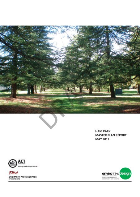
DRAFT<br />
HAIG PARK<br />
MASTER PLAN REPORT<br />
MAY 2012
DRAFT<br />
Prepared by<br />
Enviro Links Design (2011)<br />
In conjuncon with<br />
Eric Marn & Associates<br />
For<br />
<strong>ACT</strong> Shared <strong>Services</strong> Procurement<br />
On behalf of<br />
<strong>Park</strong>s & City <strong>Services</strong><br />
<strong>Territory</strong> <strong>and</strong> <strong>Municipal</strong> <strong>Services</strong> Directorate<br />
<strong>Haig</strong> <strong>Park</strong> Master Plan 2
TABLE OF CONTENTS<br />
1 Execuve summary 5<br />
2 Introducon 7<br />
2.1 Historical background <strong>and</strong> significance of <strong>Haig</strong> <strong>Park</strong> 7<br />
2.2 Heritage significance 9<br />
3 The study area 9<br />
3.1 Site descripon 9<br />
3.2 L<strong>and</strong>scape character 11<br />
3.3 Role <strong>and</strong> current uses 11<br />
3.4 Opportunies <strong>and</strong> constraints 13<br />
4 Legislave framework <strong>and</strong> <strong>plan</strong>ning controls 13<br />
4.1 Legislaon, policies <strong>and</strong> strategies 13<br />
4.2 <strong>Haig</strong> <strong>Park</strong> specific <strong>plan</strong>ning <strong>and</strong> development controls 13<br />
5 Consultaon with stakeholders 17<br />
5.1 <strong>ACT</strong> Government stakeholder consultaon <strong>and</strong> public consultaon 17<br />
6 The Master Plan—future direcons <strong>and</strong> proposals 17<br />
6.1 Trees <strong>and</strong> other vegetaon 19<br />
6.2 Access <strong>and</strong> circulaon 23<br />
6.3 Spaces <strong>and</strong> funcons 25<br />
6.4 Facilies <strong>and</strong> amenies 29<br />
6.5 Interpretave signage <strong>and</strong> informaon 31<br />
6.6 Artworks, feature lighng <strong>and</strong> commemorave elements 31<br />
6.7 Safety <strong>and</strong> security 31<br />
6.8 Design, materials <strong>and</strong> finishes 33<br />
DRAFT<br />
7 Implementaon 35<br />
8 Monitoring <strong>and</strong> evaluaon 35<br />
8.1 Tree management 35<br />
8.2 Traffic management 35<br />
8.3 Master Plan review 35<br />
Appendices 39<br />
Appendix A: Tree Management 40<br />
Appendix B: Traffic Management 44<br />
References 49<br />
<strong>Haig</strong> <strong>Park</strong> Master Plan 3
List of Figures<br />
Figure 1: <strong>Haig</strong> <strong>Park</strong> Local Context<br />
Figure 2: Opportunies & Constraints<br />
Figure 3: Original Planng Row Setout<br />
Figure 4: Exisng Vegetaon<br />
Figure 5: Exisng Pedestrian Access & Circulaon<br />
Figure 6: Exisng Vehicle Access & Circulaon<br />
Figure 7: Exisng Spaces & Funcons<br />
Figure 8: Exisng Facilies & Amenies<br />
Figure 9a: <strong>Haig</strong> <strong>Park</strong> West Master Plan<br />
Figure 9b: <strong>Haig</strong> <strong>Park</strong> East Master Plan<br />
Figure 10: Central Acvity Node (Depot Removed)<br />
Unless otherwise stated all figures have been prepared <strong>and</strong> photo’s taken by Enviro Links Design Pty Ltd.<br />
DRAFT<br />
<strong>Haig</strong> <strong>Park</strong> Master Plan 4
1 Execuve summary<br />
<strong>Haig</strong> <strong>Park</strong> is the third largest of the eleven Inner Canberra<br />
District <strong>Park</strong>s. Located just north of the city centre <strong>and</strong><br />
either side of Northbourne Avenue, it is one of the most<br />
prominent <strong>and</strong> significant l<strong>and</strong>scape spaces in Canberra.<br />
Listed on the <strong>ACT</strong> Heritage Register (Entry No. 20063)<br />
both for its significance as a l<strong>and</strong>scape feature <strong>and</strong> for its<br />
mass tree <strong>plan</strong>ngs of nine species, the park requires a<br />
st<strong>and</strong>ard of management appropriate with this high profile<br />
l<strong>and</strong>scape.<br />
This Master Plan, which comprises Figure 9 (the Master<br />
Plan) <strong>and</strong> this report, is intended to provide <strong>plan</strong>ning<br />
<strong>and</strong> conceptual design guidelines to protect the unique<br />
character of <strong>Haig</strong> <strong>Park</strong>, enhance recreaonal opportunies<br />
<strong>and</strong> enhance the overall presentaon of the park.<br />
The exisng condions, park usage, facilies, conservaon<br />
policies, legislave <strong>and</strong> management frameworks have<br />
been assessed, opportunies <strong>and</strong> constraints have been<br />
idenfied, <strong>and</strong> community input received. Each of these<br />
has informed the recommendaons.<br />
These elements of <strong>Haig</strong> <strong>Park</strong> have been assessed <strong>and</strong><br />
recommendaons made for each:<br />
• vegetaon<br />
• access <strong>and</strong> circulaon<br />
• spaces <strong>and</strong> funcons<br />
• facilies <strong>and</strong> amenies<br />
• interpretave signage <strong>and</strong> informaon<br />
• artworks <strong>and</strong> commemorave features<br />
• safety <strong>and</strong> security<br />
• design, materials <strong>and</strong> finishes.<br />
The intent is to retain <strong>and</strong> reinforce the l<strong>and</strong>scape character<br />
that defines <strong>Haig</strong> <strong>Park</strong> to protect the heritage values of the<br />
park. Where opportunity exists, it has been recommended<br />
that facilies, paths <strong>and</strong> spaces be upgraded to further<br />
enhance park experience <strong>and</strong> ensure that <strong>Haig</strong> <strong>Park</strong><br />
connues to present as a high quality l<strong>and</strong>scape.<br />
The primary recommendaons are:<br />
• Reinforcement of tree <strong>plan</strong>ngs throughout the<br />
park, to ensure the ongoing succession of park trees<br />
<strong>and</strong> the retenon of the park’s heritage (refer Secon<br />
6.1.2).<br />
• for two Heritage Integrity Zones, these are<br />
recommended for areas that sll best represent<br />
the original <strong>plan</strong>ng <strong>and</strong> layout intenon of 1921;<br />
addional <strong>plan</strong>ng to beer reflect the original<br />
<strong>plan</strong>ng is proposed (refer Secons 6.1.2).<br />
• Creaon of a Central Acvity Node <strong>and</strong> focal space<br />
using the former City <strong>Park</strong>s Depot (currently the<br />
Lead Disability <strong>Services</strong> Depot) to take advantage<br />
of the large open area. This is a large sunny area in<br />
the most intensive use area of the park adjacent to<br />
the commercial precinct. It provides an opportunity<br />
to respond to community desire for encouraging<br />
more acve uses of the park, without heritage tree<br />
removal. This acon had general community support<br />
during consultaons (refer Figure 10 <strong>and</strong> Secon<br />
6.3.2).<br />
• Upgrading of selected preferred (‘desire line’)<br />
pedestrian routes to a higher quality surface <strong>and</strong><br />
combine tracks where feasible for more stable all<br />
weather usability (refer Secon 6.2.2).<br />
• Retenon of exisng small open areas on the<br />
northern park edge that have beer solar access in<br />
what is largely a shaded park (refer Secon 6.2.2).<br />
• Upgraded park furniture <strong>and</strong> facilies for a more<br />
unified <strong>and</strong> consistent presentaon in select locaons<br />
(refer Secon 6.4.2).<br />
• Addional interpretave signage <strong>and</strong> informaon<br />
(refer Secon 6.5.1).<br />
• Installaon of artworks <strong>and</strong> commemorave<br />
features (refer Secon 6.6.2).<br />
• Addional lighng, <strong>and</strong> select vegetaon removal<br />
to improve park safety, parcularly at night (refer<br />
Secon 6.7.2).<br />
The recommendaons are driven by broad consideraons<br />
of the park’s history <strong>and</strong> importance <strong>and</strong> by community<br />
input. That is, they acknowledge the concerns, issues <strong>and</strong><br />
opportunies raised by the community <strong>and</strong> aim to address<br />
these. They aim to encourage more involvement by the<br />
community, specifically in contribung to some of the<br />
park’s direcons, <strong>and</strong> most importantly by meeng the<br />
desire for more aracve, acve community spaces.<br />
The Master Plan provides strategic direcon <strong>and</strong> the overall<br />
vision required for future works, at no me losing sight<br />
of the size <strong>and</strong> significance of <strong>Haig</strong> <strong>Park</strong>. The scope of the<br />
proposals reflect:<br />
• heritage constraints<br />
• the desire to retain much of the exisng character,<br />
<strong>and</strong><br />
• realisc management <strong>and</strong> capital works outlays<br />
(improvements are dependent on available funding).<br />
DRAFT<br />
<strong>Haig</strong> <strong>Park</strong> Master Plan 5
LEGEND<br />
HAIG PARK<br />
URBAN OPEN SPACE<br />
AINSLIE<br />
HAIG PARK<br />
(WEST)<br />
BRADDON<br />
COMMERCIAL<br />
DISTRICT<br />
HAIG PARK<br />
(EAST)<br />
BRADDON<br />
CORROBOREE<br />
PARK<br />
NORTHBOURNE AVENUE<br />
O’CONNOR<br />
HACKETT<br />
GARDENS<br />
AUSTRALIAN<br />
NATIONAL<br />
UNIVERSITY<br />
P<br />
TURNER<br />
PRIMARY<br />
SCHOOL<br />
S<br />
P<br />
TURNER<br />
P<br />
P<br />
ENCLOSED<br />
SPORTSGROUND<br />
ENCLOSED<br />
SPORTSGROUND<br />
S<br />
S<br />
MERICI<br />
COLLEGE<br />
LIMESTONE AVENUE<br />
GIRRAHWEEN STREET<br />
S<br />
S<br />
TORRENS STREET<br />
McCAUGHEY STREET<br />
S<br />
S<br />
AINSLIE<br />
PRIMARY<br />
SCHOOL<br />
S<br />
LONSDALE STREET<br />
MORT STREET<br />
DRAFT<br />
CITY<br />
0 100 500<br />
1000<br />
COMMERCIAL LAND USE<br />
EDUCATIONAL LAND USE<br />
RESIDENTIAL LAND USE<br />
EXISTING LOCAL HALL<br />
P PLAYGROUND<br />
S<br />
TENNIS CLUB<br />
(m)<br />
SPORTGROUND<br />
PARK BARBECUE<br />
N<br />
LAWN BOWLS CLUB<br />
BARRY DRIVE<br />
Figure 1: <strong>Haig</strong> <strong>Park</strong> Local Context<br />
<strong>Haig</strong> <strong>Park</strong> Master Plan 6
2 Introducon<br />
The <strong>Haig</strong> <strong>Park</strong> Master Plan is set out at Figure 9, which<br />
needs to be read in conjuncon with this document, the<br />
Master Plan report.<br />
l<strong>and</strong>scape.<br />
The following summarises key phases in its history, all of<br />
which influence the thinking behind the recommendaons<br />
in this report <strong>and</strong> Master Plan.<br />
Enviro Links Design, a sub-consultant to Eric Marn &<br />
Associates, was engaged by <strong>Park</strong>s & City <strong>Services</strong> (PACS),<br />
<strong>Territory</strong> <strong>and</strong> <strong>Municipal</strong> <strong>Services</strong> Directorate (TAMS)<br />
to prepare the Master Plan. Eric Marn & Associates<br />
has prepared a Conservaon Management Plan (CMP)<br />
concurrent with the Master Plan. There was joint<br />
community consultaon. This approach aids an interacve<br />
<strong>and</strong> consistent response. The Master Plan recognises<br />
the park’s heritage values <strong>and</strong> recommends long term<br />
management strategies <strong>and</strong> design soluons consistent<br />
with those values.<br />
The Master Plan has been developed as a <strong>plan</strong>ning <strong>and</strong><br />
concept design document, intended to guide the quality<br />
upgrade of the park over the next five to 10 years, in<br />
keeping with the heritage significance of the park. The aim<br />
is to create a more vital, interesng, welcoming <strong>and</strong> vibrant<br />
place offering mixed opportunies for diverse users <strong>and</strong><br />
more diverse uses. It is recognised that as the residenal<br />
populaon of the inner north increases so too will the<br />
dem<strong>and</strong> for improved recreaonal opportunies.<br />
2.1 Historical background <strong>and</strong> significance<br />
of <strong>Haig</strong> <strong>Park</strong><br />
<strong>Haig</strong> <strong>Park</strong> is the third largest of the 11 inner Canberra<br />
District <strong>Park</strong>s, nine of which are on or adjoin Lake Burley<br />
Griffin. <strong>Haig</strong> <strong>Park</strong> is relavely disncve for this reason<br />
(the other non-lake related park is the Redwood Grove<br />
near the Canberra Airport). Similarly, only <strong>Haig</strong> <strong>Park</strong> <strong>and</strong><br />
Telopea <strong>Park</strong> are primarily surrounded by residenal <strong>and</strong><br />
commercial developments.<br />
But <strong>Haig</strong> <strong>Park</strong>’s true significance <strong>and</strong> importance derives<br />
from its origins <strong>and</strong> purpose, associated with the<br />
establishment of Canberra.<br />
It is considered unique for an Australian urban park<br />
because of its linear <strong>plan</strong>ning framework. 1 The selecon,<br />
mix <strong>and</strong> layout of trees are part of the design <strong>and</strong> aesthec<br />
quality of the park. 2 The formal <strong>plan</strong>ng of exoc<br />
deciduous <strong>and</strong> conifer trees applied on such a large scale<br />
makes <strong>Haig</strong> <strong>Park</strong> a unique l<strong>and</strong>scape space to Canberra. In<br />
addion to this, the informality of pedestrian routes (other<br />
than the north–south link pathways) creates a curious<br />
relaonship between formality in the tree <strong>plan</strong>ng <strong>and</strong> the<br />
informal use of the park. The result is a relavely relaxing<br />
urban open space within a highly fixed formal structure.<br />
This further enhances <strong>Haig</strong> <strong>Park</strong>’s individuality.<br />
It is listed on the <strong>ACT</strong> Heritage Register (Entry No. 20063)<br />
both for its significance as a l<strong>and</strong>scape feature <strong>and</strong> for its<br />
mass tree <strong>plan</strong>ngs of nine species. It requires a st<strong>and</strong>ard<br />
of management appropriate for such an important<br />
1 Eric Marn <strong>and</strong> Associates, 2011, <strong>Haig</strong> <strong>Park</strong> Conservaon Management Plan,<br />
page 71<br />
2 Marn, page 71<br />
<strong>Haig</strong> <strong>Park</strong> 1921<br />
<strong>Haig</strong> <strong>Park</strong> commenced its life as the East-West Shelter<br />
Break 3 with the majority of the <strong>plan</strong>ng (over 7000 trees)<br />
undertaken in 1921. 4 Its prime funcon was to protect the<br />
first suburbs north of the yet to be developed Civic Centre<br />
from wind <strong>and</strong> dust. 5 The Naonal Capital site at this me<br />
was bare <strong>and</strong> windswept—hot winds, cold winds <strong>and</strong> dust<br />
were significant problems as there was limited vegetaon<br />
(savannah woodl<strong>and</strong>) on the broad valley plains.<br />
<strong>Haig</strong> <strong>Park</strong> would in me also serve as a park for the nearby<br />
residents of the new city, becoming the community park<br />
of today. The <strong>plan</strong>ng was designed by Charles Weston,<br />
Canberra’s first Officer-in-charge of Afforestaon (later to<br />
become <strong>Park</strong>s <strong>and</strong> Gardens), from 1913 to 1926.<br />
Pinus radiata (Monterey Pine) was the dominant species, of<br />
which Weston <strong>plan</strong>ted nearly 2000, reflecng his desire to<br />
achieve quick results <strong>and</strong> wind / dust amelioraon. It was<br />
common for the early <strong>plan</strong>ngs in Canberra to include fast<br />
growing species such as Wales <strong>and</strong> Pinus radiata to offer<br />
some protecon to other trees <strong>and</strong> for fast effect, oen<br />
with the intenon to remove them within a few years. This<br />
was probably the reason for the inclusion of Pinus radiata<br />
in <strong>Haig</strong> <strong>Park</strong>. 6<br />
Another tree that was heavily <strong>plan</strong>ted was Roman cypress<br />
(Cupressus sempervirens ‘Stricta’) despite its minimal<br />
windbreak contribuon. In western sociees Roman<br />
cypress has been tradionally recognised as a symbol of<br />
death <strong>and</strong> immortality. In <strong>Haig</strong> <strong>Park</strong>, its <strong>plan</strong>ng perhaps<br />
reflected Weston’s intenons to pay tribute to the many<br />
Australians who had not returned from the World War. 7<br />
DRAFT<br />
<strong>Haig</strong> <strong>Park</strong> was named for Earl Douglas <strong>Haig</strong>, Comm<strong>and</strong>er-inchief<br />
of the Brish Empire Forces during World War I aer<br />
his death in 1928. 8<br />
<strong>Haig</strong> <strong>Park</strong> 1921 – 1950<br />
<strong>Haig</strong> <strong>Park</strong> remained a strong l<strong>and</strong>scape feature delineang<br />
the northern edge of Canberra unl the early 1950s. <strong>Park</strong><br />
management emphasised the historic nature of the park.<br />
The original design was maintained even though thinning<br />
was found necessary. Wales <strong>and</strong> flowering trees were the<br />
main species removed.<br />
During the 1940s <strong>and</strong> 1950s work undertaken consisted<br />
mainly of maintenance <strong>and</strong> the removal of some <strong>plan</strong>ngs.<br />
Significant pruning was undertaken in 1946. John Gray<br />
believes that the Wales were probably removed in the<br />
3 J. Gray (1997) The Historical <strong>and</strong> Cultural Background of Selected Urban <strong>Park</strong>s<br />
in Canberra<br />
4 Eric Marn <strong>and</strong> Associates, 2011, <strong>Haig</strong> <strong>Park</strong> Conservaon Management Plan,<br />
page 16<br />
5 R. Boden et al. 2000, ‘<strong>Haig</strong> <strong>Park</strong> Tree Management Plan’, page 1<br />
6 Ibid<br />
7 Gray (1997)<br />
8 Gray (1997)<br />
<strong>Haig</strong> <strong>Park</strong> Master Plan 7
Image 1: <strong>Haig</strong> <strong>Park</strong> as viewed from Mount Ainslie<br />
1927 (Source: Naonal Archives of Australia)<br />
DRAFT<br />
Image 2: <strong>Haig</strong> <strong>Park</strong> looking northwards viewed<br />
from above Commonwealth <strong>Park</strong> During the<br />
1950’s. (Source: Naonal Archives of Australia)<br />
Image 3: <strong>Haig</strong> <strong>Park</strong> viewed southwards from<br />
above Northbourne Avenue during the 1960’s.<br />
(Source: Naonal Archives of Australia)<br />
Note: No other <strong>plan</strong>ng had the size or<br />
impact of those in <strong>Haig</strong> <strong>Park</strong> on the North<br />
Canberra plains unl at least the late<br />
1960’s.<br />
<strong>Haig</strong> <strong>Park</strong> Master Plan 8
late 1940s by Professor Lindsay Pryor, then Director of <strong>Park</strong>s<br />
<strong>and</strong> Gardens. 9<br />
The exisng buildings were all built between 1948 <strong>and</strong> 1958, 10<br />
other than the new toilet block, thought to be built in the late<br />
1980s.<br />
<strong>Haig</strong> <strong>Park</strong> in the 1970s<br />
In the early 1970s public concern about the management of<br />
the park led the Naonal Capital Development Commission<br />
to restrict vehicular access <strong>and</strong> construct car parks, a fitness<br />
track <strong>and</strong> picnic areas, <strong>and</strong> add irrigaon in some areas of the<br />
park. 11<br />
<strong>Haig</strong> <strong>Park</strong> 1980s onwards<br />
In 1987, Margules & Associates prepared a Preliminary<br />
Concept Proposals (Master Plan) for <strong>Haig</strong> <strong>Park</strong>. Their key<br />
tree management recommendaons are summarised in the<br />
Tree Management Table (refer Appendix A, also Secon 8.1).<br />
Of primary importance was the Pinus radiata removal <strong>and</strong><br />
re<strong>plan</strong>ng, which had started in 1984 <strong>and</strong> connued in 1991<br />
<strong>and</strong> in 1993. This was necessary to respond to concerns about<br />
the ageing <strong>and</strong> general health status of many of these pines.<br />
Other recommendaons of the 1987 Master Plan that were<br />
implemented included:<br />
• Replacement of the toilet block in the late 1980s.<br />
• Also in the late 1980s, four barbecues were removed<br />
<strong>and</strong> replaced by two new ones. (The 1987 Master Plan<br />
envisaged five new barbecue/ picnic areas <strong>and</strong> the<br />
upgrading of three exisng barbecue areas. A new such<br />
area was <strong>plan</strong>ned next to the Turner Preschool, which<br />
was recommended to be converted to a community<br />
hall.)<br />
• The concrete storm water channel east of Northbourne<br />
Avenue was piped, which opened up this key area of<br />
the park. (To the west of Northbourne Avenue channel<br />
baers were to be laid back as much as possible without<br />
impacng on trees to assist maintenance <strong>and</strong> to use<br />
rock work in some areas where steeper baers where<br />
needed. This work has not been undertaken. )<br />
• Planng works were undertaken in 2010.<br />
Appendix A to this report provides essenal further detail<br />
(in summary form) from the 1987 Master Plan; also key<br />
analysis <strong>and</strong> recommendaons from a major trees assessment<br />
survey undertaken by the late Robert Boden, in 2000. The<br />
Margules <strong>and</strong> Boden reports have significantly informed the<br />
development of this report <strong>and</strong> the associated Master Plan.<br />
Appendix A also includes tree management recommendaons<br />
made as part of this report <strong>and</strong> Master Plan.<br />
The irrigaon system was turned off at some stage to lessen<br />
water or maintenance dem<strong>and</strong>. (The 1987 Master Plan<br />
envisaged irrigaon 300m either side of Northbourne Avenue<br />
including the then exisng system. It is acknowledged in post-<br />
2000 water sustainability frameworks that irrigaon to this<br />
extent is highly unlikely to be implemented.)<br />
9 Boden, page 2<br />
10 Marn, page 39-41<br />
11 Boden, page 2<br />
2.2 Heritage significance<br />
“<strong>Haig</strong> <strong>Park</strong> is a significant l<strong>and</strong>scape feature of Canberra,<br />
demonstrang the early establishment of <strong>plan</strong>ngs in<br />
the city for protecon from wind, climac extremes <strong>and</strong><br />
l<strong>and</strong>scape beauficaon. The <strong>Park</strong> is parcularly significant<br />
for its designed funcon as a windbreak to protect the<br />
developing suburbs of Braddon <strong>and</strong> Turner from dust-laden<br />
north-westerly winds.<br />
Constructed around 1921-23 it extends for over 1,780<br />
metres <strong>and</strong> comprises fourteen rows of mixed evergreen<br />
<strong>and</strong> deciduous tree species. The selecon, mix <strong>and</strong> layout<br />
of trees are part of the design <strong>and</strong> aesthec quality of<br />
the <strong>Park</strong>. This is a rare example of windbreak <strong>plan</strong>ng on<br />
a large scale <strong>and</strong> remains highly intact. It is considered<br />
unique for an Australian urban park due to the linear<br />
<strong>plan</strong>ng framework on which it is based.<br />
The selecon, mix <strong>and</strong> layout of trees are part of the design<br />
aesthec quality of the park. Following expansion of the city<br />
further north, the <strong>Park</strong> has become an integral component<br />
of the l<strong>and</strong>scaped open space system between the adjoining<br />
suburbs, reflecng contemporary Garden City <strong>plan</strong>ning.<br />
The <strong>Park</strong> is highly valued for its history, heritage <strong>and</strong><br />
recreaonal opportunies by the Canberra community,<br />
parcularly the local Turner <strong>and</strong> Braddon residents.<br />
Thomas Charles George Weston designed the layout <strong>and</strong><br />
supervised the inial <strong>plan</strong>ng of the <strong>Park</strong> <strong>and</strong> played a<br />
seminal role in the early l<strong>and</strong>scape design <strong>and</strong> <strong>plan</strong>ng<br />
program in the Naonal Capital. Other significant<br />
contributors were Lindsay Pryor <strong>and</strong> the NCDC who<br />
insgated the coup method of tree replacement in the<br />
1980’s.” 12<br />
<strong>Haig</strong> <strong>Park</strong> was:<br />
• in 1982, classified by the Naonal Trust of Australia<br />
(<strong>ACT</strong>)<br />
• in 1988, listed on the <strong>ACT</strong> Heritage Register (Entry No.<br />
20063) as a significant l<strong>and</strong>scape feature <strong>and</strong> for the<br />
mass <strong>plan</strong>ng of nine different species of tree, <strong>and</strong><br />
• in 2000, tabled as a Variaon to the <strong>Territory</strong> Plan<br />
Heritage Places Register.<br />
DRAFT<br />
3 The study area<br />
3.1 Site descripon<br />
<strong>Haig</strong> <strong>Park</strong> is located in Canberra’s inner north, encompassed<br />
by the suburbs of Turner <strong>and</strong> Braddon (refer Figure 1). It is<br />
1780m long <strong>and</strong> 143m wide for all but a small wider secon<br />
near McCaughey Street, Turner. It is a significant space at<br />
the northern edge of the city central commercial area. It<br />
is almost enrely bounded by roads, with Masson Street<br />
(Turner) <strong>and</strong> Girrahween Street (Braddon) being the most<br />
heavily trafficked along the south–west <strong>and</strong> south–east<br />
secons of the park, respecvely. Limestone Avenue to the<br />
east <strong>and</strong> Frogga Street to the west bound the park in<br />
12 Marn, page 74<br />
<strong>Haig</strong> <strong>Park</strong> Master Plan 9
Image 4: The Sullivans Creek corridor bisects <strong>Haig</strong> <strong>Park</strong> West,<br />
incorporang both passive <strong>and</strong> acve modes of pedestrian acvity into<br />
the <strong>Park</strong> via the open grassed banks <strong>and</strong> community trunk shared use path<br />
respecvely.<br />
Image 6: Exisng seang area set into the l<strong>and</strong>scape. This locaon has high<br />
sun access as few adjacent large shade trees exist. This differs from other<br />
more shaded focal seang or barbecue areas in the <strong>Park</strong>.<br />
Image 5: <strong>Haig</strong> <strong>Park</strong> bounded primarily by low to medium residenal<br />
development. It caters primarily to the residents of Turner, Braddon &<br />
O’Connor.<br />
Image 7: Wide spacing between the southern street trees <strong>and</strong> the denser<br />
park rows is ulised by car parks in some areas. This also offers the potenal<br />
for a pleasant shaded east-west pathway set back from the road for a more<br />
park like experience than a kerb side path.<br />
DRAFT<br />
Image 8: <strong>Haig</strong> <strong>Park</strong> viewed eastwards<br />
from above Turner in the early 1980’s.<br />
Sullivans Creek corridor in foreground<br />
with the contrasng autumn<br />
yellows is a seasonal feature worth<br />
preserving. Current apartment <strong>and</strong><br />
commercial developments in the quarter<br />
of a century since, intensify<br />
pressures on <strong>Haig</strong> <strong>Park</strong>.<br />
NOTE: Significant linkage potenal of<br />
both open space corridors. <strong>Haig</strong> <strong>Park</strong><br />
as a key east-west link (even from Mt<br />
Ainslie to Black Mountain for<br />
walking enthusiasts) <strong>and</strong> Sullivans<br />
Creek as the main north-south cycle/<br />
pedestrian open space route.<br />
<strong>Haig</strong> <strong>Park</strong> Master Plan 10
those direcons while Henty Street (Turner) <strong>and</strong> Greenway<br />
Street (Braddon) form the northern boundary. Northbourne<br />
Avenue bisects the park, effecvely creang a barrier <strong>and</strong><br />
dividing the park into two secons, with further lesser (but<br />
sll busy at peak mes) roads bisecng it further (Torrens<br />
Street, in the east, <strong>and</strong> McCaughey Street, in the west).<br />
The Braddon commercial district, adjacent to Northbourne<br />
Avenue, is centrally located on its south side <strong>and</strong> it, along<br />
with the city centre just beyond, contributes to a high<br />
volume of pedestrian <strong>and</strong> cycle traffic through the park.<br />
Sullivans Creek divides the western secon. The Sullivans<br />
Creek trunk shared use path has high volume pedestrian<br />
<strong>and</strong> cyclist traffic (mainly commuter traffic).<br />
3.2 L<strong>and</strong>scape character<br />
<strong>Haig</strong> <strong>Park</strong> is characterised by mature vegetaon in formal<br />
<strong>plan</strong>ng rows that run the length of the park. With the<br />
excepon of some large Phonia shrub <strong>plan</strong>ngs near<br />
the outer rows (mainly to the eastern end), the park has<br />
no understorey <strong>plan</strong>ngs. This allows a free roaming<br />
circulaon paern.<br />
Original <strong>plan</strong>ngs were laid out in 14 rows (refer Figures<br />
3 <strong>and</strong> 4). Cedar <strong>and</strong> Pine tree rows form the ‘leading<br />
permanent feature’ of the park, accounng for the large<br />
majority of <strong>plan</strong>ngs. 13 Rows were generally <strong>plan</strong>ted<br />
at spacings of 20 feet (6.1m), much denser than the<br />
deciduous <strong>and</strong> street tree rows on the periphery, <strong>plan</strong>ted at<br />
40 feet (12.2m) spacings.<br />
Quercus palustris (Pin Oak) is the primary deciduous<br />
species in the park, with these rows inter<strong>plan</strong>ted in<br />
some areas with a Fraxinus species. The street tree rows<br />
comprise Fraxinus <strong>and</strong> Cedrus species to the south <strong>and</strong><br />
Eucalyptus species to the north (refer Figures 3 <strong>and</strong> 4).<br />
The formal linear structure of the <strong>plan</strong>ng is broken where<br />
the Sullivans Creek floodway channel bisects the park.<br />
Here, Poplar species have been <strong>plan</strong>ted in a more organic<br />
<strong>and</strong> r<strong>and</strong>om paern. Only around 20, aer the removal of<br />
10 in 2010 due to their declining state (refer Images 4 <strong>and</strong><br />
8, also Appendix A).<br />
<strong>Haig</strong> <strong>Park</strong> is what might be described as a simple <strong>and</strong><br />
natural park on the ground <strong>plan</strong>e, in that it is of a plain<br />
character, the ground cover is dryl<strong>and</strong> grass (i.e. there are<br />
no formal grassed areas nor many formal pathways <strong>and</strong><br />
hardscapes). It invites informal <strong>and</strong> relaxed use amongst<br />
the formality of the tree <strong>plan</strong>ngs. The primarily exoc<br />
tree species palee provides seasonal colour, the varying<br />
deciduous <strong>and</strong> evergreen foliage providing contrast <strong>and</strong><br />
interest. This mix of species <strong>and</strong> <strong>Haig</strong> <strong>Park</strong>’s significant<br />
contribuon to the inner northern open space network<br />
is highly valued by the surrounding community. This<br />
was evident at the consultaons that occurred during<br />
the development of this Master Plan <strong>and</strong> the associated<br />
Conservaon Management Plan.<br />
Whilst much of the understorey shrub vegetaon <strong>and</strong><br />
13 Boden, page 1<br />
original Roman Cypress <strong>plan</strong>ngs have been removed over<br />
the years, there are two areas where the original 1921<br />
<strong>plan</strong>ng design is sll more evident. These have been<br />
proposed as ‘Heritage Integrity Zones’, given they best<br />
represent the original <strong>plan</strong>ng (refer Secon 3.4).<br />
3.3 Role <strong>and</strong> current uses<br />
Research undertaken during the development of this<br />
Master Plan, including community consultaon, helped<br />
build a picture of current use of the park. Whilst the park<br />
was designed as a shelter belt for the early city, by the<br />
1950s it was absorbed into urban expansion to become a<br />
community park, as it is today. It is used both passively <strong>and</strong><br />
acvely by nearby residents, commuters, local business<br />
workers’ <strong>and</strong> others. It is an aracve green space for<br />
walking, running, observing <strong>and</strong> community gatherings for<br />
local residents. Its value as a habitat for birds <strong>and</strong> other<br />
wildlife as was noted in consultaons <strong>and</strong> idenfied in the<br />
Conservaon Management Plan. It is also a desnaon for<br />
the greater Canberra area, with people generally arriving<br />
by car. It provides for commuters, cyclists <strong>and</strong> others, either<br />
as they are passing through or as a passive lunch space<br />
for local workers. Evidence of the park’s value by diverse<br />
groups within the wider community can be seen in the<br />
varied uses made of different parts of the park, in part<br />
determined by the interests of the adjoining community<br />
(see Secon 6.3, Spaces <strong>and</strong> Funcons for further<br />
discussion).<br />
Research found that 21 per cent of <strong>ACT</strong> residents said they<br />
visited <strong>Haig</strong> <strong>Park</strong> in 2007/08, <strong>and</strong> that people commonly<br />
visit city <strong>and</strong> district parks in the <strong>ACT</strong> for children’s play,<br />
walking through <strong>and</strong> walking a dog. 14 Social value analysis<br />
summarised in the Conservaon Management Plan<br />
idenfies a range of communies having an associaon<br />
with <strong>Haig</strong> <strong>Park</strong>. 15<br />
DRAFT<br />
The trunk shared use paths adjacent to Sullivans Creek <strong>and</strong><br />
McCaughey Street are higher acvity areas, with users of<br />
these paths being from a more widespread area: for them<br />
the park is a transional space between inner suburbs, the<br />
city centre <strong>and</strong> instuons, such as the Australian Naonal<br />
University, <strong>and</strong> suburbs further to the north.<br />
With lile understorey <strong>plan</strong>ngs <strong>and</strong> the numerous access<br />
points, informal, free form usage paerns have developed<br />
in <strong>Haig</strong> <strong>Park</strong>. This is evident in the network of desire lines<br />
worn throughout the park. The formal pathways tend to<br />
be used mainly by cyclists, <strong>and</strong> some pedestrians, whereas<br />
a high number of walkers appear more inclined to follow<br />
desire lines, many of which are diagonally orientated (see<br />
Figure 5).<br />
From public consultaon workshops held throughout<br />
the design process (primarily local residents’ input), park<br />
users indicated a preference for the relavely low key <strong>and</strong><br />
informal undefined nature of the park beneath the canopy<br />
<strong>and</strong> the overall row formality of the trees. That said, there<br />
was strong support for increased diversity <strong>and</strong> increased<br />
14 MARS, <strong>ACT</strong> Sportsgrounds, parks, open spaces usage <strong>and</strong> sasfacon survey,<br />
October, 2008, TaMS<br />
15 Marn, pages 66-77<br />
<strong>Haig</strong> <strong>Park</strong> Master Plan 11
Typical Images (Source: Google Images 2010)<br />
TURNER TENNIS CLUB CAR<br />
PARK: OPPORTUNITY TO<br />
FORMALISE CAR SPACES WITH<br />
TIME LIMITATIONS TO MINIMISE<br />
CONGESTION IN PEAK PERIODS.<br />
ALLOWS MORE PARK USERS<br />
THAN COMMUTER USE<br />
NORTHBOURNE AVENUE<br />
LEGEND<br />
CPK<br />
CHILDCARE<br />
CENTRE<br />
MAJOR NORTH-SOUTH ROADS<br />
DIVIDE THE PARK AND FORM<br />
BARRIERS TO EAST-WEST<br />
PEDESTRIAN MOVEMENT<br />
CPK<br />
CONDAMINE ST<br />
MASSON ST<br />
OPPORTUNITY TO CREATE A<br />
FOCAL POINT/ CENTRAL<br />
<strong>ACT</strong>IVITY NODE IF THE LEAD<br />
SERVICES DEPOT WAS<br />
REMOVED<br />
LEAD<br />
DEPOT<br />
CPK<br />
AREA OF PREVALENT<br />
ANTI-SOCIAL BEHAVIOUR<br />
AREA OF DESIGN OPPORTUNITY<br />
CPK<br />
McCHAUGHEY ST<br />
TORRENS ST<br />
CPK<br />
GIRRAHWEEN ST<br />
SULLIVANS CREEK CORRIDOR:<br />
- CONSTRAINS EAST-WEST MOVEMENT<br />
-PEDESTRIAN BRIDGE UNLIKELY TO BE<br />
FEASIBLE<br />
-OPPORTUNITY TO REINFORCE DECIDUOUS<br />
TREE PLANTING<br />
GREENWAY ST VERGE:<br />
-UNSUCCESSFUL PLANTING<br />
- OPPORTUNITY FOR OPEN<br />
SPACE WITH GOOD SOLAR<br />
ACCESS<br />
SPORTS OVAL<br />
CPK<br />
GREENWAY ST<br />
CPK<br />
HERITAGE INTEGRITY ZONE:<br />
BEST REPRESENTATION OF<br />
ORGINAL 1921 DESIGN<br />
PLANTINGS. OPPORTUNITY TO<br />
REINFORCE<br />
CPK<br />
CPK<br />
HERITAGE INTEGRITY ZONE:<br />
BETTER REPRESENTATION OF<br />
ORIGINAL 1921 DESIGN<br />
PLANTINGS. OPPORTUNITY TO<br />
REINFORCE<br />
MAJOR NORTH-SOUTH ROADS<br />
DIVIDE THE PARK AND FORM<br />
BARRIERS TO EAST-WEST<br />
PEDESTRIAN MOVEMENT<br />
LIMESTONE AVENUE<br />
DRAFT<br />
HENTY ST<br />
BARRIERS TO PEDESTRIAN MOVEMENT<br />
CPK<br />
CPK<br />
NORTHBOURNE AVENUE<br />
0 10 50 100 200<br />
(m)<br />
N<br />
AREA OF CONSTRAINT TO DESIGN<br />
Figure 2: Opportunies & Constraints<br />
<strong>Haig</strong> <strong>Park</strong> Master Plan 12
use of the park for informal leisure, so long as the overall<br />
value of the park is not compromised. It was suggested<br />
there was significant opportunity to provide local residents<br />
<strong>and</strong> the park users with historical, l<strong>and</strong>scape <strong>and</strong> contextual<br />
informaon through good quality interpretave signage.<br />
Suggesons for improved facilies included sculpture <strong>and</strong><br />
a mobile café van, although overall those consulted were<br />
reserved about introducing facilies, parcularly as it was<br />
ancipated this would dramacally alter the character of<br />
the park. 16<br />
3.4 Opportunies <strong>and</strong> constraints<br />
4 Legislave framework <strong>and</strong> <strong>plan</strong>ning<br />
controls<br />
4.1 Legislaon, policies <strong>and</strong> strategies<br />
Overarching legislaon:<br />
The <strong>ACT</strong> (Planning <strong>and</strong> L<strong>and</strong> Management) Act 1988<br />
determines the division of responsibilies between the<br />
Commonwealth <strong>and</strong> the <strong>ACT</strong> Government for l<strong>and</strong> use<br />
<strong>plan</strong>ning <strong>and</strong> management. Responsibility for <strong>Haig</strong> <strong>Park</strong> lies<br />
with the <strong>ACT</strong> Government under this Act.<br />
In developing this report <strong>and</strong> Master Plan, some key<br />
opportunies <strong>and</strong> constraints were idenfied (refer Figure<br />
2). In summary, the key opportunies relate to:<br />
• useable open spaces—create limited more useable<br />
open spaces that encourage greater acve use of<br />
certain areas of the park, without compromising the<br />
heritage values <strong>and</strong> overall integrity <strong>and</strong> sense of<br />
the park. This includes a Central Acvity Node <strong>and</strong> a<br />
second, smaller node, at the western end of the park,<br />
outside the heritage <strong>plan</strong>ng<br />
• heritage integrity zones—create two such zones<br />
encompassing areas within the park that best<br />
represent the original structure <strong>and</strong> <strong>plan</strong>t species<br />
from 1921. There is potenal for extra <strong>plan</strong>ng in<br />
these zones to strengthen the park’s cultural heritage<br />
<strong>and</strong> ensure diversity in the spaces the park offers<br />
(refer to Figure 2, showing the locaon of these<br />
zones)<br />
• pedestrian linkages—there are many informal tracks<br />
across the path, there is opportunity to recognise<br />
some of these as more formal, yet low key paths<br />
• trees—in keeping with community desire for<br />
celebrang <strong>and</strong> maintaining the history <strong>and</strong><br />
heritage of the park 17 a primary focus of the<br />
recommendaons is on <strong>plan</strong>ng <strong>and</strong> re<strong>plan</strong>ng to<br />
ensure the integrity of the linear tree <strong>plan</strong>ngs is<br />
retained.<br />
Secon 6 provides further detail, including analysis,<br />
raonale <strong>and</strong> recommendaons.<br />
The constraints, as shown on Figure 2, can be largely<br />
summarised as physical constraints, namely, the restricons<br />
on east-west movement created by Northbourne Avenue,<br />
Sullivans Creek <strong>and</strong>, to a lesser extent, McCaughey Street<br />
(at the westerly end) <strong>and</strong> Torrens Street (to the east), all of<br />
which create barriers to pedestrian <strong>and</strong> cycle movement.<br />
There are also issues associated with car parking <strong>and</strong> the<br />
use of car parks around the park by commuters.<br />
The L<strong>and</strong> (Planning <strong>and</strong> Environment) Act 1991, subsecons<br />
5.7.2 <strong>and</strong> 5.7.3 require <strong>Haig</strong> <strong>Park</strong> to be managed in<br />
accordance with its classificaon as public l<strong>and</strong> in the<br />
<strong>Territory</strong> Plan.<br />
The Heritage Act 2004 establishes a system whereby places<br />
<strong>and</strong> objects with cultural or natural value, in this instance<br />
<strong>Haig</strong> <strong>Park</strong>, are recognised, registered <strong>and</strong> conserved <strong>and</strong> are<br />
integrated with l<strong>and</strong> <strong>plan</strong>ning <strong>and</strong> development.<br />
Other applicable Acts:<br />
• Lier Act 2004<br />
• Hawkers Act 2003<br />
• Roads <strong>and</strong> Public Places Act 1937<br />
• Commonwealth Disability Discriminaon Act 1992<br />
• <strong>ACT</strong> Discriminaon Act 1991<br />
• Emergencies Act 2004<br />
• Domesc Animals Act 2000.<br />
Relevant <strong>ACT</strong> policies <strong>and</strong> strategies:<br />
• <strong>ACT</strong> Weeds Strategy 1996<br />
• <strong>ACT</strong> Memorials Policy 2004<br />
• <strong>ACT</strong> Graffi Strategy 2004<br />
• CUPP (PC&L) Irrigaon Policy 1999<br />
• CUPP (PC&L) Mowing Policy 1999<br />
• CUPP (PC&L) Sharps Policy 2000.<br />
DRAFT<br />
4.2 <strong>Haig</strong> <strong>Park</strong> specific <strong>plan</strong>ning <strong>and</strong><br />
development controls<br />
<strong>Haig</strong> <strong>Park</strong> as an area listed on the <strong>ACT</strong> Heritage Register is<br />
subject to a range of specific requirements, necessary to<br />
protect its heritage status.<br />
In addion:<br />
• under the <strong>Territory</strong> Plan it is zoned urban space<br />
• the Naonal Capital Plan makes specific reference to<br />
it<br />
• the Turner <strong>and</strong> Braddon Neighbourhood Plans<br />
idenfy it as a key asset of these suburbs, <strong>and</strong><br />
• the 2008 Braddon Commercial Area <strong>plan</strong>ning study<br />
makes specific reference to the park.<br />
The following are extracted from the Eric Marn &<br />
Associates Conservaon Management Plan (CMP) 2011<br />
prepared in conjuncon with this Master Plan.<br />
16 Ibid, see Aachment 5, Consultaon Report, pages 7 & 9<br />
17 Ibid, page 9<br />
<strong>Haig</strong> <strong>Park</strong> Master Plan 13
STREET TREES:<br />
Eucalyptus cinerea (Henty Street)<br />
Eucalyptus paucifl ora (Greenway<br />
Street)<br />
Quercus palustris (Pink Oak) <strong>and</strong><br />
Fraxinus pennsylvanica (Red Ash)<br />
Cedrus deodora (Deodora Cedar)<br />
<strong>and</strong> Cupressus sempervirens<br />
(Italian Cypress) alternating<br />
Pinus Radiata (Monterey Pine)<br />
DRAFT<br />
As for rows 3 & 4<br />
As for rows 5 & 6<br />
Image 9: Thomas Charles Weston (1866-<br />
1935) in 1921 (Source: Naonal Archives<br />
of Australia)<br />
As for rows 3 & 4<br />
As for row 2<br />
STREET TREES:<br />
Cedrus deodora (Girrahween<br />
Street)<br />
Fraxinus oxycarpa (Masson Street)<br />
<br />
NOTE: Rows 1 <strong>and</strong> 14 street trees <strong>plan</strong>ted well after the 1921 rows 2 to 13<br />
Figure 3: Original Planng Row Setout (Margules 1987, ‘<strong>Haig</strong> <strong>Park</strong> Preliminary Concept Proposals, p. 8)<br />
<strong>Haig</strong> <strong>Park</strong> Master Plan 14
4.2.1 <strong>ACT</strong> Heritage Council<br />
“<strong>Haig</strong> <strong>Park</strong> is on the <strong>ACT</strong> Heritage Register so the full<br />
requirements of the Heritage Act 2004 apply.<br />
“Proposed work on the place (<strong>Park</strong>) will require referral<br />
of the proposal by the Approval Authority to the Heritage<br />
Council for advice. Heritage Guidelines will specify the<br />
conservaon objecves applicable to the place <strong>and</strong> its<br />
constuent parts. Nevertheless, all proposals for change to<br />
the place should involve consultaon with the <strong>ACT</strong> Heritage<br />
Council.<br />
of its objecves for upgrading safety <strong>and</strong> public comfort. It<br />
highlights concern about the safety of walking in <strong>Haig</strong> <strong>Park</strong><br />
at night due to poor lighng, suggesng an assessment of<br />
lighng <strong>and</strong> sightlines, with the possible removal of lower<br />
tree limbs, is warranted.<br />
Braddon Implementaon Plan (2011)<br />
An implementaon <strong>plan</strong> to guide the future development<br />
of the Braddon commercial area is currently being prepared<br />
by the Economic Development Directorate (Strategic<br />
Projects) <strong>and</strong> a dra is expected to be released for<br />
comment late in 2011.<br />
“Under the Heritage Act 2004, the <strong>ACT</strong> Heritage Council<br />
has idenfied intrinsic features of significance <strong>and</strong> set out<br />
specific requirements for the conservaon of <strong>Haig</strong> <strong>Park</strong>. The<br />
site <strong>and</strong> trees are included in the list of intrinsic features<br />
contribung to the cultural significance of the place <strong>and</strong> the<br />
following specific conservaon requirements are given that<br />
relate to the site <strong>and</strong> trees<br />
“<strong>Haig</strong> <strong>Park</strong> be conserved <strong>and</strong> appropriately maintained as<br />
an urban park incorporang rows of mixed tree species<br />
consistent with its heritage significance as a windbreak.<br />
“i) Plantaon Species<br />
a. The species of trees found in the 14 rows shall be<br />
retained so far as is feasible on arboricultural grounds<br />
b. Replacement trees, where trees have been lost<br />
or must be removed due to poor condion, are to<br />
be of the same species or similar arboriculturally<br />
appropriate species <strong>and</strong> located in a similar posion<br />
to the original tree(s).<br />
“ii) Development<br />
a. No new development shall be permied where the<br />
development detrimentally affects the heritage value<br />
of the place.” 18<br />
4.2.2 <strong>ACT</strong>PLA<br />
“<strong>Haig</strong> <strong>Park</strong> is zoned Urban Open Space under the <strong>ACT</strong><br />
<strong>Territory</strong> Plan. The principles governing open space are<br />
set out in <strong>Territory</strong> Plan – Open Space principles, including<br />
purposes <strong>and</strong> possible uses.”<br />
Turner <strong>and</strong> Braddon Neighbourhood Plans (2003)<br />
These <strong>plan</strong>s recognise <strong>and</strong> illustrate the important role of<br />
<strong>Haig</strong> <strong>Park</strong> to both suburbs. Located generally central to<br />
both areas, <strong>Haig</strong> <strong>Park</strong> is a focal point of each community.<br />
The Turner Neighbourhood Plan, for example, includes<br />
general objecves <strong>and</strong> strategies to:<br />
• maintain the diversity of open space experience<br />
• enhance recreaonal opportunies, <strong>and</strong><br />
• link the neighbourhood via the provision of safe <strong>and</strong><br />
easy movement. 19<br />
Braddon Commercial Area Planning Study (2008)<br />
This document refers primarily to the Braddon commercial<br />
area to the south of <strong>Haig</strong> <strong>Park</strong>, but has relevance in terms<br />
18 Marn, pages 81-84<br />
19 Turner Neighbourhood Plans (2003), page 37<br />
4.2.3 Naonal Capital Authority (NCA)<br />
Naonal Capital Plan (NCP)<br />
Responsibilies are outlined in the Naonal Capital Plan<br />
(NCP) <strong>and</strong> the associated Development Control Plans:<br />
“The Naonal Capital Plan defines areas that have the<br />
special characteriscs of the Naonal Capital to be<br />
‘Designated Areas’ (see Figure 4 of the NCP). In these areas<br />
approval of works is the responsibility of the Naonal<br />
Capital Authority (NCA).<br />
In some areas, the Naonal Capital Plan sets out special<br />
requirements for development in the interests of the<br />
Naonal Capital. These areas include parts of Civic, l<strong>and</strong><br />
fronng certain Main Avenues <strong>and</strong> Approach Routes to<br />
the Naonal Capital, the Australian Instute of Sport,<br />
Tidbinbilla Deep Space Complex, Telopea <strong>and</strong> <strong>Haig</strong> <strong>Park</strong>s,<br />
Naonal <strong>Park</strong>s in the Capital, river corridors <strong>and</strong> some<br />
Naonal L<strong>and</strong> sites.<br />
In general special requirements require the preparaon<br />
of Development Control Plans which are approved by the<br />
Naonal Capital Authority” 20<br />
DRAFT<br />
The NCP outlines the following specific responsibilies for<br />
<strong>Haig</strong> <strong>Park</strong>:<br />
“It is in the interests of the Naonal Capital to ensure that<br />
important open space places are conserved.<br />
Special Requirements<br />
Development of l<strong>and</strong> within open space places shall<br />
conform with development control <strong>plan</strong>s agreed by the<br />
Authority <strong>and</strong> forming part of the <strong>Territory</strong> Plan. The Plans<br />
are to meet the following:<br />
b. To conserve l<strong>and</strong>scape <strong>and</strong> environmental qualies,<br />
having regard to the historic <strong>and</strong> aesthec importance<br />
of the areas the following requirements will apply:<br />
c. Historical context will be considered <strong>and</strong> established<br />
<strong>plan</strong>ng paerns respected.<br />
d. Funconal linkages to other open space elements<br />
should be enhanced.<br />
e. Ulity of the areas for recreaon should be opmised<br />
to the extent possible within aesthec constraints.<br />
Provision should be made for appreciaon <strong>and</strong> use of<br />
the areas by visitors to the city.” 21<br />
20 hp://www.naonalcapital.gov.au/index.php?opon=com_content&view=arcle&i<br />
d=1154:development-control-<strong>plan</strong>s&cad=58:links-<strong>plan</strong>ning&Itemid=265<br />
21 hp://www.naonalcapital.gov.au/index.php?opon=com_content&view=<br />
arcle&id=1334%3A45-special-requirements-for-urban-areas-refer-figure-<br />
20&cad=58%3Alinks-<strong>plan</strong>ning&Itemid=1<br />
<strong>Haig</strong> <strong>Park</strong> Master Plan 15
Blank Page<br />
DRAFT<br />
<strong>Haig</strong> <strong>Park</strong> Master Plan 16
5 Consultaon with stakeholders<br />
5.1 <strong>ACT</strong> Government stakeholder<br />
consultaon <strong>and</strong> public consultaon<br />
Public consultaon meengs, preceded by public<br />
noficaon, were held on 29 June 2010 <strong>and</strong> 23 November<br />
2010. Businesses located in the park <strong>and</strong> a range of<br />
community <strong>and</strong> advocacy groups were nofied via email,<br />
with public noficaon in the Canberra Times <strong>and</strong> <strong>ACT</strong><br />
Community Noce board on line. A leer box drop of<br />
residences bordering the park <strong>and</strong> businesses in Braddon<br />
was undertaken before the second meeng.<br />
The first meeng drew many comments <strong>and</strong> suggesons<br />
including:<br />
• recognion of the heritage significance of the park<br />
but general acceptance of suggesons to open up<br />
some areas (those where integrity was lower) for<br />
more acve community use<br />
• concern for safety, especially at night<br />
• issues of parking, footpaths <strong>and</strong> traffic<br />
• issues of drainage, kerbs <strong>and</strong> flooding especially west<br />
of Northbourne Avenue<br />
• the desire for beer amenies east of Northbourne<br />
Avenue (barbecues <strong>and</strong> seang) <strong>and</strong> for public toilets<br />
(<strong>and</strong> perhaps a café) west of Northbourne Avenue,<br />
<strong>and</strong><br />
• consideraon of walkways throughout the park <strong>and</strong><br />
the possible creaon of a path/bicycle way along the<br />
southern side of the park.<br />
The second public meeng further discussed these<br />
concerns <strong>and</strong> supported the ideas presented by the<br />
consultants to address these issues. No further issues were<br />
raised.<br />
In summary, it was found that “the park is valued for its<br />
historic links to the early establishment <strong>and</strong> design of<br />
Canberra <strong>and</strong> there is concern to ensure that the heritage<br />
values will not be compromised in exploring design<br />
opons to improve access <strong>and</strong> diversity of park uses. The<br />
mature exoc l<strong>and</strong>scape character is seen as a legacy for<br />
current <strong>and</strong> future generaons from the early designers of<br />
Canberra [<strong>and</strong> this] is deeply valued. There is strong support<br />
for using creave responses to l<strong>and</strong>scape <strong>and</strong> signage to<br />
celebrate the history of the park.” 22<br />
Meengs were also held with <strong>ACT</strong> Government<br />
stakeholders including <strong>ACT</strong> Planning <strong>and</strong> L<strong>and</strong> Authority<br />
(<strong>ACT</strong>PLA), <strong>Park</strong>s, Conservaon <strong>and</strong> L<strong>and</strong>s (PCL), <strong>Territory</strong><br />
<strong>and</strong> <strong>Municipal</strong> <strong>Services</strong> (TAMS) <strong>and</strong> <strong>ACT</strong> Policing on 23<br />
August 2010. Others (including <strong>ACT</strong> Heritage) were invited<br />
<strong>and</strong> provided separate comment. There was agreement<br />
that <strong>Haig</strong> <strong>Park</strong> should retain informal, low scale facilies.<br />
There was qualified support for using exisng gaps to<br />
locate open areas that might support informal acvity like<br />
throwing a frisbee, playing cricket or football.<br />
22 Eric Marn <strong>and</strong> Associates, 2011, Conservaon Management Plan,<br />
Aachment A, Consultaon Report.<br />
Maers raised during consultaons helped set the<br />
direcons of this Master Plan, for example, the responses<br />
related to paths, a suggested café, lighng, the overall<br />
informality of the park, <strong>and</strong> for protecon of the trees have<br />
been explicitly addressed in this Master Plan <strong>and</strong> report, as<br />
have many other topics raised.<br />
6 The Master Plan—future direcons<br />
<strong>and</strong> proposals<br />
<strong>Haig</strong> <strong>Park</strong> is an intrinsic part of Canberra. Images one to<br />
three <strong>and</strong> eight earlier in this report show it in context of<br />
its original <strong>plan</strong>ng as a windbreak <strong>and</strong> over me, as it<br />
become integral as a community park for the growing city.<br />
Its ongoing management must connue to be undertaken<br />
in a considered, structured <strong>and</strong> consistent manner.<br />
The key aims of this Master Plan are to:<br />
• reinforce <strong>and</strong> protect the heritage values of the<br />
park whilst incorporang carefully thought through<br />
upgraded facilies where opportunity exists<br />
• further enhance the experiences <strong>and</strong> opportunies<br />
available to users of the park, so as to encourage new<br />
<strong>and</strong> acve uses as desired by the community, <strong>and</strong><br />
• ensure that <strong>Haig</strong> <strong>Park</strong> connues to present as high<br />
quality l<strong>and</strong>scape space into the future , with its<br />
heritage values as a significant l<strong>and</strong>scape feature of<br />
Canberra preserved, valued <strong>and</strong> celebrated.<br />
As noted in the Conservaon Management Plan, “<strong>Haig</strong> <strong>Park</strong><br />
exhibits outst<strong>and</strong>ing design <strong>and</strong> aesthec qualies which<br />
are parcularly valued by the local community. It is a major<br />
l<strong>and</strong>scape element that forms an important part of the<br />
Garden City elements of North Canberra. It also provides a<br />
link between Black Mountain <strong>and</strong> Mount Ainslie <strong>and</strong> along<br />
Sullivans Creek as part of the open space corridor in the<br />
Naonal Capital Open Space System. It mixes evergreen<br />
<strong>and</strong> deciduous trees providing some colour <strong>and</strong> the mix <strong>and</strong><br />
layout of species is an important design element.” 23<br />
DRAFT<br />
The overriding principle that drives this Master Plan is<br />
that:<br />
<strong>Haig</strong> <strong>Park</strong>’s place is at the heart of Canberra’s heritage<br />
<strong>and</strong> Canberra in the 21st century. Consistent with its<br />
heritage citaon it should be preserved as a marker<br />
within the overall l<strong>and</strong>scape but there is scope for adding<br />
acve uses that will help make it a more interesng,<br />
welcoming <strong>and</strong> vibrant place, more appreciated <strong>and</strong><br />
enjoyed now <strong>and</strong> into the future by those who live <strong>and</strong><br />
work nearby <strong>and</strong> by the broader community. It should be<br />
celebrated, cherished <strong>and</strong> used.<br />
Proacve management will ensure the connuing longterm<br />
preservaon of the original design intent <strong>and</strong> integrity<br />
by:<br />
• ensuring the ongoing health <strong>and</strong> vigour of the<br />
dominant long lived tree species<br />
• removing extraneous <strong>plan</strong>ngs that are in<br />
compeon with the permanent species <strong>and</strong> not in<br />
23 Ibid, page 69<br />
<strong>Haig</strong> <strong>Park</strong> Master Plan 17
Typical Images: Exisng Vegetaon Character<br />
NORTHBOURNE AVENUE<br />
JUVENILE CEDRUS<br />
PLANTINGS<br />
LEGEND<br />
10m PINES<br />
10m PINES<br />
7m PINES<br />
MISSING CEDRUS PLANTINGS.<br />
JUVENILE PLANTINGS AT 11m<br />
SPACING<br />
15m PINES<br />
MASSON ST<br />
Quercus robur<br />
PLANTED IN LINE<br />
ALONG PATH<br />
GIRRAHWEEN ST<br />
CONDAMINE ST<br />
Figure 4: Exisng Vegetaon<br />
10m PINES<br />
ORIGINAL Pinus radiata (1921) PLANTING<br />
EXISTING Pinus radiata<br />
NEW PINE PLANTINGS (Approx. June 2010)<br />
12m PINES<br />
McCHAUGHEY ST<br />
10-15m PINES 15m PINES<br />
10-15m<br />
PINES<br />
12m PINES<br />
15m PINES<br />
4 No. LARGE ENGLISH ELMS<br />
25-30m HIGH NOT IN PLANTING<br />
ROWS<br />
MASSON ST<br />
8m CEDARS AT<br />
CORNER<br />
<strong>Haig</strong> <strong>Park</strong> Master Plan 18<br />
10m CEDARS<br />
15 No. NEW PINE<br />
PLANTINGS AT<br />
9m SPACING<br />
SPORTS OVAL<br />
HENTY ST<br />
3 No.<br />
DECIDUOUS OUT<br />
OF SPACING<br />
GREENWAY ST<br />
HERITAGE TREE<br />
INTEGRITY ZONE<br />
THIS SIDE<br />
8m CEDARS (Some with<br />
crooked trunks)<br />
12m PINES<br />
GIRRAHWEEN ST<br />
12m PINES<br />
HERITAGE<br />
INTEGRITY<br />
ZONE<br />
LIMESTONE AVENUE<br />
18m PINES<br />
24 No. NEW PLANTINGS<br />
AT 8m SPACING (JUNE<br />
2010)<br />
DRAFT<br />
EXISTING Cedrus deodora<br />
EXISTING DECIDUOUS TREES (Quercus<br />
palustris inter<strong>plan</strong>ted with Fraxinus sp.)<br />
EXISTING STREET TREES (Eucalyptus sp.,<br />
cedrus deodora & Fraxinus sp.)<br />
NOTE:<br />
INTEGRITY ZONES RETAIN THE<br />
STRONGEST INTEGRITY TO THE<br />
ORIGINAL 1921 PLANTINGS<br />
HERITAGE<br />
INTEGRITY<br />
ZONE<br />
NORTHBOURNE AVENUE<br />
0 10 50 100 200<br />
(m)<br />
EXISTING Cupressus sempervirens Stricta <strong>and</strong><br />
Cupressus sempervirens<br />
EXISTING PHOTINIA SHRUBS (Usually found in<br />
<br />
<br />
N
keeping with the original design intent<br />
• strengthening the community’s opportunity to<br />
connect with <strong>and</strong> enjoy the park, including by<br />
improved interpretaon of its place <strong>and</strong> significance<br />
of place, <strong>and</strong><br />
• upgrading the facilies <strong>and</strong> amenies, albeit on a lowkey<br />
scale in keeping with the relave informality <strong>and</strong><br />
simplicity of the park.<br />
As such, the primary recommendaons of this report are:<br />
• Planng. There needs to be a connuing program<br />
of tree maintenance <strong>and</strong> replacement of older or<br />
less healthy trees throughout the park to ensure<br />
the ongoing succession of park trees <strong>and</strong> the overall<br />
heritage integrity of the park.<br />
• Heritage Integrity Zones. Two heritage integrity zones<br />
should be created, in the areas that best represent<br />
the 1921 <strong>plan</strong> <strong>and</strong> <strong>plan</strong>ng. In these zones there<br />
should be not only a program for replacing current<br />
trees as they reach an age for this to happen, but<br />
also there should be extra <strong>plan</strong>ng to fill idenfied<br />
gaps from the original <strong>plan</strong>ning. That said, it is<br />
recommended some small openings be retained for<br />
public amenity as acve open spaces (refer Secon<br />
6.1.2).<br />
• A central acvity node <strong>and</strong> focal space. A new<br />
acvity ‘node’ should be created within the park to<br />
encourage community use <strong>and</strong> acvity in this central<br />
area (refer Figure 10 <strong>and</strong> Secon 6.3.2).<br />
• Walking routes. Selected preferred routes (‘desire<br />
lines’) should have a higher quality surface <strong>and</strong><br />
where feasible tracks be combined for more stable all<br />
weather usability (refer Secon 6.2.2).<br />
• <strong>Park</strong> furniture <strong>and</strong> facilies should be upgraded for<br />
a more unified <strong>and</strong> consistent presentaon (refer<br />
Secon 6.4.2).<br />
• Interpretave signage <strong>and</strong> informaon. Selecve<br />
further addions should be made (refer Secon<br />
6.5.2).<br />
• Artwork <strong>and</strong> commemorave features should be<br />
installed (refer Secon 6.6.2).<br />
• Safety <strong>and</strong> surveillance. There should be addional<br />
lighng <strong>and</strong> select vegetaon removal to assist safety,<br />
parcularly at night (refer Secon 6.7.2).<br />
• Traffic reducon. Maintenance vehicle traffic in<br />
the park should be kept to a minimum to reduce<br />
compacng of tree roots 24 (refer Appendix A)<br />
6.1 Trees <strong>and</strong> other vegetaon<br />
“There is evidence that <strong>Haig</strong> <strong>Park</strong> is valued for its historical<br />
links to the early establishment <strong>and</strong> design of Canberra.<br />
The mature evergreen <strong>and</strong> deciduous l<strong>and</strong>scape character<br />
is seen as a legacy for current <strong>and</strong> future generaons <strong>and</strong><br />
is deeply valued. <strong>Haig</strong> <strong>Park</strong> is valued for Weston’s design<br />
<strong>and</strong> ongoing conservaon. <strong>Haig</strong> <strong>Park</strong> is recognised as a<br />
l<strong>and</strong>mark defining the edge of the early city.” 25<br />
The defining characterisc of <strong>Haig</strong> <strong>Park</strong> is the extensive<br />
avenues of trees, many quite mature: the original <strong>plan</strong>ng<br />
was for nine species <strong>plan</strong>ted in 14 rows, east-west. Pinus<br />
24 refer to Aachement A of this report, Tree Management, page 37<br />
25 Marn, page 68<br />
radiata was the dominant species then <strong>and</strong> is today,<br />
although many individual trees have been replaced over<br />
me. See Figure 3 & 4 for the <strong>plan</strong>ngs as they st<strong>and</strong> today.<br />
The Heritage Citaon, in the statement of significance<br />
about <strong>Haig</strong> <strong>Park</strong>’s <strong>plan</strong>ng to protect the city from climac<br />
extremes, as well as l<strong>and</strong>scape beauficaon states: ‘This is<br />
a rare example of windbreak <strong>plan</strong>ng on such a large scale<br />
<strong>and</strong> remains highly intact.’ 26<br />
The intent of this Master Plan is to:<br />
• reinforce the tree <strong>plan</strong>ngs throughout the park,<br />
most especially in the recommended Heritage<br />
Integrity Zones where addional <strong>plan</strong>ng is proposed<br />
• ensure the ongoing heritage integrity of the park in<br />
total, <strong>and</strong>, at the same me<br />
• create a more vital, interesng <strong>and</strong> welcoming place<br />
that has mixed opportunies for park users.<br />
Following is detailed site analysis about the current<br />
vegetaon of <strong>Haig</strong> <strong>Park</strong>. (refer Figures 3 & 4)<br />
6.1.1 Site analysis<br />
Pine trees<br />
Pinus radiata (Monterey Pine) <strong>plan</strong>ngs in <strong>Haig</strong> <strong>Park</strong> are<br />
the primary feature species from the original 1921 Weston<br />
design when they were <strong>plan</strong>ted in two double rows<br />
relavely central to the park along its enre length.<br />
There is a wide range of maturity in the Pines. In 2010, only<br />
57 of the original Pines remained but were in decline. In<br />
his 2000 survey the late Robert Boden (one of Canberra’s<br />
most respected heritage arborists unl his death in 2010)<br />
predicted that by 2010 only 38 of the Pines may be healthy<br />
(see Appendix A). Over the years since the first re<strong>plan</strong>ngs<br />
in 1985 27 <strong>and</strong> including 46 that were re<strong>plan</strong>ted in June<br />
2010, over 600 of the original Pines have been replaced<br />
(570 were removed between 1984 <strong>and</strong> 1993. 28 So today<br />
the Pines are of varying sizes <strong>and</strong> maturity. This adds<br />
visual interest to the linear <strong>plan</strong>ng style. The majority<br />
of specimens are generally in good health, ranging from<br />
7–15m semi-mature to mature trees.<br />
DRAFT<br />
Cedar <strong>and</strong> Cupressus trees<br />
The Cedrus deodara species (Deodar Cedar), along with<br />
the Pines, are a leading feature tree of the park. Planted<br />
in three double rows, they are largely in good health <strong>and</strong><br />
mainly from 8–15m in height. The tree rows are largely<br />
intact with the only large groups missing from the furthest<br />
south-west <strong>and</strong> central northern rows. Some original<br />
Pine trees exist in the Cedar rows <strong>and</strong> are gradually being<br />
replaced as their health declines.<br />
In much of the park, Cupressus sempervirens trees alternate<br />
with Cedars in the <strong>plan</strong>ng rows offering a contrast in form<br />
<strong>and</strong> colour. In some cases this <strong>plan</strong>ng arrangement has<br />
deformed some of the Cedar branching <strong>and</strong> canopy form<br />
because of the ght spacing <strong>and</strong> the resulng compeon<br />
with the Cupressus sempervirens.<br />
26 <strong>ACT</strong> Heritage Register, citaon 20063, <strong>Haig</strong> <strong>Park</strong><br />
27 Boden, page 7<br />
28 Boden, page 7<br />
<strong>Haig</strong> <strong>Park</strong> Master Plan 19
Typical Images: Exisng Access & Circulaon for Pedestrians<br />
OBSERVED<br />
BICYCLE ENTRY<br />
POINT<br />
S<br />
CPK<br />
CHILDCARE<br />
CENTRE<br />
S<br />
B<br />
B<br />
B<br />
S<br />
MASSON ST<br />
CPK<br />
S<br />
T<br />
CONDAMINE ST<br />
CPK<br />
McCHAUGHEY ST<br />
WIDEN PATH TO 2-2.5m TO<br />
ACCOMODATE PROPOSED<br />
TRUNK CYCLE NETWORK SAFE<br />
USAGE DEMAND<br />
LEAP<br />
DEPOT<br />
S<br />
T<br />
B<br />
S<br />
S<br />
TORRENS ST<br />
BS<br />
BS<br />
PEDESTRIAN<br />
TRAFFIC<br />
CPK<br />
S<br />
S<br />
WIDEN PATH TO 2-2.5m TO ACCOMODATE<br />
PROPOSED TRUNK CYCLE NETWORK SAFE<br />
USAGE DEMAND<br />
HENTY ST<br />
S<br />
CPK<br />
GREENWAY ST<br />
CPK<br />
TRUNK SHARED USE PATH:<br />
A MAJOR ENTRY POINT AND<br />
TRANSIT ROUTE TO AND<br />
THROUGH THE PARK<br />
S<br />
S<br />
B<br />
GIRRAHWEEN ST<br />
3 No. TABLES, SEATS & BBQ<br />
GRAVEL AREA (NO BBQ)<br />
CPK<br />
S<br />
B<br />
LIMESTONE AVENUE<br />
DRAFT<br />
CPK<br />
S<br />
B<br />
B<br />
CPK<br />
CPK<br />
T<br />
S<br />
4 No. TABLES & BBQ<br />
NORTHBOURNE AVENUE<br />
NOTE: VEHICULAR TRACKS OFTEN USE<br />
PEDESTRIANS<br />
N<br />
LEGEND<br />
MAIN PEDESTRIAN AND CYCLIST CIRCULATION<br />
(2m width paved trunk pedestrian <strong>and</strong> cycle<br />
path)<br />
PARK IDENTIFICATION & INTERPRETATIVE<br />
SIGNAGE BY TaMS (Installed late 2010)<br />
1.2m WIDTH (Unless otherwise noted)<br />
CONCRETE PEDESTRIAN PATH)<br />
Figure 5: Exisng Pedestrian Access & Circulaon<br />
TRACK ALONG AS<br />
NO PATH EAST OF<br />
LONSDALE STREET<br />
PRAM RAMPS<br />
HIGH USE VEHICLE TRACK- Unsealed<br />
LOW-MINIMAL USE VEHICLE TRACK-Unsealed<br />
HIGH USE PEDESTRIAN DESIRE LINE- Unsealed<br />
LOW-MINIMAL USE PEDESTRIAN DESIRE<br />
LINE-unsealed<br />
CPK 1<br />
S<br />
B<br />
0 10 50 100 200<br />
(m)<br />
EXISTING CAR PARK<br />
SEATING<br />
TB PARK TABLE WITH ATTACHED BENCHES<br />
BINS<br />
<strong>Haig</strong> <strong>Park</strong> Master Plan 20
Deciduous trees<br />
Quercus palustris (Pin Oak) is the primary deciduous<br />
species in the park, <strong>plan</strong>ted in singular rows offset from<br />
the road on both north <strong>and</strong> south sides by approximately<br />
16m. Smaller Fraxinus trees have been inter<strong>plan</strong>ted with<br />
variable success under the larger Oaks. Overall the Pin Oaks<br />
appear to be relavely healthy, although in his 2000 report<br />
Robert Boden advised that they would be the next species<br />
to be considered for replacement, that he expected they<br />
would start to decline in 10 to 15 years (see Appendix A for<br />
discussion). Visual assessment conducted for this Master<br />
Plan indicate that those in <strong>and</strong> close to car parks appear to<br />
be suffering, most likely because of soil compacon from<br />
regular traffic suppressing feeder root potenal. Many<br />
of the tree isl<strong>and</strong>s in the car parks now have no trees,<br />
which suggests that there should be a re-evaluaon of the<br />
<strong>plan</strong>ng condions <strong>and</strong> reconfiguraon of car parking set<br />
outs that promote beer tree growth.<br />
Within the vicinity of the Sullivans Creek channel <strong>plan</strong>ngs<br />
of Poplars, Oaks <strong>and</strong> Fraxinus (Ash) fragment the formal<br />
<strong>plan</strong>ng rows. From an aesthec <strong>and</strong> l<strong>and</strong>scaping<br />
perspecve, this creates a good contrasng effect or<br />
interest.<br />
Four very large English Elm trees opposite Lonsdale Street<br />
provide an interesng contrasng feature in that the trees<br />
are out of character with the trees of the park generally, in<br />
terms of species <strong>and</strong> <strong>plan</strong>ng style. They provide a good<br />
break up of vegetaon <strong>and</strong> should be retained so long as<br />
they remain in good health <strong>and</strong> stature (currently they are<br />
in apparent good health).<br />
Street trees<br />
The street tree species selecon varies greatly from the<br />
northern <strong>and</strong> southern verges. Masson <strong>and</strong> Girrahween<br />
Streets, on the southern side of the park, have the exoc<br />
Fraxinus oxycarpa <strong>and</strong> Cedrus deodara, respecvely. On<br />
the north of the park, the verges of Henty <strong>and</strong> Greenway<br />
Streets have a primarily nave palee, Eucalyptus cinerea<br />
<strong>and</strong> Eucalytpus pauciflora.<br />
The Fraxinus trees along Masson Street extend into<br />
McCaughey Street providing a good blend of deciduous<br />
character when accompanied with the first row of<br />
oak trees. They appear to be in relavely good health<br />
throughout.<br />
The Cedrus deodara on Girrahween Street match the three<br />
central double rows in the park. This reinforces one of the<br />
key feature species of <strong>Haig</strong> <strong>Park</strong>.<br />
Eucalyptus in the open median spaces along both<br />
Northbourne <strong>and</strong> Limestone Avenue are a good contrast<br />
to the highly exoc <strong>plan</strong>ng palee of the park. Only a<br />
very small number of the Eucalyptus pauciflora (Snow<br />
Gum) along Greenway Street have survived since they<br />
were originally <strong>plan</strong>ted which is not unusual with the<br />
species in Canberra. The Eucalyptus cinerea (Argyle Apples)<br />
in Henty Street are an excellent representaon of the<br />
species in Canberra but as relavely mature trees are now<br />
approaching the me when they can be expected to age<br />
<strong>and</strong> decline (see Appendix A for a summary of Robert<br />
Boden’s advice <strong>and</strong> the follow up assessments made for<br />
this Master Plan) (also refer Figures 3 <strong>and</strong> 4).<br />
Phonia shrubs<br />
Phonia shrubs are present in the eastern secon of <strong>Haig</strong><br />
<strong>Park</strong>, with only a few instances in the western secon.<br />
They work well in providing an element of understorey in a<br />
park relavely void of such vegetaon. Like the Cupressus<br />
they are seen as more appropriate if they are limited to<br />
certain areas of the park as they pose a security issue with<br />
prevenon of adequate sightlines for passive surveillance.<br />
6.1.2 Recommendaons for trees <strong>and</strong> vegetaon<br />
• As part of an overall Implementaon Plan for this<br />
Master Plan, develop an on-going management <strong>plan</strong><br />
to ensure the replacement <strong>and</strong> connued succession<br />
of healthy <strong>and</strong> successful trees in the park.<br />
• Formally idenfy two Heritage Integrity Zones<br />
within the park, namely at the most easterly end<br />
<strong>and</strong> immediately west of Northbourne Avenue, both<br />
being areas that most closely represent the original<br />
<strong>plan</strong> <strong>and</strong> <strong>plan</strong>ng of 1921.<br />
• Retain open areas le by recent Poplar removals<br />
adjacent the Sullivans Creek.<br />
Specific recommended acons:<br />
• Plant missing Phonia <strong>and</strong> Cupressus trees within the<br />
proposed Heritage Integrity Zones to return to a good<br />
representaon of the original <strong>plan</strong>ngs.<br />
• Remove the Photonia shrubs from all other areas<br />
(except the Heritage Integrity Zones) as the health<br />
or visual appeal of these shrubs declines. Do not<br />
replace.<br />
• Undertake <strong>plan</strong>ng to reinforce the original <strong>plan</strong> <strong>and</strong><br />
<strong>plan</strong>ng throughout the park. See the Master Plan<br />
(Figures 9a <strong>and</strong> 9b) for proposed addional <strong>plan</strong>ng<br />
(beyond renewal) in the recommended Heritage<br />
Integrity Zones, to reinforce the 1921 <strong>plan</strong>ng <strong>plan</strong>,<br />
including Phonia <strong>and</strong> Cupressus species (refer Figure<br />
4).<br />
• Plant missing trees in tree rows unless designated for<br />
open areas.<br />
• Consider replacing only every second tree during<br />
the replacement <strong>plan</strong>ng in some of the ghter<br />
<strong>plan</strong>ted Pine rows (for example, those currently at<br />
6m spacings consider increasing to 12m). Reducing<br />
the overall <strong>plan</strong>ng density would promote healthier<br />
growth yet retain the strong row character.<br />
• Planng of new trees should take into account<br />
the desire for designated areas to remain open<br />
to facilitate more acve forms of recreaon (refer<br />
Figures 9a, 9b).<br />
• As the health of the original 1920s Pinus radiata<br />
specimens declines to an unsasfactory level or they<br />
pose a danger to pedestrians, remove <strong>and</strong> replace as<br />
required.<br />
• In the Cypress rows replace the Pine <strong>plan</strong>ngs to<br />
reinstate the overall design intent.<br />
• Re-evaluate tree <strong>plan</strong>ngs in the formed tree isl<strong>and</strong>s<br />
in the car parks, to decide whether the <strong>plan</strong>ng<br />
condions are opmal or whether reconfiguraon car<br />
DRAFT<br />
<strong>Haig</strong> <strong>Park</strong> Master Plan 21
Typical Images: Exisng Access & Circulaon for Vehicles<br />
CONDAMINE ST<br />
CPK 7<br />
REVIEW CAR PARK LAYOUT AND TIMING TO<br />
OFFER A MORE EFFECTIVE CIRCULATION<br />
AND CAPACITY AND LESSEN CONGESTION<br />
IN PEAK PERIODS.<br />
NORTHBOURNE AVENUE<br />
NORTHBOURNE AVENUE<br />
MASSON ST<br />
CPK 5<br />
CPK 10<br />
CPK 11<br />
DRAFT<br />
TORRENS ST<br />
CPK 4<br />
HENTY ST<br />
CPK 1<br />
GREENWAY ST<br />
GIRRAHWEEN ST<br />
CPK 8 CPK 9<br />
CPK 3<br />
CPK 2<br />
LIMESTONE AVENUE<br />
CPK 6<br />
NOTE: ALL CAR PARKS (EXCEPT SEALED CPK 10<br />
& 11) HAVE POOR DRAINAGE AND SURFACING<br />
N<br />
0 10 50 100 200<br />
LEGEND<br />
(m)<br />
CPK 1<br />
EXISTING CAR PARK<br />
CONCRETE KERB AND GUTTER<br />
MAJOR DISTRIBUTOR AVENUES<br />
EXISTING TIMBER BARRIERS<br />
EXISTING RANGER GATE<br />
NO CONCRETE KERBING<br />
HIGH USE ROADS<br />
Figure 6: Exisng Vehicle Access & Circulaon<br />
<strong>Haig</strong> <strong>Park</strong> Master Plan 22
parking set outs is necessary to promote beer tree<br />
growth.<br />
• Monitor health of retained Poplars <strong>and</strong> replace as<br />
necessary with an appropriate substute not included<br />
on the Deleted Plants List (Design St<strong>and</strong>ards for<br />
Urban Infrastrucon 23) such as Prunus cerasifera<br />
‘Oakville Crimson Spire’, Quercus palustris ‘Pringreen’<br />
Green Pillar or Gingko biloba ‘ PNI 2720’ Princeton<br />
Sentry.<br />
6.2 Access <strong>and</strong> circulaon<br />
<strong>Haig</strong> <strong>Park</strong> is highly accessible, on foot, by bike, via car <strong>and</strong><br />
public transport <strong>and</strong> the evidence is that it is popular for<br />
all user groups. As noted earlier in this report, research<br />
found that 21 per cent of <strong>ACT</strong> residents said they visited<br />
<strong>Haig</strong> <strong>Park</strong> in 2007/08. 29 For locals, as was confirmed during<br />
consultaons, the visits are oen much more frequent.<br />
There are two key aspects in terms of access <strong>and</strong> circulaon<br />
that are highlighted here.<br />
First, as stated above, <strong>Haig</strong> <strong>Park</strong> is highly accessible. It<br />
does not have formal entry points, <strong>and</strong> it is considered<br />
these would not fit its natural, low-key style. What it has<br />
is a myriad of informal tracks or ‘desire lines’ that regular<br />
pedestrian use has created — they r<strong>and</strong>omly criss cross the<br />
park, oen in close proximity. There are also strong desire<br />
lines along the southern boundary indicang high levels<br />
of east-west pedestrian movement along this orientaon.<br />
These are in addion to the formal paths that generally<br />
facilitate north-south pedestrian movement. Figure 5<br />
shows both formed paths <strong>and</strong> desire lines, both well used<br />
<strong>and</strong> less used.<br />
Upgrading selected preferred routes of heavily worn<br />
pedestrian desire lines to higher quality surfaces may<br />
prevent further damage to the park, as well as provide<br />
beer all-weather routes for pedestrians.<br />
Formed concrete paths <strong>and</strong> the two bitumen trunk<br />
pedestrian/cycle paths present opportunies for creang a<br />
sense of arrival into the park, for example through lighng,<br />
signage <strong>and</strong> enhanced paving.<br />
During the public consultaon parcipants clearly<br />
expressed a desire that the park not become a myriad<br />
of concrete paths, that any improvements to desire lines<br />
(selecve hardening of paths) to make some of these<br />
into more formal paths be done in such a way that they<br />
remain as ‘natural’ as possible. It was felt many tracks<br />
could be consolidated <strong>and</strong> that this could include some of<br />
the maintenance tracks but that the selecon of tracks to<br />
be improved needed to be done with care. The provision<br />
of informal gravel paths would provide pedestrians with a<br />
more stable walking surface through all weather condions<br />
yet help maintain the lack of formality that is one of the<br />
characteriscs of the park that is highly valued (refer also<br />
Secon 6.8).<br />
29 MARS, <strong>ACT</strong> Sportsgrounds, parks, open spaces usage <strong>and</strong> sasfacon survey,<br />
October, 2008, TAMS<br />
Pedestrian <strong>and</strong> cyclist acvity along the McCaughey<br />
Street <strong>and</strong> central Sullivans Creek trunk shared use paths<br />
carry high volumes of cyclists <strong>and</strong> pedestrians between<br />
the ANU/ Civic <strong>and</strong> the Dickson <strong>and</strong> Lyneham areas. In<br />
addion to their passing through the park, there is scope<br />
for encouraging more people to see the park as a point<br />
of desnaon, or a stopping off point, within their bigger<br />
journey.<br />
Second, a factor in terms of encouraging greater use of the<br />
park is the issue of car parking availability for park users,<br />
where they have to compete with commuters using park<br />
car spaces during the working week.<br />
6.2.1 Site analysis<br />
The central areas of the park are used more heavily by<br />
pedestrians. Factors thought to contribute to this are the<br />
proximity to the Braddon commercial district, that there is<br />
higher density housing nearby <strong>and</strong> these areas are serviced<br />
beer by public transport from Northbourne Avenue,<br />
Girrahween <strong>and</strong> Torrens Streets.<br />
Pedestrians enter <strong>Haig</strong> <strong>Park</strong> via numerous informal <strong>and</strong><br />
formal entrances, although generally pedestrian access <strong>and</strong><br />
circulaon is highly informal, evident in the myriad of worn<br />
desire line tracks. The connued use <strong>and</strong> creaon of these<br />
worn tracks may have an adverse impact on tree roots <strong>and</strong><br />
resultant health due to compacon <strong>and</strong> erosion of soil<br />
around tree roots.<br />
The majority of formed paths facilitate north-south<br />
pedestrian movement, catering for a relavely definite<br />
movement paern. However, the clear diagonal orientaon<br />
of desire lines (Refer Figure 5) suggests that people,<br />
especially pedestrians, prefer more direct routes. It may<br />
also suggest a preference for free form movement on<br />
informal tracks. This has led to much of the inherent<br />
character of the park.<br />
DRAFT<br />
East-west desire lines (specifically along the southern<br />
verges) indicate a need for beer quality <strong>and</strong> more stable<br />
walking surfaces along that orientaon. Heavy road<br />
traffic oen inhibits fluid pedestrian movement in these<br />
direcons (refer Figures 2 <strong>and</strong> 5).<br />
There are 11 car parks dispersed throughout the park,<br />
which experience varying levels of weekday commuter<br />
parking. Southern car parks along Masson <strong>and</strong> Girrahween<br />
Streets tend to be used heavily by city workers despite<br />
parking me restricons (parcularly car parks 8-11). Car<br />
parks 3-6 are relavely accessible most days. Car park<br />
condions vary with the majority parally or completely<br />
surfaced with decomposed granite gravel. These surfaces<br />
present issues in adverse weather with poor drainage<br />
leading to pooling <strong>and</strong> water logging. Only the two central<br />
Braddon car parks are sealed (refer Figure 6).<br />
6.2.2 Recommendaons for access <strong>and</strong> circulaon<br />
As part of the overall Implementaon Plan for this Master<br />
Plan, a detailed <strong>plan</strong> should be prepared for upgrading of<br />
<strong>Haig</strong> <strong>Park</strong> Master Plan 23
West <strong>Haig</strong> <strong>Park</strong> Residenal<br />
Zone<br />
Sullivans Creek Corridor<br />
Zone<br />
Eastern Turner Zone Central Acvity Zone East <strong>Haig</strong> <strong>Park</strong> Residenal<br />
Zone<br />
NORTHBOURNE AVENUE<br />
CONDAMINE ST<br />
WEST HAIG PARK<br />
RESIDENTIAL ZONE<br />
CENTRAL <strong>ACT</strong>IVITY<br />
ZONE<br />
McCHAUGHEY ST<br />
TORRENS ST<br />
SULLIVANS CREEK<br />
CORRIDOR ZONE<br />
HENTY ST<br />
GIRRAHWEEN ST<br />
GREENWAY ST<br />
EASTERN TURNER<br />
ZONE<br />
LIMESTONE AVENUE<br />
DRAFT<br />
EAST HAIG PARK<br />
RESIDENTIAL<br />
ZONE<br />
CENTRAL <strong>ACT</strong>IVITY<br />
ZONE<br />
NORTHBOURNE AVENUE<br />
N<br />
0 10 50 100 200<br />
(m)<br />
LEGEND<br />
WEST HAIG PARK RESIDENTIAL<br />
ZONE<br />
CENTRAL <strong>ACT</strong>IVITY ZONE<br />
URBAN OPEN SPACE<br />
EDUCATIONAL DEVELOPMENT<br />
(MERICI COLLEGE)<br />
SULLIVANS CREEK CORRIDOR<br />
ZONE<br />
EAST HAIG PARK RESIDENTIAL<br />
ZONE<br />
MEDIUM DENSITY RESIDENTIAL<br />
AND / OR OFFICE DEVELOPMENT<br />
CPK 1<br />
EXISTING CAR PARK<br />
EASTERN TURNER ZONE<br />
Figure 7: Exisng Spaces <strong>and</strong> Funcons<br />
LOW DENSITY RESIDENTIAL<br />
DEVELOPMENT<br />
COMMERCIAL DEVELOPMENT<br />
(BRADDON COMMERCIAL DISTRICT)<br />
<strong>Haig</strong> <strong>Park</strong> Master Plan 24
pedestrian <strong>and</strong> vehicular facilies associated with <strong>Haig</strong><br />
<strong>Park</strong>, to achieve a higher quality amenity, reflecve of the<br />
park’s heritage status, its usage <strong>and</strong> how it is valued by the<br />
community. The <strong>plan</strong> should include recommendaons for<br />
reducing the number of informal tracks in order to protect<br />
tree roots <strong>and</strong> the general health of the park (refer Figures<br />
9a, 9b <strong>and</strong> 10).<br />
Specific recommended acons:<br />
• Upgrade selected preferred routes of heavily worn<br />
pedestrian desire lines to a higher quality surface<br />
<strong>and</strong> combine tracks where feasible. Paths should be<br />
of an informal character with permeable surfaces<br />
(e.g. stabilised granite) to maintain the park’s current<br />
character (refer Secon 6.8 Design materials <strong>and</strong><br />
finishes).<br />
• Two of the exisng narrow concrete paths across the<br />
park are already designated as part of the proposed<br />
trunk cycle route upgrades using both Henty-Mort<br />
Streets <strong>and</strong> Forbes-Moore Streets. This will require<br />
path widening to either 2.0 or 2.5m.<br />
• Regrass the desire line tracks not converted to gravel,<br />
<strong>and</strong> erect temporary protecve fencing to allow grass<br />
establishment. It is envisaged that the myriad of paths<br />
would reduce, although some tracks will re-establish<br />
<strong>and</strong> their roles will need to be considered during<br />
future reviews of this Master Plan to determine if<br />
these should be gravelled or retained as is.<br />
• Provide an east-west pedestrian pathway along the<br />
southern boundary. It should be set back 10 metres<br />
from the kerb, located between the street tree <strong>and</strong><br />
Pin Oak rows to provide a shaded pathway beneath<br />
the exisng canopy.<br />
• Key formed pathway entries could have an enhanced<br />
sense of arrival to <strong>Haig</strong> <strong>Park</strong> by integrang lighng,<br />
signage <strong>and</strong> enhanced paving or other elements<br />
consistent with the park character <strong>and</strong> that meet<br />
heritage <strong>and</strong> other agency approval.<br />
• Resurface car parks where appropriate to improve<br />
amenity. Gravel surrounds to the exisng trees within<br />
carparks is suggested to improve permeability.<br />
• Install a concrete kerb at the western end of the park<br />
to assist vehicular management to formalise the<br />
edge <strong>and</strong> match the road edges consistent with the<br />
remainder of the park as well as to manage drainage<br />
<strong>and</strong> prevent erosion (refer Figures 6 <strong>and</strong> 9a). Retain<br />
the exisng log barriers to help prevent unauthorised<br />
vehicles driving on the park.<br />
• Remove the M<strong>and</strong>alay Bus in car park 11. It is<br />
unsightly, rarely used <strong>and</strong> using mulple car park<br />
spaces.<br />
6.3 Spaces <strong>and</strong> funcons<br />
Physical constraints, namely north-south roads through<br />
the park <strong>and</strong> Sullivans Creek, divide <strong>Haig</strong> <strong>Park</strong> into several<br />
spaces. These spaces have varying spaal use, strongly<br />
correlated with the demographics associated with<br />
adjacent l<strong>and</strong> uses, which include residenal, commercial,<br />
educaonal <strong>and</strong> other recreaonal l<strong>and</strong> uses (refer Figure<br />
7). For example, the east <strong>and</strong> west ends are adjacent to<br />
primarily low density residenal development with<br />
relavely low park use being evident from observaon<br />
<strong>and</strong> feedback during consultaon research. The more<br />
central zones where there is higher density housing <strong>and</strong><br />
commercial l<strong>and</strong> use have more intensified uses <strong>and</strong><br />
movement through them.<br />
Generally local residents tend to idenfy strongly with the<br />
eastern <strong>and</strong> western ends of the park. This was expressed<br />
during public consultaon. The preference was to retain the<br />
exisng ‘low key’ character with minor improvements to<br />
furniture, paths <strong>and</strong> the addion of playground elements<br />
(refer Secon 5.1).<br />
The central zone, between Sullivans Creek <strong>and</strong> Torrens<br />
Street, has higher levels of acvity associated with its<br />
proximity to the Braddon <strong>and</strong> Turner commercial districts,<br />
the City Centre, the ANU, medium to higher density<br />
housing <strong>and</strong> beer connecon to public transport. This<br />
area of the park is also beer serviced by facilies <strong>and</strong><br />
amenies (refer Figure 8).<br />
One of the idenfied opportunies is to provide more<br />
usable open space that encourages greater use of the park.<br />
Although the formality of the tree rows means there is<br />
lile open space that is suitable for more acve <strong>and</strong> group<br />
orientated recreaon. However thereare several locaons<br />
within the park where there are gaps in tree rows where<br />
trees have previously failed. This provides an opportunity<br />
to retain some of these as open space at the same me as<br />
maintaining the overall <strong>plan</strong>ng integrity of the park (tree<br />
succession <strong>and</strong> re<strong>plan</strong>ng is a major component of this).<br />
Some areas, notably near the periphery of the park, are<br />
ideal locaons for such open spaces.<br />
It may be possible to selecvely provide a higher quality<br />
l<strong>and</strong>scape space. Open grassed areas may help create more<br />
comfortable spaces <strong>and</strong> encourage higher levels of use.<br />
DRAFT<br />
One of the recommendaons of this report <strong>and</strong> Master<br />
Plan, aimed at encouraging greater or different use of the<br />
park, is for a Central Acvity Node with more intensified<br />
formal design. Such a node could create a contained space<br />
for a range of acvies. It would complement the overall<br />
use of the park <strong>and</strong> the primary intent of this Master Plan,<br />
which is to retain the informality of <strong>Haig</strong> <strong>Park</strong>’s current use<br />
paerns <strong>and</strong> with the majority of the park in its original<br />
character.<br />
The busier central areas of the park adjacent to<br />
Northbourne Avenue have been idenfied as appropriate<br />
for a Central Acvity Node. Figure 2 highlights the former<br />
City <strong>Park</strong>s Depot (currently being used by LEAD) as a<br />
possible locaon for this node (the depot would require<br />
being removed). A second acvity node in the westerly end<br />
of the park immediately outside the heritage precinct of<br />
the park also has potenal to enhance park usage.<br />
6.3.1 Site analysis<br />
West <strong>Haig</strong> <strong>Park</strong> residenal zone<br />
The western end of the park is mostly used by Turner<br />
residents. Evidence from observaon <strong>and</strong> community<br />
consultaon indicates it has a lower volume of through<br />
<strong>Haig</strong> <strong>Park</strong> Master Plan 25
Blank Page<br />
DRAFT<br />
<strong>Haig</strong> <strong>Park</strong> Master Plan 26
traffic than other areas of the park with it used for<br />
recreaonal running, walking <strong>and</strong> relaxaon. During<br />
consultaon residents also indicated it is highly valued as a<br />
pleasant outlook for the surrounding residences. It has few<br />
formalised facilies (such as barbecues <strong>and</strong> picnic tables)<br />
that might otherwise encourage long stay or communal<br />
group acvies.<br />
A central drainage channel on an east-west orientaon<br />
bisects the zone, dictang pedestrian movement to a single<br />
pedestrian bridge. No formal provision, except the bridge,<br />
is given to pedestrians <strong>and</strong> typical desire line tracks indicate<br />
preferred direcon of travel (refer figure 5).<br />
Turner Tennis Club <strong>and</strong> The Treehouse in the <strong>Park</strong> Childcare<br />
Centre provide intermient visitor acvity, but these have<br />
lile impact on wider use of the park. The unsurfaced car<br />
park adjacent to the tennis club seems to be used regularly<br />
as an all-day car park by many commuters who also use the<br />
park as a thoroughfare toward Civic via the Sullivans Creek<br />
corridor trunk cycle path.<br />
This zone has more open areas than much of <strong>Haig</strong> <strong>Park</strong> due<br />
to younger Pine <strong>and</strong> Cupressus <strong>plan</strong>ngs in some areas.<br />
Some re<strong>plan</strong>ng is required amongst Pine tree rows <strong>and</strong><br />
removal of the Phonia hedge to the north may improve<br />
overall passive surveillance into the park from the adjacent<br />
homes <strong>and</strong> roadway.<br />
Sullivans Creek corridor zone<br />
This zone incorporates the Sullivans Creek concrete<br />
floodway which bisects <strong>Haig</strong> <strong>Park</strong>. With the east-west<br />
drainage channel connecng to Sullivans Creek on either<br />
side, the area is effecvely divided into four separate areas.<br />
This limits pedestrian movement, direcng it along Masson<br />
Street toward the trunk shared use path.<br />
The trunk shared use path here carries high volumes<br />
of pedestrian <strong>and</strong> cyclist traffic from the city to the<br />
inner northern suburbs (Refer Figure 5). It provides an<br />
opportunity for a more formal entry point to the park for<br />
pedestrians, <strong>and</strong> one that could be reinforced.<br />
The trunk pedestrian/cyclist path along the eastern verge of<br />
McCaughey Street is also an important distributor route for<br />
O’Connor to the city centre or other southern desnaons,<br />
such as the Australian Naonal University.<br />
Removal of Poplars along Sullivans Creek in 2010 created<br />
open spaces in an otherwise relavely densely shaded park.<br />
Retaining these open spaces would be desirable to allow<br />
for the creaon of useable areas with good solar access.<br />
Eastern Turner zone<br />
The zone incorporates a scout hall/childcare building that<br />
generates intermient acvity at certain mes of the day<br />
<strong>and</strong> week. The adjacent carpark (No. 8) is used heavily<br />
as an all-day carpark (despite parking restricons), which<br />
creates difficulty for park users to access this zone of the<br />
park.<br />
There are high levels of through pedestrian <strong>and</strong> cycle cross<br />
cross traffic despite the lack of formal pathways, indicang<br />
a likely area for upgraded paths.<br />
No new <strong>plan</strong>ng is required in this secon of the park<br />
as Pines were <strong>plan</strong>ted in 2010 in large open areas in the<br />
southern rows.<br />
Central acvity zone<br />
This zone lies immediately to the east <strong>and</strong> west of<br />
Northbourne Avenue <strong>and</strong> is close to the Braddon<br />
commercial district. There is a large number of desire lines<br />
in this secon of the park, indicang higher volumes of<br />
pedestrian through traffic (primarily east of Northbourne<br />
Avenue) when compared to other areas of the park.<br />
This area has the most potenal to create a focal point,<br />
given the higher level of acvity. It has the potenal to<br />
include a playground to encourage the use of the park<br />
by a younger demographic <strong>and</strong> provide for neighbouring<br />
residences where no current local playground exists (Figure<br />
1 illustrates local playground locaons).<br />
East <strong>Haig</strong> <strong>Park</strong> residenal zone<br />
The eastern end of the park is primarily used by Braddon<br />
<strong>and</strong>, to a lesser extent, Ainslie residents, although their<br />
access, especially for children, is impeded by Limestone<br />
Avenue (refer Figures 1, 2 <strong>and</strong> 7). There is also some use<br />
from Merici College to the north, primarily as students<br />
travel to <strong>and</strong> from the college.<br />
This secon of the park has the best example of the<br />
original 1920s <strong>plan</strong>ng design <strong>and</strong> provides an important<br />
opportunity for one of the recommended Heritage Tree<br />
Integrity Zones (refer Figure 2 & 7).<br />
6.3.2 Recommendaons for spaces <strong>and</strong> funcons<br />
The more central <strong>and</strong> heavily used parts of <strong>Haig</strong> <strong>Park</strong> should<br />
be considered for opportunies to improve <strong>and</strong> diversify<br />
the spaces, funcons, amenies <strong>and</strong> facilies of <strong>Haig</strong> <strong>Park</strong>,<br />
in ways that will not compromise the park’s heritage, social<br />
<strong>and</strong> cultural status yet may add to the diversity of use <strong>and</strong><br />
users, <strong>and</strong> overall appreciaon <strong>and</strong> vibrancy of the park.<br />
DRAFT<br />
Specific recommended acons:<br />
• A concept <strong>plan</strong> should be prepared for a Central<br />
Acvity Node (on the former City <strong>Park</strong>s Depot site) to<br />
provide a focal point or zone for community events<br />
<strong>and</strong> larger social gatherings. The site is a large open<br />
space, already without trees <strong>and</strong> with reasonable<br />
solar access. Figure 10 illustrates the design strategy<br />
<strong>and</strong> raonale of this recommendaon.<br />
• A powered site could be provided to allow for a<br />
licence for a temporary food/coffee van during the<br />
day Similar vans of high quality operate in Centennial<br />
<strong>Park</strong> in Sydney <strong>and</strong> near the Carillion (Lake Burley<br />
Griffin).<br />
• In consultaon with arts<strong>ACT</strong>, consider iniang<br />
a public art program with possible community<br />
parcipaon for <strong>Haig</strong> <strong>Park</strong> (see Secon 6.6 for more<br />
detail.)<br />
<strong>Haig</strong> <strong>Park</strong> Master Plan 27
Typical Images: Exisng Facilies & Amenies<br />
NORTHBOURNE AVENUE<br />
S<br />
L<br />
L<br />
L<br />
L<br />
L<br />
S<br />
L<br />
L L<br />
L<br />
L<br />
L<br />
TOILET L<br />
B<br />
B<br />
L<br />
L L<br />
CONDAMINE ST<br />
B<br />
L S<br />
S<br />
S S<br />
L<br />
L<br />
L L<br />
T<br />
L<br />
L<br />
L<br />
S L<br />
T<br />
L B<br />
L L<br />
L<br />
L<br />
L<br />
McCHAUGHEY ST<br />
L<br />
TORRENS ST<br />
L<br />
L<br />
L<br />
S<br />
MASSON ST<br />
L<br />
L<br />
S<br />
L<br />
L<br />
GREENWAY ST<br />
S<br />
S<br />
S<br />
BBQ area 1: 3 No. TABLES, SEATS<br />
& BBQ<br />
GRAVEL AREA (NO BBQ)<br />
WITH 3 No. TABLES &<br />
SEATING<br />
B<br />
S<br />
B<br />
L<br />
S<br />
L<br />
L<br />
L<br />
B<br />
L<br />
L<br />
L<br />
B<br />
L<br />
LIMESTONE AVENUE<br />
DRAFT<br />
HENTY ST<br />
GIRRAHWEEN ST<br />
L<br />
L<br />
L<br />
L<br />
L<br />
T<br />
S<br />
BBQ area 2: 4 No.<br />
TABLES & SEATING,<br />
& BBQ<br />
NORTHBOURNE AVENUE<br />
L<br />
L<br />
L<br />
L<br />
L<br />
L<br />
N<br />
0 10 50 100 200<br />
LEGEND<br />
(m)<br />
L<br />
BBQ <strong>and</strong> / or SEATING AREA (Primarily paver<br />
<br />
BUILDING FOOTPRINT<br />
LIGHT POST<br />
S<br />
B<br />
T<br />
SEATING<br />
PARK TABLES WITH ATTACHED BENCHES<br />
BINS<br />
Figure 8: Exisng Facilies & Amenies<br />
<strong>Haig</strong> <strong>Park</strong> Master Plan 28
• Establish a second focal node in the western zone<br />
near the tennis courts, in the more open area north<br />
of the heritage-listed formal tree rows (refer Figure<br />
9a). Include barbecues <strong>and</strong> seang within the area<br />
to be perimeter <strong>plan</strong>ted <strong>and</strong> possibly children’s play<br />
equipment.<br />
• Provide for open grassed areas in high use zones such<br />
as the proposed Central Acvity Node, as well as the<br />
western major barbecue <strong>and</strong> seang area, in order to<br />
help maximise recreaonal opportunies.<br />
• Create a new barbecue <strong>and</strong> picnic area near the<br />
Sullivans Creek trunk cycle path to encourage use of<br />
the park by those passing through, as well as nearby<br />
residents, as shown on Figure 9a (see also Secon 6.4<br />
for more discussions on facilies <strong>and</strong> amenies in the<br />
park <strong>and</strong> recommended posions for barbecues <strong>and</strong><br />
tables throughout the park).<br />
6.4 Facilies <strong>and</strong> amenies<br />
Analysis <strong>and</strong> feedback suggests there is an opportunity<br />
to significantly improve the facilies <strong>and</strong> amenies of the<br />
park, albeit in a low impact style in keeping with how the<br />
park is seen <strong>and</strong> experienced.<br />
The current facilies—lights, seats, picnic tables, electric<br />
barbecues, toilets <strong>and</strong> rubbish bins—are what is required<br />
by park users but their varying condion <strong>and</strong> oen<br />
inappropriate locaons suggest that they are probably not<br />
meeng user needs as well as they might. Currently, the<br />
greatest concentraon is in the central areas near car parks<br />
6, 8 <strong>and</strong> 9 (refer to Figure 8).<br />
6.4.1 Site analysis<br />
Seats<br />
There are various styles of seang in the park, all mber<br />
(except for one metal seat near the Northbourne Flats)<br />
with the oldest being mber slab <strong>and</strong> newer seats made of<br />
metal frames with mber slat seang.<br />
There is no unifying element or design. Seats are scaered<br />
throughout the park in open areas <strong>and</strong> at designated<br />
barbecue areas. Seang is oen not located near preferred<br />
travel routes, suggesng it may not be fulfilling its role. In<br />
some cases seats are orientated towards enclosed wooded<br />
areas, rather than to open acve spaces, which should or<br />
might encourage use.<br />
<strong>and</strong> evidence of where there was a barbecue previously.<br />
Both use common materials but have different<br />
composions <strong>and</strong> layout. They consist of a circular gravel<br />
area containing 3–5 metal framed <strong>and</strong> wood slat benches<br />
<strong>and</strong> tables located around the edge of the area. The gas<br />
barbecues are brick with either le <strong>and</strong> stainless steel<br />
plates or moulded stainless steel plate <strong>and</strong> top. They are<br />
located on a concrete pad within a paved oval secon of<br />
the gravel area. Some have a bench as well as tables.<br />
Generally these areas contain a bin <strong>and</strong> a tap with a<br />
stormwater grated sump below. Although the barbecue<br />
areas offer the potenal to be acvity nodes, their average<br />
to poor condion suggests limited use <strong>and</strong> as such they do<br />
not reach their potenal. Opportunity exists to regenerate<br />
these areas by upgrading facilies <strong>and</strong>/or relocang to<br />
more appropriate sites within the park. See the Master Plan<br />
(Figures 9a <strong>and</strong> 9b) for recommendaons.<br />
Lighng<br />
Lighng is sparse throughout the park <strong>and</strong> is mostly along<br />
formal concrete paths, where paths meet road verges or<br />
paths run along the side of the park.<br />
Toilets<br />
There is only one toilet block, located at the edge of<br />
Carpark 8 (eastern side of Northbourne Avenue). It is a<br />
painted precast concrete building with a steel framed hip<br />
roof clad in corrugated Colorbond.<br />
Rubbish bins<br />
These are located throughout the park, adjacent to some<br />
car parks as well as next to barbecue areas <strong>and</strong> some paths.<br />
Generally, rubbish bins seem to sasfy user dem<strong>and</strong> since<br />
lile to no lier was observed during site inspecons. Bins<br />
are primarily of st<strong>and</strong>ard green 240 litre Sulo bin style.<br />
DRAFT<br />
6.4.2 Recommendaons for facilies <strong>and</strong><br />
amenies<br />
• Iniate a three-year <strong>plan</strong> for upgrades <strong>and</strong><br />
improvements to facilies <strong>and</strong> amenies in the park,<br />
working to a unified style, with locaons as idenfied<br />
in the Master Plan.<br />
• Develop a unified palee for furniture, lighng,<br />
facilies, materials <strong>and</strong> finishes that is appropriate to<br />
the character of the park.<br />
Tables<br />
There are few freest<strong>and</strong>ing tables, other those associated<br />
with barbecue areas (or areas where there were formerly<br />
barbecues). These are mber of generally similar design to<br />
the associated seang.<br />
Barbecue areas<br />
Of the four original barbecue areas, two remain with actual<br />
barbecues <strong>and</strong> only one is in reasonable condion (BBQ<br />
Area 2 on Figure 8, on the south side of the park). The<br />
other (near Henty Street) is badly deteriorated <strong>and</strong> in a<br />
shaded locaon, which is likely to make it less inving to<br />
park users except on hot sunny days. Another has tables<br />
Specific recommendaons are as follows:<br />
Seats<br />
• Upgrade park seats to a more unified style.<br />
• Reconsider seat locaons <strong>and</strong> orientaons.<br />
Reposion seang in appropriate locaons that<br />
are closer to the main trunk cycle path, pedestrian<br />
paths <strong>and</strong> gravel paths <strong>and</strong> in open space areas with<br />
greater solar access. Consider locang seang to take<br />
advantage of aracve vantage points.<br />
Tables<br />
• Repair or replace exisng tables to achieve<br />
appropriate seat <strong>and</strong> table heights. Replacement<br />
<strong>Haig</strong> <strong>Park</strong> Master Plan 29
Image 10: Suggested furniture style, Boon <strong>and</strong> Gardiner ‘Prospect’ furniture<br />
range. Provides a robust, hardwearing contemporary opon for installaon<br />
throughout the park. This Master Plan recommends that furniture in the <strong>Park</strong><br />
should be of a unified style <strong>and</strong> character. (Images from Boon & Gardiner<br />
webiste: www. www.boon<strong>and</strong>gardiner.com.au)<br />
DRAFT<br />
Image 11: Bega 8081 luminaire approved by <strong>ACT</strong> Roads for use in pedestrian<br />
<strong>and</strong> open space lighng in precincts where warranted to enhance the<br />
presge of the area. (DUS St<strong>and</strong>ards Secon 12: Street Lighng p12-49)<br />
<strong>Haig</strong> <strong>Park</strong> Master Plan 30
tables should match the style of new park seats.<br />
Barbecue areas<br />
• Upgrade exisng barbecue facilies (including<br />
associated pavements, surfacing <strong>and</strong> furniture).<br />
• Relocate the north-western barbecue area to a more<br />
open locaon to the west (see the Master Plan, Figure<br />
9a). There is potenal to locate adjacent to the trunk<br />
cycle <strong>and</strong> pedestrian path.<br />
• Install new barbecue facilies associated with the two<br />
proposed key focal areas being the western area near<br />
the Tennis Court facilies <strong>and</strong> also the Braddon high<br />
use zone ulising the former City <strong>Park</strong>s depot area.<br />
Lighng<br />
• Reinforce lighng along key paths <strong>and</strong> the main desire<br />
line tracks that are proposed to be resurfaced in<br />
select locaons to increase safety (refer Secon 6.7<br />
Safety & Security for more detailed direcon).<br />
• Use lighng to formalise major entry points into the<br />
park <strong>and</strong> to provide terminaon points in otherwise<br />
‘black spaces’ at the end of Lonsdale <strong>and</strong> Mort Streets<br />
in Braddon.<br />
Toilets<br />
• If <strong>and</strong> when funding is available, provide a new toilet<br />
facility in the western secon of the park. It should<br />
be close to acvity areas <strong>and</strong> is proposed to be near<br />
to the Sullivans Creek trunk shared use path (see<br />
Figure 9a). The design will need to be unobtrusive<br />
but ideally of interesng form. It will need to be<br />
low key, in keeping with the nature of the area, <strong>and</strong><br />
screened from neighbouring residences to reduce<br />
visual impact. Ideally, a toilet block should be close to<br />
acvity areas, as increased facilies could encourage<br />
longer stay acvies from families <strong>and</strong> other visitors.<br />
The locaon will also be determined by availability of<br />
sewer <strong>and</strong> water supply.<br />
Rubbish bins<br />
• Introduce bin enclosures for added visual appeal over<br />
exposed bins. (The style should be in keeping with<br />
new seats <strong>and</strong> tables.)<br />
• Add new bins at new barbecue areas <strong>and</strong> along<br />
key desire lines while maintaining access for lier<br />
collecon services.<br />
6.5 Interpretave signage <strong>and</strong> informaon<br />
Interpretave signage is essenal in <strong>Haig</strong> <strong>Park</strong> to assist<br />
visitor appreciaon of the park’s rich history <strong>and</strong> heritage<br />
significance <strong>and</strong> for way finding.<br />
6.5.1 Site analysis<br />
Before 2010, there was no direconal signage or<br />
informaon. Now there are two major park idenficaon<br />
signs, one minor sign <strong>and</strong> two interpreve signs.<br />
These signs meet many of the requirements for informave<br />
signage within the park <strong>and</strong> they have been well received<br />
based on the feedback during consultaon.<br />
6.5.2 Recommendaons for signage <strong>and</strong><br />
informaon<br />
• It is recommended that further interpretave signage<br />
(parcularly related to the park’s heritage value) be<br />
added to ensure ongoing high quality presentaon of<br />
the park.<br />
Addional opportunies for further interpretave signage<br />
include:<br />
• the Heritage Integrity Zones<br />
• selecve species idenficaon plaques on significant<br />
trees within the Heritage Integrity Zones, <strong>and</strong><br />
• addional interpreve signage parcularly in the<br />
higher used areas of the park such as the proposed<br />
Central Acvity Node <strong>and</strong> the Western Acvity Node.<br />
6.6 Artworks, feature lighng <strong>and</strong><br />
commemorave elements<br />
Artwork within the park may help reinforce the identy<br />
of <strong>Haig</strong> <strong>Park</strong>, add to the sense of place <strong>and</strong> provide points<br />
of aracon without undermining the park’s exisng<br />
character.<br />
6.6.1 Site analysis<br />
<strong>Haig</strong> <strong>Park</strong> does not currently include any authorised<br />
artwork, feature lighng or other commemorave<br />
elements.<br />
6.6.2 Recommendaons for artworks, feature<br />
lighng <strong>and</strong> commemorave elements<br />
• In consultaon with arts<strong>ACT</strong>, consider iniang a<br />
public art program for <strong>Haig</strong> <strong>Park</strong>.<br />
• As part of the Implementaon Plan for this Master<br />
Plan, consider the potenal for the park as a site for a<br />
major outdoor art event, similar to a ‘Sculpture by the<br />
Sea’ event.<br />
• Ensure community involvement in any program for<br />
artwork <strong>and</strong> commemorave features, to establish a<br />
greater sense of ownership.<br />
DRAFT<br />
Specific recommendaons include:<br />
• priority areas for consideraon are the proposed<br />
areas of more intense <strong>and</strong> formalised park l<strong>and</strong>scape,<br />
in the western <strong>and</strong> central-eastern locaons <strong>and</strong> the<br />
Central Acvity Node, where a play sculpture could<br />
be a parcular focal point.<br />
• As proposed in the Webb Australia study of the<br />
Braddon commercial area, more consideraon should<br />
be given to uplighng the trees at the end of the main<br />
commercial roads (Lonsdale <strong>and</strong> Mort Streets) to<br />
highlight the trees as an aracve focal point rather<br />
than ‘black space’ as at present.<br />
6.7 Safety <strong>and</strong> security<br />
• Safety <strong>and</strong> security within the park was an issue<br />
raised <strong>and</strong> discussed extensively throughout the<br />
<strong>Haig</strong> <strong>Park</strong> Master Plan 31
Image 12: Informave Interpretave signage erected October 2010. Assists<br />
public underst<strong>and</strong>ing of the history of the <strong>Park</strong> within their community.<br />
(Images taken by Eric Marn & Associates 2010)<br />
DRAFT<br />
<strong>Haig</strong> <strong>Park</strong> Master Plan 32
consultaons. Passive surveillance from neighbouring<br />
developments <strong>and</strong> enhanced lighng on key routes is<br />
essenal to safety <strong>and</strong> security.<br />
6.7.1 Site analysis<br />
Community consultaon idenfied that <strong>Haig</strong> <strong>Park</strong> is<br />
generally not safe at night. The scale of the site, dense<br />
trunks <strong>and</strong> oen low branched trees make the current<br />
highly elevated lighng style ineffecve. Whilst <strong>Haig</strong><br />
<strong>Park</strong> does incorporate some lighng, its relavely limited<br />
internal coverage reduces passive surveillance at night<br />
A current <strong>and</strong> related project led by GHD is addressing<br />
lighng issues of the park within the immediate vicinity<br />
of the Braddon commercial realm. Current illuminaon<br />
is ineffecve to the extent that car parks on the edge of<br />
the park are not well lit <strong>and</strong> would not meet Australian<br />
St<strong>and</strong>ards.<br />
Community consultaon on this Master Plan idenfied that<br />
whilst lighng would be an effecve tool in ensuring greater<br />
levels of safety in the park during the night, higher levels<br />
of illuminaon would impact on neighbouring residences.<br />
It would also encourage more park use at night, which may<br />
prove counterproducve for safety.<br />
6.7.2 Recommendaons for safety <strong>and</strong> security<br />
The Implementaon Plan for this Master Plan should<br />
include provision for improved lighng along main<br />
thoroughfare points to promote more night usage <strong>and</strong><br />
allow pedestrians the opon of travelling through the park<br />
at night.<br />
Specific recommendaons include:<br />
• addional lighng along select main trunk cycle <strong>and</strong><br />
exisng concrete paths<br />
• focus lighng within the central Braddon district,<br />
lights with direconal hooding will help avoid over<br />
illuminaon of more residenal zones of the park,<br />
thus liming impact on neighbouring residence<br />
• selecve removal of dense vegetaon with low<br />
crowns (i.e. Phonia <strong>and</strong> Cupressus trees) as well<br />
as other larger trees within 5m of paths (total 10m<br />
width) to reduce potenal hiding spots<br />
• pruning of lower limbs within 20–30m of path to<br />
a height of 2.5–3m above ground level to improve<br />
sightlines <strong>and</strong> passive surveillance capabilies from<br />
neighbouring residences, <strong>and</strong><br />
• removal of Phonia shrubs from areas other than<br />
designated Heritage Integrity Zones to promote beer<br />
sight lines overall in the park. Thin out or remove the<br />
western Phonia hedge rows in parcular.<br />
• Implementaon of these recommendaons will<br />
be consistent with Crime Prevenon Through<br />
Environmental Design (CPTED) principles to aid public<br />
safety.<br />
6.8 Design, materials <strong>and</strong> finishes<br />
As noted in Secon 6.4 Facilies <strong>and</strong> amenies, the current<br />
facilies—lights, seats, picnic tables, electric barbecues,<br />
toilets <strong>and</strong> rubbish bins—are in varying condion. They<br />
combine original, historical upgrade <strong>and</strong> recent addions<br />
to the palee <strong>and</strong> as such there is considerable variaon<br />
between style, quality, colour <strong>and</strong> materials.<br />
Elements within the park most impacted by proposed<br />
future upgrade works are the paths, both the exisng<br />
formalised hard surface paths <strong>and</strong> those created by<br />
progressive wear.<br />
6.8.1 Site analysis<br />
Refer also to Secon 6.4.1 Site Analysis of exisng facilies<br />
<strong>and</strong> amenies including furniture, barbecues, lighng,<br />
toilets <strong>and</strong> rubbish bins.<br />
Current materials for formalised pathways include both<br />
concrete <strong>and</strong> bitumen.<br />
Bitumen surfacing is used along the trunk cycle/pedestrian<br />
shared use paths in the western end of the park, adjacent<br />
to Sullivans Creek <strong>and</strong> McCaughey Street. This material is<br />
sufficient <strong>and</strong> appropriate for the purpose along high traffic<br />
<strong>and</strong> higher speed pedestrian pathways.<br />
Formed 1.2 to 1.5m wide concrete pathways surround<br />
<strong>and</strong> bisect the park in many locaons (primarily in central<br />
<strong>and</strong> eastern secons of the park). These paths facilitate<br />
comfortable north-south movement in all condions (see<br />
Figure 5).<br />
Much of the observed pedestrian movement along worn<br />
desire lines does not necessarily connect to concrete<br />
paths, suggesng a hard finish is not necessary in further<br />
design. A less impervious material may suffice. Certainly, a<br />
preference for materials other than concrete <strong>and</strong> bitumen<br />
was expressed in community consultaon.<br />
DRAFT<br />
6.8.2 Recommendaons for design, materials <strong>and</strong><br />
finishes<br />
• It is recommended that <strong>Haig</strong> <strong>Park</strong>’s generally informal<br />
ground character should inform the material <strong>and</strong><br />
finishing selecons. This should be addressed with<br />
thoughul <strong>and</strong> considered selecon of furnishing,<br />
materials <strong>and</strong> selecons <strong>and</strong> a palee should<br />
be developed which is sympathec to the park’s<br />
character <strong>and</strong> historic links.<br />
• Guidelines for the selecon of materials <strong>and</strong> finishes<br />
should be established <strong>and</strong> aim at an appropriate<br />
visual fit to reflect the nature of the park.<br />
• Avoid the use of br<strong>and</strong>ing <strong>and</strong> corporate colours<br />
which invariably change over me.<br />
• Ensure materials <strong>and</strong> finishes are robust, easy to<br />
maintain <strong>and</strong> v<strong>and</strong>al proof <strong>and</strong> whole of life costs<br />
should be carefully considered<br />
• Generally, materials for pathways should be<br />
permeable <strong>and</strong> of natural materials, in keeping with<br />
<strong>Haig</strong> <strong>Park</strong> Master Plan 33
Blank Page<br />
DRAFT<br />
<strong>Haig</strong> <strong>Park</strong> Master Plan 34
the park character. Proposed acvity centres may<br />
require impervious materials in high traffic areas<br />
to provide a more durable surface with less formal<br />
treatments in lower traffic areas.<br />
Specific recommendaons aimed at upgrading paths<br />
efficiently, with lower maintenance <strong>and</strong> in keeping with the<br />
park’s character include:<br />
• widen exisng paths to facilitate high traffic volumes,<br />
using a bitumen or concrete finish<br />
• paths in <strong>and</strong> immediately surrounding acvity areas<br />
where high volumes of traffic are expected in peak<br />
mes should have a concrete finish. This provides a<br />
cleaner <strong>and</strong> lower maintenance soluon compared to<br />
gravel <strong>and</strong> a higher quality appearance, <strong>and</strong><br />
• surfacing of main desire line tracks should be with<br />
a gravel material with no formalised edge. It is<br />
ancipated that over me a blurred disncon<br />
between path <strong>and</strong> dryl<strong>and</strong> grass will establish a<br />
more natural appearance whilst sll providing for<br />
comfortable <strong>and</strong> safe pedestrian travel in all weather<br />
condions. (Formalised edges are suscepble to<br />
breakage <strong>and</strong> liing of the edge by tree roots whereas<br />
no edging offers a long term risk amelioraon <strong>and</strong><br />
maintenance benefit.)<br />
7 Implementaon<br />
The Master Plan (refer to Figures 9a <strong>and</strong> 9b) is intended as<br />
a strategic document to provide direcon <strong>and</strong> guidelines<br />
for future works as capital maintenance funding becomes<br />
available. It does not include detailed design of specific<br />
areas of the park <strong>and</strong> hence will require the establishment<br />
of a staged Implementaon Plan that sets out specific<br />
projects <strong>and</strong> the priority of their execuon. Such an<br />
Implementaon Plan has been referred to throughout<br />
Secon 6.<br />
Individual projects could then be implemented based<br />
on funding <strong>and</strong> resource availability. Alternave funding<br />
should be sought, if feasible, to supplement Government<br />
resources to ensure recommendaons made by this Master<br />
Plan are implemented as envisaged.<br />
The extent of new works recommended in the Master Plan<br />
is relavely limited considering the size <strong>and</strong> significance of<br />
<strong>Haig</strong> <strong>Park</strong>. The extent of proposed works is clearly defined<br />
in Figure 9 (Master Plan). The Master Plan intent is to work<br />
with the exisng elements of the park <strong>and</strong> to reinforce the<br />
heritage value into the future.<br />
Once parcular projects are idenfied <strong>and</strong> priorised,<br />
they will be proceed through the normal project delivery<br />
process with the development of a Preliminary Sketch Plan,<br />
Final Sketch Plan <strong>and</strong> Detailed Documentaon – guided by<br />
the Master Plan recommendaons. Addional consultaon<br />
with key government <strong>and</strong> community stakeholders will be<br />
required as part of this process.<br />
8 Monitoring <strong>and</strong> evaluaon<br />
There needs to be a monitoring <strong>and</strong> evaluaon program. It<br />
will:<br />
• ensure long term objecves <strong>and</strong> visions are met <strong>and</strong><br />
maintained to a high st<strong>and</strong>ard but also are responsive<br />
to circumstances over me, including stakeholder<br />
dem<strong>and</strong>s <strong>and</strong> any legislave <strong>and</strong> <strong>plan</strong>ning changes,<br />
<strong>and</strong><br />
• ensure that the Master Plan remains responsive to<br />
changing operang condions, climac condions,<br />
tree management <strong>and</strong> changes in available<br />
management resources.<br />
Monitoring <strong>and</strong> evaluaon for <strong>Haig</strong> <strong>Park</strong> should be<br />
incorporated into TAM’s asset management <strong>plan</strong>ning<br />
system when that system is fully established <strong>and</strong> should<br />
include:<br />
• regular infrastructure condion assessments<br />
• regular recreaonal user surveys to ensure user<br />
dem<strong>and</strong>s are met<br />
• event use monitoring<br />
• tree <strong>and</strong> shrub health <strong>and</strong> performance assessments<br />
• public safety reporng<br />
• resource efficiency (low maintenance surfaces <strong>and</strong><br />
durable low maintenance furniture products), <strong>and</strong><br />
• review of car parking to ensure parking availability for<br />
park users versus commuter parking <strong>and</strong> enforcement<br />
of car park me limits.<br />
8.1 Tree management<br />
The trees within <strong>Haig</strong> <strong>Park</strong> are high value heritage<br />
elements. An adequate monitoring <strong>and</strong> evaluaon program<br />
is required to deal specifically with the trees management<br />
<strong>and</strong> to ensure seamless succession in the future. Refer<br />
to Appendix A for detail of historic <strong>and</strong> future tree<br />
management recommendaons.<br />
DRAFT<br />
8.2 Traffic management<br />
Refer GTA Consultants Traffic Management Plan (Appendix<br />
B).<br />
8.3 Master Plan review<br />
Master Plan review <strong>and</strong> updang is recommended to<br />
reflect changing circumstances <strong>and</strong> priories (such as may<br />
result from increased density envisaged for Braddon in the<br />
coming decade). As issues arise the Master Plan can be<br />
reviewed to meet current requirements, either fully or in<br />
part. A five to 10 year meframe may be appropriate. The<br />
review can assess the effecveness of the current Master<br />
Plan implementaon.<br />
<strong>Haig</strong> <strong>Park</strong> Master Plan 35
Concept Images (Source: Google Images)<br />
DRAFT<br />
D1<br />
D2<br />
D3<br />
36<br />
DRAINAGE<br />
Rectify poor drainage in low points<br />
Extension of existing eastern pipework/ swale to lessen the park separation. To lessen costs,<br />
placement of low-medium fl ow sw pipework in the current channel a high fl ow swale above<br />
(to retain capacity) is suggested. The swale above to be battered back to achievable grades<br />
for maintenance <strong>and</strong> ease of park user access. Care will be needed to minimise impact on<br />
tree roots. (Alternatively consider if any merit in infi lling the channel with recycled plastic water<br />
storage tanks to recycle water for the proposed irrigated areas in the <strong>Park</strong>. Allow for storm fl ow<br />
SW bypass with no adverse backwatering higher in the suburban network).<br />
As for D2 but lower priority at western end due to lower current park usage <strong>and</strong> more adverse<br />
gentle channel grades that make added implementation diffi cult. Also a potential frog habitat<br />
in poor draining swaleto be considered if works proceed.<br />
P1<br />
P2<br />
P3<br />
P4<br />
PATHS<br />
If an east-west path (2-2.5m) link is desired then the preferred route is approximately 10m<br />
north of Masson Street so that close to the road for surveillance but not immediately adjoining.<br />
Locate between the street tree <strong>and</strong> mature deciduous tree rows for a framed, shady walk, run<br />
or cycle with appropriate connections to pram crossings <strong>and</strong> street lights.<br />
Focus paths in this area to existing traffi c lights with suitable pedestrian provision for user<br />
safety<br />
Retain existing path next to road in well used zone near commercial precinct, carparks <strong>and</strong><br />
toilet block<br />
Establish min 1200mm (prefferably 1500mm) concrete path next to kerb. relocate log barriers<br />
to suit.<br />
S1<br />
S2<br />
T1<br />
T2<br />
SULLIVANS CREEK CORRIDOR<br />
Retain more open character albeit divided by the Sullivans Creek major concrete stormwater<br />
channel. retain the mature trees within the zone while in safe health. areas particularly on<br />
the east bank offer larger open areas in a wooded setting without the rigid formal rows of the<br />
remainder of the linear park. retain for contrast <strong>and</strong> user experience diversity.<br />
East-west path link across Sullivans Creek fl oodway not recommended from Bowls Club<br />
to Greenway street(unless resources for a suitable wide span pedestrian bridge available).<br />
utilise Masson Street bridge & Condamine Street for access.<br />
TREES<br />
When these pines die, retain as open space.<br />
When mature pines reach an unsafe condition, replace with cedars to reinstate overall park<br />
tree theme.<br />
T3 Remove hedge when dies. do not replace<br />
T4<br />
Plant select either Pin Oak or Eucalyptus mannifera to reinforce failed snow gum street<br />
trees.<br />
T5 Retain as small open area by not <strong>plan</strong>ting 1-5 no. trees.<br />
T6<br />
Heritage/ tree integrity zone (100m west of Northbourne Ave). Good representation of most<br />
original <strong>plan</strong>tings. Plant missing photinia’s <strong>and</strong> consider new Roman Cypress where minimal<br />
risk to Cedar form.<br />
Figure 9a: <strong>Haig</strong> <strong>Park</strong> East Master Plan (To be read in conjuncon with Figure 9b)<br />
<strong>Haig</strong> <strong>Park</strong> Master Plan
Concept Images (Source: Google Images)<br />
Note: Images are not of <strong>Haig</strong> <strong>Park</strong>, but illustrate<br />
potenal character of proposed of elements.<br />
LEGEND<br />
PROPOSED Pinus radiata<br />
DRAFT<br />
B<br />
S<br />
TB<br />
PROPOSED Cedrus deodora<br />
PROPOSED DECIDUOUS TREE (Primarily<br />
<br />
Fraxinus species unless otherwise noted)<br />
PROPOSED STREET TREES (Eucalyptus sp,<br />
Cedrus deodora & Fraxinus sp.)<br />
PROPOSED Pinus radiata<br />
PROPOSED Cupressus sempervirens<br />
PROPOSED PHOTINIA SHRUB<br />
PROPOSED TABLE SETTING<br />
PROPOSED SEAT OR BENCH<br />
PROPOSED BBQ AREA<br />
<br />
<br />
<br />
DESIRE LINES.<br />
NOTE: ALL OTHER TRACKS TO BE<br />
TOPDRESSED TO MATCH SURROUND-<br />
ING LEVELS AND DRYLAND GRASSED.<br />
<br />
<br />
<br />
TB<br />
EXISTING PARK FURNITURE<br />
S<br />
EXISITNG BBQ AND SEATING AREAS (As<br />
Noted)<br />
EXISTING ORIGINAL Pinus radiata<br />
MATURE TREES<br />
HERITAGE TREE INTEGRITY ZONES<br />
PROPOSED TOILET BLOCK<br />
N<br />
0 10 50 100 200<br />
Figure 9b: <strong>Haig</strong> <strong>Park</strong> West Master Plan (To be read in conjuncon with Figure 9a)<br />
(m)<br />
<strong>Haig</strong> <strong>Park</strong> Master Plan 37
Resolve path entry/exit to either ulise<br />
current low use driveway or for a<br />
disnct separate pram crossing to suit.<br />
(Improve <strong>and</strong> raonalise unauthorised<br />
park access)<br />
Realign path to retain mature tree<br />
when widening path<br />
Widen path to 2.5m (2.0m min) to<br />
suit designated trunk cycle network<br />
route. (Relocate <strong>and</strong>/or update lighng<br />
to suit)<br />
Hardy low shrub <strong>plan</strong>ng to reduce<br />
worn intersecon. (Temporary fence<br />
unl established)<br />
Direct new path further from exisng<br />
trees where feasible<br />
HENTY STREET<br />
IRRIGATED LAWN<br />
Retain exisng driveway (extend for<br />
van site)<br />
Recommend 1 hour limit on street<br />
parking to allow van patronage<br />
Mobile food & beverage van with<br />
bollards surrounding (not barriers so<br />
more accessible opons)<br />
Allow informal Petanque/ Boules on<br />
gravel area or construct a purpose<br />
built court (17 x 4m) nearby between<br />
tree rows.<br />
Current barriers <strong>and</strong> depot fence (<strong>and</strong><br />
gates) removed to aid park access<br />
Play sculpture (With a <strong>Haig</strong> <strong>Park</strong><br />
Theme e.g. a pine conse sculpture)<br />
Low shrub <strong>plan</strong>ng (
Appendices<br />
DRAFT<br />
<strong>Haig</strong> <strong>Park</strong> Master Plan 39
Appendix A: Tree Management<br />
SUMMARY OF PAST TREE MANAGEMENT REVIEW RECOMMENDATIONS (MARGULES 1983 & 1987 MASTER PLAN; AND ROBERT BODEN 2000) AND A COMPARATIVE TO THE 2011 MASTER PLAN RECOMMENDATIONS:<br />
This offers a historic perspective of proven strategies <strong>and</strong> also where a new approach has merit either due to past less accepted outcomes or where past successes allow lower impact strategies to be implemented. Tree management is<br />
an evolving sequence responding to past actions; recent events (storms or lightning events, v<strong>and</strong>alism <strong>and</strong> development); forward projection of scenarios <strong>and</strong> how to best manage ongoing overall long term health <strong>and</strong> viability of a tree<br />
community to benefit successive generations (of trees <strong>and</strong> people!).<br />
A Public Consultation notice by the NCDC (Canberra Times 1984 reprinted in the 1987 <strong>Haig</strong> <strong>Park</strong> Master Plan) nominated of the existing 2000 trees in <strong>Haig</strong> <strong>Park</strong> 1200 will be removed over the following 10 years <strong>and</strong> 1200 new seedling<br />
trees <strong>plan</strong>ted. The 1984 advice noted that tree losses at the time by species where Pinus radiata (530 of 1243 No. trees = 43%); Deodar Cedar, Roman Cypress <strong>and</strong> Ash 18 -26% <strong>and</strong> Pin Oak 4% of their original <strong>plan</strong>tings.<br />
GENERAL PRINCIPLES AND ONGOING TREE MANAGEMENT <strong>ACT</strong>IONS:<br />
MARGULES1983TREES<br />
&1987MP BODEN2000<br />
ENVIROLINKSDESIGN<br />
RECOMMENDED2011<br />
MP<br />
CENTENNIALPARK<br />
TREEMP2002(If<br />
assertsasimilar<br />
aproachalbeit<br />
differentspecies/site)<br />
Proactive corrective action needed to ensure long term preservation of original design intent (formal row character of largely exotic<br />
trees). (Heritage citation states replace with same species or similar arboriculturally appropriate species) <br />
Ensure ongoing health & vigor of the dominant long lived species. Re<strong>plan</strong>t Pinus radiata & favour Deodar Cedars, Pin Oaks & the<br />
street trees as the permanent long lived species. Re<strong>plan</strong>t missing Pin Oaks & Deodar Cedars. NOTED <br />
Preserve <strong>Haig</strong> <strong>Park</strong> as a marker within the overall l<strong>and</strong>scape as seen from the surrounding hills (Black Mountain, Mt Ainslie, Mt Majura<br />
& others). NOTED NA<br />
Remove dying & diseased trees, plus unsafe trees<br />
NOTED <br />
Remove extraneous <strong>plan</strong>tings in competition with the permanent species. Note in 2010 observed near the most eastern Girrahween<br />
carpark a semi-circle of new eucalypt <strong>and</strong> wattle <strong>plan</strong>tings out of character with the <strong>Park</strong> – therefore these should be removed before they<br />
establish.<br />
<br />
Remove Roman Cypress if they are competing with & hindering the Deodar Cedars or obstructing vision next to paths (retain<br />
others but not necessarily replace). NA<br />
Retain the spreading form of Roman Cypress recommended by Boden 2000 due to its rarity <strong>and</strong> use for vegetative propogation for<br />
further <strong>plan</strong>ting in Canberra. NA<br />
Trees in alternating species within the row are competing for water & nutrients <strong>and</strong> not allowing each other to reach a good mature form.<br />
Remove if poor health or bad deformation.<br />
<br />
(BUT USE<br />
ALTERNATES IF<br />
DOUBT ON DISEASE<br />
RISK IN AN ORIGINAL<br />
SPECIES E.G PALMS<br />
OR ELMS)<br />
Prune the Ash trees to favour the Pin Oaks with the intention of eventually removing them (or remove poor Ash). Do not replace Ash<br />
trees. NA<br />
DRAFT<br />
Fertilise all permanent trees on a needs basis.<br />
NA<br />
Prune the lower drooping branches of Deodar Cedars due to public safety <strong>and</strong> aiding maintenance eg. up to 2.5m above ground.<br />
<br />
X (ONLY ON KEY<br />
PATHS<br />
SUPPORTED)<br />
NA<br />
Similarly low branches of Pin Oaks can be difficult to see in winter so prune up to 2.5m above ground.<br />
NA<br />
Remove & re<strong>plan</strong>t Pinus radiata in blocks approx 100-140m long to ensure sufficient light (<strong>and</strong> less root competition) for good growth <strong>and</strong><br />
form.<br />
(NEXT TIME<br />
<br />
SMALLER BLOCKS)<br />
(FIGS IN AVENUES-<br />
BLOCK REMOVAL<br />
ONLY KNOWN &<br />
ACCEPTED<br />
APPROACH)<br />
<strong>Haig</strong> <strong>Park</strong> Master Plan 40
GENERAL PRINCIPLES AND ONGOING TREE MANAGEMENT <strong>ACT</strong>IONS:<br />
Retain photinia shrubs east of Northbourne Avenue <strong>and</strong> re<strong>plan</strong>t in wide spaced pairs as occurred originally.<br />
MARGULES1983TREES<br />
&1987MP BODEN2000<br />
ENVIROLINKSDESIGN<br />
RECOMMENDED2011<br />
MP<br />
CENTENNIALPARK<br />
TREEMP2002(If<br />
assertsasimilar<br />
aproachalbeit<br />
differentspecies/site)<br />
<br />
(IN SELECTED<br />
INTEGRITY AREAS)<br />
NA<br />
Acknowledged high visual impact of the 1984 -1991 replacement program but sensitive design & staging had reduced the impact to<br />
acceptable levels (note:1200 trees were removed & re<strong>plan</strong>ted or 60% of the 1984 total). NOTE<br />
Refrain from pine removals September to February when Choughs, Sparrowhawks <strong>and</strong> other birds are nesting.<br />
(SEE NOTE ABOVE<br />
ON FIGS)<br />
NOTED <br />
(DO HABITAT<br />
ASSESSMENT)<br />
Rejected option of more informality <strong>and</strong> species diversity to the current formal rows (note some scattered mature inconsistencies occur but<br />
retain if suits).<br />
Oldest of Pinus radiata 80 years of age in 2000 should be retained whilst healthy & safe. Undertake annual review. (Boden advised<br />
139 No. mature pines surviving in 2000 <strong>and</strong> predicted that a total 38 No. pines may be healthy in 2010 (actual 57 No. remaining in 2010).<br />
This retention action feasible as the over 600 No. pines re<strong>plan</strong>ted in 1984-1991 <strong>and</strong> the 45 No. in 2010 now offer an overall healthy pine<br />
age class due to the drastic but positive management strategy of 20-25 years ago.<br />
At age 15-18 years the Pinus radiata be thinned to remove weak or poorly formed specimens followed by thinning to leave<br />
approximately half the number of trees originally <strong>plan</strong>ted. This should be done in a diamond pattern to give trees space to develop.<br />
Stumps to be ground then topsoil <strong>and</strong> dry grass. Based on this Boden 2000 recommendation - supported by Enviro Links Design - the 1984<br />
– 1991<strong>plan</strong>tings are now overdue for the thinning recommended to occur Year 2000 – 2009. This has not been done to date. (Boden also<br />
observed the difficulty for some at the 2000 consultation walk to appreciate the effort required to <strong>plan</strong>t to then thin half the relatively young<br />
trees. Observations in the field by Boden are that young Pinus radiata <strong>plan</strong>ted at wide spacing tend to put energy into heavy lateral<br />
branching rather than vertical growth <strong>and</strong> require more pruning. Closer <strong>plan</strong>ting encourages vertical growth <strong>and</strong> better form. At age 15<br />
competition for light is starting to cause trees in adjacent rows to lean outwards. [Robert Boden has been long regarded as one of<br />
Canberra’s most respected heritage Arborists <strong>and</strong> a ‘man of the trees’. He passed away in 2010. The wider tree spacing after thinning will<br />
generally offer trees better health <strong>and</strong> form <strong>and</strong> the community a slightly more open sense of character <strong>and</strong> security in the <strong>Park</strong>, albeit still<br />
heavily wooded. The 2010 <strong>plan</strong>tings by PCL are generally at 8-11m along the rows compared to an average nearer 6m in the 1984-1991<br />
<strong>plan</strong>tings I was involved with with Ray Margules at the time. On my experience with him over many years based on his Forester <strong>and</strong><br />
L<strong>and</strong>scape Architect background <strong>and</strong> encouragement of thinning strategies with forward <strong>plan</strong>tings I suspect he also anticipated future<br />
thinning now that the windbreak function of the original <strong>plan</strong>tings isn’t now applicable in established Canberra. The proposed thinning<br />
regime would therefore be nearer to the wider more recent <strong>plan</strong>tings spacings eg 11m better suited to an urban park (Jamie Dawson,<br />
Enviro Links Design 2010 pers com )]<br />
NOTED <br />
<br />
(ACCEPTED IN<br />
THEIR OUTER<br />
WOODLOTS)<br />
(ACCEPT<br />
RETAIN IN THEIR<br />
OUTER<br />
WOODLOTS-IN<br />
AVENUES REMOVE<br />
WHEN<br />
DERIORATES<br />
THEN BLOCK<br />
REPLANT)<br />
NA<br />
DRAFT<br />
Boden 2000 recommended pruning of the lateral branches of the Pinus radiata be carried out gradually (no more than one third of<br />
the height of the tree at one time). Formative pruning to avoid double leaders <strong>and</strong> heavy side branches should also be carried out. (These<br />
instances if not pruned can have a propensity for later higher incidences of limb drop). Also protect young tree bases from mower <strong>and</strong><br />
whipper snipper damage.<br />
NA<br />
<strong>Haig</strong> <strong>Park</strong> Master Plan 41
Boden 2000 advised that the success rate of some recent <strong>plan</strong>tings less than desired to achieve a balanced <strong>plan</strong>ting so that where three or<br />
more spaces do supplementary <strong>plan</strong>tings. Evidence in 2010 that PCL has been doing this in some areas <strong>and</strong> this should be continued as a<br />
management strategy to reflect the desired thinned spacing as needed. Exceptions are near major paths where added setback could be<br />
advantageous to security <strong>and</strong> lights lumination.<br />
NA<br />
GENERAL PRINCIPLES AND ONGOING TREE MANAGEMENT <strong>ACT</strong>IONS:<br />
MARGULES1983TREES<br />
&1987MP BODEN2000<br />
ENVIROLINKSDESIGN<br />
RECOMMENDED2011<br />
MP<br />
CENTENNIALPARK<br />
TREEMP2002(If<br />
assertsasimilar<br />
aproachalbeit<br />
differentspecies/site)<br />
Encourage <strong>Park</strong> building occupiers <strong>and</strong> the general community to be conservation custodians of areas near them under management<br />
guidance of acceptable <strong>and</strong> safe practices. NA<br />
Boden 2000 advised that the next species to be considered for replacement will be Pin Oaks as some Pin Oaks will start to decline<br />
<strong>and</strong> present a safety risk within the next 10-15 years (equates to 2010-2015.) One or two in the sealed carparks are showing signs of<br />
decline in 2000 due to adverse compaction <strong>and</strong> sealing close to trunks. In 2010 similar impacts are evident in some gravel or part sealed<br />
carparks. Boden recommends that when Pin Oaks removed in carparks they not be replaced as the adjacent Cedars provide sufficient<br />
shade.<br />
Boden identified 3 options for replacing the Pin Oaks being:<br />
NA<br />
(a) Remove <strong>and</strong> replace in the same position: Cannot commence until the trees decline <strong>and</strong> are removed. Result an uneven aged<br />
<strong>plan</strong>ting. X X<br />
(b) Plant Pin Oaks in the positions vacated by the Red Ash along the same row alignment: Planting could commence <strong>and</strong> generally be well<br />
established prior to Pin Oak removals. Enviro Links Design believe that this approach would be successful for the southern row of Pin Oaks<br />
despite reasonable shaded competition (<strong>and</strong> allow retention of the well established street tree avenue to Masson <strong>and</strong> Girrahween Streets).<br />
If this program is not immediate then consideration of the current missing Pin Oak spacing infill <strong>plan</strong>tings could commence. Please note<br />
that with the Pin Oak rows in particular due to carparks that gaps in continual even spaced rows occur such that spacings realistically will<br />
be reasonably variable yet signify the original intent.<br />
(c) Plant Pin Oaks on the Photinia alignment opposite the Red Ash positions: Planting could commence <strong>and</strong> generally be well established<br />
prior to Pin Oak removals. Enviro Links Design believe that this approach would be successful for the northern row of Pin Oaks <strong>and</strong> even<br />
<strong>plan</strong>t marginally closer to the eucalypt street tree alignment to offer greater separation to assist long term minimal crown branching<br />
deformation between the Cedars <strong>and</strong> the Pin Oaks; <strong>and</strong> also open up the potential that the street tree eucalypts (which are unlikely to have<br />
more than 15 years of remaining good health <strong>and</strong> vigour) not be replaced <strong>and</strong> allow the Pin Oaks to become the ‘defacto’ street tree on the<br />
southern verge. The street trees on either verge where not in the original 1921 <strong>plan</strong>tings <strong>and</strong> the evergreen b<strong>and</strong> to the northern street<br />
trees casts winter shade into the <strong>Park</strong>, particularly the dense Eucalyptus cinerea (Argyle Apple) on Henty Street. This is not noticeable on<br />
Greenway Street as the Eucalyptus pauciflora (Snow Gum) have proven relatively unsuccessful as they typically do in Canberra. Measures<br />
to increase sun accessibility to increase <strong>Park</strong> use opportunities, particularly in Winter, is regarded as an important aim within the Master<br />
Plan as certainly the finding of a shady option is never an issue in <strong>Haig</strong> <strong>Park</strong>. (Boden 2000 rightfully points out that Option (c) will mean<br />
that there will be two rows of Pin Oaks for some time which is a change in direction of the heritage citation, although offering more space<br />
<strong>and</strong> less competition for the young Pin Oaks. This would require discussion with the Heritage Council.<br />
(OPTION) (SOUTH ROW)<br />
(NORTH<br />
(OPTION)<br />
ROW)<br />
(DISCUSS<br />
<br />
HERITAGE<br />
COUNCIL)<br />
DRAFT<br />
Boden 2000 also did not favour re<strong>plan</strong>ting Greenway Street with Snow Gums or Henty Street with Argyle Apples if the forward Pin<br />
Oak positions were adopted. If eucalypt street tree re<strong>plan</strong>ting was determined as necessary then the Eucalyptus mannifera option of<br />
Boden for Greenway Street matched the Enviro Links Design selection. In Henty Street the Argyle Apples were advised by Boden despite<br />
their then good condition as likely to result in rising maintenance costs in the next 10-20 years (equates to 2010-2020) – although as still<br />
looking good in 2010 this may be extended. Argyle Apples are nominated in the <strong>ACT</strong> Government DUS Design St<strong>and</strong>ards as not suitable<br />
for road verges as subject to Gum Moth <strong>and</strong> scale <strong>and</strong> not to be <strong>plan</strong>ted within 4m of hydraulic services.<br />
NA<br />
Boden 2000 advised that the long lived Deodar Cedars have already had some reasonable aged class rejuvenation due to the<br />
progressive replacement of missing trees in the 1980’s <strong>and</strong> 1990’s, plus it will be reinforced by the continued added replacements<br />
identified in the 2010 Master Plan.<br />
NA<br />
<strong>Haig</strong> <strong>Park</strong> Master Plan 42
GENERAL PRINCIPLES AND ONGOING TREE MANAGEMENT <strong>ACT</strong>IONS:<br />
Boden 2000 identified that the Lombardy Poplars along Sullivans Creek where in decline. Around 20 are surviving in 2010 with 10<br />
removed earlier in the year. Boden identified their l<strong>and</strong>mark feature which is supported as a long term intent. He stated that they do not<br />
have the downstream spread issues of willows – but they since have become a Declared Weed in the <strong>ACT</strong> – so Enviro Links Design<br />
recommend that new <strong>plan</strong>tings should consider other deciduous fastigate forms (tall <strong>and</strong> thin) such as Gingko biloba ‘PNI 2720 Princeton<br />
Sentry’, Quercus robur fastigata <strong>and</strong> Pyrus Capital. The fastigate Pin Oak not favoured as st<strong>and</strong>ard Pin Oaks <strong>and</strong> their autumn colour well<br />
represented in the <strong>Park</strong>.<br />
MARGULES1983TREES<br />
&1987MP BODEN2000<br />
<br />
ENVIROLINKSDESIGN<br />
RECOMMENDED2011<br />
MP<br />
(BUT SPECIES<br />
CHANGE)<br />
CENTENNIALPARK<br />
TREEMP2002(If<br />
assertsasimilar<br />
aproachalbeit<br />
differentspecies/site)<br />
Boden 2000 recommended removal of environmental weeds generally established by bird-borne seed.<br />
<br />
Boden 2000 identified permanent tracks from barbecue <strong>and</strong> other maintenance vehicles creating wear <strong>and</strong><br />
compacting tree roots. Ensure trafficking at a minimum <strong>and</strong> to legitimate uses. Enviro Links Design identifies<br />
significant use by service authorities that may need liaison on self regulation to limit use. The 2010 Master Plan<br />
recommends regrassing many tracks in case some are previous routes that now have limited use <strong>and</strong> may be able to<br />
sustain improved grass cover.<br />
NA<br />
NA<br />
THE LONG TERM FUTURE:<br />
Boden 2000 stated Pinus radiata in Canberra can live to 100-120 years although wide variability (so projected that some of the 1921originals may survive to 2020-2040). Deodar Cedars <strong>and</strong> Roman Cypress can live comfortably to at least<br />
150 years of age (so projected to 2070).<br />
In the long term second phase pine replacements on past performance will be required in say 2045 - 2100 (unless the improved genetic stock extends this). Enviro Links Design still recommend use of a scattered block replacement<br />
strategy 50-80m long (but about half the 1980's block size) but with an earlier more proactive staged intervention so works at nearer to 5 year intervals for each stage (or only 1 or 2 blocks in a year) so less impact at any one time.<br />
Delaying action until trees are in serious decline contributes to the need for a concentrated period of high impact tree removals (nearly 700 No.) as occurred in 1984 -1989. A further 103 No. pines were removed in 1993 leaving only 139<br />
No. mature pines in 2000. A more seamless remove/replace transition in the latter part of this 21 st century should be achievable from recent experiences if tree managers are supported by political & community will – but it requires<br />
acceptance that some not yet poor aged trees need to be removed for the long term good <strong>and</strong> a successful staged rejuvenation. Of course with the pines the staggered 1984-1993 <strong>and</strong> now 2010 <strong>plan</strong>tings; followed by a further more<br />
staggered <strong>plan</strong>ting stages late this century should develop a more diverse age class of pines throughout <strong>Haig</strong> <strong>Park</strong> that allow longer tree retention <strong>and</strong> less impact replacements to follow with good management in perpetuity. This principle<br />
can be achieved with the other longer lived tree species eg Cedars, Pin Oak <strong>and</strong> Roman Cypress if a similar approach is undertaken with them.<br />
DRAFT<br />
NA:NOTAPPLICABLEREFERENCESITEDINTHECENTENNIALPARKREPORT<br />
<strong>Haig</strong> <strong>Park</strong> Master Plan 43
Appendix B: Traffic Management<br />
<br />
<br />
<br />
<br />
<br />
<br />
<br />
<br />
<br />
<br />
<br />
<br />
<br />
<br />
<br />
<br />
<br />
<br />
<br />
<br />
<br />
<br />
<br />
<br />
DRAFT<br />
<br />
<br />
<br />
<br />
<br />
<br />
<br />
<br />
<br />
<br />
<br />
<br />
<strong>Haig</strong> <strong>Park</strong> Master Plan 44
DRAFT<br />
<br />
<br />
<br />
<strong>Haig</strong> <strong>Park</strong> Master Plan 45
• <br />
• <br />
• <br />
• <br />
• <br />
• <br />
• <br />
• <br />
<br />
• <br />
• <br />
• <br />
• <br />
• <br />
• <br />
• <br />
• <br />
• <br />
<br />
<br />
<br />
• <br />
<br />
• <br />
<br />
<br />
DRAFT<br />
<strong>Haig</strong> <strong>Park</strong> Master Plan 46
DRAFT<br />
<br />
<br />
<br />
<br />
<br />
<br />
<br />
<strong>Haig</strong> <strong>Park</strong> Master Plan 47
Table 1.3: <strong>Park</strong>ing Restrictions <strong>and</strong> Capacity<br />
Thursday 13 May 2010 Saturday 29 May 2010<br />
<strong>Park</strong>ing Area<br />
No. of Vehicles Utlisation No. of Vehicles Utlisation<br />
1 34 100% 21 62%<br />
2 5 50% 0 0%<br />
3 10 100% 1 10%<br />
4 12 100% 0 0%<br />
5 12 100% 2 17%<br />
6 20 100% 0 0%<br />
7 32 100% 0 0%<br />
8 8 57% 1 7%<br />
9 12 100% 3 25%<br />
10 7 50% 0 0%<br />
11 33 62% 0 0%<br />
12 7 58% 0 0%<br />
TheutilisationoftheparkingspaceswassignificantlyhigherduringtheThursdaysurvey,comparedtotheSaturday<br />
survey.OnThursdayoverhalftheparkingareaswereatcapacity<strong>and</strong>allparkingareaswereatleast50%full.On<br />
Saturdaythehighestutilisationrecordedwas62%,followedby25%.Thisindicatestheparkingdem<strong>and</strong>is<br />
significantlylowerontheweekend.Therewasslightlyhigherparkingdem<strong>and</strong>intheeasternparkingareas,<br />
comparedtothewesternparkingareas.<br />
1.6.2 On-Street <strong>Park</strong>ing<br />
Thereisonstreetparkingalongsomeoftheroadsthatbound<strong>Haig</strong><strong>Park</strong>;theparkingrestrictionsvaryfromstreet<br />
tostreet.EastofNorthbourneAvenue,thepredominantparkingrestrictiononthesideoftheroadadjacentto<strong>Haig</strong><br />
<strong>Park</strong>is‘No<strong>Park</strong>ing’between9:00am<strong>and</strong>11:00amMondaytoFridaywith‘No<strong>Park</strong>ing’ontheoppositesideofthe<br />
road.TothewestofNorthbourneAvenuethereisacombinationof‘No<strong>Park</strong>ing’between9:00am<strong>and</strong>11:00am<br />
MondaytoFriday,‘No<strong>Park</strong>ing’between7:30am<strong>and</strong>6:00pmMondaytoFriday,aswellas2hour<strong>and</strong>3hourparking<br />
between8.30am<strong>and</strong>7:30pm.<br />
<br />
2.1 Recommendations<br />
<br />
<br />
DRAFT<br />
Kerbramps<strong>and</strong>footpathsshouldbeprovidedtoensurethereareadequateconnectionsbetweenthenew<br />
paths<strong>and</strong>theexternalpedestriannetwork.Pedestrianrefugesshouldbeconsideredtoassistpedestrians<br />
wheretherearehighervolumes<strong>and</strong>trafficspeeds,particularlyalongGirrahweenStreet.<br />
Theprovisionofakerb<strong>and</strong>gutterissupportedtoformalisetheextentoftheroadway<strong>and</strong>park.<br />
<br />
<br />
<br />
<br />
Theproposedaccesspointsto<strong>and</strong>fromthecarparkattheTennisClubshouldbedesignedinaccordance<br />
withAS2890.1.<br />
Wideningofthefootpathstoaminimumof2.5malongthetrunkcycleroutesissupported.<br />
ConsidertrafficcalmingtreatmentsalongGirrahweenStreet<strong>and</strong>MassonStreettoreducevehiclespeeds.<br />
Noadditionalcarparktothoseexisting.<br />
<br />
<br />
<strong>Haig</strong> <strong>Park</strong> Master Plan 48
REFERENCES<br />
<strong>ACT</strong> Heritage Council 2004 Entry to the <strong>ACT</strong> Heritage register, No. 20063.<br />
Braddon Neighbourhood Plan - A sustainable future for Braddon, Source: <strong>ACT</strong>PLA Web Site - www.actpla.act.gov.au (Accessed<br />
October 2011).<br />
Centennial <strong>Park</strong>l<strong>and</strong>s Tree Master Plan, Source: Centennial <strong>Park</strong>l<strong>and</strong>s Web site - www.centennialparkl<strong>and</strong>s.com.au (Accessed<br />
October 2010).<br />
Eric Marn & Associates (2011), ‘Conservaon Management Plan’.<br />
J. Gray (1997), ‘The Historical <strong>and</strong> Cultural Background of Selected Urban <strong>Park</strong>s in Canberra.<br />
Margules & Associates Pty Ltd. (1987), ‘<strong>Haig</strong> <strong>Park</strong> Preliminary Concept Proposals’, prepared for the Naonal Capital<br />
Development Commission.<br />
MARS (October 2008), ‘<strong>ACT</strong> Sportsgrounds, <strong>Park</strong>s, Open Spaces Usage <strong>and</strong> Sasfacon Survey’, <strong>Territory</strong> <strong>and</strong> <strong>Municipal</strong> <strong>Services</strong><br />
R.Boden & Associates (2000), ‘<strong>Haig</strong> <strong>Park</strong> Tree Management Plan’, prepared for Canberra Urban <strong>Park</strong>s & Places.<br />
Turner Neighbourhood Plan - A sustainable future for Turner, Source: <strong>ACT</strong>PLA Web Site - www.actpla.act.gov.au (Accessed<br />
October 2011).<br />
Webb Australia (2010), ‘Braddon Commercial Precinct Lighng Master<strong>plan</strong>’ extracted from <strong>ACT</strong> Procurement Soluons (2010)<br />
Braddon Public Realm Improvements Implementaon Plan.<br />
DRAFT<br />
<strong>Haig</strong> <strong>Park</strong> Master Plan 49