Instream Barrier Assessment and Prioritisation of the Lower Barwon ...
Instream Barrier Assessment and Prioritisation of the Lower Barwon ...
Instream Barrier Assessment and Prioritisation of the Lower Barwon ...

Create successful ePaper yourself
Turn your PDF publications into a flip-book with our unique Google optimized e-Paper software.
<strong>Instream</strong> <strong>Barrier</strong> <strong>Assessment</strong> <strong>and</strong><br />
<strong>Prioritisation</strong> <strong>of</strong> <strong>the</strong> <strong>Lower</strong> <strong>Barwon</strong><br />
River <strong>and</strong> Otways Streams<br />
A report for <strong>the</strong><br />
Corangamite Catchment Management Authority<br />
Environous, Kingfisher Research <strong>and</strong><br />
Arthur Rylah Institute for Environmental Research (DSE)
Published by:<br />
Environous<br />
PO Box 86, Queenscliff, Victoria, 3225<br />
Telephone: (03) 5258 1831<br />
Email: tomjryan@westnet.com.au<br />
Also:<br />
Kingfisher Research<br />
20 Chapman Street, Diamond Creek, Victoria 3089<br />
And:<br />
Arthur Rylah Institute for Environmental Research<br />
Department <strong>of</strong> Sustainability <strong>and</strong> Environment<br />
PO Box 137, Heidelberg, Victoria, 3084<br />
Produced for:<br />
Corangamite Catchment Management Authority<br />
64 Denis Street, Colac, Victoria, 3250<br />
This publication may be cited as:<br />
Ryan, T., Stuart, I., O’Brien, T. <strong>and</strong> Saddlier, S, (2010) <strong>Instream</strong> <strong>Barrier</strong> <strong>Assessment</strong> <strong>and</strong><br />
<strong>Prioritisation</strong> <strong>of</strong> <strong>the</strong> <strong>Lower</strong> <strong>Barwon</strong> River <strong>and</strong> Otways Streams. Report for <strong>the</strong> Corangamite<br />
Catchment Management Authority.<br />
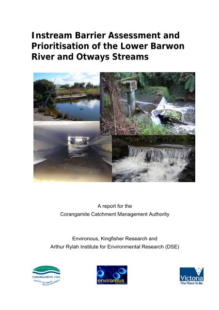
Cover photographs: from top left to right: tidal barrage weir <strong>and</strong> fishway on Thompson Creek @<br />
Minya; diversion weir on Erskine River below Erskine Falls; culvert fishway on lower Cumberl<strong>and</strong><br />
River; gauging weir on Lardners Creek gauging @ Gellibr<strong>and</strong> East Road.<br />
This document was produced by environous Pty Ltd. for <strong>the</strong> Corangamite CMA <strong>and</strong> may only be used<br />
for <strong>the</strong> purposes <strong>and</strong> in accordance with <strong>the</strong> Terms <strong>of</strong> <strong>the</strong> Engagement for which it was commissioned.
<strong>Instream</strong> <strong>Barrier</strong> <strong>Assessment</strong> <strong>and</strong> <strong>Prioritisation</strong> <strong>of</strong> <strong>the</strong> <strong>Lower</strong> <strong>Barwon</strong> River <strong>and</strong> Otways Streams<br />
EXECUTIVE SUMMARY<br />
At least 10 <strong>of</strong> <strong>the</strong> 16 freshwater fish species found in <strong>the</strong> Corangamite Catchment need to<br />
migrate between freshwater <strong>and</strong> estuarine or marine habitat as an obligatory part <strong>of</strong> <strong>the</strong>ir life<br />
cycle. The o<strong>the</strong>r five freshwater fish species also benefit from unrestricted movement to<br />
access a variety <strong>of</strong> habitats including appropriate breeding, nursery <strong>and</strong> feeding habitats.<br />
This movement also prevents fragmentation, reduces susceptibility to disease <strong>and</strong><br />
extinction, <strong>and</strong> maintains genetic diversity <strong>and</strong> as such is particularly important for survival <strong>of</strong><br />
threatened or rare fish species.<br />
Man-made structures can prevent or limit fish passage through <strong>the</strong> creation <strong>of</strong> a physical<br />
blockage, a hydrological barrier, or by forming artificial conditions that act as behavioural<br />
barriers to fish. The impact <strong>of</strong> <strong>the</strong>se barriers on fish passage will vary depending on <strong>the</strong><br />
design <strong>of</strong> <strong>the</strong> structure as well as stream hydrology <strong>and</strong> geomorphology characteristics<br />
including <strong>the</strong> integrity <strong>of</strong> seasonal flows <strong>and</strong> corresponding migrational capabilities <strong>of</strong><br />
individual fish species.<br />
This report provides a summary <strong>of</strong> a comprehensive field assessment <strong>of</strong> fish passage<br />
barriers in streams within <strong>the</strong> Corangamite Catchment. All potential fish passage barriers<br />
were prioritised according to <strong>the</strong>ir respective ecological impact <strong>and</strong> potential ecological<br />
benefits for restoration.<br />
The Corangamite CMA has been proactive <strong>and</strong> has already restored fish passage at some<br />
<strong>of</strong> <strong>the</strong> priority fishways identified in this report. Fur<strong>the</strong>r fish passage restoration at priority<br />
locations combined with a strategic fish monitoring program <strong>and</strong> regular fishway inspection<br />
<strong>and</strong> maintenance programs will ensure <strong>the</strong> recovery <strong>and</strong> maintenance <strong>of</strong> native fish<br />
biodiversity in <strong>the</strong> region.<br />
The Corangamite Catchment Management Authority (CCMA) has undertaken fish passage<br />
restoration at many locations. A number <strong>of</strong> additional barriers in coastal streams have<br />
previously been identified <strong>and</strong> prioritised for fish passage restoration. This report provides a<br />
comprehensive review <strong>of</strong> all potential barriers to fish migration <strong>and</strong> <strong>the</strong> existing fishways in<br />
streams throughout <strong>the</strong> Otways coast from <strong>the</strong> lower <strong>Barwon</strong> River at Geelong to <strong>the</strong><br />
Curdies River at Peterborough.<br />
The overall aim <strong>of</strong> this project is to identify all potential barriers to fish passage in coastal<br />
streams in <strong>the</strong> Corangamite region (i.e. in streams <strong>of</strong> <strong>the</strong> Otways coast from <strong>the</strong> <strong>Barwon</strong><br />
River at Geelong (lower <strong>Barwon</strong> River only) to <strong>the</strong> Curdies River at Peterborough). These<br />
barriers are prioritised on <strong>the</strong> basis <strong>of</strong> ecological significance as well as estimated cost <strong>of</strong><br />
providing fish access. This information will <strong>the</strong>n be used to develop a management plan for<br />
fish passage.<br />
The specific objectives <strong>and</strong> outcomes <strong>of</strong> <strong>the</strong> present study are to:<br />
1. Undertake a desktop review <strong>of</strong> <strong>the</strong> current information on identified barriers<br />
2. Undertake field assessments <strong>of</strong> <strong>the</strong> barriers where required<br />
3. Prioritise <strong>the</strong> barriers in terms <strong>of</strong> benefits <strong>of</strong> fish passage <strong>and</strong> for remediation works<br />
4. Develop an action plan for restoring fish passage<br />
5. Develop a strategic fish passage plan with preferred fishway options for <strong>the</strong> highest<br />
priority sites in each river system <strong>and</strong> in each coastal program area (<strong>Barwon</strong><br />
Bellarine/Thompson, Aire/Otways, Curdies/Gellibr<strong>and</strong>)<br />
6. Make management recommendations including <strong>the</strong> steps <strong>of</strong> rehabilitation based on <strong>the</strong><br />
prioritisation <strong>and</strong> approximate cost fishway designs.<br />
Environous, Kingfisher Research & Rylah Institute for Environmental Research<br />
i
<strong>Instream</strong> <strong>Barrier</strong> <strong>Assessment</strong> <strong>and</strong> <strong>Prioritisation</strong> <strong>of</strong> <strong>the</strong> <strong>Lower</strong> <strong>Barwon</strong> River <strong>and</strong> Otways Streams<br />
<strong>Barrier</strong> prioritisation was based on desktop reviews <strong>of</strong> available information (aerial<br />
photography, CCMA databases, <strong>and</strong> o<strong>the</strong>r available databases). A total <strong>of</strong> 347 potential fish<br />
barriers were identified <strong>and</strong> subsequently inspected to collect an extensive suite <strong>of</strong><br />
information including <strong>the</strong>: diversity <strong>of</strong> fish communities present, occurrence <strong>of</strong> threatened fish<br />
species, relative location <strong>of</strong> fish barriers within <strong>the</strong> catchment, size <strong>of</strong> individual stream<br />
barriers, relative ease <strong>of</strong> fish passage restoration, <strong>and</strong> quality <strong>and</strong> quantity <strong>of</strong> potential<br />
upstream habitat. This information was assessed using a set <strong>of</strong> criteria to prioritise <strong>the</strong> order<br />
in which those barriers with greatest ecological benefit should be rectified.<br />
Priority sites for fish passage restoration were identified in each <strong>of</strong> <strong>the</strong> three main coastal<br />
regions <strong>of</strong> <strong>the</strong> CCMA (summarised in <strong>the</strong> table on page iv). Estimated total costs were also<br />
provided based on <strong>the</strong> previous experience <strong>of</strong> <strong>the</strong> project team.<br />
Priorities for <strong>the</strong> <strong>Lower</strong> <strong>Barwon</strong>, Bellarine <strong>and</strong> Thompson<br />
1. Restoration <strong>of</strong> fish passage in <strong>the</strong> <strong>Barwon</strong> River was estimated to cost $670,000. This is<br />
an important system regionally <strong>and</strong> restoration should be undertaken as a matter <strong>of</strong><br />
priority. It is recommended that restoration commence with a new vertical-slot fishway at<br />
<strong>the</strong> lower barrage (~$150K) closest to <strong>the</strong> river mouth, followed by a rock ramp<br />
refurbishment upstream at Pollocksford Weir, as a relatively inexpensive (~$20K)<br />
restoration. Reedy Lake regulator, Buckleys Falls <strong>and</strong> Baums Weir also require<br />
significant restoration activity. Additional fishways, preferably vertical-slot designs, are<br />
recommended for <strong>the</strong>se sites (~$150K, ~$200K <strong>and</strong> ~$150K, respectively).<br />
2. Restoration <strong>of</strong> fish passage in Waurn Ponds Creek (up to Jarvis Oval) would be relatively<br />
inexpensive with barrier removals at two locations (~$10K) <strong>and</strong> pedestrian causeway<br />
replacements at two locations (~$70K collectively).<br />
3. Restoration <strong>of</strong> fish passage to <strong>the</strong> lower Thompson Creek was also recognised as a high<br />
priority <strong>and</strong> included a new vertical-slot fishway at <strong>the</strong> lower weir at Minya (~$150K) <strong>and</strong><br />
a relatively inexpensive (~$20K) restoration/refurbishment <strong>of</strong> <strong>the</strong> rock ramp <strong>and</strong> culvert<br />
fishway at Horseshoe Bend Road.<br />
Priorities for <strong>the</strong> East Otways Streams to Aire River<br />
1. Restoration <strong>of</strong> fish passage in <strong>the</strong> St Georges River was recommended as <strong>the</strong> highest<br />
priority with replacement <strong>of</strong> <strong>the</strong> pedestrian causeway with a single span bridge (~$30K)<br />
in <strong>the</strong> lower reaches <strong>and</strong> removal <strong>of</strong> an old gauging weir (~$20K) downstream <strong>of</strong><br />
Allenvale Road. The major barrier represented by Allen Reservoir was not considered to<br />
be a high priority regionally, but may need to be considered at a later date.<br />
2. Various low cost modifications were ranked highly in terms <strong>of</strong> value for money; <strong>the</strong>se<br />
included Carisbrook Creek (~$5K), Cumberl<strong>and</strong> River (~$5K) <strong>and</strong> Painkalac Creek<br />
(~$10K).<br />
3. A number <strong>of</strong> o<strong>the</strong>r low cost fish passage restoration works were indentified, including<br />
modification <strong>of</strong> three private causeways on Grassy Creek (~$30K collectively) <strong>and</strong> two on<br />
Skenes Creek (~$80K collectively).<br />
4. Refurbishment <strong>of</strong> <strong>the</strong> rock ramp at <strong>the</strong> Barham River East Branch gauging station<br />
(~$15K) was identified as one <strong>of</strong> <strong>the</strong> highest priority on <strong>the</strong> Barham River catchment.<br />
5. The restoration <strong>of</strong> fish passage in <strong>the</strong> Anglesea River should also be undertaken with <strong>the</strong><br />
replacement <strong>of</strong> culvert causeways with single span bridges (or box culverts) (~$210K<br />
collectively).<br />
ii<br />
Environous, Kingfisher Research & Rylah Institute for Environmental Research
<strong>Instream</strong> <strong>Barrier</strong> <strong>Assessment</strong> <strong>and</strong> <strong>Prioritisation</strong> <strong>of</strong> <strong>the</strong> <strong>Lower</strong> <strong>Barwon</strong> River <strong>and</strong> Otways Streams<br />
6. Causeway replacements with single span bridges were also recommended at ‘Oldenzaal’<br />
on <strong>the</strong> Barham River East Branch <strong>and</strong> Montrose Avenue on Anderson Creek (~$70K<br />
each).<br />
7. The numerous pipeline crossings on <strong>the</strong> Barham River West branch leading up to <strong>the</strong><br />
large water storage weir fur<strong>the</strong>r upstream were also identified collectively as a high<br />
priority <strong>and</strong> would be relatively inexpensive to rectify (~$40K).<br />
8. New rock ramp fishways were also high on <strong>the</strong> priority list on Moggs Creek (~$30K) <strong>and</strong><br />
Aire River (~$40K)<br />
Priorities for <strong>the</strong> West Otways Streams to Curdies River<br />
1. Restoration <strong>of</strong> fish passage in <strong>the</strong> Gellibr<strong>and</strong> River was identified as an important <strong>and</strong><br />
relatively simple process. Refurbishments <strong>of</strong> rock ramps at stream gauges at Lyness<br />
Road <strong>and</strong> below Stevensons Falls, <strong>and</strong> <strong>the</strong> complete removal <strong>of</strong> an old stream gauge<br />
near Clancys Access were considered to be high priorities (~$35K collectively).<br />
2. Fish passage recommendations for <strong>the</strong> Curdies River catchment include rock ramp<br />
refurbishments in <strong>the</strong> Curdies River near Limestone as well as at Scotts Creek at<br />
Digneys Bridge <strong>and</strong> Murfitts Road (~$30K collectively).<br />
3. Restoration <strong>of</strong> fish passage in tributaries <strong>of</strong> <strong>the</strong> Gellibr<strong>and</strong> River would also be relatively<br />
simple a rock ramp fishways in Kennedys Creek, Carlisle River, Chapple Creek South<br />
Branch, Chapple Creek <strong>and</strong> Lardners Creek <strong>and</strong> complete removal <strong>of</strong> an old stream<br />
gauge weir in Yahoo Creek (~$155K).<br />
4. O<strong>the</strong>r priority fish barriers identified in <strong>the</strong> region should include Carmichael Creek,<br />
Sherbrook River <strong>and</strong> Cooriemungle Creek (~$80K collectively).<br />
Throughout <strong>the</strong> Corangamite CMA <strong>the</strong> accumulation <strong>of</strong> debris <strong>and</strong> sediment <strong>and</strong> minor rock<br />
movement, was identified as a significant fish barrier issue, particularly at low level gauging<br />
weirs <strong>and</strong> road culverts. These potential barriers could be easily rectified by seasonal visits<br />
from maintenance crews. It is strongly recommended that collaborative management plans<br />
be developed between owners <strong>and</strong> operators <strong>of</strong> each large fishway to ensure regular<br />
maintenance <strong>and</strong> performance assessment are conducted.<br />
Environous, Kingfisher Research & Rylah Institute for Environmental Research<br />
iii
<strong>Instream</strong> <strong>Barrier</strong> <strong>Assessment</strong> <strong>and</strong> <strong>Prioritisation</strong> <strong>of</strong> <strong>the</strong> <strong>Lower</strong> <strong>Barwon</strong> River <strong>and</strong> Otways Streams<br />
Overall CCMA Fish <strong>Barrier</strong> Restoration Strategy<br />
<strong>Barwon</strong>, Bellarine <strong>and</strong> Thompson Eastern Otways to Aire River Western Otways to Curdies River<br />
1. High Ecological <strong>and</strong> High Benefit for cost barriers<br />
• <strong>Barwon</strong> River (400 m upstream <strong>of</strong><br />
Pollocksford Rd. (stream gauge))<br />
• Thompsons Ck (Horseshoe Bend Rd)<br />
• St George River (upstream <strong>of</strong> GOR)<br />
• Gellibr<strong>and</strong> River (Lyness Road)<br />
• Gellibr<strong>and</strong> River at Clancys Access (old<br />
stream gauge))<br />
• Gellibr<strong>and</strong> River (downstream <strong>of</strong><br />
Stevensons Falls (stream gauge))<br />
2. High Ecological <strong>and</strong> Good Benefit for cost barriers<br />
• <strong>Barwon</strong> River (<strong>Lower</strong> Barrage)<br />
• Thompsons Ck (Minya Farm)<br />
• <strong>Barwon</strong> River (Reedy Lake regulator)<br />
• <strong>Barwon</strong> River (Baum Weir Fishway<br />
(stream gauge))<br />
• Anglesea River (Coalmine Rd)<br />
• East Barham River (Barham River Road<br />
(stream gauge))<br />
3. Good Ecological <strong>and</strong> High Benefit for Cost <strong>Barrier</strong>s<br />
• Waurn Ponds Ck (20 m d/s from<br />
footbridge)<br />
• Waurn Ponds Ck (Natika Crt)<br />
• Grassy Ck (x 3)<br />
• Cumberl<strong>and</strong> River<br />
• Kennedys Creek (Macintyres Rd (stream<br />
gauge <strong>and</strong> fishway)<br />
• Curdies River (Trestle bridge gauge &<br />
fishway)<br />
4. Good Ecological <strong>and</strong> Good Benefit for Cost <strong>Barrier</strong>s<br />
• St George River (50m downstream <strong>of</strong><br />
Allenvale Rd (old stream gauge))<br />
• Aire River (Aire Valley Rd)<br />
• Chapple Ck (S<strong>and</strong> Pits Rd 10m upstream<br />
bridge)<br />
• Lardners Ck (Gellibr<strong>and</strong> East Rd (stream<br />
gauge))<br />
5. Fair Ecological <strong>and</strong> Good Benefit for Cost <strong>Barrier</strong>s<br />
• Skenes Ck (x 2 )<br />
• Moggs Ck (Boyd Ave)<br />
6. Fair Ecological <strong>and</strong> Fair Benefit for Cost <strong>Barrier</strong>s<br />
• Anglesea River (upstream <strong>of</strong> Hall Rd in<br />
mine)<br />
• Anglesea River (Inside mine (old stream<br />
gauge))<br />
• Erskine River (700m downstream <strong>of</strong><br />
Erskine Falls)<br />
• Anderson Creek (Montrose Ave)<br />
• East Barham River (Barham River Road -<br />
Oldenzaal)<br />
7. Some Ecological <strong>and</strong> High Benefit for cost barriers<br />
• Waurn Ponds Ck (upstream <strong>of</strong> Bridge<br />
Param St)<br />
• Waurn Ponds Ck (Param St)<br />
• Waurn Ponds Ck (downstream <strong>of</strong> Pioneer<br />
Road)<br />
• Thompsons Ck (Ghazepore (stream<br />
gauge))<br />
• Thompsons Ck ( u/s <strong>of</strong> Anglesea Rd)<br />
• Painkalac Creek (downstream <strong>of</strong> Old<br />
Coach Rd)<br />
• Carisbrook Ck (upstream <strong>of</strong> GOR )<br />
• Yahoo Ck (old stream gauge) *<br />
• Scotts Creek (Digneys Bridge (stream<br />
gauge))<br />
• Scotts Creek (upstream <strong>of</strong> Murfitts Road)<br />
iv<br />
Environous, Kingfisher Research & Rylah Institute for Environmental Research
<strong>Instream</strong> <strong>Barrier</strong> <strong>Assessment</strong> <strong>and</strong> <strong>Prioritisation</strong> <strong>of</strong> <strong>the</strong> <strong>Lower</strong> <strong>Barwon</strong> River <strong>and</strong> Otways Streams<br />
TABLE OF CONTENTS<br />
LIST OF FIGURES AND TABLES................................................................................................................vi<br />
1. BACKGROUND ........................................................................................................................................ 1<br />
Fish species <strong>of</strong> <strong>the</strong> <strong>Barwon</strong> <strong>and</strong> Otways catchments ............................................................................... 1<br />
Impact <strong>of</strong> instream barriers to fish passage.............................................................................................. 2<br />
Providing fish passage in Victoria............................................................................................................. 3<br />
Project objectives...................................................................................................................................... 4<br />
2. METHODOLOGY...................................................................................................................................... 5<br />
Desktop barrier review.............................................................................................................................. 5<br />
Field assessment ...................................................................................................................................... 5<br />
<strong>Prioritisation</strong> <strong>of</strong> barriers............................................................................................................................. 5<br />
<strong>Assessment</strong> <strong>of</strong> fish communities .......................................................................................................... 5<br />
<strong>Barrier</strong> location <strong>and</strong> relative size........................................................................................................... 6<br />
Availability migratory flows.................................................................................................................... 6<br />
Habitat quality <strong>and</strong> availability .............................................................................................................. 7<br />
Strategic fish passage plans..................................................................................................................... 7<br />
3. FIELD ASSESSMENT OF BARRIERS..................................................................................................... 9<br />
4. ECOLOGICAL PRIORITISATION .......................................................................................................... 15<br />
<strong>Barwon</strong>, Bellarine <strong>and</strong> Thompson........................................................................................................... 15<br />
Eastern Otways (to Aire River catchment).............................................................................................. 17<br />
Western Otways (to Curdies River) ........................................................................................................ 19<br />
5. Ecological Benefit / Cost <strong>Assessment</strong> .................................................................................................... 21<br />
<strong>Barwon</strong>, Bellarine <strong>and</strong> Thompson........................................................................................................... 22<br />
Eastern Otways (to Aire River catchment).............................................................................................. 23<br />
Western Otways (to Curdies River) ........................................................................................................ 23<br />
6. STRATEGIC FISH PASSAGE PLANS ................................................................................................... 26<br />
Overall fishway construction priority ....................................................................................................... 26<br />
Strategy for barriers <strong>of</strong> <strong>the</strong> <strong>Barwon</strong> River, Bellarine region to Thompson Creek ................................... 29<br />
Strategy for barriers <strong>of</strong> <strong>the</strong> Eastern Otways streams to Aire River......................................................... 30<br />
Strategy for barriers <strong>of</strong> <strong>the</strong> Western Otways streams to Curdies River.................................................. 31<br />
Fur<strong>the</strong>r considerations <strong>and</strong> research ...................................................................................................... 32<br />
<strong>Lower</strong> priority barriers ......................................................................................................................... 32<br />
Additional research <strong>and</strong> monitoring .................................................................................................... 32<br />
Fishway construction .......................................................................................................................... 32<br />
7. CONCLUSION ........................................................................................................................................ 33<br />
8. REFERENCES ....................................................................................................................................... 34<br />
9. ACKOWLEDGMENTS............................................................................................................................ 36<br />
APPENDIX A: Field <strong>and</strong> Desktop <strong>Assessment</strong> Forms ............................................................................... 37<br />
APPENDIX B: <strong>Barwon</strong> River Catchment Fish <strong>Barrier</strong>s............................................................................... 38<br />
APPENDIX C: East Otway Streams Fish <strong>Barrier</strong>s...................................................................................... 44<br />
APPENDIX D: West Otway Streams Fish <strong>Barrier</strong>s..................................................................................... 51<br />
APPENDIX E: Summary details <strong>and</strong> assessments <strong>of</strong> all fish barriers........................................................ 58<br />
APPENDIX F: Details <strong>of</strong> O<strong>the</strong>r site inspections not considered to represent fish barriers......................... 62<br />
APPENDIX G: Current examples <strong>of</strong> suitable fishway solutions for CCMA streams................................... 65<br />
APPENDIX H: Summary <strong>of</strong> Ecological scores <strong>and</strong> overall benefit for cost priority .................................... 68<br />
Environous, Kingfisher Research & Rylah Institute for Environmental Research<br />
v
<strong>Instream</strong> <strong>Barrier</strong> <strong>Assessment</strong> <strong>and</strong> <strong>Prioritisation</strong> <strong>of</strong> <strong>the</strong> <strong>Lower</strong> <strong>Barwon</strong> River <strong>and</strong> Otways Streams<br />
LIST OF FIGURES AND TABLES<br />
Figures<br />
Figure 1: Seasonal migratory movement for larvae (blue), juvenile (green) <strong>and</strong> adult (blue)<br />
diadromous fish <strong>of</strong> <strong>the</strong> <strong>Barwon</strong> <strong>and</strong> Otways streams............................................................................3<br />
Figure 2: Fish <strong>Barrier</strong> <strong>Assessment</strong> Region <strong>and</strong> detailed map location. ..............................................10<br />
Figure 3: Distribution map <strong>of</strong> sites in <strong>the</strong> <strong>Barwon</strong>, Bellarine <strong>and</strong> Eastern Otways streams<br />
where fish barriers were found............................................................................................................11<br />
Figure 4: Distribution map <strong>of</strong> sites in <strong>the</strong> Western Otways streams where fish barriers were<br />
found....................................................................................................................................................12<br />
Figure 5: Distribution map <strong>of</strong> sites in <strong>the</strong> <strong>Barwon</strong>, Bellarine <strong>and</strong> Eastern Otways streams<br />
without fish barrier concerns ...............................................................................................................13<br />
Figure 6: Distribution map <strong>of</strong> sites in <strong>the</strong> Western Otways streams without fish barrier<br />
concerns..............................................................................................................................................14<br />
Tables<br />
Table 1: Fish <strong>Barrier</strong> <strong>Prioritisation</strong> Calculation Criteria ...........................................................................8<br />
Table 2: Ecological <strong>Prioritisation</strong> <strong>of</strong> Fish <strong>Barrier</strong>s in <strong>the</strong> lower <strong>Barwon</strong>, Bellarine <strong>and</strong> Thompson<br />
catchments ............................................................................................................................................16<br />
Table 3: Ecological <strong>Prioritisation</strong> <strong>of</strong> Fish <strong>Barrier</strong>s in <strong>the</strong> Eastern Otways streams (to Aire River)........18<br />
Table 4: Ecological <strong>Prioritisation</strong> <strong>of</strong> Fish <strong>Barrier</strong>s in Western Otways streams (to Curdies River)......20<br />
Table 5: Fishway construction types <strong>and</strong> works required at each barrier toge<strong>the</strong>r with approximate<br />
ongoing maintenance expenses ...........................................................................................................22<br />
Table 6: Benefit for Cost <strong>Prioritisation</strong> for <strong>the</strong> Fish <strong>Barrier</strong>s <strong>of</strong> lower <strong>Barwon</strong>, Bellarine <strong>and</strong> Thompson<br />
catchments ............................................................................................................................................24<br />
Table 7: Benefit for Cost <strong>Prioritisation</strong> for <strong>the</strong> Fish <strong>Barrier</strong>s in <strong>the</strong> Eastern Otways streams (to Aire<br />
River) .....................................................................................................................................................24<br />
Table 8: Benefit for Cost <strong>Prioritisation</strong> for <strong>the</strong> Fish <strong>Barrier</strong>s in Otways streams west <strong>of</strong> <strong>the</strong> Aire River to<br />
Curdies River.........................................................................................................................................25<br />
Table 9: Overall CCMA Fish <strong>Barrier</strong> Restoration Strategy....................................................................28<br />
vi<br />
Environous, Kingfisher Research & Rylah Institute for Environmental Research
<strong>Instream</strong> <strong>Barrier</strong> <strong>Assessment</strong> <strong>and</strong> <strong>Prioritisation</strong> <strong>of</strong> <strong>the</strong> <strong>Lower</strong> <strong>Barwon</strong> River <strong>and</strong> Otways Streams<br />
1. BACKGROUND<br />
Fish species <strong>of</strong> <strong>the</strong> <strong>Barwon</strong> <strong>and</strong> Otways catchments<br />
The <strong>Barwon</strong> <strong>and</strong> Otways coast provides a diverse range <strong>of</strong> riverine habitat supporting an<br />
equally diverse range <strong>of</strong> fish communities. The Corangamite Catchment Management<br />
Authority (CCMA) manages <strong>the</strong> river systems <strong>and</strong> <strong>the</strong> associated biodiversity, including <strong>the</strong><br />
16 different freshwater fish species that occur throughout <strong>the</strong> region.<br />
Nine <strong>of</strong> <strong>the</strong>se species are considered to be diadromous <strong>and</strong> require free access to estuarine<br />
or marine waters to successfully complete <strong>the</strong>ir life cycles. These include: Australian grayling<br />
(Prototroctes maraena), Australian mudfish (Neochanna cleaveri), broad-finned galaxias<br />
(Galaxias brevipinnis), common galaxias (Galaxias maculatus), pouched lamprey (Geotria<br />
australis), short-finned eels (Anguilla australis), short-headed lamprey (Mordacia mordax),<br />
spotted galaxias (Galaxias truttaceus) <strong>and</strong> tupong (Pseudaphritis urvillii). Australian smelt<br />
(Retropinna semoni) also exhibit diadromous migration, although this is an amphidromous<br />
form which is facultative ra<strong>the</strong>r than obligatory.<br />
Although flat-headed gudgeon (Philypnodon gr<strong>and</strong>iceps) are not considered to be a true<br />
migratory species, <strong>the</strong>y are found in both fresh <strong>and</strong> saline conditions <strong>and</strong> <strong>the</strong>refore likely to<br />
migrate between <strong>the</strong> two.<br />
The remaining five species complete <strong>the</strong>ir entire life cycle in freshwater: dwarf galaxias<br />
(Galaxiella pusilla), mountain galaxias (Galaxias olidus), river blackfish (Gadopsis<br />
marmoratus), sou<strong>the</strong>rn pygmy perch (Nannoperca australis) <strong>and</strong> Yarra pygmy perch<br />
(Nannoperca obscura). Movement between different freshwater habitat for refuge, feeding<br />
or spawning are critical for most <strong>of</strong> <strong>the</strong>se species.<br />
Four <strong>of</strong> <strong>the</strong> freshwater fish species in <strong>the</strong> CCMA are protected under <strong>the</strong> Victorian Flora <strong>and</strong><br />
Fauna Guarantee Act (FFG Act 1988) <strong>and</strong>/or <strong>the</strong> Commonwealth Environment Protection<br />
<strong>and</strong> Biodiversity Conservation Act (EPBC Act 1999) (DSE 2007):<br />
• Australian grayling are considered ‘vulnerable’ in both Australia (EPBC Act 1999) <strong>and</strong><br />
Victoria (DSE 2007) <strong>and</strong> are listed as ‘threatened’ under <strong>the</strong> FFG Act 1988.<br />
Australian grayling have been captured in Erskine, Cumberl<strong>and</strong>, Barham, St.<br />
Georges, Kennett <strong>and</strong> Wye Rivers, as well as Skenes, Wild Dog, Carisbrook <strong>and</strong><br />
Grassy Creeks.<br />
• Australian mudfish are considered ‘critically endangered’ in Victoria (DSE 2007) <strong>and</strong><br />
are listed under <strong>the</strong> FFG Act 1988. Australian mudfish have been captured in <strong>the</strong><br />
lower <strong>Barwon</strong>, lower Aire, Calder <strong>and</strong> Wye Rivers.<br />
• Dwarf galaxias are listed as ‘vulnerable’ in Australia (EPBC Act 1999) <strong>and</strong> Victoria<br />
(DSE 2007) <strong>and</strong> are listed under <strong>the</strong> FFG Act 1988. Dwarf galaxias have recently<br />
been observed in <strong>the</strong> upper <strong>Barwon</strong> River <strong>and</strong> Gosling Creek, a nearby tributary.<br />
• Yarra pygmy perch are considered ‘vulnerable’ in Australia (EPBC Act 1999) <strong>and</strong><br />
‘near threatened’ in Victoria (DSE 2007) <strong>and</strong> are listed under <strong>the</strong> FFG Act 1988.<br />
Yarra pygmy perch occur in <strong>the</strong> <strong>Barwon</strong> catchment including <strong>the</strong> upper <strong>Barwon</strong> River<br />
tributaries <strong>and</strong> Waurn Ponds Creek <strong>and</strong> <strong>the</strong> Otways catchments including Thompson<br />
Creek, Curdies River <strong>and</strong> a recent record in <strong>the</strong> St. Georges River <strong>and</strong> Williamsons<br />
Creek in <strong>the</strong> Moorabool Catchment.<br />
Larger waterways in <strong>the</strong> Otways, such as <strong>the</strong> Aire <strong>and</strong> Gellibr<strong>and</strong> Rivers, are also likely to<br />
support Australian grayling. Despite <strong>the</strong> lack <strong>of</strong> previous records <strong>of</strong> this species in <strong>the</strong>se<br />
rivers, <strong>the</strong>y were included in <strong>the</strong> prioritisation for <strong>the</strong>ir potential to support this important<br />
species.<br />
At least 32 estuarine dependent <strong>and</strong> resident fish species also inhabit <strong>the</strong> <strong>Barwon</strong> <strong>and</strong><br />
Otways coastal estuaries including species that are likely to migrate fur<strong>the</strong>r upstream within<br />
riverine systems. These include black bream (Acanthopagrus butcheri), yellow-eye mullet<br />
(Aldrichetta forsteri), mulloway (Argyrosomus holoepidotus), small-mou<strong>the</strong>d hardyhead<br />
Environous, Kingfisher Research & Rylah Institute for Environmental Research 1
<strong>Instream</strong> <strong>Barrier</strong> <strong>Assessment</strong> <strong>and</strong> <strong>Prioritisation</strong> <strong>of</strong> <strong>the</strong> <strong>Lower</strong> <strong>Barwon</strong> River <strong>and</strong> Otways Streams<br />
(A<strong>the</strong>rinosoma microstoma), glass goby (Gobiopterus semivesttitus), short-snout hardyhead<br />
(Kestrat<strong>the</strong>rina brevirostris), Australian whitebait (Lovettia sealii), estuary perch (Macquaria<br />
colonorum), poddy mullet (Mugil cephalus), pale mangrove goby (Mugilogobius platynotus)<br />
(classified as ‘vulnerable’ in Victoria (DSE 2007) <strong>and</strong> listed under <strong>the</strong> FFG Act 1988),<br />
eastern blue-spot goby (Pseudogobius sp. 9) <strong>and</strong> lagoon goby (Tasmanogobius lasti).<br />
Impact <strong>of</strong> instream barriers to fish passage<br />
All native fish need to move between habitats at some stage in <strong>the</strong>ir life cycle. Migration is<br />
necessary for juvenile fish to reach suitable nursery habitats <strong>and</strong> for adults to reach suitable<br />
feeding <strong>and</strong> reproduction habitats. Movement also prevents fragmentation, reduces<br />
susceptibility to disease <strong>and</strong> extinction, <strong>and</strong> maintains genetic diversity. This is particularly<br />
important for threatened or rare species.<br />
Man-made structures can completely prevent or limit fish passage by creating a physical<br />
blockage, a hydrological barrier, or by forming artificial conditions that act as behavioural<br />
barriers to fish. The impact <strong>of</strong> such barriers on fish passage will vary depending on <strong>the</strong><br />
design <strong>of</strong> <strong>the</strong> structure, as well as stream hydrology <strong>and</strong> geomorphology characteristics,<br />
including integrity <strong>of</strong> natural seasonal flow regime, sediment movement <strong>and</strong> bank erosion.<br />
A number <strong>of</strong> different barriers to fish passage are now recognised. These include larger<br />
structures such as weirs <strong>and</strong> dams, as well as smaller structures such as: stream gauging<br />
weirs; stream crossings with a lack <strong>of</strong> fish passage consideration (including road, railway<br />
<strong>and</strong> pipeline crossings); instream construction works (such as erosion control rock chutes);<br />
<strong>and</strong> previously constructed fishways that have received very little ongoing maintenance.<br />
Smaller fishways can also present a physical barrier (particularly in periods <strong>of</strong> low flow), <strong>and</strong><br />
can also impede fish passage due to excessive water velocity, lack <strong>of</strong> substrate diversity <strong>and</strong><br />
a lack <strong>of</strong> resting pools.<br />
Figure 1 provides <strong>the</strong> seasonal migratory pattern for larvae, juvenile <strong>and</strong> adult stages <strong>of</strong><br />
migratory freshwater fish species found in <strong>the</strong> <strong>Barwon</strong> <strong>and</strong> Otways streams. Some <strong>of</strong> <strong>the</strong><br />
major patterns include:<br />
• downstream drift <strong>of</strong> larval Australian grayling, broad-finned galaxias, common<br />
galaxias <strong>and</strong> spotted galaxias in autumn <strong>and</strong> winter<br />
• upstream migration <strong>of</strong> juvenile Australian grayling, Australian mudfish, Australian<br />
smelt, broad-finned galaxias, common galaxias, spotted galaxias <strong>and</strong> tupong<br />
predominately in spring <strong>and</strong> summer <strong>and</strong> short-finned eel most <strong>of</strong> <strong>the</strong> year (with glass<br />
eels migrating from autumn to spring)<br />
• downstream migration <strong>of</strong> juvenile pouched lamprey <strong>and</strong> short-headed lamprey in<br />
winter <strong>and</strong> spring<br />
• upstream migration <strong>of</strong> adult pouched lamprey <strong>and</strong> short-headed lamprey in winter<br />
<strong>and</strong> spring <strong>and</strong><br />
• downstream migration <strong>of</strong> adult common galaxias, tupong <strong>and</strong> short-finned eel in<br />
autumn <strong>and</strong> winter.<br />
Some regional variations may occur within different river systems, however, <strong>the</strong> overall<br />
movement pattern <strong>of</strong> <strong>the</strong>se ten migratory species highlights that fish passage is required<br />
most <strong>of</strong> <strong>the</strong> year.<br />
2<br />
Environous, Kingfisher Research & Rylah Institute for Environmental Research
<strong>Instream</strong> <strong>Barrier</strong> <strong>Assessment</strong> <strong>and</strong> <strong>Prioritisation</strong> <strong>of</strong> <strong>the</strong> <strong>Lower</strong> <strong>Barwon</strong> River <strong>and</strong> Otways Streams<br />
Modified<br />
from<br />
Drew<br />
(2008)<br />
Figure 1: Seasonal migratory movement for larvae (blue), juvenile (green) <strong>and</strong><br />
adult (blue) diadromous fish <strong>of</strong> <strong>the</strong> <strong>Barwon</strong> <strong>and</strong> Otways streams<br />
Arrows indicate direction <strong>of</strong> movement including upstream (to top <strong>of</strong> page) <strong>and</strong> downstream (to<br />
bottom <strong>of</strong> page).<br />
Modified from Koehn <strong>and</strong> O’Connor (1999) <strong>and</strong> Saddlier (2008), based on fishway observations in <strong>the</strong><br />
CCMA <strong>and</strong> Melbourne Water Catchments.<br />
Providing fish passage in Victoria<br />
There are numerous policy <strong>and</strong> guidelines developed to protect fish passage in Victoria<br />
including <strong>the</strong> Water Act 1989, Conservation, Forests <strong>and</strong> L<strong>and</strong>s Act 1987, FFG Act 1988 <strong>and</strong><br />
Fisheries Act 1995. The protection <strong>of</strong> fish passage in Victorian streams is regulated by <strong>the</strong><br />
Catchment Management Authorities via <strong>the</strong> key obligations <strong>of</strong> <strong>the</strong> Water Act 1989 <strong>and</strong><br />
outlined in <strong>the</strong> Works on Waterways permit process. The Water Act 1989 stipulates that<br />
works on waterways such as <strong>the</strong> construction <strong>of</strong> dams, weirs <strong>and</strong> erosion control need to be<br />
licensed. The CMAs develop <strong>and</strong> implement river protection <strong>and</strong> restoration programs in<br />
accordance with <strong>the</strong> priorities <strong>of</strong> Government, endorsed Regional Catchment <strong>and</strong> River<br />
Health Strategies <strong>and</strong> in partnership with local communities.<br />
A number <strong>of</strong> technical guidelines have been developed to assist <strong>the</strong> Victorian CMAs <strong>and</strong> to<br />
ensure that works minimise environmental impacts <strong>and</strong> conform to best management<br />
practices. These include:<br />
• Technical Guidelines for Waterway Management (DSE 2007)<br />
• FAST: Fish <strong>Assessment</strong> Support Tool (Saddlier 2008)<br />
• Guidelines for <strong>Assessment</strong> <strong>of</strong> Applications for Permits <strong>and</strong> Licences for Works on<br />
Waterways (SKM 2001)<br />
Environous, Kingfisher Research & Rylah Institute for Environmental Research 3
<strong>Instream</strong> <strong>Barrier</strong> <strong>Assessment</strong> <strong>and</strong> <strong>Prioritisation</strong> <strong>of</strong> <strong>the</strong> <strong>Lower</strong> <strong>Barwon</strong> River <strong>and</strong> Otways Streams<br />
• Why do Fish Need to Cross <strong>the</strong> Road? Fish Passage Requirements for Waterway<br />
Crossings (Fairfull <strong>and</strong> Wi<strong>the</strong>ridge 2003)<br />
• Fish Passage requirements for Waterway Crossings - Engineering Guidelines<br />
(Wi<strong>the</strong>ridge 2002)<br />
Guidelines encompass a range <strong>of</strong> commonly constructed works undertaken on rivers <strong>and</strong><br />
streams throughout Victoria, however, no guidelines are intended to cover every aspect or<br />
situation that can arise. The design <strong>and</strong> construction <strong>of</strong> specific works is also dependent on<br />
<strong>the</strong> judgement <strong>and</strong> experience <strong>of</strong> waterway management pr<strong>of</strong>essionals.<br />
In addition, some Victorian CMAs have also commissioned reviews <strong>and</strong> prioritisations <strong>of</strong><br />
barriers to fish passage within <strong>the</strong>ir region. These documents provide a more strategic <strong>and</strong><br />
st<strong>and</strong>ardised approach to identifying priorities for works programs in <strong>the</strong> following CMA<br />
regions:<br />
• Mallee Catchment Management Authority region (SKM 2005)<br />
• Broken, Boosey, Back <strong>and</strong> Major Creeks, Broken River system (Saddlier <strong>and</strong><br />
O’Connor 2005)<br />
• Loddon <strong>and</strong> Campaspe catchments (O’Brien et al. 2006)<br />
• Murray-Darling Basin listing <strong>of</strong> highest priority barriers – six occur in Victoria (MDBC<br />
2004)<br />
Project objectives<br />
The CCMA have facilitated fish passage at some sites, such as in <strong>the</strong> <strong>Barwon</strong> River, by<br />
retr<strong>of</strong>itting fishways to barriers. However, <strong>the</strong>re are a number <strong>of</strong> o<strong>the</strong>r potential barriers in<br />
coastal streams that have been identified by DSE <strong>and</strong> <strong>the</strong> CCMA.<br />
The overall aim <strong>of</strong> this project is to identify all potential barriers to fish passage in coastal<br />
streams in <strong>the</strong> Corangamite region (i.e. in streams <strong>of</strong> <strong>the</strong> Otways coast from <strong>the</strong> <strong>Barwon</strong><br />
River at Geelong (lower <strong>Barwon</strong> River only) to <strong>the</strong> Curdies River at Peterborough). These<br />
barriers are prioritised on <strong>the</strong> basis <strong>of</strong> ecological significance as well as estimated cost <strong>of</strong><br />
providing fish access. This information will <strong>the</strong>n be used to develop a management plan for<br />
fish passage.<br />
The specific objectives <strong>and</strong> outcomes <strong>of</strong> <strong>the</strong> present study are to:<br />
1. Undertake a desktop review <strong>of</strong> <strong>the</strong> current information on identified barriers<br />
2. Undertake field assessments <strong>of</strong> <strong>the</strong> barriers where required<br />
3. Prioritise <strong>the</strong> barriers in terms <strong>of</strong> benefits <strong>of</strong> fish passage <strong>and</strong> for remediation works<br />
4. Develop an action plan for restoring fish passage<br />
5. Develop a strategic fish passage plan with preferred fishway options for <strong>the</strong> highest<br />
priority sites in each river system <strong>and</strong> in each coastal program area (<strong>Barwon</strong><br />
Bellarine/Thompson, Aire/Otways, Curdies/Gellibr<strong>and</strong>)<br />
6. Make management recommendations including <strong>the</strong> steps <strong>of</strong> rehabilitation based on <strong>the</strong><br />
prioritisation <strong>and</strong> approximate cost fishway designs.<br />
4<br />
Environous, Kingfisher Research & Rylah Institute for Environmental Research
<strong>Instream</strong> <strong>Barrier</strong> <strong>Assessment</strong> <strong>and</strong> <strong>Prioritisation</strong> <strong>of</strong> <strong>the</strong> <strong>Lower</strong> <strong>Barwon</strong> River <strong>and</strong> Otways Streams<br />
2. METHODOLOGY<br />
Desktop barrier review<br />
The review <strong>of</strong> existing information on <strong>the</strong> potential fish migration barriers was compiled from<br />
relevant information including <strong>the</strong> list <strong>of</strong> fish barriers contained in <strong>the</strong> Victorian overview<br />
report (McGuckin <strong>and</strong> Bennett 1999) <strong>and</strong> <strong>the</strong> unpublished Redundant Weir Database (Jarod<br />
Lyon, pers. comm., ARI).<br />
Topographic maps <strong>of</strong> <strong>the</strong> region were also considered, to determine access points to<br />
streams <strong>and</strong> to accurately identify <strong>the</strong> location <strong>of</strong> natural waterfall features.<br />
Relevant MapInfo layers including aerial photography, ISC scores, waterways, roads,<br />
bridges (<strong>and</strong> o<strong>the</strong>r features) were supplied by <strong>the</strong> CCMA. This information provided a<br />
greater interpretative potential than aerial photography alone. Spatial data was utilised to<br />
determine road <strong>and</strong> railway crossings, provide riverine habitat quality details <strong>and</strong> calculate<br />
distances from barriers to <strong>the</strong> river mouth <strong>and</strong> o<strong>the</strong>r stream barriers.<br />
Relevant managers (e.g. <strong>Barwon</strong> Water, Wannon Water, DSE, Parks Victoria <strong>and</strong> private<br />
l<strong>and</strong>holders) were also contacted to ensure that <strong>the</strong> most up-to-date <strong>and</strong> accurate<br />
information was obtained regarding <strong>the</strong> location <strong>and</strong> status <strong>of</strong> all barriers, <strong>and</strong> to document<br />
any relevant changes in management.<br />
Field assessment<br />
Field assessments <strong>of</strong> all barriers were conducted in May to September 2009 using a pr<strong>of</strong>orma<br />
(Appendix A), designed to describe <strong>the</strong> fish passage characteristics <strong>of</strong> an instream<br />
barrier <strong>and</strong> provide data to aid future restoration for fish passage. Attributes recorded<br />
included <strong>the</strong>:<br />
• physical structure <strong>of</strong> <strong>the</strong> barrier (e.g. height, breadth, width, slope, construction<br />
material)<br />
• stream geomorphology (e.g. depth, substrate type, width, gradient)<br />
• hydraulic characteristics (e.g. headloss, water velocity characteristics) <strong>and</strong><br />
• assessment <strong>of</strong> habitat quality (instream <strong>and</strong> riparian).<br />
A grid reference (GDA 94 Datum) was recorded at each site using a Magellan © 800 GPS<br />
<strong>and</strong> digital photographs were taken to best represent <strong>the</strong> fish barrier at each site.<br />
<strong>Prioritisation</strong> <strong>of</strong> barriers<br />
The prioritisation <strong>of</strong> barriers for remediation works was assessed by scoring each site<br />
against a number <strong>of</strong> criteria which relate to <strong>the</strong> native fish species present, location <strong>of</strong> <strong>the</strong><br />
barrier in relation to <strong>the</strong> size <strong>of</strong> <strong>the</strong> stream, distance to o<strong>the</strong>r barriers, length <strong>of</strong> accessible<br />
river upstream <strong>and</strong> habitat quality <strong>and</strong> availability (Table 1). The prioritisation process was<br />
similar to that used in <strong>the</strong> Loddon <strong>and</strong> Campaspe catchments by O’Brien et al. (2006) with<br />
some additional modifications to make it suitable for coastal Victorian streams (as outlined in<br />
<strong>the</strong> following section). The ecological prioritisation was conducted for <strong>the</strong> regional areas:<br />
<strong>Barwon</strong>, Bellarine/Thompson, Aire/Otways <strong>and</strong> Curdies/Gellibr<strong>and</strong>.<br />
<strong>Assessment</strong> <strong>of</strong> fish communities<br />
Key information required on <strong>the</strong> fish communities present include: <strong>the</strong> number <strong>of</strong> threatened<br />
fish <strong>and</strong> <strong>the</strong>ir migratory requirements, number <strong>of</strong> non-threatened fish <strong>and</strong> <strong>the</strong>ir migratory<br />
requirements <strong>and</strong> native fish diversity (Table 1). The occurrence <strong>of</strong> native fish was<br />
determined from <strong>the</strong> DSE Aquatic Fauna Database (DSE 2007a) <strong>and</strong> various CCMA<br />
instream survey reports (Koehn <strong>and</strong> O’Connor 1990, Raadik <strong>and</strong> Koster 2000, Close et al.<br />
Environous, Kingfisher Research & Rylah Institute for Environmental Research 5
<strong>Instream</strong> <strong>Barrier</strong> <strong>Assessment</strong> <strong>and</strong> <strong>Prioritisation</strong> <strong>of</strong> <strong>the</strong> <strong>Lower</strong> <strong>Barwon</strong> River <strong>and</strong> Otways Streams<br />
2002, Barbee et al. 2006, Ryan <strong>and</strong> McGuckin 2008a <strong>and</strong> 2008b). Regional fish<br />
distributions were confirmed with <strong>the</strong> use <strong>of</strong> <strong>the</strong> Guide to <strong>the</strong> Management <strong>of</strong> Native Fish:<br />
Victorian Coastal Rivers, Estuaries <strong>and</strong> Wetl<strong>and</strong>s (Drew 2008).<br />
Threatened fish species distributions were determined through interrogation <strong>of</strong> <strong>the</strong> Aquatic<br />
Fauna Database (DSE 2007a), as well as recent survey reports, with <strong>the</strong> inclusion <strong>of</strong><br />
additional expected locations for Australian grayling (Aire <strong>and</strong> Gellibr<strong>and</strong> Rivers). Sites<br />
where Yarra pygmy perch have been recorded, that do not contain migratory species, were<br />
considered to be “local movements only”.<br />
Species diversity was compiled from recent fish survey information. For streams where little<br />
or no data on fish distribution was known, <strong>the</strong> diversity <strong>of</strong> fish from nearby systems <strong>of</strong> a<br />
similar size was used as a guide. The occurrence <strong>of</strong> threatened species, however, was not<br />
presumed to be transferable.<br />
<strong>Barrier</strong>s that occur in <strong>the</strong> lower estuarine habitat <strong>of</strong> <strong>the</strong> river systems (such as <strong>the</strong> lower<br />
barrage on <strong>the</strong> <strong>Barwon</strong> River <strong>and</strong> <strong>the</strong> weir on <strong>the</strong> lower Thompson Creek) were considered<br />
to have fish diversity greater than eight due to <strong>the</strong> likely <strong>and</strong> previously recorded occurrence<br />
<strong>of</strong> estuarine <strong>and</strong> migratory freshwater fish species.<br />
<strong>Barrier</strong> location <strong>and</strong> relative size<br />
These criteria consider <strong>the</strong> physical characteristics <strong>of</strong> <strong>the</strong> instream barrier to assess <strong>the</strong><br />
degree to which <strong>the</strong> barrier restricts fish movement. <strong>Barrier</strong> assessment included<br />
determination <strong>of</strong> stream order, proportion <strong>of</strong> stream obstructed, nearby upstream or<br />
downstream barriers <strong>and</strong> <strong>the</strong> likelihood <strong>of</strong> barrier drownout during seasonal high flow events.<br />
Stream order was established to provide an indication <strong>of</strong> stream size <strong>and</strong> relative size <strong>of</strong> <strong>the</strong><br />
catchment upstream. Only those streams with large upstream catchments were noted to<br />
have a stream order <strong>of</strong> four including <strong>the</strong> <strong>Barwon</strong>, Erskine, St. Georges, Aire, Gellibr<strong>and</strong> <strong>and</strong><br />
Curdies Rivers. It was important to assess <strong>the</strong> relative size <strong>of</strong> <strong>the</strong> catchment upstream <strong>of</strong> <strong>the</strong><br />
barrier to provide an indication <strong>of</strong> <strong>the</strong> amount <strong>of</strong> available habitat that could be provided if <strong>the</strong><br />
barrier was removed. Natural barriers (such as waterfalls) <strong>and</strong> man-made obstructions were<br />
considered in this calculation matrix, as <strong>the</strong>y all have <strong>the</strong> potential to prevent fish passage<br />
upstream.<br />
The type <strong>of</strong> barriers occurring upstream <strong>and</strong> downstream <strong>of</strong> an existing barrier were also<br />
assessed to determine <strong>the</strong> potential for fish passage over <strong>the</strong> wider area once <strong>the</strong> barrier<br />
was removed. Distances <strong>of</strong> greater than 1km were considered to have some ecological<br />
benefit, while 5km <strong>and</strong> 20km were considered to be <strong>of</strong> far greater value.<br />
The vertical height <strong>of</strong> a barrier <strong>and</strong> its location within <strong>the</strong> catchment were important<br />
considerations for <strong>the</strong> likelihood <strong>of</strong> being overtopped (or flooded) by larger stream flows.<br />
<strong>Barrier</strong>s such as stream gauging weirs (particularly those situated in <strong>the</strong> lower proportion <strong>of</strong><br />
larger catchments), are generally relatively low <strong>and</strong> can be drowned out during high<br />
seasonal flows. <strong>Barrier</strong>s that were not likely to be drowned out were <strong>the</strong>refore scored as a<br />
more substantial barrier.<br />
Availability migratory flows<br />
Access under different flow events is considered important to determine <strong>the</strong> degree <strong>of</strong> fish<br />
movement restriction. Upstream <strong>and</strong> downstream migration occurs throughout most <strong>of</strong> <strong>the</strong><br />
year; however in general, most downstream migrations (or drifts) occur in winter while most<br />
upstream migrations occur in spring <strong>and</strong> summer.<br />
An assessment <strong>of</strong> <strong>the</strong> flow availability to migratory fish was incorporated as part <strong>of</strong> a final<br />
project review. The assessment was based on <strong>the</strong> seasonality <strong>of</strong> flows within each stream<br />
<strong>and</strong> was largely extracted from SKM (2005b). This SKM report assessed <strong>the</strong> degree <strong>of</strong> flow<br />
stress based on a modelled natural state using a number <strong>of</strong> parameters including <strong>the</strong><br />
impacts <strong>of</strong> low flows, high flows, proportion <strong>of</strong> zero flow, monthly variation in flow <strong>and</strong> <strong>the</strong><br />
seasonal period <strong>of</strong> flows. The CCMA compiled <strong>the</strong> relevant flow stress scores for each <strong>of</strong><br />
<strong>the</strong>se streams assessed in SKM (2005b) <strong>and</strong> where possible interpreted <strong>the</strong> scores for<br />
adjacent streams that had not been assessed. The integrity <strong>of</strong> seasonal flow patterns<br />
6<br />
Environous, Kingfisher Research & Rylah Institute for Environmental Research
<strong>Instream</strong> <strong>Barrier</strong> <strong>Assessment</strong> <strong>and</strong> <strong>Prioritisation</strong> <strong>of</strong> <strong>the</strong> <strong>Lower</strong> <strong>Barwon</strong> River <strong>and</strong> Otways Streams<br />
(compared to natural) <strong>the</strong>refore provided a direct correlation with <strong>the</strong> likelihood <strong>of</strong> migratory<br />
success. Those systems with over 75% <strong>of</strong> <strong>the</strong> natural flow characteristics were considered<br />
to be <strong>of</strong> high likelihood <strong>of</strong> migratory success, 75 - 50% <strong>of</strong> <strong>the</strong> natural flow were considered to<br />
be <strong>of</strong> moderate likelihood <strong>of</strong> migratory success, 50 - 25% <strong>of</strong> <strong>the</strong> natural flow were considered<br />
to be <strong>of</strong> low likelihood <strong>of</strong> migratory success <strong>and</strong> systems with less than 25% <strong>of</strong> <strong>the</strong> natural<br />
flow characteristics were considered to be unlikely to provide migratory opportunities.<br />
Habitat quality <strong>and</strong> availability<br />
The quality <strong>and</strong> availability <strong>of</strong> habitat at, <strong>and</strong> upstream, <strong>of</strong> barrier locations was assessed to<br />
determine <strong>the</strong> degree <strong>of</strong> access to coastal wetl<strong>and</strong>s, as well as <strong>the</strong> overall condition <strong>of</strong><br />
instream <strong>and</strong> riparian habitat.<br />
Floodplain connectivity was considered to be an important habitat feature for many coastal<br />
species (e.g. Australian mudfish), <strong>and</strong> as nursery habitat for developing juvenile fish <strong>of</strong> o<strong>the</strong>r<br />
species. Systems where this habitat was available were considered <strong>of</strong> higher value <strong>and</strong><br />
<strong>the</strong>refore deserving <strong>of</strong> a higher priority ranking.<br />
<strong>Instream</strong> <strong>and</strong> riparian habitat condition was determined at each barrier location <strong>and</strong> ascribed<br />
a relative condition score ranging from poor to excellent. Additionally, <strong>the</strong> Index <strong>of</strong> Stream<br />
Condition assessment scores (CCMA MapInfo Database) were utilised to provide an overall<br />
habitat assessment <strong>of</strong> <strong>the</strong> stream reach.<br />
Strategic fish passage plans<br />
The ecological prioritisation process will enable identification <strong>of</strong> <strong>the</strong> most significant barriers<br />
to fish migration. The next step is to provide an assessment <strong>of</strong> <strong>the</strong> relative benefit for cost <strong>of</strong><br />
providing fish passage at each barrier. For each program area (Curdies/Gellibr<strong>and</strong>,<br />
Aire/Otway, Bellarine/Thompsons), <strong>the</strong> strategic fish passage plan will address <strong>the</strong> high<br />
priority sites for providing fish passage as well as preferred fishway options. This process will<br />
be conducted using a combination <strong>of</strong> ecological <strong>and</strong> cost rankings for each region to ensure<br />
that management priorities are clearly specified for rehabilitating native fish populations.<br />
Recommendations on additional data requirements <strong>and</strong> knowledge gaps are also provided.<br />
Environous, Kingfisher Research & Rylah Institute for Environmental Research 7
<strong>Instream</strong> <strong>Barrier</strong> <strong>Assessment</strong> <strong>and</strong> <strong>Prioritisation</strong> <strong>of</strong> <strong>the</strong> <strong>Lower</strong> <strong>Barwon</strong> River <strong>and</strong> Otways Streams<br />
Table 1: Fish <strong>Barrier</strong> <strong>Prioritisation</strong> Calculation Criteria<br />
Modified from O’Brien et. al. 2006<br />
8<br />
Environous, Kingfisher Research & Rylah Institute for Environmental Research
<strong>Instream</strong> <strong>Barrier</strong> <strong>Assessment</strong> <strong>and</strong> <strong>Prioritisation</strong> <strong>of</strong> <strong>the</strong> <strong>Lower</strong> <strong>Barwon</strong> River <strong>and</strong> Otways Streams<br />
3. FIELD ASSESSMENT OF BARRIERS<br />
A total <strong>of</strong> 347 potential stream barriers were inspected from May to September 2009. Of <strong>the</strong><br />
barriers inspected, 108 were considered to be significant instream barriers with 34 identified<br />
in <strong>the</strong> <strong>Barwon</strong>, Bellarine <strong>and</strong> Thompson Creek region, 39 in <strong>the</strong> Eastern Otways streams to<br />
<strong>the</strong> Aire River <strong>and</strong> 35 in <strong>the</strong> Western Otways streams to <strong>the</strong> Curdies River system.<br />
An overview <strong>of</strong> <strong>the</strong> fish barrier assessment region is provided in Figure 2, while detailed<br />
maps showing specific barrier locations are provided in Figures 3 <strong>and</strong> 4. Individual<br />
photographs for <strong>the</strong>se sites are provided in Appendices B, C <strong>and</strong> D <strong>and</strong> a summary <strong>of</strong> site<br />
inspections is provided in Appendix E.<br />
Eighteen large dams <strong>and</strong> weirs were recorded during this study. These include: a 25m high<br />
ear<strong>the</strong>n dam <strong>and</strong> spillway at A’Becketts Creek, a 19m high ear<strong>the</strong>n dam <strong>and</strong> spillway at Allen<br />
Reservoir (St. Georges River), a 17m (approx.) high concrete wall in <strong>the</strong> upper Anderson<br />
Creek <strong>and</strong> a large 12m high ear<strong>the</strong>n dam on Yarram Creek upstream <strong>of</strong> Banks Road.<br />
Road <strong>and</strong> pedestrian crossings were <strong>the</strong> most numerous fish barrier type with a total <strong>of</strong> 52<br />
identified. Thirty two <strong>of</strong> <strong>the</strong>se barriers were pipe culvert structures that represented significant<br />
headloss, velocity <strong>and</strong> light deterrents to fish passage. A total <strong>of</strong> 21 concrete regulation <strong>and</strong><br />
gauging weirs were recorded, most <strong>of</strong> which require <strong>the</strong> construction <strong>of</strong> rock ramp fishways.<br />
Three erosion control rock chutes were also found to represent fish barriers requiring<br />
refurbishment.<br />
Fourteen rock ramp fishways also inspected were in need <strong>of</strong> repair, including four on <strong>the</strong><br />
<strong>Barwon</strong> River, two on <strong>the</strong> Gellibr<strong>and</strong> River, three on Grassy Creek, two on Thompson Creek<br />
<strong>and</strong> one each on <strong>the</strong> Cumberl<strong>and</strong> River, Kennedys Creek <strong>and</strong> <strong>the</strong> Curdies River.<br />
Ano<strong>the</strong>r 227 locations were inspected <strong>and</strong> not considered to represent fish barriers<br />
(Appendix F). Four <strong>of</strong> <strong>the</strong>se locations included functional fishways, located on <strong>the</strong> middle<br />
<strong>Barwon</strong> River (Conns Lane <strong>and</strong> McMillans Lane) <strong>and</strong> <strong>the</strong> upper Gellibr<strong>and</strong> River system<br />
(Gellibr<strong>and</strong> River at <strong>the</strong> river ford downstream from Stevensons Falls <strong>and</strong> Loves Creek at <strong>the</strong><br />
stream gauge <strong>of</strong>f Arkuna Grove).<br />
Environous, Kingfisher Research & Rylah Institute for Environmental Research 9
<strong>Instream</strong> <strong>Barrier</strong> <strong>Assessment</strong> <strong>and</strong> <strong>Prioritisation</strong> <strong>of</strong> <strong>the</strong> <strong>Lower</strong> <strong>Barwon</strong> River <strong>and</strong> Otways Streams<br />
4. ECOLOGICAL PRIORITISATION<br />
<strong>Barwon</strong>, Bellarine <strong>and</strong> Thompson<br />
Table 2 provides <strong>the</strong> biological priority rankings <strong>of</strong> fish barriers inspected in <strong>the</strong> lower <strong>Barwon</strong><br />
River catchment, o<strong>the</strong>r selected streams <strong>of</strong> <strong>the</strong> Bellarine region <strong>and</strong> Thompson Creek.<br />
The seven most significant barriers to fish migration in <strong>the</strong> <strong>Barwon</strong>, Bellarine <strong>and</strong> Thompson<br />
region were those associated with existing rock ramp fishways, most <strong>of</strong> which were<br />
constructed in <strong>the</strong> early to mid 1990s. This demonstrates <strong>the</strong> need for more rigorous<br />
construction guidelines <strong>and</strong> maintenance schedules for this type <strong>of</strong> fishway. Of <strong>the</strong>se seven,<br />
all four lowest <strong>Barwon</strong> River fishways were <strong>the</strong> highest priority with <strong>the</strong> lower barrage being<br />
<strong>the</strong> highest priority, followed by Buckleys Falls, Pollocksford <strong>and</strong> Baums weir.<br />
In terms <strong>of</strong> ecological benefits, <strong>the</strong> barriers closest to <strong>the</strong> river estuary are more important to<br />
rectify first. Occurrence <strong>of</strong> Australian grayling <strong>and</strong> Australian mudfish <strong>and</strong> numerous o<strong>the</strong>r<br />
migratory fish species, toge<strong>the</strong>r with <strong>the</strong> potential for additional floodplain connection via<br />
Reedy Lake makes remediation <strong>of</strong> <strong>the</strong> lower barrage <strong>the</strong> top priority.<br />
The regulator gate to Reedy Lake (approximately 300m upstream <strong>of</strong> <strong>the</strong> lower barrage) was<br />
ranked highly at equal 5 th priority, due to its importance to provide access to floodplain<br />
habitat which is considered to be very important as nursery habitat for many migratory fish<br />
species.<br />
Thompson Creek was <strong>the</strong> next most important stream to restore fish passage with <strong>the</strong><br />
fur<strong>the</strong>st downstream weir at Minya being <strong>the</strong> 6 th priority overall, followed by Horseshoe Bend<br />
(7 th priority overall), Ghazepore stream gauge (12 th ), Ghazepore Road (13 th ), <strong>and</strong> upstream<br />
<strong>of</strong> Anglesea Road (15 th ). The potential occurrence <strong>of</strong> a diverse range <strong>of</strong> migratory species<br />
<strong>and</strong> <strong>the</strong> presence <strong>of</strong> Yarra pygmy perch in this catchment, combined with relatively good<br />
habitat (including extensive backwater habitat) raises <strong>the</strong> priority <strong>of</strong> remediation <strong>of</strong> <strong>the</strong>se<br />
barriers.<br />
<strong>Barrier</strong>s on Waurn Ponds Creek upstream to Jarvis Oval had overall ranking from 8 th to 10 th.<br />
The occurrence <strong>of</strong> migratory fish previously known to occur <strong>and</strong> a large population <strong>of</strong> Yarra<br />
pygmy perch were important parameters influencing <strong>the</strong> higher ranking overall.<br />
Armstrong Creek <strong>and</strong> Yarram Creek barriers had <strong>the</strong> lowest ecological priority due to a lack<br />
<strong>of</strong> threatened species <strong>and</strong> overall low species diversity combined with relatively degraded<br />
habitat. Of <strong>the</strong>se, <strong>the</strong> lowest barriers were ranked higher due to <strong>the</strong> potential to re-establish<br />
migratory fish communities.<br />
Environous, Kingfisher Research & Rylah Institute for Environmental Research 15
<strong>Instream</strong> <strong>Barrier</strong> <strong>Assessment</strong> <strong>and</strong> <strong>Prioritisation</strong> <strong>of</strong> <strong>the</strong> <strong>Lower</strong> <strong>Barwon</strong> River <strong>and</strong> Otways Streams<br />
Table 2: Ecological <strong>Prioritisation</strong> <strong>of</strong> Fish <strong>Barrier</strong>s in <strong>the</strong> lower <strong>Barwon</strong>, Bellarine <strong>and</strong> Thompson catchments<br />
<strong>Barwon</strong> River (<strong>Lower</strong> Barrage)<br />
<strong>Barwon</strong> River (Reedy Lake regulator)<br />
<strong>Barwon</strong> River (Buckleys Falls Fishway <strong>and</strong> weir)<br />
<strong>Barwon</strong> River (Baum Weir Fishway (stream gauge))<br />
<strong>Barwon</strong> River (400 m u/s Pollocksford Rd. (stream gauge))<br />
Armstrong Ck (Cnr Lake Rd )<br />
Armstrong Ck (Airport Rd)<br />
Armstrong Ck Sth branch (Ghazepore Rd)<br />
Armstrong Ck, Nth branch (Ghazepore Rd)<br />
Waurn Ponds Ck (Param St, Grovedale u/s bridge)<br />
Waurn Ponds Ck (Param St, Grovedale)<br />
Waurn Ponds Ck (Natika Crt)<br />
Waurn Ponds Ck (20 m d/s from footbridge)<br />
Waurn Ponds Ck (Jarvis Rd causeway )<br />
Waurn Ponds Ck (rock shute d/s private causeway)<br />
Waurn Ponds Ck (Private ford 1)<br />
Waurn Ponds Ck (Private ford 2)<br />
Yarram Ck (<strong>Lower</strong> weir (Davies))<br />
Yarram Ck (<strong>Lower</strong> weir (Mason))<br />
Yarram Ck (Middle weir (Mason))<br />
Yarram Ck (Upper weir (Mason))<br />
Yarram Ck (Rail bridge d/s Banks Rd)<br />
Yarram Ck (Banks Rd)<br />
Yarram Ck (u/s Banks Rd)<br />
Yarram Ck (NE trib) 1 (Banks Rd)<br />
Yarram Ck (NE trib) 2 (Banks Rd)<br />
Yarram Ck (NE trib) 3 (Knights Lane)<br />
Yarram Ck (NE trib) 4 (Swan Bay Rd)<br />
Thompsons Ck (Minya Farm)<br />
Thompsons Ck (Horseshoe Bend Rd)<br />
Thompsons Ck ( Ghazepore Rd )<br />
Thompsons Ck ( Ghazepore (stream gauge))<br />
Thompsons Ck ( d/s <strong>of</strong> Anglesea Rd)<br />
Thompsons Ck ( Pettavel Rd )<br />
1: Fish community recorded (<strong>and</strong> expected)<br />
Threatened fish - migratory requirements (5) 15 15 15 15 15 0 0 0 0 5 5 5 5 5 5 5 0 0 0 0 0 0 0 0 0 0 0 0 10 5 5 5 5 5<br />
Native fish diversity (5) 15 15 10 10 10 5 5 5 5 10 10 10 10 5 5 5 5 10 10 10 10 10 5 5 5 5 5 5 15 10 5 5 5 5<br />
Non-threatened fish - migratory requirements (3) 12 12 12 12 12 8 4 4 4 12 12 12 8 8 4 4 4 8 8 8 8 8 4 4 4 4 4 4 12 12 8 8 4 4<br />
Sub-total (max = 42) 42 42 37 37 37 13 9 9 9 27 27 27 23 18 14 14 9 18 18 18 18 18 9 9 9 9 9 9 37 27 18 18 14 14<br />
2: <strong>Barrier</strong> location <strong>and</strong> relative size<br />
Stream Order (5) 15 10 15 15 15 5 5 5 5 5 5 5 5 5 5 5 5 5 5 5 5 5 5 5 5 5 5 5 10 10 10 10 10 10<br />
Total proportion <strong>of</strong> stream obstructed (4) 12 4 12 12 8 4 4 4 4 12 12 12 12 8 8 8 8 8 8 8 8 4 4 4 4 4 4 4 12 8 8 8 8 4<br />
O<strong>the</strong>r upstream or downstream barriers (3) 3 0 0 0 9 0 3 0 0 0 0 0 0 3 3 3 3 0 0 0 0 0 0 0 0 0 0 0 3 3 0 0 0 0<br />
Fish access through drownout (3) 6 6 6 6 3 6 3 3 3 3 3 6 9 9 6 6 6 6 6 6 6 9 3 9 6 6 6 6 6 3 3 6 6 3<br />
Sub-total (max = 45) 36 20 33 33 35 15 15 12 12 20 20 23 26 25 22 22 22 19 19 19 19 18 12 18 15 15 15 15 31 24 21 24 24 17<br />
3: Habitat quality <strong>and</strong> availability<br />
Floodplain connectivity (4) 12 12 8 4 4 4 4 4 4 4 4 4 4 4 4 0 0 4 4 4 4 0 0 0 0 0 0 0 8 8 8 8 4 4<br />
Habitat quality (4) 8 8 8 8 8 4 4 4 4 4 4 4 4 4 4 0 0 4 4 4 4 4 0 0 4 4 4 4 8 8 8 8 8 4<br />
Flow <strong>and</strong> migration potential (Su/Au <strong>and</strong> Wi/Sp) 12 12 12 12 12 4 4 4 4 12 12 12 12 8 8 8 8 4 4 4 4 4 4 0 0 0 0 0 8 4 4 4 4 4<br />
Sub-total (max = 36) 32 32 28 24 24 12 12 12 12 20 20 20 20 16 16 8 8 12 12 12 12 8 4 0 4 4 4 4 24 20 20 20 16 12<br />
Total (Max =123) 110 94 98 94 96 40 36 33 33 67 67 70 69 59 52 44 39 49 49 49 49 44 25 27 28 28 28 28 92 71 59 62 54 43<br />
Ecological Priority 1 4 2 4 3 24 26 27 27 10 10 8 9 13 16 21 25 17 17 17 17 21 34 33 29 29 29 29 6 7 13 12 15 23<br />
Photo reference (Appendix B:) a,b c d, e f g h i j k l m n o p q r s t u v w x y z A B C D E F G H I J<br />
16<br />
Environous, Kingfisher Research & Rylah Institute for Environmental Research
Eastern Otways (to Aire River catchment)<br />
Table 3 provides <strong>the</strong> biological priority rankings <strong>of</strong> fish barriers inspected in all Otways<br />
streams from Jan Juc Creek (Torquay) to Aire River (Glenaire).<br />
The variety <strong>of</strong> different streams in <strong>the</strong> highest ranked priorities for <strong>the</strong> Eastern Otways region<br />
reflects <strong>the</strong> nature <strong>of</strong> <strong>the</strong> coastline, with numerous small to medium streams <strong>of</strong> relatively<br />
good habitat condition. The fur<strong>the</strong>st downstream barrier on <strong>the</strong> St Georges River was <strong>the</strong><br />
highest ranked priority, <strong>the</strong> large barrier at Allen Dam ranked equal 6 th <strong>and</strong> <strong>the</strong> stream gauge<br />
downstream from Allenvale Road ranked equal 8 th most important. The major difference in<br />
<strong>the</strong> latter two barriers was influenced by <strong>the</strong> different barrier heights <strong>and</strong> <strong>the</strong>refore drownout<br />
potential. The occurrence <strong>of</strong> Australian grayling <strong>and</strong> o<strong>the</strong>r migratory fish species <strong>and</strong> very<br />
good instream <strong>and</strong> riparian condition were major contributing factors.<br />
The lower barriers on <strong>the</strong> Barham River East Branch (stream gauge) ranked 2 nd <strong>and</strong> equal<br />
6 th (‘Oldenzaal’ causeway) highest priority in this region. Again <strong>the</strong> occurrence <strong>of</strong> Australian<br />
grayling <strong>and</strong> o<strong>the</strong>r migratory fish species <strong>and</strong> very good instream <strong>and</strong> riparian condition were<br />
major contributing factors to this high ranking.<br />
The lowest barrier on <strong>the</strong> Anglesea River at Coalmine Road was ranked <strong>the</strong> 3 rd highest fish<br />
passage priority. This barrier is located on <strong>the</strong> top end <strong>of</strong> <strong>the</strong> estuarine margin <strong>of</strong> this stream<br />
<strong>and</strong> was considered to be particularly important due to <strong>the</strong> relatively unique coastal swamp<br />
habitat upstream. The o<strong>the</strong>r barriers fur<strong>the</strong>r upstream within <strong>the</strong> Alcoa Mine ranked equal<br />
11 th most important.<br />
The relatively small barriers on Grassy Creek were ranked 4 th , <strong>and</strong> equal 8 th most important<br />
to rectify. Previous records <strong>of</strong> Australian grayling <strong>and</strong> good instream <strong>and</strong> riparian habitat<br />
were significant influences on this high ranking, despite <strong>the</strong> lack <strong>of</strong> stream flow at <strong>the</strong> time <strong>of</strong><br />
inspection.<br />
The stream gauging weir in <strong>the</strong> upper Aire River was ranked equal 4 th most important due to<br />
<strong>the</strong> pristine condition <strong>of</strong> <strong>the</strong> riparian <strong>and</strong> instream habitat, diverse fish population, including<br />
<strong>the</strong> likelihood <strong>of</strong> occurrence <strong>of</strong> Australian grayling.<br />
The causeway on <strong>the</strong> lower Cumberl<strong>and</strong> River ranked 15 th highest priority, while <strong>the</strong> Skenes<br />
Creek barrier equal 13 th with Carisbrook Creek barrier. All three <strong>of</strong> <strong>the</strong>se streams have<br />
previous records <strong>of</strong> Australian grayling <strong>and</strong> good freshwater fish diversity (including o<strong>the</strong>r<br />
migratory species) as well as good quality instream habitat.<br />
Next highest priorities included Anderson Creek at Montrose Drive, <strong>the</strong> fur<strong>the</strong>st downstream<br />
Skenes Creek causeway, Moggs Creek at Boyd Avenue <strong>and</strong> <strong>the</strong> numerous pipeline<br />
crossings below <strong>the</strong> West Barham storage dam.<br />
17
<strong>Instream</strong> <strong>Barrier</strong> <strong>Assessment</strong> <strong>and</strong> <strong>Prioritisation</strong> <strong>of</strong> <strong>the</strong> <strong>Lower</strong> <strong>Barwon</strong> River <strong>and</strong> Otways Streams<br />
Table 3: Ecological <strong>Prioritisation</strong> <strong>of</strong> Fish <strong>Barrier</strong>s in <strong>the</strong> Eastern Otways streams (to Aire River)<br />
Jan Juc Ck (Clubhouse Rd)<br />
Jan Juc Ck (Dam wall nth Sunset Strip)<br />
Jan Juc Ck (Bells Beach Rd)<br />
Anglesea River (Coalmine Rd)<br />
Anglesea River (u/s Hall Rd in mine)<br />
Anglesea River (Inside mine (old stream gauge))<br />
Anglesea River (Alcoa Boundary Tk)<br />
Painkalac Creek (d/s Old Coach Rd)<br />
Distillery Creek (Old Coach Rd)<br />
Distillery Creek (Bambrae Rd)<br />
Moggs Ck (Boyd Ave)<br />
Coalmine Ck (Off Moggs Ck Rd)<br />
Fairhaven Ck (GOR)<br />
Grassy Ck (Inside Ge<strong>of</strong>f property #1)<br />
Grassy Ck (Inside Ge<strong>of</strong>f property #2)<br />
Grassy Ck (Inside Ge<strong>of</strong>f property #4)<br />
Anderson’s Ck (GOR)<br />
Anderson’s Ck Nth Branch (GOR)<br />
Anderson’s Ck (Old GOR, 20m u/s <strong>of</strong> o<strong>the</strong>r)<br />
Reedy Ck (u/s GOR, 20m )<br />
Erskine River (700m d/s Erskine Falls)<br />
St George River (u/s GOR)<br />
St George River (50m d/s Allenvale Rd (old stream gauge))<br />
St George River (Allen Reservoir)<br />
Cherry Tree Ck (St G R. trib) (Allenvale Rd)<br />
Cumberl<strong>and</strong> River (30m u/s GOR)<br />
Carisbrook Ck (u/s GOR )<br />
Skenes Ck (Farm u/s GOR )<br />
Skenes Ck (‘Constantia’ farm u/s GOR)<br />
Beauty Gully (Conns Lane)<br />
Anderson Creek (Montrose Ave)<br />
Anderson Creek (Andersons Ck Dam)<br />
East Barham River (Barham River Road (stream gauge))<br />
East Barham River (Barham River Road - Oldenzaal)<br />
East Barham River (Farrington)<br />
West Barham River (Downstream <strong>of</strong> town supply weir (x13))<br />
West Barham River (Town supply weir)<br />
Elliot River (Elliot River Road)<br />
Aire River (Aire Valley Rd)<br />
1: Fish community recorded (<strong>and</strong> expected)<br />
Threatened fish - migratory requirements (5) 0 0 0 10 10 10 0 0 0 0 10 10 0 15 15 15 0 0 0 0 15 15 15 15 0 15 15 15 15 0 10 0 15 15 15 15 15 0 15<br />
Native fish diversity (5) 10 5 5 15 10 10 5 10 5 5 10 10 5 10 10 10 5 5 5 10 5 15 10 10 5 15 15 10 10 10 10 5 15 10 10 10 10 5 10<br />
Non-threatened fish - migratory requirements (4) 8 8 8 8 8 8 6 12 4 4 8 8 4 12 12 12 4 4 4 8 10 12 12 12 4 12 8 8 8 8 8 4 12 12 8 8 8 4 8<br />
Sub-total (max = 42) 18 13 13 33 28 28 11 22 9 9 28 28 9 37 37 37 9 9 9 18 30 42 37 37 9 42 38 33 33 18 28 9 42 37 33 33 33 9 33<br />
2: <strong>Barrier</strong> location <strong>and</strong> relative size<br />
Stream Order (5) 5 5 5 10 10 10 10 10 5 5 5 5 5 10 10 10 5 5 5 5 10 10 10 10 5 10 10 10 10 5 10 10 10 10 10 10 10 10 15<br />
Total proportion <strong>of</strong> stream obstructed (4) 12 8 8 12 12 12 12 12 8 8 12 8 12 12 12 12 8 8 8 8 0 12 8 8 8 8 4 12 12 8 8 8 8 8 4 8 4 8 4<br />
O<strong>the</strong>r upstream or downstream barriers (3) 3 0 0 0 0 0 0 3 0 0 9 9 0 0 0 0 0 0 0 9 0 0 0 0 0 0 9 0 0 9 0 0 0 0 0 0 0 0 9<br />
Fish access through drownout (3) 3 9 9 3 3 3 3 3 3 3 3 3 9 6 3 3 9 9 9 9 9 3 3 9 3 3 3 6 9 3 9 9 6 9 3 0 9 6 0<br />
Sub-total (max = 45) 23 22 22 25 25 25 25 28 16 16 29 25 26 28 25 25 22 22 22 31 19 25 21 27 16 21 26 28 31 25 27 27 24 27 17 18 23 24 28<br />
3: Habitat quality <strong>and</strong> availability<br />
Floodplain connectivity (4) 4 0 0 12 12 12 8 8 4 4 4 4 0 4 4 4 0 0 0 4 4 4 4 4 0 4 4 4 4 8 8 4 8 4 4 4 4 4 4<br />
Habitat quality (4) 4 4 4 8 8 8 8 8 8 8 8 8 8 8 8 8 8 8 8 8 12 12 12 8 12 8 4 4 4 4 8 8 8 8 8 8 8 12 12<br />
18<br />
Environous, Kingfisher Research & Rylah Institute for Environmental Research<br />
Flow <strong>and</strong> migration potential (Su/Au <strong>and</strong> Wi/Sp) 4 4 4 12 12 12 12 8 8 8 12 8 8 12 12 12 8 8 8 8 12 12 12 12 12 8 12 12 12 12 12 12 12 12 12 12 12 12 12<br />
Sub-total (max = 36) 12 8 8 32 32 32 28 24 20 20 24 20 16 24 24 24 16 16 16 20 28 28 28 24 24 20 20 20 20 24 28 24 28 24 24 24 24 28 28<br />
Total (Max =123) 53 43 43 90 85 85 64 74 45 45 81 73 51 89 86 86 47 47 47 69 77 95 86 88 49 83 84 81 84 67 83 60 94 88 74 75 80 61 89<br />
Ecological Priority 30 38 38 3 11 11 27 22 36 36 17 24 31 4 8 8 33 33 33 25 20 1 8 6 32 15 13 17 13 26 15 29 2 6 22 21 19 28 4<br />
Photo reference (Appendix C:) a b c d e f g h i j k l m n o p q,r s t u v w x y,z A B C D E F G H I J K L,M N O P
<strong>Instream</strong> <strong>Barrier</strong> <strong>Assessment</strong> <strong>and</strong> <strong>Prioritisation</strong> <strong>of</strong> <strong>the</strong> <strong>Lower</strong> <strong>Barwon</strong> River <strong>and</strong> Otways Streams<br />
Western Otways (to Curdies River)<br />
Table 4 provides ecological priority ranking <strong>of</strong> fish barriers inspected in all Otways streams<br />
west <strong>of</strong> Aire River (Glenaire) to <strong>the</strong> Curdies River catchment.<br />
Fish barriers in <strong>the</strong> Gellibr<strong>and</strong> River catchment represent most <strong>of</strong> <strong>the</strong> highest ranked<br />
priorities in this region. While Australian grayling have not been recorded in this system, <strong>the</strong>y<br />
are expected to occur along with numerous o<strong>the</strong>r migratory <strong>and</strong> resident fish species.<br />
Excellent instream <strong>and</strong> riparian habitat also greatly influenced <strong>the</strong> relatively high ranking <strong>of</strong><br />
<strong>the</strong> Gellibr<strong>and</strong> River barriers.<br />
The first barrier occurs at <strong>the</strong> rock ramp fishway constructed at <strong>the</strong> weir at Lyness Road.<br />
While a significant improvement has been made at this location, a substantial gradient (1<br />
vertical in 25 horizontal m) still exists at <strong>the</strong> downstream end <strong>of</strong> <strong>the</strong> rock ramp that would<br />
restrict fish migration, particularly during lower flow conditions.<br />
O<strong>the</strong>r high priority barriers include a disused stream gauge on <strong>the</strong> Gellibr<strong>and</strong> River near<br />
Clancy’s Access, <strong>the</strong> gauging weirs on Kennedy’s Creek, Chapple Creek, Lardners Creek,<br />
Carlisle River, Chapple Creek south branch, <strong>the</strong> Gellibr<strong>and</strong> River downstream <strong>of</strong> Stevensons<br />
Falls <strong>and</strong> on Boggy Creek.<br />
The stream gauge near Limeworks Road on <strong>the</strong> Curdies still represented a fish barrier due to<br />
<strong>the</strong> steep downstream gradient <strong>and</strong> was ranked 4 th priority. The potential for migratory fish<br />
species, occurrence <strong>of</strong> Yarra pygmy perch in <strong>the</strong> vicinity <strong>and</strong> high stream order influenced<br />
<strong>the</strong> relatively high ranking <strong>of</strong> this barrier. O<strong>the</strong>r higher ranked priorities in <strong>the</strong> Curdies River<br />
catchment included a stream gauge <strong>and</strong> fishway on Scotts Creek at Digneys Bridge, <strong>the</strong><br />
large farm dam on Spring Creek at Delaneys <strong>and</strong> old stream gauge on Scotts Creek<br />
upstream <strong>of</strong> Murfitts Road <strong>and</strong> Squirrel Creek lower in <strong>the</strong> catchment.<br />
Environous, Kingfisher Research & Rylah Institute for Environmental Research 19
<strong>Instream</strong> <strong>Barrier</strong> <strong>Assessment</strong> <strong>and</strong> <strong>Prioritisation</strong> <strong>of</strong> <strong>the</strong> <strong>Lower</strong> <strong>Barwon</strong> River <strong>and</strong> Otways Streams<br />
Table 4: Ecological <strong>Prioritisation</strong> <strong>of</strong> Fish <strong>Barrier</strong>s in Western Otways streams (to Curdies River)<br />
Carmichael Creek (Plantation Road)<br />
Sherbrook River (Loch Road)<br />
Chapple Ck (S<strong>and</strong> Pits Rd 10m u/s bridge)<br />
Kennedys Creek (Macintyres Rd gauge <strong>and</strong> fishway)<br />
Chapple Ck South Branch (Morris Tk)<br />
Gellibr<strong>and</strong> River (Lyness Road - Nth Otway pumping station)<br />
Gellibr<strong>and</strong> River (200m d/s Clancys Access (old stream gauge))<br />
Gellibr<strong>and</strong> River (d/s Stevensons Falls (stream gauge))<br />
Boggy Ck (Carlisle Rd)<br />
Carlisle River (Gellibr<strong>and</strong> River Rd)<br />
Cole Ck (Tuckers Orchard Rd)<br />
First Ck ( Water catchment weir)<br />
Arkins Ck west branch ( Water catchment weir)<br />
Arkins Ck east branch ( Water catchment weir)<br />
Lardners Ck (Gellibr<strong>and</strong> East Rd Stream gauge))<br />
Yahoo Ck (Gellibr<strong>and</strong> – Colac Rd (old stream gauge))<br />
Serpentine Ck (McDonalds Rd )<br />
Ten Mile Creek (Cashins Rd )<br />
Ten Mile Creek (Cashins Rd (stream guage))<br />
Ten Mile Creek (PA <strong>of</strong>f Cashins Rd )<br />
Porcupine Ck (McDonalds Rd (stream gauge))<br />
Porcupine Ck (McDonalds Rd)<br />
Squirrel Ck (Brumbys Rd)<br />
Spring Creek (Tom Delaney Farm)<br />
Spring Creek (Cr<strong>of</strong>ts Rd)<br />
Spring Creek trib (Walkers Crossing #2)<br />
Spring Creek (Walkers Crossing)<br />
Spring Creek (D/S Curdievale-Port Campbell Rd)<br />
Curdies River (Trestle bridge gauge & fishway)<br />
Scotts Creek (Digneys Bridge (stream gauge))<br />
Scotts Creek (20m u/s Murfitts Rd (old stream gauge))<br />
A'Becketts Creek (End <strong>of</strong> Cowen's Lane)<br />
Cooriemungle Ck (Williams Rd 20m d/s)<br />
Cobden Ck (Adjacent to Cobden Sewerage Treatment Facility)<br />
Cobden Ck (Camperdown - Cobden Rd)<br />
1: Fish community recorded (<strong>and</strong> expected)<br />
Threatened fish - migratory requirements (5) 0 0 10 10 10 10 10 10 0 10 0 0 0 0 10 0 0 0 0 0 0 0 0 0 0 0 0 0 5 5 5 0 0 0 0<br />
Native fish diversity (5) 10 10 10 10 10 10 10 10 10 10 5 5 5 5 10 5 5 5 5 5 5 5 15 15 10 10 10 10 10 10 10 5 5 5 5<br />
Non-threatened fish - migratory requirements (4) 8 8 8 12 8 12 8 8 8 8 4 4 4 4 8 4 4 4 4 4 4 4 12 12 12 8 8 8 8 8 8 4 4 4 4<br />
Sub-total (max = 42) 18 18 28 32 28 32 28 28 18 28 9 9 9 9 28 9 9 9 9 9 9 9 27 27 22 18 18 18 23 23 23 9 9 9 9<br />
2: <strong>Barrier</strong> location <strong>and</strong> relative size<br />
Stream Order (5) 5 5 10 10 10 15 15 15 10 15 5 5 5 5 10 5 5 5 5 5 5 5 5 10 10 5 10 10 15 10 10 5 5 5 5<br />
Total proportion <strong>of</strong> stream obstructed (4) 8 8 4 4 4 8 8 4 4 4 4 4 4 4 8 4 4 4 4 4 4 4 4 8 8 0 8 4 8 4 4 4 4 4 4<br />
O<strong>the</strong>r upstream or downstream barriers (3) 9 3 9 9 9 9 6 3 3 3 3 6 6 6 6 6 6 0 0 0 0 0 3 0 0 0 0 0 9 6 6 12 6 3 3<br />
Fish access through drownout (3) 6 3 6 6 0 3 6 3 6 3 6 9 9 9 9 6 3 3 3 3 3 3 6 6 6 6 6 6 3 6 6 9 6 6 3<br />
Sub-total (max = 45) 28 19 29 29 23 35 35 25 23 25 18 24 24 24 33 21 18 12 12 12 12 12 18 24 24 11 24 20 35 26 26 30 21 18 15<br />
3: Habitat quality <strong>and</strong> availability<br />
Floodplain connectivity (4) 4 4 4 4 4 4 4 4 4 4 4 4 4 4 4 4 4 4 4 4 4 4 8 8 4 4 4 0 4 0 0 0 0 0 0<br />
Habitat quality (4) 8 8 8 8 8 8 8 8 4 8 0 12 12 12 4 8 4 8 8 8 4 4 0 4 4 4 8 4 8 8 4 4 4 4 4<br />
Flow <strong>and</strong> migration potential (Su/Au <strong>and</strong> Wi/Sp) 12 12 12 12 12 12 12 12 12 12 8 8 8 8 12 12 12 12 12 12 12 12 8 4 4 4 4 4 12 12 12 8 12 12 12<br />
Sub-total (max = 36) 24 24 24 24 24 24 24 24 20 24 12 24 24 24 20 24 20 24 24 24 20 20 16 16 12 12 16 8 24 20 16 12 16 16 16<br />
Total (Max =123) 70 61 81 85 75 91 87 77 61 77 39 57 57 57 81 54 47 45 45 45 41 41 61 67 58 41 58 46 82 69 65 51 46 43 40<br />
Ecological Priority 10 14 5 3 9 1 2 7 14 7 35 19 19 19 5 22 24 27 27 27 31 31 14 12 17 31 17 25 4 11 13 23 25 30 34<br />
Photo reference (Appendix D:) a b c d e f g h i j k l m,n o,p q r s t u v w x y z,A B C D E F G H I J K,L M<br />
20<br />
Environous, Kingfisher Research & Rylah Institute for Environmental Research
<strong>Instream</strong> <strong>Barrier</strong> <strong>Assessment</strong> <strong>and</strong> <strong>Prioritisation</strong> <strong>of</strong> <strong>the</strong> <strong>Lower</strong> <strong>Barwon</strong> River <strong>and</strong> Otways Streams<br />
5. ECOLOGICAL BENEFIT / COST ASSESSMENT<br />
The type <strong>of</strong> fishway required at each barrier was identified at <strong>the</strong> time <strong>of</strong> inspection. The<br />
types <strong>of</strong> fishways include vertical-slot structures (suitable for high barriers from 1.5 m <strong>and</strong><br />
greater), bypass channels (applicable to large ear<strong>the</strong>n dam walls) <strong>and</strong> rock ramp structures<br />
(suitable for lower barriers <strong>of</strong> 1.5 m or less). The stream crossing protocol (Wi<strong>the</strong>ridge 2002;<br />
Fairfull <strong>and</strong> Wi<strong>the</strong>ridge 2003) includes as <strong>the</strong> first option, barrier removal (where applicable),<br />
followed by <strong>the</strong> installation <strong>of</strong> a single spanning bridge, installation <strong>of</strong> a suitable fishway in <strong>the</strong><br />
existing structure or (<strong>and</strong> as a final solution), <strong>the</strong> installation <strong>of</strong> suitably designed box<br />
culverts. A brief summary <strong>of</strong> <strong>the</strong> different fishway options are provided in Appendix G.<br />
The fishway construction costs were estimated <strong>and</strong> applied to all barriers, using <strong>the</strong> past<br />
experience <strong>and</strong> knowledge <strong>of</strong> <strong>the</strong> project team, <strong>of</strong> construction costs <strong>of</strong> <strong>the</strong> project team.<br />
The size <strong>of</strong> <strong>the</strong> barrier <strong>and</strong> stream <strong>and</strong> degree <strong>of</strong> downstream slope are all necessary<br />
considerations for fishway construction estimations. The higher level <strong>of</strong> construction required<br />
for vertical slot <strong>and</strong> bypass channel fishways generally result in a higher overall cost.<br />
Fishway types <strong>and</strong> o<strong>the</strong>r restoration works are listed as vertical-slot fishway (VSF), bypass<br />
channel fishway (BCF), rectification <strong>of</strong> a stream crossing (remove, span bridge or box culvert<br />
- RSB), rock ramp refurbishment (RRR), new rock ramp (NRR) <strong>and</strong> excavation <strong>and</strong> erosion<br />
control (EEC) (which includes complete barrier removal).<br />
Fishway maintenance was <strong>of</strong>ten neglected but requires formal acknowledgement <strong>and</strong><br />
management, including written protocols <strong>and</strong> regular monitoring <strong>and</strong> reporting. At present,<br />
<strong>the</strong>re appears to be no routine fishway performance <strong>and</strong> maintenance assessment in<br />
Victoria. Maintenance is best done as part <strong>of</strong> a structured inspection programme or protocol<br />
that defines <strong>the</strong> times when <strong>the</strong> facility must work.<br />
The cost estimate also includes an approximation <strong>of</strong> <strong>the</strong> likely ongoing costs <strong>of</strong> maintaining<br />
each fishway. The maintenance costs are estimated for a ten year period <strong>and</strong> include a<br />
number <strong>of</strong> recommended activities including frequent inspections <strong>of</strong> trash racks, assessment<br />
<strong>of</strong> fishway entrance <strong>and</strong> fishway exit conditions to ensure it remains clear <strong>of</strong> obstructions<br />
(including weeds sediment <strong>and</strong> large debris) as well as velocity <strong>and</strong> headloss measurements<br />
to ensure <strong>the</strong> fishway is functioning with its design criteria. Additional maintenance on an<br />
annual basis should also include a detailed visual inspection <strong>of</strong> <strong>the</strong> entire structure<br />
(preferably during a low flow or de-watering period) to inspect for damage, wear, debris <strong>and</strong><br />
blockages, particularly following major flooding events.<br />
The relative maintenance costs <strong>of</strong> different fishways are provided in Table 5. Rock ramp<br />
fishways are relatively cheap to construct, however, <strong>the</strong> ongoing maintenance is relatively<br />
higher, particularly after high flow events. As such, <strong>the</strong> life-time (usually 10-15 years)<br />
maintenance costs might be at least 30% <strong>of</strong> <strong>the</strong> original construction costs. Maintenance<br />
costs on bypass channels are also likely to be significant, while ongoing costs on vertical-slot<br />
<strong>and</strong> excavation <strong>and</strong> erosion control measures (including complete barrier removal) are<br />
relatively low. Rectification <strong>of</strong> stream crossing barriers will vary according to <strong>the</strong> method<br />
chosen, however in most cases <strong>the</strong> ongoing maintenance will not exceed 10% <strong>of</strong> <strong>the</strong> works<br />
conducted.<br />
The following tables provide cost estimates for each fishway toge<strong>the</strong>r with an approximation<br />
<strong>of</strong> <strong>the</strong> likely ongoing life-time maintenance costs associated with each fishway type<br />
(expressed as a percentage <strong>of</strong> <strong>the</strong> construction costs).<br />
Environous, Kingfisher Research & Rylah Institute for Environmental Research<br />
21
<strong>Instream</strong> <strong>Barrier</strong> <strong>Assessment</strong> <strong>and</strong> <strong>Prioritisation</strong> <strong>of</strong> <strong>the</strong> <strong>Lower</strong> <strong>Barwon</strong> River <strong>and</strong> Otways Streams<br />
Table 5: Fishway construction types <strong>and</strong> works required at each barrier<br />
toge<strong>the</strong>r with approximate ongoing maintenance expenses<br />
Work required<br />
Ongoing costs<br />
VSF = Vertical Slot Fishway ~10 %<br />
BC = Bypass Channel ~20 %<br />
RSB = Remove, Span bridge or Box culvert ~10 %<br />
RRR = Rock Ramp Refurbishment ~30 %<br />
NRR = New Rock Ramp ~30 %<br />
EEC = Excavation <strong>and</strong> Erosion Control ~5 %<br />
<strong>Barwon</strong>, Bellarine <strong>and</strong> Thompson<br />
The benefit for cost assessment for <strong>the</strong> lower <strong>Barwon</strong>, Bellarine <strong>and</strong> Thompson Creek region<br />
is provided in Table 6.<br />
The relatively inexpensive fish passage works on lower <strong>and</strong> middle Waurn Ponds Creek<br />
makes it a relatively easy stream to restore up to as far as Jarvis Oval for a cost <strong>of</strong><br />
approximately ~$70, 000. This would include <strong>the</strong> complete removal <strong>of</strong> two instream barriers<br />
(estimated at ~$5,000 each) <strong>and</strong> replacement <strong>of</strong> instream pedestrian causeways with<br />
spanning bridges (estimated at ~$30,000 each). This would provide greater fish passage for<br />
migratory fish within <strong>the</strong> system <strong>and</strong> would also provide additional fish passage for <strong>the</strong> Yarra<br />
pygmy perch population in <strong>the</strong> system.<br />
Thompson Creek fish passage works were also relatively inexpensive at approximately<br />
~$80,000 for <strong>the</strong> five upstream barriers. However, it would first be necessary to restore fish<br />
passage at <strong>the</strong> lowest barrier at Minya Winery. Because <strong>of</strong> <strong>the</strong> importance <strong>of</strong> this fish barrier<br />
to a range <strong>of</strong> migratory species <strong>and</strong> <strong>the</strong> height <strong>of</strong> <strong>the</strong> weir (1.95 m) it is recommended a<br />
vertical-slot fishway would be most suitable <strong>and</strong> would cost approximately ~$150,000. The<br />
rock ramp fishway constructed at this site on June 2000 has been completely blocked with<br />
sediment <strong>and</strong> weeds, a process that is likely to continue at this location if replaced with<br />
ano<strong>the</strong>r rock ramp fishway.<br />
The ecological benefit for cost <strong>of</strong> fish passage works on <strong>the</strong> <strong>Barwon</strong> River was greatest at<br />
Pollocksford Weir, where rock ramp refurbishment is required. This location also supports<br />
Yarra pygmy perch <strong>and</strong> would <strong>the</strong>refore provide greater migration opportunities <strong>and</strong> security<br />
for this population. The o<strong>the</strong>r barriers fur<strong>the</strong>r downstream in <strong>the</strong> <strong>Barwon</strong> River have<br />
substantially greater construction requirements <strong>and</strong> costs. However, <strong>the</strong> installation <strong>of</strong> a<br />
vertical-slot fishway at <strong>the</strong> lower barrage should be undertaken in preference to o<strong>the</strong>r<br />
restoration works at <strong>the</strong> o<strong>the</strong>r three barriers. Substantial effort would be required to reconstruct<br />
<strong>the</strong> rock ramp fishway at Buckleys Falls <strong>and</strong> a vertical-slot fishway is likely to be<br />
<strong>the</strong> most suitable solution for Baums Weir. Re-establishing fish passage into Reedy Lake by<br />
<strong>the</strong> installation <strong>of</strong> a vertical-slot fishway should also be considered given its low location in<br />
<strong>the</strong> catchment <strong>and</strong> <strong>the</strong> potential importance <strong>of</strong> this floodplain habitat as a nursery for many<br />
migratory fish species.<br />
22<br />
Environous, Kingfisher Research & Rylah Institute for Environmental Research
<strong>Instream</strong> <strong>Barrier</strong> <strong>Assessment</strong> <strong>and</strong> <strong>Prioritisation</strong> <strong>of</strong> <strong>the</strong> <strong>Lower</strong> <strong>Barwon</strong> River <strong>and</strong> Otways Streams<br />
Eastern Otways (to Aire River catchment)<br />
The benefit for cost assessment for <strong>the</strong> lower <strong>Barwon</strong>, Bellarine <strong>and</strong> Thompson Creek region<br />
is provided in Table 7.<br />
Within <strong>the</strong> Eastern Otways region, a number <strong>of</strong> cost effective works aimed at providing fish<br />
passage were identified on nine streams near <strong>the</strong> coastline. These included streams where<br />
Australian grayling have previously been recorded including Carisbrook Creek, East Barham<br />
River, Cumberl<strong>and</strong> River, Grassy Creek, Painkalac River, Jan Juc Creek <strong>and</strong> St Georges<br />
River. The total cost <strong>of</strong> <strong>the</strong>se works is estimated at approximately ~$100,000.<br />
Skenes Creek was identified as 16 th <strong>and</strong> equal 17 th priority with a total estimated cost <strong>of</strong><br />
~$80,000. Works at this location included two spanning bridges (or box culvert stream<br />
crossings).<br />
The Anglesea River was also identified as a relatively cost effective priority with ranking from<br />
15 th to 23 rd <strong>and</strong> a total estimated cost <strong>of</strong> ~$240,000. As discussed earlier, <strong>the</strong> swampy<br />
floodplain habitat that <strong>the</strong> Anglesea River provides is unique along this part <strong>of</strong> <strong>the</strong> coastline<br />
<strong>and</strong> should be protected where possible. There may be significant opportunities at this<br />
stream for cost sharing due to works with <strong>Barwon</strong> Water (Coalmine Road), Alcoa (next two<br />
barriers within Mine boundaries) <strong>and</strong> Parks Victoria (Alcoa Boundary Track).<br />
Most o<strong>the</strong>r barriers in this region are located fur<strong>the</strong>r upstream in <strong>the</strong> respective streams or<br />
are larger structures requiring significantly more construction effort.<br />
Western Otways (to Curdies River)<br />
The benefit for cost assessment for <strong>the</strong> lower <strong>Barwon</strong>, Bellarine <strong>and</strong> Thompson Creek region<br />
is provided in Table 8.<br />
Six <strong>of</strong> <strong>the</strong> first ten most cost effective priorities were identified in <strong>the</strong> Gellibr<strong>and</strong> River<br />
catchment. These include: <strong>the</strong> gauging weir <strong>and</strong> fishway in <strong>the</strong> Gellibr<strong>and</strong> River downstream<br />
from Stevensons Falls; <strong>the</strong> old gauging weir on <strong>the</strong> Gellibr<strong>and</strong> River near Clancy’s Access<br />
<strong>and</strong> <strong>the</strong> old gauging weir on Yahoo Creek near Gellibr<strong>and</strong>; <strong>the</strong> stream gauge <strong>and</strong> fishway on<br />
<strong>the</strong> Gellibr<strong>and</strong> River at Lyness Road; <strong>the</strong> pipe culvert crossing at Carlisle Road on Boggy<br />
Creek <strong>and</strong> <strong>the</strong> gauging weir <strong>and</strong> fishway in <strong>the</strong> Kennedys Creek at Macintyres Road. The<br />
total cost <strong>of</strong> <strong>the</strong>se works is estimated at approximately ~$65,000.<br />
Fish barriers at <strong>the</strong> gauging weirs <strong>and</strong> fishways on Curdies River (at Limestone Creek) <strong>and</strong><br />
Scotts Creek (Digneys Bridge <strong>and</strong> Murfitts Road) were also identified as high cost effective<br />
priorities (total estimated cost <strong>of</strong> ~$35,000).<br />
The benefits <strong>of</strong> undertaking any restoration works on Spring Creek would need to first<br />
consider <strong>the</strong> cost <strong>of</strong> restoring passage through <strong>the</strong> lower barriers in <strong>the</strong> catchment which<br />
would total at least ~$410,000.<br />
Environous, Kingfisher Research & Rylah Institute for Environmental Research<br />
23
<strong>Instream</strong> <strong>Barrier</strong> <strong>Assessment</strong> <strong>and</strong> <strong>Prioritisation</strong> <strong>of</strong> <strong>the</strong> <strong>Lower</strong> <strong>Barwon</strong> River <strong>and</strong> Otways Streams<br />
Table 6: Benefit for Cost <strong>Prioritisation</strong> for <strong>the</strong> Fish <strong>Barrier</strong>s <strong>of</strong> lower <strong>Barwon</strong>, Bellarine <strong>and</strong> Thompson catchments<br />
<strong>Barwon</strong> River (<strong>Lower</strong> Barrage)<br />
<strong>Barwon</strong> River (Reedy Lake regulator)<br />
<strong>Barwon</strong> River (Buckleys Falls Fishway <strong>and</strong> weir)<br />
<strong>Barwon</strong> River (Baum Weir Fishway (stream gauge))<br />
<strong>Barwon</strong> River (400 m u/s Pollocksford Rd. (stream gauge))<br />
Armstrong Ck (Cnr Lake Rd )<br />
Armstrong Ck (Airport Rd)<br />
Armstrong Ck Sth branch (Ghazepore Rd)<br />
Armstrong Ck, Nth branch (Ghazepore Rd)<br />
Waurn Ponds Ck (Param St, Grovedale u/s bridge)<br />
Waurn Ponds Ck (Param St, Grovedale)<br />
Waurn Ponds Ck (Natika Crt)<br />
Waurn Ponds Ck (20 m d/s from footbridge)<br />
Waurn Ponds Ck (Jarvis Rd causeway )<br />
Waurn Ponds Ck (rock chute d/s private causeway)<br />
Waurn Ponds Ck (Private ford 1)<br />
Waurn Ponds Ck (Private ford 2)<br />
Yarram Ck (<strong>Lower</strong> weir (Davies))<br />
Yarram Ck (<strong>Lower</strong> weir (Mason))<br />
Yarram Ck (Middle weir (Mason))<br />
Yarram Ck (Upper weir (Mason))<br />
Yarram Ck (Rail bridge d/s Banks Rd)<br />
Yarram Ck (Banks Rd)<br />
Yarram Ck (u/s Banks Rd)<br />
Yarram Ck (NE trib) 1 (Banks Rd)<br />
Yarram Ck (NE trib) 2 (Banks Rd)<br />
Yarram Ck (NE trib) 3 (Knights Lane)<br />
Yarram Ck (NE trib) 4 (Swan Bay Rd)<br />
Thompsons Ck (Minya Farm)<br />
Thompsons Ck (Horseshoe Bend Rd)<br />
Thompsons Ck ( Ghazepore Rd )<br />
Thompsons Ck ( Ghazepore (stream gauge))<br />
Thompsons Ck ( u/s <strong>of</strong> Anglesea Rd)<br />
Thompsons Ck ( Pettavel Rd )<br />
Work required VSF VSF VSF VSF RRR RSB RSB RSB RSB EEC RSB RSB EEC RSB RSB RSB RSB BCFF BCF BCF BCF NRR RSB BCF BCF BCF RSB RSB VSF RRR NRR NRR EEC EEC<br />
Estimated Cost 150 150 200 150 20 40 70 70 70 5 30 30 5 70 10 40 40 100 100 100 100 70 70 300 200 200 120 120 150 20 40 10 10 15<br />
Removal with no ongoing maintenance (1 or 2) 0.1 0.1 0.1 0.1 0.3 0.1 0.1 0.1 0.1 0.1 0.1 0.1 0.05 0.1 0.1 0.1 0.1 0.2 0.2 0.2 0.2 0.3 0.1 0.2 0.2 0.2 0.1 0.1 0.1 0.3 0.1 0.3 0.05 0.05<br />
Total Ecological Benefit 110 94 98 94 96 40 36 33 33 67 67 70 69 59 52 44 39 49 49 49 49 44 25 27 28 28 28 28 92 71 59 62 54 43<br />
Relative Benefit / Cost 67 57 45 57 369 91 47 43 43 1218 203 212 1314 77 473 100 89 41 41 41 41 48 32 8 12 12 21 21 56 273 134 477 514 273<br />
Benefit / Cost Priority 16 17 22 17 6 13 21 23 23 2 10 9 1 15 5 12 14 25 25 25 25 20 29 34 32 32 30 30 19 7 11 4 3 8<br />
Table 7: Benefit for Cost <strong>Prioritisation</strong> for <strong>the</strong> Fish <strong>Barrier</strong>s in <strong>the</strong> Eastern Otways streams (to Aire River)<br />
24<br />
Environous, Kingfisher Research & Rylah Institute for Environmental Research<br />
Jan Juc Ck (Clubhouse Rd)<br />
Jan Juc Ck (Dam wall nth Sunset Strip)<br />
Jan Juc Ck (Bells Beach Rd)<br />
Anglesea River (Coalmine Rd)<br />
Anglesea River (u/s Hall Rd in mine)<br />
Anglesea River (Inside mine (old stream gauge))<br />
Anglesea River (Alcoa Boundary Tk)<br />
Painkalac Creek (d/s Old Coach Rd)<br />
Distillery Creek (Old Coach Rd)<br />
Distillery Creek (Bambrae Rd)<br />
Moggs Ck (Boyd Ave)<br />
Coalmine Ck (Off Moggs Ck Rd)<br />
Fairhaven Ck (GOR)<br />
Grassy Ck (Inside Ge<strong>of</strong>f property #1)<br />
Grassy Ck (Inside Ge<strong>of</strong>f property #2)<br />
Grassy Ck (Inside Ge<strong>of</strong>f property #4)<br />
Anderson’s Ck (GOR)<br />
Anderson’s Ck Nth Branch (GOR)<br />
Anderson’s Ck (Old GOR, 20m u/s <strong>of</strong> o<strong>the</strong>r)<br />
Reedy Ck (u/s GOR, 20m )<br />
Erskine River (700m d/s Erskine Falls)<br />
St George River (u/s GOR)<br />
St George River (50m d/s Allenvale Rd (old stream gauge))<br />
St George River (Allen Reservoir)<br />
Cherry Tree Ck (St G R. trib) (Allenvale Rd)<br />
Cumberl<strong>and</strong> River (30m u/s GOR)<br />
Carisbrook Ck (u/s GOR )<br />
Skenes Ck (Farm u/s GOR )<br />
Skenes Ck (‘Constantia’ farm u/s GOR)<br />
Beauty Gully (Conns Lane)<br />
Anderson Creek (Montrose Ave)<br />
Anderson Creek (Andersons Ck Dam)<br />
East Barham River (Barham River Road (stream gauge))<br />
East Barham River (Barham River Road - Oldenzaal)<br />
East Barham River (Farrington)<br />
West Barham River (Downstream <strong>of</strong> town supply weir (x13))<br />
West Barham River (Town supply weir)<br />
Elliot River (Elliot River Road)<br />
Aire River (Aire Valley Rd)<br />
Work required RSB BCF RSB RSB RSB RSB RSB RRR RSB RSB RSB RSB RSB RSB RSB RSB RSB RSB EEC RSB EEC RSB EEC BCF RSB RRR EEC RSB RSB RSB RSB VSF RRR RSB RSB NRR VSF RSB NRR<br />
Estimated Cost ( x $1000) 10 500 150 70 70 70 30 10 40 40 30 30 1000 10 10 10 200 200 70 200 80 30 10 2000 40 5 5 40 40 30 70 1700 15 70 70 40 300 30 40<br />
Removal with no ongoing maintenance (1 or 2) 0.1 0.2 0.1 0.1 0.1 0.1 0.1 0.3 0.1 0.1 0.1 0.1 0.1 0.1 0.1 0.1 0.1 0.1 0.1 0.1 0.05 0.1 0.3 0.2 0.1 0.3 0.05 0.1 0.1 0.1 0.1 0.1 0.3 0.1 0.1 0.1 0.1 0.1 0.1<br />
Total Ecological Benefit 53 43 43 90 85 85 64 74 45 45 81 73 51 89 86 86 47 47 47 69 77 95 86 88 49 83 84 81 84 67 83 60 94 88 74 75 80 61 89<br />
Relative Benefit / Cost 482 7 26 117 110 110 194 569 102 102 245 221 5 809 782 782 21 21 61 31 92 288 662 4 111 1277 1600 184 191 203 108 3 482 114 96 170 24 185 202<br />
Benefit / Cost Priority 9 36 32 20 23 23 15 7 26 26 11 12 37 3 4 4 34 34 30 31 29 10 6 38 22 2 1 18 16 13 25 39 8 21 28 19 33 17 14
<strong>Instream</strong> <strong>Barrier</strong> <strong>Assessment</strong> <strong>and</strong> <strong>Prioritisation</strong> <strong>of</strong> <strong>the</strong> <strong>Lower</strong> <strong>Barwon</strong> River <strong>and</strong> Otways Streams<br />
Table 8: Benefit for Cost <strong>Prioritisation</strong> for <strong>the</strong> Fish <strong>Barrier</strong>s in Otways streams west <strong>of</strong> <strong>the</strong> Aire River to Curdies River<br />
Carmichael Creek (Plantation Road)<br />
Sherbrook River (Loch Road)<br />
Chapple Ck (S<strong>and</strong> Pits Rd 10m u/s bridge)<br />
Kennedys Creek (Macintyres Rd gauge <strong>and</strong> fishway)<br />
Chapple Ck South Branch (Morris Tk)<br />
Gellibr<strong>and</strong> River (Lyness Road - Nth Otway pumping station)<br />
Gellibr<strong>and</strong> River (200m d/s Clancys Access (old stream gauge))<br />
Gellibr<strong>and</strong> River (d/s Stevensons Falls (stream gauge))<br />
Boggy Ck (Carlisle Rd)<br />
Carlisle River (Gellibr<strong>and</strong> River Rd)<br />
Cole Ck (Tuckers Orchard Rd)<br />
First Ck ( Water catchment weir)<br />
Arkins Ck west branch ( Water catchment weir)<br />
Arkins Ck east branch ( Water catchment weir)<br />
Lardners Ck (Gellibr<strong>and</strong> East Rd Stream gauge))<br />
Yahoo Ck (Gellibr<strong>and</strong> – Colac Rd (old stream gauge))<br />
Serpentine Ck (McDonalds Rd )<br />
Ten Mile Creek (Cashins Rd )<br />
Ten Mile Creek (Cashins Rd (stream guage))<br />
Ten Mile Creek (PA <strong>of</strong>f Cashins Rd )<br />
Porcupine Ck (McDonalds Rd (stream gauge))<br />
Porcupine Ck (McDonalds Rd)<br />
Squirrel Ck (Brumbys Rd)<br />
Spring Creek (Tom Delaney Farm)<br />
Spring Creek (Cr<strong>of</strong>ts Rd)<br />
Spring Creek trib (Walkers Crossing #2)<br />
Spring Creek (Walkers Crossing)<br />
Spring Creek (D/S Curdievale-Port Campbell Rd)<br />
Curdies River (Trestle bridge gauge & fishway)<br />
Scotts Creek (Digneys Bridge (stream gauge))<br />
Scotts Creek (20m u/s Murfitts Rd (old stream gauge))<br />
A'Becketts Creek (End <strong>of</strong> Cowen's Lane)<br />
Cooriemungle Ck (Williams Rd 20m d/s)<br />
Cobden Ck (Adjacent to Cobden Sewerage Treatment Facility)<br />
Cobden Ck (Camperdown - Cobden Rd)<br />
Work required RSB RSB NRR RRR NRR RRR EEC RRR RRR RRR RRR VSF VSF VSF NRR EEC NRR RSB NRR RSB NRR RSB BCF BCF BCF RSB RSB RSB RRR RRR EEC BCF EEC NRR BCF<br />
Estimated Cost ( x $1000) 30 40 30 15 30 15 10 10 10 30 30 800 900 1000 30 5 30 30 10 30 10 40 40 300 40 30 40 10 10 10 10 1000 10 20 1000<br />
Ongoing maintenance cost (% original cost) 0.1 0.1 0.3 0.3 0.3 0.3 0.05 0.3 0.3 0.3 0.3 0.1 0.1 0.1 0.3 0.05 0.3 0.1 0.3 0.1 0.3 0.1 0.2 0.2 0.2 0.1 0.1 0.1 0.3 0.3 0.3 0.2 0.05 0.3 0.2<br />
Total Ecological Benefit 70 61 81 85 75 91 87 77 61 77 39 57 57 57 81 54 47 45 45 45 41 41 61 67 58 41 58 46 82 69 65 51 46 43 40<br />
Relative Benefit / Cost 212 139 208 436 192 467 829 592 469 197 100 6 6 5 208 1029 121 136 346 136 315 93 127 19 121 124 132 418 631 531 500 4 438 165 3<br />
Benefit / Cost Priority 14 20 15 10 18 8 2 4 7 17 28 31 32 33 15 1 27 21 12 21 13 29 24 30 26 25 23 11 3 5 6 34 9 19 35<br />
Environous, Kingfisher Research & Rylah Institute for Environmental Research<br />
25
<strong>Instream</strong> <strong>Barrier</strong> <strong>Assessment</strong> <strong>and</strong> <strong>Prioritisation</strong> <strong>of</strong> <strong>the</strong> <strong>Lower</strong> <strong>Barwon</strong> River <strong>and</strong> Otways Streams<br />
6. STRATEGIC FISH PASSAGE PLANS<br />
Overall fishway construction priority<br />
A summary <strong>of</strong> <strong>the</strong> ecological ranking <strong>and</strong> priority, as well as <strong>the</strong> benefit for cost priority for all<br />
barriers is provided in Appendix H. By sorting this dataset by <strong>the</strong> ecological priority <strong>and</strong> <strong>the</strong>n<br />
<strong>the</strong> benefit for cost priority it is possible to disseminate an order <strong>of</strong> fish passage restoration.<br />
The four fish barriers identified at highest overall priority with high ecological <strong>and</strong> benefit for<br />
cost ratings were:<br />
• Pollocksford stream gauge on <strong>the</strong> <strong>Barwon</strong> River (Appendix B );<br />
• The pedestrian causeway on <strong>the</strong> St Georges River Appendix C );<br />
• East Barham River stream gauge (Appendix C ) <strong>and</strong><br />
• The Lyness Road stream gauge on <strong>the</strong> Gellibr<strong>and</strong> River (Appendix D).<br />
The causeway on <strong>the</strong> lower St Georges River requires complete removal <strong>and</strong> preferably<br />
replacement with a single spanning bridge, which was estimated at approximately ~$30,000.<br />
Rock ramp fishways have previously been constructed at <strong>the</strong> three stream gauges listed<br />
above, however, field inspections identified potential fish passage issues still occurring at<br />
<strong>the</strong>se locations. For minor expense (~$10,000 to $20,000 each) additional rock ramp<br />
construction could be conducted at each <strong>of</strong> <strong>the</strong>se barriers to improve <strong>the</strong> downstream<br />
gradient to 1 vertical in 25 horizontal (m) <strong>and</strong> incorporate a low flow channel to enhance fish<br />
passage for smaller species not capable <strong>of</strong> moving during <strong>the</strong> high water velocity associated<br />
with peak flow conditions.<br />
Ecologically important fishway priority sites that are likely to be more expensive to construct<br />
are <strong>the</strong> <strong>Lower</strong> Barrage, Reedy Lake Regulator, Buckleys Falls <strong>and</strong> Baums Weir on <strong>the</strong><br />
<strong>Barwon</strong> River as well as <strong>the</strong> tidal barrage weir on Thompson Creek. Vertical-slot fishways<br />
have been recommended at each <strong>of</strong> <strong>the</strong>se locations because <strong>the</strong>se fishways provide more<br />
effective passage over higher gradients for a larger diversity <strong>of</strong> native fish species. The<br />
estimated cost for fishway construction at Buckleys Falls (~$200,000) is significantly more<br />
than <strong>the</strong> o<strong>the</strong>r locations due to <strong>the</strong> potential difficulty in getting heavy machinery at <strong>the</strong><br />
location.<br />
Ano<strong>the</strong>r fish passage barrier identified with a high ecological priority is <strong>the</strong> Coalmine Road<br />
causeway on <strong>the</strong> Anglesea River. Significant headloss, constriction <strong>and</strong> light issues were<br />
identified at this location at <strong>the</strong> upper end <strong>of</strong> <strong>the</strong> Anglesea River estuary. A single spanning<br />
bridge is likely to represent <strong>the</strong> most effective fish passage solution at this location, providing<br />
greater access to <strong>the</strong> good quality floodplain habitat upstream for numerous native species,<br />
potentially including Australian mudfish.<br />
The next category <strong>of</strong> overall priority includes <strong>the</strong> sites with good ecological rating <strong>and</strong> high<br />
benefit for cost rating. These include: <strong>the</strong> identified barriers at <strong>the</strong> three causeways on<br />
Grassy Creek; <strong>the</strong> stream gauging weir on <strong>the</strong> St George River downstream from Allenvale<br />
Road; <strong>the</strong> causeway on <strong>the</strong> Cumberl<strong>and</strong> River; <strong>the</strong> stream gauging weir on <strong>the</strong> Gellibr<strong>and</strong><br />
River near Clancys Access <strong>and</strong> <strong>the</strong> stream gauging weir on Kennedys Creek at Macintyres<br />
Road. Single spanning bridges, larger cut-outs or box culverts were identified solutions for<br />
<strong>the</strong> three Grassy Creek sites. The complete removal <strong>of</strong> <strong>the</strong> disused stream gauges on <strong>the</strong> St<br />
Georges River downstream <strong>of</strong> Allenvale Road <strong>and</strong> Gellibr<strong>and</strong> River at Clancys Access is<br />
recommended as <strong>the</strong> preferred low cost option with no foreseen ongoing maintenance<br />
issues. More conventional, vertical baffles <strong>of</strong> appropriate size are recommended at <strong>the</strong><br />
Cumberl<strong>and</strong> River causeway to overcome significant velocity issues at this site <strong>and</strong> rock<br />
ramp refurbishment is required at <strong>the</strong> stream gauge on Kennedys Creek to overcome<br />
excessive gradient, headloss <strong>and</strong> velocity issues.<br />
While <strong>the</strong> stream gauging weir on <strong>the</strong> Aire River is a significant distance upstream<br />
(approximately 38 km from <strong>the</strong> river mouth), <strong>the</strong> potential for improved passage <strong>of</strong> diverse<br />
fish assemblage is likely given <strong>the</strong> size <strong>of</strong> <strong>the</strong> stream <strong>and</strong> excellent habitat quality. It<br />
26<br />
Environous, Kingfisher Research & Rylah Institute for Environmental Research
<strong>Instream</strong> <strong>Barrier</strong> <strong>Assessment</strong> <strong>and</strong> <strong>Prioritisation</strong> <strong>of</strong> <strong>the</strong> <strong>Lower</strong> <strong>Barwon</strong> River <strong>and</strong> Otways Streams<br />
represents <strong>the</strong> only barrier in <strong>the</strong> good ecological/good benefit for cost category <strong>and</strong> requires<br />
<strong>the</strong> construction a new rock ramp fishway incorporating a low flow channel <strong>and</strong> potential cutout<br />
<strong>of</strong> <strong>the</strong> existing concrete weir.<br />
The replacement <strong>of</strong> pipe culvert causeways with single spanning or box culvert crossings at<br />
<strong>the</strong> two private crossings on Skenes Creek <strong>and</strong> on Moggs Creek at Boyd Avenue were<br />
among <strong>the</strong> next category <strong>of</strong> barriers within <strong>the</strong> fair ecological /good benefit for cost category.<br />
These works were estimated to cost around ~$40,000 each (plus ongoing maintenance <strong>of</strong><br />
10% over 10-15 years). O<strong>the</strong>r barriers in this category were stream gauging weirs on<br />
Chapple Creek at S<strong>and</strong> Pits Road <strong>and</strong> Lardners Creek on Gellibr<strong>and</strong> East Road. Both <strong>of</strong><br />
<strong>the</strong>se barriers require <strong>the</strong> construction <strong>of</strong> new rock ramp fishways at an estimated cost <strong>of</strong><br />
~$30,000 each, plus ongoing maintenance <strong>of</strong> 30% over 10-15 years.<br />
Fair ecological/fair benefit for cost ranked barriers include two road causeways within <strong>the</strong><br />
Alcoa Mine on Anglesea River, <strong>the</strong> large gauging weir on Erskine River, <strong>the</strong> road crossing<br />
causeways on Andersons Creek at Montrose Avenue <strong>and</strong> East Barham River at ‘Oldenzaal’.<br />
The width <strong>and</strong> height <strong>of</strong> all four road causeways increased <strong>the</strong> estimated replacement costs<br />
to ~$70,000 for each, plus 10% ongoing maintenance costs. These locations will require<br />
additional design <strong>and</strong> negotiation with all stakeholders, including l<strong>and</strong> owners <strong>and</strong> managers,<br />
to develop <strong>the</strong> most appropriate management schedules.<br />
The large weir below Erskine Falls was previous utilised is a water supply dam, but is<br />
currently not used. The lack <strong>of</strong> access <strong>and</strong> size <strong>of</strong> <strong>the</strong> structure would result in a significant<br />
extra cost to remove <strong>the</strong> structure. The previous occurrence <strong>of</strong> Australian grayling, <strong>the</strong> very<br />
good instream <strong>and</strong> riparian habitat ensured that this stream was ranked highly despite <strong>the</strong><br />
presence <strong>of</strong> significant natural waterfalls downstream <strong>of</strong> <strong>the</strong> structure <strong>and</strong> <strong>the</strong> potential to<br />
open up less than 1 km <strong>of</strong> stream up to Erskine Falls. Additional consultation over <strong>the</strong> fur<strong>the</strong>r<br />
benefits <strong>of</strong> this structure may be required.<br />
A number <strong>of</strong> additional high benefit for cost fish passage remedial works were also identified<br />
within <strong>the</strong> upper 50 ecological priority barriers. While <strong>the</strong> project team believe that <strong>the</strong><br />
ecological priority should guide <strong>the</strong> fishway restoration in <strong>the</strong> CCMA, <strong>the</strong>re are significant<br />
advantages to be gained by rectifying fish passage at a large number <strong>of</strong> locations for a<br />
relatively inexpensive cost. In particular, complete removal <strong>of</strong> instream barriers <strong>and</strong> simple<br />
rock ramp <strong>and</strong> culvert fishway refurbishment can be conducted at a number <strong>of</strong> locations for<br />
<strong>the</strong> cost <strong>of</strong> one major fishway. Complete barrier removals were recommended in Waurn<br />
Ponds Creek (upstream <strong>of</strong> <strong>the</strong> Bridge on Param Street causeway <strong>and</strong> downstream <strong>of</strong><br />
Pioneer Road) <strong>and</strong> in Carisbrook Creek upstream <strong>of</strong> <strong>the</strong> Great Ocean Road. Old stream<br />
gauging weirs on Yahoo Creek (upper Gellibr<strong>and</strong> River catchment) <strong>and</strong> Scotts Creek<br />
upstream <strong>of</strong> Murfitts Road were also recommended for complete removal despite being in<br />
<strong>the</strong> lower ranked ecologically important barriers.<br />
Low cost rock ramp <strong>and</strong> box culvert fishway refurbishments were identified at: Thompson<br />
Creek at Horseshoe Bend Road; <strong>the</strong> erosion control chute in <strong>the</strong> Painkalac Creek<br />
downstream from Old Coach Road; <strong>the</strong> stream gauging weirs on <strong>the</strong> Gellibr<strong>and</strong> River<br />
downstream from Stevensons Falls; <strong>the</strong> Curdies River near Limestone Creek; Scotts Creek<br />
at Digneys Bridge <strong>and</strong> Scotts Creek upstream <strong>of</strong> Murfitts Road.<br />
A new rock ramp fishway is required at <strong>the</strong> stream gauging station downstream <strong>of</strong><br />
Ghazepore Road on Thompson Creek. Although this was considered to be an inexpensive<br />
activity, with a total maximum cost <strong>of</strong> approximately $10,000, <strong>the</strong> significant barrier at<br />
Ghazepore Road should also be addressed at <strong>the</strong> same time. The cost <strong>of</strong> improving fish<br />
passage at this large concrete structure (which appears to represent an erosion control<br />
structure <strong>of</strong> some kind) could be limiting. Assuming this large structure is currently in use, at<br />
least $40,000 would be required to construct a new rock ramp fishway.<br />
The replacement <strong>of</strong> pedestrian causeways with single spanning pedestrian bridges on Waurn<br />
Ponds Creek adjacent to Natika Court <strong>and</strong> Param Street at an estimated cost <strong>of</strong> ~$30,000<br />
each are also worthy <strong>of</strong> consideration. Restoration <strong>of</strong> fish passage in Waurn Ponds Creek<br />
would provide additional stream access to <strong>the</strong> threatened Yarra pygmy perch population <strong>and</strong><br />
also to migratory native fish populations including common <strong>and</strong> spotted galaxias <strong>and</strong> tupong<br />
that have previously been recorded in <strong>the</strong> system. A complete restoration <strong>of</strong> fish passage in<br />
Waurn Ponds Creek upstream to Jarvis Oval (approximately 6km <strong>of</strong> habitat) could be<br />
achieved for approximately $70,000.<br />
Environous, Kingfisher Research & Rylah Institute for Environmental Research 27
<strong>Instream</strong> <strong>Barrier</strong> <strong>Assessment</strong> <strong>and</strong> <strong>Prioritisation</strong> <strong>of</strong> <strong>the</strong> <strong>Lower</strong> <strong>Barwon</strong> River <strong>and</strong> Otways Streams<br />
Table 9: Overall CCMA Fish <strong>Barrier</strong> Restoration Strategy<br />
<strong>Barwon</strong>, Bellarine <strong>and</strong> Thompson Eastern Otways to Aire River Western Otways to Curdies River<br />
1. High Ecological <strong>and</strong> High Benefit for cost barriers<br />
• <strong>Barwon</strong> River (400 m upstream <strong>of</strong><br />
Pollocksford Rd. (stream gauge))<br />
• Thompson Ck (Horseshoe Bend Rd)<br />
• St George River (upstream <strong>of</strong> GOR)<br />
• Gellibr<strong>and</strong> River (Lyness Road)<br />
• Gellibr<strong>and</strong> River at Clancys Access (old<br />
stream gauge))<br />
• Gellibr<strong>and</strong> River (downstream <strong>of</strong><br />
Stevensons Falls (stream gauge))<br />
2. High Ecological <strong>and</strong> Good Benefit for cost barriers<br />
• <strong>Barwon</strong> River (<strong>Lower</strong> Barrage)<br />
• Thompson Ck (Minya Farm)<br />
• <strong>Barwon</strong> River (Reedy Lake regulator)<br />
• Anglesea River (Coalmine Rd)<br />
• East Barham River (Barham River Road<br />
(stream gauge))<br />
• <strong>Barwon</strong> River (Baum Weir Fishway<br />
(stream gauge))<br />
3. Good Ecological <strong>and</strong> High Benefit for Cost <strong>Barrier</strong>s<br />
• Waurn Ponds Ck (20 m d/s from<br />
footbridge)<br />
• Waurn Ponds Ck (Natika Crt)<br />
• Grassy Ck (x 3)<br />
• Cumberl<strong>and</strong> River<br />
• Kennedys Creek (Macintyres Rd (stream<br />
gauge <strong>and</strong> fishway)<br />
• Curdies River (Trestle bridge gauge &<br />
fishway)<br />
4. Good Ecological <strong>and</strong> Good Benefit for Cost <strong>Barrier</strong>s<br />
• St George River (50m downstream <strong>of</strong><br />
Allenvale Rd (old stream gauge))<br />
• Aire River (Aire Valley Rd)<br />
• Chapple Ck (S<strong>and</strong> Pits Rd 10m upstream<br />
bridge)<br />
• Lardners Ck (Gellibr<strong>and</strong> East Rd (stream<br />
gauge))<br />
5. Fair Ecological <strong>and</strong> Good Benefit for Cost <strong>Barrier</strong>s<br />
• Skenes Ck (x 2 )<br />
• Moggs Ck (Boyd Ave)<br />
6. Fair Ecological <strong>and</strong> Fair Benefit for Cost <strong>Barrier</strong>s<br />
• Anglesea River (upstream <strong>of</strong> Hall Rd in<br />
mine)<br />
• Anglesea River (Inside mine (old stream<br />
gauge))<br />
• Erskine River (700m downstream <strong>of</strong><br />
Erskine Falls)<br />
• Anderson Creek (Montrose Ave)<br />
• East Barham River (Barham River Road -<br />
Oldenzaal)<br />
7. Some Ecological <strong>and</strong> High Benefit for cost barriers<br />
• Waurn Ponds Ck (upstream <strong>of</strong> Bridge<br />
Param St)<br />
• Waurn Ponds Ck (Param St)<br />
• Waurn Ponds Ck (downstream <strong>of</strong> Pioneer<br />
Road)<br />
• Thompson Ck (Ghazepore (stream<br />
gauge))<br />
• Thompson Ck ( u/s <strong>of</strong> Anglesea Rd)<br />
• Painkalac Creek (downstream <strong>of</strong> Old<br />
Coach Rd)<br />
• Carisbrook Ck (upstream <strong>of</strong> GOR )<br />
• Yahoo Ck (old stream gauge) *<br />
• Scotts Creek (Digneys Bridge (stream<br />
gauge))<br />
• Scotts Creek (upstream <strong>of</strong> Murfitts Road)<br />
28<br />
Environous, Kingfisher Research & Rylah Institute for Environmental Research
<strong>Instream</strong> <strong>Barrier</strong> <strong>Assessment</strong> <strong>and</strong> <strong>Prioritisation</strong> <strong>of</strong> <strong>the</strong> <strong>Lower</strong> <strong>Barwon</strong> River <strong>and</strong> Otways Streams<br />
Strategy for barriers <strong>of</strong> <strong>the</strong> <strong>Barwon</strong> River, Bellarine region to<br />
Thompson Creek<br />
Task 1: Restore fish passage to <strong>the</strong> lower <strong>Barwon</strong> River<br />
A. Pollocksford Weir (rock ramp refurbishment) (~$20K)<br />
B. <strong>Lower</strong> Barrage (Vertical-slot fishway) (~$150K)<br />
C. Baums Weir (Vertical-slot fishway) (~$150K)<br />
D. Buckleys Falls (Rock ramp refurbishment <strong>and</strong>/or Vertical-slot fishway) (~$200K)<br />
E. Reedy Lake Regulator (Vertical-slot fishway) (~$150K)<br />
(Estimated Total $670K)<br />
Task 2: Restore fish passage to <strong>the</strong> lower Waurn Ponds Creek<br />
F. Remove barriers upstream <strong>of</strong> Param Street <strong>and</strong> downstream from Pioneer Road<br />
(~$10K)<br />
G. Replace pedestrian causeways with single span bridges adjacent to Natika Court <strong>and</strong><br />
Param Street (~$60 K).<br />
(Estimated Total $70K)<br />
Task 2: Restore fish passage to <strong>the</strong> lower Thompson Creek<br />
H. <strong>Lower</strong> Barrage At Minya (Vertical-slot fishway) (~$150K)<br />
I. Horseshoe Bend (Rock ramp <strong>and</strong> box culvert refurbishment) (~$20K)<br />
(Estimated Total $170K)<br />
Higher Priority tasks for fur<strong>the</strong>r down <strong>the</strong> track<br />
J. Ghazepore Road (Rock ramp fishways at stream gauging station <strong>and</strong> large erosion<br />
control structure) (~$50K)<br />
K. Armstrong Creek restoration beginning with Lake Road <strong>and</strong> Airport Road (~$110K)<br />
L. Replace Jarvis Oval access causeway on Waurn Ponds Creek with single span<br />
bridge (~$70K)<br />
M. Rock ramp refurbishment <strong>of</strong> rock chute on Waurn Ponds Creek (~$10)<br />
Environous, Kingfisher Research & Rylah Institute for Environmental Research 29
<strong>Instream</strong> <strong>Barrier</strong> <strong>Assessment</strong> <strong>and</strong> <strong>Prioritisation</strong> <strong>of</strong> <strong>the</strong> <strong>Lower</strong> <strong>Barwon</strong> River <strong>and</strong> Otways Streams<br />
Strategy for barriers <strong>of</strong> <strong>the</strong> Eastern Otways streams to Aire River<br />
Task 1: Restore fish passage to <strong>the</strong> lower St Georges River<br />
A. Upstream <strong>of</strong> Great Ocean Road (Single span bridge (~$30K)<br />
B. Downstream <strong>of</strong> Allenvale Road (Remove weir) (~$10K)<br />
(Estimated Total $40K)<br />
O<strong>the</strong>r Allen Reservoir (Fur<strong>the</strong>r studies, habitat, fish, engineering)<br />
Task 2: Restore fish passage to <strong>the</strong> Barham River catchment<br />
C. East Barham stream gauging weir (Rock ramp refurbishment) (~$15K)<br />
D. East Barham at ‘Oldenzaal’ (Single spanning bridge) (~$70K)<br />
E. East Barham at ‘Farrington’ (Single spanning bridge) (~$70K)<br />
F. Anderson Creek at Montrose Avenue (Single spanning bridge) (~$70K)<br />
(Estimated Total $225K)<br />
O<strong>the</strong>r West Barham River (water storage weir <strong>and</strong> downstream pipeline crossings) (Fur<strong>the</strong>r<br />
studies, habitat, fish, engineering)<br />
Task 3: Restore fish passage at various low cost <strong>and</strong> ecologically important streams<br />
G. Grassy Ck (x 3) (Single spanning bridges or box culverts) (~$30K)<br />
H. Cumberl<strong>and</strong> River (Fishway refurbishment - baffles) (~$5K)<br />
I. Aire River (Aire Valley Rd) (New Rock Ramp) (~$40K)<br />
J. Painkalac Creek (downstream <strong>of</strong> Old Coach Rd) Rock ramp refurbishment) (~$10K)<br />
K. Carisbrook Ck (upstream <strong>of</strong> GOR ) (Removal) (~$5k)<br />
(Estimated Total $90K)<br />
Task 4: Restore fish passage at Anglesea River<br />
L. Coalmine Road (Single Spanning bridge) (~$70K)<br />
M. Hall Road causeway (Single Spanning bridge) (~$70K)<br />
N. Old Stream gauge inside Mine (Box culverts) (~$70K)<br />
(Estimated Total $210K)<br />
Task 5: Restore fish passage in Skenes, <strong>and</strong> Moggs Creeks<br />
O. Skenes Creek causeways (x2) (Single Spanning bridges) (~$80K)<br />
P. Moggs Creek at Boyd Avenue (Rock ramp fishway <strong>and</strong> retr<strong>of</strong>it culverts) (~$30K)<br />
(Estimated Total $110K)<br />
Higher Priority tasks for fur<strong>the</strong>r down <strong>the</strong> track<br />
Q. Alcoa Boundary Track (Rock ramp fishway <strong>and</strong> retr<strong>of</strong>it culverts) (~$30K)<br />
R. Coalmine Creek at Moggs Road (Rock ramp fishway <strong>and</strong> retr<strong>of</strong>it culverts) (~$30K)<br />
30<br />
Environous, Kingfisher Research & Rylah Institute for Environmental Research
<strong>Instream</strong> <strong>Barrier</strong> <strong>Assessment</strong> <strong>and</strong> <strong>Prioritisation</strong> <strong>of</strong> <strong>the</strong> <strong>Lower</strong> <strong>Barwon</strong> River <strong>and</strong> Otways Streams<br />
Strategy for barriers <strong>of</strong> <strong>the</strong> Western Otways streams to Curdies<br />
River<br />
Task 1: Restore fish passage to <strong>the</strong> Gellibr<strong>and</strong> River<br />
A. Lyness Road (Rock ramp refurbishment) (~$15K)<br />
B. Clancys Access (Remove <strong>and</strong> erosion control) (~$10K)<br />
C. Downstream <strong>of</strong> Stevensons (Rock ramp refurbishment) (~$10K)<br />
(Estimated Total $35K)<br />
Task 2: Restore fish passage to tributaries <strong>of</strong> <strong>the</strong> Gellibr<strong>and</strong> River<br />
D. Kennedys Creek (Rock ramp refurbishment) (~$15K)<br />
E. Chapple Creek (New Rock ramp) (~$30K)<br />
F. Lardners Creek (New Rock ramp) (~$30K)<br />
G. Yahoo Creek (Remove <strong>and</strong> erosion control) (~$5K)<br />
(Estimated Total $80K)<br />
Task 3: Restore fish passage to <strong>the</strong> Curdies River <strong>and</strong> Scotts Creek<br />
H. Curdies River near Limestone Creek (Rock ramp refurbishment) (~$10K)<br />
I. Scotts Creek at Digneys Bridge (Rock ramp refurbishment) (~$10K)<br />
J. Scotts Creek upstream <strong>of</strong> Murfitts Road (Rock ramp refurbishment) (~$10K)<br />
(Estimated Total $30K)<br />
Higher Priority tasks for fur<strong>the</strong>r down <strong>the</strong> track<br />
K. Boggy Ck (Carlisle Rd) Creek (Rock ramp refurbishment) (~$10K)<br />
L. Sherbrook River (Loch Road) (new box culvert fishway) (~$40K)<br />
Environous, Kingfisher Research & Rylah Institute for Environmental Research 31
<strong>Instream</strong> <strong>Barrier</strong> <strong>Assessment</strong> <strong>and</strong> <strong>Prioritisation</strong> <strong>of</strong> <strong>the</strong> <strong>Lower</strong> <strong>Barwon</strong> River <strong>and</strong> Otways Streams<br />
Fur<strong>the</strong>r considerations <strong>and</strong> research<br />
<strong>Lower</strong> priority barriers<br />
Yarram Creek (Bellarine) <strong>and</strong> Spring Creek (Curdies River catchment) have a high number<br />
<strong>of</strong> large dams constructed within <strong>the</strong> stream valley, making restoration <strong>of</strong> fish passage in <strong>the</strong><br />
system a very extensive <strong>and</strong> expensive exercise. As a result, re-establishing fish passage<br />
within <strong>the</strong>se systems was not considered to be a high priority despite <strong>the</strong> potential habitat<br />
available within <strong>the</strong>se systems.<br />
In contrast, restoring fish passage in Armstrong Creek may be relatively simple <strong>and</strong> will open<br />
up a significant length <strong>of</strong> stream habitat. <strong>Barrier</strong>s in this system are mainly associated with<br />
road crossings which could provide potential for cost sharing.<br />
O<strong>the</strong>r large structures that are located in <strong>the</strong> upper reaches <strong>of</strong> catchments or within smaller<br />
streams that were also considered not worthy <strong>of</strong> fish passage restoration include: <strong>the</strong> larger<br />
dams <strong>and</strong> road culverts on Jan Juc Creek; large road culvert <strong>and</strong> stormwater system on<br />
Fairhaven Creek (at <strong>the</strong> Great Ocean Road); large road culverts <strong>and</strong> stormwater system on<br />
Andersons Creek (tributary <strong>of</strong> Grassy Creek); <strong>the</strong> large dam on upper Anderson Creek<br />
(Barham River catchment); <strong>the</strong> larger series <strong>of</strong> weirs on First Ck, Arkins West <strong>and</strong> Arkins<br />
East weirs (Gellibr<strong>and</strong> River catchment);, <strong>the</strong> large weir on Reedy Creek (upstream <strong>of</strong> <strong>the</strong><br />
Great Ocean Road) <strong>and</strong> large dams on A'Becketts Creek <strong>and</strong> Cobden Creek (upper Curdies<br />
River catchment).<br />
A number <strong>of</strong> smaller fish barriers in <strong>the</strong> upper Gellibr<strong>and</strong> River system including Porcupine<br />
Creek, Ten Mile Creek <strong>and</strong> Cole Creek require relatively little restoration expense. Fish<br />
passage could be restored at <strong>the</strong>se barriers after all major barriers fur<strong>the</strong>r downstream in <strong>the</strong><br />
catchment have been improved.<br />
Additional research <strong>and</strong> monitoring<br />
Recent habitat <strong>and</strong> fish survey information is lacking available for some <strong>of</strong> <strong>the</strong> larger river<br />
systems in <strong>the</strong> Otways including <strong>the</strong> Aire, Gellibr<strong>and</strong> <strong>and</strong> Curdies River systems. In<br />
particular, information is required for <strong>the</strong> lower reaches <strong>of</strong> <strong>the</strong>se systems to determine <strong>the</strong><br />
diversity <strong>and</strong> extent <strong>of</strong> native migratory fish species.<br />
There are currently no monitoring obligations or legislation for <strong>the</strong> optimal operation <strong>and</strong><br />
performance <strong>of</strong> fishways in Victoria. Considering that specific hydraulic <strong>and</strong> biological<br />
requirements are required for an efficiently operating fishway, monitoring <strong>the</strong> physical<br />
attributes <strong>of</strong> <strong>the</strong>se structures is regarded as vital, as is <strong>the</strong> monitoring <strong>of</strong> fish movement past<br />
<strong>the</strong> structure. It is strongly recommended that <strong>the</strong> CCMA undertake regular fishway efficiency<br />
monitoring <strong>and</strong> develop clear operational <strong>and</strong> maintenance schedules, particularly at some <strong>of</strong><br />
<strong>the</strong> more significant fishways such as at <strong>the</strong> lower <strong>Barwon</strong> River, Thompson Creek <strong>and</strong><br />
Gellibr<strong>and</strong> River.<br />
Debris <strong>and</strong> sediment accumulation <strong>and</strong> minor rock movement were also identified at a<br />
number <strong>of</strong> locations including low level gauging weirs <strong>and</strong> road culverts. These potential<br />
barriers could be easily rectified by seasonal visits from a maintenance crew.<br />
Additional research <strong>and</strong> development <strong>of</strong> cost effective fish passage solutions should also be<br />
fur<strong>the</strong>r explored <strong>and</strong> include design, construction <strong>and</strong> assessment <strong>of</strong> low <strong>and</strong> medium flow<br />
channels within rock ramp fishways, assessment <strong>of</strong> native fish populations <strong>and</strong> threatened<br />
species before <strong>and</strong> after fish passage establishment; <strong>and</strong> performance <strong>of</strong> key fish passage<br />
restoration works to help inform future fishway works in <strong>the</strong> CCMA.<br />
Fishway construction<br />
The native migratory fish communities present in <strong>the</strong> Corangamite catchment are dominated<br />
by small bodied fishes (< 400 mm long). However, not all fish collected in one catchment<br />
have been recorded in adjacent or nearby rivers, hence <strong>the</strong>re are gaps in <strong>the</strong> expected<br />
native freshwater fish community. The native fish recorded at each <strong>of</strong> <strong>the</strong> seven sites are<br />
addressed in detail below.<br />
32<br />
Environous, Kingfisher Research & Rylah Institute for Environmental Research
<strong>Instream</strong> <strong>Barrier</strong> <strong>Assessment</strong> <strong>and</strong> <strong>Prioritisation</strong> <strong>of</strong> <strong>the</strong> <strong>Lower</strong> <strong>Barwon</strong> River <strong>and</strong> Otways Streams<br />
The maximum size <strong>of</strong> <strong>the</strong> fish is important in determining <strong>the</strong> minimum fishway depth <strong>and</strong><br />
slot-width <strong>and</strong> <strong>the</strong>se factors <strong>the</strong>n determine fishway hydraulics <strong>and</strong> strongly influence total<br />
cost. The largest two species, short-finned eels <strong>and</strong> short-headed lampreys, are<br />
characterised by long sinuous bodies, adapted for occasional swimming in shallow or narrow<br />
areas. These species are not as readily disadvantaged as o<strong>the</strong>r teleosts by passage through<br />
shallow rock-ramp fishways or narrow vertical-slots. O<strong>the</strong>r migratory species such as<br />
Australian grayling <strong>and</strong> <strong>the</strong> galaxias species are also likely to migrate in shallower fishways.<br />
In addition, many small-bodied fishes migrate during spring on low <strong>and</strong> rising flows, hence<br />
<strong>the</strong> fishway does not necessarily need to provide passage all year round, but operation<br />
during small <strong>and</strong> medium flow events is ecologically important. Therefore, by limiting <strong>the</strong><br />
upper operating range (large floods) <strong>of</strong> <strong>the</strong> fishway, <strong>the</strong> design process is simplified <strong>and</strong><br />
potential cost savings can be achieved. Never<strong>the</strong>less, <strong>the</strong>se decisions need to be made on<br />
a case-by-case basis considering <strong>the</strong> local fish ecology <strong>and</strong> stream hydrology.<br />
Conversely, even low barriers, such as gauging weirs <strong>and</strong> road crossings, can remain<br />
impassable to fish during periods <strong>of</strong> low flow. Therefore, designing fishways to function for<br />
low flows is important for fish movement to avoid drought areas, disperse upstream <strong>and</strong><br />
escape predators. Low flow channels should be incorporated in <strong>the</strong> <strong>Barwon</strong> <strong>and</strong> Otways<br />
streams where possible. These could be constructed as rock channels (Appendix G, Figure<br />
C) or precast channels incorporating with internal roughness to break up <strong>the</strong> laminar flow <strong>and</strong><br />
reduce velocity.<br />
7. CONCLUSION<br />
This report provides a summary <strong>of</strong> a comprehensive field assessment <strong>of</strong> fish passage<br />
barriers in streams within <strong>the</strong> Corangamite Catchment. All potential fish passage barriers<br />
were prioritised according to <strong>the</strong>ir respective ecological impact <strong>and</strong> potential ecological<br />
benefits for restoration.<br />
Also included in <strong>the</strong> assessment were indicative costs for each <strong>the</strong> high ecological priority<br />
fishway <strong>and</strong> a potential rehabilitation options. This process enabled <strong>the</strong> development <strong>of</strong> a fish<br />
passage restoration plan for <strong>the</strong> CMA area.<br />
The Corangamite CMA has been proactive <strong>and</strong> has already restored fish passage at some <strong>of</strong><br />
<strong>the</strong> priority fishways identified in this report. Fur<strong>the</strong>r fish passage restoration at priority<br />
locations combined with a strategic fish monitoring program <strong>and</strong> regular fishway inspection<br />
<strong>and</strong> maintenance programs will ensure <strong>the</strong> recovery <strong>and</strong> maintenance <strong>of</strong> native fish<br />
biodiversity in <strong>the</strong> region.<br />
Environous, Kingfisher Research & Rylah Institute for Environmental Research 33
<strong>Instream</strong> <strong>Barrier</strong> <strong>Assessment</strong> <strong>and</strong> <strong>Prioritisation</strong> <strong>of</strong> <strong>the</strong> <strong>Lower</strong> <strong>Barwon</strong> River <strong>and</strong> Otways Streams<br />
8. REFERENCES<br />
Barbee, N., Swearer, S., Downes, B. (2006) A survey <strong>of</strong> small fish species in coastal<br />
Victorian catchments. Report to <strong>the</strong> NHT <strong>and</strong> <strong>the</strong> coastal Victorian CMAs.<br />
Department <strong>of</strong> Zoology <strong>and</strong> School <strong>of</strong> Anthropology, Geography <strong>and</strong> Environmental<br />
Studies, University <strong>of</strong> Melbourne.<br />
Close, P., Webb, E. <strong>and</strong> Koster, W. (2002) Rehabilitation <strong>of</strong> Waurn Ponds Creek, Victoria, for<br />
Yarra Pygmy Perch (Nannoperca obscura) <strong>and</strong> O<strong>the</strong>r Native Freshwater Fishes.<br />
Report for <strong>the</strong> Corangamite Catchment Management Authority. Department <strong>of</strong><br />
Natural Resources <strong>and</strong> Environment, Arthur Rylah Institute for Environmental<br />
Research.<br />
Drew, M. M. (2008) Guide to <strong>the</strong> Management <strong>of</strong> Native Fish: Victorian Coastal Rivers,<br />
Estuaries <strong>and</strong> Wetl<strong>and</strong>s. Department <strong>of</strong> Sustainability <strong>and</strong> Environment <strong>and</strong> <strong>the</strong><br />
Corangamite Catchment Management Authority.<br />
DSE (2007) Advisory list <strong>of</strong> threatened vertebrate fauna in Victoria in 2007. Department <strong>of</strong><br />
Sustainability <strong>and</strong> Environment, Victoria.<br />
DSE (2007a). Victorian Aquatic Fauna Database. Fish data for <strong>the</strong> <strong>Barwon</strong> <strong>and</strong> Moorabool<br />
catchments. Freshwater Ecology, Arthur Rylah Institute, Department <strong>of</strong> Sustainability<br />
<strong>and</strong> Environment.<br />
Fairfull, S. <strong>and</strong> Wi<strong>the</strong>ridge, G. (2003) Why do Fish Need to Cross <strong>the</strong> Road? Fish Passage<br />
Requirements for Waterway Crossings. NSW DPI, Cronulla, 16 pp.<br />
Koehn JD, O’Connor WG. (1990) Biological information for management <strong>of</strong> native freshwater<br />
fish in Victoria. Department <strong>of</strong> Conservation <strong>and</strong> Environment, Victoria.<br />
Koehn, J.D. <strong>and</strong> O’Connor, W.G. (1990) Biological information for management <strong>of</strong> native<br />
freshwater fish in Victoria. Department <strong>of</strong> Conservation <strong>and</strong> Environment, Victoria.<br />
Koehn, J. D. & O’Connor, W. G. (1990) Distribution <strong>of</strong> freshwater fish in <strong>the</strong> Otway region,<br />
south-western Victoria. Proceedings <strong>of</strong> <strong>the</strong> Royal Society <strong>of</strong> Victoria. 102: 29-39.<br />
Leader W, Smit K. (1997) An integrated <strong>and</strong> holistic approach to solutions for fish passage<br />
in NSW. In: Proceedings <strong>of</strong> <strong>the</strong> Second National Fishway Workshop. Pp. 103-124.<br />
Lewis, B., O’Brien, T.A., <strong>and</strong> Perera, S. (1999) Providing for Fish Passage at Small <strong>Instream</strong><br />
Structures in Victoria. In: Ru<strong>the</strong>rford, I <strong>and</strong> Bartley, R. (Eds) Proceedings <strong>of</strong> <strong>the</strong> 2nd<br />
Australian Stream Management Conference, Vol. 2. Adelaide, pp 389-393.<br />
Mallen-Cooper M, Stuart I. (2007) Optimising Denil fishways for passage <strong>of</strong> small <strong>and</strong> large<br />
fishes. Fisheries Management <strong>and</strong> Ecology 14, 61-71.<br />
McDowall RM. 1996. Freshwater Fishes <strong>of</strong> South-eastern Australia. Reed Books.<br />
McGill DA. (2001) Fairmount Weir rock-ramp fishway assessment. In: Proceedings <strong>of</strong> <strong>the</strong><br />
Third Australian Fishway Workshop. Pp. 76-81.<br />
McGuckin, J., And Bennett, P. (1999) An inventory <strong>of</strong> fishways <strong>and</strong> potential barriers to fish<br />
movement <strong>and</strong> migration in Victoria. Waterways Unit, Department <strong>of</strong> Natural<br />
Resources <strong>and</strong> Environment. June 1999. ISBN. 0 7311 444023.<br />
MDBC (2004) Native Fish Strategy 2003-2013. Murray-Darling Basin Commission<br />
publication number 25/04.O’Brien TA, Mallen-Cooper M, Pitman, K. 2006. <strong>Instream</strong><br />
barriers <strong>of</strong> <strong>the</strong> Loddon <strong>and</strong> Campaspe Catchments: <strong>Assessment</strong> <strong>and</strong> prioritisation for<br />
fish passage. Report to <strong>the</strong> North Central Catchment Management Authority.<br />
O’Brien TA. (1999) Victorian fishway implementation committee prioritisation <strong>of</strong> barriers.<br />
O’Brien, T.A., Perera, S., <strong>and</strong> Lewis, B. (1999). Providing for Fish Passage at Small <strong>Instream</strong><br />
Structures. In: Proceedings <strong>of</strong> Water 99, Joint Congress, Vol. 1. Brisbane. Pp. 460-<br />
465.<br />
34<br />
Environous, Kingfisher Research & Rylah Institute for Environmental Research
<strong>Instream</strong> <strong>Barrier</strong> <strong>Assessment</strong> <strong>and</strong> <strong>Prioritisation</strong> <strong>of</strong> <strong>the</strong> <strong>Lower</strong> <strong>Barwon</strong> River <strong>and</strong> Otways Streams<br />
O’Brien TA. (1997) Rock fishways in Victoria. In: Proceedings <strong>of</strong> <strong>the</strong> Second National<br />
Fishway Workshop. Pp. 193-202.<br />
O’Brien, T.A., Mallen-Cooper, M. <strong>and</strong> Pitman, K.S. (2006) <strong>Instream</strong> barriers <strong>of</strong> <strong>the</strong> Loddon<br />
<strong>and</strong> Campaspe catchments: <strong>Assessment</strong> <strong>and</strong> prioritisation for fish passage. Report to<br />
North Central Catchment Management Authority. Arthur Rylah Institute for<br />
Environmental Research, Technical Report Series No. 161. Department <strong>of</strong><br />
Sustainability <strong>and</strong> Environment, Melbourne; Fishway Consulting Services, St. Ives.<br />
Raadik, T. <strong>and</strong> Koster, K. (2000) Pre- <strong>and</strong> post-fishway construction assessments - <strong>Barwon</strong><br />
<strong>and</strong> Moorabool Rivers, <strong>and</strong> Otway streams. Report for <strong>the</strong> Corangamite Catchment<br />
Management Authority. Department <strong>of</strong> Natural Resources <strong>and</strong> Environment, Arthur<br />
Rylah Institute for Environmental Research.<br />
Ryan, T. <strong>and</strong> McGuckin, J. (2008a) Selected fish surveys in <strong>the</strong> <strong>Barwon</strong> <strong>and</strong> Moorabool River<br />
catchments following <strong>the</strong> prolonged low flow period <strong>of</strong> 2006-2007. A report prepared<br />
by environous for <strong>the</strong> Corangamite Catchment Management Authority.<br />
Ryan, T. <strong>and</strong> McGuckin, J. (2008b) Status <strong>of</strong> fish communities <strong>of</strong> streams in <strong>the</strong> Otways<br />
following <strong>the</strong> low flow period in 2006/2007. Report prepared for Corangamite<br />
Catchment Management Authority<br />
Saddlier, S.R. <strong>and</strong> O’Connor, J.P. (2005) <strong>Instream</strong> barriers <strong>of</strong> <strong>the</strong> Broken, Boosey, Back <strong>and</strong><br />
Major Creeks <strong>and</strong> Broken River system: A prioritization for fish migration. A<br />
consultants report prepared for <strong>the</strong> Goulburn-Broken Catchment Management<br />
Authority. 57pp<br />
Saddlier, S.R (2008) FAST (Fish <strong>Assessment</strong> Support Tool) – an online decision support tool<br />
for river managers. In: Drew, M.M. (2008) A Guide to <strong>the</strong> Management <strong>of</strong> Native Fish:<br />
Victorian Coastal Rivers, Estuaries <strong>and</strong> Wetl<strong>and</strong>s. Department <strong>of</strong> Sustainability <strong>and</strong><br />
Environment <strong>and</strong> Corangamite Catchment Management Authority, Victoria<br />
SKM (2001) Guidelines for <strong>Assessment</strong> <strong>of</strong> Applications for Permits <strong>and</strong> Licences for Works<br />
on Waterways. Produced for <strong>the</strong> Victorian Waterway Managers Group. 79pp<br />
SKM (2005a) <strong>Assessment</strong> <strong>of</strong> barriers to fish passage in <strong>the</strong> Mallee. Client report to Mallee<br />
Catchment Management Authority.<br />
SKM (2005b) Development <strong>and</strong> Application <strong>of</strong> a Flow Stressed Ranking Procedure. Client<br />
Report (Final B) to <strong>the</strong> Department <strong>of</strong> Sustainability <strong>and</strong> Environment.<br />
Stuart IG, Berghuis AP. (2002) Upstream passage <strong>of</strong> fish through a vertical-slot fishway in an<br />
Australian sub-tropical river. Fisheries Management <strong>and</strong> Ecology 9, 111-122.<br />
Thorncraft GA, Harris JH. (1997) Rock-ramp <strong>and</strong> lock fishways as tools for solving fish<br />
passage problems in New South Wales, Australia. In: Proceedings <strong>of</strong> <strong>the</strong> Second<br />
National Fishway Workshop. Pp. 203-226.<br />
White, L. <strong>and</strong> Ladson, A. (1999). An Index <strong>of</strong> Stream Condition – reference manual.<br />
Department <strong>of</strong> Natural Resources <strong>and</strong> Environment, Melbourne.<br />
Wi<strong>the</strong>ridge, G. (2002) Fish Passage requirements for Waterway Crossings - Engineering<br />
Guidelines. Catchment <strong>and</strong> Creeks Pty Ltd, Brisbane.<br />
Zampatti, B. (2001) The Distribution <strong>of</strong> Yarra pygmy perch in <strong>the</strong> Thompsons Creek<br />
catchment <strong>and</strong> preliminary assessment <strong>of</strong> a rockramp fishway. Report for <strong>the</strong><br />
Corangamite Catchment Management Authority. Department <strong>of</strong> Natural Resources<br />
<strong>and</strong> Environment, Arthur Rylah Institute for Environmental Research.<br />
Environous, Kingfisher Research & Rylah Institute for Environmental Research 35
<strong>Instream</strong> <strong>Barrier</strong> <strong>Assessment</strong> <strong>and</strong> <strong>Prioritisation</strong> <strong>of</strong> <strong>the</strong> <strong>Lower</strong> <strong>Barwon</strong> River <strong>and</strong> Otways Streams<br />
9. ACKOWLEDGMENTS<br />
We wish to thank <strong>the</strong> Corangamite Catchment Management Authority for funding this project.<br />
We would also like to specifically thank Mr. Denis Lovric from Corangamite Catchment<br />
Management Authority for his support <strong>and</strong> assistance throughout <strong>the</strong> Project.<br />
We would also like to thank <strong>the</strong> staff from various Agencies that were contacted <strong>and</strong> provided<br />
advice regarding specific barrier information. These people included:<br />
• Jarod Lyon (Arthur Rylah Institute for Environmental Research) for providing previous<br />
fish barrier assessment details from <strong>the</strong> redundant weir review;<br />
• John Anson <strong>and</strong> Paul Cleaver (Thiess Services) for providing location details for<br />
previous <strong>and</strong> currently operating stream gauging weirs;<br />
• Tim Harold <strong>and</strong> Simon Collins (Wannon Water) for providing access <strong>and</strong> details <strong>of</strong><br />
Arkins Creek catchment;<br />
• Russell Smith (<strong>Barwon</strong> Water, Apollo Bay) for providing access details <strong>and</strong> a<br />
photograph <strong>of</strong> <strong>the</strong> upper storage weir on <strong>the</strong> Barham River West branch;<br />
• Tim Gazzard <strong>of</strong> Park Victoria Anglesea for providing access to <strong>the</strong> Anglesea River<br />
with <strong>the</strong> Alcoa Mine.<br />
Dr. David Sharley (Arthur Rylah Institute for Environmental Research) produced <strong>the</strong> maps for<br />
this report. His assistance is greatly appreciated.<br />
Mr. David Lucas <strong>of</strong> Feral Industries made a significant contribution to <strong>the</strong> project through<br />
assistance with field site inspections, data entry <strong>and</strong> extensive comments on this report.<br />
36<br />
Environous, Kingfisher Research & Rylah Institute for Environmental Research
<strong>Instream</strong> <strong>Barrier</strong> <strong>Assessment</strong> <strong>and</strong> <strong>Prioritisation</strong> <strong>of</strong> <strong>the</strong> <strong>Lower</strong> <strong>Barwon</strong> River <strong>and</strong> Otways Streams<br />
Appendix A: Field <strong>and</strong> Desktop <strong>Assessment</strong> Forms<br />
Waterway <strong>Barrier</strong>s: Field <strong>Assessment</strong><br />
ASSESSOR: ____________________________ DATE: / /<br />
CROSSING ID: _________________________<br />
GPS (or Grid reference <strong>and</strong> map name <strong>and</strong> number): Lat__________________ Long_________________<br />
IMAGE FILE NUMBERS: __________________<br />
1. LOCATION INFORMATION<br />
Surrounding L<strong>and</strong> Uses (please select one):<br />
Grazing Cropping Urban Rural Industrial State Forest National Park<br />
2. WATERWAY NAME _________________________________________<br />
3. ROAD NAME ______________________________________________<br />
3. STRUCTURE DETAILS<br />
3b Obsolete: Yes No<br />
3c Ancillary purposes (select one): Bed-control Erosion Control Flood Mitigation Irrigation Regulation<br />
Stock Watering Water Supply<br />
3d Structure Type (please circle):<br />
• Weir/ regulator –in-stream structure designed to back water upstream.<br />
• Box Culvert - pipe or box shaped cell to convey water underneath roadway.<br />
• Pipe Culvert - cylindrical-celled culvert.<br />
• Causeway - low-level crossing designed to convey water over road; may have low-flow pipe.<br />
• Ford – low level crossing formed directly on <strong>the</strong> channel bed in a shallow section <strong>of</strong> a watercourse.<br />
• Bridge - single or multiple span or arched structure raised above channel bed.<br />
3e. Structure Description:<br />
Height (from downstream bed-level to structure crest) ______m Width (bank to bank) ______m<br />
Culvert: No. <strong>of</strong> cells or pipes _________ Cell Width ________m<br />
Breadth (upstream to downstream) ____________m<br />
Construction material (select one): Concrete Timber Steel Rock Gravel S<strong>and</strong>/Fines<br />
4. ENVIRONMENTAL CONSIDERATIONS<br />
Fish Passage<br />
4a Does <strong>the</strong> structure potentially block fish passage: Yes No<br />
If yes, what type <strong>of</strong> blockage (select one or more):<br />
Head loss: est. (mm) _______ Slope: est. grade: ________<br />
Velocity Debris Low flow depth though structure Light<br />
Blockage<br />
O<strong>the</strong>r ____________________________________________________________<br />
4b Is <strong>the</strong>re flow over/through <strong>the</strong> structure: Through Over Both<br />
4c Does water pool upstream <strong>of</strong> <strong>the</strong> structure: Yes No<br />
• If yes, what is <strong>the</strong> average depth <strong>of</strong> pool ___________m <strong>and</strong> length <strong>of</strong> <strong>the</strong> pool _________m<br />
4d Bank height _____m; channel width _____m; low-flow channel width _____m & depth ____m<br />
4e Habitat features (substrate type, pools, riffles, gravel bed, boulders, macrophytes, snags, undercuts, riparian overhangs etc)<br />
4f Condition <strong>of</strong> aquatic habitat: good fair poor<br />
4g Condition <strong>of</strong> riparian zone: good fair poor<br />
5. COMMENTS (channelised, erosion, siltation, reduced water quality, riparian & aquatic pests etc)<br />
6. RECOMMENDATIONS (select one): Remove Fishway Box Culvert with Low Flow Channel<br />
Bridge Maintenance<br />
Environous, Kingfisher Research & Rylah Institute for Environmental Research 37
<strong>Instream</strong> <strong>Barrier</strong> <strong>Assessment</strong> <strong>and</strong> <strong>Prioritisation</strong> <strong>of</strong> <strong>the</strong> <strong>Lower</strong> <strong>Barwon</strong> River <strong>and</strong> Otways Streams<br />
Appendix B: <strong>Barwon</strong> River Catchment Fish <strong>Barrier</strong>s<br />
a<br />
b<br />
c<br />
d<br />
e<br />
f<br />
<strong>Barwon</strong> River Fish <strong>Barrier</strong>s<br />
Plates: a – <strong>Barwon</strong> River @ <strong>the</strong> <strong>Lower</strong> Barrage; b - <strong>Barwon</strong> River @ <strong>the</strong> <strong>Lower</strong> Barrage( fishway); c –<br />
<strong>Barwon</strong> River @ Reedy Lake regulator gate; d – <strong>Barwon</strong> River @ Buckleys Falls (overview); e -<br />
<strong>Barwon</strong> River @ Buckleys Falls (fishway on nor<strong>the</strong>rn bank); f - <strong>Barwon</strong> River @ Baums Weir.<br />
38<br />
Environous, Kingfisher Research & Rylah Institute for Environmental Research
<strong>Instream</strong> <strong>Barrier</strong> <strong>Assessment</strong> <strong>and</strong> <strong>Prioritisation</strong> <strong>of</strong> <strong>the</strong> <strong>Lower</strong> <strong>Barwon</strong> River <strong>and</strong> Otways Streams<br />
h<br />
g<br />
j<br />
i<br />
k<br />
l<br />
<strong>Barwon</strong> River, Armstrong Creek <strong>and</strong> Waurn Ponds Creek Fish <strong>Barrier</strong>s<br />
Plates: g – <strong>Barwon</strong> River @ Pollocksford Weir; h - Armstrong Creek @ Lake Road; i – Armstrong<br />
Creek @ Airport Road; j – Armstrong Creek Sth Branch@ Ghazepore Road; k - Armstrong Creek Nth<br />
Branch@ Ghazepore Road; l - Waurn Ponds Creek, causeway adjacent to Param Street.<br />
Environous, Kingfisher Research & Rylah Institute for Environmental Research 39
<strong>Instream</strong> <strong>Barrier</strong> <strong>Assessment</strong> <strong>and</strong> <strong>Prioritisation</strong> <strong>of</strong> <strong>the</strong> <strong>Lower</strong> <strong>Barwon</strong> River <strong>and</strong> Otways Streams<br />
m<br />
n<br />
o<br />
p<br />
q<br />
r<br />
Waurn Ponds Creek Fish <strong>Barrier</strong>s<br />
Plates: m – Waurn Ponds Creek upstream <strong>of</strong> causeway adjacent to Param Street.; n - Waurn Ponds<br />
Creek causeway adjacent to Natika Court; o – Waurn Ponds Creek downstream <strong>of</strong> footbridge <strong>and</strong><br />
Rossack Drive; p – Waurn Ponds Creek @ Jarvis Road; q - Waurn Ponds Creek at rock chute; r -<br />
Waurn Ponds Creek @ private causeway 1.<br />
40<br />
Environous, Kingfisher Research & Rylah Institute for Environmental Research
<strong>Instream</strong> <strong>Barrier</strong> <strong>Assessment</strong> <strong>and</strong> <strong>Prioritisation</strong> <strong>of</strong> <strong>the</strong> <strong>Lower</strong> <strong>Barwon</strong> River <strong>and</strong> Otways Streams<br />
t<br />
s<br />
v<br />
u<br />
x<br />
w<br />
Waurn Ponds Creek <strong>and</strong> Yarram Creek Fish <strong>Barrier</strong>s<br />
Plates: s – Waurn Ponds Creek @ private causeway2; t - Yarram Creek @ Davies lower Weir; u –<br />
Yarram Creek @ Masons lower Weir; v – Yarram Creek @ Davies middle Weir; w - Yarram Creek @<br />
Davies upper Weir; x - Yarram Creek @ Railway Bridge downstream <strong>of</strong> Banks Road.<br />
Environous, Kingfisher Research & Rylah Institute for Environmental Research 41
<strong>Instream</strong> <strong>Barrier</strong> <strong>Assessment</strong> <strong>and</strong> <strong>Prioritisation</strong> <strong>of</strong> <strong>the</strong> <strong>Lower</strong> <strong>Barwon</strong> River <strong>and</strong> Otways Streams<br />
y<br />
z<br />
A<br />
B<br />
D<br />
C<br />
Yarram Creek Fish <strong>Barrier</strong>s<br />
Plates: y – Yarram Creek @ Banks Road; z - Yarram Creek @ private dam upstream Banks Road; A<br />
– Yarram Creek Nth tributary(first dam); B – Yarram Creek Nth tributary(second dam); C - Yarram<br />
Creek @ Knights Road; D - Yarram Creek @ Swan Bay Road.<br />
42<br />
Environous, Kingfisher Research & Rylah Institute for Environmental Research
<strong>Instream</strong> <strong>Barrier</strong> <strong>Assessment</strong> <strong>and</strong> <strong>Prioritisation</strong> <strong>of</strong> <strong>the</strong> <strong>Lower</strong> <strong>Barwon</strong> River <strong>and</strong> Otways Streams<br />
E<br />
F<br />
G<br />
H<br />
I<br />
J<br />
Thompsons Creek Fish <strong>Barrier</strong>s<br />
Plates: E – Thompson Creek Weir <strong>and</strong> fishway at Minya Farm; F - Thompson Creek fishway at<br />
Horseshoe Bend Road; G – Thompson Creek gauging station downstream <strong>of</strong> Ghazepore Road; H –<br />
Thompson Creek @ Ghazepore Road; I – Thompson Creek downstream <strong>of</strong> Anglesea Road; J - –<br />
Thompson Creek @ Pettavel Road.<br />
Environous, Kingfisher Research & Rylah Institute for Environmental Research 43
<strong>Instream</strong> <strong>Barrier</strong> <strong>Assessment</strong> <strong>and</strong> <strong>Prioritisation</strong> <strong>of</strong> <strong>the</strong> <strong>Lower</strong> <strong>Barwon</strong> River <strong>and</strong> Otways Streams<br />
Appendix C: East Otway Streams Fish <strong>Barrier</strong>s<br />
b<br />
a<br />
c<br />
d<br />
e<br />
f<br />
Jan Juc Creek <strong>and</strong> Anglesea River Fish <strong>Barrier</strong>s<br />
Plates: a – Jan Juc Creek @ Golf Course Road; b - Jan Juc Creek Dam on Sunset Strip; c – Jan Juc<br />
Creek @ Bells Beach Road; d – Anglesea River @ Coalmine Road; e – Anglesea River@ upstream<br />
Hall Road in Alcoa mine; f – Anglesea River@ Old Gauge site in Alcoa mine.<br />
44<br />
Environous, Kingfisher Research & Rylah Institute for Environmental Research
<strong>Instream</strong> <strong>Barrier</strong> <strong>Assessment</strong> <strong>and</strong> <strong>Prioritisation</strong> <strong>of</strong> <strong>the</strong> <strong>Lower</strong> <strong>Barwon</strong> River <strong>and</strong> Otways Streams<br />
g<br />
h<br />
i<br />
j<br />
k<br />
l<br />
Anglesea River, Painkalac, Distillery, Moggs <strong>and</strong> Coalmine Creeks Fish<br />
<strong>Barrier</strong>s<br />
Plates: g – Anglesea River@ Alcoa Boundary Track; h - Painkalac Creek rock chute downstream <strong>of</strong><br />
Old Coach Road; i – Distillery Creek @ Old Coach Road; j – Distillery Creek @ Bambrae Road ; k -<br />
Moggs Creek @ Boyd Avenue; l - Coalmine Creek @ Moggs Creek Road.<br />
Environous, Kingfisher Research & Rylah Institute for Environmental Research 45
<strong>Instream</strong> <strong>Barrier</strong> <strong>Assessment</strong> <strong>and</strong> <strong>Prioritisation</strong> <strong>of</strong> <strong>the</strong> <strong>Lower</strong> <strong>Barwon</strong> River <strong>and</strong> Otways Streams<br />
m<br />
n<br />
o<br />
p<br />
q<br />
r<br />
Fairhaven, Grassy <strong>and</strong> Andersons Creeks Fish <strong>Barrier</strong>s<br />
Plates: m – Fairhaven Creek @ Great Ocean Road; n - Grassy Creek # 1; o – Grassy Creek #2; p –<br />
Grassy Creek #4; q - Andersons Creek @ Great Ocean Road; r - Rock ledges in Andersons Creek<br />
downstream <strong>of</strong> Great Ocean Road.<br />
46<br />
Environous, Kingfisher Research & Rylah Institute for Environmental Research
<strong>Instream</strong> <strong>Barrier</strong> <strong>Assessment</strong> <strong>and</strong> <strong>Prioritisation</strong> <strong>of</strong> <strong>the</strong> <strong>Lower</strong> <strong>Barwon</strong> River <strong>and</strong> Otways Streams<br />
s<br />
t<br />
u<br />
v<br />
w<br />
x<br />
Andersons <strong>and</strong> Reedy, Creeks <strong>and</strong> Erskine <strong>and</strong> St Georges River Fish <strong>Barrier</strong>s<br />
Plates: s – Andersons Creek Nth Branch @ Great Ocean Road; t - Andersons Creek upstream Great<br />
Ocean Road; u – Reedy Creek upstream Great Ocean Road; v – Erskine River Weir downstream <strong>of</strong><br />
Erskine Falls; w - St Georges Creek pedestrian crossing upstream Great Ocean Road; x - St Georges<br />
Creek gauging weir downstream <strong>of</strong> Allenvale Road.<br />
Environous, Kingfisher Research & Rylah Institute for Environmental Research 47
<strong>Instream</strong> <strong>Barrier</strong> <strong>Assessment</strong> <strong>and</strong> <strong>Prioritisation</strong> <strong>of</strong> <strong>the</strong> <strong>Lower</strong> <strong>Barwon</strong> River <strong>and</strong> Otways Streams<br />
y<br />
z<br />
B<br />
A<br />
C<br />
D<br />
St Georges River, Cherry Tree Creek, Cumberl<strong>and</strong> River, Carisbrook <strong>and</strong><br />
Skenes Creeks Fish <strong>Barrier</strong>s<br />
Plates: y – St Georges River @ Allen Reservoir spillway; z - St Georges River natural river course<br />
below Allen Reservoir; A – Cheery Tree Creek @ Allenvale Road; B – Cumberl<strong>and</strong> River fishway<br />
(internal view); C – Carisbrook Creek upstream Great Ocean Road; D - Skenes Creek private crossing<br />
upstream Great Ocean Road.<br />
48<br />
Environous, Kingfisher Research & Rylah Institute for Environmental Research
<strong>Instream</strong> <strong>Barrier</strong> <strong>Assessment</strong> <strong>and</strong> <strong>Prioritisation</strong> <strong>of</strong> <strong>the</strong> <strong>Lower</strong> <strong>Barwon</strong> River <strong>and</strong> Otways Streams<br />
E<br />
F<br />
H<br />
G<br />
I<br />
J<br />
Skenes Creek, Beauty Gully, Anderson Creek <strong>and</strong> Barham River East Branch<br />
Fish <strong>Barrier</strong>s<br />
Plates: E – Skenes Creek private crossing (“Constantia”); F - Beauty Gully @ Conns Lane; G –<br />
Anderson Creek @ Montrose Drive; H – Anderson Creek Weir; I - Barham River East Branch @<br />
gauging weir; J - Barham River East Branch @ “Oldnezdaal” crossing.<br />
Environous, Kingfisher Research & Rylah Institute for Environmental Research 49
<strong>Instream</strong> <strong>Barrier</strong> <strong>Assessment</strong> <strong>and</strong> <strong>Prioritisation</strong> <strong>of</strong> <strong>the</strong> <strong>Lower</strong> <strong>Barwon</strong> River <strong>and</strong> Otways Streams<br />
K<br />
L<br />
M<br />
N<br />
O<br />
P<br />
Barham River East <strong>and</strong> West Branch <strong>and</strong> Elliot River Fish <strong>Barrier</strong>s<br />
Plates: K – Barham River East Branch @ “Farrington” pontoon crossing; L - Barham River West<br />
Branch one <strong>of</strong> numerous supply pipe crossings; M – Barham River West Branch ano<strong>the</strong>r <strong>of</strong> numerous<br />
supply pipe crossings; N – Barham River West Branch Water Supply Weir; O - Elliot River @ Elliot<br />
River Road; P – Aire River gauging station @ Aire Valley Road.<br />
50<br />
Environous, Kingfisher Research & Rylah Institute for Environmental Research
<strong>Instream</strong> <strong>Barrier</strong> <strong>Assessment</strong> <strong>and</strong> <strong>Prioritisation</strong> <strong>of</strong> <strong>the</strong> <strong>Lower</strong> <strong>Barwon</strong> River <strong>and</strong> Otways Streams<br />
Appendix D: West Otway Streams Fish <strong>Barrier</strong>s<br />
a<br />
b<br />
d<br />
c<br />
f<br />
e<br />
Aire River, Carmichael Creek, Sherbrook River, Chapple <strong>and</strong> Kennedys Creeks<br />
<strong>and</strong> Gellibr<strong>and</strong> River Fish <strong>Barrier</strong>s<br />
Plates: a - Carmichael Creek @ Plantation Road; b – Sherbrook River @ Loch Road; c – Chapple<br />
Creek weir @ S<strong>and</strong> Pits Road; d – Kennedys Creek gauging weir @ Macintyres Road; e – Chapple<br />
Creek South Branch @ Morris Track; f - Gellibr<strong>and</strong> River gauging weir <strong>and</strong> fishway @ Lyness Road.<br />
Environous, Kingfisher Research & Rylah Institute for Environmental Research 51
<strong>Instream</strong> <strong>Barrier</strong> <strong>Assessment</strong> <strong>and</strong> <strong>Prioritisation</strong> <strong>of</strong> <strong>the</strong> <strong>Lower</strong> <strong>Barwon</strong> River <strong>and</strong> Otways Streams<br />
g<br />
h<br />
i<br />
j<br />
k<br />
l<br />
Chapple Creek South Branch, Gellibr<strong>and</strong> River, Boggy Creek, Carlisle River<br />
<strong>and</strong> Cole <strong>and</strong> First Creek Fish <strong>Barrier</strong>s<br />
Plates:; g – Gellibr<strong>and</strong> River gauging weir near Clancy Access; h - Gellibr<strong>and</strong> River gauging weir<br />
downstream <strong>of</strong> Stevensons Falls; i– Boggy Creek@ Carlisle Road; j - Carlisle River gauging weir at<br />
Gellibr<strong>and</strong> River Road; k – Cole Creek at Tuckers Orchard Road; l - First Creek weir within Wannon<br />
Water supply catchment<br />
52<br />
Environous, Kingfisher Research & Rylah Institute for Environmental Research
<strong>Instream</strong> <strong>Barrier</strong> <strong>Assessment</strong> <strong>and</strong> <strong>Prioritisation</strong> <strong>of</strong> <strong>the</strong> <strong>Lower</strong> <strong>Barwon</strong> River <strong>and</strong> Otways Streams<br />
n<br />
m<br />
o<br />
p<br />
q<br />
r<br />
First Creeks <strong>and</strong> Arkins Creek West <strong>and</strong> East Branches <strong>and</strong> Lardners <strong>and</strong><br />
Yahoo Creek Fish <strong>Barrier</strong>s<br />
Plates:; m – Arkins Creek West Branch road crossing within Wannon Water supply catchment; n –<br />
Arkins Creek West Branch weir within Wannon Water supply; o - Arkins Creek East Branch first weir<br />
within Wannon Water supply catchment; p - Arkins Creek East Branch second weir within Wannon<br />
Water supply catchment; q – Lardners Creek gauging weir @ Gellibr<strong>and</strong> East Road; r - Yahoo Creek<br />
ab<strong>and</strong>oned gauging weir.<br />
Environous, Kingfisher Research & Rylah Institute for Environmental Research 53
<strong>Instream</strong> <strong>Barrier</strong> <strong>Assessment</strong> <strong>and</strong> <strong>Prioritisation</strong> <strong>of</strong> <strong>the</strong> <strong>Lower</strong> <strong>Barwon</strong> River <strong>and</strong> Otways Streams<br />
s<br />
t<br />
u<br />
v<br />
w<br />
x<br />
Lardners, Yahoo, Serpentine <strong>and</strong> Ten Mile <strong>and</strong> Porcupine Creeks Fish <strong>Barrier</strong>s<br />
Plates:; s – Serpentine Creek @ McDonalds Road; t – Ten Mile Creek @ Cashins Road; u - Ten Mile<br />
Creek gauging weir @ Cashins Road; v - Ten Mile Creek private access <strong>of</strong>f Cashins Road; w –<br />
Porcupine Creek gauging weir @ McDonalds Road; x - Porcupine Creek @ McDonalds Road;<br />
54<br />
Environous, Kingfisher Research & Rylah Institute for Environmental Research
<strong>Instream</strong> <strong>Barrier</strong> <strong>Assessment</strong> <strong>and</strong> <strong>Prioritisation</strong> <strong>of</strong> <strong>the</strong> <strong>Lower</strong> <strong>Barwon</strong> River <strong>and</strong> Otways Streams<br />
y<br />
z<br />
B<br />
A<br />
D<br />
C<br />
Squirrel <strong>and</strong> Spring Creeks Fish <strong>Barrier</strong>s<br />
Plates: y – Squirrel @ Brumbys Road; z – Spring Creek dam at Delaneys; A – Spring Creek spillway<br />
at Delaneys; B- Spring Creek dam at Cr<strong>of</strong>ts; C – Spring Creek outlet pipe at Walkers dam #2; D –<br />
Spring Creek outlet pipe @ Walkers dam #1.<br />
Environous, Kingfisher Research & Rylah Institute for Environmental Research 55
<strong>Instream</strong> <strong>Barrier</strong> <strong>Assessment</strong> <strong>and</strong> <strong>Prioritisation</strong> <strong>of</strong> <strong>the</strong> <strong>Lower</strong> <strong>Barwon</strong> River <strong>and</strong> Otways Streams<br />
E<br />
F<br />
G<br />
H<br />
I<br />
J<br />
Spring, Scotts, A’Becketts, Cooriemungle <strong>and</strong> Cobden Creeks Fish <strong>Barrier</strong>s<br />
Plates: E - Spring Creek causeway downstream <strong>of</strong> Curdievale Road; F – Curdies River at Trestle<br />
Bridge <strong>of</strong>f Limeworks Road; G – Scotts Creek gauging weir @ Digneys Bridge; H – Scotts Creek<br />
gauging weir downstream <strong>of</strong> Murfitts Bridge Road; I – A’Becketts Creek dam <strong>and</strong> spillway @ Cowens<br />
Lane; J – Cooriemungle Creek downstream <strong>of</strong> Williams Road.<br />
56<br />
Environous, Kingfisher Research & Rylah Institute for Environmental Research
<strong>Instream</strong> <strong>Barrier</strong> <strong>Assessment</strong> <strong>and</strong> <strong>Prioritisation</strong> <strong>of</strong> <strong>the</strong> <strong>Lower</strong> <strong>Barwon</strong> River <strong>and</strong> Otways Streams<br />
K<br />
L<br />
M<br />
Cobden Creek Fish <strong>Barrier</strong>s<br />
Plates: K – Cobden Creek culverts <strong>and</strong> steep below Cobden town dam; L – Cobden Creek inlet pit in<br />
dam upstream Camperdown - Cobden Road; M – Cobden Creek regulation weir adjacent to Cobden<br />
Sewerage Treatment Facility (<strong>of</strong>f Lavers Hill Road).<br />
Environous, Kingfisher Research & Rylah Institute for Environmental Research 57
Environous, Kingfisher Research & Rylah Institute for Environmental Research<br />
58<br />
Appendix E: Summary details <strong>and</strong> assessments <strong>of</strong> all fish barriers<br />
Site Details<br />
Fish species Stream size <strong>and</strong> quality<br />
<strong>Barrier</strong> details<br />
Comments<br />
Waterway Name<br />
Site Name<br />
Zone<br />
Easting<br />
Northing<br />
Priority<br />
Australian grayling<br />
Dwarf galaxias<br />
Australian mudfish<br />
Estuarine species<br />
Stream order<br />
Distance from mouth<br />
km opened<br />
% stream obstructed<br />
O<strong>the</strong>r barriers d/s<br />
<strong>Instream</strong> condition<br />
Riparian condition<br />
RHS<br />
ISC<br />
Drown out potential<br />
Water availability<br />
Height<br />
Width<br />
Length<br />
Slope<br />
<strong>Barwon</strong> River <strong>Lower</strong> Barrage 55 271340 57 67753 major 1 1 1 1 1 18 165 90 0 good poor poor 2 low supplimented 0.85 2.8 27 0.85 Fishway entrance , Vertical slot best solution<br />
<strong>Barwon</strong> River Reedy Lake regulator 55 271277 57 67917 major 1 1 1 1 1 18.5 4 18 1 good poor poor 2 low supplimented 1 3 3 0.5<br />
5 shallow slots in weir wall. Velocity <strong>and</strong> height issue. Needs rocks<br />
added u/s to slow flow <strong>and</strong> rocks added d/s to reduce height difference.<br />
<strong>Barwon</strong> River Buckleys Falls Fishway <strong>and</strong> weir 55 264039 57 74028 major 1 1 0 0 1 23 150 87 2 good good poor 3 low supplimented 0.9 4 1.5 – 2.3 0.5<br />
Several natural rock barriers to 1.2m H exist immediately d/s as part <strong>of</strong><br />
Buckleys Falls<br />
<strong>Barwon</strong> River Baum Weir Fishway (stream gauge) 55 263423 57 74292 minor 1 1 0 0 1 24 149 86 4 good good poor 3 low supplimented 1.5 2.5 - 4 8 1.2 Choked with weeds due to lack <strong>of</strong> maintenance. More rock work required<br />
washed out immediately below, 0.8 m hole, better rock structure <strong>and</strong> low<br />
<strong>Barwon</strong> River 400 m u/s Pollocksford Rd. (stream gauge) 55 253463 57 74505 minor 1 1 0 0 1 49 124 72 5 good fair poor 3 low supplimented 1.385 20 5.5 0.85<br />
flow v slot<br />
Armstrong Ck Cnr Lake Rd 55 269998 57 64482 major 0 0 0 0 2 17.7 11 38 1 poor good low intermittent 1.4 2 7 Box culvert <strong>and</strong> required<br />
Armstrong Ck Airport Rd 55 265236 57 65800 minor 0 0 0 0 2 24 4.7 16 4 poor good moderate intermittent 1.5 6 12 d/s blocked by rubbish (fill), stream used as a dump (180)<br />
Armstrong Ck Sth branch Ghazepore Rd 55 263610 57 65912 minor 0 0 0 0 3 26 2.7 9 5 poor poor low intermittent 1 5 13 Light <strong>and</strong> velocity issue<br />
Armstrong Ck, Nth branch Ghazepore Rd 55 263695 57 66628 major 0 0 0 0 3 26 2.5 9 6 poor fair u/s, poor d/s low intermittent 1.8 2.5 13 Light issue, dammed imm. u/s (183) for artificial wetl<strong>and</strong> (185)<br />
Waurn Ponds Ck Param St, Grovedale u/s bridge 55 266595 57 69542 minor 0 0 0 0 2 3.8 20.9 85 0 poor poor poor 8 high intermittent 0.5 3 2 0.4 excavation beach rock<br />
Waurn Ponds Ck Param St, Grovedale 55 266568 57 69537 major 0 0 0 0 2 3.9 20.8 84 1 poor poor poor 8 low intermittent 1.7 4 5.5 0 box culverts<br />
Waurn Ponds Ck Natika Crt 55 265824 57 69118 major 0 0 0 0 2 4.9 19.8 80 2 poor poor poor 8 moderate intermittent 1 4.5 5 0 box culverts<br />
Waurn Ponds Ck 20 m d/s from footbridge 55 265621 57 68613 major 0 0 0 0 2 5.6 19.1 77 3 poor poor poor 8 low intermittent 1.2 5 5 0 remove - Good demonstration site<br />
Waurn Ponds Ck Jarvis Rd causeway 55 263256 57 68049 major 0 0 0 0 2 9.3 15.4 62 5 poor poor poor 8 low intermittent 1.45 12 11 no water remove <strong>and</strong> replace with bridge<br />
Waurn Ponds Ck rock shute d/s private causeway 55 262427 57 67999 minor 0 0 0 0 2 10.4 14.3 58 6 poor poor poor 8 moderate intermittent 1.5 20 no water reduce height with rock removal - Good demonstration site<br />
Waurn Ponds Ck Private ford 1 55 261556 57 67686 minor 0 0 0 0 2 11.6 13.1 53 7 poor poor poor 8 moderate intermittent 0.5 5 56 no water remove <strong>and</strong> replace with box culverts<br />
Waurn Ponds Ck Private ford 2 55 260978 57 68346 minor 0 0 0 0 2 12.7 12 49 8 poor poor poor 8 moderate intermittent 1.25 8 6 no water remove <strong>and</strong> replace with box culverts<br />
Yarram Ck <strong>Lower</strong> weir (Davies) 55 289441 57 64107 major 0 0 0 0 1 4 8.9 69 0 moderate poor low intermittent 3.7 150 15 2.2 Dam wall removal <strong>and</strong> box culverts<br />
Yarram Ck <strong>Lower</strong> weir (Mason) 55 289180 57 64635 major 0 0 0 0 1 5 7.9 61 1 moderate poor low intermittent 5 80 4 4 Dam wall removal <strong>and</strong> box culverts<br />
Yarram Ck Middle weir (Mason) 55 288978 57 64817 major 0 0 0 0 1 5.5 7.4 57 2 good poor low intermittent 2 20 6 Nil Dam wall removal <strong>and</strong> box culverts<br />
Yarram Ck Upper weir (Mason) 55 288871 57 64852 major 0 0 0 0 1 5.8 7.1 55 3 good poor low intermittent 6 65 6 2.4 Dam wall removal <strong>and</strong> box culverts<br />
Yarram Ck Rail bridge d/s Banks Rd 55 288324 57 65611 major 0 0 0 0 1 7.1 5.8 45 4 good moderate low intermittent 4 3 18 no water Bypass channel<br />
Light issue, grills needed Siltation needs clearing Needs 3 larger box<br />
Yarram Ck Banks Rd 55 288242 57 65634 major 0 0 0 0 1 8.1 4.8 37 6 moderate poor low intermittent 2 3 15<br />
culverts Some re – veg occuring<br />
<strong>Instream</strong> <strong>Barrier</strong> <strong>Assessment</strong> <strong>and</strong> <strong>Prioritisation</strong> <strong>of</strong> <strong>the</strong> <strong>Lower</strong> <strong>Barwon</strong> River <strong>and</strong> Otways Streams<br />
Yarram Ck u/s Banks Rd 55 287951 57 65632 major 0 0 0 0 1 7.4 5.5 43 5 poor poor low intermittent 12 300 50 10 Perched vertical outlet 2.0 w, 4.3m vert. Dated 1999. Total barrier.<br />
Yarram Ck (NE trib) 1 Banks Rd 55 288400 57 65862 major 0 0 0 0 2 9 3.9 30 5 moderate poor low intermittent 5 10 20 4 Major dam with obselete outlet pipe <strong>and</strong> tap evident.<br />
Yarram Ck (NE trib) 2 Banks Rd 55 288536 57 66031 major 0 0 0 0 2 9.3 3.6 28 6 poor moderate low intermittent 2.8 7 30<br />
Stream is blocked. Erosion d/s. Remove dam, install fishway d/s, control<br />
erosion. Obselete outlet pipe <strong>and</strong> tap evident.<br />
Yarram Ck (NE trib) 3 Knights Lane 55 289128 57 66653 major 0 0 0 0 2 9.4 3.5 27 8 moderate good low intermittent 5 30 12<br />
Major height barrier. Remove, install box culvert with low flow channel,<br />
<strong>and</strong> bridge. Control erosion d/s.<br />
Yarram Ck (NE trib) 4 Swan Bay Rd 55 289325 57 67042 major 0 0 0 0 2 9.9 3 23 9 moderate moderate low intermittent 1.5 12 15<br />
Height barrier. Blockage d/s requires maintenance. Requires erosion<br />
blocks d/s.
Environous, Kingfisher Research & Rylah Institute for Environmental Research 59<br />
Site Details Fish species Stream size <strong>and</strong> quality <strong>Barrier</strong> details<br />
Comments<br />
Waterway Name<br />
Site Name<br />
Zone<br />
Easting<br />
Northing<br />
Priority<br />
Australian grayling<br />
Dwarf galaxias<br />
Australian mudfish<br />
Estuarine species<br />
Stream order<br />
Distance from mouth<br />
km opened<br />
% stream obstructed<br />
O<strong>the</strong>r barriers d/s<br />
<strong>Instream</strong> condition<br />
Riparian condition<br />
RHS<br />
ISC<br />
Drown out potential<br />
Water availability<br />
Height<br />
Width<br />
Length<br />
Slope<br />
Ineffective fishway on N side Re-do with rock ramp or preferably a vertical<br />
Thompsons Ck Minya Farm 55 271304 57 59887 major 1 0 0 1 1 6 55 90 0 moderate poor marginal 36 low intermittent 1.95 26 3.7 0.95<br />
slot fishway<br />
Fishway in place - debris removal <strong>and</strong> new baffles <strong>and</strong> more rock would<br />
Thompsons Ck Horseshoe Bend Rd 55 268183 57 60790 minor 1 0 0 0 1 13 48 79 1 good moderate marginal 36 low intermittent 1.6 20 8<br />
be beneficial<br />
Thompsons Ck Ghazepore Rd 55 263022 57 60655 minor 0 0 0 0 1 20 41 67 3 good fair poor 36 low intermittent 0.3 9 1.5 0.3 culverts <strong>and</strong> slope issue<br />
Stn Number: 235255A, needs rock ramp downstream <strong>and</strong> would benefit<br />
Thompsons Ck Ghazepore (stream gauge) 55 263238 57 60717 minor 0 0 0 0 1 20 42 68 3 good fair poor 36 high intermittent 0.3 9 1.5 0.3<br />
from riparian vegetation <strong>and</strong> stock exclusion fencing<br />
Thompsons Ck d/s <strong>of</strong> Anglesea Rd 55 261147 57 60741 major 0 0 0 0 1 23 28 55 2 moderate poor marginal 36 low intermittent 2.3 20 18 Ear<strong>the</strong>rn causeway d/s <strong>of</strong> bridge. Box culverts required<br />
Thompsons Ck Pettavel Rd 55 258369 57 61333 major 0 0 0 0 1 27 34 56 4 good good poor 36 low intermittent 2 15 10 Light issue – bridge?<br />
Jan Juc Ck Clubhouse Rd 55 264811 57 52451 minor 0 0 0 0 1 0.3 9.3 97 0 poor poor marginal 35 high intermittent 0.7 4 7 0 Box culverts or rock ramp required<br />
Jan Juc Ck Dam wall nth Sunset Strip 55 263032 57 51862 major 0 0 0 0 1 2.4 6.9 74 1 fair fair marginal 35 low intermittent 8 100 8 Small stream, dams u/s<br />
Jan Juc Ck Bells Beach Rd 55 262695 57 51850 major 0 0 0 0 1 2.7 6.4 70 2 fair fair marginal 35 low intermittent 5 40 No flow Plus numerous dams upstream<br />
Box culverts <strong>and</strong> extra light required. <strong>Barwon</strong> Water bore works in<br />
Anglesea River Coalmine Rd 55 254059 57 46442 major 0 0 0 1 1 2.6 18.3 88 N excellent excellent marginal 34 low intermittent 1.3 7.5 20 0.3<br />
progress, Galaxias schools observed d/s<br />
Anglesea River u/s Hall Rd in mine 55 253456 57 47227 minor 0 0 0 0 1 3.5 17.4 83 1 good good marginal 34 low intermittent 3.5 30 30 0.3 Box culverts <strong>and</strong> light grills<br />
Anglesea River Inside mine (old stream gauge) 55 253472 57 4757 5 major 0 0 0 0 1 3.7 17.2 82 2 excellent excellent marginal 34 high intermittent 1.7 4 5.5 0.3 Box culverts<br />
Anglesea River Alcoa Boundary Tk 55 253289 57 47839 major 0 0 0 0 1 3.9 17 81 3 excellent excellent marginal 34 moderate intermittent 1 6.5 6 No water Box culverts <strong>and</strong> desilting<br />
Similar in effect to natural scours d/s. Raised rock b<strong>and</strong>s at u/s <strong>and</strong> d/s<br />
Painkalac Creek d/s Old Coach Rd 55 246132 57 40404 minor 1 0 0 0 1 11 9 45 0 Good Good good 41 high supplimented 2.3 20 45 - 50<br />
ends could be evened out.<br />
Distillery Creek Old Coach Rd 55 246575 57 40473 minor 0 0 0 0 2 4.2 8.9 68 1 Good Good good 41 moderate intermittent N/A N/A N/A N/A Box culverts <strong>and</strong> erosion control + maintenance<br />
Distillery Creek Bambrae Rd 55 246755 57 40940 minor 0 0 0 0 2 4.8 9 65 2 Good Good good 41 moderate intermittent 1.2 10 8 No water Erosion control + maintenance<br />
Moggs Ck Boyd Ave 55 243689 57 39055 minor 0 0 0 0 1 1.3 6.5 83 0 Excellent Excellent good 43 low intermittent 3.5 7 10 No water Erosion control, light issue, maintenance<br />
Coalmine Ck Off Moggs Ck Rd 55 242056 57 38418 major 0 0 0 0 1 1 2 67 0 Good Good low intermittent 2 7 10 No water Blockage, erosion, potential headloss<br />
Fairhaven Ck GOR 55 245772 57 38192 major 0 0 0 1 1 0.1 1.6 94 0 Good Good low intermittent 10+ 6 50 extensive Extensive underground pipeworks <strong>and</strong> pits<br />
Grassy Ck Inside Ge<strong>of</strong>f property #1 55 240897 57 36462 minor 0 0 0 1 1 0.5 9.1 95 0 Good Good high intermittent 1.5 3.5 6.5 No water Larger cut out + maintenance<br />
Grassy Ck Inside Ge<strong>of</strong>f property #2 55 240716 57 36416 minor 0 0 0 1 1 0.7 9.3 93 1 Good Good high intermittent 0.4 3.5 6.5 No water Larger cut out + maintenance<br />
Grassy Ck Inside Ge<strong>of</strong>f property #4 55 240818 57 36325 minor 0 0 0 1 1 0.8 9 92 2 Good Good high intermittent 0.6 6 4 No water Larger cut out + maintenance (blocked by debris)<br />
Anderson’s Ck GOR 55 240208 57 36236 major 0 0 0 1 2 0.5 1.1 69 3 Good Excellent low intermittent 6 15.5 20 No water Massively altered ravine with infill from road cutting. Light issue.<br />
Anderson’s Ck Nth Branch GOR 55 240208 57 36236 major 0 0 0 1 2 0.5 1.1 69 3 Good Excellent low intermittent 6 15.5 20 No water Massively altered ravine with infill from road cutting. Light issue.<br />
Anderson’s Ck Old GOR, 20m u/s <strong>of</strong> o<strong>the</strong>r 55 240190 57 36185 major 0 0 0 1 2 0.6 1 63 4 Good Excellent low intermittent 5 10 20 No water Small culvert, slope <strong>and</strong> light issues<br />
Reedy Ck u/s GOR, 20m 54 761342 57 33219 major 0 0 0 1 1 0.2 4 95 0 Good Moderate low intermittent 4.2 6 10 4.2 Major barrier<br />
Stn Number: 235243A. Site decommissioned 14/07/1997. Remove or<br />
Erskine River 700m d/s Erskine Falls 54 752900 57 33465 major 1 0 0 0 1 10.6 0.7 6 0 Excellent Excellent good 33 low continuous 4 2 1<br />
install rocks on SW side<br />
<strong>Instream</strong> <strong>Barrier</strong> <strong>Assessment</strong> <strong>and</strong> <strong>Prioritisation</strong> <strong>of</strong> <strong>the</strong> <strong>Lower</strong> <strong>Barwon</strong> River <strong>and</strong> Otways Streams
Environous, Kingfisher Research & Rylah Institute for Environmental Research<br />
60<br />
Site Details Fish species Stream size <strong>and</strong> quality <strong>Barrier</strong> details<br />
Comments<br />
Waterway Name<br />
Site Name<br />
Zone<br />
Easting<br />
Northing<br />
Priority<br />
Australian grayling<br />
Dwarf galaxias<br />
Australian mudfish<br />
Estuarine species<br />
Stream order<br />
Distance from mouth<br />
km opened<br />
% stream obstructed<br />
O<strong>the</strong>r barriers d/s<br />
<strong>Instream</strong> condition<br />
Riparian condition<br />
RHS<br />
ISC<br />
Drown out potential<br />
Water availability<br />
Height<br />
Width<br />
Length<br />
Slope<br />
St George River u/s GOR 54 758572 57 28605 major 1 0 0 1 1 1.1 13.7 93 0 Excellent Excellent excellent 45 low supplimented 1.2 6 2 0.2 Velocity, height, safety issues. Replace with spanning pedestrian bridge<br />
St George River 50m d/s Allenvale Rd (old stream gauge) 54 757825 57 29075 major 1 0 0 0 1 2.4 0.4 14 1 Excellent Excellent excellent 45 low supplimented 0.705 8 1.5 0 Similar natural rock barriers u/s & d/s (ph 263, 265)<br />
Excellent<br />
St George River Allen Reservoir 54 756683 57 30369 major 0 0 0 0 1 5.5 9.3 63 2<br />
Excellent d/s excellent 45 low supplimented 20 60 40 18 20m from base in original stream bed to crest<br />
d/s<br />
Cherry Tree Ck (St G R. trib) Allenvale Rd 54 757842 57 29707 major 0 0 0 0 2 5.5 4.4 44 2 Good Good excellent 45 low intermittent 9 10 23 Culvert, slope <strong>and</strong> light<br />
New fishway with light grills <strong>and</strong> log deflector Velocity issue with higher<br />
Cumberl<strong>and</strong> River 30m u/s GOR 54 756950 57 26304 minor 1 0 0 1 1 0.5 1.1 69 0 Good Poor good 32 high continuous 0.6 20 12<br />
flows<br />
Carisbrook Ck u/s GOR 54 744534 57 13652 minor 0 0 0 1 1 0.1 0.2 67 0 Moderate Poor excellent 49 high intermittent 2.3 3 14 Even out rocks <strong>and</strong> concrete remains.<br />
Skenes Ck Farm u/s GOR 54 734981 57 11130 major 1 0 0 0 1 2 6.8 77 1 Poor Poor excellent 51 low continuous 1.6 9 8 0.8 PA causewayVery poor habitat. Re-veg required<br />
Skenes Ck ‘Constantia’ farm u/s GOR 54 735255 57 10869 major 1 0 0 0 1 1 7.8 89 0 Poor Poor excellent 51 low continuous 1.15 6 4 0.8 PA causeway culverts Very poor habitat. Re-veg required<br />
Beauty Gully Conns Lane 54 729938 57 05275 minor 0 0 0 0 2 3 4.5 60 0 fair poor moderate intermittent 1.8 4 8 2 x 900 mm culverts - replace with box culverts<br />
improvement (was 2.5- 3m high) but still barrier, 3 x 600 m pipes, rock<br />
Anderson Creek Montrose Ave 54 730801 57 07089 major 0 0 0 0 2 2 5 71 0 good fair low intermittent 1.7 6.5 15 1.5- 2<br />
needed ds<br />
Anderson Creek Andersons Ck Dam 54 730158 57 07972 major 0 0 0 0 2 3.5 3.5 50 1 good good low intermittent 15-17 m ~ 40m ~ 5m 15-17 m very large reservoir at top <strong>of</strong> system. L<strong>and</strong>owner prposed to purchase<br />
from <strong>Barwon</strong> Water<br />
East Barham River Barham River Road (stream gauge) 54 728100 57 07114 major 1 0 0 0 1 6.6 8.6 57 0 good good marginal 30 moderate continuous 0.25 11 3 0.2 Anchor rock <strong>and</strong> larger low flow channel, 13 additional sites up to dam<br />
East Barham River Barham River Road - Oldenzaal 54 728337 57 09547 major 1 0 0 0 1 10.4 4.8 32 2 good good marginal 30 low continuous 1.59 24 8 0.37 9 X 600 mm culverts, slope 1 / 10m, requires bridge or box culverts<br />
East Barham River Farrington 54 729395 57 10859 minor 1 0 0 0 1 14.2 1 7 5 good good marginal 30 high continuous barrier due to build up <strong>of</strong> substrate upstream 1m riffle/cascade<br />
West Barham River Downstream <strong>of</strong> town supply weir (x13) 54 726184 57 07047 minor 1 0 0 0 2 7.3 10 58 0 Excellent Good poor 53 high continuous 0.3 9 0.3 0.15 rock maintrenance required at all pipe crossings<br />
West Barham River Town supply weir 54 725445 5710822 major 1 0 0 0 2 10.3 7 40 13 excellent excellent poor 53 low continuous ~3.0 ~9m ~3 ~3m V -slot fish ladder best solution (NB - site not visited) (built 1958)<br />
Elliot River Elliot River Road 54 727226 57 04122 minor 0 0 0 0 1 1.7 6.2 78 N excellent excellent excellent 54 low intermittent 3.2 4 9 0.3 upstream <strong>of</strong> <strong>the</strong> falls<br />
Aire River Aire Valley Rd 54 724592 57 16823 minor 1 0 1 0 1 38 5 12 0 excellent excellent excellent 58 high continuous 1.3 6 2 0.5 Needs rocks d/s<br />
Carmichael Creek Plantation Road 54 680272 57 21373 major 0 0 0 0 1 1.7 2 54 0 fair fair low intermittent 1.5 5 7 no water Box Culvert or bridge<br />
Sherbrook River Loch Road 54 681607 57 24062 major 0 0 0 0 1 6.2 7 53 0 good good moderate intermittent 0.7 4 6.5 no water Box Culvert or bridge<br />
When level is low. Needs blackberry control, no stock exclusion. Remove<br />
Chapple Ck S<strong>and</strong> Pits Rd 10m u/s bridge 54 702383 57 02383 minor 1 0 0 0 2 32 6.4 17 0 moderate poor marginal 13 low continuous 0.95 4 0.5 0<br />
or needs rocks d/s<br />
Rock fishway is 4.4 m long (10% grade) <strong>and</strong> is too short. Priority for<br />
Kennedys Creek Macintyres Rd gauge <strong>and</strong> fishway 54 696649 57 26554 major 1 0 0 0 2 45 17 27 0 good good marginal 17 low continuous 0.73 8.7 1.9 0.1<br />
maintenance <strong>and</strong> more rock.<br />
Complex system to form a swimming pool. Natural falls upstream <strong>and</strong><br />
Chapple Ck South Branch Morris Tk 54 707660 57 16386 minor 1 0 0 0 3 43 23 35 1 Good d/s Good d/s marginal 19 high intermittent 12 20 30<br />
downstream (357)<br />
extra 5-6m rock at bottom to improve gradient, capable <strong>of</strong> small fish<br />
Gellibr<strong>and</strong> River Lyness Road - Nth Otway pumping station 54 706304 5729468 minor 1 0 0 0 1 53 62 54 0 good good marginal 14 moderate continuous 1.34 12 16 1.24<br />
passage only<br />
Gellibr<strong>and</strong> River 200m d/s Clancys Access (old stream gauge) 54 722441 57 31978 major 1 0 0 0 1 87 29 25 1 good good marginal 15 low continuous 1 5 1 0.4 Remove<br />
<strong>Instream</strong> <strong>Barrier</strong> <strong>Assessment</strong> <strong>and</strong> <strong>Prioritisation</strong> <strong>of</strong> <strong>the</strong> <strong>Lower</strong> <strong>Barwon</strong> River <strong>and</strong> Otways Streams<br />
Gellibr<strong>and</strong> River d/s Stevensons Falls (stream gauge) 54 731434 57 28345 minor 1 0 0 0 1 110 34 24 2 excellent excellent marginal 16 high supplimented 0.4 10.3 14.5 0.335<br />
extra 5-6m rock at bottom to improve gradient, capable <strong>of</strong> small fish<br />
passage only
Environous, Kingfisher Research & Rylah Institute for Environmental Research<br />
Site Details Fish species Stream size <strong>and</strong> quality <strong>Barrier</strong> details<br />
Comments<br />
Waterway Name<br />
Site Name<br />
Zone<br />
Easting<br />
Northing<br />
Priority<br />
Australian grayling<br />
Dwarf galaxias<br />
Australian mudfish<br />
Estuarine species<br />
Stream order<br />
Distance from mouth<br />
km opened<br />
% stream obstructed<br />
O<strong>the</strong>r barriers d/s<br />
<strong>Instream</strong> condition<br />
Riparian condition<br />
RHS<br />
ISC<br />
Drown out potential<br />
Water availability<br />
Height<br />
Width<br />
Length<br />
Slope<br />
11 (22 inc.<br />
Boggy Ck Carlisle Rd 54 708564 57 31690 minor 1 0 0 0 3 58 12 17 0 good moderate low intermittent 3.5 16<br />
1.2 Needs blackberry control.<br />
rocks)<br />
Carlisle River Gellibr<strong>and</strong> River Rd 54 708791 57 29687 minor 1 0 0 0 2 57 20 26 0 poor poor good 21 high continuous 2 5 6 1.2 Rock ramp too short. Needs blackberry control. Recent re-veg u/s.<br />
Recent re-veg u/s. Channelised d/s. Needs more rocks / fishway up to<br />
Cole Ck Tuckers Orchard Rd 54 710209 57 28931 minor 1 0 0 0 3 60 6 9 1 poor poor low intermittent 3.2 4.5 14 1.4 <strong>and</strong> through culverts. Needs re-veg d/s. Needs stock exclusion d/s. Minor<br />
tributary<br />
1.4, 1.6, 0.4,<br />
First Ck Water catchment weir 54 712355 57 20407 minor 0 0 0 0 4 74 1.5 2 0 good excellent low supplimented Various 6, 20, 20, 5 Large weir, but very high in catchment<br />
1.0<br />
4, 1.2, 2, 1.2,<br />
10, 12, 10, 10,<br />
Arkins Ck west branch Water catchment weir 54 712643 57 20377 minor 0 0 0 0 4 74 2.6 3 0 good excellent low supplimented Various<br />
Large weir, but very high in catchment<br />
2, 1.4, 1, 0.5<br />
40, 3, 7<br />
Arkins Ck east branch Water catchment weir 54 712921 57 20458 minor 0 0 0 0 4 75 2 3 0 good excellent low supplimented 2, 1.4, 8, 0.8 Various 6, 30, 10 Large weir, but very high in catchment<br />
Lardners Ck Gellibr<strong>and</strong> East Rd Stream gauge) 54 721785 57 31881 major 1 0 0 0 2 79 14 15 1 moderate moderate marginal 23 low continuous 0.65 6.5 0.25 0.55 Blackberry present, High priority site for fishway / Stn Number: 235211A<br />
Yahoo Ck Gellibr<strong>and</strong> – Colac Rd (old stream gauge) 54 725396 57 38044 major 0 0 0 0 3 88 6 6 1 moderate poor low intermittent 1.2 3 0.3 0.7 Remove<br />
Serpentine Ck McDonalds Rd 54 726128 57 37529 minor 0 0 0 0 3 90 4.5 5 3 moderate poor low intermittent 2.5 8 13 Velocity <strong>and</strong> light<br />
Ten Mile Creek Cashins Rd 54 726594 57 39974 minor 0 0 0 0 3 96 5 5 3 good good low intermittent 2 4 5 Velocity <strong>and</strong> light<br />
Ten Mile Creek Cashins Rd (stream guage) 54 726594 57 39974 minor 0 0 0 0 3 96 5 5 2 good good low intermittent 0.6 4 0.3 Needs rock ramp below<br />
Ten Mile Creek PA <strong>of</strong>f Cashins Rd 54 726777 57 39855 minor 0 0 0 0 3 95.5 4.5 5 1 good good low intermittent 2 10 9 Velocity <strong>and</strong> light<br />
Porcupine Ck McDonalds Rd (stream gauge) 54 727371 57 37835 minor 0 0 0 0 3 92 10 10 1 moderate poor marginal 25 low intermittent 0.5 4.5 1 Needs rocks below <strong>and</strong> re-veg<br />
Porcupine Ck McDonalds Rd 54 727371 57 37835 minor 0 0 0 0 3 92 10 10 2 moderate poor marginal 25 low intermittent 1.5 6 4.5 Velocity <strong>and</strong> light<br />
Low fish passage priority, galaxids obs, some scope to improve a 2 m<br />
Squirrel Ck Brumbys Rd 54 667914 57 26091 minor 0 0 0 0 2 5.2 2 28 0 poor poor low intermittent 3 25 6 N/A<br />
wide spillway to improve fish passage<br />
Spring Creek Tom Delaney Farm 54 663428 57 29373 major 1 0 0 1 2 5.7 10.7 65 0 fair poor low continuous 6 40 25 6 High priority site for fishway, existing fishway non-functional for most fish<br />
Spring Creek Cr<strong>of</strong>ts Rd 54 664119 57 29601 major 1 0 0 0 2 6.5 9.9 60 1 fair fair low continuous 2 60 12 N/A Crossing has backed up water <strong>and</strong> killed trees, high priority site<br />
Creek has no name just u/s Spring Ck. Galaxids obs, culverts are<br />
Spring Creek trib Walkers Crossing #2 54 664866 57 29199 major 0 0 0 0 3 7.3 9.1 2 2 fair fair low continuous 2 45 6 N/A<br />
blocked, galaxids obs, medium priority<br />
Crossing has backed up water <strong>and</strong> killing trees, high priority site, galaxids<br />
Spring Creek Walkers Crossing 54 665124 57 29358 major 0 0 0 0 2 7.6 8.8 54 3 good good low continuous 4 40 15 0.1<br />
obs<br />
Spring Creek D/S Curdievale-Port Campbell Rd 54 665739 57 30011 major 0 0 0 0 2 8.5 7.9 48 4 fair good low continuous 0.15 8 3 0.06 <strong>Barrier</strong> at low flows only, Medium priority<br />
Rock fishway present, maintenance required, needs a 40-50 mm<br />
Curdies River Trestle bridge gauge & fishway 54 671036 57 42957 minor 0 0 0 0 4 35 55 61 0 good good poor 2 high continuous 0.6 5.6 2.3 0.07<br />
headloss @crest criteria<br />
Cost-benefit is high, ecological priority is medium. Galaxids obs in u/s<br />
Scotts Creek Digneys Bridge (stream gauge) 54 673586 57 42558 major 0 0 0 0 3 39 33 46 2 good good marginal 5 low intermittent 0.1 7.4 3.8 0.1<br />
pool<br />
Willows on bank. Fishway work required 235/2-40-9/B0002 / Stn Number:<br />
Scotts Creek 20m u/s Murfitts Rd (old stream gauge) 54 687241 57 42457 major 0 0 0 0 2 58 14 19 1 poor poor marginal 6 low intermittent 1 9 1.1 0.42<br />
235237A<br />
A'Becketts Creek End <strong>of</strong> Cowen's Lane 54 662663 57 38326 major 0 0 0 0 3 20 5 20 2 fair fair low intermittent 25 100 100 25 Massive dam wall, 600m from Curdies<br />
Cooriemungle Ck Williams Rd 20m d/s 54 680593 57 39504 minor 0 0 0 0 2 54 20 27 0 moderate moderate marginal 7 low intermittent 1.05 9 2 0.59 Home made pools, remove <strong>and</strong> replace with rack ramp<br />
<strong>Instream</strong> <strong>Barrier</strong> <strong>Assessment</strong> <strong>and</strong> <strong>Prioritisation</strong> <strong>of</strong> <strong>the</strong> <strong>Lower</strong> <strong>Barwon</strong> River <strong>and</strong> Otways Streams<br />
Cobden Ck<br />
Adjacent to Cobden Sewerage Treatment<br />
Facility<br />
54 683531 57 55468 minor 0 0 0 0 3 69 8.2 11 0 poor poor low intermittent 1 3 1 Rock ramp, but low priority<br />
Cobden Ck Camperdown - Cobden Rd 54 681617 57 55938 minor 0 0 0 0 3 72 6 8 1 poor poor low intermittent 20 100 20<br />
Large town dam, expensive to rectify. Heavily modified with stream<br />
diversion.<br />
61
62<br />
Environous, Kingfisher Research & Rylah Institute for Environmental Research<br />
Appendix F: Details <strong>of</strong> o<strong>the</strong>r site inspections not considered to represent fish barriers<br />
Waterbody Location Zone Easting Northing Structure Type Structure purpose Height (m) Width Length<br />
Headloss (m) Comments<br />
(m) (m)<br />
Armstrong Ck <strong>Barwon</strong> Heads Rd 55 270534 5764657 Box culvert Road bridge 1.4 5 18 Light issue, grills needed<br />
Armstrong Ck Horseshoe Bend Rd 55 268341 5764304 Box culvert Road bridge 1.6 3 8 Light issue<br />
Armstrong Ck Surfcoast Hwy 55 266741 5764940 Box culvert Road bridge 2.4 20 37 Light issue, grills needed<br />
<strong>Barwon</strong> River Breakwater Rd 55 269156 5770628 bridge Rail bridge 6 100 5 Willows present, some weed control <strong>and</strong> re-veg evident<br />
<strong>Barwon</strong> River Breakwater Rd 55 269156 5770628 bridge Road bridge 2 40 8 Willows present, some weed control <strong>and</strong> re-veg evident<br />
<strong>Barwon</strong> River Mc Millans Lane 54 762322 5773582 Box culvert Road causeway 1.3 27 6 New fishway in culvert with rock baffling<br />
<strong>Barwon</strong> River Conns Lane 54 747719 5754294 Gauging weir Stream rating 0.3 17 2.1 0.1 Maintenance required<br />
Waurn Ponds Ck D/s breakwater 55 269025 5770317 bridge railway N/A N/A N/A<br />
Waurn Ponds Ck <strong>Barwon</strong> Heads Road 55 268321 5770199 bridge road N/A N/A N/A<br />
Waurn Ponds Ck u/s <strong>Barwon</strong> Head Road 55 268097 5770119 bridge pedestrian bridge N/A N/A N/A<br />
Waurn Ponds Ck us Bailey Street, Grovedale 55 267976 5769845 pipeline bridge sewerage N/A N/A N/A<br />
Waurn Ponds Ck Bailey Street, Grovedale 55 267797 5769522 walking bridge pedestrian N/A N/A N/A<br />
Waurn Ponds Ck Surf Coast Hwy 55 267334 5769722 bridge road N/A N/A N/A<br />
Waurn Ponds Ck drain outlet, Highmont Dr 55 266305 5769499 drainage erosion control N/A N/A N/A<br />
Waurn Ponds Ck drain outlet, us Natika Crt 55 266006 5769267 drainage N/A N/A N/A sediment build up<br />
Waurn Ponds Ck bridge behind Baseball field 55 265711 5768883 bridge pedestrian bridge 12 37 4 N/A<br />
Waurn Ponds Ck pipe behind Baseball field 55 265645 5768773 pipeline bridge pipeline 6 30 0.5 N/A<br />
Waurn Ponds Ck Pioneer Rd 55 265590 5768563 bridge road bridge N/A N/A N/A<br />
Waurn Ponds Ck d/s Pioneer Rd 55 265590 5768595 bridge pedestrian bridge N/A N/A N/A<br />
Waurn Ponds Ck d/s Rosack Dr 55 264869 5768285 pipe culvert pedestrian causeway 5 8 2.4 N/A<br />
Waurn Ponds Ck Rosack Dr 55 264669 5768163 pipe culvert road bridge N/A N/A N/A light possible issue<br />
Waurn Ponds Ck us Rosack Dr 55 264389 5768023 bridge pedestrian bridge 10 20 3.5 N/A<br />
Waurn Ponds Ck ds Princess Hwy 55 263927 5768157 bridge pedestrian bridge N/A N/A N/A<br />
Waurn Ponds Ck Princess Hwy out <strong>of</strong> town 55 263881 5768173 bridge road bridge N/A N/A N/A<br />
Waurn Ponds Ck Princess Hwy old bridge 55 263853 5768185 bridge disused bridge N/A N/A N/A Heritage<br />
Waurn Ponds Ck Princess Hwy out <strong>of</strong> town 55 263833 5768198 bridge road bridge N/A N/A N/A<br />
Waurn Ponds Ck u/s Jarvis Oval 55 262962 5768085 private footbridge private footbridge 1.5 3 1<br />
Waurn Ponds Ck Private causeway 55 262212 5767739 pipe culvert private causeway 2.4 6<br />
Waurn Ponds Ck Cochranes Road 55 260326 5768757 pipe culvert road causeway 0.55 5 6 no water but erosion downstream is significant<br />
Anglesea River Hall Rd in mine (20 m u/s) 55 253429 5747191 bridge Road bridge N/A N/A N/A<br />
Anglesea River Gumflats Rd 55 250771 5751974 Pipe culvert Road causeway 2.8 4 9 No water Box culverts, erosion control + maintenance<br />
Anglesea River Cecil Tk 55 225025 5752345 Ford Concrete ford 0.9 exten 5 N/A<br />
Freshwater Ck (T. Ck trib) Just u/s Pettavel Rd 55 258510 5763915 Pipe culvert Road bridge 1.3 4 8 Minor trib.<br />
Freshwater Ck (T. Ck trib) Pettavel Rd 55 258526 5763925 Pipe culvert Road bridge 1.9 7 9 Minor trib.<br />
Jan Juc Ck Duffields Rd 55 264359 5752588 Pipe culvert Road causeway 1.5 4.5 11 Stream underground u/s<br />
Jan Juc Ck Holylake Ave 55 264607 5752634 Box culvert Road causeway 1.8 4 12<br />
Merrigig Ck (T. Ck trib) Anglesea Rd 55 261227 5759274 Box culvert Road bridge 1.7 12 10 Multiple dams immediately u/s<br />
Salt Ck Peregrine Tk 55 251003 5746615 Pipe culvert Road causeway 2.5 8 8 No water Box culverts, d/s erosion control required<br />
Spring Ck GOR 55 265309 5753260 bridge Road bridge N/A N/A N/A N/A WL 1.54m<br />
Spring Ck Duffields Rd 55 264254 5754045 Pipe culvert Road causeway 2.5 12 10<br />
Spring Ck Anglesea Rd 55 260850 5754155 bridge Road bridge 9 26 12 N/A Weed infested (periwinkle) Re-veg needed, weed control<br />
Thompsons Ck Blackgate Rd 55 272350 5759168 bridge Road bridge 2.5 20 9<br />
Thompsons Ck Torquay Rd 55 266260 5760583 bridge Road bridge Remove rock buildup<br />
Thompsons Ck Ghazepore Rd 55 263022 5760655 Pipe culvert Road bridge 2 14 15 Even out climb with more rock<br />
Thompsons Ck Charlemont Farm 55 269620 5760690 Pipe culvert Road bridge 1.7 6 7<br />
Thompsons Ck Anglesea Rd 55 261126 5760722 bridge Road bridge 8 20 10 Freshwater Ck @ Dickens Rd OK 26/5/09<br />
Thompsons Ck Nobles Rd 55 249630 5758054 bridge Road bridge 5 30 7 Needs re- veg u/s & d/s<br />
Thompsons Ck Larcombes Rd 55 250447 5760267 Box culvert Road bridge 3 10 12<br />
Thompsons Ck Hendy Main Rd 55 252489 5760990 Box culvert Road bridge 9 20 15 Severe erosion d/s, no rip. Veg. (211) Needs re-veg d/s<br />
Thompsons Ck Willowhite Rd 55 256694 5761415 Box culvert Road bridge 1.2 6 4<br />
Thompsons Ck Hunt’s Rd 55 255033 5761697 Box culvert Road bridge 1.3 16 5 Riparian veg removed d/s – re-veg needed<br />
Thompsons Ck S. trib Willowhite Rd 55 256574 5760871 Box culvert Road bridge 3.5 11 9 Re-veg d/s<br />
Thompsons Ck trib. Pettavel Rd just S <strong>of</strong> 55 258368 5762411 Pipe culvert Road bridge 2.1 6 9 Good re-veg u/s Dam immed. u/s<br />
Thompsons Ck W Reserve west <strong>of</strong> Pt Impossible Rd 55 270195 5757587 Redundant ford <strong>and</strong> old fish trap Ford <strong>and</strong> fish trap 2 6 9<br />
Thompsons Ck W Pt Impossible Rd 55 270349 5757594 Box culvert Road bridge 2.4 11 8<br />
Yarram Ck Old Geelong Rd 55 291238 5763027 Box culvert Road bridge 0.5 4.2 8 Light issue, grill needed Successful re – veg.<br />
Yarram Ck Portarlington Rd 55 291165 5763046 Box culvert Road bridge 0.6 13 13 Light issue, grill needed Successful re – veg.<br />
Distillery Creek Loves Tk 55 246384 5740954 Ford Road ford 1.1 3 7.5 No water<br />
Painkalac Creek Old Coach Rd 55 246129 5740438 bridge Road bridge N/A N/A N/A N/A erosion head u/s<br />
Painkalac Creek Bimbadeen Dr 55 246399 5740160 bridge Private bridge N/A N/A N/A N/A<br />
Moggs Ck Walking track 55 243377 5739308 bridge Pedestrian bridge N/A N/A N/A N/A<br />
Painkalac Creek GOR 55 246498 5738593 bridge Road bridge N/A N/A N/A N/A<br />
Moggs Ck GOR 55 243993 5738119 bridge Road bridge N/A N/A N/A N/A<br />
Coalmine Ck Footbridge u/s GOR 55 242340 5737763 bridge Pedestrian bridge N/A N/A N/A N/A<br />
Coalmine Ck GOR 55 242339 5737746 Pipe culvert Road causeway N/A N/A N/A N/A<br />
Spout Ck GOR 55 241450 5737269 Box culvert Road causeway 3 10 20<br />
Grassy Ck GOR u/s to branch 55 240618 5736665 Multiple natural rock barriers N/A N/A N/A N/A<br />
Grassy Ck GOR 55 240578 5736572 bridge Road bridge N/A N/A N/A N/A<br />
Grassy Ck Inside Ge<strong>of</strong>f property #3 55 240862 5736357 bridge Pedestrian bridge N/A N/A N/A N/A<br />
Big Hill Ck GOR 55 239104 5734753 Box culvert Road bridge 4.4 10.3 16 No water<br />
Reedy Ck GOR 54 761428 5733187 Box culvert Road bridge 4 8.2 17<br />
Stony Ck u/s GOR 54 760320 5732274 bridge Pedestrian bridge 1.2 9 2.5<br />
Stony Ck u/s GOR 54 760430 5732250 bridge Pedestrian bridge 1.2 9 2.5<br />
Stony Ck u/s GOR 54 760456 5732207 bridge Pedestrian bridge 2 10 2.4<br />
Stony Ck GOR 54 760530 5732153 Box culvert Road bridge 3 14 17 Exotics being planted on bank<br />
<strong>Instream</strong> <strong>Barrier</strong> <strong>Assessment</strong> <strong>and</strong> <strong>Prioritisation</strong> <strong>of</strong> <strong>the</strong> <strong>Lower</strong> <strong>Barwon</strong> River <strong>and</strong> Otways Streams
Environous, Kingfisher Research & Rylah Institute for Environmental Research<br />
Waterbody Location Zone Easting Northing Structure Type Structure purpose Height (m) Width Length<br />
Headloss (m) Comments<br />
(m) (m)<br />
Erskine River Walking path alongside 54 758576 5731137 bridge Pedestrian bridge 4 10 1.2 Blackberry present<br />
Erskine River d/s GOR 54 749566 5730834 bridge Pedestrian bridge<br />
Erskine River GOR 54 759210 5730536 bridge Road bridge 2 x Pedestrian bridges<br />
Cora Lynn Ck Henderson TK 54 757150 5730422 Pipe culvert Road causeway 2.8 6 4 Blackberry present<br />
St George River Allenvale Rd 54 757783 5729075 bridge Road bridge 9 22 6 Natural rock barriers u/s & d/s (265)<br />
St George River u/s GOR 54 759092 5728754 bridge Pedestrian bridge 3 12 1.2<br />
Sheoak Ck Allenvale Rd - Garvey Tk 54 756456 5728550 bridge Road bridge 6 20 7 Kalimna Falls 3km u/s<br />
St George River u/s GOR 54 758276 5728526 bridge Pedestrian bridge 7 16 1.2 Numerous natural rock barriers s/s & d/s (ph 273)<br />
St George River GOR 54 759325 5728449 bridge Road bridge 4 27 9<br />
Sheoak Ck (River) GOR 54 758481 5727113 Box culvert Road bridge 3.5 20 12<br />
Cumberl<strong>and</strong> River 100m u/s GOR 54 756953 5726389 Gauging weir Gauging weir 0.2 10 0.5<br />
Cumberl<strong>and</strong> River GOR 54 756937 5726253 Box culvert Road bridge 3 25 11<br />
Jamieson Ck GOR 54 724900 5723974 Box culvert Road bridge 3.5 18 11<br />
Separation Ck 50m u/s GOR 54 752253 5720272 bridge Pedestrian bridge<br />
Separation Ck GOR 54 752284 5720266 bridge Road bridge 4 21 9<br />
Wye River GOR 54 751685 5719848 bridge Road bridge 2.7 35 9<br />
Wye River Vehicle bridge in caravan park 54 751386 5719666 bridge Road bridge 4 16 3.5<br />
Wye River Failed old weir 54 750460 5719480 Failed weir Old weir is now demolished<br />
Kennett River GOR 54 749051 5716351 bridge Road bridge 5 39 11<br />
Grey River GOR 54 746943 5714654 bridge Road bridge 14 18 9 Blackberry eradication needed<br />
Carisbrook Ck GOR 54 744337 5713594 bridge Road bridge 7 27 13<br />
Sugarloaf Ck GOR 54 743206 5713152 Box culvert Road causeway 3.2 24 10<br />
Wild Dog Ck Bottom <strong>of</strong> Govt Rd <strong>of</strong>f Wild Dog Ck Rd 54 731158 5713038 Ford Road ford 15 Watercress evident. L<strong>and</strong> owner on W side has permit for a bridge.<br />
Wild Dog Ck Wild Dog Cottage <strong>of</strong>f Wild Dog Ck Rd 54 731376 5712620 Ford Road ford 18 Excellent riparian on W side.<br />
Smy<strong>the</strong>s Ck GOR 54 740259 5712388 bridge Road bridge 6 37 12<br />
Browns Ck GOR 54 738194 5711389 bridge Road bridge 4 7 10<br />
Petticoat Ck GOR 54 737250 5711096 Box culvert Road causeway 5 7 9.5<br />
Skenes Ck Farm u/s GOR 54 736000 5710777 bridge Private road bridge 3.5 14 3.9 Re-veg required<br />
Skenes Ck GOR 54 735673 5710308 Box culvert Road causeway 5 37 16<br />
Wild Dog Ck ‘Binnawee’ u/s GOR 54 732862 5710146 Box culvert Road causeway 1.7 10 4 Re-veg required, no stock exclusion.<br />
Wild Dog Ck GOR 54 733224 5709160 bridge Road bridge 3.7 20 9<br />
Duck Ck Horden Vale Rd 54 716752 5702076 pipe culvert road causeway 2.5 6 7.5 no water Box Culvert or bridge<br />
Aire River <strong>Lower</strong> Aire River Crossing 54 715245 5702207 bridge road bridge N/A N/A N/A<br />
Aire River Aire Valley Rd 54 724599 5716828 Spanning Bridge road bridge 8 10 4 N/A<br />
Aire River sth <strong>of</strong> Wyelangta, Aire Crossing Rd 54 715356 5713120 stone weir gauging station N/A N/A N/A N/A<br />
Parker River Blanket Bay Road 54 720650 5697653 bridge road bridge<br />
Deep Ck Hordan Vale Rd 54 716486 5704714 bridge road bridge N/A N/A N/A<br />
Johanna River Johanna Road xing - tennis court 54 706416 5707359 bridge road bridge N/A<br />
Ford River Watsons Road 54 711387 5707667 natural stone weir Old gauging station N/A N/A N/A Needs stock control<br />
Ford River Watsons Road 54 711334 5707614 bridge road bridge N/A N/A N/A<br />
Milanesia Creek Old Iluka access track -private xing 54 701237 5709620 No structure no track found N/A<br />
Ford River Aire River Road 54 710900 5710027 bridge road bridge N/A N/A N/A<br />
Sherbrook River GOR 54 679658 5721140 bridge road bridge N/A N/A N/A<br />
Barham River Barham River Road 54 729989 5705458 bridge Road Bridge<br />
Barham River Barham River Road 54 729248 5705950 Wood <strong>and</strong> steel bridge private access<br />
West Barham River Redundant weir 54 728642 5705960 Concrete redundant water supply 0 7 3 0 Successful removal, large substrate riffle u/s with 1m cascade<br />
West Barham River Barham River Road 54 728831 5705996 bridge Road Bridge Debris build up uspream<br />
Barham River Apollo Bay Caravan Park 54 731600 5706143 bridge private access wooden bridge at estuary<br />
Anderson Creek Barham River Road 54 731279 5706338 Culvert causeway road crossing<br />
West Barham River Downstream <strong>of</strong> town supply weir 54 726608 5706643 Concrete ‘weir’ 150mm water main protection 0.8 15 0.7 0.1 3 X 150mm pipes through wall allowing flow Blackberry issue<br />
West Barham River Downstream <strong>of</strong> town supply weir 54 726534 5706733 Concrete ‘weir’ <strong>and</strong> exposed pipe 150mm water main protection 0.4 15 0.6 Blackberry issue<br />
East Barham River Barham River Road 54 727707 5707643 Wood <strong>and</strong> steel bridge private access<br />
West Barham River Downstream <strong>of</strong> town supply weir 54 726198 5707879 Concrete ‘weir’ 150mm water main protection 0 8 0.5 Top is level with stream bed Blackberry issue<br />
Anderson Creek d/s from Dam 54 730408 5707929 Box culvert causeway private access 1.2 2.6 6 0<br />
Anabranch - Anderson Ck d/s from Dam 54 730467 5707960 Box culvert causeway private access 5.5 11 4 0<br />
Anderson Creek d/s from Dam 54 730376 5707961 Box culvert causeway private access 1.2 2.6 6 0<br />
East Barham River Barham River Road 54 728098 5709416 Wood <strong>and</strong> steel bridge private access<br />
East Barham River Barham River Road 54 728339 5709550 Wood <strong>and</strong> steel bridge private access<br />
East Barham River Ford - "Danawa" 54 729160 5710578 ford private access<br />
East Barham River Barham River Road - below Mariners Falls 54 729590 5711390 Wood <strong>and</strong> steel bridge Road Bridge<br />
Sherbrook River Eastern Ck Road 54 682238 5725424 pipe culvert road causeway 23.5 7 12 no water Box Culvert or bridge<br />
Latrobe Creek GOR 54 687217 5715066 bridge road bridge N/A N/A N/A<br />
LaTrobe Creek GOR 54 687217 5715066 bridge bridge Pylon<br />
LaTrobe Creek Princetown Rd 54 685372 5720153 bridge & spillway bridge & erosion control Minor tributary<br />
Gellibr<strong>and</strong> River 54 691750 5710750 N/A bridge N/A<br />
Kennedys Creek Lavers Hill - Cobden Rd 54 694900 5732334 bridge bridge main road bridge<br />
Gellibr<strong>and</strong> River PA <strong>of</strong>f Gellibr<strong>and</strong> River Rd 54 695664 5721355 bridge Road bridge 10 30 4<br />
Gellibr<strong>and</strong> River Bridge & gauging station (GOR) 54 695670 5714163 bridge bridge 8 40 10 N/A No weir visible for stream gauge (@ 0.2 m) - 1st bridge<br />
Gellibr<strong>and</strong> River <strong>Lower</strong> Reserve (2nd bridge) 54 696099 5716396 bridge bridge 5 34 5 N/A Wooden bridge in lower park - pylons<br />
Kennedys Creek Kennedys Ck Settlement Rd 54 696338 5726033 bridge bridge N/A Bridge in disrepair, not priority<br />
Kennedys Creek Kennedys Ck Farm track 54 696472 5722372 bridge bridge 2 10 5 N/A Bridge in disrepair but no barrier<br />
Gellibr<strong>and</strong> River Sth Otway Pumping Station bridge 54 697046 5721334 bridge private 2 10 5 N/A Concrete bridge<br />
Gellibr<strong>and</strong> River old disused bridge u/s 54 697130 5721164 N/A old structure on bank nothing else<br />
Gellibr<strong>and</strong> River Sth Otway Pumping Station Hole 54 697169 5721334 N/A No weir just deep hole<br />
Gellibr<strong>and</strong> River Gellibr<strong>and</strong> River Road 54 697428 5719883 bridge bridge N/A Concrete bridge<br />
Gellibr<strong>and</strong> River Lavers Hill - Cobden Road 54 697790 5722281 bridge bridge N/A concrete pylon<br />
<strong>Instream</strong> <strong>Barrier</strong> <strong>Assessment</strong> <strong>and</strong> <strong>Prioritisation</strong> <strong>of</strong> <strong>the</strong> <strong>Lower</strong> <strong>Barwon</strong> River <strong>and</strong> Otways Streams<br />
63
64<br />
Environous, Kingfisher Research & Rylah Institute for Environmental Research<br />
Waterbody Location Zone Easting Northing Structure Type Structure purpose Height (m) Width Length<br />
Headloss (m) Comments<br />
(m) (m)<br />
Chapple Creek u/s Lavers Hill - Cobden Road 54 698386 5722378 bridge bridge N/A<br />
Gellibr<strong>and</strong> River Bones Track 54 699035 5723161 bridge bridge N/A bridge<br />
Gellibr<strong>and</strong> River King Track 54 700171 5724081 bridge bridge N/A wood bridge<br />
Skinners Ck Lavers Hill – Cobden Rd 54 700858 5720595 bridge Road bridge 3 14 12 Needs blackberry & weed control & re-veg u/s<br />
Chapple Ck S<strong>and</strong> Pits Rd 54 702383 5702383 bridge Road bridge 4 14 5.5 Needs blackberry control, stock exclusion<br />
Chapple Ck Junction Tk 54 704132 5719502 bridge Road bridge 3.5 11 5 Natural rock barriers u/s (355)<br />
S<strong>and</strong>y Ck Gellibr<strong>and</strong> River Rd 54 705220 5726534 bridge Road bridge 3 13 12 Needs stock exclusion & re-veg<br />
S<strong>and</strong>y Ck Gellibr<strong>and</strong> River Rd 54 705220 5726534 bridge Old road bridge used by stock 3 10 3.5 Needs stock exclusion & re-veg<br />
Gellibr<strong>and</strong> River Trotters Access 54 705341 5728193 Ab<strong>and</strong>oned bridge Road / stock bridge 5 15 5 pylons in <strong>the</strong> water. Blackberry present<br />
Gellibr<strong>and</strong> River Larsons Access 54 706653 5730220 bridge New road bridge 7 24 3.75 Some recent re-veg<br />
Leahy Ck Gellibr<strong>and</strong> River Rd 54 707201 5728956 Pipe culvert Road causeway 3.8 12.5 11.5 Needs stock exclusion & re-veg<br />
Leahy Ck 20m d/sGellibr<strong>and</strong> River Rd 54 707201 5728956 Pipe culvert Old road causeway 2 3.5 4 0.2 Needs maintenance (364) Needs stock exclusion & re-veg<br />
Gellibr<strong>and</strong> River Silks Access Rd 54 707285 5731301 bridge Road bridge 5 17 4.5<br />
Boggy Ck (Drain) Silks Access Rd 54 707626 5731206 Box culvert Road causeway 3 7 4 Channelised. Needs stock exclusion & re-veg<br />
Gellibr<strong>and</strong> River Ganes Access 54 708632 5733916 bridge Road / stock bridge 7 25 4 Blackberry present, no stock exclusion<br />
Carlisle River Gellibr<strong>and</strong> River Rd 54 708791 5729687 bridge Road bridge 7 30 11 Needs re-veg d/s. Needs blackberry control<br />
Gellibr<strong>and</strong> River Carlisle Rd, Black Bridge 54 710420 5734428 bridge Road bridge 10 29 9<br />
Arkins Ck Delaneys Tk 54 710871 5724505 Ab<strong>and</strong>oned bridge Road bridge Blackberry present<br />
Carlisle River Link Tk 54 711003 5724589 bridge Road bridge 4 20 4.5<br />
Boggy Ck Gellibr<strong>and</strong> – Carlisle Rd 54 711152 5731131 Pipe culvert Road causeway 5 15 20 Light issue. Some cells blocked with s<strong>and</strong>. Stock is excluded d/s.<br />
Gellibr<strong>and</strong> River Off Gellibr<strong>and</strong> Valley Rd 54 716457 5733091 natural rock barrier Gauging station 1 30 12<br />
Gellibr<strong>and</strong> River Off Gellibr<strong>and</strong> Valley Rd 54 717322 5732787 Fallen log Falsely shown as weir on <strong>the</strong> map<br />
Charleys Ck Gellibr<strong>and</strong> Valley Rd 54 720504 5733032 bridge Road bridge 2 12 11<br />
Gellibr<strong>and</strong> River Colac Rd 54 721338 5733809 bridge Pedestrian bridge 11 25 3 Willows removed<br />
Gellibr<strong>and</strong> River Colac Rd 54 721357 5733797 bridge Road bridge 10 25 13 Willows removed<br />
Lardners Ck Gellibr<strong>and</strong> East Rd 54 721785 5731881 bridge Road bridge 8 20 4.5 Blackberry present<br />
Gellibr<strong>and</strong> River Daffys Lane 54 721979 5733211 bridge Road bridge 7.5 20 4.5 Willows present<br />
Loves Creek Escarpment Rd bridge 54 722499 5735262 bridge road crossing<br />
Loves Ck PA nth Frys Access 54 722747 5735443 bridge Road bridge 6 5 4 Blackberry present<br />
Loves Creek Private crossing <strong>of</strong>f Beech forest Rd 54 722769 5735481 bridge road crossing<br />
Loves Ck Next PA nth Frys Access 54 722791 5735513 bridge Road bridge 4 8 4 Blackberry present<br />
Gellibr<strong>and</strong> River Clancys Access 54 722945 5731815 bridge Road bridge 3 10 4 Blackberry present<br />
Charleys Ck Gellibr<strong>and</strong> – Lavers Hill Rd 54 720312 5731221 bridge Road bridge 8 30 11<br />
Gellibr<strong>and</strong> River Raffertys Access 54 723407 5732307 bridge Road bridge Blackberry present<br />
Lardners Ck Jacksons Tk 54 723857 5729822 bridge Road bridge 6 12 4 Blackberry present<br />
Loves Creek Gauge <strong>and</strong> fishway at Arkuna Grove 54 724345 5737481 Gauging Weir gauge 0.65 6.8 3 0.25 rock fishway present, maintenance required , 1979<br />
Gellibr<strong>and</strong> River Ashs Access 54 724700 5733705 Ab<strong>and</strong>oned bridge Road bridge<br />
Loves Creek Beech Forest Rd crossing Kawarren 54 725308 5737674 bridge road crossing<br />
Loves Ck Colac Rd 54 725393 5737964 bridge Road bridge 10 12 11<br />
Yahoo Ck PA <strong>of</strong>f Gellibr<strong>and</strong> – Colac Rd 54 720400 5738203 bridge Road bridge 3 9 4<br />
Yahoo Ck PA <strong>of</strong>f Gellibr<strong>and</strong> – Colac Rd 54 722400 5738221 bridge Road bridge 1.2 4 3 Needs re-veg<br />
Serpentine Ck 90m u/s McDonalds Rd 54 726150 5737589 bridge Rail bridge 5 12 3<br />
Gellibr<strong>and</strong> River Bridge Tk 54 727251 5731108 bridge Road bridge 10 20 4.5<br />
Gellibr<strong>and</strong> River James Access 54 727377 5732198 bridge Road bridge 8 25 4 Blackberry present<br />
Gellibr<strong>and</strong> River River ford below Stevensons Falls 54 731394 5727805 concrete causeway 0.2 10 5 0 rock placement- no issue<br />
Cowleys Ck Timboon – Colac Rd 54 675571 5740894 bridge Road bridge 4 20 11<br />
Scotts Ck Dorey’s Rd 54 676442 5742026 bridge Road bridge 6 25 5<br />
Scotts Ck Cobden – Port Campbell Rd 54 678899 5742691 bridge Road bridge 11 45 11<br />
Cooriemungle Ck Timboon – Colac Rd 54 680300 5741606 bridge Road bridge 5 27 11 Needs re-veg u/s<br />
Cooriemungle Ck Williams Rd 54 680600 5739512 bridge Road bridge 4 30 8<br />
Scotts Ck Peters Bridge Rd 54 683564 5742481 bridge Road bridge 5 15 4<br />
Sunday Ck Timboon – Colac Rd 54 686924 5742239 Box culvert Road causeway 5 13 11<br />
Scotts Ck Murfitts Rd 54 687231 5742464 bridge Road bridge 6 14 5 Willows on banks<br />
Scotts Ck PA <strong>of</strong>f Timboon – Colac Rd 54 690432 5743400 Culvert Road causeway<br />
Scotts Ck PA <strong>of</strong>f Timboon – Colac Rd 54 690880 5743704 Box culvert Road causeway 2.5 5 4 Needs blackberry control<br />
Scotts Ck Lavers Hill – Cobden Rd 54 691038 5743850 bridge Road bridge 3.5 13 8 Needs blackberry control<br />
A'Becketts Creek Timboon - Nullawarre Rd 54 662795 5740116 pipe culvert road crossing 12 60 25 N/A<br />
A'Becketts Creek 15m nth Timboon - Nullawarre Rd 54 662795 5740116 spanning bridge farm crossing 1.5 6 3 N/A<br />
Scotts Ck PA <strong>of</strong>f Timboon – Colac Rd 54 688267 5742838 bridge Road bridge 3 6 4 Blackberry control evident<br />
Curdies River d/s Timboon-Nullawarre rd#2 54 668413 5739859 old causeway causeway 0.3 10 8 0.3 Appears to be an old rock causeway.<br />
Curdies River d/s Timboon-Nullawarre rd 54 668579 5739896 removed bridge private bridge Bridge has been removed, not priority. Site is degraded.<br />
Curdies River Boggy Ck Road pipeline - near Curdievale 54 659886 5734977 pipeline pipe N/A Need to check this - can see it on map - hopefully overhead pipe??<br />
Curdies River trib Site u/s trestle bridge gauge on small trib 54 671222 5742675 box culvert crossing 0.15 2 5 0.1 Private crossing with cattle grid deck unit -Galaxids obs<br />
Spring Creek Curdievale-Port Campbell Rd 54 665807 5730106 bridge road crossing No barrier, galaxids obs in pools underneath (but o<strong>the</strong>r farm barriers exist u/s )<br />
Squirell Ck Jarvis Rd 54 666686 5725684 arched box culverts stock watering/irrigation 1.4 5.6 8.6 N/A Degraded site, culverts OK for fish passage, not priority<br />
Squirell Ck Timboon-Peterborough rd 54 665516 5725975 pipe culvert stock watering/irrigation 2 3.8 10 N/A Highly degraded site, not priority<br />
Wallaby Creek Dunbars Road 54 665463 5726798 box culvert irrigation 1.7 4.4 4.8 N/A Fish passage probably OK here, not priority, obs galaxids<br />
Wallaby Creek Timboon-Peterborough Rd 54 667080 5727841 pipe culvert irrigation 2 4.1 9.2 N/A Highly degraded site, pipes OK for fish passage, not priority<br />
Curdies River Boggy Ck Road bridge - near Curdievale 54 659888 5734927 bridge road crossing N/A Main Road bridge<br />
Curdies River Timboon 54 669400 5739680 Old concrete broad crested weir. Stn Number: 235201A. Site decommissioned 1959.<br />
Curdies River Timboon-Nullawarre rd 54 669372 5740285 bridge road crossing Main Road bridge<br />
Curdies River Curdies River Rd bridge 54 670657 5742509 bridge road crossing Stn Number: 235203B / 235/2/B0001<br />
Curdies River Moorhouse Bridge 54 674224 5745986 bridge road crossing Not inspected as high in system - unlikely to be barrier - low priority<br />
A'Becketts Creek Cowen's Lane 54 662594 5738953 causeway / culvert road crossing 3 20 4 N/A<br />
<strong>Instream</strong> <strong>Barrier</strong> <strong>Assessment</strong> <strong>and</strong> <strong>Prioritisation</strong> <strong>of</strong> <strong>the</strong> <strong>Lower</strong> <strong>Barwon</strong> River <strong>and</strong> Otways Streams
<strong>Instream</strong> <strong>Barrier</strong> <strong>Assessment</strong> <strong>and</strong> <strong>Prioritisation</strong> <strong>of</strong> <strong>the</strong> <strong>Lower</strong> <strong>Barwon</strong> River <strong>and</strong> Otways Streams<br />
Appendix G: Current examples <strong>of</strong> suitable fishway solutions for<br />
CCMA streams<br />
Pool-type fishway (includes vertical slot fishway)<br />
Pool-type fishways were <strong>the</strong> first type to be developed <strong>and</strong> consist <strong>of</strong> interconnected pools bypassing<br />
a barrier to fish movement. Many different types <strong>of</strong> pool fishways have been installed in Australia<br />
however, <strong>the</strong> vertical-slot design is <strong>the</strong> only one which has proved effective with native fish <strong>and</strong> <strong>the</strong>se<br />
are common throughout SE Australia including Broken Creek (Figure A), Broken River, Kerang Weir<br />
on <strong>the</strong> Loddon River, Gunbower Creek, <strong>and</strong> most <strong>of</strong> <strong>the</strong> Murray River fishways.<br />
Vertical-slot fishways <strong>of</strong>fer consistent flow conditions over a wide range <strong>of</strong> river flow conditions <strong>and</strong><br />
can be specifically targeted for a broad size range <strong>of</strong> fish or sub-sets <strong>of</strong> <strong>the</strong> migratory fish community.<br />
Figure A. Vertical slot fishway, Broken Creek.<br />
(Photo: I. Stuart)<br />
Figure B. Full width rock ramp fishway constructed in<br />
2009, Shepparton Weir, Goulburn River. (Photo: I. Stuart)<br />
Figure C. Rock ramp fishway constructed at Chowilla<br />
Floodplain (SA) incorporating a low flow channel (Photo:<br />
I. Stuart)<br />
Rock-ramp fishways<br />
Rock-ramp fishway technology has improved markedly in <strong>the</strong> last 5 years <strong>and</strong> <strong>the</strong>re are many<br />
successful rock-ramp fishways in Victoria, NSW <strong>and</strong> Queensl<strong>and</strong> (Figure B). These fishways are<br />
rocky channels that simulate rocky stream riffles <strong>and</strong> enable fish to bypass <strong>the</strong> structure by swimming<br />
between pools separated by faster flowing rock ridges. In narrow streams, rock-ramp fishways that<br />
span <strong>the</strong> entire stream width <strong>of</strong>fer <strong>the</strong> advantages <strong>of</strong> operating over a wide range <strong>of</strong> river levels <strong>and</strong><br />
fish can easily find <strong>the</strong> fishway entrance.<br />
Rock-ramp fishways are usually cheaper than technical fishways but must be carefully designed <strong>and</strong><br />
constructed to avoid loss <strong>of</strong> depth due to seepage <strong>of</strong> water under <strong>the</strong> rocks <strong>and</strong> regular maintenance,<br />
particularly post-flooding is also required.<br />
Environous, Kingfisher Research & Rylah Institute for Environmental Research 65
<strong>Instream</strong> <strong>Barrier</strong> <strong>Assessment</strong> <strong>and</strong> <strong>Prioritisation</strong> <strong>of</strong> <strong>the</strong> <strong>Lower</strong> <strong>Barwon</strong> River <strong>and</strong> Otways Streams<br />
It is also <strong>of</strong>ten advantageous to incorporate a low flow channel within rock ramp fishways (Figure C) to<br />
enable fish passage throughout most <strong>of</strong> <strong>the</strong> year <strong>and</strong> to enable passage <strong>of</strong> fish <strong>the</strong> prefer to move<br />
during lower flows.<br />
Fish Passage at Road crossings – Culvert, fords, causeways<br />
Road crossings can act as barriers to fish passage by creating a physical blockage (a fall <strong>of</strong> only 10<br />
cm is enough to create a vertical barrier that will block fish passage), a hydrological barrier due to<br />
excessive water velocities, or by forming artificial conditions that act as behavioural barriers to fish<br />
such as darkness. At culverts <strong>the</strong> four major factors that control fish migration are: 1) water velocity, 2)<br />
turbulence, 3) water depth, 4) space, <strong>and</strong> 5) light.<br />
Large native fish (>250 mm long) can negotiate up to 0.75 m s -1 for medium distances (i.e. 8-10 m) but<br />
small (30 mm long) native fish have a much reduced swimming capacity (i.e. 0.1 m s -1 ) over <strong>the</strong> same<br />
distance (Mallen-Cooper 2001).<br />
Turbulence (energy dissipation) is determined by <strong>the</strong> discharge <strong>and</strong> velocity <strong>of</strong> <strong>the</strong> water entering <strong>the</strong><br />
tailwater <strong>and</strong> <strong>the</strong> volume available to dissipate <strong>the</strong> power <strong>of</strong> that water, <strong>and</strong> is usually described as<br />
watts per cubic metre (W m 3 ). Recent research has shown that manipulating or reducing turbulence<br />
can greatly improve fish passage (Mallen-Cooper et al. 2008).<br />
Small fish require a depth <strong>of</strong> 0.3 m or more <strong>and</strong> 0.7 m will be adequate for medium sized fish.<br />
Fish require adequate space when negotiating a culvert to avoid predators <strong>and</strong> also to avoid any<br />
behavioural inhibitions.<br />
Most native <strong>and</strong> non-native fish have strong diel movement patterns <strong>and</strong> several move almost<br />
exclusively when <strong>the</strong>re is daylight (several small-bodied species).<br />
Guidelines for culvert design to mitigate <strong>the</strong>se issues are available (SKM 2001, Fairfull <strong>and</strong> Wi<strong>the</strong>ridge<br />
2003, Wi<strong>the</strong>ridge 2002). As a general rule, bridges <strong>and</strong> arch structures promote more natural,<br />
unimpeded stream flow, <strong>and</strong> light allowing <strong>the</strong> free movement <strong>of</strong> fish underneath <strong>the</strong> structure during a<br />
wider range <strong>of</strong> hydrological conditions (Figure D).<br />
Figure D. Fish friendly road crossings including a retro-fitted culvert (top-right), a new arch culvert with<br />
side baffles (bottom left) <strong>and</strong> retro-fitted side baffles (bottom right). (Photos: T. O’Brien)<br />
66<br />
Environous, Kingfisher Research & Rylah Institute for Environmental Research
<strong>Instream</strong> <strong>Barrier</strong> <strong>Assessment</strong> <strong>and</strong> <strong>Prioritisation</strong> <strong>of</strong> <strong>the</strong> <strong>Lower</strong> <strong>Barwon</strong> River <strong>and</strong> Otways Streams<br />
Denil Fishway<br />
The Denil fishway was developed in 1909 by a Belgian scientist, G. Denil. This style <strong>of</strong> fishway uses a<br />
series <strong>of</strong> symmetrical close-spaced baffles in a channel to redirect <strong>the</strong> flow <strong>of</strong> water, allowing fish to<br />
swim around <strong>the</strong> barrier. The only Denil fishways close to Victorian waters are located on <strong>the</strong> Murray<br />
River at Murray River weirs such as Euston Weir <strong>and</strong> Lock 10 (Wentworth).<br />
Natural Bypasses Fishways<br />
This design looks much like a natural stream <strong>and</strong> has <strong>the</strong> ability to move all species when designed<br />
properly. A stream channel using natural materials is designed to bypass a barrier. It can provide<br />
replacement stream habitat, <strong>and</strong> can be used on any sized river but does require <strong>the</strong> most space to<br />
properly site it. Operation <strong>of</strong> bypass fishways can be limited by variable headwater <strong>and</strong> by <strong>the</strong>ir<br />
inherently high discharge. Only some informal fish bypasses have been constructed in SE Australia.<br />
<strong>Barrier</strong> removal<br />
Fish passage barrier removal involves ei<strong>the</strong>r removing or modifying instream structures such as dams,<br />
weirs, stream gauges <strong>and</strong> road crossings that are known to block fish passage. Fish passage barrier<br />
removal can involve <strong>the</strong> full or partial removal <strong>of</strong> <strong>the</strong> structure <strong>and</strong> given that all fishway designs<br />
involve some compromise in performance (such as for small species or at certain times <strong>of</strong> <strong>the</strong> year),<br />
removal is <strong>the</strong> most effective method <strong>of</strong> providing for fish passage. Examples <strong>of</strong> fish passage barrier<br />
removal can involve <strong>the</strong> complete removal <strong>of</strong> redundant structures or replacement <strong>of</strong> culverts with free<br />
span crossings such as at <strong>the</strong> Cunningham Arm <strong>of</strong> Gippsl<strong>and</strong> Lakes (Figure E <strong>and</strong> Figure F).<br />
Figure E. Cunningham Arm pre fish passage works<br />
(Photos: T. O’Brien)<br />
Figure F. Cunningham Arm post works<br />
Environous, Kingfisher Research & Rylah Institute for Environmental Research 67
<strong>Instream</strong> <strong>Barrier</strong> <strong>Assessment</strong> <strong>and</strong> <strong>Prioritisation</strong> <strong>of</strong> <strong>the</strong> <strong>Lower</strong> <strong>Barwon</strong> River <strong>and</strong> Otways Streams<br />
Appendix H: Summary <strong>of</strong> ecological scores <strong>and</strong> overall benefit for<br />
cost priority<br />
68<br />
Environous, Kingfisher Research & Rylah Institute for Environmental Research
<strong>Instream</strong> <strong>Barrier</strong> <strong>Assessment</strong> <strong>and</strong> <strong>Prioritisation</strong> <strong>of</strong> <strong>the</strong> <strong>Lower</strong> <strong>Barwon</strong> River <strong>and</strong> Otways Streams<br />
Environous, Kingfisher Research & Rylah Institute for Environmental Research 69