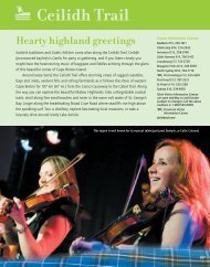
just a short stroll from each other on Charlotte Street. Cossit House, built in 1787, is the ol<strong>de</strong>st house in Sydney. Originally the home of Sydney’s first Anglican minister, today the house is furnished circa 1818, and visitors may tour the house gui<strong>de</strong>d by staff in period costume. Nearby, Jost House was started <strong>about</strong> the same time as Cossit House, but clearly displays several different architectural styles in additions ma<strong>de</strong> over its 200-year history; each part of the house has been furnished as in the era that it was built (see p. 357). Nearby, on the Esplana<strong>de</strong>, the tiny stone St. Patrick’s Church is the ol<strong>de</strong>st Catholic church on Cape Breton Island. Built in 1828, it now serves as a museum featuring displays and artifacts that <strong>de</strong>pict local history. On George Street, visitors can tour the Cape Breton Centre for Heritage and Science (see p. 357), which highlights the social and natural history of Cape Breton County. A focal point of the city is an extensive boardwalk with colonial lighting which winds along 3 km (2 mi.) of harbourfront, past a yacht club, marinas and hotels. In the summer months this is a popular centre of activities and entertainment. Near the city centre, Wentworth Park is an attractive green space with duck ponds, walking paths and picnic areas. Johns on Road 125 To North Sydney To North Sydney Route 4 west leads from 4 Sydney to Sydney River, a major shopping district, at the junction with Routes 305 and 125, and continues along the Bras d’Or shore to St. Peter’s. 239 Route 239, Westmount Road, along the scenic north si<strong>de</strong> of the harbour, leads to panoramic views of the inner harbour at Petersfield Provincial Park. 305 An historic seaport foun<strong>de</strong>d on Sydney Harbour in 1785, ¥North Sydney is a full-service community. The North Sydney waterfront is the site of the Marine Atlantic terminals, which offer ferry service to Newfoundland (check at the information centre for the schedule). Docksi<strong>de</strong> ceilidhs take place here throughout the summer months. Just south of the ferry terminals Archibald’s Wharf offers shops, a bandshell, a playground, and a boardwalk, with views of Sydney Harbour. 305 Peppett Street North Sydney Commercial Street 105 To Blacketts Lake Shore Rd 239 Rud<strong>de</strong>rham Road Coxheath Ferry Ferry to Edwardsville Highway Edwardsville 305 To Sydney Mines to Argentia Nfld. Port Aux Basques Nfld. Westmount Keltic Drive Petersfield Provincial Park Murphy Road Sunri s e Dr. Sydney Harbour Westmount Road Exit 6 Sydney River To St. Peter’s Adjacent to the wharf, the North Sydney Historical Society features collections and displays that highlight the history of the area and the coal mining operations that took place here (see p. 357). The Purves Street Lookoff is an excellent vantage point from which to watch the comings and goings of harbour traffic. There is a park here, with a playground and supervised sand beach. Sydney Mines is a full-service community that grew up around the great coal fields of Sydney Harbour, where coal mining began as early as 1766. In the centre of the business district, a beautifully restored gothic post office, originally built in 1904, is currently used as the Town Hall, and the train station, built in 1905, now houses the Sydney Mines Heritage Museum and the new fossil interpretive centre (see p. 358). An outdoor recre- 4 239 Jost House St. Patrick’s Church Museum Sydney River Exit 7 To Victoria Mines and New Waterford Kings Road Muggah Creek Cossit House Museum Centre for Heritage and Science Esplana<strong>de</strong> Alexandra Street Argyle St. 28 To Dominion 4 To Sydney To Reserve Mines Victoria Road 327 To Gabarus Tar Ponds Interpretive Centre Prince Street Townsend George 125 Connaught Ave Wallaces Road Reserve St Highland St Mechanic St Street Street Dom Lingan Road Whitney Pier Fisher St 28 Disco St West Ave Glace Bay inion St 255 Main St King Edward St Savoy Theatre School St To Louisbourg To New Waterford To New Waterford Welton Street Centre Ave Grand Lake Road Sydney Hardwood Hill <strong>Marconi</strong> National Historic Site Tartan Downs Exit 8 Mira Road To Louisbourg To Glace Bay ation complex on Pitt Street inclu<strong>de</strong>s a walking track, ball field and tennis courts. On the grounds is a monument <strong>de</strong>dicated to all those who have lost their lives in the coal mining industry, and a second monument honours the 20 men who died in the Princess Mine disaster in 1938. Princess Mine was located on nearby Cranberry Head, which overlooks Lockman’s Beach. Today this area has easy walking trails that trace the shore of a small pond, offering excellent views of the coastline and nearby ruins of a World War II military installation. Route 305 ends at Little Bras d’Or at Exit 18. Highway 105 to the left leads back to North Sydney and Sydney, and to the right leads to Bad<strong>de</strong>ck and the Cabot Trail. Union St Brooksi<strong>de</strong> St Sterling Rd Commercial Quarry Rd Glace Bay South St 4 22 Miners Museum <strong>Fleur</strong>-<strong>de</strong>-<strong>lis</strong>/<strong>Marconi</strong>/<strong>Metro</strong> <strong>CB</strong> Scenic Travelway 345
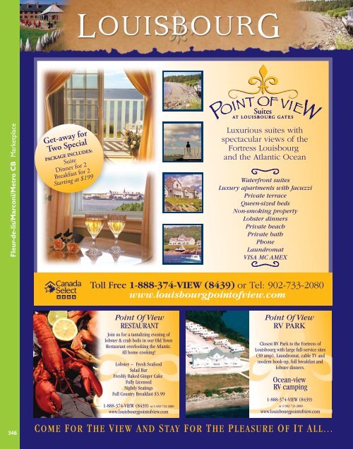
<strong>Fleur</strong>-<strong>de</strong>-<strong>lis</strong>/<strong>Marconi</strong>/<strong>Metro</strong> <strong>CB</strong> Marketplace 346