Boyce Mayview Park Master Plan Presentation - Township of Upper ...
Boyce Mayview Park Master Plan Presentation - Township of Upper ...
Boyce Mayview Park Master Plan Presentation - Township of Upper ...

You also want an ePaper? Increase the reach of your titles
YUMPU automatically turns print PDFs into web optimized ePapers that Google loves.
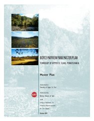
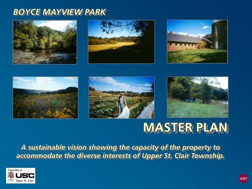
BOYCE MAYVIEW PARK<br />
MASTER PLAN<br />
A sustainable vision showing the capacity <strong>of</strong> the property to<br />
accommodate the diverse interests <strong>of</strong> <strong>Upper</strong> St. Clair <strong>Township</strong>.<br />
WRT
Inventory<br />
PROCESS<br />
PHASE PUBLIC INVOLVEMENT<br />
User Survey<br />
Site Reconnaissance Visits<br />
Key Interviews<br />
Analysis<br />
Opportunities and Constraints<br />
Alternatives<br />
Draft <strong>Master</strong> <strong>Plan</strong><br />
Public Meeting #1<br />
Public Meeting #2<br />
Public Meeting #3,<br />
High School <strong>Presentation</strong> / Community Days<br />
Public Meeting #4<br />
Final <strong>Master</strong> <strong>Plan</strong><br />
Public Meeting #5<br />
Implementation<br />
WRT
TOWNSHIP CONTEXT<br />
<strong>Park</strong> Properties <strong>of</strong> <strong>Upper</strong><br />
St. Clair <strong>Township</strong><br />
<strong>Upper</strong> St. Clair <strong>Township</strong><br />
Sidewalk and Bikeways <strong>Plan</strong><br />
WRT
SITE CONTEXT<br />
• Connections to adjacent<br />
facilities and other<br />
<strong>Township</strong><br />
neighborhoods<br />
• Connections to<br />
adjacent schools, parks,<br />
senior community, and<br />
proposed spur to<br />
Montour Trail<br />
WRT
INVENTORY<br />
• Hydrology/Floodplain,<br />
Wetlands, Slopes, Habitat<br />
Units, Habitat Unit<br />
Sensitivity<br />
• Composite Sensitivity Map<br />
summarizes inventory maps,<br />
showing areas <strong>of</strong> the site<br />
that would be most and<br />
least sensitive to<br />
development.<br />
WRT
GEOLOGY<br />
A<br />
<strong>Park</strong> Site<br />
A<br />
Regional Geologic Context<br />
<strong>Mayview</strong> Mine <strong>Plan</strong><br />
Chartiers Creek<br />
A<br />
Site Cross-Section<br />
Mayvi ew B arn C omplex<br />
Pittsburgh Coal Seam<br />
Meadow<br />
Mayvi ew R oad<br />
Coal Seam<br />
A<br />
WRT
HYDROLOGY<br />
• Protect sensitive resources<br />
• Enhance degraded resources<br />
WRT
WETLANDS<br />
• Protect sensitive areas<br />
• Provide<br />
interpretive/educational<br />
opportunities<br />
WRT
SLOPES<br />
• Protect steep slopes<br />
• Use flat areas for recreation<br />
facilities<br />
WRT
HABITAT UNIT SENSITIVITY<br />
• Preserve diversity <strong>of</strong><br />
habitats on site<br />
• Preserve “most sensitive” habitat<br />
units and enhance lower quality<br />
habitat areas to promote diversity<br />
WRT
COMPOSITE SENSITIVITY<br />
• Preserve “most sensitive” areas<br />
and enhance “less sensitive” areas<br />
to promote diversity<br />
WRT
HABITAT OPPORTUNITIES/CONSTRAINTS<br />
• Preserve and enhance<br />
habitat units to meet<br />
conservation goals<br />
WRT
RECREATION OPPORTUNITIES/CONSTRAINTS<br />
• Balance active and passive<br />
recreation uses on site<br />
WRT
MASTER<br />
PLAN<br />
CONCEPT<br />
Conservation/passive<br />
= 86% <strong>of</strong> site<br />
Active use areas<br />
= 14% <strong>of</strong> site<br />
Impervious surface<br />
= < 3% <strong>of</strong> site<br />
WRT
SUSTAINABILITY PRINCIPLES<br />
• Use park as a demonstration for the<br />
ecological and educational merits <strong>of</strong><br />
a fully integrated sustainable<br />
design program<br />
• Restore Landscape, Reuse Buildings,<br />
Recycle Materials<br />
• Protect and improve water quality<br />
• Provide energy efficient, earth<br />
sheltered “green” structures<br />
• L.E.E.D.S. (Green Building Council)<br />
WRT
MASTER PLAN PRINCIPLE #1<br />
Preserve sensitive<br />
habitats.<br />
WRT
MASTER PLAN PRINCIPLE #2<br />
Detention Basin<br />
Ravine<br />
Cleanup<br />
Restore understory<br />
and groundcover<br />
to limit erosion.<br />
-Drainage Restoration<br />
-Road Removal<br />
-Ravine Cleanup<br />
Improve water quality.<br />
Swale Restoration<br />
WRT
MASTER PLAN PRINCIPLE #3<br />
Limit vehicular access to<br />
the perimeter <strong>of</strong> the site<br />
to preserve the interior.<br />
WRT
MASTER PLAN PRINCIPLE #4<br />
<strong>Mayview</strong><br />
The Hinge<br />
Link <strong>Boyce</strong> and<br />
<strong>Mayview</strong> properties.<br />
<strong>Boyce</strong><br />
WRT
MASTER PLAN PRINCIPLE #5<br />
<strong>Mayview</strong> Glades<br />
Baker <strong>Park</strong><br />
Baker School<br />
<strong>Mayview</strong> Meadow<br />
Wetlands<br />
Chartiers Bowl<br />
Morton<br />
Wooded<br />
Slope<br />
Morton Terraces<br />
Central Ravine<br />
Define and enhance<br />
spatial areas.<br />
North Hill<br />
<strong>Boyce</strong> Ravine<br />
<strong>Boyce</strong> Meadow<br />
Ravine<br />
South Hill<br />
Woodland<br />
WRT
MASTER PLAN PRINCIPLE #6<br />
• Limit active recreation to<br />
the north area <strong>of</strong> the site.<br />
• Create “<strong>Mayview</strong><br />
Commons” at site <strong>of</strong><br />
<strong>Mayview</strong> Farm complex.<br />
WRT
MASTER PLAN PRINCIPLE #7<br />
Connect major habitats,<br />
program features and key<br />
adjacent uses.<br />
WRT
Multi-Use Bicycle Trail<br />
MASTER PLAN PRINCIPLE #8<br />
Arc Walk<br />
Primary<br />
Walking Trail<br />
Secondary<br />
Walking Trail<br />
Improve pedestrian access<br />
by developing trail links<br />
from the community to<br />
key areas within the <strong>Park</strong>.<br />
Montour<br />
Rail-to-Trail<br />
System<br />
WRT
BUILDING “COMMUNITY”<br />
Balance natural and cultural<br />
values.<br />
Represent diverse<br />
interests in <strong>Upper</strong> St. Clair<br />
<strong>Township</strong>.<br />
WRT
BUILDING “COMMUNITY”<br />
Preserve and enhance plant<br />
and animal habitats to<br />
ensure a diverse natural<br />
community.<br />
WRT
BUILDING “COMMUNITY”<br />
<strong>Plan</strong> for a broad range <strong>of</strong><br />
recreational uses to<br />
accommodate all users <strong>of</strong><br />
the <strong>Park</strong>.<br />
WRT
BUILDING “COMMUNITY”<br />
Enhance and encourage<br />
opportunities to involve the<br />
educational community.<br />
WRT
BUILDING “COMMUNITY”<br />
Incorporate cultural history<br />
<strong>of</strong> the site to express the<br />
communal memory.<br />
WRT
ILLUSTRATIVE<br />
MASTER<br />
PLAN<br />
WRT
MASTER PLAN<br />
Habitat Recommendations<br />
Habitat Conservation Areas:<br />
• Protect from disturbance and development<br />
• Buffer from active use areas<br />
• Encourage forest regeneration by<br />
controlling deer browse<br />
• Encourage growth <strong>of</strong> native plant materials<br />
and control spread <strong>of</strong> exotic species<br />
Habitat Enhancement Areas:<br />
• Allow natural succession to occur in<br />
several open areas<br />
• Encourage the expansion <strong>of</strong> higher quality<br />
habitats by planting enhancement areas with<br />
representative native vegetation<br />
• Link habitat corridors<br />
• Articulate woodland edge to foster diversity<br />
WRT
SUSTAINABILITY DESIGN<br />
GUIDELINES<br />
Engineering: e.g., Groundwater recharge <strong>of</strong><br />
stormwater run<strong>of</strong>f<br />
Architecture: e.g., Design to minimize energy costs<br />
Landscape: e.g., Use low maintenance,<br />
native, drought tolerant plants<br />
Implementation: e.g., Construction Waste<br />
Management <strong>Plan</strong><br />
Management: e.g., Remove invasive<br />
exotic species<br />
WRT
DESIGN GUIDELINES<br />
Creek Creek + <strong>Park</strong> Origin<br />
WRT
DESIGN GUIDELINES<br />
Defining the Bowl Gradient Threshold<br />
WRT
DESIGN GUIDELINES<br />
<strong>Park</strong> Features Centrifugal Offset Mining Grid<br />
WRT
ILLUSTRATIVE<br />
MASTER<br />
PLAN<br />
WRT
Perspective View<br />
View Location <strong>Plan</strong><br />
Vehicular<br />
Access<br />
<strong>Mayview</strong> Road Gateway<br />
WRT
Perspective View<br />
View Location <strong>Plan</strong><br />
<strong>Mayview</strong><br />
Commons<br />
Entry Courtyard<br />
WRT
Perspective View<br />
View Location <strong>Plan</strong><br />
<strong>Mayview</strong><br />
Commons<br />
Pool and Recreation Center from<br />
Arc Walk at Public Lawn<br />
WRT
Valentine Museum,<br />
Richmond, VA<br />
Commons<br />
Complex<br />
Community Center <strong>Park</strong><br />
St. Matthews, KY<br />
Altoona Railroaders Museum<br />
West Deptford Community Center, NJ<br />
WRT
Perspective View<br />
View Location <strong>Plan</strong><br />
Arc Walk-<br />
Commons<br />
Looking towards Environmental Ed.<br />
Center from Arc Walk / Public Lawn<br />
WRT
Aerial Perspective View<br />
View Location <strong>Plan</strong><br />
Community<br />
Gardens<br />
Gardens as seen from the southwest<br />
WRT
Aerial Perspective View<br />
View Location <strong>Plan</strong><br />
Environmental<br />
Education<br />
Center<br />
South face <strong>of</strong> E.E. Center as seen from the<br />
southwest<br />
WRT
Perspective View<br />
View Location <strong>Plan</strong><br />
Arc Walk-<br />
Woodland/<br />
Meadow<br />
Looking southeast along Arc Walk<br />
WRT
Aerial Perspective<br />
View Location <strong>Plan</strong><br />
Arc Walk-<br />
Bridge<br />
Ravine Bridge seen from the southwest<br />
WRT
Comparable Images<br />
View Location <strong>Plan</strong><br />
Arc Walk-<br />
Bridge<br />
WRT
Perspective View<br />
View Location <strong>Plan</strong><br />
Arc Walk-<br />
Chartiers Bowl<br />
Looking southwest along Chartiers<br />
Creek slope<br />
WRT
Perspective View<br />
View Location <strong>Plan</strong><br />
Utility Corridor/<br />
Overlook<br />
Looking uphill to Overlook<br />
WRT
COST ESTIMATE<br />
It em Low Ran ge ($X,000) High Ran ge ($X,000)<br />
Sit e Cl ean-up 100 200<br />
Hazar do us Wast e Remo val 150 300<br />
Habit at Enhancement 500 1000<br />
Ro ads, Par king, Br idges, and Cul ver t s 500 1000<br />
Sanit ar y Sewer , St o r mwat er Management , Ut il it ies 1000 1000<br />
Co mmunit y Cent er (in r eno vat ed <strong>Mayview</strong> Dair y Bar n) 3200 10000<br />
Recr eat io n Cent er (new co nst r uct io n) 2000 4000<br />
Nat ur e Cent er (new co nst r uct io n) 2500 2500<br />
Swimming Po o l 1000 2000<br />
Maint enance Buil ding 50 100<br />
Miscel l aneo us Sit e Amenit ies 2500 4900<br />
Ar chit ect ur e/ Landscape Ar chit ect ur e/ Engineer ing<br />
Fees, Per mit f ees, Ar chaeo l o gy @ 10 % 1500 3000<br />
15000 30000<br />
Tot al $ 15,000,000 $ 30,000,000<br />
Maint enance and Oper at ing Co st s (per year ) $ 300 $<br />
400<br />
WRT
IMPLEMENTATION<br />
• Community acceptance <strong>of</strong> master plan as a<br />
long term vision <strong>of</strong> the site’s ultimate<br />
capacity<br />
• Determine specific projects and<br />
partnership opportunities within<br />
the plan<br />
• Prioritize projects based on<br />
need and available funding<br />
• Construct projects<br />
WRT
PHASING: Early Actions<br />
• Clean Up: remove trash and<br />
hazardous waste, stabilize/protect<br />
structures<br />
• Provide Access: driveways, parking,<br />
and trails<br />
• Develop low cost improvements:<br />
public lawn and multipurpose field<br />
• Enhance Habitat: tree planting,<br />
riparian corridor improvements<br />
WRT
PHASING: Later Major<br />
Actions<br />
• Further Habitat Enhancements<br />
• Community Gardens<br />
• Environmental Education Center<br />
• Community Center<br />
• Recreation Center<br />
• Pool<br />
WRT
FUNDING SOURCES<br />
• General Obligation Bond<br />
• Revenue Bond<br />
• Special Tax Revenue<br />
• Commercial concession, lease,<br />
user fee revenues<br />
• Public/Private Partnerships<br />
• Grant program funding and donations<br />
WRT
PARTNERSHIPS<br />
• Local: School District(s), YMCA, local<br />
corporate sponsors<br />
• State: DCNR, TEA-21, Grant Programs<br />
• Friends <strong>of</strong> <strong>Boyce</strong> <strong>Mayview</strong> <strong>Park</strong><br />
Volunteer Programs:<br />
• Adopt-a-<strong>Park</strong><br />
• Deputy <strong>Park</strong> Rangers, Living History,<br />
Roving Docents<br />
WRT
NEED FOR ACTION<br />
• <strong>Mayview</strong> Barn is an unprotected fire<br />
hazard<br />
• The barn structures are rapidly<br />
deteriorating<br />
• Public access to the site is limited /<br />
discouraged<br />
• Trash and debris are unsightly / hazardous<br />
• Implementation is a time-consuming<br />
process<br />
• Erosion continues unchecked<br />
• Recreational potential is unfulfilled<br />
WRT
NEXT ACTIONS<br />
• Adopt <strong>Master</strong> <strong>Plan</strong><br />
• Form Implementation Committee<br />
• Initiate Partnerships<br />
• Obtain Funding<br />
• Begin Early Action Projects<br />
• Begin Design Process for First Phase<br />
WRT
SUMMARY OF GOALS<br />
1: To preserve and enhance the existing natural/scenic<br />
attributes <strong>of</strong> the site and provide for passive types<br />
<strong>of</strong> recreation.<br />
2: To use the property for historic, conservation, or<br />
recreational purposes.<br />
3: To provide family-friendly opportunities and facilities<br />
for the use and enjoyment <strong>of</strong> all.<br />
4: To provide environmental and historical educational<br />
opportunities.<br />
5: To involve citizens, agencies, and the <strong>Township</strong> in a<br />
single vision for the <strong>Park</strong>.<br />
6: To explore funding alternatives for developing and<br />
maintaining the <strong>Park</strong>.<br />
7: To develop long-range guidelines for preservation,<br />
recreation, planning and development.<br />
8: To relate/link the park land to its surrounding areas<br />
where possible.<br />
WRT
BOYCE MAYVIEW PARK<br />
MASTER PLAN<br />
A sustainable vision showing the capacity <strong>of</strong> the property to<br />
accommodate the diverse interests <strong>of</strong> <strong>Upper</strong> St. Clair <strong>Township</strong>.<br />
WRT