Observed Seismicity - University of Kentucky
Observed Seismicity - University of Kentucky
Observed Seismicity - University of Kentucky

Create successful ePaper yourself
Turn your PDF publications into a flip-book with our unique Google optimized e-Paper software.
Appendix A<br />
13<br />
Appendix A: Providing Preliminary Seismic Hazard<br />
Assessment for Paducah Area <strong>of</strong> Western <strong>Kentucky</strong>—<br />
Executive Summary<br />
Zhenming Wang<br />
<strong>Kentucky</strong> Geological Survey<br />
<strong>University</strong> <strong>of</strong> <strong>Kentucky</strong><br />
Lexington, KY 40506<br />
zwang@kgs.mm.uky.edu<br />
Phone: 859-257-5500<br />
Edward W. Woolery<br />
Department <strong>of</strong> Geological Sciences/<strong>Kentucky</strong> Geological Survey<br />
<strong>University</strong> <strong>of</strong> <strong>Kentucky</strong><br />
Lexington, KY 40506<br />
woolery@uky.edu<br />
Phone: 859-257-3016<br />
January 10, 2003<br />
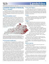
Federal government agencies, including<br />
the U.S. Nuclear Regulatory Commission,<br />
use the seismic hazard maps developed by<br />
the U.S. Geological Survey for seismic safety<br />
regulations. These maps are based on a 2<br />
percent probability that a ground motion<br />
will be exceeded in 50 years (2,500-year<br />
return period). The maps predict very high<br />
ground motion for western <strong>Kentucky</strong>, the<br />
Jackson Purchase Region in particular. These<br />
high seismic hazard estimates for western<br />
<strong>Kentucky</strong> will have a significant impact on<br />
economic development in the region.<br />
The type <strong>of</strong> analysis used by the U.S.<br />
Geological Survey to estimate the groundmotion<br />
hazard is called probabilistic seismic<br />
hazard analysis. Three data sets are needed<br />
for probabilistic seismic hazard analysis:<br />
earthquake sources (where and how big),<br />
earthquake occurrence frequencies (how<br />
<strong>of</strong>ten), and ground-motion attenuation<br />
relationship (how strong). All data sets<br />
contain a large amount <strong>of</strong> uncertainty because<br />
<strong>of</strong> a lack <strong>of</strong> understanding about the<br />
seismic setting in the central United States,<br />
and a lack <strong>of</strong> real data. The exact boundary<br />
<strong>of</strong> the New Madrid Seismic Zone is still<br />
difficult to define, even though it is the most<br />
active and well studied east <strong>of</strong> the Rocky<br />
Mountains. Although the U.S. Geological<br />
Survey has tried its very best to use the latest<br />
scientific information to estimate groundmotion<br />
hazards for the central United States,<br />
large uncertainties were inherent in the<br />
hazard maps.<br />
One <strong>of</strong> the uncertainties that has a<br />
significant impact on the probabilistic seismic<br />
hazard analysis for western <strong>Kentucky</strong> is<br />
the northern boundary <strong>of</strong> the New Madrid<br />
Seismic Zone. The best way to define the<br />
boundary is by monitoring earthquake<br />
activity in the area. To this end, seven new<br />
seismic stations have been installed in the<br />
Jackson Purchase Region. Three previously