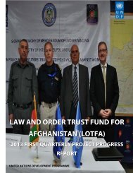
Progress Report Quarter 3 2012
Progress Report Quarter 3 2012
Progress Report Quarter 3 2012
Create successful ePaper yourself
Turn your PDF publications into a flip-book with our unique Google optimized e-Paper software.
Project ID: 00063078<br />
Duration: Phase II (January <strong>2012</strong> – December 2013)<br />
Strategic Plan Component: National Governance<br />
CPAP Component:<br />
Outcome 4: The state and non-state institutions are better able to promote<br />
democratic participation and be accountable to the public<br />
ANDS Component:<br />
Governance, Rule of Law, and Human Rights<br />
Total Budget: USD $89,784,946<br />
Responsible Agency:<br />
United Nations Development Programme
o<br />
o
o<br />
o<br />
o<br />
o<br />
o<br />
o<br />
o<br />
o<br />
o
o<br />
o<br />
o<br />
o<br />
o<br />
o<br />
o<br />
o<br />
o<br />
o<br />
o
o<br />
o<br />
o<br />
o<br />
o<br />
o
o<br />
o<br />
o<br />
o<br />
o<br />
o
–<br />
’
•<br />
•
•<br />
•
•<br />
•
’
•<br />
•<br />
•<br />
•
•<br />
•<br />
•
•<br />
•<br />
•
•
”
Standard Cleaning Practices<br />
IEC Logistic<br />
Department<br />
20 7 27<br />
POO Civic Education ( BRIDGE )<br />
IEC Training &<br />
Capacity Building<br />
department<br />
24 3 27<br />
Action Planning and M&E Workshop<br />
IEC Training &<br />
Capacity Building<br />
– ELECT II advisors<br />
16 2 18
Facility Management Training<br />
IEC Logistics<br />
department and<br />
Elect II Logistics<br />
advisor<br />
2 0 2<br />
Voter Registration (BRIDGE)<br />
IEC Training &<br />
Capacity Building<br />
25 6 31<br />
Introduction to Geographic Information<br />
Systems (GIS) and Procedures for Checking<br />
Polling Centre Coordinates<br />
Finance training<br />
Introduction to GIS. Introduction to<br />
Coordinate Systems. GIS Practical<br />
Exercise, ArcGIS software, adding,<br />
customizing and organize the data layers,<br />
selectively display different groups of<br />
data, map display units, pan and zoom,<br />
view attribute tables. Polling Centre<br />
Coordinate Checking Practical Exercise,<br />
display the required data sets in ArcGIS,<br />
steps to follow in checking each polling<br />
centre set of coordinates, deciding<br />
between different sets of coordinates.<br />
IEC IT department<br />
and ELECT II GIS<br />
Advisor<br />
IEC admin & and<br />
logistic<br />
departments<br />
10 10<br />
22 3 25
IT Service Management<br />
23-29 September<br />
IEC IT department<br />
and ELECT II IT<br />
advisors<br />
13 -<br />
132 21 140


